Report of the 43rd Meeting - Coordination Group for ...
247
of the Coordination Group for Meteorological Satellites Report of the 43 rd Meeting 18-22 May 2015, Boulder, Colorado, USA
-
Upload
khangminh22 -
Category
Documents
-
view
4 -
download
0
Transcript of Report of the 43rd Meeting - Coordination Group for ...

of the Coordination Group for Meteorological Satellites
Report of the 43rd Meeting
18-22 May 2015, Boulder, Colorado, USA

1
REPORT OF THE 43rd MEETING OF THE COORDINATION GROUP FOR METEOROLOGICAL SATELLITES
CGMS‐43 Boulder, Colorado, USA 18‐22 May 2015 17 July 2015

2
Report edited on behalf of CGMS by:
CGMS Secretariat
EUMETSAT
Eumetsat‐Allee‐1
64295 Darmstadt
Germany
www.cgms‐info.org
CGMS MR 43
© EUMETSAT, 17 July 2015

CGMS‐43 | Boulder, USA | 18‐22 May 2015
3
TABLE OF CONTENTS
PLENARY SESSION ................................................................................................................................... 1
A Opening session ............................................................................................................................ 1
B Approval of agenda, action review ............................................................................................... 1
C CGMS membership ....................................................................................................................... 4
D User Requirements ....................................................................................................................... 5
E Reports from the space agencies ............................................................................................... 14
F Working Groups reports ............................................................................................................. 21
G Climate ........................................................................................................................................ 33
H GEO ............................................................................................................................................. 37
I Education and training ................................................................................................................ 39
J outreach activities ...................................................................................................................... 44
K HLPP ............................................................................................................................................ 44
L Review of cgms‐43 actions and recommendations .................................................................... 45
M Closing Session ............................................................................................................................ 52
PARALLEL WORKING GROUP SESSIONS ................................................................................................ 56
WG I Report ......................................................................................................................................... 56
WG II Report ....................................................................................................................................... 128
WG III Report ....................................................................................................................................... 177
WG IV Report ....................................................................................................................................... 199
Ad‐hoc meeting on space weather report .......................................................................................... 222
ANNEXES ............................................................................................................................................. 227
Statements in opening ceremony ....................................................................................................... 228
List of Plenary participants .................................................................................................................. 230
List of Working Group Participants ..................................................................................................... 232

CGMS‐43 | Boulder, USA | 18‐22 May 2015
‐ 1 ‐
PLENARY SESSION
A OPENING SESSION
Dr. Stephen Volz, NOAA Assistant Administrator for Satellite and Information Services, welcomed the
participants of the 43rd meeting of CGMS to Boulder, Colorado and thanked the CGMS Secretariat
staff at EUMETSAT and the NOAA staff for the excellent arrangements for this year’s meeting.
The full statement of Dr. Volz is provided in ANNEX I.
B APPROVAL OF AGENDA, ACTION REVIEW
B.1 Approval of the Agenda
The CGMS Secretariat presented the objectives of the meeting and the agenda was approved by all
participants.
B.2 Review of actions from CGMS‐42
CGMS Secretariat provided an overview of the status of the list of actions and recommendations
resulting from CGMS‐42:
CGMS‐42 Status Open
WG I All actions closed None
WG II All actions but 3 closed 3 actions open with revised deadlines
WG III All actions but 2 closed 2 actions open with revised deadlines
WG IV All actions but 8 closed 8 actions open with revised deadlines
Space weather (from WGIII) 2 actions open with revised deadlines
Plenary Several actions closed 1 action open with deadline of CGMS‐44 (CEOS‐CGMS Joint Working Group Climate) 1 action open with revised deadline 2 actions expected to be closed following CGMS‐43 plenary discussions
WGI

CGMS‐43 | Boulder, USA | 18‐22 May 2015
‐ 1 ‐
One CGMS‐42 plenary actions was given a new deadline following WGIII discussions:
CGMS‐42 PLENARY actions with revised deadlines:
Actionee Action # Description Action feedback/closing document Deadline Status HLPP ref
WMO Plen IV.4
40.06 WMO to coordinate impact studies, through the CBS, in order to update and refine its requirements for GNSS radio‐occultation (e.g. number of occultations/day, distribution in space)
EUM plans to launch a study in 2014 with results available for the IROWG meeting in Apr 2015 to which CEOS agencies will be invited. Action deferred to CGMS‐43. It also contributes to Action 40.23 "CGMS to convene through the IROWG an ad‐hoc meeting on the global GNSS‐RO constellation, inviting all interested CEOS agencies". (see also actions WGII 40.23, WGIII 41.35 and WGIII 41.37) EUM will present at Working Paper on the outcome of its study CGMS‐43 EUM‐WP‐12 Matter discussed at the IPET‐OSDE‐1, April 2014, and CBS‐Ext(2014). CBS recommended conducting Observing System Simulation Experiments (OSSEs) in support of satellite system design criteria such as orbit optimization for GPS‐RO satellites, or configurations for hypersperspectral IR sounders on geostationary orbit. Following WGIII discussions, the action will be kept open until CGMS‐44. WMO and NOAA to report on their activities at CGMS‐44.
(CGMS‐41, ‐42, ‐43) New deadline CGMS‐44
OPEN HLPP #1.1.4

CGMS‐43 | Boulder, USA | 18‐22 May 2015
‐ 2 ‐
One CGMS‐42 plenary action is maintained (the initial deadlines were for both CGMS‐43 and CGMS‐44):
CGMS‐42 PLENARY actions still open
Actionee Action # Description Action feedback/closing document
Deadline Status HLPP ref
CEOS/CGMS joint climate WG
Plen H.3.2
A42.11 Regarding the Pilot FCDR Inventory: • Conduct an initial analysis of available FCDRs past and current available for or planned for use in the current set of SCOPE‐CM projects using CEOS, CGMS, and WMO satellite data bases; • Identify SCOPE‐CM ECV projects that are or may be able to use the above FCDRs; • Assess availability of the above FCDRs for the future; • Following the first ECV gap analysis, consider FCDRs that may be useful in assessing ECV opportunities in the future ECV gap analysis.
Nov '14: ONGOING. Discussions were held at the Climate Symposium regarding the Pilot FCDR inventory and work has begun on the specific identification of SCOPE‐CM ECV projects and use of higher temporal and spatial resolution data from the next generation of geostationary satellites.The project will leverage the ECV assessment reference process being developed by WGClimate. CMA and KMA have been invited to participate in these efforts. Status reports were provided tor WGII and plenary at CGMS‐43. The next reports will be provided at CGMS‐44.
CGMS‐43,CGMS‐44
OPEN HLPP # 5

CGMS‐43 | Boulder, USA | 18‐22 May 2015
‐ 3 ‐
The following two CGMS‐42 plenary actions were left open pending CGMS‐43 plenary discussions:
PLENARY actions open at the start of CGMS‐43 pending closure
Actionee Action # Description Action feedback/closing document
Deadline Status HLPP ref
WMO Plen C.3
A42.02
WMO to establish a dialogue among CGMS satellite operators and the WMO Disaster Risk Reduction (DRR) programme to identify regional pilot actions for enhancing the use of satellites in support of DRR.
Dialogue initiated, will be reported at CGMS‐43.under plenary item D. WMO to host a workshop in autumn 2015 to which space agencies will be invited Closed following CGMS‐43 plenary actions with a new action raised (CGMS‐43 A43.01)
CGMS‐43
OPEN HLPP # 2.4
WGI and WGIV
Plen E.1.3 (for WGI and WGIV)
A42.07
Following the revised scope of WGI and WGIV, the WGs to update the "Terms of Reference" of both WGs for endorsement by CGMS
This will be concluded by WGI and WGIV and be presented to CGMS‐43 plenary for endorsement. (CGMS‐43 EUM‐WP‐02). NOAA will provide feedback in CGMS‐43 WGI and WGIV ToRs agreed by WGI and WGIV at CGMS‐43. Closure expected following plenary endorsement agenda items F.1.2 and F.3.1
CGMS‐43
OPEN ‐

CGMS‐43 | Boulder, USA | 18‐22 May 2015
‐ 4 ‐
The final status of CGMS‐42 plenary actions and recommendations resulting from CGMS‐43
discussions is available here.
The status of CGMS‐43 plenary actions and recommendations are provided in section L of the report.
The CGMS‐43 actions will be maintained on the CGMS website under MEETINGS and CGMS‐43.
C CGMS MEMBERSHIP
C.1 ISRO CGMS Membership
ISRO is eligible for CGMS membership since its satellite systems have shown the potential to
contribute to WMO and supported programmes, fulfilling the Charter of the CGMS. More
specifically, the application is based on ISRO’s existing and planned contributions in a number of
areas relevant to the objectives of CGMS:
Indian Meteorological Satellite Missions
International Collaboration/Joint Missions
Satellite Data Archival and Dissemination
Support to Operational Agencies
CALVAL, GSICS, CEOS
Disaster Management Support
Training/Capacity building
Instrument Development and Support
Climate Research
Some expected benefits to ISRO from the membership are:
Participation in the global meteorologist’s platform as an official member for preparation of
global observation strategy
Provide information on the Indian missions to the global community starting from the
conception stage itself
Planning of ISRO’s satellite missions to complement and supplement the global data
requirements
Use of the CGMS platform for developing collaborative missions with other space‐faring
agencies
Working out joint calibration strategies
The Director‐General of EUMETSAT was very pleased that ISRO has requested to be a member of
CGMS. NOAA supported and agreed on the contribution of ISRO to CGMS activities. WMO also
expressed support for ISRO joining CGMS.

CGMS‐43 | Boulder, USA | 18‐22 May 2015
‐ 5 ‐
C.2 CGMS Charter amendment
Working Paper CGMS‐43‐CGMS‐WP‐21, proposed on behalf of the CGMS Secretariat, the required
amendments to the CGMS Charter to enable ISRO to become a CGMS member. The document was
circulated among the CMGS Members for consideration one month prior to the 43rd plenary session
of CGMS, in accordance with the relevant provision of the CGMS Charter.
CGMS members were invited to consider the proposed amendments of the Charter as proposed in
CGMS‐43 EUM‐WP‐21.
The CGMS plenary expressed its strong support for ISRO's membership and looked forward with
anticipation to the future contributions of ISRO to the CGMS activities. The plenary agreed on the
revised charter and welcomed ISRO as a CGMS member by consensus and with acclamation.
D USER REQUIREMENTS
D.1 WMO Space Programme role as a bridge between satellite operators and users
CGMS‐43‐WMO‐WP‐01 described the objectives of the WMO Space programme and its
organisational context in WMO.
The 16th WMO Congress in 2011 defined the high‐level goals of the Space programme, which are to:
promote wide availability and utilization of satellite data & products for weather, water,
climate and related applications of WMO Members
provide a framework for dialogue, develop a shared vision, foster interoperability, share best
practices & resources. Through this joint undertaking, satellite operators contribute to the
global picture in a cost‐effective way and best meet their goals to serve users, and users are
assisted to consolidate their requirements, and informed and trained to take advantage of
satellite systems.
The WMO Space programme has four main components:
‐ Develop an integrated observing system
‐ Enhance data & product accessibility, interoperability and quality
‐ Ensure user information and training
‐ Coordinate space weather operations.
‐ The progress of the Programme relies on partnerships with space agencies, including
CGMS and CEOS, with International science groups, and with other relevant
international bodies.
At CGMS‐43 a large number of discussions triggered through WMO working papers contribute
significantly towards the objectives of the Space Programme:
Observing systems
‐ WP‐02: Vision of WIGOS/Space in 2040
‐ WP‐04: Satellite data user needs in the Indian Ocean region

CGMS‐43 | Boulder, USA | 18‐22 May 2015
‐ 6 ‐
‐ WP‐05: Observation requirements of the GAW
‐ WP‐06: GSICS in the architecture for climate monitoring
‐ WP‐07: GCOS
‐ WP‐14: Gap Analysis
‐ WP‐16: GSICS Report
‐ WP‐17: OSCAR/Space new functionality
Access to data and products
‐ WP‐08: Draft WMO Resolution on Exchange of Data & Products
‐ WP‐09: Satellite Data Dissemination Strategy
‐ WP‐13: Direct Broadcast Network (DBNet)
‐ WP‐15: Operational data requirements from RA III/RA IV
User Information and training
‐ WP‐03: User preparation (SATURN)
‐ WP‐12: VLab
Cross‐cutting Areas:
‐ WP‐10:Socioeconomic benefits;
‐ WP‐11:Space weather
EUMETSAT thanked WMO for the presentation and the reminder as to how WMO activities fits
within CGMS activities.
NOAA also thanked WMO for the global framework that it offers for addressing meteorological
matters.
It was noted that the WMO strategic priority of Disaster Risk Reduction was not addressed explicitly
at CGMS‐43, and the following action was agreed in this regard.
CGMS‐43 actions – PLENARY
Actionee AGN item
# Description Deadline Status HLPP ref
WMO D.1 A43.01 WMO to report at CGMS‐44 on engagement with satellite agencies via the planned "Joint RA‐II/V Workshop on WIGOS for Disaster Risk Reduction" to be held in Indonesia in October 2015.
CGMS‐44 OPEN HLPP # 2.4
The CGMS‐42 action A42.02 was closed as a consequence.

CGMS‐43 | Boulder, USA | 18‐22 May 2015
‐ 7 ‐
D.2 Development of a vision for the WIGOS Space based component in 2040
The WMO Space Programme – through the Commission for Basic Systems (CBS) Expert Team on
Satellite Systems (ET‐SAT) ‐ has initiated the development of a “Vision for the Space Based
Component of WIGOS in 2040” in response to the request from CBS in September 2014. In CGMS‐
43‐WMO‐WP‐02 WMO reported on the development.
The development of a Vision is approached from three different angles:
First of all, the new vision should aim to respond to the anticipated societal needs of 2040, in
the context of WIGOS and of the Global Framework for Climate Services (GFCS). A starting
point is to address the unfulfilled requirements expressed in the Statements of Guidance of
WMO application areas in the Rolling Review of Requirements. Looking ahead, the vision
should consider the increasing maturity of some space applications and the emerging
requirements of new application areas which are not fully addressed by current plans.
The vision should consider the opportunities opened or anticipated from advances in
satellite and instrument technology, including the lessons learnt from demonstration
missions that, by 2040, will be mature for transition from R&D or a demonstration stage, to
an operational stage (e.g. GPM, Doppler lidar), and possible new concepts. Rapid progress in
technological capabilities will allow improved performances in terms of spectral and
temporal resolution, which also has a bearing on the amount of data to be exchanged.
Finally, attention should be paid to emerging changes in the provider community considering
the increased number of space‐faring nations, the range of possible approaches between
large and very small satellite programmes, and the balance to be found between an
increasing capability of the private sector to contribute to the system and the specific
responsibilities of governmental entities.
Opportunities and risks should be carefully analysed considering the possible technological
evolution, as well as the key strategies for optimal integration of space‐based and surface‐based
observation capabilities.
A WIGOS Space 2040 Workshop is planned on 18‐20 November in Geneva to support the dialogue
between space agencies and major user communities. WMO stressed the importance of the
participation of space agencies in the workshop.
The new draft vision will be presented to CBS in 2016.
IOC noted that support to seasonal prediction is a particular priority area and was pleased to see
importance of ocean observations in the update of WIGOS.
NOAA noted that space agencies have 10‐year or longer development plans and that adaptation is
necessary to ensure that these plans, as far as is possible, fit together with the timeframe of the
WIGOS vision.

CGMS‐43 | Boulder, USA | 18‐22 May 2015
‐ 8 ‐
The following action on CGMS members was agreed:
CGMS‐43 recommendations – PLENARY
Actionee AGN item # Description Deadline Status HLPP ref
CGMS members
D.2 A43.02 CGMS members to consider the preliminary considerations on the Vision of WIGOS space‐based components in 2040 and provide feedback to WMO through their representative in ET‐SAT (or directly to [email protected] if they are not represented in ET‐SAT). Ref. CGMS‐43, WMO‐WP‐02
30 Sept 15
OPEN HLPP # 1.1
D.3 User preparation for new generation satellites including SATURN, Vlab and critical
transition issues
In CGMS‐43‐WP‐03, WMO reported on user preparation for the new generation of satellites.
The online portal SATURN (SATellite User Readiness Navigator) was launched for public access in
June 2014 and now provides up‐to‐date information supporting user readiness activities, primarily
for Himawari‐8 and GOES‐R. Preliminary content is available for MTG, Electro‐L and FY‐4. Continued
support from the task team of CGMS focal points to develop and maintain the SATURN content
remains vital to ensure its currency.
The initial scope of SATURN has been the new generation of GEO satellites, but it is planned in 2015
to extend the scope of the portal to the core meteorological satellites in low‐earth orbit: NPP/JPSS
from NOAA, Metop from EUMETSAT, FY‐3 from CMA and (if feasible) Meteor‐M from Roshydromet.
To support and guide satellite operators and users in their respective preparation activities, a
Reference User Readiness Project has been developed, and is presented in detail. The Project
provides a typical breakdown of user readiness activities and a timeline of deliverables that are
needed from satellite development programmes to support user readiness activities.
In collaboration with the VLab and the COMET/MetEd programme, online training material on aspects
of Himawari‐8 and GOES‐R has been made available through SATURN in English and Spanish (where
available). The VLab strategy 2015‐2019 places high emphasis on building capacity in understanding
and exploiting data from the new generation satellites (see WMO WP‐12 under item I.1).
The WMO Space Programme is continuing to develop SATURN and the Reference User Readiness
Project, supported by experts from the WMO Expert Team IPET‐SUP and by the CGMS focal points.
NOAA noted that the reference satellite system development approach is the result of many years of
experience, and that direct involvement of users in the development process may result in increased
risk.

CGMS‐43 | Boulder, USA | 18‐22 May 2015
‐ 9 ‐
EUMETSAT thanked WMO for the effort to share experience from GOES‐R and Himawari‐8. SATURN
is a valuable tool for EUMETSAT and we will continue to support this activity. At the EUMETSAT
Users Conference in September 2015, there will be a special session on user preparedness, offering
an opportunity to discuss this effort further.
WMO strongly encouraged CGMS members operating new‐generation GEO satellites to continue
and strengthen their support to the SATURN portal.
The following actions were agreed:
CGMS‐43 actions – PLENARY
Actionee AGN item # Description Deadline Status HLPP ref
CGMS members
D.3 A43.03 CGMS members to provide review comments on the Reference User Readiness Project, noting that the Project will be presented to CGMS‐44 for endorsement as CGMS best practice (Ref. CGMS‐43, WMO‐WP‐03)
30 Sept 2015
OPEN HLPP # 5.3
CMA, EUM, NOAA, ROSH
D.3 A43.04 CMA, EUM, NOAA, ROSH to appoint/reconfirm points of contact for including LEO satellites in the SATURN
15 June 2015
OPEN HLPP # 5.3
D.4 Satellite data User needs in the Indian Ocean
To inform the discussion on satellite data coverage services over the Indian Ocean region, WMO
carried out in February/March 2015 a survey among key users of satellite data. CGMS‐43‐WMO‐WP‐
04 presents the preliminary results of this survey. Responses from eleven countries were received,
regarding baseline requirements for satellite data (L1 and L2) needed for routine operations, and
additional requirements in case of an emergency or a severe event.
Key conclusions from the survey are that
requirements are dominated by the need to monitor and forecast tropical cyclones and
monsoon‐related phenomena;
requirements are not limited to the need for observing the Indian Ocean but also address
land applications, such as fire detection;
some redundancy in satellite coverage of the region is needed;
according to the majority of responses, the required baseline repeat cycle for GEO imagery
over the region is 30 minutes;
GEO has higher importance in case of emergencies or severe events due to its higher repeat
cycle; most users require additional GEO imagery in such cases, with the majority requiring
rapid‐scan imagery every 10 minutes or less;
several users expressed a requirement for GEO lightning products (both as a baseline and as
an additional requirement).

CGMS‐43 | Boulder, USA | 18‐22 May 2015
‐ 10 ‐
The requirements identified in the survey have not yet been validated by the broader user
community in the Indian Ocean region, nor matched against existing or planned capabilities. Further
refinement and consolidation of the requirements need to be discussed.
In response to the presentation, IOC reminded the plenary that CGMS‐43 occurs in the 50th
anniversary year of the conclusion of the 1962‐1965 observing phase of the International Indian
Ocean Expedition (IIOE). IIOE was instrumental in generating extensive new knowledge about a
highly under sampled region of the global integrated Earth system, fostered new long‐standing
international partnerships, and supported the development of advanced infrastructure, including
India's establishment of the National Institute of Oceanography in Goa. IOC, in partnership with the
Scientific Committee on Oceanic Research (SCOR), the U.S. National Academy of Sciences, and other
agencies, contributed leadership for the outstanding success of IIOE. IOC is a leading sponsor of the
Second IIOE (IIOE‐2) to be launched at the International Symposium on the Indian Ocean on 30
November – 4 December 2015 in Goa, India. The IOC, in its statement announcing the launch of the
IIOE‐2 initiative, called the ambitious five‐year effort “truly collaborative and socially relevant” and
one that will “provide an exciting platform for knowledge transfer and capacity building,” raising
global awareness about the importance of the Indian Ocean.
In this regard, IOC encouraged CGMS Members to enhance satellite data acquisition capabilities over
the Indian Ocean during the IIOE‐2 Observing Phase from January 2016 to December 2020, make
available satellite measurements in accordance with the Group on Earth Observations (GEO) Data
Sharing Principles, and preserve satellite observations in accordance with GEO Data Management
Principles.
IOC would be pleased to describe the status of IIOE‐2 at CGMS‐44.
CMA noted that the Indian Ocean coverage is very important for China as precipitation and the
monsoons originate from this region. After the launch of FY‐2G, CMA agreed to follow the CGMS
recommendation to relocate FY‐2E to the current position of FY‐2D (86.5°E) providing much better
observations on that part of the IO, in particular providing better calibration and products.
WMO thanked the satellite operators for their support over the Indian Ocean region.
The following actions were agreed:
CGMS‐43 actions ‐ PLENARY
Actionee AGN item # Description Deadline Status HLPP ref
CGMS space agencies
D.4 A43.05 CGMS members to take into account the user requirements identified in the WMO survey when discussing continuous satellite coverage over the Indian Ocean region and report results to CGMS‐44.
CGMS‐44 OPEN HLPP # 1.1.6

CGMS‐43 | Boulder, USA | 18‐22 May 2015
‐ 11 ‐
CGMS‐43 actions ‐ PLENARY
Actionee AGN item # Description Deadline Status HLPP ref
WMO D.4 A43.06 WMO to validate and consolidate the preliminary user requirements for satellite data in the Indian Ocean region with major user groups and stakeholders in the region, and to report on results to CGMS‐44.
CGMS‐44 OPEN HLPP # 1.1.6
D.5 Requirements of the global atmospheric watch (GAW)
WMO in collaboration with the atmospheric composition community and satellite experts has
initiated an update of the WMO observation requirements for atmospheric composition parameters,
in support of the WMO Rolling Review of Requirements (RRR) process. The last update in the RRR
framework in 2004 was based on the IGACO report, and identified only one “Atmospheric
Chemistry” application area. Formulating internationally‐agreed, technology‐free observation
requirements that relate to chemistry and composition of the atmosphere is important information
for CGMS agency mission planning, to inform the Vision for WIGOS surface/space components in
2040, and for a subsequent update of the CGMS baseline.
A WMO Global Atmosphere Watch (GAW) Task Team on Observational Requirements and Satellite
Measurements as regards Atmospheric Composition and Related Physical Parameters was
established and held its first meeting on 10‐13 November 2014.
Three main application areas for observations of atmospheric composition were identified:
Forecasting atmospheric composition
Monitoring atmospheric composition
Providing atmospheric composition information to support services in urban and populated
areas
For each of the three applications, detailed and quantitative observation requirements for the
necessary parameters will be established by autumn 2015, and entered into the WMO RRR database
(which is part of OSCAR) by the end of 2015. The Task Team collaborates with the GAW Scientific
Advisory Groups and other experts from CGMS, CEOS and WMO CBS on this task. A set of priority
variables that cut across several application areas of atmospheric composition observations will also
be identified. This process will inform the Vision for WIGOS component systems in 2040, and
subsequent updates of the CGMS baseline.
CGMS‐43‐WMO‐WP‐05 contains the report of the Task Team report in November 2014, and related
URLs.

CGMS‐43 | Boulder, USA | 18‐22 May 2015
‐ 12 ‐
The following action was agreed:
CGMS‐43 actions ‐ PLENARY
Actionee AGN item # Description Deadline Status HLPP ref
WMO D.5 A43.07 WMO to provide an update on the international observation requirements for atmospheric composition developed by the GAW Task Team, drawing on existing requirements and considering region‐specific needs
CGMS‐44 OPEN HLPP # 1.1
D.6 WMO four‐year plan for space weather
In CGMS‐43‐WMO‐WP‐11 WMO reported on its space weather activities. The WMO Inter‐
Programme Coordination Team for Space Weather (ICTSW) involves now experts from 26 WMO
Members and 7 international organizations. Over its five years of existence, ICTSW has performed a
review of observation requirements, engaged pilot actions for space weather data exchange on the
WIS, selected space weather products made available on a portal, and provided considerable
support to the ICAO‐WMO discussions on the definition of future space weather services to aviation.
These activities have demonstrated the value that can be added by WMO in facilitating the
international coordination of space weather activities and their evolution to full operational status.
A four‐year plan has been developed in order to provide a clear framework for these activities, to
increase their visibility within and outside WMO, to mobilize more WMO Members, to formalize the
interactions with the relevant Technical Commissions, to strengthen the overall efforts and
maximize the benefits. The plan which addresses the 2016‐2019 timeframe will be submitted to the
17th Congress before consideration by the relevant Technical Commissions (CBS and CAeM). It is
available as document 4.2.4(2) of the 17th Congress:
https://docs.google.com/a/wmo.int/file/d/0B8DhC1GSWSmxVU80M3JZY2lwZ1U/edit?usp=drivesdk
The plan defines first and second priority tasks at three levels:
at the system level, including observations, data exchange and modelling;
at the services level, to evaluate the end‐user requirements and develop best practices to
respond to these needs, in particular for aviation, emergency management, impacts on
space and ground infrastructure;
at the strategic level, to maintain close coordination with other international entities
involved in space weather covering various aspects (research, policy, operational warning,
training, regional organizations, etc.).
CGMS members provide a significant contribution to space weather observations by flying space
environment monitors or other sensors (e.g. solar imagers) on‐board meteorological satellites.
Assuming that the plan is approved by Cg‐17, and noting that Space Weather is mentioned in the
CGMS HLPP, WMO looks forward to the participation of CGMS in this new framework of activities.

CGMS‐43 | Boulder, USA | 18‐22 May 2015
‐ 13 ‐
CGMS satellite operators were invited to consider the four‐year plan for the space weather
coordination activities of WMO and to consider flying space weather payload to fill gaps in space
weather observations.
D.7 Aquarius and SMOS sea surface salinity measurements: a review of initial results
In CGMS‐43‐IOC‐WP‐01, IOC provided an analysis of first results from sea surface salinity
measurements from SMOS and Aquarius.
The global water balance and the relative magnitudes of its global and regional components are of
fundamental importance to society and are largely unmeasured over the ocean. The advent of
satellite sea surface salinity (SSS) measurements by the Soil Moisture and Ocean Salinity (SMOS)
mission launched in November 2009 and the Aquarius on the fourth Argentine Satélite de
Aplicaciones Cientificas (SAC‐D) satellite mission launched in June 2011, opened a new era in ocean
sciences. This paper outlines the new measurement systems, including a preliminary assessment of
the technological challenges, and provides an overview of results, including the salt budget in the
North Atlantic, tropical instability waves, Rossby waves, mesoscale motions, freshening of surface
coastal waters from riverine outflow and impact on hurricane forecasting in northwest Atlantic, and
SSS response to La Niña. As the SSS time series lengthen with continued mission operations, SSS data
will receive additional attention in numerous studies, including the El Niño/La Niña phenomenon,
Gulf Stream meanders, and global salt budget of the water balance.
For the planning of future missions, IOC encouraged:
CGMS to support sustained high spatial and high frequency SSS measurements for improved
weather and climate applications.
CGMS to support the assimilation of measurements of satellite SSS, sea surface
temperature, and ocean surface topography, together with in‐situ measurement, into ocean
general circulation models to improve estimates of vertical profiles of ocean currents and
ocean heat transport.
It was agreed that relevant themes for an IOC contribution to CGMS‐44 would be sensing of Sea Ice
from space as well as a report from the Second International Indian Ocean Expedition (IIOE‐2), and
the following actions were agreed in this regard:
CGMS‐43 actions ‐ PLENARY
Actionee AGN item # Description Deadline Status HLPP ref
IOC‐UNESCO
D.7 A43.08 IOC‐UNESCO to provide a paper on guidance to CGMS members on sea ice observations
CGMS‐44 OPEN HLPP # 1.1
IOC‐UNESCO
D.7 A43.09 IOC‐UNESCO to provide status of the Second International Indian Ocean Expedition (IIOE‐2)
CGMS‐44 OPEN HLPP # 1.1

CGMS‐43 | Boulder, USA | 18‐22 May 2015
‐ 14 ‐
E REPORTS FROM THE SPACE AGENCIES
E.1 Report on the status of current and future satellite systems by Members (Operational
Agencies)
In CGMS‐43‐CMA‐WP‐02, CMA reported on the status of current and future satellite systems.
In CGMS‐43‐EUMETSAT‐WP‐22, EUMETSAT reported on the status of its current and future satellite
systems.
Regarding current satellites:
The geostationary Meteosat‐7 satellite will continue to support the Indian Ocean Data Coverage
mission at 57.5 °E until March/April 2017 and will be de‐orbited in April/May of that year.
The three Meteosat Second Generation (MSG) satellites are continuing to support the prime 0°
service (Meteosat‐10) and the 9.5 °E Rapid Scanning service (Meteosat‐9), with Meteosat‐8 as a
shared standby satellite.
The Low Earth Orbit satellites Metop‐A and ‐B continued to perform well, with Metop‐A being
significantly beyond its nominal lifetime. The primary Metop‐B data stream benefits from the best
possible timeliness based on acquisition of dumps at both Svalbard and McMurdo, the latter through
the Antarctic Data Acquisition Service (ADA) provided through NOAA.
The Jason‐2 satellite has performed well, even though the satellite is significantly beyond its nominal
lifetime. A one‐day outage of the Advanced Microwave Radiometer, on 18‐19 December, resulted in
degraded sea surface height measurements due to missing humidity corrections. An extension of the
Jason‐2 mission until end of 2017 is expected to enter into force this summer.
Regarding future satellites:
The geostationary MSG‐4 satellite is on track for a launch early July on Ariane 5 from Kourou. It is
planned to store MSG‐4 in orbit for about 2.5 years once the commissioning is successfully
completed.
The preparation activities for the Low Earth Orbit Metop‐C satellite have been realigned for a launch
readiness target of 1 October 2018. The launch will be on a Soyuz from Kourou.
The Meteosat Third Generation (MTG) satellite system is in phase C/D of development. The planned
launch date for the first satellite MTG‐I1, carrying the FCI imager and the Lightning Imager is planned
for 2019. The launch of the second MTG satellite MTG‐S1 carrying the Infrared Sounder (IRS) and the
UV and near‐IR Sounder (UVN) is planned for mid‐2021.

CGMS‐43 | Boulder, USA | 18‐22 May 2015
‐ 15 ‐
The Low Earth Orbit EPS‐SG programme is in the final stages of full approval by the EUMETSAT
Member States and the overall EPS‐SG system is in phase B. The launches of the first satellites of the
system are planned as follows: Metop‐SG A1 in 2021 and Metop‐SG B1 in 2022.
The shipment of the Jason‐3 satellite to Vandenberg is planned for June 2015, to achieve readiness
for a Falcon‐9 launch in early August.
The EUMETSAT Jason‐CS optional programme including two satellites that will ensure continuity of
reference ocean altimetry after Jason‐3 is under consideration by EUMETSAT Member States. The
launch of the first Jason‐CS satellite is planned for 2020.
The planned launch date for the first Copernicus ocean observation satellite Sentinel‐3A is the end of
October 2015. The handover of the Sentinel‐3A satellite to EUMETSAT and the start of routine
operations will take place following the commissioning phase currently foreseen for early 2016.
IOC recognised Alain Ratier and Jean‐Louis Fellous for their contributions to Oceanography through
the efforts to make Ocean Surface Topography missions operational since the launch of Topex‐
Poseidon, and commended EUMETSAT for its efforts to secure continuity of OST through Jason‐CS.
WMO commented positively on the plans to fly a UVN sounder on MTG.
In CGMS‐43‐JMA‐WP‐02 JMA reported on the status of its current and future satellite systems.
MTSAT‐2 (145°E) is currently undertaking operational imaging over the East Asia and Western Pacific
regions with a backup from MTSAT‐1R (140°E), which has continued to perform imagery
dissemination and data collection services even after its imaging function was switched over to
MTSAT‐2 on 1 July 2010. Its DCS (Data Collection System) has functioned properly since the satellite
began operations.
JMA successfully launched the next‐generation Himawari‐8 satellite on 7 October 2014, and plans to
start its operation in July 2015 as a replacement for MTSAT‐2.
Himawari‐8 is the world’s first next‐generation geostationary meteorological satellite, and features a
new imager with 16 bands (as opposed to the 5 bands of the current MTSAT series). Full‐disk
imagery will be obtained every 10 minutes, and rapid scanning at 2.5‐minute intervals will be
conducted over several regions. The unit’s horizontal resolution will also be double that of the
MTSAT series. These significant improvements will bring unprecedented levels of performance in the
monitoring of tropical cyclones, rapidly developing cumulonimbus clouds and volcanic ash clouds.
WMO thanked JMA for the important contribution to the GOS and the support to RA‐V, and also for
the introduction of the HimawariCast/Cloud services. The Himawari‐8 results will be presented at
WMO Congress side‐event on user preparedness.
CGMS congratulated JMA and expressed its deep appreciation for the successful launch and
commissioning and early data availability for Himawari‐8, stressing the importance of the Advanced
Himawari Imager for the preparations of the global user community for the new generation of
geostationary satellites, including GOES‐R.

CGMS‐43 | Boulder, USA | 18‐22 May 2015
‐ 16 ‐
In CGMS‐43‐KMA‐WP‐01, KMA reported on the status of current and future satellites.
COMS (128.2ºE) MI is currently operational and data are distributed via landline and satellite over
the Western Pacific region, and COMS GOCI over East Asian region.
The progress of the development of GEO‐KOMPSAT‐2A (meteorological mission) and ‐2B (ocean and
environmental mission) scheduled to be launched in May 2018 and March 2019 respectively, was
summarised.
IOC commended Korea for making the GEO ocean colour data from GOCI available to the ocean
community, as this is a globally unique capability.
In CGMS‐43‐NOAA‐WP‐01, NOAA provided an overview of its current and future satellite systems describing its missions and priorities. NOAA informed CGMS of the status of its geostationary satellite constellation, including plans for the
placement and operation of its next generation satellite, GOES‐R. NOAA's polar‐orbiting
constellation was described, as well as the latest plans for its next generation satellite, the JPSS
series.
Additionally, an update on the DSCOVR space weather mission was provided. It is on its way to L1
after a successful launch earlier this year to replace NASA's ACE satellite. Jason‐3, a joint US‐
European ocean altimetry mission was also described, which is scheduled for launch later in 2015.
NOAA discussed recent organizational changes, including a push for greater internal engineering
expertise and a consolidation of the administrative functions of its data centres into a new National
Center for Environmental Intelligence.
NOAA also spoke a bit about some of its early future planning, beyond their next generation JPSS
and GOES‐R satellites. NOAA will keep CGMS up to date as it begins exploring different constellations
and approaches to collecting critical meteorological satellite data.
NOAA stated that the process for defining the long‐term future satellite scenario has started in the
US and that NOAA will contribute actively to the WIGOS 2040 process.
In CGMS‐43‐ROSHYDROMET‐WP‐01 ROSCOSMOS and ROSHYDROMET jointly reported on status of
current and future Russian satellite systems.
Meteor‐M N2 polar‐orbiting meteorological satellite was launched on 8 July, 2014 and Electro‐L N1
geostationary meteorological satellite was launched on 20 January, 2011.
The future Russian geostationary meteorological constellation will consist of three Electro‐L
satellites. The location of Electro‐L satellites in orbit will be 14,5W, 76E and 166E. The mission
objectives, payload and ground segment matters are provided. An overview was provided of the
future Meteor‐3M polar‐orbiting satellite system, which will include three meteorological and one
oceanographic satellite, and also forthcoming series of Meteor‐MP and Ocean satellites.

CGMS‐43 | Boulder, USA | 18‐22 May 2015
‐ 17 ‐
The Arctica‐M constellation of highly elliptical orbit satellites is now under development. The system
will include two spacecraft. These satellites will provide continuous observations over the Arctic
region. The launch is scheduled for 2017–2019. An overview of the mission objectives, payload and
ground segment was presented.
Considering ROSHYDROMET’s geostationary and polar‐orbiting missions, but also the strong
potential of highly elliptical orbit satellites for cross‐calibration with other satellites, EUMETSAT
strongly encouraged ROSHYDROMET to actively participate in GSICS activities and the following
action was agreed in this regard:
CGMS‐43 actions ‐ PLENARY
Actionee AGN item # Description Deadline Status HLPP ref
ROSH E.1 A43.10 ROSHYDROMET to nominate a point of contact for GSICS related matters
CGMS‐44 OPEN HLPP # 3.1
IOC also encouraged ROSHYDROMET participation in International Ocean Colour Coordination Group
(IOCCG), in light of the capabilities of Meteor‐2 Microwave Sounder for OC. ROSHYDROMET and
ROSCOSMOS will consider this, and also consider participation in Ocean Surface Wind coordination.
E.2 Report on the status of current and future satellite systems by Members (R&D Agencies)
In CGMS‐43‐CNSA‐WP‐01, CNSA presented the status of current and future satellite systems.
China National Space Administration (CNSA) currently operates FY operational satellite system and 4
R&D satellite systems, including HY, HJ, ZY, and GF series satellite. China will be launching several
satellite systems in the near future.
CNSA continues to construct an Earth observing system (EOS) for the sustained and stable
observation of the Earth from the space, including meteorological satellite series, ocean satellite
series, resource satellite series, environment and disaster small constellation (HJ) satellite series, and
high‐resolution (GF) satellite series. CNSA is making great efforts to actively enhance the
construction of space‐earth integrating system, to boost the EOS serving capability, and improve the
services of EOS data provision and sharing. In the current stage, the EOS datasets and products have
been used in a diversity of applications, such as metrology, ocean monitoring, national land resource
survey, ecosystem environment protection, disaster detection, city management, et al.
China EOS is now enhancing its operational service capability. A set of R&D satellites are
transforming gradually to operational mode after in‐orbit tests. Using this excellent platform of
CGMS, CNSA is very glad to communicate and share our experiences with other members , explore
new EOS technology and sensors, and to make more contributions for the optimization of the global
EOS.

CGMS‐43 | Boulder, USA | 18‐22 May 2015
‐ 18 ‐
In CGMS‐43‐ESA‐WP‐01, ESA presented the status of current and future ESA EO missions and
programmes.
The plenary was informed of the status of the current European Space Agency Earth Observation
missions. Two of them, MSG and Metop are in co‐operation with EUMETSAT.
The Gravity field and steady‐state Ocean Circulation Explorer, GOCE, the first Explorer satellite
launched on 17 March 2009, ended its mission in November 2013, exceeding its predicted lifetime.
The SMOS satellite was launched on 2 November 2009. All reprocessed Level 1 and 2 data are
available from the ESA Cal/Val portal since mid‐March 2012. The CryoSat‐2 satellite was launched
on 8 April 2010. Release of systematic CryoSat products (Level 1b and 2) to scientific community is
on‐going on. The Proba‐V small satellite was launched on 7 May 2013. Its coarse resolution imager
continues the data acquisition of the Vegetation payload on‐board SPOT‐4 and 5. The Swarm
satellites were launched on 22 November 2013.
About 4,000 data user projects worldwide use data from the ESA EO missions and this number is
increasing. The total volume of ESA EO mission data exceeds 100 Terabytes per year, available to
users free of charge.
The plenary was further informed of the status of the future European Space Agency Earth
Observation missions. Two of them, MTG and Post EPS (now EPS SG) are in co‐operation with
EUMETSAT.
The Living Planet Programme has three lines of implementation: Earth Explorer satellites, Earth
Watch satellites plus services and applications demonstration. Progress in the preparation of the
forthcoming Explorer missions ADM‐Aeolus, EarthCARE and BIOMASS was described.
Copernicus represents the major new initiative of European efforts in Earth Observation. The start of
the Copernicus pre‐operational services took place in 2008, with the provision of the relevant data.
The first Copernicus dedicated satellite (“Sentinel‐1A”) was launched on 3 April 2014, other Sentinels
will follow in 2015 onwards. Sentinel missions are developed in partnership with the European
Union
The plenary was also informed of the status of the Earth Watch Programme Element, Global
Monitoring of Essential Climate Variables (also known as the ‘ESA Climate Change Initiative’ or CCI).
The CCI Programme has continued to progress well. The thirteen existing project teams have made
significant progress on algorithm development and on specifying a future operational system. The
Programme achieved its phase 1 objectives end‐2013 and continues in Phase 2 starting since early
2014.
NOAA encouraged ESA to consider NRT real‐time data dissemination early in the programmes. ESA
responded that NRT dissemination will be considered by the satellite programmes where it is
feasible and beneficial for the user community.
WMO urged efforts to ensure a data policy and data access provisions for Copernicus, which will
allow the global meteorological community to benefit fully from the Copernicus data and products.

CGMS‐43 | Boulder, USA | 18‐22 May 2015
‐ 19 ‐
In CGMS‐43‐ISRO‐WP‐02, ISRO and IMD reported on the status of current and future satellites.
Presently, three geostationary meteorological satellites INSAT‐3A, Kalpana and INSAT‐3D are
operational. INSAT‐3D launched in July 2013, is now fully operational with products being generated
regularly at the INSAT Meteorological Data Processing System (IMDPS) and available to the users
from IMD and ISRO.
INSAT‐3D derived AMVs are regularly monitored by NCMRWF and ECMWF and quality of the
products are found to be good. These AMVs are operationally assimilated at NCMRWF and IMD.
INSAT‐3D products have been extensively used for various weather applications. The clear‐sky
radiance products from INSAT‐3D Sounder are now being routinely generated and NCMRWF has
started assimilating these products in operational models after examining the biases for three
months. Based on RT model, the bias correction procedure was included in the Sounder processing
using 6‐month collocated RAOB and Sounder observations.
Polar orbiting satellites Oceansat‐2, SARAL, RISAT and low‐inclination satellite Megha‐Tropiques
(MT) are presently operational. The Oceansat‐2 scatterometer was switched off in March 2014 and
only OCM and ROSA are presently functioning. The MADRAS payload onboard MT worked only for
18 months after launch in 2011. SAPHIR and SCARAB data products are operational. SARAL‐AltiKa
data is being used operationally in ocean state forecast models for improved prediction. Prototype
coastal products of sea level, wave height and wind speed are ready to be made available to
researchers for scientific studies. A land hydrology product (inland water level) has been hosted on
MOSDAC.
The future satellite INSAT‐3DR, a repeat mission for INSAT‐3D, is planned to be launched towards
the end of 2015. GISAT, which will be launched in 2017, will enhance the nowcasting capability with
the repeat cycle of 10 minutes over Indian landmass and the adjoining areas at spatial resolution of
1.5 km. The polar orbiting satellite SCATSAT‐1 is planned in late 2016 as a replacement for Oceansat‐
2 Scatterometer. Oceansat‐3 is scheduled for launch in 2018, and will provide continuity for
Scatterometer besides proving sea surface temperature measurements. A joint NASA‐ ISRO mission
NISAR having a dual frequency Synthetic Aperture Radar (SAR) will be launched around 2020. A
dedicated satellite NEMO‐AM aimed at measuring and monitoring atmospheric aerosol is planned to
be launched in 2016.
IOC thanked ISRO for joining the International science ocean community.
NOAA noted that ROSA data from Oceansat‐2 are currently not usable. ISRO recognized these
problems and responded that the issues are being addressed.
In CGMS‐43‐NASA‐WP‐01, NASA presented the status of its current and future Earth Science
satellite systems.
NASA currently supports the operations of 19 Earth Science missions. Over a 15‐ month period from
February 2014 through April 2015, NASA’s Earth Science Program successfully launched 5 new
missions, and decommissioned 2. Although all missions were conceived as research missions, it has
turned out that the efficiency of the communications and ground data handling systems has

CGMS‐43 | Boulder, USA | 18‐22 May 2015
‐ 20 ‐
supported operational and near‐real‐time applications. All missions are currently producing data,
but several also show signs of aging, and 2 are currently scheduled for decommissioning in the next
12 months.
NASA's Earth Science Program is implementing a balanced and robust plan to accomplish a broad set
of critical Earth observation measurements from space. The program advances knowledge of the
integrated Earth system, the global atmosphere, oceans (including sea ice), land surfaces,
ecosystems, and interactions between all elements, including the impacts of humans. A balance of
satellite measurements, science research, technology development and applications are needed to
address a complex global Earth system. NASA's plans include the launch of 11 missions and 4
instruments (on host missions) in the future.
WMO urged NASA to plan for NRT access to future research satellite mission data. NASA responded
that this is being addressed internally and with users.
In CGMS‐43‐JAXA‐WP‐01, JAXA reported on the status of current and future satellite systems.
JAXA currently is operating ALOS‐2 (Daichi‐2), DPR on GPM Core, GCOM‐W (Shizuku) and GOSAT
(Ibuki), and is preparing GCOM‐C, GOSAT‐2, and the CPR instrument on EarthCARE.
ALOS‐2 was successfully launched from Tanegashima on May 24, 2014. The first image from the
ALOS‐2 was successfully received on 19th June, and data provision though a commercial provider
has started from 25th November 2014. ALOS‐2 will contribute to climate change monitoring though
the observation of land cover changes.
GPM Core Observatory was successfully launched from Tanegashima Space Center on Feb. 28. The
first image of the DPR received on 10th March provides a 3D image of the precipitation in a growing
low pressure system. GPM Core/DPR successfully replaces the TRMM/PR whose operation has been
terminated after its 17‐year long service.
Distribution of the DPR products started on 2 September 2014. Users are able to access the data
from the G‐Portal.
The AMSR‐2 (on GCOM‐W1) products are available at the GCOM‐W1 Data Providing Service website.
NOAA has started direct data reception of AMSR‐2 and uses the data regularly for weather
forecasting.
The GOSAT data products are distributed through the GOSAT User Interface Gateway (GUIG), a
website for GOSAT data distribution. GOSAT operation will continue in order to provide a bridge
with the follow‐on GOSAT‐2 mission scheduled to launch in 2017.
The developments of EarthCARE/CPR and GCOM‐C are under way. EarthCARE and GCOM‐C will be
launched in JFY2016.

CGMS‐43 | Boulder, USA | 18‐22 May 2015
‐ 21 ‐
F WORKING GROUPS REPORTS
F.1 Satellite data and products (WGII)
F.1.1 Working group II report
The Working Group held its session as part of the CGMS‐43 meeting on Monday, 18 May 2015 from
09:00‐18:00 and Tuesday, 19 May 2015 from 09:00‐16:00. The Group discussed 65 Working Papers
and had 40 participants. Stephan Bojinski (WMO) and Toshiyuki Kurino (JMA) served as group co‐
chairs served. The list of participants is provided in Annex III.
Toshiyuki Kurino (JMA) expressed his thanks to NOAA NESDIS and special thanks to UCAR for
providing the facility, and highlighted the necessity for CGMS cooperation in introducing the new
generation of satellites, and to facilitate user uptake.
Stephan Bojinski (WMO) stressed the role of the WG for identifying actions by CGMS operators
related to satellite data and products, and for the exchange of information.
The full report from WGII is provided in the chapter Parallel Working Group Sessions.
F.1.2 Summary of highlights and request for guidance from GSICS Executive Panel
CGMS‐43‐WMO‐WP‐16 reported the outcome of the GSICS Executive Panel meeting in Boulder,
Colorado, 15‐16 May 2015.
CGMS members are collaborating in the framework of GSICS to develop and apply “best practices”
for state‐of‐the‐art and homogeneous calibration.
Upon its 10th anniversary the GSICS community is gradually encompassing all CGMS members.
GSICS proves to be a great capacity building and collaboration opportunity. Its products are
increasing in maturity. The practical value of GSICS was demonstrated in the role played to facilitate
the commissioning operations of several satellite programmes in the most recent years. GSICS
benefits on the one hand to satellite operators, through sharing of resources and best practices, and
on the other hand to satellite data users, through improved calibration, assessments, and
traceability to common references.
Several challenges were identified and led to specific recommendations to CGMS Members:
All satellite operators should participate in GSICS Working Groups, including GDWG (as a
target, it is recommended that every GRWG or GDWG member plans a yearly contribution at
the level of at least one man‐month).
All satellite operators to evaluate their requirements for GSICS resources, products and
services to serve the needs of their users
Procedures, best practices and calibration resources required to ensure the consistency of
data records through accurate and homogeneous calibration should be defined by GSICS and
CEOS WGCV as an input to the Architecture for Climate Monitoring from Space.
Give increased attention to ground calibration sites

CGMS‐43 | Boulder, USA | 18‐22 May 2015
‐ 22 ‐
Consider enhancing ground‐based Moon observatories in order to reduce the absolute
uncertainty of satellite instrument calibration by lunar observation.
On the occasion of the 10th anniversary of GSICS, the CGMS plenary expressed its appreciation of the
achievements of GSICS and in particular the contributions of Dr. Mitch Goldberg, NOAA, who has
been a driving force in the project.
ROSCOSMOS noted that work is ongoing regarding LEO‐GEO cross‐calibration between Meteor and
Meteosat and announced that it will join GSICS on an observer basis.
F.1.3 Summary of highlights and request for guidance from IWWG‐12
CGMS‐43‐IWWG‐WP‐07 summarizes the outcomes of the 12th International Winds Workshop
(IWW12). The workshop was hosted by the University of Copenhagen and took place in
Copenhagen, Denmark from 16‐20 June 2014. There was a good cross‐spectrum of attendance (65
participants) from a wide range of satellite producers, NWP centres, and research centres.
The paper:
recalls recommendations from CGMS‐42 to IWW12
highlights the outcomes and recommendations from IWW12
CGMS expressed its appreciation of the excellent contributions of Dr. Johannes Schmetz, who is
stepping down from his role as rapporteur for IWWG. Dr. Schmetz has been a driving force behind
the efforts to develop harmonized methodologies for AMV derivation since the first International
Winds Workshop in 1991.
F.1.3 Summary of highlights and request for guidance from IPWG7
The IPWG‐7 was held at the Tsukuba International Congress Center and hosted by the Japanese
Aerospace Exploration Agency (JAXA) Earth Observation Research Center (EORC), Tsukuba, Japan
during 17‐21 November 2014, attended by 125 participants from over 20 countries. It included a
special session dedicated to Dr. Arthur Hou, NASA Global Precipitation Measurement (GPM) Project
Scientist, who passed away in late 2013. In parallel, a satellite training course was given with 28
participants.
Two new co‐chairs were selected; Remy Roca (CNRS, France) and Tufa Dinku (IRI, USA). IPWG‐8 will
be held in the fall of 2016, with an African venue being targeted.
IPWG encouraged CGMS to continue to provide financial support for the activities related to IPWG,
including workshop support and associated travel for new participants (including those at any
associated training activity), travel support for CGMS member participation, and support for IPWG
co‐chairs (or designated representatives) to participate at other relevant meetings (e.g., WMO,
CEOS, etc.).

CGMS‐43 | Boulder, USA | 18‐22 May 2015
‐ 23 ‐
F.1.5 Future radio occultation constellation
F.1.5.1 Summary of highlights and request for guidance from IROWG‐4
CGMS‐43‐IROWG‐WP‐13 summarizes the outcome of the IROWG Workshop No. 4 (IROWG‐4) of the
International Radio Occultation (RO) Working Group. The workshop was organized by the Bureau of
Meteorology (http://www.bom.gov.au/) and the Centre for Australian Weather and Climate
Research (http://www.cawcr.gov.au/) in Melbourne, Victoria, Australia; the meeting was held at the
Bureau of Meteorology from the 16th to 22nd of April 2015.
The main recommendations of the fourth IROWG meeting were presented by Lidia Cucurull, NOAA
and IROWG Co‐chair‐ only a short and concise working paper could be provided to CGMS‐43 since
IROWG‐4 and CGMS‐43 occurred only a few weeks apart. The full set of recommendations, relevant
at CGMS, at satellite operator, and at IROWG level will be made available at http://www.irowg.org.
The Plenary endorsed the following four main IROWG‐4 recommendations, for consideration by
CGMS members in their future plans for Radio Occultation measurements:
CGMS‐43 recommendations – PLENARY
Actionee AGN item
# Description Deadline Status HLPP ref
CGMS (space agencies)
F.1.5.1 R.43.01 IROWG requests that both, equatorial and polar components of COSMIC‐2 are fully funded and launched; this is required for Numerical Weather Prediction, Climate, and Space Weather
Long‐term
OPEN HLPP # 1.1.4
CGMS members (space agencies)
F.1.5.1 R.43.02 IROWG recommends targeting at least 20,000 occultations/day to be made available to the operational and research communities of Numerical Weather Prediction, Climate, and Space Weather
Long‐term
OPEN HLPP #1.1.4
CGMS members (space agencies)
F.1.5.1 R.43.03 IROWG recommends that the RO receiver design includes sufficient software/firmware flexibility to allow changes in the signal processing including processing of new GNSS signals/constellations as they become available; all receiver measurements should cover the ionosphere as well
Long‐term
OPEN HLPP # 1.1.4
CGMS members (space agencies)
F.1.5.1 R.43.04 International space/research agencies (e.g. NASA, ESA, CMA, CSA, NSF, NOAA, EUMETSAT and others) to hold an interagency workshop to define cooperation options for implementing the next steps towards a LEO‐LEO research and demonstration mission
Long‐term
OPEN HLPP # 1.1.4
All presentations, as well as minutes, from IROWG‐4 will be made available at http://www.irowg.org

CGMS‐43 | Boulder, USA | 18‐22 May 2015
‐ 24 ‐
F.1.5.2 EUMETSAT radio occultation study outcome
In CGMS‐43‐EUMETSAT‐WP‐12 the first results of a study currently running at ECMWF were
presented. The study looks at saturation effects when assimilating RO observations, where RO
observation positions are simulated using realistic LEO and GNSS orbits. This study is thus a
refinement of an earlier study that assumed RO occultations to be randomly distributed in space and
time.
An Ensemble of Data Assimilation (EDA) approach, using 10 (+1) members in a 4D‐Var modern NWP
system, was used. Within this study, the following 3 main issues are addressed:
Refine the earlier, random occultation position, study with realistic future satellite orbits;
Assess which observation constellation is best suited to achieve the best distribution in
space and time;
Provide guidance on RO instrument deployments on future LEO satellites.
Regarding Point 1, it has been found that although realistic orbits affect occultation positions
significantly, a modern NWP system can still effectively use any observations, thus the impact of
realistic orbits is small. Regarding Point 2, the more observations are available, the lower forecasting
spreads are found; constellations that provide most observations at low latitudes are particularly
useful, since here, per area the least occultations are available from polar orbiting RO instruments
and the model errors are the largest. Regarding Point 3, it again can be concluded that the more
observations, the lower the forecast spread, even if additional instruments are provided in orbits
that are already populated with RO instruments.
The study itself is formally finishing by August 2015, with a final presentation at EUMETSAT about 1
month earlier. Underlying EDA runs are already completed, they have been run over the last year.
Shown results and discussions, conclusions are thus also entering the final report. The study results
have also been presented and discussed at IROWG‐4 in April 2015.
F.1.5.3 CMA future prospects for radio occultation
CGMS‐43‐CMA‐WP‐05 provides an overview of status and future plans for radio occultation
measurements of CMA.
The GNOS instrument was launched for the first time on FY‐3C in 2013. Summary of the instrument
capabilities:
Daily profiles can be up to ~500 for GNOS/GPS
FY‐3C/GNOS shows good data quality between 5‐30 km altitude.
F‐3C/GNOS/ data have a neutral or positive impact on GRAPES forecast skill.
The next GNOS instrument on FY‐3D and follow‐on will be improved with respect to antenna gain,
number of channels and B1 open loop tracking ability.

CGMS‐43 | Boulder, USA | 18‐22 May 2015
‐ 25 ‐
Future Work:
More elaborated experiments on the assimilation of GNOS
Promote operation of the occultation data from Bei Dou System (BDS)
International Cooperation
IROWG encouraged CMA to provide GNOS data in near real‐time on the GTS. The following action
was agreed:
CGMS‐43 actions ‐ PLENARY
Actionee AGN item
# Description Deadline Status HLPP ref
CMA F.1.5.3 A43.11 CMA to consider providing GNOS data in near real‐time on the GTS.
CGMS‐44 OPEN HLPP # 1.1.4
F.1.6 Applications using VIIRS Day‐Night band and RGB composites
CGMS‐43‐NOAA‐WP‐13 provided to the CGMS community a sampling of the emerging capabilities in
nocturnal characterization enabled by the Day/Night Band (DNB) sensor on Suomi NPP, part of the
Visible/Infrared Imaging Radiometer Suite (VIIRS). A growing collection of research papers is giving
evidence to the DNB’s far‐reaching utility, well beyond the originally envisioned scope of ‘imagery.’
Quantitative applications are becoming possible with the conversion of DNB radiances to reflectance
and combining with other VIIRS spectral bands. Unexpected sensitivity to nightglow is revealing
tantalizing new scientific potential for the study of upper atmospheric dynamics.
CGMS was encouraged to explore the new and complementary information content of the DNB for
night‐time applications, and where appropriate, advocate for the inclusion of such measurements as
baseline requirement of future low‐earth orbiting and geostationary environmental satellites.
F.1.7 First results and products from Himawari‐8
In CGMS‐43‐JMA‐WP‐09, JMA presented first results and products from HImawari‐8. The next‐
generation geostationary meteorological satellite of the Japan Meteorological Agency (JMA),
Himawari‐8, was successfully launched on 7 October 2014 and will start operation in July 2015.
Himawari‐8 features the new 16‐band Advanced Himawari Imager (AHI), whose spatial resolution
and observation frequency are improved over those of its predecessor MTSAT‐series satellites.
These improvements will bring unprecedented levels of performance in nowcasting services and
short‐range weather forecasting systems. In view of the essential nature of navigation and
radiometric calibration in fully leveraging the imager’s potential, the working paper reports on the
current status of navigation and calibration for the AHI and outlines related products.
WMO noted the fact that the Himawari‐8 imager employs detector arrays and requested JMA to
provide more information on the imaging technology and characterisation of the multi‐detector
channels.

CGMS‐43 | Boulder, USA | 18‐22 May 2015
‐ 26 ‐
F.2 Global issues on satellite systems and telecommunications coordination (WGI)
F.2.1 Endorsement of WGI Terms of Reference
CGMS‐43‐EUMETSAT‐WP‐02 presented the proposed revision of the Terms of Reference for WG I
and WG IV.
CGMS Working Group I on “Global issues on satellite systems and telecommunication coordination”
was set up in 1989.
CGMS Working Group IV on “Global Data Dissemination” was created in 2001.
During the existence of the working groups a considerable evolution in telecommunication systems
and associated services took place, leading to an expansion of the scope in each working group.
With the implementation of ATOVS Retransmission Services (RARS) and wider use of DVB
dissemination services it became necessary to redefine the scope of WGI and WGIV to avoid
unnecessary overlap in both groups.
CGMS‐43 plenary agreed to the revised Terms of Reference for WGI and WGIV and CGMS‐42, Plen
E.1.3, A42.07 was closed as a consequence.
F.2.2 Report from Working Group I
Working Group I (WGI) on Global issues on satellite systems and telecommunications coordination
convened on Monday 18 May 2015 at 08:30.
The Working Group held its session on Tuesday 19 May from 08.30‐15:30. Vanessa Griffin from
NOAA and Lars‐Peter Riishojgaard from WMO served as co‐chairs and Joaquin Gonzalez from
EUMETSAT as rapporteur. Representatives of the following organisations attended the session: CMA,
EUMETSAT, JMA, KMA, NOAA, ROSCOSMOS, and WMO as Members, and GEO and KARI as
Observers (the list of participants is included in the Annex).
The full report from the meeting of WGI is provided in the chapter Parallel Working Group Sessions.
The Plenary discussed the detrimental effect of radio frequency interference on SMAP and SMOS
measurements. There was a general agreement that a letter should be sent from CGMS to ITU,
supported by WMO in its Observer capacity at ITU, reiterating the protected status of these
frequencies. In addition Agencies shall also use their national Points of Contact to address RFI issues.
In this regard, the following action was agreed:

CGMS‐43 | Boulder, USA | 18‐22 May 2015
‐ 27 ‐
CGMS‐43 actions ‐ PLENARY
Actionee AGN item # Description Deadline Status HLPP ref
WGI co‐chairs
F.2.2 A43.12 WGI Co‐chairs, with the support of IOC‐UNESCO, ESA and GEO to draft a CGMS letter to ITU, reminding the societal benefits and importance of all MetSats, EESS and Science Satellite Services , and need for enhancing the protection of the corresponding radio frequency bands
30 Jun 2015
OPEN HLPP # 1.3.4
F.2.3 Transition from GVAR‐R GRB – service continuity
CGMS‐43‐NOAA‐WP‐02 presented the planning for the transition from GOES Variable (GVAR) to the
GOES‐ReBroadcast (GRB).
GRB allows real time distribution of all Level‐1b GOES‐R data products for direct read‐out users.
Direct Readout users need to upgrade their equipment for GOES‐R. GRB provides significant increase
in data rate and a new data format
GRB downlink specifications and data format specifications have been published and updates will be
posted on the GOES‐R web site: http://www.goes‐r.gov/.
F.3 Global data dissemination (WGIV)
F.3.1 Endorsement of WGIV Terms of Reference
The revised Terms of Reference for WGIV were endorsed by CGMS‐43 plenary (see also section
F.2.1).
F.3.2 Report from Working Group IV
Working Group IV (WGIV) on Global Data Dissemination convened on Monday 18 May 2015 at
08:30.
The Working Group held its session on Monday 18 May from 08.30‐14:30. Jae‐Dong Jang from KMA
served as chair and Klaus‐Peter Renner from EUMETSAT as rapporteur. Representatives of the
following organisations attended the session: CMA, EUMETSAT, ISRO, JMA, KMA, NOAA, WMO as
Members, and KARI as Observer (the list of participants is included in the Annex).
The full report from the meeting of WGIV is provided in the chapter Parallel Working Group
Sessions.
The following action was agreed during the discussion of the report from WGIV.

CGMS‐43 | Boulder, USA | 18‐22 May 2015
‐ 28 ‐
CGMS‐43 actions ‐ PLENARY
Actionee AGN item # Description Deadline Status HLPP ref
CGMSSEC F.3.2 A43.13 CGMS Secretariat to send a letter to JCOMM requesting that the JCOMM Cross‐Cutting Task Team on Satellite Data Requirements reports on the definition of satellite data for the ocean community to CGMS‐44 (ref. CGMS‐43 WGIV/6.2 discussions)
30 June 2015, CGMS‐44
OPEN HLPP # 2.5
F.3.3 GOES‐R global data exchange
In CGMS‐43‐NOAA‐WP‐37, NOAA reported how GOES‐R data will be obtained without a GRB
receiving station:
Near‐Real Time (NRT):
PDA: New NOAA enterprise system for Product Distribution and Acquisition. GOES‐R data
will be available on PDA 1 minute after real‐time
GEONETCast: NOAA will work with its technical personnel and the user community to
replace GOES‐13 imagery on GEONETCast Americas with roughly equivalent amounts GOES‐
R imagery when it becomes the operational East satellite
HRIT/EMWIN: The GOES‐R HRIT/EMWIN service combines LRIT and EMWIN with GOES‐DCS
on a single ~ 1 meter Antenna
Non Near‐Real Time:
GOES‐R level 1b and level 2+ data will be available on CLASS 3‐4 hours after real‐time
NetCDF4 files
All 16 ABI channels
Registration process will be the same as today:
https://www.nsof.class.noaa.gov/saa/products/user_profile.
WMO thanked NOAA for the commitment to work with the user community to explore the effective
transition to GOES‐R, including efforts to make Lightning Mapper data available on GEONETCast‐
Americas.
F.3.4 PDA Product distribution and acquisition
In CGMS‐43‐NOAA‐WP‐03 NOAA provided an overview of its new primary system for distribution of
near‐real‐time data to users, PDA. In the working paper NOAA provides contact information in case
CGMS Members require additional information.
WMO inquired about the process for gaining access to PDA NRT data, and in particular about the
needed justification for NRT access. NOAA responded that applications are judged on a case‐by‐case

CGMS‐43 | Boulder, USA | 18‐22 May 2015
‐ 29 ‐
basis, looking at the justification for NRT data via PDA, but that operational users including Weather
Services would in any case be granted access.
F.3.5 WMO Satellite Data Dissemination Strategy
In CGMS‐43‐WMO‐WP‐09 WMO presented the WMO Satellite Data Dissemination Strategy.
Ensuring the operational access to, and use of, satellite data and products for a growing number of
WMO Members in the coming decade is a major objective for both WMO and CGMS. In achieving
this, we are faced with major technical challenges including the exponential growth of data rates for
new satellites, the requirement for improved latency (e.g. for NWP) and the threat to radio
frequency allocations for meteorological satellites. There are also strategic and organisational
challenges including the digital divide between most and least advanced users, and the need to
ensure interoperability and standardisation of evolving systems, and their integration into WIS. At
the same time, a number of opportunities are opened by the constant progress in information and
communication technology (e.g. the Cloud).
Following earlier discussions at CGMS‐42 and CBS‐Ext.(2014), a medium‐term Satellite Data
Dissemination Strategy is proposed. This Strategy calls for active support of CGMS members in
particular in the following areas:
Enhancing data availability
‐ Global Coverage of LEO Direct Broadcast Acquisition, Processing and Distribution
Systems
‐ Bilateral Exchange of Data and Products
‐ Routine Availability of Data and Products from R&D Satellites
Description and Registration of Satellite Data and Products
‐ Making Satellite Data and Products Discoverable on the WIS
‐ Standardized Data Formats
Dissemination and user access
‐ Standardized Direct Broadcast
‐ Global Access to Data and Products on the Core WIS Network
‐ Full Integration and Operation of DVB Broadcast Services
‐ On‐demand Access to Satellite Data and Products
EUMETSAT thanked WMO for the efforts going into the strategy. The new strategy needs to be
assimilated. It is important to take time to review this in detail and to distinguish between what is
the strategy and what is the implementation.
GEO stressed the importance of cloud technologies, including private clouds. WMO responded that
the emerging cloud technologies and their application in the WIS context are being considered by
appropriate expert teams like ET‐CTS.
The Chair stressed that the strategy should not drill down too much into implementation details.

CGMS‐43 | Boulder, USA | 18‐22 May 2015
‐ 30 ‐
CGMS members were invited to the following action:
CGMS‐43 recommendations – PLENARY
Actionee AGN item # Description Deadline Status HLPP ref
CGMS members
F.3.5 R43.05 CGMS members to ‐ comment on the WMO medium‐term strategy for satellite data dissemination
‐ support the implementation of the strategy in contributing to the identified strategic targets and actions, as appropriate, and in taking the proposed strategic targets into account in their own dissemination plans
CGMS‐44 OPEN HLPP# 2
F.4 Operational continuity and contingency planning (WGIII)
F.4.1 Report from Working Group III
Working Group III (WGIII) on Operational Continuity and Contingency Planning convened on Tuesday
19 May 2015 10:00‐16:00.
Dr. Zhang Peng from CMA and Suzanne Hilding from NOAA served as co‐chairs and Derek Hanson
from NOAA as rapporteur. Representatives of the following organisations attended the session:
CMA, EUMETSAT, ISRO, JMA, KMA, NASA, NOAA, ROSCOSMOS and WMO (the list of participants is
included in Annex III). The Co‐Chairs were pleased to note the large number of participants in this
year’s WGIII meeting.
The full report from the meeting of WGIII is provided in the chapter Parallel Working Group Sessions.
F.4.2 Indian Ocean Data Coverage (IODC) – CGMS roadmap
In CGMS‐43‐EUMETSAT‐WP‐14, EUMETSAT proposed a way forward for the provision of Indian
Ocean Data Coverage (Services) after re‐orbiting of Meteosat‐7 in 2017, based on the analysis of the
current status of CGMS partner satellite systems (CMA, EUM, ISRO and ROSHYDROMET) in the
region.
The combination of satellites and services should lead to an overall resilient multi‐partner IODC
service, for which a requirements baseline has been agreed at CGMS‐42.
The paper proposed a scenario and roadmap for approval by the CGMS partners contributing to
future IODC services.
IOC was pleased to see the continuous response of the CGMS community to the aftermath of the
Tsunami of 2004 with the DCPs, and commended the support to the Tsunami Warning System.
IPWG was highly supportive of the plan proposed, as observation gaps over the Indian Ocean are a
major concern to the precipitation community.

CGMS‐43 | Boulder, USA | 18‐22 May 2015
‐ 31 ‐
WMO asked if an additional iteration with user community was needed in this area. EUMETSAT
responded that surveys are important but we have a critical timeline and we need to make do with
what we have. Thanks to the coordination we have a robust system with 4 partners, which is a solid
basis for some years to come. It is particularly important that the contributors confirm their support
to the roadmap, as CGMS needs to give a signal to WMO Congress.
The Chairperson noted that the proposal represents a robust and resilient approach providing a
better long‐term solution that what has been available in the past and asked the partners to state
their commitment to the proposal
EUMETSAT informed Plenary that it was not yet in a position to fully approve the relocation of
Meteosat‐8, as the MSG‐4 launch in July and the commissioning needs to be completed successfully
by the end of 2015. Pending EUMETSAT Council approval in mid‐2016, EUMETSAT is confident that if
all things go well it will be able to move Meteosat‐8 in 2016. EUMETSAT noted that the new IODC
roadmap will provide an excellent system, which will be much more robust than what was possible
in the past.
ISRO informed plenary that INSAT‐3D has been launched and ISRO is making all data available
through the ISRO Website, as well as contributing to GSICS. ISRO is committed to launch INSAT‐3DR
(end of 2015/2016) and INSAT‐3DS in 2022, and is also looking at the GISAT satellite (2017) that will
support nowcasting.
ROSCOSMOS/ROSHYDROMET will support the roadmap proposed by EUMETSAT. Electro LN1 has
limitations and we are planning to launch LN2 in the same orbital position to cover IODC. Electro LN2
data will be made available after commissioning. DCS are available from LN1 and LN2.
CMA informed that FY‐2G has been launched successfully and commissioned and was moved to
Operational Status in April. In response to CGMS roadmap, CMA plans to move FY‐2E to replace FY‐
2D with better radiance calibration and S/N for observations. The replacement is planned to be
completed by the end of June.
WMO stated that this is a wonderful step forward and a historical achievement for CGMS. CGMS
however now needs to look at the implementation details and in particular at actions to be taken for
the dissemination of the data.
WMO drew a parallel with another historical achievement announced at this CGMS plenary session,
which was CMA’s decision on the deployment of FY‐3E in the Early Morning orbit, and emphasised
that these two achievements alone would justify the existence of CGMS.
The Chair stated he was impressed by the level of coordination achieved by CGMS on these matters.
The partners agreed to report to the next plenary session of CGMS:

CGMS‐43 | Boulder, USA | 18‐22 May 2015
‐ 32 ‐
CGMS‐43 actions ‐ PLENARY
Actionee AGN item # Description Deadline Status HLPP ref
CMA, EUM, ISRO, ROSH
F.4.2 A43.14 The partners of the IODC roadmap to report on the implementation and progress at CGMS‐44
CGMS‐44 OPEN HLPP # 1.1.6
F.4.3 CGMS and socio economic benefits issues
F.4.3.1 Outcome of WMO CM‐12 discussion on socio‐economic benefits
CGMS‐43‐WMO‐WP‐10 reported on the discussion at the 12th session of WMO Consultative
Meetings on High‐level Policy on Satellite Matters (CM) on socio‐economic benefits of space
programmes. The CM serves as a forum for satellite operators and WMO management to discuss the
strategic direction that WMO takes in relation to space. The session received briefings by the chair of
the CGMS Socio‐Economic Benefits Tiger Team (SETT), EUMETSAT, CMA, NOAA, and JMA.
Participants recognized the importance of socio‐economic benefit studies for satellite programmes,
to justify investments and to meet communication demands, and provided perspectives on the
conduct of such studies and related challenges.
The CM session recommended that the WMO workshops on assessing the impact of various
observing systems on NWP be extended or emulated to other application areas, such as climate.
F.4.3.2 Socio‐economic benefits of weather information
Jeff Lazo from UCAR Societal Impacts Programme provided the keynote speech on Socio‐Economic
Benefits of Weather Information.
CGMS‐43‐UCAR‐WP‐02 provided a brief overview of socio‐economic approaches to weather
information including discussing why economics is needed and what detail of economic analysis is
required. An exercise based on the benchmarking approach used by the World Bank was provided to
illustrate a very basic approach to valuing weather information. This was followed by an illustration
of the weather information value chain for improved irradiance forecasting for use by utility scale
solar power generation indicating the complexity of more advanced valuation efforts. The weather
information value chain concept was then discussed as a tool for understanding the value creation
process and economic methods. An overview of some key economic concepts and a taxonomy of
benefits assessment methods were presented.
Information was also provided on some available resources on economic analysis for hydro‐met
services including the new USAID/WMO/World Bank book on socio‐economic benefits assessment.
Some thoughts on the CGMS SETT were provided from the viewpoint of an economist, and
recommendations were made for future socio‐economic benefits work including showing results
from a study on the value of improved hurricane forecasts and an illustration of the potential
importance of a study of values to the general public of improved weather information.

CGMS‐43 | Boulder, USA | 18‐22 May 2015
‐ 33 ‐
The importance of social science in communicating the information from Weather forecasts was
emphasised.
Jeff Lazo commented that the UCAR programme provides training to National Hydrometeorological
Services, noting that there is a large amount of economic analysis going on in the private sector (i.e.
aviation sector), but for obvious strategic reasons with no links to other efforts.
F.4.3.3 Report from Socio‐Economic Tiger Team (SETT)
In CGMS‐43‐NOAA‐WP‐04 NOAA as chair of the CGMS Socioeconomic Benefits Tiger Team (SETT)
provided a status report from SETT and its plans for the next year. The report discussed the outcome
of Workshop #2, including the work being done on the case study on "Understanding and Assessing
the Value of Improved Satellite Data for the Users of Operational Sea Ice Products and Information".
CGMS SETT is also developing a guidance document for use by CGMS Members considering their
own socioeconomic benefit studies.
F.4.4 Report from the ad hoc Group on Space Weather
The ad‐hoc Group on Space Weather convened on Tuesday 19 May 2015 16:00‐18:30.
Suzanne Hilding from NOAA chaired the session and Jerome Lafeuille from WMO acted as
rapporteur. Representatives of the following organisations attended the session: CMA, ESA,
EUMETSAT, JMA, KMA, NASA, NICT, NOAA, ROSCOSMOS and WMO (the list of participants is
included in Annex III).
The full report from the meeting of the ad‐hoc Group on Space Weather is provided in the chapter
Parallel Working Group Sessions.
The CGMS Plenary endorsed the recommendation from the ad‐hoc Group to create a dedicated
CGMS Space Weather Task Team (SWTT), chaired by Suzanne Hilding from NOAA, and noted that an
inter‐sessional meeting of SWTT will be convened to translate the Terms of Reference (ToR) into
specific objectives for the HLPP and to define next steps for action until CGMS‐44. The initial
membership of SWTT is based on the list server [email protected].
CGMS‐43 actions ‐ PLENARY
Actionee AGN item # Description Deadline Status HLPP ref
SWTT F.4.4 A43.15 The Space Weather Task Team (SWTT) to report on progress at CGMS‐44
CGMS‐44 OPEN HLPP # 5.2
G CLIMATE
G.1 Status report by the CEOS‐CGMS Joint Working Group on Climate
In CGMS‐43‐JWGCLIM‐WP‐01 the COES‐CGMS Joint Working Group on Climate presented an update
on activities.

CGMS‐43 | Boulder, USA | 18‐22 May 2015
‐ 34 ‐
The Fifth meeting of the CEOS‐CGMS Working Group on Climate took place 25‐27 March in Geneva,
Switzerland. Main foci of the meeting were: 1) progress and plans for the Essential Climate Variable
(ECV) inventory assessment and gap analysis, 2) update of activities to support climate applications
and decision making and the related WMO report on these activities, and 3) plans and reporting to
the Global Climate Observing System (GCOS) and the UN Framework Convention on Climate Change
(UNFCCC) Committee of the Parties Subsidiary Body on Scientific and Technological Advice
(COP/SBSTA). The ECV inventory and gap analysis will move forward on selected records and
feedback will be provided on input by Agencies to all records. The WMO report, ‘Establishing an
Architecture for Climate Monitoring from Space through Climate Service Case Studies’ is expected to
be published and presented at the WMO Congress in June 2015. The report to GCOS is being
finalized and the content of the COP/SBSTA report was established.
IOC Representative noted the importance of the in situ community in the implementation of the
architecture for climate monitoring from space. It was noted that some of the tools and processes
developed will be made available to the in situ community.
Although the Working Group has made progress, most of the work has been accomplished by a
limited number of Agencies. Thus, the Working Group encourages CGMS Agencies to renew their
commitment to success of the Working Group by ensuring their agency participation. WGClimate
also requested CGMS Plenary to approve Jörg Schulz of EUMETSTAT as incoming Vice‐Chair. Pascal
Lecomte of ESA is the incoming Chair.
On a question from IPWG, the JWGClimate chair noted that Interim Climate Data Records are
captured in the Inventory.
CMA asked if NRT data were considered part of the Climate architecture. JWGClimate confirmed
that this is not the case.
The CGMS plenary endorsed the appointment of Jörg Schulz of EUMETSAT as the incoming Vice‐
Chair of JWGClimate.
G.2 Further CGMS Contributions to the climate architecture from the GSICS Executive Panel
In CGMS‐43‐WMO‐WP‐06, Dr. Holmlund from the GSICS Executive Panel presented considerations
on calibration and the role of GSICS in the Architecture for Climate Monitoring from Space.
Calibration contributes significantly to the end‐to‐end Architecture for climate monitoring from
space:
The sensing level (Pillar 1) drives the potential to generate ECVs The climate record creation (Pillar 2) is the actual use of this potential The ECV inventory addresses Pillar 2 => helps maximize the use of data
Calibration activities must be addressed in both Pillars 1 and 2 :
‐ Space segment (pre‐launch and on‐board calibration, space/ground references)
‐ Applying inter‐calibration corrections, re‐calibration of archived data

CGMS‐43 | Boulder, USA | 18‐22 May 2015
‐ 35 ‐
Calibration should be considered in the architecture by:
Calibration infrastructure to be implemented and shared
‐ In‐orbit references for traceability
‐ Ground‐based calibration sites
‐ Databases and software tools
Calibration processes to be addressed by operators
‐ Best practices for pre‐launch calibration
‐ Procedures for in‐orbit calibration with uncertainty estimation
‐ Procedures for in‐orbit comparison and inter‐calibration
‐ Procedures for vicarious calibration with ground targets
‐ Algorithms/tools for re‐calibration of archived data
‐ Communication and capacity building (incl. QA4EO)
These activities are conducted by GSICS together with CEOS/WG on Calibration and
Validation
GSICS will continue the work with CEOS/WGCV:
CGMS‐43 actions ‐ PLENARY
Actionee AGN item # Description Deadline Status HLPP ref
GSICS G.2 A43.16 GSICS to work with CEOS/WGCV to:– Describe the processes to be followed to ensure consistent calibration meeting climate requirements, – Describe the required infrastructure (space‐based and surface‐based) supporting these processes, – Review the analysis of calibration‐related tasks in the logical analysis of the Architecture, (with a view to provide a joint input to the Architecture for Climate Monitoring from Space) and report to CGMS‐44
CGMS‐44 OPEN HLPP # 5.1
G.3 Briefing on the GCOS status report and progress including the new GCOS implementation
plan
The GCOS includes surface‐based, air‐borne, and space‐based components and constitutes, in
aggregate, the climate observing component of the Global Earth Observation System of Systems
(GEOSS). The next GCOS Status Report on the global observing systems for climate will be available
to the public in November 2015. The GCOS Secretariat has initiated the process of drafting a new
GCOS implementation Plan, which will be highly relevant to space agencies, WMO programmes and
related IOC and UNEP programmes and climate science activities, especially in the light of the

CGMS‐43 | Boulder, USA | 18‐22 May 2015
‐ 36 ‐
evolving Global Framework for Climate Services (GFCS). The new Implementation Plan will be
launched at the GCOS Science Conference 2 – 4 March 2016, and published at the end of 2016.
CGMS members have the opportunity to contribute to the public review of the Status Report and to
the process of drafting and launching the new Implementation Plan. Regarding the new GCOS IP
content, CGMS members expressed satisfaction for the inclusion of supporting observations such as
gravity, DEMs and orbit restitution.
G.4 Key outcomes of the Symposium on Climate Research and Earth Observation from Space
CGMS‐43‐EUMETSAT‐WP‐28 provided a report from the Symposium on Climate Research and Earth
Observation from Space, held 13‐17 Oct 2014 in Darmstadt, Germany.
The Symposium was organised by EUMETSAT and WCRP, on 13‐17 October 2014, in Darmstadt,
Germany, with support of EU, ESA and other CEOS/CGMS agencies. Around 500 participants from 50
countries, representing over 200 organisations, attended with another 500 following remotely via
live‐streaming.
The findings and recommendations are organized according to the following themes: i) Research and
Process Understanding; ii) Observations; and iii) Coordination and Integration of Observations. Mr.
Ratier summarized the key conclusions of the Symposium on needs and contributions of space‐
based observations and on coordination and integration of observations.
The consolidated set of outcomes of the Symposium will be published in the AMS bulletin. The full
proceedings, including streaming and presentations, can be found at:
http://www.theclimatesymposium2014.com
CGMS members expressed congratulations to Symposium organizers for support for next generation
scientists. This was noted as a unique benefit of the Symposium.
G.5 WMO draft resolution on exchange of data and products to support the implementation of
the global framework for climate services (GFCS)
CGMS‐43‐WMO‐WP‐08 presented the Draft Resolution on International Exchange of Climate Data
and Products to Support the Implementation of the Global Framework for Climate Services (GFCS),
which was discussed at the 66th session of the WMO Executive Council and which is submitted in a
revised version to the 17th World Meteorological Congress for adoption (Cg‐17/Doc. 8.1(2), REV. 1).
From the perspective of the architecture for climate monitoring from space, the WMO informed
space agencies of CGMS and CEOS of this draft resolution to solicit feedback. The draft resolution
was presented at the 12th Consultative Meetings on High‐level Policy on Satellite Matters (CM‐12)
and at the 9th session of the Expert Team on Satellite Systems (ET‐SAT‐9). The draft resolution, after
recalling essential principles of the GFCS, would decide in particular to adopt the policies and
practices of Resolution 40 (Cg‐XII) and Resolution 25 (Cg‐XIII) for the exchange of climate relevant
data and products, and “that Members shall provide, on a free and unrestricted basis, the climate
relevant data and products described in Annex I to this resolution to enable society to manage
better the risks and opportunities arising from climate variability and change for all nations,

CGMS‐43 | Boulder, USA | 18‐22 May 2015
‐ 37 ‐
especially for those who are most vulnerable to climate‐related hazards”. The data listed in Annex 1
include in particular “All available climate relevant satellite data and products”.
CGMS Satellite Operators are invited to communicate their support to this draft resolution to their
relevant delegation at the seventeenth session of the World Meteorological Congress, which will
open on Monday 25 May 2015.
CGMS members questioned the definition of climate data as: “meteorological observations that are
older than 24 hours.” Note this definition is footnoted in Annex 1 and appears to apply to “historical
climate time series from the RBCN and GCOS Surface Network. Members cautioned that this could
be used to limit or constrain access. WMO explained that consistent with the history and rationale
behind Resolution 40 on meteorological data, the intention was not to restrict access to climate data
but to expand or improve it. WMO informed members that any change to this draft resolution
would have to be proposed by national delegations at the WMO Congress when the resolution is
addressed.
IOC urged that climate data should be available for ships doing oceanographic surveys and asked
whether this Resolution could hamper the download of data that are less than 24 hours. WMO
responded that this is not the case. Access to recent data is addressed by WMO Resolution 40.
CGMS‐43 recommendations – PLENARY
Actionee AGN item # Description Deadline Status HLPP ref
CGMSSEC G.5 R43.06 CGMS Secretariat to express the common position of CGMS members on the WMO draft resolution on data and products (CGMS‐43 plen R43.03) at the WMO Cg‐17
27 May 2015
OPEN HLPP # 5.1
H GEO
H.1 Status of GEO work plan, the next 10 year strategic plan and potential CGMS contributions
(provided by the GEO Secretariat)
On behalf of the GEO Implementation Plan Working Group, Osamu Ochiai from the GEO Secretariat
introduced the GEO Work Plan, Structure, and Implementation Mechanisms for the period 2016‐2025.
As GEO approaches the end of its first 10‐year 2005‐2015 mandate, the Ministers from GEO Member
governments and leaders from GEO Participating Organizations gathered at the Geneva Ministerial
Summit on 17 January 2014, and decided to extend their political commitment to the GEO vision
through 2025.
The Geneva Summit Declaration witnesses this renewed commitment and confirms the willingness
to further leverage GEO's substantial accomplishments to improve Earth observations, as well as to
increase the availability of Earth observations, data, and information to leaders in government,
science, industry, civic society, and the public at large.

CGMS‐43 | Boulder, USA | 18‐22 May 2015
‐ 38 ‐
The declaration also requests that “…a new Implementation Plan through 2025 be prepared for
endorsement at the next GEO Ministerial Summit …”. To respond to the Ministers’ request, an
Implementation Plan Working Group (IPWG) has been set up to draft a new 10‐year Implementation Plan
(2016‐2025) for initial review at the GEO‐XI Plenary in November 2014, for acceptance at the GEO‐XII
Plenary, and subsequent endorsement at the associated Ministerial Summit, at the end of 2015.
The Group is composed by 25 Members, 15 Experts and 10 Writing Team Members, representing
the five GEO caucuses (Africa, Americas, Asia‐Oceania, Europe and Commonwealth of Independent
States), with three Experts and two Writing Team Members per caucus. Nominations to the IPWG
were forwarded by each caucus; the GEO Co‐Chairs reviewed these nominations and proposed the
composition of the Group that was then endorsed by the GEO Executive Committee.
The GEO Executive Committee and GEO Co‐Chairs received the mandate from the GEO‐X Plenary to
oversee and steer the process of developing the new 10‐year Implementation Plan. They agreed to a
two‐phase approach to guide the IPWG work; an initial reflective phase, followed by a longer
'synthesis and formulation' phase.
The initial phase – or 'fresh perspectives' exercise ‐ lasts from the 1st IPWG meeting in April 2014
until the middle of June 2014, when a summary report will be submitted to the GEO Executive
Committee. The second 'synthesis and formulation' phase begins immediately following the 8‐9 July
meeting of Executive Committee and lasts until the end of the exercise with the acceptance of the
Implementation Plan including 2016 transitional Work Program by the GEO‐XII Plenary and
endorsement at the 2015 Ministerial Summit.
In terms of potential CGMS contributions to these efforts, Mr. Ochiai outlined three specific
opportunities:
Feedback to the GEO Strategic Plan 2016‐2025 : GEOSS Implementation (including 2016
transitional Work Program)
Coordination to best restructure the Foundation Tasks (e.g., GEONETCast, Radio Frequency
Protection)
New activity ideas (June 10th and onward) on the GEO 2016 transitional work program (e.g.,
new technologies direct readout, broadcast)
An action was placed accordingly:

CGMS‐43 | Boulder, USA | 18‐22 May 2015
‐ 39 ‐
CGMS‐43 actions ‐ PLENARY
Actionee AGN item # Description Deadline Status HLPP ref
CGMS members
H.1 A43.17 CGMS members are invited to provide feedback to the GEO Strategic Plan 2016‐2025: GEOSS Implementation (including 2016 transitional Work Program) after issued the next version in the end of June 2015 to [email protected]. Proposals are welcomed, in particular to GEONETCast and Radio Frequency Protection as candidate Foundational Tasks, as well as new activities with regard to the activities on new technology, weather and beyond.
10 July 2015
OPEN ‐
With respect to GEONETCast (GNC), Charles Wooldridge of NOAA informed CGMS members of a
meeting hosted by EUMETSAT on May 4th to discuss positioning GNC in the 2016‐2016 GEO Work
Plan. The regional GNC operators developed a set of principles that will be incorporated into a
statement reconfirming their commitment as the operators of the GNC system. This statement will
be given on behalf of the group at the November 2015 GEO Ministerial Meeting.
I EDUCATION AND TRAINING
I.1 The VLab Global Infrastructure for Education and Training: New 2015‐2019 strategy and
update on activities
In CGMS‐43‐WMO‐WP‐12, an update on activity for the VLab was provided by the VLab co‐chair
Kathy‐Ann Ceasar, as well as a proposed update to the VLab 4‐year strategy.
Since January 2014, VLab Training Centres of Excellence has offered a total of 66 courses and 41
Regional Focus Group sessions.
Furthermore, important developments have taken place since CGMS‐42, including the change in
VLab co‐chairmanship, the Seventh Virtual Laboratory Management Group meeting (VLMG‐7) in July
2014 in Saint Petersburg, Russian Federation, and the elaboration of the new Five‐year Strategy
document for VLab activities 2015‐2019.
The focus of the new VLab strategy is on preparing users to the new generation of meteorological
satellites, and on training on the use of satellite data and products on a broadening range of
weather, climate and related environmental applications. Also Regional Focus Groups and the
creation of a repository of sessions is being considered. The VLab is a solution to address key
challenges in satellite‐related training, capacity building, satellite applications development and
operational services.

CGMS‐43 | Boulder, USA | 18‐22 May 2015
‐ 40 ‐
The VLab as an experienced, versatile and cost‐effective global infrastructure will strive to deliver
training in line with WMO and GFCS strategic priorities and GEO societal benefit areas, while also
strongly engaging in the areas of climate monitoring; marine, ocean and coastal monitoring; dust,
ash and smoke monitoring; and space weather.
An update on the WMO VLab Trust Fund shows that although contributions to the WMO VLab Trust
Fund are matching expenses through 2015, the Fund’s reserves are low and little progress has been
made in the level and spread of funding by CGMS Members following the call for contributions sent
by CGMS and WMO Secretariats in September 2014 (Action 42.08). Kathy‐Ann Ceasar stressed the
importance of the Technical Support Officer, due to the overall relatively low number of personnel
dedicated to training.
IOC commended the VLab for including training modules on ocean applications, and offered
potential collaboration of IOC, as IOC has been strongly involved in delivering training. The VLab was
strongly encouraged to collaborate with IOC‐UNESCO on the generation and delivery of training
related to ocean applications.
GEO commended VLab for its intention to interact with GEO in addressing capacity building needs in
its frameworks (e.g. AfriGEOSS). GEO could provide leverage and looks forward to collaborating with
the VLab.
The CGMS plenary expressed its appreciation of the progress of the VLab and of the continued
efforts of the VLab team and in particular of the co‐chairs Kathy Ann Ceasar (Caribbean Institute for
Meteorology and Hydrology) and Prof. Grigory Chichasov (Director of the WMO Regional Training
Centre in the Russian Federation).
CGMS endorsed the new VLab strategy for the timeframe 2015‐2019.
The following actions and recommendation were agreed following the discussions:
CGMS‐43 actions ‐ PLENARY
Actionee AGN item # Description Deadline Status HLPP ref
WMO, CGMSSEC
I.1 A43.18 WMO and CGMSSEC to write a letter to all satellite operators in VLab (once receiving the revised expectations documents in August 2015) to: ‐ Recall the urgency for more training giving increasing service reliance on satellites, and the upcoming generation of new satellite technology, ‐ Recall expectations from operators, ‐ Mention results of a VLab internal evaluation indicating that some expectations are better met than others and that there are urgent needs for ramping up support, ‐ Suggesting that effective technical
15 Sept 2015
OPEN HLPP #4.2.3

CGMS‐43 | Boulder, USA | 18‐22 May 2015
‐ 41 ‐
focal point be nominated / confirmed that will help CoEs address issues, ‐ Recall the need for sustained financial support to the VLab Trust Fund.
CGMS members
I.1 A43.19 CGMS members to respond to the WMO/CGMSSEC letter on VLab (reference CGMS‐43 action I.1, A43.18)
15 Dec 2015
OPEN HLPP # 4.2.3
CGMS‐43 recommendations – PLENARY
Actionee AGN item # Description Deadline Status HLPP ref
CGMS members
I.1 R43.07 CGMS members that are sponsors of VLab Centres of Excellence to review and where possible augment their support to these Centres, as per the “Procedure for establishing Virtual Laboratory Centres of Excellence for Training in Satellite Meteorology” (section 2.2, http://www.wmo‐sat.info/vlab/wp‐content/uploads/2012/02/Procedures‐for‐New‐CoEs_LV2012.pdf)
CGMS‐44 OPEN HLPP # 4.2.3
I.2 Development of online educational resources for satellite applications
In CGMS‐43‐UCAR‐WP‐01 UCAR provided an overview of COMET’s Online Satellite Meteorology
Educational Resources
The COMET® Program (www.comet.ucar.edu), a part of the UCAR Community Programs (UCP),
receives funding from NOAA NESDIS, EUMETSAT, and the Meteorological Service of Canada to
support education and training in satellite meteorology. These partnerships enable COMET to create
educational materials of global interest on geostationary and polar‐orbiting remote sensing
platforms. Over the last several years, COMET’s satellite education programs have focused on the
capabilities and applications of current and next‐generation operational environmental satellites and
their relevance to operational forecasters and other user communities.
By partnering with experts from EUMETSAT, NOAA‐NESDIS and its Cooperative Institutes,
Meteorological Service of Canada, and other user communities, COMET stimulates greater use of
current and future satellite data observations and products. The impact is evident in the large
number of users from international meteorological services and universities. The translation of
lessons into a number of languages further broadens the accessibility of COMET’s learning materials.
This presentation provides an overview of COMET’s self‐paced satellite training and education
lessons. It will focus on how to access the materials and on some of the latest offerings that are
helping users prepare for using SNPP, the arrival of data and products from the next‐generation
GOES‐R+ series, and the recently launched Himawari‐8 satellite.

CGMS‐43 | Boulder, USA | 18‐22 May 2015
‐ 42 ‐
Over 100 satellite‐focused, self‐paced, online sets of material are freely available on the MetEd Web
site via the “Education & Training”, “Satellite” topic area http://meted.ucar.edu/topics/satellite in
English, Spanish and French. Over 20 000 satellite lesson user sessions are held per year in English.
Recent modules added to the site include “How Satellite Observations Impact NWP”, “GOES‐R ABI:
Next Generation Satellite Imaging”, “Suomi‐NPP: A New Generation of Environmental Monitoring
Satellites”, and “GOES‐R Geostationary Lightning Mapper”. In collaboration with MSC, a course on
Water Vapour Interpretation for Forecasters was created.
Courses sponsored by EUMETSAT include the ASMET modules which have been very successful for
building capacity with users in Africa. COMET/MetEd has more than 300 000 users around the world.
EUMETSAT commended UCAR/COMET for the great utility of these modules. These are very
important in preparing users for the new generation of satellites.
I.3 Information papers on training matters
In CGMS‐43‐EUMETSAT‐WP‐25 EUMETSAT presented the EUMETSAT benefits from, and
contributions to, the CGMS‐WMO Virtual Training Laboratory on Satellite Meteorology.
WMO‐CGMS VLab is a major conduit to enhance the use of EUMETSAT data and products outside its
31 Member and Cooperating States, including preparedness for the next generation satellites. The
natural logic is that:
• The application of the satellite data contributes to the official duty mandates of the
National Meteorological and Hydrological Services, i.e. greater protection of life and
property;
• User training activities are required in order to fully exploit the investment in the satellite
observing system;
• The training is most effectively and efficiently delivered through regional actors, who have
the skill, mandate, and logistical capacity.
The principle benefits for EUMETSAT from the VLab work are:
Working in partnership with Regional Centres of Excellence leads to training that is more
relevant and efficient;
Working with the Centres also provides a structure for channelling user feedback and
innovation;
Knowledge and experience is shared across the partnership;
Distance learning techniques are effective in reaching out to large audiences.
The Technical Support Officer (TSO) role is crucial, particularly in the online and distance learning
elements.

CGMS‐43 | Boulder, USA | 18‐22 May 2015
‐ 43 ‐
At this time, the principal contributions to the VLab are:
• Sharing knowledge and experiences, particularly in online and distance teaching – which
enables greater accessibility to training;
• Active support to the Centres of Excellence in Africa and the Middle East;
• Financial support to the TSO Trust Fund.
EUMETSAT commended VLab on its new strategy, noting the potential challenges in addressing the
broadening of scope, requiring the support of the entire VLab network in this effort. EUMETSAT
emphasized the Technical Support Officer (TSO) role, funded through a WMO Trust Fund, which is
crucial particularly for organizing and maintaining the online and distance learning elements.
EUMETSAT encouraged further CGMS operators to contribute to the WMO Trust Fund for
supporting the VLab Technical Support Officer.
KMA supported the VLab and the TSO recognizing the importance of training in satellite
meteorology. KMA expects that more users and countries can use the VLab since it is very important
for supporting NMHSs and to train the next generation of meteorologists.
CGMS‐43‐KMA‐WP‐02, presented jointly with JMA, provided a progress report on the RA II WIGOS
project to develop support for NHMSs in satellite data, products and training. The Project serves as a
bridge between the six satellite operators in RA II and users through a coordination group,
representing a number of RA II member countries.
The paper outlined the background and mission of the WIGOS Project to Develop Support for
NMHSs in Satellite Data, Products and Training, and detailed recent accomplishments as well as
future plans:
Newsletters to RA II Members: Quarterly newsletters have been issued to share recent
satellite‐related information on topics such as imagery data, products and training;
5th Asia/Oceania Meteorological Satellite Users’ Conference and VLab training event: The
conference was preceded by a two day training event at CMA training facilities and brought
together participants from Region II and V;
Support activities to prepare satellite data users for the new generation of geostationary
meteorological satellites: The RA II WIGOS Project to Develop Support for NMHSs in Satellite
Data, Products and Training will support preparations by NMHSs in RA II, especially in LDCs
and other developing nations, for the new satellites;
6th Asia/Oceania Meteorological Satellite Users’ Conference and training event: JMA will host
the sixth AOMSUC in Japan in 9‐13 November 2015 (http://www.jma‐
net.go.jp/msc/en/aomsuc6/). A two‐day training event is also planned to coincide with the
the meeting. It is suggested to continue such a cooperative training event in conjunction
with future AOMSUC sessions;
The third meeting of the Coordinating Group of the RA II WIGOS Project will be held in 2015
in Japan on the occasion of AOMSUC‐6.

CGMS‐43 | Boulder, USA | 18‐22 May 2015
‐ 44 ‐
J OUTREACH ACTIVITIES
J.1 6th Asia/Oceania Meteorological Satellite Users Conference and 3rd meeting of the
Coordination Group the RAII WIGOS Project
In CGMS‐43‐JMA‐WP‐10, JMA announced the 6th Asia/Oceania Meteorological Satellite Users’
Conference from 9 to 13 November 2015 in Tokyo, Japan. Satellite users and operators in the Asia
and Oceania regions were warmly invited to attend.
In conjunction with AOMSUC‐6, JMA plans to hold a two‐day training event for representatives from
National Meteorological and Hydrological Services (NMHSs) in the Asia and Oceania regions. The 3rd
Meeting of the Coordinating Group of the RA II WIGOS Project is also scheduled for the day after
AOMSUC‐6. The attendance of Coordinating Group members is requested.
The latest information and the initial announcement of the conference are provided on the following
web pages:
http://www.jma‐net.go.jp/msc/en/aomsuc6/
http://www.jma‐net.go.jp/msc/en/aomsuc6/1stannounce.html
K HLPP
K.1 Proposed update to the CGMS High‐Level Priority Plan for the period 2015‐2019
As part of the agreed revision cycle for the CGMS High Level Priority Plan, this document presents a
proposed HLPP covering the period 2015‐2019. The update is based on the following inter‐sessional
activities:
IWWG and IPWG meetings in 2014
Other revisions identified by WG chairs and co‐chairs
WGs I, II, III and IV considered the status of implementation of the HLPP (CGMS‐43‐CGMS‐WP‐29,
Annex 1) and addressed whether priorities within their area of focus can be considered achieved and
should be removed from the HLPP.
WGI proposed that the target 1.4.1 on the Direct Broadcast specifications should be considered
achieved. New Direct Broadcast Global Specifications (GEO HRIT/LRIT and LEO Direct Readout
(HRPT/AHRPT) have been published within 2013 and 2014 by CGMS on its web site. These Direct
Broadcast specifications are applicable to existing and planned GEO and LEO systems. In this context
it should be noted, that work continues led by WG I to assess the need for an update the GEO global
specification in view of newly available and used standards on telecommunications and file formats.
To reflect this, the HLPP target 2.6 is proposed to be moved from WG IV to WG I.
WGIII recommended that the HLPP target on the organisation of Space Weather matters in CGMS is
considered achieved.

CGMS‐43 | Boulder, USA | 18‐22 May 2015
‐ 45 ‐
WGII further proposed a number of amendments to the HLPP based on inputs from and discussions
with IPWG.
WGs I, II, III, IV confirmed that the proposed revised HLPP represent high level priorities to guide
CGMS activities for a four‐year period.
CGMS‐43 plenary endorsed the overall proposal for an HLPP covering the period 2015‐2019.
Following CGMS‐43, a final version of the updated HLPP will be published on the CGMS website.
L REVIEW OF CGMS‐43 ACTIONS AND RECOMMENDATIONS
L.1 Review of summary list actions and recommendations
CGMS‐42 actions and recommendations:
The final status of all CGMS‐42 actions and recommendations (plenary and working groups)
following CGMS‐43 discussions is available here (http://www.cgms‐info.org/documents/CGMS‐
42_LoAandLoR_final.pdf).

CGMS‐43 | Boulder, USA | 18‐22 May 2015
‐ 46 ‐
Plenary actions open following CGMS‐43 deliberations:
PLENARY action to remain open following CGMS‐43 discussions
Actionee Action # Description Action feedback/closing document
Deadline Status HLPP ref
WMO Plen IV.4
A40.06 WMO to coordinate impact studies, through the CBS, in order to update and refine its requirements for GNSS radio‐occultation (e.g. number of occultations/day, distribution in space)
EUM plans to launch a study in 2014 with results available for the IROWG meeting in Apr 2015 to which CEOS agencies will be invited. Action deferred to CGMS‐43. It also contributes to Action 40.23 "CGMS to convene through the IROWG, an ad‐hoc meeting on the global GNSS‐RO constellation, inviting all interested CEOS agencies". (see also actions WGII 40.23, WGIII 41.35 and WGIII 41.37) EUM will present at Working Paper on the outcome of its study CGMS‐43 EUM‐WP‐12 Matter discussed at the IPET‐OSDE‐1, April 2014, and CBS‐Ext(2014). CBS recommended conducting Observing System Simulation Experiments (OSSEs) in support of satellite system design criteria such as orbit optimization for GPS‐RO satellites, or configurations for hypersperspectral IR sounders on geostationary orbit. Following WGIII discussions, the action will be kept open until CGMS‐44. WMO and NOAA to report on their activities at CGMS‐44.
(CGMS‐41, ‐42, ‐43) New deadline CGMS‐44
OPEN HLPP #1.1.4

CGMS‐43 | Boulder, USA | 18‐22 May 2015
‐ 47 ‐
Plenary actions open following CGMS‐43 deliberations:
PLENARY action maintained following CGMS‐43 discussions
Actionee
Action # Description Action feedback/closing document
Deadline Status HLPP ref
CEOS/CGMS joint climate WG
Plen H.3.2
A42.11 Regarding the Pilot FCDR Inventory: • Conduct an initial analysis of available FCDRs past and current available for or planned for use in the current set of SCOPE‐CM projects using CEOS, CGMS, and WMO satellite data bases; • Identify SCOPE‐CM ECV projects that are or may be able to use the above FCDRs; • Assess availability of the above FCDRs for the future; • Following the first ECV gap analysis, consider FCDRs that may be useful in assessing ECV opportunities in the future ECV gap analysis.
Nov '14: ONGOING. Discussions were held at the Climate Symposium regarding the Pilot FCDR inventory and work has begun on the specific identification of SCOPE‐CM ECV projects and use of higher temporal and spatial resolution data from the next generation of geostationary satellites.The project will leverage the ECV assessment reference process being developed by WGClimate. CMA and KMA have been invited to participate in these efforts. Reports were made to CGMS‐43 WGII and plenary, and will also be made to CGMS‐44.
CGMS‐43,CGMS‐44
OPEN HLPP # 5.1

CGMS‐43 | Boulder, USA | 18‐22 May 2015
‐ 48 ‐
Plenary actions open following CGMS‐43 deliberations:
CGMS‐43 actions ‐ PLENARY
Actionee AGN item # Description Deadline Status HLPP ref
WMO D.1 A43.01 WMO to report at CGMS‐44 on engagement with satellite agencies via the planned "Joint RA‐II/V Workshop on WIGOS for Disaster Risk Reduction" to be held in Indonesia in October 2015.
CGMS‐44 OPEN HLPP # 2.4
CGMS members
D.2 A43.02 CGMS members to consider the preliminary considerations on the Vision of WIGOS space‐based components in 2040 and provide feedback to WMO through their representative in ET‐SAT (or directly to [email protected] if they are not represented in ET‐SAT). Ref. CGMS‐43, WMO‐WP‐02
30 Sept 15
OPEN HLPP # 1.1
CGMS members
D.3 A43.03 CGMS members to provide review comments on the Reference User Readiness Project, noting that the Project will be presented to CGMS‐44 for endorsement as CGMS best practice (Ref. CGMS‐43, WMO‐WP‐03)
30 Sept 2015
OPEN HLPP # 5.3
CMA, EUM, NOAA, ROSH
D.3 A43.04 CMA, EUM, NOAA, ROSH to appoint/reconfirm points of contact for including LEO satellites in the SATURN (CMA and NOAA provided their pocs at the meeting: [email protected] and [email protected])
15 June 2015
OPEN HLPP # 5.3
CGMS space agencies
D.4 A43.05 CGMS members to take into account the user requirements identified in the WMO survey when discussing continuous satellite coverage over the Indian Ocean region and report results to CGMS‐44.
CGMS‐44 OPEN HLPP # 1.1.6
WMO D.4 A43.06 WMO to validate and consolidate the preliminary user requirements for satellite data in the Indian Ocean region with major user groups and stakeholders in the region, and to report on results to CGMS‐44.
CGMS‐44 OPEN HLPP # 1.1.6
WMO D.5 A43.07 WMO to provide an update on the international observation requirements for atmospheric composition developed by the GAW Task Team, drawing on existing requirements and considering region‐specific needs
CGMS‐44 OPEN HLPP # 1.1
IOC‐UNESCO
D.7 A43.08 IOC‐UNESCO to provide a paper on guidance to CGMS members on sea ice observations
CGMS‐44 OPEN HLPP # 1.1

CGMS‐43 | Boulder, USA | 18‐22 May 2015
‐ 49 ‐
Plenary actions open following CGMS‐43 deliberations:
CGMS‐43 actions ‐ PLENARY
Actionee AGN item # Description Deadline Status HLPP ref
IOC‐UNESCO
D.7 A43.09 IOC‐UNESCO to provide status of the Second International Indian Ocean Expedition (IIOE‐2) for enhanced data acquisition and management
CGMS‐44 OPEN HLPP # 1.1
ROSH E.1 A43.10 ROSHYDROMET to nominate a point of contact for GSICS related matters
CGMS‐44 OPEN HLPP # 3.1
CMA F.1.5.3 A43.11 CMA to consider providing GNOS data in near real‐time on the GTS.
CGMS‐44 OPEN HLPP # 1.1.4
WGI co‐chairs
F.2.2 A43.12 WGI Co‐chairs, with the support of IOC‐UNESCO, ESA and GEO to draft a CGMS letter to ITU, reminding the societal benefits and importance of all MetSats, EESS and Science Satellite Services , and need for enhancing the protection of the corresponding radio frequency bands
30 Jun 2015
OPEN HLPP # 1.3.4
CGMSSEC F.3.1 A43.13 CGMS Secretariat to send a letter to JCOMM requesting that the JCOMM Cross‐Cutting Task Team on Satellite Data Requirements reports on the definition of satellite data for the ocean community to CGMS‐44 (ref. CGMS‐43 WGIV/6.2 discussions)
30 June 2015, CGMS‐44
OPEN HLPP # 2.5
CMA, EUM, ISRO, ROSH
F.4.2 A43.14 The partners of the IODC roadmap to report on the implementation and progress at CGMS‐44
CGMS‐44 OPEN HLPP # 1.1.6
SWTT F.4.4 A43.15 The Space Weather Task Team (SWTT) to report on progress at CGMS‐44
CGMS‐44 OPEN HLPP # 5.2
GSICS G.2 A43.16 GSICS to work with CEOS/WGCV to: – Describe the processes to be followed to ensure consistent calibration meeting climate requirements – Describe the required infrastructure (space‐based and surface‐based) supporting these processes– Review the analysis of calibration‐related tasks in the logical analysis of the Architecture (with a view to provide a joint input to the Architecture for Climate Monitoring from Space) and report to CGMS‐44
CGMS‐44 OPEN HLPP # 5.1

CGMS‐43 | Boulder, USA | 18‐22 May 2015
‐ 50 ‐
Plenary actions open following CGMS‐43 deliberations:
CGMS‐43 actions ‐ PLENARY
Actionee AGN item # Description Deadline Status HLPP ref
CGMS members
H.1 A43.17 CGMS members are invited to provide feedback to the GEO Strategic Plan 2016‐2025: GEOSS Implementation (including 2016 transitional Work Program) after issued the next version in the end of June 2015 to [email protected]. Proposals are welcomed, in particular to GEONETCast and Radio Frequency Protection as candidate Foundational Tasks, as well as new activities with regard to the activities on new technology, weather and beyond.
10 July 2015
OPEN ‐
WMO, CGMSSEC
I.1 A43.18 WMO and CGMSSEC to write a letter to all satellite operators in VLab (once receiving the revised expectations documents in August 2015) to: ‐ Recall the urgency for more training giving increasing service reliance on satellites, and the upcoming generation of new satellite technology, ‐ Recall expectations from operators, ‐ Mention results of a VLab internal evaluation indicating that some expectations are better met than others and that there are urgent needs for ramping up support, ‐ Suggesting that effective technical focal point be nominated / confirmed that will help CoEs address issues, ‐ Recall the need for sustained financial support to the VLab Trust Fund.
15 Sept 2015
OPEN HLPP # 4.2.3
CGMS members
I.1 A43.19 CGMS members to respond to the WMO/CGMSSEC letter on VLab (reference CGMS‐43 action I.1, A43.18)
15 Dec 2015
OPEN HLPP #4.2.3

CGMS‐43 | Boulder, USA | 18‐22 May 2015
‐ 51 ‐
Plenary recommendations open following CGMS‐43 deliberations:
CGMS‐43 recommendations – PLENARY
Actionee AGN item # Description Deadline Status HLPP ref
CGMS (space agencies)
F.1.5.1 R43.01 IROWG requests that both, equatorial and polar components of COSMIC‐2 are fully funded and launched; this is required for Numerical Weather Prediction, Climate, and Space Weather
Long‐term OPEN HLPP # 1.1.4
CGMS members (space agencies)
F.1.5.1 R43.02 IROWG recommends targeting at least 20,000 occultations/day to be made available to the operational and research communities of Numerical Weather Prediction, Climate, and Space Weather
Long‐term OPEN HLPP # 1.1.4
CGMS members (space agencies)
F.1.5.1 R43.03 IROWG recommends that the RO receiver design includes sufficient software/firmware flexibility to allow changes in the signal processing including processing of new GNSS signals/constellations as they become available; all receiver measurements should cover the ionosphere as well
Long‐term OPEN HLPP # 1.1.4
CGMS members (space agencies)
F.1.5.1 R43.04 International space/research agencies (e.g. NASA, ESA, CMA, CSA, NSF, NOAA, EUMETSAT and others) to hold an interagency workshop to define cooperation options for implementing the next steps towards a LEO‐LEO research and demonstration mission
Long‐term OPEN HLPP # 1.1.4
CGMS members
F.3.5 R43.05 CGMS members to ‐ comment on the WMO medium‐term strategy for satellite data dissemination
‐ support the implementation of the strategy in contributing to the identified strategic targets and actions, as appropriate, and in taking the proposed strategic targets into account in their own dissemination plans
CGMS‐44 OPEN HLPP # 2
CGMSSEC G.5 R43.06 CGMS Secretariat to express the common position of CGMS members on the WMO draft resolution on data and products (CGMS‐43 plen R43.03) at the WMO Cg‐17 (25 May – 12 June 2015)
27 May 2015
OPEN HLPP # 5.1

CGMS‐43 | Boulder, USA | 18‐22 May 2015
‐ 52 ‐
Plenary recommendations open following CGMS‐43 deliberations:
CGMS‐43 recommendations – PLENARY
Actionee AGN item # Description Deadline Status HLPP ref
CGMS members
I.1 R43.07 CGMS members that are sponsors of VLab Centres of Excellence to review and where possible augment their support to these Centres, as per the “Procedure for establishing Virtual Laboratory Centres of Excellence for Training in Satellite Meteorology” (section 2.2, http://www.wmo‐sat.info/vlab/wp‐content/uploads/2012/02/Procedures‐for‐New‐CoEs_LV2012.pdf)
CGMS‐44 OPEN HLPP # 4.2.3
The actions and recommendations resulting from the working groups I to IV and the ad hoc space weather group deliberations are provided in the relevant section/report of each working group.
(The status of CGMS‐43 actions and recommendations will be maintained on the CGMS website
under MEETINGS and CGMS‐43).
M CLOSING SESSION
M.1 CGMS nominations and representatives at meetings
In CGMS‐43‐CGMS‐WP‐31 the CGMS secretariat proposed nominations for chairs and rapporteurs
for CGMS working groups as well as CGMS representatives for different international meetings. The
proposals were discussed and agreed as follows:
CGMS Working Groups – WGI, WGII, WGIII and WGIV
Working Group I: Global issues on satellite systems and telecommunication coordination Co‐chairs: Vanessa Griffin, NOAA/Sergey Uspensky, SRC‐PLANETA‐ROSHYDROMET Rapporteur: Joaquin Gonzalez, EUMETSAT
Working Group II: Satellite data and products Co‐chairs: Stephan Bojinski, WMO/Toshiyuki Kurino, JMA Rapporteurs: Mitch Goldberg, NOAA/Kenneth Holmlund, EUMETSAT
Working Group III: Operational continuity and contingency planning Co‐chairs: Suzanne Hilding, NOAA/Peng Zhang, CMA Rapporteur: Lars Peter Riishojgaard, WMO
Working Group IV: Global data dissemination Co‐chairs: Vasily Asmus, SRC PLANETA‐ROSHYDROMET/Jae‐Dong Jang, KMA Rapporteur: Klaus‐Peter Renner, EUMETSAT

CGMS‐43 | Boulder, USA | 18‐22 May 2015
‐ 53 ‐
CGMS Space Weather Task Team Chair: Suzanne Hilding, NOAA Rapporteur: Elsayed Talaat, NASA
CGMS International Science Working Groups (ISWGs)
ICWG – International Cloud Working Group
Co‐chairs: Rob Roebling, EUMETSAT/Bryan Baum, SSEC, Wisconsin
Rapporteur: Dong Wu, NASA
IPWG – International Precipitation Working Group
Co‐chairs: Remy Roca, OMP/LEGOS/Tufa Dinku, IRI
Rapporteur: Ralph Ferraro, NOAA
IROWG – International Radio Occultation Working Group
Current co‐chairs; David Ector, UCAR/vacant
Rapporteur: Anthony Manucci, NOAA
ITWG – International TOVS Working Group
Co‐chairs: Mitch Goldberg, NOAA/Niels Bormann, ECMWF
Rapporteur: Mitch Goldberg, NOAA
IWWG – International Winds Working Group
Co‐chairs: Jaime Daniels, NOAA/Mary Forsythe/Met Office UK
Rapporteur: Kenneth Holmlund, EUMETSAT
From mid 2016 (following IWWS13):
Incoming Co‐chairs: Regis Borde, EUMETSAT/Steven Wanzong (University of
Wisconsin/CIMSS)
Other Working Groups
CGMS plenary confirmed the following Groups:
CEOS/CGMS Joint Working Group on Climate
Current Chair: John Bates, NOAA
Current Vice‐chair: Pascal Lecomte, ESA
From November 2015:
Incoming Chair: Pascal Lecomte, ESA
Incoming Vice‐chair: Joerg Schulz, EUMETSAT
(to be reconfirmed by CEOS plenary in November 2015).
CGMS SFCG interface
CGMS Secretariat (through Markus Dreis, EUMETSAT)
(Reference is also made to CGMS‐39 and WGI action 39.22 and the corresponding report).

CGMS‐43 | Boulder, USA | 18‐22 May 2015
‐ 54 ‐
CGMS Representative at SATCOM Forum
Sean Burns (EUMETSAT)
Other international meetings
Meeting CGMS Representative
WMO Executive Council, Congress CGMS Secretariat (EUMETSAT)
WMO Commission for Basic Systems CGMS Secretariat (EUMETSAT)
Inter‐Commission Coordination Group on WIGOS (ICG‐WIGOS) Suzanne Hilding, NOAA
CEOS CGMS Secretariat (EUMETSAT)
GEO CGMS Secretariat (EUMETSAT)
M.2 Any other business
There was no other business discussed.
M.3 Closing
M.3.1 Schedule of future CGMS plenary sessions
CGMS‐44 is being hosted by EUMETSAT and will be held on 13‐17 June 2016 in Reading, United
Kingdom. The venue selected is conveniently located close to London’s Heathrow Airport allowing
for easy travel connections. Meeting venue and recommended hotel(s) are on the same site.
The tentative plan for CGMS plenary sessions in the 2017‐2026 period is:
CGMS plenary # Year Location
CGMS‐45 2017 South Korea (confirmed)
CGMS‐46 2018 India
CGMS‐47 2019 Russian Federation
CGMS‐48 2020 WMO
CGMS‐49 2021 Japan
CGMS‐50 2022 China
CGMS‐51 2023 North America
CGMS‐52 2024 Europe
CGMS‐53 2025 South Korea
CGMS‐54 2026 India
M.3.2 Handover of CGMS flag
NOAA handed over the CGMS flag to EUMETSAT who will host the 44th CGMS plenary session.

CGMS‐43 | Boulder, USA | 18‐22 May 2015
‐ 55 ‐
M.3.3 Closing words
Concluding the meeting, Dr Steven Volz, NOAA, declared that CGMS‐43 had been a successful and
fruitful meeting. As a newcomer to the community, he thanked the representatives of all members
and observers for their dedication, which ensured that the meeting had been a success.
Over the two days of the plenary, all agenda items had been handled with encouraging results, and
the discussions on the proposal and updates of the High Level Priority Plan (HLPP) will guide CGMS
on the way forward over the next five years.
The Chairman thanked all those who contributed to organising the meeting so successfully with their
outstanding work before and during the meeting, namely the Working Group Chairs and
rapporteurs, the CGMS Secretariat, and the local organising committee.
Finally, he hoped to see everyone at the 44th CGMS plenary session in Reading, UK, in 2016.
The 43rd plenary session of CGMS was closed at 16:00 on Friday 22 May 2015.
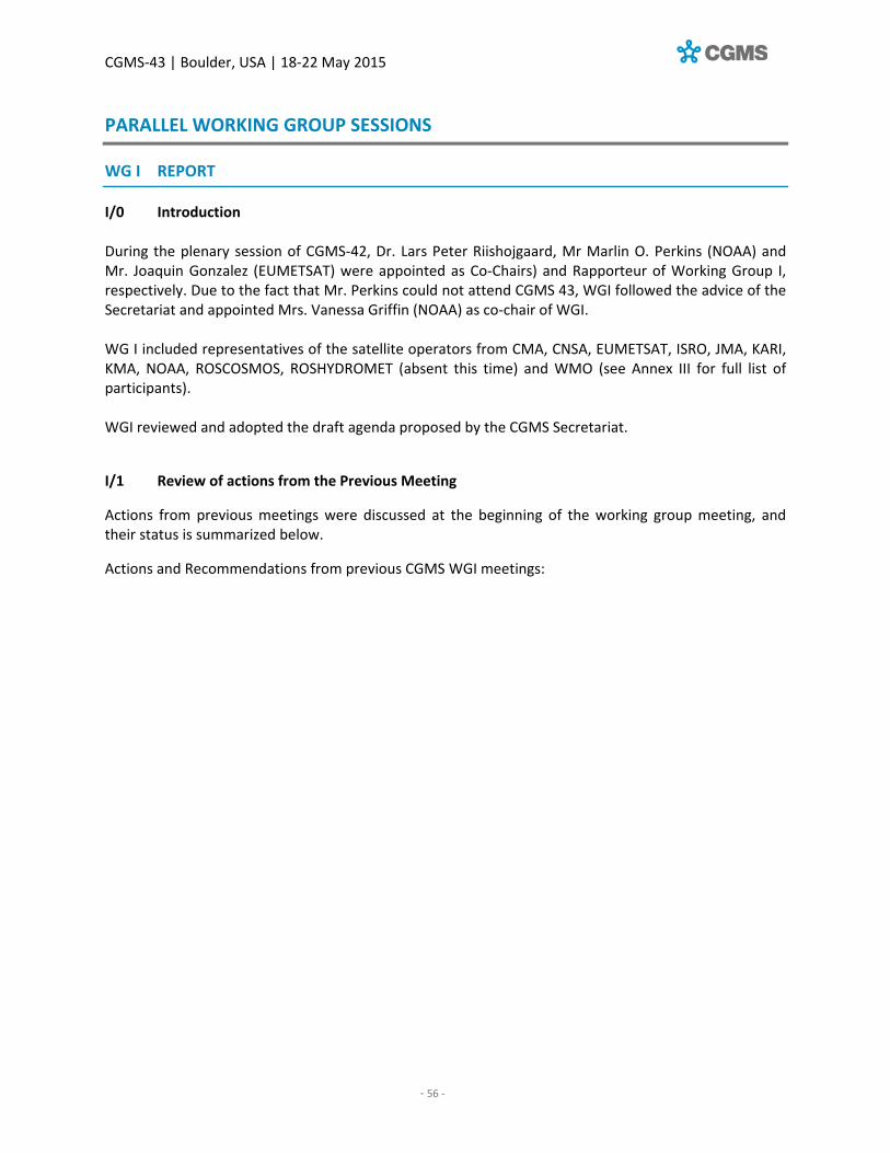
CGMS‐43 | Boulder, USA | 18‐22 May 2015
‐ 56 ‐
PARALLEL WORKING GROUP SESSIONS
WG I REPORT
I/0 Introduction During the plenary session of CGMS‐42, Dr. Lars Peter Riishojgaard, Mr Marlin O. Perkins (NOAA) and Mr. Joaquin Gonzalez (EUMETSAT) were appointed as Co‐Chairs) and Rapporteur of Working Group I, respectively. Due to the fact that Mr. Perkins could not attend CGMS 43, WGI followed the advice of the Secretariat and appointed Mrs. Vanessa Griffin (NOAA) as co‐chair of WGI. WG I included representatives of the satellite operators from CMA, CNSA, EUMETSAT, ISRO, JMA, KARI, KMA, NOAA, ROSCOSMOS, ROSHYDROMET (absent this time) and WMO (see Annex III for full list of participants). WGI reviewed and adopted the draft agenda proposed by the CGMS Secretariat.
I/1 Review of actions from the Previous Meeting
Actions from previous meetings were discussed at the beginning of the working group meeting, and their status is summarized below.
Actions and Recommendations from previous CGMS WGI meetings:

CGMS‐43 | Boulder, USA | 18‐22 May 2015
‐ 57 ‐
WGI status of actions on the occasion of CGMS‐42
Actionee Action # Description Action feedback/closing document Deadline Status HLPP ref
CGMS
members
WGI/3.1 A42.17 CGMS members to nominate
representatives in the Task Team to
work on RARS related aspects (before 1st
IS meeting (WGI.IS‐2.1 mid October
2013)
To be discussed between EUM and NOAA during
the CGMSSEC#2 on 12 Feb 2014.
CGMS‐42: WGI/5: The list of representatives for
the RARS Task Team (as agreed in CGMS‐41) is
incomplete:
CMA: LIU Jian [email protected]
EUM: [email protected],
JMA: Hidehiko Murata, [email protected]
NASA: [email protected]
NOAA: [email protected]
CGMS‐42‐ROSH‐WP‐01: Sergey Uspensky
CGMS‐42‐WMO‐WP‐19
13 May 2015: NOAA nominates AK Sharma,
[email protected], Mitch Goldberg,
[email protected], Liam Gumley,
(31 Aug
2013),
New
deadline
15 Jun
2014
CLOSED HLPP#
1.4.5
CGMS
members
WGI/2 A42.01 CGMS members to provide feedback to
WMO (David Thomas,
[email protected]) on the preliminary
WMO position on frequency protection
for WRC‐2015.
Discussed in plenary, draft letter endorsed by
CGMS‐42. (CGMSSEC sent the letter to WMO
following CGMS‐42).
30 Jun
2014
CLOSED HLPP#
1.3.3

CGMS‐43 | Boulder, USA | 18‐22 May 2015
‐ 58 ‐
WGI status of actions on the occasion of CGMS‐42
Actionee Action # Description Action feedback/closing document Deadline Status HLPP ref
EUM WGI/2 A42.02 CGMS Liaison officer to SFCG to report to
CGMS WGI on the discussions and
disposition of SFCG on all topics of
interest to the different CGMS members.
For achieving that a dedicated CGMS
Secretariat WGI working paper will be
prepared by EUMETSAT Frequency
Manager (in the role of liaison officer
from CGMS to SFCG) and will be released
to the participants of WGI before end of
Q1 of the corresponding year. Based on
the contents, CGMS members will decide
the level of information they will include
in their specific reports to CGMS for the
corresponding WGI meeting.
CGMS‐43‐EUM‐WP‐03 30 Mar
2015
CLOSED HLPP#
1.3
CGMS
members
WGI/
3.2.1
A42.03 CGMS members to regularly report to
WGI their plans on the user preparation
for their future systems (in areas aspects
relevant to the WGI).
NOAA will address this verbally in WGI CGMS‐
43
CLOSED HLPP#
1.4.2
CGMS
members
WGI/
3.2.1
A42.04 CGMS members to gather responses
from manufacturers of receiving stations
about experiences and lessons learnt for
both LEO and GEO systems. Due date:
September 2014 and provided answers
to be assessed in dedicated Inter‐
Sessional meeting in November 2014
Discussed at WGI webex #1 (20 Jan 2015)
NOAA response pending, per further discussions
in WGI.
Discussed at CGMS‐43 and closed as a
consequence.
15 Sep
2014,
15 Nov
2014
CLOSED HLPP#
1.4.3

CGMS‐43 | Boulder, USA | 18‐22 May 2015
‐ 59 ‐
WGI status of actions on the occasion of CGMS‐42
Actionee Action # Description Action feedback/closing document Deadline Status HLPP ref
CGMS
members
WGI/
3.2.1
A42.05 CGMS members to nominate focal points to
support, via inter‐sessional meetings, the
analysis of the LRIT/HRIT Global
Specification for its usefulness for next
generation GEO satellite data
dissemination, and propose an update
taking into account the availability of new
file format standards and dissemination
means. Initial coordination to be done by
EUMETSAT (as book captain of the
document).
EUM: [email protected]
CGMS‐43 EUM‐WP‐05
JMA: Akiyoshi Andou, [email protected]
CGMS‐43‐JMA‐WP‐08 (Section 2)
NOAA: [email protected]
ROSH: Mr. Yuri Chetyrin, leading programmer, SRC
"PLANETA", Far Eastern Center
E‐mail: [email protected]
Action agreed to be closed by WGI at CGMS‐43. A
new action will be opened to use the identified
team to work on the future updates of the HRIT
Global spec
30 Jun
2014
CLOSED HLPP#
2.
EUM WGI/4 A42.06 EUMETSAT to provide template to report
DCP system characteristics by the different
DCP operators of CGMS
Circulated by EUMETSAT Jan/Feb 2015 30 Jun
2014
CLOSED HLPP#
1.2
CGMS
members
WGI/4 A42.07 CGMS DCP operators to provide DCP
system characteristics (in the template
form provided by EUMETSAT in action
WGI/4 A42.06) in support of the
preparation activities for the Satcom Forum
in 2015.
CGMS‐43 EUM‐WP‐06
NOAA has provided input to EUMETSAT.
Closed following WGI discussions at CGMS‐43.
30 Sep
2014
CLOSED HLPP#
1.2.1
WGI
and
WGIV
Plen
E.1.3
(wrt
WGI
and
WGIV)
Plen
A42.07
Following the revised scope of WGI and
WGIV, the WGs to update the Terms of
Reference of both WGs for endorsement by
CGMS
Note: This is a plenary action that needs to be
treated in WGs I and IV.
Not started yet (status Jan 2015).EUM/KPR book
captain.
CGMS‐43 EUM‐WP‐02 (WGIV paper)
NOAA will provide feedback in WGI and WGIV
Closed following WGI discussions ‐ for plenary to
approve.
CGMS‐
43
CLOSED ‐

CGMS‐43 | Boulder, USA | 18‐22 May 2015
‐ 60 ‐
WGI status of recommendations on the occasion of CGMS‐42
Actionee Action # Description Action feedback/closing document Deadline Status HLPP ref
CGMS
space
agencies
WGI/2 R42.01 CGMS satellite operators are invited to
communicate and take into account the
WMO position on frequency protection
when addressing WRC‐2015 preparation
at the national level.
Communication with national representatives
implemented, on regular basis, at the level of the
different CGMS members (e.g. NOAA,
EUMETSAT,..)
(CGMS‐
43)
CLOSED HLPP#
1.3.3
CGMS
members
WGI/2 R42.02 CGMS WGI, understanding the
complexity of the issues to be covered in
the area of frequency management and
coordination (including interference
assessments) for the existing and future
space systems under the responsibility
of the different CGMS members, and
also recognising the efforts, already in
place by most of the CGMS members, to
concentrate these discussion in the
frame of SFCG, recommends CGMS
members to continue bringing all
frequency management and
coordination issues under the expert
forum of SFCG and actions the liaison
officer (from CGMS to SFCG) to report to
CGMS WGI all aspects of SFCG
discussions considered of relevance to
CGMS.
EUM/CGMSSEC: [email protected]
acts as liaison officer
(CGMS‐
43)
CLOSED HLPP#
1.3

CGMS‐43 | Boulder, USA | 18‐22 May 2015
‐ 61 ‐
WGI status of recommendations on the occasion of CGMS‐42
Actionee Action # Description Action feedback/closing document Deadline Status HLPP ref
CGMS
space
agencies
(with LEO
space‐
craft)
WGI/5 R42.03 All agencies operating polar orbiting
satellites to provide, whenever relevant
for operational meteorology, a package
based on the core software from the
global processing for use in local and
regional product processing, in particular
level‐1 processing
CMA has stated that they will do this, NOAA has
IPOPP from NASA and CSPP (Nesdis) both
available online. EUM has AAPP. For future
systems is TBD
ROSH Apr 2015: Processing package for MTVZA‐
GY/Meteor‐M N2 instrument data is being
developing. Release date TBD
(CGMS‐
43)
CLOSED HLPP#1.4.4
CGMS
members
WGI/5 R42.04 Each agency providing product
processing packages to implement a
user support function supporting the
software release process, the software
installation and anomaly resolution
User support is online for NOAA [URL?]
JPSS software: http://cimss.ssec.wisc.edu/cspp/.
GOES and GOES‐R software:
http://cimss.ssec.wisc.edu/csppgeo/software.ht
ml. Additional support at www.ospo.noaa.gov
TBD for EUMETSAT (USC?) and CMA?
(CGMS‐
43)
CLOSED HLPP#1.4.4
CGMS
members
WGI/5 R42.05 CGMS to consider further actions to
evaluate and document commonalities
and best practices in organisation and
architecture of Regional Services.
See WGI IS‐01 meeting, Dec '14. To cover global
specification and RARS. (Global specs
Rational for Polarisation aspects for Direct
Broadcast (e.g. FY‐3C) Standardisation of User
Terminals (HRPT), for example in terms of G/T.
HRIT/LRIT Global specs for the instruments on
board GOES‐R and MTG.
RARS: Status of progress of Regional RARS
implementation (or plans for it) Definition of
regions. Models for securing HRPT (L/X Band)
"infrastructure" in a region Ideas for data
gathering within regions and for inter‐regions
data transfer
(CGMS‐
43)
CLOSED HLPP#1.4.5

CGMS‐43 | Boulder, USA | 18‐22 May 2015
‐ 62 ‐
WGI status of recommendations on the occasion of CGMS‐42
Actionee Action # Description Action feedback/closing document Deadline Status HLPP ref
CGMS
members
WGI/5 R42.06 Agencies to provide a complete and
comprehensive Space to Ground Interface
Control Document for each satellite family,
defining the radio frequency encoding and
data layout of the direct broadcast
downlink
NOAA:
http://noaasis.noaa.gov/NOAASIS/pubs/HRD‐
LRD_Transition.pdf
EUM: Metop on EUMETSAT web page [URL?]
(CGMS‐43) CLOSED HLPP#1.4.2
CGMS
members
WGI/5 R42.07 CGMS to promote standardisation of the
data interface between the direct
broadcast reception station and the
product processing software
(CGMS‐43) CLOSED HLPP#1.4.5
CGMS
members
WGI/5 R42.08 CGMS to promote standardisation of the
pass scheduling interface between the
Regional Service and the direct broadcast
reception station.
(CGMS‐43) CLOSED HLPP#1.4.5
CGMS
space
agencies
(with LEO
space‐
craft)
WGI/5 R42.09 All agencies operating polar orbiting
satellites to provide product processing
auxiliary data via the Internet
Refer to CCSDS 902.1
(http://public.ccsds.org/sites/cwe/rids/Lists/CCS
DS%209021R1/CCSDSAgency.aspx)
(CGMS‐43) CLOSED HLPP#1.4.5
CGMS
members
WGI/5 R42.10 CGMS to consider further actions on
standardising the interregional interfaces
for exchange of products, pass scheduling,
monitoring and other information.
Closed following CGMS‐43 discussions (CGMS‐43 CLOSED HLPP#1.4.5

CGMS‐43 | Boulder, USA | 18‐22 May 2015
‐ 63 ‐
WGI status of recommendations on the occasion of CGMS‐42
Actionee Action # Description Action feedback/closing document Deadline Status HLPP ref
CGMS
space
agencies
WGI/5 R42.11 CGMS Satellite operators to support the
definition and implementation of
community agreed operational procedures
for LEO satellite data direct read‐out,
acquisition, and relay in the context of the
DRARS Implementation Group.
(CGMS‐43) CLOSED HLPP#1.4.5
Note that recommendations are closed at the relevant plenary session irrespective of whether they have been fulfilled or not. New (and sometimes the same) recommendations are then raised as necessary.

CGMS‐43 | Boulder, USA | 18‐22 May 2015
‐ 64 ‐
I/2 Revised Terms of Reference of WGI
EUMETSAT‐WP‐02 provided, in response to CGMS‐42 action 42.07 (raised at plenary), revised draft Terms of Reference for WGI (as follows): 1.1 Scope of WGI
CGMS WGI will provide a regular forum for CGMS agencies to address topics of interest in areas
related to global coordination of satellite systems and telecommunication. The working group will
address these issues for existing operational systems and also for future ones and will aim at
supporting CGMS in preparing for the future generation of meteorological satellite systems and to
contribute on the consolidation and updates of interoperability and standardisation that the
evolution of technology imposes.
1.2 Objectives
WGI will have the following objectives:
1) Provide a technical forum for CGMS agencies to address global issues and technical aspects of their satellite systems;
2) Address areas of mutual interest and advice agencies on topics related to frequency coordination and management;
3) Act as CGMS point of contact, at expert level, between CGMS and other groups and organisations in areas of frequency management (e.g. SFCG, ITU and preparation status and topics for WRCs);
4) Address technical and operational aspects of direct broadcast services (present and future) of mutual or global interest for the CGMS agencies;
5) Promote standards and interoperability and operational procedures to the CGMS agencies for the benefit of the user community of their direct broadcast services and the associated regional retransmission services;
6) Address technical and operational aspects of the Data Collection Systems at international level;
7) Promote standards and interoperability and operational procedures to the CGMS agencies for the benefit of the user community of the DCS Regional (and international) systems;
8) Optimisation/harmonisation and update of CGMS global specifications.
9) Address topics from the CGMS High Level Priority Plan within the scope of WGI.

CGMS‐43 | Boulder, USA | 18‐22 May 2015
‐ 65 ‐
LIST OF CGMS AGENCIES REPRESENTATIVES IN WORKING GROUP I
Organisation (CGMS members)
Firs name Last name Role Email
CMA Luo Dongfeng [email protected]
CNES Jean Pla [email protected]
CNSA Jun Gao [email protected]
ESA Ivan Petiteville [email protected]
EUMETSAT Joaquin Gonzalez Picazo
Rapporteur [email protected]
IMD n/a*
IOC/UNESCO n/a*
ISRO n/a*
JAXA Fujimoto Nobuyoshi [email protected]
JMA Yasushi Izumikawa [email protected]
KMA Hye‐Sook Lee [email protected]
NASA Betsy Edwards [email protected]
NOAA Vanessa Griffin Co‐Chair [email protected]
ROSCOSMOS n/a*
ROSHYDROMET Sergey Uspensky Co‐Chair [email protected]
WMO Jerome Lafeuille [email protected]
*CGMS members to confirm their key point of contact for WGI activities. The document identifies the scope and objectives of the working group and identifies the list of
representatives (to be appointed by the different CGMS agencies). During the presentation of the
working paper it was suggested that the proposed Terms of Reference (ToR), once approved by
CGMS, would be included on the CGMS web page dedicated to WGI, and that the list of (permanent)
representatives to the Group would be maintained by CGMS Secretariat, based on the updates to be
provided by the respective agencies.
WGI reacted positively to the proposed ToR and thanked the CGMS Secretariat for the draft proposal. The draft was endorsed with a minor modification of objective 3), as follows: 3) Act as CGMS point of contact, at expert level, between CGMS and other groups and
organisations in areas of frequency management (e.g. SFCG, ITU, ITU regional groups, and preparation status and topics for WRCs);
I/3 Frequency management matters: SFCG, ITU and WRC activities
EUMETSAT‐WP‐03 on frequency management topics provides a report from the CGMS/SFCG Liaison
Officer on the discussions and dispositions of SFCG from its 34th meeting (3 – 11 June 2014) on all
frequency management issues of mutual interest and concern, in order to support CGMS members
in their decision on what level of information they will include in their specific reports to CGMS for
the corresponding WGI meeting.
SFCG at its 34th meeting noted the issues reported by CGMS in SF34‐62/I and took the information
into account in its considerations on related subjects. Furthermore, SFCG agreed to the CGMS

CGMS‐43 | Boulder, USA | 18‐22 May 2015
‐ 66 ‐
approach for mutual reporting and entitled the CGMS Liaison Officer to report back to CGMS‐43 on
issues discussed at SFCG‐34 that could be of interest to CGMS, namely:
The updated SFCG Recommendation 11‐1R4 on the use MetSat in the band 1670 – 1710
MHz,
The updated SFCG Resolution 19‐7R4 on the use MetSat in the band 7750 – 7900 MHz,
SFCG objectives for WRC‐15 agenda items of mutual interest.
In particular, SFCG noted with appreciation that the position and objectives of CGMS and SFCG
members on WRC‐15 issues of mutual interest are in‐line and supports the letter from CGMS to
WMO highlighting the importance of the various types of instruments using the band 5350 ‐ 5470
MHz and the need to preserve this very important spectrum against potential interference from
RLAN.
MetSat use at 1695 – 1710 MHz
At SFCG‐34, NOAA provided an updated status (June 2014) of the situation in the United States
regarding the repurposing of the band 1695 – 1710 MHz.
Legislation in the United States has authorized an auction intended for spectrum sharing in the band
1695 – 1710 MHz between U.S. Federal stations in the Meteorological Satellite Service (S‐E) with
mobile users for broadband wireless communications. According to this, the auctioning of the band
1695 – 1710 MHz was scheduled for November 2014 with expected implementation of all necessary
mitigation measures, i.e. coordination zones, coordination portal, monitoring capability, GOES‐R
frequency shift down by 3.5 MHz and relocation of radiosondes within 3 years from the time when
winner is certified.
For the protection of the most important sites at which MetSat Earth stations of federal users are
located in the US, 27 coordination zones were identified with typical coordination zone sizes of 40
km for POES, respectively 10 km for GOES reception. Earth stations of non‐federal users located
outside of these zones will not be protected. In order to ensure that broadband mobile users will
respect those coordination zones the mobile base stations will authorize the user terminals to
operate in the band 1695 – 1710 MHz.
Furthermore, the status of the situation with regard to the company LightSquared requesting to
combine 5 MHz of spectrum between 1670 ‐ 1675 MHz, which they already occupy, with the
adjacent 1675 ‐ 1680 MHz band was reported. Studies to determine if LightSquared could operate
without harmful interference to GOES and GOES‐R operations in the band 1675 ‐ 1695 MHz band are
completed, but were still under review and therefore not publically available at the time of the
SFCG‐34 meeting. The studies with regard to radiosondes conclude that moving of their use from the
band 1675 – 1680 MHz to 400.15 – 406 MHz is feasible.
In view of this situation in the United States for sharing of the band 1695 – 1710 MHz and changes in
the use of the 1670‐1710 band for various Meteorological Satellite Services, such as expanded data

CGMS‐43 | Boulder, USA | 18‐22 May 2015
‐ 67 ‐
dissemination by GOES and the use of the emergency weather information distribution systems,
illustrates the need to review Recommendation SFCG 11‐1R3 which was last reviewed in 2005.
The updated Recommendation SFCG 11‐1R4 takes into account the evolutions since this last
revision in 2005 of the MetSat services in the different sub‐bands in the range 1670 – 1710 MHz. The
most significant change to this recommendation is the addition of “recommends 4” which
elaborates on the situation and conditions when a MetSat operator intends to extend the use of
non‐geostationary MetSat systems below 1698 MHz. Recommend 4 stipulates “that when extending the operation of future non‐geostationary satellites from 1698 – 1710 MHz into 1695 – 1710 MHz, protection of the reception of transmissions from geostationary meteorological satellite systems operating below 1698 MHz should be facilitated through inter‐operator coordination, as appropriate.”
MetSat use at 7750 – 7900 MHz
In order to ensure the continued efficient use of the recently enlarged band from 7750 – 7850 MHz
to 7750 – 7900 MHz at WRC‐12, it was considered necessary to review SFCG Resolution 19‐7R3 with
the view to assist in the most optimum use of this meteorological satellite service band 7750 – 7900
MHz, providing a guideline to the MetSat operators, which are currently in the phase of planning
and developing next generation polar‐orbiting systems using this band.
The updated SFCG Resolution 19‐7R4 now takes into account the extension of the MetSat allocation
from 7750 – 7850 MHz to 7750 – 7900 MHz, but does not contain any significant changes to this
Resolution on the way and conditions as to how MetSat systems shall utilize this spectrum.
SFCG objectives for WRC‐15 (Resolution SFCG 32‐1R2)
SFCG defines its objective in the framework of an SFCG Resolution which is updated at every SFCG
meeting until WRC‐15. In the following sections only those SFCG objectives for WRC‐15 agenda items
are highlighted and discussed that are of mutual interest to SFCG and CGMS.
WRC‐15 Agenda Item 1.1
This agenda item deals with consideration of additional spectrum allocations to the mobile service
and identification of additional frequency bands for International Mobile Telecommunications (IMT)
and to facilitate the development of terrestrial mobile broadband applications, likely to concentrate
on bands below 6 GHz.
The frequency bands of mutual concern are:
the 1695 – 1710 MHz band used for meteorological satellite applications;
the bands 2025 – 2110 MHz and 2200 – 2290 MHz used for earth exploration satellite and
space operation (TM/TC and ranging) services;
the band 3400 ‐ 4200 MHz used for Galileo Data Distribution Network and the dissemination
of meteorological data by systems like EUMETCast, CMACast and GEONETCast;

CGMS‐43 | Boulder, USA | 18‐22 May 2015
‐ 68 ‐
the active remote sensing band 5350‐5470 MHz used for SARs, scatterometers and
altimeters.
1695 – 1710 MHz
The 1695 – 1710 MHz band is used by all meteorological‐satellite systems with Earth stations
operated by almost all National Meteorological and Hydrological Services (NMHS) and many other
users. This band is essential for providing operational and time‐critical meteorological information to
the users around the world. For this reason SFCG is opposed to an allocation/identification of the
frequency band 1695 – 1710 MHz for terrestrial mobile broadband applications including IMT except
if such allocation/identification ensures the protection of MetSat Earth station operations in that
band.
So far there are no indications from any of the six ITU regional groups or individual countries to
propose this band for the introduction of mobile broadband, except potentially the US (to be
confirmed).
2025 – 2110 MHz and 2200 – 2290 MHz
Although these bands no longer seem to play a major role in the global identification of additional
spectrum for broadband mobile systems (thanks to the negative results of the sharing studies in the
framework of the responsible fora within the ITU‐R WRC‐15 preparatory process namely JTG 4‐5‐6‐
7), there are still some proponents for these bands (or parts of) in the mobile industry and by some
individual countries.
SFCG objects to any IMT identification in these bands under agenda item 1.1 and opposes any
revisiting of the conditions set in RR No. 5.391 pertaining to the bands 2025 – 2110 MHz and 2200 –
2290 MHz used for space research, earth exploration‐satellite and space operation services.
3400 ‐ 4200 MHz
This frequency range is one of the prime targets of the mobile industry to cover their broadband
spectrum requirements. Some parties even go as far as to propose the entire C‐Band (3400 – 4200
MHz) for a mobile broadband identification. However, there is also very strong opposition by all
commercial satellite operators and a number of countries around the world against identifying
further spectrum in this frequency range.
Note: Already at WRC‐12 the band 3400‐3600 MHz was allocated to the mobile service and
identified for International Mobile Telecommunications (IMT) in a number of countries by footnotes
RR No. 5.430A, 5.431A, 5.432A, 5.432B and 5.433A to the Radio Regulations. Thus, an identification
of the entire C‐Band for mobile broadband systems is very unlikely, given the strong opposition from
various sides. However, given the strong pressure on administrations, a possible scenario could be
that parts of the band 3400 – 4200 MHz (to a maximum 3400 – 3800 MHz) would be globally (or at
least regionally) identified for mobile broadband systems implementation. Thus, the remaining
spectrum available for FSS systems could continue to be used for the dissemination of
meteorological data.

CGMS‐43 | Boulder, USA | 18‐22 May 2015
‐ 69 ‐
5350 – 5470 MHz
Under this agenda item also the extension of the current RLAN (WiFi) spectrum (5150 ‐ 5350 MHz
and 5470 ‐ 5725 MHz) by also allocating the gap in between (5350 ‐ 5470 MHz) for RLANs is under
discussion.
Such additional allocation of the band 5350 ‐ 5470 MHz would affect most severely SARs such as
CSAR on Sentinel‐1 or RadarSat. Less sensitive to RLAN interference, but also affected in the long
term by such an RLAN introduction in the band 5350 – 5470 MHz, could be scatterometers and
altimeters. Thus, SFCG opposes an allocation to the Mobile Service in this band for use by terrestrial
mobile broadband applications.
All studies performed in ITU‐R JTG 4‐5‐6‐7 agreed that, with the current RLAN parameters,
compatibility cannot be achieved, even if the RLAN systems are limited to indoor use only. Thus,
additional mitigation techniques to the ones identified so far would be required to achieve
compatibility. The same situation applies to the compatibility with terrestrial and aeronautical radars
operating in the band 5350 – 5470 MHz. So far the RLAN industry has failed to identify such
mitigation techniques which could ensure compatibility. As a result the ITU regional groups CITEL
(Americas) and CEPT (Europe) will not propose the implementation of RLANs in the band 5350 –
5470 MHz at WRC‐15, but this issue will continue to be studied and could result in an agenda item
for WRC‐19.
WRC‐15 Agenda Item 1.6
This agenda item deals under 1.6.1 with consideration of possible additional primary allocations to
the fixed‐satellite service (Earth‐to‐space and space‐to‐Earth) of 250 MHz in the range between
10 GHz and 17 GHz in Region 1.
Agenda item 1.6.2 deals with consideration of possible additional primary allocations to the fixed‐
satellite service (Earth‐to‐space) of 250 MHz in Region 2 and 300 MHz in Region 3 within the range
13‐17 GHz.
One of the targeted frequency bands for a possible allocation of FSS (Earth‐to‐space) is 13.25 – 13.75
GHz, which raises particular concerns with regard to the allocation of this band to EESS (active). This
band is used for active remote sensing (altimeters and scatterometers) by missions such as Cryosat,
Jason‐2, ‐3, Jason‐CS (Sentinel‐6), Sentinel‐3, and HY‐2.
Thus, SFCG supports the protection of existing space science service allocations. No additional
allocation of spectrum to support FSS (Earth‐to‐space and space‐to‐Earth) should be made in space
science service bands unless acceptable sharing conditions are agreed. There is particular concern
with the possible allocation of FSS (Earth‐to‐space) in the 13.25‐13.75 GHz band allocated to EESS
(active). This band is used for active remote sensing (altimeters and scatterometers) by missions
such as Cryosat, Jason‐2, ‐3, Jason‐CS, Sentinel‐3, and HY‐2. ITU‐R studies concluded that sharing
between EESS (active) and FSS (Earth‐to‐space) is not feasible. Therefore, SFCG supports no new
allocation to FSS (Earth‐to‐space) in the band 13.25‐13.75 GHz.

CGMS‐43 | Boulder, USA | 18‐22 May 2015
‐ 70 ‐
Sharing studies between EESS (active) and FSS (space‐to‐Earth) performed so far are showing
compatibility between both services.
As the need for additional primary allocations of 250 MHz to the GSO FSS in frequency bands
between 10 and 17 GHz is recognized and supported and the corresponding ITU‐R studies show
compatibility with the EESS (active), there might be a need to accept an allocation to the FSS (space‐
to‐Earth) the band 13.4 – 13.65 GHz subject to the implementation of relevant mitigation techniques
(e.g. PFD mask, limitation of transmit antenna size, etc.).
WRC‐15 Agenda Item 1.9.2
This Agenda Item deals with the possibility of allocating the bands 7375 ‐ 7750 MHz and 8025 ‐ 8400
MHz to the maritime‐mobile satellite service (MMSS) and additional regulatory measures,
depending on the results of appropriate studies.
The potentially‐affected space science service bands under this agenda item are 7450 ‐ 7550 MHz
MetSat (space‐to‐Earth, GSO) and 8025 ‐ 8400 MHz EESS (space‐to‐Earth). Thus, according to the
SFCG position, no new allocations to the MMSS should be made in these frequency bands unless
acceptable sharing criteria with the science services are developed.
Of particular concern is the potential interference to EESS (space‐to‐Earth) operations in the band
8025 ‐ 8400 MHz at high latitudes from ships operating in closer proximity. Large exclusion zones
may be needed to avoid interference to EESS earth stations. Many EESS earth stations are located
near coastal areas (e.g., Svalbard, McMurdo, Maspalomas, Lannion, Wallops) and could be seriously
affected by emissions from vessels navigating in the area.
All compatibility analyses on the two different sharing aspects (MMSS vs. EESS and MMSS vs. the
space research service (SRS)) came to similar conclusions regarding the sharing difficulties with EESS
and the required separation distances to protect the SRS Earth stations.
Furthermore, the issue of the large number of exclusion zones and the regulatory mechanisms for
implementing and keeping up‐to‐date the necessary exclusions zones makes such an allocation to
the MMSS impracticable.
Consequently, CEPT, as the initial proponent of this agenda item, does not support an allocation to
the MMSS in the band 8025 ‐ 8400 MHz.
WRC‐15 Agenda Item 1.10
This agenda item deals with the consideration of spectrum requirements and possible additional
spectrum allocations for the mobile‐satellite service (MSS) in the Earth‐to‐space and space‐to‐Earth
directions, including the satellite component for broadband applications, within the frequency range
from 22 GHz to 26 GHz.

CGMS‐43 | Boulder, USA | 18‐22 May 2015
‐ 71 ‐
The main frequency bands commonly at risk for SFCG and CGMS member agencies could be:
The EESS (passive) band 23.6 ‐ 24 GHz (purely passive, but to be protected against unwanted
emissions taking into account interference apportionment and the levels contained in ITU‐R
Resolution 750 (rev. WRC‐12);
The first 500 MHz of the EESS/SRS space‐to‐Earth band 25.5 – 27.0 GHz.
The frequency band 25.5 – 27 GHz is allocated to the EESS (space‐to‐Earth) and is used for data links
for EESS payloads. Relevant sharing criteria for this service are given in Recommendation ITU‐R
SA.1027. Studies have been performed with SRS receiving Earth stations tracking non‐GSO SRS
satellites. These studies, using protection criteria given in Recommendation ITU‐R SA.609 show no
compatibility between MSS downlink and SRS. Since the sharing criteria in Recommendation ITU‐R
SA.1027 are globally more stringent than the protection criteria in Recommendation ITU‐R SA.609, it
is expected that similar conclusions would apply to the EESS (space to‐Earth). With regard to MSS
uplinks, it has been shown that separation distances larger than 330 km would be required for SRS.
These distances would even be larger when considering EESS. So far, the frequency bands targeted
by the proponents of such new allocations to the MSS are still not clear, if there are any at all. Thus,
the developments in preparation for this WRC‐15 agenda item needs to be further carefully
monitored.
WRC‐15 Agenda Item 1.11
This agenda item deals with the consideration for a new primary allocation for the Earth exploration‐
satellite service (Earth‐to‐space) in the 7‐8 GHz range. Initially proposed by ESA through CEPT this
agenda item calls for the identification of a suitable frequency band for an EESS (Earth‐to‐space)
allocation in the 7‐8 GHz range for telecommand operations to complement telemetry operations of
EESS (space‐to‐Earth) in the 8025 ‐ 8400 MHz band.
Although there are currently no MetSat systems envisaged that would make use of such a new
allocation in the near future, such spectrum would enlarge the potential evolutions of future MetSat
systems and deployment scenarios. Supported by the necessary spectrum requirement studies and
positive conclusions of the necessary compatibility assessments with the other already allocated
services, SFCG supports a primary allocation to EESS (Earth‐to‐space) in the band 7190 ‐ 7250 MHz as
provided for in Method A of the Draft CPM Report. This would satisfy the EESS spectrum
requirements identified.
WRC‐15 Agenda Item 9.1.1
This agenda item deals with Resolution 205 (REV.WRC 12) ‐ Protection of the systems operating in
the mobile‐satellite service in the band 406 ‐ 406.1 MHz. Cospas‐Sarsat space segment providers
have developed protection criteria for the Cospas‐Sarsat search and rescue instruments and local
user terminals in the 406.0 ‐ 406.1 MHz band in order to protect them against broadband out‐of‐
band emissions and against narrow‐band spurious emissions. These protection criteria have been
recognized at the ITU‐R level through ITU‐R M.1478‐1. However, they do not provide protection
against emissions in adjacent bands which could hinder the Cospas‐Sarsat system’s ability to detect
and/or relay signal from beacons. Several noise measurements have been conducted using all the

CGMS‐43 | Boulder, USA | 18‐22 May 2015
‐ 72 ‐
three space components. The measurements of the 406 ‐ 406.1 MHz band must be carefully
examined, as Cospas‐Sarsat has a general concern on the reception and processing of weak distress
signals, in certain areas, caused by an increase of noise in the Europe and Asia.
Current analysis of observations show that over certain years, this noise (measured in the 406 ‐
406.1 MHz band) has increased by 15 to 20 dB above the interference level in some areas.
Measurements performed at 406 MHz have shown that the noise level is especially high over Europe
and also confirms the concern in part of Asia. This noise issue in UHF band addresses the frequency
range between 390 MHz and 420 MHz might be caused by the operation of terrestrial systems
deployed in many countries. Thus, Cospas‐Sarsat with the support of its space segment providers
will need to develop the relevant protection criteria for submission to the relevant ITU‐R groups and
translation into an ITU‐R recommendation.
In order to ensure adequate protection of MSS systems in the frequency band 406 ‐ 406.1 MHz, the
revision of Resolution 205 is also required introducing further mitigation measures. Those would
also include design and implementation of improved filters at the LEOSAR, GEOSAR and MEOSAR
systems space receivers, which are already planned for future generation of satellites.
SFCG supports a revision of Resolution 205 (Rev WRC‐12) containing appropriate mitigation
measures, such as establishment of a guard band above 406.1 MHz concerning new frequency
assignments to mobile networks.
CEPT and CITEL will propose to WRC‐15 a significant step forward to improve the protection of the
band 406 ‐ 406.1 MHz by means of implementation of guard bands from 405.9 MHz to 406 MHz and
from 406.1 to 406.2 MHz applicable to new frequency assignments in the mobile and fixed services.
WRC‐15 Agenda Item 9.1.5
This agenda item deals with the consideration of technical and regulatory actions in order to support
existing and future operation of fixed satellite service (FSS) earth stations within the band 3400 ‐
4200 MHz, as an aid to the safe operation of aircraft and reliable distribution of meteorological
information in some countries in Region 1 (Resolution 154 (WRC‐12).
This agenda item which was initially targeted particularly to countries in Africa now receives special
attention due its discussion on the question whether or not the use of the FSS for aviation
applications are safety related or not and thus, could significantly impact on the discussions of the
same band under Agenda Item 1.1 where the band 3400 – 3800 MHz is one of the prime targets of
the mobile industry to introduce broadband mobile on a global basis.
The importance of the band for distribution of meteorological information is undisputed in the
context of this agenda item and will be appropriately reflected in the modifications to Resolution
154. Studies on this issue indicate that Resolution 154 (WRC‐12) could be modified, calling for
relevant administrations in Region 1 to use special care in the coordination, assignment, and
management of frequencies taking into consideration the potential impact on FSS earth stations
used for satellite communications related to safe operation of aircraft and reliable distribution of
meteorological information in the frequency band 3400‐4200 MHz. In parallel to the modification of

CGMS‐43 | Boulder, USA | 18‐22 May 2015
‐ 73 ‐
Resolution 154 (WRC‐12), consideration may be given to modifying RR No. 5.430A to include a
reference to the modified Resolution.
WRC‐15 Agenda Item 9.1.8
WRC‐12 decided to put on the WRC‐19 preliminary agenda the issue of nanosatellites and
picosatellites. In preparation for that, WRC‐15 agenda item 9.1.8 deals with regulatory aspects for
nanosatellites and picosatellites under Resolution 757 (WRC‐12), which invites ITU‐R “to examine
the procedures for notifying space networks and consider possible modifications to enable the
deployment and operation of nanosatellites and picosatellites, taking into account the short
development time, short mission time and unique orbital characteristics” and instructs the Director
of the Radiocommunication Bureau “to report to WRC 15 on the results of these studies”. Many
universities, space agencies and companies show a fast growing interest in the development and
exploitation of nanosatellites and picosatellites. The increasing miniaturisation of electronics has
enabled these satellites to offer a means to perform a variety of missions in space, from educational,
research and experimentation to Earth observation and telecommunication missions.
The following difficulties in application of the Radio Regulations on nanosatellites and picosatellites
have been identified and require careful consideration:
The typically short development time of nanosatellites and picosatellites is not in line with
the usual timeline of the regulatory coordination and notification process.
Late knowledge of detailed orbital parameters as a result of the opportunistic launch
arrangements. Furthermore, since many of these satellites are not equipped with a
propulsion system their orbit will decay over mission time;
Limited experience with the applicable regulatory procedures by some of the
administrations involved as well as some of the developers of nanosatellites and
picosatellites, leading to:
‐ Inadequate ITU filing data provided in turn leads to unnecessary administrative burden
to the ITU‐R Radiocommunication Bureau (BR) and administrations involved,
‐ Nanosatellites and picosatellites which are not always operating in the appropriate
frequency band or radiocommunication service,
‐ Late initiation of the ITU filing due to late knowledge of the orbital parameters;
Issues related to the growth in numbers of small satellites launched and under development;
Nanosatellite and picosatellite spectrum requirements are expanding along with their
evolving applications;
The large growth in numbers of nanosatellites and picosatellites puts pressure on the
available allocations and associated ITU filings create additional administrative burden on
the BR as well as on administration.
SFCG favours the study of this issue, since it recognizes that a growing number of nanosatellite and
picosatellite are under development in the world. At present many of these satellites operate in
frequency bands allocated to the amateur‐satellite service. Now there is an increasing demand for
these satellites to operate in other satellite services and frequency bands. Many of these satellites

CGMS‐43 | Boulder, USA | 18‐22 May 2015
‐ 74 ‐
are launched for scientific, experimental or educational purposes, sometimes in the form of
constellations and there is a growing interest for commercial non‐scientific applications. SFCG
supports that the frequency bands used should align with the applications being supported. An
investigation on how this growing number of satellites can be supported is needed. Given the
complexity in obtaining a common definition of which types of satellites should be classified under
the category nanosatellites and picosatellites and because these definitions tend to relate to
elements that are not relevant from a frequency management perspective (size, mass, cost), SFCG
supports further consideration of modifications to the RR, if needed, to facilitate the development of
nanosatellites and picosatellites, taking into account the comparatively short development time and
the potential lack of advance knowledge of certain operational parameters.
Any changes to the ITU‐R Radio Regulations in relation to this agenda item should be carefully
developed to ensure protection of all satellite missions. SFCG is of the opinion that any satellite,
including nanosatellites and picosatellites, will have to be registered with the ITU and must adhere
to the ITU‐R Radio Regulations.
WRC‐15 Agenda Item 10
Agenda Item 10 of WRC‐15 calls for proposals for possible agenda items for WRC‐19.
CNES, DLR and EUMETSAT, supported by France and Germany, proposed to CEPT an agenda item for
WRC‐19 for upgrading the secondary allocations to the MetSat (space‐to‐Earth) and the EESS (space‐
to‐Earth) in the band 460 – 470 MHz to primary in order to secure future use of the band for ARGOS‐
4 and ICARUS. The objective of such an agenda item for WRC‐19 is to improve the regulatory status
of the MetSat (space‐to‐Earth) and the EESS (space‐to‐Earth) services in the frequency band 460 ‐
470 MHz while putting relevant constraints on these services in order to protect the existing primary
(mobile, fixed) services. This proposal is in the CEPT “shopping list” for WRC‐19 agenda items for
further consideration.
SFCG also supports a proposal for such an agenda item. Also a similar proposal is expected from the
US. The proposals for WRC‐19 agenda items are currently under definition within the different
regional groups and gathered in shopping lists.
One proposal for a new agenda item seems to be common across many of these regional groups,
namely the identification of frequency spectrum for mobile broadband above 6 GHz which would
concern a number of frequency bands used by EESS and MetSat systems. Furthermore, it is possible
that the issue of RLANs in the band 5350 – 5470 MHz will be subject for an agenda item for WRC‐19.
WGI thanked EUMETSAT for the detailed report provided on the frequency related topics of
interested to CGMS.
CGMS WGI also wanted to re‐iterate to SFCG the appreciation of CGMS on the support provided in
protecting and preserving the frequency bands assigned or related to the activities of CGMS.

CGMS‐43 | Boulder, USA | 18‐22 May 2015
‐ 75 ‐
During CGMS meetings WGI was reported (via WGII) that IROWG has identified a potential of
interference by ground based transmitters to RO receivers using the new L5 GPS signal. However, no
clear information was made available to WGI during its CGMS 43 meeting to allow an informed
discussion. In view of the possible implications for the RO receivers, EUMETSAT was tasked by the
WGI to contact IROWG chair(s) seeking clarification on the identified potential of interference.
CGMS‐43 action ‐ WGI
Actionee AGN
item # Description Deadline Status HLPP ref
EUM WG/I A43.01 EUMETSAT to contact IROWG Chair to
confirm needs for dedicated frequency
protection for GNSS
(Clarified between EUMETSAT and IROWG
during CGMS‐43 and closed as a
consequence).
CLOSED OPEN HLPP # 1.3
CMA‐WP‐04 describes that the China Meteorological Administration (CMA) is planning to deploy a
scatterometer — WindRadar on FY‐3E meteorological satellite, and to deploy a precipitation
measuring radar on Fengyun Rain Measurement (FY‐RM) satellite. These two radars each have a
channel operating in 13.25‐13.75 GHz, which is an important band for the earth remote sensing of
space‐borne active sensors. In Annex_1 of CMA‐WP‐04, CMA presents the result of a compatibility
study between fixed‐satellite service (FSS) and PMR2, which concludes that the ITU‐R’s possible new
primary allocations to the fixed‐satellite service (FSS) within frequency range 13.25‐13.75 GHz, which
has been allocated to the EESS (active) on a primary basis, would cause harmful interference in
PMR2, and PMR2 would also create harmful interference to FSS earth stations.
WGI thanked CMA for the detailed report and concurred with the conclusions of CMA as provided in
WP‐04 and recalled that there is a specific agenda topic for WRC‐15 that covers this issue. It is to be
stressed that the proposed new allocations to the FSS (Earth‐to‐space) in the 13.25‐13.75 GHz band
allocated to EESS (active) are not supported by SFCG agencies (and CGMS members). Regarding the
sharing studies between EESS (active) and FSS (space‐to‐Earth) performed so far (which will be
complemented by inputs from CNES to the forthcoming ITU‐R WP 4A meeting in June 2015), they
are showing compatibility between both services. As the need for additional primary allocations of
250 MHz to the GSO FSS in frequency bands between 10 and 17 GHz is recognized and supported
and the corresponding ITU‐R studies show compatibility with the EESS (active), there might be a
need to accept an allocation to the FSS (space‐to‐Earth) the band 13.4 – 13.65 GHz subject to the
implementation of relevant mitigation techniques (e.g. PFD mask, limitation of transmit antenna
size, etc.) and include regulatory conditions to ensure the protection of the sensors operating under
the EESS (active) allocation.
Consequently, WGI agrees that this topic is of relevance and importance to all CGMS agencies and
therefore, CGMS satellite operators are invited to communicate and take into account these views
when addressing WRC‐2015 preparations at their respective national levels.

CGMS‐43 | Boulder, USA | 18‐22 May 2015
‐ 76 ‐
NOAA‐WP‐06 reported that GOES‐R will be the first in the series of the next generation of U.S.
geostationary environmental satellites. NOAA would like to coordinate GOES‐R frequencies with the
CGMS MetSat operators for use at 75 W and 137 W. As required by International
Telecommunication Union (ITU) regulations, the GOESR network was published on 14 October 2014
as GOES‐EAST‐4 (75 W) and GOESWEST‐4 (137 W), found in the ITU’s International Frequency
Information Circular (IFIC) 2780, under special section numbers CR/C/3606 and CR/C/3607,
respectively.
The ITU Radiocommunication Bureau requested a decision from administrations, found to be
possibly affected by the GOES‐R filing, no later than 14 February 2015. The U.S. received comments
from a number of MetSat operator administrations and is currently corresponding with these
administrations with a view to reaching an agreement on the coordination request.
The ITU identified 25 countries for coordination under RR9.7. To date the USA has not received a
decision from 15 administrations and will be sending messages to each of the countries in early May
to request their decision. The USA have received agreements from Australia and Malaysia. The
remaining countries have provided their objections and we are beginning the process of trying to
reach agreements.
PREVIOUS COORDINATION EFFORTS VERSUS GOES‐R FILINGS
NOAA successfully coordinated several GOES satellite networks beginning in the 1970s with GOES‐
EAST and GOES‐WEST, continuing with GOES‐EAST‐1 and GOES‐WEST‐1 (GOES I‐M), GOES‐EAST‐2
and GOES‐WEST‐2 (GOES N‐P). The frequencies filed for GOES‐R under GOES‐EAST‐4 and GOES‐
WEST‐4 continue the use of the same frequency bands coordinated for prior GOES satellite networks
with additional frequencies in X‐band, viz., 7216.6 MHz (uplink) and 8220 MHz (downlink).
401‐403 MHz
The band 401‐403 MHz is allocated, inter alia, to the meteorological‐satellite service (Earth‐to‐space)
and traditionally has been used for uplinks from data collection platforms (DCPs) to both polar‐
orbiting and geostationary MetSats. The greatly expanded use of this band made it necessary to
partition the 2 MHz into segments that would lead to continued harmonious use by the many
MetSat networks in orbit as well as those planned. NOAA’s GOES‐R series follows this agreement as
captured in the ITU Radiocommunication Recommendation ITU‐R SA.2045, entitled “Basic general
partitioning and sharing conditions for the band 401‐403 MHz for future long‐term coordinated use
of data collection systems on geostationary and non‐geostationary METSAT and EESS systems”.
Specifically, for the GOES‐R series, GOES‐R will comply with recommendation 2, viz., “that the band
401.7‐402.435 MHz remains available only for DCS on geostationary MetSat systems” by employing
up to 933 channels using 750 Hz steps (a potential maximum total use of 0.699750 MHz of the 0.7
MHz found in 401.7 – 402.4 MHz). In following this ITU‐R recommendation NOAA feels that
successful coordination of its use of 401.7‐402.4 and the specific frequencies at 401.7 MHz, 401.85
MHz, 402 MHz, and 402.4 MHz can be readily achieved with the other CGMS MetSat operators.

CGMS‐43 | Boulder, USA | 18‐22 May 2015
‐ 77 ‐
460‐470 MHz
The band 460‐470 MHz is allocated on a secondary basis, for the meteorological satellite (space‐to‐
Earth), inter alia. In the past this band has seen limited use by NOAA’s GOES satellites, but its use is
expected to expand for the GOES‐R series with the 468.775 MHz and 468.825 MHz downlinks
employed to interrogate data collection platforms within the footprints of the GOES‐R 75 W and 137
W longitudinal positions. In order to prevent interference with the primary terrestrial services
allocated in this band, the GOES‐R downlinks will employ a spread spectrum technique that limits
the power flux density (pfd) at the Earth’s surface to a level less than ‐152 dBW/m²/4 kHz. This low
pfd and the geographic location of DCPs interrogated by these GOES‐R downlinks should avoid any
conflict with DCPs responding to commands from other CGMS MetSat operators. Based on these
operating constraints NOAA feels that coordination should be possible with the CGMS members
using this band.
1675‐1695 MHz
This band is allocated on a primary basis for Meteorological satellite (space‐to‐Earth) and
Meteorological aids.
Within this band, there are four services being continued or replacements of those from the current
operational GOES satellites, viz. Data Collection Program Report (DCPR) (1679.9 MHz and 1680.2
MHz), GOES ReBroadcast (GRB) (1686.6 MHz), CDA telemetry (1693 MHz) and High Rate Information
Transmission/Emergency Managers Weather Information Network (HRIT/EMWIN) (1694.1 MHz).
The DCPR is being moved from 1694.5 MHz and 1694.8 MHz to 1679.9 MHz and 1680.2 MHz, but
will continue to use the same amount of spectrum, viz. 400 kHz at each frequency.
The GRB replaces the existing GOES Variable (GVAR) service, requiring a larger bandwidth to
accommodate the much increased data rates. The GVAR currently operates at 1685.7 MHz requiring
4.22 MHz bandwidth, while GRB will need either 9.7 or 10.9 MHz to transmit the processed data and
will operate at 1686.6 MHz. GOES‐R telemetry will be transmitted at 1693 MHz instead of the
current 1694 MHz with increased spectrum needs of 80 kHz from the existing 16 kHz.
The original Low Rate Information Transmission (LRIT) and weather facsimile (WEFAX) downlink at
1691 MHz (586 kHz) will be combined with the EMWIN currently operating at 1692.7 MHz (27 kHz)
in a single downlink known as HRIT/EMWIN, where the HRIT replaces LRIT. The new combined
service will transmit at 1694.1 MHz, requiring 1.21 MHz of bandwidth. The existing sensor data
downlink at 1676 MHz will be moved to X‐band (8220 MHz) to accommodate the greatly expanded
data rates from the advanced sensors on‐board the GOES‐R spacecraft.
All of these replacements or changes will continue transmission to ground stations in the United
States, either to Wallops Island, Virginia or to the backup site at Fairmont, West Virginia as well to
those locations within the telecommunication footprints of the two GOES‐R satellite positions at 75
W and 135 W that have the proper receiving equipment – similar to the current GOES operational
scenario. Overall, the L‐band needs for the GOES‐R series will be more contiguous (i.e. smaller
breaks between frequencies) than those of the existing operational GOES satellites in the range from

CGMS‐43 | Boulder, USA | 18‐22 May 2015
‐ 78 ‐
1679.7 MHz to 1694.605 MHz. Due to the very similar expected operations of NOAA’s GOES‐R
satellites to those currently in orbit, as well as the existing interference‐free service now provided by
NOAA’s GOES satellites in L‐band, no interference is expected to the CGMS members who operate
geostationary MetSats using frequencies in the range cited above. Based on these operation
conditions, NOAA asks for coordination of all the GOES‐R L‐band downlinks.
7190‐7235 MHz and 8025‐8400 MHz
Due to the much higher data rates from new and advanced sensors on‐board the GOES‐R satellites,
the geostationary MetSat L‐band allocation in 1675‐1695 MHz is insufficient to accommodate the
necessary 120 MHz of spectrum for the raw sensor downlink. Additionally, the processed data uplink
must be moved to meet the 9.7 MHz or 10.9 MHz continuous data stream sent to the GOES‐R
satellite. These two new frequencies, the first for a NOAA GOES satellite, have not been coordinated
previously with CGMS members. The uplink at 7216.6 MHz is allocated within the United States, via
footnote, to NOAA GOES earth stations operating in the meteorological‐satellite service (Earth‐to‐
space) and will only transmit to GOES‐R satellites at their authorized longitudinal positions. The 120
MHz downlink centred at 8220 MHz operates under the Earth exploration‐satellite (space‐to‐Earth)
primary allocation in 8025‐8400 MHz. This signal will be transmitted for reception at only the two
GOES‐R ground stations.
Due to the narrowly focused use of these X‐band frequencies planned by GOES‐R satellites, NOAA
seeks the coordination agreement from the CGMS members for use of this spectrum.
ACTIONS AND/OR RECOMMENDATIONS FOR CONSIDERATION
NOAA requests that CGMS examine GOES‐R frequency bands and provide appropriate comments
and actions for coordination. NOAA requests MetSat operators in the CGMS meeting, consider
approval of this coordination for GOES‐R. The launch of GOES‐R is expected in March 2016 and
coordination agreement is urgently required for 75 W and 137 W.
WGI noted the detailed report provided by NOAA on the status of coordination of GOES‐R and did
not identify any reservation by the different CGMS members attending WGI to the GOES‐R
frequency plan submitted by NOAA for international coordination. WGI wanted also to recall that
ITU procedures for international coordination of frequencies and systems cannot be waived by
CGMS agencies. WGI also reminded that SFCG is the natural forum to address coordination topics
between space agencies prior, or in parallel, to submission for coordination within ITU.
Consequently WGI confirmed the support to NOAA in the coordination process and expect that the
use of the existing working practices within SFCG will help in expediting the overall coordination
process.
WGI also re‐iterated the need of CGMS members to closely and regularly liaise with their national
frequency management/regulation authorities on the importance of the frequency bands
assigned/associated to MetSats and EESS and the need to protect/preserve them. These regular
activities shall ensure that adequate awareness is raised, and maintained, with the national
authorities that will convey the national positions to the WRC, and reminded all CGMS members of

CGMS‐43 | Boulder, USA | 18‐22 May 2015
‐ 79 ‐
the fact that none of the CGMS members is a member of ITU with voting rights (by definition of the
membership in ITU –which is done at national signatory level).
EUM‐WP‐04 is provided in response to HLPP 2014‐2018, item 1.3.2. The assessment shows the
situation in the EESS band 8025 – 8400 MHz, from the regulatory, usage and frequency coordination
and sharing perspective and highlights the mechanisms implemented within SFCG to foster an
efficient use of the spectrum as well as to facilitate coordination between space agencies. In
addition, a similar assessment is performed for the MetSat band 7750 – 7900 MHz.
8025 – 8400 MHz
Frequency allocation in the ITU‐R Radio Regulations (RR)
The band 8025 – 8400 MHz is among other primary services allocated to the Earth Exploration‐
Satellite service (space‐to‐Earth) on a primary basis. This EESS service includes the use by MetSat which
is defined as an Earth exploration‐satellite service for meteorological purposes (RR Article 1.52).
Allocation to services
Region 1 Region 2 Region 3
8 025‐8 175 EARTH EXPLORATION‐SATELLITE (space‐to‐Earth) FIXED FIXED‐SATELLITE (Earth‐to‐space) MOBILE 5.463 5.462A
8 175‐8 215 EARTH EXPLORATION‐SATELLITE (space‐to‐Earth) FIXED FIXED‐SATELLITE (Earth‐to‐space) METEOROLOGICAL‐SATELLITE (Earth‐to‐space) MOBILE 5.463 5.462A
8 215‐8 400 EARTH EXPLORATION‐SATELLITE (space‐to‐Earth) FIXED FIXED‐SATELLITE (Earth‐to‐space) MOBILE 5.463 5.462A
5.462A In Regions 1 and 3 (except for Japan), in the band 8 025‐8 400 MHz, the Earth
exploration‐satellite service using geostationary satellites shall not produce a power flux‐density in
excess of the following provisional values for angles of arrival (θ), without the consent of the
affected administration:
−135 dB(W/m2) in a 1 MHz band for 0 ≤ θ < 5º
–135 + 0.5 (θ – 5) dB(W/m2) in a 1 MHz band for 5º ≤ θ < 25º
–125 dB(W/m2) in a 1MHz band for 25º ≤ θ ≤ 90º
(WRC‐12)

CGMS‐43 | Boulder, USA | 18‐22 May 2015
‐ 80 ‐
Frequency usage in the band 8025 – 8400 MHz
As the band is very heavily used by a large number of EESS missions, the SFCG has maintained a
database dedicated solely for this frequency band 8025 – 8400 MHz for a number of years.
With this database an overview of the current and future planned usage is provided allowing space
agencies to plan their frequency use in this band on the basis of this background information and
thus introduce their system into this band in the optimal way in terms of selected frequencies and
characteristics to avoid, to the maximum extent, mutual interference with the other systems in the
database.
Extract from the SFCG X‐Band Database for the band 8025 – 8400 MHz
The SFCG maintains a database populated with satellite systems using, or planning to use, the
frequency band 8025 – 8400 MHz.
As a complement to the general SFCG database in which only missions of SFCG member agencies are
contained, this dedicated database provides a quick overview of the satellite system population in
this band including missions of non‐SFCG members as well as missions of SFCG members not
included yet in the general database. It contains a number of technical parameters which can be
used for frequency selections, pre‐coordination purposes and interference simulations.
The SFCG X‐Band database constitutes an attempt, on a best efforts basis, to provide an overview on
all earth exploration satellites operating in the band 8025 ‐ 8400 MHz. It neither claims to be
complete nor precise in every respect. Use of this database is free and open to everybody having a
vested interest in this area. Data shall not be used for commercial purposes.
Currently the SFCG X‐Band database contains more than 110 satellite systems with one or more
satellites in a constellation or series of satellites. 70 of which are already deemed to be in operation.
Only two systems currently under development are planning to use this frequency band for GSO
systems, namely GOES‐R and FY‐4.
Figure 1 below provides an overview of the bandwidth distribution of the 70 satellite systems
deemed to be already in use, noting that the number of frequency assignments is around 100 (not
counting the systems for which no clear bandwidth information is available). For simplification of the
overview the assignments consisting of more than one channel have been combined and counted in
the column of the overall bandwidth (e.g. 2 x 140 MHz is included in column 251‐ 300 MHz).

CGMS‐43 | Boulder, USA | 18‐22 May 2015
Figure 1 Bandwidth distribution of operational satellite systems using the band 8025 – 8400 MHz (Source: SFCG X‐Band database, Status: March 2015)
In Figure 2 below also the bandwidth distribution of the around 45 satellite systems under
development is added, showing that the trend for frequency assignments with larger bandwidth is
continuing.
Figure 2 Bandwidth distribution of operational and planned satellite systems using the band 8025 – 8400 MHz (Source: SFCG X‐Band database, Status: March 2015)

CGMS‐43 | Boulder, USA | 18‐22 May 2015
‐ 82 ‐
Frequency coordination and sharing in the band 8025 – 8400 MHz
Since the band is so densely used there is no means of avoiding frequency overlap with a number of
other missions (see Figure 1 above). Depending on the bandwidth required there might be the
possibility to avoid one or the other mission with high potential of mutual interference by means of
frequency separation, but in most cases a frequency overlap will be unavoidable as the overall width
of the band is only 375 MHz and the bandwidth requirements of the individual missions is ever
increasing. Considering the very dense usage situation there is no possibility for introducing the
concept of a frequency plan to group missions to minimise the interference potential and at the
same time to maximize the usage potential of this spectrum resource. In order to mitigate the
interference potential with other frequency overlapping missions other measures have been
implemented. For this, the SFCG developed Recommendation SFCG 14‐3R9 (Attachment 1)
containing a number of mitigation measures that should be implemented to minimize the
interference potential and, with this, improve the efficient use and counter congestion of this
spectrum resource, such as:
transmissions only when in view of the Earth stations;
phasing of the orbital parameters for sun‐synchronous satellites;
low sidelobe, high gain satellite antennas;
in case of low gain antennas use of isoflux instead of omnidirectional antennas;
avoid broadcast mode operations, but if then in the lower part of the band;
future missions to re‐use characteristics of existing systems for homogeneity;
power flux‐density less than ‐123dB(W/m2 MHz);
use of variable coding and modulation (VCM) techniques where practicable;
polarisation discrimination, geographical separation of earth stations and large Earth station
antennas with low sidelobes (Recommendation ITU‐R S.465);
prevent unwanted emissions exceeding the ITU‐R deep space interference criterion (Rec. ITU
R SA.1157) in the band 8400 – 8450 MHz;
use of the band 25.5 – 27 GHz when possible;
use of on‐board power‐controllable RF power amplifiers, where practicable.
In addition Recommendation SFCG 21‐2R3 (Attachment 2) further provides mechanisms (selection of
modulation scheme and spectral emissions masks) for the efficient spectrum utilisation for space
science services on space‐to‐earth links.
Within the framework of these measures as outlined above, future missions planning to use this
band are announced through the yearly presentation of information on current and future planned
missions of the individual SFCG member agencies and are further coordinated through the
application of Resolution SFCG A12‐1R3 on the procedures for inter‐agency frequency coordination.

CGMS‐43 | Boulder, USA | 18‐22 May 2015
7750 – 7900 MHz
Frequency allocation in the ITU‐R Radio Regulations (RR)
The band 7750 – 7900 MHz is among other primary services allocated to the Meteorological‐Satellite
service (space‐to‐Earth) on a primary basis. The use of this band by MetSat systems is limited to non‐
geostationary satellite systems (RR Footnote 5.461B.
Allocation to services
Region 1 Region 2 Region 3
7 750‐7 900 MHz FIXED METEOROLOGICAL‐SATELLITE (space‐to‐Earth) 5.461B MOBILE except aeronautical mobile
5.461B The use of the band 7 750‐7 900 MHz by the meteorological‐satellite service (space‐to‐Earth)
is limited to non‐geostationary satellite systems. (WRC‐12)
Frequency usage in the band 7750 – 7900 MHz
Contrary to the band 8025 – 8400 MHz, this band is only used, or planned to be used, by a limited
number of space agencies for their MetSat (see Figure 3 below), which is obvious as this band is
dedicated specifically to MetSat system and there is only a limited number of space agencies
operating such systems.
Figure 3 Overview of the current and known planned use of the band 7750 – 7900 MHz

CGMS‐43 | Boulder, USA | 18‐22 May 2015
‐ 84 ‐
Compatibility among MetSat system in the band 7750 – 7900 MHz
With document SF33‐47/D the results of a compatibility assessment between the direct data
broadcasts of EPS‐SG and FY‐3 in the band 7750 ‐ 7900 MHz were provided and presented to the
SFCG‐33 meeting in 2013. Among the satellites outlined in Figure 1 above, the ones with the highest
risk of mutual interference are EPS‐SG DDB and the series of FY‐3 satellites. The reason is that they
fly on similar orbits (EPS‐SG: 9:30 LTAN and FY‐3A: 10:30 LTAN, FY‐3C and FY‐3D LTANs are still TBD).
For the flying NPP satellite and the planned JPSS, both on afternoon orbits, the risk of interference
with EPSS‐SG or FY‐3 is negligible as compared to the case of EPS‐SG versus FY‐3.
For assessing the compatibility of the data broadcasts of FY‐3 and EPS‐SG, simulations were
conducted assuming:
FY‐3 earth stations in Svalbard and Beijing, with EPS‐SG (in the two options for data
rates/modulation/bandwidth) transmitting continuously in broadcast mode (DDB), and
EPS‐SG earth stations in Svalbard and Darmstadt, with FY‐3 transmitting continuously in
broadcast mode (MPT) with different data rates/bandwidth.
Considering the relevant ITU‐R protection criteria as contained in ITU‐R Recommendation SA.1027,
the interference potential between EPS‐SG and FY3 satellites both operating in broadcast mode,
assuming full spectrum overlap, is very low (0.01% (3 ‐ 6 minutes/year) or even less when
considering an actual Eb/No criteria. Such already very small interference potential only exists for
high latitude stations such as Svalbard. Large margins are available for victim earth stations of both
systems at mid and low latitudes.
A comparison of the results with those of a theoretical FY‐3 equator crossing time equal to the one
of EPS‐SG (9:30) shows that the actual shift of equator crossing times between FY‐3 and EPS‐SG
constitutes a significant factor to mitigate the potential of interference between both systems.
It should be noted that for both systems the data rates, bandwidth requirements and centre
frequencies likely to be required in the timeframe > 2020 were not finally determined by the time of
conclusion of this assessment in 2013. However, given the fact that there was no significant
difference in the overall time of potential interference when varying the data rates/bandwidth of
either system, the overall interference potential between EPS‐SG and FY‐3 in the 7750 – 7900 MHz
band can be considered very limited and relatively independent from the finally selected data rates,
modulation scheme and bandwidth required.
The compatibility assessment and its results as presented at SFCG‐33 were endorsed by CMA and NOAA.
Frequency coordination and sharing in the band 7750 – 7900 MHz
Due to the initially limited bandwidth available (until WRC‐12: 7750 – 7850 MHz = 100 MHz) and the
different usage concepts (main data dumps vs. direct readout) a separation of the different missions
was not possible when starting to utilize this band. Thus, Resolution SFCG 19‐7R4 was introduced to
set force some principle for using this band and through this to ensure the coexistence of the
different missions in this band.

CGMS‐43 | Boulder, USA | 18‐22 May 2015
‐ 85 ‐
With the next generation of NGSO MetSat systems this band will be more homogeneously used for
direct readout services, once Metop will be no longer operational (>2030). However, as the
bandwidth requirements for direct readout services also has and will continue to increase
significantly, the introduction of a frequency plan to fully avoid frequency overlap will be difficult to
implement, even with the recent enlargement of the frequency allocation to MetSat to 150 MHz
(7750 – 7900 MHz).
Compatibility assessments as outlined in section 2.2.1 above however show that coordinated
phasing of the equator crossing times between the different polar orbiting MetSat systems
constitutes the most significant factor to mitigate the potential of interference between the systems
and that, with this, the interference potential between the low number of MetSat systems using this
band is very small.
Within the framework of these measures as outlined above, future missions planning to use this
band are announced through the yearly presentation of information on current and future planned
missions of the individual SFCG member agencies and are further coordinated applying Resolution
SFCG A12‐1R3 on the procedures for inter‐agency frequency coordination.
CGMS WGI thanked EUMETSAT for the report and summary provided and concluded that the
corresponding aspect of the HLPP (1.3.2) was properly addressed in EUM‐WP‐04. In addition, CGMS
WGI wanted to re‐iterate to SFCG the appreciation of CGMS on the support provided, as an expert
forum, in coordinating and in protecting and preserving the frequency bands assigned or related to
the activities of CGMS. CGMS WGI participants also confirmed the need to perform the necessary
coordination and interference assessment studies whenever new systems are planned and to share
within SFCG and WGI the results and information gathered for analysis and comment. Noting the
importance of maintaining interference free systems, WGI concluded that this point should be
maintained in the HLPP and that a specific bullet should be added to cover the interference
assessment on regular basis for MetSats X‐Band.
WP‐CMA‐03 provides a description of current and future CMA Fengyun satellite systems as well as a
list of radio frequencies used/to be used by these networks. CMA indicated that the provided WP
contained an update on the information for FY‐2G.
Satellite Period of
Utilization
Position/
LST
Service/
Application
Dire‐
ction
Service freq.
(MHz)
Emission Band‐
width
(kHz)
Polarization Data Rate
(kbps)
Current and future geostationary CMA satellite systems
FY‐2C 123.5E DCP E‐S 401.1‐401.4 300 RHCP 0.100
DCP E‐S 402.0‐402.1 100 RHCP 0.100
Raw Data S‐E 1671.6‐
1691.6 20M0G1D 20000 Linear 14000
Ranging
(station‐2) S‐E 1684‐1685 1M00G2W 1000 Linear 500
Ranging
(station‐1) S‐E 1686‐1687 1M00G2W 1000 Linear 500

CGMS‐43 | Boulder, USA | 18‐22 May 2015
‐ 86 ‐
Satellite Period of
Utilization
Position/
LST
Service/
Application
Dire‐
ction
Service freq.
(MHz)
Emission Band‐
width
(kHz)
Polarization Data Rate
(kbps)
Current and future geostationary CMA satellite systems
FY‐2C
Ranging (primary‐station)
S‐E 1690‐1691 1M00G2W 1000 Linear 500
S‐VISSR S‐E 1686.5‐
1688.5 2M00G1D 2000 Linear 660
LRIT S‐E 1690‐1691 1M00G2W 1000 Linear 150
WEFAX (not in use) S‐E 1690.87‐
1691.13 260KFXD 260
S‐WEFAX (not in use S‐E 1699.487‐
1699.513 26K0FXD 26
Ranging
(station 2) E‐S 2044‐2045 1M00G2W‐ 1000 Linear 500
Ranging
(station1)E‐S 2046‐2047 1M00G2W 1000 Linear 500
Ranging
(primary‐station)E‐S 2050‐2051 1M00G2W 1000 Linear 500
TT&C E‐S 2056.5‐
2057.5 70K0FXD 70
S‐WEFAX (not in use E‐S 2059.487‐
2059.513 26K0FXD 26
LRIT E‐S 2050.87‐
2051.13 260KFXD 260 Linear 150
S‐VISSR E‐S 2046.5‐
2048.5 2M00G1D 2000 Linear 660
FY‐2D 86.5E DCP E‐S 401.1‐401.4 300 RHCP 0.100
DCP E‐S 402.0‐402.1 100 RHCP 0.100
Raw Data S‐E 1671.6‐
1691.6 20M0G1D 20000 Linear 14000
Ranging
(station 2) S‐E 1684‐1685 1M00G2W 1000 Linear 500
Ranging
(station 1) S‐E 1686‐1687 1M00G2W 1000 Linear 500
Ranging
(primary‐station) S‐E 1690‐1691 1M00G2W 1000 Linear 500
S‐VISSR S‐E 1686.5‐
1688.5 2M00G1D 2000 Linear 660
LRIT
(not in use) S‐E 1690‐1691 1M00G2W 1000 Linear 150
WEFAX (not in use) S‐E 1690.87‐
1691.13260KFXD 260
S‐WEFAX (not in use S‐E 1699.487‐
1699.513 26K0FXD 26
Ranging
(station 2)E‐S 2044‐2045 1M00G2W‐ 1000 Linear 500
Ranging
(station 1) E‐S 2046‐2047 1M00G2W 1000 Linear 500
Ranging
(primary station)E‐S 2050‐2051 1M00G2W 1000 Linear 500
TT&C E‐S 2056.5‐
2057.5 70K0FXD 70

CGMS‐43 | Boulder, USA | 18‐22 May 2015
‐ 87 ‐
Satellite Period of
tilization
Position/
LST
Service/
Application
Dire‐
ction
Service freq.
(MHz)
Emission Band‐
width
(kHz)
Polarization Data Rate
(kbps)
Current and future geostationary CMA satellite systems
S‐WEFAX (not in use E‐S 2059.487‐
2059 51326K0FXD 26
LRIT
(not in use) E‐S
2050.87‐
2051.13 260KFXD 260 Linear 150
S‐VISSR E‐S 2046.5‐
2048.5 2M00G1D 2000 Linear 660
FY‐2E 105E DCP E‐S 401.1‐401.4 300 RHCP 0.100
DCP E‐S 402.0‐402.1 100 RHCP 0.100
Raw Data S‐E 1671.6‐
1691.6 20M0G1D 20000 Linear 14000
Ranging
(station‐2)S‐E 1684‐1685 1M00G2W 1000 Linear 500
Ranging
(station‐1) S‐E 1686‐1687 1M00G2W 1000 Linear 500
Ranging
(primary‐station)S‐E 1690‐1691 1M00G2W 1000 Linear 500
S‐VISSR S‐E 1686.5‐
1688.5 2M00G1D 2000 Linear 660
LRIT
(not in use)S‐E 1690‐1691 1M00G2W 1000 Linear 150
WEFAX (not in use) S‐E 1690.87‐
1691.13260KFXD 260
S‐WEFAX (not in use S‐E 1699.487‐
1699.513 26K0FXD 26
Ranging (station 2) E‐S 2044‐2045 1M00G2W‐ 1000 Linear 500
Ranging (station1) E‐S 2046‐2047 1M00G2W 1000 Linear 500
Ranging (prim‐
station) E‐S 2050‐2051 1M00G2W 1000 Linear 500
TT&C E‐S 2056.5‐
2057.570K0FXD 70
S‐WEFAX (not in use E‐S 2059.487‐
2059.51326K0FXD 26
LRIT
(not in use) E‐S
2050.87‐
2051.13 260KFXD 260 Linear 150
S‐VISSR E‐S 2046.5‐
2048.52M00G1D 2000 Linear 660
FY‐2F 112E DCP E‐S
401.1‐
401.4 300 RHCP 0.100
DCP E‐S 402.0‐
402.1 100 RHCP 0.100
Raw Data S‐E
1671.6‐
1691.6 20M0G1D 20000 Linear 14000
Ranging
(station ‐2)S‐E 1684‐1685 1M00G2W 1000 Linear 500
Ranging
(station‐1)S‐E 1686‐1687 1M00G2W 1000 Linear 500
Ranging
(primary‐station) S‐E 1690‐1691 1M00G2W 1000 Linear 500
S‐VISSR S‐E 1686.5‐
1688.52M00G1D 2000 Linear 660
LRIT S‐E 1690‐1691 1M00G2W 1000 Linear 150
WEFAX S‐E 1690.87‐
1691.13 260KFXD 260

CGMS‐43 | Boulder, USA | 18‐22 May 2015
‐ 88 ‐
Satellite Period of
tilization
Position/
LST
Service/
Application
Dire‐
ction
Service freq.
(MHz)
Emission Band‐
width
(kHz)
Polarization Data Rate
(kbps)
Current and future geostationary CMA satellite systems
FY‐2F S‐WEFAX (not in use S‐E
1699.487‐
1699.513 26K0FXD 26
Ranging
(station 2) E‐S 2044‐2045 1M00G2W‐ 1000 Linear 500
Ranging
(station 1)E‐S 2046‐2047 1M00G2W 1000 Linear 500
Ranging
(primary‐ station)E‐S 2050‐2051 1M00G2W 1000 Linear 500
TT&C E‐S 2056.5‐
2057.570K0FXD 70
S‐WEFAX (not in use E‐S 2059.487‐
2059 51326K0FXD 26
LRIT E‐S 2050.87‐
2051.13 260KFXD 260 Linear 150
S‐VISSR E‐S 2046.5‐
2048.52M00G1D 2000 Linear 660
FY‐2G 99.5E DCP E‐S
401.1‐
401.4 300 RHCP 0.100
DCP E‐S 402.0‐
402.1 100 RHCP 0.100
Raw Data S‐E 1671.6‐
1691 620M0G1D 20000 Linear 14000
Ranging
(station ‐2)S‐E 1684‐1685 1M00G2W 1000 Linear 500
Ranging
(station‐1) S‐E 1686‐1687 1M00G2W 1000 Linear 500
Ranging
(primary‐station)S‐E 1690‐1691 1M00G2W 1000 Linear 500
S‐VISSR S‐E 1686.5‐
1688.5 2M00G1D 2000 Linear 660
LRIT S‐E 1690‐1691 1M00G2W 1000 Linear 150
WEFAX S‐E 1690.87‐
1691.13 260KFXD 260
S‐WEFAX
(not in use) S‐E
1699.487‐
1699.513 26K0FXD 26
Ranging
(station 2) E‐S 2044‐2045 1M00G2W‐ 1000 Linear 500
Ranging
(station 1)E‐S 2046‐2047 1M00G2W 1000 Linear 500
Ranging
(primary‐ station)E‐S 2050‐2051 1M00G2W 1000 Linear 500
TT&C E‐S 2056.5‐
2057.570K0FXD 70
S‐WEFAX
(not in use) E‐S
2059.487‐
2059.513 26K0FXD 26
LRIT E‐S 2050.87‐
2051.13 260KFXD 260 Linear 150
S‐VISSR E‐S 2046.5‐
2048.5 2M00G1D 2000 Linear 660
X and KA payloads for test
FY‐4 2015 TBD DCPS E‐S
401.1‐
401.4 RHCP
DCPS E‐S 402.0‐
402.1 RHCP

CGMS‐43 | Boulder, USA | 18‐22 May 2015
‐ 89 ‐
Satellite Period of
tilization
Position/
LST
Service/
Application
Dire‐
ction
Service freq.
(MHz)
Emission Band‐
width
(kHz)
Polarization Data Rate
(kbps)
Current and future geostationary CMA satellite systems
FY‐4 DCPS S‐E 1686‐1690 Linear
Raw Data S‐E 7450‐7550 RHCP
HRIT E‐S 8175‐8195 RHCP
HRIT E‐S 8195‐8215 RHCP
HRIT S‐E 1675‐1687 Linear
LRIT and WAIB E‐S 2056.5‐
2057.5 RHCP
LRIT and WAIB S‐E 1696‐1698 linear
TARS E‐S 2042‐2052 RHCP
TARS S‐E 1689‐1697 Linear
TARS S‐E 2222‐2232 RHCP
TT&C E‐S 2025‐2110 RHCP
TT&C S‐E 2200‐2290 RHCP
Current and future polar-orbiting Fengyun satellite systems
FY-1D
2004-2011
6.00 Not in use
S-E
1708.46
3M00G1D-
3
CL
3
Not in use S-E
1700.4
5M00G1D
5
CR
5
FY-3A
2008-
10.30
HRPT S-E
1704.5
6M80G1W
6.8
CR
4
MPT S-E
7775
45M0G1W
45
CR
18700
DPT S-E
8145.95
149MG1W
149
CR
93000
FY-3B 2010- 13.30
HRPT S-E
1704.5
6M80G1W-
6.8
CR
4
MPT S-E
7775
45M0G1W
45
CR
18700
DPT S-E
8145.95
149MG1W
149
CR
93000
FY-3C 2013 10:30
HRPT S-E
1701.4
6M80G1W--
6.8
CR
4
MPT S-E
7780
60M0G1W--
60
CL
45000
DPT S-E
8175
300MG1W--
300
CL
225000
FY-3D
TBD
HRPT S-E
N/A
N/A
N/A
N/A
T
AHRPT S-E 7820 N/A N/A RHCP 60000
DPT S-E
N/A
N/A
N/A
N/A
T
CGMS WGI thanked CMA for the efforts in providing an update of the information.
NOAA‐WP‐07 provides a description of current and future NOAA satellite networks as well as a list
of radio frequencies used/to be used by these networks. The provided WP identifies the updates
done to the CGMS‐42 version of this paper and submitted to WGI for information. NOAA also
informed CGMS WGI that official authorizations and frequency assignments are on file with the
International Telecommunications Union (ITU) and the U.S. National Telecommunications and
Information Administration (NTIA).
CGMS WGI thanked NOAA for the update of the information and used the opportunity to recall the
ready availability of the WMO Observing System Capability Analysis and Review Tool (OSCAR ‐

CGMS‐43 | Boulder, USA | 18‐22 May 2015
‐ 90 ‐
(http://www.wmo‐sat.info/oscar/satellitefrequencies), encouraging WGI members to provide and
maintain updated WMO with the frequency information of their systems (present and future ones).
WMO also took the opportunity to inform CGMS WGI on the plans to upgrade the OSCAR tool with
additional features and capabilities (to be released before CGMS 44).
NOAA raised the point of accessibility to information by others than CGMS agencies to frequencies,
instrument characteristics and applications based on them and requested clarification on the
relation between OSCAR and the different ITU handbooks for MetSats and EESS. WGI considered
with appreciation the question raised and noted that the current ITU practice is that any of these
handbooks is subject to fees (either for hardcopies or for downloading it). Considering the relevance
and importance of easiness and accessibility to information CGMS WGI agreed in a recommendation
to foster the necessary capabilities in the next release of OSCAR to allow adequate reporting by
applications, instrument types and set of frequencies. If necessary, hyperlinks in the CGMS web
pages to the OSCAR based reports shall be ensured.
CGMS‐43 recommendations ‐ WGI
Actionee AGN item
# Description Deadline Status HLPP ref
WMO WGI/3 R43.01 WMO to make the information on all (active, passive and comms) frequency use available and searchable in OSCAR/Space, such that pre‐defined reports are easily accessible via external hyperlinks
CGMS‐44 OPEN HLPP # 1.3
With all WPs on frequency topics presented and discussed, CGMS WGI recalled that CGMS
nominated the Frequency Manager of EUMETSAT as liaison officer between CGMS and SFCG. CGMS
WGI noted with appreciation the work done so far by the liaison officer. In discussing how to better
use time and resources of both SFCG and CGMS WGI, it is proposed to continue using the identified
liaison officer to also report back from SFCG on the topics of relevance to CGMS allowing the
concentration of all frequency management and coordination issues between CGMS members (but
also members of SFCG) to be addressed in an expert forum like the SFCG. To ensure that CGMS is
informed of any issue needing dedicated attention within CGMS WGI, the following action was
agreed to be captured in the best practices of CGMS.
CGMS‐43 recommendations ‐ WGI
Actionee AGN item
# Description Deadline Status HLPP ref
CGMS members
WGI/3 R43.02 Recommends CGMS members to continue bringing all frequency management and coordination issues under the expert forum of SFCG and actions the liaison officer (from CGMS to SFCG) to report to CGMS WGI all aspects of SFCG discussions considered of relevance to CGMS.
CGMS‐44 OPEN HLPP # 1.3

CGMS‐43 | Boulder, USA | 18‐22 May 2015
‐ 91 ‐
CGMS‐43 action ‐ WGI
Actionee AGN
item # Description Deadline Status HLPP ref
EUM WG/I A43.02 CGMS Liaison officer to SFCG to report to CGMS WGI on the discussions and disposition of SFCG on all topics of interest to the different CGMS members. For achieving that a dedicated CGMS Secretariat WGI working paper will be prepared by EUMETSAT Frequency Manager (in the role of liaison officer from CGMS to SFCG) and will be released to the participants of WGI before end of the corresponding year. Based on the contents, CGMS members will decide the level of information they will include in their specific reports to CGMS for the corresponding WGI meeting
30 Dec 2015
OPEN HLPP #
1.3
I/4 Optimisation/harmonization of direct readout dissemination (CGMS DB global spec)
I/4.1 Current systems
No papers were presented during CGMS 43. But the need to maintain this agenda topic is discussed
(and confirmed) under the revision of the HLPP (parts relevant to WGI.
I/4.2 Transition to new direct readout systems (GOES‐R, JPSS, FY‐3, EPS‐SG,..)
NOAA‐WP‐10 (ppt) presented the NOAA plans to transition to New Direct Readout Systems for
GOES‐R & JPSS. The GOES Re‐Broadcast (GRB) service will replace the GVAR transmission on the
current GOES spacecraft. NOAA’s current direct broadcast services will change dramatically in data
rate, data content, and frequency allocation, and drives changes to field terminal configurations.
Direct readout data users must employ new field terminal receivers unique to each particular
broadcast service. JPSS plans the carry and X‐band service similar to the NASA EOS and NOAA S‐NPP
spacecraft. The HRD service will transmit a full complement of instrument data. GOES‐R will make
available an HRIT/EMWIN service which will be a combination of the LRIT and NWS’ Emergency
Managers Weather and Information Network (EMWIN) services.
GOES‐R will be located at a check out position of 89.5 deg W for the first 12 months and will provide
improved data products for hemispheric retransmission:
“GOES Rebroadcast” (GRB)
Faster full disk images with 5 minutes (Mode 4) and 15 minutes (Mode 3)
Full set of Level 1b data with data from six GOES‐R instruments including all ABI channels
GOES‐R data reception requires new antenna, receiver hardware, and processing system to handle
the new data volumes:

CGMS‐43 | Boulder, USA | 18‐22 May 2015
Receiver frequency shift from 1685.7 MHz to 1686.6 MHz
Dual circular polarized signals
Going from 2.11 Mbps (GVAR) to 31 Mbps (GRB)
Figure 4 GRB Ground Antenna Sizes
GRB Downlink Specification Document for Users Provides GOES Rebroadcast radio frequency
downlink characteristics, to enable the user community to develop GRB receivers
http://www.goes‐r.gov/resources/docs.html
GOES‐R Product Users Guide (PUG)
Describes the format and content of GRB data
http://www.goes‐r.gov/resources/docs.html
Community Satellite Processing Package (CSPP) GRB Prototype 0.1 Release
Prototype release of the CSPP Geo GRB software that will allow Direct Broadcast users to
process GOES Rebroadcast (GRB) data received on their antennas from the GOES‐R satellite,
after it is launched in 2016.
The main functionality included in this release is to ingest a simulated GRB data stream,
recover Advanced Baseline Imager (ABI) Level 1 and Geostationary Lightning Mapper (GLM)
Level 2 data payloads, reconstruct the datasets, and write output to mission‐standard
NetCDF files. Optionally, quicklook images can be generated from the ABI radiances.
Later releases will add support for recovering data from the remaining
GOES‐R instruments: SUVI, EXIS, MAG and SEISS.
This software is supported on 64‐bit Centos6‐compatible Linux platforms.

CGMS‐43 | Boulder, USA | 18‐22 May 2015
‐ 93 ‐
Publicly available for download (and free to use) at:
http://cimss.ssec.wisc.edu/csppgeo/grb_v0.1.html
Transitioning HRIT/EMWIN from GOES NOP to GOES‐R:
NOAA NWS Emergency Managers Weather Information Network (EMWIN) is a priority‐
driven weather data broadcast service broadcast
‐ Alerts/Watches/Warnings
‐ Forecasts, Graphic Format Products and Imagery
‐ Low cost ground receive stations
The NOAA NESDIS Low Rate Information Transmission (LRIT) is a collection of reduced
resolution GOES and MTSAT imagery and products
‐ GOES Visible, Infrared and Water Vapor Imagery at 4 Km Spatial Resolution
‐ MTSAT Visible, Infrared and Water Vapor Imagery on LRIT‐West
‐ Tropical Storm Information
‐ Copy of GOES Data Collection Service (GOES‐DCS)
HRIT/EMWIN data service will be provided in the existing Global Specification for HRIT/LRIT
The GOES‐R HRIT/EMWIN service combines LRIT and EMWIN with GOES‐DCS on a single ~ 1
Meter Antenna
Improved data products for hemispheric retransmission
‐ Faster full disk images: between 15 and 30 minutes
‐ Warnings, Watches, Tropical Storm Information
‐ Copy of GOES Data Collection System (GOES DCS)
‐ Requires new antenna and receiver hardware
‐ Receiver frequency shift to 1694.1 MHz from:
• EMWIN 1692.7 MHz and LRIT 1691.0
‐ BPSK Polarization; EMWIN shift from Offset QPSK
‐ Data Rate to a combined 400 Kilobits per Second from: EMWIN: 19.2 Kbps and LRIT : 128
Kbps (combined 147.2)
Documents and updates to be posted on the GOES‐R web site:
‐ http://www.goes‐r.gov/ ‐‐ http://www.goes‐r.gov/users/hrit.html
Getting Ready for JPSS
JPSS shall provide the DR community with software, documentation, and periodic updates to
enable them to produce data products from JPSS, using their own hardware to receive the
JPSS HRD broadcasts
NOAA provides DR software packages under the JPSS Program Science. The software is
called the Community Satellite Processing Package

CGMS‐43 | Boulder, USA | 18‐22 May 2015
Figure 5 Satellite Communication links
Figure 6 Field Terminal System (FTS) Level 1 Requirements

CGMS‐43 | Boulder, USA | 18‐22 May 2015
‐ 95 ‐
JPSS Level 1 Requirements Document (JPSS L1RD) provides the fundamental
requirements and scope of JPSS Field Terminal
‐ JPSS‐1 and JPSS‐2 will provide High Rate Direct Readout (HRD) broadcast in X‐band,
~15 Mbps downlink
‐ JPSS shall provide the DR community with software, documentation, and periodic
updates to enable them to produce data products from JPSS, using their own
hardware to receive the JPSS HRD broadcasts
The JPSS Program is not responsible for developing, testing, or deploying any JPSS
capable field terminal
JPSS will not perform encryption of the direct broadcast
Key Functions of FTS
Hardware Specifications
‐ Suggested field terminal configurations
DFCB and RF‐ICD
‐ Containing specifics on direct broadcast data format
Software to produce RDRs from packets
‐ Provide and maintain RT‐STPS
Algorithms & Software
‐ Used to create data products from direct broadcast
Updated algorithms & software
‐ Notification when updates are available
Mission Support Data
‐ Ancillary/auxiliary data
‐ Maintain list of registered users
• Condition for NTIA Frequency allocation approval
‐ Mission status
• Users are provided status of the JPSS direct broadcast
‐ HRD Link status
• Users are provided post‐pass performance information
‐ On‐orbit checkout and special tests
• Gather feedback from FTS community
‐ User community prioritization of the HRD link
• Provide feedback to the Program
‐ Promote the use of the JPSS data products from HRD link
The NOAA software interface to the direct readout community for software is the NOAA
CIMSS Community Satellite Processing Package (CSPP)
FTS will leverage existing annual workshops to provide a forum for the DB community to
present, discuss, learn, and provide feedback to the JPSS Program
CGMS WGI thanked NOAA for the detailed presentation on the plans for transitioning to GOES‐R and
JPSS, and noted the approach proposed of annual workshops to gather feedback on the JPSS

CGMS‐43 | Boulder, USA | 18‐22 May 2015
‐ 96 ‐
program. In the discussions following the presentation of the WP, WGI agreed two actions. The first
one relates to the possible inclusion of the GLM products in the HRIT stream. The second action
relates to clarifying the need to register as user for Direct Broadcast.
WGI raised an action for the attention of WGIII for NOAA to consider including GLM products in the
HRIT stream (see WGIII report)
CGMS‐43 actions ‐ WGI
Actionee AGN item # Description Deadline Status HLPP ref
NOAA WGI/4 A43.03 NOAA to assess the need for user registration for Direct Broadcast
CGMS‐44 OPEN HLPP # 1.4
CGMS space agencies
WGI/4.2 A43.04 CGMS members to comment on the work done in the context of the EUMETSAT provided VIIRS Regional Service, and to provide feedback on the proposal to define a standardised compact product format, generalised to cover the advanced imagers of the current and planned polar orbiting satellites.
CGMS‐44 OPEN HLPP # 2.6
EUM‐WP‐05 presented a summary of the assessment done by EUMETSAT on the potential of the
global specification for HRIT for future GEO systems. The CGMS LRIT/HRIT Global Specification
defines the global aspects of an architectural specification for standardised data dissemination from
geostationary satellites towards LRIT/HRIT user stations. The role of this global specification may
benefit from being re‐evaluated in the context of the adoption by data providers of widely
established standards for data dissemination and formats. EUM‐WP‐05 proposes a number of areas
of the CGMS LRIT/HRIT Global Specification which should be considered for update.
With this inputs provided, WGI debated the need to evolve the existing CGMS Global specification
for GEO systems (Global Specification 03) to efficiently format and disseminate L1 and L2 products in
the future (beyond the systems already in operations and planned to enter into operations in the
next 3‐5 years – as they have consolidated their design already). Therefore CGMS WGI agreed to
include in the HLPP a dedicated entry to work on the evolution of the documents (as necessary to
keep up with new formatting standards and adapt it to potential evolutions on the dissemination
systems). Progress will be achieved by specific inter‐sessional meetings (e‐meetings) of the task
team nominated following action CGMS‐WGI‐42.05
I/5 Data collection systems
EUM‐WP‐06 presents the work performed on behalf of CGMS in the SATCOM Forum in the context
of Data Collection Systems. The paper contains information about the DCS and A‐DCS systems of the
CGMS partners, this will be used as an input to the first SATCOM Forum planned for the end of
2015/beginning 2016.

CGMS‐43 | Boulder, USA | 18‐22 May 2015
‐ 97 ‐
BACKGROUND
The International Forum of users of satellite data telecommunication systems (SATCOM Forum) is an
entirely self‐funded body jointly sponsored by the World Meteorological Organization (WMO) and
the Intergovernmental Oceanographic Commission (IOC) of UNESCO, of the United Nations with the
view to address the requirements of these two Organizations for the timely collection of
environment data from observing platforms.
The following is an extract from the Executive Summary from the Ad Hoc International Forum of
users of satellite data telecommunication systems (SATCOM Forum) held on Paris, France, 3‐4
October 2013.
The ad hoc international Forum of users of satellite data telecommunication systems (Satcom Forum) was held at the headquarters of the Intergovernmental Oceanographic Commission (IOC) of UNESCO in Paris, France, from 3 to 4 October 2013, and was chaired by Mr David Meldrum (United Kingdom). 33 participants from 12 countries, and representatives of the satellite data telecommunication service providers, and the satellite equipment manufacturers also attended the meeting.
The objective was to build on the previous session (Toulouse, April 2012) to determine whether the Forum should become an established expert group, meeting on a regular basis. The future Forum is meant to provide an international mechanism, covering the wide user base that exists within the co‐sponsoring Organizations, to address remote data communication requirements – including tariff negotiations as needed – for automatic environment observing systems using satellite data telecommunication systems (Satcom systems).
The meeting reviewed the World Meteorological Organization (WMO) and IOC user requirements for the collection of meteorological data from remote areas (including buoys, ship‐based observing systems, seal level observing stations, Automatic Weather Stations, Polar Observations, profiling floats, and animal tracking). It reviewed the capabilities and the tariff schemes of the satellite data telecommunication systems that are mostly being used for the collection of environmental data from remote areas, and discussed the role that they could play in the future Forum. The meeting noted that the future Forum is meant to provide guidance to the WMO and IOC users on the use of Satcom systems, including guiding them on how to make the best arrangements for the purchase of airtime. The Forum will provide detailed information on satellite systems capabilities so that users will be able to make informed decisions on which system to use.
The meeting established an interim Executive Committee for the Satcom Forum to drive the work plan, which should lead to the formal establishment of the Forum by the sponsoring Organizations. The meeting reviewed the draft Terms of Reference of the Satcom Forum, proposed some changes to reflect the proposed reporting of the future Forum to the Executive Bodies of WMO and IOC through the Commission for Basic Systems (CBS) Management Group, and the GOOS Steering Committee respectively.
Satcom Forum Terms of Reference
The Terms of Reference agreed by the interim Executive Committee are:

CGMS‐43 | Boulder, USA | 18‐22 May 2015
‐ 98 ‐
• Provide proper coordination amongst the users of satellite data telecommunication systems
and represents their collective interests in working with the satellite telecommunication
service providers and the industry in order to advance the awareness and understanding of
the user requirements;
• Advance the awareness and understanding of available and planned capabilities;
• Facilitate adoption of interoperability and quality standards and principles as needed;
• Investigate and propose as appropriate cooperative and tariff negotiation mechanisms on
the use of satellite data telecommunication systems;
• Provide guidance to best meet user needs of each considered application;
• Report to the executive bodies of WMO and IOC through the Commission for Basic Systems
(CBS), the Joint WMO‐IOC Technical Commission for Oceanography and Marine
Meteorology (JCOMM), and the GOOS Steering Committee respectively.
Membership is open to all representatives of the co‐sponsors stakeholders. The Satcom Forum
Terms of Reference have now been approved at CBS‐15th session, and will be formalised at the next
WMO Congress in June.
Satcom Forum and CGMS
EUMETSAT (Sean Burns) is the CGMS representative to Satcom and is also a member of the interim
Executive Committee.
Information about the Data Collection Systems of CGMS members has now been collected and is
contained in Annex I and Annex II. This data will be reviewed during the WG I discussions and will be
used as an input into the first Satcom Forum. The first SATCOM Forum is planned for late 2015/early
2016.
CGMS WGI thanked EUMETSAT for the dedicated report and update of information regarding the
status of preparation for the first SATCOM Forum and agreed to review the data collected by the
CGMS representative in the SATCOM Forum on the Data Collection Systems of the different CGMS
members. Due to the shortage of time during the WGI meeting it was decided to perform this review
offline and a dedicated action is agreed at WGI level for performing this review before the end of
summer 2015.
CGMS‐43 actions – WGI
Actionee AGN item # Description Deadline Status HLPP ref
CGMS member
WGI/5 A43.05 CGMS Members to assess, comment on the info package for the SATCOM Forum prepared by the appointed CGMS representative
30 Oct 2015
OPEN HLPP # 1.2.1

CGMS‐43 | Boulder, USA | 18‐22 May 2015
‐ 99 ‐
CGMS WGI also agreed that, under the HLPP, the appointed CGMS representative in the SATCOM
Forum will provide regular updates (annually) to CGMS WGI to confirm the status of preparation for
SATCOM Forum, a WGI inter‐sessional meeting (together with more general frequency coordination
topics) is agreed to take place at the end of 2015.
JMA‐WP‐06 reports on the present status of the Japan Meteorological Agency (JMA)’s Data
Collection System (DCS) and related future plans, highlighting a recent increase in the number of
Data Collection Platform (DCP) stations for which DCS regional channels are used for better
tidal/tsunami monitoring.
Introduction
JMA has operated the Data Collection System (DCS) since its first Geostationary Meteorological
Satellite (GMS) was launched in 1977. As follow‐on satellites to the current MTSAT‐1R and MTSAT‐2
units, Himawari‐8 and Himawari‐9 are scheduled to become operational in July 2015 and 2017,
respectively. These satellites will continue to provide services for the DCS, which plays an important
role in collecting meteorological information as well as earthquake and tidal/tsunami data.
The name MTSAT‐DCS will also be changed to Himawari‐DCS with the operational satellite
switchover in July 2015. DCP stations using MTSAT‐DCS will be able to use Himawari‐DCS with no
change in DCP antenna direction or DCP settings and no reapplication to JMA.
Current status of MTSAT‐DCS
Figure 7 shows the expansion of tidal/tsunami DCPs for which MTSAT‐DCS regional channels are
used. In addition to this increase, more frequent collection (from every 15 minutes to every 6
minutes) is being implemented for some tidal/tsunami DCP stations in consultation with the
Intergovernmental Coordination Group for the Pacific Tsunami Warning and Mitigation System
(ICG/PTWS) to support enhanced monitoring.
In 2014, nine DCPs began operation, and five DCPs have shortened the collection time from every 15
minutes to every 6 minutes. In 2015, Fiji DCP began operation.

CGMS‐43 | Boulder, USA | 18‐22 May 2015
Figure 7 Expansion of tidal/tsunami DCPs for which MTSAT‐DCS is used Requests regarding the use of MTSAT‐DCS and Himawari‐DCS
JMA is receiving more and more requests regarding the use of its MTSAT‐DCS. Based on the
importance of disaster reduction/mitigation activities in the relevant regions and the significant role
of the DCS in such work, JMA has positively responded to such requests. Recent instances have been
related to:
Vietnam’s plan to install more than 100 hydrometeorological DCP stations for disaster
prevention along the Mekong River
Vanuatu’s request for two new tidal DCP stations
A request from France’s Service Hydrographique et Océanographique de la Marine (SHOM)
for new tidal DCP stations in the Indian Ocean and the western Pacific
Requests from the University of Hawaii Sea Level Center (UHSLC) for developments including
transition of the use of DCS from Meteosat‐7 to MTSAT and enhanced data collection
periodicity

CGMS‐43 | Boulder, USA | 18‐22 May 2015
Himawari‐DCS data flow
JMA’s new satellite, Himawari‐8, will assume MTSAT‐1R’s DCP data relay duties when it begins
routine observation in July 2015. As Himawari‐8 is located at 140.7°E, which is very close to MTSAT‐
1R’s position at 140°E, DCP stations using MTSAT‐DCS will be able to use Himawari‐DCS with no
change in DCP antenna direction or DCP settings and no reapplication to JMA. Himawari‐8 and ‐9 will
use the Ka band (up to 18 GHz) as the downlink frequency for relaying DCP data as opposed to the L
band (up to 1.6 GHz) used on the current MTSAT‐DCS. To cope with the effects of rain attenuation in
the Ka band, JMA will introduce site diversity with two receiving stations in Tokyo and Hokkaido. As
these stations are more than 800 km apart, they are unlikely to be affected by heavy rain at the
same time. This is expected to guarantee 99.99% uptime in radio communication.
As shown in Figure 8, data transmitted from DCP stations to Himawari‐8 are relayed to the Tokyo
Station and the Hokkaido Station before being demodulated. The quality of data at both stations is
compared, and the set with fewer errors is chosen for use. After format conversion, the data are
distributed globally via GTS. Along with these distribution efforts, JMA provides online access to the
data and an email transmission service as backup with the aim of creating redundancy in data
distribution to users.
Figure 8 Himawari‐DCS data flow

CGMS‐43 | Boulder, USA | 18‐22 May 2015
‐ 102 ‐
WGI expressed its appreciation for the dedicated report provided by JMA and asked JMA for
confirmation on the plans to support HRDCPs in the evolved system using Himawari 8 and 9. JMA
confirmed that currently there are no plans to introduce HRDCPs in the system.
NOAA‐WP‐11 provides a status report on the performance of the International Data Collection
System (IDCS) and NOAA’s domestic DCS. NOAA’s DCS Administration and Data Distribution System
(DADDS, serving GOES DCS users) now has approximately 1500 individual users, with almost 800
organizations using the system.
NOAA has continued with populating user and platform tables, registering and training users, and
has recently completed the task of upgrading browsers, including implementing a framework
structure to simplify this task in the future. Soon NOAA will be rolling out an automated System Use
Agreement processing system and online registration database for users of all NOAA satellite data,
and will be developing a Machine to Machine Interface to simplify bulk updates for larger users.
NOAA has been using newer Version 2 transmitters (requiring half the bandwidth of existing
transmitters) and already has integrated almost 5000 in the system. Implementation of 300 baud
transmitters was fairly simple as they could be placed on existing 300 baud channels. However, the
1200 baud channels do not line up with existing channels, so NOAA has been clearing channels at
the lower end of the spectrum to make room for new 1200 bps channels. NOAA continues to use a
borrowed channel from EUMETSAT to ease this transition. The ultimate goal is to relocate the 1200
baud channels to the lower end of the spectrum, where channels have almost been vacated by 100
baud transmitters. The transition to high data rate (HDR) is officially complete, with approximately
50 of the 24,800 platforms that are active still reporting at 100 bits/sec. NOAA has communicated
with owners of the still operating platforms to arrange termination. NOAA plans to continue to
investigate the use of two way communications to better command and control platforms and has
recently kicked off a study to capture the current state of technology before proceeding. Use of the
international channels is minimal. NOAA is using the channels assigned to us for our domestic use by
CGMS, and has already made assignments on all of them. A fully redundant backup system has been
located in Suitland, Maryland since 2010, and is being fully utilized by users and by developers who
continue to roll out enhancements to DADDS by testing them at the Suitland site first. In the near
future we will add a more reliable feed to the LRIT (and eventually HRIT) systems, with the ultimate
goal of phasing out our DOMSAT rebroadcast. Use of the GOES DCS continues to flourish in the U.S.
The POES DCS (aka Argos) has 21,000 active platforms, supporting 2,000 programs/users in 100+
countries. The Argos space segment currently consists of NOAA‐15/18/19, Metop‐A/B, and SARAL.
Future launches include Metop‐C (~2018) and Metop‐SG‐B1 (~2022) by EUMETSAT, with additional
launches by ISRO & NOAA also being planned (~2018‐2019), and with exact details still being
determined.
DADDS Status
NOAA’s DCS Administration and Data Distribution System (DADDS) was placed into operation in
October 2009. The system was brought on line with minimal capability, but has grown to be a highly
functional system. Enhancements have continued, but the system is now considered almost
complete, and NOAA is now moving into refresh mode. The tasks of capturing and maintaining user

CGMS‐43 | Boulder, USA | 18‐22 May 2015
‐ 103 ‐
and platform information and registering and training users to employ the system continue to be a
major focus, but NOAA’s priority for the past year has been to refresh operating systems and
database tools, and make required enhancements to meet IT Security requirements.
The backup DADDS in Suitland, Maryland is operable, but is also the test‐bed for system
modifications. Both Wallops and Suitland have duplicate systems, so at least one system should be
available for use at all times at each site. In an emergency the test system can be quickly
reconfigured and available for use. The major change from DAPS to DADDS is the requirement for
each user to have an individual login (instead of agencies sharing one among all their users). DADDS
has now authorized more than 1500 individual users in the system. DADDS manages all platform and
user information and automatically distributes data to most rebroadcast circuits. It can also be used
by individual users to download message data, and improving that capability has been a focus this
past year. NOAA has improved the download capability by reinstating the “network list” function
from DAPS, which is a capability to store a list of id’s of interest to each individual user (or agency).
This will make selection of message data from specific platforms easier to manage. NOAA is also
working to integrate our online System Use Agreement (SUA) processing system into DADDS. The
SUA processing system was taken offline 3 years ago due to security issues, and has had a lower
priority in the DADDS implementation than other tasks, but is moving up in the queue. These tasks
were completed in 2014, but new IT security scanning reviews must be completed before the new
capabilities are rolled out. In 2013 a task to update the html code to a standardized html5 was
begun, but we quickly realized that the standard was still far from being universal. The task of
keeping code up to date has been challenging due to the speed of advancement of Internet
browsers. DADDS can be used with Internet Explorer 8, and with newer versions of Chrome, but
most users find using Firefox to be more reliable at the moment. We have completed our next step
to implement a “framework” tool, Bootstrap, to simplify management of code for use of multiple
browsers. These improvements are also awaiting security scanning before rollout.
Version 2 (v.2) Transmitter
NOAA finalized new transmitter Certification Standards (designated as “Version 2” or v.2) in 2010,
which allow transmitters to use smaller channels. This will double the capacity of the system when
fully implemented. All existing high data rate vendors are now “Version 2” certified, and vendors are
now prohibited from selling Version 1 transmitters. Changes to the digital demodulators have been
implemented, allowing new transmitters and legacy transmitters to operate on the same channels at
300 baud. Changes to the filter from the legacy “Bessel” filter to the new “Square Root Raised
Cosine” (SRRC) filter have been deployed onto both the NSOF and the Wallops DADDS. (A study
several years ago identified the SRRC filter as the best choice for NOAA’s system, but verified that
the new transmitters could continue to operate using the Bessel filter in the receive system with
minimal impact to data reception.) NOAA’s ground system is now completely v.2 compatible. As new
platforms are deployed and legacy transmitters are removed from the system, the channels will
eventually become realigned. Once the existing channels are realigned, we will insert new channels
between them. This approach to transition will minimize the impact on users of existing systems.
Users will be given a 10‐year timeframe to upgrade their existing transmitters to the new standard.
Most transmitters may be upgradeable through a software change. Users have begun utilizing the
new transmitters. The system is now populated with almost 5000 of the new models. The final step

CGMS‐43 | Boulder, USA | 18‐22 May 2015
‐ 104 ‐
in NOAA’s transition, the development of tools to identify and track v.2 transmitter use in our
ground system, has been completed. This tool will allow to monitor the transition, and to insert new
channels as they become available. It is expected that the addition of new channels will be gradual,
rather than instantaneous, so purchasing of additional demodulators will be an incremental process.
In early 2014 NOAA implemented the first v.2 1200 baud channels, 1 in NOAA’s existing bandwidth
allocation, 1 in borrowed bandwidth from EUMETSAT after a user accidentally deployed v.2
transmitters into v.1 1200 baud allocations. The transmitters (which are used for tide monitoring)
report too frequently for use in NOAA’s multiuser allocation, and required a dedicated channel for
management. We have now begun to clear new channels at the other end of the spectrum, and
have begun implementing the new1200 bps channels. NOAA should be able to move the user out of
EUMETSAT’s allocation within the next year.
High Data Rate Transition
The transition to high data rate is almost at an end, with 24,800 platforms actively using NOAA’s DCS
at the time of this writing. Of that number only 50 are 100 bits per second (bps). NOAA has held
discussions with the few remaining users of 100 bps transmitters who have not met the deadline of
May 31, 2013 to have all 100 bps transmitters removed from the system. A few have requested a
few more months to work with upgrading those systems. We are using the new channels allocated
to NOAA by the CGMS and have some assignments on most of them. Several of these are allocated
to international tsunami warning networks which have requirements for very frequent transmissions
(in most cases transmitting every five minutes.) During the past year this requirement has continued
to grow. This high demand has challenged NOAA to seek other ways to increase capacity, and we are
hopeful that EUMETSAT’s implementation of a high data rate capability will make it possible for the
2 systems to cooperate in supporting the Caribbean for the future.
Rebroadcast of DCS Data
Due to the critical nature of data sent through DCS in the U.S. NOAA provides many ways of
rebroadcasting data to ensure reliability of delivery. Two such rebroadcasts are through a
commercial satellite service called DOMSAT, and through the Low Rate Information Transfer (LRIT)
system off of GOES. NOAA continues to investigate the possibility of dropping the commercial
rebroadcast over a long period of time (6 years) by making the LRIT, and the follow on HRIT (High
Rate Information Transfer) system more reliable and efficient.

CGMS‐43 | Boulder, USA | 18‐22 May 2015
Figure 9 Rebroadcast of DCS Data
Commitment to funding the DOMSAT appears to be strong by both U.S. and neighbouring
international agencies, so NOAA expects to continue this rebroadcast until we have fully tested and
made required improvements to alternative methods. The administrative burden to perform this
activity is high, so NOAA is continuing to look forward to replacing it with a less unwieldy process.
U.S. users have continued to fund the DOMSAT rebroadcast through May 2016.
Data Collection Platform Command (DCPC) development
With progress in many NOAA priorities, including DADDS and Version 2 transmitters, NOAA is
looking forward to continuing research into this area and to providing a successful implementation
in the next few years. More resources will be devoted to the project once other development
activities are completed. In 2015 NOAA kicked off a study task to define the state of technology and
make recommendations in the best way to proceed with this task. A report will be made to the
NOAA user groups and to NOAA management at the end of April. The report will document for
NOAA management that a requirement for this activity continues from the NOAA user community.
In the meantime, some vendors and users have begun to use Iridium as an alternate means of
providing the platform control users require. NOAA is looking forward to seeing where this

CGMS‐43 | Boulder, USA | 18‐22 May 2015
‐ 106 ‐
cooperative venture might lead. Once NOAA reviews the study report, a best path forward will be
determined.
Frequency Concerns
A broader push from the commercial sector and from other government agencies to look at using
spectrum used by NOAA has surfaced over the past several years. A small band of frequencies used
by NOAA polar orbiting satellites was just auctioned for approximately $2.4B U.S. With those sums
of money available this problem is not likely to go away. The band used by GOES is under review.
NOAA and other U.S. users are rallying to document the functions performed by NOAA satellites and
to make known potential impacts. NOAA continues to monitor this activity closely, to minimize
potential impact to operational systems. This topic will be addressed in other presentations. An
additional concern to NOAA is the question of how to identify and manage unknown interference
issues. Over the past several months interference has impacted NOAA systems significantly.
Fortunately most events resolve themselves quickly, but a few have been long term in nature. One
instance was determined to be interference from an entity interested in gaining access to NOAA’s
bandwidth. The FCC and other U.S. officials continue to press government agencies to find new
technologies that will allow sharing of bandwidth.
Interference from “Ionospheric Scintillation” from Solar Activity
Near the end of 2011 NOAA began noticing interference to transmissions from a small number of
platforms, primarily those near the North and South Poles (Canada and South America.) The data
losses were not widespread, but instead seemed to be constrained to small areas, narrow time
frames and specific platforms. After much investigation we concluded that the interference was
coinciding with increased solar activity. This pattern seemed to be traced to a phenomenon called
“Ioniospheric Scintillation”, an ionization of a specific layer of the ionosphere that causes refraction
and diffraction of radio waves. The pattern has also been tied to GPS interference.
The activity has appeared to decrease slightly in 2015, as the most active period dies down. While
NOAA has continued to monitor this activity, and to understand it a little more, we have made little
progress in finding ways to mitigate it. NOAA will continue to study this event, with the hope that we
can be prepared to respond to the next cycle, expected in about 9 years.
STATUS OF IDCS
No new assignments have been made in the last year. Current allocations include:
New International Channels
224 226 228 230 232 234 236 238 240 242 244
Channel # 01 02 03 04 05 06 07 08 09 10 11
# of PLT(s) 0 0 0 1 1 0 0 0 4 0 0
A query of the DADDS message table showed no transmissions from any of these platforms.

CGMS‐43 | Boulder, USA | 18‐22 May 2015
INTERFERENCE TO THE IDCS
Due to the current limited use of the IDCS no monitoring is performed. If the usage expands NOAA’s
DADDS provides tools to make it easier to monitor interference.
CONSOLIDATED LIST OF IDCS ALLOCATIONS
There have been no new allocations.
STATUS OF THE ARGOS DCS
The Argos Data Collection and location System (DCS) provides global coverage and platform location
for government and non‐profit agencies (which are reviewed and approved by CNES and NOAA), and
for non government organizations with a vested government interest. The Argos program is
administered under a joint agreement between the National Oceanic and Atmospheric
Administration (NOAA) and the French Space Agency, Centre National d’Etudes Spatiales (CNES).
Additional partners include EUMETSAT and the Indian Space Research Organisation (ISRO).
The system consists of in‐situ data collection platforms equipped with sensors and transmitters and
Argos instruments aboard NOAA, EUMETSAT, and ISRO polar‐orbiting satellites. The global
environmental data sets are collected at telemetry ground stations in Alaska, Virginia, Norway and
Antarctica; and pre‐processed by the National Environmental Satellite, Data, and Information Service
(NESDIS) in Suitland, Maryland. Regional data sets are collected via a global network of HRPT
stations. Two CNES subsidiary companies, Collecte Localisation Satellites (CLS) in France and CLS
America in Maryland process the data and deliver it to users (and for met‐ocean data, post it to the GTS).
Flying the Argos system aboard polar‐orbiting satellites provides worldwide coverage. Additionally,
incorporating the Argos instrument on a moving satellite allows a platform to be located using
Doppler shift calculations. This positioning capability permits applications such as monitoring drifting
ocean buoys, wildlife migrations, and commercial fishing vessels, among many others.
There are currently more than 21,000 active Argos Platforms being tracked by over 1,900 users in
118 countries. Argos use has steadily risen since its inception over 30 years ago, and especially in the
last decade (subject to seasonal variation). The data latency requirement for the system is 60‐

CGMS‐43 | Boulder, USA | 18‐22 May 2015
‐ 108 ‐
minutes, with 30‐minutes strongly preferred. This is achieved by a robust spacecraft constellation
and ground system.
Frequency uses include Platforms to Spacecraft – 401.65 MHz; Spacecraft to Platforms (for Metop‐A
and SARAL with operational Argos‐3 instruments) – 465.9875 MHz; and Spacecraft to Ground
Stations – 1695‐1710 MHz. Future use of 399.9‐400.05 MHz is anticipated for non‐environmental
applications, beginning with the next Argos launches by ISRO & NOAA (~2018‐19), with the first
Argos‐4 instruments.
WGI thanked NOAA for the detailed and comprehensive report covering all aspects of the DCS and
A‐DCS under NOAA responsibility. It was also noted that any update of information regarding the
status of these systems can be found at: http://www.noaasis.noaa.gov/DCS/ &
ttp://www.noaasis.noaa.gov/ARGOS/.
ROSHYDROMET‐WP‐02 addresses the current status and technical specifications of Russian data
collection system, and related future plans. The DCS is established to provide collection and
distribution of meteorological data from the remote areas and to support natural hazards warning
systems.
Russian data collection system (DCS) has been established to provide satellite channels for
meteorological data transmission from data collection platforms (DCPs) via meteorological satellites
(backup option – via Luch communication satellites).
The DCS was developed according to the international requirements of WMO and CGMS and has to
provide transmission of the messages every 3 hours (standard synoptic hours), and also storm
warnings at any time. The development of the national DCS was started in SRC Planeta in 1990s. In
the absence of national geostationary meteorological satellites (GMS) until 2011, the initial testing
and experimental operation of DCS was based on Meteosat satellite (under the bilateral agreement
between Roshydromet and EUMETSAT).
Technical specifications
DCP signals are transmitted via dedicated satellite channels at frequency ranges of 401.5‐402.5 MHz
(uplink) and 1696.5‐1697.5 MHz (downlink) with transmission rate of 100 or 1200 bps. The message
size is up to 15 000 bit. The transmission time is synchronized with GLONASS/GPS signals. System
capacity allows data transmission from 300 DCPs simultaneously that provides throughput of 3000
DCPs in 10 minutes. The Russian DCS is developed for data transmission via the meteorological
satellites: series of Electro‐L GMS (constellation of three spacecraft to be located at 76E, 14.5W and
166E), series of Meteor polar‐orbiting satellites (constellation of three spacecraft), series of Arctica
highly elliptical orbit satellites (constellation of two spacecraft), and also series of Luch geostationary
communication satellites.
The constellation of Electro‐L GMS (with backup option via Luch communication satellites) provides
coverage of the territory from about 75S to about 75N, the highly elliptical orbit satellites will give
the coverage of high Arctic latitudes, polar‐orbiting satellites will cover the regions outside the area
mentioned above, but less frequently (see Figure 10).

CGMS‐43 | Boulder, USA | 18‐22 May 2015
Figure 10 The coverage of Russian geostationary and highly elliptical orbit satellites. Current status
At the present time national Data Collection System is in experimental operation based on Electro‐L
N1 GMS (with backup option via Luch‐5B communication satellite) in SRC Planeta.
As shown in Figure 11, messages transmitted from DCPs to Electro‐L N1 and Luch‐5B are relayed to
the European (Moscow region), Siberian (Novosibirsk) and Far Eastern (Khabarovsk) regional centres
of SRC Planeta.
There are now about 530 DCPs allocated (April, 2015). DCPs are distributed all over the whole
territory of Russia, including the remote areas and northern regions with extremely low elevation
angles (about 3 degrees) (Figure 12). The national DCS currently has a reliability of 99.8 % based on
the number of messages successfully received.
International DCS channels on Electro‐L N1 satellite could be provided to WMO members for data
transmission from DCPs.

CGMS‐43 | Boulder, USA | 18‐22 May 2015
Figure 11 Flowchart for current status of Russian DCS.
Figure 12 Geographical distribution of DCPs (532 DCPs, 21 April, 2015).

CGMS‐43 | Boulder, USA | 18‐22 May 2015
‐ 111 ‐
WGI thanked Roscosmos/Roshydromet for the detailed report and suggested they keep CGMS
informed of their continued success, confirming also the plans to make DCS related data available in
the GTS.
I/6 Regional Retransmission Services (RARS) incl. support for NPP and Metop
WMO‐WP‐13 reports on the WMO work done in response to the requests from the satellite
sounding community at the 19th International TOVS Scientific Conference (ITSC‐19, Jeju, April 214)
and to Recommendation 42.11 from CGMS‐42, a coordination meeting was convened by WMO on
11‐13 March 2015 with representatives of all RARS regional components, of the EUMETSAT EARS
project, and of the NOAA Direct Broadcast Real Time Network (DBRTN) in order to investigate the
steps to be taken to integrate the RARS, EARS and DBRTN initiatives.
At this meeting the participants agreed on the objective to build a global, integrated network of
Direct Broadcast and near real‐time relay services for advanced sounder and other LEO data which
will be named “DBNet” and will unify the three initiatives above. In particular, NOAA and EUMETSAT
will collaborate to ensure compatibility of the NOAA and EUMETSAT contributions to DBNet. The
meeting reviewed an outline of a WMO Guide to DBNet which will document the agreed high‐level
service specifications of the system, and the best practices and standards to be complied with in
order to ensure the required product quality and consistency. It is planned to present the draft
version of the Guide to DBNet in October 2015 to the joint APSDEU‐NAEDEX meeting and to ITSC‐20
to seek feedback from these communities on the proposed specifications. It was furthermore
proposed to replace the existing RARS Implementation Group by a DBNet Coordination Group with a
wider membership. (See the final report of the meeting:
http://www.wmo.int/pages/prog/sat/documents/DBNet‐01_Final‐Report.pdf.)
BACKGROUND
RARS history
In 2001, EUMETSAT initiated the EUMETSAT ATOVS Retransmission Service (EARS) project to
improve timeliness/availability of ATOVS data in Europe. WMO convened Global workshops on
Regional ATOVS Retransmission Services (RARS) in Dec 2004, Dec 2005, and Sept 2006. These
workshops discussed the requirements for a global ATOVS retransmission service, planned and
initiated a RARS in Asia‐Pacific through APSDEU discussions, planned and initiated a RARS in South
America through RA III discussion, and established a RARS Implementation Group.
A first RARS Implementation Group (IG) meeting was held in July 2007 to agree file naming
convention, BUFR identifiers, data categories/subcategories for RARS. In May 2008 the IG discussed
the implementation plan for global coverage, and software issues (AAPP). A third IG meeting in Feb
2009 provided guidance for filling gaps and monitoring. In Mar 2010 the IG discussed a plan for
extension to advanced sounders, and actions on user outreach (RARS Poster at ITSC‐17, Monterey).
In May 2011 a 5th RARS IG meeting was convened as a side‐meeting to the APSDEU‐NAEDEX in
Boulder, USA and discussed monitoring and operational coordination issues, as well as the extension
to hyperspectral sounders and FY‐3 sensors.

CGMS‐43 | Boulder, USA | 18‐22 May 2015
‐ 112 ‐
The need was expressed for more feedback from ITWG, which was considered as the most
representative entity of RARS users. A RARS Technical Subgroup was thus convened during ITSC‐18
(Toulouse, March 2012). This meeting showed that RARS/ATOVS products were used by an
increasing number of NWP centres; it stressed that RARS products should be as close as possible to
the global products; it encouraged the extension of RARS to advanced sounders of METOP, NPP and
FY‐3; and defined a roadmap for integrating METOP/IASI and NPP/CrIS.
In Oct 2012, the 6th RARS IG meeting was held at the Met Office in Exeter, UK collocated with
APSDEU‐NAEDEX. The meeting reviewed the roadmap for integrating IASI and CrIS, and addressed
coding and data dissemination issues.
In 2013, CGMS‐41 was informed of the NOAA Direct Broadcast Real Time Network initiative and
agreed the following action:
Action 41.54: NOAA and WMO to discuss the relation of the Direct Broadcast Data Initiative (see NOAA‐WP‐13) to RARS, and how RARS can take advantage of this initiative.
ITSC‐19 actions (April 2014)
A technical subgroup meeting was jointly convened by NOAA and WMO during ITSC‐19, which led in
particular to the following actions:
SSEC (Univ. Wisconsin), NOAA, EUMETSAT, WMO should coordinate on data formats, software versions, and latency requirements and come up with a plan to provide the DBRTN products for inclusion in RARS
The draft Guide on RARS which defines the RARS procedures, software, formats, data exchange convention, service requirements, etc. should be finalized, published, and shared widely with potential data providers
There is a need for reactivating the RARS Implementation Group within WMO with a broader scope to include NOAA DBRTN
CGMS Recommendation R42.11 (May 2014)
• R42.11: CGMS Satellite operators to support the definition and implementation of community agreed operational procedures for LEO satellite data direct read‐out, acquisition, and relay in the context of the DRARS Implementation Group.
(Note: DRARS was the tentative name designating the new project beyond RARS)
WMO Commission for Basic Systems (Asunción, September 2014)
The Commission for Basic Systems (CBS‐Ext(2014)) "welcomed the steps taken to develop the Direct Readout Acquisition and Relay of Satellite Data (DRARS) which will follow and enhance the Regional ATOVS Retransmission Services (RARS) and recommended to complete a Guide to DRARS as part of the WIS reference documentation.”

CGMS‐43 | Boulder, USA | 18‐22 May 2015
‐ 113 ‐
DRARS/DBNET COORDINATION MEETING
A coordination meeting was convened by WMO in Geneva on 11‐13 March 2015 with
representatives of all RARS regional components, of the EUMETSAT EARS project, and of the NOAA
Direct Broadcast Real Time Network (DBRTN) in order to address the requests from ITSC, CGMS and
CBS. It was chaired by Anthony Rea (BOM, Asia‐Pacific RARS Coordinator). The meeting reviewed the
status of RARS and the new projects, investigated the steps to be taken to integrate the RARS, EARS
and DBRTN initiatives, and discussed the outline of a future Guide to DRARS.
RARS status
The objective of RARS is to organize the global availability of near real‐time ATOVS data received by
a collection of Direct Broadcast stations distributed around the world. Global consistency should be
ensured by using common software (AAPP), standardized coding and file naming, and by quality
monitoring. Global availability should be ensured by the WMO GTS and possibly additional means
(e.g. satellite rebroadcast). The initial goal is to achieve the distribution of ATOVS data level 1b from
90% of the globe in less than 30 minutes.
To‐date the RARS network includes three components: EUMETSAT EARS, Asia‐Pacific RARS, South
America RARS, with a total of 39 stations representing a total coverage of about 80% of the globe.
Most of the data are available on the GTS within 20 minutes from acquisition.
Three stations were added to the RARS network during the past year, all in the Asia‐Pacific region:
Papeete (French Polynesia) by Météo‐France
Delhi and Chennai (India) by IMD.
The RARS concept is excellent and should be pursued. This concept must however be: expanded to
other sensors, broadened to accommodate the NOAA DBRTN initiative if agreement is reached on
common high‐level requirements and specifications; documented to be fully operational and
sustainable; and integrated into the WMO Information System (WIS).
Towards DBNet
The participants agreed the objective to build a global, integrated network of Direct Broadcast and
near real‐time relay services for advanced sounder and other LEO data which will be unify the three
initiatives above. In particular, NOAA and EUMETSAT will collaborate to ensure compatibility of the
NOAA and EUMETSAT contributions. It was agreed to name the new system “DBNet” instead of
DRARS.
The meeting reviewed an outline of a Guide to DBNet which will introduce the DBNet network
components and services, document the agreed high‐level service specifications of the system
(including timeliness, availability, coverage, for each Service, to be defined in consultation with the
user community), and the best practices and standards to be complied with in order to ensure the
required quality and consistency of the products.

CGMS‐43 | Boulder, USA | 18‐22 May 2015
‐ 114 ‐
DBNet is composed of regional networks coordinated by regional or sub‐regional nodes and a global
DBNet Coordination Group. Global monitoring of product consistency is performed by the
EUMETSAT NWPSAF (hosted by the Met Office, United Kingdom).
Regional Network Regional or Sub‐regional Node
DBNet ‐ Europe EUMETSAT
DBNet ‐ Asia‐Pacific JMA
BoM
DBNet ‐ South America INPE
SMN Argentina
DBNet ‐ North America NOAA
Each DBNet regional network would contribute to one or more “Services”. A DBNet Service consists
of Direct Broadcast acquisition, processing and relay of a certain category of satellite data. The
existing RARS (ATOVS) will remain, as one of the DBNet Services.
Categories of services Services/Instruments
IR/MW sounding RARS (AMSU‐A, MHS, HIRS) ATMS, VASS (MWTS, MWHS, IRAS)
Hyperspectral IR sounding CrIS, IASI, HIRAS
IR/VIS imaging VIIRS, AVHRR, MERSI
The best practices and standards will be related to the reception (priority scheduling), the
acquisition and processing (L0/L1 software suite, orbital elements, product definition, quality
control), the data coding and registration (data and metadata format, file naming, WIS registration),
the distribution (in particular through WIS) as well as to the overall coordination, monitoring, and
user information and support.
A number of technical points requiring further clarification or investigation were raised at the
meeting, which showed the importance of developing such documentation.
Finally, it is proposed to replace the existing RARS Implementation Group by a DBNet Coordination
Group with a wider membership. Draft Terms of Reference are provided in Annex to this paper.
The final report of this first DBNet coordination meeting is available at:
http://www.wmo.int/pages/prog/sat/documents/DBNet‐01_Final‐Report.pdf
DIRECT BROADCAST X‐BAND POLARIZATION ISSUE
The CGMS‐WG I requested feedback from the DRARS community about the possible use of LHCP
instead of RHCP polarization for some X‐Band Direct Broadcast services (e.g. FY‐3). The matter was
discussed by the DBNet meeting. RHCP was used initially by all meteorological satellites. There is
however an increasing risk of interference in X‐Band as the same frequency range is used by the
meteorological satellites. In order to mitigate this risk, CMA is using LHCP polarization on FY‐3C and
announced the intention to use LHCP on every other spacecraft of the FY‐3 series in the future.

CGMS‐43 | Boulder, USA | 18‐22 May 2015
‐ 115 ‐
The understanding of the group was that as of FY‐3E, the spacecraft of the FY‐3 series would be
launched alternatively on an early morning and on an afternoon orbit. The early morning satellites
would thus have LHCP while the afternoon satellites would have RHCP. If they used the same
polarization, interference among these two series could only occur at high latitude (80°) in case of
simultaneous overpass. With two different polarizations, this would not occur, however users
worldwide may not be able to receive all satellites on the same antenna, unless the polarization is
made configurable on their receiving system. This issue would become critical with FY‐3E, which is
planned to transmit all data in X‐Band only, tentatively in LHCP.
In order to evaluate the impact of this potential measure on the user side, all station operators
should be asked to indicate the type of receiving station they are operating and should investigate
the feasibility of adapting their station to make the polarization configurable (LHCP/RHCP) to be able
to acquire future FY‐3 Direct Broadcast.
Feedback could be consolidated by WMO, for the DBNet Coordination Group. As a rule, satellite
operators should provide details on DB services several years in advance of new systems, including
for instance frequency, polarization, encoding, G/T requirements, and conformance with CCSDS
standards.
CONCLUSIONS
RARS is a highly successful initiative, now operationally receiving, processing and distributing ATOVS
data in near real‐time from 80% of the Earth surface. Building on the RARS partnership, DBNet
provides a framework for implementing services based on new sensors (IASI, CrIS, ATMS, VIIRS,
MWTS, MWHS, IRAS, HIRAS, etc.) and fully integrating the NOAA DBRTN initiative. The DBNet
coordination group will drive forward the DBNet implementation and further consolidate the
existing ATOVS services. The Guide to DBNet will provide visibility by the user community and enable
formal recognition by WMO/CBS. It is an excellent model of collaborative undertaking by satellite
operators and user groups, fostered by CGMS and WMO.
CGMS has been instrumental for the convergence of RARS and DBRTN initiatives into DBNet.
Satellite operators and their partners are playing a crucial role to provide and maintain processing
software such as AAPP, CSPP, FY3PP, which are core building blocks of DBNet. Integration into WIS
through data/metadata registration and common format implementation are other key elements for
interoperability and wide user uptake.
The DBNet Coordination group recommended consulting the Direct Broadcast users on the
feasibility to accommodate a configurable polarization. It should be noted that as the DBNet
specifications will be developed, some future recommendations may be directed to satellite
operators as regards the standardization of DB services.
PROPOSED CGMS ACTIONS/RECOMMENDATIONS:
WG I is invited to consider the DBNet implementation status and to formulate specific CGMS
actions/recommendations as appropriate. WG I members (former RARS task team) are invited to
actively contribute to finalizing the Guide to DBNet.

CGMS‐43 | Boulder, USA | 18‐22 May 2015
‐ 116 ‐
(Updating R 42.11) CGMS satellite operators to support the definition and implementation
of community agreed operational procedures for LEO satellite data direct broadcast,
acquisition, and relay in the context of the DBNet Coordination Group.
WMO to present the Guide to DBNet to CGMS‐44 WG I for feedback in advance of the
submission to CBS.
Following the drafting of the DBNet guide, further actions/recommendations may be
proposed at CGMS‐44.
WGI thanked WMO for the detailed and comprehensive report covering the different aspects of the
RARS and the proposed evolution. In the WP presented WMO proposes a number of actions. WGI
fully supports the definition and implementation of agreed operational procedures for LEO satellites
and supports WMO DBNet Coordination Group in such an initiative by means of the established
CGMS RARS Task Team (fully part of the WMO RARS Implementation Group and of the new DBNet
Coordination Group). Review of progress of the activities of these groups will be followed up by WGI
via dedicated inter‐sessional meetings, one in Oct 2015 and one in Jan/Feb 2016 to secure adequate
preparation for CGMS 44.
WGI also debated how to better document some of the activities and their end results and it is
proposed to use best practices (at CGMS level) instead of generating additional global specifications
(where relevant). With the agreement of all WGI participants a number of recommendations are
drafted in this report (see below) and the inter‐sessional meetings of WGI will seek ways of
progressing in this direction (and in coordination with the WMO DBNet Coordination Group).
Finally, at the proposal of WMO an action was raised by WGI for WG IV to the CGMS Task Team on
Metadata to support the definition of discovery metadata for products produced by RARS/DBNet
and delivered to the user community via the WIS.
CGMS‐43 recommendations ‐ WGI
Actionee AGN item # Description Deadline Status HLPP ref
WMO WGI/6 R43.03 WMO DBNET Coordination Group to report annually to CGMS WGI on status and progress
CGMS‐44 OPEN HLPP # 1.4.5
CGMS space agencies
WGI/6 R43.04 CGMS agencies to publish details on their SG‐ICD with enough lead time to allow RARS/DBNET operators to plan their technical systems in advance (to be included in CGMS best practices)
CGMS‐44 OPEN HLPP # 1.4.2
CGMS space agencies
WGI/6 R43.05 CGMS agencies to make use of RH circular polarisation for future Direct Broadcast systems, if technically feasible.
CGMS‐44 OPEN HLPP # 1.4.2
EUM‐WP‐08 presents an update of the information regarding a Regional Advanced Retransmission
Service (RARS) in Africa.
The document provides a brief summary of the overall RARS status and it discusses the rationale for
developing a RARS network in Africa. The rational being based on:

CGMS‐43 | Boulder, USA | 18‐22 May 2015
‐ 117 ‐
Need expressed by WMO RA‐I community
Willingness to develop NWP in Africa (e.g. SWFDP)
In‐line with the integrated African Strategy on Meteorology (Strategic pillar #2):
to invest in ground systems, training and analytical tools to make best use of existing satellite and model information available from international partners
The technical approach selected is based on:
4 RARS stations (in Africa)
Complementary to EARS coverage
Operated by African entities and independent from EARS
In addition, the working paper provided a summary of the progress achieved since last CGMS
meeting:
June 2014: First workshop with African entities in June 2014. Outcomes:
‐ ACMAD responsible for the RARS Africa implementation
‐ 4 locations for the RARS stations pre‐identified (Gabon, Niger, Kenya and South
Africa)
‐ ACMAD and other regional centres responsible for increasing NWP capabilities in
Africa (regional and national level)
July 2014: Fund identified for the project (intra‐ACP programme on Disaster Resilience –
through African Development Bank (AfDB)
November 2014: Concept note for the project submitted by ACMAD to African Development
Bank. Assessment started.
November 2014: EUMETSAT Council approved EUMETSAT support for the programme
(technical advice for RARS, based on EARS experience)
April 2015: Workshop with ACMAD and potential hosting sites
Main outcomes:
‐ Confirmation of hosting site and list of site‐survey activities to be implemented
‐ Agreed procurement approach (single procurement for the four stations)
‐ Satellites (NOAA, CMA and EUEMTSAT) and instruments (all sounders) to be acquired
• High‐level architecture design (processing of L1 data at each station,
telecommunication architecture, including inter‐regional communication)
The way forward is therefore defined as follows:
Assessment of ACMAD proposal by the African Development Bank
Obtain firm commitment of hosting sites for long term
Signature of the contract between ACMAD and AfDB – before end of 2015
And with a tentative calendar that will:
initialize design study (2015‐2016)
Start procurement (2016)

CGMS‐43 | Boulder, USA | 18‐22 May 2015
‐ 118 ‐
Installation in 2017
Operation in 2018
In summary, and to be considered by CGMS members, it can be concluded that:
Funds and main partnerships are now identified and consolidated for RARS Africa. But key
challenges remain to make RARS Africa a reality (e.g. deployment, assimilation of data in
NWP, timeliness, sustainability),
CGMS members operating polar orbiting meteorological satellite are invited:
‐ to allow access to their sounding instruments to RARS Africa, and
‐ to support the implementation in the RARS stations of the relevant data software for
processing L0 and L1 RARS products (training, user support)
WGI noted with appreciation the report by EUMETSAT on the status of progress for the RARS Africa
and confirmed the willingness and readiness to support access to instrument data over Africa
(subject to the necessary data policy/access arrangements).
JMA‐WP‐07 reports on the status of Asia‐Pacific Regional ATOVS Retransmission Services (RARS)
with a particular focus on JMA’s involvement.
JMA provides ATOVS data from the two direct readout stations of Kiyose in Japan and Syowa Station
in Antarctica. JMA also operates a RARS monitoring website that provides operational information
on its direct readout stations and the status of Asia‐Pacific RARS data regarding navigation,
calibration and timeliness.
Within the Asia‐Pacific RARS, ATOVS files are exchanged via the GTS network using WMO’s FTP (put)
protocol. BoM (RTH Melbourne) and JMA Tokyo (RTH Tokyo) act as sub‐regional coordination
centres. The benefit of RARS data is confirmed by the expansion of data coverage for NWP usage.
The Asia‐Pacific RARS is coordinated by the Australian Bureau of Meteorology (BoM). Since June
2006, the Japan Meteorological Agency (JMA) has exchanged ATOVS data via the Global
Telecommunication System (GTS) in its role as a sub‐regional network coordinator. As of April 2015,
ATOVS data from 15 stations are available at JMA.
JMA plans to continue these RARS activities and extend its data exchanges to Metop/IASI, Suomi‐
NPP/ATMS and CrIS under the DBNet project.
CURRENT STATUS OF DIRECT READOUT STATIONS AND DATA PROCESSING AT JMA
JMA provides ATOVS data from the two direct readout stations of Kiyose in Japan and Syowa Station
in Antarctica (Table 1; highlighted on the RARS network map in Figure 13). The ATOVS data are
processed using the ATOVS and AVHRR Processing Package (AAPP).
Metop/IASI data have also been processed using OPS‐LRS since July 2013, and Suomi‐NPP/ATMS and
CrIS data have been processed using CSPP since June 2012 and January 2013, respectively.
Note that there are no data from Syowa Station for around a year from 28 December 2014 due to a
hardware problem.

CGMS‐43 | Boulder, USA | 18‐22 May 2015
Direct readout station information:
Station (identifier) Kiyose (kiy) Syowa Station (syo)
Operator Japan MeteorologicalAgency (JMA)
National Institute of Polar Research (NIPR)
Location (latitude, longitude)
Kiyose, Tokyo(35.77°N, 139.53°E)
Syowa Station, Antarctica (69.00°S, 39.58°E)
Satellites NOAA‐18, 19 Metop‐A, B Suomi‐NPP
NOAA‐18, 19
Average number of acquisitions per day
20 (NOAA and Metop) 3.5 (Suomi‐NPP)
4.5 (NOAA)
Figure 13 The RARS network with Japan’s Kiyose (kiy) and Syowa Station (syo) highlighted. Blue: EARS; red: Asia‐Pacific RARS; green: South‐American RARS. Filled circles indicate currently operational stations. ASIA‐PACIFIC RARS MONITORING WEBSITE
JMA operates a RARS monitoring website that provides operational information on JMA's direct
readout stations and the status of Asia‐Pacific RARS data regarding navigation, calibration and
timeliness. The site can be accessed at: http://ds.data.jma.go.jp/mscweb/data/rars/index.html
Comparison with Global ATOVS Data
On the website, comparisons of Asia‐Pacific RARS data and global ATOVS data (from NOAA) are
shown to enable checking of consistency in terms of navigation and calibration. Figure 14 shows a
time‐series representation of Metop‐B/AMSU‐A averaged geo‐location differences as an example of
the information provided. An anomaly at Tahiti (Papeete) caused by a problem with TLE data
ingestion after a Metop‐B manoeuvre was detected by the increase of geo‐location difference.

CGMS‐43 | Boulder, USA | 18‐22 May 2015
Figure 14 Time‐series representation of Metop‐B/AMSU‐A averaged geo‐location difference
Timeliness of RARS Data in Tokyo
Under the RARS project, efforts are made to deliver ATOVS data received at direct readout stations
within 30 minutes. The timeliness of data arriving at RTH Tokyo is monitored on the website to
enable checking of project target achievement. Figure 15 shows monthly statistics on timeliness
(from data acquisition to delivery) for Kiyose station. The website also gives a breakdown of
timeliness statistics to support identification of bottlenecks. The breakdown shows times from the
start to the end of observation (i.e., the time taken for satellite passage), from the end of
observation to the end of processing (i.e., the time taken for processing), and from the end of
processing to the end of transfer (i.e. the time taken for transfer).
Figure 15 Monthly statistics on timeliness for Kiyose station
geolocation error on Tahiti data has been detected by this monitor (2015/02/25)
Metop‐B/AMSU‐A
Date
averaged difference [km
]

CGMS‐43 | Boulder, USA | 18‐22 May 2015
ASIA‐PACIFIC RARS CONNECTIVITY
Figure 4 (1) shows a schematic view of the Asia‐Pacific RARS network within which ATOVS files are
exchanged via the GTS network using WMO’s FTP (put) protocol. BoM (RTH Melbourne) and JMA
(RTH Tokyo) act as sub‐regional coordination centres for this network, collecting ATOVS data
received at direct readout stations and relaying them to centres in the Asia‐Pacific RARS. The data
collected are also exchanged inter‐regionally to Exeter and Washington. Figure 4 (2) shows the
bandwidth (network speed) of the Asia‐Pacific RARS. The speeds from Melbourne to RMDCN and
Tokyo to RMDCN are 4 and 10 Mbit/sec respectively. Those from Exeter to RMDCN and from
Washington to RMDCN are 20 and 50 Mbit/sec, respectively. The daily traffic volume from
Melbourne to Tokyo and Tokyo to Melbourne is around 50 to 80 Mbyte/day.
In 2014, new stations Tahiti (Papeete) and New Delhi were added to the network on July 2nd and
19th, respectively.
USE OF RARS DATA IN NWP
The benefit of RARS data is confirmed by the expansion of data coverage for NWP usage. The maps
in Figure 16 show the coverage area of NOAA‐19/AMSU‐A data as used in two JMA global data
assimilation systems for global analysis at 18 UTC on 17th February 2015. The panel on the right
shows a map of data coverage for delayed analysis with a sufficient cut‐off time (7 h 50 m plus
analysis time). All assimilated data were obtained from NOAA (global data) and covered the
maximum area. The panel on the left shows a map of data coverage for early analysis with a shorter
cut off time (2 h 20 m) for daily forecasting. The data with yellow dots are from NOAA. The data
coverage area in the panel on the left is clearly much smaller than that on the right. However, data
with dots in colours other than yellow were obtained via RARS in time and used in the early analysis.
Figure 16 Maps of NOAA‐19/AMSU‐A originating centers in NWP analysis (JMA/GSM 2015/02/17 18UTC). Left: early analysis; right: delayed analysis.

CGMS‐43 | Boulder, USA | 18‐22 May 2015
‐ 122 ‐
JMA plans to continue the above RARS activities. In addition, JMA will extend its data exchanges to
Metop/IASI, Suomi‐NPP/ATMS and CrIS under the DBNet project.
WGI thanked JMA for the detailed report provided on the status of the Asia‐Pacific RARS and noted
with appreciation the JMA plans to continue the RARS activities and even further expand them for
the new sounders like, for example, SNPP ATMS and CrIS.
CGMS‐43 NOAA‐WP‐12 reports on the NOAA plans and status of implementation for a SNPP Direct
Broadcast Network (DBNet). The NOAA Direct Broadcast Real‐Time Network is a demonstration of a
method for providing low latency infrared and microwave sounder data to the NOAA National
Weather Service. It started as a Sandy Supplement project to reduce risk of a SNPP/JPSS gap by
providing all available sounder data with much lower latency than stored mission data. It is being
sustained by JPSS Program Science until NOAA decides on operational commitment based on a
formal value assessment by NWS to NESDIS. NWS will complete the evaluation by 2017 – efforts
include developing CrIS and ATMS assimilation steps in the regional forecast model. The sounder
data will be assimilated by the National Centers for Environmental Prediction (NCEP) and will
increase the percentage of polar data used in NCEP NWP models, as well as provide backup in case
of anomalies in polar global processing.
The project presents an opportunity to expand the coverage of the WMO Direct Broadcast Network,
particularly for advanced sounders (CrIS, ATMS, IASI, AIRS).
Station Operator Status Satellites
Monterey NOAA Sustained Demo SNPP, Metop, POES
Gilmore Creek NOAA April 2015 SNPP, Metop, POES
Madison NOAA/CIMSS Sustained Demo SNPP, Metop, POES
Honolulu NOAA/CIMSS Sustained Demo SNPP, Metop, POES
Miami NOAA/CIMSS Sustained Demo SNPP, Metop, POES
Mayaguez NOAA/CIMSS May 2015 SNPP, Metop, POES
Corvallis Oregon State University
Sustained Demo SNPP
New York City College Sustained Demo SNPP
Greenbelt NASA Sustained Demo SNPP

CGMS‐43 | Boulder, USA | 18‐22 May 2015
Figure 17 WMO Direct Broadcast Network
Future Guam station is under consideration, along with direct download of SNPP data from JMA to
cover nearly all of the NH Pacific.
NOAA/CIMSS would be responsible for operating and monitoring:
the network of DB reception stations
the processing of ATMS, CrIS, ATOVS and IASI to level‐1
BUFR encoding of all Products
FTP push over the Internet to NWS/NCEP & EUMETSAT of all BUFR products
As a EUMETSAT trial service (start TBD) for a duration of 1‐2 years it is proposed that data are
disseminated to EUMETSAT Member States and ECMWF via EUMETCast (services will not be
operational on the CIMSS side); There is no product processing required at EUMETSAT, but simplified
monitoring of the data flow. The NOAA Real‐Time Network represents an opportunity to increase
the coverage and availability of advanced sounder data (including CrIS, ATMS, IASI and ATOVS).
NOAA/CIMSS have offered to EUMETSAT the possibility to collect this data from NOAA network and
disseminate it through EUMETCast.
WGI thanked NOAA for the report on the plans and status of implementation of the SNPP Regional
Retransmission Service and appreciates the efforts done to develop this new system. In the

CGMS‐43 | Boulder, USA | 18‐22 May 2015
‐ 124 ‐
discussions following the presentation by NOAA two points attracted the attention of WGI, firstly the
need identified by NOAA to articulate the impact/improvement in the models through the use of the
new RARS by NOAA. Secondly the need to make this data available to the full user community for
which use of the WIS is the natural approach. For the first point an action was agreed, for the second
point it is considered to be covered by the best practices of the CGMS agencies that WGI will be
working on in the future
CGMS‐43 actions ‐ WGI
Actionee AGN item # Description Deadline Status HLPP ref
WMO WGI/6 A43.06 WMO to assess the impact of improved data latency from polar orbiters on NWP (WMO Impact Workshops) and other applications
CGMS‐44 OPEN HLPP # 1.4.5
I/6 Review and updating of the HLPP
The WG considered the status of implementation of the High‐Level Priority Plan (HLPP), and
identified that 1.3.1 was considered to be achieved. The rest of the entries in the HLPP under the
responsibility of WGI are in progress.
Following detailed discussions on the planned evolution of the future GEO systems, the WG
proposed the following priority for inclusion in the new version of the HLPP:
"Evolution of GEO Global Spec for future systems (beyond 5 years from now) taking into account
their planned characteristics, the products to be dissemination and the availability of new standards
regarding product formats."
With this amendment, the WG recommended to the CGMS Plenary the proposal for an update in the
High‐Level Priority Plan.
I/7 Any other business
WGI discussed nominations for CGMS‐44 and agreed in proposing to plenary the following:
Co‐chairs:
Vanessa Griffin (NOAA)
Sergey Uspensky (Roshydromet)
Rapporteur:
J. Gonzalez (EUMETSAT)
CGMS‐SFCG Liaison Officer:
M. Dreis (EUMETSAT)
CGMS Representative at SATCOM Forum:
S. Burns (EUMETSAT)

CGMS‐43 | Boulder, USA | 18‐22 May 2015
‐ 125 ‐
I/8 Planning of inter‐sessional activities/meetings [CGMS‐42 ‐ CGMS‐43]
Three groups of Inter‐sessional meetings are agreed by WGI:
WGI.IS‐1.x: First group of Inter‐sessional meetings will be dedicated to Global Specs for GEO
direct broadcast (meeting quarterly starting mid‐Nov 2015).
WGI.IS‐2.x. Second group of Inter‐sessional meetings will be dedicated to RARS best
practices, and it is agreed to have a quarterly frequency, starting mid‐October 2015.
WGI.IS‐3.x: Third group of Inter‐sessional meetings will be dedicated to preparation of the
first SATCOM Forum (2015), including harmonisation of global Data Collection Systems and
any Freq related issues, it is agreed to have one meeting in Dec 2015.
I/9 Review of actions, conclusions, preparation of WG report for plenary
CGMS‐42 actions and recommendations:
All actions and recommendations raised by Working Group I on the occasion of CGMS‐42 were
closed. The final status of all CGMS‐42 actions and recommendations (plenary and working groups)
following CGMS‐43 discussions is available here (http://www.cgms‐info.org/documents/CGMS‐
42_LoAandLoR_final.pdf).
Actions open following CGMS‐43 Working Group I deliberations:
CGMS‐43 actions ‐ WGI
Actionee AGN item # Description Deadline Status HLPP ref
EUM WG/I A43.01 EUMETSAT to contact IROWG Chair to
confirm needs for dedicated frequency
protection for GNSS
(Closed during CGMS‐43 following
discussions between EUMETSAT and
IROWG).
CLOSED OPEN HLPP #
1.3
EUM WG/I A43.02 CGMS Liaison officer to SFCG to report to CGMS WGI on the discussions and disposition of SFCG on all topics of interest to the different CGMS members. For achieving that a dedicated CGMS Secretariat WGI working paper will be prepared by EUMETSAT Frequency Manager (in the role of liaison officer from CGMS to SFCG) and will be released to the participants of WGI before end of the corresponding year. Based on the contents, CGMS members will decide the level of information they will include in their specific reports to CGMS for the corresponding WGI meeting
30 Dec 2015
OPEN HLPP # 1.3

CGMS‐43 | Boulder, USA | 18‐22 May 2015
‐ 126 ‐
CGMS‐43 actions ‐ WGI
Actionee AGN item # Description Deadline Status HLPP ref
CGMS space agencies
WGI/4.2 A43.03 CGMS members to comment on the work done in the context of the EUMETSAT provided VIIRS Regional Service, and to provide feedback on the proposal to define a standardised compact product format, generalised to cover the advanced imagers of the current and planned polar orbiting satellites.
CGMS‐44
OPEN HLPP # 2.6
NOAA WGI/4 A43.04 NOAA to assess the need for user registration for Direct Broadcast
CGMS‐44
OPEN HLPP # 1.4
CGMS member
WGI/5 A43.05 CGMS Members to assess, comment on the info package for the SATCOM Forum prepared by the appointed CGMS representative
30 Oct 2015
OPEN HLPP # 1.2.1
WMO WGI/6 A43.06 WMO to assess the impact of improved data latency from polar orbiters on NWP (WMO Impact Workshops) and other applications
CGMS‐44
OPEN HLPP # 1.4.5
Recommendations following CGMS‐43 Working Group I deliberations:
CGMS‐43 recommendations ‐ WGI
Actionee AGN item # Description Deadline Status HLPP ref
WMO WGI/3 R43.01 WMO to make the information on all (active, passive and comms) frequency use available and searchable in OSCAR/Space, such that pre‐defined reports are easily accessible via external hyperlinks
CGMS‐44
OPEN HLPP # 1.3
CGMS members
WGI/3 R43.02 Recommends CGMS members to continue bringing all frequency management and coordination issues under the expert forum of SFCG and actions the liaison officer (from CGMS to SFCG) to report to CGMS WGI all aspects of SFCG discussions considered of relevance to CGMS.
CGMS‐44
OPEN HLPP # 1.3
WMO WGI/6 R43.03 WMO DBNET Coordination Group to report annually to CGMS WGI on status and progress
CGMS‐44
OPEN HLPP # 1.4.5
CGMS space agencies
WGI/6 R43.04 CGMS agencies to publish details on their SG‐ICD with enough lead time to allow RARS/DBNET operators to plan their technical systems in advance (to be included in CGMS best practices)
CGMS‐44
OPEN HLPP # 1.4.2

CGMS‐43 | Boulder, USA | 18‐22 May 2015
‐ 127 ‐
CGMS‐43 recommendations ‐ WGI
Actionee AGN item
# Description Deadline Status HLPP ref
CGMS space agencies
WGI/6 R43.05 CGMS agencies to make use of RH circular polarisation for future Direct Broadcast systems, if technically feasible.
CGMS‐44 OPEN HLPP # 1.4.2
The status of CGMS‐43 actions and recommendations will be maintained on the CGMS website
under MEETINGS and CGMS‐43.

Parallel Working Group Sessions: WGII Report
Report of the 43rd Meeting of theCoordinated Group for Meteorological Satellites

CGMS‐43 | Boulder, USA | 18‐22 May 2015
‐ 128 ‐
WG II REPORT
The Working Group held its session as part of the CGMS‐43 meeting on Monday, 18 May 2015 from
09:00‐18:00 and Tuesday, 19 May 2015 from 09:00‐16:00. The Group discussed 65 Working Papers
and had 40 participants. Stephan Bojinski (WMO) and Toshiyuki Kurino (JMA) served as group co‐
chairs.
WGII/0 Objectives
Toshiyuki Kurino (JMA) expressed his thanks to NOAA NESDIS and special thanks to UCAR for
providing the facility. Stephan Bojinski (WMO) stressed the role of the WG in identifying actions by
CGMS operators related to satellite data and products, and for the exchange of information.
Participants identified themselves in a tour‐de‐table. The list of participants is provided in Annexes.
Toshiyuki Kurino highlighted the necessity for CGMS cooperation in introducing the new generation
of satellites, and to facilitate user uptake. Argelia Gonzalez (NOAA) assisted the session in operating
the presentation laptop.

CGMS‐43 | Boulder, USA | 18‐22 May 2015
‐ 129 ‐
WGII/1 Review of actions and recommendations from previous meetings
WG II actions from CGMS‐41 and CGMS‐42 to remain open following CGMS‐43
Actionee Action # Description Action feedback/closing document Deadline Status HLPP ref
JMA WGII/8 41.26 JMA to establish an environment to implement multiple algorithms to retrieve quantitative ash cloud parameters from operational satellites. This will serve as a test bed for the intercomparison of retrievals on an operational basis in the framework of SCOPE‐Nowcasting. JMA is invited to perform an intercomparison based on historical data and report on this to CGMS‐42.
JMA introduced software based on EUMETSAT approach to the testbed, and started validation activities in collaboration with Tokyo VAAC. The NOAA algorithm will also be included. CGMS‐42 JMA‐WP‐07/ppt: VA retrieval intercomparison activity started and workshop to be organised in the framework of WMO SCOPE‐Nowcasting at SSEC, Madison, on 29 June‐2 July 2015 (a preparatory meeting was held on 20‐23 October 2014). The JMA testbed will be useful once results from VA retrieval algorithm intercomparison are available. New deadline following discussions at CGMS‐42. CGMS‐43‐JMA‐WP‐05 (Section 2) New deadline following CGMS‐43 WGII discussions. WMO to report on VA Intercomparison at CGMS‐44
(CGMS‐41/‐42/‐43) New deadlineCGMS‐44
OPEN HLPP #3.2.2

CGMS‐43 | Boulder, USA | 18‐22 May 2015
‐ 130 ‐
WG II actions from CGMS‐41 and CGMS‐42 to remain open following CGMS‐43
Actionee Action # Description Action feedback/closing document Deadline Status HLPP ref
CMA, EUM, JMA, NASA, NOAA, WMO
WGII/3 A42.02
The new task team on calibration events logging to identify a common set of parameters to be monitored as part of the calibration events logging and sensor performance monitoring.
1st step: Template for calibration event landing pages presented at GDAWG in March 2015. New version of OSCAR/Space allows for identification of individual instruments and thus linking to calibration event test pages, test mode of new version of OSCAR/Space continuing until 1 month before CGMS‐43; 2nd step: Draft a white paper to agree on common terminology to be used on landing pages, foreseen in 2015/2016 for presentation to CGMS‐44. CGMS‐43 EUM‐WP‐10 CGMS‐43‐JMA‐WP‐03 (Section 2.4) NOAA: Work ongoing as a part of the GSICS work plan. Next steps are gathering information and agreeing on common terminology. New deadline following CGMS‐43 WGII discussions.
(CGMS‐43)New deadlineCGMS‐44
OPEN HLPP#3.1
KMA WGII/4 A42.03
KMA is invited to present a paper of different sources of soil moisture retrieval on their NWP forecasts
CGMS‐43‐KMA‐WP‐04: Test use of Metop‐B/ASCAT on their global NWP system New deadline following CGMS‐43 WGII discussions.
(CGMS‐43)New deadlineCGMS‐44
OPEN ‐

CGMS‐43 | Boulder, USA | 18‐22 May 2015
‐ 131 ‐
WGII/1 Review of actions and recommendations from previous meetings
WG II actions from CGMS‐41 and CGMS‐42 to remain open following CGMS‐43
Actionee Action # Description Action feedback/closing document Deadline Status HLPP ref
JMA WGII/8 41.26 JMA to establish an environment to implement multiple algorithms to retrieve quantitative ash cloud parameters from operational satellites. This will serve as a test bed for the intercomparison of retrievals on an operational basis in the framework of SCOPE‐Nowcasting. JMA is invited to perform an intercomparison based on historical data and report on this to CGMS‐42.
JMA introduced software based on EUMETSAT approach to the testbed, and started validation activities in collaboration with Tokyo VAAC. The NOAA algorithm will also be included. CGMS‐42 JMA‐WP‐07/ppt: VA retrieval intercomparison activity started and workshop to be organised in the framework of WMO SCOPE‐Nowcasting at SSEC, Madison, on 29 June‐2 July 2015 (a preparatory meeting was held on 20‐23 October 2014). The JMA testbed will be useful once results from VA retrieval algorithm intercomparison are available. New deadline following discussions at CGMS‐42. CGMS‐43‐JMA‐WP‐05 (Section 2) New deadline following CGMS‐43 WGII discussions. WMO to report on VA Intercomparison at CGMS‐44
(CGMS‐41/‐42/‐43) New deadlineCGMS‐44
OPEN HLPP #3.2.2

CGMS‐43 | Boulder, USA | 18‐22 May 2015
‐ 132 ‐
WG II actions from CGMS‐41 and CGMS‐42 to remain open following CGMS‐43
Actionee Action # Description Action feedback/closing document Deadline Status HLPP ref
CMA, EUM, JMA, NASA, NOAA, WMO
WGII/3 A42.02
The new task team on calibration events logging to identify a common set of parameters to be monitored as part of the calibration events logging and sensor performance monitoring.
1st step: Template for calibration event landing pages presented at GDAWG in March 2015. New version of OSCAR/Space allows for identification of individual instruments and thus linking to calibration event test pages, test mode of new version of OSCAR/Space continuing until 1 month before CGMS‐43; 2nd step: Draft a white paper to agree on common terminology to be used on landing pages, foreseen in 2015/2016 for presentation to CGMS‐44. CGMS‐43 EUM‐WP‐10 CGMS‐43‐JMA‐WP‐03 (Section 2.4) NOAA: Work ongoing as a part of the GSICS work plan. Next steps are gathering information and agreeing on common terminology. New deadline following CGMS‐43 WGII discussions.
(CGMS‐43)New deadline CGMS‐44
OPEN HLPP#3.1
KMA WGII/4 A42.03
KMA is invited to present a paper of different sources of soil moisture retrieval on their NWP forecasts
CGMS‐43‐KMA‐WP‐04: Test use of Metop‐B/ASCAT on their global NWP system New deadline following CGMS‐43 WGII discussions.
(CGMS‐43)New deadline CGMS‐44
OPEN ‐
The final status of all CGMS‐42 actions and recommendations (plenary and working groups) following CGMS‐43 discussions is available here.
(http://www.cgms‐info.org/documents/CGMS‐42_LoAandLoR_final.pdf).

CGMS‐43 | Boulder, USA | 18‐22 May 2015
‐ 133 ‐
WGII/2 Image processing techniques and satellite imagery for nowcasting
CGMS‐43‐ISRO‐WP‐04: Satellite image based nowcasting of severe rainfall events
Satellite based weather nowcasting is a growing field of research due to its immense application value
and demand by the user community. Nowcasting models are extremely useful in predicting mesoscale
and even shorter time scale weather events like thunderstorms which can cause threat to life and
property. The applications of weather nowcasting range from satellite launches, aviation, transport,
daily planning and disaster management. High‐resolution observation networks such as Doppler
Weather Radars, Automatic Weather Stations (AWS), Wind Profilers, Radiometers that monitor and
provide accurate data at short spatial and temporal intervals, are the most essential component of a
good nowcasting system. However presently in India there are many regions that are devoid of any
ground‐based observations and in such cases, satellite observations are the plausible alternatives. Data
acquired from geostationary satellites are helpful in predicting the evolution of convective systems and
its dynamics due to their high spatio‐temporal resolution. At the Space Applications Centre, Indian Space
Research organization (SAC, ISRO), the feasibility of nowcasting extreme rainfall events using satellite
data has been explored and an algorithm has been developed for predicting intense convection and
precipitation using half hourly INSAT‐3D and Kalpana satellite data. Satellite observed thermal IR image
sequence provides valuable insight into the vertical evolution of convective systems. Low Brightness
Temperature (BT) values represent high clouds, and marked increases in the number of contiguous
pixels having cold BT values indicate development of deep convection. The prediction of BT values thus
has potential to provide nowcasting alerts for an impending disaster. Also the western Himalayan region
is found to be most susceptible to extreme rainfall disasters causing loss to life and property every year.
However it can be seen that Western Himalayan region is sparsely covered by ground observation
stations. Thus a space‐based model for Nowcasting of ExTreme orographic RAin events (NETRA) has
been developed at SAC. The alerts from NETRA model are been provided for the hilly states of
Uttarakhand and Himachal Pradesh and updated every half hourly though the Meteorology and
Oceanography Data Archival Centre (MOSDAC) web portal.
The paper was warmly welcomed and a question was raised as to whether satellite data are also being
used in short‐range NWP, in addition to nowcasting. The ISRO plan is to make use of sounding data for
SRNWP. It was specifically mentioned that the merging of nowcasting information with flood
information (river catchment, area of flooding) is underway.
CGMS‐43‐NOAA‐WP‐13 PPT: NOAA Report on Image Processing Techniques: Applications using the
VIIRS Day/Night Band
The presentation provided to the CGMS community a sampling of the emerging capabilities in nocturnal
characterization enabled by the Day/Night Band (DNB) sensor on Suomi NPP, part of the Visible/Infrared
Imaging Radiometer Suite (VIIRS). A growing collection of research papers are giving evidence to the
DNB’s utility well beyond the originally envisioned scope of ‘imagery.’ Quantitative applications are
becoming possible with the conversion of DNB radiances to reflectance and combining with other VIIRS

CGMS‐43 | Boulder, USA | 18‐22 May 2015
‐ 134 ‐
spectral bands. The unexpected sensitivity to nightglow is revealing new scientific potential for the study
of upper atmospheric dynamics.
The VIIRS Day/Night Band has shown capability of detecting visible light sources at night, from natural
and anthropogenic sources, extraterrestrial, terrestrial, and atmospheric (e.g., fires, city lights, volcanic
hotspots, fishing and industrial activity, nightglow, scattering from optically thin clouds). Progress is
being made on a number of application fronts: quantitative, using calibrated radiances and converted
lunar reflectance; multi‐spectral imagery, leveraging the other bands on VIIRS; and other capabilities
beyond the scope of those envisioned.
A DNB‐like sensor is slated to fly on the 1330/0130 orbit (JPSS). The next‐generation EUMETSAT
program (EPS‐SG) gave consideration to a Low‐Light Imager initially, but is no longer considered due to
low priority. Higher temporal refresh is of critical importance to operational users as well as research on
the diurnal variability of essential climate data records.
The presentation encouraged CGMS to explore the new and complementary information content of the
DNB for night time applications, and where appropriate, advocate for the inclusion of such
measurements as a baseline requirement of future low‐earth orbiting and geostationary environmental
satellites.
WGII/3 Satellite data calibration and validation including climate related aspects
CGMS‐43‐WMO‐WP‐16: GSICS Report
Peng Zhang provided a summary and highlights of GSICS, which will also be presented to Plenary under
item F.1.2. Examples of the benefits of GSICS are the correction of GOES IR bias through inter‐calibration
with Metop/IASI and SNPP/CrIS, the adjustment of SRF of COMS/MI, and support to commissioning of
Himawari‐8 and characterisation of INSAT‐3D calibration. Some development highlights are: IR
calibration with multiple reference spectrometers, lunar calibration and GEO visible imager inter‐
calibration based on DCC method (to become available in 2015). An overview of the GSICS procedure for
product acceptance was provided, with ISRO, KMA, and CMA preparing their submissions, and
describing changes to the leadership structure after ten years of successful coordination.
Roscosmos explained the reason for the non‐participation of Roshydromet in the GSICS Executive Panel
meeting held on 14‐15 May 2015, but emphasised that Roshydromet is interested in collaborating with
CGMS operators in GSICS.
Dong Wu noted the connection of ICWG and GSICS when using DCCs for vicarious calibration. GSICS
should be aware of calibration requirements coming from the ISWGs. This ties in with areas of
coordination among the ISWGs.
NASA provided information on a call for proposals on work related to calibration and inter‐calibration of
NASA research satellites.

CGMS‐43 | Boulder, USA | 18‐22 May 2015
‐ 135 ‐
For the inter‐calibration of geostationary infrared imagers with reference hyperspectral resolution
infrared instruments, it is important there are no spectral gaps in the high spectral infrared, which would
prevent the monitoring and absolute calibration of the infrared imagery channels. Therefore it is
recommended that CGMS operators consider removing spectral gaps in future generation hyperspectral
sounders. For example, CrIS was designed before GSICS, and the GSICS has demonstrated the
importance of tying geostationary infrared sensors to polar‐orbiting high spectral resolution infrared
sounders.
CGMS‐43 recommendations ‐ WGII
Actionee AGN item # Description Deadline Status HLPP ref
CGMS members
WGII/3 R43.01 CGMS members to consider removing spectral gaps from future hyperspectral sounders to support GSICS intercalibration of IR imagers.
OPEN HLPP # 3.1
GSICS members
WGII/3 R43.02 Members to strengthen their engagement in GSICS and in particular in its GDWG.
OPEN HLPP # 3.1
CGMS‐43 actions ‐ WGII
Actionee AGN item # Description Deadline Status HLPP ref
GSICS WGII/3 A43.01 GSICS to establish the requirements for absolute lunar calibration and prepare a white paper describing the tentative way to meet those requirements in case they go beyond those lunar calibration capabilities.
CGMS‐44 OPEN HLPP # 3.1.2
CGMS‐43‐EUMETSAT‐WP‐09: Status report and highlights from SCOPE‐CM
This document reported on the status of SCOPE‐CM activities. The aim of the Sustained, Co‐Ordinated
Processing of Environmental Satellite Data for Climate Monitoring (SCOPE‐CM) is to enable a network of
facilities ensuring continuous and sustained provision of high‐quality dataset for climate monitoring. The
foundation of SCOPE‐CM is the network of relevant space agencies and other organizations (including
GSICS) with the aim to develop, extend and preserve the capabilities and skills of generating and
regenerating Climate Data Records (CDR). The SCOPE‐CM activity is a main contribution to the second
pillar of the Architecture for Climate Monitoring from Space (climate record creation and preservation).
SCOPE‐CM has completed its phase‐1 activity where the international collaborations network and the
structure of the projects were set up. SCOPE‐CM is entering the second year of its phase‐2 activity. The
main SCOPE‐CM phase‐2 objectives are to establish a systematic approach to increase the sustainability
(maturity) of CDR generation capabilities and to establish the structures for sustainable generation of
Fundamental and Thematic CDRs. Nine projects are active and generate both Fundamental and
Thematic Climate Data Records. All projects show successes based on coordination that may result in
real cost savings at the individual agency level. It is crucial for SCOPE‐CM activities to be able to have

CGMS‐43 | Boulder, USA | 18‐22 May 2015
‐ 136 ‐
access to additional existing satellite data to close gaps in spatial coverage. The report covered the
status of each project in Phase‐2.
CGMS‐43 recommendations ‐ WGII
Actionee AGN item # Description Deadline Status HLPP ref
SCOPE‐CM members
WGII/3 R43.03 SCOPE‐CM to invite contributions to its next call for proposals, with particular regard to the sea ice, snow cover and land surface temperature communities, and others currently not represented.
End 2015 OPEN HLPP # 5.1
CGMS‐43‐EUMETSAT‐WP‐10: Calibration events logging status and way forward
This working paper summarized the response of EUMETSAT to CGMS action [CGMS‐42: WGII/3 Action
42.01] “EUM/NOAA/NASA/JMA/CMA/WMO and others to provide names for a task team on calibration events logging” and CGMS action [CGMS‐42: WGII/3 Action 42.02] “The new task team on calibration events logging to identify a common set of parameters to be monitored as part of the calibration events logging and sensor performance monitoring”. The Task Team has been established after contacting
the space agencies and WMO to nominate a representative [Actions 42.01]. The Task Team contributed
to the GSICS action to organise their current instrument calibration information on a single landing page.
The WMO modified their OSCAR web‐interface, which now allows linking to one landing page per
instrument per satellite. A high level design for logging calibration events and monitoring calibration
information has been drafted. During the coming year the Task Team needs to draft a white paper
outlining the set of parameters, the nomenclature, and the standards to be used for reporting on
instrument calibration. Assessment of the nomenclature used for calibration events across space
agencies revealed similarities in the types of events, but large differences in terminology. In the future,
the white paper may serve as a protocol for reporting on instrument calibration across the CGMS space
agencies. Once the CGMS space agencies reach consensus on a protocol they can start populating the
database of calibration events for past, present and future instruments. This work should also be further
discussed in the context of GSICS. Information should be included on Instrument specification
(documents on instruments baseline physical basis), Calibration events (database or documents of
calibration related events), Calibration monitoring (database or documents following state of the
instrument) and Data outages.
CGMS‐43 actions ‐ WGII
Actionee AGN item # Description Deadline Status HLPP ref
CGMS space agencies
WGII/3 A43.02 Calibration events logging task team to prepare a white paper outlining the set of parameters, the nomenclature, and the standards to be used for reporting on instrument calibration across space agencies.
CGMS‐44 OPEN HLPP # 3.1

CGMS‐43 | Boulder, USA | 18‐22 May 2015
‐ 137 ‐
CGMS‐43‐ISRO‐WP‐05: ISRO’s GSICS Activities
This paper presented the status of ISRO’s efforts towards the GSICS. ISRO has established an automated
procedure to generate the GSICS correction coefficients for INSAT‐3D Imager and Sounder using MetOp‐
A IASI. The IASI data is acquired through EUMETCAST. In view of irregular data reception through
EUMETCAST an alternative procedure has been setup to receive the near real time IASI data through
EUMETSAT standing data order (THREDDS server). ISRO has submitted the ATBD, GPAF and the sample
GSICS products to GCC for the approval as demo‐products. VIS channel calibration initiated through DCC
method.
CGMS‐43‐JMA‐WP‐03: JMA’s GSICS and SCOPE‐CM activities
This paper reported on the activities of the Japan Meteorological Agency (JMA) regarding the Global
Space‐based Inter‐Calibration System (GSICS) and the Sustained, Coordinated Processing of
Environmental satellite data for Climate Monitoring (SCOPE‐CM).
JMA began its operation of the MTSAT‐1R infrared (IR) inter‐calibration system on GSICS in 2008. Re‐
Analysis Correction (RAC) and Near‐Real‐Time Correction (NRTC) for the MTSAT imager IR channels in
Demonstration Phase are available online. Uncertainty evaluation for MTSAT‐2 GSICS Correction with
reference to IASI and AIRS is currently being performed to move related products into the Pre‐
operational Phase. A new GSICS inter‐calibration product based on data from the visible channel of the
MTSAT‐2 Imager with Aqua MODIS observation using deep convective cloud observations is also under
development, along with visible channel calibration using lunar observation data. Existing GSICS inter‐
calibration methods are being implemented for the Advanced Himawari Imager (AHI) on board
Himawari‐8 as described in JMA‐WP‐09.
JMA has launched a web page for satellite event logging activities led by EUMETSAT and NOAA. The
page will be linked to from the WMO Observing Systems Capability Analysis and Review (OSCAR) tool.
The Agency is also considering the development of an event logging database for its past, present and
future satellites.
JMA has participated in SCOPE‐CM since the initiative’s establishment, carrying out initial activities in a
Phase 1 pilot project related to historical Atmospheric Motion Vectors (AMVs) and Clear Sky Radiance
(CSR) products to be provided for use in global and potentially regional Numerical Weather Prediction
(NWP) model‐based re‐analysis. The Agency has continued to lead one of the projects in phase 2 since
2014, and also contributes to other projects such as land surface albedo product.
CGMS‐43‐JMA‐WP‐09: First results and products from Himawari‐8
The next‐generation geostationary meteorological satellite of the Japan Meteorological Agency (JMA),
Himawari‐8, was successfully launched on 7 October 2014 and will start operation in July 2015.
Himawari‐8 features the new 16‐band Advanced Himawari Imager (AHI), whose spatial resolution and
observation frequency are improved over those of its predecessor MTSAT‐series satellites. These

CGMS‐43 | Boulder, USA | 18‐22 May 2015
‐ 138 ‐
improvements will bring unprecedented levels of performance in nowcasting services and short‐range
weather forecasting systems. In view of the essential nature of navigation and radiometric calibration in
fully leveraging the imager’s potential, this working paper reports on the current status of navigation
and calibration for the AHI and outlines related products.
The presentation focussed on navigation and calibration issues of Himawari‐8. Image navigation
accuracy is less than 0.5 pixels in 2.0 km bands; the paper also showed co‐registration errors for the
various bands. GSICS has made a contribution on the approach to validate AHI calibration performance.
The session congratulated JMA for its achievements shown in the paper regarding Himawari‐8, which
are very promising.
CGMS‐43‐KMA‐WP‐03: KMA’s GSICS and SCOPE‐CM Activities
This document reports on KMA’s GSICS and SCOPE‐CM activities.
COMS IR inter‐calibration system with LEOs (IASI‐A, IASI‐B, and AIRS) from April 2011 to
December 2014
COMS VI calibration using Moon with ROLO model from GSICS (GIRO) from April 2011 to
December 2014 with four Earth targets (Ocean, desert, water cloud and Deep Convective
Cloud)
COMS Water Vapour channel anomaly correction using Spectral Response Function Shift
To contribute to SCOPE‐CM activity by applying GSICS correction to Sea Surface Temperature
(SST) and Clear Sky Radiance (CSR)
The discussion clarified that OLR is derived for the entire disk. The session thanked KMA for a useful
paper showing the downstream benefits of GSICS to products.
CGMS‐43‐NOAA‐WP‐14.PPT: NOAA Report on Satellite Data Calibration and Validation: Satellite
Anomalies
This paper reported on the NOAA Integrated Calibration Validation System (ICVS) system. ICVS monitors
over 400 parameters for 28 instruments on‐board NOAA/METOP/SNPP satellites, SNPP spacecraft
parameters, instrument performance and anomaly events (with automatic alerts), sounder SDR data
quality with respect to the numerical weather prediction model (NWP) simulations, and instrument
noises for their real‐time applications (e.g. error covariance in data assimilation). The paper showed the
current status of monitored instruments and shed light on the background of some anomalies (e.g.,
SNPP ATMS scan driver main motor current anomaly).
NOAA implemented a new SI‐traceable NEdT using the Allan deviation (Allan, IEEE 1987; used for
characterizing random noise from a time series with a variable mean), which will be discussed in the
GSICS Research Working Group.
A question was asked whether this approach was reasonable since it smoothes out spikes in NEdT, since
these are “normalized” by spikes in the time series.

CGMS‐43 | Boulder, USA | 18‐22 May 2015
‐ 139 ‐
CGMS‐43 recommendations ‐ WGII
Actionee AGN item # Description Deadline Status HLPP ref
CGMS space agencies
WGII/3 R43.04 CGMS operators to consider displaying instrument performance in a way similar to the ICVS. NOAA could share the software among CGMS operators.
CGMS‐44 OPEN HLPP # 3.1
NOAA WGII/3 R43.05 NOAA to organize a workshop for CGMS operators on ICVS software design and development, and implementation.
CGMS‐44 OPEN HLPP # 3.1
CGMS‐43‐NOAA‐WP‐15 PPT: NOAA Report on Satellite Data Calibration and Validation: GSICS at NOAA
The paper reported on the NOAA role as the lead for the GSICS Coordination Centre, guiding products
through the GSICS Procedure for Product Acceptance, hosting the GSICS products and development
websites, helping to organize the 2014 User’s Workshop (as a session at the AOMSUC in Shanghai) and
the 2015 User’s Workshop (to be held with the EUMETSAT conference in Toulouse), and producing the
GSICS Quarterlies.
Current and planned activities include development of new products using the S‐NPP CrIS and VIIRS, and
the new Microwave (MW) and Ultraviolet (UV) subgroups which have projects to expand the application
of GSICS methods and processed to include MW and UV sensors. NOAA is participating with calibration
and validation comparison studies for instruments including AMSU, MSU and ATMS for the MW; and
SBUV/2, OMPS, EPIC and TEMPO for the UV. NOAA supports the on‐going calibration events logging
activity.
The paper called for CGMS agencies to ensure that personnel receive sufficient support to continue their
collaborative GSICS activities, and that designated activities to maintain, operate and improve the GSICS
Coordination Center, GSICS Data Working Group and GSICS Processing and Research Centers are
supported.
GSICS has some resilience by relying on a range of reference sources (DCCs, lunar target, CrIS/IASI). The
mission planning of the upcoming IR sounders introduces robustness through overlap and coordination.
Sub‐groups have been set up to address these points.
CGMS‐43 actions ‐ WGII
Actionee AGN item # Description Deadline Status HLPP ref
GSICS WGII/3 A43.03 GSICS to document and implement its approach to manage changes in reference instruments.
CGMS‐44 OPEN HLPP # 3.1
Dong Wu enquired about the role of ISCCP. Consistent calibration of sensors across agencies is a key
mandate of GSICS, addressed through the GSICS Research Working Group. User requirements and
feedback are essential to GSICS operations.

CGMS‐43 | Boulder, USA | 18‐22 May 2015
‐ 140 ‐
CGMS‐43‐CNSA‐WP‐02: The Calibration and Validation on HY‐2 satellites
The HY‐2A, launched in August 2011, is the first satellite for ocean dynamic environment measurement.
The sea surface height calibration of HY‐2A altimeter is performed using cross‐calibration with the
Jason‐2 mission. Range absolute calibration activities are on‐going based on the altimeter transponders.
The main parameters in IGDR products are validated by in‐situ NDBC buoys and Jason‐2 measurements.
The calibration of the HY‐2A scatterometer is implemented using open sea measurements, Amazon
rainforest measurements and transponders. Wind vector products are validated by NDBC buoy
observations.
The key results are as follows: Crossover analysis with Jason‐2 altimeter shows HY‐2A altimeter total
performance is close to the Jason‐2. The calibration coefficients of sigma0 for scatterometer are ‐1.79dB
for VV and ‐1.73dB for HH polarization using ocean calibration technique, the monitoring result of the
scatterometer measurement stability by Amazon rainforest shows that the instrument system is stable,
the RMS of wind speed and wind direction retrieved by scatterometer are about 1.051m/s and 16.122°.
CGMS‐43‐CNSA‐WP‐05: Geometry and radiation quality Evaluation of GF‐1 and GF‐2 satellite imagery
GF‐1 and GF‐2 are the first two satellites of China High‐resolution Earth Observing System (CHEOS). Both
satellites have been used in diverse application areas, such as land resource and surveying, disaster
mitigation, environment protection, and so on. In this paper, the result of geometry and radiation
quality evaluation of GF‐1 and GF‐2 satellite imagery is reported.
Generally, the geometry and radiation quality of GF‐1&2 satellite imagery is fine. The geometric
positioning accuracy of GF‐1&2 satellite imagery can meet the requirement of high‐precision image
orientation. Due to no on‐board calibration, the accuracy is dependent upon the in‐situ measurements
of field campaigns. The long‐term cross calibration is necessary and on‐going.
CGMS‐43‐ESA‐WP‐02: ESA Support to GCOS and Other Climate Monitoring Activities
This paper provided information on the status of the Earthwatch Programme Element, Global
Monitoring of Essential Climate Variables (ECV), also known as the ‘ESA Climate Change Initiative (CCI)’.
The CCI program continues to proceed well and according to schedule. All thirteen ECV projects initiated
in 2010 and in early 2012 have been completed. Phase 2 of this programme element was kicked‐off in
February 2014 and is now on‐going for almost all projects. The report provides a short progress status
for each individual ECV project and presents some outstanding results. The CCI is increasingly focussing
on the use of ECV datasets for key applications, such as an integrated study of the sea level budget, and
utilisation of CCI datasets by the community is on the rise. The CCI is also producing a Visualisation Tool
as a communication aid, to showcase the ECV data products from the programme. Animations have
been put together for the key variable from each project, where data is currently available, to illustrate
key climate events for scientific and lay audiences.
In the discussion ESA was commended on the activities and the achievements obtained.

CGMS‐43 | Boulder, USA | 18‐22 May 2015
‐ 141 ‐
CGMS‐43‐NOAA‐WP‐16 PPT: NOAA Report on Satellite Data Calibration and Validation: SNPP/JPSS
Cal/Val Update
The paper provides an update of the JPSS/SNPP cal/val activities and includes the overview of the 3‐year
performance of the SNPP instruments (ATMS, CrIS, VIIRS, OMPS), and their well characterized long‐term
performance. Algorithm Theoretical Basis Documents, validation plans, and validation results for a range
of data records are all carefully documented and easily accessible. Definitions for JPSS product maturity
(beta, provisional, validated), the product development process and the validation status are described.
All SNPP instruments are performing within specifications.
CGMS‐wide endorsement is recommended for a standard practice for the provision of deliverables
needed to understand the science, the uncertainties and the maturity (independent validation and use)
for operational and research products.
Recommended deliverables to document products were developed in the context of the WMO Product
Access Guide (acceptance criteria) and QA4EO, and should be adopted by all CGMS operators.
CGMS‐43‐ROSHYDROMET‐WP‐03: Roshydromet CAL/VAL activity: progress report
The paper described the cal/val activities underway by Roshydromet to support the Meteor‐M N2 polar
orbiter series (Meteor‐M N2 is currently in commissioning phase). Deployment of ground‐based
calibration/validation system for satellite L1 data and L2 products is underway. With respect to Meteor‐
M N2, post‐launch calibration is on‐going for all instruments (imaging radiometer MSU‐MR, IR‐sounder
IKFS‐2 and MW‐imager/sounder MTVZA‐GY), and validation of L2 products planned (e.g., vertical
profiles of temperature and humidity, concentration of trace gases and aerosol, cloud cover analysis,
etc). LEO‐GEO intercalibration of the Meteor‐M N2 imaging radiometer MSU‐MR and the hyperspectral
IR sounder IKFS‐2 with SEVIRI is described in more detail. The inter‐comparison of MSU‐MR with SEVIRI
reveals systematic biases of about –1.0, –1.2 K between MSU‐MR channels 5, 6 and SEVIRI channels
9,10, while the std values are of 0.25 K. Validation of the hyperspectral IR sounder IKFS‐2 was performed
using line‐by‐line radiative transfer model simulations together with adequate atmospheric model (NWP
data) for cloud‐free scenes over sea. The IKFS‐2 radiances spectra were integrated over response
functions of SEVIRI channels 7‐10, showing a mean difference in integrated brightness temperatures of
about 0.3‐0.7 K. Calibration of the temperature‐humidity sounder MTVZA‐GY is subject to further
investigation. All instruments on board Meteor‐M N2 are fully functional, except the Severjanin SAR
which has a low SNR.
The session congratulated Roshydromet for the achieved results regarding Meteor‐M N2 instruments.
The advent of a new hyperspectral sounder IKFS‐2 was welcomed. WGII asked Roshydromet to pursue
the new opportunities and requested more information at the next CGMS meeting.
CGMS‐43 | Boulder, USA | 18‐22 May 2015
‐ 142 ‐
CGMS‐43 recommendations ‐ WGII
Actionee AGN item # Description Deadline Status HLPP ref
ROSH WGII/3 R43.06 Roshydromet is invited to attend the next sessions of the ICWG, ITWG and the other International Science Working Groups.
CGMS‐44 OPEN ‐
CGMS‐43 actions ‐ WGII
Actionee AGN item # Description Deadline Status HLPP ref
ROSH WGII/3 A43.04 Roshydromet to present an update on Meteor‐M N2 data access, processing packages, and results of an intercomparison of the IKFS‐2 with other hyperspectral sounders (IASI, AIRS, CrIS), to CGMS‐44.
CGMS‐44 OPEN HLPP # 1.4.2
In concluding the discussions on calibration and validation matters, the following action was raised:
CGMS‐43 actions ‐ WGII
Actionee AGN item # Description Deadline Status HLPP ref
CGMS space agencies
WGII/3 A43.05 CGMS operators to provide a report on their approach on cal/val, including information on dedicated campaigns and permanent sites, and potential support to cal/val infrastructure, in order to maximize benefits of satellite missions.
CGMS‐44 OPEN ‐
WGII/4 Infrared/Microwave sounding and ITWG matters
CGMS‐43‐CMA‐WP‐08: CMA Report on Progress in Retrieving Thermal and Humidity Profiles from
Infrared and Microwave Sounders
The working paper introduced recent progress of CMA in retrieving atmospheric thermal and humidity
profiles from infrared and microwave sounders. The profiles are retrieved in the context of FengYun
Satellite Algorithm Testbed for Sounder (FYSAT‐S) that flexibly combines data from sounders on‐board a
platform. By default, the products from FengYun 3 serial satellite are those derived from measurements
of infrared sounders, such as the InfraRed Atmosphere sounder (IRAS) or the Highspectral IRAS (HIRAS),
and measurements of microwave sounders, like the Microwave Thermal Sounder (MWTS), and the
Microwave Humidity Sounder (MWHS). For FengYun 4 satellite series, the products are from infrared
sounder, the Geostationary Interferometric InfraRed Sounder (GIIRS) only. A set of statistical and
physical algorithms are incorporated in FYSAT‐S. By now, the FYSAT‐S tuned for FY‐3 has been
implemented in the core ground segment at NSMC/CMA, and those for FY‐4 will be implemented in the
core ground segment later. Besides thermal and humidity profiles, ozone profile is derived when

CGMS‐43 | Boulder, USA | 18‐22 May 2015
‐ 143 ‐
information from high spectral infrared sounders are used. General performances of FYSAT‐S for FY‐3
and FY‐4 (based on simulation) are illustrated; further improvements are also addressed at the end. For
FY‐3C, considering two comparisons of reference types, the results from about one year show that
temperature soundings can be produced under partial cloud cover with RMS errors on the order of, or
better than, 2.0 K in 1‐km‐thick layers from the surface to 700 mb, 1‐km layers from 700–300 mb, 3‐km
layers from 300–30 mb, and 5‐km layers from 30–1 mb; and moisture profiles can be obtained with an
accuracy better than 30% absolute errors in 2‐km layers from the surface to nearly 300 mb. For FY‐4A
GIIRS, the results based on simulated data shows that temperature soundings can be produced under
clear sky condition with RMS errors on the order of, or better than, 1.3 K in 1‐km‐thick layers from the
surface to 700 hPa, 0.8 K from 700–300 hPa, and 1.5 from 300–30 hPa, and moisture profiles can be
obtained with an accuracy of better than 10% absolute errors in 2‐km layers from the surface to nearly
200 hPa.
WG II commended CMA on their work on preparing the use of GIIRS, and pointed out the new
opportunities collaboration.
CGMS‐43‐ISRO‐WP‐06: ISRO Report on INSAT‐3D Sounder
The paper presented the status of the INSAT‐3D 18‐channel Sounder derived atmospheric temperature
and humidity profiles. A radiative transfer model dependent bias correction procedure was established
using collocated INSAT‐3D/RAOB observations for the period of Jan‐Jun 2014. The bias correction
procedure has resulted in the improved quality of humidity profiles. A procedure was also established to
generate the Clear‐Sky Brightness Temperature (CSBT) from Sounder channels for use in the radiances
assimilation in forecast operational model. The CSBT product is now operationally assimilated in the
NCMRWF model.
GSICS procedure is used to monitor Sounder radiances, which are found to be stable. Clear‐sky
brightness temperature retrieval, now operationally assimilated in an Indian numerical forecast model,
uses GOES cloud detection procedure.
CGMS‐43‐KMA‐WP‐04: Satellite Data Application in KMA’s NWP Systems
This paper reported on the current status of the satellite data application in the numerical weather
prediction at Korea Meteorological Administration (KMA). The KMA global data assimilation system is
based on the hybrid system, which combines 4DVAR and ensemble forecast system. KMA is also
operating a 4DVAR‐based 12km regional model and 3DVAR‐based 1.5km local model. Satellite data
streams are currently assimilated in the global and regional model; in the local model, only
scatterometer data are used. At the end of 2015, Ground‐based GNSS data over Korean peninsula will
be assimilated into local area model and KOMPSAT‐5 RO (Radio Occultation) data into the global and
local area model. It is planned that Metop‐B/ASCAT soil moisture data will be assimilated operationally
for the global model from 2015. Tests showed positive impact of Metop‐B/ASCAT soil moisture data
assimilation: forecast errors were generally decreased with the introduction of Metop‐B/ASCAT soil
moisture. In particular, the performance over the East Asia in the fall season was greatly improved.

CGMS‐43 | Boulder, USA | 18‐22 May 2015
‐ 144 ‐
The impact of IASI direct readout provided by KMA/NMSC will be evaluated for the global model, and
put in operation from 2015 onwards.
CGMS‐43‐NASA‐WP‐10: Twelve Years of Observations from AIRS
The Atmospheric Infrared Sounder (AIRS) instrument on the NASA Aqua satellite platform has been
operating without major disruptions since becoming operational in August 2003.
The basic AIRS observation contains a single infrared spectrum in 2378 channels obtained every 0.03
seconds (2,916,000 spectra per day) at wavelengths between 3.7‐15.4 μm. A subset of these spectral
observations is distributed in near real time, and has been operationally assimilated since late 2003 by
forecast centres around the world. Additional channels are used to generate retrieved geophysical
products (e.g., on atmospheric composition such as CO, CO2, O3, CH4), and these products have
supported over 700 peer‐reviewed publications. The AIRS instrument remains fully functional and
without significant operational issues. The expected end of mission time of the AIRS instrument is that
of the Aqua spacecraft: 2022 or later, conditional on the consumption rate of spacecraft fuel needed to
maintain Aqua in the NASA A‐Train satellite constellation and to deorbit Aqua safely.
CGMS‐43‐NOAA‐WP‐17 PPT: NOAA Report on Infrared/Microwave Sounding and ITWG Matters
This paper provided an overview of the SNPP/JPSS CrIS/ATMS Sounding Products (NUCAPS) and their
applications and to provide awareness to the CGMS community on the availability of these products.
Products are generated based on the AIRS science team algorithms (version 5). NUCAPS soundings are
provided to the National Weather Service (NWS) for nowcasting applications. Soundings are available
from the NOAA CLASS archive, and part of the NOAA Community Satellite Processing Package (CSPP)
which enables the international community with direct readout capabilities to generate sounding
products from CrIS and ATMS.
Retrievals are used to check consistency across platforms; detection of polar low anomaly. Comparisons
of retrievals with radiosonde soundings at ARM sites showed differences of up to 30%. Question is
discussed whether retrievals could improve forecasts. They provide support to dropsonde flight
campaign for validation, using NRT retrievals through DB.
CrIS, IASI have climate monitoring performance (stability, calibration accuracy) that could allow
discerning climate trend from variability (<30 years or less, cross‐comparisons of IASI, CrIS and AIRS).
Airborne validation campaigns are conducted to assess absolute calibration of CrIS.
CGMS should recognize the importance of (NIST traceable) validation campaigns to provide absolute
calibration assessments for the user community ‐ particularly the weather and climate communities.
Dong Wu pointed out that the difference between AIRS algorithm v5 and v6 is significant regarding
cloud masking; this should be considered in NUCAPS.

CGMS‐43 | Boulder, USA | 18‐22 May 2015
‐ 145 ‐
WGII/5 Precipitation and IPWG matters
CGMS‐43‐IPWG‐WP‐08: Summary Report of the 7th Workshop of IPWG
Working paper IPWG‐WP‐01 was written by the two co‐chairs of the International Precipitation Working
Group (IPWG), Dr. Nai‐Yu Wang and Dr. Kazumasa Aonashi. The report summarized the outcome of the
IPWG‐7 meeting. Furthermore, it highlighted the recent achievements of IPWG and provided an outlook
for the planned activities over the next two years. The report also cited specific recommendations for
CGMS members and IPWG comments on the current HLPP. The IPWG‐7 was held at the Tsukuba
International Congress Center and hosted by the Japan Aerospace Exploration Agency (JAXA) Earth
Observation Research Center (EORC), Tsukuba, Japan during 17‐21 November 2014. The meeting was
attended by 125 participants from over 20 countries that included 49 oral and 57 poster presentations.
It consisted of nearly three full days of plenary sessions (12 oral, 3 poster), one full day of working group
discussions and a final group plenary, and then closed with a special session dedicated to Dr. Arthur
Hou, NASA Global Precipitation Measurement (GPM) Project Scientist, who passed away in late 2013.
Additionally, a satellite training course was given, which took place in parallel to the IPWG workshop; 28
participants attended the course.
Two new co‐chairs were selected; Remy Roca (CNRS, France) and Tufa Dinku (IRI, USA). IPWG‐8 will be
held in the fall of 2016, with an African venue being targeted, however, former co‐chair Vincenzo
Levizzani has offered to host the meeting at his ISAC/CNR facility in Bologna, Italy as a secondary option.
IPWG highlighted the importance of the continuity of the geostationary coverage and data access over
the Indian Ocean area.
For CMA and IMD – Provide institutional support to develop IPWG validation sites over China and India.
The possibility of a WMO support letter to invite IPWG participation from these countries to access data, support sites should be discussed between WMO Secretariat and IPWG leadership.
For all CGMS Members ‐ Continue an operational constellation of conically‐scanning microwave
platforms to guarantee sustained support for the current level of capability. In particular, specific plans
for the following missions are requested: JAXA for the GCOM‐W/AMSR‐2 follow‐on; NOAA for the SSMIS
F20 launch plan/DMSP follow on program; NASA/potential use of GMI#2; specific plans by EUMETSAT
for EPS‐SG/MWI.
This is to be addressed in CGMS WG III.
For ITWG, ICWG (and other ISWG’s) – To foster more close collaboration on common topics, subgroups
and parallel group reports should be shared at respective subgroup meetings, as well as potential
specialty meetings (i.e., emissivity, snowfall, data assimilation) and other meetings of opportunity (e.g.,
AGU, EGU, etc).
The session encouraged collaboration among the ISWGs.

CGMS‐43 | Boulder, USA | 18‐22 May 2015
‐ 146 ‐
For all CGMS Members – IPWG encourages cross‐agency coordination of satellite assets into “A‐train‐
like convoys” of instruments with sensitivities to distinct aspects of precipitation processes. IPWG
requests plans for such coordination from CGMS members, specifically, plans beyond CloudSat,
EarthCare and GPM, etc.
This is to be addressed in CGMS WG III.
For all CGMS Members – Provide specific plans (e.g., sensors, timelines, etc.) regarding the reprocessing
of all L1 radiance data, L2/L3 derived precipitation products, and their inter‐calibration (i.e., SCOPE‐CM,
NOAA CDR, etc.).
CGMS‐43 actions ‐ WGII
Actionee AGN item # Description Deadline Status HLPP ref
CGMS space agencies
WGII/5 A43.06 CGMS operators to report on their specific plans for reprocessing and associated user requirements (such information would be useful for the ISWGs).
CGMS‐44 OPEN HLPP # 5.1
For all CGMS Members – Provide free and open access to satellite and ground validation data/products
to IPWG members with minimal latency.
Governed by WMO Resolution 40 and countries’ data policies regarding precipitation data.
For all CGMS Members ‐ Coordinate crossing times of precipitation relevant satellites in an effort to
improve the temporal sampling of the diurnal cycle, convective system lifecycles and severe storms. This
might include aging satellites that serve in a backup mode.
This is to be addressed in CGMS WG III.
For all CGMS Members – There are emerging new technologies that can enhance precipitation retrievals
by improved measurement of physical properties related to precipitation, in particular, cloud properties.
IPWG requests that specific plans for any news sensors (e.g., Doppler radar, cloud radars, GEO MW
sensors, etc.) be made available, including those relevant to ICWG
Additionally: CGMS‐43 WGII confirmed Remy Roca (CNRS, France) and Tufa Dinku (IRI, USA) as the new
IPWG co‐chairs and to thank the outgoing co‐chairs Nai‐Yu Wang from the University of Maryland (USA)
and Kazumasa Aonashi from the Japan Meteorological Agency and recommended this to the CGMS‐43
plenary accordingly.
CGMS‐43 is requested to provide information to the IPWG Rapporteur on areas for future consideration
by the IPWG;
Guidance was provided at CGMS session.

CGMS‐43 | Boulder, USA | 18‐22 May 2015
‐ 147 ‐
CGMS members are requested to continue to provide financial support for the activities related to
IPWG, including workshop support and associated travel for new participants (including those at any
associated training activity), travel support for CGMS member participation, and support for IPWG co‐
chairs (or designated representatives) to participate at other relevant meetings (e.g., WMO, CEOS, etc.).
Addressed at CGMS‐42
CGMS‐43 actions ‐ WGII
Actionee AGN item # Description Deadline Status HLPP ref
IPWG WGII/5 A43.07 The session recommended a stronger application focus of IPWG (e.g. NWP, hydrology, agriculture), and asked IPWG to organize an IPWG‐NWP workshop in 2015 or 2016.
CGMS‐44 OPEN HLPP # 3.6
Regarding the planned development of snowfall validation best practices, reference was made to the
WMO SPICE Solid Precipitation Intercomp Experiment (SPICE).
CGMS‐43‐CMA‐WP‐09: CMA Report on Precipitation Products
The paper introduced the work at CMA that uses Microwave Radiation Imager (MWRI) sensors of FY‐3
to improve the FY‐2 IR‐derived precipitation products. The two types of satellites are combined
dynamically to trace the variability of precipitation in different areas and for different seasons. The
positive effect of adding microwave precipitation products of FY‐3 into products of FY‐2 is
demonstrated. An improved estimate of hourly rain rate is investigated and compared with in‐situ
gauges and the CMORPH method. The study suggests the microwave precipitation is helpful for
improving IR derived products. It is planned to add more microwave data into the operational products
to raise the time‐space sampling in near future.
In the discussion the group asked whether this work was discussed at IPWG‐7, implying that this should
be done.
CGMS‐43‐ISRO‐WP‐07: Precipitation over Orographic Regions
The paper presented the status of precipitation retrieval over orographic regions using INSAT‐3D
measurements in the Hydro‐Estimator (H‐E) Technique. The H‐E method implemented in the ISRO
Satellite Application Centre is found to have poor performance over high orographic regions (e.g. the
Himalayas). A correction to the H‐E module is attempted that provides improved performance over high
orographic regions. The improved module is currently under implementation for operational rain
estimation.
NCEP GFS underestimates rain rate in high‐elevation areas. TPW and RH values as derived from GFS
fields are enhanced to be more realistic, using histogram matching. Strength of convection is
determined by comparison of the temperature of convective tops from IR adjustments with that of the

CGMS‐43 | Boulder, USA | 18‐22 May 2015
‐ 148 ‐
Equilibrium level (level of neutral buoyancy). Tuning is applied to account for orographic effects. Weekly
averaged results of the modified H‐E are compared for four Indian meteorological sub‐divisions with
surface rain gauge observations, and results from the TRMM 3B42V7.
CGMS‐43‐ISRO‐WP‐08: Precipitation from SAPHIR – Microwave Sounder
This paper presented the status of Precipitation Retrieval from the Megha‐Tropiques SAPHIR passive
Microwave Sounder. The retrieval of rain from SAPHIR is required as MADRAS, the primary instrument
for rain retrieval on Megha‐Tropiques satellite, is non‐functional. SAPHIR rain rates (mm/h) are
compared with TRMM 3B42V7, GSMap, and monthly averages with results from TRMM TMI, PR, and
GPCC. SAPHIR is an adequate replacement for MADRAS to fulfil the mission objectives of Megha‐
Tropiques, and the value of the ScaRaB thermal IR instrument is subject to further investigation.
WG II made the suggestion to look at SAPHIR and INSAT‐3D –derived rainfall rates in combination.
CGMS‐43 recommendations ‐ WGII
Actionee AGN item # Description Deadline Status HLPP ref
ISRO WGII/5 R43.07 ISRO is encouraged to implementing a multi‐sensor precipitation estimate based on SAPHIR and INSAT‐3D
CGMS‐45 OPEN HLPP # 3
CGMS‐43‐NASA‐WP‐04: Update of the NASA GPM and Precipitation Products and their Availability
2014 was a keystone year for NASA precipitation missions. The GPM core satellite was launched from
the Tanegashima Space Center in Japan. The TRMM satellite ran out of fuel and began its descent and
end of mission period. April 8, 2015 ended the TRMM science operations after 17.5 years.
GPM radiometer data became publicly available in July 2014 which was 3 months before the planned
release. Dual‐frequency radar data became available in September as scheduled. The GPM core mission
carries a dual‐frequency precipitation radar (DPR) and a passive microwave imager (GMI).
All data is available via ftp to all users. Distribution follows the NASA free and open data access policy.
While users are required to register by email to obtain the data there are no additional requirements.
Data is available either through a search and query interface or via ftp so that automated scripts can be
used to routinely retrieve the data. The paper provides more detail on file formats and access routes.
An important part of the GPM mission is the inter‐calibration of all the radiometers in the mission to a
consistent mission standard. The “at launch” standard for the inter‐calibration was a well‐known
calibration based on the TRMM TMI and PR. This inter‐calibrated brightness temperature product
carries the designation of 1C. These inter‐calibrated 1C brightness‐temperature products are used for
producing the precipitation products.
NASA indicated that there are numerous precipitation products that NASA provides in NRT. NASA is
continuously upgrading its retrieval algorithms to be able to improve the time latency. NRT data is
provided on a best effort basis, however, there is no official requirement on NASA to do this.

CGMS‐43 | Boulder, USA | 18‐22 May 2015
‐ 149 ‐
Specifically for GPM, NASA provides GMI data both L1 and L2 in 1 hour or less after data collection, and
combined within 3 hours of data collection. The key to merged products is routine and consistent
provision of L1 data in NRT as well as ancillary data. In addition, a listing of available GPM data products,
corresponding latency information and accessibility is available on NASA’s Precipitation Measurements
Missions website at: http://pmm.nasa.gov/data‐access/downloads/gpm.
The Plenary noted the importance of the observations from the GPM core satellite.
CGMS thanked NASA for its long‐standing support to the successful TRMM mission.
CGMS‐43‐NOAA‐WP‐18 PPT: NOAA Report on Precipitation and IPWG matters
NOAA contributes to CGMS Precipitation Activities in four primary ways:
Operating LEO and GEO satellites that make observations in the visible, IR and microwave
spectrums
Generating operational precipitation and water vapour products
Providing ground assets to validate and compliment the satellite observations
Making all available data sets accessible to the CGMS community
The presentation summarized NOAA’s satellite assets contributing to the measurement of Precipitation,
provided an update on the status of operational precipitation products, noted any contributions to
HLPP, and responded to actions from IPWG‐7.
Key issues raised in the paper include (i) maintaining robustness of the satellite constellation specifically
for precipitation, (ii) advancing science through synergy of LEO and GEO programs, (iii) greater
commitment to “routine” reprocessing of L1 radiance and L2 products
WGII/6 Atmospheric motion vectors and IWWG matters
CGMS‐43‐CMA‐WP‐06: CMA Report on Progress of AMV Long‐term Reprocessing
AMVs are one of the products of CMA derived from Fengyun‐2 GEO satellite data and have been
archived since Jan.1, 2006. CMA started a project to reprocess the historical AMVs data in 2013. The
AMVs algorithm (CMA Version 2014) has been released. By using the new algorithm, AMVs density and
quality are increased. After assessment, the algorithm was realized in Fengyun‐2E AMVs’ operational
system in Dec. 2014.
The session expressed its appreciation to CMA for starting the reprocessing FY‐2 data and its potential
value for reanalysis. This work could be a contribution to the SCOPE‐CM AMV project (10) where JMA,
EUM, CIMSS coordinate AMV reprocessing.
CGMS‐43‐ISRO‐WP‐09: ISRO Report on INSAT‐3D AMV
This working paper reports on the recent status of the Atmospheric Motion Vectors (AMVs) derived
from INSAT‐3D at India Meteorological Department (IMD) and Indian Space Research Organization

CGMS‐43 | Boulder, USA | 18‐22 May 2015
‐ 150 ‐
(ISRO). INSAT‐3D AMVs produced based on TIR, WV, VIS and short‐wave mid‐IR channels, and
disseminated via the GTS in BUFR format. RMS vector differences and biases are computed for TIR, VIS,
WV, and MIR AMVs at different levels, evaluated against radiosonde observations. The INSAT‐3D AMVs
are regularly monitoring by NCMRWF, UK Met Office and the validation statistics are displayed in the
respective websites. Upon successful monitoring for several months INSAT‐3D AMVS are getting
assimilated regularly in operational models of NCMRWF and IMD Delhi.
WGII welcomed the progress made with INSAT AMVs. In the discussion it was also suggested to enable,
and start, a regular monitoring of the AMVs by all NWP centres.
CGMS‐43‐IWWG‐WP‐01: Atmospheric Motion Vectors and IWWG Matters: Report from the IWWG
The paper summarized the outcomes of the 12th International Winds Workshop (IWW12). The
workshop was hosted by the University of Copenhagen and took place in Copenhagen, Denmark from
16‐20 June 2014. There was a good cross‐spectrum of attendance (65 participants) from a wide range of
satellite producers, NWP centers, and research centers. This paper (i) recalled recommendations from
CGMS‐42 to IWW12, and (ii) highlighted the outcomes and recommendations from IWW12. Among
others, the paper suggested that a Third AMV Intercomparison study, optimally to take place in the
2018‐2020 time frame, primarily to investigate (i) the effect of using different QI processes and different
target selection processes in the different AMV algorithms, (ii) the effect of using imagery from the
newest satellite series (Himawari 8/9 or GOES‐R), with higher spatial resolution, higher temporal
resolution, and more spectral channels in the AMV calculations. Substantial discussion was held at
IWW12 on the topic of using a “Common” algorithm in reprocessing activities. The idea is valid in
concept, especially given the movement by CGMS satellite operators to acquire and use more consistent
instrumentation. However, it was felt that greater consultation with scientists involved in reanalysis and
climate was required before embarking on this complicated and expensive process. IWW felt that higher
priority should go to ensuring we have as complete a record as possible of reprocessed AMV datasets
using the current framework, particularly from the earlier satellites. Main concerns are that each
instrument is different and that it would not be simple to construct a single algorithm that would
accommodate these differences. Also, there is currently no stand‐alone algorithm to process all data,
and AMV require other concurrent meteorological products (e.g., cloud properties) that may or may not
be available from each provider. Some steps toward a “common” algorithm were proposed, such as
working toward the use of common algorithm components, facilitated by product inter‐comparisons.
Collaboration with ICWG has proven very useful (cloud top height, microphysics), there was good
representation of the scatterometer community (session on boundary layer winds), and MISR winds will
soon be available on GTS.
Derivation and assimilation of high‐resolution AMVs aim at resolving small scale dynamics of wind field,
for nowcasting, short‐range NWP, and capturing of high impact events. There are a number of
difficulties and there is no single‐best approach in deriving and assimilating such AMVs. The new‐
generation imagers with high repeat cycles and higher spatial pixel resolution are enablers to progress.
For tracking, 5‐10 pixels are typically used which leads to a larger amount of invalid retrieved vectors,

CGMS‐43 | Boulder, USA | 18‐22 May 2015
‐ 151 ‐
and requires use of other techniques (correlation surface, clustering) to constrain tracking. Assimilation
needs to trade correlated errors of high‐resolution imagery against context if this imagery is thinned too
far.
Key recommendations for consideration at CGMS are:
IWW12.1. Producers and users to discuss and agree provision of further information characterising the
AMV derivation for enhanced QC and error characterisation
CGMS‐43 recommendations ‐ WGII
Actionee AGN item # Description Deadline Status HLPP ref
ICWG, IWWG
WGII/6 and WGII/8
R43.08 ICWG and IWWG to liaise as appropriate on the provision of further information characterising the AMV derivation for enhanced QC and error characterisation.
CGMS‐45 OPEN HLPP # 3.5.2
IWW12.2. Satellite operators to consider coordination of orbits for scatterometer instruments and to
provide open and timely access to data in order to maximise independent coverage and benefits to
nowcasting and NWP from assimilation of scatterometer wind data.
WGII referred the recommendation IWW12.2 to WG III to be addressed there in due course.
IWW12.3. All producers to consider, during design of future derivation systems for next generation
satellites, the ability to handle existing and where possible earlier generations of satellites (with some
expected code modularity to reflect the different channel availability, etc). This will remove the need to
maintain more than one system, ensure improved approaches are applied to all operational satellites
and will greatly simplify the approach to reprocessing.
Some items were considered an internal IWWG matters which should be pursued there and reported to CGMS as required.
IWW12.4. IWWG community to agree a new standard BUFR template, which when rolled out should be
adopted by all producers.
IWW12.5. IWWG co‐chairs to check current requirements for satellite‐derived winds in the GOS
[OSCAR/Requirements] and to raise with CGMS (i) how best to increase visibility of AMVs as a driver for
the design and operations of future satellite systems, and (ii) how best to reflect the higher spatial and
temporal resolution requirements of high resolution NWP and nowcasting.

CGMS‐43 | Boulder, USA | 18‐22 May 2015
‐ 152 ‐
CGMS‐43 recommendations ‐ WGII
Actionee AGN item # Description Deadline Status HLPP ref
IWWG, IPET‐OSDE
WGII/6 R43.09 IWWG to liaise with the application focal points in the WMO RRR process (on IPET‐OSDE) to provide feedback on the winds‐related observation requirements in the RRR database.
CGMS‐44 OPEN HLPP # 1.1
IWW12.6. Continue research into improved derivation and assimilation of high resolution winds for use
in high‐resolution data assimilation and nowcasting.
IWW12.7. IWWG to undertake a 3rd AMV Inter‐comparison study in the 2018‐2020 timeframe that will
study the effect of using higher spatial, temporal, and spectral resolution imagery from the newest
satellite series (Himawari 8/9 or GOES‐R) on AMV derivation. The IWWG will coordinate with the ICWG
in this study to gain an improved understanding of the cloud microphysics and its potential use for
improving retrieved AMVs. Apply a NWP SAF analysis type approach to the results and dig deeper into
differences observed by the various satellite operators in order to understand why some algorithms
perform better in some situations than others.
In view of the very useful and insightful outcome of the 2nd AMV inter‐comparison WGII expressed encouragement to CGMS operators to participate in the next inter‐comparison and to contribute to the definition of experiments to be conducted with their experts at the next IWWG13 to be held in 2016.
IWW12.17 Encourage continued support and collaboration between AMV producers and feedback from
users to help improve the quality of AMV datasets, particularly with a view to securing long‐term AMV
provision over the Indian Ocean region.
It was recommended to revisit wind‐related requirements in OSCAR (high‐res NWP, nowcasting); to
confirm to what extent Wind is a driver for WIGOS (in Manual on WIGOS and otherwise).
As an important yet specific item, the session noted that revision of QC and QIs is required in view of
AMV use in high‐resolution NWP, since these have been defined for use in synoptic scales. This needs to
be pursued as a matter of priority in view of the need of NWP for higher resolution AMV products.
Finally, WGII confirmed the proposal to change the Co‐chairmanship to Regis Borde and Steve Wunzong
as of IWW‐13 in Monterey CA, USA, summer 2016 and recommended this to the CGMS‐43 plenary
accordingly. Warm thanks were expressed to the outgoing co‐chairs Mary Forsythe and Jaime Daniels
for the thorough and thoughtful work and leadership.
CGMS‐43‐IWWG‐WP‐02: Summary of the second AMV intercomparison study
The Second AMV Intercomparison study furthered a line of previously completed research regarding the
similarities and differences between the operational Atmospheric Motion Vector (AMV) algorithms of
seven satellite‐derived wind producers (NOAA, CMA, JMA, KMA, EUMETSAT, NWCSAF, CPTEC from
Brazil), using a common set of MSG/SEVIRI images and ancillary data.

CGMS‐43 | Boulder, USA | 18‐22 May 2015
‐ 153 ‐
The current study focused on including for the first time the CMA and NWCSAF AMV algorithms in the
inter‐comparison, in order to quantify its performance relative to other AMV algorithms, on updating
the results of the previous AMV inter‐comparison studies due to the changes that had occurred since
2009, and on performing follow up studies, identified in the previous intercomparison work, to analyze
particular issues in pursuance of a more complete understanding of how the different AMV algorithms
compare. Four experiments were carried out, using common input datasets (Meteosat‐9 imagery, and
ECMWF forecast grids for 17 Sep 2012). The inter‐comparison looked at: target selection, height
assignment, tracking, and quality indicators.
The study found a mix of both positive and negative results. The different AMV algorithms successfully
determine the horizontal and vertical displacements of the moved features, but not all centres define a
consistent AMV speed and direction with these displacements. Using the IR brightness temperature
(TBT) for the height assignment, the distribution of AMV heights is highly variable due to the variability
of how this representative TBT is defined. When additional height assignment techniques are used, all
centres except JMA improve the AMV validation statistics. Nevertheless, the improvement is limited for
some of the centres because of using the improved height assignment techniques in only a small part of
the data. The two centres using CCC height assignment method (EUMETSAT and NWCSAF) are in general
obtaining the best validation statistics. Considering the AMV coverage, important differences occur
between centres even in the case in which a similar prescribed configuration is used.
The full AMV Intercomparison Technical Report (267 pages) can be found at:
www.nwcsaf.org/HD/files/vsadoc/CIMSS_AMV_Comparison_FinalReport_04July2014.pdf
A smaller Summary (8 pages) can also be found at:
www.nwcsaf.org/HD/files/vsadoc/AMV_Intercomp_Extended_Abstract_v3.pdf
More spectral channels and higher temporal resolution allow better understanding and more precise
tracking of cloud features (e.g., a “wind” tracked in a convective cloud system).
CGMS‐43 actions ‐ WGII
Actionee AGN item # Description Deadline Status HLPP ref
IWWG WGII/6 A43.08 IWWG to define the experiments for the next intercomparison at the next IWW workshop in 2016.
CGMS‐44 OPEN HLPP # 3.2.1
CGMS‐43‐JMA‐WP‐04: JMA’s atmospheric motion vectors
This paper reports on the recent status of JMA's Atmospheric Motion Vectors (AMVs) from MTSAT‐2 and
MTSAT‐1R, and gives an overview of Himawari‐8 AMVs. Many improvements can be seen in using
Himawari‐8 for deriving AMVs. The paper showed radiosonde statistics for Himawari‐8 and MTSAT
AMVs for the period from January 24 2015 to February 23 2015. Quality is improved for upper and

CGMS‐43 | Boulder, USA | 18‐22 May 2015
‐ 154 ‐
middle levels over the Northern Hemisphere and tropical regions. However, increases in BIAS and
RMSVD are seen for middle level over the Southern Hemisphere.
Himawari‐8 gives the prospect of better depicting divergent flow in the tropics.
CGMS‐43‐NASA‐WP‐05: NASA Global Wind Measurements and Technology Development
Global wind measurements have become indispensable in numerical weather prediction (NWP), and
NASA plays a vital role in improving satellite products for the atmospheric motion vector (AMV) from
cloud and water vapour feature tracking and the 10‐m height oceanic wind vectors from radar
scatterometers. NASA continues to develop new technologies for global lidar wind profiles from space
and for hurricane winds from GPS reflected signals.
The 17.6‐km CMVs from NASA/JPL’s MISR instrument are in good agreement with the collocated ERA‐
Interim winds except for a slightly slower zonal wind speed in the polar jets and a stronger tropical
diverging flow in the upper‐troposphere. As a MISR research product, the 4.4‐km CMV provides valuable
(daytime only) diagnostic to the classic Kármán vortex problem in the real atmosphere. NASA’s
RapidScat, newly installed on International Space Station (ISS) in September 2014, has begun to send
quality scatterometer ocean wind data for operational numerical weather prediction. For decades NASA
has been advancing Doppler lidar wind technologies for space‐borne remote sensing, and is
collaborating with ESA with airborne lidar wind validation/calibration to support the Atmospheric
Dynamics Mission (ADM). NASA is currently developing an Earth Venture mission, Cyclone Global
Navigation Satellite System (CYGNSS), to measure hurricane winds from reflected GPS signals with 8‐
satellite constellation that will be launch ready in October 2016.
Regarding cal/val plans for CYGNSS, NASA pointed out that GMAO assimilated RapidScat data, and a
similar approach is envisaged for CYGNSS.
CGMS‐43‐NOAA‐WP‐19 PPT: NOAA Report on Atmospheric Motion Vectors and IWWG Matters
NOAA contributes to CGMS Satellite Wind Activities in a number of ways:
Operating LEO and GEO satellites that make observations in the visible, IR and microwave
spectrums
Generates operational GEO and LEO Atmospheric Motion Vector (AMV) products
Makes all available data sets accessible to the CGMS community
The paper responded to CGMS actions and recommendations CGMS‐A41.28, CGMS‐R41.08, and CGMS‐
R42.03. It provided an update to CGMS on the status of NOAA satellite wind products, and highlighted
its contributions to the CGMS High Level Priority Plan (HLPP). Hourly GOES winds are now available
(from 3‐hourly previously), and low level wind height assignments in the presence of low level
temperature inversions could be improved, with positive impacts in NWP data assimilation systems.
Polar winds are now derived from the VIIRS M15 (10.76um) band.

CGMS‐43 | Boulder, USA | 18‐22 May 2015
‐ 155 ‐
As indicated during the calibration/validation discussions in WGII, polar region atmospheric winds using
atmospheric motion vectors based on cloud and water vapour imagery have been demonstrated to be
of critical importance to numerical weather prediction. The VIIRS instrument has no water vapour
channel, mainly due to the development of VIIRS before water vapour polar winds were successfully
demonstrated using MODIS. Without water vapour channels, the density of polar region winds are
reduced by about 50% and forecasts are degraded. Therefore it is recommended that CGMS operators
consider adding, if not already planned, a water vapour channel and a CO2 channel (for better cloud
height estimation) for a future generation polar‐orbiting imager. The addition of these channels would
result in consistency with other next generation operational polar‐orbiting imagers as well as next
generation geostationary imagery, including the GOES‐R ABI. At the same time we recognize the
importance contribution of VIIRS with respect to consistent spatial resolution near the edge of scan and
the Day Night Band capability.
CGMS‐43 recommendations ‐ WGII
Actionee AGN item # Description Deadline Status HLPP ref
CGMS members
WGII/6 R43.10 CGMS members to consider include a water vapour channel and a CO2 channel to polar‐orbiting imagers, to maintain accuracy and coverage of polar winds and cloud height retrievals achieved by MODIS.
OPEN HLPP #
1.1.6
WGII/7 Radio occultation and IROWG matters
CGMS‐43‐IROWG‐WP‐13: Outcome and recommendations from the IROWG‐4
Lidia Cucurull (NOAA) presented the paper on behalf of the IROWG co‐chairs. The main
recommendations of the fourth IROWG meeting are summarised below ‐ only a short and concise
working paper could be provided to CGMS‐43 since IROWG‐4 preceded CGMS‐43 by about one month.
The full set of recommendations, relevant at CGMS, at satellite operator, and at IROWG level will be
made available at http://www.irowg.org.
For work in the immediate future CGMS‐43 is invited to emphasise the following four main IROWG‐4
recommendations:
Ensure that both, equatorial and polar components of COSMIC‐2 are fully funded and
launched; this is required for Numerical Weather Prediction, Climate, and Space Weather;
IROWG recommends targeting at least 20,000 occultations/day to be made available to the
operational and research communities of Numerical Weather Prediction, Climate, and Space
Weather;
IROWG recommends that the RO receiver design includes sufficient software/firmware
flexibility to allow changes in the signal processing including processing of new GNSS

CGMS‐43 | Boulder, USA | 18‐22 May 2015
‐ 156 ‐
signals/constellations as they become available; all receiver measurements should cover the
ionosphere as well;
International space/research agencies (e.g., NASA, ESA, CMA, CSA, NSF, NOAA, EUMETSAT and
others) to hold an interagency workshop to define cooperation options for implementing the
next steps towards a LEO‐LEO research and demonstration mission.
All presentations, as well as minutes, from IROWG‐4 are available at http://www.irowg.org.
An Ionospheric and Atmospheric Coordination Workshop was organized in Boulder CO, USA on 3 Oct
2014, to determine requirements for ionospheric products to be distributed over the WIS in NRT.
There is a common data format (based on BUFR) serving the NWP community. To serve the space
weather community, further discussion is needed.
WGII asked a question about the nature of IROWG recommendations to CGMS and the science‐related
issues discussed at IROWG‐4. WGII felt that recommendations presented were of a high‐level nature
and that specific science and technical matters to be addressed were missing. The presenter explained
that the need to address scientific and technical objectives, which are the core remit of IROWG, will be
forthcoming once the minutes from the workshop are finalized.
CGMS‐43‐EUMETSAT‐WP‐12: Status of EUMETSAT Study on Radio Occultation Saturation with Realistic
Orbits
First results of a study currently running at ECMWF are presented. The study looks at saturation effects
when assimilating RO observations, where RO observation positions are simulated using realistic LEO
and GNSS orbits. This study is thus a refinement of an earlier study that assumed RO occultations to be
randomly distributed in space and time. An Ensemble of Data Assimilation (EDA) approach, using 10 (+1)
members in a 4D‐Var modern NWP system, was used. Within this study, the following 3 main issues are
addressed:
1. Refine the earlier, random occultation position, study with realistic future satellite orbits;
2. Assess which observation constellation is best suited to achieve the best distribution in space
and time;
3. Provide guidance on RO instrument deployments on future LEO satellites.
Regarding Point 1, it has been found that although realistic orbits affect occultation positions
significantly, a modern NWP system can still effectively use any observations, thus the impact of realistic
orbits is small. Regarding Point 2, the more observations are available, the lower forecasting spreads are
found; constellations that provide most observations at low latitudes are particularly useful, since here,
per area the least occultations are available from polar orbiting RO instruments and the model errors
are the largest. Regarding Point 3, it again can be concluded that the more observations, the lower the
forecast spread, even if additional instruments are provided in orbits that are already populated with RO
instruments.

CGMS‐43 | Boulder, USA | 18‐22 May 2015
‐ 157 ‐
The study itself is formally finishing by August 2015, with a final presentation at EUMETSAT about 1
month earlier. Underlying EDA runs have been run over the last year and are complete. Results,
discussions and conclusions will this be included in the final report. The study results have also been
presented and discussed at IROWG‐4 in April 2015.
CGMS‐43‐NOAA‐WP‐20 PPT: NOAA Report on Radio Occultation and IROWG matters
The presentation provided a status report of the COSMIC‐2 / FORMOSAT‐7 constellation, which is a
NOAA‐NSPO‐USAF‐NASA/JPL partnership. It is a follow‐on to the current COSMIC‐1 satellite
constellation, and its design concept meets L1RD requirements. The system will provide 10,000+
worldwide soundings per day, with all weather, uniform coverage over oceans and land with 30 min
average latency. The constellation consists of 12 satellites, with 2 launches in different inclinations (6
satellites to 24 degree orbit – carrying USAF secondary payloads; and 6 satellites (+ 1 optional spare) to
72 degree orbit – carrying Taiwan secondary payloads (planned)). Details were provided on the
instrument development status.
NOAA also described tracking methods that enable COSMIC‐2 occultations to take measurements useful
for space weather applications.
NOAA informed WGII that the full COSMIC‐2 Programme (equatorial and polar) is included in the
Presidential Budget for NOAA activities.
CGMS‐43 actions ‐ WGII
Actionee AGN item # Description Deadline Status HLPP ref
CGMS RO space agencies
WGII/7 A43.09 CGMS members that operate RO instruments to explore RO capabilities to support space weather applications and report on their support to space weather application to CGMS‐44.
CGMS‐44 OPEN HLPP # 5.2
CGMS‐43‐CMA‐WP‐05: CMA Report on Radio Occultation Processing
FY‐3C, launched on September 23rd, 2013,carries a radio occultation sounder named GNOS (Global
Navigation Satellite System Occultation Sounder). Compatible with GPS and BeiDou navigation satellite
systems, GNOS makes daily measurement up to 800 times which are made available through web‐based
data services, CMACast, and the GTS. CMA‐WP‐05 presents the result of a study that compares the
refractivity profiles with the co‐located ECMWF analyses. Bias and standard deviation being calculated
as the function of altitude, the result shows that the mean bias is about 0.2% from the near‐ground
surface to 35km; the average standard deviation is within 2%, but for the range 5‐30km where best
soundings are usually made, the magnitude is about 1%. In general speaking, GNOS meets the designed
requirement; it gives FY‐3 a new sounding capability and users a new data option.

CGMS‐43 | Boulder, USA | 18‐22 May 2015
‐ 158 ‐
CGMS‐43 recommendations ‐ WGII
Actionee AGN item # Description Deadline Status HLPP ref
CGMS space agencies
WGII/7 R43.11 CGMS Members to approach Operators of GNSS systems to request them to provide a minimum level of information on the signal structure and interface control (ICD) in a timely manner to enable the use of these for future RO missions.
CGMS‐44 OPEN HLPP # 1.1.4
WGII/8 Cloud, ICWG and ash/dust related matters
CGMS‐43‐ICWG‐WP‐01: Structure International Clouds Working Group (ICWG)
Cloud parameter retrievals are increasingly used for near‐term (now‐casting), short‐term, (weather
forecasting), medium‐term (regional monitoring), and decadal (climate monitoring), as well as for
potential improvements in the cloud and convection parameterizations adopted in weather and climate
models. These developments have led to an increasing interest of space agencies to make cloud
detection and cloud parameter retrievals part of their operational services. The space agencies from the
Coordination Group for Meteorological Satellites (CGMS) ask for a mechanism that facilitates access to
and sharing of knowledge, commonality of approaches, requirements, and training on cloud parameter
retrievals.
At CGMS‐42 WGII the nominated ICWG representatives of the Cloud Retrieval Evaluation Working
Group (CRE‐WG) presented the Terms of Reference (ToR) for establishing an International Clouds
Working Group within CGMS. Thereafter, the CGMS−42 plenary endorsed the forma on of an
International Clouds Working Group (ICWG), making CRE‐WG a formal entity.
This working paper presents the response to the action assigned to the co‐chairs of the ICWG at the 42nd
CGMS meeting [CGMS‐42: WG II/8 Action 42.06], asking the ICWG co‐chairs to develop the new ICWG
into a structure which is common to the existing International Science Working Group under CGMS and
provide a report to CGMS‐43.
CGMS‐43‐ICWG‐WP‐02: Summary report of the International Cloud Working Group Activity
The ICWG was formally known as the group in Cloud Retrieval Evaluation Workshop‐4 (CREW‐4). The
last workshop was held on 4‐7 March 2014, Grainau, Germany, and aimed at enhancing cloud
parameter retrievals, assessing their associated errors, improving their use in nowcasting and
forecasting activities, and improving the characterization of long‐term cloud property datasets. There
were 69 participants who presented their work in four sessions and eight subtopics. The main
recommendations of the CREW‐4 were to:
Improve cloud models used in retrievals to more accurately reflect reality, in particular ice
crystal models, vertical in‐homogeneity and multiple layers;

CGMS‐43 | Boulder, USA | 18‐22 May 2015
‐ 159 ‐
Explore the potential of combining different types of observation in level‐2 cloud retrieval
methods;
Explore the definition of a set of essential filtering rules in level‐3 aggregation methods for
different cloud parameters;
Work towards the characterisation of uncertainties in level‐2 and level‐3 products;
Explore production of multi‐algorithm ensembles to assess uncertainty/sensitivity;
Explore the production of long‐term datasets aimed at stability and accurate assessment of
product strengths and weaknesses;
Use of common ancillary data and validation procedures for level‐2 and level‐3 data;
Establish topical groups to make progress on a variety of outstanding issues, for example multi‐
layered clouds, severe weather applications, and aggregation methods.
The next ICWG meeting will be held during 17‐20 May 2016, in Lille, France.
ICWG has formed topical groups to address key research questions, and actions agreed by the Group or
coming from CGMS. A question was asked on the potential of ICWG to address ash and aerosol
retrievals in the future, given the commonalities in microphysics. ICWG has not yet addressed this.
At its next meeting, ICWG should put focus on investigating data from the new‐generations instruments
on Himawari‐8 and GOES‐R for the retrieval of cloud parameters.
CGMS‐43 recommendations ‐ WGII
Actionee AGN item # Description Deadline Status HLPP ref
ICWG WGII/8 R43.12 At its next meeting (May 2015), ICWG should put focus on investigating data from the new‐generations instruments on Himawari‐8 and if available GOES‐R for the retrieval of cloud parameters.
20 May 2016
OPEN HLPP # 3.2.4
CGMS‐43‐NOAA‐WP‐21 PPT: NOAA Report on Cloud, ICWG and Ash/Dust Related Matters: VIIRS
Aerosols and Air Quality Applications
This presentation provided the status of the current cloud, and aerosols products from NOAA/NESDIS,
current applications and future capabilities. The presentation included an overview of the volcanic ash
satellite retrieval algorithm inter‐comparison activity currently undertaken within WMO SCOPE‐
Nowcasting (workshop hosted by NOAA CIMSS on 29 Jun – 2 Jul 2015). Studies on merged VIIRS/CrIS
cloud retrievals are underway, as well as cloud validation efforts using CALIPSO/CALIOP, and generation
of cloud CDRs. The status of VIIRS aerosol products was presented (AOD, air quality parameters), and
the value of synergistic use of several sensors (e.g., VIIRS, CrIS) to derive products highlighted.
The session noted that coordination between CGMS and the European Copernicus Atmospheric
Monitoring Service (CAMS), GEIA (Global Emissions InitiAtive), and CEOS (Committee on Earth Observing

CGMS‐43 | Boulder, USA | 18‐22 May 2015
‐ 160 ‐
Satellites) Atmospheric Composition Constellation (ACC) is needed, on a geostationary constellation for
atmospheric composition and air quality monitoring (consisting of TEMPO, Sentinel‐4, and GEMS).
The session further noted:
Coordination and commonality of processing code to generate VIIRS aerosol products (HLPP 1.4,
HLPP 3.2)
Work with users to obtain feedback on experimental VIIRS/OMPS synergy products (HLPP 2.3)
Use SNPP VIIRS fire detection, FRP, burned area products to assess societal impacts of fires
(HLPP 4.1.1)
Develop training tutorials/webinars/modules through COMET on VIIRS aerosol products and air
quality applications (HLPP 4.2.2)
CGMS‐43 actions ‐ WGII
Actionee AGN item # Description Deadline Status HLPP ref
WMO WGII/8 A43.10 WMO to provide a report on the volcanic ash intercomparison within SCOPE‐Nowcasting at CGMS‐44.
CGMS‐44 OPEN HLPP # 3.2.2
CGMS‐43‐JMA‐WP‐05: JMA’s SCOPE‐Nowcasting activities
This paper reported on the status of activities engaged in by the Japan Meteorological Agency (JMA) for
SCOPE‐Nowcasting pilot projects 1 (RGB composite images) in support of the WMO Severe Weather
Forecasting Demonstration Project (SWFDP), 2 (volcanic ash inter‐comparison and test‐bed) and 4 (sand
and dust monitoring). Special imagery (RGBs, heavy rainfall potential) is being made available for the
SWFDP regions in Asia and the SW Pacific. The volcanic ash algorithm test‐bed will be useful for
exploiting the results from the inter‐comparison activity (the NOAA NESDIS and EUMETSAT algorithms
have been installed in the test‐bed). Products from Himawari‐8 are expected to contribute to all
projects.
RGB composites from Himawari‐8 will be made available by JMA based on the WMO/EUMETSAT recipe.
Asian dust products are also being made available through ftp or other means. Cooperation between
KMA and JMA on this topic continues under SCOPE‐Nowcasting Pilot Project 4.
Currently no limb correction is applied to RGBs from Himawari‐8, and polar imagery has been corrected
for viewing angle effects.
In addition an action was placed on NASA as follows:
CGMS‐43 actions ‐ WGII
Actionee AGN item # Description Deadline Status HLPP ref
NASA WGII/8 A43.11 NASA to report on polar‐based RGB composite viewing angle corrections to CGMS‐44.
CGMS‐44 OPEN ‐

CGMS‐43 | Boulder, USA | 18‐22 May 2015
‐ 161 ‐
CGMS‐43‐KMA‐WP‐05: KMA improvement in cloud amount estimation and Asian dust detection
The paper introduced the improvement of cloud amount estimation using COMS observation data to
support automatic observation of cloud amount instead of visual observation and very short range
forecasting in KMA. Visual observation of cloud amount is used for comparison, to overcome cloud
overestimation in winter‐time when BT difference between IR and WV channel becomes very small,
which leads to misclassification of cloud presence. The cloud detection algorithm was then modified
accordingly.
CGMS‐43‐KMA‐WP‐07: KMA progress on COMS cloud detection
This report describes the current status of COMS cloud detection by an operational algorithm and to
introduce a new method for improving the algorithm. The performance of the cloud detection affects
the accuracy of all of COMS meteorological products because the cloud detection plays key role as a
scene analysis for retrieving the products. The operational algorithm for deriving cloud mask in
KMA/NMSC adopts the conventional static thresholds method, but it has a discontinuity in the day/night
transition area. To remove the discontinuity, we introduce normalized reflectance and dynamic
threshold of brightness temperature difference (11 ‐ 3.7μm). According to the case studies the new
algorithm shows better results for cloud detection during twilight time. And we are now developing a
cloud detection algorithm for Geo‐KOMPSAT‐2A/AMI based on the COMS operational one including
these methods.
WGII welcomed the papers and took the opportunity to iterate the importance of consistent, well‐
documented cloud masks (also in view of potential generation of climate data records), and thanked
KMA for its reports. Furthermore KMA was encouraged to present this work to the ICWG at their next
meeting.
CGMS‐43‐CMA‐WP‐07: CMA Report on Multi‐channel Processing of Aerosol
This paper is prepared in response to CGMS Action item 42.05.
Dust storm and air pollution is the most extreme aerosol event in China. NSMC/CMA use sensors aboard
FY‐series satellites to retrieve aerosol information. Typical sensors include VISNIR‐TIR imagers, such as
FY‐3/MERSI/VIRR, UV mapper FY‐3/TOU, and TIR observation from FY‐2. Main derived products include
Aerosol Optical Depth (AOD), Absorption Aerosol Index (AAI), Infrared Difference Dust Index (IDDI) using
IR split‐window, and dust storm quantitative parameters (dust optical depth, column dust density, and
particle effective radii). The approach taken using MERSI is similar as for MODIS. These products support
operational monitoring of dust storm, haze (air pollution), and volcanic ash cloud. NSMC/CMA is
engaged in reprocessing the products to try to improve calibration, cloud mask method, and AOD multi‐
algorithms, realizing that consistency and quality of the aerosol products must be improved if they can
be used for the study of climate.

CGMS‐43 | Boulder, USA | 18‐22 May 2015
‐ 162 ‐
WGII/9 Ocean parameters
CGMS‐43‐CNSA‐WP‐03: The Role of the HY‐2 and CFOSAT satellite in the Frame of Globe Ocean Wind
Vector Observation
The HY‐2 satellite was successfully launched on August 16, 2011. The microwave conical scanning two‐
beam Ku‐band scatterometer is an important payload of the HY‐2 satellite. It can observe the global
ocean wind vector. The CFOSAT scatterometer is a Ku‐band dual‐polarisation rotating fan‐beam radar
scatterometer for ocean surface wind vector, which will be launched in 2018. With the two
scatterometers launched the temporal and spatial resolution will be better than with a single satellite.
The two data source, HY‐2 and CFOSAT scatterometer, will play an important role in the Frame of Global
Ocean Wind Vector Observation.
CGMS‐43‐ESA‐WP‐03: Some results from the ESA Earth Explorer Missions GOCE, CryoSat‐2, SMOS and
SWARM
CGMS was informed about some outstanding results from the Earth Explorer (EE) missions GOCE,
CryoSat‐2, SMOS and Swarm. In orbit since March 2009, the Gravity field and steady‐state Ocean
Explorer (GOCE) has measured Earth's gravity field with unprecedented detail to advance our
understanding of ocean circulation, sea‐level change and Earth‐interior processes. Launched on 2
November 2009, SMOS is the second Earth Explorer Opportunity mission to be developed as part of
ESA's Living Planet Programme. The data acquired from the SMOS mission will lead to better weather
and extreme‐event forecasting, and contribute to seasonal‐climate forecasting, as demonstrated in the
results presented. ESA’s Earth Explorer CryoSat‐2 mission, launched on 8 April 2010, is dedicated to
precise monitoring of the changes in the thickness of marine ice floating in the polar oceans and
variations in the thickness of the vast ice sheets that overlie Greenland and Antarctica. The Swarm
constellation comprising three satellites was launched on 22 November 2013. GOCE detected temporal
changes in West‐Antarctic ice sheet (together with GRACE); ocean circulation explorer. SMOS is
performing well, the mission extended to 2017, RFI issues could be reduced; various product levels are
provided including NRT (within 3h) and NRT “light”, and distributed on the GTS; ocean salinity products
from SMOS are critical to understand salt exchange in currents, traces of tropical instability waves,
ocean acidification. CryoSat‐2 data are now available within two days of acquisition, revealing
unprecedented losses in both ice sheets (500 km3/year). The Swarm mission is looking at the
magnetosphere.
BIOMASS has been selected as EE‐8, a P‐band radar mission to detect above‐ground biomass and
CarbonSat, FLEX selection slated for September 2015.
WGII asked whether direct broadcast was planned for any of the ESA and NASA future missions. It was
explained that ESA data are partially distributed via EUMETCast and made available in NRT through ftp.
However it was also recalled that direct broadcast is not necessarily part of the original planning of
research missions.

CGMS‐43 | Boulder, USA | 18‐22 May 2015
‐ 163 ‐
CGMS‐43‐ISRO‐WP‐10 – Satellite‐based ocean and polar science data products
In the view of Earth Observations applications for ocean and polar science studies, a number of satellite‐
based products are being generated for operational as well as research studies. INSAT‐3D retrieved half‐
hourly SST product is available routinely from MOSDAC. 10‐years of daily Net shortwave radiation
estimated from Meteosat satellite over the warm pool region of the Indian Ocean has been generated.
Under polar research, one such product is climatological sea‐ice occurrence probability data over
Antarctic region using 34‐years' daily 25‐km sea‐ice concentration data available from NSIDC site. This
product is freely available to the global scientific community from ISRO’s MOSDAC (www.mosdac.gov.in)
site. Coastal products like, sea surface height and significant wave height for the Indian coast using
SARAL/AltiKa satellite will be available soon from the same site.
WG II thanked ISRO for the presentation.
CGMS‐43‐KMA‐WP‐08: KMA progress on multi‐sensor SST composition over East Asia region
This paper describes the accuracy of COMS SST in the East Asia region through robust quality control
process of in‐situ SST and cloud screening, and a composition technique of multi‐sensor SST from COMS
and LEO (AVHRR, GCOM‐W1/AMSR‐2, TRMM/TMI). KMA has a plan to use the satellite SST for NWP
model as a surface condition.
In the discussion it was recommended that KMA seek feedback from GHRSST on the approach taken
with OSTIA, to ensure that the merged SST product is consistent.
CGMS‐43‐NASA‐WP‐02: NASA Future Ocean Satellite Missions, 2014‐2020
Prior to 1978, a ship was the critical platform from which to record oceanic conditions, which severely
restricted perspectives of the global ocean. Oceanographers correctly wondered why the Gulf Stream or
other major oceanographic features always followed the survey ship. Then, in 1978, NASA developed a
series of major science and technology breakthroughs when it launched three missions that changed the
way ocean sciences were conducted and presented, for the first time, global ocean quasi‐synoptic views
of the near‐surface phytoplankton biomass, sea ice, ocean surface topography, sea surface temperature,
and surface wind speed and direction. NASA embarked on a long‐term strategy to improve
measurement accuracies and horizontal and temporal resolutions with each succeeding mission for
advancing the science of the global integrated Earth system, including introducing new measurement
capabilities such as sea surface salinity in 2011.
The paper reviewed NASA’s planned constellation of ocean missions, demonstrating NASA’s
commitment to pioneer new technology to advance ocean sciences as an essential component of global
integrated Earth system science and how these missions will continue to extend the legacy initiated in
1978 (RapidScat, Jason‐3 with main responsibility with NOAA and EUMETSAT, ICESat‐2, SWOT, PACE).
WMO noted that ocean observations are critical for weather and climate services, and appreciated the
NASA contribution. On the issue of continuity of proven research‐based instrumentation, NASA referred

CGMS‐43 | Boulder, USA | 18‐22 May 2015
‐ 164 ‐
to the NRC Decadal Survey mechanism used for deciding on follow‐on missions. Discussion in the U.S. is
on‐going on how NASA can support sustained missions for the oceans and climate.
CGMS‐43‐NOAA‐WP‐22 PPT: NOAA Report on Ocean Parameters: SST
The paper provided an update of the new SST that is now available from VIIRS onboard S‐NPP (launched
in 2011), and follow‐on J1 (2017) and J2 (2022). VIIRS spatial resolution, radiometric performance, image
quality, and wide swath are enabling new unprecedented SST remote sensing capabilities. The product
highlighted is SST derived from VIIRS, and access to product, its accuracy, and application activities
promoting its use are discussed.
CGMS‐43‐NOAA‐WP‐23 PPT: NOAA Report on Ocean Parameters: Ocean Color
The paper provided an overview of the ocean colour products that are now available from VIIRS,
including a couple of new products. VIIRS spatial resolution and swath is enabling new ocean colour
remote sensing capabilities. Products highlighted are the ocean colour suite (examples of global and
regional) that is now available from NOAA/STAR (Wang et al., 2013; 2014). The presentation included a
description of the STAR end‐to‐end ocean colour data processing capability (including in situ data for
Cal/Val activities), data access/accuracy of these products, and application activities promoting the use
of these products.
NOAA supports the Marine Optical Buoy (MOBY) programme, for validation purposes. A VIIRS cal/val
cruise has been undertaken with international participation. Parameters of interest included nLw, chl‐a,
PAR. The NOAA processor can be used to ingest other sensor data, such as from Sentinel‐3, GCOM‐C.
Reprocessing of the entire VIIRS record is planned.
EUMETSAT on behalf of the European Copernicus Marine service expressed appreciation for the NOAA
ocean colour products. EUMETSAT is re‐distributing these products in Europe through EUMETCast.
CGMS‐43‐NOAA‐WP‐24 PPT: NOAA Report on Ocean Parameters: Coral Reef Watch
The Coral Reef Watch mission is to utilize remote sensing and in situ tools for near‐real time and long
term monitoring, modelling and reporting of physical environmental conditions of coral reef
ecosystems. Primarily, Coral Reef Watch uses satellite data to provide current reef environmental
conditions to quickly identify areas at risk for coral bleaching around the world. The presentation
provided an overview of the Coral Reef Watch program, which uses SST anomalies blended from VIIRS,
AVHRR, and GOES. Value of blended data (at 5‐km resolution) lies in better coverage, using polar data
for global coverage, and geostationary imagery to fill gaps caused by clouds.
An unresolved issue is in‐situ verification of near‐shore SST data since in‐situ SST data coverage is poor
in developing nations, and reporting of coral bleaching is even more limited.

CGMS‐43 | Boulder, USA | 18‐22 May 2015
‐ 165 ‐
CGMS‐43‐NOAA‐WP‐26 PPT: NOAA Use of Scatterometry Products
This paper reported on the use of scatterometry products from EUMETSAT (ASCAT) and NASA
(RapidScat, used now in AWIPS) by NOAA. Satellite scatterometer data provides critical information that
supports short term weather analysis, forecasting and warning and longer‐term monitoring and
characterization of the environment. Proper temporal and spatial sampling require coordination among
satellite agencies and a commitment of open and timely data access.
NOAA looks into possibility for reprocessed ocean colour and SST datasets.
IOC/UNESCO stressed the necessity of sustaining key missions in support of oceanography and marine
meteorology. WMO clarified that the CGMS Baseline for the Operational Contribution to the WMO
Global Observing System (GOS) includes satellite missions performed or to be performed on an
operational/sustained basis.
WGII/10 Other parameters and products
CGMS‐43‐EUMETSAT‐WP‐11: Utilisation of Geostationary Satellite Data for Short‐range NWP ‐ A
Questionnaire
This paper addressed the utilisation of new geostationary satellite data in Short‐Range NWP (SRNWP)
models. CGMS members are kindly requested to discuss the questions with their SRNWP experts as
applicable and to provide responses to GCMS‐44. With this paper EUMETSAT intends to establish a
broader view among CGMS members on the needs and evolution of SRNWP for satellite observations.
The responses will lay out pertinent research and development work on the part of satellite operators
and SRNWP, respectively.
CGMS‐43 actions ‐ WGII
Actionee AGN item # Description Deadline Status HLPP ref
CGMS members
WGII/10 A43.12 CGMS members to provide responses to the questionnaire on use of satellite data for SRNWP from experts (in their organization) and provide a compilation of responses to CGMS‐44.
CGMS‐44 OPEN ‐
A follow‐on activity in 2016‐2017 could be an expert workshop on this topic. The scope of satellite data
is broad. E.g. it includes polar orbiters and is not limited to geostationary imagers. An important
question is what scale a particular product represents.
CGMS‐43‐CNSA‐WP‐04: The Productions Distribution and Application about HY‐2 satellite
HY‐2 is an ocean dynamic environment satellite which was launched in August 2011 to obtain global
marine dynamic environment parameters including sea surface height, significant wave height, ocean
wind vectors, etc. Ocean observation data provided by HY‐2 have been widely used by both domestic

CGMS‐43 | Boulder, USA | 18‐22 May 2015
‐ 166 ‐
and international users in extensive areas such as ocean disaster prevention and reduction, marine
environment forecast, ocean resource development and management, ocean investigations and
scientific research, etc.
The session acknowledged the contribution by CNSA in support of ocean applications through HY‐2A.
CGMS‐43‐IMD‐WP‐03 PPT: Web based Satellite data Analysis tool “RAPID”
Real time Analysis of Products & Information Dissemination called RAPID is a web based quick
visualization and analysis tool for satellite data on a real‐time basis. This presentation introduced Next
Generation Weather Data Access & Advanced Visualization Application ranging from weather events to
atmospheric phenomenon to agricultural production. The fog presence over railway track and highways
can be visualized, as well as the position of clouds, fog and visibility by a pilot along the entire route in
real time and interactively.
The tool has a latency of 30 minutes. It allows visualization not only in NRT but also retrospectively.
Quantitative information is provided per pixel.
In the discussion, ISRO agreed to enquire whether the software tool can be made available more
broadly.
CGMS‐43‐IMD‐WP‐04 PPT: INSAT‐3D New Products & their use in Operational Forecasting
The presentation provided an overview of the INSAT‐3D payload (Imager, Sounder) derived products
and their use. Full disk mode of the Imager takes 26 min, and rapid scan of specific sectors 6 min.
Day/night‐time microphysics RGB examples were shown, e.g., for dust detection. Surface insulation
(irradiance) and land surface temperature products are also derived.
WGII asked whether the adopted visualisation of RGBs is based on the widely accepted standards
developed by WMO/EUMETSAT. ISRO confirmed that this is the case.
CGMS‐43‐NASA‐WP‐03: Suomi National Polar‐orbiting Partnership (SNPP): Continuing NASA Research
and Applications
Following the 2011 launch of SNPP, spacecraft commissioning, and instrument activation, the NASA
SNPP Science Team evaluated the operational RDRs, SDRs, and EDRs produced by the NOAA ADS and
IDPS. A key part in that evaluation was the NASA Science Team’s independent processing of operational
RDRs and SDRs to EDRs using the latest NASA science algorithms. The NASA science evaluation was
completed in the December 2012 to April 2014 timeframe with the release of a series of NASA Science
Team Discipline Reports.
In summary, these reports indicated that the RDRs produced by the SNPP instruments were of
sufficiently high quality to be used to create data products suitable for NASA Earth system science and
applications.

CGMS‐43 | Boulder, USA | 18‐22 May 2015
‐ 167 ‐
However, the quality of the SDRs and EDRs were found to vary greatly when considering suitability for
NASA science. The need for improvements in operational algorithms, adoption of different algorithmic
approaches, greater monitoring of on‐orbit instrument calibration, greater attention to data product
validation, and data reprocessing were prominent findings in the reports. In response to these findings,
NASA, in late 2013, directed the NASA SNPP Science Team to use SNPP instrument data to develop data
products of sufficiently high quality to enable the continuation of EOS time series data records and to
develop innovative, practical applications of SNPP data.
In 2014, NASA held the Second Suomi NPP Applications Workshop to brief application users on
upcoming data products and to exchange information between application developers, the NASA
Science Team, and the new Science Investigator‐led Processing Systems (SIPS) community. The
workshop provided updated information on instrument performance, data characteristics, and ways to
access the data, a review of current SNPP applications in use by end users and opportunities for the user
community to provide feedback to NASA and the science team, and the effort to identify current
barriers to the integration of SNPP data into other existing and developing applications. Much of the
interaction was conducted in breakout sessions aligned with the four focus areas of Public Health and
Air Quality, Water Resources, Ecological Forecasting, and Disasters.
CGMS‐43‐NASA‐WP‐06: Use satellite observations in NASA reanalyses: MERRA‐2 and future plans
Nearing completion, the MERRA‐2 atmospheric reanalysis of the modern satellite era (1979‐onward) is
being produced at the Global Modeling and Assimilation Office at NASA Goddard Space Flight Center.
The system is incorporating a number of advances in observation utilization, data assimilation
methodology, and model development to produce a follow‐on to the original MERRA project that both
improves on the original and provides many value‐added features. Many of these new features include
the incorporation of a global aerosol modelling and analysis system, improved use of ozone and
temperature observations in the stratosphere and lower mesosphere (notably during the NASA Aura
period), and the incorporation of new satellite observations of temperature and water vapour in the
most recent periods (2005‐onward).
The paper aims to introduce MERRA‐2 and to demonstrate the consistency of the analysis through the
investigation of its observations. The system will serve as the basis for future reanalysis projects
coupling the atmosphere, land, and ocean model and analysis components. Fundamental to the
advancement of reanalysis is the further understanding and exploitation of both historical and future
observations.
Observation feedback is important to link observation and analysis communities, and the use CORE‐
CLIMAX output is proposed. The session enquired as to what extent a facility for systematic collection of
user feedback has been established within MERRA.
CGMS‐43‐NASA‐WP‐07: NASA's 7‐km GEOS‐5 Nature Run: A resource for satellite mission planning
The Global Modeling and Assimilation Office (GMAO) has produced a two‐year 7‐km resolution non‐
hydrostatic global mesoscale simulation with the Goddard Earth Observing System (GEOS‐5)

CGMS‐43 | Boulder, USA | 18‐22 May 2015
‐ 168 ‐
atmospheric general circulation model. The simulation was produced as a Nature Run for conducting
observing system simulation experiments (OSSEs). Generation of the GEOS‐5 Nature Run (G5NR) was
motivated in part by the desire of the OSSE community for an improved high‐resolution sequel to an
existing Nature Run produced by the European Centre for Medium‐Range Weather Forecasts (ECMWF),
which has served the community for several years. The intended use of the G5NR in this context is for
generating simulated observations to test proposed observing system designs regarding new
instruments and their deployments. Because NASA’s interest in OSSEs extends beyond traditional
weather forecasting applications, the G5NR includes, in addition to standard meteorological
components, a suite of aerosol types and several trace gas concentrations, with emissions downscaled
to 10 km using ancillary information such as power plant location, population density and night‐light
information.
To optimally support global modelling, CGMS operators should consider involving modellers early in the
definition of future mission concepts.
CGMS‐43‐NASA‐WP‐08: Surface Pressure and other Meteorological Properties Measured by the NASA
Orbiting Carbon Observatory‐2 (OCO‐2)
The Orbiting Carbon Observatory‐2 (OCO‐2) is the first NASA mission designed to measure atmospheric
carbon dioxide (CO2) with the precision, accuracy, resolution, and coverage needed to quantify the
processes emitting CO2 into the atmosphere and absorbing it at the surface on regional scales over the
globe. OCO‐2 was successfully launched from Vandenberg Air Force Base on 2 July 2014. After
completing a series of spacecraft checkout activities and orbit raising manoeuvres, OCO‐2 was inserted
into lead position of the 705 km Afternoon Constellation (A‐Train) on August 3, 2014. Its 3‐channel,
imaging grating spectrometer was then cooled to its operating temperatures and a series of calibration
and validation activities was initiated. In early October, OCO‐2 started routinely collecting almost one
million soundings each day over the sunlit hemisphere. Preliminary results from the cloud screening
algorithm indicate that around 25% of these soundings (250,000/day) are sufficiently cloud free to yield
full column estimates of the column averaged CO2 dry air mole fraction, XCO2 with precisions of ~0.25%
(one part per million (ppm) out of the ambient ~400 ppm background). While XCO2 is the primary
product of the OCO‐2 mission, its measurements also yield a number of other geophysical quantities
that might be of use to the meteorological community, including the first space based estimates of
surface pressure with precisions near 1 hecto‐Pascal (hPa). Estimates of other meteorological variables,
including near‐surface wind speed over the ocean, aerosol optical depths, near‐surface atmospheric
temperature, and relative humidity profiles are also routinely retrieved, and are currently being
validated against available standards. Once validated, the next step will be to assimilate these surface
pressure measurements into a numerical weather prediction reanalysis model to assess their impact on
weather forecasts.
The histogram of the differences between the retrieved surface pressure and the ECMWF prior model
state, shows an overall positive bias of ~0.78 hPa and a standard deviation of 3.5 hPa. The bias may be
associated with known uncertainties in the absorption cross sections of the O2 A‐band or small errors in
the instrument calibration.

CGMS‐43 | Boulder, USA | 18‐22 May 2015
‐ 169 ‐
While the nominal downlink and data processing strategy precludes meeting the NRT latency
requirement (less than 3 hours), this strategy could be modified to meet this latency requirement. The
agreement between GOSAT and OCO‐2 is at the level of 2ppm, using the TCCON network as ground‐
based reference, and the aim is to achieve a level of 1ppm.
CGMS‐43 actions ‐ WGII
Actionee AGN item # Description Deadline Status HLPP ref
NASA WGII/10 A43.13 NASA to report on progress in testing the use of surface pressure retrievals from OCO‐2 by NWP centres, with a view to report on results at the WMO Impact workshop in May 2016 (and to CGMS‐44).
May 2016 and CGMS‐44
OPEN ‐
CGMS‐43‐NOAA‐WP‐25 PPT: NOAA Use of Soil Moisture Products
The presentation described the NASA Soil Moisture Active/Passive (SMAP) mission launched on 31 Jan
2015. Benefits are expected to be realized in the NESDIS Soil Moisture Operational Product System
(SMOPS), developed for timely (in near real‐time) consistent processing of these data products for use in
NOAA operations (NWP) and research. The System already uses soil moisture data products from
ASCAT, SMOS, WindSat, and AMSR2.
CGMS should encourage collaboration between different research and operation groups for a globally
consistent soil moisture data set.
Satellite continuity may need attention from operational agencies for development and application of
consistent soil moisture data products.
NOAA has projects underway to demonstrate the impact of soil moisture retrievals on forecasting.
Consistency in products with precipitation, vegetation, and snow cover require attention.
CGMS‐43‐NOAA‐WP‐27 PPT: NOAA Land Products
The purpose of this presentation was to provide an update on selected new land products that are now
available from VIIRS. Products highlighted are green vegetation fraction, land surface temperature, and
fire locations/fire radiative power. Product continuity of heritage sensors such as AVHRR is also covered.
Some products are available through web mapping services, such as on active fire for early responders.
The presentation included access/accuracy of these products, and examples of application activities
promoting the use of these products.
CGMS to consider:
Consistent global multi‐sensor products (LEO, LEO‐GEO)
Coordination of global land monitoring constellation (CEOS LSI dysfunctional)

CGMS‐43 | Boulder, USA | 18‐22 May 2015
‐ 170 ‐
NASA noted that work is underway to develop an all‐sky land surface temperature product from AIRS.
Concerning the availability of datasets, the following recommendation was made:
CGMS‐43 recommendations ‐ WGII
Actionee AGN item # Description Deadline Status HLPP ref
CGMS space agencies
WGII/10 R43.13 CGMS agencies to make available a non real‐time cache of satellite level 1 data over the previous 2‐3 months, similar to the NOAA CLASS system.
CGMS‐44 OPEN HLPP # 2
CGMS‐43‐ROSHYDROMET‐WP‐04: Meteorological and environmental satellite data and products in
Roshydromet – new development
The document presented an overview of operational and research activity in Roshydromet related to
the derivation and application of remote sensing products from weather and environmental satellite
data. It is focused mainly on the results of the Meteor‐M N2 commissioning phase and further
exploitation. The sample products are presented based on Meteor‐M N2 and other satellite data. MSU‐
MR is used for deriving cloud images and analyses, precipitation intensity, SST; the KMSS instrument
used for fire monitoring, flood mapping, sea ice cover). The X‐band SAR sensor BRLK Severjanin can
provide input to ice monitoring, but has low SNR and is therefore only used as a supplementary data
source. Atmospheric sounding products are derived from the IR sounder IKFS‐2 and the MW
imager/sounder MTVZA‐GY. During commissioning phase, all the main characteristics of IKFS‐2 were
confirmed, and a processing package for T,u retrievals is now being finalised. A comparison of MTVZA‐
GY that has been performed with similar AMSU/NOAA‐, ATMS/SNPP‐ and SSMIS/DMSP‐based products
has shown good resemblance of both estimates. This can be treated as an indirect proof of reliability of
the presented products.
WGII commended Roshydromet on their development and encouraged a wide access to the products by
the CGMS user community.
In concluding the discussions, it was noted that the following action had been transferred from WGIV to
WGII:

CGMS‐43 | Boulder, USA | 18‐22 May 2015
‐ 171 ‐
CGMS‐43 actions ‐ WGII
Actionee AGN item # Description Deadline Status HLPP ref
CGMS members
WGII/10 A43.14 (Action transferred from WGIV) CGMS members that have not yet done so to nominate focal points that would work with the WMO Secretariat in populating the WMO Product Access Guide.
ESA: Jean‐Louis Fellous [email protected]
EUM: Sally Wannop, [email protected]
JMA: Daisaku Uesawa, [email protected]
NOAA: Tony Mostek, [email protected]
ROSH: Dr. Sergey Uspensky, Head of Department, SRC "PLANETA" [email protected]
CMA: Xu Zhe, [email protected] KMA: Nomination of a KMA focal point is pending.
30 July 2015
OPEN ‐
WGII/11 Review and updating of the HLPP
CGMS‐43‐CGMS‐WP‐29: Proposed CGMS High Level Priority Plan (HLPP) 2015‐2019
As part of the agreed revision cycle for the CGMS High Level Priority Plan, this document presented a
proposed HLPP covering the period 2015‐2019. The update is based on the following inter‐sessional
activities:
IWWG and IPWG meetings in 2014
Other revisions identified by WG chairs and co‐chairs
Annex 1 – Status of implementation of HLPP 2014‐2018
Annex 2 – Proposed High‐Level Priority Plan 2015‐2019
WG II provided comments on the status of implementation of HLPP, and on the proposal for revision of
HLPP 2015‐2019 to the CGMS Secretariat in due course.
WGII/12 Any other business
WGII reconfirmed the WGII co‐chairmanship of Toshiyuki Kurino and Stephan Bojinski, as well as Mitch
Goldberg and Kenneth Holmlund as WGII rapporteurs to be presented to CGMS‐43 plenary accordingly.

CGMS‐43 | Boulder, USA | 18‐22 May 2015
‐ 172 ‐
WGII/13 Inter‐sessional activities/meetings in 2015‐2016 [CGMS‐43 ‐> CGMS‐44]
Tentative dates agreed: 12 Nov 2015, 17 Feb 2016
WGII/14 Review of actions, conclusions, preparation of WG report for plenary
CGMS‐42 actions and recommendations:
The final status of all CGMS‐42 actions and recommendations (plenary and working groups) following
CGMS‐43 discussions is available here.
(http://www.cgms‐info.org/documents/CGMS‐42_LoAandLoR_final.pdf
The session reviewed and agreed on actions and recommendations from Working Group II.

CGMS‐43 | Boulder, USA | 18‐22 May 2015
‐ 173 ‐
Summary list of WGII actions
CGMS‐43 actions ‐ WGII
Actionee AGN item # Description Deadline Status HLPP ref
GSICS WGII/3 A43.01 GSICS to establish the requirements for absolute lunar calibration and prepare a white paper describing the tentative way to meet those requirements in case they go beyond those lunar calibration capabilities.
CGMS‐44 OPEN HLPP # 3.1.2
CGMS space agencies
WGII/3 A43.02 Calibration events logging task team to prepare a white paper outlining the set of parameters, the nomenclature, and the standards to be used for reporting on instrument calibration across space agencies.
CGMS‐44 OPEN HLPP # 3.1
GSICS WGII/3 A43.03 GSICS to document and implement its approach to manage changes in reference instruments.
CGMS‐44 OPEN HLPP # 3.1
ROSH WGII/3 A43.04 Roshydromet to present an update on Meteor‐M N2 data access, processing packages, and results of an intercomparison of the IKFS‐2 with other hyperspectral sounders (IASI, AIRS, CrIS), to CGMS‐44.
CGMS‐44 OPEN HLPP # 1.4.2
CGMS space agencies
WGII/3 A43.05 CGMS operators to provide a report on their approach on cal/val, including information on dedicated campaigns and permanent sites, and potential support to cal/val infrastructure, in order to maximize benefits of satellite missions.
CGMS‐44 OPEN ‐
CGMS space agencies
WGII/5 A43.06 CGMS operators to report on their specific plans for reprocessing and associated user requirements (such information would be useful for the ISWGs).
CGMS‐44 OPEN HLPP # 5.1
IPWG WGII/5 A43.07 The session recommended a stronger application focus of IPWG (e.g, NWP, hydrology, agriculture), and asked IPWG to organize a IPWG‐NWP workshop in 2015 or 2016.
CGMS‐44 OPEN HLPP #3.6
IWWG WGII/6 A43.08 IWWG to define the experiments for the next intercomparison at the next IWW workshop in 2016.
CGMS‐44 OPEN HLPP # 3.2.1
CGMS RO space agencies
WGII/7 A43.09 CGMS members that operate RO instruments to explore RO capabilities to support space weather applications and report on their support to space weather application to CGMS‐44.
CGMS‐44 OPEN HLPP # 5.2

CGMS‐43 | Boulder, USA | 18‐22 May 2015
‐ 174 ‐
CGMS‐43 actions ‐ WGII
Actionee AGN item # Description Deadline Status HLPP ref
WMO WGII/8 A43.10 WMO to provide a report on the volcanic ash intercomparison within SCOPE‐Nowcasting at CGMS‐44.
CGMS‐44 OPEN HLPP # 3.2.2
NASA WGII/8 A43.11 NASA to report on polar‐based RGB composite viewing angle corrections to CGMS‐44.
CGMS‐44 OPEN ‐
CGMS members
WGII/10 A43.12 CGMS members to provide responses to the questionnaire on use of satellite data for SRNWP from experts (in their organization) and provide a compilation of responses to CGMS‐44.
CGMS‐44 OPEN ‐
NASA WGII/10 A43.13 NASA to report on progress in testing the use of surface pressure retrievals from OCO‐2 by NWP centres, with a view to report on results at the WMO Impact workshop in May 2016 (and to CGMS‐44).
May 2016 and CGMS‐44
OPEN ‐
CGMS members
WGII/10 A43.14 (Action transferred from WGIV) CGMS members that have not yet done so to nominate focal points that would work with the WMO Secretariat in populating the WMO Product Access Guide.
ESA: Jean‐Louis Fellous [email protected]
EUM: Sally Wannop, [email protected]
JMA: Daisaku Uesawa, [email protected]
NOAA: Tony Mostek, [email protected]
ROSH: Dr. Sergey Uspensky, Head of Department, SRC "PLANETA" [email protected]
CMA: Xu Zhe, [email protected] KMA: Nomination of a KMA focal point is pending.
30 July 2015
OPEN ‐

CGMS‐43 | Boulder, USA | 18‐22 May 2015
‐ 175 ‐
Summary list of WGII Recommendations
CGMS‐43 recommendations ‐ WGII
Actionee AGN item # Description Deadline Status HLPP ref
CGMS members
WGII/3 R43.01 CGMS members to consider removing spectral gaps from future hyperspectral sounders to support GSICS intercalibration of IR imagers.
OPEN HLPP # 3.1
GSICS members
WGII/3 R43.02 Members to strengthen their engagement in GSICS and in particular in its GDWG.
OPEN HLPP # 3.1
SCOPE‐CM members
WGII/3 R43.03 SCOPE‐CM to invite contributions to its next call for proposals, with particular regard to the sea ice, snow cover and land surface temperature communities, and others currently not represented.
End 2015 OPEN HLPP # 5.1
CGMS space agencies
WGII/3 R43.04 CGMS operators to consider displaying instrument performance in a way similar to the ICVS. NOAA could share the software among CGMS operators.
CGMS‐44 OPEN HLPP # 3.1
NOAA WGII/3 R43.05 NOAA to organize a workshop for CGMS operators on ICVS software design and development, and implementation.
CGMS‐44 OPEN HLPP # 3.1
ROSH WGII/4 and WGII/8
R43.06 Roshydromet is invited to attend the next sessions of the ICWG, ITWG and the other Int’l Science Working Groups.
CGMS‐44 OPEN ‐
ISRO WGII/5 R43.07 ISRO is encouraged to implementing a multi‐sensor precipitation estimate based on SAPHIR and INSAT‐3D
CGMS‐45 OPEN ‐
ICWG, IWWG
WGII/6 and WGII/8
R43.08 ICWG and IWWG to liaise as appropriate on the provision of further information characterising the AMV derivation for enhanced QC and error characterisation.
CGMS‐45 OPEN HLPP # 3.5.2
IWWG, IPET‐OSDE
WGII/6 R43.09 IWWG to liaise with the application focal points in the WMO RRR process (on IPET‐OSDE) to provide feedback on the winds‐related observation requirements in the RRR database.
CGMS‐44 OPEN HLPP # 1.1
CGMS members
WGII/6 R43.10 CGMS members to consider include a water vapour channel and a CO2 channel to polar‐orbiting imagers, to maintain accuracy and coverage of polar winds and cloud height retrievals achieved by MODIS.
OPEN HLPP # 1.1.6

CGMS‐43 | Boulder, USA | 18‐22 May 2015
‐ 176 ‐
CGMS‐43 recommendations ‐ WGII
Actionee AGN item # Description Deadline Status HLPP ref
CGMS space agencies
WGII/7 R43.11 CGMS Members to approach Operators of GNSS systems to request them to provide a minimum level of information on the signal structure and interface control (ICD) in a timely manner to enable the use of these for future RO missions.
CGMS‐44 OPEN HLPP # 1.1.4
ICWG WGII/8 R43.12 At its next meeting (May 2015), ICWG should put focus on investigating data from the new‐generations instruments on Himawari‐8 and if available GOES‐R for the retrieval of cloud parameters.
20 May 2016
OPEN HLPP # 3.2.4
CGMS space agencies
WGII/10 R43.13 CGMS agencies to make available a non real‐time cache of satellite level 1 data over the previous 2‐3 months, similar to the NOAA CLASS system.
CGMS‐44 OPEN HLPP # 2
The status of CGMS‐43 actions and recommendations will be maintained on the CGMS website under
MEETINGS and CGMS‐43.

Parallel Working Group Sessions: WGIII Report
Report of the 43rd Meeting of theCoordinated Group for Meteorological Satellites

CGMS‐43 | Boulder, USA | 18‐22 May 2015
‐ 177 ‐
WG III REPORT
Co‐Chairs: Suzanne Hilding (NOAA), Peng Zhang (CMA) Rapporteur: Derek Hanson (NOAA)
WGIII/0 Objectives
The Co‐Chairs opened the meeting with a welcome and introductions. The Co‐Chairs were pleased to
note the large number of participants in this year’s WGIII meeting.
WGIII/1 Review of actions and recommendations from previous meetings
The meeting reviewed the status of actions from previous meetings.

CGMS‐43 | Boulder, USA | 18‐22 May 2015
‐ 178 ‐
WGIII status of actions on the occasion of CGMS‐42
Actionee Action # Description Action feedback/closing document Deadline Status HLPP ref
WMO WGIII 38.40 Action 38.40: WMO in collaboration with the atmospheric composition community and satellite experts to further refine the requirements for atmospheric composition requirements and the optimal way to address these in the revised baseline.
CGMS‐41: Remains open. No progress; Ad‐hoc task team to review the needs for GAW (atmospheric composition) regarding satellite measurements and the 2004 IGACO recommendations has not yet been formed. Nov '14: Task is in progress with the establishment of a dedicated task team by the Global Atmospheric Watch programme. The GAW JSC OPAG‐EPAC took an action on 20 Mar 2013 to update the requirements contained in the 2004 IGACO Report, in consultation with the WMO Space Programme and relevant Expert Teams. A WMO Global Atmospheric Watch Task Team on Observational Requirements and Satellite Measurements as regards Atmospheric Composition and Related Physical Parameters was established and held its first meeting on 10‐13 November 2014. The meeting was very effective. Actions are in progress to update the observation requirements in support of 3 applications: Atmospheric composition forecasting, atmospheric monitoring assessment for international conventions, air quality in megacities. Working paper submitted to plenary ‐ 43. Closed following WGIII actions. A new WGIII action will be reformulated/ made.
(CGMS‐
38)
New
deadline
CGMS‐43
CLOSED HLPP
#1.1.1

CGMS‐43 | Boulder, USA | 18‐22 May 2015
‐ 179 ‐
WGIII status of actions on the occasion of CGMS‐42
Actionee Action # Description Action feedback/closing document Deadline Status HLPP ref
WMO WGIII/4 41.42 WG III (actionee TBD) to review the categorisation of missions in the CGMS baseline and refine it as appropriate in order to support a high‐level mapping with FCDRs.
See also action Plen G.1.1; 41.12. Interactions with ET‐SAT is ongoing (Feb 2014)CGMS WGIII rapporteur has presented a report to JWG on climate and WMO‐WP‐08 will be discussed at CGMS‐42. CGMS‐42‐WMO‐WP‐08: In progress with the contribution provided in the paper. Action closed following WGIII discussions. If needed, WGIII will create a new action or place one on CEOS‐CGMS JWG climate.
(15 Dec
2013)
new
deadline
CGMS‐43
CLOSED HLPP
#5.1.2
WGIII WGIII (Plen E.3.1.3)
41.48 WGIII to investigate the long‐term planning of space based observation for global precipitation measurements and liaise as appropriate with the CEOS Precipitation Constellation
Discussed at CGMS‐42: Regarding the long term planning of active precipitation measurement, will be postponed to 2015 in order to best take into account the progress of GPM‐Core and CMA’s plans for FY‐3RM. CGMS‐43: IPWG to provide an input to WGII, WGIII and to plenary on the current status, plans and recommendations to CGMS. IPWG has raised comments on the HLPP (contingency planning, observational gaps) relevant to WGIII.
(CGMS‐41) New deadline CGMS‐43
CLOSED HLPP #1.1.3

CGMS‐43 | Boulder, USA | 18‐22 May 2015
‐ 180 ‐
WGIII status of actions on the occasion of CGMS‐42
Actionee Action # Description Action feedback/closing document Deadline Status HLPP ref
CGMS space agencies
CGMS‐41 Plen E.4.3/ CGMS‐42 Ad hoc space weather mtg
41.15 (from CGMS ‐41 Plen)
CGMS Members to nominate points of contact to work with WMO/ICTSW in order to define jointly a procedure to improve the collection, availability, and use of satellite anomaly information (30 September 2013)
CMA: ZHANG Xiaoxin and Dr.GUO Jianguang [email protected]; [email protected] EUM: [email protected] JMA: Yasushi Izumikawa (Mr) [email protected] KMA: Inchul SHIN [email protected] NASA HQ: Elsayed R. Talaat, Discipline Scientist, Heliophysics, NASA HQ, [email protected] NOAA: [email protected] WMO: [email protected] CGMS‐42: Discussions. CGMS members to validate their poc and/or nominate new ones. NOAA response pending, per further discussions in WGIII CGMS‐43
(30/09/2013) New deadline 30 Sep 2014
CLOSED HLPP #5.2.1
WMO, CMA, EUM, ROSH, ISRO
WGIII/2.2 A42.01 WMO to initiate a dialogue with Indian Ocean satellite operators and clarify which data are essential in the sense of Resolution 40, in view of the meteorological requirements in the region.
CGMS‐43‐EUM‐WP‐14 A CGMS‐43 plenary agenda item has also been foreseen.
CGMS‐43 CLOSED HLPP#1.1.6

CGMS‐43 | Boulder, USA | 18‐22 May 2015
‐ 181 ‐
WGIII status of actions on the occasion of CGMS‐42
Actionee Action # Description Action feedback/closing document Deadline Status HLPP ref
EUM, ISRO
WGIII/2.2 A42.02 EUMETSAT and ISRO will address the technical issues to accommodate high‐resolution half‐hourly data from INSAT‐3D on dissemination means.
To be implemented mid 2015. CGMS‐43 CLOSED HLPP#1.1.6
WMO WGIII/2.2 A42.03 WMO to consider sending a request to CMA for moving an FY‐2 spacecraft over the Indian Ocean after successful launch and commissioning of FY‐2G.
(CGMSSEC Dec '14: Action slightly amended from "WMO to consider sending a request to CMA for moving FY‐2D over the Indian Ocean after successful launch and commissioning of FY‐2G."). This will be considered after launch of FY‐2G. FY‐2G was succesfully launched on 31/12/2014.
CGMS‐43 CLOSED HLPP#1.1.6
NOAA WGIII/2.2 A42.04 NOAA to report at the first WGIIII Intersession meeting on its plans regarding the possibility of pre‐operational dissemination of GOES‐R data via e.g. GEONETCast‐Americas both as a risk reduction measure and as a way to reap the earliest benefit of the new system.
Discussed at CGMS WGIII IS#1 of 17 March 2015. Closed as a consequence.
30‐Nov‐14
CLOSED HLPP#1.1.6

CGMS‐43 | Boulder, USA | 18‐22 May 2015
‐ 182 ‐
WGIII status of actions on the occasion of CGMS‐42
Actionee Action # Description Action feedback/closing document Deadline Status HLPP ref
ISRO WGIII/2.2 A42.05 ISRO to report at CGMS‐43 on its progress on radio‐occultation processing of ROSA on Oceansat‐2 and Megha‐Tropiques, and on the possibility of near‐real time access to ROSA data acquired at a high latitude station such as Svalbard.
CGMS‐43 ISRO‐WP‐03 partially closed. NRT access to ROSA data remains open
(CGMS‐43) new deadline CGMS‐44
OPEN HLPP#1.1.4
EUM WGIII/2.2 A42.06 EUMETSAT to review the
schedule of its ECMWF
radio‐occultation study
with the aim to deliver
advanced results on the
specific impact of the
high‐latitude COSMIC‐2
constellation.
Nov '14: Study now at mid‐term. First review
Oct '14. The full set of scenarios, including the
analysis, is expected early 2015, to be
presented at the IROWG‐4 meeting (Apr '15).
The final report should become available in Q3
2015.
Action on EUMETSAT; has been partly address
by providing early results at various
workshops, meetings (e.g. A. Thorpe’s talk at
Eighth FORMOSAT‐3/COSMIC Data Users'
Workshop 2014), and by providing a Working
Paper/Presentation for CGMS‐43:
CGMS‐43‐EUM‐WP‐12
CGMS‐43 CLOSED HLPP#
1.1.4

CGMS‐43 | Boulder, USA | 18‐22 May 2015
‐ 183 ‐
WGIII status of actions on the occasion of CGMS‐42
Actionee Action # Description Action feedback/closing document Deadline Status HLPP ref
CNSA,
EUM
WGIII/2.2 A42.07 EUMETSAT and CNSA to
report at CGMS‐43 on the
progress of EUMETSAT‐
SOA collaboration on the
dissemination of HY‐2
data in near real time.
CGMS‐43 CLOSED HLPP#
1.1.3
EUM,
ISRO
WGIII/2.2 A42.08 ISRO and EUMETSAT to
report at CGMS‐43 on
their discussions on data
dissemination
collaboration for SCATSAT
data.
Ongoing. New deadline following CGMS‐43
WGIII discussions.
CGMS‐43)
new
deadline
CGMS‐44
OPEN HLPP#
1.1.3
CMA,
ROSH
WGIII/3 A42.09 CMA and ROSHYDROMET
to provide points of
contact for possible
participation in GHRSST.
CMA: Mrs. WANG Sujuan
[email protected]; Dr. LU Feng
ROSH: Mr. Alexey Chudin, leading
programmer, SRC "PLANETA", Far Eastern
Center
E‐mail: [email protected],
31‐Aug‐
14
CLOSED ‐

CGMS‐43 | Boulder, USA | 18‐22 May 2015
‐ 184 ‐
WGIII status of actions on the occasion of CGMS‐42
Actionee Action # Description Action feedback/closing document Deadline Status HLPP ref
CEOS
OCR‐VC
WGIII/3 A42.10 OCR‐VC Chair to provide
feedback on the CGMS
Baseline, and suggest
more specific provisions
addressing the needs of
ocean colour monitoring,
if relevant, for
consideration by CGMS.
Input provided to WMO/J. Lafeuille by S.
Bernhard, 17 Oct 2014
CGMS‐43 CLOSED HLPP#
1.1.6
NOAA WGIII/5 A42.11 NOAA to communicate to
WG III the link to the
information material
collected by the SETT
Tiger Team.
The link was circulated by e‐mail. 31‐Aug‐
14
CLOSED HLPP#
4.1.1
NOAA WGIII/5 A42.12 NOAA to report at the
first intersessional web
meeting of WG III on the
progress of the SETT.
Progress report provided at CGMS WGIII IS#1
of 17 March 2015. Closed as a consequence.
30‐Nov‐
14
CLOSED HLPP#
4.1.1
NOAA WGIII/5 A42.13 NOAA to circulate to WG
III the 2‐3 page report on
socio‐economic benefit to
be produced by the SETT.
The report was circulated to the csr. 30‐Apr‐15 CLOSED HLPP#
4.1.1

CGMS‐43 | Boulder, USA | 18‐22 May 2015
‐ 185 ‐
WGIII status of actions on the occasion of CGMS‐42
Actionee Action # Description Action feedback/closing document Deadline Status HLPP ref
CGMS
members
Plen H.1
for WGIII
A42.14 CGMS Members to establish an implementation team tasked to define detailed objectives for the implementation of CGMS space weather activities as defined in the Terms of Reference
NOAA: [email protected] cc [email protected] Closed following CGMS‐43 space weather discussions. To be addressed in the next inter‐sessional webex meeting on 2 Sept 15
(15 Oct
2014,
CGMS‐43)
CLOSED HLPP#
5.2.2
CGMS
members
Plen H.1
for WGIII
A42.15 The space weather implementation team to propose next steps until CGMS‐43 and objectives to be included in the HLPP. This includes space weather observations into the WIS and implementation procedures to report on spacecraft anomalies
NOAA: To be discussed further in WGIII at
CGMS‐43.
Closed following CGMS‐43 space weather
discussions. To be addressed in the next inter‐
sessional webex meeting on 2 Sept 15
(15 Mar
2015,
CGMS‐43)
CLOSED HLPP#
5.2.2
WMO CGMS ‐42
Ad hoc
space
weather
mtg
A42.16 WMO to establish an e‐
mail listserver for CGMS
Space Weather activities
(including CGMS
members and associated
organisations)
Created 9 March 2015
(Please inform [email protected] if you
would like to be added/removed from the
list).
30 Sep
2014
CLOSED HLPP
#5.2.1

CGMS‐43 | Boulder, USA | 18‐22 May 2015
‐ 186 ‐
WGIII status of actions on the occasion of CGMS‐42
Actionee Action # Description Action feedback/closing document Deadline Status HLPP ref
CGMS
members
CGMS‐42
Ad hoc
space
weather
mtg
A42.17 CGMS Members
interested in space
weather activities to
indicate to the CGMS
Secretariat their points of
contact for inclusion into
the e‐mailing list.
ZHANG, Xiaoxin [email protected]
GUO, Jianguang [email protected]
IZUMIKAWA, Yasushi
SHIN, Inchul [email protected]
LEE, Hyesook [email protected]
30 Sep
2014
CLOSED HLPP
#5.2.1

CGMS‐43 | Boulder, USA | 18‐22 May 2015
‐ 187 ‐
WGIII status of recommendations on the occasion of CGMS‐42
Actionee Action # Description Action feedback/closing document
Deadline Status HLPP ref
CGMS
satellite
opera‐
tors
WGIII
/2.1
(CGM
S‐41)
WGIII
/2.2
(CGM
S‐42)
R41.
14
CGMS Satellite Operators to address
the anticipated or potential gaps
identified by WG III, in particular:
• infrared and microwave sounding
on the early morning orbit,
• geostationary coverage of Indian
Ocean
• hyperspectral sounding missing in
some geostationary sectors
• ocean surface wind by
scatterometry
• long‐term follow‐on of radio‐
occultation constellation,
• global precipitation measurement
precipitation radar follow‐on
mission,
• long‐term Earth Radiation Budget
monitoring
• limb sounding for high‐vertical
resolution observations in the
stratosphere and mesosphere (of
temperature, humidity, wind,
aerosol, ozone and other trace
gases).
Ref CGMS‐41 WGIII R 40.36.
Ongoing.
Discussed in WGIII at CGMS‐41 and ‐42.
CGMS‐42‐ROSH‐WP‐02: In order to fill the
gaps in Hyperspectral sounding and Long‐
term Earth
Radiation Budget monitoring over the Indian
Ocean Roshydromet plans to install the
appropriate instruments onboard future
Electro‐M geostationary satellites.
Recommendation amended following WGIII
CGMS‐42 discussions.
Closed following WGIII discussions. Terms of
Reference for WGIII will be documented
taking this recommendation into account.
Furthermore the future agenda of WGIII will
contain an item looking at any new potential
risk areas.
(CGMS‐
43)
CLOSED HLPP#
1.1

CGMS‐43 | Boulder, USA | 18‐22 May 2015
‐ 188 ‐
The WGIII attendees agreed to close some older actions, and to reformulate them if needed. The
majority of the CGMS‐42 WGIII actions were closed by WP presentations or through discussion during
the WGIII meeting.
The WG also discussed the possibility of removing the final recommendation, for responding to potential
gaps identified by WGIII, and incorporating that recommendation into a new Terms of Reference for
WGIII.
WGIII/2 Status of implementation of the CGMS baseline
WGIII/2.1 Mapping of planned missions against the baseline
WGIII/2.2 Continuity issues, risk analysis
CGMS‐43‐ISRO‐WP‐03 ROSA data processing at ISRO
In this paper, ISRO responded to CGMS‐42 WGIII A42.05 and provided an update on their ROSA data
processing. ISRO discussed the latest update to the ROSA software, which shows considerable
improvement in many respects and resulted in a 7% increase in the number of products delivered.
Additionally:
Both bias and RMSD show significant improvement in refractivity between 8‐25km.
Corresponding improvement seen in temperature error.
Higher errors persist above 25km causing large retrieval errors in geophysical parameters at
these levels.
Systematic errors in refractivity suggest improved algorithms are needed.
Trade‐off between more occultation events‐penetration vis‐a‐vis quality of profiles, to be
treated on merits, as data sparse regions and for critical applications, strict quality regimes
might need to be relaxed. This may call for dual data processing regimes.
CGMS‐43‐EUMETSAT‐WP‐12 Status of EUMETSAT study on radio occultation/saturation with realistic
orbits
EUMETSAT presented this WP in response to CGMS actions CGMS‐41 WGIII A41.36 and CGMS‐42
WGIII/2.2 A42.06. The information is also relevant with respect to Action Plen IV.4, 40.06 (WMO to
coordinate impact studies) and Recommendation WGIII/2.1 (CGMS‐41) WGIII/2.2 (CGMS‐42) R41.14
(address the anticipated or potential gaps).
First results of a study currently running at ECMWF were presented. The study looks at saturation
effects when assimilating RO observations, where RO observation positions are simulated using realistic
LEO and GNSS orbits. This study is thus a refinement of an earlier study that assumed RO occultations to
be randomly distributed in space and time.
An Ensemble of Data Assimilation (EDA) approach, using 10 (+1) members in a 4D‐Var modern NWP
system, was used. Within this study, the following 3 main issues are addressed:

CGMS‐43 | Boulder, USA | 18‐22 May 2015
‐ 189 ‐
Refine the earlier, random occultation position, study with realistic future satellite orbits;
Assess which observation constellation is best suited to achieve the best distribution in space
and time;
Provide guidance on RO instrument deployments on future LEO satellites.
Regarding Point 1, it has been found that although realistic orbits affect occultation positions
significantly, a modern NWP system can still effectively use any observations, thus the impact of realistic
orbits is small. Regarding Point 2, the more observations are available, the lower forecasting spreads are
found; constellations that provide most observations at low latitudes are particularly useful, since here,
per area the least occultations are available from polar orbiting RO instruments and the model errors
are the largest. Regarding Point 3, it again can be concluded that the more observations, the lower the
forecast spread, even if additional instruments are provided in orbits that are already populated with RO
instruments.
The study itself is formally finishing by August 2015, with a final presentation at EUMETSAT about 1
month earlier. Underlying EDA runs have been run over the last year and are complete. Results,
discussions and conclusions will be included in the final report. The study results have also been
presented and discussed at IROWG‐4 in April 2015.
EUMETSAT emphasized that the first results show that the full COSMIC‐2 constellation (equatorial and
polar) produces the largest improvements to accuracy. Jason‐CS produces a relatively small impact, but
is particularly important in the absence of COSMIC‐2 polar. There was no saturation seen in any one
orbit.
Statistically, improvements are determined mainly by observation numbers, rather than orbits.
However, EUMETSAT pointed out that for specific events, certain orbits could be particularly important.
WMO reiterated the importance of COSMIC‐2 to NWP and noted the importance of these
measurements to long‐term climate monitoring. WMO will also organize an Impacts Workshop in May
2016.
Proposed recommendation:
CGMS‐43 recommendations – WGIII
Actionee AGN item # Description Deadline Status HLPP ref
CGMS Members
WGIII/2.2 R43.01 CGMS members are encouraged to consider including RO capabilities on all future polar‐orbiting satellites.
Ongoing OPEN HLPP # 1.1.4
CGMS‐43‐IPWG‐WP‐08 Summary of highlights and request for guidance from IPWG‐7
Working paper IPWG‐WP‐08 was written by the two co‐chairs of the International Precipitation Working
Group (IPWG), Dr. Nai‐Yu Wang and Dr. Kazumasa Aonashi. The report summarizes the outcome of the
IPWG‐7 meeting. Furthermore, it highlights the recent achievements of IPWG and provides an outlook

CGMS‐43 | Boulder, USA | 18‐22 May 2015
‐ 190 ‐
for the planned activities over the next two years. The report also cites specific recommendations for
CGMS members and IPWG comments on the current HLPP, including concern for continuity of Indian
Ocean Data Coverage, support for conically‐scanning microwave platforms, data reprocessing, and
others (full list in WP).
The IPWG‐7 was held at the Tsukuba International Congress Center and hosted by the Japanese
Aerospace Exploration Agency (JAXA) Earth Observation Research Center (EORC), Tsukuba, Japan during
17‐21 November 2014. The meeting was attended by 125 participants from over 20 countries that
included 49 oral and 57 poster presentations. It consisted of nearly three full days of plenary sessions
(12 oral, 3 poster), one full day of working group discussions and a final group plenary, and then closed
with a special session dedicated to Dr. Arthur Hou, NASA Global Precipitation Measurement (GPM)
Project Scientist, who passed away in late 2013. Additionally, a satellite training course was given, which
took place in parallel to the IPWG workshop; 28 participants attended the course.
Two new co‐chairs were selected; Remy Roca (CNRS, France) and Tufa Dinku (IRI, USA). IPWG‐8 will be
held in the fall of 2016, with an African venue being targeted, however, former co‐chair Vincenzo
Levizzani has offered to host the meeting at his ISAC/CNR facility in Bologna, Italy as a secondary option.
Following the presentation, there was discussion about continuity of microwave imagers and need for
NWP centers to demonstrate their benefit.
Proposed recommendation:
CGMS‐43 recommendations – WGIII
Actionee AGN item # Description Deadline Status HLPP ref
IPWG WGIII/2.2 R43.02 IPWG should consider reporting impact of both passive microwave imaging and active dual‐band radar to WMO Impact Workshop in May 2016.
1 Nov 2015
OPEN ‐
CGMS‐43‐IROWG‐WP‐13 Outcome and recommendations from the IROWG‐4
This paper described the outcome and main recommendations of the fourth IROWG meeting. The full
set of recommendations, relevant at CGMS, at satellite operator, and at IROWG level will be made
available at http://www.irowg.org.
For work in the immediate future CGMS‐43 is invited to emphasize the following four main IROWG‐4
recommendations:
Ensure that both, equatorial and polar components of COSMIC‐2 are fully funded and launched;
this is required for Numerical Weather Prediction, Climate, and Space Weather;
IROWG recommends targeting at least 20,000 occultations/day to be made available in near‐
real‐time to the operational and research communities of Numerical Weather Prediction,
Climate, and Space Weather;

CGMS‐43 | Boulder, USA | 18‐22 May 2015
‐ 191 ‐
IROWG recommends that the RO receiver design includes sufficient software/firmware flexibility
to allow changes in the signal processing including processing of new GNSS
signals/constellations as they become available; all receiver measurements should cover the
ionosphere as well;
International space/research agencies (e.g., NASA, ESA, CMA, CSA, NSF, NOAA, EUMETSAT and
others) to hold an interagency workshop to define cooperation options for implementing the
next steps towards a LEO‐LEO research and demonstration mission.
All presentations, minutes, and the IROWG‐4 CGMS working paper will be made available at
http://www.irowg.org.
The IROWG representative emphasized the need to launch COSMIC‐2 Polar and to develop an RO
continuity plan after COSMIC‐2. NOAA confirmed that it is looking at developing a continuity plan. The
IROWG representative noted that NOAA is undertaking an extensive OSSE that is expected to be
completed by the end of 2015. Finally, the IROWG representative encouraged CMA to make RO data
available from their FY satellites and noted that there is significant interest in using this data.
Proposed actions:
CGMS‐43 actions ‐ WGIII
Actionee AGN item # Description Deadline Status HLPP ref
NOAA WGIII/2.2 A43.01 NOAA to report on results of new OSSE on radio occultation.
CGMS‐44 OPEN HLPP # 1.1.4
WMO WGIII/2.2 A43.02 WMO to report on the outcome of the WMO Impact Workshop in May 2016.
CGMS‐44 OPEN HLPP # 1.1.4
WGIII/2.3 Indian Ocean Data Coverage (IODC) – CGMS roadmap
CGMS‐43‐EUMETSAT‐WP‐14 Indian Ocean Data Coverage (IODC) – CGMS roadmap
In this paper, EUMETSAT proposed a way forward for the provision of Indian Ocean Data Coverage
(Services) after the end of life and re‐orbiting of Meteosat‐7 in 2017, based on the analysis of the
current status of CGMS partner satellite systems (CMA, EUMETSAT, ISRO and ROSHYDROMET) in the
region.
The combination of satellites and services should lead to an overall resilient multi‐partner IODC service,
for which a requirements baseline has been agreed at CGMS‐42. The paper proposes a detailed scenario
and timeline for approval by the CGMS partners contributing to future IODC services.
EUMETSAT noted that currently:
Data from ISRO’s INSAT‐3D is available and being received by EUMETSAT. EUMETSAT plans to
disseminate images via EUMETCast later this year.

CGMS‐43 | Boulder, USA | 18‐22 May 2015
‐ 192 ‐
Data from CMA’s FY‐2D and FY‐2E is available. EUMETSAT plans to disseminate images via
EUMETCast later this year, following CMA planned relocation of FY‐2E to 86.5 degrees E.
Data from ROSHYDROMET’s Electro‐LN1 was regularly available until a satellite anomaly in
March 2014 ‐ Electro‐LN2 scheduled for launch this year.
EUMETSAT proposes to partner with CMA, ISRO, and ROSHYDROMET, and to move EUMETSAT’s
Meteosat‐8 to 40 degrees E, following successful launch and commissioning of MSG‐4 and assuming the
continued health of the rest of the Meteosat constellation. The final decision could be made at the June
2016 EUMETSAT Council meeting. There would be significant coverage overlap between Meteosat‐8 at
this location and the satellites from identified partner agencies, allowing for coverage of the Indian
Ocean region and for cross‐calibration, etc. DCS would also be sufficiently covered.
WMO responded that they are pleased with the thorough plan presented by EUMETSAT. WMO asked
about the plan for dissemination of data from these satellites through other means beyond EUMETCast
and outside of that footprint.
WGIII endorsed the EUMETSAT proposal.
EUMETSAT noted the need to send clear signals at Plenary and at the upcoming WMO Congress that
CGMS has a solid plan for Indian Ocean Data Coverage. EUMETSAT also noted that this proposal would
be a major step forward over the current IODC, which relies on only one satellite, Meteosat‐7, which is
well beyond its design life. The new proposal would create a much more robust constellation, comprised
of newer satellites from CGMS partners with long‐term commitment to continued coverage in the
region.
As a consequence an action was passed to WGIV:
EUMETSAT to coordinate with CGMS partners to develop a data dissemination plan from Indian Ocean
Data Coverage partners identified in the CGMS‐43‐EUM‐14 roadmap, to be reported and discussed at
the first WGIV intersessional. (See WGIV report).
CGMS‐43‐IMD‐WP‐02 Continuation of EUMETSAT satellite service over Indian Ocean
ISRO presented the paper on behalf of IMD. ISRO noted that Meteosat‐8 will provide a useful
demonstration of additional capabilities that ISRO plans to use in their future satellites. ISRO confirmed
that Indian Ocean Data Coverage is a big priority for India.
WMO thanked ISRO and IMD for their commitment to supporting Indian Ocean Data Coverage and
encouraged ISRO to have the Indian delegation to WMO Congress to make clear that India is committed
to continuing flying INSAT‐3D satellites. WMO also emphasized the importance of availability of data in
near‐real‐time.

CGMS‐43 | Boulder, USA | 18‐22 May 2015
‐ 193 ‐
CGMS‐43‐WMO‐WP‐04 Satellite data user needs in the Indian Ocean region
To inform the discussion on satellite data coverage services over the Indian Ocean region, WMO carried
out a survey among key users of satellite data in February/March 2015. Responses from eleven
countries were received, regarding baseline requirements for satellite data (L1 and L2) needed for
routine operations, and additional requirements in case of an emergency or a severe event.
Key conclusions from the survey are that (i) requirements are dominated by the need to monitor and
forecast tropical cyclones; (ii) requirements are not limited to the need for observing the Indian Ocean
but also address land applications, such as fire detection; (iii) some redundancy in satellite coverage of
the region is needed; (iv) according to the majority of responses, the required baseline repeat cycle for
GEO imagery over the region is 30 minutes; (v) GEO has higher importance in case of emergencies or
severe events due to its higher repeat cycle; most users require additional GEO imagery in such cases,
with the majority requiring rapid‐scan imagery every 10 minutes or less, (vi) several users expressed a
requirement for GEO lightning products (both as baseline and as additional requirement).
The requirements identified in the survey have not yet been validated by the broad user community in
the Indian Ocean region, nor matched against existing or planned capabilities. Further refinement and
consolidation of the requirements needs to be discussed, and WMO plans to report on validated and
consolidated user requirements at CGMS‐44.
EUMETSAT noted that at CGMS‐42, IODC user needs were identified. It appears as if those user needs
closely match those identified in this WMO paper.
Proposed recommendation:
CGMS‐43 recommendations – WGIII
Actionee AGN item # Description Deadline Status HLPP ref
CGMS members
WGIII/2.3 R43.03 CGMS members to take into account the user requirements identified in the WMO survey (CGMS‐43‐WMO‐04) when discussing continuous satellite coverage over the Indian Ocean region and report results to CGMS‐44.
CGMS‐44 OPEN HLPP # 1.1.6
CGMS‐43‐WMO‐WP‐14 Updated risk assessment and gap analysis
In support of the discussion on global continuity and risk analysis by the Working Group on Operational
Continuity and Contingency Planning (WG III), this paper recalled the status of critical missions identified in
Recommendation 41.14 from CGMS‐41 and CGMS‐42.
Working Group III was invited to consider this document as a “Risk Register” to be updated in the light of
the status and plans of their respective satellite programmes.

CGMS‐43 | Boulder, USA | 18‐22 May 2015
‐ 194 ‐
WGIII addressed the risk assessment and gap analysis in real time:
a) Indian Ocean Data Coverage: This issue was sufficiently addressed earlier in WGIII.
b) Transition to GOES‐R in South America: NOAA has addressed this issue and the working paper reflects
the current status.
c) Geostationary infrared sounding: The working paper reflects the current status.
d) Imagery and sounding on early morning orbit: CMA confirmed its plan to operate FY‐3E in early
morning orbit. WMO thanked CMA for this very important decision and looks forward to the
announcement at the WMO Congress. WMO also encouraged CMA to continue to support the early
morning mission beyond FY‐3E.
e) Continuity of afternoon primary missions: NOAA confirmed that it is taking all possible steps to ensure
Suomi NPP operates as long as possible and currently does not see any risks to the satellite’s health.
NOAA also confirmed that the JPSS‐1 development is proceeding well, and have budget requests this
year for JPSS‐3 and ‐4. Additionally, considering high‐risk gap mitigation, the EON satellite can be
considered for the most important measurements. In short, WGIII will need to continue to monitor the
situation, but have seen significant positive developments in the past year.
f) Radio occultation: NOAA noted that it has made significant progress in the past year, as the budget
request includes funding for the COSMIC‐2 polar constellation.
g) Altimetry: NOAA noted that Jason‐3 is currently scheduled for launched on July 22, although we are
awaiting resolution of a technical anomaly. EUMETSAT noted that it has started restricted dissemination
of SOA HY‐2 data, and the data looks good. There are discussions with SOA on improving the latency and
increasing its distribution. WMO encouraged this EUMETSAT/SOA effort and the increased access to
near‐real‐time data.
h) Active ocean surface wind measurement: EUMETSAT confirmed that quality of HY‐2 scatterometry
has been reviewed and is good. EUMETSAT noted that discussions are on‐going with ISRO on SCATSAT. It
was noted that Rapidscat on ISS is also currently providing useful data.
i) Earth Radiation Budget: Working paper reflects current status.
j) Limb sounding: Working paper reflects current status.
WGIII/3 Space‐based observing system review and optimisation
CGMS‐43‐WMO‐WP‐17 The new functionality of WMO OSCAR/Space
The Observing System Capability Analysis and Review online tool (OSCAR) is a building block of the
WIGOS. It has two main components: (i) OSCAR/Surface which is being developed by Meteo‐Suisse on
behalf of WMO; (ii) OSCAR/Space module (www.wmo.int/oscar/space) which is widely used in the
satellite community with around 1000 visits per day. This working paper discusses the recently

CGMS‐43 | Boulder, USA | 18‐22 May 2015
‐ 195 ‐
completed development to allow the recording of the individual status of each instrument, including the
start and end dates of operations, with link to “landing pages” maintained by satellite operators to
provide calibration and other technical details as agreed by GSICS. It will enable more accurate
availability charts for gap analysis.
In order to facilitate the future scientific maintenance of OSCAR/Space, a new concept has been
developed for the mapping of instrument to variables and the evaluation of their potential
performances. Using an expert system approach, it relies on a collection of expert rules, which apply to
objective sensor features such as spectral, radiometric, and geometric characteristics. A proof of
concept was performed to check the resulting performance assessment for all Earth Observation
instruments, which was found similar to, or better than in the operational version. Developments are
underway to implement this new scheme in OSCAR with the aim to deliver a beta‐testing version OSCAR
2.0 before the end of the year 2015.
The rules being recorded in a declarative form, could be submitted to expert groups for review, for the
variables or instruments corresponding to their fields of competence. Such a transparent, collaborative
process, under the supervision of the Secretariat, would be a way to maintain and further improve the
reliability of OSCAR gap analysis.
NOAA and CMA noted that this tool and these improvements are very important to CGMS and to
considerations of future satellite development.
WMO noted that OSCAR only works when it receives updated information from the satellite operators,
so it thanked CGMS members for their support.
Proposed recommendation:
CGMS‐43 recommendations – WGIII
Actionee AGN item # Description Deadline Status HLPP ref
CGMS Members
WGIII/3 R43.04 CGMS satellite operators to keep WMO informed of satellite/instrument commissioning dates or termination dates and prepare individual instruments “landing pages” that could be pointed to by OSCAR.
Ongoing OPEN HLPP # 1.1
WGIII/3.1 NOAA to present Requirement Analysis Tool
CGMS‐43‐NOAA‐WP‐28 NOAA's Observing System Portfolio Management
NOAA provided an overview of how it analyses NOAA observing systems and capabilities, collects
NOAA’s observing requirements, develops suites of analysis tools, and conducts portfolio analyses.
There are plans to migrate these four tools into a US‐government wide Earth Observing Requirements
Evaluation System (EORES).

CGMS‐43 | Boulder, USA | 18‐22 May 2015
‐ 196 ‐
CMA thanked NOAA for the presentation and noted that it serves as a good example for other agencies.
WGIII/4 Integration of R&D missions (research to operations transition)
CGMS‐43‐NOAA‐WP‐30 NOAA Activities Towards Transition Mature R&D Missions to an Operational
Status
NOAA noted that it uses 11 test‐beds and proving grounds to facilitate the orderly transition of research
capabilities to operational implementation through development testing, pre‐deployment testing, and
operational readiness/suitability evaluation (in operational proving grounds). U.S. Joint Center for
Satellite Data Assimilation (JCSDA) is another important tool used by NOAA to effectively assimilate
satellite observations, including from many non‐NOAA satellites. The Satellite Product and Services
Review Board (SPSRB) is the NOAA body responsible for transitioning products to operational use.
WMO inquired as to whether the operational use of research missions influences the status of those
missions. NOAA responded that on a case‐by‐case basis, interactions among operational users and the
operators of research missions have developed accommodations to benefit users (working to reduce
latency, for example).
WGIII/5 Update on the Socioeconomic Benefits Tiger Team activities
CGMS‐43‐NOAA‐WP‐29 Status Report of CGMS Socio‐economic Benefits Tiger Team (SETT)
NOAA chairs the CGMS Socioeconomic Benefits Tiger Team (SETT) and presented an update of its
accomplishments and ongoing activities. Workshop #2 outlined a proposed CGMS SETT case study on
“Understanding and Assessing the Value of Improved Satellite Data for the Users of Operational Sea Ice
Products and Information.” The case study is intended to demonstrate approaches and best practices
for conducting socioeconomic benefit studies by CGMS members. During the coming year, the CGMS
SETT will finalize the case study design and seek the resources needed to execute the study. CGMS SETT
is also developing a guidance document for use by CGMS Members considering their own
socioeconomic benefit studies.
NOAA invites further participation by additional CGMS Members, and plans to move forward with the
case study design and complete the guidance document this year. The next CGMS SETT Workshop will
be hosted by the Organisation for Economic Co‐operation and Development (OECD) in October 2015 in
Paris.
NASA suggested engaging with the SERVIR team in this effort.
WMO congratulated NOAA and emphasized the importance of this effort and encouraged the SETT to
keep up its momentum. WMO also noted the importance of recognising the benefit of space‐based
observations in disaster response. Additionally, WMO encouraged SETT to consider a broader
collaboration with GEO and WMO groups, and noted that one potential conference under consideration
at the WMO Congress would address socioeconomic benefits

CGMS‐43 | Boulder, USA | 18‐22 May 2015
‐ 197 ‐
WGIII/6 Review and updating of the HLPP
CGMS‐43‐CGMS‐WP‐29 Proposed CGMS High Level Priority Plan (HLPP) 2015‐2019
As part of the agreed revision cycle for the CGMS High Level Priority Plan, this document presents a
proposed HLPP covering the period 2015‐2019.
WGIII‐specific topics included advancement of the implementation of the CGMS baseline missions, in
particular the requirement for three LEO missions. Have made significant progress on identification of
potential gaps and ensuring appropriate contingency measures. No HLPP targets have been fully
achieved, but significant progress has been made on most.
WMO inquired as to the process for revising the CGMS/WMO baseline.
WGIII agreed to endorse the proposed CGMS HLPP 2015‐2019.
Proposed action:
CGMS‐43 actions ‐ WGIII
Actionee AGN item # Description Deadline Status HLPP ref
WMO WGIII/6 A43.03 WMO to report on the status of the Vision for the WIGOS space‐based component in 2040 in WGIII meeting at CGMS‐44.
CGMS‐44 OPEN ‐
WGIII/7 Any other business
WGIII/8 Inter‐sessional activities/meetings in 2015‐2016 [CGMS‐43 ‐> CGMS‐44]
Proposed dates for WGIII inter‐sessional meetings are September 2, 2015, January 13, 2016, and May 4,
2016.
WGIII/9 Review of actions, conclusions, preparation of WG report for plenary
Summary of Proposed WGIII Actions:
CGMS‐43 actions ‐ WGIII
Actionee AGN item # Description Deadline Status HLPP ref
NOAA WGIII/2.2 A43.01 NOAA to report on results of new OSSE on radio occultation.
CGMS‐44 OPEN HLPP # 1.1.4
WMO WGIII/2.2 A43.02 WMO to report on the outcome of the WMO Impact Workshop in May 2016.
CGMS‐44 OPEN HLPP # 1.1.4
WMO WGIII/6 A43.03 WMO to report on the status of the Vision for the WIGOS space‐based component in 2040 in WGIII meeting at CGMS‐44.
CGMS‐44 OPEN ‐

CGMS‐43 | Boulder, USA | 18‐22 May 2015
‐ 198 ‐
Summary of proposed WGIII Recommendations:
CGMS‐43 recommendations – WGIII
Actionee AGN item # Description Deadline Status HLPP ref
CGMS Members
WGIII/2.2 R43.01 CGMS members are encouraged to consider including RO capabilities on all future polar‐orbiting satellites.
Ongoing OPEN HLPP # 1.1.4
IPWG WGIII/2.2 R43.02 IPWG should consider reporting impact of both passive microwave imaging and active dual‐band radar to WMO Impact Workshop in May 2016.
1 Nov 2015
OPEN ‐
CGMS members
WGIII/2.3 R43.03 CGMS members to take into account the user requirements identified in the WMO survey (CGMS‐43‐WMO‐04) when discussing continuous satellite coverage over the Indian Ocean region and report results to CGMS‐44.
CGMS‐44 OPEN HLPP # 1.1.6
CGMS Members
WGIII/3 R43.04 CGMS satellite operators to keep WMO informed of satellite/instrument commissioning dates or termination dates and prepare individual instruments “landing pages” that could be pointed to by OSCAR.
Ongoing OPEN HLPP # 1.1
The status of CGMS‐43 actions and recommendations will be maintained on the CGMS website under
MEETINGS and CGMS‐43.

Parallel Working Group Sessions: WGIV Report
Report of the 43rd Meeting of theCoordinated Group for Meteorological Satellites

CGMS‐43 | Boulder, USA | 18‐22 May 2015
‐ 199 ‐
WG IV REPORT
Working Group IV (WGIV) on Global Data Dissemination convened on Monday 18 May 2015 at 08:30.
The Working Group held its session on Monday 18 May from 08.30‐14:30. Jae‐Dong Jang from KMA
served as chair and Klaus‐Peter Renner from EUMETSAT as rapporteur. Representatives of the following
organisations attended the session: CMA, EUMETSAT, ISRO, JMA, KMA, NOAA, and WMO as members,
and KARI as Observer (the list of participants is included in the Annex).
The agenda proposed by the CGMS Secretariat was adopted with the following modifications:
The working paper “CGMS‐43‐IMD‐WP‐01” was moved to the beginning, to allow the presenter to
attend the parallel working group session. However in this report the paper is located under the planned
agenda item.
WGIV/0 Objectives
The objectives of the WGIV were postponed until Agenda item WGIV/2, where the updated objectives
were recalled.
WGIV/1 Review of actions and recommendations from previous meetings
Actions:
After CGMS‐42 a total of 13 Actions were open, 4 could be closed during the meeting, 9 actions remain
open.

CGMS‐43 | Boulder, USA | 18‐22 May 2015
‐ 200 ‐
WGIV status of actions on the occasion of CGMS‐42
Actionee Action # Description Action feedback/closing document Deadline Status HLPP ref
CGMS
Members
WGIV A39.
51
Action 39.51: All CGMS Members to
propose using interoperability
standards for providing and sharing
of climate data records and report on
their efforts at the next meeting of
CGMS Deadline: CGMS‐40
EUMETSAT: No further developments since
CGMS‐39. EUMETSAT is prepared to revisit
this following an input from other CGMS
members. NOAA provided inputs which
were circulated via the CGMS list server on
02/11/12. Other CGMS members to provide
their input.
CGMS‐41 WGIV commented that a more
standardised solution is needed. Further
discussion could take place at the
EUMETSAT‐WCRP Symposium on climate
research and Earth observation from space
planned for October 2014 if not completed
earlier.
Feb '15: Outcome still pending.
WGIV at CGMS‐43 recommended to highlight this topic at plenary, in particular during the Climate session G. after consultation with John Bates (CEOS) who provided a presentation about data access, it is recommended to address this at the first inter‐sessional meeting
(CGMS‐
40, ‐42)
New
deadline
CGMS‐
44
OPEN HLPP#5.
1.3

CGMS‐43 | Boulder, USA | 18‐22 May 2015
‐ 201 ‐
WGIV status of actions on the occasion of CGMS‐42
Actionee Action # Description Action feedback/closing document Deadline Status HLPP ref
(CGMS satellite opera‐tors) ROSH
WGIV A40.37 CGMS satellite operators to report about the implementation of the World Geodetic System (WGS84) and Earth Geodetic Model (EGM‐96) geographical reference systems.
EUMETSAT has updated the standard and reported that it will implement the new standard starting with the next generation of GEO satellites MTG. JMA has recently made up a new document for the format of "Himawari standard data" and it adopts WGS84 for the reference of geodetic parameters. The document has been available on the JMA/MSC Web site since 30 October 2013. http://www.data.jma.go.jp/mscweb/en/himawari89/space_segment/hsd_sample/HS_D_users_guide_en_v11.pdf IMD is using WGS84 for Insat 3D as documented in the product guide “INSAT/DP/SAC/ SIPA/DPSG/TN‐02/Ver 1.3/Mar 10” (provided by IMD). KMA: COMS HRIT and LRIT data is based on CGMS LRIT/HRIT Global Specification (Issue 2.6, not WGS84). KMA does not plan to adopt WGS84 for the COMS data. For GK‐2A which is the COMS follow‐on, KMA will adopt WGS84 for HRIT, LRIT and UHRIT (all 16 channels data) disseminated by GK‐2A to users. Documentation will be available in the near future. Other CGMS members (CMA) to report on the implementation. CGMS‐42‐ROSH‐WP‐02: Open. CGMS‐43‐JMA‐WP‐08 (Section 2)
(CGMS‐
41, 42, ‐
43) New
deadline
CGMS‐44
OPEN HLPP
#3.2

CGMS‐43 | Boulder, USA | 18‐22 May 2015
‐ 202 ‐
NOAA May 2015: NOAA does not have plans to use WGS‐84 for GOES‐R, but will instead use GRS‐80. See more information here:
NOAA does not have plans to use WGS‐84 for GOES‐R, but will instead use GRS‐80. See more information here: http://www.goes‐r.gov/users/docs/PUG‐main‐vol1‐verC.pdf &NOAA does not have plans to use WGS‐84 for GOES‐R, but will instead use GRS‐80. See more information here: http://www.goes‐r.gov/products/docs/PUG‐Vol‐5A‐vC.1‐Interim.pdf. Current POES are using WGS‐72. Suomi NPP and JPSS will use WGS‐84. WGIV at CGMS‐43: change actionee to Roshydromet.

CGMS‐43 | Boulder, USA | 18‐22 May 2015
‐ 203 ‐
WGIV status of actions on the occasion of CGMS‐42
Actionee Action # Description Action feedback/closing document Deadline Status HLPP ref
ROSH WGI
V
A40.
38
ROSHYDROMET to report at CGMS‐
41 on the technical modalities for the
near‐real time provision of Meteor‐
M global data sets and associated
ancillary information, as needed to
fully contribute to the GOS.
This action was previously WGII 40.29.
Following the CGMS‐40 debriefing on 9
November 2012 it was decided to allocate it
to WGIV. A new satellite of Meteor‐M series
is to be launched in 2013. After the
commissioning phase ROSH will review the
technical modalities for the near real time
provision of Meteor‐M data and associated
ancillary information.
CGMS‐42 ROSH‐WP‐02: A new Meteor‐M
satellite is to be launched in summer 2014.
After the commissioning phase
Roshydromet will review the technical
modalities for the near‐real time provision
of Meteor‐M data and associated ancillary
information based on instrument
operational functionality.
Apr 2015: Meteor‐M N2 is now operational.
There are still calibration issues to be
resolved for major instruments. Microwave
sounder MTVZA‐GY data simulation is now
being supported by the RTTOV v11 package.
Provision of global datasets could be
discussed.
ROSH were unable to attend CGMS‐43 and
the action was postponed to CGMS‐44
(CGMS‐
41, 42, ‐
43) New
deadline
CGMS‐
44
OPEN HLPP#2.
8

CGMS‐43 | Boulder, USA | 18‐22 May 2015
‐ 204 ‐
WGIV status of actions on the occasion of CGMS‐42
Actionee Action # Description Action feedback/closing document Deadline Status HLPP ref
EUMETS
AT
WGI
V/2
A41.
49
EUMETSAT to present the MTG
dissemination baseline for RA‐I
(Africa).
CGMS‐42: Definition is in progress but too
premature to report upon.
Jan 2015 IS#1 WGI/WGIV webex session: A
study is under preparation bringing together
the user community. Unlikely that results will
be available for CGMS‐43. Verbal status report
to be provided. Output will serve as input to
data dissemination baseline for Africa.
WGIV at CGMS‐43: verbal status by
EUMETSAT: Study is in progress and the
results will be provided at CGMS‐44.
(CGMS‐
42, ‐43)
new
deadline
CGMS‐44
OPEN HLPP#
2.2,
#5.3
CGMS
Members
‐ CMA
WGI
V/8
A41.
56
Each CGMS member to review the
GEO version of the Long Term Data
Preservation Guidelines (GEO LTDP)
and provide feedback on the
applicability of each single guideline
to its own organisation by creating a
compatibility table for the
organisation
CGMS‐42‐ROSH‐WP‐02: Still open
CGMS‐42‐NOAA‐WP‐01: In general, NOAA is
compliant with the GEO Long Term
Preservation Guidelines (GEO LTDP) since
these guidelines are based upon the
Reference Model for an Open Archival
Information System (OAIS‐ISO 14721) and
Producer Archive Interface Methodology
Abstract Standard (PIAMAS‐ISO 20652). Please
see WP for full feedback.
EUM: Michael Schick.
WGIV at CGMS‐43: further feedback expected
by CMA only, change actionee to CMA,
deadline Dec 2015
(CGMS‐
42, ‐43)
new
deadline
31 Dec
2015
OPEN HLPP#5
.1

CGMS‐43 | Boulder, USA | 18‐22 May 2015
‐ 205 ‐
WGIV status of actions on the occasion of CGMS‐42
Actionee Action # Description Action feedback/closing document Deadline Status HLPP ref
WMO WGI
V/8
A41.
57
WMO to provide feedback from CCl
(Commission for Climatology)
regarding the GEO LTDP.
Jan 2015: CCl to still provide feedback. WMO
to remind them.
WGIV at CGMS‐43: a last reminder to be sent,
topic for intersessional meeting, deadline Dec
2015, then closure with or without feedback
(CGMS‐
42, ‐43)
new
deadline
31 Dec
2015
OPEN HLPP#5.1
CGMS
Members
WGI
V/9
A41.
58
CGMS members to provide feedback
on the improved concept of the
WMO Product Access Guide (PAG), in
particular on the feasibility with
respect to their organization’s
product catalogues
EUM: Input provided to WMO Space
Programme mid 2014, EUMETSAT's product
navigator URLs provided to the PAG.
NOAA: CGMS‐42‐NOAA‐WP‐01
ROSH: CGMS‐42‐ROSH‐WP‐02: Still open
Other CGMS members to provide feedback.
Jan 2015: The Product Access Guide has been
published.
EUM: No comments in view of action A42.04
(Feb '15)
WGIV at CGMS‐43: action is obsolete after
publication of PAG, can be closed
(CGMS‐
42) new
deadline
CGMS‐43
CLOSED HLPP#5.3

CGMS‐43 | Boulder, USA | 18‐22 May 2015
‐ 206 ‐
WGIV status of actions on the occasion of CGMS‐42
Actionee Action # Description Action feedback/closing document Deadline Status HLPP ref
CGMS
Members
WGI
V/4.2
A42.
01
CGMS members producing ocean
colour products to comment on the 2
recommendations given in CGMS‐42‐
CEOS‐WP‐29:
‐ to adopt netCDF4/CF for their
ocean colour data;
‐ to support large volume, batch data
access and download (e.g., through
established means such as ftp/http),
as well as more targeted access
through protocols such as
REDDS/OpenDAP
KMA (KIOST) : ‐ GOCI data is currently in
HDF‐EOS5. netCDF4/CF will be considered as
a candidate for GOCI‐II data format.
‐ KIOST partially supports large volume data
access and download through ftp. KIOST will
consider positively to support more targeted
access through protocols such as
THREDDS/OpenDAP.
NOAA 13 May 2015: a. Yes, our SNPP‐VIIRS
ocean color products will adopt netCDF4
format. In addition, we would like
recommend additional formats of png,
Geotiff and HDF4.1. b. To support large
volumes, batch data access and download,
we have established means such as ftp/http.
We are planning to build the Thredds
distribution server which has the following
functionality: more targeted access through
protocols such as OpenDAP, HDF, GRIB,
BUFR, and NEXRAD.
WGIV at CGMS‐43: no further feedback
expected, can be closed
CGMS‐
43
CLOSED HLPP#
2.5

CGMS‐43 | Boulder, USA | 18‐22 May 2015
‐ 207 ‐
WGIV status of actions on the occasion of CGMS‐42
Actionee Action # Description Action feedback/closing document Deadline Status HLPP ref
CGMS
Members
WGI
V/6
A42.
02
CGMS members to comment on the
work done in the context of the
EUMETSAT provided VIIRS Regional
Service, and to provide feedback on
the proposal to define a standardised
compact product format, generalised
to cover the advanced imagers of the
current and planned polar orbiting
satellites.
WGIV at CGMS‐43: this is addressed in the
RARS context and will be handled by WGI.
Suggest to wait until a conclusion is reached
in RARS before expanding to a wider
context.
Action to be closed and a new action
created in WGI.
CGMS‐
43
CLOSED HLPP#
2.7
CGMS
Members
WGI
V/7
A42.
03
CGMS members to comment on the
IGDDS vision, and to provide
feedback to WMO
Reminder and text for commenting
circulated to csr on 26 Feb 2015 by
CGMSSEC.
EUMETSAT feedback provided to WMO on
19 May 2015.
WGIV at CGMS‐43: action is obsolete with
CGMS‐43‐WMO‐WP‐09 on the "WMO
Satellite Data Dissemination Strategy",
can be closed
CGMS‐
43
CLOSED HLPP#
2.8

CGMS‐43 | Boulder, USA | 18‐22 May 2015
‐ 208 ‐
WGIV status of actions on the occasion of CGMS‐42
Actionee Action # Description Action feedback/closing document Deadline Status HLPP ref
CGMS
Members
WGI
V/9
A42.
04
CGMS members to nominate focal
points that would work with the
WMO Secretariat in populating the
PAG, initially for one year; such
nomination could take into account
current membership of the WMO
Expert Team on Satellite Utilization
and Products (ET‐SUP).
WMO: Stefan Bojinski
ESA: Jean‐Louis Fellous, [email protected]
EUM: [email protected]
JMA: Daisaku
Uesawa,[email protected]
KMA: Chu‐Yong CHUNG
NOAA nominates Tony Mostek,
ROSH: Dr. Sergey Uspensky, Head of
Department, SRC "PLANETA"
E‐mail: [email protected]
WGIV at CGMS‐43: this topic is a data
content issue, rather than data access.
Closed for WGIV. New action to be raised in
WGII
15‐Jul‐
14
CLOSED HLPP#
5.3
CGMS
Members
WGI
V/9
A42.
05
CGMS Members to provide detailed
comments on the Reference User
Readiness Project to WMO
EUM: Input on MTG provided through the
WMO ET‐SUP.
This is now referred to SATURN Satellite
User Readiness Navigator, part of SATURN
portal. https://www.wmo‐sat.info/satellite‐
user‐readiness/
WGIV at CGMS‐43: extend deadline to
CGMS‐44
(CGMS‐
43) new
deadline
CGMS‐
44
OPEN HLPP#
5.3

CGMS‐43 | Boulder, USA | 18‐22 May 2015
‐ 209 ‐
WGIV status of actions on the occasion of CGMS‐42
Actionee Action # Description Action feedback/closing document Deadline Status HLPP ref
WGI
and
WGIV
Plen
E.1.3
(wrt
WGI
and
WGI
V)
Plen
A42.
07
Following the revised scope of WGI
and WGIV, the WGs to update the
"Terms of Reference" of both WGs
for endorsement by CGMS
Note: This is a plenary action that needs to be treated in WGs I and IV. ToRs agreed by WGIV at CGMS‐43
CGMS‐
43
CLOSED ‐
WGIV status of recommendations on the occasion of CGMS‐42
Actionee Action # Description Action feedback/closing document
Deadline Status HLPP ref
CGMS
space
agencies
WGIV/
7
R42.
01
Satellite operators to provide WIS
Discovery Metadata Records,
compliant to WIS requirements and
following the guidance to be
provided by the CGMS‐WMO Task
Force on metadata implementation,
in order to facilitate satellite
information discovery and access
NOAA: Related to metadata, the best
reference is NGDC metadata provided here
the URL:
http://www.ngdc.noaa.gov/metadata/
WGIV CGMS‐43 discussions: Ongoing and
routine activity. Recommendation
maintained until CGMS‐44
(CGMS‐
43)
OPEN HLPP#
2.9
The final status of all CGMS‐42 actions and recommendations (plenary and working groups) following CGMS‐43 discussions is available here
(http://www.cgms‐info.org/documents/CGMS‐42_LoAandLoR_final.pdf).

CGMS‐43 | Boulder, USA | 18‐22 May 2015
‐ 210 ‐
WGIV/2 Revised Terms of Reference of WGIV
CGMS‐43‐EUMETSAT‐WP‐02 EUMETSAT presented the updated Terms of Reference of WGIV from
this paper which also contains the Terms of Reference for WGI.
CGMS Working Group IV on “Global Data Dissemination” was created in 2001. During the existence
of the working group a considerable evolution in telecommunication systems and associated
services took place, leading to an expansion of the scope in the working group. With the
implementation of ATOVS Retransmission Services (RARS) and wider use of DVB dissemination
services it became necessary to redefine the scope of WGIV with respect to WGI to avoid
unnecessary overlaps in both groups.
The revised Terms of Reference were agreed by the group and recommended for endorsement by
Plenary.
WGIV/3 WMO Satellite Data Dissemination Strategy
CGMS‐43‐WMO‐WP‐09 ‐ WMO presented the WMO Satellite Dissemination Strategy.
Ensuring the operational access to, and use of, satellite data and products for a growing number of
WMO Members in the coming decade is a major objective for both WMO and CGMS. In achieving
this, we are faced with major technical challenges including the exponential growth of data rates for
new satellites, the requirement for improved latency (e.g. for NWP) and the threat to radio
frequency allocations for meteorological satellites. There are also strategic and organizational
challenges including the digital divide between most and least advanced users, and the need to
ensure interoperability and standardization of evolving systems, and their integration into WIS. At
the same time, a number of opportunities are opened by the constant progress in information and
communication technology (e.g. the Cloud).
Following earlier discussions at CGMS‐42 and CBS‐Ext.(2014), a medium‐term Satellite Data
Dissemination Strategy is proposed. This Strategy calls for active support of CGMS members in
particular in the following areas:
Enhancing data availability
‐ Global Coverage of LEO Direct Broadcast Acquisition, Processing and Distribution
Systems
‐ Bilateral Exchange of Data and Products
‐ Routine Availability of Data and Products from R&D Satellites
Description and Registration of Satellite Data and Products
‐ Making Satellite Data and Products Discoverable on the WIS
‐ Standardized Data Formats
Dissemination and user access
‐ Standardized Direct Broadcast
‐ Global Access to Data and Products on the Core WIS Network
‐ Full Integration and Operation of DVB Broadcast Services
‐ On‐demand Access to Satellite Data and Products

CGMS‐43 | Boulder, USA | 18‐22 May 2015
‐ 211 ‐
In summary, IGDDS is now reformulated as a broad strategy, including
A vision
Strategic targets realizing the vision
Strategic activity threads for the realization
A concept for overseeing the strategy implementation
The working group took note of the presentation and emphasised the common elements of the
WMO and CGMS strategy. Following the recommendation from the paper, an action was proposed
by the working group:
CGMS‐43 actions – WGIV
Actionee AGN item # Description Deadline Status HLPP ref
CGMS members
WGIV/3 A43.01 CGMS members to comment on “WMO Satellite Data Dissemination Strategy” (CGMS‐43‐WMO‐WP‐09)
CGMS‐44 OPEN HLPP # 2
WGIV/4 Global DVB satellite services
CGMS‐43‐EUMETSAT‐WP‐15 EUMETSAT presented the EUMETCast Evolution consisting of the
EUMETCast Satellite and EUMETCast Terrestrial elements.
A new EUMETCast Europe Service based on DVB‐S2 became operational in August 2014. The old
DVB‐S service remained active until 31 December 2014, allowing the users to migrate in a seamless
manner to the new system. On the new system a “Basic Service” provides continuity for the former
DVB‐S service, while the “High Volume Service” allows a factor 1.5 higher data rate for the same
transponder resources, but requires larger reception antennas.
The data rates on EUMETCast Europe will significantly increase with Copernicus Sentinel 3A and 3B
data, and later with MTG and EPS SG data, leading to a multi‐transponder usage.
EUMETCast Africa and EUMETCast Americas are operated as a turn‐around services, broadcasting a
sub‐sets of the data from EUMETCast Europe toward Africa and South America in C band using the
DVB‐S standard.
Significant data rate increases are expected for EUMETCast Africa in the context of Copernicus
Sentinel 3 and MTG. This will eventually also fill up a full transponder and require an upgrade to the
DVB‐S2 standard. It is planned to extend EUMETCast Americas for one more year until end of 2016,
and then terminate the service.
A pilot project has been established for distribution of a EUMETCast multicast stream over terrestrial
research networks involving GÉANT and NRENs. A number of pilot users including EUMETSAT
member states across Europe, NOAA and KMA participate in this project. The majority of the
EUMETCast infrastructure (EUMETCast platform, registration, helpdesk, reception stations) can be
shared or used in the EUMETCast Terrestrial system.

CGMS‐43 | Boulder, USA | 18‐22 May 2015
‐ 212 ‐
It is foreseen to start a Demonstration EUMETCast Terrestrial dissemination service in 2016, allowing
subscription of eligible users via the standard EUMETCast user support management and the Earth
Observation Portal
On request by WMO it was clarified that MTG does not have any Direct Broadcast capability, and
EUMETCast will be used for data dissemination.
The working group took note.
CGMS‐43‐IMD‐WP‐01 ISRO presented a paper on behalf of IMD concerning EUMETCast transmission
over India.
EUMETCast transmission over India is limited to only the western part and data loss is reported
from the reception station used by IMD. It is requested to analyse the possibility to extend the
access to EUMETCast to the entire Indian region so that scientists and the operational agencies can
make a better use of it in weather forecasting and research. IMD would be willing to provide Indian
satellite data for this GEONETCast facility.
In response to the presentation EUMETSAT explained that an extension of the footprint to cover
India is technically not possible, since a commercial telecommunication satellite provides the service.
Instead, IMD was encouraged to consider using CMACast which covers the Indian region as a
GEONETCast facility and it already provides a subset of EUMETCast data.
CMA confirmed that CMACast has good coverage over India.
The below action was made following the discussions.
CGMS‐43 actions – WGIV
Actionee AGN item # Description Deadline Status HLPP ref
EUM (WGIII/2.) WGIV/4
A43.02 (Action transferred from WGIII)EUMETSAT to propose dissemination plan for data from Indian Ocean Data Coverage partners identified in CGMS‐43‐EUM‐14 roadmap.
CGMS‐44 OPEN HLPP # 1.1.6
CGMS‐43‐NOAA‐WP‐35 NOAA presented a report on the Status and Future Plans for GEONETCast
Americas.
GEONETCast Americas (GNC‐A) is a regional contribution to the global GEONETCast system. GNC‐A
serves much of North America, the Caribbean Basin and all of Central and South America.
GEONETCast Americas has links with “global” GEONETCast regional environmental data
dissemination systems.
NOAA has made several enhancements to the broadcast in coordination with our partners,
participated in capacity building projects in the Americas region and has worked to re‐vitalize the
GNC‐A Coordination Group. NOAA is working closely with regional partners to support the nine

CGMS‐43 | Boulder, USA | 18‐22 May 2015
‐ 213 ‐
GEOSS Societal Benefit Areas and to address the requirements of the Coordination Group on
Satellite Data requirements for RA III AND RA IV where appropriate. Brazil’s INPE intends to
contribute to GNC‐A by increasing the bandwidth available.
GNC‐A supports capacity building through assisting the efforts of countries to add receive stations
and develop national networks like those in Brazil, El Salvador, Costa Rica, Colombia and Mexico;
collaboration with the WMO Virtual Laboratory for Training and Education in Satellite Meteorology
(VLab) and promoting participation in the GEONETCast Americas Coordination Group. NOAA assisted
WMO VLab organizers to plan a Train the Trainer event on April 25th and 26th 2015 which focused
on GNC‐A. On 09 November 2014, a first Hands‐On “GEONETClass” was provided by INPE focusing
on GeoTIFF manipulation. Another training session in the region was held in Mexico on 11
September 2014 dedicated to the use of GeoTiFF images in GNC‐A.
The GNC‐A Coordination Group has been re‐vitalized to serve as a forum for regional Partners,
Providers and Users to provide advice and coordinated input on the GEONETCast Americas data
flow, including the identification of data and products, data acquisition, priorities, data utilization,
system operation, and opportunities for capacity building.
WMO thanked NOAA for the efforts in taking up the questions from the user community, for the
conversion of user stations, and encouraged all satellite operators to make further improvements for
the users.
In general there is strong development in areas less covered by powerful data access methods, e.g.
Africa, Central and South America. This results in increasing requirements for full resolution data
leading to a growing need for diverse dissemination systems, Direct, DVB, terrestrial, etc. It is
important to answer how all WMO members can benefit from the full meteorological satellite
capabilities.
On the question as to why GNC‐A is not considered fully operational, NOAA clarified that the service
is not operationally monitored on a 24/7 basis, rather on a working day basis. However the achieved
performance is close to 100% due to the high reliability of the system.
EUMETSAT commented that frequent discussions, in the form of user coordination groups in the
regions, are recommended to make best use the limited dissemination capacities, or in other words
to deliver the best package to the users.
WGIV/5 Incorporation and dissemination of R&D and pre‐operational mission data
CGMS‐43‐EUMETSAT‐WP‐16 EUMETSAT presented an overview of the EUMETSAT Third‐Party Data
Services transmitted on EUMETCast. The document is structured in two parts – an assessment of the
Third‐Party Data Services under consideration, and a summary of the status of currently on‐going
Third‐Party Data Services, implementation activities, excluding those implemented at the request of
Copernicus. The Third‐Party Data Services include data from R&D satellites (NASA, ESA, CNES, China,
JAXA, ISRO) and operational agencies (CMA, KMA, ROSHYDROMET).
The working group took note of the presentation.

CGMS‐43 | Boulder, USA | 18‐22 May 2015
‐ 214 ‐
WGIV/6 Coordinated dissemination services for:
WGIV/6.1 Disaster mitigation purposes
There was no specific presentation under this topic. As part of CGMS‐43‐NOAA‐WP‐35 NOAA
mentioned that GEONETCast Americas is an alternative dissemination method for the Disaster
Charter.
CMA noted that satellite‐based dissemination can become the only working data access method
during disasters when ground infrastructure is destroyed, as recently experienced in the Himalaya.
WGIV/6.2 Ocean user community
No papers were presented under this item. The working group started a discussion on how to better
address coordination needs for the ocean community and proposed to address this at the plenary
meeting.
WGIV/7 Global data exchange from next generation GEO satellites
CGMS‐43‐JMA‐WP‐08 JMA presented the Himawari‐8/9 data distribution/dissemination plan.
The Japan Meteorological Agency (JMA) will distribute multi‐band high frequency data with high‐
resolution from Himawari‐8 via the HimawariCast service and the HimawariCloud service.
Dissemination of current MTSAT‐2 imagery captured with 5 bands at 30/60‐minute intervals began
via the HimawariCast service on 29 January 2015.
Once Himawari‐8 becomes operational, imagery from the satellite will be disseminated via the
service with 14 out of 16 bands and 10‐minute intervals. JMA launched the HimawariCloud service
on 8 April 2015 with distribution of Himawari‐8 in‐orbit‐test imagery. NMHSs in the Himawari‐8/9
coverage area can access HimawariCloud and retrieve data using an HTTP 1.1 client such as a Web
browser or Wget.
In response to specific questions by EUMETSAT and KMA, JMA explained that the MTSAT‐1R direct
broadcast will be terminated and the satellite deorbited in December 2015. JMA will start an
operational HimawariCast and HimawariCloud service in July 2015 for Himawar‐8 data. On
HimawariCast there are no plans to extend the number of disseminated bands (from 14 to 16), due
to limitations in the bandwidth.
CGMS‐43‐KMA‐WP‐09 KMA presented the KMA Data Service Plan for GK‐2A which is scheduled to
be launched in May 2018.
The baseline data broadcast policy for GeoKOMPSAT‐2A is to disseminate all 16 channels data of
meteorological observations in Ultra HRIT (tentatively named as UHRIT) in X band and to maintain
H/LRIT broadcast corresponding to COMS five channels in L band. GeoKOMPSAT‐2A data will also be
provided to users via landline service such as website, FTP etc.

CGMS‐43 | Boulder, USA | 18‐22 May 2015
‐ 215 ‐
In response to comments from WMO, KMA clarified that the rationale for keeping the L band
transmission was to provide continuity for users who have recently procured L band stations. KMA
also confirmed that the timeliness for all data is 3 – 5 min.
CGMS‐43‐ROSHYDROMET‐WP‐05 EUMETSAT presented this paper on behalf of ROSHYDROMET who
was not able to attend the meeting.
The document presents an overview of satellite data exchange mechanisms in Roshydromet,
including participation in EUMETSAT Advanced Retransmission Service (EARS). The launch of the
next geostationary satellite Electro‐L N2 for IODC is currently scheduled for July 2015. After the
commissioning phase, it is planned to provide EUMETSAT with the data converted to HRIT format for
redistribution to national meteorological services and all interested parties.
The working group took note.
CGMS‐43 actions – WGIV
Actionee AGN item # Description Deadline Status HLPP ref
NOAA (WGI/4) WGIV/7
A43.03 (Action transferred from WGI) NOAA to consider including GLM products in the HRIT stream
CGMS‐44 OPEN HLPP # 1.4.2
WGIV/8 Development of coordinated approach for compression of data, incl.
geographical location, from high‐resolution imaging instruments
No paper was presented under this item.
The working group recalled that the related open action A42.02 should be first addressed in WGI in
the context of RARS.
WGIV/9 Contribution to the WIS infrastructure incl. RMDCN
EUMETSAT explained that the originally planned working paper CGMS‐43‐EUMETSAT‐WP‐17 on
“Analysis of satellite products exchanged on the GTS” was not yet in a state to be presented. More
coordination is needed and the paper is now planned for CGMS‐44.
WGIV/10 Coordination of metadata for satellites and instruments
CGMS‐43‐EUMETSAT‐WP‐18 EUMETSAT presented the feedback on “GEO version of the Long Term
Data Preservation Guidelines (GEO LTDP)” in this paper.
EUMETSAT as a member of the LTDP working group within the GSCB has previously reviewed and
assessed the Long Term Data Preservation Guidelines. Common Guidelines for Earth Observation
Space Data are essential for the future of collaborative ground segments and exchange of data,
which is already actively taking place as part of climate initiatives. Common guidelines should be
standardised and adopted to ensure a minimum level of adherence by the global players.

CGMS‐43 | Boulder, USA | 18‐22 May 2015
‐ 216 ‐
EUMETSAT fulfils the Level A guidelines and the majority of Level B ones. In general, inputs such as
from CGMS members should be taken to adjust the adherence levels A, B and C and to find a decent
common, minimum level of compliance that long term archives should be recommended to
implement.
A certification for a given adherence level could potentially be interesting for EO long‐term archives.
The working group took note.
WGIV/10.1 Task force on metadata
CGMS‐43‐EUMETSAT‐WP‐19 EUMETSAT presented the Progress Report and Outcomes from the TF
on Metadata Implementation.
The CGMS‐WMO Task Force on Metadata implementation was created after CGMS 42 to provide a
consolidated view regarding the WMO Information System (WIS) discovery metadata definition for
satellite data products, accelerate the adoption of WIS by satellite data providers and represent the
satellite data users' point of view within the WIS.
The Task Force has started to work on two aspects of its mandate: the generation of guidance
documentation to generate WIS discovery WMO Core Profile 1.3 metadata for satellite data
products and a “WIS portal usability report” representing the view of satellite data users when using
the WIS portals.
This document presents the work performed by the Task Force during year one, the progress made
in the direction of fulfilling its mandate and the planned schedule for finalising its work. It describes
in particular the information model for satellite data products created by the Task Force as a
necessary preliminary work for generating the WIS metadata for satellite products guidance
documentation. It also summarizes the recommendations of the WIS Portal Usability Report to help
move the WIS infrastructure towards a state where it completely fulfils the satellite data user’s
community needs when using a meteorology product catalogue.
WMO thanked the task force for the job done and emphasized the importance of this task for WIS
and also WIGOS. The job is not finished yet and formal feedback will be required.
WMO will support the work of TT‐Metadata by ensuring the involvement and contribution of the
related peer WMO Expert Teams including WIGOS.
The following actions and recommendation were raised:
CGMS‐43 actions – WGIV
Actionee AGN item # Description Deadline Status HLPP ref
CGMS members
WGIV/ 10.1
A43.04 CGMS members to provide comments on the Progress Report of Task Team on discovering Meta Data (CGMS‐43‐EUMETSAT‐WP‐19)
CGMS‐44 OPEN HLPP #2.8

CGMS‐43 | Boulder, USA | 18‐22 May 2015
‐ 217 ‐
CGMS‐43 actions – WGIV
Actionee AGN item # Description Deadline Status HLPP ref
EUM (WGI/6) WGIV/10/1
A43.05 (Action transferred from WGI)CGMS Task Team on metadata to define discovery metadata for DBNET
CGMS‐44 OPEN HLPP #1.4.5, 2.8
CGMS‐43 recommendations – WGIV
Actionee AGN item # Description Deadline Status HLPP ref
CGMS space agencies
WGIV/10 R43.01 Satellite operators to provide WIS Discovery Metadata Records, compliant to WIS requirements and following the guidance to be provided by the CGMS‐WMO Task Force on metadata implementation, in order to facilitate satellite information discovery and access. NOAA: Related to metadata, the best reference is NGDC metadata provided here the URL: http://www.ngdc.noaa.gov/metadata/ The recommendation will be kept following WGIV CGMS‐43 discussions.
CGMS‐44 OPEN HLPP # 2.7
WGIV/11 Data access portals, harmonisation between different portals
No papers were presented. The working group raised an action to get feedback on the need for
coordination of this agenda item:
WGIII IIIVCGMS‐43 actions – WGIV
Actionee AGN item # Description Deadline Status HLPP ref
CGMS members
WGIV/ 11
A43.06 CGMS members to provide a listing of their data access portals.
CGMS‐44 OPEN HLPP # 2.7
WGIV/12 User dialogue and interface
WGIV/12.1 Response to region‐based requirements for satellite data access and exchange
CGMS‐43‐NOAA‐WP‐36 NOAA presented the “NOAA Response to Satellite Data User Requirements
in WMO RAs III/IV“
A “Preparatory Meeting of the Coordination Group on Satellite Data Requirements for RAIII and
RAIV” was held on April 8, 2013 prior to the NOAA Satellite Conference. In the meeting report, it was
noted that the “Satellite Data Requirements Task Team” was originally formed in June of 2009 under
the auspices of the Secretary General of WMO. All member states in RA III and IV were invited to

CGMS‐43 | Boulder, USA | 18‐22 May 2015
‐ 218 ‐
nominate representatives to the Coordination Group on Satellite Data Requirements. The initial
spread‐sheet detailing the requirements was completed in 2011.
The terms of reference for the Requirements Coordination Group contains the following task:
“The Group maintains an updated list of satellite data and products available to the Region through
existing dissemination services. Data and products shall be classified by categories of variables and
derived products.”
NOAA has been working with the European Organisation for the Exploitation of Meteorological
Satellites (EUMETSAT) and the Instituto Nacional de Pesquisas Espaciais (INPE) to detail the products
on the requirements table that are available from the satellite providers. By the end of 2014, there
were 395 products listed that covered 49 out of the 58 categories of data and products. Work
continues to fill in the remaining gaps. A very successful and well‐attended meeting of the
Coordination Group on Satellite Data Requirements for RA III and RA IV was held at the April 2015
NOAA Satellite Conference.
CGMS‐43‐WMO‐WP‐15 WMO presented the “Operational data requirements of the WMO
Coordination Group on Satellite Data Requirements for Region III and IV (Americas)”.
The WMO Coordination Group on Satellite Data Requirements for RA III and IV has been formally
recognized by the WMO Regional Associations III and IV and held its first formal session on 27‐28
April 2015. The Group currently comprises 14 Members as well as NOAA and EUMETSAT in their
capacity as satellite data providers.
The Satellite Data Requirements for Region III and IV currently comprises 396 entries spanning GEO
and LEO‐based level 1b/1.5 data and products such as winds, precipitation, lightning, and volcanic
ash. The Group has prioritized its requirements and matched them with actual provisions from
providers (NOAA, EUMETSAT, INPE).
The Group is concerned with the issues impeding coordinated and efficient, user‐tailored satellite
data distribution across the Region, particularly for near real‐time services: diversity of satellite data
distribution mechanisms over the Region (none of which meet all requirements), the diversity of
technical and financial capacities among countries, issues with near real‐time access, the need to
prepare for using data from the next‐generation GOES‐R/S, and uncertainty with the timing of
operational data availability from GOES‐R/S.
The Group recognized the efforts by NOAA to assist the Region in the provision and distribution of
satellite data, and appreciated the plans to replace the GOES East NOP imagery with an equivalent
amount of GOES‐R series imagery if GOES‐R is placed at the GOES East position. The Group also
appreciated the EUMETSAT‐NOAA transition plan to reduce the risks of interruption of service for
current EUMETCast‐Americas users.
GEONETCast‐Americas, although currently used by only a few NMSs, was identified as a potential
data access option for many NMSs in the Region, either as a primary, cost‐effective data access
system, or as a back‐up system to other techniques (see Action WG III 42.04).

CGMS‐43 | Boulder, USA | 18‐22 May 2015
‐ 219 ‐
The Group formed two task teams: (i) on assessing the status of data reception systems in the
Region, and developing options for each member on the Group; and (ii) on identifying technical and
application‐specific training needs, with emphasis on transitioning to GOES‐R.
The working group commented on both papers, which provided complementary information reports
on the activities of the Coordination Group on Satellite Data Requirements in Region III (South
America) and Region IV (North America, Central America and the Caribbean), in particular in view of
the transition to GOES‐R. Data access in the region is very diverse, no “one fits all” mechanism could
be identified. Uncertainties in the GOES‐R placement cause problems in terms of planning for data
reception systems on the user side. An early availability of transition plans will help users in
preparation for the transition to GOES‐R. GNC‐A could be used as risk reduction measure.
It was agreed to highlight these items at plenary.
WGIV/11 Review and updating of the HLPP
CGMS‐43‐CGMS‐WP‐29 The CGMS Secretariat presented the status and an update proposal of the
HLPP, relevant to WGIV.
After discussion the working group concluded that all of the HLPP items covered by WGIV are still
considered relevant and important (none of them are obsolete or complete). No update with respect
to WGIV was identified.
WGIV/12 Any other business
There were no items.
WGIV/13 Planning of inter‐sessional activities/meetings
Three inter‐sessional meetings are planned:
• 14 October 2015, 13:00 UTC
WGIV intersessional meeting: topics are status of actions/recommendations and possible
contribution to the WIGOS Space 2040 Workshop in November at WMO/Geneva
• 2 December 2015, 13:00 UTC
WGIV intersessional meeting: topics are status of actions/recommendations and feedback
from the WIGOS Space 2040 Workshop
• 24 February 2016, 13:00 UTC
WGIV intersessional meeting: preparation for CGMS‐44.
WGIV/14 Review of actions/conclusions, preparation of WG report for plenary
New actions and recommendations as included in the report were reviewed and accepted.
The co‐chairs thanked the participants and the WGIV session was closed at 14:30 on Monday 18
May.

CGMS‐43 | Boulder, USA | 18‐22 May 2015
‐ 220 ‐
Summary list of WGIV Actions:
CGMS‐43 actions – WGIV
Actionee AGN item # Description Deadline Status HLPP ref
CGMS members
WGIV/3 A43.01 CGMS members to comment on “WMO Satellite Data Dissemination Strategy” (CGMS‐43‐WMO‐WP‐09)
CGMS‐44 OPEN HLPP # 2
EUM (WGIII/2.) WGIV/4
A43.02 (Action transferred from WGIII)EUMETSAT to propose dissemination plan for data from Indian Ocean Data Coverage partners identified in CGMS‐43‐EUM‐14 roadmap.
CGMS‐44 OPEN HLPP #1.1.6
NOAA (WGI/4) WGIV/7
A43.03 (Action transferred from WGI)NOAA to consider including GLM products in the HRIT stream
CGMS‐44 OPEN HLPP #1.4.2
CGMS members
WGIV/ 10.1
A43.04 CGMS members to provide comments on the Progress Report of Task Team on discovering Meta Data (CGMS‐43‐EUMETSAT‐WP‐19)
CGMS‐44 OPEN HLPP #2.8
EUM (WGI/6) WGIV/10.1
A43.05 (Action transferred from WGI) CGMS Task Team on metadata to define discovery metadata for DBNET
CGMS‐44 OPEN HLPP # 1.4.5, 2.8
CGMS members
WGIV/ 11
A43.06 CGMS members to provide a listing of their data access portals.
CGMS‐44 OPEN HLPP # 2.7
Summary list of WGIV recommendations:
CGMS‐43 recommendations – WGIV
Actionee AGN item # Description Deadline Status HLPP ref
CGMS space agencies
WGIV/10 R43.01 Satellite operators to provide WIS Discovery Metadata Records, compliant to WIS requirements and following the guidance to be provided by the CGMS‐WMO Task Force on metadata implementation, in order to facilitate satellite information discovery and access. NOAA: Related to metadata, the best reference is NGDC metadata provided here the URL: http://www.ngdc.noaa.gov/metadata/ The recommendation will be kept following WGIV CGMS‐43 discussions.
CGMS‐44 OPEN HLPP # 2.7

CGMS‐43 | Boulder, USA | 18‐22 May 2015
‐ 221 ‐
The status of CGMS‐43 actions and recommendations will be maintained on the CGMS website
under MEETINGS and CGMS‐43.
The final status of all CGMS‐42 actions and recommendations (plenary and working groups)
following CGMS‐43 discussions is available here (http://www.cgms‐info.org/documents/CGMS‐
42_LoAandLoR_final.pdf).

Parallel Working Group Sessions: Ad-hoc meeting on space weather report
Report of the 43rd Meeting of theCoordinated Group for Meteorological Satellites

CGMS‐43 | Boulder, USA | 18‐22 May 2015
‐ 222 ‐
AD‐HOC MEETING ON SPACE WEATHER REPORT
1. COSPAR Space Weather roadmap
Jean‐Louis Fellous, Executive Director of the ICSU’s Committee on Space Research (COSPAR),
introduced the roadmap developed by the COSPAR Space Weather Panel “Understanding space
weather to shield society: A global road map for 2015‐2025 “, which is being published in Advances
in Space Research. The meeting noted that this community effort provides a valuable reference with
recommended priorities for observations and scientific developments required to progress in space
weather science and applications.
2. WMO four‐year plan for space weather coordination
Terrence Onsager (NOAA, Co‐chair WMO/ICTSW) introduced the activities undertaken by WMO
through the Inter‐Programme Coordination Team on Space Weather (ICTSW) and the four‐year plan
submitted to the 17th WMO Congress (Cg‐17) in this respect. It was noted that the presentation of
this plan to CGMS was putting emphasis on space‐based observations, while its presentation to
WMO Members at Cg‐17 would put more emphasis on the reasons why it is relevant to WMO, in
particular for preparedness to space weather hazards and support to aviation. It will also be
introduced in a Cg‐17 side event on space weather.
3. Space weather observations related to recent launches
Tsutomu Nagatsuma (NICT, Japan) reported on observations on board Himawari‐8, which rely on
SEDA‐P and SEDA‐E. These observations from Himawari‐8 are contributing to a 3‐D geospace
monitoring network of solar energetic particles and magnetospheric particles, with GOES‐E, GOES‐W
and other spacecraft such as Van‐Allen Probes. It was underlined that CGMS could play a role in
facilitating coordination and inter‐calibration of such a geospace network.
NOAA reported on the status of the DSCOVR launched on 11 Feb 2015, which will be placed in a
Lissajous orbit at L1. Comparisons with ACE magnetometer and solar wind particles show excellent
consistency. Products are being developed at the NOAA Space Weather Prediction Center (SPWC)
and will be available on‐line and archived at the NOAA Center for Environmental Information (NCEI).
International cooperation is essential to ensure real‐time reception of such deep space mission data
through receiving facilities distributed around the globe.
4. Updates on space weather activities and plans
Dohyeong Kim (KMA) reported KMA space weather services, which were officially established in
April 2012 for space weather forecasting and warning to the public. Three Space weather
instruments will be flown on GEO‐Kompsat‐2 spacecraft (magnetometer, charged particle detector,
and surface charging sensor). A radiation dose model is being developed.

CGMS‐43 | Boulder, USA | 18‐22 May 2015
‐ 223 ‐
Tom Berger (NOAA/SWPC) gave an overview of NOAA/SWPC activities, including the preparation for
several space weather satellite missions including (GOES‐R, DSCOVR, CCOR and COSMIC‐2). A wealth
of products is provided on the SWPC website. The geomagnetic storm on 17 March 2015 was severe
and caused ionospheric disturbances to satellite communications but no failure to the power grid
network.
Elsayed Talaat (NASA) presented the NASA activities in space weather. NASA operates 33 spacecraft
for heliophysics observations and implements a research program that includes data analysis, theory
and model, instrumentation technology development, suborbital flights, and the development of
space weather empirical and first principles modelling.
William Denig (NOAA/NCEI) reported on the spacecraft anomaly database and the important
applications of such information. He encouraged CGMS members to contribute to an initial
spacecraft anomaly database, which could be hosted by a member organization or third party. He
further recommended establishing a Working Group and soliciting participation of commercial
satellite operators e.g. Space Data Association, and suggested a recommendation from CGMS to
NOAA to pursue its enhanced spacecraft anomaly mitigation programme.
W. Zhang (WMO) welcomed the presentation and suggested widening the scope of the database to
ground impacts. Jérôme Lafeuille (Rapporteur) recalled CGMS‐42 discussions on this subject, which
had shown the importance of a clear understanding of the requirements for recording spacecraft
anomaly data, and of how the information will be used, e.g. to support real time warnings, or
forecast verification, or spacecraft anomaly analysis, or as a climatology information to support
satellite design.
William Murtagh (NOAA/SWPC) presented an overview of the new space weather strategy adopted
by the USA to raise space weather awareness and address the protection of critical infrastructures in
the framework of strategic national risk assessment. The strategy involves a coordinated effort
among national agencies and identifies six high‐level goals: (i) Establish space weather event
benchmarks; (ii) Enhance space weather response and recovery capabilities; (iii) Improve protection
and mitigation efforts; (iv) Improve assessment, modelling, and prediction of impacts in critical
infrastructure; (v) Improve space weather services through advancing understanding and
forecasting; (vi) Increase internal cooperation. The strategy is associated with an Action Plan. Goal
#6 of the strategy (Increase international cooperation) is of particular relevance to WMO and CGMS.
It includes the following objectives: to build international support at policy level; to promote a
collaborative approach; to increase engagement in the international community; to enable data
sharing, to strengthen international coordination, and to develop international communication
strategies. Alexander Karelin (Roscosmos) underlined the need to address space weather at the
global level to address the needs of all countries.
5. High‐level Priority Plan objectives of CGMS Space Weather activities
Suzanne Hilding (Chair) recalled the two objectives currently included in the HLPP for space weather:
to establish a coordinated approach to the monitoring of space weather and the reporting of space
weather‐related spacecraft anomalies; to assess how CGMS is organized to address space weather

CGMS‐43 | Boulder, USA | 18‐22 May 2015
‐ 224 ‐
matters. With respect to the second objective, she invited the participants to express their views
about the most appropriate structure to address space weather matters in CGMS in the future. Two
possible paths were considered: either establishing a dedicated CGMS working group for Space
Weather, or sustain it as part of WGIII and possibly the other existing working groups. WMO noted
that in view of the increased international attention to space weather, including the WMO four‐year
space weather plan, merging space weather issues within the agenda of existing CGMS working
groups would facilitate a close integration with Earth Observation matters; on the other hand, it was
noted that space weather activities did not have the same maturity yet as Earth Observation. NASA
favoured a separate structure to keep a focused activity. NICT supported the view that a separate
structure would help the participation of other agencies that are not CGMS Members. KMA
expressed interest in fostering collaboration on inter‐calibration activities if a separate WG was
established. EUMETSAT would support the status quo, having no particular mandate to be active in
the field of space weather and recognizing that space weather has not the same level of maturity as
other CGMS activities. ROSCOMOS stressed the importance of space weather issues which deserved
a working group. CMA supported the view that space weather is important and recalled that the
NSMC includes a space weather centre and that CMA satellites are flying space environment
payloads; it considered that space weather matters should ultimately be addressed by the existing
structure through integration into the terms of reference and agenda of the existing groups,
however on a provisional basis it might be more practical to address space weather separately. In
conclusion it was recommended to address space weather in a dedicated task team for the time
being, and to review the situation when space weather activities have reached a higher level of
maturity within CGMS. 6. Review of outstanding actions from previous meetings
Plenary action 41.15: CGMS Members to nominate points of contact to work with WMO/ICTSW in
order to define jointly a procedure to improve the collection, availability, and use of satellite
anomaly information (30 September 2013)
Points of contact for this satellite anomaly procedure have been nominated by the following CGMS
members:
CMA (ZHANG Xiaoxin, [email protected] and GUO Jianguang, [email protected]),
EUMETSAT (Mike Williams, [email protected]),
JMA (Yasushi Izumikawa, [email protected]),
KMA( Inchul SHIN, [email protected]),
NASA (Elsayed R. Talaat, [email protected]),
NOAA (Vanessa Griffin, [email protected]),

CGMS‐43 | Boulder, USA | 18‐22 May 2015
‐ 225 ‐
CGMS‐42 actions – PLENARY (for WG III)
Actionee Action item # Description Deadline Status HLPP ref
CGMS members
WG III (from Plen H.1)
A42.14 CGMS Members to establish an implementation team tasked to define detailed objectives for the implementation of CGMS space weather activities as defined in the Terms of Reference
15 Oct 2014, CGMS‐43
CLOSED HLPP# 5.2.2
CGMS members
WG III (from Plen H.1)
A42.15 The implementation team to propose next steps until CGMS‐43 and objectives to be included in the HLPP. This includes space weather observations into the WIS and implementation procedures to report on spacecraft anomalies
15 Mar 2015, CGMS‐43
CLOSED HLPP# 5.2.2
It was agreed that Actions 42.14 and 42.15 would be addressed at an intersession web meeting to be
held tentatively on 2 September 2015. The Terms of Reference for CGMS space weather activities, as
approved at CGMS‐42, will be translated into specific objectives for the HLPP.
CGMS‐42 actions – Ad hoc Space Weather for WG III
Actionee Action item # Description Deadline Status HLPP ref
WMO Ad hoc space weather for WG III
A42.16 WMO to establish an e‐mail list server for CGMS Space Weather activities (including CGMS members and associated organisations)
30 Sep 2014
CLOSED HLPP# 5.2.1
CGMS members
Ad hoc space weather for WG III
A42.17 CGMS Members interested in space weather activities to indicate to the CGMS Secretariat their points of contact for inclusion into the e‐mailing list.
30 Sep 2014
CLOSED HLPP# 5.2.1
The list server [email protected] has been established by WMO as a Google Group,
which includes the contact points provided by CGMS members.
Actions 41.15, 42.14, 42.15, 42.16 and 42.17 can thus be closed.
The following action and recommendation following CGMS‐43 deliberations were opened:
CGMS‐43 actions – Space Weather TT
Actionee AGN item # Description Deadline Status HLPP ref
SWTT Chair
Ad hoc SW A43.01 SWTT Chair to convene an intersession meeting to translate the ToRs into specific objectives for the HLPP and to define next steps for action until CGMS‐44
2 Sept 2015, CGMS‐44
OPEN HLPP #

CGMS‐43 | Boulder, USA | 18‐22 May 2015
‐ 226 ‐
CGMS‐43 recommendations – WGIV
Actionee AGN item # Description Deadline Status HLPP ref
SWTT Ad hoc SW R43.01 Space weather matters to be addressed in a dedicated Space Weather Task Team (to be initially based on [email protected]) as discussed in CGMS‐43 plenary.
CGMS‐44 OPEN HLPP #5.2
The final status of all CGMS‐42 actions and recommendations (plenary and working groups)
following CGMS‐43 discussions is available here (http://www.cgms‐info.org/documents/CGMS‐
42_LoAandLoR_final.pdf
The status of CGMS‐43 actions and recommendations will be maintained on the CGMS website
under MEETINGS and CGMS‐43.

Annexes
Report of the 43rd Meeting of theCoordinated Group for Meteorological Satellites

CGMS‐43 | Boulder, USA | 18‐22 May 2015
‐ 227 ‐
ANNEXES
Statements in opening ceremony ....................................................................................................... 228
List of Plenary participants .................................................................................................................. 230
List of Working Group Participants ..................................................................................................... 232
The annotated agenda and Working Papers (WPs) can be found at
http://cgms.eumetsat.int/views/agendaext.jsf
Information on points of contact and list servers can be requested from the CGMS Secretariat
Other information such as the CGMS Charter and the current list of Members and Observers are
available at http://cgms‐info.org

CGMS‐43 | Boulder, USA | 18‐22 May 2015
‐ 228 ‐
STATEMENTS IN OPENING CEREMONY
Dr Stephen Volz, Assistant Administrator for Satellite and Information Services, NOAA
Distinguished Representatives, Ladies and Gentlemen,
It my distinct honor to welcome you to the 43rd Meeting of the Coordination Group for
Meteorological Satellites. Welcome to Boulder, Colorado. I am Stephen Volz, NOAA Assistant
Administrator for Satellite and Information Services. I have only been in this new position for over
six months. While this is my first CGMS meeting, I was aware of CGMS in my previous position and
supported Jack Kaye who represents NASA. You can imagine my surprise when I learned that NOAA
was hosting this year and I would therefore be the Plenary Chair. I am grateful for the assistance
today from my good colleague Alain Ratier, Head of CGMS Secretariat.
First, let me say a few words about the Boulder, Colorado area. We are pleased to be able to host
you here at the University Corporation for Atmospheric Research (UCAR) facilities. Boulder has
become a science and technology hub, and NOAA plays a big part in Boulder's S&T industry. Boulder
is home to NOAA, the National Institute of Standards and Technology (NIST), UCAR, and the
University of Colorado, which hosts CIRES ‐ the Cooperative Institute for Research in Environmental
Sciences ‐ NOAA's largest and oldest cooperative institute, and Ball Aerospace. IBM also has a large
facility here. More than 1,000 NOAA researchers, scientists, and engineers staff NOAA's Earth
System Research Lab, the Space Weather Prediction Center (SWPC), the Denver/Boulder Forecast
Office, NOAA's Paeloclimatogy Branch, and the geophysical division of NOAA's National Center for
Environmental Information. Boulder is an important hub for us. These NOAA scientists support a
wide array of atmospheric and space science research, diverse data collection and dissemination
programs, as well as operational weather forecasts for the Denver metropolitan area and for space
weather. I know many of you visited SWPC yesterday.
I am excited to be a new member of the CGMS community. In my new position, I get to be part of
one of the most interesting and important organizations in our field —National Oceanic and
Atmospheric Administration. NESDIS is the backbone of NOAA’s environmental intelligence
enterprise, operating satellites and develops the science that our partners in the Weather Service,
across government, and around the world use to make critical forecasts and warnings.
As I learn about CGMS, I am impressed by the history of achievements. The ongoing technical
coordination, planning, and optimization that take place at CGMS are of great benefit to us all. To
name a few, these include establishment of a global back‐up framework; optimization of the Global
Observing System by rigorously looking at requirements, gaps, and strategies to mitigate gaps;
standardization of data dissemination formats; coordination of protective measures for
meteorological satellites radio‐frequency allocations; and the great strides being made in
calibration/validation and satellite inter‐calibration critical to move us toward a more integrated
global observing system.
I look forward to our discussions today and tomorrow as we carry forward a number of these very
significant topics. As the host organization, we are also happy to be able to provide presentations on
preparing users for our upcoming GOES‐R mission planned for launch in 2016.

CGMS‐43 | Boulder, USA | 18‐22 May 2015
‐ 229 ‐
Finally, I want to thank the CGMS Secretariat staff at EUMETSAT and my own NOAA staff for the
excellent arrangements for this year’s meeting.
Thank you for your contributions to CGMS‐43. There has already been significant work done with
the many working group and side meetings earlier this week. I am also pleased that we welcome a
new member to CGMS at this meeting.
I look forward to learning more at this meeting and I hope you find this meeting useful as well.
Have a pleasant stay in the Boulder area.
Thank you.
Stephen Volz

CGMS‐43 | Boulder, USA | 18‐22 May 2015
‐ 230 ‐
LIST OF PLENARY PARTICIPANTS
PLENARY List of Participants ‐ CGMS‐43First name Last name Organisation Email Wendy Abshire UCAR/COMET [email protected] Beau Backus NOAA [email protected]
John Bates CEOS/CGMS JWG Climate (NOAA)
Thomas Berger NOAA [email protected] Stephan Bojinski WMO [email protected] Kirill Borisov ROSCOSMOS [email protected] Stephen Briggs ESA/GCOS [email protected] Sean Burns EUMETSAT [email protected] Kathy‐Ann Caesar CIMH [email protected] Harry Cikanek NOAA/JPSS [email protected] Paul Counet EUMETSAT [email protected] David Crisp NASA [email protected] Lidia Cucurull IROWG [email protected] Jaime Daniels IWWG (NOAA) [email protected] William Denig NOAA [email protected] Dave Ector IROWG [email protected] Jean‐Louis Fellous ESA [email protected] Ralph Ferraro IPWG [email protected] Eric Fetzer NASA [email protected] Mitch Goldberg NOAA [email protected] Argelia Gonzalez NOAA [email protected] Joaquin Gonzalez Picazo EUMETSAT [email protected] Brent Gordon NOAA [email protected] Kimberly Gregory NOAA [email protected] Vanessa Griffin NOAA [email protected] Hong Guan CMA [email protected] David Halpern IOC/UNESCO [email protected] Derek Hanson NOAA [email protected] Suzanne Hilding NOAA [email protected] Kenneth Holmlund EUMETSAT [email protected] Kimberly Hurst NOAA [email protected] Jae‐Dong Jang KMA [email protected] Gary Jedlovec NASA [email protected] Alexander Karelin ROSCOSMOS [email protected] Jack Kaye NASA [email protected] Dohyeong Kim KMA [email protected] Alexander Konjakhin ROSCOSMOS [email protected] Margarita Kulkova ROSCOSMOS [email protected] Yukihiro Kumagai JMA [email protected] Toshiyuki Kurino JMA [email protected] Mary Ann Kutny NOAA [email protected] Jerome Lafeuille WMO [email protected] Jeffrey Lazo NCAR [email protected]
Mi‐Seon Lee KMA [email protected]

CGMS‐43 | Boulder, USA | 18‐22 May 2015
‐ 231 ‐
Feng Lu CMA [email protected] Dongfeng Luo CMA [email protected] Livio Mastroddi EUMETSAT [email protected] Sylwia Miechurska EUMETSAT [email protected] Steven Miller CIRA [email protected]
Nobuyoshi Fujimoto JAXA [email protected] Tsutomu Nagatsuma JMA (NICT) [email protected] Osamu Ochiai GEO Secretariat [email protected] Terrance Onsager NOAA [email protected] Mark Paese NOAA [email protected] John Paquette NOAA [email protected] Hyesook Park KMA [email protected] Joseph Pica NOAA [email protected] Alain Ratier EUMETSAT [email protected] Mikael Rattenborg WMO [email protected] Robert Redmon NOAA [email protected] Klaus Peter Renner EUMETSAT [email protected] Lars Peter Riishojgaard WMO [email protected] Joachim Saalmueller EUMETSAT [email protected] Kriston Samuel NOAA [email protected] Mangesh Sannala ISRO [email protected] Johannes Schmetz EUMETSAT [email protected] Michael Stringer NOAA [email protected] Masaya Takahashi JMA [email protected] Shihao Tang CMA [email protected] Anne Taube EUMETSAT [email protected] Pradeep Thapliyal ISRO [email protected] Alexander Tkachenko ROSCOSMOS [email protected] Vladislav Tretiakov ROSCOSMOS [email protected] Rodney Viereck NOAA Stephen Volz NOAA [email protected] Lothar Wolf EUMETSAT [email protected] Charles Wooldridge NOAA [email protected] Dong Wu NASA [email protected] Xiaoxiong Xiong NASA Xiaoxiong.Xiong‐[email protected] Koon‐Ho YANG KARI [email protected] Elizabeth Yoseph NASA [email protected] Peng Zhang CMA [email protected] Wenjian Zhang WMO [email protected]

CGMS‐43 | Boulder, USA | 18‐22 May 2015
‐ 232 ‐
LIST OF WORKING GROUP PARTICIPANTS
WG I List of Participants ‐ CGMS‐43
Last name First name Organisation Email Beau Backus NOAA [email protected]
Kirill Borisov ROSCOSMOS [email protected]
Sean Burns EUMETSAT [email protected]
Harry Cikanek NOAA/JPSS [email protected]
Paul Counet EUMETSAT [email protected]
Joaquin Gonzalez Picazo EUMETSAT [email protected]
Vanessa Griffin NOAA [email protected]
Derek Hanson NOAA [email protected]
Jae‐Dong Jang KMA [email protected]
Alexander Konjakhin ROSCOSMOS [email protected]
Yukihiro Kumagai JMA [email protected]
Jerome Lafeuille WMO [email protected]
Feng Lu CMA [email protected]
David G. Lubar NOAA [email protected]
Dongfeng Luo CMA [email protected]
Livio Mastroddi EUMETSAT [email protected]
Osamu Ochiai GEO Secretariat [email protected]
John Paquette NOAA [email protected]
Mikael Rattenborg WMO [email protected]
Robert Redmon NOAA [email protected]
Klaus Peter Renner EUMETSAT [email protected]
Lars Peter Riishojgaard WMO [email protected]
Anne Taube EUMETSAT [email protected]
Alexander Tkachenko ROSCOSMOS [email protected] Lothar Wolf EUMETSAT [email protected] Charles Wooldridge NOAA [email protected] Koon‐Ho YANG KARI [email protected] Wenjian ZHANG WMO [email protected]

CGMS‐43 | Boulder, USA | 18‐22 May 2015
‐ 233 ‐
WG II List of Participants ‐ CGMS‐43
First name Last name Organisation Email
Stephan Bojinski WMO [email protected]
Kirill Borisov ROSCOSMOS [email protected]
Harry Cikanek NOAA/JPSS [email protected]
David Crisp NASA/JPL [email protected],gov
Lidia Cucurull NOAA [email protected]
Jaime Daniels IWWG (NOAA) [email protected]
Dave Ector IROWG [email protected]
Jean‐Louis Fellous ESA [email protected]
Ralph Ferraro IPWG [email protected]
Eric Fetzer NASA [email protected]
Mitch Goldberg NOAA [email protected]
Hong Guan CMA [email protected]
David Halpern IOC/UNESCO [email protected]
Derek Hanson NOAA [email protected]
Kenneth Holmlund EUMETSAT [email protected]
Gary Jedlovec NASA [email protected]
Alexander Karelin ROSCOSMOS [email protected]
Jack Kaye NASA [email protected]
Dohyeong Kim KMA [email protected]
Alexander Konjakhin ROSCOSMOS [email protected]
Margarita Kulkova ROSCOSMOS [email protected]
Toshiyuki Kurino JMA [email protected]
Feng Lu CMA [email protected]
Hyesook Park KMA [email protected]
Mikael Rattenborg WMO [email protected]
Joachim Saalmueller EUMETSAT [email protected]
Mangesh Sannala ISRO [email protected]
Johannes Schmetz EUMETSAT [email protected]
Michael Stringer NOAA [email protected]
Masaya Takahashi JMA [email protected]
Shihao Tang CMA [email protected]
Pradeep Thapliyal ISRO [email protected]
Alexander Tkachenko ROSCOSMOS [email protected]
Vladislav Tretiakov ROSCOSMOS [email protected]
Dong Wu NASA [email protected]
Elizabeth Yoseph NASA [email protected]
Wenjian Zhang WMO [email protected]
Peng Zhang CMA [email protected]

CGMS‐43 | Boulder, USA | 18‐22 May 2015
‐ 234 ‐
WG III List of Participants ‐ CGMS‐43
First name Last name Organisation Email
Sean Burns EUMETSAT [email protected]
Harry Cikanek NOAA/JPSS [email protected]
Paul Counet EUMETSAT [email protected]
Hong Guan CMA [email protected]
Derek Hanson NOAA [email protected] Suzanne Hilding NOAA [email protected]
Kimberly Hurst NOAA [email protected]
Alexander Karelin ROSCOSMOS [email protected]
Margarita Kulkova ROSCOSMOS [email protected]
Yukihiro Kumagai JMA [email protected]
Jerome Lafeuille WMO [email protected]
Livio Mastroddi EUMETSAT [email protected]
Tsutomu Nagatsuma JMA (NICT) [email protected]
Mikael Rattenborg WMO [email protected]
Mangesh Sannala ISRO [email protected]
Elsayed Talaat NASA [email protected]
Pradeep Thapliyal ISRO [email protected]
Charles Wooldridge NOAA [email protected]
Peng Zhang CMA [email protected]
Wenjijan Zhang WMO [email protected]

CGMS‐43 | Boulder, USA | 18‐22 May 2015
‐ 235 ‐
WG IV List of Participants ‐ CGMS‐43 First name Last name Organisation Email
Beau Backus NOAA [email protected] Sean Burns EUMETSAT [email protected] Paul Counet EUMETSAT [email protected] Joaquin Gonzalez Picazo EUMETSAT [email protected]
Vanessa Griffin NOAA [email protected]
Jae‐Dong Jang KMA [email protected] Yukihiro Kumagai JMA [email protected]
Mary Ann Kutny NOAA [email protected]
Jerome Lafeuille WMO [email protected]
David G. Lubar NOAA [email protected]
Dongfeng Luo CMA [email protected]
Livio Mastroddi EUMETSAT [email protected]
John Paquette NOAA [email protected]
Mikael Rattenborg WMO [email protected]
Klaus Peter Renner EUMETSAT [email protected]
Mangesh Sannala ISRO [email protected]
Pradeep Thapliyal ISRO [email protected]
Lothar Wolf EUMETSAT [email protected]
Charles Wooldridge NOAA [email protected]
Koon‐Ho Yang KARI [email protected]
Wenjian Zhang WMO [email protected]

CGMS‐43 | Boulder, USA | 18‐22 May 2015
‐ 236 ‐
Ad‐hoc meeting on Space Weather List of Participants ‐ CGMS‐43
First name Last name Organisation Email
Suzanne Hilding NOAA (Chair) [email protected]
Jérôme Lafeuille WMO (Rapporteur) [email protected]
Peng Zhang CMA [email protected]
Hong Guan CMA [email protected]
Jean‐Louis Fellous ESA [email protected]
Sean Burns EUMETSAT [email protected]
Paul Counet EUMETSAT [email protected]
Anne Taube EUMETSAT [email protected]
Livio Mastroddi EUMETSAT [email protected]
Alain Ratier EUMETSAT [email protected]
Yukihiro Kumagai JMA [email protected]
Masaya Takahashi JMA [email protected]
Dohyeong Kim KMA [email protected]
Elsayed Talaat NASA [email protected]
Tsutomu Nagatsuma NICT [email protected]
Juan Rodriguez NOAA [email protected]
Vanessa Griffin NOAA [email protected]
Terrance Onsager NOAA [email protected]
Wiilliam Denig NOAA [email protected]
Michael Stringer NOAA [email protected]
Thomas Berger NOAA [email protected]
Rodney Viereck NOAA [email protected]
Kimberly Hurst NOAA [email protected]
Brent Gordon NOAA [email protected]
William Bolhofer NOAA [email protected]
Howard Singer NOAA [email protected]
Derek Hanson NOAA [email protected]
Bill Murtagh NOAA [email protected]; [email protected]
Margarita Kulkova ROSCOSMOS [email protected]
Alexander Karelin ROSCOSMOS [email protected]
Wenjian Zhang WMO [email protected]
Mikael Rattenborg WMO [email protected]

Report edited on behalf of CGMS by:CGMS SecretariatEUMETSATEumetsat-Allee 1 D-64295 DarmstadtGermanywww.cgms-info.org
CGMS MR 43© 17 July 2015 EUMETSAT
photo© University Corporation for Atmospheric Research