regional technical assistance for coastal and marine - IW:LEARN
78
REGIONAL TECHNICAL ASSISTANCE FOR COASTAL AND MARINE RESOURCES MANAGEMENT AND POVERTY REDUCTION IN SOUTH ASIA (ADB RETA 5974) COMPENDIUM REPORT OF HIGH PRIORITY AREAS – Sri Lanka Component Asian Development Bank IUCN - The World Conservation Union Sri Lanka NOVEMBER 2002
-
Upload
khangminh22 -
Category
Documents
-
view
6 -
download
0
Transcript of regional technical assistance for coastal and marine - IW:LEARN

REGIONAL TECHNICAL ASSISTANCE FOR COASTAL AND MARINE RESOURCES MANAGEMENT AND POVERTY REDUCTION IN SOUTH ASIA (ADB RETA 5974) COMPENDIUM REPORT OF HIGH PRIORITY AREAS – Sri Lanka Component
Asian Development Bank
IUCN - The World Conservation Union
Sri Lanka
NOVEMBER 2002

Regional Technical Assistance for Coastal and Marine Resources Management and Poverty Reduction in South Asia (ADB RETA 5974) – COMPENDIUM REPORT OF HIGH PRIORITY AREAS : Sri Lanka Component
1
CONTENTS ACRONYMS, ABBREVIATIONS …… …… …… 05
PART I : THE PROCESS OF SELECTING HIGH PRIORITY AREAS 1. BACKGROUND …… …… …… 06 1.1 The Project …… …… …… 06 1.1.1 Implementation Arrangements …… …… …… 06 1.2 The Process …… …… …… 06 1.2.1 Situation Analysis Report (SAR) …… …… …… 06 1.2.2 Compendium of High Priority Areas (HPAs) …… …… 06
PART II : SITE DESCRIPTIONS HIGH PRIORITY AREA (HPA I) PUTTALAM LAGOON 1.1 Location …… …… …… 12 1.2 Hydrology and Water Quality …… …… …… 12 1.3 Geomorphology …… …… …… 12 1.4 Soil …… …… …… 12 1.5 Climate …… …… …… 13 1.6 Vegetation …… …… …… 13 1.7 Population …… …… …… 14 1.8 Agriculture & Fishing …… …… …… 17 1.9 Land and Resource Use …… …… …… 17 1.10 Employment …… …… …… 18 1.11 Health …… …… …… 18 1.12 Water Supply …… …… …… 18 1.13 Housing …… …… …… 20 1.14 Transport …… …… …… 20 1.15 Present uses …… …… …… 20 1.16 Threats …… …… …… 20 1.17 Conservation …… …… …… 21 1.18 Research …… …… …… 21 HIGH PRIORITY AREA (HPA II) - GULF OF MANNAR 2.1 Location …… …… …… 23 2.2 Geomorphology …… …… …… 23 2.3 Climate …… …… …… 26 2.4 Ecosystem …… …… …… 26 2.5 Mineral Resources …… …… …… 26 2.6 Water …… …… …… 26 2.7 Fisheries …… …… …… 27 2.8 Industries …… …… …… 28 2.9 Threats …… …… …… 29 2.9.1 Human …… …… …… 29 2.9.2 Natural …… …… …… 29 2.10 Potential development activities …… …… …… 29 2.11 Recommendation and solutions for the continuous development planning of the fishery sector …… …… …… 29 2.12 Specific Conservation Needs/ Recommendations …… …… 30 2.13 Current Socio-economic problems to be addressed …… …… 30

Regional Technical Assistance for Coastal and Marine Resources Management and Poverty Reduction in South Asia (ADB RETA 5974) – COMPENDIUM REPORT OF HIGH PRIORITY AREAS : Sri Lanka Component
2
HIGH PRIORITY AREA (HPA III) – PASSIKUDAH – KALKUDAH CLUSTER 3.1 Location …… …… …… 32 3.2 Physical Features …… …… …… 32 3.3 Climate …… …… …… 33 3.4 Habitat/ Ecosystem …… …… …… 33 3.5 Population …… …… …… 33 3.6 Fishing …… …… …… 35 3.7 Agriculture …… …… …… 36 3.8 Key Issues of Concern …… …… …… 36 3.9 Specific Conservation Needs/ Recommendations …… …… 37 HIGH PRIORITY AREA (HPA IV) – CHILAW ESTUARY 4.1 Location …… …… …… 38 4.2 Landscape and Physical features …… …… …… 38 4.3 Geology and Geomorphology …… …… …… 38 4.4 Hydrology and Water Quality …… …… …… 38 4.5 Climate …… …… …… 38 4.6 Vegetation …… …… …… 39 4.7 Land Use Conditions …… …… …… 40 4.8 Habitat/ Ecosystem …… …… …… 40 4.9 Livelihood Support Systems …… …… …… 40 4.10 Fisheries …… …… …… 40 4.11 Aquaculture …… …… …… 42 4.12 Agriculture …… …… …… 42 4.13 Threats …… …… …… 43 4.13.1 Natural (Ecosystem Degradation) …… …… …… 43 4.13.2 Human Related Threats …… …… …… 43 4.14 Potential for Development …… …… …… 44 4.15 Socio-economic problems associated with Ecosystem/ Habitat Protection …… 44 4.16 Specific Conservation Needs/ Recommendations …… …… 45 HIGH PRIORITY AREA (HPA V) – BENTOTA ESTUARY 5.1 Location …… …… …… 47 5.2 Geomorphology …… …… …… 47 5.3 Climate and Hydrological Conditions …… …… …… 48 5.4 Flora and Fauna …… …… …… 48 5.5 Socio-economic Conditions …… …… …… 50 5.6 Habitat/ Ecosystem Types …… …… …… 50 5.6.1 Mangrove ecosystems …… …… …… 50 5.7 Livelihood Support Systems …… …… …… 50 5.7.1 Water …… …… …… 50 5.7.2 Infrastructure and housing …… …… …… 51 5.8 Importance to People …… …… …… 51 5.8.1 Tourism …… …… …… 51 5.8.2 Fishery …… …… …… 51 5.8.3 Use of Mangroves …… …… …… 52 5.9 Threats …… …… …… 52 5.9.1 Natural threats to ecosystem/ degradation …… …… 52 5.9.2 Erosion rates …… …… …… 52 5.9.3 Human related ecosystem degradation …… …… …… 53 5.10 Potential for Development …… …… …… 53 5.11 Specific Conservation Needs/ Recommendations …… …… 54

Regional Technical Assistance for Coastal and Marine Resources Management and Poverty Reduction in South Asia (ADB RETA 5974) – COMPENDIUM REPORT OF HIGH PRIORITY AREAS : Sri Lanka Component
3
Figure 1 Scorings for Selected Sites …… …… …… 10 Figure 2 Final Selection of HPA Sites …… …… …… 11 Map 1.1 Natural Resources of Kalpitiya Peninsula …… …… 15 Map 1.2 Land Cover Types in the Wanathavillu Area …… …… 16 Map 1.3 Population Density in the Coastal GN Divisions of Wanathavillu Divisional Secretary’s Division …… …… …… 19 Map 2 Gulf of Mannar …… …… …… 25 Map 3 Passikudah …… …… …… 34 Map 4 Chilaw Lagoon and Estuary …… …… …… 39 Map 5 Bentota Estuary …… …… …… 49 Table 1.1 Refugee Households in the Three DSD’s of the Puttalam Area …… 17 Table 1.2 Extent of land under paddy cultivation by means of irrigation water and rain in the three DSD’s in Puttalam area …… …… 17 Table 1.3 Domestic water supply sources of the three DSD’s in Puttalam Area 20 Table 2.1 Number of Fishing Families …… …… …… 27 Table 2.2 Total Amount of Wet & Dry Fish …… …… …… 27 Table 2.3 Production of Fish in Mannar 1991 – 1998 …… …… 27 Table 2.4 Estimated Fresh Fish Production …… …… 28 Table 2.5 Numbers of Fishing boats used in 1985 and 1998 …… 28 Table 2.6 Salt Production (Annually) …… …… …… 28 Table 2.7 Status of Sea Erosion …… …… …… 29 Table 3.1 Population …… …… …… 35 Table 3.2 Population data on Divisional Secretariat: Koralipattu North (1990) 35 Table 4.1 Physiochemical characteristics recorded …… …… 38 Table 4.2 Marine Fish Production – 1995 to 2000 (in tons) …… …… 41 Table 4.3 Main Features of fishery harbours and anchorages …… 41 Table 4.4 Basic Statistics of Marine Fisheries …… …… 41 Table 4.5 Operating fishing craft by DFEO – 1999 …… …… 42 Table 4.6 Fish handled by Ceylon Fisheries Corporation (1996-2000) in m.tons 42 Table 4.7 Strengths, weakness & strategies for different management options for Pambala in Chilaw area …… …… …… 44 Table 4.8 Summary of Fisheries Co-operative Societies in Chilaw (2000) …… 46 Table 5.1 Bentota D.S. Division …… …… …… 50 Table 5.2 Mean catch rates of the small meshed gill net fishery during different years (kg) 51 Table 5.3 Seawater Fishery Industry – Beruwela DSD …… …… 51
PART III – ANNEXES
HPA I – Puttalam Lagoon Annex 1.1 Area of mangroves …… …… …… 55 Annex 1.2 Area of salt marshes around Puttalam Lagoon & Dutch Bay …… 56 Annex 1.3 Employment status of people in the three DSD’s …… …… 56 Annex 1.4 Facilities available for families in the three DSD’s …… 57 Annex 1.5 Existing land holding and land use in the three DSD’s …… 57 Annex 1.6 Extent of land under vegetation and fruit cultivation in three DSD’s 58 Annex 1.7 Generalised land use pattern in the three DSD’s …… …… 59 HPA II – Gulf of Mannar Annex 2.1 Statistical Data of Mannar Study Area …… …… 60
Regional Technical Assistance for Coastal and Marine Resources Management and Poverty Reduction in South Asia (ADB RETA 5974) – COMPENDIUM REPORT OF HIGH PRIORITY AREAS : Sri Lanka Component
4
HPA III – Passikudah – Kalkudah Cluster Annex 3.1 Fish production by G.N. Division …… …… 62 HPA IV – Chilaw Estuary Annex 4.1 Total number of families and houses …… …… 63 Annex 4.2 Some import characteristics of the mangrove systems …… 63 Annex 4.3 Fish species …… …… …… 64 HPA V – Bentota Estuary Annex 5.1 Basic Demographic Data …… …… …… 65 Annex 5.2 Food and medicinal use of mangroves …… …… 66 Annex 5.3 Mangrove dependent (direct/ indirect) occupations …… 66 Annex 5.4 Miscellaneous use of mangroves …… …… 67 Annex 5.5 Potentially sustainable uses of mangroves …… …… 67 Annex 5.6 Annual mean catch rate & percentage species composition summary in the small mesh gill net fishery during 1997 …… …… 68
PART IV INFORMATION GATHERED ON OTHER PRELIMINARY HIGH PRIORITY SITES 69
1. Kogalla Beach and Lagoon 2. Rumassala and Bouna Vista Reef 3. Delft Island 4. The Great and Little Basses Reefs 5. Udappuwa 6. Mundel Lake and Corridor 7. Thonda Mannar Lagoon 8. Kokkilai Lagoon 9. Arugam Bay 10. Pigeon Island 11. Weligama 12. Polhena

Regional Technical Assistance for Coastal and Marine Resources Management and Poverty Reduction in South Asia (ADB RETA 5974) – COMPENDIUM REPORT OF HIGH PRIORITY AREAS : Sri Lanka Component
5
ACRONYMS AND ABBREVIATIONS AGA Assistant Government Agent CCD Coast Conservation Department CEPA Centre for Poverty Analysis CZMP Coastal Zone Management Plan DFEO District Fisheries Extension Officer DFID Department for International Development DWLC Department Wild Life Conservation DS Divisional Secretariat EPCCDP Eastern Province Coastal Community Development Project EUSL Eastern University of Sri Lanka EIA Environment Impact Assessment FFPO Fauna and Flora Protection Ordinance GDP Gross Domestic Product GN Grama Niladhari HICZMP Hambantota Integrated Coastal Zone Management Plan HPA High Priority Area ICZM Integrated Coastal Zone Management MOE&NR Ministry of Environment and Natural Resources MF&OR Ministry of Fisheries and Ocean Resources NORAD Norwegian Agency for Development Cooperation NARA National Aquatic Resources Research and Development Agency NEAP National Environmental Action Plan NGO Non –Governmental Organisation PS Pradeshiya Sabha SACEP South Asia Environment Programme SAARC South Asian Association for Regional Co-operation SAMP Special Area Management Plan SLMC Sri Lanka Muslims Congress UNDP United Nations Development Programme

Regional Technical Assistance for Coastal and Marine Resources Management and Poverty Reduction in South Asia (ADB RETA 5974) – COMPENDIUM REPORT OF HIGH PRIORITY AREAS : Sri Lanka Component
6
PART I: THE PROCESS OF SELECTING HIGH PRIORITY AREAS 1. BACKGROUND 1.1 The Project
The overall goal of the project is to strengthen co-operation in the integrated management of regionally significant and ecologically sensitive coastal and marine ecosystems in Pakistan, Sri Lanka, Maldives and India. The main emphasis is to identify and propose interventions in selected High Priority Areas (HPAs) of significant economic and ecological importance. These sites will be used to pilot test ICZM approaches to management. 1 1.1.1 Implementation Arrangements The Sri Lanka component of the above project commenced in 2001, with the regional inception workshop held in Colombo in late December. The Coastal and Marine Programme of IUCN Sri Lanka under the guidance of the Ministry of Environment and Natural Resources (M/E&NR) and the Coast Conservation Department (CCD) of the Government of Sri Lanka manage the implementation of the project in Sri Lanka. The CCD is the line agency responsible for coastal zone management in the country and falls within the purview of the Ministry of Fisheries and Ocean Resources (M/F&OR). A National Steering Committee (NSC) has been appointed under the joint chairmanship of the Secretaries of the Ministries of Environment & Natural Resources and Fisheries & Ocean Resources. The NSC comprises of senior level representatives of the relevant government institutions (including National Planning, Fisheries, Environment, Wildlife Conservation, Marine Pollution Prevention and Forest), managers of major ongoing projects on coastal zone management and the South Asia Co-operative Environment Programme (SACEP). 1.2 The Process 1.2.1 Situation Analysis Report (SAR) The Situation Analysis Report aims to provide a status report of the existing scenario relating to the marine and coastal environment of Sri Lanka. This report was compiled primarily using secondary information. A limited number of field visits was also conducted to gather information on areas where no substantive information was available from secondary sources. In addition consultative meetings were organized with resources persons - mainly researchers attached to Universities, in order to update some of the available secondary information. The first draft of the SAR was presented to a small group comprising of CCD, M/E&NR, M/F&OR, selected national experts and IUCN. The document was evaluated based upon guidelines provided. The amended version of the SAR was presented to the NSC meeting after which it was finalised. 1.2.2 Compendium of High Priority Areas (HPAs) Preparation of compendium of HPAs for Sri Lanka involved a lengthy process with the involvement of a large number of national experts. Step I – The Basis Chapter 7 of the SAR dealing with previous attempts at selecting high priority areas including the Special Area Management process of the CCD was used as a base. 1 Prepared by Prof. C.M. Madduma Bandara in association with IUCN

Regional Technical Assistance for Coastal and Marine Resources Management and Poverty Reduction in South Asia (ADB RETA 5974) – COMPENDIUM REPORT OF HIGH PRIORITY AREAS : Sri Lanka Component
7
Step II – The Sri Lanka context A workshop to determine the procedure for the selection of HPAs was held in June 2002 with experts from the various related disciplines. At this meeting a regional perspective was presented by IUCN's Regional Marine Programme and the significant role that Sri Lanka can play in view of its past experience in coastal zone management. Whilst referring to the need for use of common criteria in a regional context it was agreed that country-specific criteria based upon national priorities too should be given high consideration. It was noted that vital issues relating to the project's objectives such as poverty should also be included in determining criteria for HPA selection. Further, it was noted that in HPA selection, priority must be accorded to areas that are not receiving attention by on-going national and regional initiatives. Due consideration must also be given to the fact that vulnerable ecosystems such as those in the eastern coast of the country may come under serious threat due to the sudden influx of visitors following the on-going peace process. Apart from national priorities, it was also noted that there is a need to pay attention to identify sites that may be unique both regionally and globally. Step III - An attempt towards the short listing of HPAs The merits and demerits of sites proposed as suitable for selection as HPAs was assessed using secondary information. A preliminary short-listing of some 19 sites was then made from over 100 potential sites for Sri Lanka. The initial list of short listed sites is given below (not in any order of importance): Initial short list of potential HPA Sites
1. Koggala Beach and Lagoon 2. Rumassala and Buona Vista 3. Kahandamodara 4. Passekudah Cluster 5. Pigeon Island Cluster 6. Arugam Bay Cluster 7. Gulf of Mannar 8. Kokkilai Lagoon 9. Delft Island 10. Silavathurai 11. Kalmunai Point 12. Puttalam and Mundal Estuarine System 13. Uddappuwa 14. Chilaw 15. Bentota Estuary 16. Rathgama – Dodanduwa 17. Serravilla Elai 18. Weligama and Polhena 19. Great and Little Bases
In addition, the Thondamanaru lagoon was included to the list as the Northern Province of the country was not represented in the initial listing of identified sites.
Step IV- revisiting the HPA selection process and finalization of criteria Two meetings of experts were held to fine-tune the selection criteria to be used and to review the methodology to be adopted in the selection process. The ranking method, prioritization of the 20 selected sites and the identification of a site for pilot testing was also discussed at these meetings.

Regional Technical Assistance for Coastal and Marine Resources Management and Poverty Reduction in South Asia (ADB RETA 5974) – COMPENDIUM REPORT OF HIGH PRIORITY AREAS : Sri Lanka Component
8
The following criteria for the selection of HPAs were agreed upon through group consensus:-
x� Ecology- richness, biodiversity, representativeness, ecological integrity, uniqueness/ dependency, presence of endemic and endangered species, naturalness
x� Resources use - economic significance of resources, conflicts, impacts on ecosystems such as through fisheries, tourism etc.
x� Incidence of poverty - poverty levels, livelihood, dependency, relationship between poverty and environment, access to alternative employment etc.
x� Environmental services and products - scenic beauty, cultural and historic values
x� Sustainability/Continuity - willingness of communities to participate in management, availability and capacity of CBOs/NGOs, national priorities
A brief summary of all sites, location maps and the poverty index at the divisional secretariat level was used in the ranking exercise. The group agreed to rank sites using scores ranging from 1 to 3, 1 being of low significance, 2 being medium and 3 of high significance. Accordingly scoring was undertaken in plenary. Scores for each site were added up and sites ranked accordingly. On group consensus some sites were clustered together based upon geographical proximity. Accordingly the number of sites was reduced to 18. The ranking results for the 18 sites are presented below:
Site/ Cluster Total Scores Rank Remarks 1 Passekudah Cluster 15 1 2 Pigeon Island Complex 14 2 3 Puttalam Lagoon 14 2 4 Thondamanar Lagoon 14 2 Difficult to work 5 Arugam Bay 13 3 Donor assisted 6 Gulf of Mannar 12 4 Difficult to work 7 Kokilai 12 4 8 Rumassala/ Buona Vista 11 5 Included in ADB 9 Mundel Lagoon/ Udappuwa 11 5 10 Chilaw 11 5 11 Bentota Estuary 11 5 12 Polhena 11 5 13 Weligama 10 6 14 Koggala Beach/ Lagoon 09 7 Included in ADB 15 Great and Little Basses 09 7 16 Rathgama/ Dodanduwa 08 8 17 Kahandamodara 07 9 18 Delft * * Lack of information Step VI – Finalizing HPAs The findings of the HPA selection process were presented to the NSC in September 2002. In addition based on the findings of the ranking process, the following sites were selected to be included in the Compendium of HPAs. x� Puttalam Lagoon x� Gulf of Mannar x� Chilaw Estuary

Regional Technical Assistance for Coastal and Marine Resources Management and Poverty Reduction in South Asia (ADB RETA 5974) – COMPENDIUM REPORT OF HIGH PRIORITY AREAS : Sri Lanka Component
9
x� Passikudah Cluster x� Bentota Estuary It was also highlighted that the Gulf of Mannar would be a site of regional significance taking into consideration its proximity to India. A detailed description of each of these sites is provided in Part II of the Report. Annex I contains brief descriptions of the other 13 sites which were included in the short list.

Regional Technical Assistance for Coastal and Marine Resources Management and Poverty Reduction in South Asia (ADB RETA 5974) – COMPENDIUM REPORT OF HIGH PRIORITY AREAS : Sri Lanka Component
10
Figure 1 : Scorings for Selected Sites
Regional Technical Assistance for Coastal and Marine Resources Management and Poverty Reduction in Asia (ADB RETA 5974) Workshop on Preparation of Compendium of High Priority Areas
Tuesday 25th June 2002 – IUCN SL office
1 2
3
4
5
6
7
8
9
10
11
Passikudah Cluster
Pigeon Island
Gulf of Mannar
Arugam Bay
Bentota Estuary
Chilaw Puttlam-Mundal-
Uddapuwa
Weligama Silavathurai-Kalmunai
Point
Kokkilai Lagoon
Rathgama Dodanduwa
A. Social Criteria 625 608 491 576 604 555 545 502 439 417 461
B. Economic Criteria 320 315 298 275 264 271 269 240 229 239 203
C. Ecological Criteria 454 445 489 400 381 380 391 342 360 370 283
TOTAL 1399 1368 1278 1251 1249 1206 1205 1084 1028 1026 947

Regional Technical Assistance for Coastal and Marine Resources Management and Poverty Reduction in South Asia (ADB RETA 5974) – COMPENDIUM REPORT OF HIGH PRIORITY AREAS : Sri Lanka Component
11
Figure 2 : Final Selection of HPA Sites
Ecology Resour-
ce Use Poverty En.
Services Sustainabi-
lity Total Remarks
Koggala Beach/ Lagoon 2 2 1 2 2 9 ADB Rumassala/ Buona Vista
2 2 1 3 3 11 ADB
Kahandamodara 1 1 2 2 1 7 Passekudah Cluster 3 3 3 3 3 15 *** Pigeon Island Complex 3 2 3 3 3 14 Arugam Bay 3 2 3 3 2 13 Gulf of Mannar 3 2 3 2 2 12 Includes Chilavaturai
DONOR Kokilai 2 3 3 3 1 12 Delft ? ? ? 1 1 2 Puttalam Lagoon 3 3 3 2 3 14 Includes Kudiramalai
Point. * Mundel Lagoon/ Udappuwa
1 3 3 1 3 11 *
Chilaw 2 3 2 1 3 11 * Bentota Estuary 3 2 2 2 2 11 * Rathgama/ Dodanduwa 2 1 1 2 2 8 Weligama 2 2 2 2 2 10 Polhena 2 2 1 3 3 11 * Great and Little Basses 3 2 1 2 1 9 Thondamanar Lagoon 3 3 3 2 3 14 Difficult

Regional Technical Assistance for Coastal and Marine Resources Management and Poverty Reduction in South Asia (ADB RETA 5974) – COMPENDIUM REPORT OF HIGH PRIORITY AREAS : Sri Lanka Component
12
PART II: SITE DESCRIPTIONS
HIGH PRIORITY AREA (HPA I)
PUTTALAM LAGOON 1.1 Location Puttalam lagoon, and its surroundings are located on the western coast in the North Western Province. (Location 070 55’ - 080 20’ North, 790 43’- 790 56’ East, Area 364 ha, of lagoon) (Map 1.1). The township of Puttalam is 120 km north of Colombo. There is about 5-12km by 63 km of estuary, representing Sri Lanka ‘s largest inland wetland. The total area of the lagoon is 36,426 ha. It is separated from the sea by a relatively narrow ridge of low dunes and islands (through which natural openings to the ocean exist), and covers over 46 000 ha of open water, marsh and mudflats, mostly degraded mangrove stands, salt plans and aquaculture ponds. It is surrounded by slightly undulating uplands on the land side (elevations up to 70 m). In the north, they are mostly covered by thorn and dry mixed evergreen forests and in the south by mixed cultivations. The area is under the administration of three Divisional Secretariats (DS), namely, Kalpitiya, Puttalam, and Wanathavilluwa. They together account for 42% of the total land area and 21.5% of the total population of the Puttalam district (Map 1.2). Kalpitiya DS, bounded on one side by the open sea and on the opposite side by the estuary, is the smallest in land area, yet it is the highest in population density among the three Divisions. Nearly 75 % of the population of those three divisions is rural. The gender distribution is 53.4 % and 46.6% male and female respectively, and markedly different from the national status. This may partly due to the influx of refugees. 1.2 Hydrology and Water Quality Despite implemented river diversions from the Mahaweli scheme into the Puttalam estuary, the gradual increase of the lagoon ‘s salinity (25% in last 30 years) is believed to result from decreased fresh water input via the main inflowing river, the Kala Oya and Mi Oya (due to dam and irrigation construction and upstream water use) coupled with the estuary‘s semi- enclosed from and high evaporation rates. Some studies however, indicate a different picture. Water quality is still of an acceptable standard but excess inputs of nutrients and agro – chemicals from aquaculture may lead to eutrophication, algal bloom, and pesticide pollution, reducing primary production levels and thus, reduced living conditions for flora and fauna. 1.3 Geomorphology The area is in the west underlain by Miocene limestone rocks covered by Quaternary Fossiliferous sediments, and in the east by Precambrian granitic gneisses. There is still an ongoing process of estuary formation resulting mainly form sediment deposition and leading to and advancing coastlines. 1.4 Soil Main soil types present in the area are clayey alluvial soils (in flood plains), salty clayey Solodised solonetz soils (in tidal areas), and sand regosols (sand dune) in the lower stretches, An erosion prone reddish brown earth and Red –Yellow Latosols occur in the “up lands “. Inter-tidal marshy lands are likely to contain Acid Sulphate Soils.

Regional Technical Assistance for Coastal and Marine Resources Management and Poverty Reduction in South Asia (ADB RETA 5974) – COMPENDIUM REPORT OF HIGH PRIORITY AREAS : Sri Lanka Component
13
Serakkuliya Landing Centre of the Puttalam Lagoon 1.5 Climate The area is located in the country’s “Dry and Arid Zone“ and receives an annual average rainfall of 1,167 mm. Most of the rainfall comes in the periods of March - May and October - December. The Southwest monsoon, with strong winds, occurs from May to September, while the Northeast monsoon influences are from October to December. Average annual temperature is 28 C0 and the relative humidity varies between 75 and 85 %. 1.6 Vegetation Four broad ” vegetation types “ are distinguished; (a) Marine: mainly confined to three coral reefs in front of the coast. Three extensive reefs are
situated in the area. They are: (i) the Bar reef, north of Kalpitiya and west of Uchimunai point and Karathivu islands; (ii) Talawila Reef (Talavillu Reef), south of Kalpitiya offshore from Talawila fishing village; (iii) Kandakuliya Reef, south west of Kalpitiya, offshore from Kandakuliya and Kudawa fishing
villages (Ohman et. al., 1993). (b) Estuarine, dominated by macorphytic sea grass and phytoplankonic diatoms in the shallow open
water and fringing salt marshes with associated mangrove stands are common. Calcareous algae such as Halimeda as well as species such as Caulerpa and Padina are found in the area. The sea grass species Thallassia is also found at random (Ohman et. al., 1993). With regard to the details of vegetation and habitat distribution and extent, the peripheral area of the estuary (including the
Regional Technical Assistance for Coastal and Marine Resources Management and Poverty Reduction in South Asia (ADB RETA 5974) – COMPENDIUM REPORT OF HIGH PRIORITY AREAS : Sri Lanka Component
14
coastal strip) comprises of habitats considered as “critical coastal habitat“. These include mangrove (about 1,200 ha around Puttalam Lagoon and about 2,100 ha in Dutch bay) the salt marshes (approximately 3,400 ha), sand dune (approximately 2,670) beaches (approximately 2,670 ha) barrier spits (approximately 2 ha) and coral reefs and sea grass. The mangrove cover along the shores of the Puttalam lagoon, Dutch bay, and Portugal bay complex alone is estimated to be 3,385 ha. Considerable areas of mangroves have been cleared. Only 37 % of mangroves remained in the Puttalam lagoon in 1982. In the Portugal bay area, few areas of either mangroves or salt marsh exist (not along the steep coastline of Wilpattu National Park). North of Kala Oya delta, and in a few patches on the eastern shoreline of Karativu island (Annex 1.1 & 1.2) mangroves are present today.
(c) Beach & Dune (d) Upland Vegetation is not seriously threatened so far and endangered species were not recorded
and only one is listed as endemic. With regard to the natural vegetation of the peripheral upland area (to the east of the lagoon, mainly in Wilpattu National Park) the main vegetation types are tropical thorn forests and Dry Mixed Evergreen forests. The fauna of the sand dune, coral reef and marine life is of special importance, with 237 species listed, or 55% of the Sri Lanka’s bird fauna, the Puttalam estuary is of national, if not international importance for bird species conservation as noted by Hoffmann (1982), Scott (1989) and Scott and Poole (1989). It’s importance for waterfowl is such that the estuary is estimated to regularly support around 50,000 wintering (migrant) Water birds (T.W Hoffmann, Ceylon Bird Club) Some 61 species (migrant/ aquatic) have been including resident species being much higher. The importance of Puttalam estuary for the aquatic fauna – especially marine fauna is considerable, with many threatened fauna species having found refuge in the area in the past.
1.7 Population The multi ethnic population of the three DS‘s in which the estuary is situated, consists mainly of Sinhala (58-63%) Muslims (25-39%) and Tamils (3-11%). Three types of families were distinguished:
i) Resident ii) Migrant (mainly fisher folk) and iii) Refugees (about 50,000, mainly Muslims from Mannar District).

Regional Technical Assistance for Coastal and Marine Resources Management and Poverty Reduction in South Asia (ADB RETA 5974) – COMPENDIUM REPORT OF HIGH PRIORITY AREAS : Sri Lanka Component
15
Map 1.1

Regional Technical Assistance for Coastal and Marine Resources Management and Poverty Reduction in South Asia (ADB RETA 5974) – COMPENDIUM REPORT OF HIGH PRIORITY AREAS : Sri Lanka Component
16
Map 1.2

Regional Technical Assistance for Coastal and Marine Resources Management and Poverty Reduction in South Asia (ADB RETA 5974) – COMPENDIUM REPORT OF HIGH PRIORITY AREAS : Sri Lanka Component
17
Table 1.1 : Refugee Households in the Three DSD’ s of the Puttalam Area
District Secretariat No. of Refugee Households
Kalpitiya 3,524 Puttalam 2,256 Wanathavilluwa 941 Total 6,721
Present area mainly consists of Buddhists, Hindus, Muslims, and Christians. The number of persons between 6-18 years (34%) and 19–45 years (43%) of age form the largest groups of population and these comprise 77% of the population. The number of males is higher than that of females in all Divisions. A high proportion of the population has completed primary school and reached a level below G C E O/L (64.3% of the males and 56.3% of the females). Among men and women of 30 years, over 8.2% and 6.8% respectively have reached an educational level of at least passing 6 or more subjects at GCE O/L examination (Anon, 1990 c, d). 1.8 Agriculture & Fishing Fishing is the most important economic activity in this area particularly at Kalpitiya, Puttalam and Wanathavilluwa. Agriculture is also important in those areas. In Kalpitiya, agriculture and the fishery sectors present the main employment opportunities; and in Puttalam and Wanathavilluwa, agriculture and other sectors employ more people than the fisheries sector including aquaculture. Fresh water is in short supply, and becomes a constraint particular for agriculture and aquaculture development during dry seasons. In some areas, this problem is overcome by extracting ground water using tube wells. Collection of seaweed, and ornamental fishing, mangrove exploitation, salt production, feeding and grazing are extractive while non–extractive uses are recreation, roosting (birds), shrimp culture and cropping. Lands in the wider environs are mainly used for vegetable and coconut plantation in the west and south, and forest plantation and scrub and forestland in the east and north. (Annex 1.9 & Table 1.2)
Table 1.2 : Extent of Land under paddy cultivation by means of irrigation water and rain in the three DSD’ s in Puttalam Area .
Paddy cultivation Puttalam
(ha)
% Wanathavi
lluwa (ha)
% Kalpitiya (ha)
%
Under major irrigation schemes 218 30.2 306 37.4
NA NA
Under minor irrigation schemes 184 25.5 252 30.8
NA
NA
Rain water 320 44.3 260 31.8 NA NATotal area 722 818
1.9 Land and Resource Use Land categories in the three divisions are given in Annex 10. It could be seen that in the Wanathavilluwa Division, 80% of the land area is still under natural forest and scrubs. Only 20% of the land is used for cultivation. Most of the latter are used for coconut, vegetable and chena cultivation. In Puttalam Division, 50% of the land area is not cultivated. 26% of the land area is used for coconut cultivation. In Kalpitiya Division 51% of the land is under coconut, while 27% is under vegetable

Regional Technical Assistance for Coastal and Marine Resources Management and Poverty Reduction in South Asia (ADB RETA 5974) – COMPENDIUM REPORT OF HIGH PRIORITY AREAS : Sri Lanka Component
18
cultivation, yet updated figures on the larger area under other crops such as tobacco are not available (Annex 1.10). 1.10 Employment The employment status of three DSD’s surrounding the estuary shows that 54% of the Kalpitiya work force depends on agriculture and fisheries while in Wanathavilluwa this is about 38%. In the Puttalam DSD, only 13% depend on agriculture and fishing. In the divisions of Puttalam and Wanathavilluwa, the unemployment problem is higher than in the Kalpitiya division. In the Puttalam and Wanathavilluwa DSD’s, 36% of the people are unemployed while in the Kalpitiya DSD this is about 16%. Most of the unemployed persons are educated; the majority of them have passed the G.C.E. O/L examination. (Annex 1.3) 1.11 Health Common health problems of the people of these areas are related to diarrhoea, malaria, encephalitis and malnutrition. The spreading of diarrhoea can be attributed to the scarcity of water and lack of sanitation. Malaria is the major disease in the three divisions. The disease is largely prevalent in the cement factory area (south of Puttalam). Sellankanda, Manativu, Attavillu of the Puttalam are not physically connected to the division. Presence of marshy lands with stagnant water and clogging of drainage lines in urban areas such as Puttalam town, Kalpitiya town, and Palavi town, tend to increase the breeding grounds of mosquito’s and hence the spreading of Malaria and encephalitis (Anon. 1990 c, d) Malnutrition is evident in the Wanathavilluwa Division: 11% of the population is reported to suffer from malnutrition. (Anon 1990).
1.12 Water supply The population of these three DSD’s mostly depends on groundwater for domestic water supply, as evidenced by the large number of wells and tube wells present. The few permanent supplies and irrigation reservoirs present supply water for agricultural purposes. Each year, people living in three DSD’s, specially those live in Grama Niladhari Divisions of Uddappuwa, Madurankuliya, Udurippu, Nawadankulama, Angunawilla, and Tarakuduvillu (all in Puttalam Division), face acute scarcity of water during dry periods (Anon .1990 b, c, d,) due to drying up of most of the wells. Almost the entire population living in the Puttalam Division (95%) is affected by droughts every year.

Regional Technical Assistance for Coastal and Marine Resources Management and Poverty Reduction in South Asia (ADB RETA 5974) – COMPENDIUM REPORT OF HIGH PRIORITY AREAS : Sri Lanka Component
19
Map 1.3

Regional Technical Assistance for Coastal and Marine Resources Management and Poverty Reduction in South Asia (ADB RETA 5974) – COMPENDIUM REPORT OF HIGH PRIORITY AREAS : Sri Lanka Component
20
Table 1.3 : Domestic water supply sources of the three DSD ‘s
Division Public Private Well Common
Well Reservoirs Tube Well
River
Kalpitiya - 2,873 10 - -Puttalam 82 158 27 6 2Wanathavilluwa - 29 10 2 - 1.13 Housing About 500 families of the three DSD’s live in temporary cadjan shelters (including both resident and migrant fisherman). Only 20% of the population live in permanent houses. About 75% of the houses in the area are without proper drinking water facilities, toilet facilities and electricity. (Annex 1.5 & 1.6). 1.14 Transport Bus services are the main transportation means of the area, supplemented by trains and ferries. The main railway line extends from Colombo up to Ayili. Areas such as Karaitivu, Palliyawatta, Uchchamunai, Dutch Bay, Kirimundal and Battalangunduwa are accessible only by ferries. There are only two ferries and two small boats to transport about 10,000 fishermen living in the islands of this area. 1.15 Present uses On going government development programmes focus mostly on irrigation, potable water supply, agriculture, animal husbandry and fisheries. Tourism is given little attention so far but has much potential, especially for low–intensive forms are (e.g. bird watching) possible that do not disturb the present scenic beauty. 1.16 Threats Main disturbance and threats to the continued existence of Puttalam estuarine ecosystem and its various components have been grouped as indicated below: Some threats can be identified in the Puttalam lagoon such as expansion of aquaculture schemes and destruction of mangroves, depleting fisheries methods, poorly controlled aquaculture and saltern development; pollution from domestic waste, fertilizer and pesticide traces from agriculture, steadily increasing human population, loss of natural cover, habitat change, upstream developments, military activities, and lack of management of declared protected areas. The mangroves of the Puttalam area are widely extracted for both subsistence and commercial purposes. In the mid-1980s, about 55% of the households around the Puttalam estuary used mangroves as firewood (Amarasinghe, 1988). As a result of the influx of refugees to the area, the consumption of mangroves as firewood has increased considerably. Mangrove bark, particularly of Rhizophora mucronata is extracted from mangroves in Dutch Bay for tanning fishing nets such as beach seines. In 1986, it was estimated that 12,000 Kg (dry weight) of mangrove bark was extracted annually in the Dutch Bay (Amarasingha, 1988).

Regional Technical Assistance for Coastal and Marine Resources Management and Poverty Reduction in South Asia (ADB RETA 5974) – COMPENDIUM REPORT OF HIGH PRIORITY AREAS : Sri Lanka Component
21
Also other major threats are: x� sea-shell mining x� limestone & clay mining x� cattle grazing x� seaweed collection x� utilization of mangroves as firewood x� collection of ornamental fish, lobsters and other organisms
1.17 Conservation General conservation measures taken in the estuary and its surroundings have been the declaration of two parts as protected areas under the FFPO: Wilpattu National Park (in 1932) and Bar Reef Marine Sanctuary (in 1992). The ethnic problem and lack of DWLC staff, equipment and general backing - up actions in the latter has so far prevented enforcement of any regulation effectively. The Fisheries Ordinance provides some regulations for fishing activities. Specific Conservation Needs There are no specific conservation measures taken at present. Specific measures include: x� Planning and zoning of land use in the study area but also in the entire aquaculture affected
coastal zone, roughly between Dutch Bay and Negombo; x� Restoration of degraded mangrove areas; x� Strict control of aquaculture activities; x� Strict management of fisheries activities especially those pertaining to used fishing techniques; x� Declaration of protected areas; x� Implementation of a public and agency awareness programme on prevailing environmental
problems; x� Measures to protect endangered and rare species taking refuge in the area; x� Protection of the sea grass beds; x� Explore potential for sustainable nature-based tourism (e.g. bird watching); 1.18 Research Much fisheries related studies have been undertaken within the estuary in the last two decades, including those of NARA from their Kalpitiya based Regional Research Center, Ministry of Fisheries and BOBP (seaweed culture), individual researchers and NGO s have focused on variety of aspects of the study area (e.g. through the SAREC Programme) REFERENCES
�� Central Environmental Authority / ARCADIS Euro consult, (1999). “Wetland Conservation Project – Sri Lanka; Wetland Atlas of Sri Lanka”, p.21, Publ. Central Environment Authority, Ministry of Forestry & Environment, Colombo.
�� Central Environmental Authority / Euroconsult, (1994). “Wetland Site Report & Conservation
Management Plan; Mundel Lake & Puttalam Corridor Channel”, pp. v-vii, Publ. Central Environment Authority, Ministry of Transport, Environment and Women’s Affairs, Govt. of Sri Lanka.
�� Foell, J., Harrison E. & Stirrat, R.L., “ Participation, Patrons, & the Village; The Case of
Coastal Zone Management in the Puttalam District, Sri Lanka”, DFID Project No. R6977.

Regional Technical Assistance for Coastal and Marine Resources Management and Poverty Reduction in South Asia (ADB RETA 5974) – COMPENDIUM REPORT OF HIGH PRIORITY AREAS : Sri Lanka Component
22
�� Scott, D.A., (1989). “A Directory of Asian Wetlands”pp.583-4. Publ. IUCN, The World Conservation Union, Gland, Switzerland, and Cambridge, U.K.
�� The Puttalam /Mundel Estuarine system and associated coastal waters 1996, (NARA)
�� Status of coral reefs of the world 2000, (ICRI)

Regional Technical Assistance for Coastal and Marine Resources Management and Poverty Reduction in South Asia (ADB RETA 5974) – COMPENDIUM REPORT OF HIGH PRIORITY AREAS : Sri Lanka Component
23
HIGH PRIORITY AREA (HPA II)
GULF OF MANNAR 2.1 Location
Gulf of Mannar is located in the Northwest coastline south of the Talai Mannar Island. For the purposes of this report it is defined as the coast line and the adjoining Gulf area that extend south from the Adam’s Bridge to Kudiamalai Point. (Location: 8.30 –9.10 Lat. And 79 –30 – 80 – 00 Long.) (Map 2). The township of Mannar is located at 200 km from Colombo. Mannar district consists of 28,374 families with a population of 113,994. There are 21 small islands along the coast of the Gulf of Mannar in Southern India.
Access to the Talai Mannar Island 2.2 Geomorphology The landscape of Mannar is classified into two broad divisions, the mainland and the Island. The Island of Mannar consists of multiple sand barriers of Holocene age accumulated by waves of the southwest monsoon and Indian Ocean swell, covering the limestone beneath. The earliest barrier, on the northeastern side of the island, appears to have been added to from the southwest, the direction of maximum wave intensity and fetch. Winds of the southwest monsoon have built a system of frontal dunes, which have supplied transgressive secondary dunes that extend across most of the Island. The shores facing the Gulf of Mannar are concave seawards. Those on Palk Bay to the north are more convex. On the side of the Gulf, predominantly southeastwards flowing current has added a succession of low banks and bars, as it appears today. Vegetation on the Island is mainly thorny scrub, palmyrah palm and baobab. Mangroves occur in the inter-tidal flats between the Island and the mainland, above the salt marshes.

Regional Technical Assistance for Coastal and Marine Resources Management and Poverty Reduction in South Asia (ADB RETA 5974) – COMPENDIUM REPORT OF HIGH PRIORITY AREAS : Sri Lanka Component
24
Mannar Lagoon, which is about 30 km. in extent, has no major rivers entering it, and is connected to the open ocean by tidal channels. It forms an extensive tidal flat at low tide. A study of this tidal flat area has shown that sedimentation here is assisted by the formation of laminated, blue green algal mats (or stromatolites). These mats are formed by the trapping and binding of sediment particles on to a sticky complex of algae filaments. Three distinct mat zones can be recognized from High-water mark seawards, namely:
x� A smooth rounded mat zone with discrete structures, x� A crinkled and blistered mat zone, and x� A smooth flat mat zone without any noticeable relief.
Corals grow to varying extents on old limestone, sandstone & rocky reefs. The location of reefs are important for fisheries, coastal tourism and preventing coastal erosion, Dugongs occur inshore of coral reef areas along the Northeast Gulf of Mannar.

Regional Technical Assistance for Coastal and Marine Resources Management and Poverty Reduction in South Asia (ADB RETA 5974) – COMPENDIUM REPORT OF HIGH PRIORITY AREAS : Sri Lanka Component
25
Map 2
Regional Technical Assistance for Coastal and Marine Resources Management and Poverty Reduction in South Asia (ADB RETA 5974) – COMPENDIUM REPORT OF HIGH PRIORITY AREAS : Sri Lanka Component
26
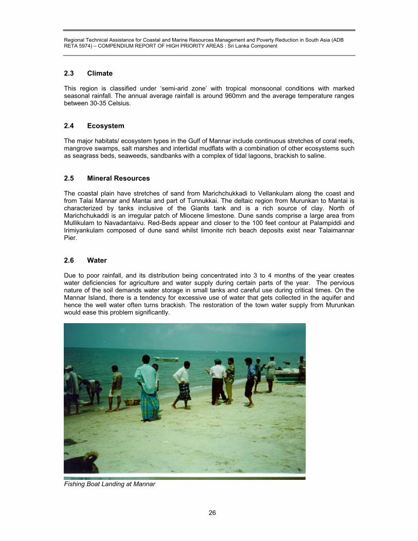
2.3 Climate This region is classified under ‘semi-arid zone’ with tropical monsoonal conditions with marked seasonal rainfall. The annual average rainfall is around 960mm and the average temperature ranges between 30-35 Celsius. 2.4 Ecosystem The major habitats/ ecosystem types in the Gulf of Mannar include continuous stretches of coral reefs, mangrove swamps, salt marshes and intertidal mudflats with a combination of other ecosystems such as seagrass beds, seaweeds, sandbanks with a complex of tidal lagoons, brackish to saline. 2.5 Mineral Resources The coastal plain have stretches of sand from Marichchukkadi to Vellankulam along the coast and from Talai Mannar and Mantai and part of Tunnukkai. The deltaic region from Murunkan to Mantai is characterized by tanks inclusive of the Giants tank and is a rich source of clay. North of Marichchukaddi is an irregular patch of Miocene limestone. Dune sands comprise a large area from Mullikulam to Navadantaivu. Red-Beds appear and closer to the 100 feet contour at Palampiddi and Irimiyankulam composed of dune sand whilst limonite rich beach deposits exist near Talaimannar Pier. 2.6 Water Due to poor rainfall, and its distribution being concentrated into 3 to 4 months of the year creates water deficiencies for agriculture and water supply during certain parts of the year. The pervious nature of the soil demands water storage in small tanks and careful use during critical times. On the Mannar Island, there is a tendency for excessive use of water that gets collected in the aquifer and hence the well water often turns brackish. The restoration of the town water supply from Murunkan would ease this problem significantly.
Fishing Boat Landing at Mannar

Regional Technical Assistance for Coastal and Marine Resources Management and Poverty Reduction in South Asia (ADB RETA 5974) – COMPENDIUM REPORT OF HIGH PRIORITY AREAS : Sri Lanka Component
27
2.7 Fisheries Fishing industry is one of the two main economic activities in the area. The fisheries resources could be classified as:
x� Marine x� Brackish water x� Fresh water
Fishing is the most common activity in the Mannar region that has a reputation for sprats and dry fish. The fishing in the area extends from Thevanpiddi in North to Mullikulam in the East and Talaimanner in the South with some twenty-nine small fishing harbours. Most of the fishing villages are situated close to these harbours. Large number of fishing families was displaced after the civil disturbance in 1983 and the mass exodus took place in the years 1985 &1990 due to the threats from rebels and restrictions imposed by the security forces. Tables 1 & 2 give a picture of the status of the fishing industry (Resources Profile of Mannar District, 1999).
Table 2.1 : Number of Fishing Families
Year Families Population Active Fishermen 1983 4,042 16,159 5,551 1990 3,734 14,897 4,985 1992 6,998 24,252 5,684 1996 7,058 25,428 8,452 1997 7,083 25,630 8,456 1998 7,085 25,720 8,545
Source: Resource Profile Mannar District 1999 See also Annex 2.3
Table 2.2 : Total Amount of Wet & Dry Fish Production
Year Wet Fish Production (Mt)
Dry Fish Production (Mt)
1981 9,786 1,845 1991 8,782 1,676 1998 4,347 812 1999 4,530 500 2000 4,600 515
Source: Resource Profile Mannar District 1999
Table 2.3 : Production of Fish in Mannar 1991-1998
Year Production (Mt) 1991 8,783 1992 6,225 1993 6,300 1994 3,500 1995 3,800 1996 3,850 1997 3,925 1998 4,347

Regional Technical Assistance for Coastal and Marine Resources Management and Poverty Reduction in South Asia (ADB RETA 5974) – COMPENDIUM REPORT OF HIGH PRIORITY AREAS : Sri Lanka Component
28
Table 2.4 : Estimated Fresh Fish Production Year Production (Mt) 1985 8,246 1986 8,246 1987 8,567 1988 8,694 1989 9,050 1990 6,299 1991 8,782 1992 6,225 1993 6,300 1994 3,500 1997 4,528
Table 2.5 : Numbers of Fishing boats used in 1985 and 1998 Year Trawlers
O.B.M. Non Mechanised
Craft Theppam Madel Nets
1985 263 1886 383 - -1998 30 782 435 151 50
Source: Department of Fisheries, Mannar 2.8 Industries Salt Salt is being produced in the dry season of Yala. No production is done during the rainy period from October to December. Mannar saltern is one of the important salt producing centers of Sri Lanka. This saltern was producing an average of 3,500 to 4,000 metric tons of salt per year up to 1989.
. The salterns caters to:
x� supplying salt for dry fish production x� supply of salt to multipurpose co-operative societies and the private sector. x� supply of salt to ice factories
The Mannar saltern at the peak of the season was producing 4277 Mt and now producing only 1235Mt. The drop was due to ethnic conflict erupted in mid June 1990 and the lost of basic machinery, water pumps and damaged to salt farm-bunds and channels.
Table 2.6 : Salt Production (Annually) Year Annual Production 1990 5301991 -1992 -1993 5781994 760.151995 1141.951996 281.251997 1384.601998 1235.101999 2076.92000 2157.4
Source: The Divisional Secretariat of Mannar

Regional Technical Assistance for Coastal and Marine Resources Management and Poverty Reduction in South Asia (ADB RETA 5974) – COMPENDIUM REPORT OF HIGH PRIORITY AREAS : Sri Lanka Component
29
2.9 Threats 2.9.1 Human
x� Exploitation of coral and shells for lime, building blocks and rubble x� Excessive hunting for marine species such as dugong, turtles, waterfowl and collection of
tiger prawn x� Collection of large quantities of molluscan shells for the ornamental trade x� Turbidity caused by coral mining and coastal erosion causing deterioration of the reefs x� Toxic discharge from industrial and agricultural activities
- Excessive commercial fishing (above carrying capacity of local stocks) - Oil spills and marine pollution from ships
x� Over-exploitations of Holothurians, edible seaweed species, ornamental shells, chanks, pearl oysters and sea fans
x� The conflict has led to more intensive use of natural resources such as forests for timber and firewood.
2.9.2 Natural
x� Sea surface temperature rise in marine waters due to El Nino causing widespread coral bleaching
x� Coastal areas are increasingly threatened by natural processes such as storm surges that cause severe coastal erosion portions of the southwest coast. They are also threatened by human activities that increase erosion and pollution, and degrade valuable habitat that serve a source of food and livelihood for many coastal residents.
Table 2.7 : Status of Sea Erosion
Vulnerable Area Division Type of Problems Extent of area or length under threat
Talaimannar Mannar Sea Erosion 38.8 kmPesalai Mannar Sea Erosion 41.4 kmErukkalampiddy Mannar Sea Erosion 15.5 kmMannar Town Mannar Sea Erosion 9.8 kmVankalai Nanaddan Sea Erosion 15.5 kmSource: The Divisional Secretariat of Mannar 2.10 Potential development activities In the Mannar region though the brackish water resources are suited for aquaculture (crabs and prawn culture) very little is being used up to now. It was informed that the ice factory in Mannar sold ice at comparatively higher prices and leading to a situation that some of the empty fish lorries returning from Colombo used to carry ice to Mannar. To increase the production, immediate need is to renovate all damaged buildings and replace all lost machinery and water pumps. Also mid term programme to produce allied chemicals, such as caustics soda could be planned to expand the salt industry. 2.11 Recommendation and solutions for the continuous development planning of
the fishery sector. The fisheries Department is responsible for:
�� Fisheries development, extension and training services. �� Organisation of village level fisheries co-operative societies and guidance. �� Law enforcement under fisheries ordinance.

Regional Technical Assistance for Coastal and Marine Resources Management and Poverty Reduction in South Asia (ADB RETA 5974) – COMPENDIUM REPORT OF HIGH PRIORITY AREAS : Sri Lanka Component
30
�� Anchorage and shore facilities improvements. �� Aquaculture development.
Development needs include
�� Provision of basic fishing amenities �� Financial assistance through banks by way of soft loans from a revolving fund �� Establishment of anchorage facilities.
2.12 Specific Conservation Needs/ Recommendations Potential for declaration as a trans-boundary international reserve between India and Sri Lanka. Specific conservation measures include:
x� Measures to protect rare and endangered species x� Regulation and management of commercial fishery x� Restoration and protection of coral reefs from further degradation x� Regulation of the molluscan shell industry x� Bio prospecting economically important species
2.13 Current Socio-economic problems to be addressed The main problems affecting the marine resources are the Indian trawlers operate very close to Mannar coastline and exploit the fish resource and that the operations if continued would deplete the local resources. The fisheries department is unable to initiate any action. The cool rooms are not functioning. Problems facing in the district divisional and village level
x� Displacement of fishermen. x� Loss/damage to fishing boats and gear. x� Lack of adequate credit for purchase of new boats and gear. x� Fishing is not permitted in the uncleared area.
REFERENCES
�� Central Environmental Authority / ARCADIS Euroconsult, (1999). “Wetland Conservation Project – Sri Lanka; Wetland Atlas of Sri Lanka”, p.22, Publ. Central Environment Authority, Ministry of Forestry & Environment, Govt. of Sri Lanka.
�� Indian Coral Reef Monitoring Network (ICRMN) (2002). Electronic Publ. Indian Coral Reef
Monitoring Network (ICRMN), Ministry of Environment & Forests, Govt. of India, http://envfor.nic.in/icrmn/dist/mannar.html
�� IndiaMART InterMESH Limited (2002). “Gulf Of Mannar Marine National Park”, Electronic
Publ. http://travel.indiamart.com/tamil-nadu/wildlife/gulf-of-mannar-marine-national-park.html
�� M.S. Swaminathan Research Foundation, (1998). “Gulf of Mannar marine Biosphere Reserve, Tamil Nadu, India”, Papers on Gulf of Mannar, Journal of Indian Bird Records and Conservation, Manzil Important Bird Areas, Manzil 1(1)2JIBRC volume 1(1), Electronic Publication, http://www.angelfire.com/fl/indianbirds/manzil1.html.

Regional Technical Assistance for Coastal and Marine Resources Management and Poverty Reduction in South Asia (ADB RETA 5974) – COMPENDIUM REPORT OF HIGH PRIORITY AREAS : Sri Lanka Component
31
�� Sanctuary Asia – Campaign (2000). “Gulf of Mannar: Shipping threatens dugongs, turtles”, Electronic Publ. Sanctuary Asia – Campaign Mumbai, India, http://www.sanctuaryasia.com/takeaction/detailcampaign.php?cid=38
�� Scott, D.A., (1989). “A Directory of Asian Wetlands”pp.627-8. Publ. IUCN, The World
Conservation Union, Gland, Switzerland, and Cambridge, U.K.
�� Shaw, R., (2002). “Offshore Back On Agenda After Mannar Basin Rethink”, Electronic Publ. Oilonline, http://www.oilonline.com/news/features/aog/20020426.Offshore.8647.asp
�� Thanilachalam M. & Ramachandran S.(2002). “Management of Coral Reefs in Gulf of Mannar
using Remote Sensing and GIS Techniques – with Reference to coastal Geomorphology and Land Use", Electronic Publ. http://www.gisdevelopment.net/application/nrm/coastal/mnm/nrmmm008.htm .
�� United Nations Development Programme (UNDP) (2002). “India gives communities a stake
while preserving biosphere”, UNDP, India, Electronic Publ. http://www.undp.org/dpa/frontpagearchive/2002/may/1may02/
�� Resources profile Mannar District 1999.
�� Statistical Hand Book 2001, Mannar District.

Regional Technical Assistance for Coastal and Marine Resources Management and Poverty Reduction in South Asia (ADB RETA 5974) – COMPENDIUM REPORT OF HIGH PRIORITY AREAS : Sri Lanka Component
32
HIGH PRIORITY AREA (HPA III)
PASSEKUDAH – KALKUDAH CLUSTER
3.1 Location
Passekudah Cluster is located in the Batticaloa District of the Eastern Province. (Location 07.50N and 08.00N and 81.30E and 81.40E) It extends across Koralaipattu and Koralaipattu-North Divisional Secretariat Divisions. It covers the Maduru Oya estuarine area and Passekudah to the south and Vandaloos Bay to the North. Valachenai – the main township in the area is located at about 190km from Colombo (Map 3). 3.2 Physical Features This indented stretch of coast consists of a series of bays and headlands, backed by beach ridges, lagoons, zones of sedimentation and a low residual terrain. The headlands are all of coral and are being slowly but steadily eroded by the sea.
Calm Waters and Coral Sand Beaches at Passekudah This zone is also intensively mined for coral extraction. Northeast of Velikuda and Periya Munai point, a bare, small coral island rises over 2 meters above mean sea level, and points to a period of higher sea level or land upheaval. Between these two points, the shallow coastline also is an almost continuous band of rough sandstones. The submerged sandstone has also a vast growth of coral.

Regional Technical Assistance for Coastal and Marine Resources Management and Poverty Reduction in South Asia (ADB RETA 5974) – COMPENDIUM REPORT OF HIGH PRIORITY AREAS : Sri Lanka Component
33
3.3 Climate The site is located in the country’s “Dry Zone“ and receives an annual average rainfall of 2021mm. Most rain falls in the period from November to March. Average annual temperature is about 28 0 C. 3.4 Habitat/Ecosystem In the Passekudah bay, very close to the shoreline there is extensive growth of coral, especially around a rock, which is visible above water level. Stag horn coral exists in the shallow water of five fathoms between Vandeloos point and southern area of Passekudah Bay. It embraces ecosystem types of lagoon, beach, mangrove and coral reef. Limestone deposits of fossiliferous coral (?) are found in places near the coast, mostly in the Koralaipattu and Koralaipattu-north D.S. Divisions. The people dig pits near the seacoast and remove the corals to produce lime, which is mainly used in building construction. 3.5 Population Population figures for Passekudah area are given in Table 3.1 and 3.2. It could be seen that Korali Pattu North is less densely populated than the Koralai Pattu South. Certain GN Divisions such as Kalkudah, Kannakipuram and Kiran East have very high densities of population exceeding 3000 persons. In terms of the composition, the area is predominantly occupied by a Sri Lanka Tamil population. The relative position of each group is as follows: Sinhalese (0.46%) Tamil (99.05%) Muslim (0.24%), Others (0.29%).

Regional Technical Assistance for Coastal and Marine Resources Management and Poverty Reduction in South Asia (ADB RETA 5974) – COMPENDIUM REPORT OF HIGH PRIORITY AREAS : Sri Lanka Component
34
Map 3

Regional Technical Assistance for Coastal and Marine Resources Management and Poverty Reduction in South Asia (ADB RETA 5974) – COMPENDIUM REPORT OF HIGH PRIORITY AREAS : Sri Lanka Component
35
Table 3.1 : Population
Name of G.N. Divisions G.N. Divisions No Population Murakkoddanchenai 199 2,460Thevapuram 199 A 1,882Santhiveli 200 2,981Palayaditihona 200 B 1,307Sunkankernei 202C 969Kiran East 203 3,125Kumburumoolai 203B 662Korakallimdu 203C 1,018Kalkudah 204 3,682Kalkudau 204 A 2,332Valaichenai Tamil 205 1,627Pethalai 205 B 2,450Nasivanthivu 205 C 1,125Kannakipuram 205 D 3,080
Sources: Statistical data (2000/2001) Divisional Secretariat: Koralaipattu, Valaichenai
Table 3.2 : Population data on Divisional Secretariat : Koralipattu North (1990)
Name of G.N.Division G.N.Division No Sq.Km Population Mankerney 211 10 596 Mankerney South 211G 10.5 653 Kayankerney 211A 10.4 1,063 Vaddavan 211D 12.8 1,104 Punanai 211B 30 1,761 Pannichenkerney 211C 32 1,785 Uliyan Kaddu 212B 29 535 Vakarai 212 20.5 827 Vakarai North 212A 18.5 1,852 Pannichenkerney 213D 29 786 Palchenai 213A 18 1,125 Ammanthanavely 213C 77.3 994
Livelihoods support systems
The economic geologists consider Batticaloa as a district that has the least amount of minerals when compared to the other districts. However, the available minerals include, clay used to make bricks and tiles; granite stone used for road construction and buildings, and the coral use to make lime for building construction. Tourism has been a major source of income to the area prior to commencement of civil disturbance in the area. 3.6 Fishing There are several important offshore fishing grounds within this area and the lagoons contain productive shellfish resources. Tropical exotic fish habitats are found in the coral reefs. A large number of fisherman who lost their boats and gear due to ethnic violence have been given assistance to recommence their industry by providing fishing equipment by the Eastern Rehabilitation and Reconstruction Organization. See Annex 3.2.

Regional Technical Assistance for Coastal and Marine Resources Management and Poverty Reduction in South Asia (ADB RETA 5974) – COMPENDIUM REPORT OF HIGH PRIORITY AREAS : Sri Lanka Component
36
3.7 Agriculture The pan grass (sedges) used to make mats, hats and bags grows wildly in low-lying areas near the paddy fields and watercourses. The people have not fully utilized coconut fiber as a raw martial in development industries. They have still to develop the coir industry in large scale as found in other districts. The coconut is used to make broomsticks and ropes as a cottage industry in few village. See Annex 3.1.
3.8 Key Issues of Concern
Permits For Land To encourage the farmers who are engaged in food production by way of improving tenurial security. This may be done while adopting necessary environmental safeguards. Marketing There is much scope for establishing an Agricultural Co-operative Development structure including a number of purchasing points in close proximity to the agricultural production areas. This would result in saving time and avoiding much transport cost to the farmers who are engaged in agricultural production Threats x� Overexploitation of marine ornamental fish x� Overexploitation of corals x� Overexploitation of ornamental molluscs x� Clearance of mangroves x� Coral mining x� Pollution from Paper Factory wastes x� All lagoons are intensively used for a variety of livelihood activities including fishing, aquaculture
and irrigation. Decline in water quality is noted in several. Increased degradation of environmental quality will further compromise the potential of the lagoons to support potential future tourist activities.
Socio-economic problems of Habitats/Ecosystem Protection Collection of ornamental species by outsiders and not local communities prevents them from reaping economic benefits, while resources become extremely scarce for the inhabitants. The beaches are very shallow and conducive to nature-based tourism. However the civil unrest in the past few years has not allowed this. If followed it would allow creating an income source for locals. Furthermore the extensive use of lagoons for the various livelihood activities described above will result in the compromise of the potential to support future tourist activities.

Regional Technical Assistance for Coastal and Marine Resources Management and Poverty Reduction in South Asia (ADB RETA 5974) – COMPENDIUM REPORT OF HIGH PRIORITY AREAS : Sri Lanka Component
37
Valachenai Paper Factory Contributes to Water Pollution 3.9 Specific Conservation Needs/Recommendations
x� Surveys to assess flora and phyla species occurring x� Conduct an environmental impact studies of industries x� Carry out an inventory of aquaculture practices, assess their impact, and initiate a range of
mitigating and controlling activities x� Introduce a pollution monitoring and awareness program x� Explore potential for sustainable nature-based tourism x� Restoration and protection of coral reefs from further degradation x� Regulation of the molluscan shell industry x� Regulation, monitoring and restoration of mangroves
REFERENCES
�� Dearden, P., (2002), “Tourism Development in the Coastal Zone; Eastern Province, Sri Lanka”, Workshop Draft: Unpublished Report by Asian Development Bank: TA3479-SRI

Regional Technical Assistance for Coastal and Marine Resources Management and Poverty Reduction in South Asia (ADB RETA 5974) – COMPENDIUM REPORT OF HIGH PRIORITY AREAS : Sri Lanka Component
38
HIGH PRIORITY AREA (HPA IV)
CHILAW ESTUARY 4.1 Location The Chilaw estuary is located on Sri Lanka’s west coast in the Puttalam District of the North Western Province. (Location: 07.25 N – 07.35N and 79.40 E – 80.00E). Chilaw Township is located at some 75km north of Colombo and 40km from Negombo. Chilaw point is some 40 nautical miles of Colombo harbor and 25 nautical miles north of Negombo point. Immediately to the north of the lagoon is the estuary of Deduru Oya, - a river which is having undoubted influence on the hydrodynamics and sediment budget at this location. 4.2 Landscape and Physical features Situated at or just above sea level, the area (3,700 ha of which 1,800 ha qualify as wetland) includes coconut plantations, open water (mainly the 2 km by 5 km Chilaw Lake), paddy lands, marshes, mangroves, and aquaculture farms, and a low dune ridge along the coast. The slightly undulating terrain of the catchments of the main in flowing river- the Karambalan Oya, which is predominantly covered by coconut plantations, village gardens and paddy. (Map 4.1) 4.3 Geology & Geomorphology
Precambrian rock underlies the quaternary surface formations of the study area; the latter are subdivided into lagoon and estuarine deposits and sands in the west, and red-earth in the east. The estuary was created through deposition of sediments behind a barrier beach, an in filling process, which can be observed today as well. 4.4 Hydrology and Water Quality
Most fresh water influx to the lake stems form the Karabalan Oya catchment, which outflows to the sea at two locations, namely at Chilaw and Toduwawa. Both channels used to get blocked by sand bars during a part of the year. Regular flooding and pollution of surface water (from settlements and aquaculture farms) are regular problems, and salinity levels vary considerably during the year. Groundwater is generally of good quality.
Table 4.1: Some physiochemical characteristics recorded
Water temperature (c) 25-34 Salinity (ppt) 0-38 PH 7.4 Dissolved oxygen (mg 1-1) 6.5-11.0 Phosphate (ug1-1) 30-48 Nitrate (mg1-1) 0.10-0.6
4.5 Climate
With a mean annual rainfall of around 1,500 mm, the site located in the Intermediate Zone between the country’s Dry and Wet Zones. Most rain is received during April-May and October-December periods, being coincidental with the inter-monsoon months. Annual mean temperature is about 27 0C.

Regional Technical Assistance for Coastal and Marine Resources Management and Poverty Reduction in South Asia (ADB RETA 5974) – COMPENDIUM REPORT OF HIGH PRIORITY AREAS : Sri Lanka Component
39
4.6 Vegetation
Much of the original low / marshland vegetation is degraded due to conversion into coconut plantation and aquaculture ponds. Mangroves presently cover less than 100ha. The aquatic vegetation is dominated by phytoplankton and sea grass beds (Halophila). Of the almost 150 plant species recorded from the area, none is endemic but two are considered as threatened in Sir Lanka.

Regional Technical Assistance for Coastal and Marine Resources Management and Poverty Reduction in South Asia (ADB RETA 5974) – COMPENDIUM REPORT OF HIGH PRIORITY AREAS : Sri Lanka Component
40
4.7 Land Use Conditions Mainland uses in and around the study area are coconut plantations (50% of area coverage of the Chilaw DS Division) capture fishery (mostly marine), aquaculture farming, lands leased to the Voice of America (VOA) Radio Relay Station, and agriculture (paddy). Data on animal husbandry are scanty. (Annex 4.1) 4.8 Habitat/ Ecosystem The area has several ecosystem types that include those of salt marsh, ocean trench, atoll, and mangroves. Marawila Covering about 95ha supports a mangrove system of Acanthus illicifoleu Aegiceras corniculatum, Bruguiera cylindrica, B.gymnorhisa, Excocaria agalloocha, Lumnirzera racemosa and Xyocarpous granulata together with common associates like in the other mangrove complexes already described. Much of the mangroves complex is already under severe threat due to illicit encroachment by prawn farmers. Apparently, these illegal activities cannot be controlled, let alone prevented, because of interference of external forces and due to constraints in enforcing existing environmental laws. Much of the salt marsh vegetation adjoining the mangrove system has already been utilized for prawn farming, and the deleterious effects are already evident. Pambala As one of the most attractive remaining mangrove systems, the Pambala complex covers about 125ha of a mixed vegetation of Acanthus illicifoleus, Acanthus sp, Acrostichum aureum Avicennia marina, A.officinalis, corniculatum; Ceriops tagal, Excoecaria agallocha, Heritiera littoralis, Lumnitzera racemosa Rhizophora apiculata and R.mucronata. This precious mangrove area is already under serious threat due to industrial, technological and aquaculture invasions. One plot of about 20ha has already been given to a company and several isolated prawn farms also occur within the mangrove system. One positive feature is the involvement of an active NGO in mangrove management and protection. A mangrove conservation project based there and run by the small fisheries federation has been successful in mobilizing fishermen for mangrove conservation. Salt Marsh Vegetation The sandy and mud flats adjoining the mangrove complex support salt marshes characterized by the localized predominance of Arthocemum indicum, Salicornia brachiata, Suaeda maritimeand S.monoica. Certain habitats support what are known as salt marsh pastures predominated by Cynodon Dactylon. (See Annex 4.2) 4.9 Livelihood Support Systems The density of population is high in the GN Divisions of Aluthwatte, Maikkulam, Pitipana, Weralabada, and Iranawila where the pressures on resources are higher (Annex 4.1 & Map 4.2). 4.10 Fisheries
Three sectors are generally distinguished: i) Coastal and offshore (within the Chilaw DS Almost 2,000 families are involved in mainly
prawn and lobster fishing; annual catch is around 8,000 mt). ii) Estuarine fishery (Area 83.5 km /ha); iii) Inland fresh water fishery (only seasonal; 18 fisherman involved).

Regional Technical Assistance for Coastal and Marine Resources Management and Poverty Reduction in South Asia (ADB RETA 5974) – COMPENDIUM REPORT OF HIGH PRIORITY AREAS : Sri Lanka Component
41
Chilaw lagoon including Toduwawa is known to be highly productive and records some 15 species of finfish, 4 species of shrimps and 1mud-crab species as commercially important species. The most common fishing gear used in the areas around mangroves are trammel nets, valachal nets, drift nets, brush piles and crab traps. The total annual shrimp production is estimated to be about 6MT around Pambala and 8.2 MT around Toduwawa. (See Annex 4.3)
Presently the Chilaw lagoon/ anchorage is used by a large number of 17-23ft long FRP boats and by a substantial number of 3.5 tons boats that anchor for shelter and as a place of unloading the fish catch. However, navigation to and from the lagoon becomes a problem to these crafts when the sand barrier extends and entrance to the lagoon becomes shallow.
Table 4.2 : Marine Fish Production 1995 to 2000 (in t)
Year Production 1995 24,5501996 22,6101997 22,9001998 23,9501999 24,2602000 25,650
Source: Sri Lanka Fisheries 2000
Table 4.3 : Main Features of fishery harbours and anchorages
Boat lifting 5 tonsBlock ice 5 tons per dayIce storage 30 tHolding room fish on ice 10 tFrozen fish storage 25 tWorkshop 205 sq. metersWater tank 18000 lSource: Sri Lanka Fisheries Year Book, 2000
Identified Fish Species (Chilaw)
Table 4.4 : Basic Statistics of Marine Fisheries
1996 1999 Fishing households 6,684 8,264Active fishers 8,039 9,090Population of fishing households 30,901 37,188Active fishing boats 3,561 3,259No of fishing villages 65 65Source: Sri Lanka Fisheries Year Book, 2000

Regional Technical Assistance for Coastal and Marine Resources Management and Poverty Reduction in South Asia (ADB RETA 5974) – COMPENDIUM REPORT OF HIGH PRIORITY AREAS : Sri Lanka Component
42
Table 4.5 : Operating fishing craft by DFEO (1999)
Total 3231 In board Multi day boats 7 day boats 28 Out board FRP 1531 Traditional boats - Non-mechanized traditional crafts 1665 Source: Sri Lanka Fisheries Year Book, 2000
Table 4.6 : Fish handled by Ceylon Fisheries Cooperation (1996-2000) in MT
CHILAW Qty (mt) 1996 23.811997 14.31998 60.651999 51.72000 53
Source: Sri Lanka Fisheries Year Book 2000 4.11 Aquaculture The aquatic life and the fisheries around Chilaw (Pambala) are severely affected by prawn farming while the effects are rather moderate elsewhere. The recent rapid expansion of prawn farming has affected mangroves around Chilaw seriously. Distribution of prawn farms by land use categories.
Bare land 25.6% Agricultural land 31.8% Mangroves and salt marshes 29.6% Other 13.0%
Bare land, agricultural land, mangroves and salt marshes are the main land categories sacrificed for prawn farming, and nearly 30% of the mangroves and salt marshes in and around the area have already been utilized. It must be remembered that much of the land destroyed for prawn farming has been salt marshes, which were the convenient sites for erecting tanks, and the adjoining mangroves would indirectly be affected through pollution, edaphic changes and other manipulations. A large number of shrimp farms and hatcheries have sprung up in Ambakandawila. This has involved large areas of mangrove forests being converted into cultivation ponds. Most of these shrimp farms are small, 60% being less than 2 acres. Furthermore, large proportions of farms are illegal as they are built on state-owned land without formal permission. Only 9 farms in Ambakandawila live up to official requirement in terms of landownership, registration and approval. 4.12 Agriculture The coconut plantations are estimated to cover about 4,636 ha in the area. Apart from the coconut plantation themselves, many industries are associated with it (e.g. copra, oil, juggery, and timber). Escalating production costs and withdrawal of fertilizer subsidies have put the sector in economical

Regional Technical Assistance for Coastal and Marine Resources Management and Poverty Reduction in South Asia (ADB RETA 5974) – COMPENDIUM REPORT OF HIGH PRIORITY AREAS : Sri Lanka Component
43
problems, while solid and liquid waste products and encroachment into marshland vegetation creates environmental problems. The coir fiber mills around Marawila, and Pambala are likely to cause some harmful effects on the mangroves. Other crops of economic importance around the Chilaw lagoon are cultivation of vegetables. The uses of fertilizer increasing so that pollution of low-lying habitats, including mangroves, would also ascend accordingly with deleterious repercussions. Indiscriminate use of agrochemicals in all cultivations is known to be detrimental to the ecosystems. 4.13 Threats 4.13.1 Natural (Ecosystem Degradation) Coastal erosion has been experienced in Ambakandawila and to combat this, a number of groynes have been constructed to protect the village beach. The building of these protection structures followed a long process of negotiations and lobbying. Amongst other issue the following are of importance:
�� Sand bar formation affecting navigation of fishing boats �� The river discharge during floods and periods of drought vary considerably. �� Mixing effect of the lagoon and seawater.
4.13.2 Human Related Threats The fishing communities depend largely on the mangroves for their requirements of timber, firewood and other plant products. It is customary for them to cut small trees for poles and remove the bark of certain plants for tanning purpose etc. This results in selective removal of certain plants and plant products so that they are threatened while the others are being indirectly and unintentionally benefited simply because they hardly influenced by the humans. During the fishing season a considerable amount of fishing craft is landed on the beach, which is lined by shrimp hatcheries and houses. The lagoon is bordered by an almost uninterrupted line of shrimp farms.
The changes in the cultural priorities from fishing agriculture to an agro-industrial culture predominated by prawn farming and mechanized fishing has had considerable influence on the mangroves. For example the introduction of prawn farming has led most locals to the illusion that this new aqua-cultural endeavour is more profitable than any traditional socioeconomic and cultural practices. The social pressure on the mangrove is from two sources: i) The villagers in the vicinity of the mangroves depend on the vegetation for timber, fuel wood
etc; ii) Fishermen use the mangroves plants for construction of kraals – traditional fishing traps etc; The actual impact of local villagers and fisherman on mangroves is almost insignificant, except where mass destruction of vegetation is carried out for specific purposes. More severe are the socio-economic threats aggravated through industrial aqua-cultural and agricultural manipulations.
Some specific threats are as given below:
x� Threats to endangered species who find refuge in the area (2 species of plants and 3 vertebrates are considered threatened with one endemic species)
x� Manipulation of water resources by breaching of sand bars blocking the outflow channels towards the sea in the wet season (to avoid flooding) and extraction of groundwater for aquaculture (to decrease salinity) and domestic use, both reportedly leading to salt water intrusion. The latter is further worsened by discharge of salt water from the aquaculture ponds into the estuary.

Regional Technical Assistance for Coastal and Marine Resources Management and Poverty Reduction in South Asia (ADB RETA 5974) – COMPENDIUM REPORT OF HIGH PRIORITY AREAS : Sri Lanka Component
44
x� Unauthorized & unregulated shrimp farming x� Area made aesthetically unattractive by shrimp ponds x� Destruction of stands of mangroves for the construction of aquaculture farms, and brush piles,
- a fish aggregating device, and for firewood purposes x� Clearing of biologically rich marshes and mangroves causing loss of breeding grounds for
wild shrimps and fish and increased erosion x� Untreated effluent discharge from aquaculture ponds x� Excessive commercial fishing (above carrying capacity of local ecosystem) x� Pollution by garbage disposal of settlements adjacent to the beach x� Fishermen dump fish waste collected at landing sites x� Dumping sites of solid waste and sewage resulting in eutrophication and contamination of
caught fish by bacteria such as coliform x� Flooding due to upstream deforestation and construction of aquaculture farms x� Horizon pollution by the Voice of America Station x� Destruction of seagrass beds (e.g. encircling nets, push nest and trawling) x� Some fishing gear such as Kralls, interfere with the migration of fish and other animals
between the estuary and the sea x� Reeds and sedges extracted for making fish nets and mat weaving x� Oil pollution from fishing boats passing through to get access to the sea x� Agriculture resulting in increased erosion and hence siltation of the water x� Stagnant water bodies serve as ideal breeding places for Japanese Encephalitis, Dengue,
and Hemorrhage Fever 4.14 Potential for Development Few tourist activities take place within the estuary. The coastline has restricted tourism potential due to prevailing rough seas during part of the year, a narrow beach and the presence of sandstone banks. Research conducted focused so far on the fisheries sector. Projects and plans with the most significant impact on the estuary are aquaculture developments. A mangrove conservation programme has started recently by Small Fisheries federation – a local NGO.
Table 4.7 : Strengths, weakness and strategies for different management options for Pambala
Site Strengths Weakness Strategies Pambala Fairly large extent,
Undisturbed vegetation, High decency fishing community, Aesthetically very attractive, Active NGO location-setting for tourism.
Prawn farming Conservation of un disturbed area nature base tourism participatory management.
Source: Mangrove conservation plan 1996. 4.15 Socio-economic Problems Associated with Ecosystem/ Habitat Protection The influx of refugees from the civil disturbances in the north has accentuated already mounting pressure on fishery resources and current fishery is now judged to be well over sustainable limits. The main constraints in the fishing industry include the vulnerability of fisheries’ societies to political change, the individualistic nature of the fishing economy which leads many fishermen to pursue their own rather than collective interests, the conflicts associated with shrimp trawling, beach seining, light

Regional Technical Assistance for Coastal and Marine Resources Management and Poverty Reduction in South Asia (ADB RETA 5974) – COMPENDIUM REPORT OF HIGH PRIORITY AREAS : Sri Lanka Component
45
fishing, diving and a ban on seasonal fisherman on some beaches. Some specific problems identified are given below: Shrimp farming
x� Uncontrolled spread of shrimp farms and hatcheries leading to over development x� Clearance of mangrove areas for shrimp ponds x� Disease outbreaks leading to great financial losses x� Pollution of the lagoon through discharge salination of during water wells x� Flooding
Fishing
x� Overexploitation of available resources x� Restrictions on seasonal migration x� Disputes over shrimp trawling, diving methods used, space on beach. x� Degradation of lagoon fisheries
Vegetable cultivation
x� Pollution of the water table due to intensive use of agro-chemicals. x� Vulnerability to market fluctuations
Tourism
x� Enclosure of land by the beach x� Pollution and traffic x� Social impacts
Mangrove degradation
x� Loss of bio-mass x� Loss of breeding grounds for shrimps and fish x� Loss of sources of building material wood fuel or natural medicines
Coastal erosion
x� Loss of land and buildings Fishing
x� Fishermen from Ambakandawila then migrate to near by Chilaw where the estuary of the lagoon allows access to the sea through the year. Lagoon fishery is marginal to the economics of this village.
x� Only in Ambakandawila is there a substantial minority of people who does fishing in the Chilaw lagoon during the off-season.
4.16 Specific Conservation Needs / Recommendations From a conservation point of view, the Chilaw estuary scores moderately with respect to its biological diversity, however, surveys conducted so far resulted in incomplete species lists, so that this aspect may have been “undervalued”. The landscape is adversely affected by large – scale aquaculture development and will to some extent be affected by the VOA station. All other identified attributes (non-use values) and functions (indirect use value) rate as low (e.g. water quantity and quality regulation) to insignificant (e.g. historical value). Main uses (direct use values) of the wetland are animal production (prawns, inland fisheries), land development (Aquaculture farms and VOA station), and becoming a medium for disposal of waste.

Regional Technical Assistance for Coastal and Marine Resources Management and Poverty Reduction in South Asia (ADB RETA 5974) – COMPENDIUM REPORT OF HIGH PRIORITY AREAS : Sri Lanka Component
46
Table 4.8 : Summary of Fisheries Co-operative Societies in Chilaw (2000) No of societies 53Membership 8,458Share capital (US$/ RS?) 2,510,890Savings 15,530,821Other receivings 13,454,662Total funds 31,496,373 Relevant agencies having potential management over the study area include: the respective DSD’s and UC’s (control of land uses and development mangroves), Department of Fisheries, and the CEA (pollution monitoring, implementing EIA process). A mangrove conservation program has started. x� Prepare or update a conservation and development plan for the Chilaw estuary and environs
indicating among other things, which lands should be used for what and in what intensities and under which conditions; until its completion, further developments (e.g. aquaculture), should be banned
x� Formulate and enforce a fisheries regulatory system x� Carry out an inventory of aquaculture practices, assess their impact, and initiate a range of
mitigating and controlling activities x� Introduce a pollution monitoring and awareness program x� Monitor the impact of the VOA station, especially on bird migration x� Support ongoing and planned mangrove conservation activities REFERENCES
�� Central Environmental Authority / Euroconsult, (1994). “Wetland Site Report & Conservation Management Plan; Chilaw Estuary”, pp. viii-x, Publ. Central Environment Authority, Ministry of Environment and Parliamentary Affairs, Govt. of Sri Lanka
�� Survey to identify suitable areas in the coastal belt of Sri Lanka for prawn culture, 1990,
(NARA)
�� Studies on the prawn fishery by-catch from the West coast of Sri Lanka, D.S. Jayakody and H.H. Costa, (NARA)
�� An assessment of the stocks of commercially important penaeid prawn in the Chilaw sea Sri
Lanka, (NARA)
�� Some observation on small meshed gillnet fishery in Negombo and Chilaw, Pauline Dayaratne, (NARA)
�� Conservation of mangroves in Muthurajawela marsh &Negombo/Chilaw lagoon,
D.M.S.H.K.Ranasinghe.
�� Coastal wetland uses and related problems in Muthurajawela marsh and Negombo-Chilaw Lagoons, (MMNCL), M.J.S. Wijeyaratne.
�� Wetland site report Chilaw estuary, (CEA), 1994. Colombo
�� Investigations for Chilaw Anchorage, Intern Report, 1997, (LHI) Colombo

Regional Technical Assistance for Coastal and Marine Resources Management and Poverty Reduction in South Asia (ADB RETA 5974) – COMPENDIUM REPORT OF HIGH PRIORITY AREAS : Sri Lanka Component
47
HIGH PRIORITY AREA (HPA V)
BENTOTA ESTUARY 5.1 Location Bentota estuary (approximately 3,600 ha of wet and dry lands) is located at the bottom end of the Bentota river basin on the south - western coast, roughly halfway between the capital of Colombo and Galle town. Among the ‘wet lands’ of the study area, three zones were distinguished, The Bentota river channel and adjacent wet lands on either side of it, and Dedduwa Lake and associated marshy lands. In total such lands amount to about 1700 ha. The relatively high organic content in especially half-bog soils, and acid sulphate soils, on which cultivation is problematical, is a common phenomenon around Dedduwa Lake. This is further deteriorated by intrusion of saline water. (Map 5)
Bentota Estuary 5.2 Geomorphology Bentota coastal stretch is characterized by headlands, old beach rock formations (close to and at some distance from the shore), flood plains, swamps and small lakes. The Bentota lagoon/river and the Kalauwamodara Ganga, cut through raised beaches, and a large sand barrier. In certain places, laterite cliff is exposed to the sea, a rare phenomenon in the southwest coast, and which shows significant damage due to coastal erosion. The largest sediment source in this stretch is the Bentota River, whose sediment yield is estimated at around 20,000-40,000 cum/yr. A lot of sediments are deposited in the Bentota lagoon, which means that extreme discharge conditions will also supply extensive sediment to the coast in a kind of flushing process. The coast between Moragalla and Kaluwamodara rock has significantly changed since the middle of this century.

Regional Technical Assistance for Coastal and Marine Resources Management and Poverty Reduction in South Asia (ADB RETA 5974) – COMPENDIUM REPORT OF HIGH PRIORITY AREAS : Sri Lanka Component
48
The Bentota barrier has grown from the sediment yield of the Bentota River. The beaches still get their sediment supply from the river and some through the littoral drift from the south, which seems to have been declining in recent times. However the supply is very much reduced if the river discharges between the Kaluwamodara rock and the beach. The general sediment transport is directed northwards, but it is assumed that within the coastal stretch it is influenced by the headlands, submerged beach rocks, and small islands.
5.3 Climate and Hydrological Conditions The area is located in the county’s wet zone and has an annual rainfall of 2,500-3,000mm. Average monthly temperature and humidity values (26-290 C and 79% respectively) show little variation during the year. The Bentota Ganga has a discharge volume of 1,538 mcm/yr. However, as the catchment area is relatively low-lying, the sediment yield is smaller compared to rivers draining the mountain catchments. 5.4 Flora and Fauna Some 45-plant species have been recorded from the area. However, none of these is endemic or threatened. Mangrove communities dominate the river channel and banks; considerable stands are present on some locations. A low-lying land along the river and the marshes of Dedduwa Lake are dominated by Nymphaea plants and the adjacent marshy lands by sedges. Relatively many species were recorded for reptiles (24) and fishes (37), but few mammals (6), birds (49) and amphibians (1) were seen. The absence of common species on the lists, for example for birds, suggests that some species have been overlooked. Animals recorded include several species, but none of them is confined in its distribution to the study area

Regional Technical Assistance for Coastal and Marine Resources Management and Poverty Reduction in South Asia (ADB RETA 5974) – COMPENDIUM REPORT OF HIGH PRIORITY AREAS : Sri Lanka Component
49
Map 5

Regional Technical Assistance for Coastal and Marine Resources Management and Poverty Reduction in South Asia (ADB RETA 5974) – COMPENDIUM REPORT OF HIGH PRIORITY AREAS : Sri Lanka Component
50
5.5 Socio-economic Conditions The large majority of the population is Sinhalese (95.5%), followed by Muslims . Employment around the wetland area is mainly found in agriculture and people are relatively dependent on local resources (See Annex 1). Communities in the mangrove areas on the Bentota, Balapitiya coast derive their livelihood mainly by occupations such as agricultural and government emplacements (74% of the occupation of the household heads). Capture fisheries and tourism allied handicraft industry, which is based mainly on mangrove wood Cerbera manghas (mangrove depended occupations) provide the means of income for only a 10% of the total households surveyed. 5.6 Habitat/ Ecosystem Types 5.6.1 Mangrove ecosystems River Channel, adjacent wetlands on either side of the channel, the lake, mangrove swamps and associated marshy lands form the main ecosystems. The coastal stretch has a high variation of coastal habitats (coral reefs on the old beach rock reef, estuary and lagoon, mangroves, and barrier beaches) as identified in the coastal zone management plan. The vulnerability of these habitats is medium (only the cliff at Maradana is strongly eroding)
Table 5.1 : Bentota D.S. Division
Type of habitats Extent (ha) Mangroves 110Marshes 190Scrub 30
Fisherman in the mangrove areas often use more than one fishing gear and engage in a variety of supplementary occupations concurrently or during non-fishing seasons. This is inevitable, with the low profits associated with some artisanal fishing methods. The first headland to be seen is the Moragala to Bentota River mouth or Kaluwamodara Point, a rocky outcrop with a scenic view in all directions hosting a small temple. The Kaluwamodara stretch from Moragala to Bentota is more developed due to the number of hotels and other tourism facilities in this area. The Bentota beach from Bentota River mouth (or Kaluwamodara point) to Godagala headland is basically a sand barrier separating the Bentota River from the sea. 5.7 Livelihood Support Systems 5.7.1 Water As elsewhere, most water bodies and waterways are State owned. Water resource use and management is problematical due to salt-water intrusion, especially during the dry season, and the freshwater supply for domestic use. Some relief is provided through the installation of a tube well system, but its distribution is confined to only a small area. Outside this range people depend heavily on open well water.

Regional Technical Assistance for Coastal and Marine Resources Management and Poverty Reduction in South Asia (ADB RETA 5974) – COMPENDIUM REPORT OF HIGH PRIORITY AREAS : Sri Lanka Component
51
5.7.2 Infrastructure and housing Infrastructure facilities are not very close to the shore except for a minor road between Beruwela and Maradana. In the Maradana stretch, houses are close to the shore and are often threatened by erosion. 5.8 Importance to People 5.8.1 Tourism Tourism and recreation is an important economic sector in and around the Bentota estuary. Hotel accommodation has greatly expanded in the last decade and is still continuing. Tourists are taken out on the river by boat to visit cultural sites (temples) and to enjoy the river scenery. Some restrictions are needed for certain tourist activities (boat speeding, access etc.) and on the functioning of resort waste disposal systems that require regular monitoring and control. The concentration of hotels, ranging from high-end hotels to low-cost guesthouses, along this stretch is one of the highest in the country. New hotels have been built in the recent past, including the Taj Exotica five-star hotel located on Godagala headland at the southern end of the Bentota sand barrier, and hotel Eden and hotel Lanka Princess in the Kaluwamodera stretch. 5.8.2 Fishery Fishing is being undertaken on a minimal scale along the Maradana stretch but is non-existent on the other beaches.
Table 5.2: Mean catch rates of the small meshed gill net fishery during different years (kg)
Years 1995 1996 1997 95/97 Beruwela
26.15 67.85 38.22
44.0
Source: nutritional evaluation of some small coastal fish in SL, NARA In 1997 the best mean annual catch rate of 38.2kg per boat trip for FRP boats from Beruwela had been recorded. The fishing industry has developed over the years in respect of fishing season gear and the type of species caught. The best fishing season in the west coast is generally from June to October. The records during 1997 early 1980’s, 1995 and 1996, indicate that the best-fishing season for the west and south coasts were from April to November and August to December respectively.
Table 5.3: Seawater Fishery Industry – Beruwela DSD
Source: Fishery office Kalutara District
Sea Water 1994 1995 1996 1997 1998 No of fishery harbours 1 1 1 1 1Anchorage point 15 15 15 15 15No of boats 591 591 744 744 744No of fishery families 1753 1753 1753 1753 1753Annual fish production (in tons) 9,279 13,284 12,376 122726860 14,034

Regional Technical Assistance for Coastal and Marine Resources Management and Poverty Reduction in South Asia (ADB RETA 5974) – COMPENDIUM REPORT OF HIGH PRIORITY AREAS : Sri Lanka Component
52
5.8.3 Use of Mangroves Straight stems of Rhizophora species, Ceripos tagal and Bruguiera species are used to construct frames of thatched roofs, especially of temporary dwellings. Wattle of the mud walls of houses is made with timber from species of Rhizophora, Bruguiera and Sonneratia. Larger trunks of Bruguiera gymnorhiza are used, but very seldom as rafters and timber for windows pans. Use of mangroves as food and medicine is uncommon and the limited use of mangroves. (See annexes 5.2, 5.3, 5.4 & 5.5) 5.9 Threats 5.9.1 Natural threats to ecosystem degradation The major problems in this regard are the following:
x� The coastal stretch between Beruwela (Paranakade head land) and the latertites at Maradana have been subject to erosion for a long time, as a result of protection failure. A number of houses are located virtually on the waterfront and are under heavy threat of erosion.
x� The Kaluwamodera beach stretch is basically well nourished although heavy erosion is
observed at some places. The Bentota sand barrier is still stable and provides some of the best beaches on the west and southwest coast of Sri Lanka. The sand barrier was developed during this century and is still very dynamic and appears highly vulnerable. As the barrier is very narrow in the stretch between Bentota beach hotel and hotel Ceysands, it is essential to commence stabilizing measures at an early stage in order to avoid disastrous consequences. The laterite cliff is continuously eroding and a significant recess can be seen, and is ongoing. It is common for laterite cliffs that some material is weaker than others and thus caves can be created in the water line exposed to direct wave action. It should be mentioned that there is a possibility of failure as a road is located on top of this cliff. This is not so much a coastal problem, but a high risk for the public. 5.9.2 Erosion rates The erosion rate cited in the MPCEM (1986) was 75% of the coastline eroding at a rate of .35m/yr. CCD has revised this subsequently:
x� Beruwela to Bentota river: 60% of shoreline eroding at a rate 1.5m/yr, x� Bentota river to Robolgoga headland: 75% eroding at rate of 1.0m/yr.
A good monitoring of the seasonal variations over a long period (5-10 years) will have to be conducted to arrive at reasonable estimates. This was entrusted to the hoteliers to undertake using their own staff several years ago, without success. Now the same hoteliers claim that there is a heavy erosion trend. Indeed, there are indications that there is a long-term trend despite seasonal fluctuations .The beaches are usually nourished in the month of January to April, although the beach close to Hotel Ceysands is also rather narrow during this period. During the month of August, the beach becomes very narrow, particularly in the northern part. In the past years, the waterline at Club Robinson Resort came closer and closer to the Club Premises, and several meters of vegetation were washed away. These observations indicate that the estimated rate is very conservative and that the actual erosion rate would be much higher.

Regional Technical Assistance for Coastal and Marine Resources Management and Poverty Reduction in South Asia (ADB RETA 5974) – COMPENDIUM REPORT OF HIGH PRIORITY AREAS : Sri Lanka Component
53
The Kaluwamodera beach stretch is characterized by a large fluctuation, which is seasonal on and annual basis, but also seasonal as result of the location of the river mouth. The Maradana stretch is characterized by continues erosion, which is moderate at some places while significant at others. (See annex 9)
x� Salinity problems in domestic water owing to salt water intrusion x� Salinity problems and acidity create certain problems for wetlands rendering them unsuitable for
paddy cultivation
Salinity problems have been kept under control to some extent in the past by construction of sluices and gate structures, but most of these are now in a state of disrepair. Thus salinity intrusion is a major threat to the paddy lands in the low-lying areas. Data on land use are lacking, but some common uses are evident. These are cultivation of sedges (pan) for mat making, extraction of products from (mangrove) trees (timber, production of cork stoppers). The wetlands are reportedly unsuitable for paddy cultivation because of acidity and salinity problems.
In 1973 accretion has continued in an estimated 230 m wide strip, indicating a rate of about 8 m per year. Thus it is proven that the hotels are built on recently developed land. The beach in front of the hotels is nowadays nearly a straight line but has significant variation through the seasons and during longer cycles which are related to the location of the river mouth which is in fact not stable.
5.9.3 Human related ecosystem degradation Employment is around the wetland area is mainly found in agriculture and people are relatively dependent on its resources. x� Extraction of products from mangroves beyond sustainable level x� Noise and surface water pollution due to oil spills from tour boats and hotel effluents x� Domestic waste dumps, waste from the daily fair and coconut fiber dust mounts on the river side Sewage pollution by waste discharge from hotels in Bentota area has caused defoliation and death of Rhizophora apiculata in the estuary, as most of the hotels in the area have no facilities for sewage treatment. A large percent of the communities living near mangrove areas are under poor sanitary conditions. More than 50% of the households have no toilet facilities and the feacal matter is discharged directly into the environment. 5.10 Potential for Development The intention of the Ministry of Tourism and the Ministry of Southern Development is to develop a large area of marshy land, which has no foreseeable economic value, to attract tourists to the area, both foreign and local. In the process, major infrastructure facilities including the peripheral area will be developed to accommodate the proposed activities. Although total area available for development is around 1,800 ha, initially only 900ha in the immediate vicinity of the Dedduwa Lake will be developed. Balance 900ha will be developed in two stages depending on the success of stage 1. Cost effective mechanisms will be used harnessing the available resources and expertise. When 1,800ha of the marshy area is filled, there is a possibility of the water level rising in the marsh. In order to retain this water without inundating the adjoin lands it has been proposed to excavate an area of about 325 acres to the south of Dedduwa Lake. This also will expand the present lake with some environmental implications.

Regional Technical Assistance for Coastal and Marine Resources Management and Poverty Reduction in South Asia (ADB RETA 5974) – COMPENDIUM REPORT OF HIGH PRIORITY AREAS : Sri Lanka Component
54
5.11 Specific Conservation Needs /Recommendations At present hardly any specific conservation measures are adopted. Recommended measures include the following: x� Surveys to assess in particular bird, mammal and amphibian species x� Surveys on extent of exploitation of natural products x� Conservation value of Honduwa island x� A regional EIA of all ongoing development activity be undertaken x� Profitability of current sedge cultivation should be assessed x� Strict regulation of mangroves, with some areas remaining unused to act as refuges for wildlife
and re-colonization, with consideration of inclusion of the area in the current Mangrove Conservation Project
x� Jakotu fisheries be discouraged and their mesh size regulated x� Consideration of establishment of a Fisheries’ Society x� Mitigating measures to reduce pollution by creation of public awareness, development of a
sewage disposal system and provision of an alternative dumping location(s), identification of polluting sources and enforcement of government control measures
x� Rules imposed to restrict some tourist activities (boat speed, access) and functioning of resort waste disposal systems should be regularly monitored and controlled
x� The neighbouring road (and possibly some housing) on top of the cliff is in an imminent direct danger.
x� Understanding physical circumstances that characterize the local coastal dynamics. Additional interpretation of the zonal and local coastal mechanisms mmmbbnmbn
REFERENCES
�� Bentota Beruwela field investigations (text 1), final report, 1990, (LHI)
�� Stabilization concepts for the Bentota-Bentota coastal stretch, CRMP project SL, (LHI). �� Design of a scheme to provide upland protection to premises of Robinson Club, Bentota, final
report 1994, (LHI) �� Central Environmental Authority/ Euroconsult, (1994). “Wetland Site Report & Conservation
Management Plan; Bentota Estuary”, pp. viii-x, Publ. Central Environment Authority, Ministry of Environment and Parliamentary Affairs, Govt. of Sri Lanka

Regional Technical Assistance for Coastal and Marine Resources Management and Poverty Reduction in South Asia (ADB RETA 5974) – COMPENDIUM REPORT OF HIGH PRIORITY AREAS : Sri Lanka Component
55
PART III - ANNEXES
HPA I – PUTTALAM
Annex 1.1: Area of Mangroves around Puttalam Area
Area (ha)
1981 1992
Puttalam Lagoon Daluwa – Palavi 77.70 36.75 Vettalai 65.60 14.25 Anjitivu Islands 6.10 8.41 Mi Oya Basin 664.60 398.60 Islet off Mi Oya 15.30 7.91 Tannikudah 9.60 9.37 Kandakadudah – Palliwasalthurai 52.10 31.37 Pullupidi Island 45.30 37.12 Udayarpidi Island 40.40 15.37 Mungil Aru 34.90 21.75 Nagamadu - 5.50 Serakkuli 51.70 35.25 Mattutivu Island 10.00 14.00 Ambantativu Island 17.00 16.25 Wannimundel 14.00 13.00 Mandalakuah – Kuringipitiya 70.00 54.80 Neduntivu Island 7.20 11.87 118.50 431.57
Dutch Bay
Anniwasal 10.90 10.41 Vellaimanal 13.20 1.70 Kovilkudah 49.30 15.75 Odakarantivu Island 29.90 21.81 Erumathiv Island 63.10 66.69 Kirimundel 91.50 100.62 Sinna Arichchal Island 9.30 14.25 Periya Arichchal Island 29.71 30.81 Sub Total 296.91 262.04 Total Mangroves 1,478.41
993.61
Based on Aerial photographs of 1981 and 1992 Survey Department) (Source: Amarasinghe and Perera, 1995)

Regional Technical Assistance for Coastal and Marine Resources Management and Poverty Reduction in South Asia (ADB RETA 5974) – COMPENDIUM REPORT OF HIGH PRIORITY AREAS : Sri Lanka Component
56
Annex 1.2 : Areas of Salt Marshes around Puttalam Lagoon and Dutch Bay Area (ha)
1981 1992
Puttalam Lagoon Daluwa – Palavi 447.10 109.87 Vettalai 148.50 44.58 Anjitivu Islands - - Mi Oya Basin 381.30 302.8 Islet off Mi Oya 6.90 4.08 Tannikudah - - Kandakadudah – Palliwasalthurai 273.30 109.81 Pullupidi Island NA 6.75 Udayarpidi Island NA 16.31 Mungil Aru 46.17 28.87 Nagamadu NA 9.00 Serakkuli NA 6.69 Mattutivu Island NA - Ambantativu Island NA 2.12 Wannimundel - - 130.27 640.95
Dutch Bay
Anniwasal 42.00 3.75 Vellaimanal NA 2.25 Kovilkudah NA 9.25 Odakarantivu Island NA 5.75 Erumathiv Island 15.00 24.56 Kirimundel 13.30 4.06 Sinna Arichchal Island NA 1.88 Periya Arichchal Island NA 9.00 Sub Total 70.3 60.5 Total Mangroves 1,373.57
701.45
Based on Aerial photographs of 1981 and 1992 Survey Department) (Source: Amarasinghe and Perera, 1995)
Annex 1.3: Employment status of people in the three DSD’s
Employment Group
Kalpitiya % Puttalam % Vanath-avilluwa
%
Farmers 1,878 27.7 416 6.3 714 24.0 Fisherman 1,844 27.2 469 7.0 404 13.8Wholesale & retail Traders 427 6.3 1,380 20.8 101 3.4Govt./ Cooperation Workers
325 4.8 904 13.6 408 13.9
Private Workers 185 2.7 604 9.1 138 4.7Technical Workers 119 1.7 164 2.4 44 1.5Others 1,985 29.3 2,936 44.3 1,113 38.0Total employed 6,763 - 6,622 - 2,926 -Unemployed 1,317 16.0 3,844 36.0 1,682 36.6

Regional Technical Assistance for Coastal and Marine Resources Management and Poverty Reduction in South Asia (ADB RETA 5974) – COMPENDIUM REPORT OF HIGH PRIORITY AREAS : Sri Lanka Component
57
The educational levels of unemployed persons
Employment Group
Kalpitiya % Puttalam % Vanath-avilluwa
%
Upto GCE O/L 1025 - 461 - Passed GCE O/L 556 271 Passed GCE O/L 165 93 Graduates 04 Technical 23 49 Trainees in Other 45 82 Having other 2,076 297
Annex 1.4 : Facilities available for families in the three DSD’s
Facility Kalpitiya
No. % Puttalam
No. % Wanatha
villuwa No.
%
Type of house Semi-permanent 1,056 15 719 11.9 780 29.2Permanent 1,581 22 3,431 56.8 545 20.4Temporary 4,477 63 1,881 31.1 1,345 50.3Total no. of families having houses 6,114 6,031 2,670 Total no. of families without houses 2,137 474 Drinking water Facilities No. of houses with drinking water facilities houses
2,783 348
No. of houses without drinking water facilities
4,331 2,332
Toilet Facilities No. of houses with toilets 1,695 3,507 395 No. of houses without toilets 5,419 4,762 2,275 Electricity No. of houses with electricity 896 40 No. of houses without electricity 6,208 2,630
Annex 1.5 : Existing land holding and land use in the three DSD’s
Land holding(acres) Kalpitiya No.
%
Puttalam No.
%
Wanathavilluwa
No.
%
By decent 4760 55.0 2610 28.9 1043 0.58Licensed 1741 20.1 2844 31.5 3040 42.6Encroached 1643 19.3 2563 28.3 2833 39.7Other land holding 470 5.4 1010 11.1 216 3.0Total 8644 - 9027 - 7132 -

Regional Technical Assistance for Coastal and Marine Resources Management and Poverty Reduction in South Asia (ADB RETA 5974) – COMPENDIUM REPORT OF HIGH PRIORITY AREAS : Sri Lanka Component
58
Land holding(acres) Kalpitiya
No.
% Puttalam
No.
% Wanathavilluwa
No.
%
Land distribution in number of families More than 25 acres 19 0.39 69 1.08 13 0.5810-25 acres 105 2.18 118 1.85 69 3.05-10 acres 162 3.36 129 2.0 287 12.82-5 acres 1074 22.3 635 9.9 760 33.9
1-2 acres 1026 21.3 337 5.29 679 30.3
½- 1 acres 536 11.1 1245 19.5 217 9.6¼-1/2 acres 937 19.4 1410 22.1 80 3.5Less than 4/1 acres 955 19.8 2424 38.0 133 5.9Total land owned 4814 - 6367 - 2238 -Landless 2159 - 1810 - 133 - 1.”By descent” - Private land both titled and untitled owned by parents 2. “Licensed” - land given by the State on lease or temporary permits 3. “Encroached” - State land without permit 4. “Other land holding” – owned by various government departments
Annex 1.6 : Extent of land under vegetable and fruit cultivation in three DSD’s
Type
Wanathavilluwa (ha)
Kalpitiya (ha)
Puttalam (ha)
Vegetables Tomato 25 1.25 Cabbage 25 15 Beetroot 25 15 Radish 1 15 Knokhol 25 String beans 1 4 Bushitavo 2 24 Ladies fingers 1 3 Bitter gourd 1 Golden Pumpkin 5 Brinjal 4 12 Dambala 25 Gherkin 460
Fruits Banana 750 10 Orange 5 Mango 60 50 Guava 4 Lemon 5 Cashew 4,500 217 Papaw 8 Tamarind 10 Wood-apple 10

Regional Technical Assistance for Coastal and Marine Resources Management and Poverty Reduction in South Asia (ADB RETA 5974) – COMPENDIUM REPORT OF HIGH PRIORITY AREAS : Sri Lanka Component
59
Annex 1.7 : Generalised land use pattern in the three DSD’s
Land use (ha) Kalpitiya % Puttalam % Vanat-avilluva
%
Total land area 9,415 18,389 74,240 Total land area (without forest plantations)
5,884 6,319 12,490
Natural forest 716 3.9 52,000 69.3Scrub land 7,930 10.58Forest plantation 2,835 15.4 Chena cultivation 3,689 4.9Paddy fields 722 3.9 821 1.1Coconut cultivation 4,830 51.3 4,756 25.8 2,900 3.88Fruit cultivation 84 0.45 670 0.89Vegetables &cereals 594 6.3 540 2.9 3,160 4.22Gherkin cultivation 460 4.8 Cashew & miscellaneous 217 1.1 1,250 1.7Onion cultivation 2,593 27.5 Uncultivated other land 776 8.2 49.7
1. Fruit cultivation included cultivation of Banana, Mango, Papaw and Orange. 2. Cereals included Mung dhal, Cowpea, Kurakkan, and Undu but not Paddy.

Regional Technical Assistance for Coastal and Marine Resources Management and Poverty Reduction in South Asia (ADB RETA 5974) – COMPENDIUM REPORT OF HIGH PRIORITY AREAS : Sri Lanka Component
60
HPA II – GULF OF MANNAR
Annex 2.1 : Statistical Data of Mannar Study Area
Number G.N. Division Area Sq Km Families Population MNR/48 Talaimannar Village North 1.79 197 764MNR/49 Talaimannar Village South 4.68 107 466MNR/50 Talaimannar Pier West 2.43 38 223MNR/51 Talaimannar 2.43 162 487MNR/52 Kaddukarankudiyiruppu 1.63 154 543MNR/53 Thullukudiyiruppu 22.34 86 307MNR/54 Pesalai West 35.59 173 607MNR/55 Pesalai South 1.45 1223 4784MNR/56 Pesalai North 2.43 450 1781MNR/57 Pesale North 0.56 386 1450MNR/58 Siruthoppu 1.63 266 1013MNR/59 Periya karisal 2.28 131 552MNR/60 Olaithodduwai 1.78 83 293MNR/61 Puthukudiyiruppu 5.02 198 859MNR/62 Thoddawely 8.25 74 282MNR/63 Erukkalampiddy West 2.92 152 580MNR/64 Erukkalampiddy North 2.36 36 134MNR/65 Erukkalampiddy East 1.53 83 347NMR/66 Erukkalampiddy South 1.45 39 148MNR/67 Erekkalampiddy Central 1.27 48 199MNR/68 Tharapuram West 4.14 106 387MNR/69 Tharapuram East 4.61 77 311MNR/70 Thaluepadeu 2.74 463 1770MNR/71 Paddithoddam 0.5 238 914MNR/72 Eluphoor 3.96 314 1154MNR/73 South Bar 2.17 318 1234MNR/74 Emilnagar 0.91 272 1090MNR/75 Chavatkadu 0.93 455 1644MNR/76 Pankaddikoddu West 0.54 368 1495MNR/77 Panamkaddikoddu East 4.94 349 1296MNR/80 Periyakadai 2.28 259 984MNR/81 Moor Street 4.94 342 1356MNR/83 Uppukulam South 1.06 203 791MNR/85 Pallimuni West 1 234 1440MNR/86 Thiruketheetswaram 10.69 Displaced DisplacedMNR/87 Periyanavatkulam 4.22 Displaced DisplacedMNR/88 Nagathalvu 7.68 Displaced DisplacedMNR/89 Neealsenai 3.08 5 20MNR/90 Kallikaddaikadu 3.23 103 403MNR/91 Puthukamam 10.84 178 657MNR/94 Vannamoddai 2.74 Displaced DisplacedMNR/95 Uyitharasankulam 8.54 70 237

Regional Technical Assistance for Coastal and Marine Resources Management and Poverty Reduction in South Asia (ADB RETA 5974) – COMPENDIUM REPORT OF HIGH PRIORITY AREAS : Sri Lanka Component
61
Number G.N. Division Area Sq Km Families Population MNR/96 Parappankandal 17.94 Displaced DisplacedMNR/97 Vankalai North 4.49 222 856MNR/98 Vankalai West 2.38 263 990MNR/100 Thomaspuri 2.71 212 825MNR/101 Naruvilikuam 3.29 145 659MNR/102 Vanchchiankulam 5.26 192 764MNR/103 Uamagari 9.25 123 257MNR/104 Achachankulam 12.27 125 432MNR/105 Rasamadhu 5.94 106 204MNR/108 Pallankoddai 4.74 82 286MNR/134 Arippu West 2.44 266 1079MNR/136 Maththanvely 7.97 Displaced DisplacedMNR/143 Ahathymurippu 20.07 Displaced DisplacedMNR/144 Chilvathurai 2.95 Displaced DisplacedMNR/145 Saveriarpuram 2.59 181 616MNR/149 Komdachchi 43.87 Displaced DisplacedMNR/150 Karadikuli 14.65 Displaced DisplacedMNR/152 Marichchukaddy Palaikuly 135.42 Displaced DisplacedMNR/153 Mullikulam 5.57 Displaced Displaced

Regional Technical Assistance for Coastal and Marine Resources Management and Poverty Reduction in South Asia (ADB RETA 5974) – COMPENDIUM REPORT OF HIGH PRIORITY AREAS : Sri Lanka Component
62
HPA III – PASSEKUDAH KALKUDAH CLUSTER
Annex 3.1 : Fish Production by G.N. Division
Distribution of Fishing Population Fresh Fish Production G.N. Division Fish Family Fishing
population Active Fisher
Fishing Center
Production (M.Tons)
Thevapuram 223 448 264 130Murakkodbanchenai 152 312 175 79Kiran East 86 172 110 Kumburumoolal 38 78 60 84Korakallimadu 52 104 80 Palayadithona 170 340 187 100Santhiveli 64 128 85 23Kalkuda 405 810 471 132Pethalai 132 264 152 118Valaichenai 22 44 25 90Nasivanthivu 183 366 372 98Sunkankernei 23 46 34 Kalmadu 142 284 164 119Kannakipuram 10 20 14 Source: Statistical Data (2000/ 2001) Divisional Secretariat, Koralaipattu, Valaichenai

Regional Technical Assistance for Coastal and Marine Resources Management and Poverty Reduction in South Asia (ADB RETA 5974) – COMPENDIUM REPORT OF HIGH PRIORITY AREAS : Sri Lanka Component
63
HPA IV - CHILAW ESTUARY
Annex 4.1 : Total number of families and houses
G.N.Division Total No. of Persons
No. of families No. of houses
Kakkapalliya 786 208 200Ambakandavila 1346 340 338Welihena 1283 330 290Oludaluwa 563 563 174 147Marawala 1433 376 366Maikkulam 2605 625 635Inigodawela 745 205 198Weralabada-North 575 1217 295 275Kurusapaduwa 990 282 214Egodawatta 914 205 186Aluthwatta 576A 1523 422 339Aluthwatta 576 1710 468 458Weralabada 577 2714 708 701Pitipana-South 2111 450 431Wattakkuliya 3049 639 607Deduru oya 2991 712 720Weralabada-South 2344 510 450Iranawila-east 532A 866 No Data 285Iranawila-west 532 2913 No Data 883
Urban Population - 24,105 (13 GND) 40% : Rural Population - 36,190 (36 GND) 60% Source: Census Report 2002
Annex 4.2 : Some import characteristics of the mangrove systems
Merawala Pambala Thalawila 1. Extent 95ha 125ha 165ha 2. Species composition High density 3. Status of vegetation Degraded Undisturbed Degraded 4. Ecological condition Vegetation 5. Population pressure Not high Moderate High 6. Dependency Less Lagoon-high
Other products-less Mainly for fuel wood
7. Socio-economic environmental Several villages 8. Landscape Not attractive Very attractive Not attractive 9. Institutional setting Mangrove
Conservation society
Active NGO Women’s society
10. NGO/CBO - Active NGO Sedec 11. Prawn farming High threat Threat No 12. Threat Prawn farming Prawn farming Fuel wood &
household timber 13. Special features Few villages Very close to urban
centers Village environment
14. Management option Protection, nature base tourism
Protection, nature base tourism
Protection rehabilitation
Source: Conservation Management Plan 1996

Regional Technical Assistance for Coastal and Marine Resources Management and Poverty Reduction in South Asia (ADB RETA 5974) – COMPENDIUM REPORT OF HIGH PRIORITY AREAS : Sri Lanka Component
64
Annex 4.3 : Fish species
Family Common Name Scientific Name English Name Chirocentridae Katuwalla Chirocentrus dorab Dorab-wolf herring
Carangidae Suraparawa Selarodes leptolepis Yellow stripscad
Engraulidae Handella Stolephorus indicus Indian anchovy
Caesionaidae Angaya Pterocaesio digramma Double–lined fusiller
Sphyraenidae Theliya Hunga
Sphyraena foster Clarias sp.
Big-eyebaracuda -
Trichluridae Sawalaya Trichirus lepturus Largehead hartail ribbonfish
Scombroidae Makaruwa Rastrelliyer sp -
Carangidae Parati Anguluwa
Carangoides ferdau Arius thalassimus
Blue trevally Giant cat fish
Carangidae Linna Decapterus russelli Indian scad
Belonidae Muralla Illathiya
Strongylura strongulura Chaetodon atromaculatus
Spttail needle fish Butterfly fishes
Caeslonaidae Angaya Vekkaya Mewatiya
Pterocaesio chrysozona Chanos chanos Carassius carassius
Gold band fusilier Milkfish -
Clupeidae Sudaya Sardinella albella White sardinella
Clupeidae Tottawa Opisthopterus tardoore Long-finned herring
Clupeidae Wenganawa Ilisha melastoma Inadian ilisha
Engraulidae Lagga Thryssa sp. -
Clupeidae Salaya Sardinella melanura Blacktip sardinella
Sphyraeidae Theliya Sphyraena jello Pickhandla barracuda
Scombroidae Kumbalawa Rastrelliger kanagurta Indian mackerel
Engraulidae Halmassa Stelophorus commersonii Commerson’s anchovy
Source: NARA

Regional Technical Assistance for Coastal and Marine Resources Management and Poverty Reduction in South Asia (ADB RETA 5974) – COMPENDIUM REPORT OF HIGH PRIORITY AREAS : Sri Lanka Component
65
HPA V - BENTOTA ESTUARY
Annex 5.1 : Basic Demographic Data
G.N.Division Population Land (ha)
No. of families
No. of houses
Angangoda 2 1300 21 157 119Warahena 3 922 129 320 300Pahurumulla 1 639 47 271 220Yatrramulla 2A 822 19 252 200Bodimaluwa 3A 902 30 266 194Sinharupagama 3B 1146 22.5 263 276Kommala 3C 1233 41 331 301Hungantota-Wadumulla 3D 964 28 310 230Dope 5 2529 64 620 603Kahagalla 5A 694 20 268 175Dedduwa 6 1738 285 498 454Athuruwella 8C 924 63 256 215Yaleegama 8 1085 42 296 271Galabada 8A 1084 24 811 265Paranakade 753 1554 30 0 325Maradana 754 6136 51 0 844Hettiyakanda 753A 2281 30 0 324Maligahena 756 2504 30 0 318Moragalla 760 3290 90 0 675Gammedda 762 1423 75 0 292Kaluwamodera-west 762 1982 5 0 390Ganegama 763 1822 21 0 361Aluthgama-west 764 1800 18 0 196Aluthgama-east 765 1661 30 0 355Seenawatta 765A 2071 14 0 411Gangaddara 766E 2336 28 0 467Durga town-east 766A 2536 44 0 358Warapitiya 769 2853 115 0 366
0 – no data

Regional Technical Assistance for Coastal and Marine Resources Management and Poverty Reduction in South Asia (ADB RETA 5974) – COMPENDIUM REPORT OF HIGH PRIORITY AREAS : Sri Lanka Component
66
Annex 5.2 : Food and Medicinal Uses of Mangroves
Species Use Food and beverages
sonneratia caseolaris Fruit is eaten; Juice is used as a soft drink. S.alba Fruit is eaten; Juice is used as a soft drink. Acrostichum aureum Tender leaves are eaten as a curry. Medicine
Rhizophora mucronata Bark is use as an ingredient in the plasters used to cure fractured bones in indigenous medicine Crushed bark is used to cure minor bruises
R.apiculata Crushed bark is used to cure minor bruises Acrostichum aureum Tender leaves are bolted in water and the liquid
is used as an anti-poison Callophyllum inophyllum (Mangrove associate)
Oil extracted from fruits is used in indigenous medicine Water boiled with the leaves is used as a disinfectant especially for eyes
Annex 5.3 : Mangrove dependant (directly/indirectly) occupations
Occupation Bentota/Balapitiya 1. Capture fisheries
1.1 using traps + 1.2 using gill nets/trammel nets + 1.3 brush piles constructed out of mangrove wood - 1.4 push nets, drag nets & encircling nets - 1.5 light fishing - 2. Fishery related industries
2.1 fish processing - 2.2 lime production out of mollusc shells - 2.3 ornamental fish trade - 3. Culture fisheries
-
4. Mangrove cultivation, selling mangrove wood for brush piles
-
5. Mangrove fire wood cutting (illicit)
-
6. Tan bark extraction
-
7. Tourist Industry
7.1 recreational activities + 7.2 handicrafts manufacture from mangrove wood + 8. Coconut husk retting/ coir industry (in mangrove waters)
+

Regional Technical Assistance for Coastal and Marine Resources Management and Poverty Reduction in South Asia (ADB RETA 5974) – COMPENDIUM REPORT OF HIGH PRIORITY AREAS : Sri Lanka Component
67
Annex 5.4 : Miscellaneous use of Mangroves
Species Uses Area Sonneratia caseolaris
Pneumatophores are used as bottle stoppers Wood of mangrove associate Anona sp. is also used for the purpose. Wood is used to make heels for shoes
Bentota
Cebera manghas (associate)
Wood is widely used to carve masks figurines and puppets
Bentota/Balapitiya
Heritiera sp.
Buttresses are used to make holders for clay pots (to collect toddy)
Bentota
Annex 5.5 : Potentially sustainable uses of Mangroves
Bentota Balapitiya Fire wood + + Construction purposes + + (planks & farms) Fish traps/ aggregation + - Tannin - + Food and drinks + + Medicine + + Stock grazing - - Fish + + Crustaceans + + Molluscs + - Recreation + + Shoreline Protection* - - Shoreline Proactive planting** - - Riverbank protection # + + Riverbank protective planting @ + - * Shoreline protection: existing mangrove fringes are protected in order to safeguard shoreline
from erosion and wind damage ** Shoreline Proactive planting : new mangroves are planed to protected shoreline from erosion
and wind damage. # Riverbank protection: existing mangrove fringes are protected in order to safeguard
riverbanks from erosion Riverbank protective planting @: new mangroves are planted in order to protect riverbank from erosion.

Regional Technical Assistance for Coastal and Marine Resources Management and Poverty Reduction in South Asia (ADB RETA 5974) – COMPENDIUM REPORT OF HIGH PRIORITY AREAS : Sri Lanka Component
68
Annex 5.6: Annul mean catch rate & percentage species composition summary in the small mesh gill net fishery during 1997(Beruwela)
Species Annual mean Catch Percentage species
composition Amblygaster sirm 12.80 33.43 Sardinella gibbosa 1.16 3.04 Sardinella albella 0.27 0.70 Sardinella sp. 0.01 0.03 Encrasicholina heteroloba 0.43 1.13 Stolephnorus sp. 0.12 0.31 Thryssa 0.09 0.23 Leiognathus sp. 0.12 0.33 Pellona sp. 0.30 0.78 Dussumieria acuta 1.17 3.06 Chirocentrus dorab 0.53 1.39 Sphyrena sp. 1.74 4.56 Decapterus sp. 0.21 0.55 Rastrelliger kanagurta 0.92 2.42 Selar crumenopthalamus 4.42 11.55 Cephalopod 0.01 0.02 Carangidae 0.23 0.59 Scomberomorus sp. 0.75 1.96 Rock fish 0.35 0.92 Hemiramphidae 0.22 0.56 Others 12.62 21.87 Total 38.23 Source: Journal of the national aquatic resources, 2000

Regional Technical Assistance for Coastal and Marine Resources Management and Poverty Reduction in South Asia (ADB RETA 5974) – COMPENDIUM REPORT OF HIGH PRIORITY AREAS : Sri Lanka Component
69
PART IV
INFORMATION GATHERED ON OTHER PRELIMINARY HIGH PRIORITY SITES ARE
BRIEFLY PRESENTED IN THIS ANNEX 1. KOGGALA BEACH AND LAGOON Koggala lagoon is situated in the Galle district of the southern coast of Sri Lanka. The lagoon covers an area about 727 ha, which is mainly consists of open water and encloses about 14 small islands. The lagoon is bordered by narrow mangrove belt, paddy land and by shallow marsh area. Koggala beach area is the southern border of the lagoon and it stretches for about 1 km. The lagoon, adjoining marshy area and the paddy fields are very good habitats for birds. About 78 species of birds have been recorded from Koggala and most these birds are aquatic birds such as teals, coots, herons and cormorants. Being a coastal lagoon the diversity of fish fauna is high and freshwater, brackish water and marine forms can be seen in the lagoon. The herpeto faunal diversity is also very high in the area. The mangrove vegetation is limited to narrow belt around the lagoon and most common species are Rhizophora Spp. Grasses, sedges and other aquatic macrophytes in the marshy area also good habitats for lot of species. Around 150 –200 people are involved in fishing activities in the lagoon and this is basically for subsistence. Before 1990 there has been a thriving shrimp fishery industry in the lagoon but over the years yields have deteriorated and now it is almost non-existent. The surrounding paddy fields have been abandoned because of the salt-water intrusion into the fields. After the establishment of Koggala export processing zone lot of people have found employment opportunities in the garment factories in the area. Tourism industry has also increased in the area and number of tourist hotels has been sprung up along the Koggala beach. Koggala is also becoming a major attraction for the local tourists.
Reference �� Central Environmental Authority & EUROCONSULT, 1995. Wetland site report and
conservation management plan, Koggala Lagoon. 2. RUMASSALA AND BOUNA VISTA REEF Located on the south-eastern corner of the Galle bay / Harbour at the base of the Rumassala cliff, the Bouna Vista reef stretches from a point below the Harbour Inn up to the Watering point. The reef cover an area 500 m X 200 m contained roughly within the 8m-depth contour. The reef consists of a coral patch extending seaward from the shore, interspersed with stretches of sand. The reef has a beach –rock base with individual reef patches, which have live coral cover up to 82 %. The North –East part of the area is surrounded by a steep granite rock, which rise about 23 m above sea level. The same rock face extends below water level creating a boulder reef towards the Weggal modara canal, except for thee small sand canyons. The coastline consists of natural rocky shores and man-made peer. The live Coral cover of the Bouna Vista reef system is about 70.94 % of the total bottom cover. 42.4 % comprises of Acrapora Spp, 7.7 % by Porites Spp., 7.7% by Echinopora Spp and 6.4 % by Montipora Spp. The non-coralline areas were dominated by coral rubble 13.1% with dead coral accounting only for 3.4 % total reef area .The deeper zones of the reef is comprised of bed rock and

Regional Technical Assistance for Coastal and Marine Resources Management and Poverty Reduction in South Asia (ADB RETA 5974) – COMPENDIUM REPORT OF HIGH PRIORITY AREAS : Sri Lanka Component
70
large submarine boulders. Some areas on the north – eastern and southern coastlines were composed of granite boulders. In some areas the sea has been reclaimed by laying boulders. 481 species of fish belongs to 185 genera in 68 families were recorded from the reef. This represents the highest number of species recorded from any Sri Lankan reef to date. It also provides the most comprehensive picture of the fish communities on any Sri Lankan Reef. Food fishes represented 34% of the fishes recorded from the reef, while 24% were exploited for the ornamental fish trade. The family Chaetodontidae (butterfly fishes) is considered an important indicator group in evaluation Habitat diversity and reef health. In Sri Lanka, Chaetodontids are represented by 5 genera and 36 species. 25 species in 3 genera were recorded within the Bouna Vista reef, which shows the high diversity in Bouna Vista reef and its importance in conservation point of view. Maritime Archaeology The Galle bay area has maritime heritage dating back at least to the period of the Portuguese occupation of Sri Lanka. Having served as a natural harbor for many merchant and war vessels the bay contains several important shipwrecks. At least 10 marine archaeological sites have been identified (Marine archaeological survey 1993), with one of the sites being located within the Bouna vista area. This site is identified as site H, the site contains remains of copper plating, iron bolts and possibly a cargo of charcoal and in water around 7m deep. One of the biggest threats to the reef is the population increase in the Rumassala area, which has lead to the intensive clearing on the Rumassala cliff area. This has lead to the changes in landscape and freshwater runoff to the reef area has increased over the years. Due to intensive clearing of the vegetation, rainwater runoff brings lot of sediments into the reef area. Agricultural runoff and wastewater discharge has intensified the problem over the years. Due to unsustainable fishing practices such as bottom set nets, anchoring of vessels, using dynamite for fishing, coral mining and collection of fishes for ornamental fish trade has degraded the reef over the years. Fishing communities in Rumassala area depend much on the reef for their livelihood and these low-income families use unsustainable methods to harvest reef resources. Reference
�� Karunarathne L & Weerakkody P. (1993-1994) Report on the status and bio-diversity of the bouna –vista coral reef. Nature Conservation Group. Colombo.
�� Goreju T. J. (1998). Assessment of Bouna vista reef and recommendations, Global coral reef alliance, report
3. DELFT ISLAND Delft named after the Dutch town of that name and is about 35 km from Jaffna. The island is connected to the Jaffna peninsula by ferry service. The island is about 49.5 km2 and comprised of 6 GN divisions. Population estimated in 1992 is 6727 and number of families is 1771. The Delft Island is an important fishing center and has been noted for lobster fishery around the island. Shallow coastline is also noted for it scenic beauty and variety of coral organisms and fish species. Due to civil disturbance prevailed in last two decades, information on the area is not available. Reference
�� Divisional guide – Jaffna district, available from http://www.nepc.lk/administration/jafna/20304.html

Regional Technical Assistance for Coastal and Marine Resources Management and Poverty Reduction in South Asia (ADB RETA 5974) – COMPENDIUM REPORT OF HIGH PRIORITY AREAS : Sri Lanka Component
71
4. THE GREAT AND LITTLE BASSES REEFS The Great basses and little basses situated in the southeast corner of the island and about 12 miles off from Kirinda. These two linear submarine structures off the southeast coast of the island are referred to as the Great and the Little Basses ridges on hydrographic charts. Each carries a lighthouse. The term Basses is derived from the Portuguese (baixos: a reef). The Great basses ridge is the further out to sea and the general level of most of its crest is between 13m-17m below sea level. The Little Basses ridge comes closer to the shore and its crest is higher, averaging 3m-6m below sea level. Although more research needs to be undertaken into the character and antecedents of the reefs, considerable information is available. Donald (1937) expressed the opinion that the Little Basses ridge was probably underlain by gneisses, similar to those found on the mainland nearby. The backbone of the ridge, he conjectured, was of Miocene limestone, sands and clays, overlain by very hard sandstone. In the post world war II period, both reefs were explored by expeditions of scuba divers in search of all wrecked ships that had foundered on them. Much useful underwater photographs were taken by Mike Wilson. Peter Throckmorton gave a summary of the lithology and general morphology of the Great Basses reef. He identified the rock type as sandstone, similar to that protruding out to sea at Kirinda, and with overgrowths of coral upon it (in Clarke 1964). Both ridges are steep- sided, rising from a rock and coral floor which grades gently to a sandy bottom. They are somewhat concave at their western ends, convex to straight at the center and east, and with pronounced landward- re-curving can be seen at eastern extremities. Lighthouses stand in sandstone (beach rock) on formed on the ridges. Vigorous currents and strong surge associated with persistently heavy seas and swell, have given rise to a fascinating submarine morphology of chambers, caves, labyrinths and passages that characterise the reef, and detached slabs and coral masses on the adjoining sea floor. Although a proper study hasn’t been carried out to document reef diversity and ecology, these sites have been famous among divers for it challenging currents, wave action and rich shipwreck sites. There is a huge potential to develop wreck diving at these sites. Reference
�� Swan, B. (1983) An introduction to the coastal Geomorphology of Sri Lanka Government press. Colombo.
5. UDAPPUWA
Udappuwa is situated near Chilaw on the Chilaw – Puttalam road. The sand dunes in Udappuwa reach a height of 30-40 feet. This dunes stretch 3 km along the coastline and it is about 400 m wide. These sand dunes are a rare occurrence in the western coast and Udappuwa is one of the most scenic and panoramic sites in the area.
The Udappuwa beach stretch is a favorite tourist attraction among the local tourist. Furthermore these sand dunes are ecologically important habitats for fauna and flora. Some unique plant and animal communities occupy these kinds of habitats. These dunes are very important to prevent the erosion due to wave action.
Human settlements near the area are threatening the fragile balance of the area. Population growth in the area has lead to the increased demand for housing and some fishermen have settled near the dunes. This would lead to the degradation of the system. The fishing activities in the neighboring areas are also making heavy impact on the system. Most of these people are from the low-income families.

Regional Technical Assistance for Coastal and Marine Resources Management and Poverty Reduction in South Asia (ADB RETA 5974) – COMPENDIUM REPORT OF HIGH PRIORITY AREAS : Sri Lanka Component
72
Reference �� Sunday Observer June 23rd 2002.
6. MUNDEL LAKE AND CORRIDOR Mundel lake and the corridor channel towards Puttalam lagoon, is situated in the Puttalam District of the Northwestern province between the sea and the Colombo-Puttalam road /railway. Closest town is Puttalam, located 20 km North of the lake. The lake is large about 3,600 ha and shallow (<1m), brackish lagoon fringed by mud flats, salt water marshes and remnants of mangrove strands, and is separated from the sea by the narrow sandy dune ridge. At its northern limit it is connected to the Puttalam Lagoon and ultimately the sea via a natural, heavily silted channel (the corridor), and in the south through the Dutch canal with the Deduru oya Estuary. Aquaculture farms are the most conspicuous recent developments around the lake and in the corridor. Freshwater inflow into the lake is mainly from rain and local surface runoff. Salt water can enter though the corridor, the latter also being the main drain of the lake into the sea. Salinity level varies throughout the year between 3 and 65 ppt. Literature on the flora of the lagoon indicates that 40% of the lagoon area is covered with sea grass beds. The natural peripheral lake vegetation included, mangroves, salt marshes, sedges and scrub jungles, but most of these are to a large extent depleted due to clearing and conversion into Aquaculture Farms. In 1987 the mangrove coverage amounted to 369 ha (NARA). None of the plants species recorded is threatened or endemic. The fauna composition of Mundel Lake is fairly well known for invertebrates and fish and birds. At least 39 fish spices occur in the lake, almost all are of commercial importance .The Lake was considered to be very important for water birds, but in recent years substantial numbers have rarely being recorded. Few endemic and endangered species (all mammals) have been recorded from the site. Information on reptiles and amphibians are scanty. Human population is estimated at 43,000 and is about 1% of the population of Puttalam District. Ethnic composition is 44% Sinhala 34 % Muslims and 22% Tamil. Main economic activity in and around Mundel Lake is related to fisheries, aquaculture, agriculture, and animal husbandry. The largest employment sector is fisheries (32% of population involved). No management of water resource is taking place in the sense that inflow and exchange is not regulated by any authority at present. Water flow is obstructed by uncontrolled ja kotu fishing. Across the Dutch canal (which leads to siltation of this canal) and bunds of aquaculture farms. These farms also extract ground water to reduce pond salinity and discharge nutrient and chemical rich pond water this may lead to pollution and eutrophication of surface water. Fishing in the lake is done exclusively on a small scale mainly from out- triggered canoes (a bout 100). Boats are present with gill nets, trammel nets and drag nets. Brush pile fishing is also practiced. In canal, trap nets and fish kraals (ja kotu) are operated. Annual yield is low (109 kg/ha in 1990-1992). When compared with an average tropical wetland (300-400 kg /ha). In total 400-600 person are engaged in fishing on the lake. Being the fastest expanding, but largely unnoticed (on map) development, in total 60 farms were identified within study area covering 249 ha. Approval for more farm has been granted while for other this is pending. Constraints resulting form aquaculture farming are manifold and can be grouped in technical, socio-economical and environmental problems, on the basic of which any further development has been suspended recently.

Regional Technical Assistance for Coastal and Marine Resources Management and Poverty Reduction in South Asia (ADB RETA 5974) – COMPENDIUM REPORT OF HIGH PRIORITY AREAS : Sri Lanka Component
73
Of the land available for agriculture in the study area, only about 50 % is actually in use as such. Main crops area coconut, paddy, onion chilly, tobacco, gherkin and potato. Most paddy land are Abandoned due to scarcity of fresh water and intrusion of saline water, and lack of fresh water also. Reference
�� Mundel Lake and Corridor, (1995) 7. THONDA MANNAR LAGOON The Thondamannar lagoon covers an area of about 40.2 sq. kilometers. (77.7 Sq. Kilo meters when full during the west season.) It extends to about 50km, commencing at Thondamannar (outlet into the sea), running in a southerly direction to about 4.8km eastwards and after another 9.6km or so runs in a south- south easterly direction and ends blindly at a distance of about 50km from the mouth. This is a seawater lake that functions also as an outlet for surplus rainwater. During the rainy season it also becomes connected to Upparu, an inland arm of the Jaffna Lagoon. As regards the mangrove vegetation of the lagoon, there are no mangroves up to a distance of about 12.8km from the mouth. Except for a few patches of Pandanus Km tectoreus scattered about and tree pockets of real mangroves. About 1.72 km from the month of the lagoon, towards west, there is small pocket where there is of Acanthus ilicifolius. About 3.2 km form the mouth and extending for a 1 km or so, toward the North -eastern shore of the lagoon there is a thick patch of Pandanus tectoreus where the lagoon turns in an easterly direction there is a blind arm in a southerly and westerly direction along the fringes of Lumnitzera racemosa. At a distance of about 11.2km from the mouth of the lagoon is a blind alley of the extending in southerly, westerly and easterly directions. This alley is thickly populated with mangroves. The main vegetation is Excaecaria agallocha, with Lumnitzera racemosa, Heritiera littoraliso and Acanthus ilicifolius as associates. There is a road cutting across in a north –south direction, and on ether sides of the road amongst the mangroves Clerodendra ineme is common, rhizophora mucronata is there, but rare; Ceriops tagal though not very common, is one of the associates. But Tamarix gallica is a common associate. This place is getting silted up, and this may be the cause for the scarcity of Rhizohhora mucronata and predominance of Excaearia agallocha. On open mud flats salicornia brachiata is present, but rare. Fimbristylis ferruginea . bacopa monnieri , heliotropium aned Cyperus corymbosus are common. It is rather strange to note the presence of Nymphaea nouchali and Typha javanica in pools of water amongst the mangroves both in the dry season as well as in the wet season. The water Lily first appeared here some 5 or 6 years back. The characteristic mangrove vegetation stars at Mulli, which is about 14.5 km from the mouth of the lagoon, and ends at Sempianpattu, which is about 38.5 km from the mouth of the lagoon. At the place where the mangrove vegetation actually starts, the main vegetation is lumniitzera recmosa on the northeastern shore; and Excaecaria agallocha Lumnizera racemosa as an associate on the southeastern shore: Clerodendron inerme is present along the road and close to the road amongst the mangroves. Here too water lily has appeared in the pools of water. Further down, from about 16 km form the mouth of the lagoon up to Amban. Which is about 22.5 km from the mouth of the lagoon, the mangrove vegetation is somewhat typical. Along the fringes we get mainly Lumnitzera racemosa than as we go into the lagoon we get mainly Excaecaria agallocha, and then finally in the deeper part mainly Rhizophora mucronata, Avlcennia officinalis and Ceriops tagal are found scatted among this vegetation. Along the fringes of the mangrove vegetation patches of Pandanus tectorius are also seen. But from a distance of about 25.6 km from the mouth, the main vegetation is Rhizophora mucronata, which is very thick in some places; in these areas the main associated are Lumnitzera racemosa, Excaecaria agallocha and Ceriops tagai. Ceriops tagai is not very common. In this part of the lagoon water lily appeared along the fringes of the lagoon some 5 or 6 year’s back, appearing in the wet season when the lagoon is flooded and disappearing in the dry

Regional Technical Assistance for Coastal and Marine Resources Management and Poverty Reduction in South Asia (ADB RETA 5974) – COMPENDIUM REPORT OF HIGH PRIORITY AREAS : Sri Lanka Component
74
season when this poruon of the lagoon dries up. In 1964 for the first time we observed the appearance of water lily in the main lagoon itself of the area. From 35.2km to 38.5km from the mouth, of the lagoon, the main vegetation is Lumnitzera racemosa; with Tamarix gallica, Excaecaria agallocha and Heritiera littoralis as associates the last 9.7km or 11.2km. I.e. from 38.5km to 50km from the mouth, the area is devoid of any mangroves except for a few patches of Pandanus tectorius and few bushes of Lumnitzera racemosa, scattered about. It appears that plants like Calophyllum inophyllum, Cassia marginata and Dondonia viscosa have started to colonize these areas along the shore of the lagoon. The absence of mangroves from the mouth of the lagoon to a distance of 12.8km, and from 38.5km to 49.7km is due to the absence of silting owing to the nature of the terrain. Even in these areas where there are blind alleys, where silting is possible, the creation of a mangrove habitat is plausible and hence the presence of mangroves. In the areas where mangrove population is thick . There had been silting and mangroves have become established. In these areas where silting continues and areas get elevated, Rhizophora mucronata has been and is being replaced by Excaecaria agallocha. As a result of the steps being taken to convert the lagoon into a fresh water reservoir, the mangrove habitat is getting disturbed. As a result in certain areas it was possible to find the appearance of halophytic intruders like Calophyllum inophyllum, Caasia marginata, Pandanus tectorius, Clerodendron inermi. Lawsonia inermis, Salvadora persica, Vitex leucoxylon, Terminalia; belerica, Pongamia pinnata (P. glabra); river side or tank side mesophytes like Vitex leucoxylon, Terminalia glabra; and fresh water hydrophytes like Nymphaea nouchali and Typha javanica.
8. KOKKILAI LAGOON Location 80 56’-90 03’ North and 800 52’-800 58’ East. On the Northeast coast south of Nayaru lagoon. Aera2, 995ha. Components A large estuarine lagoon with extensive sea grass bed and small patches of mangrove swamp and mudflats fed by several small streams. Linked to the sea by a narrow channel, and seasonally tidal. Uses Prawn fishing, paddy cultivation and some shifting cultivation in surroundings areas. Densely populated with many small villages. Threats In some yeas, the connection with the sea remains permanently blocked by a sand bar, preventing recruitment of Penaeid post larvae. Regular marine aquaculture . Value The lagoon declared sanctuary in 1951 Supports a major prawn fishery. Known to be a very important site for a wide variety of waterfowl, including Pelicans, cormorants, herons, egrets, storks, ducks, and migratory shorebirds. Source Wetland Atlas (1999).

Regional Technical Assistance for Coastal and Marine Resources Management and Poverty Reduction in South Asia (ADB RETA 5974) – COMPENDIUM REPORT OF HIGH PRIORITY AREAS : Sri Lanka Component
75
9. ARUGAM BAY Location 60 51’ North 810 49’ East , Area 248 ha. On the east Coast, 3km south of Pottuvill. Components A shallow, brackish lagoon with some fringing Mangroves and extensive marshy area to the north. It is connected to the sea by a narrow channel, and is seasonally tidal. Uses Fishing mainly of prawns. Livestock grazing and cultivation of rice and crops in adjacent areas supports a subsistence fishery. Threats Siltation Value The lagoon is known to be very important for large waterbeds and migratory ducks, shorebirds, gulls and terns. Sources Wetland Atlas. (1999) 10. PIGEON ISLAND Location Lat.: 8.40-8.45N Lon: 81.10-81.15E The sites investigated at Trincomalee included the Pigeon Island and Elephant Island. Landscape and physical features. The formed coral of the Pigeon Island, off the beach at Nilaveli 20Km north of Trincomalee. Around pigeon island close to land are very dense growth of coral, especially the stag horn type, Acropora .The most dune concentrations wave observed on the land ward side of the inland and east of it. There also dense coral growth on the other two islands close to Pigeon Island. Off Ava point is a sandstone ridge running out to sea almost opposite the opening of Nilaveli, or Irakkandy River in to the sea. Coral flourishes around this sandstone ridge. Off Kuchchaveli in the north is a large rock quite five feet above sea level. The rock is about 30 to40 feet high, and opposite in the sea is a wide reef of sandstone with fair growth of coral. General Corals at Pigeon Island and Elephant Island were not bleached. Investigations were carried out in late 1998 and on five occasions during 1994. The coral reefs of Pigeon Island were completely destroyed by out breaks of Acropora Planci during the 1970 and early 1980’s but have since recovered. Branching and tabulated species of Acropora were the dominant corals. However some parts of the reef where coral rubble was present have been invaded by corallimorpharians that have subsequently begun to encroach an area supporting live colonies of Acropora. These corals (Pigeon Island) were almost completely destroyed by the crown of thorns starfish (Acanthaster Planci) in the mid-nineteen seventies. Coral polyp feeding starfish laid west to its abundant corals. NARA found that it was entirely unaffected by the EL-NINO ocean-warming phenomenon, which had resulted in the large extents of coral of the northwest and south coasts, as well as at Kalmunai on the East Coast, bleaching and subsequently during.

Regional Technical Assistance for Coastal and Marine Resources Management and Poverty Reduction in South Asia (ADB RETA 5974) – COMPENDIUM REPORT OF HIGH PRIORITY AREAS : Sri Lanka Component
76
In 1998 NARA noticed extensive blankets of a brown organism with tiny tentacles covering large extents of coral rubble. i.e. dead coral, which has weathered and broken up. Close inspection showed that sea anemones in there millions were responsible for this appearance. The crown of thorns starfish (COT) was the first identified organism found to be threatening corals. These starfish destroyed large extent of coral off the East Coast, including those at pigeon islands. The next organism identified as having a serious negative impact on coral was a mammal-Homosapiens; it is to day greatest destroyer of coral reefs, affecting both dead and living corals. Dynamiting for fish has destroyed corals in the Nilaveli area for decades and continues to be practiced within earshot of pigeon islands. Others ways of destroy coral reefs,
�� Careless boat handling and anchoring. �� Ornamental fish collection. �� Bottom-set fishing nets. �� Coral extraction for lime production. �� Uncontrolled tourist activity.
The colonies of this sea squirt spread in the form of bright green sheets. They are firmly attached to the solid bottom and look move like patch of green seaweed than animal. 11. WELIGAMA All corals at Weligama were severely bleached except two coral species, which were only marginally affected and had recovered completely by the end of 1998.In some parts of the reef, colonies of Acropora Formosa recovered after being bleached for up to five months. Parts of reef that died after the bleaching are now covered in Halimeda SP. and filamentous algae. Despite this, corals located in shallow water (0m-3m) on the reef at Weligama exhibited the greatest recovery of anywhere is Sri Lanka (28%). Prior to bleaching the cover of live corals there was a market reduction in the numbers of fish, particularly butterfly fish. Also, extensive damage was being caused to the reef by the indiscriminate catching of ornamental species by snorkel drivers using crowbars to chase fish into ‘moxy nets’, which are similar to small cast nets. This D S D has five GN division and total population of 8272. In Weligama DSD, Male 48.6% Female 51.3 % Rural population 67.2 % Urban population 32.7 % Most of populations are fisherman 12. POLHENA Polhena is a socio-economically significant reef site in Southern Sri Lanka. Its natural shallow lagoon surrounded by the reef attracts holidaymakers and tourists. Although this reef has supported a variety of corals and a rich diversity of reef (ornamental and food) a major portion has deteriorated primarily due to anthropogenic activity. Reef fauna, which has an ornamental value, are rapidly removed from the reef habitat for export purposes. Before El Nino of 1988, over 80% of the reef has been dead. Large-scale coral mining, release of organic effluents (from coconut retting) reef fish collection and trampling of newly build corals were the

Regional Technical Assistance for Coastal and Marine Resources Management and Poverty Reduction in South Asia (ADB RETA 5974) – COMPENDIUM REPORT OF HIGH PRIORITY AREAS : Sri Lanka Component
77
major factors that caused the destruction of the reef. Sewage outfalls and those released from the hotels and siltation continue to affect the water quality. The extensive use of dynamite for food fish capture have serious impacts on biodiversity.