Rediscovering Prehistoric Earthworks in Ohio: It All Starts in the Archives
13
OXBOW BOOKS Oxford and Oakville LANDSCAPES THROUGH THE LENS AERIAL PHOTOGRAPHS AND HISTORIC ENVIRONMENT edited by David C. Cowley, Robin A. Standring and Matthew J. Abicht
Transcript of Rediscovering Prehistoric Earthworks in Ohio: It All Starts in the Archives

OXBOW BOOKSOxford and Oakville
LANDSCAPES THROUGH THE LENSAERIAL PHOTOGRAPHS AND HISTORIC ENVIRONMENT
edited by David C. Cowley, Robin A. Standring and Matthew J. Abicht

Published byOxbow Books, Oxford, UK
© Oxbow Books and the individual authors, 2010Chapter 16 contains material © United States Government as defi ned in 17 U.S.C. § 101
ISBN 978-1-84217-981-9
This book is available direct from:
Oxbow Books, Oxford, UK(Phone: 01865-241249; Fax: 01865-794449)
and
The David Brown Book CompanyPO Box 511, Oakville, CT 06779, USA
(Phone: 860-945-9329; Fax: 860-945-9468)
or from our website
www.oxbowbooks.com
Front cover: Étang de Montady, Languedoc-Roussillon in southern France. A remarkable pattern of fi eld boundaries created in the 13th century on a reclaimed lake photographed on 6 August 1944. Drains converge on the circle which lies at the centre of the former lake, with water then transported out of the shallow basin through a tunnel 1.3km long
under the Hill of Malpas. TARA_MAPRW_106G_1960_4175, © Crown Copyright, RCAHMSBack cover: Erbil, the capital of Iraqi Kurdistan, is a claimant to the title of oldest continuously inhabited settlement
in the world. The modern city is still dominated by the ancient tell, recorded here on 22 October 1948 when still a relatively small town. RAF_13A/131_3144, © Crown Copyright, RCAHMS
A CIP record for this book is available from the British Library
Library of Congress Cataloging-in-Publication Data
Printed and bound in Great Britain byShort Run Press, Exeter
Landscapes through the lens : aerial photographs and historic environment / edited by David C. Cowley, Robin A. Standring, and Matthew J. Abicht. p. cm. Includes bibliographical references. ISBN 978-1-84217-981-9 (pbk.) 1. Archaeology and history. 2. Archaeology--Methodology. 3. Aerial photographs. 4. Historic preservation. 5. Landscape changes. 6. Landscape protection. I. Cowley, David, 1966- II. Standring, Robin A. III. Abicht, Matthew J. CC77.H5L36 2010 930.1--dc22 2010030662

Mapping Archaeology
8. Rediscovering prehistoric earthworks in Ohio, USA: it all starts in the archives
Jarrod Burks
IntroductionOkay, I admit it. I am an earthwork junkie. Fortunately, I live and work in the Middle Ohio River Valley in the eastern United States, former home to the Ohio Hopewell and the Adena, two of the most active earthwork-building populations in history. Over the course of about 800 years, from 400 BC to AD 400, these groups built approximately 600 earthen enclosures in the state of Ohio alone. With myriad shapes, including circles, squares, octagons, ovals, and a range of irregular, hilltop enclosures, Ohio’s earthworks, most of which are ditch-and-embankment constructions, range in size from about 400m2 to over 40ha and are sometimes accompanied by or cover the remains of post circles, mounds, burned features (e.g. crematory basins), quarry pits, and other kinds of pit-type features. My interest in these sites lies primarily with relocating and resurveying them with geophysical survey instruments, in particular a magnetometer and an electrical resistance meter. Over the last decade I have surveyed all or portions of at least two dozen Ohio earthwork sites, often producing unexpected results.
Many of Ohio’s larger earthwork complexes were mapped in the nineteenth century with chain and compass. For example, Squier and Davis (1848) provided maps of between 80 and 90 individual sites (e.g. Figure 8.1), some of which are remarkably accurate, while others are less so. By the time they reached many of these sites to conduct their surveys in the 1840s, most had already been under the plough for at least 40–60 years. The effects of ploughing were severe, obscuring the true shapes of many enclosures and nearly fl attening others. While urban and suburban development, road building, and gravel extraction have destroyed dozens of sites, hundreds have survived in various states of visibility. One would think that tracking down such large and potentially conspicuous features as circles and squares ranging from 20m to 300m across would be easy, but this is often not the case. In fact, hundreds of Ohio’s earthworks sites have been ‘lost’ since the nineteenth century, their locations having never been accurately recorded. This, of course, makes our job today of relocating these sites all the more diffi cult. While at least 15–20 Ohio
earthwork sites are partly or entirely protected in city, state, and national parks, the rest are on privately owned land. This latter group, the bulk of Ohio’s earthworks, are some of the hardest to track down and as a result are in greater danger of inadvertently being destroyed.
Putting Archival Resources to UseArchaeologists have quite a range of tools they can use to locate earthwork sites in Ohio, including the Ohio Archaeological Inventory, aerial photographs, old maps, and a range of other scattered archival materials. In fact, there is a strong tradition in the US of conducting research using only archives and museum-based resources (e.g. chapters in Cantwell et al. 1981). Numerous earthwork-related projects, especially those involving artifact collections, are conducted wholly in a museum setting (e.g. chapters in Carr and Case 2005; Greber 1976; Greber et al. 1981; Lloyd 2000). Archives also hold unpublished manuscripts relating to earthworks. For example, in the 1860s brothers James and Charles Salisbury mapped numerous earthwork sites in south central Ohio, including the famous Newark Earthworks. They wrote two manuscripts detailing their work and presenting their maps (Salisbury and Salisbury 1862, 1863), but these have never been published. Many of the sites in their 1863 report have not been fi eld-checked or further documented and today are invisible at the surface because of ploughing, essentially they have become lost.
Ohio Archaeological InventoryEvery state in the US has a State Historic Preservation Office (SHPO), or its equivalent, that maintains an inventory of archaeological site fi les, as well as perhaps a historic buildings inventory and National Historic Register fi les, forming a clearinghouse for information on recorded sites. In Ohio, there are tens of thousands of recorded sites and the archival materials for each consists of a form with various kinds of information, such as details about the site’s dimensions and physiographic setting, who has excavated it in the past, and what kinds of artifacts have been found.

Jarrod Burks78
The location of each site also is plotted on 7.5 minute United States Geological Survey quadrangle maps, some of which also have notes in the margins.
The earthwork sites were some of the fi rst in Ohio to be recorded in the SHPO fi les and this information is derived from earlier records kept by the Ohio Historical Society since the late 1800s. Unfortunately many of our newer SHPO records associated with the earthworks are simply photocopies of the original 3 by 5 inch note cards from the nineteenth and early twentieth century (Figure 8.2), which have scant information and require a certain level of knowledge to decode. The locations of quite a number of these initially-documented sites have been incorrectly plotted on the maps, indicating just how diffi cult it can be to fi nd these sites once they have been ploughed down. The misplottings add an obvious level of diffi culty to the task of relocating these sites so as to conduct geophysical surveys, and can also contribute to the inadvertent partial or total destruction of a site. The Rock Mill Works are a case in point. The original 1840s map made by Squier and Davis (1848) shows two ditch-and-embankment circles, one encircling a mound, and a square embankment (Figure 8.3a). A ‘Road from Lancaster to Columbus’ is shown cross-cutting the site. Based on Squier and Davis’s text we
know that this site is located on the summit of a fl at-topped hill near the upper falls of the Hocking River. In fact, there is only one place this site could possibly be located so as to satisfy all of these criteria: road, fl at summit of large hill, and near the falls. An examination of a 1938 aerial photograph (Figure 8.3b) available to the public in a county offi ce about ten miles from the site clearly shows the two circles along the road to Columbus. When plotted on a more recent aerial photograph from 1994 one can see that the farmland in this area is being taken over by suburban sprawl. Since this site was misplotted by 4km on the maps in the Ohio Archaeological Inventory fi les a recent road project destroyed the eastern side of the larger of the two small circles. Of course, archives and inventories like the Ohio Archaeological Inventory are only as good as the information we put in them. Because state preservation offi ces and many archives are understaffed and over-worked, they must accept the data submitted as being accurate and most have little time to go back and verify data in old fi les.
Old MapsThere are six major nineteenth-century compendia containing original maps of Ohio earthwork sites: Atwater
Figure 8.1: Nineteenth-century map of earthwork sites in the Chillicothe, Ohio area from Squier and Davis (1848, Plate 2). Earthworks are not shown to scale but are located in the approximately correct positions and orientations (note: map somewhat reduced).

8. Rediscovering prehistoric earthworks in Ohio, USA: it all starts in the archives 79
(1820), MacLean (1879), Squier and Davis (1848), Thomas (1889, 1894) and Whittlesey (1850), as well as many dozens of sources that explore one or two sites (e.g. Binkley 1889). Many later publications simply borrow the earlier maps (e.g. Moorehead 1922; Shetrone 1926), sometimes modifying them and renumbering the mounds, but after about 1900 very few attempts were made to re-map the old sites. This is no surprise since by 1900 most of Ohio’s earthworks were so degraded that it was very diffi cult to make good measurements on surface features. The turn of the twentieth century saw a marked shift away from making maps of individual sites and toward excavation and plotting site locations on state-wide maps.
The culmination of the nineteenth century mapping is the Archaeological Atlas of Ohio published by William Mills, then Curator of Archaeology at the Ohio Archaeological and Historical Society in Columbus. Since at least the 1870s archaeologists had been trying to get all of Ohio’s known archaeological sites on one map, an early version of which was 12 by 14ft (Mills 1914). As the sites continued to accumulate, archaeologists and others at the Ohio Historical Society realized that it would be necessary to create more detailed, smaller maps and decided to create the Archaeological Atlas of Ohio, a volume that contained one map for each of the 88 counties at a scale of one inch to three miles. The major roads and streams provided the skeleton of these maps and each was populated with a variety of archaeological site types, including earthworks, mounds, villages, and burials. Figure 8.4 shows the
Pickaway County page from the Atlas. The small triangles are mounds and they are most numerous, though there are many enclosure sites as well. Even Mills realized that this herculean mapping effort, in the pre-GIS age of mapping, had its limitations:
‘In presenting the Archaeological Atlas of Ohio, the author wishes to state it is as near complete as is at present possible, remindful of the fact that many monuments have been destroyed by a century or more of cultivation of the soil and by other destructive agencies and that many, no doubt, exist that we have no records of.’ (Mills 1914, iii)
Mills’s Atlas, as the volume has become known, was the foundation of what became the Ohio Archaeological Inventory discussed earlier. Today, the Inventory maps have been digitized and made accessible via the Internet and despite the revolutions of the digital age, triangles are still used to indicate the locations of sites in the online GIS that is now perhaps the most frequently used portal for accessing information concerning the whereabouts of Ohio archaeology sites.
One of the bigger challenges in using old maps is trying to determine their accuracy. In general, as the nineteenth century progressed maps became more accurate and by the 1880s and 1890s the maps are nearly as accurate as can be drafted today. For example, when Squier and Davis mapped the Fort Hill site, a large hilltop enclosure built by Hopewell peoples c.AD 200–300, in 1846 (Squier and
Figure 8.2: The contents of a typical Ohio Archaeological Inventory form available for a large earthwork site.

Jarrod Burks80
Davis 1848, Plate V), they recorded the embankment as being 8,224 feet long and enclosing 48 acres. About 40 years later Henry W. Overman (1887–88), a surveyor by trade, produced a second map of Fort Hill that looks largely the same as that of Squier and Davis, but he reports the walls as 8,582 feet long and enclosing 35 acres. So which is right? This quandary of trying to decide which of the maps is correct was resolved by visiting the site with a Trimble GeoXT global positioning system (GPS) with sub-metre accuracy, in the winter of 2005. Since Fort Hill is quite well preserved, it was a relatively simple task to walk the top of the embankment walls, recording the shape of the enclosure and its size. The GPS data showed that Overman’s survey was remarkably accurate as the GPS-derived data indicate an embankment wall 8,619 feet long enclosing 35.3 acres (Romain and Burks 2005).
But what of sites that are essentially invisible today? How do we resolve differences between the old maps of these sites? The Shriver Circle site, one of the largest ditch-and-embankment enclosures in the Middle Ohio Valley at
Figure 8.3: Relocating the Rock Mill Works using the nineteenth-century map and a 1938 aerial photograph, a) Squier and Davis (1848, Plate XXXVI, No. 3 – scale reduced), b) 1938 United States Department of Agriculture aerial photograph, c) Squier and Davis map redrawn on 1994 aerial photograph (the photograph is available on Google Earth™).
about 400m across, was fi rst mapped between 1800 and 1809. Though never published and more of a sketch than a scaled drawing, this early map of the site (Figure 8.5a) from the Wisconsin Historical Society archives suggests that the embankment and ditch at Shriver are broken by nine gateways. Squier and Davis made the only well known map of the site (Figure 8.5c), which has six gateways and depicts the circular enclosure as having a less-than-regular shape. An unpublished draft version of the map (Figure 8.5b) from the E. G. Squier Collection at the Library of Congress is even more unusual in its shape and has even fewer gateways, though the rectangular enclosure to the north (Mound City) is fairly accurately portrayed. Because the Shriver Circle was leveled during the construction of Camp Sherman, a World War I training camp, there is little at the surface to map today. This leaves few viable options for resolving these map differences, except for geophysical survey. Despite being partially covered by a prison complex on its east side, a magnetic gradient map of the site (Figure 8.5d), created in conjunction with Robert

8. Rediscovering prehistoric earthworks in Ohio, USA: it all starts in the archives 81
A. Cook of the Ohio State University, shows that Squier and Davis’s published version of the map is accurate in its shape but for some unknown reason probably lacks at least one gateway on the west side. The site’s fi lled-in ditch was clearly detected, even inside the prison, and the inside edge of the now-fl attened embankment also appears (to the inside of the ditch) in the magnetic data in most areas. Gateways Gw2, Gw3, and Gw4 (see Figure 8.5d) match those depicted on the Squier and Davis map but Gw1 is not shown on their map.
Aerial PhotographsAs the Rock Mill example shows (Figure 8.3), aerial photographs are perhaps one of the most useful tools for relocating earthwork sites in Ohio, and there are many ways to access this source. Of course, Google Earth™ is an easily accessed electronically-archived source for aerial photographs, and the current coverage for Ohio (at 1-foot resolution) dates to about 2006. The Google Earth™ historical imagery option can take you back about 15 years to 1994 in most areas of the state. Unfortunately however, not many earthworks are visible in this recent imagery.
A fabulous and very under-used aerial photograph resource is the images taken by the United States Department
of Agriculture (USDA) about once a decade starting in Ohio in 1938. While most of the earthworks being actively ploughed had been nearly fl attened by the 1930s, they still created quite distinctive cropmarks. Those earthworks not visible in the 1938 USDA images often appear in the 1951 and/or the 1964 series photographs. Accessing the USDA aerial photographs can be a bit of an adventure. Most, if not all counties in Ohio have a Soil and Water Conservation Offi ce administered by the federal government and many of these hold prints of the early aerial photographs. Most will allow you to at least photocopy the photographs, if not scan or photograph them if you bring your own imaging equipment. Availability of some of the earliest images from 1938 can vary, as in some cases (e.g., Montgomery County) the building in which they were housed burned down. However, the US National Archives and Records Administration (NARA) maintains the negatives of the USDA photographs, prints of which can be ordered for a fee. In recent years some counties have started doing their own digital scanning so that the photographs are available on a publically accessible, in-house computer terminal. While this at fi rst seems useful, in most cases the scans are not at a high enough resolution to allow for zooming in for a close enough look at smaller earthworks.
A unique collection of aerial photographs, and also one
Figure 8.4: The Pickaway County page in the Archaeological Atlas of Ohio (Mills 1914, 65 – original size reduced).

Jarrod Burks82
Figure 8.5: Archival, published, and geophysical maps of the Shriver Circle site, Ross County, Ohio: a) unpublished map made between 1800 and 1809 (Wisconsin Historical Society), b) unpublished draft of Squier and Davis map (1848, Plate XIX, Library of Congress), c) a portion of the published version of the Squier and Davis map (1848, Plate XIX), d) magnetic gradient data survey of Shriver Circle (using a Geoscan Research FM 256 fl uxgate gradiometer).

8. Rediscovering prehistoric earthworks in Ohio, USA: it all starts in the archives 83
Figure 8.6: Aerial photographs taken by Dache M. Reeves in 1934 (National Anthropological Archives, Smithsonian), with arrows added to indicate earthworks: a) shown as ‘Supplementary Plan N’ in Squier and Davis (1848, Plate XXIV), b) Bourneville Works (Squier and Davis 1848, Plate XXX, no. 3), b) Junction Group (Squier and Davis 1848, Plate XXII, no. 1).

Jarrod Burks84
rarely used, are part of the Dache McClain Reeves Papers (1911–1968) at the National Anthropological Archives, part of the Smithsonian Institute. Reeves was a United States Air Force offi cer who pioneered the use of aerial photography in military applications and in archaeology (Reeves 1936a). His photographs initiated a new era of discovery in earthwork mapping, and he made at least one signifi cant discovery at the Newark Earthworks in central Ohio (Reeves 1936b). While stationed at Wright-Patterson Air Force Base in Dayton, Ohio Reeves fl ew many of the major earthwork sites featured in Squier and Davis (1848). Figure 8.6 shows three of the many dozens of images of earthworks captured by Reeves in 1934 and 1935. Figure 8.6a is a small enclosure consisting of just an embankment that is shown by Squier and Davis (1848, Plate XXIV) as an inset labeled ‘Supplementary Plan N’ in their map of the Seal Township Works in Pike County. This earthwork disappears from the aerial photographs after the 1930s, never to be seen again in subsequent aerial imagery. A magnetic gradient survey of the area also failed to reveal the earthwork outline (ploughed down embankments are sometimes hard to detect in magnetic gradient surveys in Ohio), but Reeves’ photograph allows the site location to be pinpointed in today’s landscape, showing that it was just missed by a four lane highway built in the 1950s when it is likely that nobody even knew it was there.
The second image, Figure 8.6b, is a medium-sized ditch-and-embankment enclosure in Ross County known as the Bourneville Works. Though depicted in Squier and Davis (1848, XXX, no. 3), this site has not been revisited by archaeologists since the 1800s. Figure 8.6c is one of the best images of the Junction Group, a cluster of small circles, squares, and c-shaped enclosures also mapped by Squier and Davis (1848, Plate XXII, no. 1). In later aerial photographs the registration of this site slowly fades and today the site is practically invisible from the air. But, as I show the Junction Group is far from being totally erased from the landscape.
Though a wide range of aerial imagery, including recent (2006) color infrared imagery fl own of the entire state, is available for use in earthwork studies, aerial photography is not nearly as widely used as it is in much of Europe. At the time of writing, Reeves’s work over 70 years ago is still the state-of-the art in aerial archaeology in Ohio.
New Archival SourcesThe latest addition to earthwork-related materials made available online are color, 1-foot resolution aerial photo-graphs and a variety of LiDAR-based topographic data for the entire state. Since farmers in Ohio started using no-till practices in the last 20 years to help conserve topsoil,
Figure 8.7: Vertically exaggerated LiDAR terrain model of the Johnson Works (indicated by white arrow) in Ross County, Ohio.

8. Rediscovering prehistoric earthworks in Ohio, USA: it all starts in the archives 85
among other things, aerial photography has become less useful in locating earthworks that are nearly invisible at the surface. For those sites that still have topographic relief, the new LiDAR (Light Detection and Ranging) data is an exciting tool, not only for locating ‘lost’ earthworks but also for making detailed measurements (e.g. Romain and Burks 2008 a, b). Most of the LiDAR data in Ohio, collected in 2006 and 2007, is available as ESRI DEMs, ASCII fi les, or LiDAR LAS fi les and are at a high enough data density (a data point every c.2m) to reveal even the smallest earthworks, though small, low mounds may be invisible. While many of the earthworks are topographically subtle, software packages that can vertically exaggerate the data and have the ability to add a light source with an adjustable elevation (simulating the sun’s position) are the most useful. Figure 8.7 is a vertically exaggerated terrain model showing the Johnson Works in Ross County. Ross County is famous for the large geometric enclosures shown in Figure 8.1, many of which have been subject to decades
of archaeological research. The Johnson Works, however, probably has not been visited by an archaeologist since the site was mapped in the mid 1800s. But as the LiDAR image shows, this small ditch-and-embankment enclosure (about 37 by 37m in size), with an interior mound, is quite intact. The biggest challenge in working with the LiDAR data is knowing where to look for the earthwork sites so that the appropriate data fi les can be accessed (a county’s worth of data comes in a zipped-up fi le averaging 3–4 gigabytes in size, so download and assembly time is signifi cant).
Geophysical SurveysThe fi nal frontier of earthwork studies in Ohio is geo physical survey. Kvamme (2006) has characterized magnetometry as nature’s gift to archaeology and this is certainly the case in Ohio. Archaeologists have been conducting geophysical surveys in Ohio since the late 1960s, but it was not until the 1990s that they caught up with the faster instruments
Figure 8.8: Magnetic gradient map of the Junction Group site in Ross County with an inset of the Squier and Davis map (1848, Plate XXII). Ditches appear as darker anomalies surrounded by the fuzzy magnetic signature of the fl attened embankments.
Jarrod Burks86
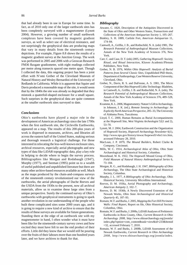
that had already been in use in Europe for some time. In fact, as of 2010 only one of the larger earthwork sites has been completely surveyed with a magnetometer (Lynott 2004). However, a growing number of small earthwork complexes have been covered by magnetic gradient surveys, as well as select use of electrical resistance, and not surprisingly the geophysical data are producing maps that vary in many details from the nineteenth century depictions. For example, Figure 8.8 shows the results of a magnetic gradient survey at the Junction Group. The work was performed in 2005 and 2006 with a Geoscan Research FM36 fl uxgate gradiometer, with eight readings collected per metre along transects spaced one metre apart. Though I collected the data, this ongoing project has been a joint effort with N’omi Greber of the Cleveland Museum of Natural History and Wesley Bernardini of the University of Redlands in California. While it is apparent that Squier and Davis produced a reasonable map of the site, it would seem that by the 1840s the site was already so degraded that they mistook a quatrefoil-shaped enclosure for a small square. Such surprises in the geophysical data are quite common at the smaller earthwork sites surveyed to date.
ConclusionsOhio’s earthworks have played a major role in the development of American archaeology since the late 1700s when the fi rst earthwork site, the Circleville Earthworks, appeared on a map. The results of this 200-plus years of work is dispersed in museums, archives, and libraries all across the eastern half of the United States, making serious and thorough research a logistical challenge. For those interested in relocating the less-well-known enclosure sites, archival resources, especially aerial photographs and new types of data like LiDAR topographic data, play a key role in helping to decide where to begin the survey process. Bibliographies like Morgan and Rodabaugh (1947), Murphy (1977), and Seeman (1995) point us to a wealth of useful published and unpublished literature but there are many other archive-based resources available as well. Much as the maps produced by the chain-and-compass surveys of the nineteenth century revolutionized our view of the earthworks, the aerial photographs of Dache Reeves and the USDA from the 1930s to the present, now all archival materials, allow us to examine these large sites from a unique perspective. Surely the continued survey of Ohio’s earthworks with geophysical instruments is going to spark another revolution in our understanding of the people who built these complicated sites some 2000 years ago, and it is going to require a new kind of archive to ensure that the results of these surveys are available for future generations. Standing there at the edge of an earthwork site with my magnetometer in hand, I often wonder what it must have been like for the nineteenth-century survey crews and how excited they must have felt to see the end product of their efforts. Little did they know that we would still be pouring over the fruits of their labours more than one hundred years later, and we have archives to thank for that.
BibliographyAtwater, C. 1820, Description of the Antiquities Discovered in
the State of Ohio and Other Western States, Transactions and Collections of the American Antiquarian Society 1, 105–267.
Binkley, S. H. 1889, Carlisle Fort, American Antiquarian 11, 174–84.
Cantwell, A., Griffi n, J. B., and Rothschild, N. A. (eds) 1981, The Research Potential of Anthropological Museum Collections, Annals of the New York Academy of Sciences 376, New York.
Carr, C. and Case, D. T. (eds) 2005, Gathering Hopewell: Society, Ritual, and Ritual Interaction, Kluwer Academic/Plenum Publishers, New York.
Greber, N. B. 1976, Within Ohio Hopewell: Analysis of Burial Patterns from Several Classic Sites, Unpublished PhD thesis, Department of Anthropology, Case Western Reserve University, Cleveland, Ohio.
Greber, N., Davis, R. S. and DuFresne, A. S. 1981, The Micro Component of the Ohio Hopewell Lithic Technology: Bladelets, in Cantwell, A., Griffi n, J. B. and Rothschild, N. A. (eds), The Research Potential of Anthropological Museum Collections, Annals of the New York Academy of Sciences 376, 489–528, New York.
Kvamme, K. L. 2006, Magnetometry: Nature’s Gift to Archaeo logy, in Johnson, J. K. (ed.), Remote Sensing in Archaeology: An Explicitly North American Perspective, 205–33, The University of Alabama Press, Tuscaloosa.
Lloyd, T. C. 2000, Human Remains as Burial Accompaniments at the Hopewell Site, West Virginia Archeologist 52(1 and 2), 53–70.
Lynott, M. J. 2004, Earthwork Construction and the Organization of Hopewell Society, Hopewell Archaeology Newsletter 6(1), http://www.nps.gov/history/mwac/hopewell/v6n1/six.htm, accessed February 28, 2010.
MacLean, J. P. 1879, The Mound Builders, Robert Clarke & Company, Cincinnati.
Mills, W. C. 1914, Archaeological Atlas of Ohio, Ohio State Archaeological and Historical Society, Columbus.
Moorehead, W. K. 1922, The Hopewell Mound Group of Ohio, Field Museum of Natural History Anthropological Series 6, 73–184.
Morgan, R. G., and Rodabaugh, J. H. 1947, Bibliography of Ohio Archaeology, The Ohio State Archaeological and Historical Society, Columbus.
Murphy, J. L. 1977, A Bibliography of Ohio Archaeology, Ohio Historical Society, University Microfi lms International.
Reeves, D. M. 1936a, Aerial Photography and Archaeology, American Antiquity 2, 102–7.
Reeves, D. M. 1936b, A Newly Discovered Extension of the Newark Works, Ohio State Archaeological and Historical Quarterly 45, 187–93.
Romain, W. F. and Burks, J. 2005, Mapping the Fort Hill Perimeter Walls: Final Report, Report on fi le, Ohio Historical Society, Columbus, Ohio.
Romain, W. F. and Burks, J. 2008a, LiDAR Analyses of Prehistoric Earthworks in Ross County, Ohio, Current Research in Ohio Archaeology 2008, http://www.ohioarchaeology.org/joomla/ index.php?option=com_content&task=view&id=233&Itemid=32, accessed February 7, 2010.
Romain, W. F. and Burks, J. 2008b, LiDAR Assessment of the Newark Earthworks, Current Research in Ohio Archaeology 2008, http://www.ohioarchaeology.org/joomla/index.

8. Rediscovering prehistoric earthworks in Ohio, USA: it all starts in the archives 87
php?option=com_content&task=view& id=232&Itemid=32, accessed February 7, 2010.
Salisbury, J. H. and Salisbury, C. B. 1862, Accurate Surveys & Descriptions of the Ancient Earthworks at Newark, Ohio, Manuscript on fi le, American Antiquarian Society, Worcester, Massachussetts.
Salisbury, J. H. and Salisbury, C. B. 1863, Ancient Monuments and Inscriptions of and Near the Summit between the Head Waters of the Hocking and Licking Rivers, Ohio, Manuscript on fi le, American Antiquarian Society, Worcester, Massachussetts.
Seeman, M. F. 1995, Archaeology in Ross County, Ohio: A Bibliography, Contract Publication Series 95–04, Cultural Resource Analysts, Inc. (on fi le, Hopewell Culture National Historical Park, Chillicothe, Ohio).
Shetrone, H. C. 1926, Explorations of the Hopewell Group of
Prehistoric Earthworks, Ohio Archaeological and Historical Quarterly 35, 1–227.
Squier, E. G. and Davis, E. H. 1848, Ancient Monuments of the Mississippi Valley. Contributions to Knowledge, vol. 1, Smithsonian Institution, Washington, D.C.
Thomas, C. 1889, The Circular, Square, and Octagonal Earth works of Ohio, Bureau of American Ethnology Bulletin 10, 7–33, Smithsonian Institution, Washington, D.C.
Thomas, C. 1894, Report on the Mound Explorations of the Bureau of Ethnology, Twelfth Annual Report of the Bureau of Ethnology, 1890–1891, Government Printing Office, Washington, D.C.
Whittlesey, C. 1850, Descriptions of Ancient Works in Ohio, Contributions to Knowledge 3, Article 7, Smithsonian Institution, Washington, D.C.