Redeveloping the Lower Mystic River: Case Studies and Best ...
93
Redeveloping the Lower Mystic River: Case Studies and Best Practices Berkwitz | Garman | Milu | Mniz | Smyth Tufts University
-
Upload
khangminh22 -
Category
Documents
-
view
0 -
download
0
Transcript of Redeveloping the Lower Mystic River: Case Studies and Best ...

Redeveloping the Lower Mystic River: Case Studies and Best Practices
Berko� witz | Garman | Milo�u | Mo�niz | SmythTufts University


Redeveloping the Lower Mystic River:Case Studies and Best Practices
Prepared by:
Jo�shua Berko�witzAimee Garman
Armando� Milo�uKatie Mo�nizErin Smyth
Thro�ugh Tufts UniversityDepartment o�f Urban and Enviro�nmental Po�licy and Planning
Field Pro�jects
Prepared fo�r:Mystic River Watershed Asso�ciatio�n
May 4th 2007


Acknowledgements
This project would not have been possible without the guidance and support of Ivey St. John, John Reinhardt, and Nancy Hammett. We would also like to thank our advisors, Rusty Russell and Becky Saggese, for their guidance. Thanks also goes to Lisa Brukilacchio for helping us find methods to identify our case studies and educating us on the Mystic River area. We appreciate her attempts to get us a boat tour of the Mystic River as well. Finally, a project of this sort would not be as effective without direct input from people working on the redevelopment efforts themselves. Thus, we would like to thank the various individuals who were kind enough to speak with us from our case study locations in Detroit, Bucks County, and the Twin Cities area. A special thanks to Patrick Nunnally for speaking with us and responding to all our emails, and Sam Lovall, David Sanders, and Bob Harvie for sending follow-up materials.


Abstract
Waterfront redevelopment is a dynamic and ongoing process – at once rooted in a region’s unique history and culture while at the same time boldly reaching towards a future of vast possibilities. This report aims to identify case studies of waterfront redevelopment projects and best management practices for our client, the Mystic River Watershed Association (MyRWA). The report begins by providing the history of the Lower Mystic River, from which the key criteria for selecting case studies are derived. Selected case studies include the riverfronts of Bucks County along the Delaware River in Pennsylvania, the Rouge River in Detroit, Michigan, and the portion of the Mississippi River that flows through the Twin Cities of Minneapolis and Saint Paul in Minnesota. Critical successes and failures of each case study are noted, as well as unique tools and strategies vital to their redevelopment efforts. This includes: municipal collaboration, master planning, public outreach, environmental remediation, public access and the involvement of an academic institution. At the conclusion of our analysis, the report proposes recommendations for the application of these tools and strategies in the redevelopment of the Lower Mystic River.
i
Execut ive Summary
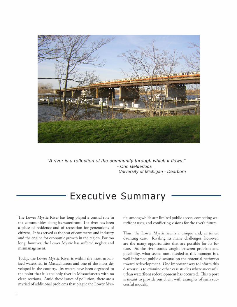
“A river is a reflection of the community through which it flows.” - Orin Gelderloos University of Michigan - Dearborn
The Lower Mystic River has long played a central role in the communities along its waterfront. The river has been a place of residence and of recreation for generations of citizens. It has served as the seat of commerce and industry and the engine for economic growth in the region. For too long, however, the Lower Mystic has suffered neglect and mismanagement.
Today, the Lower Mystic River is within the most urban-ized watershed in Massachusetts and one of the most de-veloped in the country. Its waters have been degraded to the point that it is the only river in Massachusetts with no clean sections. Amid these issues of pollution, there are a myriad of additional problems that plague the Lower Mys-
tic, among which are: limited public access, competing wa-terfront uses, and conflicting visions for the river’s future.
Thus, the Lower Mystic seems a unique and, at times, daunting case. Rivaling its many challenges, however, are the many opportunities that are possible for its fu-ture. As the river stands caught between problem and possibility, what seems most needed at this moment is a well-informed public discourse on the potential pathways toward redevelopment. One important way to inform this discourse is to examine other case studies where successful urban waterfront redevelopment has occurred. This report is meant to provide our client with examples of such suc-cessful models.
ii

While by no means an exhaustive study of the topic area, we attempt to focus on those case studies with character-istics most similar to the Lower Mystic River and, thus, whose lessons would be the most transferable. Similarly, we try to present the key details of the Lower Mystic in order to frame the case study research and, in turn, ad-equately analyze our findings in light of the Lower Mystic. It should be noted that a much more extensive research report about the current state of the entire Mystic River Watershed has already been produced by our client and is thus not one of the goals of this project (see Mystic River Watershed Association (MyRWA) “Mystic River Watershed Assessment”). Instead, we aim to gather relevant informa-tion about other successful urban waterfront development efforts in the United States, and in so doing, to distill les-sons learned and best practices that can be applied to the Lower Mystic.
Having developed a comprehensive understanding of the Lower Mystic, we identified the following case studies as appropriate models of successful urban waterfront devel-opment:
Delaware River, Lower Bucks County, Pennsylvania•Rouge River, Detroit, Michigan•Mississippi River, Minneapolis and Saint Paul, Min-•nesota
Throughout our report, we chronicle each of these case studies, providing a glimpse into their histories, highlight-ing the causes of their decline, and detailing the process of recovery and rejuvenation. Finally, we attempt to distill lessons learned from each case study and offer recommen-dations for the Lower Mystic as it faces its own revival and redevelopment.
The key lessons and recommendations we have proposed include the following main critical pathways, each of which is further detailed and explored in our final analysis section:
Importance of collaboration amongst stakeholders in •the watershed;Value of a master planning process for the water-•shed;Need for environmental remediation along the riv-•erfront;Importance of public outreach and mobilization in •the community;Need for increased public access to the waterfront •and increased quantity, quality and connectivity of open space and recreational resources;
Need for achieving creative co-existence with indus-•try on the waterfront through collaborative planning, promotion of better management practices, and use of regulation, litigation and zoning;Need for achieving environmental justice in the water-•shed through community engagement in watershed-planning, legislative advocacy, and coalition building;Need for collaboration, strong leadership and creativ-•ity in leveraging available funding;Need for effective management of political relation-•ships and power; Need for a watershed champion to steadfastly pro-•motewatershed goals; andBenefits of a collaborative relationship with a local •college or university.
Our research has supported our belief that there is no single effective method to achieving successful urban waterfront redevelopment, given that each waterfront area faces its own specific set of challenges and opportunities due to unique political, social, economic, and ecological environments. There are, however, some distinct recurring strategies that appear in numerous successful redevelopment efforts. We have highlighted many of these strategies in an attempt to create a foundation for the revitalization of the Lower Mys-tic River. It is our sincere hope that these findings will be of use to the Mystic River Watershed Association and to the other stakeholders in the watershed as they formulate strategies for successful and sustainable waterfront redevel-opment along the Lower Mystic River.
iii


Table of Contents
Abstract i
Executive Summary ii
Introduction 1
Chapter 1: Delaware River, Lower Bucks County, PA 13
Chapter 2: Rouge River, Detroit, MI 21
Chapter 3: Mississippi River, Minneapolis and Saint Paul, MN 33
Chapter 4: Analysis and Recommendations 43
References 65
Appendices 73


Introduct ion
Redeveloping the Lower Mystic River: Case Studies and Best Practices 1
Purpose and Scope
The Mystic River Watershed, particularly the Lower Mystic River and its tributaries1, stands at an important crossroads. Having been significantly degraded by decades of industrial use, the watershed remains heavily polluted. This poses sig-nificant threats to human health, ecological integrity, and waterfront usage. Furthermore, with highly inadequate public access and recreational opportunities, the communi-ties residing within the watershed are largely alienated from the riverfront areas. Although some steps have been taken
1 The Lower, or Eastern, Mystic is that portion of the watershed extending from the city of Medford eastward and including the tributaries – the Malden and Island End Rivers, and Chelsea Creek. It is the Lower, or Eastern, Mystic River that has been the focus of our project.
to remedy this problem, open space and public access re-main critically limited along the Lower Mystic.
While increasing development pressure on open land parcels presents formidable challenges to creating areas for public use, there nonetheless remain tremendous opportunities for creating public open space and recreation among many of the watershed’s riverfront areas. Additionally, while to some degree the marine industry along the Lower Mystic River has followed U.S. trends and retreated with the recession of the industrial economy, there remains a very active ma-rine industrial presence along the riverfront. This industrial presence, although an important historical and economic
“When you put your hand in a flowing stream, you touch the last that has gone before and the first of what is still to come.” - Leonardo DaVinci
Mystic River Near Winter Hill Yacht Club in Somerville

Introduct ion
Redeveloping the Lower Mystic River: Case Studies and Best Practices2
component of the watershed, con-flicts with other desirable uses of the waterfront areas. Also challenging is that the Lower Mystic River remains caught between many diverse and di-vergent users and stakeholders. One of the keys to achieving successful and coherent redevelopment within the watershed will be to bring these stakeholders together in collaboration rather than in confrontation.
Perhaps the most complex aspect of the Lower Mystic River is that it is a transboundary water resource, in-volving six cities and towns – Boston (including the communities of East Boston and Charlestown), Chel-sea, Everett, Malden, Medford and Somerville - each with its own stake in and vision for the redevelopment of the waterfront. It will be critical to plan among and across municipal boundaries to ensure a truly coherent and integrated watershed-wide redevelop-ment effort.
One of the most active stakeholders in the water-shed, especially the Lower Mystic, is the Mystic River Watershed Association (MyRWA), our client for this project. MyRWA is a small, non-profit organization committed to protecting and restoring the Mystic River Watershed. It was founded 35 years ago with a mission to restore clean water in the Mystic River Watershed, protect water and related natural resourc-es, and establish relevant public information and ed-ucation programs (MyRWA, “History”). MyRWA’s activities include education and outreach, advocacy, water quality monitoring and community organizing around watershed issues.
As detailed in the Memorandum of Understanding between MyRWA and the Tufts University Field Projects Team (see Appendix A for details), this re-port has been developed for MyRWA with the pur-pose of gathering and assembling information about successful models of urban waterfront development. It also investigates effective strategies that have been implemented in other jurisdictions in the United States that encourage environmentally sensitive and socially sound development of the waterfront of an urban river.
Project Background
The Mystic River Watershed Association (MyRWA)
For most of its history, MyRWA has functioned as a volunteer-run organization, mobilizing activists around specific projects. In 2000, it completed a merger with the Mystic River Watershed Coalition, a coalition of groups that had been created to address the needs of the many small, more localized citizens’ groups active throughout the watershed. As a result of the merger, MyRWA expanded its scope to include organizational members, some of whom are repre-sented on its Board of Directors. MyRWA presently consists of a staff of 3 and a 16-member Board of Di-rectors.
In addition to its advocacy and education work, MyRWA has conducted a number of important stud-ies, both independently and in collaboration with var-ious governmental, community, and academic insti-tutions, and has published these results in numerous reports and guides. These publications have proven to be incredibly useful resources to members of the watershed community.
MyRWA, in partnership with the Charlestown Wa-terfront Coalition (CWC), is currently organizing
Map of the Lower Mystic; Source: Google Earth
Redeveloping the Lower Mystic River: Case Studies and Best Practices 3
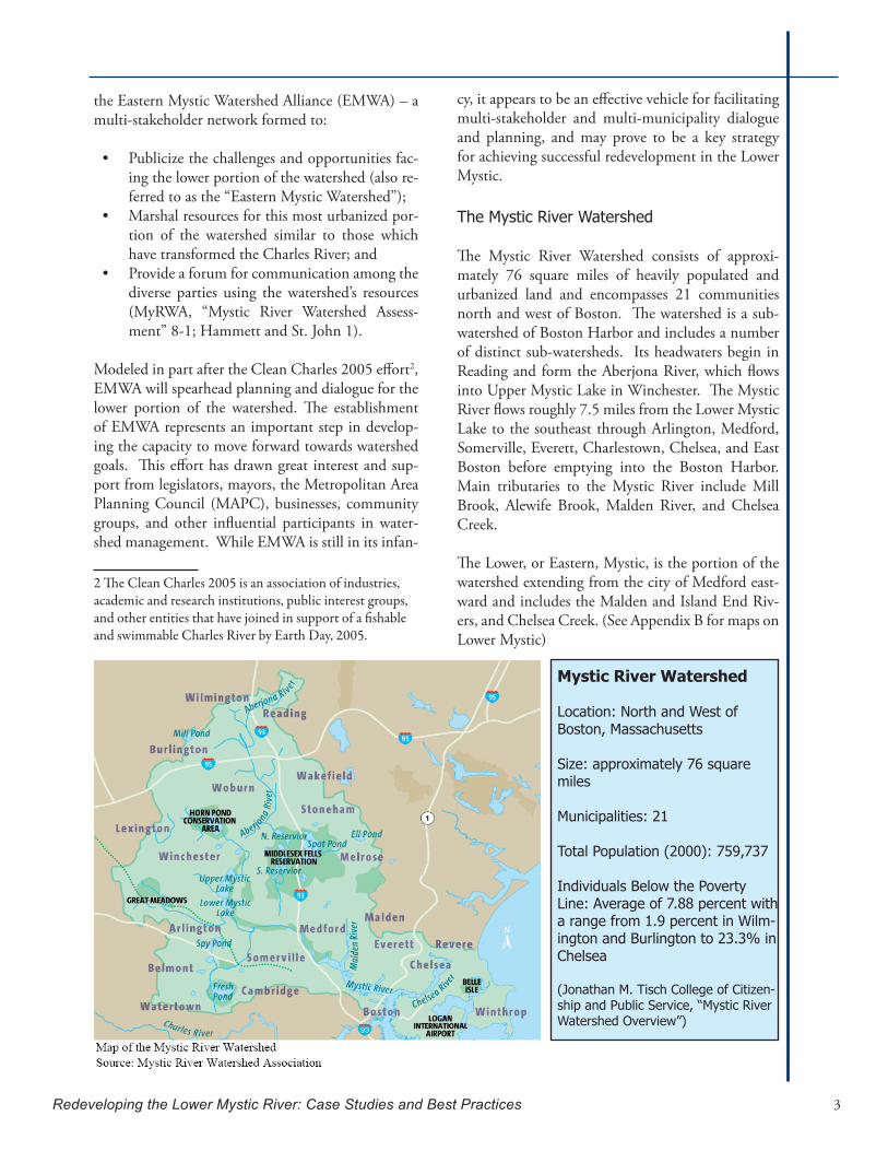
the Eastern Mystic Watershed Alliance (EMWA) – a multi-stakeholder network formed to:
Publicize the challenges and opportunities fac-•ing the lower portion of the watershed (also re-ferred to as the “Eastern Mystic Watershed”);Marshal resources for this most urbanized por-•tion of the watershed similar to those which have transformed the Charles River; andProvide a forum for communication among the •diverse parties using the watershed’s resources (MyRWA, “Mystic River Watershed Assess-ment” 8-1; Hammett and St. John 1).
Modeled in part after the Clean Charles 2005 effort2, EMWA will spearhead planning and dialogue for the lower portion of the watershed. The establishment of EMWA represents an important step in develop-ing the capacity to move forward towards watershed goals. This effort has drawn great interest and sup-port from legislators, mayors, the Metropolitan Area Planning Council (MAPC), businesses, community groups, and other influential participants in water-shed management. While EMWA is still in its infan-
2 The Clean Charles 2005 is an asso�ciatio�n o�f industries, academic and research institutio�ns, public interest gro�ups, and o�ther entities that have jo�ined in suppo�rt o�f a fishable and swimmable Charles River by Earth Day, 2005.
cy, it appears to be an effective vehicle for facilitating multi-stakeholder and multi-municipality dialogue and planning, and may prove to be a key strategy for achieving successful redevelopment in the Lower Mystic.
The Mystic River Watershed
The Mystic River Watershed consists of approxi-mately 76 square miles of heavily populated and urbanized land and encompasses 21 communities north and west of Boston. The watershed is a sub-watershed of Boston Harbor and includes a number of distinct sub-watersheds. Its headwaters begin in Reading and form the Aberjona River, which flows into Upper Mystic Lake in Winchester. The Mystic River flows roughly 7.5 miles from the Lower Mystic Lake to the southeast through Arlington, Medford, Somerville, Everett, Charlestown, Chelsea, and East Boston before emptying into the Boston Harbor. Main tributaries to the Mystic River include Mill Brook, Alewife Brook, Malden River, and Chelsea Creek.
The Lower, or Eastern, Mystic, is the portion of the watershed extending from the city of Medford east-ward and includes the Malden and Island End Riv-ers, and Chelsea Creek. (See Appendix B for maps on Lower Mystic)
Mystic River Watershed
Location: North and West of Boston, Massachusetts
Size: approximately 76 square miles
Municipalities: 21
Total Population (2000): 759,737
Individuals Below the Poverty Line: Average of 7.88 percent with a range from 1.9 percent in Wilm-ington and Burlington to 23.3% in Chelsea
(Jonathan M. Tisch College of Citizen-ship and Public Service, “Mystic River Watershed Overview”)

Introduct ion
Redeveloping the Lower Mystic River: Case Studies and Best Practices4
History of Pollution
Since its settlement in the 1600s, the Mystic has un-dergone profound changes in hydrology and water quality, all the while suffering from a long history of industrial pollution, urban non-point source pollu-tion, and combined sewer overflows. While the river and watershed were initially used for fishing and farming, factories dominated the river by the 1800s, and overfishing and pollution had all but eliminated commercial fishing along the river by 1865. Leather tanning and finishing became a prominent industry along the river, as did chemical manufacturing, ren-dering, and tool and machine-making.
Unfortunately, these industries released hazardous materials such as oil and gasoline, chlorinated and non-chlorinated solvents, coal tar, and plasticizers into the watershed due to improper waste disposal practices. These waste materials are still present in soil and groundwater at the sites where they were released and, in some locations, have migrated to surface waters (Durant and Abbasi 5). Thus, each of these industries has left a legacy of contamination in the river, much of which remains today (Durant et. al. 41; MyRWA, “Mystic River Watershed Assess-ment” 2-5).
The Mystic also suffers from significant non-point source (NPS) pollution, which is pollution that does not come from a specific, easily-identifiable source, such as a pipe, and instead usually occurs as urban runoff. The porous and varied terrain of natural land-
scapes like forests, wetlands, and grasslands trap rain-water and snowmelt and allow it to slowly filter into the ground. Runoff tends to reach receiving waters gradually. In contrast, nonporous urban landscapes like roads, bridges, parking lots, and buildings do not let runoff slowly percolate into the ground. Water re-mains above the surface, accumulates, and runs off in large amounts, carrying with it contaminants. The diagram below illustrates this cycle. Given the highly urbanized landscape within the Mystic watershed, the majority of the land surface is impervious, resulting in substantial urban runoff, which transmits various pollutants into the water bodies.
Current Watershed Challenges
The Lower Mystic faces many challenges for redevelopment. They include:
A history of pollution and neglect resulting in severely degraded water quality;•Acomplexandconflictingmixofstakeholdersontheriverwithdifferentprioritiesand•visions;An active industrial presence exerting legal and logistical constraints on other uses;•Disadvantaged and vulnerable populations living among the waterfront;•Severely limited open space and access to the waterways in many of the adjacent com-•munities, resulting in many residents being unaware of the rivers’ existence or, even if aware, being disconnected from it;A lack of adequate funding for river restoration, rehabilitation, and redevelopment; and•A complicated array of local jurisdictions administering control over the various sections •of the watershed.
Auckland City Council Stormwater Page

Redeveloping the Lower Mystic River: Case Studies and Best Practices 5
CombinedSewerOverflows
Sewage and infrastructure are also major problems throughout the Mystic watershed. Leakage of aging sewer and storm drain pipes contributes substantial pollution discharge to the waterbodies. In addition to this, there are also numerous Combined Sewer Over-flows (CSOs), which are connected sewer and storm pipes that discharge untreated sewage and waste di-rectly into the Mystic when storm water systems are overloaded by heavy rains. Since the sewer system collects waste from industries and local households, CSOs may contribute many different kinds of pol-lutants, including heavy metals and pathogens to the water. The Massachusetts Water Resources Author-ity CSO Monitoring Stations map (below) illustrates the extent of the CSO problem in the Mystic.
Reducing pollution from sewage is no easy task. For instance, changes to the CSO system would require reclassification of the relevant sections of the river to Class “B” (fishable/swimmable) status. The Alewife Brook and the Mystic River below the confluence with the Alewife Brook are the two parts of the river system where CSOs are located. These locations are currently classified as “B-CSO” waters, which means that an average of four CSO discharge events are al-lowed per year (Durant and Abbasi 8). Were these sections reclassified as Class “B” waters, then under the Clean Water Act, no CSOs would be legally al-lowed; thus requiring their removal and resulting in significantly cleaner water. The reality is often more complicated than mere regulations, however, as towns
without any CSOs often experience sewage discharges when their sewage pipes take on too much ground-water. These communities’ water bodies are often classified as “Class B”, and such sewage discharges are considered ‘episodic’ (despite the frequency of occur-rence). (Reinhardt) Thus, additional modifications to sewage infrastructure may be needed to truly address sewage pollution to the river.
All of these point and non-point sources of pollution have created numerous water quality issues, such as sewage-borne bacteria, chemicals leaching from old waste disposal sites and from contaminated sedi-ments, excessive inputs of plant nutrients, and pollut-ant loadings in stormwater runoff (e.g., fuel hydrocar-bons, road salt, toxic metals) (Durant and Abbasi 1).
MyRWA

Introduct ion
Redeveloping the Lower Mystic River: Case Studies and Best Practices6
Environmental Justice
Environmental Justice (EJ) communities are com-munities that suffer from disproportionate exposure to pollution and lack of access to environmental amenities. They are often characterized as low-income, immigrant, or minority groups that are isolated from the larger community and thus alien-ated from the decision-making/political process.
Research on the distribution of environmental bur-dens in Massachusetts has shown that low-income communities face a cumulative exposure rate to environmentally hazardous facilities and sites that is 3.13 to 4.04 times greater than all other commu-nities (measured by median household income) in the state. In addition, high minority communities face a cumulative exposure rate to environmentally hazardous facilities and sites that is nearly 9 times greater than low-minority communities (Faber and Krieg 5). This is highly significant for the Lower Mystic communities.
The Mystic Watershed is home to about 8% of the state’s population (more than half a million peo-ple), yet it occupies less than 1% of its land area. As such, it is the most densely inhabited watershed in Massachusetts and one of the most developed in the country (MyRWA, “Mystic River Water-shed Assessment” 2-6) (See Appendix B for Land Use Map). The Lower Mystic is home to many low-income, immigrant and minority communi-ties, with substantial Black or African-American, Asian, or Hispanic/Latino populations. In 1999, 6
Mystic communities (including Boston) had more than 10 percent of their residents living below the poverty level, with Chelsea having more than 20 percent living in poverty (MyRWA, “Mystic River Watershed Assessment” 2-6).
According to an updated 2005 study of environ-mental justice problems in Massachusetts, 8 out of the 15 communities found to be the “most inten-sively overburdened” by cumulative environmental hazards are located within the Mystic River Water-shed (Faber and Krieg 49).
An extensive survey of the Lower Mystic commu-nities conducted by MyRWA in 2003 measured various recreational waterfront uses, including ex-tensive boating on the Mystic River, use of adjacent parklands, swimming in the waterways, and wide-spread fishing (MyRWA, “Mystic River Watershed Assessment” 6-1). The fact that some fishermen and their families are eating their catch raises con-cerns about potential public health risks from con-suming contaminated fish. This is especially the case in places like Draw 7 Park, the most popular fishing location in the Lower Mystic. Thus, the survey findings suggest that there is substantial di-rect contact with the water in the Mystic, indicat-ing the need for improved water quality standards and improved recreational infrastructure, as well as increased public outreach and education to pro-mote safe recreational practices.
MassGIS
Redeveloping the Lower Mystic River: Case Studies and Best Practices 7
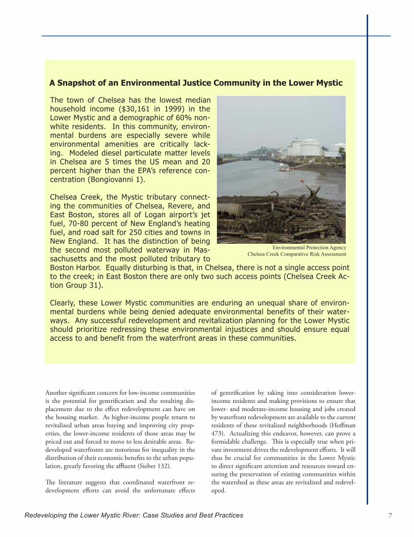
A Snapshot of an Environmental Justice Community in the Lower Mystic
The town of Chelsea has the lowest median household income ($30,161 in 1999) in the Lower Mystic and a demographic of 60% non-white residents. In this community, environ-mental burdens are especially severe while environmental amenities are critically lack-ing. Modeled diesel particulate matter levels in Chelsea are 5 times the US mean and 20 percent higher than the EPA’s reference con-centration (Bongiovanni 1).
Chelsea Creek, the Mystic tributary connect-ing the communities of Chelsea, Revere, and East Boston, stores all of Logan airport’s jet fuel, 70-80 percent of New England’s heating fuel, and road salt for 250 cities and towns in New England. It has the distinction of being the second most polluted waterway in Mas-sachusetts and the most polluted tributary to Boston Harbor. Equally disturbing is that, in Chelsea, there is not a single access point to the creek; in East Boston there are only two such access points (Chelsea Creek Ac-tion Group 31).
Clearly, these Lower Mystic communities are enduring an unequal share of environ-mental burdens while being denied adequate environmental benefits of their water-ways. Any successful redevelopment and revitalization planning for the Lower Mystic should prioritize redressing these environmental injustices and should ensure equal access to and benefit from the waterfront areas in these communities.
Environmental Protection AgencyChelsea Creek Comparative Risk Assessment
Another significant concern for low-income communities is the potential for gentrification and the resulting dis-placement due to the effect redevelopment can have on the housing market. As higher-income people return to revitalized urban areas buying and improving city prop-erties, the lower-income residents of those areas may be priced out and forced to move to less desirable areas. Re-developed waterfronts are notorious for inequality in the distribution of their economic benefits to the urban popu-lation, greatly favoring the affluent (Sieber 132).
The literature suggests that coordinated waterfront re-development efforts can avoid the unfortunate effects
of gentrification by taking into consideration lower-income residents and making provisions to ensure that lower- and moderate-income housing and jobs created by waterfront redevelopment are available to the current residents of these revitalized neighborhoods (Hoffman 473). Actualizing this endeavor, however, can prove a formidable challenge. This is especially true when pri-vate investment drives the redevelopment efforts. It will thus be crucial for communities in the Lower Mystic to direct significant attention and resources toward en-suring the preservation of existing communities within the watershed as these areas are revitalized and redevel-oped.
Introduct ion
Redeveloping the Lower Mystic River: Case Studies and Best Practices8
Designated Port Areas
A particularly challenging aspect of redevelopment in the Lower Mystic is the existence of three Designated Port Areas (DPAs) within the watershed. The official definition of Designated Port Areas is a “geographic area of particular state, regional, and national signifi-cance for commercial fishing, shipping, water-borne commerce, manufacturing, processing and produc-tion activities reliant on water-borne commerce, power generation, and wastewater treatment” (Mas-sachusetts, “Designation of Port Areas” 2). All DPAs must include:
(1) a waterway and associated waterfront that have been developed for commercial naviga-tion; (2) land area adjoining the water’s edge that is conducive in both physical configuration and use character to the siting of industrial opera-tions; and (3) land-based transportation (trains and truck routes) and public utility services appropriate for general industrial purposes (Tufts Univer-sity 3).
Within the Lower Mystic, the following DPAs exist:
Chelsea Creek DPA: along Chelsea Creek.•East Boston DPA: along Mystic River/Inner •Harbor.Mystic River DPA: the saltwater portion of •the Mystic River on both sides, Little Mystic Channel, Island End River, and the entrance to Chelsea Creek. (See Appendix B for DPAs in the Lower Mystic)
In order to separate conflicting waterfront uses and to preserve the marine industrial nature of many of the state’s waterfront areas, the Designated Port Area (DPA) regulation (Chapter 301 CMR 25.00) was adopted by the Secretary of the Office of Environ-mental Affairs as part of the Massachusetts Coastal Zone Management Program in 1978. Recognizing that working industrial ports are important to our regional economy and identity, the DPA regulation designates areas in developed ports for the purposes of promoting and protecting marine industrial activ-ities and certain supporting uses3. While the Public
3 A 2006 study, entitled An Assessment of the Coastal
Waterfront Act (Chapter 91) protects public access and natural resources in the state’s other waterfront areas, a DPA designation makes maritime and indus-trial water dependent uses the higher priority. Thus, allowable uses are severely restricted within these DPAs. The existence of these DPAs makes facilitat-ing any non-marine industrial uses of the waterfront in these areas very difficult to achieve.
Perhaps the most challenging goal to achieve in a DPA is public access, which is restricted under the auspices of protecting public health and safety from contact with industry and prioritizing the marine industrial activities. However, careful planning can facilitate limited public access within DPAs. According to the 1994 amendment of the DPA regulation, the policy states that “judicious planning of the use mix in the DPA and its environs, together with compatible in-corporation of public access facilities into the design of individual projects, can advance the quality-of-life objectives of the surrounding community without significant interference with maritime activities at or near the waterfront” (Massachusetts, “Designation of Port Areas” 3). While it is extremely difficult to design public access that does not interfere with in-dustrial uses, it is possible if designed properly. The primary mechanisms that can be used to allow well-designed point access or pocket parks within a DPA are: 1) combining public access with a commercial or temporary use, 2) creating a DPA Master Plan, and 3) requesting a DPA boundary review. All three of these techniques may prove essential in facilitating expanded residential, recreational, and commercial uses within the Lower Mystic Designated Port Areas.
and Marine Economies of Massachusetts, commissioned by the Massachusetts Executive Office of Environmental Affairs’ Office of Coastal Zone Management (CZM) and conducted by the Donahue Institute at UMass-Boston provides an analysis of the economic impact of Massa-chusetts’ coastal and marine economies in 2004. Accord-ing to the study, the coastal economy in Massachusetts generates nearly 37 percent of employment in the state, with payroll totals of more than $60 billion, and the an-nual gross regional product of the coastal economy was approximately $117 billion, the equivalent of 37 percent of the entire Massachusetts Gross State Product (GSP) in 2004 (CZM 5). The study goes on to note, “the cost of real estate is by far the most significant issue facing marine and coastal…businesses. A related issue, the availability of suitable land for expansion, was the next most significant problem” (CZM 9).
Redeveloping the Lower Mystic River: Case Studies and Best Practices 9
Opportunities
Despite many years of neglect, the waterfront ar-eas along the Lower Mystic have recently received renewed attention and resources by the cities and towns in the watershed. This renewal has primarily been driven by changing economic conditions along the riverfront. With the decline and abandonment of many large industrial and commercial sites along the river, numerous private projects have been pro-posed for commercial, residential, and mixed-use developments on these parcels. Examples of such developments in the Mystic Watershed include the
Gateway Mall along the Malden River, Assembly Square along the Mystic River in Somerville, and Forbes Landing along the Island End River. These proposed developments have mobilized active citi-zens seeking to ensure public benefit from these projects and to secure access to the waterfront. The developments have also attracted the interest of the Mystic’s cities and towns, which seek increased revenues from waterfront usage and development. Thus, waterfront redevelopment and revitaliza-tion have become a priority in many communities.
Home Rule: A Massachusetts Statute and Ideology
Although MyRWA would like to bring the communities of the Lower Mystic and other stakehold-ers together to plan for waterfront redevelopment, it must consider the issue of ‘home rule’ as a potential hurdle to any degree of comprehensive planning or coordination among these jurisdic-tions.Homeruleisdefinedasself-governanceoverlocalmatterssuchasfinance,landuseandhousing (Pierce and Johnson 6), and is limited only by the constitution and the standards and requirements established by state law. While home rule is considered by some to be just an ide-ology, the state does have enabling legislation and related statutes governing home rule (Barron, Frug, and Su 1). A 2004 study published by the Rappaport Institute at Harvard University, how-ever, made a very compelling argument that municipalities do not have the power that one often relates to home rule (Barron, Frug, and Su). Instead, they point to the role that state statutes play in controlling municipal government and further restricting its authority – by pre-empting local initiatives, by creating exceptions, and by other means (Barron, Frug, and Su 71).
Thiscontrolmayactuallybeasignificantreasonthatcommunitiesarenotcomingtogethertosolve common problems on a regional basis. For instance, individual communities may feel a lack of control over their destinies, or, related to this, may maintain a competitive stance toward outsiders, including neighboring cities and towns. Either way, a disconnect exists between ide-ology and sound policy. In order to move forward with a collaborative planning effort for the LowerMystic,MyRWAmayneedtofindanissuethatcreatesanimpetusforcooperation,pos-sibly something that is both urgent and wide-ranging. An example of this type of issue may be thefinancingneededtodealwithCSOs.Whiledifficultformanytoimagine,acoordinatedeffortamong municipalities may be possible to achieve. One sign of regional planning in the Greater Boston area is the Metropolitan Area Planning Council (MAPC) and their recent work to get plan-nerstocometogetherastheyassessthefindingsfromMAPC’sMetroFuture’splanningeffortandother related projects.
For more information on home rule see:• Thereport“DispellingtheMythofHomeRule”at:http://www.ksg.harvard.edu/rappaport/downloads/home_rule/executive_summary.pdf• Thereport“BostonUnbound”at:http://www.tbf.org/uploadedFiles/Citistates_final.pdf• Thereport“GoverningGreaterBoston:ThePoliticsandPolicyofPlace”at:http://www.ksg.harvard.edu/rappaport/downloads/ggb_2002/ggb_full.pdf

Introduct ion
Redeveloping the Lower Mystic River: Case Studies and Best Practices10
There is every indication that these communities are beginning to understand the importance of their waterfront areas and recognize the opportunities in-herent in waterfront redevelopment.
In addition, while financial resources are limited, the watershed has significant assets to preserve and build on, including state-owned parklands along much of the waterfront (MyRWA, “Mystic River Watershed Assessment” 5-1). For instance, many elements of an integrated landscape of parks and pe-destrian and bike paths are in place and only need to be linked together to create a superb urban wa-terfront resource for public access, commuting and recreation.
Furthermore, many of the major problems with pol-lution from CSOs and urban run-off are beginning to be addressed through EPA and DEP programs, as well as by local action. According to federal es-timates, approximately 485 million gallons of sew-age and storm water runoff were polluting the Mys-tic River in 1988, when full monitoring started. By 2005, the last year for which full measures are avail-able, the amount of sewage effluent and storm runoff had dropped to 84 million gallons per year. The EPA and state agencies hope to see the sewage and storm runoff into the river reduced to no more than 62 mil-lion gallons per year by 2013. (Nickerson)
Chapter 91 and Public Access
One development tool that is especially important to ensuringpublicbenefitfromwaterfrontdevelopmentalong the Mystic is the public trust doctrine, a legal doctrine under which the public has an almost inalien-able right to coastal areas and waterways (Hoffman 483). In Massachusetts, the public trust doctrine has been codified in Chapter 91 of the MassachusettsGeneral Laws and by related regulations promulgated by the state Department of Environmental Protection. Under the public trust doctrine, the state recognizes that certain resources, including waterfront areas, are common property that may be used by all citizens for certain purposes, and it holds such resources in trust for them (Hoffman 483). Because the public has an underlying right in waterfront areas, the public trust doctrine allows government to regulate water-front developments to ensure that there is provision for public access to the waterfront.
Under the Chapter 91 regulations, a waterways license is required for all activities in tide-lands, large ponds, and most rivers. To be licensed, a project must demonstrate that, for relevantwaterfrontinterests,thepublicbenefitsoutweighthepublicdetriments(Hoffman485). These regulations require the promotion and protection of public access to the wa-terfront in waterfront developments. Chapter 91 regulations, therefore, serve as a powerful tool for ensuring enhanced public access to the waterfront as development occurs along the Mystic. It is, in fact, largely this tool that has mobilized many citizens in the Mystic watershed around access issues when confronted with private developments along their communities’ waterfronts (St. John, “Telephone”). As noted earlier, the one exception to Chapter 91’s ef-fectiveness in facilitating public access to the waterfront is in Designated Port Areas, where marine industrial uses have priority over all other uses.
Winter Hill Yacht Club
Redeveloping the Lower Mystic River: Case Studies and Best Practices 11
Perhaps most encouraging is that on April 17, 2007, Robert Varney, Regional Administrator of EPA’s New England office, pledged in a public meeting at the Blessing of the Bay Boathouse in Somerville that the EPA would focus its full attention on the Mys-
tic River and its restoration. He said, quite clearly, that the Charles River had its turn; now it is the Mystic’s turn (St. John, “Email”). The Mystic River Watershed Initiative will be a cooperative effort be-tween the EPA, the Massachusetts Dept. of Envi-ronmental Protection (Mass DEP), the U.S. Coast Guard, the Mystic River Watershed Association, and the Chelsea Creek Restoration Partnership, as well as the many communities that border the river, both in the urban core as well as upriver. At this crucial public event, the EPA vowed to “bring the same level of commitment and focus to its work to improve water quality in the Mystic Watershed as the Agency has provided to the Charles River since 1996” (Environmental Protection Agency). Work-ing with its state and local partners, as well as dedi-cated citizens, the EPA pledged to continue to take appropriate actions to improve water quality based on data and findings of ongoing sampling, investi-gations, and interactions with local watershed and community groups, watershed municipalities, and other state agencies and public organizations.
In addition to this important buy-in by the EPA, other critical milestones have been achieved for the Mystic. For instance, the Metropolitan Area Plan-ning Council (MAPC), a regional planning agency representing 101 cities and towns in the metropoli-tan Boston area, has recently had its Lower Mystic Corridor Study funded. This important effort will
bring together the planning departments of Everett, Chelsea, Malden, Medford, Somerville and Boston to information share and to shape a common vision for the Lower Mystic River. Finally, Representa-tive Denise Provost has filed a no cost bill to form
a Mystic River Watershed Wa-ter Quality Commission whose focus will be to gather all ex-isting water quality data and to develop strategies to restore and enhance the entire water-shed. The Eastern Mystic Wa-tershed Alliance is developing an advocacy strategy for distri-bution to its participants to al-low participating organizations and individuals to lobby their legislative members to ensure passage of this bill, House Bill 841. Clearly, the Lower Mystic
now stands at a crucially important moment in its history, when its rehabilitation and redevelopment finally seem attainable.
While the Lower Mystic River stands at this vital crossroads, what is perhaps most needed now is a critical mass of well-informed and engaged indi-viduals who will advocate for the river and the com-munities living along its shores. One important way to inform the public discourse on the potential pathways toward redevelopment is to examine other successful case studies where this has happened. By digging very deeply into these case studies, we were able to distill lessons that they can provide for the Mystic. While it has been aptly said that those who do not know their history are doomed to repeat it, it might also be said that those who do not look be-yond their own borders cannot learn from the suc-cesses and failures of others. Therefore, it is critical at this point that we look beyond the Mystic River to examine other waterfront redevelopment projects throughout the country.
“We’re going to take what we’ve learned from cleaning the Charles River, and apply it to the Mystic - another major urban river of the Boston metro area. There are no magic bullets; this is hard work and will require a long term effort from federal, state and local government, as well as the help of citizens. Luckily, we have some great partners in the area who are committed to making a cleaner environment for our kids’ future.” Robert W. Varney, Regional Administrator Environmental Protection Agency NewEnglandOffice
Introduct ion
Redeveloping the Lower Mystic River: Case Studies and Best Practices12
Methodology
While countless urban waterfronts have undergone redevelopment in recent years, few are comparable to the Lower Mystic. In consultation with our client and other stakeholders in the watershed, we identi-fied key criteria for the Lower Mystic that character-ize the unique situation of this watershed as well as represent some of the largest challenges to successful urban waterfront development along the river.
Key criteria identified for the Lower Mystic in-clude:
A highly urbanized setting;•Significantly degraded water quality;•Waterfront communities that include environ-•mental justice populations;A multi-jurisdictional waterfront area covering •several cities and towns;A riverfront hosting many water-dependent •uses, including an active port; Located in the United States for regulatory and •funding mechanism similarities; andProperties with multiple uses, including resi-•dential, industrial, commercial and recreation-al.
These key criteria were given different weight ac-cording to their relevance and their similarity with the Lower Mystic River, as we realized that it may not be feasible to satisfy all of these criteria in every case study. The most critical criteria for this analysis are cases that include:
(i) several municipal jurisdictions; (ii) an urban waterfront with a history of ne-glect; and (iii) multiple waterfront uses, including an ac-tive industrial presence.
Various methods were then utilized to identify pos-sible case studies that fit the key criteria. Due to the large number of possibilities, we conducted a detailed search of waterfront redevelopment in scholarly arti-cles, documents, and relevant literature. In addition to this research, we contacted and interviewed key persons within waterfront redevelopment and plan-ning efforts. Based on the information we gathered, we narrowed our case studies down to the 3 that best
matched the Mystic’s situation. For the short list of cases that adequately met our key criteria, please see Appendix C.
After we narrowed and selected case studies, we began the task of gathering relevant information and data through extensive research and interviews with key individuals (see Appendix X for list of in-terview questions). Information collected includes the regulatory and other planning and development tools, and administrative methods and funding sources that have been used to achieve waterfront restoration. Additionally, we sought to understand how successful projects navigate the inevitable po-litical challenges that exist in highly controversial multi-stakeholder public processes. We wanted to understand how various stakeholders and munici-palities successfully collaborated to achieve their de-velopment goals. Finally, we sought to determine whether (and in what manner) these strategies and mechanisms could be adapted for use in the Lower Mystic.

Chapter 1
Redeveloping the Lower Mystic River: Case Studies and Best Practices 13
Delaware River, Bucks County, Pennsylvania
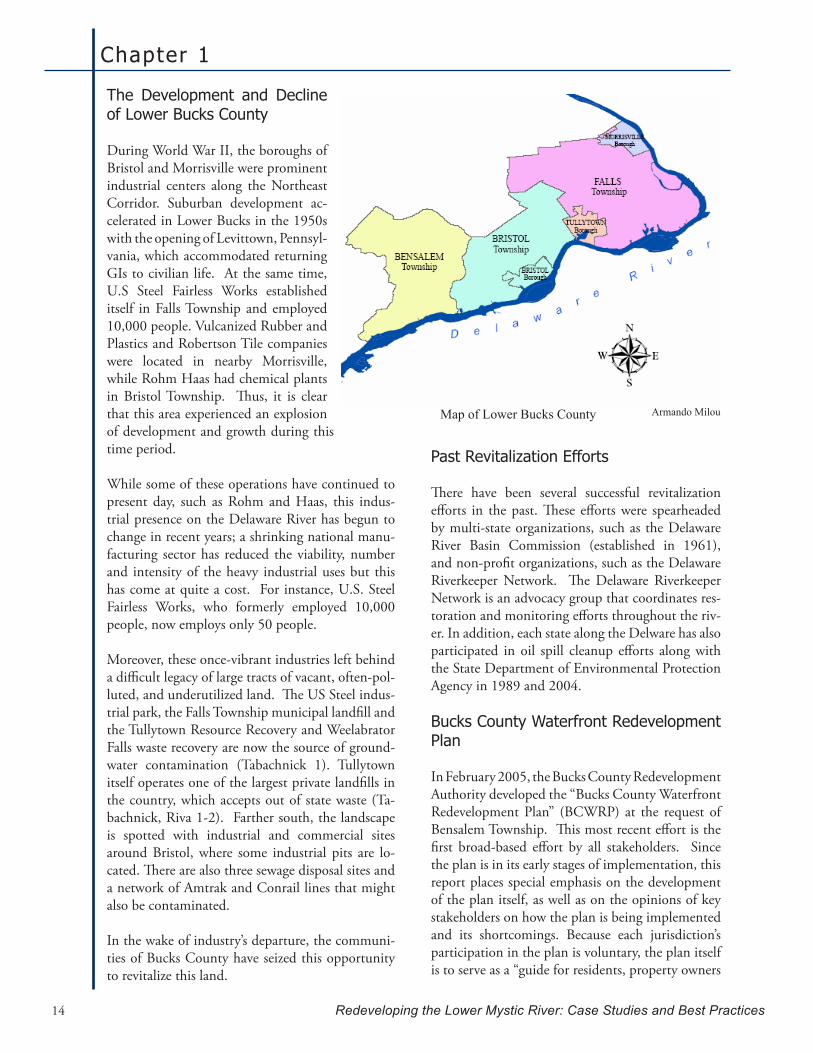
Bucks County is one of the three original counties in the State of Pennsylvania. The county was named by Wil-liam Penn, after Buckinghamshire, England, in 1682. The county encompasses an area of 608 square miles of land and 15.8 square miles of water. Bucks County contains a population of approximately 610,000 within 23 boroughs and 31 townships. It falls within the Delaware River Wa-tershed, which spans across four states (New York, Pennsyl-vania, Delaware and New Jersey). Lower Bucks County is composed of 6 municipalities - Bensalem Township, Bris-tol Borough, Bristol Township, Falls Township, Morrisville Borough and Tullytown Borough - which have a combined population of 171,000 and share 30 miles of riverfront along the Delaware River (Bucks County Webpage). Like
the Lower Mystic River, the Lower Bucks County area has properties eligible for or listed on the National Register of Historic Places (Tabachnick 1).
The Delaware River has a historic and contemporary iden-tity as a maritime and economic resource that helped to create an extensive array of manufacturing and heavy in-dustrial uses on the riverfront. The stretch of river near Lower Bucks County was the site of numerous waterfront industrial and manufacturing activities. After World War II, however, most of these types of activities ceased. The land previously utilized was left vacant and, in some cases heavily polluted.
“Unlike greenfield development, redevelopment often proposes round-peg solutions to square-hole problems. Redevelopment requires a flexible format that combines changes to existing development with new construction.” - Jane Dembner Bucks County Waterfront Redevelopment Plan
Bowman’s Hill Tower, Pennsylvania Historical and Museum Commission
Chapter 1
Redeveloping the Lower Mystic River: Case Studies and Best Practices14
The Development and Decline of Lower Bucks County
During World War II, the boroughs of Bristol and Morrisville were prominent industrial centers along the Northeast Corridor. Suburban development ac-celerated in Lower Bucks in the 1950s with the opening of Levittown, Pennsyl-vania, which accommodated returning GIs to civilian life. At the same time, U.S Steel Fairless Works established itself in Falls Township and employed 10,000 people. Vulcanized Rubber and Plastics and Robertson Tile companies were located in nearby Morrisville, while Rohm Haas had chemical plants in Bristol Township. Thus, it is clear that this area experienced an explosion of development and growth during this time period.
While some of these operations have continued to present day, such as Rohm and Haas, this indus-trial presence on the Delaware River has begun to change in recent years; a shrinking national manu-facturing sector has reduced the viability, number and intensity of the heavy industrial uses but this has come at quite a cost. For instance, U.S. Steel Fairless Works, who formerly employed 10,000 people, now employs only 50 people.
Moreover, these once-vibrant industries left behind a difficult legacy of large tracts of vacant, often-pol-luted, and underutilized land. The US Steel indus-trial park, the Falls Township municipal landfill and the Tullytown Resource Recovery and Weelabrator Falls waste recovery are now the source of ground-water contamination (Tabachnick 1). Tullytown itself operates one of the largest private landfills in the country, which accepts out of state waste (Ta-bachnick, Riva 1-2). Farther south, the landscape is spotted with industrial and commercial sites around Bristol, where some industrial pits are lo-cated. There are also three sewage disposal sites and a network of Amtrak and Conrail lines that might also be contaminated.
In the wake of industry’s departure, the communi-ties of Bucks County have seized this opportunity to revitalize this land.
Past Revitalization Efforts
There have been several successful revitalization efforts in the past. These efforts were spearheaded by multi-state organizations, such as the Delaware River Basin Commission (established in 1961), and non-profit organizations, such as the Delaware Riverkeeper Network. The Delaware Riverkeeper Network is an advocacy group that coordinates res-toration and monitoring efforts throughout the riv-er. In addition, each state along the Delware has also participated in oil spill cleanup efforts along with the State Department of Environmental Protection Agency in 1989 and 2004.
Bucks County Waterfront Redevelopment Plan
In February 2005, the Bucks County Redevelopment Authority developed the “Bucks County Waterfront Redevelopment Plan” (BCWRP) at the request of Bensalem Township. This most recent effort is the first broad-based effort by all stakeholders. Since the plan is in its early stages of implementation, this report places special emphasis on the development of the plan itself, as well as on the opinions of key stakeholders on how the plan is being implemented and its shortcomings. Because each jurisdiction’s participation in the plan is voluntary, the plan itself is to serve as a “guide for residents, property owners
Armando MilouMap of Lower Bucks County

Delaware River, Lower Bucks County, PA
Redeveloping the Lower Mystic River: Case Studies and Best Practices 15
and elected and appointed officials, who will need to implement it and continually push forward the waterfront redevelopment vision to reach its goals” (HNTB 3).
The mayor of Bensalem, Joseph DiGirolamo, was very active in the development of the plan. Accord-ing to Bob Harvie, Vice-Chairman of Fall Town-ship’s Board of Supervisors, the plan was initiated by the town of Bensalem; its primary objective was to have more access to the riverfront as a source of recreation. Bensalem wanted to move some of its industries away from the waterfront because they no longer represented water-dependent uses; instead, they rely on rail and roads to continue operations (Burg-er).
Mayor DiGirolamo, as a member of the plan’s steering com-mittee, explained that the initial pro-posal was to rezone these properties to the R-55 Planned Residential Com-munity District zoning classification (DiGirolamo). DiGirolamo and the Redevelop-ment Authority staff agreed that, in order to be ef-fective, the plan must include all of the jurisdictions in Bucks County along the Delaware River.
Thus, the following key stakeholders were identified and included in the creation of the plan:
Borough/Township/County officials from Bris-•tol Township, Bristol Borough, Morrisville Bor-ough, Falls Township, Bensalem Township and Tullytown Borough; Landowners; e.g. US Steel Works, Waste Man-•agement, Rohm and Haas, Vulcanized Rubber and Plastics and Robertson Tile, who all have-large tracts of land that can be redeveloped;Real State Professionals; and•Civic and Interest Groups.•
The Redevelopment Authority of Bucks County and the Bucks County Planning Commission were the lead agencies in charge of managing the plan. The plan was prepared by a consultant team lead by HNTB Corporation with the assistance of A.D. Marble and Company, Economics Research Associates, and the Northeast-Midwest Institute, a nonprofit group. It was funded in part through grants from the Delaware Regional Port Authority and the U.S. Economic Development Administra-tion through the support of Pennsylvania’s congres-sional delegation (HNTB ii). This is similar to the MAPC’s successful request for funding for a multi-
jurisdictional dia-logue and planning process study for communities along the lower Mystic.
The twin goals of the plan are to im-prove access to the riverfront and to promote targeted economic devel-opment. It also provides a frame-work for the en-hancement of the riverfront and ad-jacent lands. The plan outlines the
steps each municipality has to take to reach these objectives through its four sections: Development, Recommendations, Opportunity Areas, and Imple-mentation.
As previously mentioned, Bucks County does not have the authority to mandate changes; thus, giving the municipalities the power to utilize the plan in their own way was very important in getting them energized about the collaborative effort (White). Some of the municipalities have moved forward to advance their own visions for the waterfront with further planning within their jurisdiction, develop-ing individual redevelopment plans with the help of the county, or simply incorporating waterfront planning as part of their required 10-year Master Planning process (Harvie).
Chapter 1
Redeveloping the Lower Mystic River: Case Studies and Best Practices16
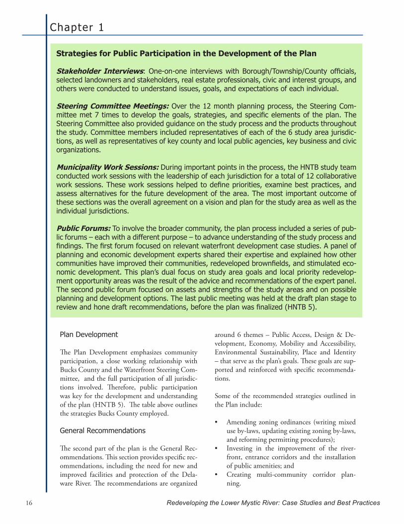
Strategies for Public Participation in the Development of the Plan
Stakeholder Interviews:One-on-one interviewswithBorough/Township/Countyofficials,selected landowners and stakeholders, real estate professionals, civic and interest groups, and others were conducted to understand issues, goals, and expectations of each individual.
Steering Committee Meetings: Over the 12 month planning process, the Steering Com-mitteemet7timestodevelopthegoals,strategies,andspecificelementsoftheplan.TheSteering Committee also provided guidance on the study process and the products throughout the study. Committee members included representatives of each of the 6 study area jurisdic-tions, as well as representatives of key county and local public agencies, key business and civic organizations.
Municipality Work Sessions: During important points in the process, the HNTB study team conducted work sessions with the leadership of each jurisdiction for a total of 12 collaborative worksessions.Theseworksessionshelpedtodefinepriorities,examinebestpractices,andassess alternatives for the future development of the area. The most important outcome of these sections was the overall agreement on a vision and plan for the study area as well as the individual jurisdictions.
Public Forums: To involve the broader community, the plan process included a series of pub-lic forums – each with a different purpose – to advance understanding of the study process and findings.Thefirstforumfocusedonrelevantwaterfrontdevelopmentcasestudies.Apanelofplanning and economic development experts shared their expertise and explained how other communitieshaveimprovedtheircommunities,redevelopedbrownfields,andstimulatedeco-nomic development. This plan’s dual focus on study area goals and local priority redevelop-ment opportunity areas was the result of the advice and recommendations of the expert panel. The second public forum focused on assets and strengths of the study areas and on possible planning and development options. The last public meeting was held at the draft plan stage to reviewandhonedraftrecommendations,beforetheplanwasfinalized(HNTB5).
around 6 themes – Public Access, Design & De-velopment, Economy, Mobility and Accessibility, Environmental Sustainability, Place and Identity – that serve as the plan’s goals. These goals are sup-ported and reinforced with specific recommenda-tions.
Some of the recommended strategies outlined in the Plan include:
Amending zoning ordinances (writing mixed •use by-laws, updating existing zoning by-laws, and reforming permitting procedures); Investing in the improvement of the river-•front, entrance corridors and the installation of public amenities; andCreating multi-community corridor plan-•ning.
Plan Development
The Plan Development emphasizes community participation, a close working relationship with Bucks County and the Waterfront Steering Com-mittee, and the full participation of all jurisdic-tions involved. Therefore, public participation was key for the development and understanding of the plan (HNTB 5). The table above outlines the strategies Bucks County employed.
General Recommendations
The second part of the plan is the General Rec-ommendations. This section provides specific rec-ommendations, including the need for new and improved facilities and protection of the Dela-ware River. The recommendations are organized

Delaware River, Lower Bucks County, PA
Redeveloping the Lower Mystic River: Case Studies and Best Practices 17
Primary Opportunity Areas
The third part of the plan provides detailed plans and recommendations for identifying the Primary Opportunity Areas for projects in each jurisdiction. The map above illustrates the various project loca-tions. These areas had to be particularly promising locations for achieving one or more of the 6 guiding themes (E.G. Public Access) stated on the General Recommendations section.
The Development Principles on Access and Trans-portation, Land Use and Natural and Historic Re-sources and Recreation outline particular cases and locations for the redevelopment efforts (e.g. Develop bicycle lanes and a hiker/biker pathway system along State Road, River Road, Radcliffe Road, etc…) as well as regional projects that need to be tackled by all or most jurisdictions (e.g. Delaware River Heritage Trail, Regulations that promote the development on primary streets that brings the front of buildings to the edge of the pedestrian zone).
According to Bob White of the Redevelopment Au-thority, it was critical for each municipality in the study area to have its own opportunity area(s), as this kept them engaged and gave them all something to focus on within their jurisdictions.
Implementation
The fourth and final Implementation section pro-vides possible financing tools to implement the plan, where a call is made to each jurisdiction to implement the recommendations of the plan. The available alternatives for funding are detailed in the Dembner and Barcsh memorandum entitled “Po-tential State and Federal Financing Programs with Applicability to Bucks County”.
These alternatives, coming mainly from the State of Pennsylvania, are not available or do not apply to the lower Mystic River redevelopment efforts. Some of these alternatives are outlined in the funding sec-tion.
Bucks County Waterfront Redevelopment Plan
Bucks County Waterfront Redevelopment Plan Goals
Public AccessDesign & Development
EconomyMobility and Accessibility
Environmental SustainabilityPlace and Identity
Chapter 1
Redeveloping the Lower Mystic River: Case Studies and Best Practices18
Funding
The plan was funded through grants from the Dela-ware Regional Port Authority and the U.S. Eco-nomic Development Administration, through the support of Pennsylvania’s congressional delegation. According to Bob White of the Bucks County Re-development Authority, the total cost of the plan was $331,000, and primarily came from the Port Authority and congressman Mike Fitzpatrick. Mr. White also said that each community was asked to contribute $20,000 “in kind” to aid the project.
The proposed financial tools for redevelopment at the local level are a combination of public funding and tax relief, such as:
Tax increment financing –a real property value •capture mechanism that supports public in-vestment in a project in the form of locally is-sued bonded debt; Bucks County Department of Community •and Business Development Programs –such as the Community Development Block Grant (from HUD), HOME, Brownfield Reclama-tion Fund (Financing) and the Economic De-velopment Revolving Loan Fund;Transportation Community Development •Initiative –created by the Delaware Valley Re-gional Planning Commission, it assists in re-versing trends of disinvestment and decline; and Keystone Historic Preservation Grant Program •–administered by the Historical and Museum Commission funding, it provides funding to local governments and non-profit organiza-tions for preservation or restoration of historic buildings.
In addition, some local governments also added to these choices with local programs such as façade grants or fee waivers.
At the national level, the plan’s proposed sources that could possibly finance waterfront Brownfield reuse and redevelopment included:
EPA’s Brownfield Programs –Bucks County re-•ceived $1 million in FY2004 grants to capital-ize a revolving loan fund for cleanup purposes. This program provides direct grant assistance
to municipalities, counties, redevelopment au-thorities, non-profits and other entities. Of the amount granted, 40% can be used for clean-up “sub-grants” to individual communities;State Clean Water Revolving Loan Fund •–Grants given directly to States, which can use them for loans of up to 20 years;Federal DOT Programs, –Such as Discretion-•ary Capital Program, Mass Transit Capital Funding and Transportation, community and system preservation pilot program – More in-formation about these programs can be found at the DOT web site at http://www.fta.dot.gov/grants_financing.html;Brownfield Expensing Incentive –a federal •tool that reduces taxes for private owners of contaminated sites;Brownfields Economic Development Initia-•tive –a HUD program to be used in conjunc-tion HUD’s Section 108 Grants;Rehabilitation Tax Credits –Historic struc-•tures qualify for a credit equal to 20% of reno-vation, and non-historic buildings built before 1936 qualify for 10%;Low Income Housing Tax Credits –Issued by •the State, they are usually included as part of a community’s revitalization strategy;U.S. Army Corps of Engineers –They offer •technical assistance, contracting support and help with site planning and remediation; andNational Park Service –Through the “Rivers •and Trails” program, supporting state and local governments and community organizations in conservation efforts.
The real estate investment strategies proposed were:
Tax Increment Financing –already imple-•mented in Bucks County and previously men-tioned;Property tax abatements –already implemented •in Bucks County– are reductions in property tax liabilities for a specified period of time; General obligation bonds –a type of municipal •bond; and Special taxing districts –additional taxes levied •to support public services beyond those usu-ally provided to the community.

Delaware River, Lower Bucks County, PA
Redeveloping the Lower Mystic River: Case Studies and Best Practices 19
Lessons Learned
Although Bucks County is still in the initial phases of redevelopment, especially in terms of imple-mentation, there are still valuable lessons to be learned.
For instance, the developing stages of the plan have exposed the limitations on the participatory and planning processes, although the overall drafting of the plan itself was a success.
The primary method used to foster redevelopment was establishing overlay districts that limited the expansion of existing businesses and promoted commercial and residential uses. According to Cormack, however, HNTB did not “capture ad-equate amount of people and concerns” on its sur-veys. Most importantly, US Steel and Rohm and Hass did not take part in the planning process. These companies own large areas that have a long history of pollution that will be very difficult to re-develop into uses other than industrial. Bob White of the Redevelopment Authority explained that not including these industries was done purposely
because the planners “are not trying to hurt the industry, but when they –the companies- are done with the land, the area will already have a redevel-opment plan” (White). Both arguments seem to be right in justifying the inclusion or exclusion of important stakeholders, however, inviting the in-dustry to take part of the first planning meetings may have been beneficial to all parties. This would have given these stakeholders an understanding of what was trying to be accomplished on their land and would have also given the rest of the planning committee an idea of where the stakeholders stand in relation to the plan (i.e. the timeframe and/or likelihood that these industries will move).
Another limitation was the lack of strong provi-sions regarding environmental justice communi-ties. Rather, the plan focused primarily on access and targeted economic development. Morrisville and Bensalem have the highest percentages of non-white populations (about 24 and 17 percent, re-spectively), more than double that of the County. The area has a high rate of home ownership, with the exception of Falls and Bristol Townships, where the renting rates are high compared to the rest of
Redevelopment efforts thus far:
Bensalem Township:• Two projects are getting underway in a 700 unit mixed use housing development and a 508 unit mixed use housing development (White).
Overlay zoning: • According to interview accounts, three townships have introduced overlay zoning on portions of their waterfront lands from industrial to some other use. This overlay allows current industries to continue their operations, but does not allow for new industrial uses or expansions on these lands. While educational outreach was done to explain overlay zoning it has still been met with some opposition from the current land-owners and it remains to be seen how this will impact future redevelopment plans.
Individual Township planning:• Bob White of the Redevelopment Authority noted that all but one of the municipalities are currently working on individual plans. Tullytown is the least engaged as they have a small waterfront area that is mostly taken up by a landfill,whichbringsinasignificantamountofmoney.FallsTownshipalsohasalandfilllocated along the waterfront, but is moving forward with redevelopment planning be-causetheyhavealargerwaterfrontareaandapparentlythelandfillitselfis“wellsited”because it is out of the view of most residents (Harvie).

Chapter 1
Redeveloping the Lower Mystic River: Case Studies and Best Practices20
the area. Bensalem has a large and fast-growing foreign-born population, which includes large concentration of Indians, Mexican, Russian, West Indian and Korean immigrants (HNBT). This is illustrated in the above map, which details the percentage of minority populations within Bucks County.
Further research into whether these communities fit the environmental justice guidelines is required. EJ populations, no matter how small, must be tak-en into account when evaluating redevelopment proposals because of its predisposition towards gentrification.
More public information and education are also necessary components in order to avoid opposi-tion to the redevelopment. Businessmen in Falls Township were opposed to changes because they did not understand what the changes were regard-ing overlay zoning. A pamphlet describing overlay zoning and how it would affect each stakeholder group would have been and can be an extremely effective public education tool.
Finally, one of the key lessons learned from these forums was the need to have long-term goals sup-plemented by short-term implementation steps.

Chapter 2
Redeveloping the Lower Mystic River: Case Studies and Best Practices 21
“People take care of what they love. Reconnecting people with the river and fostering stewardship is one of the most important things we can do - for the river and for ourselves. Our health and well-being is intricately connected with the health and well-being of the river.” -Sally Petrella, Friends of the Rouge
Rouge River, Detroit, Michigan
Located in Southeast Michigan, the Rouge River is 126 miles long and comprised of four branches: the Main Branch, the Upper Rouge, the Middle Rouge and the Lower Rouge. Its watershed is approximately 438 square miles and includes portions of 48 municipalities in three different counties. With a population of over 1.5 mil-lion, it is also the most densely populated and urbanized area in the state (Murray et al. 273) and represents a wide demographic diversity. Many of the communities in the City of Detroit and the older industrialized suburbs near the mouth of the Rouge River have median fam-ily incomes at or near the poverty level, while headwater communities have median family incomes in excess of $150,000 (Murray 3).
The river’s lower 8-mile branch, often referred to as the Rouge River Gateway Corridor, flows through the municipalities of Detroit, Redford, Dearborn Heights, Dearborn, Allen Park, Melvindale, and River Rouge, where it joins with the Detroit River. The Corridor’s subwatershed has little to no open space; over half of the land has been developed as residential, while 30% consists of commercial and industrial uses (The Rouge River Project 2-3). Only 9% of the land is considered urban open space or forest.
The Rouge River Corridor is very similar to the Lower Mystic both geographically and politically. These two downriver areas suffer the most from pollution and in-

Chapter 2
Redeveloping the Lower Mystic River: Case Studies and Best Practices22
dustry. Furthermore, the two rivers have histori-cally been overshadowed by larger, neighboring rivers: the Detroit River and the Charles River. In the case of the Rouge, these factors have affected its development and redevelopment, both positively and negatively.
History of Development
Although the Greater Detroit area has always been an important transportation hub due to its strategic location on the Great Lakes, it was the explosion of the automobile industry that fueled its rapid devel-opment (Bodurow 74). As the automotive manu-facturing capital of the world for much of the 20th century, the regional economy flourished. This dramatically expanded Detroit’s population and growth, as people from all over the country flocked to the city to find employment.
It was the creation of the Ford Manufacturing Complex that first sparked this wave of develop-ment. Constructed on the riverbank of the Rouge during World War I by Henry Ford, this iconic manufacturing site grew into a massive industrial complex, employing tens of thousands of workers. Thus it became the centerpiece of the automotive economy and manufacturing in the United States, making it a cultural, historical, and economic land-mark (Bodurow 12).
Developing hand in hand with Detroit’s manu-
facturing industry was the Port of Detroit. In fact, without its rivers and the port, Detroit could not have achieved its status as one of the leading manu-facturing centers of the 1950s and 1960s (Detroit/Wayne County Port Authority 1). Today it is the second largest Customs port of entry in the country in terms of value of goods traded (Detroit/Wayne County Port Authority 1). The Detroit River alone is responsible for moving approximately 80 million tons of cargo annually. As a tributary of the De-troit, port activities extend to the Rouge and the industries located along its banks.
Rouge River Watershed and the Lower Rouge RiverSource: The Rouge Project
Port of Detroit, Detroit/Wayne County Port Authority website

Rouge River, Detroit , MI
Redeveloping the Lower Mystic River: Case Studies and Best Practices 23
The Decline of the Greater Detroit Area
Beginning in the 1960s and 1970s, the Greater De-troit area fell into decline as the manufacturing base drastically decreased. This was coupled with racial tensions over ‘color blind’ promotion policies and housing shortages, which culminated in a full-scale riot in 1967 (Hula and Jackson-Elmoore 325). As a result, there was an accelerated ‘white flight’ and sharp decrease in the tax base (Hula and Jackson-Elmoore 325). In the past decade, older urban core communities have lost their population and tax base due to suburban sprawl (McCormick xvii).
At the same time, the Rouge became severely pol-luted from years of industrial pollutants and storm water runoff. It was identified as one of the fourteen toxic ‘hot spots’ in Michigan by the International Joint Commission (ICJ) in 1981 (Department of Environmental Quality - Rouge River Watershed Initiative). “The Rouge is so polluted that when the Warren Valley Golf Course sucked water out of the Middle Branch to water its greens, the grass died” (The Rouge Project).
In response to these problems, the surrounding mu-nicipalities began initiatives to revitalize the water-way and began to transform the riverfront through a series of public-private partnerships.
“You can’t get anyone to think about a walking path without clean water.” Ed Bagale, Vice Chancellor University of Michigan
Clean Water First!: Early Revitalization Efforts
The redevelopment of the Rouge River began with efforts to improve the water quality. The Rouge’s ICJ designation as a hot spot, coupled with the notoriety of having the most polluted watershed in the state of Michigan, spurred several key people to action (Bagale). These individuals took advan-tage of several opportunities to mobilize broad-based support and funding to clean up the river.
The Rouge’s rehabilitation was jumpstarted in 1983 by Judge John Feikins, a Federal District Judge in Detroit. He used a 1977 EPA lawsuit1 as a catalyst to begin a series of formal orders to bring together the Rouge communities to cooperate on a restoration plan (Oakland County Planning and Economic Development). By essentially forcing compliance, Feikins enabled the communities to collaborate by taking a watershed approach to restoring the Rouge (Oakland County Planning and Economic Development).
At the same time, reports about the state of the Rouge provoked the public to demand that some-thing be done (2004 Rouge River Remedial Ac-tion Plan Revision xiv). In response, the Friends of the Rouge implemented the Rouge Education Project (REP) in 1987. Similar to MyRWA and its Mystic Monitoring Network, REP established a volunteer water quality monitoring program. The Rouge’s monitoring program, however, was incor-porated into the public school system of southeast Michigan. It involved students from elementary school to high school to perform hands-on scien-tific experiments measuring water quality (Friends of the Rouge 3).
1 This lawsuit forced the city of Detroit to address sewage discharges from Detroit Water and Sewerage Plant.

Chapter 2
Redeveloping the Lower Mystic River: Case Studies and Best Practices24
Adopting A More Holistic Approach
Another major catalyst was Congressman John Dingell (D-MI). In 1992, Dingell was able to gar-ner support and initiate the National Wet Weather Demonstration Project (also known as the Rouge River Project). In its early stage, the project at-tempted to control pollution from CSOs by provid-ing matching grant funds from the EPA to subwa-tersheds to separate combined pipes and create new sewer systems.
The Wayne County Department of the Environ-ment, who managed this project, quickly deter-mined that CSO control alone would not improve the watershed’s water quality (Bagale). Historically, point source pollution from the surrounding indus-tries was the main contributor of pollutants to the river, but the biggest offender became storm water runoff from rapidly urbanizing areas (Rouge River Facts), for which there was no legislation. Further-more, without an attempt to address storm water runoff in upstream areas, any efforts to control CSOs in downstream areas would not significantly
improve the water quality of the river. As a result, the Rouge Project adopted a more holistic approach to address all sources of pollution affecting the river (Murray et al. 274). This approach included storm water runoff, illicit sewer connections, erosion, and flow variability, all managed under the watershed approach. This method has proven successful, as the Rouge River is much healthier and met state wa-ter quality standards for the first time in years (The Rouge River Project).
Collaboration efforts were, perhaps surprisingly, supported by industry’s willingness to ‘clean up’ their activities. In particular, Bill Ford had a passion for sustainability and, in 1999, announced that he was redoing the Ford Complex to make it more en-vironmentally friendly (Bodurow 75-77). Accord-ing to Ed Bagale, Ford strongly believed that “you can’t have a great company if it’s located in a second-rate city” and that corporations needed to invest in where they live (Bagale). The Ford project was a huge multi-million dollar undertaking and garnered more recognition for the Rouge River and its resto-ration efforts.
Rouge River Remedial Action Plan
One outcome of this early revi-talization phase was the Rouge River Remedial Action Plan (RAP). Drafted in 1989 by the Michigan Department of Natural Resources, this plan’s purpose was to “address the causes and solutions to water quality problems” (2004 Rouge River Remedial Action Plan Revi-sion xi) and has since been updated three times.
Thesignificanceoftheoriginaldocument is that it:
calls for the elimination of 1. combinedseweroverflows(CSOs) and sanitary sewer overflows(SSOs)anddivides the watershed into 2. seven subwatersheds.
The Rouge River Project
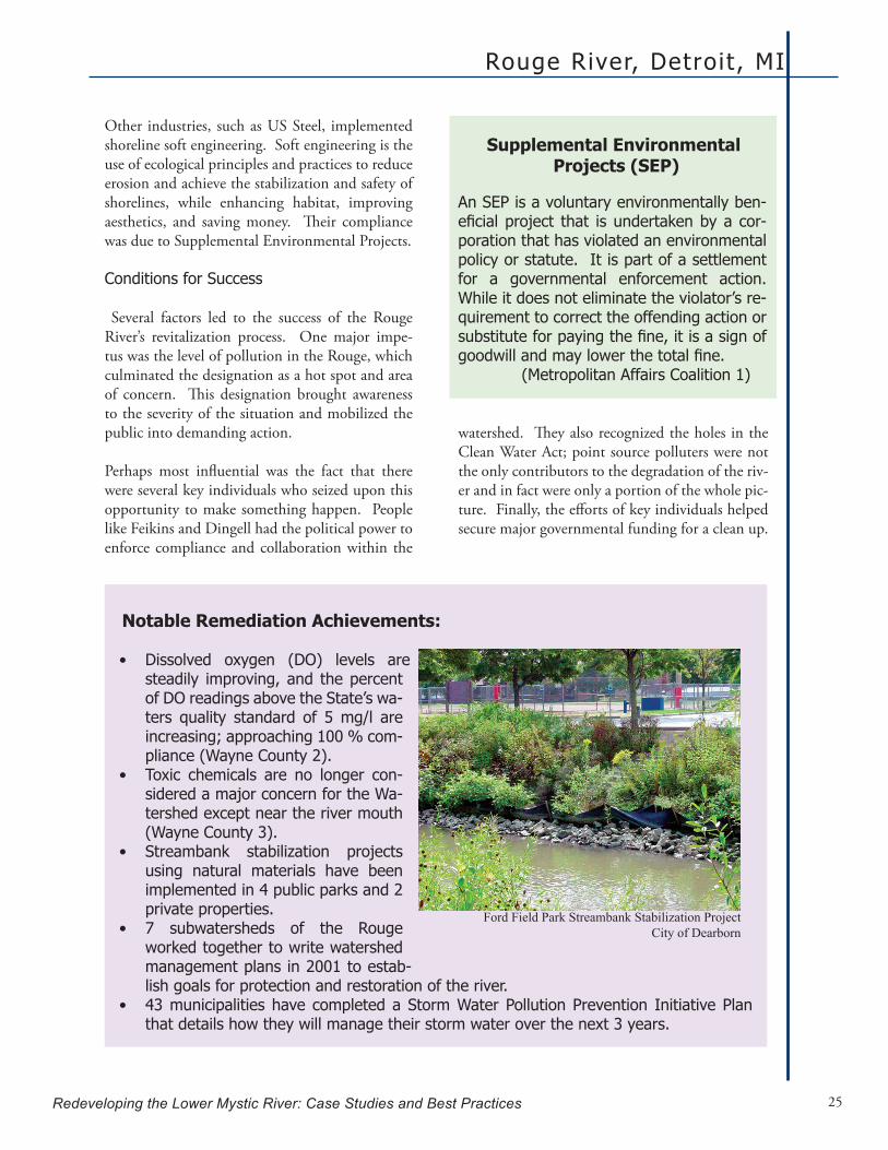
Rouge River, Detroit , MI
Redeveloping the Lower Mystic River: Case Studies and Best Practices 25
Other industries, such as US Steel, implemented shoreline soft engineering. Soft engineering is the use of ecological principles and practices to reduce erosion and achieve the stabilization and safety of shorelines, while enhancing habitat, improving aesthetics, and saving money. Their compliance was due to Supplemental Environmental Projects.
Conditions for Success
Several factors led to the success of the Rouge River’s revitalization process. One major impe-tus was the level of pollution in the Rouge, which culminated the designation as a hot spot and area of concern. This designation brought awareness to the severity of the situation and mobilized the public into demanding action.
Perhaps most influential was the fact that there were several key individuals who seized upon this opportunity to make something happen. People like Feikins and Dingell had the political power to enforce compliance and collaboration within the
Supplemental Environmental Projects (SEP)
An SEP is a voluntary environmentally ben-eficialproject that isundertakenbyacor-poration that has violated an environmental policy or statute. It is part of a settlement for a governmental enforcement action. While it does not eliminate the violator’s re-quirement to correct the offending action or substituteforpayingthefine,itisasignofgoodwillandmaylowerthetotalfine. (Metropolitan Affairs Coalition 1)
Notable Remediation Achievements:
Dissolved oxygen (DO) levels are •steadily improving, and the percent of DO readings above the State’s wa-ters quality standard of 5mg/l areincreasing; approaching 100 % com-pliance (Wayne County 2).Toxic chemicals are no longer con-•sidered a major concern for the Wa-tershed except near the river mouth (Wayne County 3).Streambank stabilization projects •using natural materials have been implemented in 4 public parks and 2 private properties.7 subwatersheds of the Rouge •worked together to write watershed management plans in 2001 to estab-lish goals for protection and restoration of the river.43 municipalities have completed a Storm Water Pollution Prevention Initiative Plan •that details how they will manage their storm water over the next 3 years.
watershed. They also recognized the holes in the Clean Water Act; point source polluters were not the only contributors to the degradation of the riv-er and in fact were only a portion of the whole pic-ture. Finally, the efforts of key individuals helped secure major governmental funding for a clean up.
Ford Field Park Streambank Stabilization ProjectCity of Dearborn

Chapter 2
Redeveloping the Lower Mystic River: Case Studies and Best Practices26
SignificanceofAchievements
A major outcome of the project was the collabo-ration between municipalities as well as between public-private interests. Agreement by all 48 com-munities within the Rouge River Watershed to take a new approach was largely aided by the promise of federal funds from the Rouge River Project (Bagale). If they complied with the project, they would receive money, which the municipalities could use as they wished as long as it fell within the larger watershed goals. As a result, the success of the Rouge Project enabled the communities to secure more funding through matching federal grants. Another achievement of the Rouge Project was the ability for local governances to exert control over the management of the river through a cooperative pro-cess. This is best exemplified through the adoption of the Voluntary Watershed-Based General Storm Water Permit in 1999. The General Storm Water Permit assisted local governments in meeting the requirements of their watershed-based, storm water NPDES discharge permits. A group of local agen-cies working with the Rouge Project proposed this regulatory framework to the Michigan County De-partment of the Environment for the management of storm water and other pollution sources (2004 Rouge River Remedial Action Plan Revision 12). In 1999, it was approved and eventually became a model for the entire state of Michigan.
Finally, although several federal grants provided crucial funding for restoration, the Rouge com-munities realized that this funding would not last forever and began another collaborative approach to sustain their efforts (Cave). In 2003, 38 com-munities and the 3 counties signed an agreement that led to the formation the Assembly of Rouge Communities (ARC). Under the agreement, the 38 communities contribute half the funds for the operation of ARC; the other 50% is provided from remaining federal funding through Wayne Coun-ty2. The money is then used to support community efforts to meet the storm water permit requirements including water quality monitoring, public educa-tion, facilitation and technical assistance.
ARC Members benefit by sharing the cost of permit requirements such as public education, monitoring and in the preparation of reports and plans. If a community declines to participate in ARC, it will have to reapply for coverage under individual juris-dictional storm water permits, individually meet all permit obligations at increased cost, and lose their collective voice with the Michigan Department of Environmental Quality (The Rouge River Project “Alliance of Rouge Communities”).
2 The share of contributions is based upon equal weight to population and land area for that portion of each community within the watershed.
“The Rouge River has always been a part of me. As a baby, my mother laid me down on the banks of the river. Growing up I played in oneof its tributaries. As RAP Coordi-nator, I cared for the Rouge as if it were my own child. Now as a mother, I see the Rouge as a great learning resource for my son...the next generation. Our lives may come and go but the Rouge River lives on forever.”
Cathy Bean, Livonia Citizen In regards to the 2004 Rouge Remediation Plan Revision
Rouge Education Project T-Shirt Design Contest The Friends of the Rouge

Rouge River, Detroit , MI
Redeveloping the Lower Mystic River: Case Studies and Best Practices 27
Redeveloping the Rouge: Rouge River Gateway Partnership In 1999, multiple stakeholders came together to form the Rouge River Gateway Partnership. This group represented the interests of those on the Gateway Corridor and provided a forum to build consensus for the revitalization of the river so that it could be an amenity for everyone. Its members include:
City of Allen Park•City of Dearborn•City of Detroit•City of Melvindale•Edward C. Levy Company•Ford Motor Company•Henry Ford Community College•Henry Ford Museum & Greenfield Village•Marathon Ashland Petroleum LLC•Michigan Consolidated Gas Company•Rouge Steel Company•The University of Michigan – Dearborn•Wayne County•
To become a member, an organization paid a mini-mum of $5,000 in annual dues. In its early stages, the Partnership met once a month3. It organized itself around a common vision: to create a Master Plan that would create a balance between environ-mental stewardship, cultural heritage, recreation and economic development (Cave 5). This plan would also build upon the past successes of the Rouge River Project and other early initiatives.
Throughout the planning process, members formed subcommittees to understand the plans and goals of individual Partnership members. “Summaries of the work sessions were regularly presented to the larg-er group. This communication demonstrated the shared benefits and potential connections between proposed developments” (Cave 5). 3 Today, the Partnership meets 2 to 3 times a year. It just recently convened to set their scope of work for the rest of the year. The chairs and a few other key individu-als are involved on a regular basis (Cave).
Rouge River Gateway Corridor Master Plan
There is no ‘I’ in team
An extremely important component of the Partnership was that it incorporated other initia-tives, as it broadened the resources, public interest, and political support available to the Partnership and its projects. Some of their successful collaborations include:
The Southeast Michigan Greenways Initiative promotes the region’s trail network. •The Automobile National Heritage Area preserves and interprets the story of the auto-•mobile, to improve awareness of our rich automotive heritage, increase tourism, and encourage capital investment and development. The Greater Detroit American Heritage River Initiative (AHR) is a multi-stakeholder •group with an action-oriented process intended to achieve, sustain, and celebrate the communities, economies, histories, cultures, and environments of Southeast Michigan’s waterfront. (Cave 7)

Chapter 2
Redeveloping the Lower Mystic River: Case Studies and Best Practices28
Rouge River Gateway Corridor Master Plan
The Master Plan’s underlying philosophy is that people are inherently attracted to water. Therefore, as the quality of the river in the Gateway Corridor improves, it can become a centerpiece for neigh-boring communities (Cave 4). Furthermore, the goals of the plan and the Partnership itself are interdependent (Cave 2). That is, enhance-ment of ecological qual-ity will yield economic and cultural benefits. In turn, economic vitality can be used to support heritage preservation and ecological quality. Thus, the Master Plan outlines strategies that support this vision.
In order to establish continuity between existing developments and new opportunities, the Master Plan divides the Corridor into four distinct Character Zones: the Natural River Zone, the Cultural River Zone, the Urban River Zone, and the Industrial River Zone (see map below).
These zones do not limit the types of activities that can take place but rather classify the overarching theme found in each area, to accentuate the posi-tive aspects of each, and to strengthen the overall
identity of the corri-dor (Cave 22 Wayne County 9).
The plan also includes extensive trails and greenways, as well as a water taxi service and river boat dock, which will connect neighborhoods to each other and to the river, providing economic and recreational op-portunities. The water taxi service will link to the nearby public pas-senger terminal on the
Detroit River, as well as sites like the Henry Ford Estate, Henry Ford Museum & Greenfield Village, the Ford Rouge Visitor Center, Melvindale, and Historic Fort Wayne (Cave 12).
“The Master Plan coordinates the efforts of various stakeholders to maximize investments. The synergy of new and existing developments that enhance local character and environmental quality will generate a great resurgence of eco-nomic vitality for the entire region. Rouge Gate-way Partnership initiatives will reclaim the river as an invaluable natural, cultural, recreational, and economic resource for Southeast Michigan - its rich heritage preserved for generations to come.” Rouge River Gateway Corridor Master Plan
Rouge River Gateway Master Plan

Rouge River, Detroit , MI
Redeveloping the Lower Mystic River: Case Studies and Best Practices 29
Natural River Character ZoneThe Natural River Character Zone is primarily focused on con-servation and habitat preservation. It incorporates research and education as key features. The University of Michigan - Dear-born and Henry Ford Community College, which are located in this zone, use the Rouge as part of their curriculum to ser-vice both the academic community and the greater public (Cave 11). The University of Michigan – Dearborn Environmental Interpretive Center serves as headquarters for these research and public outreach programs.
Cultural River Character Zone
The Cultural River Character Zone highlights historic cul-tural landmarks such as the Henry Ford Estate and Muse-um, museums in Dearborn, and historic Fort Dearborn. A portion of this zone overlaps with the Natural River Zone and emphasizes the role of the corridor in manufacturing and the industrial evolution of the nation (Cave 11).
Urban River Zone
The Urban River Zone is a stretch of the river where a concentration of people live, work, and play (Cave 10). Existing multifamily housing devel-opments and a senior citizen complex provide a substantial portion of the population; and this number is anticipated to grow. In response to this anticipated growth, there are proposals for additional housing developments in the near future. In terms of economic development, the office/research parks of Ford and Visteon are expanding. A high-tech industrial park in Delray is also part of a long-range vision to address the decline and transition of this Southeast Detroit neighborhood by creating mixed-use development in this zone. A greenway will bisect the new park, which will also include a series of filtering ponds to responsibly handle storm runoff generated by the new development (Cave 21).
Industrial River Zone
Finally, the Industrial River Zone is where “the meshing (and clash-ing) of technology, place, people, nature, culture, and ideology gave the world its most astounding example of twentieth-century brute industrial power” (Cave 9). It should be celebrated as such, emphasizing all the positive aspects industry brings to the region while working with the corporations to mitigate the negative ones. As a model of sustainability, the Ford Complex is the centerpiece.
All pictures from Rouge River Gateway Corridor Master Plan

Chapter 2
Redeveloping the Lower Mystic River: Case Studies and Best Practices30
Implementation of Master Plan
Identification and prioritization of projects are based on impact, interest, and funding availabil-ity. Currently, there are numerous proposed and ongoing projects that fall under the scope of the Master Plan. This can be largely credited to the members of the Partnership and their ability to collaborate with one another while simultane-ously fundraising and implementing individual Gateway projects.
Examples of Gateway Projects in Various Stages of Implementation are:
University of Michigan Environmental In-•terpretive Center Bio swales and porous pavement at Henry •Ford Community College Rouge Gateway Greenway Phase I •Conversion of Allen Park Landfill to Fair-•lane Green retail and open space develop-mentSouthwest Detroit Dearborn Greenway•Springwells Industrial Park in former •brownfieldDTE Energy native meadow plantings and •softshore engineeringDelray Industrial Park•Various Rouge River CSO Water Quality •Projects
Conditions for Success
Several factors led to the success of the Rouge Riv-er’s redevelopment process. As in the case of clean-ing up the Rouge, a few key individuals have seized opportunities to gather support and make things happen. Ed Bagale, the Vice Chancellor at the University of Michigan – Dearborn, Bill Ford of Form Motor Company, Kelly Cave at the Wayne County Department of the Environment, and Sam Lovall and his consulting firm, Hamilton Ander-son, have pulled together partners, funding, and public support.
Involving a broad base of stakeholders was also cru-cial, although it is important to keep in mind that all stakeholders need to have enough of a shared vision in common for any broad-based coalition to work. The Gateway Project was able to get many groups on board because of the University of Michigan’s involvement.
The University’s involvement gave the project a sense of neutrality and trustworthiness, convincing otherwise reluctant allies to join the effort (Bagale). Furthermore, the university liaison, Ed Bagale, is an extremely charismatic, prominent and well-re-spected person both within the university and in the community, adding further credibility to the Partnership and its goals (Cave).
Renovations at Ford Manufacturing ComplexThe proposed greening of the Rouge Manufacturing Complex will include rooftop gardens, a new visitor center, and phytoremediation (the use of plants to detoxify polluted soil). Interpretive signage will address the heritage of the Rouge Complex and its future as an icon of 21st century sustainable manufacturing. Due to its sheer size, the greening of the Rouge is anticipated to ripple out into the neighboring communities. The two pictures below show what Ford used to look like and what it will look like once the project is com-plete.
Rouge River Corridor Gateway Master Plan

Rouge River, Detroit , MI
Redeveloping the Lower Mystic River: Case Studies and Best Practices 31
Ford’s involvement has had a similar effect, persuading other organizations to follow his company’s example. It also gathered positive public support because the sur-rounding communities liked to see this huge corporation take an interest in im-proving their river and general quality of life.
Major controversies and disputes among stakeholders were avoided largely because the Partnership was based on a non-hierar-chical, consensus-based process and shared a common vision (Cave). The Partnership did occasionally run into problems with the natural turnover in government posi-tions or the lack of projects in a certain area (Cave). In these types of situations, it was important to emphasize that the Mas-ter Plan was the master document, and any proposed project would have to fit into it. The Partnership would go after funding as they found relevant grants that fit the projects (Cave).
A wide variety of stakeholders also brought an ex-panded fundraising base to the table. For instance, the University of Michigan began an initiative to build a one-mile greenway and raised a third of the money through various local and state foundation grants. The Michigan Department of Transporta-tion had Federal Enhancement money to be allot-ted to the project, but they did not want to give it to the university. They were willing to give it to Wayne County, however, and so Wayne County and the university joined together (Bagale).
Another key to the Rouge’s success was the cultural/museum partnership. The partnership instilled cul-tural and community pride in the local communi-ties and provided mechanisms to increase tourism and funding. For instance, the 1998 designation as an American Heritage River garnered a lot of posi-tive press for the Rouge. Because of this recogni-tion, the Rouge has funding from the EPA to pro-tect this heritage site as well as the public support to aid any implementation efforts.
The Master Plan itself had a huge impact on the success of redevelopment efforts. Before the plan was created, key individuals would meet with com-panies and talk about forming a partnership and
reinvesting in the area, but it was not until they got the master plan together and could show it to peo-ple that companies and other stakeholders really got involved (Cave). Furthermore, it provided power-ful leverage to stop undesirable activities.
Once all partners were on board, the Partnership kept the momentum going by continually engag-ing all the partners in the process. This required Partnership organizers to constantly reassure mem-bers that their work had great potential to become a national model. The reverse was also true: stressing the negative publicity organizations would receive if they did not get involved was also effective. Finally, it was important for those key organizers to allow others to take credit if it meant their participation in a project (Bagale). Ultimately, recognition for participation in the Partnership and its projects was key (Bagale and Cave).
Finally, by tackling projects that were ‘low hang-ing fruit’, the Gateway partners were able to show the public successes. This helped gain critical pub-lic support (Cave). The Rouge communities really want to see an improvement in the quality of life, as the economic downturn created a loss of jobs, and this area has fallen into a state of decay. With new parks, improved water quality, and the work at Ford, however, the public became aware of the Master Plan and the benefits the Plan could bring to the river, to the community, and to the Greater Detroit area.
Tools for the Community A Master Plan can be an enormous asset to a commu-nity. If a project was proposed in the Lower Rouge thatdidnotfitintotheMasterPlan,thecommunitywas able to use this to stop the project. For instance, there is a large Arab American community located near the Ford Complex. There was a proposal to construct a trucking terminal in their neighborhood. Because this concept was not compatible with the MasterPlan, thiscommunityhasbeenabletofightagainst the proposal. On the other hand, the same community utilized the plan to include an Arab Ameri-can cultural museum as part of the redevelopment. They focused on the fact that it is a unique culture and an opportunity to promote community and cul-tural assets (Savoie).

Chapter 2
Redeveloping the Lower Mystic River: Case Studies and Best Practices32
Environmental Justice Issues A second layer to the industrual zone is the existing residential communities, where there are large Arab American, African American, and Latino populations in the area highlighted on the land use map below (Savoie). Although Gateway projects have indirectly dealt with EJ issues by attempting to provide park access to industrial sites in addition to improving existing parks, theMasterPlanhasnospecificprovisionstoensuresecurityfortheresidentscurrentlyresid-ing on the Rouge. One Partnership member explained that the Master Plan did not address EJ issues because organizers wanted to stay on the positive side (Lovall). Furthermore, although the plan outlines projects to provide river access to communities in the Industrial Zone, it has yet to come to fruition. Whether or not EJ communities along the Rouge River will suffer as a result of redevelopment is yet to be determined.
Lingering Issues
Public Access
There has been resistance to the idea of creating pub-lic access to the river and a linked trail system to all of Southeast Michigan. Strict environmentalists pro-tested against cutting down trees, no matter the rea-son, while others voiced concerns about a potential tax increase and government interference (Bagale). These proposals have also worried some nearby com-munities who did not want strangers in their neigh-borhoods, although initially the public seemed to support it (Cave). The communities around the Ford Complex have been given limited access and much more public access is not likely. Despite the goals of the Master Plan, the Partnership had to be realistic about what they could actually accomplish (Cave).
Community Involvement
Although the Gateway Partnership’s purpose is to represent all stakeholders in order to find consensus in the Rouge’s redevelopment, the early planning stages only involved the government, industry, and academic institutions. Community input, while val-ued, was not a major component, although the plan has generally been well received by the public (Cave and Savoie). Much of the Partnership’s outreach ef-forts have been to gather support for specific proj-ects. Due are required for formal membership into the Partnership. While providing important funds to projects, expensive dues may be prohibitive for com-munity organizations from participating.
High Density ResidentialCommercialIndustryHighwaysWaterways
High Density ResidentialCommercialIndustryHighwaysWaterways
Forested RuralUrban OpenAgricultural PastureLow Density ResidentialMed Density Residential
Forested RuralUrban OpenAgricultural PastureLow Density ResidentialMed Density Residential

Chapter 3
Redeveloping the Lower Mystic River: Case Studies and Best Practices 33
Mississippi River, Minneapolis and Saint Paul, Minnesota
The mighty Mississippi River provides many benefits to the cities of Minneapolis and Saint Paul, Minnesota, nicknamed the “Twin Cities”. St. Anthony Falls, the only natural waterfalls on the Mississippi River, supplies power to Minneapolis. The city of Saint Paul, which is located at the end of the river’s navigable waters, is a hub for trans-shipping goods to carts and trains. Much like the Lower Mystic River, St. Paul’s active port provides transportation to the manufacturing and industry along the riverfront. Railroad yards parallel the river so goods can be hoisted di-rectly from barges and ships onto railcars, connecting the Northwestern forests to the Midwestern farmlands (Mack 2). The city also features hundreds of acres of ecologi-
cal habitat along the riverfront and small islands, such as Raspberry Island and Harriet Island, which now feature parks and community open space.
Both cities are dealing with the effects of industrial pol-lution. They are also attempting to provide affordable housing along the riverfront. Yet the 26 miles of river that snake through the Twin Cities Metropolitan Area both unite and divide these two major cities (Mack 1). This has resulted in separate redevelopment plans.
This chapter presents the distinct revitalization efforts of the Twin Cities. While the redevelopment of the Mystic River focuses on a multi-jurisdictional approach, the Twin Cities waterfront redevelopments are examples of the positive and negative results of independent planning by
“But the river is what most charmed and amazed us. It had not yet frozen over and was flowing with a lively sparkle through winding gorges which are still beautiful, although here, as everywhere else, the convenience of the water-way has been exploited ... Of course it will not always be so. Eventually the Twin Cities will realize that their river can be, and ought to be, a wonderful and life-giving amenity without losing any of its utility.” Tyrone Guthrie, A New Theatre, 1964 (qtd. in Minneapolis Planning 24)

Chapter 3
Redeveloping the Lower Mystic River: Case Studies and Best Practices34
neighboring communities. Special focus is given to the different approaches taken by Minneapolis and Saint Paul. Their key projects are also highlighted and where applicable include descriptions of envi-ronmental issues, social and community aspects, funding sources, political climate, and coordination efforts.
Decline of the Twin Cities
Both cities have historically derived their economies from the Mississippi River. From 1880 to 1930, the headquarters of the major flour milling industries crowded the banks along St. Anthony’s Falls (Min-neapolis Planning Presentation 3). Minne-apolis was also a major railroad hub with passenger and freight rail service for many years. In 1971, due to the decline of local indus-try and the decreasing population in the city, the passenger rail service stopped running to the depot and, in 1978, freight rail lines stopped crossing the Stone Arch Bridge. The railroad’s abandonment of the city left empty stations and unused rail lines throughout the district. Mills, such as the General Mills and Pillsbury headquarters, rapidly deserted the city, leaving chain-link fenced building sites to slowly decay. Few active industrial parcels remained, surrounded by abandoned sites and vacant lots and the crime rate rose dramatically (Mack 3). By 1980, St. Anthony’s Falls was left deserted.
Unlike Minneapolis, Saint Paul’s economy prospered through the late 1980s. However, shortly thereafter, American Hoist and Derrick Company (Amhoist) re-structured its corporate management and downsized by closing its operations in the city. The departure of Amhoist from Saint Paul was soon followed by the closure of the West Publishing headquarters in 1990 (Mack 6). The loss of these companies left large par-cels empty along the downtown riverfront.
By the early 1990s, Saint Paul’s Harriet Island Park was also falling into decay due to poor maintenance and aging infrastructure. Located directly across the banks of downtown Saint Paul and home to festi-vals and community gatherings, the old Victorian era pleasure ground visibly aged and was not main-tained by the city (Mack 6). Saint Paul’s once vibrant downtown riverfront was now also deserted.
Redeveloping the Twin Cities
As mentioned, riverfront redevelopment is progress-ing very differently in the two cities despite their geo-graphic proximity. Minneapolis’ redevelopment be-gan over 25 years ago, although with limited success in the early years. It is a product of the city’s political establishment. In particular, the City Council has exerted a strong influence, championing redevelop-ment projects and master planning in partnership with the Mayor’s Office (Nunnally).
Upper Mississippi Watershed
St. Anthony’s Falls photo by John Weeks

Mississ ippi River, Twin Cit ies, MN
Redeveloping the Lower Mystic River: Case Studies and Best Practices 35
The first organized master planning study was initi-ated in 1987 as a collaboration between the Minne-apolis City Council, the Minnesota Historical Society, the Minneapolis Park and Recreation Department and the State Pollution Control Agency (Mack 6). Even-tually the St. Anthony’s Falls Heritage Board, with their mantra “good history, good business and good recreation,” was invited to participate in the planning process. The Technical Advisory Committee was es-tablished, a group consisting of interagency staff. The result was the 1987 Riverfront Study. This document has four stated goals, including removing barriers to revitalization (such as contaminated sites and abandoned rail lines), de-veloping cultural and recreational amenities along the river, preserving the area’s historic sites and encourag-ing mixed-use neighborhoods (Min-neapolis Planning).
In 2000, the City of Minneapolis re-leased the Upper Falls Master Plan, which outlines the city’s visions and intentions for redeveloping the Up-per River area. Tax incentives for the relocation of industries that were not water dependent away from the river and the cleanup of Brownfield sites were critical to initiating redevelop-ment. By initially removing obstacles to redevelopment and improving in-frastructure and local amenities, the
City of Minneapolis set the stage for private develop-ment along the riverfront (Nunnally).
The Upper Falls Master Plan is considered a bold step by many because it targets the historically industrial area (Minnesota Planning 7). It states “… the need for action is clear: heavy industry on the river continues to pose land-use conflicts, while adjacent neighborhoods struggle to provide a quality of environment that at-tracts new investment.” (Above the Falls: A Master Plan for the Upper River in Minneapolis 1). Thus, this plan outlines clear goals for redevelopment, including the addition of 90 acres of new parks, 15 miles of new bicycle paths and nature trails, restoration of 4 miles of riverbank, and over 5 miles of parkway and boule-vards. The plan also includes the intention to increase riverfront housing by 2,500 units and add over 2,000 new jobs to the local economy (Above the Falls: A Master Plan for the Upper River in Minneapolis 2).
The City of Minneapolis uses this master plan for all redevelopment efforts. It is important to note, however, that this plan is constantly evolving as cir-cumstances change and new opportunities present themselves (Mack 6). The city utilizes public hearings to introduce the community to projects in the con-ceptual and permitting phases (Minneapolis Planning 1). The University of Minnesota’s Mississippi Design Initiative and the Friends of the Mississippi were also integrally participants in the public planning process.
The Mississippi River in Minneapolis
Friends of the Mississippi River
Friends of the Mississippi River (FMR) is a citizen-led organi-zation that advocates a new vision for the Mississippi River, especially the river and its watershed in the Twin Cities met-ropolitan area. FMR boasts a 1,000 person membership, 17 active board members, 9 full-time and 4 part-time staff.
Through active leadership and education, FMR seeks to pre-serveandrestore the river’sfishandwildlife, itsvitalfloodplains and its natural and cultural resources. FMR envisions “a river on which small boats are safe and welcome, to which we have clear and easy access and in which we can safely swim andfish.Weenvisionariverthatiscleaner,healthier,morealive and more inviting, a river no one can ignore or take for granted.” FMR and its volunteers are actively involved in land conservation, watershed protection and river corridor stew-ardship programs (Friends of the Mississippi River).

Chapter 3
Redeveloping the Lower Mystic River: Case Studies and Best Practices36
Saint Paul’s approach to riverfront redevelopment is quite different from Minneapolis’ planning ap-proach. The city makes a strong attempt to involve the community in the planning and implementa-tion of their projects. In the early 1990s, a private nonprofit group called the Riverfront Corporation was established by the mayor. It has been governed since 1994 by a board of directors from all sectors of St. Paul’s diverse community. The Riverfront Cor-poration Board of Directors consists of local busi-ness owners, government officials and community leaders (Riverfront Corporation 1).
A unique feature of the Board of Directors is that only political officials, not their representative staff-ers, are allowed to be active participants. This strate-gic decision forces direct involvement of the City of Saint Paul and eliminates the delays associated with usual political bureaucracy. Furthermore, since the
group’s conception, three mayors have run the City of Saint Paul. While this political upheaval has had the potential to destroy redevelopment projects, the Riverfront Corporation has been a constant force leading Saint Paul’s redevelop-ment (Griffin).
The Riverfront Corporation’s mission is to “re-connect the city of Saint Paul and its people, places and neighborhoods to the Mississippi River in ways that are consistent with the Saint Paul on the Mississippi Development Frame-work” (Riverfront Corporation 1). It follows this framework master plan with very little
deviation (Riverfront Corporation 1). The Frame-work is the product of collaboration between local residents, business owners, community leaders and technical consultants. The Framework, which was initially a plan for 4 square miles of the downtown riverfront, has led to the “Great River Park” plan for an additional 17 square miles of the riverfront (Griffin).
Operating funds for the corporation are provided by donations from Twin Cities’ foundations and corporations as well as community fundraising. Its office is located in a storefront in the heart of down-town Saint Paul, which allows citizens to walk-in and view the latest redevelopment plans and voice their opinions of past, present and future projects. The Riverfront Corporation also updates an infor-mative website for the communities use (Riverfront Corporation 1).
Saint Paul’s Riverfront
The Riverfront Corporation
The Riverfront Corporation runs three major programs; the Saint Paul on the Mississippi Design Center; Public Outreach and Communication; and Special Projects. The Design Cen-ter’s purpose is to advance urban design principles in planning projects and is a critical city building too. Local engineers, planners and architects collaborate through the Design Cen-ter (Griffin). PublicOutreach andCommunication seeks “toinform, involve and inspire the community” (Riverfront Corpo-ration 1). They strive to instill pride and ownership in the river development future in the city’s residents. The Design Center collaborates with the students and faculty of the University of Minnesota,whereDesignCenterDirectorTimGriffinteachesplanning and architectural design courses. The Special Projects program is in charge of identifying and championing strategic projects that will be catalysts for future development and project support. Special Projects accelerates the implementation of strategic projects, fuels project momentum and attracts new investments(Griffin).
Meeting of the Design Center team Source: The Riverfront Corporation

Mississ ippi River, Twin Cit ies, MN
Redeveloping the Lower Mystic River: Case Studies and Best Practices 37
Minneapolis’ Successful Redevelopment Efforts
In 1994, the Stone Arch Bridge reopened, which reestablishes Minneapolis’ link to riverfront trails and created a pedestrian loop (Mack 2). The St. Anthony’s Falls Heritage Board brought interpretive signs to the area to explain the area’s rich his-tory to the public. The nature trails in-creased public access to the river, making the Mississippi River a true destination (Nunnally).
The reopening of the Stone Arch Bridge was the catalyst for the revitalization of the St. Anthony’s Falls area. In 1999, the Mill District Condos opened adjacent to the bridge (Mack 2). The Mill Ruins Park, an archaeological park of buried industrial mills near the Stone Arch Bridge, opened to the public in 2003. An industrial history museum called the Mill City Museum, occupies 12,000 square-feet of the park. Visitors experience the lives of mill workers during the turn of the nineteenth century (Mack 2).
St. Anthony’s Falls also features a new riverfront pe-destrian plaza. With new restaurants and public open space, residents and visitors have access to the river year-round. On Saturdays, local organic produce is sold at the Farmer’s Market along the river (Mack 2).
The Guthrie Theater is another milestone in the re-development of Minneapolis’ riverfront. The regional theater, which now contain contains 3 stages, 2 res-taurants and expansive lobbies with gorgeous views of the Mississippi River, reopened in June 2006. The main feature of the remodeled theatre is a 178-foot
bridge which cantilevers out over the banks of the river. This effort is estimated to have cost approxi-mately $125 million. Massive fundraising efforts by thecommunitywerematchedbystatefundingtofi-nance this daunting project (Mack 1). Today, the theater attracts residents from throughout the entire Twin Cities Metropolitan area, therefore tying com-munities together.
Initially, the theater project was hotly contested by some of the city’s river redevelopment partners. Op-ponents argued that the theater is not a water-spe-cificprojectandthereforeshouldnotbeahighlysup-ported and publicized milestone (Nunnally). Despite the opposition, many parties now agree that the the-ater project was a catalyst for further development and is a huge asset for the city (Nunnally).
Stone Arch Bridge, City of Minneapolis
Minneapolis Farmer’s Market
Guathrie Theater, City of Minneapolis
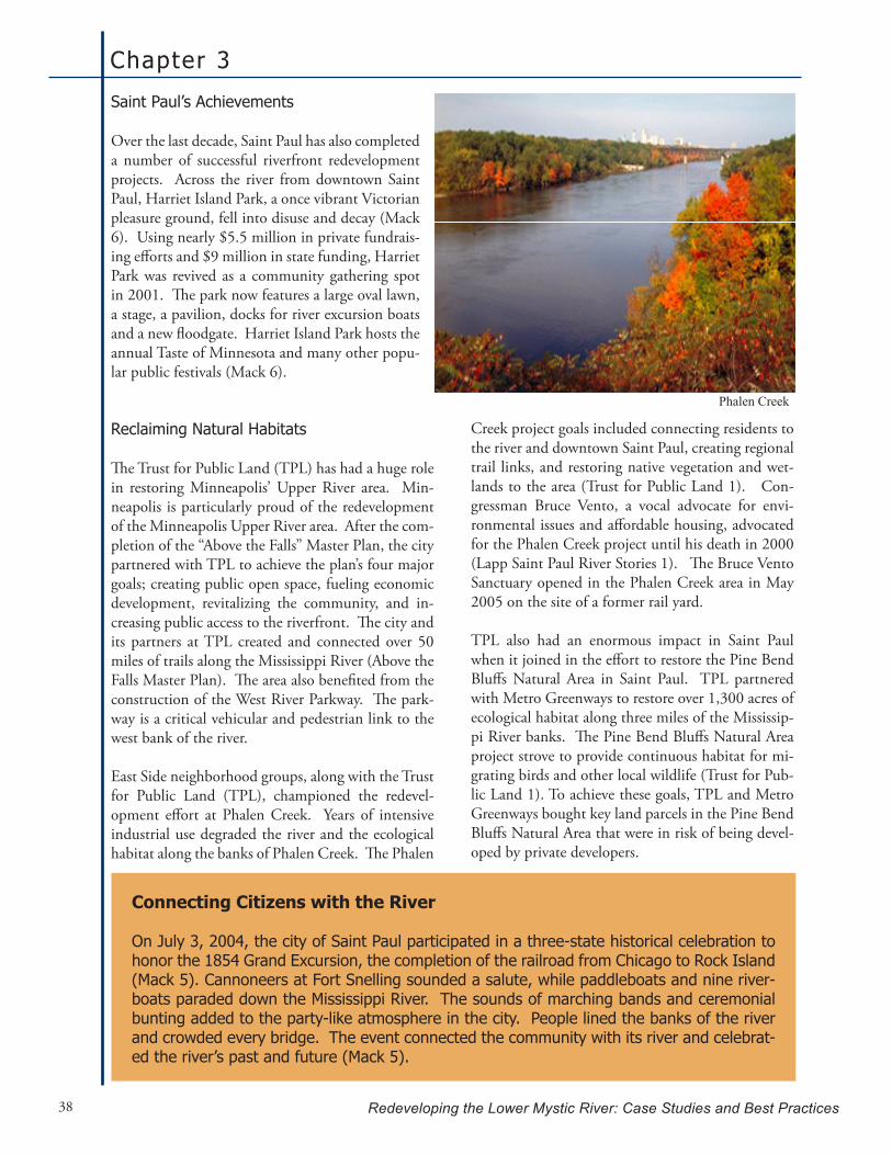
Chapter 3
Redeveloping the Lower Mystic River: Case Studies and Best Practices38
Saint Paul’s Achievements
Over the last decade, Saint Paul has also completed a number of successful riverfront redevelopment projects. Across the river from downtown Saint Paul, Harriet Island Park, a once vibrant Victorian pleasure ground, fell into disuse and decay (Mack 6). Using nearly $5.5 million in private fundrais-ing efforts and $9 million in state funding, Harriet Park was revived as a community gathering spot in 2001. The park now features a large oval lawn, a stage, a pavilion, docks for river excursion boats and a new floodgate. Harriet Island Park hosts the annual Taste of Minnesota and many other popu-lar public festivals (Mack 6).
Reclaiming Natural Habitats
The Trust for Public Land (TPL) has had a huge role in restoring Minneapolis’ Upper River area. Min-neapolis is particularly proud of the redevelopment of the Minneapolis Upper River area. After the com-pletion of the “Above the Falls” Master Plan, the city partnered with TPL to achieve the plan’s four major goals; creating public open space, fueling economic development, revitalizing the community, and in-creasing public access to the riverfront. The city and its partners at TPL created and connected over 50 miles of trails along the Mississippi River (Above the Falls Master Plan). The area also benefited from the construction of the West River Parkway. The park-way is a critical vehicular and pedestrian link to the west bank of the river.
East Side neighborhood groups, along with the Trust for Public Land (TPL), championed the redevel-opment effort at Phalen Creek. Years of intensive industrial use degraded the river and the ecological habitat along the banks of Phalen Creek. The Phalen
Creek project goals included connecting residents to the river and downtown Saint Paul, creating regional trail links, and restoring native vegetation and wet-lands to the area (Trust for Public Land 1). Con-gressman Bruce Vento, a vocal advocate for envi-ronmental issues and affordable housing, advocated for the Phalen Creek project until his death in 2000 (Lapp Saint Paul River Stories 1). The Bruce Vento Sanctuary opened in the Phalen Creek area in May 2005 on the site of a former rail yard.
TPL also had an enormous impact in Saint Paul when it joined in the effort to restore the Pine Bend Bluffs Natural Area in Saint Paul. TPL partnered with Metro Greenways to restore over 1,300 acres of ecological habitat along three miles of the Mississip-pi River banks. The Pine Bend Bluffs Natural Area project strove to provide continuous habitat for mi-grating birds and other local wildlife (Trust for Pub-lic Land 1). To achieve these goals, TPL and Metro Greenways bought key land parcels in the Pine Bend Bluffs Natural Area that were in risk of being devel-oped by private developers.
Connecting Citizens with the River
On July 3, 2004, the city of Saint Paul participated in a three-state historical celebration to honor the 1854 Grand Excursion, the completion of the railroad from Chicago to Rock Island (Mack 5). Cannoneers at Fort Snelling sounded a salute, while paddleboats and nine river-boats paraded down the Mississippi River. The sounds of marching bands and ceremonial bunting added to the party-like atmosphere in the city. People lined the banks of the river and crowded every bridge. The event connected the community with its river and celebrat-ed the river’s past and future (Mack 5).
Phalen Creek

Mississ ippi River, Twin Cit ies, MN
Redeveloping the Lower Mystic River: Case Studies and Best Practices 39
Preserving Neighborhoods
While river redevelopment can be extremely posi-tive for many regional residents, the issue of neigh-borhood gentrification may arise from redevelop-ment. Often the poorest residents who live in areas requiring redevelopment efforts find themselves un-able to afford to live in their neighborhood after the area has been revitalized. The State of Minnesota acknowledged these issues in 1999 by funding hous-ing development along 19 riverfront communities, including Minneapolis and Saint Paul (American Rivers). The state distributed funds to the commu-nities for the purpose of riverfront housing develop-ment for all income levels.
In Minneapolis, approximately 4,000 housing units have been built, with another 1,000 more units planned or in construction along the river. Cer-tainly, there is also a vast amount of luxury housing, such as the North Star Lofts and 5 other condo proj-ects currently built. The city is considering 4 more condo projects in the conceptual development and permitting phases. Saint Paul’s Upper Landing area, historically home to tight-knit immigrant groups, has also been redeveloped with housing for all in-come levels (Lapp Saint Paul River Stories 1). The Upper Landing area, formerly a scrap yard, features over 500 housing units currently built or planned. The area also includes public space with parks inte-grated between neighborhoods (Mack 7).
Environmental Justice Communities
In 1885, Bassett Creek, a neighborhood located in western Minneapolis, thrived with highly trafficked roads and rail lines and a population of over 129,000 (Lapp Minneapolis River Stories 1). To accommo-date its rapidly increasing population and transpor-tation needs, many acres of natural wetlands were filled and the creek itself was used as a dumping ground (Lapp Minneapolis River Stories 1). By the 1960s, stormwater from local highways, including the I-94 and I-394 Interstate highways, was also be-ing diverted into Bassett Creek. Water levels in the river rose and the number of flooding events contin-ued to increase (Lapp Minneapolis River Stories 1). Much of the affluent population left the area and heavy industry began to dominate the land use in the area, polluting the water and soils.
Bassett Creek is known today as an environmental justice community with substandard low-income housing and high levels of pollution. The Envi-ronmental Protection Agency (EPA) and the City of Minneapolis are currently involved in three Su-perfund cleanups in the Bassett Creek area. His-torically, the area has housed the poorest immigrant populations and throughout segregation was mainly a low-income African-American community (Lapp Minneapolis River Stories 1). Today, the City of Minneapolis is planning the Heritage Park project, a mixed-use community with industrial, commercial, retail, residential and park uses, for the Bassett Creek area. The area, however, is still zoned for heavy industrial use and there has been little action past the planning stages for the mixed use project (Lapp Minneapolis River Stories 1).
North Star Lofts in Minneapolis, City of Minneapolis
Natural Saint Paul; The Riverfront Corporation

Chapter 3
Redeveloping the Lower Mystic River: Case Studies and Best Practices40
redevelopment to pay for the initial public costs.
The State of Minnesota authorizes the Community Planning and Economic Development Department (CPED) to administer this funding by establishing tax increment financing districts. Public hearings and other solicitation of stakeholder input is re-quired before a tax increment district is approved (City of Minneapolis, Tax Increment Financing). When construction is complete, the new real es-tate tax value is subtracted from the district’s pre-development tax value to repay initial costs over an extended period of time (City of Minneapolis, Tax Increment Financing).
CPED finances initial public redevelopment invest-ments by allowing the city or town to sell bonds or use available CPED resources. Alternately, some projects are financed by a “pay-as-you-go” system, where the developer finances the initial public costs with the agreement that CPED will repay the devel-oper’s costs with interest from taxes generated from the completed project (City of Minneapolis, Tax In-crement Financing). Examples of areas where tax increment funding is employed include rehabilita-tion of deteriorated areas of the city, construction of low-income housing, historic preservation and for promotion of economic development and employ-ment.
Today in Saint Paul, there are large communities of Somali and Hmong immigrants. While the Soma-li-American community is not traditionally water-dependent, the Hmong population is known to fish and consume fish from the Mississippi River. The combination of historical water contamination and modern day pollutants makes fishing in the river an extremely dangerous practice. While signs are post-ed along the river banks, many Hmong immigrants continue to fish in the river unaware of the dangers of consuming the contaminated fish and shellfish (Nunnally).
Funding Redevelopment
Often significant public investments are required to initiate waterfront redevelopment in a region. Many cities and towns are unable to finance the environmental cleanups and infrastructure im-provements necessary to attract private investors. In response to this all too frequent problem, the State of Minnesota has authorized tax increment financing to aid redeveloping communities. This strategy is used 1) when the taxable value after re-development will be significantly higher than the value before redevelopment and 2) when it is clear that the redevelopment cannot occur without an initial public investment (City of Minneapolis, Tax Increment Financing). Thus, tax increment financ-ing takes the increase in taxes that results from the
American Heritage Rivers Designation
The American Heritage Rivers Initiative (AHRI) is a federal program run by the Environmental Protection Agency (EPA). In 2002, the EPA designated the Upper Mississippi River, including the26milesofriverflowingthroughtheTwinCities,asanAmericanHeritageRiver.Currently14 U.S. rivers are designated as American Heritage Rivers.
AHRI creates partnerships and attracts resources to riverfront communities and projects. In theUpperMississippiRiver,theAHRIaddressesissuessuchascultural/heritagepreservation,natural resource protection and economic revitalization (EPA AHRI).
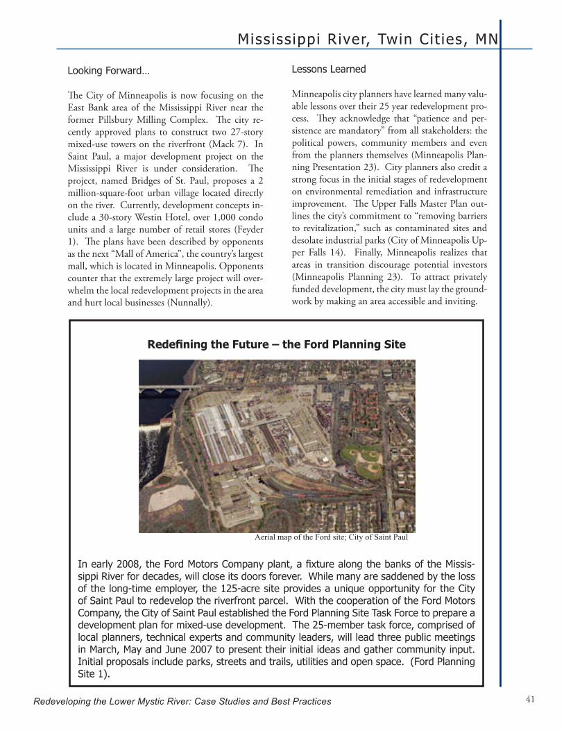
Mississ ippi River, Twin Cit ies, MN
Redeveloping the Lower Mystic River: Case Studies and Best Practices 41
Lessons Learned
Minneapolis city planners have learned many valu-able lessons over their 25 year redevelopment pro-cess. They acknowledge that “patience and per-sistence are mandatory” from all stakeholders: the political powers, community members and even from the planners themselves (Minneapolis Plan-ning Presentation 23). City planners also credit a strong focus in the initial stages of redevelopment on environmental remediation and infrastructure improvement. The Upper Falls Master Plan out-lines the city’s commitment to “removing barriers to revitalization,” such as contaminated sites and desolate industrial parks (City of Minneapolis Up-per Falls 14). Finally, Minneapolis realizes that areas in transition discourage potential investors (Minneapolis Planning 23). To attract privately funded development, the city must lay the ground-work by making an area accessible and inviting.
Looking Forward…
The City of Minneapolis is now focusing on the East Bank area of the Mississippi River near the former Pillsbury Milling Complex. The city re-cently approved plans to construct two 27-story mixed-use towers on the riverfront (Mack 7). In Saint Paul, a major development project on the Mississippi River is under consideration. The project, named Bridges of St. Paul, proposes a 2 million-square-foot urban village located directly on the river. Currently, development concepts in-clude a 30-story Westin Hotel, over 1,000 condo units and a large number of retail stores (Feyder 1). The plans have been described by opponents as the next “Mall of America”, the country’s largest mall, which is located in Minneapolis. Opponents counter that the extremely large project will over-whelm the local redevelopment projects in the area and hurt local businesses (Nunnally).
RedefiningtheFuture–theFordPlanningSite
Inearly2008,theFordMotorsCompanyplant,afixturealongthebanksoftheMissis-sippi River for decades, will close its doors forever. While many are saddened by the loss of the long-time employer, the 125-acre site provides a unique opportunity for the City of Saint Paul to redevelop the riverfront parcel. With the cooperation of the Ford Motors Company, the City of Saint Paul established the Ford Planning Site Task Force to prepare a development plan for mixed-use development. The 25-member task force, comprised of local planners, technical experts and community leaders, will lead three public meetings in March, May and June 2007 to present their initial ideas and gather community input. Initial proposals include parks, streets and trails, utilities and open space. (Ford Planning Site 1).
Aerial map of the Ford site; City of Saint Paul

Chapter 3
Redeveloping the Lower Mystic River: Case Studies and Best Practices42
While the Twin Cities redevelopment plans differ, common interests and trends have emerged. Both cities acknowledge the powerful impact of parks and public open space along the riverfront. (Mack 7). By constructing parks along the riverfront, the public had direct access to the river and com-munities felt connected to the valuable resource. Ann Calvert, a senior planner for the City of Minne-apolis, commented on the issue of parks saying, “It seems that whenever park improvements were made, development followed. Parks, trails, and amenities change people’s perception and so are important de-velopment tools” (qtd. in Mack 7).
Partnerships have strengthened many projects for both cities. By joining forces with agencies such as TPL and Metro Greenways, projects gained fund-ing, other resources and most importantly, public at-tention. The achievement of these critical milestone projects is another essential part of any redevelop-ment. Minneapolis’ Stone Arch Bridge transported citizens back to the river and the Guthrie Theater brought the community together at St. Anthony’s Falls (Nunnally). In Saint Paul, many point to the Harriet Park Island project as key turning point in
the city’s redevelopment.
However, the main lesson learned in the Twin Cities is academic: the vital role of a local univer-sity as a unifying agent in riverfront redevelop-ment. The Mississippi River Initiative, a col-laboration originated at the University of
Minnesota, is involved in numerous research proj-ects throughout the Twin Cities Metropolitan Area (Nunnally). As a neutral entity, the group supports local redevelopment efforts and tries to foster col-laboration between projects in the region. The vast resources available at a university, from funding to student manpower and academic insight, can be an invaluable resource to river redevelopment efforts (Nunnally).
The university is also connected to Saint Paul’s Riverfront Corporation. Dean Tom Fisher of the University of Minnesota serves on the Riverfront Corporation’s Board of Directors. Members of the Riverfront Corporation, including Design Center Director Tim Griffin, also teach at the University of Minnesota and involve students in the Design Center programs (Griffin).
“It seems that whenever park improvements were made, development followed. Parks,
trails, and amenities change people’s percep-tion and so are important development tools”
Chapter 4
Redeveloping the Lower Mystic River: Case Studies and Best Practices 43
Analysis and Recommendations
As the above quote indicates, there is no formula for wa-terfront regeneration. Based on our selected case study research, we wholeheartedly agree. It is also true that col-laborative efforts around waterfront regeneration can be different, including different actors, structures and strat-egies. However, there are required components of wa-terfront regeneration and collaboration that have been summed up in the related literature. Gordon stressed that the required components of waterfront regeneration are “money, free land, power and a compelling vision for the future and patience” (79). If that isn’t a tall enough order, Imperial summed up the required components of collaboration as “time, money, equipment, staff, technical expertise, and legal authority” (309). Not surprisingly,
the requirements of money, time (patience), and power (legal authority) overlap. Still, it can be a daunting task to consider embarking on this journey as each component is inextricably woven together. As the above quote further indicates, learning from both the successes and failures of other waterfront redevelopment efforts is a highly effec-tive technique.
This next chapter outlines some of the many lessons we learned while researching waterfront redevelopment and our case studies. Based on these lessons, we also outline some key strategies for MyRWA and the newly formed collaborative efforts of the Eastern Mystic Watershed Al-liance (EMWA) in order to assist their redevelopment ef-forts along the Lower Mystic River.
“Every city has a unique civic culture and history, and every urban waterfront has its own special challenges and opportunities. There is no single formula for waterfront regeneration, and no single model for implementing waterfront projects. Nevertheless, cities learn from one another” (Fisher et al 228)

Chapter 4
Redeveloping the Lower Mystic River: Case Studies and Best Practices44
Collaboration
Collaboration is an approach often used in complex socio-political environments to build consensus around shared goals and to outline the steps neces-sary to make these goals a reality. Many see this process as desirable because it avoids some conflicts that may arise from unilateral decision making, rul-ing by majority, regulation, and litigation (Impe-rial 311). However, it is important to remember that collaboration does not mean that there will be consensus at every stage of the process; in fact, some level of conflict is appropriate. This conflict can lead to a better understanding of others’ opin-ions, and this is what seems to be most important in moving forward (Sabatier et al. 292). There are also limits as to how much an organization can or should be willing to compromise its own goals (Im-perial 312). Therefore, collaborative efforts most often work toward win-win or at least win-no-lose outcomes (Imperial and Kauneckis 1048). Final-ly, collaborative partnerships are often a response to the “realities of societal complexity” (Bradshaw 143). In other words, complex environments, such as urban settings, often require collaboration, in-stead of collaboration being the best way to move forward in all circumstances. In the Lower Mystic and the case studies presented, it seems that collab-orative efforts are necessary due to the complexity of the local environments. Coordinators in each case study employed collab-
orative efforts for their waterfront de-velopment, though the extent varied in number of participants and diversity of stakeholder groups. In Minneapolis, for instance, waterfront redevelopment is the result of an initial partnership be-tween the Minneapolis City Council, the Minneapolis Parks and Recreation Department, the Minnesota Histori-cal Society, the State Pollution Control Agency, and the St. Anthony’s Falls Heritage Board. Many more collabo-rations within the city have continued over the many years of this redevelop-ment effort. In Saint Paul, a non-profit called the Riverfront Corporation was created by the mayor. This group col-laborated with various stakeholders including residents, businesses, com-munity leaders, local universities and
technical consultants.
In Bucks County the Redevelopment Authority brought together various stakeholders to coordinate redevelopment efforts, including 6 municipalities. Interestingly, this collaborative effort purposefully excluded many large industrial landowners along the waterfront. Finally, the Rouge River Gateway Partnership was a collaborative effort that included a wide array of stakeholders and 6 municipalities and was largely coordinated by a few individuals within the partnership. This partnership had, to a certain degree, a formal structure such as the desig-nation of Chairs of the partnership and collection of dues from members. However, it was not a formal organization as seen in the Twin Cities and Bucks County.
Coordination specifically between municipalities was another important focus throughout our study, as MyRWA and EMWA are trying to foster collabo-ration between the Lower Mystic municipalities as well. It is interesting to note that each case study achieved different levels of success in this regard. After taking a closer look at the Twin Cities area, Saint Paul and Minneapolis did not seem to work very collaboratively across borders. This may seem surprising due to their proximity across the river from one another and their involvement in the larg-er American Heritage River initiative and related Army Corps work. Their lack of coordination could
Analysis and Recommendations
Redeveloping the Lower Mystic River: Case Studies and Best Practices 45
be due to their history of conflict (Nunnally). Al-ternatively, it could also be because redevelopment was seen as a necessity much earlier in Minneapolis than in Saint Paul due to the earlier retreat of in-dustry in Minneapolis.
The other two locations man-aged to foster these relationships through some coordinating body. In the case of the Rouge River, this led to further collab-orative work among municipal partners. Prior to the Gateway Partnership and Master Plan, the Rouge River had a history of multi-municipal collaboration through water quality improvement initiatives. For example, in that same year the Vol-unteer Watershed-Based General Storm Permit was adopted as a result of the Rouge River Project to manage CSOs. It seems, then, from this example as well as from existing literature on collaboration, that successful collaborative efforts have the poten-tial to lead to further sharing of ideas and resources (Margerum 186). The literature also supports the theory that the collaborative efforts in the Rouge assisted partnership members in gaining increased legitimacy for their actions, such as using the Gate-way Master Plan to mold the future development and getting approval for a storm permitting sys-tem (Bradshaw 143). Thus, collaboration between municipalities is an extremely powerful method to draw attention to redevelopment issues.
Though still in its very early stages, Bucks County also has some important lessons about bringing municipalities together. While Bob White of the Bucks County Redevelopment Authority joked
that “if you feed them they will come,” it was actu-ally the non-regulatory and individualized project focus that made this plan’s development a success. For example, the Redevelopment Authority con-ducted meetings in each township with just those members of government and the public to discuss their vision for the future of the waterfront. In ad-dition to this, each municipality had its own Op-portunity Area that gave them a sense of impor-tance and focus within the overall waterfront plan. Finally, while there were overarching goals for the entire area and a vision put forward by the plan, in-dividual town planning was a large focus. The plan urged municipalities to take the steps outlined, but it was not mandated. It remains to be seen if this structure fosters successful redevelopment.
While collaboration took a slightly different shape
“the collaborative efforts in the Rouge assisted partner-ship members in gaining increased legitimacy for their ac-tions, such as using the Gateway Master Plan to mold the future development and getting approval for a storm permitting system”
Key Strategies:
Creation of a clear vision for the future as this creates momentum and •cohesion among the members and community;Strong leadership from the beginning to energize others;•Significantamountsofadministrativeworkandpersistence;•Timingandcoordinationofcollaborativeeffortswithothersignificant•events;Benchmarking and consultant participation to improve support and •cohesion among the group;Collaboration in order to achieve further collaboration; and•Opportunities and power for municipal participants to increase their •level of interest and support.

Chapter 4
Redeveloping the Lower Mystic River: Case Studies and Best Practices46
tal in waterfront planning on the Lower Mystic. Similarly, municipalities have the right to form re-gional compacts to share services. For example, 26 municipalities in Massachusetts voted to form the Franklin Regional Council of Governments. This council manages some regional functions for the
area such as waste dispos-al, public transportation, and planning activities (Franklin Regional Coun-cil of Governments). It is also important to highlight the significance of timing in regards to collaboration specifi-cally for redevelopment of waterfront parcels. A wide array of stakehold-ers seemed to coordinate efforts after some degree of environmental clean
up - once people started to see the riverfront as their “front yard, not their back yard” (Cave). This indicates that collaborative efforts should begin to focus on improving environmental conditions through projects that bring heightened awareness to the area such as improving public access. This is not to say that the partnership should not form early or begin to think about their goals for redevel-opment of waterfront parcels, but it may be impor-tant to focus early on cultivating those members that can provide expertise and build momentum around improved environmental conditions. Once these conditions have started to improve, the part-nership (or some alternative form or members of the partnership) can redirect its focus as needed.
Benchmarking and the related use of outside ex-perts and consultants have also been crucial factors to success in the case studies. The Bucks County Redevelopment Authority used consultants and experts to help guide the formation of their water-front plan, noting that it helped the community to hear from people outside the community about what worked and what didn’t work in other loca-tions (White). The Rouge River Gateway Partner-ship used the help of consultants not only to help create the master plan but also to keep the momen-tum of the planning process (Cave). Furthermore, Sam Lovall, a Board member of the Friends of the
in each of the case studies, they all had useful les-sons that can be utilized in the Lower Mystic, re-gardless of the exact structure of collaboration. In all of the cases, strong leadership was essential in both forming the partnership and keeping the partnership together. In each location, there were a handful of people who were successful at “en-visioning, empower-ment and enactment” (Vlachos 210). These leaders knew how to motivate and lead people through the col-laborative process. For example, the Rouge Gateway Partnership really could not have been successful without the coordination work of Kelly Cave in Wayne County. She constantly searched for grant funding, wrote grants for com-munities, organized members, and thought ahead to deadlines (Bagale; Cave). This is another major point often noted in the literature on collaboration as absolutely necessary but often underestimated (Bradshaw 143; Imperial 302).
Another common yet crucial theme in the case studies is that they were all organized by some form of regional government, whether a county planning department or a planning/economic development-based organization within the state government. This does not necessarily mean that the government or organization had any authority to make deci-sions unilaterally about the redevelopment; instead they served an important function of providing the time, effort, and continuous momentum to foster collaboration.
The counties of the Lower Mystic, Suffolk and Middlesex, have had their governments abolished with only a few county functions remaining such as a sheriff, commissioner and secretary (Common-wealth of Massachusetts, “County Government”). There is, however, another regional organization that could serve this purpose. The Metropolitan Area Planning Council (MAPC) is well positioned to act as this unifying force for the Lower Mystic communities. The MAPC could be instrumen-
Collaboration on the Lower Mystic thus far has been fostered by the Eastern Mystic
Watershed Alliance (EMWA). At this point, EMWA seems to resemble most the Rouge Partnership’s collaborative structure as it is multi-municipal and attempting to include
a wide array of stakeholders such as indus-trial landowners, community organizations, educational institutions, and many more
contributing organizations.
Analysis and Recommendations
Redeveloping the Lower Mystic River: Case Studies and Best Practices 47
vocated for the Arab American community by using the master plan to help them fight a new trucking terminal in the industrial area.
Finally, as waterfront redevelopment often takes a tremendous amount of time, a master plan can be helpful in identifying those projects that can serve as important milestones or can be done quickly, fostering continuous momentum for the redevelop-ment. This plan can similarly help to identify the projects that must be done first, such as infrastruc-ture improvements.
Some individual visioning projects have already be-gun in the Lower Mystic such as the Chelsea Com-
munity Vision Plan1 and the Everett Waterfront Assessment2. The Mas-sachusetts Department of Conservation and Rec-reation is also starting to work on a master plan for their parks and relat-ed linkages in the Lower Mystic area. In addition to this, the MAPC has recently received fund-ing to conduct a Lower Mystic planning study and, based on the benefits of planning in the case studies this effort by the MAPC, should serve as a catalyst for change. It will be important, how-ever, for the Lower Mys-tic to capitalize on a mas-ter planning process to its fullest extent.
1 See the following link to the Urban Ecology Institute information on the Chelsea Creek Community Vision Plan: http://www.bc.edu/bc_org/research/urbaneco/pro-gram/natcit_Lpartnerships.html2 See the following link to the Everett Waterfront As-sessment: http://www.ci.everett.ma.us/cover.pdf
Rouge, also worked for the consulting firm hired by the Partnership. This connection may have helped with the continuous assistance from the consulting firm.
Finally, a common theme in the Rouge in promoting collaboration was that grant funding was often tied to collaborative efforts. This should be taken into consideration by the Lower Mystic communities. Moreover, MyRWA and EMWA should consider the promotion of grants that favor collaboration in order to get municipalities working together.
Helpfulness of Master Plans
A master plan can be used to create momentum by influencing more partners to come on board. All three case studies used one or more master plans to focus their redevelopment efforts. Furthermore, both the process in creating the plans and the plans themselves served these areas very well. For in-stance, having an actual document for people to look at seemed invaluable to the Rouge River’s rede-velopment efforts. Simi-larly, a master plan has influenced local munici-palities in Bucks County to rewrite their standard 10 year plans to include waterfront redevelopment goals that correspond to the overall plan. A master plan can also be helpful in dealing with new political leadership at every level because it symbolizes local support and a unified vision of the future. Somewhat related to this, a master plan can coordinate the larger community’s efforts to support certain legislation, or it can aid local grass roots orga-nizations in advocating for development outcomes that correspond with the plan and their similar vi-sion for the future of the area. The ACCESS orga-nization in the Greater Detroit area successfully ad-
Key Strategies:
Initial collaborative efforts should •focus on putting together a master plan;Use a neutral party to manage the •master planning process in order to facilitate discussions and build trust;Line up technical resources and •expertise early on in the process;Use the process of visioning to •motivate the community and part-nership members;Use the master plan itself to cre-•atemomentumandinfluencepo-tential partners to come on board and to identify milestone projects.
A master plan can also be helpful in dealing with new political leadership at every level
because it symbolizes local support and a uni-fiedvisionofthefuture.

Chapter 4
Redeveloping the Lower Mystic River: Case Studies and Best Practices48
EnvironmentalRemediation/CleanUp
To facilitate waterfront development in an area, substantial environmental remediation is often re-quired. Historically, industrial uses, such as manu-facturing and heavy cargo shipping, have contrib-uted to poor water quality and contaminated soils. Yet planning for a cleaner future and correcting the mistakes of the past can be a daunting task despite current industrial use regulations. Accordingly, then, the Mystic River faces significant environmen-tal remediation challenges in its redevelopment.
The following examples from the three presented case studies provide techniques for planning and implementing environmental cleanups along the Mystic’s working waterfront. Like the Mystic Riv-er, the Rouge River was plagued by legal and illegal combined sewer overflows (CSOs) and industrial discharge of pollutants, which depleted the river water quality. This unacceptably poor quality of the water, however, ultimately led to the area’s wa-terfront revitalization. Through strict enforcement of the Clean Water Act (CWA) and local watershed stormwater management plans by a federal judge, the Rouge River Watershed was able to enforce in-dustrial discharge reg-ulation and eliminated toxic chemical con-cerns in most areas. Moreover, 43 munici-palities completed a Storm Water Pollution Prevention Initiative Plan as 7 sub-water-sheds worked togeth-er to write watershed management plans establishing goals for protection and res-toration of the river. This cooperation and enforcement of transbound-ary water resources led to the success of remediation efforts for the Rouge. To date, the dissolved oxygen (DO) levels are steadily improving and the percent of DO readings above the State’s water quality stan-dard of 5 mg/l are increasing. Thus, a joint effort by all Mystic River communities to protect their water resources may have a significant impact on remedia-tion efforts.
Land use management is also a critical component to the protection of the Mystic River and its wa-tershed water resources. However, varying local zoning ordinances cannot protect valuable water bodies without a unifying force. In the Twin Cities, the Mississippi River Corridor Critical Area Order was an important tool in protecting the natural re-sources along the Mississippi River Corridor as well as a comprehensive instrument for planning and development. A 72- mile stretch of the Mississippi River was designated as the “critical area” by state
designation and as a “national river and recreation area” by federal designation. The Mississippi Riv-er Corridor Critical Area Order defined corridor boundaries, management dis-tricts, quality stan-dards and guidelines for planning and ordinance develop-ment. The Missis-sippi River Corridor Critical Area Order
also laid the groundwork for municipalities to cre-ate zoning measures, such as overlay districts with height and setback restrictions, along the riverfront. To protect the Mystic River, comprehensive zon-ing must be established across local city and town boundaries. Collaboration must begin by enacting zoning ordinances and establishing zoning overlay districts across the Lower Mystic communities to best manage the watershed.
Recently, the Massachusetts Department of Environmental Protection (DEP), under the Clean Water Act’s Section 308, has issued enforcement letters to several Mystic River Watershed com-munities. The letters issued to municipalities
abutting the Alewife and Upper Mystic River un-der Section 308 of the Clean Water Act initiated a process and schedule to identify and eliminate
illegal sources of contamination. The actions required under the 308 process have not been
fully implemented or enforced.
Key Strategies:
Collaborative community storm •water management plans; Enforcement of environmental reg-•ulations (the Clean Water Act); Elimination of both legal and illegal •combinedseweroverflows(CSOs);andLand use management (zoning or-•dinances, management districts, etc.).

Analysis and Recommendations
Redeveloping the Lower Mystic River: Case Studies and Best Practices 49
Public Outreach and Mobilization
Waterfront revitalization is a long-term project that requires patience and persistence by all stakehold-ers and participants. Keeping the community in-formed and involved in the process is essential from the planning stages through project com-pletion.
In Bucks County, a se-ries of public forums was conducted to involve the broader community dur-ing the master planning phase. Furthermore, each public forum served a different purpose to advance understanding of the study process and findings. The first forum focused on relevant waterfront development case studies. A panel of planning and economic development experts shared their expertise and explained how other communities have improved their communities, redeveloped Brownfields, and stimulated economic develop-ment. The second public forum focused on assets and strengths of the study areas, as well as possible
planning and development options. The last public meeting was held at the draft plan stage to review and hone draft recommendations before the plan was finalized.
Holding such public forums will be critical in bringing together the various stakeholders on the
Lower Mystic Riv-er. MyRWA and EMWA (the East-ern Mystic Water-shed Association) have begun organiz-ing such forums and should continue to hold these through-
out the redevelopment process. While public forums are helpful, they are just one of many tools that should be used to obtain ad-equate and representative public comment. As a requirement of the State of Michigan’s Voluntary General Stormwater Permit Program adopted by communities of the Rouge River area, these com-munities had to create a plan for community edu-cation. The goals of the plan were to educate the communities about the river, its impairments and individual responsibility and stewardship. The
A Taste of Minnesota
Celebrating the river is an important way to connect people to their waterfront. On July 3, 2004, paddleboats and river barges paraded down the Mississippi River through Saint Paul in celebration of the 1854 Grand Excursion during their an-nual Taste of Minnesota festival, which is held at the recently revitalized Harriet Island Park. The community gathered along the riverbanks and atop bridges whilecannonsfiredfromFortSnellingand marching bands played. By cele-brating the river’s history, the Twin Cit-ies ignited the public’s interest in the river’s future. This large public event along the river reminded citizens of all the possibilities and promise a clean river holds with public open space for recreational uses.
Strong collaborative bodies like the Partnership and the Riverfront Corporation served as stabilizing forces over
extended project timelines and in uncertain political climates. These groups provided strong leadership and
united communities.
A Taste of Minnesota
Chapter 4
Redeveloping the Lower Mystic River: Case Studies and Best Practices50
findings from this education program reveal that while it can be difficult to obtain the desired level of public comment, varying the approach can increase success (Powell and Zachare 1). Some examples of ways to increasing public participation and input that were used in the Rouge River area include at-tending well-established community events to pro-vide information, creating citizen advocacy groups, and conducting surveys. A variety of approaches to increase public participation should similarly be used in the Lower Mystic.
Strong partnerships are an effective way to publicize projects and create the momentum necessary to fuel the life of a redevelopment project. In 1999, mul-tiple stakeholders came together to form the Rouge River Gateway Partnership. This group represented the interests of those on the Gateway Corridor and provided a forum to build consensus for the revi-talization of the river so that it could become an amenity for everyone. Once all partners were on board, the Partnership was able to keep the momen-tum going by continually engaging all the partners in the process. The Partnership pursued funding as it found relevant grants that fit its projects. While the future form of EMWA is unclear at this time, EMWA could serve a similar purpose on the Mys-tic, bringing together the various watershed stake-holders as well as being a vehicle for pursuing grant funding for redevelopment projects.
Saint Paul also utilized a strong collaborative group to shape their redevelopment efforts. The Riverfront Corporation was comprised of technical experts, lo-cal business leaders, political figures and community activists. The Riverfront Corporation ran three ma-jor programs: the Saint Paul on the Mississippi De-sign Center; Public Outreach and Communication; and Special Projects. The Design Center’s purpose was to advance urban design principles in planning projects. Local engineers, planners and architects collaborated through the Design Center. Public Outreach and Communication sought “to inform, involve and inspire the community.” It strove to instill pride and ownership in the city’s residents for the future of the river development. The Special Projects program was in charge of identifying and championing strategic projects that would be cata-lysts for future development and project support. Special Projects accelerated the implementation of strategic projects, fuels project momentum and at-
tracts new investments.
Strong collaborative bodies like the Partnership and the Riverfront Corporation served as stabiliz-ing forces over extended project timelines and in uncertain political climates. These groups provided strong leadership and united communities. Thus, advocacy groups for riverfront redevelopment must be internally stable and present a unified front to the community and the media to be successful. These groups also need the support of local government to provide resources and assist in public outreach. EMWA’s efforts to engage the local governments of the lower Mystic communities are exactly the type of support that is needed.
Educating the public and involving citizens in wa-ter quality monitoring is an effective public out-reach tactic. The Rouge River Project established a volunteer water quality monitoring program by incorporating the public school system of southeast Michigan. Students from elementary school to high school perform hands-on scientific experiments measuring water quality. MyRWA has implemented a similar program in the Mystic River Watershed involving neighborhood volunteers. By incorporat-ing more local schools and universities in their pro-gram, MyRWA could effectively reach and educate the future area leaders and community members. It is crucial for MyRWA and EMWA to connect lo-cal residents of all ages to the future of the Mystic River.
Key Strategies:
Community involvement (public fo-•rums and stakeholder input);Use various public outreach methods •to garner public input;Strong collaborative boards and part-•nerships;Education of the public and the cre-•ation of volunteer networks; andCelebration of the river with large •community events.

Analysis and Recommendations
Redeveloping the Lower Mystic River: Case Studies and Best Practices 51
Public Access
One of the clearest lessons learned from our case studies is the critical role that increased public access plays in energizing waterfront stakeholders and in creating momentum for redevelopment efforts. Creating access to the riverfront allows the surrounding communities to become con-nected to the river and, in so doing, gives them a stake in its future. Increased public access played a seminal role in the successful redevelopment of both the Mississippi River in the Twin Cit-ies area and the Rouge River and will need to play a similarly central role in the Lower Mystic. As Ann Calvert, a senior planner for the City of Minneapolis, commented on the issue of parks, “It seems that whenever park improvements were made, development followed. Parks, trails, and amenities change people’s perception and so are im-portant development tools” (qtd. in Mack 7). By constructing parks along the riverfront, the public gained direct access to the river and communities felt connected to this valuable resource.
While the Mystic Watershed boasts an impressive array of parklands, open space, and, to a lesser de-gree, access points to the river, they are very un-evenly distributed, inadequately maintained, and poorly connected. Thus, priorities should be to in-crease the amount, the quality, and the connectiv-ity of open space throughout the watershed, with special attention to facilitating direct access to the riverfront by all communities.
Whereas open space is relatively abundant in the upper, more suburban part of the watershed (35% in the Aberjona subbasin and 30% in the Horn Pond and Mystic Lakes subbasins), the proportion of open space is substantially lower in the lower part of the watershed (8% in the Chelsea Creek subbasin and 13% in the Mystic 2 subbasin – the saltwater portion of the Mystic River) (MyRWA, “Mystic River Watershed Assessment” 5-1). As in many other areas of the state, the remaining por-tions of open space in the Mystic are being lost to development. Increasing the amount of open space throughout the entire watershed is important but is especially critical in the communities of the Lower Mystic Watershed, where such resources are criti-cally lacking3.
Additionally, the open space that does already ex-ist must also be adequately maintained and safe-guarded against encroachments from development and disrepair. One area where attention is needed is the network of parklands owned and managed by the state Department of Conservation and Rec-reation (DCR). These parklands are tremendous assets to the communities in the Mystic Water-shed and should be more properly maintained and managed. The DCR is now initiating a master planning process for the Mystic Reservation and should make this effort a very high priority in the
3 This report will not be recommending specific parcels for protection, as this is best done by the communities themselves, and as part of a larger master plan. It is also noted that many specific recommendations have already been put forth by MyRWA in several preceding reports (see MyRWA, “Mystic River Watershed Assessment” Ch. 5 & 6; MyRWA, “Open Space Priorities”).
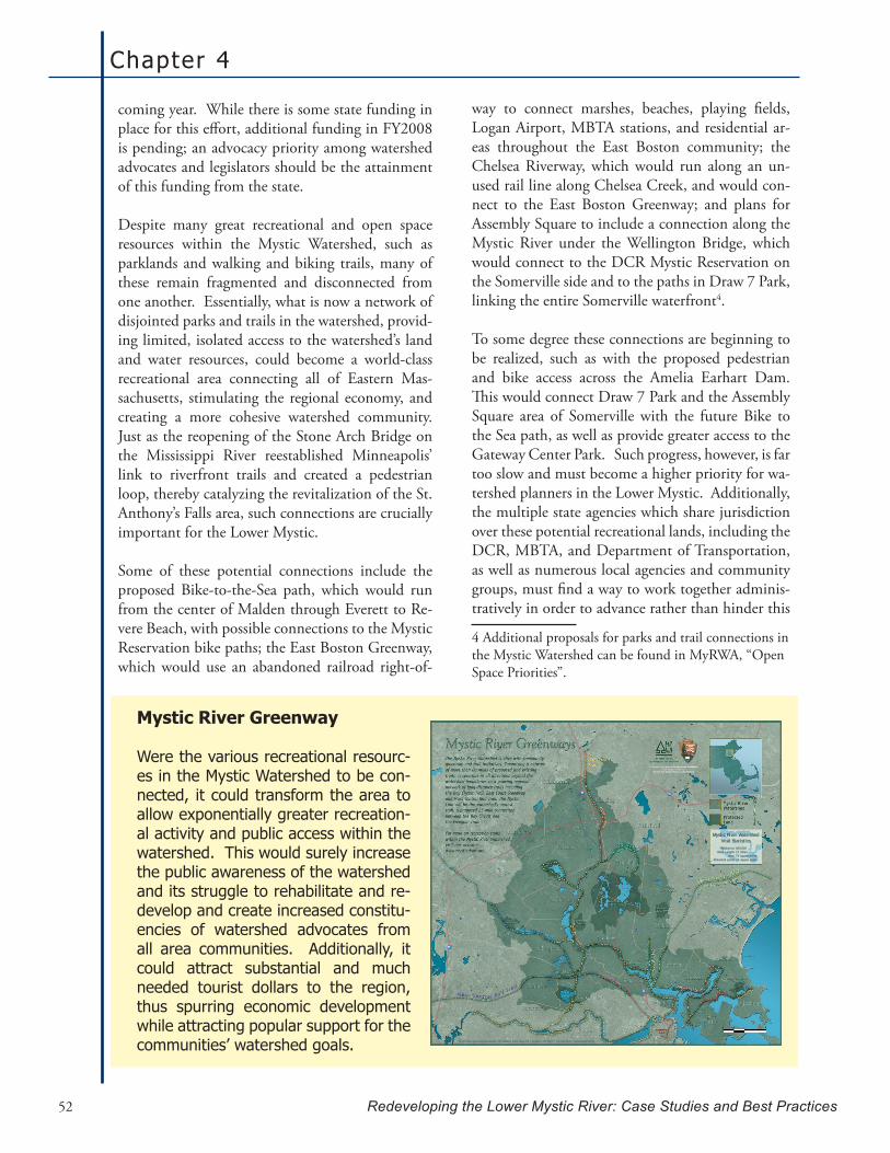
Chapter 4
Redeveloping the Lower Mystic River: Case Studies and Best Practices52
coming year. While there is some state funding in place for this effort, additional funding in FY2008 is pending; an advocacy priority among watershed advocates and legislators should be the attainment of this funding from the state.
Despite many great recreational and open space resources within the Mystic Watershed, such as parklands and walking and biking trails, many of these remain fragmented and disconnected from one another. Essentially, what is now a network of disjointed parks and trails in the watershed, provid-ing limited, isolated access to the watershed’s land and water resources, could become a world-class recreational area connecting all of Eastern Mas-sachusetts, stimulating the regional economy, and creating a more cohesive watershed community. Just as the reopening of the Stone Arch Bridge on the Mississippi River reestablished Minneapolis’ link to riverfront trails and created a pedestrian loop, thereby catalyzing the revitalization of the St. Anthony’s Falls area, such connections are crucially important for the Lower Mystic.
Some of these potential connections include the proposed Bike-to-the-Sea path, which would run from the center of Malden through Everett to Re-vere Beach, with possible connections to the Mystic Reservation bike paths; the East Boston Greenway, which would use an abandoned railroad right-of-
way to connect marshes, beaches, playing fields, Logan Airport, MBTA stations, and residential ar-eas throughout the East Boston community; the Chelsea Riverway, which would run along an un-used rail line along Chelsea Creek, and would con-nect to the East Boston Greenway; and plans for Assembly Square to include a connection along the Mystic River under the Wellington Bridge, which would connect to the DCR Mystic Reservation on the Somerville side and to the paths in Draw 7 Park, linking the entire Somerville waterfront4.
To some degree these connections are beginning to be realized, such as with the proposed pedestrian and bike access across the Amelia Earhart Dam. This would connect Draw 7 Park and the Assembly Square area of Somerville with the future Bike to the Sea path, as well as provide greater access to the Gateway Center Park. Such progress, however, is far too slow and must become a higher priority for wa-tershed planners in the Lower Mystic. Additionally, the multiple state agencies which share jurisdiction over these potential recreational lands, including the DCR, MBTA, and Department of Transportation, as well as numerous local agencies and community groups, must find a way to work together adminis-tratively in order to advance rather than hinder this
4 Additional proposals for parks and trail connections in the Mystic Watershed can be found in MyRWA, “Open Space Priorities”.
Mystic River Greenway
Were the various recreational resourc-es in the Mystic Watershed to be con-nected, it could transform the area to allow exponentially greater recreation-al activity and public access within the watershed. This would surely increase the public awareness of the watershed and its struggle to rehabilitate and re-develop and create increased constitu-encies of watershed advocates from all area communities. Additionally, it could attract substantial and much needed tourist dollars to the region, thus spurring economic development while attracting popular support for the communities’ watershed goals.
Produced by the Mystic River Watershed Associationwith assistance from the
National Park Service, Rivers & Trails Program.
Mystic River Watershed Association • 20 Academy Street, Suite 203 • Arlington, MA 02476 • 781-316-3438 • www.mysticriver.org
Mystic River WatershedVital Statistics
Population: 400,000River Length: 17 miles
Area: 76 square milesProtected Lands: 14 square miles

Analysis and Recommendations
Redeveloping the Lower Mystic River: Case Studies and Best Practices 53
process. Potential opportunities for increasing con-nectivity of recreational lands, in conjunction with the administrative means by which this may occur, should be examined as part of the DCR’s forthcom-ing Mystic River Reservation Master Plan, as well as the MAPC’s Lower Mystic Corridor Study.
In addition to the watershed’s many natural resourc-es, the Lower Mystic also boasts many cultural and historic treasures that could be incorporated into public recreational areas, much like was done in the Twin Cities region of the Mississippi River. In de-signing community spaces in the watershed, plan-ners should be sure to celebrate the rich and diverse historic and cultural assets of the region, from its maritime past to its industry and immigration.
Furthermore, it is important to note that even where there is open space in the watershed, there is often limited public access to the water. This is particularly the case for the lowest-income commu-nities in the Lower Mystic, such as the communities of Chelsea and East Boston, where public access is severely restricted due to the dominant presence of industry on the waterfront. In order to provide these communities with public access to the water-
front, significant changes will be needed to the cur-rent structure of development and regulation along the waterfront in these areas. In Chelsea and East Boston, for instance, all but a small portion of the waterfront is part of a Designated Port Area (DPA), which, as previously mentioned, severely limits non-industrial activities, including public access to the water. Moreover, although Massachusetts’ Pub-lic Waterfront Act, Chapter 91 (310 CMR 9.00), provides protection to tidelands, rivers, and great ponds, and helps to assure reasonable public access to and use of such lands, it does not ensure public access to lands within DPAs and instead prioritizes water-dependent industrial uses.
Achieving a truly mixed-use waterfront in Chelsea or East Boston, including substantial public access to the water, would require combining public ac-cess with a commercial or temporary use, creating a DPA Master Plan, and/or requesting a DPA bound-ary review. Municipal zoning code determines what qualifies as a “Supporting DPA Use,” and thus will also require negotiation between the municipality, the DEP, and the land owner, which in these cases is primarily a marine industry. While certainly worth exploring, this approach would require negotiation on a parcel-by-parcel basis, and would likely be dif-
Utilizing Chapter 91
The Public Waterfront Act, Chapter 91 (310 CMR 9.00), is Massachusetts’ most powerful tool forensuringpublicbenefitanduseofitstidelandsandotherwaterways.Chapter91appliesto a great deal of the lands within the Lower Mystic watershed and is thus an important tool for protecting and promoting public access in these areas. A recent development that may have bearing on significant lands in the watershed is this past February’s MassachusettsSupremeJudicialCourtfindingthatthestateDepartmentofEnvironmentalProtectionerredwhen it exempted proponents of the East Cambridge Northpoint development from Chapter 91. This decision eliminated a provision within the Chapter 91 regulations, in place since 1990,whichexemptedlandlockedtidelands–atypeoffilledtidelandatleast250feetfromthe shoreline and separated by a public way in existence as of January 1, 1984. This ruling essentiallyresultedinsignificantadditionallandswithintheLowerMysticrequiringChapter91 licenses upon being developed. Upon receiving tremendous pressure from the real estate industry,however,GovernorPatrickhasrecentlyfiledAnActRegardingtheLicensingRequire-ments for Landlocked Filled Tidelands (HB 3757), which would reverse the SJC’s decision and provide the DEP with the statutory authority to once again exempt landlocked tidelands from the Chapter 91 licensing process. Public access advocates should oppose this legislation and discourage such blanket exemptions for landlocked tidelands, instead calling for revised leg-islation that has a more nuanced approach to these type of lands that ensures public access wherever feasible.
Chapter 4
Redeveloping the Lower Mystic River: Case Studies and Best Practices54
ficult to achieve significant public benefit. Similarly, recent history has shown the difficulty of winning approval for a DPA boundary review, and conse-quently, this is not likely to be a successful strategy for these communities to pursue increased public ac-cess and mixed-uses within their waterfront areas.
While not without its own challenges and risks, per-haps the best route for these communities to pur-sue is for the establishment of a DPA Master Plan, which would be created within a Municipal Harbor Plan. These plans can alter the regulatory condi-tions in the DPA by changing the supporting use of the area. These changes could then allow mixed-use development along the waterfront, including increased public access.
A major concern in opening up these areas for mixed-use developments, however, is that it would not be managed very carefully. This would result in greater development pressures where existing communities would suffer from the resulting market pressures and gentrification and displacement effects (Toffler). It should be noted that, in 2002, the town of New Bed-ford, Massachusetts completed a Municipal Harbor Plan (together with the town of Fairhaven) as part of its involvement with the Portfields Initiative. Given the demographic and economic similarities to the Lower Mystic region as well as its port designation as a state DPA, it would be prudent to look to this effort to see how New Bedford proposes to deal with the potential gentrification and other adverse effects of diversifying its waterfront development.
Co-existence with Industry on the Waterfront
Waterfront revitalization often happens at the “problematic and controversial interface between port function and the broader urban environment” (Hoyle, 395). It seems that public access to the river cannot be achieved without first promoting better management of the industrial activity on the water. Yet as long as industrial practices pose human health concerns (such as through uncovered salt piles blow-ing into the river, oil leaking into the river waters, or other forms of water contamination), this activity will be at odds with promoting public access to the waterfront. Thus, a critical component of successful urban waterfront redevelopment is finding a way to balance these industrial activities with other water-front uses. As was evident in the Rouge River and Twin Cities case studies, industry can be a powerful partner in achieving successful waterfront redevelop-ment and should be cultivated wherever possible. However, while there are clearly ways to approach the issue, there are no simple solutions to the con-flicts that industrial activity typically poses to other waterfront uses.
The industrial activity along the Mystic River is very important to our state and regional economy, and, therefore, will not and should not disappear any time soon. Therefore, the communities of the Lower Mystic must find an appropriate balance between industrial activity and the other public benefits that access to the waterfront can provide. Better manage-ment practices for cleaner and more environmentally
Key Strategies:
Increased public access to the waterfront;•Increased amounts, quality and connectivity of open space and recreational resourc-•es throughout the watershed;Increased and improved collaboration and cooperation across state and local agen-•cies in facilitating public access to the waterfront and to recreational resources;Design and promote parks and open spaces in consideration of each community’s •unique style of use and connection to such spaces;Prioritization of improved access to the water in those communities with the least •access; andThose communities within Designated Port Areas should consider pursuing a DPA •Master Plan and Municipal Harbor Plan in order to facilitate long-term planning for mixed-uses and increased public access to their waterfronts.
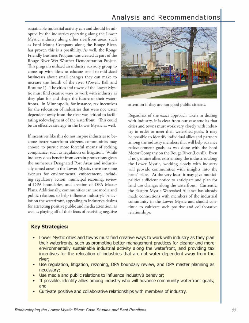
Analysis and Recommendations
Redeveloping the Lower Mystic River: Case Studies and Best Practices 55
sustainable industrial activity can and should be ad-opted by the industries operating along the Lower Mystic; industry along other riverfront areas, such as Ford Motor Company along the Rouge River, has proven this is a possibility. As well, the Rouge Friendly Business Program was created as part of the Rouge River Wet Weather Demonstration Project. This program utilized an industry advisory group to come up with ideas to educate small-to-mid-sized businesses about small changes they can make to increase the health of the river (Powell, Ball and Reaume 1). The cities and towns of the Lower Mys-tic must find creative ways to work with industry as they plan for and shape the future of their water-fronts. In Minneapolis, for instance, tax incentives for the relocation of industries that were not water dependent away from the river was critical to facili-tating redevelopment of the waterfront. This could be an effective strategy in the Lower Mystic as well.
If incentives like this do not inspire industries to be-come better waterfront citizens, communities may choose to pursue more forceful means of seeking compliance, such as regulation or litigation. While industry does benefit from certain protections given the numerous Designated Port Areas and industri-ally zoned areas in the Lower Mystic, there are some avenues for environmental enforcement, includ-ing regulatory action, municipal rezoning, review of DPA boundaries, and creation of DPA Master Plans. Additionally, communities can use media and public relations to help influence industry’s behav-ior on the waterfront, appealing to industry’s desires for attracting positive public and media attention, as well as playing off of their fears of receiving negative
attention if they are not good public citizens.
Regardless of the exact approach taken in dealing with industry, it is clear from our case studies that cities and towns must work very closely with indus-try in order to meet their watershed goals. It may be possible to identify individual allies and partners among the industry members that will help advance redevelopment goals, as was done with the Ford Motor Company on the Rouge River (Lovall). Even if no genuine allies exist among the industries along the Lower Mystic, working closely with industry will provide communities with insights into the firms’ plans. At the very least, it may give munici-palities sufficient notice to anticipate and plan for land use changes along the waterfront. Currently, the Eastern Mystic Watershed Alliance has already made connections with members of the industrial community in the Lower Mystic and should con-tinue to cultivate such positive and collaborative relationships.
Key Strategies:
LowerMysticcitiesandtownsmustfindcreativewaystoworkwithindustryastheyplan•their waterfronts, such as promoting better management practices for cleaner and more environmentally sustainable industrial activity along the waterfront, and providing tax incentives for the relocation of industries that are not water dependent away from the river;Use regulation, litigation, rezoning, DPA boundary review, and DPA master planning as •necessary;Usemediaandpublicrelationstoinfluenceindustry’sbehavior;•If possible, identify allies among industry who will advance community waterfront goals; •andCultivate positive and collaborative relationships with members of industry.•
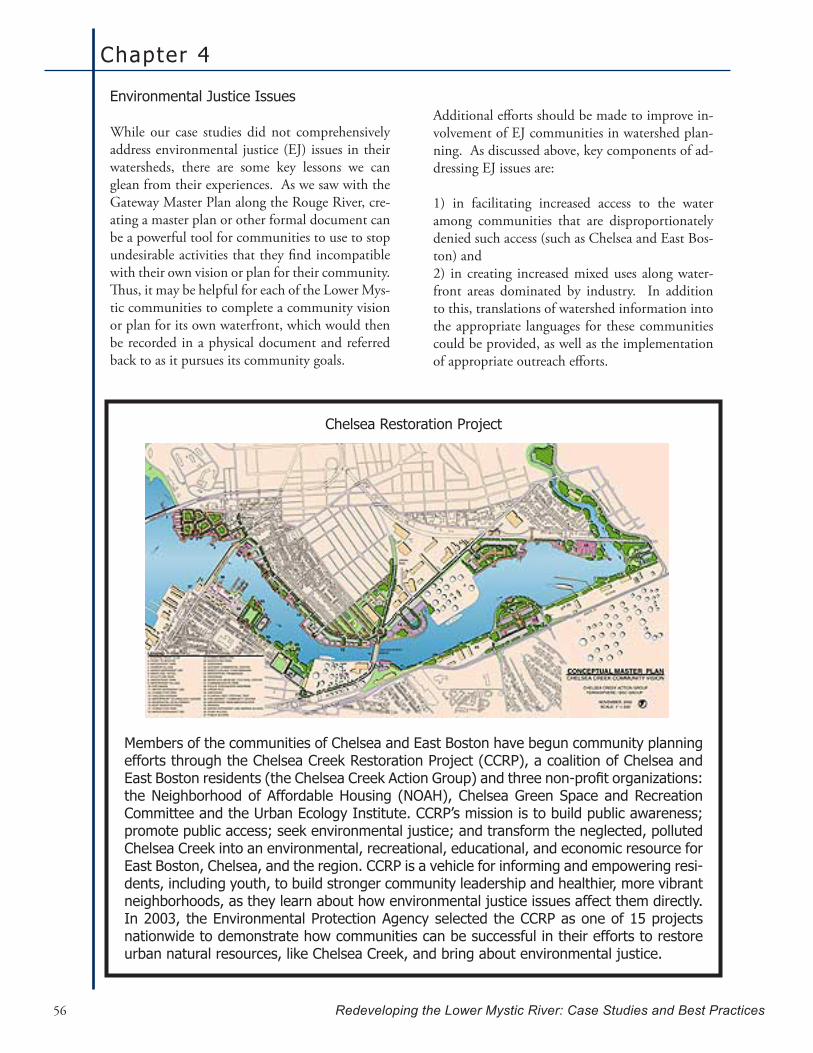
Chapter 4
Redeveloping the Lower Mystic River: Case Studies and Best Practices56
Environmental Justice Issues
While our case studies did not comprehensively address environmental justice (EJ) issues in their watersheds, there are some key lessons we can glean from their experiences. As we saw with the Gateway Master Plan along the Rouge River, cre-ating a master plan or other formal document can be a powerful tool for communities to use to stop undesirable activities that they find incompatible with their own vision or plan for their community. Thus, it may be helpful for each of the Lower Mys-tic communities to complete a community vision or plan for its own waterfront, which would then be recorded in a physical document and referred back to as it pursues its community goals.
Additional efforts should be made to improve in-volvement of EJ communities in watershed plan-ning. As discussed above, key components of ad-dressing EJ issues are:
1) in facilitating increased access to the water among communities that are disproportionately denied such access (such as Chelsea and East Bos-ton) and 2) in creating increased mixed uses along water-front areas dominated by industry. In addition to this, translations of watershed information into the appropriate languages for these communities could be provided, as well as the implementation of appropriate outreach efforts.
Chelsea Restoration Project
Members of the communities of Chelsea and East Boston have begun community planning efforts through the Chelsea Creek Restoration Project (CCRP), a coalition of Chelsea and EastBostonresidents(theChelseaCreekActionGroup)andthreenon-profitorganizations:the Neighborhood of Affordable Housing (NOAH), Chelsea Green Space and Recreation Committee and the Urban Ecology Institute. CCRP’s mission is to build public awareness; promote public access; seek environmental justice; and transform the neglected, polluted Chelsea Creek into an environmental, recreational, educational, and economic resource for East Boston, Chelsea, and the region. CCRP is a vehicle for informing and empowering resi-dents, including youth, to build stronger community leadership and healthier, more vibrant neighborhoods, as they learn about how environmental justice issues affect them directly. In 2003, the Environmental Protection Agency selected the CCRP as one of 15 projects nationwide to demonstrate how communities can be successful in their efforts to restore urban natural resources, like Chelsea Creek, and bring about environmental justice.

Analysis and Recommendations
Redeveloping the Lower Mystic River: Case Studies and Best Practices 57
For instance, along the Mississippi River, where the Hmong population is catching and consum-ing contaminated fish, the Department of Natural Resources has posted warning signs in Hmong and has hired Hmong park rangers who speak the na-tive language to ensure effectively reaching out to this community. Given that similar concerns ex-ist along the Lower Mystic, with the catching and consumption of contaminated fish by minority and immigrant populations there, it would be ad-visable to implement similar outreach strategies in these communities. Likewise, the design and pro-motion of recreational resources and opportunities should take into consideration the unique cultural relationships different communities have with open space and parklands. Planners should consider how each community uses the river, what actions could improve their well-being, and what community-specific concerns may exist. Finally, these findings should be included in DCR’s Mystic Reservation Master Plan.
Given that many environmental justice communi-ties are politically disenfranchised and neglected populations, adequate political representation and advocacy for these communities is especially essen-tial in ensuring that these communities have a voice in shaping of the revitalization and redevelopment of the Lower Mystic Watershed. While some elected officials have emerged as true champions for these communities, such as State Senator Jarrett Barrios, building a strong coalition of legislators who will fight for these communities will be key to success-
fully dealing with EJ issues in the watershed.
Despite the fact that gentrification was not explic-itly addressed in the master plans of our case stud-ies, this issue should be explicitly incorporated into any master planning efforts for the Lower Mystic. For example, safeguards against gentrification could be included as part of the scope of MAPC’s Lower Mystic Corridor Study. This is extremely impor-tant, as gentrification will become a serious threat to the existing communities, particularly if the heavily industrialized areas of the waterfront are opened up to mixed-use development. Therefore, it must be sufficiently anticipated and planned for if it is to be managed for the maximum benefit, or at least mini-mum harm, to the existing communities. While an exhaustive strategy for dealing with gen-trification is outside the scope of this report, some of the potential tools to consider include targeted Affordable Housing Conservation Restrictions, carefully planned Chapter 40B or Chapter 40R de-velopments, use of Community Land Trusts, deed restrictions, and Low Income Housing Tax Credits. It is strongly recommended that further research is conducted to explore additional case studies of ur-ban waterfront redevelopment where this and other environmental justice concerns are more explicitly dealt with.
Key Strategies:
Each of the lower Mystic communities should complete a community vision or plan for its •own waterfront that gets recorded in a physical document that it can refer to and build upon;Special attention to how the lower Mystic environmental justice communities are using •the Mystic River should be given by the DCR in their Mystic Reservation Master Plan as well as by local planners;Build a coalition of legislators to advocate for environmental justice communities in the •watershed;Useregulatoryandnon-regulatorymeasurestoanticipateandaddressgentrificationand•preserve affordable housing in the watershed; andConduct further research of additional case studies of urban waterfront redevelopment •where environmental justice concerns are explicitly dealt with.

Chapter 4
Redeveloping the Lower Mystic River: Case Studies and Best Practices58
Funding
An obviously crucial component of waterfront rede-velopment that is interwoven with all other aspects of successful revitalization is adequate funding. One of the largest hurdles in obtaining funding, aside from general competition for limited federal, state and local funding, is that waterfront redevel-opment is not generally a profitable venture in the beginning. In fact, it can take years to see any re-turns on investments at all (Gordon 70). This limits the amount of private development interest at the start of a project and provides little incentive for lo-cal leaders to risk investment. Furthermore, there is usually a need for infrastructure improvements and environmental clean ups that are larger and more complex than local governments can handle. This certainly seems to be the case for the Lower Mystic and was also true of the case studies. Thus, as state and federal funding is also limited, it is important to bring attention to the area through a collabora-tive effort, as previously mentioned.
As all three case studies highlighted, this collabora-tive effort resulted in diversified funding sources, which would not have been a possibility if they had attempted redevelopment on their own (Bradshaw 142). There are no specific funding sources used in the case study locations that can necessarily trans-late to the Lower Mystic, however. Each location took advantage of various federal, state, and local funding sources and incentives. For example, the Rouge River area received some funding from EPA matching grants. In addition to this, Ford Motor Company has funded its own clean up. However, our study did not focus so much on the specific funding sources, but rather on gaining awareness for waterfront issues and bringing together stake-holders. Therefore, the cases speak more to the steps necessary to garner resources:
Collaboration•Strong leadership•Recognition•
Furthermore, a comprehensive review of the mu-nicipal budgets of the Lower Mystic communities was not completed for this report, so it is uncertain what level of funding is currently available at the municipal level for waterfront planning and redevel-
opment. It is at least clear from anecdotal accounts from our client and other Lower Mystic community advocates that financial resources are in short supply for all of the Lower Mystic municipalities, which is a significant impediment to moving forward with redevelopment.
As well, there are a few funding schemes used in the case study locations that are worth noting and some opportunities specific to Massachusetts to consider:
Pooling resources among municipalities: 38 com-munities and 3 counties signed an agreement to help fund storm water permit requirements in which half of the funds to operate Assembly of Rouge Com-munities (ARC) are provided by the towns and the other half is provided by the remaining EPA funds held by the counties. This regional concept could be used in the Lower Mystic to deal with funding of CSO clean up. It would be an interesting proposal to bring to the EPA in asking for funding.
Membership dues: The Rouge River Gateway Part-nership asks its partnership members to contribute at least $5,000 per year in dues. This funding has helped them to keep up with redevelopment efforts when other funding is inadequate (Cave). This funding also keeps partners engaged because they have more at stake. EMWA should consider this type of arrangement as a way to get started with projects, being careful to set up clear goals for the partnership so that the funding is utilized based on the shared goals of the partnership members. Real-izing that dues could be prohibitive to some smaller community-based organizations from joining the partnership, EMWA should find ways to engage these groups such as having different levels of mem-bership based on ability to pay or bringing in com-munity members as consultants as needed.
Private funding and corporate sponsorship pro-grams: While private funding can be limited in the beginning, there are many more opportunities for public-private partnerships later on, once the area has been transformed enough for private entities to see a financially sound opportunity for investment. While there are some very compelling reasons for fostering these relationships from the literature , the communities in the Lower Mystic should use the collaborative process to strengthen their vision

Analysis and Recommendations
Redeveloping the Lower Mystic River: Case Studies and Best Practices 59
for the future and their position of power so that private interests do not completely take hold and dictate the type of development on or near the wa-terfront. It seems that the current situation in the Mystic is that some viable areas for redevelopment such as Assembly Square in Somerville are largely in the hands of the developers due to public financial shortages and a lack of a clear vision for the future. The private sector, which typically seeks to maxi-mize profit and return on investment, often does not share the same goals and outcomes as the com-munities themselves. A possible way for MyRWA and EMWA to start working with private entities in waterfront redevelopment may be to facilitate Corporate Sponsorship Programs with local com-panies that may have a stake in the future of the waterfront. This may foster more local support for MyRWA and EMWA’s goals on the waterfront re-development and possibly assist them when work-ing directly with private entities on redevelopment projects. The Corporate Sponsorship Program idea is very similar to the concept of having local busi-nesses engaged in a collaborative partnership for the redevelopment of the Mystic
Focus on grant writing and administration: The Rouge River Gateway Partnership has largely been able to keep up momentum due to the efforts of Kelly Cave of Wayne County. She searches for grants and related funding opportunities for the communities and keeps track of deadlines and reporting require-ments. It seems that half the battle is just knowing what grants are out there and being able to spend the time and energy to apply. As well, as there is often a lot of competition for grant funding it is im-portant for someone skilled to be in writing grants is on board. MyRWA and EMWA should search for partners that can aid in this process. Jennie Russell of the Merck Family Fund provided a list of founda-tions supporting river/water grants in New England at the recent Urban Rivers conference in Boston. A copy of this list is provided as Appendix E.
Community Preservation Act (CPA) in Massachu-setts: While not a funding opportunity in our case study areas, the CPA is an option for communities in the Lower Mystic and worth noting because of its flexibility in using the funds and related opportuni-ties for the Lower Mystic. The act, if passed, places a tax on local property owners and the funds can then
be used for preserving open space and historic sites, and providing affordable housing and recreational facilities (Community Preservation Coalition, “The Community Preservation Act”). Approximately one third of the communities in Massachusetts have adopted this act, but it has previously been defeated by voters in both Malden and Boston in 2001 (Community Preservation Coalition, “Status of Community Implementation”). While it can be politically difficult to pass the CPA as a result of increased taxes, it is something for MyRWA and EMWA to consider advocating in the Lower Mystic communities so that there are more opportunities for local funding related to cleaning up the water-front.
Tax Increment Financing (TIF): The State of Min-nesota has authorized tax increment financing to aid redeveloping communities. Tax increment financing is used when the taxable value after redevelopment will be significantly higher than the value before redevelopment and when it is clear that the rede-velopment cannot occur without an initial public investment (City of Minneapolis, Tax Increment Fi-nancing). Tax increment financing uses the increase in taxes that results from the redevelopment to pay for the initial public costs. When construction is complete, the new real estate tax value is subtract-ed from the district’s pre-development tax value to repay initial costs over an extended period of time (City of Minneapolis, Tax Increment Financing). In Minneapolis the Community Planning and Economic Development (CPED) Department ad-ministers the TIF program. CPED finances initial public redevelopment investments by allowing the city or town to sell bonds or use available CPED resources. Alternately, some projects are financed by a pay-as-you-go system, where the developer fi-nances the initial public costs with the agreement that CPED will repay the developer’s costs with in-terest from tax increments generated from the com-pleted project (City of Minneapolis, Tax Increment Financing). The Bucks County plan also mentions TIF as a potential source of funding. This financ-ing scheme, if adopted in Massachusetts, could help MyRWA and EMWA garner the resources necessary for public or private redevelopment efforts.

Chapter 4
Redeveloping the Lower Mystic River: Case Studies and Best Practices60
Politics
Waterfront redevelopment efforts can often last for years, and the complexity of their development and implementation increases with the number of gov-ernment entities involved (Gordon 66). Neverthe-less, it is critical to have government buy-in at all levels, as well as the ability to cope with the relatively frequent changes in the political environment. The case studies outline some strategies toward creating a stabile, supportive relationship with government de-partments and agencies.
One way that the cases dealt with the instability of the political environ-ment was to function at one level removed from the government itself. For example, the River-front Corporation was created by the mayor of Saint Paul as a separate non-profit organization dealing specifically with waterfront issues. Likewise, the Bucks County Redevelopment Authority, accord-ing to the Director Bob White, was far enough re-moved from the government that it was able to get residents and municipalities to focus on the vision for the future instead of continuously rehashing the current problems (White). Individual commitment with government agencies can also provide stability. Kelly Cave, Director of the Watershed Management Division for Wayne County in Michigan, has been working on the Rouge River for years and called the project “her baby” (Cave). Cave remained in her position even during political changes in the county government (Bagale).
It is also very important politically for redevelopment efforts at a specific site to have some level of recog-nition beyond that immediate area. For example,
the American Heritage River designations of both the Upper Mississippi River and the Greater Detroit River (the Rouge River being a tributary to the De-troit River) built up recognition of the areas beyond municipal or even state borders. This got both poli-ticians and residents excited about the possibilities for the future (Bagale; Nunnally). Interestingly, it seems that initial recognition for negative charac-teristics, such as the Rouge being labeled an envi-ronmental “hot spot” for pollution, can also build
a lot of support and pro-vide future funding for redevelopment efforts specifically focused on the initial stages of envi-ronmental remediation. The recent designation of the Mystic River with a water quality level of “D” is one such recogni-
tion that is surprisingly exciting for the river and its advocates and perhaps can be capitalized upon by the Lower Mystic communities (Nickerson).
Finally, municipal governments do not typically di-rectly implement waterfront redevelopment efforts, possibly due to the requirement of a long-term focus, the complexity of the efforts, or the lack of funds available to municipalities for this work (Gor-don 65). However, it is important to have these governments engaged and supportive of the efforts. One way that the Bucks County Redevelopment Authority dealt with this was to ensure each mu-nicipality would gain something from the redevel-opment. They would also be given the power to use the tools developed as a result of collaboration as was relevant to their town. While it remains to be seen if this amount of leeway results in a truly integrated waterfront, it still serves as an interesting model for consideration on the Lower Mystic.
Key Strategies:
Add stability to the effort by functioning at least one level removed from the govern-•ment (i.e. informal collaboration or creation of a new organization);Commitment by at least a few government employees is helpful;•Recognition for the waterfront (positive or negative) on regional or national scale; •andGivesomepowerand/oropportunitiestomunicipalparticipantscanbeimportantin•their level of interest and support.
The recent designation of the Mystic River with a water quality level of “D” is one such recognition that is surprisingly exciting for
the river and its advocates and perhaps can be capitalized upon by the Lower Mystic
communities.
Analysis and Recommendations
Redeveloping the Lower Mystic River: Case Studies and Best Practices 61
All Hail the Champion
Despite the best of intentions, there are points in every riverfront redevelopment when the momentum stalls. In successful redevelopments, a champion emerges in these dark moments. This is a person who refuses to believe in failure; a person who never waivers in the face of adversity or, worse, in the face of public apathy. Some riverfront redevelopments are blessed with more than one champion, but our case studies prove that at least one such individual is necessary.
The Rouge River had many champions from judges to busi-nessmen to academics. Judge John Feikins, a Federal District Judge in Detroit, was able to jumpstart the Rouge’s rehabilitation in 1983. He used a 1977 EPA lawsuit as a catalyst to begin a series of formal orders to bring together the Rouge communities to cooperate on a restoration plan. By forcing compliance, he enabled the communities to collaborate by taking a watershed approach to restoring the Rouge.
Bill Ford has been another champion of the Rouge by persuading other organizations to follow his company’s support of the Project. Involvement by the Ford Motor Company also gathered positive public support because the surrounding communities liked to see this huge corporation take an interest in improving their river and general quality of life. Ford’s passion for the environment inspired people with a vision of sustainability.
The primary champion for the Rouge River Project has been University of Michigan Vice Chancellor Ed Bagale. Bagale combined his personal commitment to the river redevel-opment with his position at the university to lead the project to success. Key players from the Rogue River Project all mentioned Ed Bagale’s key role in the redevelopment. His participation gave the project a sense of neutrality and trustworthiness, convincing otherwise reluctant allies to join the effort. Furthermore, as the university liaison, Ed Bagale was an extremely charismatic, prominent and well-respected person both within the university and in the community, adding further credibility to the project.
In the Twin Cities, project participants named the Riverfront Corporation Board of Direc-tors as the champions of redevelopment in the area. While the City of Saint Paul has elected three mayors since the Corporation’s inception, the Board has been a constant stabilizing force in the redevelopment. The Board includes Dean Tom Fisher of the UniversityofMinnesotaandDesignCenterDirectorTimGriffin,whoalsoteachesattheuniversity and involves students in the Design Center programs.
Congressman Bruce Vento, a vocal advocate for environmental issues and affordable housing, championed the Phalen Creek project until his death in 2000. Vento’s dedica-tion to environmental projects throughout the Twin Cities was unparalleled. He worked tirelessly in the government and in the community to educate people and to fund envi-ronmental restoration and preservation projects. The Bruce Vento Sanctuary opened in the Phalen Creek area in May 2005 to honor his legacy.

Chapter 4
Redeveloping the Lower Mystic River: Case Studies and Best Practices62
The University Effect
Riverfront redevelopment projects can also ben-efit from some academic lessons. Colleges and universities are a tremendous asset to riverfront redevelopment projects. With the ability to pro-vide funding, human resources, and publicity, neighboring colleges and universities are excellent partners for redevelopment groups. As previously mentioned, they can also serve as a neutral party in discussions between stakeholders and can help to build trust amongst all project participants. Furthermore, riverfront redevelopments can pro-vide a mutually beneficial relationship with col-leges and universities; the students and faculty can use the river to pro-vide outdoor classrooms that enhance the learn-ing experience.
The University of Mich-igan and the University of Minnesota have been active partners in the redevelopment along the Rouge and Mississippi Rivers. In Detroit, the University of Michigan - Dearborn and Henry Ford Community College have continuously used the Rouge as part of their curriculum to service both the academic com-munity and the greater public. The University of Michigan – Dearborn Environmental Interpretive Center has served as the headquarters for a multi-tude of research projects and public outreach pro-grams. The Center has incorporated research and education with a primary focus on conservation and habitat preservation. The Mississippi River Initiative, a collabora-tion originated at the University of Minnesota, has been involved in numerous research projects throughout the Twin Cities Metropolitan Area. As a neutral entity, the group has supported local redevelopment efforts and has tried to foster col-laboration between projects in the region. Thus, it is clear that the vast resources available at a uni-versity, from funding to student manpower and academic insight, can be invaluable assets to river redevelopment efforts.
Tufts University is involved with the Mystic Riv-er through the Mystic Watershed Collaborative (MWC), as well as through its Water: Systems, Science, and Society program and the Tisch Col-lege of Citizenship and Public Service. In 2000, under the leadership of former President DiBiag-gio, Tufts University formalized its commitment to MWC. Current Tufts President Lawrence Ba-cow reaffirmed Tufts University’s commitment to the restoration of the Mystic River watershed in 2005 on the fifth anniversary of MWC. Working with MyRWA, the Collaborative strives to develop strategies for and envision the future of the Mystic River Watershed.
While MWC is a well-intentioned initial ef-fort, the revitalization of the Mystic River requires additional support from Tufts University. MWC and other Tufts environ-mental and community outreach programs need additional funding and
support from the University. As displayed in the Rouge River and Twin Cities redevelopment proj-ects, universities hold tremendous power in and beyond their local community. While the support of the faculty and students is crucial to making this collaboration a success, public support from elite members of the Tufts administration is also essential. Strong commitment to the Mystic River redevelopment project by Tufts will attract other investors and allies and has the potential to catalyze the river’s revitalization. Additionally, Tufts can serve as a neutral force in planning dis-cussions and so help mitigate potential conflicts between stakeholders. Working alongside its neighbors, Tufts will also benefit from using the Mystic River as a living laboratory for Tufts stu-dents and faculty. Tufts University’s involvement with the Mystic River redevelopment initiative will fulfill its commitment to the environment and to its community. Now is the time for Tufts University to reaffirm its past commitments to the Mystic River by becoming an active participant in its future redevelopment.
Tufts University’s involvement with the Mys-ticRiverredevelopmentinitiativewillfulfillits commitment to the environment and to its community. Now is the time for Tufts Universitytoreaffirmitspastcommitmentsto the Mystic River by becoming an active participant in its future redevelopment.

Analysis and Recommendations
Redeveloping the Lower Mystic River: Case Studies and Best Practices 63
Conclusion
As is evident from our case studies, our review of the relevant literature, and the experience along the Lower Mystic River, achieving successful urban waterfront redevelopment is a complex and multi-faceted endeavor. While there is no single magic bullet method to achieving success, given that each waterfront area is unique and thus has distinctive assets and challenges, there are, indeed, strategies that consistently appear as part of successful rede-velopment efforts. We have tried to highlight many of these strategies above in the hopes that they may help create a foundation for the revitalization of the Lower Mystic River Watershed area.
Conflictsamongstakeholdergroupsinurbanwaterfrontredevelopmenteffortsareinmanycases inevitable due to the complexity of the task. However, there are ways of addressing theseconflictsthatcanleadtomoreconstructiveprocessesandoutcomes.Inconsideringtheseconflicts,TheEasternMysticWatershedAlliance(EMWA) iscurrently indiscussionswith the Massachusetts Institute of Technology (MIT) and United States Geological Survey (USGS) Science Impact Collaborative (MUSIC) to see if the Lower Mystic redevelopment pro-cess could serve as a pilot project for this program. MUSIC researches ways to incorporate science into environmental decision making, with the ultimate goal of using a collabora-tiveprocesstomeetagencyobjectives.MUSICattemptstoaddressconflictissuesamongstakeholdergroupsandworktowardsresolvingtheseconflicts.ThispartnershipisagreatexampleofhowtheLowerMysticcanbenefitfromcollaborativeeffortsanduniversityin-volvement.
Waterfront redevelopment is a dynamic and ongo-ing process – at once rooted in a region’s unique history and culture, and at the same time boldly reaching towards a future of vast possibilities. Tre-mendous work by countless individuals has already gone into the Lower Mystic River Watershed to bring it to where it stands today. It is our sincere hope that our efforts here will, in some way, help pave the way forward for the Lower Mystic River and, in so doing, help reunite this region and its waterfront.
“Success is not simply a matter of financial investment, or of creating a mod-ern waterside playground, or of avoiding too much emulation or too painful a replacement of traditional communities by imported artificial counterparts. It involves, ideally, a unique set of compromises based on a more deep-rooted reunion between the city and the sea.” (Hoyle 415)


References
Redeveloping the Lower Mystic River: Case Studies and Best Practices
Alliance of Rouge Communities. “Alliance of Rouge Communities.” 25 Jan. 2007. 24 Feb 2007. <http://www.rougeriver.com/alliance/>.
---. Rouge River National Wet Weather Demonstration Project 2005 Progress Report. Wayne County, Detroit: Alliance of Rouge Communities, 2005. 5 Jan. 2007 <http://www.rougeriver.com/pdfs/overview/2005%20EPA%20Report.5%20July%2006draft-FINAL.pdf>.
---. “Rouge River Watershed: Locally Driven Cooperative Management.” Powerpoint presentation. Wayne County, Detroit: Alliance of Rouge Communities, 2004. 5 Jan. 2007 <http://www.rougeriver.com/alliance/AlliancePresentation.pdf>.
Bagale, Ed. Telephone interview. 27 Mar. 2007.
Barron, David J., Gerald E. Frug, and Rick T. Su. Dispelling the Myth of Home Rule. 1st ed. Cambridge, Massachusetts: Rappaport Institute for Greater Boston, 2004. <http://www.ksg.harvard.edu/rappaport/downloads/home_rule/>.
Bodurow, Constance C. “A Vehicle for Conserving and Interpreting our Recent Industrial Heritage.” The George Wright Forum. (2004) 68-88. 15 Feb 2007 <http://www.georgewright.org/202bodurow.pdf>.
Bongiovanni, Roseann. “EPA Modeled Diesel Particulate Matter Concentrations in Chelsea.” Memo from Chelsea City Councilor to Russ Lopez, Boston University and Matt Nester, University of Michigan. 25 May 2006.
Bradshaw, Ted K. “Complex Community Development Projects: Collaboration, Comprehensive Programs, and Commu-nity Coalitions in Complex Society.” Community Development Journal 35.2 (April 2000): 133-45.
Bucks County. “About Bucks.” 2007. 30 May 2007 <http://www.buckscounty.org/about/index.aspx>.
Calvert, Ann. Minneapolis Riverfront Revitalization: Three Decades of Progress. City of Minneapolis City Planning and Economic Development, 2006. 19 Mar. 2006 <http://www.ci.minneapolis.mn.us/cped/>.
Cave, Kelly A., and Nancy J. Andrews. “Rouge River Watershed Management Planning: The Main 3-4 Subwatershed Plan.” 2004. 2 Mar. 2007 <http://www.rougeriver.com/pdfs/stormwater/WATERSHED2002-01.pdf>.
Cave, Kelly, et al. “Rouge River Gateway Project: Restoration of an Urban River.” 2002. 9 Jan. 2007 <http://www.roug-eriver.com/pdfs/wetlands/WATERSHED2002-02.pdf>.
Cave, Kelly. Telephone interview. 18 Apr. 2007.
Chelsea Creek Action Group. “Chelsea Creek Community-Based Comparative Risk Assessment.” Chelsea Creek Action Group. United States Environmental Protection Agency, 2003. 12 Mar 2007 <http://www.epa.gov/boston/eco/uep/bos-ton/TableSummaryIntro.pdf>.
City of Everett. Mayor’s Office of Community Economic Development. Everett Waterfront Assessment. Fort Point As-sociates, Inc. June 2003. 17 Feb. 2007 <http://www.ci.everett.ma.us/cover.pdf>.
City of Minneapolis. Above the Falls: A Master Plan for the Upper River in Minneapolis. Minneapolis, Minnesota: City of Minneapolis City Planning and Economic Development, 2000. 24 Jan. 2007 <http://www.ci.minneapolis.mn.us/city-work/planning/planpubs/above-falls/report/index.html>.
References
Redeveloping the Lower Mystic River: Case Studies and Best Practices66
---. Minneapolis Critical Area Plan. Ed. City of Minneapolis Planning. Minneapolis, Minnesota: City of Minneapolis City of Planning and Economic Development, 2006. 5 Mar. 2007 <http://www.ci.minneapolis.mn.us/planning/critical-area-plan.asp>.
---. Riverfront Revival: Collaboration & Change Along the Mississippi Riverfront in Minneapolis. Minneapo-lis, Minnesota: City of Minneapolis City Planning and Economic Development, 2004. 5 Mar. 2007 <http://www.ci.minneapolis.mn.us/cped/docs/riverfront_revival.pdf>.
City of Saint Paul. Saint Paul on the Mississippi: Development Framework, 1997. Ed. City of Saint Paul Planning. Saint Paul, Minnesota: City of Saint Paul Planning, 1997. 7 Feb 2007 <http://www.riverfrontcor-poration.com/framework.asp>.
Commonwealth of Massachusetts. “County Government.” 22 Apr. 2007 <http://www.mass.gov>.
---. Executive Office of Environmental Affairs Office of Coastal Zone Management. Boundary Review of the Mystic River Designated Port Area, Charlestown Shore. Executive Office of Environmental Affairs Office of Coastal Zone Management, 2002. 10 Feb. 2007 <http://www.mass.gov/czm/mysticriverdpa.pdf>.
---. ---. East Boston Designated Port Area (DPA) Boundary Review. Executive Office of Environmental Affairs Office of Coastal Zone Management, 2002. 10 Feb. 2007 <http://www.mass.gov/czm/ebdpabr.pdf>.
---. Office of Coastal Zone Management (CZM). An Assessment of the Coastal and Marine Economies of Massachusetts. Massachusetts Office of Coastal Zone Management (CZM), 2006. 10 Feb. 2007 <http://www.uhi.umb.edu/pdf_files/MA_coastal_marine_economy_1.pdf>.
Commonwealth of Pennsylvania. “Pennsylvania’s Environment Facility Application Compliance Tracking System.” Department of Environmental Protection. 2007. 2 Apr. 2007 <http://www.dep.state.pa.us/efacts/>. Community Preservation Coalition. “Status of Community Implementation.” 18 Feb 2007 <http://www.communitypreservation.org>.
Cormack, Robert. Telephone Interview. 10 Apr. 2007.
Dembner, Jane, and Charles Bartsch. “Potential State and Federal Financing Programs with Applicability to Bucks County.” Draft Concept Memo to Bob White for the Bucks County Waterfront Revitalization Plan. HBNT/Northeast Midwest Institute, 2 Aug. 2004. 7 Mar. 2007 <http://www.bcrda.com/pdf/Financial_Tools_080204.pdf>.
Dembner, Jane. “Summary of Existing Conditions-Study Area Demographics.” Draft Concept Memo to Bob White for the Bucks County Waterfront Revitalization Plan. HNTB, 25 June 2005. 7 Mar. 2007 <http://www.bcrda.com/pdf/Regulatory_Overview_062504.pdf>.
---. “Summary of Existing Conditions-Study Area Regulatory Overview.” Draft Concept Memo to Bob White for the Bucks County Waterfront Revitalization Plan. HNTB, 25 June 2005. 7 Mar. 2007 <http://www.bcrda.com/pdf/Regulatory_Overview_062504.pdf>.
Designation of Port Areas. Code of Massachusetts Regulations. 301 CMR 25.00. 1994.
Detroit/Wayne County Port Authority. “Detroit/Wayne County Port Authority History.” 2006. 19 Mar. 2007 <http://www.portdetroit.com/contacts/index.htm>.

Redeveloping the Lower Mystic River: Case Studies and Best Practices 67
---. Detroit/Wayne County Port Authority Public Dock and Terminal - Summary of Project. 2004. 7 Mar. 2007 <http://www.portdetroit.com/materials/public_dock_and_terminal_project_book.pdf>.
Durant, J. L., and K. Abbasi. “Watershed Management on the Mystic Watershed I: Water Quality History and Challenges for the Future.” ASCE/EWRI Watershed Management Conference. Ft. Collins, CO, June 2000.
Durant, J. L., J. J. Zemach, and H. F. Hemond. “The History of Leather Industry Waste Contamination in the Aberjona Watershed: A Mass Balance Approach.” Journal of the Boston Society of Civil Engineering 5 (1990): 41-66.
---. “The History of Leather Industry Waste Contamination in the Aberjona Watershed: A Mass Balance Ap-proach.” Journal of the Boston Society of Civil Engineering 5 (1990): 41-66.
Environmental Protection Agency. “As Earth Day Approaches, EPA Kicks Off Major Effort to Improve Conditions of Mystic River Watershed.” 17 May 2007. Press Release. <http://yosemite.epa.gov.ezproxy.library.tufts.edu/opa/admpress.nsf/names/r01_2007-4-17_mystic>.
Euchner, Charles C., ed. Governing Greater Boston, the Politics and Policy of Place. Ed. Charles C. Euchner. Cambridge, Massachusetts: Rappaport Institute for Greater Boston, 2002. 5 Feb. 2007 <http://www.ksg.harvard.edu/rappaport/downloads/ggb_2002/chapter3.pdf>.
Falls Township. Falls Township Comprehensive Plan Update 2004. Aug. 2004.
Feyder, Susan. “Swimming Upstream.” Star Tribune 6 Nov. 2006.
Ford Planning Task Force. “The Ford Planning Site.” 31 Mar. 2007. <http://www.fordplanningsite.com>.
Franklin Regional Council of Governments. “Franklin Regional Council of Governments.” 4 Apr. 2007 <http://www.frcog.org/>.
Friends of the Rouge. “Friends of the Rouge Mission Statement.” 2007. 16 Mar. 2007 <http://www.therouge.org/>. Gelderloos, Orin. 2004 Rouge River Remedial Action Plan Revision. The Rouge River Project. 2004. 11 Mar. 2007 <http://www.rougeriver.com/proddata/catalogitem.cfm?DocID=RPO-WMGT-SR32>.
Gordon, David L. A. “Managing the Changing Political Environment in Urban Waterfront Redevelopment.” Urban Studies 34 (1997): 61-83.
Greater Detroit American Heritage River Initiative and Partners. “Best Management Practices for Soft Engi-neering of Shorelines Chapter 11.” 2004. 7 Mar. 2007 <http://www.tellusnews.com/ahr/report_chapter11.html<http://www.tellusnews.com/ahr/report_chapter11.html>.
Greater Detroit American Heritage River Initiative. “Rouge River Gateway Partners Project.” 9 Sept. 2005. 7 Mar. 2007 <http://www.tellusnews.com/ahr/se@rouge_riv.html>.
Griffin, Tim. Telephone interview. 16 Apr. 2007.
Hammett, Nancy, and Ivey St. John. Eastern Mystic Watershed Alliance. Presentation. Century Bank, Med-ford, MA. 30 Jan. 2007.
Harvie, Robert. Telephone interview. 30 Mar. 2007.

References
Redeveloping the Lower Mystic River: Case Studies and Best Practices68
Heaviland, Minona, Tracy Godfrey, and Justin Adams. “Tufts University Student Project, Environmental Law and Planning (UEP 207): Mystic River Designated Port Area: Public Access, Industry and Regulation”. 3 Dec. 2003.
HNTB Corporation. Bucks County Waterfront Revitalization Plan. 2005. 4 Apr. 2007 <http://www.bcrda.com/frames10.html>.
Hoffman, Kirsten. “Waterfront Redevelopment as an Urban Revitalization Tool: Boston’s Waterfront Redevel-opment Plan.” Harvard Environmental Law Review 23 (1999): 471-545.
Imperial, Mark T., and Derek Kauneckis. “Moving from Conflict to Collaboration: Watershed Governance in Lake Tahoe.” Natural Resources Journal 43 (2003): 1009-56.
Imperial, Mark T. “Using Collaboration as a Governance Strategy: Lessons from Six Watershed Management Programs.” Administration and Society 37 (2005): 281-320.
Indergaard, Michael. “Beyond the Region: The Rise and Fall of Economic Regionalism in Downriver Detroit.” Urban Affairs Review. 34. 2 (1998): 241-262.
International Joint Commission United States and Canada. “The Great Lakes Water Quality Agreement.” 5 Feb. 2007. <http://www.ijc.org/en/activities/consultations/glwqa/agreement.php>.
Lanfer, Ashley Graves, and Madeleine Taylor. Immigrant Engagement in Public Open Space: Strategies for the New Boston. Boston, Massachusetts: Barr Foundation, 2007. <http://www.barrfoundation.org/usr_doc/Im-migrant_Engagement_in_Public_Open_Space_final.pdf>.
Lapp, Cynthia. River Stories - Minneapolis. Minneapolis, Minnesota: University of Minnesota, 2007. 8 Mar. 2007. <http://www.riverdesign.umn.edu/river_stories/studyareas.html>.
---. River Stories - Saint Paul. Minneapolis, Minnesota: University of Minnesota, 2007. 8 Mar. 2007. <http://www.riverdesign.umn.edu/river_stories/studyareas.html>.
Lovell, Sam. Telephone interview. 6 Apr. 2007.
Mack, Linda. “River Revival - Two Ways: How Different Strategies are Playing Out in Minneapolis and St. Paul.” APA Planning Magazine Nov. 2006: 1-8.
Margerum, Robert D. “Evaluating Collaborative Planning: Implications from an Empirical Analysis of Growth Management.” Journal of the American Planning Association 68 (2002): 179-93.
Michigan Sea Grant. “Greenways Improving Shorelines: Ecology, Economics and Recreation.” 2000. 15 Mar. 2007 <http://www.miseagrant.umich.edu/greenways/map.html>.
Minnesota Planning. Connecting with Minnesota’s Urban Rivers: Helping Cities make Sustainable Choices for the Future. Ed. Minnesota Planning. Saint Paul, Minnesota: Minnesota Planning, 2002. 4 Apr. 2007 <http://www.eqb.state.mn.us/pdf/2002/UrbanRivers.pdf>.
Murray, James E., Kelly A. Cave, and D. S. Bryson. Wet Weather Control Demonstration Activities in Souteast Michigan: Some Lessons Learned. Great Britain: Elsevier Science Ltd., 1999.

Redeveloping the Lower Mystic River: Case Studies and Best Practices 69
Murray, James E. “Financial/Institutional Issues: Bringing it all Together.” Wayne County, Michigan: Wayne County Department of Environment, 2004. 14 Apr. 2007 <http://www.rougeriver.com/pdfs/institutional/weftec94-02.pdf>.
Mystic River Watershed Association (MyRWA). Mystic River Watershed Assessment and Action Plan. Ed.
Mystic River Watershed Association (MyRWA), 2006.
---. “Mystic River Watershed Association History Page.” Mystic River Watershed Association (MyRWA). 4 Feb. 2007 <http://www.mysticriver.org/about_us/history.html>.
---. “Open Space Priorities in the Mystic River Watershed.” Mystic River Watershed Association (MyRWA), Feb. 2004.
Nickerson, Colin. “Mystic River Gets D Rating from EPA, Advocates Praise Focus on Problems.” The Bos-ton Globe 17 Apr. 2007.
Nunnally, Pat. Telephone Interview. 28 Mar. 2007.
Otto, Betsy, Kathleen McCormick, and Michael Leccese. “Ecological Riverfront Design: Restor-ing rivers, connecting communities.” 2004. 4 Mar. 2007 <http://www.americanrivers.org/site/PageServer?pagename=AMR_content_2bb4>.
Peirce, Neal, and Curtis Johnson. Boston Unbound. The Boston Foundation, 2004. 5 Apr. 2007 <http://www.tbf.org/uploadedFiles/Citistates_final.pdf>.
Petrella, Sally, and Kelly Cave. “Rouge River Issues.” 2004.
Powell, Josephine, Zachare Ball, and Karen Reaume. “Public Involvement Programs that Support Water Quality Management.” 2004.
Powell, Josephine, and Zachare Ball. “Designing the Right Hook: Public Participation in the Watershed Planning Process.” Second National Conference Nonpoint Source Pollution Information & Education Pro-grams. Chicago. May 2001.
Reinhardt, John. E-mail interview. 17 Apr. 2007.
Riverfront Corporation. Saint Paul on the Mississippi: Development Framework. Riverfront Corporation, 2007. 20 Mar. 2007 <www.riverfrontcorporation.com>.
Rouge Remedial Action Plan Advisory Council. Rouge River Report Card. Rouge Remedial Action Plan Ad-visory Council. 1999. 4 Mar. 2007 <http://www.epa.gov/glnpo/aoc/rougriv/1999_%20Rouge-River-Report-Card_color.pdf>.
---. Rouge River Report Card. Dec. 2005. Rouge Remedial Action Plan Advisory Council. 2005. 4 Mar. 2007 <http://www.epa.gov/glnpo/aoc/rougriv/2005_Rouge-Report-Card(small%20image).pdf>.
Rouge River National Wet Weather Demonstration Project. “The Rouge River Project.” 24 July 2004. <http://www.rougeriver.com>.

References
Redeveloping the Lower Mystic River: Case Studies and Best Practices70
Russell, Jenny. “Sample List of Foundations Supporting River/Water Grantsin New England (since 2004). Resource Panel Session at the New England Urban Rivers Conference, the Promise and the Challenge of Urban Rivers.” Boston. 29 Mar 2007.
Sabatier, Paul A., et al, eds. Swimming Upstream: Collaborative Approaches to Watershed Management. Cambridge, Massachusetts: Massachusetts Institute of Technology, 2005.
Savoie, Kathy. Telephone interview. 19 Apr. 2007.
Sieber, R. Timothy. “Waterfront Revitalization in Postindustrial Port Cities of North America.” City & Society 5 (1991): 120-36.
State of Michigan. Public Acts of 2004. Amendment to 1994 PA 451. Pub. L. 517. 3 Jan. 2005. 312.St. John, Ivey. E-mail interview. 18 Apr. 2007.
Tabachnick, Alan et al. “Summary of Existing Conditions, Natural and Cultural Resources.” Draft Concept Memo to Bob White for the Bucks County Waterfront Revitalization Plan. HNTB, 25 June 2004. 8 Mar. 2007 <http://www.bcrda.com/pdf/Natural_Cultural_062504.pdf>.
---. “Summary of Existing Conditions-Environmental Contamination.” Draft Concept Memo to Bob White for the Bucks County Waterfront Revitalization Plan. HNTB, 25 June 2004. 8 Mar. 2007 ,http://www.bcrda.com/pdf/Env_Contamination_062504.pdf>.
The Rouge River Gateway Project. The Rouge River Gateway Master Plan. 2004. 3 Mar. 2007 <http://www.rougeriver.com/pdfs/wetlands/WATERSHED2002-02.pdf>.
The Rouge River Project. The Rouge River Watershed Year in Review: Building on our Successes. 2004. 10 Mar. 2007 <http://www.rougeriver.com/pdfs/rouge2002.pdf>.
Toffler, Aaron. Telephone interview. 19 Apr. 2007.
Tolland, Bill. “A Blueprint for Tax Sharing: In Minnesota, Dividing the Spoils Helps Cities and Suburbs.” Pittsburgh Post Gazette 15 Feb. 2004.
Trust for Public Land. “Twin Cities Mississippi River Program.” Trust for Public Land. 7 Oct. 2002 <http://www.tpl.org/>.
United States. Environmental Protection Agency (EPA). “Rouge River Areas of Concern.” 27 Nov. 2006. <http://www.epa.gov/glnpo/aoc/rougriv.html>.
University of Minnesota Design Center for American Urban Landscape Project Team. Building a Missis-sippi River Community: A Summary of Principles, Process and Recommendations. College of Architecture and Landscape Architecture, Design Center for American Urban Landscape. 1995. 16 Mar. 2007<http://www.designcenter.umn.edu/reference_ctr/publications/pdfs/missv2n6.pdf>.
---. Corridors, Networks and Watersheds; Neighborhood Connections to the Mississippi River in the Twin Cities Region. College of Architecture and Landscape Architecture, Design Center for American Urban Landscape. 1994. 16 Mar. 2007 <http://www.designcenter.umn.edu/reference_ctr/publications/pdfs/miss-v2n2.pdf>.

Redeveloping the Lower Mystic River: Case Studies and Best Practices 71
---. The Falls and Canyon Reach: Reinvesting and Connecting. College of Architecture and Landscape Ar-chitecture, Design Center for American Urban Landscape. 1995. 16 Mar. 2007 <http://www.designcenter.umn.edu/reference_ctr/publications/pdfs/missv2n4.pdf>.
---. Redefining the River Corridor as a River Community. College of Architecture and Landscape Architec-ture, Design Center for American Urban Landscape. 1994. 16 Mar. 2007 <http://www.designcenter.umn.edu/reference_ctr/publications/pdfs/missv2n1.pdf>.
Urban Ecology Institute. “Local Partnerships: Chelsea Creek Restoration Parternship.” 24 Apr. 2007 <http://www.bc.edu/bc_org/research/urbaneco/program/natcit_Lpartnerships.html>.
Vlachos, E. “Towards a Typology of Water-Related Conflicts in the Urban Environment.” Water Science and Technology 47.6 (2003): 205-10.
Wayne County. “Wayne County Department of Environment: Mission.” Department of the Environment. 2004. 4 Mar. 2007 <http://www.waynecounty.com/doe/>.
White, Robert. Telephone interview. 19 Apr. 2007. Wilson, Bill. “A Brief History.” 2007. 8 Mar. 2007 <http://


Appendix A
Redeveloping the Lower Mystic River: Case Studies and Best Practices 7373

74

75

Appendix B
Redeveloping the Lower Mystic River: Case Studies and Best Practices 76Redeveloping the Lower Mystic River: Case Studies and Best Practices76

LowerM
ystic
Riv
er
EAST
BOST
ON
EVER
ETT
CHEL
SEA
MED
FORD
SOM
ERVI
LLE
BOST
ON
MAL
DEN
MAL
DEN
Perc
ento
fMin
oriti
esLi
ving
onCe
nsus
Bloc
ks0.
7M
iles
from
the
Mys
ticRi
verW
ater
front
Lege
ndLO
W0%
-21%
MED
22%
-48%
HIG
H49
%-9
0%
Sour
ce:M
assG
ISC
arto
grap
her:
Arm
ando
Milo
u
µ
00.
51
0.25
Mile
s
Redeveloping the Lower Mystic River: Case Studies and Best Practices 77

LowerM
ystic
Riv
er
EAST
BO
STO
N
EVE
RET
T
CH
ELSE
A
MED
FOR
D
SOM
ER
VIL
LE
BO
STO
N
MA
LDEN
MA
LDEN
Land
Use
0.7
Mile
sfr
omth
eM
ystic
Riv
erW
ater
fron
t
Land
Use
Com
mer
cial
Fore
st
Indu
stria
l
Land
fill
Ope
nLa
nd
Par
k
Rec
reat
ion
Res
iden
tial
Tran
spor
tatio
n
Wet
land
Sou
rce:
Mas
sGIS
Car
togr
aphe
r:A
rman
doM
ilou
µ
00.
51
0.25
Mile
s
Redeveloping the Lower Mystic River: Case Studies and Best Practices

Appendix C
Redeveloping the Lower Mystic River: Case Studies and Best Practices 79
Pote
ntia
l Cas
e St
udie
s (F
inal
ists
)
Num
ber o
f ju
risd
ictio
ns
invo
lved
Act
ive
indu
stri
al p
ort
Mix
ed u
se p
ort
His
tory
of
pollu
tion
Hig
h le
vel o
f ur
bani
zatio
nW
ater
fron
tR
egio
n
Det
roit,
Mich
igan
(Rou
ge R
iver
/Det
roit
Rive
r)2
yy
yy
yM
idw
est
Twin
Citi
es, M
inne
sota
(Miss
issip
pi R
iver
)2
yy
yy
yM
idw
est -
Miss
issip
pi
Rive
r & su
bbas
ins
The
Low
er B
ucks
Cou
nty
Wat
erfr
ont,
PA (D
elaw
are
Rive
r)7
yy
yy
yM
id A
tlant
icPi
ttsbu
rgh,
Pen
nsylv
ania
(Nin
e M
ile R
un)
2-4
yy
yy
yM
id A
tlant
icPa
ssaic
Riv
er, N
J4
indu
stria
l/ m
aybe
not
por
ty
yy
yM
id A
tlant
icM
eado
wlan
ds (N
J)U
NU
Ny
yy
yM
id A
tlant
ic
Cinc
inna
ti, O
hio
(Ohi
o Ri
ver)
1y
yy
yy
Mid
wes
t - M
ississ
ippi
Ri
ver &
subb
asin
sE
lizab
eth
Rive
r, V
A4
yy
yy
yM
id A
tlant
ic
Was
hing
ton,
D.C
. (A
naco
stia
Rive
r)3
indu
stria
l/ m
aybe
not
por
ty
yy
yM
id A
tlant
icSa
n Fr
ancis
co W
ater
fron
t, CA
1y
yy
yy
Sout
hwes
t
New
Bed
ford
, MA
(Por
tfield
s Dem
onst
ratio
n Pi
lot P
rojec
t)2
yy
yy
Nor
thea
st
Long
Islan
d So
und,
NY
UN
yy
yy
yN
orth
east
Qua
d Ci
ties,
IL (M
ississ
ippi
)4
ny
yy
yM
idw
est -
Miss
issip
pi
Rive
r & su
bbas
ins
Nar
raga
nset
t Bay
, RI
4U
Ny
yy
yN
orth
east
Not
e: U
N =
Und
eter
min
ed
Shor
t Lis
t of P
oten
tial C
ase
Stud
ies
Appendix D
Redeveloping the Lower Mystic River: Case Studies and Best Practices
Interview Questions
What factors led to redevelopment happening (i.e. what drove the process)?1)
Who were the key players in the redevelopment process? 2)
Who was the champion for the project? Why? How did they do it?3)
How did the stakeholders organize themselves?4)
Was there a lot of community input (when, who and how managed?)5)
What was the level of public sector involvement in terms of planning and funding?6)
What were the problems…and how were they solved? (Were they solved?)7)
What were the biggest controversies?8)
Who were the biggest antagonists?9)
Who wasn’t happy with the outcome or process and why?10)
What was the tipping point?11)
What were the major expenditures and who paid (where did funding come from?) 12)
What was the time period for redevelopment?13)
What is the current stage/state of redevelopment (i.e. what further projects need to be completed)?14)
What are the major effects of the redevelopment?15)
What is the current public opinion of the project? 16)
Was tax revenue generated at the local level as a result of this project?17)
What, if anything, changed in the underlying zoning? 18)
Were there attempts made for public access and industrial uses to coexist? 19)
Was public access linear along the waterfront or point access?20)
Did new residential development cater to the current residents or was there gentrification? If gentrification did not 21) happen, how did the development keep out luxury residential uses?
Did residential/commercial uses drive out (and/or attempt to drive out) industry? What resulted?22)
80

Appendix E
Redeveloping the Lower Mystic River: Case Studies and Best Practices 81
Sample List of Foundations Supporting River/Water Grants in New England (Since 2004)
Source: Jenny Russell, Merck Family Fund. Resource Panel session. The New England Urban Rivers Conference, The Promise and the Challenge of Urban Rivers. March 29, 2007.
Amgen FoundationAnnenberg FoundationBarr FoundationBoehringer Ingelheim Cares Foundation Inc.Boston FoundationCabot Family Charitable TrustChichester duPont Foundation Inc.Community Foundation for Greater New HavenThe Arthur Vining Davis FoundationDuke Energy FoundationThe Ford FoundationGE FoundationGilder FoundationHartford Foundation for Public GivingJessie B. Cox Charitable TrustJoukowsky Family FoundationJoyce FoundationKohlberg Foundation Inc.Libra FoundationLincoln Financial Group FoundationMaine Community Foundation Inc.Marisla FoundationMass Environmental TrustMerck Family FoundationNE Grassroots Environmnet FundNew Hampshire Charitable FoundationNew York Community TrustOrchard FoundationDavid and Lucile Packard FoundationPark Foundation, Inc.Richard Saltonstall Charitable FoundationRhode Island FoundationSan Francisco FoundationSurdna Foundation Inc.Van Bueren Charitable Foundation Inc.Wallis FoundationYawkey Foundation II