Present-day crustal deformation field of the Iberian Peninsula estimated by GPS measurements
12
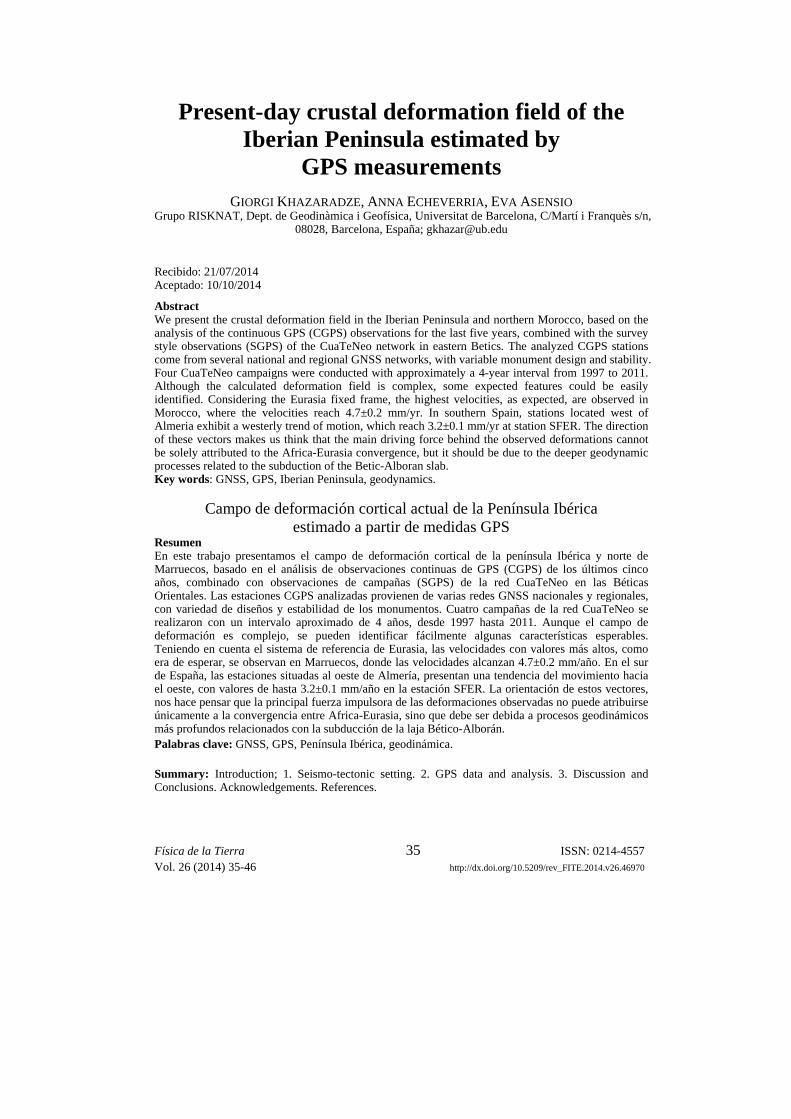
Física de la Tierra ISSN: 0214-4557 Vol. 26 (2014) 35-46 http://dx.doi.org/10.5209/rev_FITE.2014.v26.46970 35 Present-day crustal deformation field of the Iberian Peninsula estimated by GPS measurements GIORGI KHAZARADZE, ANNA ECHEVERRIA, EVA ASENSIO Grupo RISKNAT, Dept. de Geodinàmica i Geofísica, Universitat de Barcelona, C/Martí i Franquès s/n, 08028, Barcelona, España; [email protected] Recibido: 21/07/2014 Aceptado: 10/10/2014 Abstract We present the crustal deformation field in the Iberian Peninsula and northern Morocco, based on the analysis of the continuous GPS (CGPS) observations for the last five years, combined with the survey style observations (SGPS) of the CuaTeNeo network in eastern Betics. The analyzed CGPS stations come from several national and regional GNSS networks, with variable monument design and stability. Four CuaTeNeo campaigns were conducted with approximately a 4-year interval from 1997 to 2011. Although the calculated deformation field is complex, some expected features could be easily identified. Considering the Eurasia fixed frame, the highest velocities, as expected, are observed in Morocco, where the velocities reach 4.7±0.2 mm/yr. In southern Spain, stations located west of Almeria exhibit a westerly trend of motion, which reach 3.2±0.1 mm/yr at station SFER. The direction of these vectors makes us think that the main driving force behind the observed deformations cannot be solely attributed to the Africa-Eurasia convergence, but it should be due to the deeper geodynamic processes related to the subduction of the Betic-Alboran slab. Key words: GNSS, GPS, Iberian Peninsula, geodynamics. Campo de deformación cortical actual de la Península Ibérica estimado a partir de medidas GPS Resumen En este trabajo presentamos el campo de deformación cortical de la península Ibérica y norte de Marruecos, basado en el análisis de observaciones continuas de GPS (CGPS) de los últimos cinco años, combinado con observaciones de campañas (SGPS) de la red CuaTeNeo en las Béticas Orientales. Las estaciones CGPS analizadas provienen de varias redes GNSS nacionales y regionales, con variedad de diseños y estabilidad de los monumentos. Cuatro campañas de la red CuaTeNeo se realizaron con un intervalo aproximado de 4 años, desde 1997 hasta 2011. Aunque el campo de deformación es complejo, se pueden identificar fácilmente algunas características esperables. Teniendo en cuenta el sistema de referencia de Eurasia, las velocidades con valores más altos, como era de esperar, se observan en Marruecos, donde las velocidades alcanzan 4.7±0.2 mm/año. En el sur de España, las estaciones situadas al oeste de Almería, presentan una tendencia del movimiento hacia el oeste, con valores de hasta 3.2±0.1 mm/año en la estación SFER. La orientación de estos vectores, nos hace pensar que la principal fuerza impulsora de las deformaciones observadas no puede atribuirse únicamente a la convergencia entre Africa-Eurasia, sino que debe ser debida a procesos geodinámicos más profundos relacionados con la subducción de la laja Bético-Alborán. Palabras clave: GNSS, GPS, Península Ibérica, geodinámica. Summary: Introduction; 1. Seismo-tectonic setting. 2. GPS data and analysis. 3. Discussion and Conclusions. Acknowledgements. References.
Transcript of Present-day crustal deformation field of the Iberian Peninsula estimated by GPS measurements
Física de la Tierra ISSN: 0214-4557 Vol. 26 (2014) 35-46 http://dx.doi.org/10.5209/rev_FITE.2014.v26.46970
35
Present-day crustal deformation field of the Iberian Peninsula estimated by
GPS measurements
GIORGI KHAZARADZE, ANNA ECHEVERRIA, EVA ASENSIO Grupo RISKNAT, Dept. de Geodinàmica i Geofísica, Universitat de Barcelona, C/Martí i Franquès s/n,
08028, Barcelona, España; [email protected]
Recibido: 21/07/2014 Aceptado: 10/10/2014
Abstract We present the crustal deformation field in the Iberian Peninsula and northern Morocco, based on the analysis of the continuous GPS (CGPS) observations for the last five years, combined with the survey style observations (SGPS) of the CuaTeNeo network in eastern Betics. The analyzed CGPS stations come from several national and regional GNSS networks, with variable monument design and stability. Four CuaTeNeo campaigns were conducted with approximately a 4-year interval from 1997 to 2011. Although the calculated deformation field is complex, some expected features could be easily identified. Considering the Eurasia fixed frame, the highest velocities, as expected, are observed in Morocco, where the velocities reach 4.7±0.2 mm/yr. In southern Spain, stations located west of Almeria exhibit a westerly trend of motion, which reach 3.2±0.1 mm/yr at station SFER. The direction of these vectors makes us think that the main driving force behind the observed deformations cannot be solely attributed to the Africa-Eurasia convergence, but it should be due to the deeper geodynamic processes related to the subduction of the Betic-Alboran slab. Key words: GNSS, GPS, Iberian Peninsula, geodynamics.
Campo de deformación cortical actual de la Península Ibérica estimado a partir de medidas GPS
Resumen En este trabajo presentamos el campo de deformación cortical de la península Ibérica y norte de Marruecos, basado en el análisis de observaciones continuas de GPS (CGPS) de los últimos cinco años, combinado con observaciones de campañas (SGPS) de la red CuaTeNeo en las Béticas Orientales. Las estaciones CGPS analizadas provienen de varias redes GNSS nacionales y regionales, con variedad de diseños y estabilidad de los monumentos. Cuatro campañas de la red CuaTeNeo se realizaron con un intervalo aproximado de 4 años, desde 1997 hasta 2011. Aunque el campo de deformación es complejo, se pueden identificar fácilmente algunas características esperables. Teniendo en cuenta el sistema de referencia de Eurasia, las velocidades con valores más altos, como era de esperar, se observan en Marruecos, donde las velocidades alcanzan 4.7±0.2 mm/año. En el sur de España, las estaciones situadas al oeste de Almería, presentan una tendencia del movimiento hacia el oeste, con valores de hasta 3.2±0.1 mm/año en la estación SFER. La orientación de estos vectores, nos hace pensar que la principal fuerza impulsora de las deformaciones observadas no puede atribuirse únicamente a la convergencia entre Africa-Eurasia, sino que debe ser debida a procesos geodinámicos más profundos relacionados con la subducción de la laja Bético-Alborán. Palabras clave: GNSS, GPS, Península Ibérica, geodinámica. Summary: Introduction; 1. Seismo-tectonic setting. 2. GPS data and analysis. 3. Discussion and Conclusions. Acknowledgements. References.

Khazaradze et al. Present-day crustal deformation field…
Física de la Tierra Vol. 26 (2014) 35-46
36
Referencia normalizada Khazaradze, G., Echeverria, A., Asensio, E. (2014). Present-day crustal deformation field of the Iberian Peninsula estimated by GPS measurements. Física de la Tierra, Vol. 26, 35-46.
Introduction Global Navigation Satellite System (GNSS), and in particular Global Positioning System (GPS) technology, provide a powerful tool for studying the kinematics of contemporary crustal deformation of the earth’s crust on an unprecedented scale and precision. As a consequence of GPS studies, it is possible to identify tectonically active faults and evaluate their seismic potential. The main goal of this study is to determine deformation rates using continuous and campaign GPS data conducted throughout the Iberian Peninsula and northern Morocco (Figure 1).
Fig. 1. Map showing the location of the analyzed GPS stations. Stations shown as grey diamonds with yellow labels were used to define Eurasia reference plate. See Figures 5 and 6 for the names of the stations not shown in this map.

Khazaradze et al. Present-day crustal deformation field…
Física de la Tierra Vol. 26 (2014) 35-46
37
We present the crustal deformation field in the Iberian Peninsula and northern Morocco, based on the analysis of the GPS observations for the last five years conducted at the University of Barcelona (UB). The presented velocity field, is a combination of the analysis of the 92 continuous GPS (CGPS) stations scattered throughout Eurasia and northern Africa, combined with 15 survey style GPS (SGPS) observations of the CuaTeNeo network (Echeverria et al., 2013) (Figure 1). The analyzed CGPS stations come from various national and regional GNSS networks, with variable monument design and stability. 25 stations (4 in Morocco and 21 Spain) belong to the Topo-Iberia GPS network, established in 2007 (Khazaradze and Topo-Iberia GPS Team, 2009). The official results of this network were presented by Garate et al. (2014) recently, where the 3 velocity solutions of the three groups from Real Observatorio de la Armada (ROA), Universities of Jaén and Barcelona were combined. The velocities presented here are based exclusively on the analysis of the UB group, and for this reason in few cases the presented velocity vectors are slightly different from the velocities published in Garate et al. (2014). In general, the results of this paper are in agreement with the previously published velocities of the Iberian Peninsula and nortern Africa as described by Fernandes et al. (2007), Serpelloni et al. (2007), Pérez-Peña et al. (2010), Koulali et al. (2011).
1. Seismo-tectonic setting The area of our investigation, the Iberian Peninsula, has undergone a complex geo-tectonic evolution throughout its geologic history. The Iberian Peninsula is located at the western end of the Himalayan-Alpine collision zone, dominated by the convergence of the Eurasia and Africa (and Nubia) tectonic plates. Perhaps, during the past 120 Ma the most important factor for the formation of different geologic units and structures of the peninsula has been the opening of the Atlantic ocean, which caused large differential motions, resulting in extensional tectonics (e.g. Gibbons and Moreno, 2002). However, in contrast to the Mesozoic, the Tertiary and Quaternary periods were dominated by compressional type deformation. This resulted in a merging of Iberia to Eurasia at around 30 Ma along the Pyrenees mountain range. Currently, the most actively deforming zone is located in the Betic Mountains, which is also the site for the most active seismicity within the peninsula. This region represents a wide zone of deformation that is subject to the collision of the Nubia and Eurasia plates, that occurs at a rate of ~5 mm/yr oriented to NNW (Figure 2). In terms of historical seismicity, since the 14th century the Iberian Peninsula has experienced at least 27 EMS98≥8.0 intensity earthquakes (Mezcua et al., 2013), including a devastating Lisbon earthquake in 1755 (EMS 8.5) and two more earthquakes, in 1829 in Torrevieja (Alicante, EMS 8.0) and in 1428 in

Khazaradze et al. Present-day crustal deformation field…
Física de la Tierra Vol. 26 (2014) 35-46
38
Queralbs (Girona, EMS 9.5). However, in the more recent history, since the seismic instruments were put in place, no significant (EMS > 7.0) crustal type earthquakes have been recorded in the area. The most recent damaging earthquake that occurred in Spain, was the Mw5.1 2011 Lorca earthquake (Echeverria et al., 2012; Pro et al., 2014), that occurred in SE Betics as result of a slip on Alhama de Murcia fault. As can be seen from Figure 2, seismicity is mainly concentrated in the southern part of the Peninsula, in the Betic-Rif arc and the Pyrenees.
2. GPS data and analysis Below we describe briefly the data utilized in this work and provide more extensive description of the analysis procedure, since this step is important to derive slow deformation rates.
Fig. 2. Instrumental seismicity of the Iberian Peninsula during the 1964-2002 time period. The earthquakes are from IRIS seismic catalog. Yellow vectors indicate the NUVEL-1a convergence of Africa and Eurasia (DeMets et al., 1994). Red triangles show a location of the CueTeNeo GPS network.

Khazaradze et al. Present-day crustal deformation field…
Física de la Tierra Vol. 26 (2014) 35-46
39
2.1. GPS data In total, we have analyzed 92 CGPS stations scattered throughout Eurasia and northern Africa, plus 15 CuaTeNeo SGPS stations from SE Spain. The bulk of the CGPS station data used in this study is publicly available from corresponding organizations. For example, the Instituto Geográfico Nacional of Spain (www.ign.es) operates ERGNSS network throughout Spain, which currently consists of 44 continuous reference GNSS stations (Cano Villaverde et al., 2011). The data from 25 CGPS stations that we have included in our analysis and is not presently open to the public, comes from the Topo-Iberia GPS network, established in 2007 as part of the “Geociencias en Iberia: Estudios integrados de topografía y evolución 4D (Topo-Iberia)” project. For further details on this network the reader is referred to the paper of Garate et al. (2014). In this given work we have included a new CGPS station GATA, located at Cabo de Gata (Almeria), which was installed by the UB in 2008 as part of the EVENT project (Khazaradze et al., 2010). It is noteworthy that the station GATA, together with a Topo-Iberia station ASIN (installed in 2007 at Asín de Broto, Huesca) are the only Short Drilled-Braced Geodetic (SDBM) type monument in Spain (Figure 3). This type of monuments consists of 4 stainless steel rods in a shape of a quad-pod anchored approximately 1 meter into bedrock. This type of monuments, apart from low environmental and visual impact, are characterized by high stability (Haas et al., 2013). The analyzed CGPS data spans approximately 5 years from 2008 to the end of the 2012.
Fig. 3. First short drilled braced monuments (SDBM) installed in Spain. A) ASIN in Asin de Broto (Huesca), which forms part of the Topo-Iberia project, was installed on the 9th of September, 2008; B) GATA at Cabo de Gata (Almería), was installed as part of the EVENT project on the 20th of December of 2008.

Khazaradze et al. Present-day crustal deformation field…
Física de la Tierra Vol. 26 (2014) 35-46
40
The SGPS campaign data comes from the CuaTeNeo (“Cuantificación de la Tectónica actual y Neotectónica”) geodetic network, built in 1996 by the UB to quantify the current rates of crustal deformation in the eastern part of the Betic mountains (see triangles in Figures 1 and 2). The geodetic network consists of 15 points, from which 11 were built using specifically designed concrete monuments with an embedded 5/8'' threads to ensure an easy cantering of the GPS antennas during the campaigns. The SGPS data used in this work spans a considerably longer period than CGPS data, collected during the field campaigns conducted in 1997, 2002, 2006, 2009 and 2011 spanning approximately 14 year long period. Further details on this network and the employed data analysis strategy can be found in Echeverria et al. (2013). 2.2. GPS data processing The GPS data was analyzed using GAMIT/GLOBK software (Herring et al., 2008) from the MIT. This software uses double differences of the phase and code data on the ionosphere-free LC combination to compute a network solution. We have followed a three step approach similar to the one described by (McClusky et al., 2003).
In the first step of our data analysis, we used daily GPS observations to estimate station coordinates together with estimates of the zenith delay of the atmosphere at each station. In the second step, we used these loosely constrained solutions to estimate consistent coordinates of the stations using the data combinations with GLRED module of the GLOBK package. Afterwards we examined the time series of all the stations and removed obvious outliers following two criteria: if the position errors were higher than 20 mm and if the position itself was displaced more than 10 mm away from the best fitting trend line. Furthermore, some stations required correction of offsets due to antenna changes. These steps were performed using several C-shell scripts specifically designed for this task, as well as using interactive MATLAB® tools for viewing GPS velocities and time series developed by (Herring, 2003). In the final third step of the processing the velocities are estimated in Eurasia fixed reference frame. First the solution is realized in ITRF2008 reference frame (Altamini et al., 2011), by minimizing the differences between our estimated horizontal velocities for the reference stations which have velocities computed in ITRF2008. Consequently, the velocities are transformed to the Eurasia fixed frame, by estimating an Euler pole for the stations that belong to the Eurasia plate. As a selection criterion, we chose the maximum horizontal residual velocity of 0.2 mm/yr, which provided us with a set of ten sites that define a fixed Eurasia.
In the presence of low deformation rates, a rigorous estimation of uncertainties for the calculated velocities is crucial. Assuming only a pure white noise (random) and ignoring correlated (‘red’) noise in GPS time-series can lead to an underestimation of the calculated velocity uncertainties (Mao et al., 1999). For

Khazaradze et al. Present-day crustal deformation field…
Física de la Tierra Vol. 26 (2014) 35-46
41
continuous observations, it is possible to reduce the random noise to a negligible level and to evaluate the character of the correlated noise (e.g. Bos et al., 2013). The correlated noise component can be estimated from the time series using spectral analysis but these estimations cannot be easily implemented in GLOBK velocity solution, performed with a Kalman filter that accepts only first-order Gauss-Markov processes. For this reason, for the CGPS sites we have used an alternative approach, using a realistic sigma (RS) method developed by (Herring, 2003). In Figure 4 we provide an example of time-series in ITRF2008 for GATA. Here we have applied the RS algorithm, which results in almost doubling of the estimated errors. We have also taken into account annual and semi-annual variations in the time-series, which is shown as a red curve in Figure 4. The observed gaps in GATA time-series for 2012 and 2013 are due to malfunctioning of the hardware.
Fig. 4. Daily position time-series of the GPS station GATA. Red curves show a range of estimated annual and semi-annual signal. Errors are 1σ.

Khazaradze et al. Present-day crustal deformation field…
Física de la Tierra Vol. 26 (2014) 35-46
42
3. Discussion and Conclusions The main result of this work is shown in Figures 5 and 6, where the present-day horizontal crustal deformation velocities are presented. In general, as expected, the calculated deformation rates are low, since the convergence rate between the Eurasia and Africa (or Nubia) plates is also relatively slow, ranging between 5 and 6 mm/yr (e.g. Argus et al., 2011).
Fig. 5. GPS velocity field of present-day crustal deformation of the Iberian Peninsula and northern Morocco. Eurasia fixed reference frame with 95% confidence error ellipses. Dashed line delimits national borders. Rectangle shows an area given in Figure 6.

Khazaradze et al. Present-day crustal deformation field…
Física de la Tierra Vol. 26 (2014) 35-46
43
General features of the observed deformation field (Figure 5) are relatively slow or non-existent deformation in the northern parts of the Peninsula, increasing towards the south, when we approach Betic-Rif arc and the Africa/Eurasia tectonic plate boundary. The velocities in northern Morocco are higher (reaching 4.7±0.2 mm/yr at station TAZA), since they are located in a different tectonic plate. Within the southern part of Spain, the highest velocity is observed at station SFER (3.1±0.1 mm/yr), while further to the east, velocities observed alongside the Alhama de Murcia and Carboneras faults do not exceed 2 mm/yr (Figure 6). Although the observed variability in the velocity magnitudes is important, it is more important to note an obvious change in the orientation of the calculated velocities at a longitude of 2° west near the city of Almeria. The CueTeneo network stations located in the east, move roughly in the direction of the plate convergence azimuth in NNW direction (Figure 6), while the stations to the west, starting from ALME and ending with SFER, move westward. The NNW motion can be explained by the plate tectonics, however the westward motion should be due to a combination of the two forces: 1) the westward escape of the mini crustal block bounded by Carboneras and
Fig. 6. Detailed map of the GPS velocity field in SE Betics. Eurasia fixed reference frame with 68 % confidence error ellipses. Big arrow shows a convergence velocity between Nubia and Eurasia according to (Argus et al., 2011). Abbreviations of faults in bold letters:: CrF-Crevillente fault; AMF-Alhama de Murcia fault; PF-Palomares fault; CF-Carboneras fault; AFZ-Alpujarras fault zone;

Khazaradze et al. Present-day crustal deformation field…
Física de la Tierra Vol. 26 (2014) 35-46
44
Alpujarras faults driven by the Nubia/Africa convergence (e.g. Martínez-Díaz and Hernández-Enrile, 2004); 2) deeper geodynamic processes related to the subduction of the Betic-Alboran slab (Mancilla et al., 2013).
Some anomalous motions are observed at the stations farther north, for example stations RIOJ and ACOR (Figure 5) or GRAN in Granada (Figure 6). At least the motions observed at the first two of these stations are most likely due to the instability of the monument or the building where they are mounted. However, motion of GRAN still needs to be examined in depth until its northwesterly motion can be attributed to the tectonic forces. Acknowledgments The Topo-Iberia (CSD2006-00041), EVENT (CGL2006-12861-C02-01), CuaTeNeo (CGL2004-21666-E) and RISKNAT (2014SGR/1243) projects funded this research. A. E. was supported by the APIF pre-doctoral grant of the University of Barcelona, and E. A. by the FPU pre-doctoral grant (AP-2008-01482) of the Spanish Ministry of Education. We would also like to acknowledge the institutions responsible for the operation of the continuous GPS stations: IGN, ROA, EUREF, IGS. Also we would like to thank autonomous communities governments, which operate the networks, such as CATNET in Catalonia, RAP in Andalucía and Meristemum networks in Murcia. All the graphics were created using Generic Mapping Tools (GMT) software [Wessel and Smith, 1991]. We thank João Catalão for the thorough review of the manuscript and useful suggestions. References ALTAMINI, Z., COLLILIEUX, X. & MÉTIVIER, L. (2011). ITRF2008: An
improved solution of the international terrestrial reference frame. Journal of Geodesy, 85 ,8, 457–473.
ARGUS, D.F., GORDON, R.G. & DEMETS, C. (2011). Geologically current motion of 56 plates relative to the no-net-rotation reference frame. Geochemistry Geophysics Geosystems, 12 ,11, Q11001.
BOS, M.S., FERNANDES, R.M.S., WILLIAMS, S.D.P. & BASTOS, L. (2013). Fast error analysis of continuous GNSS observations with missing data. Journal of Geodesy, 87 ,4, 351–360.
CANO VILLAVERDE, M.A., SÁNCHEZ SOBRINO, J.A., VALDÉS PÉREZ DE VARGAS, M. & GONZALO LÒPEZ, P. (2011). La red de estaciones permanentes GNSS del Instituto Geográfico Nacional (ERGNSS). Topografía y cartografía, 28 ,161, 22–28.
DEMETS, C., GORDON, R.G., ARGUS, D.F. & STEIN, S. (1994). Effect of recent revisions to the geomagnetic reversal time scale on estimates of current plate motions. Geophysical Research Letters, 21 ,20, 2191.

Khazaradze et al. Present-day crustal deformation field…
Física de la Tierra Vol. 26 (2014) 35-46
45
ECHEVERRIA, A., KHAZARADZE, G., ASENSIO, E., GÁRATE, J., DÁVILA-MARTÍN, J. & SURIÑACH, E. (2013). Crustal deformation in eastern Betics from CuaTeNeo GPS network. Tectonophysics, 608, 600–612.
ECHEVERRIA, A., KHAZARADZE, G., GÁRATE, J., ASENSIO, E. & SURINACH, E. (2012). Deformación cortical de las Béticas Orientales mediante GPS y su relación con el terremoto de Lorca E. Buforn Peiró y J.M. Martínez Solares, editor. Física de la Tierra: Monográfico: El terremoto de Lorca (Murcia) de 2011, 24, 113–127.
FERNANDES, R.M.S., MIRANDA, J.M., MEIJNINGER, B.M.L., BOS, M.S., NOOMEN, R., BASTOS, L., AMBROSIUS, B. a. C. & RIVA, R.E.M. (2007). Surface velocity field of the Ibero-Maghrebian segment of the Eurasia-Nubia plate boundary. Geophysical Journal International, 169 ,1, 315–324.
GARATE, J., MARTIN-DAVILA, J., KHAZARADZE, G., ECHEVERRIA, A., ASENSIO, E., GIL, A.J., LACY, M.C. DE, ARMENTEROS, J.A., RUIZ, A.M., GALLASTEGUI, J., ALVAREZ-LOBATO, F., AYALA, C., RODRÍGUEZ-CADEROT, G., GALINDO-ZALDÍVAR, J., RIMI, A. & HARNAFI, M. (2014). Topo-Iberia Project: CGPS crustal velocity field in the Iberian Peninsula and Morocco. GPS Solutions, June, 1–9.
GIBBONS, W. & MORENO, T. (2002). The Geology of Spain. Bath, UK: Geological Society of London.
HAAS, R., BERGSTRAND, S. & LEHNER, W. (2013). Evaluation of GNSS Monument Stability. In Z. Altamimi & X. Collilieux, editors Reference Frames for Applications in Geosciences SE - 8. International Association of Geodesy Symposia. Springer Berlin Heidelberg, pp. 45–50.
HERRING, T. (2003). MATLAB Tools for viewing GPS velocities and time series. GPS Solutions, 7 ,3, 194–199.
HERRING, T., KING, R.W. & MCCLUSKY, S.C. (2008). Introduction to GAMIT/GLOBK. Mass. Inst. of Technol., Cambridge, Mass.
KHAZARADZE, G., MORENO, X., ASENSIO, E. & MASANA, E. (2010). Geodetic evidence for a present-day activity of the Carboneras fault in the Eastern Betics. In J. M. Insúa & F. Martín-González, editors Contribución de la Geología al Análisis de la Peligrosidad Sísmica. Madrid, Spain: IGME, 93–96.
KHAZARADZE, G. & TOPO-IBERIA GPS TEAM (2009). Topo-Iberia and EVENT GPS network: installation complete. EGU General Assembly, 11, 9077.
MANCILLA, L.F. de, STICH, D., BERROCOSO, M., MARTÍN, R., MORALES, J., FERNANDEZ-ROS, A., PÁEZ, R., PÉREZ-PEÑA, A., MANCILLA, F. L., MARTIN, R., PAEZ, R. & PEREZ-PENA, A. (2013). Delamination in the Betic Range: Deep structure, seismicity and GPS motion. Geology, 41,3, 307-310.
MAO, A., HARRISON, C.G.A. & DIXON, T.H. (1999). Noise in GPS coordinate time series. Journal of Geophysical Research, 104 ,B2, 2797.

Khazaradze et al. Present-day crustal deformation field…
Física de la Tierra Vol. 26 (2014) 35-46
46
MARTÍNEZ-DÍAZ, J.J. & HERNÁNDEZ-ENRILE, J.L. (2004). Neotectonics and morphotectonics of the southern Almería region (Betic Cordillera-Spain) kinematic implications. International Journal of Earth Sciences, 93 ,2, 189–206.
MCCLUSKY, S., REILINGER, R., MAHMOUD, S., SARI, D. BEN & TEALEB, A. (2003). GPS constraints on Africa (Nubia) and Arabia plate motions. Geophysical Journal Ineternational, 155 ,1, 126–138.
MEZCUA, J., RUEDA, J. & GARCÍA BLANCO, R.M. (2013). Iberian Peninsula Historical Seismicity Revisited: An Intensity Data Bank. Seismological Research Letters, 84 ,1, 9–18.
PÉREZ-PEÑA, A., MARTÍN-DAVILA, J., GÁRATE, J., BERROCOSO, M. & BUFORN, E. (2010). Velocity field and tectonic strain in Southern Spain and surrounding areas derived from GPS episodic measurements. Journal of Geodynamics, 49, 232–240.
PRO, C., BUFORN, E., CESCA, S., GALDEANO, C.S. DE & UDÍAS, A. (2014). Rupture process of the Lorca (southeast Spain) 11 May 2011 (Mw = 5.1) earthquake. Journal of Seismology, 18 ,3, 481–495.
SERPELLONI, E., VANNUCCI, G., PONDRELLI, S., ARGNANI, A., CASULA, G., ANZIDEI, M., BALDI, P. & GASPERINI, P. (2007). Kinematics of the western Africa-Eurasia plate boundary from focal mechanisms and GPS data. Geophysical Journal International, 169 ,3, 1180–1200.