PLANNING RYDE Local Strategic Planning Statement 2020
176
PLANNING RYDE Local Strategic Planning Statement 2020 March 2020
-
Upload
khangminh22 -
Category
Documents
-
view
1 -
download
0
Transcript of PLANNING RYDE Local Strategic Planning Statement 2020
PLANNING RYDELocal Strategic Planning Statement 2020March 2020
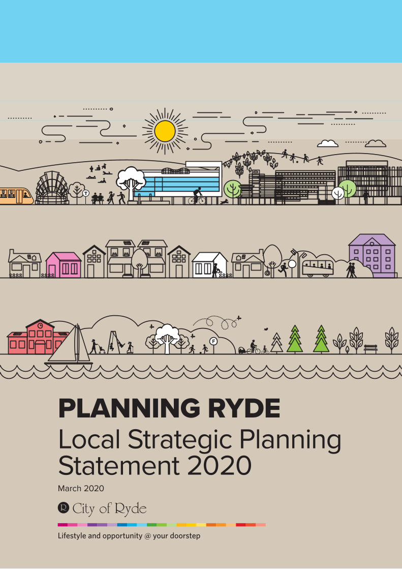
PART 1: INTRODUCTION 4
1.1 Introduction 5
1.2 Our 20-year vision 17
PART 2: INFRASTRUCTURE AND COLLABORATION 26
2.1 Housing growth and relationship to infrastructure 27
2.2 Infrastructure 33
2.3 Transport 41
PART 3: LIVEABILITY 50
3.1 Housing supply, affordability, diversity and amenity 51
3.2 Centres and place-making 61
3.3 Heritage 97
3.4 Culture and wellbeing 105
3.5 Design excellence and place-making 113
PART 4: PRODUCTIVITY 120
4.1 The economy and jobs 121
4.2 Macquarie Park 129
Contents
1PART
2PART
3PART
4PART
5PART
6PART
G
PART 5: SUSTAINABILITY 146
5.1 Open space and active recreation 147
5.2 Environment 155
5.3 Resilience 164
PART 6: IMPLEMENTATION 168
6.1 Monitoring and reporting 169
GLOSSARY 170
Attachment 1 – City of Ryde Housing Issues Paper Dwelling Delivery City of Ryde 2016-2021 Draft Report Dwelling Capacity City of Ryde Post 2022 Draft Report
Attachment 2 – Draft Waterloo Road Linear Park Strategy
Attachment 3 – Draft West Ryde Urban Revitalisation Strategy
Attachment 4 – Alignment with North District Plan
Available on Council’s website www.ryde.nsw.gov.au
ATTACHMENTS
INTRODUCTION1PART
4
CITY OF RYDE

The earliest known inhabitants of the area known today as the City of Ryde were the Wallumedegal clan of the Dharug people. Wallumedegal territory followed the north bank of the Parramatta River from the Turrumburra (the Lane Cove River) in the east to Burramatta at the head of the river to the west.
Wullumatta was the original name given to the area and likely derived from the Wallumedegal term for snapper fish, wullumai, and matta, a place usually associated with water. The Aboriginal name survives in the Wallumatta Nature Reserve in North Ryde. Reminders of Wallumedegal clan’s presence can still be found in rock carvings and middens along the rivers. The famous indigenous leader Bennelong, lived in the area, and is thought to be buried locally.
European occupation dates from 1792 when the first land grants were made along the northern bank of the Parramatta River. By 1841 the name Ryde began to emerge for the district. It was derived from its English namesake on the Isle of Wight. The area first came into legislative existence in 1870, as the Municipal District of Ryde. During its early years, the district was largely agricultural.
By the late 1900s, villages and town centres began to spring up along main roads and around train stations bringing with them large increases in population. In 1946, the Council established the Ryde Housing Scheme, an innovative and forward-thinking approach to address
contemporary housing supply and affordability issues. Council constructed 593 homes and six shops under the scheme, and also provided funding to 400 ratepayers to construct cottages on their own land.
Throughout the 1950s, Ryde continued to grow and urbanise. In 1957, Top Ryde, Australia’s first drive-in shopping mall, opened its doors. Macquarie University was established in 1964, and the post war housing boom was matched by an expansion of Ryde’s industrial and scientific sectors, including the establishment of a number of CSIRO facilities and the Gladesville industrial area. In 1981, Macquarie Shopping Centre was opened and to this day it remains one of the largest shopping centres in New South Wales.
Today, the City of Ryde local government area (LGA) covers an area of approximately 40 square kilometres, including waterways (including Lane Cove and Parramatta Rivers) and parklands. It is located 12 kilometres from the Sydney CBD, and includes 16 suburbs, two major rivers, 200 hectares of natural areas, 207 parks and open spaces, a leading
university, two TAFE colleges, and 29 schools with a total of over 58,000 students.
The City of Ryde is currently home to 125,000 residents in over 43,000 households. Our population is ethnically diverse, with 47 per cent of residents speaking at least one of 72 languages other than English, and over 40 per cent of residents born overseas.
Today, the City of Ryde local government
area (LGA) covers an area
of approximately 40 square
kilometres, including
waterways and parklands.
1.1 Introduction
1.1.1 About the City of Ryde
5
LOCAL STRATEGIC PLANNING STATEMENT

The City of Ryde’s resident workforce is highly educated with an above average proportion of female workers.
The suburb of Macquarie Park has become an economic powerhouse, contributing over
$9.5 billion to the NSW economy in 2018. Industrial areas throughout the south of the LGA, in Gladesville and West Ryde provide critical anchor points for productivity, employment, a diverse economy, and contribute
towards the NSW Government’s vision of a 30-minute city, where people can get from their homes to their workplaces within 30 minutes on public transport seven days a week.
Our CommunityA rich and proud historyThe City of Ryde is the third oldest settlement in Sydney. The first land grants to eight marines and ten emancipated convicts were given in 1792.
For thousands of years the area that includes the City of Ryde was home to the Wallamadigal clan of the Dharug people.
Population and Age ProfileThe population of Greater Sydney is 4.7 million and is projected to grow by 1.7 million people to 2036. This growth will be distributed across the city.
Source: ABS 2016 Census data and 2016 NSW and Local Government Area population and Household projections and implied dwelling requirements.
Age Groups %Babies > (0 to 4) 7,118Primary school (5 to 11) 8,686Secondary school (12 to 17) 6,430Tertiary education (18 to 24) 12,474Young workforce (25 to 34) 21,178Parents/homebuilders (35 to 49) 24,445Older workers (50 to 59) 13,642Retirees (60 to 69) 10,587Seniors (70 to 84) 8,774Elderly aged (85 and over) 2,972
Household Types %Couples with children 34.5Couples only 23.6One parent families 8.5Other families 1.7Group household 5.4Lone person 22.3Other 3.1Visitor only households 0.9
Community Strategic Plan | City of Ryde
5,347People with Disability needing assistance with care activities 4.6 % of the population
43,020Households in 2016
62,000Households in 2031
116,302Residents in 2016
160,000Residents in 2031
Figure 1 Our community
6
CITY OF RYDE
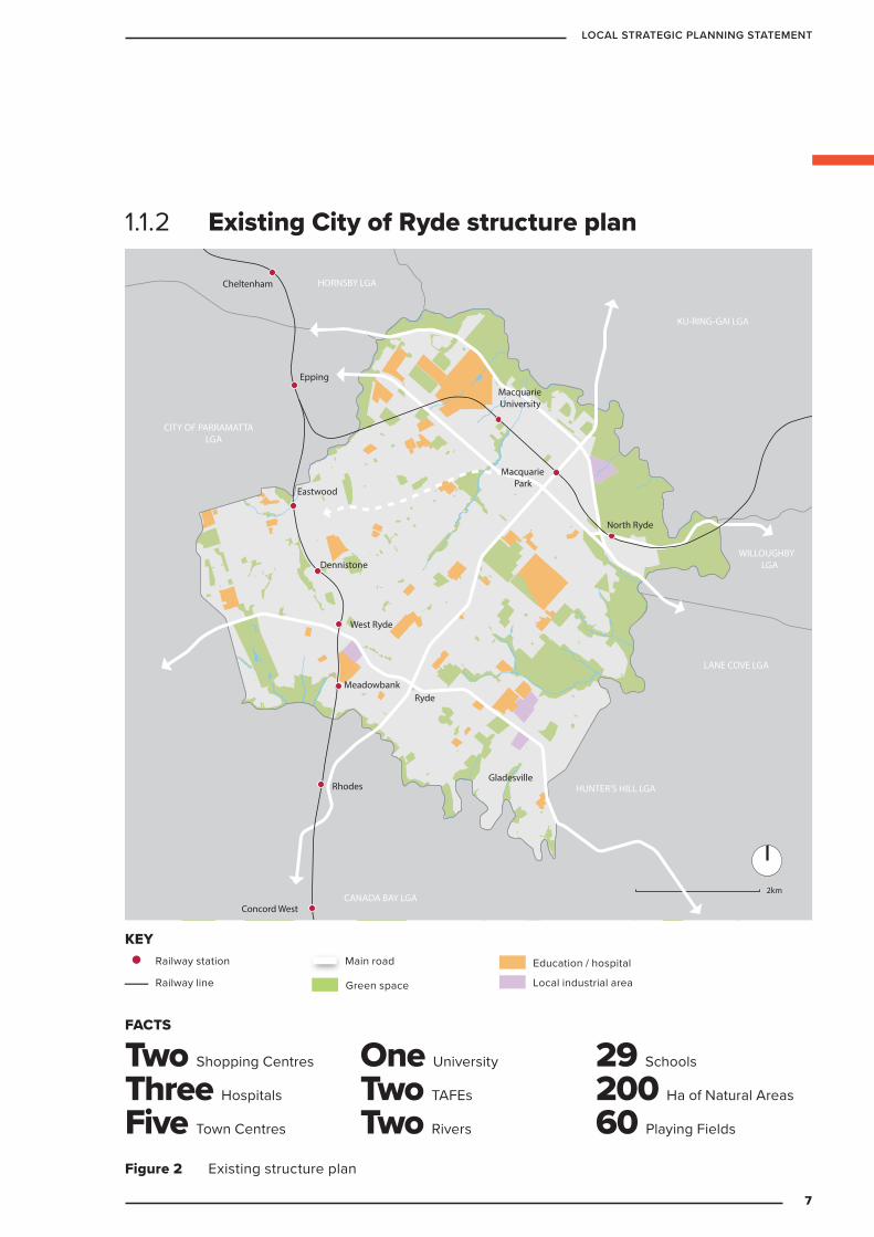
1.1.2 Existing City of Ryde structure plan
KEY
Railway station
Railway line
Main road
Green space
Commercial centre
Education / hospital
Major industrial area
2km
Concord West
Rhodes
Meadowbank
West Ryde
North Ryde
Gladesville
Ryde
Dennistone
Eastwood
Epping
Cheltenham
MacquarieUniversity
MacquariePark
LANE COVE LGA
WILLOUGHBYLGA
KU-RING-GAI LGA
HORNSBY LGA
CITY OF PARRAMATTALGA
CANADA BAY LGA
HUNTER’S HILL LGA
Figure 2 Existing structure plan
Railway station
Railway line
Main road
Green space Local industrial area
Education / hospital
KEY
FACTS
Two Shopping Centres
Three Hospitals
Five Town Centres
One University
Two TAFEs
Two Rivers
29 Schools
200 Ha of Natural Areas
60 Playing Fields
7
LOCAL STRATEGIC PLANNING STATEMENT
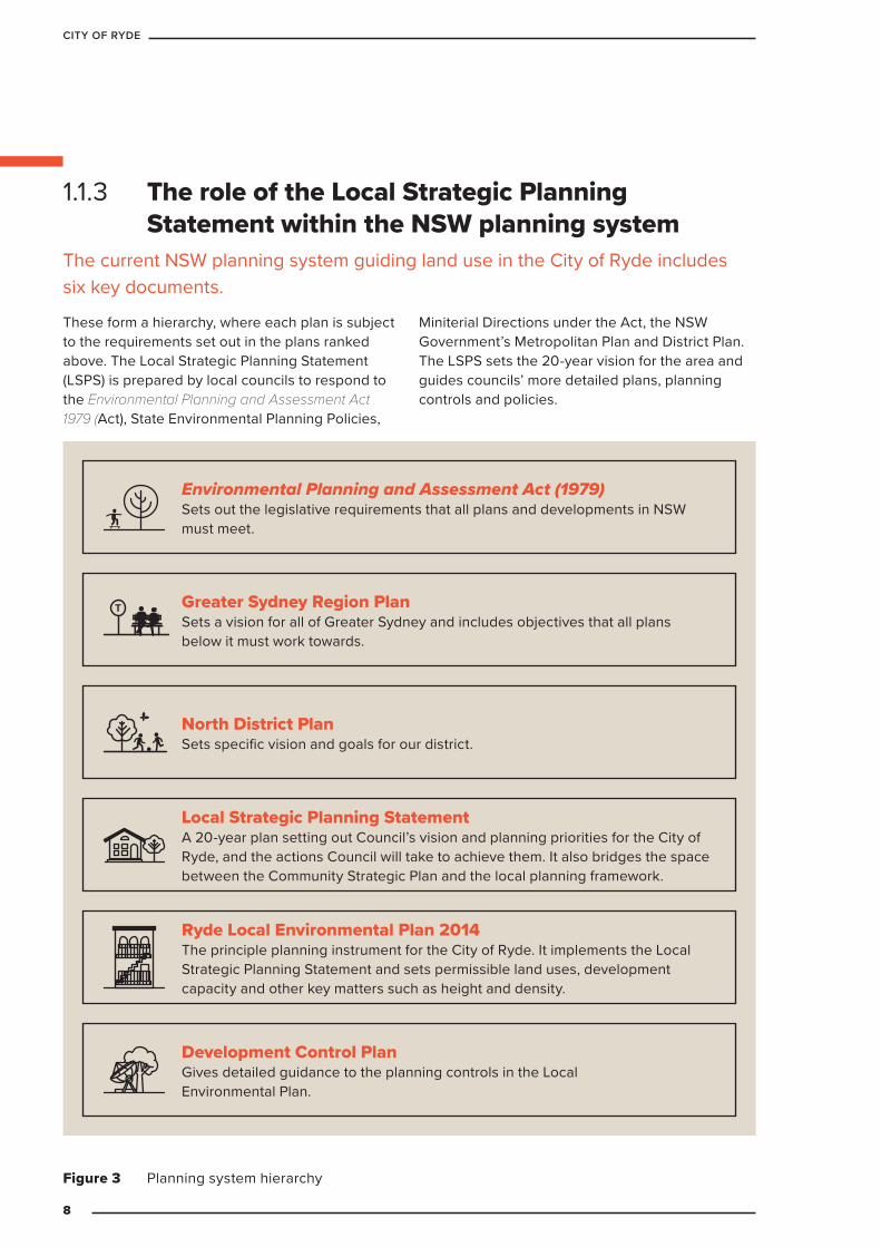
1.1.3 The role of the Local Strategic Planning Statement within the NSW planning system
The current NSW planning system guiding land use in the City of Ryde includes six key documents.
These form a hierarchy, where each plan is subject to the requirements set out in the plans ranked above. The Local Strategic Planning Statement (LSPS) is prepared by local councils to respond to the Environmental Planning and Assessment Act 1979 (Act), State Environmental Planning Policies,
Miniterial Directions under the Act, the NSW Government’s Metropolitan Plan and District Plan. The LSPS sets the 20-year vision for the area and guides councils’ more detailed plans, planning controls and policies.
Environmental Planning and Assessment Act (1979) Sets out the legislative requirements that all plans and developments in NSW must meet.
North District Plan Sets specific vision and goals for our district.
Local Strategic Planning Statement A 20-year plan setting out Council’s vision and planning priorities for the City of Ryde, and the actions Council will take to achieve them. It also bridges the space between the Community Strategic Plan and the local planning framework.
Ryde Local Environmental Plan 2014 The principle planning instrument for the City of Ryde. It implements the Local Strategic Planning Statement and sets permissible land uses, development capacity and other key matters such as height and density.
Development Control Plan Gives detailed guidance to the planning controls in the Local Environmental Plan.
Greater Sydney Region Plan Sets a vision for all of Greater Sydney and includes objectives that all plans below it must work towards.
Figure 3 Planning system hierarchy
8
CITY OF RYDE

1.1.4 Ryde Community Strategic Plan 2018
The Community Strategic Plan is the plan for the City of Ryde, by the people of the City of Ryde. It is the product of extensive consultation and reflects the community’s views on what they want the City of Ryde to be like in ten years’ time.
The Plan breaks down the community’s desired future for Ryde into seven key categories: vibrant and liveable; active and healthy; natural and sustainable; smart and innovative; connected and accessible; diverse and inclusive; and open and progressive.
The Ryde Community Strategic Plan details actions and practices the community would like to see Council adopt to realise each of these categories.
The LSPS is informed by the Community Strategic Plan and is designed to be read alongside it. The LSPS details how Council intends to use land use planning to help make the community’s vision a reality. It adopts the priorities identified in the Community Strategic Plan and looks at them in the context of the land use planning and place-making that will underpin the future built form of our city.
CITY OF RYDE | Community Strategic Plan
1
Our Vision for Ryde 2028COMMUNITY
STRATEGIC PLAN
Our vibrant and liveable city
Our smart and innovative city
Our active and healthy city
Our connected and accessible city
Our natural and sustainable city
Our diverse and inclusive city
Our open and progressive city
Figure 4 Categories from Ryde Community Strategic Plan 2018
9
LOCAL STRATEGIC PLANNING STATEMENT
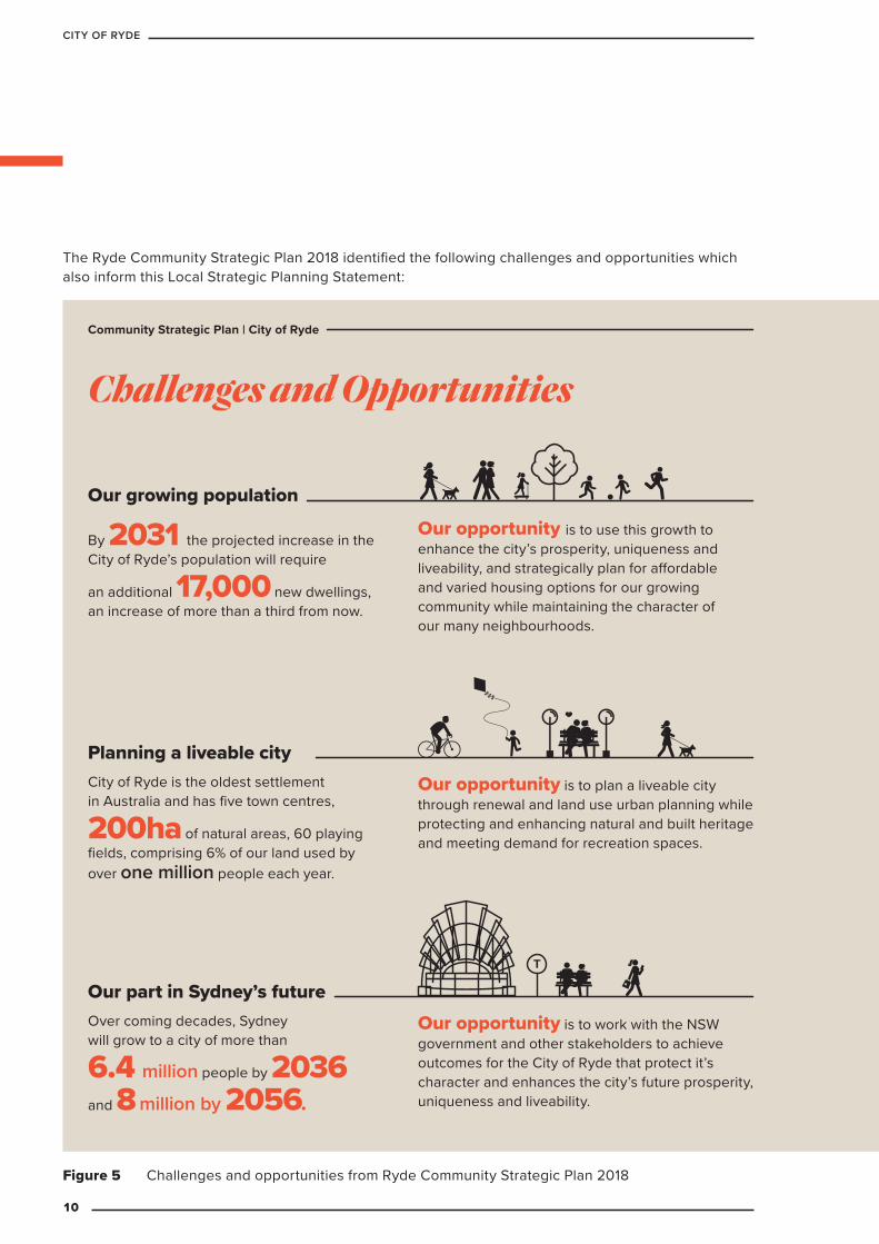
Figure 5 Challenges and opportunities from Ryde Community Strategic Plan 2018
The Ryde Community Strategic Plan 2018 identified the following challenges and opportunities which also inform this Local Strategic Planning Statement:
Community Strategic Plan | City of Ryde
Challenges and Opportunities
Our growing population
Our opportunity is to use this growth to enhance the city’s prosperity, uniqueness and liveability, and strategically plan for affordable and varied housing options for our growing community while maintaining the character of our many neighbourhoods.
By 2031 the projected increase in the City of Ryde’s population will require
an additional 17,000 new dwellings, an increase of more than a third from now.
Over coming decades, Sydney will grow to a city of more than
6.4 million people by 2036
and 8 million by 2056.
Our opportunity is to work with the NSW government and other stakeholders to achieve outcomes for the City of Ryde that protect it’s character and enhances the city’s future prosperity, uniqueness and liveability.
Our part in Sydney’s future
Planning a liveable cityOur opportunity is to plan a liveable city through renewal and land use urban planning while protecting and enhancing natural and built heritage and meeting demand for recreation spaces.
City of Ryde is the oldest settlement in Australia and has five town centres,
200ha of natural areas, 60 playing fields, comprising 6% of our land used by over one million people each year.
10
CITY OF RYDE
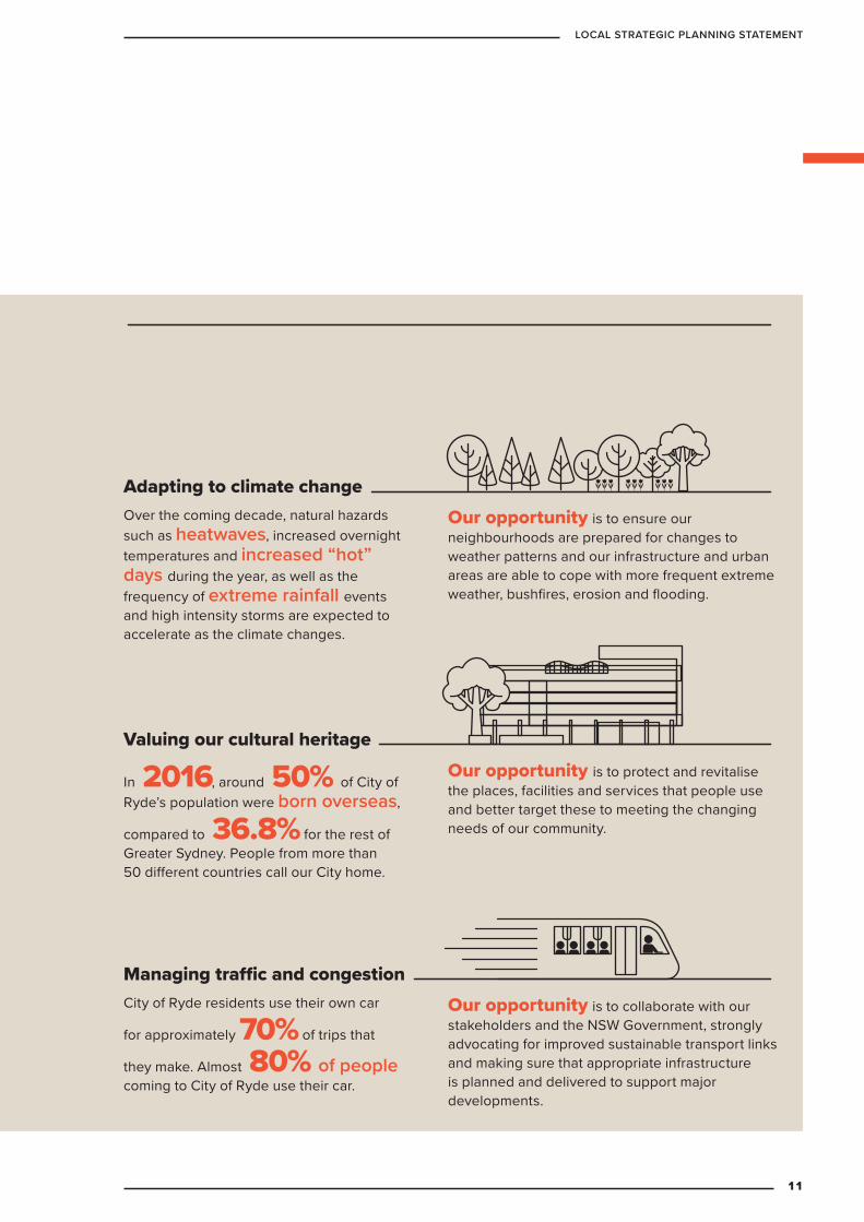
City of Ryde residents use their own car
for approximately 70% of trips that
they make. Almost 80% of people coming to City of Ryde use their car.
Our opportunity is to collaborate with our stakeholders and the NSW Government, strongly advocating for improved sustainable transport links and making sure that appropriate infrastructure is planned and delivered to support major developments.
Managing traffic and congestion
Adapting to climate changeOver the coming decade, natural hazards such as heatwaves, increased overnight temperatures and increased “hot” days during the year, as well as the frequency of extreme rainfall events and high intensity storms are expected to accelerate as the climate changes.
Our opportunity is to ensure our neighbourhoods are prepared for changes to weather patterns and our infrastructure and urban areas are able to cope with more frequent extreme weather, bushfires, erosion and flooding.
In 2016, around 50% of City of Ryde’s population were born overseas,
compared to 36.8% for the rest of Greater Sydney. People from more than 50 different countries call our City home.
Our opportunity is to protect and revitalise the places, facilities and services that people use and better target these to meeting the changing needs of our community.
Valuing our cultural heritage
11
LOCAL STRATEGIC PLANNING STATEMENT
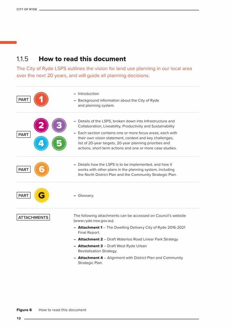
1.1.5 How to read this document The City of Ryde LSPS outlines the vision for land use planning in our local area over the next 20 years, and will guide all planning decisions.
Figure 6 How to read this document
– Introduction
– Background information about the City of Ryde and planning system.
1PART
– Details of the LSPS, broken down into Infrastructure and Collaboration, Liveability, Productivity and Sustainability
– Each section contains one or more focus areas, each with their own vision statement, context and key challenges, list of 20-year targets, 20-year planning priorities and actions, short term actions and one or more case studies.
2 3
4 5PART
– Details how the LSPS is to be implemented, and how it works with other plans in the planning system, including the North District Plan and the Community Strategic Plan.
6PART
– Glossary.GPART
The following attachments can be accessed on Council’s website (www.ryde.nsw.gov.au):
– Attachment 1 – The Dwelling Delivery City of Ryde 2016-2021 Final Report.
– Attachment 2 – Draft Waterloo Road Linear Park Strategy
– Attachment 3 – Draft West Ryde Urban Revitalisation Strategy.
– Attachment 4 – Alignment with District Plan and Community Strategic Plan.
ATTACHMENTS
12
CITY OF RYDE

1.1.6 MethodologyThe LSPS brings together existing relevant adopted Council studies, documents, plans and policies to guide future development in the City of Ryde.
It has been structured to show consistency with the Greater Sydney Commission’s North District Plan (which sets out planning priorities and actions for the Ryde, Hornsby, Hunter’s Hill, Ku-ring-gai, Lane Cove, Mosman, North Sydney, Northern Beaches and Willoughby LGAs).
The tables below summarise which existing Ryde Council documents have been used to inform this LSPS and further studies to be completed. The table is structured according to the North District Plan so that there is a line of sight from that plan to Council’s plans and studies.
Table 1 Existing Council documents used to inform this LSPS and further studies to be completed.
Infrastructure and Collaboration LiveabilityNorth District Plan Priorities North District Plan Priorities N1 Planning for a city supported by infrastructure
N2 Working through collaboration
N3 Providing services and social infrastructure to meet people’s changing needs
N4 Fostering healthy, creative, culturally rich and socially connected communities
N5 Providing housing supply, choice and affordability, with access to jobs, services and public transport
N6 Creating and renewing great places and local centres, and respecting the District’s heritage
Council’s Existing relevant plans Council’s Existing relevant plans – Ryde Council Communications and
Engagement Strategy
– City of Ryde Bicycle Strategy
– s94. Developer Contributions Plan 2007
– Integrated Open Space Plan 2012
– Children’s Play Implementation Plan 2013
– Social and Cultural Infrastructure Framework 2014
– Sport and Recreation Strategy 2016- 2026
– Integrated Transport Strategy 2016 – 2031
– Great Libraries, Great Communities - Ryde Library Strategic Plan 2019-2024
– Draft Halls & Facilities Strategy 2019-2041
– Draft Social & Cultural Infrastructure Framework 2019-2041
– Public Art Planning Guide for Developers
– Public Art Implementation Guide
– Creativity Strategy 2019-2024
– Social Plan 2019-2024
– Aboriginal Cultural Heritage
– Heritage Studies, 1988, 2001, 2010
– Affordable Housing Policy, 2015
– City of Ryde Events Strategy
– City of Ryde Disability Inclusion Action Plan
– Ryde DCP 2014 Parts
» 4.1 Eastwood
» 4.2 Shepherds Bay
» 4.3 West Ryde
» 4.4 Ryde
» 4.5 Macquarie Park
» 4.6 Gladesville and Victoria Road Corridor
– Liveable neighbourhood program
– Public Domain Technical Manual
13
LOCAL STRATEGIC PLANNING STATEMENT
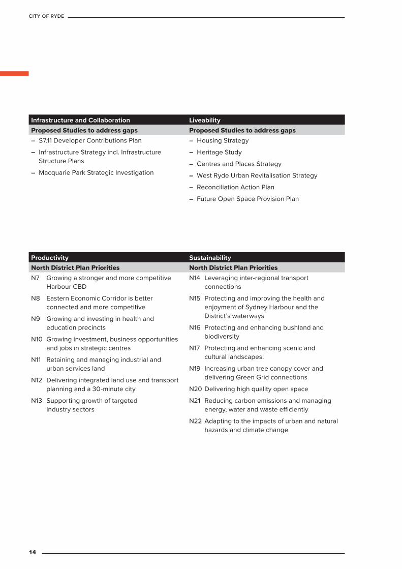
Productivity SustainabilityNorth District Plan Priorities North District Plan Priorities N7 Growing a stronger and more competitive
Harbour CBD
N8 Eastern Economic Corridor is better connected and more competitive
N9 Growing and investing in health and education precincts
N10 Growing investment, business opportunities and jobs in strategic centres
N11 Retaining and managing industrial and urban services land
N12 Delivering integrated land use and transport planning and a 30-minute city
N13 Supporting growth of targeted industry sectors
N14 Leveraging inter-regional transport connections
N15 Protecting and improving the health and enjoyment of Sydney Harbour and the District’s waterways
N16 Protecting and enhancing bushland and biodiversity
N17 Protecting and enhancing scenic and cultural landscapes.
N19 Increasing urban tree canopy cover and delivering Green Grid connections
N20 Delivering high quality open space
N21 Reducing carbon emissions and managing energy, water and waste efficiently
N22 Adapting to the impacts of urban and natural hazards and climate change
Infrastructure and Collaboration LiveabilityProposed Studies to address gaps Proposed Studies to address gaps
– S7.11 Developer Contributions Plan
– Infrastructure Strategy incl. Infrastructure Structure Plans
– Macquarie Park Strategic Investigation
– Housing Strategy
– Heritage Study
– Centres and Places Strategy
– West Ryde Urban Revitalisation Strategy
– Reconciliation Action Plan
– Future Open Space Provision Plan
14
CITY OF RYDE
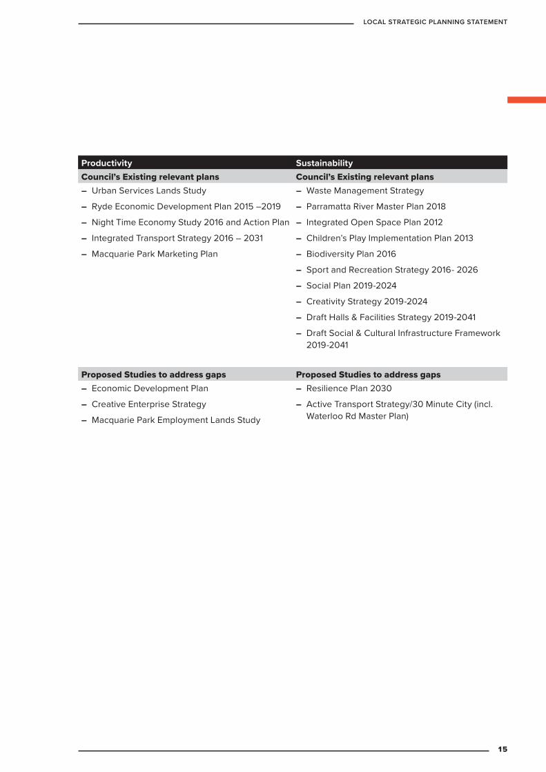
Productivity SustainabilityCouncil’s Existing relevant plans Council’s Existing relevant plans
– Urban Services Lands Study
– Ryde Economic Development Plan 2015 –2019
– Night Time Economy Study 2016 and Action Plan
– Integrated Transport Strategy 2016 – 2031
– Macquarie Park Marketing Plan
– Waste Management Strategy
– Parramatta River Master Plan 2018
– Integrated Open Space Plan 2012
– Children’s Play Implementation Plan 2013
– Biodiversity Plan 2016
– Sport and Recreation Strategy 2016- 2026
– Social Plan 2019-2024
– Creativity Strategy 2019-2024
– Draft Halls & Facilities Strategy 2019-2041
– Draft Social & Cultural Infrastructure Framework 2019-2041
Proposed Studies to address gaps Proposed Studies to address gaps – Economic Development Plan
– Creative Enterprise Strategy
– Macquarie Park Employment Lands Study
– Resilience Plan 2030
– Active Transport Strategy/30 Minute City (incl. Waterloo Rd Master Plan)
15
LOCAL STRATEGIC PLANNING STATEMENT
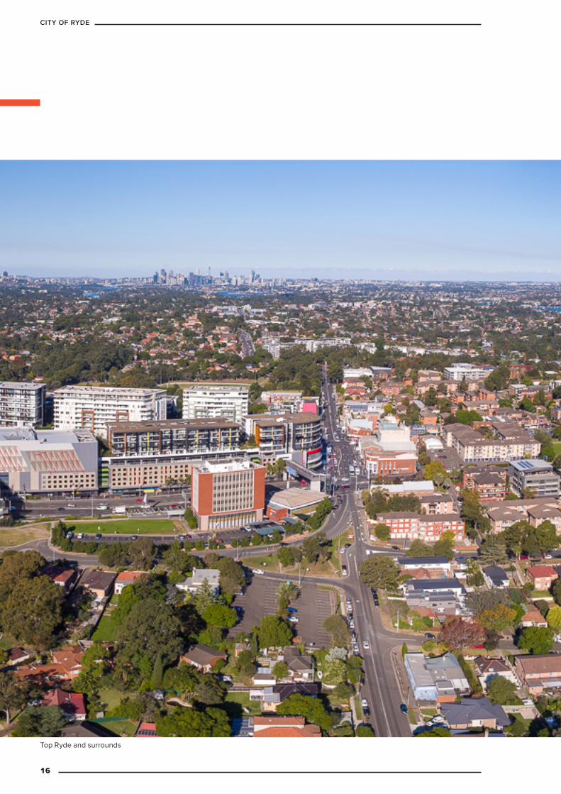
Top Ryde and surrounds
16
CITY OF RYDE
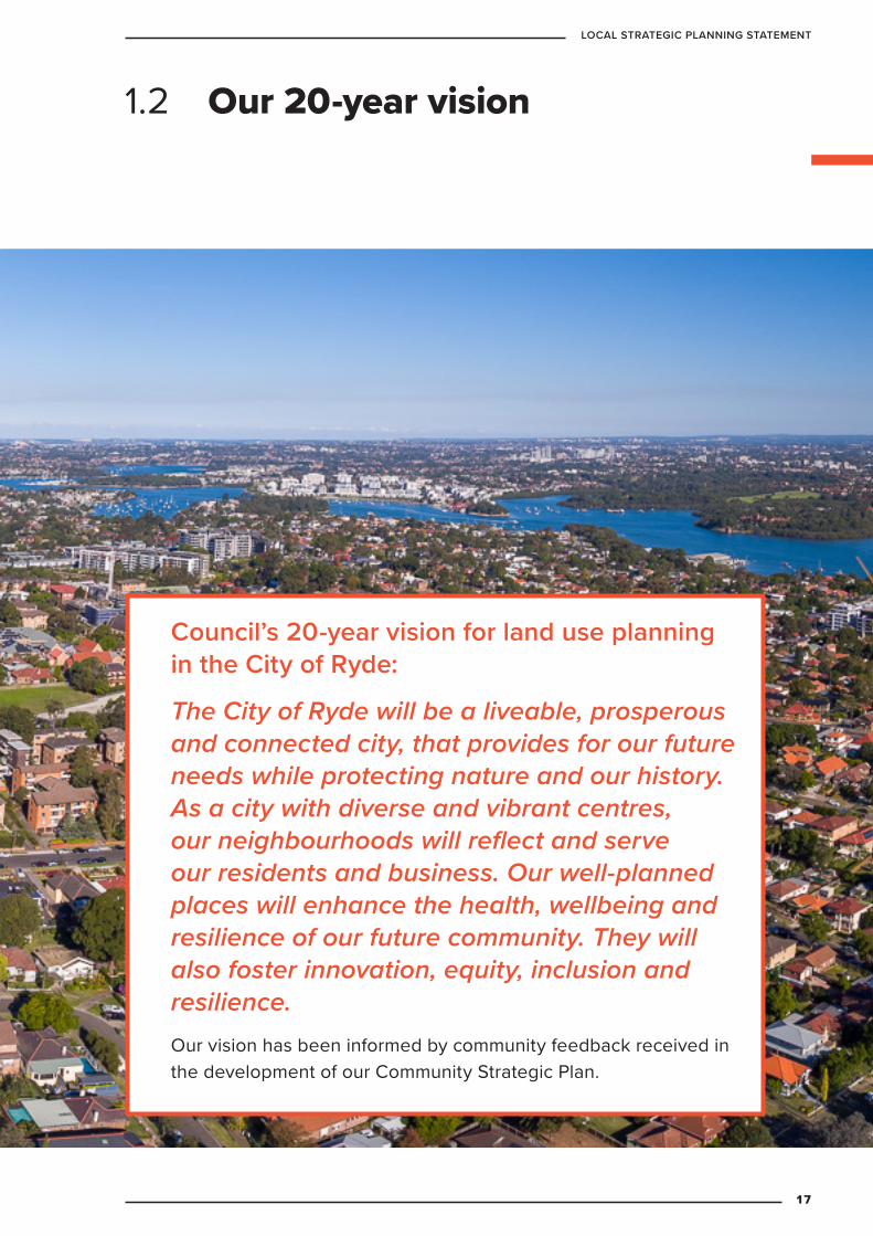
Council’s 20-year vision for land use planning in the City of Ryde:
The City of Ryde will be a liveable, prosperous and connected city, that provides for our future needs while protecting nature and our history. As a city with diverse and vibrant centres, our neighbourhoods will reflect and serve our residents and business. Our well-planned places will enhance the health, wellbeing and resilience of our future community. They will also foster innovation, equity, inclusion and resilience.Our vision has been informed by community feedback received in the development of our Community Strategic Plan.
1.2 Our 20-year vision
17
LOCAL STRATEGIC PLANNING STATEMENT

1.2.1 Land use planning visionThe City of Ryde has experienced sustained population and housing growth over the past decade, which has put pressure on the unique local character of our buildings, heritage and natural areas.
As the City of Ryde continues to be a desirable place to live and work, it will be crucial to ensure our growing community has access to diverse housing and employment opportunities as well as vital services.
Our residents expect Council to control development to ensure this growth brings with it urban renewal and vibrancy to areas of need.
Our residents also want to see our tree canopy, natural areas and open spaces protected and increased, as well as have access to efficient transport options that connect them to places locally and across the wider Sydney area.
Macquarie Park
18
CITY OF RYDE
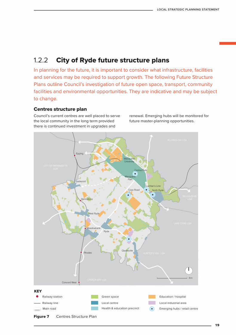
1.2.2 City of Ryde future structure plans In planning for the future, it is important to consider what infrastructure, facilities and services may be required to support growth. The following Future Structure Plans outline Council’s investigation of future open space, transport, community facilities and environmental opportunities. They are indicative and may be subject to change.
Centres structure plan Council’s current centres are well placed to serve the local community in the long term provided there is continued investment in upgrades and
renewal. Emerging hubs will be monitored for future master-planning opportunities.
KEY
Railway station
Railway line
Main road
Green space
Commercial centre
Education / hospital
Major industrial area
2km
Emerging hubs / retail centre
Concord West
Rhodes
Meadowbank
West Ryde
North Ryde
Gladesville
Ryde
Dennistone
Eastwood
Epping
Cheltenham
MacquarieUniversity
MacquariePark
LANE COVE LGA
WILLOUGHBYLGA
KU-RING-GAI LGA
HORNSBY LGA
CITY OF PARRAMATTALGA
CANADA BAY LGA
HUNTER’S HILL LGA
Coxs Road
Lachlan’s Line
Central Park
Figure 7 Centres Structure Plan
Main road Emerging hubs / retail centre
Education / hospitalRailway station
Railway line
Green space
Local centre
Health & education precinct
Local industrial area
KEY
19
LOCAL STRATEGIC PLANNING STATEMENT
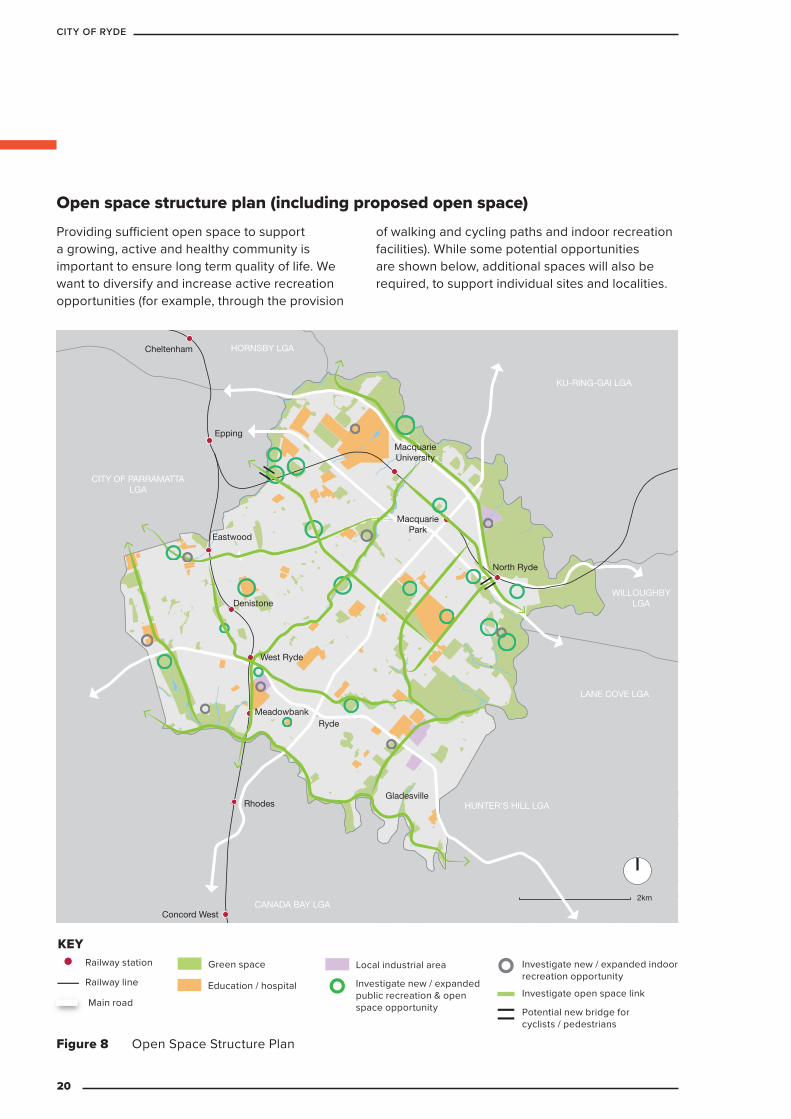
Providing sufficient open space to support a growing, active and healthy community is important to ensure long term quality of life. We want to diversify and increase active recreation opportunities (for example, through the provision
of walking and cycling paths and indoor recreation facilities). While some potential opportunities are shown below, additional spaces will also be required, to support individual sites and localities.
KEY
Railway station
Railway line
Main road
Green space
Commercial centre
Education / hospital
Major industrial area
2km
Investigate new / expanded public recreation & open space opportunity
Investigate new / expanded indoor recreation opportunity
Investigate open space link
Potential new bridge for cyclists / pedestrians
Concord West
Rhodes
Meadowbank
West Ryde
North Ryde
Gladesville
Ryde
Denistone
Eastwood
Epping
Cheltenham
MacquarieUniversity
MacquariePark
LANE COVE LGA
WILLOUGHBYLGA
KU-RING-GAI LGA
HORNSBY LGA
CITY OF PARRAMATTALGA
CANADA BAY LGA
HUNTER’S HILL LGA
Figure 8 Open Space Structure Plan
Main road
Investigate new / expanded public recreation & open space opportunity
Railway station
Railway line
Green space Local industrial area
Education / hospital
KEY
Potential new bridge for cyclists / pedestrians
Investigate new / expanded indoor recreation opportunity
Investigate open space link
Open space structure plan (including proposed open space)
20
CITY OF RYDE
Green space
Biodiversity corridors
Riparian corridors & riparian reach extent
Threatened species
Waterway & creeks
Environmentally Sensitive Lands Structure Plan
Concord West
Rhodes
Meadowbank
West Ryde
North Ryde
Gladesville
Ryde
Denistone
Eastwood
Epping
Cheltenham
MacquarieUniversity
MacquariePark
LANE COVE LGA
WILLOUGHBYLGA
KU-RING-GAI LGA
HORNSBY LGA
CITY OF PARRAMATTALGA
CANADA BAY LGA
HUNTER’S HILL LGA
KEY
Railway station
Railway line
Main road
Green space
Commercial centre
Education / hospital
Major industrial area
2km
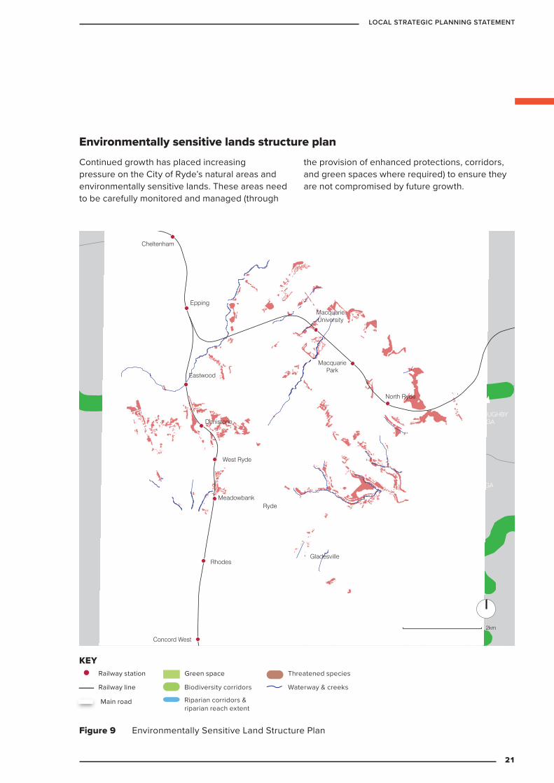
Continued growth has placed increasing pressure on the City of Ryde’s natural areas and environmentally sensitive lands. These areas need to be carefully monitored and managed (through
the provision of enhanced protections, corridors, and green spaces where required) to ensure they are not compromised by future growth.
Figure 9 Environmentally Sensitive Land Structure Plan
Main road
Waterway & creeks
Railway station
Railway line
Green space
Biodiversity corridors
Threatened species
Riparian corridors & riparian reach extent
KEY
Environmentally sensitive lands structure plan
21
LOCAL STRATEGIC PLANNING STATEMENT
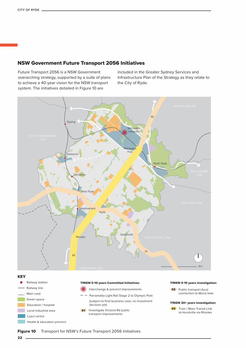
Figure 10 Transport for NSW’s Future Transport 2056 Initiatives
Future Transport 2056 is a NSW Government overarching strategy, supported by a suite of plans to achieve a 40-year vision for the NSW transport system. The initiatives detailed in Figure 10 are
included in the Greater Sydney Services and Infrastructure Plan of the Strategy as they relate to the City of Ryde.
KEY
Railway station
Railway line
Main road
Green space
Commercial centre
Education / hospital
Major industrial area
2km
Greater Sydney Committed
Initiatives (0-10 years):
Bus interchange upgrade
Parramatta Light Rail Stage 2 to Olympic Park
Increase freight train capacity
& passenger train frequency
Victoria Road public transport (bus) improvements
Greater Sydney Committed
Initiatives (20+ years):
Train / Mass Transit Link to
Hurstville via Rhodes
Future Transport 2056 Projects
01
02
03
0301
02
Greater Sydney Initiatives
for investigation (0-10 years):
Public transport (bus) connection
to Mona Vale
Concord West
Rhodes
Meadowbank
West Ryde
North Ryde
Gladesville
Ryde
Denistone
Eastwood
Epping
Cheltenham
MacquarieUniversity
MacquariePark
LANE COVE LGA
WILLOUGHBYLGA
KU-RING-GAI LGA
HORNSBY LGA
CITY OF PARRAMATTALGA
CANADA BAY LGA
HUNTER’S HILL LGA
Railway station
Railway line
Main road
Green space
Loacl centre
TfNSW 0-10 years Committed Initiatives:
TfNSW 20+ years investigation:
Local industrial area
Education / hospital
Interchange & precinct improvements
Train / Mass Transit Link to Hurstville via Rhodes
KEYTfNSW 0-10 years investigation:
Investigate Victoria Rd public transport improvements
Public transport (bus) connection to Mona Vale
Parramatta Light Rail Stage 2 to Olympic Park
(subject to final business case; no investment decision yet)
NSW Government Future Transport 2056 Initiatives
02
0301
Health & education precinct
22
CITY OF RYDE
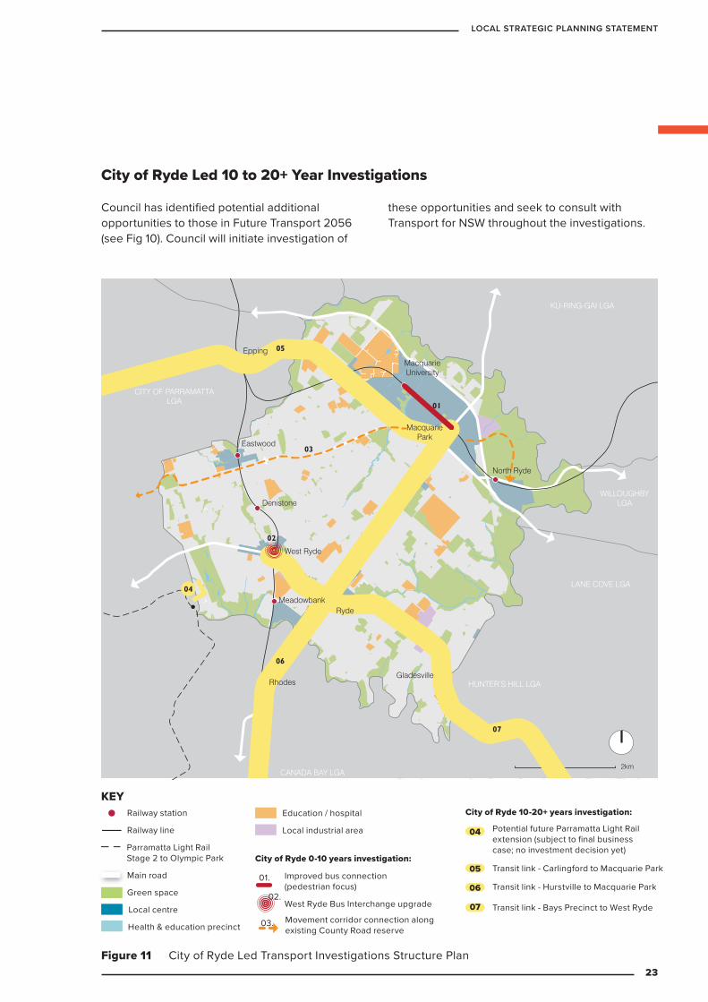
Figure 11 City of Ryde Led Transport Investigations Structure Plan
Council has identified potential additional opportunities to those in Future Transport 2056 (see Fig 10). Council will initiate investigation of
these opportunities and seek to consult with Transport for NSW throughout the investigations.
KEY
Railway station
Railway line
Main road
Green space
Commercial centre
Education / hospital
Major industrial area
2km
Transport Structure Plan
07
05
06
03
01
02
04
Concord West
Rhodes
Meadowbank
West Ryde
North Ryde
Gladesville
Ryde
Denistone
Eastwood
Epping
Cheltenham
MacquarieUniversity
MacquariePark
LANE COVE LGA
WILLOUGHBYLGA
KU-RING-GAI LGA
HORNSBY LGA
CITY OF PARRAMATTALGA
CANADA BAY LGA
HUNTER’S HILL LGA
Railway station
Railway line
Main road
Green space
Local centre
City of Ryde 0-10 years investigation:
City of Ryde 10-20+ years investigation:
Local industrial area
Education / hospital
Transit link - Bays Precinct to West Ryde
Transit link - Carlingford to Macquarie Park
Potential future Parramatta Light Rail extension (subject to final business case; no investment decision yet)
Transit link - Hurstville to Macquarie Park
KEY
Parramatta Light Rail Stage 2 to Olympic Park
Improved bus connection (pedestrian focus)
Movement corridor connection along existing County Road reserve
City of Ryde Led 10 to 20+ Year Investigations
04
05
06
07West Ryde Bus Interchange upgrade
Health & education precinct
01.
02.
03.
23
LOCAL STRATEGIC PLANNING STATEMENT
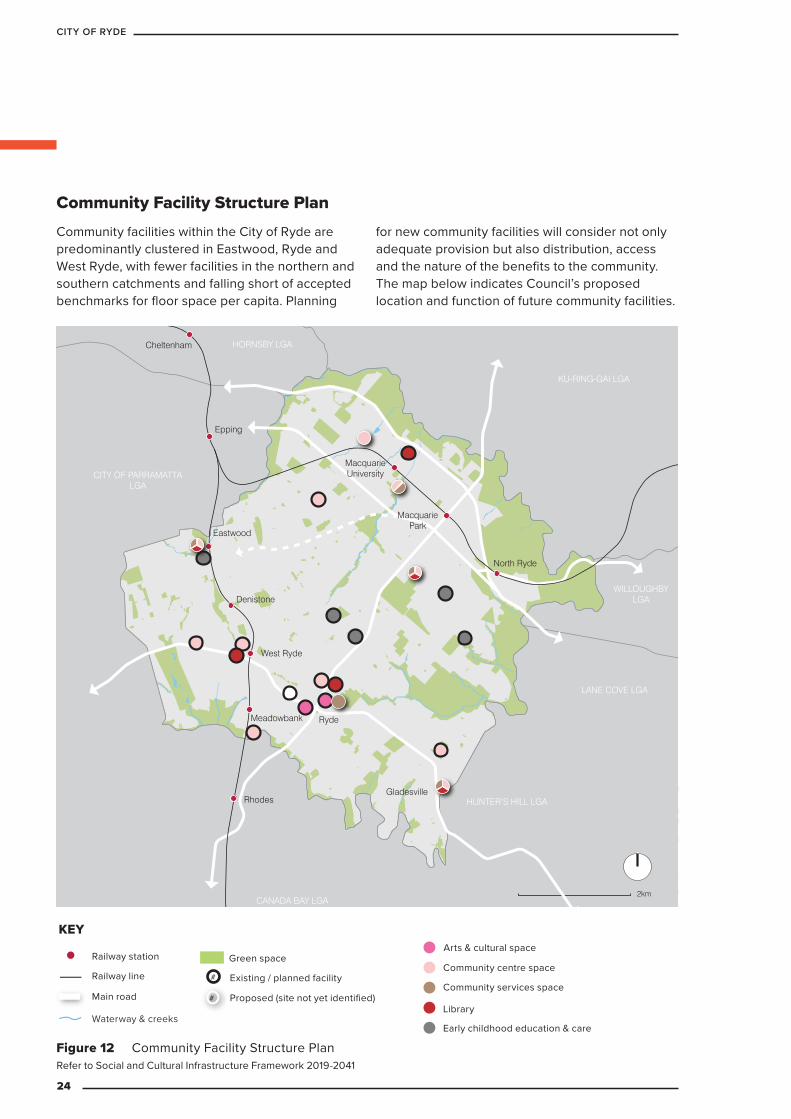
Community facilities within the City of Ryde are predominantly clustered in Eastwood, Ryde and West Ryde, with fewer facilities in the northern and southern catchments and falling short of accepted benchmarks for floor space per capita. Planning
for new community facilities will consider not only adequate provision but also distribution, access and the nature of the benefits to the community. The map below indicates Council’s proposed location and function of future community facilities.
KEY
Railway station
Railway line
Main road
Green space
Commercial centre
Education / hospital
Major industrial area
2km
Concord West
Rhodes
Meadowbank
West Ryde
North Ryde
Gladesville
Ryde
Denistone
Eastwood
Epping
Cheltenham
MacquarieUniversity
MacquariePark
LANE COVE LGA
WILLOUGHBYLGA
KU-RING-GAI LGA
HORNSBY LGA
CITY OF PARRAMATTALGA
CANADA BAY LGA
HUNTER’S HILL LGA
Figure 12 Community Facility Structure Plan
Main road
Railway station
Railway line
Green space
KEY
Waterway & creeks
Proposed (site not yet identified)
#
#
Existing / planned facilityCommunity services space
Library
Community centre space
Arts & cultural space
Early childhood education & care
Refer to Social and Cultural Infrastructure Framework 2019-2041
Community Facility Structure Plan
24
CITY OF RYDE
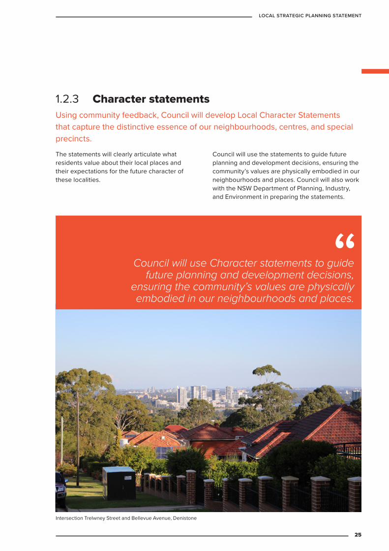
1.2.3 Character statementsUsing community feedback, Council will develop Local Character Statements that capture the distinctive essence of our neighbourhoods, centres, and special precincts.
The statements will clearly articulate what residents value about their local places and their expectations for the future character of these localities.
Council will use the statements to guide future planning and development decisions, ensuring the community’s values are physically embodied in our neighbourhoods and places. Council will also work with the NSW Department of Planning, Industry, and Environment in preparing the statements.
Council will use Character statements to guide future planning and development decisions,
ensuring the community’s values are physically embodied in our neighbourhoods and places.
Intersection Trelwney Street and Bellevue Avenue, Denistone
25
LOCAL STRATEGIC PLANNING STATEMENT
INFRASTRUCTURE
AN
D COLLABORATION
2PART
26
CITY OF RYDE
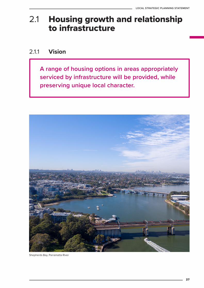
A range of housing options in areas appropriately serviced by infrastructure will be provided, while preserving unique local character.
2.1 Housing growth and relationship to infrastructure
2.1.1 Vision
Shepherds Bay, Parramatta River
27
LOCAL STRATEGIC PLANNING STATEMENT
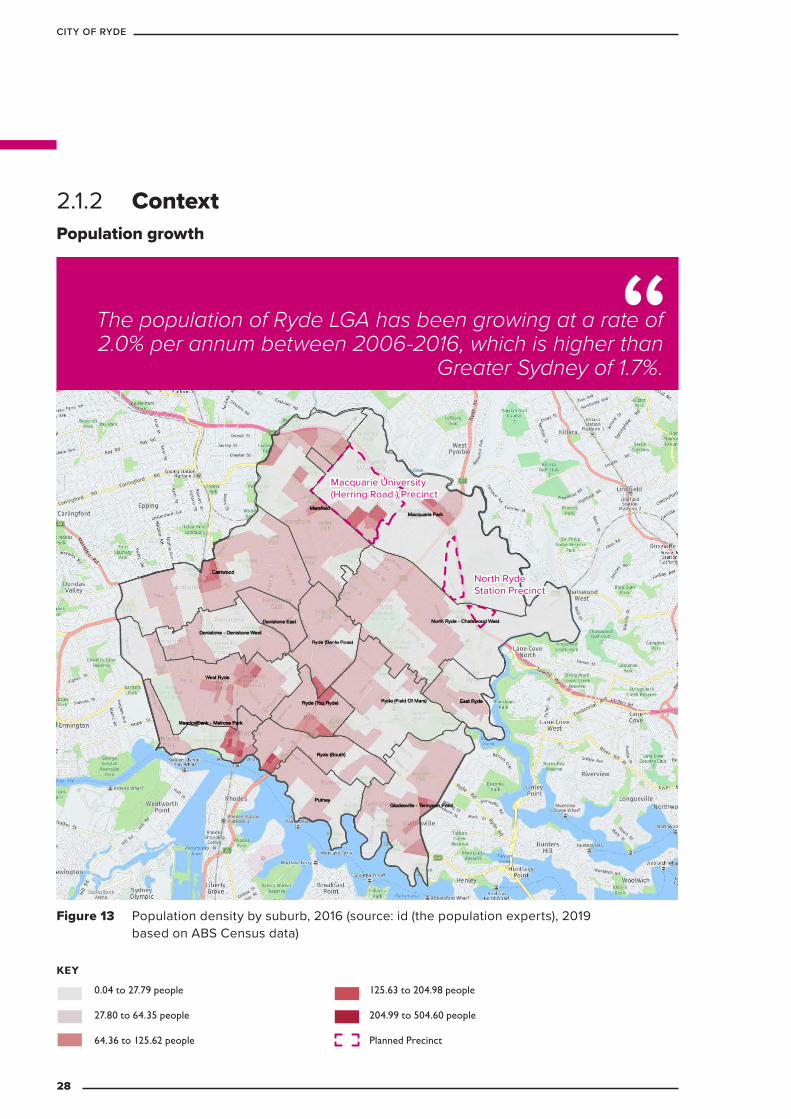
2.1.2 Context
Figure 13 Population density by suburb, 2016 (source: id (the population experts), 2019 based on ABS Census data)
KEY
0.04 to 27.79 people
27.80 to 64.35 people
64.36 to 125.62 people
125.63 to 204.98 people
204.99 to 504.60 people
Planned Precinct
Population growth
The population of Ryde LGA has been growing at a rate of 2.0% per annum between 2006-2016, which is higher than
Greater Sydney of 1.7%.
North Ryde Station Precinct
Macquarie University (Herring Road ) Precinct
28
CITY OF RYDE
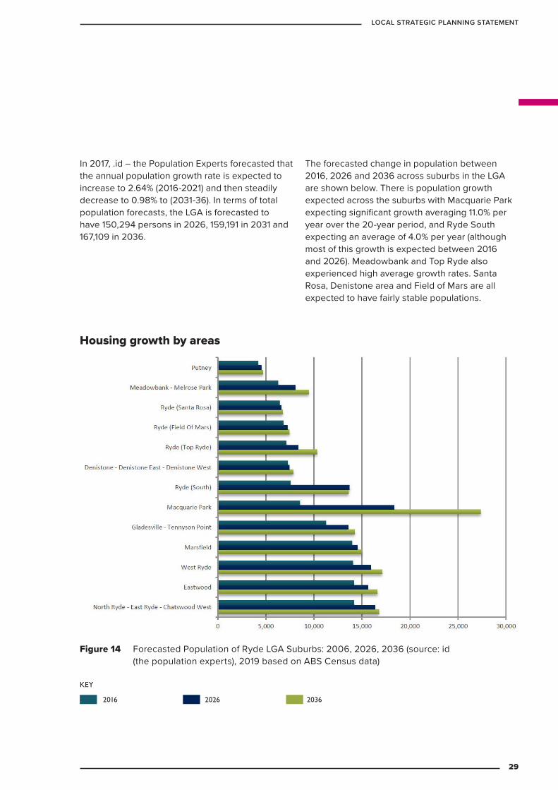
In 2017, .id – the Population Experts forecasted that the annual population growth rate is expected to increase to 2.64% (2016-2021) and then steadily decrease to 0.98% to (2031-36). In terms of total population forecasts, the LGA is forecasted to have 150,294 persons in 2026, 159,191 in 2031 and 167,109 in 2036.
The forecasted change in population between 2016, 2026 and 2036 across suburbs in the LGA are shown below. There is population growth expected across the suburbs with Macquarie Park expecting significant growth averaging 11.0% per year over the 20-year period, and Ryde South expecting an average of 4.0% per year (although most of this growth is expected between 2016 and 2026). Meadowbank and Top Ryde also experienced high average growth rates. Santa Rosa, Denistone area and Field of Mars are all expected to have fairly stable populations.
Figure 14 Forecasted Population of Ryde LGA Suburbs: 2006, 2026, 2036 (source: id (the population experts), 2019 based on ABS Census data)
KEY
2016 2026 2036
Housing growth by areas
29
LOCAL STRATEGIC PLANNING STATEMENT
The North District Plan includes housing targets for each of the councils within its boundaries. For Ryde, this target is set at an additional 7,600 homes by 2021. Council’s Dwelling Delivery City of Ryde 2016-2021 draft report (see Attachment 1) anticipates that 12,786 homes will be created (based on Local Development Application approvals. Not all approved dwellings are completed, actual delivery can vary widely location to location). Detailed analysis of future capacity
will be detailed in City of Ryde’s updated Housing Strategy (anticipated completion mid-2020).
Around 80 per cent of these new homes are expected to be located in Shepherds Bay Meadowbank and the North Ryde Station and Macquarie University Station Priority Precincts.
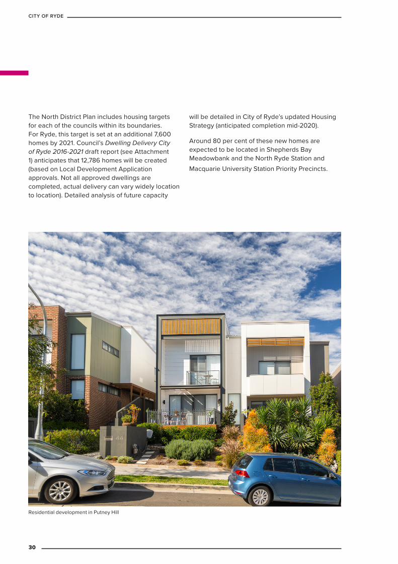
Residential development in Putney Hill
30
CITY OF RYDE
Key challenge: transforming West Ryde into a vibrant centre
In terms of housing supply and economic performance, West Ryde has lagged behind other suburbs during a period of strong growth for the LGA. While the suburb has development potential, the feasibility of planning controls and small lot structures has meant there has been a single approval granted between January 2016 and December 2018 (for 40 homes). There is also some visible evidence of economic stress such as vacant sites, poor building maintenance, lack of retail activity and blank façades. The LSPS will consider how West Ryde should look and function in the future, including community and other infrastructure needs.
Key challenge: preserving Macquarie Park as a key economic centre
A key goal of the LSPS is to maintain the precinct’s role as a key economic powerhouse for Sydney and transform it into a vibrant and accessible CBD. A key challenge is ensuring Macquarie Park can continue to offer employment opportunities and strong economic growth, while we also continue to improve public transport patronage to address congestion. The precinct is well situated on Sydney’s Economic Development Corridor between Parramatta and the City; and is currently serviced by the Sydney Metro North West and key arterial roads. The LSPS will plan for new links to improve connectivity between Macquarie Park and other centres within the City of Ryde and beyond to support the precinct as it grows, and ensure its benefits are accessible to residents across the LGA.
2.1.3 Key ChallengesThe City of Ryde is a unique place to live with a valued natural environment, a strong suburban character with locally and regionally significant centres. Housing in the City of Ryde is generally distributed across two areas: centres with high-density apartments and within low-density residential areas in the form of detached and medium-density homes. In recent years, centres within the City of Ryde have supported historically high residential growth which is expected to continue into the future. Having experienced significant growth, the Ryde community wants to see balance in how their neighbourhoods accommodate future growth.
There is sufficient capacity within the Ryde LEP 2014 to meet anticipated population growth. As a result the key challenges for future planning in Ryde is to develop a clear strategy and medium to long term vision, balancing the need for growth with protecting the natural environment and the traditional suburban character while ensuring that population and housing growth occurs in line with the provision of infrastructure and facilities; and provides housing choice that meets community needs and expectations.
31
LOCAL STRATEGIC PLANNING STATEMENT
Key challenge: protecting the valued character of low density residential areas whilst allowing for growth
City of Ryde has a strong pipeline of high and low density housing options. Through Council’s Housing Strategy and subsequent updates to Council’s plans and controls, we will explore options for the most appropriate approach to deliver medium density housing at a similar quantum to current levels. We will also continue to deliver higher density options around transport hubs and in local centres
The Ryde Local Environment Plan allows for housing diversity and controlled medium density (dual occupancy and multi dwelling) development within this low density zone. This approach has resulted in Ryde delivering a higher than average proportion of medium density housing for the North District.
In 2018, the NSW Government revised the State Environmental Planning Policy (Exempt and Complying Development Codes 2008), to encourage more medium density housing across metropolitan Sydney. This revision reduced controls and increased the number of sites available for medium density housing in the City of Ryde, and introduced additional medium density forms such as terrace housing and manor houses (small scale flat buildings). The combined impact of these changes could result in out of character developments in low-density residential areas across the City of Ryde.
32
CITY OF RYDE
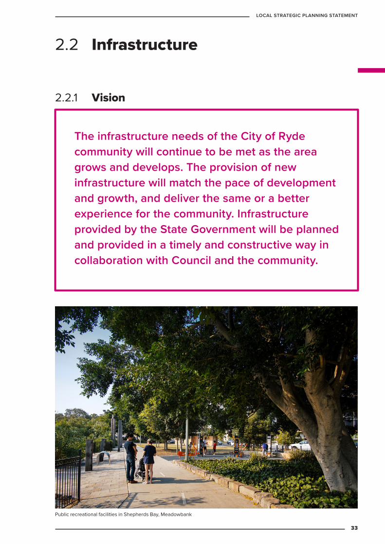
The infrastructure needs of the City of Ryde community will continue to be met as the area grows and develops. The provision of new infrastructure will match the pace of development and growth, and deliver the same or a better experience for the community. Infrastructure provided by the State Government will be planned and provided in a timely and constructive way in collaboration with Council and the community.
2.2.1 Vision
2.2 Infrastructure
Public recreational facilities in Shepherds Bay, Meadowbank
33
LOCAL STRATEGIC PLANNING STATEMENT
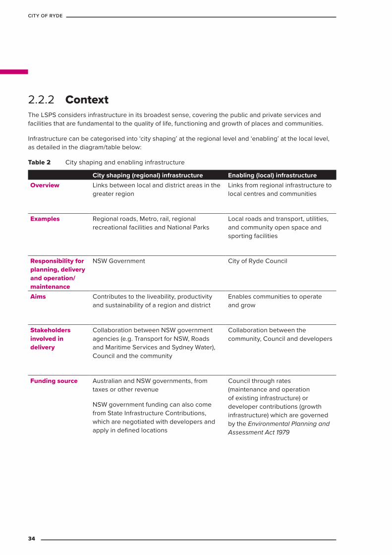
The LSPS considers infrastructure in its broadest sense, covering the public and private services and facilities that are fundamental to the quality of life, functioning and growth of places and communities.
Infrastructure can be categorised into ‘city shaping’ at the regional level and ‘enabling’ at the local level, as detailed in the diagram/table below:
Table 2 City shaping and enabling infrastructure
City shaping (regional) infrastructure Enabling (local) infrastructureOverview Links between local and district areas in the
greater region Links from regional infrastructure to local centres and communities
Examples Regional roads, Metro, rail, regional recreational facilities and National Parks
Local roads and transport, utilities, and community open space and sporting facilities
Responsibility for planning, delivery and operation/ maintenance
NSW Government City of Ryde Council
Aims Contributes to the liveability, productivity and sustainability of a region and district
Enables communities to operate and grow
Stakeholders involved in delivery
Collaboration between NSW government agencies (e.g. Transport for NSW, Roads and Maritime Services and Sydney Water), Council and the community
Collaboration between the community, Council and developers
Funding source Australian and NSW governments, from taxes or other revenue
NSW government funding can also come from State Infrastructure Contributions, which are negotiated with developers and apply in defined locations
Council through rates (maintenance and operation of existing infrastructure) or developer contributions (growth infrastructure) which are governed by the Environmental Planning and Assessment Act 1979
2.2.2 Context
34
CITY OF RYDE
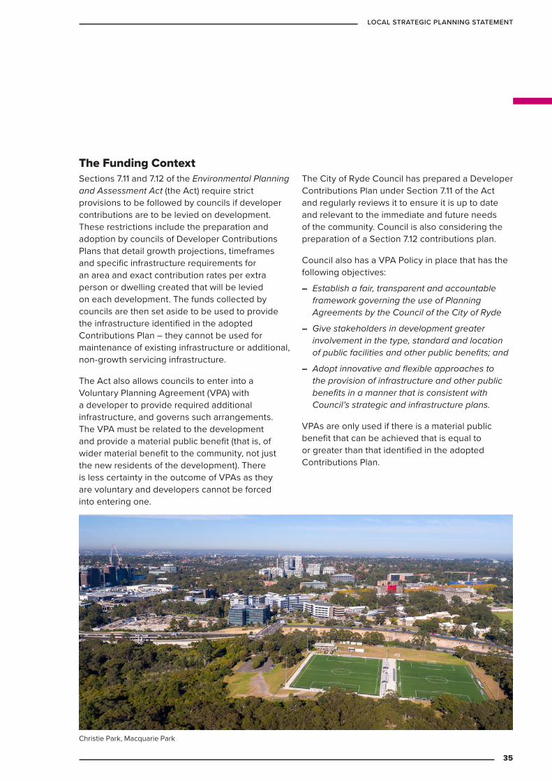
The Funding ContextSections 7.11 and 7.12 of the Environmental Planning and Assessment Act (the Act) require strict provisions to be followed by councils if developer contributions are to be levied on development. These restrictions include the preparation and adoption by councils of Developer Contributions Plans that detail growth projections, timeframes and specific infrastructure requirements for an area and exact contribution rates per extra person or dwelling created that will be levied on each development. The funds collected by councils are then set aside to be used to provide the infrastructure identified in the adopted Contributions Plan – they cannot be used for maintenance of existing infrastructure or additional, non-growth servicing infrastructure.
The Act also allows councils to enter into a Voluntary Planning Agreement (VPA) with a developer to provide required additional infrastructure, and governs such arrangements. The VPA must be related to the development and provide a material public benefit (that is, of wider material benefit to the community, not just the new residents of the development). There is less certainty in the outcome of VPAs as they are voluntary and developers cannot be forced into entering one.
The City of Ryde Council has prepared a Developer Contributions Plan under Section 7.11 of the Act and regularly reviews it to ensure it is up to date and relevant to the immediate and future needs of the community. Council is also considering the preparation of a Section 7.12 contributions plan.
Council also has a VPA Policy in place that has the following objectives:
– Establish a fair, transparent and accountable framework governing the use of Planning Agreements by the Council of the City of Ryde
– Give stakeholders in development greater involvement in the type, standard and location of public facilities and other public benefits; and
– Adopt innovative and flexible approaches to the provision of infrastructure and other public benefits in a manner that is consistent with Council’s strategic and infrastructure plans.
VPAs are only used if there is a material public benefit that can be achieved that is equal to or greater than that identified in the adopted Contributions Plan.
Christie Park, Macquarie Park
35
LOCAL STRATEGIC PLANNING STATEMENT
– Coordination and collaboration with State infrastructure agencies to ensure that the necessary ‘city shaping’ infrastructure is provided when required and to an adequate standard to support the ongoing economic and social growth and cohesion of the community.
– Managing infrastructure growth and maintenance while providing housing diversity.
– Existing infrastructure is not adversely affected by development growth.
– Ensuring that infrastructure is provided by development with little or no lag in timing.
2.2.3 Key challenges
2.2.4 Targets
Increase the proportion of the population within 30 minutes of key community infrastructure. Council’s Social and Cultural Framework will outline Council’s how delivery of social and cultural infrastructure will assist in achieving this target.
Local primary schools will meet the demand of population growth and changing demographics.
95 sqm of community space will be provided per 1,000 people. Council’s Halls and Facilities Strategy will outline how current facilities and delivery of additional facilities will assist in achieving this target.
Increase the proportion of the population within 400 meters of public open space greater than 1,500m2 in size.
To better align infrastructure with future growth the following aspirations will inform decisions on future housing in the City of Ryde.
Note: Council’s updated 7.11 and new 7.12 plan will be prepared in accordance with these strategies and targets.
36
CITY OF RYDE
Table 3 Infrastructure: planning priorities and actions
Planning priority ActionsIN1 Align growth with
infrastructure: provide sufficient infrastructure to support current and future population growth
IN1.1 Prepare Housing Strategy to identify residential growth projections and locations. Ryde Housing Strategy 2021
IN1.2 Prepare Centres and Place Strategy and Macquarie Park Employment Strategy to identify non-residential growth projections and locations. 2021
IN1.3 Identify current gaps in infrastructure and future infrastructure needs to appropriately service population growth. Ryde Infrastructure Strategy 2021
IN1.4 Review developer agreement, policies and contribution plans. Ryde Infrastructure Strategy 2020 and S7.11 Plan 2021
IN1.5 Investigate options for funding infrastructure. Ryde Infrastructure Strategy 2021
IN1.6 Advocate for public transport, schools and hospitals to be accessible to residential development. Ongoing
IN1.7 Require Planning Proposals to indicate existing and required infrastructure. Ongoing
IN1.8 Provide new parks and social and community infrastructure in accordance with Infrastructure Strategies and Contribution Plans. Ongoing. New community facilities on the Ryde Council Civic site 2025
IN1.9 Provide new and enhanced social and cultural infrastructure. Ongoing
IN2 Reinvigorate the Macquarie Park Strategic Investigation Area
IN2.1 Undertake a Macquarie Park Employment Land Study to identify a commercial core that can be protected from non-commercial uses to provide for the continued economic and employment function of Macquarie Park. 2021
IN2.2 Confirm the planning principles to guide the strategic investigation of Macquarie Park. 2021
IN2.3 Collaborate with the NSW Department of Planning, Industry and Environment to recommence the 2016 strategic investigation including to identify the infrastructure deficit in Macquarie Park. 2021
2.2.5 Planning priorities and actions
37
LOCAL STRATEGIC PLANNING STATEMENT
Planning priority ActionsIN3 Collaborate with
relevant stakeholders to achieve appropriate outcomes from existing renewal projects
IN3.1 Work with Macquarie University and NSW Government agencies to ensure that the appropriate infrastructure is provided in a timely manner to facilitate the success of the Macquarie Park Health and Education Precinct. Ongoing
IN3.2 Provide relevant local data and context to the Greater Sydney Commission, NSW Department of Planning, Industry and Environment and developers in relation to existing development in the Herring Road and North Ryde Station precincts to ensure planning controls result in the desired mix of land uses to activate those precincts. Ongoing
IN3.3 Provide relevant local data and context to the NSW Department of Education and TAFE NSW to assist with planning and coordinating the provision of adequate and timely infrastructure in the Meadowbank Education Precinct. Ongoing
IN4 Ensure that transport infrastructure is provided at the appropriate capacity and timing to service existing and growth areas
IN4.1 Collaborate with Transport for NSW and local transport providers to adjust transport links to accommodate changes in commuter behaviour with the completion of the Sydney Metro North West. Ongoing
IN4.2 Develop, with the assistance of the Greater Sydney Commission, a more collaborative approach between Council, Transport for NSW, for the planning of major transport upgrades to ensure that all stakeholders are working with the same growth and capacity forecasts and timelines. Ryde Coordination Committee. Ongoing
IN4.3 Collaborate with Transport for NSW to build on their regional transport plans by expanding transport planning to the local level, based on Council’s adopted strategies. Ongoing
IN4.4 Collaborate with Transport for NSW to investigate future transport options (See Future Transport Structure Plan in Section 1.2.2). Ongoing
38
CITY OF RYDE
Planning priority ActionsIN5 Prepare a local
Infrastructure Strategy IN5.1 Collaborate with relevant NSW Government agencies and
housing providers to identify infrastructure needs on a ‘place-based’ format, such as those identified in the Ryde Housing Strategy. Ongoing
IN5.2 Collaborate with relevant NSW Government agencies to develop consistent growth forecasts, to ensure that the capacity and standard of existing and new infrastructure is appropriate and timely. Ongoing
IN5.3 Coordinate existing Council and NSW Government agency plans to ensure existing infrastructure is used to its maximum potential and to ensure appropriate integration with relevant plans (such as Council’s open space plans, Social and Cultural Infrastructure Framework, NSW Office of Sport plans and District and Regional Green Grid plans). Ongoing
IN6 Develop guidelines for site-specific planning proposals
IN6.1 Complete Housing, Infrastructure and Centres and Places strategies so they can provide key inputs to the guidelines. 2021
IN6.2 Suspend consideration of site-specific planning proposals until they can be assessed against the Housing, Infrastructure and Centres and Places Strategies and identified growth parameters. 2019-2020. This is in accordance to advice from the NSW Government’s advice to Council to pause consideration of proposals as recommended by the Greater Sydney Commission’s Ryde Assurance Review in 2019.
IN6.3 Review Planning Instruments so that they are based on a centres hierarchy with a focus on maximising existing infrastructure capacity and utilisation. 2021
Gladesville Public School and street library39
LOCAL STRATEGIC PLANNING STATEMENT
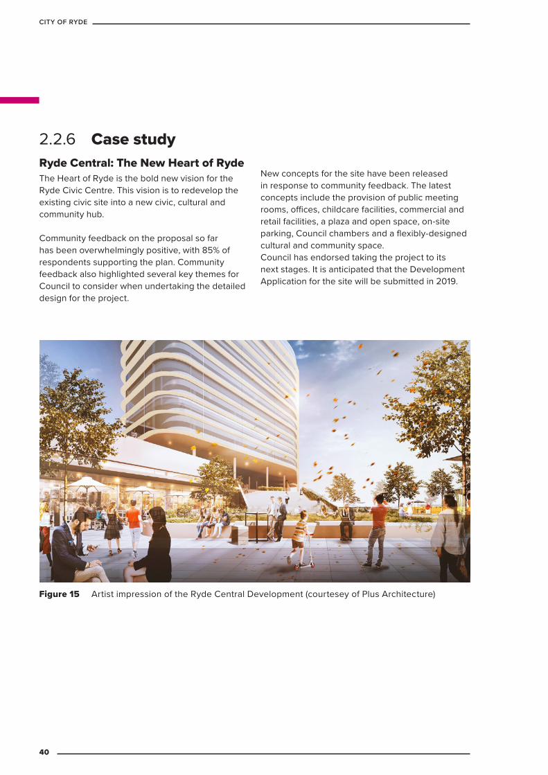
Ryde Central: The New Heart of Ryde The Heart of Ryde is the bold new vision for the Ryde Civic Centre. This vision is to redevelop the existing civic site into a new civic, cultural and community hub.
Community feedback on the proposal so far has been overwhelmingly positive, with 85% of respondents supporting the plan. Community feedback also highlighted several key themes for Council to consider when undertaking the detailed design for the project.
New concepts for the site have been released in response to community feedback. The latest concepts include the provision of public meeting rooms, offices, childcare facilities, commercial and retail facilities, a plaza and open space, on-site parking, Council chambers and a flexibly-designed cultural and community space.Council has endorsed taking the project to its next stages. It is anticipated that the Development Application for the site will be submitted in 2019.
PERSPECTIVE - NTSDATEJOB NO.
SCALE Page
24/07/2019
20380
4
Figure 15 Artist impression of the Ryde Central Development (courtesey of Plus Architecture)
2.2.6 Case study
40
CITY OF RYDE

The aim is to encourage walking, cycling and public transport use by focusing growth in town centres, improving public domain and enhancing community safety.
This approach will benefit the local environment and encourage development of a holistic approach to freight and servicing activity to, from and within key precincts such as Macquarie Park. Desired outcomes include reducing the economic, wellbeing and amenity impacts of congestion and improving the efficiency of transport within the precinct.
2.3.1 Vision
2.3 Transport
Transport links between town centres and other destinations – including open space, residential areas, schools and Macquarie University – will be improved with a focus on active and public transport .
Macquarie Centre Bus Interchange
41
LOCAL STRATEGIC PLANNING STATEMENT
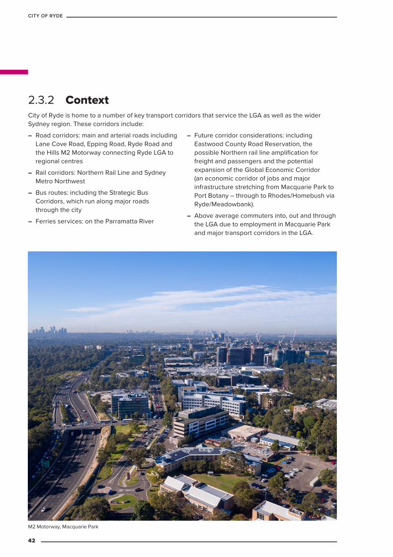
City of Ryde is home to a number of key transport corridors that service the LGA as well as the wider Sydney region. These corridors include:
– Road corridors: main and arterial roads including Lane Cove Road, Epping Road, Ryde Road and the Hills M2 Motorway connecting Ryde LGA to regional centres
– Rail corridors: Northern Rail Line and Sydney Metro Northwest
– Bus routes: including the Strategic Bus Corridors, which run along major roads through the city
– Ferries services: on the Parramatta River
– Future corridor considerations: including Eastwood County Road Reservation, the possible Northern rail line amplification for freight and passengers and the potential expansion of the Global Economic Corridor (an economic corridor of jobs and major infrastructure stretching from Macquarie Park to Port Botany – through to Rhodes/Homebush via Ryde/Meadowbank).
– Above average commuters into, out and through the LGA due to employment in Macquarie Park and major transport corridors in the LGA.
2.3.2 Context
M2 Motorway, Macquarie Park
42
CITY OF RYDE

– An above average ratio of jobs to residents
– Above average congestion issues
– The wide dispersal of incoming workers
– A relatively minor public transport interchange servicing Macquarie Park Station
– Growing transport demands, including both quantity and servicing expectations
– The rate of population and employment growth exceeding the rate at which patrons are moving to non-private-car transport options (reducing car dependency)
– Through traffic creating amenity problems on local streets
– Complex parking demands and patterns
– Inefficient bus routes, including service frequency, travel times, bus stops etc
– Parts of the City of Ryde LGA are not serviced by mass transit at all
– Gaps in cycling and footpath networks and supporting infrastructure and designs, constraining the uptake of active transport as a viable alternative to private and mass transit
– Unknown or untested future transport technologies and patterns that need to be considered in transport planning
– Managing conflicts between freight and commuter needs in a network that currently services both
– Future development will significantly increase the amount of conventional freight movements occurring to, from and within the City of Ryde (in particular, Macquarie Park). The future transport network will need to provide for the efficient movement of freight
– Public transport often caters for through movement rather than destinations in Ryde LGA
– The quantum and availability of car parking in Macquarie Park precinct are a key attractor to private vehicle use
– Limited road access points for cars and on-road public transport to/from Macquarie Park
– Balancing the needs of travel to/from Macquarie Park with the regional through traffic on key arterial roads.
2.3.3 Key challenges
Ryde Riverwalk shared path
43
LOCAL STRATEGIC PLANNING STATEMENT
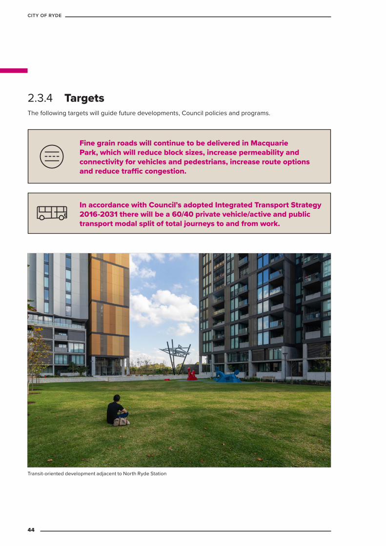
2.3.4 Targets
In accordance with Council’s adopted Integrated Transport Strategy 2016-2031 there will be a 60/40 private vehicle/active and public transport modal split of total journeys to and from work.
Fine grain roads will continue to be delivered in Macquarie Park, which will reduce block sizes, increase permeability and connectivity for vehicles and pedestrians, increase route options and reduce traffic congestion.
Transit-oriented development adjacent to North Ryde Station
The following targets will guide future developments, Council policies and programs.
44
CITY OF RYDE
Table 4 Transport: priorities and actions
Planning priority ActionsT1 Ensure public transport can
efficiently move commuters to key destinations within and outside City of Ryde using logical, accessible and connected services and maximising the use of infrastructure that gives a travel time advantage over cars. Ensure social equity in service coverage throughout the LGA.
T1.1 Maintain and develop planning controls to encourage residential densification in areas with high public transport accessibility and high trip activity to education, employment, recreational and commercial destinations. 2020 Ongoing
T1.2 Integrate transport modes more efficiently at public transport hubs to reduce interchange times and increase interchange convenience. Ongoing
T1.3 Prioritise Park and Ride capacity at major train stations and bus stops that do not have large walk up catchments and do not contribute to centre congestion. Denistone 2025
T1.4 Advocate for a simple and direct bus network with equitable access for all users. Ongoing
T1.5 Collaborate to improve the competitiveness of public transport travel times to be equal or less than private vehicles in peak times in key corridors. Ongoing
T1.6 Invest in public transport by leveraging off new development and to shape a sustainable land use. Ongoing
T1.7 Complement land use development with parking policies that encourage public and active transport use, including limiting additional car parking in constrained precincts such as Macquarie park. Ongoing
T1.8 Investigate a major upgrade to Macquarie University bus station and new/modified bus routes via Denistone Station and Meadowbank Station to improve the integration of buses and trains and allow for significant increases in bus capacity. 2030
T1.9 Council will work with Transport for NSW to support and implement travel behaviour change programs to help manage demand on the transport network, including by requiring new developments and businesses operating in key precincts to develop and implement travel plans to encourage the use of sustainable transport choices.
2.3.5 Planning priorities and actions
45
LOCAL STRATEGIC PLANNING STATEMENT
Planning priority ActionsT2 Manage transport network
to maximise traffic efficiency and safety for local freight movements, private vehicles and public and active transport users. Design and manage streets to maximise accessibility while prioritising safety and amenity.
T2.1 Develop a transport network strategy for the Ryde Local Government Area that will: 2025
a. Improve the efficiency of through traffic movements on arterial roads while recognising local accessibility and safety needs
b. Preserve residential amenity in streets by limiting the volume and speed of through traffic using local area traffic management schemes
c. Maximise the person-movement capacity of arterial corridors
d. Invest in road infrastructure targeting value for money, pinch-point improvements
e. Prohibit heavy vehicle movements on local streets and limit freight operating times in specific centres (excluding waste vehicles)
f. Improve pedestrian and cycle connections to and from train stations and major bus stops.
T2.2 Review development controls in Ryde to improve permeability and ease of movement for pedestrians and cyclists. 2021
T2.3 Consider pedestrian and cycling facilities, including bicycle racks, in design development investigations for new major bus stop and train station upgrades and Council’s public domain upgrades. Ongoing
T2.4 Implement bicycle training and awareness programs throughout the City of Ryde. 2021
T2.5 Undertake speed limit reviews in high pedestrian activity areas commencing with Macquarie Park and West Ryde. 2025
T2.6 Develop a PAMP program for schools and key locations in the City of Ryde. 2025
46
CITY OF RYDE

Planning priority ActionsT3 Plan freight movements
to be efficient and ensure they adhere to placemaking principles.
T3.1 Complete a freight and logistics study for the City of Ryde that will:
a. ensure efficiency through and within the City of Ryde
b. minimise congestion through the adoption of space-efficient movement
c. ensure there is sufficient capacity developed within or between facilities to adequately accommodate logistics activity
d. maintain place-making principles.
e. include an action plan. 2025
T4 Manage parking with controls and policies that reflect available infrastructure.
T4.1 Investigate reduced or maximum parking rates, centralised parking stations and developer contribution schemes in near Eastwood, West Ryde, Meadowbank and Macquarie Park train stations. 2025
T4.2 Develop a location approval policy and procedure for car share schemes such as GoGet, considering the kerbside allocation policy. 2025
T4.3 Adopt a city-wide car share program and prioritise car and ride share parking to enhance transport sustainability. 2025
Intersection of Victoria Road and Devlin Street47
LOCAL STRATEGIC PLANNING STATEMENT
2.3.6 Case studies
EPPING ROAD
WIC
KS ROAD
HA
LIFAX STREET
M2 M
otorway
DELHI ROAD
EPPING ROAD
M2 M
OTO
RWAY
LANE
COVE ROAD
EPPING ROAD
WATERLOO ROAD
TALAVERA ROAD
WATERLOO ROAD
KHARTOUM R
OAD
New roads delivered – Rennie Street and Network Place
New roads delivered – Waterloo-Talavera connecting road
KEYNew road as per RDCP2014 (delivered)
New road as per RDCP2014 (under DA)
Existing road
New roads delivered – Halifax Street and Jarvis Circuit
New roads delivered – Hyundai Drive
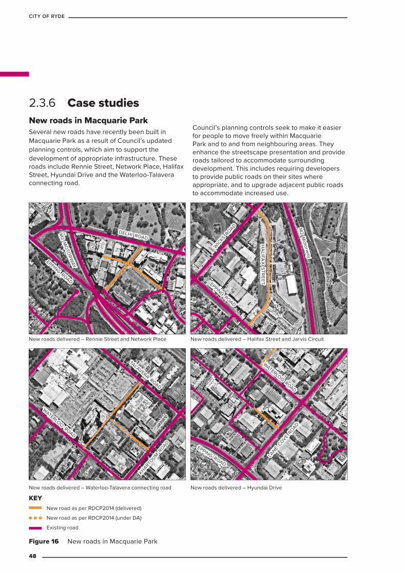
Figure 16 New roads in Macquarie Park
New roads in Macquarie Park Several new roads have recently been built in Macquarie Park as a result of Council’s updated planning controls, which aim to support the development of appropriate infrastructure. These roads include Rennie Street, Network Place, Halifax Street, Hyundai Drive and the Waterloo-Talavera connecting road.
Council’s planning controls seek to make it easier for people to move freely within Macquarie Park and to and from neighbouring areas. They enhance the streetscape presentation and provide roads tailored to accommodate surrounding development. This includes requiring developers to provide public roads on their sites where appropriate, and to upgrade adjacent public roads to accommodate increased use.
48
CITY OF RYDE
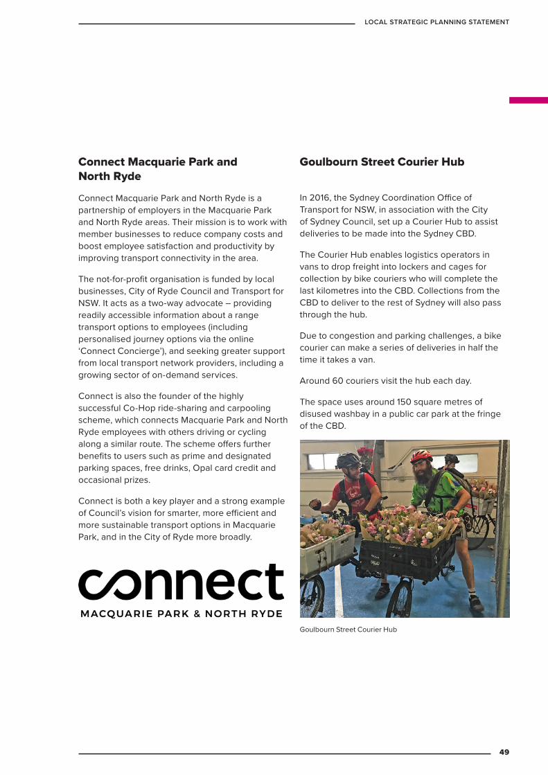
In 2016, the Sydney Coordination Office of Transport for NSW, in association with the City of Sydney Council, set up a Courier Hub to assist deliveries to be made into the Sydney CBD.
The Courier Hub enables logistics operators in vans to drop freight into lockers and cages for collection by bike couriers who will complete the last kilometres into the CBD. Collections from the CBD to deliver to the rest of Sydney will also pass through the hub.
Due to congestion and parking challenges, a bike courier can make a series of deliveries in half the time it takes a van.
Around 60 couriers visit the hub each day.
The space uses around 150 square metres of disused washbay in a public car park at the fringe of the CBD.
Goulbourn Street Courier Hub
Goulbourn Street Courier Hub
Connect Macquarie Park and North Ryde
Connect Macquarie Park and North Ryde is a partnership of employers in the Macquarie Park and North Ryde areas. Their mission is to work with member businesses to reduce company costs and boost employee satisfaction and productivity by improving transport connectivity in the area.
The not-for-profit organisation is funded by local businesses, City of Ryde Council and Transport for NSW. It acts as a two-way advocate – providing readily accessible information about a range transport options to employees (including personalised journey options via the online ‘Connect Concierge’), and seeking greater support from local transport network providers, including a growing sector of on-demand services.
Connect is also the founder of the highly successful Co-Hop ride-sharing and carpooling scheme, which connects Macquarie Park and North Ryde employees with others driving or cycling along a similar route. The scheme offers further benefits to users such as prime and designated parking spaces, free drinks, Opal card credit and occasional prizes.
Connect is both a key player and a strong example of Council’s vision for smarter, more efficient and more sustainable transport options in Macquarie Park, and in the City of Ryde more broadly.
49
LOCAL STRATEGIC PLANNING STATEMENT
LIVEABILITY3PART
50
CITY OF RYDE
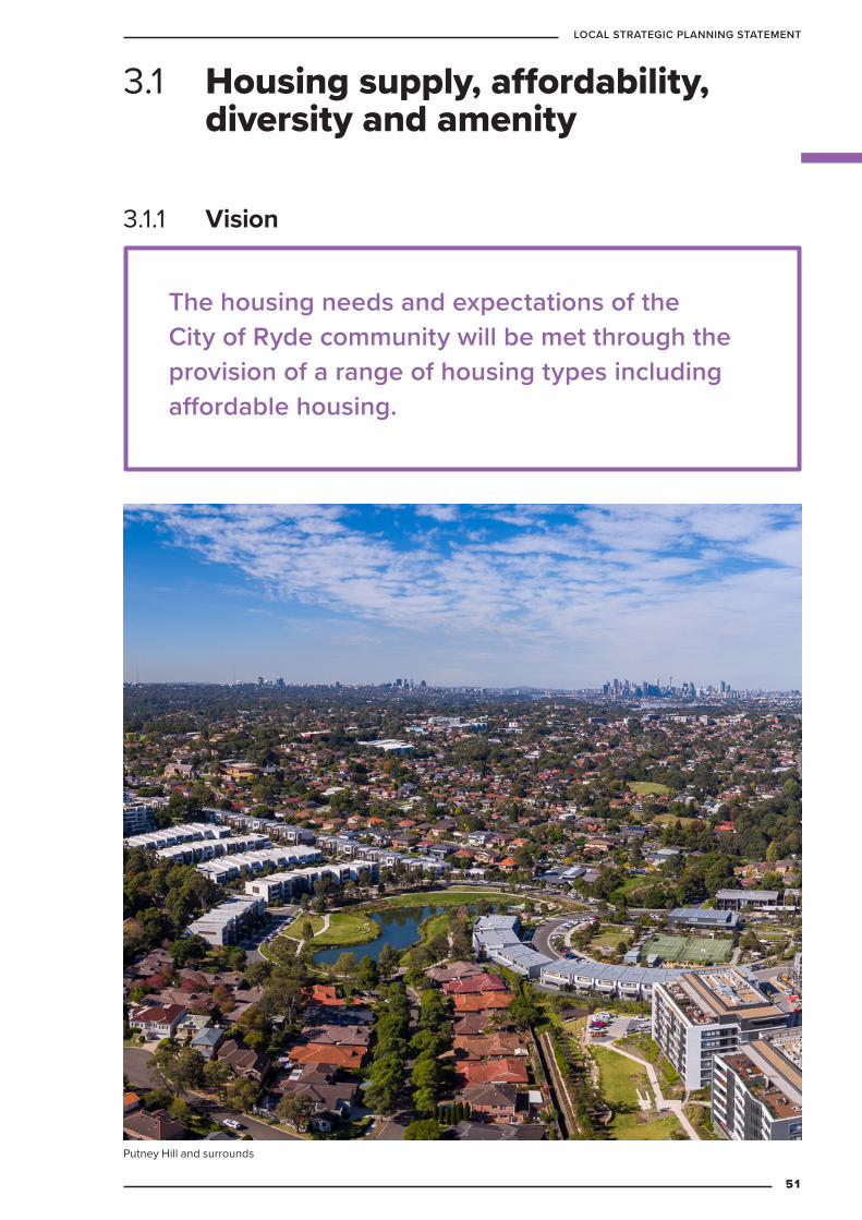
The housing needs and expectations of the City of Ryde community will be met through the provision of a range of housing types including affordable housing.
3.1 Housing supply, affordability, diversity and amenity
3.1.1 Vision
Putney Hill and surrounds
51
LOCAL STRATEGIC PLANNING STATEMENT
3.1.2 ContextHousing provides shelter, safety and security and is a fundamental human need.
A lack of affordable or available housing may also affect peoples’ health and well-being. When housing choices are limited people may suffer from financial stress and a lack of certainty. Long-term residents may have close links with the local community and not wish to relocate due to changes in circumstances.
Housing affordability can also have transport implications as workers on lower incomes may be required to live further away and commute longer distances to work. This can create a strain on the economic strength of Ryde and the infrastructure requirement to cope with a high proportion of commuters. The 2016 census indicated that over 80 per cent of workers in Ryde live outside the LGA and travel to the area for work.
A range of workers are required to support the viability of commercial and industrial uses in the City. Supplying an appropriate range of housing choice can have a positive impact on local economic conditions by providing local workers with the opportunity to live locally. Providing the right mix and availability of housing can offer more options to residents and workers in the Ryde area.
In 2010, the City of Ryde undertook a targeted community and stakeholder consultation program to better understand the community’s needs. This included meeting with a number of City of Ryde advisory committees and a series of public information and community consultation meetings.
As a result of this consultation, the 2010 substantive review of the Ryde Local Environment Plan (LEP) provided strategies that addressed:
– housing diversity, affordability and growth
– compact, sustainable and well-designed centres that are supported by public transport, community facilities and services including:
» Gladesville
» Ryde
» Shepherds Bay
» Eastwood
» West Ryde
– Macquarie Park
– the employment capacity in Macquarie Park
– the Urban Services lands in West Ryde and Gladesville industrial areas
– protection of heritage assets
– protection of environmentally sensitive lands and assets.
A comprehensive LEP amendment was brought into effect in 2014. Other LEP amendments where delivered by NSW Government and include North Ryde Station Priority Precinct and Macquarie University Station Priority Precinct.
Further housing context is provided in 2.1.2 Context.
Ryde is experiencing one of the highest rates of growth in Greater Sydney relative to population.
52
CITY OF RYDE

3.1.3 Key challenges – The Metropolitan Strategy requires planning for
housing to encourage the renewal of centres, and to ensure new housing is delivered in locations close to jobs, transport and services.
– The North District Plan requires the City of Ryde to plan for the delivery of 7,600 new homes by 2021.
– The City of Ryde can, through past planning control amendments and strong growth, meet the short-term dwelling target provided in the North District Plan. However, the 10 to 20-year dwelling targets need to be set so that the housing diversity needs of the current and future community can also be met in the longer term.
– Delivering infrastructure that supports Ryde’s residential communities, and meets the needs and expectations of the community.
– The Impacts of the Low Rise Medium Density Housing Code will be managed to ensure a balance between maintaining valued local character and providing appropriate opportunities for medium density outcomes.
– Forty-six per cent of dwellings in Ryde are separate detached homes. Recent dwelling growth in the City of Ryde has been dominated by high-density development and since 2014, growth in medium-density development has also increased. While the trend towards housing diversity is encouraging, more can be achieved.
Low density residential development
53
LOCAL STRATEGIC PLANNING STATEMENT
3.1.4 Targets
The North District Plan’s 2021 dwelling target of 7,600 will be met.
Increase the proportion of the population within 400 meters of public open space greater than 1,500m2.
A City of Ryde Housing Strategy will be completed by 2020 addressing Planning Priorities H1-H7.
In accordance with Council’s adopted Affordable Housing Policy, five per cent of new homes delivered by 2031 will be affordable housing. Note: delivery is guided by feasibility.
$
Increase the proportion of the population within 400 meters of public transport connections and active transport / regional routes.
Local schools will meet the demand of population growth and changing demographics.
95 sqm of community space will be provided per 1,000 people. Council’s Halls and Facilities Strategy will outline how current facilities and delivery of additional facilities will assist in achieving this target.
The following targets will guide future developments, Council policies and programs.
54
CITY OF RYDE

3.1.5 Planning priorities and actions Housing Supply The City of Ryde has experienced a significant increase in housing supply in the last few years.
The 20-year average for home completions in the City of Ryde is 600 per year compared with 4,500 home completions in the three years to June 2018. The City of Ryde is already on-track to exceed the North District Plan’s 2021 dwellings target of 7,600 additional homes, with 12,786 dwellings projected to be completed by this time.
The table below summarises anticipated dwelling completions between 2016 and 2021 and the post 2022 dwellings capacity.
Table 5 Existing housing pipeline (based on Local Development Application Approvals*)
Location 2016-2021Residential zones 2,257Town centres 10,529Total 12,786
*Not all approved dwellings are constructed, the proportion of approvals completed and the time to completion can vary subject to a range of factors and completion rates will also vary across locations.
Table 6 Housing supply: planning priorities and actions
Planning priority ActionsH1 Housing supply to satisfy
needs to 2039H1.1 Prepare a City of Ryde Housing Strategy by 2020 which
will:
a. set a vision for housing in Ryde
b. align with the North District Plan and deliver the target of 7,600 dwellings by 2021
c. set targets for 6 to 10 years and 11 to 20 years
H1.2 Encourage residential development within existing centres that are well serviced by public transport, community infrastructure and open space
H2 Maintain the City of Ryde’s current strategic planning direction to focus the majority of residential growth within town centres
H2.1 Prepare new master plans for West Ryde and Eastwood. 2025
H2.2 Investigate residential transition areas around centres. 2025
55
LOCAL STRATEGIC PLANNING STATEMENT

High density and medium density housing in Putney Hill
56
CITY OF RYDE
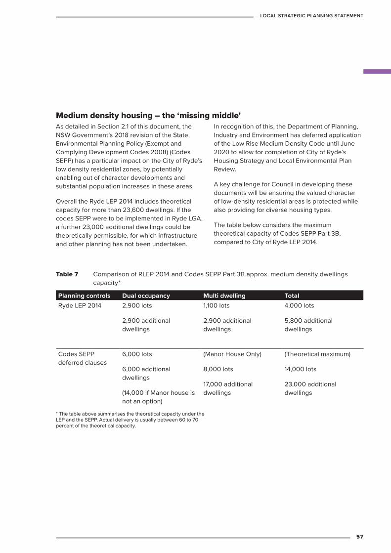
Medium density housing – the ‘missing middle’As detailed in Section 2.1 of this document, the NSW Government’s 2018 revision of the State Environmental Planning Policy (Exempt and Complying Development Codes 2008) (Codes SEPP) has a particular impact on the City of Ryde’s low density residential zones, by potentially enabling out of character developments and substantial population increases in these areas.
Overall the Ryde LEP 2014 includes theoretical capacity for more than 23,600 dwellings. If the codes SEPP were to be implemented in Ryde LGA, a further 23,000 additional dwellings could be theoretically permissible, for which infrastructure and other planning has not been undertaken.
In recognition of this, the Department of Planning, Industry and Environment has deferred application of the Low Rise Medium Density Code until June 2020 to allow for completion of City of Ryde’s Housing Strategy and Local Environmental Plan Review.
A key challenge for Council in developing these documents will be ensuring the valued character of low-density residential areas is protected while also providing for diverse housing types.
The table below considers the maximum theoretical capacity of Codes SEPP Part 3B, compared to City of Ryde LEP 2014.
Table 7 Comparison of RLEP 2014 and Codes SEPP Part 3B approx. medium density dwellings capacity*
Planning controls Dual occupancy Multi dwelling TotalRyde LEP 2014 2,900 lots
2,900 additional dwellings
1,100 lots
2,900 additional dwellings
4,000 lots
5,800 additional dwellings
Codes SEPP deferred clauses
6,000 lots
6,000 additional dwellings
(14,000 if Manor house is not an option)
(Manor House Only)
8,000 lots
17,000 additional dwellings
(Theoretical maximum)
14,000 lots
23,000 additional dwellings
* The table above summarises the theoretical capacity under the LEP and the SEPP. Actual delivery is usually between 60 to 70 percent of the theoretical capacity.
57
LOCAL STRATEGIC PLANNING STATEMENT
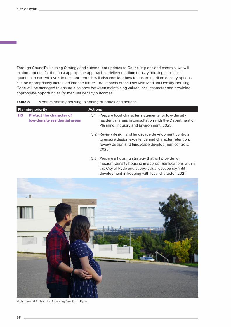
Through Council’s Housing Strategy and subsequent updates to Council’s plans and controls, we will explore options for the most appropriate approach to deliver medium density housing at a similar quantum to current levels in the short term. It will also consider how to ensure medium density options can be appropriately increased into the future. The Impacts of the Low Rise Medium Density Housing Code will be managed to ensure a balance between maintaining valued local character and providing appropriate opportunities for medium density outcomes.
Table 8 Medium density housing: planning priorities and actions
Planning priority ActionsH3 Protect the character of
low-density residential areasH3.1 Prepare local character statements for low-density
residential areas in consultation with the Department of Planning, Industry and Environment. 2025
H3.2 Review design and landscape development controls to ensure design excellence and character retention, review design and landscape development controls. 2025
H3.3 Prepare a housing strategy that will provide for medium-density housing in appropriate locations within the City of Ryde and support dual occupancy ‘infill’ development in keeping with local character. 2021
High demand for housing for young families in Ryde
58
CITY OF RYDE

Housing affordabilityThe rapid increase in housing supply in the City of Ryde contributed to a heated housing market. Despite the market cooling in late 2018, housing affordability is still a concern for residents, and increasing supply alone will not address it. In 2016, based on evidence of some existing and potential future housing stress, Council adopted a policy to work towards an affordable housing
target of five per cent of all new dwellings by 2021. Implementing the policy requires amendment to the Ryde Local Environmental Plan (LEP) 2014. More recently, the NSW Department of Planning, Industry and Environment introduced new guidelines for affordable housing schemes which will require an update to Council’s proposed LEP amendments.
Table 9 Affordable Housing: planning priorities and actions
Planning priority ActionsH4 Ensure five per cent of all
new dwellings are affordable by 2031
H4.1 Implement Council’s Affordable Housing Policy and pursue amendments to the LEP in consultation with the Department of Planning, Industry and Environment. Ongoing
H4.2 Investigate options such as new-generation boarding houses, long-term rental homes, cooperative housing schemes and community housing providers. 2025
Housing design and amenityTable 10 Housing design and amenity: planning priorities and actions
Planning priority ActionsH5 Provide high levels of
residential amenityH5.1 Provide street tree planting in accordance with street
tree master plans through Council’s capital works program and the development process. Ongoing
H5.2 Ensure future housing is within 400 metres of active open space and public transport through future development decision, Council strategies, plans and policies. Ongoing
H5.3 Seek community input to develop character statements which will guide future planning decisions. 2021
H6 Develop design excellence planning controls
H6.1 Review development controls to ensure environmental, social and economic sustainability, and appropriate interface with public spaces and adjacent development. 2021
H6.2 Consider planning incentives for design excellence. 2021
H6.3 Review development controls across all residential development types to ensure sustainability and design excellence. 2021
59
LOCAL STRATEGIC PLANNING STATEMENT
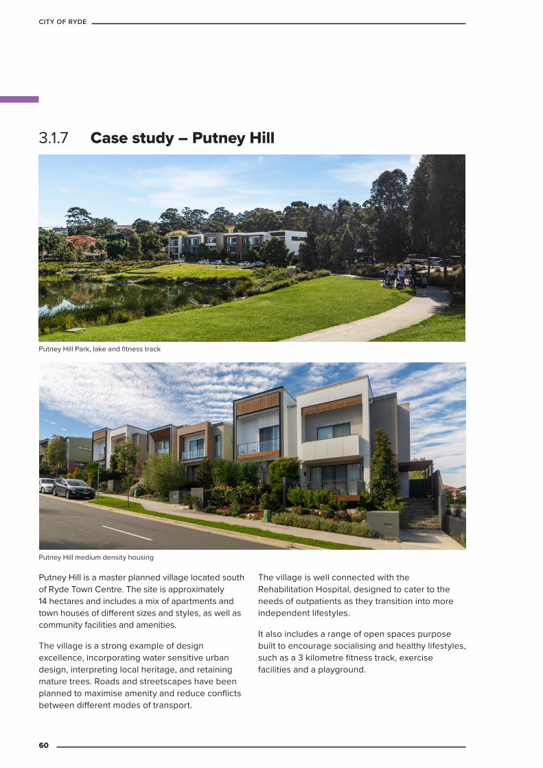
3.1.7 Case study – Putney Hill
Putney Hill is a master planned village located south of Ryde Town Centre. The site is approximately 14 hectares and includes a mix of apartments and town houses of different sizes and styles, as well as community facilities and amenities.
The village is a strong example of design excellence, incorporating water sensitive urban design, interpreting local heritage, and retaining mature trees. Roads and streetscapes have been planned to maximise amenity and reduce conflicts between different modes of transport.
The village is well connected with the Rehabilitation Hospital, designed to cater to the needs of outpatients as they transition into more independent lifestyles.
It also includes a range of open spaces purpose built to encourage socialising and healthy lifestyles, such as a 3 kilometre fitness track, exercise facilities and a playground.
Putney Hill medium density housing
Putney Hill Park, lake and fitness track
60
CITY OF RYDE
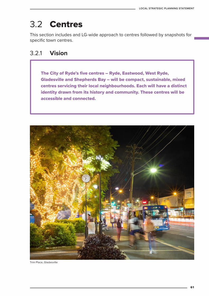
The City of Ryde’s five centres – Ryde, Eastwood, West Ryde, Gladesville and Shepherds Bay – will be compact, sustainable, mixed centres servicing their local neighbourhoods. Each will have a distinct identity drawn from its history and community. These centres will be accessible and connected.
3.2.1 Vision
3.2 CentresThis section includes and LG-wide approach to centres followed by snapshots for specific town centres.
Trim Place, Gladesville
61
LOCAL STRATEGIC PLANNING STATEMENT
3.2.2 Context City of Ryde Council adopted an Urban Village Study in 1998. The study was based on the concept of a network of villages, or centres, located in an urban setting. A similar concept later formed the basis for the NSW Government’s City of Cities: Sydney’s Metropolitan Strategy, 2005.
The study aimed to offer alternatives to urban sprawl and to:
– reduce car reliance and promote cycling, walking and public transport
– provide a high level of local containment where residents work, live and enjoy recreation in the one area
– help facilitate strong community institutions and interactions.
The study also identified two village networks. The first was a local network which included West Ryde, Ryde, Meadowbank, Gladesville and Eastwood. The second, was a network within the Macquarie Park Corridor around the train stations at Macquarie University, Macquarie Park and North Ryde.
The Ryde Local Planning Study 2010 confirmed a network of local centres and established a hierarchy based on housing numbers, commercial and retail floor space.
Based on criteria such as retail floor space and community facilities the centres hierarchy is:
Macquarie Park centres network
– Macquarie University Station Precinct
– Macquarie Park Station Precinct
– North Ryde Station Precinct
Ryde centres network
– Ryde
– Eastwood
– West Ryde
– Gladesville
– Shepherds Bay, Meadowbank
The table below compares centres in these networks.
62
CITY OF RYDE
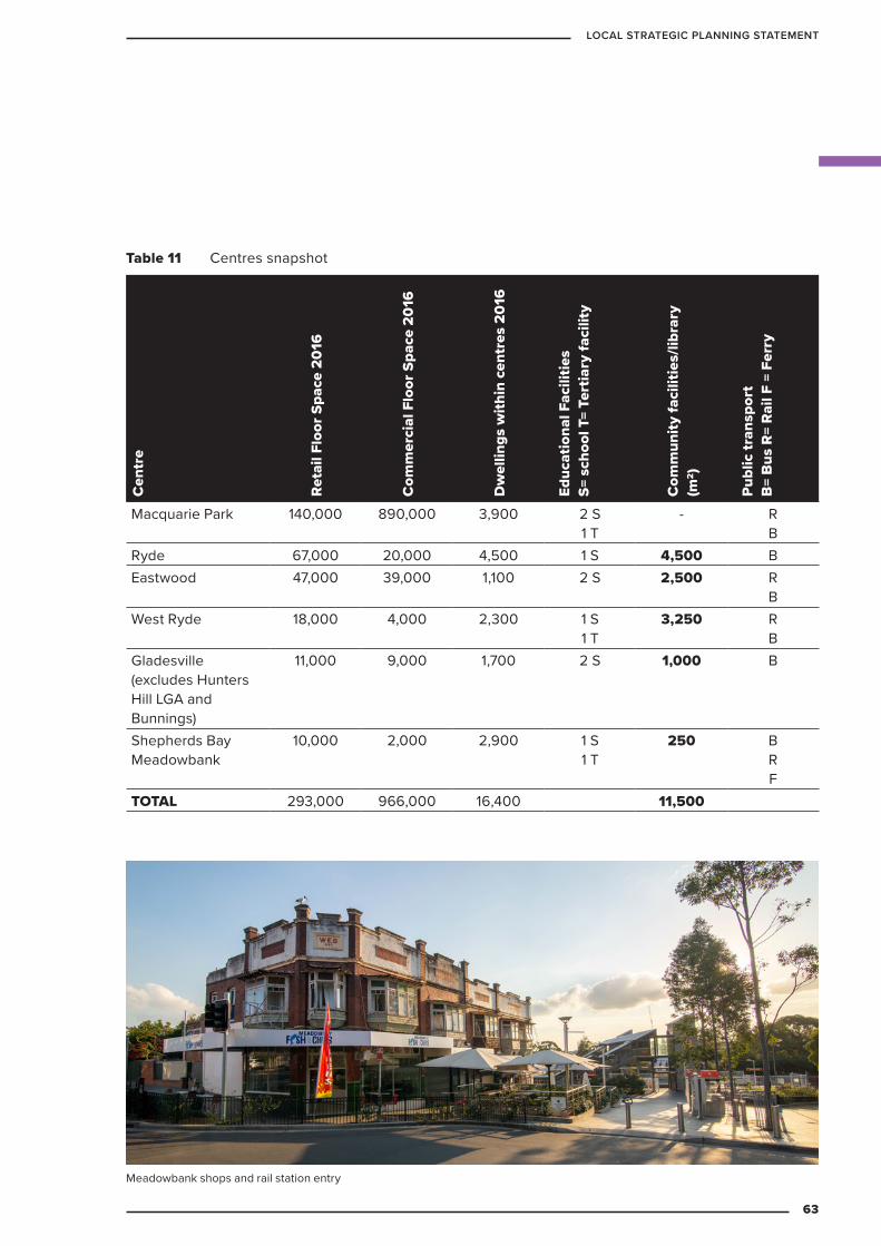
Table 11 Centres snapshot
Cen
tre
Reta
il Fl
oor S
pace
201
6
Com
mer
cial
Flo
or S
pace
201
6
Dw
ellin
gs w
ithin
cen
tres
201
6
Educ
atio
nal F
acili
ties
S= s
choo
l T=
Tert
iary
faci
lity
Com
mun
ity fa
cilit
ies/
libra
ry
(m2)
Publ
ic tr
ansp
ort
B=
Bus
R=
Rail
F =
Ferr
y
Macquarie Park 140,000 890,000 3,900 2 S 1 T
- R B
Ryde 67,000 20,000 4,500 1 S 4,500 BEastwood 47,000 39,000 1,100 2 S 2,500 R
BWest Ryde 18,000 4,000 2,300 1 S
1 T3,250 R
BGladesville (excludes Hunters Hill LGA and Bunnings)
11,000 9,000 1,700 2 S 1,000 B
Shepherds Bay Meadowbank
10,000 2,000 2,900 1 S 1 T
250 B R F
TOTAL 293,000 966,000 16,400 11,500
Meadowbank shops and rail station entry
63
LOCAL STRATEGIC PLANNING STATEMENT
What does this mean? The conclusions to be drawn from the above table include the following:
– Macquarie Park functions very differently from the other centres within Ryde, consistent with the North District Plan classification as a strategic health and education centre, with a significant role as an office precinct. Macquarie Park is home to the Australian head office of several multi-national companies, Macquarie University and one of the largest shopping malls in Australia, and therefore has a city-shaping role.
– Ryde and Eastwood are the next largest centres in the City of Ryde. Both centres serve communities that extend beyond the boundaries of the LGA and are the focus of local government activities and events such as the Granny Smith Festival in Eastwood. Eastwood is an established multicultural centre, particularly relied upon by the Chinese and Korean communities, and Ryde Town Centre is the home of local government in Ryde.
– West Ryde and Gladesville serve local neighbourhoods. West Ryde, in particular, is well served by rail and bus public transport, with a number of large government-owned sites within the centre available for redevelopment. If developed these sites would act as catalysts for change.
– Shepherds Bay is the smallest of Ryde’s centres. The area is maturing into a dormitory precinct.
There is currently approximately 2.3m2 of retail floor space per resident of Ryde, which is high when compared to the Sydney metropolitan region. The Macquarie Centre (a super-regional centre) and Top Ryde City (a regional shopping centre) have catchments that extend beyond the City of Ryde LGA. Additionally, the Macquarie Centre serves the retail needs of approximately 60,000 workers and 27,000 students.
Macquarie Park and Shepherds Bay currently have fewer community facilities than other centres and this is a function of their history. Macquarie Park and Shepherds Bay are evolving from brownfield sites to become urban centres. Both have experienced fast growth over the past decade and need additional facilities to meet worker and residential needs either within the centres or nearby. There is currently 25m2 / 1,000 people flexible community centre floorspace.
64
CITY OF RYDE
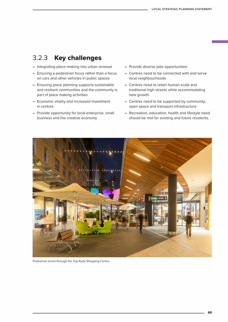
– Integrating place-making into urban renewal
– Ensuring a pedestrian focus rather than a focus on cars and other vehicles in public spaces
– Ensuring place planning supports sustainable and resilient communities and the community is part of place making activities
– Economic vitality and increased investment in centres
– Provide opportunity for local enterprise, small business and the creative economy
– Provide diverse jobs opportunities
– Centres need to be connected with and serve local neighbourhoods
– Centres need to retain human scale and traditional high streets while accommodating new growth
– Centres need to be supported by community, open space and transport infrastructure
– Recreation, education, health and lifestyle need should be met for existing and future residents.
3.2.3 Key challenges
Pedestrian street through the Top Ryde Shopping Centre
65
LOCAL STRATEGIC PLANNING STATEMENT
3.2.4 Targets
A West Ryde Master Plan will be prepared by 2025. The next Ryde LSPS will include targets to prepare master plans for emerging hubs, including Monash Road and Coxs Road.
Public domain within all centres will be increased and, there will be more street trees and shade.
Our town centres will be safer for pedestrians. This is measured by an increased number of safe road crossing points, reduced speed limits and improved public domain lighting.
Council’s public domain upgrades program will be based on identified priorities and audits.
Ryde’s LEP will be reviewed by 2021 to encourage creative enterprise and the local business.
The following targets will guide future developments, Council policies and programs.
66
CITY OF RYDE
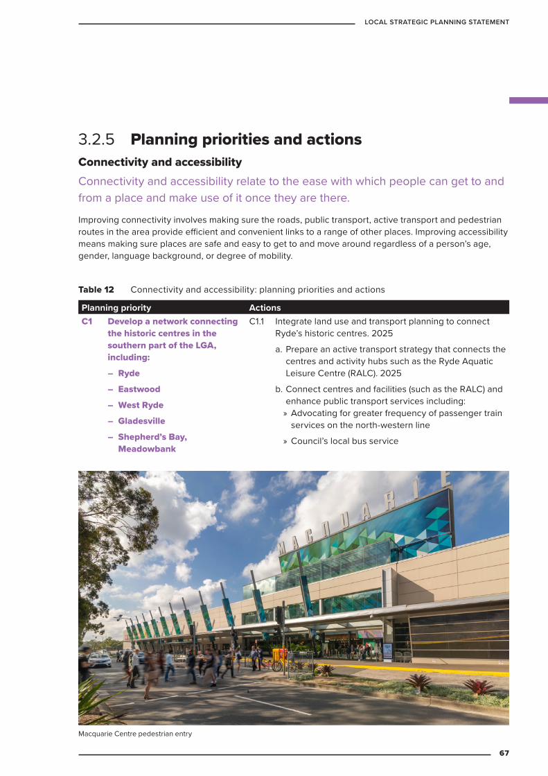
3.2.5 Planning priorities and actionsConnectivity and accessibilityConnectivity and accessibility relate to the ease with which people can get to and from a place and make use of it once they are there.
Improving connectivity involves making sure the roads, public transport, active transport and pedestrian routes in the area provide efficient and convenient links to a range of other places. Improving accessibility means making sure places are safe and easy to get to and move around regardless of a person’s age, gender, language background, or degree of mobility.
Table 12 Connectivity and accessibility: planning priorities and actions
Planning priority ActionsC1 Develop a network connecting
the historic centres in the southern part of the LGA, including:
– Ryde
– Eastwood
– West Ryde
– Gladesville
– Shepherd’s Bay, Meadowbank
C1.1 Integrate land use and transport planning to connect Ryde’s historic centres. 2025
a. Prepare an active transport strategy that connects the centres and activity hubs such as the Ryde Aquatic Leisure Centre (RALC). 2025
b. Connect centres and facilities (such as the RALC) and enhance public transport services including: » Advocating for greater frequency of passenger train services on the north-western line
» Council’s local bus service
Macquarie Centre pedestrian entry
67
LOCAL STRATEGIC PLANNING STATEMENT
Planning priority ActionsC2 Continue to develop
sustainable, compact, mixed-use centres that embody accessibility and are:
– connected to local neighbourhoods
– serviced by safe, affordable, flexible public transport
– able to minimise traffic and parking impacts
C2.1 Prepare an active transport strategy to explore connections and green space provision between: 2025
c. Top Ryde and West Ryde
d. West Ryde and Meadowbank stations and Meadowbank Park/playing fields
e. Eastwood and Macquarie Park
C2.2 Investigate commuter parking in centres to: 2025
a. manage demand
b. enhance efficiency and convenience for users
c. maximise benefit to businesses in centres
d. reduce traffic congestion
e. increase public transport mode share
f. discourage all day parking in residential streets around centres
C2.3 Enhance pedestrian experience and safety within centres by: 2025
a. preparing “Movement-Place” analyses for centres within Ryde to ensure a coordinated vision for streets.
b. identifying High Pedestrian Priority Areas as necessary (potentially around the Eastwood Transport Interchange)
68
CITY OF RYDE

Planning priority ActionsC3 Plan and manage parking to:
– maximise local accessibility for on-street and off-street short-stay high-value parking
– encourage alternative modes for on-street and off-street long-stay, low-value parking
– discourage oversupply of off-street parking in key centres
– Encourage walking/cycling and public transport
C3.1 Maintain a parking area classification scheme and identify objectives of parking supply management in each type of centre. Ongoing
C3.2 Conduct centre-based parking strategies for Eastwood, West Ryde, Meadowbank and Macquarie Park. 2025
C3.3 Develop a kerbside allocation policy to guide decision making on parking types in each centre. 2025
C3.4 Facilitate short-stay parking accessibility in areas which rely on drop-in trade by ensuring sufficient turnover through time regulation, enforcement and pricing. 2025
C3.5 Provide special parking such as loading zones, bus stops, taxi ranks and car share schemes, for people with disabilities. Ongoing
C3.6 Undertake a feasibility study for the implementation of a real-time dynamic parking management system in the City of Ryde. 2025
Network Place, North Ryde
69
LOCAL STRATEGIC PLANNING STATEMENT
Planning priority ActionsC4 Encourage walking and
cycling for travelling to work, education or recreational purposes. Provide better connections and link facilities for pedestrians and cyclists, recognising that their safety is paramount.
C4.1 Provide a legible, connected, accessible and layered network of cycling facilities. Ongoing
C4.2 Prioritise pedestrian movements over other transport modes in centres. Ongoing
C4.3 Review development controls to provide appropriate and sufficient end-of-trip facilities in new residential, retail and commercial developments. 2025
C4.4 Integrate active transport networks with key public transport stops/stations through route location and design and the provision of end-of-trip facilities through the development of an Active Transport Strategy. 2025
C4.5 Investigate safe cycling routes within one kilometre of all public schools. 2021
C4.6 Use walking and cycling programs to encourage more people to use active transport. Ongoing
C4.7 Maximise walking and cycling and improve access to public transport in centres. Ongoing
C4.8 Prioritise investment in public and active transport at major employment or mixed-use development areas and enhance accessibility across the City of Ryde. 2025
70
CITY OF RYDE
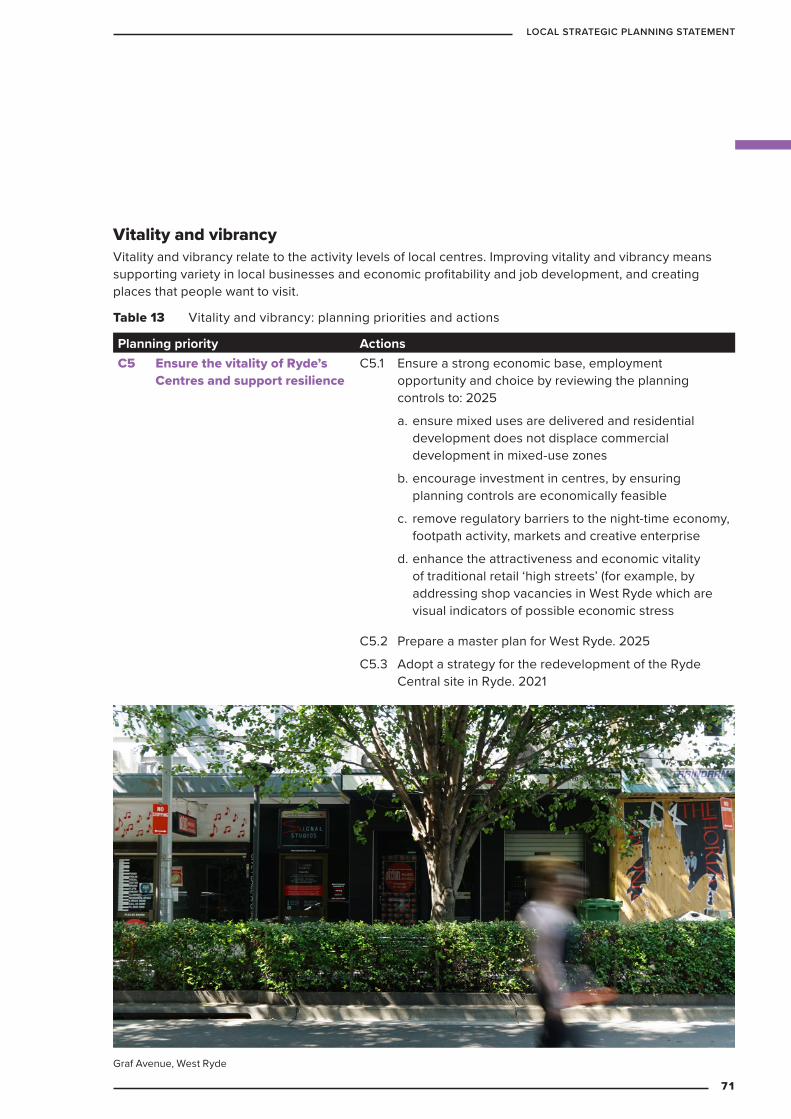
Vitality and vibrancyVitality and vibrancy relate to the activity levels of local centres. Improving vitality and vibrancy means supporting variety in local businesses and economic profitability and job development, and creating places that people want to visit.
Table 13 Vitality and vibrancy: planning priorities and actions
Planning priority ActionsC5 Ensure the vitality of Ryde’s
Centres and support resilience C5.1 Ensure a strong economic base, employment
opportunity and choice by reviewing the planning controls to: 2025
a. ensure mixed uses are delivered and residential development does not displace commercial development in mixed-use zones
b. encourage investment in centres, by ensuring planning controls are economically feasible
c. remove regulatory barriers to the night-time economy, footpath activity, markets and creative enterprise
d. enhance the attractiveness and economic vitality of traditional retail ‘high streets’ (for example, by addressing shop vacancies in West Ryde which are visual indicators of possible economic stress
C5.2 Prepare a master plan for West Ryde. 2025
C5.3 Adopt a strategy for the redevelopment of the Ryde Central site in Ryde. 2021
Graf Avenue, West Ryde
71
LOCAL STRATEGIC PLANNING STATEMENT
Improve liveabilityImproving liveability means ensuring places are well planned and designed to meet the needs and expectations of the people who inhabit and rely on them.
Table 14 Improve liveability: planning priorities and actions
Planning priority ActionsC6 Prioritise liveability through
an attractive, sustainable and well-designed environment
C6.1 Encourage people to spend time in the public domain by:
a. creating public spaces with high amenity that are accessible, clean, safe, inclusive, connected, flexible and enhance local identity
b. investigating appropriate Wi-Fi and CCTV network connections to build amenity and a smart city within selected centres
Ongoing through Council’s capital works programs and the devleopment process.
C6.2 Urban spaces and places should be multi-functional. Council will:
a. develop policies to support multi-function public space (for example, streets with leisure and footpath activity). 2025
b. review planning controls to remove regulatory barriers to multi-function public spaces in line with policies. 2021
c. include public art in appropriate public domain upgrades. Ongoing
C6.3 Expand and enhance the public domain to achieve sustainable, well-maintained environments through:
a. redevelopment (planning controls that encourage investment and the creation of new/expanded public domain). 2025
b. updating Council’s capital works and s7.11 Developer Contributions plans to include public domain upgrades. 2025
c. identifying public domain opportunities through Master Plan processes. 2025
72
CITY OF RYDE
Identity Identity relates to the uniqueness and distinct personality of a place. Improving local identity involves supporting a sense of local community, building on the unique character and history of a place, ensuring visitors have a clear idea of where they are, and making places memorable for visitors.
Table 15 Identity: planning priorities and actions
Planning priority ActionsC7 Create a sense of place and
promote community identityC7.1 Support the retention and reuse of valued older building
stock by:
– undertaking heritage main street programs focussed on listed Heritage Conservation Areas and heritage items in:
» Church Street Ryde. 2030
» Ryedale Road in West Ryde. 2025
» Gladesville. 2030
» Shepherds Bay shops near the station. 2030
» Rowe Street Eastwood. 2025
– continuing to operate a heritage assistance fund. Ongoing
C7.2 Develop heritage interpretation programs for centres that includes: 2025
– promoting awareness of heritage items (such as signage, walking trails and public art).
– referencing local history and/or promoting connections with local people in Council’s public domain upgrades
C7.3 Implement Council’s Public Art Policy and review Council’s planning controls to ensure development certainty regarding private sector public art implementation Ongoing
73
LOCAL STRATEGIC PLANNING STATEMENT
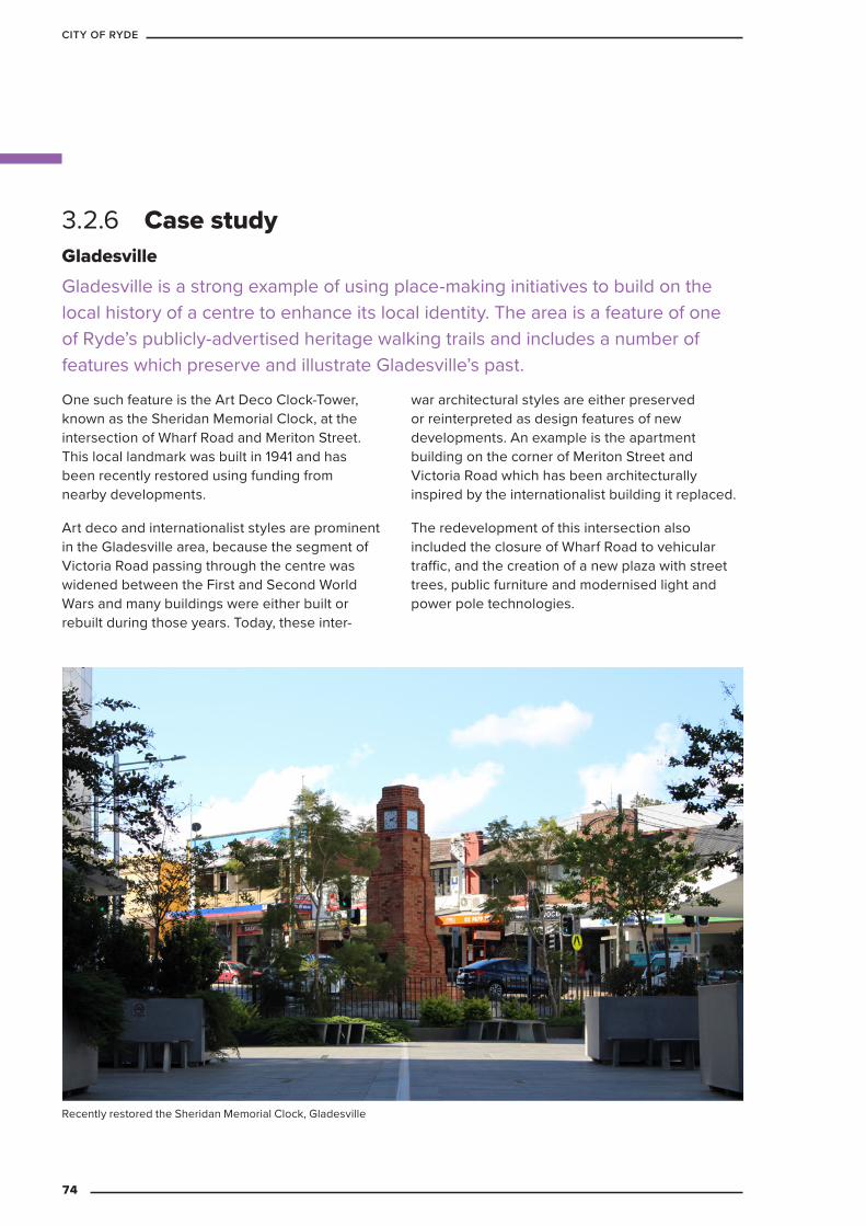
3.2.6 Case studyGladesville Gladesville is a strong example of using place-making initiatives to build on the local history of a centre to enhance its local identity. The area is a feature of one of Ryde’s publicly-advertised heritage walking trails and includes a number of features which preserve and illustrate Gladesville’s past.
One such feature is the Art Deco Clock-Tower, known as the Sheridan Memorial Clock, at the intersection of Wharf Road and Meriton Street. This local landmark was built in 1941 and has been recently restored using funding from nearby developments.
Art deco and internationalist styles are prominent in the Gladesville area, because the segment of Victoria Road passing through the centre was widened between the First and Second World Wars and many buildings were either built or rebuilt during those years. Today, these inter-
war architectural styles are either preserved or reinterpreted as design features of new developments. An example is the apartment building on the corner of Meriton Street and Victoria Road which has been architecturally inspired by the internationalist building it replaced.
The redevelopment of this intersection also included the closure of Wharf Road to vehicular traffic, and the creation of a new plaza with street trees, public furniture and modernised light and power pole technologies.
Recently restored the Sheridan Memorial Clock, Gladesville
74
CITY OF RYDE
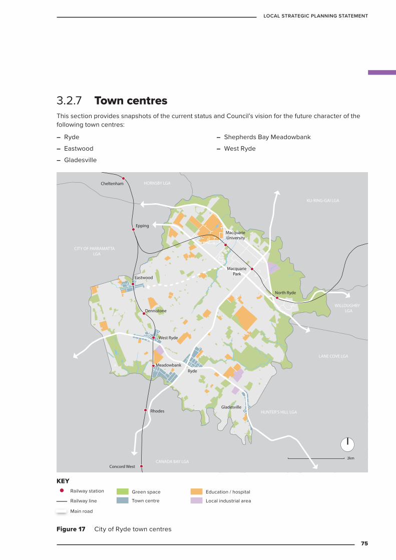
3.2.7 Town centresThis section provides snapshots of the current status and Council’s vision for the future character of the following town centres:
KEY
Railway station
Railway line
Main road
Green space
Commercial centre
Education / hospital
Major industrial area
2km
Concord West
Rhodes
Meadowbank
West Ryde
North Ryde
Gladesville
Ryde
Dennistone
Eastwood
Epping
Cheltenham
MacquarieUniversity
MacquariePark
LANE COVE LGA
WILLOUGHBYLGA
KU-RING-GAI LGA
HORNSBY LGA
CITY OF PARRAMATTALGA
CANADA BAY LGA
HUNTER’S HILL LGA
Figure 17 City of Ryde town centres
Railway station
Railway line
Main road
Green space
Local industrial area
Education / hospital
KEY
– Ryde
– Eastwood
– Gladesville
– Shepherds Bay Meadowbank
– West Ryde
Town centre
75
LOCAL STRATEGIC PLANNING STATEMENT
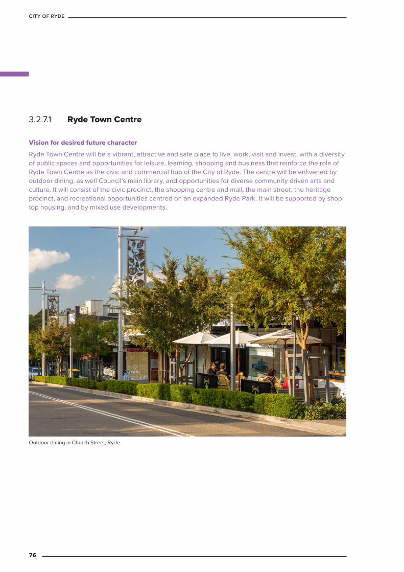
3.2.7.1 Ryde Town Centre
Vision for desired future character
Ryde Town Centre will be a vibrant, attractive and safe place to live, work, visit and invest, with a diversity of public spaces and opportunities for leisure, learning, shopping and business that reinforce the role of Ryde Town Centre as the civic and commercial hub of the City of Ryde. The centre will be enlivened by outdoor dining, as well Council’s main library, and opportunities for diverse community driven arts and culture. It will consist of the civic precinct, the shopping centre and mall, the main street, the heritage precinct, and recreational opportunities centred on an expanded Ryde Park. It will be supported by shop top housing, and by mixed use developments.
Outdoor dining in Church Street, Ryde
76
CITY OF RYDE

Table 16 Ryde Town Centre snapshot
Centre area – 57 Ha (including the park, school, B4 Mixed Use & R4 Residential land use zones)Key assets/facilities
– Ryde Public School
– City of Ryde Council Chamber and customer service centre
– 4.5 Ha Ryde Park
– Public Plaza (2,200sqm)
– Library (more than 700,000 visits in 2017/18)
– Wesley Church Complex (incl. small community hall)
– St Ann’s Church + community meeting rooms
– Masonic Hall
– Two childcare centre
– Several Council owned off-street public parking areasLand uses and major employers
– B4 Mixed land-use zone – 33.5 Ha
– Shopping Mall – supermarkets, speciality and service retail, discount department stores cinema + 2,600 parking spaces
– Dwellings capacity of 4,670
– Car showrooms including Holden, Ford, Nissan, Hyundai
– Ryde TAFE and Culinary Institute within five minutes’ walk
– Ryde Rehabilitation Centre within five minutes’ walk
– Mary Potter Nursing Home within five minutes’ walkTransport – Located on Strategic Bus Corridor where several bus routes converge, therefore it
has interchange possibilities
– Located at intersection of arterial roads – Blaxland Road, Devlin Street and Victoria Road
Infrastructure – Telephone exchange
– Electricity substation upgraded in 2007
– Two pedestrian footbridges over Devlin Street
Issues – Several Council-owned sites are vacant or under-utilised including:
» Ryde Central Site
» Argyle Centre
» 16 Devlin Street (adjacent to the Parsonage)
» Hydroponics shop
– Potential for community infrastructure, affordable housing and funding sources for Council projects
– Through traffic and congestion dissecting the town centre
– No focal point for the town centre
77
LOCAL STRATEGIC PLANNING STATEMENT
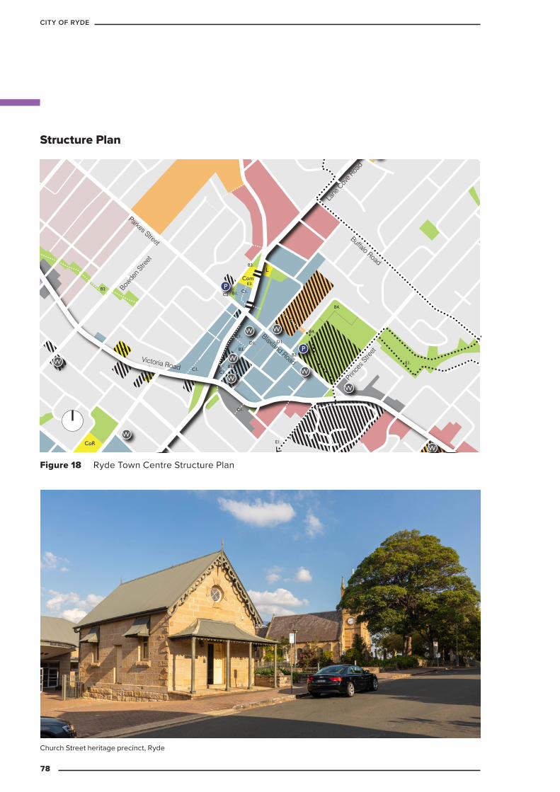
CoR
C1.
C1.
C2.
E3.
D1.D1.
B4.
B4.
E2.
E1.
E1.
B1.
E1.C1.
C1.
C1.
C1.
B2.
B3.B3.
B6.
B3.
W
P
P
W
W
W
W
W
W
W
W
L
W
Pol
M
Com
Victoria Road
Lane
Cov
e Roa
d
Buffalo Road
Parkes Street
Prince
s Stre
et
Bowde
n Stre
et
Blaxland Road
Figure 18 Ryde Town Centre Structure Plan
Structure Plan
Church Street heritage precinct, Ryde
78
CITY OF RYDE
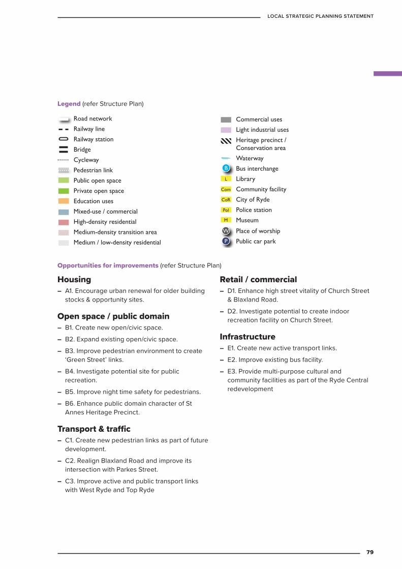
Housing – A1. Encourage urban renewal for older building
stocks & opportunity sites.
Open space / public domain – B1. Create new open/civic space.
– B2. Expand existing open/civic space.
– B3. Improve pedestrian environment to create ‘Green Street’ links.
– B4. Investigate potential site for public recreation.
– B5. Improve night time safety for pedestrians.
– B6. Enhance public domain character of St Annes Heritage Precinct.
Transport & traffic – C1. Create new pedestrian links as part of future
development.
– C2. Realign Blaxland Road and improve its intersection with Parkes Street.
– C3. Improve active and public transport links with West Ryde and Top Ryde
Retail / commercial – D1. Enhance high street vitality of Church Street
& Blaxland Road.
– D2. Investigate potential to create indoor recreation facility on Church Street.
Infrastructure – E1. Create new active transport links.
– E2. Improve existing bus facility.
– E3. Provide multi-purpose cultural and community facilities as part of the Ryde Central redevelopment
KEY
Road network
Railway line
Railway station
Bridge
Cycleway
Pedestrian link
Public open space
Private open space
Education uses
Mixed-use / commercial
High-density residential
Medium-density transition area
Medium / low-density residential
Commercial uses
Light industrial uses
Heritage precinct / Conservation area
Waterway
Bus interchange
Library
Community facility
City of Ryde
Police station
Museum
Gallery
Place of worship
Public car park
Environmental conservation
‘Green Link’ street/road
Ferry wharf
Bus stop
W
P
L
CoR
Pol
M
G
B
Com
F
Utility (Sydney Water)
Bridge or tunnel
Bus rapid transit connection
U
Legend (refer Structure Plan)
Opportunities for improvements (refer Structure Plan)
79
LOCAL STRATEGIC PLANNING STATEMENT
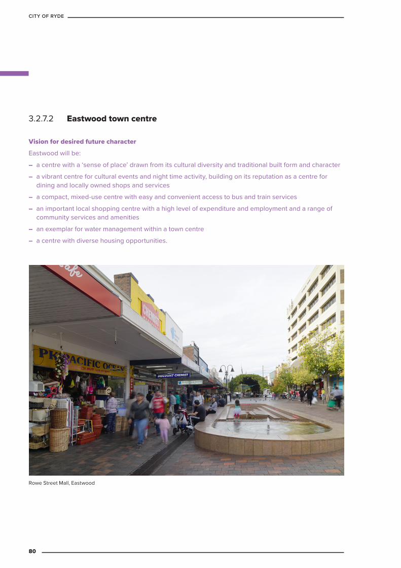
3.2.7.2 Eastwood town centre
Vision for desired future character
Eastwood will be:
– a centre with a ‘sense of place’ drawn from its cultural diversity and traditional built form and character
– a vibrant centre for cultural events and night time activity, building on its reputation as a centre for dining and locally owned shops and services
– a compact, mixed-use centre with easy and convenient access to bus and train services
– an important local shopping centre with a high level of expenditure and employment and a range of community services and amenities
– an exemplar for water management within a town centre
– a centre with diverse housing opportunities.
Rowe Street Mall, Eastwood
80
CITY OF RYDE
Table 17 Eastwood town centre snapshot
Centre area – 60 Ha. (includes park, B4 Mixed Use Commercial and R4 High Density Residential land use zones)
Key assets/facilities
– St Kevin’s Primary School
– Eastwood Public School
– Marist College
– 2 childcare centres
– Eastwood Hall
– Library
– Eastwood Park – 34,300sqm
– Glen Reserve – 7,000sqm
– Several public parking sites including a multi-storey car park with approx. 465 spaces.
Existing uses and employment
– Mixed use / commercial zone – 20 Ha
– Medium to high density residential
– Specialty Asian grocery and restaurants.
– Retail – 33,000 sqm (2 supermarkets, specialty + service retail)
– Ryde Hospital within 10-15 minutes’ walk of the centreTransport – Train station (express stop)
– Several bus routes converge
– Modal interchange
– Pedestrian underpass connecting both sides of rail lineIssues – Flood management / Sydney Water open stormwater channel through parts of
the centre
– Parking demand and traffic congestion
– On the border of the Parramatta Local Government Area – increases in nearby development could cause potential increase the population serviced by the Eastwood commercial centre
– Limited active open space to support a growth population
81
LOCAL STRATEGIC PLANNING STATEMENT

L
Com
Com
Pol
F
Pol
C2.
C2.
D1.
C1.
B3.
B4.B3.
D1.
D3 & D7.
D6.
B1. B1.
C1.C1.
C1.
C1.
D4.
A1.
B2.
C1.
D2.
B1.
D1. C4.
B2.
B1.B1.
C3.
C3.
C3.
C3.
C3.
C3.
D5.
W
W
W
W
W
P
P
P
B
Rowe Street
Hillview Road
First Avenue
Rutledge Street
Shaftsbury Road
Blaxland R
oad
CITY OF PARRAMATTA
LGA
Figure 19 Eastwood Town Centre Structure Plan
Structure Plan
Shopfront in Rowe Street Mall, Eastwood
82
CITY OF RYDE
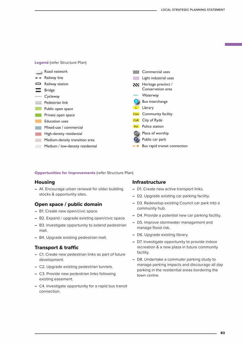
Housing – A1. Encourage urban renewal for older building
stocks & opportunity sites.
Open space / public domain – B1. Create new open/civic space.
– B2. Expand / upgrade existing open/civic space.
– B3. Investigate opportunity to extend pedestrian mall.
– B4. Upgrade existing pedestrian mall.
Transport & traffic – C1. Create new pedestrian links as part of future
development.
– C2. Upgrade existing pedestrian tunnels.
– C3. Provide new pedestrian links following existing easement.
– C4. Investigate opportunity for a rapid bus transit connection.
Infrastructure – D1. Create new active transport links.
– D2. Upgrade existing car parking facility.
– D3. Redevelop existing Council car park into a community hub.
– D4. Provide a potential new car parking facility.
– D5. Improve stormwater management and manage flood risk.
– D6. Upgrade existing library.
– D7. Investigate opportunity to provide indoor recreation & a new plaza in future community facility.
– D8. Undertake a commuter parking study to manage parking impacts and discourage all day parking in the residential areas bordering the town centre.
KEY
Road network
Railway line
Railway station
Bridge
Cycleway
Pedestrian link
Public open space
Private open space
Education uses
Mixed-use / commercial
High-density residential
Medium-density transition area
Medium / low-density residential
Commercial uses
Light industrial uses
Heritage precinct / Conservation area
Waterway
Bus interchange
Library
Community facility
City of Ryde
Police station
Museum
Gallery
Place of worship
Public car park
Environmental conservation
‘Green Link’ street/road
Ferry wharf
Bus stop
W
P
L
CoR
Pol
M
G
B
Com
F
Utility (Sydney Water)
Bridge or tunnel
Bus rapid transit connection
U
Legend (refer Structure Plan)
Opportunities for improvements (refer Structure Plan)
KEY
Road network
Railway line
Railway station
Bridge
Cycleway
Pedestrian link
Public open space
Private open space
Education uses
Mixed-use / commercial
High-density residential
Medium-density transition area
Medium / low-density residential
Commercial uses
Light industrial uses
Heritage precinct / Conservation area
Waterway
Bus interchange
Library
Community facility
City of Ryde
Police station
Museum
Gallery
Place of worship
Public car park
Environmental conservation
‘Green Link’ street/road
Ferry wharf
Bus stop
W
P
L
CoR
Pol
M
G
B
Com
F
Utility (Sydney Water)
Bridge or tunnel
Bus rapid transit connection
U
83
LOCAL STRATEGIC PLANNING STATEMENT
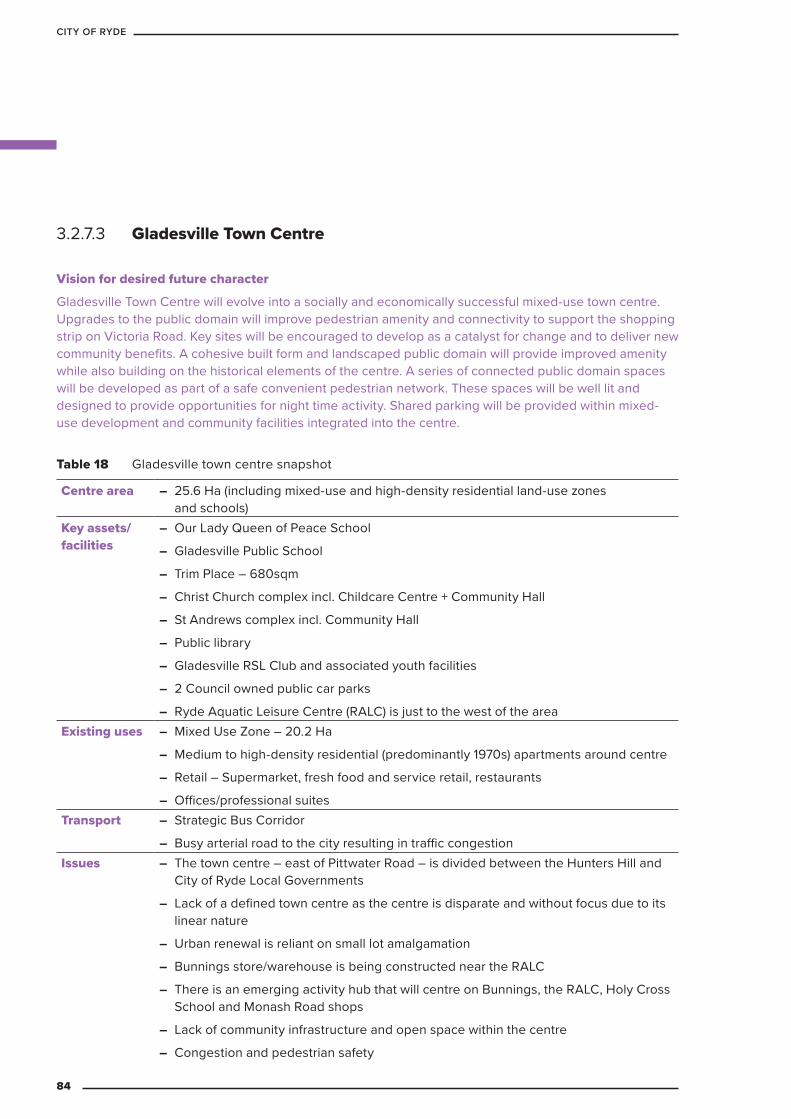
3.2.7.3 Gladesville Town Centre
Vision for desired future character
Gladesville Town Centre will evolve into a socially and economically successful mixed-use town centre. Upgrades to the public domain will improve pedestrian amenity and connectivity to support the shopping strip on Victoria Road. Key sites will be encouraged to develop as a catalyst for change and to deliver new community benefits. A cohesive built form and landscaped public domain will provide improved amenity while also building on the historical elements of the centre. A series of connected public domain spaces will be developed as part of a safe convenient pedestrian network. These spaces will be well lit and designed to provide opportunities for night time activity. Shared parking will be provided within mixed-use development and community facilities integrated into the centre.
Table 18 Gladesville town centre snapshot
Centre area – 25.6 Ha (including mixed-use and high-density residential land-use zones and schools)
Key assets/facilities
– Our Lady Queen of Peace School
– Gladesville Public School
– Trim Place – 680sqm
– Christ Church complex incl. Childcare Centre + Community Hall
– St Andrews complex incl. Community Hall
– Public library
– Gladesville RSL Club and associated youth facilities
– 2 Council owned public car parks
– Ryde Aquatic Leisure Centre (RALC) is just to the west of the areaExisting uses – Mixed Use Zone – 20.2 Ha
– Medium to high-density residential (predominantly 1970s) apartments around centre
– Retail – Supermarket, fresh food and service retail, restaurants
– Offices/professional suitesTransport – Strategic Bus Corridor
– Busy arterial road to the city resulting in traffic congestionIssues – The town centre – east of Pittwater Road – is divided between the Hunters Hill and
City of Ryde Local Governments
– Lack of a defined town centre as the centre is disparate and without focus due to its linear nature
– Urban renewal is reliant on small lot amalgamation
– Bunnings store/warehouse is being constructed near the RALC
– There is an emerging activity hub that will centre on Bunnings, the RALC, Holy Cross School and Monash Road shops
– Lack of community infrastructure and open space within the centre
– Congestion and pedestrian safety
84
CITY OF RYDE
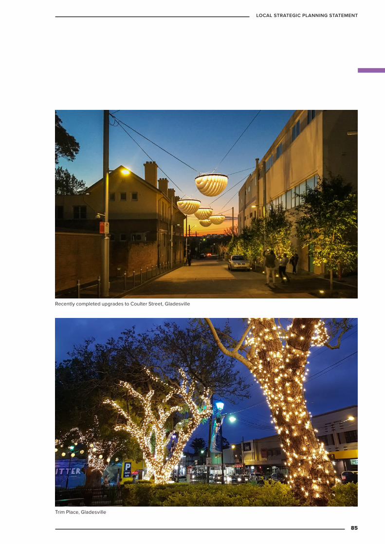
Recently completed upgrades to Coulter Street, Gladesville
Trim Place, Gladesville
85
LOCAL STRATEGIC PLANNING STATEMENT
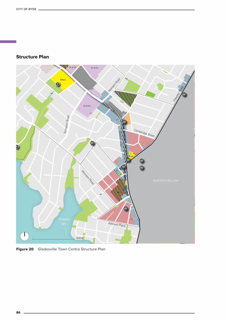
Pol
LCom
RALC
C1.
E1.
B1.
B4.
C1.
C1.
D1 & D2.D1 & D2.
D1 & D2.
B4.
B4.
C1.
C3.
C3.
A1.
B5.
B3.
W
W W
W
W
WW
P
500m
W
W
P
Pittw
ater
Roa
d
Victoria Road
Cambridge Street
Morrison Road
Tenn
yson
Roa
d
Ashburn Place
GLADES
BAY
HUNTER’S HILL LGA
Mon
ash
Road
Figure 20 Gladesville Town Centre Structure Plan
Structure Plan
86
CITY OF RYDE

Housing – A1. Encourage urban renewal for older building
stocks & opportunity sites.
Open space / public domain – B1. Create new open/civic space.
– B2. Expand / upgrade existing open/civic space.
– B3. Investigate opportunity for public recreation.
– B4. Improve pedestrian environment to create ‘Green Street’ links.
– B4. Create a tree-lined boulevard along Victoria Road.
Transport & traffic – C1. Create new pedestrian links as part of future
development.
– C2. Create new street for rear access and improve traffic circulation.
– C3. Provide new pedestrian links following existing easement.
Retail / commercial – D1. Encourage creative enterprise in Light
Industrial areas.
– D2. Encourage indoor recreation in Light Industrial areas.
Infrastructure – E1. Investigate potential to upgrade existing
library and provide additional community facilities
Legend (refer Structure Plan)
Opportunities for improvements (refer Structure Plan)
KEY
Road network
Railway line
Railway station
Bridge
Cycleway
Pedestrian link
Public open space
Private open space
Education uses
Mixed-use / commercial
High-density residential
Medium-density transition area
Medium / low-density residential
Commercial uses
Light industrial uses
Heritage precinct / Conservation area
Waterway
Bus interchange
Library
Community facility
City of Ryde
Police station
Museum
Gallery
Place of worship
Public car park
Environmental conservation
‘Green Link’ street/road
Ferry wharf
Bus stop
W
P
L
CoR
Pol
M
G
B
Com
F
Utility (Sydney Water)
Bridge or tunnel
Bus rapid transit connection
U
87
LOCAL STRATEGIC PLANNING STATEMENT
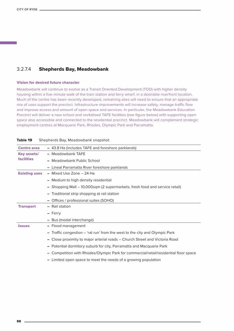
3.2.7.4 Shepherds Bay, Meadowbank
Vision for desired future character
Meadowbank will continue to evolve as a Transit Oriented Development (TOD) with higher density housing within a five-minute walk of the train station and ferry wharf, in a desirable riverfront location. Much of the centre has been recently developed, remaining sites will need to ensure that an appropriate mix of uses support the precinct. Infrastructure improvements will increase safety, manage traffic flow and improve access and amount of open space and services. In particular, the Meadowbank Education Precinct will deliver a new school and revitalised TAFE facilities (see figure below) with supporting open space also accessible and connected to the residential precinct. Meadowbank will complement strategic employment centres at Macquarie Park, Rhodes, Olympic Park and Parramatta.
Table 19 Shepherds Bay, Meadowbank snapshot
Centre area – 43.8 Ha (includes TAFE and foreshore parklands)Key assets/facilities
– Meadowbank TAFE
– Meadowbank Public School
– Lineal Parramatta River foreshore parklandsExisting uses – Mixed Use Zone – 24 Ha
– Medium to high density residential
– Shopping Mall – 10,000sqm (2 supermarkets, fresh food and service retail)
– Traditional strip shopping at rail station
– Offices / professional suites (SOHO)Transport – Rail station
– Ferry
– Bus (modal interchange)Issues – Flood management
– Traffic congestion – ‘rat run’ from the west to the city and Olympic Park
– Close proximity to major arterial roads – Church Street and Victoria Road
– Potential dormitory suburb for city, Parramatta and Macquarie Park
– Competition with Rhodes/Olympic Park for commercial/retail/residential floor space
– Limited open space to meet the needs of a growing population
88
CITY OF RYDE
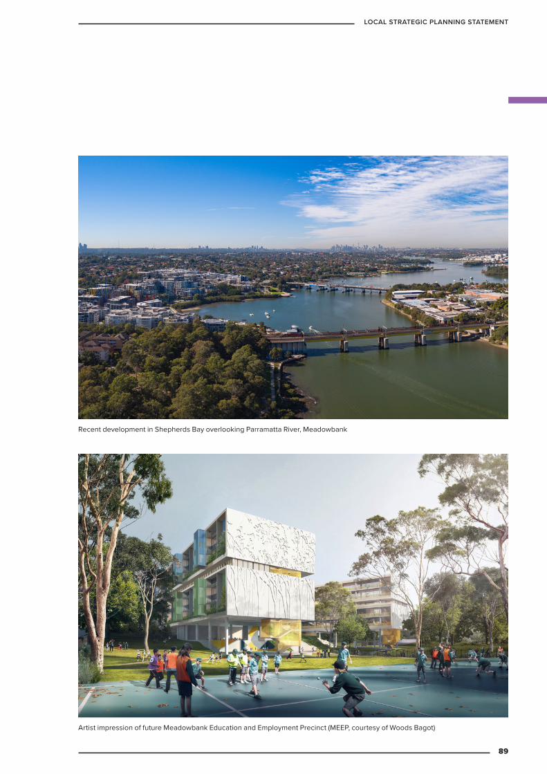
Recent development in Shepherds Bay overlooking Parramatta River, Meadowbank
Artist impression of future Meadowbank Education and Employment Precinct (MEEP, courtesy of Woods Bagot)
89
LOCAL STRATEGIC PLANNING STATEMENT

B1.
E1.E1.
C2.
B3.
B3.
C1.
A1.
D1.
B2.
C3.
F1.
B4.z
C1.
C4.C4.
C4.
W
W
P
P
P
P P
F
P
Com
CoR
G
Com
Churc
h St
reet
Belm
ore
Stre
et
Constitution Road
Bowde
n Stre
et
Mea
dow
Cre
scen
t
Bay
Driv
e
PARRAMATTA RIVER
TAFE Victoria Road
Porte
r Stre
et
Figure 21 Shepherds Bay, Meadowbank Structure Plan
Structure Plan
Parramatta River foreshore, Rothesay Avenue, Shepherds Bay
90
CITY OF RYDE
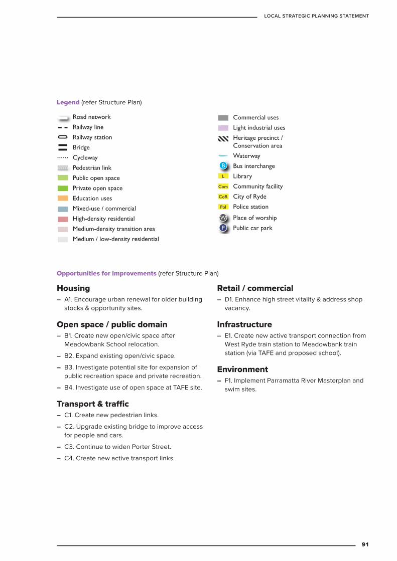
Housing – A1. Encourage urban renewal for older building
stocks & opportunity sites.
Open space / public domain – B1. Create new open/civic space after
Meadowbank School relocation.
– B2. Expand existing open/civic space.
– B3. Investigate potential site for expansion of public recreation space and private recreation.
– B4. Investigate use of open space at TAFE site.
Transport & traffic – C1. Create new pedestrian links.
– C2. Upgrade existing bridge to improve access for people and cars.
– C3. Continue to widen Porter Street.
– C4. Create new active transport links.
Retail / commercial – D1. Enhance high street vitality & address shop
vacancy.
Infrastructure – E1. Create new active transport connection from
West Ryde train station to Meadowbank train station (via TAFE and proposed school).
Environment – F1. Implement Parramatta River Masterplan and
swim sites.
Legend (refer Structure Plan)KEY
Road network
Railway line
Railway station
Bridge
Cycleway
Pedestrian link
Public open space
Private open space
Education uses
Mixed-use / commercial
High-density residential
Medium-density transition area
Medium / low-density residential
Commercial uses
Light industrial uses
Heritage precinct / Conservation area
Waterway
Bus interchange
Library
Community facility
City of Ryde
Police station
Museum
Gallery
Place of worship
Public car park
Environmental conservation
‘Green Link’ street/road
Ferry wharf
Bus stop
W
P
L
CoR
Pol
M
G
B
Com
F
Utility (Sydney Water)
Bridge or tunnel
Bus rapid transit connection
U
KEY
Road network
Railway line
Railway station
Bridge
Cycleway
Pedestrian link
Public open space
Private open space
Education uses
Mixed-use / commercial
High-density residential
Medium-density transition area
Medium / low-density residential
Commercial uses
Light industrial uses
Heritage precinct / Conservation area
Waterway
Bus interchange
Library
Community facility
City of Ryde
Police station
Museum
Gallery
Place of worship
Public car park
Environmental conservation
‘Green Link’ street/road
Ferry wharf
Bus stop
W
P
L
CoR
Pol
M
G
B
Com
F
Utility (Sydney Water)
Bridge or tunnel
Bus rapid transit connection
U
Opportunities for improvements (refer Structure Plan)
91
LOCAL STRATEGIC PLANNING STATEMENT

3.2.7.5 West Ryde Town CentreWest Ryde Town Centre will be reinvigorated building on its identify and attractive character.
Vision for desired future character
A new identity and attractive character is planned for the West Ryde Town Centre. Improvements to key public domain areas will see the creation of a series of ‘green links’, which extend both towards and through the core of the Town Centre. The core will become a pedestrian-priority environment. Existing open spaces will be enhanced, offering increased amenity to surrounding residential development. New developments and increased densities will be focused at the core and in areas of high pedestrian activity such as public transport nodes and open space areas. To the west of the station, the centre will take on a mixed use and civic village character with shopping centre retail, a central plaza, and surrounding community service facilities. To the east of the station the heritage character will be retained, with improvements to pedestrian amenity and improved connectivity to ANZAC Park encouraging greater activation.
Ryedale Road Heritage Conservation Area, West Ryde
92
CITY OF RYDE
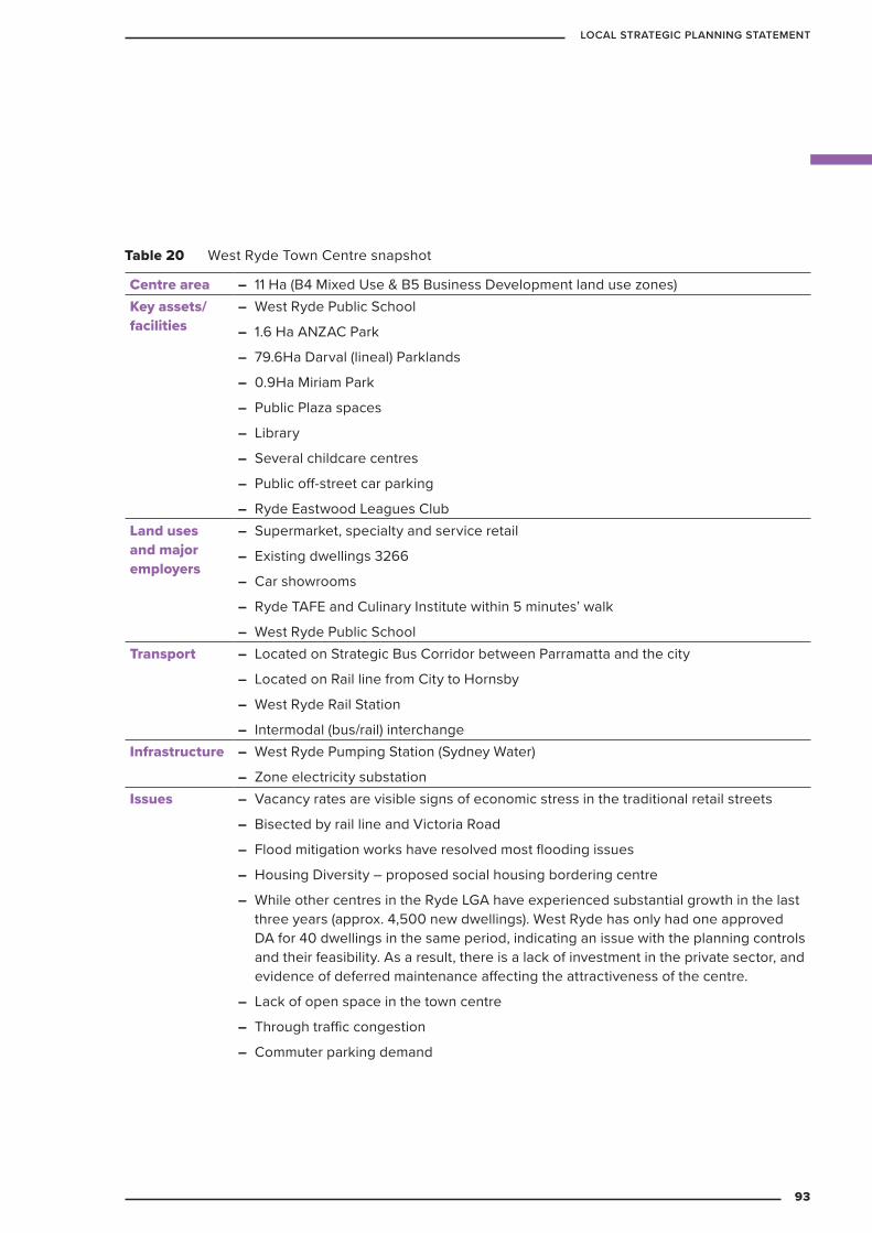
Table 20 West Ryde Town Centre snapshot
Centre area – 11 Ha (B4 Mixed Use & B5 Business Development land use zones)Key assets/facilities
– West Ryde Public School
– 1.6 Ha ANZAC Park
– 79.6Ha Darval (lineal) Parklands
– 0.9Ha Miriam Park
– Public Plaza spaces
– Library
– Several childcare centres
– Public off-street car parking
– Ryde Eastwood Leagues ClubLand uses and major employers
– Supermarket, specialty and service retail
– Existing dwellings 3266
– Car showrooms
– Ryde TAFE and Culinary Institute within 5 minutes’ walk
– West Ryde Public SchoolTransport – Located on Strategic Bus Corridor between Parramatta and the city
– Located on Rail line from City to Hornsby
– West Ryde Rail Station
– Intermodal (bus/rail) interchangeInfrastructure – West Ryde Pumping Station (Sydney Water)
– Zone electricity substationIssues – Vacancy rates are visible signs of economic stress in the traditional retail streets
– Bisected by rail line and Victoria Road
– Flood mitigation works have resolved most flooding issues
– Housing Diversity – proposed social housing bordering centre
– While other centres in the Ryde LGA have experienced substantial growth in the last three years (approx. 4,500 new dwellings). West Ryde has only had one approved DA for 40 dwellings in the same period, indicating an issue with the planning controls and their feasibility. As a result, there is a lack of investment in the private sector, and evidence of deferred maintenance affecting the attractiveness of the centre.
– Lack of open space in the town centre
– Through traffic congestion
– Commuter parking demand
93
LOCAL STRATEGIC PLANNING STATEMENT
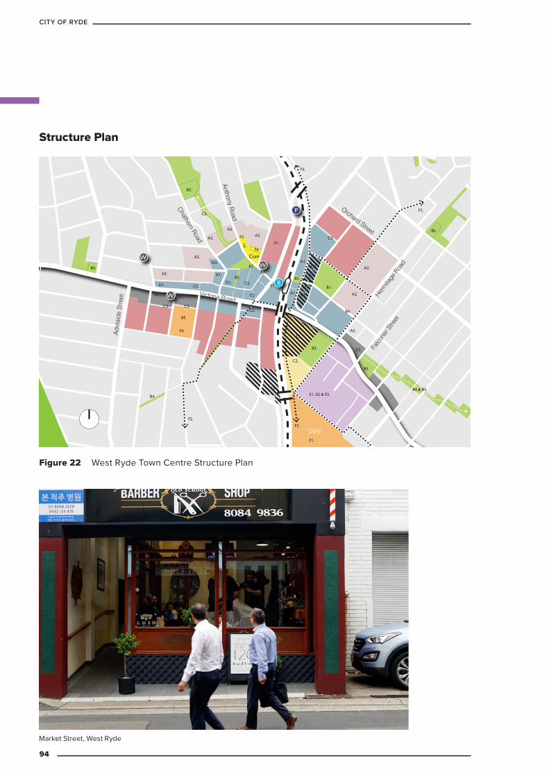
Com
L
U
B5.
D3.
A1. A1.
B1.F7.
C3.F3.
C3. C3.
F4.
A1.
F2.
F1.
B5.
C2.
B3.
B2.
B2.
C2.
C2.
D2.
B5.
B2.C1
A1.
A1.
A1.
F2.
F2.
B4.
B4 & B5.
B5.
F2.
F5.
A2.
A2.
A2.
F6.
A2.
A2.
A2.
A2.
A2.
C2.
C2.C2.
C2.
C2.
C2.
E1, E2 & E3.
D1.
D1.
D1.D1.
B4.
B4.
B5.
B
P
W
WW
Victoria Road
Herm
itage
Roa
d
Falco
ner S
treet
Orchard Street
Ade
laid
e S
treet
Anthony Road
Chatham Road
TAFE
Figure 22 West Ryde Town Centre Structure Plan
Structure Plan
Market Street, West Ryde
94
CITY OF RYDE
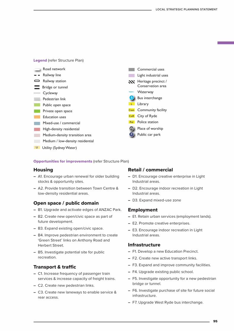
Housing – A1. Encourage urban renewal for older building
stocks & opportunity sites.
– A2. Provide transition between Town Centre & low-density residential areas.
Open space / public domain – B1. Upgrade and activate edges of ANZAC Park.
– B2. Create new open/civic space as part of future development.
– B3. Expand existing open/civic space.
– B4. Improve pedestrian environment to create ‘Green Street’ links on Anthony Road and Herbert Street.
– B5. Investigate potential site for public recreation.
Transport & traffic – C1. Increase frequency of passenger train
services & increase capacity of freight trains.
– C2. Create new pedestrian links.
– C3. Create new laneways to enable service & rear access.
Retail / commercial – D1. Encourage creative enterprise in Light
Industrial areas.
– D2. Encourage indoor recreation in Light Industrial areas.
– D3. Expand mixed-use zone
Employment – E1. Retain urban services (employment lands).
– E2. Promote creative enterprises.
– E3. Encourage indoor recreation in Light Industrial areas.
Infrastructure – F1. Develop a new Education Precinct.
– F2. Create new active transport links.
– F3. Expand and improve community facilities.
– F4. Upgrade existing public school.
– F5. Investigate opportunity for a new pedestrian bridge or tunnel.
– F6. Investigate purchase of site for future social infrastructure.
– F7. Upgrade West Ryde bus interchange.
Legend (refer Structure Plan)
Opportunities for improvements (refer Structure Plan)
KEY
Road network
Railway line
Railway station
Bridge
Cycleway
Pedestrian link
Public open space
Private open space
Education uses
Mixed-use / commercial
High-density residential
Medium-density transition area
Medium / low-density residential
Commercial uses
Light industrial uses
Heritage precinct / Conservation area
Waterway
Bus interchange
Library
Community facility
City of Ryde
Police station
Museum
Gallery
Place of worship
Public car park
Environmental conservation
‘Green Link’ street/road
Ferry wharf
Bus stop
W
P
L
CoR
Pol
M
G
B
Com
F
Utility (Sydney Water)
Bridge or tunnel
Bus rapid transit connection
U
KEY
Road network
Railway line
Railway station
Bridge
Cycleway
Pedestrian link
Public open space
Private open space
Education uses
Mixed-use / commercial
High-density residential
Medium-density transition area
Medium / low-density residential
Commercial uses
Light industrial uses
Heritage precinct / Conservation area
Waterway
Bus interchange
Library
Community facility
City of Ryde
Police station
Museum
Gallery
Place of worship
Public car park
Environmental conservation
‘Green Link’ street/road
Ferry wharf
Bus stop
W
P
L
CoR
Pol
M
G
B
Com
F
Utility (Sydney Water)
Bridge or tunnel
Bus rapid transit connection
U
KEY
Road network
Railway line
Railway station
Bridge
Cycleway
Pedestrian link
Public open space
Private open space
Education uses
Mixed-use / commercial
High-density residential
Medium-density transition area
Medium / low-density residential
Commercial uses
Light industrial uses
Heritage precinct / Conservation area
Waterway
Bus interchange
Library
Community facility
City of Ryde
Police station
Museum
Gallery
Place of worship
Public car park
Environmental conservation
‘Green Link’ street/road
Ferry wharf
Bus stop
W
P
L
CoR
Pol
M
G
B
Com
F
Utility (Sydney Water)
Bridge or tunnel
Bus rapid transit connection
U
95
LOCAL STRATEGIC PLANNING STATEMENT
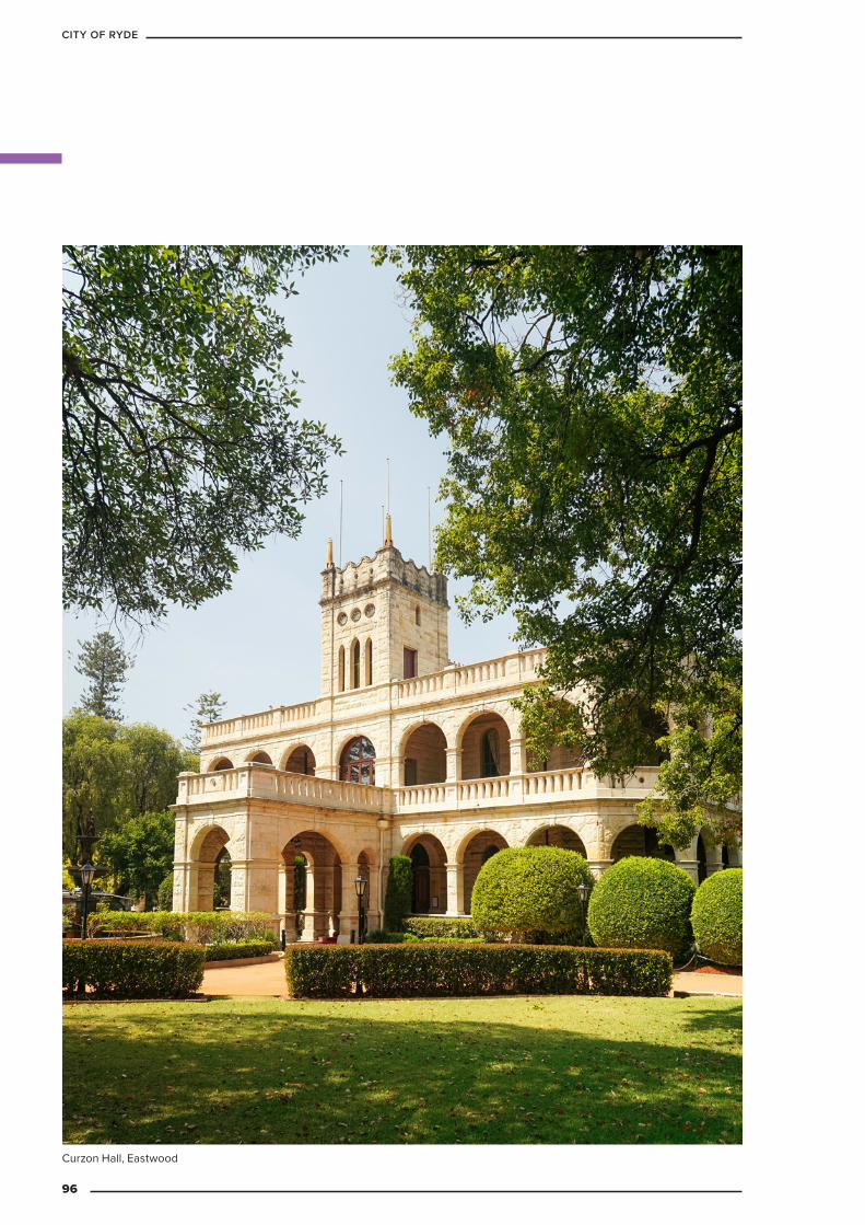
Curzon Hall, Eastwood
96
CITY OF RYDE

3.3 Heritage
This chapter of the LSPS outlines how Council intends to protect the area’s history and preserve it for future generations.
3.3.1 Vision
Heritage and places of cultural significance that are valued by the community – including historic buildings, landscape items and places with natural and Aboriginal significance – will be well managed, conserved and positively promoted to enhance the community’s sense of place.
3.3.2 ContextThe City of Ryde has a long and treasured history, which is reflected in our landscape and built environment. The original inhabitants of the Ryde area were the Wallumedegal people, and the area still contains a number of places of Aboriginal significance, including rock engravings, middens, and burial sites, which provide important insights from the pre-European contact period.
European occupation of the area dates from 1792, and saw the development of an agricultural landscape, which proceeded to industrialise and suburbanise over the course of the 20th century as technology developed and the population grew. Today Ryde has become home to one of Australia’s leading high-tech business precincts, as well as an increasing number of residential communities.
The City of Ryde includes over 170 legislatively protected heritage items, five heritage conservation areas, and two archaeological sites, all of which embody the history of the local area.
3.3.3 Key challenges – The protection and enhancement of the cultural
and natural heritage of the City of Ryde in accordance with community values
– Owners of heritage properties need to be supported to assist them in protecting heritage value
– The protection and enhancement of Aboriginal heritage.
97
LOCAL STRATEGIC PLANNING STATEMENT

3.3.4 Targets
Heritage assistance grant funding will continue to be distributed by Council every year.
$
Proud owners of a heritage item in Eastwood, Mr and Mrs Petro were recipients of Council heritage grant to assist with upkeep and maintenance of their property.
The following targets will guide future developments, Council policies and programs.
98
CITY OF RYDE
Table 21 Heritage: planning priorities and actions
Planning priority ActionsHE1 Protect and enhance the cultural
heritage of the City of Ryde, safeguarding historic buildings, landscape items and places with natural heritage significance that:
– provide the community with an understanding of its past and contribute to the cultural life and vibrancy of the community
– contribute to local distinctiveness and sense of place, together with the creation of attractive streetscapes
– contribute to the local economy by attracting visitors.
HE1.1 Undertake a city-wide study of potential places of heritage significance from early settlement to World War II. 2021
HE1.2 Undertake a city-wide study of potential landscape items and places with natural heritage significance. 2025
HE1.3 Prepare Conservation Management Plans for Council-owned assets that are listed items of heritage significance and do not have current plans. 2021
HE1.4 Update existing Conservation Management Plans that are over 10 years old for Council-owned assets that are listed items of heritage significance. 2021
HE1.5 Ensure Council-owned assets that are listed items of heritage significance are protected and maintained. Review CMPs for listed Council owned assets every five years. Ongoing
HE1.6 Ensure owners of heritage-listed properties are supported through a range of financial assistance, incentives and heritage advisory services to promote and facilitate effective conservation outcomes. Ongoing
HE1.7 Promote and educate the community regarding the cultural heritage of the City of Ryde. Ongoing
3.3.5 Planning priorities and actions
99
LOCAL STRATEGIC PLANNING STATEMENT
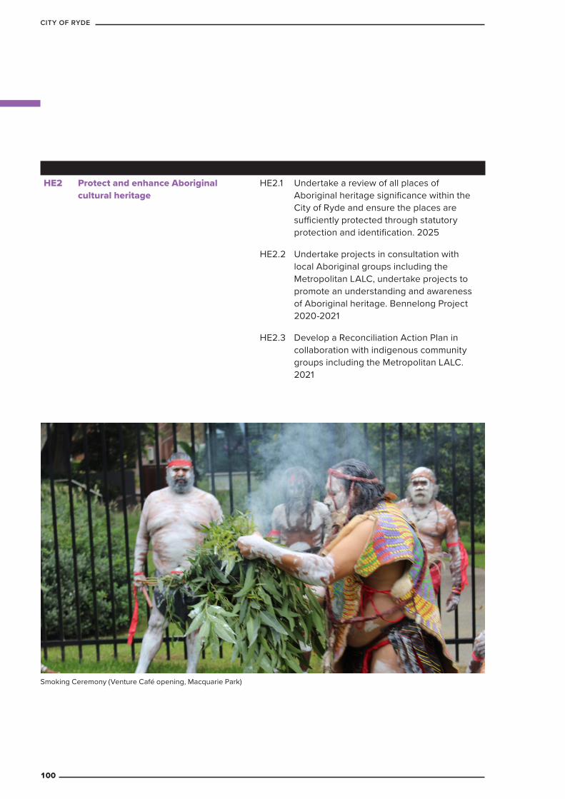
Smoking Ceremony (Venture Café opening, Macquarie Park)
HE2 Protect and enhance Aboriginal cultural heritage
HE2.1 Undertake a review of all places of Aboriginal heritage significance within the City of Ryde and ensure the places are sufficiently protected through statutory protection and identification. 2025
HE2.2 Undertake projects in consultation with local Aboriginal groups including the Metropolitan LALC, undertake projects to promote an understanding and awareness of Aboriginal heritage. Bennelong Project 2020-2021
HE2.3 Develop a Reconciliation Action Plan in collaboration with indigenous community groups including the Metropolitan LALC. 2021
100
CITY OF RYDE
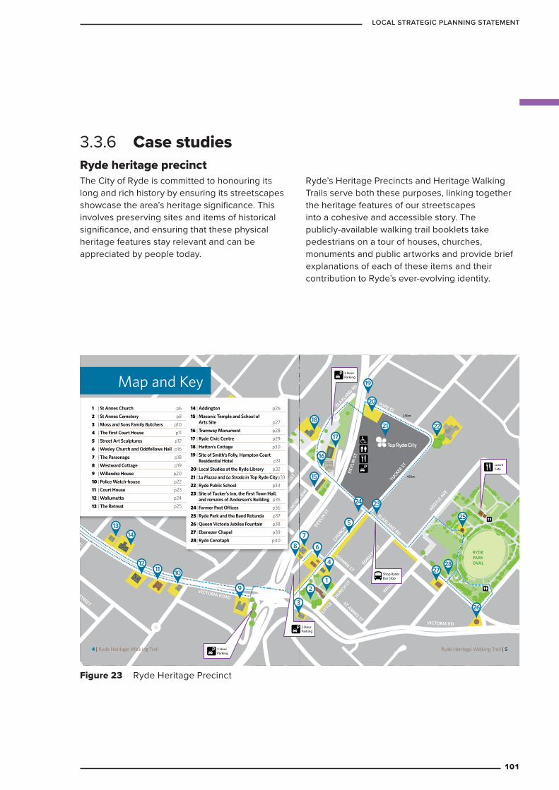
Ryde heritage precinct The City of Ryde is committed to honouring its long and rich history by ensuring its streetscapes showcase the area’s heritage significance. This involves preserving sites and items of historical significance, and ensuring that these physical heritage features stay relevant and can be appreciated by people today.
Ryde’s Heritage Precincts and Heritage Walking Trails serve both these purposes, linking together the heritage features of our streetscapes into a cohesive and accessible story. The publicly-available walking trail booklets take pedestrians on a tour of houses, churches, monuments and public artworks and provide brief explanations of each of these items and their contribution to Ryde’s ever-evolving identity.
3.3.6 Case studies
Figure 23 Ryde Heritage Precinct
BLAXLAND RD
ARGYLE AVE
RYDE PARK OVAL
TUCKER ST
PRINCES STREET
POPE ST250m
450m
ARGYLE AVE
BLAXLAND RD
CHURCH STDEVLIN
ST
DEV
LIN
ST
BLAXLAND RD
LITTLE
CHURCH ST
ST ANNES ST
EDWARD ST
WILLIA
M ST
GOWRIE ST
BELMORE LA
NE
BELMORE STREET
SHEPHERD STREET
ADDINGTON AVE
PRIMROSE AVE
ALLAN AVE
NICOLL AVE
PARKES STREET
VICTORIA ROAD
VICTORIA RD
SHEPHERD STREET
SQUIRE STREET
12
3
4
5
6
78
9
101112
1314
15
16
17
18
19
20
21 22
2324
25
26
2728
2 HourParking
LunchCafe
2 HourParking
2 HourParking
LunchCafe
NORTH
Shop Ryder Bus Stop
Map and Key1 | St Annes Church p6
2 | St Annes Cemetery p8
3 | Moss and Sons Family Butchers p10
4 | The First Court House p11
5 | Street Art Sculptures p12
6 | Wesley Church and Oddfellows Hall p16
7 | The Parsonage p18
8 | Westward Cottage p19
9 | Willandra House p20
10 | Police Watch-house p22
11 | Court House p23
12 | Wallumetta p24
13 | The Retreat p25
14 | Addington p26
15 | Masonic Temple and School of Arts Site p27
16 | Tramway Monument p28
17 | Ryde Civic Centre p29
18 | Hatton’s Cottage p30
19 | Site of Smith’s Folly, Hampton Court Residential Hotel p31
20 | Local Studies at the Ryde Library p32
21 | La Piazza and La Strada in Top Ryde City p33
22 | Ryde Public School p34
23 | Site of Tucker’s Inn, the First Town Hall, and remains of Anderson’s Building p35
24 | Former Post Offices p36
25 | Ryde Park and the Band Rotunda p37
26 | Queen Victoria Jubilee Fountain p38
27 | Ebenezer Chapel p39
28 | Ryde Cenotaph p40
4 | Ryde Heritage Walking Trail
BLAXLAND RD
ARGYLE AVE
RYDE PARK OVAL
TUCKER ST
PRINCES STREET
POPE ST250m
450m
ARGYLE AVE
BLAXLAND RD
CHURCH STDEVLIN
ST
DEV
LIN
ST
BLAXLAND RD
LITTLE
CHURCH ST
ST ANNES ST
EDWARD ST
WILLIA
M ST
GOWRIE ST
BELMORE LA
NE
BELMORE STREET
SHEPHERD STREET
ADDINGTON AVE
PRIMROSE AVE
ALLAN AVE
NICOLL AVE
PARKES STREET
VICTORIA ROAD
VICTORIA RD
SHEPHERD STREET
SQUIRE STREET
12
3
4
5
6
78
9
101112
1314
15
16
17
18
19
20
21 22
2324
25
26
2728
2 HourParking
LunchCafe
2 HourParking
2 HourParking
LunchCafe
NORTH
Shop Ryder Bus Stop
Ryde Heritage Walking Trail | 5
101
LOCAL STRATEGIC PLANNING STATEMENT
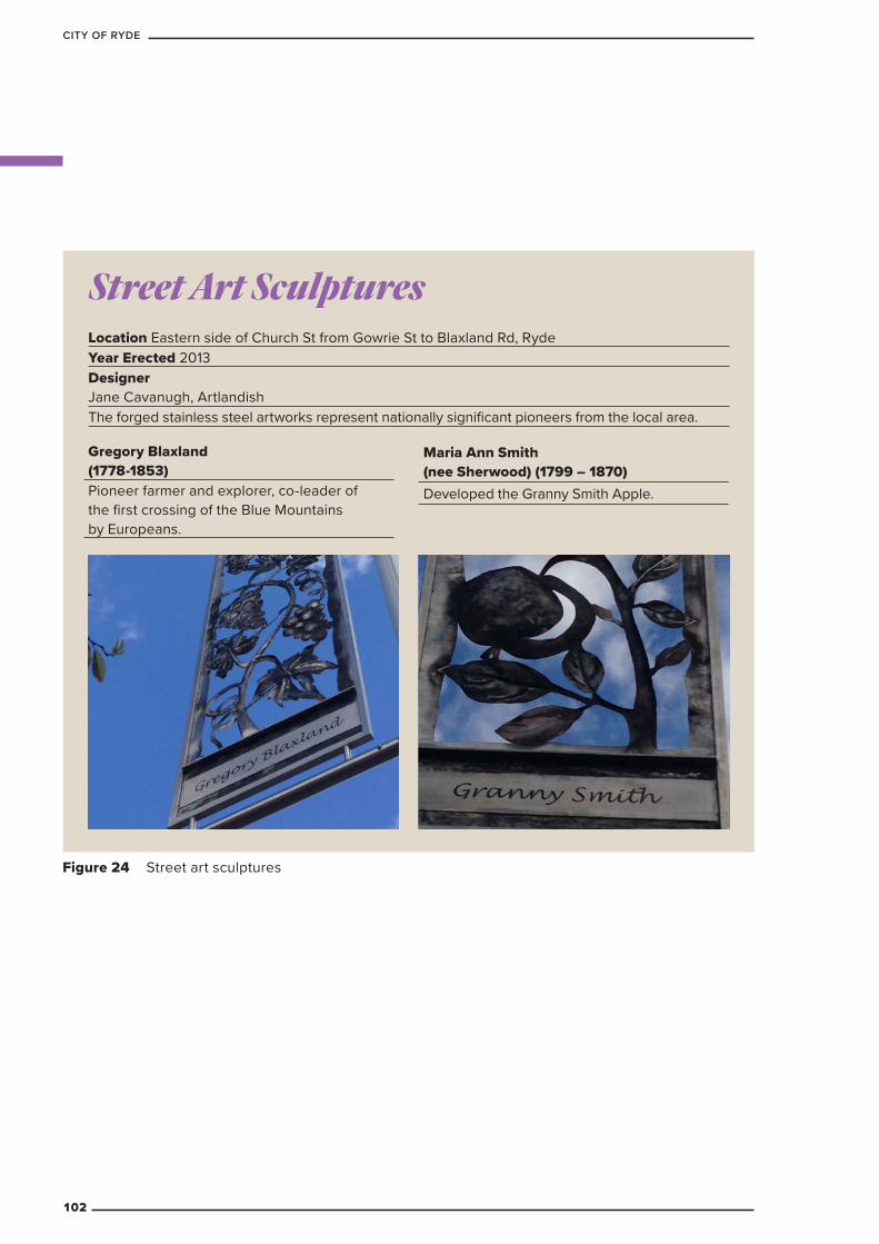
Figure 24 Street art sculptures
Street Art Sculptures
Gregory Blaxland (1778-1853)Pioneer farmer and explorer, co-leader of the first crossing of the Blue Mountains by Europeans.
Maria Ann Smith (nee Sherwood) (1799 – 1870)Developed the Granny Smith Apple.
Location Eastern side of Church St from Gowrie St to Blaxland Rd, RydeYear Erected 2013Designer Jane Cavanugh, ArtlandishThe forged stainless steel artworks represent nationally significant pioneers from the local area.
102
CITY OF RYDE
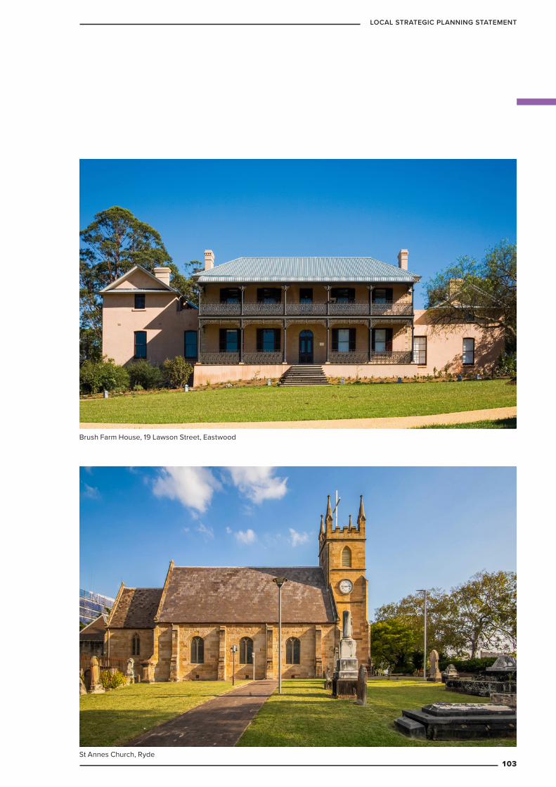
St Annes Church, Ryde
Brush Farm House, 19 Lawson Street, Eastwood
103
LOCAL STRATEGIC PLANNING STATEMENT
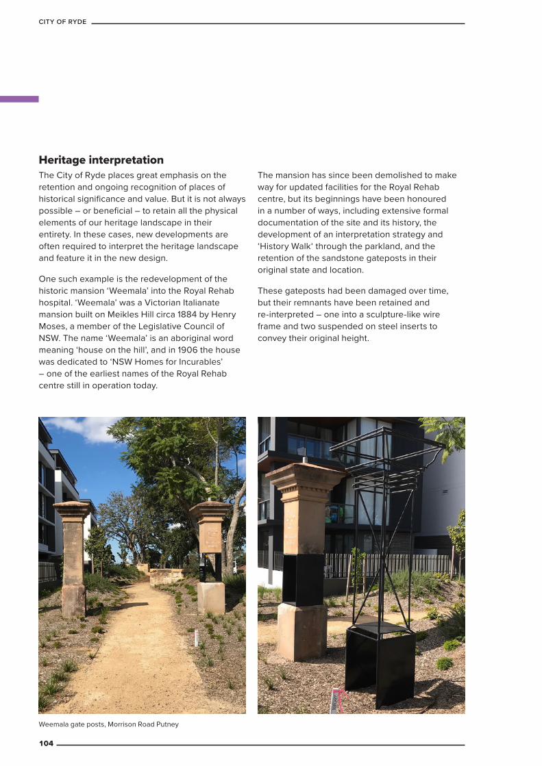
Heritage interpretationThe City of Ryde places great emphasis on the retention and ongoing recognition of places of historical significance and value. But it is not always possible – or beneficial – to retain all the physical elements of our heritage landscape in their entirety. In these cases, new developments are often required to interpret the heritage landscape and feature it in the new design.
One such example is the redevelopment of the historic mansion ‘Weemala’ into the Royal Rehab hospital. ‘Weemala’ was a Victorian Italianate mansion built on Meikles Hill circa 1884 by Henry Moses, a member of the Legislative Council of NSW. The name ‘Weemala’ is an aboriginal word meaning ‘house on the hill’, and in 1906 the house was dedicated to ‘NSW Homes for Incurables’ – one of the earliest names of the Royal Rehab centre still in operation today.
The mansion has since been demolished to make way for updated facilities for the Royal Rehab centre, but its beginnings have been honoured in a number of ways, including extensive formal documentation of the site and its history, the development of an interpretation strategy and ‘History Walk‘ through the parkland, and the retention of the sandstone gateposts in their original state and location.
These gateposts had been damaged over time, but their remnants have been retained and re-interpreted – one into a sculpture-like wire frame and two suspended on steel inserts to convey their original height.
Weemala gate posts, Morrison Road Putney
104
CITY OF RYDE
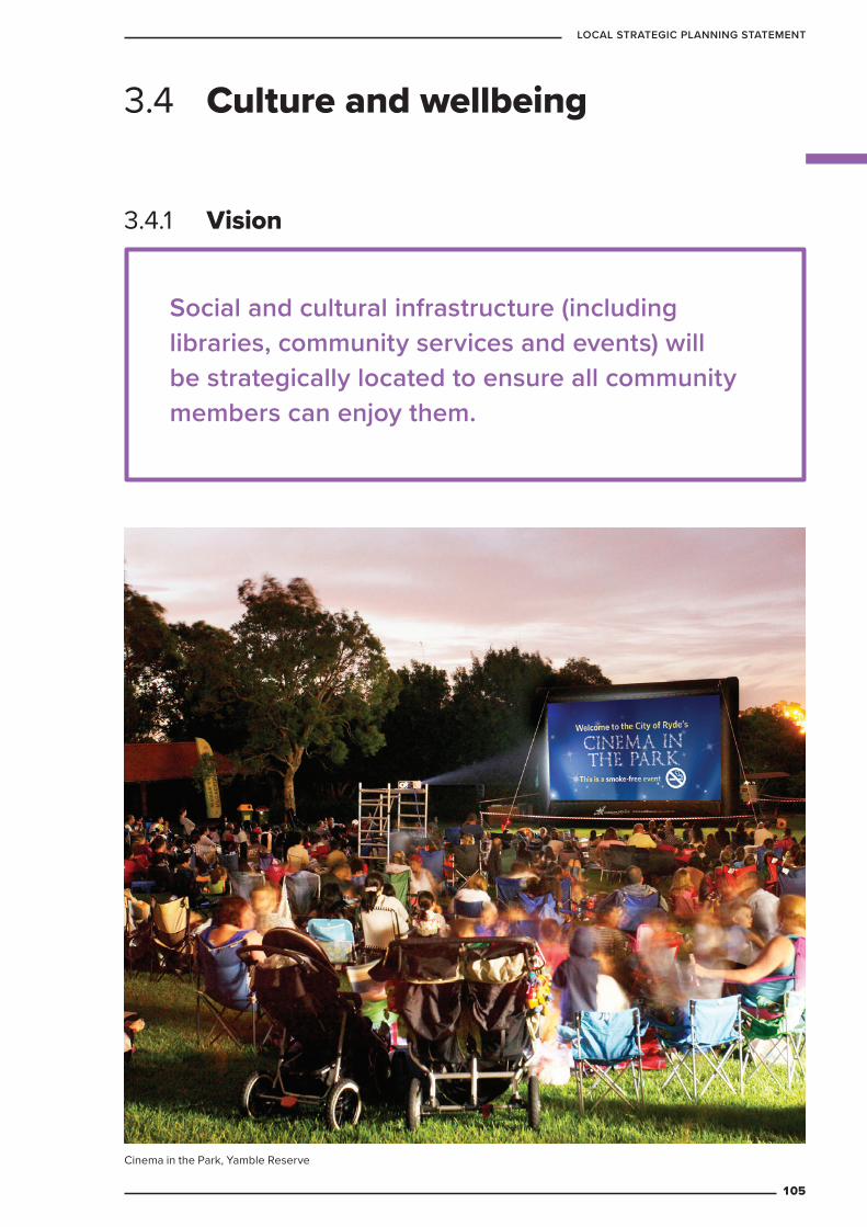
Social and cultural infrastructure (including libraries, community services and events) will be strategically located to ensure all community members can enjoy them.
3.4 Culture and wellbeing
3.4.1 Vision
Cinema in the Park, Yamble Reserve
105
LOCAL STRATEGIC PLANNING STATEMENT
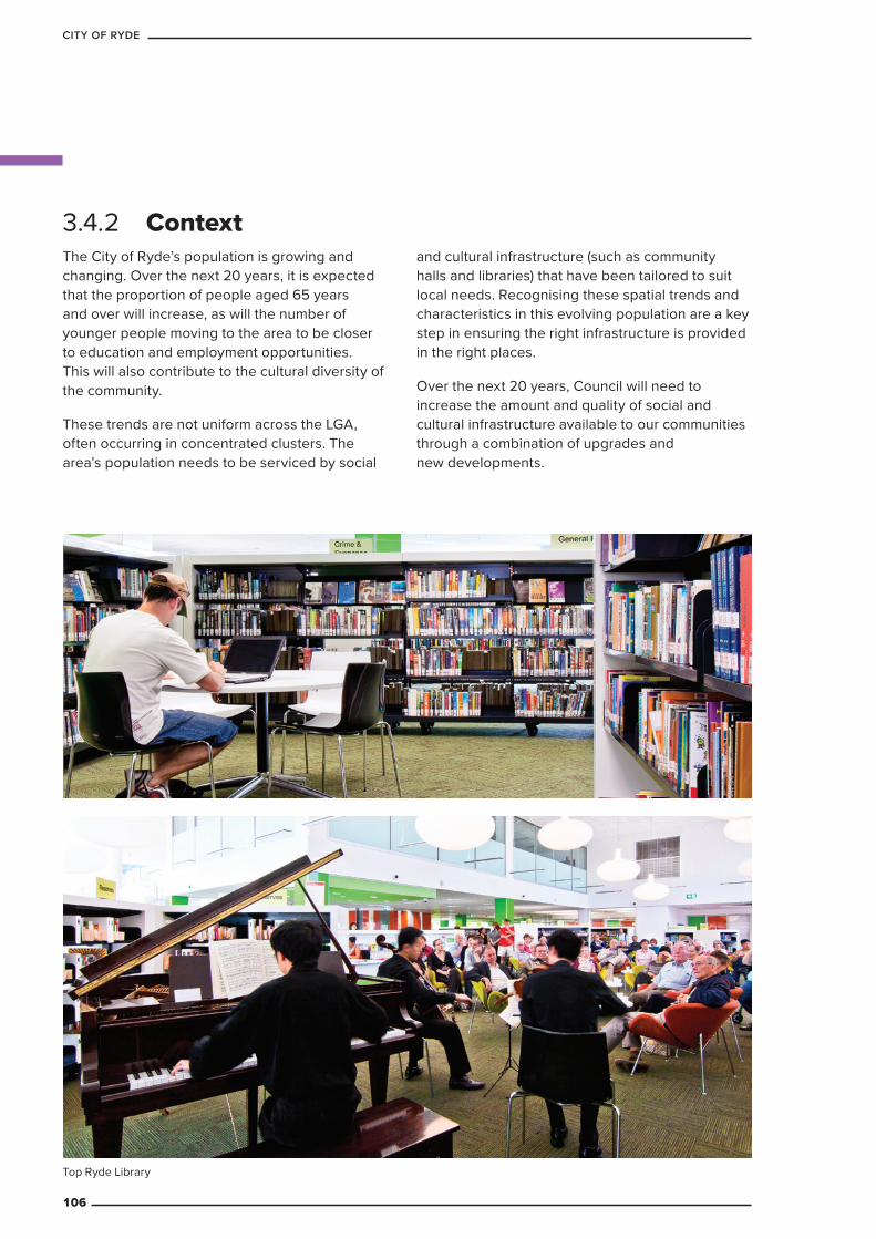
The City of Ryde’s population is growing and changing. Over the next 20 years, it is expected that the proportion of people aged 65 years and over will increase, as will the number of younger people moving to the area to be closer to education and employment opportunities. This will also contribute to the cultural diversity of the community.
These trends are not uniform across the LGA, often occurring in concentrated clusters. The area’s population needs to be serviced by social
and cultural infrastructure (such as community halls and libraries) that have been tailored to suit local needs. Recognising these spatial trends and characteristics in this evolving population are a key step in ensuring the right infrastructure is provided in the right places.
Over the next 20 years, Council will need to increase the amount and quality of social and cultural infrastructure available to our communities through a combination of upgrades and new developments.
3.4.2 Context
Top Ryde Library
106
CITY OF RYDE
Libraries – The current configuration of libraries best serves
the southern part of the LGA. Strategically, and as opportunities arise, libraries will need to be built or redeveloped in the northern part of the LGA, especially around Macquarie Park, North Ryde and Eastwood, due to increasing development and population growth.
– The number of people over 65, young adults and children is predicted to sharply increase over the next 20 years. To meet their growing needs, the library will explore innovative service delivery, marketing and programs to remain relevant and to continue to meaningfully engage with the community.
– Higher-density living will place extra demand on our libraries as people look for quiet study spaces and places to gather and engage in creative pursuits.
Social and cultural facilities and services
– The majority of community facilities within the City of Ryde are at least 30 years old, and many of them are converted residential buildings that have not been built for purpose. The high management and maintenance costs of these ageing facilities is not matched by income generated from fees and charges.
– Some of the ageing community infrastructure across the LGA is ill-suited to the requirements of modern service provision and cannot meet contemporary needs or expectations.
– The stock of facilities is insufficient to meet the needs of the current and projected population. There is little capacity in existing facilities for services to grow, change or run new programs and activities, and many facilities are overcrowded.
– Council has limited capacity to provide equitable access to affordable rental accommodation in its facilities, yet this support is often essential, given insufficient funding through state and federal programs.
– The location of existing community buildings is not evenly spread throughout the LGA.
– There are limited services offered within Council community buildings that support and/or address the needs of young people, people from culturally and linguistically diverse backgrounds and cultural and arts activities.
– Council has very few buildings that are built for purpose and offer flexible and multi-purpose space.
Events – Providing events that cater for diverse cultural
needs of the Ryde community.
– Ensuring events are responsive to the changing trends and needs of the community.
– Event space is not evenly distributed across the LGA or sufficiently available for Council and community run events.
3.4.3 Key challenges
3.4.4 Targets
The library’s online collection will have expanded to include 25,000 items, and a plan for future expansion developed to reach a target of 25 per cent of the total collection online by 2024.
The following targets will guide future developments, Council policies and programs.
107
LOCAL STRATEGIC PLANNING STATEMENT
LibrariesThe City of Ryde is serviced by five libraries, located in Eastwood, Gladesville, Cox’s Road, Top Ryde and West Ryde. Each dedicated building provides free educational and entertainment resources for people of all ages and from diverse linguistic and cultural backgrounds. Council’s library service also includes an extensive 24/7 online collection, events and school holiday programs, local and family history archives, and key community services.
Table 22 Libraries: planning priorities and actions
Planning priority ActionsCW1 Provide library services in
growth areas in the northern part of the LGA
CW1.1 Identify options for library services growth areas, including Macquarie Park. Macquarie Park Library and Community Hub by 2030
a. Investigate opportunities to expand or relocate the North Ryde and Eastwood libraries to better meet the needs of the community in the north of the LGA
b. Investigate opportunities to expand or relocate Gladesville Library. 2025
CW1.2 Ensure the library service delivery model is current. Ongoing
CW2 Expand or relocate existing library spaces to keep pace with growth
CW2.1 Investigate options for the redevelopment or relocation of existing libraries. 2025
CW2.2 Expand the online library collection to achieve a collection size of 25,000 and develop a plan for future expansion to reach a target of 25 per cent of total collection online. 2025
CW2.3 Explore innovative approaches to library service delivery. 2025
a. Introduce a library self-service app and smart cards. 2025
CW3 Ensure library services are accessible to all members of the community
CW3.1 Investigate alternative service options including flexible opening hours at existing libraries. 2021
CW3.2 Develop an accessibility plan for future library facilities and services. 2021
3.4.5 Planning priorities and actions
108
CITY OF RYDE
Social and cultural facilities and servicesCommunity facilities play a pivotal role in establishing connections and improving the quality of life of our community. They are identified by both the community and the service sector as being vital to the delivery of affordable services. Council currently supports 25 community services in subsidised accommodation, including childcare centres, baby healthcare centres, family support services, arts groups, heritage groups, community service organisations, and disability support services.
Table 23 Social and cultural facilities and services: planning priorities and actions
Planning priority ActionsCW4 Provide multi-purpose
community facilitiesCW4.1 Implement the findings of the Social and Cultural
Infrastructure Framework 2019-2041
CW4.2 Identify and create community hubs from Council-owned and Council-operated properties (including the Civic Centre site) to ensure residents have more access to cultural and community opportunities. 2030
CW4.3 Identify a suitable location for a youth recreation and services hub. 2025
CW4.4 Create multipurpose, district-level community hub at Macquarie Park and Eastwood. 2030
CW4.5 Create multipurpose local community hub at Gladesville and Cox’s Road. 2030
CW4.6 Investigate opportunities for Council to act as a ‘space broker’ linking community needs to the most appropriate space whether a Council or a non-Council facility like schools, churches, etc. 2025
CW4.7 Develop a district level community centre and a regional arts and cultural space at Top Ryde. 2025
CW4.8 Partner with NSW Health to identify opportunities for new community infrastructure in Gladesville, Eastwood, North Ryde and Macquarie Park and relocate health services from Ryde Early Childhood Health Centre to a community services hub in Top Ryde
CW4.9 Investigate opportunities to expand the provision of community based pre-school places
CW4.10 Implement the findings of the Social Plan 2019-2024 and The Creativity Strategy 2019-2024
109
LOCAL STRATEGIC PLANNING STATEMENT
EventsThe City of Ryde runs and hosts a wide range of community events in its public spaces and facilities throughout the year. This includes large-scale annual festivals (such as the West Ryde Easter Parade and Fair and the Granny Smith Festival), more formal events (such as Ryde Remembers and Citizen of the Year Awards), programs of multiple events (such as the Cinema in the Park Series and school holiday programs), nationally and internationally recognised events (such as NAIDOC Week and International Women’s Day) and competitions (such as the Sustainable Waste to Art Prize and Spring Garden Competition). These events are key opportunities for Ryde’s community to come together and celebrate their differences and the things they have in common.
Table 24 Events: planning priorities and actions
Planning priority ActionsCW5 Remove regulatory barriers
to eventsCW5.1 Prepare planning proposal to amend exempt
development provisions in LEP to assist with streamlining approvals for events
CW5.2 Review the approvals process with respect to public events on Council-owned and/or controlled land and on private land. 2021
CW5.3 Develop a community toolkit for event management. 2025
CW5.4 Prepare one Development Application for key sites to permit ongoing/multiple Council and community events. 2021
CW6 Deliver safe events for our community
CW6.1 Review the need for safety barriers at event sites to protect pedestrians and event attendees
CW6.2 Prepare and implement a safe events strategy to deliver a wide range of events across the City of Ryde
CW6.3 Prepare a special event clearway/traffic policy for adoption by Council’s Traffic Committee
CW6.4 Prepare a Risk Management Strategy for use by Council and community-run events. 2021
CW6.5 Prepare a Traffic Management Plan for key event sites. 2021
110
CITY OF RYDE
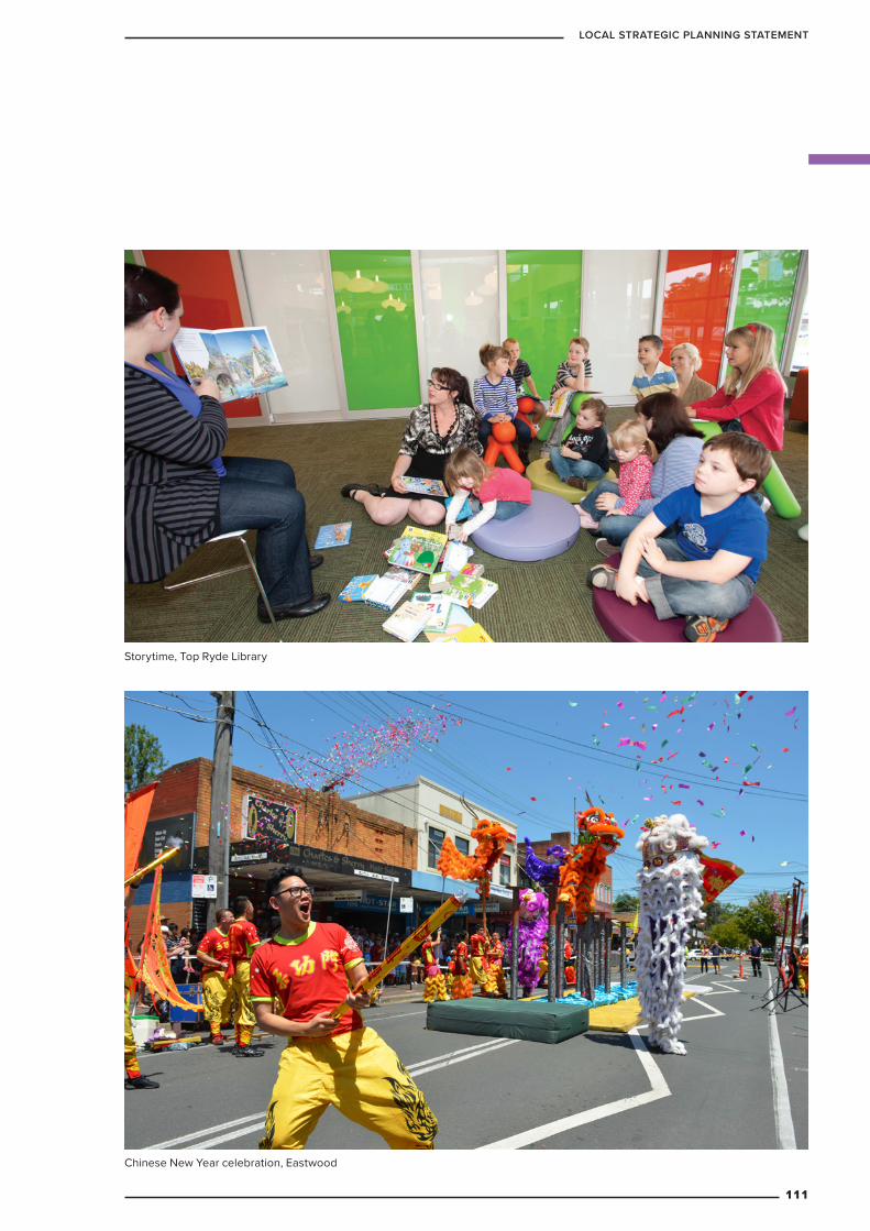
Chinese New Year celebration, Eastwood
Storytime, Top Ryde Library
111
LOCAL STRATEGIC PLANNING STATEMENT

Granny Smith FestivalThe City of Ryde’s annual Granny Smith Festival began in 1985 and is now regarded as one of Sydney’s largest street festivals. It attracts over 90,000 people each year and is supported by local businesses, sporting and service organisations, schools and the wider community.
The festival celebrates the life and legacy of one of the district’s most famous citizens, Maria Ann Smith – aka Granny Smith – who, in 1868, ‘accidentally’ grew the first batch of little green apples that bear her name and are now grown all over the world. Held in the Eastwood Town Centre, this event showcases and caters for Ryde’s diverse community and talents, and celebrates its unique local identity. The festival includes a parade, stalls, entertainment and ends with a fireworks display.
3.4.6 Case studies
Granny Smith Festival, Eastwood
112
CITY OF RYDE
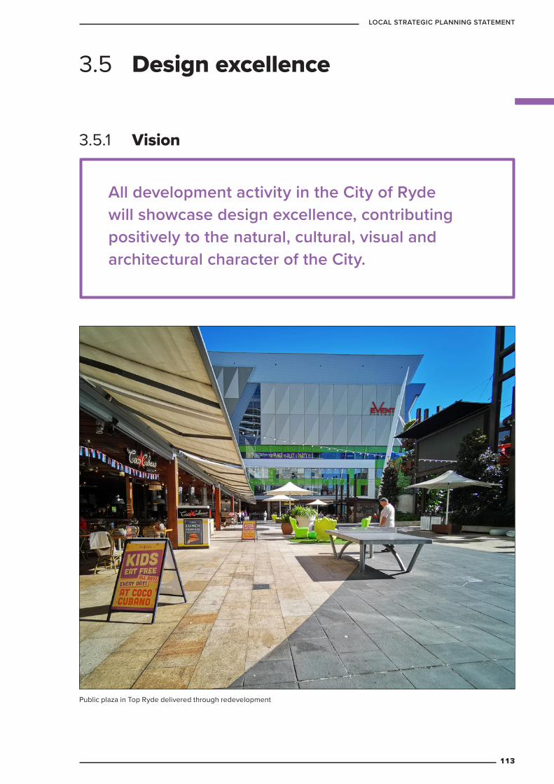
3.5.1 Vision
3.5 Design excellence
All development activity in the City of Ryde will showcase design excellence, contributing positively to the natural, cultural, visual and architectural character of the City.
Public plaza in Top Ryde delivered through redevelopment
113
LOCAL STRATEGIC PLANNING STATEMENT
3.5.2 Context
All planning proposals that increase floorspace and/or height will be referred to Council’s Urban Design Review Panel.
All development applications for proposals that are four storeys or more will be referred to Council’s Urban Design Review Panel.
3.5.3 Key challenges
3.5.4 Targets
As the City of Ryde continues to grow and develop over the next 20 years, maintaining a high quality of design in both public and private spaces will ensure our suburbs and town centres remain attractive and liveable for years to come.
We have heard from our community that the general condition and upkeep of public open spaces is the single most important characteristic of an attractive neighbourhood. A close second is keeping elements of the natural environment in built spaces and ensuring a sense of neighbourhood safety.
Well-designed buildings and public spaces play a significant role in:
– ensuring the environmental sustainability an area
– contributing to a sense of local identity and interest
– facilitating healthy lifestyles
– promoting safety and inclusion for people of all ages, genders, incomes, and ethnicities.
This chapter of the LSPS outlines the City of Ryde’s plan to ensure our LGA becomes and remains known for its excellent design over the next 20 years and beyond.
Coordinating public and private sector investment in building character and public areas to ensure good design outcomes.
The following targets will guide future developments, Council policies and programs.
114
CITY OF RYDE

Design qualityDesign quality refers to how well our places and buildings:
– have been tailored to meet the needs and wants of their users
– are suited to their surroundings
– how well they have been built.
High design quality will ensure the City of Ryde becomes and remains sustainable, functional, beautiful, and unique.
Table 25 Design quality: planning priorities and actions
Planning priority ActionsD1 Ensure
Development is guided by precinct scale, place-based planning
D1.1 Seek community feedback to create character statements to reflect the existing essence and desired future of all town centres and residential areas. Council will use the final statements to guide future planning and development. 2025
D1.2 Implement a design-led, place-based planning approach by developing the following masterplans:
– West Ryde Town Centre, 2025, prioritising:
» enhancement of local character and identity
» improved connectivity to, from and within the Town Centre
– Waterloo Road in Macquarie Park, 2021 (See Macquarie Park chapter for more detail)
D1.3 Recommence the Macquarie Park Strategic Investigation, 2021 (See Macquarie Park chapter for more detail)
3.5.5 Planning priorities and actions
Banjo Paterson Park115
LOCAL STRATEGIC PLANNING STATEMENT

Planning priority ActionsD2 Ensure all
new buildings throughout the City of Ryde are examples of excellent design
D2.1 Influence the planning stages of major projects by referring all developments over a certain scale to the Ryde Urban Design Review Panel at both the pre-application and post-lodgement stages. Ongoing
D2.2 Update Ryde’s Development Control Plan (DCP) to enhance Design Excellence Guidelines, 2025, addressing:
– suitability of location and design for the development’s purpose
– the relationship between public and private spaces
– compatibility with existing and future character
– environmental sustainability (including urban heat and green building principles)
– universal design, social inclusion and safety
D2.3 Update Ryde’s LEP to include design excellence provisions and establish competitive design process requirements. 2025. This will include a high positive impact requirement for all buildings:
– over 35 metres tall in the Macquarie Park Corridor, and over 30 metres tall elsewhere in the LGA
– located on sites over 1Ha
– located on mapped opportunity sites (to be identified at a later date)
Macquarie University Library
116
CITY OF RYDE
PlacemakingPlacemaking involves providing physical infrastructure to support the aspects of a place which make it attractive. This might include providing outdoor, shaded seating, which allows people to comfortably spend time outdoors together and contributes to a friendly community culture. It can also include building creative landmarks which people driving through the area see and remember, contributing to the way people see and think about the City of Ryde.
Table 26 Placemaking: planning priorities and actions
Planning priority ActionsD3 Ensure Ryde’s key centres
are designed to facilitate an appropriate balance of travel through centres and spending time in and using these places
D3.1 Complete movement-place analyses of all six key centres, in consultation with transport agencies and community groups. 2025
D4 Ensure public spaces are well used and enhance local identity
D4.1 Prioritise the development of public spaces through Council’s capital works program that are designed to:
– encourage social interaction
– be accessible, safe, inclusive and equitable
– contribute positively to a sense of local identity
– demonstrate innovation and best practice
– provide cool spaces for community use in hot weather
Ongoing
D4.2 Continue to implement the current Neighbourhood and Centres Improvement Program, which includes ongoing monitoring of the condition and quality of public spaces. Ongoing
D4.3 Update City of Ryde’s current Public Domain Manual (a guide for Council, developers, consultants and residents involved in the future planning and design for our town centres) to reflect Ryde’s design excellence priorities. 2025
D4.4 New development is to contribute to the safety and enjoyment of the public domain including ensuring that waste collection services are off-street, vehicular egress is managed and pedestrians are prioritised.
117
LOCAL STRATEGIC PLANNING STATEMENT
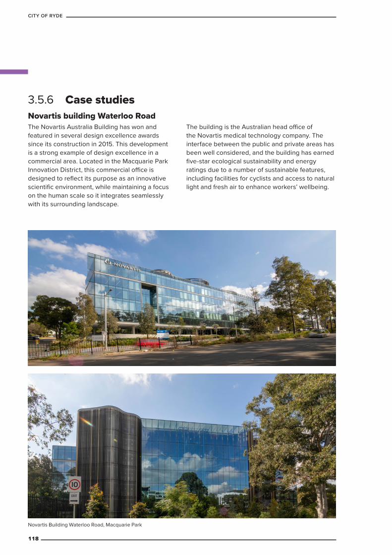
Novartis building Waterloo RoadThe Novartis Australia Building has won and featured in several design excellence awards since its construction in 2015. This development is a strong example of design excellence in a commercial area. Located in the Macquarie Park Innovation District, this commercial office is designed to reflect its purpose as an innovative scientific environment, while maintaining a focus on the human scale so it integrates seamlessly with its surrounding landscape.
The building is the Australian head office of the Novartis medical technology company. The interface between the public and private areas has been well considered, and the building has earned five-star ecological sustainability and energy ratings due to a number of sustainable features, including facilities for cyclists and access to natural light and fresh air to enhance workers’ wellbeing.
3.5.6 Case studies
Novartis Building Waterloo Road, Macquarie Park
118
CITY OF RYDE
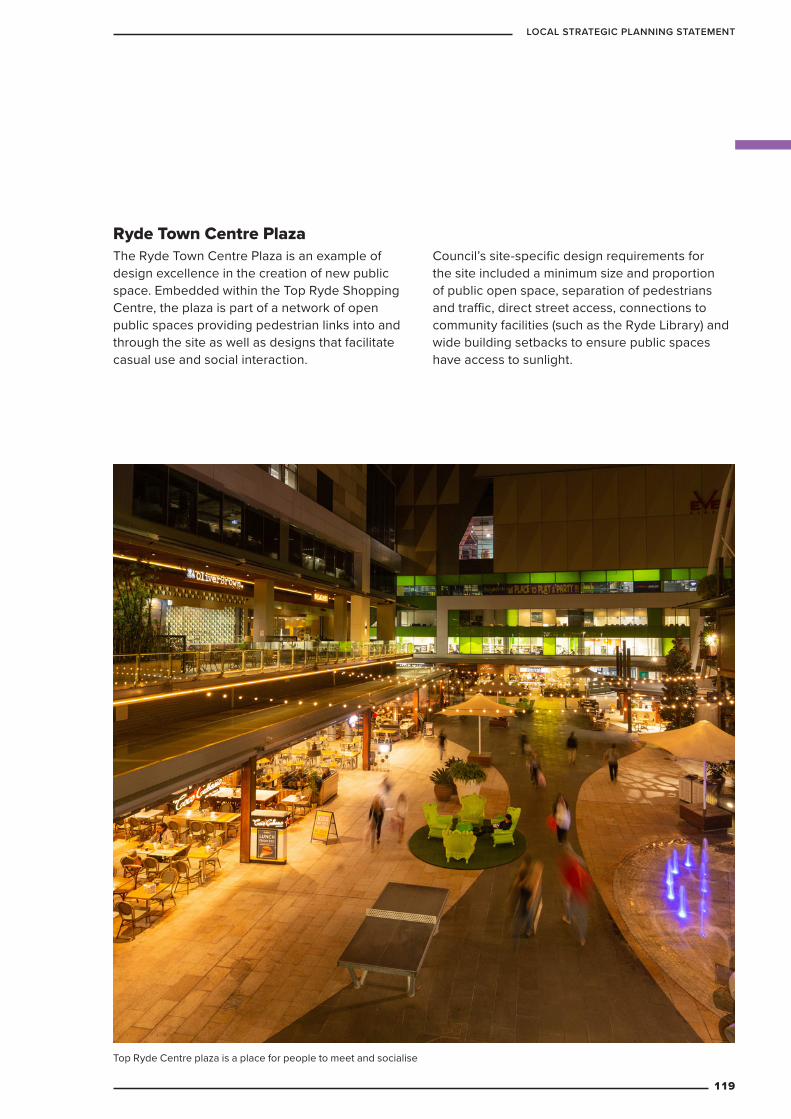
Ryde Town Centre PlazaThe Ryde Town Centre Plaza is an example of design excellence in the creation of new public space. Embedded within the Top Ryde Shopping Centre, the plaza is part of a network of open public spaces providing pedestrian links into and through the site as well as designs that facilitate casual use and social interaction.
Council’s site-specific design requirements for the site included a minimum size and proportion of public open space, separation of pedestrians and traffic, direct street access, connections to community facilities (such as the Ryde Library) and wide building setbacks to ensure public spaces have access to sunlight.
Top Ryde Centre plaza is a place for people to meet and socialise
119
LOCAL STRATEGIC PLANNING STATEMENT
PRODUCTIVITY4
PART
120
CITY OF RYDE

Ensure the Ryde LGA will be well-designed and planned to encourage new investment, local jobs and business opportunities in an environment of innovation, progression and economic growth. This approach will give more people the option to live and work in the Ryde LGA.
4.1 The economy and jobs
4.1.1 Vision
Aerial looking down to the business park, North Ryde
121
LOCAL STRATEGIC PLANNING STATEMENT
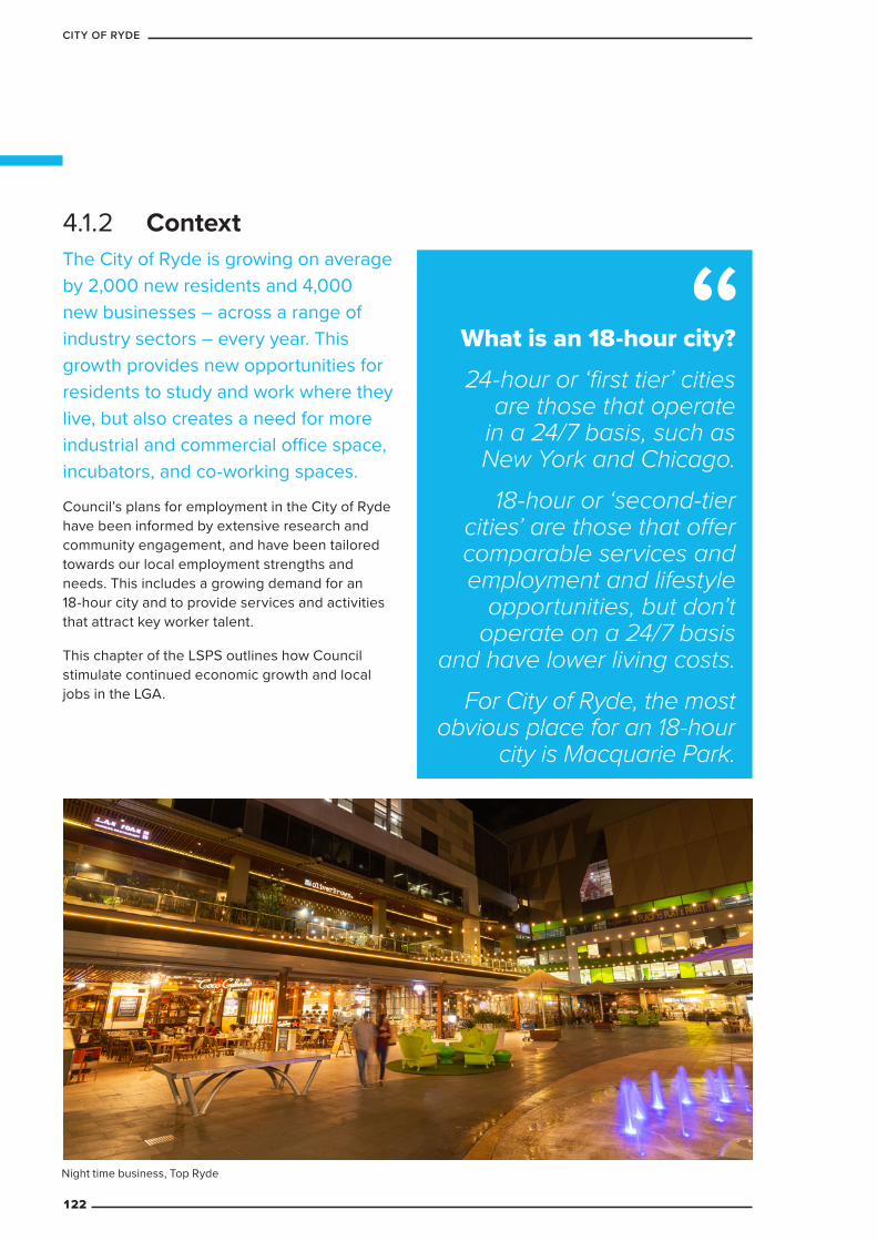
The City of Ryde is growing on average by 2,000 new residents and 4,000 new businesses – across a range of industry sectors – every year. This growth provides new opportunities for residents to study and work where they live, but also creates a need for more industrial and commercial office space, incubators, and co-working spaces.
Council’s plans for employment in the City of Ryde have been informed by extensive research and community engagement, and have been tailored towards our local employment strengths and needs. This includes a growing demand for an 18-hour city and to provide services and activities that attract key worker talent.
This chapter of the LSPS outlines how Council stimulate continued economic growth and local jobs in the LGA.
4.1.2 Context
What is an 18-hour city? 24-hour or ‘first tier’ cities
are those that operate in a 24/7 basis, such as New York and Chicago.
18-hour or ‘second-tier cities’ are those that offer comparable services and employment and lifestyle
opportunities, but don’t operate on a 24/7 basis
and have lower living costs. For City of Ryde, the most
obvious place for an 18-hour city is Macquarie Park.
Night time business, Top Ryde
122
CITY OF RYDE
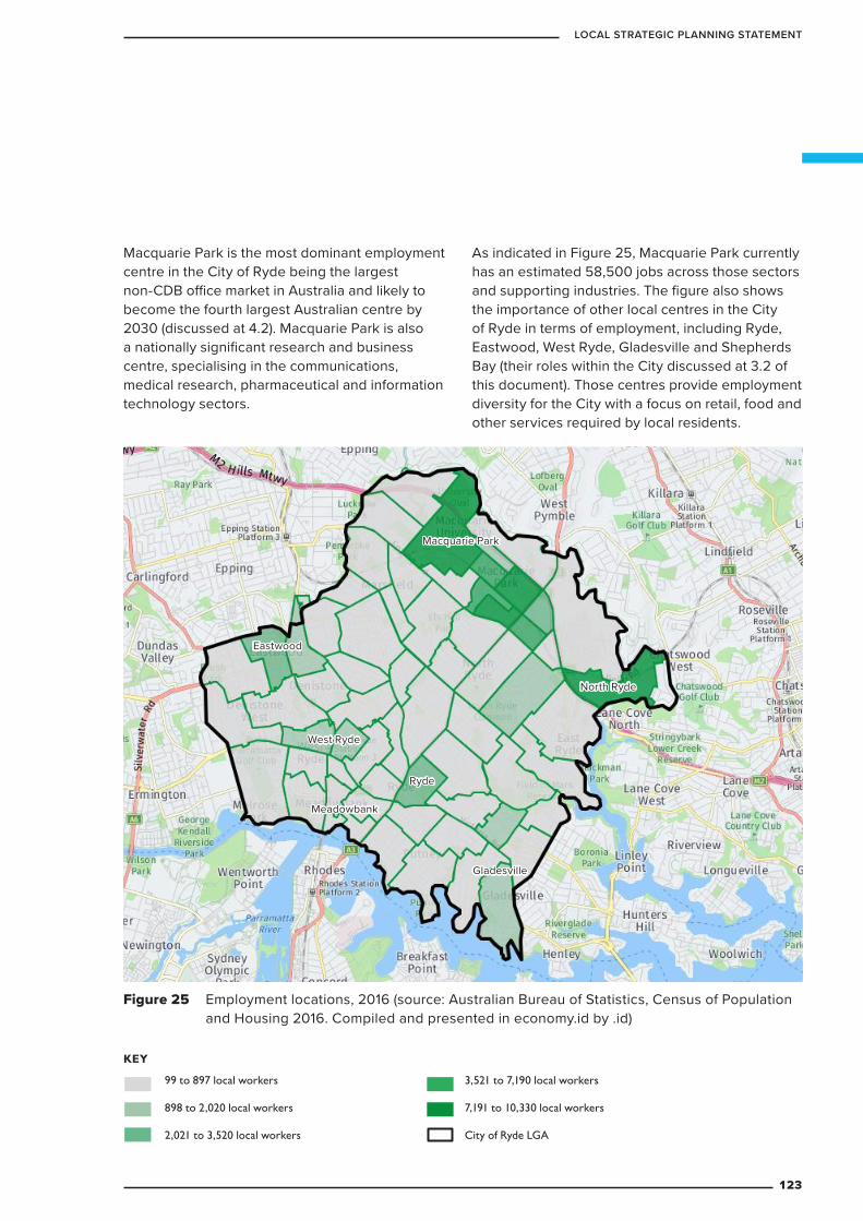
Figure 25 Employment locations, 2016 (source: Australian Bureau of Statistics, Census of Population and Housing 2016. Compiled and presented in economy.id by .id)
KEY
99 to 897 local workers
898 to 2,020 local workers
2,021 to 3,520 local workers
3,521 to 7,190 local workers
7,191 to 10,330 local workers
City of Ryde LGA
North Ryde
Macquarie Park
West Ryde
Eastwood
Gladesville
Meadowbank
Ryde
Macquarie Park is the most dominant employment centre in the City of Ryde being the largest non-CDB office market in Australia and likely to become the fourth largest Australian centre by 2030 (discussed at 4.2). Macquarie Park is also a nationally significant research and business centre, specialising in the communications, medical research, pharmaceutical and information technology sectors.
As indicated in Figure 25, Macquarie Park currently has an estimated 58,500 jobs across those sectors and supporting industries. The figure also shows the importance of other local centres in the City of Ryde in terms of employment, including Ryde, Eastwood, West Ryde, Gladesville and Shepherds Bay (their roles within the City discussed at 3.2 of this document). Those centres provide employment diversity for the City with a focus on retail, food and other services required by local residents.
123
LOCAL STRATEGIC PLANNING STATEMENT
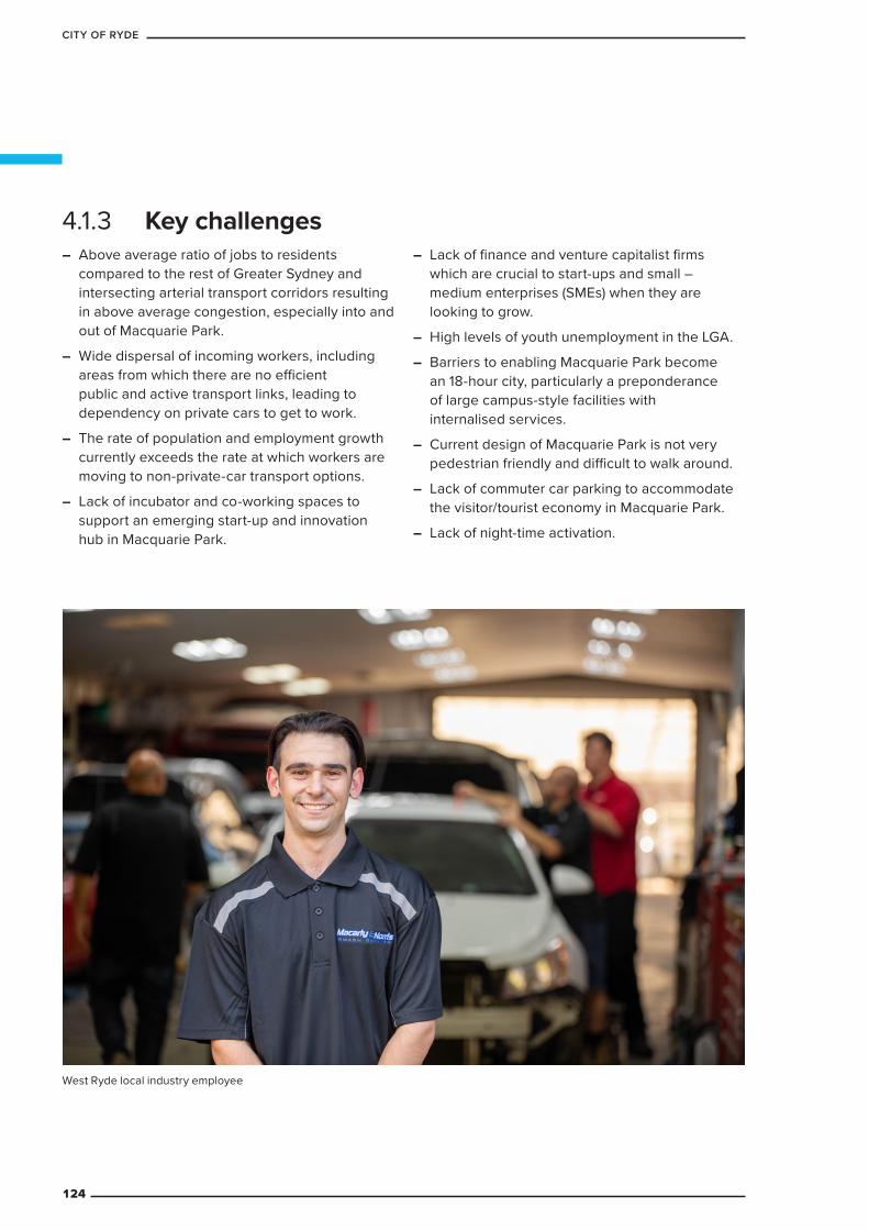
– Above average ratio of jobs to residents compared to the rest of Greater Sydney and intersecting arterial transport corridors resulting in above average congestion, especially into and out of Macquarie Park.
– Wide dispersal of incoming workers, including areas from which there are no efficient public and active transport links, leading to dependency on private cars to get to work.
– The rate of population and employment growth currently exceeds the rate at which workers are moving to non-private-car transport options.
– Lack of incubator and co-working spaces to support an emerging start-up and innovation hub in Macquarie Park.
– Lack of finance and venture capitalist firms which are crucial to start-ups and small – medium enterprises (SMEs) when they are looking to grow.
– High levels of youth unemployment in the LGA.
– Barriers to enabling Macquarie Park become an 18-hour city, particularly a preponderance of large campus-style facilities with internalised services.
– Current design of Macquarie Park is not very pedestrian friendly and difficult to walk around.
– Lack of commuter car parking to accommodate the visitor/tourist economy in Macquarie Park.
– Lack of night-time activation.
4.1.3 Key challenges
West Ryde local industry employee
124
CITY OF RYDE
4.1.4 Targets
19,000 new jobs in Macquarie Park by 2036 as per the North District Plan.
Inward Investment into Macquarie Park and Town Centres will increase.$
40% of journeys to work will be by public or active transport in accordance with Council’s adopted Integrated Transport Strategy 2016-2031.
There will be increased diversity in local employment opportunities (including more start-ups, small business and creative enterprise).
There will be an additional 325,000m2 of commercial office space in Macquarie Park by 2036 (based on estimated 20m2 per employee)
There will be an increase in community and other infrastructure in Macquarie Park to support growth.
The following targets will guide future developments, Council policies and programs.
125
LOCAL STRATEGIC PLANNING STATEMENT
4.1.6 Planning priorities and actions Table 27 The economy and jobs: planning priorities and actions
Planning priority ActionsEM1 Focus land use intensification
(increasing the productivity or profitability of land uses) in the most accessible centres and discourage it in low-density residential areas (including prohibiting new uses)
EM 1.1 Ensure a mix of different land uses in town centres to minimise travel for work and to access services while also creating a greater return on investment in active and public transport facilities. 2021
EM 1.2 Planning Proposals seeking to reduce the amount of employment land will not be supported until the employment industries analysis and review is completed. Planning Proposals would then only proceed if they are consistent with the findings of that review. 2021
EM2 Ensure the City of Ryde LGA is well-designed and planned to encourage new investment, local jobs and business opportunities in an environment of innovation, progression and economic growth
EM2.1 Review the extent, location, capacity and zoning of planning controls that apply to employment lands to ensure the retention and management of adequate land with appropriate planning provisions. 2021
EM2.2 Ensure Land use provisions respond to global and local trends to support job creation, ensuring there is opportunity for land uses such as co-working spaces and incubators in appropriate locations. 2021
EM3 Stimulate economic growth and local jobs by providing opportunities for a range of businesses and protecting employment lands
EM3.1 Update Council’s review process so that planning proposals that seek to rezone employment land to non-employment land will not proceed until the review of existing employment land capacity and demand analysis has been completed. Ongoing
EM3.2 Expand the permissible land uses in centres to encourage the growth of local business, the new economy and creative enterprise. 2021
EM3.3 Review land use provisions so that zoning facilitates business attraction. 2021
EM4 Promote tourism and night time economy
EM4.1 Collaborate with partners to promote a 18-hour city in Macquarie Park
EM4.2 Enhance tourism opportunities in association with attractions such as Macquarie University and Lane Cove National Park
126
CITY OF RYDE
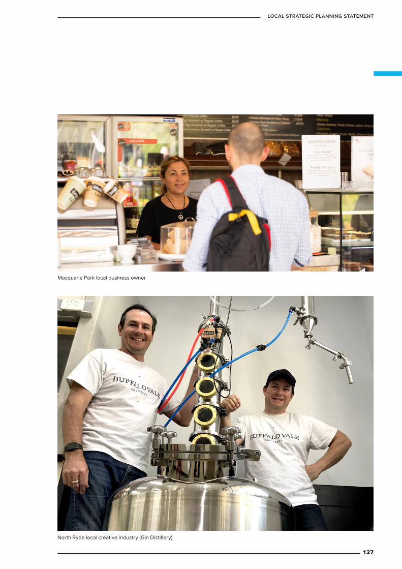
North Ryde local creative industry (Gin Distillery)
Macquarie Park local business owner
127
LOCAL STRATEGIC PLANNING STATEMENT
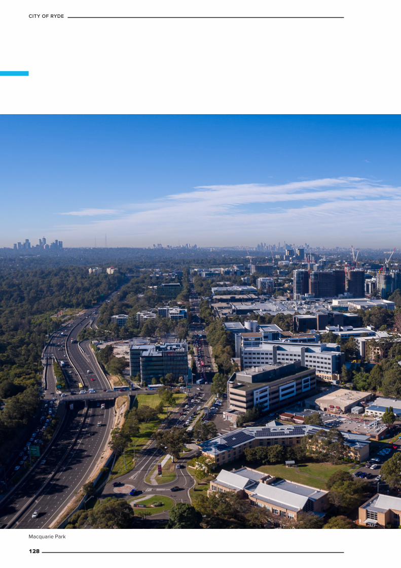
Macquarie Park
128
CITY OF RYDE
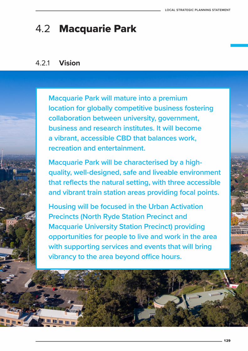
Macquarie Park will mature into a premium location for globally competitive business fostering collaboration between university, government, business and research institutes. It will become a vibrant, accessible CBD that balances work, recreation and entertainment.
Macquarie Park will be characterised by a high-quality, well-designed, safe and liveable environment that reflects the natural setting, with three accessible and vibrant train station areas providing focal points.
Housing will be focused in the Urban Activation Precincts (North Ryde Station Precinct and Macquarie University Station Precinct) providing opportunities for people to live and work in the area with supporting services and events that will bring vibrancy to the area beyond office hours.
4.2 Macquarie Park
4.2.1 Vision
129
LOCAL STRATEGIC PLANNING STATEMENT
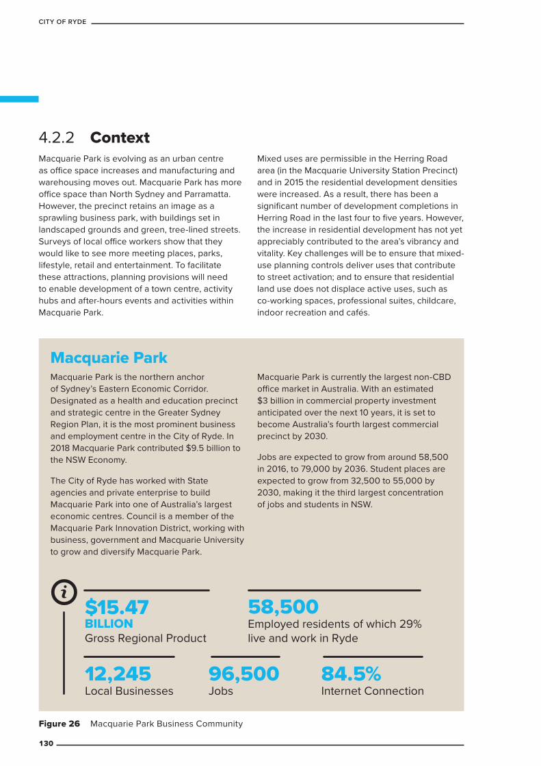
4.2.2 ContextMacquarie Park is evolving as an urban centre as office space increases and manufacturing and warehousing moves out. Macquarie Park has more office space than North Sydney and Parramatta. However, the precinct retains an image as a sprawling business park, with buildings set in landscaped grounds and green, tree-lined streets. Surveys of local office workers show that they would like to see more meeting places, parks, lifestyle, retail and entertainment. To facilitate these attractions, planning provisions will need to enable development of a town centre, activity hubs and after-hours events and activities within Macquarie Park.
Mixed uses are permissible in the Herring Road area (in the Macquarie University Station Precinct) and in 2015 the residential development densities were increased. As a result, there has been a significant number of development completions in Herring Road in the last four to five years. However, the increase in residential development has not yet appreciably contributed to the area’s vibrancy and vitality. Key challenges will be to ensure that mixed-use planning controls deliver uses that contribute to street activation; and to ensure that residential land use does not displace active uses, such as co-working spaces, professional suites, childcare, indoor recreation and cafés.
Figure 26 Macquarie Park Business Community
Macquarie Park Macquarie Park is the northern anchor of Sydney’s Eastern Economic Corridor. Designated as a health and education precinct and strategic centre in the Greater Sydney Region Plan, it is the most prominent business and employment centre in the City of Ryde. In 2018 Macquarie Park contributed $9.5 billion to the NSW Economy.
The City of Ryde has worked with State agencies and private enterprise to build Macquarie Park into one of Australia’s largest economic centres. Council is a member of the Macquarie Park Innovation District, working with business, government and Macquarie University to grow and diversify Macquarie Park.
Macquarie Park is currently the largest non-CBD office market in Australia. With an estimated $3 billion in commercial property investment anticipated over the next 10 years, it is set to become Australia’s fourth largest commercial precinct by 2030.
Jobs are expected to grow from around 58,500 in 2016, to 79,000 by 2036. Student places are expected to grow from 32,500 to 55,000 by 2030, making it the third largest concentration of jobs and students in NSW.
$15.47BILLIONGross Regional Product
58,500 Employed residents of which 29% live and work in Ryde
12,245 Local Businesses
96,500 Jobs
84.5% Internet Connection
130
CITY OF RYDE
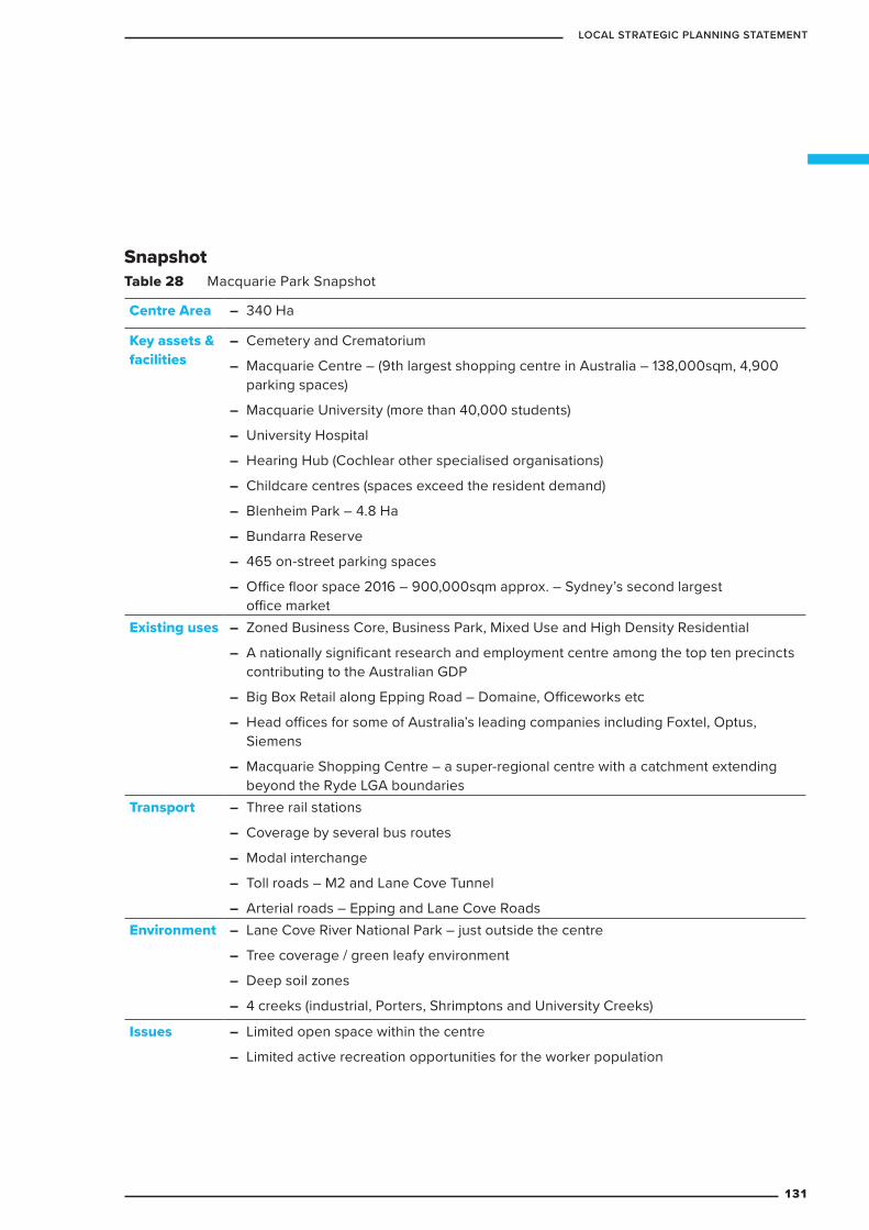
SnapshotTable 28 Macquarie Park Snapshot
Centre Area – 340 Ha
Key assets & facilities
– Cemetery and Crematorium
– Macquarie Centre – (9th largest shopping centre in Australia – 138,000sqm, 4,900 parking spaces)
– Macquarie University (more than 40,000 students)
– University Hospital
– Hearing Hub (Cochlear other specialised organisations)
– Childcare centres (spaces exceed the resident demand)
– Blenheim Park – 4.8 Ha
– Bundarra Reserve
– 465 on-street parking spaces
– Office floor space 2016 – 900,000sqm approx. – Sydney’s second largest office market
Existing uses – Zoned Business Core, Business Park, Mixed Use and High Density Residential
– A nationally significant research and employment centre among the top ten precincts contributing to the Australian GDP
– Big Box Retail along Epping Road – Domaine, Officeworks etc
– Head offices for some of Australia’s leading companies including Foxtel, Optus, Siemens
– Macquarie Shopping Centre – a super-regional centre with a catchment extending beyond the Ryde LGA boundaries
Transport – Three rail stations
– Coverage by several bus routes
– Modal interchange
– Toll roads – M2 and Lane Cove Tunnel
– Arterial roads – Epping and Lane Cove RoadsEnvironment – Lane Cove River National Park – just outside the centre
– Tree coverage / green leafy environment
– Deep soil zones
– 4 creeks (industrial, Porters, Shrimptons and University Creeks)
Issues – Limited open space within the centre
– Limited active recreation opportunities for the worker population
131
LOCAL STRATEGIC PLANNING STATEMENT
4.2.3 Key challengesCity shaping
– Macquarie Park is located at the intersection of the Eastern Harbour City and the Central River City in the Greater Sydney Commission’s region plan for Greater Sydney – A Metropolis of Three Cities. Its performance as a connected centre of innovation and employment is crucial to improving the connection between strategic centres across Greater Sydney.
– Ensuring planning for the Western Sydney Airport and surrounding precinct does not divert necessary ongoing investment in the Eastern Economic Corridor (stretching from Rhodes, via Macquarie Park and central Sydney to Sydney Airport). Integrated Land Use.
– There is currently a lack of cohesion/collaboration in government agency planning for Macquarie Park.
– Macquarie Park is subject to constant pressure to rezone commercial land for residential purposes, despite its national-scale economic significance.
– Macquarie Park is in transition, evolving from a business park to an urban centre. This requires an increased focus on job diversity (especially supporting local enterprise, small business, start-ups and the creative economy), and on human scale placemaking.
– CSIRO, which has a long history with Macquarie Park, is set to move outside the city of Ryde LGA in the near future, which may reduce attractiveness and employment opportunities of the precinct.
Transport – Insufficient public transport usage is
placing excessive pressure on parking and traffic congestion.
– Existing transport infrastructure does not effectively address pedestrian needs.
– The Macquarie Park bus interchange needs to be future-proofed to accommodate more commuters and services, especially in light of the 2019 Sydney Metro Northwest upgrades.
– The availability of car parking (both on-street and off-street) in the Precinct contributes to the high share of private vehicle travel.
– Existing large block sizes are discouraging pedestrian activity and reducing connectivity and ease of movement by all modes of transport.
– There are poor transport connections (public, active and private vehicle) between Macquarie Park and adjoining residential areas, making it difficult for the wider City of Ryde community to access services, jobs and public transport in Macquarie Park. This is partially due to the arterial roads surrounding the area, which increases dependence on private vehicle access, and partially due to the lack of Council-owned land and facilities to provide community infrastructure.
Lifestyle and amenity – There is not enough open space to support
active and passive recreation. This is exacerbated by significant physical barriers (including arterial roads) which discourage access to the nearby Lane Cover River National Park, Blenheim Park and Els Hall Park.
– There is unbuilt capacity for employment floor space within existing planning controls.
– Both worker and surrounding residential populations are growing, increasing the level of recreation, education, health and lifestyle needs to be met.
– As Macquarie Park evolves from a business park to an urban centre there is increased need to provide services and amenities, community facilities, retailing, entertainment and recreation that meets modern lifestyle expectations. While some of these needs are met within the Macquarie Centre shopping mall a diversity of experience and opportunities throughout the precinct needs to be also provided within a placemaking framework to ensure that the precinct attracts and retains a skilled employee base.
132
CITY OF RYDE

4.2.4 Targets
In accordance with Council’s adopted Integrated Transport Strategy 2016-2031 there will be a 60/40 private vehicle/acitve and public transport modal split of total journeys to and from work.
An Infrastructure Strategy for Macquarie Park will be prepared by December 2020.
A masterplan for Macquarie Park will be prepared by December 2021.
Fine grain roads will continue to be delivered in Macquarie Park, which will reduce block sizes, increase permeability and connectivity for vehicles and pedestrians, increase route options and reduce traffic congestion.
The amount of active public open space within Macquarie Park will increase.
The amount of social and cultural space within Macquarie Park will increase.
The following targets will guide future developments, Council policies and programs.
133
LOCAL STRATEGIC PLANNING STATEMENT
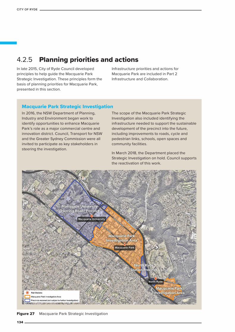
4.2.5 Planning priorities and actionsIn late 2015, City of Ryde Council developed principles to help guide the Macquarie Park Strategic Investigation. These principles form the basis of planning priorities for Macquarie Park, presented in this section.
Infrastructure priorities and actions for Macquarie Park are included in Part 2 Infrastructure and Collaboration.
Macquarie Park Strategic Investigation In 2016, the NSW Department of Planning, Industry and Environment began work to identify opportunities to enhance Macquarie Park’s role as a major commercial centre and innovation district. Council, Transport for NSW and the Greater Sydney Commission were all invited to participate as key stakeholders in steering the investigation.
The scope of the Macquarie Park Strategic Investigation also included identifying the infrastructure needed to support the sustainable development of the precinct into the future, including improvements to roads, cycle and pedestrian links, schools, open spaces and community facilities.
In March 2018, the Department placed the Strategic Investigation on hold. Council supports the reactivation of this work.
Figure 27 Macquarie Park Strategic Investigation
134
CITY OF RYDE

Table 29 Macquarie Park: planning priorities and actions
Planning priority ActionsM1 Develop Macquarie Park
as a health and education strategic centre focused around the following activity hubs:
– North Ryde Station
– Macquarie Park Station
– Macquarie University Station
– Cox’s Road
At least one hub should perform the role as the civic heart/centre of the precinct
M1.1 Prepare a masterplan that will implement the following principles:
Urban structure and placemaking
– Identify activity hubs within the precinct, each with a defined identity and role
– Create interactive, flexible, inclusive public domain and open spaces and social and cultural infrastructure
– Enhance street activation and night-time economy
– Provide economically, environmentally and socially sustainable buildings and public spaces
– Retain and enhance the valued green character of Macquarie Park including significant native tree planting
– Acknowledge Waterloo Road as the precinct’s ‘main street’ and focus for placemaking
Access and transport
– Improve ease of movement and accessibility (implement Council’s road network to have a 200m maximum distance between pedestrian links)
– Deliver transport infrastructure improvements
– Increase public and active transport mode share to 60 per cent for the journey to work
– Prepare a Movement-Place framework that integrates the land use vision and transport function
– Improve active transport facilities and safety, including the cycling network, and pedestrian accessibility and connectivity
Parking
– Review off-street parking demand and existing supply
– Review and amend parking controls for new development
– Review on-street parking availability and pricing
Employment and business
– Retain a distinct commercial core, that supports the continued role of the precinct as a top ten contributor to Australia’s economy and is quarantined from residential development
135
LOCAL STRATEGIC PLANNING STATEMENT

Planning priority Actions – Promote excellence and innovation in both business and
the physical environments
– Meet the North District Plan target of an additional 13,000–19,000 jobs by 2036
Infrastructure and governance
– Increase open space and recreation opportunities
– Deliver new and upgraded social infrastructure including community facilities and libraries
– Increase partnerships with government and landowners for infrastructure delivery and maintenance
Housing
– Deliver diverse housing types
– Provide housing in appropriate locations. Residential development should be near the commercial core in areas such as the existing Urban Activation Precincts.
– Ensure housing delivery does not displace commercial uses
Sustainability
– Consider a whole-of-precinct water minimisation scheme and adopt water sensitive urban design principles (using Sydney Olympic Park as an exemplar)
– Promote green corridors for active transport, health, urban heat management and to contribute to local biodiversity
– Identify and retain significant trees
– Increase built design excellence development controls for improving resilience to climate change
M1.2 Collaborate with Macquarie University and other partners to promote the Macquarie Park Health and Education Strategic Centre as a learning centre and an innovation district and encourage job growths in section that will include:
– shared use of infrastructure with the university, schools and industry partners
– appropriate residential outcomes for students and key workers
– catering for emerging work trends – such as co-working spaces, flexible business hours, networking spaces including flexible public domain (Wi-Fi) and events spaces (conference facilities)
136
CITY OF RYDE

Planning priority ActionsM2 Ensure the economic
vitality of the Macquarie Park Health and Education Strategic Centre and retain the precinct’s strong economic base as shown by its contribution to Australia’s GDP
M2.1 Complete an Employment Strategy that will:
– recommend actions necessary to deliver the North District Plan employment target of an additional 13,000 to 19,000 jobs in Macquarie Park
– identify a commercial core and how this should be reflected in the Council’s Planning Controls
– enhance employment opportunity and choice
– promote a resilient local economy able to respond to emerging technologies and lifestyle needs and capable of economic restructuring
M2.2 Support Macquarie Park as a globally and locally recognised, innovative education and technology hub
M2.3 Complete an economic analysis of Macquarie Park to understand its role in the local, regional and national economy
M2.4 Ensure that the commercial core is appropriately sized, adequately serviced and protected from conflicting land uses to maintain the viability and longevity of the economic role of Macquarie Park
M3 Ensure liveability in Macquarie Park through an attractive, vibrant, sustainable and well-designed environment
M3.1 Prepare planning controls that ensure a mix of uses and street activation in appropriate areas
M3.2 Consider options for precinct-wide water and energy minimisation schemes
M3.3 Prepare design excellence planning controls for the private domain and continue to implement Council’s current Public Domain Manual and Public Art policies
M3.4 Ensure design excellence in the delivery of the new public park at 45-61 Waterloo Road
M3.5 Implement a Waterloo Road Linear Park Strategy (draft available on Council’s website)
M4 Create a sense of place and promote community identity
M4.1 Ensure new developments retain and enhance valued qualities such as tree-lined streets, natural creek lines and links to the Lane Cove National Park as the precinct develops,
M4.2 The CSIRO and Macquarie University are key to the establishment and history of the precinct and its focus on research and development. Celebrate these links with the past and identify physical evidence to be retained through the strategic investigation/master planning process.
M4.3 Support and promote Innovation District member activities and events
137
LOCAL STRATEGIC PLANNING STATEMENT
Planning priority ActionsM5 Create a public domain
within Macquarie Park that brings people together
M5.1 Create a well-used public domain that:
– is clean and safe
– encourages people to linger in the public spaces by providing shade (more trees, awnings and shade structures), seating, community events, markets activation
– creates meeting spaces and supports community events
M5.2 Expand the amount of public space in the centre. Develop “meeting places” within the public space
M5.3 Prepare a master plan for Waterloo Road that acknowledges its role as the precinct’s “main street”, creating a series of meeting, resting and active spaces with a pedestrian focus that promotes connectivity (including cross roads at a maximum of 200m)
M5.4 Update and implement a Macquarie Park Marketing PlanM6 Continue to develop
Macquarie Park into a sustainable centre that:
– is connected to Ryde’s neighbourhoods
– is serviced by safe, affordable, flexible public transport
– minimises traffic and parking impacts
– utilise changing technologies
M6.1 Investigate mass transit (e.g. bus and light rail) options between Macquarie Park and:
– County Road - Eastwood connection
– Olympic Park via West Ryde and Top Ryde
– Carlingford
– Bays Precinct via Gladesville
M6.2 Continue to work collaboratively through the Connect Macquarie Park and North Ryde’s Transport Management Association to:
– increase public and active transport mode share
– advocate for the delivery of transport infrastructure improvements such as the planned bus interchange
– enhance pedestrian safety and priority
M6.3 Investigate parking options to:
– manage demand
– convert existing private parking to other uses
– maximise benefit to businesses
– reduce traffic congestion and increase the use of public transport
M6.4 Prepare a strategy to explore active transport connections within the Macquarie Park Corridor. As part of this prepare a Movement-Place future vision.
138
CITY OF RYDE
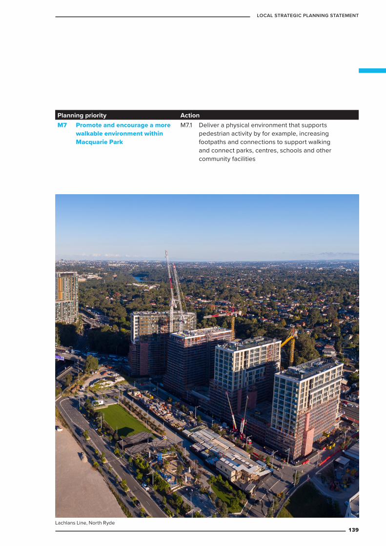
Planning priority ActionM7 Promote and encourage a more
walkable environment within Macquarie Park
M7.1 Deliver a physical environment that supports pedestrian activity by for example, increasing footpaths and connections to support walking and connect parks, centres, schools and other community facilities
Lachlans Line, North Ryde139
LOCAL STRATEGIC PLANNING STATEMENT

Figure 28 Movement and Place FrameworkWATERLOO ROAD LINEAR PARK · 16 May 2019
05
Lifestyle and opportunity @ your doorstep
Elouera Reserve
Macquarie Centre
Urban edge experience
Park like experience
Existing crossing point
Future crossing point
Opportunity for future crossing to be investigated
Existing road
Planned future road as per RDCP 2014
Existing median strip to be retained
Railway station exit/entry
Landscape Character
Shrimptons Creek
Central Park
Lachlan’s Line
Lane
Cov
e Rd
Her
ring
Rd
Wic
ks R
d
Cool
inga
St
Byfie
ld S
t
Khar
toum
Rd
Cott
onw
ood
Cre
s
T
T
T
T
TWaterloo Rd
KEY
DRAFT FOR DISCUSSION ONLY
WATERLOO ROAD LINEAR PARK · 16 May 2019
05
Lifestyle and opportunity @ your doorstep
Elouera Reserve
Macquarie Centre
Urban edge experience
Park like experience
Existing crossing point
Future crossing point
Opportunity for future crossing to be investigated
Existing road
Planned future road as per RDCP 2014
Existing median strip to be retained
Railway station exit/entry
Landscape Character
Shrimptons Creek
Central Park
Lachlan’s Line
Lane
Cov
e Rd
Her
ring
Rd
Wic
ks R
d
Cool
inga
St
Byfie
ld S
t
Khar
toum
Rd
Cott
onw
ood
Cre
s
T
T
T
T
TWaterloo Rd
KEY
DRAFT FOR DISCUSSION ONLY
Movement-Place offers a simple framework for the master planning and delivery of an active and vibrant streetscape. “Places for People” and “Vibrant Streets” (as opposed to “Movement Corridors”) put the needs of people using the streetscape first, and guides decisions relating to the design of building interfaces, public domain and roads to ensure they serve the people using the space rather than prioritising the movement of vehicles through the space.
140
CITY OF RYDE
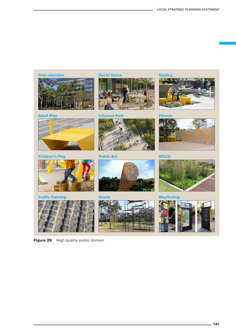
Figure 29 High quality public domainWATERLOO ROAD LINEAR PARK · 16 May 2019
06
Lifestyle and opportunity @ your doorstep
Objectives:
The design of the Linear Park is:
• To cater for the recreational needs of a range of users.
• To create a safe and pleasant focal point.
• To retain and enhance existing vegetation.
• To create an interesting outdoor experience along the journey.
• To integrate with existing and future public open space.
• To enhance ecological value and foster wildlife in the city centre.
• To promote environmental sustainability.
Principles:
The design of the Linear Park should follow the principles below:
• Create varying open space experience (i.e urban edge or park-like) in response to the existing/desired future character in different sections of Waterloo Road.
• Create inter-connected points of interest throughout the journey.
• Maintain a high level of passive surveillance.
• Provide adequate lighting for night time safety.
• Consider Crime Prevention Through Environmental Design (CPTED) principles.
• Retain existing mature trees where possible.
• Design in response to the microclimate conditions, such as shade, wind and solar exposure.
• Create a buffer from the harsh environment of Waterloo Road.
• Enable direct path connections to adjoining sites.
• Create desire lines to building entries and key destinations.
• Provide uses that activates building frontages to the park.
• Provide resting/people-watching/gathering areas for social interaction, especially near building entries.
• Provide complementary facilities such as water bubblers, bike racks, signage and shade structures at appropriate locations.
• Apply a consistent landscape approach to entries to building, street corners, railway stations and bus stops.
• Mitigate visual impacts of detracting elements such as substations, hydrant boosters, blank walls etc.
• Integrate water sensitive urban design measures in landscape elements where appropriate.
Design Principles Character ImagesTree retention
Informal PathAdult Play
Children’s Play
Traffic Calming Shade
Fitness
Social Space Resting
WSUDPublic Art
Wayfinding
DRAFT FOR DISCUSSION ONLYWATERLOO ROAD LINEAR PARK · 16 May 2019
06
Lifestyle and opportunity @ your doorstep
Objectives:
The design of the Linear Park is:
• To cater for the recreational needs of a range of users.
• To create a safe and pleasant focal point.
• To retain and enhance existing vegetation.
• To create an interesting outdoor experience along the journey.
• To integrate with existing and future public open space.
• To enhance ecological value and foster wildlife in the city centre.
• To promote environmental sustainability.
Principles:
The design of the Linear Park should follow the principles below:
• Create varying open space experience (i.e urban edge or park-like) in response to the existing/desired future character in different sections of Waterloo Road.
• Create inter-connected points of interest throughout the journey.
• Maintain a high level of passive surveillance.
• Provide adequate lighting for night time safety.
• Consider Crime Prevention Through Environmental Design (CPTED) principles.
• Retain existing mature trees where possible.
• Design in response to the microclimate conditions, such as shade, wind and solar exposure.
• Create a buffer from the harsh environment of Waterloo Road.
• Enable direct path connections to adjoining sites.
• Create desire lines to building entries and key destinations.
• Provide uses that activates building frontages to the park.
• Provide resting/people-watching/gathering areas for social interaction, especially near building entries.
• Provide complementary facilities such as water bubblers, bike racks, signage and shade structures at appropriate locations.
• Apply a consistent landscape approach to entries to building, street corners, railway stations and bus stops.
• Mitigate visual impacts of detracting elements such as substations, hydrant boosters, blank walls etc.
• Integrate water sensitive urban design measures in landscape elements where appropriate.
Design Principles Character ImagesTree retention
Informal PathAdult Play
Children’s Play
Traffic Calming Shade
Fitness
Social Space Resting
WSUDPublic Art
Wayfinding
DRAFT FOR DISCUSSION ONLY
Tree retention
Adult Play
Children’s Play
Traffic Calming
Social Space
Informal Path
Public Art
Shade
Resting
Fitness
WSUD
Wayfinding
141
LOCAL STRATEGIC PLANNING STATEMENT
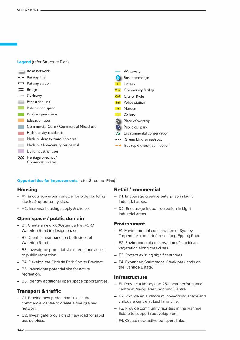
Housing – A1. Encourage urban renewal for older building
stocks & opportunity sites.
– A2. Increase housing supply & choice.
Open space / public domain – B1. Create a new 7,000sqm park at 45-61
Waterloo Road in design phase.
– B2. Create linear parks on both sides of Waterloo Road.
– B3. Investigate potential site to enhance access to public recreation.
– B4. Develop the Christie Park Sports Precinct.
– B5. Investigate potential site for active recreation.
– B6. Identify additional open space opportunities.
Transport & traffic – C1. Provide new pedestrian links in the
commercial centre to create a fine-grained network.
– C2. Investigate provision of new road for rapid bus services.
Retail / commercial – D1. Encourage creative enterprise in Light
Industrial areas.
– D2. Encourage indoor recreation in Light Industrial areas.
Environment – E1. Environmental conservation of Sydney
Turpentine-ironbark forest along Epping Road.
– E2. Environmental conservation of significant vegetation along creeklines.
– E3. Protect existing significant trees.
– E4. Expanded Shrimptons Creek parklands on the Ivanhoe Estate.
Infrastructure – F1. Provide a library and 250-seat performance
centre at Macquarie Shopping Centre.
– F2. Provide an auditorium, co-working space and childcare centre at Lachlan’s Line.
– F3. Provide community facilities in the Ivanhoe Estate to support redevelopment.
– F4. Create new active transport links.
Legend (refer Structure Plan)
Opportunities for improvements (refer Structure Plan)
KEY
Road network
Railway line
Railway station
Bridge
Cycleway
Pedestrian link
Public open space
Private open space
Education uses
Commercial Core / Commercial Mixed-use
High-density residential
Medium-density transition area
Medium / low-density residential
Light industrial uses
Heritage precinct / Conservation area
Waterway
Bus interchange
Library
Community facility
City of Ryde
Police station
Museum
Gallery
Place of worship
Public car park
Environmental conservation
‘Green Link’ street/road
Ferry wharf
Bus stop
W
P
L
CoR
Pol
M
G
B
Com
F
Utility (Sydney Water)
Bridge or tunnel
Bus rapid transit connection
U
KEY
Road network
Railway line
Railway station
Bridge
Cycleway
Pedestrian link
Public open space
Private open space
Education uses
Mixed-use / commercial
High-density residential
Medium-density transition area
Medium / low-density residential
Commercial uses
Light industrial uses
Heritage precinct / Conservation area
Waterway
Bus interchange
Library
Community facility
City of Ryde
Police station
Museum
Gallery
Place of worship
Public car park
Environmental conservation
‘Green Link’ street/road
Ferry wharf
Bus stop
W
P
L
CoR
Pol
M
G
B
Com
F
Utility (Sydney Water)
Bridge or tunnel
Bus rapid transit connection
U
142
CITY OF RYDE
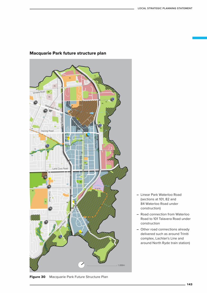
Macquarie Park future structure plan
Figure 30 Macquarie Park Future Structure Plan
L
L
CoR
Com
L
Com
F4.
F4.
F4.
F4.
F4.B2.
B1.
B3.
C2.
F4.
F4.
C1.
F1.A1.
E3.
E3.
A1.
B5.
A2.
A2.
D1 & D2.
F1.
F3.E1.
F2.
E2.
E2.
E2. E2.
E4.
B3.
B5.
B1.
B5.
B5.
B4.
B5.
B5.
C2.
W
W
W
W
W
W
P
P
P
P
B
1,000m
Lane Cove Road
Herring Road
Epping R
oad
Waterloo R
oad
Talavera Road
Balaclava Road
Vimiera Road
M2 M
otorway
Delhi Road
Pittw
ater
Roa
d
Coxs R
oad
– Linear Park Waterloo Road (sections at 101, 82 and 84 Waterloo Road under construction)
– Road connection from Waterloo Road to 101 Talavera Road under construction
– Other road connections already delivered such as around Triniti complex, Lachlan’s Line and around North Ryde train station)
143
LOCAL STRATEGIC PLANNING STATEMENT
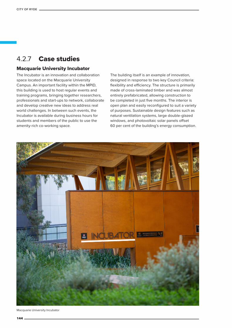
4.2.7 Case studiesMacquarie University IncubatorThe Incubator is an innovation and collaboration space located on the Macquarie University Campus. An important facility within the MPID, this building is used to host regular events and training programs, bringing together researchers, professionals and start-ups to network, collaborate and develop creative new ideas to address real world challenges. In between such events, the Incubator is available during business hours for students and members of the public to use the amenity-rich co-working space.
The building itself is an example of innovation, designed in response to two key Council criteria: flexibility and efficiency. The structure is primarily made of cross-laminated timber and was almost entirely prefabricated, allowing construction to be completed in just five months. The interior is open plan and easily reconfigured to suit a variety of purposes. Sustainable design features such as natural ventilation systems, large double-glazed windows, and photovoltaic solar panels offset 60 per cent of the building’s energy consumption.
Macquarie University Incubator
144
CITY OF RYDE
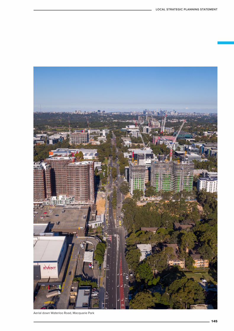
Aerial down Waterloo Road, Macquarie Park
145
LOCAL STRATEGIC PLANNING STATEMENT
SUSTAINABILITY5
PART
146
CITY OF RYDE
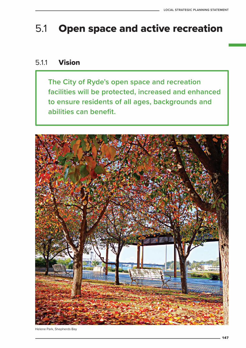
5.1.1 Vision
The City of Ryde’s open space and recreation facilities will be protected, increased and enhanced to ensure residents of all ages, backgrounds and abilities can benefit.
5.1 Open space and active recreation
Helene Park, Shepherds Bay
147
LOCAL STRATEGIC PLANNING STATEMENT
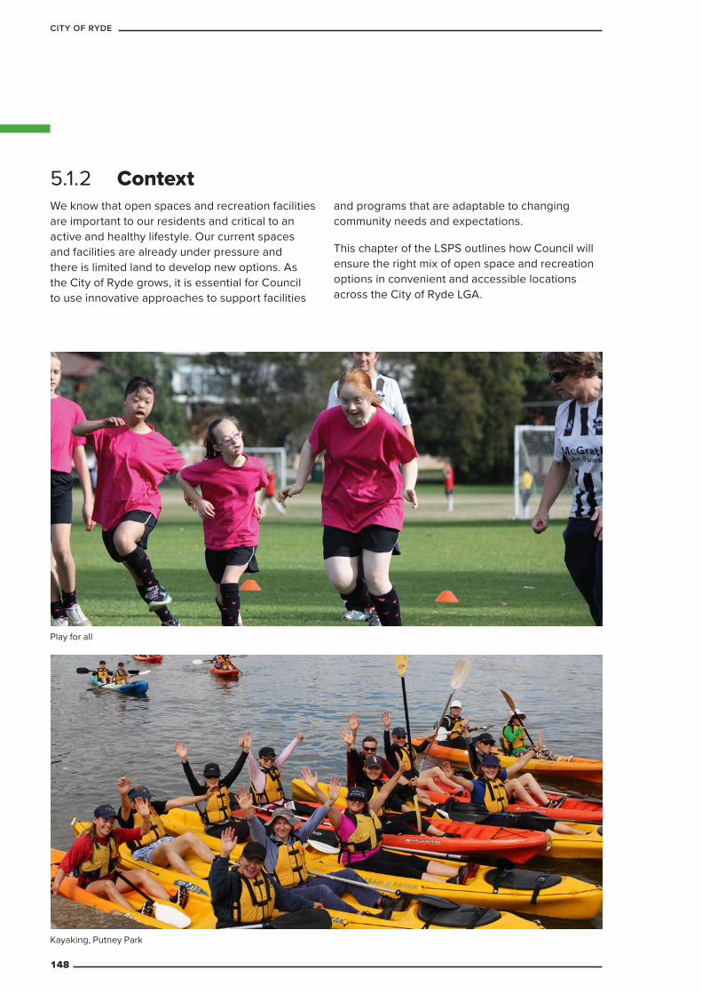
5.1.2 ContextWe know that open spaces and recreation facilities are important to our residents and critical to an active and healthy lifestyle. Our current spaces and facilities are already under pressure and there is limited land to develop new options. As the City of Ryde grows, it is essential for Council to use innovative approaches to support facilities
and programs that are adaptable to changing community needs and expectations.
This chapter of the LSPS outlines how Council will ensure the right mix of open space and recreation options in convenient and accessible locations across the City of Ryde LGA.
Play for all
Kayaking, Putney Park
148
CITY OF RYDE
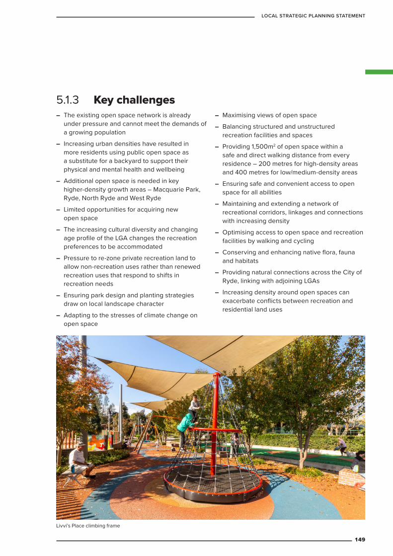
5.1.3 Key challenges – The existing open space network is already
under pressure and cannot meet the demands of a growing population
– Increasing urban densities have resulted in more residents using public open space as a substitute for a backyard to support their physical and mental health and wellbeing
– Additional open space is needed in key higher-density growth areas – Macquarie Park, Ryde, North Ryde and West Ryde
– Limited opportunities for acquiring new open space
– The increasing cultural diversity and changing age profile of the LGA changes the recreation preferences to be accommodated
– Pressure to re-zone private recreation land to allow non-recreation uses rather than renewed recreation uses that respond to shifts in recreation needs
– Ensuring park design and planting strategies draw on local landscape character
– Adapting to the stresses of climate change on open space
– Maximising views of open space
– Balancing structured and unstructured recreation facilities and spaces
– Providing 1,500m2 of open space within a safe and direct walking distance from every residence – 200 metres for high-density areas and 400 metres for low/medium-density areas
– Ensuring safe and convenient access to open space for all abilities
– Maintaining and extending a network of recreational corridors, linkages and connections with increasing density
– Optimising access to open space and recreation facilities by walking and cycling
– Conserving and enhancing native flora, fauna and habitats
– Providing natural connections across the City of Ryde, linking with adjoining LGAs
– Increasing density around open spaces can exacerbate conflicts between recreation and residential land uses
Livvi’s Place climbing frame
149
LOCAL STRATEGIC PLANNING STATEMENT
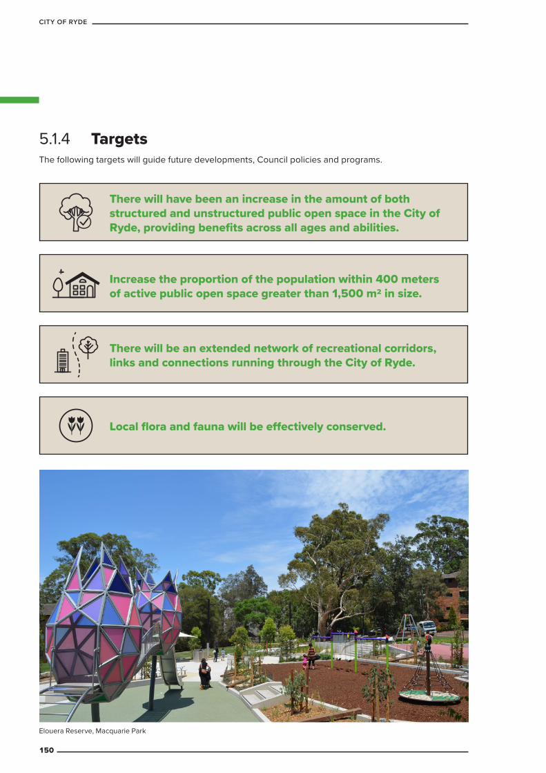
5.1.4 Targets
There will have been an increase in the amount of both structured and unstructured public open space in the City of Ryde, providing benefits across all ages and abilities.
Increase the proportion of the population within 400 meters of active public open space greater than 1,500 m2 in size.
There will be an extended network of recreational corridors, links and connections running through the City of Ryde.
Local flora and fauna will be effectively conserved.
Elouera Reserve, Macquarie Park
The following targets will guide future developments, Council policies and programs.
150
CITY OF RYDE
Table 30 Open space: planning priorities and actions
Planning priority ActionsOS1 Provide accessible
open space to service population needs
OS1.1 Upgrade the amount and distribution of open space to match current and future population needs
– Prepare an Acquisition and Consolidation Program to identify opportunities where land could be acquired or consolidated to deliver new public open space or to enhance or expand existing public open space
– Extend existing sports capacity within existing reserves
OS1.2 Prepare an action plan aimed at improving community access to existing and future public open space via all modes
OS1.3 Prepare a strategy that balances recreational, cultural heritage and natural values and aims to enhance open space connectivity and wayfinding across the City of Ryde
– Prepare a detailed Recreational Corridor Network Plan (an integrated, LGA-wide recreational, fitness and commuter cycling and walking network)
OS1.4 Identify opportunities for collaborating with non-Council open space land owners and private recreation providers in the LGA to increase the range and amount of, and access to, recreation opportunities
5.1.5 Planning priorities and actions
Forrester Park
151
LOCAL STRATEGIC PLANNING STATEMENT
Planning priority ActionsOS2 Ensure open space can
be shared and enjoyed by all
OS2.1 When planning, managing and designing open space settings:
– target specific recreation priorities
– continue to implement improvements to the landscape design quality
– optimise recreation opportunities for all residents in partnership with other recreation providers
– Optimising the capacity of existing open space via design and more efficient park layouts when upgrading or renewing
– Ensure access and parking at reserves is efficient in circulation and adequate for needs when upgrading or renewing
– Integrate passive recreation opportunity and facilities into all levels of sports reserves
– Implement best practice in optimising safety and amenity of open space, including Crime Prevention Through Environmental Design (CPTED), environmental design, planting design and lighting
OS2.2 Prepare guidelines for all future provision or replacement of facilities, structures and infrastructure in reserves
OS2.3 Upgrade amenity and safety in all open space across the LGA
OS2.4 Ensure fair and equitable access for residents and visitors (irrespective of abilities and backgrounds) and backgrounds to the City’s open space
OS3 Ensure future open space is delivered in a manner that maintains a healthy natural environment
OS3.1 Plan and manage open space to ensure that recreational access and facilities conserve natural values
OS3.2 Plan, design and manage sustainability in all open space using best practice
OS4 Conserve our rich history, culture and local character through the provision of open space
OS4.1 Reflect and promote the LGA’s cultural heritage and diversity through the planning, design and management of open space
– Liaise with the Aboriginal community to establish a means through which their cultural heritage can best be recognised within the LGAs’ open space
OS4.2 Ensure that the unique and diverse landscape characteristics of the City of Ryde are reflected in open spaces, appropriate to specific locations
– Continue current upgrades of all river and creek open spaces to enhance recreational and natural systems connectivity
152
CITY OF RYDE
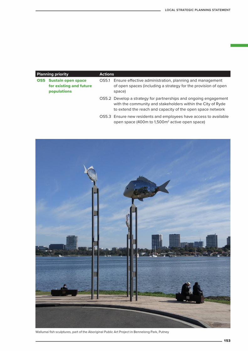
Planning priority ActionsOS5 Sustain open space
for existing and future populations
OS5.1 Ensure effective administration, planning and management of open spaces (including a strategy for the provision of open space)
OS5.2 Develop a strategy for partnerships and ongoing engagement with the community and stakeholders within the City of Ryde to extend the reach and capacity of the open space network
OS5.3 Ensure new residents and employees have access to available open space (400m to 1,500m2 active open space)
Wallumai fish sculptures, part of the Aboriginal Public Art Project in Bennelong Park, Putney
153
LOCAL STRATEGIC PLANNING STATEMENT
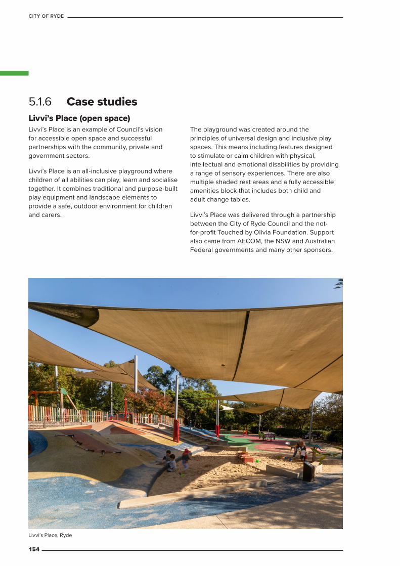
Livvi’s Place (open space)Livvi’s Place is an example of Council’s vision for accessible open space and successful partnerships with the community, private and government sectors.
Livvi’s Place is an all-inclusive playground where children of all abilities can play, learn and socialise together. It combines traditional and purpose-built play equipment and landscape elements to provide a safe, outdoor environment for children and carers.
The playground was created around the principles of universal design and inclusive play spaces. This means including features designed to stimulate or calm children with physical, intellectual and emotional disabilities by providing a range of sensory experiences. There are also multiple shaded rest areas and a fully accessible amenities block that includes both child and adult change tables.
Livvi’s Place was delivered through a partnership between the City of Ryde Council and the not-for-profit Touched by Olivia Foundation. Support also came from AECOM, the NSW and Australian Federal governments and many other sponsors.
5.1.6 Case studies
Livvi’s Place, Ryde
154
CITY OF RYDE
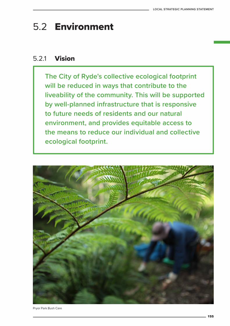
The City of Ryde’s collective ecological footprint will be reduced in ways that contribute to the liveability of the community. This will be supported by well-planned infrastructure that is responsive to future needs of residents and our natural environment, and provides equitable access to the means to reduce our individual and collective ecological footprint.
5.2.1 Vision
5.2 Environment
Pryor Park Bush Care
155
LOCAL STRATEGIC PLANNING STATEMENT
The health and wellbeing of the City of Ryde’s residents, workers and visitors are not separate from the health and wellbeing of our natural environment. Our quality of life depends on maintaining our natural environment so that things we take for granted, like the availability of fresh water, food and fuel sources, remain. Council and the community need to work together to protect and enhance natural areas and improve the design of built environments to make them more environmentally sensitive and sustainable.
Council manages 205 hectares of natural areas distributed between 71 parks and reserves. This includes several local and regional-scale wildlife corridors. Council has undertaken conservation significance and risk level assessments of all of the LGA’s bushland reserves to develop a series of action plans aimed at ensuring our natural environment stays healthy for years to come.
Sourcing energy from renewables, particularly solar, is inspiring the development of ambitious local targets well above those outlined in Australian Government policies. The long-term goal of low carbon or even net ‘zero carbon’ is achievable both for Council’s own operations and eventually right across the LGA.
Effective waste management is another critical component of successful environmental management. Waste reduction is only possible when it is facilitated at every stage in the development of our LGA and is therefore dependent on thorough planning.
This chapter of the LSPS outlines how Council’s approach to planning will increase the sustainability of our approach to planning will increase the sustainability of our LGA and protect our unique natural environment.
5.2.2 Context
The key is sustainability, which simply means ensuring our interactions with and use of the environment around
us avoids depleting natural resources. Climate change is a threat to the sustainability of the local environment,
community and way of life
156
CITY OF RYDE
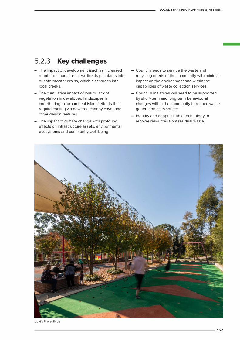
– The impact of development (such as increased runoff from hard surfaces) directs pollutants into our stormwater drains, which discharges into local creeks.
– The cumulative impact of loss or lack of vegetation in developed landscapes is contributing to ‘urban heat island’ effects that require cooling via new tree canopy cover and other design features.
– The impact of climate change with profound effects on infrastructure assets, environmental ecosystems and community well-being.
– Council needs to service the waste and recycling needs of the community with minimal impact on the environment and within the capabilities of waste collection services.
– Council’s initiatives will need to be supported by short-term and long-term behavioural changes within the community to reduce waste generation at its source.
– Identify and adopt suitable technology to recover resources from residual waste.
5.2.3 Key challenges
Livvi’s Place, Ryde
157
LOCAL STRATEGIC PLANNING STATEMENT
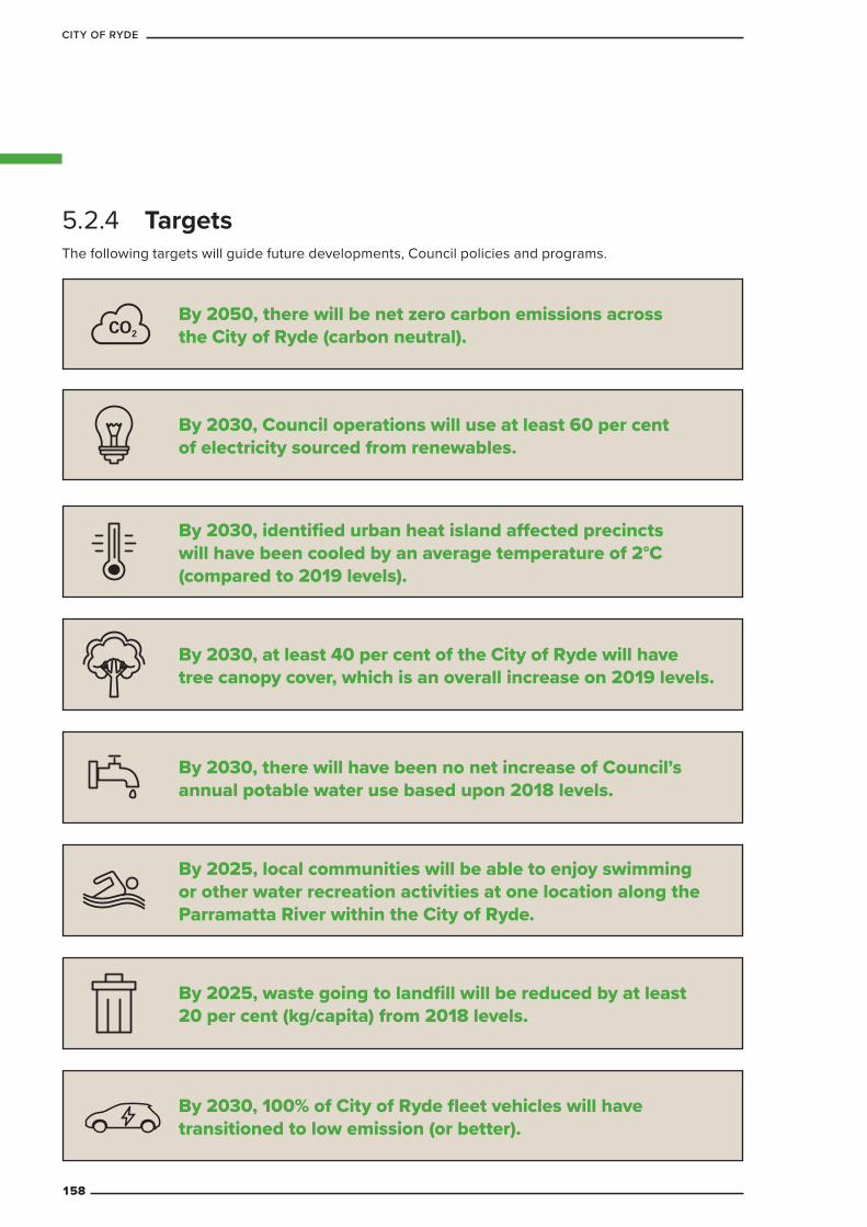
5.2.4 Targets
By 2030, Council operations will use at least 60 per cent of electricity sourced from renewables.
By 2030, there will have been no net increase of Council’s annual potable water use based upon 2018 levels.
By 2025, waste going to landfill will be reduced by at least 20 per cent (kg/capita) from 2018 levels.
By 2025, local communities will be able to enjoy swimming or other water recreation activities at one location along the Parramatta River within the City of Ryde.
By 2030, identified urban heat island affected precincts will have been cooled by an average temperature of 2°C (compared to 2019 levels).
By 2030, at least 40 per cent of the City of Ryde will have tree canopy cover, which is an overall increase on 2019 levels.
By 2030, 100% of City of Ryde fleet vehicles will have transitioned to low emission (or better).
By 2050, there will be net zero carbon emissions across the City of Ryde (carbon neutral).
The following targets will guide future developments, Council policies and programs.
158
CITY OF RYDE
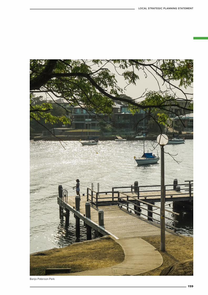
Banjo Paterson Park
159
LOCAL STRATEGIC PLANNING STATEMENT
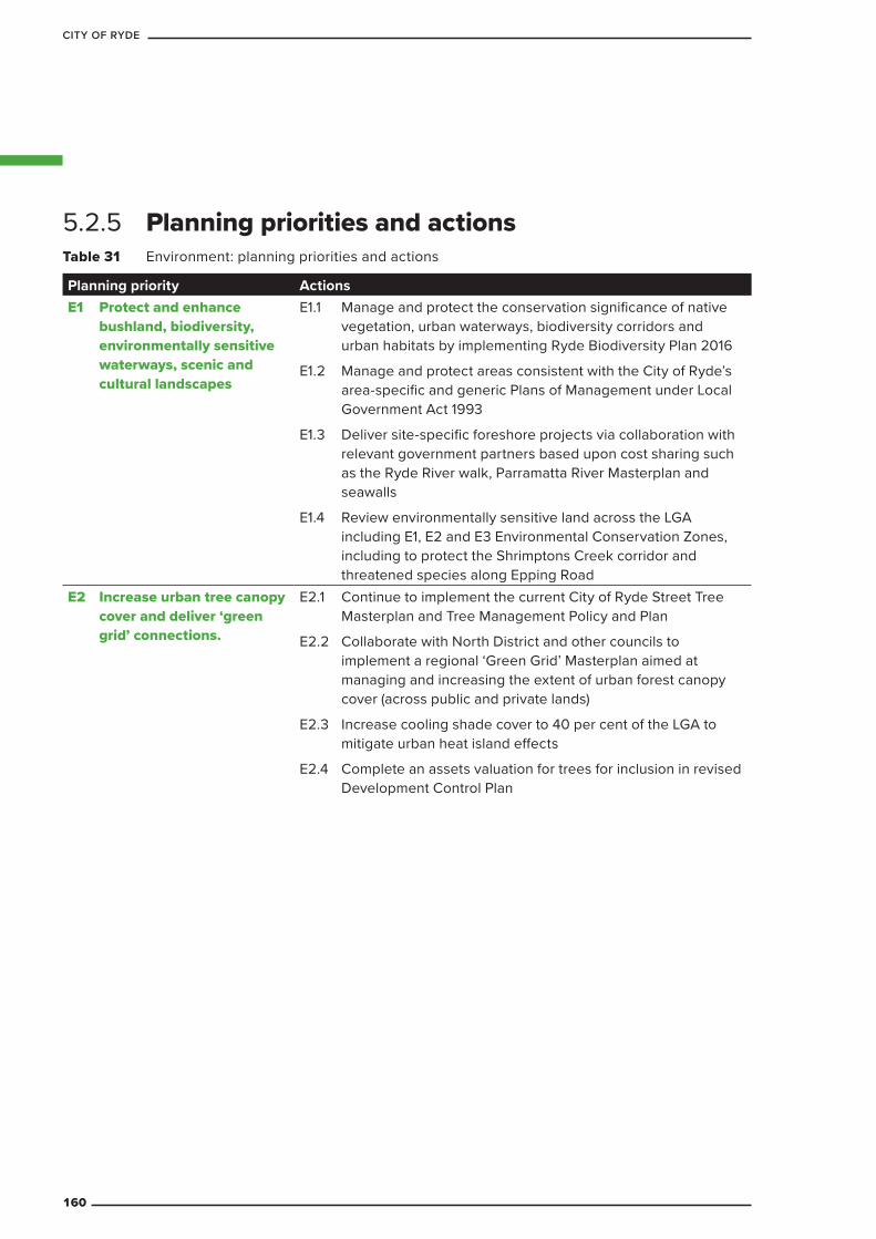
Table 31 Environment: planning priorities and actions
Planning priority ActionsE1 Protect and enhance
bushland, biodiversity, environmentally sensitive waterways, scenic and cultural landscapes
E1.1 Manage and protect the conservation significance of native vegetation, urban waterways, biodiversity corridors and urban habitats by implementing Ryde Biodiversity Plan 2016
E1.2 Manage and protect areas consistent with the City of Ryde’s area-specific and generic Plans of Management under Local Government Act 1993
E1.3 Deliver site-specific foreshore projects via collaboration with relevant government partners based upon cost sharing such as the Ryde River walk, Parramatta River Masterplan and seawalls
E1.4 Review environmentally sensitive land across the LGA including E1, E2 and E3 Environmental Conservation Zones, including to protect the Shrimptons Creek corridor and threatened species along Epping Road
E2 Increase urban tree canopy cover and deliver ‘green grid’ connections.
E2.1 Continue to implement the current City of Ryde Street Tree Masterplan and Tree Management Policy and Plan
E2.2 Collaborate with North District and other councils to implement a regional ‘Green Grid’ Masterplan aimed at managing and increasing the extent of urban forest canopy cover (across public and private lands)
E2.3 Increase cooling shade cover to 40 per cent of the LGA to mitigate urban heat island effects
E2.4 Complete an assets valuation for trees for inclusion in revised Development Control Plan
5.2.5 Planning priorities and actions
160
CITY OF RYDE
Planning priority ActionsE3 Reduce carbon emissions
and manage energy, water and waste efficiently
E3.1 Minimise energy consumption of Council’s buildings Develop a strategy and policy outlining how City of Ryde will reduce carbon emissions and manage energy, water and waste efficiently across all its operations, for adoption by Council
– Update the current City of Ryde Water Savings Action Plan
– Incorporate holistic quadruple-bottom-line (QBL) sustainability across all Council operations, projects and instruments (local and regional).
E3.2 Develop a Renewable Energy Pathway that complements the state target of Net Zero Emissions by 2050
E3.3 Review the energy smart water wise section of the Ryde Development Control Plan 2014
E3.4 Review waste policies and planning controls in the Ryde Development Control Plan 2014 and in Ryde Local Environmental Plan 2014
E3.5 Develop a strategy to transition to low emission transport
E3.6 Trial and evaluate charging stations sourced from renewable energy (or carbon offsets) at key locations in the LGA to encourage the take up to electric vehicles
E3.7 Transport demand management initiatives including working from home, improved walking and cycling, improved access to car sharing, carpooling and on-demand transport will also be considered in helping to achieve net zero greenhouse gas emissions.
E4 Protect and improve the health and enjoyment of the City of Ryde’s waterways
E4.1 Develop a Water Strategy for the City of Ryde which aims to minimise potable water consumption and manage stormwater runoff and contamination
E4.2 Implement the Parramatta River Masterplan in collaboration with other members of the Parramatta River Catchment Group
E5 Provide waste and recycling infrastructure that is designed to ensure safety, efficiency and accessibility of waste, reuse and recycling services, and that does not compromise the public domain
E5.1 Review and amend planning controls in the Ryde Local Environmental Plan 2014 and Ryde Development Control Plan 2014 to ensure they require new developments to have appropriately designed on-site storage for waste and recycling services, and provide for the separation of waste materials to encourage recycling and reuse
E6 Improve waste processing to reduce landfill
E6.1 Investigate new and alternative methods of resource recovery
E6.2 Work with the NSW Government to identify and secure suitable regional waste and recycling facilities to receive, treat and process domestic waste, in order to improve transportation efficiencies and reduce environmental impacts
161
LOCAL STRATEGIC PLANNING STATEMENT
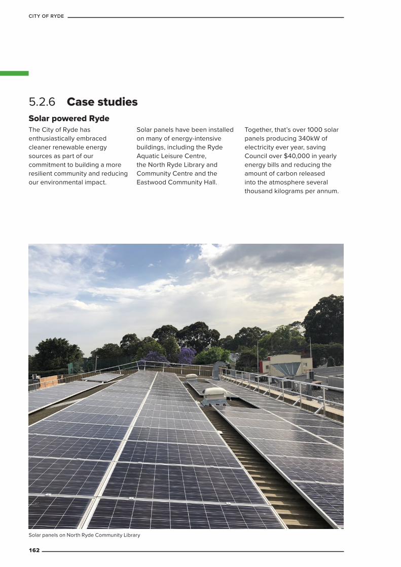
Solar powered RydeThe City of Ryde has enthusiastically embraced cleaner renewable energy sources as part of our commitment to building a more resilient community and reducing our environmental impact.
Solar panels have been installed on many of energy-intensive buildings, including the Ryde Aquatic Leisure Centre, the North Ryde Library and Community Centre and the Eastwood Community Hall.
Together, that’s over 1000 solar panels producing 340kW of electricity ever year, saving Council over $40,000 in yearly energy bills and reducing the amount of carbon released into the atmosphere several thousand kilograms per annum.
5.2.6 Case studies
Solar panels on North Ryde Community Library
162
CITY OF RYDE
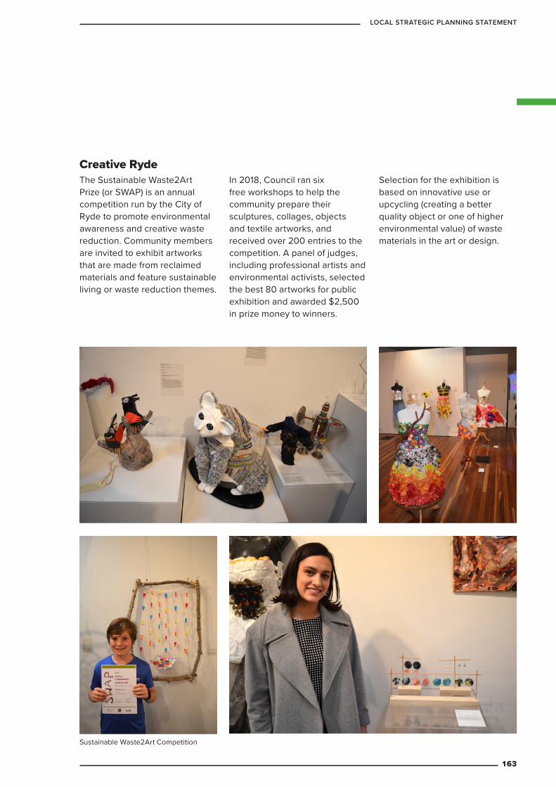
Creative RydeThe Sustainable Waste2Art Prize (or SWAP) is an annual competition run by the City of Ryde to promote environmental awareness and creative waste reduction. Community members are invited to exhibit artworks that are made from reclaimed materials and feature sustainable living or waste reduction themes.
In 2018, Council ran six free workshops to help the community prepare their sculptures, collages, objects and textile artworks, and received over 200 entries to the competition. A panel of judges, including professional artists and environmental activists, selected the best 80 artworks for public exhibition and awarded $2,500 in prize money to winners.
Selection for the exhibition is based on innovative use or upcycling (creating a better quality object or one of higher environmental value) of waste materials in the art or design.
Sustainable Waste2Art Competition
163
LOCAL STRATEGIC PLANNING STATEMENT
The City of Ryde and its community will have the capacity to survive, adapt and thrive in the face of acute shocks and chronic stresses. We will take an inclusive ‘one city’ approach based on good governance, engagement and capacity to become a resilient and adaptable local community and region. Every person living and working in the City of Ryde will feel they belong, are valued and supported in navigating our changing local and global environment.
5.3.1 Vision
5.3 Resilience
5.3.2 ContextA resilient city is one in which everyone – including residents, businesses and those in leadership – understands the challenges they face, is prepared to respond to the challenges, as and when they arise, and has the capacity to thrive in spite of them.
Natural hazards associated with climate change are expected to intensify. This includes heatwaves and increased frequency of hot days, bushfires, extreme rainfall events and short duration high intensity storms. Apart from threats to critical infrastructure and properties, these events may affect the health, well-being and quality of living for residents, workers and visitors to the LGA.
Good planning and collaboration between Council and the community will help to ensure our neighbourhoods, urban areas and infrastructure are better prepared for, and more resilient to, the effects of climate change and other threats. Council is committed to helping Australia meet its international obligations under the 2015 Paris Agreement. This will also help to restrict the impacts and long-term cost burden of climate change to Council and the community.
This chapter of the LSPS outlines how Council’s approach to planning will build the knowledge, capacity and resources of our community to withstand the likely shocks and stresses that may impact our LGA over the next 20 years.
164
CITY OF RYDE
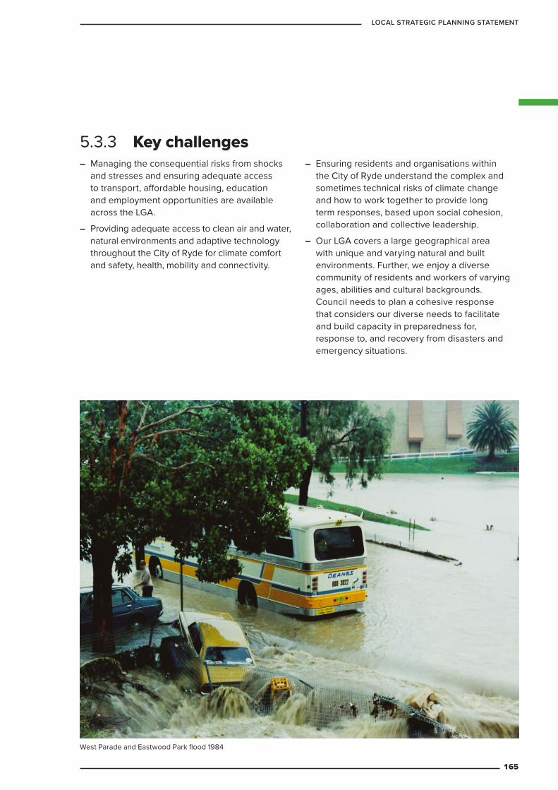
– Managing the consequential risks from shocks and stresses and ensuring adequate access to transport, affordable housing, education and employment opportunities are available across the LGA.
– Providing adequate access to clean air and water, natural environments and adaptive technology throughout the City of Ryde for climate comfort and safety, health, mobility and connectivity.
– Ensuring residents and organisations within the City of Ryde understand the complex and sometimes technical risks of climate change and how to work together to provide long term responses, based upon social cohesion, collaboration and collective leadership.
– Our LGA covers a large geographical area with unique and varying natural and built environments. Further, we enjoy a diverse community of residents and workers of varying ages, abilities and cultural backgrounds. Council needs to plan a cohesive response that considers our diverse needs to facilitate and build capacity in preparedness for, response to, and recovery from disasters and emergency situations.
5.3.3 Key challenges
West Parade and Eastwood Park flood 1984
165
LOCAL STRATEGIC PLANNING STATEMENT
5.3.4 Targets
There will be 10,000 resilience ready City of Ryde residents by 2025.
There will be 50 resilient organisations located in the City of Ryde by 2025.
5.3.5 Planning priorities and actionsTable 32 Resilience: planning priorities and actions
Planning priority ActionsR1 Manage acute shocks
(such as disasters and chronic stresses including climate change) by planning collaboratively for resilience and adaptation
R1.1 Prepare and update Council plans and policies that include actions for residential living, energy and water use, resources efficiency, environmental protection, connectivity, social cohesion and inclusion
– Address resilience in future revisions of the Ryde Community Strategic Plan
– Amend the Ryde Local Environmental Plan 2014 and Ryde Development Control Plan to incorporate controls to address resilience
R1.2 Prepare and implement a City of Ryde Local Resilience Plan which covers eight key action areas:
– Energy efficiency and a low carbon City of Ryde
– Water efficiency and quality
– Resources efficiency
– Climate change, extreme weather events and other natural hazards
– Biodiversity and natural systems
– Transport and connectivity
– Community health and well-being (including air quality and noise)
– Direction, collective leadership and collaborationE5 Adapt to the impacts of
urban and natural hazards and climate change
E5.1 Prepare Climate Risk Assessment Plan for City of Ryde
The following targets will guide future developments, Council policies and programs.
166
CITY OF RYDE
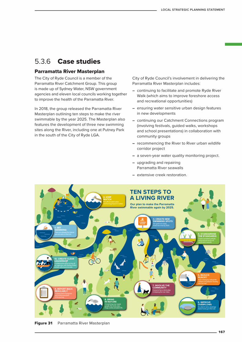
Parramatta River Masterplan The City of Ryde Council is a member of the Parramatta River Catchment Group. This group is made up of Sydney Water, NSW government agencies and eleven local councils working together to improve the health of the Parramatta River.
In 2018, the group released the Parramatta River Masterplan outlining ten steps to make the river swimmable by the year 2025. The Masterplan also features the development of three new swimming sites along the River, including one at Putney Park in the south of the City of Ryde LGA.
City of Ryde Council’s involvement in delivering the Parramatta River Masterplan includes:
– continuing to facilitate and promote Ryde River Walk (which aims to improve foreshore access and recreational opportunities)
– ensuring water sensitive urban design features in new developments
– continuing our Catchment Connections program (involving festivals, guided walks, workshops and school presentations) in collaboration with community groups
– recommencing the River to River urban wildlife corridor project
– a seven-year water quality monitoring project.
– upgrading and repairing Parramatta River seawalls
– extensive creek restoration.
5.3.6 Case studies
9. REPORT BACKREGULARLYTo keep track of progress and involve everyone in the journey.
10. CREATE CLEAR LEADERSHIPA collaborative effort across all our agencies, with Sydney Water as lead, will ensure success.
1. GET SWIMMINGThere are already four places you can swim in the river.
2. KEEP WATCH
3. CREATE NEW SWIMMING SPOTS
8. BRING IN NATUREA truly living river needs people, fish, birds, bats, frogs, turtles and plant life.
7. INVOLVE THECOMMUNITY
6. IMPROVE OVERFLOWSSo, when it rains, sewerage doesn’t end up in the river.
5. REDUCE RUNOFF
4. STANDARDISE THE STANDARDS Create consistent policies and practices across all catchment councils.
COMINGSOON!
Put a Riverwatch water monitoring program in place.
Our goal is to create three new ones by 2025.
Everyone has a role to play in keeping the river clean.
And, in doing so, reduce the rubbish and pollution flowing into the river.
TEN STEPS TO A LIVING RIVEROur plan to make the Parramatta River swimmable again by 2025.
6. IMPROVE OVERFLOWSSydney’s sewer system is over 100 years old, and was built for a smaller city. So, when it rains, stormwater can flow into and overload the wastewater system, causing it to overflow into our creeks and rivers. Understanding where, when and how this happens and putting measures in place to stop it, is an essential part of making our river swimmable again.
7. INVOLVE THE COMMUNITYIn the most part, stormwater pollution comes from street runoff. And that is determined by the actions of the community living in the catchment area. Good management of building sites, picking up your dog’s droppings and not littering are just three ways community can help create a swimmable river. Helping people understand this link is a key to success.
8. BRING IN NATUREA living river needs people, fish, birds, bats, frogs, turtles, grasses, trees and many more to be a complete ecosystem. By maintaining and improving habitats for our iconic species – especially our five mascots – we can bring nature back to the river. Doing so means understanding current habitat health, establishing foreshore improvement programs and calling on citizen scientists to help track progress.
9. REPORT BACK REGULARLY Regular monitoring and reporting not only shows us if we’re winning, it helps keep our river in the mind of everyone involved and reminds them that this is a long-term project that is worth investing in.
10. CREATE CLEAR LEADERSHIP A big project needs clear leadership. The plan to make the river swimmable again is sponsored by 11 councils and three state government agencies and supported by many more. It also draws on community collaboration and Aboriginal wisdom to bring a big mix of experience and opinions to the table. Sydney Water has been identified as the best organisation to lead this alliance, via a defined governance structure that sets and delivers on clear targets.
1. GET SWIMMINGRight now there are four places you can swim in the river. The more we swim in them, the more others will join us and community support will grow. And the more we can learn what makes a swimming place great, and what people want out of future swimming spots.
2. KEEP WATCHA Riverwatch water monitoring program will help us measure change over time, protect existing swimming spots, open new swimming sites and understand what makes water quality change over time.
3. CREATE NEWSWIMMING SPOTSOur goal is to create three new swimming spots by 2025. Doing this means working out all potential options, then choosing the best three based on feasibility, vulnerability and desirability. We’ve already looked at 12 potential new spots and proposed different ways of using each, based on scientific assessment and community input.
4. STANDARDISE THE STANDARDSThe Parramatta River’s catchment spans 11 local council areas. To create a swimmable river, we need to work together to standardise policies and practices that impact water quality, such as approaches to baseline measurements, installation of rainwater tanks, creation of rain gardens and so on.
5. REDUCE STORMWATER RUNOFFStormwater runoff – and all the rubbish and other pollution it brings with it – is one of the number one ways our river gets dirty. A catchment-wide approach to reducing this stormwater through water sensitive design, which absorbs rain where it lands, will improve water quality.
Figure 31 Parramatta River Masterplan
167
LOCAL STRATEGIC PLANNING STATEMENT
IMPLEMENTATION6
PART
168
CITY OF RYDE
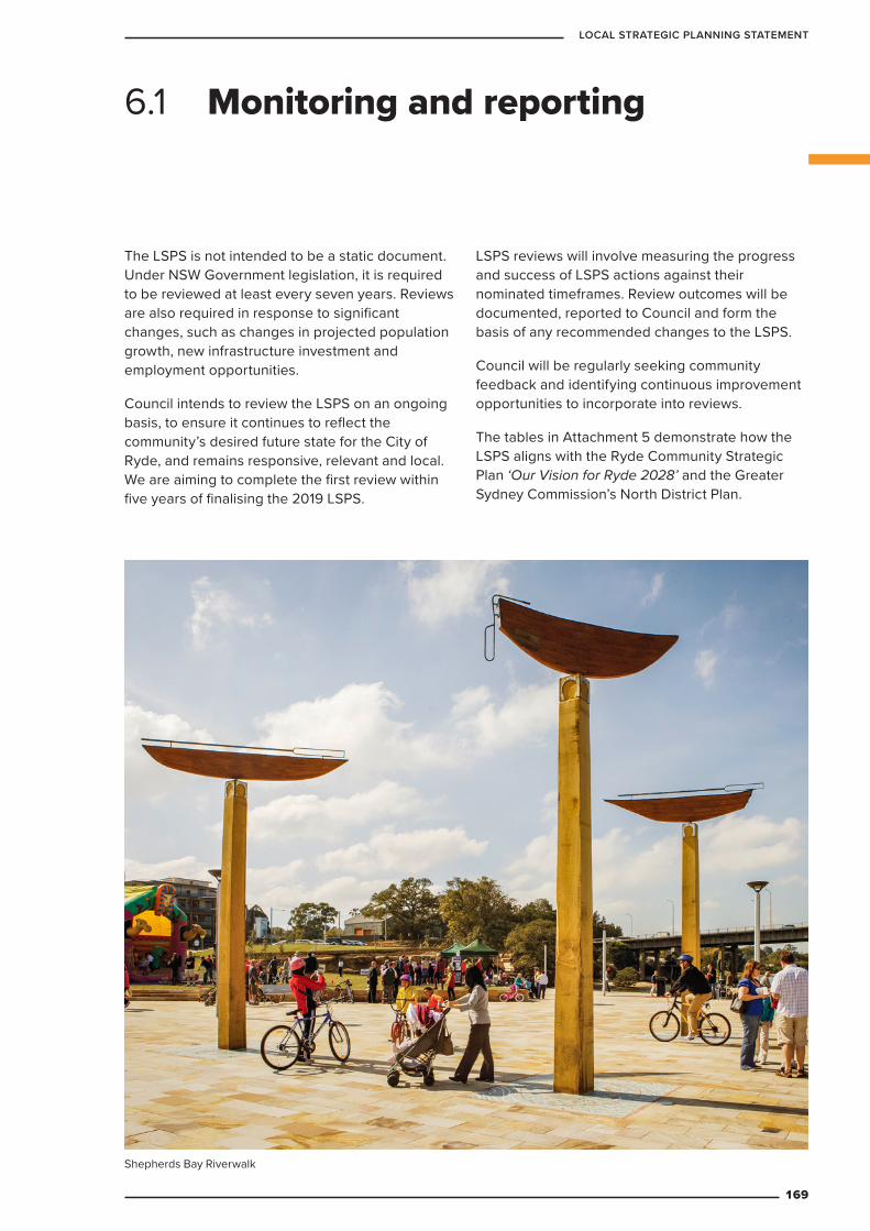
The LSPS is not intended to be a static document. Under NSW Government legislation, it is required to be reviewed at least every seven years. Reviews are also required in response to significant changes, such as changes in projected population growth, new infrastructure investment and employment opportunities.
Council intends to review the LSPS on an ongoing basis, to ensure it continues to reflect the community’s desired future state for the City of Ryde, and remains responsive, relevant and local. We are aiming to complete the first review within five years of finalising the 2019 LSPS.
LSPS reviews will involve measuring the progress and success of LSPS actions against their nominated timeframes. Review outcomes will be documented, reported to Council and form the basis of any recommended changes to the LSPS.
Council will be regularly seeking community feedback and identifying continuous improvement opportunities to incorporate into reviews.
The tables in Attachment 5 demonstrate how the LSPS aligns with the Ryde Community Strategic Plan ‘Our Vision for Ryde 2028’ and the Greater Sydney Commission’s North District Plan.
6.1 Monitoring and reporting
Shepherds Bay Riverwalk
169
LOCAL STRATEGIC PLANNING STATEMENT
GLOSSARY
170
CITY OF RYDE
Actions Steps City of Ryde Council will take to help realise the vision described in the Local Strategic Planning Statement.
Activity Hub Vibrant centres which host a variety of uses. They are lively meeting points where people work, play, gather and often choose to live.
CALD Acronym for Culturally and Linguistically Diverse.
Cities Power Partnership A free, national program that brings together Australian towns and cities making the switch to clean energy. The partnership is Australia’s largest local government climate network, made up over 100 councils from across the country, representing almost 11 million Australians.
Community Strategic Plan 2018 A plan for the City of Ryde, by the people of the City of Ryde. It is the product of extensive consultation and reflects the community’s views on what they want the City of Ryde to be like in ten years’ time.
Conservation Management Plan This document guides management of heritage items and properties located in conservation areas.
Development Control Plan Or DCP Provides guidelines and objectives for people who wish to carry out development in the City of Ryde.
Employment Lands Lands zoned for industrial or similar purposes.
Environmental Planning and Assessment Act 1979
This is the main piece of legislation for land use planning throughout NSW. It is under the authority of the NSW Government and sets out the legal requirements for the preparation and implementation of planning documents such as the Local Strategic Planning Statement and the Local Environmental Plan.
Greater Sydney Commission (GSC) The planning body in charge of coordinating strategic plans across Greater Sydney that reports directly to the Department of Premier and Cabinet.
Green Grid A planned network of green spaces (such as tree-lined streets, urban bushland, tree cover or green roofs) that connects communities to the natural landscape.
Housing Strategy A plan outlining how City of Ryde proposes to meet projected future housing needs. It outlines the types, amount, location and timing for housing.
Incubators Collaboration spaces or programs that help start-up companies grow by providing services, training, advice or facilities.
Innovation District An area containing a special mix of business, collaboration and education spaces, designed to help people work together to produce creative new ideas, services and products.
Glossary
171
LOCAL STRATEGIC PLANNING STATEMENT
Local Environmental Plan or LEP The Ryde Local Environmental Plan 2014 is the principal planning instrument for the City of Ryde. It will be the mechanism for implementing the Local Strategic Planning Statement and sets permissible land uses, development capacity and other key matters.
Local Government Area or LGA For the purposes of this document, the term Local Government Area and LGA refers to the City of Ryde.
Local Strategic Planning Statement (LSPS)
A 20-year plan setting out Council’s vision and planning priorities for the City of Ryde, and the actions Council will take to achieve them. It also bridges the space between the Community Strategic Plan and the local planning framework.
Macquarie Park Strategic Investigation
This is a joint project by the Department of Planning, Industry and Environment, City of Ryde Council, and Transport for NSW which involves taking a close look at Macquarie Park and identifying opportunities to enhance its role as an Innovation District.
Mainstreet Programs These are collaborative projects which bring together landowners, businesses, council and other stakeholders to develop a cohesive vision for individual mainstreet areas.
Movement/Place Framework A method of defining the primary function of a space ranging from movement corridors that prioritise transport flow to places that prioritise the experience of people at street levels to encourage them to dwell and interact.
New Economy In this document the New Economy refers to emerging businesses and enterprises as Ryde transitions from a manufacturing based economy.
North District Plan This is the strategic plan created by the Greater Sydney Commission for the Northern suburbs in Sydney, including the City of Ryde. This statement takes assists the implementation of the North District Plan.
Parramatta River Catchment Group An alliance of councils, government agencies and community groups who are working together to improve the Parramatta River and the creeks that flow into it. In 2018, the group released the Parramatta River Masterplan.
Parramatta River Masterplan 2018 A plan to improve the health of the Parramatta River and make it swimmable by 2025. The plan was developed by the Parramatta River Catchment Group with input and support from stakeholders and community members from across the catchment.
Planning Priority A specific goal of the Local Strategic Planning Statement, accompanied by actions to achieve it.
172
CITY OF RYDE
Planning Proposal An application to amend the Local Environmental Plan in relation to zonings, height and other planning provisions. These require approval from the NSW Department of Planning, Industry and Environment.
Resilience Resilience is about the capacity of the City of Ryde to adapt and thrive in the face of challenges. This includes environmental challenges (such as heatwaves or floods) and non-environmental challenges (such as epidemics or economic crises).
Resilience Ready A City of Ryde resident who is well prepared for major shocks and chronic stresses, and has the capacity to withstand and recover from such difficulties including emergency situations and disasters.
Resilient organisation An organisation located within the City of Ryde that makes a commitment to understand local ‘place-based’ risks, manage and mitigate risks from major shocks and chronic stresses, engage and collaborate with others in their community and in building capacity of their staff, and take actions to plan and prepare for and recover from such difficulties.
Smart Cities Plan Sets out the Australian Government’s vision for our cities, and for maximising their potential to secure the nation’s future prosperity and global competitiveness. It includes three pillars: Smart Investment, Smart Policy and Smart Technology.
Structure Plans A map showing key infrastructure, land uses and locations throughout the City of Ryde. These can be general overviews or specific to an issue (such as transport networks or open space).
Existing structure plans show what the City of Ryde looks like today. Future structure plans show Council’s future vision for the City of Ryde in a map format.
Targets Council will use Local Strategic Planning Statement targets to make sure we’re on track to achieve the 20-year vision.
Urban Activation Precincts Urban Activation Precincts provide potential for a range of housing and jobs that have greater access to public transport and are properly integrated with existing and planned infrastructure.
Urban Heat Island Effects Higher air temperatures in urban areas than in surrounding non-urban areas.
Vision/Vision Statements An articulation of Council’s desire for the future, which aims to reflect how the community wants the City of Ryde to look, feel and function.
173
LOCAL STRATEGIC PLANNING STATEMENT
Available on Council’s website www.ryde.nsw.gov.au
Attachment 1 – City of Ryde Housing Issues Paper Dwelling Delivery City of Ryde 2016-2021 Draft Report Dwelling Capacity City of Ryde Post 2022 Draft Report
Attachment 2 – Draft Waterloo Road Linear Park Strategy
Attachment 3 – Draft West Ryde Urban Revitalisation Strategy
Attachment 4 – Alignment with North District Plan
ATTACHMENTS
174
CITY OF RYDE