The Pacific Island Countries Fiji, Papua New Guinea (PNG), Samoa ...
Upload
independentCategory
view
0download
0
PAPUA NEW GUINEA
PROFILE
Independence: 16 September 1975 Government: constitutional, parliamentary democracy Members in Parliament: 109 (20 provincial, 89 district) Provinces: 19 plus the National Capital District (NCD) Population: (1990) 3 761 954 - 52.7 per cent males, 47.3 per cent females; (1995 estimate) 4 186 236, based on a 2.3 per cent growth rate.
Place of residence: 14.8 per cent urban; 85.2 per cent rural Population density: 8.1 people per square km
Median age: 18 years Life expectancy: females, 51 years; males, 49 years Economic output: (1992) K4 139 600 000 Land area: 462 840 square km - 0.5 per cent beaches and ridges; 1.5 per cent mangroves; 11 per cent swamps; 15 per cent other lowlands; 43 per cent foothills, mountains to 1000 m above sea level; 25 per cent mountains 1000 - 3000 m; 4 per cent mountains above 3000 m Highest point: mt wilhem - 4509m above sea level Forests: 360 000 square km Rivers: 10 940 km Longest river: Fly - 1200 km Biggest lake: Lake Murray - 647 square km

Coastline: (mainland and islands) 5152 km Sea area: 1 900 000 square km Deepest point: Solomon Sea - 8581 m below sea level Reef area: (less than 30 m below sea level) 40 000 square km Islands: more 1 400 Time zone: ten hours ahead of Greenwich Mean Time (London) Map location: latitude: equator to 14 degrees south (1575 km) longitude: 141 degrees to 160 degrees east (2100 km) Neighboring countries: north - Federated States of Micronesia; east - Nauru and Solomon Islands; south - Australia; west - Indonesia.
1. WESTERN 11. SOUTHERN HIGHANDS 2. GULF 12. WESTERN HIGHLANDS 3. NATIONAL CAPITAL DISTRICT 13. EASTERN HIGHLANDS 4. CENTRAL 14. SIMBU 5. MILNE BAY 15. ENGA 6. ORO 16. MANUS 7. MOROBE 17. NEW IRELAND 8. MADANG 18. EAST NEW BRITAIN 9. EAST SEPIK 19. WEST NEW BRITAIN10. SANDAUN 20. NORTH SOLOMONS

1. WESTERN
Western is by far PNG's biggest province and it's most lightly-populated (less than one person per square km). It gets the highest rainfall and holds PNG's biggest river (Fly) and biggest lake (Murray). Many areas areeither permanent or seasonal swamps, and for years Western was considered

PNG's poorest province. The Ok Tedi gold and copper mine has given the provincial government money for rural development. In 1984, several thousand Irian Jayan refugees crossed into Western. The United Nations developed a 20 000-ha settlement at East Awin for them and others relocated from Sandaun. The 1990 census counted 6872 Irian Jayans at EastAwin and in areas closer to the border. SUMMARY Population: 103 548 citizens and 6872 expatriates. Land Area: 99 300 square km. Members in Parliament: 4. Districts; citizens; major languages:
Balimo; 25 867; Gogodala, Bamu Kiwai, Ari-Waruna, Waia. Daru; 23 302; Southern Kiwai, Wabuda, Bine, Gidra, Idi. Kiunga; 22 032; Awol, Ninggirurn. Nomad; 15 083; Biami, Nomad, Boazi, Pa, Zimakani. Morehead; 7861; Suki, Idi, Nambu, Tonda, Lewanda. Tabubil; 9403 ; Faiwol, Bimin.
HISTORYScientists believe people have lived in Western's northern mountains for more than 15 000 years but settled the lowlands only over the past few thousand years. The Suki and Gogodala people of the lower Fly may have settled and developed their culture in the past few hundred years. Many of the lowland people lived in longhouses. These were cornmunal buildings up to 200 m long, built on posts 2 m off the ground. Men livedin a central hallway. Women and children lived in separate family rooms on either side, with entrances through the floor.
The British colonial government made Daru the headquarters of its westerndivision in 1893. However, little development occurred under British or later Australian rule. Gold and copper were discovered at Ok Tedi in 1968. In 1975, the people near Morehead established the 4800-square km Tonda Wildlife Management Area to control the killing of deer, water birds, and other wildlife. It was PNG's first wildlife management area.
2. GULF

Gulf is a large, lightly populated province on the south coast, with little economic development. It has some of PNG's heaviest rainfall, and its rivers and widespread swamps make communication and transportation difficult. Timber, prawns, and copra are Gulf's main exports. One fourth of it's people have moved to other provinces for work. The development ofa proposed trans-island highway could open opportunities in the eastern Gulf. Oil palm projects have been proposed in Baimuru and Ihu districts. Large oil and natural gas deposits have been discovered, and Gulf's economic outlook will improve if they can be developed. SUMMARY Population: 68 610 citizens and 127 expatriates. Land area: 34 500 square km. Members in Parliament: 3. Headquarters: Kerema. Districts; population; and major languages:
Baimuru; 7 109; Purari, Pawaia. Ihu; 9 739; Orokolo, Keuru. Kaintiba; 14 654; Hamtai Kaintiba. Kerema; 7 891; Uaripi. Kikori; 9 430; North-eastern Kiwai, Kerewo, Podope, Porome. Malalaua; 19 787; Toaripi, Hamtai Pmasa'a.
HISTORYScientists have found evidence that people used rock shelters in the Kikori-Kairi area 3000 years ago. Their stone tools were made from raw materials from Tapini, Central, and the upper Kikori and Sirebi rivers. In more recent times, coastal people traded cowrie and pearl shells to

the Highlands for stone axes and adzes. They also traded sago and logs for pots and shells from the Motu people of Central.
European settlement was slower than in most other lowland and island provinces. The London Missionary Society (LMS) began contacts along the coast in 1884. Australia opened a district station at Kerema in 1906. Ashort-lived gold rush occurred on the upper Lakekamu in 1910. Many Gulf men worked as carriers and labourers during World War II. They helped build a 144 km road from Bulldog, in the old Lakekamu gold country, to Wau, Morobe. Used only briefly, this is the closest PNG has come to having a trans-island road.
After the war, Gulf people began migrating to Port Moresby and other cities for work. The 1990 Census showed that 23.1 per cent of those bornin Gulf lived outside the province.
3. NATIONAL CAPITAL DISTRICT
National Capital District (NCD) includes Port Moresby and its widely scattered urban villages, government centres, suburbs, and squatter settlements. They make up Melanesia's largest city (195 570 people) and by far PNG's most heavily populated area (783 people per square km). The NCD has more people than 12 PNG provinces. Five-ninths of the residents were born outside the NCD. It's original residents (Motu and Koitabu people) make up less than one-tenth of the population. Their villages arecentres of over crowding and poverty. One-fourth of the NCD's residents live in squatter settlements. In contrast, the city also has PNG's tallest buildings and most luxurious housing. The NCD is not connected byroad with any other big town. It is expensive to get to, expensive to live in, and expensive to leave.

Government is the NCDS's main activity. However, it is also has one-fourth of PNG's private sector jobs and two-fifths of its private sector payroll. These job are at stores, factories, bank and business headquarters, foreign embassies, air and water transport services, and tourist centres. The National Museum and Art Gallery is one of the NCD's special attractions, as are the annual Port Moresby Show and Hiri Moale festival.
SUMMARY Population: 188 089 citizens and 7481 expatriates. Land area: 240 square km. Members in Parliament: 4. Headquarters: Waigani.
HISTORYScientists believe Motu people settled in the NCD more than 400 years ago. The land may have been vacant because of its harsh climate and poor soils. The Motu started Pari and Badihagwa villages about 250 years ago, Hanuabada (the Great Village) 130 years ago, Vabukori and Tatana more recently. TheMotu built houses on stilts over the sea. Bananas, yams, and fish were their basic foods. Sago was their main food from November to May, betweenthe yam seasons. The Motu used lakatois (big 2-hulled sailing canoes) to take pots and shells to Gulf to trade for sago and canoe logs. The inlandKoitabu people befriended the Motu and traded plants for fish. The Koitabu built Baruni, Kilakila, and Korobosea villages on the coastal hills. They also settled at the edge of Motu villages, and intermarriagesbrought the two people closer together.
In 1873, a British sea captain, John Moresby, surveyed the NCD's harbour.He named its two sections Fairfax Harbour and Moresby Harbour to honour his father, Admiral Fairfax Moresby. (Port Moresby is a name adopted through popular usage as the town developed in the 1880s.) In 1874, Rev. Williarn G. Lawes established the London Missionary Society headquarters near Hanuabada. Port Moresby, the closest good harbour to Australia, served as the colonial headquarters for Britain (1884-1906) and Australia(1906-75).
The Japanese bombed Port Moresby repeatedly in 1942, at the start of World War II. General Douglas MacArthur, overall comander of the Allied

forces, made his headquarters at Port Moresby for a time. Most Motu and Koitabu men were enlisted as carriers, labourers, clerks, or medical orderlies. The women and children moved to safety at villages far to the east and west. When the war ended in 1945, the Motu-Koitabu found their villages either destroyed or run down. They built temporary shelters withabandoned war supplies. In the late 1940s, Australia helped them rebuild Hanuabada.
The Badili industrial area was developed in the 1950s, the Hohola, Gordon, and Six Mile areas in the 1960s. The University of Papua New Guinea opened in1965. Development of the new national government office centre at Waiganibegan in the 1970s. Port Moresby had an elected city council from 1971 to1980 , when the National Cabinet suspended it for financial mismanagement. The council had 21 members representing 7 wards. It ran markets and clinics and upgraded squatter settlements with water supplies, toilets, foot paths, and other improvements. In May 1982, Parliament adopted an appointed government system for the NCD while alternatives were studied. A government headed by 10 elected Motu-Koitabu members, 4 national Parliamentarians, and 10 political appointeeswas adopted in 1991. It was replaced by the current system in 1992.
4. CENTRAL
Central on the south coast has PNG's driest climate, some of its highest mountains, and among its lowest population densities (5 people per square km). It is heavily effected by its neighbor, the National Capital District (NCD). Central villagers sell fruit, vegetables, fish and betelnut in NCD markets. They benefit from shops and services, health andtransport systems based in the capital. Many work in government or

business there. Farther away from the NCD, subsistence farming and fishing are the main activities. Central's wage levels are among PNG's lowest. Timber, rubber, and lobster tails are the province's main exports. SUMMARY Population:140 847 citizens and 348 expatriates. Land area: 29 500 square km. Members in Parliament: 5. Headquarters: Konedobu, NCD. Districts; citizen population; major languages:
Abau, hq at Kupiano; 31 088; Magi, Keapara, Daga, Sona. Goilala, hq at Tapini; 22 073; Fuyuge, Taude, Kunimaipa. Hiri, hq at Konedobu, NCD; 28 731; Motu, Koiari, Koita. Kairuku, hq at Bereina; 29548; Roro, Nara, Mekeo, Kuni. Rigo, hq at Kwikila; 29 407; Sinagoro, Keapara, Maria.
HISTORYScientists have found stone tools and other evidence that people lived atKosipe in the Goilala mountains 26 000 years ago. However, coastal peoplefrom Cape Rodney westward are believed to have arrived in the last 2000 years. Two traditional trade networks existed along Central's coast. Both used big sailing canoes, which relied on changes in seasonal winds to get them back and forth. In the'Hiri' trade, Motu people exchanged Pots and shells for sago and logs from the Elema people of eastern Gulf Province. Sago, which can be stored for long periods, was the main food late in the dry season around NCD. Mailu islanders in eastern Central traded pots, axes, and shells with both the Motu and Milne Bay people.
The London Missionary Society began setting up missions along Central's coast in 1873. British rule began in 1884. In 1885, the Roman Catholic Mission of the Sacred Heart made its headquarters on Yule Is. It set up many missions in the Kairuku and Goilala districts. The first PNG Catholic bishop, Louis Vangeke, was a Mekeo from Beipa, Kairuku district. Europeans established rubber plantations in the Sogeri, GalleyReach, and Kemp Welch River areas and coconut plantations along the coast. In 1908, Seventh-day Adventists set up their first mission in PNGnear Sogeri. A railway operated over 12 km of track between copper minesin the Astrolabe Range and Bootless Inlet from 1922 to 1927.

During World War II, Japanese troops crossed the Owen Stanley Range and moved far along the Kokoda Trail before Australian troops stopped them atImita Ridge, near Sogeri , in September 1942. Many Central men served as carriers or labourers for the Allied troops. After the war, army buildings at Sogeri were converted to a training centre, where Michael Somare and many other national leaders received their secondary schooling.
5. MILNE BAY
Milne Bay is at the eastern tip of New Guinea, but it is also PNG's biggest island province. More then 435 islands surround the mainland base. They give Milne Bay 2120 km of coastline-by far the most of any province. Most Milne Bay people are seafarers. Their Kula Ring of ceremonial gift exchange and trade is one of the richest cultural heritages in the Pacific. Poor transport and the lack of large blocks of high-grade agricultural land have limited development. However, the new Milne Bay estates oil palm project near Alotau and the gold and silver mine on Misima Is have given the province a new economic foundation.
SUMMARY Population: 158 484 citizens and 296 expatriates. Land area: 14 000 square km. Members in Parliament: 5. Headquarters: Alotau. Districts; citizens; major languages:
Alotau; 26 789; Kehelala, Taupota, Tavara, Bohutu, Wagawaga. Bolubolu; 24 511; Iduna, Bwaidoka.

Esa'ala; 24 738; Dobu, Duau, Molima. Losuia; 26 607; Kilivila, Muyuw. Misima, hq at Bwagaoia; 20 706; Misima, Yele, Sud-est. Rabaraba; 20 996; Gwedena, Dawawa, Gapapaiwa, Maiwa, Wedau. Samarai; 14 137; Suau, Kehelala, Tubetube.
HISTORYRuins of stone temples are found on many of the Trobriand islands. Scientists believe they are related to temples in Polynesia. Trade networks criss-crossed Milne Bay in early times. The Kula Ring is the best known. On the mainland, coastal people traded fish to inlanders forgarden and forest products. Pigs were traded for stone axe blades. Axesand other tools made with unusual green stone from Muyua Is or volcanic glass from Fergusson Is were traded from place to place until they reached far outside Milne Bay.
European settlement began in 1847, when Marist (Catholic) missionaries built a mission on Muyua. It lasted only 8 years. The London MissionarySociety (LMS) started missions along the south coast in the 1870s. In 1891, the Anglicans began a mission at Dogura and the Methodists a mission at Dobu. The Kwato Extension Association, founded by Rev. Charles W. Abel in 1917, was the first mission in PNG to stress the training of nationals for skilled trades. Self-reliant graduates of the trade schools at Kwato (near Samarai), their children, and their grandchildren have been influential in PNG's development.
Two turning point battles of World War II were fought in Milne Bay in 1942. In the Battle of The Coral Sea, 5 - 8 May, the American and Australian navies turned back Japanese ships intent on invading Port Moresby. On 7 September, Australian soldiers forced the Japanese off theMilne Bay mainland after 12 days of heavy fighting in the Alotau area. It was the first Allied land victory in the Pacific. Villages and missions suffered heavy damage.
6. ORO

Oro (formerly Northern) is a lightly-populated area of mountains and plains on the mainland north coast. Well-drained, fertile soils of volcanic ash give the Popondetta-Ilimo-Kokoda region the largest area of prime agricultutral land on the mainland. Resettlement schemes have attracted hundreds of families there to grow rubber, oil palm, cocoa, copra, or cattle. The 9600-ha Higaturu oil palm project near Popondetta is the biggest. There has been social unrest between Oro people and the settlers in recent years. The Queen Alexandra birdwing butterfly, the biggest butterfly in the world, is found only in Oro.
SUMMARY Population: 96 318 citizens and 173 expatriates. Land area: 22 800 square km. Members in Parliament: 3. Headquarters: Popondetta. Districts; citizens; and major languages:
Afore; 10 348; Managalasi, Yareba, Bauwaki. Kira; 2359; Guhu-samane. Ioma; 7781; Binandere, Aeka. Kokoda; 11 966; Hunjara, Barai, Aomie, Mt Koiari. Popondetta; 53 510; Orokaiva, Notu, Ambasi. Tufi; 10 354; Korafe, Arifamia-Miniafia, Maisin, Baruga.
HISTORYBefore European contact, Oro people lived in small scattered villages andgrew taro and yams as their main food. Coastal people traded shells, lime, clay pots, wooden dishes, volcanic glass, and canoes. They traded with inlanders for feathers, reptile skins, bark (tapa) cloth and betelnut.

Foreign gold miners moved into the Yodda-Kokoda Trough in 1895. The British colonial government opened a station at Kokoda in 1898 because of troublebetween local people and the miners. Anglicans started a mission at Wanigela in 1898 and at Mamba, a mission a near Kokoda, in 1899. In 1904government runners began carrying mail between Port Moresby and Oro over the rugged Kokoda Trail. This service continued until october 1949.
Japanese troops invaded Oro, between Buna and Gona, on 21 July 1942, intent on crossing the Kokoda Trail to attack Port Moresby. Fighting continued for months. Australian troops finally blocked the attack at Imita Ridge, Central, in mid-September. They captured Kokoda on 2 November. Australian and Arnerican troops forced the Japanese out of Oroon 23 January 1943. The famous photograph of Fuzzy Wuzzy Angel' Raphael Oimbari, helping a wounded Australian soldier was taken near Buna on Christmas day 1942. Most villagers fled from the fighting zone, but many Papua New Guineans who served as soldiers or carriers suffered injuries or died of wounds, disease, or fatigue.
On 21 January 1951, a violent eruption of Mt Lamington killed 2942 people- the greatest natural disaster in PNG's recored history. Hot gasesand rock destroyed everything in a 175 square km area on the mountains northen slope. This included district headquarters at Higaturu and Martyrs' Memorial School at Sangara which the Anglicans had built in 1948to honour priests killed by the Japanese. Australian Army engineers quickly built streets and town buildings to make Popondetta the new district headquarters. Martyrs' School was rebuilt at Agenahombo. PrinceCharles attended it briefly in 1966. In October 1960, George Ambo, from avillage near Gona, was consecrated an Anglican bishop. He was the first Papua New Guinean Bishop.
7. MOROBE

Morobe has PNG's largest population and its most varied character. It has some of PNG's wettest climates and some of its driest, some of its highest mountains and one of its biggest valleys. Lae (88 172 people) isPNG's second largest city, a major manufacturing center and the hub of transport and trade for the Highlands. Inland, however, some villages are 40 km from the nearest bush road. Airplanes are a vital transport link. Morobe's cultures are as different as its 98 languages.
SUMMARY Population: 377 756 citizens and 2361 expatriates Land area: 34 500 square km. Members in Parliament: 10. Headquarters: Lae Districts; citizens; and major languages:
Finschhafen; 47 177; Kate, Kube. Garaina; 7 541; Guhu-Samane, Biaru-Waria, Gazili. Kabwum; 38 685; Kimba, Timbe, Selepet. Kaiapit, hq at Mutzing; 36 207; Adzera, Wantoat, Safeyoka. Huon, hq at Lae; 149 591; Bukawac, Nabak, Wampar. Menyamya; 41 711; Menya, Hamtai, Yagwoia. Mumeng; 16 703; Mumeng, Mapos. Siassi, hq at Semo; 10 103; Kovai, Mutu, Mangap. Wau; 30 038; Hamtai, Biangi.
HISTORYScientists have found stone tools and other trace of human settlement 39 000 years old near Bobongara on the north-east Huon coast. These are theearliest traces of human settlement in PNG or Australia. Vitiaz Strait

islands were the centre of a trade network between New Britain, Morobe, and Madang. Trade items include shells, dogs' teeth, canoes, pots, and carved bowls. The peoples of the Huon Gulf coast and the Markham Valley speak related Austronesian languages. They are believed to have settled in the last few thousand years.
Finschhafen served as capital of German New Guinea from 1885 to 1892. The Germans did little to develop Morobe. However, German Lutheran priests started many missions, including the one at Lae in 1911. Lae ledthe world in air cargo in the early 1930s, when mining companies used airplanes to fly dredges, electric power generators, and other heavy equipment from there to the goldfields at Wau and Bulolo. An estimated 7000 soldiers and villagers were killed in Morobe during fighting betweenJapan and the Allies, from 1942 to 1944. A war memorial and cemetery arein the botanical gardens at Lae. Stone monuments mark many battle sites. Lae entered a boom period in 1964, when a bridge over the Leron River (Markharn Valley) completed the last link in the Highlands Highway.
8. MADANG
Madang has many of PNG's highest peaks, its most active island volcanoes,ands its biggest mix of languages (175). Madang town is PNG's third biggest city (27 181 people) and one of it's beauty spots. The province is PNG's second leading producer of copra and cattle, and third in cocoa.Ramu sugar and the Jant/Gogol woodchip mill are among PNG's biggest employers. The new tuna cannery at Alexishafen will be another major employer. Most areas are still far from transport and undeveloped.

SUMMARY Population: 252 411 citizens and 784 expatriates. Land area: 29 000 square km. Members in Parliament: 7. Headquarters: Madang. Districts; citizens; and major languages:
Bogia; 51 468; Manam, Mikarew, Katiati, Tangu, Tani. Karkar; 29 296; Takia, Waskia. Madang; 87 700; Amele, Gedaged, Mugil, Garuh, Garus. Middle Ramu, hq Aiome; 33 097; Kalam, Rao, Kobon, Maring. Rai Coast, hq Saidor; 23 237; Nahu, Rawa, Mebu, Nankina. Upper Ramu, hq Walium; 27 613; Gende, Girawa, Rawa, Sumau.
HISTORYScientists have found evidence of human settlernent 12 000 to 15 000 years ago near Simbai. More recently, the Yabob and Bilbil people used big sailing canoes to trade their pots from Karkar Is to western Morobe. They were part of the Vitiaz Strait trade network. Bundi was the centre of trade beween Astrolabe Bay and the Highlands. Trade involved shells, salt, clay Pots, and wooden bowls from the lowlands and stone axes, feathers, and women from the Asaro, Simbu, and Jimi valleys.
European contact began in 1871, when Russian biologist Nicolai Miklouho-Maclay explored the Rai Coast. He introduced pineapples, mangoes, beans,pumpkins, and other new foods. Later, Germans built tobacco, cotton, andcoffee plantations at Bogia and around Astrolabe Bay. In 1886, Johannes Flierl started a Lutheran mission at Simbang. Catholics (Divine Word) established missions at Bogia in 1901 and Alexishafen in 1904.
Japanese soldiers captured Madang town on 1 May 1942, early in World War II. Villagers near Japanese installations suffered bombing by Allied planes, food shortages, and disease epidemics. Allied soldiers recaptured Madang on 24 April 1944.
After the war, Madang people formed cooperatives to sell cash crops. Madang town became the hub for air cargo going in and out of the Highlands. On 1 November 1970, an earthquake in the Adelbert Range caused 18 deaths and K 1 700 000 in damage.

9. EAST SEPIK
East Sepik is the second largest province in land area and one of the best known outside PNG. Sacred masks, carvings, and pottery from East Sepik are in museums around the world. The people make these objects nowto sell to tourists and commercial buyers. Robusta coffee and cocoa are other cash earners. However, the province is mostly underdeveloped. The Sepik river is the heart of province, but its flooding limits the use of nearby flat land. Other areas are covered by infertile grasslands. Half the population is crowded in the hill country north of the river. Malnutrition is a problem there. 13.7 per cent of the people born in the East Sepik have moved to other provinces.
Summary Population: 253 814 citizens and 557 expatriates. Land area: 42 800 square km Members in Parliament: 7 Head quarters: Wewak Districts; citizen population; and major languages:
Ambunti; 31 223; Iwam, Kwoma, Manambu, Chambri. Angoram; 48 394; Iatmul, Angorarn, Kambot, Banaro. Maprik; 111 302; Abelam, (Abulas), Kwanga Southern Arapesh. Wewak; 62 895; Boiken, Sawos, Mountain Arapesh, Kairiru.
HISTORYScientists believe the Sepik was a main route for migration into the Highlands for thousands of years. The variety of languages in East Sepik

suggests a series of migrations. Shells from the coast and axe blades from Sandaun (West Sepik) were traded into the Highlands. The first outside trade probably was with Malay and Chinese bird of paradise hunters.
Germany annexed the Sepik area in 1884 but did little to develop it. TheGermans recruited labourers for plantations in other places. Wewak beganas a Catholic mission in 1912. Australian rule after 1914 brought no newdevelopment.
Japanese troops took over East Sepik in March 1942, early in World War II. Fighting between Japanese and Allied troops heavily damaged Wewak and Maprik districts between April 1944 and the Japanese surrender at Cape Wom in September 1945. The Japanese killed most animals for food, and Allied bombing destroyed villages and food trees. After the war, menwho had been exposed to western ways created co-operative societies and several cargo cults. The first co-ops were for processing and marketing rice. Later co-ops dealing in Robusta coffee, cocoa, and other products have been more successful. Matias Yaliwan's Peli Association, which began in Yangoru in 1971, is the largest of the area's cargo cults. EastSepik became a separate district in 1966. Catholic and Evangelical Alliance missions lead in providing education and health services,
10. SANDAUN
Sandaun (formerly West Sepik) is a large, underdeveloped province on PNG's northern border with Irian Jaya. Settlement is heaviest in the Aitape area and the Torricelli mountains. Many other areas have no peopleor scattered settlements. Sandaun has 95 local languages (an average of less than 1400 speakers per language). Transport is very limited. Vanimo

has PNG's largest single area of commercial timber. Logging began in 1985and has brought some side developments. Sandaun is the tok pisin word forsundown - the place where the sun sets last in PNG.
SUMMARY Population: 139 011 citizens and 906 expatriates. Land area: 36 300 square km. Members in Parliament: 5. Headquarters: Vanirno. Districts; citizens; major languages:
Aitape; 24 750; Sissano, Olo, Warapu, Mountain Arapesh. Amanab; 21 848; Abau, Amanab, Waris, Anggor. Lumi; 28 162; Olo, An, Namie. Nuku; 25 583; Kwanga, Mehek, Au, Yil. Telefomin; 21 319; Oksapmin, Telefol, Tifal, Mianmin. Vanimo; 17 349; Fas, Kilmeri, Vanimo.
HISTORYScientists believe people began entering PNG along the Sandaun (West Sepik) coast more than 40 000 years ago. The variety of languages suggests many waves of settlement. Newcomers pushed earlier people inland. The coastal people had contact with Chinese and Malay traders hundreds of years ago. Om in the Lumi district was a regional source of stone axe and adze blades.
Catholic (Divine Word) missionaries built a mission on Tumleo Is near Aitape in 1896. German and Australian colonial governments provided little development. Labour recruiters hired Sandaun men to work on copraplantations in other areas.
Japanese soldiers took over Sandaun (then West Sepik) in 1942, early in World War II. Allied soldiers landed at Aitape on 22 April 1944 in a move that trapped the Japanese army in its retreat from defeats farther east. The Japanese went inland, and intense fighting continued until thefinal Japanese surrender in September 1945. Most villagers fled, but thefighting caused heavy property damage as well as killing more than 8000 soldiers.
Catholic (Franciscan) and Baptist missionaries started new missions afterthe war. In 1966, Sandaun became a separate district. In 1984,

thousands of Irian Jayan people crossed into the province to get away from fighting between Indonesian soldiers and members of the anti-government OPM group. The refugees were placed in camps. In 1986, the national government asked the United Nations to take responsibility for the refugees. Most of them were moved to Western or went home.
11. SOUTHERN HIGHLANDS
Southern Highlands is a rugged, remote, heavily populated province with little economic development. Subsistence agriculture is the basic way of life. Traditions, including tribal fighting, remain strong. Southern Highlands has the lowest levels of education, literacy and participation in the cash economy and wage employment. The economy depends heavily on government wages and purchases. Many men migrate to other provinces for work. Heavy rainfall and high freight costs have been the biggest barriers to development. The Kutubu oil project in southern Nipa districtand the Hydes gas field near Tari have brought jobs and community development to the area.
SUMMARY Population: 316 987 citizens and 450 expatriates. Land area: 23 800 square km. Members in Parliament: 9. Headquarters: Mendi. Districts; citizens; major languages:
Ialibu; 30 093; Kewa, Imbong'gu, Wiru. Kagua; 45 496; Kewa, Sau, Wiru, Podopa.

Koroba; 40 108; Duna, Huli, Hewa. Mendi; 57 102; Angal (Mendi). Nipa; 65 453; Angal, Foi, Fasu. Pangia; 24 459; Wiru. Tari; 54 276; Huli, Kaluli.
HISTORYScientists assume Southern Highlands, like the nearby Highlands, has beensettled by humans for more than 20 000 years. They have found stone tools near Mendi which were probably used to grind taro into a food paste. Taro has not been prepared that way in recent times. Some of these tools have come to be regarded as magic stones. Southern Highlanders were the middlemen in trade between Gulf of Papua (shells) and the Highlands (salt, axe heads). Lake Kutubu area people added oils from tigasso trees to this trade. The oil is used by Highlanders to beautify their bodies.
The first major Australian colonial patrols reached Southern Highlands inthe mid-1930s. In 1951, Southern Highlands became a district, with Mendias its headquarters. New boundaries were set in 1973. In 1972, widespread famines occurred after severe frosts above 1500 m, where most people live. The Australian Army Engineering Unit has built most of the province's roads and bridges since 1971 under an unusual international co-operation agreement. In 1974, the Highlands Highway reached Mendi. It reached Koroba in 1981, linking Mendi with the more densely-populated western areas. Evangelical Alliance, Catholic, United, and Lutheran missions have been prominent in education and health services.

12. WESTERN HIGHLANDS
Western Highlands has PNG's most highest mountains and some of its biggest valleys. Rich volcanic ash soils make the broad, 80-km-long WahgiValley one of PNG's most productive agricultural areas. The province produces two-fifths of PNG's coffee exports and all of its tea. It also produces vegetables for urban supermarkets. Mount Hagen is the transport and commercial centre for the 3 western Highlands provinces. Western Highland people have been growing food for 9000 years, Making them among the worlds oldest farmers. They have the highest population density of any province - about 37 people per square km. Most of them live in the main valleys 1500 to 1800 m above sea level. Tribal fightingoccurs frequently in the Mount Hagen-Baiyer-Nebilyer area.
SUMMARY Population: 335 592 citizens and 586 expatriates. Land area: 8500 square km. Members in Parliament: 8. Headquarters: Mount Hagen. Districts; citizens; major languages:
Hagen Central, hq at Mount Hagen;108 629; Melpa, Gawigl. Hagen North, hq at Muglamp; 86 134; Melpa, Enga Kayaka. Jimi, hq at Tabibuga; 33 354; Ganja, Narak, Maring, Kalam. Tarnbul; 28 374; Gawigl. Wahgi, hq at Minj; 79 101; Wahgi.

HISTORYScientists believe people lived at Kuk swamp near Mount Hagen 20 000 years ago. They were gardening 9000 years ago. Hunters and gatherers lived in caves at Yuku near the Baiyer River 12 000 years ago. They wereeating pigs from 1 0 000 years ago and had become farmers and traders 6500 years ago. At Ruti in the lower Jimi valley, farming drainage ditches and mounds date back 3400 years. This is the earliest evidence of farming in lowland areas.
The first Australian patrol, led by kiap Jim Taylor and the Leahy brothers, entered Western Highlands in 1933. Father William Ross led Catholic missionaries to the Mount Hagen area in 1934, but their activities were limited by the government until the mid-1940s. Expatriates began planting coffee in the early 1950s. Crops had to be transported to Madang by airplane until the early 1960s, when the Highlands Highway to Lae was improved enough for commercial use. Tea plantations began near Minj in 1964. Since then, there has been large-scale reclamation of the Wahgi swamplands for this crop. In 1970, villagers completed a road linking the Jimi Valley with the Wahgi Valley at Banz.
13. EASTERN HIGHLANDS
Eastern Highlands is the most developed highlands province. Eastern Highlanders have a life expectancy of 53.1 years, the highest in the highlands and fourth highest in PNG. Coffee is the biggest cash crop. A number of magor institutions are based in Goroka. Ramu hydro power at Yonki creates electricity for Eastern Highlands and 6 other provinces.

SUMMARY Population: 298 502 citizens and 2146 expatriates. Land area: 11 200 square km. Members in Parliament: 9. Headquarters: Goroka. Districts; citizen population; and major languages:
Goroka; 98 790; Gahuku-Asaro, Benabena, Siane. Henganofi; 37 671; Kamano. Kainantu; 80 838; Gadsup, Agarabi, Tairora. Lufa; 30 485; Kamano-Yagaria, Gimi. Marawaka; 11 814; Baruya, Sirnbari, Yagwoia. Okapa; 38 904; Fore, Gimi, Auyana.
HISTORYScientists believe people lived in rock shelters in the Lamari valley 18 000 years ago and at Kafiavana in the Asaro valley south of Goroka 11 000years ago. These were hunting and gathering people, not farmers. The people at Kafiavana had trade links with the coast as long as 9000 years ago.
Lutheran missionaries explored the Asaro and Bena Bena valleys in 1927. Australian gold prospectors and kiaps arrived in the 1930s. Contact withEuropeans generally was peaceful. In 1935, Pastor Buko Usemo, a Lutheranevangelist from Finschhafen, became the first settler in Goroka.
During World War II (1942-45), many villagers worked as carriers or labourers for the Allies, building airstrips and anti-aircraft gun emplacements in Eastern Highlands. The Japanese bombed Goroka several times during late 1943. Eastern Highlands also served as a rest centre for Allied troops and a source of fresh vegetables.
In 1946, Goroka became the administrative centre for the Highlands and its main air link with Madang, the closest port. The first road linking Goroka with Lae was completed in the early 1950s. Expatriates began growing arabica coffee on good land in the Kaintantu and Goroka areas, developing the market for what is now PNG's top cash crop.
14. SIMBU

Simbu (also known as Chimbu) is a small mountainous area in the middle ofPNG's highlands. It is the third leading producer of coffee, all from small holders. Simbu are known for their ability to grow subsistence crops on steep mountain sides. Simbu is the second most densely populatedprovince. There are 31 people per square km (4 times the national average). Overcrowding and the lack of opportunities have caused one-fifth of the people born in Simbu to move out. Its population growth rate(0.3 per cent a year) is the lowest in PNG. The median age is the highest. SUMMARY Population: 183 649 citizens and 200 expatriates. Land area: 6181 square km. Members in Parliament: 7. Headquarters: Kundiawa. Districts; citizens; major languages; (Simbu language dialects):
Chuave; 31 241; Elimbari, Chuave, Siane-Komunku, Lambau Gembogl; 17 048; (Kuman, Nagane). Gumine; 32 858; (Golin, Salt-Yui, Yuri, Kia, Keri, Era), Nomane Karimui; 12 204; Mikaru Daribi, Pawaia, Bomai Kerowagi; 36 251; (Kuman, Kombugl). Kindiawa; 36 537; (Kuman, Dom), Naur, Narku, Nongumugl. Sinasina; hq at Kamtai; 17 510; (Tabare, Guna).
HISTORYScientists believe that people lived at Nombe, near Chuave, 24 000 years ago. They also have dated pigs' teeth found near Chuave as 10 000 years old. This is the earliest evidence of pigs in PNG. Ancient burial caves are located in Mt Elimbari near Chuave. Europeans first entered Sirnbu in

April 1933. Catholic and Lutheran missions were set up in the northern valleys in 1934. In 1935, Lutherans built the first airstrip, near Kundiawa. In 1953, the Highlands Highway over Daulo Pass was completed, connecting Simbu with the north coast at Lae. Local government councils were established in the 1960s. They helped to develop schools, aid posts, and roads. Simbu, which had been part of Eastern Highlands, becamea separate district in 1966.
15. ENGA
Enga is PNG's highest, coldest, least developed province. A gold rush at Mt Kare in 1988 and the opening of the big gold mine at Porgera in 1990 have given the province a taste of wealth. The Porgera mine has providedjobs, modern housing, community development and infrastructure in the area. However, most people still live subsistence lifestyles. Some earn cash growing coffee, pyrethrum, or european cold weather crops. Severe frosts every few years take heavy tolls in crops and lives. The population is dense, and there are frequent tribal fights over land, valued trees, or payback. SUMMARY Population: 235 233 citizens and 328 expatriates. Land area: 12 800 square km. Members in Parliament: 6. Headquarters: Wabag. Districts; population; and major languages (Enga dialects):
Kandep; 41 961; Enga (Kandepe), Katinja.

Kompiam; 22 852; Enga (Sau, Kopona), Wapi, Lembena Lagaip, at Laiagarn; 50 973; Enga (Tayato, Yandapo), Nete Porgera; 16 385; Ipili, Hewa. Wabag; 59 698; Enga (Mai, Kaina, Malamuni). Wapenamanda; 43 364; Enga (Layapo, Kopona).
HISTORYScientists have evidence that hunting and gathering people lived in caves at Yuku/Baiyer river on Enga's eastern border 12 100 years ago. They used tools similar to those found at Kosipe, Central, and believed to be 27 000 years old. Yuku people were eating pigs from 10 000 years ago. They had become farmers and traders from 6500 years ago. In other areas, evidence of forest clearance, probably for crops, dates back 4000 years. Scientists believe Enga's soils were enriched by clouds of ash from a big volcanic eruption on Long Island, Madang, about 250 years ago.
In 1938, the first Australian patrols in Enga reported a well-developed network of tracks and grounds for Te (pig exchange) ceremonies. They described vigorous gardening and trade. Salt from springs at Sirunki wasexchanged for shells, body oils, axe blades, and bird plumes. Wabag was founded in 1939 as an airstrip for supplies and aerial surveys in that region. It became a patrol post in 1941. Frosts destroyed gardens and caused severe famines in 1941 and 1972 in the Kandep, Laiagam, and Porgera areas. Catholic and Gutnius Lutheran missionaries arrived in 1947, Seventh-day Adventists in 1949. In 1948, a minor gold rush occurred at Porgera. In 1973, Enga district was created from the westernhalf of the Western Highlands and a piece of the Southern Highlands.
16. MANUS

Manus has 208 islands scattered over 220 000 square km of sea. Manus has the smallest land area and population of any province. Its people are fishermen and subsistence farmers. Most live in isolation from other people of the province. Timber, copra, and cocoa are the main commercial exports. However, Manus top export has been well-educated young people who get jobs outside the province and send money home. Manus people hold a large number of top government posts, far more then their share based on population.
SUMMARY Population: 32 713 citizens and 127 expatriates. Land area: 2100 square km. Headquarters: Lorengau Members in Parliament: 2
HISTORYScientists believe Melanesian people settled the Admiralties more than 10000 years ago. Micronesians from the north settled many of the Western islands. Volcanic glass from Lou Is was traded widely in the southwest Pacific for use in spears, scrapers, and other sharp tools.
Manus was part of the area annexed by Germany in 1884. Germans developedcoconut plantations on many islands. They also carried dysentery and other diseases that killed many people on the islands. Lutherans foundedmissions in 1914. Catholics started missions in 1920, Seventh-day Adventists in the 1930s. Japanese troops took Manus Is without a fight in April 1942. Villages suffered heavy damage when Allied troops recaptured the islands after 6 weeks of fighting in early 1944. SeeadlerLombrum then served as the staging base of America's invasion of the Philippines. The wartime exposure to outside influences spurred an interest in education in Manus. It also led to cargo cult movements, most notably a religious cult known as the New Way, associated with Paliau Maloat.
17. NEW IRELAND

New Ireland has 149 islands spread over 230 000 square km of sea. It is aleading exporter of timber and copra. Tuna and gold are other important resources. Lihr is has one of the largest undeveloped gold mines in the world. Gold has been found on nearby islands too.
SUMMARY Population: 86 741 citizens and 258 expatriates. Land area: 9600 square km. Members in Parliament: 3. Headquarters: Kavieng. Districts; citizens; major languages:
Kavieng; 23 937; Tigak, Nalik, Kara. Konos; 13 508; Madak, Tabar, Notsi. Lihir; hq at Potzlaka; 6805; Lihir. Mussau Emira; hq at Palakau; 3234; Emira-Mussau. Namatanai; 26 925; Tangga, Patpatar. New Hanover, hq at Taskul; 12 332; Tungak.
HISTORYScientists believe people lived on New Ireland at least 30 000 years ago. This idea is based on remains in rock shelters near Namatanai. There is evidence of trade 12 000 years ago. Lapita pottery 3700 years old has been found on Eloaua Is, near Mussau.
Methodists started a mission at Kalili in 1875. Also in the 1870s, many New Irelanders were taken to work plantations in Queensland and Samoa. Pressure from church leaders and traders stopped this 'blackbirding'. During German rule (1884-1914), most mountain people were required to

move to the coast. In the early 1900s, Germans built PNG's first major road (the Boluminski Highway) to connect plantations on the east coast with Kavieng, the only good port. Catholic missions began in 1901.
Japanese soldiers captured Kavieng on 23 January 1942, at the beginning of World War II. They made it a major port and aircraft base. Allied bombing killed many villagers as well as Japanese. But the Allies never invaded. They accepted Japan's surrender at Namatanai on 19 September 1945.
18. EAST NEW BRITAIN
East New Britain has been PNG's top producer of copra cocoa, and a leaderin timber. This was disrupted by destructive volcanic eruptions at Rabaul, the commercial center, in September 1994. The setback seemed likely to be only temporary. The Gazelle Peninsula benefits from rich volcanic soils, one of the best natural harbours in the South Pacific, and a good road network. However, a high population growth rate is causing land pressures and social tensions. Pomio district in the southern half of the province is underdeveloped. Big mountains, heavy rainfall, and poor soils are limitations. The provincial government is developing roads, housing, and cash crops. However, many Pomio people want to form a separate province.
SUMMARY Population: 184 364 citizens and 1095 expatriates. Land area: 15 500 square km. Members in Parliament: 5.

Headquarters: Rabaul. Districts; citizen population; and major languages:
Kokopo; 46696; Kuanua Baining. Pomio; 28 870; Mengen, Mamusi, Kol, Baining. Rabaul; 108 798; Kuanua, Duke of York, Baining.
HISTORYScientists believe people settled New Britain at least 12 000 years ago. Trade occurred at least 2500 years ago, according to the dating of volcanic glass found on Watom Is. It had come from Talasea in West New Britain. The Tolais, who comprise two-thirds of East New Britain's population, invaded the Gazelle Peninsula from New Ireland several hundred years ago. They drove the Baining and Sulka people into the mountains.
Germans began the permanent European settlement of East New Britain with copra trading posts at Mioko, Duke of York Is, in 1874 and Matupit Island, Blanche Bay, in 1876. Rev. George Brown started a Methodist mission at Port Hunter, Duke of Yorks, in 1875. Catholic (Sacred Heart) priests began work on the coast north of Rabaul in 1882. In 1883, the first expatriate coconut plantation was founded near Kokopo and Catholicsbegan the Vunapope mission. Kokopo was headquarters of German New Guineafrom 1899 to 1910, when a new town and headquarters were built at Rabaul because of its better harbour. The Germans got title to more than one-third of the Tolai lands for plantations before Australia took control in1914 at the outset of World War I. The Seventh-day Adventist Church beganmissions in 1929. In May 1937, Rabaul's Vulcan and Tavurvur volcanoes erupted violently. Rock and ash killed 507 people and caused much damage.
Japanese troops captured Rabaul on 23 January 1942 and made it their mainbase for the South Pacific during World War II. They built 580 km of tunnels in Rabaul and the northern Gazelle to protect troops, supplies, and equipment. The Allies bombed the area heavily but did not try to recapture Rabaul. The Japanese surrendered in September 1945.
In the 1950s, the Tolai Cocoa Project got the Gazelle Peninsula off to a lead in that industry. In 1966, New Britain was divided into east and west districts. In 1984, many people left Rabaul and businesses closed after a series of earthquakes and warnings by scientists that volcanic eruptions seemed likely. New eruptions of Tavurvur and Vulcan volcanoes in September 1994 killed 5 people and forced more than 50 000 from their

homes. A warning/evacuation plan developed in 1984 helped keep the deathtoll down.
19. WEST NEW BRITAIN
West New Britain is PNG's volcano, oil palm, and timber centre. It is also among the leaders in copra production. The province has 5 active volcanoes and the craters of 16 dormant or extinct ones. The rich volcanic soils of the north-east coastal plain are PNG's leading source of timber and palm oil. Many people have come to West New Britain as plantation labourers or settlers on oil palm estates. One-fourth of the population was born outside the province. Conflicts have grown between settlers and villagers. The provincial government announced plans to repatriate 4800 illegal settlers and villagers. West New Britain also has a high birth rate, which is creating land shortages and tribal conflict in some areas. The south coast, with heavy rainfall, rougher terrain, and poorer soils, has less population and development.
SUMMARY Population: 129 664 citizens and 526 expatriates. Land area: 24 575 square km. Members in Parliament: 3. Headquarters: Kimbe. Districts; citizens; major languages:
Bialla; 25 720; Nakanai, Melamela.

Gloucester; 12 009; Kaliai, Mok-Aria- Bibling, Kilenge. Kandrian; 21 630; Arawe, Moewehafen, Pulie, Rauto. Kirnbe; 70 305; Bali-Witu, Bola, Kove-Kaliai, Mok-Aria.
HISTORYScientists believe 'mokmok', the traditional money of the inland Kaulong people, was in use 20 000 years ago. Volcanic glass from Talasea was traded 12 000 years ago. It and Lapita pottery were traded as far away as Samoa and Borneo 4000 years ago. There is evidence of human activity 10 000 years ago in Misisil cave, inland from Kandrian. People along both coasts were part of the extensive Vitiaz trade and exchange network. Shells, pots, canoes, and carvings moved between New Britain and Morobe and Madang on the mainland.
West New Britain became a separate administrative district in 1966, after80 years of German and Australian colonial rule from Rabaul. Little development occurred during the colonial period, except the scattered development of coconut plantations. Catholics started missions in the early 1900s.
Japanese troops took over all of New Britain in January 1942, at the start of World War II. Allied troops invaded Arawe and Cape Gloucester in December 1943. They controlled most of West New Britain when Japan surrendered in September 1945.
In the 1960s, the government bought big areas of fertile, unused land between the Willaumez Peninsula and Open Bay for resettlement schemes andagricultural development. Two major nucleus estate-smallholder oil palm projects have been developed: 10 000 ha at Hoskins and 6000 ha at Bialla. In May 1985, earthquakes caused more than K1 million damage nearBialla.
20. NORTH SOLOMONS
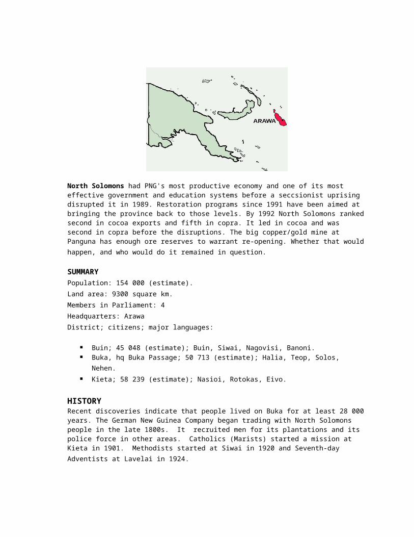
North Solomons had PNG's most productive economy and one of its most effective government and education systems before a seccsionist uprising disrupted it in 1989. Restoration programs since 1991 have been aimed at bringing the province back to those levels. By 1992 North Solomons rankedsecond in cocoa exports and fifth in copra. It led in cocoa and was second in copra before the disruptions. The big copper/gold mine at Panguna has enough ore reserves to warrant re-opening. Whether that wouldhappen, and who would do it remained in question.
SUMMARY Population: 154 000 (estimate). Land area: 9300 square km. Members in Parliament: 4 Headquarters: Arawa District; citizens; major languages:
Buin; 45 048 (estimate); Buin, Siwai, Nagovisi, Banoni. Buka, hq Buka Passage; 50 713 (estimate); Halia, Teop, Solos,
Nehen. Kieta; 58 239 (estimate); Nasioi, Rotokas, Eivo.
HISTORYRecent discoveries indicate that people lived on Buka for at least 28 000years. The German New Guinea Company began trading with North Solomons people in the late 1800s. It recruited men for its plantations and its police force in other areas. Catholics (Marists) started a mission at Kieta in 1901. Methodists started at Siwai in 1920 and Seventh-day Adventists at Lavelai in 1924.

Japanese soldiers took over North Solomons early in 1942, at the outset of World War II. American troops recaptured Torokina on 1 November 1943. They used it as an air base to bomb Japan's headquarters at Rabaul.
North Solomons was the centre of movements to break away from Australian control in the 1960s and early 1970s. These movements came to a head in disputes over land for the BCL mine (Panguna) and harbour (Loloho) and the landowners' right to a share of the rnine's profits. Compromises were reached and the mine went ahead.
In 1974, North Solomons leaders won the right to set up a provincial government which would share in the mine's benefits. In 1975, another secession threat arose after the House of Assembly failed to make provincial government part of PNG's Constitution. On 1 September-only 2 weeks before Independence-rebels raised a flag of the Republic of North Solomons at Kieta. The government ignored this act, and Parliament quickly added provincial government as the first amendment to the Constitution.
Between 1972 and 1989, the Panguna mine contributed close to K1 000 000 000 in taxes and dividends to the national government. It gave the province high wage levels and opened up many other jobs in service industries. However, Panguna landowners remained angry about the disruptions caused by the mine and their relatively small share (K23 000 000) of its benefits.
Rebellion and restoration: militants led by Francis Ona waged a campaign of sabotage and killing, which forced BCL to close the mine on 15 May 1989. Ona demanded independence, permanent closure of the mine, and K1 OOO OOO OOO in compensation. His actions were supported by some church leaders and expatriates who had been critical of environmental damage andsocial disruptions caused by the mine. Ona's Bougainville Revolutionary Army (BRA) attracted supporters from outside the mine area. These included people who were angry about the success of businessmen and/or plantation workers from outside the province; a religious cult; and criminal elements who had been the target of a police curfew operation in western Bougainville. In June 1989, the government broke precedent and sent soldiers to fight the rebels. A ceasefire was signed by the government and the BRA in March 1990. All police, soldiers, and government serviceswere withdrawn from Buka and Bougainville. The BRA declared independenceand the formation of the Republic of Meekamui on 17 May 1990. Other nations did not recognise the republic. Government troops landed on Bukaon 13 September 1990 at the request of local chiefs. They made their
first landing on Bougainville on 13 April 1991. Volunteer resistance fighters helped the army. The restoration program progressed as the armyregained territory. Interim authorities were established. Villagers fled from BRA-controlled areas and sought security and shelter in government care centres. At the peak, 60 000 people-more than one-third of the population-lived in centres.
The restoration program was directed by Interim Administrator Sam Tulo, aformer MP. Priorities included the re-establishment of law and order; care for displaced persons (still 33 000 in early 1994); restoration of afunctioning community and district government system, schools, and healthcare; and the rebuilding of roads, airports, and other infrastructure. By 1994, 85 community schools and 6 high schools had opened. Rural Development Bank offered a special loan scheme to encourage new businesses.
Copyright © 2022 FDOKUMEN