Pacific Gas & Electric Company ELC (Corp ID 39) Status of ...
278
STATE OF CALIFORNIA Governor PUBLIC UTILITIES COMMISSION 505 Van Ness Avenue San Francisco CA 94102-3298 GAVIN NEWSOM, Pacific Gas & Electric Company ELC (Corp ID 39) Status of Advice Letter 6285E As of August 30, 2021 Division Assigned: Energy Date Filed: 08-06-2021 Date to Calendar: 08-11-2021 Authorizing Documents: Disposition: Effective Date: Resolution Required: No Resolution Number: None Commission Meeting Date: None CPUC Contact Information: AL Certificate Contact Information: Lake Almanor Maidu Cemetery Land Donation - Request for Approval under Decision (D.) 03-12-035, D.08-11-043, D.10-08-004, and Public Utilities Code Section 851 Subject: None Accepted 08-31-2021 Annie Ho [email protected] 415-973-8794 [email protected]
-
Upload
khangminh22 -
Category
Documents
-
view
2 -
download
0
Transcript of Pacific Gas & Electric Company ELC (Corp ID 39) Status of ...

STATE OF CALIFORNIA Governor
PUBLIC UTILITIES COMMISSION505 Van Ness AvenueSan Francisco CA 94102-3298
GAVIN NEWSOM,
Pacific Gas & Electric CompanyELC (Corp ID 39)Status of Advice Letter 6285EAs of August 30, 2021
Division Assigned: Energy
Date Filed: 08-06-2021
Date to Calendar: 08-11-2021
Authorizing Documents:
Disposition:Effective Date:
Resolution Required: No
Resolution Number: None
Commission Meeting Date: None
CPUC Contact Information:
AL Certificate Contact Information:
Lake Almanor Maidu Cemetery Land Donation - Request for Approval under Decision (D.) 03-12-035, D.08-11-043, D.10-08-004, and Public Utilities Code Section 851
Subject:
None
Accepted08-31-2021
Annie Ho

To: Energy Company Filing Advice Letter
From: Energy Division PAL Coordinator
Subject: Your Advice Letter Filing
The Energy Division of the California Public Utilities Commission has processed your recent Advice Letter (AL) filing and is returning an AL status certificate for your records.
The AL status certificate indicates:
Advice Letter Number Name of Filer CPUC Corporate ID number of Filer Subject of Filing Date Filed Disposition of Filing (Accepted, Rejected, Withdrawn, etc.) Effective Date of Filing Other Miscellaneous Information (e.g., Resolution, if applicable, etc.)
The Energy Division has made no changes to your copy of the Advice Letter Filing; pleasereview your Advice Letter Filing with the information contained in the AL status certificate, and update your Advice Letter and tariff records accordingly.
All inquiries to the California Public Utilities Commission on the status of your Advice Letter Filing will be answered by Energy Division staff based on the information contained in the Energy Division's PAL database from which the AL status certificate is generated. If you have any questions on this matter please contact the: Energy Division's Tariff Unit by e-mail to [email protected]
STATE OF CALIFORNIA Governor
PUBLIC UTILITIES COMMISSION505 Van Ness AvenueSan Francisco CA 94102-3298
GAVIN NEWSOM,

Sidney Bob Dietz II
Director
Regulatory Relations
Pacific Gas and Electric Company
77 Beale St., Mail Code B13U
P.O. Box 770000
San Francisco, CA 94177
Fax: 415-973-3582
August 6, 2021 Advice 6285-E (Pacific Gas and Electric Company ID U 39 E) Public Utilities Commission of the State of California Subject: Lake Almanor Maidu Cemetery Land Donation - Request for Approval
under Decision (D.) 03-12-035, D.08-11-043, D.10-08-004, and Public Utilities Code Section 851
Purpose Pursuant to the streamlined procedures adopted by the California Public Utilities Commission (“Commission” or “CPUC”) in Decision (D.) 08-11-043 (as modified by D.10-08-004), Pacific Gas and Electric Company (“PG&E”) requests a disposition letter approving PG&E’s donation of fee simple title to approximately 141 acres of land in Plumas County, commonly known as Lake Almanor Maidu Cemetery (“Property”) to the Maidu Summit Consortium (“MSC”). This donation is being made in the public interest and will protect and preserve the Beneficial Public Values (“BPVs”) on the Property, including the habitat of fish, wildlife and plants, sustainable forestry, the scenic viewshed of the Property, agricultural uses, outdoor recreation, and identified historic and cultural values by restricting any use of the Property that would significantly impair or interfere with the protection of these values. This donation is in accordance with the terms and conditions specified in the Settlement Agreement and Stipulation that were approved by the Commission in D.03-12-035 (“Stipulation”). Background Pursuant to the Stipulation, the Pacific Forest and Watershed Lands Stewardship Council (“Stewardship Council”) was established in 2004 to develop a plan to permanently protect, for the benefit of the citizens of California, more than 140,000 acres of watershed lands (“Watershed Lands”) owned by PG&E. This effort is known as PG&E’s Land Conservation Commitment (“LCC”). PG&E is fulfilling its commitment through fee donation of certain Watershed Lands and/or the conveyance of conservation easements, (or satisfactory assurance in another form) that each parcel will be managed consistent with the purpose of the Land Conservation Commitment. PG&E will not make fee simple donations of lands that contain hydroelectric project features, hydroelectric projects licensed by the Federal Energy Regulatory Commission (“FERC”), or properties whose ownership is otherwise required for utility operations. The Stipulation also includes provisions to

Advice 6285-E - 2 - August 6, 2021 ensure the rights necessary to operate and maintain current and future hydroelectric and associated water delivery facilities are reserved, and the existing agreements for economic uses will be honored. A detailed description of this proposed donation, which addresses the requirements set forth in Section 12(a) of the Stipulation, is provided in the attached Land Conservation and Conveyance Plan (Attachment A) prepared by the Stewardship Council and approved by their Board of Directors. Land Conservation and Conveyance Plans will be issued serially for all Watershed Lands and together will comprise the Land Conservation Plan Volume III. Transaction Specific Considerations
To ensure all agreements are fully enforceable and achieve the requirements of the Stipulation, MSC is accepting the donation pursuant to certain restrictions on transfer of Property and agreeing to execute and record a power of termination (“Power of Termination”) in favor of PG&E.
In the Power of Termination Agreement, MSC agrees to not convey, grant rights to or in, or otherwise transfer the Property without the prior written consent of PG&E. MSC also agrees not to use the Property as Security for any debt nor shall it encumber the Property with any liens or other financial encumbrances without the prior written approval of PG&E.
The Power of Termination Agreement outlines the steps to be taken by PG&E if it believes MSC has violated or taken steps to violate any of the restrictions on the transfer or encumbrance of the Property or if MSC either seeks to dissolve or initiate bankruptcy proceedings.
For the complete text of the Power of Termination Agreement see Attachment B.
Property Specific Considerations Parcel 375: A boundary survey was completed to effectuate this transaction, resulting in the identification of a boundary discrepancy and portions of five houses believed to be encroaching onto a portion of PG&E Property. To avoid potential conflict between the MSC and the private property owners, PG&E coordinated with the Stewardship Council, MSC, the County of Plumas, and the private property owners to reach an agreement to effectuate a Lot Line Adjustment (“LLA”), one Encroachment Agreement (“EA”) and one access easement (“AE”) that, if approved as part of this Advice submittal, will resolve the issues along the southern boundary and allow for the encroachment on the southwestern portion of the property to remain. Lot Line Adjustment:

Advice 6285-E - 3 - August 6, 2021 The boundary survey identified several encroachments, including four houses (all of which appear to have been constructed in the mid-1970s), which encroach into this parcel across the southern property line. Discussion with the Stewardship Council, MSC, and the County of Plumas, resulted in agreement to utilize the LLA process to modify the Property boundary to create a line that is a minimum of 30 feet from the existing houses and a minimum of 10 feet from any permanent structures (which are the minimum setback distances allowed by Plumas County). This proposed new boundary encompasses an area of 0.64 acres. For the complete text and exhibit map of the Lot Line Adjustment Grant Deed see Attachment C. For the complete text approving the Lot Line Adjustment process from the County of Plumas see Attachment D. Encroachment and Access Easement This survey also identified a corner of a house encroaching onto PG&E Property along the southwestern portion of the parcel boundary. To avoid conflict between the MSC and the private property owner, PG&E coordinated with the Stewardship Council, MSC, and the private property owner to reach an “EA” and an “AE” that, if approved as part of this Advice submittal, will allow for the encroachment and current access route through the Property used by the private property owner to remain. For the complete text and exhibit map of the Encroachment Agreement see Attachment E. For the complete text of the Access Easement see Attachment F. In accordance with the streamlined procedure adopted by the Commission in D.08-11-043 (as modified by D.10-08-004), PG&E provides the following information as required by Ordering Paragraph 2: (1) Identity of the Conservation Property
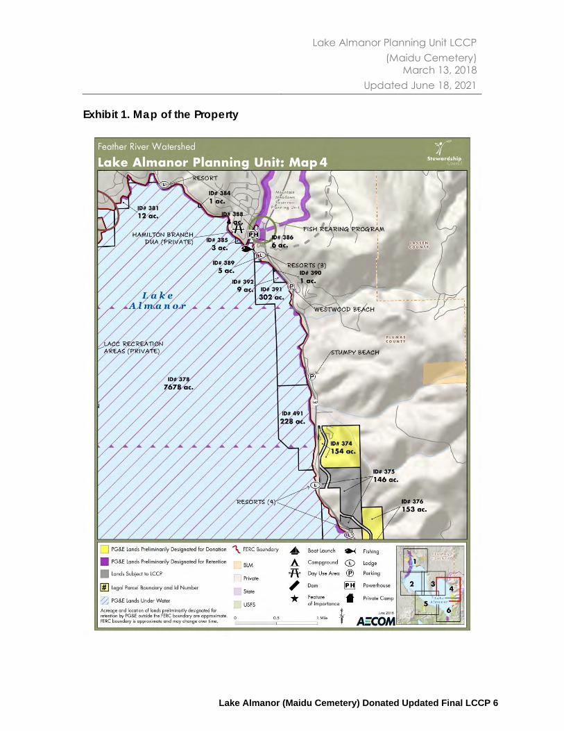
The Property, identified as Parcel 375 on the map included in Attachment A, page 6, is located in Plumas County. The Property is approximately 52 miles northeast of Chico, and approximately 10 miles southeast of the town of Chester. The Property is surrounded by private property and other PG&E-retained planning unit parcels.
(2) Type of Property Interest Disposition
Per the Stewardship Council recommendation, PG&E will convey fee simple title to the MSC. MSC will then immediately convey a conservation easement (Attachment G) to the Feather River Land Trust (“FRLT”), which will permanently protect the BPVs on the Property. The Property will be transferred subject to a Grant Deed with certain restrictions and reserved rights for the continued operation of Electric Facilities and Hydroelectric facilities. For the complete text of the Grant Deed, see Attachment H.

Advice 6285-E - 4 - August 6, 2021
The State Board of Equalization estimates the value of the Property is $886,267 (Attachment I).
A. Property Encumbrances and Uses
There is one recorded encumbrance on the Property for ingress and egress and no unrecorded encumbrances. There is one existing third-party agreement for economic uses on the Property, a recreation site leased to Lake Cove Resort.
B. Public Access
The Property can be accessed from a gravel road from Parcel 374 and from a dirt road off of Highway 147.
Public access to the Property will not be changed as a result of the donation. The conservation easement recognizes that the Property has been used by third parties for recreational, cultural, and other non-commercial or informal purposes without formal written agreements to conduct such activities. The conservation easement further recognizes that access to the Property is inherent or may be inherent in the enjoyment of the conservation values and the Informal Uses and, consistent with the objectives articulated in the Settlement and Stipulation, shall allow public access to the Property that is substantially consistent with the public access existing on the Effective Date of the conservation easement. MSC reserves the right to make reasonable rules and regulations to control, limit, or, as necessary, exclude Informal Uses and public access. For a complete description of the public access provisions see Attachment B, Section 8.
C. Recreational and Cemetery Zones
The conservation easement between MSC and FRLT includes reserved rights in favor of MSC allowing for a “Seasonal Commercial Recreational Zone” and a “Cemetery Zone”. MSC can make the Property available for low-intensity outdoor recreational and educational activities including hiking, nature study, mountain biking; as well as camping and/or recreational vehicle use in the Seasonal Commercial Recreation Zone. For the complete text of the Seasonal Commercial Recreational Zone provisions see Attachment B, Exhibit E, Section 8. In the Cemetery Zone, the Grantor may inter the remains of deceased persons of Mountain Maidu descent in the remaining internment spaces within the cemetery. For the complete text of the Cemetery Zone see Attachment B, Exhibit E, Section 10. For the approximate location of each Zone see Attachment B, Exhibit F.
D. PG&E’s Assumption of Liability
Advice 6285-E - 5 - August 6, 2021
Section 12(f) of the Stipulation requires that PG&E hold the donee and/or conservation organizations harmless for hazardous waste or substance liability. Fulfillment of that obligation is reflected in the Environmental Agreements, attached hereto as Attachment J and K. PG&E conducted an initial environmental review including Environmental Site Assessments (ESAs) in 2010 as part of its diligence in preparation for donation of the Property and a follow up ESA or “refresh” in 2017. The ESAs assessed the past and present uses, ownership, and environmental conditions in order to identify potential issues that present known or possible environmental areas of concern. The ESAs included, but were not limited to, site reconnaissance, interviews, historical and regulatory document review, and limited sampling. The sampling did not identify any potential environmental issues.
(3) Legal Name and Location of Receiving Parties
Maidu Summit Consortium P.O. Box 682 Chester, CA 96020 Attn: Executive Director Feather River Land Trust P.O. Box 1826 75 Court Street Quincy, CA 95971 Attn: Executive Director
(4) Proposed Uses and Conservation Management Objectives:
As set forth in the Stipulation, the cornerstone of the Land Conservation Commitment is its requirement that the Watershed Lands be preserved and enhanced for the following broad range of BPVs, which are as follows:
• Protection of the Natural Habitat of Fish, Wildlife, and Plants
• Preservation of Open Space
• Outdoor Recreation by the General Public
• Sustainable Forestry
• Agricultural Uses
• Historic Values The conservation easement for the Property ensures permanent protection of those BPVs listed in the Stipulation that are present on the Property.
Advice 6285-E - 6 - August 6, 2021
Attachment B, Sections G and H provides that the following BPVs are protected on the Property:
A. Protection of the Natural Habitat of Fish, Wildlife, and Plants
The Property is located within the Lake Almanor Basin, which the California Audubon Society has designated as an Important Bird Area due to its habitat for nesting and wintering waterfowl, and the presence of special status species such as willow flycatcher, sandhill crane, yellow warbler, bald eagle, and osprey.
The Property contains California Wildlife Habitat Relationship (CWHR) terrestrial habitat types as set out below, as defined in “A Guide to Wildlife Habitats of California,” prepared for the California Department of Fish and Game, by Kenneth E. Mayer and William F. Laudenslayer, Jr., Editors (1988).
The Property is dominated by diverse, mid-successional Sierra Mixed Conifer (SMC) habitat, where Douglas-fir (Pseudotsuga menziesii), Ponderosa pine (Pinus ponderosa), white fir (Abies concolor), sugar pine (Pinus lambertiana), incense cedar (Calocedrus decurrens), and California black oak (Quercus kelloggii) are found.
Numerous openings in the canopy resulting from timber harvest and fire provide diverse understory species development: whitethorn (Ceanothus cordulatus), silktassel (Garrya fremontii), bitter cherry (Prunus emarginata), snowberry (Symphoricarpos spp.) currant species (Ribes), bitterbrush (Purshia tridentata), with grasses and forbs. Some bracken fern is located in the draws and Scouler’s willow (Salix scouleriana), also known as Fire Willow, (of older age classes from mature to decadent) is well distributed within the understory on south aspects.
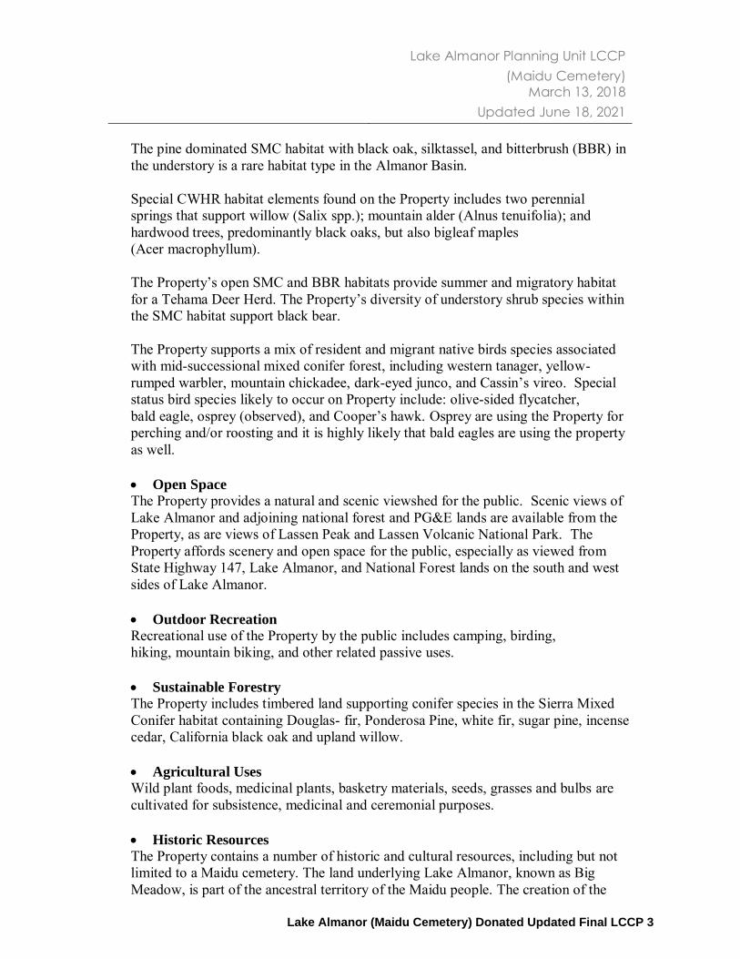
The pine dominated SMC habitat with black oak, silktassel, and bitterbrush (BBR) in the understory is a rare habitat type in the Almanor Basin. Special CWHR habitat elements found on the Property includes two perennial springs that support willow (Salix spp.); mountain alder (Alnus tenuifolia); and hardwood trees, predominantly black oaks, but also bigleaf maples (Acer macrophyllum). The Property’s open SMC and BBR habitats provide summer and migratory habitat for a Tehama Deer Herd. The Property’s diversity of understory shrub species within the SMC habitat support black bear. The Property supports a mix of resident and migrant native birds species associated with mid-successional mixed conifer forest, including western tanager, yellow-rumped warbler, mountain chickadee, dark-eyed junco, and Cassin’s vireo. Special status bird species likely to occur on Property include: olive-sided flycatcher, bald eagle, osprey (observed), and Cooper’s hawk.
Advice 6285-E - 7 - August 6, 2021
Osprey are using the Property for perching and/or roosting and it is highly likely that bald eagles are using the property as well.
B. Preservation of Open Space The Property provides a natural and scenic viewshed for the public. Scenic views of Lake Almanor and adjoining national forest and PG&E lands are available from the Property, as are views of Lassen Peak and Lassen Volcanic National Park. The Property affords scenery and open space for the public, especially as viewed from State Highway 147, Lake Almanor, and National Forest lands on the south and west sides of Lake Almanor.
C. Historic Values The Property contains a number of historic and cultural resources, including but not limited to a Maidu cemetery. The land underlying Lake Almanor, known as Big Meadow, is part of the ancestral territory of the Maidu people. The creation of the Lake inundated entire Maidu villages and sites of cultural significance to the Maidu people, and the Maidu cemetery is a living memory of these events.
D. Outdoor Recreation by the General Public
Recreational use of the Property by the public includes camping, birding, hiking, mountain biking, and other related passive uses.
E. Sustainable Forestry
The Property includes timbered land supporting conifer species in the Sierra Mixed Conifer habitat containing Douglas- fir, Ponderosa Pine, white fir, sugar pine, incense cedar, California black oak and upland willow.
F. Agricultural Uses
Wild plant foods, medicinal plants, basketry materials, seeds, grasses and bulbs are cultivated for subsistence, medicinal and ceremonial purposes.
(5) Environmental Information The proposed transaction constitutes a change in ownership with no proposed changes to land uses; thus, no direct or indirect environmental impacts will occur as a result. Therefore, the transaction does not constitute a “project” under the California Environmental Quality Act (CEQA). Accordingly, as stated in D.99-12-030 (pages 7 and 9), this advice letter process is not subject to review under CEQA.

Advice 6285-E - 8 - August 6, 2021 TRIBAL LANDS POLICY The Tribal Lands Policy exempts fee transactions subject to the LCC. (Resolution, p. 59, ¶ 15.)
Native American Engagement Consistent with existing practice for LCC transactions, PG&E is serving this Advice Letter to the Tribes and Native American entities affected by the proposed transaction as identified by the Stewardship Council’s outreach process. The Stewardship Council’s outreach process includes noticing to those tribal contacts as identified through CAL FIRE’s Native American Contact List, which the Native American Heritage Commission assisted in creating and provides ongoing updates and issue resolution assistance.1
PG&E’s Review & Finding PG&E has reviewed the transaction and documents herein and has determined that the proposed transaction is compliant with requirements of the Stipulation. Additionally, this transaction will not have an adverse effect on the public interest or on the ability of the utility to provide safe and reliable service to customers at reasonable rates. Lastly, the Stewardship Council intends to provide funding to satisfy property tax payments in perpetuity for the Property.2 Upon CPUC approval of fee title donation of the Property, Plumas County will receive a one-time lump sum payment to satisfy property tax in perpetuity for the Property. The County would, in-turn, be required to distribute the funds to the general fund and applicable special districts consistent with the Tax Rate Area in effect for the parcels. Protests ***Due to the COVID-19 pandemic, PG&E is currently unable to receive protests or comments to this advice letter via U.S. mail or fax. Please submit protests or comments to this advice letter to [email protected] and [email protected]*** Anyone wishing to protest this submittal may do so by letter sent via U.S. mail by facsimile or electronically, any of which must be received no later than August 26, 2021, which is 20 days after the date of this submittal. Protests should be mailed to:
1 https://www.fire.ca.gov/programs/resource-management/resource-protection-improvement/environmental-protection-program/cultural-resources-management-program/ 2As stated in Resolution E-4644 the Commission endorses the Stewardship Council 1) Guidelines Regarding Satisfaction of Tax Neutrality, and 2) the Property Tax Neutrality Methodology adopted by the Stewardship Council
Advice 6285-E - 9 - August 6, 2021
CPUC Energy Division ED Tariff Unit 505 Van Ness Avenue, 4th Floor San Francisco, California 94102 Facsimile: (415) 703-2200 E-mail: [email protected]
Copies of protests also should be mailed to the attention of the Director, Energy Division, Room 4004, at the address shown above. The protest also should be sent via U.S. mail (and by facsimile and electronically, if possible) to PG&E at the address shown below on the same date it is mailed or delivered to the Commission.
Sidney Bob Dietz II Director, Regulatory Relations c/o Megan Lawson Pacific Gas and Electric Company 77 Beale Street, Mail Code B10C P.O. Box 770000 San Francisco, California 94177 Facsimile: (415) 973-3582 E-mail: [email protected]
Any person (including individuals, groups, or organizations) may protest or respond to this advice letter; the requirements for responding to advice letters are set forth in General Order 96-B, Rules 3.11; see also Decision 08-11-043 (as modified by Decision 10-08-004). Effective Date Pursuant to the review process outlined in D.08-11-043 (as modified by D.10-08-004), PG&E requests that this Category 1 advice submittal become effective as soon as possible. Notice In accordance with General Order 96-B, Section IV, and D.08-11-043 (as modified by D.10-08-004), a copy of this advice letter is being sent electronically and via U.S. mail to parties shown on the attached list, Service List A.08-04-020 and I.02-04-026, Appendix A and additional parties identified by the Stewardship Council. Address changes to the General Order 96-B service list should be directed to e-mail [email protected]. For changes to any other service list, please contact the Commission’s Process Office at (415) 703-2021 or at [email protected]. Send all electronic approvals to

Advice 6285-E - 10 - August 6, 2021 [email protected]. Advice letter submittals can also be accessed electronically at: http://www.pge.com/tariffs. /S/ Sidney Bob Dietz II Director, Regulatory Relations Attachments: A Land Conservation and Conveyance Plan B Power of Termination C Lot Line Adjustment Grant Deed D LLA Approval Letter – County of Plumas E Encroachment Agreement F Access Easement G Conservation Easement H Grant Deed I State Board of Equalization Land Appraisal Record J Environmental Agreement – (Fee Donee) K Environmental Agreement – (Easement Grantee) cc: Service List Appendix A - Advice Letter 6285-E Heidi Krolick, Stewardship Council Erin Healy, Stewardship Council Service List A.08-04-020 and I.02-04-026
Additional Parties Identified by the Stewardship Council

Advice 6285-E - 11 - August 6, 2021
************ SERVICE LIST Advice 6285-E *********** APPENDIX A
Jonathan Reiger Legal Division 505 Van Ness Avenue San Francisco, CA 94102 (415) 355-5596 [email protected] Mary Jo Borak Energy Division 505 Van Ness Avenue San Francisco, CA 94102 (415) 703-1333 [email protected] Robert (Mark) Pocta Public Advocate Office 505 Van Ness Avenue San Francisco, CA 94102 (415) 703-2871 [email protected] Michael Rosauer Energy Division 505 Van Ness Avenue San Francisco, CA 94102 (415) 703-2579 [email protected]
Maidu Summit Consortium P.O. Box 682 Chester, CA 96020 Attn: Executive Director [email protected] Feather River Land Trust P.O. Box 1826 75 Court Street Quincy, CA 95971 Attn: Executive Director [email protected]
Stewardship Council
Attention: Executive Director 3300 Douglas Blvd. Ste. 250 Roseville, CA 95661
Telephone: (916) 297-6660
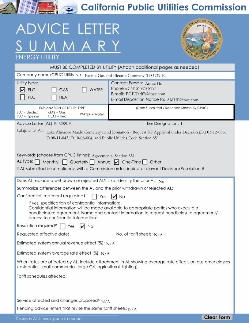
ADVICE LETTER S U M M A R YENERGY UTILITY
Company name/CPUC Utility No.:
Utility type:Phone #:
EXPLANATION OF UTILITY TYPE
ELC GAS
PLC HEAT
MUST BE COMPLETED BY UTILITY (Attach additional pages as needed)
Advice Letter (AL) #:
WATERE-mail: E-mail Disposition Notice to:
Contact Person:
ELC = ElectricPLC = Pipeline
GAS = GasHEAT = Heat WATER = Water
(Date Submitted / Received Stamp by CPUC)
Subject of AL:
Tier Designation:
Keywords (choose from CPUC listing):AL Type: Monthly Quarterly Annual One-Time Other:If AL submitted in compliance with a Commission order, indicate relevant Decision/Resolution #:
Does AL replace a withdrawn or rejected AL? If so, identify the prior AL:
Summarize differences between the AL and the prior withdrawn or rejected AL:
Confidential treatment requested? Yes NoIf yes, specification of confidential information:Confidential information will be made available to appropriate parties who execute a nondisclosure agreement. Name and contact information to request nondisclosure agreement/access to confidential information:
Resolution required? Yes No
Requested effective date: No. of tariff sheets:
Estimated system annual revenue effect (%):
Estimated system average rate effect (%):
When rates are affected by AL, include attachment in AL showing average rate effects on customer classes (residential, small commercial, large C/I, agricultural, lighting).
Tariff schedules affected:
Service affected and changes proposed1:
Pending advice letters that revise the same tariff sheets:
1Discuss in AL if more space is needed.
✔
Lake Almanor Maidu Cemetery Land Donation - Request for Approval under Decision (D.) 03-12-035, D.08-11-043, D.10-08-004, and Public Utilities Code Section 851
✔
Agreements, Section 851
Clear Form
16285-E
N/A
N/A
✔
Annie Ho
N/A
✔
No
Pacific Gas and Electric Company (ID U39 E)
N/A
(415) 973-8794
N/A

CPUC, Energy DivisionAttention: Tariff Unit505 Van Ness AvenueSan Francisco, CA 94102 Email: [email protected]
Protests and all other correspondence regarding this AL are due no later than 20 days after the date of this submittal, unless otherwise authorized by the Commission, and shall be sent to:
Name:Title:Utility Name:Address:City:State:Telephone (xxx) xxx-xxxx:Facsimile (xxx) xxx-xxxx:Email:
Name:Title:Utility Name:Address:City:State:Telephone (xxx) xxx-xxxx: Facsimile (xxx) xxx-xxxx:Email:
Zip:
Zip:
District of Columbia
San Francisco, CA 9417794177
Director, Regulatory Relations
Clear Form
77 Beale Street, Mail Code B13UPacific Gas and Electric Company
(415)973-2093
Sidney Bob Dietz II, c/o Megan Lawson
(415)973-3582
California

Attachment A
Land Conservation and Conveyance Plan

Land Conservation and Conveyance Plan
Lands for Donation to Maidu Summit Consortium at Lake Almanor (Maidu Cemetery) Planning Unit
Updated Final LCCP March 13, 2018
Updated June 18, 2021

Lake Almanor Planning Unit LCCP (Maidu Cemetery)
March 13, 2018 Updated June 18, 2021
Executive Summary
Subject
LCCP Lake Almanor Planning Unit (Nákˀam Kojóm Maidu Cemetery) Land Conservation Plan Identification Number (Parcel) 375 as shown on the map attached as Exhibit 1.
Type of Property Interest Disposition
Maidu Summit Consortium (MSC) to hold fee simple title to 141 acres within Parcel 375 of the Lake Almanor planning unit.
Feather River Land Trust (FRLT) to hold the conservation easement on the 141 acres of Parcel 375 donated to MSC.
Summary
141 acres within one parcel (Parcel 375) will be donated to MSC and, consistent with the conditions in the Settlement Agreement, the Property will be subject to a perpetual conservation easement granted by MSC to FRLT. Pending California Public Utilities Commission (CPUC) approval, and immediately following PG&E's conveyance of 141 acres within Parcel 375 to MSC, MSC and FRLT will enter into the conservation easement.
The 141 acres in Parcel 375 to be donated to MSC are outside the Upper North Fork Feather River Project boundary (FERC #2105) and PG&E has determined this acreage does not need to be retained for existing or future utility operations. Therefore, this acreage is available for donation, subject to PG&E’s reserved rights.
This transaction will not have an adverse effect on the public interest or on the ability of the utility to provide safe and reliable service to customers at reasonable rates.
Property Location
The property subject to this LCCP consists of 141 acres in Plumas County on the east side of Lake Almanor.
Economic Uses and Agreements
There are recorded encumbrances on the property to be donated to MSC for ingress and egress; however, there are no unrecorded encumbrances on the property. There is one existing agreement for economic uses, a recreation site leased to Lake Cove Resort, on the lands to be donated to MSC in Parcel 375 of the Lake Almanor planning unit.
Consistent with the Settlement Agreement, PG&E will reserve its rights to maintain and operate existing and future hydro power utility facilities on the parcel to be conveyed in
Lake Almanor (Maidu Cemetery) Donated Updated Final LCCP 1

Lake Almanor Planning Unit LCCP (Maidu Cemetery)
March 13, 2018 Updated June 18, 2021
fee. The specific reserved rights are set forth in the grant deed and conservation easement, which can be found in Appendices 2 and 3, respectively.
Permanent Protection of the Beneficial Public Values
The grant deed transferring fee title to MSC includes a recital that MSC and PG&E acknowledge that the conveyance, together with the conservation easement transaction being entered into by MSC and FRLT, is being made in the public interest with the intent to ensure the permanent protection of the beneficial public values (BPVs) on the Property as identified in the Land Conservation Plan while allowing the ongoing use of the Property by PG&E for hydroelectric operations, water delivery, and related activities, and acknowledging and honoring the existing third party uses.
Conservation Management Objectives to Preserve and/or Enhance the
Beneficial Public Values
The conservation easement for Parcel 375 within the Lake Almanor planning unit lists the following Beneficial Public Values (BPVs) that are to be protected:
Fish, Plant, and Wildlife Habitat
The Property is located within the Lake Almanor Basin, which the California Audubon Society has designated as an Important Bird Area due to its habitat for nesting and wintering waterfowl, and the presence of special status species such as willow flycatcher, sandhill crane, yellow warbler, bald eagle, and osprey. The Property contains California Wildlife Habitat Relationship (CWHR) terrestrial habitat types as set out below, as defined in “A Guide to Wildlife Habitats of California,” prepared for the California Department of Fish and Game, by Kenneth E. Mayer and William F. Laudenslayer, Jr., Editors (1988). The Property is dominated by diverse, mid-successional Sierra Mixed Conifer (SMC) habitat, where Douglas-fir (Pseudotsuga menziesii), Ponderosa pine (Pinus ponderosa), white fir (Abies concolor), sugar pine (Pinus lambertiana), incense cedar (Calocedrus decurrens), and California black oak (Quercus kelloggii) are found. Numerous openings in the canopy resulting from timber harvest and fire provide diverse understory species development: whitethorn (Ceanothus cordulatus), silktassel (Garrya fremontii), bitter cherry (Prunus emarginata), snowberry (Symphoricarpos spp.) currant species (Ribes), bitterbrush (Purshia tridentata), with grasses and forbs. Some bracken fern is located in the draws and Scouler’s willow (Salix scouleriana), also known as Fire Willow, (of older age classes from mature to decadent) is well distributed within the understory on south aspects.
Lake Almanor (Maidu Cemetery) Donated Updated Final LCCP 2
Lake Almanor Planning Unit LCCP (Maidu Cemetery)
March 13, 2018 Updated June 18, 2021
The pine dominated SMC habitat with black oak, silktassel, and bitterbrush (BBR) in the understory is a rare habitat type in the Almanor Basin. Special CWHR habitat elements found on the Property includes two perennial springs that support willow (Salix spp.); mountain alder (Alnus tenuifolia); and hardwood trees, predominantly black oaks, but also bigleaf maples (Acer macrophyllum). The Property’s open SMC and BBR habitats provide summer and migratory habitat for a Tehama Deer Herd. The Property’s diversity of understory shrub species within the SMC habitat support black bear. The Property supports a mix of resident and migrant native birds species associated with mid-successional mixed conifer forest, including western tanager, yellow-rumped warbler, mountain chickadee, dark-eyed junco, and Cassin’s vireo. Special status bird species likely to occur on Property include: olive-sided flycatcher, bald eagle, osprey (observed), and Cooper’s hawk. Osprey are using the Property for perching and/or roosting and it is highly likely that bald eagles are using the property as well.
Open Space
The Property provides a natural and scenic viewshed for the public. Scenic views of Lake Almanor and adjoining national forest and PG&E lands are available from the Property, as are views of Lassen Peak and Lassen Volcanic National Park. The Property affords scenery and open space for the public, especially as viewed from State Highway 147, Lake Almanor, and National Forest lands on the south and west sides of Lake Almanor. Outdoor Recreation
Recreational use of the Property by the public includes camping, birding, hiking, mountain biking, and other related passive uses. Sustainable Forestry
The Property includes timbered land supporting conifer species in the Sierra Mixed Conifer habitat containing Douglas- fir, Ponderosa Pine, white fir, sugar pine, incense cedar, California black oak and upland willow. Agricultural Uses
Wild plant foods, medicinal plants, basketry materials, seeds, grasses and bulbs are cultivated for subsistence, medicinal and ceremonial purposes. Historic Resources
The Property contains a number of historic and cultural resources, including but not limited to a Maidu cemetery. The land underlying Lake Almanor, known as Big Meadow, is part of the ancestral territory of the Maidu people. The creation of the
Lake Almanor (Maidu Cemetery) Donated Updated Final LCCP 3

Lake Almanor Planning Unit LCCP (Maidu Cemetery)
March 13, 2018 Updated June 18, 2021
Lake inundated entire Maidu villages and sites of cultural significance to the Maidu people, and the Maidu cemetery is a living memory of these events.
Tax Neutrality
The Stewardship Council intends to provide funding to satisfy property tax payments in perpetuity for the Property.
Pending CPUC approval of the fee title donation of the Property, Plumas County will receive a lump sum payment of approximately $291,115, consistent with the methodology described in the Property Tax Neutrality Methodology adopted on June 27, 2012 and amended most recently on November 15, 2017.
Hazardous Waste Disclosure
PG&E has provided the Lake Almanor Planning Unit Environmental Site Assessment Report dated June 21, 2010 and updated March 2017, to MSC and FRLT, fulfilling the disclosure requirements of the Land Conservation Commitment.
Consideration of Parcel Split
No parcel split was required to effectuate the transfer. PG&E determined that operational needs would be met sufficiently through the reservation of rights for ongoing hydroelectric operations.
Applicable CEQA Exemption(s) or Reason Why Transaction is not a
“Project Under CEQA”
This Lake Almanor planning unit transaction will not result in a direct physical change or a reasonably foreseeable indirect physical change in the environment; therefore, the Stewardship Council does not believe that the transaction is a project under CEQA. In addition, the transfer of land to preserve open space, habitat, or historical resources is categorically exempt under Section 15325 of the CEQA Guidelines (CFR Title 14, Chapter 3) and Public Resources Code 21080.28 clarifies that CEQA review is not required before a public agency transfers an interest in property, provided the purpose of the transfer is to conserve the land for habitat, open space, agricultural, or historic preservation, among other purposes. Also, the establishment of a conservation easement is categorically exempt under Section 15325 of the CEQA Guidelines (CFR Title 14, Chapter 3).
While the principal effect of the conservation easement will be to significantly restrict development on the site in perpetuity, the conservation easement reserves to MSC the right to expand the existing recreational use and construct a caretaker residence, subject to the limitations in the conservation easement, and continue to use the site for future burials. However, MSC is not proposing to carry out any permitted development or change in use at this time. Instead, at least for the time being, MSC intends to manage the Property as PG&E does presently. If, in the future, MSC decides to pursue new
Lake Almanor (Maidu Cemetery) Donated Updated Final LCCP 4
Lake Almanor Planning Unit LCCP (Maidu Cemetery)
March 13, 2018 Updated June 18, 2021
development or uses that are allowed by the conservation easement, it must first obtain all necessary permits and conduct any necessary CEQA review at that time. Public Resources Code 21080.28 states that CEQA review is not required even when physical changes to the property are reasonably foreseeable as a result of the transfer, provided that environmental review occurs before those changes occur.
Lake Almanor (Maidu Cemetery) Donated Updated Final LCCP 5
Lake Almanor Planning Unit LCCP (Maidu Cemetery)
March 13, 2018 Updated June 18, 2021
Exhibit 1. Map of the Property
Lake Almanor (Maidu Cemetery) Donated Updated Final LCCP 6

Lake Almanor Planning Unit LCCP (Maidu Cemetery)
March 13, 2018 Updated June 18, 2021
Table of Contents
Executive Summary .......................................................................................... 1
Introduction ....................................................................................................... 8
1. Acreage, Existing Economic Uses and Agreements .............................. 12
2. Objectives to Preserve and/or Enhance the BPVs .................................. 14
3. Recommendations for Conservation Easement and Fee Simple
Donation ..................................................................................................... 16
4. Finding of Donee Funding and Other Capacity to Maintain Lands to
Preserve and/or Enhance the BPVs .......................................................... 18
5. Analysis of Tax and Other Economic and Physical Impacts ................. 20
6. Hazardous Waste Disclosure ..................................................................... 22
7. Consideration of Parcel Split ..................................................................... 23
8. Strategy for Physical Measures to Enhance the BPVs............................. 24
9. Monitoring Plan for the Economic and Physical Impacts of
Disposition and Implementation of Enhancement Measures................ 25
10. Implementation Schedule for Transactions and Measures ................... 26
Appendices
Appendix 1. Summary of Public Outreach.................................................................................. 27
Appendix 2. Grant Deed ................................................................................................................ 32
Appendix 3. Conservation Easement (Placerholder) ............................................................... 50
Appendix 4. Stewardship Council Conservation Easement Funding Agreement .............. 89
Appendix 5. Property Tax Neutrality Methodology ................................................................... 101
Appendix 6. Settlement Agreement, Appendix E ..................................................................... 105
Lake Almanor (Maidu Cemetery) Donated Updated Final LCCP 7

Lake Almanor Planning Unit LCCP (Maidu Cemetery)
March 13, 2018 Updated June 18, 2021
Introduction
The Pacific Forest and Watershed Lands Stewardship Council (Stewardship Council) is a private, nonprofit foundation established in 2004 pursuant to a Settlement Agreement and a Stipulation Resolving Issues Regarding the Land Conservation Commitment approved by the California Public Utilities Commission (CPUC) in Decision 03-12-035 (Dec. 18, 2003). The Stewardship Council Board of Directors includes appointees from state and federal agencies, water districts, Native American and rural interests, forest and farm industry groups, conservation organizations, the CPUC, and Pacific Gas and Electric Company (PG&E).
The Stewardship Council has developed a plan to protect more than 140,000 acres of watershed lands (Watershed Lands) currently owned by PG&E for the benefit of the citizens of California. Protecting the Watershed Lands will be accomplished through (1) PG&E’s grant of conservation easements to one or more public agencies or qualified conservation organizations so as to protect the natural habitat of fish, wildlife, and plants, the preservation of open space, outdoor recreation by the general public, sustainable forestry, agricultural uses, and historic values (collectively the Beneficial Public Values), and in some cases, (2) PG&E’s donation of the Watershed Lands in fee to one or more public entities or qualified conservation organizations, whose ownership would be consistent with these conservation objectives.
Located primarily in the Sierra Nevada and Cascade Mountain range watersheds, the Watershed Lands contain some of the most pristine and resource-rich landscapes found in the state. The properties are diverse and geographically remote, located in 21 counties from the northern reaches of the state to the southern end of the Central Valley.
As required by the Settlement and Stipulation, the Stewardship Council prepared a Land Conservation Plan (LCP) to establish a framework for the conservation and/or enhancement of the Watershed Lands, and to ensure the permanent protection of these lands for the benefit of current and future generations of Californians. To address the challenge of a conservation effort of this large scope and unique nature, and to facilitate engagement of a wide range of stakeholders and interested members of the public, the Stewardship Council grouped the Watershed Lands into 47 planning units and established a phased approach to development and implementation of the LCP.
In 2007, the Stewardship Council board adopted Volumes I and II of the LCP:
Volume I: The Land Conservation Framework establishes the overall framework for the LCP, including legal requirements, the planning process, methodologies, public involvement, and relevant regulatory processes.
Volume II: Planning Unit Concepts documents existing conditions and presents management objectives, potential measures, and conceptual plans to preserve and/or enhance the Beneficial Public Values (BPVs) within each planning unit. It also documents existing economic uses.
Lake Almanor (Maidu Cemetery) Donated Updated Final LCCP 8
Lake Almanor Planning Unit LCCP (Maidu Cemetery)
March 13, 2018 Updated June 18, 2021
Volume III, consisting of Land Conservation and Conveyance Plans (LCCPs) to be issued serially and cumulatively, will encompass a series of real estate transaction packages that will detail the specific land conservation and/or disposition requirements for each parcel or parcel cluster. LCCPs represent the Stewardship Council’s recommendations for preserving and/or enhancing the BPVs of the Watershed Lands, and are intended to support required regulatory approvals of the land transactions resulting from the Stewardship Council’s recommendations. The content of the LCCP spans a number of issues required by the Settlement and Stipulation, such as an express reservation of a right for continued operation and maintenance of hydroelectric facilities and associated water delivery facilities, including project replacements and improvements required to meet existing and future water delivery requirements for power generation and consumptive water use by existing users, compliance with any Federal Energy Regulatory Commission (FERC) license, FERC license renewal, or other regulatory requirements. In addition, conservation easements will honor existing agreements for economic uses, including consumptive water deliveries, and preserve or enhance reasonable public access to the Watershed Lands.
During the development of LCP Volumes I and II and the LCCPs, the Stewardship Council implemented a public outreach program to ensure local communities, elected representatives, neighboring property owners, Native American tribes and groups, and other key stakeholders had many opportunities to engage in the Stewardship Council’s effort to preserve and enhance the Watershed Lands. To solicit additional input from the public on potential fee title recipients or conservation easement holders (referred to as donees), the Stewardship Council hosted a series of public information meetings. These meetings were designed to (1) provide an overview and update on the Stewardship Council’s Land Conservation Program, (2) outline next steps, timeline, and opportunities for additional public input, and (3) solicit public input on the desired qualifications of potential donees and the future stewardship of the planning units. The Stewardship Council also made a concerted effort to extend the benefits of PG&E’s Land Conservation Commitment to Native American tribes and groups, including meeting in person with representatives of Native American entities and conducting special outreach to best ensure Native American entities were aware of, and provided full access to participation in the opportunities presented by PG&E’s Land Conservation Commitment.
Public input that the Stewardship Council received as a result of the public outreach process, including comments on Volume II of the LCP, comments from public information meetings on the selection of donees and other issues, and correspondence received by the Stewardship Council were considered by the Stewardship Council in its evaluation of the potential donees and their land stewardship proposals. In addition to public meetings, the public was given the opportunity to participate in all of the Stewardship Council’s public board meetings where decisions were made on fee title and conservation easement donees. Prior to making a decision regarding the disposition of any parcel, the Stewardship Council will provide notice to the Board of Supervisors of the affected county, each affected city, town, and water supply entity, each affected Tribe and/or co-licensee, and each landowner located within one mile of the exterior boundary of the parcel, by mail or other effective manner. A summary of the public outreach
Lake Almanor (Maidu Cemetery) Donated Updated Final LCCP 9
Lake Almanor Planning Unit LCCP (Maidu Cemetery)
March 13, 2018 Updated June 18, 2021
process for this subject LCCP, the Lake Almanor planning unit, is provided in Appendix 1. Furthermore, the proposed LCCP will be made available for public review and comment before it is forwarded by the Watershed Planning Committee to the board for its review and approval.
The Stewardship Council Board of Directors recommends that the Maidu Summit
Consortium (MSC) receive 141 acres within one parcel (375) of the Lake Almanor
planning unit in fee and that the Feather River Land Trust (FRLT) hold a
conservation easement over the lands recommended for donation to MSC in this
parcel (375) of the Lake Almanor planning unit.
Table 1 identifies Stipulation requirements that will be addressed in the LCCP and includes pertinent language from the Stipulation.
(1) Acreage, Existing Economic Uses and Agreements
“Reasonably exact estimates of acreage, by parcel, within or outside licensed project
boundaries, and existing economic uses (including all related agreements);”
(2) Objectives to Preserve and/or Enhance
“Objectives to preserve and/or enhance the BPVs, as defined in the Settlement
Agreement, Appendix E, of each individual parcel;”
(3) Recommendations for Conservation Easement and Fee Simple Donation
“A recommendation for grant of a conservation easement or fee simple donation for
each such parcel;”
(4) Finding of Donee Funding and Other Capacity to Maintain Lands to Preserve and/or
Enhance BPVs
“A finding that the intended donee of such easement or fee simple has the funding and
other capacity to maintain that property interest so as to preserve and/or enhance the
BPVs thereof;”
(5) Analysis of Tax and Other Economic and Physical Impacts
“An analysis of tax and other economic and physical impacts of such disposition
strategy, and a commitment by an appropriate entity to provide property tax revenue,
other equivalent revenue source, or a lump sum payment, so that the totality of
dispositions in each affected county under the LCC will be ’tax neutral’ for that county;”
(6) Hazardous Waste Disclosure
“A disclosure of all known hazardous waste or substance contamination or other such
environmental liabilities associated with each parcel;”
(7) Consideration of Parcel Split
“Appropriate consideration whether to split any parcel which is partly used or useful for
operation of PG&E’s and/or a co-licensee’s hydroelectric facilities, where the beneficial
public values of the unused part may be enhanced by such split, provided that it is
consistent with Section 12(b)(4) of this Stipulation and that, in the event that
governmental approval of a parcel split imposes conditions or restrictions on other PG&E
property, the decision to accept or reject such conditions will be at PG&E’s sole
discretion;”
Table 1 Stipulation 12(a) Requirements
Lake Almanor (Maidu Cemetery) Donated Updated Final LCCP 10

Lake Almanor Planning Unit LCCP (Maidu Cemetery)
March 13, 2018 Updated June 18, 2021
(8) Strategy for Physical Measures to Enhance BPVs
“A strategy to undertake appropriate physical measures to enhance the BPVs of
individual parcels; provided that no such measure will be in conflict with the provisions of
Settlement Agreement paragraph 17(c) and Appendix E paragraph 1;”
(9) Monitoring Plan for the Economic and Physical Impacts of Disposition and
Implementation of Enhancement Measures
“A plan to monitor the economic and physical impacts of disposition and
implementation of enhancement measures on the applicable management objectives;“
(10) Implementation Schedule for Transactions and Measures
“A schedule for the implementing transactions and measures.”
Lake Almanor (Maidu Cemetery) Donated Updated Final LCCP 11
Lake Almanor Planning Unit LCCP (Maidu Cemetery)
March 13, 2018 Updated June 18, 2021
1. Acreage, Existing Economic Uses and Agreements
Acreage and Property Description
141 acres in Parcel 375 will be donated to MSC and, consistent with the conditions in the Settlement Agreement, the Property will be subject to a perpetual conservation easement granted by MSC to FRLT.
Lake Almanor, a 26,000-acre reservoir with 52 miles of shoreline, is the central feature of the planning unit. The reservoir is located in the Almanor basin in Plumas County, adjoining the towns of Chester and Prattville, northeast of the city of Chico. The reservoir is surrounded by conifer forests interspersed with small communities and summer resorts (there are over 1,000 homes adjacent to the shoreline), providing a scenic setting. State highways and county roads pass close to most of the shoreline, providing easy public access and helping to make the area a major regional destination for water-based recreation.
The planning unit contains important habitat for waterfowl and other birds, and several rare plants. Lake Almanor also supports a gradually increasing number of nesting bald eagles and osprey. The California Audubon Society has designated the entire reservoir area an Important Bird Area due to its importance to nesting and wintering waterfowl, but also for a number of special status species such as willow flycatcher, sandhill crane, and yellow warbler.
Water-based recreation is a primary use of Lake Almanor by both visitors and the growing number of area residents. Most use occurs during the summer, when area facilities host many boaters, anglers, campers, and other outdoor enthusiasts. Recreation needs are served by the many public and private facilities dispersed around most areas of the shoreline. The lake is a popular boating area and supports a smallmouth bass and trout fishery. Twenty-two privately operated resorts with over 800 boat slips are dispersed along the shore. The resorts are located primarily on private land, but operate under PG&E leases for commercial recreational use of the shoreline.
Parcel 375 is located within a PG&E Timber Management Unit (TMU) that contains 415 timbered acres. The TMU is currently managed by PG&E under a Sustainable Timber Management prescription, meaning that sustained timber production is regarded as the highest and best use of the land while also placing an emphasis on protecting water quality, wildlife and fisheries habitat, soils, carbon sequestration, and cultural resources.
The area now covered by Lake Almanor was once known as Big Meadow, part of the ancestral homeland of the Mountain Maidu tribe of Native Americans, and the location of several Maidu villages. Many cultural sites associated with the Maidu were inundated by the reservoir, but important sites (including burial sites) still exist on and near the shoreline.
Lake Almanor (Maidu Cemetery) Donated Updated Final LCCP 12
Lake Almanor Planning Unit LCCP (Maidu Cemetery)
March 13, 2018 Updated June 18, 2021
Adjacent and Nearby Landowners
The parcel subject to donation to MSC is surrounded by private property and other planning unit parcels. The parcel is accessed via a dirt road off State Highway 147 and a gravel road from Parcel 374.
The Stewardship Council notified and invited landowners located within one mile of the subject parcel to provide comment during key phases of the land conservation and conveyance planning process.
Existing Economic Uses and Agreements
There are recorded encumbrances on the property to be donated to MSC for ingress and egress; however, there are no unrecorded encumbrances on the property. There is one existing agreement for economic uses, a recreation site leased to Lake Cove Resort, on the lands to be donated to MSC in Parcel 375 of the Lake Almanor planning unit.
PG&E’s specific reserved rights are set forth in the grant deed and conservation easement, which can be found in Appendices 2 and 3, respectively.
Lake Almanor (Maidu Cemetery) Donated Updated Final LCCP 13
Lake Almanor Planning Unit LCCP (Maidu Cemetery)
March 13, 2018 Updated June 18, 2021
2. Objectives to Preserve and/or Enhance the BPVs
The Land Conservation Commitment provides that “PG&E shall ensure that the Watershed Lands it owns… are conserved for a broad range of beneficial public values, including the protection of the natural habitat of fish, wildlife and plants, the preservation of open space, outdoor recreation by the general public, sustainable forestry, agricultural uses, and historic values. PG&E will protect these beneficial public values associated with the Watershed Lands… from uses that would conflict with their conservation. PG&E recognizes that such lands are important to maintaining the quality of life of local communities and all the people of California in many ways, and it is PG&E’s intention to protect and preserve the beneficial public values of these lands under the terms of any agreements concerning their future ownership or management.”1
The following text lists the objectives for each BPV at the Lake Almanor planning unit that the Stewardship Council board approved in LCP Volume II, as well as a description of how the transaction, as summarized by this LCCP, supports each objective and preserves and/or enhances the BPVs.
The conservation easement will protect the BPVs, subject to PG&E’s hydro and other reserved rights as provided in the conservation easement.
1. Objective: Preserve and enhance habitat in order to protect special biological
resources.
The conservation easement (Appendix 3) includes as a BPV the protection of natural habitat for fish, wildlife and plants that are native to the area, including species protected under the California Endangered Species Act and/or the federal Endangered Species Act.
2. Objective: Preserve open space in order to protect natural and cultural resources,
viewsheds, and the recreation setting from further development.
The conservation easement will ensure that no further development will occur unless specifically authorized by the conservation easement and consistent with the BPVs. MSC proposes to maintain the property to be donated without significant modifications to the landscape. The current open space values on the property will remain for the benefit of the public. The conservation easement allows for the building of a caretakers residence and recreational improvements, in a manner designed to minimize adverse impacts to the conservation values. No development is currently proposed.
3. Objective: Enhance recreational facilities in order to provide additional public
access and recreation opportunities.
The conservation easement allows for public access of low-intensity outdoor recreational and educational activities, including hiking, nature study, mountain
1 Land Conservation Commitment I.02-04-026, Appendix E, p. 38
Lake Almanor (Maidu Cemetery) Donated Updated Final LCCP 14
Lake Almanor Planning Unit LCCP (Maidu Cemetery)
March 13, 2018 Updated June 18, 2021
biking, and hunting; as well as camping and/or recreational vehicle use in the Seasonal Commercial Recreation Zone.
4. Objective: Develop and implement forestry practices in order to contribute to a
sustainable forest, preserve and enhance habitat and cultural resources, as
well as to ensure appropriate fuel load and fire management.
The current timber management prescription on the acreage proposed for transfer to MSC is focused on sustainable timber management. The conservation easement will ensure that forest management activities required for compliance with any laws or guidelines, including vegetation management and fuel load reductions, are allowed to continue. The conservation easement allows for the development of a forest management plan, which will focus on the creation, management, and preservation of a healthy forest.
5. Objective: Identify and manage cultural resources in order to ensure their protection,
as well as to support opportunities for public education.
The conservation easement will protect identified historical and cultural values on the Property to the extent they are protected by state and federal law. The conservation easement includes the purpose of re-establishing a permanent place where cultural practices; traditional Maidu land management; and preservation, enhancement and restoration will be carried out.
Lake Almanor (Maidu Cemetery) Donated Updated Final LCCP 15

Lake Almanor Planning Unit LCCP (Maidu Cemetery)
March 13, 2018 Updated June 18, 2021
3. Recommendations for Conservation Easement and Fee
Simple Donation
The Settlement and Stipulation require that the Watershed Lands: (1) be subject to permanent conservation easements restricting development of the Watershed Lands so as to protect and preserve the BPVs, and/or (2) be donated in fee simple to one or more public entities or qualified nonprofit conservation organizations, whose ownership will ensure the protection of these BPVs.
Conservation Easement
The Settlement Agreement states that “the conservation easements shall provide for the preservation of land areas for the protection of the natural habitat of fish, wildlife and plants, the preservation of open space, outdoor recreation by the general public, sustainable forestry, agricultural uses, and historic values and, shall prevent any other uses that will significantly impair or interfere with those values. Conservation easements on the Watershed Lands will include an express reservation of a right for continued operation and maintenance of hydroelectric facilities and associated water delivery facilities, including project replacements and improvements required to meet existing and future water delivery requirements for power generation and consumptive water use by existing users, compliance with any FERC license, FERC license renewal or other regulatory requirements. In addition, conservation easements will honor existing agreements for economic uses, including consumptive water deliveries. The conservation easements shall be donated to and managed by one or more non-profit conservation trustees, qualified conservation organizations or public agencies with the experience and expertise to fully and strictly implement the conservation easements” (Land Conservation Commitment I.02-04-026, Appendix E, pp. 38-39).
For the complete text of the conservation easement, see Appendix 3.
Conservation easements must be donated to nonprofit organizations, Native American tribes, or public agencies that meet the requirements of California Civil Code section 815.3 and possess the experience and capacity to fully and strictly implement the terms of the conservation easement. The Feather River Land Trust (FRLT) will hold the conservation easement over the lands to be donated to MSC in the Lake Almanor planning unit that are the subject of this LCCP. The qualifications of FRLT are described in Chapter 4.
Accordingly, immediately following PG&E's conveyance of the lands that are the subject of this LCCP to MSC, MSC will convey the conservation easement to FRLT.
Retention or Donation of Fee Title and Recommendation of Conservation
Easement Donation
The Settlement Agreement states that PG&E will not be expected to make fee simple donations of Watershed Lands with hydroelectric project features, and conservation easements and enhancements may not interfere with hydroelectric operations. In general,
Lake Almanor (Maidu Cemetery) Donated Updated Final LCCP 16
Lake Almanor Planning Unit LCCP (Maidu Cemetery)
March 13, 2018 Updated June 18, 2021
PG&E will retain fee title to those Watershed Lands within the boundaries of hydroelectric projects licensed by the FERC, as well as other properties required for continuing and future utility operations. However, these Watershed Lands will be conserved via a conservation easement. See Appendix 6 for a description of PG&E’s Land Conservation Commitment.
The 141 acres proposed for donation to MSC in Parcel 375 were identified as available for donation, subject to PG&E’s reserved rights.
Lands to be Donated by PG&E
141 acres within one parcel (375) will be donated to MSC pending CPUC approval of the Section 851 filing for the transaction. The legal description of the parcel is included in the grant deed, which is provided in Appendix 2. The qualifications and capacity of MSC to manage the Lake Almanor property recommended for donation are described in Chapter 4.
The map provided in Exhibit 1 shows all of the land within Parcel 375 in the Lake Almanor planning unit that will be donated. The map also shows key features in the planning unit and surrounding area, and the ownership of adjacent land.
Lake Almanor (Maidu Cemetery) Donated Updated Final LCCP 17

Lake Almanor Planning Unit LCCP (Maidu Cemetery)
March 13, 2018 Updated June 18, 2021
4. Finding of Donee Funding and Other Capacity to Maintain
Lands to Preserve and/or Enhance the BPVs
Selected Organizations
At the conclusion of the selection process referenced below, the following organizations were endorsed by the Stewardship Council board:
On November 19, 2014 and additional acres on January 21, 2016, the Maidu Summit Consortium (MSC) to hold fee simple title to 141 acres within Parcel 375.
On February 16, 2011, Feather River Land Trust (FRLT) to hold a conservation easement over the 141 acres to be donated to MSC in Parcel 375.
Capacity of Selected Organizations
The Stewardship Council board finds that MSC and FRLT will have the funding and other capacity to maintain the property interest so as to preserve and/or enhance the BPVs2.
A. MSC:
MSC is comprised of nine Mountain Maidu tribes with aboriginal ties to the land within the Lake Almanor planning unit, including federally recognized and petitioning tribes, non-profit organizations, and grassroots groups. The group formed in 2003, and has been operating since that time, acquiring 501(c)(3) nonprofit status from the IRS in 2010.
The mission of MSC is the “preservation and protection of Mountain Maidu prehistoric and historic sites, education, consultation, coordination and cooperation with all interests in our homeland, including Native tribes and organizations, industries, natural resource agencies, conservation groups and residents and the conservation, preservation and protection of land and its natural resources and historic sites.”
The MSC Board consists of nine representatives of member organizations and six alternates, and is served by two staff and 13 volunteers.
B. FRLT:
Since 2000, the FRLT has been working to conserve the magnificent lands and waters of the Feather River region.
The FRLT has successfully protected over 64,000 acres of private lands that support outstanding biodiversity, waterways, fisheries, recreational and
2 Stipulation, Section 12(a)(4)
Lake Almanor (Maidu Cemetery) Donated Updated Final LCCP 18

Lake Almanor Planning Unit LCCP (Maidu Cemetery)
March 13, 2018 Updated June 18, 2021
educational opportunities, cultural sites, agricultural lands, and spectacular scenery.
FRLT has a staff of 14 people and an eight-member board of directors.
FRLT is a nationally accredited land trust.
Donee Selection Process
The Stewardship Council used a formal multi-step process to solicit and select organizations interested in receiving a donation of Watershed Lands or becoming a conservation easement holder at the Lake Almanor planning unit. The process consisted of the following key steps:
Organizations were invited to register via the Stewardship Council’s Interested Donee Registry and were invited to submit a statement of qualifications (SOQ). The Stewardship Council reviewed the SOQs that were submitted to identify organizations that: (a) were determined to be a qualified nonprofit conservation organization; a federal, state or local governmental entity; or, a recognized tribe; (b) appeared to have sufficient financial and organizational capacity relative to the property interest sought within the planning unit; and, (c) appeared to be capable of satisfying the requirements of the Settlement and Stipulation for receiving a donation of fee title or to hold the conservation easement.
Organizations interested in a fee title donation were invited to submit a land stewardship proposal (“LSP” or “proposal”) describing their capacity and interest in preserving and enhancing the BPVs. The LSPs were posted on the Stewardship Council’s website.
Organizations demonstrating sufficient capacity and determined by the Stewardship Council to be best-suited to receive a donation of property interest (fee or conservation easement) in particular Watershed Lands within a planning unit are being recommended to PG&E to receive fee title and/or conservation easements.
Lake Almanor (Maidu Cemetery) Donated Updated Final LCCP 19

Lake Almanor Planning Unit LCCP (Maidu Cemetery)
March 13, 2018 Updated June 18, 2021
5. Analysis of Tax and Other Economic and Physical Impacts
The Stipulation requires that the LCCP provide “an analysis of tax and other economic and physical impacts of such disposition strategy, and a commitment by an appropriate entity [which may be PG&E, subject to being authorized by the Commission to fully recover in rates any such costs in approving PG&E’s Section 851 application or in another appropriate Commission proceeding, Stewardship Council, donee, or a third party, depending on the individual circumstances] to provide property tax revenue, other equivalent revenue source, or a lump sum payment, so that the totality of dispositions in each affected county under this Land Conservation Commitment will be ‘tax neutral’ for that county.”
The following sections address the Stewardship Council’s plan for achieving tax neutrality for Plumas County, the county in which the Property is located. The final LCCP submitted for all PG&E Watershed Lands located in Plumas County will address tax neutrality for the totality of all fee title transfers within the county, as required under the Settlement and Stipulation.
Stewardship Council Board Policies and Guidelines
The Stewardship Council board adopted a set of Guidelines Regarding Satisfaction of Tax Neutrality on March 30, 2011, after an opportunity for public comment. Under the guidelines, the Stewardship Council outlined the following overarching assumptions:
1. The Stewardship Council will address property tax neutrality based upon the most current property taxes paid by PG&E on the lands being transferred at the time of the actual transfer of fee title from PG&E to the selected donee.
2. The Stewardship Council’s achievement of property tax neutrality applies to all property taxes that would be distributed directly to County General Funds, School and Fire Districts, Regional Conservation and Water Districts, and any other special districts as defined by the applicable Tax Rate Area.
3. The Settlement and Stipulation direct the Stewardship Council to ensure that the effects of distributions be made tax neutral for the affected counties. Therefore, the Stewardship Council’s property tax neutrality commitment will not apply to any amount of property tax payments that are subject to apportionment by the State of California.
On June 27, 2012, the Stewardship Council board approved an amendment to the property tax neutrality methodology it had adopted on May 2, 2012, after an opportunity for public comment and specific outreach to all potentially affected counties. On June 24, 2015 and January 21, 2016, the Stewardship Council board approved some revisions to that methodology. The methodology establishes a standard payment process when lands are transferred to organizations that are exempt from paying property taxes (see Appendix 5).
Lake Almanor (Maidu Cemetery) Donated Updated Final LCCP 20

Lake Almanor Planning Unit LCCP (Maidu Cemetery)
March 13, 2018 Updated June 18, 2021
On August 14, 2014, the California Public Utilities Commission approved Resolution E-4644. The resolution states that the Commission endorses the Guidelines Regarding Satisfaction of Tax Neutrality and the Property Tax Neutrality Methodology adopted by the Stewardship Council.
As of November 15, 2017, the Stewardship Council board approved further revisions to the property tax neutrality methodology. The revisions established that the County will receive a one-time lump sum payment allocated based upon the applicable Tax Rate Area at the time of the payment. Counties and special districts would then be free to determine the best use of the funds pursuant to the needs of the county or special district, including, if desired, investment in a shared investment pool of the county’s choosing.
Achieving Property Tax Neutrality
The Stewardship Council will provide funding to satisfy property tax payments in perpetuity for the Property. After the CPUC has approved the fee title donation of the Property, Plumas County will receive a lump sum payment of approximately $310,666.
Based on the tax tables current as of March 2021, the transfer of lands to MSC is anticipated to result in the reduction of approximately $12,524 in annual taxes paid to Plumas County (as shown in Table 2 below). If assessed values on the lands recommended for donation change prior to the transfer of the property, the Stewardship Council will revise the payment calculation.
Table 2: Property Tax Detail
Parcel ID SBE Map Number Annual Taxes on Acres
Transferred
375
117-32-2-2, 135-32-44-1, 117-32-2-4
$12,524
Upon receipt of a lump sum payment, Plumas County would, in-turn, be required to distribute the funds to the general fund and applicable special districts consistent with the Tax Rate Area in effect for the parcels.
Other Economic and Physical Impacts
The Settlement and Stipulation require an analysis of the physical and economic impacts of each fee title transfer. The transaction agreements for the donation of 141 acres within the Lake Almanor planning unit have not mandated any changes to the physical or economic uses of the lands. MSC intends to manage the lands in a manner consistent with the current physical and economic uses of the lands. No new activities are proposed that will result in physical impacts. If MSC proposes to undertake or permit new activities on the property in the future, consistent with the terms of the conservation easement, and if such activities could have adverse environmental impacts, MSC will obtain all necessary permits and conduct any required CEQA review at that time.
Lake Almanor (Maidu Cemetery) Donated Updated Final LCCP 21

Lake Almanor Planning Unit LCCP (Maidu Cemetery)
March 13, 2018 Updated June 18, 2021
6. Hazardous Waste Disclosure
The Stipulation states that in the transfer of fee title and conveyance of a conservation easement, PG&E will disclose all known hazardous waste, substance contamination, or other such environmental liabilities associated with each parcel and hold the donee harmless.
Lands to be Donated by PG&E
PG&E has provided the Lake Almanor Planning Unit Environmental Site Assessment Report dated June 21, 2010 and updated March 2017, to MSC and FRLT, fulfilling the disclosure requirements of the Land Conservation Commitment.
Environmental Agreement
Pending CPUC approval of the transaction, PG&E will execute Environmental Agreements with MSC and FRLT, satisfying the requirements of Section 12(f) of the Stipulation.
Lake Almanor (Maidu Cemetery) Donated Updated Final LCCP 22
Lake Almanor Planning Unit LCCP (Maidu Cemetery)
March 13, 2018 Updated June 18, 2021
7. Consideration of Parcel Split
Appropriate consideration was given to whether any portion of the Lake Almanor planning unit is needed for operation of PG&E’s and/or a co-licensee’s hydroelectric facilities.
PG&E determined that retention of fee title within Parcel 375 is not needed for such operations and that reserving rights for certain activities would suffice. Therefore, the entire 141 acres within this parcel were made available for donation. Thus, no parcel split is required to effectuate transfer of the parcel to MSC.
Lake Almanor (Maidu Cemetery) Donated Updated Final LCCP 23

Lake Almanor Planning Unit LCCP (Maidu Cemetery)
March 13, 2018 Updated June 18, 2021
8. Strategy for Physical Measures to Enhance the BPVs
The Stewardship Council developed and implemented a strategy to identify and undertake appropriate physical measures to enhance the BPVs of the Watershed Lands consistent with Settlement Agreement paragraph 17(c)3 and Appendix E, paragraph 1.
During the preparation of Volume II of the LCP, a number of potential physical enhancement measures to preserve and/or enhance the BPVs were identified. These measures were identified with public input and were intended to be illustrative in nature and subject to change over time in coordination with the future landowner.
The Stewardship Council has developed a grant program that will fund selected enhancements on the Watershed Lands. It is anticipated that grant funding will be available to accomplish future projects that enhance one or more of the six Beneficial Public Values. Projects may include habitat restoration or physical measures such as developing trails, day use areas, and other public access improvements.
3 Settlement Agreement Paragraph 17(c) states, “PG&E shall fund PG&E Environmental Enhancement Corporation with $70 million in Cash to cover administrative expenses and the costs of environmental enhancements to the Watershed Lands… provided that no such enhancement may at any time interfere with PG&E’s hydroelectric operations maintenance or capital improvements.”
Lake Almanor (Maidu Cemetery) Donated Updated Final LCCP 24
Lake Almanor Planning Unit LCCP (Maidu Cemetery)
March 13, 2018 Updated June 18, 2021
9. Monitoring Plan for the Economic and Physical Impacts of
Disposition and Implementation of Enhancement
Measures
The Stipulation requires that the LCCP outline a plan to monitor the economic and physical impacts of disposition and implementation of enhancement measures.
The conservation easement holder is required to monitor every conservation easement that it holds to ensure that the landowner is complying with the terms of the easement. The Stewardship Council will enter into a Conservation Easement Funding Agreement (Appendix 4) with each conservation easement holder whereby the holder will receive a monitoring and enforcement endowment from the Stewardship Council to fund its monitoring activities.
To further meet the requirement of monitoring the economic and physical impacts, the Stewardship Council will enter into an agreement with the Sierra Nevada Conservancy (SNC), a state agency, whereby the agency will agree to undertake certain duties designed to monitor the impacts of PG&E’s Land Conservation Commitment.
When the Stewardship Council has completed its work, it will be dissolved. Prior to its dissolution, the Stewardship Council expects to prepare a report providing an assessment of any economic and physical impacts resulting from the Land Conservation Commitment as of that time. Stewardship Council’s close-out report will include, among other things, the following information:
How the property tax neutrality requirement was satisfied with regard to each parcel donated to a tax exempt organization.
A report regarding the enhancements that were funded by the Stewardship Council.
It is anticipated that several years after the dissolution of the Stewardship Council, SNC will prepare a report assessing the physical and economic impacts of the Land Conservation Commitment up until that time. The report is expected to cover the following topics:
Impact of the Land Conservation Commitment on agreements for economic uses.
Changes in entities holding conservation easements or fee title.
Performance of duties by conservation easement holders.
In addition to preparing an assessment report, which will be submitted to the CPUC and PG&E, SNC will serve as a public repository for key transaction documents and other documents pertaining to the Land Conservation Commitment through June 2025.
Lake Almanor (Maidu Cemetery) Donated Updated Final LCCP 25
Lake Almanor Planning Unit LCCP (Maidu Cemetery)
March 13, 2018 Updated June 18, 2021
10. Implementation Schedule for Transactions and Measures
Schedule for Transaction
CPUC review and approval (2021)
Close of escrow (2021)
Stewardship Council release of funds to FRLT per conservation easement funding agreement (2021)
Compliance with Local Land Use Planning Requirements
Future management of the donated property at the Lake Almanor planning unit is anticipated to comply with all applicable County ordinances and/or General Plan policies.
Lake Almanor (Maidu Cemetery) Donated Updated Final LCCP 26
SUMMARY OF PUBLIC OUTREACH PROGRAM
The Stewardship Council established a comprehensive public outreach program to both inform and
solicit input from the public on the development and implementation of a plan to permanently protect
over 140,000 acres of PG&E watershed lands. A variety of tools and techniques are used to engage the
public, including:
Stewardship Council Website: the website provides background information on the land
conservation program and is regularly updated with board meeting agendas and minutes,
proposed recommendations, and other announcements.
Stakeholder Database and E-mailing: regular e-mail notifications are sent directly to individuals
and organizations that have signed-up to receive e-mails. The e-mails provide updates on the
status of the land conservation program, including pending actions by the board and upcoming
public meetings.
Targeted Newspaper Noticing and Paid Advertisements: newspaper advertisements and notices
are placed in local newspapers circulated in the area where a board or public meeting is taking
place or in communities that may have an interest in a particular topic on an upcoming meeting
agenda.
News Releases: news releases are issued to statewide and local media outlets at key intervals
during the planning process.
Public Information Meetings and Workshops: public information meetings and workshops are
conducted throughout the watershed lands to provide updates and solicit input from interested
stakeholders on the land conservation program and individual planning units. In many
workshops, public comments were sought on potential measures to protect and enhance the
beneficial public values on specific lands as well as the desired qualifications of potential donee
organizations. Individuals and organizations unable to attend are provided an opportunity to
submit comments in writing and review meeting summaries posted on the web site.
Notice by Mail of Pending Decisions Regarding the Conveyance of Individual Parcels and
Invitation to Comment:
o Noticing of Affected Governmental Entities: prior to the Watershed Planning Committee
forwarding a recommendation to the board that a proposed Land Conservation and
Conveyance Plan (LCCP) be adopted by the board, a notice will be mailed to the Board of
Supervisors of the affected county; each affected city, town, and water supply entity;
and each affected tribe.
o Noticing of landowners: postcards or letters are sent to all landowners located within
one mile of lands that are the subject of a proposed LCCP prior to the Watershed
Planning Committee forwarding a recommendation to the board that the proposed
LCCP be adopted by the board.
Individual Meetings with Stakeholders: Over the course of the preparation of Volumes I and II of
the Land Conservation Plan (LCP) and the LCCP, Stewardship Council staff met, and
communicated via the telephone and email, with a number of stakeholders interested in the
Watershed Lands.
Appendix 1: Summary of Public Outreach
Lake Almanor (Maidu Cemetery) Donated Updated Final LCCP 27
The Stewardship Council Board of Directors meets five to six times per year, typically on a
bimonthly schedule. At the board meetings, the public is invited to directly address the board on
an agenda item or on any other matter. The meetings have been held at locations in northern
and central California and across the watershed lands to help facilitate public participation.
Agendas are available one week prior to meetings, and meeting minutes are posted on the
Stewardship Council public website approximately three weeks following those meetings.
LAKE ALMANOR PLANNING UNIT PUBLIC OUTREACH
Highlighted below are the opportunities that have been, or are being, provided for public input on key
documents and decisions concerning the Lake Almanor planning unit and the land conservation and
conveyance process.
I. PUBLIC REVIEW OF VOLUMES I AND II OF THE LCP
The Draft Land Conservation Plan Volumes I and II were released in June 2007 for a 60-day public
comment period. During this time, the Stewardship Council held ten public meetings to publicize the
availability of the Draft LCP and to encourage public comment. These meetings were advertised via an e-
mail sent to contacts in the Stewardship Council’s database, an announcement posted on the
Stewardship Council’s web site, a press release issued to local newspapers, a paid advertisement in local
papers, and a postcard sent to all landowners on record that reside within one mile of any PG&E parcel.
Comments were received via email, the website, and hardcopy letters. The comments were reviewed,
and responded to individually; and the text in the draft LCP was revised as appropriate.
A total of thirteen public comments were submitted concerning the Lake Almanor planning unit during public review of Volumes I and II of the LCP. The public comment emphasized the importance of protection of wildlife areas, unauthorized use, sustainable forestry, impacts from development and recreation.
II. NOTICING OF LANDOWNERS WITHIN ONE MILE
In the fall of 2006 a postcard was distributed to the approximately 26,000 landowners located within
one mile of the exterior boundary of all the parcels to notify and invite comment on Volume I and II of
the LCP. A postcard was also sent to notify and invite all landowners located within one mile of the
parcels within the Lake Almanor planning unit to a Public Information Meeting that was held in Chester
in 2009. In addition, simultaneous with the release of the proposed subject LCCP for public comment,
adjacent landowners located within one mile of the subject parcels are noticed by mail 30 days before
the Watershed Planning Committee considers forwarding the proposed subject LCCP to the board for
final approval.
III. PUBLIC INFORMATION MEETING
A Public Information Meeting workshop for several planning units in the Feather River Watershed Area was hosted by the Stewardship Council on October 22, 2009, in Chester, California. The meeting concerned four planning units: Butt Valley Reservoir, Humbug Valley, Lake Almanor, and Mountain Meadows Reservoir. Attendees at the workshop included a total of 61 individuals representing a wide
Appendix 1: Summary of Public Outreach
Lake Almanor (Maidu Cemetery) Donated Updated Final LCCP 28

variety of interests including local and federal governments, community organizations, and community members. The meeting was advertised via an e-mail sent to contacts in the Stewardship Council’s database, an announcement posted on the Stewardship Council’s web site, a press release issued to the local newspaper, and a postcard sent to all landowners on record located within one mile of any PG&E parcel associated with the Lake Almanor planning unit. The purpose of the workshop was to: (1) provide a review and update on the Stewardship Council’s Land
Conservation Program; and, (2) solicit additional public input on future stewardship of the four planning
units. Stations were set up with maps, other pertinent information, and easels with blank paper. Below
is a summary of comments related to the Lake Almanor planning unit that were recorded on the easels
and provided on comment cards.
Lake Almanor Planning Unit
Support for the Lake Almanor Recreation Trail to Chester
Development of conference center similar to Asilomar (Pacific Grove) at possible locations either near the causeway or near Bailey Creek – emphasis on youth groups focusing on the abundant outdoor activities of the area
Dock/ramp on east side of lake that would provide public access at no cost
Extension of the Lake Almanor Recreation Trail is not a priority since it currently does not get use
Don't want OHV [off highway vehicle] use here
Limit hunting access along [southwest] shoreline
Most important - maintain public access for recreation
IV. PUBLIC REVIEW OF LAND STEWARDSHIP PROPOSALS
In November 2010, the Stewardship Council received two Land Stewardship Proposals from
organizations interested in being considered for a donation of fee title to certain lands located within
the Lake Almanor planning unit. The Maidu Summit Consortium and the County of Plumas prepared and
submitted proposals. Each of the organizations prepared and submitted its proposal which was posted
on the Stewardship Council’s website for public review and comment, and an e-mail was sent to
contacts in the Stewardship Council’s database to notify them of the postings.
V. PUBLIC REVIEW OF LAND CONSERVATION PROGRAM POLICIES & GUIDELINES
Public comment was sought on policies and guidelines that helped inform the Stewardship Council’s
land conservation and conveyance process. These documents were provided to the public in advance of
being reviewed and endorsed by the Watershed Planning Committee or Fiduciary Committee and
forwarded to the board for review and consideration.
Land Conservation Program Funding Policy
The Stewardship Council created a Land Conservation Program Funding Policy to help guide future
planning and decision-making regarding funding of the long term management and stewardship of the
watershed lands. In June and July, 2009, the draft policy was posted on the Stewardship Council’s web
site and made available for review and comment to a group of stakeholders consisting of all registered
Appendix 1: Summary of Public Outreach
Lake Almanor (Maidu Cemetery) Donated Updated Final LCCP 29
potential donees and representatives of the counties in which the watershed lands are located. Two
comments were received during the 30-day review and comment period. Both comments were
reviewed, and it was determined that neither comment necessitated a change in the draft policy. The
Stewardship Council’s Board of Directors adopted the policy at a public board meeting in Sonora, Calif.
on September 17, 2009.
Guidelines for Achieving Property Tax Neutrality
The Stewardship Council created guidelines for achieving property tax neutrality to describe scenarios
when the Stewardship Council will make property tax payments to affected counties as in lieu payments
for property taxes that are lost due to the donation of PG&E watershed lands to an entity that is exempt
from paying property taxes. The guidelines also defined a set of overarching assumptions regarding
property tax neutrality payments. The draft guidelines were posted on the Stewardship Council’s web
site in December 2010. A notice inviting review and comment on the guidelines was sent to the
Stewardship Council’s stakeholder database. Additional targeted outreach was performed to inform the
affected counties. Nine comments were received during the 60-day review and comment period. After
consideration of public comments, the Stewardship Council Board adopted a set of guidelines at its
public board meeting on March 30, 2011.
Proposed methodology for achieving tax neutrality
The proposed methodology for achieving tax neutrality on donated lands was e-mailed to all land
stakeholders and posted on Stewardship Council’s website for public review and comment on January 9,
2012. The deadline for submission of comments was March 9, 2012. The Stewardship Council received
one request to extend this deadline, which was granted. By the new deadline March 30, 2012, six
comments were received. Upon consideration of the comments received, the Stewardship Council
board deferred adoption of the full methodology until the June 27, 2012 board meeting so that the
affected counties could be notified of the proposed change to the capitalization rate. No comments
were received on the revised capitalization rate. The revised methodology was adopted by the board at
its June 27, 2012 meeting.
VI. WATERSHED PLANNING COMMITTEE RECOMMENDATIONS OF FEE TITLE AND CONSERVATION EASEMENT DONEES
Staff recommendations for prospective fee title donees and conservation easement holders that are
endorsed by the Watershed Planning Committee are posted on the Stewardship Council’s website for
public review and comment. The proposed board action is noticed via an e-mail sent to contacts in the
Stewardship Council’s database. In addition, public board meetings are advertised via an e-mail sent to
contacts in the Stewardship Council’s database, an announcement posted on the Stewardship Council’s
web site, a press release issued to local papers, and an advertisement placed in local newspapers in the
area where a board or public meeting is taking place or in communities that may have an interest in a
particular topic on an upcoming meeting agenda. The board action taken is also noted in the meeting
minutes that are posted on the Stewardship Council’s website following each meeting.
Appendix 1: Summary of Public Outreach
Lake Almanor (Maidu Cemetery) Donated Updated Final LCCP 30

All public comments received by staff concerning the fee and conservation easement recommendations
at the Lake Almanor planning unit were provided to the board for consideration at the relevant public
board meetings.
VII. PUBLIC REVIEW OF THE LAND CONSERVATION AND CONVEYANCE PLANS
The public is provided an opportunity to review and comment on the proposed Land Conservation and
Conveyance Plans (LCCPs), and the comments received are shared with board members prior to the
Watershed Planning Committee’s forwarding the proposed LCCP to the board for its review and
approval. The 30-day public review and comment periods are announced via an e-mail sent to contacts
in the Stewardship Council’s database, a posting on the Stewardship Council’s web site, and an
advertisement placed in local newspapers in communities that may have an interest in a particular
planning unit. A notice inviting review and comment on the proposed LCCP is also sent to all landowners
on record located within one mile of the subject PG&E parcels and to PG&E leaseholders. In addition, a
notice is mailed to the board of supervisors of the affected county; each affected city, town, and water
supply entity; and each affected tribe and/or co-licensee. After receiving public comment, the
Watershed Planning Committee may make revisions to a proposed LCCP prior to forwarding a
recommendation to the board.
VIII. STEWARDSHIP COUNCIL BOARD OF DIRECTORS MEETINGS
Proposed LCCPs endorsed by the Watershed Planning Committee are posted on the Stewardship
Council’s website for additional public review and comment approximately 30 days prior to being
considered by the board at a public board meeting. The posting of proposed LCCPs is advertised via an e-
mail sent to contacts in the Stewardship Council’s database. In addition, public board meetings are
advertised via an e-mail sent to contacts in the Stewardship Council’s database, an announcement
posted on the Stewardship Council’s web site, a press release issued to local papers, and an
advertisement placed in local newspapers in the area where a board or public meeting is taking place or
in communities that may have an interest in a particular topic on an upcoming meeting agenda. The
board action taken is noted in the meeting minutes that are posted on the Stewardship Council’s
website following each meeting.
All public comments received will be provided to the board. There is also an additional opportunity for
public comment at the public board meeting when the board considers approval of the proposed LCCP.
Adoption of an LCCP by the board would be the final step in the Stewardship Council’s process for
selecting donees. The prospective donees are responsible for securing its own internal approvals prior to
the transaction being completed. Transactions will be finalized upon LCCP review and transaction
approval by the California Public Utilities Commission.
Appendix 1: Summary of Public Outreach
Lake Almanor (Maidu Cemetery) Donated Updated Final LCCP 31
Exhibit Version 4/30/21
- 1 -
RECORDING REQUESTED BY AND RETURN TO:
PACIFIC GAS AND ELECTRIC COMPANY 245 Market Street, N10A, Room 1015 P.O. Box 770000 San Francisco, California 94177 Attention: Land Consultant (LCC)
Location: Unincorporated Plumas County Recording Fee $_____________________________ Document Transfer Tax $ 0 [X] This is a court-ordered conveyance or decree thatis not pursuant to sale, R&T 11911.[ ] Computed on Full Value of Property Conveyed,or[ ] Computed on Full Value Less Liens
& Encumbrances Remaining at Time of Sale
(SPACE ABOVE FOR RECORDER'S USE ONLY)
LD # DEED
APN: 106-040-016-000, 106-040-015-000 (Portion), 106-050-003-000 (Portion), 106-050-001, and a portion on Assessors Map 001-200 (no APN for specific location)
GRANT DEED, GRANT OF ACCESS EASEMENT AND RESERVATION OF RIGHTS AND EASEMENTS
I. CONVEYANCE OF FEE
PACIFIC GAS AND ELECTRIC COMPANY, a California corporation (“Grantor”), hereinafter called Grantor, hereby grants, without warranty express or implied, to MAIDU SUMMIT CONSORTIUM, a California nonprofit corporation (“Grantee”), hereinafter called Grantee, the real property (“Property”), located in the County of Plumas, State of California, described in Exhibit A attached hereto and made a part hereof.
In connection with such grant, Grantor and Grantee have agreed, for good and valuable consideration, that Grantor shall reserve certain rights and easements, as more fully described in Section III below.
II. RECITALS
A. Grantor is a party to that certain Settlement Agreement (“SettlementAgreement”) as modified and approved by the Public Utilities Commission of the State of California (“CPUC”) in its Opinion and Order of December 18, 2003 (Decision 03-12-035).
B. In furtherance of the Settlement Agreement, and to provide additional detailregarding the implementation of the “Land Conservation Commitment” (defined below), the
Appendix 2: Grant Deed
Lake Almanor (Maidu Cemetery) Donated Updated Final LCCP 32

Exhibit Version 4/30/21
- 2 -
parties to the Settlement Agreement and other interested parties entered into that certain Stipulation Resolving Issues Regarding the Land Conservation Commitment dated September 25, 2003 (“Stipulation”).
C. The Settlement Agreement and the Stipulation (collectively, “Governing Documents”) require Grantor to ensure that approximately 140,000 acres of watershed lands , all owned by Grantor (collectively, “Watershed Lands”), including the Property, are conserved for a broad range of beneficial public values, including the protection of the natural habitat of fish, wildlife and plants; the preservation of open space; outdoor recreation by the general public; sustainable forestry; agricultural uses; and historic values. The obligations of Grantor to convey fee interests and/or conservation easements and to protect such beneficial public values on the Watershed Lands, as well as certain other obligations related thereto, are set forth in detail in Appendix E of the Settlement Agreement (as further explicated in Section 12 of the Stipulation), and are defined therein as the “Land Conservation Commitment.”
D. Pursuant to the Governing Documents, the Pacific Forest and Watershed Lands Stewardship Council, a California non-profit public benefit corporation (“Stewardship Council”) was created to oversee and carry out the Land Conservation Commitment. Pursuant to the Governing Documents, the Stewardship Council developed a plan for protection of the Watershed Lands for the benefit of the citizens of California (“Land Conservation Plan” or “LCP”). The LCP includes, among other things, objectives to preserve and/or enhance the beneficial public values identified on each parcel of Watershed Lands.
E. Grantor has used and continues to use the Property for the purpose of generating and transmitting hydroelectric energy, managing and monitoring the flow of water over the existing waterways for consumptive and non-consumptive uses, conducting various biological and land use studies mandated by the Federal Energy Regulatory Commission (“FERC”), and for other purposes as described more fully in Section III below (collectively, “Hydro Project Activities”). Additionally, Grantor has used and continues to use the Property to erect, construct, reconstruct, replace, remove, operate, inspect, maintain and use facilities of the type hereinafter specified for the transformation, transmission and distribution of electric energy and for communication purposes (collectively “Electric Activities”). As used herein, “Hydroelectric Facilities and associated Water Delivery Facilities” and “Electric Facilities” refers to those existing and future facilities, structures and improvements now or hereafter located on, above, or under the Property, that are associated with the Hydro Project Activities and/or the Electric Activities, as described more fully in Section III below.
F. Consistent with the terms of the Governing Documents, Grantor and Grantee acknowledge this conveyance, together with the conservation easement (“Conservation Easement”) being entered into by Grantee and Feather River Land Trust (“FRLT”) concurrently herewith, is being made in the public interest with the intent to ensure the permanent protection of the beneficial public values on the Property as identified in the LCP and the conservation easement being entered into while allowing the ongoing use of the Property by Grantor for Hydro Project Activities, and acknowledging and honoring existing third party uses.
Appendix 2: Grant Deed
Lake Almanor (Maidu Cemetery) Donated Updated Final LCCP 33

Exhibit Version 4/30/21
- 3 -
III. GRANT OF ACCESS EASEMENT TO GRANTEE; GRANTOR RESERVATION OF RIGHTS AND EASEMENTS
1. Non-Exclusive Access Easements.
(a) Grantor hereby further grants to Grantee, its invitees and assigns, a non-exclusive easement for surface access, ingress and egress to and from the Property (the “Access Easement”) over and across the Adjacent Lands, by means of the roads and lanes thereon, if such there be, otherwise by such route or routes as shall occasion the least practicable damage and inconvenience to Grantor’s Adjacent Lands (“Grantee’s Access Rights”). “Adjacent Lands” means lands owned by Grantor that are contiguous to the Property and that are described in Exhibit X, attached hereto and made a part hereof. Grantee may allow FRLT and any successor to FRLT under the Conservation Easement to utilize the Grantee’s Access Rights.
(b) Grantor, its invitees and assigns, hereby reserves a non-exclusive right of surface access, ingress and egress over and across the Property to and from the Adjacent Lands, by means of roads and lanes thereon, if such there be, otherwise by such route or routes as shall occasion the least practicable damage and inconvenience to the Property (“Grantor’s Access Rights”). Grantor may allow FRLT and any other holder of a conservation easement encumbering all or any portion of the Adjacent Lands to utilize the Grantor’s Access Rights.
(c) Grantee's Access Rights and Grantor's Access Rights shall constitute covenants running with the land pursuant to Section 1468 of the California Civil Code, as may be amended from time-to-time, and shall be binding upon and inure to the benefit of the parties hereto, their respective successors and assigns.
2. Reserved Rights and Reserved Easements. Grantor expressly reserves the right to engage in or invite or permit others to engage in the activities and uses set forth below (collectively, the “Reserved Rights”) as Grantor may determine in Grantor's sole discretion exercised in good faith is required for Grantor’s continued Hydro Project Activities and Electric Activities, including the continued operation and maintenance of Hydroelectric Facilities and associated Water Delivery Facilities and Electric Facilities, together with a right of way, within the easement area described in Exhibit D attached hereto, and shown on Exhibit D-1 attached (“Easement Area”) as reasonably necessary or convenient for the exercise of the Reserved Rights for the continued operation and maintenance of Electric Facilities (collectively, the “Reserved Easements”). Any such invitee or permitee shall be subject to the terms of this Grant Deed to the same extent as Grantor hereunder. The current location of the Hydroelectric Facilities and associated Water Delivery Facilities and Electric Facilities and Reserved Easement areas are depicted on Exhibit D-1 attached hereto; provided, however, that Grantor shall have the right to change the Easement Area as Grantor may determine, in Grantor's sole discretion exercised in good faith, is Required for Grantor’s continued Hydro Project Activities and Electric Activities. Whenever reasonably practical, Grantor will use reasonable efforts to notify and consult with Grantee in advance of the exercise of the Reserved Rights and Reserved Easements, and use reasonable efforts to employ methods and practices that will not significantly impair the beneficial public values of the Property. The Reserved Rights and Reserved Easements are as follows:
(a) Grantor reserves, for its beneficial uses, all riparian water rights inherent in and part and parcel of the Property; all appropriative surface water rights (including, but not
Appendix 2: Grant Deed
Lake Almanor (Maidu Cemetery) Donated Updated Final LCCP 34

Exhibit Version 4/30/21
- 4 -
limited to, any appropriative surface water rights having a point of diversion, place of storage, or place of use on the Property); all prescriptive surface water rights; and all other right, title and interest of any nature whatsoever in and to the surface waters and the subterranean streams flowing through known and definite channels which are now or hereafter located or flowing upon or abutting the Property. Nothing in this subsection (a) shall prevent Grantee from using reasonable amounts of water on the Property for activities solely intended to preserve and enhance the beneficial public values, provided such activities are conducted in accordance with applicable law. Such use by Grantee may be conducted without notice to the Grantor.
(b) Grantor reserves the permanent right to operate, maintain, repair, alter, replace and expand existing and future Hydroelectric Facilities and associated Water Delivery Facilities, including project replacements and improvements required to meet existing and future water delivery and other requirements for power generation and consumptive water use by existing and future users, compliance with any FERC license, FERC license renewal or other regulatory or legal requirements. In furtherance of and without in any way limiting the generality of the foregoing, the following rights are expressly reserved:
(1) The right to conduct any and all uses and activities now or at any time in the future deemed necessary or appropriate by Grantor in Grantor's sole discretion exercised in good faith in connection with the generation of hydroelectric energy, including, but not limited to the operation, maintenance, repair, alteration, replacement and expansion of existing Hydroelectric Facilities and associated Water Delivery Facilities, and the construction, operation, maintenance, repair, alteration, replacement and expansion of new Hydroelectric Facilities and associated Water Delivery Facilities; and
(2) The right to use, maintain, establish, construct, alter, expand and improve water sources, courses, and bodies within the Property, and to take, divert and appropriate water; and
(3) The right to conduct any and all uses and activities currently or in the future deemed necessary or appropriate by Grantor in Grantor's sole discretion exercised in good faith to comply with any applicable FERC license or other regulatory or legal requirements, including any amendments thereto and replacements thereof, and with applicable regulations and orders of the FERC or other regulatory agencies; and
(4) The right to conduct any and all uses and activities now or at any time hereafter deemed necessary or appropriate by Grantor in Grantor's sole discretion exercised in good faith to comply with the Federal Power Act (Title 16 United States Code, Chapter 12) and any successor statute (the “FPA”); and
(5) The right to decommission all or any portion of existing and future Hydroelectric Facilities and associated Water Delivery Facilities in accordance with any applicable license issued by the FERC.
(c) Grantor reserves the permanent right to conduct said Electric Activities within said Easement Area for its Electric Facilities, described as follows:
Appendix 2: Grant Deed
Lake Almanor (Maidu Cemetery) Donated Updated Final LCCP 35

Exhibit Version 4/30/21
- 5 -
(1) Such towers, poles, and/or other structures (or any combination thereof) and all necessary and proper foundations and footings, with such aerial wires, cables, electrical conductors with associated crossarms, braces, transformers, anchors, guy wires and cables, and such underground conduits, pipes, manholes, service boxes, wires, cables and electrical conductors; aboveground marker posts, risers, and service pedestals; and vaults, underground and aboveground switches, fuses, terminals, and transformers with associated concrete pads; and fixtures and appurtenances necessary to any and all thereof, as Grantor deems necessary for the transmission and distribution of electric energy and for communication purposes.
(d) Grantor further reserves to itself the following permanent rights with respect to the foregoing Reserved Rights and Reserved Easements:
(1) The right of ingress to and egress from the Easement Area, Hydroelectric Facilities and associated Water Delivery Facilities over and across the Property by means of roads and lanes thereon, if such there be, otherwise by such route or routes as shall occasion the least practicable damage and inconvenience to Grantee and to use said roads, lanes, or routes to provide access to any of Grantor's easements and facilities on lands adjacent to the Property; and
(2) The right, from time to time, to install, maintain and use gates in all fences which now or shall hereafter cross the Property; and
(3) The right, from time to time, to trim or to cut down any and all trees, brush or other vegetation now or hereafter on the Property which now or hereafter in the opinion of Grantor may interfere with or be a hazard to any of the Hydroelectric Facilities and associated Water Delivery Facilities and/or Electric Facilities located on the Property or adjacent to the Property, or as Grantor deems necessary to comply with applicable state or federal regulations; and
(4) The right, from time to time, to trim or to cut down any unauthorized trees, crops, vines or other vegetation as described in Section IV.3 below that exceed ten feet (10’) in height within the Easement Area and may cause the Grantor to take reasonable measures to control resprouting trees; and
(5) The right, from time to time, to trim and cut down and clear away any and all trees, brush and other vegetation on the Property (A) for purposes of disease or insect control or otherwise as necessary or appropriate for prudent land management (i.e., not motivated by commercial benefit), and/or (B) for other vegetation management operations, including but not limited to forest fuel reduction projects, thinning of tree stands and meadow restoration projects. The foregoing may include the use of mastication machines and pesticide use to control trees, brush and other vegetation and/or insects; and
(6) to use such portion of the Property contiguous to the Easement Area as may be reasonably necessary in connection with the construction, reconstruction, installation, inspection, maintenance, repair, replacement and removal of the Electric Facilities; and
Appendix 2: Grant Deed
Lake Almanor (Maidu Cemetery) Donated Updated Final LCCP 36
Exhibit Version 4/30/21
- 6 -
(7) to mark the location of the Easement Area by suitable markers set in the ground; provided that said markers shall be placed in fences or other locations which will not interfere with any reasonable use Grantee shall make of the Easement Area; and
3. Required Exercise. An exercise of Grantor's Reserved Rights shall be "required" (as used in the preceding Section III.1) where Grantor determines in its sole discretion exercised in good faith that such exercise is necessary to fulfill requirements or directives of any one or more of the following: (a) the CPUC or the FERC; (b) other local, state or federal governmental entities; (c) any applicable law, ordinance, rule or regulation of any local, state or federal governmental entity; (d) any third party agreement entered into by Grantor in good faith or by which Grantor is bound; or (e) professional engineering and design standards governing the ownership, maintenance, and/or operation of the Hydroelectric Facilities and associated Water Delivery Facilities and/or Electric Facilities.
IV. TERMS OF GRANT
1. The conveyance by Grantor to Grantee pursuant to this Grant Deed and Reservation of Rights and Easements (“Grant Deed”) is subject to: (a) a lien securing payment of real estate taxes and assessments; (b) applicable zoning and use laws, ordinances, rules and regulations of any municipality, township, county, state or other governmental agency or authority; (c) all matters that would be disclosed by a physical inspection or survey of the Property or that are actually known to Grantee; and (d) all contracts, leases, licenses, covenants, conditions, easements, restrictions, liens, encumbrances and other exceptions which are recorded or unrecorded.
2. The provisions hereof shall inure to the benefit of and bind the successors and assigns of the respective parties hereto, and all covenants shall apply to and run with the Property. All future conveyances of the fee interest in the Property shall be consistent with the terms of the Governing Documents. In accordance with Section 12 b (4) of the Stipulation, Grantee and its successors and assigns shall not convey all or any portion of the fee interest in the Property to any governmental entity, public agency or any Native American tribe that may currently have, or come to possess, authority to expand Grantor’s obligations under Part 1 of the FPA, without the prior written consent of the Grantor, which consent shall be in Grantor's sole discretion exercised in good faith.
3. Grantee agrees that it shall not plant or maintain any trees, crops, vines or other vegetation that naturally exceeds a height of ten feet (10’) at maturity within said Easement Area.
4. Grantee shall have the right to use the Easement Area for purposes which will not interfere with Grantor's full enjoyment of the rights hereby reserved; provided that:
(a) Grantee shall not erect or construct any building or other structure, or drill or operate any well, or construct any reservoir or other obstruction or diminish or substantially add to the ground level in the Easement Area; and
(b) Grantee shall not deposit, or permit or allow to be deposited, earth, rubbish, debris, or any other substance or material, whether combustible or
Appendix 2: Grant Deed
Lake Almanor (Maidu Cemetery) Donated Updated Final LCCP 37
Exhibit Version 4/30/21
- 7 -
noncombustible, on the Easement Area, or so near thereto as to constitute, in the opinion of Grantor, a hazard to any of the Electric Facilities.
V. MISCELLANEOUS
1. If any provision of this Grant Deed shall be unenforceable or invalid, the same shall not affect the remaining provisions hereof and to this end the provisions hereof are intended to be and shall be severable.
2. The real property hereby conveyed is no longer necessary or useful to Grantor in the performance by it of its duties to the public.
3. The California Public Utilities Commission, in Decision No. ____________, has approved transfer of the Property under State of California Public Utilities Code Section 851.
4. This Grant Deed may be executed in two or more counterparts, each of which shall be deemed an original, but all of which together shall constitute one and the same instrument.
5. The Recitals in Section II above are hereby incorporated into this Grant Deed.
[SIGNATURES FOLLOW ON NEXT PAGE]
Appendix 2: Grant Deed
Lake Almanor (Maidu Cemetery) Donated Updated Final LCCP 38
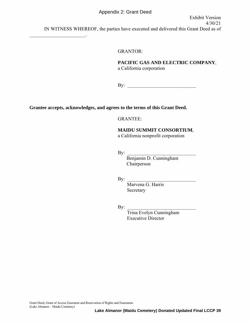
Exhibit Version 4/30/21
Grant Deed, Grant of Access Easement and Reservation of Rights and Easements (Lake Almanor – Maidu Cemetery)
IN WITNESS WHEREOF, the parties have executed and delivered this Grant Deed as of _______________________.
GRANTOR: PACIFIC GAS AND ELECTRIC COMPANY, a California corporation By: ____________________________
Grantee accepts, acknowledges, and agrees to the terms of this Grant Deed.
GRANTEE: MAIDU SUMMIT CONSORTIUM, a California nonprofit corporation By: ____________________________
Benjamin D. Cunningham Chairperson
By: ____________________________
Marvena G. Harris Secretary
By: ____________________________ Trina Evelyn Cunningham Executive Director
Appendix 2: Grant Deed
Lake Almanor (Maidu Cemetery) Donated Updated Final LCCP 39

Exhibit A
EXHIBIT A
LEGAL DESCRIPTION OF PROPERTY
[Follows this page]
Appendix 2: Grant Deed
Lake Almanor (Maidu Cemetery) Donated Updated Final LCCP 40

Page 1 of 4
EXHIBIT A
RESULTANT PARCEL 1
ALL THAT CERTAIN PARCEL OF LAND SITUATE IN SECTIONS 3 AND 10, TOWNSHIP 27 NORTH,
RANGE 8 EAST, MOUNT DIABLO MERIDIAN, AS RECORDED IN VOLUME 9, PAGE 372 OF PATENTS
OF THE COUNTY OF PLUMAS, STATE OF CALIFORNIA, DESCRIBED THEREIN AS FOLLOWS:
THE NORTHEAST ONE‐QUARTER OF THE SOUTHWEST ONE‐QUARTER AND THE WEST ONE‐HALF
OF THE SOUTHEAST ONE‐QUARTER OF SAID SECTION 3 AND THE NORTHWEST ONE‐QUARTER
OF THE NORTHEAST ONE‐QUARTER OF SAID SECTION 10.
EXCEPTING THEREFROM ALL THOSE CERTAIN PARCELS OF LAND WITHIN SAID SECTIONS 3 AND
10, DESCRIBED IN A DOCUMENT AS PARCEL 1 AND PARCEL 2, RECORDED IN VOLUME 65, PAGE
267 OF DEEDS OF THE COUNTY OF PLUMAS.
ALSO EXCEPTING THEREFROM ALL THAT CERTAIN PARCEL OF LAND WITHIN SAID SECTIONS 3
AND 10, AS RECORDED IN BOOK 68 , PAGE 315 OF DEEDS OF THE COUNTY OF PLUMAS.
ALSO EXCEPTING THEREFROM ALL THAT CERTAIN PARCEL OF LAND WITHIN SAID SECTIONS 10,
AS RECORDED IN BOOK 135, PAGE 13 OF DEEDS OF THE COUNTY OF PLUMAS, DESCRIBED
THEREIN AS FOLLOWS:
THAT PORTION OF THE NORTHWEST ONE‐QUARTER OF THE NORTHEAST ONE‐QUARTER OF
SAID SECTION 10, LYING ON THE SOUTHWESTERLY SIDE OF THE SOUTHWESTERLY BOUNDARY
LINE OF THE RIGHT‐OF‐WAY OF PLUMAS COUNTY ROAD, ROUTE NO. 315.
ALSO EXCEPTING THEREFROM ALL THAT PORTION OF THE NORTHEAST ONE‐QUARTER OF THE
SOUTHWEST ONE‐QUARTER OF SAID SECTION 3, LYING SOUTHERLY AND WESTERLY OF THE
FOLLOWING DESCRIBED LINE:
COMMENCING AT A 3/4 INCH IRON PIPE TAGGED “L.S. 2322” MARKING THE SOUTH
ONE‐QUARTER CORNER OF SAID SECTION 3 AS SHOWN ON THAT MAP FILED FOR RECORD IN
BOOK 6 OF RECORDS OF SURVEY, AT PAGE 55, PLUMAS COUNTY RECORDS; THENCE ALONG THE
MID‐SECTION LINE THEREOF, NORTH 01°03'25" WEST, A DISTANCE OF 1,317.03 FEET (SHOWN
AS N 0° 33’ W, A DISTANCE OF 1317.58 FEET ON SAID MAP) TO A 1/2 INCH IRON PIPE MARKING
THE SOUTHEAST CORNER OF THE NORTHEAST ONE‐QUARTER OF THE SOUTHWEST
ONE‐QUARTER OF SAID SECTION 3 AS SHOWN ON SAID MAP; THENCE WESTERLY ALONG THE
SOUTH LINE THEREOF, SOUTH 89°31'24" WEST, A DISTANCE OF 724.70 FEET TO A POINT ON
THE EASTERLY LINE OF A 225‐FOOT RIGHT‐OF‐WAY OF THE WESTERN PACIFIC RAILROAD, SAID
POINT BEING THE NORTHERLY TERMINUS OF A LINE HAVING A BEARING OF NORTH 17° 21’
Appendix 2: Grant Deed
Lake Almanor (Maidu Cemetery) Donated Updated Final LCCP 41
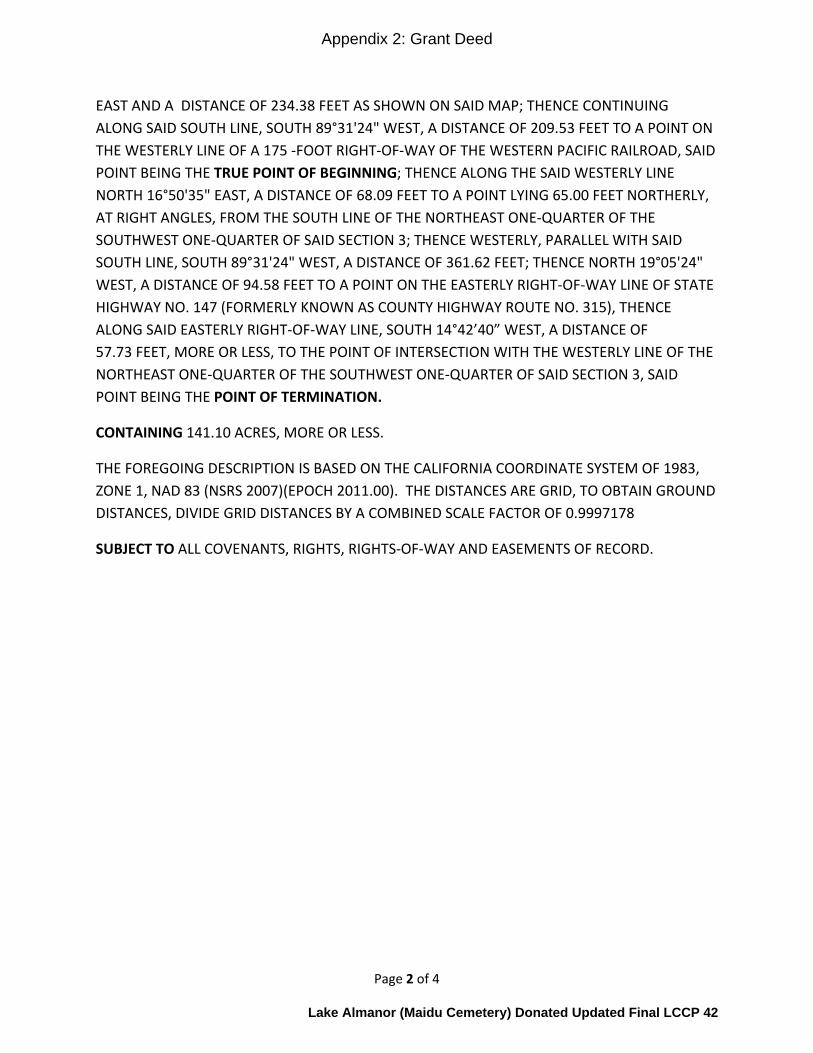
Page 2 of 4
EAST AND A DISTANCE OF 234.38 FEET AS SHOWN ON SAID MAP; THENCE CONTINUING
ALONG SAID SOUTH LINE, SOUTH 89°31'24" WEST, A DISTANCE OF 209.53 FEET TO A POINT ON
THE WESTERLY LINE OF A 175 ‐FOOT RIGHT‐OF‐WAY OF THE WESTERN PACIFIC RAILROAD, SAID
POINT BEING THE TRUE POINT OF BEGINNING; THENCE ALONG THE SAID WESTERLY LINE
NORTH 16°50'35" EAST, A DISTANCE OF 68.09 FEET TO A POINT LYING 65.00 FEET NORTHERLY,
AT RIGHT ANGLES, FROM THE SOUTH LINE OF THE NORTHEAST ONE‐QUARTER OF THE
SOUTHWEST ONE‐QUARTER OF SAID SECTION 3; THENCE WESTERLY, PARALLEL WITH SAID
SOUTH LINE, SOUTH 89°31'24" WEST, A DISTANCE OF 361.62 FEET; THENCE NORTH 19°05'24"
WEST, A DISTANCE OF 94.58 FEET TO A POINT ON THE EASTERLY RIGHT‐OF‐WAY LINE OF STATE
HIGHWAY NO. 147 (FORMERLY KNOWN AS COUNTY HIGHWAY ROUTE NO. 315), THENCE
ALONG SAID EASTERLY RIGHT‐OF‐WAY LINE, SOUTH 14°42’40” WEST, A DISTANCE OF
57.73 FEET, MORE OR LESS, TO THE POINT OF INTERSECTION WITH THE WESTERLY LINE OF THE
NORTHEAST ONE‐QUARTER OF THE SOUTHWEST ONE‐QUARTER OF SAID SECTION 3, SAID
POINT BEING THE POINT OF TERMINATION.
CONTAINING 141.10 ACRES, MORE OR LESS.
THE FOREGOING DESCRIPTION IS BASED ON THE CALIFORNIA COORDINATE SYSTEM OF 1983,
ZONE 1, NAD 83 (NSRS 2007)(EPOCH 2011.00). THE DISTANCES ARE GRID, TO OBTAIN GROUND
DISTANCES, DIVIDE GRID DISTANCES BY A COMBINED SCALE FACTOR OF 0.9997178
SUBJECT TO ALL COVENANTS, RIGHTS, RIGHTS‐OF‐WAY AND EASEMENTS OF RECORD.
Appendix 2: Grant Deed
Lake Almanor (Maidu Cemetery) Donated Updated Final LCCP 42

W.P
.R.R
.
STATE HWY 147
PACEENGINEERINGREDDING, CALIFORNIA
GEODETIC
0°36'49"
GRID
Appendix 2: Grant Deed
Lake Almanor (Maidu Cemetery) Donated Updated Final LCCP 43
AutoCAD SHX Text
PG&E 9 DEED 372-373
AutoCAD SHX Text
W. 1/2, S.E. 1/4 OF SECTION 3
AutoCAD SHX Text
N.E. 1/4, S.W. 1/4 OF SECTION 3
AutoCAD SHX Text
N.W 1/4, N.E. 1/4 OF SECTION 10
AutoCAD SHX Text
10
AutoCAD SHX Text
3
AutoCAD SHX Text
CENTER OF SECTION 3
AutoCAD SHX Text
RESULTANT PARCEL 1
AutoCAD SHX Text
P.O.C.
AutoCAD SHX Text
FOUND 3/4" IRON PIPE TAGGED LS 2322 PER 6 RS 55
AutoCAD SHX Text
FOUND 1/2" IRON PIPE PER 6 RS 55
AutoCAD SHX Text
(N0°33'W 1317.58') PER 6 RS 55
AutoCAD SHX Text
141.10± ACRES
AutoCAD SHX Text
PARCEL 1 PER 65 DEED 276
AutoCAD SHX Text
PARCEL 1 PER 65 DEED 276
AutoCAD SHX Text
(FORMERLY KNOWN AS CO. RTE. NO. 315)
AutoCAD SHX Text
SHEET 3 OF 4
AutoCAD SHX Text
DATE: 08/26/20
AutoCAD SHX Text
JOB #2263.11
AutoCAD SHX Text
1 inch = ft.
AutoCAD SHX Text
( IN FEET )
AutoCAD SHX Text
0
AutoCAD SHX Text
500
AutoCAD SHX Text
500
AutoCAD SHX Text
250
AutoCAD SHX Text
EXHIBIT A
AutoCAD SHX Text
SEE DETAIL ON SHEET 2
AutoCAD SHX Text
T.27N.,R.8E. M.D.M.

PACEENGINEERINGREDDING, CALIFORNIA
Appendix 2: Grant Deed
Lake Almanor (Maidu Cemetery) Donated Updated Final LCCP 44
AutoCAD SHX Text
STATE HWY 147
AutoCAD SHX Text
PARCELS A-D PER 3 RS 51 (SUBDIVISION OF LOT 28 INDIAN HILLS SUBDIVISION (1 MAPS 45)
AutoCAD SHX Text
W.P.R.R.
AutoCAD SHX Text
PROPERTY LINE REMOVED
AutoCAD SHX Text
PROPERTY LINE ADDED
AutoCAD SHX Text
NORTH LINE OF LOT 28 OF INDIAN HILLS SUBDIVISION
AutoCAD SHX Text
T.P.O.B.
AutoCAD SHX Text
1.45± ACRES
AutoCAD SHX Text
PG&E 9 DEEDS 382-373
AutoCAD SHX Text
RESULTANT PARCEL 1
AutoCAD SHX Text
141.10± ACRES
AutoCAD SHX Text
PARCEL 2 PER DOC. 2004-0005500
AutoCAD SHX Text
P.O.T.
AutoCAD SHX Text
PARCEL 1 PER 65 DEED 276
AutoCAD SHX Text
(FORMERLY KNOWN AS CO. RTE. NO. 315)
AutoCAD SHX Text
S.W. CORNER OF THE N.E. 1/4 OF THE S.W. 1/4 OF SECTION 3
AutoCAD SHX Text
SOUTH LINE OF THE NE 1/4 OF THE SW 1/4.
AutoCAD SHX Text
RESULTANT PARCEL 2
AutoCAD SHX Text
SHEET 4 OF 4
AutoCAD SHX Text
DATE: 08/26/20
AutoCAD SHX Text
JOB #2263.11
AutoCAD SHX Text
1 inch = ft.
AutoCAD SHX Text
( IN FEET )
AutoCAD SHX Text
0
AutoCAD SHX Text
60
AutoCAD SHX Text
60
AutoCAD SHX Text
30
AutoCAD SHX Text
SEE SHEET 1
AutoCAD SHX Text
EXHIBIT A
AutoCAD SHX Text
DEPICTS TRANSFER PARCEL 0.64± ACRES
Exhibit X
EXHIBIT X
ADJACENT LANDS PROPERTY DESCRIPTION
[Follows this page]
Appendix 2: Grant Deed
Lake Almanor (Maidu Cemetery) Donated Updated Final LCCP 45
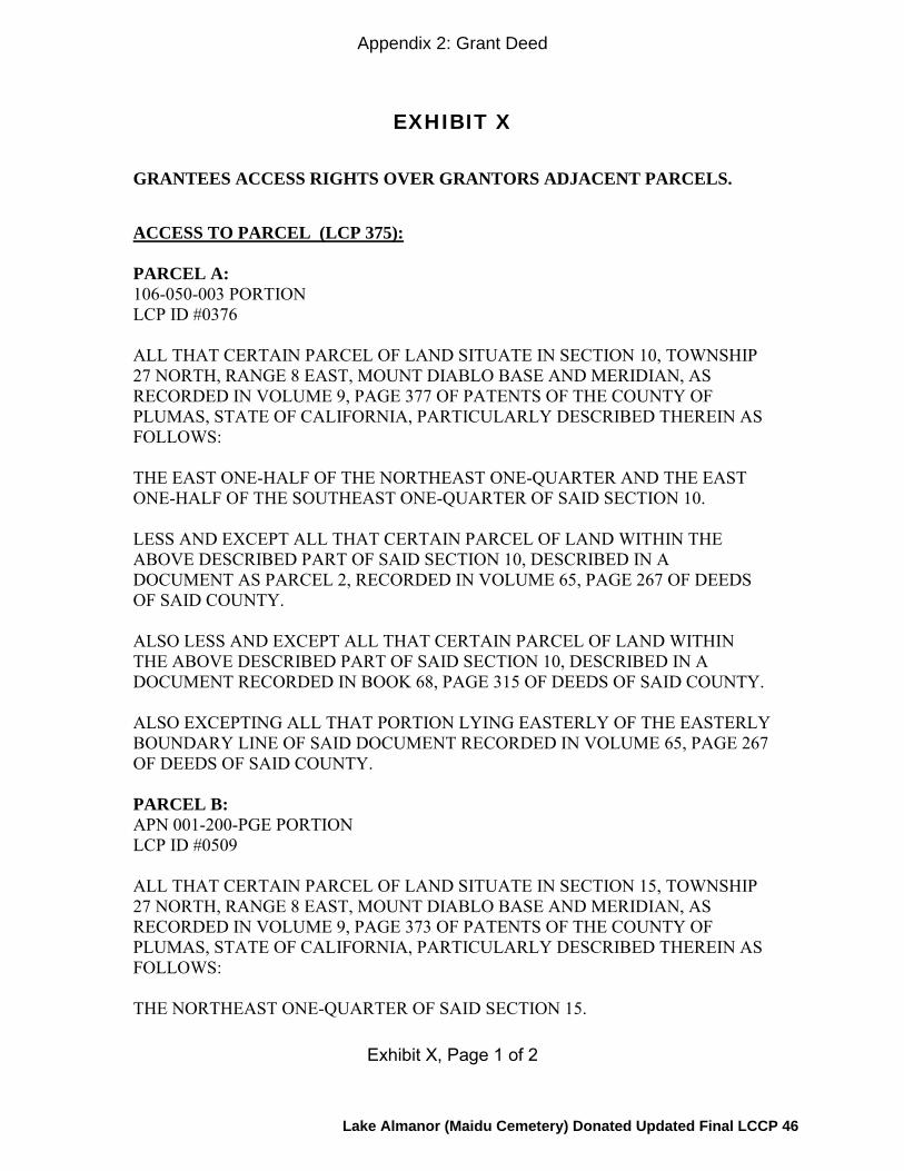
Exhibit X, Page 1 of 2
EXHIBIT X
GRANTEES ACCESS RIGHTS OVER GRANTORS ADJACENT PARCELS.
ACCESS TO PARCEL (LCP 375): PARCEL A: 106-050-003 PORTION LCP ID #0376 ALL THAT CERTAIN PARCEL OF LAND SITUATE IN SECTION 10, TOWNSHIP 27 NORTH, RANGE 8 EAST, MOUNT DIABLO BASE AND MERIDIAN, AS RECORDED IN VOLUME 9, PAGE 377 OF PATENTS OF THE COUNTY OF PLUMAS, STATE OF CALIFORNIA, PARTICULARLY DESCRIBED THEREIN AS FOLLOWS: THE EAST ONE-HALF OF THE NORTHEAST ONE-QUARTER AND THE EAST ONE-HALF OF THE SOUTHEAST ONE-QUARTER OF SAID SECTION 10. LESS AND EXCEPT ALL THAT CERTAIN PARCEL OF LAND WITHIN THE ABOVE DESCRIBED PART OF SAID SECTION 10, DESCRIBED IN A DOCUMENT AS PARCEL 2, RECORDED IN VOLUME 65, PAGE 267 OF DEEDS OF SAID COUNTY. ALSO LESS AND EXCEPT ALL THAT CERTAIN PARCEL OF LAND WITHIN THE ABOVE DESCRIBED PART OF SAID SECTION 10, DESCRIBED IN A DOCUMENT RECORDED IN BOOK 68, PAGE 315 OF DEEDS OF SAID COUNTY. ALSO EXCEPTING ALL THAT PORTION LYING EASTERLY OF THE EASTERLY BOUNDARY LINE OF SAID DOCUMENT RECORDED IN VOLUME 65, PAGE 267 OF DEEDS OF SAID COUNTY. PARCEL B: APN 001-200-PGE PORTION LCP ID #0509 ALL THAT CERTAIN PARCEL OF LAND SITUATE IN SECTION 15, TOWNSHIP 27 NORTH, RANGE 8 EAST, MOUNT DIABLO BASE AND MERIDIAN, AS RECORDED IN VOLUME 9, PAGE 373 OF PATENTS OF THE COUNTY OF PLUMAS, STATE OF CALIFORNIA, PARTICULARLY DESCRIBED THEREIN AS FOLLOWS: THE NORTHEAST ONE-QUARTER OF SAID SECTION 15.
Appendix 2: Grant Deed
Lake Almanor (Maidu Cemetery) Donated Updated Final LCCP 46

Exhibit X, Page 2 of 2
LESS AND EXCEPT THAT PORTION OF THE NORTHEAST ONE-QUARTER OF SAID SECTION 15 LYING WITHIN A STRIP OF LAND DESCRIBED IN A DOCUMENT RECORDED IN VOLUME 65, PAGE 279 OF DEEDS OF SAID COUNTY. ALSO LESS AND EXCEPT THAT PORTION OF THE NORTHEAST ONE-QUARTER OF SAID SECTION 15 LYING WITHIN THE PARCEL DESCRIBED AS PARCEL 4 IN A DOCUMENT RECORDED IN VOLUME 65, PAGE 267 OF DEEDS OF SAID COUNTY. ALSO LESS AND EXCEPT THAT PORTION OF THE NORTHEAST ONE-QUARTER OF SAID SECTION 15 LYING WITHIN A STRIP OF LAND DESCRIBED IN A DOCUMENT RECORDED IN VOLUME 68, PAGE 315 OF DEEDS OF SAID COUNTY. ALSO EXCEPTING ALL THAT PORTION LYING EASTERLY OF THE EASTERLY BOUNDARY LINE OF SAID DOCUMENT RECORDED IN VOLUME 65, PAGE 267 OF DEEDS OF SAID COUNTY.
Appendix 2: Grant Deed
Lake Almanor (Maidu Cemetery) Donated Updated Final LCCP 47
CERTIFICATE OF ACKNOWLEDGMENT OF NOTARY PUBLIC
A notary public or other officer completing this certificate verifies only the identity of the individual who signed the document to which this certificate is attached, and not the truthfulness, accuracy, or validity of that document.
State of California ) County of ____________________ )
On ____________________, before me, ____________________________, a Notary Public, personally appeared _______________________________, who proved to me on the basis of satisfactory evidence to be the person(s) whose name(s) is/are subscribed to the within instrument and acknowledged to me that he/she/they executed the same in his/her/their authorized capacity(ies), and that by his/her/their signature(s) on the instrument the person(s), or the entity upon behalf of which the person(s) acted, executed the instrument.
I certify under PENALTY OF PERJURY under the laws of the State of California that the foregoing paragraph is true and correct.
WITNESS my hand and official seal.
Signature
Appendix 2: Grant Deed
Lake Almanor (Maidu Cemetery) Donated Updated Final LCCP 48

4812-0127-7778.3
CERTIFICATE OF ACKNOWLEDGMENT OF NOTARY PUBLIC
A notary public or other officer completing this certificate verifies only the identity of the individual who signed the document to which this certificate is attached, and not the truthfulness, accuracy, or validity of that document.
State of California ) County of ____________________ )
On ____________________, before me, ____________________________, a Notary Public, personally appeared _______________________________, who proved to me on the basis of satisfactory evidence to be the person(s) whose name(s) is/are subscribed to the within instrument and acknowledged to me that he/she/they executed the same in his/her/their authorized capacity(ies), and that by his/her/their signature(s) on the instrument the person(s), or the entity upon behalf of which the person(s) acted, executed the instrument.
I certify under PENALTY OF PERJURY under the laws of the State of California that the foregoing paragraph is true and correct.
WITNESS my hand and official seal.
Signature
Appendix 2: Grant Deed
Lake Almanor (Maidu Cemetery) Donated Updated Final LCCP 49

02898.357 4847-3798-1671.1 Page 1
RECORDING REQUESTED BY AND ) Exhibit Draft: 4-28-21
WHEN RECORDED MAIL TO: ) )
Feather River Land Trust ) Attn: Shelton Douthit, Executive Director ) P.O. Box 1826 ) 75 Court Street ) Quincy, CA 95971 )
)
Space Above Line for Recorder’s Use Only
CONSERVATION EASEMENT DEED
(Lake Almanor – Maidu Cemetery)
THIS CONSERVATION EASEMENT DEED (“Conservation Easement”) is made as of _________________, 20____ (“Effective Date”), by MAIDU SUMMIT CONSORTIUM, a California nonprofit public benefit corporation (“MSC” or “Grantor”), in favor of FEATHER RIVER LAND TRUST, a California nonprofit public benefit corporation (“FRLT” or “Grantee”) (MSC and FRLT are sometimes referred to herein individually as “Party” and collectively as “Parties”), with reference to the following facts, circumstances, and terms:
R E C I T A L S
A. The Property. Grantor is the fee title owner of certain real propertycontaining approximately 141 acres adjacent to Lake Almanor known by the Maidu people as Nákˀam Kojóm – East, or for the purpose of this transaction known as the Maidu Cemetery, and located in the County of Plumas, State of California. The Property is legally described and depicted in Exhibit A attached hereto and incorporated herein by this reference (“Property”).
B. FRLT’s Nonprofit Status. FRLT is a California nonprofit public benefitcorporation, exempt from federal income taxation under sections 501(c)(3) and 509(a)(1) of the Internal Revenue Code of 1986, as amended (“IRC”), and qualified to acquire and hold conservation easements pursuant to California Civil Code section 815.3. FRLT is dedicated to conserving the land and waters of the Feather River region and stewarding its ecological, cultural, and educational values for current and future generations.
Appendix 3: Conservation Easement
Lake Almanor (Maidu Cemetery) Donated Updated Final LCCP 50

02898.357 4847-3798-1671.1 Page 2
C. Grantor’s Status. The Property is owned in fee by MSC, a California nonprofit public benefit corporation exempt from federal income taxation under IRC section 501(c)(3). MSC is composed of representatives from exclusively Mountain Maidu groups. MSC is dedicated to land and water protection and stewardship throughout the Maidu homeland, in accordance with principles of Traditional Ecological Knowledge (“TEK”). TEK is the accumulation of thousands of years of understanding the interactions of people and the natural environment, gained by native people with intimate knowledge of their local environment, who depend on the sustainable use and management of natural resources for their survival. TEK is handed down through generations by cultural transmission. TEK is adapted to changing conditions in order to maintain historic continuity of resource use and protection.
D. Transfer of Property to MSC. Pacific Gas and Electric Company, a California corporation (“PG&E”), transferred to MSC the fee interest in the Property in accordance with that certain Grant Deed, being recorded in the Official Records of the County of Plumas, immediately prior to the recording hereof (“Grant Deed”), attached hereto as Exhibit B and incorporated herein by reference, subject to: (1) PG&E’s reservation of certain rights in and to the Property, as set forth in the Grant Deed (referred to herein as the “PG&E Reserved Rights”); and (2) those legally-enforceable third-party rights to use the Property in effect as of the Effective Date, as listed on Exhibit C attached hereto and incorporated herein by this reference, true and complete copies of which have been provided to, and reviewed and accepted by, Grantee (“Express Third-Party Uses”).
E. Grantor’s Relationship to the Property. The mission of the Grantor is to contribute to the understanding and management of the Earth according to Mountain Maidu TEK and practices by supporting and enhancing Maidu cultural and physical connections to land and water. Grantor asserts that protection of the Conservation Values (as defined below), as required by this Conservation Easement, is consistent with traditional Maidu land management practices and principles. Grantor acquired the Property for the purpose of re-establishing a permanent place where Maidu cultural practices; traditional Maidu land management; and preservation, enhancement and restoration of native plant and wildlife habitats will be carried out.
F. Governing Documents. PG&E transferred fee title to the Property to MSC in connection with PG&E’s implementation of the “Land Conservation Commitment,” provided for in the following documents (collectively, “Governing Documents”) and described more fully below: (i) that certain Settlement Agreement as modified and approved by the Public Utilities Commission of the State of California in its Opinion and Order of December 18, 2003 (Decision 03-12-035); and (ii) that certain Stipulation Resolving Issues Regarding the Land Conservation Commitment dated September 25, 2003 (“Stipulation”).
G. Beneficial Public Values. The Governing Documents require PG&E to ensure that approximately 140,000 acres of watershed lands, all located in California and owned by PG&E as of the date the Governing Documents were entered into (collectively, “Watershed Lands”), are conserved for a broad range of beneficial public
Appendix 3: Conservation Easement
Lake Almanor (Maidu Cemetery) Donated Updated Final LCCP 51
02898.357 4847-3798-1671.1 Page 3
values, including the protection of the natural habitat of fish, wildlife and plants; the preservation of open space; outdoor recreation by the general public; sustainable forestry; agricultural uses; and historic values (collectively, “Beneficial Public Values”). The Property is included in these Watershed Lands. The Land Conservation Commitment constitutes the obligations of PG&E to convey fee title and conservation easements to Watershed Lands, and to protect the Beneficial Public Values of the Watershed Lands, as well as certain other obligations related thereto, as set forth in detail in the Governing Documents. The Stipulation provides that conservation easements for Watershed Lands will preserve or enhance reasonable public access.
H. The Property’s Beneficial Public Values. The Property includes the specific Beneficial Public Values identified on Exhibit D attached hereto and incorporated herein by this reference (collectively, “Conservation Values”).
I. PG&E Reserved Rights. In accordance with the Governing Documents, the PG&E Reserved Rights constitute an express reservation in favor of PG&E of certain rights to continue operation and maintenance of hydroelectric facilities and associated water delivery facilities, including project replacements and improvements required to meet existing and future water delivery requirements for power generation and consumptive water use by existing users, compliance with any Federal Energy Regulatory Commission license or license renewal or other regulatory requirements.
J. Continued Economic Uses. The Governing Documents also include a requirement that conservation easements encumbering Watershed Lands honor existing agreements for economic uses, including consumptive water deliveries.
K. Land Conservation Commitment. Pursuant to the Governing Documents, the Pacific Forest and Watershed Lands Stewardship Council, a California nonprofit public benefit corporation (“Stewardship Council”), was created to oversee and carry out the Land Conservation Commitment. Pursuant to the Governing Documents, the Stewardship Council developed a plan for protection of the Watershed Lands for the benefit of the citizens of California (“Land Conservation Plan”). The Land Conservation Plan includes, among other things, objectives to preserve and/or enhance the Beneficial Public Values identified on each parcel of Watershed Lands, including the Property.
L. California Civil Code Section 815 et seq. The Legislature of the State of California, as set forth in California Civil Code section 815 et seq., has found and declared it to be the public policy and in the public interest of this state to encourage the preservation of land predominantly in its natural, scenic, agricultural, historical, forested, or open-space condition. In furtherance of the Land Conservation Commitment and the above-described public policy purposes, Grantor desires to grant a conservation easement over the Property to Grantee.
M. Preservation and Protection in Perpetuity. Grantor and Grantee each desire through this Conservation Easement to ensure the permanent protection of the Conservation Values on the Property, subject to the PG&E Reserved Rights and the Express Third-Party Uses. Specifically, the Parties desire to ensure that the
Appendix 3: Conservation Easement
Lake Almanor (Maidu Cemetery) Donated Updated Final LCCP 52
02898.357 4847-3798-1671.1 Page 4
Conservation Values on the Property will be preserved and protected in perpetuity as provided herein, and that uses of the Property that are inconsistent with these Conservation Values will be prevented or corrected.
GRANT OF CONSERVATION EASEMENT AND AGREEMENTS
For good and valuable consideration, the receipt and sufficiency of which is
hereby acknowledged, and pursuant to California law, including California Civil Code section 815, et seq., Grantor hereby voluntarily grants and conveys to Grantee a conservation easement in perpetuity over the Property, subject to and in accordance with the terms, covenants, and conditions of this Conservation Easement.
1. Conservation Purposes. The purposes of this Conservation Easement are to protect and preserve in perpetuity the Conservation Values of the Property by restricting any use of the Property that will significantly impair the Conservation Values (“Conservation Purposes”). Subject to the following terms and conditions, Grantor intends that it will use the Property in accordance with Maidu land management principles and practices based on TEK, and Grantor will confine uses of the Property to activities that are consistent with the Conservation Purposes and the terms of this Conservation Easement. As used herein, the terms “impair” or “impairment” mean to diminish in quantity, quality, value, strength or viability. As used in this Conservation Easement, the terms “significant” or “significantly”, when used with “impair” or “impairment”, respectively, mean a greater than negligible adverse impact or an impact for more than a transient period.
Grantor and Grantee acknowledge that the Governing Documents reflect the intention of the Parties thereto (a) to honor Express Third-Party Uses and (b) to continue to permit beneficial uses of the Property that preserve and/or enhance the Conservation Values. It is intended that this Conservation Easement shall allow uses on the Property that are consistent with the protection and preservation of each of the Conservation Values in harmony with each other. While permitted actions required or taken to protect and preserve one or more individual Conservation Values may impair, on an individual and stand-alone basis, one or more other Conservation Values, Grantor and Grantee understand that achieving the Conservation Purposes requires the preservation and protection, on balance, of all the Conservation Values existing on the Property, to the maximum extent possible. The Parties recognize that in protecting and/or enhancing one or more of the Conservation Values, another Conservation Value may be impaired, but the Parties intend that this shall not be a permanent occurrence, or a reason to prioritize one Conservation Value over another. The Parties shall balance on an aggregate basis the Conservation Values on the whole Property whenever possible.
2. Land Management Plan. Grantor’s management of the Property shall be subject to a Nákˀam Kojóm – East Land Management Plan prepared for the Property, as amended from time to time in accordance with this Conservation Easement (“Management Plan”). The Management Plan will be designed to provide for Grantor’s
Appendix 3: Conservation Easement
Lake Almanor (Maidu Cemetery) Donated Updated Final LCCP 53

02898.357 4847-3798-1671.1 Page 5
adaptive management of the Property in a manner consistent with the Conservation Purposes (as defined below) and the terms of this Conservation Easement, and set forth the forest management plan component as defined in Section 17 of Exhibit E. The Management Plan shall be approved by Grantor in writing after written notice to and consultation with Grantee under Section 10(a) below. Grantor may amend the Management Plan at any time after written notice to and consultation with Grantee. The Management Plan shall not replace, modify, or amend any of the terms, covenants or conditions of this Conservation Easement. The Conservation Easement shall govern if there are any inconsistencies between it and the Management Plan. The initial Management Plan shall be completed within one year of close of escrow, or as soon thereafter as practicable.
3. Rights Conveyed to Grantee. (a) Rights of Grantee. To accomplish the Conservation Purposes,
Grantor hereby grants and conveys the following rights to Grantee: (1) Right to Preserve and Protect. Grantee shall have the right to preserve and protect in perpetuity the Conservation Values of the Property in a manner consistent with the terms of this Conservation Easement. Grantee, in its sole and absolute discretion, shall have the right to prevent by any lawful means any activity on or use of the Property that is or may be a violation of the terms of this Conservation Easement, and to require the restoration of such areas or features of the Property that may be damaged by any act, failure to act, or any use or activity undertaken by Grantor or under Grantor’s control that constitutes a violation of the terms of this Conservation Easement.
(2) Right of Access to Inspect, Monitor and Enforce. Grantee shall have the right to access and enter upon the Property using any easement or right of way appurtenant to the Property in order to exercise the following rights: (a) inspect the Property once annually to determine whether Grantor is in compliance with the terms of this Conservation Easement, provided that such Grantee provides written notice to Grantor at least thirty (30) days prior to the annual inspection, and that Grantor shall have the option to be present during any compliance monitoring; (b) exercise the rights which are granted to Grantee herein; and (c) enforce the terms of this Conservation Easement, in accordance with Section 11 of this Conservation Easement, including without limitation, the right to restore the Conservation Values, provided, that such access and entry will be made in a manner that will not interfere unreasonably with the permitted use(s) or enjoyment of the Property by Grantor and any occupant(s) or user(s) of the Property pursuant to the terms of this Conservation Easement. Grantee shall schedule a date and time for the annual compliance monitoring visit that is reasonably acceptable to Grantor. The right of access to inspect and monitor shall not be assigned by Grantee without the prior express written approval of the Grantor; provided, however, that Grantee may authorize entry of its consultants to the extent they are assisting the Grantee in its monitoring obligations or other activities authorized by this Conservation Easement. Nothing in this section shall be construed to authorize entry by
Appendix 3: Conservation Easement
Lake Almanor (Maidu Cemetery) Donated Updated Final LCCP 54

02898.357 4847-3798-1671.1 Page 6
members of the public for any purpose. Notice under this section shall include the names, titles and affiliations of persons who will conduct the inspections and, for those persons who are not employees of Grantee, their qualifications.
(3) Right of Immediate Entry. Grantee, in its sole and absolute discretion, shall have the right to immediately enter the Property where it is determined that urgent action is necessary to prevent, terminate, or mitigate a significant impairment of the Conservation Values. If Grantee determines such immediate entry is necessary, Grantee need not provide Grantor with prior notice; provided, however, Grantee shall provide Grantor with telephonic or other comparable notice at the time of entry, to be followed by a written notice of entry within three (3) business days after such immediate entry. 4. Prohibited Uses of the Property. Except for any use or activity that is
expressly permitted in this Conservation Easement, any activity on or use of the Property that is inconsistent with the Conservation Purposes of this Conservation Easement is prohibited. Grantor and Grantee agree that Exhibit E, attached hereto and incorporated herein by this reference, sets forth both the permitted and prohibited uses of the Property by Grantor, Grantor’s agents, Grantee, and/or third parties under Grantor’s control on the Property. In entering into this Conservation Easement, Grantor understands and acknowledges that uses prohibited by the terms of this Conservation Easement may become more economically valuable than permitted uses and that neighboring properties may in the future be dedicated partially or entirely to such prohibited uses. Grantor and Grantee intend that any such changes will not be deemed to be circumstances justifying the termination, extinguishment, or modification of this Conservation Easement. The inability of Grantor, or its successors or assigns, to carry out any or all the uses permitted under the terms of this Conservation Easement, or the unprofitability of doing so, will not impair the validity, force and effect of this Conservation Easement or be considered grounds for its termination, extinguishment, or modification.
5. Grantor’s Duties. To the extent Grantor has or reasonably should have knowledge of actual or anticipated unauthorized third party use of the Property that violates or would violate the terms of this Conservation Easement, Grantor shall undertake all reasonable actions to prevent such unauthorized use.
6. Grantor's Reserved Rights and Permitted Uses of Property; PG&E Reserved Rights.
(a) Rights of Ownership. Grantor reserves to itself all rights of ownership of the Property. Grantor shall confine its use of the Property to those permitted activities and uses, and to such other activities and uses of the Property as are both: (1) consistent with the Conservation Purposes; and (2) not prohibited under the terms of this Conservation Easement. The permitted uses and activities set forth on Exhibit E are presumed to be consistent with the Conservation Purposes and are expressly permitted by the Grantee, but Exhibit E is not an exclusive list of such uses and activities. Uses and activities that are prohibited in Exhibit E are inconsistent with the Conservation Purposes. Certain permitted uses listed in Exhibit E are allowed only in the applicable zones (“Zones”), as legally described, and depicted on the map
Appendix 3: Conservation Easement
Lake Almanor (Maidu Cemetery) Donated Updated Final LCCP 55

02898.357 4847-3798-1671.1 Page 7
included in Exhibit F (“Zones Map”), attached hereto and incorporated herein by this reference.
(b) PG&E Reserved Rights. All rights and obligations of Grantor and Grantee under this Conservation Easement are subject to the PG&E Reserved Rights specified in the Grant Deed. In the event of a conflict between the PG&E Reserved Rights and the Conservation Purposes, this Conservation Easement shall be construed to unconditionally permit the exercise of the PG&E Reserved Rights. In the event PG&E notifies Grantor of PG&E’s intention to exercise any of the PG&E Reserved Rights, Grantor shall notify Grantee, in writing, of such intention within five (5) days of Grantor’s receipt of such notification. 7. Express Third-Party Uses. Exhibit C describes the Express Third-Party Uses of the Property permitted with the express agreement of Grantor. Grantor retains the right to maintain, renew, decline to renew, or replace all such agreements memorializing Express Third-Party Uses ("Third-Party Use Agreements") and to engage in all activities reasonably required to comply with Grantor’s obligations with respect to the Express Third-Party Uses, subject to the following conditions:
(a) Increases in Intensity or Expansion of Location or Size or Change in Third-Party Use. Subject to existing Third-Party Use Agreements, any (i) increase in the intensity, (ii) expansion of the location or size, or (iii) change in the use, of any of the Express Third-Party Uses, whether through a new agreement or an amendment to an existing agreement, that Grantor determines in consultation with Grantee under Section 10(a), are likely to significantly impair the Conservation Values shall not be allowed.
(b) Renewal or Replacement of Third-Party Use Agreements. All Third-Party Use Agreements existing as of the Effective Date are identified on Exhibit C. As Third-Party Use Agreements are renewed or replaced (either with the existing user or a new user), Grantor, in consultation with Grantee, shall include contractual provisions to bring the continuation of the Express Third-Party Uses and the preservation of the Conservation Values into alignment to the fullest extent reasonably practicable.
(c) Enforcement of Third-Party Use Agreements. If Grantor or Grantee discovers any default or breach under a Third-Party Use Agreement that significantly impairs the Conservation Values (and if Grantee makes such discovery, Grantee gives Grantor written notice thereof), Grantor shall use reasonable efforts to enforce or otherwise remedy such violation, at Grantor’s sole expense.
8. Public Access. (a) Informal Uses and Public Access. Grantor and Grantee
recognize the Property has been used by third parties for recreational, cultural, and other non-commercial or informal purposes without formal written agreements to conduct such activities (“Informal Uses”). Grantor and Grantee further recognize that access to the Property is inherent or may be inherent in the enjoyment of the Conservation Values and the Informal Uses. Consistent with the objectives articulated
Appendix 3: Conservation Easement
Lake Almanor (Maidu Cemetery) Donated Updated Final LCCP 56

02898.357 4847-3798-1671.1 Page 8
in the Governing Documents to provide continued reasonable access by the public to the Watershed Lands, Grantor shall allow public access to the Property that is substantially consistent with the public access existing on the Effective Date. Grantor reserves the right to make and enforce reasonable regulations to control, limit, or, exclude Informal Uses and public access. Grantor shall not allow any Informal Use or any public access that significantly impairs the Conservation Values.
(b) New or Increased Public Access. If Grantor desires to allow new public access or Informal Uses or an expansion of public access or Informal Uses on the Property, Grantee’s advance written approval is required in accordance with Section 10(b), which approval shall not be unreasonably withheld, conditioned or delayed.
(c) Liability Limitation. Notwithstanding Section 8(a) and Section 8(b) above, Grantor and Grantee claim all of the rights and immunities against liability for injury to the public to the fullest extent allowable by law.
(d) Periodic Review of Informal Uses. As part of Grantee’s annual compliance monitoring: (i) Grantor and Grantee shall meet and confer to discuss the known Informal Uses and public access conducted on the Property for the purpose of Grantee’s assessment of Grantor’s compliance with the requirements set forth above in this section; and (ii) with respect to Informal Uses allowed by Grantor on the Property in accordance with Section 8(a) above, Grantor and Grantee shall meet and confer, and include recommendations, if any, regarding the necessity of controlling, limiting, or excluding Informal Uses or public access to ensure the preservation of the Conservation Values.
9. Compliance with Applicable Law. This Conservation Easement describes certain rights held by Grantor, Grantee, PG&E, and third parties, as well as permitted uses that are presumed to be consistent with the Conservation Purposes of the Conservation Easement. Nothing in this Conservation Easement requires Grantor, Grantee, PG&E, or third parties to exercise these rights. Nor does this Conservation Easement provide Grantor, Grantee, PG&E, or third parties with regulatory approval to undertake any action described as a retained right or permitted use. Prior to undertaking any action to exercise these rights, Grantor, Grantee, PG&E, and third parties shall obtain all necessary permits and comply with all applicable laws, including the California Environmental Quality Act (“CEQA”), Public Resources Code sections 21000 et seq.
10. Consultation and Approval Processes. (a) Consultation. Whenever this Conservation Easement requires
one Party to consult with the other Party, the Party with the obligation to seek consultation shall provide the other Party with a written request to consult. The Parties shall seek to meet in person within thirty (30) days of the receipt of the consultation request, unless the Parties agree, or this Conservation Easement provides otherwise. For purposes of this Conservation Easement, consultation means the meaningful and timely process of meeting in good faith to exchange adequate information and discuss, understand, and consider the views of the other Party and to seek, wherever feasible, to reach agreement. If the Parties are unable to reach agreement and Grantee believes
Appendix 3: Conservation Easement
Lake Almanor (Maidu Cemetery) Donated Updated Final LCCP 57

02898.357 4847-3798-1671.1 Page 9
the proposed activity would violate the terms of this Conservation Easement, Grantee may issue a Notice of Breach pursuant to Section 11. If no response to the request to consult is received within thirty (30) days of its receipt, the requesting Party shall have no obligation to consult.
(b) Approval. Whenever this Conservation Easement requires the approval of the Grantee (“Approval”) for a proposed action or activity (“Proposed Activity”), Grantor shall provide Grantee a written notice requesting the Approval at least thirty (30) days before the commencement of the Proposed Activity. The notice shall set forth in detail all material facts of the Proposed Activity and the following provisions shall then be applicable: (1) Additional Information. Grantee may request additional information concerning the Proposed Activity within thirty (30) days after the notice is given. Grantor shall provide any supplemental information to Grantee within thirty (30) days of Grantee’s request. (2) Objection Notice. Grantee shall review the notice promptly and give Grantor prompt written notice of any objections based on Grantee’s assessment that the Proposed Activity is reasonably likely to violate the terms of the Conservation Easement. If Grantee objects it shall advise Grantor how, if at all, the Proposed Activity could be modified to be consistent with the Conservation Purposes and the terms of the Conservation Easement. (3) Written Approval. Grantor shall not, and shall not have the right to, commence or conduct the Proposed Activity until and unless it receives the written approval of Grantee, and only in the manner approved, unless the Proposed Activity is deemed approved pursuant to Section 10(b)(4) below. (4) Agreement Deadline for Proposed Activity. The Proposed Activity shall be deemed to have been approved if no objection has been given within ninety (90) days after Grantee’s receipt of the notice of the Proposed Activity and all supplemental information requested by Grantee pursuant to Section 10(b)(1) above.
(5) Limitations on Approval. No actual or deemed approval to, or acquiescence in or failure to object to, any given Proposed Activity shall constitute: (i) agreement or consent to, or approval of, any aspect of the Proposed Activity which was not disclosed in the Grantor’s notice (including any supplemental information, as noted above), or any subsequent action or activity of the same or any different nature; or (ii) agreement or consent to, or approval of, any activity or use which is prohibited by the terms of this Conservation Easement, or any other alteration of the terms of this Conservation Easement.
11. Enforcement and Remedies. (a) Procedures Upon Violation. If a party hereto (“Non-Breaching
Party”) determines there is a breach of the terms of this Conservation Easement or that a breach is threatened, written notice of such breach (“Notice of Breach”) and a demand for corrective action sufficient to cure the breach shall be given in accordance with Section 23 by the Non-Breaching Party to the party allegedly breaching this
Appendix 3: Conservation Easement
Lake Almanor (Maidu Cemetery) Donated Updated Final LCCP 58
02898.357 4847-3798-1671.1 Page 10
Conservation Easement (“Breaching Party”). Within fourteen (14) days after receipt of the Notice of Breach, the Parties shall meet at a location in Plumas County or as otherwise agreed by the Parties to discuss the circumstances of the alleged or threatened breach and to attempt to agree on appropriate corrective action. If the Parties are unable to agree on corrective action within thirty (30) days after such meeting, then the Non-Breaching Party may, at its election, deliver a further written notice to the Breaching Party to demand reasonable corrective action to cure the breach (“Notice of Violation”). If a violation is not cured within thirty (30) days after receipt of the Notice of Violation, or if the cure reasonably requires more than thirty (30) days to complete and there is failure to begin the cure within the 30-day period or failure to continue diligently to complete the cure, the Non-Breaching Party may commence litigation in accordance with Section 11(b) below. For purposes of this Section 11(a), the Non-Breaching Party can be either the Grantee or Grantor.
(b) Litigation. If the Parties are not able to resolve a dispute under Section 11(a) above, the Non-Breaching Party may bring an action at law or equity in a court of competent jurisdiction to enforce compliance with the terms of this Conservation Easement, to recover damages to which the Non-Breaching Party may be entitled for violation of the terms of this Conservation Easement, or for any other legal or equitable relief available under California law, including, but not limited to, temporary or permanent injunctive relief, monetary damages or any other form of relief required to achieve the restoration of the Property to the condition it existed prior to any violation. To the extent that Grantee recovers any monetary damages for the cost of restoring any injury or damage to a portion of the Property that is caused by Grantor’s breach, excluding fees described in Section 12, all such damages recovered by Grantee shall be applied to the cost of undertaking any corrective action to the applicable portion of the Property. Notwithstanding anything to the contrary in this Conservation Easement, in no event shall the Breaching Party be liable to the Non-Breaching Party for, and the Parties each hereby waive their right to, any indirect, special, punitive or consequential damages resulting from the Breaching Party’s breach of this Conservation Easement, whether foreseeable or unforeseeable. For purposes of this Section 11(b), a Non-Breaching Party can be either the Grantee or Grantor.
(c) Emergency Injunctive Relief. If circumstances require immediate action to prevent or mitigate a violation of this Conservation Easement, and the Non-Breaching Party determines that irreparable harm would result if the Non-Breaching Party were required to complete the process set forth in Section 11(a), the Non-Breaching Party may proceed immediately to seek an injunction to stop the violation, temporarily or permanently. The Non-Breaching Party agrees to make a good faith effort to immediately provide notice to the Breaching Party of the circumstances requiring urgent action to prevent or mitigate any significant impairment to the Conservation Values. For purposes of this Section 11(c), a Non-Breaching Party can be either Grantee or Grantor.
(d) Remedies at Law Inadequate. The Parties agree that remedies at law for any violation of the terms of this Conservation Easement are inadequate and that the Non-Breaching Party shall be entitled to the injunctive relief described in this section, in addition to such other relief to which it may be entitled, including specific
Appendix 3: Conservation Easement
Lake Almanor (Maidu Cemetery) Donated Updated Final LCCP 59
02898.357 4847-3798-1671.1 Page 11
performance of the terms of this Conservation Easement, without the necessity of proving either actual damages or the inadequacy of otherwise available legal remedies, provided the other legal requirements for injunctive relief are met. The Non-Breaching Party’s remedies shall be cumulative and shall be in addition to all remedies now or hereafter existing at law or in equity, including but not limited to, the remedies set forth in California Civil Code section 815 et seq. For purposes of this Section 11(d), a Non-Breaching Party can be either Grantee or Grantor.
12. Costs of Enforcement. The non-prevailing party in litigation to enforce the terms of this Conservation Easement shall pay to the prevailing party any costs and attorneys’ fees awarded by the court.
13. Grantee Discretion. Enforcement of the terms of this Conservation Easement shall be at the discretion of Grantee, and any forbearance by Grantee to exercise its rights under this Conservation Easement in the event of any violation of any term of this Conservation Easement shall not be deemed or construed to be a waiver by Grantee of such violation or of any subsequent violation of the same or any other term of this Conservation Easement or of any of Grantee’s rights under this Conservation Easement.
14. Acts Beyond Grantor's Control. Nothing contained in this Conservation Easement shall be construed to entitle Grantee to bring any action against Grantor for any injury to or change in the Property or impairment of the Conservation Values resulting from (a) any natural cause beyond Grantor's control, including, without limitation, fire not caused by Grantor, flood, storm, climate change, earth movement, diseases affecting biological features of the Property, or any prudent action taken by Grantor under emergency conditions to prevent, abate, or mitigate significant injury to the Property or impairment to the Conservation Values resulting from such causes; (b) acts by Grantee or its employees, consultants, agents, contractors, board of directors, or representatives; or (c) acts by third parties over whom Grantor has no control, provided Grantor has fulfilled its obligations under Section 5. Should impairment to the Conservation Values occur as a result of (a) or (c), Grantor and Grantee shall consult to determine an appropriate, reasonable response to address the conditions.
15. Costs and Liabilities. Grantor retains all responsibilities and shall bear all costs and liabilities of any kind related to the ownership, operation, upkeep, and maintenance of the Property. Except as set forth in Section 17, Grantor agrees that Grantee shall have no duty or responsibility for the operation, upkeep or maintenance of the Property, the monitoring of hazardous conditions thereon, or the protection of Grantor, the public or any third parties from risks relating to conditions on the Property. Grantor remains solely responsible for obtaining any applicable governmental permits and approvals required for any activity or use by Grantor permitted by this Conservation Easement. Any activity or use shall be undertaken in accordance with all applicable federal, state, and local statutes, ordinances, rules, regulations, orders and requirements.
16. Taxes; No Liens. Grantor shall pay before delinquency all taxes, assessments (general and special), fees, and charges of whatever description levied on or assessed against the Property by competent authority (collectively “Taxes”), including
Appendix 3: Conservation Easement
Lake Almanor (Maidu Cemetery) Donated Updated Final LCCP 60

02898.357 4847-3798-1671.1 Page 12
any Taxes imposed upon, or incurred because of, this Conservation Easement, and shall furnish Grantee with satisfactory evidence of payment upon request. Grantor shall keep the Property free from any liens (other than a security interest that is expressly subordinate to this Conservation Easement as provided in Section 25(m)), including those arising out of any obligations incurred by Grantor for any labor or materials furnished or alleged to have been furnished to or for Grantor at or for use on the Property.
17. Hold Harmless. Grantor shall hold harmless and indemnify Grantee and its directors, officers, and employees and the successors and assigns (each an “Indemnified Party” and, collectively, "Indemnified Parties") from and against any and all liabilities, penalties, costs, losses, damages, expenses (including, without limitation, reasonable attorneys' fees and experts' fees), causes of action, claims, demands, orders, liens or judgments (each a “Claim” and, collectively, “Claims”), proximately caused by the occupancy or use of the Property by Grantor or its directors, officers, employees, or agents, unless due solely to the negligence of the Grantee or any of such Grantees’ officers, employees or agents. If any action or proceeding is brought against any of the Indemnified Parties by reason of any such Claim, Grantor shall, at the election of and upon written notice from an Indemnified Party seeking indemnification under this section, defend such action or proceeding by counsel reasonably acceptable to the Indemnified Party.
Grantee shall hold harmless and indemnify Grantor and its directors, officers, and employees, and successors and assigns of each of them from and against any and all liabilities, penalties, costs, losses, damages, expenses (including without limitation reasonable attorneys’ fees and costs and consultant fees), causes of action, claims, demands, orders, liens or judgments proximately caused by the entry onto or use of the Property by Grantee or its officers, employees, or agents, unless due solely to the negligence of the Grantor, its directors, officers, employees or agents. If any action or proceeding is brought against the Grantor, its directors, officers, employees or agents, by reason of such claim, Grantee shall, at the election of and upon written notice from the Grantor, defend such action or proceeding by counsel reasonably acceptable to the Grantor.
18. Insurance. Grantor shall procure, carry, and maintain in effect throughout the term of this Conservation Easement, the insurance specified in Exhibit G, which is incorporated herein by reference; provided, however, that Grantee reserves the right to periodically review and reasonably modify the insurance requirements specified in Exhibit G to be generally consistent with the practices of prudent charitable organizations that hold similar property interests. All insurance shall be written on forms and with insurance carriers acceptable to Grantee in its commercially reasonable judgment. Prior to recordation of this Conservation Easement, Grantor shall provide Grantee with evidence of insurance coverage satisfying the requirements of this section and Exhibit G. Grantor is responsible for causing its agents and contractors entering the Property to comply with the insurance requirements of this section and Exhibit G at all relevant times. Grantor shall indemnify, protect, defend, and hold harmless Grantee against any and all liabilities, penalties, costs, losses, damages, expenses (including, without limitation, reasonable attorneys' fees and reasonable experts' fees), causes of
Appendix 3: Conservation Easement
Lake Almanor (Maidu Cemetery) Donated Updated Final LCCP 61
02898.357 4847-3798-1671.1 Page 13
action, claims, demands, orders, liens or judgments proximately caused by the failure of Grantor or its agents or contractors to comply with the insurance requirements of this section and Exhibit G.
19. Extinguishment. If circumstances arise in the future that render the Conservation Purposes impossible to accomplish, this Conservation Easement can only be terminated or extinguished, in whole or in part, by judicial proceedings in a court of competent jurisdiction.
20. Condemnation. If all or part of the Property is taken by the exercise of the power of eminent domain by a public, corporate, or other authority, whether permanent or temporary, or if the Property is sold in lieu of condemnation, so as to abrogate the restrictions imposed by the Conservation Easement, Grantor and Grantee shall join in appropriate actions at the time of such taking or sale to recover the full value of the Property taken or sold and all incidental or direct damages resulting there from. All compensation thereby awarded will belong and be paid to Grantor and Grantee in proportion to their respective interests in the Property as determined below, it being expressly agreed that the Conservation Easement constitutes a compensable property right. All expenses incurred by Grantor and Grantee in such action shall be paid out of the recovered proceeds.
Pursuant to California Civil Code §815.2(a), this Conservation Easement constitutes a real property interest immediately vested in Grantee. It is acknowledged by the Parties that the purposes of establishing the value of this property right and enforcing the rights of Grantee with respect thereto is to prevent a private windfall. That being the case, the Parties stipulate that, for the purpose of determining the ratio for proportionate value of each party’s respective interest in the Property at the time of termination or extinguishment of the Conservation Easement, the value of the Conservation Easement shall be the difference between (a) the fair market value of the fee interest in the Property at the time of termination, as if unencumbered by the Conservation Easement, but taking into account all other existing restrictions on the improvement, construction, alteration, expansion, development, use, maintenance or operation of all or any portion of the Property (e.g., zoning laws, land use laws or other governmental laws, codes, regulations or ordinances, and private restrictions such as covenants, restrictions and agreements), and (b) the fair market value of the Property at the time of termination, as encumbered by the Conservation Easement, but taking into account all other existing restrictions on the improvement, construction, alteration, expansion, development, use, maintenance or operation of all or any portion of the Property (e.g., zoning laws, land use laws or other governmental laws, codes, regulations or ordinances, and private restrictions such as covenants, restrictions and agreements). The values shall be determined by an appraisal prepared by a qualified appraiser familiar with appraising conservation easements jointly selected by Grantor and Grantee. The cost of the appraisal shall be paid out of proceeds in proportion to the recoveries of Grantor and Grantee. There shall be no restriction on Grantor’s or Grantee's use of proceeds received pursuant to this Section.
21. Transfer of Conservation Easement.
Appendix 3: Conservation Easement
Lake Almanor (Maidu Cemetery) Donated Updated Final LCCP 62
02898.357 4847-3798-1671.1 Page 14
(a) Voluntary Assignment. In the event that Grantee decides to assign its interest under this Conservation Easement, Grantee shall only assign such interest to an organization that is: (i) qualified to hold a conservation easement under section 815.3 of the California Civil Code; (ii) experienced in holding and monitoring conservation easements on properties similar to the Property; (iii) willing and financially able to assume all of the responsibilities imposed on Grantee under this Conservation Easement; and (iv) approved in advance by Grantor, which approval shall not be unreasonably withheld. Grantee shall give preference to any qualifying organization that has experience in holding and monitoring conservation easements on properties owned by Indian Tribes or tribal organizations. Before assigning its interest under this Conservation Easement, Grantee shall provide Grantor and the Sierra Nevada Conservancy (“SNC”) with written notice of such intention to transfer (“Transfer Notice”) and shall consult with Grantor, and SNC pursuant to Section 10(a). The Transfer Notice shall identify the proposed assignee and include a description of how the proposed assignee meets the assignee designation criteria set forth in this section. In consultation with Grantor, Grantee shall allow SNC a period of not less than sixty (60) days to approve the proposed assignee, which approval shall not be unreasonably withheld and shall be based on whether the proposed assignee meets the designation criteria specified in this section. If SNC does not approve the proposed assignee, SNC shall provide Grantee with the reasons behind such decision.
(b) Involuntary Assignment. If Grantee ever ceases to exist or no longer qualifies under applicable state law to hold a conservation easement interest, then SNC shall, in consultation with Grantor, select an assignee that meets all the designation criteria specified in subsection (a) above. If SNC is unable to identify an assignee that meets all of the designation criteria specified in subsection (a) above, that is willing to accept such assignment, then SNC may elect to serve as such assignee. Notwithstanding the foregoing, SNC may elect to exercise the rights of Grantee (or its successor in interest hereunder), as Grantee hereunder during any period that a successor assignee for Grantee is not yet in place.
(c) Conditions of Assignment. As conditions to any assignment of this Conservation Easement, Grantee and/or the SNC shall: (i) require the assignee to expressly agree in writing to assume Grantee’s obligations hereunder; and (ii) ensure that assignee has the resources to fulfill its obligations under the Conservation Easement.
(d) Successor to SNC. Upon any liquidation or dissolution of SNC, SNC or the State of California shall have the right to assign SNC’s rights and obligations under this section to another entity that has a conservation mission and level of expertise consistent with that of SNC and sufficient resources and capacity to carry out the obligations of SNC.
22. Transfer of Property.
(a) Transfer of Property to Third-Party. Except for any transfer of the Property pursuant to the Power of Termination (as defined in Section 22(b) below),
Appendix 3: Conservation Easement
Lake Almanor (Maidu Cemetery) Donated Updated Final LCCP 63
02898.357 4847-3798-1671.1 Page 15
Grantor shall not transfer the Property without the prior written approval of Grantee, which approval shall not be unreasonably withheld, conditioned or delayed. Grantor shall give written notice to Grantee of the intent to transfer the interest at least ninety (90) days prior to the date of such transfer. Grantor agrees to incorporate the terms of this Conservation Easement by reference in any deed or other legal instrument by which Grantor divests itself of any interest in all or any portion of the Property, including, without limitation, a leasehold interest. Except for a transfer in accordance with the Power of Termination, Grantee shall have the right to prevent subsequent transfers in which prospective transferees are not given actual notice of the terms, covenants, conditions and restrictions of this Conservation Easement. The failure of Grantor or Grantee to perform any act provided in this section shall not impair the validity of this Conservation Easement or limit its enforceability in any way.
(b) Power of Termination. Grantor has granted to PG&E a power of termination in the Property in accordance with California Civil Code section 885.010, et seq. pursuant to that certain Restriction on Transfer of Property and Power of Termination Agreement dated as of _________, recorded in the Official Records of the County of Plumas, concurrently with the recordation of this Conservation Easement (“Power of Termination”), attached hereto as Exhibit H and incorporated herein by reference. In the event the fee title to the Property transfers to PG&E (or its designee) pursuant to the Power of Termination, PG&E (or its designee) shall take fee title subject to this Conservation Easement, in accordance with section 2.5 of the Power of Termination.
23. Notices. Any notice, demand, request, consent, approval, or other communication that either Party desires or is required to give to the other shall be in writing and be delivered: (a) personally; (b) by reliable overnight courier that guarantees next-day delivery; or (c) by first class United States mail, postage fully prepaid, and addressed as follows:
To Grantor: Maidu Summit Consortium P.O. Box 682 Chester, CA 96020 Attn: Executive Director
To FRLT: Feather River Land Trust P.O. Box 1826 75 Court Street Quincy, CA 95971 Attn: Executive Director
To SNC: Sierra Nevada Conservancy 11521 Blocker Drive, Suite 205 Auburn, CA 95603 Attn: Executive Director
Appendix 3: Conservation Easement
Lake Almanor (Maidu Cemetery) Donated Updated Final LCCP 64
02898.357 4847-3798-1671.1 Page 16
or to such other address as either Party shall designate by written notice to the other. Notice shall be deemed effective upon delivery in the case of personal delivery or delivery by overnight courier or, in the case of delivery by first class mail, three (3) days after deposit into the United States mail.
24. Amendment. This Conservation Easement may be amended only upon the written agreement of Grantor and Grantee. Any such amendment shall be consistent with the Conservation Purposes of this Conservation Easement and California law governing conservation easements and shall not affect its perpetual duration. Any such amendment shall be recorded in the official records of Plumas County.
25. Additional Provisions. (a) Baseline Documentation Report. Grantor and Grantee each
acknowledge that certain biological and other physical attributes of the Property particularly relevant to the Conservation Easement are further documented in a written inventory of such attributes (“Baseline Documentation Report”), which has been prepared by a competent natural resource professional familiar with the Property and approved in writing by Grantor and Grantee. Grantor and Grantee acknowledge they each have a copy of the Baseline Documentation Report, as approved by them. The Parties agree that the Baseline Documentation Report contains an accurate representation of such attributes of the Property at the time that this Conservation Easement is recorded, and is intended to serve as an objective, though non-exclusive, source of baseline information for monitoring compliance with the terms of the Conservation Easement. The foregoing notwithstanding, if a dispute arises with respect to the nature and extent of the biological or physical condition of the Property, the Parties shall not be foreclosed from utilizing any and all other relevant documents, surveys, or other evidence or information to assist in the resolution of the dispute.
(b) Grantor's Advice of Legal Counsel. Grantor and Grantee acknowledge and stipulate that Grantee has advised Grantor that it cannot provide, nor has provided, Grantor with legal or tax advice at any time respecting the Conservation Easement. Grantor and Grantee further acknowledge that Grantee has advised Grantor to seek legal counsel in the negotiation and execution of this Conservation Easement and that Grantor has done so. Grantor has retained legal counsel, which decision was made in Grantor’s sole discretion.
(c) Controlling Law. The interpretation and performance of this Conservation Easement shall be governed by the laws of the State of California, disregarding the conflicts of law principles of such State, with venue in Plumas County.
(d) Liberal Construction. Despite any general rule of construction to the contrary, this Conservation Easement shall be liberally construed to accomplish the Conservation Purposes of this Conservation Easement in perpetuity, and to effectuate the policy and purpose of California Civil Code section 815 et seq. If any provision in this instrument is found to be ambiguous, an interpretation consistent with the Conservation Purposes of this Conservation Easement that would render the provision valid shall be favored over any interpretation that would render it invalid.
Appendix 3: Conservation Easement
Lake Almanor (Maidu Cemetery) Donated Updated Final LCCP 65
02898.357 4847-3798-1671.1 Page 17
(e) Severability. If a court of competent jurisdiction voids or invalidates on its face any provision of this Conservation Easement, such action shall not affect the remainder of this Conservation Easement. If a court of competent jurisdiction voids or invalidates the application of any provision of this Conservation Easement to a person or circumstance, such action shall not affect the application of the provision to any other persons or circumstances.
(f) Entire Agreement. This instrument sets forth the entire agreement of the Parties with respect to the Conservation Easement and supersedes all prior written or oral discussions, negotiations, understandings, or agreements of the Parties relating to the Conservation Easement. No alteration or variation of this instrument shall be valid or binding unless contained in an amendment in accordance with Section 24.
(g) No Forfeiture. Nothing contained in this Conservation Easement will result in a forfeiture or reversion of Grantor's fee title in and to the Property in any respect.
(h) Successors. The covenants, terms, conditions, and restrictions of this Conservation Easement shall be binding upon, and inure to the benefit of, the Parties and their respective personal representatives, heirs, successors, and assigns and shall constitute a servitude running in perpetuity with the Property.
(i) Termination of Rights and Obligations. A Party's rights and obligations under this Conservation Easement terminate upon transfer of the Party's interest in the Conservation Easement or Property, except that liability for acts, omissions, or breaches occurring prior to transfer shall survive transfer.
(j) Captions. The captions in this instrument have been inserted solely for convenience of reference and are not a part of this instrument and shall have no effect upon its construction or interpretation.
(k) Hazardous Materials Liability. (1) Grantor represents and warrants that it has no actual
knowledge or has not received actual notice of any Hazardous Materials (as defined below) or underground storage tanks existing, generated, treated, stored, used, released, disposed of, deposited or abandoned in, on, under, or from the Property, or transported to or from or affecting the Property.
(2) Without limiting the obligations of Grantor under Section 17 of this Conservation Easement, Grantor hereby releases and agrees to indemnify, protect and hold harmless the Indemnified Parties from and against any and all Claims arising from or connected with any Hazardous Materials or underground storage tanks present, alleged to be present, released in, from, or about, the Property at any time, except any Hazardous Materials placed, disposed or released by Grantee or their employees, officers, agents, consultants or representatives. This release and indemnification includes, without limitation, Claims for injury to or death of any person or physical damage to any property; and the violation or alleged violation of, or other failure to comply with, any Environmental Laws (as defined below). If any action or proceeding is brought against any of the Indemnified Parties because of any such Claim, Grantor
Appendix 3: Conservation Easement
Lake Almanor (Maidu Cemetery) Donated Updated Final LCCP 66
02898.357 4847-3798-1671.1 Page 18
shall, at the election of and upon written notice from Grantee, defend such action or proceeding by counsel reasonably acceptable to the Indemnified Party.
(3) Despite any contrary provision of this Conservation Easement, the Parties do not intend this Conservation Easement to be, and this Conservation Easement shall not be, construed to create in or give to Grantee any of the following:
(A) The obligations or liability of an “owner” or “operator,” as those terms are defined and used in Environmental Laws (as defined below), including, without limitation, the Comprehensive Environmental Response, Compensation and Liability Act of 1980, as amended (42 U.S.C. section 9601, et seq.; hereinafter, “CERCLA”); or
(B) The obligations or liabilities of a person described in 42 U.S.C. section 9607(a)(3) or (4); or
(C) The obligations of a responsible person under any applicable Environmental Laws (as defined below); or
(D) The right or duty to investigate and remediate any Hazardous Materials associated with the Property; or
(E) Any control over Grantor’s ability to investigate, remove, remediate or otherwise clean up any Hazardous Materials associated with the Property.
(4) The term “Hazardous Materials” includes, without limitation, (a) material that is flammable, explosive or radioactive; (b) petroleum products, including by-products and fractions thereof; and (c) hazardous materials, hazardous wastes, hazardous or toxic substances, or related materials defined in CERCLA, the Resource Conservation and Recovery Act of 1976 (42 U.S.C. section 6901, et seq.; hereinafter “RCRA”); the Hazardous Materials Transportation Act (49 U.S.C. section 6901, et seq.; hereinafter “HTA”); the Hazardous Waste Control Law (Health & Safety Code section 25100, et seq., hereinafter “HCL”); the Carpenter-Presley-Tanner Hazardous Substance Account Act (Health & Safety Code section 25300, et seq.; hereinafter “HSA”), and in the regulations adopted pursuant to them, or any other applicable Environmental Laws that define Hazardous Materials now in effect or enacted after the Effective Date.
(5) The term “Environmental Laws” includes, without limitation, CERCLA, RCRA, HTA, HCL, HSA, and any other federal, state, or local statute, ordinance, rule, regulation, order or requirement relating to pollution, protection of human health or safety, the environment or Hazardous Materials. Grantor represents, warrants and covenants to Grantee that all activities upon and use of the Property by Grantor, its agents, employees, invitees and contractors will comply with all Environmental Laws.
(l) Warranty. Grantor represents and warrants to Grantee that Grantor is the sole owner of fee simple title to the Property; that the Property is not
Appendix 3: Conservation Easement
Lake Almanor (Maidu Cemetery) Donated Updated Final LCCP 67
02898.357 4847-3798-1671.1 Page 19
subject to any other conservation easement; and, other than those exceptions expressly listed in Exhibit I, attached hereto and incorporated herein by this reference, there are no outstanding mortgages, liens, encumbrances or other interests in the Property (including, without limitation, water and mineral interests) that may conflict or are otherwise inconsistent with this Conservation Easement and which have not been expressly subordinated to this Conservation Easement by a written, recorded subordination agreement approved by Grantee.
(m) Additional Easements. Grantor shall not grant any additional easements, rights of way, or other interests in the Property (other than a security interest that is expressly subordinated to this Conservation Easement), or grant, transfer, abandon, or relinquish (each a “Transfer”) any mineral, air, or water right, or any water associated with the Property, without first obtaining the written approval of Grantee, which approval shall not be unreasonably withheld, conditioned or delayed. This section shall not limit the provisions of Section 3 nor prohibit transfer of a fee or leasehold interest in the Property that is subject to this Conservation Easement and complies with Section 22. This section shall not prohibit Grantor from leasing all or a portion of the Property within the Seasonal Commercial Recreation Zone as set forth in Exhibit E. Grantor shall consult with Grantee in accordance with Section 10(a) before entering into any lease within the Seasonal Commercial Recreation Zone. Grantor shall provide a certified copy of any recorded or unrecorded grant or Transfer document to Grantee.
(n) Recording. Grantee shall record this Conservation Easement in the Official Records of Plumas County, and Grantee may re-record this Conservation Easement at any time as Grantee deems necessary to preserve its rights in this Conservation Easement.
(o) Exhibits. The following Exhibits referenced in this Conservation Easement are attached to and incorporated by reference in this Conservation Easement:
EXHIBIT A – Legal Description of Property and Map of the Property EXHIBIT B – Form of Grant Deed EXHIBIT C – Express Third-Party Uses and Third-Party Use Agreements EXHIBIT D – Conservation Values EXHIBIT E – Grantor’s Use of the Property EXHIBIT F – Zones Map EXHIBIT G – Insurance Requirements EXHIBIT H – Power of Termination EXHIBIT I --Encumbrances
Appendix 3: Conservation Easement
Lake Almanor (Maidu Cemetery) Donated Updated Final LCCP 68
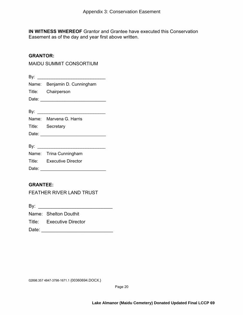
02898.357 4847-3798-1671.1 {00360694.DOCX.}
Page 20
IN WITNESS WHEREOF Grantor and Grantee have executed this Conservation Easement as of the day and year first above written. GRANTOR: MAIDU SUMMIT CONSORTIUM By: ____________________________ Name: Benjamin D. Cunningham Title: Chairperson Date: ___________________________ By: ____________________________ Name: Marvena G. Harris Title: Secretary Date: ___________________________ By: ____________________________ Name: Trina Cunningham Title: Executive Director Date: ___________________________ GRANTEE: FEATHER RIVER LAND TRUST By: ____________________________ Name: Shelton Douthit Title: Executive Director Date: ___________________________
Appendix 3: Conservation Easement
Lake Almanor (Maidu Cemetery) Donated Updated Final LCCP 69

02898.357 4847-3798-1671.1 {00360694.DOCX.}
Page 21
A notary public or other officer completing this certificate verifies only the identity of the individual who signed the document to which this certificate is attached, and not the truthfulness, accuracy, or validity of that document.
State of California ) County of _______ )
On ____________________, before me, ____________________________, a Notary Public, personally appeared _______________________________, who proved to me on the basis of satisfactory evidence to be the person(s) whose name(s) is/are subscribed to the within instrument and acknowledged to me that he/she/they executed the same in his/her/their authorized capacity(ies), and that by his/her/their signature(s) on the instrument the person(s), or the entity upon behalf of which the person(s) acted, executed the instrument.
I certify under PENALTY OF PERJURY under the laws of the State of California that the foregoing paragraph is true and correct.
WITNESS my hand and official seal.
Signature
Appendix 3: Conservation Easement
Lake Almanor (Maidu Cemetery) Donated Updated Final LCCP 70
02898.357 4847-3798-1671.1 {00360694.DOCX.}
Page 22
EXHIBIT A Legal Description of the Property and Map of the Property
[Follows this page]
Appendix 3: Conservation Easement
Lake Almanor (Maidu Cemetery) Donated Updated Final LCCP 71
02898.357 4847-3798-1671.1 {00360694.DOCX.}
Page 23
EXHIBIT B Form of Grant Deed
[Follows this page]
Appendix 3: Conservation Easement
Lake Almanor (Maidu Cemetery) Donated Updated Final LCCP 72
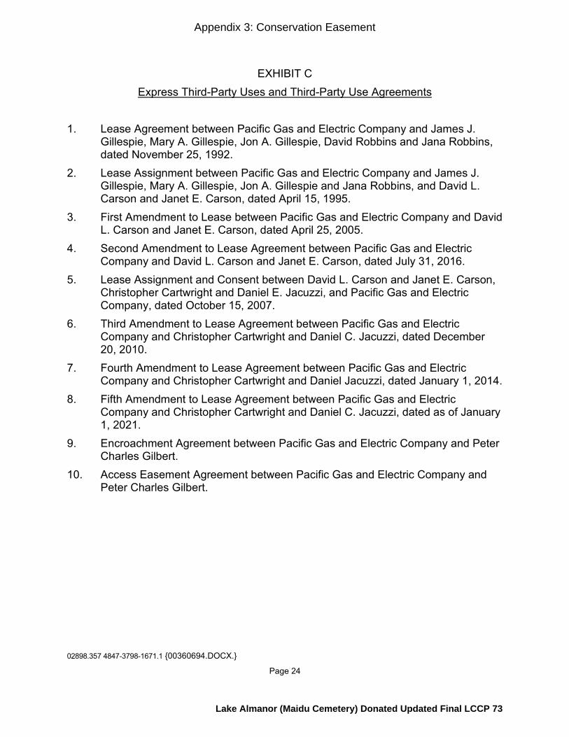
02898.357 4847-3798-1671.1 {00360694.DOCX.}
Page 24
EXHIBIT C Express Third-Party Uses and Third-Party Use Agreements
1. Lease Agreement between Pacific Gas and Electric Company and James J. Gillespie, Mary A. Gillespie, Jon A. Gillespie, David Robbins and Jana Robbins, dated November 25, 1992. 2. Lease Assignment between Pacific Gas and Electric Company and James J. Gillespie, Mary A. Gillespie, Jon A. Gillespie and Jana Robbins, and David L. Carson and Janet E. Carson, dated April 15, 1995. 3. First Amendment to Lease between Pacific Gas and Electric Company and David L. Carson and Janet E. Carson, dated April 25, 2005. 4. Second Amendment to Lease Agreement between Pacific Gas and Electric Company and David L. Carson and Janet E. Carson, dated July 31, 2016. 5. Lease Assignment and Consent between David L. Carson and Janet E. Carson, Christopher Cartwright and Daniel E. Jacuzzi, and Pacific Gas and Electric Company, dated October 15, 2007. 6. Third Amendment to Lease Agreement between Pacific Gas and Electric Company and Christopher Cartwright and Daniel C. Jacuzzi, dated December 20, 2010. 7. Fourth Amendment to Lease Agreement between Pacific Gas and Electric Company and Christopher Cartwright and Daniel Jacuzzi, dated January 1, 2014. 8. Fifth Amendment to Lease Agreement between Pacific Gas and Electric
Company and Christopher Cartwright and Daniel C. Jacuzzi, dated as of January 1, 2021.
9. Encroachment Agreement between Pacific Gas and Electric Company and Peter Charles Gilbert.
10. Access Easement Agreement between Pacific Gas and Electric Company and Peter Charles Gilbert.
Appendix 3: Conservation Easement
Lake Almanor (Maidu Cemetery) Donated Updated Final LCCP 73
02898.357 4847-3798-1671.1 {00360694.DOCX.}
Page 25
EXHIBIT D Conservation Values
In addition to the general description of the Conservation Values expressly included in the Recitals of the Conservation Easement Deed, the particular Conservation Values of the Property include, without limitation, the following: Fish, Plant, and Wildlife Habitat The Property is located within the Lake Almanor Basin, which the California Audubon Society has designated as an Important Bird Area due to its habitat for nesting and wintering waterfowl, and the presence of special status species such as willow flycatcher, sandhill crane, yellow warbler, bald eagle, and osprey. The Property contains California Wildlife Habitat Relationship (CWHR) terrestrial habitat types as set out below, as defined in “A Guide to Wildlife Habitats of California,” prepared for the California Department of Fish and Game, by Kenneth E. Mayer and William F. Laudenslayer, Jr., Editors (1988). The Property is dominated by diverse, mid-successional Sierra Mixed Conifer (SMC) habitat, where Douglas-fir (Pseudotsuga menziesii), Ponderosa pine (Pinus ponderosa), white fir (Abies concolor), sugar pine (Pinus lambertiana), incense cedar (Calocedrus decurrens), and California black oak (Quercus kelloggii) are found. Numerous openings in the canopy resulting from timber harvest and fire provide diverse understory species development: whitethorn (Ceanothus cordulatus), silktassel (Garrya fremontii), bitter cherry (Prunus emarginata), snowberry (Symphoricarpos spp.) currant species (Ribes), bitterbrush (Purshia tridentata), with grasses and forbs. Some bracken fern is located in the draws and Scouler’s willow (Salix scouleriana), also known as Fire Willow, (of older age classes from mature to decadent) is well distributed within the understory on south aspects. The pine dominated SMC habitat with black oak, silktassel, and bitterbrush (BBR) in the understory is a rare habitat type in the Almanor Basin. Special CWHR habitat elements found on the Property includes two perennial springs that support willow (Salix spp.); mountain alder (Alnus tenuifolia); and hardwood trees, predominantly black oaks, but also bigleaf maples (Acer macrophyllum). . The Property’s open SMC and BBR habitats provide summer and migratory habitat for a Tehama Deer Herd. The Property’s diversity of understory shrub species within the SMC habitat support black bear.
Appendix 3: Conservation Easement
Lake Almanor (Maidu Cemetery) Donated Updated Final LCCP 74
02898.357 4847-3798-1671.1 {00360694.DOCX.}
Page 26
The Property supports a mix of resident and migrant native birds species associated with mid-successional mixed conifer forest, including western tanager, yellow-rumped warbler, mountain chickadee, dark-eyed junco, and Cassin’s vireo. Special status bird species likely to occur on Property include: olive-sided flycatcher, bald eagle, osprey (observed), and Cooper’s hawk. Osprey are using the Property for perching and/or roosting and it is highly likely that bald eagles are using the property as well.
Open Space The Property provides a natural and scenic viewshed for the public. Scenic views of Lake Almanor and adjoining national forest and PG&E lands are available from the Property, as are views of Lassen Peak and Lassen Volcanic National Park. The Property affords scenery and open space for the public, especially as viewed from State Highway 147, Lake Almanor, and National Forest lands on the south and west sides of Lake Almanor. Outdoor Recreation Recreational use of the Property by the public includes camping, birding, hiking, mountain biking, and other related passive uses. Sustainable Forestry The Property includes timbered land supporting conifer species in the Sierra Mixed Conifer habitat containing Douglas- fir, Ponderosa Pine, white fir, sugar pine, incense cedar, California black oak and upland willow. Agricultural Uses Wild plant foods, medicinal plants, basketry materials, seeds, grasses and bulbs are cultivated for subsistence, medicinal and ceremonial purposes. Historic Resources The Property contains a number of historic and cultural resources, including but not limited to a Maidu cemetery. The land underlying Lake Almanor, known as Big Meadow, is part of the ancestral territory of the Maidu people. The creation of the Lake inundated entire Maidu villages and sites of cultural significance to the Maidu people, and the Maidu cemetery is a living memory of these events.
Appendix 3: Conservation Easement
Lake Almanor (Maidu Cemetery) Donated Updated Final LCCP 75

02898.357 4847-3798-1671.1 {00360694.DOCX.}
Page 27
EXHIBIT E Grantor’s Use of the Property
The following uses of the Property are permitted or prohibited, as indicated below. Permitted uses are deemed to be consistent with the Conservation Purposes and do not require approval by the Grantee, unless otherwise indicated. Prohibited uses are deemed to be inconsistent with the Conservation Purposes and may not be authorized by the Grantee. Grantor agrees that all permitted uses shall be carried out in conformance with applicable local, state, and federal laws, including the California Environmental Quality Act (“CEQA”), and the terms of this Conservation Easement.
1. Subdivision and Partitioning: Any legal or de facto division, subdivision, lot creation, or partitioning of the Property, including a request for a certificate of compliance pursuant to the Subdivision Map Act (Gov. Code section 66499.35), is prohibited. Notwithstanding that, as of the Effective Date, the Property is comprised of separate legal parcels, the terms and conditions of this Conservation Easement will apply to the Property as a whole, and the Property will not be transferred or otherwise conveyed except as a whole, intact, single piece of real estate; neither Grantor nor Grantor’s personal representative, successors, or assigns will transfer or otherwise convey any portion of the Property that constitutes less than the entire fee interest in the Property, except for leasehold interests. The existence of separate legal parcels as of the Effective Date shall not be interpreted to permit any use or activity on a separate legal parcel that would not have been permitted on such parcel under the terms and conditions of this Conservation Easement as applied to the Property as a whole. Upon prior written notification to the Grantee, the Grantor may execute one or more lot-line adjustments that may involve the boundary of the Property, provided, however, that no part of the Property is removed or divided from the Property as a whole. 2. Development Rights: Except as specifically permitted by this Exhibit E, the exercise of any development rights associated with the Property is prohibited, including, without limitation, the right to construct apartment houses; multi-family dwellings; mobile homes; house-trailers; permanent tent facilities or similar structures; golf courses; casinos and gaming facilities; underground tanks; billboards, or street lights. All development rights that are now or hereafter allocated to, implied, reserved or inherent in the Property are assigned, granted, deeded and/or otherwise transferred to and/or vested in and/or otherwise placed under the sole and absolute control and discretion of Grantee in perpetuity and may not be used on or transferred to any portion of the Property as it now or hereafter may be bounded or described or to any other property nor used for the purpose of calculating permissible lot yield of the Property or any other Property. 3. Commercial Uses: Except as specifically permitted by this Exhibit E, commercial uses on the Property are prohibited, including but not limited to livestock feedlots; gravel mining; commercial hotels; casinos and gaming facilities; retail outlets; retail gas station; commercial wind farms; commercial fish hatcheries; golf courses; billboards; cannabis cultivation; and commercial cultivation of native plants.
Appendix 3: Conservation Easement
Lake Almanor (Maidu Cemetery) Donated Updated Final LCCP 76

02898.357 4847-3798-1671.1 {00360694.DOCX.}
Page 28
4. Construction and Use of Structures: Notwithstanding any provision herein to the contrary, Grantor shall have the right, with the prior approval of Grantee pursuant to Section 9(b) of this Conservation Easement, to construct structures and improvements made in the course of prudent and customary land management activities, and/or to protect, preserve, or enhance the Conservation Values, including, but not limited to, restrooms, wells, garbage enclosures, benches, and interpretative kiosks. If approved by Grantee, this authorization may include a caretaker structure not to exceed 1,500 square feet and located in an existing impacted area between the railroad right of way and California State Route 147. Grantee’s approval shall not be unreasonably withheld, conditioned or delayed. For each such structure and improvement, the site selection, design, construction and use shall be undertaken, with Grantee’s approval, in a manner reasonably designed to minimize adverse impacts to the Conservation Values. To the extent feasible, building materials and colors shall be selected that harmonize with the natural landscape of the Property. 5. Roads: Grantor may maintain, repair, or replace existing roads on the Property, taking care to ensure that any such activities are consistent with the current footprint and level of improvement of such roads. Grantor shall have the right to limit or prohibit access to existing nonpublic roads, provided such actions are consistent with existing rights of way and/or easements on the Property, and further, that such actions are consistent with Section 3 and Section 8 of this Conservation Easement. Grantor may upgrade existing roads within the same footprint of such roads, subject to consultation with the Grantee pursuant to Section 10(a) of this Conservation Easement. Grantor may construct new roads to provide access to existing structures or structures authorized to be constructed by this Conservation Easement, or for management uses authorized by this Conservation Easement. In accordance with Section 10 of this Conservation Easement, the location, design, and construction of such new roads shall be approved by Grantee, which approval shall not be unreasonably withheld. Any other alteration of the surface or general topography of the Property for the purpose of construction, improvement or replacement of roads for motorized vehicles of any type or for the purpose of paving such roads is prohibited. 6. Fences and Gates: Grantor may construct, place and erect fencing and gates only as necessary for permitted uses of the Property. The construction and installation of fencing and gates shall not significantly impair the Conservation Values and shall not interfere with the public access requirements set forth in Section 8 of this Conservation Easement. In the event of destruction or deterioration of any fences and gates, whether existing at the date hereof or constructed subsequently in accordance with the provisions of this Conservation Easement, Grantor may maintain, remove and/or replace such fencing and gates with replacements of substantially the same size. 7. Trails: Grantor may construct and maintain trails (defined as any definable route less than ten (10) feet in width, not including curbs, cuts or fills) for recreational and educational purposes, and for use by pedestrians, horses and mules, and bicycles. Notwithstanding any other provision in this Conservation Easement to the contrary, Grantor may grant an easement to the County of Plumas for use of the Property as a trail corridor to connect to the Almanor Recreation Trail or for other purposes. The
Appendix 3: Conservation Easement
Lake Almanor (Maidu Cemetery) Donated Updated Final LCCP 77

02898.357 4847-3798-1671.1 {00360694.DOCX.}
Page 29
dimensions and materials for such a trail shall be consistent with those of the Almanor Recreation Trail. Grantor may use motorized vehicles on trails for management and exercise of Maidu traditional cultural practices, provided such use does not significantly impair the Conservation Values. Otherwise, motorized vehicles are prohibited on trails. The following requirements for the construction and maintenance of such new trails shall apply: (a) the trail shall be located, to the extent possible, in the path of a trail or road existing on the Effective Date, as defined in the Baseline Documentation Report; (b) the trail shall be constructed and maintained so as to minimize erosion and sedimentation and ensure proper drainage; (c) the trail shall be otherwise installed in a manner to avoid unnecessary tree removal, grading and other land disturbance, but allowing for selective brush removal; and (d) prior to construction of trails, Grantor shall submit to Grantee a qualified scientist’s opinion that the proposed trail construction will not impact any cultural resources, special status, endangered or threatened plant or animal species, or their habitats, listed in the Baseline Documentation Report, or any other such cultural resources or designated plant or animal species or habitats identified at the time of the proposed construction. Grantor shall consult with Grantee regarding construction of trails under Section 10(a) of this Conservation Easement, but Grantee’s approval shall not be required, Section 8(b) of this Conservation Easement notwithstanding. 8. Recreational Uses: Subject to and without limiting the requirements of Section 8 of this Conservation Easement, including the prior approval of Grantee as required under Section 8(b) of this Conservation Easement, Grantor may make the Property available for low-intensity outdoor recreational and educational activities, including hiking, nature study, mountain biking, and hunting; as well as camping and/or recreational vehicle use in the Seasonal Commercial Recreation Zone. Grantor may impose a reasonable charge for these activities, provided that any financial gain is dedicated to the not-for-profit mission of the Grantor. Grantor may enter into agreements with third parties for delivery of such commercial recreational and educational activities. Notwithstanding any other provision herein to the contrary, any increase in the intensity of use, expansion of the location or size of use, or change in use whether through a Third-Party Use Agreement or Grantor’s use of the Property requires prior approval of Grantee in accordance with Section 8(b) of this Conservation Easement, which approval shall not be unreasonably withheld, delayed or conditioned. 9. Traditional Activities: Grantor may propagate, restore, maintain, or gather vegetation, plants, nuts, seeds or other natural materials related to the Mountain Maidu’s traditional culture on the Property. Private and/or public Mountain Maidu traditional recreational, spiritual, cultural, and educational activities shall be permitted on the Property, including but not limited to, ceremonies, dances, games, and knowledge sharing workshops. The Grantor may authorize Maidu people to hunt on the property, consistent with state law. Grantor shall conduct its cultural activities in a manner that does not significantly impair the Conservation Values, and Grantor intends to manage the Property in accordance with Maidu land management principles and practices based on TEK as specifically described in the Management Plan. 10. Burials: Subject to the public access requirements set forth in Section 8 of the
Appendix 3: Conservation Easement
Lake Almanor (Maidu Cemetery) Donated Updated Final LCCP 78
02898.357 4847-3798-1671.1 {00360694.DOCX.}
Page 30
Conservation Easement, Grantor may inter the human remains of deceased persons of Mountain Maidu descent in the remaining internment spaces within the cemetery located within the Cemetery Zone. The interment of human remains shall be consistent with traditional Maidu burial practices and shall not significantly impair the Conservation Values. Any increase in the intensity of use, expansion of the location or size of the cemetery, or change of use, shall be subject to Grantee’s prior written approval pursuant to Section 10(a) of this Conservation Easement, which approval shall not be unreasonably withheld, conditioned or delayed. 11. Water Resources: As necessary and appropriate to carry out the uses permitted by this Conservation Easement, Grantor may, after obtaining any necessary state permits, develop, enhance and maintain water resources on the Property for habitat restoration, water consumption in connection with permitted uses, and permitted recreation uses, provided that such activities are consistent with and do not violate the PG&E Reserved Rights and do not significantly impair the Conservation Values. Permitted uses include, without limitation, the construction, repair, and maintenance of ponds and irrigation systems; installation and maintenance of wells, and the development of water capture and delivery facilities, including but not limited to water lines and access roads or trails to water facilities consistent with Section 5 and Section 7 of this Exhibit E. Water may be exported off the Property for immediate fire control response or wildfire emergency. Other than as permitted in this section, the manipulation, impoundment, or alteration of any natural swale, natural water course, non-human constructed channel, wetland, stream-bank, vernal pool, perennial spring, water circulation, or any other body of water are prohibited. 12. Water and Mineral Rights: The transfer, encumbrance, sale, lease, severance, or other separation of the mineral or water rights for the Property by Grantor is prohibited without the prior approval of Grantee in accordance with Section 10(b) of this Conservation Easement, which Grantee may withhold in its absolute discretion. The following are also prohibited: changing the place or purpose of use of any water rights; abandoning or allowing the abandonment of, by action or inaction, any water or water rights, ditch or ditch rights, spring rights, reservoir or storage rights, wells, ground water rights, or other rights in and to the use of water historically used on or otherwise appurtenant to the Property, including but not limited to: (1) riparian water rights; (2) appropriative water rights; (3) rights to waters which are secured under contract with any irrigation or water district, to the extent such waters are customarily applied to the Property; and (4) any groundwater from wells that are in existence or may be constructed in the future on the Property. Nothing herein restricts the right of Grantor to enter into sales, purchases, leases, exchanges, and other transactions in water rights, such as forbearance agreements or the use of Water Code section 1707, with a government agency or nonprofit organization for wildlife, ecological enhancement purposes, or other in-stream Conservation Values, subject to the sole discretion and prior written approval of Grantee under Section 10(b) of this Conservation Easement, provided that any such transfer does not significantly impair other Conservation Values of this Conservation Easement. 13. Air Rights: The transfer, encumbrance, sale, lease, severance or other
Appendix 3: Conservation Easement
Lake Almanor (Maidu Cemetery) Donated Updated Final LCCP 79

02898.357 4847-3798-1671.1 {00360694.DOCX.}
Page 31
separation of the air rights attached to the Property by Grantor is prohibited without the prior approval of Grantee in accordance with Section 10(b) of this Conservation Easement, which Grantee may withhold in its absolute discretion. Grantor shall not use or authorize others to use the airspace above the Property for commercial or private aviation, including but not limited to, airplane flights, ultralight flights; hang gliding; glider flights; rotor craft flights; balloon flights; airship flights; and light sport airplane flights. Grantor may use unmanned aerial vehicles for management or monitoring purposes, but shall not authorize others to use such airspace above the Property for that purpose. Grantee may use unmanned aerial vehicles for monitoring purposes, provided Grantee notifies Grantor in writing of such intended use thirty (30) days in advance of each flight. 14. Natural Resource Management: Grantor may protect, restore, enhance and maintain the natural resources on the Property, including, without limitation, stabilization of banks and soils, vegetation management; fire control and the enhancement of biodiversity, all, in accordance with sound, generally accepted practices such as prescriptive grazing, prescriptive burning, harvesting, thinning, planting and brush removal, provided such activities do not significantly impair the Conservation Values. The intentional introduction of non-native tree or other plant species is prohibited. Grantor may remove or control invasive, non-native plant species or feral, non-native animal species, using techniques that minimize harm to native wildlife and plants, provided such activities do not significantly impair the Conservation Values. 15. Refuse and Hazardous Materials: The dumping, deposit, permanent storage and/or disposal of refuse, soil, trash, contaminated soil, waste, bio-solids, debris, sewer sludge, agrichemicals, herbicides, pesticides, or any other dangerous, toxic, hazardous or unsightly materials on the Property is prohibited. Nothing herein shall prohibit Grantor from temporary storage of refuse and waste in the Seasonal Commercial Recreation Zone. 16. Minerals: Grantor may not explore for or extract minerals on the Property, provided that notwithstanding the foregoing, Grantor may remove existing rocks from the Property to be used for the purpose of blocking off roads on the Property, delineating RV camping areas on the Property, and for other purposes on the Property approved by the Grantee under Section 10(b) of this Conservation Easement, which approval shall not be unreasonably withheld, conditioned or delayed. Grantor may further remove gravel for the purposes of building permitted structures and/or maintaining permitted roads on the Property. No removal of rocks may occur within 50’ slope distance of any perennial or ephemeral watercourse, as such term is defined in the California Forest Practice Rules 2013, Title 14 California Code of Regulations, Chapter 4 Article 1, 895.1, as amended. Erosion control and drainage structures are not considered “man-made watercourses” under this Conservation Easement. Other than as permitted by this section, the filling, dumping, excavating, draining, dredging, mining, hydraulic fracturing, drilling, removing or exploring for or extracting minerals, loam, soil, sands, hydrocarbons, gravel, rocks or other similar material on or below the surface of the Property, or granting or authorizing surface entry for any such purpose are prohibited.
Appendix 3: Conservation Easement
Lake Almanor (Maidu Cemetery) Donated Updated Final LCCP 80
02898.357 4847-3798-1671.1 {00360694.DOCX.}
Page 32
17. Forest Management: (a) Permitted Forestry Practices: The Grantor reserves the right to harvest,
cut or remove trees and vegetation for the following purposes and to use or sell the timber products resulting from such activities, all in accordance with the forest management component of the Management Plan (“Forest Management Plan Component”):
(i) for firewood for use on the Property and for direct, personal use by members of the Maidu community outside the Property, provided such use does not significantly impair the Conservation Values; (ii) for the removal of trees and milling of lumber to be used by Grantor
for construction purposes on the Property as permitted by this Conservation Easement, in connection with which Grantor may make use of a portable sawmill on the Property;
(iii) to prevent, mitigate and/or respond to any natural disaster (such as wildfire, insect and disease outbreak, drought or wind damage), including the salvage and removal of dead, dying, or diseased timber; and the creation of fuel breaks;
(iv) for the purposes of public or personal safety on the Property; (v) to promote the health and sustainability of the Property’s natural
resources, to restore and maintain an ecologically appropriate mix of overstory and understory vegetation and to control invasive and non-native vegetation, with the goal of old growth and black oak establishment and management;
(vi) to reduce or manage fuel loads, favor or maintain specific native vegetation types, or otherwise promote forest health by prescriptive burns and fire management activities including but not limited to grazing by goats or other herbivores;
(vii) for wildlife habitat restoration or management; and (viii) for the removal of trees in connection with the clearing of areas for
structures as permitted by this Conservation Easement. Grantor further may carry out forest management activities not expressly set
forth above, provided, however, that all such activities are conducted in a manner that is consistent with the Conservation Purposes and other terms and conditions of this Conservation Easement. Snags shall be retained for wildlife habitat benefits and shall not be intentionally removed, except for reasons of public safety or adherence to the objectives of the Management Plan, and in accordance with the requirements of the California Forest Practice Act and Rules.
(b) Forest Management Planning: The Forest Management Component of
the Management Plan shall be prepared and approved by a Registered Professional
Appendix 3: Conservation Easement
Lake Almanor (Maidu Cemetery) Donated Updated Final LCCP 81

02898.357 4847-3798-1671.1 {00360694.DOCX.}
Page 33
Forester or by an equivalent professional who is reasonably acceptable to Grantee. The goals of the Forest Management Component of the Management Plan shall be to create, manage and preserve a healthy and vigorous forest with sustainable stands of native tree species; to manage the forest to improve resilience to drought and pests; to reduce build-up of fuels that create risks of catastrophic fire; and to create and maintain a full and balanced variety of stand species, ages and characteristics; and to manage the forest to enhance wildlife as determined by Grantor. The Forest Management Component of the Management Plan will identify objectives to protect and enhance resources, including cultural resources. Planning will investigate the potential for a traditional demonstration management area to educate the public about Native American traditional ecological practices used in the area.
(c) Timber Harvest Plans: Except for actions to mitigate threat(s) to public or personal safety, any permit applications associated with proposed Timber Harvest Plans shall be submitted to Grantee for review and consultation under Section 10(a) of this Conservation Easement at least 30 days prior to the submission of the application to the California Department of Forestry and Fire Protection (“Cal Fire”). Grantor shall notify Grantee immediately of any proposed actions to be taken on an emergency basis to protect public or personal safety. If review of the proposed Timber Harvest Plan by Cal Fire results in modifications to the proposed Timber Harvest Plan, Grantor shall further consult with Grantee in accordance with Section 10(a) of this Conservation Easement.
(d) Reports: Grantor shall submit to Grantee a report on harvest levels and their impact, if any, on the Conservation Purposes and Conservation Values of the Property every ten (10) years. Grantee and the Grantor may agree that the report can be deferred beyond the ten-year period.
18. Fire Management: Fire protection and suppression activities shall be permitted on the Property, provided such activities do not significantly impair the Conservation Values. Except where Grantor is required to take emergency action to protect public or personal safety, Grantor shall consult with Grantee under Section 10(a) of this Conservation Easement before undertaking any fire management activities under this section. Where Grantor is required to take emergency action to protect public or personal safety, such action shall be carried out in a manner designed to minimize impacts on the Conservation Values.
19. Carbon Rights: Grantor hereby reserves for itself and its successors and assigns all carbon rights and the right to sell carbon rights that are part of and appurtenant to the Property for forest-based carbon storage occurring by virtue of the forest management and other restrictions established herein starting as of the Effective Date. For the purposes of this Conservation Easement, carbon rights and carbon as described herein are rights that currently exist or may come to exist in the future and are associated with the absorption by plants of carbon dioxide from the atmosphere and its conversion to carbon stored in trees and plants on the Property or stored in wood
Appendix 3: Conservation Easement
Lake Almanor (Maidu Cemetery) Donated Updated Final LCCP 82
02898.357 4847-3798-1671.1 {00360694.DOCX.}
Page 34
products extracted pursuant to forest management activities permitted herein, and trees and other vegetation and associated roots, surface duff and organic elements in the soil on the Property; 20. Agriculture: Ranching and commercial and non-commercial production of agricultural crops is limited to (1) the planting and harvesting of native plants as may become viable for Grantor in the future; (2) other ranching and agricultural activities which do not significantly impair the Conservation Values; provided any and all such uses are approved in advance by Grantee in accordance with Section 10(b) of this Conservation Easement, which approval shall not be unreasonably withheld, conditioned or delayed; and (3) as otherwise permitted by this Conservation Easement. Other than as permitted by this Section 20, the plowing, disking, cultivation, ripping, planting, sowing, irrigation, or any other conversion of the Property to crops, orchards, vineyards, or any other agricultural use or disturbance of the Property and its native vegetation are prohibited. Intentional seeding, planting, or introduction of exotic or non-native plant species are prohibited. 21. Vehicle Use: Grantor may authorize the use of motorized vehicles on designated roadways for the recreational uses permitted in Section 8 of this Exhibit E. Except as permitted in Section 8 of this Exhibit E, commercial recreational vehicle use is prohibited. Grantor shall take reasonable and practicable actions to ensure that all vehicles use only designated roads, and that unauthorized third parties are prevented from using motorized vehicles on the Property, provided, however, that Grantor shall not be responsible for injuries or changes to the Property caused by such uses beyond Grantor’s control. In no event shall any all-terrain vehicles, off-road vehicles, or off-highway vehicles, including without limitation four-wheelers, three-wheelers, snowmobiles, and/or motorcycles be used off designated roadways, except when used by Grantor for management or to exercise Maidu traditional cultural practices, provided such uses do not significantly impair the Conservation Values. Grantor shall consult with Grantee about its vehicle use on the Property in accordance with Section 10(a) of this Conservation Easement.
Appendix 3: Conservation Easement
Lake Almanor (Maidu Cemetery) Donated Updated Final LCCP 83
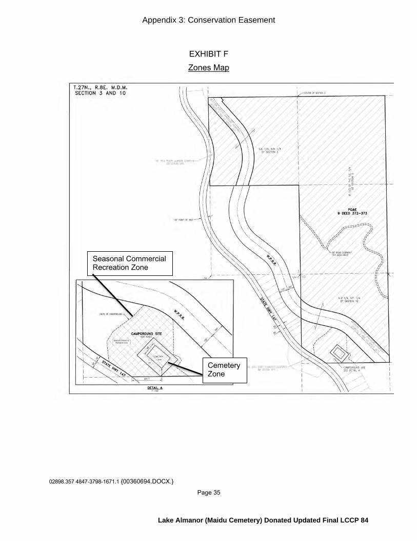
02898.357 4847-3798-1671.1 {00360694.DOCX.}
Page 35
EXHIBIT F Zones Map
Seasonal Commercial Recreation Zone
Cemetery Zone
Appendix 3: Conservation Easement
Lake Almanor (Maidu Cemetery) Donated Updated Final LCCP 84

02898.357 4847-3798-1671.1 {00360694.DOCX.}
Page 36
EXHIBIT G Insurance Requirements
Grantor shall procure, carry, and maintain at all times the following insurance coverage:
1. Workers’ Compensation and Employers’ Liability: a. Workers’ compensation insurance or self-insurance indicating compliance
with any applicable labor codes, laws, or statutes. b. Employers’ liability insurance shall not be less than one hundred
thousand dollars ($100,000) for injury or death each accident.
2. Commercial General Liability: a. Coverage shall be at least as broad as the Insurance Services Office
(ISO) Commercial General Liability Coverage “occurrence” form, with no coverage deletions.
b. The limit shall not be less than one million dollars ($1,000,000) each occurrence and two million dollars ($2,000,000) aggregate for bodily injury, property damage, and personal injury.
c. Coverage shall add as additional insureds Grantee, their directors, officers, employees, and volunteers with respect to liability arising out of work performed by or for Grantor, and Coverage shall be endorsed to specify that Grantor’s insurance is primary.
3. Business Auto: a. Coverage shall be at least as broad as the Insurance Services Office
(ISO) Business Auto Coverage form covering Automobile Liability, Code 1 “any auto”.
b. The limit shall not be less than one million dollars ($1,000,000) each accident for bodily injury and property damage.
4. Additional Insurance Provisions: a. Upon change in carrier or coverage, or otherwise upon request of either
Grantee, Grantor shall furnish Grantee with certificates of insurance and endorsements of all required insurance for Grantor.
b. The documentation shall be signed by a person authorized by that insurer to bind coverage on its behalf and shall state that coverage shall not be canceled except after thirty (30) days prior written notice has been given to Grantee.
Appendix 3: Conservation Easement
Lake Almanor (Maidu Cemetery) Donated Updated Final LCCP 85
02898.357 4847-3798-1671.1 {00360694.DOCX.}
Page 37
c. Upon request by Grantee, not to exceed once annually, Grantor shall furnish Grantee with complete copies of its policies, the policies of its agents or contractors, or both.
Appendix 3: Conservation Easement
Lake Almanor (Maidu Cemetery) Donated Updated Final LCCP 86
02898.357 4847-3798-1671.1 {00360694.DOCX.}
Page 38
EXHIBIT H Power of Termination
[Follows this page]
Appendix 3: Conservation Easement
Lake Almanor (Maidu Cemetery) Donated Updated Final LCCP 87
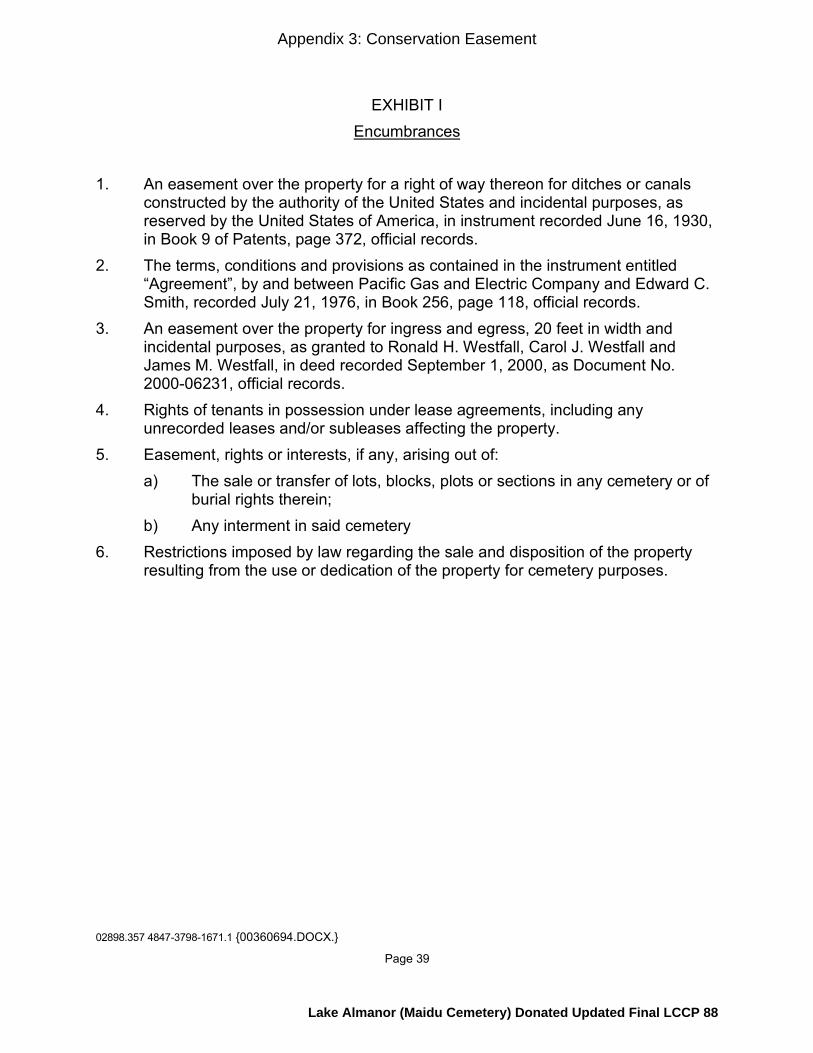
02898.357 4847-3798-1671.1 {00360694.DOCX.}
Page 39
EXHIBIT I Encumbrances
1. An easement over the property for a right of way thereon for ditches or canals constructed by the authority of the United States and incidental purposes, as reserved by the United States of America, in instrument recorded June 16, 1930, in Book 9 of Patents, page 372, official records. 2. The terms, conditions and provisions as contained in the instrument entitled “Agreement”, by and between Pacific Gas and Electric Company and Edward C. Smith, recorded July 21, 1976, in Book 256, page 118, official records. 3. An easement over the property for ingress and egress, 20 feet in width and incidental purposes, as granted to Ronald H. Westfall, Carol J. Westfall and James M. Westfall, in deed recorded September 1, 2000, as Document No. 2000-06231, official records. 4. Rights of tenants in possession under lease agreements, including any unrecorded leases and/or subleases affecting the property. 5. Easement, rights or interests, if any, arising out of: a) The sale or transfer of lots, blocks, plots or sections in any cemetery or of burial rights therein; b) Any interment in said cemetery 6. Restrictions imposed by law regarding the sale and disposition of the property resulting from the use or dedication of the property for cemetery purposes.
Appendix 3: Conservation Easement
Lake Almanor (Maidu Cemetery) Donated Updated Final LCCP 88

Conservation Easement Funding Agreement – FRLT, Lake Almanor, Maidu Cemetery MSC Donated 1 FRLT: LAMC-001
Conservation Easement Funding Agreement Lake Almanor (Maidu Cemetery) Planning Unit – Lands Donated to the Maidu Summit Consortium
This Conservation Easement Funding Agreement (“Agreement”) is entered into as of the Effective Date (defined below) by and between the Pacific Forest and Watershed Lands Stewardship Council, a California nonprofit public benefit corporation (the “Stewardship Council”) and the Feather River Land Trust, a California nonprofit public benefit corporation (“Grantee”) (each a “Party” and collectively the “Parties”) with reference to the following facts:
A. The Stewardship Council was created to oversee the “Land ConservationCommitment” described in (1) that certain Settlement Agreement among Pacific Gas and Electric Company (“PG&E”), PG&E Corporation, and the California Public Utilities Commission (the “Commission”) as modified and approved by the Commission in its Opinion and Order of December 18, 2003 (Decision 03-12-035) (the “Settlement Agreement”); and (2) that certain Stipulation Resolving Issues Regarding the Land Conservation Commitment dated September 25, 2003 (the “Stipulation”).
B. Pursuant to the Settlement Agreement and Stipulation, certain lands owned byPG&E at the time of the Settlement (the “PG&E Watershed Lands”) are to be conserved for a broad range of beneficial public values, including the protection of the natural habitat of fish, wildlife and plants; the preservation of open space; outdoor recreation by the general public; sustainable forestry; agricultural uses; and historic values. The Stewardship Council is charged with developing a Land Conservation Plan for the protection and enhancement of the PG&E Watershed Lands.
C. Grantee is a publicly-supported, tax exempt nonprofit organization, qualifiedunder Section 501 (c)(3) of the Internal Revenue Code (“IRC”), whose primary purpose is to preserve, protect or enhance, land in its natural scenic, historical agricultural, forested or open space condition or use and conserve natural areas for aesthetic, scientific, charitable and educational purposes. Grantee is eligible to hold a conservation easement pursuant to California Civil Code Section 815.3.
D. Feather River Land Trust has agreed to accept perpetual conservationeasements over PG&E Watershed Lands that are subject to PG&E’s Land Conservation Commitment at the Bucks Lake, Butt Valley, Humbug Valley, Lake Almanor, and Mountain Meadows planning units (the “Watershed Properties”).
E. In connection with the Land Conservation Commitment, Grantee has agreed toaccept a perpetual conservation easement created pursuant to California Civil Code Section 815 et seq. (the “Conservation Easement”) over a portion of the PG&E Watershed Lands that is being donated to Maidu Summit Consortium by PG&E consisting of approximately 141 acres of real property located in the County of Plumas, State of California, commonly referred to as the “Lake Almanor (Maidu Cemetery) planning unit” and more particularly described in Exhibit A attached hereto and incorporated herein by reference (the “Property”).
F. In consideration of Grantee’s agreement to accept the Conservation Easementand assume the duties and obligations of the easement holder, the Stewardship Council has
Appendix 4: Conservation Easement Funding Agreement
Lake Almanor (Maidu Cemetery) Donated Updated Final LCCP 89
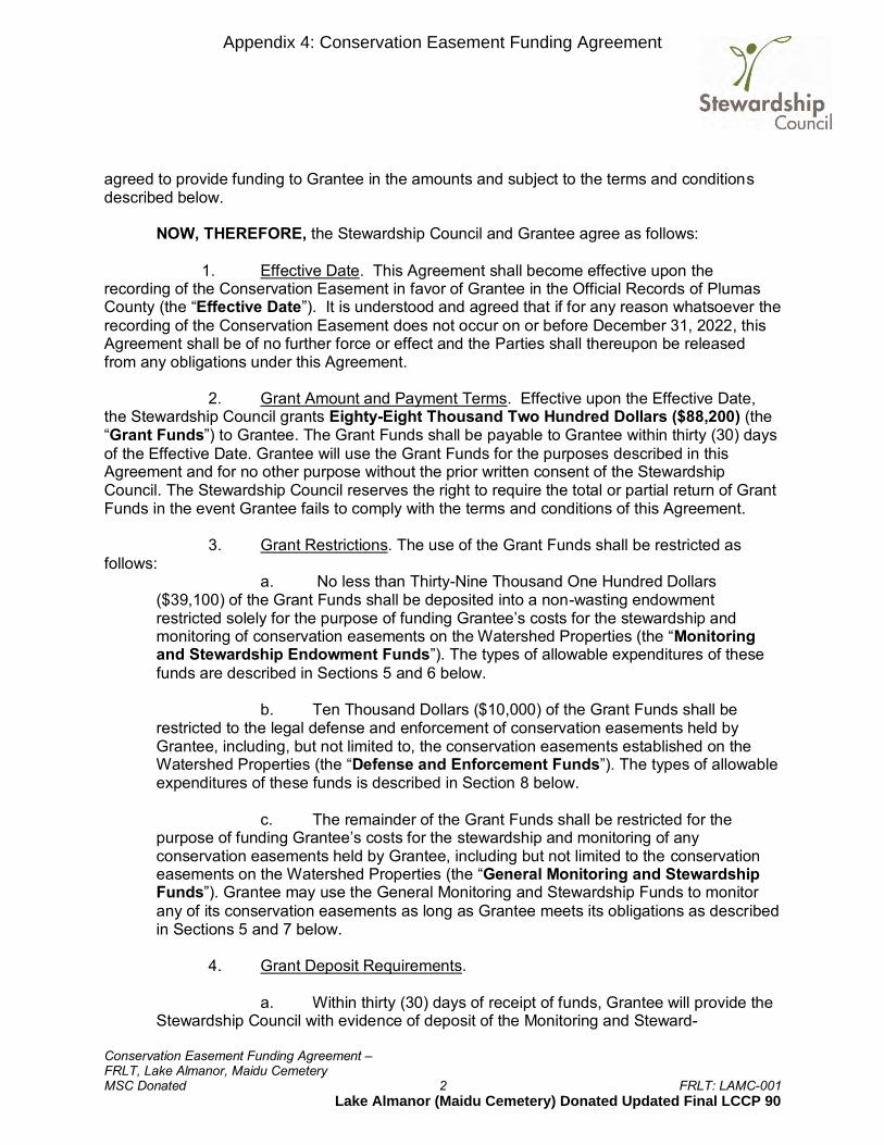
Conservation Easement Funding Agreement – FRLT, Lake Almanor, Maidu Cemetery MSC Donated 2 FRLT: LAMC-001
agreed to provide funding to Grantee in the amounts and subject to the terms and conditions described below. NOW, THEREFORE, the Stewardship Council and Grantee agree as follows:
1. Effective Date. This Agreement shall become effective upon the recording of the Conservation Easement in favor of Grantee in the Official Records of Plumas County (the “Effective Date”). It is understood and agreed that if for any reason whatsoever the recording of the Conservation Easement does not occur on or before December 31, 2022, this Agreement shall be of no further force or effect and the Parties shall thereupon be released from any obligations under this Agreement.
2. Grant Amount and Payment Terms. Effective upon the Effective Date,
the Stewardship Council grants Eighty-Eight Thousand Two Hundred Dollars ($88,200) (the “Grant Funds”) to Grantee. The Grant Funds shall be payable to Grantee within thirty (30) days of the Effective Date. Grantee will use the Grant Funds for the purposes described in this Agreement and for no other purpose without the prior written consent of the Stewardship Council. The Stewardship Council reserves the right to require the total or partial return of Grant Funds in the event Grantee fails to comply with the terms and conditions of this Agreement.
3. Grant Restrictions. The use of the Grant Funds shall be restricted as follows:
a. No less than Thirty-Nine Thousand One Hundred Dollars ($39,100) of the Grant Funds shall be deposited into a non-wasting endowment restricted solely for the purpose of funding Grantee’s costs for the stewardship and monitoring of conservation easements on the Watershed Properties (the “Monitoring and Stewardship Endowment Funds”). The types of allowable expenditures of these funds are described in Sections 5 and 6 below.
b. Ten Thousand Dollars ($10,000) of the Grant Funds shall be
restricted to the legal defense and enforcement of conservation easements held by Grantee, including, but not limited to, the conservation easements established on the Watershed Properties (the “Defense and Enforcement Funds”). The types of allowable expenditures of these funds is described in Section 8 below.
c. The remainder of the Grant Funds shall be restricted for the
purpose of funding Grantee’s costs for the stewardship and monitoring of any conservation easements held by Grantee, including but not limited to the conservation easements on the Watershed Properties (the “General Monitoring and Stewardship Funds”). Grantee may use the General Monitoring and Stewardship Funds to monitor any of its conservation easements as long as Grantee meets its obligations as described in Sections 5 and 7 below.
4. Grant Deposit Requirements.
a. Within thirty (30) days of receipt of funds, Grantee will provide the
Stewardship Council with evidence of deposit of the Monitoring and Steward-
Appendix 4: Conservation Easement Funding Agreement
Lake Almanor (Maidu Cemetery) Donated Updated Final LCCP 90

Conservation Easement Funding Agreement – FRLT, Lake Almanor, Maidu Cemetery MSC Donated 3 FRLT: LAMC-001
ship Endowment Funds into an account which shall be restricted solely for the purpose of funding Grantee’s costs for the stewardship and monitoring of conservation easements on the Watershed Properties and shall be treated as a non-wasting endowment.
b. Within thirty (30) days of receipt of funds, Grantee will provide the
Stewardship Council with evidence of deposit of (1) the General Monitoring and Stewardship Funds into an account which shall be restricted to the stewardship and monitoring of conservation easements held by the Grantee, including but not limited to the Conservation Easement on the Property; and (2) the Defense and Enforcement Funds into an account which shall be restricted to the legal defense or enforcement of the conservation easements held by the Grantee, including but not limited to the Conservation Easement on the Property.
c. The requirement to provide evidence of deposit will be satisfied when Grantee submits to the Stewardship Council the form attached as Exhibit B.
5. Conservation Easement Monitoring. From and after the Effective Date,
Grantee agrees to conduct regular monitoring of the Property to ensure compliance with the terms of the Conservation Easement. Grantee shall conduct on-site monitoring of the Property not less than annually to assess compliance with the terms and conditions of the Conservation Easement and note any material changes to the Property compared to the base-line documentation report and prior monitoring reports. Upon written request, the Stewardship Council or its designee shall be permitted to accompany the Grantee on its monitoring visits and to receive a copy of any monitoring report prepared by Grantee.
6. Monitoring and Stewardship Endowment Funds. Permissible uses of
Monitoring and Stewardship Endowment Funds shall include, but be not limited to:
a. Regular on-site inspection and monitoring to ensure that the terms of Conservation Easement are being met;
b. Recordkeeping and preparation of reports, notices of violation,
any written consent to be submitted to the fee title owner of the property which is subject to the easement, and other documentation related to the Conservation Easement and the Property;
c. Payments for staff, consultants and attorney time necessary to carry out Grantee’s stewardship responsibilities with regard to its conservation easements;
d. Communications with the fee title owner of the Property which is subject to the easement regarding the provisions of the Conservation Easement and planned or completed activities on the lands to be performed or allowed by the fee title owner or a licensee/lessee;
Appendix 4: Conservation Easement Funding Agreement
Lake Almanor (Maidu Cemetery) Donated Updated Final LCCP 91

Conservation Easement Funding Agreement – FRLT, Lake Almanor, Maidu Cemetery MSC Donated 4 FRLT: LAMC-001
e. Responding to any inquiries or concerns raised by entities that have leases or licenses on the Property or other stakeholders who have an interest in ensuring the beneficial public values are protected; and
f. Payment of premiums charged for General Liability insurance
coverage on the Property.
7. General Monitoring and Stewardship Funds. Permissible uses of the General Monitoring and Stewardship Funds shall include, but be not limited to the activities described in Section 6 above with regard to any of the conservation easements held by the Grantee.
8. Defense and Enforcement Funds. Grantee shall be permitted to use the
Defense and Enforcement Funds for the following purposes:
a. To make direct expenditures of attorneys’ fees, costs and disbursements incurred in connection with proceedings to enforce and/or defend the provisions of the Conservation Easement against legal challenge, including any claims by third parties;
b. To “pool” funds for legal expenses to enforce and/or defend against
legal challenge conservation easements held by the Grantee, including without limitation the Conservation Easement on the Property;
c. To pay premiums into a Conservation Defense Insurance Program
offered through the Land Trust Alliance, or other nationally-recognized conservation organization of which Grantee is a member for the enforcement and defense of conservation easements held by member organizations, or to cover deductibles related to such insurance.
9. Grant Report. Grantee agrees to submit to the Stewardship Council and/or its designee the following grant Status Reports pursuant to this Agreement. The initial Status Report shall be submitted to the Stewardship Council by the fourth quarter of the 2022 calendar year and include data up to the date of the initial Status Report. The final Status Report shall be submitted to the Stewardship Council or its designee on or before December 31, 2023. The due dates of the initial and final Status Reports can be changed by the Stewardship Council or its designee with at least 60 days written notice to Grantee. The Stewardship Council or its designee shall notify Grantee in a timely manner of the form and content of each Status Report, which shall include, at a minimum:
a. Copies of annual monitoring reports pertaining to the Conservation Easement for years selected by the Stewardship Council or its designee;
b. A statement as to whether any violations of the Conservation
Easement were observed during the reporting period, and the outcome of any action taken to correct such violation;
Appendix 4: Conservation Easement Funding Agreement
Lake Almanor (Maidu Cemetery) Donated Updated Final LCCP 92

Conservation Easement Funding Agreement – FRLT, Lake Almanor, Maidu Cemetery MSC Donated 5 FRLT: LAMC-001
c. A statement as to whether any amendments to the Conservation Easement were approved during the reporting period, with copies of any such amendments included in the Status Reports;
d. A statement as to whether fee title of the property was conveyed,
the date of such conveyance, and the identity of the transferee; and
e. A report providing an accounting of how the Grant Funds have been invested or expended in furtherance of the purposes of this Agreement.
10. Records. Grantee will indicate the Grant Funds separately on its books of
account, and maintain such records in accordance with generally accepted accounting principles. Grantee shall additionally maintain written records including the baseline documentation report, the Deed of Conservation Easement, any amendments to the Conservation Easement, other transaction documents, and copies of monitoring reports, notices to the landowner, and other communications pursuant to the Conservation Easement in accordance with the practices generally accepted in the land trust community.
11. Inspection. The Stewardship Council or its designee shall have the right
to inspect the books and records of Grantee and evaluate Grantee’s use of Grant Funds, so long as (i) such inspection or evaluation occurs during regular business hours; (ii) such inspection or evaluation does not unreasonably interfere with Grantee’s regular operations; and (iii) the Stewardship Council or its designee provides at least three (3) days prior notice of any such inspection or evaluation.
12. Assignment and Transfer of Funds. Grantee shall not assign its interest
under the Conservation Easement except in accordance with the provisions of the Conservation Easement relating to permitted assignments. In the event that Grantee assigns its interest under the Conservation Easement to a successor conservation easement holder (“Assignee”), Grantee shall transfer all Grant Funds in its possession to Assignee and require that Assignee assume all of Grantee’s obligations under this agreement.
13. Publicity. The Stewardship Council may include information regarding this Agreement and Grantee in its periodic public reports, press releases, or other public communications.
14. Representations and Warranties. Grantee warrants and represents that it
is a tax exempt organization under Section 501(c)(3) of the IRC, and is not a private foundation as defined in section 509(a) of the IRC or is an exempt operating foundation described in Section 4940(d)(2) of the IRC. Grantee further represents and warrants that it shall not use the Grant Funds to attempt to influence legislation or otherwise carry out lobbying activities within the meaning of Sections 501(h), 4911, 4945(d)(1) or 4945(e) of the IRC. No part of the Grant Funds may be used to attempt to influence the outcome of any specific public election, or to carry on, directly or indirectly, any voter registration drive. No part of the Grant Funds may be used for purposes other than charitable, scientific, literary, or educational purposes within the meaning of IRC Section 501(c)(3).
Appendix 4: Conservation Easement Funding Agreement
Lake Almanor (Maidu Cemetery) Donated Updated Final LCCP 93

Conservation Easement Funding Agreement – FRLT, Lake Almanor, Maidu Cemetery MSC Donated 6 FRLT: LAMC-001
Grantee does not knowingly employ individuals or contribute funds to organizations found on any terrorist-related list prepared by the U.S. Government, the United Nations, or the European Union, including the Department of Treasury’s Office of Foreign Assets Control Specially Designated Nationals List, the Department of Justice’s Terrorist Exclusion List, or the list attached to Executive Order 13224. Should any change occur with respect to the preceding sentence, Grantee will notify the Stewardship Council within 7 days of such change.
15. Indemnification. Grantee hereby agrees to indemnify, defend, and hold harmless the Stewardship Council, and the Stewardship Council’s past, present and future officers, directors, and employees, from and against any and all claims, demands, losses, costs, expenses, obligations, liabilities, damages, recoveries, and deficiencies, including interest, penalties, and reasonable attorney fees and costs, that they may incur or suffer and that result from, or are related to, the receipt and use of the Grant Funds by Grantee.
16. Limit of Stewardship Council Obligations. The Stewardship Council’s
obligations under this Agreement shall under no circumstances exceed the Grant Funds amount set forth in Section 2 above.
17. Assignment. This Agreement may not be assigned by the Grantee in
whole or in part except as provided in Section 12 above. The Stewardship Council may assign its rights and delegate its obligations under this Agreement to a third party at the Stewardship Council’s sole discretion. Subject to the foregoing, this Agreement shall be binding upon and inure to the benefit and burden of the Parties and their respective heirs, successors and assigns.
18. Amendment; Entire Agreement. This Agreement may not be amended or
modified except by written instrument signed by both Parties. This Agreement constitutes the entire understanding of the Parties concerning the subject matter hereof, and supersedes any and all previous negotiations, agreements, or understandings, if any, regarding the matters contained herein.
19. Governing Law. This Agreement shall be governed by the laws of the
State of California.
20. Counterparts. This Agreement may be executed in counterparts which together shall constitute a single agreement. [Signature page follows:]
Appendix 4: Conservation Easement Funding Agreement
Lake Almanor (Maidu Cemetery) Donated Updated Final LCCP 94

Conservation Easement Funding Agreement – FRLT, Lake Almanor, Maidu Cemetery MSC Donated 7 FRLT: LAMC-001
Pacific Forest and Watershed Lands Stewardship Council, a California Nonprofit Public Benefit Corporation By: Title: Heidi Krolick, Executive Director Date: Feather River Land Trust a California Nonprofit Public Benefit Corporation By: Title: Date:
Appendix 4: Conservation Easement Funding Agreement
Lake Almanor (Maidu Cemetery) Donated Updated Final LCCP 95

Conservation Easement Funding Agreement – FRLT, Lake Almanor, Maidu Cemetery MSC Donated 8 FRLT: LAMC-001
Exhibit A Map of Lake Almanor (Maidu Cemetery) Planning Unit
Appendix 4: Conservation Easement Funding Agreement
Lake Almanor (Maidu Cemetery) Donated Updated Final LCCP 96
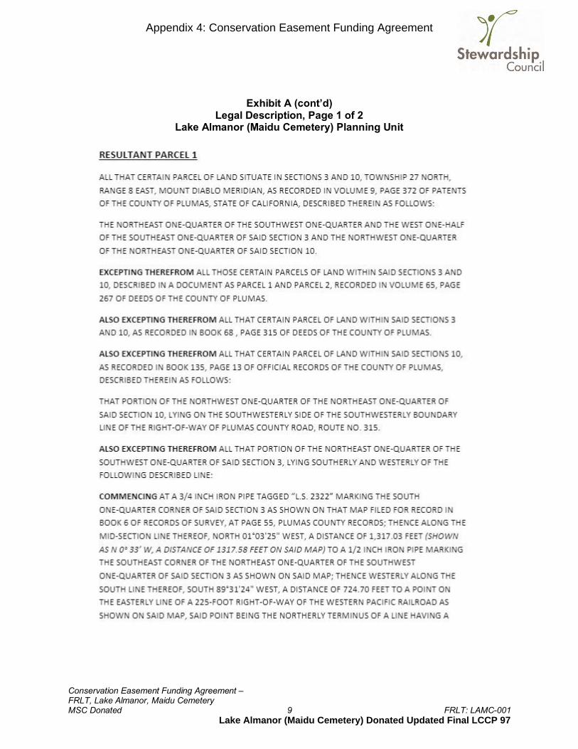
Conservation Easement Funding Agreement – FRLT, Lake Almanor, Maidu Cemetery MSC Donated 9 FRLT: LAMC-001
Exhibit A (cont’d) Legal Description, Page 1 of 2
Lake Almanor (Maidu Cemetery) Planning Unit
Appendix 4: Conservation Easement Funding Agreement
Lake Almanor (Maidu Cemetery) Donated Updated Final LCCP 97
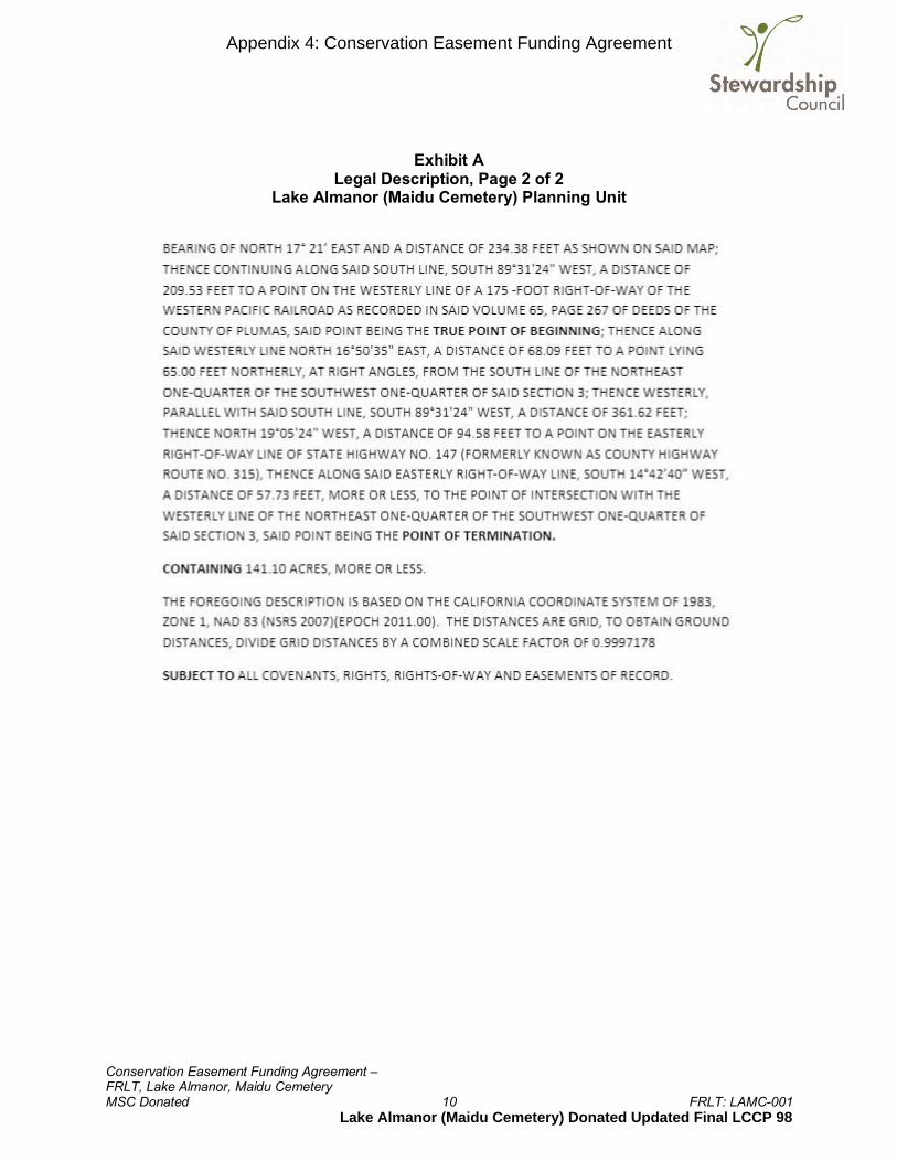
Conservation Easement Funding Agreement – FRLT, Lake Almanor, Maidu Cemetery MSC Donated 10 FRLT: LAMC-001
Exhibit A Legal Description, Page 2 of 2
Lake Almanor (Maidu Cemetery) Planning Unit
Appendix 4: Conservation Easement Funding Agreement
Lake Almanor (Maidu Cemetery) Donated Updated Final LCCP 98
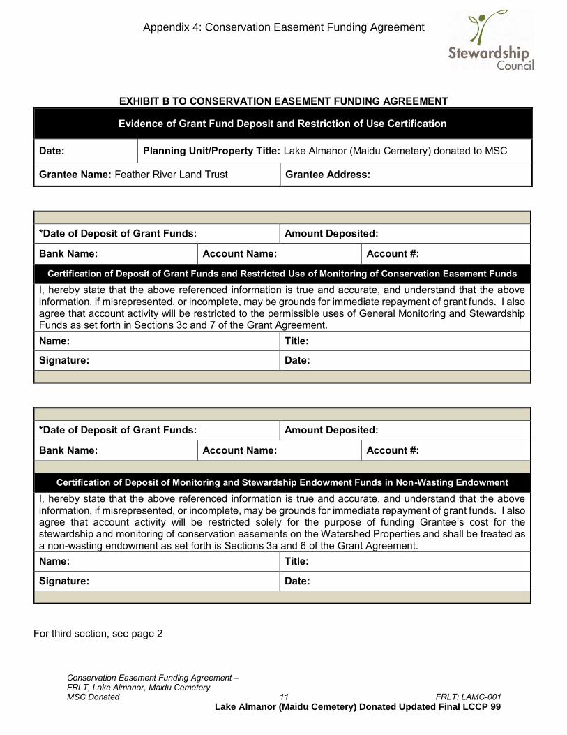
Conservation Easement Funding Agreement – FRLT, Lake Almanor, Maidu Cemetery MSC Donated 11 FRLT: LAMC-001
EXHIBIT B TO CONSERVATION EASEMENT FUNDING AGREEMENT
Evidence of Grant Fund Deposit and Restriction of Use Certification
Date: Planning Unit/Property Title: Lake Almanor (Maidu Cemetery) donated to MSC
Grantee Name: Feather River Land Trust Grantee Address:
*Date of Deposit of Grant Funds: Amount Deposited:
Bank Name: Account Name: Account #:
Certification of Deposit of Grant Funds and Restricted Use of Monitoring of Conservation Easement Funds I, hereby state that the above referenced information is true and accurate, and understand that the above information, if misrepresented, or incomplete, may be grounds for immediate repayment of grant funds. I also agree that account activity will be restricted to the permissible uses of General Monitoring and Stewardship Funds as set forth in Sections 3c and 7 of the Grant Agreement. Name: Title:
Signature: Date:
*Date of Deposit of Grant Funds: Amount Deposited:
Bank Name: Account Name: Account #:
Certification of Deposit of Monitoring and Stewardship Endowment Funds in Non-Wasting Endowment I, hereby state that the above referenced information is true and accurate, and understand that the above information, if misrepresented, or incomplete, may be grounds for immediate repayment of grant funds. I also agree that account activity will be restricted solely for the purpose of funding Grantee’s cost for the stewardship and monitoring of conservation easements on the Watershed Properties and shall be treated as a non-wasting endowment as set forth is Sections 3a and 6 of the Grant Agreement. Name: Title:
Signature: Date:
For third section, see page 2
Appendix 4: Conservation Easement Funding Agreement
Lake Almanor (Maidu Cemetery) Donated Updated Final LCCP 99

Conservation Easement Funding Agreement – FRLT, Lake Almanor, Maidu Cemetery MSC Donated 12 FRLT: LAMC-001
EXHIBIT B TO CONSERVATION EASEMENT FUNDING AGREEMENT – Page 2
*Date of Deposit of Grant Funds: Amount Deposited:
Bank Name: Account Name: Account #:
Certification of Deposit of Grant Funds and Restricted Use of Defense & Enforcement Funds I, hereby state that the above referenced information is true and accurate, and understand that the above information, if misrepresented, or incomplete, may be grounds for immediate repayment of grant funds. I also agree that account activity will be restricted to the permissible uses of the Defense and Enforcement Funds as set forth in Section 8 of the Grant Agreement. Name: Title:
Signature: Date:
*Please include a copy of the bank statement(s) referencing the above deposit(s). Return to: Stewardship Council 3300 Douglas Boulevard, Suite 250 Roseville, CA 95661 Phone: (916) 297-6660
Appendix 4: Conservation Easement Funding Agreement
Lake Almanor (Maidu Cemetery) Donated Updated Final LCCP 100
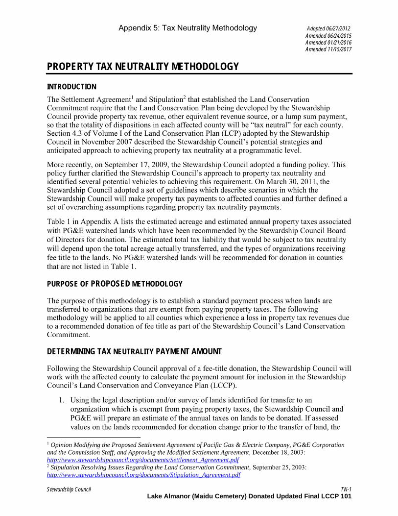
Appendix 5: Tax Neutrality Methodology Adopted 06/27/2012
Amended 06/24/2015 Amended 01/21/2016 Amended 11/15/2017
Stewardship Council TN-1
PROPERTY TAX NEUTRALITY METHODOLOGY
INTRODUCTION
The Settlement Agreement1 and Stipulation2 that established the Land Conservation Commitment require that the Land Conservation Plan being developed by the Stewardship Council provide property tax revenue, other equivalent revenue source, or a lump sum payment, so that the totality of dispositions in each affected county will be “tax neutral” for each county. Section 4.3 of Volume I of the Land Conservation Plan (LCP) adopted by the Stewardship Council in November 2007 described the Stewardship Council’s potential strategies and anticipated approach to achieving property tax neutrality at a programmatic level.
More recently, on September 17, 2009, the Stewardship Council adopted a funding policy. This policy further clarified the Stewardship Council’s approach to property tax neutrality and identified several potential vehicles to achieving this requirement. On March 30, 2011, the Stewardship Council adopted a set of guidelines which describe scenarios in which the Stewardship Council will make property tax payments to affected counties and further defined a set of overarching assumptions regarding property tax neutrality payments.
Table 1 in Appendix A lists the estimated acreage and estimated annual property taxes associated with PG&E watershed lands which have been recommended by the Stewardship Council Board of Directors for donation. The estimated total tax liability that would be subject to tax neutrality will depend upon the total acreage actually transferred, and the types of organizations receiving fee title to the lands. No PG&E watershed lands will be recommended for donation in counties that are not listed in Table 1.
PURPOSE OF PROPOSED METHODOLOGY
The purpose of this methodology is to establish a standard payment process when lands are transferred to organizations that are exempt from paying property taxes. The following methodology will be applied to all counties which experience a loss in property tax revenues due to a recommended donation of fee title as part of the Stewardship Council’s Land Conservation Commitment.
DETERMINING TAX NEUTRALITY PAYMENT AMOUNT
Following the Stewardship Council approval of a fee-title donation, the Stewardship Council will work with the affected county to calculate the payment amount for inclusion in the Stewardship Council’s Land Conservation and Conveyance Plan (LCCP).
1. Using the legal description and/or survey of lands identified for transfer to an organization which is exempt from paying property taxes, the Stewardship Council and PG&E will prepare an estimate of the annual taxes on lands to be donated. If assessed values on the lands recommended for donation change prior to the transfer of land, the
1 Opinion Modifying the Proposed Settlement Agreement of Pacific Gas & Electric Company, PG&E Corporation
and the Commission Staff, and Approving the Modified Settlement Agreement, December 18, 2003: http://www.stewardshipcouncil.org/documents/Settlement_Agreement.pdf 2 Stipulation Resolving Issues Regarding the Land Conservation Commitment, September 25, 2003: http://www.stewardshipcouncil.org/documents/Stipulation_Agreement.pdf
Lake Almanor (Maidu Cemetery) Donated Updated Final LCCP 101

Appendix 5: Tax Neutrality Methodology Adopted 06/27/2012
Amended 06/24/2015 Amended 01/21/2016 Amended 11/15/2017
Stewardship Council TN-2
Stewardship Council will revise the payment calculation included in the proposed tax neutrality funding agreement prior to its execution by the parties.
2. The reduction in annual taxes caused by the donation of acres to organizations exempt from property tax will constitute the “Annual Base Value” for the funding calculation.
3. The County will receive a one-time lump sum payment The Stewardship Council will provide a draft funding agreement for county review and approval using the Annual Base Value and payment option. The draft funding agreement is expected to include, among other items, the following acknowledgements by the county:
a. Payment by the Stewardship Council satisfies the tax neutrality requirement as specified in the Settlement and Stipulation for the subject fee-title donation.
b. The county has issued (or will not reasonably withhold) a Welfare Tax Exemption for the new landowner, if required.
c. The county will agree to distribute the lump-sum payment to the applicable special districts as dictated in the relevant Tax Rate Area at the time of payment. In consideration for the additional administrative responsibility of the county to set up the process to allocate payments to special districts, the Stewardship Council will make a $3,000 payment to the county for county’s anticipated costs to perform such activities for the first fee title donation of lands in the county. Said payment will be made at the time the Stewardship Council makes its lump-sum tax neutrality payment. For subsequent fee title donations, if a county expects to incur more than $3,000 in costs to perform such activities, then it shall make a request to the Stewardship Council for increased funding no later than 60 days following the recording of the grant deed for each additional fee title donation or the execution of a tax neutrality funding agreement, whichever comes later. The Stewardship Council will review each funding request and provide the county with sufficient funds to cover all reasonable anticipated costs.
4. The Stewardship Council will fund the settlement amount according to the terms of the tax neutrality funding agreement as described in number 3 above no later than 60 days following the recording of the grant deed for the fee title donation or the execution of a tax neutrality funding agreement, whichever comes later.
Lump-sum payment
Lump-sum payments in satisfaction of property tax neutrality would be calculated based upon the net present value of the Annual Base Value at the time that lands are removed from the property tax rolls. The lump-sum payment will be calculated using a discounted cash flows analysis for perpetual payment streams, otherwise known as a Capitalization Rate (Cap Rate).
The Cap Rate calculation requires an assumption of a long-term rate of return on comparable investments, and a long-term inflation rate. In order to develop a Cap Rate for a lump-sum payment, the Stewardship Council considered multiple long-term inputs, including long term equity and fixed income returns (Dow Jones Industrial Average, S&P 500, U.S. Treasury,
Lake Almanor (Maidu Cemetery) Donated Updated Final LCCP 102
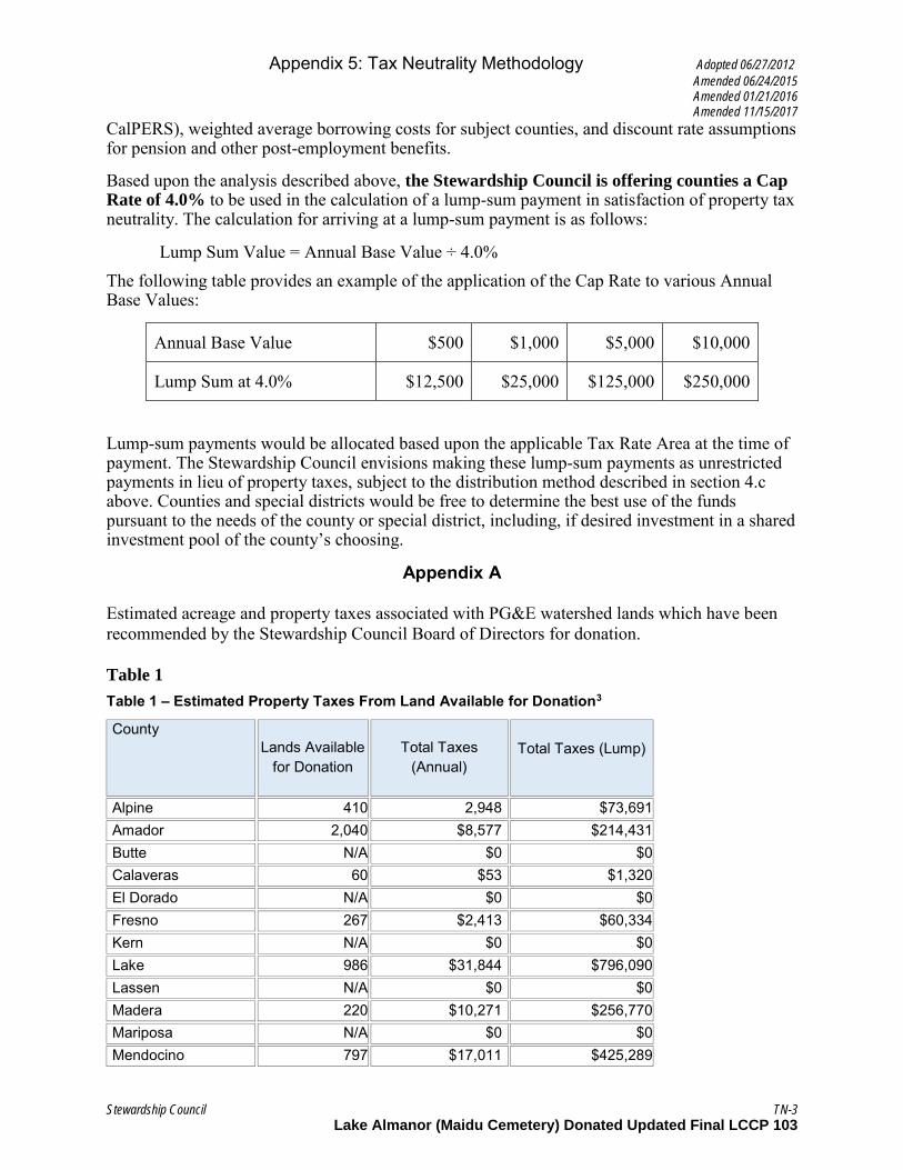
Appendix 5: Tax Neutrality Methodology Adopted 06/27/2012
Amended 06/24/2015 Amended 01/21/2016 Amended 11/15/2017
Stewardship Council TN-3
CalPERS), weighted average borrowing costs for subject counties, and discount rate assumptions for pension and other post-employment benefits.
Based upon the analysis described above, the Stewardship Council is offering counties a Cap Rate of 4.0% to be used in the calculation of a lump-sum payment in satisfaction of property tax neutrality. The calculation for arriving at a lump-sum payment is as follows:
Lump Sum Value = Annual Base Value ÷ 4.0% The following table provides an example of the application of the Cap Rate to various Annual Base Values:
Annual Base Value $500 $1,000 $5,000 $10,000
Lump Sum at 4.0% $12,500 $25,000 $125,000 $250,000
Lump-sum payments would be allocated based upon the applicable Tax Rate Area at the time of payment. The Stewardship Council envisions making these lump-sum payments as unrestricted payments in lieu of property taxes, subject to the distribution method described in section 4.c above. Counties and special districts would be free to determine the best use of the funds pursuant to the needs of the county or special district, including, if desired investment in a shared investment pool of the county’s choosing.
Appendix A
Estimated acreage and property taxes associated with PG&E watershed lands which have been recommended by the Stewardship Council Board of Directors for donation.
Table 1
Table 1 – Estimated Property Taxes From Land Available for Donation3
County Lands Available
for Donation Total Taxes
(Annual)
Total Taxes (Lump)
Alpine 410 2,948 $73,691 Amador 2,040 $8,577 $214,431 Butte N/A $0 $0 Calaveras 60 $53 $1,320 El Dorado N/A $0 $0 Fresno 267 $2,413 $60,334 Kern N/A $0 $0 Lake 986 $31,844 $796,090 Lassen N/A $0 $0 Madera 220 $10,271 $256,770 Mariposa N/A $0 $0 Mendocino 797 $17,011 $425,289
Lake Almanor (Maidu Cemetery) Donated Updated Final LCCP 103

Appendix 5: Tax Neutrality Methodology Adopted 06/27/2012
Amended 06/24/2015 Amended 01/21/2016 Amended 11/15/2017
Stewardship Council TN-4
Merced N/A $0 $0 Nevada 1,867 $13,150 $328,758 Placer 2,683 $46,794 $1,169,882 Plumas 3,278 $40,873 $1,021,828 San Luis Obispo N/A $0 $0 Shasta 23,386 $89,727 $2,243,172 Tehama 151 $45 $1125 Tulare N/A $0 $0 Tuolumne 868 $360 $9,9009 Yuba 41 $530 $13,256 Total $37,054 $264,597 $6,614,955 a This acreage
includes lands within parcels that
cross county boundaries
Lake Almanor (Maidu Cemetery) Donated Updated Final LCCP 104

I.02-04-026 APPENDIX A
-38-
APPENDIX E LAND CONSERVATION COMMITMENT
STATEMENT OF PURPOSE
PG&E shall ensure that the Watershed Lands it owns and Carizzo Plains are conserved for a broad range of beneficial public values, including the protection of the natural habitat of fish, wildlife and plants, the preservation of open space, outdoor recreation by the general public, sustainable forestry, agricultural uses, and historic values. PG&E will protect these beneficial public values associated with the Watershed Lands and Carizzo Plains from uses that would conflict with their conservation. PG&E recognizes that such lands are important to maintaining the quality of life of local communities and all the people of California in many ways, and it is PG&E’s intention to protect and preserve the beneficial public values of these lands under the terms of any agreements concerning their future ownership or management.
PG&E Environmental Enhancement Corporation will develop a plan for
protection of these lands for the benefit of the citizens of California. Protecting such lands will be accomplished through either (1) PG&E’s donation of conservation easements to one or more public agencies or qualified conservation organizations consistent with these objectives, or (2) PG&E’s donation of lands in fee to one or more public entities or qualified conservation organizations, whose ownership would be consistent with these conservation objectives.
COMMITMENTS 1. PG&E Shall Place Permanent Conservation Easements on or Donate Watershed
Lands: The Watershed Lands and Carizzo Plains shall (1) be subject to permanent conservation easements restricting development of the lands so as to protect and preserve their beneficial public values, and/or (2) be donated in fee simple to one or more public entities or qualified non-profit conservation organizations, whose ownership will ensure the protection of these beneficial public values. PG&E will not be expected to make fee simple donations of Watershed Lands that contain PG&E’s or a joint licensee’s hydroelectric project features. In instances where PG&E has donated land in fee, some may be sold to private entities subject to conservation easements and others, without significant public interest value, may be sold to private entities with few or no restrictions. The conservation easements shall provide for the preservation of land areas for the protection of the natural habitat of fish, wildlife and plants, the preservation of open space, outdoor recreation by the general public, sustainable forestry, agricultural uses, and historic values and, shall prevent any other uses that will significantly impair or interfere with those values. Conservation easements on the Watershed Lands will include an express reservation of a right for continued operation and maintenance of hydroelectric facilities and associated water delivery facilities, including project replacements and improvements required to meet existing and
Appendix 6: Settlement Agreement, Appendix E
Lake Almanor (Maidu Cemetery) Donated Updated Final LCCP 105
robinf
Text Box

I.02-04-026
- 39-
future water delivery requirements for power generation and consumptive water use by existing users, compliance with any FERC license, FERC license renewal or other regulatory requirements. In addition, easements will honor existing agreements for economic uses, including consumptive water deliveries. The conservation easements shall be donated to and managed by one or more non-profit conservation trustees, qualified conservation organizations or public agencies with the experience and expertise to fully and strictly implement the conservation easements.
2. Process For Development of the Conservation Easements and Land Donation Plan:
PG&E will work with PG&E Environmental Enhancement Corporation and the Commission in the development and implementation of the conservation easements and land donation plan. PG&E Environmental Enhancement Corporation will recommend to PG&E (1) conservation objectives for the properties, including identification of conservation values, (2) criteria for ultimate disposition of the properties, (3) conservation easements guidelines, and (4) land disposition plans.
3. Reporting Responsibilities: PG&E Environmental Enhancement Corporation will prepare a report to the Commission within 18 months of the Effective Date describing the status of the conservation easement and land disposition plan. PG&E Environmental Enhancement Corporation will make the report available to the public upon request. Every two years following the first report, PG&E Environmental Enhancement Corporation will prepare a report to the Commission on the implementation of the conservation easement and land disposition plan.
(END OF APPENDIX A)
Appendix 6: Settlement Agreement, Appendix E
Lake Almanor (Maidu Cemetery) Donated Updated Final LCCP 106
robinf
Text Box
Attachment B
Power of Termination Agreement

Exhibit Version 4/30/21
4842-8297-6850.6 6
If to Grantee: If by registered or certified mail, return receipt requested:
Maidu Summit Consortium 289 Main Street, Suite 7 P.O. Box 682 Chester, CA 96020 Attn: Executive Director
If by personal delivery or overnight courier:
Maidu Summit Consortium 289 Main Street, Suite 7 Chester, CA 96020 Attn: Executive Director
The date of any notice or communication shall be deemed to be the date of receipt if delivered personally, or the date of the receipt or refusal of delivery if transmitted by mail or overnight courier. Either party may change the address for notice by giving notice to the other party in accordance with this Section 4.
5. General Provisions.
5.1 Benefit and Burden.. This Agreement provided herein shall run with and burden the Property. All obligations, terms, conditions, and restrictions imposed by this Agreement shall be deemed covenants and restrictions running with the land, shall be effective limitations on the use of the Property from the date of recordation of this Agreement, and shall bind MSC and all its successors and assigns. This Agreement shall benefit PG&E and its successors and assigns.
5.2 Governing Laws. This Agreement shall be governed by, and construed and enforced in accordance with, the laws of the State of California.
5.3 Successors and Assigns. The provisions of this Agreement shall bind and inure to the benefit of the successors and assigns of MSC and PG&E, whether voluntary or involuntary.
5.4 Severability. If any term or provision of this Agreement is determined to be invalid, illegal, or incapable of being enforced by any rule or law or if any court renders a final judgment declaring that any term or provision of this Agreement is invalid, illegal, or incapable of being enforced, all other terms and provisions of this Agreement shall remain in full force and effect, and to this end the provisions of this Agreement are intended to be and shall be severable.
5.5 Term. This Agreement is perpetual and irrevocable.
5.6 Amendment. No change, modification, or amendment of this Agreement shall be valid unless made in writing, signed by both MSC and PG&E, and recorded in the official records of Plumas County, California.

Exhibit Version 4/30/21
4842-8297-6850.6 7
5.7 Further Assurances. Each party hereto agrees to execute and deliver to the other party such further documents or instruments as may be necessary or appropriate in order to carry out the intentions of the parties as contained in this Agreement.
5.8 Entire Agreement. This Agreement sets forth the entire agreement of the parties with respect to the Power of Termination, and supersedes all prior discussions, negotiations, understandings, or agreements relating to this Agreement, all of which are merged herein.
5.9 Attorneys' Fees. In the event that any party shall bring an action to enforce its rights under this Agreement, or relating to the interpretation hereof, whether for declaratory, injunctive or other relief, the prevailing party in any such proceeding shall be entitled to recover from the other party reasonable attorneys’ fees and all costs, expenses and disbursements that the prevailing party incurred in connection with such proceeding, including appeals, remands and any other subsequent proceeding (including, but not limited to, the reasonable costs of discovery, investigation, preparation for trial, professional or expert consultation and testimony). A party shall be deemed to have prevailed in any such action (without limiting the generality of the foregoing) if such action is dismissed upon the payment by the other party of the sums allegedly due or the performance of obligations allegedly not complied with, or if such party obtains substantially the relief sought by it in the action, irrespective of whether such action is prosecuted to judgment. The non-prevailing party shall also pay the attorneys’ fees and costs incurred by the prevailing party in any post-judgment proceedings to collect and enforce the judgment. Any such fees and costs incurred prior to judgment, award, or decree may be included in any judgment, award or decree entered in such proceeding in favor of the prevailing party. Any such fees, costs and expenses incurred by the prevailing party in enforcing a judgment, award or decree in its favor shall be recoverable separately from and in addition to any other amount included in such judgment, award or decree. This provision is separate and several and shall survive the merger of this Agreement into any judgment on this Agreement.
5.10 Incorporation of Recitals. All Recitals are incorporated herein by this reference.
5.11 Counterparts. This Agreement may be executed in two or more counterparts, each of which shall be deemed an original, but all of which together shall constitute one and the same instrument. In the event of a discrepancy between counterparts, the recorded Agreement shall be controlling.
[Signature Page Follows ]

Exhibit Version 4/30/21
Restriction on Transfer of Property and Power of Termination Agreement - Lake Almanor – Maidu Cemetery
IN WITNESS WHEREOF, PG&E and MSC mutually agree to the terms and covenants set forth above, as of the Effective Date.
PG&E PACIFIC GAS AND ELECTRIC COMPANY, a California corporation By: _____________________________
Andrew K. Williams Vice President Shared Services
MSC: MAIDU SUMMIT CONSORTIUM, a California nonprofit corporation By: ____________________________
Benjamin D. Cunningham Chairperson
By: ____________________________
Marvena G. Harris Secretary
By: ____________________________
Trina Evelyn Cunningham Executive Director

Exhibit Version 4/30/21
Exhibit A
EXHIBIT A
PROPERTY DESCRIPTION
[Follows this page]
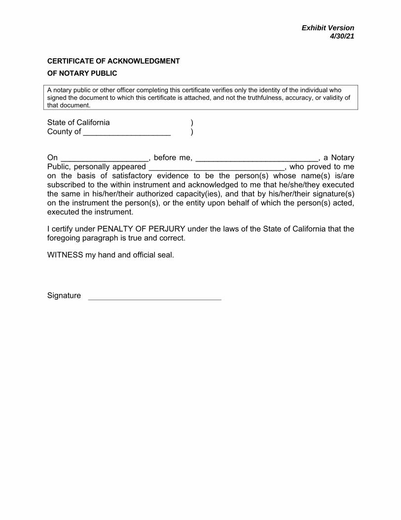
Exhibit Version 4/30/21
CERTIFICATE OF ACKNOWLEDGMENT OF NOTARY PUBLIC
A notary public or other officer completing this certificate verifies only the identity of the individual who signed the document to which this certificate is attached, and not the truthfulness, accuracy, or validity of that document.
State of California ) County of ____________________ )
On ____________________, before me, ____________________________, a Notary Public, personally appeared _______________________________, who proved to me on the basis of satisfactory evidence to be the person(s) whose name(s) is/are subscribed to the within instrument and acknowledged to me that he/she/they executed the same in his/her/their authorized capacity(ies), and that by his/her/their signature(s) on the instrument the person(s), or the entity upon behalf of which the person(s) acted, executed the instrument.
I certify under PENALTY OF PERJURY under the laws of the State of California that the foregoing paragraph is true and correct.
WITNESS my hand and official seal.
Signature
Attachment C
Lot Line Adjustment Grant Deed
Grant Deed Out (REV. 10/18) RECORDING REQUESTED BY AND RETURN TO: PACIFIC GAS AND ELECTRIC COMPANY 245 Market Street, N10A, Room 1015 P.O. Box 770000 San Francisco, California 94177
Location: City/Uninc______________________ Recording Fee $_____________________________ Document Transfer Tax $ __________ [ ] This is a conveyance where the consideration and Value is less than $100.00 (R&T 11911). [ ] Computed on Full Value of Property Conveyed, or [ ] Computed on Full Value Less Liens
& Encumbrances Remaining at Time of Sale [ ] Exempt from the fee per GC 27388.1 (a) (2); This document is subject to Documentary Transfer Tax
Signature of declarant or agent determining tax
(SPACE ABOVE FOR RECORDER'S USE ONLY)
LD# DEED
- 1 - MAIL TAX STATEMENTS TO: ___________________________ ______________________________________ _________ Name Address Zip
GRANT DEED PACIFIC GAS AND ELECTRIC COMPANY, a California corporation, hereinafter called Grantor, hereby grants, (without warranty express or implied), to Christopher K. Cartwright, a married man, as his sole and separate property, as to an undivided one-half interest, and Daniel C. Jacuzzi, a married man, as his sole and separate property, as to an undivided one-half interest, hereinafter called Grantee, the real property, situate in the Plumas, State of California, described as follows (the “Property”): (APN 106-040-016 – Por)
That portion of the northeast quarter of the southwest quarter of Section 3,
Township 27 North, Range 8 East, M.D.M., described in Exhibit A and shown on Exhibit B, attached hereto and made a part hereof.
Reserving to Grantor an easement and the right to excavate for, construct, reconstruct, replace (of initial or any other size), remove, maintain, inspect, and use existing and additional facilities and associated equipment for public utility purposes, including, but not limited to electric, gas, and communication facilities (hereinafter referred to collectively as “the Facilities”); together with a right of way, on, over, and under the easement area described as follows (the “Easement Area”):
Strip 1. A strip of land of the uniform width of 60 feet, lying 30 feet on each side of the centerline of the existing poleline, as shown on Exhibit C attached hereto and made a part hereof.
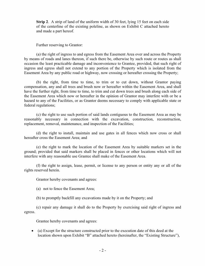
- 2 -
Strip 2. A strip of land of the uniform width of 30 feet, lying 15 feet on each side of the centerline of the existing poleline, as shown on Exhibit C attached hereto and made a part hereof.
Further reserving to Grantor: (a) the right of ingress to and egress from the Easement Area over and across the Property by means of roads and lanes thereon, if such there be, otherwise by such route or routes as shall occasion the least practicable damage and inconvenience to Grantee, provided, that such right of ingress and egress shall not extend to any portion of the Property which is isolated from the Easement Area by any public road or highway, now crossing or hereafter crossing the Property; (b) the right, from time to time, to trim or to cut down, without Grantor paying compensation, any and all trees and brush now or hereafter within the Easement Area, and shall have the further right, from time to time, to trim and cut down trees and brush along each side of the Easement Area which now or hereafter in the opinion of Grantor may interfere with or be a hazard to any of the Facilities, or as Grantor deems necessary to comply with applicable state or federal regulations; (c) the right to use such portion of said lands contiguous to the Easement Area as may be reasonably necessary in connection with the excavation, construction, reconstruction, replacement, removal, maintenance, and inspection of the Facilities; (d) the right to install, maintain and use gates in all fences which now cross or shall hereafter cross the Easement Area; and (e) the right to mark the location of the Easement Area by suitable markers set in the ground; provided that said markers shall be placed in fences or other locations which will not interfere with any reasonable use Grantee shall make of the Easement Area. (f) the right to assign, lease, permit, or license to any person or entity any or all of the rights reserved herein. Grantor hereby covenants and agrees:
(a) not to fence the Easement Area; (b) to promptly backfill any excavations made by it on the Property; and (c) repair any damage it shall do to the Property by exercising said right of ingress and egress. Grantee hereby covenants and agrees:
(a) Except for the structure constructed prior to the execution date of this deed at the location shown upon Exhibit “B” attached hereto (hereinafter, the “Existing Structure”),

- 3 -
Grantor shall not erect or construct any buildings or other structures, or drill or operate any well within said easement area, nor shall Grantor rebuild, make any alterations or improvements to the Existing Structure that would increase it’s size, either horizontally or vertically and shall comply with all Occupational Safety & Health Requirements (OSHA).
(b) Grantor shall not construct any reservoir or other obstruction within the Easement
Area, or diminish or substantially add to the ground level within the Easement Area, or construct any fences that will interfere with the maintenance and operation of the Facilities.
The property conveyed by this deed is for lot line adjustment purposes only; it shall not be sold as a separate parcel.
The Property hereby conveyed is no longer necessary or useful to Grantor in the performance by it of its duties to the public. Dated _________________________, 20____.
PACIFIC GAS AND ELECTRIC COMPANY, a California corporation By ____________________________________ Andrew K. Williams Vice President Land & Environmental Management
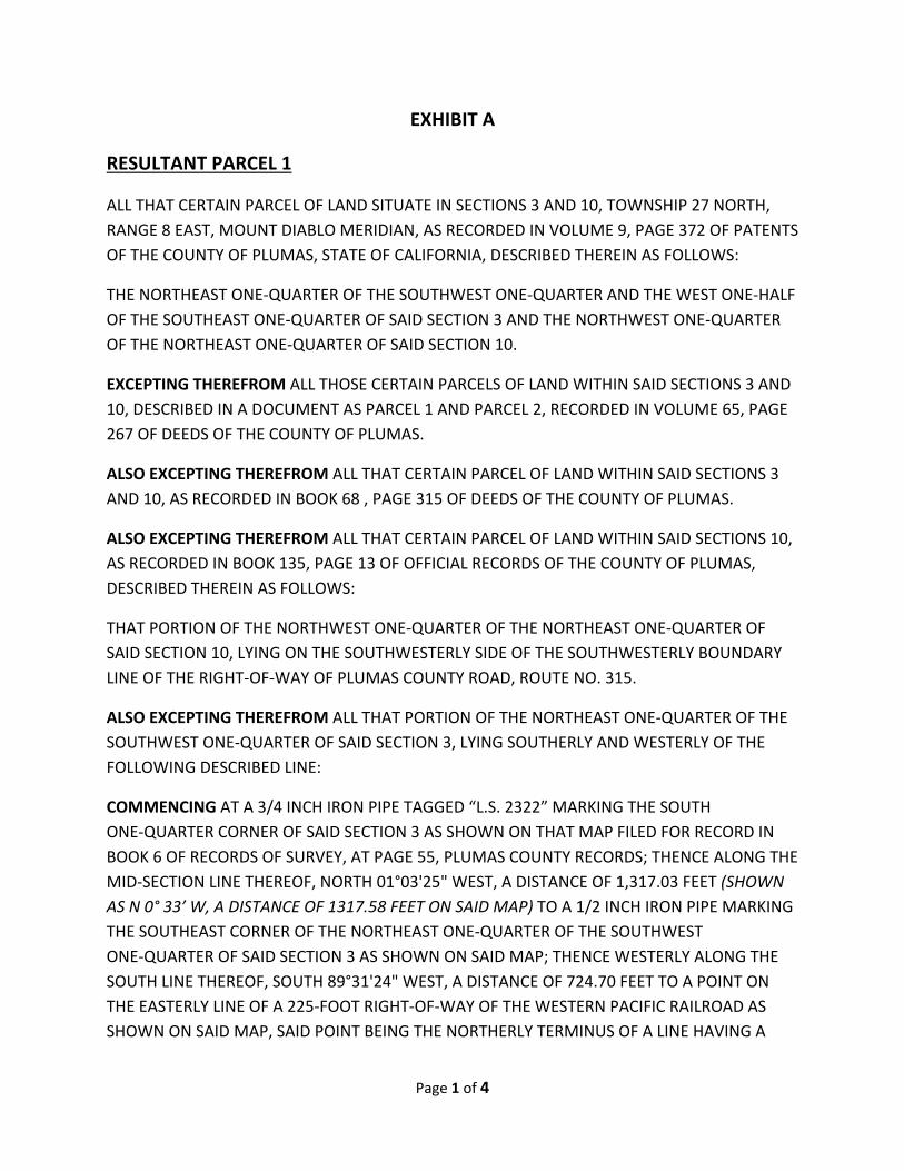
Page 1 of 4
EXHIBIT A
RESULTANT PARCEL 1
ALL THAT CERTAIN PARCEL OF LAND SITUATE IN SECTIONS 3 AND 10, TOWNSHIP 27 NORTH,
RANGE 8 EAST, MOUNT DIABLO MERIDIAN, AS RECORDED IN VOLUME 9, PAGE 372 OF PATENTS
OF THE COUNTY OF PLUMAS, STATE OF CALIFORNIA, DESCRIBED THEREIN AS FOLLOWS:
THE NORTHEAST ONE‐QUARTER OF THE SOUTHWEST ONE‐QUARTER AND THE WEST ONE‐HALF
OF THE SOUTHEAST ONE‐QUARTER OF SAID SECTION 3 AND THE NORTHWEST ONE‐QUARTER
OF THE NORTHEAST ONE‐QUARTER OF SAID SECTION 10.
EXCEPTING THEREFROM ALL THOSE CERTAIN PARCELS OF LAND WITHIN SAID SECTIONS 3 AND
10, DESCRIBED IN A DOCUMENT AS PARCEL 1 AND PARCEL 2, RECORDED IN VOLUME 65, PAGE
267 OF DEEDS OF THE COUNTY OF PLUMAS.
ALSO EXCEPTING THEREFROM ALL THAT CERTAIN PARCEL OF LAND WITHIN SAID SECTIONS 3
AND 10, AS RECORDED IN BOOK 68 , PAGE 315 OF DEEDS OF THE COUNTY OF PLUMAS.
ALSO EXCEPTING THEREFROM ALL THAT CERTAIN PARCEL OF LAND WITHIN SAID SECTIONS 10,
AS RECORDED IN BOOK 135, PAGE 13 OF OFFICIAL RECORDS OF THE COUNTY OF PLUMAS,
DESCRIBED THEREIN AS FOLLOWS:
THAT PORTION OF THE NORTHWEST ONE‐QUARTER OF THE NORTHEAST ONE‐QUARTER OF
SAID SECTION 10, LYING ON THE SOUTHWESTERLY SIDE OF THE SOUTHWESTERLY BOUNDARY
LINE OF THE RIGHT‐OF‐WAY OF PLUMAS COUNTY ROAD, ROUTE NO. 315.
ALSO EXCEPTING THEREFROM ALL THAT PORTION OF THE NORTHEAST ONE‐QUARTER OF THE
SOUTHWEST ONE‐QUARTER OF SAID SECTION 3, LYING SOUTHERLY AND WESTERLY OF THE
FOLLOWING DESCRIBED LINE:
COMMENCING AT A 3/4 INCH IRON PIPE TAGGED “L.S. 2322” MARKING THE SOUTH
ONE‐QUARTER CORNER OF SAID SECTION 3 AS SHOWN ON THAT MAP FILED FOR RECORD IN
BOOK 6 OF RECORDS OF SURVEY, AT PAGE 55, PLUMAS COUNTY RECORDS; THENCE ALONG THE
MID‐SECTION LINE THEREOF, NORTH 01°03'25" WEST, A DISTANCE OF 1,317.03 FEET (SHOWN
AS N 0° 33’ W, A DISTANCE OF 1317.58 FEET ON SAID MAP) TO A 1/2 INCH IRON PIPE MARKING
THE SOUTHEAST CORNER OF THE NORTHEAST ONE‐QUARTER OF THE SOUTHWEST
ONE‐QUARTER OF SAID SECTION 3 AS SHOWN ON SAID MAP; THENCE WESTERLY ALONG THE
SOUTH LINE THEREOF, SOUTH 89°31'24" WEST, A DISTANCE OF 724.70 FEET TO A POINT ON
THE EASTERLY LINE OF A 225‐FOOT RIGHT‐OF‐WAY OF THE WESTERN PACIFIC RAILROAD AS
SHOWN ON SAID MAP, SAID POINT BEING THE NORTHERLY TERMINUS OF A LINE HAVING A
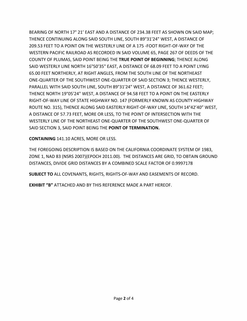
Page 2 of 4
BEARING OF NORTH 17° 21’ EAST AND A DISTANCE OF 234.38 FEET AS SHOWN ON SAID MAP;
THENCE CONTINUING ALONG SAID SOUTH LINE, SOUTH 89°31'24" WEST, A DISTANCE OF
209.53 FEET TO A POINT ON THE WESTERLY LINE OF A 175 ‐FOOT RIGHT‐OF‐WAY OF THE
WESTERN PACIFIC RAILROAD AS RECORDED IN SAID VOLUME 65, PAGE 267 OF DEEDS OF THE
COUNTY OF PLUMAS, SAID POINT BEING THE TRUE POINT OF BEGINNING; THENCE ALONG
SAID WESTERLY LINE NORTH 16°50'35" EAST, A DISTANCE OF 68.09 FEET TO A POINT LYING
65.00 FEET NORTHERLY, AT RIGHT ANGLES, FROM THE SOUTH LINE OF THE NORTHEAST
ONE‐QUARTER OF THE SOUTHWEST ONE‐QUARTER OF SAID SECTION 3; THENCE WESTERLY,
PARALLEL WITH SAID SOUTH LINE, SOUTH 89°31'24" WEST, A DISTANCE OF 361.62 FEET;
THENCE NORTH 19°05'24" WEST, A DISTANCE OF 94.58 FEET TO A POINT ON THE EASTERLY
RIGHT‐OF‐WAY LINE OF STATE HIGHWAY NO. 147 (FORMERLY KNOWN AS COUNTY HIGHWAY
ROUTE NO. 315), THENCE ALONG SAID EASTERLY RIGHT‐OF‐WAY LINE, SOUTH 14°42’40” WEST,
A DISTANCE OF 57.73 FEET, MORE OR LESS, TO THE POINT OF INTERSECTION WITH THE
WESTERLY LINE OF THE NORTHEAST ONE‐QUARTER OF THE SOUTHWEST ONE‐QUARTER OF
SAID SECTION 3, SAID POINT BEING THE POINT OF TERMINATION.
CONTAINING 141.10 ACRES, MORE OR LESS.
THE FOREGOING DESCRIPTION IS BASED ON THE CALIFORNIA COORDINATE SYSTEM OF 1983,
ZONE 1, NAD 83 (NSRS 2007)(EPOCH 2011.00). THE DISTANCES ARE GRID, TO OBTAIN GROUND
DISTANCES, DIVIDE GRID DISTANCES BY A COMBINED SCALE FACTOR OF 0.9997178
SUBJECT TO ALL COVENANTS, RIGHTS, RIGHTS‐OF‐WAY AND EASEMENTS OF RECORD.
EXHIBIT “B” ATTACHED AND BY THIS REFERENCE MADE A PART HEREOF.
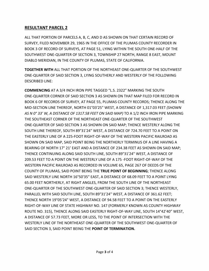
Page 3 of 4
RESULTANT PARCEL 2
ALL THAT PORTION OF PARCELS A, B, C, AND D AS SHOWN ON THAT CERTAIN RECORD OF
SURVEY, FILED NOVEMBER 29, 1965 IN THE OFFICE OF THE PLUMAS COUNTY RECORDER IN
BOOK 3 OF RECORD OF SURVEYS, AT PAGE 51, LYING WITHIN THE SOUTH ONE‐HALF OF THE
SOUTHWEST ONE‐QUARTER OF SECTION 3, TOWNSHIP 27 NORTH, RANGE 8 EAST, MOUNT
DIABLO MERIDIAN, IN THE COUNTY OF PLUMAS, STATE OF CALIFORNIA.
TOGETHER WITH ALL THAT PORTION OF THE NORTHEAST ONE‐QUARTER OF THE SOUTHWEST
ONE‐QUARTER OF SAID SECTION 3, LYING SOUTHERLY AND WESTERLY OF THE FOLLOWING
DESCRIBED LINE:
COMMENCING AT A 3/4 INCH IRON PIPE TAGGED “L.S. 2322” MARKING THE SOUTH
ONE‐QUARTER CORNER OF SAID SECTION 3 AS SHOWN ON THAT MAP FILED FOR RECORD IN
BOOK 6 OF RECORDS OF SURVEY, AT PAGE 55, PLUMAS COUNTY RECORDS; THENCE ALONG THE
MID‐SECTION LINE THEREOF, NORTH 01°03'25" WEST, A DISTANCE OF 1,317.03 FEET (SHOWN
AS N 0° 33’ W, A DISTANCE OF 1317.58 FEET ON SAID MAP) TO A 1/2 INCH IRON PIPE MARKING
THE SOUTHEAST CORNER OF THE NORTHEAST ONE‐QUARTER OF THE SOUTHWEST
ONE‐QUARTER OF SAID SECTION 3 AS SHOWN ON SAID MAP; THENCE WESTERLY ALONG THE
SOUTH LINE THEREOF, SOUTH 89°31'24" WEST, A DISTANCE OF 724.70 FEET TO A POINT ON
THE EASTERLY LINE OF A 225‐FOOT RIGHT‐OF‐WAY OF THE WESTERN PACIFIC RAILROAD AS
SHOWN ON SAID MAP, SAID POINT BEING THE NORTHERLY TERMINUS OF A LINE HAVING A
BEARING OF NORTH 17° 21’ EAST AND A DISTANCE OF 234.38 FEET AS SHOWN ON SAID MAP;
THENCE CONTINUING ALONG SAID SOUTH LINE, SOUTH 89°31'24" WEST, A DISTANCE OF
209.53 FEET TO A POINT ON THE WESTERLY LINE OF A 175 ‐FOOT RIGHT‐OF‐WAY OF THE
WESTERN PACIFIC RAILROAD AS RECORDED IN VOLUME 65, PAGE 267 OF DEEDS OF THE
COUNTY OF PLUMAS, SAID POINT BEING THE TRUE POINT OF BEGINNING; THENCE ALONG
SAID WESTERLY LINE NORTH 16°50'35" EAST, A DISTANCE OF 68.09 FEET TO A POINT LYING
65.00 FEET NORTHERLY, AT RIGHT ANGLES, FROM THE SOUTH LINE OF THE NORTHEAST
ONE‐QUARTER OF THE SOUTHWEST ONE‐QUARTER OF SAID SECTION 3; THENCE WESTERLY,
PARALLEL WITH SAID SOUTH LINE, SOUTH 89°31'24" WEST, A DISTANCE OF 361.62 FEET;
THENCE NORTH 19°05'24" WEST, A DISTANCE OF 94.58 FEET TO A POINT ON THE EASTERLY
RIGHT‐OF‐WAY LINE OF STATE HIGHWAY NO. 147 (FORMERLY KNOWN AS COUNTY HIGHWAY
ROUTE NO. 315), THENCE ALONG SAID EASTERLY RIGHT‐OF‐WAY LINE, SOUTH 14°42’40” WEST,
A DISTANCE OF 57.73 FEET, MORE OR LESS, TO THE POINT OF INTERSECTION WITH THE
WESTERLY LINE OF THE NORTHEAST ONE‐QUARTER OF THE SOUTHWEST ONE‐QUARTER OF
SAID SECTION 3, SAID POINT BEING THE POINT OF TERMINATION.
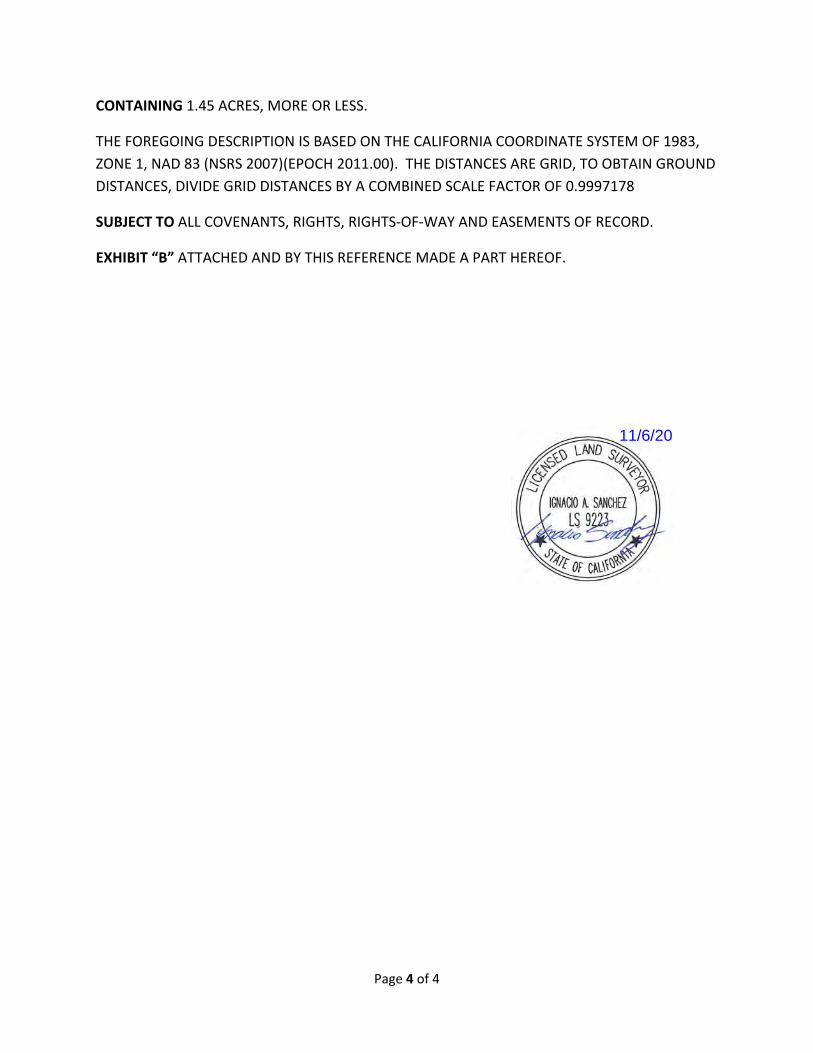
Page 4 of 4
CONTAINING 1.45 ACRES, MORE OR LESS.
THE FOREGOING DESCRIPTION IS BASED ON THE CALIFORNIA COORDINATE SYSTEM OF 1983,
ZONE 1, NAD 83 (NSRS 2007)(EPOCH 2011.00). THE DISTANCES ARE GRID, TO OBTAIN GROUND
DISTANCES, DIVIDE GRID DISTANCES BY A COMBINED SCALE FACTOR OF 0.9997178
SUBJECT TO ALL COVENANTS, RIGHTS, RIGHTS‐OF‐WAY AND EASEMENTS OF RECORD.
EXHIBIT “B” ATTACHED AND BY THIS REFERENCE MADE A PART HEREOF.
11/6/20

W.P
.R.R
.
STATE HWY 147
PACEENGINEERINGREDDING, CALIFORNIA
GEODETIC
0°36'49"
GRID
11/6/20
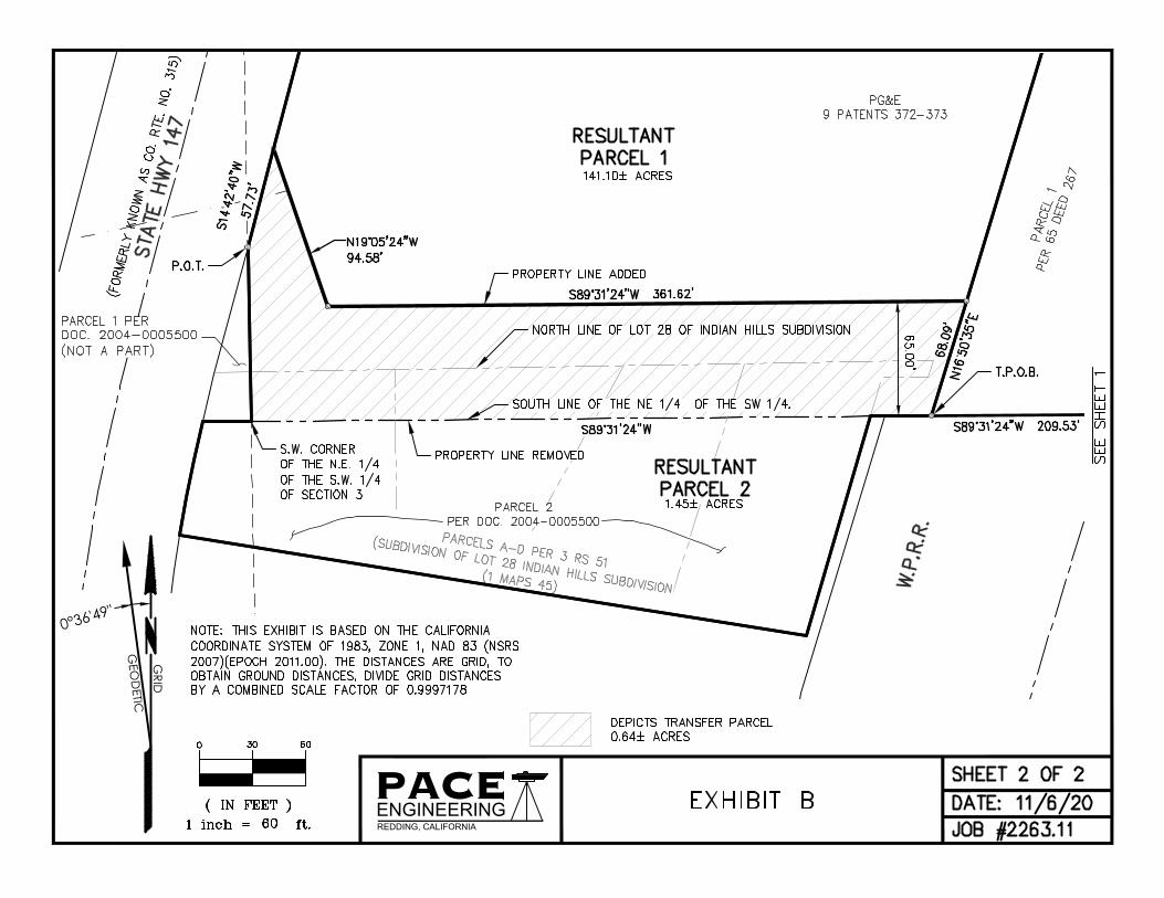
PACEENGINEERINGREDDING, CALIFORNIA
GEO
DETIC
0°36'49"
GRID

Attachment D
LLA Approval Letter – County of Plumas


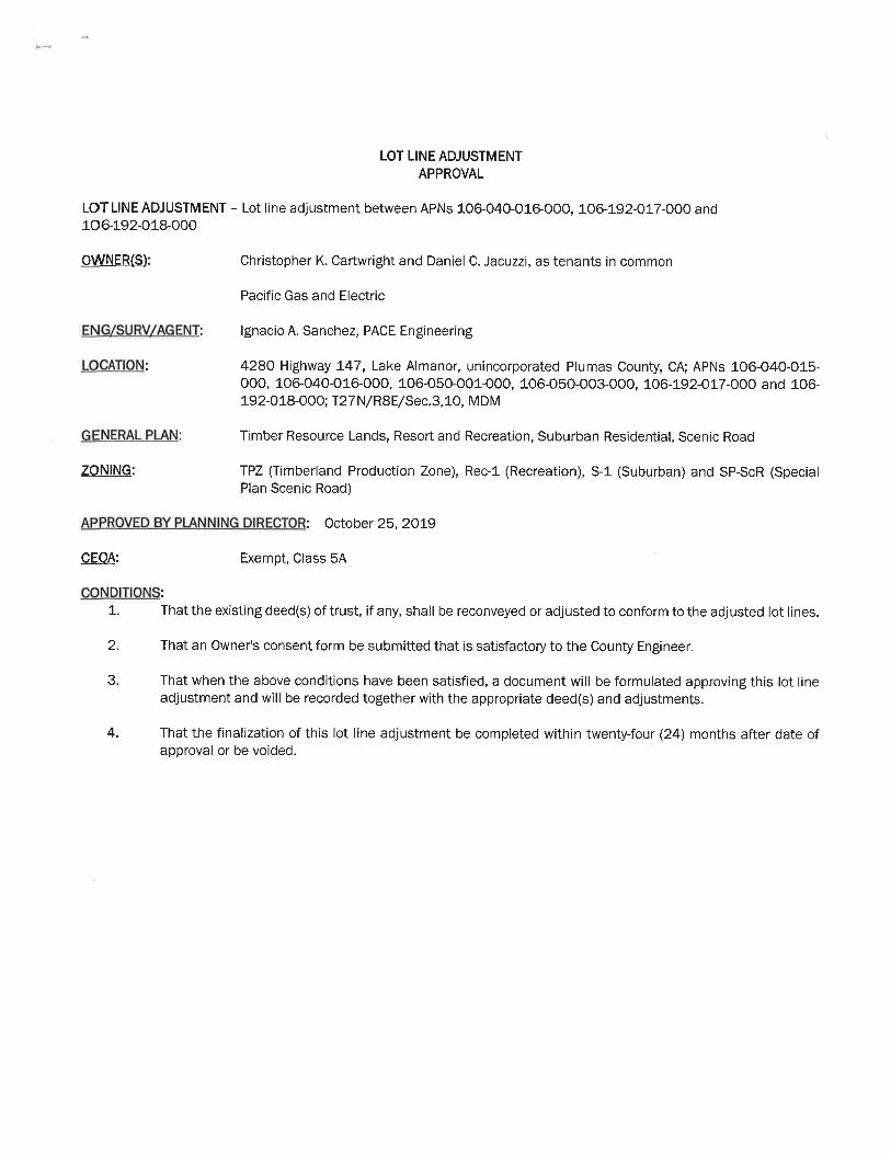

Attachment E
Encroachment Agreement
Encroachment Agreement (REV 06/2019)
RECORDING REQUESTED BY AND RETURN TO: PACIFIC GAS AND ELECTRIC COMPANY Land Services Office 350 Salem Street Chico, CA 95928 Location: Plumas County Recording Fee $_____________________________ Document Transfer Tax $ __________ [X] This is a conveyance where the consideration and Value is less than $100.00 (R&T 11911). [ ] Computed on Full Value of Property Conveyed, or [ ] Computed on Full Value Less Liens
& Encumbrances Remaining at Time of Sale Signature of declarant or agent determining tax (APN 106-050-001) LD#
ENCROACHMENT AGREEMENT
This Encroachment Agreement (this “Agreement”) is made and entered into this ___ day of ______________, 2019 by PACIFIC GAS AND ELECTRIC COMPANY, a California corporation, hereinafter called “PG&E”, and PETER CHARLES GILBERT, hereinafter called “Owner.”
RECITALS
A. Owner is the fee title owner of certain real property within the County of Plumas, State of California, Assessor’s Parcel Number 106-221-003-000 (hereinafter, the “Owners Property”) legally described in Exhibit “A” attached hereto and made a part hereof.
B. PG&E is the owner of that certain real property within the County of Plumas, State
of California, Assessor’s Parcel Number 106-050-001-000, State Board of Equalization Number 135-32-044-1 (hereinafter, the “PG&E Property") legally described in Exhibit “B” attached hereto and made a part hereof.
C. Owner purchased the Owners Property with a previously constructed building, including other improvements associated therewith (the “Improvements”) which appear to extend onto PG&E Property. The portion of the PG&E Property upon which the Improvements were constructed (the “Encroachment Area”) is approximately outlined by the heavy dashed lines and shown on Exhibit "C" attached hereto and made a part hereof.
D. Owner has requested that PG&E grant permission for the Improvements within the PG&E Property. PG&E has determined that the Improvements do not interfere with the present
Encroachment Agreement (REV 06/2019)
full use of the PG&E Property by PG&E, and PG&E is therefore willing to agree to allow such encroachment on the PG&E Property on the terms and subject to the conditions set forth herein.
NOW, THEREFORE, in consideration of the foregoing and for other good and valuable consideration, the receipt and sufficiency of which are hereby acknowledged, Owner and PG&E hereby agree as follows:
1. Consent to Encroachment. PG&E hereby consents to the encroachment of the Improvements onto the PG&E Property as shown on Exhibit "C".
2. Governmental Approvals. This Agreement shall not become effective, notwithstanding that it may have been executed and delivered by the parties, unless and until the California Public Utilities Commission (the "CPUC") approves this Agreement by an order which is final, unconditional and unappealable (including exhaustion of all administrative appeals or remedies before the CPUC), and the terms and conditions of such CPUC approval are satisfactory to PG&E in its sole and absolute discretion. This Agreement is made subject to all the provisions of such approval, as more particularly set forth in CPUC Advice Letter _________________________, in like manner as though said provisions were set forth in full herein.
3. Indemnification. Owner shall, to the maximum extent permitted by law, indemnify, protect, defend and hold harmless PG&E, its parent corporation , subsidiaries and affiliates, and their respective officers, managers, directors, representatives, agents, employees, transferees, successors and assigns (each, an “Indemnitee” and collectively, “Indemnitees”) from and against all claims, losses (including, but not limited to, diminution in value), actions, demands, damages, costs, expenses (including, but not limited to, experts fees and reasonable attorneys’ fees and costs) and liabilities of whatever kind or nature (collectively, “Claims”), which arise from or are in any way connected with the occupancy or use of the Encroachment Area by Owner or Owner’s contractors, agents, or invitees, or the exercise by Owner of its rights hereunder, or the performance of, or failure to perform, Owner’s duties under this Agreement, including, but not limited to, Claims arising out of: (1) injury to or death of persons, including but not limited to employees of PG&E; (2) injury to property or other interest of PG&E, Owner or any third party; (3) violation of any applicable federal, state, or local laws, statutes, regulations, or ordinances, including all legal requirements relating to human health or the environment, and including any liability which may be imposed by law or regulation without regard to fault; excepting only with respect to any Indemnitee, any Claim arising from the sole, active negligence or willful misconduct of such Indemnitee. In the event any action or proceeding is brought against any Indemnitee for any Claim against which Owner is obligated to indemnify or provide a defense hereunder, Owner upon written notice from PG&E shall defend such action or proceeding at Owner’s sole expense by counsel approved by PG&E, which approval shall not be unreasonably withheld, conditioned or delayed.
4. Release. Owner accepts all risk relating to its occupancy and use of the PG&E Property. PG&E shall not be liable to Owner for, and Owner hereby waives, releases, exonerates, discharges and covenants not to sue PG&E and the other Indemnitees from, any and all liability,

Encroachment Agreement (REV 06/2019)
whether in contract, tort or on any other basis, for any injury, damage, or loss resulting from or attributable to any occurrence on or about the PG&E Property, the condition of the PG&E Property, the use or occupancy of the PG&E Property by Owner, or PG&E's operation and maintenance of PG&E's facilities in the vicinity of the Encroachment Area, except in the case of any injury, damage, or loss arising from the sole, active negligence or willful misconduct of PG&E.
5. Compliance with Laws. Owner shall, at its sole cost and expense, comply with all laws, statutes, ordinances, rules, regulations, requirements or orders of municipal, state, and federal authorities now in force or that may later be in force, with the conditions of any permit, relating to Owner’s use or occupancy of the PG&E Property.
6. Alterations. Except for the Improvements authorized pursuant to this Agreement, Owner shall not construct any additional buildings or structures on the PG&E Property, nor shall Owner make any alteration, addition or improvement to the Encroachment Area that would increase the Encroachment Area, either horizontally or vertically.
7. Damage or Destruction. In the event that the Improvements which encroach onto the Easement Area shall be destroyed or demolished, Owner shall not rebuild the Improvements on any part of the PG&E Property except pursuant to plans and specifications approved by PG&E.
8. Condition of Easement Area. Owner accepts the Encroachment Area in its existing physical condition, without any duty or obligation on the part of PG&E to modify its use of the PG&E Property. Owner understands that numerous hazards, environmental or otherwise, may be located in, on, or underlying the PG&E Property, and agrees that entry onto the PG&E Property is at Owner’s sole risk and expense.
9. Attornment. If PG&E shall sell, convey or otherwise transfer fee title to the Property, PG&E’s interest in this Agreement concerning the Encroachment Area or any portion thereof, shall transfer to one or more transferees. PG&E shall thereupon be released from any and all covenants, liabilities and obligations (express or implied) on the part of PG&E under this Agreement, accruing from or after the date of such sale, conveyance or transfer, and Owner shall look solely to the transferee or transferees for performance of the obligations of PG&E under this Agreement. This Agreement shall not be affected by such sales, conveyances or transfers, except for such modifications set forth herein, and Owner agrees to attorn to the transferee or transferees, such attornment to be effective and self-operative without the execution of any further instrument by the parties to this Agreement.
10. Maintenance. Owner shall be responsible for the maintenance of the Improvements in good condition and repair, and Owner shall coordinate all activities regarding the maintenance of the Improvements to reasonably minimize any interference with the use by PG&E of the PG&E Property, and Owner shall conduct its activities in such a manner so as not to endanger the PG&E Property, the environment and human health and safety. Owner shall be responsible for remediation of any hazardous materials release caused by Owner, and to clean and remove debris and/or promptly repair any damages to the PG&E Property following any entry or activity by Owner, returning the PG&E Property to a like or better condition.
Encroachment Agreement (REV 06/2019)
11. Reserved Rights. PG&E reserves the right to use the PG&E Property for such purposes as it may deem necessary or appropriate if, and whenever, in the interest of its service to its patrons or consumers or the public, it shall appear necessary or desirable to do so.
12. Notice. Any notices or communications hereunder shall be in writing and shall be personally delivered or sent by first class mail, certified or registered, postage prepaid, or sent by national overnight courier, with charges prepaid for next business day delivery, addressed to the addressee party at its address or addresses listed below, or to such other address or addresses for a party as such party may from time to time designate by notice given to the other party. Notices shall be deemed received, if sent by personal delivery upon actual receipt by the party being sent the notice, or on the expiration of three (3) business days after the date of mailing, or on the following business day if sent by overnight courier.
If to PG&E: Manager, Hydro Support PG&E Hydro Support 111 Stony Circle Santa Rosa, CA 94501-9599 With a copy to: Pacific Gas and Electric Company P.O. Box 7442, Mail Code B3OA San Francisco, California 94120 Attention: Grant Guerra If to Owner: Peter Charles Gilbert 8405 Castelhawk Court Reno, Nevada 89523
13. Governing Law. This Agreement shall in all respects be interpreted, enforced, and
governed by and under the laws of the State of California.
14. Entire Agreement. This Agreement supersedes all previous oral and written agreements between and representations by or on behalf of the parties and constitutes the entire agreement of the parties with respect to the subject matter hereof. This Agreement may not be amended except by a written agreement executed by the parties.
15. Binding Effect. This Agreement and the covenants and agreements contained herein shall be binding upon, and shall inure to the benefit of, the parties hereto and their respective heirs, successors and assigns. No assignment or delegation by Owner, whether by operation of law or otherwise, shall relieve Owner of any of its duties, obligations or liabilities hereunder, in whole or in part. The covenants of Owner hereunder shall run with the land.
Encroachment Agreement (REV 06/2019)
16. Assignment. This Agreement and the rights of Owner hereunder are appurtenant to the Property presently owned by Owner and may not be separately assigned, transferred, conveyed or encumbered. Any purported assignment, transfer, conveyance or encumbrance violating the foregoing condition shall be void and of no effect.
17. No Waiver. No waiver with respect to any provision of this Agreement shall be effective unless in writing and signed by the party against whom it is asserted. No waiver of any provision of this Agreement by a party shall be construed as a waiver of any subsequent breach or failure of the same term or condition, or as a waiver of any other provision of this Agreement.
18. Captions. The captions in this Agreement are for reference only and shall in no way define or interpret any provision hereof.
19. Counterparts. This Agreement may be executed in identical counterpart copies, each of which shall be an original, but all of which taken together shall constitute one and the same agreement.
20. Recording. Owner hereby consents and agrees to the recording by PG&E of this Agreement against the Property. Owner agrees to sign any additional documents reasonably required to complete such recording.
IN WITNESS WHEREOF, the parties have executed this Agreement as of the day and year first set forth above.
"PG&E" PACIFIC GAS AND ELECTRIC COMPANY, a California corporation ____________________________ By: Hug, Sarah Its: Manager, Hydro Support
"Owner" Gilbert, Peter Charles
Encroachment Agreement (REV 06/2019)
Area 6 Redding Land Service Office Hydro Operating Department 21.28.08.10.13, 21.28.08.10.14, 21.28.08.10.41, 21.28.08.10.41, 21.28.08.10.14 FERC License Number(s) N/A PG&E Drawing Number(s) N/A PLAT NO. N/A LD: N/A LD of any Cross-referenced documents (if applicable) TYPE OF INTEREST 11 SBE Parcel Number: 135-32-044-1 (For Quitclaims, % being quitclaimed) Order # : 3022380 JCN: N/A County: Plumas Utility Notice Numbers (if applicable): N/A 851 Approval Application No.: N/A Prepared By: AECO Checked By: P1A8
Exhibit A PG&E Property
The land described herein is situated in the state of California, County of Plumas, unincorporated area, and is described as follows: APN 106-040-015 portion, 106-040-016, 106-050-001, 106-050-003 portion, and a portion on Assessors Map 001-200 (no APN for specific location) LCP ID #0375 SBE: 117-32-2-4, 117-32-2-2, and 135-32-44-1 All that certain parcel of land situate in Sections 3 and 10, Township 27 North, Range 8 East, Mount Diablo Base and Meridian, as recorded in Volume 9, page 372 of Patents of the County of Plumas, State of California, particularly described therein as follows: The northeast one-quarter of the southwest one-quarter and the west one-half of the southeast one-quarter of said Section 3 and the northwest one-quarter of the northeast one-quarter of said Section 10. Less and except all those certain parcels of land within the above described parts of said Sections 3 and 10, described in a document as Parcel 1 and Parcel 2, recorded in Volume 65, page 267 of deeds of said county. Also less and except all that certain parcel of land within the above described parts of said Sections 3 and 10, described in a document recorded in Book 68, page 315 of deeds of said county. Also less and except all that certain parcel of land within the above described parts of said Section 10, as recorded in Book 135, page 13 of Official records of said county, particularly described therein as follows: That portion of the northwest one-quarter of the northeast one-quarter of said Section 10 lying on the southwesterly side of the southwesterly boundary line of the right of way of Plumas County road, Route No. 315.

Exhibit B
The real property situated in the unincorporated area of Plumas County, State of California, described as follows:
Lot 1 and all that portion of lot 2 lying southeasterly of a line drawn parallel with the southeasterly boundary thereof and distant therefrom at right angles 40 feet northwesterly, in Block 3 of Indian Hills Subdivision No. 2, according to the amended map thereof filed January 8th, 1851 in the office of the County Recorder of Plumas County, and of recorded in Map Book 1, at page 45.
A.P.N. 106-221-03

PACEENGINEERINGREDDING, CALIFORNIA
GEO
DETIC
0°36'49"
GRID
AutoCAD SHX Text
STATE HWY 147
AutoCAD SHX Text
106-050-001 PG&E 9 PATENTS 372-373
AutoCAD SHX Text
106-221-003 PETER GILBERT
AutoCAD SHX Text
LOT 1 BLOCK 3 1 MAPS 45
AutoCAD SHX Text
10
AutoCAD SHX Text
3
AutoCAD SHX Text
FOUND 3/4" IRON PIPE TAGGED LS 2322 PER 6 RS 55
AutoCAD SHX Text
ROOF LINE
AutoCAD SHX Text
HOUSE
AutoCAD SHX Text
DECK
AutoCAD SHX Text
PAGE 1 OF 1
AutoCAD SHX Text
JOB #2263.11
AutoCAD SHX Text
2/04/21
AutoCAD SHX Text
DATE
AutoCAD SHX Text
EXHIBIT C
AutoCAD SHX Text
T.27N.,R.8E. M.D.M.
AutoCAD SHX Text
LEGEND
AutoCAD SHX Text
1 inch = ft.
AutoCAD SHX Text
( IN FEET )
AutoCAD SHX Text
0
AutoCAD SHX Text
60
AutoCAD SHX Text
60
AutoCAD SHX Text
30
AutoCAD SHX Text
SEE DETAIL A
AutoCAD SHX Text
DETAIL A
AutoCAD SHX Text
1"=20'
AutoCAD SHX Text
DEPICTS EXTENTS OF ENCROACHMENT AREA

Attachment F
Access Easement
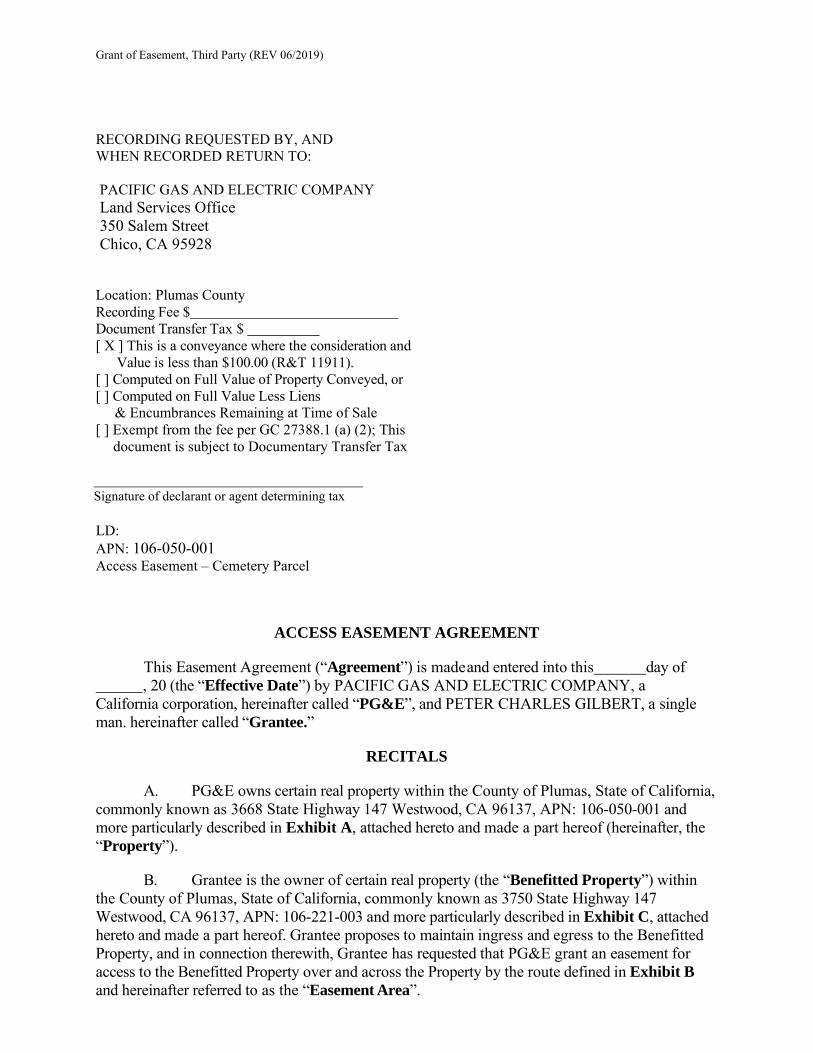
Grant of Easement, Third Party (REV 06/2019)
RECORDING REQUESTED BY, AND WHEN RECORDED RETURN TO:
PACIFIC GAS AND ELECTRIC COMPANY Land Services Office 350 Salem Street Chico, CA 95928
Location: Plumas County Recording Fee $ Document Transfer Tax $ [ X ] This is a conveyance where the consideration and
Value is less than $100.00 (R&T 11911). [ ] Computed on Full Value of Property Conveyed, or [ ] Computed on Full Value Less Liens
& Encumbrances Remaining at Time of Sale [ ] Exempt from the fee per GC 27388.1 (a) (2); This
document is subject to Documentary Transfer Tax
Signature of declarant or agent determining tax LD: APN: 106-050-001 Access Easement – Cemetery Parcel
ACCESS EASEMENT AGREEMENT
This Easement Agreement (“Agreement”) is made and entered into this day of , 20 (the “Effective Date”) by PACIFIC GAS AND ELECTRIC COMPANY, a California corporation, hereinafter called “PG&E”, and PETER CHARLES GILBERT, a single man. hereinafter called “Grantee.”
RECITALS
A. PG&E owns certain real property within the County of Plumas, State of California, commonly known as 3668 State Highway 147 Westwood, CA 96137, APN: 106-050-001 and more particularly described in Exhibit A, attached hereto and made a part hereof (hereinafter, the “Property”).
B. Grantee is the owner of certain real property (the “Benefitted Property”) within
the County of Plumas, State of California, commonly known as 3750 State Highway 147 Westwood, CA 96137, APN: 106-221-003 and more particularly described in Exhibit C, attached hereto and made a part hereof. Grantee proposes to maintain ingress and egress to the Benefitted Property, and in connection therewith, Grantee has requested that PG&E grant an easement for access to the Benefitted Property over and across the Property by the route defined in Exhibit B and hereinafter referred to as the “Easement Area”.
02898.228.0007.f Page 2
C. PG&E is willing to grant such easement(s) on the terms and subject to the conditions set forth herein.
Now, therefore, PG&E and Grantee agree as follows:
1. Grant of Easement: PG&E hereby grants to Grantee, upon the terms and conditions
set forth in this Agreement, the following easement:
(a) Ingress and Egress. A non-exclusive right of surface access, ingress and egress to and from the Benefitted Parcel, over and across the Easement Area.
2. Limitations on Use.
(a) The Easement Area, and any facilities permitted to be constructed thereon,
are to be used by Grantee only for those uses permitted in Section 1 above, and for no other purpose.
(b) PG&E reserves the right to restrict access to the Easement Area or any portion or portions thereof in the event of fire, earthquake, storm, riot, civil disturbance, or other casualty or emergency, or in connection with PG&E’s response thereto, or if emergency repairs or maintenance are required to PG&E facilities within or in the vicinity of the Easement Area, or otherwise when PG&E deems it advisable to do so, including in connection with events and emergencies occurring or affecting PG&E’s business operations located elsewhere than in the immediate vicinity of the Property.
(c) Grantee shall not erect or construct any building or other structure, or drill
or operate any well, within five (5) feet of any of PG&E’s electric or gas facilities.
3. Condition of Easement Area. Grantee accepts the Easement Area in its existing physical condition, without warranty by PG&E or any duty or obligation on the part of PG&E to maintain the Easement Area. Grantee acknowledges that one or more of the following (collectively, “Potential Environmental Hazards”) may be located in, on or underlying the Property and/or the Easement Area:
(a) electric fields, magnetic fields, electromagnetic fields, electromagnetic
radiation, power frequency fields, and extremely low frequency fields, however designated, and whether emitted by electric transmission lines, other distribution equipment or otherwise (“EMFs”);
(b) Hazardous Substances (as hereinafter defined). For purposes hereof, the term “Hazardous Substances” means any hazardous or toxic material or waste which is or becomes regulated by Legal Requirements (as hereinafter defined) relating to the protection of human health or safety, or regulating or relating to industrial hygiene or environmental conditions, or the protection of the environment, or pollution or contamination of the air, soil, surface water or groundwater, including, but not limited to, laws, requirements and regulations pertaining to reporting, licensing, permitting, investigating and remediating emissions, discharges,
02898.228.0007.f Page 3
releases or threatened releases of such substances into the air, surface water, or land, or relating to the manufacture, processing, distribution, use, treatment, storage, disposal, transport or handling of such substances. Without limiting the generality of the foregoing, the term Hazardous Substances includes any material or substance:
(1) now or hereafter defined as a “hazardous substance,” “hazardous
waste,” “hazardous material,” “extremely hazardous waste,” “restricted hazardous waste” or “toxic substance” or words of similar import under any applicable local, state or federal law or under the regulations adopted or promulgated pursuant thereto, including, without limitation, the Comprehensive Environmental Response, Compensation and Liability Act of 1980, 42 U.S.C. §§9601 et seq. (“CERCLA”); the Resource Conservation and Recovery Act of 1976, 42 U.S.C. §§6901 et seq.; the Clean Air Act, 42 U.S.C. §§7401 et seq.; the Clean Water Act, 33 U.S.C. §§1251 et seq.; the Toxic Substance Control Act, 15 U.S.C. §§2601 et seq.; the Federal Insecticide, Fungicide, and Rodenticide Act, 7 U.S.C. §§136 et seq.; the Atomic Energy Act of 1954, 42 U.S.C. §§2014 et seq.; the Nuclear Waste Policy Act of 1982, 42 U.S.C. §§10101 et seq.; the California Hazardous Waste Control Law, Cal. Health and Safety Code §§25100 et seq.; the Porter-Cologne Water Quality Control Act, Cal. Water Code §§13000 et seq.; the Carpenter- Presley-Tanner Hazardous Substance Account Act (Health and Safety Code §§25300 et seq.); and the Medical Waste Management Act (Health and Safety Code §§25015 et seq.); or
(2) which is toxic, explosive, corrosive, flammable, infectious,
radioactive, carcinogenic, mutagenic or otherwise hazardous, and is now or hereafter regulated as a Hazardous Substance by the United States, the State of California, any local governmental authority or any political subdivision thereof, or which cause, or are listed by the State of California as being known to the State of California to cause, cancer or reproductive toxicity; or
(3) the presence of which on the Property poses or threatens to pose a
hazard to the health or safety of persons on or about the Property or to the environment; or
(4) which contains gasoline, diesel fuel or other petroleum hydrocarbons; or
(5) which contains lead-based paint or other lead contamination,
polychlorinated biphenyls (“PCBs”) or asbestos or asbestos-containing materials or urea formaldehyde foam insulation; or
(6) which contains radon gas;
(c) fuel or chemical storage tanks, energized electrical conductors or
equipment, or natural gas transmission or distribution pipelines; and
(d) other potentially hazardous substances, materials, products or conditions.
Grantee shall be solely responsible for the health and safety of, and shall take all necessary precautions to protect, its employees, contractors, consultants, agents and invitees (“Grantee’s Representatives”) from risks of harm from Potential Environmental Hazards. Grantee acknowledges that it has previously evaluated the condition of the Easement Area and all matters
02898.228.0007.f Page 4
affecting the suitability of the Easement Area for the uses permitted by this Agreement, including, but not limited to, the Potential Environmental Hazards listed herein.
4. Grantee’s Covenants. Grantee hereby covenants and agrees:
(a) Construction of Improvements. Grantee agrees to construct and install, at
no cost to PG&E, such facilities and improvements (“Improvements”) as may be necessary and appropriate for Grantee’s permitted use, as specified in Section 1. All such construction shall be performed in accordance with detailed plans and specifications (“Plans”) previously approved by PG&E and shall comply with all Legal Requirements. Before commencing construction of any Improvements, Grantee shall obtain all permits, authorizations or other approvals, at Grantee’s sole cost and expense as may be necessary for such construction. Without limiting the generality of the foregoing, Grantee shall be responsible for complying with any and all applicable requirements of the National Environmental Policy Act (“NEPA”) and the California Environmental Quality Act (“CEQA”) and satisfying, at Grantee’s sole expense, any and all mitigation measures under CEQA that may apply to Grantee’s proposed occupancy and use of the Easement Area, and to the construction, maintenance and use of Grantee’s proposed Improvements and facilities. Grantee shall promptly notify PG&E of any and all proposed mitigation measures that may affect PG&E or the Property. If PG&E determines in good faith that any such mitigation measures may adversely affect PG&E or the Property, or impose limitations on PG&E’s ability to use the Property as specified in Section 8, then PG&E shall have the right, without liability to Grantee, to give notice of termination of this Agreement to Grantee, whereupon this Agreement and the rights granted to Grantee shall terminate and revest in PG&E, unless within ten (10) days following delivery of such notice, Grantee gives notice to PG&E by which Grantee agrees to modify its proposed Project (as that term is defined under CEQA) so as to eliminate the necessity for such mitigation measures. In the event of such termination, PG&E and Grantee shall each be reAgreementd from all obligations under this Agreement, except those which expressly survive termination. Grantee acknowledges and agrees that PG&E’s review of Grantee’s Plans is solely for the purpose of protecting PG&E’s interests, and shall not be deemed to create any liability of any kind on the part of PG&E, or to constitute a representation on the part of PG&E or any person consulted by PG&E in connection with such review that the Plans or the Improvements contemplated by such Plans are adequate or appropriate for any purpose, or comply with applicable Legal Requirements. Grantee shall not commence construction or installation of any Improvements without the prior written consent of PG&E, which consent shall not be unreasonably withheld, conditioned or delayed, and the prior consent, to the extent required by applicable law or regulation, of the California Public Utilities Commission (hereinafter, “CPUC”);
(b) Compliance with Laws. Grantee shall, at its sole cost and expense,
promptly comply with (a) all laws, statutes, ordinances, rules, regulations, requirements or orders of municipal, state, and federal authorities now in force or that may later be in force, including, but not limited to, those relating to the generation, use, storage, handling, treatment, transportation or disposal of Hazardous Substances, as defined herein, or to health, safety, noise, environmental protection, air quality or water quality; (b) the conditions of any permit, occupancy certificate, license or other approval issued by public officers relating to Grantee’s use or occupancy of the Easement Area; and (c) with any liens, encumbrances, easements, covenants, conditions, restrictions and servitudes (if any) of record, or of which Grantee has notice, which may be applicable to the Easement Area (collectively, “Legal Requirements”), regardless of when they
02898.228.0007.f Page 5
become effective, insofar as they relate to the use or occupancy of the Easement Area by Grantee. Grantee shall furnish satisfactory evidence of such compliance upon request by PG&E. The judgment of any court of competent jurisdiction, or the admission of Grantee in any action or proceeding against Grantee, whether or not PG&E is a party in such action or proceeding, that Grantee has violated any Legal Requirement relating to the use or occupancy of the Easement Area, shall be conclusive of that fact as between PG&E and Grantee.
(c) Notice of Enforcement Proceedings. Grantee agrees to notify PG&E in
writing within three (3) business days of any investigation, order or enforcement proceeding which in any way relates to the Property, or to any contamination or suspected contamination on, within or underlying the Property. Such notice shall include a complete copy of any order, complaint, agreement, or other document which may have been issued, executed or proposed, whether draft or final;
(d) Non-Interference. Grantee agrees not to interfere in any way or permit any interference with the use of the Property by PG&E and other entitled persons. Interference shall include, but not be limited to, any activity by Grantee that places any of PG&E’s gas or electric facilities in violation of any of the provisions of General Order Nos. 95 (Overhead Electric), 112 (Gas), and 128 (Underground Electric) of the CPUC or to any other Legal Requirements under which the operations of utility facilities are controlled or regulated. Grantee shall not erect, handle, or operate any tools, machinery, apparatus, equipment, or materials closer to any of PG&E’s high- voltage electric conductors than the minimum clearances set forth in the High-Voltage Electrical Safety Orders of the California Division of Industrial Safety; which minimum clearances are incorporated herein by reference; but in no event closer than ten (10) feet to any energized electric conductors or appliances. Grantee shall not drill, bore, or excavate within thirty (30) feet of any of PG&E’s underground facilities, including, but not limited to, gas pipelines, valves, regulators or electric conduits. Grantee shall provide notice to Underground Service Alert at 1-800-227-2600 at least two (2) business days prior to commencing any drilling, boring or excavating permitted hereunder to assist Grantee with locating any and all underground facilities, including, but not limited to, gas pipelines, valves, regulators or electric conduits;
(e) Avoiding Dangerous Activities. Grantee agrees to conduct its activities and
operations within and on the Easement Area in such a manner so as not to endanger the Property, PG&E’s utility facilities, the environment and human health and safety. Grantee shall not cause or permit any Hazardous Substances, as defined herein, to be brought upon, produced, stored, used, discharged or disposed of on, or in the vicinity of the Property, except in compliance with all applicable Legal Requirements. Grantee shall be responsible for the cost of remediating any discharge or release of Hazardous Substances resulting from or arising in connection with Grantee’s use of the Property and shall immediately notify PG&E and the appropriate regulatory authorities where required by law, of any such release. If PG&E determines that Grantee’s activities in any way endanger the Property, PG&E’s utility facilities, the environment, or human health and safety, PG&E may, in PG&E’s sole and absolute discretion, require that Grantee halt such activities until appropriate protective measures are taken to PG&E’s satisfaction. Grantee shall hold PG&E harmless from any claims resulting from any delay under this paragraph. PG&E’s right to halt activities under this paragraph shall not in any way affect or alter Grantee’s insurance or indemnity obligations under this Agreement, nor shall it relieve Grantee from any of its obligations hereunder that pertain to health, safety, or the protection of the environment;

02898.228.0007.f Page 6
(f) Maintenance. Grantee agrees to maintain its facilities and Improvements in good condition and repair, and be responsible for the security of, the facilities installed hereunder;
(g) Repairing Damage. Grantee agrees to repair any damage it may cause to
PG&E’s facilities and improvements in or around said Easement Area;
(h) Coordination. Grantee agrees to coordinate all activities regarding the easements granted herein to reasonably minimize any interference and inconvenience with the use by PG&E of the Easement Area and PG&E’s adjoining lands.
(i) PG&E Right to Cure. Grantee agrees that if Grantee fails to perform any
act or other obligation on its part to be performed hereunder, and such failure is not remedied within fifteen (15) days following notice from PG&E (or in the case of an emergency, following such notice, if any, as may be reasonably practicable under the existing circumstances), PG&E may (but without obligation to do so, and without waiving or releasing Grantee from any of its obligations) perform any such act or satisfy such obligation, or otherwise remedy such emergency or such failure on the part of Grantee. All costs incurred by PG&E in responding to or remedying such failure by Grantee shall be payable by Grantee to PG&E on demand.
5. Indemnification; Release.
(a) Grantee shall, to the maximum extent permitted by law, indemnify, protect,
defend and hold harmless PG&E, its parent corporation, subsidiaries and affiliates, and their respective officers, managers, directors, representatives, agents, employees, transferees, successors and assigns (each, an “Indemnitee” and collectively, “Indemnitees”) from and against all claims, losses (including, but not limited to, diminution in value), actions, demands, damages, costs, expenses (including, but not limited to, experts fees and reasonable attorneys’ fees and costs) and liabilities of whatever kind or nature (collectively, “Claims”), including Claims arising from the passive or active negligence of the Indemnitees, which arise from or are in any way connected with the occupancy or use of the Easement Area by Grantee or Grantee’s Representatives, or the exercise by Grantee of its rights hereunder, or the performance of, or failure to perform, Grantee’s duties under this Agreement, including, but not limited to, Claims arising out of: (1) injury to or death of persons, including but not limited to employees of PG&E or Grantee (and including, but not limited to, injury due to exposure to EMFs and other Potential Environmental Hazards in, on or about the Property); (2) injury to property or other interest of PG&E, Grantee or any third party; (3) violation of any applicable federal, state, or local laws, statutes, regulations, or ordinances, including all Legal Requirements relating to human health or the environment, and including any liability which may be imposed by law or regulation without regard to fault; excepting only with respect to any Indemnitee, to the extent of any Claim arising from the sole negligence or willful misconduct of such Indemnitee. Without limiting the generality of the foregoing, Grantee shall, to the maximum extent permitted by law, indemnify, protect, defend and hold Indemnitees harmless from and against Claims arising out of or in connection with any work of improvement constructed or installed at or on, labor performed on, or materials delivered to, or incorporated in any improvements constructed on, the Easement Area by, or at the request or for the benefit of, Grantee. In the event any action or proceeding is brought against any Indemnitee for any Claim against which Grantee is obligated to indemnify or provide a defense hereunder, Grantee upon written notice from PG&E shall defend such action or proceeding at Grantee’s sole expense by

02898.228.0007.f Page 7
counsel approved by PG&E, which approval shall not be unreasonably withheld, conditioned or delayed.
(b) Grantee acknowledges that all Claims arising out of or in any way connected with releases or discharges of any Hazardous Substance, or the exacerbation of a Potential Environmental Hazard, occurring as a result of or in connection with Grantee’s use or occupancy of the Easement Area or the surrounding Property, or any of the activities of Grantee and Grantee’s Representatives, and all costs, expenses and liabilities for environmental investigations, monitoring, containment, abatement, removal, repair, cleanup, restoration, remediation and other response costs, including reasonable attorneys’ fees and disbursements and any fines and penalties imposed for the violation of Legal Requirements relating to the environment or human health, are expressly within the scope of the indemnity set forth above.
(c) Grantee’s use of the Property shall be at its sole risk and expense. Grantee
accepts all risk relating to its occupancy and use of the Easement Area. PG&E shall not be liable to Grantee for, and Grantee hereby waives and releases PG&E and the other Indemnitees from, any and all liability, whether in contract, tort or on any other basis, for any injury, damage, or loss resulting from or attributable to any occurrence on or about the Easement Area, the condition of Easement Area, or the use or occupancy of the Easement Area.
(d) Grantee shall, to the maximum extent permitted by law, indemnify, protect,
defend and hold Indemnitees harmless against claims, losses, costs (including, but not limited to, attorneys’ fees and costs), liabilities and damages resulting from the failure of Grantee, or any of its contractors or subcontractors. If Grantee fails to so indemnify, protect, defend or hold harmless any Indemnitee, then at PG&E’s option, this Agreement shall terminate, and the estate and interest herein granted to Grantee shall revert to and revest in PG&E, if such failure continues for five (5) days following the giving of written notice of termination to Grantee, unless within such time such failure is cured to the reasonable satisfaction of PG&E.
(e) The provisions of this Section 5 shall survive the termination of this
Agreement.
6. Additional Facilities. Grantee shall not install any additional facilities or improvements in, on, under or over the Easement Area without the prior written consent of PG&E, which consent may be granted or withheld in PG&E’s sole and absolute discretion, and the prior consent, to the extent required by applicable law or regulation, of the CPUC. Grantee shall submit plans for installation of any proposed additional facilities within the Easement Area to PG&E for its written approval at the address specified in Section 13.
7. Abandonment, Termination. In the event Grantee abandons the facilities installed
hereunder, this Agreement shall terminate, and all of the easements and other rights of Grantee hereunder shall revert to PG&E. The non-use of such facilities for a continuous period of two (2) years, unless such nonuse is due to factors outside Grantee’s reasonable control, in which case such period is extended to four (4) years, shall be conclusive evidence of such abandonment. Upon any termination of this Agreement, Grantee shall remove, at no cost to PG&E, such of Grantee’s facilities and equipment installed pursuant to this Agreement as PG&E may specify. Upon any termination of this Agreement, Grantee shall execute, acknowledge and deliver to PG&E a
02898.228.0007.f Page 8
quitclaim deed or such other documents or instruments, in a form reasonably acceptable to PG&E, as may be reasonably necessary to eliminate this Agreement as an encumbrance on the title to the Easement Area or any larger parcel of property containing the Easement Area.
8. Reserved Rights. Subject to the provisions of Section 10 below, PG&E reserves
the right to use the Easement Area for any and all purposes which will not unreasonably interfere with Grantee’s facilities. Without limiting the generality of the foregoing:
(a) PG&E reserves the right to make use of the Easement Area for such
purposes as it may deem necessary or appropriate if, and whenever, in the interest of its service to its patrons or consumers or the public, it shall appear necessary or desirable to do so.
(b) Grantee acknowledges that PG&E may have previously granted, and may in
the future grant, certain rights in and across the Easement Area to others, and the use of the word “grant” in this Agreement shall not be construed as a warranty or covenant by PG&E that there are no such other rights.
(c) Grantee shall not make use of the Easement Area in any way which will
endanger human health or the environment, create a nuisance or otherwise be incompatible with the use of the Easement Area, the Property, or PG&E’s adjacent property, by PG&E or others entitled to use such property.
(d) This grant is made subject to all applicable provisions of General Order
No. 95 (Overhead Electric), General Order 112 (Gas) and General Order No. 128 (Underground Electric) of the CPUC, in like manner as though said provisions were set forth herein.
9. Governmental Approvals. This Agreement shall not become effective,
notwithstanding that it may have been executed and delivered by the parties, and Grantee shall not commence construction or other activities hereunder, unless and until PG&E notifies Grantee in writing of receipt of final, unconditional, and unappealable approval by the CPUC and that the terms and conditions of such CPUC approval are satisfactory to PG&E in its sole and absolute discretion. Grantee further acknowledges and agrees that PG&E makes no representation or warranty regarding the prospects for CPUC approval, and Grantee hereby waives all Claims against PG&E which may arise out of the need for such CPUC approval or the failure of the CPUC to grant such approval. This Agreement is made subject to all the provisions of such approval, as more particularly set forth in CPUC ( ☐ Disposition Letter ☐ Advice Letter ☐ Decision __ ____), in like manner as though said provisions were set forth in full herein.
10. Relocation. Subject to the provisions of this Section 10, the rights granted to
Grantee herein shall forever be subordinate to PG&E’s right to replace, reconstruct, relocate, operate and maintain PG&E’s existing and/or future facilities. If PG&E’s use of its reserved rights described above necessitates the relocation of any of Grantee’s facilities, Grantee shall, at its own cost and expense, relocate such facilities to an alternate location mutually agreed upon between PG&E and Grantee, provided Grantee is given at least twenty (20) days prior written notice of such required relocation. Any such relocation of Grantee’s facilities shall be coordinated and scheduled between PG&E and Grantee so as to minimize, to the extent practicable, any interference with
02898.228.0007.f Page 9
Grantee’s use and operation of its facilities resulting from such relocation. If no alternate location is available on the Property, this Agreement shall terminate.
11. Compliance. PG&E shall have a right to access and inspect the Easement Area at
any time to confirm Grantee’s compliance with Legal Requirements and the provisions of this Agreement.
12. Insurance. Owner shall procure and maintain in effect at all times, insurance to cover liabilities of Owner in connection to this Agreement, including the indemnity obligations of Owner as set forth in Section 5. Owner shall furnish a Certificate of Insurance to PG&E prior to the commencement of services under this Agreement evidencing its compliance with this insurance requirement. Owner further agrees and understands that Owner is responsible for causing its agents, consultants, contractors and subcontractors (where utilized) to comply with the following minimum insurance requirements when work is being performed on PG&E Property:
(a) Commercial General Liability insurance covering bodily injury and property damage with limits of not less than $1,000,000 each occurrence/$2,000,000 aggregate.
(b) Business Auto Liability insurance covering “any auto” [equivalent to ISO Symbol
“1”] with combined single limits of not less than $1,000,000 each accident.
(c) Worker’s Compensation in compliance with applicable labor codes, acts, laws or statutes, state or federal (where applicable); Employer’s Liability insurance with limits not less than $1,000,000 for injury or death, each accident
13. Mechanics’ Liens. Grantee shall keep the Property free and clear of all mechanics’, material suppliers’ or similar liens, or claims thereof, arising or alleged to arise in connection with any work performed, labor or materials supplied or delivered, or similar activities performed by Grantee or at its request or for its benefit. If any mechanics’ liens are placed on the Property in connection with the activities or facilities set forth in this Agreement, Grantee shall promptly cause such liens to be released and removed from title, either by payment or by recording a lien release bond in the manner specified in California Civil Code Section 3143 or any successor statute.
14. Notice. Any notices or communications hereunder shall be in writing and shall be
personally delivered or sent by first class mail, certified or registered, postage prepaid, or sent by national overnight courier, with charges prepaid for next business day delivery, addressed to the addressee party at its address or addresses listed below, or to such other address or addresses for a party as such party may from time to time designate by notice given to the other party. Notices shall be deemed received upon actual receipt by the party being sent the notice, or on the following business day if sent by overnight courier, or on the expiration of three (3) business days after the date of mailing.
If by registered or certified mail, return receipt requested:
Manager, Hydro Support PG&E Hydro Support 111 Stony Circle Santa Rosa, CA 94501-9599

02898.228.0007.f Page 10
With a copy to:
Pacific Gas and Electric Company P.O. Box 7442, Mail Code B3OA San Francisco, California 94120 Attention: Grant Guerra
If by personal delivery or overnight courier:
Pacific Gas and Electric Company P.O. Box 7442, Mail Code B3OA San Francisco, California 94120 Attention: Grant Guerra If to Grantee:
Peter Charles Gilbert 8405 Castlehawk Court Reno, NV 89523
15. Governing Law. This Agreement shall in all respects be interpreted, enforced, and governed by and under the laws of the State of California.
16. Entire Agreement. This Agreement supersedes all previous oral and written
agreements between and representations by or on behalf of the parties and constitutes the entire agreement of the parties with respect to the subject matter hereof. This Agreement may not be amended except by a written agreement executed by both parties.
17. Binding Effect. This Agreement and the covenants and agreements contained
herein shall be binding upon, and shall inure to the benefit of, the parties hereto and their respective heirs, successors and assigns (subject to the provisions of Section 18). No assignment or delegation by Grantee, whether by operation of law or otherwise, shall relieve Grantee of any of its duties, obligations or liabilities hereunder, in whole or in part. The covenants of PG&E hereunder shall run with the land.
18. Assignment. This Agreement and the rights of Grantee hereunder are appurtenant
to the Benefitted Property, and may not be separately assigned, transferred, conveyed or encumbered. Any purported assignment, transfer, conveyance or encumbrance violating the foregoing condition shall be void and of no effect.
19. Attorneys’ Fees. Should either party bring an action against the other party, by
reason of or alleging the failure of the other party with respect to any or all of its obligations hereunder, whether for declaratory or other relief, then the party which prevails in such action shall be entitled to its reasonable attorneys’ fees (of both in-house and outside counsel) and

02898.228.0007.f Page 11
expenses related to such action, in addition to all other recovery or relief. A party shall be deemed to have prevailed in any such action (without limiting the generality of the foregoing) if such action is dismissed upon the payment by the other party of the sums allegedly due or the performance of obligations allegedly not complied with, or if such party obtains substantially the relief sought by it in the action, irrespective of whether such action is prosecuted to judgment. Attorneys’ fees shall include, without limitation, fees incurred in discovery, contempt proceedings and bankruptcy litigation, and in any appellate proceeding. The non-prevailing party shall also pay the attorney’s fees and costs incurred by the prevailing party in any post-judgment proceedings to collect and enforce the judgment. The covenant in the preceding sentence is separate and several and shall survive the merger of this provision into any judgment on this Agreement. For purposes hereof, the reasonable fees of PG&E’s in-house attorneys who perform services in connection with any such action shall be recoverable, and shall be based on the fees regularly charged by private attorneys with the equivalent number of years of experience in the relevant subject matter area of the law, in law firms in the City of San Francisco with approximately the same number of attorneys as are employed by PG&E’s Law Department
20. No Waiver. No waiver with respect to any provision of this Agreement shall be effective unless in writing and signed by the party against whom it is asserted. No waiver of any provision of this Agreement by a party shall be construed as a waiver of any subsequent breach or failure of the same term or condition, or as a waiver of any other provision of this Agreement.
21. No Offsets. Grantee acknowledges that PG&E is executing this Agreement in its
capacity as the owner of the Easement Area, and not in its capacity as a public utility company or provider of electricity and natural gas. Notwithstanding anything to the contrary contained herein, no act or omission of Pacific Gas and Electric Company or its employees, agents or contractors as a provider of electricity and natural gas shall abrogate, diminish, or otherwise affect the respective rights, obligations and liabilities of PG&E and Grantee under this Agreement. Further, Grantee covenants not to raise as a defense to its obligations under this Agreement, or assert as a counterclaim or cross-claim in any litigation or arbitration between PG&E and Grantee relating to this Agreement, any claim, loss, damage, cause of action, liability, cost or expense (including, but not limited to, attorneys’ fees) arising from or in connection with Pacific Gas and Electric Company’s provision of (or failure to provide) electricity and natural gas.
22. No Third Party Beneficiary. This Agreement is solely for the benefit of the parties
hereto and their respective successors and permitted assigns, and, except as expressly provided herein, does not confer any rights or remedies on any other person or entity.
23. Captions. The captions in this Agreement are for reference only and shall in no
way define or interpret any provision hereof.
24. Time. Except as otherwise expressly provided herein, the parties agree that as to any obligation or action to be performed hereunder, time is of the essence.
25. Severability. If any provision of this Agreement shall be invalid or unenforceable,
the remainder of this Agreement shall not be affected thereby, and each provision of this Agreement shall be valid and enforced to the full extent permitted by law, provided the material provisions of this Agreement can be determined and effectuated.
26. Counterparts. This Agreement may be executed in identical counterpart copies,
each of which shall be an original, but all of which taken together shall constitute one and the same
02898.228.0007.f Page 12
agreement.
27. Other Documents. Each party agrees to sign any additional documents or permit applications which may be reasonably required to effectuate the purpose of this Agreement. Provided, however, that PG&E will not be required to take any action or execute any document that would result in any cost, expense or liability to PG&E.

02898.228.0007.f Page 13
IN WITNESS WHEREOF, the parties have executed this Agreement as of the day and year first set forth above.
PACIFIC GAS AND ELECTRIC COMPANY, a California corporation
By: Sarah Hug Manager, Hydro Support
Date:
Peter Charles Gilbert, a single man
By: Peter Charles Gilbert Grantee
Date:
Exhibits A, B and C attached
Area 6 Redding Land Service Office Hydro Operating Department 21.28.08.10.13, 21.28.08.10.14, 21.28.08.10.41, 21.28.08.10.41, 21.28.08.10.14 FERC License Number(s) N/A PG&E Drawing Number(s) N/A PLAT NO. N/A LD: N/A LD of any Cross-referenced documents (if applicable) TYPE OF INTEREST 11 SBE Parcel Number: 135-32-044-1 (For Quitclaims, % being quitclaimed) Order # : 3022380 JCN: N/A County: Plumas Utility Notice Numbers (if applicable): N/A 851 Approval Application No.: N/A Prepared By: AECO Checked By: P1A8 Approved By: SMTK

Exhibit A p. 1
EXHIBIT A
PG&E PROPERTY
The land described herein is situated in the state of California, County of Plumas, unincorporated area, and is described as follows: APN 106-040-015 portion, 106-040-016, 106-050-001, 106-050-003 portion, and a portion on Assessors Map 001-200 (no APN for specific location) LCP ID #0375 SBE: 117-32-2-4, 117-32-2-2, and 135-32-44-1 All that certain parcel of land situated in Sections 3 and 10, Township 27 North, Range 8 East, Mount Diablo Base and Meridian, as recorded in Volume 9, page 372 of Patents of the County of Plumas, State of California, particularly described therein as follows: The northeast one-quarter of the southwest one-quarter and the west one-half of the southeast one-quarter of said Section 3 and the northwest one-quarter of the northeast one-quarter of said Section 10. Less and except all those certain parcels of land within the above described parts of said Sections 3 and 10, described in a document as Parcel 1 and Parcel 2, recorded in Volume 65, page 267 of deeds of said county. Also less and except all that certain parcel of land within the above described parts of said Sections 3 and 10, described in a document recorded in Book 68, page 315 of deeds of said county. Also less and except all that certain parcel of land within the above described parts of said Section 10, as recorded in Book 135, page 13 of Official records of said county, particularly described therein as follows: That portion of the northwest one-quarter of the northeast one-quarter of said Section 10 lying on the southwesterly side of the southwesterly boundary line of the right of way of Plumas County road, Route No. 315.

ACCESS EASEMENT JANUARY 4, 2021 FROM: PG&E TO: GILBERT
Page 1 of 2
EXHIBIT B
THAT CERTAIN PARCEL OF LAND SITUATE IN THE NORTHWEST ONE‐QUARTER OF THE NORTHEAST
ONE‐QUARTER OF SECTION 10, TOWNSHIP 27 NORTH, RANGE 8 EAST, MOUNT DIABLO MERIDIAN, AS
RECORDED IN VOLUME 9, PAGE 372 OF PATENTS OF THE COUNTY OF PLUMAS, STATE OF CALIFORNIA,
INCLUDED WITHIN A STRIP OF LAND 20.00 FEET IN WIDTH, THE CENTERLINE OF WHICH IS MORE
PARTICULARLY DESCRIBED AS FOLLOWS:
COMMENCING AT A 3/4 INCH IRON PIPE TAGGED “L.S. 2322” MARKING THE NORTH ONE‐QUARTER
CORNER OF SAID SECTION 10 AS SHOWN ON THAT MAP FILED FOR RECORD IN BOOK 6 OF RECORDS OF
SURVEY, AT PAGE 55, PLUMAS COUNTY RECORDS; THENCE ALONG THE MID‐SECTION LINE THEREOF,
SOUTH 00°47'35" EAST (SHOWN AS N 0° 17’ W, ON SAID MAP), A DISTANCE OF 913.71 FEET TO THE
TRUE POINT OF BEGINNING; THENCE LEAVING SAID MID‐SECTION LINE, NORTH 78°55'37" EAST, A
DISTANCE OF 52.46 FEET, MORE OR LESS, TO A POINT FROM WHICH SAID NORTH ONE‐QUARTER
CORNER OF SAID SECTION 10 BEARS NORTH 04°03'35" WEST, A DISTANCE OF 905.82 FEET; THENCE
ALONG THE FOLLOWING COURSES:
THENCE SOUTH 01°20'53" EAST, A DISTANCE OF 66.38 FEET;
THENCE SOUTH 22°01'18" EAST, A DISTANCE OF 97.54 FEET;
THENCE SOUTH 40°43'35" EAST, A DISTANCE OF 58.42 FEET;
THENCE SOUTH 61°26'54" EAST, A DISTANCE OF 73.09 FEET;
THENCE SOUTH 01°46'54" WEST, A DISTANCE OF 62.21 FEET, MORE OR LESS, TO A POINT IN THE
NORTHEASTERLY RIGHT‐OF‐WAY LINE OF STATE HIGHWAY NO. 147 (FORMERLY KNOWN AS COUNTY
HIGHWAY ROUTE NO. 315), SAID POINT BEING THE POINT OF TERMINATION.
CONTAINING 8,201 SQ. FT., MORE OR LESS.
THE SIDELINES OF SAID STRIP ARE TO BE LENGTHENED OR SHORTENED TO BEGIN ON THE MID‐SECTION
LINE OF SAID SECTION 10 AND TERMINATE AT SAID NORTHEASTERLY RIGHT‐OF‐WAY LINE OF STATE
HIGHWAY NO. 147.
THE FOREGOING DESCRIPTION IS BASED ON THE CALIFORNIA COORDINATE SYSTEM OF 1983, ZONE 1,
NAD 83 (NSRS 2007) (EPOCH 2011.00). THE DISTANCES ARE GRID, TO OBTAIN GROUND DISTANCES,
DIVIDE GRID DISTANCES BY A COMBINED SCALE FACTOR OF 0.9997178.
SUBJECT TO ALL COVENANTS, RIGHTS, RIGHTS‐OF‐WAY AND EASEMENTS OF RECORD.
1/5/21

PACEENGINEERINGREDDING, CALIFORNIA
GEO
DETIC
0°36'49"
GRID

Exhibit A p. 1
EXHIBIT C
LEGAL DESCRIPTION OF BENEFITTED PROPERTY
The real property situated in the unincorporated area of Plumas County, State of California, described as follows:
Lot 1 and all that portion of lot 2 lying southeasterly of a line drawn parallel with the southeasterly boundary thereof and distant therefrom at right angles 40 feet northwesterly, in Block 3 of Indian Hills Subdivision No. 2, according to the amended map thereof filed January 8th, 1851 in the office of the County Recorder of Plumas County, and of recorded in Map Book 1, at page 45.
A.P.N. 106-221-03
Attachment G
Conservation Easement
02898.357 4847-3798-1671.1 Page 1
RECORDING REQUESTED BY AND ) Exhibit Draft: 4-28-21 WHEN RECORDED MAIL TO: ) ) Feather River Land Trust ) Attn: Shelton Douthit, Executive Director ) P.O. Box 1826 ) 75 Court Street ) Quincy, CA 95971 ) ) Space Above Line for Recorder’s Use Only
CONSERVATION EASEMENT DEED
(Lake Almanor – Maidu Cemetery) THIS CONSERVATION EASEMENT DEED (“Conservation Easement”) is made
as of _________________, 20____ (“Effective Date”), by MAIDU SUMMIT CONSORTIUM, a California nonprofit public benefit corporation (“MSC” or “Grantor”), in favor of FEATHER RIVER LAND TRUST, a California nonprofit public benefit corporation (“FRLT” or “Grantee”) (MSC and FRLT are sometimes referred to herein individually as “Party” and collectively as “Parties”), with reference to the following facts, circumstances, and terms:
R E C I T A L S
A. The Property. Grantor is the fee title owner of certain real property containing approximately 141 acres adjacent to Lake Almanor known by the Maidu people as Nákˀam Kojóm – East, or for the purpose of this transaction known as the Maidu Cemetery, and located in the County of Plumas, State of California. The Property is legally described and depicted in Exhibit A attached hereto and incorporated herein by this reference (“Property”).
B. FRLT’s Nonprofit Status. FRLT is a California nonprofit public benefit corporation, exempt from federal income taxation under sections 501(c)(3) and 509(a)(1) of the Internal Revenue Code of 1986, as amended (“IRC”), and qualified to acquire and hold conservation easements pursuant to California Civil Code section 815.3. FRLT is dedicated to conserving the land and waters of the Feather River region and stewarding its ecological, cultural, and educational values for current and future generations.
02898.357 4847-3798-1671.1 Page 2
C. Grantor’s Status. The Property is owned in fee by MSC, a California nonprofit public benefit corporation exempt from federal income taxation under IRC section 501(c)(3). MSC is composed of representatives from exclusively Mountain Maidu groups. MSC is dedicated to land and water protection and stewardship throughout the Maidu homeland, in accordance with principles of Traditional Ecological Knowledge (“TEK”). TEK is the accumulation of thousands of years of understanding the interactions of people and the natural environment, gained by native people with intimate knowledge of their local environment, who depend on the sustainable use and management of natural resources for their survival. TEK is handed down through generations by cultural transmission. TEK is adapted to changing conditions in order to maintain historic continuity of resource use and protection.
D. Transfer of Property to MSC. Pacific Gas and Electric Company, a California corporation (“PG&E”), transferred to MSC the fee interest in the Property in accordance with that certain Grant Deed, being recorded in the Official Records of the County of Plumas, immediately prior to the recording hereof (“Grant Deed”), attached hereto as Exhibit B and incorporated herein by reference, subject to: (1) PG&E’s reservation of certain rights in and to the Property, as set forth in the Grant Deed (referred to herein as the “PG&E Reserved Rights”); and (2) those legally-enforceable third-party rights to use the Property in effect as of the Effective Date, as listed on Exhibit C attached hereto and incorporated herein by this reference, true and complete copies of which have been provided to, and reviewed and accepted by, Grantee (“Express Third-Party Uses”).
E. Grantor’s Relationship to the Property. The mission of the Grantor is to contribute to the understanding and management of the Earth according to Mountain Maidu TEK and practices by supporting and enhancing Maidu cultural and physical connections to land and water. Grantor asserts that protection of the Conservation Values (as defined below), as required by this Conservation Easement, is consistent with traditional Maidu land management practices and principles. Grantor acquired the Property for the purpose of re-establishing a permanent place where Maidu cultural practices; traditional Maidu land management; and preservation, enhancement and restoration of native plant and wildlife habitats will be carried out.
F. Governing Documents. PG&E transferred fee title to the Property to MSC in connection with PG&E’s implementation of the “Land Conservation Commitment,” provided for in the following documents (collectively, “Governing Documents”) and described more fully below: (i) that certain Settlement Agreement as modified and approved by the Public Utilities Commission of the State of California in its Opinion and Order of December 18, 2003 (Decision 03-12-035); and (ii) that certain Stipulation Resolving Issues Regarding the Land Conservation Commitment dated September 25, 2003 (“Stipulation”).
G. Beneficial Public Values. The Governing Documents require PG&E to ensure that approximately 140,000 acres of watershed lands, all located in California and owned by PG&E as of the date the Governing Documents were entered into (collectively, “Watershed Lands”), are conserved for a broad range of beneficial public
02898.357 4847-3798-1671.1 Page 3
values, including the protection of the natural habitat of fish, wildlife and plants; the preservation of open space; outdoor recreation by the general public; sustainable forestry; agricultural uses; and historic values (collectively, “Beneficial Public Values”). The Property is included in these Watershed Lands. The Land Conservation Commitment constitutes the obligations of PG&E to convey fee title and conservation easements to Watershed Lands, and to protect the Beneficial Public Values of the Watershed Lands, as well as certain other obligations related thereto, as set forth in detail in the Governing Documents. The Stipulation provides that conservation easements for Watershed Lands will preserve or enhance reasonable public access.
H. The Property’s Beneficial Public Values. The Property includes the specific Beneficial Public Values identified on Exhibit D attached hereto and incorporated herein by this reference (collectively, “Conservation Values”).
I. PG&E Reserved Rights. In accordance with the Governing Documents, the PG&E Reserved Rights constitute an express reservation in favor of PG&E of certain rights to continue operation and maintenance of hydroelectric facilities and associated water delivery facilities, including project replacements and improvements required to meet existing and future water delivery requirements for power generation and consumptive water use by existing users, compliance with any Federal Energy Regulatory Commission license or license renewal or other regulatory requirements.
J. Continued Economic Uses. The Governing Documents also include a requirement that conservation easements encumbering Watershed Lands honor existing agreements for economic uses, including consumptive water deliveries.
K. Land Conservation Commitment. Pursuant to the Governing Documents, the Pacific Forest and Watershed Lands Stewardship Council, a California nonprofit public benefit corporation (“Stewardship Council”), was created to oversee and carry out the Land Conservation Commitment. Pursuant to the Governing Documents, the Stewardship Council developed a plan for protection of the Watershed Lands for the benefit of the citizens of California (“Land Conservation Plan”). The Land Conservation Plan includes, among other things, objectives to preserve and/or enhance the Beneficial Public Values identified on each parcel of Watershed Lands, including the Property.
L. California Civil Code Section 815 et seq. The Legislature of the State of California, as set forth in California Civil Code section 815 et seq., has found and declared it to be the public policy and in the public interest of this state to encourage the preservation of land predominantly in its natural, scenic, agricultural, historical, forested, or open-space condition. In furtherance of the Land Conservation Commitment and the above-described public policy purposes, Grantor desires to grant a conservation easement over the Property to Grantee.
M. Preservation and Protection in Perpetuity. Grantor and Grantee each desire through this Conservation Easement to ensure the permanent protection of the Conservation Values on the Property, subject to the PG&E Reserved Rights and the Express Third-Party Uses. Specifically, the Parties desire to ensure that the
02898.357 4847-3798-1671.1 Page 4
Conservation Values on the Property will be preserved and protected in perpetuity as provided herein, and that uses of the Property that are inconsistent with these Conservation Values will be prevented or corrected.
GRANT OF CONSERVATION EASEMENT AND AGREEMENTS
For good and valuable consideration, the receipt and sufficiency of which is
hereby acknowledged, and pursuant to California law, including California Civil Code section 815, et seq., Grantor hereby voluntarily grants and conveys to Grantee a conservation easement in perpetuity over the Property, subject to and in accordance with the terms, covenants, and conditions of this Conservation Easement.
1. Conservation Purposes. The purposes of this Conservation Easement are to protect and preserve in perpetuity the Conservation Values of the Property by restricting any use of the Property that will significantly impair the Conservation Values (“Conservation Purposes”). Subject to the following terms and conditions, Grantor intends that it will use the Property in accordance with Maidu land management principles and practices based on TEK, and Grantor will confine uses of the Property to activities that are consistent with the Conservation Purposes and the terms of this Conservation Easement. As used herein, the terms “impair” or “impairment” mean to diminish in quantity, quality, value, strength or viability. As used in this Conservation Easement, the terms “significant” or “significantly”, when used with “impair” or “impairment”, respectively, mean a greater than negligible adverse impact or an impact for more than a transient period.
Grantor and Grantee acknowledge that the Governing Documents reflect the intention of the Parties thereto (a) to honor Express Third-Party Uses and (b) to continue to permit beneficial uses of the Property that preserve and/or enhance the Conservation Values. It is intended that this Conservation Easement shall allow uses on the Property that are consistent with the protection and preservation of each of the Conservation Values in harmony with each other. While permitted actions required or taken to protect and preserve one or more individual Conservation Values may impair, on an individual and stand-alone basis, one or more other Conservation Values, Grantor and Grantee understand that achieving the Conservation Purposes requires the preservation and protection, on balance, of all the Conservation Values existing on the Property, to the maximum extent possible. The Parties recognize that in protecting and/or enhancing one or more of the Conservation Values, another Conservation Value may be impaired, but the Parties intend that this shall not be a permanent occurrence, or a reason to prioritize one Conservation Value over another. The Parties shall balance on an aggregate basis the Conservation Values on the whole Property whenever possible.
2. Land Management Plan. Grantor’s management of the Property shall be subject to a Nákˀam Kojóm – East Land Management Plan prepared for the Property, as amended from time to time in accordance with this Conservation Easement (“Management Plan”). The Management Plan will be designed to provide for Grantor’s

02898.357 4847-3798-1671.1 Page 5
adaptive management of the Property in a manner consistent with the Conservation Purposes (as defined below) and the terms of this Conservation Easement, and set forth the forest management plan component as defined in Section 17 of Exhibit E. The Management Plan shall be approved by Grantor in writing after written notice to and consultation with Grantee under Section 10(a) below. Grantor may amend the Management Plan at any time after written notice to and consultation with Grantee. The Management Plan shall not replace, modify, or amend any of the terms, covenants or conditions of this Conservation Easement. The Conservation Easement shall govern if there are any inconsistencies between it and the Management Plan. The initial Management Plan shall be completed within one year of close of escrow, or as soon thereafter as practicable.
3. Rights Conveyed to Grantee. (a) Rights of Grantee. To accomplish the Conservation Purposes,
Grantor hereby grants and conveys the following rights to Grantee: (1) Right to Preserve and Protect. Grantee shall have the right to preserve and protect in perpetuity the Conservation Values of the Property in a manner consistent with the terms of this Conservation Easement. Grantee, in its sole and absolute discretion, shall have the right to prevent by any lawful means any activity on or use of the Property that is or may be a violation of the terms of this Conservation Easement, and to require the restoration of such areas or features of the Property that may be damaged by any act, failure to act, or any use or activity undertaken by Grantor or under Grantor’s control that constitutes a violation of the terms of this Conservation Easement.
(2) Right of Access to Inspect, Monitor and Enforce. Grantee shall have the right to access and enter upon the Property using any easement or right of way appurtenant to the Property in order to exercise the following rights: (a) inspect the Property once annually to determine whether Grantor is in compliance with the terms of this Conservation Easement, provided that such Grantee provides written notice to Grantor at least thirty (30) days prior to the annual inspection, and that Grantor shall have the option to be present during any compliance monitoring; (b) exercise the rights which are granted to Grantee herein; and (c) enforce the terms of this Conservation Easement, in accordance with Section 11 of this Conservation Easement, including without limitation, the right to restore the Conservation Values, provided, that such access and entry will be made in a manner that will not interfere unreasonably with the permitted use(s) or enjoyment of the Property by Grantor and any occupant(s) or user(s) of the Property pursuant to the terms of this Conservation Easement. Grantee shall schedule a date and time for the annual compliance monitoring visit that is reasonably acceptable to Grantor. The right of access to inspect and monitor shall not be assigned by Grantee without the prior express written approval of the Grantor; provided, however, that Grantee may authorize entry of its consultants to the extent they are assisting the Grantee in its monitoring obligations or other activities authorized by this Conservation Easement. Nothing in this section shall be construed to authorize entry by
02898.357 4847-3798-1671.1 Page 6
members of the public for any purpose. Notice under this section shall include the names, titles and affiliations of persons who will conduct the inspections and, for those persons who are not employees of Grantee, their qualifications.
(3) Right of Immediate Entry. Grantee, in its sole and absolute discretion, shall have the right to immediately enter the Property where it is determined that urgent action is necessary to prevent, terminate, or mitigate a significant impairment of the Conservation Values. If Grantee determines such immediate entry is necessary, Grantee need not provide Grantor with prior notice; provided, however, Grantee shall provide Grantor with telephonic or other comparable notice at the time of entry, to be followed by a written notice of entry within three (3) business days after such immediate entry. 4. Prohibited Uses of the Property. Except for any use or activity that is
expressly permitted in this Conservation Easement, any activity on or use of the Property that is inconsistent with the Conservation Purposes of this Conservation Easement is prohibited. Grantor and Grantee agree that Exhibit E, attached hereto and incorporated herein by this reference, sets forth both the permitted and prohibited uses of the Property by Grantor, Grantor’s agents, Grantee, and/or third parties under Grantor’s control on the Property. In entering into this Conservation Easement, Grantor understands and acknowledges that uses prohibited by the terms of this Conservation Easement may become more economically valuable than permitted uses and that neighboring properties may in the future be dedicated partially or entirely to such prohibited uses. Grantor and Grantee intend that any such changes will not be deemed to be circumstances justifying the termination, extinguishment, or modification of this Conservation Easement. The inability of Grantor, or its successors or assigns, to carry out any or all the uses permitted under the terms of this Conservation Easement, or the unprofitability of doing so, will not impair the validity, force and effect of this Conservation Easement or be considered grounds for its termination, extinguishment, or modification.
5. Grantor’s Duties. To the extent Grantor has or reasonably should have knowledge of actual or anticipated unauthorized third party use of the Property that violates or would violate the terms of this Conservation Easement, Grantor shall undertake all reasonable actions to prevent such unauthorized use.
6. Grantor's Reserved Rights and Permitted Uses of Property; PG&E Reserved Rights.
(a) Rights of Ownership. Grantor reserves to itself all rights of ownership of the Property. Grantor shall confine its use of the Property to those permitted activities and uses, and to such other activities and uses of the Property as are both: (1) consistent with the Conservation Purposes; and (2) not prohibited under the terms of this Conservation Easement. The permitted uses and activities set forth on Exhibit E are presumed to be consistent with the Conservation Purposes and are expressly permitted by the Grantee, but Exhibit E is not an exclusive list of such uses and activities. Uses and activities that are prohibited in Exhibit E are inconsistent with the Conservation Purposes. Certain permitted uses listed in Exhibit E are allowed only in the applicable zones (“Zones”), as legally described, and depicted on the map
02898.357 4847-3798-1671.1 Page 7
included in Exhibit F (“Zones Map”), attached hereto and incorporated herein by this reference.
(b) PG&E Reserved Rights. All rights and obligations of Grantor and Grantee under this Conservation Easement are subject to the PG&E Reserved Rights specified in the Grant Deed. In the event of a conflict between the PG&E Reserved Rights and the Conservation Purposes, this Conservation Easement shall be construed to unconditionally permit the exercise of the PG&E Reserved Rights. In the event PG&E notifies Grantor of PG&E’s intention to exercise any of the PG&E Reserved Rights, Grantor shall notify Grantee, in writing, of such intention within five (5) days of Grantor’s receipt of such notification. 7. Express Third-Party Uses. Exhibit C describes the Express Third-Party Uses of the Property permitted with the express agreement of Grantor. Grantor retains the right to maintain, renew, decline to renew, or replace all such agreements memorializing Express Third-Party Uses ("Third-Party Use Agreements") and to engage in all activities reasonably required to comply with Grantor’s obligations with respect to the Express Third-Party Uses, subject to the following conditions:
(a) Increases in Intensity or Expansion of Location or Size or Change in Third-Party Use. Subject to existing Third-Party Use Agreements, any (i) increase in the intensity, (ii) expansion of the location or size, or (iii) change in the use, of any of the Express Third-Party Uses, whether through a new agreement or an amendment to an existing agreement, that Grantor determines in consultation with Grantee under Section 10(a), are likely to significantly impair the Conservation Values shall not be allowed.
(b) Renewal or Replacement of Third-Party Use Agreements. All Third-Party Use Agreements existing as of the Effective Date are identified on Exhibit C. As Third-Party Use Agreements are renewed or replaced (either with the existing user or a new user), Grantor, in consultation with Grantee, shall include contractual provisions to bring the continuation of the Express Third-Party Uses and the preservation of the Conservation Values into alignment to the fullest extent reasonably practicable.
(c) Enforcement of Third-Party Use Agreements. If Grantor or Grantee discovers any default or breach under a Third-Party Use Agreement that significantly impairs the Conservation Values (and if Grantee makes such discovery, Grantee gives Grantor written notice thereof), Grantor shall use reasonable efforts to enforce or otherwise remedy such violation, at Grantor’s sole expense.
8. Public Access. (a) Informal Uses and Public Access. Grantor and Grantee
recognize the Property has been used by third parties for recreational, cultural, and other non-commercial or informal purposes without formal written agreements to conduct such activities (“Informal Uses”). Grantor and Grantee further recognize that access to the Property is inherent or may be inherent in the enjoyment of the Conservation Values and the Informal Uses. Consistent with the objectives articulated
02898.357 4847-3798-1671.1 Page 8
in the Governing Documents to provide continued reasonable access by the public to the Watershed Lands, Grantor shall allow public access to the Property that is substantially consistent with the public access existing on the Effective Date. Grantor reserves the right to make and enforce reasonable regulations to control, limit, or, exclude Informal Uses and public access. Grantor shall not allow any Informal Use or any public access that significantly impairs the Conservation Values.
(b) New or Increased Public Access. If Grantor desires to allow new public access or Informal Uses or an expansion of public access or Informal Uses on the Property, Grantee’s advance written approval is required in accordance with Section 10(b), which approval shall not be unreasonably withheld, conditioned or delayed.
(c) Liability Limitation. Notwithstanding Section 8(a) and Section 8(b) above, Grantor and Grantee claim all of the rights and immunities against liability for injury to the public to the fullest extent allowable by law.
(d) Periodic Review of Informal Uses. As part of Grantee’s annual compliance monitoring: (i) Grantor and Grantee shall meet and confer to discuss the known Informal Uses and public access conducted on the Property for the purpose of Grantee’s assessment of Grantor’s compliance with the requirements set forth above in this section; and (ii) with respect to Informal Uses allowed by Grantor on the Property in accordance with Section 8(a) above, Grantor and Grantee shall meet and confer, and include recommendations, if any, regarding the necessity of controlling, limiting, or excluding Informal Uses or public access to ensure the preservation of the Conservation Values.
9. Compliance with Applicable Law. This Conservation Easement describes certain rights held by Grantor, Grantee, PG&E, and third parties, as well as permitted uses that are presumed to be consistent with the Conservation Purposes of the Conservation Easement. Nothing in this Conservation Easement requires Grantor, Grantee, PG&E, or third parties to exercise these rights. Nor does this Conservation Easement provide Grantor, Grantee, PG&E, or third parties with regulatory approval to undertake any action described as a retained right or permitted use. Prior to undertaking any action to exercise these rights, Grantor, Grantee, PG&E, and third parties shall obtain all necessary permits and comply with all applicable laws, including the California Environmental Quality Act (“CEQA”), Public Resources Code sections 21000 et seq.
10. Consultation and Approval Processes. (a) Consultation. Whenever this Conservation Easement requires
one Party to consult with the other Party, the Party with the obligation to seek consultation shall provide the other Party with a written request to consult. The Parties shall seek to meet in person within thirty (30) days of the receipt of the consultation request, unless the Parties agree, or this Conservation Easement provides otherwise. For purposes of this Conservation Easement, consultation means the meaningful and timely process of meeting in good faith to exchange adequate information and discuss, understand, and consider the views of the other Party and to seek, wherever feasible, to reach agreement. If the Parties are unable to reach agreement and Grantee believes

02898.357 4847-3798-1671.1 Page 9
the proposed activity would violate the terms of this Conservation Easement, Grantee may issue a Notice of Breach pursuant to Section 11. If no response to the request to consult is received within thirty (30) days of its receipt, the requesting Party shall have no obligation to consult.
(b) Approval. Whenever this Conservation Easement requires the approval of the Grantee (“Approval”) for a proposed action or activity (“Proposed Activity”), Grantor shall provide Grantee a written notice requesting the Approval at least thirty (30) days before the commencement of the Proposed Activity. The notice shall set forth in detail all material facts of the Proposed Activity and the following provisions shall then be applicable: (1) Additional Information. Grantee may request additional information concerning the Proposed Activity within thirty (30) days after the notice is given. Grantor shall provide any supplemental information to Grantee within thirty (30) days of Grantee’s request. (2) Objection Notice. Grantee shall review the notice promptly and give Grantor prompt written notice of any objections based on Grantee’s assessment that the Proposed Activity is reasonably likely to violate the terms of the Conservation Easement. If Grantee objects it shall advise Grantor how, if at all, the Proposed Activity could be modified to be consistent with the Conservation Purposes and the terms of the Conservation Easement. (3) Written Approval. Grantor shall not, and shall not have the right to, commence or conduct the Proposed Activity until and unless it receives the written approval of Grantee, and only in the manner approved, unless the Proposed Activity is deemed approved pursuant to Section 10(b)(4) below. (4) Agreement Deadline for Proposed Activity. The Proposed Activity shall be deemed to have been approved if no objection has been given within ninety (90) days after Grantee’s receipt of the notice of the Proposed Activity and all supplemental information requested by Grantee pursuant to Section 10(b)(1) above.
(5) Limitations on Approval. No actual or deemed approval to, or acquiescence in or failure to object to, any given Proposed Activity shall constitute: (i) agreement or consent to, or approval of, any aspect of the Proposed Activity which was not disclosed in the Grantor’s notice (including any supplemental information, as noted above), or any subsequent action or activity of the same or any different nature; or (ii) agreement or consent to, or approval of, any activity or use which is prohibited by the terms of this Conservation Easement, or any other alteration of the terms of this Conservation Easement.
11. Enforcement and Remedies. (a) Procedures Upon Violation. If a party hereto (“Non-Breaching
Party”) determines there is a breach of the terms of this Conservation Easement or that a breach is threatened, written notice of such breach (“Notice of Breach”) and a demand for corrective action sufficient to cure the breach shall be given in accordance with Section 23 by the Non-Breaching Party to the party allegedly breaching this
02898.357 4847-3798-1671.1 Page 10
Conservation Easement (“Breaching Party”). Within fourteen (14) days after receipt of the Notice of Breach, the Parties shall meet at a location in Plumas County or as otherwise agreed by the Parties to discuss the circumstances of the alleged or threatened breach and to attempt to agree on appropriate corrective action. If the Parties are unable to agree on corrective action within thirty (30) days after such meeting, then the Non-Breaching Party may, at its election, deliver a further written notice to the Breaching Party to demand reasonable corrective action to cure the breach (“Notice of Violation”). If a violation is not cured within thirty (30) days after receipt of the Notice of Violation, or if the cure reasonably requires more than thirty (30) days to complete and there is failure to begin the cure within the 30-day period or failure to continue diligently to complete the cure, the Non-Breaching Party may commence litigation in accordance with Section 11(b) below. For purposes of this Section 11(a), the Non-Breaching Party can be either the Grantee or Grantor.
(b) Litigation. If the Parties are not able to resolve a dispute under Section 11(a) above, the Non-Breaching Party may bring an action at law or equity in a court of competent jurisdiction to enforce compliance with the terms of this Conservation Easement, to recover damages to which the Non-Breaching Party may be entitled for violation of the terms of this Conservation Easement, or for any other legal or equitable relief available under California law, including, but not limited to, temporary or permanent injunctive relief, monetary damages or any other form of relief required to achieve the restoration of the Property to the condition it existed prior to any violation. To the extent that Grantee recovers any monetary damages for the cost of restoring any injury or damage to a portion of the Property that is caused by Grantor’s breach, excluding fees described in Section 12, all such damages recovered by Grantee shall be applied to the cost of undertaking any corrective action to the applicable portion of the Property. Notwithstanding anything to the contrary in this Conservation Easement, in no event shall the Breaching Party be liable to the Non-Breaching Party for, and the Parties each hereby waive their right to, any indirect, special, punitive or consequential damages resulting from the Breaching Party’s breach of this Conservation Easement, whether foreseeable or unforeseeable. For purposes of this Section 11(b), a Non-Breaching Party can be either the Grantee or Grantor.
(c) Emergency Injunctive Relief. If circumstances require immediate action to prevent or mitigate a violation of this Conservation Easement, and the Non-Breaching Party determines that irreparable harm would result if the Non-Breaching Party were required to complete the process set forth in Section 11(a), the Non-Breaching Party may proceed immediately to seek an injunction to stop the violation, temporarily or permanently. The Non-Breaching Party agrees to make a good faith effort to immediately provide notice to the Breaching Party of the circumstances requiring urgent action to prevent or mitigate any significant impairment to the Conservation Values. For purposes of this Section 11(c), a Non-Breaching Party can be either Grantee or Grantor.
(d) Remedies at Law Inadequate. The Parties agree that remedies at law for any violation of the terms of this Conservation Easement are inadequate and that the Non-Breaching Party shall be entitled to the injunctive relief described in this section, in addition to such other relief to which it may be entitled, including specific

02898.357 4847-3798-1671.1 Page 11
performance of the terms of this Conservation Easement, without the necessity of proving either actual damages or the inadequacy of otherwise available legal remedies, provided the other legal requirements for injunctive relief are met. The Non-Breaching Party’s remedies shall be cumulative and shall be in addition to all remedies now or hereafter existing at law or in equity, including but not limited to, the remedies set forth in California Civil Code section 815 et seq. For purposes of this Section 11(d), a Non-Breaching Party can be either Grantee or Grantor.
12. Costs of Enforcement. The non-prevailing party in litigation to enforce the terms of this Conservation Easement shall pay to the prevailing party any costs and attorneys’ fees awarded by the court.
13. Grantee Discretion. Enforcement of the terms of this Conservation Easement shall be at the discretion of Grantee, and any forbearance by Grantee to exercise its rights under this Conservation Easement in the event of any violation of any term of this Conservation Easement shall not be deemed or construed to be a waiver by Grantee of such violation or of any subsequent violation of the same or any other term of this Conservation Easement or of any of Grantee’s rights under this Conservation Easement.
14. Acts Beyond Grantor's Control. Nothing contained in this Conservation Easement shall be construed to entitle Grantee to bring any action against Grantor for any injury to or change in the Property or impairment of the Conservation Values resulting from (a) any natural cause beyond Grantor's control, including, without limitation, fire not caused by Grantor, flood, storm, climate change, earth movement, diseases affecting biological features of the Property, or any prudent action taken by Grantor under emergency conditions to prevent, abate, or mitigate significant injury to the Property or impairment to the Conservation Values resulting from such causes; (b) acts by Grantee or its employees, consultants, agents, contractors, board of directors, or representatives; or (c) acts by third parties over whom Grantor has no control, provided Grantor has fulfilled its obligations under Section 5. Should impairment to the Conservation Values occur as a result of (a) or (c), Grantor and Grantee shall consult to determine an appropriate, reasonable response to address the conditions.
15. Costs and Liabilities. Grantor retains all responsibilities and shall bear all costs and liabilities of any kind related to the ownership, operation, upkeep, and maintenance of the Property. Except as set forth in Section 17, Grantor agrees that Grantee shall have no duty or responsibility for the operation, upkeep or maintenance of the Property, the monitoring of hazardous conditions thereon, or the protection of Grantor, the public or any third parties from risks relating to conditions on the Property. Grantor remains solely responsible for obtaining any applicable governmental permits and approvals required for any activity or use by Grantor permitted by this Conservation Easement. Any activity or use shall be undertaken in accordance with all applicable federal, state, and local statutes, ordinances, rules, regulations, orders and requirements.
16. Taxes; No Liens. Grantor shall pay before delinquency all taxes, assessments (general and special), fees, and charges of whatever description levied on or assessed against the Property by competent authority (collectively “Taxes”), including
02898.357 4847-3798-1671.1 Page 12
any Taxes imposed upon, or incurred because of, this Conservation Easement, and shall furnish Grantee with satisfactory evidence of payment upon request. Grantor shall keep the Property free from any liens (other than a security interest that is expressly subordinate to this Conservation Easement as provided in Section 25(m)), including those arising out of any obligations incurred by Grantor for any labor or materials furnished or alleged to have been furnished to or for Grantor at or for use on the Property.
17. Hold Harmless. Grantor shall hold harmless and indemnify Grantee and its directors, officers, and employees and the successors and assigns (each an “Indemnified Party” and, collectively, "Indemnified Parties") from and against any and all liabilities, penalties, costs, losses, damages, expenses (including, without limitation, reasonable attorneys' fees and experts' fees), causes of action, claims, demands, orders, liens or judgments (each a “Claim” and, collectively, “Claims”), proximately caused by the occupancy or use of the Property by Grantor or its directors, officers, employees, or agents, unless due solely to the negligence of the Grantee or any of such Grantees’ officers, employees or agents. If any action or proceeding is brought against any of the Indemnified Parties by reason of any such Claim, Grantor shall, at the election of and upon written notice from an Indemnified Party seeking indemnification under this section, defend such action or proceeding by counsel reasonably acceptable to the Indemnified Party.
Grantee shall hold harmless and indemnify Grantor and its directors, officers, and employees, and successors and assigns of each of them from and against any and all liabilities, penalties, costs, losses, damages, expenses (including without limitation reasonable attorneys’ fees and costs and consultant fees), causes of action, claims, demands, orders, liens or judgments proximately caused by the entry onto or use of the Property by Grantee or its officers, employees, or agents, unless due solely to the negligence of the Grantor, its directors, officers, employees or agents. If any action or proceeding is brought against the Grantor, its directors, officers, employees or agents, by reason of such claim, Grantee shall, at the election of and upon written notice from the Grantor, defend such action or proceeding by counsel reasonably acceptable to the Grantor.
18. Insurance. Grantor shall procure, carry, and maintain in effect throughout the term of this Conservation Easement, the insurance specified in Exhibit G, which is incorporated herein by reference; provided, however, that Grantee reserves the right to periodically review and reasonably modify the insurance requirements specified in Exhibit G to be generally consistent with the practices of prudent charitable organizations that hold similar property interests. All insurance shall be written on forms and with insurance carriers acceptable to Grantee in its commercially reasonable judgment. Prior to recordation of this Conservation Easement, Grantor shall provide Grantee with evidence of insurance coverage satisfying the requirements of this section and Exhibit G. Grantor is responsible for causing its agents and contractors entering the Property to comply with the insurance requirements of this section and Exhibit G at all relevant times. Grantor shall indemnify, protect, defend, and hold harmless Grantee against any and all liabilities, penalties, costs, losses, damages, expenses (including, without limitation, reasonable attorneys' fees and reasonable experts' fees), causes of
02898.357 4847-3798-1671.1 Page 13
action, claims, demands, orders, liens or judgments proximately caused by the failure of Grantor or its agents or contractors to comply with the insurance requirements of this section and Exhibit G.
19. Extinguishment. If circumstances arise in the future that render the Conservation Purposes impossible to accomplish, this Conservation Easement can only be terminated or extinguished, in whole or in part, by judicial proceedings in a court of competent jurisdiction.
20. Condemnation. If all or part of the Property is taken by the exercise of the power of eminent domain by a public, corporate, or other authority, whether permanent or temporary, or if the Property is sold in lieu of condemnation, so as to abrogate the restrictions imposed by the Conservation Easement, Grantor and Grantee shall join in appropriate actions at the time of such taking or sale to recover the full value of the Property taken or sold and all incidental or direct damages resulting there from. All compensation thereby awarded will belong and be paid to Grantor and Grantee in proportion to their respective interests in the Property as determined below, it being expressly agreed that the Conservation Easement constitutes a compensable property right. All expenses incurred by Grantor and Grantee in such action shall be paid out of the recovered proceeds.
Pursuant to California Civil Code §815.2(a), this Conservation Easement constitutes a real property interest immediately vested in Grantee. It is acknowledged by the Parties that the purposes of establishing the value of this property right and enforcing the rights of Grantee with respect thereto is to prevent a private windfall. That being the case, the Parties stipulate that, for the purpose of determining the ratio for proportionate value of each party’s respective interest in the Property at the time of termination or extinguishment of the Conservation Easement, the value of the Conservation Easement shall be the difference between (a) the fair market value of the fee interest in the Property at the time of termination, as if unencumbered by the Conservation Easement, but taking into account all other existing restrictions on the improvement, construction, alteration, expansion, development, use, maintenance or operation of all or any portion of the Property (e.g., zoning laws, land use laws or other governmental laws, codes, regulations or ordinances, and private restrictions such as covenants, restrictions and agreements), and (b) the fair market value of the Property at the time of termination, as encumbered by the Conservation Easement, but taking into account all other existing restrictions on the improvement, construction, alteration, expansion, development, use, maintenance or operation of all or any portion of the Property (e.g., zoning laws, land use laws or other governmental laws, codes, regulations or ordinances, and private restrictions such as covenants, restrictions and agreements). The values shall be determined by an appraisal prepared by a qualified appraiser familiar with appraising conservation easements jointly selected by Grantor and Grantee. The cost of the appraisal shall be paid out of proceeds in proportion to the recoveries of Grantor and Grantee. There shall be no restriction on Grantor’s or Grantee's use of proceeds received pursuant to this Section.
21. Transfer of Conservation Easement.
02898.357 4847-3798-1671.1 Page 14
(a) Voluntary Assignment. In the event that Grantee decides to assign its interest under this Conservation Easement, Grantee shall only assign such interest to an organization that is: (i) qualified to hold a conservation easement under section 815.3 of the California Civil Code; (ii) experienced in holding and monitoring conservation easements on properties similar to the Property; (iii) willing and financially able to assume all of the responsibilities imposed on Grantee under this Conservation Easement; and (iv) approved in advance by Grantor, which approval shall not be unreasonably withheld. Grantee shall give preference to any qualifying organization that has experience in holding and monitoring conservation easements on properties owned by Indian Tribes or tribal organizations. Before assigning its interest under this Conservation Easement, Grantee shall provide Grantor and the Sierra Nevada Conservancy (“SNC”) with written notice of such intention to transfer (“Transfer Notice”) and shall consult with Grantor, and SNC pursuant to Section 10(a). The Transfer Notice shall identify the proposed assignee and include a description of how the proposed assignee meets the assignee designation criteria set forth in this section. In consultation with Grantor, Grantee shall allow SNC a period of not less than sixty (60) days to approve the proposed assignee, which approval shall not be unreasonably withheld and shall be based on whether the proposed assignee meets the designation criteria specified in this section. If SNC does not approve the proposed assignee, SNC shall provide Grantee with the reasons behind such decision.
(b) Involuntary Assignment. If Grantee ever ceases to exist or no longer qualifies under applicable state law to hold a conservation easement interest, then SNC shall, in consultation with Grantor, select an assignee that meets all the designation criteria specified in subsection (a) above. If SNC is unable to identify an assignee that meets all of the designation criteria specified in subsection (a) above, that is willing to accept such assignment, then SNC may elect to serve as such assignee. Notwithstanding the foregoing, SNC may elect to exercise the rights of Grantee (or its successor in interest hereunder), as Grantee hereunder during any period that a successor assignee for Grantee is not yet in place.
(c) Conditions of Assignment. As conditions to any assignment of this Conservation Easement, Grantee and/or the SNC shall: (i) require the assignee to expressly agree in writing to assume Grantee’s obligations hereunder; and (ii) ensure that assignee has the resources to fulfill its obligations under the Conservation Easement.
(d) Successor to SNC. Upon any liquidation or dissolution of SNC, SNC or the State of California shall have the right to assign SNC’s rights and obligations under this section to another entity that has a conservation mission and level of expertise consistent with that of SNC and sufficient resources and capacity to carry out the obligations of SNC.
22. Transfer of Property.
(a) Transfer of Property to Third-Party. Except for any transfer of the Property pursuant to the Power of Termination (as defined in Section 22(b) below),
02898.357 4847-3798-1671.1 Page 15
Grantor shall not transfer the Property without the prior written approval of Grantee, which approval shall not be unreasonably withheld, conditioned or delayed. Grantor shall give written notice to Grantee of the intent to transfer the interest at least ninety (90) days prior to the date of such transfer. Grantor agrees to incorporate the terms of this Conservation Easement by reference in any deed or other legal instrument by which Grantor divests itself of any interest in all or any portion of the Property, including, without limitation, a leasehold interest. Except for a transfer in accordance with the Power of Termination, Grantee shall have the right to prevent subsequent transfers in which prospective transferees are not given actual notice of the terms, covenants, conditions and restrictions of this Conservation Easement. The failure of Grantor or Grantee to perform any act provided in this section shall not impair the validity of this Conservation Easement or limit its enforceability in any way.
(b) Power of Termination. Grantor has granted to PG&E a power of termination in the Property in accordance with California Civil Code section 885.010, et seq. pursuant to that certain Restriction on Transfer of Property and Power of Termination Agreement dated as of _________, recorded in the Official Records of the County of Plumas, concurrently with the recordation of this Conservation Easement (“Power of Termination”), attached hereto as Exhibit H and incorporated herein by reference. In the event the fee title to the Property transfers to PG&E (or its designee) pursuant to the Power of Termination, PG&E (or its designee) shall take fee title subject to this Conservation Easement, in accordance with section 2.5 of the Power of Termination.
23. Notices. Any notice, demand, request, consent, approval, or other communication that either Party desires or is required to give to the other shall be in writing and be delivered: (a) personally; (b) by reliable overnight courier that guarantees next-day delivery; or (c) by first class United States mail, postage fully prepaid, and addressed as follows:
To Grantor: Maidu Summit Consortium P.O. Box 682 Chester, CA 96020 Attn: Executive Director
To FRLT: Feather River Land Trust P.O. Box 1826 75 Court Street Quincy, CA 95971 Attn: Executive Director
To SNC: Sierra Nevada Conservancy 11521 Blocker Drive, Suite 205 Auburn, CA 95603 Attn: Executive Director

02898.357 4847-3798-1671.1 Page 16
or to such other address as either Party shall designate by written notice to the other. Notice shall be deemed effective upon delivery in the case of personal delivery or delivery by overnight courier or, in the case of delivery by first class mail, three (3) days after deposit into the United States mail.
24. Amendment. This Conservation Easement may be amended only upon the written agreement of Grantor and Grantee. Any such amendment shall be consistent with the Conservation Purposes of this Conservation Easement and California law governing conservation easements and shall not affect its perpetual duration. Any such amendment shall be recorded in the official records of Plumas County.
25. Additional Provisions. (a) Baseline Documentation Report. Grantor and Grantee each
acknowledge that certain biological and other physical attributes of the Property particularly relevant to the Conservation Easement are further documented in a written inventory of such attributes (“Baseline Documentation Report”), which has been prepared by a competent natural resource professional familiar with the Property and approved in writing by Grantor and Grantee. Grantor and Grantee acknowledge they each have a copy of the Baseline Documentation Report, as approved by them. The Parties agree that the Baseline Documentation Report contains an accurate representation of such attributes of the Property at the time that this Conservation Easement is recorded, and is intended to serve as an objective, though non-exclusive, source of baseline information for monitoring compliance with the terms of the Conservation Easement. The foregoing notwithstanding, if a dispute arises with respect to the nature and extent of the biological or physical condition of the Property, the Parties shall not be foreclosed from utilizing any and all other relevant documents, surveys, or other evidence or information to assist in the resolution of the dispute.
(b) Grantor's Advice of Legal Counsel. Grantor and Grantee acknowledge and stipulate that Grantee has advised Grantor that it cannot provide, nor has provided, Grantor with legal or tax advice at any time respecting the Conservation Easement. Grantor and Grantee further acknowledge that Grantee has advised Grantor to seek legal counsel in the negotiation and execution of this Conservation Easement and that Grantor has done so. Grantor has retained legal counsel, which decision was made in Grantor’s sole discretion.
(c) Controlling Law. The interpretation and performance of this Conservation Easement shall be governed by the laws of the State of California, disregarding the conflicts of law principles of such State, with venue in Plumas County.
(d) Liberal Construction. Despite any general rule of construction to the contrary, this Conservation Easement shall be liberally construed to accomplish the Conservation Purposes of this Conservation Easement in perpetuity, and to effectuate the policy and purpose of California Civil Code section 815 et seq. If any provision in this instrument is found to be ambiguous, an interpretation consistent with the Conservation Purposes of this Conservation Easement that would render the provision valid shall be favored over any interpretation that would render it invalid.
02898.357 4847-3798-1671.1 Page 17
(e) Severability. If a court of competent jurisdiction voids or invalidates on its face any provision of this Conservation Easement, such action shall not affect the remainder of this Conservation Easement. If a court of competent jurisdiction voids or invalidates the application of any provision of this Conservation Easement to a person or circumstance, such action shall not affect the application of the provision to any other persons or circumstances.
(f) Entire Agreement. This instrument sets forth the entire agreement of the Parties with respect to the Conservation Easement and supersedes all prior written or oral discussions, negotiations, understandings, or agreements of the Parties relating to the Conservation Easement. No alteration or variation of this instrument shall be valid or binding unless contained in an amendment in accordance with Section 24.
(g) No Forfeiture. Nothing contained in this Conservation Easement will result in a forfeiture or reversion of Grantor's fee title in and to the Property in any respect.
(h) Successors. The covenants, terms, conditions, and restrictions of this Conservation Easement shall be binding upon, and inure to the benefit of, the Parties and their respective personal representatives, heirs, successors, and assigns and shall constitute a servitude running in perpetuity with the Property.
(i) Termination of Rights and Obligations. A Party's rights and obligations under this Conservation Easement terminate upon transfer of the Party's interest in the Conservation Easement or Property, except that liability for acts, omissions, or breaches occurring prior to transfer shall survive transfer.
(j) Captions. The captions in this instrument have been inserted solely for convenience of reference and are not a part of this instrument and shall have no effect upon its construction or interpretation.
(k) Hazardous Materials Liability. (1) Grantor represents and warrants that it has no actual
knowledge or has not received actual notice of any Hazardous Materials (as defined below) or underground storage tanks existing, generated, treated, stored, used, released, disposed of, deposited or abandoned in, on, under, or from the Property, or transported to or from or affecting the Property.
(2) Without limiting the obligations of Grantor under Section 17 of this Conservation Easement, Grantor hereby releases and agrees to indemnify, protect and hold harmless the Indemnified Parties from and against any and all Claims arising from or connected with any Hazardous Materials or underground storage tanks present, alleged to be present, released in, from, or about, the Property at any time, except any Hazardous Materials placed, disposed or released by Grantee or their employees, officers, agents, consultants or representatives. This release and indemnification includes, without limitation, Claims for injury to or death of any person or physical damage to any property; and the violation or alleged violation of, or other failure to comply with, any Environmental Laws (as defined below). If any action or proceeding is brought against any of the Indemnified Parties because of any such Claim, Grantor
02898.357 4847-3798-1671.1 Page 18
shall, at the election of and upon written notice from Grantee, defend such action or proceeding by counsel reasonably acceptable to the Indemnified Party.
(3) Despite any contrary provision of this Conservation Easement, the Parties do not intend this Conservation Easement to be, and this Conservation Easement shall not be, construed to create in or give to Grantee any of the following:
(A) The obligations or liability of an “owner” or “operator,” as those terms are defined and used in Environmental Laws (as defined below), including, without limitation, the Comprehensive Environmental Response, Compensation and Liability Act of 1980, as amended (42 U.S.C. section 9601, et seq.; hereinafter, “CERCLA”); or
(B) The obligations or liabilities of a person described in 42 U.S.C. section 9607(a)(3) or (4); or
(C) The obligations of a responsible person under any applicable Environmental Laws (as defined below); or
(D) The right or duty to investigate and remediate any Hazardous Materials associated with the Property; or
(E) Any control over Grantor’s ability to investigate, remove, remediate or otherwise clean up any Hazardous Materials associated with the Property.
(4) The term “Hazardous Materials” includes, without limitation, (a) material that is flammable, explosive or radioactive; (b) petroleum products, including by-products and fractions thereof; and (c) hazardous materials, hazardous wastes, hazardous or toxic substances, or related materials defined in CERCLA, the Resource Conservation and Recovery Act of 1976 (42 U.S.C. section 6901, et seq.; hereinafter “RCRA”); the Hazardous Materials Transportation Act (49 U.S.C. section 6901, et seq.; hereinafter “HTA”); the Hazardous Waste Control Law (Health & Safety Code section 25100, et seq., hereinafter “HCL”); the Carpenter-Presley-Tanner Hazardous Substance Account Act (Health & Safety Code section 25300, et seq.; hereinafter “HSA”), and in the regulations adopted pursuant to them, or any other applicable Environmental Laws that define Hazardous Materials now in effect or enacted after the Effective Date.
(5) The term “Environmental Laws” includes, without limitation, CERCLA, RCRA, HTA, HCL, HSA, and any other federal, state, or local statute, ordinance, rule, regulation, order or requirement relating to pollution, protection of human health or safety, the environment or Hazardous Materials. Grantor represents, warrants and covenants to Grantee that all activities upon and use of the Property by Grantor, its agents, employees, invitees and contractors will comply with all Environmental Laws.
(l) Warranty. Grantor represents and warrants to Grantee that Grantor is the sole owner of fee simple title to the Property; that the Property is not
02898.357 4847-3798-1671.1 Page 19
subject to any other conservation easement; and, other than those exceptions expressly listed in Exhibit I, attached hereto and incorporated herein by this reference, there are no outstanding mortgages, liens, encumbrances or other interests in the Property (including, without limitation, water and mineral interests) that may conflict or are otherwise inconsistent with this Conservation Easement and which have not been expressly subordinated to this Conservation Easement by a written, recorded subordination agreement approved by Grantee.
(m) Additional Easements. Grantor shall not grant any additional easements, rights of way, or other interests in the Property (other than a security interest that is expressly subordinated to this Conservation Easement), or grant, transfer, abandon, or relinquish (each a “Transfer”) any mineral, air, or water right, or any water associated with the Property, without first obtaining the written approval of Grantee, which approval shall not be unreasonably withheld, conditioned or delayed. This section shall not limit the provisions of Section 3 nor prohibit transfer of a fee or leasehold interest in the Property that is subject to this Conservation Easement and complies with Section 22. This section shall not prohibit Grantor from leasing all or a portion of the Property within the Seasonal Commercial Recreation Zone as set forth in Exhibit E. Grantor shall consult with Grantee in accordance with Section 10(a) before entering into any lease within the Seasonal Commercial Recreation Zone. Grantor shall provide a certified copy of any recorded or unrecorded grant or Transfer document to Grantee.
(n) Recording. Grantee shall record this Conservation Easement in the Official Records of Plumas County, and Grantee may re-record this Conservation Easement at any time as Grantee deems necessary to preserve its rights in this Conservation Easement.
(o) Exhibits. The following Exhibits referenced in this Conservation Easement are attached to and incorporated by reference in this Conservation Easement:
EXHIBIT A – Legal Description of Property and Map of the Property EXHIBIT B – Form of Grant Deed EXHIBIT C – Express Third-Party Uses and Third-Party Use Agreements EXHIBIT D – Conservation Values EXHIBIT E – Grantor’s Use of the Property EXHIBIT F – Zones Map EXHIBIT G – Insurance Requirements EXHIBIT H – Power of Termination EXHIBIT I --Encumbrances

02898.357 4847-3798-1671.1 {00360694.DOCX.}
Page 20
IN WITNESS WHEREOF Grantor and Grantee have executed this Conservation Easement as of the day and year first above written. GRANTOR: MAIDU SUMMIT CONSORTIUM By: ____________________________ Name: Benjamin D. Cunningham Title: Chairperson Date: ___________________________ By: ____________________________ Name: Marvena G. Harris Title: Secretary Date: ___________________________ By: ____________________________ Name: Trina Cunningham Title: Executive Director Date: ___________________________ GRANTEE: FEATHER RIVER LAND TRUST By: ____________________________ Name: Shelton Douthit Title: Executive Director Date: ___________________________
02898.357 4847-3798-1671.1 {00360694.DOCX.}
Page 21
A notary public or other officer completing this certificate verifies only the identity of the individual who signed the document to which this certificate is attached, and not the truthfulness, accuracy, or validity of that document.
State of California ) County of _______ )
On ____________________, before me, ____________________________, a Notary Public, personally appeared _______________________________, who proved to me on the basis of satisfactory evidence to be the person(s) whose name(s) is/are subscribed to the within instrument and acknowledged to me that he/she/they executed the same in his/her/their authorized capacity(ies), and that by his/her/their signature(s) on the instrument the person(s), or the entity upon behalf of which the person(s) acted, executed the instrument.
I certify under PENALTY OF PERJURY under the laws of the State of California that the foregoing paragraph is true and correct.
WITNESS my hand and official seal.
Signature
02898.357 4847-3798-1671.1 {00360694.DOCX.}
Page 22
EXHIBIT A Legal Description of the Property and Map of the Property
[Follows this page]
02898.357 4847-3798-1671.1 {00360694.DOCX.}
Page 23
EXHIBIT B Form of Grant Deed
[Follows this page]
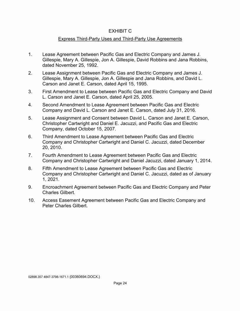
02898.357 4847-3798-1671.1 {00360694.DOCX.}
Page 24
EXHIBIT C Express Third-Party Uses and Third-Party Use Agreements
1. Lease Agreement between Pacific Gas and Electric Company and James J. Gillespie, Mary A. Gillespie, Jon A. Gillespie, David Robbins and Jana Robbins, dated November 25, 1992. 2. Lease Assignment between Pacific Gas and Electric Company and James J. Gillespie, Mary A. Gillespie, Jon A. Gillespie and Jana Robbins, and David L. Carson and Janet E. Carson, dated April 15, 1995. 3. First Amendment to Lease between Pacific Gas and Electric Company and David L. Carson and Janet E. Carson, dated April 25, 2005. 4. Second Amendment to Lease Agreement between Pacific Gas and Electric Company and David L. Carson and Janet E. Carson, dated July 31, 2016. 5. Lease Assignment and Consent between David L. Carson and Janet E. Carson, Christopher Cartwright and Daniel E. Jacuzzi, and Pacific Gas and Electric Company, dated October 15, 2007. 6. Third Amendment to Lease Agreement between Pacific Gas and Electric Company and Christopher Cartwright and Daniel C. Jacuzzi, dated December 20, 2010. 7. Fourth Amendment to Lease Agreement between Pacific Gas and Electric Company and Christopher Cartwright and Daniel Jacuzzi, dated January 1, 2014. 8. Fifth Amendment to Lease Agreement between Pacific Gas and Electric
Company and Christopher Cartwright and Daniel C. Jacuzzi, dated as of January 1, 2021.
9. Encroachment Agreement between Pacific Gas and Electric Company and Peter Charles Gilbert.
10. Access Easement Agreement between Pacific Gas and Electric Company and Peter Charles Gilbert.

02898.357 4847-3798-1671.1 {00360694.DOCX.}
Page 25
EXHIBIT D Conservation Values
In addition to the general description of the Conservation Values expressly included in the Recitals of the Conservation Easement Deed, the particular Conservation Values of the Property include, without limitation, the following: Fish, Plant, and Wildlife Habitat The Property is located within the Lake Almanor Basin, which the California Audubon Society has designated as an Important Bird Area due to its habitat for nesting and wintering waterfowl, and the presence of special status species such as willow flycatcher, sandhill crane, yellow warbler, bald eagle, and osprey. The Property contains California Wildlife Habitat Relationship (CWHR) terrestrial habitat types as set out below, as defined in “A Guide to Wildlife Habitats of California,” prepared for the California Department of Fish and Game, by Kenneth E. Mayer and William F. Laudenslayer, Jr., Editors (1988). The Property is dominated by diverse, mid-successional Sierra Mixed Conifer (SMC) habitat, where Douglas-fir (Pseudotsuga menziesii), Ponderosa pine (Pinus ponderosa), white fir (Abies concolor), sugar pine (Pinus lambertiana), incense cedar (Calocedrus decurrens), and California black oak (Quercus kelloggii) are found. Numerous openings in the canopy resulting from timber harvest and fire provide diverse understory species development: whitethorn (Ceanothus cordulatus), silktassel (Garrya fremontii), bitter cherry (Prunus emarginata), snowberry (Symphoricarpos spp.) currant species (Ribes), bitterbrush (Purshia tridentata), with grasses and forbs. Some bracken fern is located in the draws and Scouler’s willow (Salix scouleriana), also known as Fire Willow, (of older age classes from mature to decadent) is well distributed within the understory on south aspects. The pine dominated SMC habitat with black oak, silktassel, and bitterbrush (BBR) in the understory is a rare habitat type in the Almanor Basin. Special CWHR habitat elements found on the Property includes two perennial springs that support willow (Salix spp.); mountain alder (Alnus tenuifolia); and hardwood trees, predominantly black oaks, but also bigleaf maples (Acer macrophyllum). . The Property’s open SMC and BBR habitats provide summer and migratory habitat for a Tehama Deer Herd. The Property’s diversity of understory shrub species within the SMC habitat support black bear.

02898.357 4847-3798-1671.1 {00360694.DOCX.}
Page 26
The Property supports a mix of resident and migrant native birds species associated with mid-successional mixed conifer forest, including western tanager, yellow-rumped warbler, mountain chickadee, dark-eyed junco, and Cassin’s vireo. Special status bird species likely to occur on Property include: olive-sided flycatcher, bald eagle, osprey (observed), and Cooper’s hawk. Osprey are using the Property for perching and/or roosting and it is highly likely that bald eagles are using the property as well.
Open Space The Property provides a natural and scenic viewshed for the public. Scenic views of Lake Almanor and adjoining national forest and PG&E lands are available from the Property, as are views of Lassen Peak and Lassen Volcanic National Park. The Property affords scenery and open space for the public, especially as viewed from State Highway 147, Lake Almanor, and National Forest lands on the south and west sides of Lake Almanor. Outdoor Recreation Recreational use of the Property by the public includes camping, birding, hiking, mountain biking, and other related passive uses. Sustainable Forestry The Property includes timbered land supporting conifer species in the Sierra Mixed Conifer habitat containing Douglas- fir, Ponderosa Pine, white fir, sugar pine, incense cedar, California black oak and upland willow. Agricultural Uses Wild plant foods, medicinal plants, basketry materials, seeds, grasses and bulbs are cultivated for subsistence, medicinal and ceremonial purposes. Historic Resources The Property contains a number of historic and cultural resources, including but not limited to a Maidu cemetery. The land underlying Lake Almanor, known as Big Meadow, is part of the ancestral territory of the Maidu people. The creation of the Lake inundated entire Maidu villages and sites of cultural significance to the Maidu people, and the Maidu cemetery is a living memory of these events.
02898.357 4847-3798-1671.1 {00360694.DOCX.}
Page 27
EXHIBIT E Grantor’s Use of the Property
The following uses of the Property are permitted or prohibited, as indicated below. Permitted uses are deemed to be consistent with the Conservation Purposes and do not require approval by the Grantee, unless otherwise indicated. Prohibited uses are deemed to be inconsistent with the Conservation Purposes and may not be authorized by the Grantee. Grantor agrees that all permitted uses shall be carried out in conformance with applicable local, state, and federal laws, including the California Environmental Quality Act (“CEQA”), and the terms of this Conservation Easement.
1. Subdivision and Partitioning: Any legal or de facto division, subdivision, lot creation, or partitioning of the Property, including a request for a certificate of compliance pursuant to the Subdivision Map Act (Gov. Code section 66499.35), is prohibited. Notwithstanding that, as of the Effective Date, the Property is comprised of separate legal parcels, the terms and conditions of this Conservation Easement will apply to the Property as a whole, and the Property will not be transferred or otherwise conveyed except as a whole, intact, single piece of real estate; neither Grantor nor Grantor’s personal representative, successors, or assigns will transfer or otherwise convey any portion of the Property that constitutes less than the entire fee interest in the Property, except for leasehold interests. The existence of separate legal parcels as of the Effective Date shall not be interpreted to permit any use or activity on a separate legal parcel that would not have been permitted on such parcel under the terms and conditions of this Conservation Easement as applied to the Property as a whole. Upon prior written notification to the Grantee, the Grantor may execute one or more lot-line adjustments that may involve the boundary of the Property, provided, however, that no part of the Property is removed or divided from the Property as a whole. 2. Development Rights: Except as specifically permitted by this Exhibit E, the exercise of any development rights associated with the Property is prohibited, including, without limitation, the right to construct apartment houses; multi-family dwellings; mobile homes; house-trailers; permanent tent facilities or similar structures; golf courses; casinos and gaming facilities; underground tanks; billboards, or street lights. All development rights that are now or hereafter allocated to, implied, reserved or inherent in the Property are assigned, granted, deeded and/or otherwise transferred to and/or vested in and/or otherwise placed under the sole and absolute control and discretion of Grantee in perpetuity and may not be used on or transferred to any portion of the Property as it now or hereafter may be bounded or described or to any other property nor used for the purpose of calculating permissible lot yield of the Property or any other Property. 3. Commercial Uses: Except as specifically permitted by this Exhibit E, commercial uses on the Property are prohibited, including but not limited to livestock feedlots; gravel mining; commercial hotels; casinos and gaming facilities; retail outlets; retail gas station; commercial wind farms; commercial fish hatcheries; golf courses; billboards; cannabis cultivation; and commercial cultivation of native plants.

02898.357 4847-3798-1671.1 {00360694.DOCX.}
Page 28
4. Construction and Use of Structures: Notwithstanding any provision herein to the contrary, Grantor shall have the right, with the prior approval of Grantee pursuant to Section 9(b) of this Conservation Easement, to construct structures and improvements made in the course of prudent and customary land management activities, and/or to protect, preserve, or enhance the Conservation Values, including, but not limited to, restrooms, wells, garbage enclosures, benches, and interpretative kiosks. If approved by Grantee, this authorization may include a caretaker structure not to exceed 1,500 square feet and located in an existing impacted area between the railroad right of way and California State Route 147. Grantee’s approval shall not be unreasonably withheld, conditioned or delayed. For each such structure and improvement, the site selection, design, construction and use shall be undertaken, with Grantee’s approval, in a manner reasonably designed to minimize adverse impacts to the Conservation Values. To the extent feasible, building materials and colors shall be selected that harmonize with the natural landscape of the Property. 5. Roads: Grantor may maintain, repair, or replace existing roads on the Property, taking care to ensure that any such activities are consistent with the current footprint and level of improvement of such roads. Grantor shall have the right to limit or prohibit access to existing nonpublic roads, provided such actions are consistent with existing rights of way and/or easements on the Property, and further, that such actions are consistent with Section 3 and Section 8 of this Conservation Easement. Grantor may upgrade existing roads within the same footprint of such roads, subject to consultation with the Grantee pursuant to Section 10(a) of this Conservation Easement. Grantor may construct new roads to provide access to existing structures or structures authorized to be constructed by this Conservation Easement, or for management uses authorized by this Conservation Easement. In accordance with Section 10 of this Conservation Easement, the location, design, and construction of such new roads shall be approved by Grantee, which approval shall not be unreasonably withheld. Any other alteration of the surface or general topography of the Property for the purpose of construction, improvement or replacement of roads for motorized vehicles of any type or for the purpose of paving such roads is prohibited. 6. Fences and Gates: Grantor may construct, place and erect fencing and gates only as necessary for permitted uses of the Property. The construction and installation of fencing and gates shall not significantly impair the Conservation Values and shall not interfere with the public access requirements set forth in Section 8 of this Conservation Easement. In the event of destruction or deterioration of any fences and gates, whether existing at the date hereof or constructed subsequently in accordance with the provisions of this Conservation Easement, Grantor may maintain, remove and/or replace such fencing and gates with replacements of substantially the same size. 7. Trails: Grantor may construct and maintain trails (defined as any definable route less than ten (10) feet in width, not including curbs, cuts or fills) for recreational and educational purposes, and for use by pedestrians, horses and mules, and bicycles. Notwithstanding any other provision in this Conservation Easement to the contrary, Grantor may grant an easement to the County of Plumas for use of the Property as a trail corridor to connect to the Almanor Recreation Trail or for other purposes. The

02898.357 4847-3798-1671.1 {00360694.DOCX.}
Page 29
dimensions and materials for such a trail shall be consistent with those of the Almanor Recreation Trail. Grantor may use motorized vehicles on trails for management and exercise of Maidu traditional cultural practices, provided such use does not significantly impair the Conservation Values. Otherwise, motorized vehicles are prohibited on trails. The following requirements for the construction and maintenance of such new trails shall apply: (a) the trail shall be located, to the extent possible, in the path of a trail or road existing on the Effective Date, as defined in the Baseline Documentation Report; (b) the trail shall be constructed and maintained so as to minimize erosion and sedimentation and ensure proper drainage; (c) the trail shall be otherwise installed in a manner to avoid unnecessary tree removal, grading and other land disturbance, but allowing for selective brush removal; and (d) prior to construction of trails, Grantor shall submit to Grantee a qualified scientist’s opinion that the proposed trail construction will not impact any cultural resources, special status, endangered or threatened plant or animal species, or their habitats, listed in the Baseline Documentation Report, or any other such cultural resources or designated plant or animal species or habitats identified at the time of the proposed construction. Grantor shall consult with Grantee regarding construction of trails under Section 10(a) of this Conservation Easement, but Grantee’s approval shall not be required, Section 8(b) of this Conservation Easement notwithstanding. 8. Recreational Uses: Subject to and without limiting the requirements of Section 8 of this Conservation Easement, including the prior approval of Grantee as required under Section 8(b) of this Conservation Easement, Grantor may make the Property available for low-intensity outdoor recreational and educational activities, including hiking, nature study, mountain biking, and hunting; as well as camping and/or recreational vehicle use in the Seasonal Commercial Recreation Zone. Grantor may impose a reasonable charge for these activities, provided that any financial gain is dedicated to the not-for-profit mission of the Grantor. Grantor may enter into agreements with third parties for delivery of such commercial recreational and educational activities. Notwithstanding any other provision herein to the contrary, any increase in the intensity of use, expansion of the location or size of use, or change in use whether through a Third-Party Use Agreement or Grantor’s use of the Property requires prior approval of Grantee in accordance with Section 8(b) of this Conservation Easement, which approval shall not be unreasonably withheld, delayed or conditioned. 9. Traditional Activities: Grantor may propagate, restore, maintain, or gather vegetation, plants, nuts, seeds or other natural materials related to the Mountain Maidu’s traditional culture on the Property. Private and/or public Mountain Maidu traditional recreational, spiritual, cultural, and educational activities shall be permitted on the Property, including but not limited to, ceremonies, dances, games, and knowledge sharing workshops. The Grantor may authorize Maidu people to hunt on the property, consistent with state law. Grantor shall conduct its cultural activities in a manner that does not significantly impair the Conservation Values, and Grantor intends to manage the Property in accordance with Maidu land management principles and practices based on TEK as specifically described in the Management Plan. 10. Burials: Subject to the public access requirements set forth in Section 8 of the

02898.357 4847-3798-1671.1 {00360694.DOCX.}
Page 30
Conservation Easement, Grantor may inter the human remains of deceased persons of Mountain Maidu descent in the remaining internment spaces within the cemetery located within the Cemetery Zone. The interment of human remains shall be consistent with traditional Maidu burial practices and shall not significantly impair the Conservation Values. Any increase in the intensity of use, expansion of the location or size of the cemetery, or change of use, shall be subject to Grantee’s prior written approval pursuant to Section 10(a) of this Conservation Easement, which approval shall not be unreasonably withheld, conditioned or delayed. 11. Water Resources: As necessary and appropriate to carry out the uses permitted by this Conservation Easement, Grantor may, after obtaining any necessary state permits, develop, enhance and maintain water resources on the Property for habitat restoration, water consumption in connection with permitted uses, and permitted recreation uses, provided that such activities are consistent with and do not violate the PG&E Reserved Rights and do not significantly impair the Conservation Values. Permitted uses include, without limitation, the construction, repair, and maintenance of ponds and irrigation systems; installation and maintenance of wells, and the development of water capture and delivery facilities, including but not limited to water lines and access roads or trails to water facilities consistent with Section 5 and Section 7 of this Exhibit E. Water may be exported off the Property for immediate fire control response or wildfire emergency. Other than as permitted in this section, the manipulation, impoundment, or alteration of any natural swale, natural water course, non-human constructed channel, wetland, stream-bank, vernal pool, perennial spring, water circulation, or any other body of water are prohibited. 12. Water and Mineral Rights: The transfer, encumbrance, sale, lease, severance, or other separation of the mineral or water rights for the Property by Grantor is prohibited without the prior approval of Grantee in accordance with Section 10(b) of this Conservation Easement, which Grantee may withhold in its absolute discretion. The following are also prohibited: changing the place or purpose of use of any water rights; abandoning or allowing the abandonment of, by action or inaction, any water or water rights, ditch or ditch rights, spring rights, reservoir or storage rights, wells, ground water rights, or other rights in and to the use of water historically used on or otherwise appurtenant to the Property, including but not limited to: (1) riparian water rights; (2) appropriative water rights; (3) rights to waters which are secured under contract with any irrigation or water district, to the extent such waters are customarily applied to the Property; and (4) any groundwater from wells that are in existence or may be constructed in the future on the Property. Nothing herein restricts the right of Grantor to enter into sales, purchases, leases, exchanges, and other transactions in water rights, such as forbearance agreements or the use of Water Code section 1707, with a government agency or nonprofit organization for wildlife, ecological enhancement purposes, or other in-stream Conservation Values, subject to the sole discretion and prior written approval of Grantee under Section 10(b) of this Conservation Easement, provided that any such transfer does not significantly impair other Conservation Values of this Conservation Easement. 13. Air Rights: The transfer, encumbrance, sale, lease, severance or other
02898.357 4847-3798-1671.1 {00360694.DOCX.}
Page 31
separation of the air rights attached to the Property by Grantor is prohibited without the prior approval of Grantee in accordance with Section 10(b) of this Conservation Easement, which Grantee may withhold in its absolute discretion. Grantor shall not use or authorize others to use the airspace above the Property for commercial or private aviation, including but not limited to, airplane flights, ultralight flights; hang gliding; glider flights; rotor craft flights; balloon flights; airship flights; and light sport airplane flights. Grantor may use unmanned aerial vehicles for management or monitoring purposes, but shall not authorize others to use such airspace above the Property for that purpose. Grantee may use unmanned aerial vehicles for monitoring purposes, provided Grantee notifies Grantor in writing of such intended use thirty (30) days in advance of each flight. 14. Natural Resource Management: Grantor may protect, restore, enhance and maintain the natural resources on the Property, including, without limitation, stabilization of banks and soils, vegetation management; fire control and the enhancement of biodiversity, all, in accordance with sound, generally accepted practices such as prescriptive grazing, prescriptive burning, harvesting, thinning, planting and brush removal, provided such activities do not significantly impair the Conservation Values. The intentional introduction of non-native tree or other plant species is prohibited. Grantor may remove or control invasive, non-native plant species or feral, non-native animal species, using techniques that minimize harm to native wildlife and plants, provided such activities do not significantly impair the Conservation Values. 15. Refuse and Hazardous Materials: The dumping, deposit, permanent storage and/or disposal of refuse, soil, trash, contaminated soil, waste, bio-solids, debris, sewer sludge, agrichemicals, herbicides, pesticides, or any other dangerous, toxic, hazardous or unsightly materials on the Property is prohibited. Nothing herein shall prohibit Grantor from temporary storage of refuse and waste in the Seasonal Commercial Recreation Zone. 16. Minerals: Grantor may not explore for or extract minerals on the Property, provided that notwithstanding the foregoing, Grantor may remove existing rocks from the Property to be used for the purpose of blocking off roads on the Property, delineating RV camping areas on the Property, and for other purposes on the Property approved by the Grantee under Section 10(b) of this Conservation Easement, which approval shall not be unreasonably withheld, conditioned or delayed. Grantor may further remove gravel for the purposes of building permitted structures and/or maintaining permitted roads on the Property. No removal of rocks may occur within 50’ slope distance of any perennial or ephemeral watercourse, as such term is defined in the California Forest Practice Rules 2013, Title 14 California Code of Regulations, Chapter 4 Article 1, 895.1, as amended. Erosion control and drainage structures are not considered “man-made watercourses” under this Conservation Easement. Other than as permitted by this section, the filling, dumping, excavating, draining, dredging, mining, hydraulic fracturing, drilling, removing or exploring for or extracting minerals, loam, soil, sands, hydrocarbons, gravel, rocks or other similar material on or below the surface of the Property, or granting or authorizing surface entry for any such purpose are prohibited.

02898.357 4847-3798-1671.1 {00360694.DOCX.}
Page 32
17. Forest Management: (a) Permitted Forestry Practices: The Grantor reserves the right to harvest,
cut or remove trees and vegetation for the following purposes and to use or sell the timber products resulting from such activities, all in accordance with the forest management component of the Management Plan (“Forest Management Plan Component”):
(i) for firewood for use on the Property and for direct, personal use by members of the Maidu community outside the Property, provided such use does not significantly impair the Conservation Values; (ii) for the removal of trees and milling of lumber to be used by Grantor
for construction purposes on the Property as permitted by this Conservation Easement, in connection with which Grantor may make use of a portable sawmill on the Property;
(iii) to prevent, mitigate and/or respond to any natural disaster (such as wildfire, insect and disease outbreak, drought or wind damage), including the salvage and removal of dead, dying, or diseased timber; and the creation of fuel breaks;
(iv) for the purposes of public or personal safety on the Property; (v) to promote the health and sustainability of the Property’s natural
resources, to restore and maintain an ecologically appropriate mix of overstory and understory vegetation and to control invasive and non-native vegetation, with the goal of old growth and black oak establishment and management;
(vi) to reduce or manage fuel loads, favor or maintain specific native vegetation types, or otherwise promote forest health by prescriptive burns and fire management activities including but not limited to grazing by goats or other herbivores;
(vii) for wildlife habitat restoration or management; and (viii) for the removal of trees in connection with the clearing of areas for
structures as permitted by this Conservation Easement. Grantor further may carry out forest management activities not expressly set
forth above, provided, however, that all such activities are conducted in a manner that is consistent with the Conservation Purposes and other terms and conditions of this Conservation Easement. Snags shall be retained for wildlife habitat benefits and shall not be intentionally removed, except for reasons of public safety or adherence to the objectives of the Management Plan, and in accordance with the requirements of the California Forest Practice Act and Rules.
(b) Forest Management Planning: The Forest Management Component of
the Management Plan shall be prepared and approved by a Registered Professional
02898.357 4847-3798-1671.1 {00360694.DOCX.}
Page 33
Forester or by an equivalent professional who is reasonably acceptable to Grantee. The goals of the Forest Management Component of the Management Plan shall be to create, manage and preserve a healthy and vigorous forest with sustainable stands of native tree species; to manage the forest to improve resilience to drought and pests; to reduce build-up of fuels that create risks of catastrophic fire; and to create and maintain a full and balanced variety of stand species, ages and characteristics; and to manage the forest to enhance wildlife as determined by Grantor. The Forest Management Component of the Management Plan will identify objectives to protect and enhance resources, including cultural resources. Planning will investigate the potential for a traditional demonstration management area to educate the public about Native American traditional ecological practices used in the area.
(c) Timber Harvest Plans: Except for actions to mitigate threat(s) to public or personal safety, any permit applications associated with proposed Timber Harvest Plans shall be submitted to Grantee for review and consultation under Section 10(a) of this Conservation Easement at least 30 days prior to the submission of the application to the California Department of Forestry and Fire Protection (“Cal Fire”). Grantor shall notify Grantee immediately of any proposed actions to be taken on an emergency basis to protect public or personal safety. If review of the proposed Timber Harvest Plan by Cal Fire results in modifications to the proposed Timber Harvest Plan, Grantor shall further consult with Grantee in accordance with Section 10(a) of this Conservation Easement.
(d) Reports: Grantor shall submit to Grantee a report on harvest levels and their impact, if any, on the Conservation Purposes and Conservation Values of the Property every ten (10) years. Grantee and the Grantor may agree that the report can be deferred beyond the ten-year period.
18. Fire Management: Fire protection and suppression activities shall be permitted on the Property, provided such activities do not significantly impair the Conservation Values. Except where Grantor is required to take emergency action to protect public or personal safety, Grantor shall consult with Grantee under Section 10(a) of this Conservation Easement before undertaking any fire management activities under this section. Where Grantor is required to take emergency action to protect public or personal safety, such action shall be carried out in a manner designed to minimize impacts on the Conservation Values.
19. Carbon Rights: Grantor hereby reserves for itself and its successors and assigns all carbon rights and the right to sell carbon rights that are part of and appurtenant to the Property for forest-based carbon storage occurring by virtue of the forest management and other restrictions established herein starting as of the Effective Date. For the purposes of this Conservation Easement, carbon rights and carbon as described herein are rights that currently exist or may come to exist in the future and are associated with the absorption by plants of carbon dioxide from the atmosphere and its conversion to carbon stored in trees and plants on the Property or stored in wood

02898.357 4847-3798-1671.1 {00360694.DOCX.}
Page 34
products extracted pursuant to forest management activities permitted herein, and trees and other vegetation and associated roots, surface duff and organic elements in the soil on the Property; 20. Agriculture: Ranching and commercial and non-commercial production of agricultural crops is limited to (1) the planting and harvesting of native plants as may become viable for Grantor in the future; (2) other ranching and agricultural activities which do not significantly impair the Conservation Values; provided any and all such uses are approved in advance by Grantee in accordance with Section 10(b) of this Conservation Easement, which approval shall not be unreasonably withheld, conditioned or delayed; and (3) as otherwise permitted by this Conservation Easement. Other than as permitted by this Section 20, the plowing, disking, cultivation, ripping, planting, sowing, irrigation, or any other conversion of the Property to crops, orchards, vineyards, or any other agricultural use or disturbance of the Property and its native vegetation are prohibited. Intentional seeding, planting, or introduction of exotic or non-native plant species are prohibited. 21. Vehicle Use: Grantor may authorize the use of motorized vehicles on designated roadways for the recreational uses permitted in Section 8 of this Exhibit E. Except as permitted in Section 8 of this Exhibit E, commercial recreational vehicle use is prohibited. Grantor shall take reasonable and practicable actions to ensure that all vehicles use only designated roads, and that unauthorized third parties are prevented from using motorized vehicles on the Property, provided, however, that Grantor shall not be responsible for injuries or changes to the Property caused by such uses beyond Grantor’s control. In no event shall any all-terrain vehicles, off-road vehicles, or off-highway vehicles, including without limitation four-wheelers, three-wheelers, snowmobiles, and/or motorcycles be used off designated roadways, except when used by Grantor for management or to exercise Maidu traditional cultural practices, provided such uses do not significantly impair the Conservation Values. Grantor shall consult with Grantee about its vehicle use on the Property in accordance with Section 10(a) of this Conservation Easement.
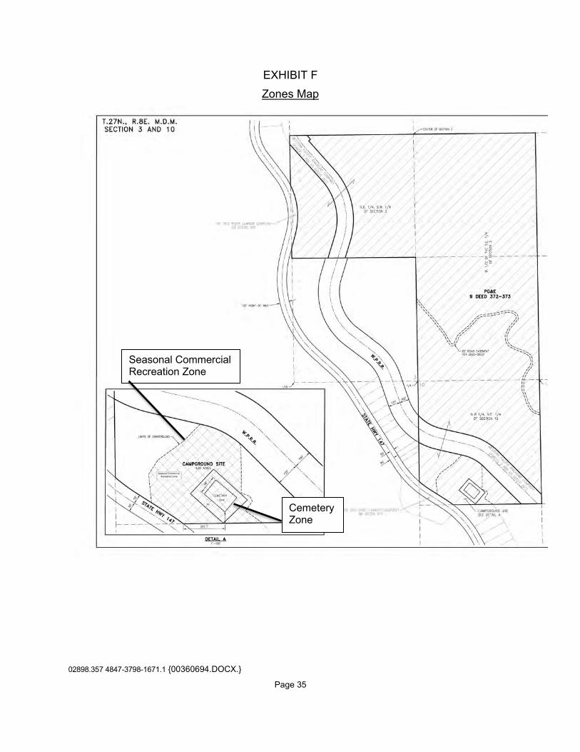
02898.357 4847-3798-1671.1 {00360694.DOCX.}
Page 35
EXHIBIT F Zones Map
Seasonal Commercial Recreation Zone
Cemetery Zone
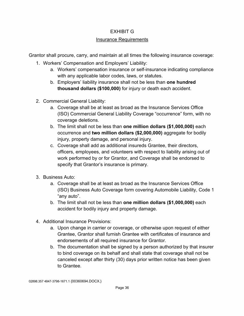
02898.357 4847-3798-1671.1 {00360694.DOCX.}
Page 36
EXHIBIT G Insurance Requirements
Grantor shall procure, carry, and maintain at all times the following insurance coverage:
1. Workers’ Compensation and Employers’ Liability: a. Workers’ compensation insurance or self-insurance indicating compliance
with any applicable labor codes, laws, or statutes. b. Employers’ liability insurance shall not be less than one hundred
thousand dollars ($100,000) for injury or death each accident.
2. Commercial General Liability: a. Coverage shall be at least as broad as the Insurance Services Office
(ISO) Commercial General Liability Coverage “occurrence” form, with no coverage deletions.
b. The limit shall not be less than one million dollars ($1,000,000) each occurrence and two million dollars ($2,000,000) aggregate for bodily injury, property damage, and personal injury.
c. Coverage shall add as additional insureds Grantee, their directors, officers, employees, and volunteers with respect to liability arising out of work performed by or for Grantor, and Coverage shall be endorsed to specify that Grantor’s insurance is primary.
3. Business Auto: a. Coverage shall be at least as broad as the Insurance Services Office
(ISO) Business Auto Coverage form covering Automobile Liability, Code 1 “any auto”.
b. The limit shall not be less than one million dollars ($1,000,000) each accident for bodily injury and property damage.
4. Additional Insurance Provisions: a. Upon change in carrier or coverage, or otherwise upon request of either
Grantee, Grantor shall furnish Grantee with certificates of insurance and endorsements of all required insurance for Grantor.
b. The documentation shall be signed by a person authorized by that insurer to bind coverage on its behalf and shall state that coverage shall not be canceled except after thirty (30) days prior written notice has been given to Grantee.

02898.357 4847-3798-1671.1 {00360694.DOCX.}
Page 37
c. Upon request by Grantee, not to exceed once annually, Grantor shall furnish Grantee with complete copies of its policies, the policies of its agents or contractors, or both.
02898.357 4847-3798-1671.1 {00360694.DOCX.}
Page 38
EXHIBIT H Power of Termination
[Follows this page]

02898.357 4847-3798-1671.1 {00360694.DOCX.}
Page 39
EXHIBIT I Encumbrances
1. An easement over the property for a right of way thereon for ditches or canals constructed by the authority of the United States and incidental purposes, as reserved by the United States of America, in instrument recorded June 16, 1930, in Book 9 of Patents, page 372, official records. 2. The terms, conditions and provisions as contained in the instrument entitled “Agreement”, by and between Pacific Gas and Electric Company and Edward C. Smith, recorded July 21, 1976, in Book 256, page 118, official records. 3. An easement over the property for ingress and egress, 20 feet in width and incidental purposes, as granted to Ronald H. Westfall, Carol J. Westfall and James M. Westfall, in deed recorded September 1, 2000, as Document No. 2000-06231, official records. 4. Rights of tenants in possession under lease agreements, including any unrecorded leases and/or subleases affecting the property. 5. Easement, rights or interests, if any, arising out of: a) The sale or transfer of lots, blocks, plots or sections in any cemetery or of burial rights therein; b) Any interment in said cemetery 6. Restrictions imposed by law regarding the sale and disposition of the property resulting from the use or dedication of the property for cemetery purposes.

Attachment H
Grant Deed
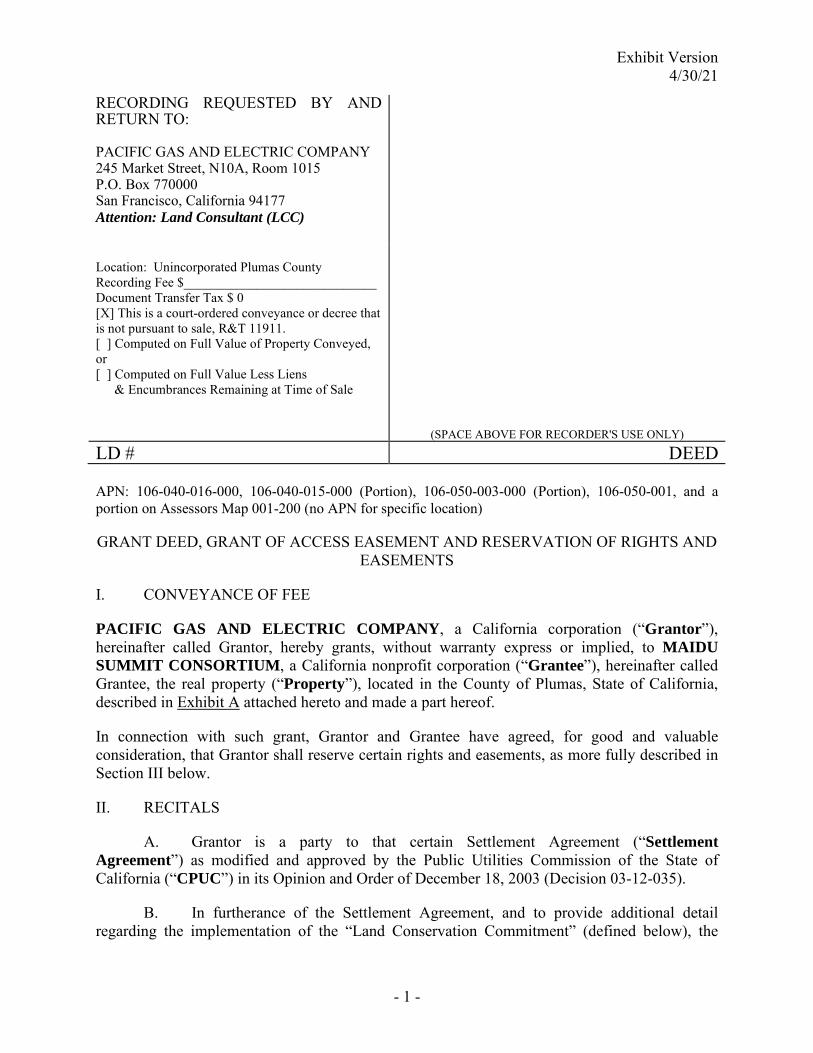
Exhibit Version 4/30/21
- 1 -
RECORDING REQUESTED BY AND RETURN TO: PACIFIC GAS AND ELECTRIC COMPANY 245 Market Street, N10A, Room 1015 P.O. Box 770000 San Francisco, California 94177 Attention: Land Consultant (LCC)
Location: Unincorporated Plumas County Recording Fee $_____________________________ Document Transfer Tax $ 0 [X] This is a court-ordered conveyance or decree that is not pursuant to sale, R&T 11911. [ ] Computed on Full Value of Property Conveyed, or [ ] Computed on Full Value Less Liens
& Encumbrances Remaining at Time of Sale
(SPACE ABOVE FOR RECORDER'S USE ONLY)
LD # DEED APN: 106-040-016-000, 106-040-015-000 (Portion), 106-050-003-000 (Portion), 106-050-001, and a portion on Assessors Map 001-200 (no APN for specific location)
GRANT DEED, GRANT OF ACCESS EASEMENT AND RESERVATION OF RIGHTS AND EASEMENTS
I. CONVEYANCE OF FEE
PACIFIC GAS AND ELECTRIC COMPANY, a California corporation (“Grantor”), hereinafter called Grantor, hereby grants, without warranty express or implied, to MAIDU SUMMIT CONSORTIUM, a California nonprofit corporation (“Grantee”), hereinafter called Grantee, the real property (“Property”), located in the County of Plumas, State of California, described in Exhibit A attached hereto and made a part hereof.
In connection with such grant, Grantor and Grantee have agreed, for good and valuable consideration, that Grantor shall reserve certain rights and easements, as more fully described in Section III below.
II. RECITALS
A. Grantor is a party to that certain Settlement Agreement (“Settlement Agreement”) as modified and approved by the Public Utilities Commission of the State of California (“CPUC”) in its Opinion and Order of December 18, 2003 (Decision 03-12-035).
B. In furtherance of the Settlement Agreement, and to provide additional detail regarding the implementation of the “Land Conservation Commitment” (defined below), the
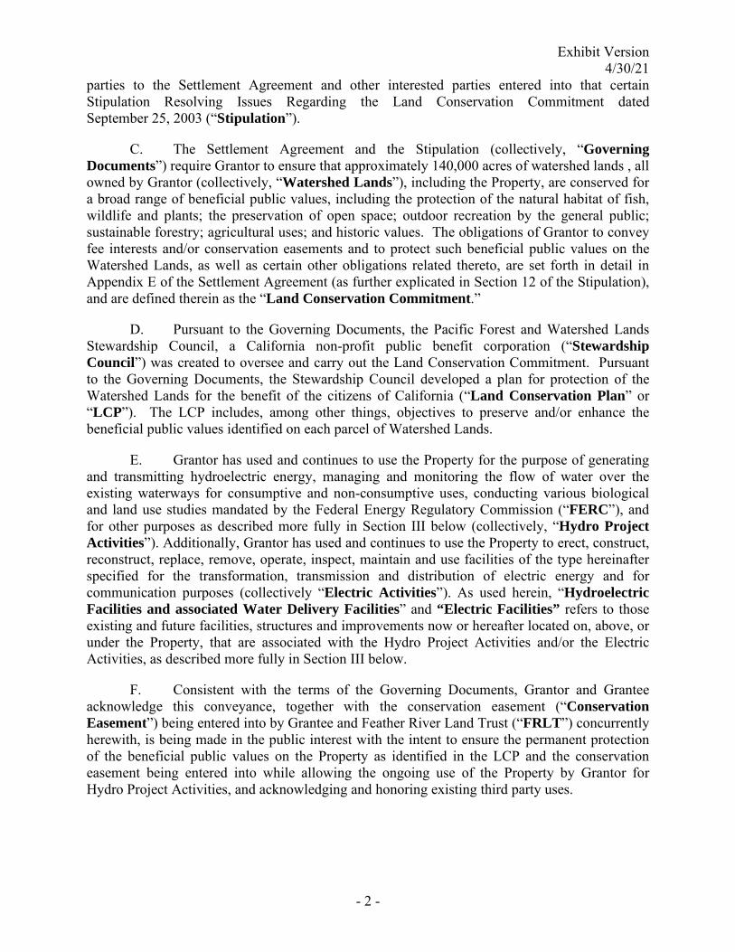
Exhibit Version 4/30/21
- 2 -
parties to the Settlement Agreement and other interested parties entered into that certain Stipulation Resolving Issues Regarding the Land Conservation Commitment dated September 25, 2003 (“Stipulation”).
C. The Settlement Agreement and the Stipulation (collectively, “Governing Documents”) require Grantor to ensure that approximately 140,000 acres of watershed lands , all owned by Grantor (collectively, “Watershed Lands”), including the Property, are conserved for a broad range of beneficial public values, including the protection of the natural habitat of fish, wildlife and plants; the preservation of open space; outdoor recreation by the general public; sustainable forestry; agricultural uses; and historic values. The obligations of Grantor to convey fee interests and/or conservation easements and to protect such beneficial public values on the Watershed Lands, as well as certain other obligations related thereto, are set forth in detail in Appendix E of the Settlement Agreement (as further explicated in Section 12 of the Stipulation), and are defined therein as the “Land Conservation Commitment.”
D. Pursuant to the Governing Documents, the Pacific Forest and Watershed Lands Stewardship Council, a California non-profit public benefit corporation (“Stewardship Council”) was created to oversee and carry out the Land Conservation Commitment. Pursuant to the Governing Documents, the Stewardship Council developed a plan for protection of the Watershed Lands for the benefit of the citizens of California (“Land Conservation Plan” or “LCP”). The LCP includes, among other things, objectives to preserve and/or enhance the beneficial public values identified on each parcel of Watershed Lands.
E. Grantor has used and continues to use the Property for the purpose of generating and transmitting hydroelectric energy, managing and monitoring the flow of water over the existing waterways for consumptive and non-consumptive uses, conducting various biological and land use studies mandated by the Federal Energy Regulatory Commission (“FERC”), and for other purposes as described more fully in Section III below (collectively, “Hydro Project Activities”). Additionally, Grantor has used and continues to use the Property to erect, construct, reconstruct, replace, remove, operate, inspect, maintain and use facilities of the type hereinafter specified for the transformation, transmission and distribution of electric energy and for communication purposes (collectively “Electric Activities”). As used herein, “Hydroelectric Facilities and associated Water Delivery Facilities” and “Electric Facilities” refers to those existing and future facilities, structures and improvements now or hereafter located on, above, or under the Property, that are associated with the Hydro Project Activities and/or the Electric Activities, as described more fully in Section III below.
F. Consistent with the terms of the Governing Documents, Grantor and Grantee acknowledge this conveyance, together with the conservation easement (“Conservation Easement”) being entered into by Grantee and Feather River Land Trust (“FRLT”) concurrently herewith, is being made in the public interest with the intent to ensure the permanent protection of the beneficial public values on the Property as identified in the LCP and the conservation easement being entered into while allowing the ongoing use of the Property by Grantor for Hydro Project Activities, and acknowledging and honoring existing third party uses.
Exhibit Version 4/30/21
- 3 -
III. GRANT OF ACCESS EASEMENT TO GRANTEE; GRANTOR RESERVATION OF RIGHTS AND EASEMENTS
1. Non-Exclusive Access Easements.
(a) Grantor hereby further grants to Grantee, its invitees and assigns, a non-exclusive easement for surface access, ingress and egress to and from the Property (the “Access Easement”) over and across the Adjacent Lands, by means of the roads and lanes thereon, if such there be, otherwise by such route or routes as shall occasion the least practicable damage and inconvenience to Grantor’s Adjacent Lands (“Grantee’s Access Rights”). “Adjacent Lands” means lands owned by Grantor that are contiguous to the Property and that are described in Exhibit X, attached hereto and made a part hereof. Grantee may allow FRLT and any successor to FRLT under the Conservation Easement to utilize the Grantee’s Access Rights.
(b) Grantor, its invitees and assigns, hereby reserves a non-exclusive right of surface access, ingress and egress over and across the Property to and from the Adjacent Lands, by means of roads and lanes thereon, if such there be, otherwise by such route or routes as shall occasion the least practicable damage and inconvenience to the Property (“Grantor’s Access Rights”). Grantor may allow FRLT and any other holder of a conservation easement encumbering all or any portion of the Adjacent Lands to utilize the Grantor’s Access Rights.
(c) Grantee's Access Rights and Grantor's Access Rights shall constitute covenants running with the land pursuant to Section 1468 of the California Civil Code, as may be amended from time-to-time, and shall be binding upon and inure to the benefit of the parties hereto, their respective successors and assigns.
2. Reserved Rights and Reserved Easements. Grantor expressly reserves the right to engage in or invite or permit others to engage in the activities and uses set forth below (collectively, the “Reserved Rights”) as Grantor may determine in Grantor's sole discretion exercised in good faith is required for Grantor’s continued Hydro Project Activities and Electric Activities, including the continued operation and maintenance of Hydroelectric Facilities and associated Water Delivery Facilities and Electric Facilities, together with a right of way, within the easement area described in Exhibit D attached hereto, and shown on Exhibit D-1 attached (“Easement Area”) as reasonably necessary or convenient for the exercise of the Reserved Rights for the continued operation and maintenance of Electric Facilities (collectively, the “Reserved Easements”). Any such invitee or permitee shall be subject to the terms of this Grant Deed to the same extent as Grantor hereunder. The current location of the Hydroelectric Facilities and associated Water Delivery Facilities and Electric Facilities and Reserved Easement areas are depicted on Exhibit D-1 attached hereto; provided, however, that Grantor shall have the right to change the Easement Area as Grantor may determine, in Grantor's sole discretion exercised in good faith, is Required for Grantor’s continued Hydro Project Activities and Electric Activities. Whenever reasonably practical, Grantor will use reasonable efforts to notify and consult with Grantee in advance of the exercise of the Reserved Rights and Reserved Easements, and use reasonable efforts to employ methods and practices that will not significantly impair the beneficial public values of the Property. The Reserved Rights and Reserved Easements are as follows:
(a) Grantor reserves, for its beneficial uses, all riparian water rights inherent in and part and parcel of the Property; all appropriative surface water rights (including, but not

Exhibit Version 4/30/21
- 4 -
limited to, any appropriative surface water rights having a point of diversion, place of storage, or place of use on the Property); all prescriptive surface water rights; and all other right, title and interest of any nature whatsoever in and to the surface waters and the subterranean streams flowing through known and definite channels which are now or hereafter located or flowing upon or abutting the Property. Nothing in this subsection (a) shall prevent Grantee from using reasonable amounts of water on the Property for activities solely intended to preserve and enhance the beneficial public values, provided such activities are conducted in accordance with applicable law. Such use by Grantee may be conducted without notice to the Grantor.
(b) Grantor reserves the permanent right to operate, maintain, repair, alter, replace and expand existing and future Hydroelectric Facilities and associated Water Delivery Facilities, including project replacements and improvements required to meet existing and future water delivery and other requirements for power generation and consumptive water use by existing and future users, compliance with any FERC license, FERC license renewal or other regulatory or legal requirements. In furtherance of and without in any way limiting the generality of the foregoing, the following rights are expressly reserved:
(1) The right to conduct any and all uses and activities now or at any time in the future deemed necessary or appropriate by Grantor in Grantor's sole discretion exercised in good faith in connection with the generation of hydroelectric energy, including, but not limited to the operation, maintenance, repair, alteration, replacement and expansion of existing Hydroelectric Facilities and associated Water Delivery Facilities, and the construction, operation, maintenance, repair, alteration, replacement and expansion of new Hydroelectric Facilities and associated Water Delivery Facilities; and
(2) The right to use, maintain, establish, construct, alter, expand and improve water sources, courses, and bodies within the Property, and to take, divert and appropriate water; and
(3) The right to conduct any and all uses and activities currently or in the future deemed necessary or appropriate by Grantor in Grantor's sole discretion exercised in good faith to comply with any applicable FERC license or other regulatory or legal requirements, including any amendments thereto and replacements thereof, and with applicable regulations and orders of the FERC or other regulatory agencies; and
(4) The right to conduct any and all uses and activities now or at any time hereafter deemed necessary or appropriate by Grantor in Grantor's sole discretion exercised in good faith to comply with the Federal Power Act (Title 16 United States Code, Chapter 12) and any successor statute (the “FPA”); and
(5) The right to decommission all or any portion of existing and future Hydroelectric Facilities and associated Water Delivery Facilities in accordance with any applicable license issued by the FERC.
(c) Grantor reserves the permanent right to conduct said Electric Activities within said Easement Area for its Electric Facilities, described as follows:
Exhibit Version 4/30/21
- 5 -
(1) Such towers, poles, and/or other structures (or any combination thereof) and all necessary and proper foundations and footings, with such aerial wires, cables, electrical conductors with associated crossarms, braces, transformers, anchors, guy wires and cables, and such underground conduits, pipes, manholes, service boxes, wires, cables and electrical conductors; aboveground marker posts, risers, and service pedestals; and vaults, underground and aboveground switches, fuses, terminals, and transformers with associated concrete pads; and fixtures and appurtenances necessary to any and all thereof, as Grantor deems necessary for the transmission and distribution of electric energy and for communication purposes.
(d) Grantor further reserves to itself the following permanent rights with respect to the foregoing Reserved Rights and Reserved Easements:
(1) The right of ingress to and egress from the Easement Area, Hydroelectric Facilities and associated Water Delivery Facilities over and across the Property by means of roads and lanes thereon, if such there be, otherwise by such route or routes as shall occasion the least practicable damage and inconvenience to Grantee and to use said roads, lanes, or routes to provide access to any of Grantor's easements and facilities on lands adjacent to the Property; and
(2) The right, from time to time, to install, maintain and use gates in all fences which now or shall hereafter cross the Property; and
(3) The right, from time to time, to trim or to cut down any and all trees, brush or other vegetation now or hereafter on the Property which now or hereafter in the opinion of Grantor may interfere with or be a hazard to any of the Hydroelectric Facilities and associated Water Delivery Facilities and/or Electric Facilities located on the Property or adjacent to the Property, or as Grantor deems necessary to comply with applicable state or federal regulations; and
(4) The right, from time to time, to trim or to cut down any unauthorized trees, crops, vines or other vegetation as described in Section IV.3 below that exceed ten feet (10’) in height within the Easement Area and may cause the Grantor to take reasonable measures to control resprouting trees; and
(5) The right, from time to time, to trim and cut down and clear away any and all trees, brush and other vegetation on the Property (A) for purposes of disease or insect control or otherwise as necessary or appropriate for prudent land management (i.e., not motivated by commercial benefit), and/or (B) for other vegetation management operations, including but not limited to forest fuel reduction projects, thinning of tree stands and meadow restoration projects. The foregoing may include the use of mastication machines and pesticide use to control trees, brush and other vegetation and/or insects; and
(6) to use such portion of the Property contiguous to the Easement Area as may be reasonably necessary in connection with the construction, reconstruction, installation, inspection, maintenance, repair, replacement and removal of the Electric Facilities; and
Exhibit Version 4/30/21
- 6 -
(7) to mark the location of the Easement Area by suitable markers set in the ground; provided that said markers shall be placed in fences or other locations which will not interfere with any reasonable use Grantee shall make of the Easement Area; and
3. Required Exercise. An exercise of Grantor's Reserved Rights shall be "required" (as used in the preceding Section III.1) where Grantor determines in its sole discretion exercised in good faith that such exercise is necessary to fulfill requirements or directives of any one or more of the following: (a) the CPUC or the FERC; (b) other local, state or federal governmental entities; (c) any applicable law, ordinance, rule or regulation of any local, state or federal governmental entity; (d) any third party agreement entered into by Grantor in good faith or by which Grantor is bound; or (e) professional engineering and design standards governing the ownership, maintenance, and/or operation of the Hydroelectric Facilities and associated Water Delivery Facilities and/or Electric Facilities.
IV. TERMS OF GRANT
1. The conveyance by Grantor to Grantee pursuant to this Grant Deed and Reservation of Rights and Easements (“Grant Deed”) is subject to: (a) a lien securing payment of real estate taxes and assessments; (b) applicable zoning and use laws, ordinances, rules and regulations of any municipality, township, county, state or other governmental agency or authority; (c) all matters that would be disclosed by a physical inspection or survey of the Property or that are actually known to Grantee; and (d) all contracts, leases, licenses, covenants, conditions, easements, restrictions, liens, encumbrances and other exceptions which are recorded or unrecorded.
2. The provisions hereof shall inure to the benefit of and bind the successors and assigns of the respective parties hereto, and all covenants shall apply to and run with the Property. All future conveyances of the fee interest in the Property shall be consistent with the terms of the Governing Documents. In accordance with Section 12 b (4) of the Stipulation, Grantee and its successors and assigns shall not convey all or any portion of the fee interest in the Property to any governmental entity, public agency or any Native American tribe that may currently have, or come to possess, authority to expand Grantor’s obligations under Part 1 of the FPA, without the prior written consent of the Grantor, which consent shall be in Grantor's sole discretion exercised in good faith.
3. Grantee agrees that it shall not plant or maintain any trees, crops, vines or other vegetation that naturally exceeds a height of ten feet (10’) at maturity within said Easement Area.
4. Grantee shall have the right to use the Easement Area for purposes which will not interfere with Grantor's full enjoyment of the rights hereby reserved; provided that:
(a) Grantee shall not erect or construct any building or other structure, or drill or operate any well, or construct any reservoir or other obstruction or diminish or substantially add to the ground level in the Easement Area; and
(b) Grantee shall not deposit, or permit or allow to be deposited, earth, rubbish, debris, or any other substance or material, whether combustible or

Exhibit Version 4/30/21
- 7 -
noncombustible, on the Easement Area, or so near thereto as to constitute, in the opinion of Grantor, a hazard to any of the Electric Facilities.
V. MISCELLANEOUS
1. If any provision of this Grant Deed shall be unenforceable or invalid, the same shall not affect the remaining provisions hereof and to this end the provisions hereof are intended to be and shall be severable.
2. The real property hereby conveyed is no longer necessary or useful to Grantor in the performance by it of its duties to the public.
3. The California Public Utilities Commission, in Decision No. ____________, has approved transfer of the Property under State of California Public Utilities Code Section 851.
4. This Grant Deed may be executed in two or more counterparts, each of which shall be deemed an original, but all of which together shall constitute one and the same instrument.
5. The Recitals in Section II above are hereby incorporated into this Grant Deed.
[SIGNATURES FOLLOW ON NEXT PAGE]
Exhibit Version 4/30/21
Grant Deed, Grant of Access Easement and Reservation of Rights and Easements (Lake Almanor – Maidu Cemetery)
IN WITNESS WHEREOF, the parties have executed and delivered this Grant Deed as of _______________________.
GRANTOR: PACIFIC GAS AND ELECTRIC COMPANY, a California corporation By: ____________________________
Grantee accepts, acknowledges, and agrees to the terms of this Grant Deed.
GRANTEE: MAIDU SUMMIT CONSORTIUM, a California nonprofit corporation By: ____________________________
Benjamin D. Cunningham Chairperson
By: ____________________________
Marvena G. Harris Secretary
By: ____________________________ Trina Evelyn Cunningham Executive Director

Exhibit A
EXHIBIT A
LEGAL DESCRIPTION OF PROPERTY
[Follows this page]

Page 1 of 4
EXHIBIT A
RESULTANT PARCEL 1
ALL THAT CERTAIN PARCEL OF LAND SITUATE IN SECTIONS 3 AND 10, TOWNSHIP 27 NORTH,
RANGE 8 EAST, MOUNT DIABLO MERIDIAN, AS RECORDED IN VOLUME 9, PAGE 372 OF PATENTS
OF THE COUNTY OF PLUMAS, STATE OF CALIFORNIA, DESCRIBED THEREIN AS FOLLOWS:
THE NORTHEAST ONE‐QUARTER OF THE SOUTHWEST ONE‐QUARTER AND THE WEST ONE‐HALF
OF THE SOUTHEAST ONE‐QUARTER OF SAID SECTION 3 AND THE NORTHWEST ONE‐QUARTER
OF THE NORTHEAST ONE‐QUARTER OF SAID SECTION 10.
EXCEPTING THEREFROM ALL THOSE CERTAIN PARCELS OF LAND WITHIN SAID SECTIONS 3 AND
10, DESCRIBED IN A DOCUMENT AS PARCEL 1 AND PARCEL 2, RECORDED IN VOLUME 65, PAGE
267 OF DEEDS OF THE COUNTY OF PLUMAS.
ALSO EXCEPTING THEREFROM ALL THAT CERTAIN PARCEL OF LAND WITHIN SAID SECTIONS 3
AND 10, AS RECORDED IN BOOK 68 , PAGE 315 OF DEEDS OF THE COUNTY OF PLUMAS.
ALSO EXCEPTING THEREFROM ALL THAT CERTAIN PARCEL OF LAND WITHIN SAID SECTIONS 10,
AS RECORDED IN BOOK 135, PAGE 13 OF DEEDS OF THE COUNTY OF PLUMAS, DESCRIBED
THEREIN AS FOLLOWS:
THAT PORTION OF THE NORTHWEST ONE‐QUARTER OF THE NORTHEAST ONE‐QUARTER OF
SAID SECTION 10, LYING ON THE SOUTHWESTERLY SIDE OF THE SOUTHWESTERLY BOUNDARY
LINE OF THE RIGHT‐OF‐WAY OF PLUMAS COUNTY ROAD, ROUTE NO. 315.
ALSO EXCEPTING THEREFROM ALL THAT PORTION OF THE NORTHEAST ONE‐QUARTER OF THE
SOUTHWEST ONE‐QUARTER OF SAID SECTION 3, LYING SOUTHERLY AND WESTERLY OF THE
FOLLOWING DESCRIBED LINE:
COMMENCING AT A 3/4 INCH IRON PIPE TAGGED “L.S. 2322” MARKING THE SOUTH
ONE‐QUARTER CORNER OF SAID SECTION 3 AS SHOWN ON THAT MAP FILED FOR RECORD IN
BOOK 6 OF RECORDS OF SURVEY, AT PAGE 55, PLUMAS COUNTY RECORDS; THENCE ALONG THE
MID‐SECTION LINE THEREOF, NORTH 01°03'25" WEST, A DISTANCE OF 1,317.03 FEET (SHOWN
AS N 0° 33’ W, A DISTANCE OF 1317.58 FEET ON SAID MAP) TO A 1/2 INCH IRON PIPE MARKING
THE SOUTHEAST CORNER OF THE NORTHEAST ONE‐QUARTER OF THE SOUTHWEST
ONE‐QUARTER OF SAID SECTION 3 AS SHOWN ON SAID MAP; THENCE WESTERLY ALONG THE
SOUTH LINE THEREOF, SOUTH 89°31'24" WEST, A DISTANCE OF 724.70 FEET TO A POINT ON
THE EASTERLY LINE OF A 225‐FOOT RIGHT‐OF‐WAY OF THE WESTERN PACIFIC RAILROAD, SAID
POINT BEING THE NORTHERLY TERMINUS OF A LINE HAVING A BEARING OF NORTH 17° 21’

Page 2 of 4
EAST AND A DISTANCE OF 234.38 FEET AS SHOWN ON SAID MAP; THENCE CONTINUING
ALONG SAID SOUTH LINE, SOUTH 89°31'24" WEST, A DISTANCE OF 209.53 FEET TO A POINT ON
THE WESTERLY LINE OF A 175 ‐FOOT RIGHT‐OF‐WAY OF THE WESTERN PACIFIC RAILROAD, SAID
POINT BEING THE TRUE POINT OF BEGINNING; THENCE ALONG THE SAID WESTERLY LINE
NORTH 16°50'35" EAST, A DISTANCE OF 68.09 FEET TO A POINT LYING 65.00 FEET NORTHERLY,
AT RIGHT ANGLES, FROM THE SOUTH LINE OF THE NORTHEAST ONE‐QUARTER OF THE
SOUTHWEST ONE‐QUARTER OF SAID SECTION 3; THENCE WESTERLY, PARALLEL WITH SAID
SOUTH LINE, SOUTH 89°31'24" WEST, A DISTANCE OF 361.62 FEET; THENCE NORTH 19°05'24"
WEST, A DISTANCE OF 94.58 FEET TO A POINT ON THE EASTERLY RIGHT‐OF‐WAY LINE OF STATE
HIGHWAY NO. 147 (FORMERLY KNOWN AS COUNTY HIGHWAY ROUTE NO. 315), THENCE
ALONG SAID EASTERLY RIGHT‐OF‐WAY LINE, SOUTH 14°42’40” WEST, A DISTANCE OF
57.73 FEET, MORE OR LESS, TO THE POINT OF INTERSECTION WITH THE WESTERLY LINE OF THE
NORTHEAST ONE‐QUARTER OF THE SOUTHWEST ONE‐QUARTER OF SAID SECTION 3, SAID
POINT BEING THE POINT OF TERMINATION.
CONTAINING 141.10 ACRES, MORE OR LESS.
THE FOREGOING DESCRIPTION IS BASED ON THE CALIFORNIA COORDINATE SYSTEM OF 1983,
ZONE 1, NAD 83 (NSRS 2007)(EPOCH 2011.00). THE DISTANCES ARE GRID, TO OBTAIN GROUND
DISTANCES, DIVIDE GRID DISTANCES BY A COMBINED SCALE FACTOR OF 0.9997178
SUBJECT TO ALL COVENANTS, RIGHTS, RIGHTS‐OF‐WAY AND EASEMENTS OF RECORD.
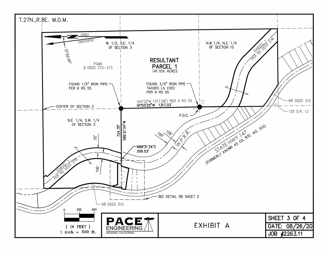
W.P
.R.R
.
STATE HWY 147
PACEENGINEERINGREDDING, CALIFORNIA
GEODETIC
0°36'49"
GRID
AutoCAD SHX Text
PG&E 9 DEED 372-373
AutoCAD SHX Text
W. 1/2, S.E. 1/4 OF SECTION 3
AutoCAD SHX Text
N.E. 1/4, S.W. 1/4 OF SECTION 3
AutoCAD SHX Text
N.W 1/4, N.E. 1/4 OF SECTION 10
AutoCAD SHX Text
10
AutoCAD SHX Text
3
AutoCAD SHX Text
CENTER OF SECTION 3
AutoCAD SHX Text
RESULTANT PARCEL 1
AutoCAD SHX Text
P.O.C.
AutoCAD SHX Text
FOUND 3/4" IRON PIPE TAGGED LS 2322 PER 6 RS 55
AutoCAD SHX Text
FOUND 1/2" IRON PIPE PER 6 RS 55
AutoCAD SHX Text
(N0°33'W 1317.58') PER 6 RS 55
AutoCAD SHX Text
141.10± ACRES
AutoCAD SHX Text
PARCEL 1 PER 65 DEED 276
AutoCAD SHX Text
PARCEL 1 PER 65 DEED 276
AutoCAD SHX Text
(FORMERLY KNOWN AS CO. RTE. NO. 315)
AutoCAD SHX Text
SHEET 3 OF 4
AutoCAD SHX Text
DATE: 08/26/20
AutoCAD SHX Text
JOB #2263.11
AutoCAD SHX Text
1 inch = ft.
AutoCAD SHX Text
( IN FEET )
AutoCAD SHX Text
0
AutoCAD SHX Text
500
AutoCAD SHX Text
500
AutoCAD SHX Text
250
AutoCAD SHX Text
EXHIBIT A
AutoCAD SHX Text
SEE DETAIL ON SHEET 2
AutoCAD SHX Text
T.27N.,R.8E. M.D.M.

PACEENGINEERINGREDDING, CALIFORNIA
AutoCAD SHX Text
STATE HWY 147
AutoCAD SHX Text
PARCELS A-D PER 3 RS 51 (SUBDIVISION OF LOT 28 INDIAN HILLS SUBDIVISION (1 MAPS 45)
AutoCAD SHX Text
W.P.R.R.
AutoCAD SHX Text
PROPERTY LINE REMOVED
AutoCAD SHX Text
PROPERTY LINE ADDED
AutoCAD SHX Text
NORTH LINE OF LOT 28 OF INDIAN HILLS SUBDIVISION
AutoCAD SHX Text
T.P.O.B.
AutoCAD SHX Text
1.45± ACRES
AutoCAD SHX Text
PG&E 9 DEEDS 382-373
AutoCAD SHX Text
RESULTANT PARCEL 1
AutoCAD SHX Text
141.10± ACRES
AutoCAD SHX Text
PARCEL 2 PER DOC. 2004-0005500
AutoCAD SHX Text
P.O.T.
AutoCAD SHX Text
PARCEL 1 PER 65 DEED 276
AutoCAD SHX Text
(FORMERLY KNOWN AS CO. RTE. NO. 315)
AutoCAD SHX Text
S.W. CORNER OF THE N.E. 1/4 OF THE S.W. 1/4 OF SECTION 3
AutoCAD SHX Text
SOUTH LINE OF THE NE 1/4 OF THE SW 1/4.
AutoCAD SHX Text
RESULTANT PARCEL 2
AutoCAD SHX Text
SHEET 4 OF 4
AutoCAD SHX Text
DATE: 08/26/20
AutoCAD SHX Text
JOB #2263.11
AutoCAD SHX Text
1 inch = ft.
AutoCAD SHX Text
( IN FEET )
AutoCAD SHX Text
0
AutoCAD SHX Text
60
AutoCAD SHX Text
60
AutoCAD SHX Text
30
AutoCAD SHX Text
SEE SHEET 1
AutoCAD SHX Text
EXHIBIT A
AutoCAD SHX Text
DEPICTS TRANSFER PARCEL 0.64± ACRES

Exhibit X
EXHIBIT X
ADJACENT LANDS PROPERTY DESCRIPTION
[Follows this page]
Exhibit X, Page 1 of 2
EXHIBIT X
GRANTEES ACCESS RIGHTS OVER GRANTORS ADJACENT PARCELS.
ACCESS TO PARCEL (LCP 375): PARCEL A: 106-050-003 PORTION LCP ID #0376 ALL THAT CERTAIN PARCEL OF LAND SITUATE IN SECTION 10, TOWNSHIP 27 NORTH, RANGE 8 EAST, MOUNT DIABLO BASE AND MERIDIAN, AS RECORDED IN VOLUME 9, PAGE 377 OF PATENTS OF THE COUNTY OF PLUMAS, STATE OF CALIFORNIA, PARTICULARLY DESCRIBED THEREIN AS FOLLOWS: THE EAST ONE-HALF OF THE NORTHEAST ONE-QUARTER AND THE EAST ONE-HALF OF THE SOUTHEAST ONE-QUARTER OF SAID SECTION 10. LESS AND EXCEPT ALL THAT CERTAIN PARCEL OF LAND WITHIN THE ABOVE DESCRIBED PART OF SAID SECTION 10, DESCRIBED IN A DOCUMENT AS PARCEL 2, RECORDED IN VOLUME 65, PAGE 267 OF DEEDS OF SAID COUNTY. ALSO LESS AND EXCEPT ALL THAT CERTAIN PARCEL OF LAND WITHIN THE ABOVE DESCRIBED PART OF SAID SECTION 10, DESCRIBED IN A DOCUMENT RECORDED IN BOOK 68, PAGE 315 OF DEEDS OF SAID COUNTY. ALSO EXCEPTING ALL THAT PORTION LYING EASTERLY OF THE EASTERLY BOUNDARY LINE OF SAID DOCUMENT RECORDED IN VOLUME 65, PAGE 267 OF DEEDS OF SAID COUNTY. PARCEL B: APN 001-200-PGE PORTION LCP ID #0509 ALL THAT CERTAIN PARCEL OF LAND SITUATE IN SECTION 15, TOWNSHIP 27 NORTH, RANGE 8 EAST, MOUNT DIABLO BASE AND MERIDIAN, AS RECORDED IN VOLUME 9, PAGE 373 OF PATENTS OF THE COUNTY OF PLUMAS, STATE OF CALIFORNIA, PARTICULARLY DESCRIBED THEREIN AS FOLLOWS: THE NORTHEAST ONE-QUARTER OF SAID SECTION 15.
Exhibit X, Page 2 of 2
LESS AND EXCEPT THAT PORTION OF THE NORTHEAST ONE-QUARTER OF SAID SECTION 15 LYING WITHIN A STRIP OF LAND DESCRIBED IN A DOCUMENT RECORDED IN VOLUME 65, PAGE 279 OF DEEDS OF SAID COUNTY. ALSO LESS AND EXCEPT THAT PORTION OF THE NORTHEAST ONE-QUARTER OF SAID SECTION 15 LYING WITHIN THE PARCEL DESCRIBED AS PARCEL 4 IN A DOCUMENT RECORDED IN VOLUME 65, PAGE 267 OF DEEDS OF SAID COUNTY. ALSO LESS AND EXCEPT THAT PORTION OF THE NORTHEAST ONE-QUARTER OF SAID SECTION 15 LYING WITHIN A STRIP OF LAND DESCRIBED IN A DOCUMENT RECORDED IN VOLUME 68, PAGE 315 OF DEEDS OF SAID COUNTY. ALSO EXCEPTING ALL THAT PORTION LYING EASTERLY OF THE EASTERLY BOUNDARY LINE OF SAID DOCUMENT RECORDED IN VOLUME 65, PAGE 267 OF DEEDS OF SAID COUNTY.

CERTIFICATE OF ACKNOWLEDGMENT OF NOTARY PUBLIC
A notary public or other officer completing this certificate verifies only the identity of the individual who signed the document to which this certificate is attached, and not the truthfulness, accuracy, or validity of that document.
State of California ) County of ____________________ )
On ____________________, before me, ____________________________, a Notary Public, personally appeared _______________________________, who proved to me on the basis of satisfactory evidence to be the person(s) whose name(s) is/are subscribed to the within instrument and acknowledged to me that he/she/they executed the same in his/her/their authorized capacity(ies), and that by his/her/their signature(s) on the instrument the person(s), or the entity upon behalf of which the person(s) acted, executed the instrument.
I certify under PENALTY OF PERJURY under the laws of the State of California that the foregoing paragraph is true and correct.
WITNESS my hand and official seal.
Signature
4812-0127-7778.3
CERTIFICATE OF ACKNOWLEDGMENT OF NOTARY PUBLIC
A notary public or other officer completing this certificate verifies only the identity of the individual who signed the document to which this certificate is attached, and not the truthfulness, accuracy, or validity of that document.
State of California ) County of ____________________ )
On ____________________, before me, ____________________________, a Notary Public, personally appeared _______________________________, who proved to me on the basis of satisfactory evidence to be the person(s) whose name(s) is/are subscribed to the within instrument and acknowledged to me that he/she/they executed the same in his/her/their authorized capacity(ies), and that by his/her/their signature(s) on the instrument the person(s), or the entity upon behalf of which the person(s) acted, executed the instrument.
I certify under PENALTY OF PERJURY under the laws of the State of California that the foregoing paragraph is true and correct.
WITNESS my hand and official seal.
Signature
Attachment I
State Board of Equalization Land Appraisal Record

BRLNP705
State Board of Equalization
Board Roll System
Selected by: Assessee 0135 Pacific Gas & Electric Company
Map
County 32 PLUMAS
Asse Asse Cnty Map Par Non-Fee Status
0135 0117 32 002 02
0135 0117 32 002 04
Class TRA
191 000 - 001
491 053 - 002
Land Subsystem
Post List
Roll Year 2020
Index
Miles Typ Num Sht
------------------ Market Values
Esc Op Not
Ind R/W R/W
IND 001 7E35 N 65.670
IND 001 7E35 N
Non
Unitary
467.830
25,825
07/28/20
1 :44 PM
Page 99
Total
25,825
9 Acres
392 Acres
Lake Almanor
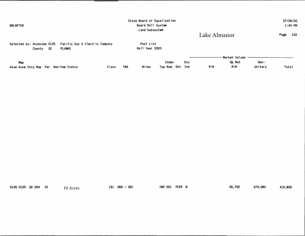
10 Acres
Lake Almanor
Attachment J
Environmental Agreement – (Fee Donee)
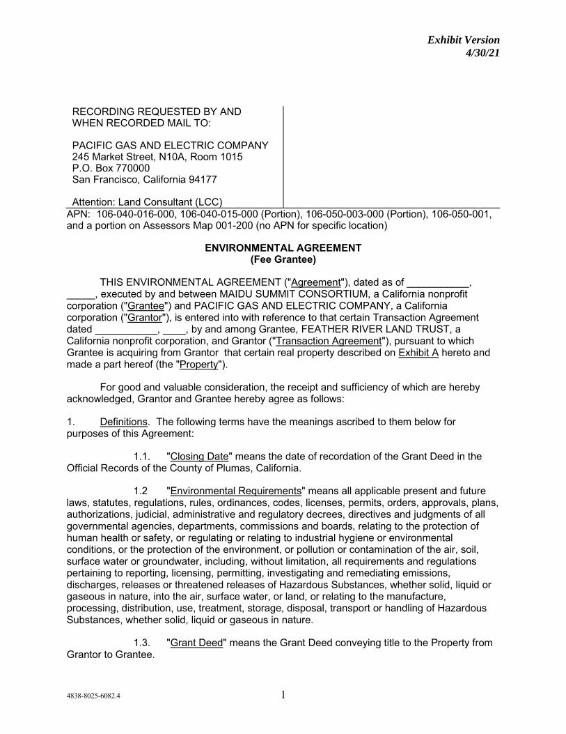
Exhibit Version 4/30/21
4838-8025-6082.4 1
RECORDING REQUESTED BY AND WHEN RECORDED MAIL TO:
PACIFIC GAS AND ELECTRIC COMPANY 245 Market Street, N10A, Room 1015 P.O. Box 770000 San Francisco, California 94177 Attention: Land Consultant (LCC)
APN: 106-040-016-000, 106-040-015-000 (Portion), 106-050-003-000 (Portion), 106-050-001, and a portion on Assessors Map 001-200 (no APN for specific location)
ENVIRONMENTAL AGREEMENT (Fee Grantee)
THIS ENVIRONMENTAL AGREEMENT ("Agreement"), dated as of ___________, _____, executed by and between MAIDU SUMMIT CONSORTIUM, a California nonprofit corporation ("Grantee") and PACIFIC GAS AND ELECTRIC COMPANY, a California corporation ("Grantor"), is entered into with reference to that certain Transaction Agreement dated ___________, ____, by and among Grantee, FEATHER RIVER LAND TRUST, a California nonprofit corporation, and Grantor ("Transaction Agreement"), pursuant to which Grantee is acquiring from Grantor that certain real property described on Exhibit A hereto and made a part hereof (the "Property").
For good and valuable consideration, the receipt and sufficiency of which are hereby acknowledged, Grantor and Grantee hereby agree as follows:
1. Definitions. The following terms have the meanings ascribed to them below for purposes of this Agreement:
1.1. "Closing Date" means the date of recordation of the Grant Deed in the Official Records of the County of Plumas, California.
1.2 "Environmental Requirements" means all applicable present and future laws, statutes, regulations, rules, ordinances, codes, licenses, permits, orders, approvals, plans, authorizations, judicial, administrative and regulatory decrees, directives and judgments of all governmental agencies, departments, commissions and boards, relating to the protection of human health or safety, or regulating or relating to industrial hygiene or environmental conditions, or the protection of the environment, or pollution or contamination of the air, soil, surface water or groundwater, including, without limitation, all requirements and regulations pertaining to reporting, licensing, permitting, investigating and remediating emissions, discharges, releases or threatened releases of Hazardous Substances, whether solid, liquid or gaseous in nature, into the air, surface water, or land, or relating to the manufacture, processing, distribution, use, treatment, storage, disposal, transport or handling of Hazardous Substances, whether solid, liquid or gaseous in nature.
1.3. "Grant Deed" means the Grant Deed conveying title to the Property from Grantor to Grantee.

Exhibit Version 4/30/21
4838-8025-6082.4 2
1.4. "Hazardous Substances" means any hazardous or toxic material or waste that is or becomes regulated by any local governmental authority, the State of California or the United States Government under any Environmental Requirements. For purposes of this Agreement, Hazardous Substances include, without limitation, any material or substance:
(a) now or hereafter defined as a "hazardous substance," "hazardous waste," "hazardous material," "extremely hazardous waste," "restricted hazardous waste" or "toxic substance" or words of similar import under any applicable local, state or federal law or under the regulations adopted or promulgated pursuant thereto, including, without limitation, the Comprehensive Environmental Response, Compensation, and Liability Act (42 U.S.C. § 9601 et seq.) ("CERCLA"); the Hazardous Materials Transportation Act (49 U.S.C. § 5101 et seq.); the Resource Conservation and Recovery Act (42 U.S.C. § 6901 et seq.); the Federal Water Pollution Control Act (33 U.S.C. § 1151 et seq.); the Clean Air Act (42 U.S.C. § 7401 et seq.); the Safe Drinking Water Act (42 U.S.C. § 300f et seq.); the River and Harbor Act of 1899 (33 U.S.C. § 401 et seq.); the National Emission Standard for Asbestos (40 C.F.R. § 61.140 et seq.), the OSHA Construction Standards (29 C.F.R. § 1926.1001 et seq.); the Toxic Substances Control Act (15 U.S.C. § 2601 et seq.); the Oil Pollution Act (33 U.S.C. § 2701 et seq.); the Federal Insecticide, Fungicide, and Rodenticide Act (7 U.S.C. §136 et seq.); the Emergency Planning and Community Right-to-Know Act (42 U.S.C. § 11001 et seq.); the Atomic Energy Act of 1954, (42 U.S.C. §2011 et seq.); the Nuclear Waste Policy Act of 1982 (42 U.S.C. §10101 et seq.); the Medical Waste Management Act (Cal. Health & Safety Code §25015 et seq.); the Porter-Cologne Water Quality Control Act (Cal. Water Code § 13000 et seq.); the Safe Drinking Water and Toxic Enforcement Act of 1986 (Cal. Health & Safety Code § 25249.5 et seq.); the Carpenter-Presley-Tanner Hazardous Substance Account Act ( Cal. Health and Safety Code § 25300 et seq.); the Hazardous Waste Act (Cal. Health & Safety Code § 25100 et seq.); and all rules and regulations of the United States or California Environmental Protection Agency or any successor agency, or any other state or federal department, board or agency, or any other agency or governmental board or entity having jurisdiction, as any of the foregoing have been, or are hereafter amended from time to time; or
(b) that is toxic, explosive, corrosive, flammable, infectious, radioactive, carcinogenic, mutagenic or otherwise hazardous, and is now or hereafter regulated as a Hazardous Substance by any governmental authority, agency, department, commission, board, agency or instrumentality of the United States, any State of the United States or any political subdivision thereof; or which cause, or is listed by the State of California as being known to the State of California to cause, cancer or reproductive toxicity; or
(c) the presence of which on the Property poses or threatens to pose a hazard to the health or safety of persons or to the environment; or
(d) that contains gasoline, diesel fuel or other petroleum hydrocarbons; or
(e) that contains lead-based paint or other lead contamination, polychlorinated biphenyls or asbestos or asbestos-containing materials or urea formaldehyde foam insulation; or
(f) that contains radon gas.
1.5. “Necessary Remediation” means Remediation required by any governmental agency which has jurisdiction over the Remediation pursuant to the
Exhibit Version 4/30/21
4838-8025-6082.4 3
Environmental Requirements, to address Hazardous Substances, to enable the current use of the Property as of the Closing Date.
1.6. "Remediation" refers to the process of, and all work and planning performed in connection with, the investigation, testing for, monitoring, remediation, containment, transportation, removal and disposal or recycling of Hazardous Substances from the Property and any other property to which Hazardous Substances originating on the Property have migrated or may migrate in the future, and the repair and restoration of the Property, and restoration and mitigation of affected natural resources, regardless of whether such actions are required by Environmental Requirements.
1.7. "Transfer" refers to the time on the Closing Date that the Grant Deed is recorded in the Official Records of the County of Plumas, California, as indicated by the Recorder's stamp on the recorded Grant Deed. If no time is included on the Recorder's stamp, the Transfer shall be deemed to have occurred at 8:00 a.m., California time, on the Closing Date.
2. Allocation of Responsibility for Hazardous Substances.
2.1. Generally. In general, Grantor shall (as between Grantor and Grantee) bear the cost for the Necessary Remediation of Hazardous Substances which have been released to soil, surface water and/or groundwater prior to the Closing Date. Grantor shall have the right, but not the obligation, to perform the Remediation for which it is responsible. Grantee shall (as between Grantor and Grantee) bear responsibility for the reasonable management of Hazardous Substances existing on the Property, and, shall bear the cost, risk and responsibility for releases of Hazardous Substances to soil, surface water or groundwater occurring on and after the Closing Date. Grantee shall have the obligation to perform all Necessary Remediation with funding supplied by Grantor for the Necessary Remediation for which Grantor is responsible, unless Grantor elects to perform the Remediation. To ensure that Grantee understands the risks inherent in Grantee's execution of this Agreement, Grantor has strongly advised Grantee to investigate the condition and suitability of all aspects of the Property and all matters affecting the value or desirability of the Property, or that may be perceived to affect the value or desirability of the Property, including, without limitation, the potential environmental hazards arising from the presence of Hazardous Substances on, under, about, adjacent to or affecting the Property. Grantee hereby acknowledges and confirms that it has been afforded the opportunity to, and has, as of the date hereof, performed all environmental inspections, tests and studies, including, without limitation, invasive testing and/or groundwater sampling on, under, about or adjacent to the Property, which Grantee and its environmental consultants and engineers have deemed necessary to assess the condition of the Property and to assume the risk of the release and indemnity provided for in this Agreement.
2.2. Environmental Reports. Grantor, as part of the Land Conservation Commitment, has prepared certain Environmental Reports concerning the Property. Copies of these Environmental Reports have been provided to Grantee.
2.3. Grantor Responsibility for the Cost of Necessary Remediation of Pre-Closing Hazardous Substance Releases.
(a) As set forth in this Section 2.3(a), Grantor shall retain responsibility for the cost of Necessary Remediation of Hazardous Substance releases in soil, surface water and groundwater, which are present on the Property prior to the Closing Date,

Exhibit Version 4/30/21
4838-8025-6082.4 4
provided that Grantee did not cause, in whole or in part, such Hazardous Substance contamination and provided that such Necessary Remediation is not the result, in whole or in part, of Grantee’s active or passive negligence. If Grantor releases Hazardous Substances to soil, surface water or groundwater on the Property on or after the Closing Date, Grantor shall be responsible for the cost of Necessary Remediation of such releases. Without limiting the foregoing general retention of responsibility, more specifically, Grantor shall retain responsibility for the Necessary Remediation of Hazardous Substances in the following circumstances:
(i) Grantor shall be responsible for the cost of Necessary Remediation of releases of Hazardous Substance present in soil, surface water and groundwater on the Property prior to the Transfer, including Necessary Remediation of Hazardous Substances which were either:
1. Caused by the Grantor;
2. Caused by a lessee or tenant of the Property; or
3. Caused by another third party.
(ii) Grantor shall be responsible for the cost of Necessary Remediation related to asbestos or lead paint that were released to soil, surface water or groundwater prior to the Transfer.
(b) Grantor’s retention of responsibility in this Section 2.3 shall exclude:
(i) Remediation of naturally-occurring Hazardous Substances,
(ii) Remediation of Hazardous Substances present at background or ambient concentrations;
(iii) Remediation of contamination caused in whole or in part by Grantee or as a result of Grantee’s active or passive negligence, including Grantee’s exacerbation of any Hazardous Substance release present as of the Closing Date, as identified in the Environmental Reports;
(iv) Remediation of lessee or tenant-owned Hazardous Substances which had not been released to soil, surface water or groundwater as of the Closing Date;
(v) Liability to parties other than Grantee (i.e. successors and assigns of Grantee); and
(vi) Responsibility assumed by Grantee pursuant to this Agreement, including as set forth in Sections 2.1 and 2.4 of this Agreement.
(c) Grantor shall have the right, but not the obligation, to perform all Remediation for which it is responsible under this Agreement, if Grantor so chooses. Grantor shall have the right, but not the obligation, to reasonably control any Remediation activities for which Grantor is responsible if the Grantor so chooses, including when the work is performed by Grantee, and shall have the right to coordinate all communications with any governmental
Exhibit Version 4/30/21
4838-8025-6082.4 5
agency regarding the same. Unless otherwise required by law, Grantee shall not communicate with any governmental agency regarding any Remediation activities for which Grantor is responsible without the prior notice to, consultation with and obtaining the consent of the Grantor, which shall not be unreasonably withheld or delayed, and, if such consent is granted, without allowing the Grantor to participate in and lead any such communications. Grantor shall have the right, but not the obligation, to remediate to a more stringent level than that which constitutes Necessary Remediation, at Grantor’s cost.
2.4. Grantee Responsibility for Necessary Remediation of Certain Hazardous Substances.
(a) Grantee shall be responsible for the Necessary Remediation of Hazardous Substance contamination at the Property if the Grantee caused all or part of such contamination, or if such contamination or the cost of the Necessary Remediation of such contamination resulted, in whole or in part, from Grantee’s active or passive negligence.
(b) Grantee shall be responsible for the Necessary Remediation of Hazardous Substances released to soil, surface water or groundwater after the Transfer (except for Hazardous Substance releases by Grantor on or after the Closing Date).
(c) Grantee will look solely to the lessee or tenant for Necessary Remediation related to asbestos or lead paint in buildings or other structures, owned by a lessee or tenant of Grantee as of the Closing Date. Grantee will look solely to the lessee or tenant for the Remediation of Hazardous Substances released by the lessee or tenant, including releases from lessee or tenant-owned structures on or after the Closing Date.
(d) Upon and after the Transfer, Grantee shall have responsibility to reasonably manage all Hazardous Substances on the Property, and to perform all Necessary Remediation on the Property, unless Grantor elects to perform such Remediation pursuant to Section 2.3(c) of this Agreement.
2.5. Performance and Completion of Necessary Remediation. Any Necessary Remediation performed hereunder shall be conducted in a manner consistent with applicable Environmental Requirements and shall be considered complete when the party conducting the Necessary Remediation obtains from the California Department of Toxic Substances Control or other governmental agency with jurisdiction over the matter, a “No Further Action Letter,” “Certificate of Completion,” or other governmental certification indicating that additional Remediation is not required for the current land use.
2.6. Access; Property Restoration; Recording or Deed Restriction. Grantee hereby acknowledges and agrees that Grantor shall have a reasonable right of access to and entry on the Property at all times upon twenty-four (24) hour notice to conduct all necessary actions to address any Hazardous Substances for which Grantor has responsibility under this Agreement. Grantor’s actions to address the Hazardous Substances for which it has responsibility shall be made with reasonable efforts to not interfere with the Grantee’s use of the Property. Upon completion of the actions to address the Hazardous Substances for which it has responsibility, Grantor shall make reasonable efforts to restore the Property to the condition it was in prior to the commencement of the actions to address Hazardous Substances for which it has responsibility. Grantor and Grantee acknowledge and agree that attainment of an appropriate remediation standard for Necessary Remediation at the Property may require recordation of a deed restriction limiting certain uses of the Property or other similar land use
Exhibit Version 4/30/21
4838-8025-6082.4 6
control instruments concerning the Property. In the event that such a deed restriction or land use control instrument is required, Grantee and Grantor shall cooperate in the recording of such document in the appropriate office of the County where the Property is located.
3. Release.
3.1. Grantee, for itself, and for any future owners of all or a part of the Property, and each of their respective predecessors, successors, assigns, licensees, officers, directors, employees, agents, partners, shareholders, transferees, parent and subsidiary corporations, legal representatives, heirs, beneficiaries, executors and administrators (together with Grantee, "Releasing Parties") hereby fully and forever releases, exonerates, discharges and covenants not to sue Grantor and/or each and all of its past, present and future officers, directors, partners, employees, agents, representatives, shareholders, attorneys, affiliates, parent and subsidiary corporations, divisions, insurance carriers, heirs, legal representatives, beneficiaries, executors, administrators, predecessors, transferees, successors (including, without limitation, lenders who become successors-in-title) and assigns (hereinafter "Released Parties") of, from and for any and all losses (including diminution in the value of the Property and other consequential damages), costs, claims, demands, actions, suits, orders, causes of action, obligations, debts, expenses, accounts, damages, judgments and liabilities of whatever kind or nature, and by whomsoever asserted, in law, equity or otherwise (each a "Claim" and, collectively, "Claims") that the Releasing Parties or the Property may suffer or claim to suffer, based in whole or in part on the presence, or threatened or suspected presence, generation, processing, use, management, treatment, storage, disposal, Remediation, transportation, recycling, emission or release or threatened emission or release, whether in the past, present or future, of any Hazardous Substances on, about, from, adjacent to or affecting the Property, including, without limitation, Claims arising from the passive or active negligence of the Released Parties. Notwithstanding the foregoing, Grantee and the Releasing Parties do not release, exonerate, discharge and covenant not to sue Grantor for Claims for which Grantor is responsible under Section 2 of this Agreement.
3.2. Grantee represents and warrants to Grantor that it is the sole and lawful owner of all right, title and interest in and to every Claim that Grantee purports to release herein, and that it has not heretofore assigned or transferred, or purported to assign or transfer, to any person, firm, association, corporation or other entity, any right, title or interest in any such Claim. In the event that such representation is false, and any such Claim is asserted against any of the Released Parties, by any party or entity who is the assignee or transferee of such Claim, then Grantee shall fully indemnify, defend and hold harmless the Released Party against whom such Claim is asserted from and against such Claim and from all actual costs, fees, expenses, liabilities and damages that that party incurs as a result of the assertion of such Claim.
4. Indemnity.
4.1. By Grantor. Grantor agrees and covenants, at its sole cost and expense, to indemnify, protect, defend and hold Grantee harmless, from and against any and all Claims (including, without limitation, the payment of damages, the payment of the actual fees and expenses of experts, attorneys and others and the payment of "response costs" under CERCLA or any other Environmental Requirements) arising from or relating, in whole or in part, to Grantor’s failure to perform or discharge Grantor’s responsibilities and obligations set forth in Section 2.3 of this Agreement. Notwithstanding the foregoing, Grantor shall have no obligation to indemnify, protect, defend or hold the Grantee harmless, from and against any Claims for which Grantee is responsible under Section 2.4 of this Agreement.
Exhibit Version 4/30/21
4838-8025-6082.4 7
4.2. By Grantee. Grantee agrees and covenants, at its sole cost and expense, to indemnify, protect, defend and hold Grantor harmless, from and against any and all Claims (including, without limitation, the payment of damages, the payment of the actual fees and expenses of experts, attorneys and others and the payment of "response costs" under CERCLA or any other Environmental Requirements) arising from or relating, in whole or in part, to Grantee’s failure to perform or discharge Grantee’s responsibilities and obligations set forth in Section 2.4 of this Agreement. Notwithstanding the foregoing, Grantee shall have no obligation to indemnify, protect, defend or hold the Grantor harmless, from and against any Claims for which Grantor is responsible under Section 2.3 of this Agreement.
5. Statutory Waiver.
5.1. Grantee acknowledges that it may hereinafter discover facts different from or in addition to those that it now knows or believes to be true with respect to the matters which are the subject of this Agreement, and agrees that this Agreement shall remain in effect in all respects, notwithstanding the discovery of such different or additional facts. In addition, Grantee understands and agrees that its agreements and covenants contained in this Agreement extend to all claims of any nature and kind, known or unknown, suspected or unsuspected, based in whole or in part on facts existing in the past or as of the date hereof, and in that regard, Grantee acknowledges that it has read, considered and understands the provisions of Section 1542 of the California Civil Code which reads as follows:
Section 1542. General Release
A GENERAL RELEASE DOES NOT EXTEND TO CLAIMS THAT THE CREDITOR OR RELEASING PARTY DOES NOT KNOW OR SUSPECT TO EXIST IN HIS OR HER FAVOR AT THE TIME OF EXECUTING THE RELEASE AND THAT, IF KNOWN BY HIM OR HER WOULD HAVE MATERIALLY AFFECTED HIS OR HER SETTLEMENT WITH THE DEBTOR OR RELEASED PARTY.
Exhibit Version 4/30/21
4838-8025-6082.4 8
5.2 Based upon the advice of its counsel, Grantee knowingly and voluntarily waives and relinquishes any and all rights that it may have under Section 1542 as well as under the provisions of all comparable, equivalent, or similar statutes and principles of common law or other decisional law of any and all states of the United States or of the United States. Grantee understands and acknowledges the significance and consequences of this waiver and hereby assumes the risk of any injuries, losses or damages that may arise from such waiver.
Grantee: MAIDU SUMMIT CONSORTIUM, a California nonprofit corporation
By: ____________________________ Benjamin D. Cunningham Chairperson
By: ____________________________
Marvena G. Harris Secretary
By: ____________________________
Trina Evelyn Cunningham Executive Director
6. Notice by Grantee. Grantee shall promptly notify Grantor of any discovery of a release of Hazardous Substances on the Property. Grantee shall promptly notify Grantor of any notice of potential liability for costs of Remediation (whether or not covered by Section 2), and following such notification (or the determination by Grantor of its potential liability for such costs) provide such information and reports with respect to such potential liability and the status of Hazardous Substances on the Property as Grantor shall reasonably request.
7. Grantee's Representations and Warranties. Grantee represents and warrants to Grantor as follows:
7.1. Grantee has in all respects voluntarily and knowingly executed this Agreement.
7.2. Grantee has had an opportunity to seek and has sought independent legal advice from attorneys of its choice with respect to the advisability of executing this Agreement.
7.3. Grantee has made such investigation of the facts pertaining to this Agreement as it deems necessary.
7.4. The terms of this Agreement are contractual and are the result of negotiation between Grantee and Grantor.

Exhibit Version 4/30/21
4838-8025-6082.4 9
7.5. This Agreement has been carefully read by Grantee and the contents hereof are known and understood by Grantee.
7.6. Grantee is duly organized, validly existing and in good standing under the laws of the state of its organization and is qualified to do business in the state in which the Property is located and the persons executing this Agreement on behalf of Grantee have the full right and authority to execute this Agreement on behalf of Grantee and to bind Grantee without the consent or approval of any other person or entity. This Agreement is (i) duly authorized, properly executed and delivered by Grantee, (ii) legal, valid and binding obligations of Grantee enforceable in accordance with its terms at the time of the Closing Date, and (iii) not in violation of any agreement or judicial order to which Grantee is a party or to which it is subject.
8. Mandatory Negotiation and Mediation.
8.1. Except as provided in Section 8.2, Grantor and Grantee agree to first negotiate and then mediate with respect to any claim or dispute arising out of or relating to this Agreement, before resorting to court action. Either party may initiate settlement negotiations by providing written notice to the other party, setting forth the subject of the claim or dispute. Grantee and Grantor agree to cooperate in scheduling negotiations and to participate in the settlement negotiations in good faith. If Grantee and Grantor fail to settle such claim or dispute within thirty (30) days after the date of mailing of the notice initiating settlement negotiations or within such additional time period as the parties may agree in writing, the parties agree to submit the matter to JAMS (or other similar organization mutually agreed upon by the parties) for mediation. If an organization other than JAMS is agreed upon by the parties to conduct the mediation hereunder, all references to JAMS shall be deemed changed to the selected organization. Either party may commence mediation by providing to JAMS and the other party a written request for mediation, setting forth the subject of the claim or dispute and the relief requested. Except as provided herein or by written agreement of the parties, the mediation shall be conducted in San Francisco pursuant to the JAMS rules. The parties will cooperate in selecting a mediator from the JAMS panel of neutrals, and in scheduling the mediation proceedings. The parties agree to participate in the mediation in good faith, and to share equally in its costs. All offers, promises, conduct and statements, whether oral or written, made in the course of the mediation by either of the parties, their employees, agents, experts and attorneys, and by the mediator and any other JAMS employees, are confidential, privileged and inadmissible for any purpose, including impeachment, in any litigation or other proceeding involving the parties, but evidence that is otherwise admissible or discoverable shall not be rendered inadmissible or non-discoverable as a result of its use in the mediation. If JAMS should no longer exist at the time the claim or dispute arises, the matter shall be submitted to its successor entity, or if there is no such successor entity, to the American Arbitration Association or other similar organization mutually agreed upon by the parties, and except as provided herein or by mutual agreement of the parties, the mediation rules of such successor or alternate organization shall apply. Except as may be expressly set forth in any written settlement agreement, should the matter be settled by negotiation or mediation prior to commencing court action, each party shall pay its own attorneys' fees and costs. Except as provided in Section 8.2, neither party may commence an action arising out of or relating to this Agreement until expiration of the negotiation period and completion of the initial mediation session in accordance with this Section 8.1. If either party commences an action with respect to a claim or dispute covered by this Section 8.1 without first attempting to resolve the matter through negotiation and mediation, or refuses to negotiate or mediate after a request has been made, then that party

Exhibit Version 4/30/21
4838-8025-6082.4 10
shall not be entitled to recover attorneys' fees and costs, even if such fees and costs would otherwise be available to that party in such action.
8.2. Either party may seek equitable relief to preserve the status quo prior to participating in the negotiation and mediation proceedings required pursuant to Section 8.1. In addition, matters that are within the jurisdiction of probate, small claims, or bankruptcy court are excluded from mandatory negotiation and mediation hereunder.
8.3. The provisions of this Section 8 may be enforced by any court of competent jurisdiction, and the party seeking enforcement shall be entitled to an award of all fees and costs, including reasonable attorneys' fees, to be paid by the party against which enforcement is ordered. The covenants of Grantor and Grantee contained in this Section 8 shall survive the expiration or earlier termination of this Agreement or the Closing Date.
9. Miscellaneous.
9.1. Grantor and Grantee acknowledge (a) this Agreement is the result of extensive good faith negotiations between Grantee and Grantor through their respective counsel, (b) Grantor's and Grantee's counsel has carefully reviewed and examined this Agreement before execution by Grantor and Grantee, and (c) any statute or rule of construction that ambiguities are to be resolved against the drafting party shall not be employed in the interpretation of this Agreement.
9.2. In the event that either party shall bring an action to enforce its rights under this Agreement, or relating to the interpretation hereof, whether for declaratory or other relief, the prevailing party in any such proceeding shall be entitled to recover from the other party reasonable attorneys' fees and all costs, expenses and disbursements that the prevailing party incurred in connection with such proceeding and any appeal thereof (including, but not limited to, the reasonable costs of discovery, investigation, preparation for trial, professional or expert consultation and testimony) as ordered by the court. Grantee shall also pay all attorneys' fees and costs Grantor incurs in defending this Agreement or otherwise protecting Grantor's rights in any voluntary or involuntary bankruptcy case, assignment for the benefit of creditors, or other insolvency, liquidation or reorganization proceeding involving Grantee or this Agreement, including all motions and proceedings related to relief from an automatic stay, lease assumption or rejection, use of cash collateral, claim objections, disclosure statements and plans of reorganization. A party shall be deemed to have prevailed in any such action (without limiting the generality of the foregoing) if such action is dismissed upon the payment by the other party of the sums allegedly due or the performance of obligations allegedly not complied with, or if such party obtains substantially the relief sought by it in the action, irrespective of whether such action is prosecuted to judgment. The non-prevailing party shall also pay the attorneys' fees and costs incurred by the prevailing party in any post-judgment proceedings to collect and enforce the judgment. For purposes hereof, the reasonable fees of Grantor's in-house attorneys who perform services in connection with any such action are recoverable, and shall be based on the fees regularly charged by private attorneys with the equivalent number of years of experience in the relevant subject matter area of the law, in law firms in the City of San Francisco with approximately the same number of attorneys as are employed by Grantor's Law Department. Any such fees and costs incurred prior to judgment, award, or decree may be included in any judgment, award or decree entered in such proceeding in favor of the prevailing party. Any such fees, costs and expenses incurred by the prevailing party in enforcing a judgment, award or decree in its favor shall be recoverable separately from and in addition to any other amount

Exhibit Version 4/30/21
4838-8025-6082.4 11
included in such judgment, award or decree. This provision is separate and several and shall survive the merger of this Agreement into any judgment on this Agreement.
9.3. This Agreement shall be binding upon and inure to the benefit of the heirs, successors and assigns of Grantee and Grantor. No transfer of an interest in the Property or this Agreement by Grantee or its assignees shall operate to relieve Grantor or Grantee of their obligations hereunder. This Agreement shall not create or bestow any right in any third party. Grantee and Grantor agree that no third party beneficiary to this Agreement exists and that nothing contained herein shall be construed as giving any other person or entity third party beneficiary status.
9.4. The failure of either party to insist upon strict compliance with any of the terms hereof shall not be considered to be a waiver of any of such terms, nor shall it militate against the right of such party to insist upon strict compliance herewith at any later time.
9.5. This Agreement shall not constitute or be construed as an admission of liability or fact by either party for any purpose whatsoever.
9.6. Grantor and Grantee shall execute, acknowledge and deliver to the other party hereto all documents, and shall take all actions reasonably required by either party from time to time to confirm or effect the matters set forth herein, or otherwise to carry out the purposes of this Agreement.
9.7. The representations, warranties, covenants, and agreements of Grantee contained in this Agreement shall survive the Closing Date.
9.8. Time is of the essence of this Agreement.
9.9. This Agreement shall be governed by the laws of the State of California.
9.10. Should any portion, word, clause, phrase, sentence or paragraph of this Agreement be declared void or unenforceable, such portion shall be considered independent and severable from the remainder, and the validity of the remainder shall remain unaffected.
9.11. This Agreement sets forth the entire understanding of Grantee and Grantor in connection with the subject matter hereof, and Grantee acknowledges that Grantor has made no statement, representation or warranty relating to the Property upon which Grantee has relied or that acted as an inducement for Grantee to enter into this Agreement. Grantee's obligations under this Agreement may not be altered or amended in any respect except by a writing executed by both Grantee and Grantor. This Agreement may be executed in two or more counterparts, each of which shall be deemed an original, but all of which together shall constitute one and the same instrument.
[Signature Page Follows]
Exhibit Version 4/30/21
Environmental Agreement (Fee Grantee) - Lake Almanor – Maidu Cemetery
IN WITNESS WHEREOF, Grantor and Grantee have caused this Agreement to be duly executed as of the date first written above.
GRANTOR: PACIFIC GAS AND ELECTRIC COMPANY, a California corporation By: _____________________________
Andrew K. Williams Vice President Shared Services
GRANTEE: MAIDU SUMMIT CONSORTIUM, a California nonprofit corporation By: ____________________________
Benjamin D. Cunningham Chairperson
By: ____________________________
Marvena G. Harris Secretary
By: ____________________________
Trina Evelyn Cunningham Executive Director
Exhibit Version 4/30/21
Exhibit A
EXHIBIT A
LEGAL DESCRIPTION
[Follows this page]
Exhibit Version 4/30/21
4838-8025-6082.4
CERTIFICATE OF ACKNOWLEDGMENT OF NOTARY PUBLIC
A notary public or other officer completing this certificate verifies only the identity of the individual who signed the document to which this certificate is attached, and not the truthfulness, accuracy, or validity of that document.
State of California ) County of ____________________ )
On ____________________, before me, ____________________________, a Notary Public, personally appeared _______________________________, who proved to me on the basis of satisfactory evidence to be the person(s) whose name(s) is/are subscribed to the within instrument and acknowledged to me that he/she/they executed the same in his/her/their authorized capacity(ies), and that by his/her/their signature(s) on the instrument the person(s), or the entity upon behalf of which the person(s) acted, executed the instrument.
I certify under PENALTY OF PERJURY under the laws of the State of California that the foregoing paragraph is true and correct.
WITNESS my hand and official seal.
Signature
Attachment K
Environmental Agreement – (Easement Grantee)

Exhibit Version 4/30/21
4852-5566-3954.3 1
RECORDING REQUESTED BY AND WHEN RECORDED MAIL TO: PACIFIC GAS AND ELECTRIC COMPANY 245 Market Street, N10A, Room 1015 P.O. Box 770000 San Francisco, California 94177 Attention: Land Consultant (LCC)
APN: 106-040-016-000, 106-040-015-000 (Portion), 106-050-003-000 (Portion), 106-050-001, and a portion on Assessors Map 001-200 (no APN for specific location)
ENVIRONMENTAL AGREEMENT (Easement Grantee – Conveyed Fee)
THIS ENVIRONMENTAL AGREEMENT ("Agreement"), dated as of ___________, _____, executed by and between FEATHER RIVER LAND TRUST, a California nonprofit corporation ("Easement Grantee") and PACIFIC GAS AND ELECTRIC COMPANY, a California corporation ("Grantor"), is entered into with reference to that certain Transaction Agreement dated ___________, ____, by and among Easement Grantee, MAIDU SUMMIT CONSORTIUM, a California nonprofit corporation (“Fee Grantee”) and Grantor ("Transaction Agreement"), pursuant to which Fee Grantee is acquiring from Grantor that certain real property described on Exhibit A hereto and made a part hereof (the "Property"), and Easement Grantee is acquiring a conservation easement over the Property. Grantor and Easement Grantee are sometimes referred to herein individually as a "Party" and collectively as the "Parties."
For good and valuable consideration, the receipt and sufficiency of which are hereby acknowledged, Grantor and Easement Grantee hereby agree as follows:
1. Definitions. The following terms have the meanings ascribed to them below for purposes of this Agreement:
1.1. "Closing Date" means the date of recordation of the Grant Deed in the Official Records of the County of Plumas, California.
1.2. "Environmental Requirements" means all applicable present and future laws, statutes, regulations, rules, ordinances, codes, licenses, permits, orders, approvals, plans, authorizations, judicial, administrative and regulatory decrees, directives and judgments of all governmental agencies, departments, commissions and boards, relating to the protection of human health or safety, or regulating or relating to industrial hygiene or environmental conditions, or the protection of the environment, or pollution or contamination of the air, soil, surface water or groundwater, including, without limitation, all requirements and regulations pertaining to reporting, licensing, permitting, investigating and remediating emissions, discharges, releases or threatened releases of Hazardous Substances, whether solid, liquid or gaseous in nature, into the air, surface water, or land, or relating to the manufacture, processing, distribution, use, treatment, storage, disposal, transport or handling of Hazardous Substances, whether solid, liquid or gaseous in nature.
1.3. "Grant Deed" means the Grant Deed conveying title to the Property from Grantor to Grantee.

Exhibit Version 4/30/21
4852-5566-3954.3 2
1.4. "Hazardous Substances" means any hazardous or toxic material or waste that is or becomes regulated by any local governmental authority, the State of California or the United States Government under any Environmental Requirements. For purposes of this Agreement, Hazardous Substances include, without limitation, any material or substance:
(a) now or hereafter defined as a "hazardous substance," "hazardous waste," "hazardous material," "extremely hazardous waste," "restricted hazardous waste" or "toxic substance" or words of similar import under any applicable local, state or federal law or under the regulations adopted or promulgated pursuant thereto, including, without limitation, the Comprehensive Environmental Response, Compensation, and Liability Act (42 U.S.C. § 9601 et seq.) ("CERCLA"); the Hazardous Materials Transportation Act (49 U.S.C. § 5101 et seq.); the Resource Conservation and Recovery Act (42 U.S.C. § 6901 et seq.); the Federal Water Pollution Control Act (33 U.S.C. § 1151 et seq.); the Clean Air Act (42 U.S.C. § 7401 et seq.); the Safe Drinking Water Act (42 U.S.C. § 300f et seq.); the River and Harbor Act of 1899 (33 U.S.C. § 401 et seq.); the National Emission Standard for Asbestos (40 C.F.R. § 61.140 et seq.), the OSHA Construction Standards (29 C.F.R. § 1926.1001 et seq.); the Toxic Substances Control Act (15 U.S.C. § 2601 et seq.); the Oil Pollution Act (33 U.S.C. § 2701 et seq.); the Federal Insecticide, Fungicide, and Rodenticide Act (7 U.S.C. §136 et seq.); the Emergency Planning and Community Right-to-Know Act (42 U.S.C. § 11001 et seq.); the Atomic Energy Act of 1954, (42 U.S.C. §2011 et seq.); the Nuclear Waste Policy Act of 1982 (42 U.S.C. §10101 et seq.); the Medical Waste Management Act (Cal. Health & Safety Code §25015 et seq.); the Porter-Cologne Water Quality Control Act (Cal. Water Code § 13000 et seq.); the Safe Drinking Water and Toxic Enforcement Act of 1986 (Cal. Health & Safety Code § 25249.5 et seq.); the Carpenter-Presley-Tanner Hazardous Substance Account Act ( Cal. Health and Safety Code § 25300 et seq.); the Hazardous Waste Act (Cal. Health & Safety Code § 25100 et seq.); and all rules and regulations of the United States or California Environmental Protection Agency or any successor agency, or any other state or federal department, board or agency, or any other agency or governmental board or entity having jurisdiction, as any of the foregoing have been, or are hereafter amended from time to time; or
(b) that is toxic, explosive, corrosive, flammable, infectious, radioactive, carcinogenic, mutagenic or otherwise hazardous, and is now or hereafter regulated as a Hazardous Substance by any governmental authority, agency, department, commission, board, agency or instrumentality of the United States, the State of California or any political subdivision thereof; or which cause, or is listed by the State of California as being known to the State of California to cause, cancer or reproductive toxicity; or
(c) the presence of which on the Property poses or threatens to pose a hazard to the health or safety of persons or to the environment; or
(d) that contains gasoline, diesel fuel or other petroleum hydrocarbons; or
(e) that contains lead-based paint or other lead contamination, polychlorinated biphenyls or asbestos or asbestos-containing materials or urea formaldehyde foam insulation; or
(f) that contains radon gas.
1.5. “Necessary Remediation” means Remediation required by any governmental agency which has jurisdiction over the Remediation pursuant to the

Exhibit Version 4/30/21
4852-5566-3954.3 3
Environmental Requirements, to address Hazardous Substances, to enable the current use of the Property as of the Closing Date.
1.6. "Remediation" refers to the process of, and all work and planning performed in connection with, the investigation, testing for, monitoring, remediation, containment, transportation, removal and disposal or recycling of Hazardous Substances from the Property and any other property to which Hazardous Substances originating on the Property have migrated or may migrate in the future, and the repair and restoration of the Property, and restoration and mitigation of affected natural resources, regardless of whether such actions are required by Environmental Requirements.
2. Allocation of Responsibility for Hazardous Substances.
2.1. Generally. In general, Grantor shall (as between Grantor and Easement Grantee) bear the cost for the Necessary Remediation of Hazardous Substances which have been released to soil and/or groundwater prior to the Closing Date.
2.2. Environmental Reports. Grantor, as part of the Land Conservation Commitment, has prepared certain Environmental Reports concerning the Property. Copies of these Environmental Reports have been provided to Easement Grantee.
2.3. Grantor Responsibility for the Cost of Necessary Remediation of Pre-Closing Hazardous Substance Releases.
(a) As set forth in this Section 2.3(a), Grantor shall retain responsibility for the cost of Necessary Remediation of Hazardous Substance releases in soil and groundwater, which are present on the Property prior to the Closing Date, provided that Easement Grantee did not cause, in whole or in part, such Hazardous Substance contamination and provided that such Necessary Remediation is not the result, in whole or in part, of Easement Grantee’s active or passive negligence. If Grantor releases Hazardous Substances to soil or groundwater on the Property on or after the Closing Date, Grantor shall be responsible for the cost of Necessary Remediation of such releases.
(b) Grantor’s retention of responsibility in this Section 2.3 shall exclude:
(i) Remediation of naturally-occurring Hazardous Substances,
(ii) Remediation of Hazardous Substances present at background or ambient concentrations;
(iii) Remediation of contamination caused in whole or in part by Fee Grantee and/or Easement Grantee or as a result of Fee Grantee’s and/or Easement Grantee's active or passive negligence, including Fee Grantee’s and/or Easement Grantee's exacerbation of any Hazardous Substance release present as of the Closing Date, as identified in the Environmental Reports;
(iv) Remediation of lessee or tenant-owned Hazardous Substances which had not been released to soil or groundwater as of the Closing Date;

Exhibit Version 4/30/21
4852-5566-3954.3 4
(v) Liability to parties other than Easement Grantee (i.e. successors and assigns of Easement Grantee); and
(vi) Responsibility assumed by Easement Grantee pursuant to this Agreement, including as set forth in Section 2.4 of this Agreement.
(c) Grantor shall have the right to perform all Remediation for which it is responsible under this Agreement. Except to the extent Easement Grantee determines, in its good faith sole discretion, that it is legally required to do so, Easement Grantee shall not communicate with any governmental agency regarding any Remediation activities for which Grantor is responsible without the prior notice to, consultation with and obtaining the consent of the Grantor, which shall not be unreasonably withheld or delayed, and, if such consent is granted, without allowing the Grantor to participate in and lead any such communications. Grantor shall have the right, but not the obligation, to remediate to a more stringent level than that which constitutes Necessary Remediation, at Grantor’s cost.
2.4. Easement Grantee Responsibility for Necessary Remediation of Certain Hazardous Substances. Easement Grantee shall be responsible for the Necessary Remediation of Hazardous Substance contamination at the Property if Easement Grantee caused all of such contamination. If Easement Grantee caused part of such contamination, Easement Grantee shall be responsible only for its proportional share of the Necessary Remediation.
2.5. Performance and Completion of Necessary Remediation. Any Necessary Remediation performed hereunder shall be conducted in a manner consistent with applicable Environmental Requirements and shall be considered complete when the Party conducting the Necessary Remediation obtains from the California Department of Toxic Substances Control or other governmental agency with jurisdiction over the matter, a “No Further Action Letter,” “Certificate of Completion,” or other governmental certification indicating that additional Remediation is not required for the current land use.
2.6. Access; Property Restoration; Recording or Deed Restriction. Easement Grantee hereby acknowledges and agrees that Grantor shall have a reasonable right of access to and entry on the Property at all times upon twenty-four (24) hour notice to conduct all necessary actions to address any Hazardous Substances for which Grantor has responsibility under this Agreement. Grantor’s actions to address the Hazardous Substances for which it has responsibility shall be made with reasonable efforts to not interfere with the Easement Grantee's use of the Property. Upon completion of the actions to address the Hazardous Substances for which it has responsibility, Grantor shall make reasonable efforts to restore the Property to the condition it was in prior to the commencement of the actions to address Hazardous Substances for which it has responsibility. Grantor and Easement Grantee acknowledge and agree that attainment of an appropriate remediation standard for Necessary Remediation at the Property may require recordation of a deed restriction limiting certain uses of the Property or other similar land use control instruments concerning the Property. In the event that such a deed restriction or land use control instrument is required, Easement Grantee shall cooperate in the recording of such document in the appropriate office of the County where the Property is located.
3. Indemnity.
3.1. By Grantor. Grantor agrees and covenants, at its sole cost and expense, to indemnify, protect, defend and hold Easement Grantee harmless, from and against any and

Exhibit Version 4/30/21
4852-5566-3954.3 5
all losses (including diminution in the value of the Property and other consequential damages), costs, claims, demands, actions, suits, orders, causes of action, obligations, controversies, debts, expenses, accounts, damages, judgments and liabilities of whatever kind or nature, and by whomsoever asserted, in law, equity or otherwise (each a "Claim" and, collectively, "Claims"), including, without limitation, the payment of damages, the payment of the actual fees and expenses of experts, attorneys and others and the payment of "response costs" under CERCLA or any other Environmental Requirements, arising from or relating, in whole or in part, to Grantor’s failure to perform or discharge Grantor’s responsibilities and obligations set forth in Section 2.3 of this Agreement. Notwithstanding the foregoing, Grantor shall have no obligation to indemnify, protect, defend or hold the Easement Grantee harmless, from and against any Claims for which Easement Grantee is responsible under Section 2.4 of this Agreement.
3.2. By Easement Grantee. Easement Grantee agrees and covenants, at its sole cost and expense, to indemnify, protect, defend and hold Grantor harmless, from and against any and all Claims (including, without limitation, the payment of damages, the payment of the actual fees and expenses of experts, attorneys and others and the payment of "response costs" under CERCLA or any other Environmental Requirements) arising from or relating, in whole or in part, to Easement Grantee’s failure to perform or discharge Easement Grantee’s responsibilities and obligations set forth in Section 2.4 of this Agreement. Notwithstanding the foregoing, Easement Grantee shall have no obligation to indemnify, protect, defend or hold the Grantor harmless, from and against any Claims for which Grantor is responsible under Section 2.3 of this Agreement.
4. Notice by Easement Grantee. Easement Grantee shall promptly notify Grantor of any discovery of a release of Hazardous Substances on the Property. Easement Grantee shall promptly notify Grantor of any notice of potential liability for costs of Remediation (whether or not covered by Section 2), and following such notification (or the determination by Grantor of its potential liability for such costs) provide such information and reports with respect to such potential liability and the status of Hazardous Substances on the Property as Grantor shall reasonably request.
5. Easement Grantee's Representations and Warranties.
5.1. Easement Grantee represents and warrants to Grantor as follows:
(a) Easement Grantee has in all respects voluntarily and knowingly executed this Agreement.
(b) Easement Grantee has had an opportunity to seek and has sought independent legal advice from attorneys of his or its choice with respect to the advisability of executing this Agreement.
(c) Easement Grantee has made such investigation of the facts pertaining to this Agreement as it deems necessary.
(d) The terms of this Agreement are contractual and are the result of negotiation between Easement Grantee and Grantor.
(e) This Agreement has been carefully read by Easement Grantee and the contents hereof are known and understood by Easement Grantee.

Exhibit Version 4/30/21
4852-5566-3954.3 6
(f) Easement Grantee is duly organized, validly existing and in good standing under the laws of the state of its organization and is qualified to do business in the state in which the Property is located and the persons executing this Agreement on behalf of Easement Grantee have the full right and authority to execute this Agreement on behalf of Easement Grantee and to bind Easement Grantee without the consent or approval of any other person or entity. This Agreement is (i) duly authorized, properly executed and delivered by Easement Grantee, (ii) legal, valid and binding obligations of Easement Grantee enforceable in accordance with its terms at the time of the Closing Date, and (iii) not in violation of any agreement or judicial order to which Easement Grantee is a party or to which it is subject.
6. Mandatory Negotiation and Mediation.
6.1. Except as provided in Section 6.2, Grantor and Easement Grantee agree to first negotiate and then mediate with respect to any claim or dispute arising out of or relating to this Agreement, before resorting to court action. Either Party may initiate settlement negotiations by providing written notice to the other Party, setting forth the subject of the claim or dispute. Easement Grantee and Grantor agree to cooperate in scheduling negotiations and to participate in the settlement negotiations in good faith. If Easement Grantee and Grantor fail to settle such claim or dispute within thirty (30) days after the date of mailing of the notice initiating settlement negotiations or within such additional time period as the Parties may agree in writing, the Parties agree to submit the matter to JAMS (or other similar organization such as the American Arbitration Association mutually agreed upon by the Parties) for mediation. If an organization other than JAMS is agreed upon by the Parties to conduct the mediation hereunder, all references to JAMS shall be deemed changed to the selected organization. Either Party may commence mediation by providing to JAMS and the other Party a written request for mediation, setting forth the subject of the claim or dispute and the relief requested. Except as provided herein or by written agreement of the Parties, the mediation shall be conducted in San Francisco pursuant to the JAMS rules. The Parties will cooperate in selecting a mediator from the JAMS panel of neutrals, and in scheduling the mediation proceedings. The Parties agree to participate in the mediation in good faith, and to share equally in its costs. All offers, promises, conduct and statements, whether oral or written, made in the course of the mediation by either of the Parties, their employees, agents, experts and attorneys, and by the mediator and any other JAMS employees, are confidential, privileged and inadmissible for any purpose, including impeachment, in any litigation or other proceeding involving the Parties, but evidence that is otherwise admissible or discoverable shall not be rendered inadmissible or non-discoverable as a result of its use in the mediation. If JAMS should no longer exist at the time the claim or dispute arises, the matter shall be submitted to its successor entity, or if there is no such successor entity, to the American Arbitration Association or other similar organization mutually agreed upon by the Parties, and except as provided herein or by mutual agreement of the Parties, the mediation rules of such successor or alternate organization shall apply. Except as may be expressly set forth in any written settlement agreement, should the matter be settled by negotiation or mediation prior to commencing court action, each Party shall pay its own attorneys' fees and costs. Except as provided in Section 6.2, neither Party may commence an action arising out of or relating to this Agreement until expiration of the negotiation period and completion of the initial mediation session in accordance with this Section 6.1. If either Party commences an action with respect to a claim or dispute covered by this Section 6.1 without first attempting to resolve the matter through negotiation and mediation, or refuses to negotiate or mediate after a request has been made, then that Party shall not be entitled to recover attorneys' fees and costs, even if such fees and costs would otherwise be available to that Party in such action.

Exhibit Version 4/30/21
4852-5566-3954.3 7
6.2. Either Party may seek equitable relief to preserve the status quo prior to participating in the negotiation and mediation proceedings required pursuant to Section 6.1. In addition, matters that are within the jurisdiction of probate, small claims, or bankruptcy court are excluded from mandatory negotiation and mediation hereunder.
6.3. The provisions of this Section 6 may be enforced by any court of competent jurisdiction, and the Party seeking enforcement shall be entitled to an award of all fees and costs, including reasonable attorneys' fees, to be paid by the Party against which enforcement is ordered. The covenants of Grantor and Easement Grantee contained in this Section 6 shall survive the expiration or earlier termination of this Agreement or the Closing Date.
7. Miscellaneous.
7.1. Easement Grantee acknowledges (a) this Agreement is the result of extensive good faith negotiations between Easement Grantee and Grantor through their respective counsel, (b) Easement Grantee's counsel has carefully reviewed and examined this Agreement before execution by Easement Grantee, and (c) any statute or rule of construction that ambiguities are to be resolved against the drafting party shall not be employed in the interpretation of this Agreement.
7.2. In the event that either Party shall bring an action to enforce its rights under this Agreement, or relating to the interpretation hereof, whether for declaratory or other relief, the prevailing Party shall be entitled to its reasonable attorneys' fees, if any, awarded by a court of competent jurisdiction.
7.3. This Agreement shall be binding upon and inure to the benefit of the heirs, successors and assigns of Easement Grantee and Grantor. No transfer of an interest in the Property or this Agreement by Easement Grantee or its assignees shall operate to relieve Easement Grantee of its obligations hereunder. This Agreement shall not create or bestow any right in any third party. Easement Grantee and Grantor agree that no third party beneficiary to this Agreement exists and that nothing contained herein shall be construed as giving any other person or entity third party beneficiary status.
7.4. The failure of either Party to insist upon strict compliance with any of the terms hereof shall not be considered to be a waiver of any of such terms, nor shall it militate against the right of such Party to insist upon strict compliance herewith at any later time.
7.5. This Agreement shall not constitute or be construed as an admission of liability or fact by either Party for any purpose whatsoever.
7.6. Each Party shall execute, acknowledge and deliver to the other Party all documents, and shall take all actions reasonably required by the other Party from time to time to confirm or effect the matters set forth herein, or otherwise to carry out the purposes of this Agreement.
7.7. The representations, warranties, covenants, and agreements of the Parties contained in this Agreement shall survive the Closing Date.
7.8. Time is of the essence of this Agreement.

Exhibit Version 4/30/21
4852-5566-3954.3 8
7.9. This Agreement shall be governed by the laws of the State of California.
7.10. Should any portion, word, clause, phrase, sentence or paragraph of this Agreement be declared void or unenforceable, such portion shall be considered independent and severable from the remainder, and the validity of the remainder shall remain unaffected.
7.11. This Agreement sets forth the entire understanding of Easement Grantee and Grantor in connection with the subject matter hereof, and Easement Grantee acknowledges that Grantor has made no statement, representation or warranty relating to the Property upon which Easement Grantee has relied or that acted as an inducement for Easement Grantee to enter into this Agreement. The obligations of the Parties under this Agreement may not be altered or amended in any respect except by a writing executed by each of the Parties. This Agreement may be executed in two or more counterparts, each of which shall be deemed an original, but all of which together shall constitute one and the same instrument.
[Signature Page Follows]
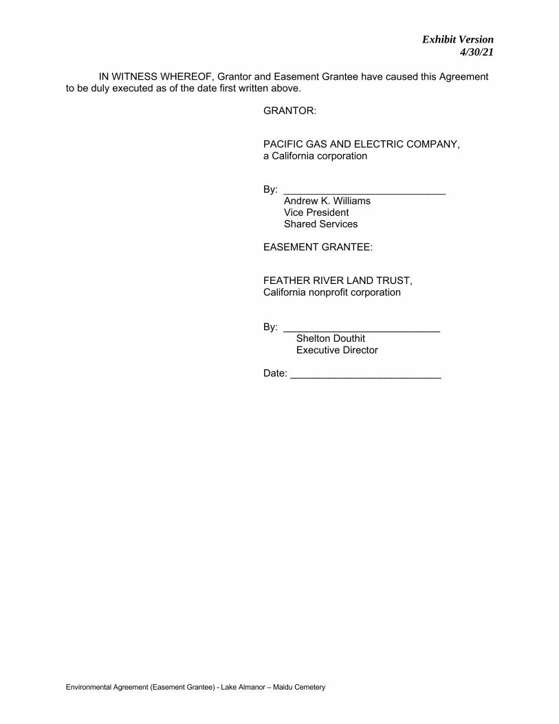
Exhibit Version 4/30/21
Environmental Agreement (Easement Grantee) - Lake Almanor – Maidu Cemetery
IN WITNESS WHEREOF, Grantor and Easement Grantee have caused this Agreement to be duly executed as of the date first written above.
GRANTOR:
PACIFIC GAS AND ELECTRIC COMPANY, a California corporation
By: _____________________________ Andrew K. Williams Vice President Shared Services
EASEMENT GRANTEE:
FEATHER RIVER LAND TRUST, California nonprofit corporation By: ____________________________
Shelton Douthit Executive Director
Date: ___________________________
Exhibit Version 4/30/21
4852-5566-3954.3
EXHIBIT A
LEGAL DESCRIPTION
[Follows this page]

Exhibit Version 4/30/21
CERTIFICATE OF ACKNOWLEDGMENT OF NOTARY PUBLIC
A notary public or other officer completing this certificate verifies only the identity of the individual who signed the document to which this certificate is attached, and not the truthfulness, accuracy, or validity of that document.
State of California ) County of ____________________ )
On ____________________, before me, ____________________________, a Notary Public, personally appeared _______________________________, who proved to me on the basis of satisfactory evidence to be the person(s) whose name(s) is/are subscribed to the within instrument and acknowledged to me that he/she/they executed the same in his/her/their authorized capacity(ies), and that by his/her/their signature(s) on the instrument the person(s), or the entity upon behalf of which the person(s) acted, executed the instrument.
I certify under PENALTY OF PERJURY under the laws of the State of California that the foregoing paragraph is true and correct.
WITNESS my hand and official seal.
Signature
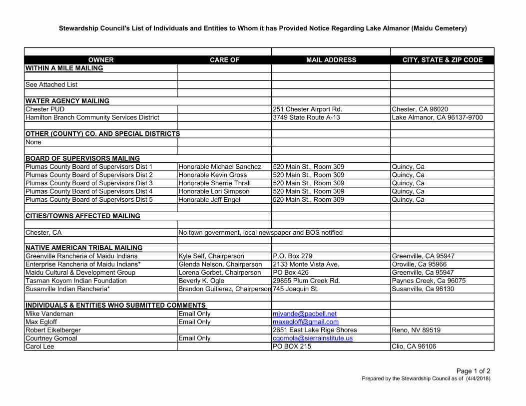
Stewardship Council's List of Individuals and Entities to Whom it has Provided Notice Regarding Lake Almanor (Maidu Cemetery)
OWNER CARE OF MAIL ADDRESS CITY, STATE & ZIP CODEWITHIN A MILE MAILING
See Attached List
Chester PUD 251 Chester Airport Rd. Chester, CA 96020Hamilton Branch Community Services District 3749 State Route A-13 Lake Almanor, CA 96137-9700
None
Plumas County Board of Supervisors Dist 1 Honorable Michael Sanchez 520 Main St., Room 309 Quincy, Ca Plumas County Board of Supervisors Dist 2 Honorable Kevin Gross 520 Main St., Room 309 Quincy, Ca Plumas County Board of Supervisors Dist 3 Honorable Sherrie Thrall 520 Main St., Room 309 Quincy, Ca Plumas County Board of Supervisors Dist 4 Honorable Lori Simpson 520 Main St., Room 309 Quincy, Ca Plumas County Board of Supervisors Dist 5 Honorable Jeff Engel 520 Main St., Room 309 Quincy, Ca
Chester, CA No town government, local newspaper and BOS notified
NATIVE AMERICAN TRIBAL MAILINGGreenville Rancheria of Maidu Indians Kyle Self, Chairperson P.O. Box 279 Greenville, CA 95947Enterprise Rancheria of Maidu Indians* Glenda Nelson, Chairperson 2133 Monte Vista Ave. Oroville, Ca 95966Maidu Cultural & Development Group Lorena Gorbet, Chairperson PO Box 426 Greenville, Ca 95947Tasman Koyom Indian Foundation Beverly K. Ogle 29855 Plum Creek Rd. Paynes Creek, Ca 96075Susanville Indian Rancheria* Brandon Guitierez, Chairperson 745 Joaquin St. Susanville, Ca 96130
INDIVIDUALS & ENTITIES WHO SUBMITTED COMMENTS Mike Vandeman Email Only [email protected] Egloff Email Only [email protected] Eikelberger 2651 East Lake Rige Shores Reno, NV 89519Courtney Gomoal Email Only [email protected] Lee PO BOX 215 Clio, CA 96106
OTHER (COUNTY) CO. AND SPECIAL DISTRICTS
BOARD OF SUPERVISORS MAILING
WATER AGENCY MAILING
CITIES/TOWNS AFFECTED MAILING
Page 1 of 2Prepared by the Stewardship Council as of (4/4/2018)
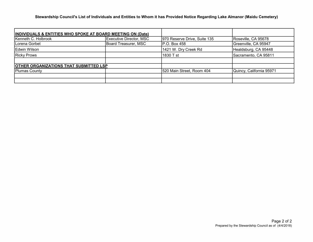
Stewardship Council's List of Individuals and Entities to Whom it has Provided Notice Regarding Lake Almanor (Maidu Cemetery)
Kenneth C. Holbrook Executive Director, MSC 970 Reserve Drive, Suite 135 Roseville, CA 95678Lorena Gorbet Board Treasurer, MSC P.O. Box 458 Greenville, CA 95947
Edwin Wilson 1421 W. Dry Creek Rd Healdsburg, CA 95448
Ricky Prows 1830 T st Sacramento, CA 95811
OTHER ORGANIZATIONS THAT SUBMITTED LSPPlumas County 520 Main Street, Room 404 Quincy, California 95971
INDIVIDUALS & ENTITIES WHO SPOKE AT BOARD MEETING ON (Date)
Page 2 of 2Prepared by the Stewardship Council as of (4/4/2018)
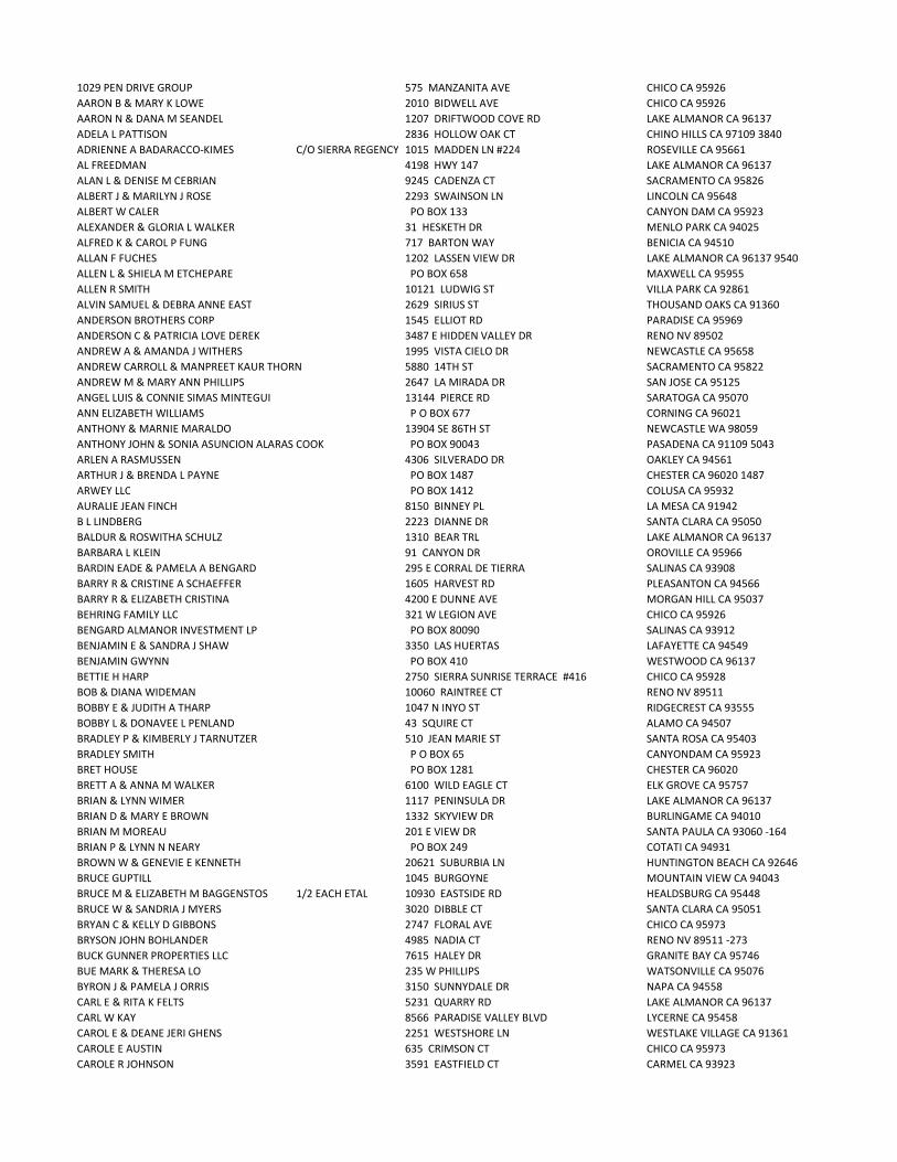
1029 PEN DRIVE GROUP 575 MANZANITA AVE CHICO CA 95926 AARON B & MARY K LOWE 2010 BIDWELL AVE CHICO CA 95926 AARON N & DANA M SEANDEL 1207 DRIFTWOOD COVE RD LAKE ALMANOR CA 96137 ADELA L PATTISON 2836 HOLLOW OAK CT CHINO HILLS CA 97109 3840ADRIENNE A BADARACCO-KIMES C/O SIERRA REGENCY 1015 MADDEN LN #224 ROSEVILLE CA 95661 AL FREEDMAN 4198 HWY 147 LAKE ALMANOR CA 96137 ALAN L & DENISE M CEBRIAN 9245 CADENZA CT SACRAMENTO CA 95826 ALBERT J & MARILYN J ROSE 2293 SWAINSON LN LINCOLN CA 95648 ALBERT W CALER PO BOX 133 CANYON DAM CA 95923 ALEXANDER & GLORIA L WALKER 31 HESKETH DR MENLO PARK CA 94025 ALFRED K & CAROL P FUNG 717 BARTON WAY BENICIA CA 94510 ALLAN F FUCHES 1202 LASSEN VIEW DR LAKE ALMANOR CA 96137 9540ALLEN L & SHIELA M ETCHEPARE PO BOX 658 MAXWELL CA 95955 ALLEN R SMITH 10121 LUDWIG ST VILLA PARK CA 92861 ALVIN SAMUEL & DEBRA ANNE EAST 2629 SIRIUS ST THOUSAND OAKS CA 91360 ANDERSON BROTHERS CORP 1545 ELLIOT RD PARADISE CA 95969 ANDERSON C & PATRICIA LOVE DEREK 3487 E HIDDEN VALLEY DR RENO NV 89502 ANDREW A & AMANDA J WITHERS 1995 VISTA CIELO DR NEWCASTLE CA 95658 ANDREW CARROLL & MANPREET KAUR THORN 5880 14TH ST SACRAMENTO CA 95822 ANDREW M & MARY ANN PHILLIPS 2647 LA MIRADA DR SAN JOSE CA 95125 ANGEL LUIS & CONNIE SIMAS MINTEGUI 13144 PIERCE RD SARATOGA CA 95070 ANN ELIZABETH WILLIAMS P O BOX 677 CORNING CA 96021 ANTHONY & MARNIE MARALDO 13904 SE 86TH ST NEWCASTLE WA 98059 ANTHONY JOHN & SONIA ASUNCION ALARAS COOK PO BOX 90043 PASADENA CA 91109 5043ARLEN A RASMUSSEN 4306 SILVERADO DR OAKLEY CA 94561 ARTHUR J & BRENDA L PAYNE PO BOX 1487 CHESTER CA 96020 1487ARWEY LLC PO BOX 1412 COLUSA CA 95932 AURALIE JEAN FINCH 8150 BINNEY PL LA MESA CA 91942 B L LINDBERG 2223 DIANNE DR SANTA CLARA CA 95050 BALDUR & ROSWITHA SCHULZ 1310 BEAR TRL LAKE ALMANOR CA 96137 BARBARA L KLEIN 91 CANYON DR OROVILLE CA 95966 BARDIN EADE & PAMELA A BENGARD 295 E CORRAL DE TIERRA SALINAS CA 93908 BARRY R & CRISTINE A SCHAEFFER 1605 HARVEST RD PLEASANTON CA 94566 BARRY R & ELIZABETH CRISTINA 4200 E DUNNE AVE MORGAN HILL CA 95037 BEHRING FAMILY LLC 321 W LEGION AVE CHICO CA 95926 BENGARD ALMANOR INVESTMENT LP PO BOX 80090 SALINAS CA 93912 BENJAMIN E & SANDRA J SHAW 3350 LAS HUERTAS LAFAYETTE CA 94549 BENJAMIN GWYNN PO BOX 410 WESTWOOD CA 96137 BETTIE H HARP 2750 SIERRA SUNRISE TERRACE #416 CHICO CA 95928 BOB & DIANA WIDEMAN 10060 RAINTREE CT RENO NV 89511 BOBBY E & JUDITH A THARP 1047 N INYO ST RIDGECREST CA 93555 BOBBY L & DONAVEE L PENLAND 43 SQUIRE CT ALAMO CA 94507 BRADLEY P & KIMBERLY J TARNUTZER 510 JEAN MARIE ST SANTA ROSA CA 95403 BRADLEY SMITH P O BOX 65 CANYONDAM CA 95923 BRET HOUSE PO BOX 1281 CHESTER CA 96020 BRETT A & ANNA M WALKER 6100 WILD EAGLE CT ELK GROVE CA 95757 BRIAN & LYNN WIMER 1117 PENINSULA DR LAKE ALMANOR CA 96137 BRIAN D & MARY E BROWN 1332 SKYVIEW DR BURLINGAME CA 94010 BRIAN M MOREAU 201 E VIEW DR SANTA PAULA CA 93060 -164BRIAN P & LYNN N NEARY PO BOX 249 COTATI CA 94931 BROWN W & GENEVIE E KENNETH 20621 SUBURBIA LN HUNTINGTON BEACH CA 92646 BRUCE GUPTILL 1045 BURGOYNE MOUNTAIN VIEW CA 94043 BRUCE M & ELIZABETH M BAGGENSTOS 1/2 EACH ETAL 10930 EASTSIDE RD HEALDSBURG CA 95448 BRUCE W & SANDRIA J MYERS 3020 DIBBLE CT SANTA CLARA CA 95051 BRYAN C & KELLY D GIBBONS 2747 FLORAL AVE CHICO CA 95973 BRYSON JOHN BOHLANDER 4985 NADIA CT RENO NV 89511 -273BUCK GUNNER PROPERTIES LLC 7615 HALEY DR GRANITE BAY CA 95746 BUE MARK & THERESA LO 235 W PHILLIPS WATSONVILLE CA 95076 BYRON J & PAMELA J ORRIS 3150 SUNNYDALE DR NAPA CA 94558 CARL E & RITA K FELTS 5231 QUARRY RD LAKE ALMANOR CA 96137 CARL W KAY 8566 PARADISE VALLEY BLVD LYCERNE CA 95458 CAROL E & DEANE JERI GHENS 2251 WESTSHORE LN WESTLAKE VILLAGE CA 91361 CAROLE E AUSTIN 635 CRIMSON CT CHICO CA 95973 CAROLE R JOHNSON 3591 EASTFIELD CT CARMEL CA 93923

CAROLEE ORBAUN 1/3 EACH AS T/C PO BOX 766 ARBUCKLE CA 95912 CAROLYN J DIMICK 2713 SIERRA SUNRISE TER #428 CHICO CA 95928 3911CARTLIDGE LAKEHOUSE LLC 1990 DRISCOLL DR RENO NV 89509 CATHERINE L BIER 4341 FLYING C RD SHINGLE SPRINGS CA 95682 CATHERINE R SHANKS FRED M SHANKS 9871 SKILLIN ESTATES DR DURHAM CA 95938 CC&H LANDS LLC C/O COLLINS PINE CO P O BOX 796 CHESTER CA 96020 CHABRIER J & GREGORY BRUCE DEAN 564 AMBERWOOD WAY LIVERMORE CA 94551 CHAD A & FRANZ LORENE S WALLACE PO BOX 177 CANYON DAM CA 95923 CHALMERS R SCOTT 49 EAGLE NEST DR CHICO CA 95928 CHARLES G & SUZANNE M PLOPPER PO BOX 395 CHESTER CA 96020 395CHARLES H & MARY A ALMESTAD 954 YORKSHIRE CT LAFAYETTE CA 94549 CHARLES L & SANDRA L H SHARRER 8806 VILLA CAMPO WAY FAIR OAKS CA 95628 CHARLES M & CHARLOTTE PARKINSON CARPENTER 4265 WATER HOLE RD RENO NV 89509 CHARLES MAYNARICH C/O KEVIN EUGENE SHE5710 PRAIRIE DUNES CT SPARKS NV 89436 CHARLES P & JOYCE M WEBB 6243 FORDHAM WAY SACRAMENTO CA 95831 1817CHARLES P & LYNNSEY VIRDEN 960 CAUGHLIN CROSSING RENO NV 89519 CHERYL FINLEY C/O FRIEND DAVID & SUZANNE30 VAN TASSEL CT SAN ANSELMO CA 94960 CHERYL LEE ANDERSON 11400 FAWN CREEK CT AUBURN CA 95602 7609CHESTER CEMETERY DISTRICT PO BOX 539 CHESTER CA 96020 CHRISTIAN H SAUER 1756 POPPY FIELD DR ROSEVILLE CA 95661 CHRISTIAN SCHWARTZ 2401 SANTIAGO DR NEWPORT BEACH CA 92660 CHRISTINA K NICHOLS 1197 WOODLAND AVE CHICO CA 95928 CHRISTINE D GRAF 2208 N LINDO AVE #1 CHICO CA 95973 8754CHRISTOPHER A & ELAINE BROSE 840 HINCKLEY RD #220 BURLINGAME CA 94010 1509CHRISTOPHER P & SALLY A EARNEST 4706 FERNCREEK DR ROLLING HILLS ES CA 90274 CLAUDIA J HARRISON 495 BAILEY CREEK DR LAKE ALMANOR CA 96137 CLAY E & TERESA M THOMAS 6824 MARBLE CANYON RD RENO NV 89511 CLIFFORD B & DENI JO VINSONHALER 1453 RIM ROCK DR CHICO CA 95928 CLIFFORD C & ELIZABETH J ROBIE 1208 LASSEN VIEW DR LAKE ALMANOR CA 96137 CLIFFORD R & JANET R PEREZ 1001 W FIRST ST WILLOWS CA 95988 CLIFFORD T & LYNNE M SHELTON PO BOX 1779 CHESTER CA 96020 1779CLYDE E & JUDITH M BREWTON PO BOX 713 CHESTER CA 96020 713COLLEEN & JACOB CECIL 7303 COUNTY RD ORLAND CA 95963 CONRAD & ELSBETH ANN BRUDERER 4504 RESMAR RD LA MESA CA 91941 CRAIG & MARGARET BASH 4938 HAMPDON LN #480 BETHESDA MD 20814 CRAIG D & MARY E JAMES PO BOX 519 CHESTER CA 96020 519CRAIG S & TERESA M MUNSON 3584 DESERT FOX DR SPARKS NV 89436 CURTIS & JOCELYN TRAMMELL 6255 NW BURGUNDY DR CORVALLIS OR 97330 CURTIS B COULTER 403 HILL ST RENO NV 89501 CURTIS C & DENISE A CAMPION 133 PARTRIDGE DR GALT CA 95632 CURTIS E QUAM P O BOX 517 WESTWOOD CA 96137 CUTTING HORSE INVESTMENTS LLC C/O GREGORY & VALERIE ERNY3350 THORNHILL DR RENO NV 89509 CYNTHIA BARRETT 6150 BLAKE LN LAKE ALMANOR CA 96137 CYNTHIA M KUIPER 142 BLOSSOM CIR SAN MATEO CA 94403 D ANGELO JOAN R TRUSTEE ETAL 58 SKIPPING ROCK WAY NAPA CA 94558 DALE & SUSAN LONGERO 3670 HAWKINGS CT SPARKS NV 89436 DALE E & FREGOSO-COX PATRICIA H COX 50 % EACH 4725 WEST AVE QUART HILL CA 93536 DALE L & BARBARA L LAZZARONE 4165 CAUGHLIN PKWY RENO NV 89519 DANA B CALDWELL 6712 CHAPMAN DR PARADISE CA 95969 DANELLE C CAMPBELL 65 LAZY S LN CHICO CA 95928 DANIEL B & CHRISTINE M GOBBA 4388 SHORTHORN DR CHICO CA 95973 DANIEL C & CARTWRIGHT CHRISTOPHER K JACUZZI 437 CENTURY PARK DR #B YUBA CITY CA 95991 DANIEL E & MARY S MC MILLAN 40 PETERSON PL WALNUT CREEK CA 94595 DANIEL J & MONIQUE M FIGLIETTI 2165 CARTAGENA DR YUBA CITY CA 95993 5304DANIEL K TRUSTEE & LISA A BAILEY 1218 CARSON ST COLUSA CA 95932 DANIEL L CAIN 6449 BROOKEVIEW CIR RENO NV 89519 DANIEL N & JUDITH P VAN ELDEREN 25601 FERNHILL DR LOS ALTOS HILLS CA 94024 DANIEL R & GREEN MARILYN K SACCANI 2462 GOLF LINKS DR SANTA CLARA CA 95050 DANIEL S & BARBARA S MOUNT 1333 JONES ST #1404 SAN FRANCISCO CA 94109 DANIEL STEPHEN & LYNN MURPHY POOLE C/O THE POOLE FAMILY TRUST PO BOX 310 FOREST RANCH CA 95942 DANIEL W SLEPPY 880 HIDDEN WAY PLACERVILLE CA 95667 DARIN & MICHELLE BERRY 5602 VISTA TERRA LN SPARKS NV 89436 DARRELL G & CHERI S COOPER 515 GRAND CANYON DR PASO ROBLES CA 93446 DARRYL E & MARLENE JOY PETERSEN 4063 MOSELLE CT PLEASANTON CA 94566

DARRYL GEORGE DONOIAN 2100 GREEN ST #306 SAN FRANCISCO CA 94123 DARRYL L & JOLYN G HANN 16931 EDGEWATER LN HUNTINGTON BEACH CA 92649 DAVID & SARA FEIN 964 LEAH CIR RENO NV 89511 DAVID A & JULIE L MATA 110 SECOND ST WOODLAND CA 95695 DAVID A STAMM 100 VAN NESS AVE SAN FRANCISCO CA 94102 DAVID ALLEN & RHONDA FAYE CHOATE 1961 LARKIN RD GRIDLEY CA 95948 DAVID D & STEPHANIE B BANTA 10 ANCHORAGE WAY NEW PORT BEACH CA 92663 DAVID D WEIHER 3675 FRUITVALE RD LINCOLN CA 95648 DAVID E & DEBRA L LUNDBERG 16 SEGA DR CHICO CA 95928 DAVID J & BINSFELD CAROL V BRAUN 2681 18TH AVE SAN FRANCISCO CA 94116 DAVID J & CATHERINE L BUDD 1389 DARRYL DR SAN JOSE CA 95130 DAVID J & MICHELLE L TRUJILLO 788 MARRON WAY GARDNERVILLE NV 89460 DAVID J MARTINEZ 1963 NEPTUN RD LIVERMORE CA 94550 DAVID JOSEPH & LAURIE ANN CASHMAN 9834 FUERTE DR LA MESA CA 91941 DAVID K BEHRENDT 1093 W 23RD ST SAN PEDRO CA 90731 DAVID L & LONA RAY ADAMS 4229 DESPERADO CT SPARKS NV 89436 DAVID M & ELIZABETH R GATES 2887 ROYAL PARK DR CAMERON CA 95682 DAVID M & SHIRLEY M TRSTS KARNES 13701 TYPEE WAY IRVINE CA 92620 DAVID R & JOANNE M FULLER 5 CANTERBURY CIR CHICO CA 95926 DAVID R & KAREN HEARN 4251 CORNELL WAY LIVERMORE CA 94550 DAVID W & JUDY A WHITLOW PO BOX 1602 CHESTER CA 96020 DEAN & ANNA BROWN 127 BALDWIN DR DANVILLE CA 94526 DEAN & TIFFANY RUMBERGER 9475 CANNONSHIRE CT LOOMIS CA 95650 DEANNA J & ROBERT B LFE HICKS C/O PATRICK ROTH 9535 SNOWY SPRINGS CIR ELK GROVE CA 95758 DEBORAH STEWART EBERT 15332 ANTIOCH ST #503 PACIFIC PALISADES CA 90272 DELBERT V GERKEN 533 LEISURE WORLD MESA AZ 85206 DELORES ANN OWEN 11755 BENNETTA LN GILROY CA 95020 9224DENIS PATRICK O LEARY P O BOX 370663 MONTARA CA 94037 DENNIS ALLEN & JUDITH ANN SIMKINS PO BOX 7744 AUBURN CA 95604 DENNIS J & JUDITH A BROSELLE PO BOX 235 CANYON DAM CA 95923 235DENNIS M & JUDITH A SPOONER 936 COUNTY RD WILLOWS CA 95988 DIANE K MELVIN 1238 BROOKDALE AVE MOUNTAIN VIEW CA 94040 DIRK R DIEFENDORF 343 W POPLAR AVE SAN MATEO CA 94402 DOLORES B JOHNSON 254 WINDING CANYON LN FOLSOM CA 95630 DOLORES E SILVA 3343 RANCHO RIO BONITA COVINA CA 91724 DONALD A & BEVERLY J LORENZ 15 ELMWOOD PL MENLO PARK CA 94025 DONALD A & MARJORIE E FRYER 20795 PASEO PANORAMA YORBA LINDA CA 92887 DONALD C & VALORA P BROWNING 10424 CIMARRON TRL OAKDALE CA 95361 DONALD D & CAROL A FRANKLIN 1042 LARCH AVE MORAGA CA 94556 DONALD JAMES & PAMELA DIANE POLLARD 3 RISING RIDGE CT CHICO CA 95928 DONALD K & JANICE S WILLIAMS 16723 SCOTT WAY GRASS VALLEY CA 95949 7127DONALD K FELT PO BOX 309 ASHLAND OR 97520 DONALD LEONARD BAY 3255 HUDSON AVE CHICO CA 95973 DONALD P & JANET M ROLLOFSON 2337 DODGE LN CARMICHAEL CA 95608 DONALD R & HELEN M GRAVES 4074 HWY 147 LAKE ALMANOR CA 96137 9759DONALD R SCHRICKER 1055 TAPADERO TRL RENO NV 89521 DONALD W & VICTORIA I GUSTAFSON PO BOX 273 CANYON DAM CA 95923 273DONNA M AHLNESS 5237 E VOLTEUIRE AVE SCOTTSDALE AZ 85254 DONNA MASTERS 1118 CLIFFORD DR LAKE ALMANOR CA 96137 DONOHUE C & JUDITH L LEON 1904 BECHELLI LN REDDING CA 96002 132DORIS F JAMES 356 FILBERT ST HALF MOON BAY CA 94019 DOUGLAS A KUEHN C/O BART SEARS 800 SUNNYPARK CT CAMPBELL CA 95008 DOUGLAS BRIAN & SANDRA LEE HOUSTON 6349 THISTLEWOOD CT SPARKS NV 89436 DOUGLAS C & KATHLEEN R BUI PO BOX 1568 CHESTER CA 96020 1568DOUGLAS CASEY & LISA VINELLA SAFRENO 175 PHILLIP DR WOODSIDE CA 94062 DOUGLAS J & DIANA L LINDSTROM 309 KNOCH AVE SUSANVILLE CA 96130 DOUGLAS M & SYLVIA A ENOCH 3921 WYCOMBE DR SACRAMENTO CA 95864 DOUGLAS R & PATRICIA A GHISELIN 300 MOON MOUNTAIN RD SONOMA CA 95476 DUSTIN ERIC FUSTON PASSARIELLO NINA TAMARA2338 HONEY RUN RD CHICO CA 95928 EARL E & GAYLE JOAN WHITE 149 MAGELLAN ST CAPITOLA CA 95010 EARL M & KATHLEEN N H CORDER C/O VICKEE SECREST 1212 ROSSMOOR PKWY WALNUT CREEK CA 94595 EDGAR L & ELINOR MC CONNELL 560 DANIEL DR YUBA CITY CA 95993 9350EDWARD L & ROSEMARY L MORSE 1310 PENINSULA DR LAKE ALMANOR CA 96137 EDWARD P & LEILANI M ANDERSON 360 YORK WAY SPARKS NV 89431

EDWARD R & BELL-MOUDRY MARY M MOUDRY 1578 SILVER TRL NAPA CA 94558 EDWARD RAY SIZER PO BOX 1287 CHICO CA 95927 ELAINE J BLAKE 2053 IMELDA CT REDDING CA 96001 ELIZABETH A CHALMERS 560 33RD ST MANHATTAN BEACH CA 90266 ELIZABETH ANTONIOLI 25051 TEPA WAY LOS ALTOS CA 94022 ELIZABETH M SCHULER 2215 RHODES RD RENO NV 89521 ELLIOTT THOMAS ALLEN 6440 SKY POINTE DR #140-1 LAS VEGAS NV 89131 ELLIS C & THEORA JEAN ROLLS 1661 FILBERT AVE CHICO CA 95926 EMMANUEL & JANET J SILVA 935 LARKIN RD GRIDLEY CA 95948 ENTRUST ADMINISTRATION TRUST 555 12TH ST #1250 OAKLAND CA 94607 ERIC A VIAL 515 ASH ST SUSANVILLE CA 96130 ERIC W & NANCY L KASTELL 103 WOLF POINT CT FOLSOM CA 95630 ESTHER M & CHARLES P PRETTI 138 MERNER DR WINDSOR CA 95492 EUGEN & ELIZABETH R CASSVAN 52 WOODRANCH CIR DANVILLE CA 94506 EUGENE G & LORETTA M CURTI 555 GEIGER GRADE RD RENO NV 89521 8441EUGENE M & DIANN R BRUDER PO BOX 22920 LINCOLN NE 68542 2920EUNICE BEELER 5399 HIGHWAY 147 LAKE ALMANOR CA 96137 EVAN H SCHUSTER MICHAEL PO BOX 102 BROWNS VALLEY CA 95918 EVERETTW & MARGARETA EATON 245 PEBBLE BEACH DR NEWBURY PARK CA 91320 4123FAY M JOHNSON 3326 WALNUT LN LAFAYETTE CA 94549 FEDERAL NATIONAL MORTGAGE ASSOCIATION 14221 DALLA PKWY #1000 DALLAS TX 75254 -295FLETCHER FAMILY PARTNERSHIP 219 BURNS DR YUBA CITY CA 95991 FRANCES F SMITH 1860 TICE CREEK DR #1204 WALNUT CREEK CA 94595 FRANCES MC GOWAN HOGAN 30 INDEPENDENCE CIR #300 CHICO CA 95973 FRANK & JUDIE KAE CRAIN 1284 PENINSULA DR LAKE ALMANOR CA 96137 FRANK A ARGISO 666595 CRESCENT DR CLEAR CREEK CA 96137 9412FRANK A ROGERS ROGERS CHEYENNE ROSE PO BOX 954 COLUSA CA 95932 FRANK J & CATHERINE R ARPAIA 2301 TUSTIN AVE NEWPORT BEACH CA 92660 FRANK M & FRANCES A LEPORI 3345 PIAZZO CIR RENO NV 89502 FRANK RONALD & REBECCA BROWN H HIEGEL 1876 ARI CT YUBA CITY CA 95991 FRANK S & TERRIE L PEREZ 1306 PENINSULA DR LAKE ALMANOR CA 96137 FRANK WALLER TRSTE BORGESS 344 ALDEN LN LIVERMORE CA 94550 FRED A & LESLEY C HUBBARD 5294 HIGHWAY 147 LAKE ALMANOR CA 96137 FREDERICK G & SHANNON L ARCHBOLD 231 TAYLOR CT SEQUION WA 98382 FREDRIC H & SHEILA J SCHMITZ 3872 DIXON PL PALO ALTO CA 94306 FRIEDA H KRUSE 1115 WINDING RIDGE RD SANTA ROSA CA 95404 G & G CAPITAL INC A NEVADA CORP 4790 CAUGHLIN PKWY #515 RENO NV 89509 GABRIEL R HEBERT 1235 LASSEN VIEW DR LAKE ALMANOR CA 96137 GARVIN R & BARBARA A EVANS 3986 PASEO GRANDE MORAGA CA 94556 GARY & CYNTHIA TEAGUE C/O BOBBIE NELL COOK1966 VALLAMBROSA AVE CHICO CA 95926 GARY & SHERI SULLIVAN 4256 HIGHWAY 147 SPACE #19 LAKE ALMANOR CA 96137 GARY D VAN DYKE PO BOX 767 PLEASANT GROVE CA 95668 GARY H & GERTRUDE E MOORE 50 HACIENDAS RD ORINDA CA 94563 GARY KEITH & CONNIE M WALDRON 6543 CHAMPETRE CT RENO NV 89511 GARY L & LAURA L FEBUS 31 CORTE DE LA CANADA MARTINEZ CA 94553 GARY M BREEN 1401 LASSEN VIEW DR LAKE ALMANOR CA 96137 GARY R & DWAN O BRADLEY 32 ROSE CREEK LN RENO NV 89511 GARY RALPH & GRETCHEN A JACOBSON 1319 LASSEN VIEW DR LAKE ALMANOR CA 96137 GARY T & LESLIE G KRAUSE 75 HUNT WAY CAMPBELL CA 95008 GARY WAYNE & CHARLENE VICTORIA FERGUSON 1144 LAKE RIDGE RD LAKE ALMANOR CA 96137 GATES PROPERTIES LLC 531 S VILLA AVE WILLOWS CA 95988 GAY L POTTER 5235 FELL AVE SAN JOSE CA 95136 2636GENE R & MARJORIE L MARTINEZ 789 WYER RD ARBUCKLE CA 95912 GEORGE R & ELAINE C CARPENTER 3450 BIG BARN RD PLACERVILLE CA 95667 GEORGE R POST 2790 FRANKLIN RD YUBA CITY CA 95993 GEORGE S & LAURA M HAWKINS 1123 LASSEN VIEW DR LAKE ALMANOR CA 96137 GERALD L ERNST 14504 RICHARDSON SPRINGS RD CHICO CA 95973 GERALD S & CONSTANCE M EVANS PO BOX 18402 RENO NV 89511 GERALD W ABREU 9175 SILVERWOOD CT GRANITE BAY CA 95746 7243GERHARD J & RENEE S PLENERT 4019 GEORGE RD CARMICHAEL CA 95608 GLORIA ANN ZEH 2566 TEMPLETON DR REDDING CA 96002 GORDON & THEO JOHNSON FAMILY 54 NINA CT ALAMO CA 94507 GRANDVILLE & WANDA FAYE WARREN 11645 TAM OSHANTER DR SALINAS CA 93906 GRANT E & NORVELL-HOLLIDAY KIM J HOLLIDAY 3267 STATE HIGHWAY 147 LAKE ALMANOR CA 96137
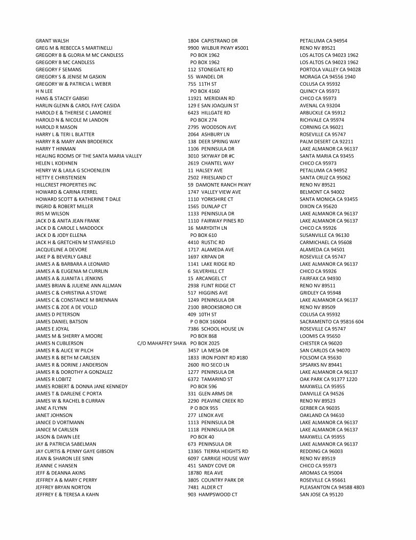
GRANT WALSH 1804 CAPISTRANO DR PETALUMA CA 94954 GREG M & REBECCA S MARTINELLI 9900 WILBUR PKWY #5001 RENO NV 89521 GREGORY B & GLORIA M MC CANDLESS PO BOX 1962 LOS ALTOS CA 94023 1962GREGORY B MC CANDLESS PO BOX 1962 LOS ALTOS CA 94023 1962GREGORY F SEMANS 112 STONEGATE RD PORTOLA VALLEY CA 94028 GREGORY S & JENISE M GASKIN 55 WANDEL DR MORAGA CA 94556 1940GREGORY W & PATRICIA L WEBER 755 11TH ST COLUSA CA 95932 H N LEE PO BOX 4160 QUINCY CA 95971 HANS & STACEY GABSKI 11921 MERIDIAN RD CHICO CA 95973 HARLIN GLENN & CAROL FAYE CASIDA 129 E SAN JOAQUIN ST AVENAL CA 93204 HAROLD E & THERESE C LAMOREE 6423 HILLGATE RD ARBUCKLE CA 95912 HAROLD N & NICOLE M LANDON PO BOX 274 RICHVALE CA 95974 HAROLD R MASON 2795 WOODSON AVE CORNING CA 96021 HARRY L & TERI L BLATTER 2064 ASHBURY LN ROSEVILLE CA 95747 HARRY R & MARY ANN BRODERICK 138 DEER SPRING WAY PALM DESERT CA 92211 HARRY T HINMAN 1106 PENINSULA DR LAKE ALMANOR CA 96137 HEALING ROOMS OF THE SANTA MARIA VALLEY 3010 SKYWAY DR #C SANTA MARIA CA 93455 HELEN L KOEHNEN 2619 CHANTEL WAY CHICO CA 95973 HENRY W & LAILA G SCHOENLEIN 11 HALSEY AVE PETALUMA CA 94952 HETTY E CHRISTENSEN 2502 FRIESLAND CT SANTA CRUZ CA 95062 HILLCREST PROPERTIES INC 59 DAMONTE RANCH PKWY RENO NV 89521 HOWARD & CARINA FERREL 1747 VALLEY VIEW AVE BELMONT CA 94002 HOWARD SCOTT & KATHERINE T DALE 1110 YORKSHIRE CT SANTA MONICA CA 93455 INGRID & ROBERT MILLER 1565 DUNLAP CT DIXON CA 95620 IRIS M WILSON 1133 PENINSULA DR LAKE ALMANOR CA 96137 JACK D & ANITA JEAN FRANK 1110 FAIRWAY PINES RD LAKE ALMANOR CA 96137 JACK D & CAROLE L MADDOCK 16 MARYDITH LN CHICO CA 95926 JACK D & JODY ELLENA PO BOX 610 SUSANVILLE CA 96130 JACK H & GRETCHEN M STANSFIELD 4410 RUSTIC RD CARMICHAEL CA 95608 JACQUELINE A DEVORE 1717 ALAMEDA AVE ALAMEDA CA 94501 JAKE P & BEVERLY GABLE 1697 KRPAN DR ROSEVILLE CA 95747 JAMES A & BARBARA A LEONARD 1141 LAKE RIDGE RD LAKE ALMANOR CA 96137 JAMES A & EUGENIA M CURRLIN 6 SILVERHILL CT CHICO CA 95926 JAMES A & JUANITA L JENKINS 15 ARCANGEL CT FAIRFAX CA 94930 JAMES BRIAN & JULIENE ANN ALLMAN 2938 FLINT RIDGE CT RENO NV 89511 JAMES C & CHRISTINA A STOWE 517 HIGGINS AVE GRIDLEY CA 95948 JAMES C & CONSTANCE M BRENNAN 1249 PENINSULA DR LAKE ALMANOR CA 96137 JAMES C & ZOE A DE VOLLD 2100 BROOKSBORO CIR RENO NV 89509 JAMES D PETERSON 409 10TH ST COLUSA CA 95932 JAMES DANIEL BATSON P O BOX 160604 SACRAMENTO CA 95816 604JAMES E JOYAL 7386 SCHOOL HOUSE LN ROSEVILLE CA 95747 JAMES M & SHERRY A MOORE PO BOX 868 LOOMIS CA 95650 JAMES N CUBLERSON C/O MAHAFFEY SHAWN & MILLI PO BOX 2025 CHESTER CA 96020 JAMES R & ALICE W PILCH 3457 LA MESA DR SAN CARLOS CA 94070 JAMES R & BETH M CARLSEN 1833 IRON POINT RD #180 FOLSOM CA 95630 JAMES R & DORINE J ANDERSON 2600 RIO SECO LN SPSARKS NV 89441 JAMES R & DOROTHY A GONZALEZ 1277 PENINSULA DR LAKE ALMANOR CA 96137 JAMES R LOBITZ 6372 TAMARIND ST OAK PARK CA 91377 1220JAMES ROBERT & DONNA JANE KENNEDY PO BOX 596 MAXWELL CA 95955 JAMES T & DARLENE C PORTA 331 GLEN ARMS DR DANVILLE CA 94526 JAMES W & RACHEL B CURRAN 2290 PEAVINE CREEK RD RENO NV 89523 JANE A FLYNN P O BOX 955 GERBER CA 96035 JANET JOHNSON 277 LENOX AVE OAKLAND CA 94610 JANICE D VORTMANN 1113 PENINSULA DR LAKE ALMANOR CA 96137 JANICE M CARLSEN 1118 PENINSULA DR LAKE ALMANOR CA 96137 JASON & DAWN LEE PO BOX 40 MAXWELL CA 95955 JAY & PATRICIA SABELMAN 673 PENINSULA DR LAKE ALMANOR CA 96137 JAY CURTIS & PENNY GAYE GIBSON 13365 TIERRA HEIGHTS RD REDDING CA 96003 JEAN & SHARON LEE SINN 6097 CARRIGE HOUSE WAY RENO NV 89519 JEANNE C HANSEN 451 SANDY COVE DR CHICO CA 95973 JEFF & DEANNA AKINS 18780 REA AVE AROMAS CA 95004 JEFFREY A & MARY C PERRY 3805 COUNTRY PARK DR ROSEVILLE CA 95661 JEFFREY BRYAN NORTON 7481 ALDER CT PLEASANTON CA 94588 4803JEFFREY E & TERESA A KAHN 903 HAMPSWOOD CT SAN JOSE CA 95120
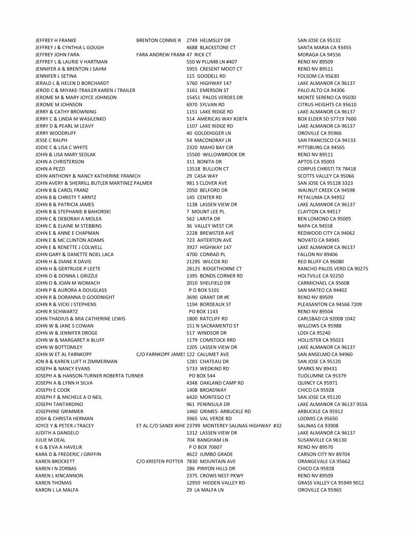
JEFFREY H FRANKE BRENTON CONNIE R 2749 HELMSLEY DR SAN JOSE CA 95132 JEFFREY J & CYNTHIA L GOUGH 4688 BLACKSTONE CT SANTA MARIA CA 93455 JEFFREY JOHN FARA FARA ANDREW FRANK 47 RICK CT MORAGA CA 94556 JEFFREY L & LAURIE V HARTMAN 550 W PLUMB LN #407 RENO NV 89509 JENNIFER A & BRENTON J SAHM 5955 CRESENT MOOT CT RENO NV 89511 JENNIFER L SETINA 115 GOODELL RD FOLSOM CA 95630 JERALD L & HELEN D BORCHARDT 5760 HIGHWAY 147 LAKE ALMANOR CA 96137 JEROD C & MIYAKE-TRAILER KAREN J TRAILER 3161 EMERSON ST PALO ALTO CA 94306 JEROME M & MARY JOYCE JOHNSON 15451 PALOS VERDES DR MONTE SERENO CA 95030 JEROME M JOHNSON 6970 SYLVAN RD CITRUS HEIGHTS CA 95610 JERRY & CATHY BROWNING 1151 LAKE RIDGE RD LAKE ALMANOR CA 96137 JERRY C & LINDA M WASILENKO 514 AMERICAS WAY #2874 BOX ELDER SD 57719 7600JERRY D & PEARL M LEAVY 1107 LAKE RIDGE RD LAKE ALMANOR CA 96137 JERRY WOODRUFF 40 GOLDDIGGER LN OROVILLE CA 95966 JESSE C RALPH 54 MACONDRAY LN SAN FRANCISCO CA 94133 JODIE C & LISA C WHITE 2320 MAHO BAY CIR PITTSBURG CA 94565 JOHN & LISA MARY SEDLAK 15500 WILLOWBROOK DR RENO NV 89511 JOHN A CHRISTERSON 311 BONITA DR APTOS CA 95003 JOHN A PEZZI 13518 BULLION CT CORPUS CHRISTI TX 78418 JOHN ANTHONY & NANCY KATHERINE FRANICH 29 CASA WAY SCOTTS VALLEY CA 95066 JOHN AVERY & SHERRILL BUTLER MARTINEZ PALMER 981 S CLOVER AVE SAN JOSE CA 95128 3323JOHN B & CAROL FRANZ 2050 BELFORD DR WALNUT CREEK CA 94598 JOHN B & CHRISTY T ARNTZ 145 CENTER RD PETALUMA CA 94952 JOHN B & PATRICIA JAMES 1138 LASSEN VIEW DR LAKE ALMANOR CA 96137 JOHN B & STEPHANIE B BAHORSKI 7 MOUNT LEE PL CLAYTON CA 94517 JOHN C & DEBORAH A MOLEA 562 LARITA DR BEN LOMOND CA 95005 JOHN C & ELAINE M STEBBINS 36 VALLEY WEST CIR NAPA CA 94558 JOHN E & ANNE E CHAPMAN 2228 BREWSTER AVE REDWOOD CITY CA 94062 JOHN E & MC CLINTON ADAMS 723 AHTERTON AVE NOVATO CA 94945 JOHN E & RENETTE J COLWELL 3927 HIGHWAY 147 LAKE ALMANOR CA 96137 JOHN GARY & DANETTE NOEL LACA 4700 CONRAD PL FALLON NV 89406 JOHN H & DIANE R DAVIS 21295 WILCOX RD RED BLUFF CA 96080 JOHN H & GERTRUDE P LEETE 28125 RIDGETHORNE CT RANCHO PALOS VERD CA 90275 JOHN O & DONNA L GRIZZLE 1395 BONDS CORNER RD HOLTVILLE CA 92250 JOHN O & JOAN M WOMACH 2010 SHELFIELD DR CARMICHAEL CA 95608 JOHN P & AURORA A DOUGLASS P O BOX 5101 SAN MATEO CA 94402 JOHN R & DORANNA D GOODNIGHT 3690 GRANT DR #E RENO NV 89509 JOHN R & VICKI J STEPHENS 1194 BORDEAUX ST PLEASANTON CA 94566 7209JOHN R SCHWARTZ PO BOX 1143 RENO NV 89504 JOHN THADIUS & MIA CATHERINE LEWIS 1800 RATCLIFF RD CARLSBAD CA 92008 1042JOHN W & JANE S COWAN 151 N SACRAMENTO ST WILLOWS CA 95988 JOHN W & JENNIFER DROGE 517 WINDSOR DR LODI CA 95240 JOHN W & MARGARET A BLUFF 1179 COMSTOCK RRD HOLLISTER CA 95023 JOHN W BOTTOMLEY 1205 LASSEN VIEW DR LAKE ALMANOR CA 96137 JOHN W ET AL FARNKOPF C/O FARNKOPF JAMES R SUCC TRUSTEE122 CALUMET AVE SAN ANSELMO CA 94960 JON B & KAREN LUFT H ZIMMERMAN 1281 CHATEAU DR SAN JOSE CA 95120 JOSEPH & NANCY EVANS 5733 WEDKIND RD SPARKS NV 89431 JOSEPH A & HANSON-TURNER ROBERTA TURNER PO BOX 544 TUOLUMNE CA 95379 JOSEPH A & LYNN H SILVA 4348 OAKLAND CAMP RD QUINCY CA 95971 JOSEPH E COOK 1408 BROADWAY CHICO CA 95928 JOSEPH F & MICHELE A O NEIL 6420 MONTEGO CT SAN JOSE CA 95120 JOSEPH TANTARDINO 961 PENINSULA DR LAKE ALMANOR CA 96137 9556JOSEPHINE GRIMMER 1460 GRIMES- ARBUCKLE RD ARBUCKLE CA 95912 JOSH & CHRISTA HERMAN 3965 VAL VERDE RD LOOMIS CA 95650 JOYCE Y & PETER J TRACEY ET AL C/O SANDI WHEATON23799 MONTEREY SALINAS HIGHWAY #32 SALINAS CA 93908 JUDITH A DANGELO 1312 LASSEN VIEW DR LAKE ALMANOR CA 96137 JULIE M DEAL 704 BANGHAM LN SUSANVILLE CA 96130 K G & EVA A HAVELIK P O BOX 70607 RENO NV 89570 KARA D & FREDERIC J GRIFFIN 4622 JUMBO GRADE CARSON CITY NV 89704 KAREN BROCKETT C/O KRISTEN POTTER 7830 MOUNTAIN AVE ORANGEVALE CA 95662 KAREN I N ZORBAS 286 PINYON HILLS DR CHICO CA 95928 KAREN L KINCANNON 2375 CROWS NEST PKWY RENO NV 89509 KAREN THOMAS 12950 HIDDEN VALLEY RD GRASS VALLEY CA 95949 9012KARON L LA MALFA 29 LA MALFA LN OROVILLE CA 95965

KATE MOLINARI 3269 FORMBY LN FAIRFIELD CA 94534 KATHLEEN S ORNELAS 5208 QUARRY RD LAKE ALMANOR CA 96137 KATHRYN J ALFTINE 2955 WILKSHIRE DR MEDFORD OR 97504 KATHRYN NIELSEN 4434 BUCKEYE WAY ANTIOCH CA 94531 KEITH D & ELIZABETH A LINDQUIST 3182 SHALLOW SPRINGS TERRACE CHICO CA 95928 7337KEITH DUANE JEFFRIES GENERAL DELIVERY CHESTER CA 96010 KEITH L & GLORIA J LEE 1941 ROLLING BROOK LN RENO NV 89519 KEITH MOORE 5333 SAWMILL RD PARADISE CA 95969 KELLY L CLARK 39717 SHARON AVE DAVIS CA 95616 KENDALL M & LOIS FREITAS 1201 PENINSULA DR LAKE ALMANOR CA 96137 9560KENNETH D MARTIN 4592 HIGHWAY 147 LAKE ALMANOR CA 96137 KENNETH F & ADELAIDE W KLEIN 10429 SIERRA VISTA LN LA MESA CA 91941 4379KENNETH GARLAND & JANICE LORRAINE JONES 2612 CAMPECHE CT SAN RAMON CA 94853 KENNETH J & LORI A CAPISTRAND 1321 PENINSULA DR LAKE ALMANOR CA 96137 KENNETH L & SANDRA L SOUZA 11410 W CLOVER RD TRACY CA 95376 KENNETH R & SUSAN J HANSEN 5835 VALLE VISTA CT GRANITE BAY CA 95746 KENNETH W & CATHERINE R RIDEOUT 1209 DRIFTWOOD COVE RD LAKE ALMANOR CA 96137 KENT ERIC & GLORIA MELLERSTIG 1043 SLATE DR SANTA ROSA CA 95405 KENT R AHLSWEDE 7 SKYMOUNTAIN CIR CHICO CA 95928 6309KEVIN & JENNIFER STROHMEYER 3535 HERMAN DR LAFAYETTE CA 94549 KEVIN G & KRISTIN D STROUPE 2748 STARR MEADOWS LOOP RENO NV 89519 KEVIN T & TAMMY K ERSKINE 5881 OAKMORE DR PARADISE CA 95969 KIRACK PROPERTIES INC 550 ASH ST SUSANVILLE CA 96130 KIRK & NINA LANGTON 535 PEARL ST LAGUNA BEACH CA 92651 KIRK R & PAULA S HEPPLER 375 LA CASA VIA WALNUT CREEK CA 94598 KRISS E & DIANE M BATES 1991 COBBLESTONE CT YUBA CITY CA 95993 KRISTY LYNN COX 1214 LYNX RD LAKE ALMANOR CA 96137 KURTZ J & PATRICIA L CORNELL 75 HUAAI ST KAILUA KONA HI 96740 LAIRD M & BEVERLY M WILLIAMS P O BOX 641 WOODACRE CA 94973 LAKE ALMANOR COUNTRY CLUB A CA CORP 501 PENINSULA DR LAKE ALMANOR CA 96137 LAKEHOUSE RENTALS LP ETAL C/O TIMOTHY & JODI LA VOIE3472 PASEO TRANQUITO LINCOLN CA 95648 LARRY & DARLENE JAMES 50% EACH 105 TERRACE VISTA LN SANTA BARBARA CA 93103 LARRY & DEBORAH FOWLER 7420 ISLAND QUEEN DR SPARKS NV 89436 LARRY D & LISA JAMES 2208 HIGGINS CANYON RD HALF MOON BAY CA 94019 LARRY E & CELESTE A ARGEL 807 MEADOW CREEK PL PARADISE CA 95969 LARRY RANDALL & CAROLYN JOY BOBBY PO BOX 127 CANYON DAM CA 95923 LARRY RAYMOND RIVERA 45596 CHEYENNE PL FREMONT CA 94539 LARRY W CARMONA 4874 HUNTINGTON DR REDDING CA 96002 LAUREL LONDON 1139 MORELLO CT MARTINEZ CA 94553 LAWRENCE JOSEPH & JANE A IRELAND 2717 STONE VALLEY RD ALAMO CA 94507 LAWRENCE R & PATRICIA D CORONA 624 W ROSEBURG AVE MODESTO CA 95350 LE ROY ALLEN LEABMAN 2227 ASHBOURNE DR SAN RAMON CA 94583 LEMUEL C CRAGHOLM 4024 NATASHA DR LAFAYETTE CA 94549 LEONARD J & CLAUDIA C RAMOS 20 ABBOTT CIR CHICO CA 95973 8287LESLIE J & JOANNE KYNETT PO BOX 394 GENOA NV 89411 394LHALA LLC A NV LTD LIABILITY CO 190 STAGS LEAP CIR SPARKS NV 89436 LINDA LOUISE BATSON PO BOX 222 CRESCENT MILLS CA 95934 222LINDA M BROWN 10833 BUBBLING WELLS GRASS VALLEY CA 95945 LISA A SIPKO 16741 LOMA ST LOS GATOS CA 95032 LISA LIANE MARTENS 1179 MARIAN AVE CHICO CA 95928 LLOYD DANIEL & JOANNE KAY WORKING 5810 HIGHWAY 147 LAKE ALMANOR CA 96137 LLOYD J GAMBA 1100 JACOBSEN LN PETALUMA CA 94954 LLOYD R & LEAH N BRENNER 5730 EMERSON CT AGOURA HILLS CA 91301 LONNY W & MARYANNE RETZLOFF 161 DARDANELLE DR MARTINEZ CA 94553 LORRAINE F ROTH 23131 MORA GLEN DR LOS ALTOS CA 94024 LOUIS & TAMARA J SANCHEZ 2443 FAIR OAKS BLVD #48 SACRAMENTO CA 95825 LOUIS A & JUDITH A BONINO 585 FITZGERALD SAN MARTIN CA 95046 LOUISE CAMACHO 475 PARDEE AVE SUSANVILLE CA 96130 LUVERNE M HILLYER 17118 PALISADES DR POWAY CA 92064 LYLE D & LORNA N FLEMING 1326 SUNSET AVE CHICO CA 95926 LYNEA LOUISE KNUTSSON 22 SECOND ST WOODLAND CA 95695 LYNN C & MARGARET A CANNADY 30 VALLEY DR ORINDA CA 94563 LYNN D ROSS 245 PATTEN ST SONOMA CA 95476 LYNN SOPWITH 44829 DORAL DR INDIAN WELLS CA 92210
LYNN W SMITH 31689 W NINE DR LAGUNA NIGUEL CA 92677 LYSLE L & SUSAN E WINCHESTER PO BOX 17924 RENO NV 89511 1034MAIRE WILLIAM ARTHUR LE LE MAIRE LOU ANN TIMBRELL WALLACE5595 AMEND RD EL SOBRANTE CA 94803 MARIE PHILLIPS 7996 VINTAGE WAY FAIR OAKS CA 95628 3636MARIO JOSEPH & KELLY ANN MASINI 269 BELBLOSSOM DR LOS GATOS CA 95032 MARION C & GLENN E MATHIS PO BOX 338 MAXWELL CA 95955 MARJORIE J HAMMON 164 GREENBANK AVE OROVILLE CA 95966 MARJORIE L ROBINSON MOLFINO 113 WESTLAWN DR DALY CITY CA 94015 MARK E & DONNA DAVIS 1301 EL DORADO RD UKIAH CA 95482 MARK E & PATRICIA STACY 8535 BALMORAL DR NEWCASTLE CA 95658 MARK EDWARD BOLTON 1989 MOUNTAIN RANCH RD SAN ANDREAS CA 95249 MARK G & JENNIFER BRAZIL 3478 HIGHWAY 147 LAKE ALMANAOR CA 96137 MARK PARSINEN 24404 TIMON LN NEWHALL CA 91321 MARK S & MARILYN J BURINGTON 3230 STONEWALL DR CHICO CA 95973 MARK S & SELINA O H WATSON 1308 LASSEN VIEW DR LAKE ALMANOR CA 95137 MARK T & BARBARA A ORROCK 1340 SUNRISE CT LOS ALTOS CA 94024 MARLENE J BORGESS PO BOX 5604 INCLINE VILLAGE CA 89450 5604MARSHALL E WOLF 100 BAJA SOL DR SCOTTS VALLEY CA 95066 MARSHALL NEWELL & GLORIA ANN SLOCUM 934 PENINSULA DR LAKE ALMANOR CA 96137 MARTHA J VLAHOS 18 ARLINGTON CT KENSINGTON CA 94707 MARVA RUTH BRANDON 1338 PENINSULA DR LAKE ALMANOR CA 96137 MARY K GRIFFIN 2356 BANBURY LOOP MARTINEZ CA 94553 MARY LEE HUNTER 1123 CLIFFORD DR LAKE ALMANOR CA 96137 9580MARY MAGERS 9256 TURNER LN DURHAM CA 95938 MARY SMITH 5194 HWY 147 LAKE ALMANOR CA 96137 MATHEW M & KATHLEEN CHUCHEL 1127 CLIFFORD DR LAKE ALMANOR CA 96137 MATTHEW J & EVA- LIS SOUTHAM 2789 DURHAM DAYTON HIGHWAY CHICO CA 95928 MATTHEW J & JESSICA R THORPE 3296 DURHAM DAYTON HIGHWAY CHICO CA 95928 MATTHEW R DAVIS 9348 LA ROSE CT DURHAM CA 95938 MAUREEN KAY GUINON 1726 ARANY CT PARADISE CA 95969 MAURICE J & LESLIE L COUCHOT 3930 SAN JUAN CT CHICO CA 95973 MEADOWS INCORPORATED BIG P O BOX 1283 CHESTER CA 96020 MEGAN REGER 6252 BLACK CINDER CT SPARKS NV 89436 MEYER ENTERPRISES LLC A CA LMT LIAB COMPANYC/O BETTY MEYER 11870 S BUTTE RD SUTTER CA 95982 MICHAEL & ALLYN M TERPSTRA 1886 YERBA WAY LINCOLN CA 95648 MICHAEL & MADISON NANCY PRICE 1665 ESCOBITA AVE PALO ALTO CA 94306 MICHAEL & MARY L SCALMANINI 1210 LYNX RD WESTWOOD CA 96137 9545MICHAEL & NICOLE WOODRUFF 464 CHRISTIE ST JANESVILLE CA 96114 MICHAEL A & JULIE A H JARRETT 47 QUAIL COVEY CT CHICO CA 95973 MICHAEL A COX PO BOX 161 CHESTER CA 96020 MICHAEL ANTHONY & MARY ELIZABETH DOMINICK 2010 COFFEY LN BAYSIDE CA 95524 MICHAEL B & FRANCES A GRAY 1329 PENINSULA DR LAKE ALMANOR CA 96137 MICHAEL B & SUSAN L LIVESAY 3725 ALBURY AVE LONG BEACH CA 90808 MICHAEL CHRISTOPHER & MONICA SUE EGBERT 19 ALM BLUFF DR CHICO CA 95928 8871MICHAEL D & MARGARET M DALY 20 MEYER RD SAN RAFAEL CA 94901 MICHAEL EDWARD RUE PO BOX 8 RIO OSO CA 95674 8MICHAEL F & ROBIN L BITKER 1776 BILLE RD PARADISE CA 95969 MICHAEL H & KAREN J TRAYNOR 4256 CAUGHLIN PKWY RENO NV 89519 MICHAEL J & DANA C SYLVESTER 2750 SANDESTIN DR RENO NV 89523 MICHAEL J & JOYCE A MENDON 432 TODD CT CHICO CA 95973 MICHAEL J & PATRICIA M K GASVODA 16964 KENNEDY RD LOS GATOS CA 95032 MICHAEL J & SANDRA J HARTIGAN 5676 HIGHWAY 147 LAKE ALMANOR CA 96137 9762MICHAEL L & PATRICIA J BARNES 1804 JUANITA LN FALLBROOKS CA 92028 MICHAEL P & ANNELIESE MALLEY 3897 HITCHCOCK RD CONCORD CA 94518 1717MICHAEL R & KATHY J CHAMBERS 503 PRATHER RD GRIDLEY CA 95948 MICHAEL R & MARILYN C LEVY 1710 SANTA LUCIA DR SAN JOSE CA 95125 MICHAEL R & MELANIE C DRAKULIC 112 AURORA GLEN DR CHICO CA 95973 MICHAEL RANDALL & CAROLYN FRANCIS SMITH PO BOX 1176 SUSANVILLE CA 96130 MICHAEL RAYMOND & ELLEN ARLEENE JOHNSON 1093 CORINO REAL CT CHICO CA 95926 MICHAEL T & JOAN M LOUDERBACK 107 INGLEWOOD DR OROVILLE CA 95966 MICHELE A VASSAR 2044 BOHANNON DR SANTA CLARA CA 95050 MICHELLE E ARNOLD 3045 CROSSROADS DR REDDING CA 96003 MOHAMMAD TOUSERKANI 5184 HARVEST ESTATE SAN JOSE CA 95135 1203MONICA M ARNAUDO 590 CANYON DR PACIFICA CA 94044

MONTE R & JOAN M KIELTY 2936 MAIN ST SUSANVILLE CA 96130 MORTON J & F RUTH PARKER 12594 LARCHMONT AVE SARATOGA CA 95070 NADA L BARTHOLF WOODS A LYNN SUCC TRUSTEE1592 LAZY TRAIL DR CHICO CA 95926 NANCY B TURNER 17 WALNUT PARK DR CHICO CA 95928 NANCY JEANNE FANNING 1269 LASSEN VIEW DR LAKE ALMANOR CA 96137 NEAL CARL CARTER 3292 PASEO GALLITA SAN CLEMENTE CA 92672 -352NICHOLAS ANDREW & TARA LINDSAY REINHARDT 42 LIGHTNING WEST RANCH RD WASHOE VALLEY NV 89704 NINA M & PAUL H TEMPLE 12225 CAROLA DR CARMEL VALLEY CA 93924 -923NOLAN D & ANGELA R GAMBLE 1217 LASSEN VIEW DR LAKE ALMANOR CA 96137 NORMAN B & ELSE M MADSEN 1296 HAGEN RD NAPA CA 94558 NORMAN W & VALERIE ANN B DOLE 6714 E YOSEMITE AVE ORANGE CA 92867 OLIVER MONSON 636 GEORGIA ST VALLEJO CA 94590 ORIE W & MARLEEN A LANGREHR PO BOX 215 CANYON DAM CA 95923 PATRICIA A NAGEL 7582 ALHAMBRA DR HUNTINGTON BEACH CA 92647 PATRICIA B BORELLO 921 WESTERN DR SANTA CRUZ CA 95060 PATRICIA BORELLO 1214 PENINSULA DR LAKE ALMANOR CA 96137 PATRICIA CHAMBERLAIN 4421 MIRA VISTA EL DORADO CA 95623 PATRICIA HICKEL 1966 LURLINE RD COLUSA CA 95932 PATRICK & CAROL CHAVEZ 1661 MADEIRA CIR PETALUMA CA 94954 PATRICK & JANICE HEIDE 3365 SANTA PAULA DR CONCORD CA 94518 PATRICK J DRAEGER 1299 FOWLER CREEK RD SONOMA CA 95476 PAUL & AMANDA ANDERSON PO BOX 1833 PARK CITY UT 84060 PAUL H GOODMAN 1065 WASHINGTON ST WILLOWS CA 95988 PAUL H TRUSTEE TUGEND 830 APT A CALLA DE LOS AMIGO SANTA BARBARA CA 93105 PAUL J & JENNIFER J SCHIFFMAN 9830 DYEVERA LN RENO NV 89521 PAUL J & PATRICIA PENFIELD SHANK 216 OHLEYER RD YUBA CITY CA 95993 PAUL V SQUERI PO BOX 546 TWAIN HARTE CA 95383 PAUL W & BECKY J BROWNFIELD 6048 TRIGO LN PRUNEDALE CA 93907 PETER & LYNNE COWPERTHWAITE 87 WOODLAND AVE SAN ANSELMO CA 94960 PETER B & MARY LOU HAYWARD 1112 SUSAN WAY NOVATO CA 94947 PETER C & V MESCHELLE RIGHERO 8970 TOWNSHIP RD LIVE OAK CA 95953 PETER CHARLES GILBERT 8405 CASTLEHAWK CT RENO NV 89523 PETER D & ANN M KNIGHT 7920 COUNTY RD GLENN CA 95943 PETER T & CAROL L GRASSI 12 TUSCALOOSA AVE ATHERTON CA 94027 PHILIP A & ARLENE M SADLIER PO BOX 1298 JACKSONVILLE OR 97530 PHILIP A & CATHERINE J BRYAN 4311 NEWLAND HEIGHTS DR ROCKLIN CA 95765 5080PHILIP B & CINDY L ROTH 2036 HARMIL WAY SAN JOSE CA 95125 PHILIP G & TRACY A SCRUGGS 11693 SAN VICENTE BLVD #505 LOS ANGELES CA 90049 PHILIP L & CAROL S FERRIS 55 GREEN VALLEY CT SAN ANSELMO CA 94960 PHILLIP H & KATHLEEN A KLEINHEINZ 5029 PEACH BLOSSOM LN OAKDALE CA 95361 PHILLIP M & GRACE E BUSH 1126 LASSEN VIEW DR LAKE ALMANOR CA 96137 PHILLIP W & LISA T RETTIG 118 COBBLESTONE LN SAN RAMON CA 94583 PHYLLIS A KUEHN C/O BART SEARS 800 SUNNYPARK CT CAMPBELL CA 95008 PIPPEN C & JO ANNA C DAVID 868 HILLSIDE AVE ALBANY CA 94706 R C CONSULTING 2701 DEL PASO RD #130-3 SACRAMENTO CA 95835 RANDALL E & CHERYL P MC CRIMMON 1797 DORMITY RD RESCUE CA 95672 RANDY & LISA JOST 1346 BALBOA WAY LIVERMORE CA 94550 RANDY & PAIGE BROGLIO PO BOX 1536 CHESTER CA 96020 1536RAY M & KIM R DAVIS 141 ROCK HOUSE CIR SACRAMENTO CA 95835 RAYMOND A MYERS PO BOX 10562 RENO NV 89510 REACHING THE GOAL LLC C/O TONY MARTINEZ 2999 DOUGLAS BLVD #210 ROSEVILLE CA 95661 REED L & JANE E HILLIARD 1282 PENINSULA DR LAKE ALMANOR CA 96137 REGINALD A & LUCILLE F GENTRY 353 BRECKENRIDGE PL MARTINEZ CA 94553 REX W & JANIS L HOOVER 14475 SOBEY RD SARATOGA CA 95070 RICHARD & ANN MC NEELY 1200 GOLDSTONE RD RENO NV 89508 RICHARD & PATRICIA CARY 15 REDWOOD DR WOODLAND CA 95695 RICHARD A & NICOLE PETERSON PO BOX 598 DURHAM CA 95938 RICHARD A & PATRICIA A MAC KIRDY 2533 GRANITE LN LINCOLN CA 95648 8208RICHARD A & PATRICIA A VIERA 4420 HAAG RD MARTINEZ CA 94553 RICHARD A PICANCO 1127 PENINSULA DR LAKE ALMANOR CA 96137 RICHARD B & POGGI KELLI A MC LAUGHLIN 125 DONALEEN CT MARTINEZ CA 94553 RICHARD C GARDNER PO BOX 848 BOULDER CREEK CA 95006 RICHARD CALVIN & CAROLE ANN HACK 1021 HENSHAW AVE CHICO CA 95973 RICHARD D & VICKIE C NELSON PO BOX 1690 FREEDOM CA 95019 1690

RICHARD DEWEY WHEELER 2648 BASSWOOD DR SAN RAMON CA 94582 RICHARD F & JILL C DALTON 1279 LASSEN VIEW DR LAKE ALMANOR CA 96137 RICHARD G WILLIAMS 4960 WOODSMAN LOOP PLACERVILLE CA 95667 RICHARD L & VIRGINIA A BIRCHFIELD 5404 HIGHWAY 147 LAKE ALMANOR CA 96137 RICHARD P & PATRICE A REIMER 3602 BRADFORD PL EL DORADO HILLS CA 95762 RICHARD P FERNANDEZ 1278 LASSEN VIEW DR LAKE ALMANOR CA 96137 RICHARD PAUL & LISA JEANNINE GIARAMITA 4383 EMERALD RIDGE LN FAIRFIELD CA 94534 RICHARD R & DONNA LEE FIELDS TRUSTEES 6550 RICKETY RACK RD LOOMIS CA 95650 RICHARD STEPHEN & GWEN ANNE TOUGH 12200 E STILLWATER WAY REDDING CA 96003 RICHARD T & BERNADETTE RIPP 517 COUNTRYSIDE LN CHICO CA 95973 RICHARD W LIVESAY 2032 HILLPARK LN PARADISE CA 95969 RICK A & JENNIFER D CESARIN 5868 HIGHWAY 147 LAKE ALMANOR CA 96137 RICK H & CORRINE G ENOS 1429 HIGHWAY 45 GLENN CA 95943 RICKEY C & TRACEY L MC KINNEY 104 DONEGAN CT FOLSOM CA 95630 RICKEY D KING 1147 LAKE RIDGE RD LAKE ALMANOR CA 96137 ROB & CHERYL EIKELBERGER 2651 E LAKERIDGE SHORES RENO NV 89519 ROBERT & DEBORAH L KRIEGER 8529 WINDFORD WAY ANTELOPE CA 95843 ROBERT & RITA WOLENIK 2057 CHANNELFORD RD WESTLAKE VILLAGE CA 91361 ROBERT & SONG HAIYING RITCHIE 590 GRIZZLY PEAK BLVD BERKELEY CA 94708 ROBERT A & J0ANNE R CARE PO BOX 19546 RENO NV 89511 ROBERT A & WEIGELE-LAMBERT NANCY LAMBERT 55 ROLLINGWOOD DR SAN RAFAEL CA 94901 ROBERT ALEX HABDAS 7121 BLAKE ST EL CERRITO CA 94530 ROBERT BROWN 219 COUNTRY CLUB DR SOUTH SAN FRANCIS CA 94080 ROBERT C & KATHLEEN A SHOFF 19765 ESCADA CT REDDING CA 96003 ROBERT CHARLES & DOROTHY RAYE STROUP 4217 STATE HIGHWAY 147 WESTWOOD CA 96137 ROBERT D BLEYHL 5938 MONTE VERDE DR SANTA ROSA CA 95409 ROBERT D MARLER 70 TERRACE DR CHICO CA 95926 ROBERT E LUND 323 TAYLOR AVE ALAMEDA CA 94501 ROBERT E MC GREW PO BOX 807 DIXON CA 95620 ROBERT F & DEVRA D HEMING 5210 NORBORNE LN HOUSTON TX 77069 ROBERT F & MARY F STOLO 2116 W CHESTNUT SANTA ANA CA 92703 ROBERT F & OLIVIA A CHRISTIAN 2101 RIM RD PALM SPRINGS CA 92264 4931ROBERT F & SANDRA P CRAWFORD 14723 MANECITA DR LA MIRADA CA 90638 4845ROBERT H & GAYLENE R KUINTZLE 1 LAGUNA CT CHICO CA 95928 ROBERT J & BECKY A STOFA 739 REBECCA CT CHICO CA 95973 ROBERT J & FERNANDA M TRIFILO 144 S THRID ST #430 SAN JOSE CA 95112 ROBERT J & JEAN M FERNANDEZ C/O RICHARD BECKER 2291 LOCKWOOD DR LAKESIDE AZ 85929 ROBERT J & LINDA LEE HALL 1496 LOS RIOS DR SAN JOSE CA 95120 ROBERT J CIRCE PO BOX 1094 YUBA CITY CA 95992 ROBERT J TRUSTEE & ROBERT J ALMO 797 CABER DR LINCOLN CA 95648 ROBERT L & LYNNE R KLEIN 102 CORTE OCASO LINCOLN CA 95648 ROBERT L & PEGGY L MADSEN 5574 E SHORE HIGHWAY 147 LAKE ALMANOR CA 96137 ROBERT L & TRACI HAYNES 157 VIA MISSION DR CHICO CA 95928 ROBERT LEWIS & LAURIE ANNE BILOTTA 2150 CANYON CLOSE RD PASADENA CA 91107 ROBERT M & ANN W NELSON 7413 FRANKTOWN RD WASHOE VALLEY NV 89704 ROBERT OWEN BURGESS 764 PARMA WAY LOS ALTOS CA 94024 ROBERT S & MC CLEMENT AMY J PETER 7482 SEDGEFIELD AVE SAN RAMON CA 94583 ROBERT S JOHNSON 1517 MANCHESTER RD CHICO CA 95926 ROBERT T & JANICE L BUTLER 1225 WHITE FIR RD LAKE ALMANOR CA 96137 ROBERT W & LISA M BRUCE 261 SAINT ANDREWS DR APTOS CA 95003 ROBERT W & MARY S EVANS 12 LINDO PARK DR CHICO CA 95926 3919ROBERTA M & DON R LEGGITT PO BOX 85 DUNNIGAN CA 95937 ROBERTO EVANGELISTA 550 FANO ST #206 MONROVIA CA 91016 RODNEY A & KATHLEEN R TRUSTEE DOLE 740 HILLMONT ST SANTA ROSA CA 95409 ROGER D & KATHRYN J NASH 13346 ALICIA PKWY REDDING CA 96003 7497ROLAND SCOTT & KATHLEEN B CLAPP PO BOX 548 HAMILTON CITY CA 95951 548RON & CHARLESWORTH JULIE WILSON 4804 SONGBIRD CHICO CA 95973 RON SODERBERG 5160 HIGHWAY 147 LAKE ALMANOR CA 96137 RONALD & MELCINA CARPENTER P O BOX 3 CANYON DAM CA 95923 RONALD A NELSON 3543 NEAPTIDE PATH THE VILLAGES FL 32163 RONALD H CRAIG 505 W SHASTA AVE CHICO CA 95973 RONALD JOHN & JOAN HELENE RHODES 1819 VIRAZON DR LA HABRA HEIGHTS CA 90631 RONALD L & KATHLEEN CUSHMEN 5304 HARRISON RD PARADISE CA 95969 RONALD L & YVONNE M READ 14162 GREENWOOD CT NEVADA CITY CA 95959
RONALD M LIEBERMAN 900 S MEADOWS PKWY #312 RENO NV 89521 RONALD V & LEONA M SIMONINI 1134 LASSEN VIEW DR LAKE ALMANOR CA 96137 9539RONDA L BROWN 5851 CRESTMOOR DR PARADISE CA 95969 ROSS & LORI STEWART 9609 SWAN LAKE DR GRANITE BAY CA 95746 -660ROY H & GEORGETTE E WALLIS 5432 HIGHWAY 147 LAKE ALMANOR CA 96137 RUTH O SAYRE 3500 SPRINGHILL RD LAFAYETTE CA 94549 S & J ROBERTS P O BOX 34778 RENO NV 89533 SALLY RICE 472 RICHMOND RD SUSANVILLE CA 96130 SAMUEL J & E JUNE BENNETT 2976 WATERFIELD DR SPARKS NV 89434 SAMUEL J & MARCIA C SPOONER 1103 COUNTY RD WILLOWS CA 95988 SANDRA L ANDERSON 1702 CITRUS AVE CHICO CA 95926 SANDRA L WILLIAMS 1178 CHAPARRAL RD PEBBLE BEACH CA 93953 SCOTT & CATHERINE V BLAND 9769 MOUNTAIN VISTA CIR ELK GROVE CA 95757 -261SCOTT E & BARHAM ADRIENNE WRIGHT 7570 BAREBACK DR SPARKS NV 89436 SCOTT G & KATHLEEN R G MC FARREN 172 HONEY RUN RD CHICO CA 95928 SCOTT M & TAMMY L CODY 1659 MATSON DR SAN JOSE CA 95124 SEAN P & LESLIE A ROSE 4190 LATIGO CT RENO NV 89519 SHAWN & MILLI H / W CP MAHAFFEY PO BOX 2025 CHESTER CA 96020 SHIRLEY J FREEMAN 1313 FARGO AVE SAN LEANDRO CA 94579 SHIRLEY LEBARON PO BOX 5 CANYON DAM CA 95923 SIERRA PACIFIC HOLDING CO A CA CORP PO BOX 496014 REDDING CA 96049 SITHAVY & BENJAMIN K REECE 21580 CHERRY GLEN CT LINDEN CA 95236 SPARKY B & MARILYN A KIRBY 944 PENINSULA DR LAKE ALMANOR CA 96137 STANLEY W & MARIAN B TRSTS CAUWET 8100 E CAMELBACK RD #124 SCOTTSDALE AZ 85251 STEPHEN A & JUDITH R ABBOTT 3067 WILLOWBEND DR CHICO CA 95973 STEPHEN A & SUSAN N WITCOMB 8170 DEERBROOK CT RENO NV 89523 STEPHEN J & PAULA J KOKAL 12133 CENTERVILLE RD CHICO CA 95928 STEPHEN M & PATRICIA A FAWVER 4220 SUDDEN WIND CT REDDING CA 96001 STEPHEN N & LYNDA K TANNER PO BOX 112 CANYON DAM CA 95923 STEPHEN R & NANCY BERGE 1117 FAIRWAY PINES RD LAKE ALMANOR CA 96137 STEPHEN T & KATHLEEN T SILVA PO BOX 432 NAPA CA 94559 STEVE & HEIDI GALLO 7417 COUNTY RD ORLAND CA 95963 STEVEN CLARK & JOLENE BEZZANT HOOD 346 TWIN RIVERS DR YUBA CITY CA 95991 STEVEN D & JUDITH G GREENE 1727 VERA AVE REDWOOD CITY CA 94061 STEVEN EARL & AVONNA BURKMAN 3440 HIGHWAY 147 WESTWOOD CA 96137 STEVEN L DENNIS PO BOX 179 MAXWELL CA 95955 STEVEN ROBERT & HEATHER WALKER 1610 LEIMERT BLVD OAKLAND CA 94602 STEVEN W & SALIA M SMITH 10495 CHANTILLY WAY RENO NV 89521 STEVEN W & VIOLA L DE COU 6250 BARTON RD LOOMIS CA 95650 STRAATSMA B DEREK 25451 PRADO DE ORO CALABASAS CA 91302 SULPRIZIO M & LINDA R SCOTT 1268 OLD FOOTHILL RD GARDNERVILLE NV 89460 SUMMIT INVESTMENTS SOLUTIONS LLC 1420 E ROSEVILLE PKWY #140-2 ROSEVILLE CA 95661 SUNRIVER INVESTMENTS LLC PO BOX 8333 RANCHO SANTA FE CA 92067 SUSAN D QUALE 2233 LASSEN VIEW DR LAKE ALMANOR CA 96137 SUSAN E MC DONALD 5841 WOODBORO DR HUNTINGTON BEACH CA 92649 SUSAN J ESPANA 1304 PENINSULA DR LAKE ALMANOR CA 96137 SUSAN MARY COLLINS 5706 VERNA WAY CLAYTON CA 94517 SUSAN S & BRETT KENNELLY PO BOX 437260 KAMUELA HI 96743 SUZANNE L HERNANDEZ 277 OLIVINA AVE LIVERMORE CA 94551 SUZETTE M TOWLER-PETITO 1220 PENINSULA DR LAKE ALMANOR CA 96137 TANDY K BOZEMAN 1273 LASSEN VIEW DR LAKE ALMANOR CA 96137 TARANTOLO NELL C/O MUTUAL OF OMAHA BANK8580 N ORACLE RD #100 ORO VALLEY AZ 85704 TERESA C LARSON 50% EACH 1425 HERITAGE OAKS DR CHICO CA 95928 TERRI CICCHETTI 1911 DOUGLAS BLVD #84 ROSEVILLE CA 95661 TERRY & GAYLE REHKOP 5895 ARVILLA LN FALLON NV 89406 TERRY D & SUSAN A BOATMAN 5162 WESTRIDGE CIR AUBURN CA 95602 TERRY L MALLAN 820 COLLEGE HILL PARADISE CA 95969 TERRY LEE YEARWOOD 14 ROSE RIVER CT SACRAMENTO CA 95831 THEODORE J & JEAN L FALEY 90 RANCHO DEL SOL CAMINO CA 95709 9542THEODORE P KUNTZ 1101 GRANDVIEW AVE RENO NV 89503 THOMAS A & DEBORAH P GRIFFIN 1460 WOLF RUN RD RENO NV 89511 7710THOMAS A & DEBRA A BLUM 2719 MONTEREY AVE MARTINEZ CA 94553 THOMAS A SLACK 336 YERBA BUENA AVE LOS ALTOS CA 94022 THOMAS E & MARGARET M KOERNER 250 JEANELL DR #1 CARSON CITY NV 89703

THOMAS M & CAROLYN SUE DAUTERMAN 1301 CANYON RIM PL CHICO CA 95928 8841THOMAS MICHAEL DONALD C/O TOM DONALD 7 FOXBRIER CT HILTON HEAD ISLAN SC 29926 THOMAS P & KAREN DI LALLO 631 CAMBRIAN CT SACRAMENTO CA 95864 THOMAS R & DEBRA J MASON 708 WINGFIELD RD JANESVILLE CA 96114 THOMAS W & JUDITH A WILLS 1123 BEACON AVE PACIFIC GROVE CA 93950 TIM & LOREEA GALLAGHER 25259 LINCOLN ST LOS MOLINOS CA 96055 TIMOTHY A & PAMALA J DUVALL 10039 W DESERT CANYON DR RENO NV 89511 TIMOTHY J & BETSY L WOLFE 408 VERBENA CT PLEASANT HILL CA 94523 TIMOTHY JOSEPH YOUNG 17188 S PASSLEY RD BROOKINGS OR 97415 TIMOTHY LEE & SUSAN IRENE MCCALLISTER PO BOX 726 SUSANVILLE CA 96130 TIMOTHY M & DONNA Z EDWARDS 1243 MELISSA CT SANTA ROSA CA 95409 TIMOTHY N & ROSANNE G STRONG P O BOX 37 UPPER LAKE CA 95485 TIMOTHY O & LANI T HOVLAND 2418 WALNUT GROVE AVE SAN JOSE CA 95128 TODD LESLIE DOUGLAS & LUANN LOMONACO JOHNSON 5879 GRANITE HILLS DR GRANITE BAY CA 95746 6704TODD M & BETHANY D HARTILL 247 WILDWOOD RD ARBUCKLE CA 95912 TOM & MARIE KIVIAT 14275 W WIND RIVER LN RENO NV 89511 TOMMIE D & MICHELLE BETH MASSENGILL 9935 TOWNSHIP RD LIVE OAK CA 95953 TRIPLE S RANCHES INC PO BOX 1302 COLUSA CA 95932 VERNON K & DOLLY J HOLLINGER 317 MAYFLOWER DR REDLANDS CA 92373 VERNON R LA GROUE PO BOX 1142 CHESTER CA 96020 VICTORIA LIVI & LEIGH MC NEILL DELA 613 S FIRCROFT ST WEST COVINA CA 91791 VIKKI L ESSERT 1237 E CAMPBELL AVE CAMPBELL CA 95008 VINCENT J & ADA N DE MARTINI 18 MARTLING RD SAN ANSELNO CA 94960 VIRGIL & JACKIE HOOD 7858 ELK GROVE-FLORIN RD SACRAMENTO CA 95829 VIRGINIA L CONGER 16 UPPER LAKE CT CHICO CA 95928 VIRGINIA M FILTER 2266 ENCINAL RD LIVE OAK CA 95953 VIRGINIA STORIE CRAWFORD 50% EACH 1273 E SEVENTH ST CHICO CA 95928 WALTER CROWE PO BOX 74 SAN ANSELMO CA 94979 WALTER E & DEBORAH B ROBINSON 1079 CENTRAL AVE SAN JOSE CA 95128 WALTER K & JAN E MEYER PO BOX 366 BIGGS CA 95917 WARREN A & ANN E BRUSIE 1766 PARK VISTA DR CHICO CA 95928 WARREN A BROWN C/O BENSON ANNE G 7665 REDWOOD BLVD #150 NOVATO CA 94945 WARREN A STEINER 228 VENTANA WAY APTOS CA 95003 WAYNE ALLEN & CAROL COOK PO BOX 4724 CHICO CA 95927 WILLARD A WATTS 3008 COHASSET RD CHICO CA 95973 WILLI KLINGLER 417 E OAK AVE EL SEGUNDO CA 90245 WILLIAM & ANGELA MILES 4053 WEISE RD CARSON CITY NV 89703 WILLIAM & JANICE ELDRIDGE 8639 HOBBS RD YUBA CITY CA 95993 WILLIAM A & KOCH DEBORAH M DEFAZIO 153 CHAMBERS ST #3 NEW YORK NY 10007 WILLIAM C & BONNIE K KLETT 20369 CHALET LN SARATOGA CA 95070 WILLIAM C & MARY LOWRY LEWIS 1860 BRAEMAR RD PASADENA CA 91103 WILLIAM C GOSS P O BOX 39 GREENVILLE CA 95947 WILLIAM D & CORRINE A GUIO 2775 PIPING ROCK DR RENO NV 89502 WILLIAM E & JUDITH MESSICK 319 W FRANCES WILLARD AVE CHICO CA 95926 WILLIAM F & DIANNE L ETTLICH 101 FLINDELL WAY FOLSOM CA 95630 WILLIAM FINKBEINER 12011 BEL RED RD #206 BELVVE WA 98005 WILLIAM J & ALICE M BLACKBURN 1332 PICKET FENCE LN LINCOLN CA 95648 WILLIAM J SCHMIDT PO BOX 95 MAXWELL CA 95955 WILLIAM L & DEEANNA KECK 17347 PERIMETER RD GRASS VALLEY CA 95947 WILLIAM L & JANIS C DAVIES PO BOX 279 LAKE ALMANOR CA 96137 279WILLIAM L & PRINDLE-KLEIN LESLIE A KLEIN 515 S FOOTHILL BLVD CLOVERDALE CA 95425 WILLIAM M & CHARLOTTE N H DEWITT 466 E 2ND AVE CHICO CA 95926 WILLIAM M & CORINNE M BETTS 17700 CROTHER HILLS RD MEADOW VISTA CA 95722 WILLIAM S & IDA JEANNE GAINES 1444 FORTRESS ST CHICO CA 95973 WILLIAM W & K E BARNARD 2791 CERES AVE CHICO CA 95926 WINSTON W & ELIZABETH B EDIE 677 ELIZABETH HAYWARD CA 94544 YVONNE KING 414 COLONY CREST DR SAN JOSE CA 95123

PG&E Gas and Electric Advice Submittal List General Order 96-B, Section IV
Pioneer Community Energy
Redwood Coast Energy Authority Regulatory & Cogeneration Service, Inc. SCD Energy Solutions San Diego Gas & Electric Company
SPURR San Francisco Water Power and Sewer Sempra Utilities
Sierra Telephone Company, Inc.Southern California Edison Company Southern California Gas Company Spark Energy Sun Light & Power Sunshine Design Tecogen, Inc. TerraVerde Renewable Partners Tiger Natural Gas, Inc.
TransCanada Utility Cost Management Utility Power Solutions Water and Energy Consulting Wellhead Electric Company Western Manufactured Housing Communities Association (WMA) Yep Energy
AT&T Albion Power Company
Alta Power Group, LLCAnderson & Poole
Atlas ReFuel BART
Barkovich & Yap, Inc. California Cotton Ginners & Growers Assn California Energy Commission
California Hub for Energy Efficiency Financing
California Alternative Energy and Advanced Transportation Financing Authority California Public Utilities Commission Calpine
Cameron-Daniel, P.C.Casner, SteveCenergy PowerCenter for Biological Diversity
Chevron Pipeline and PowerCity of Palo Alto
City of San Jose Clean Power Research Coast Economic Consulting Commercial Energy Crossborder Energy Crown Road Energy, LLC Davis Wright Tremaine LLP Day Carter Murphy
Dept of General Services Don Pickett & Associates, Inc.Douglass & Liddell
East Bay Community Energy Ellison Schneider & Harris LLP Energy Management Service
Engineers and Scientists of California
GenOn Energy, Inc. Goodin, MacBride, Squeri, Schlotz & Ritchie Green Power Institute Hanna & Morton ICF
IGS EnergyInternational Power Technology Intestate Gas Services, Inc. Kelly Group Ken Bohn Consulting Keyes & Fox LLP Leviton Manufacturing Co., Inc.
Los Angeles County Integrated Waste Management Task Force MRW & Associates Manatt Phelps Phillips Marin Energy Authority McKenzie & Associates
Modesto Irrigation District NLine Energy, Inc. NRG Solar
Office of Ratepayer Advocates OnGrid SolarPacific Gas and Electric Company Peninsula Clean Energy