PAC Paper 1/2009
14
PAC Paper No. 1/2009 PILOTAGE ADVISORY COMMITTEE The International Association of Marine Aids to Navigation and Lighthouse Authorities (IALA) Recommendation – O-133 on Emergency Wreck Marking Buoy Purpose 1. This paper seeks members’ views on the proposal of adopting the IALA Recommendation – O-133 on Emergency Wreck Marking Buoy. Introduction 2. A marine accident may result in the formation of a new wreck, which creates hazards to navigation. It is of great importance that the wreck location is marked by the responsible authorities as soon as possible such that it can be readily recognized by ships as a new hazard. 3. At present, new dangers are generally marked by cardinal or lateral buoys. Some authorities, such as the Hong Kong Marine Department (HKMD) deploys an isolated danger buoy for marking a new wreck. Background 4. In December 2002, a Norwegian car carrier “Tricolor” collided with a Bahamian container vessel in the English Channel, and sank in the busy waterway. 5. Despite the presence of patrol boats and with the wreck properly marked by lighted buoys, the wreck of “Tricolor” was struck by a German vessel and a Turkish tanker again in December 2002 and January 2003 respectively. The incidents have raised concerns on the effectiveness and adequacy of marking dangerous wrecks in order to prevent collisions with the wreck. 6. Following the “Tricolor” incident, the IALA issued Guideline No.1046 - Response Plan for the Marking of New Wrecks (June 2005) to provide guidance and recommendations for emergency wreck marking. The Guideline recommends Administrations to deploy
-
Upload
khangminh22 -
Category
Documents
-
view
9 -
download
0
Transcript of PAC Paper 1/2009

PAC Paper No. 1/2009
PILOTAGE ADVISORY COMMITTEE
The International Association of Marine Aids to Navigation and Lighthouse Authorities (IALA) Recommendation – O-133 on
Emergency Wreck Marking Buoy
Purpose 1. This paper seeks members’ views on the proposal of adopting the IALA Recommendation – O-133 on Emergency Wreck Marking Buoy. Introduction 2. A marine accident may result in the formation of a new wreck, which creates hazards to navigation. It is of great importance that the wreck location is marked by the responsible authorities as soon as possible such that it can be readily recognized by ships as a new hazard. 3. At present, new dangers are generally marked by cardinal or lateral buoys. Some authorities, such as the Hong Kong Marine Department (HKMD) deploys an isolated danger buoy for marking a new wreck. Background 4. In December 2002, a Norwegian car carrier “Tricolor” collided with a Bahamian container vessel in the English Channel, and sank in the busy waterway. 5. Despite the presence of patrol boats and with the wreck properly marked by lighted buoys, the wreck of “Tricolor” was struck by a German vessel and a Turkish tanker again in December 2002 and January 2003 respectively. The incidents have raised concerns on the effectiveness and adequacy of marking dangerous wrecks in order to prevent collisions with the wreck. 6. Following the “Tricolor” incident, the IALA issued Guideline No.1046 - Response Plan for the Marking of New Wrecks (June 2005) to provide guidance and recommendations for emergency wreck marking. The Guideline recommends Administrations to deploy

2
specially designed “emergency wreck marking buoy” for easily distinguishing the existence of a new wreck by mariners. 7. Under this context, a number of trial tests were carried out internationally by various Port/Lighthouse Authorities, and it was concluded that a pillar or spar buoy coloured blue and yellow in vertical stripes and fitted with an alternating blue and yellow flashing light has been proved to be more effective and satisfactory than the traditional deployment of cardinal, lateral and isolated danger buoys. IALA Recommendation – O-133 sets out the characteristics and standard of this “Emergency Wreck Marking Buoy”. (Annexes I & II) Characteristics 8. The following are the characteristics of the “Emergency Wreck Marking Buoy” recommended by IALA:
a) Shape – pillar or spar b) Size – dependent on location
c) Colour - blue and yellow vertical stripes in equal number and dimensions
(minimum of 4 stripes and maximum of 8 stripes)
d) Top-mark – a standing/upright yellow cross (optional)
e) Light – alternating blue and yellow flashing light with a nominal range of 4 nautical miles (authorities may alter the range depending on local conditions) where the blue and yellow 1 second flashes are alternated with an interval of 0.5 seconds. (Bu1.0s + 0.5s + Y1.0s + 0.5s = 3.0s)

3
Present Situation 9. Hong Kong adopts IALA Maritime Buoy System and our current practice is to use an Isolated Danger buoy (pillar buoy coloured red and black horizontal stripes with flashing white light) to mark a new wreck. We noted that our counterparts at the Pearl River Estuary have recently adopted the IALA Recommendation – O-133 to mark a new wreck with the recommended “Emergency Wreck Marking Buoy”. Proposal 10. This IALA Recommendation has been widely adopted by Port/Lighthouse Authorities as well as ports in the region of Pearl River Estuary. To provide mariners with a consistent buoyage system in the region and for easy identification of a new dangerous wreck, it is proposed to adopt the IALA recommended “Emergency Wreck Marking Buoy” for marking new dangerous wreck in Hong Kong waters. 11. If the proposal is endorsed, we would start the preparation of “Emergency Wreck Marking Buoy” and procurement of new lighting equipment. The proposal can be ready for implementation by the end of this year. Advice Sought 12. Members are recommended to endorse the proposal for adopting IALA Recommendation – O-133 on Emergency Wreck Marking Buoy. Port Logistics Section Services Branch Planning and Services Division Marine Department Date: 5 February 2009

Annex I
IALA Recommendation O -133 On
Emergency Wreck Marking
Buoy
Edition 1
December 2005
AIS
M A
ssoc
iatio
n of
Inte
rnat
iona
le d
e S
igna
lisat
ion
Mar
itim
e IA
LA
In
tern
atio
nal A
ssoc
iatio
n of
Mar
ine
Aid
s to
N
avig
atio
n an
d Li
ghth
ouse
Aut
horit
ies
20ter, rue Schnapper, 78100 Saint Germain en Laye, France
Telephone +33 1 34 51 70 0 Telefax +33 1 34 51 82 05 E-mail - [email protected] Internet - www.iala-aism.org

IALA Recommendation O-133 on the Emergency Wreck Marking Buoy Edition 1, December 2005
Page 2 of 4
IALA Recommendation on Emergency Wreck Marking Buoy
Recommendation O-133
THE COUNCIL:
NOTING the function of IALA with respect to the safety of marine navigation, the efficiency of maritime transport and the protection of the environment;
NOTING ALSO the provisions contained within the IALA Maritime Buoyage System (MBS), and related IALA Recommendations and IALA Guidelines;
RECOGNISING the significant hazard to shipping posed by new wrecks or obstructions;
RECOGNISING ALSO that it is a matter for a National Authority to assess the danger to shipping, navigational requirement, the risk involved, and to decide on emergency wreck marking;
RECOGNISING FURTHER that emergency marking of dangerous wrecks is intended to preserve the safety of life, safety of navigation and to protect the marine environment;
HAVING CONSIDERED the proposals by the IALA Aids to Navigation Management Committee and taking into account IALA Guideline No. 1046 Response Plan for the Marking of New Wrecks;
ADOPTS the “Emergency Wreck Marking Buoy”, set out in the Annex to this Recommendation, for use on a trial basis; and
RECOMMENDS that Responsible Authorities, in addition to the use of the MBS and in conjunction with other measures, consider the deployment of Emergency Wreck Marking Buoys, as described in the Annex to this Recommendation.
* * * * * *

IALA Recommendation O-133 on the Emergency Wreck Marking Buoy Edition 1, December 2005
Page 3 of 4
ANNEX – Emergency Wreck Marking Buoy
1 INTRODUCTION
The wreck of the ‘Tricolor’ in the Dover Straits in 2002 has brought into sharp focus the effective responses required to adequately and quickly mark such new dangers and prevent collisions. Responsible Authorities need to assess their areas of responsibility and rapid response capability as part of their contingency planning.
The IALA Guideline No.1046 - Response Plan for the Marking of New Wrecks (June 2005) provides guidance to Authorities for an immediate, effective and well co-ordinated response in such a situation. The guidelines recommend procedures to be observed, as well as considerations to be taken into account with respect to all necessary measures when confronted with a new danger or an obstruction as a result of an incident within their area of responsibility.
Furthermore, there has been discussion with regards to the limitations of the present IALA Maritime Buoyage System when providing initial marking of new dangers. At present, new dangers are generally marked by cardinal or lateral buoys, although it is recognised that a number of Authorities also deploy isolated danger marks. Recent groundings and collisions have indicated a need for a revision of how new dangers are to be marked, especially in an emergency. As such, Guideline No. 1046 provides guidance and recommendations for emergency wreck marking.
2 SCOPE & OBJECTIVES
Within the Guideline, reference is made to an ‘emergency wreck marking buoy’. This Recommendation provides details of a new buoy configuration, in addition to that already found in the IALA Maritime Buoyage System, which Authorities may consider deploying when responding to a new danger or obstruction.
3 CONSIDERATIONS
A new wreck can be very dangerous for shipping, not only when its exact position is unknown and is still unmarked, but even when the position is known and the wreck is properly marked. In the past, new wrecks have caused problems to other shipping resulting in damage, pollution and even loss of life. As detailed in the Guideline No.1046, Authorities should consider a range of responses including the deployment of guardships, the use of AIS, temporary VTS and deployment of buoys amongst other risk mitigation measures.
Whatever additional risk mitigation measures are initiated, a new danger must be physically marked. Weather conditions, sea state and unknown facts about the danger can all hamper timely marking. However, it is of great importance that the location of the danger is marked as soon as practicable and that this marking can be readily recognised by ships as a new hazard.
The volume of traffic, background lighting and proliferation of Aids to Navigation (AtoN) in the area may make the deployment of cardinal or lateral marks difficult for mariners to quickly identify a new danger in the initial stages of an incident. In these instances, Authorities are invited to consider the deployment of an emergency wreck marking buoy that is specifically designed to mark new dangers.

IALA Recommendation O-133 on the Emergency Wreck Marking Buoy Edition 1, December 2005
Page 4 of 4
4 EMERGENCY WRECK MARKING BUOY
The emergency wreck-marking buoy is designed to provide high visual and radio aid to navigation recognition. It should be placed as close to the wreck as possible, or in a pattern around the wreck, and within any other marks that may be subsequently deployed.
The emergency wreck marking buoy should be maintained in position until:
• The wreck is well known and has been promulgated in nautical publications;
• The wreck has been fully surveyed and exact details such as position and least depth above the wreck are known;
• A permanent form of marking of the wreck has been carried out.
4.1 Characteristics
The buoy has the following characteristics:
• A pillar or spar buoy, with size dependant on location.
• Coloured in equal number and dimensions of blue and yellow vertical stripes (minimum of 4 stripes and maximum of 8 stripes).
• Fitted with an alternating blue* and yellow flashing light with a nominal range of 4 nautical miles (authorities may wish to alter the range depending on local conditions) where the blue and yellow 1 second flashes are alternated with an interval of 0.5 seconds.
Bu1.0s + 0.5s + Y1.0s + 0.5s = 3.0s
• If multiple buoys are deployed then the lights should be synchronised.
• Consideration should be given to the use of a racon Morse Code “D” and/or AIS transponder.
• The top mark, if fitted, is to be a standing/upright yellow cross.
*The light characteristic was chosen to eliminate confusion with blue lights to identify law enforcement, security and emergency services.

IALA Guideline No. 1046
On
Response Plan for the
Marking of New Wrecks
Edition 1
June 2005
AIS
MA
ssoc
iatio
n of
Inte
rnat
iona
le d
e S
igna
lisat
ion
Mar
itim
e IA
LA
Inte
rnat
iona
l Ass
ocia
tion
of M
arin
e A
ids
to
Nav
igat
ion
and
Ligh
thou
se A
utho
ritie
s
20ter, rue Schnapper, 78100Saint Germain en Laye, France
Telephone +33 1 34 51 70 0 Telefax +33 1 34 51 82 05 E-mail - [email protected] Internet - www.iala-aism.org
Annex II
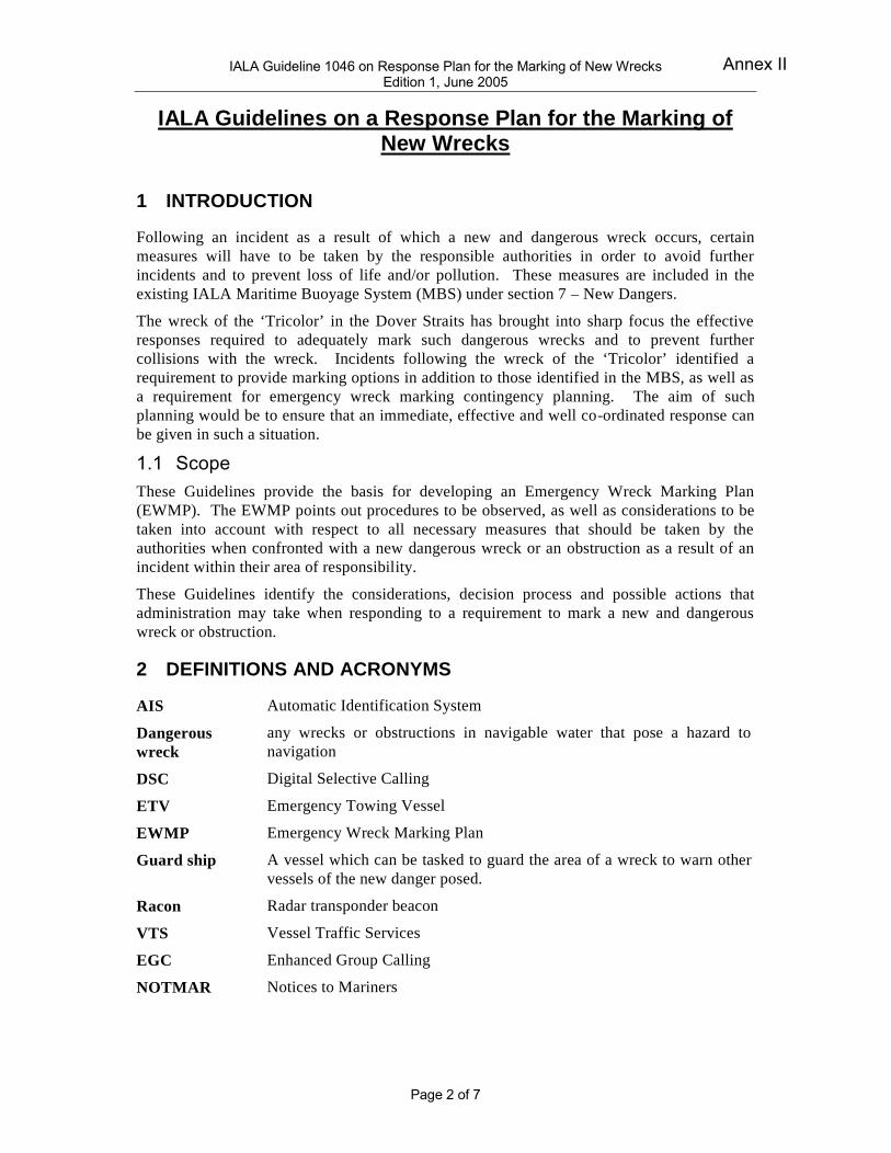
IALA Guideline 1046 on Response Plan for the Marking of New Wrecks Edition 1, June 2005
Page 2 of 7
IALA Guidelines on a Response Plan for the Marking of
New Wrecks
1 INTRODUCTION
Following an incident as a result of which a new and dangerous wreck occurs, certain
measures will have to be taken by the responsible authorities in order to avoid further
incidents and to prevent loss of life and/or pollution. These measures are included in the
existing IALA Maritime Buoyage System (MBS) under section 7 – New Dangers.
The wreck of the ‘Tricolor’ in the Dover Straits has brought into sharp focus the effective
responses required to adequately mark such dangerous wrecks and to prevent further
collisions with the wreck. Incidents following the wreck of the ‘Tricolor’ identified a
requirement to provide marking options in addition to those identified in the MBS, as well as
a requirement for emergency wreck marking contingency planning. The aim of such
planning would be to ensure that an immediate, effective and well co-ordinated response can
be given in such a situation.
1.1 Scope These Guidelines provide the basis for developing an Emergency Wreck Marking Plan
(EWMP). The EWMP points out procedures to be observed, as well as considerations to be
taken into account with respect to all necessary measures that should be taken by the
authorities when confronted with a new dangerous wreck or an obstruction as a result of an
incident within their area of responsibility.
These Guidelines identify the considerations, decision process and possible actions that
administration may take when responding to a requirement to mark a new and dangerous
wreck or obstruction.
2 DEFINITIONS AND ACRONYMS
AIS Automatic Identification System
Dangerous
wreck
any wrecks or obstructions in navigable water that pose a hazard to
navigation
DSC Digital Selective Calling
ETV Emergency Towing Vessel
EWMP Emergency Wreck Marking Plan
Guard ship A vessel which can be tasked to guard the area of a wreck to warn other
vessels of the new danger posed.
Racon Radar transponder beacon
VTS Vessel Traffic Services
EGC Enhanced Group Calling
NOTMAR Notices to Mariners
Annex II

IALA Guideline 1046 on Response Plan for the Marking of New Wrecks Edition 1, June 2005
Page 3 of 7
3 CONSIDERATIONS
Administrations need to assess their areas of responsibility and response capability. This
includes carrying out risk assessments, assessing response capabilities and resources and
consideration of plans to deal with such situations
1
. Aspects of such a risk assessment should
include:
1 Analysis of responses capabilities;
2 Indication of areas of Responsibility;
3 Assessment of response required in specific areas;
4 Indication of response times;
5 Indication of intervention times;
6 Assessment of mobile resources e.g. pollution combating vessels, buoy tenders,
Emergency Towing Vessels, guardships, buoys, Temporary VTS capability;
7 Assessment of electronic resources such as AIS and information systems.
A helpful tool for decision making with respect to the marking of wrecks that should be
developed beforehand is a ‘marking requirements map’, indicating the different marking
requirements in specific sea-areas. For each of these areas the marking requirements should
be based on information and knowledge of the types and size of shipping in the area, traffic
patterns and minimum under-keel clearance requirements.
4 DECISIONS AND ACTIONS
Authorities may consider their response in the following order of priority: (see flow diagram
Annex 1)
1. Immediate broadcast of initial Safety message (navigational warning) concerning the
new dangerous wreck.
2. Obtain as much information as possible about the new wreck.
3. Consider deployment of a Guard ship on the location of the new wreck.
4. Consider whether temporary VTS is necessary on the new wreck.
5. Consider AIS applications.
6. Initial marking of the wreck position.
7. Survey the wreck.
8. Consider the permanent marking of the wreck.
9. Issue updates.
10. Consider whether continuation of temporary VTS is necessary.
11. Consider whether removal of the wreck is necessary.
12. Identify steps to take if the wreck is not to be removed.
1
IALA Guideline 1018 on Risk Management refers
Annex II

IALA Guideline 1046 on Response Plan for the Marking of New Wrecks Edition 1, June 2005
Page 4 of 7
4.1 Immediate broadcast of an initial Safety message concerning
the new dangerous wreck
Especially in busy waterways, a new dangerous wreck or obstruction has the capability to
cause loss of life, environmental damage and economic impact. Although, in most incidents
detailed information is not directly available, it is very important that initial information of a
new wreck or an obstruction, regardless of how scant it may be, is made known to shipping
without delay.
An Initial Safety message (navigational warning), indicating the approximate position of the
new wreck and any other relevant information, should be broadcast without delay on:
• VHF* (announced on DSC - digital selective calling)
• MF*(announced on DSC)
• HF*(announced on DSC)
• AIS
• NAVTEX*
• INMARSAT (EGC)
• Mobile phone
• Internet (email)
• and any other communications means available
*In certain circumstances it might be necessary to issue an urgent navigational warning.
4.2 Obtain as much information as possible about wreck
Information about a new wreck should be gathered as soon as possible. In certain situations
this process might well start even before a wreck is actually a fact. For example, after a
collision, as a result of which a ship is slowly drifting and sinking, any relevant information
as to the status of the damaged vessel should be monitored. The sooner the actual location of
a wreck is known the better as this will save valuable time so as to be able to initially mark
the wreck and issue navigational warnings. This will also reduce the risk of other ships
hitting the wreck whilst it is still unmarked.
In circumstances where a ship sinks with no other ship in the vicinity able to report/confirm
the position, the wreck location should be established as soon as possible so that navigational
warnings can be issued and initial marking of the wreck location can be carried out.
4.3 Consider Deployment of Guard Ship
A new wreck can be very dangerous for shipping, not only when its position is not exactly
known and is still unmarked, but even when the position is known and the wreck is properly
marked. In the past, many wrecks have caused numerous problems resulting in damage,
pollution and even loss of life.
When confronted with a new, possibly dangerous wreck, authorities should decide as soon as
possible if it is necessary to send a ‘guard ship’ to the location of the wreck in order to
‘guard’ the location and inform ships navigating near the wreck position of the new danger.
The guard ship should be well equipped for her task and should be able to stay on position in
all weather conditions and sea states. The guard ship may be fitted with a racon morse code
“D”. It may also be fitted with the proposed blue/yellow alternating lights that some
administrations are promoting specifically for new dangerous wrecks.
Annex II

IALA Guideline 1046 on Response Plan for the Marking of New Wrecks Edition 1, June 2005
Page 5 of 7
4.4 Consider Temporary VTS
In busy shipping areas such as Traffic Separation Schemes (TSS), precautionary areas,
channels, harbour approaches, etc. the establishment of a guard ship may not be sufficient /
appropriate. Action to establish a temporary VTS at the wreck location should be considered.
When a temporary VTS is established at the wreck location, certified VTS operators should
ideally be employed to staff the centre.
4.5 Consider AIS applications
AIS applications may be appropriate to physically mark the area of the wreck, promulgate
information concerning the wreck or virtually mark the wreck (virtual AIS). This may be
particularly relevant if the weather and sea state prevent ship deployment.
4.6 Initial marking of the Wreck.
A new dangerous wreck, which is a danger to shipping, must be marked. Weather
conditions, sea state and unknown facts about the new wreck can all hamper timely marking.
Irrespective of these circumstances it is of great importance that the wreck location is marked
as soon as possible and can be readily recognised by ships as a new wreck location. The
IALA MBS provides a means of marking new dangers through the use of appropriate
Cardinal or Lateral buoys using VQ or Q light characters, with duplicate marks that are
identical to their partners in all respects. In addition, new dangers may be marked by a racon
with coded morse ‘D’.
Some administrations have developed an ‘emergency wreck buoy’ designed specifically for
new, dangerous wrecks and to have ‘high impact recognition’ for the navigator.
Administrations are invited to consider the deployment of such a buoy to mark a new,
dangerous wreck. The buoy should be placed as close to the wreck as possible, and within
any other marks that may be deployed. This buoy is coloured blue and yellow in vertical
stripes. It is fitted with an alternating blue and yellow light. Ideally it should be fitted with a
racon Morse Code “D”. The characteristics and location of the buoy should be promulgated
to the mariner by all available means.
The wreck buoy should be maintained in position until the wreck is well known and has been
promulgated in nautical publications, or until the wreck has been fully surveyed and exact
details such as position and swept clearance above the wreck are known, and permanent
marking of the wreck has been carried out.
4.7 Survey of the wreck
A survey of the new wreck should be performed as soon as possible. Survey information and
details should include, as a minimum, the:
• exact position of the wreck,
• stability of the wreck,
• wreck orientation or heading,
• swept depth above the wreck.
Annex II

IALA Guideline 1046 on Response Plan for the Marking of New Wrecks Edition 1, June 2005
Page 6 of 7
4.8 Consider the permanent marking of the wreck
As soon as the wreck survey details are available, taking into account factors such as shipping
routes and traffic density, the marking of the wreck should be reconsidered. When
considering more permanent marking solutions, factors to take into account include:
• The use of the MBS
− Is the initial marking, as per MBS, sufficient?
− Is there a requirement to reposition the marks?
− Is additional marking needed?
− Are there other solutions?
• Danger indicators on the wreck.
• AIS and AtoN information
4.9 Issue Updates
As soon as further survey details and information concerning the wreck becomes available,
shipping and relevant authorities should be informed immediately.
As survey information and updates are received, mariners should be informed through MSI
(Marine Safety Information) systems such as EGC, NAVTEX, NOTMARs, etc.
4.10 Consider whether continuation of VTS is necessary
Irrespective of all measures taken earlier (navigational warnings, marking, etc.) it may be
necessary to decide to continue VTS on the wreck location. In case of an extremely
dangerous wreck, for instance in the middle of a busy shipping route or shipping lane, a VTS
on location may be considered essential to avoid collision, either with the wreck or between
ships which are manoeuvring past the dangerous wreck. As an ongoing aspect of the EWMP,
Pilot stations, VTS and other allied services in the area should notify mariners of the
dangerous wreck.
4.11Consider whether removal of the wreck is necessary
Based on risk assessment, taking into account traffic densities, traffic patterns, under-keel
clearances, draft restrictions, etc. authorities should consider whether the removal of the
wreck is necessary.
If the decision is made to remove the wreck, a comprehensive salvage plan must be
developed. It should again assess the risk and consider all aspects of the operation.
4.12 Identify steps to take if wreck is not to be removed.
If it is decided not to remove the wreck, permanent marking requirements must be
reconsidered as per 4.8, and the wreck must be charted permanently through the hydrographic
office.
Annex II

IALA Guideline 1046 on Response Plan for the Marking of New Wrecks Edition 1, June 2005
Page 7 of 7
Annex 1 – Flow Chart for Emergency Marking of Dangerous Wrecks
HF VHFMF Etc.
Yes
Incident resulting in new, dangerous wreck
Obtain information on new wreck / obstruction (4.2)
Immediate Broadcast/Transmission of initial safety message (4.1)
Is broadcast sufficient?
Issue updates / broadcast as required (4.9)
Determine Requirements:- Marking (4.6) / including AIS (4.5)- Guard ship (4.3)- Temporary VTS (4.4)
No
Is Survey Required?
Conduct Survey (4.7)- Position / stability- Swept depth- Etc.
Review results of survey- Amend Marking (4.8)- Continue VTS (4.10)
Is removal of wreck necessary? (4.11)
No
Yes
No
Yes
Plan for removal of wreck
Review marking requirements (4.12)
Annex II