Mountain and High-Altitude Archaeology. Special Issue of the SAA Archaeological Record, 14(2). Part...
48
SOCIETY FOR AMERICAN ARCHAEOLOGY SAA a rchaeological record MARCH 2014 • VOLUME 14 • NUMBER 2 the SPECIAL ISSUE: MOUNTAIN AND HIGH-ALTITUDE ARCHAEOLOGY
-
Upload
jacksonholehistory -
Category
Documents
-
view
4 -
download
0
Transcript of Mountain and High-Altitude Archaeology. Special Issue of the SAA Archaeological Record, 14(2). Part...

S O C I E T Y F O R A M E R I C A N A R C H A E O L O G Y
SAAarchaeological recordMARCH 2014 • VOLUME 14 • NUMBER 2
the
SPECIAL ISSUE: MOUNTAIN AND HIGH-ALTITUDE ARCHAEOLOGY


Editor’s Corner
Letter to the Editor
From the President
In Brief
Volunteer Profile
Why All the Way Up There?
Untrammeled by Man
Ice Patch Archaeology in Western North America
Archaeology and Participation across Inner Asia’s High Frontiers
The Himalayan Exploration and Archaeological Research Team
Was It Euphoria or Oxygen Deprivation?
How Much Difference Is in a Thousand Meters?
In Memoriam: Fred E. Coy, Jr.
calendar
2 Anna Marie Prentiss
3 Patricia A. Mercado-Allinger and Jim Bruseth
4 Jeffrey H. Altschul, RPA
5 Tobi A. Brimsek
6 Pei-Lin Yu
7 Matthew A. Stirn
11 Richard Adams, Tory N. Taylor, Meredith E. Taylor, John B. Lund, Bryon A. Schroeder, Orrin Koenig,and Matthew A. Stirn
15 Craig M. Lee, Robert L. Kelly, Rachel Reckin, Ira L. Matt, and Pei-Lin Yu
20 Michael D. Frachetti
26 Hayley Saul
31 Christopher Morgan
36 Bryon Schroeder
42 Mark J. Wagner
44
The Magazine of the Society for American Archaeology Volume 14, No. 2
March 2014
Correction: On p. 16 of the article “Student-Initiated Projects, The Flipped Classroom, and Crowdfunding,” in the January 2014 issue, Ms. Simerly’s
name was spelled incorrectly on first occurrence. The correct spelling is Kate Simerly.
the
SAAarchaeological record
SPECIAL ISSUE: MOUNTAIN AND HIGH-ALTITUDE ARCHAEOLOGY

2 The SAA Archaeological Record • March 2014
The practice of field archaeology presents challenges no matter the environment.Whether we work on arctic tundra, remote islands, swamps, or just a farmer’sfield, there will always be logistical hurdles to overcome. This issue of the SAA
Archaeological Record highlights the problems and prospects of working in mountainand high-altitude environments. The guest editor, Matt Stirn, and several contributorsoutline a range of barriers to be crossed to successfully complete an archaeologicalresearch project in these environments. Some would seem to be routine: making it tothe field site, managing a camp, keeping all team members safe and fed, and complet-ing required research activities. But changeable high-elevation weather, difficult ter-rain, and, in some contexts, restrictive government regulations can make even themost routine operations non-routine.
Advances in technology have made work in alpine and high-altitude environmentsmore productive than ever before. Articles by Adams et al., Lee et al., and Morgan illus-trate the application of exciting new and some not-so-new approaches to alpine archae-ology. Most notably, compared to just a couple of decades ago, archaeologists todayhave a far wider range of technological options for all-weather clothing and gear. It isinteresting, however, how frequently we prefer to use old-fashioned data collectiontechniques (e.g., compass and chain mapping) over more electronically advancedoptions when working in risky environments. As outlined by Schroeder and Lee et al.,new methodological strategies are permitting us to sort out the complexities of defin-ing and dating occupations in sedimentary environments characterized by compressedstratigraphy, old wood, and acidic soils. Articles by Frachetti, Schroeder, and Saul moveus beyond logistical and methodological issues. Frachetti makes critical points regard-ing the shifting role of mountain archaeology in reconstructing regional systems, not-ing in particular that these places were not always fringes to the bigger developmentselsewhere. Saul makes a similar point while also framing the importance of archaeo-logical research to indigenous groups with unique heritage concerns.
This special issue on mountain and high-altitude archaeology will extend into the Mayissue of the SAA Archaeological Record. Space restrictions made it impossible to includetwo of the originally submitted articles. Thus, the May 2014 issue will include articlesby David Hurst Thomas and Nikos Efstratiou (and colleagues) examining, respectively,the archaeology of the Alta Toquima site, high in the Toquima Range of central Nevada,and the Middle Paleolithic of high-altitude northwestern Greece.
Last but not least, I want to acknowledge the efforts of Eleanor Umali, SAA manager,Publications, over the past year. I was sorry to see her go. However, I welcome CindyDeLano into the same position. We are greatly looking forward to working with her aswe develop future issues of the Record! Meanwhile, I remain open to ideas for new sub-missions, whether independent articles or special issues. The upcoming meetings inAustin are a great place to meet and have those initial discussions. Please don’t hesitateto drop me a line or catch me in the hallway. See you in Austin!
EDITOR’S CORNERAnna Marie Prentiss
Anna Marie Prentiss is Professor of Anthropology at The University of Montana.
The SAA Archaeological Record(ISSN 1532-7299) is published fivetimes a year and is edited by AnnaMarie Prentiss. Submissions shouldbe sent to Anna Marie Prentiss, [email protected], Depart-ment of Anthropology, The Universi-ty of Montana, Missoula, MT 59812.
Deadlines for submissions are:December 1 (January), February 1(March), April 1 (May), August 1(September), and October 1 (Novem-ber). Advertising and placement adsshould be sent to SAA headquarters,1111 14th St. NW, Suite 800, Wash-ington, DC 20005.
The SAA Archaeological Record isprovided free to members and sub-scribers to American Antiquity andLatin American Antiquityworldwide.The SAA Archaeological Record canbe found on the Web in PDF formatat www.saa.org.
SAA publishes The SAA Archaeolog-ical Record as a service to its mem-bers and constituencies. SAA, itseditors, and staff are not responsi-ble for the content, opinions, andinformation contained in The SAAArchaeological Record. SAA, its edi-tors, and staff disclaim all war-ranties with regard to such content,opinions, and information pub-lished in The SAA ArchaeologicalRecord by any individual or organi-zation; this disclaimer includes allimplied warranties of mer-chantability and fitness. In no eventshall SAA, its editors, and staff beliable for any special, indirect, orconsequential damages, or anydamages whatsoever resulting fromloss of use, data, or profits arisingout of or in connection with the useor performance of any content,opinions, or information includedin The SAA Archaeological Record.
Copyright ©2014 by the Society forAmerican Archaeology. All RightsReserved.
The Magazine of the Society forAmerican Archaeology Volume 14, No. 2
March 2014
the
SAAarchaeological record

3March 2014 • The SAA Archaeological Record
Texas & Archaeology: A Response to Matthew Taylor
In its January issue, the SAA Archaeolog-ical Record published a letter to the edi-tor from Matthew Taylor about Texas’sefforts to legislatively protect unmarkedburials. His letter not only outlined hisconcerns about the changes made toTexas law in 2009 (through passage ofHouse Bill 2927), but also made a num-ber of personal attacks on specific staffat the Texas Historical Commission(THC) who were involved with passageof the bill.
In this letter, we rebut Dr. Taylor’sunfounded and inaccurate portrayal ofevents leading up to the passage of the billand provide a broader and more completecontext for understanding the changes toTexas law. We also address the specificpersonal attacks made by Dr. Taylor.
The passage of House Bill 2927 made itclearly illegal to disturb unmarkedhuman remains in Texas for the firsttime ever. Prior to passage of this legis-lation, looters were able to dig uphuman remains, mostly Native Ameri-can, on private land with legal impunity.Hundreds of prehistoric graves, many inthe Caddo area of eastern Texas, hadbeen systematically looted. THC staffwas outraged by this activity andextremely frustrated about how littlecould be done to stop it. On the legisla-tive front, nine separate attempts weremade over 18 years to enact unmarkedburial legislation in Texas, often mod-eled after other states and focused onNative American interments. They allfailed. We clearly would have preferredto achieve protection for unmarked buri-als in this manner, but this was notgoing to happen. In fact, the morerecent bill attempts did not even make itout of legislative committee.
The THC staff worked closely with StateRepresentative Donna Howard to devel-op the bill to address these issues. H.B.2927 made several changes to the
Health and Safety Code to better protecthuman graves and historic cemeteriesin Texas. The staff lead on this effort waswith the THC Cemetery Coordinator inthe History Programs Division— notArcheology Division staff, as Dr. Taylorseems to think. During development ofthe bill, the definition of what consti-tutes a grave was modified to include “aspace of ground that contains interredhuman remains [emphasis added to ref-erence new wording].” The wording,while minimal, was important to clarifyexactly what constituted a grave.
When H.B. 2927 was passed and signedinto law in 2009, the THC developedrules to implement the changes to statelaw. Draft rules were widely circulated,the subject of a public hearing, andtwice published in the Texas Register(http://www.sos.state.tx.us/texreg/index.shtml). Much input from a very widevariety of groups was received overmonths and considered in the finaladoption of the rules. Native Americaninput was received. The Council of TexasArcheologists also provided detailedcomments on how best to implementthe statutory changes.
Since passage of H.B. 2927, the revisedHealth and Safety Code has proven to besuccessful in protecting unmarkedcemeteries, both prehistoric and later.As an example, a housing developmentin Corpus Christi, Texas, was stoppedbefore houses could be built over aNative America cemetery. Professionalarchaeologists were employed to definethe extent of the cemetery, and impor-tant input in this process was obtainedfrom Native American descendant com-munity members. The cemetery waspermanently protected through an ease-ment and made part of a green belt.Descendant community members aretoday able to visit the area and preformreligious ceremonies.
Specific allegations made by Dr. Taylorare addressed below.
Staff intentionally misrepresented theintention of H.B. 2927. Among the sever-al proposed modifications to the TexasHealth and Safety Code in H.B. 2927was clarification of what constituted agrave. The bill’s text speaks for itself andthere was no intentional misrepresenta-tion made.
It takes months of waiting to get a courtorder to move human remains. In fact,staff of the THC received a court orderin less than 48 hours allowing excava-tion of an1830s Texas soldier’s remains.Other professional archaeologists in thestate have also successfully receivedapproval for burial exhumation in shortperiods of time.
Salvage excavation of a human burial is afelony. Looting of a human grave is afelony, as it should be. Professionalarchaeologists can do salvage work.They just need to go through a legalprocess to enable the salvage work tooccur.
The THC’s former Archeology DivisionDirector said that human “remains couldsimply melt away.” We have no recollec-tion of making this statement in ourconversation with Dr. Taylor. We doremember talking to Dr. Taylor about hisconcerns and trying to seek a workablesolution to his issues. His main concernwas that he could no longer freely digNative American burials for his researchpurposes. We assured Dr. Taylor thateven with the changes to the Health andSafety Code he could still excavatehuman burials. He would simply needto follow the legal process to do so andhis need to disturb the remains wouldhave to be justified.
His open records request was blocked by aclaim of attorney-client privilege. The TexasPublic Information Act, which governsopen records requests, is a strong statutethat ensures public access to government
LETTER TO THE EDITOR
>LETTER, continued on page 43

Austin promises to be the largest meeting inSAA history. There will be more sessions,more posters, more forums, more every-
thing than ever before.
To keep up with the meeting, SAA is initiating anew mobile app. This app will provide an interactiveapproach to the final program, allowing you to cre-ate your own schedule, tour the interactive exhibithall map, explore Austin resources through a cityguide, and much, much more. The free annualmeeting app will be available for iPhones, iPads,Android phones, and Blackberry devices.
To promote the use of the mobile app onsite in Austin, there willbe volunteers holding signs at registration and an opportunity atthe SAA Booth in the Exhibit Hall to demonstrate that you havedownloaded the app onto your device, which will make you eli-gible to drop your business card in a basket for a chance to winan iPad mini. The drawing will be held at the Annual BusinessMeeting on Friday, April 25, 2014, and you must be present towin.
The meeting kicks off with the Presidential Forum on Wednes-day night. This year we focus on the evolving nature of publish-ing in archaeology. Since its founding in 1934, the dissemina-tion of knowledge has been central to the mission of SAA. Fromhumble beginnings, SAA now publishes three journals and amagazine, publishes books through SAA’s own press, and sup-ports postings on ongoing research of its members throughCurrent Research Online. Receiving an SAA journal is a benefitof membership, one that is highly regarded by our members. Inthe 2010 needs assessment, more than half those respondingindicated that they joined and renewed their membership inSAA to receive one or more of the Society’s journals. Recently,there has been a drive to open our journals to members andnonmembers alike. Such a move requires us to consider a num-ber of questions: Who should have access to information? Whoshould pay for publishing— the reader, the author, the sponsor?
How will the changing nature of publishing changethe SAA? These questions will play out over the nextdecade and, as they do, American archaeology willbe transformed. The debate is just starting. I sug-gest you get a front-row seat.
Ensuring that all archaeologists are treated fairlyand have equal professional opportunities is a cor-nerstone of SAA’s ethical principles. Nowhere isthis more important than in obtaining funds to sup-port archaeological research. Women have madegreat strides in archaeology, but they appear to beflagging in one critical area: grant submission. TheNational Science Foundation (NSF) has noted that
women have about the same success rate as men in the archae-ology program, but that women submit only half the number ofgrants as their male counterparts. Why is this so, and what canwe do about it? To address this issue, the SAA board of directorscreated a task force on the subject, co-chaired by Lynne Gold-stein and Barbara Mills. The task force is holding a sponsoredforum, Friday between 1:00–3:00 p.m. Please plan on attendingand giving voice to this critical issue.
This year’s annual meeting is the largest and most vibrant ever.SAA is moving forward on many new initiatives, driven largelyby the energy and passion of our membership. As we welcomenew members, we want to acknowledge those who have laid thefoundation for our success. And what better way than throwinga party. SAA members who have been with the Society for 20years or more are invited to have a drink on us Thursday nightfrom 5:00 p.m.–6:30 p.m. in Salons F/G/H at the Hilton Austin.Please come and bring a friend. It’s time to celebrate our accom-plishments and look to the future.
Of course, these are just a few highlights out of more than 200symposia, poster sessions, forums, receptions, workshops,excursions, and much more. It’s not too late to plan to come.Onsite registrations are welcome. I look forward to seeing youin Austin.
4 The SAA Archaeological Record • March 2014
FROM THE PRESIDENT
FROM THE PRESIDENTJeffrey H. Altschul, RPA
Jeffrey H. Altschul, RPA, is President of the Society for American Archaeology.

5March 2014 • The SAA Archaeological Record
Launching for Austin— SAA’s Mobile App!
In early April, attendees will be able to download for free SAA’sAnnual Meeting mobile app, compatible with iPhones, iPads,Blackberries, and Android phones. The mobile app will includemost of the content of the final program, in addition to a myri-ad of new functions, all presented in a dynamic environment.There are search functions, the ability to create your own sched-ule, a city guide, an interactive exhibit hall map, and an attendeelist, to name a few of the exciting features.
To promote the use of the mobile app onsite in Austin, there willbe volunteers holding signs at registration and an opportunity atthe SAA Booth in the Exhibit Hall to demonstrate that you havedownloaded the app onto your device, which will make you eligi-ble to drop your business card in a basket for a chance to win aniPad mini. The drawing will be held at the Annual Business Meet-ing on Friday, April 25, 2014, and you must be present to win.
The Society for American Archaeology (SAA) offers the mobile appthrough its designated vendor, QuickMobile. While SAA uses its bestefforts to ensure that the app will function properly, it assumes noresponsibility for any functionality issues with the app. Individualsshall be responsible for any data charges or damages relating to thedownloading and use of the app on their mobile device.
Staff Transitions
In January, Cindy DeLano joined the staff team as manager,Publications. Cindy is a senior publishing professional withexperience in the not-for-profit publishing arena. She replacesEleanor Umali, who had held the position for the past year.
Also in January, the staff team grew a bit by taking on an internin Communications, Brianna Kelley. Brianna is a graduatingsenior at American University and will be working at SAAthrough her spring semester.
Online Seminar Series a Success
Due to the unqualified success of the Online Seminar Series,with virtually every course full, the number of seats in eachcourse has been expanded to accommodate the demand, begin-ning with the February seminars. Currently, a two-hour fee-based seminar and a one-hour free online seminar are offeredmonthly. The free seminars are available only to SAA members.Check out the upcoming offerings on www.saa.org. Seminarsare in session every month except April (due to the annual meet-ing), June, July, and August.
And Austin!
Austin is shaping up to be one of the most exciting and enrich-ing annual meetings ever. We hope that you will join us there.Check out the final program and abstracts, which will be postedby early April!
IN BRIEFTobi A. Brimsek
Tobi A. Brimsek is Executive Director of the Society for American Archaeology.
IN BRIEF
Senior Project Archaeologist/CRM Division Manager (Any NorthwestOffice Location)
Historical Research Associates, Inc. (HRA), has an opening for a SeniorProject Archaeologist to fill a CRM Division Manager position in one ofour four offices in the Northwest. The qualified candidate must have anMA or PhD degree in Anthropology with Archaeology emphasis or a relat-ed field, at least 10 years supervisory experience in the field of CulturalResource Management, and a demonstrated record as an archaeologicalPrincipal Investigator for Phase II evaluations and Phase III mitigation.For more information, visit: http://bit.ly/1mm9HRR. Please directinquiries to Brent Hicks at 206-343-0226; submit letter of interest andrésumé to [email protected].

6 The SAA Archaeological Record • March 2014
Archaeology has always had a dynamic relation-ship with the media, from the National Enquirer toScience to the blogosphere. I have a background injournalism, so service on the Media RelationsCommittee (2007–2013) has been a natural fit. Inaddition to rubbing shoulders with some of thefinest science journalists, Media Relations Com-mittee members serve on the Gene Stuart AwardCommittee and provide data about archaeology tothe press. The Media Relations Committee wasrecently asked to help the SAA cope with a spate ofunethical cable television shows (e.g., Diggers,American Diggers, Treasure Hunters, etc.). Inmedia-related symposia I have been able to addressissues I really care about in a public forum (Yu2009b).
Benefits of Volunteering
Our discipline, always a mobile profession, is growing evenmore so as the market evolves toward lower job security andshorter job tenure. In the past 13 years I have held four jobs.The SAA is the premier venue for engaging with our evolvingdiscipline and honing competitive skills— and volunteering isthe quintessential way to connect. Volunteering is not just forearly career archaeologists; anyone seeking to improve their cur-rent situation or find a new career path can establish profes-sional relationships, learn new skills, assemble symposia andedited volumes, offer subject matter expertise to others, take thepulse of our discipline, propose innovative or daring concepts ina friendly setting, and evaluate the jobs landscape.
Future Volunteer Horizons
I traveled to my first SAA meeting in 1995 (Minneapolis) withfour graduate student friends in an old van from Maya country.We drove all night and made an 80-mile side pilgrimage to theMarshalltown trowel factory (I still have those trowels, worn to
Some might say that volunteers are peoplewith too much time on their hands and notenough skills to get paid. But in the Society
for American Archaeology, this view couldn’t be fur-ther from the truth. At the annual SAA meetings,archaeologists volunteer time, expertise, energy,and skills— from session volunteers to registrationdesk staff to committee members, SAA volunteersdo some heavy lifting. SAA volunteers also includethe annual program committee, members of theBoard of Directors, and the editors of AmericanAntiquity, Latin American Antiquity, Advances inArchaeological Practice— and the publication you arenow holding or viewing on the screen.
Committees and Volunteerism
My own volunteer experience began in the early 2000s. My firstservice was on the Committee on Curriculum (2003–2009) as agraduate student member, federal archaeologist, and later jun-ior professor. This was an essential view into the job world thatawaited me after graduate school, and I developed long-lastingconnections with academic, private, and public sector col-leagues. I even got a publication out of it (Yu et al. 2006). In mysecond term, I learned curriculum development at all levels,exchanged ideas and innovative approaches, and scoped outways for the SAA to contribute and support archaeologiststeaching in the classroom and the field. This culminated in co-chairship of a curriculum symposium (Yu 2009a) about paritybetween applied archaeology and theory and method.
In 2009, I was invited to serve on the Annual Meeting ProgramCommittee. Our duties were to review and evaluate hundreds ofsubmissions, make recommendations for acceptance (or not),and group them into sessions. This was an absolutely fascinatingoverview of our discipline, and I recommend it for any archaeol-ogist, particularly for those (like myself) who think there is roomfor improvement in meeting offerings and organization.
VOLUNTEER PROFILE
VOLUNTEER PROFILEPei-Lin Yu
>VOLUNTEER PROFILE, continued on page 44

7March 2014 • The SAA Archaeological Record
Mountains and high-altitude landscapes have oftenbeen interpreted as marginal and generally inhos-pitable environments. When explaining my
research in the mountains of Wyoming to both professionalsand the public, I am often met with the question, “Whywould people live all the way up there?” Because of thismindset, in addition to the fact that research at high altitudesis logistically demanding, the archaeological potential ofmountains has long been overlooked. During the last 20 to30 years, particularly in the European Alps and western Unit-ed States, occasional research projects (e.g., Benedict 1992;Husted 1965; Walsh et al. 2006) ventured into the alpinezone and discovered that, in contrast to past beliefs, moun-tains can offer a rich and chronologically deep archaeologicalrecord that is often equally dense and better preserved thanthat of the surrounding lowland areas. While these projectswere not the first of their kind (e.g., research in the PeruvianAndes and Swiss Alps), they did catalyze an interest in alpinepaleoecology, human adaptations, and technological innova-tions developed to survive in high-altitude landscapes.
In addition to a heightened interest in the prehistory ofalpine landscapes, the accessibility and ease of research inmountainous areas has greatly increased with advances inlightweight equipment and remote-sensing technologies. Inrecent years, the popularity of mountain archaeology hasskyrocketed and is now the focus of symposia, conferences,and field projects across the globe. By exploring the practiceof archaeology in the mountains, investigating currentdebates within the field, and introducing a variety of new andexciting projects, this special issue of The SAA ArchaeologicalRecord sheds light on the fascinating and ever-changingworld of mountain and high-altitude archaeology.
What is Mountain and High-Altitude Archaeology?
In 1984, F.G. Fedele proposed a distinct human ecology ofthe mountains. Fedele suggested that, because mountains
represent a unique landscape, they should be approachedwith an equally unique theoretical and methodologicalframework, preferably specific to individual ranges. Howev-er, Fedele also warned that mountains should not be studiedin isolation from surrounding landscapes simply becausethey are topographically and environmentally “different” (c.f.Schroeder, this issue). While the alpine ecotone presents aunique research context for archaeological research, it isoften easy to trick ourselves into thinking that occupants ofmountains and high altitudes were prehistorically independ-ent from those in lower elevation landscapes. So how, then,should we approach mountains in archaeology?
Exploring the dichotomous nature of mountain and high-altitude archaeology first requires some definitions. Fedele(1984) pointed out that high elevations and rugged terrainare not ubiquitous across all mountain ranges. As such, theterms “mountain” and “high-altitude” archaeology are usedindependently because they often focus on different topo-graphical environments. “Mountain archaeology,” in thiscase, refers to the study of mountainous landscapes thathave considerable topographical relief and rugged terrain incomparison to surrounding lowlands, but may or may notbreak into the alpine ecotone (generally > 10,000 ft or 3,000m). “High-altitude archaeology,” on the other hand, focusesexclusively on past groups that resided above 3,000 m.Unlike mountain archaeology, high-altitude studies do notnecessitate rigorous terrain and in some instances (e.g., theTibetan Plateau or Central Asian Steppe) can occur on grassyplains or relatively flat valleys that happen to be located athigh elevations. Because of the high environment in whichit occurs, high-altitude archaeology often focuses on pastalpine-specific human adaptations to physiological (Alden-derfer 2006) or resource (Bettinger 1991) stresses.
Conducting Archaeological Research in the Mountains
Conducting research in mountainous areas is expensive and
MOUNTAIN AND HIGH-ALTITUDE ARCHAEOLOGY
WHY ALL THE WAY UP THERE? MOUNTAIN AND HIGH-ALTITUDE ARCHAEOLOGY
Matthew A. Stirn
Matthew A. Stirn is Research Associate at the Jackson Hole Museum, Jackson, Wyoming.

8 The SAA Archaeological Record • March 2014
MOUNTAIN AND HIGH-ALTITUDE ARCHAEOLOGY
often logistically and physically demanding. Throughout ourfieldwork in Wyoming’s Wind River Range, we were preoc-cupied with planning personnel, food, and equipment trans-portation to a backcountry base-camp that was located twodays hike from the nearest road. Once all of those tasks werecompleted, less than half of the field schedule (generally 8-day sessions) was available for conducting research. In addi-tion to logistical struggles, we faced several unmanageablerisks (e.g., unpredictable weather, animal encounters, dan-gerous terrain, etc.) that had an amplified impact because ofthe little time we had available in the field. Given these obsta-cles, it seems that successful projects are often guided equal-ly by luck (e.g., good weather, no grizzly bears, low forest firedanger, etc.) as they are careful planning. To compensate forthese unique requirements, many projects have developedcustom strategies to maximize gain.
The articles in this issue introduce mountain archaeologythrough an exploration of research methods, obstacles, andrewards that make conducting research in the alpine zone aunique experience. Adams et al. recap several years of remote,high-elevation research in the Wind River Range of Wyoming.Adams and his team have developed a mountain-specificresearch strategy focused on simplicity and efficiency. Lee etal. highlight the unique aspects and dilemmas of conductingice-patch archaeological research in North America. The arti-cle explores the costs and rewards associated with searchingfor thawing organic artifacts and looks at field techniques,including remote sensing, that have increased rates of successin recovering archaeological materials. A consistent themebetween Adams et al. and Lee et al. is a preference for sim-plicity in mountain research. In both cases, consumer gradetechnologies (e.g., GPS and Google Earth) have proven to beless costly and more time- and energy-efficient than profes-sional-grade options such as total stations, GPR, or LIDAR.The potential cost of lower resolution data obtained fromthese technologies is outweighed by the ability both to trans-port the equipment into the mountains by foot and to covermore ground with highly reliable equipment performance.
In addition to technology, the collective knowledge of mod-ern-day mountain communities marks a crucial resource formany alpine archaeological projects. Frachetti’s article looksback on several seasons of research on the Central AsianSteppe and explores parallels between Bronze Age and mod-ern-day nomads. In addition to identifying a several-thou-sand-year-old nomadic mountain tradition, Frachettiexplores the implications and biases behind modern politicalborders and mindsets regarding mountainous regions andhow these affect archaeological research. Much like Adamset al’s observations in the Rocky Mountains,
Frachetti’s research shows that new sites “discovered” byarchaeologists are often already known to locals who are will-ing to share their knowledge.
Nurturing a positive relationship with modern-day mountaincommunities can play a significant role in promoting andpreserving cultural heritage. Saul’s article highlights a grow-ing relationship between archaeologists and indigenouscommunities in the Nepalese Himalaya. In addition toexploring the high mountains for new archaeological sites,Saul’s team works with local groups and organizations topreserve culturally historic sites that might otherwise beendangered by a lack of resources. This work shows that bymaintaining a positive, constructive, and transparent rela-tionship with mountain communities it is possible both toutilize their knowledge and to promote a relationship found-ed upon protecting cultural heritage.
Beyond locating and accessing alpine archaeological sites, afinal dilemma that mountain researchers face is the excava-tion process. The alpine ecotone presents an incredibly frag-ile environment that recovers poorly and slowly from humandisturbances. Additionally, in North America, many moun-tain ranges are located in federally protected wildernessareas that limit subsurface testing and prohibit the use ofany mechanized equipment. Thus, it is often required thatarchaeologists hike into the study area on foot and carry theirexcavation/camp equipment in backpacks or via pack ani-mals. Given these constraints, it is often very difficult orimpossible to excavate large blocks or trenches that would bestandard in more durable environments at lower elevations.
Morgan’s article retraces a decade of high-altitude archaeolo-gy and illustrates that digging any site above treeline is nosimple process. Recounting challenges such as blizzards andhealth problems, such as pulmonary edema, unique to highaltitude environments, Morgan weighs the costs and bene-fits of conducting archaeology in remote and high-altituderegions. The other papers in this special issue present a vari-ety of other mountain-specific research projects that furtherillustrate the intricacies of planning and executing archaeo-logical research above the treeline.
Approaching the Mountains
In his book Mountains of the Mind, Robert Macfarlane (2004)traces the modern history of European perceptions towardsmountainous regions. Macfarlane argues that the way inwhich people perceive mountainous environments is almostentirely cultural and little guided by economics or subsis-tence (see Walsh et al. 2006 for a similar discussion of

9March 2014 • The SAA Archaeological Record
ancient Roman perceptions towards the Italian Alps). Plac-ing causality and the related debates aside, an interestingpoint that Macfarlane highlights is that our interpretation ofmountains routinely shifts between seeing them as margin-al environments and seeing them as hospitable. These shiftscome and go at different intervals and are not ubiquitousacross regions, cultures, or populations. Archaeologists arenot exempt from this cycle, and as we enter the twenty-firstcentury, the perception within the field appears to be transi-tioning from “alpine-ophobic” to “alpine-ophilic” (see alsoMorgan et al. 2012:38–40).
Generally, modern perceptions do not incorporate moun-tains into the realm of “home.” Instead, these high andrugged landscapes offer places to hide, barriers to circum-vent, and isolated havens to “get away from it all.” Even inmy hometown of Jackson, Wyoming, bordering Grand TetonNational Park, the mountains are where we go to play (orwork in the case of archaeology), not where we go to live.Given this bias, it becomes understandable why archaeologyin the mountains was widely ignored until the past fewdecades. However, now that the archaeological potential ofhigh altitudes is more widely recognized, research projectsabove the treeline are becoming common in most largemountain ranges around the world. Considering that ourunderstanding of prehistoric alpine adaptations is in itsinfancy, it remains uncertain what drove early mountain set-tlements and how difficult (or easy) it was to colonize highaltitudes. Archaeological thought is currently divided overwhether alpine environments should be viewed as marginalor as hospitable to human groups.
The marginal-mountains perspective can be summed upwith a quote from Aldenderfer (2006:358), which, alluding tofactors such as physiological stress (e.g., hypoxia) and anassumed low productivity of alpine resources, states that,“With its litany of woes, it is a wonder that high-elevationenvironments were ever inhabited at all.” This viewpointhighlights resource opportunities of high- and low-elevationlandscapes and considers mountains and high altitudes to beranked lower in terms of potential net foraging returns thanlower-elevation environments. Furthermore, the marginal-mountains standpoint suggests that early use of alpineregions commenced after less hostile environments wereoccupied and were likely induced by a push of externalforces, such as population pressure and resource imbalance(Bettinger and Baumhoff 1982).
In contrast, the hospitable-mountains stance focuses onlandscape familiarity and adaptability by suggesting that,once they settled in the mountains, prehistoric humanswould have had little difficulty moving and living at high alti-
tudes. This perspective further suggests that mountains andhigh-altitude environments were no less hospitable than oth-ers and that past alpine populations were likely not inhibitedby problems such as physiological stress or resource uncer-tainty (see Adams 2010; Stirn 2014a). While this debate gen-erally revolves around quantifiable variables (e.g., resourcereturn rates, least-cost modeling, cost/benefit ratios, etc.) itsfoundation lies in how mountains should be approached incomparison with other environments.
Successfully incorporating alpine studies into wider archae-ological research can be tricky. In many cases, especially inthe mountains of western North America, several alpinearchaeological sites that are strikingly similar in appearanceand in material culture have been interpreted as culturallylinked (see Stirn 2014b). Schroeder’s article in this issueexplores the relationship between low- and high-elevationsites in Wyoming and argues that, while it is tempting toconnect similar and contemporaneous sites at altitude, suchan association cannot be made without considering low-ele-vation corollaries. Schroeder further emphasizes that, even ifmountain and lowland sites can be linked within a local net-work, expanding the geographic range of interpretationmuch further should be carried out with caution and preci-sion (see also Thomas 2014).
Whereas Schroeder warns of interpreting prehistoric moun-tain cultures beyond their local regions, Frachetti (this issue)suggests that mountains (particularly those inhabited bymobile societies) can provide excellent evidence of multicul-tural interaction and the spread of ideas, technology, andmaterial items. On this perspective, mountains that eitheroverlap or are within close proximity to several culturalregions can be treated as a thoroughfare, rather than as aboundary. Schroeder and Frachetti highlight the importanceof interpreting the alpine archaeological record withinregional cultural frameworks.
Why [Work] All the Way Up There?
Conducting archaeological research in the mountains is logis-tically difficult, expensive, and tiring. Thus, after hiking 20miles uphill carrying excavation equipment in a backpack, onemight be tempted to ask— is it still worth it? Without a doubt.Mountains offer aesthetically stunning surroundings. Whereelse can one work beneath alpenglow, travel across a glacier,and camp next to a lake with enough trout to feed an entirefield school? In addition to aesthetics and pleasing scenery,mountainous regions offer several other distinctive perks.
Thomas (2014) explores a highly preserved prehistoric alpinevillage perched at 3,600 m in Central Nevada and depicts his
MOUNTAIN AND HIGH-ALTITUDE ARCHAEOLOGY

10 The SAA Archaeological Record • March 2014
MOUNTAIN AND HIGH-ALTITUDE ARCHAEOLOGY
astonishment at the exciting nature and unanticipated level ofpreservation of archaeological sites at the higher elevations.The Alta Toquima site, having never been looted and barelyimpacted by post-depositional processes, permits detailedinterpretations to be made regarding ancient alpine adapta-tions. Originally considered to be anomalous, the astonish-ingly well-preserved architecture and material culture foundat Alta Toquima has been complemented by the discovery ofsimilar alpine villages across the Great Basin (Bettinger1991). As it turns out, the preservation of these villages is notunique to archaeological sites at high altitudes. Lee et al. rec-ognize that few other environments allow for the high state ofpreservation that has been observed in alpine regions. Efstra-tiou et al.’s (2014) article on Paleolithic exploitation of the Pin-dus Range in Greece demonstrates that archaeologicallyuntapped alpine environments have the potential to exhibitrare material in excellent states of preservation. The fieldworkconducted in the Pindus identified a surprising record ofNeanderthal occupations that the authors believe would havebeen destroyed at lower elevations by environmental condi-tions, agricultural activities, and looting.
Only a small proportion of the world’s mountain ranges havebeen intensively surveyed for archaeological sites. As such,the dataset of worldwide alpine archaeology is far from com-plete. However, this gap in the alpine archaeological recordpresents exciting opportunities for future research. Becausemany mountain ranges have not been archaeologicallyexplored, the probability of new and potentially significantresults is high. Many of the authors within this issuedescribe their surprise at the often-unexpected results ofconducting research at high elevations. Whether it be frozenorganic artifacts, preserved villages, or Neanderthal materialculture, mountainous regions never fail to alter longstandingimpressions or to help formulate new ones.
In Conclusion— Bridging the Crevasse
Up until the past 10 to 15 years, alpine archaeological researchremained somewhat stunted due to the general lack of proj-ects around the world. However, now that research is increas-ingly being conducted in mountainous regions, it is becomingeasier to share methodological innovations and researchresults regionally and internationally. Current research inalpine archaeology spans a wide range of questions, methods,and contributions. Despite the variety of approaches, alpineprojects seek to unravel a common range of problems, includ-ing chronology, settlement and subsistence patterns, traveland exchange relations, and ethnic identities. Now, withexpanded interest and enhanced technologies, mountain andhigh-altitude archaeology can expect an exciting future withsignificant potential to impact the general field.
References Cited
Adams, Richard 2010 Archaeology with Altitude: Late Prehistoric Settlement
and Subsistence in the Northern Wind River Range,Wyoming. Unpublished Ph.d. dissertation, University ofWyoming.
Aldenderfer, Mark 2006 Modelling Plateau Peoples: The Early Human Use of the
World’s High Plateaux. World Archaeology 38:357–370. Benedict, James B 1992 Footprints in the Snow: High-Altitude Cultural Ecology of
the Colorado Front Range, U.S.A. Arctic, Antarctic, andAlpine Research 24:1–16.
Bettinger, Robert 1991 Aboriginal Occupation at High Altitude:in the White
Mountains of Eastern California. American Anthropologist93:656–679.
Bettinger, Robert, and Martin Baumhoff 1982 The Numic Spread: Great Basin Cultures in Competition.
American Antiquity 47:485–503.Efstratiou, Nikos, Paolo Biagi, Diego E. Angelucci, and Renato Nisbet2014 Highland Zone Exploitation in Northwestern Greece: The
Middle Paleolithic Levallois Sites of the Pindus Range inWestern Macedonia. The SAA Archaeological Record, inpress.
Fedele, Francesco G. 1984 Toward a Human Ecology of Mountains. Current Anthro-
pology 25:688–691.Husted, Wilfred 1965 Early Occupation of the Colorado Front Range. American
Antiquity 30:494–498.Macfarlane, Robert 2004 Mountains of the Mind. London: Vintage Press.
Morgan, Christopher, Ashley Losey, and Richard Adams 2012 High-Altitude Hunter-Gatherer Residential Occupations
in Wyoming’s Wind River Range. North American Archae-ologist 33:35–79.
Stirn, Matthew 2014a Modeling Site Location Patterns Amongst Late-Prehistoric
Villages in the Wind River Range, Wyoming. Journal ofArchaeological Science 41:523–532.
2014b Considering High Altitudes within the Numic Debate.Manuscript on file, Jackson Hole Historical Society andMuseum, Jackson, Wyoming.
Thomas, David Hurst2014 Exploring and Explaining Alta Toquima: The Higher You
Get, the Higher You Get. The SAA Archaeological Record,in press.
Walsh, Kevin, Suzi Richer, and J.L. de Beaulieu 2006 Attitudes to Altitude: Changing Meanings and Perceptions
within a “Marginal” Alpine Landscape— The Integration ofPalaeoecological and Archaeological Data in a High-Alti-tude Landscape in the French Alps. World Archaeology38:436–454.

11March 2014 • The SAA Archaeological Record
Four decades ago, when one of us— Richard Adams— was a wannabe archaeology student enrolled in aWyoming archaeological field school, an instructor
somewhat facetiously defined a site as something GeorgeFrison could drive his backhoe to. This instructor’s definitionruled out all 15 of Wyoming’s officially designated Wilder-ness Areas, where the use of motorized equipment is pro-hibited. In northwest Wyoming— sometimes called thegreater Yellowstone ecosystem— there are about 5.3 millionacres (including Yellowstone and Grand Teton NationalParks) of non-motorized wilderness. According to State His-toric Preservation Office data, the state of Wyoming averagesabout 4.2 prehistoric archaeological sites per square mile.This means that there are potentially 34,000 sites in those 5.3million acres of wilderness that archaeologists can’t drivebackhoes to.
The definition of wilderness as places “untrammeled byman, where man himself is a visitor who does not remain”(Zahniser 1964) was used in the Wilderness Act of 1964.This official definition of wilderness has led to the notionthat prehistoric humans neither lived in, nor extensivelyexploited, wilderness resources and is similar to a sentimentexpressed by anthropologist Julian Steward (1938:14), whocalled the alpine tundra (of the Great Basin mountainranges) “unimportant to man, except as it supports animalspecies.” Steward’s claim was echoed by Alfred Kroeber, oneof North America’s first Ph.D. anthropologists, who wrote in1939 that:
like other elevated divisions, the Rocky Mountainsconstituted chiefly fringes, hinterlands, or barriersunder native settlement. There was no . . . pressure . . .to draw the population into the mountains (Kroeber1939:187).
This misconception promulgated by two of North America’sgreatest anthropologists inadvertently turned a generationof archaeologists away from the mountains and toward thelowlands.
The misconception that mountainous areas in western NorthAmerica were inhabited by the “other” or avoided by prehis-toric people is common in anthropological literature (Hugh-es 2000). This notion that prehistoric humans were mere vis-itors to the alpine zone (and by extension modern wildernessareas) pervades American public perception and has coloredthe attitude of federal land managers toward archaeology inwilderness areas. As a result, sometimes proposed archaeo-logical investigations in federally designated WildernessAreas are challenged by a lack of institutional interest in the“trash” left by prehistoric people who not just visited, but livedin, what are now believed to be “pristine” wildernesses.
Combine the bias against mountains expressed by previousgenerations of archaeologists with bias against wildernessarchaeology among land managers and you have a challeng-ing work environment. Regardless of one’s feelings aboutwilderness, there are still tens of thousands of prehistoricsites above treeline in wilderness areas that still need to berecorded. These sites testify to the importance, utility, andattraction of high altitude terrain.
The Value of Longitudinal Studies
The example set by the late polymath James Benedict for lon-gitudinal studies of alpine environments and prehistory(e.g., Benedict 1992) is our inspiration. It was only after yearsof alpine surveys that Wyoming’s prehistoric alpine villageswere recognized. Not too long ago, alpine villages wereknown only in the White Mountains in California and the
MOUNTAIN AND HIGH-ALTITUDE ARCHAEOLOGY
UNTRAMMELED BY MANWILDERNESS ARCHAEOLOGY IN WYOMING
Richard Adams, Tory N. Taylor, Meredith E. Taylor, John B. Lund, Bryon A. Schroeder, Orrin Koenig, and Matthew A. Stirn
Richard Adams is Professor of Archaeology at Colorado State University-Ft. Collins. Tory N. Taylor, Meredith E. Taylor, and John B. Lund are
independent researchers. Bryon A. Schroeder is a doctoral student in the Department of Anthropology at the University of Montana.
Matthew A. Stirn is a Research Associate at the Jackson Hole Museum.

12 The SAA Archaeological Record • March 2014
MOUNTAIN AND HIGH-ALTITUDE ARCHAEOLOGY
Toquima Range in Nevada. Now, at least 19 villages (sensuBettinger 1991) have been identified in northwest Wyoming(Stirn 2014).
Over the years, our team, consisting of several students (nowprofessionals), retired professionals, citizen scientists, andtreasured collaborators, has found ancient alpine villages(Stirn 2013), recorded soapstone workshops, and increasedthe number of prehistoric sites in the alpine zone ofWyoming’s Wind River Range several hundred-fold.
The keystone of our longitudinal studies is an ongoing (15years and counting) collaboration with Tory and MeredithTaylor from Dubois, Wyoming. The Taylors, now retired, arebackcountry outfitters, archaeologists, authors, hunters,gatherers, beekeepers, horse-packers, health care profession-als, conservationists, and epicures. For part of their 35-year-long career, they led heritage tourism expeditions into WindRiver and Absaroka Mountain wilderness areas, where theirclients learned about the Sheepeater Shoshones.
Heritage tourists are people who travel to an area to find outmore about its history and prehistory. Heritage tourism inthis country, even narrowly defined, is big business. Accord-ing to one study, heritage tourism was a $4 billion industryin Colorado in 2008 (Clarion Associates 2011:34).
Heritage tourists who joined our team for week-long tripsgenerally expressed two main interests: who were the pre-historic people that made a living in the mountains, and howdid they make a living in the mountains? We combinedhands-on archaeology with evening discussions. During atypical day in the backcountry, heritage tourists helped rec-onnoiter challenging alpine terrain and record archaeologi-cal sites. Often these interested and interesting guests hadhidden talents, such as sketching, note-taking, bird identifi-cation, plant identification, and, on one memorable trip,mycology. Volunteers, thrilled to be part of a team present atthe moment of discovery, asked nonstop questions.
Evenings were spent around a campfire at treeline, and therewas a palpable sense of excitement as architects, investmentbankers, surgeons, writers, and clergy moonlighting asarchaeological volunteers asked challenging questions aboutwilderness ethics, horsepacking, culture history, prehistorictechnology, and what kind of foods prehistoric mountain peo-ple ate. Piqued by the prehistoric food questions, we startedadding more and more aboriginal foods and prehistoric tech-nology to our repertoire until we were able to create what weimagined were prehistorically correct meals. Our PC mealsfeatured elk, big horn sheep, and bison, paired with soapstone
bowls, sheep horn spoons, stone knives, manos and metates.Enthusiastic responses to our PC meals suggest that prehis-toric cuisine did not have to be nasty, short, and tasteless.
Think Globally, Dig Locally
If you spend money in local communities purchasing food,beverages, other supplies, and services, then those commu-nities are more willing to support your project. For instance,the location of the famously stratified Gatecliff Shelter wasrevealed to David Hurst Thomas as he conducted ethno-graphic research (and supported the local economy) at a barin Nevada.
In our case, the key to our success is a mutually beneficialcollaboration with the townspeople of Dubois, Wyoming,through the efforts of the Dubois Museum. We hire localoutfitters and cooks, stay in local bed and breakfasts, patron-ize local groceries, baristas, and restaurants, and enthusias-tically support local watering holes; however, our main rela-tionship is with the local museum. For decades, the muse-um has been a focal point for local participation and an out-standing venue for sharing results. The museum createsdisplays, produces videos, mobilizes volunteers, and pro-vides speaking venues for team members. The museum is aplace to meet locals who share their knowledge of artifactsand sites. The local townspeople are proud of their archaeo-logical resources and appreciate that spending by archaeol-ogists contributes to the economic well-being of their townof 2,500 people. In Dubois, there is a critical mass of localvolunteers, local museum support, and an interested publicthat creates synergy. This synergistic relationship epito-mizes citizen science and has attracted archaeologists fromall over North America.
Our Outfitters, Our Selves
Most modern human groups lost the ability to move fast andlight across mountainous landscapes hundreds, if not thou-sands, of years ago. Let’s face it— most archaeologists havetoo much stuff to carry comfortably in a backpack the size ofOtzi’s. Although there are young, tough graduate studentswho can carry all the recording gear and food they need torecord sites in the wilderness, we older Anthro-Americanssuspect that these energetic grads probably eat poorly, sleepuncomfortably, and wish they had brought extra batteries.
The success of our program is totally dependent on the out-fitters whose pack animals carry an embarrassing largequantity of our stuff. If the thought of carrying a 70-poundpack and thousands of pin flags uphill thrills you less than it

13March 2014 • The SAA Archaeological Record
did 20 years ago, then, by all means, hire an outfitter andmount an expedition using horses, llamas, or pack goats tohaul your gear to a remote base camp if you still want to dowilderness archaeology for 10 days at a time.
While notable archeologists (e.g., Larry Todd and Chris Mor-gan) still conduct backpack-supported archaeology, the restof us who want to work in the backcountry hire an outfitter.Pack animals will uncomplainingly carry a large canvas walltent that can make the difference between a miserable weekand a productive week of fieldwork when the weather fails tocooperate.
Pack animal-supported backcountry archaeology is notcheap. People assume that, because we do backcountryarchaeology, we sport cowboy hats and sit tall in the saddle,but saddle horses are usually twice the price of a pack horse.Budget considerations force us to walk while our gear goeson horses. Frequently, we employ what are called drop trips— that’s where outfitters with horses take our gear into awilderness area and drop it off, then come back and pick itup in a specified amount of time.
Outfitters have specialized knowledge of weather, groundconditions, and wildlife that academic archaeologists mightappreciate in a pinch— say, when a grizzly bear sow and cubwander into camp before dawn. Our outfitters, armed withonly pots and pans, scared off the grizzlies before the crewawoke. This is what is known in the outfitting business as afull-service trip— a trip where the outfitter takes care of thefood, the horses, moving camp, and perimeter defense.
Can Optimal Foragers Feed a Crew that Travels on Its Stomach?
There is no doubt that highly ranked optimal foragers canlive for weeks in the backcountry on a limited diet of PowerBars, ramen noodles, and peanut butter carried in back-packs. Because we have horses, we eat fresh items kept coldby pounds of homemade frozen entrees that provide thermalmass. By carefully protecting the food in our bear-resistantpanniers from the sun, we can have fresh food for a week.The expectation of a real meal at the end of the day is whatwe think motivates crews to march across alpine landscapes.
While horses carry 99 percent of our food, we use backcoun-try excursions as opportunities to explore local foods. Wesupplement our modern diet with fresh trout, wild mush-rooms, currants, roots, insects, and the occasional marmot.We strive to envision a paleo-diet component that is as titil-lating as it is authentic.
Backcountry Methodology
We do it old school, partly because backcountry analogrecording techniques worked for George Frison (Frison et al.1990), Wil Husted (1964), James Benedict (1992), and BobBettinger (1991). Consider the following question. Whichtechnology is costlier to carry: paper and pencil or a water-logged GPS? Experience has trained us to use paper, pencils,pens, compasses, and tapes. These analog methods providevaluable backup for digital and video data acquired bydevices that seem to have a lemming-like desire to leap totheir demise.
By keeping the technology simple, most of our gear is pow-ered by off-the-shelf batteries. We prefer consumer-gradeGPS receivers, walkie-talkies, and digital cameras that usereplaceable, standard sized batteries to top-of-the-line digitalgear using proprietary batteries that require charging duringthe day. We have wasted too many hours of sunlight waitingfor the solar charger to charge the proprietary battery packsof top-shelf technological marvels.
If a picture is worth a thousand words, then 10 minutes ofvideo is priceless. Collaborator Tory Taylor started videotap-ing the highlights of every trip a decade ago. Even thoughalmost all video cameras use proprietary batteries, the utilityof hand-held video cameras is incomparable, and theyshould be standard equipment on alpine archaeological proj-ects. In the past decade, we have acquired footage of one-of-a-kind discoveries interspersed with moments of sublimeweather, animal encounters, and infectious humor. The onlydownside to video is the amount of time it takes to catalogand edit all the video when you get out of the backcountry.
Alpine Archaeology in a Global Context?
Was it not the hilly flanks of the Taurus and Zagros Moun-tains along the Fertile Crescent where animal husbandryfirst began? Mountains, including not so well-watered oneslike the Rocky Mountains, have always attracted a small per-centage of humans. If prehistoric game animals in the RockyMountains moved uphill in the late spring to feed on plantsmaturing at increasingly higher altitudes as the growing sea-son progressed, then the prehistoric hunters who targetedthose animals followed them uphill. This seems to have ledto a vertical annual round where Late Prehistoric people inthe GYE practiced big horn sheep herd management (as evi-denced by two dozen wooden sheep traps) that may qualifyas incipient transhumance. Prehistoric sheep hunters fol-lowing big horn sheep in the mountains were doing thesame thing that their kin were doing with bison on thePlains: monitoring and manipulating herd composition.
MOUNTAIN AND HIGH-ALTITUDE ARCHAEOLOGY

14 The SAA Archaeological Record • March 2014
MOUNTAIN AND HIGH-ALTITUDE ARCHAEOLOGY
Gatherers may have insisted on harvesting the dense roots,nutritious greens, and tasty pine nuts that are found by fol-lowing the seasons all the way to the alpine zone. The preva-lence of groundstone in Wind River alpine villages suggests aheavy reliance on plant foods, especially whitebark pine nuts.
Push vs. Pull: Where Would You Rather Be?
According to the National Oceanic and Atmospheric Admin-istration, 39 percent of the U.S. population lives in a countythat abuts the coast. It has probably always been thus.
A much smaller percentage of people have occupied highaltitude areas in South America and North America for11,000 years and in Africa, Asia, and Europe for hundreds ofthousands of years. Compared to coastal regions, the moun-tains have been a less popular, but persistent, part of humansettlement.
So it comes down to pull vs. push, doesn’t it? Was there a pre-historic demographic high pressure ridge in the Great Basinor on the Plains that pushed people up into the mountains?Given the long-term global popularity of the coasts, it seemsto us that any mid-continental demographic pressure wouldhave pushed prehistoric people toward the coasts rather thanthe mountains.
In North America’s GYE, the orographic effect ensures thatthe mountains receive more annual precipitation than thebasins. More moisture means more plant and animal lifeand probably a better overall return rate than the more xericbasins. On any given prehistoric summer day in the RockyMountains, the alpine zone was likely to have been wetterand greener than the lowland basins. Most modern peoplefaced with the choice between spending a summer in theTetons and a summer in the hot, dusty sage steppe epito-mized by the Interstate 80 corridor in southwesternWyoming wouldn’t even think twice about choosing to spendthe summer in the mesic rather than the xeric environment.
In the Middle Rocky Mountains, there is an additional attrac-tion. The foothills of the Middle Rockies are frequentlyuplifted hogbacks of Paleozoic and Mesozoic rocks that con-tain beds of high quality chert and quartzite. Farther west,obsidian occurs in volcanic extrusions in the center andwestern periphery of the GYE. Mountains flanked by highquality rocks have prehistoric site densities greater thanranges that lack cherty foothills.
Combine the exhilarating clarity of alpine landscapes withexuberant alpine streams, carpets of edible flowers, and
abundant wildlife, and you can see why mountainous terrainappeals to more than eight million people who choose tovisit Yellowstone, Rocky Mountain, and Glacier NationalParks every summer. Today’s hordes were preceded by smallnumbers of prehistoric people who also spent summers highup in the mountains. In the summertime, the Rocky Moun-tains are, and have been since deglaciation, popular destina-tions because they are generally cooler and wetter than thelowlands. Prehistoric people and modern visitors had a bet-ter chance of encountering charismatic (and tasty) wildlife.Best of all, all of us— prehistoric and moderns alike— couldmake campfires that smelled like juniper and pine ratherthan sage and greasewood.
References Cited
Benedict, James B.1992 Footprints in the Snow: High-Altitude Cultural Ecology of
the Colorado Front Range, U.S.A. Arctic and AlpineResearch 24(1):1–16.
Bettinger, Robert L.1991 Aboriginal Occupation at High Altitude: Alpine Villages in
the White Mountains of Eastern California. AmericanAnthropologist 93:656–679.
Clarion Associates2011 The Economic Power of Heritage in Place: How Historic
Preservation Is Building a Sustainable Future in Colorado.Technical report submitted by Clarion Associates of Col-orado, LLC to History Colorado.
Frison, George C., Charles A. Reher, and Danny N. Walker1990 Prehistoric Mountain Sheep Hunting in the Central Rocky
Mountains of North America. In Hunters of the RecentPast, edited by Leslie B. Davis and Brian O. K. Reeves, pp.208–240. Unwin-Hyman, London.
Hughes, Susan S.2000 The Sheepeater Myth of Northwestern Wyoming. Plains
Anthropologist 45(171):63–83.Kroeber, Alfred L.1939 Cultural and Natural Areas of Native North America. Uni-
versity of California Publications in American Archaeologyand Ethnology 38(1):1–242. Berkeley.
Steward, Julian H.1938 Basin-Plateau Aboriginal Sociopolictical Groups. Bureau of
Ethnology Bulletin 120. Smithsonian Institution, Wash-ington, D.C.
Stirn, Matthew2014 Modeling Site Location Patterns amongst Late-Prehistoric Vil-
lages in the Wind River Range, Wyoming. Journal ofArchaeological Science 41:523–532.
Zahniser, Howard1964 Wilderness Act. Public Law 88-577 (16 U.S.C. 1131-1136).
15March 2014 • The SAA Archaeological Record
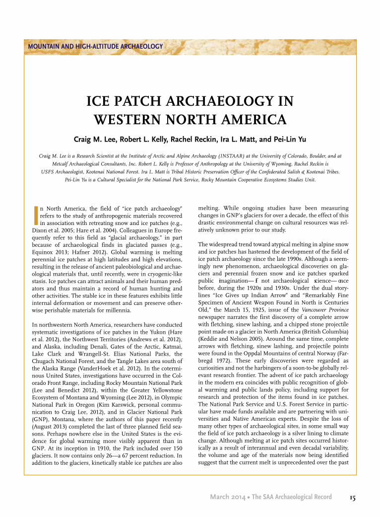
In North America, the field of “ice patch archaeology”refers to the study of anthropogenic materials recoveredin association with retreating snow and ice patches (e.g.,
Dixon et al. 2005; Hare et al. 2004). Colleagues in Europe fre-quently refer to this field as “glacial archaeology,” in partbecause of archaeological finds in glaciated passes (e.g.,Equinox 2013; Hafner 2012). Global warming is meltingperennial ice patches at high latitudes and high elevations,resulting in the release of ancient paleobiological and archae-ological materials that, until recently, were in cryogenic-likestasis. Ice patches can attract animals and their human pred-ators and thus maintain a record of human hunting andother activities. The stable ice in these features exhibits littleinternal deformation or movement and can preserve other-wise perishable materials for millennia.
In northwestern North America, researchers have conductedsystematic investigations of ice patches in the Yukon (Hareet al. 2012), the Northwest Territories (Andrews et al. 2012),and Alaska, including Denali, Gates of the Arctic, Katmai,Lake Clark and Wrangell-St. Elias National Parks, theChugach National Forest, and the Tangle Lakes area south ofthe Alaska Range (VanderHoek et al. 2012). In the cotermi-nous United States, investigations have occurred in the Col-orado Front Range, including Rocky Mountain National Park(Lee and Benedict 2012), within the Greater YellowstoneEcosystem of Montana and Wyoming (Lee 2012), in OlympicNational Park in Oregon (Kim Karswick, personal commu-nication to Craig Lee, 2012), and in Glacier National Park(GNP), Montana, where the authors of this paper recently(August 2013) completed the last of three planned field sea-sons. Perhaps nowhere else in the United States is the evi-dence for global warming more visibly apparent than inGNP. At its inception in 1910, the Park included over 150glaciers. It now contains only 26—a 67 percent reduction. Inaddition to the glaciers, kinetically stable ice patches are also
melting. While ongoing studies have been measuringchanges in GNP’s glaciers for over a decade, the effect of thisdrastic environmental change on cultural resources was rel-atively unknown prior to our study.
The widespread trend toward atypical melting in alpine snowand ice patches has hastened the development of the field ofice patch archaeology since the late 1990s. Although a seem-ingly new phenomenon, archaeological discoveries on gla-ciers and perennial frozen snow and ice patches sparkedpublic imagination— if not archaeological science— oncebefore, during the 1920s and 1930s. Under the dual story-lines “Ice Gives up Indian Arrow” and “Remarkably FineSpecimen of Ancient Weapon Found in North is CenturiesOld,” the March 15, 1925, issue of the Vancouver Provincenewspaper narrates the first discovery of a complete arrowwith fletching, sinew lashing, and a chipped stone projectilepoint made on a glacier in North America (British Columbia)(Keddie and Nelson 2005). Around the same time, completearrows with fletching, sinew lashing, and projectile pointswere found in the Oppdal Mountains of central Norway (Far-bregd 1972). These early discoveries were regarded ascuriosities and not the harbingers of a soon-to-be globally rel-evant research frontier. The advent of ice patch archaeologyin the modern era coincides with public recognition of glob-al warming and public lands policy, including support forresearch and protection of the items found in ice patches.The National Park Service and U.S. Forest Service in partic-ular have made funds available and are partnering with uni-versities and Native American experts. Despite the loss ofmany other types of archaeological sites, in some small waythe field of ice patch archaeology is a silver lining to climatechange. Although melting at ice patch sites occurred histor-ically as a result of interannual and even decadal variability,the volume and age of the materials now being identifiedsuggest that the current melt is unprecedented over the past
MOUNTAIN AND HIGH-ALTITUDE ARCHAEOLOGY
ICE PATCH ARCHAEOLOGY IN WESTERN NORTH AMERICA
Craig M. Lee, Robert L. Kelly, Rachel Reckin, Ira L. Matt, and Pei-Lin Yu
Craig M. Lee is a Research Scientist at the Institute of Arctic and Alpine Archaeology (INSTAAR) at the University of Colorado, Boulder, and at
Metcalf Archaeological Consultants, Inc. Robert L. Kelly is Professor of Anthropology at the University of Wyoming. Rachel Reckin is
USFS Archaeologist, Kootenai National Forest. Ira L. Matt is Tribal Historic Preservation Officer of the Confederated Salish & Kootenai Tribes.
Pei-Lin Yu is a Cultural Specialist for the National Park Service, Rocky Mountain Cooperative Ecosystems Studies Unit.

16 The SAA Archaeological Record • March 2014
MOUNTAIN AND HIGH-ALTITUDE ARCHAEOLOGY
7,000 to 10,000 years (e.g., Andrews and MacKay 2012;Reckin 2013).
Organic artifacts recovered at melting ice patches providecontext for the inorganic artifacts that comprise most of thearchaeological record. Organic artifacts are amenable to avariety of technical analyses, including the direct assessmentof their age via AMS 14C assays that can be made on tiny, dis-cretely taken samples due to their excellent preservation andrich carbon content. Archaeological remains from alpine icein western North America include ancient wooden dartshafts and fragments, fletched wooden arrows, antler fore-shafts, baskets, numerous wooden artifacts of uncertainfunction, butchered animal remains, and chipped stone arti-facts. Fragments of weapons ranging in age between 10,400cal B.P. and 200 cal B.P. suggest long-term continuity in icepatch hunting traditions and that these locations were animportant element of the sociocultural and geographic land-scape for Native Americans (Lee 2012). Paleobiological spec-imens recovered in North American ice patches range in agefrom several hundred years to nearly 8000 cal B.P. (Lee2012). In northern latitudes, caribou (Rangifer tarandus) arethe dominant big-game prey species (Hare et al. 2012),whereas Bighorn sheep (Ovis canadensis) are the presumedprey species in the coterminous United States (Lee 2012).The remains of bison (Bison bison) and other large ungulatesalso occur in association with mid-latitude ice patches (Leeand Benedict 2012). The GNP ice patch project recoveredcranial and post-cranial elements from a male bison at an icepatch in 2012.
We use the remainder of this essay to review some of theissues associated with conducting ice patch research in west-ern North America with an emphasis on our work in GNP,including (1) methods of ice patch identification; (2) expenseof the surveys in terms of time, effort and money relative tothe rate of return; (3) the wildcard role of interannual vari-ability introduced by weather events; and (4) the inherentbeauty of these seasonally restricted alpine landscapes andtheir connection to living indigenous communities.
Methods
Google Earth has aided efforts to determine which ice patch-es are worth reconnaissance. In GNP, we used the time slid-er feature on Google Earth to determine which patches sur-vived high melt years (such as 2003 and 2009). We’ve alsofound that aerial photographs can be very useful in deter-mining which patches are most likely candidates. We do notsurvey ice patches that did not survive recent high melt yearssince in all likelihood they have repeatedly melted out in the
past, disgorging any artifacts they may have contained; suchartifacts would have either decayed or drifted away in thepatch’s outflowing stream. Using Google Earth, we are alsoable to determine whether an ice patch has a flat forefield— an area immediately downslope from the ice patch— whereartifacts and paleobiological material might be expected to bestranded, at least temporarily, before decaying or beingswept away downslope. And on busy public lands there isalso the risk of illegal collecting. As with other ice patch proj-ects, the team always surveyed the streams emanating froma given ice patch for several hundred meters— or until thestream went over a cliff!
During survey, while examining the forefield, we also useGPS to map the ice patches’ lateral and lower margins.Recording the ice patch margins in this way allows for com-parison of ice patch extent based on remotely sensed imagesand for direct comparison of melt from year to year. Any arti-facts or paleobiological specimens (feces, unmodified wood,bone) found are photographed and their GPS coordinatesrecorded. Fragile specimens are mounted on ridged,hydrophobic, and archivally stable plastic board (e.g., Coro-plast) and held in place with plain cotton gauze bandaging orstrips of unbleached muslin. A representative sample of pale-obiological specimens is collected for paleoenvironmentalcontext. Sometimes the volume of paleobiological materialcan be staggering. To date, in Glacier National Park, we havefound wood as old as 5000 B.P., and of species that are nolonger found around or above the ice patches. We had origi-nally speculated that some of the wood may have been trans-ported to these locations by raptors for use in nest building,but that explanation now seems unrealistic based on GNP’smaps of known raptor nesting locations. A more parsimo-nious explanation holds the presence of this wood as indica-tive of a higher treeline during a more favorable climate.
Expense and Return
Ice patches tend to exist at high elevations and in remoteareas. This makes them quite expensive to investigate— evenmore so in light of their low potential return. In our projectin GNP we have not found a single artifact (other than a fewbits of historical signage and the odd modern hat) associatedwith ice patches. Perhaps the ice patches in GNP were notconducive for use by ancient humans as hunting locales; atleast no obvious evidence of their use in this way has beenpreserved. The GNP Ice Patch Project went to great effort toidentify this seeming absence of evidence. Some of our tar-get ice patches were so deep in the backcountry that survey-ing them required three days of strenuous hiking. Were theyallowed to land in the park (they are not), helicopters could

17March 2014 • The SAA Archaeological Record
reduce travel time, but they would vastly increase the cost. InAlaska, the Yukon, and Northwest Territories, helicopters arethe accepted, essential tool needed to visit most of these loca-tions. Far from a perfect solution, the use of these expensiveand complex machines can be compromised by their inher-ent limitations and by inclement weather. In the last 30years, many spectacular finds have been discovered by acci-dent from melting ice across the globe— notably, Ötzi, theNeolithic man who was murdered some 5,000 years ago inthe Italian Alps, and the nearly 500-year-old Kwäday DänTs’ìnchi (southern Tutchone for Long Ago Person Found) inBritish Columbia (Dickson 2012). The archaeological infor-mation gleaned from such finds, let alone the significancefor descendant cultures, is unrivaled. Take the resurgence inpopularity of the woven spruce root hat style found withKwäday Dän Ts’ìnchi, for example. Directed surveys of icepatches have certainly produced successes, such as the late-Paleoindian age atlatl foreshaft recovered near Yellowstone(Figure 1), but it seems that, in general, fewer than 10 per-cent of ice patches surveyed reveal any artifacts. This couldbe because many ice patches were simply not used.
From a global perspective, ice patches reveal two major cate-gories of associated activities: hunting and travel. Ice patchescan be excellent places to hunt in the summer, as large gameoften hang out on the patches, using them as a source ofwater and forage (Figure 2). Animals may also use them asrespite from biting insects such as mosquitoes and nose bot-flies because insects avoid the chilled air above the ice patch-es. And some animals seem simply to enjoy sliding around inthe summer snow. In any case, they form large brown targetsagainst a white background, perfect for hunters.
In other places, such as in the mountain passes of the Alps,the artifacts left behind are more of a hodgepodge, things thatone might lose while traveling through a cold, windy, possi-bly stormy pass. One surprising finding is the number ofshoes. One might think that shoes are the last thing a personwould want to lose in a snow-covered pass at 11,000 feet, butpeople who routinely traverse such passes find that leather-soled footwear is slippery on the slopes. Therefore, a personmight remove them in order to cut trail (as portrayed in the1925 silent film, Grass, about Bakhtiari herders in Iran).
Weather
Complicating matters, ice patch research is at the mercy ofthe weather. It is not worth surveying until as late in the warmseason as possible before the first snows of the fall. Thismeans that the fieldwork window is tight (ideally, we wouldsurvey during the first part of the academic semester). Fresh
snowfall obviously hinders survey, and while in GNP we hadto seek cover more than once from late summer snowsqualls. In addition, we planned our fieldwork during 2009, ahigh melt year. But by the summer of 2010, when we actual-ly got into the field for the first time, the ice patches had accu-
MOUNTAIN AND HIGH-ALTITUDE ARCHAEOLOGY
Figure 1. Dart foreshaft. Clockwise from the larger image: (a) the com-
plete foreshaft; (b) detail of the hafting element at the tip (probable own-
ership marks are visible near the bottom of the image); (c) detail of a
trampling fracture that likely occurred when the artifact was saturated
and partially buried in slush; (d) detail of the base portion of the fore-
shaft, which would have been fitted into a socket. Scale in centimeters
(photographs by Tara L. Hornung; image first published in Lee 2010;
used with permission).

18 The SAA Archaeological Record • March 2014
MOUNTAIN AND HIGH-ALTITUDE ARCHAEOLOGY
mulated more snow. The winter of 2010–11, in fact, sawsnowfall that was 250 percent of normal, and in August 2013the patches were larger than in August 2010. It is possiblethat we failed to recover any artifacts in GNP because anymaterial exposed in the patches’ forefields during the highmelt year of 2009 was covered from 2010 onwards. Decay oforganic artifacts may begin not only when artifacts areexposed to sunlight and alternately wet and dry conditions,but also when they come into contact with “warm snow.”
Finally, ice patches exist in emotionally moving environ-ments, many of which are protected today as national parksor as “wilderness.” The clear and obvious evidence of longand repeated use of alpine environments, including icepatches, vividly illustrates that these locations were in no wayforeign elements of the regular— albeit likely seasonal— ranges of many Native peoples. Many ice patch projects,including those occurring in Alaska, the Yukon, and North-west Territories have been blessed by the involvement ofNative Americans with a deep connection to the high coun-
try. Glacier National Park’s alpine regions continue to beimportant spiritual locations to the Salish, Pend d’Oreille,Kootenai, and Blackfeet people. For our project, the intersec-tion of climate science, archaeology, and culture in the fieldof ice patch archaeology is resulting in innumerable positiveoutcomes for project participants, as well as for the commu-nities affected by the research. This is a recurrent pattern.For example, Andrews et al’s (2012) work in the NorthwestTerritories with the Shuhtagot’ine (Mountain Dene) culmi-nated with the installation of heritage exhibits linking thearchaeological record with the living culture, a sample ofwhich can be seen online here: http://www.pwnhc.ca/exhibits/icepatch/. Our project in GNP will also culminatewith the development of a culturally informed, interactivewebpage describing the project for Salish, Kootenai, Pendd’Oreille, and Blackfeet audiences, the general public,archaeologists, other scientists, and resource managers. Anine-minute video describing the project can be found onlinehere: http://youtu.be/w1Vgs9IMixY.
Figure 2. Overview of a Yellowstone area ice patch showing late-season forage outside of the vegetation-free area adjacent to the ice patch (photograph by
C. Lee).

19March 2014 • The SAA Archaeological Record
In the coming decades, the field of ice patch archaeology willexpand to other parts of the globe where permanent snowand ice exist, including South America and Asia. As the fielddevelops, comparative synthesis, such as the review of glob-al radiocarbon ages compiled by Reckin (2013), will provideimportant testable assertions regarding broad scale behav-ioral trends.
Acknowledgments: We thank the Culture Committees of theSalish, Pend d’Oreille, and Kootenai Tribes, as well as theBlackfeet Nation, for their support of and participation in ourwork in Glacier National Park. We thank the Park Serviceand Glacier National Park in particular for their unflaggingefforts to support our collective endeavor. Our work in Gla-cier National Park was financially supported by the NationalPark Service’s Climate Change Response Program, as well asby Glacier National Park.
References Cited
Andrews, Thomas D., and Glen MacKay2012 The Archaeology and Paleoecology of Alpine Ice Patches:
A Global Perspective. Arctic 65(Special Issue):iii–vi.Andrews, Thomas D., Glen MacKay, and Leon Andrew2012 Archaeological Investigations of Alpine Ice Patches in the
Selwyn Mountains, Northwest Territories, Canada. Arctic65(Special Issue):1–23.
Dickson, James2012 Ancient Ice Mummies. The History Press, Gloucestershire,
England.Dixon, E. James, William F. Manley, and Craig M. Lee2005 Emerging Archaeology of Glaciers and Ice Patches: Exam-
ples from Alaska’s Wrangell-St. Elias National Park andPreserve. American Antiquity 70(1):129–143
Equinox2013 Journal of Glacial Archaeology. Electronic document,
equinoxpub.com/journals/index.php/JGA, accessedNovember 8, 2013.
Farbregd, Oddmunn1972 Arrow Finds from the Mountains of Oppdal, Sør-Trønde-
lag, Norway. Miscellanea 5, University of Trondheim, Nor-way.
Hafner, Albert2012 Archaeological Discoveries on Schnidejoch and at Other
Ice Sites in the European Alps. Arctic 65(SpecialIssue):189–202.
Hare, P. Gregory, S. Greer, R. Gotthardt, R. Farnell, V. Bowyer, C.Schweger, and D. Strand
2004 Multidisciplinary Investigations of Alpine Ice Patches inSouthwest Yukon, Canada: Ethnographic and Archaeologi-cal Investigations. Arctic 57:260–272.
Hare, P. Gregory, Christian D. Thomas, Timothy N. Topper, andRuth M. Gotthardt
2012 The Archaeology of Yukon Ice Patches: New Artifacts,Observations, and Insights. Arctic 65(SpecialIssue):118–135.
Keddie, Grant, and Erle Nelson2005 An Arrow from the Tsitsutl Glacier, British Columbia.
Canadian Journal of Archaeology 29:113–123.Lee, Craig M.2010 Global Warming Reveals Wooden Artefact Frozen over
10,000 Years Ago in the Rocky Mountains. Antiquity84(325). Electronic document, http://antiquity.ac.uk/proj-gall/lee325/, accessed November 4, 2013.
2012 Withering Snow and Ice in the Mid-latitudes: A NewArchaeological and Paleobiological Record for the RockyMountain Region. Arctic 65(Special Issue):165–177.
Lee, Craig M., and James B. Benedict2012 Ice Bison, Frozen Forests, and the Search for Archaeology
in Colorado Front Range Ice Patches. Colorado Archaeology78(1):41–46.
Reckin, Rachel2013 Ice Patch Archaeology in Global Perspective: Archaeologi-
cal Discoveries from Alpine Ice Patches Worldwide andtheir Relationship with Paleoclimates. Journal of WorldPrehistory 26:323–385.
VanderHoek, Richard, E. James Dixon, Nicholas L. Jarman, andRandolph M. Tedor
2012 Ice Patch Archeology in Alaska: 2000–10. Arctic 65 (Spe-cial Issue):153–164.
MOUNTAIN AND HIGH-ALTITUDE ARCHAEOLOGY
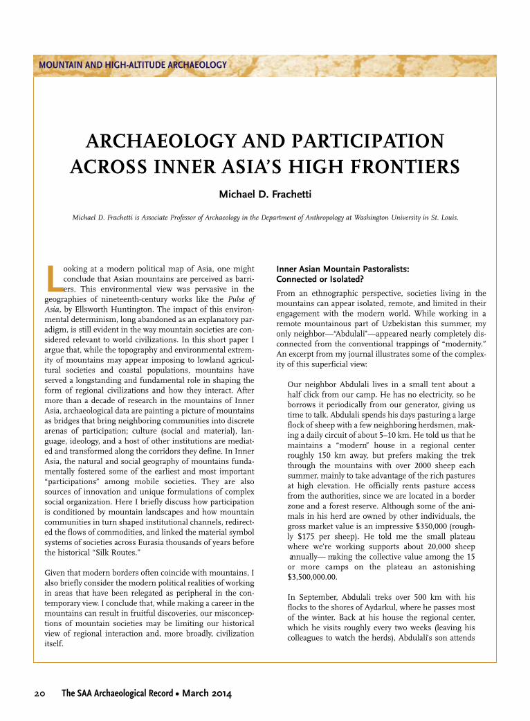
20 The SAA Archaeological Record • March 2014
MOUNTAIN AND HIGH-ALTITUDE ARCHAEOLOGY
Looking at a modern political map of Asia, one mightconclude that Asian mountains are perceived as barri-ers. This environmental view was pervasive in the
geographies of nineteenth-century works like the Pulse ofAsia, by Ellsworth Huntington. The impact of this environ-mental determinism, long abandoned as an explanatory par-adigm, is still evident in the way mountain societies are con-sidered relevant to world civilizations. In this short paper Iargue that, while the topography and environmental extrem-ity of mountains may appear imposing to lowland agricul-tural societies and coastal populations, mountains haveserved a longstanding and fundamental role in shaping theform of regional civilizations and how they interact. Aftermore than a decade of research in the mountains of InnerAsia, archaeological data are painting a picture of mountainsas bridges that bring neighboring communities into discretearenas of participation; culture (social and material), lan-guage, ideology, and a host of other institutions are mediat-ed and transformed along the corridors they define. In InnerAsia, the natural and social geography of mountains funda-mentally fostered some of the earliest and most important“participations” among mobile societies. They are alsosources of innovation and unique formulations of complexsocial organization. Here I briefly discuss how participationis conditioned by mountain landscapes and how mountaincommunities in turn shaped institutional channels, redirect-ed the flows of commodities, and linked the material symbolsystems of societies across Eurasia thousands of years beforethe historical “Silk Routes.”
Given that modern borders often coincide with mountains, Ialso briefly consider the modern political realities of workingin areas that have been relegated as peripheral in the con-temporary view. I conclude that, while making a career in themountains can result in fruitful discoveries, our misconcep-tions of mountain societies may be limiting our historicalview of regional interaction and, more broadly, civilizationitself.
Inner Asian Mountain Pastoralists: Connected or Isolated?
From an ethnographic perspective, societies living in themountains can appear isolated, remote, and limited in theirengagement with the modern world. While working in aremote mountainous part of Uzbekistan this summer, myonly neighbor—“Abdulali”—appeared nearly completely dis-connected from the conventional trappings of “modernity.”An excerpt from my journal illustrates some of the complex-ity of this superficial view:
Our neighbor Abdulali lives in a small tent about ahalf click from our camp. He has no electricity, so heborrows it periodically from our generator, giving ustime to talk. Abdulali spends his days pasturing a largeflock of sheep with a few neighboring herdsmen, mak-ing a daily circuit of about 5–10 km. He told us that hemaintains a “modern” house in a regional centerroughly 150 km away, but prefers making the trekthrough the mountains with over 2000 sheep eachsummer, mainly to take advantage of the rich pasturesat high elevation. He officially rents pasture accessfrom the authorities, since we are located in a borderzone and a forest reserve. Although some of the ani-mals in his herd are owned by other individuals, thegross market value is an impressive $350,000 (rough-ly $175 per sheep). He told me the small plateauwhere we’re working supports about 20,000 sheep annually— making the collective value among the 15or more camps on the plateau an astonishing$3,500,000.00.
In September, Abdulali treks over 500 km with hisflocks to the shores of Aydarkul, where he passes mostof the winter. Back at his house the regional center,which he visits roughly every two weeks (leaving hiscolleagues to watch the herds), Abdulali’s son attends
ARCHAEOLOGY AND PARTICIPATIONACROSS INNER ASIA’S HIGH FRONTIERS
Michael D. Frachetti
Michael D. Frachetti is Associate Professor of Archaeology in the Department of Anthropology at Washington University in St. Louis.

21March 2014 • The SAA Archaeological Record
university— something to do with technology he said.He will likely not become a herder like his father.Abdulali asked me to bring him a pair of American hik-ing boots, which at first I thought he wanted himself.Later he later told me he simply thought his son wouldthink it was cool to have American boots. Since I didn’thave an extra pair of boots handy, I arranged to tradehim a Swiss Army knife for his handmade kinjal.
This pastoralist vignette has been playing out over and overagain, from the mountains of Iran to the Altai of Russia.While the flocks represent great net value, herders are farfrom the richest Central Asians in the modern global econo-my; neither are they the poorest. Across much of the region,a decent monthly salary hovers around $200 per month andmany live on much less— which casts the potential wealthtied up in livestock breeding and mountain herding intostark contrast with other occupations. Of course, the econo-my of herding is such that full liquidation of the herd is nei-ther a sustainable nor wise financial option. Indeed, mostherders subsist on the profit margins (selling a number ofanimals at market as needed), keeping their salary withinhigh average ranges and responding to the demands of theregional economy. From their outward appearance, however,you might be fooled to think pastoralists were barely makinga living.
Seasonal mobility affords mountain pastoralists the oppor-tunity to participate in multiple communities, and theirwealth in animal stock means that they foster importantsocial institutions. For example, they provide lambs toslaughter for weddings, sometimes 200 or more for largerfestivals. They commonly act as couriers between distantregions, and create extensive social and family networksthrough marriage, business dealings, and other engage-ments along their routes. In fact, by simply migrating to andfrom the valued high mountain pastures, they open chan-nels for extensive webs of trade, communication, resourcetransport, and community formation between China (to theeast) and areas south and west. Fredrik Barth, Lois Beck,Thomas Barfield, Nasif Shahrani, and countless other ethno-graphers have documented the centrality of mobile pastoral-ists in shaping wide-scale institutional landscapes acrossAsia throughout the past century. Today, archaeologistsworking from Mongolia to Turkmenistan are filling in theancient details of this remarkable arena of participation, andfrom this work, mountains emerge as the spine of InnerAsian social conductivity (Law 2006; Parzinger and Boroffka2003; Potts 2012).
Ecology and Mobility along the Inner Asian Mountain Corridor
My own work in the mountains of Inner Asia began nearly15 years ago in Kazakhstan, whose eastern border withChina is defined by the Dzhungar Mountains (Figure 1), sit-uated between the larger Tien Shan range to the south andthe Altai Mountains to the north. The Dhzungar range is for-midable, with the highest elevations upwards of 4,000 m.Furthermore, the Dhzungars rise abruptly from a desertplain east of Lake Balkhash. In roughly 150 km west to east,one can go from sand dune deserts to 4,000-m-plus glaciers.Every couple of hundred meters of rise in elevation reveals ashift in vegetation and climate within environmental ecotones— transitions from desert to steppes, steppes topiedmont meadows, and meadows to high alpine pastures.Similar orographically distributed ecotones can be foundalong a long swath of mountains extending from the north-eastern borders of Iran and Afghanistan to the Altai moun-tains of SW Siberia— a territory I have recently referred to asthe IAMC, or Inner Asian Mountain Corridor (Figure 2; Fra-chetti 2012).
Our research initiative along the northern slopes of theIAMC has consisted of a number of regional surveys span-ning from the deserts and foothills to high mountaintops ofthe Dzhungar Mountains. The archaeological data collectedover the past decade illustrate not only that these mountainshave been considerably populated for at least the last 5,000years, but also that seemingly small-scale pastoralist camp-sites often exhibit incredible long-term reuse and reoccupa-tion. The nomadic communities who lived in these moun-tains were not transient. Rather, they developed mountain-specific adaptations that have endured at least since the EarlyBronze Age (ca. 3000 B.C.E.). The archaeological palimpsestincludes a vast array of rock art, which shows prehistoric,historic, and even modern engagement with commonlocales on the landscape. Early Bronze Age petroglyphs,superimposed by Iron Age motifs, superimposed in turn bymedieval motifs and, ultimately, modern day graffiti, defineand imbue sites across the mountainous landscape withmeaning and present a semiotic record of places of signifi-cance and sociality (Frachetti 2008). Likewise, the burialrecord illustrates a long-term sense of history and place,wherein the same cemeteries, the same territories, and thesame spaces and locales in the landscape exhibit a remark-able burial palimpsest spanning thousands of years. The ear-liest burials date to roughly 2,500 B.C.E., and many cemeter-ies illustrate continuous reuse until the medieval era (thirteenth–fourteenth centuries C.E.).
MOUNTAIN AND HIGH-ALTITUDE ARCHAEOLOGY

22 The SAA Archaeological Record • March 2014
MOUNTAIN AND HIGH-ALTITUDE ARCHAEOLOGY
The Dzhungar Mountains are also host to a long-term recordof nomadic settlements. Categorically, settlements of mobilepastoralists were once thought to be nonexistent. Indeed,someone once told me that the use of the term nomadic set-tlement was an oxymoron! In Central Asia, pastoralistencampments once proved difficult to find, mainly becausearchaeologists overlooked the continuities between contem-porary or ethnographic settlements and those of the moredistant past. There was no expectation that an apparentlyephemeral campsite dating to the last few centuries C.E.could reveal more ancient occupation. Starting in the early2000s, our collaborative survey teams started to record andexcavate these ethnographic settlements and found that theyhave substantial and deep archaeological stratigraphy (Fig-ure 3). In fact, our excavations at a number of settlementcomplexes in the last decade demonstrate that all the camp-sites were used repeatedly with reconstruction phases span-ning at least 2,000 years, and some upwards of four millen-nia (Frachetti and Mar’yashev 2007).
Applying this fact toward predictive modeling in GIS, we uti-lize the spatial patterning of mobile campsites recorded onthe surface to model prehistoric landscape use patterns.Such ecological and spatial modeling has led to the discoveryof more pastoralist settlements in other regions of theIAMC, such as in the mountains of Uzbekistan, where nonewere previously known. Of course the ancient pastoralistcommunities we are discussing were diverse in their identi-ties and practices over the past millennia, but their recurrent
patterns of mobility and niche construction help define asocial economy with diverse modes of exploitation through-out the mountains.
There are two dominant environmental pressures that influ-ence mobility patterns of pastoralists throughout the IAMC.The first is altitude and the second is seasonality. Elevationdictates a number of environmental conditions, not least ofall rainfall, temperature, and solar radiation. These factorsare most pronounced in their effect on vegetative resourcesand growing season, and shape the quality and density ofpasturelands in the steppe and piedmont areas of Inner Asia.
If we investigate the summer productivity of semi-aridsteppe pastures in the Dhungar mountains (roughly 800 mor below), for example, we see that while they account for alarge territory across the region, their reduced foraging qual-ity means that as much as 10 times more pasture area isneeded to maintain the same number of animals in higher-elevation, mountain meadows (for discussion, see Frachetti2008). If we compare upland pasture zones (1,000 m up to2,500 m), we see that rich pasture grasses comprise upwardsof 75 percent of the available vegetation. Thus, there is aclear and obvious advantage to traveling during the summerto higher pastures, where rich grasses are more abundantand where increased biodiversity aids in fostering diversepastoralist strategies. Of course, seasonality plays an impor-tant role in the mobility strategies of pastoralists. While thehighland pastures are extremely lush during the summer
Figure 1. Archaeological surveying in the Dzhungar Mountains (2012).

23March 2014 • The SAA Archaeological Record
months, high altitude zones become less accessible in thewinter, when grasses are buried under deep snow. Most pas-ture animals have difficulty grazing in high pastures, so pas-toralists typically move downhill to lowland areas where thesnow is lighter or nonexistent.
Vertical transhumance is a well-known mobility pattern thatis evident in many mountainous environments, from Africato Western Europe, Central Asia, and the Andes. In general,anywhere there are highland ecotones, there are pastoralistpopulations keen on exploiting the seasonal and orographicdifferences in pasture quality and biodiversity. Comparingproductive parameters of the environment with the locationof archaeological sites in the Dzhungar Mountains, we haveproduced models of pastoralist occupation and land use pat-terns through prehistory. Our models illustrate broadly thatresource availability and the mobility necessary to exploitresources have fluctuated very little throughout the last4,000–5,000 years. Certainly there are stochastic deviations,expansions, and contractions in the overall territories usedby mobile populations, but generally we have modeledmobility ranges between summer and winter camps fromroughly 10–35 km per year (max 50–60 km). While this pro-vides interesting ecological information about pastoralists inthis region, it more importantly illustrates the mechanicsunderlying social participation and the formulation of socialarenas throughout the highlands of Inner Asia.
Social Participation and the Mountain Ecumene
The geographic layout of pasture resources in the DzhungarMountains, for example, shaped the mobility and interactivecourses of regional pastoralists for millennia. Seasonal andvertical patterns of migration produced discrete locales forengagement between neighboring communities and theirrespective social networks. This shifting circuitry took shapeas societies constructed meaningful landscapes of settle-ment, burial, and rock art sanctuaries across a latticework oflowland and highland areas within their mountain home-lands. In this sense, we can envision an expansive arena of participation— or institutional engagement and disengagement— forming and reforming among mountaincommunities. Participation was not rooted in the formalityand institutional rigidity of large settlement centers, butinstead was negotiated across diverse and non-uniformassemblages of social, political, economic, and ideologicalways of doing things. It is these dynamic confluences and engagements— practical channels of participation— thatunderpin the scale and complexity of mobile pastoralisthegemonies from ancient times to more recent history.
Our excavations at pastoralist encampments locatedthroughout the piedmont zone (1,000–2,000 m) of easternKazakhstan provide tantalizing details about the nature andimpact of participation among mountain communities on adiversity of emerging institutions of ideology, economy, andproduction. The early Bronze Age settlement site of Begash,
MOUNTAIN AND HIGH-ALTITUDE ARCHAEOLOGY
Figure 2. Geography of the Inner Asian Mountain Corridor.
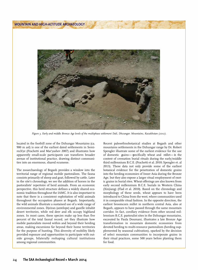
24 The SAA Archaeological Record • March 2014
MOUNTAIN AND HIGH-ALTITUDE ARCHAEOLOGY
located in the foothill zone of the Dzhungar Mountains (ca.900 m asl) is one of the earliest dated settlements in Semi-rech’ye (Frachetti and Mar’yashev 2007) and illustrates howapparently small-scale participants can transform broaderarenas of institutional practice, drawing distinct communi-ties into an enormous, shared ecumene.
The zooarchaeology of Begash provides a window into theterritorial range of regional mobile pastoralism. The faunaconsists primarily of sheep and goat, followed by cattle. Laterin the site’s chronology, we see the addition of horses in thepastoralists’ repertoire of herd animals. From an economicperspective, this herd structure defines a widely shared eco-nomic tradition throughout the IAMC. It is also important tonote that there is a consistent exploitation of wild animalsthroughout the occupation phases at Begash. Importantly,the wild animals illustrate a sustained use of a wide range ofenvironmental zones. Djeiran (antelope) and gazelle inhabitdesert territories, while red deer and elk occupy highlandzones. In most cases, these species make up less than fivepercent of the total faunal record, yet they illustrate howmobile pastoralists moved within and beyond their herdingareas, making excursions far beyond their home territoriesfor the purpose of hunting. This diversity of mobility likelyprovided exposure and opportunities to participate with out-side groups, bilaterally reshaping cultural institutionsamong regional communities.
Recent paleoethnobotanical studies at Begash and othermountains settlements in the Dzhungar range by Dr. RobertSpengler illustrate some of the earliest evidence for the useof domestic grains— specifically wheat and millet— in thecontext of cremation burial rituals during the early/middlethird millennium B.C.E. (Frachetti et al. 2010; Spengler et. al2013). These data not only provide some of the earliestbotanical evidence for the penetration of domestic grainsinto the herding economies of Inner Asia during the BronzeAge, but they also expose a larger ritual employment of exot-ic grains in burial rites. Wheat offerings are also known fromearly second millennium B.C.E. burials in Western China(Xinjiang) (Flad et al. 2010). Based on the chronology andmorphology of these seeds, wheat appears to have beenintroduced to China from the west, where communities usedit in comparable ritual fashion. In the opposite direction, theearliest broomcorn millet in northern central Asia, also atBegash, appears to have passed through the same mountaincorridor. In fact, corollary evidence from other second mil-lennium B.C.E. pastoralist sites in the Dzhungar mountains,excavated by Paula Doumani, illustrates a late Bronze Agetransformation in mountain domestic economies fromdevoted herding to multi-resource pastoralism (herding sup-plemented by seasonal cultivation), sparked by the decisionof select mountain communities to incorporate grains intheir ritual practices, some 500 years before planting themfor food.
Figure 3. Early and middle Bronze Age levels of the multiphase settlement Dali, Dhzungar. Mountains, Kazakhstan (2012).

25March 2014 • The SAA Archaeological Record
Begash is just one site among a handful that have been sys-tematically excavated; the wide abundance of (yet unexcavat-ed) settlements in our study region may expose other chan-nels of participation among a larger population of pastoral-ists interspersed throughout highland valleys and ravines ofthe IAMC. Trade, political alliance, competition, production,and diverse negotiations represent only a sample of modesof participation that allowed technologies, ideas, ideologies,commodities, and languages to be exchanged and innovatedamong mobile mountain societies. Sometimes these innova-tions were essential for survival; others were as random as apair of American hiking boots, or the Swiss-Army knife Itraded for a Turkic kinjal. As archaeologists working amongmountain communities, the challenge is to disentangle thevarious cultural and institutional channels that insertedsmall-scale, mobile communities into wider arenas of partic-ipation and to comprehend how their diverse institutionalpractices shaped what we might consider a distinctly differ-ent modality of civilization.
Closing Thoughts
Our research in the mountains of Inner Asia is promptingnew questions about mountain societies in the past andabout the role of mountains in the contemporary social land-scape of Inner Asia. As was briefly introduced earlier, thepopulation density of mountain regions in Inner Asia istoday extremely low, drastically reduced as a result of globalresettlement policies by the Soviets and the border politics ofthe post-Soviet era. Today all of the “-stans” are ethnicallypluralistic, with Uzbeks, Kazakhs, Kyrgyz, Tajiks, Uighurs,and other groups defining a cultural bricolage along the(mountainous) border regions of each republic. These ethni-cally diverse margins reflect the inherent ancient social geog-raphy of the region and index a past reality when mountaincommunities bridged lowland urban centers by monitoringlong-distance exchanges and participating in the revaluationof commodities and material symbol systems throughremote corridors of interaction.
While archaeologists are commonly invested in studyingpremodern societies, contemporary political borders (fre-quently in mountainous regions) emerge as central to theformulation and execution of successful research. For exam-ple, my current field projects in Kazakhstan and Uzbekistanare situated in sensitive border areas, each with its owndiversity of bureaucratic, practical, and logistical considera-tions. As is the case in the United States, sovereign nationalborders have become liminal areas, often where few areencouraged to live. Globally, scientific access to highlandlandscapes is becoming increasingly limited, both logistical-
ly and bureaucratically. In this short exposé, I have arguedthat perceived peripheries today were not necessarily so inthe past, and mountain regions, which have been canonical-ly cast as “beyond civilization,” might more accurately repre-sent important nerve centers for the resonance of local andregional social institutions. Archaeological research in themountains of the world is essential in producing a rectifiedconceptual approach to the human past.
References Cited
Flad, Rowan, Shuicheng Li, Xiaohong Wu, and Zhijun Zhao2010 Early Wheat in China: Results from New Studies at
Donghuishan in the Hexi Corridor. Holocene20(6):955–965.
Frachetti, Michael D.2008 Pastoralist Landscapes and Social Interaction in Bronze Age
Eurasia. Berkeley: University of California Press.2012 Multi-Regional Emergence of Mobile Pastoralism and
Non-Uniform Institutional Complexity across Eurasia.Current Anthropology. 53(1): 2–38.
Frachetti, Michael D., and Alexei N. Mar’yashev2007 Long-term Occupation and Seasonal Settlement of East-
ern Eurasian Pastoralists at Begash, Kazakhstan. Journal ofField Archaeology 32(3): 221–242
Frachetti, Michael D., Spengler, R.S., Fritz, G. J., and A.N. Mar’ya-shev
2010 Earliest Evidence of Broomcorn Millet and Wheat in theCentral Eurasian Steppe Region. Antiquity 84(326):993–1010.
Law, R.W. 2006 Moving Mountains: The Trade and Transport of Rocks
and Minerals within the Indus Valley Region. In Spaceand Spatial Analysis in Archaeology, edited by Elizabeth C.Robertson, Jeffery D. Seibert, Deepika C. Fernandez, andMarc U. Zender, pp. 301–313. Albuquerque: University ofNew Mexico Press.
Parzinger, Hermann, and Nikolaus Boroffka (editors)2003 Das Zinn der Bronzezeit in Mittelasien. I. Die siedlungsar-
chaöologischen Forschungen im Umfeld der Zinnlagerstaötten.Archaöologie in Iran und Turan, Band 5. Mainz: vonZabern.
Potts, D.T. 2012 Technological Transfer and Innovation in Ancient Eurasia,
in The Globalization of Knowledge in History, edited by Jür-gen Renn, pp. 105–24. Berlin: Epubli.
Spengler, Robert N., Michael D. Frachetti, and Gayle J. Fritz2013 Ecotopes and Herd Foraging Practices in the
Steppe/Mountain Ecotone of Central Asia during theBronze and Iron Ages. Journal of Ethnobiology33(1):125–47.
MOUNTAIN AND HIGH-ALTITUDE ARCHAEOLOGY

26 The SAA Archaeological Record • March 2014
MOUNTAIN AND HIGH-ALTITUDE ARCHAEOLOGY
The Himalayan Exploration and ArchaeologicalResearch Team (HEART) is a joint scientific-humani-tarian venture run out of the Department of Archaeol-
ogy at the University of York. The project operates in collab-oration with the NGO Community Action Nepal and seeks topush the frontiers of archaeological knowledge in theHimalayas while integrating the research with initiatives thatstimulate local economies. Community Action Nepal (CAN)provides a proven infrastructure to identify known but at-risk heritage for responsive research, while HEART’s objec-tives to explore, survey, and excavate new archaeology usingthe latest scientific and technological methods will furtherextend Nepal’s potential to offer exciting heritage tourismopportunities. While being a landscape survey, and thus col-lecting multi-period datasets, the HEART project focuses onprehistoric research questions, about which relatively little isunderstood. The region is particularly important in a prehis-toric context because the Himalayas occupy a key nexus inAsia, where multiple processes of animal and plant domesti-cation articulate.
Research Directions: Domestication and Exchange
It is increasingly being recognized that the regions of north-west India, Pakistan, Afghanistan, and the Himalayas areessential in developing archaeological understanding of theprocesses of animal and plant domestication that occurred atthe beginning of, and in some cases in advance of, the EarlyHolocene (ca. 11,000 B.P.). It is in these areas that many cul-tivated species indigenous to eastern and western hemi-spheres meet and, by inference, so too do the anthropogenicprocesses that motivated these domestication episodes. Cul-tural exchange of both foods and food management knowl-edge in this articulation zone seems likely, given that there isa broad and compelling contemporaneity to the domestica-
tions of plants such as rice (Oryza sativa) (Fuller et al. 2007;Jones and Liu 2009;), the millets (Panicum miliaceum, Setariaitalica) (Hunt and Jones 2006; Hunt et al. 2008), wheat(Triticum sp.), and barley (Hordeum vulgare) (Li et al. 2011),as well as minor cultivars like peach (Prunus persica) andapricot (Prunus armeniaca) fruit (Hunt and Jones 2006).
Genomic evidence from japonica and indica rice strains (Oryzasativa), with indigenous distributions centered on China andIndia respectively, either side of the Himalayas, shows thatthere was an exchange of genetic material between these vari-eties. This exchange takes the form of critical domesticationalleles, coding for plant management features such as grainshattering (Sh4 allele) and panicle color (Rc allele) (Kovach etal. 2007). These selected characteristics are common to bothmodern strains, but are not found in wild counterparts. Phy-logeographic investigations of rice point to possible domesti-cation centers in both China and India (Sang and Ge 2007),but this overlap of domestication alleles happened because ofinterbreeding and thus points to trans-Himalayan exchangenetworks. The earliest macroscopic evidence of cultivated ricegrains comes from grains embedded in Lower Yangtze potteryin China, dated to ca.10,000 B.P. (Jiang and Liu 2006), butmicroscopic phytolith evidence from Diaotonghuan Cave maysuggest an even greater 13,000-year-old antiquity (Zhao 1998)(Figure 1). Similarly, in the Gangetic Plain, emerging discov-eries of rice from the site of Lahuradewa (ca. 11,000- 10,000B.P.) suggest that management/cultivation of rice was beingpracticed in the early Holocene, though full domesticationwas not convincingly evidenced on morphological grounds(Fuller 2011). A plausible, but unproven, model for theprocess of rice domestication, therefore, describes two possi-ble domestication centers in northern India and centralChina, with a subsequent and undated influx of viable domes-ticated seed-grain from China into Indian crops. How the
THE HIMALAYAN EXPLORATION ANDARCHAEOLOGICAL RESEARCH TEAM
SCIENTIFIC-HUMANITARIAN FIELDWORK IN COLLABORATION WITH THE MOUNTAIN COMMUNITIES OF NEPAL
Hayley Saul
Hayley Saul is Lecturer in Archaeology and Lecturer and Course Director of the MA in Mesolithic Studies program at the University of York.

27March 2014 • The SAA Archaeological Record
Himalayas were involved in this remains to be established.The earliest finding of domesticated food in the mountainscomes from Mebrak, where first millennium B.C. naked bar-ley was recovered (d’Alpoim et al. 2013; Simons et al. 1994),and Changguogou in southern Tibet, where naked barley isdated to ca. 3,500 B.P. (Lister and Jones 2013). However, theantiquity of Himalayan settlement, the degree of mobility, therole of these high-altitudes in domestication processes, andthe extent of trans-Himlayan exchange are key research aimsfor HEART.
HEART developed in response to the need to push theboundaries of prehistoric knowledge in these high-altitudeenvironments. Evidence for occupation of the mountainousranges, either (semi-) permanently or as route ways forexchange, is scant before the first millennium cal B.C. Devel-oping these datasets not only is a physically challengingundertaking, but also requires experience of knowing“where to look,” since the accelerated erosional processeshave secondarily redeposited some artifacts, while coveringothers with deep sediments if they are at the base of peaks.Despite this, HEART has had significant early success in therecovery of prehistoric stone tools during “field-walking,” aswell as the promising discovery of stone structures that arepart of a long-term program of excavation.
Survey and exploration of archaeological sites along theroute of the Annapurna Circuit, northwest of Kathmandu,form a primary research trajectory (Figure 2). Discountingthe many hundreds of “Sky Caves” in Lower Mustang, a totalof nearly 50 sites and archaeological landscapes with poten-
tial or confirmed archaeological activity were identified alongthe 240-km stretch that was surveyed. The majority of sitesthat were recorded were rockshelters and caves, with rock-shelters abounding in the boulderfields of the foothills,below ca. 2,500 m in altitude. Caves were found across therange of altitudes surveyed, but were concentrated on thehigh plateaus above 3,000 m, as well as the Sky Caves of theKali Gandaki Valley. As a result, a program of survey andexcavation focused on north-south valley systems that lead tosome 30 traversable mountain passes with Tibet forms thelong-term research agenda for HEART.
Heritage and Community Archaeology
One of the main humanitarian aims of HEART is to opera-tionalize scientific approaches to the understanding of pre-historic mountain settlement for the purposes of bringinglife-enhancing benefits to the mountain communities by col-laborating on heritage development projects (e.g., museums,heritage curriculums in schools, ethically designed tourismventures). The challenges facing local heritage extendbeyond the realm of prehistoric archaeology, though, andHEART is working collaboratively with local groups andCAN to target vulnerable areas where traditional skills, mon-uments, and community buildings are threatened.
One such project is the restoration of the Buddhistmonastery in Langtang (Figure 3). If you’re lucky enough tovisit the “Hidden Valley” of Langtang, a day’s travel north-west of Kathmandu in Nepal, the scenes of historical high-altitude yak drivers’ huts amid dense rhododendron forests
MOUNTAIN AND HIGH-ALTITUDE ARCHAEOLOGY
Figure 1. Map showing the early occurrence of rice between 5000–2000 cal B.C. (orange dot), and > 2000 cal B.C. (blue dot) (based on Hu et al. 2006;
Jones and Liu 2009; Jiang and Liu 2006; Fuller et al. 2007; Fuller 2011): (1) Xishanping (2) Diatonghuan Cave; (3) Shangshan; (4) Jiahu; (5)
Yuchanyan; (6) Yuezhuang; (7) Nanjiaokou; (8) Huizul; (9) Qingyuang; (10) Hemudu; (11) Kuahuqiao; (12) Longqiuzhang; (13) Chuodun; (14)
Bashidang; (15) Mohenjodaro; (16) Mahagara; (17) Koldihava; (18) Lothal; (19) Lahuradeva; (20) Damdama; (21) Imlidih-Khurd; (22) Jhusi; (23)
Koldihwa; (24) Khairadih; (25) Kunjhun II; (26) Lekhania; (27) Malhar I; (28) Senuwar 1A; (29) Waina I; (30) Ahirua Rajarampur.
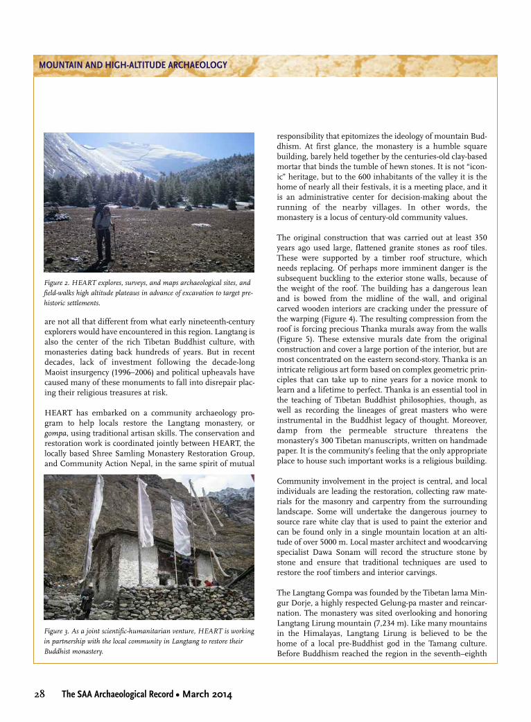
28 The SAA Archaeological Record • March 2014
MOUNTAIN AND HIGH-ALTITUDE ARCHAEOLOGY
are not all that different from what early nineteenth-centuryexplorers would have encountered in this region. Langtang isalso the center of the rich Tibetan Buddhist culture, withmonasteries dating back hundreds of years. But in recentdecades, lack of investment following the decade-longMaoist insurgency (1996–2006) and political upheavals havecaused many of these monuments to fall into disrepair plac-ing their religious treasures at risk.
HEART has embarked on a community archaeology pro-gram to help locals restore the Langtang monastery, orgompa, using traditional artisan skills. The conservation andrestoration work is coordinated jointly between HEART, thelocally based Shree Samling Monastery Restoration Group,and Community Action Nepal, in the same spirit of mutual
responsibility that epitomizes the ideology of mountain Bud-dhism. At first glance, the monastery is a humble squarebuilding, barely held together by the centuries-old clay-basedmortar that binds the tumble of hewn stones. It is not “icon-ic” heritage, but to the 600 inhabitants of the valley it is thehome of nearly all their festivals, it is a meeting place, and itis an administrative center for decision-making about therunning of the nearby villages. In other words, themonastery is a locus of century-old community values.
The original construction that was carried out at least 350years ago used large, flattened granite stones as roof tiles.These were supported by a timber roof structure, whichneeds replacing. Of perhaps more imminent danger is thesubsequent buckling to the exterior stone walls, because ofthe weight of the roof. The building has a dangerous leanand is bowed from the midline of the wall, and originalcarved wooden interiors are cracking under the pressure ofthe warping (Figure 4). The resulting compression from theroof is forcing precious Thanka murals away from the walls(Figure 5). These extensive murals date from the originalconstruction and cover a large portion of the interior, but aremost concentrated on the eastern second-story. Thanka is anintricate religious art form based on complex geometric prin-ciples that can take up to nine years for a novice monk tolearn and a lifetime to perfect. Thanka is an essential tool inthe teaching of Tibetan Buddhist philosophies, though, aswell as recording the lineages of great masters who wereinstrumental in the Buddhist legacy of thought. Moreover,damp from the permeable structure threatens themonastery’s 300 Tibetan manuscripts, written on handmadepaper. It is the community’s feeling that the only appropriateplace to house such important works is a religious building.
Community involvement in the project is central, and localindividuals are leading the restoration, collecting raw mate-rials for the masonry and carpentry from the surroundinglandscape. Some will undertake the dangerous journey tosource rare white clay that is used to paint the exterior andcan be found only in a single mountain location at an alti-tude of over 5000 m. Local master architect and woodcarvingspecialist Dawa Sonam will record the structure stone bystone and ensure that traditional techniques are used torestore the roof timbers and interior carvings.
The Langtang Gompa was founded by the Tibetan lama Min-gur Dorje, a highly respected Gelung-pa master and reincar-nation. The monastery was sited overlooking and honoringLangtang Lirung mountain (7,234 m). Like many mountainsin the Himalayas, Langtang Lirung is believed to be thehome of a local pre-Buddhist god in the Tamang culture.Before Buddhism reached the region in the seventh–eighth
Figure 2. HEART explores, surveys, and maps archaeological sites, and
field-walks high altitude plateaus in advance of excavation to target pre-
historic settlements.
Figure 3. As a joint scientific-humanitarian venture, HEART is working
in partnership with the local community in Langtang to restore their
Buddhist monastery.

29March 2014 • The SAA Archaeological Record
centuries A.D., the prevailing religion was a shamanic-basedone, called Bön. The animism of landscape features such asmountains and rivers, as well as objects, with an essence ofconsciousness was a feature of Bönpo, the religion’s adher-ents. Later, this veneration of places in the landscape wouldcome to figure in the particular doctrines of the Tibetanbranch of Buddhism, following its introduction from theIndian subcontinent. Particular features of the landscape areinvested with the power to bring about certain altered statesof mind, through meditation, or empowerment by the lega-cy of divinely touched beings that have been there before.
Mingur Dorje, the monastery’s founding figure, is one suchsaintly character and, according to local history, it was a visitfrom this venerated master that stimulated the original con-struction. According to the biographies of the holy man, he wasborn in the Nangchen region of Kham in 1645. Stories of mir-acles surround the birth of Mingur Dorje, including the pres-ence of auspicious marks on the boy’s body, such as the letter
tha on the sole of his foot. When he was 11 years old, anothermaster named Karma Chakme identified him as a reincarna-tion of the great lama Trulzhik Chenpo Wangdrak Gyatso. Thismentor bestowed the teachings of the Nyingma-pa Buddhistheritage, the semi-secular religious branch that flourishes inLangtang today and allows lamas to integrate into communi-ties and have families (Dorje and Rinpoche 2006).
Mingur Dorje is credited with many esoteric abilities. Hewas said to have experienced visions of deities such as Pad-masambhava, the sage said to have brought Buddhism toTibet (Sihlé 2006), and the saintly Milarepa, who, despite hischeckered past, is hero-worshipped nowadays for achievingenlightenment in a single lifetime. Perhaps most famously,though, Mingur Dorje was of a rare breed of “TreasureRevealers”—those gifted with the ability to discern arcanewisdom from particular places and objects. In theHimalayas, the Terma tradition of Buddhism holds that cer-tain knowledge is hidden in the mountains or other signifi-
MOUNTAIN AND HIGH-ALTITUDE ARCHAEOLOGY
Figure 4. The weight of the roof is causing the carved wooden interior
supports to crack.
Figure 5. The walls of the building are bowing under the weight of the
roof, causing original Thanka murals to crack and decay from the walls.

30 The SAA Archaeological Record • March 2014
MOUNTAIN AND HIGH-ALTITUDE ARCHAEOLOGY
cant landscape features by antiquity’s lineage-founders(Thondup Ringpoche 1997). This knowledge was to berevealed only when humanity was ready to receive it. It couldtake a physical form, such as a scroll or an object to meditateupon, or it could take the less tangible form of a hidden, per-haps transcendental doorway to realization, associated with aparticular place (beyul) (Thondup Ringpoche 1997).
One such example of a treasure, or terma, which is said to havebeen revealed by Mingur Dorje was at a place called Maja YongDzong, where a statue of Padmasambhava was subsequentlydiscovered in a cave (Thondup Ringpoche 1997). With his rep-utation growing, the lama received numerous invitations fromall over the Himalayas to offer his teachings, and it is duringthese travels that he inspired the foundation of Nyingma-pamonasteries, like the one in Langtang. He was only 19 whenhe died, but his figure seems to have had a profound impacton the secondary spread and consolidation of Buddhism inthe Himalayas, including Langtang.
Conclusions
Virtually nothing is known about the role of the Himalayas inwider prehistoric processes such as domestication and earlystate formation, and yet not only is very little fieldwork under-way to counter this situation, but exemplars of “living her-itage” are also falling into decay for a lack of resources tomaintain them. The aims of the Himalayan Exploration andArchaeological Research Team are to mount joint scientificand humanitarian initiatives with the charity NGO Commu-nity Action Nepal and local community partnerships to pro-vide sustainable heritage-based solutions to socioeconomicdevelopment in the high-altitudes. Here, some of the currentprojects being undertaken by HEART have been explainedagainst the broader backdrop of the prehistoric research con-text, as well as the role heritage and archaeology can play tofacilitate communities to meet their socioeconomic needs.Engaging with “community values” is a very relevant part ofarchaeological responsibility. In the compassionate Buddhistvillages of the high Himalayas the idea of community is onethat entails mutual responsibility for the well-being of others,and it is in this spirit that HEART was established: to opera-tionalize science as a powerful tool to bring about economicdevelopment and to work in partnership with local groups torepresent traditional values in the study of their heritage.
References CitedD’Alpoim, G. J., H. Lu, Y. Li, R. N. Spengler, X. Wu, M. S. Aldenderfer2013 Moving Agriculture onto the Tibetan Plateau: The
Archaeobotanical Evidence. Archaeological and Anthropo-logical Science, DOI 10.1007/s12520-013-0153-4.
Dorje, Je Tukyi, and Surmang Tendzin Rinpoche2006 Chariot of the Fortunate: The Life of the First Yongey
Mingyur. New York, KTD Publications.Fuller, D., E. Harvey, and L. Qin 2007 Presumed Domestication? Evidence for Wild Rice Cultiva-
tion and Domestication in the Fifth Millennium BC of theLower Yangtze Region. Antiquity 81:316–331.
Fuller, D. 2011 Finding plant domestication in the Indian subcontinent.
Current Anthropology 52(4); 347–364.Hunt, H. H., and M. K. Jones 2006 Pathways across Asia: Exploring the History of Panicum
and Setaria in the Indian Subcontinent. Paper presented inthe international seminar on the “First Farmers in Global Per-spective,” Lucknow, India.
Hunt, H. H., M. V. Linden, X. Liu, G. Motuzaite-Matuzeviciute, S.Colledge, M. K. Jones
2008 Millets across Eurasia: Chronology and Context of EarlyRecords of the Genera Panicum and Setaria from Archaeo-logical Sites in the Old World. Vegetation History andArchaeobotany 17 (1):S5–S18.
Jiang, L., and L. Liu2006 New Evidence for the Origins of Sedentism and Rice
Domestication in the Lower Yangtze River, China. Antiqui-ty 80:1–7.
Jones, M. K., and X. Liu 2009 Origins of Agriculture in East Asia. Science 324:730–731.
Kovach, M., M. Sweeney, S. R. McCouch 2007 New Insights into the History of Rice Domestication.
Trends in Genetics 23 (11):578–587.Li, C., D. L. Lister, H. Li, Y. Xu, Y. Cui, M. A. Bower, Jones, M. K.
H. Zhou 2011 Ancient DNA Analysis of Desiccated Wheat Grains Exca-
vated from a Bronze Age Cemetery in Xinjiang. Journal ofArchaeological Science 38:115–119.
Lister, D. L., and M. K. Jones 2012 Is Naked Barley an Eastern or a Western Crop? The Com-
bined Evidence of Archaeobotany and Genetics. VegetationHistory and Archaeobotany 22(5): 438V446.
Sang, T., and S. Ge 2007 The Puzzle of Rice Domestication. Journal of Integrative
Plant Biology 49(6):760–768.Sihlé, N. 2006 Buddhism in Tibet and Nepal: Vicissitudes of Traditions
of Power and Merit. In Buddhism in World Cultures: Com-parative Perspectives, edited by S. C. Berkwitz, pp. 245–284.ABC-CLIO.
Simons, A., W. Schön, and S. Shrestha1994 The Prehistoric Settlement of Mustang: First Results of
the 1993 Archaeological Investigations in Cave Systemsand Connected Ruined Sites. Ancient Nepal 137:93–129.
Thondup Ringpoche, T. 1997 Hidden Teachings of Tibet: An Explanation of the Terma Tra-
dition of Tibetan Buddhism. Boston, Wisdom Publications.

31March 2014 • The SAA Archaeological Record
The title of this article alludes to a fundamental questiondriving a substantial amount of alpine archaeologicalresearch: are high-altitude environments so limiting in
terms of biotic productivity, oxygen availability, pronouncedseasonality, extreme cold, and unpredictability as to necessi-tate some sort of external mechanism (e.g., climate change,increased lowland population densities, the development ofsociocultural complexity) to initiate their intensive exploita-tion and habitation (Aldenderfer 2006)? Or are they so sea-sonally productive and do they offer such novel opportuni-ties not available in the lowlands that they entail their ownincentives for intensive occupation (Walsh et al. 2006)? To beclear, people across the globe often used (and use) alpine set-tings sporadically, non-intensively, and opportunistically ashunting grounds for alpine fauna like sheep and goats andto travel and trade between locales separated by mountainranges (Canaday 1997). The question is, why do they some-times build permanent structures and start living in largergroups for longer periods of time (leaving behind substantialmiddens) in above-treeline environments? Answering thisquestion drives a large part of my current research in themountains of North and South America and is informed bynearly two decades of doing archaeological work in moun-tain settings. Rather than address this question with proxydata for population size, environmental productivity, andalpine settlement and subsistence patterns, here I take theopportunity to address these issues more intuitively byreflecting on the benefits and costs of working in high-alti-tude environments.
My first encounter with serious high-altitude archaeologicalresearch began in 1996, when I began working with Dr. TomJackson on a three-year-long CRM project driven by the reli-censing of Southern California Edison’s (SCE) aging hydro-electric facilities in the High Sierra. The project was a datarecovery operation for a series of sites, some with buriedpaleosols capped by tephra, on the east side of the SierraNevada, just outside the alpine regions of Yosemite National
Park. Its research agenda focused on figuring out the effectsof Late Holocene volcanism, marked by those tephras (fromnearby Mono and Inyo craters), on the region’s prehistoricpopulations.
Beyond the archaeology, the thing that struck me about theproject was its logistics. We had to work in the fall before thefirst snows but after the reservoir being relicensed had beendrawn down (some of our best sites were below the maxi-mum pool elevation of the reservoir)—maybe a one-monthwindow of time. I had worked on plenty of camping-basedprojects before, from the Mogollon Rim to the top of thesouthern Sierra Nevada, but always out of vehicles. Here wehad to get a full crew of people, excavation gear, and camp-ing equipment up into the mountains for a two-week stay.The screens had to be broken down to fit on pack mules. Thefood had to be packed in and strung up in bear bags. Thatfirst year, we rode an open-compartment incline railway (aremnant of SCE’s early-twentieth-century infrastructure andreally just a small nine-person cart hauled up a set of tracksby winch-driven cable) up about a 45-degree slope, crossed ahigh-altitude reservoir by boat, and then proceeded by trail afew miles to our campsite. Our food was brought in by astring of mules. The following two seasons, we ditched theinline railway and boats (it was alleged that an equipmentmalfunction killed an SCE employee on it after our first trip),riding 10 miles on mules with the rest of our gear and food.
That first season, the weather was gorgeous, as only the earlyfall in the High Sierra can be. John Muir (1912) was spot-onin calling these mountains the “Range of Light.” The archae-ology was top- notch— we had sites with midden, bedrockmortars, and intact stratigraphy (quite rare in mainland Cal-ifornia) at nearly 3,000 m in elevation. The second seasonwas a different story. After we packed in, set up camp, strunghundreds of pounds of food up in the trees with a Gerry-rigged pulley system (to keep it away from Yosemite’s noto-rious black bears), and renewed the excavations started the
MOUNTAIN AND HIGH-ALTITUDE ARCHAEOLOGY
WAS IT EUPHORIA OR OXYGEN DEPRIVATION?REFLECTIONS ON CONDUCTING RESEARCH IN ALPINE SETTINGS
Christopher Morgan
Christopher Morgan is Assistant Professor and Graduate Program Director in the Department of Anthropology at the University of Nevada, Reno.

32 The SAA Archaeological Record • March 2014
MOUNTAIN AND HIGH-ALTITUDE ARCHAEOLOGY
year before, a blizzard blew in, dumpingsnow and coating the granite cliffs withice. The Range of Light quickly becamesomething more like Mt. McKinley’s Alas-ka Range. Some of us had four-seasontents, down jackets, Gore-Tex shells, andmountaineering-style boots. Some didn’tand compensated with duct-tape, endingup looking like they were ready to joinJohn Glenn on Friendship 7. We tried towork through the storm, but it quicklybecame apparent that some folks weren’twell enough equipped to deal with theworsening storm. It got so cold, snowy,and windy one morning that we made thecall to bug out and head back down themountain. Without mules or full-sizedbackpacks, we left tents, food, and most ofour gear behind, carrying what we couldin our field packs. Tom and I rode up onmules the following week to inspect thedamage and assess the possibility of tryingagain. The gear was intact and the forecastgood, so we headed back up on mules thefollowing week, many of the crew withexpensive, brand-new Gore-Tex jacketsand boots. Of course the snow melted, the weather wasbalmy (those expensive jackets stayed in their duffel bags),and the second field season was ultimately a success, as wasthe third.
What did we learn? In terms of archaeology, something veryinteresting: that hunter-gatherers in the region adapted tothe region’s volcanism with mobility. When one Sierran passwas burned off and blanketed in volcanic ash, another near-by one was used more intensively (Jackson and Morgan1999). The region’s volcanic activity represented less a catas-trophe than an inconvenience. But working in the High Sier-ra was costly, unpredictable, time-constrained, and requireda lot more planning than the projects I had worked on in thelowlands. In addition to the normal costs of fuel, food, vehi-cles, and payroll, were the mules (not cheap!), SCE’s outlaysfor logistical support (I thankfully never saw that end of thebudget), the necessity of quality outdoor gear (REI being themain beneficiary here), and, especially in that second season,nearly doubling the logistical budget due to the weather.
The next six or so years saw me spending an inordinateamount of time in the central Sierra working on a slew ofhydroelectric relicensing projects for SCE and conductingsurveys for the Forest Service. We operated under much the
same constraints as before. We often hadto get in either right before spring thaw(prior to the reservoirs filling up) or late inthe fall (after they’d emptied). In thespring, we took advantage of SCE’slargesse and flew crew, gear, and a zodiacboat over the 3,000-m Kaiser Pass in a hel-icopter (Figure 1), excavated the sites onour itinerary, and worked through a late-season snowstorm. One crew membersuffered pulmonary problems, to thepoint of being tent-bound the entire trip,but we couldn’t evacuate her over the passdue to the storm (she recovered after thetrip). In the fall, working again out of vehi-cles, we typically found ourselves trying toget one last site dug before the onset ofwinter. Inevitably, this meant breakingcamp as the first storm of the season hit,cramming gear and crew into field vehi-cles and driving the icy one-lane road overKaiser Pass in a blizzard. In the summer,we would survey the alpine zone. To movefast, we worked without pack animal sup-port, carrying meticulously preparedcamping and recording gear and 10 days
of food on our backs. If the gear or food wasn’t absolutely nec-essary or couldn’t perform more than one function, it was leftbehind. The only exception was in packing a little extra high-fat foods (more calories per pound) and an extra layer ofclothing as insurance against bad weather or worse. We camedown the mountain only to resupply and head out again. Noone complained— the alpine Sierra in the summer is withoutequal.
And the archaeology? Well, the first thing we noticed was thatthere was a lot more of it out there than you might expect. Sitefrequency, especially heading over 3,300- and 3,700-m passes,seemed inordinately high. I remember one plateau-like passwhere we spent nearly a week frantically recording sitesthrough afternoon thunderstorms (due to site density, wequickly fell behind our schedule) only to head over anotherpass and up to an amphitheater-like cirque higher than 3,300m in elevation (a dead-end if you will) where we expected tofind nothing but instead found a site covering acres. Not onlywas the site large, it had anthropogenic soils, abundantgroundstone, and a dense surface deposit of mostly obsidiantools and debitage. It looked more like the type of site you’dfind down at an elevation around 1,200 m, just below wintersnowline. The more time we spent up there, the more thispattern was repeated: more sites, larger and more complex
Figure 1. Hauling gear by helicopter into the
Sierran high country.

33March 2014 • The SAA Archaeological Record
sites, sites with milling tools and milling features and some-times even house features either at or above treeline. Thequestion as to why this was the case piqued my curiosity, lead-ing me to write my dissertation on the region’s settlementpatterns (Morgan 2006). What I found most interesting aboutthis research was that it suggested that the successful prehis-toric exploitation of high altitudes was paid for, in part, bycaching acorns from the montane forest as a means of off-setting the risks associated with early spring moves to thehigh country (Morgan 2008, 2010). Other researchers haveidentified similar patterns of using lowland resources tounderwrite high-altitude occupations, for instance, in theWhite Mountains of California (Scharf 2009) and Utah’sUinta Mountains (Nash 2012).
By now the die had been cast and it was not long before Ifound myself doing similar research in places likeWyoming’s Wind River Range. Here I was lucky enough toget involved in working with Rich Adams (Colorado StateUniversity), Ken Cannon (Utah State University), and Rich’sthen-students Matt Stirn and Bryon Schroeder to try toexplain why there was a site (found by Adams and his vol-unteer crew) with 52 house features at an elevation of 3,300m, a pattern at least superficially similar to only two otherplaces in the American West: the high-altitude “villages” ofcentral Nevada (Thomas 1982) and eastern California (Bet-tinger 1991).
Over the course of three seasons of running field schoolsthere, funded by the National Geographic Society, theNational Science Foundation (#BCS-1302054), the CharlesRedd Center at Brigham Young University, and Utah StateUniversity (cobbling together the funding for this researchwas indeed its own challenge), I came to appreciate not onlythe uniqueness of the site, but also the ecological context ofliving and working at altitude. First, there’s the elevation.The site is on a 23-degree slope, and I spent three summersrunning up and down that slope keeping track of excavationsspread out across the site’s 19-acre area. Barring the physio-logical changes (especially increased pulmonary capacity)associated with isolated populations in places like Tibet andthe Andes, you do acclimate some, but you are always suck-ing wind above about 2,700 m in elevation. Second, peoplereact to high altitudes differently. I remember being awokenin the pre-dawn hours by a student wheezing outside mytent, croaking, “Dr. Morgan, I don’t feel so good.” Recogniz-ing the voice as one of the toughest students of the bunch, Iwas shaken. He showed all the signs of pulmonary edema:headache, shortness of breath, confusion, and deep raspingin the lungs. The only choice was to hike him down themountain, drive to Jackson Hole so that he could be picked
up by family, turn around, drive back to the Wind RiverRange, and hike back up to the site for the next day’s work.The doctors confirmed the edema, commenting that anoth-er few days up there could have been fatal.
Two summers later, I brought the largest crew yet to the site.At its maximum, we had 17 people in camp, with all thefood, gear, wall tent, woodstove, and excavation gear onceagain brought up by pack train (Figure 2). Like the work inthe Sierra Nevada, we were time-constrained, partly by theshort summer season, but mainly by a limitation some peo-ple may not immediately think of in the mountains: water.We camped high on the mountainside, where the only watercame from a few small springs. While one tended to trickleall summer long, it was only in late spring and early summerthat there was a strong enough flow to sustain a large group.So up we went, as usual timing our trip with a close eye onthe spring thaw and the possibility of late season storms.We’d been lucky the preceding two years and were hoping topull off just one more field season in the notoriously unpre-dictable Winds. Of course it snowed. And then it snowedsome more. We all packed into our wall tent with a tinywoodstove to stay warm and dry. Going stir-crazy and notwanting to miss the opportunity to dig the site, we went towork whenever the snow let up. It was something to do, itkept you warm, and it got the work done (Figures 3 and 4).The crew was resilient, punching though an inch of ice at thespring in the middle of the day to get drinking water and dig-ging through a foot of snow to get to the tarp covering wherewe’d left off excavation the day before. There were cold feetand cold hands and some painful falls on the ice, but every-one had at least decent backcountry gear and lots of layers(easier to accomplish when the mules haul it in for you).
MOUNTAIN AND HIGH-ALTITUDE ARCHAEOLOGY
Figure 2. Wind River pack train led by Heath and Sarah Woltman of
Bear Basin Outfitters, Fort Washakie, Wyoming, and by local expert
guides Tory and Meredith Taylor.

34 The SAA Archaeological Record • March 2014
MOUNTAIN AND HIGH-ALTITUDE ARCHAEOLOGY
More importantly, it was calories that kept people going. Iwas lucky enough to have hired Shawn Patton as a cook, afriendly, pragmatic man with a lot of outdoor experience, andby now I’d been bringing crews into the wilderness, feedingand taking care of them for well over a decade. So we knewto bring a lot of food. But I have never seen people eat likethat. It was cold, and the snow made getting to and from thesite easily twice as hard. Shawn kept the stove going, readywith coffee, cocoa, pasta, beans, and anything with fat in it as
soon as we returned from work. The food was inevitablygone in seconds and supplies began to dwindle. Shawn andI eyed our stores each morning with knitted brows. But theweather eventually cleared, the food held out, and we accom-plished what we had set out to do. By the end of the project,between Adams’ (2010) and Koenig’s (2010) work and myown we had sampled nearly half of the 52 houses at the site.Analyses are still underway, but it is now clear that the mainperiod of site occupation was between about 2000 and 500cal B.P. (Morgan et al. 2012) and that this occurred during aperiod of increased effective moisture when treeline washigher than today by 100 m or more (Morgan et al. 2014),making the site less in the alpine than the subalpine zonewhen most of its houses were built. These preliminary find-ings lend credence to Stirn’s (2014) hypothesis that sites likeHigh Rise Village represent people mapping on to whitebarkpine (Pinus albicaulis) and the pine nuts this tree produces.If true, this would be somewhat analogous to the Paiute andShoshonean pattern of camping in lower elevation piñonpine (Pinus monophylla) nut camps in the Great Basin, but atmuch higher elevation and in the summer instead of the fall.Importantly, it implies that the pattern was driven by access-ing low-return but abundant plants more than high-returnanimal resources.
Most recently, I’ve been fortunate enough to becomeinvolved with the excavation by Drs. Gil, Neme, Otaola, andGiardina (of the Grupo de Arqueología in San Rafael,Argentina) of a high altitude village site with 29 house fea-tures in the southern Andes. By now, the pattern should befamiliar: packing food and gear in on horseback (50 milesone way; quite the experience for a novice rider!), dealingwith rapid, unpredictable turns in the weather, and encoun-tering rock-lined hunter-gatherer houses with deep middenin a beautiful but unforgiving landscape (Figure 5). And thisreally drives home the point I’m trying to make. Of coursethere are incentives to living at altitude. For the archaeolo-gist, it’s the opportunity to try to explain how and why peoplechose to live in such extreme settings. For people in the past,it was surely the good hunting (lots of guanaco bone in thatsite in the Andes) but also perhaps the opportunity to exploitseasonally abundant plant foods like the whitebark pine nutsin Wyoming’s Wind River Range. Surely getting out of acramped, dirty winter camp, out of the spring mosquitoesand into the beauty of the high country was incentive as well.But what is more telling are the costs of doing so. Hypoxia isalways a problem for elevationally transhumant populations.Accomplishing what you want to at elevation is always con-strained by season; the higher you go, the narrower the win-dow of opportunity. Weather is unpredictable and requiresinsurance, in the form of extra and multifunctional gear,
Figure 3. Excavating through the storm, right at treeline.
Figure 4. Back at work under better conditions two weeks later.

35March 2014 • The SAA Archaeological Record
extra food, extra fuel, and logistical flexibility. Add to thiseconomies of scale— that is larger populations— and theimplications are clear. Keeping people fed, dry and warm inalpine settings (and altitude’s analogue, high latitude) notonly takes a lot of planning, gear, and calories, but also car-ries with it significantly higher risks of failure than those inmost lower-elevation settings. Thus, it’s not that there aren’tincentives to living and doing research in the high moun-tains, but that there are uniquely high costs associated withdoing so, especially in the context of larger group sizes.
References Cited
Adams, Richard2010 Archaeology with Altitude: Late Prehistoric Settlement
and Subsistence in the Northern Wind River Range,Wyoming. Unpublished Ph.D. dissertation, Departmentof Anthropology, University of Wyoming, Laramie.
Aldenderfer, Mark2006 Modelling Plateau Peoples: The Early Human Use of the
World’s High Plateaux. World Archaeology 38(3):357–370.Bettinger, Robert L.1991 Aboriginal Occupation at High Altitude: Alpine Villages in
the White Mountains of California. American Anthropolo-gist 93(3):656–679.
Canaday, Timothy W.1997 Prehistoric Alpine Hunting Patterns in the Great Basin.
Unpublished Ph.D. dissertation, Department of Anthro-pology, University of Washington.
Jackson, Thomas L., and Christoper Morgan1999 Archaeological Data Recovery Program, Rush Meadow
Archaeological District, Ansel Adams Wilderness, InyoNational Forest, California. Prepared for Southern Califor-
nia Edison Company. Pacific Legacy, Inc., Santa Cruz, Cal-ifornia.
Koenig, Orrin 2010 Does this Hearth Have a Home? A Hearth Centered Spa-
tial Analysis. Unpublished Master’s thesis, Department ofAnthropology, University of Wyoming.
Morgan, Christopher2006 Late Prehistoric Territorial Expansion and Maintenance in
the South-Central Sierra Nevada, California. UnpublishedPh.D. dissertation, Anthropology Department, Universityof California, Davis.
2008 Reconstructing Prehistoric Hunter-Gatherer ForagingRadii: A Case Study from California’s Southern SierraNevada. Journal of Archaeological Science 35(2):247–258.
2010 Numic Expansion in the Southern Sierra Nevada. Journalof California and Great Basin Anthropology 30(2):157–174.
Morgan, Christopher, Richard Adams, and Ashley Losey2012 High Altitude Residential Occupations in Wyoming‘s
Wind River Range. North American Archaeologist33(1):35–79.
Morgan, Christopher, Ashley Losey, and Lukas Trout2014 Late Holocene Paleoclimate and Treeline Fluctuation in
Wyoming’s Wind River Range, USA. The Holocene 24(2):209–219
Muir, John1912 The Yosemite. The Century Co., New York.
Nash, Robert B. 2012 The Role of Maize in Low-Level Food Production among
Northern Peripheral Fremont Groups in the NortheasternUinta Mountains of Utah. Unpublished Ph.D. Disserta-tion, Department of Anthropology, University of Califor-nia, Davis.
Scharf, Elizabeth A.2009 Foraging and Prehistoric Use of High Elevations in the
Western Great Basin: Evidence for Seed Assemblages atMidway (CA-MNO-2169), California. Journal of Californiaand Great Basin Anthropology 29(1):11–27.
Stirn, Matthew2014 Modeling Site Location Patterns amongst Late-Prehistoric
Villages in the Wind River Range, Wyoming. Journal ofArchaeological Science 41(0):523–532.
Thomas, David H.1982 The 1981 Alta Toquima Village Project: A Preliminary
Report. Desert Research Institute Social Sciences andHumanities Publications 27.
Walsh, Kevin, Suzi Richer, and J.L. de Beaulieu2006 Attitudes to Altitude: Changing Meanings and Perceptions
within a ‘Marginal’ Alpine Landscape— The Integration ofPaleoecological and Archaeological Data in a High-Alti-tude Landscape in the French Alps. World Archaeology38(3):436–454.
MOUNTAIN AND HIGH-ALTITUDE ARCHAEOLOGY
Figure 5. A hunter-gatherer residential site in the southern Andes. Note
the circular stacked-rock house features in the mid-ground, at the base of
the talus slope.

36 The SAA Archaeological Record • March 2014
MOUNTAIN AND HIGH-ALTITUDE ARCHAEOLOGY
Almost 44 years ago, Dr. George Frison of the Universi-ty of Wyoming excavated an archaeological site ineast-central Wyoming, and found architecture unique
for the area (Figure 1). The Shirley Basin Lodge site, as it isnow known, was interpreted as a Shoshone encampmentbased on the presence of diagnostic stone tools, even thoughthe site had unique stone domestic dwellings. The anom-alous architecture on the site was thought to be a result of arare occurrence of poor planning by nomadic Shoshonegroups who had run out of hides and turned to stones tobuild (Ziemens 1975). This environmental explanation heldsimply because of the rarity of the site. Fast-forward 40 yearsand the site now has a new role in the understanding ofalpine/basin settlement patterns. It is now clear that theonce anomalous archaeological record seen at the ShirleyBasin Lodge site is contemporaneous with occupationsreported in western Wyoming. Current research on the high-altitude occupation in Wyoming has not considered localresidential sites in lower elevations, focusing instead on non-local sites found at similar elevations. Before we focus onnonlocal sites using elevation as the comparison, however,we must study sites in the same region regardless of eleva-tion because we do not yet understand the local sites or howthese fit into a more local settlement pattern.
This special issue considers contributions of archaeologistsactively researching the archaeological record in higher ele-vations. The Shirley Basin Lodge site, at an elevation of 2,258m, some 1,100 meters below the mean height reported(3,300 m) for the North American high-altitude residentialoccupations, may seem like a poor fit for this edition (Adams2010; Bettinger 1991; Thomas 2014). The vistas from theShirley Basin Lodge site are not of picturesque alpine lakes,and bighorn sheep do not saunter through during excava-tions. The occasional domestic sheep wanders by a land-
scape of dull yellow rolling prairie, sprinkled with the spin-ning blades of wind turbines. Despite the less-than-moun-tainous environment, the remains of at least 60 horizontallycoursed structures are extant, coeval in dates with occupa-tions found in the Wind River Range of western Wyoming(Figure 2).
What the Shirley Basin Site and Wind River Villages have incommon are dry-coursed masonry, very late prehistoric (ca.500 YBP) radiocarbon dates, identical brownware ceramics,steatite vessels, and flaked stone tool assemblages, despite a1,100-m difference in elevation. This exact cultural suite hasa distribution spanning from central Wyoming to Death Val-ley in California, a distance of some 700 miles (Figure 3).Why is a temporally and technologically identical residentialpattern found in such diverse environments and seen across700 miles? I think this pattern of occupations and technolo-gy should be considered much more than an environmentalresponse. Of course, this explanation may not hold for all ofthe high-altitude sites in the west and that could be an inter-esting result. In the Great Basin, it seems that environmen-tal derogation opened up high-altitude environments toentire families (Thomas 2014). But we do not know why pre-historic peoples in Wyoming incorporated mountains into aportion of seasonal usage or where they went after they leftthe mountains. This is why sites like the one in the ShirleyBasin of Wyoming are so important to the study of high alti-tude archaeology and the remainder of this article tries to putthis important site in context.
The Alpine
High-country archaeology can be a logistical nightmare. It isphysically taxing to get an archaeology crew into the highcountry in Wyoming (see Adams, this issue). The weather is
HOW MUCH DIFFERENCE IS IN A THOUSAND METERS?
THE INCONVENIENCE OF HIGH ALTITUDE ON LOCAL RESIDENTIAL PATTERNS
Bryon Schroeder
Bryon Schroeder is a doctoral student at the University of Montana.

37March 2014 • The SAA Archaeological Record
unpredictable, excavation gear is heavy, transportationexpensive, bugs prolific, and both water and food come withtheir own list of problems. It is fair to say that it is hard forhumans in the 21st century to operate in alpine high-altitudeenvironments. But has it always been difficult for humangroups to operate and sustain themselves in higher eleva-tions?
The High Rise Village site in the Wind River Range of west-ern Wyoming (ca. 3,300 m) indicates knowledge of thealpine environment but also use of the lower elevations.Within the excavated domestic structures there are a highdiversity of tools and high frequencies of artifacts (ca. 5,500artifacts). The stone used to make these tools indicates thatchipped and groundstone materials were locally procured,but a surprising amount of material was also carried in fromlower elevations. The radiocarbon dates available for thealpine occupation in the Wind River Range suggest a long-
term use of up to 4,000 years. However, radiocarbon datesare significantly affected by an old wood problem and theduration of the site’s use is probably much shorter (possibly1,200 YBP) based on relative dates provided by projectilepoints. Because of the old wood problem, interpretationscentered on contemporaneously occupied domestic struc-tures within the 10.5 hectare site area are limited.
The artifacts found inside excavated structures at the HighRise Village indicate anticipated reuse of the site. This evi-dence comes from cached artifacts found in the foundationjoints of dwellings and the groundstone artifacts importedfrom lower elevation streams and adjacent mountains. Theconstruction of the residential dwelling involved severallabor intensive steps and may also be evidence of humans’anticipated return to the area. The first step in building alodge was excavating a lodge platform. This platform wasexcavated into a steep slope (average grade of 23 percent) and
MOUNTAIN AND HIGH-ALTITUDE ARCHAEOLOGY
Figure 1. Overview of Shirley Basin Lodge site residential structure after 1969 excavation (photograph courtesy of Danny Walker).

38 The SAA Archaeological Record • March 2014
MOUNTAIN AND HIGH-ALTITUDE ARCHAEOLOGY
the fill was pulled towards the downhill side (Adams 2010).A rock wall standing two to three courses was placed on thedownhill side to retain the dirt fill. The above ground archi-tecture takes two forms: the first is a low rock retaining wallwith some type of wooden structure set into a stone wall. Thesecond type is entirely wood with cribbed wooden bases andwalls. The labor intensive construction methods seen in thedomestic structures, combined with the well-made and pro-lific artifact assemblage, indicate anticipated reuse of the siteand possibly the protracted use of the alpine environment. Ifentire families spent long periods of time in the mountains,how did they manage to do so? Put another way, if hunter-gatherer groups managed months in the high country whatdid they eat?
To date, the archaeological record indicates that the alpinevillage residents subsisted on marmot (Marmota flaviventris)and large ungulates such as bighorn sheep (Ovis canadensis)or elk (Cervus elephas), in addition to gathering numerousplant materials as could be obtained from seed-bearingpines. The artifact assemblage present in excavations indi-cates that structures were not devoted simply to tool mainte-nance, but were also used for bighorn sheep butchering andplant processing. It is possible that bighorn sheep compriseda significant portion of the diet because they were easy tohunt. Our experience suggests that they are not skittish, aswe have documented their presence on site almost every dayduring our excavations. Whitebark pine trees (Pinus albi-caulis) are the dominant species on site and were anundoubted attraction for prehistoric peoples. Adams (2010)has argued that, in addition to bighorn sheep, Whitebark
pine nuts comprised the bulk of the diet at High Rise Village.His work has shown that gathering pine nuts alone for fiveto eight hours a day from late August to mid-October wouldprovide a comfortable food base for winter use. It was furtherdemonstrated that, with hard work, gathered plants in thealpine environment are equal to “948 kg of meat, or the ani-mal equivalent of 3 average-sized bison, 5 elk, 20 mule deer,21 bighorn sheep, 33 pronghorn, or 1401 rabbits” (Adams2010:103). When bighorn sheep and marmots are added tothis caloric profile, the mountain alpine environment couldeasily finance sustained usage.
The Basin
A similar residential pattern to the Wind River Villages existsat the Shirley Basin Lodge site, located in central Wyoming,194 miles east and 1,100 m lower than High Rise Village.The sites are temporally related, but to date no research hastested the possibility of a spatial relationship. In the ShirleyBasin, the occupants of this large village site focused onbison hunts and possibly the processing of limber pine nutsrather than bighorn sheep and white bark pine nuts. Theexcavations of the site in the late 1960s did not produce reli-able spatial data, making a direct comparison between theresidential features from the alpine environments difficult.What we do know is that the artifact assemblages found inthe Shirley Basin Lodge site structures indicate usage simi-lar to what was found in the High Rise Village. Despite thespatial difference between the sites, both have high artifactcounts, a rich but diverse artifact assemblage present in thedomestic structures, and the same reliance on exotic tool
Figure 2. Coursed domestic structure at the High Rise Village site in
Wind River Range of Wyoming (photograph courtesy of Richard
Adams).
Figure 3. Example of domestic structure at the one of alpine villages in
the White Mountains of California (photograph by Bryon Schroeder).

39March 2014 • The SAA Archaeological Record
stones. This last point is important because, as others havenoted, raw materials for making stone tools are ubiquitouslydistributed across the landscape in the Wyoming region(Larson and Kornfeld 1997:6). This being the case, it is inter-esting that groups in the mountains and basins chose to usethe same nonlocal lithic raw materials in their residentialsites. We have recently carried out limited testing at theShirley Basin Lodge site, which further confirmed this pat-tern of nonlocal stone material use.
From the available data, the Shirley Basin Lodge site indi-cates that families were practicing the same residential pat-tern, with coeval radiocarbon dates, and the same technolog-ical suite as the residents of High Rise Village. The only sig-nificant differences between the sites are the subsistencestrategies, which I think can be explained through seasonal-ity. The current interpretation of the faunal assemblagefound at Shirley Basin suggests an early spring/summer kill(Zeimens 1975:71), but it is uncertain how this conclusionwas reached. Although slightly earlier in prehistory, workdone at the nearby Muddy Creek bison corral indicates latefall/early winter bison kill episodes, indicating that the basinwas used for large hunts in the winter months (Kornfeld etal. 2010). Clearly there is need for more work explicitly look-ing at the seasonal usage of both the high country and theassociated basins during this late period of prehistory. Con-sidering the current data, I think future work should test twoscenarios focused on the seasonal usage of these residentialsites. In the first scenario, the lower river basins had largespring bison hunts that provided groups with the necessaryfood to move into and successfully exploit high alpine envi-ronments in the late summer months. In the second sce-nario, the alpine environments provided the necessary foodresources for groups to migrate downslope to bison habitatswhere groups could winter for long periods at a time andhunt bison. Given the high diversity and frequency of arti-facts in the assemblages, the substantial architecture, andthe obvious overlap of use in nonlocal lithic sources, I thinkthat testing these scenarios will help partially explain the for-mation of these unique sites.
Discussion
Unlike the Great Basin (see Thomas 2014), there are cur-rently no unquestionably Late Archaic (ca. 1,700 YBP) vil-lages found in the high-altitude alpine environments ofWyoming. Dave Thomas (2014) demonstrates a differentpicture for the Toquima Range of Nevada (cf. Bettinger1991). It appears that entire family groups slowly took to thehigher elevations of the Great Basin to escape drought con-ditions in the lower basins. But the question is still wide
open for researchers investigating the alpine villages inWyoming: Why did these families decide to live in the “high-est place in their world” (Thomas, this issue), and when didthis happen? In answering these questions, we must alsoacknowledge the village sites of the lower basins. The over-lap seen in the upland and lowland sites is too striking toignore and must be examined before any origin of develop-ment is privileged (cf. Bamforth 2011).
The range of mobility represented in the artifact assemblagein the Wyoming villages indicates compelling patterns ofoverlapping land use. The residents of the Wind River Rangeand the Shirley Basin villages utilized local tool stones, butthey also used the same exotic chert and obsidian sources.The quantities of these more exotic materials are not dra-matic, but are also not insignificant given the distances fromthe sources (especially in the case of the Shirley Basin Lodgesite). More curious is that these exotic tool stones are notfound in every domestic dwelling, indicating differential orpreferential access to raw materials used for tools. Also plau-sible is that these materials indicate land-use patterns, orsimilar trade partners. Another point to make here is that thereliable radiocarbon dates from both sites place at least someof the occupations into a period of equestrian usage (Eckleset al. 1994). If these groups had horses during the later por-tion of village occupation, this could explain the nonlocal toolmaterials. The long-distance transport of stone would havebeen made easier with horses, an issue which needs to beaddressed as a possible explanation for the record seen inboth villages.
The physical effects of high altitude are very real (Beall 2006),but the environment associated with the elevation is impor-tant. That is to say, 3,300 m in the Wind River Range is not4,500 m on the Tibetan Plateau, 3,700 m on the Andean alti-plano, or 3,500 m on the White Mountains. These elevationsrepresent a diversity of environments, and human groupsadapted successfully to each one. The high-altitude environ-ment of the White Mountains of California or Mount Jeffer-son in Nevada is closer in comparison to that of the ShirleyBasin of Wyoming; dry sage flats with limited water. Butunlike the sites in the Great Basin, groups in Wyoming usedthe same cultural adaptations in an entirely different way. Ithink it is fair to say that our current understanding of therelationship between the sites in California, Nevada, andcentral Wyoming is poor. What we do know is that the sametechnology is present over a geographically large area and isassociated with similar residential patterns. It is easy to proj-ect these similarities over a large area, but before we assumesuch a large link, we have to understand the local archaeo-logical record. In what is now Wyoming, human groups
MOUNTAIN AND HIGH-ALTITUDE ARCHAEOLOGY

40 The SAA Archaeological Record • March 2014
MOUNTAIN AND HIGH-ALTITUDE ARCHAEOLOGY
hunted bison at 2,258 m; they used materials from themountains as well as from adjacent basins; and they alsoquarried stones for arrowheads and groundstone directlynext to where they built large stone dwellings. Almost 312km (194 miles) away, a very similar type of residential site isseen in the mountains at the same time. Work is currentlyunderway to test whether these two sites are related; if theyare not, it is going to be hard to support a link that stretchesto California.
The presence of coursed residential structures indicates alevel of permanence at both the Shirley Basin Lodge site andthe High Rise Village residential sites. Adams (2010) sug-gests that the subsistence base exists in alpine environ-ments to allow for daily as well as long-term caloric needs.The basin sites like Shirley Basin offer calories in the formof bison, which was a substantial portion of the subsistencebase on site (Ziemens 1975). The efficient utilization ofdiverse environments could offer terrestrial groups the abil-ity to practice reduced residential moves. We need to testwhether these sites were part of an efficient widespreadadaptation that allowed groups to exploit a diversity of envi-ronments. In doing so, this future research will acknowl-edge that there are real physical limitations imposed ongroups in high-altitude sites in western North America,while furthering our understanding of the ways that thesegroups mitigated these effects and possibly flourished in thealpine environment.
Conclusion
George Frison first excavated the Shirley Basin Lodge sitealmost 45 years ago, and at the time it was a difficult site toexplain. The site had large coursed stone wall structures thatcontrasted starkly with the clusters of expedient stone circlesthat regional archaeologists associated with residential sites.It did, however, have an artifact assemblage thought to bediagnostic of people who came from the Great Basin ofNorth America (Ziemens 1975). In some ways, the interpre-tations of the site have not progressed much in the 45 yearssince the site’s discovery. Many researchers see the site asassociated with groups in the Great Basin, and that is wherethe interpretations end (Kornfeld et al. 2010). My contentionhere is that significant additional research will be necessaryto further develop our understanding of relationshipsbetween lowland occupations like the one in the ShirleyBasin of Wyoming and those of nearby alpine contexts.
References CitedAdams, Richard 2010 Archaeology with Altitude: Late Prehistoric Settlement
and Subsistence in the Northern Wind River Range,Wyoming. Unpublished Ph.D. dissertation, Departmentof Anthropology, University of Wyoming, Laramie.
Bamforth, Douglas B.2011 Origin Stories, Archaeological Evidence, and the Post-Clo-
vis Paleoindian Bison Hunting on the Great Plains. Ameri-can Antiquity 76(1):24–40.
Beall, Cynthia M.2006 Andean, Tibetan, and Ethiopian Patterns of Adaptation to
High-Altitude Hypoxia. Integrative and Comparative Biology46(1):18–24.
Bender, Susan1983 Hunter-Gatherer Subsistence and Settlement in a Moun-
tains Environment: The Prehistory of the NorthernTetons. Unpublished Ph.D. dissertation, State Universityof New York at Albany.
Benedict, James1992 Footprints in the Snow: High-Altitude Cultural Ecology of
the Colorado Front Range, U.S.A. Arctic and AlpineResearch 24(1):1–16.
Bettinger, Robert L.1991 Aboriginal Occupation at High Altitude: Alpine Villages in
the White Mountains of Eastern California. AmericanAnthropologist 93:656–679.
Eckles, David G., Jeffrey Lockwood, Rabinder Kumar, Dale Wedel,and Danny N. Walker
1994 An Early Historic Period Horse Skeleton from Southwest-ern Wyoming. The Wyoming Archaeologist 38(3–4):55–68
Koenig, Orrin 2010 Does This Hearth Have a Home? A Hearth-Centered Spa-
tial Analysis Study. Unpublished Master’s thesis, Depart-ment of Anthropology, University of Wyoming, Laramie.
Kornfeld, Marcel, Mary Lou Larson, and George C. Frison2010 Prehistoric Hunter-Gatherers of the High Plains and Rockies.
3rd ed. Left Coast Press, CaliforniaLarson, Mary Lou, and Marcel Kornfeld1997 Chipped Stone Nodules: Theory, Method, and Examples
Lithic Technology 22(1):4–18.Morgan, Chris, Ashley Losey, and Richard Adams 2012 High-Altitude Hunter-Gatherer Residential Occupations
in Wyoming’s Wind River. North American Archaeologist33(1):35–79.
Thomas, David Hurst2014 Exploring and Explaining Alta Toquima: The Higher You
Get, the Higher You Get. The SAA Archaeological Record,in press.
Zeimens, George 1975 48AB301: A Late Prehistoric Period Site in the Shirley
Basin of Wyoming. Unpublished Master’s thesis, Depart-ment of Anthropology, University of Wyoming, Laramie.

41March 2014 • The SAA Archaeological Record

42 The SAA Archaeological Record • March 2014
By the early 1990s, Fred also recognized theneed for a regional conference though whichrock art researchers working in the east couldshare the results of their research. This ledFred to organize and co-chair the 1993 EasternStates Rock Art Conference at Natural BridgeState Park in Kentucky. The need for continu-ing dialogue among such researchers led tothe formation of the Eastern States Rock ArtResearch Association (ESRARA) in 1996, withFred as the first president (1996–2000). Thesuccess of Fred’s efforts to revitalize the study
of Native American rock art in the east is demonstrated by thenumerous articles and books on the subject produced byESRARA members working in Illinois, Kentucky, Tennessee,Missouri, Alabama, South Carolina, New England, and otherareas of the east over the past 30 years.
Fred and his wife Emily were fixtures at professional archaeo-logical conferences for many years and visiting with them wasalways one of the highlights of any of these meetings. In addi-tion to presenting professional papers, Fred also liked to givehumorous presentations. I and others still remember thetime at the 2001 SEAC meeting in Tennessee when Fredshowed a absolutely hysterical episode of “Mr. Rogers Neigh-borhood” in which Mr. Rogers went to look at a rock art site inOhio. I can guarantee that more people remember Fred’sshowing of that video than any other presentation they mayhave attended at those same meetings.
Even into his late 80s, Fred still actively visited as many rockart sites as he could in different parts of the Eastern Wood-lands. This year’s ESRARA meeting at Natural Bridge StatePark in Kentucky was specifically intended to honor Fred, aswell as to mark the 30th anniversary of the organization thathe helped found. In closing, all I can say on the part of thoseof us who had the pleasure to know Fred over the past 50 yearsis that his presence will be sorely missed. This conference, aswell as all future meetings, simply will not be the same with-out him. To his wife Emily, who survives him, we extend ourdeepest sympathies.
Mark J. WagnerActing DirectorCenter for Archaeological InvestigationsSouthern Illinois University Carbondale
Dr. Fred E. Coy, Jr., passed away inLouisville, Kentucky, on Friday, Janu-ary 10, 2014. Fred, who was an ortho-
pedic surgeon, played a crucial role in revital-izing the study of the Native American rock artof eastern North America through fieldresearch in his home state of Kentucky,through his many presentations and publica-tions, and through his role as the founder ofthe Eastern States Rock Art Research Associa-tion (ESRARA).
Fred was one of the best examples of the way an avocationalarchaeologist can make significant contributions to the studyof archaeology. His many contributions in this regard wererecognized late in his career when he received the prestigiousKlaus Wellman Award from the American Rock Art ResearchAssociation (2002) and the ESRARA Lifetime AchievementAward (2003), among other honors.
Born in 1923, Fred served as a U. S. fighter pilot during WorldWar II, flying 130 missions over occupied Europe, for whichhe was awarded the Distinguished Flying Cross and the AirMedal with 20 oak leaf clusters. In 1950, he obtained a Doctorof Medicine degree from the University of Louisville, special-izing in gastric physiology and later in orthopedic surgery.During the same time, he worked with Diane Fossey, then anoccupational therapist, at Kosair Hospital. By chance, Fredacquired two tickets to a Distinguished Professor Lecture tobe given by Louis Leakey at the University of Louisville andinvited Diane to go with him. Although she had met Leakeyseveral years earlier, her chance reencounter with him in theearly 1960s, thanks to the ticket provided by Fred, resulted inan invitation for Diane to accompany Leakey to Africa to studymountain gorillas.
Fred’s interest in Native American rock art began in 1962,when he observed a group of prehistoric petroglyphs while ona trip to the Rough River in Kentucky. Over the next twodecades, this chance encounter led Fred to begin an extensiveprogram of field and archival research into the rock art of thestate. Fred, along with three co-authors, synthesized theresults of their research into an outstanding volume entitledThe Rock Art of Kentucky, published by the University Press ofKentucky in 1997, which remains one of the best examples ofa regional rock art study produced to date,
IN MEMORIAM
FRED E. COY, JR.1923–2014

43March 2014 • The SAA Archaeological Record
documents. When the THC receives arequest, staff has a specified amount oftime to compile the relevant documents.Staff must review documents to deter-mine what documents must be releasedand what documents may be subject to anexception to disclosure. If the THC deter-mines that an exception may apply, thedocuments are then sent to the AttorneyGeneral of Texas to determine what canand cannot be released. During the manyopen records requests made by Dr. Taylor,hundreds of pages of documents werereleased to him. Any withheld documentswere determined to be excerpted by theAttorney General of Texas. Dr. Taylor wasfree to appeal this decision by a regulato-ry process set up for this purpose.
Providing false or misleading informationto the Texas Legislature is a Class A misde-meanor punishable by a year in jail and ahefty fine. While this statement by Dr.
Taylor is true, it is unclear whom he isaccusing of violating state law. Is hecharging that the staff of the THC areguilty of a Class A misdemeanor forseeking the protection of all human bur-ial sites in Texas, even those on privateland? We are surprised and disappoint-ed that Dr. Taylor would submit suchvague and unsubstantial charges forpublication in the SAA ArchaeologicalRecord.
Since the passage of H.B. 2927 and thepromulgation of the implementingrules, Dr. Taylor has worked extensivelywith landowner rights groups in Texasto seek repeal of the bill. Repeal wouldonce again make looting of unmarkedgraves, mostly Native American, fairgame. We sincerely hope that this doesnot occur. Instead, as we have offered toDr. Taylor in the past, we would hope wecould work together to provide even bet-
ter protection for human remains,whether through additional changes tothe Health and Safety Code or to therules that implement the statute. WhenRepresentative Howard passed H.B.2927 in 2009, we fully anticipated thatthis achievement was only a first— albeit momentous— step in the protection ofall burials in Texas, regardless of affilia-tion. We are ready to continue thiseffort.
Patricia A. Mercado-AllingerArcheology Division Director and StateArcheologist, Texas Historical Commission
Jim BrusethFormer Archeology Division Director,Texas Historical Commission
LETTER TO THE EDITOR (cont.)
-
-

44 The SAA Archaeological Record • March 2014
References Cited
Yu, P. L., B. Mills, and A. Neuzil2006 What Skills Do I Need to Get and Keep a Job in Archaeology?
The SAA Archaeological Record 6(3):9–13Yu, P. L. 2009a Toward a New Curriculum: The Future of Applied Archaeolo-
gy in Higher Education. Symposium at the 74th Annual Soci-ety for American Archaeology Meeting, Atlanta, GA.
2009b The Diamond Effect: Archaeology without Archaeologists inVideo Media. In Archaeology in the Media Symposium, 74thAnnual Society for American Archaeology Meeting, Atlanta,GA.
nubbins and in honorable retirement). Since those formativedays, the SAA remains a constant in my career, helping to main-tain currency, challenge assumptions, key in to market changes,connect with colleagues, and reach out to new opportunities inresearch and employment.
In the near future, I plan to expand my volunteer experiencethrough service on SAA publications and potentially member-ship on the Board of Directors. As a mixed-race archaeologist, Ivalue the doors that volunteering has opened, and I hope thatthe twenty-first century brings ever more diverse faces to theSAA in its next century of advancing archaeology in Americaand worldwide.
VOLUNTEER PROFILE (cont.)
Moche Valley, Peru July 2nd- August 2nd, 2014 MOCHE, Inc. seeks highly motivated interns for the MOCHE Rapid Response Crews. Crews are deployed to document and preserve endangered archaeological sites in the Moche
well as work with local communities to preserve those sites. Interns work long, hard hours in the field and lab. They must be fast learners, flexible in outlook, dedicated, and work well in teams. A typical day involves extreme hikes to extraordinary archaeological sites over often dangerous trails in the foothills of the Andes. Applicants must be physically fit and mentally tough. The internship is a professional position, not a field school. Previous archaeological field experience or an archaeological field school is required.
A fee of $1250 covers basic lodging, meals 6 days a week, Saturday site tours, admissions to local museums and sites, & training.
For application & information, contact
Brian Billman: [email protected]
Claire Novotny: [email protected]
-
2014
APRIL 18Deadline for acceptance of grant applications for the SRIF Dis-sertation Research Grants in Historic Preservation. For moreinformation on applying, see http://www.srifoundation.org/ed_opp.html.
APRIL 23–27SAA’s 79th Annual Meeting will be held on April 23–27, 2014 inAustin, Texas. Annual Meeting information is available onSAAweb, www.saa.org.
MAY 23–25TAG 2014 will be in Urbana-Champaign from May 23–25. Thetheme is “Convergence,” as theory and life are a convergence ofthought and experience. For more information seewww.regonline.com/tag2014.
AUGUST 8–10SAA’s Conferencia Intercontinental will be held on August8–10, 2014 in Lima, Perú. For information on the conference,visit SAAweb, www.saa.org.
CALENDAR

ADVANCES IN ARCHAEOLOGICAL PRACTICEA Journal of the Society for American Archaeology
Edited by Christopher D. Dore, University of Arizona & ASM Affiliates, Inc.
A digital, peer-reviewed, quarterly journal focusing on methods, techniques, and innovative practice.
Advances in Archaeological Practice is a peer-reviewed journal that seeks to share solutions in the broad practice of archaeology. Launched in mid-2013, the full-color
digital journal is published four times per year. The journal publishes original articlesthat present creative solutions to the challenges archaeologists face in the ways that theyapproach the archaeological record to learn about the past and manage archaeologicalresources. “Practice” is defined broadly and topics can include, but are not limited to,
innovations in approach, technique, method, technology, business models, collaboration, compliance, process, ethics, theory, public engagement, and training.
The journal is a benefit of membership in the Society for American Archaeology (SAA).
For author guidelines, editorial board, sample articles, and much more, please visit thejournal’s page on SAAweb (www.saa.org).
Look for the link to the 2013 courtesy issues!
For submission information,please contact Christopher Dore at [email protected]

Non-Profit OrgUS POSTAGE PAID
HANOVER, PA 17331PERM
IT NO 4SOCIETY
FORAMER
ICANARCHAEO
LOGY
1111 14th Street, NW, Suite 800
Washington, D
C 20005
Change Service R
equested
Visit saa.org!
Preview SAA’s Newest Journal Today!
VOLUME 1, NO. 1 AUGUST 2013vveerrPP
w SAAw SAAieievvvv
ss’ A A A’
logoaehcres aglenlahcictrl aainigres ohslibup, yy, alogohnces, tdohetml jati, digdewieve-rerepolohaecrrc An isnceavdA
t JesweeN
t taa hys te wa ays thts face in tsiloge svitaaet crenesrt paat phles ticlogoaehcrf as oessinud bn, aee thg tsinesl addranurol j
d nnras a b iceitacr Pll Pcaigoog
l Tanurot J
h acorppy a apeht te ho ts tniotuloe sl anuroe j. �yy. �log
ues, hniqc, yy, lertrau, qww, qed n
y!aay!do T To
u coysrrse �hw teiverPiVVi
ui S et NW erth S1111 14t
uroesl raiclogoaehcracoel raiclogoaehcre aht
.err.bicrsbue a smocen bau cd lne aerr f fros f foeusssso it tws
g!raa.ot ssii
C 20005 n, Dogthinsa W Wae 800 tui
ces.sae pht tuobn a abrao led trco
owhn raed lg!
graa.o.sww.sw wC 20005
e ganad mnt as
w!ieverPeeFr