Extreme rainfall-induced lahars and dike breaching, 30 November 2006, Mayon Volcano, Philippines
Upload
khangminh22Category
view
7download
0
The charmed circle: mobility, identity and memory around MountMayon (Philippines) and Gunung Awu (Indonesia) volcanoesBankoff, G.; Newhall, C.; Schrikker, A.F.
CitationBankoff, G., Newhall, C., & Schrikker, A. F. (2021). The charmed circle: mobility, identityand memory around Mount Mayon (Philippines) and Gunung Awu (Indonesia) volcanoes.Human Ecology, 49(2), 147-158. doi:10.1007/s10745-021-00225-0 Version: Publisher's VersionLicense: Licensed under Article 25fa Copyright Act/Law (Amendment Taverne)Downloaded from: https://hdl.handle.net/1887/3201633 Note: To cite this publication please use the final published version (if applicable).

The Charmed Circle: Mobility, Identity and Memory around MountMayon (Philippines) and Gunung Awu (Indonesia) Volcanoes
Greg Bankoff1 & Chris Newhall2 & Alicia Schrikker3
Accepted: 18 February 2021# The Author(s), under exclusive licence to Springer Science+Business Media, LLC part of Springer Nature 2021
AbstractVolcanoes are surrounded by villages, towns, and polities that are constantly shifting location to benefit from the rich soils generatedin the aftermath of eruptions, while, at the same time, avoiding the worst of their destructive potential. We explore the attraction ofvolcanoes in a Southeast Asian context through a comparative examination of the communities surrounding Mount Mayon in theBicol peninsula of the Philippines and Gunung Awu on the island of Sangihe Besar in Indonesia. These volcanoes influence thelocation of settlements, forms of community identity, and the expression of cultural memories. We argue that risk awarenessprogrammes that disregard the extent to which a volcano is embedded within the physical and mental fabric of a society and failto connect to local historical cultural memory are likely to have little lasting effect on reducing people’s vulnerability.
Keywords Social volcanology . Adaptation . Identity . Memory . Mount Mayon . Philippines . Gunung Awu . Sangihe Besarisland . Indonesia . Southeast Asia
Introduction
Volcanoes that erupt on a regular basis shape the landscapesand the histories of the people who live around them. Thesesettlements are constantly shifting location to benefit mostfrom the rich soils generated in the aftermath of eruptions,while, at the same time, avoiding the worst of their destructivepotential. Volcanic soils cover less than 1% of the world’sland surface and support 10% of the world’s population butthey are dangerous places to live (Neall 2009).1 Thus there areconcentric bands of settlement around a volcano: too close, acommunity risks being seared by its heat; too distant, it doesnot benefit from the fertility of its soils. In between is a zonewhere the earth is fertile and the inhabitants prosper, although
there is always the need to maintain a fine balance betweenprofit and risk, permanence and flight.
Tambiah (2013) uses the term ‘galactic polities’ to describethe structure and operation of precolonial kingdoms inSoutheast Asia. Each of these polities he compares to acentre-orientated universe or mandala exercising everdiminishing sway over its satellite bodies the further they re-cede from the central point. In the mandala model, this centralpoint is a volcano, Mount Meru, the sacred mountain ofHindu, Jain, and Buddhist cosmologies. The mountain is notonly the physical centre of the universe but is also its meta-physical and spiritual centre. In Javanese mythMount Meru isrepresented by Mount Semeru (Great Mountain), the tallestmountain on Java (Mabbett 1983).
The sacred as well as the physical presence of volcanoesexert a centripetal attraction on communities around them.Settlements coalesce and disperse as locations are selected,settled or resettled, and abandoned. Volcanoes are also inte-grated into local identity-making, creating linguistic and po-litical islands in the past with their individual characteristics,the ‘little tradition’ of the village or the local polity (Redford1956). Eruptions become absorbed by local communities bothas cultural memory expressed in rituals or stories, and asexperience-based memory passed between generations.Within the ‘charmed circle’ of the volcano, community andlandscape are shaped by the ‘mutuality’ of human-environmental interactions (Hoffman and Oliver-Smith1999: 6). Both history and terrain can be read as products of
1 Since 1900, nearly 5 million people have been affected by volcanic eventsand over 91,000 people have died (Doocy et al. 2013). At a minimum, morethan 500 million people currently live within the potential exposure range ofthe 550+ active volcanoes that have eruptedwithin the last 10,000 years (Smalland Naumann 2001).
* Greg [email protected]
1 Ateneo de Manila University, Quezon City, Philippines2 Mirisbiris Garden and Nature Center, USGS (retired), Santo
Domingo, Albay, Philippines3 Leiden University, Leiden, Netherlands
https://doi.org/10.1007/s10745-021-00225-0
/ Published online: 11 March 2021
Human Ecology (2021) 49:147–158

this interaction: where people live, what they do, and how theythink, on the one hand; and how human activities, practices,and beliefs affect the course (although not the timing) of erup-tions, on the other. Over the centuries, society and environ-ment adapt to one another to create ‘co-volcanic societies’(Bankoff 2020).
We explore the attraction of volcanoes in a Southeast Asiancontext through a comparative examination of the communi-ties surrounding Mount Mayon in the Bicol peninsula of thePhilippines, and Gunung Awu on the island of Sangihe Besarin Indonesia. We adopt a social volcanology approach to howthese volcanoes become an integral part of people’s lives af-fecting where they live, what they think, and how they makesense of their pasts. Social volcanology calls for an examina-tion of local societies to better understand the nature of volca-nic risk (Donovan 2010). After an initial discussion of thephysical features of each volcano and the characteristics oftheir eruptions, we compare these respective histories to showhow they have affected local patterns of settlement, forms ofcommunity identity, and their myths, rituals, and ceremoniesto reveal both the centripetal forces that draw people towards avolcanic centre, and the centrifugal forces that drive themaway. It is this measure of the volcano’s power to attract andrepel that ultimately determines levels of community risk.
The Volcanoes
MountMayon is a perfect cone rising 2462m above the AlbayGulf, with a crater just 150–200 m in diameter and with nodeep valleys at present. In contrast, Gunung Awu is broad andsquat, rising to just 1318 m above sea level, has a caldera of atleast 1.5 km in diameter, and has flanks split by several deepvalleys (Kemmerling 1923: 7–9, 12–14). Within this calderalakes sometimes form, though these were temporarilydisplaced by the last eruption in 2004. The very existence ofa caldera at Awu, however, suggests at least one large eruptionin the prehistoric past, just a bit smaller than that of Pinatuboin 1991 (Newhall and Punongbayan 1996).
Both volcanoes produce a mix of explosive and effusiveeruptions. The largest historical explosive eruption of both vol-canoes is a moderate Volcanic Explosivity Index (VEI) 4, com-parable to the 2010 eruption of Merapi (Surono et al. 2012).Both produce crystal-rich basaltic andesite magma with SiO2
content between 49 and 57 (Newhall 1979; PVMBG 2011:380–94). Historically, too, both have produced bomb-rich py-roclastic flows that, together with lake-induced lahars (destruc-tive mudflows), constitute the primary hazards for nearby com-munities. Also, both volcanoes have produced phreatic explo-sions in between magmatic eruptions, more and larger at Awuthan at Mayon because of the former’s caldera and crater lake.When lavas are extruded non-explosively onto the caldera floor
of Awu, they mound up to form lava domes. Similar or slightlyless viscous lavas at Mayon exit the small crater immediatelyand move onto the steep upper slopes, from which they contin-ue downslope as lava flows or pyroclastic flows, the latter oc-casionally reaching the sea.
Comparing the fatalities that both volcanoes’ eruptionshave exacted historically from local communities, at Awu,VEI 4 eruptions in 1812 and 1966, and VEI 3 eruptions in1711, 1856, and 1892 (all with pyroclastic flows and lahars)have killed more than 8000 people. At Mayon, VEI 4 erup-tions in 1814 and 1897, and VEI 3 eruptions in 1766, 1834,1845–46, 1853, 1871–72, 1881, 1886, 1928, 1968, 1984, and2001 have killed approximately 2000 persons in total. Thereason for the higher death toll around Awu may be the small-er land area on Sangihe Island and the short distance betweencone and coast that forces people to live in closer proximity tothe volcano than communities around Mayon, which is situ-ated on a peninsula that allows population centres to dispersemore widely.2 It is possible the higher death toll may alsorelate to the relative greater frequency of Mayon’s eruptionscompared to Awu’s that affords locals a keener appreciationof the dangers of living in proximity to an active volcano.
Mayon almost always has a visible gas plume and, in typicalinter-eruptive periods, the volcano releases roughly 500 t ofSO2/day (Bouvet de la Maisonneuve et al. 2018). In the daysprior to eruptions at Mayon, SO2 emission can increase several-fold due to a modified form of convection of magma in theconduit, with gas-rich magma rising continuously at rates of afew cm/s. When it nears the surface, gas that can no longer staydissolved forms a magma foam like the head on a glass of beer.The foam is permeable, so gas leaks out to the atmosphere (i.e.,in the visible plume) and the degassed foam collapses intonearly solid droplets or blebs of rock that sink down into acrystal graveyard beneath the volcano (Shinohara et al. 2003).This continuous convection and outgassing process is called‘open-conduit’ behaviour because magma in the conduit rarelyif ever solidifies between eruptions. In contrast, Awu has novisible, continuous plume. There might be some continuousdegassing, but not as much as at Mayon, and what there ismay be getting absorbed or scrubbed into the groundwatersystem. Thus, Awu seems to exhibit ‘semi-plugged conduit’behaviour, with magma in the conduit partly solidifying be-tween eruptions. Why Mayon can maintain steady-state open-conduit convection while Awu cannot is still unresolved, butone possible explanation is that the rate of magma re-supply
2 The island of Sangihe Besar is shaped in a figure-eight with Gunung Awu atthe centre of the northern ‘circle’. The island is approximately 45 km in lengthand has a diameter of 15 km at its widest. Recent publications suggest a higheroverall casualty figure for Awu of 11,048 persons on the assumption there wasan eruption in 1822 causing around 3000 fatalities (Christian et al. 2020: 19).The Dutch official A.J. van Delden who visited the island in 1825, however,makes no mention of an eruption in 1822 (Delden 1825).
148 Hum Ecol (2021) 49:147–158
beneath Awu is slightly lower than that beneathMayon. Awu isthought to be older and less vigorous than Mayon.
This difference between open- and semi-plugged conduitsis significant as it leads to important differences in the strengthof eruption precursors and in the frequency and sizes of erup-tions. When magma in a conduit partially or wholly solidifies,fresh resupply from deep within the volcano needs to breakthrough choke points before it can erupt. The choke pointsallow pressurization of magma, which leads to relativelystrong seismicity and easily measurable inflation (swelling)of the volcano (Whelley et al. 2015). Conversely, when mag-ma in conduits does not solidify, as in Mayon, there is alwaysmagma close to the surface and fresh resupply needs only alittle pressure to move up the conduit. Seismicity and defor-mation are subtle (sometimes unnoticeable), and might occurmonths before eruption, and therefore provide no warnings.The most reliable short-term precursor at Mayon is usually anincrease in SO2 gas, with or without accompanying seismicityand deformation. The final push to eruption (with warnings)might be as short as hours to days. So, in terms of short-termwarning purposes, Awu is more predictable than Mayon.
The other consequence of differences in convection vs.plugging is that eruptions from a plugged or semi-pluggedvolcano will be less frequent than at an open-conduit volcano.One can see the difference in average repose period (~16 yearat Awu vs. 4–5 years at Mayon), and the difference becomeseven more pronounced if one treats phreatic explosions asprecursory unrest rather than as eruptions per se (averagemag-matic repose ~24 year at Awu and ~ 6 years at Mayon). Atplugged volcanoes, there is a correlation between the sizes oferuptions and the length of repose, as the length of reposecorresponds to the time available for gases to accumulate. Atsemi-plugged volcanoes, the relationship is more tentative andthe period of repose before the largest documented explosiveeruptions of Awu (1812 and 1966) were several decades to acentury long. At open-conduit volcanoes like Mayon, on theother hand, the size of eruptions bears no relation to priorrepose. In this case, explosivemagnitude is determinedmainlyby the volume of fresh magma resupply, which may relatemore to regional earthquakes than to repose. Even at Awu,relatively large influxes of fresh magma might control thebiggest eruptions, but this hypothesis remains to be tested.
An important control on human interaction with Mayon isgroundwater. The upper slopes of Mayon serve as a catchmentbut springs generally do not occur above ~100 m elevation(~8 km from the summit), which sharply limits the upslopeexpansion of settlements. Water tables at the sensitive 8-kmradius also drop in response to fresh magma intrusion at depth(owing to volumetric dilatation or stretching) and then riseagain as magma rises into the cone and nears eruption (volu-metric compression). Elders around Mayon know that if waterwells at 8 km distance dry up during the rainy season, the
volcano is preparing to erupt once again (Newhall et al.2001). We have not found comparable information fromAwu, though it can be inferred that farms at 2-km distance fromthe crater must have access to a year-round source of freshwater.
Populations within 10 km of the summit are ~250,000 atMayon and ~ 26,000 at Awu. However, the nearest villages atMayon are 6 km from the summit, while those at Awu are atjust 2–3 km. During eruptions, as many as 50,000–70,000residents typically require evacuation around Mayon and thepercentage of the population can be even higher at Awu – in2004 totalling ~17,000 people (65%). At Mayon, evacuatedvillagers can generally move straight downslope, and there isthe potential to increase or decrease radii of evacuations grad-ually as volcanic activity fluctuates, out to a normal maximumof 8 km. The largest historical eruptions of Mayon, 1814 and1897, have sent pyroclastic flows and surges to distances of11 km and 10 km from the summit, respectively, so that evac-uation plans are insufficient for the worst-case scenarios. AtAwu, distances to the coast on the west, north, and east aremuch shorter, and within striking range of pyroclastic flows,so evacuations must be nearly complete, except in the southwhere there is sufficient land to receive evacuees.
Thus, Mayon and Awu, ‘stars’ of similar magnitude, sharecertain characteristics but they also differ in important respectsthat have implications for the location of settlements and themovement of peoples. They dictate where people live and forhow long, and also how they think about themselves, givingrise to local identities forged by the particularities of eruptionsand their aftermaths as reflected in place names, vernaculars,and even the formation of political units. People have learnedwhat it means to live with the uncertainty of sudden death, tonormalise risk by telling stories that pass on knowledge aboutpast eruptions, and through enacting rituals and ceremonies toboth appease the volcano and instil a sense of safety andsecurity. There is as much a need, therefore, to reveal thesocial characteristics of a volcano as there is to understandits physical properties.
Methodology
As part of a social volcanology approach to this research, weenlisted an interdisciplinary team including a volcanologist aswell as historians versed in both archival work and social sci-ence practice. Archival research in national and regional repos-itories in the Philippines and Indonesia provided hard to finddata on eruptive sequences and local settlement patterns, par-ticularly the relocation of towns and villages or the shiftingboundaries of local polities. Historical search was supportedby 10 formal and informal interviews (five around Mayonand five around Awu) with residents living in proximity to
149Hum Ecol (2021) 49:147–158

the volcanoes, including local historians and government offi-cials. These interviews provided material on more recent erup-tions and the customary practices and religious beliefs associ-ated with them in addition to invaluable insights on the originsof place names. A particular feature of the interdisciplinarymethodology we employed was the transect interview conduct-ed while walking through a volcanic landscape with a knowl-edgeable resource person who pointed out significant featuresof the local terrain while relating stories associated with the site.
Mayon
The Bicol peninsular has long been an area of human settle-ment attracted by the rich volcanic soils and intensive agricul-ture. Mayon is only the most prominent of the volcanoes thatstretch in an arc from Mount Labo in Camarines Norte to theGate Mountains in Matnog, Sorsogon. The southernmost tipof this chain is marked by Bulusan, the only other currentlyactive volcano in the region. There is evidence of precolonialpolities in the Ibálong, the regional folk epic, and the regionwas incorporated early into the colonial state as a centre ofSpanish power in 1574 (Espinas c1996). Mayon, by far themost active of these volcanoes, has nevertheless exerted theprimary centripetal attraction for local communities, pro-foundly influencing the spatial pattern of human settlementsand accounting for their frequent relocation and abandonment.At the same time, the volcano and especially the nature oferuptions has conferred a sense of local and even linguisticidentity on surrounding peoples, while the aftermath of suchevents and personal experiences have been memorialised inmyths, rituals, and ceremonies that also serve to normalise therisk of living so close to the volcano.3
Daragang Magayón (the Beautiful Lady) in eruption January 2018 (Photo by the authors)
Patterns of Human Settlement
Rich volcanic soils or andisols have long attracted humansettlements whose residents have traded the risk of an eruption
against the advantage of higher agricultural yields. AroundMayon, settlement site has always been a fine balance be-tween risks, especially given the frequency of eruptions thatkeeps the memory of danger fresh: near enough to the volcanoto benefit from its soils, no closer than the sources of fresh-water, and preferably on the lee side of prevailing winds. Ifsoil fertility, freshwater availability, and seasonal wind direc-tions have not varied drastically over recent centuries, thenature of Mayon’s eruptions have.
Successive eruptions have changed the contours of the vol-cano’s rim, as first one side of the cone and then another crum-bled before being reconstituted. Towns considered relativelysafe when initially settled later proved to be in the direct pathof oncoming lava and lahars as the height of the cone’s sidesvaried or the channels running down the sides filled and flowsshifted. José Coronas (1898:18) noted just such developmentsin his treatise on the 1897 eruption of Mayon, observing howthe route that lava took alternated over the years. Beginningwith a description of the 1814 eruption, he describes how lavadestroyed the towns of Cagsawa, Camalig, and Budiao, allsituated on the southern side of the volcano. Lava flows con-tinued to the south and southeast in the ensuing eruptions of1871, 1881, 1885, 1886, and 1887. However, this last eruptionaltered the respective heights of the cone’s rim so that, in thesubsequent eruption of 1890, lava flowed down the easternflank towards the southwest. The town of Libog, long consid-ered safer, was thus placed in imminent peril.
The inhabitants of the region’s major trading centre ofCagsawa, apprehensive of lahars, petitioned the provincialgovernor to transfer to a new site at Daraga in 1771 (Mallari1986). Sadly, this relocation was still unrealised before themajor eruption of 1 February 1814. Eye-witness accounts givea harrowing description of the loss of possibly 1200 residentsin this event, although this figure is likely inflated.4 Cagsawaalong with Camalig and Budiao were destroyed and two othertowns, Guinobatan and Albay (now Legazpi City), the pro-vincial capital, were seriously damaged although the publicbuildings survived in both cases. The opening of a new venton Mayon’s flank proved particularly fatal to the town ofBudiao, burying it beneath a mantle of volcanic ashes andpyroclastic materials. Two hundred people alone perished inthe town’s church where they had sought safety (AOM 1814:20ff).Many communities in the eruption’s aftermath sought torelocate to less vulnerable sites.
The governor of Camarines subsequently wrote to thegovernor-general in Manila to suggest that the five ruinedtowns and the three surviving ones be relocated tomore securelocations (ibid.). Survivors from the devastated towns ofBudiao and Cagsawa were combined into one settlement ata new site, Daraga, much along the lines originally proposed
3 The sense of identity represented by Mayon has even taken on national formin that the volcano is depicted on the reverse side of the current ₱100 note.
4 This number may have been inflated by Fr. Aragoneses as it suggests 20% ofthe local population died in the eruption (Aragoneses 1815).
150 Hum Ecol (2021) 49:147–158

in 1771. Many locals evidently did not wait for official sanc-tion and simply moved. One example of how settlementsorbited around Mayon is the history of Camalig. In the after-math of the eruption, residents first transferred the town’s civiland religious administration to Tundol, the legendary centrecited in the Ibálong. This site was soon rejected for anotherlocation at a higher elevation at what is now BarangayPalanog. For whatever reasons, this position also was consid-ered unsatisfactory and the community next settled in an area‘way up in the uplands’ at Quilaponte, but this was too faraway from the residents’ irrigated fields. After two years, thecommunity moved to a new settlement at Barangay Baligang,only a few kilometres distant from the town’s original site. Achurch was constructed but soon afterwards burnt down alongwith many of the surrounding houses, and the inhabitantsfinally petitioned the authorities to return to their original lo-cation at Camalig. On this occasion, the new settlement wasnot altogether abandoned and Barangay Baligang is nowknown as Camalig Nuevo (New) to distinguish it from theoriginal site at Camalig Viejo (Old) (Local Historian 2018,January 17). To help them rebuild the town, the inhabitantswere granted relief from tribute and taxation for the next sevenyears (AOM 1814: 25–28).
Ruins of Cagsawa after the 1814 eruption with Mayon wreathed in clouds in the background (left) and an abandoned house in a lahar flow (right), Masarawag, Albay. (Photos by the authors)
New sites were settled and abandoned for a variety of rea-sons. In the case of Camalig, each resettlement proved unsat-isfactory either because farmers still needed access to theirfields or because ‘people did not feel comfortable’ and ‘wereapprehensive that another 1814-kind of disaster might occur’(Local Historian 2018, January 17). Mayon, however, was notthe only risk people faced. While the Bikol region is not anisland like Sangihe Besar where Awu is located, it is a penin-sular and the sea is never far away. Fr Francisco Turbino, theparish priest of Guinobatan, another town seriously affected in1814, lamented how in the space of 5½ hours ‘the work ofcountless years of sweat and toil by their ancestors had beenlost’ (AOM 1814: 38ff). Its inhabitants decided to relocate to acoastal site at Panganiran Bay. Unfortunately, this new loca-tion exposed the community to raids by Moro pirates whoremained a scourge in the region until the mid-nineteenth cen-tury (Warren 1981). The ferocity of these raids soon forced theresidents to retire from the coast further inland to BarangayMauraro before finally resettling once again at the original siteof Guinobatan (Local Historian 2018, January 17). In this
case, the threat from the sea defined the limits to the gravita-tional pull of the volcano.
Local Identities
The extreme example of 1814 vividly illustrates how the vol-cano exerted an influence over the location of settlements,attracting people to establish them and then influencing theirrelocation to alternative sites as the eruptions’ profile changed.Many settlements were in constant flux until well into thetwentieth century. And just as the volcano exerted sway onsettlement patterns, its eruptions also fostered forms of localidentity among the surrounding population. Place names areone way in which people found identity in an environmentoften characterised by volcanic activity. A sense of identity,too, was conferred by the radial flows of rainwater and lahardown the flanks of the cone, dividing lowland areas into dis-crete ‘islands’ sometimes marked by linguistic differences.
Many local places reflect the mass conversion of indige-nous peoples to Catholicism and have names such as SanRafael, San Roque, or Salvacion. The names of other settle-ments describe topographical features of the surroundinglandscape, such as Bubulusan signifying running water.Others are named after local flora like Bagacay, a weed-likebamboo, and Bonga, a kind of palm tree. Still others, however,have a much more direct associated with the volcano. A nameshared by one of the surrounding villages and severalneighbourhoods in local towns is Binanwaan, literally ‘a townthat was abandoned and has been restored.’ The name sug-gests a site that was first abandoned but to which the popula-tion subsequently returned. While the destruction and aban-donment of Cagsawa and its relocation to Daraga may be thebest-known example of this relocation pattern, not least be-cause the original site has now been developed as a touristattraction, many of the towns and villages around Mayonshare similar historical narratives (Mallari 1986). The namesof many settlements reflect a direct or indirect association withthe volcano: Binogsocan or a location onto which somethingfell, Basud or the debris left after lahar, Magapo or a rock-strewn area, Uson or a place of pyroclastic flows, andBantayan or a place from which to keep watch (LocalHistorian 2018, January 17).
The volcano has also had a deeper cultural impact thandetermining the site of settlements or how they are named,and has shaped how people communicate. The origin andendurance of the many distinct dialects and languages spokenaroundMayon is attributable to the relative topographical iso-lation imposed by the volcano. In the past, the rivers, moun-tains, and forests posed barriers to communication and trade,hindering movement between communities. The volcano’sdominating height imposes a radial pattern, with the crater atits centre, in which rainwater or flash floods down its slopesdivide the surrounding landscape into discrete cultural micro-
151Hum Ecol (2021) 49:147–158
regions. The relative isolation thus imposed encouraged lin-guistic divergence and the creation or, at least, retention ofseparate languages (O’Brien 1968). Thus, Camalig, Daraga,Guinobatan, and Villar spoke East Miraya or Albay Bikol(Albayanon), one of three languages that compose InlandBikol. The residents of these towns still speak distinct dialects.Other centres, such as the lake town of Buhi (though outsidethe immediate vicinity of the volcano) retained distinctivelanguages relatively unadulterated by Spanish and local influ-ences. The town’s remote location ensured its separate linguis-tic development (Local Historian 2018, January 17). Onlywith the advent of the railroad and the motorcar in the earlytwentieth century have these barriers disappeared, althoughthe distinctive sense of local identity remains a notable featureof the region.
Myths, Rituals, and Ceremonies
The aftermath of eruptions also lingers long after all physicaltraces of the event are lost or absorbed into the surroundingtopography. Memory of past eruptions are immortalised inlocal myths, rituals, and ceremonies partly designed to pre-serve the historical experience but partly, too, to assuage thevolcano. These cultural memories are passed down throughthe generations in the form of invocations and stories aboutthe origins of the volcano and what must be done to preventanother catastrophe.
SupposedlyMayon is the abode of Gugurang, the Bikolanogod of light and fire, and chief arbiter between right andwrong. Loud moaning of the earth and the rivers of fire run-ning down its flanks were traditionally seen as signs of thevolcano’s displeasure at wrongful acts. While there is littleevidence that locals still link the volcano with a pre-Hispanic deity, the association of Mayon with the legend ofDaragang Magayon remains a well-known and popular tale.In this narrative, the volcano is depicted as a beautiful noblemaiden who stabs herself to death over the fallen body of herlover (Espinas c1996: 115–17). When the clouds shroud thevolcano’s cone, which they frequently do, the couple are saidto be lovemaking. This type of sexual allusion in which erup-tions especially are associated with the male ejaculation arenot unique to Mayon and may have their genesis in the sub-sequent fertility of volcanic soils (Schlehe 1996: 396, 405).
The beautiful but brooding presence of the mountain, vis-ible for great distances on all sides, was also historicallythought to be the abode of the dead. Bodies carried up itsslopes were said to be reincarnated in its ‘fires.’ The spiritsof the dead are similarly believed to inhabit the slopes ofMount Merapi on Java, indicating a more widespread systemof beliefs associated with volcanoes (Schlehe 1996: 395). Thispractice so alarmed early Spanish missionaries that twoFranciscan monks ascended the volcano in 1592 to disabusethe locals of their pagan superstitions: one never returned and
the other is said to have died in that same year (Jagor 1875:93). Mayon remained a site of religious veneration even afterthe conversion of local people to Christianity. Post-conquestpractices, however, were focused more on protecting commu-nities from the volcano. In Bunga, for instance, locals believethat an ermitanyo, a holy figure, will miraculously show him-self to warn locals of an impending eruption. His presence canbe discerned from the footprints’ preserved in the solidifiedlava flow left behind from his climb up the mountain to inter-cede with God.
Sometimes, too, local people play a more direct role in theirown salvation. Perdón is a religious practice in which mainlywomen process through their villages over seven nights toward off evil spirits and any danger from the volcano. Theseprocessions are precautionary measures in which celebrantsalternately sing and pray. They are organised by the hermanamayor or the primary representative of the Catholic Church inthe community and follow routes that transverse the settle-ment’s main thoroughfares, traditionally always passingthrough or terminating at the cemetery. The emphasis on thedead, perhaps, provides a link with pre-Christian belief sys-tems. The name perdón derives from the Spanish word mean-ing forgiveness. The association of the volcano with God’sdispleasure and of an eruption with divine punishment re-mains a persistent motif in popular imagination. One elderlywoman, speaking of her childhood in the 1930s, rememberedbeing awakened at four in the morning to sing ‘a song ad-dressed to God to forgive us of our sins,’ and added that‘people really believed at the time that it [a volcanic eruption]was a punishment of God’ (Local Resident 2018, January 20).The processions she describes were penitential in nature withparticipants walking barefoot.
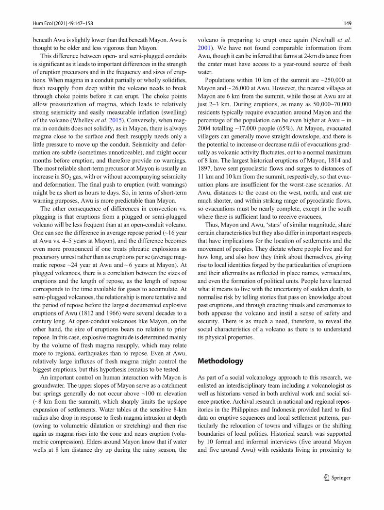
Oratio Imperata prayer inside a local shop around Mayon, Camalig, Albay. (Photo by the authors)
Such sentiments may not differ greatly today. The OratioImperata, the obligatory prayer for the deliverance from ca-lamities, is very evident in public venues around Mayon. Partof its third stanza reads:
Global warming is upon us, typhoons, floods, volcaniceruptionsand natural calamities occur in increasing number andintensity.
152 Hum Ecol (2021) 49:147–158
We turn to you, our loving Father, and beg forgivenessfor our sins.
Guilt, ritual, ceremony, and forgiveness are ways in whichthe volcano has been memorialised in popular imagination,conferring upon ‘Mayon’s people’ a badge of identity andan inclusiveness of community. It is also an astute methodthat local inhabitants have adopted to help normalise the riskthe volcano poses to their daily lives.
Gunung Awu5
The Sangihe archipelago, of which Sangihe Besar is the mainisland, borders waters of the Philippines south of Mindanaoand is part of the Indonesian province of Sulawesi Utara (northSulawesi). The Austronesian population of the island main-tained political and commercial ties with Mindanao and withTernate in Maluku in the past. Only in the late colonial timesdid the orientation of the political rulers get redirected toManado, the colonial administrative centre of the region(Lopez 2018: 134–152). The Sangirese take pride in tracingtheir royal lineages back to Maka-Ampo, the powerful andruthless king who is said to have once united the island.According to the Bekem Makaampo (‘story of MakaAmpo’) the king held a seat on top of Gunung Awu and hisgrandmother was princess Din, one of the spirits who lived inthe nearby volcano Ruang (Aebersold 1957). In the Sangihearchipelago, volcanoes are integrated into regional cosmologyand can also be understood as political or historic actors. Inpurely volcanological terms, Awu’s history differs consider-ably from Mayon, with its shallow peak and broad old crater,although its relatively recent history of human interactionbears remarkable similarities.
Patterns of Settlement
The history of settlement and relocation around Awu relatesdirectly to the local nature of political power. More than land,people formed the base of power in Sangihe, and an eruptionof Awu simultaneously posed a challenge as well as an op-portunity for political power. Like Mayon, Awu attracted hu-man settlement because of its fertile soils. Settlement occurrednear the coast along the rivers that ran down the mountain.Even prior to the sixteenth century, coconut gardens werecultivated for copra production, stimulated by contacts withthe Philippines, while Arab and Chinese traders also foundtheir way to the island. Livelihoods were centred mainly on
fishing and sago and coconut cultivation, leading to early de-forestation of the area around the volcano. Interaction withMuslim traders led some islanders to convert to Islam.Others converted to Catholicism with the arrival of theSpanish in the sixteenth century, and to Protestantism whenthe Dutch made Tabucan an outpost of its VOC (Dutch EastIndia Company) empire in the seventeenth century. However,ancestor worship remained a central element of local spirituallife (Henley 2005: 65–71; Lopez 2018: 14–18, 134–51).
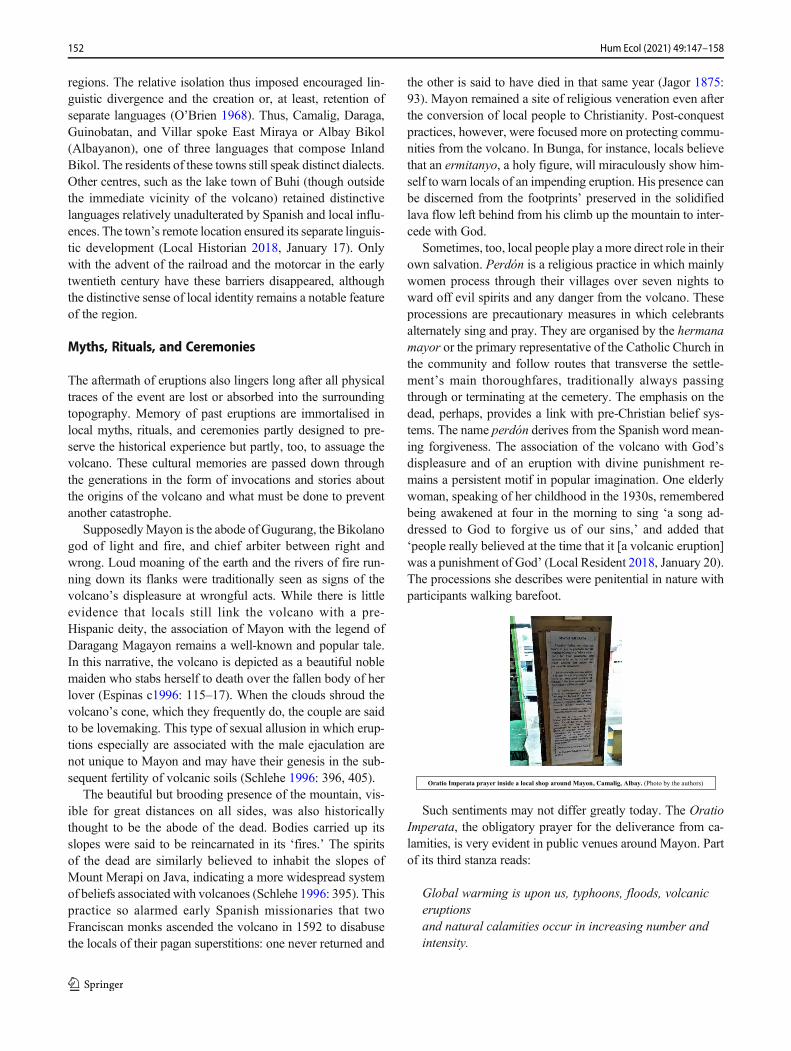
A view of Gunung Awu from Kolongan, January 2018. (Photo by the authors)
At the end of the seventeenth century, authority in thenorthern part of the island, essentially the area around Awu,was divided among three polities: Tabucan in the east,Kendahe in the north, and Tahuna in the west. Tabucan andKendahe also claimed authority over the southern polities ofSalurang and Ngalipaeng and exerted influence beyond theisland. Kendahe, for example, maintained connections inSarangani, Mindanao. South from Tahuna, further away fromthe volcano, were the polities of Manganitu and Tamako(Lopez 2018: 134–51). A seventeenth century visitor notedthat each village on the shore backed against a hill or mountainthat offered a refuge in case of violent attacks or calamities(Leupe 1867: 255–56).
The three polities around Awu and their subject villageswere mainly located along the coastal strip with gardens onthe volcano’s slopes. Upland areas were also used for livestock.By the late seventeenth century the Dutch considered theSangihe islands as in their sphere of influence, which theyreaffirmed through contracts with the rajas of the different pol-ities and by encouraging them to convert to Protestantism.Actual Dutch presence remained limited until the mid-nineteenth century, when the island was assigned acontroleur (government official). In the same period, anew and active generation of missionaries arrived and(steam) shipping in the region expanded. In comparison toMayon, full-blown colonialism came late to the island(Lopez 2018: 134–82). At present the administrative divi-sion of the island still follows the boundaries of these pol-ities, which suggests strong continuity in settlement loca-tion and land usage. Yet the frequent eruptions of GunungAwu not only caused death but also forced many islandersto move both around the island and away from it.
5 Fieldwork for the research on Awu was carried out with the aid of Dr. ArielLopez from the University of the Philippines Diliman, Nono StevanoAgustinus Sumampouw from Universitas Sam Ratulangi, Manado, andHendra Birahm from Naha.
153Hum Ecol (2021) 49:147–158
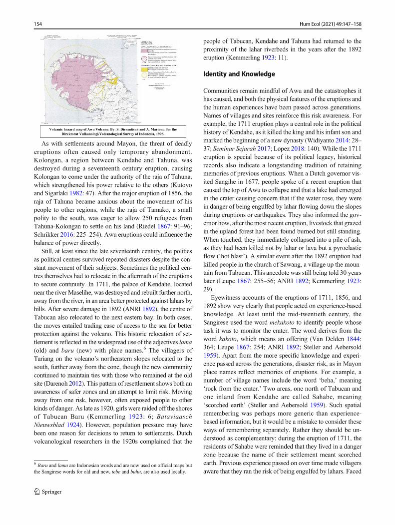
Volcanic hazard map of Awu Volcano. By: S. Dirasutisna and A. Martono, for the Direktorat Vulkanologi/Volcanological Survey of Indonesia, 1996.
As with settlements around Mayon, the threat of deadlyeruptions often caused only temporary abandonment.Kolongan, a region between Kendahe and Tahuna, wasdestroyed during a seventeenth century eruption, causingKolongan to come under the authority of the raja of Tahuna,which strengthened his power relative to the others (Kutoyoand Sigarlaki 1982: 47). After the major eruption of 1856, theraja of Tahuna became anxious about the movement of hispeople to other regions, while the raja of Tamako, a smallpolity to the south, was eager to allow 250 refugees fromTahuna-Kolongan to settle on his land (Riedel 1867: 91–96;Schrikker 2016: 225–254). Awu eruptions could influence thebalance of power directly.
Still, at least since the late seventeenth century, the politiesas political centres survived repeated disasters despite the con-stant movement of their subjects. Sometimes the political cen-tres themselves had to relocate in the aftermath of the eruptionsto secure continuity. In 1711, the palace of Kendahe, locatednear the river Maselihe, was destroyed and rebuilt further north,away from the river, in an area better protected against lahars byhills. After severe damage in 1892 (ANRI 1892), the centre ofTabucan also relocated to the next eastern bay. In both cases,the moves entailed trading ease of access to the sea for betterprotection against the volcano. This historic relocation of set-tlement is reflected in the widespread use of the adjectives lama(old) and baru (new) with place names.6 The villagers ofTariang on the volcano’s northeastern slopes relocated to thesouth, further away from the cone, though the new communitycontinued to maintain ties with those who remained at the oldsite (Darenoh 2012). This pattern of resettlement shows both anawareness of safer zones and an attempt to limit risk. Movingaway from one risk, however, often exposed people to otherkinds of danger. As late as 1920, girls were raided off the shoresof Tabucan Baru (Kemmerling 1923: 6; BataviaaschNieuwsblad 1924). However, population pressure may havebeen one reason for decisions to return to settlements. Dutchvolcanological researchers in the 1920s complained that the
people of Tabucan, Kendahe and Tahuna had returned to theproximity of the lahar riverbeds in the years after the 1892eruption (Kemmerling 1923: 11).
Identity and Knowledge
Communities remain mindful of Awu and the catastrophes ithas caused, and both the physical features of the eruptions andthe human experiences have been passed across generations.Names of villages and sites reinforce this risk awareness. Forexample, the 1711 eruption plays a central role in the politicalhistory of Kendahe, as it killed the king and his infant son andmarked the beginning of a new dynasty (Widiyanto 2014: 28–37; Seminar Sejarah 2017; Lopez 2018: 140). While the 1711eruption is special because of its political legacy, historicalrecords also indicate a longstanding tradition of retainingmemories of previous eruptions. When a Dutch governor vis-ited Sangihe in 1677, people spoke of a recent eruption thatcaused the top of Awu to collapse and that a lake had emergedin the crater causing concern that if the water rose, they werein danger of being engulfed by lahar flowing down the slopesduring eruptions or earthquakes. They also informed the gov-ernor how, after the most recent eruption, livestock that grazedin the upland forest had been found burned but still standing.When touched, they immediately collapsed into a pile of ash,as they had been killed not by lahar or lava but a pyroclasticflow (‘hot blast’). A similar event after the 1892 eruption hadkilled people in the church of Sawang, a village up the moun-tain from Tabucan. This anecdote was still being told 30 yearslater (Leupe 1867: 255–56; ANRI 1892; Kemmerling 1923:29).
Eyewitness accounts of the eruptions of 1711, 1856, and1892 show very clearly that people acted on experience-basedknowledge. At least until the mid-twentieth century, theSangirese used the word mekakoto to identify people whosetask it was to monitor the crater. The word derives from theword kakoto, which means an offering (Van Delden 1844:364; Leupe 1867: 254; ANRI 1892; Steller and Aebersold1959). Apart from the more specific knowledge and experi-ence passed across the generations, disaster risk, as in Mayonplace names reflect memories of eruptions. For example, anumber of village names include the word ‘beha,’ meaning‘rock from the crater.’ Two areas, one north of Tabucan andone inland from Kendahe are called Sahabe, meaning‘scorched earth’ (Steller and Aebersold 1959). Such spatialremembering was perhaps more generic than experience-based information, but it would be a mistake to consider theseways of remembering separately. Rather they should be un-derstood as complementary: during the eruption of 1711, theresidents of Sahabe were reminded that they lived in a dangerzone because the name of their settlement meant scorchedearth. Previous experience passed on over time made villagersaware that they ran the risk of being engulfed by lahars. Faced
6 Baru and lama are Indonesian words and are now used on official maps butthe Sangirese words for old and new, tebe and buhu, are also used locally.
154 Hum Ecol (2021) 49:147–158

with a similar situation in 1892, many of the inhabitants choseto flee (NA 1711: 183–193; ANRI 1892).
Myths, Rituals, and Ceremonies
Risk awareness is also expressed through myths, rituals, andceremonies. As noted earlier, the centrality of Gunung Awu inthe political and physical landscape of Sangihe is reflected inthe fact that it was held to be the seat of the legendary warrior-king, Maka-Ampo. The yearly Tulude festival in Kendaheincludes an offering of food to the volcano to prevent badluck.7 Oral traditions describe the dangers of the volcano, suchas the tale of the giant Bakeng. During a struggle in which twobrothers defended their sister against the giant and his wifewho planned to eat the little girl, Bakeng fell into a crater. Arecent version of the story tells how, after his fall, Bakeng’seyes were transformed into the lake. While he was falling, heshouted to the brothers that he would cause eruptions to chasethem away so long as they and their descendants remained onthe island. The brothers responded: ‘When you become thevolcano […] we will live on the eastern side to prevent this[destruction].’ This version of the story not only explains whyAwu erupts but also accounts for the persistence with whichthe people of Sangihe continue to live on the island and theirreadiness to move away during an eruption. Another versiontells how the three siblings were turned into different winddirections. Winds affect pyroclastic falls and serve to warnpeople to be aware of the direction from which it blows whenthe volcano erupts (Adriani 1894: 41–55).8
Another story told particularly in Kendahe is that of theKerajaan (palace) of Maselihe that, according to tradition,sank into the sea with all its treasures. People relate this storyto the eruption of 1711 in which, as noted, the king and his sonboth died. Widiyanto (2014: 28–37) describes how peopleexplain the disaster of 1711 in moral terms, and points partic-ularly to the lasciviousness of members of the royal house-hold. The eruption of 1711 is understood as a punishment fortheir immoral behaviour and endows the myth with explana-tory power. Moreover, this morality is embedded in local be-lief in the spirit ofMawu, and, at the same time, resonates withChristian and Muslim prohibitions against sexual license(Christian et al. 2020). Interestingly, much of what might beconsidered mythical in this story is recorded in a Dutch diaryby an eyewitness from Tabucan (NA 1711: 183–193).9 On theother hand, local informants in Kendahe tell how variousgroups of divers had tried unsuccessfully to find the remains
of Maselihe. Perhaps, in this instance, memory was conflat-ed: the old palace may have been destroyed by lahars in1711, but it was in 1856 that the area around Maselihewas badly hit and there was a major landslide where ‘cliffswere formed where there had once been a beach’ (ANRI1856). Religion and morality continue to play an importantrole in the way people in Indonesia make sense of disasterand this enhances their resilience in times of duress(Samuels 2019: 1–28). Protestant missionaries claimed thatthe eruptions of 1856 and 1892 were an important factor infacilitating mass conversion among the island’s population(Lopez 2018: 134–182).10
In 1923, the Dutch volcanological survey published a re-port on Awu. Its advice regarding disaster prevention wastwofold: that the lake, at that time 150 m deep, was risingquickly, and that, based on measured volcanic activity, a di-sastrous eruption could be expected in the future. In the viewof the survey team, strategies were needed to encourage peo-ple to migrate away from the volcano and settle in NorthSulawesi. They advised that the aftermath of an eruption pro-vided an opportunity to persuade people to migrate. By thetime the eruption came in 1966, when the water in the lakewas blown out of the crater, modern shipping enabled promptevacuation and prevented a major disaster. In an operation thatbore many similarities to the one proposed in 1923, over27,000 people were transported by the Indonesian govern-ment to Poso and Manado on Sulawesi, where many wereforced to remain. Still, the three original polities continue toexist as a basis of Indonesian administrative division, and thepresent day Kepala Kampong (headman) of Kendahe I, thevillage is split into two parts, traces his lineage back to thesecretary of the king of Kendahe (ANRI 1856).11
View of Awu crater from the southeast, January 2018. At present the crater contains little water and the lava dome at its centre can be clearly seen. (Photo by the authors)
7 Information provided by the inhabitants and village chief of Kendahe,January 2018.8 Two versions of the story of the giant Bankeng (Bio pa ansuang, areng-e IBake) are reproduced and translated. For the most recent recorded version seeMangamba et al. (1995: 217–219).9 Francois Valentijn also records a copy (1726).
10 Although Lopez does not attribute conversion to these disasters, the mis-sionaries themselves did make the link (Valeton 1897: 1–55).11 This detailed file includes letters from Kendahe written by one of his an-cestors during the period of disaster relief in 1856.
155Hum Ecol (2021) 49:147–158

Conclusion
We make a case for the importance of social volcanology bydrawing attention to the need to consider volcanoes using amixed methodological approach that combines historical re-search, social science practice, and natural science insights.We compare the volcanoes of Mayon and Awu. Mayon hasfrequent small eruptions and relatively subtle or short eruptionprecursors, so VEI 4 eruptions are generally unanticipated.Awu erupts less frequently but exhibits stronger precursorsand more VEI 4 eruptions. This might lead one to predictgreater casualties at Mayon but the opposite is the case.Clearly, there are other factors at work here. We advocate amore historically sensitive approach that acknowledges theadaptations that people have made to living with volcanos inaddition to one that merely seeks to calibrate the physicalthreat that they represent. The former constitutes what we callthe centripetal force that draws people in towards the volcaniccentre, and the latter constitutes the centrifugal forces thatdrive people away and that determines the level of risk.
Communities have historically settled around volcanoes,shifting location in response to disaster and/or creating newsatellite settlements in places deemed to be more secure. AtMayon, the volcano’s spatial geography created communitieswith distinctive cultural and linguistic identities that distin-guished them from their neighbours. On Sangihe Besar, thesettlement configuration around the volcano was centred onseparate political identities, and where the manner and fre-quency of eruptions ensured a power balance between threepolities. In both cases, adapting to the daily dictates imposedby the volcano became integrated into community culture andformed part of local identity. Risk awareness, too, is embed-ded in communities aroundMayon and Awu in different waysbut to similar ends. Past experiences are memorialised andcommunicated across generations with a remarkable senseof detail that both advertise geophysical threats and advocaterisk avoidance behaviour. Place names serve as timely re-minders of historical eruptions, while myths embody thecommunity’s past experiences (Vitaliano 1973). Names andmyths not only remind people of the potential dangers theyface but also help them make better sense of what life entailsliving within the ‘charmed circle’ of the volcano.
Often these forms of community adaptations are groupedtogether indiscriminately as instances of what is variouslytermed local, traditional, or indigenous knowledge. Stress isplaced on integrating local views with scientific and expertknowledge both as a means of enlisting community participa-tion through the coproduction of policies, and as a means ofmaking disaster risk reduction more effective (Mercer et al.2010; Gaillard and J. Mercer 2012). Indeed, indigenousknowledge has now been accorded ‘official’ status and beenincorporated into policy and practice. In the four Priorities forAction agreed upon in the 2015 Sendai Framework for
Disaster Risk Reduction (DRR), the role of local communitiesin DRR is recognised alongside that of the state, and the im-portance of indigenous knowledge accepted in addition toscientific expertise (UNISRD 2015). An increasing numberof case studies attest to the efficacy of such practices(Agrawal 1995; Sillitoe 1998; Berkes et al. 2000; Merceret al. 2009; Lanzano 2013; Cronin et al. 2004). However,we argue that it is not just local knowledge that merits atten-tion but also local history, which is the key to unlocking cul-tural memory in communities.
Only through exploring local history can the centripetaland centrifugal forces that a volcano generates be better un-derstood and the cultural practices it fosters be taken fully intoaccount in disaster risk mitigation planning and management.While the Albay Public Safety and Emergency ManagementOffice (APSEMO) in the Philippines is considered a nationalleader in emergency planning, capacity building, and commu-nity mobilisation, and has a remarkable record in reducinglosses in lives and property, it shows little awareness of localcultural considerations, at least, in its advocated practices(Gaerlan 2008). Nor does the history of Mayon feature inthe local official school curriculum, although a few teacherstake it upon themselves to organise class visits to thePHIVOLCS observatory located at the northeast slope of thevolcano.12 On Sangihe island, the government’s societal di-saster risk reduction programme is largely confined tosignposting evacuation routes around the volcano and thecoast. The signposts are very visible reminders for the inhab-itants of the risks they live with, yet some are critical of thelanguage they use. For example, they express a preference forthe local word for tsunami, luak dalulung. The use of Englishon signposts is at odds with local culture since it is not acommon language for the islanders. At the time of our re-search, no use was made of local historical knowledge in riskawareness programmes in schools.
Evacuation signs near Tariang Lama. (Photo by the authors)
Social groups hold a consistent form of prioritising andexplaining the misfortunes that assail them (Douglas andWildavsky 1982). This collective experience is embedded incommunity traditions and customs that collectively constituteits local history and can take many forms, some passive (placenames, legends, and memories), and others active (orallytransmitted experiences, rituals, and processions). Together
12 Private communication, resident of Santo Domingo, Albay, 13 January2021.
156 Hum Ecol (2021) 49:147–158

they dictate how a community reacts in times of danger. Abetter understanding of how history is embedded in local cul-ture, why people dowhat they do and not just what they know,we hold, can facilitate dialogue across the social domains ofknowledge that often separate those most exposed to risk fromthe physical scientists and civil defence personnel chargedwith reducing that exposure (Hilhorst 2004). The evacuationsignposts on Sangihe Besar that point to safety in oppositedirections remind us that there is more than one route to im-proving disaster risk reduction around volcanoes.
Authors’ Contribution All authors contributed to the study conceptionand design. Material preparation, data collection and analysis were per-formed by Greg Bankoff, Chris Newhall and Alicia Schrikker. The firstdraft of each section of the manuscript was written by individual authorsand all authors commented on previous versions of the manuscript. Allauthors read and approved the final manuscript.
Funding Funding for this research was provided by an AustralianResearch Council Linkage Grant No. LP150100649.
Declarations
Conflict of Interest The authors declare they have no conflict of interest.
Research Involving Human Participants and/or Animals All data werecollected in compliance with ethical standards.
Informed Consent All interviews conducted with informed consent.
References
Aebersold W.E. (1957). “Bekem Makaampo / Het verhaal vanMakaampo.” BKI, 113, 2: 122-167.
Adriani, Nicolaus. 1894. Sangireesche Teksten. Met Vertaling EnAantekeningen. Den Haag: Nijhoff.
Agrawal, Arun. 1995. “Dismantling the Divide between Indigenous andScientific Knowledge.” Development and Change 26: 413-39.
ANRI. (1892). Reports and Correspondence on the Eruption of GunungAwu 1892. Arsip Nasional Republik Indonesia AlgemeneSecretarie, Grote Bundel Besluit 1891-1942. Inv nr. 107.
ANRI. (1856). Stukken Omtrent de Uitbarsting van de Vuurberg op deSangie Eilanden, 1856. Arsip Nasional Republik IndonesiaManado,126/2.
AOM. (1814). La Erupción del Mayón en 1814 y el Traslado de AlgunosPueblos de la Iraya. Archives of the Manila ObservatoryBox 13, file2/4.
Aragoneses, Francisco. 1815. Suceso Espantoso Acaecido en la Erupciondel Volcan de Albay en la Isla de Luzon, una de las LlamadasFilipinas. Madrid: Imprenta de Nuñez.
Bankoff, Greg. 2020. “Under the Volcano: Mount Mayon and Co-Volcanic Societies in the Philippines.” Environment and History26 (1): 7-29.
Berkes, Fikret, Johan Colding, and Carl Folke. 2000. “Rediscovery ofTraditional Ecological Knowledge As Adaptive Management.”Traditional Ecological Knowledge 10: 1251-62
Bouvet de la Maisonneuve, Caroline, Lauriane Chardot, Fidel Costa,Susanna Jenkins, and Benoit Taisne. (2018). Eruption at Mayon
Volcano, Luzon Island, Philippines. Earth Observatory ofSingapore News website, 19 January. Accessed January 27, 2021.https://earthobservatory.sg/news/eruption-mayon-volcano-luzon-island-philippines.
Christian, Yoppie, Desmiwati, and Ario Damar. 2020. “The BlessedLand: Internalisation of past Disaster into Culture by Sangihe’sCoastal Community.” International Journal Disaster Management3 (1): 12-28.
Coronas, José. (1898). The Eruption ofMayonVolcano June 25, 26, Year1897. Manila. Manuscript held by the Philippine Institute ofVolcanology and Seismology Library, MO90.
Cronin, Shane J., David R. Gaylord, Douglas Charley, Brent V. Alloway,Sandrine Wallez, and JobW. Esau. 2004. “Participatory Methods ofIncorporating Scientific with Traditional Knowledge for VolcanicHazard Management on Ambae Island, Vanuatu.” Bulletin ofVolcanology 66: 652-68.:
Darenoh, Naroh. (2012). Tariang lombotari buhu/Sejarah KamungTariangbaru. Typescript, kept at Government Office Tariang Baru
van Delden, Arnoldus Johannes. (1844). De Sangir-eilanden in 1825.Indisch Magazijn 1 (4-6) 356-83 and 1 (7-9): 1-32
Donovan, Katherine. 2010. “Doing Social Volcanology: ExploringVolcanic Culture in Indonesia.” Area 42 (1): 117-26.
Doocy, Shannon, Amy Daniels, Shayna Dooling, and Yuri Gorokhovich.2013. The Human Impact of Volcanoes: A Historical Review ofEvents 1900-2009 and Systematic Literature Review. PLoSCurrents 5 (16 April). https://doi.org/10.1371/currents.dis.841859091a706efebf8a30f4ed7a1901:
Douglas, Mary and Aaron Wildavsky. 1982. Risk and Culture: An Essayon the Selection of Technological and Environmental Dangers.Berkeley: University of California Press.
Espinas, Merito B. c1996. Ibalong: The Bikol Folk Epic-Fragment:English and Bikol Translation, Views and Comments. Naga:University of Sto. Tomas Publishing House.
Gaerlan, Kristina. 2008. Building Resilient Communities: Good Practicesin Disaster Risk Management in the Philippines. Quezon City:Oxfam.
Gaillard, Jean-Christophe and Jessica Mercer. 2012. “From Knowledgeto Action: Bridging Gaps in Disaster Risk Reduction.” Progress inHuman Geography 37: 93-114.
Henley, David. 2005. Fertility, Food and Fever: Population, Economyand Environment in North and Central Sulawesi, 1600-1930.Leiden: KITLV press.
Hilhorst, Dorothea. 2004. “Complexity and Diversity: Unlocking SocialDomains of Disaster Response”. In Mapping Vulnerability:Disasters, Development and People, edited by Greg Bankoff,Georg Frerks and Dorothea Hilhorst, 52-66. London and Sterling:Earthscan.
Hoffman, Susanna M. and Antony Oliver-Smith. 1999. Anthropologyand the Angry Earth: An Overview. In The Angry Earth: Disasterin Anthropological Perspectives, edited by Anthony Oliver-Smithand Susanna Hoffman, 1-16. New York and London: Routledge.
Jagor, Feodor. 1875. Travels in the Philippines. London: Chapman andHall,
Kemmerling, Georg. L. 1923.De Vulkanen van de Sangi Archipel en vande Minahassa – Vulkan. Weltevreden: Landsdrukkerij.
Kutoyo, Sutrisno and Sigarlaki, A. 1982. Sejarah daerah Sulawesi Utara,Jakarta: Departemen Pendidikan dan Kebudayaan.
Lanzano, Cristiano. 2013. “What Kind of Knowledge Is ‘IndigenousKnowledge’? Critical Insights from a Case Study in BurkinaFaso.” Transcience 4 (2): 3-18.
Leupe, Pieter Arend. 1867. “Het journaal van Padtbrugge’s reis naarNoord Celebes en de Noordereilanden (16 aug-23 dec 1677).”BKI, 14: 105-340.
Lopez, Ariel. 2018. Conversion and colonialism. Islam and Christianityin North Sulawesi, c 1700 -1900. Unpublished Phd thesis, LeidenUniversity.
157Hum Ecol (2021) 49:147–158

Local Historian. 2018. January 17. Interview, Camalig, Albay province,Philippines.
Local Resident. 2018. January 20. Interview, Santo Domingo Albayprovince, Philippines.
Mabbett, Ian W. 1983. “The Symbolism of Mount Meru.” History ofReligions 23 (1): 64-83.
Mallari, Francisco. 1986. “The Tragic Town in the Bicol Peninsula andthe Failed Attempt to Transfer the Townsite before the Catastropheof 1814.” Kinaadman 8: 19-34.
Mangamba, Nelman, Pasaribu Christina andMaryott, Kenneth R. (1995).The origins of Awu volcano. Manga wĕkeng asaḷ u tau Sangihẹ:Cerita-cerita asal orang Sangir (Stories of the origins of the Sangirpeople).”Davao (Philippines): The Committee for the Promotion ofthe Sangir Language.
Mercer, Jessica, Ilan Kelman, Sandie Suchet-Pearson, and Kate Lloyd.2009. “Integrating Indigenous and Scientific Knowledge Bases forDisaster Risk Reduction in Papua New Guinea.” GeografiskaAnnaler: Series B, Human Geography 91: 245-56.
Mercer, Jessica, Ilan Kelman, Lorin Taranis, and Sandie Suchet-Pearson.2010. “Framework for Integrating Indigenous and ScientificKnowledge for Disaster Risk Reduction.” Disasters 34: 214-239.
NA. 1711. Extract Van HET Dagregister Gehouden Door den ResidentAAN de Negorij Taboucan Sedert 10 tot 17 December 1711 en daaruijt Veroorsaakte Rampen. National Archives (The Hague) 1.04.02(VOC), 8081.
Neall, Vince E. 2009. Volcanic Soils. In Land Use, Land Cover and SoilSciences: Encyclopedia of Life Support Systems, edited by Willy H.Verheye, 23-45. Oxford: EOLSS Publishers Co Ltd.
Newhall, Christopher G. 1979. “Temporal Variation in the Lavas ofMayon Volcano, Philippines.” Journal of Volcanology andGeothermal Research 6 (1-2): 61-83.
Newhall, Christopher G. and Raymundo S. Punongbayan, eds. 1996.Fireand Mud: Eruptions and Lahars of Mount Pinatubo, Philippines.Seattle: University of Washington Press.
Newhall, Christopher G., Sarah E. Albano, Norio Matsumoto, andTeodorico Sandoval. 2001. “Roles of Groundwater in VolcanicUnrest.” Journal of the Geological Society of the Philippines 56(3&4): 69-84.
O'Brien, James J. 1968. Historical and Cultural Heritage of the BicolPeople. Naga City: Ateneo de Naga.
PVMBG (Pusat Vulkanologi dan Mitigasi Bencana Geologi). 2011. DataDasar Gunung Api Indonesia. Vol 2. Kementerian Energi danSumber Daya Mineral. Second edition.
Redford, Robert. 1956. Peasant Society and Culture: An AnthropologicalApproach to Civilisation. Chicago: University of Chicago Press.
Riedel, Joh. Gerard Fried. 1867. De uitbarsting van de Awoeh-Taruna in1856. Tijdschrift voor Indische Taal Land en Volkenkunde, 11: 91-96.
Samuels, Annemarie. 2019. After the Tsunami. Disaster Narratives andthe Remaking of Everyday Life in Aceh. Honolulu: University ofHawaii Press.
Seminar Sejarah: Kendahe i’kekendage (2017) (A report of a seminar onthe history of Kendahe). Printed copy was obtained at the govern-ment office in Kendahe.
Schlehe, Judith. 1996. “Reinterpretations of Mystical Traditions:Explanations of a Volcanic Eruption in Java.” Anthropos 91: 391–409.
Schrikker, Alicia. (2016). Disaster management and colonialism in theIndonesian archipelago, 1840-1920. Bankoff, Greg andChristensen,Joseph (EDS). Natural Hazards and Peoples in the Indian OceanWorld. Bordering on danger. New York: Palgrave Macmillan. 225-254
Shinoara, Hiroshi, Keiichi Fukui, Kohei Kazahaya, and Genji Saito.2003. “Degassing Process of Miyakejima Volcano: Implications ofGas Emission Rate and Melt Inclusion Data.” Developments inVolcanology 5: 147-61.
Small, Christopher and Terry Naumann. 2001. “Holocene Volcanism andthe Global Distribution of Human Population.” EnvironmentalHazards 3 (3/4): 93-109.
Sillitoe, Paul. 1998. “TheDevelopment of Indigenous Knowledge: a NewApplied Anthropology.” Current Anthropology 39: 223-52.
Steller K.G.F. and. Aebersold W.E 1959. Sangirees-Nederlandswoordenboek. The Hague: Nijhoff.
Surono, Philippe Jousset, John Pallister, MarieBoichud, M. FabriziaBuongiorno, Agus Budisantoso, Fidel Costa, SupriyatiAndreastuti, Fred Prata, David Schneider, Lieven Clarisse, HanikHumaida, Sri Sumarti, Christian Bignami, Julie Griswold, SimonCarn Clive Oppenheimer, and Franck Lavigneo. 2012. “The 2010Explosive Eruption of Java’s Merapi Volcano - A ‘100 Year’Event.” Journal of Volcanology and Geothermal Research 241–242 (1): 121-35.
Tambiah, Stanley J. 2013. The Galactic Polity in Southeast Asia. Journalof Ethnographic Theory 3 (3): 503-534. First published 1973.
UNISDR (United Nations International Strategy for Disaster Reduction).2015. Sendai Framework for Disaster Risk Reduction 2015-2030.Accessed January 28, 2021. http://www.wcdrr.org/uploads/Sendai_Framework_for_Disaster_Risk_Reduction_2015-2030.pdf.
Valentijn, François. 1726 Oud en Nieuw Oost-Indien […]. Dordrecht/Amsterdam: Joannes van Braam.
Valeton, Josué Jean Philippe 1897. “Ernst Traugott Steller.” Lichtsralenop den akker der wereld 3
Vitaliano, Dorothy B. 1973 Legends of the Earth: Their GeologicalOrigins. Bloomington: Indiana University Press.
Warren, James F. 1981. The Sulu Zone, 1768-1898: The Dynamics ofExternal Trade, Slavery, and Ethnicity in the Transformation of aSoutheast Asian Maritime State. Singapore: Singapore UniversityPress.
Whelley, Patrick L., Christopher G. Newhall, and Kyle E. Bradley. 2015.“The Frequency of Explosive Volcanic Eruptions in SoutheastAsia.” Bulletin of Volcanology 77 (1): 1-11.
Widiyanto, Nur. 2014. “The challenges of myth-based coexistence be-tween Christians and Muslims in Kendahe, Sangihe island, NorthSulawesi province.” Jurnal Etnohistori, 1: 28-37.
Zeeroof bij de Sangi-eilanden. Bataviaasch Nieuwblad, 4 September1924.
Publisher’s Note Springer Nature remains neutral with regard to jurisdic-tional claims in published maps and institutional affiliations.
158 Hum Ecol (2021) 49:147–158
Copyright © 2022 FDOKUMEN