Mitigated Negative Declaration For the Sacramento City ...
294
Los Rios Community College District – Lillard Hall Replacement and Modernization Project 1 Final Initial Study/ Mitigated Negative Declaration For the Sacramento City College – Lillard Hall Replacement and Modernization Project State Clearinghouse No. 2019012030
-
Upload
khangminh22 -
Category
Documents
-
view
4 -
download
0
Transcript of Mitigated Negative Declaration For the Sacramento City ...
Los Rios Community College District – Lillard Hall Replacement and Modernization Project
1
Final
Initial Study/ Mitigated Negative Declaration
For the
Sacramento City College – Lillard Hall
Replacement and Modernization Project
State Clearinghouse No. 2019012030

Los Rios Community College District – Lillard Hall Replacement and Modernization Project
2
March 2019

Los Rios Community College District – Lillard Hall Replacement and Modernization Project
3
FINAL
INITIAL STUDY/ PROPOSED MITIGATED NEGATIVE DECLARATION
FOR THE
Sacramento City College – Lillard Hall Replacement and Modernization Project
Prepared by Los Rios Community College District
3753 Bradview Sacramento, CA 95825
March 2019
Los Rios Community College District – Lillard Hall Replacement and Modernization Project
4
NOTICE OF DETERMINATION TO ADOPT A MITIGATED NEGATIVE DECLARATION FOR THE
LOS RIOS COMMUNITY COLLEGE DISTRICT SACRAMENTO CITY COLLEGE – LILLARD HALL REPLACEMENT AND MODERNIZATION
PROJECT
The Los Rios Community College District (District) has prepared an Initial Study pursuant to California Environmental Quality Act (CEQA) and the CEQA Guidelines (Public Resources Code, Division 13 and California Code of Regulations, Title 14, Chapter 3) evaluating the potential environmental impacts of the Sacramento City College – Lillard Hall Replacement and Modernization Project. The District proposes to adopt a Mitigated Negative Declaration ("MND") because the Project construction and operation would not have a significant effect on the environment. This MND and the Initial Study describe the reasons that this project will not have a significant effect on the environment and, therefore, does not require the preparation of an environmental impact report under CEQA. FILE NUMBER: 2018-03 MND PROJECT TITLE: SACRAMENTO CITY COLLEGE – LILLARD HALL REPLACEMENT AND MODERNIZATION PROJECT PROJECT LOCATION: The Project is located at the Sacramento City College (SCC) Campus, in Sacramento City, Sacramento County, located at the intersection of Freeport Boulevard and Sutterville Road, approximately 0.5 mile west of Highway 99 and 1 mile east of Interstate 5. The Sacramento City College is located in a primarily suburban area within the City of Sacramento. The Sacramento City College address is 3835 Freeport Boulevard, Sacramento, California, and consists of 47.45 acres of land (APN: 013-0010-014). The City of Sacramento General Plan designates the Campus as “Public/Quasi Public”. A regional and project location map are included as Figures 1 and 2, respectively. PROJECT DESCRIPTION: The Los Rios Community School District is proposing to demolish and replace the existing Lillard Hall building located on the Sacramento City College campus. Proposed development will include demolition and replacement of Lillard Hall which is located in the southwest portion of the Sacramento City College parcel. The Lillard Hall replacement schematic designs are still under consideration, however, it is anticipated the new proposed Lillard Hall will be approximately 31,709 assignable square feet (ASF), and will replace the older, approximately 28,863 ASF Lillard Hall. Additional architectural considerations and potential changes to the surrounding vicinity will also include potential future Overhead Parking Solar Structures which would be located in one of the existing parking lots (parking Lot G or parking lot F) near Lillard Hall. The proposed project is not intended to facilitate growth; therefore, no new parking is planned. There is currently a Mohr Hall replacement project underway at the site, determined exempt under CEQA; a Notice of Exemption was filed for the Mohr Hall project on November 7, 2016 with the categorically exempt status Class 14. 15314 – Minor Addition to Schools and categorically exempt status Class 2. 15302 – Replacement or Reconstruction. The Mohr Hall project consists of a building replacement with no additional usable assignable square footage (ASF) and no increase in planned occupant load. The Mohr Hall will be discussed as part of this proposed project due to the proximal nature (the proposed Lillard Hall will be located within

Los Rios Community College District – Lillard Hall Replacement and Modernization Project
5
the footprint of the demolished Mohr Hall, and adjacent east of the new Mohr Hall) and potential cumulative impacts with the Proposed Lillard Hall and potential Overhead Solar Parking Project.

Los Rios Community College District – Lillard Hall Replacement and Modernization Project
6
PUBLIC REVIEW PERIOD: As mandated by State law, the minimum public review period for this document is 30 days. The proposed Mitigated Negative Declaration was circulated for a 30-day public review period, beginning on Tuesday, January 15, 2019 and ending on Friday, February 15, 2019. Copies of the Draft Negative Declaration were available for review at the following locations:
Los Rios Community College District 3753 Bradview Drive Sacramento, CA 95827
Any person wishing to comment on the Initial Study and proposed Negative Declaration must have submitted such comments in writing no later than 5:00 pm on Friday, February 15, 2019 to the Los Rios Community College District at the following address:
Daniel E. Kramer Petralogix Engineering, Inc. 26675 Bruella Road Galt, CA 95632
Facsimiles at (209) 604-3719 were also accepted up to the comment deadline. A public hearing to receive comments was held at Los Rios Community College District. This meeting occurred Thursday, February 14, 2019 at 10:00 a.m. at 3753 Bradview Drive, Sacramento.
_____________________________________________ ____________________________ Dan McKechnie, Director of Facilities Planning Date
Los Rios Community College District – Lillard Hall Replacement and Modernization Project
7
TABLE OF CONTENTS
1. Project Title ....................................................................................................... 8 2. Lead Agency Name and Address...................................................................... 8 3. Contact Persons ............................................................................................... 8 4. Project Location ................................................................................................ 8 5. Project Sponsor's Name and Address ............................................................... 8 6. Project Description ............................................................................................ 8 7. Surrounding Land Uses and Setting ................................................................. 9 8. Necessary Public Agency Approvals ................................................................. 9 9. Project Construction........................................................................................ 10 10. Environmental Factors Potentially Affected ..................................................... 15 11. Environmental Determination .......................................................................... 15 12. Environmental Checklist ................................................................................. 16
I. Aesthetics ......................................................................................................................... 16 II. Agricultural Resources .................................................................................................. 17 III. Air Quality ......................................................................................................................... 18 IV. Greenhouse Gas Emissions ......................................................................................... 24 V. Biological Resources ..................................................................................................... 27 VI. Cultural Resources ......................................................................................................... 30 VII. Hazards and Hazardous Materials .............................................................................. 39 VIII. Hydrology and Water Quality ....................................................................................... 44 IX. Land Use and Planning.................................................................................................. 47 X. Noise ................................................................................................................................... 49 XI. Population and Housing ................................................................................................ 52 XII. Recreation ......................................................................................................................... 54 XIII. Transportation/Traffic .................................................................................................... 55 XIV. Utilities and Service Systems ...................................................................................... 57 XV. Mandatory Findings of Significance .......................................................................... 59
13. Summary of mitigation measures .................................................................... 60 14. Documents referenced .................................................................................... 65 15. Report Preparation ......................................................................................... 67
LIST OF EXIBITS
Figure 1: Regional Map ....................................................................................................... 11
Figure 2: Campus Map ........................................................................................................ 12
Figure 3: Future Building proposed Lillard Hall Location ..................................................... 13
Figure 4: Project Extent Map including proposed Overhead Solar Parking Structures......... 14
Figure 5: Sacramento City College - Historic District ........................................................... 33 APPENDIX A – Mohr Hall Notice of Exemption APPENDIX B – CalEEMod Air Emissions Analysis APPENDIX C – HGA Schematic Design Champions Meeting #1 APPENDIX D – Biological Resources Letter APPENDIX E – Geotechnical Engineering Report APPENDIX F – Notice of Completion & Comment Letters APPENDIX G – Response to Comments APPENDIX H – Mitigation Monitoring and Reporting Program
Los Rios Community College District – Lillard Hall Replacement and Modernization Project
8
1. PROJECT TITLE
Sacramento City College – Lillard Hall – Replacement and Modernization Project 2. LEAD AGENCY NAME AND ADDRESS
Los Rios Community College District 3753 Bradview Drive Sacramento, CA 95827
3. CONTACT PERSONS
M.-Reza Mirmiran: 916-856-3428
4. PROJECT LOCATION
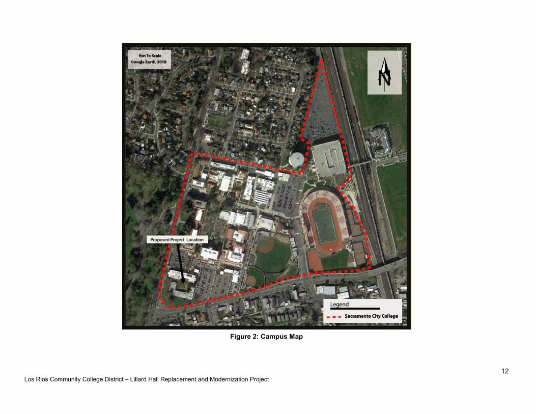
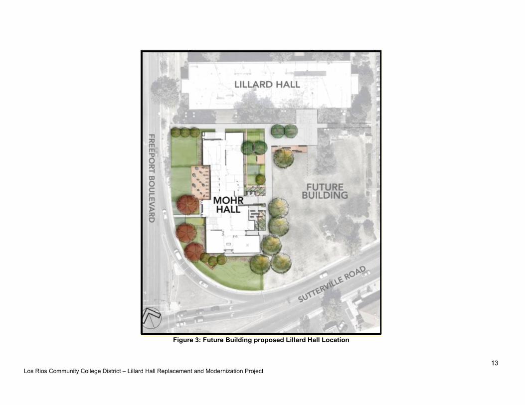
The Project is located at the Sacramento City College (SCC) Campus, in Sacramento City, Sacramento County, located at the intersection of Freeport Boulevard and Sutterville Road, approximately 0.5 mile west of Highway 99 and 1 mile east of Interstate 5. The Sacramento City College is located in a primarily suburban area within the City of Sacramento. The Sacramento City College address is 3835 Freeport Boulevard, Sacramento, California, and consists of 47.45 acres of land (APN: 013-0010-014). The City of Sacramento General Plan designates the Campus as “Public/Quasi Public”. Regional, Campus and Future Building Lillard Hall Project location maps are included as Figures 1, 2 and 3, respectively.
5. PROJECT SPONSOR'S NAME AND ADDRESS
Los Rios Community College District 3753 Bradview Drive Sacramento, CA 95827
6. PROJECT DESCRIPTION
The Los Rios Community School District is proposing to demolish and replace the existing Lillard Hall building located on the Sacramento City College campus. Proposed development will include demolition and replacement of Lillard Hall which is located in the southwest portion of the Sacramento City College parcel. The Lillard Hall replacement schematic designs are still under consideration, however, it is anticipated the new proposed Lillard Hall will be approximately 31,709 assignable square feet (ASF), and will replace the older, approximately 28,863 square foot Lillard Hall. Additional architectural considerations and potential changes to the surrounding vicinity will also include potential future Overhead Parking Solar Structures which would be located in one of the existing parking lots (parking Lot G or parking lot F) near Lillard Hall. The proposed project is not intended to facilitate growth; therefore, no new parking is planned. There is currently a Mohr Hall replacement project underway at the site, determined exempt under CEQA; a Notice of Exemption was filed for the Mohr Hall project on November 7, 2016 with the categorically exempt status Class 14. 15314 – Minor Addition to Schools and categorically exempt status Class 2. 15302 – Replacement or Reconstruction. The Mohr Hall project consists of a building replacement with no additional usable assignable square
Los Rios Community College District – Lillard Hall Replacement and Modernization Project
9
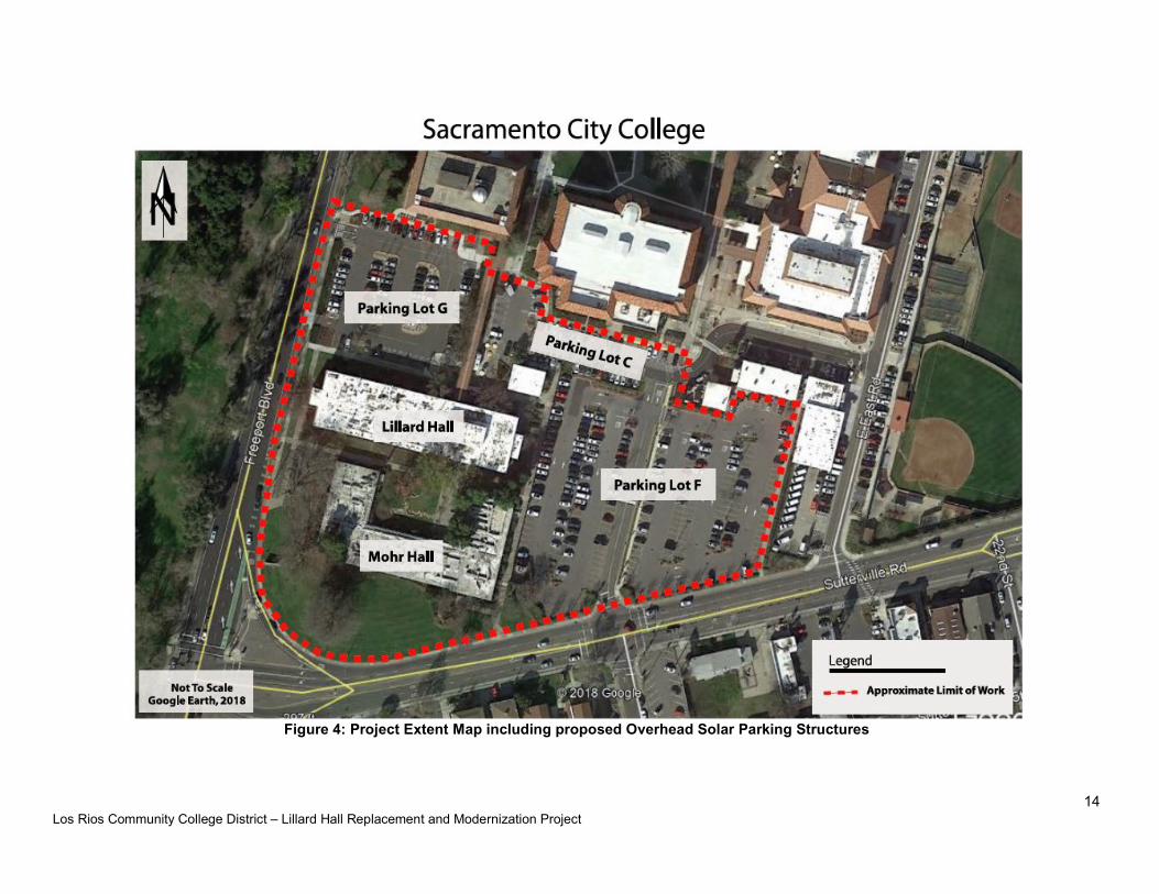
footage (ASF) and no increase in planned occupant load. The Mohr Hall will be discussed as part of this proposed project due to the proximal nature (the proposed Lillard Hall will be located within the footprint of the demolished Mohr Hall, and adjacent east of the new Mohr Hall) and potential cumulative impacts with the Proposed Lillard Hall and potential Overhead Solar Parking Project. The Project Extent map, including the proposed Overhead Parking Solar Structures, are included in Figure 4.
7. SURROUNDING LAND USES AND SETTING
The proposed Project is located in the City of Sacramento, with land use designated as public/quasi-public. To the west of the Project is Land Golf Course and William Land Park. To the east is Panther Parkway, followed by the Hughs Stadium and railway tracks. North of the Project is 12th Avenue followed by residential neighborhoods. South of the site is Sutterville Road followed by commercial businesses and residential homes. The surrounding area is designated primarily as Traditional Neighborhood (Low and Medium Density), Centers (Urban Center Low), Corridors (Urban Corridor Low) and Parks and Recreation within the Sacramento County General Plan (2035).
8. NECESSARY PUBLIC AGENCY APPROVALS
It is anticipated that the following “typical” permits and compliance may be needed for this Project:
Los Rios Community College District: Lead agency with responsibility for approving the proposed replacement and modernization of the Lillard Hall building. Preparation of a Stormwater Pollution Prevention Plan (SWPPP) to City of Sacramento standards. Pollutant Discharge Elimination Permit (Stormwater/Erosion Control) issued by the City of Sacramento.
United States Fish and Wildlife Service – Compliance with the Federal Endangered Species Act: Construction activities would not directly or indirectly adversely affect a federally listed species or its habitat (see Biological Resources section of this document for additional information). Therefore, the proposed project would not be required to obtain Section 7 clearance from the U.S. Fish and Wildlife Service prior to SRF loan commitment.
State Historic Preservation Office – Compliance with the National Historic Preservation Act: There are no prehistoric or historic archaeological resources, historic properties, or resources of value to local cultural groups within the project area. Therefore, the proposed project would not be required to demonstrate to the satisfaction of the State Historic Preservation Office that the project complies with Section 106 of the National Historic Preservation Act (see Cultural Resources section of this document for additional information).
Native American Heritage Commission: Compliance with Assembly Bill 52 (AB 52). Lead agencies consult with Native American tribes who have previously contacted the Lead Agency early in the CEQA planning process. Assembly Bill applies to the project, but no tribes have requested notification at this time.
Sacramento Metropolitan Air Quality Management District (Sac Metro): Air Quality Application for Authority to Construct and/or Permit to Operate.
City of Sacramento: Preparation of a SWPPP to County of Sacramento (and City of Sacramento) standards. Pollutant Discharge Elimination Permit issued by the County of Sacramento (and City of Sacramento).

Los Rios Community College District – Lillard Hall Replacement and Modernization Project
10
9. PROJECT CONSTRUCTION
Lillard Hall project construction is expected to begin by January 2018 and continue for a duration of approximately two years. Completion of the proposed project is expected summer 2022. The proposed Lillard Hall is planned as a three-story structure, with total gross square feet (GSF) planned for 54,786 GSF. There is currently no draft design plan, therefore details regarding the construction are not available. The proposed Lillard Hall will be located within the eastern portion footprint of the old Mohr Hall. Based upon site topography, which is relatively flat, grading and some cut and fill on the order of approximately two feet are anticipated to provide a level building pad with conventional shallow foundations such as continuous footings (Youngdahl, 2016). The soil generated from excavations on the site, excluding deleterious material, is suitable and may be used as engineered fill (Youngdahl, 2016. Roadways will be swept clean as needed. Water will be applied to any potential dust-generating materials during construction. The Project has been designed to eliminate environmental impacts by requiring the following measures:
Project design to meet City of Sacramento and applicable Sacramento County design standards.
Air Quality Mitigation and Permitting through Sac Metro. Preparation of a Stormwater Pollution Prevention Plan (SWPPP) to County of
Sacramento and City of Sacramento standards. Pollutant Discharge Elimination Permit (Stormwater/Erosion Control) issued by the
County of Sacramento and City of Sacramento. Collaboration with SMUD to address the 21kV overhead facilities and 21kV and 4kV
underground facilities that surround the Sacramento City College property as needed.
A Stormwater Pollution Prevention Plan (SWPPP) and an Erosion and Sediment Control Plan will be prepared and implemented to avoid and minimize impacts on water quality during construction and operations. Best management practices (BMPs) for erosion control will be implemented to avoid and minimize impacts on the environment during construction.

Los Rios Community College District – Lillard Hall Replacement and Modernization Project
11
Figure 1: Regional Map
Los Rios Community College District – Lillard Hall Replacement and Modernization Project
12
Figure 2: Campus Map
Los Rios Community College District – Lillard Hall Replacement and Modernization Project
13
Figure 3: Future Building proposed Lillard Hall Location
Los Rios Community College District – Lillard Hall Replacement and Modernization Project
14
Figure 4: Project Extent Map including proposed Overhead Solar Parking Structures
Los Rios Community College District – Lillard Hall Replacement and Modernization Project
15
10. ENVIRONMENTAL FACTORS POTENTIALLY AFFECTED
The environmental factors checked below would be potentially affected by this project as indicated by the checklist on the following pages.
Environmental Factors Potentially Affected
Aesthetics Agriculture Resources Air Quality
Greenhouse Gas Emissions Biological Resources Cultural Resources
Geology/Soils Hazards & Hazardous
Materials
Hydrology/Water
Quality
Land Use/Planning Mineral Resources Noise
Population/Housing Public Services Recreation
Transportation/Traffic Utilities/Services Systems
None With Mitigation Mandatory Findings of Significance
11. ENVIRONMENTAL DETERMINATION
I find that the proposed project could not have a significant effect on the environment, and a Negative
Declaration will be prepared.
I find that although the proposed project could have a significant effect on the environment, there will not be
a significant effect in this case because revisions in the project have been made by or agreed to by the
project proponent. A Mitigated Negative Declaration will be prepared.
I find that the proposed project MAY have a significant effect on the environment, and an Environmental
Impact Report is required.
I find that the proposed project MAY have a “potentially significant impact” or “potentially significant unless
mitigated” impact on the environment, but at least one effect 1) has been adequately analyzed in an earlier
document pursuant to applicable legal standards, and 2) has been addressed by mitigation measure based
on the earlier analysis as described on attached sheets. An Environmental Impact Report is required, but it
must analyze only the effects that remain to be addressed.
I find that although the proposed project could have a significant effect on the environment, because all
potentially significant effects (a) have been analyzed adequately in an earlier EIR or Negative Declaration
pursuant to applicable standards, and (b) have been avoided or mitigated pursuant to that earlier EIR or
Negative Declaration, including revisions or mitigation measures that are imposed upon the proposed
project, nothing further is required.
______________________________________________ ____________________________ Dan McKechnie, Director of Facilities Planning Date
Los Rios Community College District – Lillard Hall Replacement and Modernization Project
16
12. ENVIRONMENTAL CHECKLIST
I. Aesthetics
Issues
Potentially Significant
Impact
Less Than Significant
With Mitigation
Incorporated
Less-Than-
Significant Impact
No
Impact
Would the Project:
a. Have a substantial adverse effect on a scenic vista?
b. Substantially damage scenic resources, including,
but not limited to, trees, rock outcroppings, and historic buildings within a state scenic highway?
c. Substantially degrade the existing visual character
or quality of the site and its surroundings?
d. Create a new source of substantial light or glare
which would adversely affect day or nighttime views in the area?
a) No Impact. The Sacramento County General Plan does not identify any scenic vistas within
the Project area. Therefore, there is no impact. b) No Impact. No State “designated scenic highways” or “eligible scenic highways” are located
within the vicinity of the project site (California Scenic Highway Program). There are no rock outcroppings located on the project site; the project description does not include demolition to any historic buildings within a state scenic highway. This is no impact.
c) Less Than Significant Impact. The Project will exist in the general footprint of the
previously existing Mohr Hall building. The new Mohr Hall and future Lillard Hall designs will ensure it ties in visually with the current theme of the building and campus. Therefore, this is a less than significant impact.
d) Less Than Significant Impact. The replacement of the Lillard Hall building will have the
appropriate level of outdoor lighting for the convenience and security of the public during any nighttime activities. Any additional exterior lighting will be appropriately directed to the immediate campus property, and not toward adjacent properties, roadways, or future land uses. Nighttime lighting for the campus is currently present on the site and at the location of the current Mohr Hall footprint. The light and glare associated with the expansion project will remain within the project’s environment; this impact is therefore considered less than significant.

Los Rios Community College District – Lillard Hall Replacement and Modernization Project
17
II. Agricultural Resources
a-e) No Impact. According to the California Department of Conservation’s (DOC) Important Farmland Map accessed online, the project site is identified as “Urban and Built-Up Land”. According to the DOC, Urban and Built-Up Land is defined as land occupied by structures with a building density of at least 1 unit to 1.5 acres, or approximately 6 structures to a 10-acre parcel. Examples of land use with this designation include residential, institutional, commercial, and other developed purposes. The project is not in conflict with a zoning for agricultural use or Williamson Act contract, or conflict with existing forest land zoned for Timberland Production. The project will not involve the conversion of Farmland to non-agricultural use or result in the loss of forest land; therefore, the project will have no impact.
Issues
Potentially Significant
Impact
Less Than Significant
With Mitigation
Incorporated
Less-Than-
Significant Impact
No
Impact
In determining whether impacts to agricultural resources are significant environmental effects, lead agencies may refer to the California Agricultural Land Evaluation and Site Assessment Model (1997) prepared by the California Dept. of Conservation as an optional model to use in assessing impacts on agriculture and farmland. Would the Project:
a. Convert Prime Farmland, Unique Farmland, or
Farmland of Statewide Importance (Farmland), as shown on the maps prepared pursuant to the Farmland Mapping and Monitoring Program in the California Resources Agency, to non-agricultural use?
b. Conflict with existing zoning for agricultural use, or
a Williamson Act contract?
c. Conflict with existing zoning for, or cause rezoning
of forest land (as defined in PRC Sec. 4526), or timberland zoned Timberland Production (as defined in PRC Sec. 51104 (g)?
d. Result in loss of forest land or conversion of forest
land to non-forest use?
e. Involve other changes in the existing environment
which, due to their location or nature, could result in conversion of Farmland, to non-agricultural use?
Los Rios Community College District – Lillard Hall Replacement and Modernization Project
18
III. Air Quality
Issues
Potentially Significant
Impact
Less Than Significant
With Mitigation
Incorporated
Less-Than-
Significant Impact
No
Impact
Would the Project:
a. Conflict with or obstruct implementation of the
applicable air quality plan?
b. Violate any air quality standard or contribute
substantially to an existing or Projected air quality violation?
c. Result in a cumulatively considerable net increase
of any criteria pollutant for which the Project region is non-attainment under an applicable federal or state ambient air quality standard (including releasing emissions which exceed quantitative thresholds for ozone precursors)?
d. Expose sensitive receptors to substantial pollutant
concentrations?
e. Create objectionable odors affecting a substantial
number of people?
The proposed Project site is located within the City of Sacramento, in Sacramento County. The project site lies within the Sacramento Valley Air Basin (SVAB) which is within the jurisdictional boundaries of the Sacramento Metropolitan Air Quality Management District (Sac Metro). Air quality is monitored, evaluated, and regulated by federal, state, regional, and local regulating agencies, including the United States Environmental Protection Agency (EPA), the California Air Resources Board (CARB), as well as Sac Metro. The Sacramento Valley’s relatively flat topography and bowl shape is surrounded by elevated terrain, and its meteorological conditions are ideal for trapping air pollution and producing harmful levels of air pollutants, such as ozone and particulate matter. Sacramento County does not attain the following state and federal ambient air quality standards: 1-hour state ozone standard 8-hour federal and state ozone standards 24-hour federal particulate matter PM2.5
24-hour and annual state particulate matter federal PM10
Therefore, for Sacramento County, the criteria pollutants of greatest concern are ozone precursors which include reactive organic gases (ROG) and nitrogen oxides (NOx) along with particulate matter PM2.5 (24 hour) and PM10 (24 hour and annual state).

Los Rios Community College District – Lillard Hall Replacement and Modernization Project
19
Standards of Significance In accordance with Sacramento Metropolitan Air Quality Management District’s (Sac Metro) Guide to Air Quality Assessments in Sacramento County, December 2009, as revised December 2016, a project is considered to have a significant air quality impact if any of the following quantitative conditions occur:
Ozone: The project will increase nitrogen oxide (NOx) levels above 85 pounds per day for construction phases and/or the project increases either ozone precursors nitrogen oxide (NOx) or reactive organic gases (ROG) above 65 pounds per day for operational phases.
Particulate Matter (PM2.5): The project will increase 82 pounds per day and 15 tons per year despite employment of all best available management practices during either construction or operational phases.
Particulate Matter (PM10): The project will increase 80 pounds per day and 14.6 tons per year despite employment of all best available management practices during either construction or operational phases.
CEQA Solar Energy System Exemption – Senate Bill 226 The proposed Project includes potential future Overhead Parking Solar structures that would be located in one of the existing staff parking lots (Figure 4, Lot F or Lot G). Although plans are currently unavailable regarding the potential solar structure installments, the proposed Overhead Parking Solar structures are determined to qualify under the statutory exemption codified in SB 226 Section 21080.35 since the solar energy project is proposed to be installed at an existing parking lot which has been designated and used for parking vehicles for at least the previous two years and does not involve the removal of a tree required to be planted, maintained, or protected pursuant to local, state, or federal requirements, nor the removal of a native tree over 25 years old.
a-c) Less Than Significant with Mitigation Impact. The proposed Project site is located within
the jurisdictional boundaries of the Sacramento Metropolitan Air Quality Management District (Sac Metro). According to Sac Metro, the procedure for assessing construction and operation emission impacts must be analyzed using the newer CalEEMod 2016 impact calculator. A CalEEMod analysis was conducted by our firm for the proposed project using the following project characteristics: Junior College Land Use, Climate Zone 6, 3.5 m/s Wind Speed, 58 days Precipitation Frequency, SMUD Utility Company, 1.26 lot (project) acreage, and 54,790 building square footage (proposed maximum gross square footage of new Lillard Hall). Where project-specific parameters are unknown, the default values in CalEEMod are used as they provide a conservative estimate of emissions.
ASSESSMENTS AND FINDINGS
Long-Term Operational Emissions. Long-term operational impacts to air quality are greatly determined by land uses and vehicle travel associated with these uses. The amount of long-term emissions that generally result from a project such as a school is largely based on the number of new vehicle trips to the school site as a result of the project. In the case of the proposed project, there should be essentially no significant changes in vehicle patterns to the site, since the proposed project Lillard Hall replacement and modernization is intended to service current staff and student and not in order to facilitate growth. The
Los Rios Community College District – Lillard Hall Replacement and Modernization Project
20
California Emissions Estimator Model (CalEEMod) was used to estimate the projects long term operational emissions. Detailed CalEEMod results are shown in Appendix B, with a summary of long-term operation project emissions presented in the table below:
Table A-1. Estimated Operational Air Pollutant Emissions.
Pollutant Sac Metro Thresholds (tons/year)
Sac Metro Thresholds (lbs/day)
Unmitigated Emissions Mitigated Emissions
(tons/year) (lbs/day) (tons/year) (lbs/day)
NOx — 65 1.33 9.48 1.32 9.40 ROG — 65 0.56 4.15 0.54 4.06 PM10 14.6 80 0.8195 5.98 0.8185 5.97 PM2.5 15 82 0.23 1.66 0.2283 1.65 Note: lbs/day reported are peak daily totals
The proposed project is planned for completion/operation beginning Summer 2022. Based on the CalEEMod emissions, the project is below the Sac Metro thresholds of significance for NOx, ROG, PM10 and PM2.5. SO2 operational emissions are very low (0.00989 tons/year or peak daily total 0.0746 lb/day unmitigated and 0.00981 tons/year or peak daily total 0.0742 lb/day mitigated) and are therefore of little concern. A cumulative significant impact for CO does not already exist in this region and CO emissions (3.2248 tons/year or peak daily total 24.9104 lb/day unmitigated and 3.213 tons/year or peak daily total 24.8458 lb/day mitigated) would not result in localized CO concentration above the Sac Metro thresholds. Additionally, CO is created by the combustion of fossil fuels by vehicles – this project is not anticipated to increase traffic, and as discussed above. Operational emissions “mitigations” include using low VOC paint, low VOC cleaning supplies, low-flow bathroom fixtures, as well as an estimated 20 percent exceedance of Title 24 and installation of high efficiency lighting. The operational period emissions for the project (Appendix B) are all below the Sac Metro thresholds of significance.
Short-Term, Construction Phase Emissions. Short-term construction impacts to air include the emissions related to construction workers accessing the site, emissions from construction equipment and grading, and emissions related to the application of architectural coatings. The screening criteria used by the Sac Metro to assess and identify projects which may have less than significant construction impacts include projects that are 35 acres or less in size generally will not exceed the District’s construction NOx threshold of significance and which do not:
Include buildings more than 4 stories tall; Include demolition activities; Include significant trenching activities; Have a construction schedule that is unusually compact, fast paced, or involves
more than 2 phases occurring simultaneously; Involve cut-and-fill operations; and Require import or export of soil materials that will require a considerable amount of
haul truck activity.
The proposed project generally meets these screening criteria, with the exception of the planned old Lillard Hall demolition. CalEEMod accounted for the planned demolition portion
Los Rios Community College District – Lillard Hall Replacement and Modernization Project
21
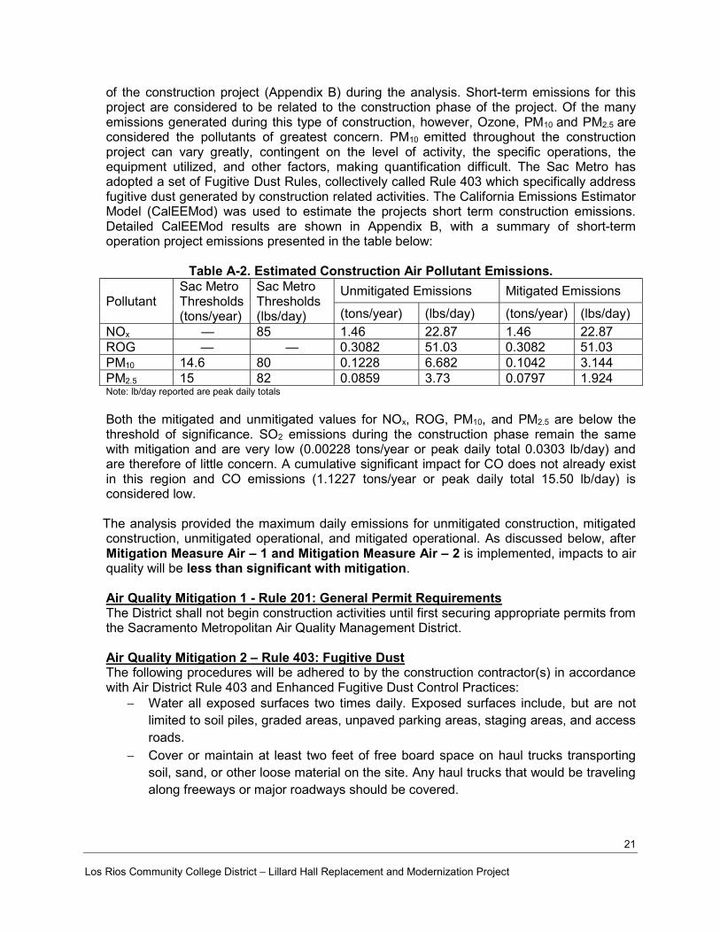
of the construction project (Appendix B) during the analysis. Short-term emissions for this project are considered to be related to the construction phase of the project. Of the many emissions generated during this type of construction, however, Ozone, PM10 and PM2.5 are considered the pollutants of greatest concern. PM10 emitted throughout the construction project can vary greatly, contingent on the level of activity, the specific operations, the equipment utilized, and other factors, making quantification difficult. The Sac Metro has adopted a set of Fugitive Dust Rules, collectively called Rule 403 which specifically address fugitive dust generated by construction related activities. The California Emissions Estimator Model (CalEEMod) was used to estimate the projects short term construction emissions. Detailed CalEEMod results are shown in Appendix B, with a summary of short-term operation project emissions presented in the table below:
Table A-2. Estimated Construction Air Pollutant Emissions.
Pollutant Sac Metro Thresholds (tons/year)
Sac Metro Thresholds (lbs/day)
Unmitigated Emissions Mitigated Emissions
(tons/year) (lbs/day) (tons/year) (lbs/day)
NOx — 85 1.46 22.87 1.46 22.87 ROG — — 0.3082 51.03 0.3082 51.03 PM10 14.6 80 0.1228 6.682 0.1042 3.144 PM2.5 15 82 0.0859 3.73 0.0797 1.924 Note: lb/day reported are peak daily totals
Both the mitigated and unmitigated values for NOx, ROG, PM10, and PM2.5 are below the threshold of significance. SO2 emissions during the construction phase remain the same with mitigation and are very low (0.00228 tons/year or peak daily total 0.0303 lb/day) and are therefore of little concern. A cumulative significant impact for CO does not already exist in this region and CO emissions (1.1227 tons/year or peak daily total 15.50 lb/day) is considered low.
The analysis provided the maximum daily emissions for unmitigated construction, mitigated
construction, unmitigated operational, and mitigated operational. As discussed below, after Mitigation Measure Air – 1 and Mitigation Measure Air – 2 is implemented, impacts to air quality will be less than significant with mitigation.
Air Quality Mitigation 1 - Rule 201: General Permit Requirements The District shall not begin construction activities until first securing appropriate permits from the Sacramento Metropolitan Air Quality Management District.
Air Quality Mitigation 2 – Rule 403: Fugitive Dust The following procedures will be adhered to by the construction contractor(s) in accordance with Air District Rule 403 and Enhanced Fugitive Dust Control Practices:
Water all exposed surfaces two times daily. Exposed surfaces include, but are not limited to soil piles, graded areas, unpaved parking areas, staging areas, and access roads.
Cover or maintain at least two feet of free board space on haul trucks transporting soil, sand, or other loose material on the site. Any haul trucks that would be traveling along freeways or major roadways should be covered.
Los Rios Community College District – Lillard Hall Replacement and Modernization Project
22
Use wet power vacuum street sweepers to remove any visible trackout mud or dirt onto adjacent public roads at least once a day. Use of dry power sweeping is prohibited.
Limit vehicle speeds on unpaved roads to 15 miles per hour (mph). All roadways, driveways, sidewalks, parking lots to be paved should be completed as
soon as possible. In addition, building pads should be laid as soon as possible after grading unless seeding or soil binders are used.
Minimize idling time either by shutting equipment off when not in use or reducing the time of idling to 5 minutes [required by California Code of Regulations, Title 13, sections 2449(d)(3) and 2485]. Provide clear signage that posts this requirement for workers at the entrances to the site.
Maintain all construction equipment in proper working condition according to manufacturer’s specifications. The equipment must be checked by a certified mechanic and determined to be running in proper condition prior to operation.
Soil Disturbance Areas: Water exposed soil with adequate frequency for continued moist soil. However, do
not overwater to the extent that sediment flows off the site. Suspend excavation, grading, and/or demolition activity when wind speeds exceed
20 mph. Install wind-breaks (e.g. plant trees, solid fencing) on windward side(s) of
construction areas. Plant vegetative ground cover (fast-germinating native grass seed) in disturbed
areas as soon as possible. Water appropriately until vegetation is established. Post a publicly visible sign with the telephone number and person to contact at the
lead agency regarding dust complaints. This person shall respond and take corrective action within 48 hours. The phone number of the District shall also be visible to ensure compliance.
Based on the highest estimated emissions, evaluated per the Sac Metro Thresholds of Significance; the implementation of Mitigation Measure Air 1, which requires appropriate permitting with the Sac Metro prior to construction; and the implementation of Mitigation Measure Air 2, which incorporates control of fugitive dust required by District Rule 403, and Enhanced Fugitive Dust Control Practices, the project Construction impacts to air quality will be less than significant with mitigation. Additional Air Quality Mitigation Measures (3-6) required by Sac Metro during construction which will be implemented include the following: Air Quality Mitigation 3 - Rule 414: Boilers and Process Heater Requirements The developer or contractor is required to install water heaters rated less than 1,000,000 BTU per hour. Air Quality Mitigation 4 - Rule 442: Architectural Coatings Requirements The developer or contractor is required to use coatings which comply with volatile organic compound content limits as specified in the rule.
Los Rios Community College District – Lillard Hall Replacement and Modernization Project
23
Air Quality Mitigation 5 - Rule 453: Cutback and Emulsified Asphalt Paving Materials Requirements The developer or contractor is prohibited to use certain types of cut back or emulsified asphalt for paving, road construction or road maintenance activities. Air Quality Mitigation 6 - Rule 460: Adhesive and Sealants The developer or contractor is required to use adhesives and sealants that comply with the volatile organic compound content limits specified in the rule.
d) Less Than Significant Impact. Sensitive receptors in the vicinity include the existing campus where the proposed project is located and surrounding residential homes. Since the proposed project is well below all of the threshold criteria established by Sac Metro, it is not anticipated there would be a significant change in substantial pollutant concentrations. In addition, the District will comply with Mitigation Measure Air 7: Rule 402 and, per 13 CCR Division 3, Chapter 9 regulations Mitigation Measure Air 8: Equipment during construction. Therefore, this is a less than significant with mitigation impact.
Air Quality Mitigation 7 - Rule 402: Nuisance Requirements The developer or contractor is required to prevent dust or any emissions from onsite activities from causing injury, nuisance, or annoyance to the public. Air Quality Mitigation 8 – Equipment during Construction
The developer or contractor is required to comply with all registration and operational requirements of the portable equipment registration such as recordkeeping and notification.
Idle time will be minimized either by shutting equipment off when not in use or reducing the time of idling to 5 minutes.
e) No Impact. The proposed project does not include any activities that would result in
objectionable odors. Therefore, this is no impact.
Los Rios Community College District – Lillard Hall Replacement and Modernization Project
24
IV. Greenhouse Gas Emissions
Issues
Potentially Significant
Impact
Less Than Significant
With Mitigation
Incorporated
Less-Than-
Significant Impact
No
Impact
Would the Project:
a. Generate greenhouse gas emissions, either
directly or indirectly, that may have a significant impact on the environment?
b. Conflict with an applicable plan, policy or
regulation adopted for the purpose of reducing the emissions of greenhouse gases?
Climate change is a global problem. Pollutants with localized air quality effects have generally short atmospheric lifetimes (approximately 1 day), greenhouse gas (GHG) emissions persist in the atmosphere for long enough periods of time (1 year to several thousand years) to be dispersed around the globe. The amount of GHGs required to ultimately result in climate change is not precisely known. What is known is that the amount is enormous, and no single project would measurably contribute to noticeable incremental change in the average global temperature. Thus, from the standpoint of CEQA, GHG impacts to global climate change are inherently cumulative.
Prominent GHGs of primary concern from land use development projects include carbon dioxide (CO2), methane (CH4), and nitrous oxide (N2O). There are other GHGs, such as chlorofluorocarbons, hydrofluorocarbons, and sulfur hexafluoride, however, these are less of a concern since construction and operational activities associated with land use development projects are not likely to generate these in substantial quantities. To quantify GHG, a standard of “CO2-Equivalent” or CO2E is used. Carbon dioxide equivalency (CO2E) refers to the amount of mixed GHGs that would have the same global warming potential when measured over a specified timescale (generally 100 years).
California has adopted a wide variety of regulations aimed at reducing the State’s greenhouse gas (GHG) emissions. These regulations include, but are not limited, to the following:
Assembly Bill (AB) 32. The California Global Warming Solutions Act of 2006, requires California to reduce statewide GHG emissions to 1990 levels by 2020. AB 32 directs ARB to develop and implement regulations that reduce statewide GHG emissions.
Executive Order S-3-05. This order establishes GHG emission reduction targets for California and directs the CAL-EPA to coordinate oversight efforts. The targets, which were established by Governor Schwarzenegger, call for a reduction of GHG emissions to 2000 levels by 2010; a reduction of GHG emissions to 1990 levels by 2020; and a reduction of GHG emissions to 80% below 1990 levels by 2050.
Senate Bill 375. Senate Bill (SB) 375 was enacted in order to align regional transportation planning efforts, regional GHG reduction targets, and land use and house allocation. SB 75 requires Metropolitan Planning Organizations (MPOs) to adopt a Sustainable Communities Strategy (SCS) or Alternative Planning Strategy (APS), which will prescribe land use allocation in the MPOs Regional Transportation Plan.
Los Rios Community College District – Lillard Hall Replacement and Modernization Project
25
Executive Order B-30-15. This order requires that greenhouse gas emissions in California are reduced by 40 percent below 1990 levels by 2030, and below 1990 levels by 2050.
Senate Bill 226 Statutory Exemption 21080.35. Exempting the installation of solar photovoltaic panels on the roof of a building or at an existing parking lot, if certain conditions are met. The parking lot must be in existence for the past two years or more and not involve 1) the removal of a tree required to be planted, maintained, or protected pursuant to local, state, or federal requirements, unless the tree dies and there is no requirement to replace the tree and there is no 2) removal of a native tree over 25 years old.
THRESHOLDS OF SIGNIFICANCE For this analysis, Sac Metro’s recommended thresholds of significance are as stated:
A significant impact would result if the proposed project would result in the emission of GHG gases (CO2E) in excess of 1,100 metric tons per year for either the construction period or operational phase of the project.
a) Less Than Significant Impact. The construction of the proposed Lillard Hall Replacement and Modernization project will create short-term, small impacts on GHG emissions from construction trips and equipment. Based on the CalEEMod Air Quality Model results (Appendix B), the proposed project construction GHG emissions will generate approximately a peak of 158.17 metric tons per year of CO2 equivalent. This is below the Sac Metro’s threshold of 1,100 metric tons per year. This is considered less than significant. The long-term operations of the Lillard Hall Replacement and Modernization project will create long-term impacts on GHG emissions. Based on the CalEEMod Air Quality Model results (Appendix B), the proposed project, once operational, will generate approximately 1,123.77 metric tons per year of CO2 equivalent unmitigated. This is slightly above the Sac Metro threshold of 1,100 metric tons per year. Per HGA (Appendix C), the schematic designs are still being considered, however, the proposed project has a minimum goal of to exceed Title 24 by 20 percent or greater, as demonstrated on previous similar projects. Furthermore, while the schematic designs are still being considered, there are sustainability goals and strategies being considered which include the following:
Zero net energy goal; LEED gold equivalency goal; Compact building form; Shade use areas with building mass or elements; and Maximize northern and diffused light.
In addition to the replacement of the older less efficient Lillard Hall, the project will install the following as part of Greenhouse Gas Emission Mitigation Measure 1:
Los Rios Community College District – Lillard Hall Replacement and Modernization Project
26
Greenhouse Gas Emissions Mitigation 1
Eight (8) bike racks and two (2) bike lockers; Twenty-six trees will be planted post construction; Low flow fixtures; and High efficiency lighting.
Based on these measures, the proposed project, once operational, will generate approximately 1,084.57 metric tons per year of CO2 equivalent mitigated. This is below the Sac Metro’s threshold of 1,100 metric tons per year and considered a less than significant impact.
b) Less Than Significant Impact. The proposed project is not anticipated to conflict with any policy or regulation adopted for the purposes of GHG reduction. This is a less than significant impact. The City of Sacramento has adopted Policies Addressing Climate Change (General Plan, 2035), however, it is anticipated that the proposed project would not conflict with these policies. The final project design details are currently unavailable at the current stage of the proposed project, however, based on CalEEMod estimated emissions calculations, the proposed projects are below the Sac Metro’s ROG and NOx operational thresholds. The new Lillard Hall replacement building is intended to be designed to meet current energy efficiency standards (with a zero net energy design goal) which will further reduce GHG emissions compared to the outdated Lillard Hall. The Champion Meeting #1 documents illustrating schematic design phase overview is included in Appendix C. The project is a replacement, with a minimal increase of assignable square footage, and not intended to facilitate growth. As discussed above, the site will provide eight new bike racks and two new bike lockers, as well as twenty-six new trees. In addition, there will potentially be Overhead Solar Parking installed in either the adjacent staff parking Lot F or staff parking Lot G, which is consistent with the reduction of greenhouse gases through the use of renewable energy. No significant conflict with GHG reduction policies is anticipated, therefore, there is a less than significant impact.
Los Rios Community College District – Lillard Hall Replacement and Modernization Project
27
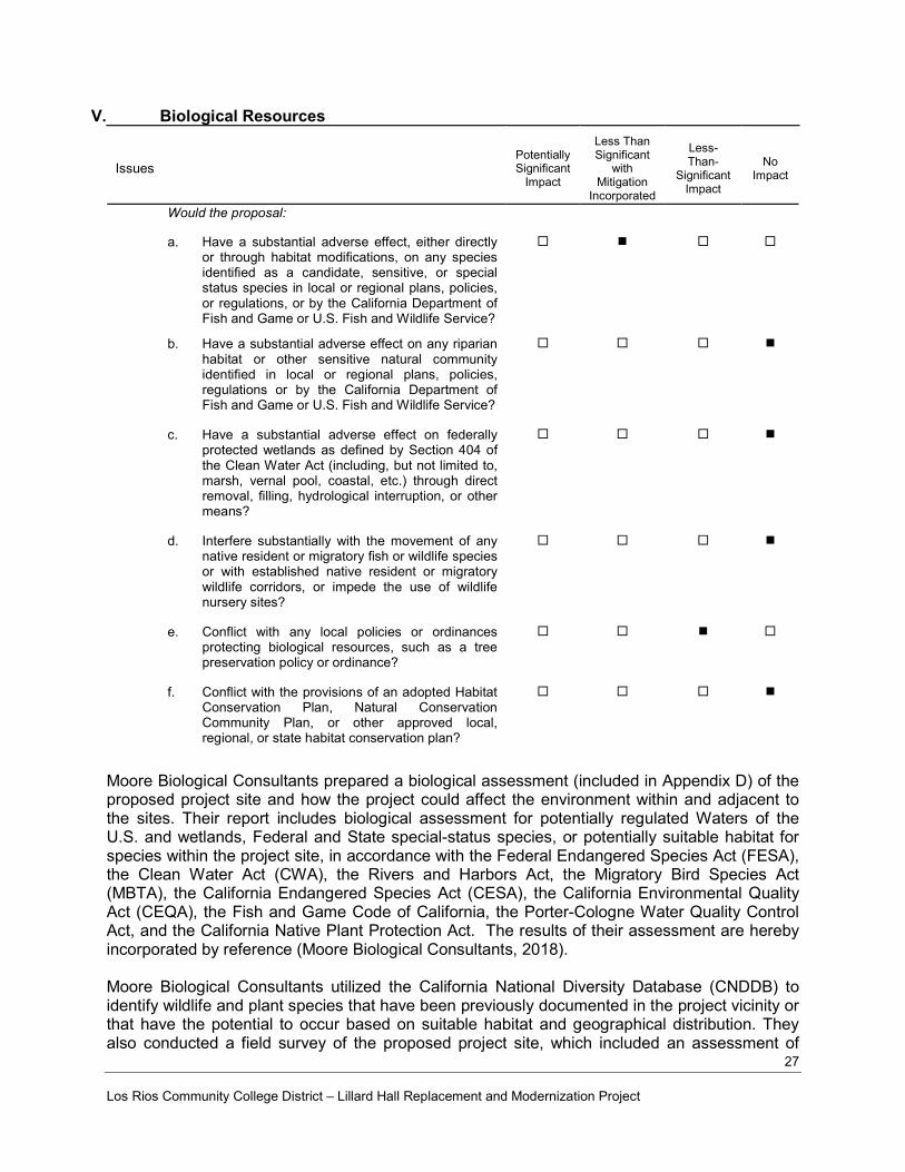
V. Biological Resources
Issues
Potentially Significant
Impact
Less Than Significant
with Mitigation
Incorporated
Less-Than-
Significant Impact
No
Impact
Would the proposal:
a. Have a substantial adverse effect, either directly or through habitat modifications, on any species identified as a candidate, sensitive, or special status species in local or regional plans, policies, or regulations, or by the California Department of Fish and Game or U.S. Fish and Wildlife Service?
b. Have a substantial adverse effect on any riparian
habitat or other sensitive natural community identified in local or regional plans, policies, regulations or by the California Department of Fish and Game or U.S. Fish and Wildlife Service?
c. Have a substantial adverse effect on federally
protected wetlands as defined by Section 404 of the Clean Water Act (including, but not limited to, marsh, vernal pool, coastal, etc.) through direct removal, filling, hydrological interruption, or other means?
d. Interfere substantially with the movement of any
native resident or migratory fish or wildlife species or with established native resident or migratory wildlife corridors, or impede the use of wildlife nursery sites?
e. Conflict with any local policies or ordinances
protecting biological resources, such as a tree preservation policy or ordinance?
f. Conflict with the provisions of an adopted Habitat
Conservation Plan, Natural Conservation Community Plan, or other approved local, regional, or state habitat conservation plan?
Moore Biological Consultants prepared a biological assessment (included in Appendix D) of the proposed project site and how the project could affect the environment within and adjacent to the sites. Their report includes biological assessment for potentially regulated Waters of the U.S. and wetlands, Federal and State special-status species, or potentially suitable habitat for species within the project site, in accordance with the Federal Endangered Species Act (FESA), the Clean Water Act (CWA), the Rivers and Harbors Act, the Migratory Bird Species Act (MBTA), the California Endangered Species Act (CESA), the California Environmental Quality Act (CEQA), the Fish and Game Code of California, the Porter-Cologne Water Quality Control Act, and the California Native Plant Protection Act. The results of their assessment are hereby incorporated by reference (Moore Biological Consultants, 2018). Moore Biological Consultants utilized the California National Diversity Database (CNDDB) to identify wildlife and plant species that have been previously documented in the project vicinity or that have the potential to occur based on suitable habitat and geographical distribution. They also conducted a field survey of the proposed project site, which included an assessment of

Los Rios Community College District – Lillard Hall Replacement and Modernization Project
28
potentially jurisdictional waters of the U.S., special-status species, and suitable habitat for special-status species. a) Less Than Significant Impact with Mitigation Incorporated. The project site is in the
southwest part of the Sacramento City campus and includes two existing buildings, nearby parking lots, and associated manicured lawns and landscaped area, and is biologically unremarkable. Development of the proposed project will result in the removal of some ornamental trees and shrubs, which from a wildlife habitat perspective is less than significant impact. Due to the lack of suitable habitat, it is unlikely that special-status plants occur in the site (Moore Biological Consultants, 2018). The Project would not significantly modify, either directly or indirectly, habitats of any species identified as candidate, sensitive, or special status. Special-status species are plants and animals that are legally protected under the CESA, FESA, or other regulations.
The Federal Endangered Species Act (FESA) of 1973 (16 U.S.C. 1531-1543) and subsequent amendments provide guidance for the conservation of endangered and threatened species and the ecosystems upon which they depend. Section 7 of FESA requires Federal agencies to ensure that the actions they authorize, fund, or carry out are not likely to jeopardize the continued existence of threatened or endangered species or result in the destruction or adverse modification of critical habitat for these species. Critical habitat is areas mapped by United States Fish and Wildlife Service (USFWS) as being critical to maintain and/or manage in a relatively natural state for the recovery of a listed species. The site is not within designated critical habitat for any federally listed species. The California Endangered Species Act (CESA) (Fish and Game Code 2050 et seq.) establishes the policy of the State to conserve, protect, restore, and enhance threatened or endangered species and their habitats. CESA mandates that State agencies should not approve projects that would jeopardize the continued existence of threatened or endangered species, if reasonable and prudent alternatives are available that would avoid jeopardy. The CDFW is required to issue a written finding indicating if a project would jeopardize threatened or endangered species and specifying reasonable and prudent alternatives that would avoid jeopardy. CEQA Guidelines Section 15380 provides that a species not listed under the FESA or CESA may be considered rare or endangered under specific criteria. These criteria have been modeled after the definitions in FESA and CESA. While the project site may have provided habitat for special-status species at some point in the past, development has substantially modified natural habitats in the greater project vicinity, which includes those within the site. The CNDDB only contains one record of purple martin (Progne subis), a small songbird, as the only special-status species documented within a mile of the site. Of the wildlife species identified in the CNDDB search, Swainson’s hawk is the only species that has any potential to occur in the project site on more than a transitory or very occasional basis. The Swainson’s hawk is a migratory hawk listed by the State of California as a Threatened species. The Migratory Bird Treaty Act and fish and Game Code of California protect Swainson’s hawks year-round as well as their nests during nesting season (March 1 through September 15). Swainson’s hawk could be disturbed by noise if they nested in or near the project site during construction (Moore Biological Consultants, 2018).

Los Rios Community College District – Lillard Hall Replacement and Modernization Project
29
Implementation of the following mitigation measure would reduce the above-identified impacts to biological resources to a less-than-significant level. Biological Resources Mitigation Measure 1 - Preconstruction Survey Requirements A qualified biologist shall conduct a preconstruction survey for nesting Swainson’s hawks within 0.25 miles of the project site if construction commences between March 1 and September 15. If active nests are found, a qualified biologist should determine the need (if any) for temporal restrictions on construction. This determination should be pursuant to criteria set forth by CDFW (Moore Biological Consultants, 2018). On-site trees, shrubs, and grasslands may be used by nesting birds protected by the Migratory Bird Treaty Act of 1918 and Fish and Game Code of California. A qualified biologist shall conduct a preconstruction nesting bird survey if vegetation removal and/or project construction occurs between February 1 and August 31. If active nests are found within the survey area, vegetation removal and/or project construction should be delayed until a qualified biologist determines nesting is complete (Moore Biological Consultants, 2018).
b) No Impact. The proposed project will have no adverse impacts on sensitive or regulated habitat because the Project site itself is devoid of native riparian vegetation or other sensitive natural community identified in local or regional plans, policies, regulations, or by the CDFW or USFWS (Moore Biological Consultants, 2018). Therefore, there is no impact.
c) No Impact. There are no potentially jurisdictional Waters of the U.S. or wetlands in the site.
The site consists entirely of landscaped areas that are highly disturbed. Specifically, there was no observed permanent or intermittent drainages, vernal pools, seasonal wetlands, marshes, ponds, lakes, or riparian wetlands of any variety within the site (Moore Biological Consultants, 2018). Therefore, there is no impact.
d) No Impact. The project site is not located on or adjacent to a waterway. The proposed project will not interfere substantially with the movement of any other native resident or migratory fish or wildlife species or with established native resident or migratory wildlife corridors or impede the use of native wildlife nursery sites. Therefore, this is no impact.
e) Less Than Significant Impact with Mitigation Incorporated. The proposed project will
result in the removal of some ornamental trees and shrubs. City Municipal Code Chapter 12.64 requires a City Heritage Permit if there are planned remove or trimming of Heritage Trees. The project will not be reviewed by the City of Sacramento Planning Department, and therefore not subject to the Heritage Tree Ordinance. This is a less than significant impact. Removal of trees may affect nesting birds protected by the federal Migratory Bird Treaty. In order to reduce any potential impacts to nesting migratory birds to a less than significant level, Biological Resources Mitigation Measure 1 is required. With Biological Resources Mitigation Measure 1 incorporated, this is a less than significant impact.
f) No Impact. The City of Sacramento does not have an adopted Habitat Conservation Plan
(HCP) which covers the Sacramento City College site. The nearest approved HCP covers North Natomas. The project will therefore have no impact on HCPs or other conservation plans.
30 Los Rios Community College District – Lillard Hall Replacement and Modernization Project
VI. Cultural Resources
a) Less than Significant. On September 14, 2018, Petralogix Engineering, Inc. (Petralogix)
sent a letter describing the project with maps depicting the project area to the Sacramento County Historical Society. The letter requested any information or concerns about cultural resources in the project area. No response to consultation attempt has been received to date from the Sacramento County Historical Society. Petralogix conducted a search on the National Register of Historic Places; the Sacramento City College address 3835 Freeport Boulevard is listed. The National Register Listed Property reference number for the Sacramento City College is No. 94000924. The site has a Historic Name listed as “Sacramento Junior College Annex and Extensions” within the Sacramento City College Historic District for architect Harry J. Devine Senior. Petralogix staff requested a non-confidential record search at the Northern Central Information Center (NCIC) via e-mail on October 10, 2018, with no response to date. The NCIC, of the California Historical Resources Information System, California State University, Sacramento, an affiliate of the Office of Historic Preservation (OHP), is the official state repository of cultural resource records and reports for Sacramento County. The cultural resources identified within the project site include The Sacramento City College District, which consists of five (5) buildings designed by architect Harry J. Devin, Sr. with the period of significance 1936-1939. The Lillard Hall and Mohr Hall buildings are not registered historic buildings (see Figure 5). This is a less than significant impact.
b) Less than Significant with Mitigation Incorporated. A significant impact would occur if
the Project causes a substantial adverse change to an archaeological resource through demolition, construction, conversion, rehabilitation, relocation, or alteration. The Native American Heritage Commission (NAHC) was contacted regarding Sacred Lands File and Native American Contacts List Request. No correspondence from the NAHC has been received to date. The project area has been previously built-up and developed, however, archaeological resources may exist within the Project Area. In the event that
Issues
Potentially Significant
Impact
Less Than Significant
With Mitigation
Incorporated
Less-Than-
Significant Impact
No
Impact
Would the Project:
a. Cause a substantial adverse change in the significance of a historical resource as defined in §15064.5?
b. Cause a substantial adverse change in the
significance of an archaeological resource pursuant to §15064.5?
c. Directly or indirectly destroy a unique
paleontological resource or unique geologic feature?
d. Disturb any human remains, including those
interred outsides of formal cemeteries.
e. Would the project cause a substantial adverse change in the significance of a tribal cultural resource as defined in Public Resources Code 21074?

31 Los Rios Community College District – Lillard Hall Replacement and Modernization Project
archaeological resources are observed during Project construction-related activities, Mitigation Measure CR-1 is in place to reduce impacts to a less than significant level. Therefore, the impact on archaeological resources is considered less than significant with mitigation incorporated.
Cultural Resources Mitigation Measure 1 If prehistoric or historic-period archaeological deposits are discovered during Project activities, all work within 25 feet of the discovery should be redirected and the archaeologist should assess the situation, consult with agencies as appropriate, and make recommendations regarding the treatment of the discovery. Impacts to archaeological deposits should be avoided by Project activities, but if such impacts cannot be avoided, the deposits should be evaluated for their California Register eligibility. If the deposits are not California Register–eligible, no further protection of the finds is necessary. If the deposits are California Register–eligible, they should be protected from Project-related impacts, or such impacts should be mitigated. Mitigation may consist of, but is not necessarily limited to, systematic recovery and analysis of archaeological deposits, recording the resource, preparation of a report of findings, and accessioning recovered archaeological materials at an appropriate curation facility. Public educational outreach may also be appropriate.
c) Less than Significant with Mitigation Incorporated. No evidence of a unique
paleontological resource or unique geologic feature was revealed per the investigations discussed above. Implementation of Mitigation Measure CR-2 would ensure that any previously unidentified paleontological resources encountered during ground disturbing activities for the proposed project would be managed in accordance with applicable regulations. Therefore, the impact on paleontological resources is considered less than significant with mitigation incorporated.
Cultural Resources Mitigation Measure 2 Should paleontological resources be identified on the Project site during any ground disturbing activities related to the Project, all ground disturbing activities within 100 feet of the discovery shall cease and the Los Rios Community School District shall be notified within 24 hours of the discovery. The Project applicant shall retain a qualified paleontologist to provide an evaluation of the find and to prescribe mitigation measures to reduce impacts to a less than significant level. In considering any suggested mitigation proposed by the consulting paleontologist, the Project applicant shall determine whether avoidance is necessary and feasible in light of factors such as the nature of the find, Project design, costs, specific plan policies and land use assumptions, and other considerations. If avoidance is unnecessary or infeasible, other appropriate measures (e.g., data recovery) shall be instituted. Work may proceed on other parts of the project site while mitigation for paleontological resources is carried out.
d) Less than Significant with Mitigation Incorporated. A significant impact may occur if
grading or excavation activities associated with the proposed Project would disturb previously interred human remains. Implementation of Mitigation Measure CR-3 would ensure that human remains encountered during Project activities are treated in a manner consistent with state law and reduce impacts to human remains to a less than significant level as required by CEQA. This would occur through the respectful coordination with descendant communities to ensure that the traditional and cultural values of said community are incorporated in the decision-making process concerning the disposition of

32 Los Rios Community College District – Lillard Hall Replacement and Modernization Project
human remains that cannot be avoided. The implementation of these mitigation measures would reduce this potential impact to a less than significant level.
Cultural Resources Mitigation Measure 3 Any human remains encountered during Project ground-disturbing activities should be treated in accordance with California Health and Safety Co de Section 7050.5. The lead agency should inform its contractor(s) of the sensitivity of the Direct Area of Potential Effect for human remains and verify that the following directive has been included in the appropriate contract documents:
If human remains are encountered during Project activities, the Project shall comply with the requirements of California Health and Safety Code Section 7050.5. There shall be no further excavation or disturbance of the site or any nearby area reasonably suspected to overlie adjacent remains until the county coroner has determined the manner and cause of any death, and the recommendations concerning the treatment and disposition of the human remains have been made to the person responsible for the excavation or to his or her authorized representative. At the same time, an archaeologist shall be contacted to assess the situation and consult with agencies as appropriate. Project personnel/ construction workers shall not collect or move any human remains and associated materials. If the human remains are of Native American origin, the coroner must notify the Native American Heritage Commission within 24 hours of this identification. The Native American Heritage Commission will identify a Native American Most Likely Descendant to inspect the site and provide recommendations for the proper treatment of the remains and associated grave goods.
e) Less than Significant with Mitigation Incorporated. Assembly Bill (AB) 52 applies to
the project, however, no tribes have requested notification at this time. Under AB 52, lead agencies must evaluate a project’s potential impact to a tribal cultural resource. A tribal cultural resource is defined as a site, feature, place, cultural landscape, sacred place or object with cultural value to a California Native American tribe. The NAHC was contacted regarding Sacred Lands File and Native American Contacts List Request on September 14, 2018 via e-mail. No response to consultation has been received to date.
No cultural resources or unique geologic features were identified within the project area, as discussed in questions a) and b). In the event that Native American remnants are observed during Project construction-related activities, Mitigation Measures CR-1 and CR-2 are in place to reduce impacts to a less than significant level. Therefore, the impact on Native American resources is considered less than significant with mitigation incorporated.

33 Los Rios Community College District – Lillard Hall Replacement and Modernization Project
Figure 5: Sacramento City College - Historic District
34 Los Rios Community College District – Lillard Hall Replacement and Modernization Project
Geology and Soils
Issues
Potentially Significant
Impact
Less Than Significant
with Mitigation
Incorporated
Less-Than-
Significant Impact
No
Impact
Would the Project:
a. Expose people or structures to potential
substantial adverse effects, including the risk of loss, injury, or death involving:
i. Rupture of a known earthquake fault, as
delineated on the most recent Alquist-Priolo Earthquake Fault Zoning Map issued by the State Geologist for the area or based on other substantial evidence of a known fault? Refer to Division of Mines and Geology Special Publication 42.
ii. Strong seismic ground shaking?
iii. Seismic-related ground failure, including
liquefaction?
iv. Landslides?
b. Result in substantial soil erosion, or the loss of
topsoil?
c. Be located on a geologic unit or soil that is
unstable, or that would become unstable as a result of the Project, and potentially result in on-or off-site landslide, lateral spreading, subsidence, liquefaction or collapse?
d. Be located on expansive soils, as defined in Table
18-1-13 of the Uniform Building Code (1994), creating substantial risks to life or property?
e. Have soils incapable of adequately supporting the
use of septic tanks or alternative wastewater disposal systems where sewers are not available for the disposal of wastewater?
Youngdahl Consulting Group, Inc. (Youngdahl) completed a Geotechnical Engineering Study (GES), dated January 29, 2016, (included in Appendix E) for the categorically exempt Mohr Hall replacement project. To date, there is no geotechnical study for the Lillard Hall portion of the project, however, based on the proximity to Mohr Hall, the Mohr Hall Study is considered sufficient for Lillard Hall. The GES provides geotechnical recommendations for project related earthwork, as well as the design and construction of foundations and floor slabs for a multi-story structure. The GES report also presents a comprehensive list of the Projects related seismic/faulting hazards and site-specific soil conditions. These findings are based on review of regional seismic literature, as well as the interpretation of in-situ subsurface exploration data, respectively. Youngdahl’s subsurface exploration program included the advancement of five exploratory soil borings - one advanced to 11.5 feet below ground surface (bgs), three advanced to 21.5 feet bgs, and one advanced to 51.5 feet bgs. Subsurface soil conditions were found to be relatively consistent across the Project site. In general, surface soils were comprised of slightly moist to moist sandy clays in a medium stiff to stiff condition to depths of 5 to 10 feet
35 Los Rios Community College District – Lillard Hall Replacement and Modernization Project
bgs. These clays were underlain by slightly moist to moist sandy silts in a hard and variably cemented condition to depths of 11.5 to 21.5 feet bgs. In the single boring advanced to 51.5 feet bgs, the sandy silts of the second stratum were underlain by interbedded layers of silty clayey sands and sandy silts in a medium dense to very dense / hard and variably cemented condition (Youngdahl. 2016). a) Less than Significant with Mitigation Incorporated.
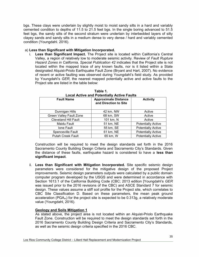
i. Less than Significant Impact. The Project site is located within California’s Central Valley, a region of relatively low to moderate seismic activity. Review of Fault Rupture Hazard Zones in California, Special Publication 42 indicates that the Project site is not located within the mapped trace of any known faults, nor is it listed within a State designated Alquist-Priolo Earthquake Fault Zone (Bryant and Hart, 2007). No evidence of recent or active faulting was observed during Youngdahl’s field study. As provided by Youngdahl’s GER, the nearest mapped potentially active and active faults to the Project site are listed in the table below:
Table 1.
Local Active and Potentially Active Faults Fault Name Approximate Distance
and Direction to Site Activity
Dunnigan Hills 42 km, NW Active Green Valley Fault Zone 68 km, SW Active
Cleveland Hill Fault 101 km, N Active Maidu Fault 51 km, NE Potentially Active Ione Fault 55 km, SE Potentially Active
Spenceville Fault 61 km, NE Potentially Active Putah Creek Fault 65 km, W Potentially Active
Construction will be required to meet the design standards set forth in the 2016 Sacramento County Building Design Criteria and Sacramento City’s Standards. Given the distance of these faults, earthquake hazard is considered to have a less than significant impact.
ii. Less than Significant with Mitigation Incorporated. Site specific seismic design
parameters were considered for the mitigative design of the proposed Project improvements. Seismic design parameters outputs were calculated by a public domain computer program developed by the USGS and were determined in accordance with Section 1613.1 of the California Building Code (CBC; 2013 edition [Youngdahl’s GER was issued prior to the 2016 revisions of the CBC) and ASCE Standard 7 for seismic design. These values assume a stiff soil profile for the Project site, which correlates to CBC Site Classification D. Based on these parameters, the mean peak ground acceleration (PGAm) for the project site is expected to be 0.313g, a relatively moderate value (Youngdahl, 2016).
Geology and Soils Mitigation 1
As stated above, the project area is not located within an Alquist-Priolo Earthquake Fault Zone. Construction will be required to meet the design standards set forth in the 2016 Sacramento County Building Design Criteria and Sacramento City’s Standards, as well as the seismic design criteria specified in the 2016 CBC.
36 Los Rios Community College District – Lillard Hall Replacement and Modernization Project
Based on the required design standards, a site location outside of any designated Alquist-Priolo Earthquake Fault Zone, and moderate PGAM anticipated for the Project site, ground shaking is considered less than significant with incorporated mitigation design.
iii. Less than Significant Impact. Liquefaction is a mode of ground failure that results from the generation of excess pore-water pressures during earthquake ground shaking, causing loss of shear strength. This phenomenon generally occurs in areas of high seismicity, where groundwater is shallow, and soils are loose and granular. Research has shown that saturated, loose to medium-dense sands with a silt content of less than 25% that are located within the top 40 feet are most susceptible to liquefaction (Youngdahl, 2016). The California Geologic Survey (CGS) has designated certain areas within California as potential liquefaction hazard zones. These are areas considered at risk of liquefaction-related ground failure during a seismic event and have been designated based upon mapped surficial deposits and the likely presence of a relatively shallow water table. The Project site is not mapped within a CGS-designated area of potential liquefaction (CGS, Earthquake Zones of Required Investigation).
Due to the relatively low seismicity of the area and the relatively shallow depth to cemented soils, the potential for seismically induced damage due to liquefaction is considered negligible. Mitigation for seismically induced liquefaction is not required for development (Youngdahl, 2016). This is a less than significant impact.
iv). No Impact. The Project area is located on geographically level terrain (H15:1V or flatter) that may be considered insufficient to produce a landslide. The Project area is not located within an earthquake-induced landslide zone (defined as “an area where previous occurrence of landslide movement, or local topographic, geological, geotechnical and subsurface water conditions indicate a potential for permanent ground displacement”) per the reviewed Earthquake Zones of Required Investigations map provided by the CGS. As a result, no impacts related to landslides are anticipated. This is a less than significant impact.
b) Less than Significant Impact. The Project area consists of near surface clay soils which
are suitable for use as engineered fill (Youngdahl, 2016). Per Youngdahl’s recommendations, all areas proposed to receive fill should be scarified to a minimum depth of 8-inches, moisture conditioned as needed, and uniformly re-compacted to at least 90 percent of the maximum dry density based on the Modified Proctor Test (ASTM D1557) test method at a moisture content of about 3 to 4 percent over optimum. The resulting excavation should be restored to grade with compacted engineered fill, which should be placed in thin horizontal lifts not to exceed 12 inches in uncompacted thickness. The fill should be moisture conditioned to about 3 to 4 percent over optimum and compacted to a relative compaction of not less than 90 percent of the maximum dry density. Engineered fill compaction should be evaluated by means of in-situ density tests that are to be performed during fill placement in order to evaluate the adequacy of soil compaction during earthwork activities.

37 Los Rios Community College District – Lillard Hall Replacement and Modernization Project
The Project will be subject to the City of Sacramento’s Chapter 15.88 Grading, Erosion and Sediment Control Code and Permitting Regulations. As a normal and standard requirement, the Project would be required to prepare and have approved Stormwater Pollution Prevention Plans (SWPPPs) that mandate construction and post-construction water quality provisions, including but not limited to erosion control plans during construction, installation of biofilters and/or mechanical cleansing of stormwater run-off, and similar elements. As a result of these standard engineering measures, the Project would have a less than significant impact on substantial soil erosion and issues resulting from the removal of topsoil during and after the construction process.
c) Less than Significant Impact. The GES performed by Youngdahl for the categorically
exempt Mohr Hall replacement consisted of five borings drilled to depths of 11.5 feet, 21.5 feet and 51.5 feet below ground surface (bgs) within the proposed project area. The upper surface materials encountered consisted of 5 feet to 10 feet of medium stiff to stiff sandy clay underlain by hard, variably cemented sandy silt, in the single boring advanced to 51.5 feet bgs, overly interbedded layers of medium dense to very dense / hard silty clayey sands and sandy silts. Results of borings are given below:
Table 2.
Results of Soil Borings
Stratum Approximate Depth to
Bottom of Stratum
Material Description
Consistency/Density
1 5 to 10 feet bgs Sandy Clay Medium Stiff
2 20 to 21.5 feet bgs Sandy Silt Hard
3 21.5 to 30 feet bgs
(maximum boring depth) Clayey Sand to Silty Sand
Medium Dense to Very Hard
4 30 to 51.5 feet bgs
(maximum boring depth) Silty Clayey Sand to Sandy Silt Very Dense to Hard
As previously stated, Youngdahl identified groundwater at a depth of approximately 24 feet bgs during subsurface exploration activities (maximum depth of 51.5 feet bgs) at the Project site. Supplementary review of well data within the site vicinity indicates that the permanent groundwater table in the area lies approximately 18 to 20 feet bgs (Youngdahl, 2016). It should be noted that future groundwater conditions may change as a result of rainfall, construction activities, irrigation, or other factors not evident at the time the borings were performed. Therefore, groundwater levels during construction may be higher or lower than the levels indicated during Youngdahl’s field investigation. Due to the relatively low seismicity of the area and the relatively shallow depth of cemented soils, the potential for seismically induced liquefaction, surface rupture/lateral spreading, and settlement at the Project site is considered negligible (Youngdahl, 2016). This is a less than significant impact. Due to the flat topography at the site, the relatively low seismicity of the area, and relatively shallow depth to cemented soils, the landslide potential for the Project site is considered negligible (Youngdahl, 2016). This is a less than significant impact.
38 Los Rios Community College District – Lillard Hall Replacement and Modernization Project
d) Less than Significant with Mitigation Incorporated. Based on the results of their subsurface exploration, laboratory testing, and analysis, Youngdahl concluded that moderately expansive surface soils are present at the Project site. Given the moisture-sensitive nature of the on-site soils, Youngdahl provides recommendations in its GER to mitigate the effects of soil shrinkage and expansions on foundations and exterior flatwork. However, even if these mitigative procedures are followed, some movement and minor cracking in the structure should be anticipated. Geology and Soils Mitigation 2 Youngdahl’s geotechnical report states that the proposed building structures may be supported upon conventional shallow foundations, such as continuous footings so long as the site grades are properly prepared. Conventional shallow foundations should be a minimum of 12 inches wide and should be founded a minimum of 24 inches below the adjacent soil grade. Foundation reinforcement design should be provided by the structural engineer. Additionally, soil-supported slab-on-grade floors may feasibly be used as main floors of the building structures, contingent on proper subgrade preparation (Youngdahl, 2016). Earthwork should be observed and evaluated by Youngdahl. Earthwork evaluation shall include the observation and testing of engineered fills, subgrade preparation, foundation bearing soils and other geotechnical conditions during the construction of the project. Standard design and construction techniques will then be used to mitigate the potential for damage. The Project will also be subject to applicable engineering and County and City code requirements, which ensure that the potential hazards of unstable soil are minimized.
e) No Impact. The proposed Project will not utilize a septic system. No significant impact.

39 Los Rios Community College District – Lillard Hall Replacement and Modernization Project
VII. Hazards and Hazardous Materials
Issues
Potentially Significant
Impact
Less Than Significant
With Mitigation
Incorporated
Less-Than-
Significant Impact
No
Impact
Would the Project:
a. Create a significant hazard to the public or the
environment through the routine transport, use, or disposal of hazardous materials?
b. Create a significant hazard to the public or the
environment through reasonably foreseeable upset and accident conditions involving the release of hazardous materials into the environment?
c. Emit hazardous emissions or handle hazardous
or acutely hazardous materials, substances, or waste within one-quarter mile of an existing or proposed school?
d. Be located on a site which is included on a list of
hazardous materials sites compiled pursuant to Government Code Section 65962.5 and, as a result, would it create a significant hazard to the public or the environment?
e. For a Project located within an airport land use
plan or, where such a plan has not been adopted, within two miles of a public airport or public use airport, would the Project result in a safety hazard for people residing or working in the Project area?
f. For a Project within the vicinity of a private
airstrip, would the Project result in a safety hazard for people residing or working in the Project area?
g. Impair implementation of or physically interfere
with an adopted emergency response plan or emergency evacuation plan?
h. Expose people or structures to a significant risk of
loss, injury or death involving wildland fires, including where wildlands are adjacent to urbanized areas or where residences are intermixed with wildlands?
a,b) Less than Significant Impact with Mitigation Incorporated. The project does not
produce hazardous material. Any hazardous substances, such as those used for routine cleaning, upkeep of surrounding grounds, and maintenance, may be stored onsite in designated areas in and around the Lillard Hall site. The proposed replacement of the Lillard Hall would not involve the routine use, transport, or disposal of hazardous material(s); however, there is the potential accidental release of hazardous material through possible spills associated with the construction equipment, such as oil and/or

40 Los Rios Community College District – Lillard Hall Replacement and Modernization Project
hydraulic fluid, during the construction phase of the project. With the implementation of Mitigation Measure Hazards and Hazardous Materials 1, which requires standard spill prevention measures and a procedure for spill response if one does occur, the projects potential to create a significant hazard to the public or the environment involving transport, use, disposal, or accidental release of hazardous materials, the impact is less than significant with mitigation incorporated.
Hazards and Hazardous Materials Mitigation 1 Spill Prevention and Control Measures will be implemented and include the following:
Any fuel products, lubricating fluids, grease, or other products and/or waste released
from the Contractor(s) vehicles, equipment, or operations, shall be collected and disposed of immediately, and in accordance with State, Federal, and local laws.
Spill clean-up materials will be stored near potential spill areas (such as vehicle and equipment staging areas).
Spill kits will include sorbent material (such as pads designed for oil and gas), socks and/or pads to prevent spread of hazardous material, and containers for storing and proper disposal.
Employees and contractor(s) will be trained on proper hazardous spill clean-up practices.
c) Less Than Significant Impact. Air Emission Facilities —California Department of
Education Code Section 17213(b); Public Resources Code Section 21151.8(a)(2); and the California Code of Regulations, Title 5, Section 14011(i) requires a school district, in consultation with the local air pollution control district, to identify facilities within one-quarter mile of the proposed site that might reasonably be anticipated to emit hazardous air emissions or handle hazardous or acutely hazardous materials and substances of waste. The Sacramento Metropolitan Air Quality Management District (Sac Metro) is responsible for providing written notification of any findings to the school district. A public record request was submitted to the Sac Metro Air District requesting the identification and review of all sites potentially emitting hazardous air emissions within one-quarter mile of the proposed project site on September 28, 2018. Per Sac Metro, the Sacramento City College is reportedly a fuel dispensing station, and there is a standby internal combustion (IC) engine on site. Additional records for the surrounding area within one-quarter mile of the site indicate there are no hazardous air emissions adjacent the site; there is one gasoline dispensing station, two internal combustion standby generators and two paint booths (auto body shops) within one-quarter mile. These are considered less than significant.
d) Less Than Significant Impact with Mitigation Incorporated. The project takes place within the boundary of the Sacramento City College facility grounds. The project is not included in any hazardous materials sites compiled pursuant to Government Code Section 65962.5. In addition, one records requests was submitted with the Sacramento County Environmental Management Department (EMD) on September 14, 2018 requesting Hazardous Waste/Hazardous Materials information for the Sacramento City College parcel containing the project. The Department of Toxic Substances Control ENVIROSTOR website and the State Water Resources Control Board GeoTracker website were additionally reviewed for the site and adjacent parcels, in an attempt to identify hazardous materials that would create a significant hazard to the public or the environment.

41 Los Rios Community College District – Lillard Hall Replacement and Modernization Project
The available EMD records reviewed indicate the Sacramento City College currently qualifies as a small quantity hazardous waste generator, with a valid operating permit, with no current violations on record. There is a Hazardous Materials Business Plan in effect for Sacramento City College as of 2017, which addresses the site as a Small Hazardous Waste Generator, with one underground storage tanks (UST) (one 2,000-gallon regular unleaded), as well as reports of various nonflammable gas, such as nitrogen, R22 refrigerant gas, acetylene gas, helium, and air. There is reportedly one 250-gallon aboveground tank located at the site. The records of previously installed underground storage tanks for the site indicate the site indicates there have been two (2) Leaking Underground Storage Tank (LUST) cases for Sacramento City College. One LUST clean-up site was opened on October 20, 1999 due to a leaking UST discovered; remediation occurred, and the LUST case was closed on December 17, 1990. A LUST case was opened for the site on June 8, 1999, however, the case was officially closed on March 7, 2006. Neither LUST cases occurred in the vicinity of the project location and are not considered a hazard in connection with the project. Geotracker was additionally reviewed in an attempt to identify hazardous materials that would create a significant hazard to the public or the environment from adjacent parcels; based on a review of Geotracker, there are several Case Closed LUST sites in the general vicinity which are not considered a hazard in connection with the project. Pipelines According to Pacific Gas & Electric online interactive natural gas transmission pipeline map, no hazardous pipelines have been identified within 1,500 feet of the project site. According to the Kinder Morgan referenced National Pipeline Mapping System, there are no gas transmission pipelines or hazardous liquid pipelines located within 1,500 feet of the project site. In addition, Steve Marositz with Kinder Morgan responded via e-mail correspondence dated September 24, 2017, with a map that shows the closest active Kinder Morgan pipeline is approximately 10,471 feet northwest of the site. The contractor(s) responsible for construction phases of the project will call 811 prior to digging or excavation in order to assure no smaller pipelines that may be within the project site are damaged. There is no impact from gas transmission pipelines or hazardous materials pipelines. High Voltage Transmission Lines An e-mail message received via e-mail from Lindsey Noyes of SMUD on September 27, 2018, states there are no SMUD transmission easements present within the southwest corner of the parcel that may affect Lillard Hall. There is thus no conflict with their transmission system. There is no impact from high voltage transmission lines. Railroad Tracks The Sacramento City College is located adjacent west to the Union Pacific Railroad Tracks and Sacramento Light Rail Station. Based on review of Google Earth Maps, the proposed project site is located approximately 1,800 feet west from the railroad and light rail tracks. This is a less than significant impact to the site from railroad tracks.
42 Los Rios Community College District – Lillard Hall Replacement and Modernization Project
Asbestos Asbestos is a generic term for the naturally occurring fibrous (asbestiform) variety of any of several minerals (crocidolite, tremolite, actinolite, anthophyllite, amosite and chrysotile) which separate into long flexible fibers and occur naturally in ultramafic rock formations. These igneous ultramafic rocks (pyroxenite, peridotite, dunite, and hornblendite) form below the earth’s surface at very high temperatures and are exposed by uplift and erosion. During high-pressure processes involving tectonic deformation and burial, they may be altered to the metamorphic rock serpentinite. Chrysotile, the most common asbestos mineral in California, forms fibrous crystals in small veins in serpentinite rock. According to the California Department of Conservation, Division of Mines and Geology Open File Report 2000-19, the subject property is not located in an area likely to contain naturally occurring asbestos. Based on this information and given the geological conditions in the site area, the issue of naturally occurring asbestos from rock/soil is not expected to be a concern at the site and therefore not subject to 17 CCR, Division 3, Chapter 1, Subchapter 7.5 §93105 Naturally Occurring Asbestos for earth moving projects. Naturally occurring asbestos for this project is considered a less than significant impact. The Lillard Hall building slated for demolition was likely built prior to the effect ban of most asbestos containing building materials, therefore, people’s (such as students, staff, and construction workers) potential exposure of asbestos due to the demolition of asbestos containing materials is considered a moderate to high risk. Because of the risk of exposure to asbestos, demolition and/or renovation of existing buildings are subject to Sac Metro Air District Rule 902 in order to limit asbestos emissions and the disturbances of regulated-asbestos containing material generated or handled during these activities. With the implementation of Mitigation Measure Hazards and Hazardous Materials 2, which requires the developer or contractor to notify the Sac Metro Air District of any regulated or renovation or demolition activity. Rule 902 contains specific requirements for surveying, notification, removal, and disposal of asbestos containing material, including asbestos removal to be conducted by a certified and licensed asbestos abatement contractor. With the notification to Sac Metro Air District and Rule 902 compliance, renovation and demolition activity asbestos hazards are considered less than significant impact with mitigation. Hazards and Hazardous Materials Mitigation 2 The developer or contractor is required to notify Sac Metro prior to demolition or renovations associated with the project. Project demolition and renovation of existing buildings are subject to Sac Metro Air District Rule 902 in order to limit asbestos emissions and the disturbance of regulated asbestos-containing material generated or handled during these activities. Radon Potential Radon is a gas that is produced by the decay of uranium and radium. This naturally occurring, colorless, odorless, and tasteless gas is produced in most soil or rock. Consequently, all buildings have some radon, as well as the outdoor air. Radon can move with ease through any porous material through which a gas can move. Void spaces and pores are found in the soil underlying any building. Radon is a known carcinogen which the Surgeon General has warned is the second leading cause of lung cancer in the United States.

43 Los Rios Community College District – Lillard Hall Replacement and Modernization Project
The National Radon Database has been developed by the United States Environmental Protection Agency and is a compilation of the EPA/State Residential Radon Survey and the National Residential Radon Survey. The study covers the years of 1986 through 1992. According to EPA publication 402-R-93-025, titled EPA’s Map of Radon Zones, California, dated September 1993, Sacramento County is reportedly in Zone 3. Zone 3 has a predicted average radon screening level of less than 2 pCi/l. This is considered to be the lowest value of geologic radon potential. Therefore, the impact to the site from radon is considered less than significant.
e,f) No Impact. The California Department of Education requires, per Education Code Section
17215, that all airport runways and helipads (public or private) located within two miles of a proposed school site be identified. However, the Education Code pertains to the proposed acquisition or lease of a site and per Section 17215(f), this section does not apply to sites acquired prior to any additions or extensions to those sites.
Based on review of aerial photographs provided by Google Earth, along with the most recent topographic map (Sacramento, 2015), the nearest runway is the Sacramento Executive Airport, located approximately 1 mile south of the project site. The project heights are below the Federal Aviation Administration notification limits, and the finished two-story Halls will be of similar heights to the Halls they are replacing. Therefore, this has no impact on the site.
g) No Impact. The proposed replacement of Lillard Hall is not anticipated to interfere with road access, response plan or emergency evacuation plans for safety vehicles or personnel. The construction of the Proposed Project is not expected to generate excessive traffic for the area but will temporarily increase traffic at the Sacramento City College campus. There will be a Path of Travel (POT) plan formulated for the project which will be compliant with the currently applicable California Building Code Accessibility provisions for POT requirement. During the construction process, if POT items within the scope of the proposed project are found to be non-conforming beyond reasonable standard tolerances, they shall be brought into compliance. No impact is expected. h) No Impact. The Project is located within a region that consists of residential houses, commercial businesses, and park land. The Project will not expose people or structures to a significant risk of loss, injury or death involving wild land fires. Therefore, no impact is expected.
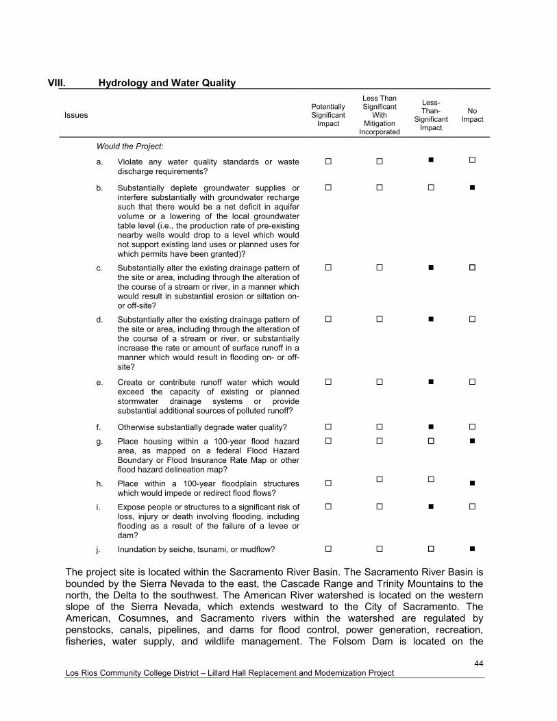
44 Los Rios Community College District – Lillard Hall Replacement and Modernization Project
VIII. Hydrology and Water Quality
Issues
Potentially Significant
Impact
Less Than Significant
With Mitigation
Incorporated
Less-Than-
Significant Impact
No
Impact
Would the Project:
a. Violate any water quality standards or waste
discharge requirements?
b. Substantially deplete groundwater supplies or
interfere substantially with groundwater recharge such that there would be a net deficit in aquifer volume or a lowering of the local groundwater table level (i.e., the production rate of pre-existing nearby wells would drop to a level which would not support existing land uses or planned uses for which permits have been granted)?
c. Substantially alter the existing drainage pattern of
the site or area, including through the alteration of the course of a stream or river, in a manner which would result in substantial erosion or siltation on- or off-site?
d. Substantially alter the existing drainage pattern of
the site or area, including through the alteration of the course of a stream or river, or substantially increase the rate or amount of surface runoff in a manner which would result in flooding on- or off-site?
e. Create or contribute runoff water which would
exceed the capacity of existing or planned stormwater drainage systems or provide substantial additional sources of polluted runoff?
f. Otherwise substantially degrade water quality?
g. Place housing within a 100-year flood hazard
area, as mapped on a federal Flood Hazard Boundary or Flood Insurance Rate Map or other flood hazard delineation map?
h. Place within a 100-year floodplain structures
which would impede or redirect flood flows?
i. Expose people or structures to a significant risk of
loss, injury or death involving flooding, including flooding as a result of the failure of a levee or dam?
j. Inundation by seiche, tsunami, or mudflow?
The project site is located within the Sacramento River Basin. The Sacramento River Basin is bounded by the Sierra Nevada to the east, the Cascade Range and Trinity Mountains to the north, the Delta to the southwest. The American River watershed is located on the western slope of the Sierra Nevada, which extends westward to the City of Sacramento. The American, Cosumnes, and Sacramento rivers within the watershed are regulated by penstocks, canals, pipelines, and dams for flood control, power generation, recreation, fisheries, water supply, and wildlife management. The Folsom Dam is located on the
45 Los Rios Community College District – Lillard Hall Replacement and Modernization Project
American River. The Sacramento, American, and Cosumnes Rivers are the primary surface water tributaries that recharge the Central Valley groundwater basin underlying the City of Sacramento. The construction will take place on Los Rios Community School District owned land, within the boundaries of the Sacramento City College, and not within county road ditches or waterways. Construction impacts will be temporary and best management practices will be in place. The Project is subject to Construction General Permit Order No. 2009-009-DWQ. Construction activity subject to this permit includes clearing, grading, grubbing, disturbances to the ground, such as excavation. The Construction General Permit requires the development and implementation of a Storm Water Pollution Prevention Plan (SWPPP). As such, the construction activities will include the preparation and implementation of a SWPPP to reduce construction impacts to waterways and sources. a) Less Than Significant Impact. The State Water Resources Control Board (SWRCB) has
adopted a National Pollutant Discharge Elimination System (NPDES) general permit for Storm Discharges Associated with Construction Activity (state permit) which requires every construction project greater than one acre to submit a Notice of Intent (NOI) for coverage, and to prepare a Storm Water Pollution Prevention Plan (SWPPP). The ground disturbance for the project is estimated at approximately 1.0 to 1.5 acres, therefore, the project is subject to the NOI and SWPPP requirement. The project will comply with the terms and conditions of the NPDES, as approved by the State Water Resources Control Board under Section 402 of the Clean Water Act.
Compliance with the terms and conditions of the NPDES, development and implementation of a SWPPP, and compliance with the Regional Water Quality Control Board discharge requirements will ensure a less than significant impact.
b) No Impact. The proposed project property connects to the City of Sacramento water utility
services and is not intended to facilitate growth. Because the project will comply with the requirements of the City of Sacramento Utilities, impacts to groundwater supplies will be less than significant.
c-e) Less Than Significant Impact. The Project is proposed to occur within the developed
Sacramento City College (SCC) campus property, within a footprint previously occupied by Mohr Hall. No streams are located near the project site, therefore, there will be no alterations of stream courses. The SCC is located on relatively flat topography, with changes in elevation in order of approximately one foot across the site. Surrounding the completed replacements of Mohr and Lillard Hall will be covered with flatwork and landscaping. No substantial erosion and no flooding will occur; the project will not substantially alter the existing drainage pattern of the site or area. Therefore, this is a less than significant impact.
f) Less Than Significant Impact. The project is located within the Sacramento City College campus. The Lillard Hall building replacement is not involved with any industrial processes and will not produce significant sources of pollution. The proposed project will have water service provided by the City of Sacramento Department of Utilities; this is considered less than significant.
46 Los Rios Community College District – Lillard Hall Replacement and Modernization Project
g-h) No Impact. According to the Federal Emergency Management Agency (FEMA) Flood Insurance Map (FIRM) 06067C0308H, the proposed site is located within an area of 0.2 percent annual chance of flood, areas of 1 percent annual chance flood with average depths of less than 1-foot or with drainage areas less than 1 square mile; and areas protected by levees from 1 percent chance flood. The Lillard Hall replacement structure will be within the previous footprint of the old Mohr Hall. Therefore, there is no impact.
i) Less than Significant Impact. The majority of the City of Sacramento is protected by
dams and levees. The levees and dams provide protection against flooding; however, they are subject to failure and any property in the City is at risk of flooding. As discussed above, the site does not fall within a 100-year flood hazard area, however, the Sacramento City College is within the Areas Dependent of Levees, and within the risk of flooding due to failure of levees. Currently there are no specific Los Rios Community College District projects planned to address flooding since this is considered a low risk. This is considered a less than significant impact.
j) No Impact. The Project will not be impacted by inundation by seiche, tsunami, or
mudflow, because the project is not adjacent to any body of water that has the potential to experience a seiche or tsunami. The Project site is not in the path of any potential mudflow.

47 Los Rios Community College District – Lillard Hall Replacement and Modernization Project
IX. Land Use and Planning
Issues
Potentially Significant
Impact
Less Than Significant
With Mitigation
Incorporated
Less-Than-
Significant Impact
No
Impact
Would the Project:
a. Physically divide an established community?
b. Conflict with any applicable land use plan, policy,
or regulation of an agency with jurisdiction over the Project (including, but not limited to the general plan, specific plan, local coastal program, or zoning ordinance) adopted for the purpose of avoiding or mitigating on environmental effect?
c. Conflict with any applicable habitat conservation
plan or natural community conservation plan?
a) No Impact. The project would be located within the parcel boundary of the established
Sacramento City College and would not result in the physical division of a community. Therefore, there is no impact related to physical division of an established community.
b) No Impact. The City of Sacramento’s 2035 General Plan designates the Sacramento City
College (SCC) as “Public/Quasi-Public”. The Project involves the proposed demolition and replacement of an already existing buildings within the SCC. This is consistent with the current site land use. The Project also does not propose to change any existing zoning. Thus, there is no impact.
c) Less Than Significant Impact. The City of Sacramento does not have an adopted
Habitat Conservation Plan (HCP) which covers the Sacramento City College site. The nearest approved HCP covers North Natomas. The project will therefore have no impact on HCPs or other conservation plans.
48 Los Rios Community College District – Lillard Hall Replacement and Modernization Project
Mineral Resources
Issues
Potentially Significant
Impact
Less Than Significant
With Mitigation
Incorporated
Less-Than-
Significant Impact
No
Impact
a. Result in the loss of availability of a known
mineral resource that would be of value to the region and the residents of the State?
b. Result in the loss of availability of a locally-
important mineral resource recovery site delineated on a local general plan, specific plan or other land use plan?
According to the City of Sacramento 2035 General Plan, ER 5.1.1 Mineral Resource Zones, the City shall protect lands designated MRZ-2, as mapped by the California Geologic Survey. a,b) No Impact. The current use of the proposed Project site consists of the replacement of
Lillard Hall. According to the State Aggregate Resource Areas Map, the proposed Project site is not located within an area of primary extractive resources. Therefore, there is no impact.
49 Los Rios Community College District – Lillard Hall Replacement and Modernization Project
X. Noise
Issues
Potentially Significant
Impact
Less Than Significant
With Mitigation
Incorporated
Less-Than-
Significant Impact
No
Impact
a. Exposure of persons to or generation of noise
levels in excess of standards established in the local general plan or noise ordinance, or applicable standards of other agencies?
b. Exposure of persons to or generation of excessive
groundborne vibration or groundborne noise levels?
c. A substantial permanent increase in ambient
noise levels in the Project vicinity above levels existing without the Project?
d. A substantial temporary or periodic increase in
ambient noise levels in the Project vicinity above levels existing without the Project?
e. For a Project located within an airport land use
plan or, where such a plan has not been adopted, within two miles of a public airport or public use airport, would the Project expose people residing or working in the Project area to excessive noise levels?
f. For a Project within the vicinity of a private airstrip,
would the Project expose people residing or working in the Project area to excessive noise levels?
Noise is defined as unwanted sound. Sound levels are generally measured in decibels (dB) with 0 being the threshold of hearing. Typical examples of noise decibel levels often used would be low decibel level of 50 dB for light traffic to high decibel level of 120 dB for a jet taking off at approximately 200 feet distance (FTA, 2006). There are different methods for assessing noise levels. CNEL refers to Community Noise Equivalent Level which is defined as the 24-hour average noise level, with noise occurring during evening hours (7 to 10 p.m.) weighted by a factor of three and noise occurring during nighttime hours weighted by a factor of 10 prior to averaging. Ldn, or Day Night Average Level, is similar to CNEL except the weighted measure of noise includes a 10 dB penalty added to noise occurring between 10 p.m. and 7 a.m. when people are generally more sensitive to noise. Equivalent Energy Noise Level (Leq) is a constant noise level that would deliver the same acoustic energy to the listener as the actual time-varying noise would deliver over the same exposure time – no “penalties” are added, so Leq would be the same regardless of time of day. dBA is a measurement unit for “a-weighted decibels,” which are commonly used for measuring environmental and industrial noise and the potential for hearing damage associated with noise health effects (General Plan, 2035). a) Less Than Significant Impact. The proposed Project is not expected to generate exterior
noise levels exceeding the City of Sacramento 2035 General Plan Noise Environmental Constraint of 60 dBA at the project site. Once completed, the new Lillard Hall is anticipated to have a similar level of noise as currently exists. In addition, the proposed project is not predicted to generate or be exposed to interior or exterior noise levels exceeding the standards of the City of Sacramento. Thus, no additional noise reduction
50 Los Rios Community College District – Lillard Hall Replacement and Modernization Project
measures are considered warranted. The impact from noise is expected to be less than significant.
b) Less Than Significant Impact. There are several factors that could vary the degree of
ground-borne vibrations, such as construction equipment types and operations, soil and subsurface conditions, and the receiving buildings characteristics (such as foundation type or building size). Operational noise of the building addition is anticipated to be similar to current levels and therefore has no impact. Any ground-borne vibrations associated with the project are due to the construction activities. Therefore, any noise associated with the Project will be short-term. The nearest nearby residential and commercial areas are south of Sutterville Road, and therefore divided by a busy four lane street. The distance to the residential and commercial receptors, in conjunction with the trafficked roads dividing the project site from these receptors, further reduces potential ground-borne vibration impact. In addition, the City of Sacramento City Code states that noise from temporary construction activities are exempt during designated daytime hours; this is considered a less than significant impact.
c) Less Than Significant Impact. The primary noise source anticipated from the project will
be associated with the additional heating ventilation and air-conditioning equipment. The HVAC systems will be similar or better than the current HVAC systems on-site. Based upon measurements conducted for similar projects, and the assumption that all equipment will be shielded by rooftop building parapets, HVAC mechanical equipment is not expected to generate noise levels exceeding 45 dB Leq at distances beyond 60 feet from the proposed building facades. Therefore, no additional noise reduction measures would be required to comply with the City’s 45 dB Leq existing peak hour Leq for institutional land uses with primarily daytime and evening exterior noise level standards (General Plan, 2035). This is considered less than significant.
d) Less Than Significant Impact with Mitigation Incorporated. As discussed previously in
(a) above, there would be a temporary increase in localized noise during project construction; however, the City of Sacramento City Code states that noise from temporary construction activities are exempt during designated daytime hours. The short-term construction-related noise impacts would be reduced further with the following Mitigation Measure Noise-1:
Mitigation Measure Noise-1 The Los Rios Community College District shall ensure the construction contractor implements the following noise reduction measures: All equipment shall have sound-controlled devices no less effective than those
provided by the manufacturer. All equipment shall have muffled exhaust pipes. Stationary noise sources shall be located as far from sensitive receptors as possible. The project will have a less than significant impact with mitigation incorporated due to the above stated Mitigation Measure Noise-1, as well as compliance with the City of Sacramento City Code designated daytime hours for construction activities.
e,f) No Impact. The nearest runway is the Sacramento Executive Airport, located
approximately 1.2 miles south of the project site. Therefore, there is no noise impact

51 Los Rios Community College District – Lillard Hall Replacement and Modernization Project
associated with the construction and/or operation of this project relative to private airports or airstrips.
52 Los Rios Community College District – Lillard Hall Replacement and Modernization Project
XI. Population and Housing
Issues
Potentially Significant
Impact
Less Than Significant
With Mitigation
Incorporated
Less-Than-
Significant Impact
No
Impact
Would the Project:
a. Induce substantial population growth in an area, either directly (for example, by proposing new homes and businesses) or indirectly (e.g., through extension of roads or other infrastructure)?
b. Displace substantial numbers of existing housing,
necessitating the construction of replacement housing elsewhere?
c. Displace substantial numbers of people,
necessitating the construction of replacement housing elsewhere?
The Project proposes the demolish and replace Lillard Hall at Sacramento City College. The proposed Lillard Hall Replacement & Modernization project is not intended to facilitate further growth. a-c) No Impact. The Project area is within Sacramento City College campus. The Project
would not include the creation of new housing nor displace any existing housing or people. Any workers needed for project construction and operation are anticipated to be drawn from the regional employment base; therefore, the Project would not result in local area population growth or lead to the creation of or necessity for new housing. Similarly, the Project would not indirectly induce substantial population growth through the extension of major infrastructure. Consequently, no impacts related to population and housing would occur.

53 Los Rios Community College District – Lillard Hall Replacement and Modernization Project
Public Services
Issues
Potentially Significant
Impact
Less Than Significant
With Mitigation
Incorporated
Less-Than-
Significant Impact
No
Impact
Would the project result in substantial adverse physical impacts associated with the provision of new or physically altered governmental facilities, need for new or physically altered governmental facilities, the construction of which could cause significant environmental impacts, in order to maintain acceptable service ratios, response times or other performance objectives for any of the public services:
a. Fire protection?
b. Police protection?
c. Schools?
d. Parks?
e. Other public facilities?
a-e) No Impact. Based on the City of Sacramento Fire Station Locations by District Map, the
Sacramento City College receives fire protection from Fire Station 12, located at 4500 24th Street, under 1.0 miles from the campus. The campus security is provided by Los Rios Police Department, which is responsible for serving any property owned or controlled by the Los Rios Community College District. The project will include the demolition and replacement of Lillard Hall and is not intended to facilitate growth. The new buildings will have fire alarms, interior sprinkler systems, and fire hydrants. Construction and long-term operation of the proposed Project would not place any substantial adverse impacts on fire protection, police protection, schools, or parks because the project is being implemented in order to meet current administrative demands on campus. Therefore, the project will have no impact.
54 Los Rios Community College District – Lillard Hall Replacement and Modernization Project
XII. Recreation
Issues
Potentially Significant
Impact
Less Than Significant
With Mitigation
Incorporated
Less-Than-
Significant Impact
No
Impact
a. Would the Project increase the use of existing
neighborhood and regional parks or other recreational facilities such that substantial physical deterioration of the facility would occur or be accelerated?
b. Does the Project include recreational facilities or
require the construction or expansion of recreational facilities which might have an adverse physical effect on the environment?
a,b) No Impact. The proposed project is the replacement and modernization of the current
Lillard Hall. The proposed project will have no impact on the physical deterioration of any recreational facilities in the existing neighborhood. The proposed project is not intended to have recreational facilities. There is no impact.

55 Los Rios Community College District – Lillard Hall Replacement and Modernization Project
XIII. Transportation/Traffic
Issues
Potentially Significant
Impact
Less Than Significant
With Mitigation
Incorporated
Less-Than-
Significant Impact
No
Impact
a. Cause an increase in traffic which is substantial in
relation to the existing traffic load and capacity of the street system (i.e., result in a substantial increase in either the number of vehicle trips, the volume to capacity ratio on roads, or congestion at intersections)?
b. Exceed, either individually or cumulatively, a level
of service standard established by the county congestion management agency for designated roads or highways?
c. Result in a change in air traffic patterns, including
either an increase in traffic levels or a change in location that results in substantial safety risks?
d. Substantially increase hazards due to a design
feature (e.g., sharp curves or dangerous intersections) or incompatible uses (e.g., farm equipment)?
e. Result in inadequate emergency access?
f. Result in inadequate parking capacity?
g. Conflict with adopted policies, plans, or programs
supporting alternative transportation (e.g., bus turnouts, bicycle racks)?
a,b) Less than Significant Impact The proposed Lillard Hall demolition and replacement
project is not intended to facilitate further growth. Therefore, no significant increase in traffic will be generated by the anticipated operations once the project completed. The traffic generated by this Project will be short-term as a result of construction. The construction of the Project is not expected to generate excessive traffic for the area but will temporarily increase traffic at the Sacramento City College Campus. A Path of Travel plan with the current applicable California Building Code accessibility provisions for path of travel requirements will be implemented. During construction, if POT items within the scope of the project represented as code compliant are found to be non-conforming beyond reasonable construction tolerances, they shall be brought into compliance. The proposed Lillard Hall Replacement and Modernization project is not intended to facilitate growth. Likewise, the Mohr Hall demolition and replacement is not intended to facilitate growth. The proposed Lillard Hall Project is not expected to individually exceed a level of service designated for the existing roads, nor is the cumulative projects of Mohr Hall plus the Lillard Hall replacements anticipated to exceed a level of service standard established by the county congestion management agency for designated roads. This is a less than significant impact.
c) No Impact. Based on a review of the most recent topographic map (Sacramento West,
2018), the Sacramento Executive Airport is the nearest airport, located approximately 1.2 miles south of the proposed project site. Due to the distance and height of the proposed project, there will be no impact on air traffic patterns.

56 Los Rios Community College District – Lillard Hall Replacement and Modernization Project
d) No Impact. The proposed project does not include design features that would increase hazards or incompatible uses because the proposed project would not include the construction of any new streets or roads. The project site is located within the boundaries of the existing Sacramento City College campus. The proposed project would not increase hazards due to a design feature, such as a sharp curve or dangerous intersection, incompatible uses, such as farming equipment, or inadequate emergency access. Therefore, the project would have no impact.
e) No Impact. The proposed project will not result in inadequate emergency access to the
project area. During on-site construction, vehicles will not block emergency access routes. There will be a path of travel (POT) identified in the construction documents which is compliant with the current applicable California Building Code accessibility provisions for path of travel requirements. During construction, if POT items within the scope of the project represented as code compliant are found to be non-conforming beyond reasonable construction tolerances, they shall be brought into compliance. Therefore, the project would have no impact to emergency access.
f) Less Than Significant Impact. The proposed Project will not generate the need for new
parking capacity. Any construction parking impacts will be short term. This is a less than significant impact.
g) No Impact. The Project would not conflict with any applicable land use plan, policy, or
regulation supporting alternative transportation of an agency with jurisdiction over the project. No impact would result during the construction or operation phase.

57 Los Rios Community College District – Lillard Hall Replacement and Modernization Project
XIV. Utilities and Service Systems
Issues
Potentially Significant
Impact
Less Than Significant
With Mitigation
Incorporated
Less-Than-
Significant Impact
No
Impact
a. Exceed wastewater treatment requirements of the
applicable Regional Water Quality Control Board?
b. Require or result in the construction of new water
or wastewater treatment facilities or expansion of existing facilities, the construction of which could cause significant environmental effects?
c. Require or result in the construction of new storm
water drainage facilities or expansion of existing facilities, the construction of which could cause significant environmental effects?
d. Have sufficient water supplies available to serve
the Project from existing entitlements and resources, or are new or expanded entitlements needed?
e. Result in a determination by the wastewater
treatment provider which serves or may serve the Project that it has adequate capacity to serve the Project’s Projected demand in addition to the provider’s existing commitments?
f. Be served by a landfill with sufficient permitted
capacity to accommodate the Project’s solid waste disposal needs?
g. Comply with federal, state, and local statutes, and
regulations related to solid waste?
a,b,e) Less Than Significant Impact. The project would tie into existing sewer utility
infrastructure already in place at the Sacramento City College, serviced by the sewer utility provider Sacramento Area Sewer District (SASD). The proposed Project does not result in an increased demand that would exceed wastewater treatment requirements. The replacement buildings will be of similar size, facilitating a similar number of students and staff; the new fixtures will be more efficient than the older ones being replaced. This is considered a less than significant impact.
c) Less Than Significant Impact. The proposed project may require a modest amount of
additional storm drains; any additional storm drains will connect to the existing storm drain system at the site, which is serviced by the Sacramento Area Sewer District. A Stormwater Pollution Prevention Plan (SWPPP) and an Erosion and Sediment Control Plan will be prepared and implemented to avoid and minimize impacts on water quality during construction and operations. Best management practices (BMPs) for erosion control will be implemented to avoid and minimize impacts on the environment during construction. There will be a less than significant impact
d) Less Than Significant Impact. The proposed Project development will not require a new
water supply and/or need the expansion of water sources. During Project development water will be used to control dust from the short-term construction activities. Water use increase at the site is not expected to increase significantly for operations since the goal is to replace the existing Lillard Hall with more efficient, updated structures, and the project is
58 Los Rios Community College District – Lillard Hall Replacement and Modernization Project
not intended to facilitate growth. In addition, per the City of Sacramento General Plan (2035), the City shall ensure that water supply capacity is in place prior to granting building permits for new development. The impact is less than significant.
f,g) Less Than Significant Impact. Solid waste collection for Sacramento City College is
provided by Atlas Waste Services. The solid waste is then hauled to L and D Landfill, located at 8635 Fruitridge Road, in Sacramento County. According to the California Waste Management Board (CIWMB), the L and D Landfill is Class III landfill with a current daily maximum waste load of 4,125 tons per day, which is well below the permit limit (Armstrong, 2015). Construction or long-term operation of the proposed Lillard Hall replacement and modernization project would not require the development of a new landfill facility. The amount of solid waste that would be generated by the operation of the facility would not have a significant impact on the operation or the life expectancy of the landfill. There is no conflict with federal, state or local regulations. This is a less than significant impact.
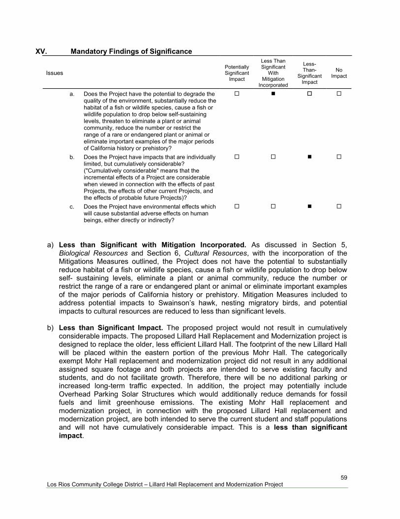
59 Los Rios Community College District – Lillard Hall Replacement and Modernization Project
XV. Mandatory Findings of Significance
Issues
Potentially Significant
Impact
Less Than Significant
With Mitigation
Incorporated
Less-Than-
Significant Impact
No
Impact
a. Does the Project have the potential to degrade the
quality of the environment, substantially reduce the habitat of a fish or wildlife species, cause a fish or wildlife population to drop below self-sustaining levels, threaten to eliminate a plant or animal community, reduce the number or restrict the range of a rare or endangered plant or animal or eliminate important examples of the major periods of California history or prehistory?
b. Does the Project have impacts that are individually
limited, but cumulatively considerable? ("Cumulatively considerable" means that the incremental effects of a Project are considerable when viewed in connection with the effects of past Projects, the effects of other current Projects, and the effects of probable future Projects)?
c. Does the Project have environmental effects which
will cause substantial adverse effects on human beings, either directly or indirectly?
a) Less than Significant with Mitigation Incorporated. As discussed in Section 5,
Biological Resources and Section 6, Cultural Resources, with the incorporation of the Mitigations Measures outlined, the Project does not have the potential to substantially reduce habitat of a fish or wildlife species, cause a fish or wildlife population to drop below self- sustaining levels, eliminate a plant or animal community, reduce the number or restrict the range of a rare or endangered plant or animal or eliminate important examples of the major periods of California history or prehistory. Mitigation Measures included to address potential impacts to Swainson’s hawk, nesting migratory birds, and potential impacts to cultural resources are reduced to less than significant levels.
b) Less than Significant Impact. The proposed project would not result in cumulatively
considerable impacts. The proposed Lillard Hall Replacement and Modernization project is designed to replace the older, less efficient Lillard Hall. The footprint of the new Lillard Hall will be placed within the eastern portion of the previous Mohr Hall. The categorically exempt Mohr Hall replacement and modernization project did not result in any additional assigned square footage and both projects are intended to serve existing faculty and students, and do not facilitate growth. Therefore, there will be no additional parking or increased long-term traffic expected. In addition, the project may potentially include Overhead Parking Solar Structures which would additionally reduce demands for fossil fuels and limit greenhouse emissions. The existing Mohr Hall replacement and modernization project, in connection with the proposed Lillard Hall replacement and modernization project, are both intended to serve the current student and staff populations and will not have cumulatively considerable impact. This is a less than significant impact.
60 Los Rios Community College District – Lillard Hall Replacement and Modernization Project
c) Less than Significant Impact. The proposed project site is not located within an Airport Community Planning Area, or within a Special Flood Hazard Zone. The proposed project site is not located on or near a hazardous materials site, or a known fault zone. The project will incorporate appropriate hazards and hazardous materials mitigation measures for spill prevention and asbestos emissions. The project does not have environmental effects which will cause substantial adverse effects on human beings, either directly or indirectly. This is less a than significant impact.
13. SUMMARY OF MITIGATION MEASURES
This section represents the required mitigation measures identified in Section 12.0 Environmental Checklist. Implementation of these mitigation measures would reduce all impacts of the proposed project to a less than significant level. The Los Rios Community District has committed to implementing all required mitigation measures. AIR QUALITY Air Quality Mitigation 1 The District shall not begin construction activities until first securing appropriate permits from the Sacramento Metropolitan Air Quality Management District. Air Quality Mitigation 2: The following procedures will be adhered to by the construction contractor(s) in accordance with Air District Rule 403 and Enhanced Fugitive Dust Control Practices:
Water all exposed surfaces two times daily. Exposed surfaces include, but are not limited to soil piles, graded areas, unpaved parking areas, staging areas, and access roads.
Cover or maintain at least two feet of free board space on haul trucks transporting soil, sand, or other loose material on the site. Any haul trucks that would be traveling along freeways or major roadways should be covered.
Use wet power vacuum street sweepers to remove any visible trackout mud or dirt onto adjacent public roads at least once a day. Use of dry power sweeping is prohibited.
Limit vehicle speeds on unpaved roads to 15 miles per hour (mph). All roadways, driveways, sidewalks, parking lots to be paved should be completed
as soon as possible. In addition, building pads should be laid as soon as possible after grading unless seeding or soil binders are used.
Minimize idling time either by shutting equipment off when not in use or reducing the time of idling to 5 minutes [required by California Code of Regulations, Title 13, sections 2449(d)(3) and 2485]. Provide clear signage that posts this requirement for workers at the entrances to the site.
Maintain all construction equipment in proper working condition according to manufacturer’s specifications. The equipment must be checked by a certified mechanic and determined to be running in proper condition prior to operation.
61 Los Rios Community College District – Lillard Hall Replacement and Modernization Project
Soil Disturbance Areas: Water exposed soil with adequate frequency for continued moist soil. However, do
not overwater to the extent that sediment flows off the site. Suspend excavation, grading, and/or demolition activity when wind speeds exceed
20 mph. Install wind-breaks (e.g. plant trees, solid fencing) on windward side(s) of
construction areas. Plant vegetative ground cover (fast-germinating native grass seed) in disturbed
areas as soon as possible. Water appropriately until vegetation is established. Post a publicly visible sign with the telephone number and person to contact at the
lead agency regarding dust complaints. This person shall respond and take corrective action within 48 hours. The phone number of the District shall also be visible to ensure compliance.
Air Quality Mitigation 3 - Rule 414: Boilers and Process Heater Requirements The developer or contractor is required to install water heaters rated less than 1,000,000 BTU per hour. Air Quality Mitigation 4 - Rule 442: Architectural Coatings Requirements The developer or contractor is required to use coatings which comply with volatile organic compound content limits as specified in the rule. Air Quality Mitigation 5 - Rule 453: Cutback and Emulsified Asphalt Paving Materials Requirements The developer or contractor is prohibited to use certain types of cut back or emulsified asphalt for paving, road construction or road maintenance activities. Air Quality Mitigation 6 - Rule 460: Adhesive and Sealants The developer or contractor is required to use adhesives and sealants that comply with the volatile organic compound content limits specified in the rule. Air Quality Mitigation 7 - Rule 402: Nuisance Requirements The developer or contractor is required to prevent dust or any emissions from onsite activities from causing injury, nuisance, or annoyance to the public. Air Quality Mitigation 8 – Equipment during Construction
The developer or contractor is required to comply with all registration and operational requirements of the portable equipment registration such as recordkeeping and notification.
Idle time will be minimized either by shutting equipment off when not in use or reducing the time of idling to 5 minutes.

62 Los Rios Community College District – Lillard Hall Replacement and Modernization Project
BIOLOGICAL RESOURCES Biological Resources Mitigation Measure 1 - Preconstruction Survey Requirements A qualified biologist shall conduct a preconstruction survey for nesting Swainson’s hawks within 0.25 miles of the project site if construction commences between March 1 and September 15. If active nests are found, a qualified biologist should determine the need (if any) for temporal restrictions on construction. This determination should be pursuant to criteria set forth by CDFW (Moore Biological Consultants, 2018). On-site trees, shrubs, and grasslands may be used by nesting birds protected by the Migratory Bird Treaty Act of 1918 and Fish and Game Code of California. A qualified biologist shall conduct a preconstruction nesting bird survey if vegetation removal and/or project construction occurs between February 1 and August 31. If active nests are found within the survey area, vegetation removal and/or project construction should be delayed until a qualified biologist determines nesting is complete (Moore Biological Consultants, 2018). CULTURAL RESOURCES Cultural Resources Mitigation Measure 1 If prehistoric or historic-period archaeological deposits are discovered during Project activities, all work within 25 feet of the discovery should be redirected and the archaeologist should assess the situation, consult with agencies as appropriate, and make recommendations regarding the treatment of the discovery. Impacts to archaeological deposits should be avoided by Project activities, but if such impacts cannot be avoided, the deposits should be evaluated for their California Register eligibility. If the deposits are not California Register–eligible, no further protection of the finds is necessary. If the deposits are California Register–eligible, they should be protected from Project-related impacts, or such impacts should be mitigated. Mitigation may consist of, but is not necessarily limited to, systematic recovery and analysis of archaeological deposits, recording the resource, preparation of a report of findings, and accessioning recovered archaeological materials at an appropriate curation facility. Public educational outreach may also be appropriate. Cultural Resources Mitigation Measure 2 Should paleontological resources be identified on the Project site during any ground disturbing activities related to the Project, all ground disturbing activities within 100 feet of the discovery shall cease and the Los Rios Community School District shall be notified within 24 hours of the discovery. The Project applicant shall retain a qualified paleontologist to provide an evaluation of the find and to prescribe mitigation measures to reduce impacts to a less than significant level. In considering any suggested mitigation proposed by the consulting paleontologist, the Project applicant shall determine whether avoidance is necessary and feasible in light of factors such as the nature of the find, Project design, costs, specific plan policies and land use assumptions, and other considerations. If avoidance is unnecessary or infeasible, other appropriate measures (e.g., data recovery) shall be instituted. Work may proceed on other parts of the project site while mitigation for paleontological resources is carried out.
63 Los Rios Community College District – Lillard Hall Replacement and Modernization Project
Cultural Resources Mitigation Measure 3 Any human remains encountered during Project ground-disturbing activities should be treated in accordance with California Health and Safety Co de Section 7050.5. The lead agency should inform its contractor(s) of the sensitivity of the Direct Area of Potential Effect for human remains and verify that the following directive has been included in the appropriate contract documents:
If human remains are encountered during Project activities, the Project shall comply with the requirements of California Health and Safety Code Section 7050.5. There shall be no further excavation or disturbance of the site or any nearby area reasonably suspected to overlie adjacent remains until the county coroner has determined the manner and cause of any death, and the recommendations concerning the treatment and disposition of the human remains have been made to the person responsible for the excavation or to his or her authorized representative. At the same time, an archaeologist shall be contacted to assess the situation and consult with agencies as appropriate. Project personnel/ construction workers shall not collect or move any human remains and associated materials. If the human remains are of Native American origin, the coroner must notify the Native American Heritage Commission within 24 hours of this identification. The Native American Heritage Commission will identify a Native American Most Likely Descendant to inspect the site and provide recommendations for the proper treatment of the remains and associated grave goods.
GEOLOGY AND SOILS Geology and Soils Mitigation 1 Standard design and construction techniques will then be used to mitigate the potential for damage due to seismically induced strong ground shaking. Based on the planned mitigation, and the project being located outside an Alquist-Priolo Earthquake Fault Zone, ground shaking damage is considered less than significant with mitigation Geology and Soils Mitigation 2 Youngdahl’s geotechnical report states that the proposed building structures may be supported upon conventional shallow foundations, such as continuous footings so long as the site grades are properly prepared. Conventional shallow foundations should be a minimum of 12 inches wide and should be founded a minimum of 24 inches below the adjacent soil grade. Foundation reinforcement design should be provided by the structural engineer. Additionally, soil-supported slab-on-grade floors may feasibly be used as main floors of the building structures, contingent on proper subgrade preparation (Youngdahl, 2016). Earthwork should be observed and evaluated by Youngdahl. Earthwork evaluation shall include the observation and testing of engineered fills, subgrade preparation, foundation bearing soils and other geotechnical conditions during the construction of the project. Standard design and construction techniques will then be used to mitigate the potential for damage. The Project will also be subject to applicable engineering and County and City code requirements, which ensure that the potential hazards of unstable soil are minimized.
64 Los Rios Community College District – Lillard Hall Replacement and Modernization Project
HAZARDS AND HAZARDOUS MATERIALS Hazards and Hazardous Materials Mitigation 1 Spill Prevention and Control Measures will be implemented and include the following:
Any fuel products, lubricating fluids, grease, or other products and/or waste released
from the Contractor(s) vehicles, equipment, or operations, shall be collected and disposed of immediately, and in accordance with State, Federal, and local laws.
Spill clean-up materials will be stored near potential spill areas (such as vehicle and equipment staging areas).
Spill kits will include sorbent material (such as pads designed for oil and gas), socks and/or pads to prevent spread of hazardous material, and containers for storing and proper disposal.
Employees and contractor(s) will be trained on proper hazardous spill clean-up practices.
Hazards and Hazardous Materials Mitigation 2 The developer or contractor is required to notify Sac Metro prior to demolition or renovations associated with the project. Project demolition and renovation of existing buildings are subject to Sac Metro Air District Rule 902 in order to limit asbestos emissions and the disturbance of regulated asbestos-containing material generated or handled during these activities. NOISE
Mitigation Measure Noise-1 The Los Rios Community College District shall ensure the construction contractor implements the following noise reduction measures: All equipment shall have sound-controlled devices no less effective than those
provided by the manufacturer. All equipment shall have muffled exhaust pipes. Stationary noise sources shall be located as far from sensitive receptors as possible.
65 Los Rios Community College District – Lillard Hall Replacement and Modernization Project
14. DOCUMENTS REFERENCED
Alquist-Priolo Earthquake Fault Zoning Act (http: www.consrv.ca.gov/dmg/shezp/maps/mora4.htm).
2016 California Environmental Quality Act Statute and Guidelines.
California Department of Conservation (CDC), Division of Mines, California Geological Survey - SMARA Mineral Land Classification Map 2006.
California Department of Transportation, Scenic Highway Program. Updated September 7, 2011. Available Online at http://www.dot.ca.gov/hq/LandArch/16_livability/scenic_highways/index.htm
California Department of Transportation. Scenic Highway Guidelines. Available online at http://www.dot.ca.gov/hq/LandArch/16_livability/scenic_highways/guidelines/scenic_hwy_guidelines_04-12-2012.pdf
California Department of Conservation Important Farmland Finder. Accessed September 24, 2018. Available online at https://maps.conservation.ca.gov/agriculture/
California Emissions Estimator Model (CalEEMod) User’s Guide, September 2016. Available online at http://www.caleemod.com/
California Geological Survey (CGS), Aggregate Sustainability Map, Sheet 52, 2012. Available online at: http://www.conservation.ca.gov/cgs/information/publications/ms/Documents/MS_52_2012.pdf, accessed September 15, 2018.
California Geological Survey (CGS), Probabilistic Seismic Hazards Mapping Ground Motion Page, http://www.conservation.ca.gov/cgs/rghm/psha, accessed September 20, 2018.
California, State of, Water Resources Control Board. GeoTracker. 2015. Available online at http://www.geotracker.swrcb.ca.gov
Lillard Hall Modernization Schematic Design Champions Meeting #1. HGA. September 4, 2018.
Department of Toxic Substances Control ENVIROSTOR Site, http://www.envirostor.dtsc.ca.gov/public/search.asp?basic=True, accessed online September 17, 2018.
Environmental Protection Agency, Map of Radon Zones, California. 402-R-93-025, 1993.
Federal Aviation Administration Notice Criteria Tool. https://oeaaa.faa.gov/oeaaa/external/gisTools/gisAction.jsp Accessed October 8, 2018.
Federal Transit Administration (FTA), Transit Noise and Vibration Impact Assessment. May 2006.
Flood Insurance Rate Map. Sacramento County, California. Panel 308 of 705. Map Number 06067C0308H.
66 Los Rios Community College District – Lillard Hall Replacement and Modernization Project
Los Rios Community College District, Sacramento City College Facility Master Plan. October 2010. Updated February 2014.
Moore Biological Consultants. October 31, 2018. “Lillard Hall Replacement & Modernization Project”, Sacramento City College, Sacramento County, California: Biological Resources Assessment.
National Park Gallery. https://npgallery.nps.gov/pdfhost/docs/NRHP/Text/94000924.pdf
Accessed on October 10, 2018.
National Pipeline Mapping System. https://www.npms.phmsa.dot.gov/ Accessed on September 20, 2018.
Pacific Gas and Electric. Gas Transmission Pipeline Map. https://www.pge.com/en_US/safety/how-the-system-works/natural-gas-system-overview/gas-transmission-pipelinegas-transmission-piplines.page. Accessed September 20, 2018.
Sacramento County (Los Rios Community College District) Local Hazard Mitigation Plan Update. September 2011. Annex J.11.
Sacramento Metropolitan Air Quality Management District, Guide to Air Quality Assessment in Sacramento County, December 2009 as revised December 2016.
San Joaquin County, Environmental Health Department Hazardous Waste/Hazardous Materials Record Search, September 14, 2018.
United State Geological Survey, 2018, 7.5’ Topographic Map of Sacramento West, California, Quadrangle.
United States, Environmental Protection Agency, EnviroMapper for Superfund. Available online at http://www2.epa.gov/emefdata/em4ef.home accessed September 20, 2018.
U.S. Department of Transportation, Federal Highway Administration. The National Scenic Byways Program. Available online at http://www.fhwa.dot.gov/byways/
Wagner, D.L., “Geologic Map of the Sacramento Quadrangle, California”, California Geological Survey, Scale 1:250,000
Youngdahl Consulting Group, Inc., January 29, 2016, Mohr Hall Modernization Geotechnical Engineering Study.

67 Los Rios Community College District – Lillard Hall Replacement and Modernization Project
15. REPORT PREPARATION
LEAD AGENCY:
Los Rios Community College District M.-Reza Mirmiran, Los Rios Facilities Management
CONSULTANTS: Petralogix Engineering, Inc. (Report Authors) Daniel E. Kramer, President/CEO, Principal Geologist, PG, CEG, PGp Tonya R. Scheftner, Project Geologist, GIT Cheyne Hirota, Staff Geologist
Moore Biological Consultants (Biological Resources) Diane S. Moore, M.S., Principal Biologist Youngdahl Consulting Group, Inc (Preliminary Geotech, Mohr Hall) Brandon K. Shimzu, Geotechnical Engineer Christopher M. Sugar, Staff Engineer HGA Creed Kampa, Design Principal

APPENDIX A


APPENDIX B

1.1 Land Usage
Land Uses Size Metric Lot Acreage Floor Surface Area Population
Junior College (2Yr) 54.79 1000sqft 1.26 54,790.00 0
1.2 Other Project Characteristics
Urbanization
Climate Zone
Urban
6
Wind Speed (m/s) Precipitation Freq (Days)3.5 58
1.3 User Entered Comments & Non-Default Data
1.0 Project Characteristics
Utility Company Sacramento Municipal Utility District
2022Operational Year
CO2 Intensity (lb/MWhr)
590.31 0.029CH4 Intensity (lb/MWhr)
0.006N2O Intensity (lb/MWhr)
Lillard Hall - Sacramento City CollegeSacramento County, Annual
CalEEMod Version: CalEEMod.2016.3.1 Date: 10/31/2018 5:22 PMPage 1 of 33
Lillard Hall - Sacramento City College - Sacramento County, Annual

Project Characteristics -
Land Use -
Construction Phase -
Off-road Equipment -
Demolition - Old Lillard Hall to be removed.
Grading - The project consists of near surface clay soils which are suitable for use as engineered fill.
Road Dust -
Construction Off-road Equipment Mitigation -
Area Mitigation -
Sequestration -
Energy Mitigation - Per HGA based on target goal and exceedances on similar projects.
Waste Mitigation -
Water Mitigation -
2.0 Emissions Summary
Table Name Column Name Default Value New Value
tblConstDustMitigation WaterUnpavedRoadVehicleSpeed 40 0
tblProjectCharacteristics OperationalYear 2018 2022
tblRoadDust CARB_PM_VMT True False
tblSequestration NumberOfNewTrees 0.00 26.00
CalEEMod Version: CalEEMod.2016.3.1 Date: 10/31/2018 5:22 PMPage 2 of 33
Lillard Hall - Sacramento City College - Sacramento County, Annual
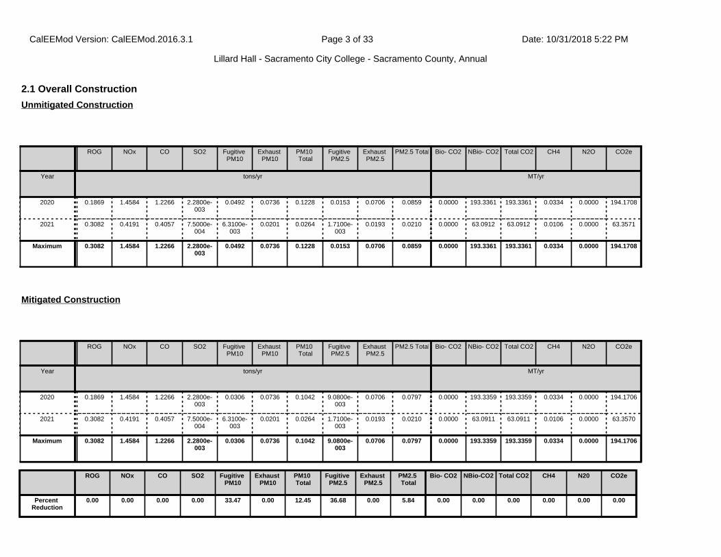
2.1 Overall Construction
ROG NOx CO SO2 Fugitive PM10
Exhaust PM10
PM10 Total
Fugitive PM2.5
Exhaust PM2.5
PM2.5 Total Bio- CO2 NBio- CO2 Total CO2 CH4 N2O CO2e
Year tons/yr MT/yr
2020 0.1869 1.4584 1.2266 2.2800e-003
0.0492 0.0736 0.1228 0.0153 0.0706 0.0859 0.0000 193.3361 193.3361 0.0334 0.0000 194.1708
2021 0.3082 0.4191 0.4057 7.5000e-004
6.3100e-003
0.0201 0.0264 1.7100e-003
0.0193 0.0210 0.0000 63.0912 63.0912 0.0106 0.0000 63.3571
Maximum 0.3082 1.4584 1.2266 2.2800e-003
0.0492 0.0736 0.1228 0.0153 0.0706 0.0859 0.0000 193.3361 193.3361 0.0334 0.0000 194.1708
Unmitigated Construction
ROG NOx CO SO2 Fugitive PM10
Exhaust PM10
PM10 Total
Fugitive PM2.5
Exhaust PM2.5
PM2.5 Total Bio- CO2 NBio- CO2 Total CO2 CH4 N2O CO2e
Year tons/yr MT/yr
2020 0.1869 1.4584 1.2266 2.2800e-003
0.0306 0.0736 0.1042 9.0800e-003
0.0706 0.0797 0.0000 193.3359 193.3359 0.0334 0.0000 194.1706
2021 0.3082 0.4191 0.4057 7.5000e-004
6.3100e-003
0.0201 0.0264 1.7100e-003
0.0193 0.0210 0.0000 63.0911 63.0911 0.0106 0.0000 63.3570
Maximum 0.3082 1.4584 1.2266 2.2800e-003
0.0306 0.0736 0.1042 9.0800e-003
0.0706 0.0797 0.0000 193.3359 193.3359 0.0334 0.0000 194.1706
Mitigated Construction
ROG NOx CO SO2 Fugitive PM10
Exhaust PM10
PM10 Total
Fugitive PM2.5
Exhaust PM2.5
PM2.5 Total
Bio- CO2 NBio-CO2 Total CO2 CH4 N20 CO2e
Percent Reduction
0.00 0.00 0.00 0.00 33.47 0.00 12.45 36.68 0.00 5.84 0.00 0.00 0.00 0.00 0.00 0.00
CalEEMod Version: CalEEMod.2016.3.1 Date: 10/31/2018 5:22 PMPage 3 of 33
Lillard Hall - Sacramento City College - Sacramento County, Annual
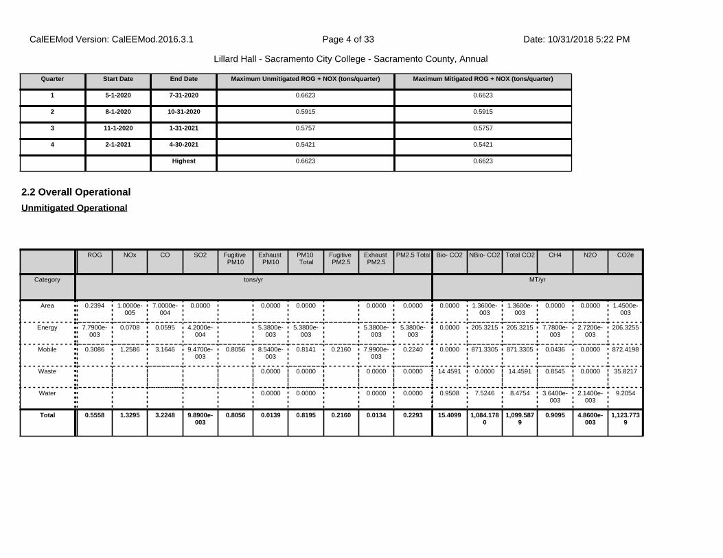
2.2 Overall Operational
ROG NOx CO SO2 Fugitive PM10
Exhaust PM10
PM10 Total
Fugitive PM2.5
Exhaust PM2.5
PM2.5 Total Bio- CO2 NBio- CO2 Total CO2 CH4 N2O CO2e
Category tons/yr MT/yr
Area 0.2394 1.0000e-005
7.0000e-004
0.0000 0.0000 0.0000 0.0000 0.0000 0.0000 1.3600e-003
1.3600e-003
0.0000 0.0000 1.4500e-003
Energy 7.7900e-003
0.0708 0.0595 4.2000e-004
5.3800e-003
5.3800e-003
5.3800e-003
5.3800e-003
0.0000 205.3215 205.3215 7.7800e-003
2.7200e-003
206.3255
Mobile 0.3086 1.2586 3.1646 9.4700e-003
0.8056 8.5400e-003
0.8141 0.2160 7.9900e-003
0.2240 0.0000 871.3305 871.3305 0.0436 0.0000 872.4198
Waste 0.0000 0.0000 0.0000 0.0000 14.4591 0.0000 14.4591 0.8545 0.0000 35.8217
Water 0.0000 0.0000 0.0000 0.0000 0.9508 7.5246 8.4754 3.6400e-003
2.1400e-003
9.2054
Total 0.5558 1.3295 3.2248 9.8900e-003
0.8056 0.0139 0.8195 0.2160 0.0134 0.2293 15.4099 1,084.1780
1,099.5879
0.9095 4.8600e-003
1,123.7739
Unmitigated Operational
Quarter Start Date End Date Maximum Unmitigated ROG + NOX (tons/quarter) Maximum Mitigated ROG + NOX (tons/quarter)
1 5-1-2020 7-31-2020 0.6623 0.6623
2 8-1-2020 10-31-2020 0.5915 0.5915
3 11-1-2020 1-31-2021 0.5757 0.5757
4 2-1-2021 4-30-2021 0.5421 0.5421
Highest 0.6623 0.6623
CalEEMod Version: CalEEMod.2016.3.1 Date: 10/31/2018 5:22 PMPage 4 of 33
Lillard Hall - Sacramento City College - Sacramento County, Annual
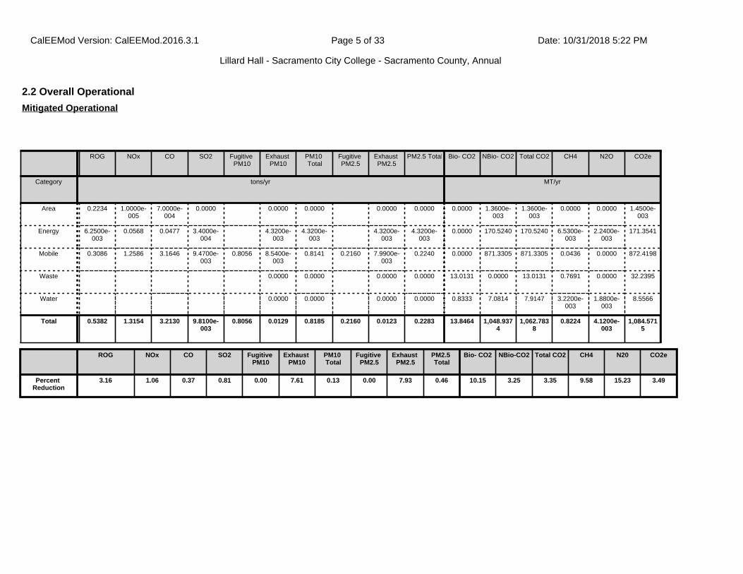
2.2 Overall Operational
ROG NOx CO SO2 Fugitive PM10
Exhaust PM10
PM10 Total
Fugitive PM2.5
Exhaust PM2.5
PM2.5 Total Bio- CO2 NBio- CO2 Total CO2 CH4 N2O CO2e
Category tons/yr MT/yr
Area 0.2234 1.0000e-005
7.0000e-004
0.0000 0.0000 0.0000 0.0000 0.0000 0.0000 1.3600e-003
1.3600e-003
0.0000 0.0000 1.4500e-003
Energy 6.2500e-003
0.0568 0.0477 3.4000e-004
4.3200e-003
4.3200e-003
4.3200e-003
4.3200e-003
0.0000 170.5240 170.5240 6.5300e-003
2.2400e-003
171.3541
Mobile 0.3086 1.2586 3.1646 9.4700e-003
0.8056 8.5400e-003
0.8141 0.2160 7.9900e-003
0.2240 0.0000 871.3305 871.3305 0.0436 0.0000 872.4198
Waste 0.0000 0.0000 0.0000 0.0000 13.0131 0.0000 13.0131 0.7691 0.0000 32.2395
Water 0.0000 0.0000 0.0000 0.0000 0.8333 7.0814 7.9147 3.2200e-003
1.8800e-003
8.5566
Total 0.5382 1.3154 3.2130 9.8100e-003
0.8056 0.0129 0.8185 0.2160 0.0123 0.2283 13.8464 1,048.9374
1,062.7838
0.8224 4.1200e-003
1,084.5715
Mitigated Operational
ROG NOx CO SO2 Fugitive PM10
Exhaust PM10
PM10 Total
Fugitive PM2.5
Exhaust PM2.5
PM2.5 Total
Bio- CO2 NBio-CO2 Total CO2 CH4 N20 CO2e
Percent Reduction
3.16 1.06 0.37 0.81 0.00 7.61 0.13 0.00 7.93 0.46 10.15 3.25 3.35 9.58 15.23 3.49
CalEEMod Version: CalEEMod.2016.3.1 Date: 10/31/2018 5:22 PMPage 5 of 33
Lillard Hall - Sacramento City College - Sacramento County, Annual

3.0 Construction Detail
2.3 Vegetation
CO2e
Category MT
New Trees 18.4080
Total 18.4080
Vegetation
Construction Phase
Phase Number
Phase Name Phase Type Start Date End Date Num Days Week
Num Days Phase Description
1 Demolition Demolition 5/1/2020 5/28/2020 5 20
2 Site Preparation Site Preparation 5/29/2020 6/1/2020 5 2
3 Grading Grading 6/2/2020 6/5/2020 5 4
4 Building Construction Building Construction 6/6/2020 3/12/2021 5 200
5 Paving Paving 3/13/2021 3/26/2021 5 10
6 Architectural Coating Architectural Coating 3/27/2021 4/9/2021 5 10
Acres of Grading (Site Preparation Phase): 1
Acres of Grading (Grading Phase): 1.5
Acres of Paving: 0
CalEEMod Version: CalEEMod.2016.3.1 Date: 10/31/2018 5:22 PMPage 6 of 33
Lillard Hall - Sacramento City College - Sacramento County, Annual
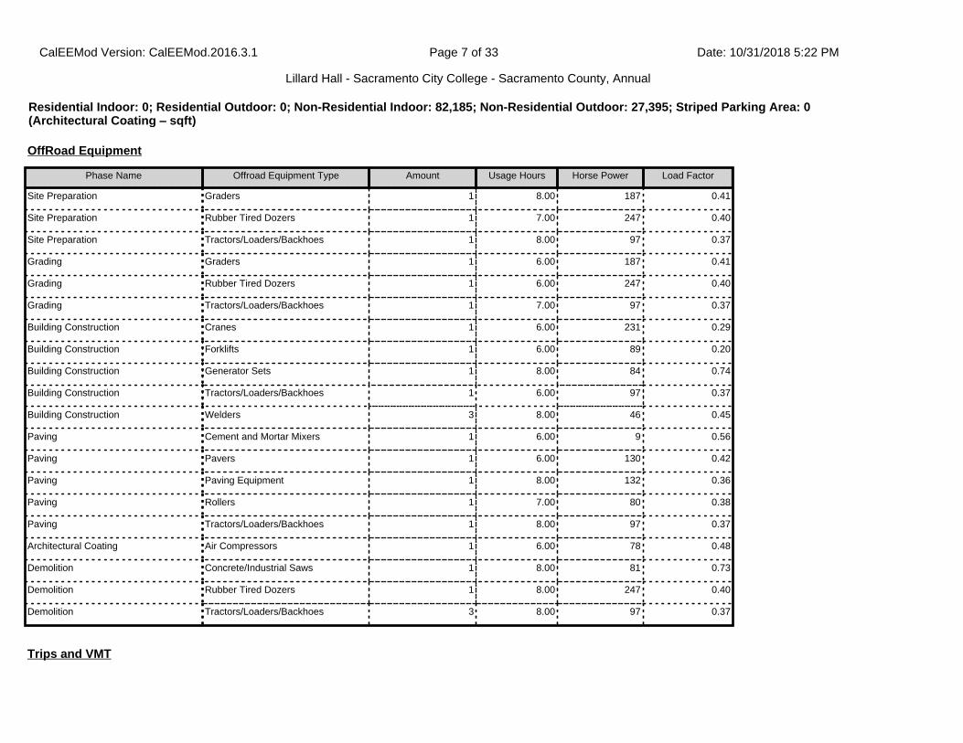
OffRoad Equipment
Phase Name Offroad Equipment Type Amount Usage Hours Horse Power Load Factor
Site Preparation Graders 1 8.00 187 0.41
Site Preparation Rubber Tired Dozers 1 7.00 247 0.40
Site Preparation Tractors/Loaders/Backhoes 1 8.00 97 0.37
Grading Graders 1 6.00 187 0.41
Grading Rubber Tired Dozers 1 6.00 247 0.40
Grading Tractors/Loaders/Backhoes 1 7.00 97 0.37
Building Construction Cranes 1 6.00 231 0.29
Building Construction Forklifts 1 6.00 89 0.20
Building Construction Generator Sets 1 8.00 84 0.74
Building Construction Tractors/Loaders/Backhoes 1 6.00 97 0.37
Building Construction Welders 3 8.00 46 0.45
Paving Cement and Mortar Mixers 1 6.00 9 0.56
Paving Pavers 1 6.00 130 0.42
Paving Paving Equipment 1 8.00 132 0.36
Paving Rollers 1 7.00 80 0.38
Paving Tractors/Loaders/Backhoes 1 8.00 97 0.37
Architectural Coating Air Compressors 1 6.00 78 0.48
Demolition Concrete/Industrial Saws 1 8.00 81 0.73
Demolition Rubber Tired Dozers 1 8.00 247 0.40
Demolition Tractors/Loaders/Backhoes 3 8.00 97 0.37
Trips and VMT
Residential Indoor: 0; Residential Outdoor: 0; Non-Residential Indoor: 82,185; Non-Residential Outdoor: 27,395; Striped Parking Area: 0 (Architectural Coating – sqft)
CalEEMod Version: CalEEMod.2016.3.1 Date: 10/31/2018 5:22 PMPage 7 of 33
Lillard Hall - Sacramento City College - Sacramento County, Annual

3.2 Demolition - 2020
ROG NOx CO SO2 Fugitive PM10
Exhaust PM10
PM10 Total
Fugitive PM2.5
Exhaust PM2.5
PM2.5 Total Bio- CO2 NBio- CO2 Total CO2 CH4 N2O CO2e
Category tons/yr MT/yr
Fugitive Dust 0.0148 0.0000 0.0148 2.2400e-003
0.0000 2.2400e-003
0.0000 0.0000 0.0000 0.0000 0.0000 0.0000
Off-Road 0.0213 0.2095 0.1466 2.4000e-004
0.0115 0.0115 0.0108 0.0108 0.0000 21.0677 21.0677 5.4200e-003
0.0000 21.2031
Total 0.0213 0.2095 0.1466 2.4000e-004
0.0148 0.0115 0.0263 2.2400e-003
0.0108 0.0130 0.0000 21.0677 21.0677 5.4200e-003
0.0000 21.2031
Unmitigated Construction On-Site
3.1 Mitigation Measures Construction
Water Exposed Area
Phase Name Offroad Equipment Count
Worker Trip Number
Vendor Trip Number
Hauling Trip Number
Worker Trip Length
Vendor Trip Length
Hauling Trip Length
Worker Vehicle Class
Vendor Vehicle Class
Hauling Vehicle Class
Site Preparation 3 8.00 0.00 0.00 10.00 6.50 20.00 LD_Mix HDT_Mix HHDT
Grading 3 8.00 0.00 0.00 10.00 6.50 20.00 LD_Mix HDT_Mix HHDT
Building Construction 7 23.00 9.00 0.00 10.00 6.50 20.00 LD_Mix HDT_Mix HHDT
Paving 5 13.00 0.00 0.00 10.00 6.50 20.00 LD_Mix HDT_Mix HHDT
Architectural Coating 1 5.00 0.00 0.00 10.00 6.50 20.00 LD_Mix HDT_Mix HHDT
Demolition 5 13.00 0.00 131.00 10.00 6.50 20.00 LD_Mix HDT_Mix HHDT
CalEEMod Version: CalEEMod.2016.3.1 Date: 10/31/2018 5:22 PMPage 8 of 33
Lillard Hall - Sacramento City College - Sacramento County, Annual

3.2 Demolition - 2020
ROG NOx CO SO2 Fugitive PM10
Exhaust PM10
PM10 Total
Fugitive PM2.5
Exhaust PM2.5
PM2.5 Total Bio- CO2 NBio- CO2 Total CO2 CH4 N2O CO2e
Category tons/yr MT/yr
Hauling 5.0000e-004
0.0188 4.2500e-003
5.0000e-005
1.1100e-003
7.0000e-005
1.1700e-003
3.0000e-004
6.0000e-005
3.7000e-004
0.0000 5.0116 5.0116 2.9000e-004
0.0000 5.0189
Vendor 0.0000 0.0000 0.0000 0.0000 0.0000 0.0000 0.0000 0.0000 0.0000 0.0000 0.0000 0.0000 0.0000 0.0000 0.0000 0.0000
Worker 4.8000e-004
3.3000e-004
3.6000e-003
1.0000e-005
9.5000e-004
1.0000e-005
9.6000e-004
2.5000e-004
1.0000e-005
2.6000e-004
0.0000 0.8460 0.8460 2.0000e-005
0.0000 0.8466
Total 9.8000e-004
0.0192 7.8500e-003
6.0000e-005
2.0600e-003
8.0000e-005
2.1300e-003
5.5000e-004
7.0000e-005
6.3000e-004
0.0000 5.8575 5.8575 3.1000e-004
0.0000 5.8654
Unmitigated Construction Off-Site
ROG NOx CO SO2 Fugitive PM10
Exhaust PM10
PM10 Total
Fugitive PM2.5
Exhaust PM2.5
PM2.5 Total Bio- CO2 NBio- CO2 Total CO2 CH4 N2O CO2e
Category tons/yr MT/yr
Fugitive Dust 5.7800e-003
0.0000 5.7800e-003
8.7000e-004
0.0000 8.7000e-004
0.0000 0.0000 0.0000 0.0000 0.0000 0.0000
Off-Road 0.0213 0.2095 0.1466 2.4000e-004
0.0115 0.0115 0.0108 0.0108 0.0000 21.0676 21.0676 5.4200e-003
0.0000 21.2030
Total 0.0213 0.2095 0.1466 2.4000e-004
5.7800e-003
0.0115 0.0173 8.7000e-004
0.0108 0.0116 0.0000 21.0676 21.0676 5.4200e-003
0.0000 21.2030
Mitigated Construction On-Site
CalEEMod Version: CalEEMod.2016.3.1 Date: 10/31/2018 5:22 PMPage 9 of 33
Lillard Hall - Sacramento City College - Sacramento County, Annual
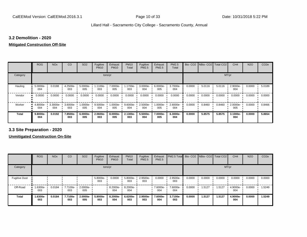
3.2 Demolition - 2020
ROG NOx CO SO2 Fugitive PM10
Exhaust PM10
PM10 Total
Fugitive PM2.5
Exhaust PM2.5
PM2.5 Total
Bio- CO2 NBio- CO2 Total CO2 CH4 N2O CO2e
Category tons/yr MT/yr
Hauling 5.0000e-004
0.0188 4.2500e-003
5.0000e-005
1.1100e-003
7.0000e-005
1.1700e-003
3.0000e-004
6.0000e-005
3.7000e-004
0.0000 5.0116 5.0116 2.9000e-004
0.0000 5.0189
Vendor 0.0000 0.0000 0.0000 0.0000 0.0000 0.0000 0.0000 0.0000 0.0000 0.0000 0.0000 0.0000 0.0000 0.0000 0.0000 0.0000
Worker 4.8000e-004
3.3000e-004
3.6000e-003
1.0000e-005
9.5000e-004
1.0000e-005
9.6000e-004
2.5000e-004
1.0000e-005
2.6000e-004
0.0000 0.8460 0.8460 2.0000e-005
0.0000 0.8466
Total 9.8000e-004
0.0192 7.8500e-003
6.0000e-005
2.0600e-003
8.0000e-005
2.1300e-003
5.5000e-004
7.0000e-005
6.3000e-004
0.0000 5.8575 5.8575 3.1000e-004
0.0000 5.8654
Mitigated Construction Off-Site
3.3 Site Preparation - 2020
ROG NOx CO SO2 Fugitive PM10
Exhaust PM10
PM10 Total
Fugitive PM2.5
Exhaust PM2.5
PM2.5 Total Bio- CO2 NBio- CO2 Total CO2 CH4 N2O CO2e
Category tons/yr MT/yr
Fugitive Dust 5.8000e-003
0.0000 5.8000e-003
2.9500e-003
0.0000 2.9500e-003
0.0000 0.0000 0.0000 0.0000 0.0000 0.0000
Off-Road 1.6300e-003
0.0184 7.7100e-003
2.0000e-005
8.2000e-004
8.2000e-004
7.6000e-004
7.6000e-004
0.0000 1.5127 1.5127 4.9000e-004
0.0000 1.5249
Total 1.6300e-003
0.0184 7.7100e-003
2.0000e-005
5.8000e-003
8.2000e-004
6.6200e-003
2.9500e-003
7.6000e-004
3.7100e-003
0.0000 1.5127 1.5127 4.9000e-004
0.0000 1.5249
Unmitigated Construction On-Site
CalEEMod Version: CalEEMod.2016.3.1 Date: 10/31/2018 5:22 PMPage 10 of 33
Lillard Hall - Sacramento City College - Sacramento County, Annual
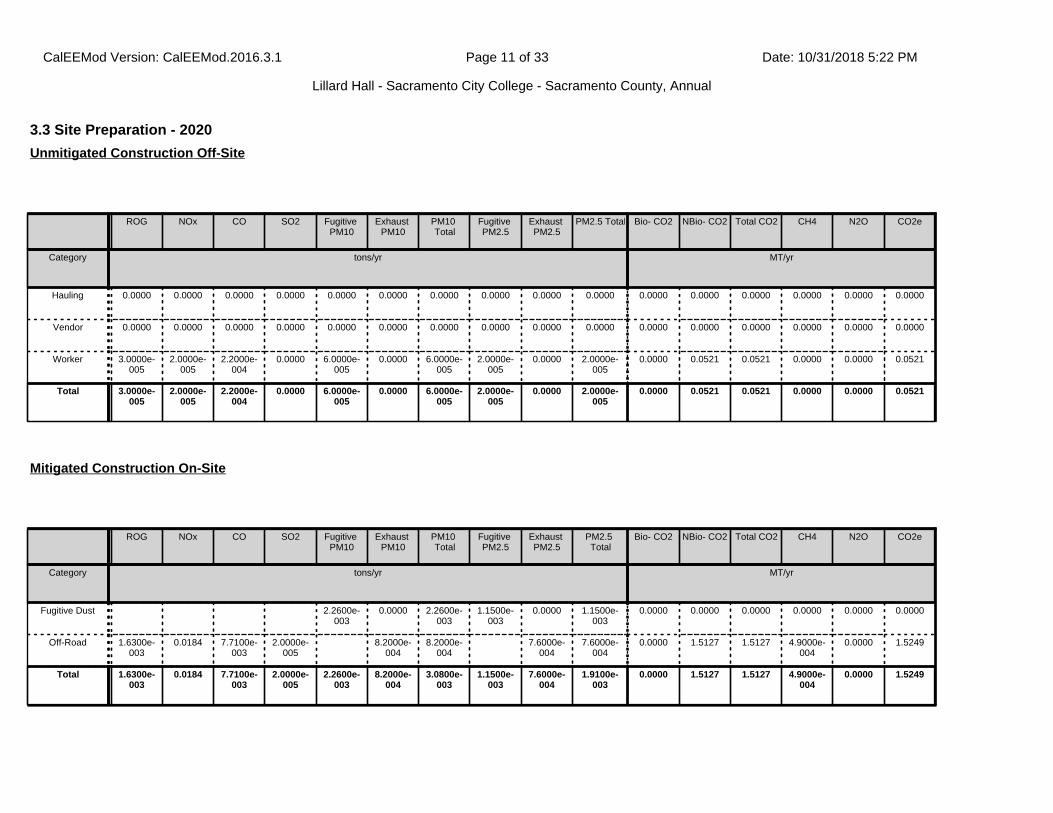
3.3 Site Preparation - 2020
ROG NOx CO SO2 Fugitive PM10
Exhaust PM10
PM10 Total
Fugitive PM2.5
Exhaust PM2.5
PM2.5 Total Bio- CO2 NBio- CO2 Total CO2 CH4 N2O CO2e
Category tons/yr MT/yr
Hauling 0.0000 0.0000 0.0000 0.0000 0.0000 0.0000 0.0000 0.0000 0.0000 0.0000 0.0000 0.0000 0.0000 0.0000 0.0000 0.0000
Vendor 0.0000 0.0000 0.0000 0.0000 0.0000 0.0000 0.0000 0.0000 0.0000 0.0000 0.0000 0.0000 0.0000 0.0000 0.0000 0.0000
Worker 3.0000e-005
2.0000e-005
2.2000e-004
0.0000 6.0000e-005
0.0000 6.0000e-005
2.0000e-005
0.0000 2.0000e-005
0.0000 0.0521 0.0521 0.0000 0.0000 0.0521
Total 3.0000e-005
2.0000e-005
2.2000e-004
0.0000 6.0000e-005
0.0000 6.0000e-005
2.0000e-005
0.0000 2.0000e-005
0.0000 0.0521 0.0521 0.0000 0.0000 0.0521
Unmitigated Construction Off-Site
ROG NOx CO SO2 Fugitive PM10
Exhaust PM10
PM10 Total
Fugitive PM2.5
Exhaust PM2.5
PM2.5 Total
Bio- CO2 NBio- CO2 Total CO2 CH4 N2O CO2e
Category tons/yr MT/yr
Fugitive Dust 2.2600e-003
0.0000 2.2600e-003
1.1500e-003
0.0000 1.1500e-003
0.0000 0.0000 0.0000 0.0000 0.0000 0.0000
Off-Road 1.6300e-003
0.0184 7.7100e-003
2.0000e-005
8.2000e-004
8.2000e-004
7.6000e-004
7.6000e-004
0.0000 1.5127 1.5127 4.9000e-004
0.0000 1.5249
Total 1.6300e-003
0.0184 7.7100e-003
2.0000e-005
2.2600e-003
8.2000e-004
3.0800e-003
1.1500e-003
7.6000e-004
1.9100e-003
0.0000 1.5127 1.5127 4.9000e-004
0.0000 1.5249
Mitigated Construction On-Site
CalEEMod Version: CalEEMod.2016.3.1 Date: 10/31/2018 5:22 PMPage 11 of 33
Lillard Hall - Sacramento City College - Sacramento County, Annual

3.3 Site Preparation - 2020
ROG NOx CO SO2 Fugitive PM10
Exhaust PM10
PM10 Total
Fugitive PM2.5
Exhaust PM2.5
PM2.5 Total Bio- CO2 NBio- CO2 Total CO2 CH4 N2O CO2e
Category tons/yr MT/yr
Hauling 0.0000 0.0000 0.0000 0.0000 0.0000 0.0000 0.0000 0.0000 0.0000 0.0000 0.0000 0.0000 0.0000 0.0000 0.0000 0.0000
Vendor 0.0000 0.0000 0.0000 0.0000 0.0000 0.0000 0.0000 0.0000 0.0000 0.0000 0.0000 0.0000 0.0000 0.0000 0.0000 0.0000
Worker 3.0000e-005
2.0000e-005
2.2000e-004
0.0000 6.0000e-005
0.0000 6.0000e-005
2.0000e-005
0.0000 2.0000e-005
0.0000 0.0521 0.0521 0.0000 0.0000 0.0521
Total 3.0000e-005
2.0000e-005
2.2000e-004
0.0000 6.0000e-005
0.0000 6.0000e-005
2.0000e-005
0.0000 2.0000e-005
0.0000 0.0521 0.0521 0.0000 0.0000 0.0521
Mitigated Construction Off-Site
3.4 Grading - 2020
ROG NOx CO SO2 Fugitive PM10
Exhaust PM10
PM10 Total
Fugitive PM2.5
Exhaust PM2.5
PM2.5 Total
Bio- CO2 NBio- CO2 Total CO2 CH4 N2O CO2e
Category tons/yr MT/yr
Fugitive Dust 9.8300e-003
0.0000 9.8300e-003
5.0500e-003
0.0000 5.0500e-003
0.0000 0.0000 0.0000 0.0000 0.0000 0.0000
Off-Road 2.7000e-003
0.0302 0.0129 3.0000e-005
1.3700e-003
1.3700e-003
1.2600e-003
1.2600e-003
0.0000 2.4779 2.4779 8.0000e-004
0.0000 2.4980
Total 2.7000e-003
0.0302 0.0129 3.0000e-005
9.8300e-003
1.3700e-003
0.0112 5.0500e-003
1.2600e-003
6.3100e-003
0.0000 2.4779 2.4779 8.0000e-004
0.0000 2.4980
Unmitigated Construction On-Site
CalEEMod Version: CalEEMod.2016.3.1 Date: 10/31/2018 5:22 PMPage 12 of 33
Lillard Hall - Sacramento City College - Sacramento County, Annual

3.4 Grading - 2020
ROG NOx CO SO2 Fugitive PM10
Exhaust PM10
PM10 Total
Fugitive PM2.5
Exhaust PM2.5
PM2.5 Total Bio- CO2 NBio- CO2 Total CO2 CH4 N2O CO2e
Category tons/yr MT/yr
Hauling 0.0000 0.0000 0.0000 0.0000 0.0000 0.0000 0.0000 0.0000 0.0000 0.0000 0.0000 0.0000 0.0000 0.0000 0.0000 0.0000
Vendor 0.0000 0.0000 0.0000 0.0000 0.0000 0.0000 0.0000 0.0000 0.0000 0.0000 0.0000 0.0000 0.0000 0.0000 0.0000 0.0000
Worker 6.0000e-005
4.0000e-005
4.4000e-004
0.0000 1.2000e-004
0.0000 1.2000e-004
3.0000e-005
0.0000 3.0000e-005
0.0000 0.1041 0.1041 0.0000 0.0000 0.1042
Total 6.0000e-005
4.0000e-005
4.4000e-004
0.0000 1.2000e-004
0.0000 1.2000e-004
3.0000e-005
0.0000 3.0000e-005
0.0000 0.1041 0.1041 0.0000 0.0000 0.1042
Unmitigated Construction Off-Site
ROG NOx CO SO2 Fugitive PM10
Exhaust PM10
PM10 Total
Fugitive PM2.5
Exhaust PM2.5
PM2.5 Total Bio- CO2 NBio- CO2 Total CO2 CH4 N2O CO2e
Category tons/yr MT/yr
Fugitive Dust 3.8300e-003
0.0000 3.8300e-003
1.9700e-003
0.0000 1.9700e-003
0.0000 0.0000 0.0000 0.0000 0.0000 0.0000
Off-Road 2.7000e-003
0.0302 0.0129 3.0000e-005
1.3700e-003
1.3700e-003
1.2600e-003
1.2600e-003
0.0000 2.4779 2.4779 8.0000e-004
0.0000 2.4980
Total 2.7000e-003
0.0302 0.0129 3.0000e-005
3.8300e-003
1.3700e-003
5.2000e-003
1.9700e-003
1.2600e-003
3.2300e-003
0.0000 2.4779 2.4779 8.0000e-004
0.0000 2.4980
Mitigated Construction On-Site
CalEEMod Version: CalEEMod.2016.3.1 Date: 10/31/2018 5:22 PMPage 13 of 33
Lillard Hall - Sacramento City College - Sacramento County, Annual
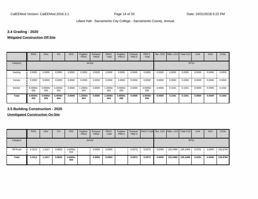
3.4 Grading - 2020
ROG NOx CO SO2 Fugitive PM10
Exhaust PM10
PM10 Total
Fugitive PM2.5
Exhaust PM2.5
PM2.5 Total
Bio- CO2 NBio- CO2 Total CO2 CH4 N2O CO2e
Category tons/yr MT/yr
Hauling 0.0000 0.0000 0.0000 0.0000 0.0000 0.0000 0.0000 0.0000 0.0000 0.0000 0.0000 0.0000 0.0000 0.0000 0.0000 0.0000
Vendor 0.0000 0.0000 0.0000 0.0000 0.0000 0.0000 0.0000 0.0000 0.0000 0.0000 0.0000 0.0000 0.0000 0.0000 0.0000 0.0000
Worker 6.0000e-005
4.0000e-005
4.4000e-004
0.0000 1.2000e-004
0.0000 1.2000e-004
3.0000e-005
0.0000 3.0000e-005
0.0000 0.1041 0.1041 0.0000 0.0000 0.1042
Total 6.0000e-005
4.0000e-005
4.4000e-004
0.0000 1.2000e-004
0.0000 1.2000e-004
3.0000e-005
0.0000 3.0000e-005
0.0000 0.1041 0.1041 0.0000 0.0000 0.1042
Mitigated Construction Off-Site
3.5 Building Construction - 2020
ROG NOx CO SO2 Fugitive PM10
Exhaust PM10
PM10 Total
Fugitive PM2.5
Exhaust PM2.5
PM2.5 Total Bio- CO2 NBio- CO2 Total CO2 CH4 N2O CO2e
Category tons/yr MT/yr
Off-Road 0.1513 1.1017 0.9825 1.6400e-003
0.0593 0.0593 0.0573 0.0573 0.0000 135.2489 135.2489 0.0251 0.0000 135.8766
Total 0.1513 1.1017 0.9825 1.6400e-003
0.0593 0.0593 0.0573 0.0573 0.0000 135.2489 135.2489 0.0251 0.0000 135.8766
Unmitigated Construction On-Site
CalEEMod Version: CalEEMod.2016.3.1 Date: 10/31/2018 5:22 PMPage 14 of 33
Lillard Hall - Sacramento City College - Sacramento County, Annual

3.5 Building Construction - 2020
ROG NOx CO SO2 Fugitive PM10
Exhaust PM10
PM10 Total
Fugitive PM2.5
Exhaust PM2.5
PM2.5 Total Bio- CO2 NBio- CO2 Total CO2 CH4 N2O CO2e
Category tons/yr MT/yr
Hauling 0.0000 0.0000 0.0000 0.0000 0.0000 0.0000 0.0000 0.0000 0.0000 0.0000 0.0000 0.0000 0.0000 0.0000 0.0000 0.0000
Vendor 2.5700e-003
0.0752 0.0210 1.7000e-004
3.9200e-003
3.9000e-004
4.3100e-003
1.1300e-003
3.7000e-004
1.5100e-003
0.0000 15.8649 15.8649 9.4000e-004
0.0000 15.8884
Worker 6.3800e-003
4.3300e-003
0.0474 1.2000e-004
0.0126 9.0000e-005
0.0127 3.3500e-003
8.0000e-005
3.4300e-003
0.0000 11.1504 11.1504 3.2000e-004
0.0000 11.1582
Total 8.9500e-003
0.0795 0.0684 2.9000e-004
0.0165 4.8000e-004
0.0170 4.4800e-003
4.5000e-004
4.9400e-003
0.0000 27.0153 27.0153 1.2600e-003
0.0000 27.0467
Unmitigated Construction Off-Site
ROG NOx CO SO2 Fugitive PM10
Exhaust PM10
PM10 Total
Fugitive PM2.5
Exhaust PM2.5
PM2.5 Total
Bio- CO2 NBio- CO2 Total CO2 CH4 N2O CO2e
Category tons/yr MT/yr
Off-Road 0.1513 1.1017 0.9825 1.6400e-003
0.0593 0.0593 0.0573 0.0573 0.0000 135.2487 135.2487 0.0251 0.0000 135.8764
Total 0.1513 1.1017 0.9825 1.6400e-003
0.0593 0.0593 0.0573 0.0573 0.0000 135.2487 135.2487 0.0251 0.0000 135.8764
Mitigated Construction On-Site
CalEEMod Version: CalEEMod.2016.3.1 Date: 10/31/2018 5:22 PMPage 15 of 33
Lillard Hall - Sacramento City College - Sacramento County, Annual
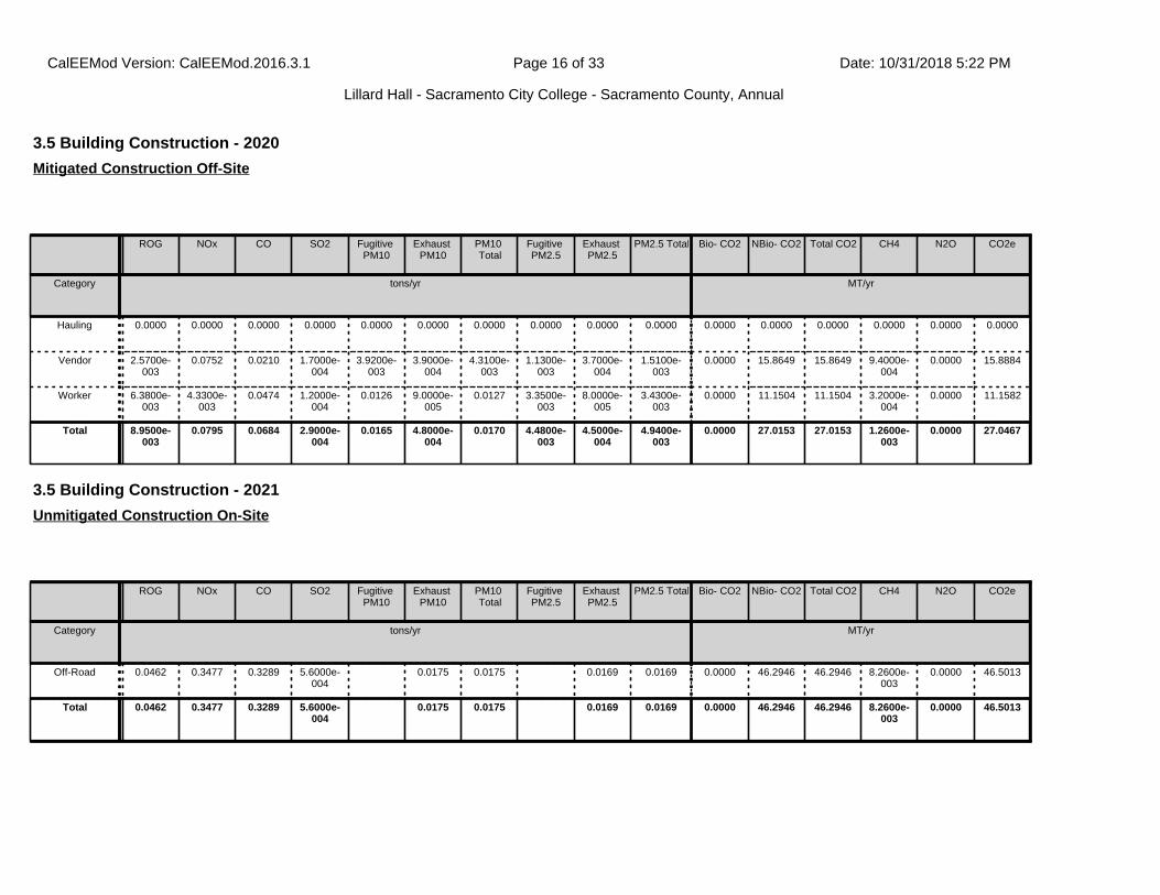
3.5 Building Construction - 2020
ROG NOx CO SO2 Fugitive PM10
Exhaust PM10
PM10 Total
Fugitive PM2.5
Exhaust PM2.5
PM2.5 Total Bio- CO2 NBio- CO2 Total CO2 CH4 N2O CO2e
Category tons/yr MT/yr
Hauling 0.0000 0.0000 0.0000 0.0000 0.0000 0.0000 0.0000 0.0000 0.0000 0.0000 0.0000 0.0000 0.0000 0.0000 0.0000 0.0000
Vendor 2.5700e-003
0.0752 0.0210 1.7000e-004
3.9200e-003
3.9000e-004
4.3100e-003
1.1300e-003
3.7000e-004
1.5100e-003
0.0000 15.8649 15.8649 9.4000e-004
0.0000 15.8884
Worker 6.3800e-003
4.3300e-003
0.0474 1.2000e-004
0.0126 9.0000e-005
0.0127 3.3500e-003
8.0000e-005
3.4300e-003
0.0000 11.1504 11.1504 3.2000e-004
0.0000 11.1582
Total 8.9500e-003
0.0795 0.0684 2.9000e-004
0.0165 4.8000e-004
0.0170 4.4800e-003
4.5000e-004
4.9400e-003
0.0000 27.0153 27.0153 1.2600e-003
0.0000 27.0467
Mitigated Construction Off-Site
3.5 Building Construction - 2021
ROG NOx CO SO2 Fugitive PM10
Exhaust PM10
PM10 Total
Fugitive PM2.5
Exhaust PM2.5
PM2.5 Total Bio- CO2 NBio- CO2 Total CO2 CH4 N2O CO2e
Category tons/yr MT/yr
Off-Road 0.0462 0.3477 0.3289 5.6000e-004
0.0175 0.0175 0.0169 0.0169 0.0000 46.2946 46.2946 8.2600e-003
0.0000 46.5013
Total 0.0462 0.3477 0.3289 5.6000e-004
0.0175 0.0175 0.0169 0.0169 0.0000 46.2946 46.2946 8.2600e-003
0.0000 46.5013
Unmitigated Construction On-Site
CalEEMod Version: CalEEMod.2016.3.1 Date: 10/31/2018 5:22 PMPage 16 of 33
Lillard Hall - Sacramento City College - Sacramento County, Annual
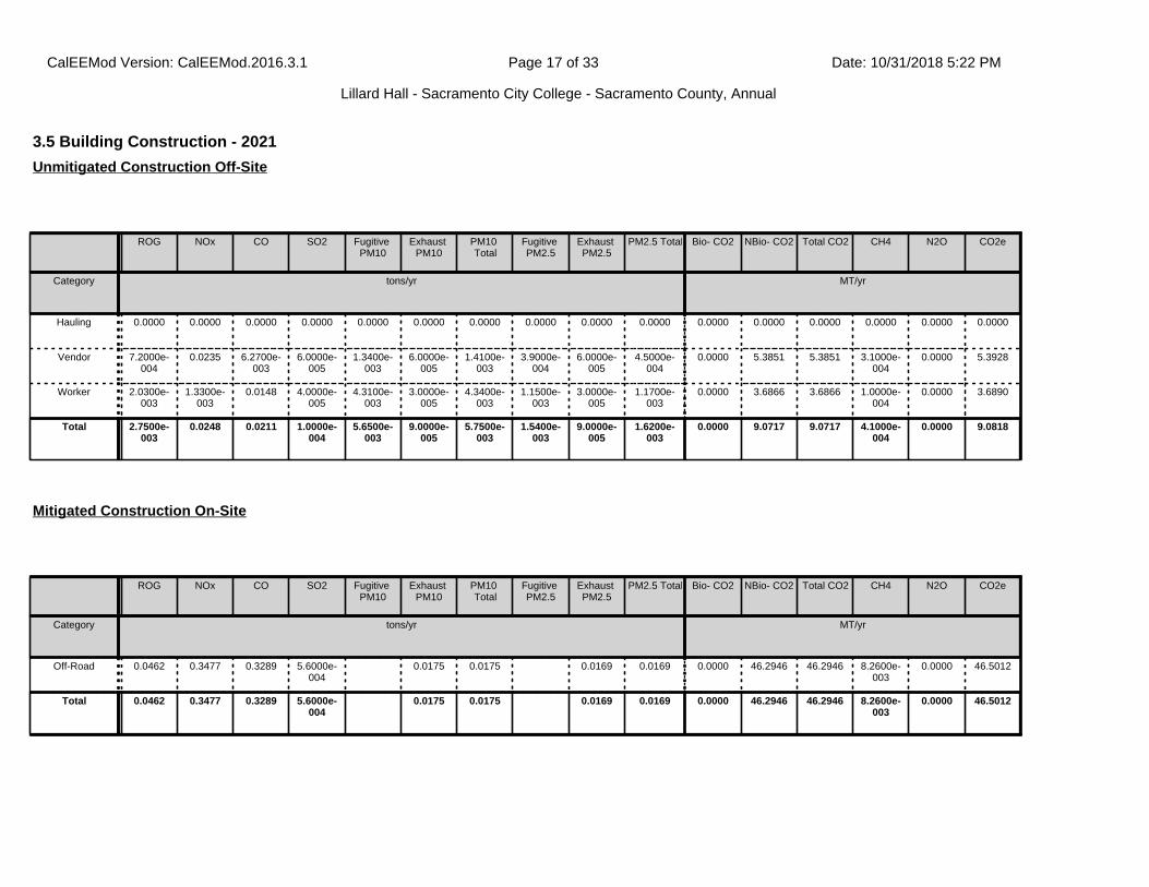
3.5 Building Construction - 2021
ROG NOx CO SO2 Fugitive PM10
Exhaust PM10
PM10 Total
Fugitive PM2.5
Exhaust PM2.5
PM2.5 Total Bio- CO2 NBio- CO2 Total CO2 CH4 N2O CO2e
Category tons/yr MT/yr
Hauling 0.0000 0.0000 0.0000 0.0000 0.0000 0.0000 0.0000 0.0000 0.0000 0.0000 0.0000 0.0000 0.0000 0.0000 0.0000 0.0000
Vendor 7.2000e-004
0.0235 6.2700e-003
6.0000e-005
1.3400e-003
6.0000e-005
1.4100e-003
3.9000e-004
6.0000e-005
4.5000e-004
0.0000 5.3851 5.3851 3.1000e-004
0.0000 5.3928
Worker 2.0300e-003
1.3300e-003
0.0148 4.0000e-005
4.3100e-003
3.0000e-005
4.3400e-003
1.1500e-003
3.0000e-005
1.1700e-003
0.0000 3.6866 3.6866 1.0000e-004
0.0000 3.6890
Total 2.7500e-003
0.0248 0.0211 1.0000e-004
5.6500e-003
9.0000e-005
5.7500e-003
1.5400e-003
9.0000e-005
1.6200e-003
0.0000 9.0717 9.0717 4.1000e-004
0.0000 9.0818
Unmitigated Construction Off-Site
ROG NOx CO SO2 Fugitive PM10
Exhaust PM10
PM10 Total
Fugitive PM2.5
Exhaust PM2.5
PM2.5 Total Bio- CO2 NBio- CO2 Total CO2 CH4 N2O CO2e
Category tons/yr MT/yr
Off-Road 0.0462 0.3477 0.3289 5.6000e-004
0.0175 0.0175 0.0169 0.0169 0.0000 46.2946 46.2946 8.2600e-003
0.0000 46.5012
Total 0.0462 0.3477 0.3289 5.6000e-004
0.0175 0.0175 0.0169 0.0169 0.0000 46.2946 46.2946 8.2600e-003
0.0000 46.5012
Mitigated Construction On-Site
CalEEMod Version: CalEEMod.2016.3.1 Date: 10/31/2018 5:22 PMPage 17 of 33
Lillard Hall - Sacramento City College - Sacramento County, Annual
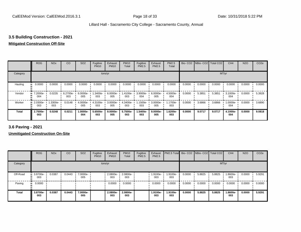
3.5 Building Construction - 2021
ROG NOx CO SO2 Fugitive PM10
Exhaust PM10
PM10 Total
Fugitive PM2.5
Exhaust PM2.5
PM2.5 Total
Bio- CO2 NBio- CO2 Total CO2 CH4 N2O CO2e
Category tons/yr MT/yr
Hauling 0.0000 0.0000 0.0000 0.0000 0.0000 0.0000 0.0000 0.0000 0.0000 0.0000 0.0000 0.0000 0.0000 0.0000 0.0000 0.0000
Vendor 7.2000e-004
0.0235 6.2700e-003
6.0000e-005
1.3400e-003
6.0000e-005
1.4100e-003
3.9000e-004
6.0000e-005
4.5000e-004
0.0000 5.3851 5.3851 3.1000e-004
0.0000 5.3928
Worker 2.0300e-003
1.3300e-003
0.0148 4.0000e-005
4.3100e-003
3.0000e-005
4.3400e-003
1.1500e-003
3.0000e-005
1.1700e-003
0.0000 3.6866 3.6866 1.0000e-004
0.0000 3.6890
Total 2.7500e-003
0.0248 0.0211 1.0000e-004
5.6500e-003
9.0000e-005
5.7500e-003
1.5400e-003
9.0000e-005
1.6200e-003
0.0000 9.0717 9.0717 4.1000e-004
0.0000 9.0818
Mitigated Construction Off-Site
3.6 Paving - 2021
ROG NOx CO SO2 Fugitive PM10
Exhaust PM10
PM10 Total
Fugitive PM2.5
Exhaust PM2.5
PM2.5 Total Bio- CO2 NBio- CO2 Total CO2 CH4 N2O CO2e
Category tons/yr MT/yr
Off-Road 3.8700e-003
0.0387 0.0443 7.0000e-005
2.0800e-003
2.0800e-003
1.9100e-003
1.9100e-003
0.0000 5.8825 5.8825 1.8600e-003
0.0000 5.9291
Paving 0.0000 0.0000 0.0000 0.0000 0.0000 0.0000 0.0000 0.0000 0.0000 0.0000 0.0000
Total 3.8700e-003
0.0387 0.0443 7.0000e-005
2.0800e-003
2.0800e-003
1.9100e-003
1.9100e-003
0.0000 5.8825 5.8825 1.8600e-003
0.0000 5.9291
Unmitigated Construction On-Site
CalEEMod Version: CalEEMod.2016.3.1 Date: 10/31/2018 5:22 PMPage 18 of 33
Lillard Hall - Sacramento City College - Sacramento County, Annual
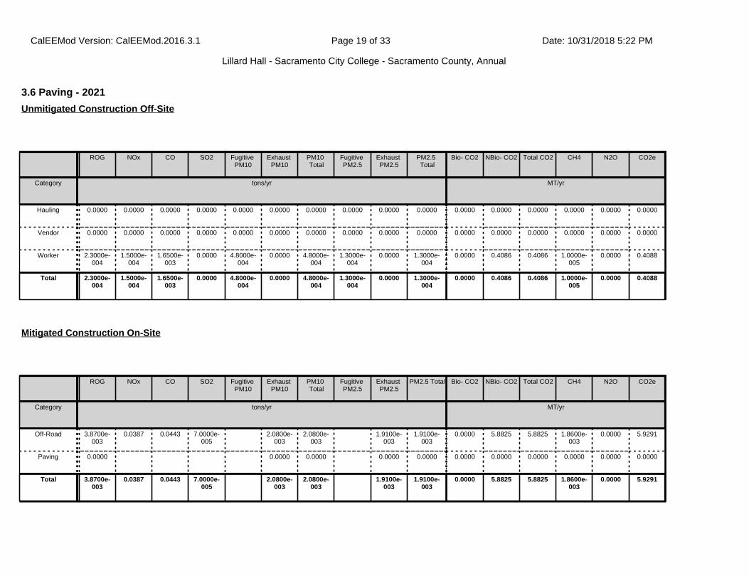
3.6 Paving - 2021
ROG NOx CO SO2 Fugitive PM10
Exhaust PM10
PM10 Total
Fugitive PM2.5
Exhaust PM2.5
PM2.5 Total
Bio- CO2 NBio- CO2 Total CO2 CH4 N2O CO2e
Category tons/yr MT/yr
Hauling 0.0000 0.0000 0.0000 0.0000 0.0000 0.0000 0.0000 0.0000 0.0000 0.0000 0.0000 0.0000 0.0000 0.0000 0.0000 0.0000
Vendor 0.0000 0.0000 0.0000 0.0000 0.0000 0.0000 0.0000 0.0000 0.0000 0.0000 0.0000 0.0000 0.0000 0.0000 0.0000 0.0000
Worker 2.3000e-004
1.5000e-004
1.6500e-003
0.0000 4.8000e-004
0.0000 4.8000e-004
1.3000e-004
0.0000 1.3000e-004
0.0000 0.4086 0.4086 1.0000e-005
0.0000 0.4088
Total 2.3000e-004
1.5000e-004
1.6500e-003
0.0000 4.8000e-004
0.0000 4.8000e-004
1.3000e-004
0.0000 1.3000e-004
0.0000 0.4086 0.4086 1.0000e-005
0.0000 0.4088
Unmitigated Construction Off-Site
ROG NOx CO SO2 Fugitive PM10
Exhaust PM10
PM10 Total
Fugitive PM2.5
Exhaust PM2.5
PM2.5 Total Bio- CO2 NBio- CO2 Total CO2 CH4 N2O CO2e
Category tons/yr MT/yr
Off-Road 3.8700e-003
0.0387 0.0443 7.0000e-005
2.0800e-003
2.0800e-003
1.9100e-003
1.9100e-003
0.0000 5.8825 5.8825 1.8600e-003
0.0000 5.9291
Paving 0.0000 0.0000 0.0000 0.0000 0.0000 0.0000 0.0000 0.0000 0.0000 0.0000 0.0000
Total 3.8700e-003
0.0387 0.0443 7.0000e-005
2.0800e-003
2.0800e-003
1.9100e-003
1.9100e-003
0.0000 5.8825 5.8825 1.8600e-003
0.0000 5.9291
Mitigated Construction On-Site
CalEEMod Version: CalEEMod.2016.3.1 Date: 10/31/2018 5:22 PMPage 19 of 33
Lillard Hall - Sacramento City College - Sacramento County, Annual

3.6 Paving - 2021
ROG NOx CO SO2 Fugitive PM10
Exhaust PM10
PM10 Total
Fugitive PM2.5
Exhaust PM2.5
PM2.5 Total Bio- CO2 NBio- CO2 Total CO2 CH4 N2O CO2e
Category tons/yr MT/yr
Hauling 0.0000 0.0000 0.0000 0.0000 0.0000 0.0000 0.0000 0.0000 0.0000 0.0000 0.0000 0.0000 0.0000 0.0000 0.0000 0.0000
Vendor 0.0000 0.0000 0.0000 0.0000 0.0000 0.0000 0.0000 0.0000 0.0000 0.0000 0.0000 0.0000 0.0000 0.0000 0.0000 0.0000
Worker 2.3000e-004
1.5000e-004
1.6500e-003
0.0000 4.8000e-004
0.0000 4.8000e-004
1.3000e-004
0.0000 1.3000e-004
0.0000 0.4086 0.4086 1.0000e-005
0.0000 0.4088
Total 2.3000e-004
1.5000e-004
1.6500e-003
0.0000 4.8000e-004
0.0000 4.8000e-004
1.3000e-004
0.0000 1.3000e-004
0.0000 0.4086 0.4086 1.0000e-005
0.0000 0.4088
Mitigated Construction Off-Site
3.7 Architectural Coating - 2021
ROG NOx CO SO2 Fugitive PM10
Exhaust PM10
PM10 Total
Fugitive PM2.5
Exhaust PM2.5
PM2.5 Total Bio- CO2 NBio- CO2 Total CO2 CH4 N2O CO2e
Category tons/yr MT/yr
Archit. Coating 0.2540 0.0000 0.0000 0.0000 0.0000 0.0000 0.0000 0.0000 0.0000 0.0000 0.0000
Off-Road 1.0900e-003
7.6300e-003
9.0900e-003
1.0000e-005
4.7000e-004
4.7000e-004
4.7000e-004
4.7000e-004
0.0000 1.2766 1.2766 9.0000e-005
0.0000 1.2788
Total 0.2550 7.6300e-003
9.0900e-003
1.0000e-005
4.7000e-004
4.7000e-004
4.7000e-004
4.7000e-004
0.0000 1.2766 1.2766 9.0000e-005
0.0000 1.2788
Unmitigated Construction On-Site
CalEEMod Version: CalEEMod.2016.3.1 Date: 10/31/2018 5:22 PMPage 20 of 33
Lillard Hall - Sacramento City College - Sacramento County, Annual
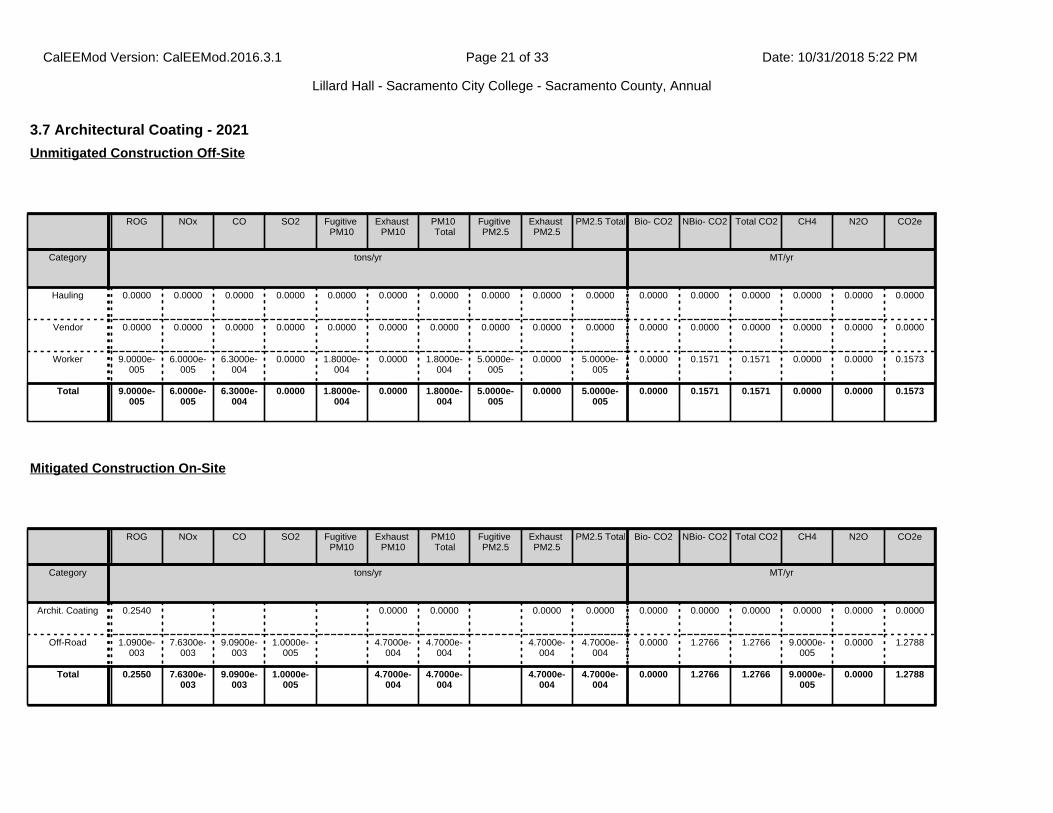
3.7 Architectural Coating - 2021
ROG NOx CO SO2 Fugitive PM10
Exhaust PM10
PM10 Total
Fugitive PM2.5
Exhaust PM2.5
PM2.5 Total Bio- CO2 NBio- CO2 Total CO2 CH4 N2O CO2e
Category tons/yr MT/yr
Hauling 0.0000 0.0000 0.0000 0.0000 0.0000 0.0000 0.0000 0.0000 0.0000 0.0000 0.0000 0.0000 0.0000 0.0000 0.0000 0.0000
Vendor 0.0000 0.0000 0.0000 0.0000 0.0000 0.0000 0.0000 0.0000 0.0000 0.0000 0.0000 0.0000 0.0000 0.0000 0.0000 0.0000
Worker 9.0000e-005
6.0000e-005
6.3000e-004
0.0000 1.8000e-004
0.0000 1.8000e-004
5.0000e-005
0.0000 5.0000e-005
0.0000 0.1571 0.1571 0.0000 0.0000 0.1573
Total 9.0000e-005
6.0000e-005
6.3000e-004
0.0000 1.8000e-004
0.0000 1.8000e-004
5.0000e-005
0.0000 5.0000e-005
0.0000 0.1571 0.1571 0.0000 0.0000 0.1573
Unmitigated Construction Off-Site
ROG NOx CO SO2 Fugitive PM10
Exhaust PM10
PM10 Total
Fugitive PM2.5
Exhaust PM2.5
PM2.5 Total Bio- CO2 NBio- CO2 Total CO2 CH4 N2O CO2e
Category tons/yr MT/yr
Archit. Coating 0.2540 0.0000 0.0000 0.0000 0.0000 0.0000 0.0000 0.0000 0.0000 0.0000 0.0000
Off-Road 1.0900e-003
7.6300e-003
9.0900e-003
1.0000e-005
4.7000e-004
4.7000e-004
4.7000e-004
4.7000e-004
0.0000 1.2766 1.2766 9.0000e-005
0.0000 1.2788
Total 0.2550 7.6300e-003
9.0900e-003
1.0000e-005
4.7000e-004
4.7000e-004
4.7000e-004
4.7000e-004
0.0000 1.2766 1.2766 9.0000e-005
0.0000 1.2788
Mitigated Construction On-Site
CalEEMod Version: CalEEMod.2016.3.1 Date: 10/31/2018 5:22 PMPage 21 of 33
Lillard Hall - Sacramento City College - Sacramento County, Annual

4.0 Operational Detail - Mobile
4.1 Mitigation Measures Mobile
3.7 Architectural Coating - 2021
ROG NOx CO SO2 Fugitive PM10
Exhaust PM10
PM10 Total
Fugitive PM2.5
Exhaust PM2.5
PM2.5 Total
Bio- CO2 NBio- CO2 Total CO2 CH4 N2O CO2e
Category tons/yr MT/yr
Hauling 0.0000 0.0000 0.0000 0.0000 0.0000 0.0000 0.0000 0.0000 0.0000 0.0000 0.0000 0.0000 0.0000 0.0000 0.0000 0.0000
Vendor 0.0000 0.0000 0.0000 0.0000 0.0000 0.0000 0.0000 0.0000 0.0000 0.0000 0.0000 0.0000 0.0000 0.0000 0.0000 0.0000
Worker 9.0000e-005
6.0000e-005
6.3000e-004
0.0000 1.8000e-004
0.0000 1.8000e-004
5.0000e-005
0.0000 5.0000e-005
0.0000 0.1571 0.1571 0.0000 0.0000 0.1573
Total 9.0000e-005
6.0000e-005
6.3000e-004
0.0000 1.8000e-004
0.0000 1.8000e-004
5.0000e-005
0.0000 5.0000e-005
0.0000 0.1571 0.1571 0.0000 0.0000 0.1573
Mitigated Construction Off-Site
CalEEMod Version: CalEEMod.2016.3.1 Date: 10/31/2018 5:22 PMPage 22 of 33
Lillard Hall - Sacramento City College - Sacramento County, Annual
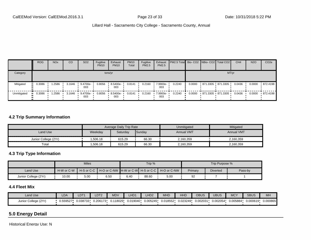
ROG NOx CO SO2 Fugitive PM10
Exhaust PM10
PM10 Total
Fugitive PM2.5
Exhaust PM2.5
PM2.5 Total Bio- CO2 NBio- CO2 Total CO2 CH4 N2O CO2e
Category tons/yr MT/yr
Mitigated 0.3086 1.2586 3.1646 9.4700e-003
0.8056 8.5400e-003
0.8141 0.2160 7.9900e-003
0.2240 0.0000 871.3305 871.3305 0.0436 0.0000 872.4198
Unmitigated 0.3086 1.2586 3.1646 9.4700e-003
0.8056 8.5400e-003
0.8141 0.2160 7.9900e-003
0.2240 0.0000 871.3305 871.3305 0.0436 0.0000 872.4198
4.2 Trip Summary Information
4.3 Trip Type Information
Average Daily Trip Rate Unmitigated Mitigated
Land Use Weekday Saturday Sunday Annual VMT Annual VMT
Junior College (2Yr) 1,506.18 615.29 66.30 2,160,359 2,160,359
Total 1,506.18 615.29 66.30 2,160,359 2,160,359
Miles Trip % Trip Purpose %
Land Use H-W or C-W H-S or C-C H-O or C-NW H-W or C-W H-S or C-C H-O or C-NW Primary Diverted Pass-by
Junior College (2Yr) 10.00 5.00 6.50 6.40 88.60 5.00 92 7 1
5.0 Energy Detail
4.4 Fleet Mix
Land Use LDA LDT1 LDT2 MDV LHD1 LHD2 MHD HHD OBUS UBUS MCY SBUS MH
Junior College (2Yr) 0.559527 0.038733 0.206173 0.118029 0.019040 0.005245 0.018552 0.023249 0.002031 0.002054 0.005884 0.000619 0.000865
Historical Energy Use: N
CalEEMod Version: CalEEMod.2016.3.1 Date: 10/31/2018 5:22 PMPage 23 of 33
Lillard Hall - Sacramento City College - Sacramento County, Annual
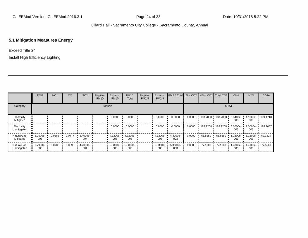
ROG NOx CO SO2 Fugitive PM10
Exhaust PM10
PM10 Total
Fugitive PM2.5
Exhaust PM2.5
PM2.5 Total Bio- CO2 NBio- CO2 Total CO2 CH4 N2O CO2e
Category tons/yr MT/yr
Electricity Mitigated
0.0000 0.0000 0.0000 0.0000 0.0000 108.7090 108.7090 5.3400e-003
1.1000e-003
109.1718
Electricity Unmitigated
0.0000 0.0000 0.0000 0.0000 0.0000 128.2208 128.2208 6.3000e-003
1.3000e-003
128.7667
NaturalGas Mitigated
6.2500e-003
0.0568 0.0477 3.4000e-004
4.3200e-003
4.3200e-003
4.3200e-003
4.3200e-003
0.0000 61.8150 61.8150 1.1800e-003
1.1300e-003
62.1824
NaturalGas Unmitigated
7.7900e-003
0.0708 0.0595 4.2000e-004
5.3800e-003
5.3800e-003
5.3800e-003
5.3800e-003
0.0000 77.1007 77.1007 1.4800e-003
1.4100e-003
77.5589
5.1 Mitigation Measures Energy
Exceed Title 24
Install High Efficiency Lighting
CalEEMod Version: CalEEMod.2016.3.1 Date: 10/31/2018 5:22 PMPage 24 of 33
Lillard Hall - Sacramento City College - Sacramento County, Annual
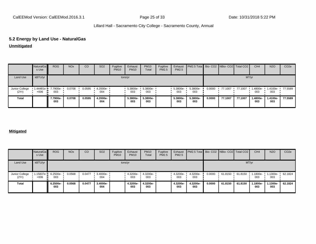
5.2 Energy by Land Use - NaturalGas
NaturalGas Use
ROG NOx CO SO2 Fugitive PM10
Exhaust PM10
PM10 Total
Fugitive PM2.5
Exhaust PM2.5
PM2.5 Total Bio- CO2 NBio- CO2 Total CO2 CH4 N2O CO2e
Land Use kBTU/yr tons/yr MT/yr
Junior College (2Yr)
1.44481e+006
7.7900e-003
0.0708 0.0595 4.2000e-004
5.3800e-003
5.3800e-003
5.3800e-003
5.3800e-003
0.0000 77.1007 77.1007 1.4800e-003
1.4100e-003
77.5589
Total 7.7900e-003
0.0708 0.0595 4.2000e-004
5.3800e-003
5.3800e-003
5.3800e-003
5.3800e-003
0.0000 77.1007 77.1007 1.4800e-003
1.4100e-003
77.5589
Unmitigated
NaturalGas Use
ROG NOx CO SO2 Fugitive PM10
Exhaust PM10
PM10 Total
Fugitive PM2.5
Exhaust PM2.5
PM2.5 Total Bio- CO2 NBio- CO2 Total CO2 CH4 N2O CO2e
Land Use kBTU/yr tons/yr MT/yr
Junior College (2Yr)
1.15837e+006
6.2500e-003
0.0568 0.0477 3.4000e-004
4.3200e-003
4.3200e-003
4.3200e-003
4.3200e-003
0.0000 61.8150 61.8150 1.1800e-003
1.1300e-003
62.1824
Total 6.2500e-003
0.0568 0.0477 3.4000e-004
4.3200e-003
4.3200e-003
4.3200e-003
4.3200e-003
0.0000 61.8150 61.8150 1.1800e-003
1.1300e-003
62.1824
Mitigated
CalEEMod Version: CalEEMod.2016.3.1 Date: 10/31/2018 5:22 PMPage 25 of 33
Lillard Hall - Sacramento City College - Sacramento County, Annual
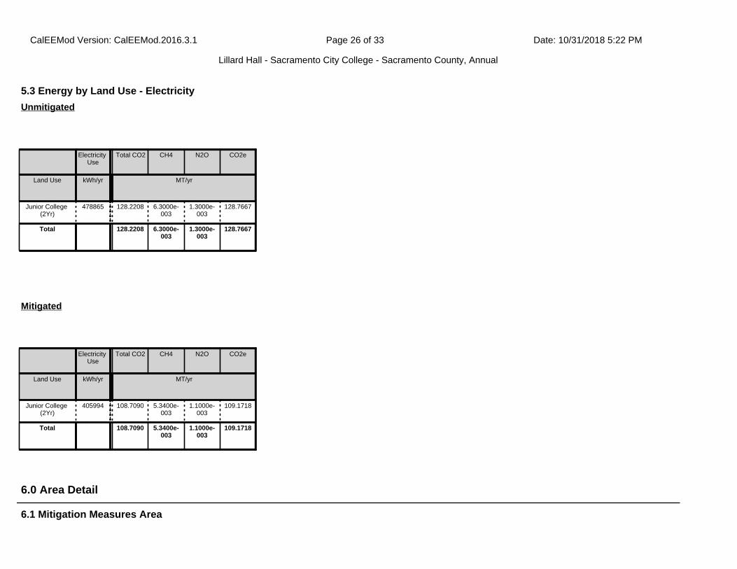
6.1 Mitigation Measures Area
6.0 Area Detail
5.3 Energy by Land Use - Electricity
Electricity Use
Total CO2 CH4 N2O CO2e
Land Use kWh/yr MT/yr
Junior College (2Yr)
478865 128.2208 6.3000e-003
1.3000e-003
128.7667
Total 128.2208 6.3000e-003
1.3000e-003
128.7667
Unmitigated
Electricity Use
Total CO2 CH4 N2O CO2e
Land Use kWh/yr MT/yr
Junior College (2Yr)
405994 108.7090 5.3400e-003
1.1000e-003
109.1718
Total 108.7090 5.3400e-003
1.1000e-003
109.1718
Mitigated
CalEEMod Version: CalEEMod.2016.3.1 Date: 10/31/2018 5:22 PMPage 26 of 33
Lillard Hall - Sacramento City College - Sacramento County, Annual
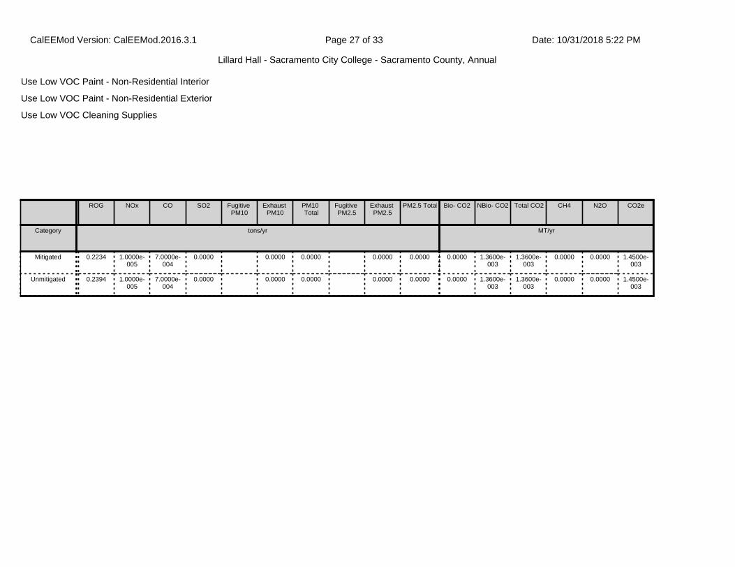
Use Low VOC Paint - Non-Residential Interior
Use Low VOC Paint - Non-Residential Exterior
Use Low VOC Cleaning Supplies
ROG NOx CO SO2 Fugitive PM10
Exhaust PM10
PM10 Total
Fugitive PM2.5
Exhaust PM2.5
PM2.5 Total Bio- CO2 NBio- CO2 Total CO2 CH4 N2O CO2e
Category tons/yr MT/yr
Mitigated 0.2234 1.0000e-005
7.0000e-004
0.0000 0.0000 0.0000 0.0000 0.0000 0.0000 1.3600e-003
1.3600e-003
0.0000 0.0000 1.4500e-003
Unmitigated 0.2394 1.0000e-005
7.0000e-004
0.0000 0.0000 0.0000 0.0000 0.0000 0.0000 1.3600e-003
1.3600e-003
0.0000 0.0000 1.4500e-003
CalEEMod Version: CalEEMod.2016.3.1 Date: 10/31/2018 5:22 PMPage 27 of 33
Lillard Hall - Sacramento City College - Sacramento County, Annual
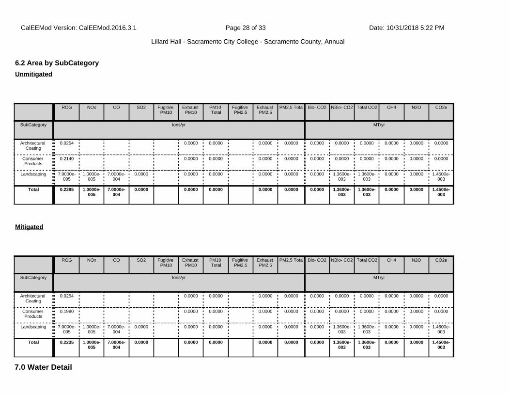
7.0 Water Detail
6.2 Area by SubCategory
ROG NOx CO SO2 Fugitive PM10
Exhaust PM10
PM10 Total
Fugitive PM2.5
Exhaust PM2.5
PM2.5 Total Bio- CO2 NBio- CO2 Total CO2 CH4 N2O CO2e
SubCategory tons/yr MT/yr
Architectural Coating
0.0254 0.0000 0.0000 0.0000 0.0000 0.0000 0.0000 0.0000 0.0000 0.0000 0.0000
Consumer Products
0.2140 0.0000 0.0000 0.0000 0.0000 0.0000 0.0000 0.0000 0.0000 0.0000 0.0000
Landscaping 7.0000e-005
1.0000e-005
7.0000e-004
0.0000 0.0000 0.0000 0.0000 0.0000 0.0000 1.3600e-003
1.3600e-003
0.0000 0.0000 1.4500e-003
Total 0.2395 1.0000e-005
7.0000e-004
0.0000 0.0000 0.0000 0.0000 0.0000 0.0000 1.3600e-003
1.3600e-003
0.0000 0.0000 1.4500e-003
Unmitigated
ROG NOx CO SO2 Fugitive PM10
Exhaust PM10
PM10 Total
Fugitive PM2.5
Exhaust PM2.5
PM2.5 Total Bio- CO2 NBio- CO2 Total CO2 CH4 N2O CO2e
SubCategory tons/yr MT/yr
Architectural Coating
0.0254 0.0000 0.0000 0.0000 0.0000 0.0000 0.0000 0.0000 0.0000 0.0000 0.0000
Consumer Products
0.1980 0.0000 0.0000 0.0000 0.0000 0.0000 0.0000 0.0000 0.0000 0.0000 0.0000
Landscaping 7.0000e-005
1.0000e-005
7.0000e-004
0.0000 0.0000 0.0000 0.0000 0.0000 0.0000 1.3600e-003
1.3600e-003
0.0000 0.0000 1.4500e-003
Total 0.2235 1.0000e-005
7.0000e-004
0.0000 0.0000 0.0000 0.0000 0.0000 0.0000 1.3600e-003
1.3600e-003
0.0000 0.0000 1.4500e-003
Mitigated
CalEEMod Version: CalEEMod.2016.3.1 Date: 10/31/2018 5:22 PMPage 28 of 33
Lillard Hall - Sacramento City College - Sacramento County, Annual
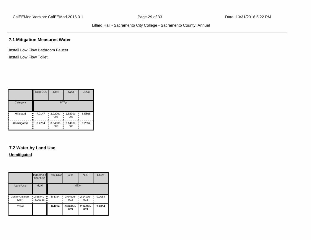
Install Low Flow Bathroom Faucet
Install Low Flow Toilet
7.1 Mitigation Measures Water
Total CO2 CH4 N2O CO2e
Category MT/yr
Mitigated 7.9147 3.2200e-003
1.8800e-003
8.5566
Unmitigated 8.4754 3.6400e-003
2.1400e-003
9.2054
7.2 Water by Land Use
Indoor/Outdoor Use
Total CO2 CH4 N2O CO2e
Land Use Mgal MT/yr
Junior College (2Yr)
2.6874 / 4.20336
8.4754 3.6400e-003
2.1400e-003
9.2054
Total 8.4754 3.6400e-003
2.1400e-003
9.2054
Unmitigated
7.0 Water Detail
CalEEMod Version: CalEEMod.2016.3.1 Date: 10/31/2018 5:22 PMPage 29 of 33
Lillard Hall - Sacramento City College - Sacramento County, Annual
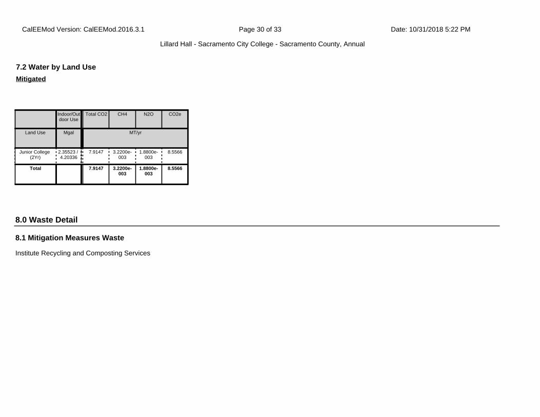
8.1 Mitigation Measures Waste
Institute Recycling and Composting Services
7.2 Water by Land Use
Indoor/Outdoor Use
Total CO2 CH4 N2O CO2e
Land Use Mgal MT/yr
Junior College (2Yr)
2.35523 / 4.20336
7.9147 3.2200e-003
1.8800e-003
8.5566
Total 7.9147 3.2200e-003
1.8800e-003
8.5566
Mitigated
8.0 Waste Detail
CalEEMod Version: CalEEMod.2016.3.1 Date: 10/31/2018 5:22 PMPage 30 of 33
Lillard Hall - Sacramento City College - Sacramento County, Annual
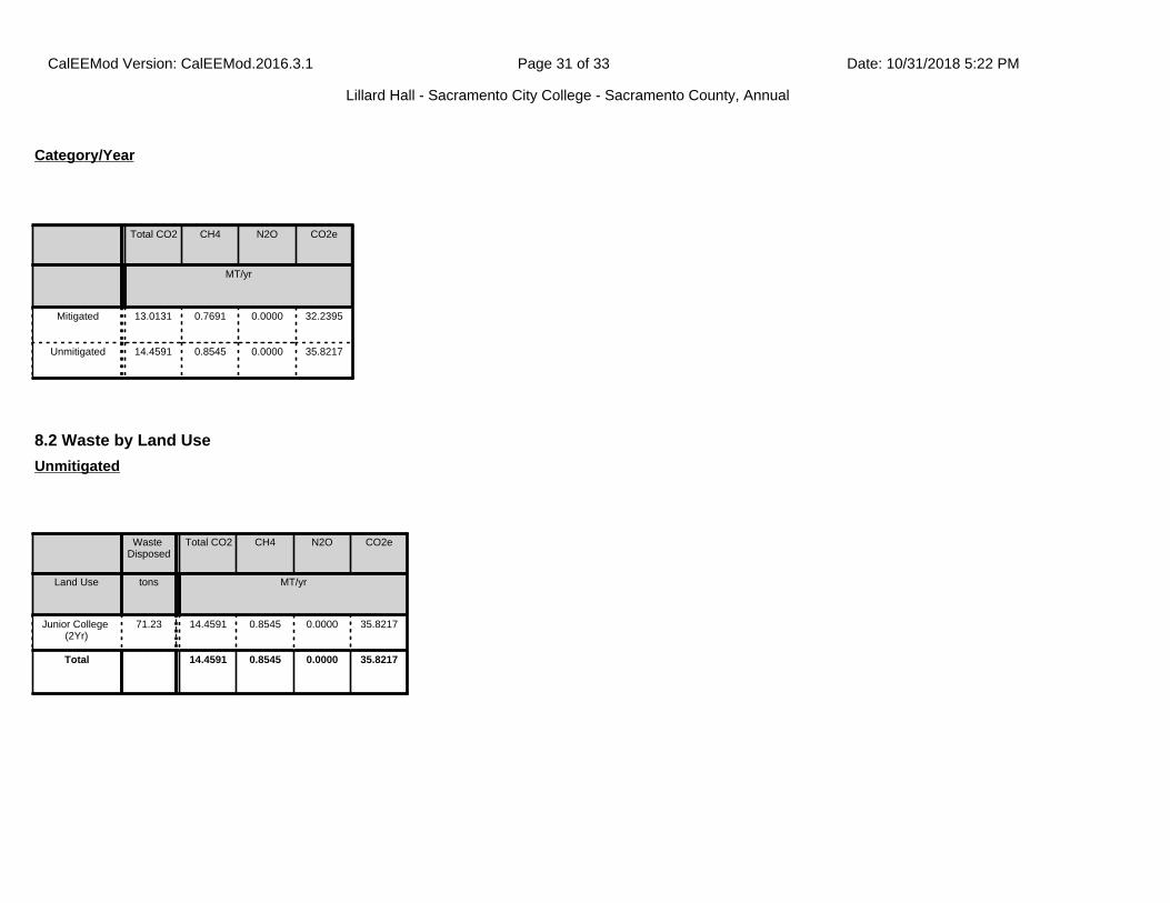
Total CO2 CH4 N2O CO2e
MT/yr
Mitigated 13.0131 0.7691 0.0000 32.2395
Unmitigated 14.4591 0.8545 0.0000 35.8217
Category/Year
8.2 Waste by Land Use
Waste Disposed
Total CO2 CH4 N2O CO2e
Land Use tons MT/yr
Junior College (2Yr)
71.23 14.4591 0.8545 0.0000 35.8217
Total 14.4591 0.8545 0.0000 35.8217
Unmitigated
CalEEMod Version: CalEEMod.2016.3.1 Date: 10/31/2018 5:22 PMPage 31 of 33
Lillard Hall - Sacramento City College - Sacramento County, Annual
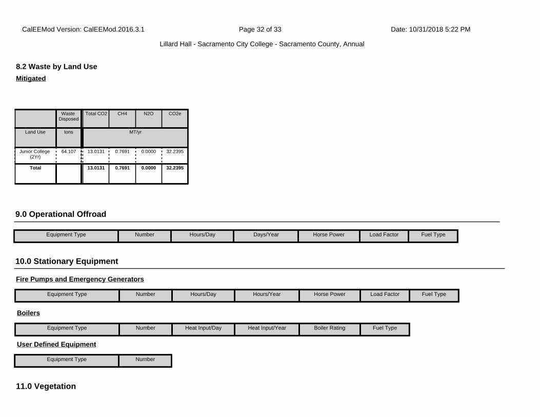
11.0 Vegetation
8.2 Waste by Land Use
Waste Disposed
Total CO2 CH4 N2O CO2e
Land Use tons MT/yr
Junior College (2Yr)
64.107 13.0131 0.7691 0.0000 32.2395
Total 13.0131 0.7691 0.0000 32.2395
Mitigated
9.0 Operational Offroad
Equipment Type Number Hours/Day Days/Year Horse Power Load Factor Fuel Type
10.0 Stationary Equipment
Fire Pumps and Emergency Generators
Equipment Type Number Hours/Day Hours/Year Horse Power Load Factor Fuel Type
Boilers
Equipment Type Number Heat Input/Day Heat Input/Year Boiler Rating Fuel Type
User Defined Equipment
Equipment Type Number
CalEEMod Version: CalEEMod.2016.3.1 Date: 10/31/2018 5:22 PMPage 32 of 33
Lillard Hall - Sacramento City College - Sacramento County, Annual

Total CO2 CH4 N2O CO2e
Category MT
Unmitigated 18.4080 0.0000 0.0000 18.4080
11.2 Net New Trees
Number of Trees
Total CO2 CH4 N2O CO2e
MT
Miscellaneous 26 18.4080 0.0000 0.0000 18.4080
Total 18.4080 0.0000 0.0000 18.4080
Species Class
CalEEMod Version: CalEEMod.2016.3.1 Date: 10/31/2018 5:22 PMPage 33 of 33
Lillard Hall - Sacramento City College - Sacramento County, Annual

1.1 Land Usage
Land Uses Size Metric Lot Acreage Floor Surface Area Population
Junior College (2Yr) 54.79 1000sqft 1.26 54,790.00 0
1.2 Other Project Characteristics
Urbanization
Climate Zone
Urban
6
Wind Speed (m/s) Precipitation Freq (Days)3.5 58
1.3 User Entered Comments
1.0 Project Characteristics
Utility Company Sacramento Municipal Utility District
2022Operational Year
CO2 Intensity (lb/MWhr)
590.31 0.029CH4 Intensity (lb/MWhr)
0.006N2O Intensity (lb/MWhr)
Lillard Hall - Sacramento City CollegeSacramento, Summary Report
Only CalEEMod defaults were used.
CalEEMod Version: CalEEMod.2016.3.1 Date: 10/31/2018 5:25 PMPage 1 of 4
Lillard Hall - Sacramento City College - Sacramento County, Summary Report

Project Characteristics -
Land Use -
Construction Phase -
Off-road Equipment -
Demolition - Old Lillard Hall to be removed.
Grading - The project consists of near surface clay soils which are suitable for use as engineered fill.
Road Dust -
Construction Off-road Equipment Mitigation -
Area Mitigation -
Sequestration -
Energy Mitigation - Per HGA based on target goal and exceedances on similar projects.
Waste Mitigation -
Water Mitigation -
2.0 Peak Daily Emissions
Peak Daily Construction Emissions
Peak Daily Construction Emissions
CalEEMod Version: CalEEMod.2016.3.1 Date: 10/31/2018 5:25 PMPage 2 of 4
Lillard Hall - Sacramento City College - Sacramento County, Summary Report
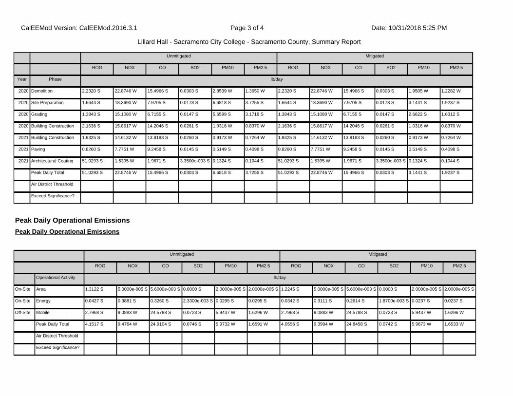
Unmitigated Mitigated
ROG NOX CO SO2 PM10 PM2.5 ROG NOX CO SO2 PM10 PM2.5
Year Phase lb/day
2020 Demolition 2.2320 S 22.8746 W 15.4966 S 0.0303 S 2.8539 W 1.3650 W 2.2320 S 22.8746 W 15.4966 S 0.0303 S 1.9505 W 1.2282 W
2020 Site Preparation 1.6644 S 18.3690 W 7.9705 S 0.0178 S 6.6818 S 3.7255 S 1.6644 S 18.3690 W 7.9705 S 0.0178 S 3.1441 S 1.9237 S
2020 Grading 1.3843 S 15.1080 W 6.7155 S 0.0147 S 5.6599 S 3.1718 S 1.3843 S 15.1080 W 6.7155 S 0.0147 S 2.6622 S 1.6312 S
2020 Building Construction 2.1636 S 15.8617 W 14.2046 S 0.0261 S 1.0316 W 0.8370 W 2.1636 S 15.8617 W 14.2046 S 0.0261 S 1.0316 W 0.8370 W
2021 Building Construction 1.9325 S 14.6132 W 13.8183 S 0.0260 S 0.9173 W 0.7264 W 1.9325 S 14.6132 W 13.8183 S 0.0260 S 0.9173 W 0.7264 W
2021 Paving 0.8260 S 7.7751 W 9.2458 S 0.0145 S 0.5149 S 0.4098 S 0.8260 S 7.7751 W 9.2458 S 0.0145 S 0.5149 S 0.4098 S
2021 Architectural Coating 51.0293 S 1.5395 W 1.9671 S 3.3500e-003 S 0.1324 S 0.1044 S 51.0293 S 1.5395 W 1.9671 S 3.3500e-003 S 0.1324 S 0.1044 S
Peak Daily Total 51.0293 S 22.8746 W 15.4966 S 0.0303 S 6.6818 S 3.7255 S 51.0293 S 22.8746 W 15.4966 S 0.0303 S 3.1441 S 1.9237 S
Air District Threshold
Exceed Significance?
Peak Daily Operational Emissions
Peak Daily Operational Emissions
Unmitigated Mitigated
ROG NOX CO SO2 PM10 PM2.5 ROG NOX CO SO2 PM10 PM2.5
Operational Activity lb/day
On-Site Area 1.3122 S 5.0000e-005 S 5.6000e-003 S 0.0000 S 2.0000e-005 S 2.0000e-005 S 1.2245 S 5.0000e-005 S 5.6000e-003 S 0.0000 S 2.0000e-005 S 2.0000e-005 S
On-Site Energy 0.0427 S 0.3881 S 0.3260 S 2.3300e-003 S 0.0295 S 0.0295 S 0.0342 S 0.3111 S 0.2614 S 1.8700e-003 S 0.0237 S 0.0237 S
Off-Site Mobile 2.7968 S 9.0883 W 24.5788 S 0.0723 S 5.9437 W 1.6296 W 2.7968 S 9.0883 W 24.5788 S 0.0723 S 5.9437 W 1.6296 W
Peak Daily Total 4.1517 S 9.4764 W 24.9104 S 0.0746 S 5.9732 W 1.6591 W 4.0556 S 9.3994 W 24.8458 S 0.0742 S 5.9673 W 1.6533 W
Air District Threshold
Exceed Significance?
CalEEMod Version: CalEEMod.2016.3.1 Date: 10/31/2018 5:25 PMPage 3 of 4
Lillard Hall - Sacramento City College - Sacramento County, Summary Report

3.0 Annual GHG Emissions
Annual GHG
Annual GHG
Unmitigated Mitigated
CO2 CH4 N2O CO2e CO2 CH4 N2O CO2e
GHG Activity Year MT/yr
Construction 2020 193.3361 0.0334 0.0000 194.1707 193.3359 0.0334 0.0000 194.1705
Construction 2021 63.0912 0.0106 0.0000 63.3570 63.0911 0.0106 0.0000 63.3569
Operational 2022 1,099.5879 0.9095 4.8534e-003 1,123.7714 1,062.7838 0.8224 4.1277e-003 1,084.5729
Total
Significance Threshold
Exceed Significance?
CalEEMod Version: CalEEMod.2016.3.1 Date: 10/31/2018 5:25 PMPage 4 of 4
Lillard Hall - Sacramento City College - Sacramento County, Summary Report

APPENDIX C

PROJECT: LRCCD SCC
LILLARD HALL MODERNIZATION
HGA Commission Number 2600-008-00
FROM: Ida Brown Writer’s Direct Dial 916-787-5161
ISSUE DATE: September 4, 2018
MEETING
Purpose: Schematic Design Champions Meeting #1
Date: August 31, 2018 Time: 1:30 - 3:30 PM
Location: SCC - Rodda Hall, Room 258
PRESENT:
Name Company Email
See sign in sheet attached.
Item
1. Introductions Schematic Design Phase Overview and Review of Programming Efforts
Creed (HGA) began the meeting by introducing Ida (HGA) as a new member of the
project team with HGA. Starting in the Schematic Design phase, she has taken on the role
of Project Architect.
A. Creed described the schematic design process including objectives and
schedule. There will be a total of (4) Champions meetings held by which the
design concepts will be explored and determined. User group meetings (2) will be
held as a simultaneous process to determine individual lab designs.
B. Creed presented a recap of decisions made during the previous programming
phase including project goals, ASF allocations, building stratification/program
locations, adjacencies, efficiency goals and test fits.
C. Creed presented schematic design considerations which have influenced the
initial design concepts to be presented today, such as site features and constraints
(courtyard and street orientation, parking lot adjacency, utilities locations) and
sustainability goals/strategies (zero net energy, solar orientation, compact building
form, shade, etc.).
2. Initial Design Concepts

LRCCD SCC LILLARD HALL MODERNIZATION
August 9, 2018
Page 2
Item
Ida (HGA) presented (4) initial design concepts illustrated by a site plan overlaid with the
building footprint, schematic floor plans with general program locations, circulation and
stacking identified, and building massing images. Each scheme was accompanied by a
physical massing model placed on the site model.
A. Ida (HGA) presented the Initial Design Concept, “Framed”. The concept is a
three-story angular and stacked design with faces parallel to the parking lot and
Sutterville Road, and the entry orientated towards the interior courtyard. The
concept includes offices and lecture at the first floor with the offices located at
the NE corner, Biology at the 2nd floor along with (1) lecture hall, and Chemistry at
the 3rd floor along with (1) lecture hall.
i) 1st floor (lecture storage): Staff (SCC) commented that lecture storage at the
tiered lecture halls should be located at the lowest level, and all lecture
storage areas also require doors to the corridors. It was suggested that the
lecture storage serving the 1,620 SF and 1,140 SF lecture halls may need to be
larger than those serving individual 1,300 SF lecture halls.
ii) 1st floor (lecture halls): Staff (SCC) commented that the large lecture hall is
preferred to have an exit directly to the exterior.
iii) 1st floor (offices): a conversation developed regarding the offices and if there
should be any kind of departmental separation. It was decided that the
offices should still be located together in one area, and this issue can be dealt
with in the assignment of offices later. Regarding daylighting at offices, the
preference is for exterior windows at each office but it is acknowledged that
this may not be possible. Some offices may need to access daylight through
interior glazing and borrowed light.
iv) 1st floor (circulation space): Staff (SCC) commented that the covered area at
the entry could be used for outdoor classrooms, and the circulation space is
good in this concept. There is concern though with noise levels with the
lectures located adjacent to the main entry and public area. The offices
would be a better adjacency to the main entry than the lecture halls.
v) 2nd floor (Biology): Carmen (SCC) commented that the lecture hall is not ideal
located near the main hub and circulation space. It would be better to move
the Lecture hall to the southern end of the building and shift Micro-bio and Bio
Prep labs up to be adjacent to the hub space. Staff (SCC) requests to
incorporate display space in corridors (common to all schemes).
vi) 2nd and 3rd floors (corridors and student gathering space): Staff (SCC) has
aversion to long corridors. These will need to be broken up with student
gathering niches and spaces, but consider location of niches to prevent
unwanted noise outside of labs and lecture rooms (common for all schemes)
vii) 3rd floor (Chemistry): Varnell (SCC) commented that both Chemistry Instrument
rooms should be identical, which means the instrument room located at the
interior corner of the angle cannot be adjusted to fit to the triangular space.
viii) Massing: Dan (LRCCD) suggested that the public faces oriented towards the
parking lot and Sutterville Road could be treated architecturally to match the
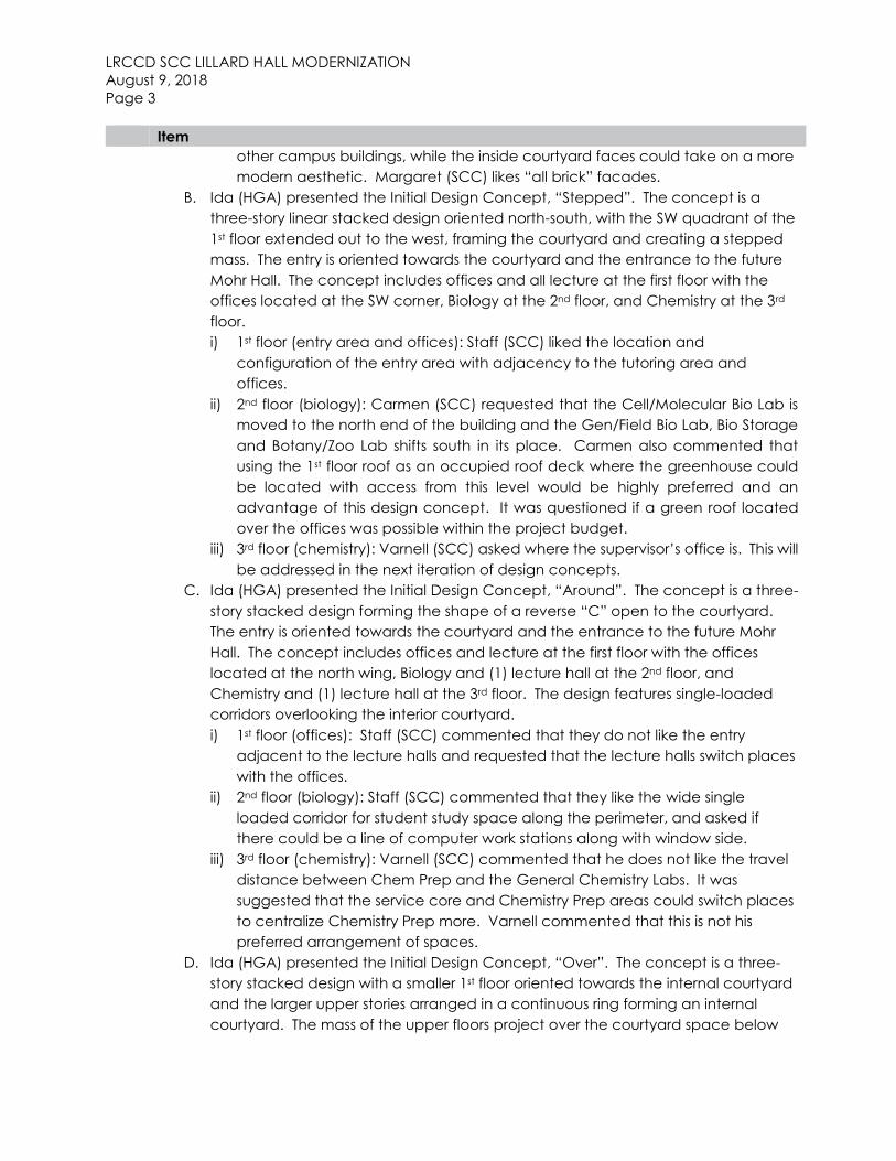
LRCCD SCC LILLARD HALL MODERNIZATION
August 9, 2018
Page 3
Item
other campus buildings, while the inside courtyard faces could take on a more
modern aesthetic. Margaret (SCC) likes “all brick” facades.
B. Ida (HGA) presented the Initial Design Concept, “Stepped”. The concept is a
three-story linear stacked design oriented north-south, with the SW quadrant of the
1st floor extended out to the west, framing the courtyard and creating a stepped
mass. The entry is oriented towards the courtyard and the entrance to the future
Mohr Hall. The concept includes offices and all lecture at the first floor with the
offices located at the SW corner, Biology at the 2nd floor, and Chemistry at the 3rd
floor.
i) 1st floor (entry area and offices): Staff (SCC) liked the location and
configuration of the entry area with adjacency to the tutoring area and
offices.
ii) 2nd floor (biology): Carmen (SCC) requested that the Cell/Molecular Bio Lab is
moved to the north end of the building and the Gen/Field Bio Lab, Bio Storage
and Botany/Zoo Lab shifts south in its place. Carmen also commented that
using the 1st floor roof as an occupied roof deck where the greenhouse could
be located with access from this level would be highly preferred and an
advantage of this design concept. It was questioned if a green roof located
over the offices was possible within the project budget.
iii) 3rd floor (chemistry): Varnell (SCC) asked where the supervisor’s office is. This will
be addressed in the next iteration of design concepts.
C. Ida (HGA) presented the Initial Design Concept, “Around”. The concept is a three-
story stacked design forming the shape of a reverse “C” open to the courtyard.
The entry is oriented towards the courtyard and the entrance to the future Mohr
Hall. The concept includes offices and lecture at the first floor with the offices
located at the north wing, Biology and (1) lecture hall at the 2nd floor, and
Chemistry and (1) lecture hall at the 3rd floor. The design features single-loaded
corridors overlooking the interior courtyard.
i) 1st floor (offices): Staff (SCC) commented that they do not like the entry
adjacent to the lecture halls and requested that the lecture halls switch places
with the offices.
ii) 2nd floor (biology): Staff (SCC) commented that they like the wide single
loaded corridor for student study space along the perimeter, and asked if
there could be a line of computer work stations along with window side.
iii) 3rd floor (chemistry): Varnell (SCC) commented that he does not like the travel
distance between Chem Prep and the General Chemistry Labs. It was
suggested that the service core and Chemistry Prep areas could switch places
to centralize Chemistry Prep more. Varnell commented that this is not his
preferred arrangement of spaces.
D. Ida (HGA) presented the Initial Design Concept, “Over”. The concept is a three-
story stacked design with a smaller 1st floor oriented towards the internal courtyard
and the larger upper stories arranged in a continuous ring forming an internal
courtyard. The mass of the upper floors project over the courtyard space below
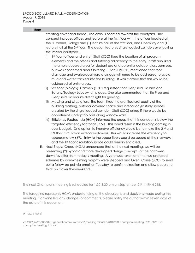
LRCCD SCC LILLARD HALL MODERNIZATION
August 9, 2018
Page 4
Item
creating cover and shade. The entry is oriented towards the courtyard. The
concept includes offices and lecture at the first floor with the offices located at
the SE corner, Biology and (1) lecture hall at the 2nd floor, and Chemistry and (1)
lecture hall at the 3rd floor. The design features single-loaded corridors overlooking
the interior courtyard.
i) 1st floor (offices and entry): Staff (SCC) liked the location of all program
elements and the offices and tutoring adjacency to the entry. Staff also liked
the ample covered area for student use and potential outdoor classroom use,
but was concerned about loitering. Dan (LRCCD) mentioned that roof
drainage and swales/courtyard drainage will need to be addressed to avoid
mud and water tracked into the building. It was clarified that this would be
addressed at entry areas.
ii) 2nd floor (biology): Carmen (SCC) requested that Gen/Field Bio labs and
Botany/Zoology Labs switch places. She also commented that Bio Prep and
Gen/Field Bio require direct light for growing.
iii) Massing and circulation: The team liked the architectural quality of the
building massing, outdoor covered space and interior daylit study spaces
created by the single-loaded corridor. Staff (SCC) asked if there would be
opportunities for laptop bars along window walls.
iv) Efficiency Factor: Ida (HGA) informed the group that this concept is below the
targeted efficiency factor at 57.5%. This could result in the building coming in
over budget. One option to improve efficiency would be to make the 2nd and
3rd floor circulation exterior walkways. This would increase the efficiency to
approximately 66%. Entry to the upper floors could be secure at the stairways
and the 1st floor circulation space could remain enclosed.
E. Next Steps: Creed (HGA) announced that at the next meeting, we will be
presenting (2) hybrid and more developed design concepts of the narrowed
down favorites from today’s meeting. A vote was taken and the two preferred
schemes by overwhelming majority were Stepped and Over. Carrie (SCC) to send
out a follow-up poll via email on Tuesday to confirm direction and allow people to
think on it over the weekend.
The next Champions meeting is scheduled for 1:30-3:30 pm on September 21th in RHN 258.
The foregoing represents HGA's understanding of the discussions and decisions made during this
meeting. If anyone has any changes or comments, please notify the author within seven days of
the date of this document.
Attachment
x:\2600\2600\008-00\1. general communications\meeting minutes\20180831 champion meeting 1\20180831 sd
champion meeting 1.docx


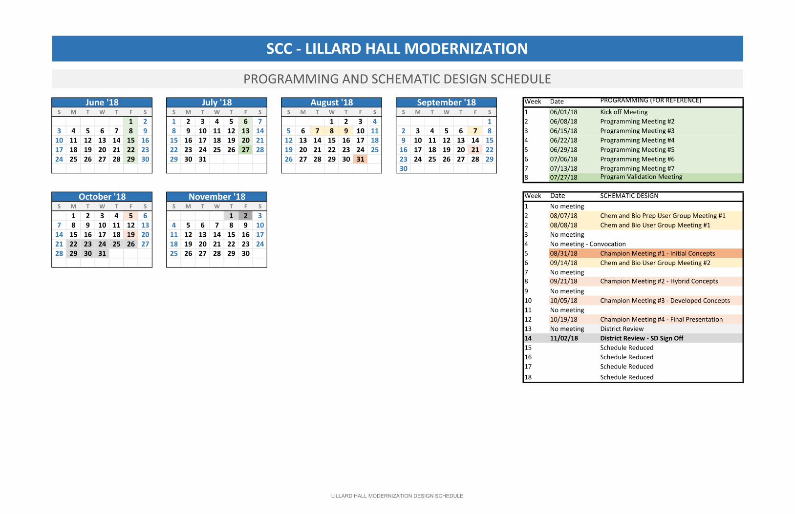
Week Date PROGRAMMING (FOR REFERENCE)
S M T W T F S S M T W T F S S M T W T F S S M T W T F S 1 06/01/18 Kick off Meeting
1 2 1 2 3 4 5 6 7 1 2 3 4 1 2 06/08/18 Programming Meeting #2
3 4 5 6 7 8 9 8 9 10 11 12 13 14 5 6 7 8 9 10 11 2 3 4 5 6 7 8 3 06/15/18 Programming Meeting #3
10 11 12 13 14 15 16 15 16 17 18 19 20 21 12 13 14 15 16 17 18 9 10 11 12 13 14 15 4 06/22/18 Programming Meeting #4
17 18 19 20 21 22 23 22 23 24 25 26 27 28 19 20 21 22 23 24 25 16 17 18 19 20 21 22 5 06/29/18 Programming Meeting #5
24 25 26 27 28 29 30 29 30 31 26 27 28 29 30 31 23 24 25 26 27 28 29 6 07/06/18 Programming Meeting #6
30 7 07/13/18 Programming Meeting #7
8 07/27/18 Program Validation Meeting
Week Date SCHEMATIC DESIGN
S M T W T F S S M T W T F S 1 No meeting
1 2 3 4 5 6 1 2 3 2 08/07/18 Chem and Bio Prep User Group Meeting #1
7 8 9 10 11 12 13 4 5 6 7 8 9 10 2 08/08/18 Chem and Bio User Group Meeting #1
14 15 16 17 18 19 20 11 12 13 14 15 16 17 3 No meeting
21 22 23 24 25 26 27 18 19 20 21 22 23 24 4 No meeting - Convocation
28 29 30 31 25 26 27 28 29 30 5 08/31/18 Champion Meeting #1 - Initial Concepts
6 09/14/18 Chem and Bio User Group Meeting #2
7 No meeting
8 09/21/18 Champion Meeting #2 - Hybrid Concepts
9 No meeting
10 10/05/18 Champion Meeting #3 - Developed Concepts
11 No meeting
12 10/19/18 Champion Meeting #4 - Final Presentation
13 No meeting District Review
14 11/02/18 District Review - SD Sign Off
15 Schedule Reduced
16 Schedule Reduced
17 Schedule Reduced
18 Schedule Reduced
PROGRAMMING AND SCHEMATIC DESIGN SCHEDULE
SCC - LILLARD HALL MODERNIZATION
October '18 November '18
June '18 July '18 August '18 September '18
LILLARD HALL MODERNIZATION DESIGN SCHEDULE
LOS RIOS COMMUNITY COLLEGE DISTRICTSACRAMENTO CITY COLLEGE
LILLARD HALL MODERNIZATIONCHAMPION MEETING #1 – 8/31/18

Champion Meeting #1
• SCHEMATIC DESIGN PHASE OVERVIEW
• REVIEW OF PROGRAMMING EFFORTS
• ADDITIONAL SCHEMATIC DESIGN CONSIDERATIONS
• INITIAL DESIGN CONCEPTS
• NEXT STEPS
© 2018 HGA 2
AGENDA

Schematic Design Objectives
• Site plan
• Floor plans
• Building massing
• Exterior building treatments (materials and colors)
• Building Systems
© 2018 HGA 3
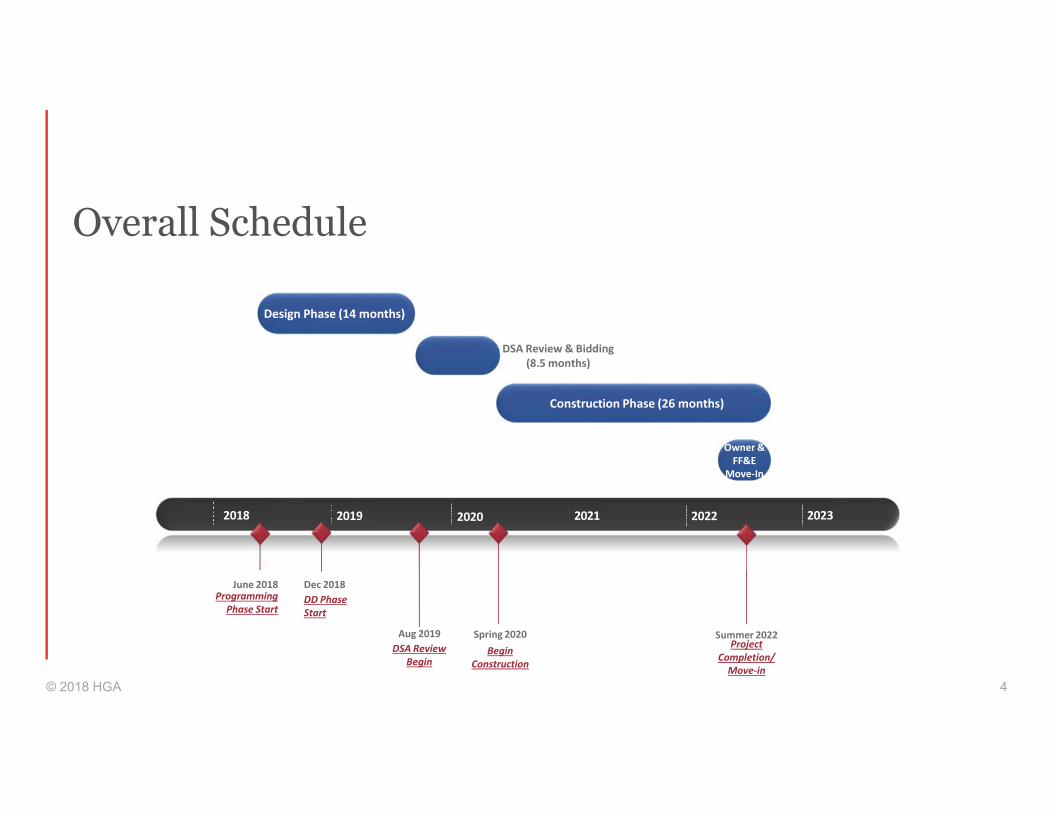
Overall Schedule
© 2018 HGA 4
2018 2019 2020 2021 2022
Programming
Phase Start
June 2018
Project
Completion/
Move-in
Summer 2022
Design Phase (14 months)
Dec 2018
DD Phase
Start
Aug 2019
DSA Review
Begin
Construction Phase (26 months)
Spring 2020
Begin
Construction
Owner &
FF&E
Move-In
DSA Review & Bidding
(8.5 months)
2023

Schematic Design Look-Ahead
• 2 User Group Meetings
• 4 Champion Meetings
© 2018 HGA 5
Week Date SCHEMATIC DESIGN
1 No meeting
2 08/07/18 Chem and Bio Prep User Group Meeting #1
2 08/08/18 Chem and Bio User Group Meeting #1
3 No meeting
4 No meeting - Convocation
5 08/31/18 Champion Meeting #1 - Initial Concepts
6 09/14/18 Chem and Bio User Group Meeting #2
7 No meeting
8 09/21/18 Champion Meeting #2 - Hybrid Concepts
9 No meeting
10 10/05/18 Champion Meeting #3 - Developed Concepts
11 No meeting
12 10/19/18 Champion Meeting #4 - Final Presentation
13 No meeting District Review
14 11/02/18 District Review - SD Sign Off
15 Schedule Reduced
16 Schedule Reduced
17 Schedule Reduced
18 Schedule Reduced

Programming Recap
• PROJECT GOALS
• ASF ALLOCATION
• EFFICIENCY GOAL
• ADJACENCIES
• TEST FITS
• LOCATIONS AND OTHER PROGRAMMATICAL REQUESTS
© 2018 HGA 6
JUNE - JULY 2018

Programming Recap
• Student Centric / Promotes Equity
• Adaptive, Functional, and Flexible Spaces
• Safety
• State of the Art
• Science on Display
© 2018 HGA 7
PROJECT GOALS
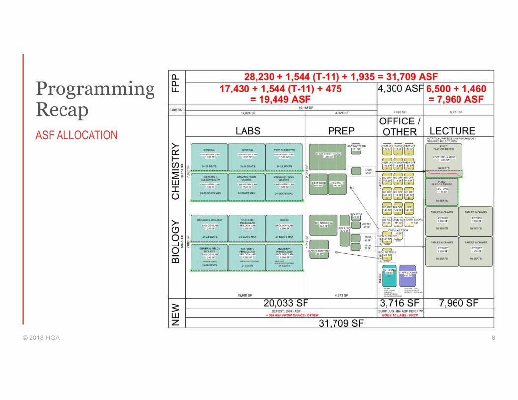
Programming Recap
© 2018 HGA 8
ASF ALLOCATION
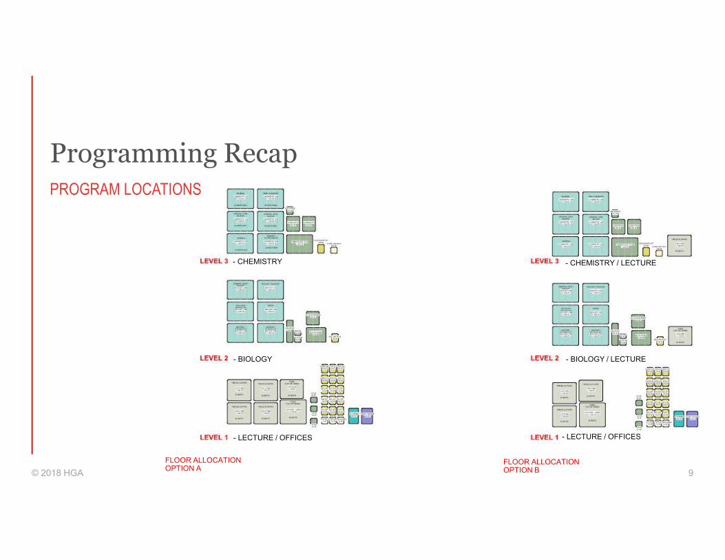
Programming Recap
© 2018 HGA 9
PROGRAM LOCATIONS
- CHEMISTRY
- BIOLOGY
- CHEMISTRY / LECTURE
- BIOLOGY / LECTURE
- LECTURE / OFFICES - LECTURE / OFFICES
FLOOR ALLOCATION OPTION A
FLOOR ALLOCATION OPTION B

Programming Recap
© 2018 HGA 10
ADJACENCIES
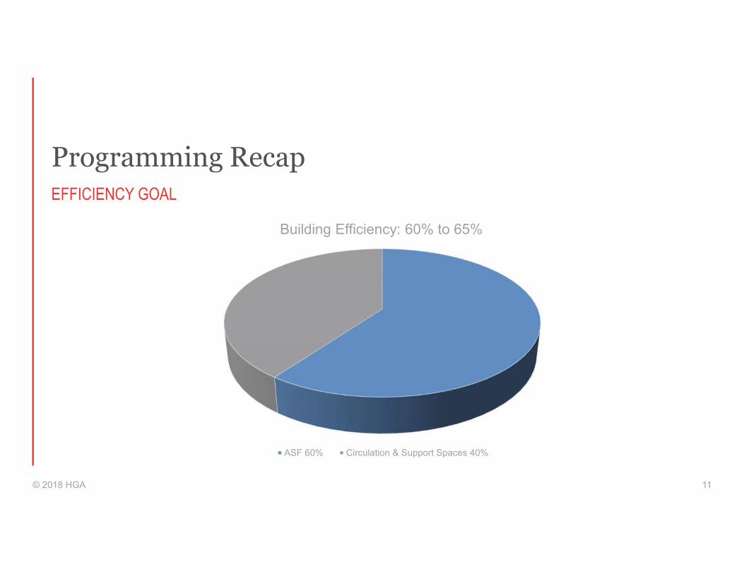
Programming Recap
Building Efficiency: 60% to 65%
ASF 60% Circulation & Support Spaces 40%
© 2018 HGA 11
EFFICIENCY GOAL
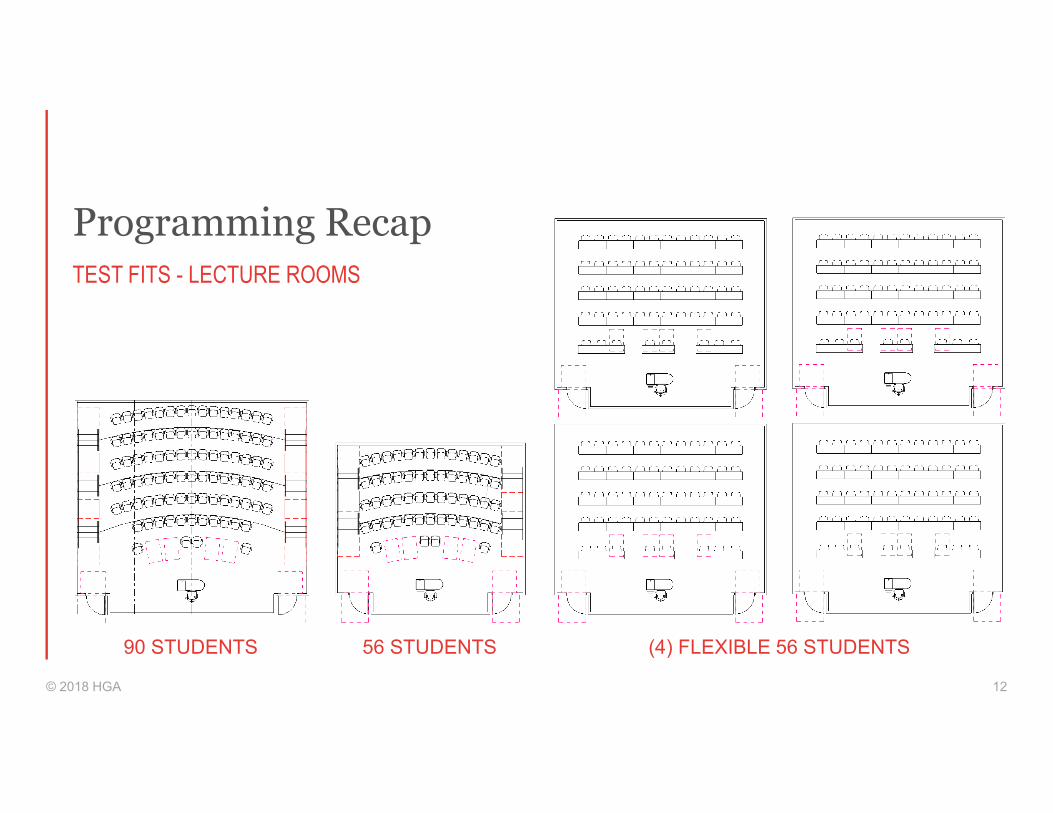
Programming Recap
© 2018 HGA 12
TEST FITS - LECTURE ROOMS
90 STUDENTS 56 STUDENTS (4) FLEXIBLE 56 STUDENTS
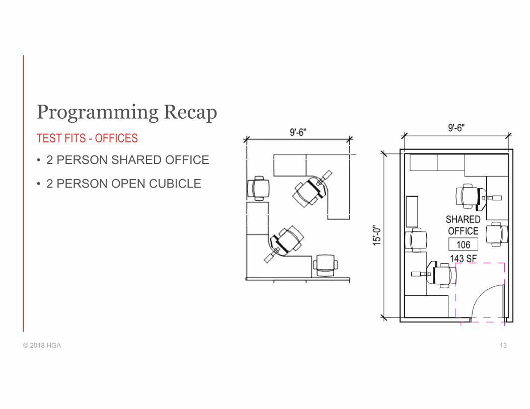
Programming Recap
• 2 PERSON SHARED OFFICE
• 2 PERSON OPEN CUBICLE
© 2018 HGA 13
TEST FITS - OFFICES

Schematic Design Considerations
• Lab modules developed via concurrent user group meetings.
• 31’ x 10.5’ module proposed• 2ND meeting on 9/14
• Modules = efficient structures via “stacking” and regularity of spaces.
© 2018 HGA 14
LAB MODULES
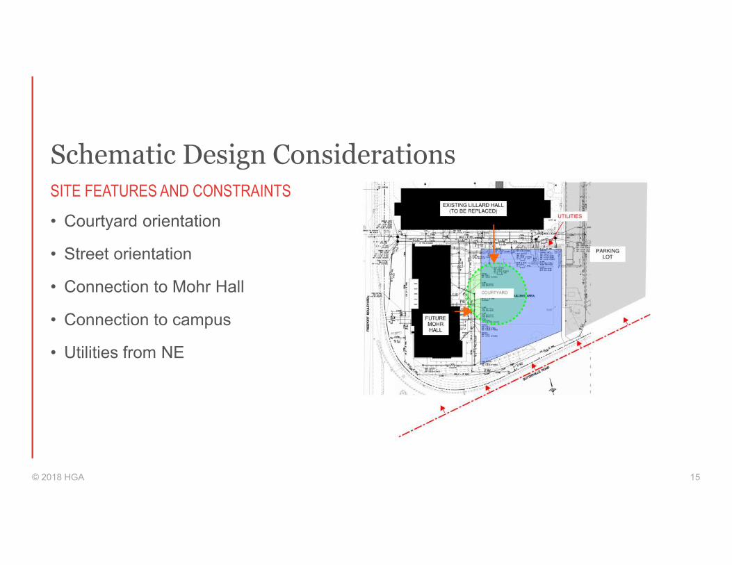
Schematic Design Considerations
© 2018 HGA 15
SITE FEATURES AND CONSTRAINTS
• Courtyard orientation
• Street orientation
• Connection to Mohr Hall
• Connection to campus
• Utilities from NE
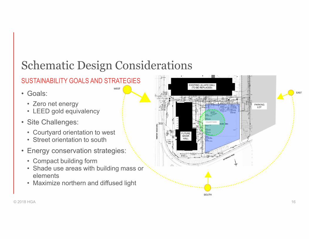
Schematic Design Considerations
© 2018 HGA 16
SUSTAINABILITY GOALS AND STRATEGIES
• Goals:
• Zero net energy• LEED gold equivalency
• Site Challenges:
• Courtyard orientation to west• Street orientation to south
• Energy conservation strategies:
• Compact building form • Shade use areas with building mass or
elements• Maximize northern and diffused light
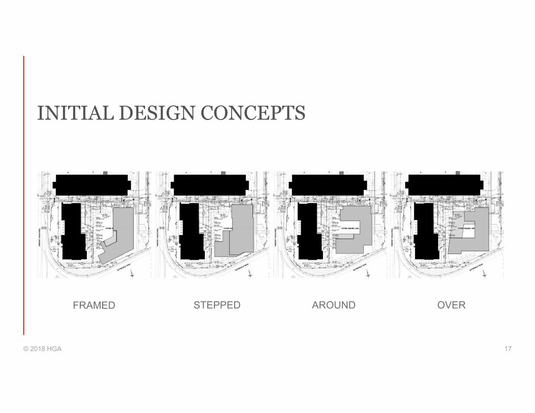
INITIAL DESIGN CONCEPTS
© 2018 HGA 17
FRAMED STEPPED AROUND OVER

CONCEPT - FRAMED
© 2018 HGA 18
60.7% EFFICIENT

© 2018 HGA 19
PLANS – FRAMED
LEVEL 1 LEVEL 2 LEVEL 3

PLANS – FRAMED
© 2018 HGA 20
LEVEL 1
PLANS – FRAMED
© 2018 HGA 21
LEVEL 2

PLANS – FRAMED
© 2018 HGA 22
LEVEL 3
MASSING - FRAMED
© 2018 HGA 23

CONCEPT – STEPPED
© 2018 HGA 24
60.6% EFFICIENT
© 2018 HGA 25
PLANS – STEPPED
LEVEL 1 LEVEL 2 LEVEL 3
PLANS – STEPPED
© 2018 HGA 26
LEVEL 1
PLANS – STEPPED
© 2018 HGA 27
LEVEL 2

PLANS – STEPPED
© 2018 HGA 28
LEVEL 3
MASSING - STEPPED
© 2018 HGA 29

CONCEPT – AROUND
© 2018 HGA 30
59.6% EFFICIENT
© 2018 HGA 31
PLANS – AROUND
LEVEL 1 LEVEL 2 LEVEL 3
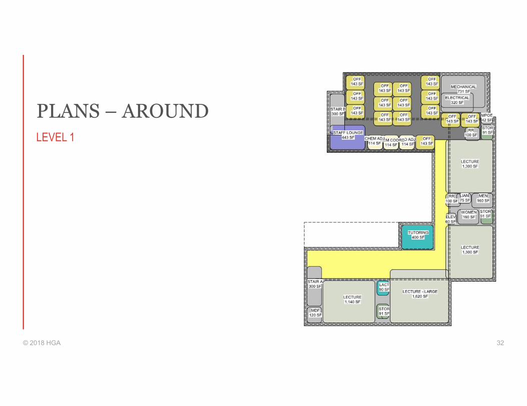
PLANS – AROUND
© 2018 HGA 32
LEVEL 1

PLANS – AROUND
© 2018 HGA 33
LEVEL 2
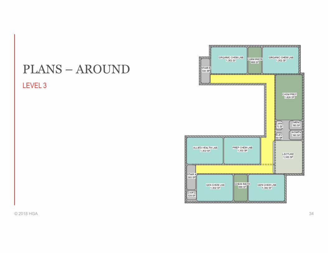
PLANS – AROUND
© 2018 HGA 34
LEVEL 3

MASSING - AROUND
© 2018 HGA 35

CONCEPT – OVER
© 2018 HGA 36
57.5% EFFICIENT

© 2018 HGA 37
PLANS – OVER
LEVEL 1 LEVEL 2 LEVEL 3

PLANS – OVER
© 2018 HGA 38
LEVEL 1
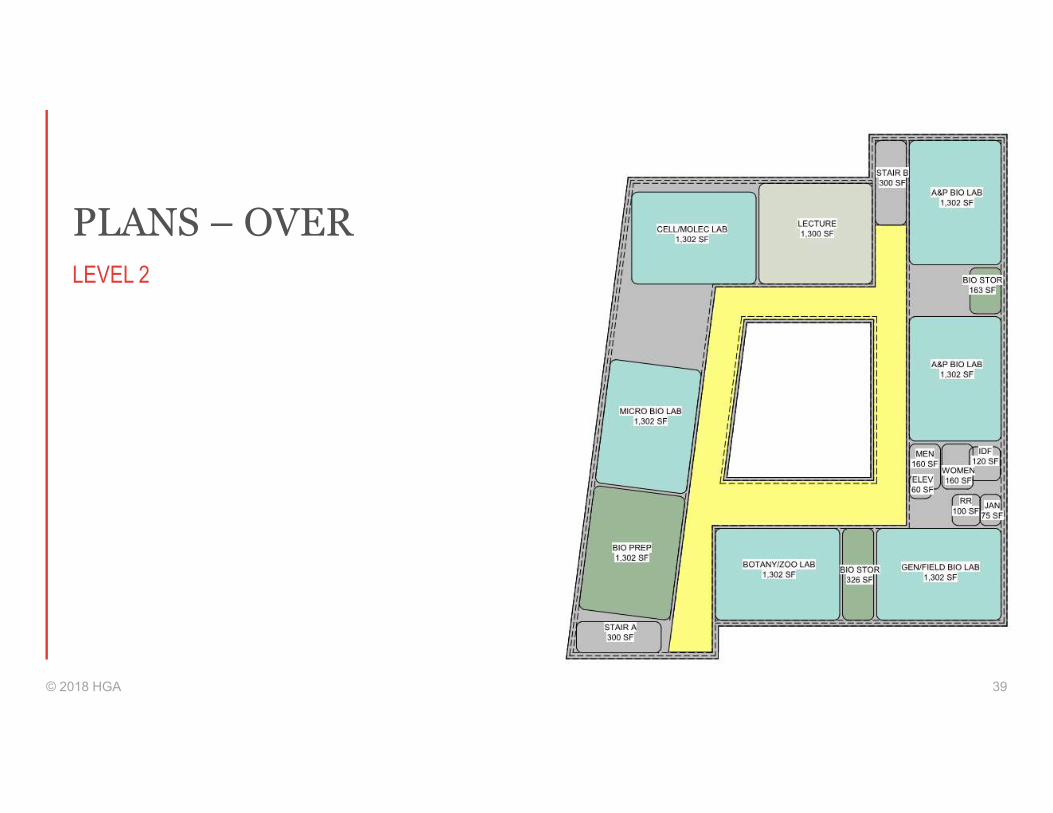
PLANS – OVER
© 2018 HGA 39
LEVEL 2
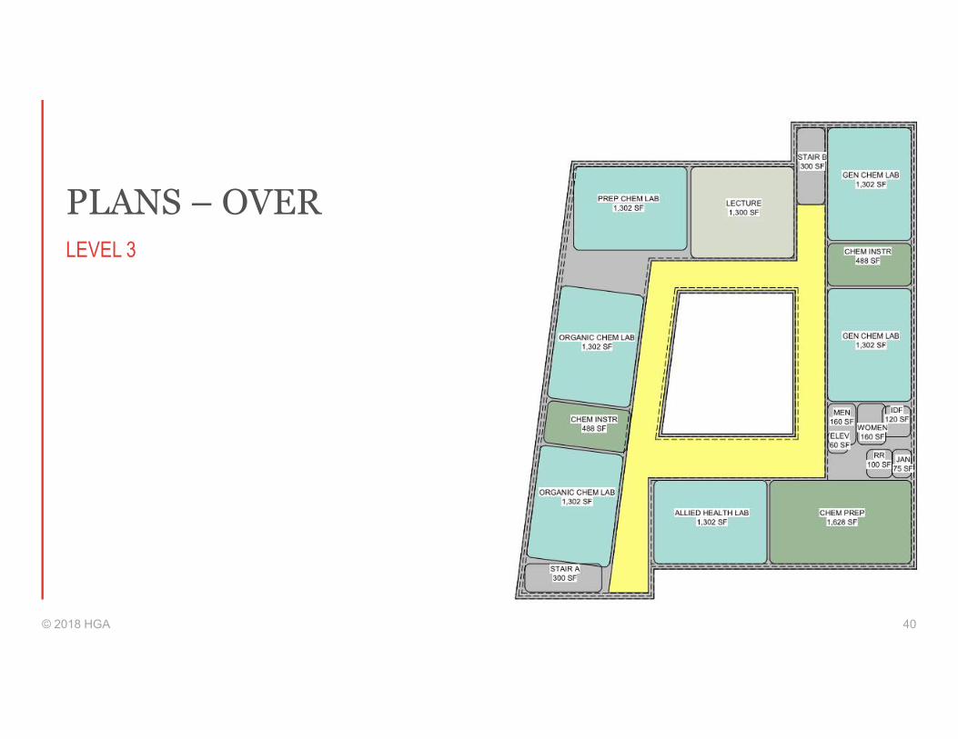
PLANS – OVER
© 2018 HGA 40
LEVEL 3
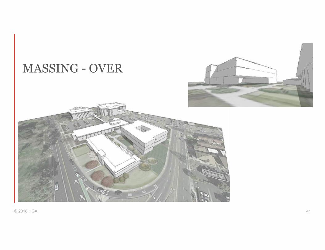
MASSING - OVER
© 2018 HGA 41

Thank You

APPENDIX D
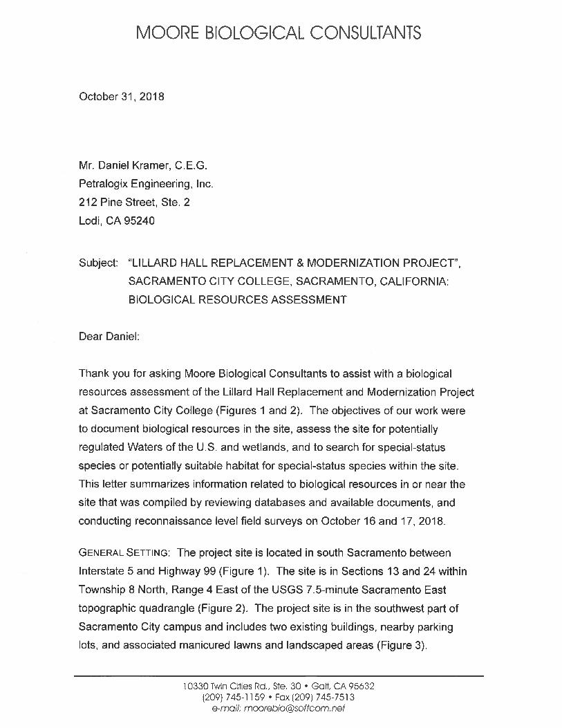
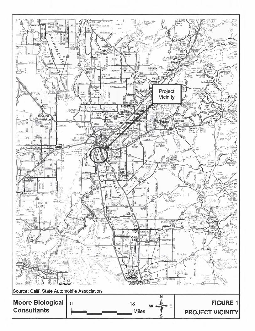
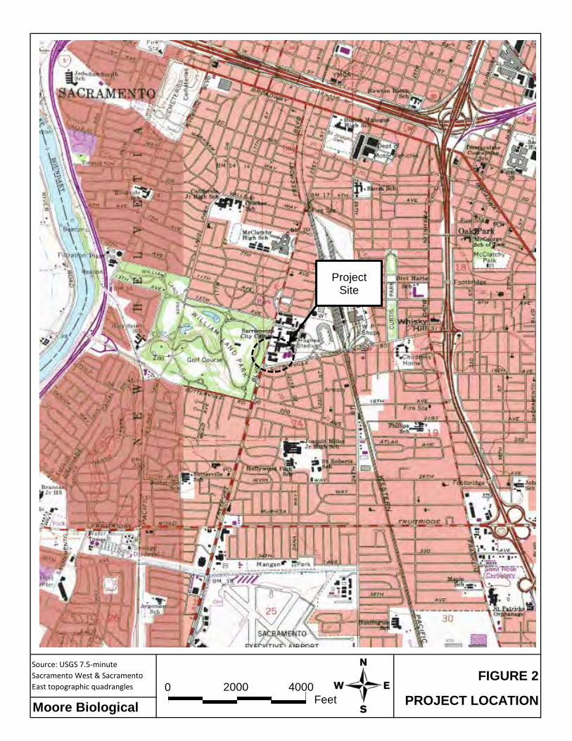
Source: USGS 7.5-minute Sacramento West & Sacramento East topographic quadrangles
Moore Biological
FIGURE 2
PROJECT LOCATION0 4000 2000
Feet
Project Site
Diane
Typewritten Text

Source (Basemap): Google Earth
Scale: 1 inch = 125+/- feet
Moore Biological AERIAL PHOTOGRAPH
FIGURE 3
PARKING LOT G
PARKING LOT F
MOHR HALL
LILLARD HALL
Diane
Typewritten Text
Sac. City: Lillard Hall 5 October 31, 2018
PROJECT OVERVIEW: The Los Rios Community School District is proposing to
demolish and replace the existing Lillard Hall building in the southwest corner of
the Sacramento City College campus (see Site Plan in Attachment A). The
project involves demolition of old Lillard Hall and construction of the new Lillard
Hall. It is anticipated the new Lillard Hall will be approximately 31,709 square
feet. There is currently a Mohr Hall replacement project underway at the site, just
south of Lillard Hall. The Mohr Hall project consists of a building replacement of
approximately the same size as the existing building. Mohr Hall is discussed as
part of the Lillard Hall project as part of the new Lillard Hall will be located within
the footprint of the demolished Mohr Hall. Additional architectural considerations
and potential changes to the surrounding vicinity will also include potential future
Overhead Parking Solar Structures which would be located in parking Lot G, just
north of Lillard Hall and/or parking lot F, which is east of Mohr Hall and Lillard
Hall.
VEGETATION: Natural habitats in the project vicinity, including those in the site,
have been entirely replaced by development. Beyond the buildings, the site
contains areas of irrigated lawn area that is periodically mowed, landscaped
areas surrounding buildings and parking lots, and several ornamental trees
scattered around the site (Figure 3 and photographs in Attachment B).
Several ornamental trees and shrubs can be found in and surrounding the
irrigated lawn area, surrounding both Lillard and Mohr Halls and in landscaped
strips around the parking lots. Several large trees surrounding Lillard and Mohr
Hall will be removed.
WILDLIFE: Only a few bird species were observed in the site. Yellow-rumped
warbler (Setophaga coronata) and rock dove (Columba livia) were the only birds
observed during the survey. The only mammal observed during the survey was a
western gray squirrel (Sciurus griseus). No California ground squirrels
(Spermophilus beecheyi) or their burrows were observed during the recent
survey.
Sac. City: Lillard Hall 6 October 31, 2018
There are several nest trees in and near the site that are suitable for nesting
birds. Given the presence of some relatively large trees in and near the site, it is
likely a variety of songbirds nest in trees in or near the site each year. it is also
likely that songbirds nest within shrubs and grassland habitats in and adjacent to
the site each year Due to the site being so urbanized, it is less likely that raptors
nest in or near the site.
WATERS OF THE U.S. AND WETLANDS: Jurisdictional “wetlands” includes
vegetated wetland areas, which meet the technical criteria described in the U.S.
Army Corps of Engineers (ACOE) 1987 Wetlands Delineation Manual and the
Regional Supplement to the Corps of Engineers Wetland Delineation Manual:
Arid West Supplement (2008), or water bodies or channels that meet the criteria
identified in 33 CFR 328.4, which define “Waters of the U.S.”. Jurisdictional
“Waters of the U.S” includes intermittent and perennial "blue line" streams
mapped on USGS topographic maps, even when these features have been re-
aligned and seasonal wetland swales and vernal pools that are hydrologically
connected to or in proximity to tributary drainages.
There are no potentially jurisdictional Waters of the U.S. or wetlands in the site.
The site consists entirely of landscaped areas that are highly disturbed.
Specifically, we observed no relatively permanent or intermittent drainages,
vernal pools, seasonal wetlands, marshes, ponds, lakes, or riparian wetlands of
any type within or near the site.
SPECIAL-STATUS SPECIES: Special-status species are plants and animals that
are legally protected under the state and/or federal Endangered Species Act or
other regulations. The Federal Endangered Species Act (FESA) of 1973 declares
that all federal departments and agencies shall utilize their authority to conserve
endangered and threatened plant and animal species. The California
Endangered Species Act (CESA) of 1984 parallels the policies of FESA and
pertains to native California species.
Sac. City: Lillard Hall 7 October 31, 2018
California Department of Fish and Wildlife's (CDFW) California Natural Diversity
Database (CNDDB, 2018) is helpful to identify special-status species that have
been previously documented in the greater project vicinity or have the potential to
occur based on presence of suitable habitat and geographical distribution. The
United States Fish and Wildlife Service (USFWS) IPaC Trust Report of Federally
Threatened and Endangered species that may occur in or be affected by projects
in the project vicinity was also reviewed (Attachment C).
Numerous special-status species have been documented within the Sacramento
East and Sacramento West topographic quadrangles, within which the site is
located in the west edge of the Sacramento East topographic quadrangle (see
CNDDB Search Results in Attachment C). Several special-status plants,
Swainson’s hawk (Buteo swainsoni), burrowing owl (Athene cunicularia), other
special-status birds, fairy and tadpole shrimp, and numerous fish are some of the
species identified in the CNDDB or are on the IPAC Trust Report. However,
purple martin (Progne subis), a small songbird, is the only special-status species
documented in the CNDDB within a mile of the site.
Special-status plants generally occur in relatively undisturbed areas in vegetation
communities such as vernal pools, marshes and swamps, chenopod scrub,
seasonal wetlands, riparian scrub, and areas with unusual soils. The site has
been disturbed by development and does not provide suitable habitat for special-
status plants. No special-status plants or highly suitable habitat for special-status
plants were observed in the site.
While the project site may have provided habitat for special-status wildlife
species at some time in the past, development has substantially modified natural
habitats in the greater project vicinity, including those within the site. Of the
wildlife species identified in the CNDDB search, Swainson’s hawk is the only
species that has any potential to occur in the project site on more than a
transitory or very occasional basis. Swainson’s hawk could be disturbed by
Sac. City: Lillard Hall 8 October 31, 2018
noise if they nested in or near the project site during construction and is
discussed further below.
SWAINSON’S HAWK: The Swainson’s hawk is a migratory hawk listed by the State
of California as a Threatened species. The Migratory Bird Treaty Act and Fish
and Game Code of California protect Swainson’s hawks year-round, as well as
their nests during the nesting season (March 1 through September 15).
Swainson’s hawk are found in the Central Valley primarily during their breeding
season, a population is known to winter in the San Joaquin Valley.
Swainson's hawks prefer nesting sites that provide sweeping views of nearby
foraging grounds consisting of grasslands, irrigated pasture, hay, and wheat
crops. Most Swainson's hawks are migratory, wintering in Mexico and breeding in
California and elsewhere in the western United States. This raptor generally
arrives in the Central Valley in mid-March, and begins courtship and nest
construction immediately upon arrival at the breeding sites. The young fledge in
early July, and most Swainson's hawks leave their breeding territories by late
August. The CNDDB contains a record of a pair of Swainson’s hawk nesting a
little over a mile east of the site on the Sacramento River and additional records
within several miles of the site.
The site does not provide suitable Swainson's hawk foraging habitat, but large
trees in and near the site could be used for nesting. Due to the location of the
site being in the middle of a busy campus, it is unlikely Swainson’s hawks use
on-site habitats on more than a very occasional basis. While considered unlikely,
Swainson’s hawks could conceivably nest in trees in or near the site.
CRITICAL HABITAT: Critical habitat is areas mapped by the United States Fish
and Wildlife Service (USFWS) as being critical to maintain and/or manage in a
relatively natural state for the recovery of a listed species. The site is not in
designated critical habitat of any federal listed species.
Sac. City: Lillard Hall 9 October 31, 2018
Conclusions and Recommendations
• The site is buildings, parking lots, and landscaped areas in the southwest
part of campus. On-site habitats are biologically unremarkable.
• Development of the proposed project will result in the removal of some
large ornamental trees and shrubs. From a wildlife habitat perspective,
the proposed vegetation removal is a less than significant impact.
• There are no potentially jurisdictional Waters of the U.S. or wetlands in the
site.
• Due to a lack of suitable habitat, it is unlikely that special-status plants
occur in the site.
• With the exception of Swainson’s hawk, no special-status wildlife
species are expected to occur in the body of the site on more than a
very occasional or transitory basis.
• Pre-construction surveys for nesting Swainson’s hawks within 0.25
miles of the project site are recommended if construction commences
between March 1 and September 15. If active nests are found, a
qualified biologist should determine the need (if any) for temporal
restrictions on construction. The determination should be pursuant to
criteria set forth by CDFW (CDFG, 1994).
• The site is not within designated critical habitat for any federally listed
species.
• On-site trees, shrubs, and grasslands may be used by nesting birds
protected by the Migratory Bird Treaty Act of 1918 and Fish and Game
Code of California. If vegetation removal and/or project construction

Attachment A
Project Map and Information
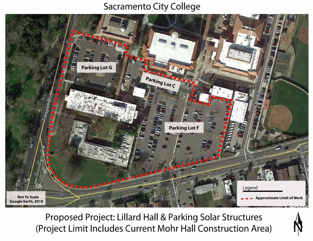
Diane
Typewritten Text
Diane
Typewritten Text
LILLARD HALL
Diane
Typewritten Text
Diane
Typewritten Text
Diane
Typewritten Text
Diane
Typewritten Text
Diane
Typewritten Text
MOHR HALL
Diane
Typewritten Text
Diane
Typewritten Text
Diane
Typewritten Text
Diane
Typewritten Text
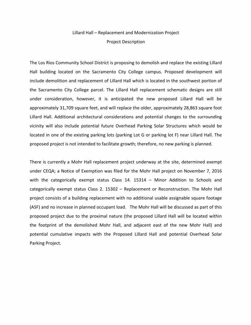
Lillard Hall – Replacement and Modernization Project
Project Description
The Los Rios Community School District is proposing to demolish and replace the existing Lillard
Hall building located on the Sacramento City College campus. Proposed development will
include demolition and replacement of Lillard Hall which is located in the southwest portion of
the Sacramento City College parcel. The Lillard Hall replacement schematic designs are still
under consideration, however, it is anticipated the new proposed Lillard Hall will be
approximately 31,709 square feet, and will replace the older, approximately 28,863 square foot
Lillard Hall. Additional architectural considerations and potential changes to the surrounding
vicinity will also include potential future Overhead Parking Solar Structures which would be
located in one of the existing parking lots (parking Lot G or parking lot F) near Lillard Hall. The
proposed project is not intended to facilitate growth; therefore, no new parking is planned.
There is currently a Mohr Hall replacement project underway at the site, determined exempt
under CEQA; a Notice of Exemption was filed for the Mohr Hall project on November 7, 2016
with the categorically exempt status Class 14. 15314 – Minor Addition to Schools and
categorically exempt status Class 2. 15302 – Replacement or Reconstruction. The Mohr Hall
project consists of a building replacement with no additional usable assignable square footage
(ASF) and no increase in planned occupant load. The Mohr Hall will be discussed as part of this
proposed project due to the proximal nature (the proposed Lillard Hall will be located within
the footprint of the demolished Mohr Hall, and adjacent east of the new Mohr Hall) and
potential cumulative impacts with the Proposed Lillard Hall and potential Overhead Solar
Parking Project.

Attachment B
Photographs
Diane
Typewritten Text
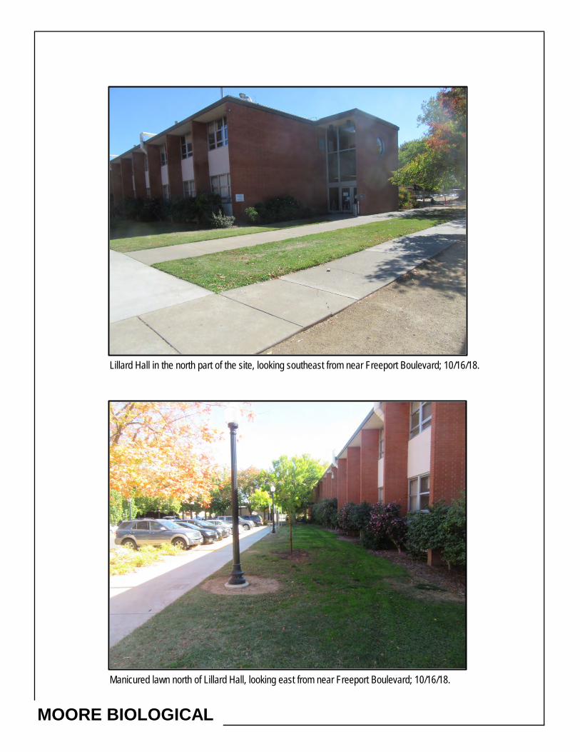
Lillard Hall in the north part of the site, looking southeast from near Freeport Boulevard; 10/16/18.
Manicured lawn north of Lillard Hall, looking east from near Freeport Boulevard; 10/16/18.
MOORE BIOLOGICAL
Diane
Typewritten Text
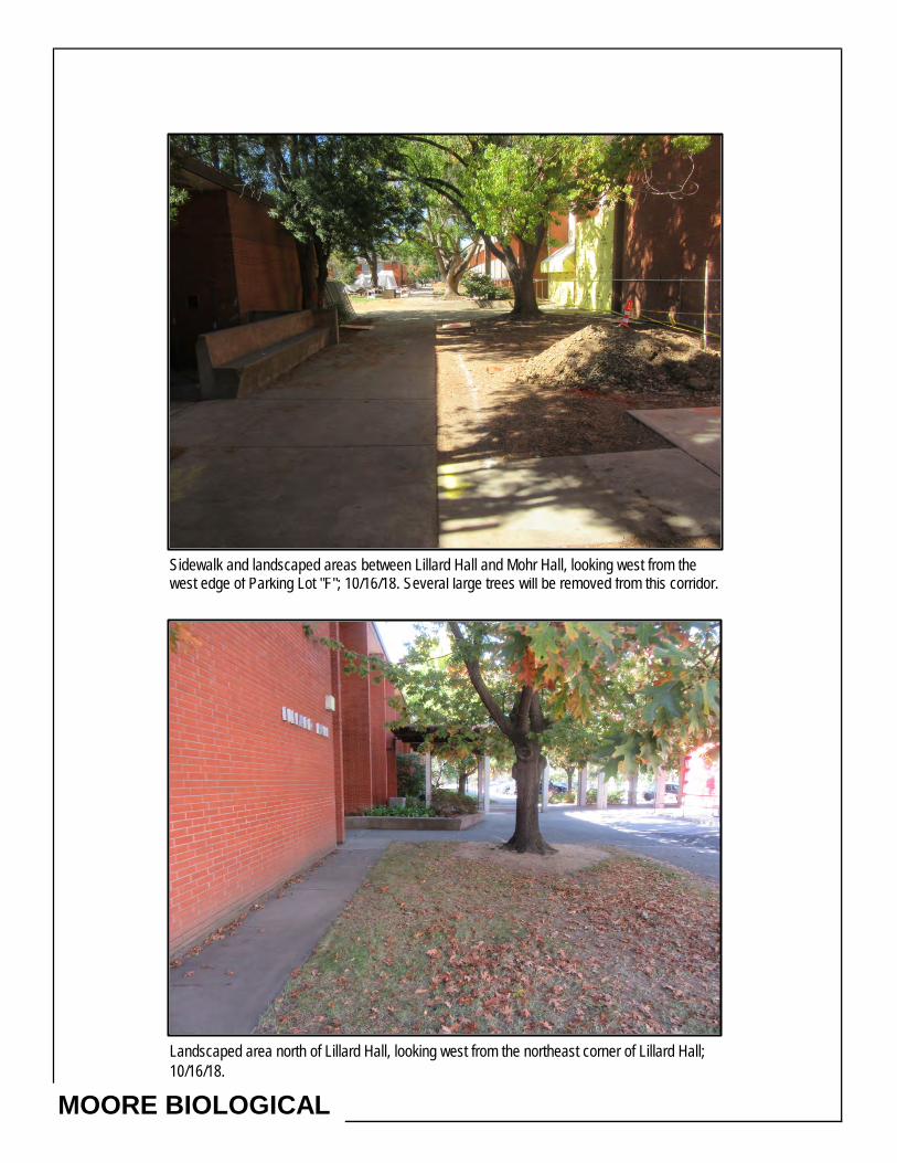
Sidewalk and landscaped areas between Lillard Hall and Mohr Hall, looking west from thewest edge of Parking Lot "F"; 10/16/18. Several large trees will be removed from this corridor.
Landscaped area north of Lillard Hall, looking west from the northeast corner of Lillard Hall; 10/16/18.
MOORE BIOLOGICAL
Diane
Typewritten Text
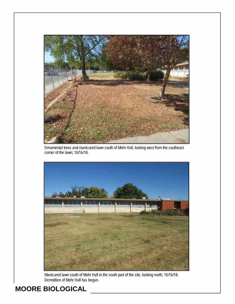
Ornamental trees and manicured lawn south of Mohr Hall, looking west from the southeastcorner of the lawn; 10/16/18.
Manicured lawn south of Mohr Hall in the south part of the site, looking north; 10/16/18. Demolition of Mohr Hall has begun.
MOORE BIOLOGICAL
Diane
Typewritten Text
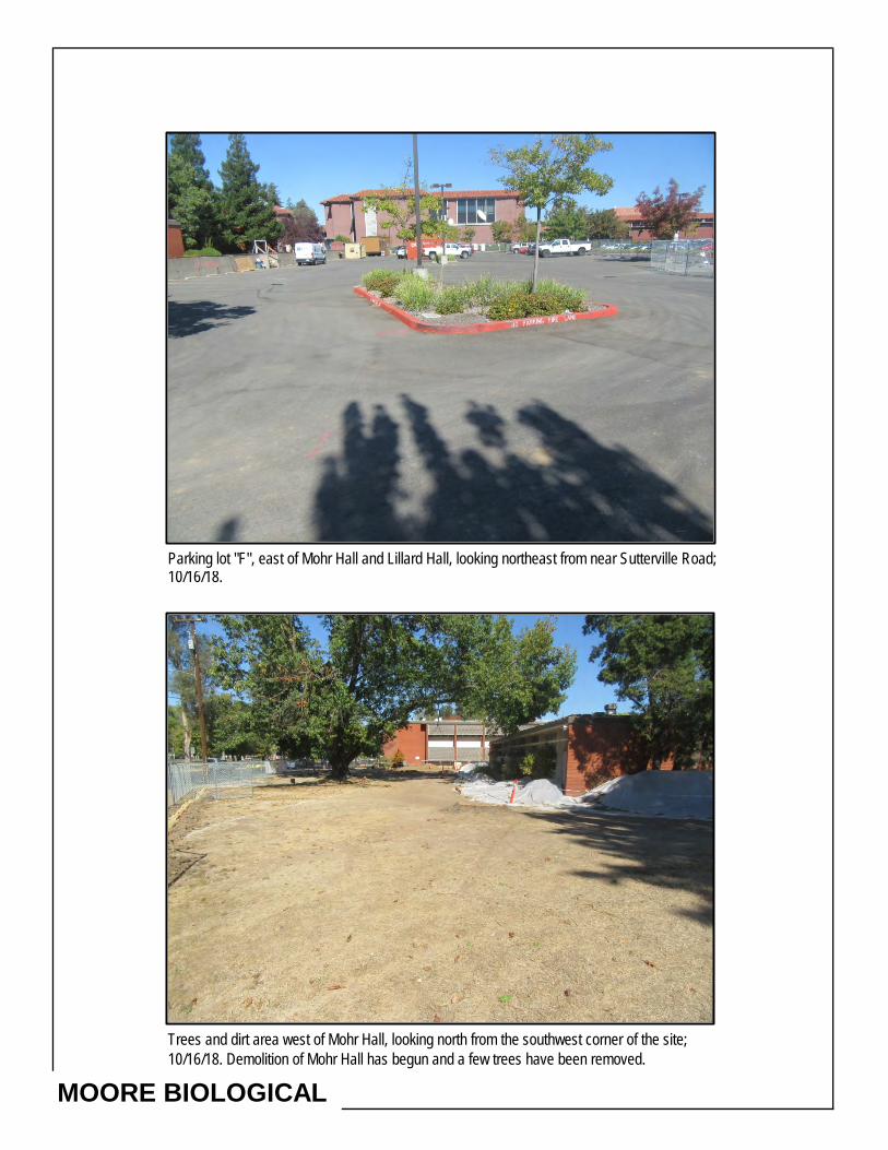
Parking lot "F", east of Mohr Hall and Lillard Hall, looking northeast from near Sutterville Road; 10/16/18.
Trees and dirt area west of Mohr Hall, looking north from the southwest corner of the site; 10/16/18. Demolition of Mohr Hall has begun and a few trees have been removed.
MOORE BIOLOGICAL
Diane
Typewritten Text
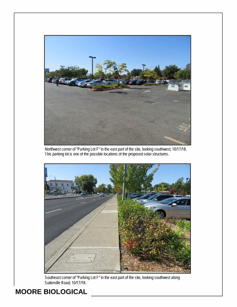
Northwest corner of "Parking Lot F" in the east part of the site, looking southwest; 10/17/18. This parking lot is one of the possible locations of the proposed solar structures.
Southeast corner of "Parking Lot F" in the east part of the site, looking southwest alongSutterville Road; 10/17/18.
MOORE BIOLOGICAL
Diane
Typewritten Text

"Parking Lot G" in the northwest corner of the site, looking west from the east edge of the parking lot; 10/17/18.
"Parking Lot G" in the northwest corner of the site, looking southeast from near Freeport Boulevard; 10/17/18.
MOORE BIOLOGICAL

Attachment C
CNDDB Summary Report
& IPAC Trust Report
Diane
Typewritten Text

Species Element Code Federal Status State Status Global Rank State Rank
Rare Plant Rank/CDFW SSC or FP
Accipiter cooperii
Cooper's hawk
ABNKC12040 None None G5 S4 WL
Agelaius tricolor
tricolored blackbird
ABPBXB0020 None Candidate Endangered
G2G3 S1S2 SSC
Archoplites interruptus
Sacramento perch
AFCQB07010 None None G2G3 S1 SSC
Ardea herodias
great blue heron
ABNGA04010 None None G5 S4
Astragalus tener var. ferrisiae
Ferris' milk-vetch
PDFAB0F8R3 None None G2T1 S1 1B.1
Athene cunicularia
burrowing owl
ABNSB10010 None None G4 S3 SSC
Branchinecta lynchi
vernal pool fairy shrimp
ICBRA03030 Threatened None G3 S3
Buteo swainsoni
Swainson's hawk
ABNKC19070 None Threatened G5 S3
Cicindela hirticollis abrupta
Sacramento Valley tiger beetle
IICOL02106 None None G5TH SH
Coccyzus americanus occidentalis
western yellow-billed cuckoo
ABNRB02022 Threatened Endangered G5T2T3 S1
Desmocerus californicus dimorphus
valley elderberry longhorn beetle
IICOL48011 Threatened None G3T2 S2
Elanus leucurus
white-tailed kite
ABNKC06010 None None G5 S3S4 FP
Elderberry Savanna
Elderberry Savanna
CTT63440CA None None G2 S2.1
Great Valley Cottonwood Riparian Forest
Great Valley Cottonwood Riparian Forest
CTT61410CA None None G2 S2.1
Hibiscus lasiocarpos var. occidentalis
woolly rose-mallow
PDMAL0H0R3 None None G5T3 S3 1B.2
Lasiurus cinereus
hoary bat
AMACC05030 None None G5 S4
Laterallus jamaicensis coturniculus
California black rail
ABNME03041 None Threatened G3G4T1 S1 FP
Lepidurus packardi
vernal pool tadpole shrimp
ICBRA10010 Endangered None G4 S3S4
Linderiella occidentalis
California linderiella
ICBRA06010 None None G2G3 S2S3
Melospiza melodia
song sparrow ("Modesto" population)
ABPBXA3010 None None G5 S3? SSC
Quad<span style='color:Red'> IS </span>(Sacramento East (3812154)<span style='color:Red'> OR </span>Sacramento West (3812155))Query Criteria:
Report Printed on Thursday, October 18, 2018
Page 1 of 2Commercial Version -- Dated September, 30 2018 -- Biogeographic Data Branch
Information Expires 3/30/2019
Selected Elements by Scientific NameCalifornia Department of Fish and Wildlife
California Natural Diversity Database

Species Element Code Federal Status State Status Global Rank State Rank
Rare Plant Rank/CDFW SSC or FP
Oncorhynchus mykiss irideus pop. 11
steelhead - Central Valley DPS
AFCHA0209K Threatened None G5T2Q S2
Oncorhynchus tshawytscha pop. 6
chinook salmon - Central Valley spring-run ESU
AFCHA0205A Threatened Threatened G5 S1
Oncorhynchus tshawytscha pop. 7
chinook salmon - Sacramento River winter-run ESU
AFCHA0205B Endangered Endangered G5 S1
Pogonichthys macrolepidotus
Sacramento splittail
AFCJB34020 None None GNR S3 SSC
Progne subis
purple martin
ABPAU01010 None None G5 S3 SSC
Riparia riparia
bank swallow
ABPAU08010 None Threatened G5 S2
Sagittaria sanfordii
Sanford's arrowhead
PMALI040Q0 None None G3 S3 1B.2
Spirinchus thaleichthys
longfin smelt
AFCHB03010 Candidate Threatened G5 S1 SSC
Symphyotrichum lentum
Suisun Marsh aster
PDASTE8470 None None G2 S2 1B.2
Taxidea taxus
American badger
AMAJF04010 None None G5 S3 SSC
Thamnophis gigas
giant gartersnake
ARADB36150 Threatened Threatened G2 S2
Vireo bellii pusillus
least Bell's vireo
ABPBW01114 Endangered Endangered G5T2 S2
Record Count: 32
Report Printed on Thursday, October 18, 2018
Page 2 of 2Commercial Version -- Dated September, 30 2018 -- Biogeographic Data Branch
Information Expires 3/30/2019
Selected Elements by Scientific NameCalifornia Department of Fish and Wildlife
California Natural Diversity Database
Diane
Typewritten Text
Diane
Typewritten Text

IPaC resource listThis report is an automatically generated list of species and other resources such as critical habitat(collectively referred to as trust resources) under the U.S. Fish and Wildlife Service's (USFWS)jurisdiction that are known or expected to be on or near the project area referenced below. The listmay also include trust resources that occur outside of the project area, but that could potentially bedirectly or indirectly a�ected by activities in the project area. However, determining the likelihoodand extent of e�ects a project may have on trust resources typically requires gathering additionalsite-speci�c (e.g., vegetation/species surveys) and project-speci�c (e.g., magnitude and timing ofproposed activities) information.
Below is a summary of the project information you provided and contact information for the USFWSo�ce(s) with jurisdiction in the de�ned project area. Please read the introduction to each sectionthat follows (Endangered Species, Migratory Birds, USFWS Facilities, and NWI Wetlands) foradditional information applicable to the trust resources addressed in that section.
LocationSacramento County, California
Local o�ceSacramento Fish And Wildlife O�ce
(916) 414-6600 (916) 414-6713
Federal Building2800 Cottage Way, Room W-2605Sacramento, CA 95825-1846
U.S. Fish & Wildlife ServiceIPaC

Endangered speciesThis resource list is for informational purposes only and does not constitute an analysis ofproject level impacts.
The primary information used to generate this list is the known or expected range of each species.Additional areas of in�uence (AOI) for species are also considered. An AOI includes areas outside ofthe species range if the species could be indirectly a�ected by activities in that area (e.g., placing adam upstream of a �sh population, even if that �sh does not occur at the dam site, may indirectlyimpact the species by reducing or eliminating water �ow downstream). Because species can move,and site conditions can change, the species on this list are not guaranteed to be found on or nearthe project area. To fully determine any potential e�ects to species, additional site-speci�c andproject-speci�c information is often required.
Section 7 of the Endangered Species Act requires Federal agencies to "request of the Secretaryinformation whether any species which is listed or proposed to be listed may be present in the areaof such proposed action" for any project that is conducted, permitted, funded, or licensed by anyFederal agency. A letter from the local o�ce and a species list which ful�lls this requirement canonly be obtained by requesting an o�cial species list from either the Regulatory Review section inIPaC (see directions below) or from the local �eld o�ce directly.
For project evaluations that require USFWS concurrence/review, please return to the IPaC websiteand request an o�cial species list by doing the following:
1. Draw the project location and click CONTINUE.2. Click DEFINE PROJECT.3. Log in (if directed to do so).4. Provide a name and description for your project.5. Click REQUEST SPECIES LIST.
Listed species and their critical habitats are managed by the Ecological Services Program of the U.S.Fish and Wildlife Service (USFWS) and the �sheries division of the National Oceanic and AtmosphericAdministration (NOAA Fisheries ).
Species and critical habitats under the sole responsibility of NOAA Fisheries are not shown on thislist. Please contact NOAA Fisheries for species under their jurisdiction.
1. Species listed under the Endangered Species Act are threatened or endangered; IPaC also showsspecies that are candidates, or proposed, for listing. See the listing status page for moreinformation.
2. NOAA Fisheries, also known as the National Marine Fisheries Service (NMFS), is an o�ce of theNational Oceanic and Atmospheric Administration within the Department of Commerce.
The following species are potentially a�ected by activities in this location:
Reptiles
1
2
NAME STATUS

Amphibians
Fishes
Insects
Crustaceans
Giant Garter Snake Thamnophis gigasNo critical habitat has been designated for this species.https://ecos.fws.gov/ecp/species/4482
Threatened
NAME STATUS
California Red-legged Frog Rana draytoniiThere is �nal critical habitat for this species. Your location is outsidethe critical habitat.https://ecos.fws.gov/ecp/species/2891
Threatened
California Tiger Salamander Ambystoma californienseThere is �nal critical habitat for this species. Your location is outsidethe critical habitat.https://ecos.fws.gov/ecp/species/2076
Threatened
NAME STATUS
Delta Smelt Hypomesus transpaci�cusThere is �nal critical habitat for this species. Your location is outsidethe critical habitat.https://ecos.fws.gov/ecp/species/321
Threatened
NAME STATUS
Valley Elderberry Longhorn Beetle Desmocerus californicusdimorphus
There is �nal critical habitat for this species. Your location is outsidethe critical habitat.https://ecos.fws.gov/ecp/species/7850
Threatened
NAME STATUS
Vernal Pool Fairy Shrimp Branchinecta lynchiThere is �nal critical habitat for this species. Your location is outsidethe critical habitat.https://ecos.fws.gov/ecp/species/498
Threatened
Vernal Pool Tadpole Shrimp Lepidurus packardiThere is �nal critical habitat for this species. Your location is outsidethe critical habitat.https://ecos.fws.gov/ecp/species/2246
Endangered
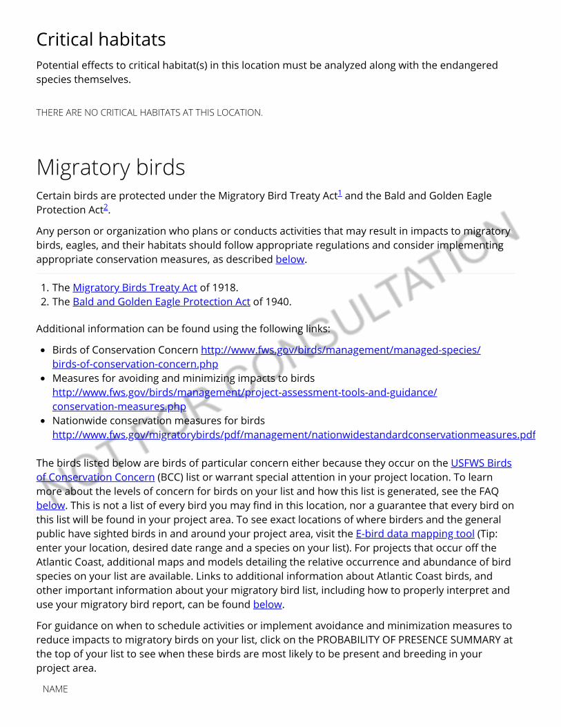
Critical habitatsPotential e�ects to critical habitat(s) in this location must be analyzed along with the endangeredspecies themselves.
THERE ARE NO CRITICAL HABITATS AT THIS LOCATION.
Migratory birds
The birds listed below are birds of particular concern either because they occur on the USFWS Birdsof Conservation Concern (BCC) list or warrant special attention in your project location. To learnmore about the levels of concern for birds on your list and how this list is generated, see the FAQbelow. This is not a list of every bird you may �nd in this location, nor a guarantee that every bird onthis list will be found in your project area. To see exact locations of where birders and the generalpublic have sighted birds in and around your project area, visit the E-bird data mapping tool (Tip:enter your location, desired date range and a species on your list). For projects that occur o� theAtlantic Coast, additional maps and models detailing the relative occurrence and abundance of birdspecies on your list are available. Links to additional information about Atlantic Coast birds, andother important information about your migratory bird list, including how to properly interpret anduse your migratory bird report, can be found below.
For guidance on when to schedule activities or implement avoidance and minimization measures toreduce impacts to migratory birds on your list, click on the PROBABILITY OF PRESENCE SUMMARY atthe top of your list to see when these birds are most likely to be present and breeding in yourproject area.
Certain birds are protected under the Migratory Bird Treaty Act and the Bald and Golden EagleProtection Act .
Any person or organization who plans or conducts activities that may result in impacts to migratorybirds, eagles, and their habitats should follow appropriate regulations and consider implementingappropriate conservation measures, as described below.
1. The Migratory Birds Treaty Act of 1918.2. The Bald and Golden Eagle Protection Act of 1940.
Additional information can be found using the following links:
Birds of Conservation Concern http://www.fws.gov/birds/management/managed-species/ birds-of-conservation-concern.phpMeasures for avoiding and minimizing impacts to birdshttp://www.fws.gov/birds/management/project-assessment-tools-and-guidance/ conservation-measures.phpNationwide conservation measures for birdshttp://www.fws.gov/migratorybirds/pdf/management/nationwidestandardconservationmeasures.pdf
1
2
NAME
BREEDING SEASON (IF ABREEDING SEASON IS INDICATEDFOR A BIRD ON YOUR LIST, THEBIRD MAY BREED IN YOURPROJECT AREA SOMETIME WITHINTHE TIMEFRAME SPECIFIED,WHICH IS A VERY LIBERALESTIMATE OF THE DATES INSIDEWHICH THE BIRD BREEDSACROSS ITS ENTIRE RANGE."BREEDS ELSEWHERE" INDICATESTHAT THE BIRD DOES NOT LIKELYBREED IN YOUR PROJECT AREA.)
Bald Eagle Haliaeetus leucocephalusThis is not a Bird of Conservation Concern (BCC) in this area, butwarrants attention because of the Eagle Act or for potentialsusceptibilities in o�shore areas from certain types of developmentor activities.https://ecos.fws.gov/ecp/species/1626
Breeds Jan 1 to Aug 31
Burrowing Owl Athene cuniculariaThis is a Bird of Conservation Concern (BCC) only in particular BirdConservation Regions (BCRs) in the continental USAhttps://ecos.fws.gov/ecp/species/9737
Breeds Mar 15 to Aug 31
California Thrasher Toxostoma redivivumThis is a Bird of Conservation Concern (BCC) throughout its range inthe continental USA and Alaska.
Breeds Jan 1 to Jul 31
Clark's Grebe Aechmophorus clarkiiThis is a Bird of Conservation Concern (BCC) throughout its range inthe continental USA and Alaska.
Breeds Jan 1 to Dec 31
Common Yellowthroat Geothlypis trichas sinuosaThis is a Bird of Conservation Concern (BCC) only in particular BirdConservation Regions (BCRs) in the continental USAhttps://ecos.fws.gov/ecp/species/2084
Breeds May 20 to Jul 31
Golden Eagle Aquila chrysaetosThis is not a Bird of Conservation Concern (BCC) in this area, butwarrants attention because of the Eagle Act or for potentialsusceptibilities in o�shore areas from certain types of developmentor activities.https://ecos.fws.gov/ecp/species/1680
Breeds Jan 1 to Aug 31

Lewis's Woodpecker Melanerpes lewisThis is a Bird of Conservation Concern (BCC) throughout its range inthe continental USA and Alaska.https://ecos.fws.gov/ecp/species/9408
Breeds Apr 20 to Sep 30
Long-billed Curlew Numenius americanusThis is a Bird of Conservation Concern (BCC) throughout its range inthe continental USA and Alaska.https://ecos.fws.gov/ecp/species/5511
Breeds elsewhere
Nuttall's Woodpecker Picoides nuttalliiThis is a Bird of Conservation Concern (BCC) only in particular BirdConservation Regions (BCRs) in the continental USAhttps://ecos.fws.gov/ecp/species/9410
Breeds Apr 1 to Jul 20
Oak Titmouse Baeolophus inornatusThis is a Bird of Conservation Concern (BCC) throughout its range inthe continental USA and Alaska.https://ecos.fws.gov/ecp/species/9656
Breeds Mar 15 to Jul 15
Rufous Hummingbird selasphorus rufusThis is a Bird of Conservation Concern (BCC) throughout its range inthe continental USA and Alaska.https://ecos.fws.gov/ecp/species/8002
Breeds elsewhere
Song Sparrow Melospiza melodiaThis is a Bird of Conservation Concern (BCC) only in particular BirdConservation Regions (BCRs) in the continental USA
Breeds Feb 20 to Sep 5
Spotted Towhee Pipilo maculatus clementaeThis is a Bird of Conservation Concern (BCC) only in particular BirdConservation Regions (BCRs) in the continental USAhttps://ecos.fws.gov/ecp/species/4243
Breeds Apr 15 to Jul 20
Tricolored Blackbird Agelaius tricolorThis is a Bird of Conservation Concern (BCC) throughout its range inthe continental USA and Alaska.https://ecos.fws.gov/ecp/species/3910
Breeds Mar 15 to Aug 10
Whimbrel Numenius phaeopusThis is a Bird of Conservation Concern (BCC) throughout its range inthe continental USA and Alaska.https://ecos.fws.gov/ecp/species/9483
Breeds elsewhere
Wrentit Chamaea fasciataThis is a Bird of Conservation Concern (BCC) throughout its range inthe continental USA and Alaska.
Breeds Mar 15 to Aug 10
Probability of Presence SummaryThe graphs below provide our best understanding of when birds of concern are most likely to bepresent in your project area. This information can be used to tailor and schedule your projectactivities to avoid or minimize impacts to birds. Please make sure you read and understand the FAQ“Proper Interpretation and Use of Your Migratory Bird Report” before using or attempting tointerpret this report.
Probability of Presence ( )
Each green bar represents the bird's relative probability of presence in the 10km grid cell(s) yourproject overlaps during a particular week of the year. (A year is represented as 12 4-week months.)A taller bar indicates a higher probability of species presence. The survey e�ort (see below) can beused to establish a level of con�dence in the presence score. One can have higher con�dence in thepresence score if the corresponding survey e�ort is also high.
How is the probability of presence score calculated? The calculation is done in three steps:
1. The probability of presence for each week is calculated as the number of survey events in theweek where the species was detected divided by the total number of survey events for thatweek. For example, if in week 12 there were 20 survey events and the Spotted Towhee wasfound in 5 of them, the probability of presence of the Spotted Towhee in week 12 is 0.25.
2. To properly present the pattern of presence across the year, the relative probability of presenceis calculated. This is the probability of presence divided by the maximum probability of presenceacross all weeks. For example, imagine the probability of presence in week 20 for the SpottedTowhee is 0.05, and that the probability of presence at week 12 (0.25) is the maximum of anyweek of the year. The relative probability of presence on week 12 is 0.25/0.25 = 1; at week 20 it is0.05/0.25 = 0.2.
3. The relative probability of presence calculated in the previous step undergoes a statisticalconversion so that all possible values fall between 0 and 10, inclusive. This is the probability ofpresence score.
To see a bar's probability of presence score, simply hover your mouse cursor over the bar.
Breeding Season ( )Yellow bars denote a very liberal estimate of the time-frame inside which the bird breeds across itsentire range. If there are no yellow bars shown for a bird, it does not breed in your project area.
Survey E�ort ( )Vertical black lines superimposed on probability of presence bars indicate the number of surveysperformed for that species in the 10km grid cell(s) your project area overlaps. The number ofsurveys is expressed as a range, for example, 33 to 64 surveys.
To see a bar's survey e�ort range, simply hover your mouse cursor over the bar.
No Data ( )A week is marked as having no data if there were no survey events for that week.
Yellow-billed Magpie Pica nuttalliThis is a Bird of Conservation Concern (BCC) throughout its range inthe continental USA and Alaska.https://ecos.fws.gov/ecp/species/9726
Breeds Apr 1 to Jul 31
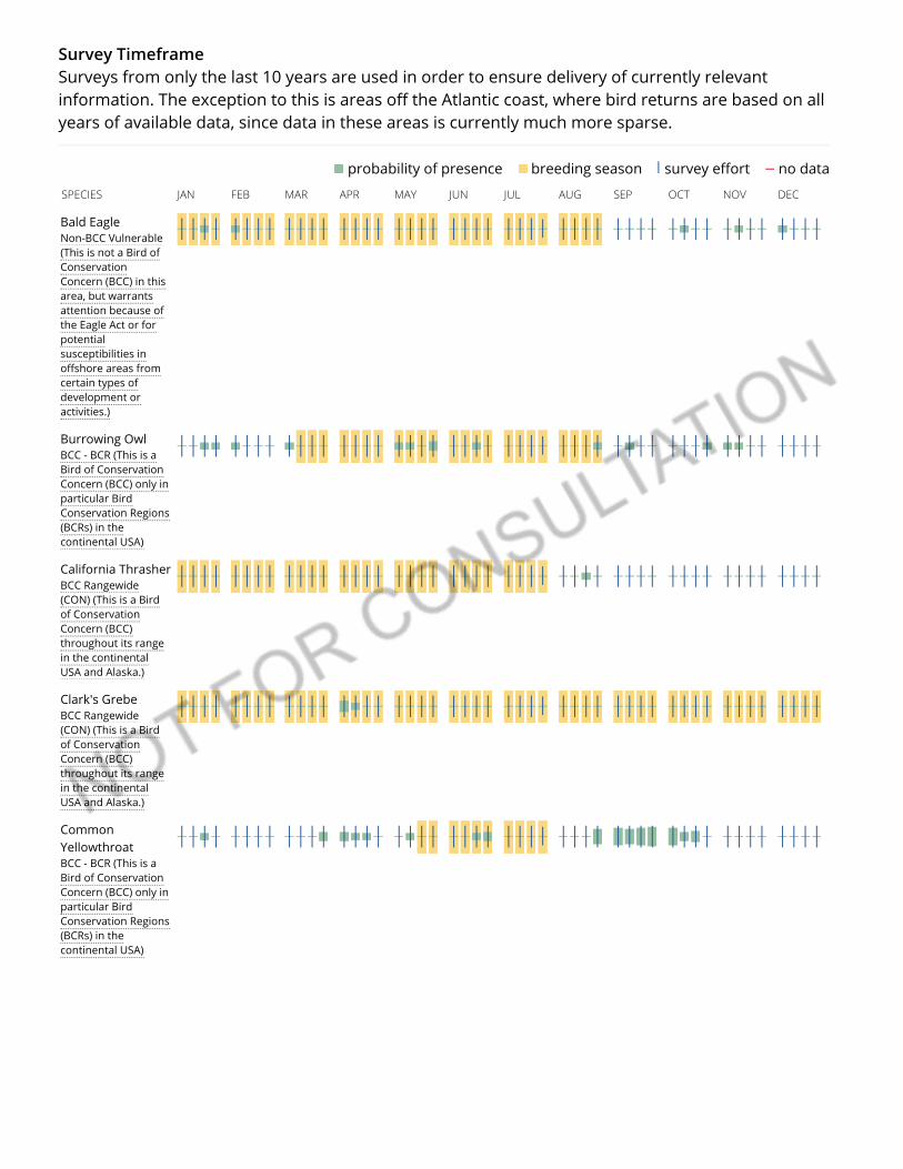
no data survey e�ort breeding season probability of presence
Survey TimeframeSurveys from only the last 10 years are used in order to ensure delivery of currently relevantinformation. The exception to this is areas o� the Atlantic coast, where bird returns are based on allyears of available data, since data in these areas is currently much more sparse.
SPECIES JAN FEB MAR APR MAY JUN JUL AUG SEP OCT NOV DEC
Bald EagleNon-BCC Vulnerable(This is not a Bird ofConservationConcern (BCC) in thisarea, but warrantsattention because ofthe Eagle Act or forpotentialsusceptibilities ino�shore areas fromcertain types ofdevelopment oractivities.)
Burrowing OwlBCC - BCR (This is aBird of ConservationConcern (BCC) only inparticular BirdConservation Regions(BCRs) in thecontinental USA)
California ThrasherBCC Rangewide(CON) (This is a Birdof ConservationConcern (BCC)throughout its rangein the continentalUSA and Alaska.)
Clark's GrebeBCC Rangewide(CON) (This is a Birdof ConservationConcern (BCC)throughout its rangein the continentalUSA and Alaska.)
CommonYellowthroatBCC - BCR (This is aBird of ConservationConcern (BCC) only inparticular BirdConservation Regions(BCRs) in thecontinental USA)
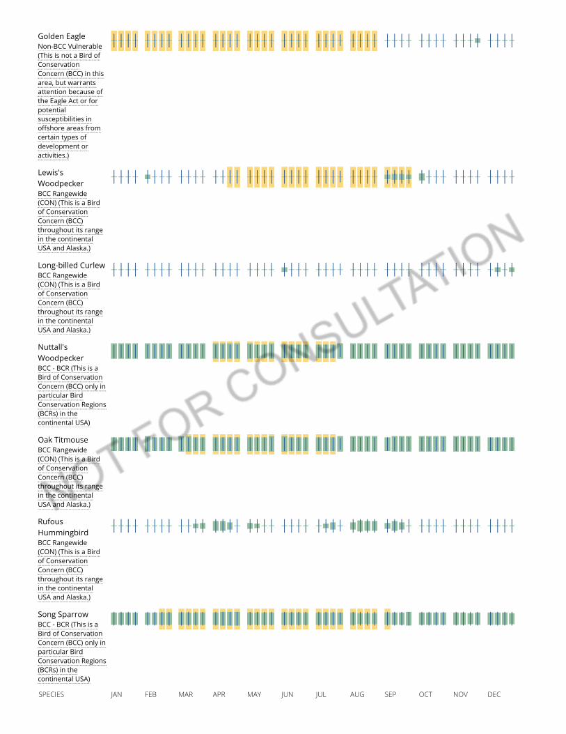
Golden EagleNon-BCC Vulnerable(This is not a Bird ofConservationConcern (BCC) in thisarea, but warrantsattention because ofthe Eagle Act or forpotentialsusceptibilities ino�shore areas fromcertain types ofdevelopment oractivities.)
Lewis'sWoodpeckerBCC Rangewide(CON) (This is a Birdof ConservationConcern (BCC)throughout its rangein the continentalUSA and Alaska.)
Long-billed CurlewBCC Rangewide(CON) (This is a Birdof ConservationConcern (BCC)throughout its rangein the continentalUSA and Alaska.)
Nuttall'sWoodpeckerBCC - BCR (This is aBird of ConservationConcern (BCC) only inparticular BirdConservation Regions(BCRs) in thecontinental USA)
Oak TitmouseBCC Rangewide(CON) (This is a Birdof ConservationConcern (BCC)throughout its rangein the continentalUSA and Alaska.)
RufousHummingbirdBCC Rangewide(CON) (This is a Birdof ConservationConcern (BCC)throughout its rangein the continentalUSA and Alaska.)
Song SparrowBCC - BCR (This is aBird of ConservationConcern (BCC) only inparticular BirdConservation Regions(BCRs) in thecontinental USA)
SPECIES JAN FEB MAR APR MAY JUN JUL AUG SEP OCT NOV DEC
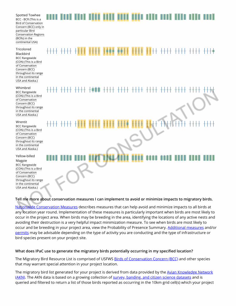
Spotted TowheeBCC - BCR (This is aBird of ConservationConcern (BCC) only inparticular BirdConservation Regions(BCRs) in thecontinental USA)
TricoloredBlackbirdBCC Rangewide(CON) (This is a Birdof ConservationConcern (BCC)throughout its rangein the continentalUSA and Alaska.)
WhimbrelBCC Rangewide(CON) (This is a Birdof ConservationConcern (BCC)throughout its rangein the continentalUSA and Alaska.)
WrentitBCC Rangewide(CON) (This is a Birdof ConservationConcern (BCC)throughout its rangein the continentalUSA and Alaska.)
Yellow-billedMagpieBCC Rangewide(CON) (This is a Birdof ConservationConcern (BCC)throughout its rangein the continentalUSA and Alaska.)
Tell me more about conservation measures I can implement to avoid or minimize impacts to migratory birds.
Nationwide Conservation Measures describes measures that can help avoid and minimize impacts to all birds atany location year round. Implementation of these measures is particularly important when birds are most likely tooccur in the project area. When birds may be breeding in the area, identifying the locations of any active nests andavoiding their destruction is a very helpful impact minimization measure. To see when birds are most likely tooccur and be breeding in your project area, view the Probability of Presence Summary. Additional measures and/orpermits may be advisable depending on the type of activity you are conducting and the type of infrastructure orbird species present on your project site.
What does IPaC use to generate the migratory birds potentially occurring in my speci�ed location?
The Migratory Bird Resource List is comprised of USFWS Birds of Conservation Concern (BCC) and other speciesthat may warrant special attention in your project location.
The migratory bird list generated for your project is derived from data provided by the Avian Knowledge Network(AKN). The AKN data is based on a growing collection of survey, banding, and citizen science datasets and isqueried and �ltered to return a list of those birds reported as occurring in the 10km grid cell(s) which your project

intersects, and that have been identi�ed as warranting special attention because they are a BCC species in thatarea, an eagle (Eagle Act requirements may apply), or a species that has a particular vulnerability to o�shoreactivities or development.
Again, the Migratory Bird Resource list includes only a subset of birds that may occur in your project area. It is notrepresentative of all birds that may occur in your project area. To get a list of all birds potentially present in yourproject area, please visit the E-bird Explore Data Tool.
What does IPaC use to generate the probability of presence graphs for the migratory birds potentiallyoccurring in my speci�ed location?
The probability of presence graphs associated with your migratory bird list are based on data provided by theAvian Knowledge Network (AKN). This data is derived from a growing collection of survey, banding, and citizenscience datasets .
Probability of presence data is continuously being updated as new and better information becomes available. Tolearn more about how the probability of presence graphs are produced and how to interpret them, go theProbability of Presence Summary and then click on the "Tell me about these graphs" link.
How do I know if a bird is breeding, wintering, migrating or present year-round in my project area?
To see what part of a particular bird's range your project area falls within (i.e. breeding, wintering, migrating oryear-round), you may refer to the following resources: The Cornell Lab of Ornithology All About Birds Bird Guide, or(if you are unsuccessful in locating the bird of interest there), the Cornell Lab of Ornithology Neotropical Birdsguide. If a bird on your migratory bird species list has a breeding season associated with it, if that bird does occurin your project area, there may be nests present at some point within the timeframe speci�ed. If "Breedselsewhere" is indicated, then the bird likely does not breed in your project area.
What are the levels of concern for migratory birds?
Migratory birds delivered through IPaC fall into the following distinct categories of concern:
1. "BCC Rangewide" birds are Birds of Conservation Concern (BCC) that are of concern throughout their rangeanywhere within the USA (including Hawaii, the Paci�c Islands, Puerto Rico, and the Virgin Islands);
2. "BCC - BCR" birds are BCCs that are of concern only in particular Bird Conservation Regions (BCRs) in thecontinental USA; and
3. "Non-BCC - Vulnerable" birds are not BCC species in your project area, but appear on your list either because ofthe Eagle Act requirements (for eagles) or (for non-eagles) potential susceptibilities in o�shore areas fromcertain types of development or activities (e.g. o�shore energy development or longline �shing).
Although it is important to try to avoid and minimize impacts to all birds, e�orts should be made, in particular, toavoid and minimize impacts to the birds on this list, especially eagles and BCC species of rangewide concern. Formore information on conservation measures you can implement to help avoid and minimize migratory birdimpacts and requirements for eagles, please see the FAQs for these topics.
Details about birds that are potentially a�ected by o�shore projects
For additional details about the relative occurrence and abundance of both individual bird species and groups ofbird species within your project area o� the Atlantic Coast, please visit the Northeast Ocean Data Portal. The Portalalso o�ers data and information about other taxa besides birds that may be helpful to you in your project review.Alternately, you may download the bird model results �les underlying the portal maps through the NOAA NCCOSIntegrative Statistical Modeling and Predictive Mapping of Marine Bird Distributions and Abundance on the AtlanticOuter Continental Shelf project webpage.
Bird tracking data can also provide additional details about occurrence and habitat use throughout the year,including migration. Models relying on survey data may not include this information. For additional information onmarine bird tracking data, see the Diving Bird Study and the nanotag studies or contact Caleb Spiegel or PamLoring.
What if I have eagles on my list?
If your project has the potential to disturb or kill eagles, you may need to obtain a permit to avoid violating theEagle Act should such impacts occur.
Proper Interpretation and Use of Your Migratory Bird Report
The migratory bird list generated is not a list of all birds in your project area, only a subset of birds of priorityconcern. To learn more about how your list is generated, and see options for identifying what other birds may bein your project area, please see the FAQ “What does IPaC use to generate the migratory birds potentially occurringin my speci�ed location”. Please be aware this report provides the “probability of presence” of birds within the 10km grid cell(s) that overlap your project; not your exact project footprint. On the graphs provided, please also lookcarefully at the survey e�ort (indicated by the black vertical bar) and for the existence of the “no data” indicator (ared horizontal bar). A high survey e�ort is the key component. If the survey e�ort is high, then the probability ofpresence score can be viewed as more dependable. In contrast, a low survey e�ort bar or no data bar means a lackof data and, therefore, a lack of certainty about presence of the species. This list is not perfect; it is simply a startingpoint for identifying what birds of concern have the potential to be in your project area, when they might be there,and if they might be breeding (which means nests might be present). The list helps you know what to look for tocon�rm presence, and helps guide you in knowing when to implement conservation measures to avoid orminimize potential impacts from your project activities, should presence be con�rmed. To learn more aboutconservation measures, visit the FAQ “Tell me about conservation measures I can implement to avoid or minimizeimpacts to migratory birds” at the bottom of your migratory bird trust resources page.
FacilitiesWildlife refuges and �sh hatcheries
REFUGE AND FISH HATCHERY INFORMATION IS NOT AVAILABLE AT THIS TIME
Wetlands in the National Wetlands InventoryImpacts to NWI wetlands and other aquatic habitats may be subject to regulation under Section 404of the Clean Water Act, or other State/Federal statutes.
For more information please contact the Regulatory Program of the local U.S. Army Corps ofEngineers District.
Please note that the NWI data being shown may be out of date. We are currently working to updateour NWI data set. We recommend you verify these results with a site visit to determine the actualextent of wetlands on site.
This location overlaps the following wetlands:

Data limitations
The Service's objective of mapping wetlands and deepwater habitats is to produce reconnaissance levelinformation on the location, type and size of these resources. The maps are prepared from the analysis of highaltitude imagery. Wetlands are identi�ed based on vegetation, visible hydrology and geography. A margin of erroris inherent in the use of imagery; thus, detailed on-the-ground inspection of any particular site may result inrevision of the wetland boundaries or classi�cation established through image analysis.
The accuracy of image interpretation depends on the quality of the imagery, the experience of the image analysts,the amount and quality of the collateral data and the amount of ground truth veri�cation work conducted.Metadata should be consulted to determine the date of the source imagery used and any mapping problems.
Wetlands or other mapped features may have changed since the date of the imagery or �eld work. There may beoccasional di�erences in polygon boundaries or classi�cations between the information depicted on the map andthe actual conditions on site.
Data exclusions
Certain wetland habitats are excluded from the National mapping program because of the limitations of aerialimagery as the primary data source used to detect wetlands. These habitats include seagrasses or submergedaquatic vegetation that are found in the intertidal and subtidal zones of estuaries and nearshore coastal waters.Some deepwater reef communities (coral or tuber�cid worm reefs) have also been excluded from the inventory.These habitats, because of their depth, go undetected by aerial imagery.
Data precautions
Federal, state, and local regulatory agencies with jurisdiction over wetlands may de�ne and describe wetlands in adi�erent manner than that used in this inventory. There is no attempt, in either the design or products of thisinventory, to de�ne the limits of proprietary jurisdiction of any Federal, state, or local government or to establishthe geographical scope of the regulatory programs of government agencies. Persons intending to engage inactivities involving modi�cations within or adjacent to wetland areas should seek the advice of appropriate federal,state, or local agencies concerning speci�ed agency regulatory programs and proprietary jurisdictions that maya�ect such activities.
FRESHWATER PONDPUBK
A full description for each wetland code can be found at the National Wetlands Inventory website

APPENDIX E
GEOTECHNICAL ENGINEERING STUDY FOR
MOHR HALL MODERNIZATION Freeport and Sutterville Roads
Sacramento, California
Project No. E08091.001 January 2016
Los Rios Facilities Management Project No. E08091.001 3753 Bradview Drive 29 January 2016 Sacramento, California 95827
Attention: Mr. Josef Meyer
Subject: MOHR HALL MODERNIZATION Freeport and Sutterville Roads, Sacramento, Sacramento County, California GEOTECHNICAL ENGINEERING STUDY
References: 1. Engineering Geologic Report for Sacramento City College Cafeteria, prepared by
Wallace – Kuhl & Associates, Inc., dated 18 October 2000 (WKA No. 4399.01). 2. Update of Geologic Hazards Study for Sacramento City College Parking Structure,
prepared by Wallace – Kuhl & Associates, Inc., dated 27 February 2004 (WKA No.5852.01).
3. Geotechnical Engineering Report for Sacramento City College Fine Arts Building,prepared by Wallace – Kuhl & Associates, Inc., dated 31 May 2007 (WKA No.7542.01).
4. Geotechnical Engineering Study for Sacramento City College Performing Arts Facility,prepared by Youngdahl Consulting Group, Inc., dated 12 May 2008 (Project No.E08091.000).
5. Undrained Retaining Wall Recommendations for Sacramento City College PerformingArts Facility, prepared by Youngdahl Consulting Group, Inc., dated 1 April 2009(Project No. E08091.000).
6. Mohr Hall Replacement Survey, undated.7. Proposal for Mohr Hall Modernization, prepared by Youngdahl Consulting Group, Inc.,
dated 12 October 2015.
Dear Mr. Josef Meyer,
In accordance with your authorization, Youngdahl Consulting Group, Inc. has performed a Geotechnical Engineering Study for the project site located on the northeast corner of Freeport and Sutterville Roads in Sacramento, California. The purpose of this study was to perform a subsurface exploration and evaluate the surface and subsurface soil conditions at the site and provide geotechnical information and design criteria for the proposed project. Our scope was limited to a subsurface investigation, laboratory testing and preparation of this report per the Reference 7 proposal.
Based upon our site reconnaissance and subsurface exploration program, it is our opinion that the primary geotechnical issues to be addressed consist of design and construction of the proposed improvements within expansive clay soils, as well as the potential for perched groundwater conditions associated with the clay and cemented soil horizons. Due to the non-uniform nature of soils, other geotechnical issues may become more apparent during grading operations which are not listed above. The descriptions, findings, conclusions, and recommendations provided in this report are formulated as a whole; specific conclusions or recommendations should not be derived or used out of context. Please review the limitations and uniformity of conditions section of this report.

Mohr Hall Modernization Project No. E08091.001 Page ii 29 January 2016
This report has been prepared for the exclusive use of the Los Rios Facilities Management and their consultants, for specific application to this project, in accordance with generally accepted geotechnical engineering practice. Should you have any questions or require additional information, please contact our office at your convenience.
Very truly yours, Youngdahl Consulting Group, Inc. Reviewed by:
Christopher M. Sugar Brandon K. Shimizu, P.E., G.E. Staff Engineer Senior Engineer
Distribution: (1) PDF to Client

TABLE OF CONTENTS 1.0 INTRODUCTION ............................................................................................................ 1
Purpose and Scope ........................................................................................................ 1 Project Understanding .................................................................................................... 1 Background .................................................................................................................... 1
2.0 FINDINGS ...................................................................................................................... 2 Surface Observations ..................................................................................................... 2 Subsurface Conditions ................................................................................................... 2 Groundwater Conditions ................................................................................................. 2 Geologic ......................................................................................................................... 3 Seismicity ....................................................................................................................... 3 Earthquake Induced Liquefaction, Surface Rupture Potential, and Settlement ............... 3 Static and Earthquake Induced Slope Instability ............................................................. 3 Laboratory Testing.......................................................................................................... 4 Soil Expansion Potential ................................................................................................. 4
3.0 DISCUSSION AND CONCLUSIONS .............................................................................. 4 General .......................................................................................................................... 4 Foundations ................................................................................................................... 4 Drainage ......................................................................................................................... 4
4.0 SITE GRADING AND EARTHWORK IMPROVEMENTS ................................................ 5 Site Preparation .............................................................................................................. 5 Soil Moisture Considerations .......................................................................................... 6 Compaction Equipment .................................................................................................. 6 Engineered Fill Criteria ................................................................................................... 6 Underground Improvements ........................................................................................... 7
5.0 DESIGN RECOMMENDATIONS .................................................................................... 7 Seismic Criteria .............................................................................................................. 7 Shallow Conventional Foundations ................................................................................. 8 Retaining Walls .............................................................................................................. 9 Slab-on-Grade Construction ..........................................................................................10 Drainage ........................................................................................................................13
6.0 DESIGN REVIEW AND CONSTRUCTION MONITORING ............................................14 Construction Monitoring .................................................................................................14 Low Impact Development Standards .............................................................................14 Post Construction Monitoring .........................................................................................15
7.0 LIMITATIONS AND UNIFORMITY OF CONDITIONS ...................................................15
APPENDIX A ............................................................................................................................18 Introduction ...................................................................................................................19 Vicinity Map (Figure A-1) ...............................................................................................20 Site Map (Figure A-2) ....................................................................................................21 Logs of Exploratory Test Borings (Figures A-3 through A-7) ..........................................22 Soil Classification Chart and Exploratory Test Boring Log Legend (Figure A-8) .............29
APPENDIX B ............................................................................................................................30 Introduction ...................................................................................................................31 Laboratory Testing Procedures......................................................................................31 Atterberg Limits Test (Figure B-1) ..................................................................................32

Mohr Hall Modernization Project No. E08091.001 Page 2 29 January 2016
Expansion Index Test (Figure B-2) ................................................................................33 Unconfined Compression Tests (Figure B-3 to B-5).......................................................34
APPENDIX C ............................................................................................................................37 Plug and Drain (Figure C-1) ...........................................................................................38 Site Wall Drainage (Figure C-2) .....................................................................................39 Subdrain (Figure C-3) ....................................................................................................40
APPENDIX D ............................................................................................................................41 Geologic Hazards Report ..............................................................................................42
GEOTECHNICAL ENGINEERING STUDY FOR
MOHR HALL MODERNIZATION
1.0 INTRODUCTION This report presents the results of our Geotechnical Engineering Study performed for the two proposed instructional buildings planned to be constructed at 3835 Freeport Boulevard in Sacramento, California. An annotated vicinity map is provided on Figure A-1 to identify the approximate project location.
Purpose and Scope The purpose of this study was to explore and evaluate the surface and subsurface conditions at the site, to provide geotechnical information and design criteria, and to develop geotechnical recommendations for the proposed project. The scope of this study includes the following:
• A review of geotechnical and geologic data available to us at the time of our study,including previous geotechnical studies performed adjacent to the project site;
• A field study consisting of a site reconnaissance, followed by an exploratory boringprogram to observe and characterize the subsurface conditions;
• A laboratory testing program performed on representative samples collected during ourfield study;
• Engineering analysis of the data and information obtained from our field study, laboratorytesting, and literature review;
• Development of geotechnical recommendations regarding earthwork constructionincluding, site preparation and grading, excavation characteristics, soil moistureconditions, compaction equipment, engineered fill criteria, slope configuration andgrading, underground improvements, and drainage;
• Development of geotechnical design criteria for seismic conditions, foundations,differential support conditions, retaining walls, slabs on grade;
• Preparation of this report summarizing our findings, conclusions, and recommendationsregarding the above described information.
Project Understanding We understand that the proposed development will include demolition of the existing Mohr Hall and construction of a two new multi-story instructional buildings. At the time of the preparation of this report preliminary plans for only the western building were provided. The two new proposed instructional buildings are expected to be two-story, of metal frame construction, and be supported by spread footing foundations with concrete slab-on-grade floors. For the purpose of this report, we have anticipated that grading operations will consist of cuts and fills on the order of 2 feet or less.
Background Review of available information indicates that previous geotechnical studies have been prepared for the adjacent buildings within the Sacramento City College Campus.
If studies or plans pertaining to the site exist and are not cited as a reference in this report, we should be afforded the opportunity to review and modify our conclusions and recommendations as necessary.

Mohr Hall Modernization Project No. E08091.001 Page 2 29 January 2016
2.0 FINDINGS The following section describes our findings regarding the site conditions that we observed during our site reconnaissance and subsequent subsurface exploration. In addition, this section also provides the results of our laboratory testing, geologic review, and engineering assessment related to the project site.
Surface Observations The project site is generally located on the northeast side of Freeport and Sutterville Roads in Sacramento, California. Specifically, the area of development is located at the existing Mohr Hall, and extends south into the existing open space.
The terrain at the site is generally flat, sloping gently toward the south and west at a slope of 15H:1V or flatter (Horizontal:Vertical), towards Sutterville Road and Freeport Boulevard, respectively. Vegetation on the project site was observed to consist of mature trees along the western side, and a grouping of young trees along the southeastern side of the site. Additionally, landscaped grasses were observed throughout the site.
Mohr Hall currently is located within the footprints of the proposed instructional buildings and will have to be demolished prior to construction.
Subsurface Conditions Our field study included a site reconnaissance by a representative of our firm followed by a subsurface exploration program conducted on 8 January 2016. The exploration program included the advancing of 5 exploratory test borings, 1 advanced to 11½ feet, 3 advanced to 21½ feet, and 1 advanced to 51½ feet, under the direction of our representative at the approximate locations shown on Figure A-2, Appendix A. A description of the field exploration program is provided in Appendix A.
Subsurface soil conditions were relatively similar at the project site and included sandy CLAYs, sandy SILTs, and sands. In general, the surface soils were comprised of sandy CLAYs in a medium stiff to stiff and slightly moist to moist conditions to depths approaching 5 to 10 feet. Underlying the surface soils, sandy SILTs in a hard, slightly moist to moist and variably cemented condition were encountered to depths approaching 11½ to 21½ feet. Underlying the silts in Boring B-2 interbedded layers of silty clayey SANDs / sandy SILTs in a medium dense to very dense / hard, moist to wet and variably cemented condition were encountered to the maximum depth of exploration. Silty SANDs in a dense, slightly moist and moderately cemented condition were also encountered in Boring B-4 from 20 to 21½ feet.
A more detailed description of the subsurface conditions encountered during our subsurface exploration is presented graphically on the “Exploratory Boring Logs", Figures A-3 through A-7, Appendix A. These logs show a graphic interpretation of the subsurface profile, the location and depths at which samples were collected and the laboratory test results.
Groundwater Conditions Groundwater conditions were observed at boring location B-2 at a depth of 24 feet. Based on a review of well data in the vicinity of the site, the permanent groundwater table in the area is about 18 to 20 feet below the ground surface. The groundwater table observed on the site could be attributed to its proximity to the Sacramento River.
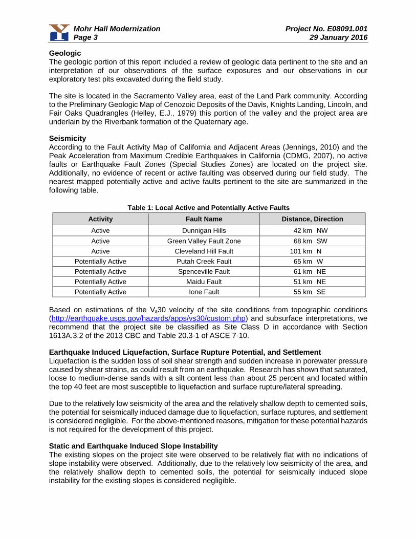
Mohr Hall Modernization Project No. E08091.001 Page 3 29 January 2016
Geologic The geologic portion of this report included a review of geologic data pertinent to the site and an interpretation of our observations of the surface exposures and our observations in our exploratory test pits excavated during the field study.
The site is located in the Sacramento Valley area, east of the Land Park community. According to the Preliminary Geologic Map of Cenozoic Deposits of the Davis, Knights Landing, Lincoln, and Fair Oaks Quadrangles (Helley, E.J., 1979) this portion of the valley and the project area are underlain by the Riverbank formation of the Quaternary age.
Seismicity According to the Fault Activity Map of California and Adjacent Areas (Jennings, 2010) and the Peak Acceleration from Maximum Credible Earthquakes in California (CDMG, 2007), no active faults or Earthquake Fault Zones (Special Studies Zones) are located on the project site. Additionally, no evidence of recent or active faulting was observed during our field study. The nearest mapped potentially active and active faults pertinent to the site are summarized in the following table.
Table 1: Local Active and Potentially Active Faults Activity Fault Name Distance, Direction Active Dunnigan Hills 42 km NW
Active Green Valley Fault Zone 68 km SW
Active Cleveland Hill Fault 101 km N
Potentially Active Putah Creek Fault 65 km W
Potentially Active Spenceville Fault 61 km NE
Potentially Active Maidu Fault 51 km NE
Potentially Active Ione Fault 55 km SE
Based on estimations of the Vs30 velocity of the site conditions from topographic conditions (http://earthquake.usgs.gov/hazards/apps/vs30/custom.php) and subsurface interpretations, we recommend that the project site be classified as Site Class D in accordance with Section 1613A.3.2 of the 2013 CBC and Table 20.3-1 of ASCE 7-10.
Earthquake Induced Liquefaction, Surface Rupture Potential, and Settlement Liquefaction is the sudden loss of soil shear strength and sudden increase in porewater pressure caused by shear strains, as could result from an earthquake. Research has shown that saturated, loose to medium-dense sands with a silt content less than about 25 percent and located within the top 40 feet are most susceptible to liquefaction and surface rupture/lateral spreading.
Due to the relatively low seismicity of the area and the relatively shallow depth to cemented soils, the potential for seismically induced damage due to liquefaction, surface ruptures, and settlement is considered negligible. For the above-mentioned reasons, mitigation for these potential hazards is not required for the development of this project.
Static and Earthquake Induced Slope Instability The existing slopes on the project site were observed to be relatively flat with no indications of slope instability were observed. Additionally, due to the relatively low seismicity of the area, and the relatively shallow depth to cemented soils, the potential for seismically induced slope instability for the existing slopes is considered negligible.
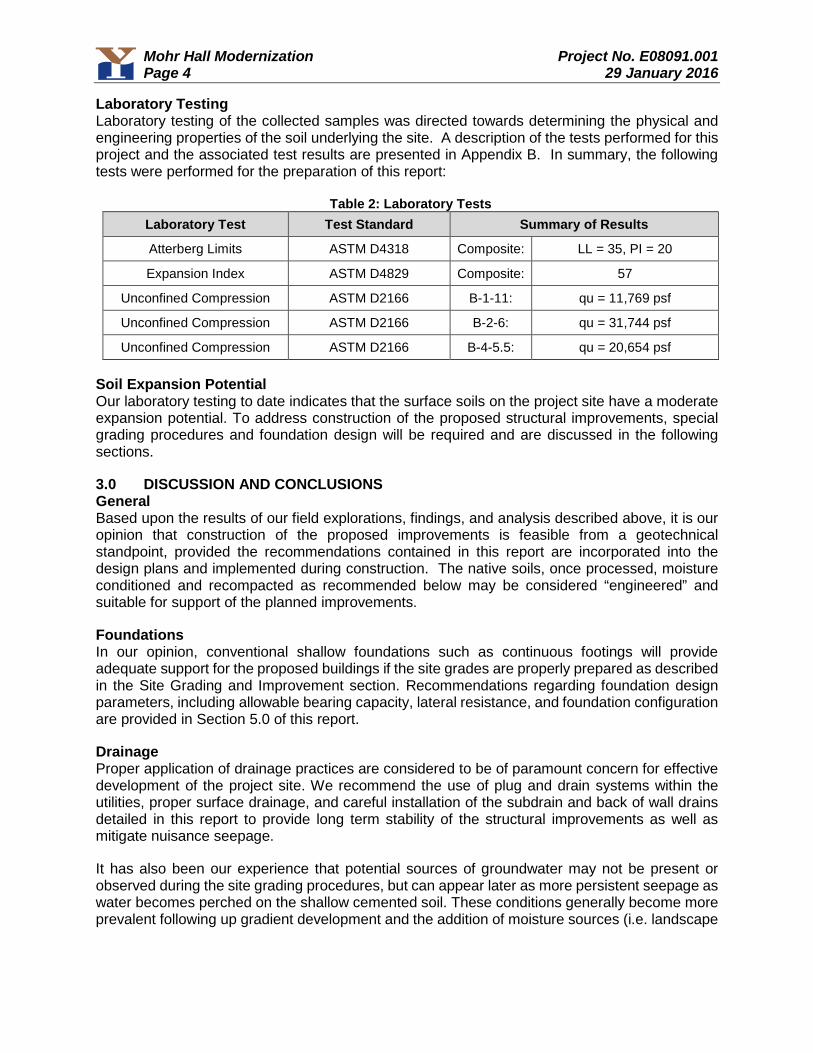
Mohr Hall Modernization Project No. E08091.001 Page 4 29 January 2016
Laboratory Testing Laboratory testing of the collected samples was directed towards determining the physical and engineering properties of the soil underlying the site. A description of the tests performed for this project and the associated test results are presented in Appendix B. In summary, the following tests were performed for the preparation of this report:
Table 2: Laboratory Tests Laboratory Test Test Standard Summary of Results
Atterberg Limits ASTM D4318 Composite: LL = 35, PI = 20
Expansion Index ASTM D4829 Composite: 57
Unconfined Compression ASTM D2166 B-1-11: qu = 11,769 psf
Unconfined Compression ASTM D2166 B-2-6: qu = 31,744 psf
Unconfined Compression ASTM D2166 B-4-5.5: qu = 20,654 psf
Soil Expansion Potential Our laboratory testing to date indicates that the surface soils on the project site have a moderate expansion potential. To address construction of the proposed structural improvements, special grading procedures and foundation design will be required and are discussed in the following sections.
3.0 DISCUSSION AND CONCLUSIONS General Based upon the results of our field explorations, findings, and analysis described above, it is our opinion that construction of the proposed improvements is feasible from a geotechnical standpoint, provided the recommendations contained in this report are incorporated into the design plans and implemented during construction. The native soils, once processed, moisture conditioned and recompacted as recommended below may be considered “engineered” and suitable for support of the planned improvements.
Foundations In our opinion, conventional shallow foundations such as continuous footings will provide adequate support for the proposed buildings if the site grades are properly prepared as described in the Site Grading and Improvement section. Recommendations regarding foundation design parameters, including allowable bearing capacity, lateral resistance, and foundation configuration are provided in Section 5.0 of this report.
Drainage Proper application of drainage practices are considered to be of paramount concern for effective development of the project site. We recommend the use of plug and drain systems within the utilities, proper surface drainage, and careful installation of the subdrain and back of wall drains detailed in this report to provide long term stability of the structural improvements as well as mitigate nuisance seepage.
It has also been our experience that potential sources of groundwater may not be present or observed during the site grading procedures, but can appear later as more persistent seepage as water becomes perched on the shallow cemented soil. These conditions generally become more prevalent following up gradient development and the addition of moisture sources (i.e. landscape
Mohr Hall Modernization Project No. E08091.001 Page 5 29 January 2016
irrigation, run-off, etc.). Where this condition arises, drainage measures may be necessary to mitigate seepage conditions that were not initially observed during the site grading activities.
4.0 SITE GRADING AND EARTHWORK IMPROVEMENTS Site Preparation Preparation of the project site should involve demolition, site drainage controls, dust control, clearing and stripping, and exposed grade compaction considerations. The following paragraphs state our geotechnical comments and recommendations concerning site preparation.
Demolition: As part of the demolition operation, any unwanted foundation, structural improvement, or site improvement elements (including underground utilities) should be exhumed and removed from the site.
Concrete separated from the other debris, and adequately broken down in particle size, may be mixed thoroughly with soil and placed as engineered fill as described below. If this option is exercised, a representative from our firm should be contacted to observe the adequacy of grading operations associated with the breaking and mixing of these elements.
Site Drainage Controls: We recommend that initial site preparation involve intercepting and diverting any potential sources of surface or near-surface water within the construction zones. Because the selection of an appropriate drainage system will depend on the water quantity, season, weather conditions, construction sequence, and methods used by the contractor, final decisions regarding drainage systems are best made in the field at the time of construction. All drainage and/or water diversion performed for the site should be in accordance with the Clean Water Act and applicable Storm Water Pollution Prevention Plan.
Dust Control: Dust control provisions should be provided for as required by the local jurisdiction’s grading ordinance (i.e. water truck or other adequate water supply during grading).
Clearing and Stripping: Clearing and stripping operations should include the removal of all organic laden materials including trees, bushes, root balls, root systems, and any soft or loose soil generated by the removal operations. Surface grass stripping operations are necessary based upon our observations during our site visit. Short or mowed dry grasses may be pulverized and lost within fill materials provided no concentrated pockets of organics result. It is the responsibility of the grading contractor to remove excess organics from the fill materials. No more than 2 percent of organic material, by weight, should be allowed within the fill materials at any given location.
General site clearing should also include removal of any loose or saturated materials within the proposed structural improvement and pavement areas. A representative of our firm should be present during site clearing operations to identify the location and depth of potential fills not disclosed by this report, to observe removal of deleterious materials, and to identify any existing site conditions which may require mitigation or further recommendations prior to site development. Preserved trees may require tree root protection which should be addressed on an individual basis by a qualified arborist.
Exposed Grade Compaction: Exposed soil grades following initial site preparation activities and overexcavation operations should be scarified to a minimum depth of 8 inches and compacted to the requirements for engineered fill. Prior to placing fill, the exposed subgrades should be in a firm and unyielding state. Any localized zones of soft or pumping soils observed within a subgrade
Mohr Hall Modernization Project No. E08091.001 Page 6 29 January 2016
should either be scarified and recompacted or be overexcavated and replaced with engineered fill as detailed in the engineered fill section below.
Soil Moisture Considerations The near-surface soils may become partially or completely saturated during the rainy season. Grading operations during this time period may be difficult since compaction efforts may be hampered by saturated materials. Therefore, we suggest that consideration be given to the seasonal limitations and costs of winter grading operations on the site. Special attention should be given regarding the drainage of the project site.
If the project is expected to work through the wet season, the contractor should install appropriate temporary drainage systems at the construction site and should minimize traffic over exposed subgrades due to the moisture-sensitive nature of the on-site soils. During wet weather operations, the soil should be graded to drain and should be sealed by rubber tire rolling to minimize water infiltration.
Compaction Equipment In areas to receive structural soil fill, we anticipate that a large vibratory padded drum compactor or approved equivalent will be capable of achieving the compaction requirements for engineered fill provided the soil is placed and compacted within 3 to 4 percent over the optimum moisture content as determined by the ASTM D1557 test method and in lifts not greater than 12 inches in uncompacted thickness. The use of handheld equipment such as jumping jack or plate vibration compactors may require thinner lifts of 6 inches or less to achieve the desired relative compaction parameters.
Engineered Fill Criteria All materials placed as fills on the site should be placed as “Engineered Fill" which is observed, tested, and compacted as described in the following paragraphs.
Suitability of Onsite Materials: We expect that soil generated from excavations on the site, excluding deleterious material, may be used as engineered fill provided the material does not exceed the maximum size specifications listed below
Import Materials: If imported fill material is needed for this project, import material should be approved by our firm prior to transporting it to the project. It is preferable that import material meet the following requirements:
1. Plasticity index not to exceed 12;2. An angle of friction equal to or greater than 30;3. Should not contain rocks larger than 6 inches in diameter;4. Not more than 30 percent passing through the No. 200 sieve.
If these requirements are not met, additional testing and evaluation may be necessary to determine the appropriate design parameters for foundations, pavement, and other improvements.
Fill Placement and Compaction: Clay soils are anticipated to be encountered throughout the entire development area and should be compacted as discussed in this paragraph. All areas proposed to receive fill should be scarified to a minimum depth of 8 inches, moisture conditioned as necessary, and compacted to at least 90 percent of the maximum dry density based on the ASTM D1557 test method at a moisture content of about 3 to 4 percent over optimum. The fill should
Mohr Hall Modernization Project No. E08091.001 Page 7 29 January 2016
be placed in thin horizontal lifts not to exceed 12 inches in uncompacted thickness. The fill should be moisture conditioned to about 3 to 4 percent over optimum and compacted to a relative compaction of not less than 90 percent based on the ASTM D1557 test method.
Fill soil compaction should be evaluated by means of in-place density tests performed during fill placement so that adequacy of soil compaction efforts may be determined as earthwork progresses.
Underground Improvements Trench Excavation: Trenches or excavations in soil should be shored or sloped back in accordance with current OSHA regulations prior to persons entering them. The potential use of a shield to protect workers cannot be precluded. Refer to the Excavation Characteristics section of Site Grading and Improvements of this report for anticipated excavation conditions.
Backfill Materials: Backfill materials for utilities should conform to the requirements of the local jurisdiction. It should be realized that permeable backfill materials will likely carry water at some time in the future.
When backfilling within structural footprints, compacted low permeability materials are recommended to be used a minimum of 5 feet beyond the structural footprint to minimize moisture intrusion. If a permeable material is used as backfill within this zone, subdrainage mitigation may be required.
Backfill Compaction: Backfill compaction should conform to the requirements of the local jurisdiction. Where backfill compaction is not specified by the local jurisdiction, the backfill should be compacted to a minimum of 90 percent relative compaction per the ASTM D1557 test method at a moisture content of about 3 to 4 percent over optimum. Compaction should be accomplished using lifts which do not exceed 12 inches when compacting with a backhoe or larger equipment equipped with a compaction wheel. However, thickness of the lifts should be determined by the contractor. If the contractor can achieve the required compaction using thicker lifts, the method may be judged acceptable based on field verification by a representative of our firm using standard density testing procedures. Lightweight compaction equipment may require thinner lifts to achieve the required densities.
Drainage Considerations: In developments with the potential for a perched groundwater condition (i.e. shallow cemented soils), underground utilities can become collection points for subsurface water. Where this condition occurs, we recommend plug and drains within the utility trenches (Figure C-1, Appendix C) to collect and convey water to the storm drain system or other approved outlet. Temporary dewatering measures may be necessary and could include the installation of submersible pumps and/or point wells.
5.0 DESIGN RECOMMENDATIONS Seismic Criteria Based on the 2013 California Building Code, Chapter 16A, and our site investigation findings, the following seismic parameters are recommended from a geotechnical perspective for structural design. The final choice of design parameters, however, remains the purview of the project structural engineer.
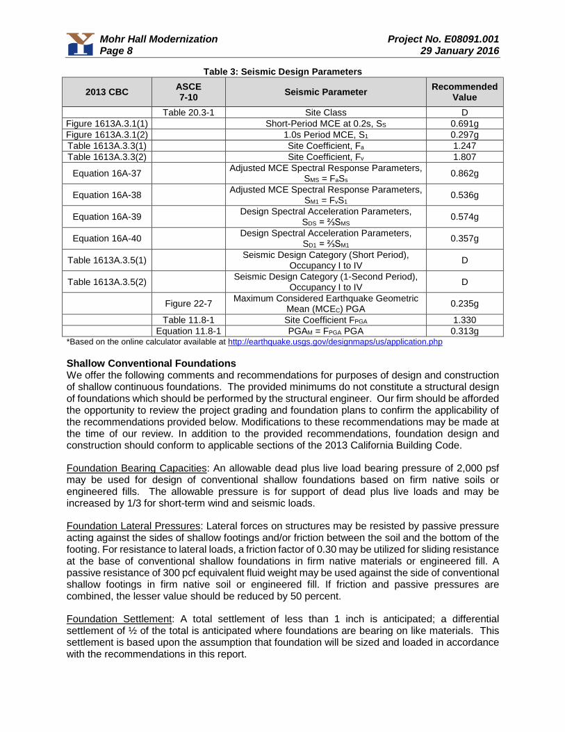
Mohr Hall Modernization Project No. E08091.001 Page 8 29 January 2016
Table 3: Seismic Design Parameters
2013 CBC ASCE 7-10 Seismic Parameter Recommended
Value Table 20.3-1 Site Class D
Figure 1613A.3.1(1) Short-Period MCE at 0.2s, SS 0.691g
Figure 1613A.3.1(2) 1.0s Period MCE, S1 0.297g
Table 1613A.3.3(1) Site Coefficient, Fa 1.247
Table 1613A.3.3(2) Site Coefficient, Fv 1.807
Equation 16A-37 Adjusted MCE Spectral Response Parameters,
SMS = FaSs 0.862g
Equation 16A-38 Adjusted MCE Spectral Response Parameters,
SM1 = FvS1 0.536g
Equation 16A-39 Design Spectral Acceleration Parameters,
SDS = ⅔SMS 0.574g
Equation 16A-40 Design Spectral Acceleration Parameters,
SD1 = ⅔SM1 0.357g
Table 1613A.3.5(1) Seismic Design Category (Short Period),
Occupancy I to IV D
Table 1613A.3.5(2) Seismic Design Category (1-Second Period),
Occupancy I to IV D
Figure 22-7 Maximum Considered Earthquake Geometric
Mean (MCEC) PGA 0.235g
Table 11.8-1 Site Coefficient FPGA 1.330
Equation 11.8-1 PGAM = FPGA PGA 0.313g *Based on the online calculator available at http://earthquake.usgs.gov/designmaps/us/application.php
Shallow Conventional Foundations We offer the following comments and recommendations for purposes of design and construction of shallow continuous foundations. The provided minimums do not constitute a structural design of foundations which should be performed by the structural engineer. Our firm should be afforded the opportunity to review the project grading and foundation plans to confirm the applicability of the recommendations provided below. Modifications to these recommendations may be made at the time of our review. In addition to the provided recommendations, foundation design and construction should conform to applicable sections of the 2013 California Building Code.
Foundation Bearing Capacities: An allowable dead plus live load bearing pressure of 2,000 psf may be used for design of conventional shallow foundations based on firm native soils or engineered fills. The allowable pressure is for support of dead plus live loads and may be increased by 1/3 for short-term wind and seismic loads.
Foundation Lateral Pressures: Lateral forces on structures may be resisted by passive pressure acting against the sides of shallow footings and/or friction between the soil and the bottom of the footing. For resistance to lateral loads, a friction factor of 0.30 may be utilized for sliding resistance at the base of conventional shallow foundations in firm native materials or engineered fill. A passive resistance of 300 pcf equivalent fluid weight may be used against the side of conventional shallow footings in firm native soil or engineered fill. If friction and passive pressures are combined, the lesser value should be reduced by 50 percent.
Foundation Settlement: A total settlement of less than 1 inch is anticipated; a differential settlement of ½ of the total is anticipated where foundations are bearing on like materials. This settlement is based upon the assumption that foundation will be sized and loaded in accordance with the recommendations in this report.
Mohr Hall Modernization Project No. E08091.001 Page 9 29 January 2016
Foundation Configuration: Conventional shallow foundations should be a minimum of 12 inches wide and founded a minimum of 24 inches below the lowest adjacent soil grade for the two-story instructional buildings. Isolated pad foundations should not be used unless they are connected with grade beams. If used, isolated pad foundations should be a minimum of 24 inches in diameter.
Foundation reinforcement should be provided by the structural engineer. The reinforcement schedule should account for typical construction issues such as load consideration, concrete cracking, and the presence of isolated irregularities. Reinforcing steel for the structures should consist of a minimum of four No. 4 reinforcing bars; two each at the top and bottom of the foundation.
All footings should be founded below an imaginary 2H:1V plane projected up from the bottoms of adjacent footings and/or parallel utility trenches, or to a depth that achieves a minimum horizontal clearance of 6 feet from the outside toe of the footings to the slope face, whichever requires a deeper excavation.
Subgrade Conditions: Footings should never be cast atop soft, loose, organic, slough, debris, nor atop subgrades covered by ice or standing water. Prior to concrete placement, the foundation excavations should be moisture conditioned to close any desiccation cracking. A representative of our firm should be retained to observe all subgrades during footing excavations and prior to concrete placement so that a determination as to the adequacy of subgrade preparation can be made.
Shallow Footing / Stemwall Backfill: All footing/stemwall backfill soil should be compacted to at least 90 percent of the maximum dry density (based on ASTM D1557) at a moisture content of about 3 to 4 percent over optimum.
Retaining Walls Our design recommendations and comments regarding retaining walls for the project site are discussed below.
Foundation Design Parameters: An allowable dead plus live load bearing pressure of 2,000 psf may be used for design of conventional shallow foundations based on firm native soils or engineered fills. The allowable pressures are for support of dead plus live loads and may be increased by 1/3 for short-term seismic loads.
Foundation Lateral Pressures: Lateral forces on structures may be resisted by passive pressure acting against the sides of shallow footings and/or friction between the soil and the bottom of the footing. For resistance to lateral loads, a friction factor of 0.30 may be utilized for sliding resistance at the base of conventional shallow foundations in firm native materials or engineered fill. A passive resistance of 300 pcf equivalent fluid weight may be used against the side of conventional shallow footings in firm native soil or engineered fill. If friction and passive pressures are combined, the lesser value should be reduced by 50 percent. All backfill placed behind retaining walls or against retaining wall footings should be compacted in accordance with the “Engineered Fill” section of this report.
Retaining Wall Lateral Pressures: Based on our observations and testing, the retaining wall should be designed to resist lateral pressure exerted from a soil media having an equivalent fluid weight provided in Table 4, below. In accordance with Section 1803A.5.12.1 of the 2013 California

Mohr Hall Modernization Project No. E08091.001 Page 10 29 January 2016
Building Code, application of the seismic design values for earthquake loading are required for retaining walls supporting more than 6 feet of backfill.
Table 4: Retaining Wall Pressures
Wall Type Wall Slope Configuration
Equivalent Fluid Weight
(pcf) Surcharge Load (psf)*
Lateral Pressure
Coefficient Earthquake Loading
(plf)***
Free Cantilever
Flat 40 per structural 0.33 15H2 Applied 0.6H
above the base of the wall Restrained** Flat 60 per structural 0.50 38H2
* The surcharge loads should be applied as uniform loads over the full height of the walls as follows: SurchargeLoad (psf) = (q) (K), where q = surcharge in psf, and K = coefficient of lateral pressure. Final design is the purviewof the project structural engineer.
** Restrained conditions shall be defined as walls which are structurally connected to prevent flexible yielding, or rigid wall configurations (i.e. walls with numerous turning points) which prevent the yielding necessary to reduce the driving pressures from an at-rest state to an active state.
*** Section 1803A.5.12 of the 2013 California Building Code states that a determination of lateral pressures on basement and retaining walls due to earthquake loading shall be provided for structures to be designed in Seismic Design Categories D, E or F (Load value derived from Wood (1973) and modified by Whitman (1991)).
Site Wall Drainage: The above criteria are based on fully drained conditions as detailed in the attached Figure C-2, Appendix C. For these conditions, we recommend that a blanket of filter material be placed behind all proposed walls. The blanket of filter material should be a minimum of 12 inches thick and should extend from the bottom of the wall to within 12 inches of the ground surface. The filter material should conform to Class One, Type B permeable material as specified in Section 68 of the California Department of Transportation Standard Specifications, current edition. A clean ¾ inch crushed rock is also acceptable, provided filter fabric is used to separate the open graded gravel/rock from the surrounding soils. The top 12 inches of wall backfill should consist of a compacted soil cap. A filter fabric should be placed on top of the gravel filter material to separate it from the soil cap. A 4 inch diameter drain pipe should be installed near the bottom of the filter blanket with perforations facing down. The drainpipe should be underlain by at least 4 inches of filter-type material. An adequate gradient should be provided along the top of the foundation to discharge water that collects behind the retaining wall to a controlled discharge system.
The configuration of a long retaining wall generally does not allow for a positive drainage gradient within the perforated drain pipe behind the wall since the wall footing is generally flat with no gradient for drainage. Where this condition is present, to maintain a positive drainage behind the walls, we recommend that the wall drains be provided with a discharge to an appropriate non-erosive outlet a maximum of 50 feet on center. In addition, if the wall drain outlets are temporarily stubbed out in front of the walls for future connection during home construction, it is imperative that the outlets be routed into the tight pipe area drainage system and not buried and rendered ineffective.
Slab-on-Grade Construction It is our opinion that soil-supported slab-on-grade floors could be used for the main floors of the residential structures, contingent on proper subgrade preparation. Often the geotechnical issues regarding the use of slab-on-grade floors include proper soil support and subgrade preparation, proper transfer of loads through the slab underlayment materials to the subgrade soils, and the anticipated presence or absence of moisture at or above the subgrade level. We offer the following comments and recommendations concerning support of slab-on-grade floors. The slab design (concrete mix, reinforcement, joint spacing, moisture protection, and underlayment materials) is the purview of the project Structural Engineer.
Mohr Hall Modernization Project No. E08091.001 Page 11 29 January 2016
Slab Subgrade Preparation: All subgrades proposed to support slab-on-grade floors should be prepared and compacted to the requirements of engineered fill as discussed in the Site Grading and Improvements section of this report. Prior to concrete placement, the slab areas should be moisture conditioned to close any desiccation cracking.
Slab Underlayment: As a minimum for slab support conditions, the slab should be underlain by a minimum 4 inch crushed rock layer and covered by a minimum 10-mil thick moisture retarding plastic membrane. An optional 1 inch blotter sand layer above the plastic membrane is sometimes used to aid in curing of the concrete in commercial structures. The blotter layer can become a reservoir for excessive moisture if inclement weather occurs prior to pouring the slab, excessive water collects in it from the concrete pour, or an external source of water enters above or bypasses the membrane. The membrane may only be functional when it is above the vapor sources. The bottom of the crushed rock layer should be above the exterior grade to act as a capillary break and not a reservoir, unless it is provided with an underdrain system. The slab design and underlayment should be in accordance with ASTM E1643 and E1745.
If the blotter sand layer is omitted (as may be required if slab design and construction is to be performed according to the 2013 Green Building Code), special wet curing procedures will be necessary. In all cases, development of appropriate slab mix design and curing procedures remains the purview of the project structural engineer.
Slab Moisture Protection: Due to the potential for landscape to be present directly adjacent to the slab edge/foundation or for drainage to be altered following our involvement with the project, varying levels of moisture below, at, or above the pad subgrade level should be anticipated. The slab designer should include the potential for moisture vapor transmission when designing the slab. Our experience has shown that vapor transmission through concrete is controlled through slab thickness as well as proper concrete mix design.
It should be noted that placement of the recommended plastic membrane, proper mix design, and proper slab underlayment and detailing per ASTM E1643 and E1745 will not provide a waterproof condition. If a waterproof condition is desired, we recommend that a waterproofing expert be consulted for slab design.
Slab Thickness and Reinforcement: Geotechnical reports have historically provided minimums for slab thickness and reinforcement for general crack control. The concrete mix design and construction practices can additionally have a large impact on concrete crack control. All concrete should be anticipated to crack. As such, these minimums should not be considered to be stand alone items to address crack control, but are suggested to be considered in the slab design methodology.
In order to help control the growth of cracks in interior concrete from becoming significant, we suggest the following minimums. Interior concrete slabs-on-grade not subject to heavy loads should be a minimum of 4 inches thick. A 4 inch thick slab should be reinforced. A minimum of No. 3 deformed reinforcing bars placed at 18 inches on center both ways, at the center of the structural section is suggested. Joint spacing should be provided by the structural engineer. Troweled joints recovered with paste during finishing or “wet sawn” joints should be considered every 10 feet on center. Expansion joint felt should be provided to separate floating slabs from foundations and at least at every third joint. Cracks will tend to occur at recurrent corners, curved or triangular areas and at points of fixity. Trim bars can be utilized at right angle to the predicted crack extending 40 bar diameters past the predicted crack on each side.
Mohr Hall Modernization Project No. E08091.001 Page 12 29 January 2016
Vertical Deflections: Soil-supported slab-on-grade floors can deflect downward when vertical loads are applied, due to elastic compression of the subgrade. For design of concrete floors, a modulus of subgrade reaction of k = 100 psi per inch would be applicable for native soils and engineered fills.
Exterior Flatwork: Exterior concrete flatwork is recommended to have a 6 inch rock cushion. This should consist of ¾ inch aggregate baserock compacted to at least 95 percent relative compaction as determined by the ASTM D1557 test method.
If exterior flatwork concrete is against the floor slab edge without a moisture separator it may transfer moisture to the floor slab. Expansion joint felt should be provided to separate exterior flatwork from foundations and at least at every third joint. Contraction / groove joints should be provided to a depth of at least 1/4 of the slab thickness and at a spacing of less than 30 times the slab thickness for unreinforced flatwork, dividing the slab into nearly square sections. Cracks will tend to occur at recurrent corners, curved or triangular areas and at points of fixity. Trim bars can be utilized at right angle to the predicted crack extending 40 bar diameters past the predicted crack on each side.
Drainage Adjacent to Slabs: All grades should provide rapid removal of surface water runoff; ponding water should not be allowed on building pads or adjacent to foundations or other structural improvements (during and following construction). All soils placed against foundations during finish grading should be compacted to minimize water infiltration. Finish and landscape grading should include positive drainage away from all foundations. Section 1808A.7.4 of the 2013 California Building Code (CBC) states that for graded soil sites, the top of any exterior foundation shall extend above the elevation of the street gutter at the point of discharge or the inlet of an approved drainage device a minimum of 12 inches plus 2 percent. If overland flow is not achieved adjacent to buildings, the drainage device should be designed to accept flows from a 100 year event. Grades directly adjacent to foundations should be no closer than 8 inches from the top of the slab (CBC 2304.11.2.2), and weep screeds are to be placed a minimum of 4 inches clear of soil grades and 2 inches clear of concrete or other hard surfacing (CBC 2512.1.2). From this point, surface grades should slope a minimum of 2 percent away from all foundations for at least 10 feet, and then 2 percent along a drainage swale to the outlet (CBC 1804A.3). Downspouts should be tight piped via an area drain network and discharged to an appropriate non-erosive outlet away from all foundations.
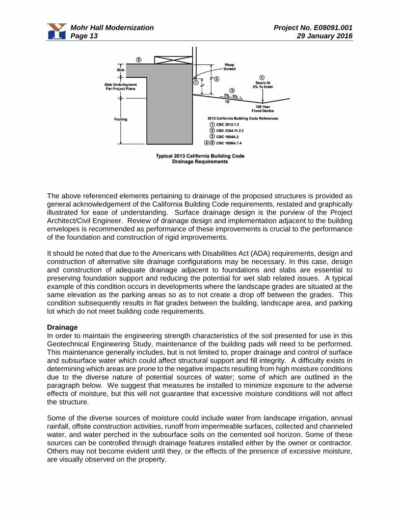
Mohr Hall Modernization Project No. E08091.001 Page 13 29 January 2016
The above referenced elements pertaining to drainage of the proposed structures is provided as general acknowledgement of the California Building Code requirements, restated and graphically illustrated for ease of understanding. Surface drainage design is the purview of the Project Architect/Civil Engineer. Review of drainage design and implementation adjacent to the building envelopes is recommended as performance of these improvements is crucial to the performance of the foundation and construction of rigid improvements.
It should be noted that due to the Americans with Disabilities Act (ADA) requirements, design and construction of alternative site drainage configurations may be necessary. In this case, design and construction of adequate drainage adjacent to foundations and slabs are essential to preserving foundation support and reducing the potential for wet slab related issues. A typical example of this condition occurs in developments where the landscape grades are situated at the same elevation as the parking areas so as to not create a drop off between the grades. This condition subsequently results in flat grades between the building, landscape area, and parking lot which do not meet building code requirements.
Drainage In order to maintain the engineering strength characteristics of the soil presented for use in this Geotechnical Engineering Study, maintenance of the building pads will need to be performed. This maintenance generally includes, but is not limited to, proper drainage and control of surface and subsurface water which could affect structural support and fill integrity. A difficulty exists in determining which areas are prone to the negative impacts resulting from high moisture conditions due to the diverse nature of potential sources of water; some of which are outlined in the paragraph below. We suggest that measures be installed to minimize exposure to the adverse effects of moisture, but this will not guarantee that excessive moisture conditions will not affect the structure.
Some of the diverse sources of moisture could include water from landscape irrigation, annual rainfall, offsite construction activities, runoff from impermeable surfaces, collected and channeled water, and water perched in the subsurface soils on the cemented soil horizon. Some of these sources can be controlled through drainage features installed either by the owner or contractor. Others may not become evident until they, or the effects of the presence of excessive moisture, are visually observed on the property.
Mohr Hall Modernization Project No. E08091.001 Page 14 29 January 2016
Some measures that can be employed to minimize the buildup of moisture include, but are not limited to proper backfill materials and compaction of utility trenches within the footprint of the proposed structures; grout plugs at foundation penetrations; collection and channeling of drained water from impermeable surfaces (i.e. roofs, concrete or asphalt paved areas); installation of subdrain/cut-off drain provisions; utilization of low flow irrigation systems.
Building Pad Subdrain: It has been our experience that sites constructed within this area generally have an increased potential for moisture related issues related to water perched on the cemented soil horizon as well as moisture transmission through utility trenches. To mitigate for the potential of these issues, subdrains can be constructed in addition to the drainage provisions provided in the 2013 CBC. Typical subdrain construction would include a 3 feet deep trench (or depth required to intercept the bottom of utility trenches) constructed as detailed on Figure C-3. The water collected in the subdrain pipe would be directed to an appropriate non-erosive outlet. We recommend that a representative from our firm be present during the subdrain installation procedures to document that the drain is installed in accordance with the observed field conditions, as well as to provide additional consultation as the conditions dictate.
Post Construction: All drainage related issues may not become known until after construction and landscaping are complete. Therefore, some mitigation measures may be necessary following site development. Landscape watering is typically the largest source of water infiltration into the subgrade. Given the soil conditions on site, excessive or even normal landscape watering may contribute to groundwater levels rising, which could contribute to moisture related problems and/or cause distress to foundations and slabs, pavements, and underground utilities, as well as creating a nuisance where seepage occurs. In order to mitigate these conditions, additional subdrainage measures may be necessary.
6.0 DESIGN REVIEW AND CONSTRUCTION MONITORING The design plans and specifications should be reviewed and accepted by Youngdahl Consulting Group, Inc. prior to contract bidding. A review should be performed to determine whether the recommendations contained within this report are still applicable and/or are properly reflected and incorporated into the project plans and specifications.
Construction Monitoring Construction monitoring is a continuation of the findings and recommendations provided in this report. It is essential that our representative be involved with all grading activities in order for us to provide supplemental recommendations as field conditions dictate. Youngdahl Consulting Group, Inc. should be notified at least two working days before site clearing or grading operations commence, and should observe the stripping of deleterious material, overexcavation of existing fills or loose/soft soils and provide consultation to the Grading Contractor in the field.
Low Impact Development Standards Low Impact Development or LID standards have become a consideration for many projects in the region. LID standards are intended to address and mitigate urban storm water quality concerns. These methods include the use of Source Controls, Run-off Reduction and Treatment Controls. For the purpose of this report use of Run-off Reduction measures and some Treatment Controls may impact geotechnical recommendations for the project. Youngdahl Consulting Group, Inc. did not perform any percolation or infiltration testing for the site as part of the Geotechnical Investigation. A review of soil survey and the data collected from test pits indicate that soils within the project are Hydrologic Soil Group C (low permeability). Based on this condition, use of infiltration type LID methods (infiltration trenches, dry wells, infiltration basins, permeable pavements, etc.) should not be considered without addressing applicable geotechnical
Mohr Hall Modernization Project No. E08091.001 Page 15 29 January 2016
considerations/implications. As such, use of any LID measure that would require infiltration of discharge water to surfaces adjacent to structures/pavement or include infiltration type measures should be reviewed by Youngdahl Consulting Group, Inc. during the design process.
Post Construction Monitoring As described in Post Construction section of this report, all drainage related issues may not become known until after construction and landscaping are complete. Youngdahl Consulting Group, Inc. can provide consultation services upon request that relate to proper design and installation of drainage features during and following site development. In addition, if the development includes use of LID measures maintenance of those features in conformance with the standard of practice and documentation from the designer will be necessary. The impact from infiltration or run-off reduction measures to engineered structures and foundations may not become apparent until after construction. We recommend that all LID measures be inspected and maintained as documented by the designer and if adverse impacts are noted related to the structure or site that Youngdahl Consulting Group, Inc. be retained to review the LID measure and provide additional consulting and options.
7.0 LIMITATIONS AND UNIFORMITY OF CONDITIONS 1. This report has been prepared for the exclusive use of Los Rios Facilities Management and
their consultants for specific application to the Mohr Hall Modernization project. YoungdahlConsulting Group, Inc. has endeavored to comply with generally accepted geotechnicalengineering practice common to the local area. Youngdahl Consulting Group, Inc. makes noother warranty, expressed or implied.
2. As of the present date, the findings of this report are valid for the property studied. With thepassage of time, changes in the conditions of a property can occur whether they be due tonatural processes or to the works of man on this or adjacent properties. Legislation or thebroadening of knowledge may result in changes in applicable standards. Changes outside ofour control may cause this report to be invalid, wholly or partially. Therefore, this report shouldnot be relied upon after a period of three years without our review nor should it be used or isit applicable for any properties other than those studied.
3. Section [A] 107.3.4 of the 2013 California Building Code states that, in regard to the designprofessional in responsible charge, the building official shall be notified in writing by the ownerif the registered design professional in responsible charge is changed or is unable to continueto perform the duties.
WARNING: Do not apply any of this report's conclusions or recommendations if the nature, design, or location of the facilities is changed. If changes are contemplated, Youngdahl Consulting Group, Inc. must review them to assess their impact on this report's applicability. Also note that Youngdahl Consulting Group, Inc. is not responsible for any claims, damages, or liability associated with any other party's interpretation of this report's subsurface data or reuse of this report's subsurface data or engineering analyses without the express written authorization of Youngdahl Consulting Group, Inc.
4. The analyses and recommendations contained in this report are based on limited windowsinto the subsurface conditions and data obtained from subsurface exploration. The methodsused indicate subsurface conditions only at the specific locations where samples wereobtained, only at the time they were obtained, and only to the depths penetrated. Samplescannot be relied on to accurately reflect the strata variations that usually exist betweensampling locations. Should any variations or undesirable conditions be encountered during
Mohr Hall Modernization Project No. E08091.001 Page 16 29 January 2016
the development of the site, Youngdahl Consulting Group, Inc. will provide supplemental recommendations as dictated by the field conditions.
5. The recommendations included in this report have been based in part on assumptions aboutstrata variations that may be tested only during earthwork. Accordingly, theserecommendations should not be applied in the field unless Youngdahl Consulting Group, Inc.is retained to perform construction observation and thereby provide a complete professionalgeotechnical engineering service through the observational method. Youngdahl ConsultingGroup, Inc. cannot assume responsibility or liability for the adequacy of its recommendationswhen they are used in the field without Youngdahl Consulting Group, Inc. being retained toobserve construction. Unforeseen subsurface conditions containing soft native soils, loose orpreviously placed non-engineered fills should be a consideration while preparing for thegrading of the property. It should be noted that it is the responsibility of the owner or his/herrepresentative to notify Youngdahl Consulting Group, Inc., in writing, a minimum of 48 hoursbefore any excavations commence at the site.
6. Our experience has shown that vapor transmission through concrete is controlled throughproper concrete mix design. As such, proper control of moisture vapor transmission shouldbe considered in the design of the slab as provided by the project architect, structural or civilengineer. It should be noted that placement of the recommended plastic membrane, propermix design, and proper slab underlayment and detailing per ASTM E1643 and E1745 will notprovide a waterproof condition. If a waterproof condition is desired, we recommend that awaterproofing expert be consulted for slab design.
7. Following site development, additional water sources (i.e. landscape watering, downspouts)are generally present. The presence of low permeability materials can prohibit rapiddispersion of surface and subsurface water drainage. Utility trenches typically provide aconduit for water distribution. Provisions may be necessary to mitigate adverse effects ofperched water conditions. Mitigation measures may include the construction of cut-offsystems and/or plug and drain systems. Close coordination between the design professionalsregarding drainage and subdrainage conditions may be warranted.
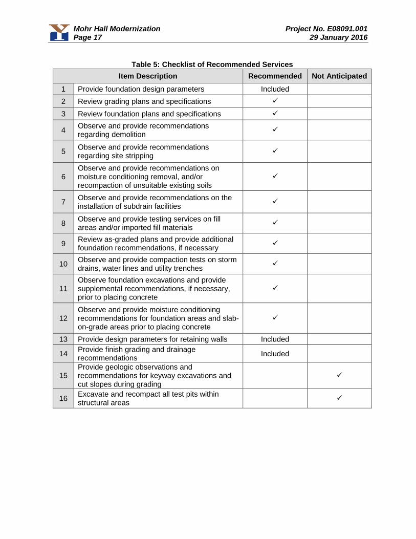
Mohr Hall Modernization Project No. E08091.001 Page 17 29 January 2016
Table 5: Checklist of Recommended Services Item Description Recommended Not Anticipated
1 Provide foundation design parameters Included
2 Review grading plans and specifications
3 Review foundation plans and specifications
4 Observe and provide recommendations regarding demolition
5 Observe and provide recommendations regarding site stripping
6 Observe and provide recommendations on moisture conditioning removal, and/or recompaction of unsuitable existing soils
7 Observe and provide recommendations on the installation of subdrain facilities
8 Observe and provide testing services on fill areas and/or imported fill materials
9 Review as-graded plans and provide additional foundation recommendations, if necessary
10 Observe and provide compaction tests on storm drains, water lines and utility trenches
11 Observe foundation excavations and provide supplemental recommendations, if necessary, prior to placing concrete
12 Observe and provide moisture conditioning recommendations for foundation areas and slab-on-grade areas prior to placing concrete
13 Provide design parameters for retaining walls Included
14 Provide finish grading and drainage recommendations
Included
15 Provide geologic observations and recommendations for keyway excavations and cut slopes during grading
16 Excavate and recompact all test pits within structural areas

APPENDIX A Field Study
Vicinity Map Site Plan
Logs of Exploratory Borings Soil Classification Chart and Log Exploration

Mohr Hall Modernization Project No. E08091.001 Page 19 29 January 2016
Introduction The contents of this appendix shall be integrated with the Geotechnical Engineering Study of which it is a part. They shall not be used in whole or in part as a sole source for information or recommendations regarding the subject site.
Our field study included a site reconnaissance by a Youngdahl Consulting Group, Inc. representative followed by a subsurface exploration program conducted on 8 January 2016, which included the excavation of 5 borings under his direction at the approximate locations shown on Figure A-2, this Appendix. Drilling of the exploratory borings was accomplished with a CME 75 truck mounted drill rig.
Throughout the drilling operation, soil samples were obtained at 5-foot depth intervals by means of a Modified California Sampler. This testing and sampling procedure consists of driving the steel sampler 18 inches into the soil with a 140-pound hammer free-falling 30 inches. The number of blows required to drive the sampler through each 6-inch interval is counted, and the total number of blows struck during the final 12 inches is recorded. If a total of 50 blows are struck within any 6-inch interval, the driving is stopped and the blow count is recorded as 50 blows for the actual penetration distance.
The soils encountered were logged during drilling and provide the basis for the "Boring Logs,” Figures A-3 through A-7, this Appendix. The enclosed Boring Logs describe the vertical sequence of soils and materials encountered in each boring, based primarily on our field classifications and supported by our subsequent laboratory examination and testing. Where a soil contact was observed to be gradational, our logs indicate the average contact depth. Where a soil type changed between sample intervals, we inferred the contact depth. Our logs also graphically indicate the blow count, sample type, sample number, and approximate depth of each soil sample obtained from the borings, as well as any laboratory tests performed on these soil samples. If any groundwater was encountered in a borehole, the approximate groundwater depth is depicted on the boring log. Groundwater depth estimates are typically based on the moisture content of soil samples, the wetted height on the drilling rods, and the water level measured in the borehole after the auger has been extracted.
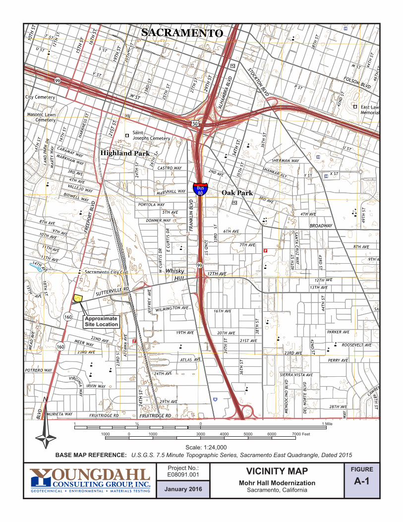
FIGURE
A-1January 2016
Project No.:E08091.001 VICINITY MAP
Mohr Hall ModernizationSacramento, California
N
Scale: 1:24,000
01000 1000 4000 50003000
01 ½
6000 7000 Feet
1 Mile
BASE MAP REFERENCE: U.S.G.S. 7.5 Minute Topographic Series, Sacramento East Quadrangle, Dated 2015
ApproximateSite Location
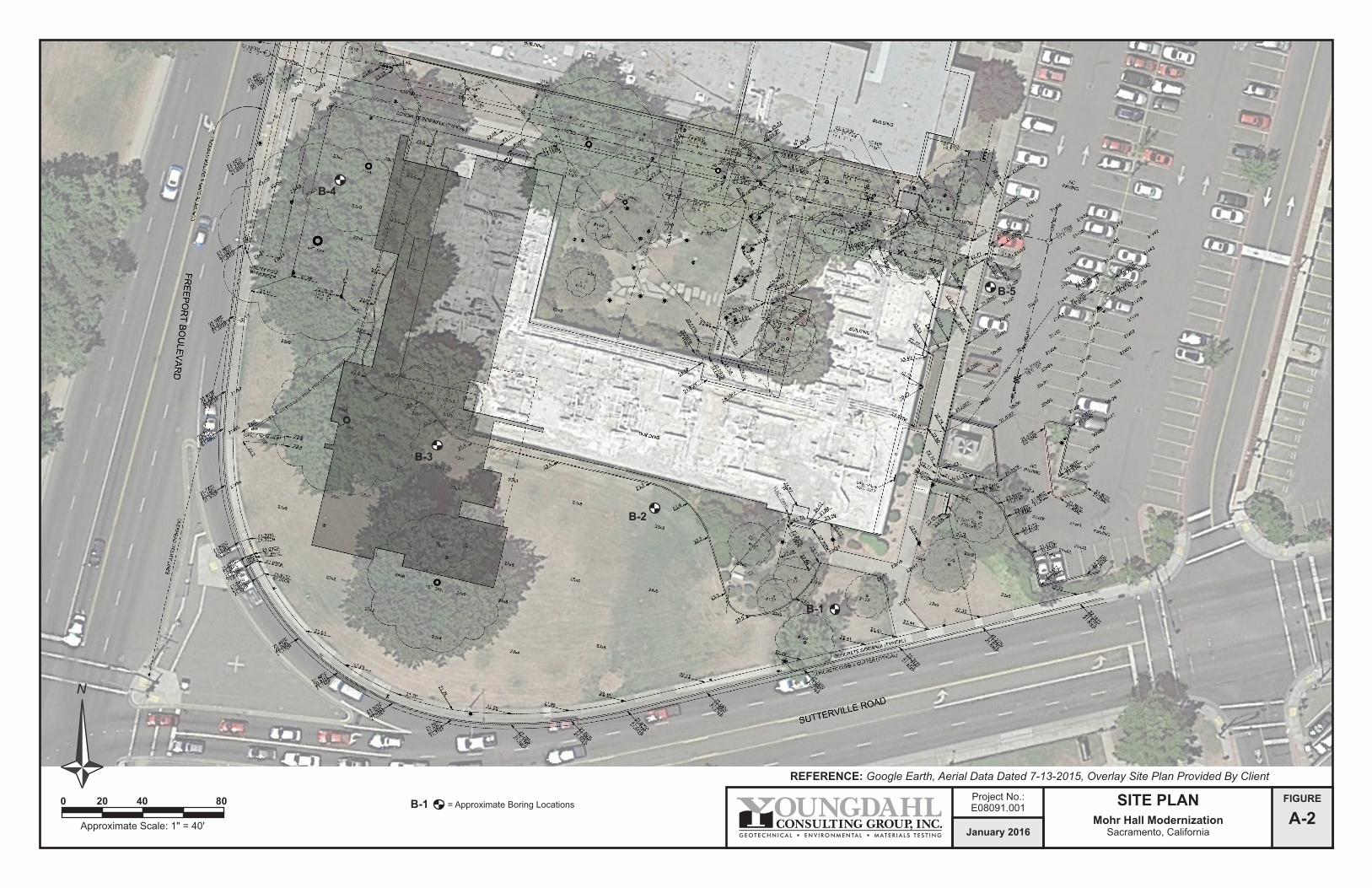
FIGURE
A-2January 2016
Project No.:E08091.001
SITE PLANMohr Hall Modernization
Sacramento, California
REFERENCE: Google Earth, Aerial Data Dated 7-13-2015, Overlay Site Plan Provided By Client
N
0 20 40 80
Approximate Scale: 1" = 40'
B-1 = Approximate Boring Locations
B-1
B-5
B-3
B-4
B-2
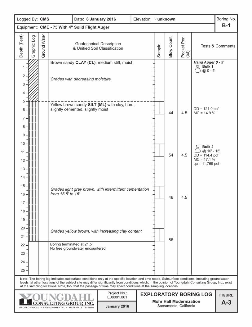
Logged By: CMS Date: 8 January 2016
Equipment: CME - 75 With 4" Solid Flight Auger
Elevation: ~ unknown
B-1
Note: The boring log indicates subsurface conditions only at the specific location and time noted. Subsurface conditions, including groundwater levels, at other locations of the subject site may differ significantly from conditions which, in the opinion of Youngdahl Consulting Group, Inc., exist at the sampling locations. Note, too, that the passage of time may affect conditions at the sampling locations.
Geotechnical Description& Unified Soil Classification
Depth
(F
eet)
Gra
phic
Log
Gro
und W
ate
r
Sam
ple
Blo
w C
ount
Tests & Comments
FIGURE
A-3
Boring Continued on Figure A-3b
Boring Continued From Figure A-3aBrown sandy CLAY (CL), medium stiff, moist
Boring terminated at 21.5'No free groundwater encountered
January 2016
Project No.:E08091.001
EXPLORATORY BORING LOG
Mohr Hall ModernizationSacramento, California
44
Pock
et
Pen
(tsf
)
4.5
Yellow brown sandy SILT (ML) with clay, hard, slightly cemented, slightly moist
Grades with decreasing moisture
Grades light gray brown, with intermittent cementation from 15.5' to 16'
Grades yellow brown, with increasing clay content
46 4.5
54 4.5
86
1
2
3
4
5
6
7
8
9
10
11
12
13
14
15
16
17
18
19
20
21
22
23
24
25
Boring No.
Bulk 1@ 0 - 5'
Hand Auger 0 - 5'
Bulk 2@ 10' - 15'
DD = 121.0 pcfMC = 14.9 %
DD = 114.4 pcfMC = 17.1 %qu = 11,769 pcf
Logged By: CMS Date: 8 January 2016
Equipment: CME - 75 With 4" Solid Flight Auger
Elevation: ~ unknown
B-2
Note: The boring log indicates subsurface conditions only at the specific location and time noted. Subsurface conditions, including groundwater levels, at other locations of the subject site may differ significantly from conditions which, in the opinion of Youngdahl Consulting Group, Inc., exist at the sampling locations. Note, too, that the passage of time may affect conditions at the sampling locations.
Geotechnical Description& Unified Soil Classification
Depth
(F
eet)
Gra
phic
Log
Gro
und W
ate
r
Sam
ple
Blo
w C
ount
Tests & Comments
FIGURE
A-4a
Boring Continued on Figure A-4b
Boring Continued From Figure A-3aBrown sandy CLAY (CL), medium stiff, moist
January 2016
Project No.:E08091.001
EXPLORATORY BORING LOG
Mohr Hall ModernizationSacramento, California
39
Pock
et
Pen
(tsf
)
Grades hard
4.5Grades light brownGrades slightly moist
Yellow brown sandy SILT (ML), hard, slightly moistCemented layer at 10.5'
Grades light gray brown, strongly cemented
Red brown clayey SAND (SC) with silt, very dense, strongly cemented, slightly moist
Light brown silty SAND (SM), medium dense, wet
Groundwater encountered
49 4.5
37 4.5
53
19
1
2
3
4
5
6
7
8
9
10
11
12
13
14
15
16
17
18
19
20
21
22
23
24
25
Boring No.
26
Hand Auger 0 - 5'
Bulk 3@ 20' - 25'
DD = 119.1 pcfMC = 14.0 %qu = 31,744 pcfMaterial Finer Than No. 200 Sieve: 87.1%
DD = 110.8 pcfMC = 21.3 %
DD = 87.4 pcfMC = 35.7 %
Logged By: CMS Date: 8 January 2016
Equipment: CME - 75 With 4" Solid Flight Auger
Elevation: ~ unknown
B-2
Note: The boring log indicates subsurface conditions only at the specific location and time noted. Subsurface conditions, including groundwater levels, at other locations of the subject site may differ significantly from conditions which, in the opinion of Youngdahl Consulting Group, Inc., exist at the sampling locations. Note, too, that the passage of time may affect conditions at the sampling locations.
Geotechnical Description& Unified Soil Classification
Depth
(F
eet)
Gra
phic
Log
Gro
und W
ate
r
Sam
ple
Blo
w C
ount
Tests & Comments
FIGURE
A-4b
Boring Continued From Figure A-3a
January 2016
Project No.:E08091.001
EXPLORATORY BORING LOG
Mohr Hall ModernizationSacramento, California
Pock
et
Pen
(tsf
)
Boring Continued on Figure A-4a
27
28
29
30
31
32
33
34
35
36
37
38
39
40
41
42
43
44
45
46
47
48
49
50
51
Boring No.
52 Boring terminated at 51.5'Groundwater encountered at 24'
34 4.0
38 4.5
36 4.25
41
Light brown sandy SILT (ML), hard, moist
Grades increasing clay, decreasing sand
Grades slightly moist
Grades strongly cemented
Grades decreasing clayGrades with decreasing sand, moderately cemented
4.5
30 4.54.5

Logged By: CMS Date: 8 January 2016
Equipment: CME - 75 With 4" Solid Flight Auger
Elevation: ~ unknown
B-3
Note: The boring log indicates subsurface conditions only at the specific location and time noted. Subsurface conditions, including groundwater levels, at other locations of the subject site may differ significantly from conditions which, in the opinion of Youngdahl Consulting Group, Inc., exist at the sampling locations. Note, too, that the passage of time may affect conditions at the sampling locations.
Geotechnical Description& Unified Soil Classification
Depth
(F
eet)
Gra
phic
Log
Gro
und W
ate
r
Sam
ple
Blo
w C
ount
Tests & Comments
FIGURE
A-5
Boring Continued on Figure A-3b
Boring Continued From Figure A-3aBrown sandy CLAY (CL), medium stiff, moist
Boring terminated at 21.5'No free groundwater encountered
January 2016
Project No.:E08091.001
EXPLORATORY BORING LOG
Mohr Hall ModernizationSacramento, California
50/7"
Pock
et
Pen
(tsf
)
4.5Red brown sandy SILT (ML), hard, strongly cemented, slightly moist
Grades light gray brown
Grades yellow brown
63 4.5
45 4.5
95
Strongly cemented at 15.5' and 16'
4.5
4.54.5
4.54.54.5
1
2
3
4
5
6
7
8
9
10
11
12
13
14
15
16
17
18
19
20
21
22
23
24
25
Boring No.
Bulk 4@ 0 - 5'
Hand Auger 0 - 5'
Bulk 5@ 5' - 10'
DD = 100.0 pcfMC = 21.1 %
Logged By: CMS Date: 8 January 2016
Equipment: CME - 75 With 4" Solid Flight Auger
Elevation: ~ unknown
B-4
Note: The boring log indicates subsurface conditions only at the specific location and time noted. Subsurface conditions, including groundwater levels, at other locations of the subject site may differ significantly from conditions which, in the opinion of Youngdahl Consulting Group, Inc., exist at the sampling locations. Note, too, that the passage of time may affect conditions at the sampling locations.
Geotechnical Description& Unified Soil Classification
Depth
(F
eet)
Gra
phic
Log
Gro
und W
ate
r
Sam
ple
Blo
w C
ount
Tests & Comments
FIGURE
A-6
Boring Continued on Figure A-3b
Boring Continued From Figure A-3aBrown sandy CLAY (CL), medium stiff, moist
Boring terminated at 21.5'No free groundwater encountered
January 2016
Project No.:E08091.001
EXPLORATORY BORING LOG
Mohr Hall ModernizationSacramento, California
71
Pock
et
Pen
(tsf
)
Red brown sandy SILT (ML), hard, strongly cemented, slightly moist
Grades light gray brown
36 4.5+
36 4.5+
47
4.5+
4.5+4.5+4.5+
Grades with less sand
Red brown silty SAND (SM), dense, moderately cemented, slightly moist
1
2
3
4
5
6
7
8
9
10
11
12
13
14
15
16
17
18
19
20
21
22
23
24
25
Boring No.
Bulk 6@ 0 - 5'
Hand Auger 0 - 5'
DD = 116.4 pcfMC = 12.5 %qu = 20,654 pcf
DD = 113.2 pcfMC = 17.7 %
Logged By: CMS Date: 8 January 2016
Equipment: CME - 75 With 4" Solid Flight Auger
Elevation: ~ unknown
B-5
Note: The boring log indicates subsurface conditions only at the specific location and time noted. Subsurface conditions, including groundwater levels, at other locations of the subject site may differ significantly from conditions which, in the opinion of Youngdahl Consulting Group, Inc., exist at the sampling locations. Note, too, that the passage of time may affect conditions at the sampling locations.
Geotechnical Description& Unified Soil Classification
Depth
(F
eet)
Gra
phic
Log
Gro
und W
ate
r
Sam
ple
Blo
w C
ount
Tests & Comments
FIGURE
A-7
Boring Continued on Figure A-3b
Boring Continued From Figure A-3a Light brown sandy CLAY (CL), stiff, slightly moist
Boring terminated at 11.5'No free groundwater encountered
January 2016
Project No.:E08091.001
EXPLORATORY BORING LOG
Mohr Hall ModernizationSacramento, California
54/5.5"
Pock
et
Pen
(tsf
)
Light gray brown sandy SILT (ML), hard, strongly cemented, slightly moist
Grades yellow brown
36
4.5
Grades with decreasing sand
4" AC
4.5
4.5+4.254.5
1
2
3
4
5
6
7
8
9
10
11
12
13
14
15
16
17
18
19
20
21
22
23
24
25
Boring No.
DD = 103.7 pcfMC = 19.8 %

Standard Penetration test
2.5" O.D. Modified California Sampler
3" O.D. Modified California Sampler
Shelby Tube Sampler
2.5" Hand Driven Liner
Bulk Sample
Water Level At Time Of Drilling
Water Level After Time Of Drilling
Perched Water
ML & OL
MH & OH
A-LINE
CL
CH
P
January 2016
FIGURE
DESCRIPTION
Clayey GRAVELS, poorly graded GRAVEL-SAND-CLAY mixtures
Poorly graded SANDS, gravelly SANDS
Well graded SANDS, gravelly SANDS
Silty SANDS, poorly graded SAND-SILT mixtures0
20
20 40
200
0.075 0.002
40
.425
10
2.0
4
4.75
¾"
19
3"
75
6"U.S. STANDARD SIEVE
SOILGRAIN SIZE IN MILLIMETERS 150
60 80 100
40
60
80
PEAT & other highly organic soils
Clayey SANDS, poorly graded SAND-CLAY mixtures
Inorganic SILTS, silty or clayey fine SANDS, or clayey SILTS with plasticity
Inorganic CLAYS of low to medium plasticity, gravelly, sandy, or silty CLAYS, lean CLAYS
Organic CLAYS and organic silty CLAYS of lowplasticity
Inorganic SILTS, micaceous or diamacious fine sandy or silty soils, elastic SILTS
Inorganic CLAYS of high plasticity, fat CLAYS
Organic CLAYS of medium to high plasticity,organic SILTS
Well graded GRAVELS, GRAVEL-SANDmixtures
Poorly graded GRAVELS, GRAVEL-SANDmixtures
Silty GRAVELS, poorly graded GRAVEL-SAND-SILT mixtures
MAJOR DIVISION SYMBOLS TYPICAL NAMES USED FOR CLASSIFICATION OF FINE GRAINED SOILS
Clean GRAVELSWith Little
Or No Fines
Clean SANDSWith Little
Or No Fines
SA
ND
S
Ove
r 50%
< #
4 s
ieve
GR
AV
EL
S
Ove
r 50%
> #
4 s
ieve
GRAVELS WithOver 12% Fines
SANDS WithOver 12% Fines
SILTS & CLAYSLiquid Limit < 50
SILTS & CLAYSLiquid Limit > 50
HIGHLY ORGANIC CLAYS
25 25 Blows drove sampler 12 inches,after initial 6 inches of seating
50/7" 50 Blows drove sampler 7 inches,after initial 6 inches of seating
50/3" 50 Blows drove sampler 3 inchesduring or after initial 6 inches of seating
Note: To avoid damage to sampling tools, driving is limited to 50 blows per 6 inches during or after seating interval.
BLOWS PERFOOT
CO
AR
SE
GR
AIN
ED
SO
ILS
Ove
r 5
0%
> #
20
0 s
ieve
PL
AS
TIC
ITY
IN
DE
X
LIQUID LIMIT
FIN
E G
RA
INE
D S
OIL
SO
ver
50%
< #
20
0 s
ieve
CLAYSILTFINEMEDIUMCOARSECOARSE
COBBLEGRAVEL SAND
BOULDERFINE
GW
GP
GM
GC
SW
SP
SM
SC
ML
CL
OL
MH
CH
OH
PT
UNIFIED SOIL CLASSIFICATION SYSTEMS PLASTICITY CHART
SAMPLE DRIVING RECORD
SOIL GRAIN SIZE
KEY TO PIT & BORING SYMBOLS KEY TO PIT & BORING SYMBOLS
Water Seepage
NFWE No Free Water Encountered
FWE Free Water Encountered
REF Sampling Refusal
DD Dry Density (pcf)
MC Moisture Content (%)
LL Liquid Limit
PI Plasticity Index
PP Pocket Penetrometer
UCC Unconfined Compression (ASTM D2166)
TVS Pocket Torvane Shear
EI Expansion Index (ASTM D4829)
Su Undrained Shear Strength
Foliation
Joint
A-8
Project No.:E08091.001
SOIL CLASSIFICATION CHARTAND LOG EXPLANATIONMohr Hall Modernization
Sacramento, California
APPENDIX B Laboratory Testing
Expansion Index Test Atterberg Limit Test
Unconfined Compression Tests
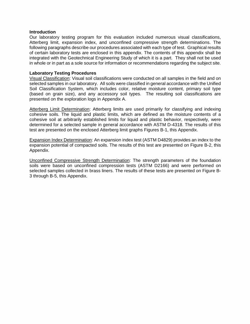
Introduction Our laboratory testing program for this evaluation included numerous visual classifications, Atterberg limit, expansion index, and unconfined compressive strength determinations. The following paragraphs describe our procedures associated with each type of test. Graphical results of certain laboratory tests are enclosed in this appendix. The contents of this appendix shall be integrated with the Geotechnical Engineering Study of which it is a part. They shall not be used in whole or in part as a sole source for information or recommendations regarding the subject site.
Laboratory Testing Procedures Visual Classification: Visual soil classifications were conducted on all samples in the field and on selected samples in our laboratory. All soils were classified in general accordance with the Unified Soil Classification System, which includes color, relative moisture content, primary soil type (based on grain size), and any accessory soil types. The resulting soil classifications are presented on the exploration logs in Appendix A.
Atterberg Limit Determination: Atterberg limits are used primarily for classifying and indexing cohesive soils. The liquid and plastic limits, which are defined as the moisture contents of a cohesive soil at arbitrarily established limits for liquid and plastic behavior, respectively, were determined for a selected sample in general accordance with ASTM D-4318. The results of this test are presented on the enclosed Atterberg limit graphs Figures B-1, this Appendix.
Expansion Index Determination: An expansion index test (ASTM D4829) provides an index to the expansion potential of compacted soils. The results of this test are presented on Figure B-2, this Appendix.
Unconfined Compressive Strength Determination: The strength parameters of the foundation soils were based on unconfined compression tests (ASTM D2166) and were performed on selected samples collected in brass liners. The results of these tests are presented on Figure B-3 through B-5, this Appendix.
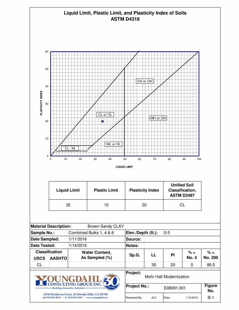
Source:
Notes:
USCS AASHTO
CL 35 20 0 80.5
Project:
Figure
No.
Reviewed By: JLC Date: 1/15/2016 B-1
Brown Sandy CLAY
Combined Bulks 1, 4 & 6 Elev./Depth (ft.): 0-5
Project No.: E08091.001
PI% >
No. 4
Mohr Hall Modernization
LL
1/11/2016
Date Tested: 1/14/2016
Classification Water Content,
As Sampled (%)Sp.G.
% <
No. 200
Liquid Limit
Sample No.:
35
Material Description:
Liquid Limit, Plastic Limit, and Plasticity Index of Soils
ASTM D4318
Unified Soil
Classification,
ASTM D2487
Plasticity IndexPlastic Limit
CL2015
Date Sampled:
0
10
20
30
40
50
60
0 10 20 30 40 50 60 70 80 90 100
PL
AS
TIC
ITY
IN
DE
X
LIQUID LIMIT
ML or OL
CL or OLMH or OH
CH or OH
CL - ML
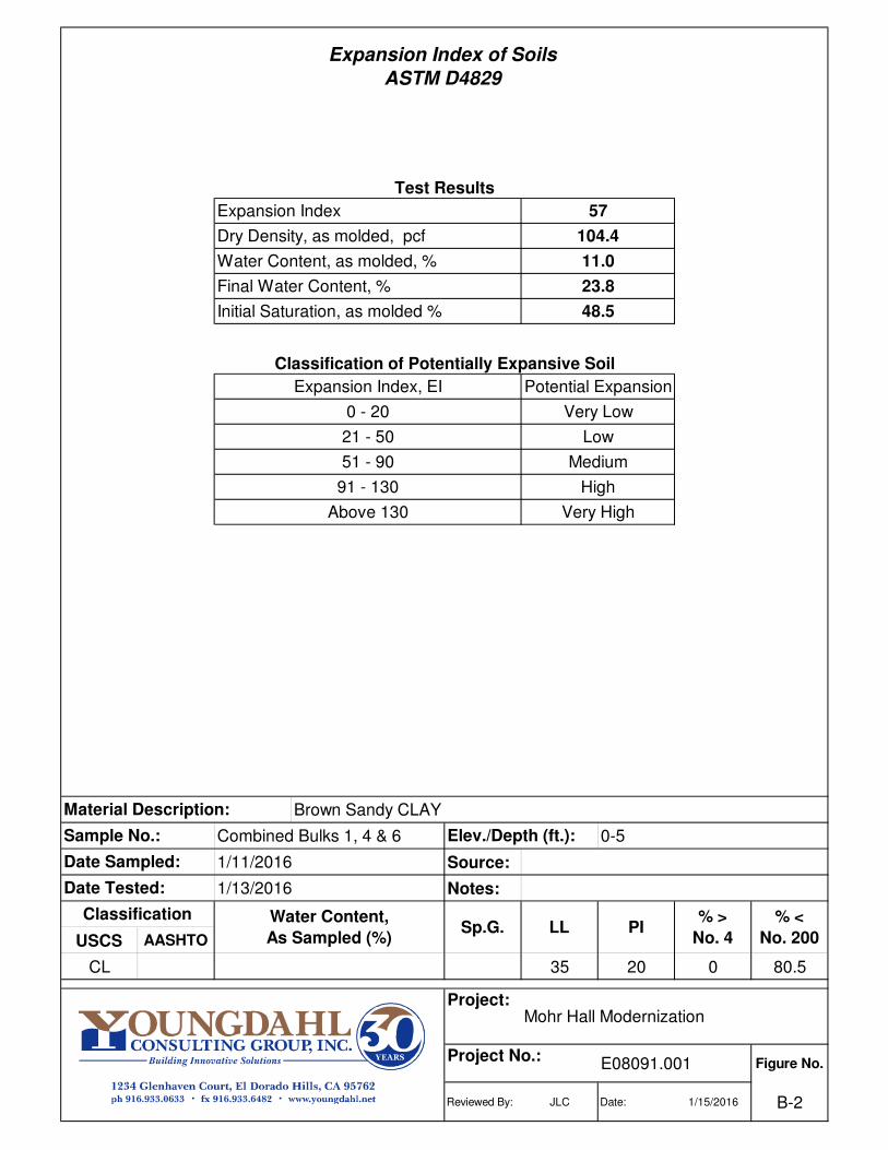
Source:
Notes:
USCS AASHTO
CL 35 20 0 80.5
Project:
Figure No.
Reviewed By: JLC Date: 1/15/2016 B-2
Test Results
Very High
High
Medium
Low
Very Low
Potential Expansion
104.4
57
48.5
11.0
Above 130
91 - 130
51 - 90
Classification of Potentially Expansive Soil
Expansion Index, EI
21 - 50
0 - 20
Expansion Index
Water Content, as molded, %
Dry Density, as molded, pcf
Initial Saturation, as molded %
Final Water Content, %
E08091.001Project No.:
1/11/2016
Combined Bulks 1, 4 & 6
23.8
Mohr Hall Modernization
Brown Sandy CLAYMaterial Description:
Sample No.: 0-5Elev./Depth (ft.):
% <
No. 200
% >
No. 4
1/13/2016
LLSp.G. PIClassification
Date Tested:
Expansion Index of Soils
ASTM D4829
Date Sampled:
Water Content,
As Sampled (%)
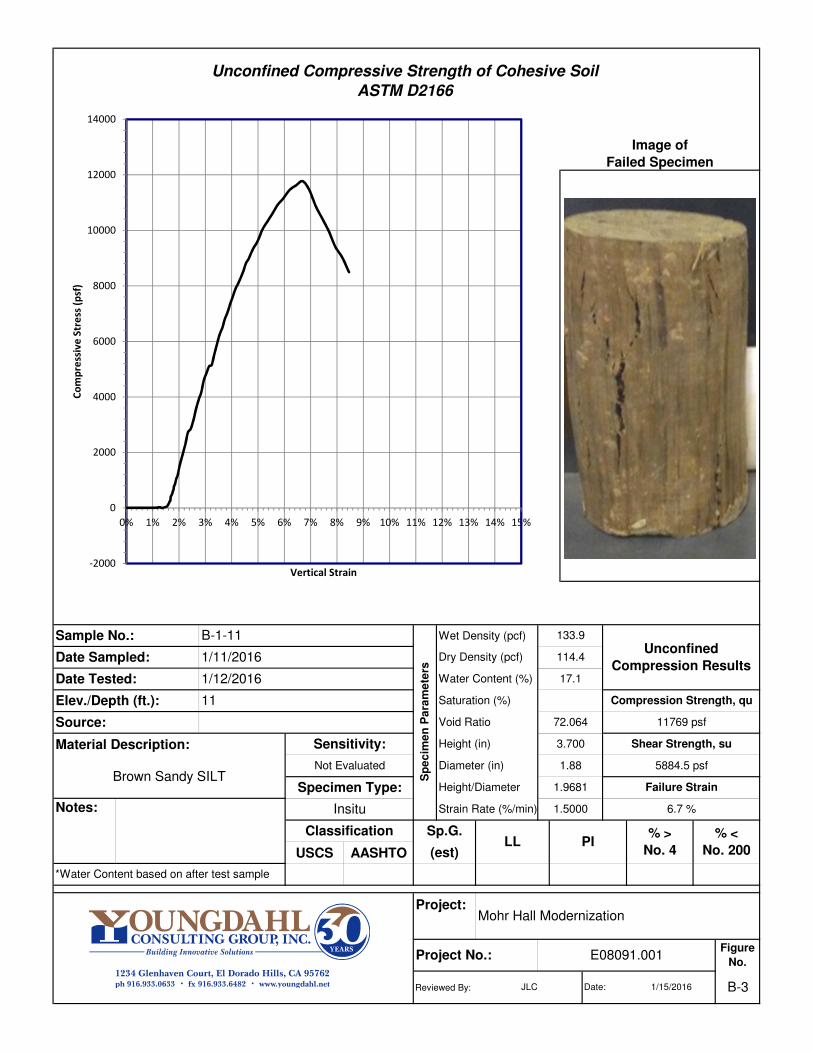
Wet Density (pcf)
Material Description:
USCS AASHTO
Project:
Reviewed By:
PI
Unconfined
Compression Results
Failure Strain
% >
No. 4
6.7 %
114.4
*Water Content based on after test sample
(est)
Notes: Insitu
5884.5 psf
Classification Sp.G. % <
No. 200
1.9681
LL
Shear Strength, su
1.5000
Diameter (in)
Void Ratio
Height/Diameter
1.88
Height (in) 3.700
Unconfined Compressive Strength of Cohesive Soil
ASTM D2166
Source:
Compression Strength, qu
11769 psf
11
Sp
ec
ime
n P
ara
me
ters
Strain Rate (%/min)
Specimen Type:
Image of
Failed Specimen
Sensitivity:
Not Evaluated
Date Sampled: 1/11/2016
Brown Sandy SILT
1/12/2016
Sample No.: B-1-11
Elev./Depth (ft.):
72.064
133.9
17.1Date Tested:
Saturation (%)
Dry Density (pcf)
Water Content (%)
Mohr Hall Modernization
Figure
No.Project No.: E08091.001
Date: B-31/15/2016JLC
-2000
0
2000
4000
6000
8000
10000
12000
14000
0% 1% 2% 3% 4% 5% 6% 7% 8% 9% 10% 11% 12% 13% 14% 15%
Co
mp
ress
ive
Str
ess
(p
sf)
Vertical Strain
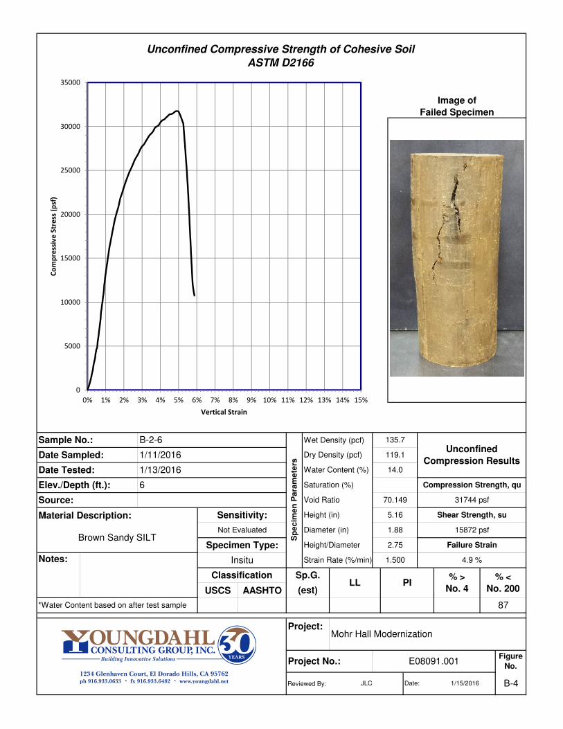
Wet Density (pcf)
Material Description:
USCS AASHTO
Project:
Reviewed By: Date: B-41/15/2016JLC
Mohr Hall Modernization
Figure
No.Project No.: E08091.001
Image of
Failed Specimen
Shear Strength, su
Sample No.: B-2-6
Elev./Depth (ft.):
70.149
135.7
14.0
5.16
Saturation (%)
Height (in)
Unconfined Compressive Strength of Cohesive Soil
ASTM D2166
Source:
Compression Strength, qu
31744 psf
6
Sp
ec
ime
n P
ara
me
ters
Strain Rate (%/min)
Specimen Type:
Sensitivity:
Not Evaluated
Date Sampled: 1/11/2016
Brown Sandy SILT
1/13/2016Date Tested:
Sp.G. % <
No. 200
2.75
Dry Density (pcf)
Water Content (%)
1.500
Diameter (in)
Void Ratio
Height/Diameter
87
LLClassification
*Water Content based on after test sample
(est)
Notes: Insitu
PI
Unconfined
Compression Results
Failure Strain
% >
No. 4
4.9 %
119.1
15872 psf1.88
0
5000
10000
15000
20000
25000
30000
35000
0% 1% 2% 3% 4% 5% 6% 7% 8% 9% 10% 11% 12% 13% 14% 15%
Co
mp
ress
ive
Str
ess
(p
sf)
Vertical Strain

Wet Density (pcf)
Material Description:
USCS AASHTO
Project:
Reviewed By:
PI
Unconfined
Compression Results
Failure Strain
% >
No. 4
3.7 %
116.4
*Water Content based on after test sample
(est)
Sample cracked in multiple
locations during
sampling/drilling operations.
Notes: Insitu
10327 psf
Classification Sp.G. % <
No. 200
2.32
LL
Shear Strength, su
1.500
Diameter (in)
Void Ratio
Height/Diameter
1.89
Height (in) 4.39
Unconfined Compressive Strength of Cohesive Soil
ASTM D2166
Source:
Compression Strength, qu
20654 psf
5.5
Sp
ec
ime
n P
ara
me
ters
Strain Rate (%/min)
Specimen Type:
Image of
Failed Specimen
Sensitivity:
Not Evaluated
Date Sampled: 1/11/2016
Yellow Brown Sandy SILT
1/14/2016
Sample No.: B-4-5.5
Elev./Depth (ft.):
69.240
131.0
12.5Date Tested:
Saturation (%)
Dry Density (pcf)
Water Content (%)
Mohr Hall Modernization
Figure
No.Project No.: E08091.001
Date: B-51/15/2016JLC
0
5000
10000
15000
20000
25000
0% 1% 2% 3% 4% 5% 6% 7% 8% 9% 10% 11% 12% 13% 14% 15%
Co
mp
ress
ive
Str
ess
(p
sf)
Vertical Strain

APPENDIX C Details
Plug and Drain Site Wall Drainage
Subdrain

E8091.001
January 2016Mohr Hall Modernization
Sacramento, CaliforniaC-1

E8091.001
January 2016Sacramento, California
Mohr Hall ModernizationC-2

E8091.001
January 2016Sacramento, California
Mohr Hall ModernizationC-3

APPENDIX D Geologic Hazards Report
GEOLOGIC HAZARDS STUDY FOR
MOHR HALL MODERNIZATION Freeport and Sutterville Roads
Sacramento, California
Project No. E08091.001 January 2016
Los Rios Facilities Management Project No. E08091.001 3753 Bradview Drive 29 January 2016 Sacramento, California 95827
Attention: Mr. Josef Meyer
Subject: MOHR HALL MODERNIZATION Freeport and Sutterville Roads, Sacramento, Sacramento County, California Geologic Hazards Study
References: 1.
Dear Mr. Joesef Meyer:
With your authorization, Youngdahl Consulting Group, Inc. has completed the attached Geohazards Study for the Mohr Hall Modernization project. We understand that the proposed development will include demolition of the existing Mohr Hall and construction of two new multi-story instructional buildings.
This study is designed to address the specific items listed in the California Geological Survey (CGS) Note 48 Checklist (CGS, 2013). If you have questions or require any additional updates, please do not hesitate contacting us at (916) 933-0633.
Very truly yours, Youngdahl Consulting Group, Inc.
David C. Sederquist, C.E.G., C.HG. Senior Engineering Geologist/Hydrogeologist
Distribution: 4 Copies to Client
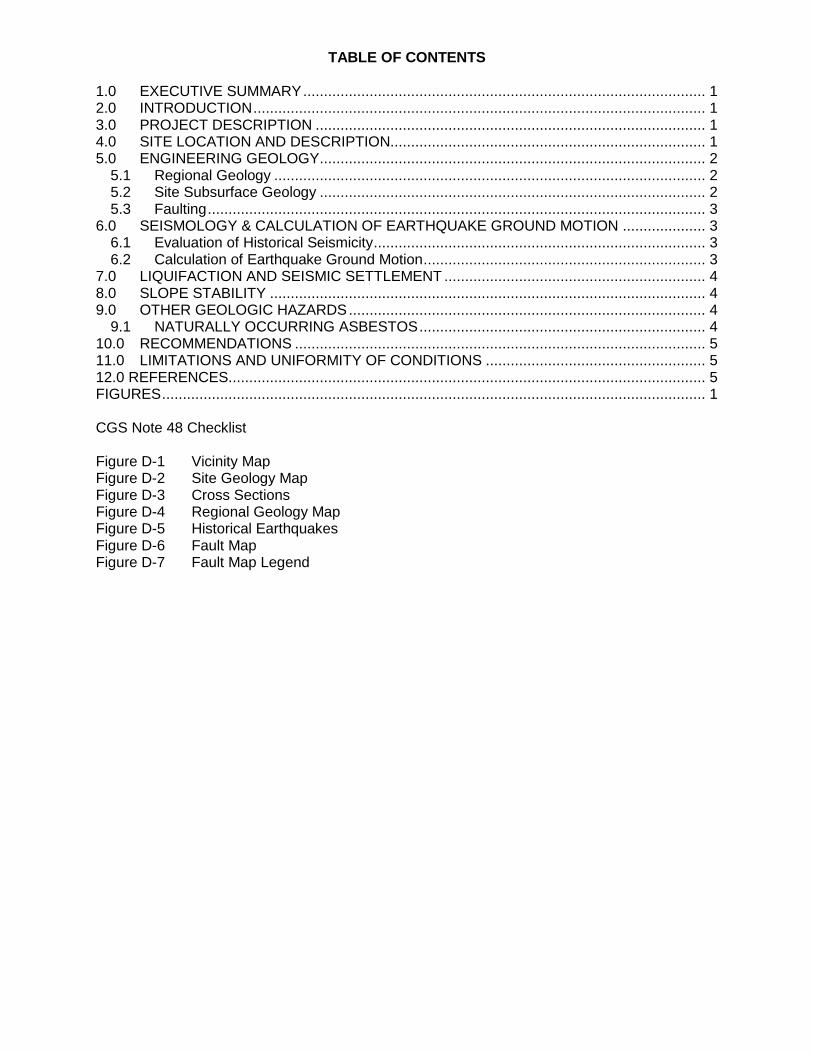
TABLE OF CONTENTS
1.0 EXECUTIVE SUMMARY ................................................................................................. 1 2.0 INTRODUCTION ............................................................................................................. 1 3.0 PROJECT DESCRIPTION .............................................................................................. 1 4.0 SITE LOCATION AND DESCRIPTION............................................................................ 1 5.0 ENGINEERING GEOLOGY ............................................................................................. 2
5.1 Regional Geology ........................................................................................................ 2 5.2 Site Subsurface Geology ............................................................................................. 2 5.3 Faulting ........................................................................................................................ 3
6.0 SEISMOLOGY & CALCULATION OF EARTHQUAKE GROUND MOTION .................... 3 6.1 Evaluation of Historical Seismicity ................................................................................ 3 6.2 Calculation of Earthquake Ground Motion .................................................................... 3
7.0 LIQUIFACTION AND SEISMIC SETTLEMENT ............................................................... 4 8.0 SLOPE STABILITY ......................................................................................................... 4 9.0 OTHER GEOLOGIC HAZARDS ...................................................................................... 4
9.1 NATURALLY OCCURRING ASBESTOS ..................................................................... 4 10.0 RECOMMENDATIONS ................................................................................................... 5 11.0 LIMITATIONS AND UNIFORMITY OF CONDITIONS ..................................................... 5 12.0 REFERENCES................................................................................................................... 5 FIGURES ................................................................................................................................... 1
CGS Note 48 Checklist
Figure D-1 Vicinity Map Figure D-2 Site Geology Map Figure D-3 Cross Sections Figure D-4 Regional Geology Map Figure D-5 Historical Earthquakes Figure D-6 Fault Map Figure D-7 Fault Map Legend
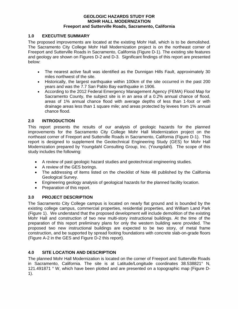
GEOLOGIC HAZARDS STUDY FOR MOHR HALL MODERNIZATION
Freeport and Sutterville Roads, Sacramento, California
1.0 EXECUTIVE SUMMARY
The proposed improvements are located at the existing Mohr Hall, which is to be demolished. The Sacramento City College Mohr Hall Modernization project is on the northeast corner of Freeport and Sutterville Roads in Sacramento, California (Figure D-1). The existing site features and geology are shown on Figures D-2 and D-3. Significant findings of this report are presented below:
The nearest active fault was identified as the Dunnigan Hills Fault, approximately 30 miles northwest of the site.
Historically, the largest earthquake within 100km of the site occurred in the past 200 years and was the 7.7 San Pablo Bay earthquake in 1906.
According to the 2012 Federal Emergency Management Agency (FEMA) Flood Map for Sacramento County, the subject site is in an area of a 0.2% annual chance of flood, areas of 1% annual chance flood with average depths of less than 1-foot or with drainage areas less than 1 square mile; and areas protected by levees from 1% annual chance flood.
2.0 INTRODUCTION
This report presents the results of our analysis of geologic hazards for the planned improvements for the Sacramento City College Mohr Hall Modernization project on the northeast corner of Freeport and Sutterville Roads in Sacramento, California (Figure D-1). This report is designed to supplement the Geotechnical Engineering Study (GES) for Mohr Hall Modernization prepared by Youngdahl Consulting Group, Inc. (Youngdahl). The scope of this study includes the following:
A review of past geologic hazard studies and geotechnical engineering studies.
A review of the GES borings.
The addressing of items listed on the checklist of Note 48 published by the California Geological Survey.
Engineering geology analysis of geological hazards for the planned facility location.
Preparation of this report.
3.0 PROJECT DESCRIPTION
The Sacramento City College campus is located on nearly flat ground and is bounded by the existing college campus, commercial properties, residential properties, and William Land Park (Figure 1). We understand that the proposed development will include demolition of the existing Mohr Hall and construction of two new multi-story instructional buildings. At the time of the preparation of this report preliminary plans for only the western building were provided. The proposed two new instructional buildings are expected to be two story, of metal frame construction, and be supported by spread footing foundations with concrete slab-on-grade floors (Figure A-2 in the GES and Figure D-2 this report).
4.0 SITE LOCATION AND DESCRIPTION
The planned Mohr Hall Modernization is located on the corner of Freeport and Sutterville Roads in Sacramento, California. The site is at Latitude/Longitude coordinates 38.538821° N, 121.491871 ° W, which have been plotted and are presented on a topographic map (Figure D-1).
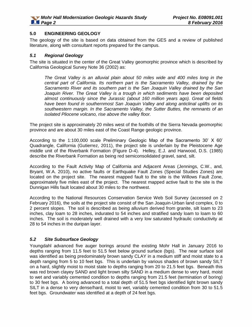
Mohr Hall Modernization Geologic Hazards Study Project No. E08091.001 Page 2 8 February 2016
5.0 ENGINEERING GEOLOGY
The geology of the site is based on data obtained from the GES and a review of published literature, along with consultant reports prepared for the campus.
5.1 Regional Geology
The site is situated in the center of the Great Valley geomorphic province which is described by California Geological Survey Note 36 (2002) as:
The Great Valley is an alluvial plain about 50 miles wide and 400 miles long in the central part of California. Its northern part is the Sacramento Valley, drained by the Sacramento River and its southern part is the San Joaquin Valley drained by the San Joaquin River. The Great Valley is a trough in which sediments have been deposited almost continuously since the Jurassic (about 160 million years ago). Great oil fields have been found in southernmost San Joaquin Valley and along anticlinal uplifts on its southwestern margin. In the Sacramento Valley, the Sutter Buttes, the remnants of an isolated Pliocene volcano, rise above the valley floor.
The project site is approximately 20 miles west of the foothills of the Sierra Nevada geomorphic province and are about 30 miles east of the Coast Range geologic province. According to the 1:100,000 scale Preliminary Geologic Map of the Sacramento 30’ X 60’ Quadrangle, California (Gutierrez, 2011), the project site is underlain by the Pleistocene Age middle unit of the Riverbank Formation (Figure D-4). Helley, E.J. and Harwood, D.S. (1985) describe the Riverbank Formation as being red semiconsolidated gravel, sand, silt. According to the Fault Activity Map of California and Adjacent Areas (Jennings, C.W., and, Bryant, W.A. 2010), no active faults or Earthquake Fault Zones (Special Studies Zones) are located on the project site. The nearest mapped fault to the site is the Willows Fault Zone, approximately five miles east of the project. The nearest mapped active fault to the site is the Dunnigan Hills fault located about 30 miles to the northwest. According to the National Resources Conservation Service Web Soil Survey (accessed on 2 February 2016), the soils at the project site consist of the San Joaquin-Urban land complex, 0 to 2 percent slopes. The soil is described as being alluvium derived from granite, silt loam to 23 inches, clay loam to 28 inches, indurated to 54 inches and stratified sandy loam to loam to 60 inches. The soil is moderately well drained with a very low saturated hydraulic conductivity at 28 to 54 inches in the duripan layer.
5.2 Site Subsurface Geology
Youngdahl advanced five auger borings around the existing Mohr Hall in January 2016 to depths ranging from 11.5 feet to 51.5 feet below ground surface (bgs). The near surface soil was identified as being predominately brown sandy CLAY in a medium stiff and moist state to a depth ranging from 5 to 10 feet bgs. This is underlain by various shades of brown sandy SILT on a hard, slightly moist to moist state to depths ranging from 20 to 21.5 feet bgs. Beneath this was red brown clayey SAND and light brown silty SAND in a medium dense to very hard, moist to wet and variably cemented condition to depths ranging from 21.5 feet (termination of boring) to 30 feet bgs. A boring advanced to a total depth of 51.5 feet bgs identified light brown sandy SILT in a dense to very dense/hard, moist to wet, variably cemented condition from 30 to 51.5 feet bgs. Groundwater was identified at a depth of 24 feet bgs.

Mohr Hall Modernization Geologic Hazards Study Project No. E08091.001 Page 3 8 February 2016
5.3 Faulting
No active faulting or coseismic deformation is present on or near the site. According to the Fault Activity Map of California and Adjacent Areas (Jennings, C.W., and Bryant. W.A., 2010), and based on field evidence, no active faults are located within the general proximity of the subject property. No evidence of recent shear movement, such as soil off-set, springs, seeps, sag ponds or other indications of recent ground rupture were observed on the project site during our study. The closest active fault is the Dunnigan Hills Fault, situated approximately 30 miles to the northwest.
6.0 SEISMOLOGY & CALCULATION OF EARTHQUAKE GROUND MOTION
6.1 Evaluation of Historical Seismicity
The Central Valley area is in a relatively seismically quiescent area of California. Figure D-6 shows mapped faults near the project site. Figure D-5 shows historical epicenters above an estimated moment magnitude of 5.5 in California. Inspection of Figure D-5 shows that the closest source of historical seismicity to the project site in the past 200 years was the 7.7 magnitude San Pablo Bay, California earthquake in 1906.
6.2 Calculation of Earthquake Ground Motion
Based on the 2013 California Building Code, Chapter 16A, and our site investigation findings, the following seismic parameters are recommended from a geotechnical perspective for structural design. The final choice of design parameters, however, remains the purview of the project structural engineer.
Table 1: Seismic Design Parameters
2013 CBC ASCE 7-10
Seismic Parameter Recommended
Value
Table 20.3-1 Site Class D
Figure 1613A.3.1(1) Short-Period MCE at 0.2s, SS 0.691g
Figure 1613A.3.1(2) 1.0s Period MCE, S1 0.297g
Table 1613A.3.3(1) Site Coefficient, Fa 1.247
Table 1613A.3.3(2) Site Coefficient, Fv 1.807
Equation 16A-37 Adjusted MCE Spectral Response Parameters,
SMS = FaSs 0.862g
Equation 16A-38 Adjusted MCE Spectral Response Parameters,
SM1 = FvS1 0.536g
Equation 16A-39 Design Spectral Acceleration Parameters,
SDS = ⅔SMS 0.574g
Equation 16A-40 Design Spectral Acceleration Parameters,
SD1 = ⅔SM1 0.357g
Table 1613A.3.5(1) Seismic Design Category (Short Period),
Occupancy I to IV D
Table 1613A.3.5(2) Seismic Design Category (1-Second Period),
Occupancy I to IV D
Figure 22-7 Maximum Considered Earthquake Geometric
Mean (MCEC) PGA 0.235g
Table 11.8-1 Site Coefficient FPGA 1.330
Equation 11.8-1 PGAM = FPGA PGA 0.313g *Based on the online calculator available at http://earthquake.usgs.gov/designmaps/us/application.php

Mohr Hall Modernization Geologic Hazards Study Project No. E08091.001 Page 4 8 February 2016
7.0 LIQUIFACTION AND SEISMIC SETTLEMENT
The property does not lie in any mapped landslide or liquefaction hazard zones. Liquefaction is the sudden loss of soil shear strength and sudden increase in porewater pressure caused by shear strains, as could result from an earthquake. Research has shown that saturated, loose to medium-dense sands with silt content less than about 25 percent located within the top 40 feet are most susceptible to liquefaction, surface rupture/lateral spreading and settlement. Due to the relatively low seismicity of the area and the relatively shallow depth to cemented soils, the potential for seismically induced damage due to liquefaction, surface ruptures, and settlement is considered negligible. For the above-mentioned reasons, mitigation for these potential hazards is not required for the development of this project.
8.0 SLOPE STABILITY
There are no significant slopes at the project site.
9.0 OTHER GEOLOGIC HAZARDS
There are no natural or manmade sources of methane on or near the site. A search of the California Division of Oil, Gas, and Geothermal Resources Well Finder database (accessed on 2 February 2016) identified the nearest gas well as being approximately one mile to the southwest and was plugged and abandoned in 1945. The site does not lie in a volcanic hazards zone. According to the 2012 Federal Emergency Management Agency (FEMA) Flood Map for Sacramento County, the subject site is in an area of a 0.2% annual chance of flood, areas of 1% annual chance flood with average depths of less than 1-foot or with drainage areas less than 1 square mile; and areas protected by levees from 1% annual chance flood. There are no nearby bodies of water capable of inundating the site with a tsunami or a seiche. Elevated radon gas levels in indoor air are a result of radon moving into buildings from the soil, either by diffusion or flow due to air pressure differences. The ultimate source of radon gas in buildings is the uranium naturally present in rock, water, and soil. Some rock types are known to contain more uranium than others. In California, most uranium deposits are relatively small in aerial extent and are located in rural areas. Consequently, the chance of severe radon levels (>200 pCi/L) occurring in buildings in California should be very low. The California Department of Health Services database on radon levels, last updated on 4 May 2010, has the Sacramento Zip Code of 95822 listed. The number of tests does not necessarily represent the number of houses tested. A single house may have had several tests conducted. The table contains both long-term and short-term indoor radon measurements. The California Department of Health Services recommends that you take action to reduce radon levels in your house if they are 4pCi/L or greater. None of the twelve (12) tests were greater than or equal to 4 pCi/l. According to EPA publication 402-R-93-025, entitled EPA's Map of Radon Zones, California, dated September 1993, Sacramento County is shown to be in Zone 2. Zone 2 has a predicted average radon screening level of between 2 and 4 pCi/l, this is considered to be the moderate value of geologic radon potential. The subsurface investigations and geology review did not find conditions conducive to the hydrocollapse of soils, regional subsidence, or for clays subject to cyclic softening.
9.1 NATURALLY OCCURRING ASBESTOS
The subject site is not located within an area considered to have a potential to contain naturally occurring asbestos.

Mohr Hall Modernization Geologic Hazards Study Project No. E08091.001 Page 5 8 February 2016
10.0 RECOMMENDATIONS
The project is not located with an area of significant geologic hazards. No special measures need to be taken to mitigate for geologic hazards beyond standard practices for school construction.
11.0 LIMITATIONS AND UNIFORMITY OF CONDITIONS
1. This report has been prepared for the exclusive use of Los Rios Facilities Management, their clients, and their subcontractors for specific application to the proposed Mohr Hall Modernization project. Youngdahl Consulting Group, Inc. has endeavored to comply with generally accepted engineering geology practice common to the local area. Youngdahl Consulting Group, Inc. makes no other warranty, express or implied.
2. As of the present date, the findings of this report are valid for the property studied. With
the passage of time, changes in the conditions of a property can occur whether they be due to natural processes or to the works of man on this or adjacent properties. Legislation or the broadening of knowledge may result in changes in applicable standards. Changes outside of our control may cause this report to be invalid, wholly or partially. Therefore, this report should not be relied upon after a period of three years without our review nor should it be used or is it applicable for any properties other than those studied.
3. Do not apply any of this report's conclusions or recommendations if the nature, design,
or location of the facilities is changed. If changes are contemplated, Youngdahl Consulting Group, Inc. must review them to assess their impact on this report's applicability. Also note that Youngdahl Consulting Group, Inc. is not responsible for any claims, damages, or liability associated with any other party's interpretation of this report's subsurface data or reuse of this report's subsurface data or engineering analyses without the express written authorization of Youngdahl Consulting Group, Inc.
12.0 REFERENCES
Geologic References
Abrahamson, N.A. and Silva, W.J., (1996): “Empirical Ground Motion Models,” report prepared for Brookhaven National Laboratory, USA.
Abrahamson, N.A., and Shedlock, K.M. (eds.), (1997): "Some Comparisons Between Recent Ground-Motion Relations (Compilation of 11 Technical Articles)", Seismological Society of America, Seismological Research Letters, Volume 68, no. 1, Jan./Feb. 1997.
Association of Engineering Geologists, (1996): "Seismic Hazards Analysis, Southern California Earthquake Center", AEG Short Course Notes
Boore, D.M., Joyner, W.B., and Fumal, T.E., (1993): "Estimation of Response Spectra and Peak Accelerations from Western North American Earthquakes: An Interim Report", U.S. Geological Survey, Open-File Report 93-509.
Boore, D.M., Joyner, W.B., and Fumal, T.E., (1994): "Estimation of Response Spectra and Peak Accelerations from Western North American Earthquakes: An Interim Report, Part 2", U.S. Geological Survey, Open-File Report 94-127.
Mohr Hall Modernization Geologic Hazards Study Project No. E08091.001 Page 6 8 February 2016
Boore, D.M., Joyner, W.B., and Fumal, T.E., (1997): "Equations for Estimating Horizontal
Response Spectra and Peak Acceleration From Western North American Earthquakes: A Summary of Recent Work" in Some Comparisons Between Recent Ground-Motion Relations (Compilation of 11 Technical Articles)", Seismological Society of America, Seismological Research Letters, Volume 68, no. 1, Abrahamson, N.A., and Shedlock, K.M. (eds.).
California Building Code [C.B.C.], (2007): “California Building Code”, Chapter 16, Section 1613 – Earthquake Loads, pp 28 – 53.
California Division of Mines and Geology, (1975): "Guidelines for Evaluating the Hazard of Surface Fault Rupture", California Department of Conservation, Division of Mines and Geology, Note 49.
California Division of Mines and Geology, (1990): "Index to Fault Evaluation Reports Prepared 1976-1989 Under the Alquist-Priolo Special Studies Zone Act", California Department of Conservation, Division of Mines and Geology, Open File Report 90-9.
California Division of Mines and Geology, (2004): "Engineering Geology and Seismology Reports for Public Schools and Hospitals in California" (to accompany California Geological Survey Note 48), California Department of Conservation, 205 pages.
California Division of Mines and Geology, (2013): "Checklist for the Review of Engineering Geology and Seismology Reports for California Public Schools, Hospitals and Essential Services Buildings”, Note 48.
California Geological Survey, (2008): “Guidelines for Evaluating and Mitigating Seismic Hazards in California”, Special Publication 117.
Cao, T., and others, (2003): “The Revised 2002 California Probabilistic Seismic Hazard Maps”, California Geological Survey.
Davis, J.F., (1990): "Index to Fault Evaluation Reports Prepared 1976 to 1989 Under the Alquist-Priolo Special Studies Zone Act", California Department of Conservation, Division of Mines and Geology, Open-File Report 90-9.
Goter, S.K., and others (1994): “Earthquakes in California and Nevada [1836 - 1994]”, Open-File Report 94-647, U.S. Geological Survey, Map Scale 1:1,000,000.
Gutierrez, C.I., (2011): “Preliminary Geologic Map of the Sacramento 30’ X 60’ Quagrangle, California”, California Geological Survey, scale 1:100,000.
Hanks, T.C., and Kanamori, H., (1979): “A Moment Magnitude Scale”, Journal of Geophysical Research, Volume 84, pp. 2348 - 2350.
Hardin, D.R. (2001): “Geology of Northern California: An Overview”, in Engineering Geology Practice in Northern California, Ferriz and Anderson Editors, California Department of Conservation, California Geological Survey Bulletin 210.
Hart, E.W., (1997): "Fault-Rupture Hazard Zones in California", Special Publication 42, California Department of Conservation, Division of Mines and Geology.
Helley, E.J., Harwood, D.S., (19850: “geologic Map of the Late Cenozoic Deposits of the Sacramento Valley and Northern Sierra Foothills, California”, United States Geological Survey Map MF-1790.
International Congress of Building Officials [I.C.B.O.] (1997): "Maps of Known Active Fault Near-Source Zones in California and Adjacent Portions of Nevada”, Prepared for I.C.B.O. by California Department of Conservation, Division of Mines and Geology.

Mohr Hall Modernization Geologic Hazards Study Project No. E08091.001 Page 7 8 February 2016
Jennings, C.W., Bryant, W.A. (2010): "Fault Activity Map of California and Adjacent Areas", California Department of Conservation, Division of Mines and Geology, Geologic Data Map No. 6, Scale 1:750,000; Accompanying Text 94 pages.
Mualchin, L., and Jones, A.L. (1992): "Peak Acceleration from Maximum Credible Earthquakes in California (Rock and Stiff-Soil Sites)", DMG Open-File Report 92-1, (Prepared for Internal Use by Caltrans), California Department of Conservation, Division of Mines and Geology.
Mualchin, L., (1996): "Caltrans California Seismic Hazard Map 1996 & Accompanying Technical Report", California Department of Transportation.
Petersen and others, (1996): "Probabilistic Seismic-Hazard Assessment for the State of California", California Division of Mines & Geology (CDMG) in cooperation with United States Geological Survey (USGS), CDMG Open-File Report OFR 96-08; USGS Open-File Report OFR 960706.
Petersen and others, (1999): "Seismic Shaking Hazard Maps of California, Peak Ground Acceleration, 10 Percent Probability of Being Exceeded In 50 Years”; California Division of Mines & Geology (CDMG) Map Sheet 48.
Seed, H.B., (1971): "Simplified Procedure for Evaluating Soil Liquefaction Potential", Journal of the Soil Mechanics and Foundation Division, ASCE, September, pp 339-363.
Toppozada, T.R., and others, (1981): Preparation of Isoseismal Maps and Summaries of Reported Effects for Pre-1900 California Earthquakes, California Department of Conservation, Division of Mines and Geology, OFR 81-11.
Toppozada, T.R. and D. Branum (2002): California M>=5.5 earthquakes, history, and areas damaged, in Lee, W.H., Kanamori, H. and Jennings, O., International Handbook of Earthquake and Engineering Seismology, International Association of Seismology and Physics of the Earth’s Interior.
Wagner, D., “Geologic Map of the 1:250,000 Sacramento Quadrangle”, California Geological Survey
Wills, C. J.., Weldon, R.J., and Bryant, W.A. (2008): “Appendix A: California Fault Parameters for the National Seismic Hazard Maps and Working Group on California Earthquake Probabilities 2007”, USGS Open File Report 2007-1437A, CGS Special Report 203A, SCEC Contribution #1138A.
Working Group on Northern California Earthquake Potential (1996): “Database of potential Sources for Earthquakes Larger than Magnitude 6 in Northern California”, USGS Open File Report 96-705.
Report References
1. Engineering Geologic Report for Sacramento City College Cafeteria, prepared by Wallace – Kuhl
& Associates, Inc., dated 18 October 2000 (WKA No. 4399.01). 2. Update of Geologic Hazards Study for Sacramento City College Parking Structure, prepared by
Wallace – Kuhl & Associates, Inc., dated 27 February 2004 (WKA No. 5852.01). 3. Geotechnical Engineering Report for Sacramento City College Fine Arts Building, prepared by
Wallace – Kuhl & Associates, Inc., dated 31 May 2007 (WKA No. 7542.01). 4. Geotechnical Engineering Study for Sacramento City College Performing Arts Facility, prepared
by Youngdahl Consulting Group, Inc., dated 12 May 2008 (Project No. E08091.000).

Mohr Hall Modernization Geologic Hazards Study Project No. E08091.001 Page 8 8 February 2016
5. Undrained Retaining Wall Recommendations for Sacramento City College Performing Arts
Facility, prepared by Youngdahl Consulting Group, Inc., dated 1 April 2009 (Project No. E08091.000).
6. Geotechnical Investigation, Sacramento City College – Student Services Building, 3835 Freeport
Boulevard, Sacramento, California, prepared by Neil O. Anderson & Associates, Inc. (Project No. SGE11-0022), dated 20 January 2012.
7. Geologic/Seismic Hazard Investigation, SCC – Student Services Building, 3835 Freeport
Boulevard, Sacramento, California, prepared by Neil O. Anderson & Associates, Inc. (Project No. SGS110002), dated 10 February 2012.
8. Mohr Hall Replacement Survey, undated. 9. Proposal for Mohr Hall Modernization, prepared by Youngdahl Consulting Group, Inc., dated 12
October 2015.
10. Geotechncial Engineering Study for Mohr Hall Modernization, Freeport and Sutterville Roads, Sacramento, California, prepared by Youngdahl Consulting Group, Inc. dated 29 January 2016.

FIGURES
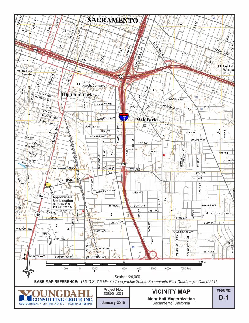
FIGURE
D-1January 2016
Project No.:E08091.001 VICINITY MAP
Mohr Hall ModernizationSacramento, California
N
Scale: 1:24,000
01000 1000 4000 50003000
01 ½
6000 7000 Feet
1 Mile
BASE MAP REFERENCE: U.S.G.S. 7.5 Minute Topographic Series, Sacramento East Quadrangle, Dated 2015
ApproximateSite Location
O38.538821 NO121.491871 W

REFERENCE: Google Earth, Aerial Data Dated 7-13-2015, Overlay Site Plan Provided By Client
N
0 20 40 80
Approximate Scale: 1" = 40'
B-1 = Approximate Boring Locations
B-1
B-5
B-3
B-4
B-2
A
A'
B'
B
= Riverbank Formation Middle UnitQr2
Qr2
FIGURE
D-2January 2016
Project No.:E08091.001 SITE GEOLOGY MAP
Mohr Hall ModernizationSacramento, California

FIGURE
D-3January 2016
Project No.:E08091.001
CROSS SECTIONS
Mohr Hall ModernizationSacramento, California
1"
V=
20'
1" H=40'
B-4 B-3 B-2 B-1Future Building
ML
A A'
MLML ML
CLCLCLCL
SM SM
ML ML
SC SC
NW SE
B-3 B-2 B-5Existing Building
ML
B
B'
ML
MLML
CLCLCLCL
SM SM
ML ML
SC
W E
SC
Future Building
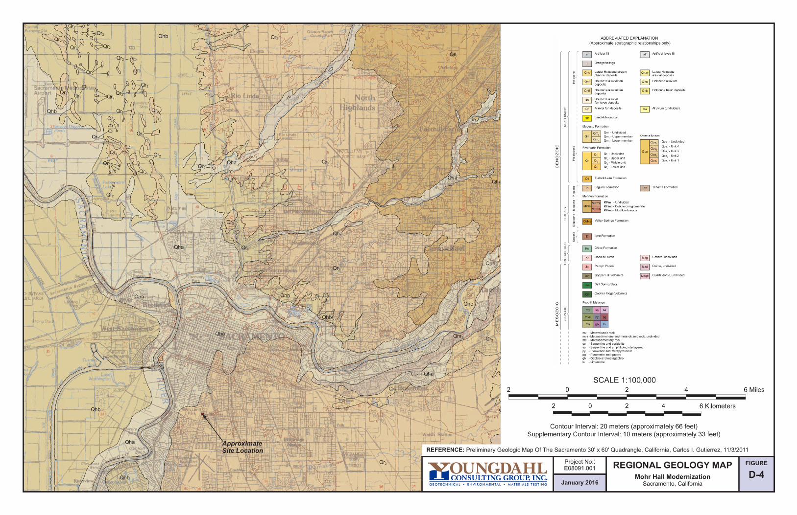
REFERENCE: Preliminary Geologic Map Of The Sacramento 30' x 60' Quadrangle, California, Carlos I. Gutierrez, 11/3/2011
FIGURE
D-4January 2016
Project No.:E08091.001 REGIONAL GEOLOGY MAP
Mohr Hall ModernizationSacramento, California
ApproximateSite Location
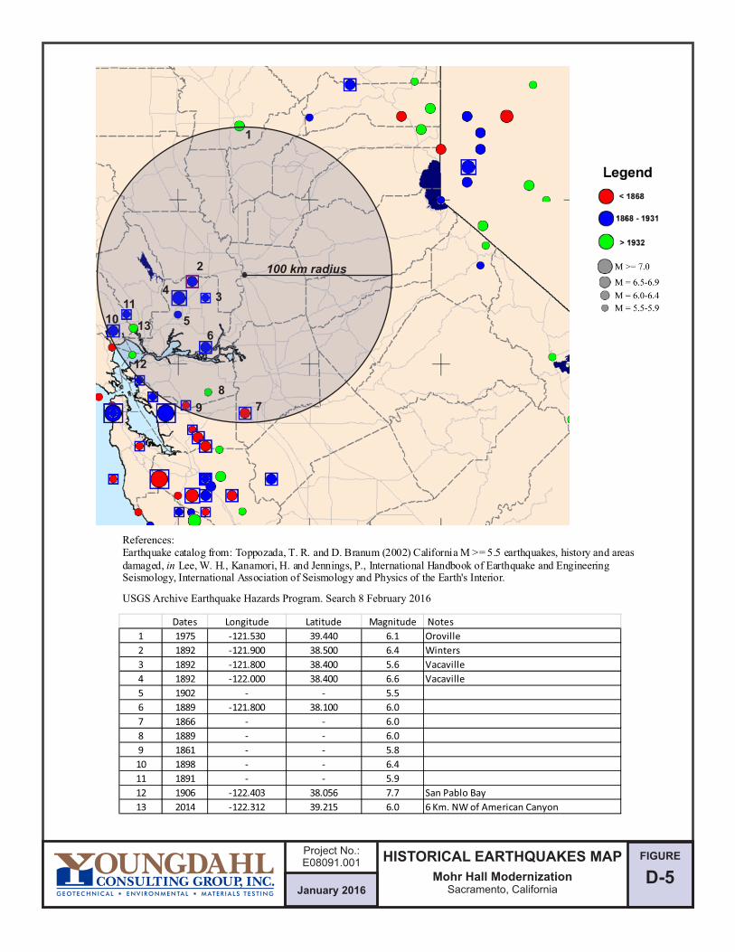
D-5January 2016
Project No.:E08091.001 HISTORICAL EARTHQUAKES MAP
Mohr Hall ModernizationSacramento, California
FIGURE
References:
100 km radius
1
2
34
56
7
8
9
1011
13
12
USGS Archive Earthquake Hazards Program. Search 8 February 2016
Dates Longitude Latitude Magnitude Notes
1 1975 -121.530 39.440 6.1 Oroville
2 1892 -121.900 38.500 6.4 Winters
3 1892 -121.800 38.400 5.6 Vacaville
4 1892 -122.000 38.400 6.6 Vacaville
5 1902 - - 5.5
6 1889 -121.800 38.100 6.0
7 1866 - - 6.0
8 1889 - - 6.0
9 1861 - - 5.8
10 1898 - - 6.4
11 1891 - - 5.9
12 1906 -122.403 38.056 7.7 San Pablo Bay
13 2014 -122.312 39.215 6.0 6 Km. NW of American Canyon

N
FIGURE
D-6January 2016
Project No.:E08091.001
FAULT MAPMohr Hall Modernization
Sacramento, California
BASE MAP REF: GA Map, 2007 Caltrans Deterministic P Fault Identification
Numbers (FID) Shown Martha Merriam, Tom Shantz, GIS . September 2007,
by Ke Zhou, Fault Map Legend Follows On Figure D-7
SITE
100 Kilo
mete
r
Radius
0 5025 100
Scale: Kilometers
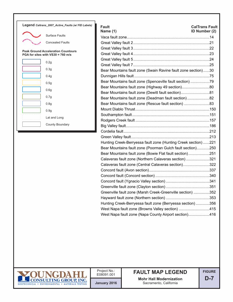
FIGURE
D-7
0.2g
0.3g
0.4g
0.5g
0.6g
0.7g
0.8g
0.9g
Lat and Long
County Boundary
Surface Faults
Concealed Faults
Legend Caltrans_2007_Active_Faults (w/ FID Labels)
Peak Ground Acceleration CountoursPGA for sites with VS30 = 760 m/s
FaultName (1)
CalTrans FaultID Number (2)
January 2016
Project No.:E08091.001
FAULT MAP LEGENDMohr Hall Modernization
Sacramento, California
Vaca fault zone..............................................................................14
Great Valley fault 2........................................................................21
Great Valley fault 3........................................................................22
Great Valley fault 4........................................................................23
Great Valley fault 5........................................................................24
Great Valley fault 7........................................................................25
Bear Mountains fault zone (Swain Ravine fault zone section) ......30
Dunnigan Hills fault .......................................................................75
Bear Mountains fault zone (Spenceville fault section) ..................79
Bear Mountains fault zone (Highway 49 section)..........................80
Bear Mountains fault zone (Dewitt fault section)...........................81
Bear Mountains fault zone (Deadman fault section) .....................82
Bear Mountains fault zone (Rescue fault section) ........................83
Mount Diablo Thrust......................................................................150
Southampton fault .........................................................................151
Rodgers Creek fault ......................................................................157
Big Valley fault...............................................................................186
Cordelia fault .................................................................................212
Green Valley fault..........................................................................213
Hunting Creek-Berryessa fault zone (Hunting Creek section) ......221
Bear Mountains fault zone (Poorman Gulch fault section)............250
Bear Mountains fault zone (Bowie Flat fault section) ....................251
Calaveras fault zone (Northern Calaveras section) ......................321
Calaveras fault zone (Central Calaveras section).........................322
Concord fault (Avon section).........................................................337
Concord fault (Concord section) ...................................................340
Concord fault (Ygnacio Valley section) .........................................341
Greenville fault zone (Clayton section) .........................................351
Greenville fault zone (Marsh Creek-Greenville section) ...............352
Hayward fault zone (Northern section) .........................................353
Hunting Creek-Berryessa fault zone (Berryessa section) .............356
West Napa fault zone (Browns Valley section) .............................415
West Napa fault zone (Napa County Airport section)....................416

APPENDIX F
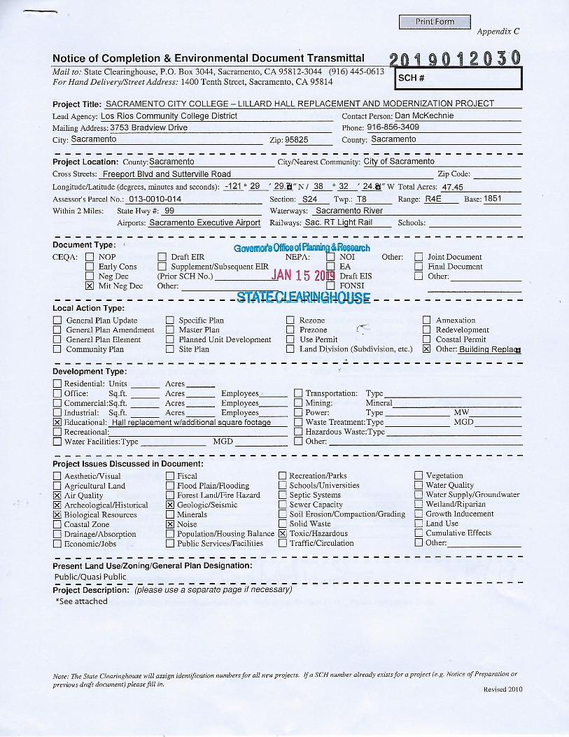

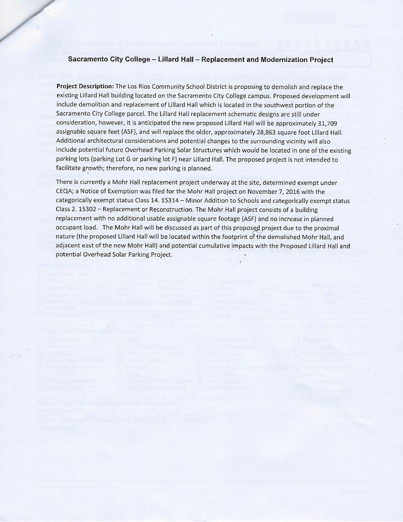

Sent Via E-Mail February 13, 2019 Dan McKechnie Los Rios Community College District 3753 Bradshaw Dr. Sacramento, CA 95825 [email protected] Subject: Sacramento City College – Lillard Hall Replacement and Modernization Project / MND / 2019012030 Dear Mr. McKechnie, The Sacramento Municipal Utility District (SMUD) appreciates the opportunity to provide comments on the Mitigated Negative Declaration (MND) for the Sacramento City College – Lillard Hall Replacement and Modernization Project (Project, SCH 2018112048). SMUD is the primary energy provider for Sacramento County and the proposed Project area. SMUD’s vision is to empower our customers with solutions and options that increase energy efficiency, protect the environment, reduce global warming, and lower the cost to serve our region. As a Responsible Agency, SMUD aims to ensure that the proposed Project limits the potential for significant environmental effects on SMUD facilities, employees, and customers. It is our desire that the Project MND will acknowledge any Project impacts related to the following:
• Overhead and or underground transmission and distribution line easements. Please view the following links on smud.org for more information regarding transmission encroachment:
• https://www.smud.org/en/Business-Solutions-and-Rebates/Design-and-Construction-Services
• https://www.smud.org/en/Corporate/Do-Business-with-SMUD/Land-Use/Transmission-Right-of-Way
• Utility line routing • Electrical load needs/requirements • Energy Efficiency • Climate Change • Cumulative impacts related to the need for increased electrical delivery

More specifically, SMUD would like to have the following details related to the electrical infrastructure incorporated into the project description:
• There are existing 21kV overhead facilities surrounding the Sacramento City
College property that will need to remain. • There are underground 21kV and 4kV facilities located on the Sacramento City
College property that will need to remain.
SMUD would like to be involved with discussing the above areas of interest as well as discussing any other potential issues. We aim to be partners in the efficient and sustainable delivery of the proposed Project. Please ensure that the information included in this response is conveyed to the Project planners and the appropriate Project proponents. Environmental leadership is a core value of SMUD and we look forward to collaborating with you on this Project. Again, we appreciate the opportunity to provide input on this MND. If you have any questions regarding this letter, please contact SMUD’s Environmental Management Specialist, Rob Ferrera, at [email protected] or 916.732.6676. Sincerely,
Nicole Goi Regional & Local Government Affairs Sacramento Municipal Utility District 6301 S Street, Mail Stop A313 Sacramento, CA 95817 [email protected] Cc: Rob Ferrera
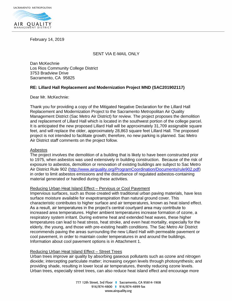
February 14, 2019
SENT VIA E-MAIL ONLY Dan McKechnie Los Rios Community College District 3753 Bradview Drive Sacramento, CA 95825 RE: Lillard Hall Replacement and Modernization Project MND (SAC201902117) Dear Mr. McKechnie: Thank you for providing a copy of the Mitigated Negative Declaration for the Lillard Hall Replacement and Modernization Project to the Sacramento Metropolitan Air Quality Management District (Sac Metro Air District) for review. The project proposes the demolition and replacement of Lillard Hall which is located in the southwest portion of the college parcel. It is anticipated the new proposed Lillard Hall will be approximately 31,709 assignable square feet, and will replace the older, approximately 28,863 square feet Lillard Hall. The proposed project is not intended to facilitate growth; therefore, no new parking is planned. Sac Metro Air District staff comments on the project follow. Asbestos The project involves the demolition of a building that is likely to have been constructed prior to 1975, when asbestos was used extensively in building construction. Because of the risk of exposure to asbestos, demolition or renovation of existing buildings are subject to Sac Metro Air District Rule 902 (http://www.airquality.org/ProgramCoordination/Documents/rule902.pdf) in order to limit asbestos emissions and the disturbance of regulated asbestos-containing material generated or handled during these activities. Reducing Urban Heat Island Effect – Pervious or Cool Pavement Impervious surfaces, such as those created with traditional urban paving materials, have less surface moisture available for evapotranspiration than natural ground cover. This characteristic contributes to higher surface and air temperatures, known as heat island effect. As a result, air temperatures in the project’s central courtyard area may contribute to increased area temperatures. Higher ambient temperatures increase formation of ozone, a respiratory system irritant. During extreme heat and extended heat waves, these higher temperatures can lead to heat stress, heat stroke, and even heat mortality, especially for the elderly, the young, and those with pre-existing health conditions. The Sac Metro Air District recommends paving the areas surrounding the new Lillard Hall with permeable pavement or cool pavement, in order to maintain cooler temperatures in and around the buildings. Information about cool pavement options is in Attachment 1.
Reducing Urban Heat Island Effect – Street Trees Urban trees improve air quality by absorbing gaseous pollutants such as ozone and nitrogen dioxide; intercepting particulate matter; increasing oxygen levels through photosynthesis; and providing shade, resulting in lower local air temperatures, thereby reducing ozone levels. Urban trees, especially street trees, can also reduce heat island effect and encourage more
Mr. Dan McKechnie February 14, 2019 Lillard Hall Replacement and Modernization Project Page 2 walking trips. The Sac Metro Air District recommends that the project include, in addition to the 26 trees included in project plans, the planting of street trees sufficient to create continuous shade on the sidewalks surrounding the project. The trees species should be selected for their ability to thrive in the region’s climate and soils, for their resistance to pests and disease, and for their ability to contribute to air quality. The Sacramento Tree Foundation’s Shady Eighty List provides recommended tree species. The Vibrant Cities Lab provides additional research, tools, resources, and case studies on the benefits of trees. Construction Emissions Thank you for including the Sac Metro Air District’s Basic Construction Emission Control Practices in the project.
All projects are subject to Sac Metro Air District rules at the time of construction. Specific rules that may relate to construction activities are attached. A complete listing of current rules is available at www.airquality.org or by calling 916-874-4800. Future Communications The Sac Metro Air District requests that notices of all future environmental documents produced by the Los Rios Community College District be sent to our project review mailbox at [email protected]. Thank you for your consideration of these comments. If you have any questions, please contact me at 916-874-4816 or [email protected]. Sincerely,
Teri Duarte, MPH Planner/Analyst Cc: Paul Philley, AICP, Sac Metro Air District
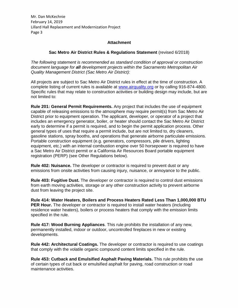
Mr. Dan McKechnie February 14, 2019 Lillard Hall Replacement and Modernization Project Page 3
Attachment
Sac Metro Air District Rules & Regulations Statement (revised 6/2018) The following statement is recommended as standard condition of approval or construction document language for all development projects within the Sacramento Metropolitan Air Quality Management District (Sac Metro Air District): All projects are subject to Sac Metro Air District rules in effect at the time of construction. A complete listing of current rules is available at www.airquality.org or by calling 916-874-4800. Specific rules that may relate to construction activities or building design may include, but are not limited to: Rule 201: General Permit Requirements. Any project that includes the use of equipment capable of releasing emissions to the atmosphere may require permit(s) from Sac Metro Air District prior to equipment operation. The applicant, developer, or operator of a project that includes an emergency generator, boiler, or heater should contact the Sac Metro Air District early to determine if a permit is required, and to begin the permit application process. Other general types of uses that require a permit include, but are not limited to, dry cleaners, gasoline stations, spray booths, and operations that generate airborne particulate emissions. Portable construction equipment (e.g. generators, compressors, pile drivers, lighting equipment, etc.) with an internal combustion engine over 50 horsepower is required to have a Sac Metro Air District permit or a California Air Resources Board portable equipment registration (PERP) (see Other Regulations below). Rule 402: Nuisance. The developer or contractor is required to prevent dust or any emissions from onsite activities from causing injury, nuisance, or annoyance to the public. Rule 403: Fugitive Dust. The developer or contractor is required to control dust emissions from earth moving activities, storage or any other construction activity to prevent airborne dust from leaving the project site. Rule 414: Water Heaters, Boilers and Process Heaters Rated Less Than 1,000,000 BTU PER Hour. The developer or contractor is required to install water heaters (including residence water heaters), boilers or process heaters that comply with the emission limits specified in the rule. Rule 417: Wood Burning Appliances. This rule prohibits the installation of any new, permanently installed, indoor or outdoor, uncontrolled fireplaces in new or existing developments. Rule 442: Architectural Coatings. The developer or contractor is required to use coatings that comply with the volatile organic compound content limits specified in the rule. Rule 453: Cutback and Emulsified Asphalt Paving Materials. This rule prohibits the use of certain types of cut back or emulsified asphalt for paving, road construction or road maintenance activities.

Mr. Dan McKechnie February 14, 2019 Lillard Hall Replacement and Modernization Project Page 4 Rule 460: Adhesives and Sealants. The developer or contractor is required to use adhesives and sealants that comply with the volatile organic compound content limits specified in the rule. Rule 902: Asbestos. The developer or contractor is required to notify the Sac Metro Air District of any regulated renovation or demolition activity. Rule 902 contains specific requirements for surveying, notification, removal, and disposal of asbestos containing material. Other Regulations (California Code of Regulations (CCR)) 17 CCR, Division 3, Chapter 1, Subchapter 7.5, §93105 Naturally Occurring Asbestos: The developer or contractor is required to notify the Sac Metro Air District of earth moving projects, greater than 1 acre in size in areas “Moderately Likely to Contain Asbestos” within eastern Sacramento County. The developer or contractor is required to comply with specific requirements for surveying, notification, and handling soil that contains naturally occurring asbestos. 13 CCR, Division 3, Chapter 9, Article 5, Portable Equipment Registration Program: The developer or contractor is required to comply with all registration and operational requirements of the portable equipment registration program such as recordkeeping and notification. 13 CCR, Division 3, Chapter 9, Article 4.8, §2449(d)(2) and 13 CCR, Division 3, Chapter 10, Article 1, §2485 regarding Anti-Idling: Minimize idling time either by shutting equipment off when not in use or reducing the time of idling to 5 minutes. These apply to diesel powered off-road equipment and on-road vehicles, respectively.

APPENDIX G
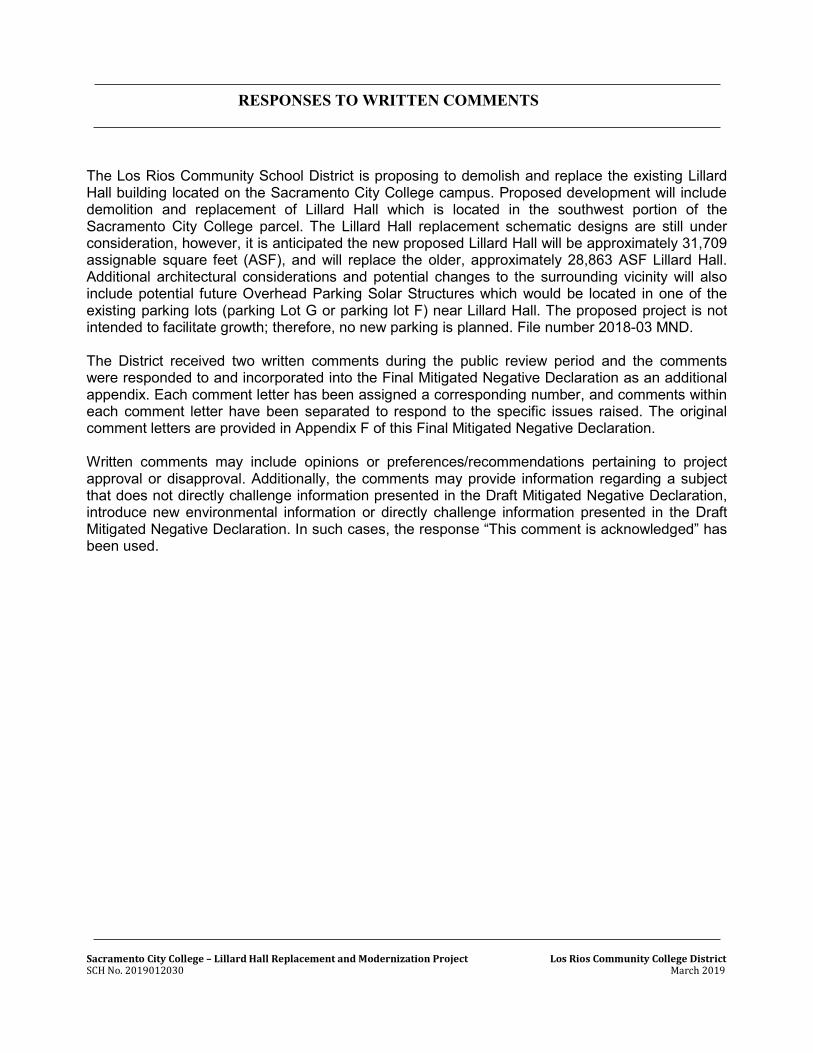
Sacramento City College – Lillard Hall Replacement and Modernization Project Los Rios Community College District SCH No. 2019012030 March 2019
RESPONSES TO WRITTEN COMMENTS
The Los Rios Community School District is proposing to demolish and replace the existing Lillard Hall building located on the Sacramento City College campus. Proposed development will include demolition and replacement of Lillard Hall which is located in the southwest portion of the Sacramento City College parcel. The Lillard Hall replacement schematic designs are still under consideration, however, it is anticipated the new proposed Lillard Hall will be approximately 31,709 assignable square feet (ASF), and will replace the older, approximately 28,863 ASF Lillard Hall. Additional architectural considerations and potential changes to the surrounding vicinity will also include potential future Overhead Parking Solar Structures which would be located in one of the existing parking lots (parking Lot G or parking lot F) near Lillard Hall. The proposed project is not intended to facilitate growth; therefore, no new parking is planned. File number 2018-03 MND. The District received two written comments during the public review period and the comments were responded to and incorporated into the Final Mitigated Negative Declaration as an additional appendix. Each comment letter has been assigned a corresponding number, and comments within each comment letter have been separated to respond to the specific issues raised. The original comment letters are provided in Appendix F of this Final Mitigated Negative Declaration. Written comments may include opinions or preferences/recommendations pertaining to project approval or disapproval. Additionally, the comments may provide information regarding a subject that does not directly challenge information presented in the Draft Mitigated Negative Declaration, introduce new environmental information or directly challenge information presented in the Draft Mitigated Negative Declaration. In such cases, the response “This comment is acknowledged” has been used.
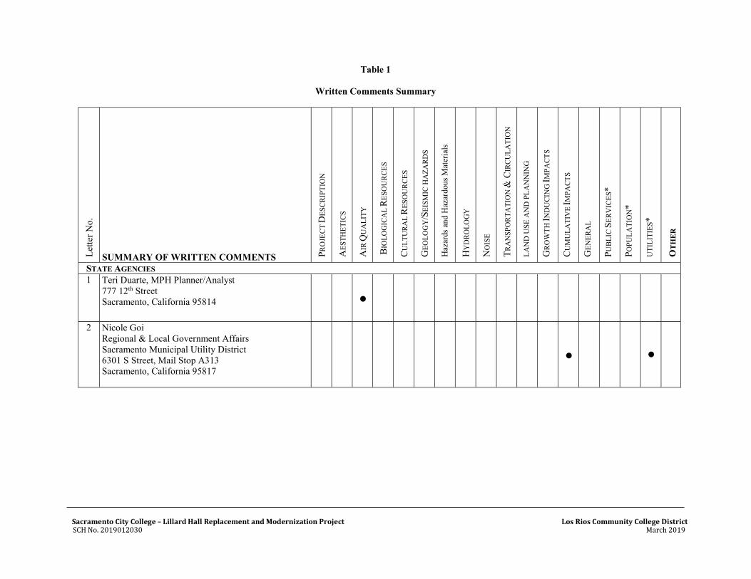
Sacramento City College – Lillard Hall Replacement and Modernization Project Los Rios Community College District SCH No. 2019012030 March 2019
Table 1
Written Comments Summary
Let
ter
No.
SUMMARY OF WRITTEN COMMENTS P
RO
JEC
T D
ESC
RIP
TIO
N
AE
STH
ET
ICS
AIR
QU
AL
ITY
BIO
LO
GIC
AL
RE
SOU
RC
ES
CU
LT
UR
AL
RE
SOU
RC
ES
GE
OL
OG
Y/S
EIS
MIC
HA
ZA
RD
S
Haz
ards
and
Haz
ardo
us M
ater
ials
HY
DR
OL
OG
Y
NO
ISE
TR
AN
SPO
RT
AT
ION
& C
IRC
UL
AT
ION
LA
ND
US
E A
ND
PL
AN
NIN
G
GR
OW
TH
I ND
UC
ING
I MPA
CT
S
CU
MU
LA
TIV
E I M
PAC
TS
GE
NE
RA
L
PU
BL
IC S
ER
VIC
ES*
PO
PUL
AT
ION
*
UT
ILIT
IES*
OT
HE
R
STATE AGENCIES
1 Teri Duarte, MPH Planner/Analyst 777 12th Street Sacramento, California 95814
●
2 Nicole Goi
Regional & Local Government Affairs Sacramento Municipal Utility District 6301 S Street, Mail Stop A313
Sacramento, California 95817
●
●

Sacramento City College – Lillard Hall Replacement and Modernization Project Los Rios Community College District SCH No. 2019012030 March 2019
LETTER NO. 1
Teri Duarte Planner/Analyst Sacramento Metropolitan Air Quality Management District 777 12th Street Sacramento, California 95814
COMMENT 1-1 Asbestos The project involves the demolition of a building that is likely to have been constructed prior to 1975, when asbestos was used extensively in building construction. Because of the risk of exposure to asbestos, demolition or renovation of existing buildings are subject to Sac Metro Air District Rule 902 in order to limit asbestos emissions and the disturbance of regulated asbestos-containing material generated or handled during these activities. RESPONSE 1-1
The mitigated negative declaration has the following mitigation measure to address asbestos: Hazards and Hazardous Materials Mitigation 2 The developer or contractor is required to notify Sac Metro prior to demolition or renovations associated with the project. Project demolition and renovation of existing buildings are subject to Sac Metro Air District Rule 902 in order to limit asbestos emissions and the disturbance of regulated asbestos-containing material generated or handled during these activities.
COMMENT 1-2 Reducing Urban Heat Island Effect – Pervious or Cool Pavement Impervious surfaces, such as those created with traditional urban paving materials, have less surface moisture available for evapotranspiration than natural ground cover. This characteristic contributes to higher surface and air temperatures, known as heat island effect. As a result, air temperatures in the projects central courtyard area may contribute to increased area temperatures. Higher ambient temperatures increase formation of ozone, a respiratory system irritant. During extreme heat and extended heat waves, these higher temperatures can lead to heat stress, heat stroke, and even heat mortality, especially for the elderly, the young and those with pre-existing health conditions. The Sac Metro Air District recommends paving the areas surrounding the new Lillard Hall with permeable pavement or cool pavement, in order to maintain cooler temperatures in and around the buildings.
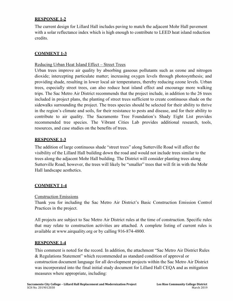
Sacramento City College – Lillard Hall Replacement and Modernization Project Los Rios Community College District SCH No. 2019012030 March 2019
RESPONSE 1-2
The current design for Lillard Hall includes paving to match the adjacent Mohr Hall pavement with a solar reflectance index which is high enough to contribute to LEED heat island reduction credits.
COMMENT 1-3 Reducing Urban Heat Island Effect – Street Trees Urban trees improve air quality by absorbing gaseous pollutants such as ozone and nitrogen dioxide; intercepting particulate matter; increasing oxygen levels through photosynthesis; and providing shade, resulting in lower local air temperatures, thereby reducing ozone levels. Urban trees, especially street trees, can also reduce heat island effect and encourage more walking trips. The Sac Metro Air District recommends that the project include, in addition to the 26 trees included in project plans, the planting of street trees sufficient to create continuous shade on the sidewalks surrounding the project. The trees species should be selected for their ability to thrive in the region’s climate and soils, for their resistance to pests and disease, and for their ability to contribute to air quality. The Sacramento Tree Foundation’s Shady Eight List provides recommended tree species. The Vibrant Cities Lab provides additional research, tools, resources, and case studies on the benefits of trees. RESPONSE 1-3
The addition of large continuous shade “street trees” along Sutterville Road will affect the visibility of the Lillard Hall building down the road and would not include trees similar to the trees along the adjacent Mohr Hall building. The District will consider planting trees along Sutterville Road; however, the trees will likely be “smaller” trees that will fit in with the Mohr Hall landscape aesthetics.
COMMENT 1-4 Construction Emissions Thank you for including the Sac Metro Air District’s Basic Construction Emission Control Practices in the project. All projects are subject to Sac Metro Air District rules at the time of construction. Specific rules that may relate to construction activities are attached. A complete listing of current rules is available at www.airquality.org or by calling 916-874-4800. RESPONSE 1-4
This comment is noted for the record. In addition, the attachment “Sac Metro Air District Rules & Regulations Statement” which recommended as standard condition of approval or construction document language for all development projects within the Sac Metro Air District was incorporated into the final initial study document for Lillard Hall CEQA and as mitigation measures where appropriate, including:

Sacramento City College – Lillard Hall Replacement and Modernization Project Los Rios Community College District SCH No. 2019012030 March 2019
Rule 201: General Rule Requirements Rule 402: Nuisance Rule 403: Fugitive Dust Rule 414: Water Heaters, Boilers and Process Heaters Rated Less Than 1,000,000 BTU
Per Hour Rule 442: Architectural Coatings Rule 453: Cutback and Emulsified Asphalt Paving Materials Rule 460: Adhesives and Sealants Rule 902: Asbestos 17 CCR Division 3, Chapter 1: Naturally Occurring Asbestos 17 CCR Division 3, Chapter 9: Portable Equipment Registration Program 17 CCR Division 3, Chapter 10: Anti-idling

Sacramento City College – Lillard Hall Replacement and Modernization Project Los Rios Community College District SCH No. 2019012030 March 2019
LETTER NO. 2 Nicole Goi Regional & Local Government Affairs Sacramento Municipal Utility District 6301 S. Street, Mail Stop A313 Sacramento, California 95817
COMMENT 2-1
The Sacramento Municipal Utility District (SMUD) appreciates the opportunity to provide comments on the Draft Initial Study/Mitigated Negative Declaration (Draft IS/MND) for the Sacramento City College – Lillard Hall Replacement and Modernization Project (Project, SCH 2018112048). SMUD is the primary energy provider for Sacramento County and the proposed Project area. SMUD’s vision is to empower our customers with solutions and options that increase energy efficiency, protect the environment, reduce global warming, and lower the cost to serve our region. As a Responsible Agency, SMUD aims to ensure that the proposed Project limits the potential for significant environmental effects on SMUD facilities, employees, and customers. It is our desire that the Project MND will acknowledge any Project impacts related to the following:
1. Overhead and or underground transmission and distribution line easements. 2. Utility line routing 3. Electrical load needs/requirements 4. Energy Efficiency 5. Cumulative impacts related to the need for increased electrical delivery
More specifically, SMUD would like to have the following details related to the electrical infrastructure incorporated into the project description:
6. There are existing 21kV overhead facilities surrounding the Sacramento City College property that will need to remain.
7. There are underground 21kV and 4kV facilities located on the Sacramento City College property that will need to remain.
RESPONSE 2-1
1. As discussed in the Project’s IS/MND, the Project is not located within SMUD overhead or underground transmission and distribution line easements;
2. The District will work with SMUD prior to any utility routing, if needed; 3. The Project is currently still in the design phase, however, as stated in the Project
description, the replacement building will be of a similar size and more efficient than the previous Lillard Hall.
4. All work shall be performed in accordance with the State of California Code of
Sacramento City College – Lillard Hall Replacement and Modernization Project Los Rios Community College District SCH No. 2019012030 March 2019
Regulations (CCR) Title 24, Building Standards. The electrical will meet new codes to use energy efficient lighting and electrical components. In addition, there are sustainability goals and strategies being considered that include the following: Zero net energy goal; LEED gold equivalency goal; Compact building form; Shade use areas with building mass or elements; and Maximize northern and diffused light.
5. Cumulative impacts related to air quality/greenhouse gases associated with the increase in operational emissions are addressed in the IS/MND; cumulative impact is determined to be less than significant with mitigation incorporated. The Project is consistent with the land use designation for the site.
6. The existing 21kV overhead facilities surrounding the Sacramento City College property that will need to remain was added to the construction section (Section 9) following the project description (Section 6) of the CEQA document.
7. The existing underground 21kV and 4kV facilities located on the Sacramento City College property that will need to remain was added to a construction section (Section 9) following the project description (Section 6) in the CEQA document.

APPENDIX H
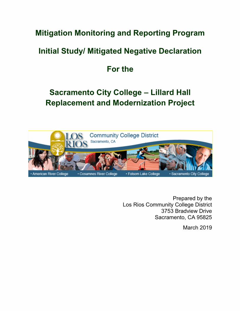
Mitigation Monitoring and Reporting Program
Initial Study/ Mitigated Negative Declaration
For the
Sacramento City College – Lillard Hall Replacement and Modernization Project
Prepared by the Los Rios Community College District
3753 Bradview Drive Sacramento, CA 95825
March 2019

PROJECT TITLE:
SACRAMENTO CITY COLLEGE – LILLARD HALL REPLACEMENT AND MODERNIZATION PROJECT FILE NUMBER: 2018-03 MND LEAD AGENCY NAME AND ADDRESS:
Los Rios Community College District 3753 Bradview Drive Sacramento, CA 95825
CONTACT PERSONS:
Environmental document: Dan McKechnie: 916-856-3409 PROJECT LOCATION
The Project is located at the Sacramento City College (SCC) Campus, in Sacramento City, Sacramento County, located at the intersection of Freeport Boulevard and Sutterville Road, approximately 0.5 mile west of Highway 99 and 1 mile east of Interstate 5. The Sacramento City College is located in a primarily suburban area within the City of Sacramento. The Sacramento City College address is 3835 Freeport Boulevard, Sacramento, California, and consists of 47.45 acres of land (APN: 013-0010-014). The City of Sacramento General Plan designates the Campus as “Public/Quasi Public”. A regional and project location map are included as Figures 1 and 2, respectively.
PROJECT DESCRIPTION:
The Los Rios Community School District is proposing to demolish and replace the existing Lillard Hall building located on the Sacramento City College campus. Proposed development will include demolition and replacement of Lillard Hall which is located in the southwest portion of the Sacramento City College parcel. The Lillard Hall replacement schematic designs are still under consideration, however, it is anticipated the new proposed Lillard Hall will be approximately 31,709 assignable square feet (ASF), and will replace the older, approximately 28,863 ASF Lillard Hall. Additional architectural considerations and potential changes to the surrounding vicinity will also include potential future Overhead Parking Solar Structures which would be located in one of the existing parking lots (parking Lot G or parking lot F) near Lillard Hall. The proposed project is not intended to facilitate growth; therefore, no new parking is planned.
PROJECT SPONSOR'S NAME AND ADDRESS:
Los Rios Community College District 3753 Bradview Drive Sacramento, CA 95825
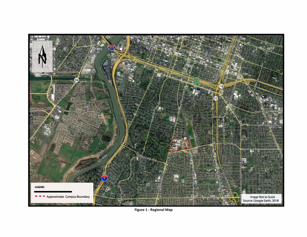
Figure 1 - Regional Map
Figure 2 - Project Location Map
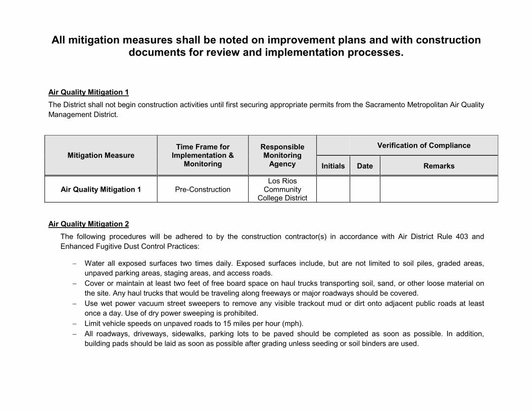
All mitigation measures shall be noted on improvement plans and with construction documents for review and implementation processes.
Air Quality Mitigation 1
The District shall not begin construction activities until first securing appropriate permits from the Sacramento Metropolitan Air Quality Management District.
Mitigation Measure Time Frame for
Implementation & Monitoring
Responsible Monitoring
Agency
Verification of Compliance
Initials Date Remarks
Air Quality Mitigation 1 Pre-Construction Los Rios
Community College District
Air Quality Mitigation 2
The following procedures will be adhered to by the construction contractor(s) in accordance with Air District Rule 403 and Enhanced Fugitive Dust Control Practices:
Water all exposed surfaces two times daily. Exposed surfaces include, but are not limited to soil piles, graded areas, unpaved parking areas, staging areas, and access roads.
Cover or maintain at least two feet of free board space on haul trucks transporting soil, sand, or other loose material on the site. Any haul trucks that would be traveling along freeways or major roadways should be covered.
Use wet power vacuum street sweepers to remove any visible trackout mud or dirt onto adjacent public roads at least once a day. Use of dry power sweeping is prohibited.
Limit vehicle speeds on unpaved roads to 15 miles per hour (mph). All roadways, driveways, sidewalks, parking lots to be paved should be completed as soon as possible. In addition,
building pads should be laid as soon as possible after grading unless seeding or soil binders are used.

Minimize idling time either by shutting equipment off when not in use or reducing the time of idling to 5 minutes [required by California Code of Regulations, Title 13, sections 2449(d)(3) and 2485]. Provide clear signage that posts this requirement for workers at the entrances to the site.
Maintain all construction equipment in proper working condition according to manufacturer’s specifications. The equipment must be checked by a certified mechanic and determined to be running in proper condition prior to operation.
Soil Disturbance Areas:
Water exposed soil with adequate frequency for continued moist soil. However, do not overwater to the extent that sediment flows off the site.
Suspend excavation, grading, and/or demolition activity when wind speeds exceed 20 mph. Install wind-breaks (e.g. plant trees, solid fencing) on windward side(s) of construction areas. Plant vegetative ground cover (fast-germinating native grass seed) in disturbed areas as soon as possible. Water
appropriately until vegetation is established. Post a publicly visible sign with the telephone number and person to contact at the lead agency regarding dust
complaints. This person shall respond and take corrective action within 48 hours. The phone number of the District shall also be visible to ensure compliance.
Mitigation Measure Time Frame for
Implementation & Monitoring
Responsible Monitoring
Agency
Verification of Compliance
Initials Date Remarks
Air Quality Mitigation 2 During Construction Contractors

Air Quality Mitigation 3 – Rule 414: Boilers and Process Heater Requirements
The developer or contractor is required to install water heaters rated less than 1,000,000 BTU per hour per Sac Metro Rule 414.
Mitigation Measure Time Frame for
Implementation & Monitoring
Responsible Monitoring
Agency
Verification of Compliance
Initials Date Remarks
Air Quality Mitigation 3 During-Construction Contractor
Air Quality Mitigation 4 – Rule 442: Architectural Coatings
The developer or contractor is required to use coatings which comply with volatile organic compound content limits as specified in Sac Metro Rule 442.
Mitigation Measure Time Frame for
Implementation & Monitoring
Responsible Monitoring
Agency
Verification of Compliance
Initials Date Remarks
Air Quality Mitigation 4 During-Construction Contractor
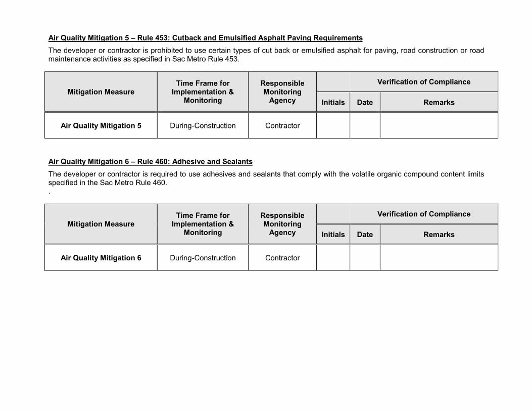
Air Quality Mitigation 5 – Rule 453: Cutback and Emulsified Asphalt Paving Requirements
The developer or contractor is prohibited to use certain types of cut back or emulsified asphalt for paving, road construction or road maintenance activities as specified in Sac Metro Rule 453.
Mitigation Measure Time Frame for
Implementation & Monitoring
Responsible Monitoring
Agency
Verification of Compliance
Initials Date Remarks
Air Quality Mitigation 5 During-Construction Contractor
Air Quality Mitigation 6 – Rule 460: Adhesive and Sealants
The developer or contractor is required to use adhesives and sealants that comply with the volatile organic compound content limits specified in the Sac Metro Rule 460. .
Mitigation Measure Time Frame for
Implementation & Monitoring
Responsible Monitoring
Agency
Verification of Compliance
Initials Date Remarks
Air Quality Mitigation 6 During-Construction Contractor
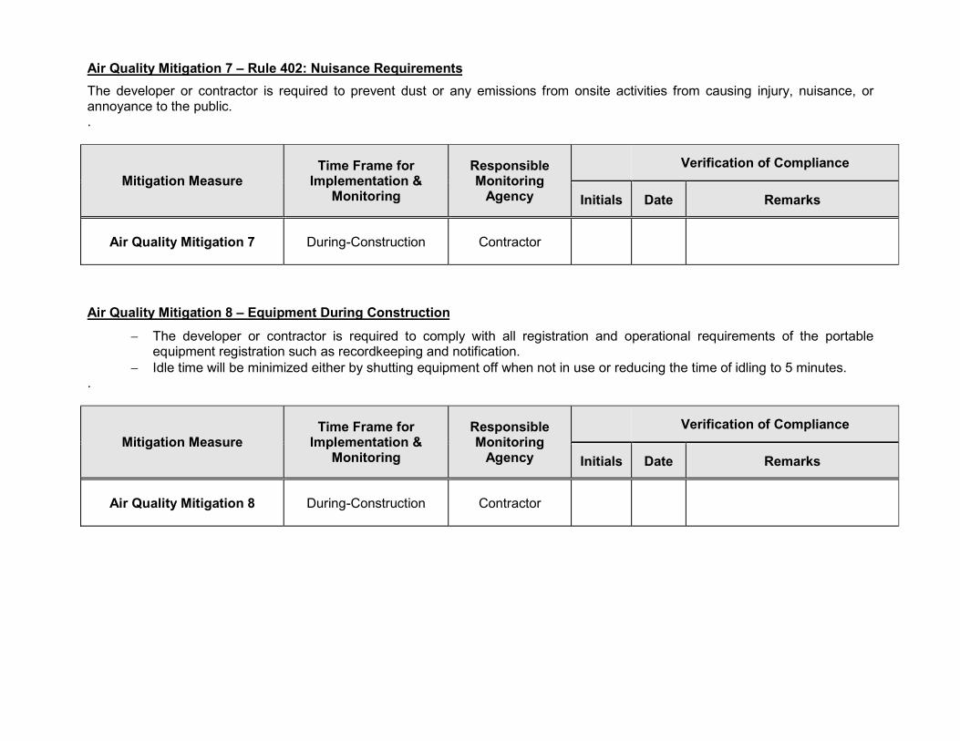
Air Quality Mitigation 7 – Rule 402: Nuisance Requirements
The developer or contractor is required to prevent dust or any emissions from onsite activities from causing injury, nuisance, or annoyance to the public. .
Mitigation Measure Time Frame for
Implementation & Monitoring
Responsible Monitoring
Agency
Verification of Compliance
Initials Date Remarks
Air Quality Mitigation 7 During-Construction Contractor
Air Quality Mitigation 8 – Equipment During Construction
The developer or contractor is required to comply with all registration and operational requirements of the portable equipment registration such as recordkeeping and notification.
Idle time will be minimized either by shutting equipment off when not in use or reducing the time of idling to 5 minutes. .
Mitigation Measure Time Frame for
Implementation & Monitoring
Responsible Monitoring
Agency
Verification of Compliance
Initials Date Remarks
Air Quality Mitigation 8 During-Construction Contractor
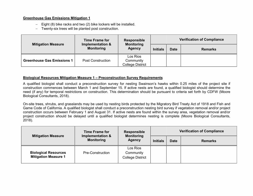
Greenhouse Gas Emissions Mitigation 1
Eight (8) bike racks and two (2) bike lockers will be installed. Twenty-six trees will be planted post construction.
Mitigation Measure Time Frame for
Implementation & Monitoring
Responsible Monitoring
Agency
Verification of Compliance
Initials Date Remarks
Greenhouse Gas Emissions 1 Post Construction Los Rios
Community College District
Biological Resources Mitigation Measure 1 – Preconstruction Survey Requirements
A qualified biologist shall conduct a preconstruction survey for nesting Swainson’s hawks within 0.25 miles of the project site if construction commences between March 1 and September 15. If active nests are found, a qualified biologist should determine the need (if any) for temporal restrictions on construction. This determination should be pursuant to criteria set forth by CDFW (Moore Biological Consultants, 2018). On-site trees, shrubs, and grasslands may be used by nesting birds protected by the Migratory Bird Treaty Act of 1918 and Fish and Game Code of California. A qualified biologist shall conduct a preconstruction nesting bird survey if vegetation removal and/or project construction occurs between February 1 and August 31. If active nests are found within the survey area, vegetation removal and/or project construction should be delayed until a qualified biologist determines nesting is complete (Moore Biological Consultants, 2018).
Mitigation Measure Time Frame for
Implementation & Monitoring
Responsible Monitoring
Agency
Verification of Compliance
Initials Date Remarks
Biological Resources Mitigation Measure 1
Pre-Construction Los Rios
Community College District
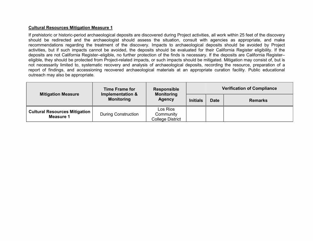
Cultural Resources Mitigation Measure 1
If prehistoric or historic-period archaeological deposits are discovered during Project activities, all work within 25 feet of the discovery should be redirected and the archaeologist should assess the situation, consult with agencies as appropriate, and make recommendations regarding the treatment of the discovery. Impacts to archaeological deposits should be avoided by Project activities, but if such impacts cannot be avoided, the deposits should be evaluated for their California Register eligibility. If the deposits are not California Register–eligible, no further protection of the finds is necessary. If the deposits are California Register–eligible, they should be protected from Project-related impacts, or such impacts should be mitigated. Mitigation may consist of, but is not necessarily limited to, systematic recovery and analysis of archaeological deposits, recording the resource, preparation of a report of findings, and accessioning recovered archaeological materials at an appropriate curation facility. Public educational outreach may also be appropriate.
Mitigation Measure Time Frame for
Implementation & Monitoring
Responsible Monitoring
Agency
Verification of Compliance
Initials Date Remarks
Cultural Resources Mitigation Measure 1
During Construction Los Rios
Community College District
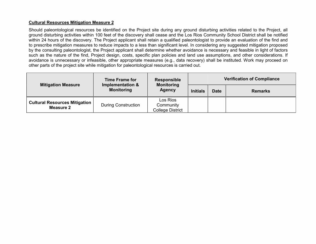
Cultural Resources Mitigation Measure 2
Should paleontological resources be identified on the Project site during any ground disturbing activities related to the Project, all ground disturbing activities within 100 feet of the discovery shall cease and the Los Rios Community School District shall be notified within 24 hours of the discovery. The Project applicant shall retain a qualified paleontologist to provide an evaluation of the find and to prescribe mitigation measures to reduce impacts to a less than significant level. In considering any suggested mitigation proposed by the consulting paleontologist, the Project applicant shall determine whether avoidance is necessary and feasible in light of factors such as the nature of the find, Project design, costs, specific plan policies and land use assumptions, and other considerations. If avoidance is unnecessary or infeasible, other appropriate measures (e.g., data recovery) shall be instituted. Work may proceed on other parts of the project site while mitigation for paleontological resources is carried out.
Mitigation Measure Time Frame for
Implementation & Monitoring
Responsible Monitoring
Agency
Verification of Compliance
Initials Date Remarks
Cultural Resources Mitigation Measure 2
During Construction Los Rios
Community College District
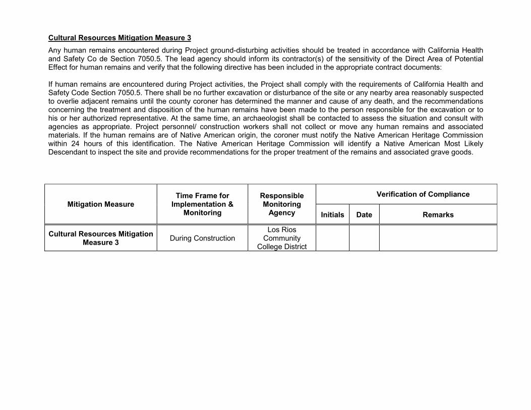
Cultural Resources Mitigation Measure 3
Any human remains encountered during Project ground-disturbing activities should be treated in accordance with California Health and Safety Co de Section 7050.5. The lead agency should inform its contractor(s) of the sensitivity of the Direct Area of Potential Effect for human remains and verify that the following directive has been included in the appropriate contract documents: If human remains are encountered during Project activities, the Project shall comply with the requirements of California Health and Safety Code Section 7050.5. There shall be no further excavation or disturbance of the site or any nearby area reasonably suspected to overlie adjacent remains until the county coroner has determined the manner and cause of any death, and the recommendations concerning the treatment and disposition of the human remains have been made to the person responsible for the excavation or to his or her authorized representative. At the same time, an archaeologist shall be contacted to assess the situation and consult with agencies as appropriate. Project personnel/ construction workers shall not collect or move any human remains and associated materials. If the human remains are of Native American origin, the coroner must notify the Native American Heritage Commission within 24 hours of this identification. The Native American Heritage Commission will identify a Native American Most Likely Descendant to inspect the site and provide recommendations for the proper treatment of the remains and associated grave goods.
Mitigation Measure Time Frame for
Implementation & Monitoring
Responsible Monitoring
Agency
Verification of Compliance
Initials Date Remarks
Cultural Resources Mitigation Measure 3
During Construction Los Rios
Community College District

Geology and Soils Mitigation Measure 1
A geotechnical investigation has been completed for the Project prior to construction, to evaluate areas that may be subject to seismically included settlement. Standard design and construction techniques will then be used to mitigate the potential for damage due to seismically induced settlement.
Mitigation Measure Time Frame for
Implementation & Monitoring
Responsible Monitoring
Agency
Verification of Compliance
Initials Date Remarks
Geology and Soils Mitigation Measure 1
Pre-Construction Los Rios
Community College District
Geology and Soils Mitigation Measure 2
Youngdahl’s geotechnical report states that the proposed building structures may be supported upon conventional shallow foundations, such as continuous footings so long as the site grades are properly prepared. Conventional shallow foundations should be a minimum of 12 inches wide and should be founded a minimum of 24 inches below the adjacent soil grade. Foundation reinforcement design should be provided by the structural engineer. Additionally, soil-supported slab-on-grade floors may feasibly be used as main floors of the building structures, contingent on proper subgrade preparation (Youngdahl, 2016). Earthwork should be observed and evaluated by Youngdahl. Earthwork evaluation shall include the observation and testing of engineered fills, subgrade preparation, foundation bearing soils and other geotechnical conditions during the construction of the project. Standard design and construction techniques will then be used to mitigate the potential for damage. The Project will also be subject to applicable engineering and County and City code requirements, which ensure that the potential hazards of unstable soil are minimized.
Mitigation Measure Time Frame for
Implementation & Monitoring
Responsible Monitoring
Agency
Verification of Compliance
Initials Date Remarks
Geology and Soils Mitigation Measure 2
During Construction Los Rios
Community College District
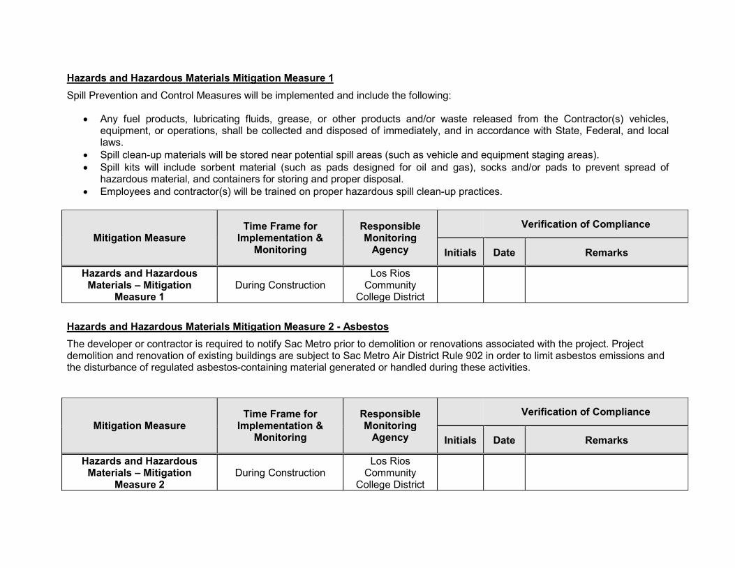
Hazards and Hazardous Materials Mitigation Measure 1
Spill Prevention and Control Measures will be implemented and include the following:
Any fuel products, lubricating fluids, grease, or other products and/or waste released from the Contractor(s) vehicles, equipment, or operations, shall be collected and disposed of immediately, and in accordance with State, Federal, and local laws.
Spill clean-up materials will be stored near potential spill areas (such as vehicle and equipment staging areas). Spill kits will include sorbent material (such as pads designed for oil and gas), socks and/or pads to prevent spread of
hazardous material, and containers for storing and proper disposal. Employees and contractor(s) will be trained on proper hazardous spill clean-up practices.
Mitigation Measure Time Frame for
Implementation & Monitoring
Responsible Monitoring
Agency
Verification of Compliance
Initials Date Remarks
Hazards and Hazardous Materials – Mitigation
Measure 1 During Construction
Los Rios Community
College District
Hazards and Hazardous Materials Mitigation Measure 2 - Asbestos
The developer or contractor is required to notify Sac Metro prior to demolition or renovations associated with the project. Project demolition and renovation of existing buildings are subject to Sac Metro Air District Rule 902 in order to limit asbestos emissions and the disturbance of regulated asbestos-containing material generated or handled during these activities.
Mitigation Measure Time Frame for
Implementation & Monitoring
Responsible Monitoring
Agency
Verification of Compliance
Initials Date Remarks
Hazards and Hazardous Materials – Mitigation
Measure 2 During Construction
Los Rios Community
College District
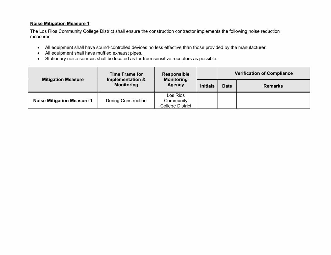
Noise Mitigation Measure 1
The Los Rios Community College District shall ensure the construction contractor implements the following noise reduction measures:
All equipment shall have sound-controlled devices no less effective than those provided by the manufacturer. All equipment shall have muffled exhaust pipes. Stationary noise sources shall be located as far from sensitive receptors as possible.
Mitigation Measure Time Frame for
Implementation & Monitoring
Responsible Monitoring
Agency
Verification of Compliance
Initials Date Remarks
Noise Mitigation Measure 1 During Construction Los Rios
Community College District