MINUTES OF THE 27th EAC (THERMAL & COAL MINING ...
54
MOM of 27 th EAC_Coal Mining_December 2014 Page 1 of 54 MINUTES OF THE 27 th EAC (THERMAL & COAL MINING PROJECTS) MEETING HELD ON 18 th -19 th DECEMBER, 2014 The 27 th EAC (Thermal & Coal mining projects) Meeting was held on 18 th -19 th December, 2014 in New Delhi to consider the proposals in coal mining sector. The list of participants of EAC and the proponents are given at Annexure-1 and 2 respectively. B. Confirmation of Minutes: The Committee confirmed the Minutes of the 25 th EAC meeting held on 13 th -14 th November, 2014. C. The following proposals were considered: 27.1 Chirimiri OCP (2 MTPA (normative) and 2.70 MTPA peak in 544.06 ha; Latitude 23 0 09'31''N to 23 0 11'24''North and Longitude 82 0 19'51''E to 82 0 21'17''East) of M/s South Eastern Coalfields Limited, located in Tehsil Mahendragarh, dist. Korea, Chhattisgarh - EC based on TOR granted on 06.05.2011. 27.1.1 The proposal is for seeking Environmental Clearance for Chirimiri OCP (2 MTPA (normative) and 2.70 MTPA peak in an ML area of 544.06 ha) of M/s South Eastern Coalfields Limited, located in Tehsil Mahendragarh, dist. Korea, Chhattisgarh.The proponent made the presentation and informed that: i. The project was accorded EC vide letter no. J-11015/6/92-IA.II (M) dated 31.01.1995. ii. The latitude and longitude of the project are 23 0 09'31''N to 23 0 11'24''North and 82 0 19'51''E to 82 0 21'17''East respectively. iii. Joint Venture: There is no Joint Venture. iv. Coal Linkage: Various thermal power plants. v. The land usage of the project will be as follows: Pre-Mining: Stages of mining Activity Mining Lease Area Total Government Private Forest Others Agri. Others Pre- mining Nil 332.986 202.778 8.282 0 544.046 During mining Area to be excavated 132.544 68.911 7.382 0 208.837 Storage for top soil 0 0 0.900 0 0.900 OB Dumps-External 0 0 0 0 0 OB Dumps-Internal 49.060 10.000 0 0 59.060 Mineral storage 5.000 3.00 0 0 8.000 Total Quarry areal 276.797 Infrastructure (Workshop, Administrative Building) 6.312 8.00 0 0 14.312 Roads 1.500 0.300 0 0 1.800 Green Belt/plantation 0 18.320 0 0 18.320 Effluent treatment plant 0.007 0 0 0 0.007 Coal handling plant 0 0 0 0 0 Township area (outside mine)/ Inhabited area/ R& R site 0 48.5000 0 0 48.500 Other (Specify): Safety zone 138.563 45.747 0 0 184.310 TOTAL 332.986 202.778 8.282 0 544.046
-
Upload
khangminh22 -
Category
Documents
-
view
2 -
download
0
Transcript of MINUTES OF THE 27th EAC (THERMAL & COAL MINING ...

MOM of 27thEAC_Coal Mining_December 2014
Page 1 of 54
MINUTES OF THE 27th
EAC (THERMAL & COAL MINING PROJECTS) MEETING
HELD ON 18th
-19th
DECEMBER, 2014
The 27th EAC (Thermal & Coal mining projects) Meeting was held on 18
th -19
th December, 2014
in New Delhi to consider the proposals in coal mining sector. The list of participants of EAC and the
proponents are given at Annexure-1 and 2 respectively.
B. Confirmation of Minutes: The Committee confirmed the Minutes of the 25th
EAC meeting
held on 13th
-14th
November, 2014.
C. The following proposals were considered:
27.1 Chirimiri OCP (2 MTPA (normative) and 2.70 MTPA peak in 544.06 ha; Latitude
23009'31''N to 23
011'24''North and Longitude 82
019'51''E to 82
021'17''East) of M/s South
Eastern Coalfields Limited, located in Tehsil Mahendragarh, dist. Korea, Chhattisgarh -
EC based on TOR granted on 06.05.2011.
27.1.1 The proposal is for seeking Environmental Clearance for Chirimiri OCP (2 MTPA (normative)
and 2.70 MTPA peak in an ML area of 544.06 ha) of M/s South Eastern Coalfields
Limited, located in Tehsil Mahendragarh, dist. Korea, Chhattisgarh.The proponent made the
presentation and informed that:
i. The project was accorded EC vide letter no. J-11015/6/92-IA.II (M) dated 31.01.1995.
ii. The latitude and longitude of the project are 23009'31''N to 23
011'24''North and 82
019'51''E to
82021'17''East respectively.
iii. Joint Venture: There is no Joint Venture.
iv. Coal Linkage: Various thermal power plants.
v. The land usage of the project will be as follows:
Pre-Mining:
Stages
of
mining
Activity Mining Lease Area Total
Government Private
Forest Others Agri. Others
Pre-
mining
Nil 332.986 202.778 8.282 0 544.046
During
mining
Area to be excavated 132.544 68.911 7.382 0 208.837
Storage for top soil 0 0 0.900 0 0.900
OB Dumps-External 0 0 0 0 0
OB Dumps-Internal 49.060 10.000 0 0 59.060
Mineral storage 5.000 3.00 0 0 8.000
Total Quarry areal 276.797
Infrastructure (Workshop,
Administrative Building)
6.312 8.00 0 0 14.312
Roads 1.500 0.300 0 0 1.800
Green Belt/plantation 0 18.320 0 0 18.320
Effluent treatment plant 0.007 0 0 0 0.007
Coal handling plant 0 0 0 0 0
Township area (outside mine)/
Inhabited area/ R& R site
0 48.5000 0 0 48.500
Other (Specify): Safety zone 138.563 45.747 0 0 184.310
TOTAL 332.986 202.778 8.282 0 544.046
MOM of 27thEAC_Coal Mining_December 2014
Page 2 of 54
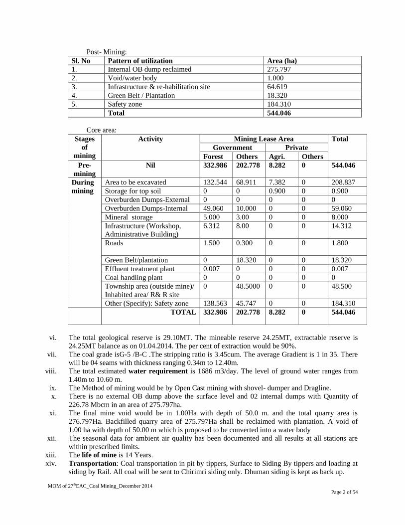
Post- Mining:
Sl. No Pattern of utilization Area (ha)
1. Internal OB dump reclaimed 275.797
2. Void/water body 1.000
3. Infrastructure & re-habilitation site 64.619
4. Green Belt / Plantation 18.320
5. Safety zone 184.310
Total 544.046
Core area:
Stages
of
mining
Activity Mining Lease Area Total
Government Private
Forest Others Agri. Others
Pre-
mining
Nil 332.986 202.778 8.282 0 544.046
During
mining
Area to be excavated 132.544 68.911 7.382 0 208.837
Storage for top soil 0 0 0.900 0 0.900
Overburden Dumps-External 0 0 0 0 0
Overburden Dumps-Internal 49.060 10.000 0 0 59.060
Mineral storage 5.000 3.00 0 0 8.000
Infrastructure (Workshop,
Administrative Building)
6.312 8.00 0 0 14.312
Roads
1.500 0.300 0 0 1.800
Green Belt/plantation 0 18.320 0 0 18.320
Effluent treatment plant 0.007 0 0 0 0.007
Coal handling plant 0 0 0 0 0
Township area (outside mine)/
Inhabited area/ R& R site
0 48.5000 0 0 48.500
Other (Specify): Safety zone 138.563 45.747 0 0 184.310
TOTAL
332.986 202.778 8.282 0 544.046
vi. The total geological reserve is 29.10MT. The mineable reserve 24.25MT, extractable reserve is
24.25MT balance as on 01.04.2014. The per cent of extraction would be 90%.
vii. The coal grade isG-5 /B-C .The stripping ratio is 3.45cum. The average Gradient is 1 in 35. There
will be 04 seams with thickness ranging 0.34m to 12.40m.
viii. The total estimated water requirement is 1686 m3/day. The level of ground water ranges from
1.40m to 10.60 m.
ix. The Method of mining would be by Open Cast mining with shovel- dumper and Dragline.
x. There is no external OB dump above the surface level and 02 internal dumps with Quantity of
226.78 Mbcm in an area of 275.797ha.
xi. The final mine void would be in 1.00Ha with depth of 50.0 m. and the total quarry area is
276.797Ha. Backfilled quarry area of 275.797Ha shall be reclaimed with plantation. A void of
1.00 ha with depth of 50.00 m which is proposed to be converted into a water body
xii. The seasonal data for ambient air quality has been documented and all results at all stations are
within prescribed limits.
xiii. The life of mine is 14 Years.
xiv. Transportation: Coal transportation in pit by tippers, Surface to Siding By tippers and loading at
siding by Rail. All coal will be sent to Chirimri siding only. Dhuman siding is kept as back up.

MOM of 27thEAC_Coal Mining_December 2014
Page 3 of 54
xv. There is R & R involved. There are no PAFs.
xvi. Cost: Total capital cost of the project is Rs. 427.06 Crores. CSR Cost Rs 5/tonne of Coal + CD
fund 20.00Lakhs. R & R Cost 96.30 Crores Environmental Management Cost 105.8467 Crores.
xvii. Water body: Hasdeo River about 11.00Kms, 1-2km Korea Nalla & Diwanjharia Nalla.
xviii. Approvals: Ground water clearance applied on Safe category. Mine plan approved by board on
25.03.2011. Mine Closure Plan approval on 28th Nov, 2013.
xix. Wildlife issues: There are no national Parks, wildlife sanctuary, biosphere reserves found in the10
km buffer zone.
xx. Forestry issues: Total forest area involved 332.986 Ha for mining.Stage-1 FC obtained vide
MoEF (FC division) F.No.8-121/2005-FC, 24th April 2006. Final Forestry clearance obtained for
989.400Ha of forest land for Chirimiri Colliery (247.290 Ha for OC & 742.110Ha for UG). In
989.400Ha both Chirimiri UG & Chirimiri OC involved.
xxi. Total afforestation plan shall be implemented covering an area of 294.117 ha at the end of
mining. Green Belt over an area of 18.320Ha. Density of tree plantation 2500 per Ha of plants.
xxii. There are no court cases/violation pending with the project proponent.
xxiii. Public Hearing was held on 27.04.2013. The issues raised in the PH include construction of road;
electricity and water supply; requirement of school; plantation; lack of basic amenities etc.
27.1.2 The Compliance to the conditions of earlier EC no. J-11015/6/92-IA.II(M) dtd. 30.01.1995 was
deliberated. The Committee has noted the action taken by the proponent which inter-alia as follows:
i. Necessary clearance under Forest conservation Act 1980 has been obtained for the forest land
under use.
ii. Regular monitoring is being done and as per observations, the parameters are within the
prescribed norms.
iii. All the mine water is recycled for industrial and domestic use. Houses have been provided
with individual septic tanks and soak pits.
iv. Slope of the OB dump is maintained at natural angle of repose and due care to prevent
surface runoff is being taken.
v. Phase wise reclamation is being resorted to. So far 57.94 Ha has been reclaimed.
vi. The rehabilitation of the said 1200 families will be taken up in Phase 2 of Chirimiri OCP as
the area is thickly populated.
vii. An environmental cell exists at company as well as area level and additionally, Nodal officer
for the project has been deputed.
27.1.1 The Committee, after detailed deliberations, sought the following information for further
consideration:
1. Issues raised in the Public Hearing and the commitments made by the PP including the Action
Plan alongwith the budgetary provisions be submitted in tabular form.
2. Date of Mine Plan and Mine Closure Plan.
3. Traffic density, transportation details, mitigative measure.
4. Action plan for shifting of about 2500 families required for phase – II mining to be submitted.
5. The rational of 500 mtr. distance from habitation to the mine.
6. Detailed land use pattern of 544.046 Ha ML area alongwith the FC.
7. Backfilling of mine voids shall be upto ground level and with no additional OB dumps.
8. The feasibility of on-line monitoring of air quality system.
9. Confirmation that excess mine water would be treated before discharge.
10. Exposed coal need to be protected from fire.
11. Piezometers shall be installed upto the depth of the mine.
12. Rain water harvesting and check dams shall be provided.

MOM of 27thEAC_Coal Mining_December 2014
Page 4 of 54
13. Native species shall be planted and the land be brought back to original vegetation composition
as far as feasible.
14. Coal transportation shall be by rail to the destination of the consumers.
15. Feasibility of deploying tippers of 30 T for coal transportation within mine.
27.2 Dipka Opencast Project (from 30 MTPA to 31 MTPA Peak in an area of 1999.293 ha) of
M/s South Eastern Coalfields Limited (SECL) Tehsil Katghora, District Korba,
Chhattisgarh. Expansion under 7(ii) of EIA Notification 2006 - request for incremental
difference.
27.2.1 The proposal is for seeking Environmental Clearance for the incremental increase in Dipka
Opencast Project (from 30 MTPA to 31 MTPA Peak in an area of 1999.293 ha) of M/s South
Eastern Coalfields Limited (SECL) Tehsil Katghora, District Korba, Chhattisgarh.
27.2.2 The proponent made the presentation and informed that Environmental Clearance was granted for
expansion under 7(ii) to the project vide letter no. J-11015/487/2007 IA.II (M) dated 12.02.2013
for 30 MTPA as per the OM J-11015/30/2004-IA.II (M) dated 19 December, 2012. This OM had
stipulated an upper limit of 5 MTPA which was further amended vide OM J-11015/30/2004-
IA.II (M) dated 2nd
September, 2014 to 6 MTPA. The PP has therefore requested for the
difference of 1 MTPA i.e. 30 MTPA to 31 MTPA.
27.2.3 The Committee, after detailed deliberations, recommended for granting incremental
difference of one MTPA and the final recommended capacity from 30 MTPA to 31 MTPA with the
following additional specific conditions:
i. The maximum production from the mine at any given time shall not exceed the limit as stipulated
in the EC.
ii. The validity of the EC is for the life of the Mine or as specified in the EIA Notification, 2006,
whichever is earlier.
iii. All safety measures shall be adequately taken as per CMR, 1957 & related Circulars.
iv. The production shall be within the same Mining Lease area.
27.3 Gevra Opencast Project (from 40 MTPA to 41 MTPA Peak in an area of 1999.293 ha) of
M/s South Eastern Coalfields Limited Village: Gevra, Ponri, Bareli; Tahsil Katghora;
District: Korba Chhattisgarh- Expansion under 7(ii) of EIA Notification 2006- request for
incremental difference.
27.3.1 The proposal is for environmental clearance for Gevra Opencast Project (from 40 MTPA to 41
MTPA Peak in an area of 1999.293 ha) of M/s South Eastern Coalfields Limited Village: Gevra,
Ponri, Bareli; Tahsil Katghora; District: Korba Chhattisgarh.
27.3.2 The proponent made the presentation and informed that Environmental Clearance was granted
for expansion under 7(ii) on 31.01.2014 as per the OM J-11015/30/2004-IA.II (M) dated 19
December, 2013. This OM had stipulated an upper limit of 5 MTPA, which was further amended
vide OM J-11015/30/2004-IA.II (M) dated 2nd
September, 2014 to 6 MTPA. The PP has
therefore requested for the difference of 1 MTPA i.e. 40 MTPA to 41 MTPA.
27.3.3 The Committee, after detailed deliberations, recommended for granting incremental
difference of 1 MTPA and the final recommended capacity from (30 MTPA to 31) 40 TO 41
MTPA with the following additional specific conditions:

MOM of 27thEAC_Coal Mining_December 2014
Page 5 of 54
i. The maximum production from the mine at any given time shall not exceed the limit as
stipulated in the EC.
ii. The validity of the EC is for the life of the Mine or as specified in the EIA Notification,
2006, whichever is earlier.
iii. All safety measures shall be adequately taken as per CMR, 1957 & related Circulars.
iv. The production shall be within the same Mining Lease area.
27.4 Samaleswari OCP Expansion from 11 MTPA to 15 MTPA in an ML area of 828.76 ha +
99.50 Ha and 49.855 ha for colony outside the ML) of M/s Mahanadi Coalfields Limited
(MCL), located in Ib Valley Area, P.O. Brajrajnagar, Tehsil & District Jharsuguda, Orissa-
– Expansion under 7(ii) of EIA Notification, 2006.
27.4.1 The proposal is for seeking Environmental Clearance for Samaleswari OCP Expansion from 11
MTPA to 15 MTPA in an ML area of 828.76 ha + 99.50 Ha and 49.855 ha for colony outside the
ML) of M/s Mahanadi Coalfields Limited (MCL), located in Ib Valley Area, P.O. Brajrajnagar,
Tehsil & District Jharsuguda, Orissa. The proponent made the presentation and informed that:
i. The project was accorded EC vide letter no. J-11015/183/2008-IA.II (M) Dated-25.02.2013.
ii. The latitude and longitude of the project are 21047’ to 21
049’ (N) and 83
053’ to 23
055’ (E)
respectively.
iii. Joint Venture: No Joint Venture.
iv. Coal Linkage Thermal power plants : KPKD, KRPH, VZP, VSPC, Chandrapur CD, MIGK, KIG,
Bhusawal, Parli, Paras, STDV etc Captive power Plants:- Steel Plant Raurkela, Usha Martine
Gamariha and Damanjodi.
v. The land usage of the project will be as follows:
Pre-Mining:
Sl. Item
Total for
11.00
Mty
Addl. land for
incremental
production
(4Mty)
Total for
15Mty
1 Quarry excavation 547.772 - 547.772
2 Safety zone (for blasting) 301.627 - 301.627
Safety zone (proposed expansion
project) (excluding dump falling in this
zone)
--
3 dump area (external) (existing) 24.86 - 24.86
dump area (external) (expansion) --
4 Infrastructure 54.005 - 54.005
5 Rationalisation of project boundary -
6 Safety zone (proposed expansion
project)
- -- -
Mining lease area (1 to 5) 928.264 - 928.264
6 Residential colony 49.855 -- 49.855
7 Rehabilitation colony - -- -
Outside Lease area (6 to 7) - -- -
Total : 978.119 - 978.119

MOM of 27thEAC_Coal Mining_December 2014
Page 6 of 54
Post- Mining:
Post-mining land use
S.N
. Category
Land use (in ha)
Plantation Water
body
Dip side
slope &
haul road
Built-up
area Undisturbed Total
1. Quarry excavation 364.586 47.720 135.466 -- -- 547.772
2. Safety zone (existing) 200.040 -- -- -- 101.587 301.627
Safety zone (proposed
expansion project)
(excluding OB dump
falling in this zone)
-- -- -- -- -- --
3. OB dump area (external)
(existing)
24.860 -- -- -- -- 24.86
OB dump area (external)
(expansion)
-- -- -- -- -- --
4. Infrastructure 10.801 -- -- 43.204 -- 54.005
5. Rationalisation of project
boundary
-- -- -- -- -- --
Mining lease area (1 to 5) 600.287 47.720 135.466 43.204 101.587 928.264
6. Residential colony 5.000 -- -- 44.855 -- 49.855
7. Rehabilitation colony -- -- -- -- -- --
Outside Lease area (6 to 7) 5.000 -- -- 44.855 -- 49.855
Total : 605.287 47.720 135.466 88.059 101.587 978.119
Core area :
Sl Particulars Existing
11.0MTY
Addl. land for
incremental 04.0 Mty.
Total 15 MTY
a) Agriculture 86.448 Nil 86.448
b) Forest 334.918 Nil 334.918
c) Waste land 483.578 Nil 483.578
d) Grazing 0.00 Nil 0.00
e) Surface water bodies 23.320 Nil 23.320
f) Other(Specify) 0.00 Nil 0.00
Total 928.264 Nil 928.264
vi. The total geological reserve is 33.18m. The mineable reserve 33.18m, extractable reserve is
33.18m. The per cent of extraction would be 100%.
vii. The coal grade is F/G 12 & G 13.The stripping ratio is 2.52. The average Gradient is 1in19.
viii. The total estimated water requirement is Dry season-3834 KLD & Monsoon – 1256 KLD. The
level of ground water ranges from 0.85 m to 7.62m.
ix. The Method of mining would be Opencast Mining by Shovel – Dumper in OB surface miner, pay
loader & tipper in coal.
x. There is 06 external OB dumps with quantity of 4.060 Mbcm in an area of 24.86 ha with height of
21.00 meter above the surface level and 02 internal dumps with quantity of 143.94 Mbcm in an
area of 322.30 ha.

MOM of 27thEAC_Coal Mining_December 2014
Page 7 of 54
xi. The total quarry area is 437.182Ha. Backfilled quarry area of 95.20 Ha shall be reclaimed with
plantation. There are no voids.
xii. The seasonal data for ambient air quality has been documented and all results at all stations are
within prescribed limits.
xiii. The life of mine is 03 Years.
xiv. Transportation: Coal transportation in pit by Tippers, Surface to Siding by Tippers and loading at
siding by Pay loader.
xv. There is R & R involved. There are 184 nos PAFs.
xvi. Cost: Total capital cost of the project is Rs. 344.82 Crores. CSR Cost Rs.16.76 crores/year. R&R
Cost Rs. 7.05 Crores. Environmental Management Cost Rs.15.26/Te (as per EIA-EMP.) + Mine
closure cost of Rs.62.97 Cr.
xvii. Water body: There is Pundren Nallaha.
xviii. Approvals: Ground water clearance has not been applied as the area is not falling under critical
area as per CGWA. Board’s approval obtained. Mining plan has been approved on 16.03.2010.
Mine Closure Plan approval on 07.07.2011.
xix. Wildlife issues: There are no national Parks, wildlife sanctuary, biosphere reserves found in the10
km buffer zone.
xx. Forestry issues: Total forest area involved 334.918 ha for mining. 167.232 Ha. FC obtained on
09.08.200 and 148.82 ha. FC obtained on 17/02/2009 Forest Clearance (stage-I) for 21.866 Ha has
been obtained on 21.02.2014.
xxi. Total afforestation plan shall be implemented covering an area of nil ha at the end of mining.
Green Belt over an area of 322.13 ha. Density of tree plantation 2500trees/ ha of plants.
xxii. Court Case: A notice from the court of Sub-divisional Judicial Magistrate, Jharsuguda issued on
dtd.11/02/2013 under section 15 & 16 of the environment (Protection) Act 1986.
xxiii. Public Hearing was held on 10.12.2009.
27.4.2 The compliance report of the, Regional Office, MoEFCC at Bhubaneshwar vide letter no. 101-
592/EPE Dated 02.05.2013 was deliberated in the EAC meeting. The Committee has noted the action
taken for compliance which, inter alia, are as follows:
27.4.3 The Committee, after detailed deliberations, recommended for granting EC with the same
conditions that were stipulated in earlier EC and that the proponent need to emphasize on
compliance of these conditions and submit compliance report to the Regional Office of the
MoEFCC.
27.5 Belpahar Opencast Coalmine Expansion Project (6 MTPA to 9 MTPA in an ML area of
1444.053 ha + 59.63 Ha outside ML area) total area 1503.683 Ha;latitude 21042’20” to 21
0 47’ 00” N
and longitude 830 49’ 35” to 83
053’00” E of M/s Mahanadi Coalfields Ltd located in Ib Valley
Coalfields, in villages Darlipali, Chharla, Jurabaga (South) and Kirarama, Tehsil Banaharpali,
District Jharsuguda, Orissa. Expansion under 7(ii) of EIA Notification, 2006. - Further
consideration.
27.5.1 The proposal is for Belpahar OC Expansion Project (6.0 MTPA to 9.0 MTPA in an existing ML
area of 1444.053 Ha) of M/s Mahanadi Coalfields Limited, Dist. Jharsuguda, Odisha. The proposal was
last considered in 25th EAC meeting held on 13
th -14
th November, 2014. The Committee sought following
information for further consideration of the project:
i. To furnish details why Forest Clearance was obtained in two stages?
ii. Remote sensing data from NRSA should be obtained and presented with regard to forest
cover.

MOM of 27thEAC_Coal Mining_December 2014
Page 8 of 54
iii. A comparative table of the baseline information of Air and Water quality of the pre-project,
present situation and the expansion stage be presented.
iv. Piezometers upto the depth of mine level be installed for ground water monitoring.
v. During expansion MCL should look into integrated mining in Ib Valley.
vi. A sub-Committee of the EAC to visit the project to look into the integrated mining and
environment management after the EC is issued.
vii. Mine closure plan be submitted.
viii. PP may submit in tabular form on the EC conditions, Comments of RO, Compliance status
and Action Plan thereof.
ix. To explore the possibility for an exclusive coal transport corridor and details furnished. All
out should be made to reduce the pollution load after expansion.
25.5.2 The proponent made the presentation and informed that:
i. Initially the project was planned for 2 MTPA capacities for which 103.52 Ha forest land was
involved in the quarry excavation and for infrastructure and accordingly Stage I FC was
obtained vide Letter No. 8-104/91 FC Dated. 02/06/2000.Afterwards the project was planned to
enhance capacity from 2 MTPA to 4.5 MTPA and excavation area increased from 431.79 ha to
606.503 ha and accordingly additional19.70 Ha forest land was required for mining and safety
zone purpose for which Stage-II FC was obtained on 15.09.2014.
ii. Satellite Images of the Project Area already furnished in the Point-wise Reply. It may be
mentioned here that CMPDI procures the Remote Sensing Data from NRSA and prepares land
use map of the core and buffer zone of each project of MCL every year, which includes Forest
Cover Data and the Map prepared in 2014 based on satellite data of 2013.
iii. Baseline Air and Water quality of the pre-project, present situation and the expansion has been
submitted, which is well within the limit.
iv. Proposal for construction and installation of 17 nos of new piezometers covering Ib Valley
Coalfield has been approved by the competent authority and Tendering and Award of work is
under process.
v. Mine closure Plan already approved by MCL Board and submitted to MoC for final approval.
Final Approved Mine Closure Plan shall be furnished.
vi. The compliance report of the RO. MoEFCC on the conditions of the earlier EC, inter alia, are
as follows:
a. Project has set up an additional AAQ monitoring station at Bandhbahal township and
provided the latest analysis report for July, 2014. PM 2.5 and other parameters are within
the limits.
b. All the drains including side weeds and vegetation are cleaned. Sedimentation tank
cleaning etc. have been completed. The treated mine water and workshop water are
recycled and reused for vehicle washing and water spraying for dust suppression.
c. Project has submitted details of year-wise and item-wise expenditure for 2009-10 to
2013-14.
d. The renovation of MDTP completed. The treated effluent are fully recycled and reused
for mine purpose and plantation.
e. Artificial recharge of ground water in the ML area is being done by 4 numbers of mine
sumps inside the mine as well as one Eco-pond nearby the mine. Further, four number
of roof top rain water harvesting system at the mine offices are also contributing
towards the rain water harvesting for ground water recharge. We are going to construct
4 number of check dams inside the mine for ground water recharge and to check soil
erosion. The same for nearby surrounding villages will be taken up in coming years.

MOM of 27thEAC_Coal Mining_December 2014
Page 9 of 54
f. Letter of permission from Addl. Secretary to Government, Deptt. of Water Resources,
Govt. of Odisha dated 20.10.2010 for drawl of 4 MGD (7.43 cusecs) from Hirakud
reservoir for domestic consumption has been submitted.
g. Report of site Specific Conservation Plan & Wildlife Management Plan prepared by Sri
P.K. Sarangi, IFS, (Retd.) and approved by the PCCF (Wildlife) & CWW of Odisha on
15.01.2014. As per the study, there are no endangered species in the core and buffer
zone of the mine lease area.
vii. Out of the total coal production 81% is transported to the end users by Rail and 19% by Road
which significantly contributes to reduction in dust pollution Govt. of Odisha, through IDCO, is
separately taking up Dedicated Rail and Road corridor for evacuation of coal. MCL (side we
have) informed they have taken up for strengthening and improving the Rail and Road
Infrastructure at Ib Valley Coalfield and the details (are furnished below). Roads have been re-
aligned to bye-pass the populated areas to reduce the pollution.
27.5.3 The Committee, after detailed deliberations, recommended for granting EC with the same
conditions that were stipulated in earlier EC and that the proponent need to emphasize on
compliance of these conditions and submit compliance report to the Regional Office of the
MoEFCC with the following specific conditions:
i. Installation of 17 to 20 nos of new piezometers covering Ib Valley Coalfield.
ii. Dedicated Rail and Road corridor for evacuation of coal as planned by MCL for strengthening
and improving the Rail and Road Infrastructure at Ib Valley Coalfield.
27.6 Lajkura Open Cast Expansion (from 3.0 MTPA to 4.5 MTPA in an ML area of 721.29 ha);
latitude21o48’39” to 21
o49’55” (N) and longitude 83
o53’15” to 83
o54’50” (E) of M/s Mahanadi
Coalfields Limited, Dist. Jharsuguda, Odisha – Expansion under 7(ii) of EIA Notification, 2006-
Further consideration.
27.6.1 The proposal is for Lajkura OC Expansion (from 3.0 MTPA to 4.5 MTPA in an ML area of
721.29 ha) of M/s Mahanadi Coalfields Limited, Dist. Jharsuguda, Odisha. The proposal was last
considered in 25th EAC meeting held on 13
th -14
th November, 2014. The Committee sought following
information for further consideration of the project:
i. The progress of construction of silo is not satisfactory and requires to be speeded up.
Firm commitment along with approved plan for setting up of silo plant by March, 2016
be submitted.
ii. Installation of in-pit crushing system may be explored and report submitted.
iii. No extra OBD shall be created for the expansion.
iv. All the action plans under the CEPI need to be adhered to.
v. Details of rail and Road transport of Coal from the mine to the end user be submitted.
vi. There are five mines of MCL in the Ib Valley. The Proponent is advised to prepare
detailed status of voids, OBDs and total cost including timeframe for re-handling.
vii. A comparative table of the baseline information of Air and Water quality of the pre-
project, present situation and the expansion stage be presented.
viii. Piezometers upto the depth of mine level be installed for ground water monitoring.
27.6.2 The proponent made the presentation and informed that:
i. Life of the mine (4.5 Mty) is around 14 years from 2014-15. For Lajkura 4.5 Mty capacity,
Rapid Loading System (RLS) with surge bin will be provided instead of Silo. The RLS will be
located near Lajkura siding 1 or siding 2.

MOM of 27thEAC_Coal Mining_December 2014
Page 10 of 54
ii. For transportation of coal from quarry, in pit conveyor transportation is feasible along the
central haul road and the same to be loaded through RLS. The preparation of scheme with
competent approval and formulation of e-NIT and to float the e-NIT, the total time requirement
will be around to 1 year. The construction period of coal transportation system (CHP) with RLS
will be around 18 months (1 ½ years). Cost will be around 100 Cr. (Tentative).
iii. No additional External dump other than what has been proposed in the earlier proposal for
expansion form 1.0 Mty to 3.0 Mty in Mining lease Area of 721.29 Ha will be made.
iv. All the action plans under the CEPI is being and will be adhered to. Details of rail and Road
transport of Coal from the mine to the end user is given below:
Mode of despatch 2013-14 (%) 2014-15
(up to oct 2014)
(%)
By Rail 1.098 Mt 52.97 % 1.025 Mt 84.71%
By Road 0.975 Mt 47.03% 0.185 Mt 15.29%
Total 2.073 Mt 1.210 Mt
v. There are five mines of MCL in the Ib Valley. The detailed status of voids, OBDs and total cost
including time frame for re-handling are as follows:
Name Of
Mine
Present
Void
Post
Mining
Void
(Mcum)
Post
Mining
Depth
(M)
Post
Closure
Void
(Mcum)
Post
Closure
Depth
(M)
Year
Of
Exhau
stion
Remarks
Lajkura
not
Sufficient
for own
OB
149.244 159 NIL YR14
Initial OB Generation
will be dumped
externally, later all
OB will be dumped
internally. Extension
can be done towards
dipside
Samaleswari
Sufficient
for own
OB
154.39 120 63.99 30-60 YR4
All OB will be
dumped internally,
Extension can be
done towards dipside
Belpahar
Sufficient
for own
OB
140 92 34 15-40 YR7
All OB will be
dumped internally,
Extension can be
done towards dipside
Lakhanpur
Exp
Sufficient
for own
OB
390 123 46.83 30 YR16
All OB will be
dumped internally,
Extension can be
done towards dipside
Lillari
Reserve
almost
exhausted
10 90 water reservoir
Re-handling cost has been included in the Mine Closure cost. An Escrow account has been
opened separately for each project in which mine closure cost as per the Guidelines of MoC is deposited
annually.
MOM of 27thEAC_Coal Mining_December 2014
Page 11 of 54
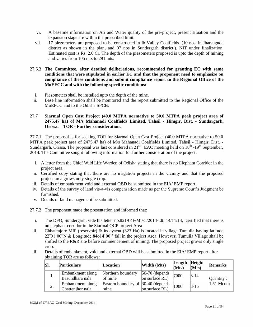
vi. A baseline information on Air and Water quality of the pre-project, present situation and the
expansion stage are within the prescribed limit.
vii. 17 piezometers are proposed to be constructed in Ib Valley Coalfields. (10 nos. in Jharsuguda
district as shown in the plan, and 07 nos in Sundergarh district.). NIT under finalization.
Estimated cost is Rs. 2.0 Cr. The depth of the piezometers proposed is upto the depth of mining
and varies from 105 mts to 291 mts.
27.6.3 The Committee, after detailed deliberations, recommended for granting EC with same
conditions that were stipulated in earlier EC and that the proponent need to emphasize on
compliance of these conditions and submit compliance report to the Regional Office of the
MoEFCC and with the following specific conditions:
i. Piezometers shall be installed upto the depth of the mine.
ii. Base line information shall be monitored and the report submitted to the Regional Office of the
MoEFCC and to the Odisha SPCB.
27.7 Siarmal Open Cast Project (40.0 MTPA normative to 50.0 MTPA peak project area of
2475.47 ha) of M/s Mahanadi Coalfields Limited. Tahsil - Himgir, Dist. - Sundargarh,
Orissa. – TOR - Further consideration.
27.7.1 The proposal is for seeking TOR for Siarmal Open Cast Project (40.0 MTPA normative to 50.0
MTPA peak project area of 2475.47 ha) of M/s Mahanadi Coalfields Limited. Tahsil - Himgir, Dist. -
Sundargarh, Orissa. The proposal was last considered in 21st EAC meeting held on 18
th -19
th September,
2014. The Committee sought following information for further consideration of the project:
i. A letter from the Chief Wild Life Warden of Odisha stating that there is no Elephant Corridor in the
project area.
ii. Certified copy stating that there are no irrigation projects in the vicinity and that the proposed
project area grows only single crop.
iii. Details of embankment void and external OBD be submitted in the EIA/ EMP report .
iv. Details of the survey of land vis-a-vis compensation made as per the Supreme Court’s Judgment be
furnished.
v. Details of land management be submitted.
27.7.2 The proponent made the presentation and informed that:
i. The DFO, Sundergarh, vide his letter no.8219 4F/Misc./2014- dt: 14/11/14, certified that there is
no elephant corridor in the Siarmal OCP project Area
ii. Chhatenjore MIP (reservoir) & its ayacut (323 Ha) is located in village Tumulia having latitude
22o01’00”N & Longitude 84o14’00’’ fall in the project Area. However, Tumulia Village shall be
shifted to the R&R site before commencement of mining. The proposed project grows only single
crop.
iii. Details of embankment, void and external OBD will be submitted in the EIA/ EMP report after
obtaining TOR are as follows:
Sl. Particulars Location Width (Mts) Length
(Mts)
Height
(Mts) Remarks
1. Embankment along
Basundhara nala
Northern boundary
of mine
50-70 (depends
on surface RL) 7000 3-14
Quantity :
1.51 Mcum 2.
Embankment along
Chattenjhor nala
Eastern boundary of
mine
30-40 (depends
on surface RL) 1000 3-15

MOM of 27thEAC_Coal Mining_December 2014
Page 12 of 54
Void details
Particulars Post Mining Post Mine Closure
Backfilled area details Area (in Ha) Depth (in m) Area (in Ha) Depth (in m)
1. Backfilled area 1234.00 1546.32
A. Above ground level 597.00 50-75m
above ground
- -
B. Partially backfilled area
below ground level
637.00 0-360 549.69 Av.155m
C. Upto ground level - - 996.63 Same as ground
level
2. Unfilled void 312.32 90-360 -
External OB Dumping details :
Sl.No Particulars Area(Ha) Height(m) No. of
tires
Quantity (in
Mcum)
1 External Dump 1 184.66 80-85 3 89.25
2 External Dump 2 200.18 80-85 3 93.96
Total temp ext dump* 183.21
iv. External dumps (only around 8% of total overburden) are located towards dipside of the mine
which is also coal bearing and belongs to MCL. So these external dumps will be re-handled back
into quarry for final reclamation when dipside area will be mined as extension of this mine.
v. Mine Closure Period: Two scenarios have been proposed:
Scenario 1: Mine Will Be Continued To Dipside Block:
If the mine is continued towards dipside both the external dumps will be rehandled and
brought back to internal dump of the running mine.
Scenario 2: Mine will not be continued to dipside block:
If the mine is closed at its proposed excavation limit then also external dumps and the
internal dumps above ground level will be brought back to existing voids of the quarry.
vi. Backfilling in the quarry-1 will be started from production year 10
Simultaneous backfilling and external dumping will be done upto year23 from production year 20
there will be no external dumping and total overburden can be backfilled.
vii. External dump-1 & 2 (183.21 Mcum) are also temporary and will be rehandled back into quarry
while extending the mine into dipside area. Year-1 to 4 is construction period.
viii. The present status of payment of compensation, offer for employment & rehabilitation of the
villages under Claims Commissions works were also presented.
27.7.3 The Committee, after detailed deliberations, recommended for granting TOR with the
following specific TORs:
i. Details of the Court cases relating to compensation and land acquisition to be presented in the
EIA/EMP report.
ii. The ToR and other approvals shall be subject to the outcome of the judgment of the Hon’ble
Supreme Court of India.
iii. Approval of the Chief Wild Life Warden and the State Government to be submitted along with

MOM of 27thEAC_Coal Mining_December 2014
Page 13 of 54
the EIA/EMP report.
iv. There shall be no external OB dumps after the mining and that the land shall be brought back
upto ground level for use in agricultural purpose.
27.8 Coking (2 x 2 MTPA) and Non-coking Coal Washery (6.5 MTPA) at Integrated Steel Plant
with Captive Power Plant of M/s Jindal Steel & Power Limited, Angul, Orissa – Extension
of TOR validity.
27.8.1 The proposal is for extension of TOR validity. Ministry granted TOR for Coking (2 x 2 MTPA)
and Non-coking Coal Washery (6.5 MTPA) at Integrated Steel Plant with Captive Power Plant of M/s
Jindal Steel & Power Limited, Angul, Orissa vide letter no. J-11015/42/2012-IA-II(M) dated 22.10.2012.
27.8.2 The proponent made the presentation and informed that:
i. The Baseline environmental data was collected during Winter 2012-2013 for preparation of
EIA Report. The source of coal as mentioned in TOR was imported/indigenous coking coal
(BCCL/CCL), for coking coal washery and linkage/e-auction /imported coal for non-coking
coal washery. However, source of coal for both coking and non-coking coal washery is yet to
be ascertained. Therefore the preparation of Environmental Impact Assessment Report has been
delayed due to uncertainty over source of coal.
ii. In accordance to the MOEF&CC OM dated 22.03.2010 prescribing the time limit for validity of
TOR accorded for the project, the validity of TOR for the project may be extended by one year.
27.8.3 The Committee noted the request and as per the MOEF&CC OM dated 08.10.2014
recommended for extension of the validity of the ToR by additional one year.
27.9 Expansion of Paunderpauni Coal Washery (1.6 MTPA to 2.6 MTPA in a project area of
6.86 Ha) of M/s ACB (India) Limited in Paunderpauni, Tehsil Rajura, Dist. Chandrapur,
Maharashtra - EC based on TOR granted 23.03.2011.
27.9.1 The proposal is for seeking environmental Clearance for Expansion of Paunderpauni Coal
Washery (1.6 MTPA to 2.6 MTPA in a project area of 6.86 Ha) of M/s ACB (India) Limited in
Paunderpauni, Tehsil Rajura, Dist. Chandrapur, Maharashtra. The proponent made the presentation and
informed that:
i. Panderpauni Washery is a pre-2006 washery which was not covered within the ambit of EIA
Notification dated 14th Sep, 2006. It was established after obtaining Consent to Establish (CTE)
from Maharashtra State Pollution Control Board. The NOC from MPCB was sought by before the
grant of TOR.
ii. The project was accorded TOR vide letter no. J-11015/949/2007-IA.II(M) dated 23.03.2011.
iii. Chronology of TOR: Application for TOR10.09.2007; Presentation for TOR 28/29.11.2007; Re-
consideration of TOR 21/22.07.2009; Obtaining NTCA clearance 10.11.2010; Re-consideration
of TOR 21/22.02.2011; Issue of TOR23.03.2011; Public hearing07.12.2011; Submission of final
EIA report to MOEF 06.11.2012; Presentation to MOEF 19.12.2014.
iv. The latitude and longitude of the project are 19°45’13.8” – 19°45’26.3” N and 79°16’40.04” –
79°16’54.5” E respectively.
v. Joint Venture: No Joint venture.
vi. Coal Linkage : No coal linkage.
vii. Total land requirement is 6.86 Ha.
viii. Capacity enhancement within the beneficiation unit:

MOM of 27thEAC_Coal Mining_December 2014
Page 14 of 54
Sl. No. Units Present* Proposed**
1 Beneficiated Coal (BC) in TPM 108000 174000
2 Reject Coal (RC)/ High Ash Coal in TPM 25850 41900
3 Coal Dust/Fines (CD/F) in TPM 1450 2675
4 Total, TPM 135300 218575
5 Total, MTPA 1623600 2622900
6 Total, TPD 5412 7285.8
7 Days of Operation (DOP) 300 360
8 Average Working Hours (AWH)
(excluding maintenance)
13.33 17.77
Total, TPH 405.9 409.8
ix. It is envisaged to enhancement the operation of the washery from 13 h/day to 18 h/day so as to
enhance the washing capapcity.*
x. The project shall be for zero discharge.
xi. The expansion is in terms of working hours only.
xii. It is a two product washery.
xiii. The KPCL and Mahagenco had earlier refused to give the coal. There were no orders for
washing of coal and therefore the washing capacity could not be increased.
xiv. The Road is maintained by WCL.
xv. Technology used: Heavy Media Density Separation (Bath) & Natural Media (Barrel Washer)
Separation.
xvi. The total estimated water requirement is 300 m3/day.
xvii. Wastewater treatment: The media water after being used for washery operations is screened
through a five stage clarification process and all the suspended particulate matter is squeezed
and the clear water is recycled back.
xviii. Solid waste generation: Coal rejects (20% approx.) will be sent to the company’s 60 MW Power
Plant which is proposed in Pandarpauni, Dist. Chandrapur, adjacent to the washery (for which
EC & CTE have been obtained) and will be used as a fuel or returned to the customer depending
upon the agreement.
xix. There is no R & R involved. There are no PAFs.
xx. Cost: Total cost after expansion will be Rs. 28.70 crores.
xxi. Transportation: Raw coal coming from various mines of Ballarpur area are being transported by
10 T Tippers covered by tarpaulins at the time of TOR, through captive coal roads built under
CCDA Grant. Thereafter, the transportation was shifted to 30 T trucks (of 20 T payload
capacity). After beneficiation of the raw coal, washed coal is loaded directly into the wagons
placed on the railway siding located inside the washery premises. The reject is transported
through road/ rail to various major and small scale industries, Thermal Power Plant and is used
as fuel & in brick kilns located near the washery. For current capacity: 30-T trucks (for 5400
TPD) - 540 trips/ day. For expansion capacity: 30-T trucks (for 7200 TPD) - 720 trips/day.
There will be increase of about 180 trips/day
xxii. Approvals: NOC compliance was certified by MPCB vide letter no. BO/RO(P&P)/ TB/B-4022
dated 19.06.2009.
xxiii. Wildlife issues: There are no national Parks, wildlife sanctuary, biosphere reserves found in the
10 km buffer zone.
xxiv. Forestry issues: No forest area is involved.

MOM of 27thEAC_Coal Mining_December 2014
Page 15 of 54
xxv. Total afforestation plan shall be implemented covering 33% of the total area.
xxvi. There are no court cases/violation pending with the project proponent.
xxvii. Public Hearing was held on 07.12.2011 at Village Pandarpauni, Tal. Rajura, Dist. Chandrapur.
The issues raised in the PH includes depletion of ground water; dust pollution; crop damage;
damage compensation; silk production; widening of road; parking of trucks ; local employment
etc., The proponent has made commitments and made action plans to implement the issues raised
during the Public Hearing:
a. The PP should commission a study for determining impact of washery activity on
surrounding crops and make periodic programs to enhance crop production by inviting
experts to interact with farmers.
b. Compensation to farmers shall be provided, if the study reveals that the productivity loss is
due to the washery.
c. Mechanical road cleaner be used for.
d. Water sprinkling be made to prevent fugitive dust.
e. PP shall make provisions for education, medical facilities and digging of tube wells for the
local people.
f. Roads in the nearby villages shall be maintained.
g. Additional measures as may be directed by CPCB/ MSPCB, as and when required will be
implemented.
The Proponent has further submitted vide its letter no dated 19th December, 2014 that:
i. The NTCA released an office memorandum dated 10th November 2010 stating that the location of
the washery is at distance of 40 kms from the Tadoba-Andheri Tiger Reserve and it does not fall
in the corridor area as well.
ii. Due to the above clarifications being sought, the TOR was delayed and was finally issued on the
23rd
March, 2011.
iii. Supply of washed coal having ash less than or equal to 34% to the consumers in accordance with
the MoEF stipulations shall be adhered to.
iv. The transportation for raw coal to the washery is done by road by 20/30 tonnes trucks from
various mines in the Ballarpur area of WCL. The washed coal is dispatched either by road or rail
depending on the quantity; with end users having their own rail siding.
v. Written to WCL for obtaining written permission for using their roads for transportation of raw-
coal. For Ballarpur Area, their road is the only route for evacuation of coal produced in the mines
like Gauri I & II OCPs, Sasti OCP, Pauni OCP etc. WCL has allowed the use of said road for all
consumers of e-auction coal and/or authorized transporters of consumers having coal allocation
from these mines.
vi. The rejects are at present either being returned to the customers of washed coal or sold to end
users. As a part of the orders/agreements, MOU has been entered into with Mahavir Coal
Resources (Pvt.) Ltd. (dated 02-04-2009); Bagdi Enterprise (dated 25-12-2009); Aadinath Global
(dated 24-12-2009).
27.9.2 The Committee, after detailed deliberations, recommended for grant of EC with the
following specific conditions:
i. The rejects to be either returned to the customers of washed coal or sold to end users viz. M/s
Mahavir Coal Resources (Pvt.) Ltd; M/s Bagdi Enterprise; M/s Aadinath Global.

MOM of 27thEAC_Coal Mining_December 2014
Page 16 of 54
ii. The rejects shall be used in the FBC boiler installed for use of rejects.
iii. To supply washed coal having ash less than or equal to 34% to the consumers in accordance with
the MoEF stipulations to be adhered to.
iv. Details on the equipments and technology to be adopted with justification for the enhancement of
capacity of the Washery be submitted to the MoEFCC.
v. The transportation for raw coal to the washery shall be by road by mechanically covered trucks
by deploying 30 Tonns trucks from various mines in the Ballarpur area of WCL. Similarly, the
washed coal shall also be dispatched either by road by mechanically covered trucks or rail
depending on the quantity; with end users having their own rail siding.
vi. There shall be three tire green belts around the washery so as to prevent coal dust pollution
vii. Rain water harvesting measures shall be undertaken for ground water recharge.
viii. Automatic sprinklers should be used till the washery is in operation. The PP should commission a
study for determining impact of Washery activity, if any, on surrounding crops and make periodic
programs to enhance crop production by inviting experts to interact with farmers.
ix. Suitable compensation to farmers shall be provided, if the study reveals that the productivity loss
was due to the setting up of washery.
x. Mechanical road cleaners be deployed as far as possible.
xi. PP shall make budgetary provisions for education, medical facilities and digging of tube wells for
the local people towards CSR activities
xii. Roads in the nearby villages shall also suitably be maintained.
xiii. Additional measures as may be directed by CPCB/ MSPCB, as and when required, will also be
implemented.
xiv. All the conditions stipulated by the State Pollution Control Board in the Consent to operate shall
be adhered to.
27.10 Sonepur Bazari Opencast Project (from 8 MTPA to 12 MTPA and lease area of 2293.98 ha)
of M/s Eastern Coalfields Limited, located in village Snepur, Tehsil Pandaveswar Block,
District Burdwan, West Bengal - Expansion under 7(ii) of EIA Notification 2006.
27.10.1 The proposal is for seeking environmental Clearance expansion under 7(ii) of EIA Notification
for Sonepur Bazari Opencast Project (from 8 MTPA to 12 MTPA and lease area of 2293.98 ha) of M/s
Eastern Coalfields Limited, located in village Snepur, Tehsil Pandaveswar Block, District Burdwan, West
Bengal.
27.10.2 The proponent made the presentation and informed that:
i. The project was accorded TOR vide letter no. J-11015/135/2007.IA-II(M) dated 26.03.2007.
ii. The latitude and longitude of the project are 230 40’ 00’’ N & 23
0 43’ 06’’ N and 87
0 11’ 14” E &
870 17’ 42” E respectively.
iii. Joint Venture: There is No Joint Venture.
iv. Coal Linkage: Kahalgaon Super Thermal Power Station (KhSTPP) Kahalgaon ,Bhagalpur ,Bihar.;
National Capital Power Station (NCPS) Or NTPC Dadri, GautamBudh Nagar, Uttar Pradesh.;
Vindhyachal Thermal Power Station, Singrauli Madhya Pradesh.; The West Bengal Power
Development Corporation Limited (WBPCDCL).; Sipat Super Thermal Power Station or Rajiv
Gandhi Super Thermal Power Station at Sipat Bilaspur district Chhattisgarh.; Farakka Super
Thermal Power Plant NabarunMurshidabad West Bengal; Simhadri Super Thermal Power
Plant,Visakhapatnam, Andhra Pradesh; Mauda Super Thermal Power Station or NTPC Mauda
,Nagpur, Maharashtra.

MOM of 27thEAC_Coal Mining_December 2014
Page 17 of 54
v. The land usage of the project will be as follows:
SL.
NO.
Land Use Type Present Land
use(Ha)
final Land use at
the end of mining
Final Land-use
(post-closure) (Ha)
1 Excavated Area including haul-
road
466.0 64.00 -
2 Undisturbed Area (Including
forest area of 32.65 Ha)
1225.40 59.40 59.40
3 Colliery Infrastructure/Built-up 135.45 135.45 35.45
4 Villages 28.59 - -
5 External OB Dump (Active) 60 72.14 -
6 Plantation on External OB Dumps 5.0 272.60 344.74
7 CHP - 21.00 -
8 Railway Siding - 115.69 115.69
9 Road 9.50 28.72 28.72
10 Nallah 38.21 16.70 16.70
11 Tanks 18.62 - -
12 Lagoon - - 504.00
13 Greenbelt/ Plantation 82.0 67.21 188.21
14 Backfilled area (Active) 222.21 752.05 -
15 Plantation on backfilled area 3.0 689.02 1001.07
Total 2293.98 2293.98 2293.98
Land outside project area
Project Township and Rehab Site 110.87 110.87 110.87
Gross Total 2404.85 2404.85 2404.85
vi. The total geological reserve is 214.98 MT. The mineable reserve 214.98 MT, extractable reserve
is 214.98 MT. The per cent of extraction would be 100 %.
vii. The coal grade is C / D. The stripping ratio is 5.56 m3/te. There will be 18 seams with thickness
ranging upto 13.95 m.
viii. The total estimated water requirement is 4400 m3/day. The level of ground water ranges from
0.80 m to 8.65 m.
ix. The Method of mining would be by shovel-dumper combination.
x. There is three external OB dump with Quantity of 1166.54 Mbcm in an area of 65 ha with height of
90 meter above the surface level and internal dump with Quantity of 873 Mbcm in an area of
225.31 ha.
xi. The final mine void would be in 504 Ha with depth of 20 m. and the Total quarry area is
1525.47Ha. Backfilled quarry area of 1001.07 Ha shall be reclaimed with plantation. A void of 504
ha with depth of 20 m which is proposed to be converted into a water body
xii. The seasonal data for ambient air quality has been documented and all results at all stations are
within prescribed limits.
xiii. The life of mine is Remaining life 18 years.
xiv. Transportation: Coal transportation in pit by colliery dumpers through tippler, Surface to Siding
by local dispatch using dumpers and loading at siding by Silo loading.
xv. There is R & R involved. There are 3665 PAFs.
xvi. Cost: Total capital cost of the project is Rs. 1028 Crores. CSR Cost Rs Provisions for CSR under
Community Development have been made @ Rs. 5.00 per tonne of coal produced. This works out

MOM of 27thEAC_Coal Mining_December 2014
Page 18 of 54
to about Rs. 6.00 Cr per annum at 12.00 MTY of coal production (present production from the mine
is only 6.40 MTY) crores/year. R&R Cost –Environmental Management Cost Rs132.82 crores).
xvii. Water body: Two small seasonal nalas viz. Bonbahal Jore and Kumarkhela Jore are found to have
originated near Chora (bordering Sonepur Bazari Block) and Kumarkhela which tend to flow
towards northeast and northwest to join Tumni Nala, the main drainage channel of the area beyond
the block. Tumni Nala in turn joins Ajoy river at a distance of about 6 km towards north-east from
the block.
xviii. Approvals: Ground water clearance from CGWA obtained. Board’s approval obtained on
31.01.2008. Mining plan has been approved on 31.01.2008. Mine Closure Plan approval on
September, 2013.
xix. Wildlife issues: There are no national Parks, wildlife sanctuary, biosphere reserves found in the10
km buffer zone.
xx. Forestry issues: Total forest area involved 32.65 ha for mining. Forestry application for 32.65 Ha
for stage-I clearance has been submitted to MoEF for clearance after completion of all formalities.
FC is awaited
xxi. Total afforestation plan shall be implemented covering an area of 1534.02 ha at the end of mining.
Green Belt over an area of 188.21 ha. Density of tree plantation 1600 samplings per sample.
xxii. There are no court cases/violation pending with the project proponent.
xxiii. Public Hearing was held on 14.09.2007.
xxiv. R & R issue: A total of 2284 PAFs living in 12 villages were proposed to be rehabilitated for the
project. However, as per present count, the number of PAFs has increased to 3365. 11 out of the
12 villages still remain to be shifted. One village (Arsula) have been partially rehabilitated and it is
targeted that the R & R of all the 11 remaining villages will be completed by the year 2020 – 21.
Till date 1322 employments have been provided against land acquisition for the project since
inception in 1992. Beside this 997 more employments will be provided in future. Most of the
villages are being shifted to Dahuka Mouza near Dahuka village. A provision of Rs. 8500 lakh has
been made for the R & R.
xxv. Presently coal is being transported by 20 tonner truck to Sheetalpur at a distance of 5 km.
xxvi. A new railway line at Sonepur Bazari mine itself is under construction having a facility of 4000 T
Silo loading in Railway wagon & feed by closed conveyor from mine. This scheme shall be
completed by 2017-2017 as intimated by proponent.
27.10.3 The compliance report of the Regional Office, MoEFCC at Bhubaneshwar vide letter no. 106-
102/EPE dated 07/05/2014 was deliberated in the EAC meeting. The Committee has noted the action
taken for compliance by the Project which, inter alia, are as follows:
i. Boulders have been segregated and removed from the site. A proposal has been made to develop
grasses/leguminous plants for preserving the nutrients. Top soil will be used for reclamation and
development of green belt.
ii. External dumping is yet to start at earmarked site.
iii. Since the internal dump is still active plantation could be carried out only on 3 Ha and the
remaining backfilled area will be planted only after maximum dump capacity and height is
reached. Out of total target of 59 Ha plantation on external dump by 2013, only 5 Ha has been
planted and the remaining area will be covered by plantation in the next 2 years, i.e. by 2016.
iv. Cleaning of garland drains has been carried out to allow uninterrupted flow of water.

MOM of 27thEAC_Coal Mining_December 2014
Page 19 of 54
v. A one stage settling tank with storage capacity of 2900 cubic meter has been provided near CHP.
Mine discharge from working quarry is routed to this settling tank. Water stored in the settling
tank is used for spraying at the unloading point at the CHP hoppers and loading point at the
conveyer belt.
vi. It is proposed to convert the present one stage settling tank to two stages for which process has
been started.
vii. Proposal has been made for the construction of the retaining wall which will be completed in
2014 – 15.
viii. A new railway siding with conveyor arrangement has been proposed for the project at earmarked
site. This will eliminate road transportation of coal. Necessary steps in this direction are being
taken. Tender for construction of civil work has been given to M/S Bridge & Roof Co. (India) ltd.
nearly 40 % of the above work has been completed till now. Proposed railway siding is supposed
to be functional by year 2016-17.
ix. Trucks carrying coal to the railway siding are now being covered with tarpaulin to avoid spilling
of coal on the roads.
x. Wet drilling is being carried out.
xi. Controlled blasting technique is being done to reduce noise level & vibration and to arrest fly
rocks. Blasting pattern and vibration studies is being carried out by CMPDI on regular basis and
is strictly followed in the project.
xii. Tree plantation is being carried out in phased manner. Total green belt of 90.0 Ha has been
developed through Forest department, Durgapur & West Bengal Wasteland Development
Corporation Limited. Total target area proposed for plantation during project life is 1534 Ha. Due
to delays in land acquisitions, the project has not developed as per the envisaged time – frame
leading to plantation lags (please also refer details given at sl. 4 of this table). It is proposed to
make up for this lag within the next two years, i.e., by 2016.
xiii. Reclamation by backfilling has so far been done for 222.21 Ha.. Since the internal dump is still
active plantation could be carried out only on 3 Ha and the remaining backfilled area will be
planted only after maximum dump capacity and height is reached. Out of total target of 59 Ha
plantation on external dump by 2013, only 5 Ha has been planted and the remaining area will be
covered by plantation in the next 2 years, i.e. by 2016. .
xiv. Satellite monitoring of land – use of the project was carried out in the year 2012 and will again be
done in the year 2015 at 3 year interval.
xv. Total number of departmental employees is 1463 and contact labours are 557 during the calendar
year 2014. PME was done for 260 persons in period of October, 2013 to March, 2014.
27.10.4 The Committee, after detailed deliberations, has noted that this mine is one of the mines
of cluster 12, which was recommended by the EAC earlier. This mine does not have forest
clearance for the forest land within its ML area. Since this mine is a part of cluster 12 mines of ECL
and already was recommended by the EAC, MoEFCC may take a view whether this proposal could
be considered as an individual project.
27.11 Cluster No.11 (11 mixed mines of a combined production capacity of 9.1 MTPA normative
9.9 MTPA peak capacity in a combined ML area of 4218 ha) of M/s Eastern Coalfields Ltd.,
located in Raniganj Coalfields, West Bengal (EC based on TOR granted 13.01.2012.
27.11.1 The proposal is for seeking environmental Clearance for Cluster No.11 (11 mixed mines of a
combined production capacity of 9.1MTPA normative 9.9 MTPA peak capacity in a combined ML area
of 4218 ha) of M/s Eastern Coalfields Ltd., located in Raniganj Coalfields, West Bengal. The proponent
made the presentation and informed that:
i. The project was accorded TOR vide letter no. J-11015/245/2011-IA.II (M) dated 11.03.2014.

MOM of 27thEAC_Coal Mining_December 2014
Page 20 of 54
ii. The latitude and longitude of the project are 23038’ N & 23
041’ N and 86
046’ E & 86
051’ E
respectively.
ii. Joint Venture: No Joint Venture
iii. Coal Linkage: Kahalgaon Super Thermal Power Station (KhSTPP), Kahalgaon, Bhagalpur, Bihar.
;National Capital Power Station (NCPS) Or NTPC Dadri, GautamBudh Nagar, Uttar
Pradesh.;Vindhyachal Thermal Power Station, Singrauli, Madhya Pradesh.; The West Bengal
Power Development Corporation Limited (WBPCDCL). Sipat Super Thermal Power Station or
Rajiv Gandhi Super Thermal Power Station at Sipat Bilaspur district Chhattisgarh; Farakka Super
Thermal Power Plant Nabarun Murshidabad West Bengal. ; Simhadri Super Thermal Power Plant,
Visakhapatnam, Andhra Pradesh.; Mauda Super Thermal Power Station or NTPC Mauda, Nagpur,
Maharashtra.
iv. The land usage of the project will be as follows:
S.
No
Type Land Use Present Mining
land Use ( ha)
Land Use during
Mining ( ha)
Post- mining
Land Use (ha)
1 Running quarry 40 356
To be backfilled
and planted
Backfilled
40(included in sl. 10
under Plantation)
Not Backfilled
2 External OB dump
55
142.34(55 Ha current OB
dump will reclaimed &
planted upon)
To be reclaimed
and planted
3 Service building/ 142.37 152.37 100.37
mine infrastructure
4 Rail & Road 99.77 101.27 101.27
5 Habitation (total) 203.8 163.95 163.95
Unstable
habitations
6 Other built-up
areas 133.17 133.17 133.17
7 Agriculture land 1412.57 1222.57 1222.57
9 Forest land NIL NIL NIL
10 Plantation /
Natural Vegetation
170.4 295.25 845.59
11 River/nallah/pond 250.18 240.18 240.18
12 Barren land 599.83 556.34 556.34
13 Govt Land 89.33 78.35 78.35
14 ECL Land 1021.58
776.21 (leftover is
included in sl. 1, 2 & 3) 776.21
Total 4218 4218 4218
v. The total estimated water requirement is 16470m3/day. The level of ground water ranges from
0.80 m to 15.80 m.
vi. The Method of mining would be by shovel dumper for OCP and Boar and Piller for UG mines.
vii. Total 258.92 Million m3 will OB will be generated from four proposed opencast patches during
the life of the OC Patches. There is 4 external OB dump with Quantity of 258.92 Mbcm in an area
of 142.34 ha with height of 60 meter above the surface level and 4 internal dump with Quantity of
235 Mbcm .
viii. There will be no mine void. Total quarry area is 408.00 Ha. Backfilled quarry area of 408.00 Ha

MOM of 27thEAC_Coal Mining_December 2014
Page 21 of 54
shall be reclaimed with plantation.
ix. The seasonal data for ambient air quality has been documented and all results at all stations are
within prescribed limits.
x. Transportation: Coal transportation in pit: Underground mine-coal tubs at the faces are being
hauled by Tugger Haulage; Opencast mine- coal at surface is transported to the nearby coal depot
by colliery dumpers through tippler, Surface to Siding by dumper.
xi. There is R& R involved. There are 1225PAFs.
xii. Cost: Total capital cost of the project is Rs. 1693.39 Crores. CSR Cost: Rs. 5.00 per tonne of coal
produced. R & R Cost Rs. 10832.8 Lakhs. Environmental Management Cost (capital cost Rs28.44
crores, annual recurring cost Rs. 8.92 Lakhs).
xiii. Water body: Two major nalas Singarannala and Tumninala, are originating in the northern part of
the buffer zone of Cluster-11. Singarannala is originating from the west of Cluster-11 and flowing
from northwest to southeast passes near the western boundary of Cluster-11 and joins Damodar
River (the master drainage of the area) within the buffer zone. Whereas, Tumninala originates just
north of Cluster-11 and flowing west to east and join Ajoy River (another master drainage of the
area) outside the buffer zone. Kumarkhela Jore flowing from southwest to northeast, Banbahal
Jore flowing from west to east and Sukha Jore flowing from south to north are tributary of Itakhala
Jore. Itakhala Jore flowing from west to east then joins Tumni Nala in the east of Cluster-11. The
buffer zone is also drained by Kunur Nala and Tamla Nala is flowing from northwest to southeast
and joined Damodar River outside of the Cluster-11 buffer zone. Nonia Khal is flowing from
northwest to south east in the southwest corner of the buffer zone and it also joins Damodar River
within buffer zone. The buffer zone is also drained by a few ephemeral streams.
xiv. Approvals: Ground water clearance application made to CGWA, Board’s approval obtained on
10.09.2009. Mining plan has been approved on September, 2013. Mine Closure Plan approval on
September, 2013.
xv. Wildlife issues: There are no national Parks, wildlife sanctuary, biosphere reserves found in the10
km buffer zone.
xvi. Forestry issues: No forest land involved in the Mining area,
xvii. Total afforestation plan shall be implemented covering an area of 845.59 ha at the end of mining.
Density of tree plantation 1600 trees/ ha of plants.
xviii. There are no court cases/violation pending with the project proponent.
xix. Public Hearing was held on 19.09.2014. The issues raised include rehabilitation; water supply;
greenery; development of proper etc.
27.11.2 The Committee, after detailed deliberations, recommended for granting EC with the
following specific conditions:
i. The loading system from Continuous Miner to Mine Car needs to be improved to utilize
the Continuous Miner efficiently.
ii. There shall be no external dumps and mine voids at(e) the end of mining. The land shall
be brought back the surface level for the agricultural use.
iii. Controlled blasting in all the mines to be resorted to.
iv. Three tire green belt shall be developed by keeping appropriate distance as prescribed in
the relevant Rules between the village and the mine lease area.
v. Till the OBD is rehandled and it shall be covered with grass cover.
vi. Suitable garland drains and Settling Tanks be provided.
vii. Socio-economic Study to be carried out in order to establish the necessity of mining on
New Kenda OC Patch. Presently EC is recommended to the cluster without the New
Kenda OC Patch. The PP would have to revert back for this patch after the study is
completed.

MOM of 27thEAC_Coal Mining_December 2014
Page 22 of 54
27.12 Kuchena Washery (5 MTPA of washed coal) of M/s Aryan Coal Beneficiation (P) Limited.
Dist. Korba, Chhattisgarh - EC based on TOR granted on 25.08.2008 - Further
consideration.
27.12.1 The proposal is for seeking Environmental Clearance for Kuchena Washery (5 MTPA of washed
coal) of M/s Aryan Coal Beneficiation (P) Limited. Dist. Korba, Chhattisgarh. The proponent made the
presentation and informed that:
i. The proposal was considered in 57th EAC held on 28
th -29
th October, 2009 and recommended the
proposal for granting EC subject to furnishing of an MOU between M/s SECL and M/s ACB
India Ltd. for using the land within Kusmunda Coal Mine project of M/s SECL for establishing
an overhead closed conveyor from mine pit to the railway siding for transportation of raw coal
from Kusmunda OCP from where it would obtain raw coal to the washery.
ii. The proposal was re-considered in the 25th EAC meeting held on 23-24
th May, 2011 where in
proponent requested the EAC if they could be permitted to obtain the coal by trucks as despite a
number of letters for MOU between M/s SECL and M/s ACB India Ltd. for using the land
within Kusmunda Coal Mine project of M/s SECL, no progress could be made for entering into
an MOU.
iii. M/s SECL vide letter no. SECL/BSP/P&P /CP/ Pvt. Wsy/13/576 dated 22.07.2013 informed
proponent (i.e.M/s ABC (India) Ltd), that “the project report of Kusmunda OC Expansion (15-
50 MTPA) is under finalization stage. The allotment of land for the proposed belt conveyor
corridor of M/s ACB (India) Ltd. cannot be ascertained without finalization of PR of Kusmunda
OC Expansion (50 MTPA)”. It was also stated in the letter that SECL is planning to construct
public Silo at Railway dispatch point of Kusmunda OC mine from where coal by Rail means
can be drawn.
iv. The railway Board, Ministry of Railways, GOI has granted Rail Transport Clearance for private
railway siding taking off from Gevra Road Railway Station of South East Central Railway vide
letter no. 2011/T.T-V/18/ABC dated 27.01.2011. The said private siding upon commissioning
will serve to Kuchena washery. Use of a siding which has already been constructed near our
washery for dispatch of washed coal is being explored.
27.12.2 In view of that SECL has not yet given permission even after several years for the land to
construct the overhead conveyor, the PP has requested for the permission to transport the coal by
road for the same distance.
27.12.3 The Committee has noted that it had earlier recommended the proposal for granting
Environmental Clearance with a condition to build an overhead conveyor belt for transportation
of coal. Now that in the event of the no permission from the SECL for the land to build the
overhead conveyor belt, the EAC recommends that the coal be transported by 30 T trucks by road
for the same distance and as per conditions stipulated earlier and with the following additional
conditions:
i. Silo loading shall be provided for washed coal.
ii. The size of the tippers shall be of 30 T.
iii. Transport of raw and washed coal shall be by 30 T Tippers for a period of four years by
which time the Railway Siding shall become into operation. Thereafter, Rail transportation
shall be for the life of the project.
iv. The commissioning of Siding, as approved by the Ministry of Railway, shall be expedited
to serve to Kuchena Washery.
27.13 Proposed 2x2.5 MTPA Coal Washery in an area of 50.08 acres of M/s Paras Power & Coal
Beneficiation Limited, located at dist. Bilaspur, Chhattisgarh.–TOR- Further consideration.

MOM of 27thEAC_Coal Mining_December 2014
Page 23 of 54
27.13.1 The proposal is for seeking TOR for Coal washery Project 2x2.5 MTPA in an area of 50.08 acres
of M/s Paras Power & Coal Beneficiation Limited, located at dist. Bilaspur, Chhattisgarh. The proposal
was last considered in 21st EAC meeting held on 18
th -19
th September, 2014. The Project proponent vide
email dated 15.09.2014 informed the Ministry that, due to unavoidable circumstances they were unable to
attend the meeting. The project was therefore deferred. Proponent vide email dated 18.11.2014 requested
for consideration of proposal for TOR.
27.13.2 The proponent made the presentation and informed that:
i. Proponent informed that they earlier submitted an application for 2 x 2.4 MTPA coal washery.
However further they revised application for 2 x 2.5 MTPA coal washery which was submitted
on 5th July 2014.
ii. The latitude and longitude of the project.
Point
No.
Latitude Longitude
1. 22° 9'36.72"N 82° 5'16.87"E
2. 22° 9'34.75"N 82° 5'9.84"E
3. 22° 9'22.14"N 82° 5'10.32"E
4. 22° 9'18.37"N 82° 5'16.02"E
5. 22° 9'11.27"N 82° 5'10.58"E
6. 22° 9'6.63"N 82° 5'28.30"E
iii. Joint Venture: there are no joint ventures.
iv. Coal Linkage: Coal will be sourced from SECL from Deepka, Gevra, Kusmunda and other mines
of South Eastern Coalfield Limited (SECL), located in Korba/Raigarh area.
v. The land usage details:
Item Area
(in Acres)
Plant area 6.00
Internal roads 1.00
Water Reservoir 1.00
Storage yard (Coal & Rejects) 5.00
Greenbelt 17.00
Open area 20.08
Total 50.08
vi. List of Client for whom coal will be washed:
S.No. Unit Quantity (in TPA)
1 M/s. Jai Prakash Power Ventures Ltd. (Power Plant) - MP 829260
2 M/s. Lafarge India Pvt. Ltd. (Sonadih Cement works –CG) 232968
3 M/s. Lafarge India Pvt. Ltd. (Arasmeta Cement works –CG) 222180
4 M/s. Ultratech Cement Ltd. (Hirmi Cement) 225000
5 M/s. Ultratech Cement Ltd. (Rawan Cement) 180000
Total 1689408
MOM of 27thEAC_Coal Mining_December 2014
Page 24 of 54
vii. Water requirement: Water required for the proposed Coal Washery will be 2020 cum/day which
will be sourced from the Ground water and Arpa river.. Permission letter from Central Ground
Water Authority and Water Resources Dept., Govt. of Chhattisgarh will be obtained.
viii. Waste water generation: There will not be any process wastewater generation from Coal Washery
unit as closed circuit water system with zero effluent discharge will be maintained. Sanitary waste
water will be treated in septic tank followed by Subsurface Dispersion Trench.
ix. Washery rejects will be generated as solid waste which will be sold to reject based power plant.
x. Transportation: Raw Coal will be sourced from SECL from Deepka, Gevra, Kusmunda and
other mines of South Eastern Coalfield Limited (SECL), located in Korba/Raigarh area and will
be transported by Rail through dedicated Railway siding. Washed coal from the site will be sent
to customer by Rail / Road depending on the MoU between customer and SECL. Washed Coal
and rejects will be supplied to Power plants, Cement plants.
xi. There is no R & R involved. There are no PAFs.
xii. Cost: Total capital cost of the project is Rs. 32.00 Crores. CSR Cost Rs. 55 Lakh. Environmental
Management Cost (capital cost Rs2.00 Crores, annual recurring cost Rs 0.30 Crores).
xiii. Water body : Arpa River (2.2 Kms.), GhonghaNadi (7.5 Kms.) are flowing within 10 Kms.
radius of the Project site
xiv. Approvals: Water required for the proposed coal washery will be 2020 KLD and will be sourced
from Ground water &Arpa river
xv. Wildlife issues: There are no national Parks, wildlife sanctuary, biosphere reserves found in the
10 km buffer zone.
xvi. Forestry issues: No forest area involved.
xvii. Total afforestation plan shall be implemented covering an area of 17 Acres at the end of mining.
Green Belt over an area of 17 Acres.
xviii. There are no court cases/violation pending with the project proponent.
27.13.3 The Committee, after detailed deliberations, rejected the proposal for granting TOR with
following reasons.
i. Railway line is less than 500 m from the boundary of the washery.
ii. PP may submit the proposal with alternate site.
27.14 Coal Washery (Wet Process2x2 MTPA capacity in an area of 8.195 ha) of M/s CG Coal &
Power Ltd. Dist. Korba, Chhattisgarh. - TOR
27.14.1 The proposal is for seeking TOR for Coal Washery (Wet Process 2 x 2 MTPA capacity in an area
of 8.195 ha)of M/s CG Coal & Power Ltd. Dist. Korba, Chhattisgarh.
27.14.2 The proponent made the presentation and informed that:
i. The latitude and longitude of the project are 22°21'44.8"N to 22°21'58.9"N and 82°30'44.6"E to
82°30'57.1"E respectively.
ii. Joint Venture: No Joint Venture.
iii. Coal Linkage : Coal will be sourced from SECL from Deepka, Gevra, Kusmunda and other mines
of South Eastern Coalfield Limited (SECL), located in Korba/Raigarh area and will be
transported by road/rail in covered trucks/wagon.
iv. Land allotted by Chhattisgarh State industries Development Corporation (CSIDC) Raipur in
Village Batari, Tehsil – Katghora, District – Korba, CG
v. The land usage of the project will be as follows:

MOM of 27thEAC_Coal Mining_December 2014
Page 25 of 54
Particulars Area (Acre)
Washery plant 7.5
Coal Storage yard 2.5
Reject storage yard 1.0
Greenbelt & Plantation area 7.0
Water reservoir & Rainwater harvesting area 1.0
Office building and rest shelters 1.25
Total 20.25
vi. The total estimated water requirement is 14823 m3/day which will be sourced from bore wells
within the plant area. Necessary prior permission will be obtained from CGWA for drawal of
ground water.
vii. The coal washery based on Wet Process.
viii. Transportation: Coal will be sourced from SECL from Deepka, Gevra, Kusmunda and other
mines of South Eastern Coalfield Limited (SECL), located in Korba/Raigarh area and will be
transported by road/rail in covered trucks/wagon. Washed Coal and rejects will be supplied to
Power plants, and Sponge iron Plants. The mode of transport of washed coal will depend on the
MoU with the customers who may specify either road or rail transport mode.
ix. There is no R & R involved. There are no PAFs.
x. Cost: Total capital cost of the project is Rs. 60.00 Crores. CSR Cost Rs. 0.32 Crores.
Environmental Management Cost (capital cost Rs. 3.00 Crores, annual recurring cost Rs. 0.52
crores).
xi. Water body: The nearest River is Ahiran Nadi which is at a distance of 12.4 Km NE direction
and nearest Nala Kholar flows at a distance of 6.7 Km E-NE direction.
xii. Approvals: Water requirement in the proposed coal washery is about 14,545 KLD. However,
most of the water from washed coal slurry will be recovered and reused in the plant. Daily make
up water requirement in the plant will be about 1290 KLD, which will be drawn from bore well
sources. Application will be submitted to CGWA for drawl of ground water for the project.
xiii. Wildlife issues: There are no national Parks, wildlife sanctuary, biosphere reserves found in the
10 km buffer zone.
xiv. Forestry issues: There is no forest area involved in the washery.
xv. Total afforestation plan shall be implemented covering an area of 7.0 Acre at the end of mining.
Green Belt over an area of 7.0 Acre.
xvi. There are no court cases/violation pending with the project proponent.
27.14.3 The Committee, after detailed deliberations, sought the following information for further
consideration:
i. Detailed response to the representation received from South Eastern Koyala Mazdoor Congress
(INTUC) dated 13.12.2014 to be submitted.
ii. Source of water supply be submitted.
iii. The details of the Rejects and it’s utilisation, transportation and the end users be submitted
alongwith the MoUs.
iv. Details of alternate be also presented as the present site appears to be only 17 km from Korba, a
critically polluted area.
iv. Coal policy vis-à-vis the land use of Chhatisgarh Industrial area be submitted.
27.15 Coal Beneficiation Plant (1 MTPA) of M/s Shree NakodaIspatLimited, located in Plot No.
109 and 75 in Siltara Industrial Growth Centre, district Raipur, Chhattisgarh – EC
amendment.

MOM of 27thEAC_Coal Mining_December 2014
Page 26 of 54
27.15.1 The proposal is for amendment in Environmental Clearance granted vide letter no. J-11015/
473/2008-IA.II(M) dated 10th February, 2010 to Coal Beneficiation Plant (1 MTPA) of M/s Shree Nakoda
Ispat Limited, located in Plot No. 109 and 75 in Siltara Industrial Growth Centre, district Raipur,
Chhattisgarh .The proponent requested for amendment in clause no. 2 (A) (ii) & (x) in above
Environmental Clearance which states that :
i. 2 (A) (ii) : The CFBC based TPP, which would entirely use the coal rejects from the
washery, shall be established within one year of commissioning of the Washery and with
prior environmental clearance.
ii. 2 (A) (x):The entire coal waste rejects shall be utilized in the linked CFBC based TPP
located at within their Plot and transported from the Washery to the TPP by closed
conveyors.
27.15.2 The proponent made the presentation and informed that:
i. The Environmental Clearance was granted to the project on 10.02.2010.
ii. Consent to operate permission was obtained on 03.06.2013 from CECB, Raipur, but
commercial production is not yet started due to condition no 2 (A) (ii) and 2 c(A) (X) of
the EC. The CECB is not considering any new proposal for establishment of CFBC based
TPP in Raipur District based upon the restrictive order of the Department of Industry &
Commerce, Govt of Chhattisgarh, Raipur.
iii. MOU of five parties, agreed to purchase washery rejects for their captive consumption
has been obtained.
27.15.3 The Committee after deliberation sought the following information for further
consideration:
i. Details of disposal of rejects including the end users with the MoUs to be submitted.
ii. Details of transportation of coal and rejects, the traffic density vis-à-vis increase; in the
pollution load and pollution control measures to be submitted.
27.16 Expansion (under 7(ii) of EIA Notification, 2006) of Khairagura Opencast Expansion Coal
Mining Project (from 3.0 MTPA to 3.75 MTPA in an ML area of 1217.50 ha) of M/s
TheSingareni Collieries co. Ltd., Dist. Adilabad, Andhra Pradesh. - Further consideration
27.16.1 The proposal is for seeking Environmental Clearance for Expansion (under 7(ii) of EIA
Notification, 2006) of Khairagura Opencast Expansion Coal Mining Project (from 3.0 MTPA to 3.75
MTPA in an ML area of 1217.50 ha) of M/s The Singareni Collieries co. Ltd., Dist. Adilabad, Andhra
Pradesh. The proposal was last considered in 7th EAC meeting held on 12
th -13
th December, 2013. The
Committee after deliberation recommended the project for granting Environmental Clearance for the
expansion in production without any additional ML area with the following specific conditions:
i. All the conditions in the last EC no. J-1105/689/2007-IA.II (M) dated 22.10.2007 will be adhered
to.
ii. The Committee has recommended for expansion of production up to 3.75 MTPA (peak). (3.12
MTPA is 25% of 2.5 MTPA Normative)
iii. The Voids shall be filled upto the near ground level by the OB from the new Ullipetta Dorli mine.
This mine should be approved within two years of time.
iv. The coal transportation on road by mechanically covered trucks.
v. The coal loading at siding shall be by conveyer belt.

MOM of 27thEAC_Coal Mining_December 2014
Page 27 of 54
vi. The revised mine plan and mine closure plan have not yet been approved by the MOC. The EC
for the expansion be given after the approval of Mining plan for the expansion project.
vii. The social audit report of the CSR be submitted to the MOEF for record and be uploaded on to
the Company’s website.
viii. Revised calendar plan for production be submitted.
ix. Instead of provision of bag filters, effective sensor operated water sprinkling system be provided
for dust suppression at crusher house and transfer points at pit head coal handling arrangement.
x. The proponent shall utilize the final void for dumping of overburden generated from the proposed
“Ullipetta Block” (Relay project) which is adjacent to the Khairagura OC project.
xi. The final mine closure plan will be submitted to MOEF 5 year in advance of final mine closure
for approval.
xii. The proponent shall submit the mine plan for 3.75 MTPA to the MoEF for record.
27.16.2 EAC, while recommending the project for granting EC, one of the conditions was i.e. The
revised mine plan and mine closure plan approved by the MOC to be submitted to Ministry. The
proponent made the presentation and informed that they had obtained revised mine plan and mine closure
plan approved by the MOC vide letter no. 13016/2/2006-CA-II dated 17th October, 2014.
27.16.3 The Committee after deliberation reiterates its recommendation made in the 7th
EAC
meeting held on 12th
-13th
December, 2013 and recommended for granting Environmental
Clearance with the same conditions as stipulated earlier.
27.17 Expansion of Ballarpur OCP (from 0.50 MTPA to 0.625 MTPA in an ML area of 242.64 ha)
M/s Western Coalfields Ltd., Dist. Chandrapur, Maharashtra - Expansion under 7(ii) of
EIA Notification 2006.
27.17.1 The proposal is for seeking Environmental Clearance for Expansion of Ballarpur OCP (from 0.50
MTPA to 0.625 MTPA in an ML area of 242.64 ha) M/s Western Coalfields Ltd., Dist. Chandrapur,
Maharashtra.
27.17.2 The proponent made the presentation and informed that:
i. The project was accorded EC vide letter no. J-11015/145/2007-IA.II(M) dated 18.06.2008 for 0.50
MTPA capacity in an ML area of 242.64 ha.
ii. The latitude and longitude of the project are N 200
48’ 94” to 200
49’ 06” and E 790
20’ 65” to
790 20’76” respectively.
iii. Joint Venture: No Joint Venture.
iv. Coal Linkage: Linked to Thermal Power Plants of MAHAGENCO.
v. The land usage of the project will be as follows:
Pre-Mining:
Agricultural land 242.11 ha;
Govt. Land 0.53 ha
Total 242.64 ha
Post- Mining:
Sl.
No
Category Plantation/Recl
aimed with
Plantation
Reclaimed
land
Water
Body
Public
Use
Undistur
bed
Total
1 External OB Dump 32.53 32.53

MOM of 27thEAC_Coal Mining_December 2014
Page 28 of 54
2 Excavation/Quarry
area
90.21 52.48 29.62 172.31
3 Infrastructures Incl.
Roads
--- 24.64 24.64
4 Green belt 0.50 0.50
5 Blasting Zone &
Rationalization
Area
3.00 9.66 12.66
126.24 52.48 29.62 24.64 12.66 242.64
Core area:
Sl.No Category Plantation/
Reclaimed with
Plantation
Reclaimed
land
Water
Body
Public
Use
Undisturbed Total
1 External OB
Dump
32.53 32.53
2 Excavation/
Quarry area
60.21 82.48 29.62 172.31
3 Infrastructures
Incl. Roads
--- 24.64 24.64
4 Green belt 0.50 0.50
5 Blasting Zone
&
Rationalization
Area
--- 12.66 12.66
93.24 82.48 29.62 24.64 12.66 242.64
vi. The total geological reserve is 14.00 MT. The mineable reserve 2.918 MT, extractable reserve is
2.918 MT. The per cent of extraction would be 90 %.
vii. The coal grade isG9 .The stripping ratio is 5.41. The average Gradient is 1 in 13. There will be one
seams with thickness ranging upto16 m.
viii. The total estimated water requirement is 165 m3/day. The level of ground water ranges from 1.0
m to 6.0m.
ix. The Method of mining would be opencast with shovel-dumper combination.
x. There is no external OB dump and one internal dump with Quantity of 13.780 Mbcm in an area of
142.69 ha.
xi. The final mine void would be in 29.62 Ha with depth of 100.00 m. and the Total quarry area is
172.31Ha. Backfilled quarry area of 90.21 Ha shall be reclaimed with plantation. A void of
29.62ha with depth of 100.00 m which is proposed to be converted into a water body.
xii. The seasonal data for ambient air quality has been documented and all results at all stations are
within prescribed limits.
xiii. The life of mine is 5 Years.
xiv. Transportation: Coal transportation in pit by Dumpers, Surface to Siding by Dumpers and
loading at siding by Pay loaders.
xv. There is no R & R involved. There are no PAFs.
xvi. Cost: Total capital cost of the project is Rs. 25.00 Crores. CSR Cost Rs. 2.00 per tonne. R & R
Cost Nil. Environmental Management Cost (capital cost Rs. 0.288 crores, annual recurring cost
Rs. 0.175crores).
xvii. Water body : Wardha river is flowing near the mine lease boundary of the project

MOM of 27thEAC_Coal Mining_December 2014
Page 29 of 54
xviii. Approvals: Board’s approval obtained on 20.02.2013. Mining plan has been approved on
20.02.2013. Mine Closure Plan approval on 28.01.2013.
xix. Wildlife issues: There are no national Parks, wildlife sanctuary, biosphere reserves found in the10
km buffer zone.
xx. Forestry issues: There is no forest area involved.
xxi. Total afforestation plan shall be implemented covering an area of 126.24 ha at the end of mining.
Green Belt over an area of 0.50 ha. Density of tree plantation 2500trees/ ha of plants.
xxii. There are no court cases/violation pending with the project proponent.
xxiii. Public Hearing was done earlier.
27.17.3. EC Compliance report: The compliance report of the, Regional Office, MoEFCC at Bhopal
vide letter no 3-45/2008(ENV)/375 dated 08.12.2014was deliberated in the EAC meeting. The Committee
has noted the Action taken for compliance by the Project which, inter alia, are as follows:
i. The copy of the EC has been sent to panchayat but no documentary evidence was submitted.
ii. The advertisement regarding grant of EC was published in newspapers on 05.07.2008 and clause
of seven days was not followed.
iii. The proponent submitted that they have noted and in future this will be adhered to.
27.17.4 The Committee, after detailed deliberations, recommended for granting EC with the same
specific conditions in earlier EC vide letter no. J-11015/145/2007-IA.II(M) dated 18.06.2008:
27.18 Discussion &any other matters with the permission of the Chair.
Copy of Model TORs was circulated for comments/suggestions. The model TORs would be
further discussed in the next EAC meeting.
The Meeting ended with a vote of Thanks to the Chair.
*****

MOM of 27thEAC_Coal Mining_December 2014
Page 30 of 54
Annexure 1
LIST OF EXPERT PARTICIPANTS IN 27th
EXPERT APPRAISAL COMMITTEE (EAC)
(THERMAL & COAL MINING) MEETING HELD ON 18th
-19th
DECEMBER, 2014 ON COAL
SECTOR PROJECTS.
Sl. No. List of Participants Expert Appraisal Committee (Coal Mining)
1. Prof. C.R. Babu Member
2. Shri Jawahar Lal Mehta Member
3. Shri. T. K .Dhar Member
4. Shri A. K. Bansal Member
5. Shri N. K. Verma Member
6. Shri S. S. Bala Member
7. Shri N. S. Mondal Representative of CEA, Member
8. Dr. G. R. Ratnaval Member
9. Dr. Manoranjan Hota Director and Member Secretary
10. Shri P R Sakhare Deputy Director
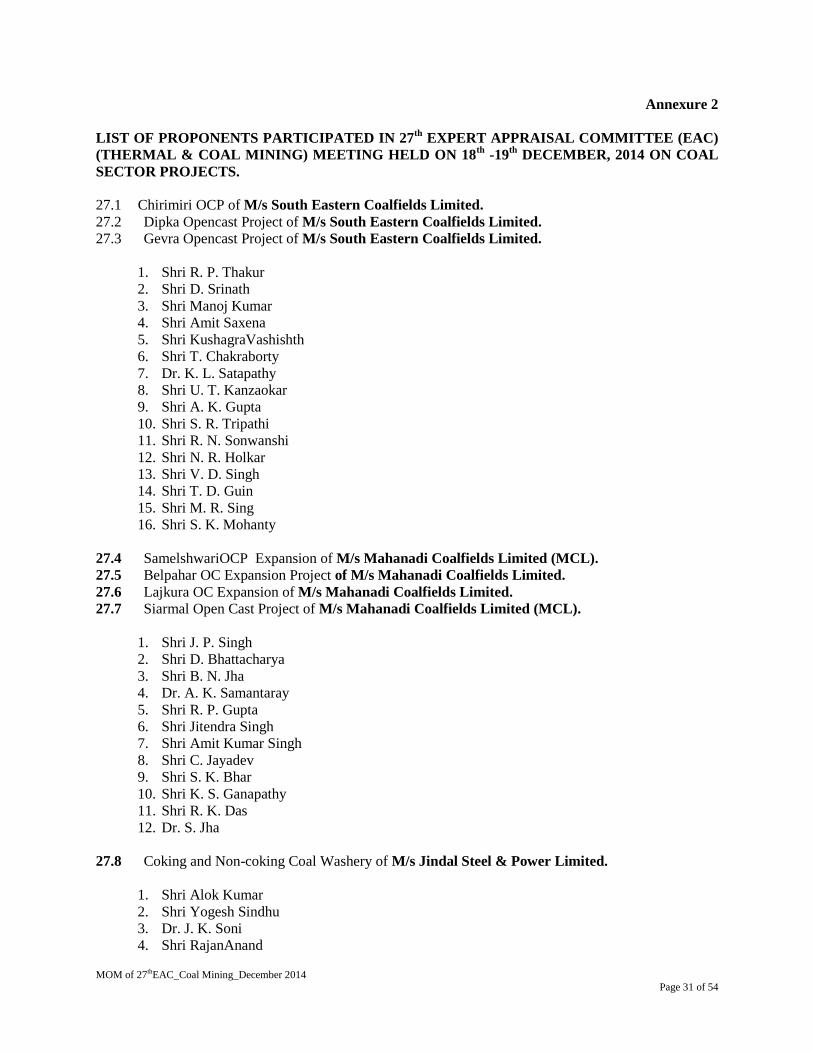
MOM of 27thEAC_Coal Mining_December 2014
Page 31 of 54
Annexure 2
LIST OF PROPONENTS PARTICIPATED IN 27th
EXPERT APPRAISAL COMMITTEE (EAC)
(THERMAL & COAL MINING) MEETING HELD ON 18th
-19th
DECEMBER, 2014 ON COAL
SECTOR PROJECTS.
27.1 Chirimiri OCP of M/s South Eastern Coalfields Limited.
27.2 Dipka Opencast Project of M/s South Eastern Coalfields Limited.
27.3 Gevra Opencast Project of M/s South Eastern Coalfields Limited.
1. Shri R. P. Thakur
2. Shri D. Srinath
3. Shri Manoj Kumar
4. Shri Amit Saxena
5. Shri KushagraVashishth
6. Shri T. Chakraborty
7. Dr. K. L. Satapathy
8. Shri U. T. Kanzaokar
9. Shri A. K. Gupta
10. Shri S. R. Tripathi
11. Shri R. N. Sonwanshi
12. Shri N. R. Holkar
13. Shri V. D. Singh
14. Shri T. D. Guin
15. Shri M. R. Sing
16. Shri S. K. Mohanty
27.4 SamelshwariOCP Expansion of M/s Mahanadi Coalfields Limited (MCL).
27.5 Belpahar OC Expansion Project of M/s Mahanadi Coalfields Limited.
27.6 Lajkura OC Expansion of M/s Mahanadi Coalfields Limited.
27.7 Siarmal Open Cast Project of M/s Mahanadi Coalfields Limited (MCL).
1. Shri J. P. Singh
2. Shri D. Bhattacharya
3. Shri B. N. Jha
4. Dr. A. K. Samantaray
5. Shri R. P. Gupta
6. Shri Jitendra Singh
7. Shri Amit Kumar Singh
8. Shri C. Jayadev
9. Shri S. K. Bhar
10. Shri K. S. Ganapathy
11. Shri R. K. Das
12. Dr. S. Jha
27.8 Coking and Non-coking Coal Washery of M/s Jindal Steel & Power Limited.
1. Shri Alok Kumar
2. Shri Yogesh Sindhu
3. Dr. J. K. Soni
4. Shri RajanAnand

MOM of 27thEAC_Coal Mining_December 2014
Page 32 of 54
27.9 Expansion of Paunderpauni Coal Washery of M/s ACB (India) Limited.
1. Shri Prakash Shrivastava
2. Shri Dilip Nagar
3. Shri V. B. Sahay
4. Ms. Marisha Sharma
5. Shri M. M. Dhir
6. Shri Pratap Ready
27.10 Sonepur Bazari Opencast Project of M/s Eastern Coalfields Limited.
27.11 Cluster No.11 of M/s Eastern Coalfields Limited.
1. Shri B. R. Reddy
2. Shri J. N. Biswal
3. Shri A. Shekhar
4. Shri P. Mondal
5. Shri S. Chakraborty
6. Shri P. Banerjee
7. Shri S. Sharma
27.12 Kuchena Washery of M/s Aryan Coal Beneficiation (P) Limited.
1. Shri Dilip Nagar
2. Shri V. B. Sahay
3. Shri Pratap Ready
4. Shri Prakash Shrivastava
5. Ms. Marisha Sharma
27.13 2x2.4 MTPA Coal Washery Project of M/s Paras Power & Coal Beneficiation Limited.
1. Shri Prashant K. Jain
2. Shri K. Santosh Kumar
27.14 2 x 2 MTPA Coal Washery (Wet Process) of M/s CG Coal & Power Ltd.
1. Shri Arvind Kumar
2. Shri D. S. Ramteke
3. Shri Parag Khujnare
27.15 Coal Beneficiation Plant (1 MTPA) of M/s Shree Nakoda Ispat Limited.
1. Shri Arvind Kumar
2. Shri D. S. Ramteke
3. Shri Parag Khujnare
27.16 Khairagura Opencast Coal mining Project of M/s The Singareni Collieries co. Ltd.
1. Shri Manohar Rao
2. Shri Vashanth Kumar
3. Shri P. Sharath Kumar

MOM of 27thEAC_Coal Mining_December 2014
Page 33 of 54
27.17 Ballarpur OCP of M/s Western Coalfields Ltd.,
1. Shri S. S. Malhi
2. Shri R. M. Wanare
3. Shri U. S. Shah
4. Md. Noor Uddin
5. Shri S. K. Sinha
6. Shri K. Chakraborty
******

MOM of 27thEAC_Coal Mining_December 2014
Page 34 of 54
ANNEXURE-3
GENERIC TOR FOR COAL WASHERY Updated/ December, 2014
i. Siting of washery is critical considering to its environmental impacts. Preference should be given
to the site located at pit head; in case such a site is not available, the site should be as close to the
pit head as possible and coal should be transported from mine to the washery preferably through
closed conveyer belt to avoid air pollution.
ii. The washery shall not be located in eco-sensitive zones areas.
iii. The washery should have a closed system and zero discharge. The storm drainage should be
treated in settling ponds before discharging into rivers/streams/water bodies.
iv. A thick Green belt of about 50 m width should be developed surrounding the washery.
v. A brief description of the plant alongwith a layout, the specific technology used and the source of
coal should be provided.
vi. The EIA-EMP Repot should cover the impacts and management plan for the project of the
capacity for which EC is sought and the impacts of specific activities, including the technology
used and coal used, on the environment of the area (within 10km radius), and the environmental
quality of air, water, land, biotic community, etc. through collection of data and information,
generation of data on impacts for the rated capacity. Cumulative impacts for air and water should
be a part of ElA in case coal mine, TPP and other washeries are located within 10km radius. The
ElA should also include mitigative measures needed to minimize adverse environmental impacts.
vii. A Study Area Map of the core zone as well as the 10km area of buffer zone showing major
industries/mines and other polluting sources should be submitted. These maps shall also indicate
the migratory corridors of fauna, if any and areas of endangered fauna; plants of medicinal and
economic importance; any ecologically sensitive areas within the 10 km buffer zone; the shortest
distance from the National Park/WL Sanctuary Tiger Reserve, etc. alongwith the comments of the
Chief Wildlife Warden of the State Government.
viii. Data of one-season (non-monsoon) primary- base-line data on environmental quality of air (PM10,
PM2.5, SOx and NOx, noise, water (surface and groundwater), soil be submitted.
ix. The wet washery should generally utilize mine water only. In case mine water is not available, the
option of storage of rain water and its use should be examined. Use of surface water and ground
water should be avoided.
x. Detailed water balance should be provided. The break-up of water requirement as per different
activities in the mining operations vis-a-vis washery should be given. If the source of water is
from surface water and/or ground water, the same may be justified besides obtaining approval of
the Competent Authority for its drawl.
xi. The entire sequence of mineral production, transportation, handling, transfer and storage of
mineral and waste, if any, and their impacts on air quality should be shown in a flow chart with
specific points where fugitive emissions can arise and specific pollution control/mitigative
measures proposed to be put in place. The washed coal and rejects should be transport by train as
far as possible. Road transport of washed coal and rejects should generally be avoided. In case,
the TPP is within 10km radius, it should be through conveyer belt. If transport by rail is not
feasible because of the topography of the area, the option for transport by road be examined in
detail and its impacts along with the mitigation measures should be clearly brought out in
ElA/EMP report.
MOM of 27thEAC_Coal Mining_December 2014
Page 35 of 54
xii. Details of various facilities proposed to be provided in terms of parking, rest areas, canteen etc.to
the personnel involved in mineral transportation, workshop and effluents/pollution load from
these activities should be provided.
xiii. Impacts of CHP, if any, on air and water quality should also be spelt out alongwith Action Plan.
xiv. O.M. no. J-llOI3/25/2014-IA.I dated 11th August, 2014 to be followed with regard to CSR
activities.
xv. Details of Public Hearing, Notice(s) issued in newspapers, proceedings/minutes of Public
Hearing, points raised by the general public and response/commitments made by the proponent
along with the Action Plan and budgetary provisions be submitted in tabular form. If the Public
Hearing is in the regional language, an authenticated English translation of the same should be
provided. Status of any litigations/ court cases filed/pending, if any, against the project should be
mentioned in EIA.
xvi. Analysis of samples indicating the following be submitted:
a. Characteristics of coal prior to washing (this includes grade of coal, other
characteristics of ash, S and heavy levels of metals such as Hg, As, Pb, Cr etc).
b. Characteristics and quantum of coal after washing.
c. Characteristics and quantum of coal rejects.
xvii. Details of management/disposal/use of coal rejects should be provided. The rejects should be
used in TPP located close to the washery as far as possible. If TPP is within a reasonable distance
(10 km), transportation should be by conveyor belt. If it is far away, the transportation should be
by rail as far as possible.
xviii. Copies of MOU/Agreement with linkages (for stand-alone washery) for the capacity for which
EC is being sought should be submitted.
xix. Corporate Environment Responsibility:
a. The Company must have a well laid down Environment Policy approved by the Board of
Directors.
b. The Environment Policy must prescribe for standard operating process/procedures to bring into
focus any infringements/deviation/violation of the environmental or forest norms/conditions.
c. The hierarchical system or Administrative Order of the company to deal with environmental
issues and for ensuring compliance with the environmental clearance conditions must be
furnished.
d. To have proper checks and balances, the company should have a well laid down system of
reporting of non-compliances/violations of environmental norms to the Board of Directors of
the company and/or shareholders or stakeholders at large.
xx. A detailed action Plan for Corporate Social Responsibility for the project affected people and
people living in and around the project area should be provided.
xxi. Permission of drawl of water shall be pre-requisite for consideration of EC.
xxii. Wastewater /effluent should confirm to the effluent standards as prescribed under Environment
(Protection) Act, 1986
xxiii. Details of washed coal, middling and rejects along with the MoU with the end-users should be
submitted.
*****

MOM of 27thEAC_Coal Mining_December 2014
Page 36 of 54
ANNEXURE -4
GENERIC TOR FOR AN OPENCAST COALMINE PROJECT
(i) An EIA-EMP Report would be prepared for ??.. MTPA rated capacity in an ML/project area of
??ha based on the generic structure specified in Appendix III of the EIA Notification 2006.
(ii) An EIA-EMP Report would be prepared for ??. MTPA rated capacity cover the impacts and
management plan for the project specific activities on the environment of the region, and the
environmental quality ?air, water, land, biotic community, etc. through collection of data and
information, generation of data on impacts including prediction modelling for ???. MTPA of
coal production based on approval of project/Mining Plan for ???MTPA. Baseline data
collection can be for any season except monsoon.
(iii) A map specifying locations of the State, District and Project location.
(iv) A Study area map of the core zone and 10km area of the buffer zone (1: 50,000 scale) clearly
delineating the major topographical features such as the land use, surface drainage of
rivers/streams/nalas/canals, locations of human habitations, major constructions including
railways, roads, pipelines, major industries/mines and other polluting sources. In case of
ecologically sensitive areas such as Biosphere Reserves/National Parks/WL Sanctuaries/
Elephant Reserves, forests (Reserved/Protected), migratory corridors of fauna, and areas where
endangered fauna and plants of medicinal and economic importance found in the 15 km area of
the buffer zone should be given.
(v) Land use map (1: 50,000 scale) based on a recent satellite imagery of the study area may also
be provided with explanatory note of the land use. Satellite imagery per se is not required.
(vi) Map showing the core zone delineating the agricultural land (irrigated and unirrigated,
uncultivable land (as defined in the revenue records), forest areas (as per records), along with
other physical features such as water bodies, etc should be furnished.
(vii) A contour map showing the area drainage of the core zone and 2-5 km of the buffer zone
(where the water courses of the core zone ultimately join the major rivers/streams outside the
lease/project area) should also be clearly indicated as a separate map.
(viii) A detailed Site plan of the mine showing the various proposed break-up of the land for mining
operations such as the quarry area, OB dumps, green belt, safety zone, buildings, infrastructure,
CHP, ETP, Stockyard, township/colony (within and adjacent to the ML), undisturbed area and
if any, in topography such as existing roads, drains/natural water bodies are to be left
undisturbed along with any natural drainage adjoining the lease /project and modification of
thereof in terms of construction of embankments/bunds, proposed diversion/re-channelling of
the water courses, etc., approach roads, major haul roads, etc.
(ix) In case of any proposed diversion of nallah/canal/river, the proposed route of
diversion/modification of drainage and their realignment, construction of embankment etc.
should also be shown on the map.
(x) Similarly if the project involves diversion of any road/railway line passing through the
ML/project area, the proposed route of diversion and its realignment should be shown.
(xi) Break up of lease/project area as per different land uses and their stage of acquisition.
LANDUSE DETAILS FOR OPENCAST PROJECT
S.N. LANDUSE Within ML Area (ha) Outside ML Area
(ha)
TOTAL
1. Agricultural land
2. Forest land
3. Wasteland
4. Grazing land

MOM of 27thEAC_Coal Mining_December 2014
Page 37 of 54
5. Surface water
bodies
6. Settlements
7. Others (specify)
TOTAL
(xii) Break-up of lease/project area as per mining operations.
(xiii) Impact of changes in the land use due to the start of the projects if much of the land being
acquired is agricultural land/forestland/grazing land.
(xiv) Collection of one-season (non-monsoon) primary baseline data on environmental quality - air
(PM10, PM2.5, SOx, NOx and heavy metals such as Hg, Pb, Cr, As, etc), noise, water (surface and
groundwater), soil along with one-season met data coinciding with the same season for AAQ
collection period.
(xv) Map of the study area (1: 50, 000 scale) (core and buffer zone clearly delineating the location of
various stations superimposed with location of habitats, other industries/mines, polluting
sources. The number and location of the stations in both core zone and buffer zone should be
selected on the basis of size of lease/project area, the proposed impacts in the downwind
(air)/downstream (surface water)/groundwater regime (based on flow). One station should be in
the upwind/upstream/non-impact/non-polluting area as a control station. The monitoring should
be as per CPCB guidelines and parameters for water testing for both ground water and surface
water as per ISI standards and CPCB classification wherever applicable. Values should be
provided based on desirable limits.
(xvi) Study on the existing flora and fauna in the study area (10km) carried out by an institution of
relevant discipline and the list of flora and fauna duly authenticated separately for the core and
buffer zone and a statement clearly specifying whether the study area forms a part of the
migratory corridor of any endangered fauna. If the study area has endangered flora and fauna,
or if the area is occasionally visited or used as a habitat by Schedule-I fauna, or if the project
falls within 15 km of an ecologically sensitive area, or used as a migratory corridor then a
comprehensive Conservation Plan should be prepared and submitted with EIA-EMP Report and
comments from the CWLW of the State Govt. also obtained and furnished.
(xvii) Details of mineral reserves, geological status of the study are and the seams to be worked,
ultimate working depth and progressive stage-wise working scheme until end of mine life
should be reflected on the basis of the approved rated capacity and calendar plans of production
from the approved Mining Plan. Geological maps and sections should be included. The
progressive mine development and Conceptual Final Mine Closure Plan should also be shown
in figures.
(xviii) Details of mining methods, technology, equipment to be used, etc., rationale for selection of
that technology and equipment proposed to be used vis-à-vis the potential impacts.
(xix) Impact of mining on hydrology, modification of natural drainage, diversion and channelling of
the existing rivers/water courses flowing though the ML and adjoining the lease/project and the
impact on the existing users and impacts of mining operations thereon.
(xx) Detailed water balance should be provided. The break up of water requirement for the various
mine operations should be given separately.
(xxi) Source of water for use in mine, sanction of the competent authority in the State Govt. and
impacts vis-à-vis the competing users.
(xxii) Impact of mining and water abstraction use in mine on the hydrogeology and groundwater
regime within the core zone and 10 km buffer zone including long?termmodelling studies on.
Details of rainwater harvesting and measures for recharge of groundwater should be reflected in
case there us a declining trend of groundwater availability and/or if the area falls within
dark/grey zone.
(xxiii) Impact of blasting, noise and vibrations.

MOM of 27thEAC_Coal Mining_December 2014
Page 38 of 54
(xxiv) Impacts of mining on the AAQ, predictive modelling using the ISCST-3 (Revised) or latest
model.
(xxv) Impacts of mineral transportation ?within and outside the lease/project along with flow-chart
indicating the specific areas generating fugitive emissions. Impacts of transportation, handling,
transfer of mineral and waste on air quality, generation of effluents from workshop,
management plan for maintenance of HEMM, machinery, equipment. Details of various
facilities to be provided in terms of parking, rest areas, canteen, and effluents/pollution load
from these activities.
(xxvi) Details of waste generation ?OB, topsoil ? as per the approved calendar programme, and their
management shown in figures as well explanatory chapter with tables giving progressive
development and mine closure plan, green belt development, backfilling programme and
conceptual post mining land use. OBdump heights and terracing should based on slope stability
studies with a max of 28o angle as the ultimate slope. Sections of dumps (ultimate) (both
longitudinal and cross section) with relation to the adjacent area should be shown.
(xxvii) Progressive Green belt and afforestation plan (both in text, figures as well as in tables prepared
by MOEF) and selection of species (local) for the afforestation/plantation programme based on
original survey/landuse.
Table 1: Stage-wise Landuse and Reclamation Area (ha)
S.N. Land use Category Present
(1st Year)
5th
Year 10th
Year
20th
year 24th
Year
(end of Mine
life)*
1. Backfilled Area(Reclaimed with
plantation)
2. Excavated Area (not
reclaimed)/void
3. External OB dump Reclaimed
with plantation)
4. Reclaimed Top soil dump
5. Green Built Area
6. Undisturbed area (brought under
plantation)
7. Roads (avenue plantation)
8. Area around buildings and
Infrastructure
TOTAL 110* 110* 110* 110* 110*
* As a representative example
Table 2: Stage-wise Cumulative Plantation
S.N
.
YEAR* Green Belt External
Dump
Backfilled
Area
Others
(Undisturbed
Area/etc)
TOTAL
Area
(ha)
No. of
trees
Area
(ha)
No. of
Trees
Area
(ha)
No. of
Trees
Area
(ha)
No. of
Trees
Area
(ha)
No. of
Trees
1. 1st year
2. 3rd
year
3. 5th year
4. 10th
year
5. 15th year
6. 20th
year

MOM of 27thEAC_Coal Mining_December 2014
Page 39 of 54
7. 25th year
8. 30th year
9. 34th year
(end of mine
life)
10. 34-37th Year
(Post-mining)
85
* As a representative example
(xxviii) Conceptual Final Mine Closure Plan, post mining land use and restoration of land/habitat to
pre- mining. A Plan for the ecological restoration of the area post mining and for land use
should be prepared with detailed cost provisions. Impact and management of wastes and issues
of rehandling (wherever applicable) and backfilling and progressive mine closure and
reclamation.
Table 3: Post-Mining Landuse Pattern of ML/Project Area (ha)
S.N. Land use during
Mining
Land Use (ha)
1. External OB Dump Plantation Water
Body
Public Use Undisturbed TOTAL
2. Top soil Dump
3. Excavation
4. Roads
4. Built up area
5. Green Belt
6. Undisturbed Area
TOTAL 85 110
(xxix) Flow chart of water balance. Treatment of effluents from workshop, township, domestic
wastewater, mine water discharge, etc. Details of STP in colony and ETP in mine. Recycling of
water to the max. possible extent.
(xxx) Occupational health issues. Baseline data on the health of the population in the impact zone and
measures for occupational health and safety of the personnel and manpower for the mine.
(xxxi) Risk Assessment and Disaster Preparedness and Management Plan.
(xxxii) Integrating in the Env. Management Plan with measures for minimising use of natural resources
- water, land, energy, etc.
(xxxiii) Including cost of EMP (capital and recurring) in the project cost and for progressive and final
mine closure plan.
(xxxiv) Details of R&R. Detailed project specific R&R Plan with data on the existing socio-economic
status of the population (including tribals, SC/ST, BPL families) found in the study area and
broad plan for resettlement of the displaced population, site for the resettlement colony,
alternate livelihood concerns/employment for the displaced people, civic and housing amenities
being offered, etc and costs along with the schedule of the implementation of the R&R Plan.
(xxxv) CSR Plan along with details of villages and specific budgetary provisions (capital and
recurring) for specific activities over the life of the project.
(xxxvi) Public Hearing should cover the details of notices issued in the newspaper,
proceedings/minutes of public hearing, the points raised by the general public and
commitments made by the proponent should be presented in a tabular form. If the Public
Hearing is in the regional language, an authenticated English Translation of the same should be
provided.
(xxxvii) In built mechanism of self-monitoring of compliance of environmental regulations.

MOM of 27thEAC_Coal Mining_December 2014
Page 40 of 54
(xxxx) Status of any litigations/ court cases filed/pending on the project.
(xxxxi) Submission of sample test analysis of:
Characteristics of coal - this includes grade of coal and other characteristics ?ash, S and heavy
metals including levels of Hg, As, Pb, Cr etc.
(xxxxii) Copy of clearances/approvals ? such as Forestry clearances, Mining Plan Approval,
NOC from Flood and Irrigation Dept. (if req.), etc. wherever applicable.
(A) FORESTRY CLEARANCE
*****
TOTAL
ML/PROJECT
AREA (ha)
TOTAL
FORESTLAND
(ha)
Date of FC Extent of
forestland
Balance area for
which FC is yet to
be obtained
Status of
appl. for
diversion of
forestland
If more than
one, provide
details of
each FC

MOM of 27thEAC_Coal Mining_December 2014
Page 41 of 54
ANNEXURE -5
GENERIC TOR FOR AN UNDERGROUND COALMINE PROJECT
(i) An EIA-EMP Report should be prepared for a peak capacity of ????.. MTPA over an area of
????.. ha addressing the impacts of the underground coalmine project including the aspects of
mineral transportation and issues of impacts on hydrogeology, plan for conservation of flora/fauna
and afforestation/plantation programme based on the generic structure specified in Appendix III of
the EIA Notification 2006.. Baseline data collection can be for any season except monsoon.
(ii) The EIA-EMP report should also cover the impacts and management plan for the project specific
activities on the environment of the region, and the environmental quality ?air, water, land, biotic
community, etc. through collection of baseline data and information, generation of baseline data on
impacts for ??. MTPA of coal production based on approval of project/Mining Plan.
(iii) A Study area map of the core zone and 10km area of the buffer zone (15 km of the buffer zone in
case of ecologically sensitive areas) delineating the major topographical features such as the land
use, drainage, locations of habitats, major construction including railways, roads, pipelines, major
industries/mines and other polluting sources, which shall also indicate the migratory corridors of
fauna, if any and the areas where endangered fauna and plants of medicinal and economic
importance are found in the area.
(iv) Map showing the core zone along with 3-5 km of the buffer zone) delineating the agricultural land
(irrigated and unirrigated, uncultivable land (as defined in the revenue records), forest areas (as per
records) and grazing land and wasteland and water bodies.
(v) Contour map at 3m interval along with Site plan of the mine (lease/project area with about 3-5 km
of the buffer zone) showing the various surface structures such as buildings, infrastructure, CHP,
ETP, Stockyard, township/colony (within/adjacent to the ML), green belt and undisturbed area and
if any existing roads, drains/natural water bodies are to be left undisturbed along with details of
natural drainage adjoining the lease/project and modification of thereof in terms of construction of
embankments/bunds, proposed diversion/rechannelling of the water courses, etc., highways,
passing through the lease/project area.
(vi) Original land use (agricultural land/forestland/grazing land/wasteland/water bodies) of the area.
Impacts of project, if any on the landuse, in particular, agricultural land/forestland/grazing
land/water bodies falling within the lease/project and acquired for mining operations. Extent of area
under surface rights and under mining rights.
S.N. ML/Project
Land use
Area under
Surface Rights
(ha)
Area Under Mining
Rights (ha)
Area under
Both (ha)
1. Agricultural land
2. ForestLand
3. Grazing Land
4. Settlements
5. Others (specify)
Area Under Surface Rights
S.N. Details Area (ha)
1. Buildings
2. Infrastructure
3. Roads
4. Others (specify)
TOTAL

MOM of 27thEAC_Coal Mining_December 2014
Page 42 of 54
(vii) Study on the existing flora and fauna in the study area carried out by an institution of relevant
discipline and the list of flora and fauna duly authenticated separately for the core and buffer
zone and a statement clearly specifying whether the study area forms a part of the migratory
corridor of any endangered fauna. The flora and fauna details should be furnished separately for
the core zone and buffer zone. The report and the list should be authenticated by the concerned
institution carrying out the study and the names of the species scientific and common names)
along with the classification under the Wild Life Protection Act, 1972 should be furnished.
(viii) Details of mineral reserves, geological status of the study area and the seams to be worked,
ultimate working depth and progressive stage-wise working plan/scheme until end of mine life
should be reflected on the basis of the approved rated capacity and calendar plans of production
from the approved Mining Plan. Geological maps should also be included.
(ix) Impact of mining on hydrology, modification of natural drainage, diversion and channelling of
the existing rivers/water courses flowing though the ML and adjoining the lease/project and the
impact on the existing users and impacts of mining operations thereon.
(x) Collection of one-season (non-monsoon) primary baseline data on environmental quality ? air
(PM10, PM2.5, SOx, NOx and heavy metals such as Hg, Pb, Cr, AS, etc), noise, water (surface and
groundwater), soil along with one-season met data.
(xi) Map of the study area (core and buffer zone) clearly delineating the location of various
monitoring stations (air/water/soil and noise ? each shown separately) superimposed with
location of habitats, wind roses, other industries/mines, polluting sources. The number and
location of the stations should be selected on the basis of the proposed impacts in the
downwind/downstream/groundwater regime. One station should be in the upwind/upstream/non-
impact non-polluting area as a control station. Wind roses to determine air pollutant dispersion
and impacts thereof shall be determined. Monitoring should be as per CPCB guidelines and
standards for air, water, noise notified under Environment Protection Rules. Parameters for
water testing for both ground and surface water should be as per ISI standards and CPCB
classification of surface water wherever applicable.
(xii) Impact of mining and water abstraction and mine water discharge in mine on the hydrogeology
and groundwater regime within the core zone and 10km buffer zone including
long?termmodelling studies on the impact of mining on the groundwater regime. Details of
rainwater harvesting and measures for recharge of groundwater should be reflected wherever the
areas are declared dark/grey from groundwater development.
(xiii) Study on subsidence, measures for mitigation/prevention of subsidence, modelling subsidence
prediction and its use during mine operation, safety issues.
(xiv) Detailed water balance should be provided. The break up of water requirement as per different
activities in the mining operations, including use of water for sand stowing should be given
separately. Source of water for use in mine, sanction of the competent authority in the State
Govt. and impacts vis-à-vis the competing users should be provided.
(xv) Impact of choice of mining method, technology, selected use of machinery - and impact on air
quality, mineral transportation, coal handling & storage/stockyard, etc, Impact of blasting, noise
and vibrations.
(xvi) Impacts of mineral transportation ?within and outside the lease/project. The entire sequence of
mineral production, transportation, handling, transfer and storage of mineral and waste, and their
impacts on air quality should be shown in a flow chart with the specific points where fugitive
emissions can arise and the specific pollution control/mitigative measures proposed to be put in
place. Examine the adequacy of roads existing in the area and if new roads are proposed, the
impact of their construction and use particularly if forestland is used.
(xvii) Details of various facilities to be provided in terms of parking, rest areas, canteen, and
effluents/pollution load from these activities. Examine whether existing roads are adequate to
take care of the additional load of mineral and their impacts.

MOM of 27thEAC_Coal Mining_December 2014
Page 43 of 54
(xviii) Examine the number and efficiency of mobile/static water sprinkling system along the main
mineral transportation road within the mine, approach roads to the mine/stockyard/siding, and
also the frequency of their use in impacting air quality.
(xix) Impacts of CHP, if any on air and water quality. A flow chart of water use and whether the unit
can be made a zero-discharge unit.
(xx) Conceptual Final Mine Closure Plan along with the fund requirement for the detailed activities
proposed there under. Impacts of change in land use for mining operations and whether the land
can be restored for agricultural use post mining. \
Table 1 Stage-wise Cumulative Plantation
S.N. YEAR* Green Belt External
Dump
Backfilled
Area
Others
(Undisturbed
Area/etc)
TOTAL
Area
(ha)
No.
of
trees
Area
(ha)
No.
of
Trees
Area
(ha)
No.
of
Trees
Area
(ha)
No.
of
Trees
Area
(ha)
No. of
Trees
1. 1st year
2. 3rd
year
3. 5th year
4. 10thyesr
5. 15thyear
6. 20th year
7. 25th year
8. 30th year
9. 34th year
(end of
mine life)
10. 34-37th
Year (Post-
mining)
85* 2,12,500
*As a representative example
(xxi) Occupational health issues. Baseline data on the health of the population in the impact zone and
measures for occupational health and safety of the personnel and manpower for the mine should
be furnished.
(xxii) Details of cost of EMP (capital and recurring) in the project cost and for final mine closure plan.
The specific costs (capital and recurring) of each pollution control/mitigative measures proposed
in the project until end of mine life and a statement that this is included in the project cost.
(xxiii) Integrating in the Env. Management Plan with measures for minimising use of natural resources
?water, land, energy, raw materials/mineral, etc.
(xxiv) R&R: Detailed project specific R&R Plan with data on the existing socio-economic status
(including tribals, SC/ST) of the population in the study area and broad plan for resettlement of
the displaced population, site for the resettlement colony, alternate livelihood
concerns/employment for the displaced people, civic and housing amenities being offered, etc
and costs along with the schedule of the implementation of the R&R Plan.
(xxv) CSR Plan along with details of villages and specific budgetary provisions (capital and
recurring) for specific activities over the life of the project.
(xxvi) Public Hearing should cover the details as specified in the EIA Notification 2006, and include
notices issued in the newspaper, proceedings/minutes of public hearing, the points raised by the
general public and commitments by the proponent made should be presented in a tabular form.
If the Public Hearing is in the regional language, an authenticated English Translation of the
same should be provided.

MOM of 27thEAC_Coal Mining_December 2014
Page 44 of 54
(xxvii) Status of any litigations/ court cases filed/pending in any Court/Tribunal on the project should
be furnished.
(xxxvi) Submission of sample test analysis of:
(xxxvii) Characteristics of coal - this includes grade of coal and other characteristics ? ash, and heavy
metals including levels of Hg, As, Pb, Cr etc.
(xxxvii) Copy of clearances/approvals ?such as Forestry clearances, Mining Plan Approval, NOC from
Flood and Irrigation Dept. (if req.), etc.
FORESTRY CLEARANCE
******
TOTAL
ML/PROJECT
AREA (ha)
TOTAL
FORESTLAND
(ha)
Date of
FC
Extent of
forestland
Balance area for
which FC is yet to
be obtained
Status of appl. for
diversion of
forestland
If more
than one,
provide
details of
each FC

MOM of 27thEAC_Coal Mining_December 2014
Page 45 of 54
ANNEXURE-6
GENERIC TOR FOR AN OPENCAST-CUM-UNDERGROUND COALMINE PROJECT
(i) An EIA-EMP Report would be prepared for a combined rated capacity of??..MTPA for OC-
cum-UG project which consists of ??. MTPA for OC and ???. MTPA for UG in an ML/project
area of ??ha based on the generic structure specified in Appendix III of the EIA Notification
2006.
(ii) An EIA-EMP Report would be prepared for ??. MTPA rated capacity cover the impacts and
management plan for the project specific activities on the environment of the region, and the
environmental quality ?air, water, land, biotic community, etc. through collection of data and
information, generation of data on impacts including prediction modelling for ???. MTPA of
coal production based on approval of project/Mining Plan for ??.. MTPA. Baseline data
collection can be for any season except monsoon.
(iii) A map specifying locations of the State, District and Project location.
(iv) A Study area map of the core zone and 10km area of the buffer zone (1: 50,000 scale) clearly
delineating the major topographical features such as the land use, surface drainage of
rivers/streams/nalas/canals, locations of human habitations, major constructions including
railways, roads, pipelines, major industries/mines and other polluting sources. In case of
ecologically sensitive areas such as Biosphere Reserves/National Parks/WL Sanctuaries/
Elephant Reserves, forests (Reserved/Protected), migratory corridors of fauna, and areas where
endangered fauna and plants of medicinal and economic importance found in the 15 km area of
the buffer zone should be given.
(v) Land use map (1: 50,000 scale) based on a recent satellite imagery of the study area may also be
provided with explanatory note of the land use. Satellite imagery per se is not required.
(vi) Map showing the core zone delineating the agricultural land (irrigated and unirrigated,
uncultivable land (as defined in the revenue records), forest areas (as per records), along with
other physical features such as water bodies, etc should be furnished.
(vii) A contour map showing the area drainage of the core zone and 2-5 km of the buffer zone (where
the water courses of the core zone ultimately join the major rivers/streams outside the
lease/project area) should also be clearly indicated as a separate map.
(viii) A detailed Site plan of the mine showing the various proposed break-up of the land for mining
operations such as the quarry area, OB dumps, green belt, safety zone, buildings, infrastructure,
CHP, ETP, Stockyard, township/colony (within and adjacent to the ML), undisturbed area and if
any, in topography such as existing roads, drains/natural water bodies are to be left undisturbed
along with any natural drainage adjoining the lease /project and modification of thereof in terms
of construction of embankments/bunds, proposed diversion/rechannelling of the water courses,
etc., approach roads, major haul roads, etc.
(ix) In case of any proposed diversion of nallah/canal/river, the proposed route of
diversion/modification of drainage and their realignment, construction of embankment etc.
should also be shown on the map.
(x) Similarly if the project involves diversion of any road/railway line passing through the
ML/project area, the proposed route of diversion and its realignment should be shown.
(xi) Break up of lease/project area as per different land uses and their stage of acquisition.
LANDUSE DETAILS FOR OPENCAST PROJECT
S.N. LANDUSE Within ML Area
(ha)
Outside ML Area
(ha)
TOTAL
(ha)
1. Agricultural land

MOM of 27thEAC_Coal Mining_December 2014
Page 46 of 54
2. Forest land
3. Wasteland
4. Grazing land
5. Surface water
bodies
6. Settlements
7. Others (specify)
TOTAL
LANDUSE DETAILS FOR UNDERGROUND PROJECT
S.N. ML/Project
Land use
Area under
Surface Rights
(ha)
Area Under Mining
Rights (ha)
Area under
Both (ha)
1. Agricultural land
2. ForestLand
3. Grazing Land
4. Wasteland
5. Water Bodies
6. Settlements
7. Others (specify)
TOTAL
Area Under Surface Rights
S.N. Details Area (ha)
1. Buildings
2. Infrastructure
3. Roads
4. Others (specify)
TOTAL
(xii) Break-up of lease/project area as per mining operations.
(xiii) Impact of changes in the land use due to the start of the projects if much of the land being
acquired is agricultural land/forestland/grazing land.
(xiv) Collection of one-season (non-monsoon) primary baseline data on environmental quality - air
(PM10, PM2.5, SOx, NOx and heavy metals such as Hg, Pb, Cr, As, etc), noise, water (surface and
groundwater), soil along with one-season met data.
(xv) Map of the study area (1: 50, 000 scale) (core and buffer zone clearly delineating the location of
various stations superimposed with location of habitats, other industries/mines, polluting
sources. The number and location of the stations in both core zone and buffer zone should be
selected on the basis of size of lease/project area, the proposed impacts in the downwind
(air)/downstream (surface water)/groundwater regime (based on flow). One station should be in
the upwind/upstream/non-impact/non-polluting area as a control station. The monitoring should
be as per CPCB guidelines and parameters for water testing for both ground water and surface
water as per ISI standards and CPCB classification wherever applicable. Values should be
presented in comparison to desirable limits.
(xvi) Study on the existing flora and fauna in the study area (10km) carried out by an institution of
relevant discipline and the list of flora and fauna duly authenticated separately for the core and

MOM of 27thEAC_Coal Mining_December 2014
Page 47 of 54
buffer zone and a statement clearly specifying whether the study area forms a part of the
migratory corridor of any endangered fauna. If the study area has endangered flora and fauna, or
if the project falls within 15 km of an ecologically sensitive area, then a comprehensive
Conservation Plan should be prepared and furnished along with comments from the CWLW of
the State Govt.
(xvii) Details of mineral reserves, geological status of the study are and the seams to be worked,
ultimate working depth and progressive stage-wise working scheme until end of mine life
should be reflected on the basis of the approved rated capacity and calendar plans of production
from the approved Mining Plan. Geological maps and sections should be included. The
progressive mine development and final mine closure plan should also be shown in figures.
(xviii) Details of mining methods, technology, equipment to be used, etc., rationale for selection of that
technology and equipment proposed to be used vis-à-vis the potential impacts.
(xix) Study on subsidence, measures for mitigation/prevention of subsidence, modelling subsidence
prediction and its use during mine operation, safety issues.
(xx) Impact of mining on hydrology, modification of natural drainage, diversion and channelling of
the existing rivers/water courses flowing though the ML and adjoining the lease/project and the
impact on the existing users and impacts of mining operations thereon.
(xxi) Detailed water balance should be provided. The break up of water requirement for the various
mine operations should be given separately.
(xxii) Source of water for use in mine, sanction of the competent authority in the State Govt. and
impacts vis-à-vis the competing users.
(xxiii) Impact of mining and water abstraction use in mine on the hydrogeology and groundwater
regime within the core zone and 10 km buffer zone including long?termmodelling studies on.
Details of rainwater harvesting and measures for recharge of groundwater should be reflected in
case there us a declining trend of groundwater availability and/or if the area falls within
dark/grey zone.
(xxiv) Impact of blasting, noise and vibrations.
(xxv) Impacts of mining on the AAQ, predictive modelling using the ISCST-3 (Revised) or latest
model.
(xxvi) Impacts of mineral transportation ?within and outside the lease/project along with flow-chart
indicating the specific areas generating fugitive emissions. Impacts of transportation, handling,
transfer of mineral and waste on air quality, generation of effluents from workshop,
management plan for maintenance of HEMM, machinery, equipment. Details of various
facilities to be provided in terms of parking, rest areas, canteen, and effluents/pollution load
from these activities.
(xxvii) Details of waste generation ?OB, topsoil ? as per the approved calendar programme, and their
management shown in figures as well explanatory chapter with tables giving progressive
development and mine closure plan, green belt development, backfilling programme and
conceptual post mining land use. OBdump heights and terracing should based on slope stability
studies with a max of 28o angle as the ultimate slope. Sections of dumps (ultimate) (both
longitudinal and cross section) with relation to the adjacent area should be shown.
(xxviii) Impact and management of wastes and issues of rehandling and backfilling and progressive
mine closure and reclamation.
(xxix) Flow chart of water balance. Treatment of effluents from workshop, township, domestic
wastewater, mine water discharge, etc. Details of STP in colony and ETP in mine. Recycling of
water to the max. possible extent.
(xxx) Occupational health issues. Baseline data on the health of the population in the impact zone and
measures for occupational health and safety of the personnel and manpower for the mine.
(xxxi) Risk Assessment and Disaster Preparedness and Management Plan.
(xxxii) Integrating in the Env. Management Plan with measures for minimising use of natural resources
- water, land, energy, etc.

MOM of 27thEAC_Coal Mining_December 2014
Page 48 of 54
(xxxiii) Progressive Green belt and afforestation plan (both in text, figures as well as in tables prepared
by MOEF given below) and selection of species (local) for the afforestation/plantation
programme based on original survey/landuse.
Table 1: Stage-wise Landuse and Reclamation Area (ha)
S.N. Land use Category Present
(1st Year)
5th
Year
10th
Year
20th
year
24th
Year
(end of Mine
life)*
1. Backfilled Area (Reclaimed
with plantation)
2. Excavated Area (not
reclaimed)/void
3. External OB dump
Reclaimed with plantation)
4. Reclaimed Top soil dump
5. Green Built Area
6. Undisturbed area (brought
under plantation)
7. Roads (avenue plantation)
8. Area around buildings and
Infrastructure
TOTAL
110 110 110 110 110
* Representative case as an example
Table 2: Stage-wise Cumulative Plantation
S.N. YEAR* Green Belt External
Dump
Backfilled
Area
Others
(Undisturbed
Area/etc)
TOTAL
Area
(ha)
No.
of
trees
Area
(ha)
No.
of
Trees
Area
(ha)
No.
of
Trees
Area
(ha)
No. of
Trees
Area
(ha)
No. of
Trees
1. 1st year
2. 3rd
year
3. 5th year
4. 10th year
5. 15th year
6. 20th year
7. 25th year
8. 30th year
9. 34th year
(end of
mine life)
10. 34-37th
Year (Post-
mining)
85
* Representative case as an example

MOM of 27thEAC_Coal Mining_December 2014
Page 49 of 54
(xxxiv) Conservation Plan for the endangered/endemic flora and fauna found in the study area and for
safety of animals visiting/residing in the study area and also those using the study area as a
migratory corridor.
(xxxv) Conceptual Final Mine Closure Plan, post mining land use and restoration of land/habitat to pre-
mining. A Plan for the ecological restoration of the area post mining and for land use should be
prepared with detailed cost provisions.
Table 3: Post-Mining Landuse Pattern of ML/Project Area (ha)
S.N. Land use during
Mining
Land Use (ha)
1. External OB
Dump
Plantation Water
Body
Public
Use
Undisturbed TOTAL
2. Top soil Dump
3. Excavation
4. Roads
4. Built up area
5. Green Belt
6. Undisturbed Area
TOTAL 85 110
(xxxvi) Including cost of EMP (capital and recurring) in the project cost and for progressive and final
mine closure plan.
(xxxvii) Details of R&R. Detailed project specific R&R Plan with data on the existing socio-economic
status of the population (including tribals, SC/ST, BPL families) found in the study area and
broad plan for resettlement of the displaced population, site for the resettlement colony,
alternate livelihood concerns/employment for the displaced people, civic and housing amenities
being offered, etc and costs along with the schedule of the implementation of the R&R Plan.
(xxxviii) CSR Plan along with details of villages and specific budgetary provisions (capital and recurring)
for specific activities over the life of the project.
(xxxix) Public Hearing should cover the details of notices issued in the newspaper, proceedings/minutes
of public hearing, the points raised by the general public and commitments made by the
proponent should be presented in a tabular form. If the Public Hearing is in the regional language,
an authenticated English Translation of the same should be provided.
(xxxx) In built mechanism of self-monitoring of compliance of environmental regulations.
(xxxxi) Status of any litigations/ court cases filed/pending on the project.
(xxxxii) Submission of sample test analysis of:
Characteristics of coal - this includes grade of coal and other characteristics ?ash, S and heavy
metals including levels of Hg, As, Pb, Cr etc.
(xxxxiii) Copy of clearances/approvals ? such as Forestry clearances, Mining Plan Approval,
NOC from Flood and Irrigation Dept. (if req.), etc.
(A) FORESTRY CLEARANCE
TOTAL
ML/PROJECT
AREA (ha)
TOTAL
FORESTLAND
(ha)
Date of FC Extent of
forestland
In the FC
Balance area
for which
FC is yet to
be obtained
Status of appl.
for diversion
of
Balance
forestland
If more
than one,
provide

MOM of 27thEAC_Coal Mining_December 2014
Page 50 of 54
details of
each FC
Copies of forestry clearance letters (all, if there are more than one)
(A) MINING PLAN APPROVAL
(B) MINING PLAN/PROJECT APPROVAL
Date of Approval of Mining Plan/Project Approval:
Copy of Letter of Approval of Mining Plan/Project Approval
(xxxxiv) Corporate Environment Responsibility:
b) The Company must have a well laid down Environment Policy approved by the Board of
Directors.
c) The Environment Policy must prescribe for standard operating process/procedures to
bring into focus any infringements/deviation/violation of the environmental or forest
norms/conditions.
d) The hierarchical system or Administrative Order of the company to deal with
environmental issues and for ensuring compliance with the environmental clearance
conditions must be furnished.
d) To have proper checks and balances, the company should have a well laid down system of
reporting of non-compliances/violations of environmental norms to the Board of
Directors of the company and/or shareholders or stakeholders at large.
*******

MOM of 27thEAC_Coal Mining_December 2014
Page 51 of 54
ANNEXURE-7
GENERAL CONDITIONS AND ADDITIONAL POINTS OF TOR
The following general points should be noted:
(i) All documents should be properly indexed, page numbered.
(ii) Period/date of data collection should be clearly indicated.
(iii) Authenticated English translation of all material provided in Regional languages.
(iv) After the preparation of the draft EIA-EMP Report as per the aforesaid TOR, the proponent shall
get the Public Hearing conducted as prescribed in the EIA Notification 2006 and take necessary
action for obtaining environmental clearance under the provisions of the EIA Notification 2006.
(v) The letter/application for EC should quote the MOEF file No. and also attach a copy of the letter
prescribing the TOR.
(vi) The copy of the letter received from the Ministry on the TOR prescribed for the project should be
attached as an annexure to the final EIA-EMP Report.
(vii) The final EIA-EMP report submitted to the Ministry must incorporate the issues in TOR and that
raised in Public Hearing. The index of the final EIA-EMP report, must indicate the specific
chapter and page no. of the EIA-EMP Report where the specific TOR prescribed by Ministry and
the issue raised in the P.H. have been incorporated. Mining Questionnaire (posted on MOEF
website) with all sections duly filled in shall also be submitted at the time of applying for EC.
(viii) General Instructions for the preparation and presentation before the EAC of TOR/EC projects of
Coal Sector should be incorporated/followed.
(viii) The aforesaid TOR has a validity of two years only.
The following additional points are also to be noted:
(i) Grant of TOR does not necessarily mean grant of EC.
(ii) Grant of TOR/EC to the present project does not necessarily mean grant of TOR/EC to
the captive/linked project.
(iii) Grant of TOR/EC to the present project does not necessarily mean grant of approvals in
other regulations such as the Forest (Conservation) Act 1980 or the Wildlife (Protection)
Act, 1972.
(iv) Grant of EC is also subject to Circulars issued under the EIA Notification 2006, which
are available on the MOEF website: www.envfor.nic.in
______

MOM of 27thEAC_Coal Mining_December 2014
Page 52 of 54
27th
EAC (THERMAL & COAL MINING PROJECTS) MEETING
SCHEDULED FOR 18th
-19th
December, 2014
AGENDA
Venue: Brahmaputra Conference Hall, First floor, Vayu Wing, Indira ParyavaranBhawan,
Jorbagh, New Delhi-110003.
Pl. check the MoEF website: http://environmentclearance.nic.in/Report/Default3.aspx
Important Note:
i. Please send the information as per “check list at Annexure-1” by e-mail, in word
format and also a signed & scanned copy, to the Member-Secretary at [email protected]
least one week prior to the EAC meeting.
ii. Without this information, EAC has discretion to invite the proponent for the meeting.
iii. Please also provide a copy to the EAC Members during the meeting.
iv. No consultant is permitted into the meeting who has no accreditation with Quality
Council of India (QCI) /National Accreditation Board of Education and Training
(NABET) as per the MoEF OM dated 2nd
December, 2009.
COAL MINING PROJECTS
Thursday, 18th
December, 2014
10:00 AM -10:15 AM: Confirmation of Minutes
27.1 10:15 AM – 11:15 AM: Chirimiri OCP (2 MTPA (normative) and 2.70 MTPA peak in 544.06 ha)
of M/s South Eastern Coalfields Limited, located in Tehsil Mahendragarh, dist. Korea,
Chhattisgarh - EC based on TOR granted on 06.05.2011.
27.2 11:15 AM – 12:15 PM:Dipka Opencast Project (from 30 MTPA to 31 MTPA Peak in an area of
1999.293 ha) of M/s South Eastern Coalfields Limited (SECL) Tehsil Katghora, District
Korba, Chhattisgarh. Expansion under 7(ii) of EIA Notification 2006.
27.3 12:15 AM – 1:15 PM:Gevra Opencast Project (from 40 MTPA to 41 MTPA Peak in an area of
1999.293 ha) of M/s South Eastern Coalfields Limited Village: Gevra, Ponri, Bareli; Tahsil:
Katghora; District: Korba Chhattisgarh- Expansion under 7(ii) of EIA Notification 2006.
------------------------------------------------------------------------------------------------------------------------------
LUNCH
------------------------------------------------------------------------------------------------------------------------------
27.4 2:00 PM - 3:00 PM: Samelshwari OCP Expansion from 11 MTPA to 15 MTPA in an ML area
of 828.76 ha + 99.50 Ha and 49.855 ha for colony outside the ML) of M/s Mahanadi Coalfields
Limited (MCL), located in Ib Valley Area, P.O. Brajrajnagar, Tehsil & District Jharsuguda,
Orissa-– Expansion under 7(ii) of EIA Notification, 2006.
27.5 3:00 PM – 4:00 PM: Belpahar OC Expansion Project (6.0 MTPA to 9.0 MTPA in an existing
ML area of 1444.053 Ha) of M/s Mahanadi Coalfields Limited, Dist. Jharsuguda, Odisha -

MOM of 27thEAC_Coal Mining_December 2014
Page 53 of 54
Expansion under 7(ii) of EIA Notification, 2006 - Further consideration.
27.6 4:00 PM – 5:00 PM: Lajkura OC Expansion (from 3.0 MTPA to 4.5 MTPA in an ML area of
721.29 ha) of M/s Mahanadi Coalfields Limited, Dist. Jharsuguda, Odisha – Expansion under
7(ii) of EIA Notification, 2006 - Further consideration. 27.7 5:00 PM - 5:45 PM: Siarmal Open Cast Project (40.0 MTPA normative to 50.0 MTPA peak
project area of 2475.47 ha) of M/s Mahanadi Coalfields Limited. Tahsil - Himgir, Dist. -
Sundargarh, Orissa. – TOR - Further consideration.
27.8 5:45 PM - 6:00 PM: Coking (2 x 2 MTPA) and Non-coking Coal Washery (6.5 MTPA) at
Integrated Steel Plant with Captive Power Plant of M/s Jindal Steel & Power Limited,Angul,
Orissa – Extension of TOR validity.
Friday, 19th
December, 2014
27.9 10:00 AM – 11:00 AM: Expansion of Paunderpauni Coal Washery (1.6 MTPA to 2.6 MTPA)
of M/s ACB (India) Limited in Paunderpauni, Tehsil Rajura, Dist. Chandrapur, Maharashtra -
EC based on TOR granted 23.03.2011.
27.10 11:00 AM – 12:00 PM: SonepurBazari Opencast Project (from 8 MTPA to 12 MTPA and lease
area 2293.98 ha) of M/s Eastern Coalfields Limited, located in village Snepur, Tehsil
Pandaveswar Block, District Burdwan, West Bengal - Expansion under 7(ii) of EIA
Notification 2006.
27.11 12:00 AM – 1:00 PM: Cluster No.11 (11 mixed mines of a combined production capacity of
9.1MTPA normative 9.9 MTPA peak capacity in a combined ML area of 4218 ha) ofM/s
Eastern Coalfields Ltd., located in Raniganj Coalfields, West Bengal (EC based on TOR
granted 13.01.2012.
-------------------------------------------------------------------------------------------------------------------------------
LUNCH
-------------------------------------------------------------------------------------------------------------------------------
27.12 2:00 PM – 3:00 PM: KuchenaWashery (5 MTPA of washed coal) of M/s Aryan Coal
Beneficiation (P) Limited. Dist. Korba, Chhattisgarh - EC based on TOR granted on
25.08.2008 - Further consideration.
27.13 3:00 PM – 3:45 PM: Proposed 2x2.4 MTPA Coal Washery Project of M/s Paras Power & Coal
Beneficiation Limited, located at dist. Bilaspur, Chhattisgarh. – TOR - Further consideration.
27.14 3:45 PM – 4:30 PM: 2 x 2 MTPA Coal Washery (Wet Process) of M/s CG Coal & Power Ltd.
Dist. Korba, Chhattisgarh. - TOR
27.15 4:30 PM – 5:00 PM: Coal Beneficiation Plant (1 MTPA) of M/s Shree NakodaIspatLimited,
located in Plot No. 109 and 75 in Siltara Industrial Growth Centre, district Raipur, Chhattisgarh –
EC amendment.
27.16 5:00 PM – 5:30 PM: Khairagura Opencast Expansion Coal mining Project (from 3.0 MTPA to
3.75 MTPA in an ML area of 1217.50 ha) of M/s The Singareni Collieries co. Ltd., Dist.
Adilabad, Andhra Pradesh. - Further consideration

MOM of 27thEAC_Coal Mining_December 2014
Page 54 of 54
27.17 5:30 PM – 6:00 PM: Ballarpur OCP (from 0.50 MTPA to 0.625 MTPA in an ML area of 242.64
ha) M/s Western Coalfields Ltd., Dist. Chandrapur, Maharashtra - Expansion under 7(ii) of
EIA Notification 2006 - Further consideration
27.18 6:00 PM onwards - Discussion & any other matters with the permission of the Chair.
*****


![[ For Wednesday,27th October 2021] - The Gauhati High Court](https://static.fdokumen.com/doc/165x107/631f223f63f0eba19606bbe0/-for-wednesday27th-october-2021-the-gauhati-high-court.jpg)

