
Minlis, MN 5.405 ($15.00) - ERIC
196
'.71 -77a --r,T,=::F-7:tt.Tj-!,"XprrA,V(AF.4fott4tt.)Vt:Wv.ftuar:41g5illifa!t..... DOCUP1281 It9SusE ED 183 368 SE 029 825 TITLE- We Can Help. Frvironmental Edudation-TeaChing \ Pesources. Teacher's Guide and 24 Outdoor Classroom .Fnyironmental Educatior Guides. INSTITUTION Minnesota TInviro*oentaI Sciences Foundation, Inc., \, Minneapolis. 3PioNs AGENCY Fish and.wildlife Service (Dept. of Interior), Washington, D.C. PUB DATE 75 NOTE 19ap.: Not available in hard copy due to copyright restrictions: Contains occasional colored pages which MO' not reproduce well AVAILABLE PROM Janry Publishito Co., 57 Queen Ave., South, Minlis, MN 5.405 ($15.00) -EDRS PRICi DESCRIPTORS :1 MF01 Plus Postage. PC Not Available from EDRS. Botany: Career Plannirng: Earth Science: *Ecology: *Elementary Secondary Education: *Ellvironment: *Environmental Education: Interdisciplinary Approach: Land Use:'Language Atts: Meteorology: Outdoor Education: Photography: Population Growth: Public Policy: Science Education: Sciences: *Social Stulies: Surveys: Water Pollution Control: Water Resources: Wildlife Management ABSTRACT This teacher's guide, and accompanying set of 24 activity packets, is des!gned to direct outdoor learning experiences by students. Information is collected) and then shared in large group classroom discussion. The 24 activitl,packets are divided into levels: Level I is recommended for grades 4-6 and Level II for grades 7-12. Each guide iT a comulete description of an investigation involving an environmental topic or issue. Each activity guide includes a synopsis, environmental. goals, background, purpose, oblectives, materials needed, introduction, ,mld activity description. (RE) ***************************************************************el***** Reproductions supplied by FnT4s are +he best that can be made from the original document. ***********************************************************************
-
Upload
khangminh22 -
Category
Documents
-
view
6 -
download
0
Transcript of Minlis, MN 5.405 ($15.00) - ERIC

'.71 -77a --r,T,=::F-7:tt.Tj-!,"XprrA,V(AF.4fott4tt.)Vt:Wv.ftuar:41g5illifa!t.....
DOCUP1281 It9SusE
ED 183 368 SE 029 825
TITLE- We Can Help. Frvironmental Edudation-TeaChing\ Pesources. Teacher's Guide and 24 Outdoor Classroom
.Fnyironmental Educatior Guides.INSTITUTION Minnesota TInviro*oentaI Sciences Foundation, Inc.,
\, Minneapolis.3PioNs AGENCY Fish and.wildlife Service (Dept. of Interior),
Washington, D.C.PUB DATE 75NOTE 19ap.: Not available in hard copy due to copyright
restrictions: Contains occasional colored pages whichMO' not reproduce well
AVAILABLE PROM Janry Publishito Co., 57 Queen Ave., South,Minlis, MN 5.405 ($15.00)
-EDRS PRICiDESCRIPTORS
:1
MF01 Plus Postage. PC Not Available from EDRS.Botany: Career Plannirng: Earth Science: *Ecology:*Elementary Secondary Education: *Ellvironment:*Environmental Education: Interdisciplinary Approach:Land Use:'Language Atts: Meteorology: OutdoorEducation: Photography: Population Growth: PublicPolicy: Science Education: Sciences: *Social Stulies:Surveys: Water Pollution Control: Water Resources:Wildlife Management
ABSTRACTThis teacher's guide, and accompanying set of 24
activity packets, is des!gned to direct outdoor learning experiencesby students. Information is collected) and then shared in large groupclassroom discussion. The 24 activitl,packets are divided intolevels: Level I is recommended for grades 4-6 and Level II for grades7-12. Each guide iT a comulete description of an investigationinvolving an environmental topic or issue. Each activity guideincludes a synopsis, environmental. goals, background, purpose,oblectives, materials needed, introduction, ,mld activity description.(RE)
***************************************************************el*****Reproductions supplied by FnT4s are +he best that can be made
from the original document.***********************************************************************

w?A TEAC*HER'S GUIDE TQ
11.11
ENVIROMENTAL EDUCATION ACTIVITIES
DEPARTMENT OF THE INTERIOR U S..FISH AND WICDLIFE SERVICE

T,Twrr,"7"4717..17,712r,M--:'':nfT V:Prt"3-ft'off-i-47;
4t
1
019F TH, /,c
44/ --1°
iti
0
irmar.,24)
IA/
7.41',F.4:1
We can Help and the Outdoor Classroom Guides are part of aseries of materials to help further community based environmentaleducation. They were produced by the Minnesota EnvironmentalSciences Foundation inc. 'under contract to the Fish and WildlifeService, North Central Region, U.S. Department of the Interior.Work was done under the supervision of Peggy Charles, Environ-mental Education Specialist, U.S. Fish and Wildlife Service.
Jenny Publishing Company Inc.57 Queen Avenue South
Minneapolis, Minnesota 55405
eCOPYRIGHT 1975 ALL RIGHTS RESERVED
Designed and Produced by John T. Lenertz Art Studio, Minneapolis. Minn.
mnizmfilepe.

SECTION
HERE
111 HERE "START
PAGE
0 Our PurposeOur Resources 3
Outdoor Classroom Guides'ACTIVITIES Environmental Decision Cards 5
Wildlife Survival Games
MATCHING3 ACTIVITIESTO YOURPROGRAM
4 WE CANHELP
Choosing What You NeedLearning InvestigationSkills: A Transect Study 31Pretrip Planning
0Regional OfficesMore Environmental Education 45Resources
OUR PURPOSE
WP would like to share our land and wildlife with you.the U S Fish and Wildlife Service can introduce you tostudy locations and teaching services which willstimulate your students They can help make yourteaching easier
Mere are several ways to learn from a natural resourcethrough recreation, photography, poetic expression,fishing. or eating wild foods. But to bring the use ofnatural resources closer to classroom teaching, we havedevoted these outdoor investigation suggestions to thePROCESS OF INFORMATION GA-T HERING
3
You already have the teaching skills necessary toorganize student activities. Students will do their owninvestigations, use skills and concepts which arecommon to many school subject areas.
Your work of teaching will be easier. Simple prepara-tion and skill practice for students before the investiga-tion will relieve you of constant "on-the-spot- leader-ship. Greater stimulation and involvement will motivateyour students to increased attention and learning.Enthusiasm spills over to other work in your classroom.
tI-OUR RESOURCES
-ors
4
Photo Tom Ramsay
..e
.11"E'r..4A1 v.vd
4
k
411I
Photo Ed Landln,
4. -
-ft 0
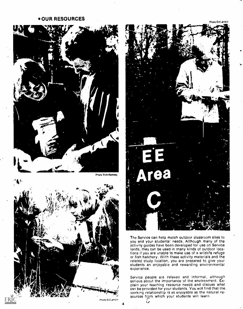
The Service can help match outdoor classroom sites toyou and your students' needs. Although many of theactivity guides have been developed for use on Servicelands, they can be used in many kinds of outdoor loca-tions if you are unable to make use of a wildlife refugeor fish hatchery. With these activity materials and therelated study location, you are prepared to give yourstudents an enjoyabie and rewarding environmentalexperience.
Service people are relaxed and informal, althoughserious about the importance of the environment. Ex-plain your teaching resource needs and discuss whatcan be provided for your students, You will find that theworking relationship is as enjoyable as the natural re-sources from which your students will learn.

SECTION
Or,11 It.. Soso (0.31
ACTIVITIES
Outdoorclassroom
J c 1 ¢rkiMOP (0.140 P
OUTDOOR
DataSheetSIDE ONE
0.16. Chlutiu, Goa* N15194 ra...1,2
atter theInveslit)lion
for inhumation
".
w i It";* ti
I
CLASSROOM GUIDESWHAT ARE THEY?
Each guide is a complete description of an investigation involving an environmentaltopic or Issue. Two levels have been developed: Level I is recommended for grades4-6 and Level II for gradils 7-12 The conceptual information and process skills inthe guides are common to teaching programs In other arKs. Most guides can beuompleted in one day or less
*WHAT'S THEIR PURPOSE?The guides provide direct outdoor learning experiences. Information collected bysmall groups or teams is shared and becomes the basis for large group discussionand interpretation. Thic process can help develop learning skills and increasehdorstanding These experiences can lead to a positive attitude toward '
pnv,ronment

HOW ARE THEY USED?-The guides are developed, so that data collection Iscarried out by small groups or teams. The oata are thenpooled and interpreted by the entire group or class.This process can involve everyone in all phases of theinvestigation, providing for multiple data input and al-
lowing for large group discussion and decision making,However, it is also possible to uie the guides foramengroup or independent pirojects. Most guidea are written,for an outdoor slte, some are best accomplished at awildlife refuge or fish hatchery, but more can take place'on nearby sites such ai a schoolyard, vacant lot or. park.'
OUTDOOR CLASSROOM GUIDE TITLES
LEVR
1. Plants and Places
2. Water Flow and impoundment
3. A Population of Pocket Gophers
,4. Insects and iplants
5. Snow Temperatures
6. Snow Depth and Snow Melt
7. Social History Cemetery Study
8. Old Ponds and Young Ponds
12. WIldlife/Wildlands Photography
13. Careers
17. Muskrats
21. Fish Hatcheries
Level I recommended for grades 4-6
6
9. Deer Food Survey
10. Water Quality Analysis
11. Public Use of Public Land
14. Foreign Language
15. Waterfowl Nest Structures
16. Fire EcOlogy
18. Wetlands and Wildlife
19. Fish Populations
4
20. Public Survey
22. Farming and Wildlife
23. Redwinged Blackbird
24. Endangered Species: Mystery Birds
Level II recommended for grades 7-12
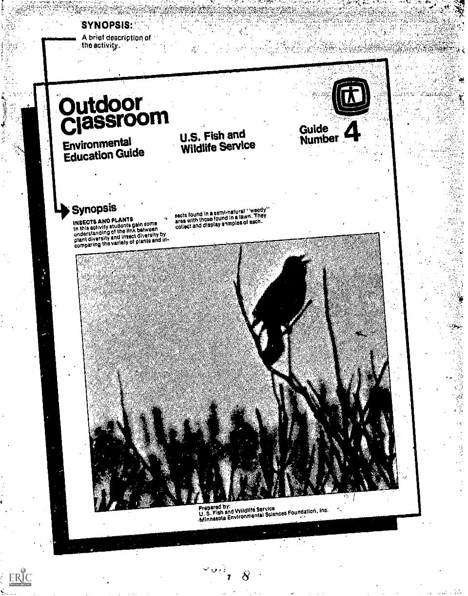
SYNOPSIS:
utdoorClassroomEnvironmental
U.S. Fish and
Education Guide Wildlife Service
;
SynopsisINSECTS AND PLANTSIn this activity students gain orneunderstanding of the link between
plant diversity and insect diversity by
comparing the variety of plants and in-
sects found in asemi.natural 'weedy"
area with thosefound In a lawn. They
colleet and display avnplos of each.
GuideNumber
1
r
rr: .,t1
2 Pill
I.
Prepared by:U. S. Fish and Wildlife Service
-Minnesota Environment& Sciences Foundation, Inc. ,
rd:
r,
r
-;
7 8

.1ca7:4:.
4 4
VOL:,.A....4±X96;r014,
; 44.
t
PURPOSE:
This section identifiesgeneral areas of in-formation and skillscontained in theinvestigation,
OBJECTIVES:
Activity goals achiev-able by the studentwho participates in theinvestigation.
.,
CIOROUr,
A dlieliabiOn sUpportinginforinatnre:;)10lated to the general content of the actiVOY,..,
,
4
environmentalgoalsEvery citizen's decision, or lack oideciaion, in some way determines the
Use and the future of public lands.
Thd U.S. Fish and Wildlife Service IS
this Nation's only Federal landmanagement agency solely responsible
for fish and wildlife. It ie the Service's
belief that through education and
direct experience,citizens can gain in-
formation, understandingand au&
tudo that will support wise useof
Public lands.
nsects andplants
A. Purpose; Thisactivity will acquaint
students with--1. The variety of plants and Insects
that exists in semi-natural "weedy"area.
The variety of plants and insectsthat exists on a lawn.
3. A way to collect, display, tndcompare samples of plants and Insects.
4. The construction of an insect net.
B. Objectives. During this sotIvitystudents will
1. Compare an area where Plante aadinsects ;re diversewith an area wherethey are not.
2. Make inferencesabout what causes'
this diversity.
3. Make a display of plants and insectsto illustrate the concept of diversity.
C. Activity requirements: Eachstudent, or pair of students, willneed 41
1. Materials to make an Insect net:broom handle or equivalent; pantyhose, coat hanger, pliers, needle andthread, extra wire.
2. Killing jars: baby food jars withcapscotton soakcd in fingernail polishremover or alcohol.
3. Grocery bag to contain plants.
The class will need-1. Large pieces of white paper for
displaying insects and plants.
2. White glue.
3. Felt. tipped markers.
4. Golcen Series on Insects.
MATERIALSREQUIREMENTS:A list of equipmentand supplies neces-sary to complete theinvestigation,
Maintaining environmental harmony Is.
a crisis Crincern of the Service. Man
must continue te live in the wbrld in
some reasonable"balance".wilh the
land and with other Ilfe, otherwise he
will.not survive.
Serviceprogrime help people to learn
about land and wildlife. Involve them-.
selves in Interactions with the natural
world, and enrich themselves through
that strangeaesthetic loy which can be
experienced In the midst of a wild en-
vironment. Besides these, the Service
attempts to make its lands a model of
environmental management.
Quality and harmony will remain a pavt
of the environment arid remain the
Introduction
On a local scale the concePt of diversity
can be studied and understood by
students, This activity suggests away
to compare an unmanaged, weedyroadside with Its plant and Insect life
and a managed and manicured lawn
with its lack of plant and insect
COAT HANGE4
guidelines for public land management
if citizens see value In these practicea.
background:
-Old you'everwend& why there arose
--many different kinds of the samething? There are nu.merous kindti of
flys, beetles, worms,algae, bacteria,.
trees, snakes, frogi, fishes, birds and
Mammals.:.
It may seem thatinirnals of the same
kind, such as sparrows, all behave
about the same way. This Is not true..
diversity.
Before You Begin
Each student can make a net, or if
students within working In teamsof
two they might make one net for each
pair. (See Illustration.) Follow this.
precedere:
het0001"
LASH WITH WIRETHREAD OR STRING
PANTYHOSE
a
Remove the elastic waistband from
the pantyhose;bend the coat hanger into a circle of
et least 10 Inches In diameter, and
twist the endstround each other
securely;fold the upper edgeof the nose over
the circle at least 1 inch and whip
stitch with needleand thread;knot one leg tightly at the very topand cut it off below the knot;
knot the other leg at the knee or
below;lash the twisted ends of the coat
hanger to the broom handle (or stick)
with an extra length of wire.
Lwow= INTRODUCTION:A discussion of Informationrelated directlyto the activity with
suggeations for assistance, If needed.

When one observes differeht species ofsparrows, it is discovered that each
species behaves differently than theothera It may differ In when and what
il sings; what, when and how it eats,
when anti how it nests; how it flys and
walks; etc,
Because of the oiversity of plant and-animal life in the environment, eachspecies of sparrow has been able to
-Put together ' a unique composite of
behaviors or niche, Since the niche ofeaeteepecies of sparrow is unique,sparrows of different species are riot
competing directly with each other.
This allows several different kinds ofsparrows to live In the same place.
Planning the Activity
Locate two areas to compare with one
another; one managed by people and
one unmanaged, weedy, and largeenough to allow the class to work in
teams of two with plenty of space for
eacn team. An undisturbed roadside orraievad right-of-way are good possible
Mee The managed area might be a
grassy area of the school grounds.
In order teat comparisons between the
two areas be accurate, the class shoulddecide how many sweeps with their net
each team you make In each of the two
areas (4 or 5 sweeps Is suggested). De-ciee, too, how much time will be spent
e
And so if is with most animal life a
diverse environment with diverse plantlife allows for a diverseanimal life.Diversity then, ceeates a complex
fabric e Interrelationship among theenvironment, plants and animals. This
fabric Is both flexible and durable,Even in the face of disaster caused by
floods or fire9 Or hurricanes, some ef. .
the fabric remains tO begin again.
Many things can affect the natural .diversity ot the environment. Modernagriculture has turned the diversenative prairie into adomestic prairie of
corn and wheat. What effects has this
had on prairie animal life? This activitymay help anewer this question,
looking on the ground In each area tot
crawling insects (6 minutes Is suggest-
ed) Finally, decide how manydifferent plants to collect at each area
(5-10 is suggested).
Activity Description
When the class arrives at the...weepy__area, assign each teamto a generousspace. First teams should collect one
example of each ot 6 or 10 plants, pickthe plante at ground level, place them
in a bag, and mark the bag with their
names. Then they shoutd make the
agreed upon number of sweeps withtheir nets, being careful to sweep at aeifferent level and a different place
'e
each time. Next examine the ground
for crawling insects, and collect them
for the length of time agreed upon.Transfer all insects to killing jars, and
mark the jars with team names and lo-
cation. Leave the insects in the jars for
at least an hour.
__The procedure canhe repeated when - --
the class moves to the schOOI lawn,
Here, all sweeps will have to be made
at grasetop level. Spend the sameamount of time collecting crawling in-
'seats. Again, transfer to killing jarsand mark the jars. In colleating plants,it may be Impossible to locate 5 to 10
different kinds. Perhaps students willhave to collect 5 to 10 grass plants.
9
ACTIVITYDESCRIPTION:
The investigation isdescribed in enoughdetail so that the usercan follow the proced-ure step-by-step, Ifpre-activity planningis necessary, that pro-cess is also describedhere, Brief intro-ductory activities mayalso be included.

) it' 1 .44
; S4.
,
DATth
-X removablesheet On
which students record
Moir findings. TrteSe
may be duplicated.
Outdoor CitissrOo
Initects"
Team
NarneeDatau_heetSI DE ONE Collecting
Are,a
10
11

-
.
. ,Datko011etted
durihg,=!;:ntarPretatioh.',Dis-'..:IthelihVattigaildhtarei.,:uSsion.quiStidnsare
::i:%uSad*Ifi:vatiOiiiiWaysIncluded.
'fordiScusSiOnahd.
\
Using thebateBack in the
classroom, make two largedispleys: one of
unmanaged areaplants and insects, and oneofmanaged area plantsand Inseets.Cover two
tables (one for each area)with white
paper, and drewcolumns onthepaper as
illus:ratedon the DataSheet. It will notbenecessary toknow
thevarieties ofinsects by
name. Dividethe entireclass collection from eacharea on the
basis oflook-alikes, e.g.
ants,beetle-types, butterfly andmoth-types,etc. Line them up in thecolumnar areas. On the other half ofthe table,
arrange theplants-collected
from thesame area.
Thisprocess could be fnilowed first byindividual teams and then a group dis-
play could he madeusing all of theInformation from theentire class.
after theinvestigation
Students might beinterested inknowing what the names of ;lairinsectsam. if so.
they could use a fieldguide to insects to identify and labelthem.
They might make a morepermanentdisplay of theircollection which couldbe designed in such a way that it wouldbe artistic, while stilt
illustrating theconcept ofoiversity. Plants and insectscould be glued toheavy paper in anapproximation of their natural appear-ance, likethis:
With thlsvisualizationot diVersity In
front of them, sttidents can begintoask
themselves somaquestions:
Whicharea showsMore insectdiversity; plantdiversity?Whatcould attract Insects to enarea? is it variety? Plant heightandsize? Plantcolur? Might it be foodsupply?Shelter?Temperature?Acombination of reasons?If this
great diversityexists whenpeople leave an area alone to growand
develop naturally,what do you thinkthe plaiitand insect life waS like here150 years ago?
What effect on inceinvariety does a .cultivated flower
garoen have?Afited of earn?
alag
10copiright 1975MinnesotaEnvironmentalSsiencesFoundation, Inc.
.
41:1,
foFinformation
Many Serviceland areas provideshelter, toilet facilitiesand limitedequiprnent'foryour use. FOr trip re-servations and further
information,contact your local U.S. Fish end Wild.life Serviceoffice Or the following re.&nalServiceoffices:
INSECTS FROMROADSIDE
INSECTS FROM SCHOOLI LAWN
II
,
.....
111
WIN1
IN
*...
kiwtt
...s...woriwwwwweveiagp
1I lit
W.
iti
*'4I
AFTER THEINVESTIGATION:Suggestions for further activities to develop
theinvestigation further for the entireclass,
or provideindependent study material for
studentswith continuing interest.
67-4:
1.
5401,10
Region IP.O. Doe 3737Portland, OR 97208
Region liP.O. Box 1306Albucicerque, NM 87103
Region IIIFederal BuildingFt. SnellingTwin Cities,
MN 65111Repiun IV 17 Executive Pk. Dr. NEAtlanta, GAA0329
Region V John W.McCnrmack PostOffice and
Cow thouseBoston, MA 02109Region VI P.O. Box 25486Denver Federal CenterDenver, CO 80225
Alvsau AreaOffice813 DStreetAnchorage, AK 99501This OutdoorCiassroOm guide is one of
a series;others are avaaable from your
local or regional Service repre-sentative.

. . , .
DEasiontIOVINAIMMNITAL
CARD
to: K11131;11)
't '14 . 117,.. AO "eilC.44, 1.4.1
4.1145Ak4 Os :NI ..I re 04.4
Oat C,:eki
14`a,
As, u Sr, -441,/,:44,....1.1,1$4..1 50-..tra
; .:a.S. 4 5,..41
+8,-44 4.4..j11.14.:,...144'.1:110,44,
Mtele 0N
IROINIMN
41011111.111.11111101MalallIMMUMIIINIMMIIIIIP
WUHAN M.*USUISST'Ns A 004$4.1A UNSMICAn
.11ACK040UNIA
DIE05119NCARD NOM MIMS AIM
POINIVINONwymptmews
11CFOR01010
ea at, pe v., if it team te CS .6,33.1.11;4,20e. iMPS 15'iCS Cull e5m5.e14100 tek-e of a.t, I. Mt tt'r ...et 04:5 11... SI lel t5,55e20.1011.A., SUM 1.01-4,CO rat....
0 its.. ow :a .. it *Pi latim'e A c.'le.,odo ea*. Inol 9341 to L. Stm.,' V.1 ,11.K.S SI tC15. 5'.4 Mane 7 4,44 Sew t **me 00:'5 ye AM ,eik
Wyk ft013
'te.1.3.
30.43: .; aam, e.rea ki....se1
1. 3.40A 1.11Ltd,3A.es
koa OA, .031t S0.
Or 1,41,4 ^ 01:114,11,4 1.,S.'4,11141: ...:33,0-01c.leva
13;111C134I
ftaa. Ate S oe ea, 54 I' .3.2 et; 0.01.,T010.3.1.- pret C0e. -.Or,. WOO*/ ',We 441,441414..:455i 41444gh.a.y.A.2144.00444,4
. .
OM* 0 VW WS. 5114 CSSCCPCV CC CS5i*J4.C,S nil,. 4,4 140t en...Ammtm te1014rei M014 .111,131,041.,...Appyroa.t
.a. II 43.3,ket. tY VC 0 ikeketlf Cole 5111416 11.111111.411. 01 ,
,tektpla p.s .3010 a 0,e,r 11004 .
5545504 p pea ftlom roctftoont 'to mitt; Mao 5401. .,dCi.iIfi.
t3 Wed As 11;fria as. tafta. Pan Zsmsesl, lo..orial 040At eurAirk *Mica tilt .41ene1 #015 AS," 10 ISIN.N.COIuS 3..4 lolbef 110531004105 ilkeo. 0,10111N* Vas 11.*4
SAVA "OM 555, 545 t5 4 MI ONO 010, itS 4105101 soft..4 ookag,me tem...1k At
. ,
"10541455 545 10e tree PASS 1,71 04 55144.4
1,3034. etod err OS 0181454 10.41
ch - Wee; KA)
p34.10.0.01;00104 540550
sewenanktat owed 050 LAO 11.1024e.,051145,-410 eA35550304
.me.5semm0 1.4 Mager on. to 4.0skau vets MM. tmleue
:-mat
afte0011.41.3.4,. PIO ;
1111111111111111111V
RECOMMENDED FOR GRADES SEVENTWELVE
WHT'ARE THEY?Each card is a one to two-hour problem-solving activitycoocerning a land-Use or wildlife management issue.The issue is described .along with conflicting or oppos-ing viewpoints. Role,playing and small group discus-sion are used to consider the viewpoints before arrivingat a decision.'
WHAT'S THEIR PURPOSE?These cards were written to help build skills in problemsolving. -the pro9.ess of reaching a decision when op-posing viewpoints and alternative solutions are con-
.1
sidered. provides practice in group communication andobjective thinking. These cards are also useful as intro-.ductory activities.to the ,investlgative Outdoor Class-reiom Guides.
HOW ARE THEY USED?
The cards are not del/eloped as teacher-presentedmaterials. Instead, a small group of students should beable to carry out the activities on an independent basis.It Is suggested that several smdll groyps deal with thesame activity and then shdre them r. decisions with theentire group. This should -resun in a free exchange ofideas and a better understanding of the issue.
12 .4.

1
'171 -! 1.-.
' 44-3
,
e
'BACKGROUND:.brief deseribtion of the issue and peçtinentaciAirounct inforrn#tion-.,
.
r'
4.
INVIRONIVIEITAL
MACKGROUNO
Populations of organisms do not seem to. be randoVydispersed;. there tends to be definite
patterns Of spacing of In.
dividuals. Differences inenvironmental ,factors' such as light,
temperature, food arid water Influence all organismi
including ants. daadotions, cacti, elephantsand bacteria.A
population of orgiinIsms tends to be dense where en..
vironmental Jactors are optimal and scarce or. even absent where factors are not lavorable..SITUATION
What influences human population dispersion nett Iros? A sociologisthas suggested a way of
representing hurnan
dispersion patterns and some criteria for anairinjthem. Consider- the following
before going on to the activity
section.
Some hypothetical human population dispersion patterns:
VA,
1 - Agricultural2 - Small
3- SuburbanArea
TownsArea
Some mformaiionabout each square:
1 Theyrepresent thesame area.
2. ThecrOss-hatching shows the population dispersion pattern.3 The population density t the same within each square and is distributed evenly over the
cross-hatched pattern.
4.. UrbanArea
mm
DIP.X.CTIONS
Smaii (St oups:
I Divide up into small groups. As a droop, rateeach of th four AumanPopulation Dispersion Patterns using the
criteria belovo. Other criteria may be added if the group links they areimportant..Rateeach according to what you-
think is true,even though.you may not know for sure.
a.
st?rUATION:The spoific problem 4;41-lien creates the needfor decision. DIRECTIONS:A step-by-step procedure for the actMty withdiscussion questions.
1314

p4%.14, - '

CSION 1.ENVIRONMENTAL
BACKGROUND
WILDLIFE MANAGEMENT _FOR A CHANGING LANDSCAPE
Problems of land and water use are central to managing wildlife resources. In the contiguous'48 states, the greatvariation in the composition of plant and animal communities and environmental conditions has led to many different,challenging and sometimes controversial management opportunities.
Factors which limit population growth such as food, water, cover and space are of critical concern to the manager whoseeks to lessen their adverse effects.
Many species of wildlife for which we manage require great variety in their ranges. Deer, rabbits and grouse makeextensive use of openings ard edges, and are found in early forest successions. To meet these needs, wildlife man-agers mix habitat types.
Animal populations change as a result of land-use changes and changes in plant communities. Some thrive; othersbecome scarce and even disappear. As human populations have increased in North America, all populations ofanimals have been affected. Wolves, elk and turkey disappeared from the eastern United States; white-tailed deerextended their range into the lake states where moose and caribou had once been the dominant species.
The question of management includes biological, economic and social dimensions. It is impossible to manage for allspecies. Habitat restoration and land acquisition programs are expensive.
SITUATION
A large land area requires a wildlife management plan. The area has a rolling topography with the followingdescription.
Medium age stands of hardwoods with conifers small separated stands (less than 10%)
Mixed age stands of aspen and birch (about 20%)
Woody shrubs (over 50%)
Clearings (about 10%) composed of native grasses and tame hay
One aspect of the plan must include management for upland game birds. The wildlife manager muSt choose onespecies from these three possibilities
a) Prairie Chickenb) Sharptail Grousec) Ruffed Grouse
In choosing a species and developing a management plan. the manager must consider these major Criteria:
1) The economics of land management
2) The economics of local communities
3) Public recreational needs
4) Public concerns
The information collected by the manager is on the following cards.

DIRECTICNS
Small Groups:
1. Form groups of six. Each participant gets one information card; each group must have all six cards.
2. Based on the information cards, decide which game bird should be managed for, and the reasons.
Large Group:
1. Each small group discusses their choice.and rationale with the entire group.
2. Based on the small group presentations, develop one management plan for the entire group, choosing one uplandgame bird.
CARD A(1) Ideal Sharptail Grouse habitat consists of about 50% brush land for roosting, nesting, and feeding; and about 10%
open grassy areas for loafing, mating display and foraging.(2) The Ruffed Grouse is a favored game bird among hunters.(3) It will take at least 30 years of intensive land management to turn this area into good Prairie Chicken habitat.(4) The amount of money spent on managing the area is critical. The management budget is limited.
CARD S(1) The area is changing (succession) towards a forest cover. To hold back the natural succession that is occurring, the
land managers could use controlled burning. It is an inexpensive method and One the budget will allow.(2) The community consists mostly of retired farmers. There is a small Prairie Chicken population which they
remember from their youth.(3) Ideal Ruffed Grouse habitat consists of areas that have grown over to hardwood-brushland composed of mixed age
stands of aspen and birch and mixed density of understory shrubs.(4) Economics Of the area would respond favorably to increased revenue from license fees, food, beverage and lodg-
ing sales due to an influx of hunters from surrounding regions.
CARD C(1) If the land is used for Prairie Chickens it could not be disturbed, as the birds are quite sensitive. Therefore, the land
could not be used for any other recreational needs.(2) Good Prairie Chicken habitat consists of broad expanses of native grasses. Until these grasses are established, the
land manager must reseed for native prairie grasses.(3) Sharptail Grouse habitat is disappearing because of natural succession which will eventually replace the brush
lands with trees. If we want to save a huntable population of Sharptail Grouse, it must be through landmanagement.
(4) Managing for Prairie Chickens will never produce a huntable population.
CARD D(1) This is the only land in public ownership in the vicinity. It must meet a variety of public recreational needs.(2) The land managers budget prohibits cultivation grains as a food supply.(3) Studies have shown that controlled burning does not cause the amount of air pollution of which it is suspected. A
good public information program can help the community understand this.(4) This parcel of land will eventually become good Ruffed Grouse habitat through the natural process of succession.
CARD E(1) Controlled burning is totally unacceptable to the community because of the smoke and consequent air pollution.(2) Aerial spray to clear an area is very effective. It only needs doing once every 20 years. In the long run it would
prove to be the most economical(3) To manage for Sharptail Grouse, land managers would have to clear different parts of the land on a continuous
rotation once every five years to maintain shrub areas.(4) Native prairie grasses are needed as a staple in the Prairie Chicken diet. The farm community could oppose this.
CARD F(1) Clearing the land by clear cutting is a slow and expensive method. However, the community from which the man-
power would be drawn would find this very favorable. Therefore, high degree of employment.(2) Land managers and public alike are concerned about aerial spraying because of suspected effect on wildlife.(3) The present choices of wildlife to manage for are: Prairie Chicken, Sharptail Grouse. Ruffed Grouse.(4) A huntable population of Sharptail and Ruffed Grouse could be produced on the amount of land available.
''

--111111:11ENVIRONMENTAL
CARD
BACKGROUND
2.PEOPLE PATTERNS AND
POPULATION DISTRIBUTIONS
Populations of organisms do not seem to be randomly dispersed; there tends to be definite patterns of spacing of in-dividuals, Differences in environmental factors such as light, temperature, food and water influence all organismsincluding ants, dandelions, cacti, elephants and bacteria. A population of organisms tends to be dense where en-vironmental factors are optimal and scarce or even absent where factors are not favorable.
SITUATION
What influences human population dispersion patterns? A sociologist has suggested a way of representing humandispersion patterns and some criteria for analyzing them. Consider the following before going on to the activitysection.
1 - AgriculturalArea
Some hypothetical human population dispersion patterns:
2 - SmallTowns
3 SuburbanArea
4 - UrbanArea
Some information about each square:
1 They represent the same area
2 The cross-hatching shows the population dispersion pattern.
3 The population density is the same within each square and is distributed evenly over the cross-hatched pattern.
DIRECTIONS
am&
Small Groups
1 Divide up into smaH groups As a group, rate each of the four Human Population Dispersion Patterns using thecriteria below Other criteria may be added if the group thinks they are important. Rate each according to what youthink is true, even though you may not know for sure.

low
Criteria Scale:
2 3 1 5 6 7 8 9 10
medium high
CRITERIA
1. Dwellingsa. density of single-family dwellingb. cost of single-family dwelling
2. Crime rate
3. Amount of open space
4. Availability of social/cultural facilities
5. Quality of education
6. Job opportunities
7. Pollution levels
8. Availability of energy
9. Availability of transportation
10. Availability of goods and services
2. As a group. use the ratings to construct a dispersion pattern which represents an ideal for a quality living environ-ment. Other ci aerie could also be considered. Sketch the pattern on a large sheet of paper and be prepared todefend your ideal pattern based on the criteria.
Large Group.
1. Each small group presents their ideal dispersion pattern, and describes how it meets the criteria.
2. Construct a single dispersion pattern based on the products from the small groups.
Idea for an Option Activity
What influences population dispersion patterns of people, plants and other animals?
Obtain a map showing human population distribution in the U.S.A. andseveral Golden Nature Guides, or similarpublications, showing distribution maps of plant and animal groups. Note the distribution patterns of people acrossthe U S.A. and those of specific species of plants and other animals. How do environmental factors, such as food,light, temperature and water affect these patterns? Are there some factors that influence people distribution pat-terns which do not seem to effect other organisms?
Consider people distribution patterns in your own community. What factors seem to be of greatest influence? Aresocio-economic factors important? How?

DECISIONENVIRONMENTAL
BACKGROUND
3.SOIOOL SITE DEVELOPMENT
The way we occupy and use space is a major environmental issue. Freeways bisect communities. Suburbs cover overproductive agricultural land. Developers pay almost no attention to the natural features of the lahdscape. Anonymouscorporatiohs and loose collections of land speculators control vast sections of land with the hope, as communitiesgrow, of making a substantial financial gain at costs to the environment which cannot be caluculated.
A response to these insults has been the development of all kinds of land use plans. They range in size from yards,parks, communities, regions, to states, and include recommendations for national land use plans. Some of theseinclude considerations which are clearly for experts. Some regional planning and coastal planning, for example, areso complex that they appear to,be a no person's land. Others, however, are smaller and much more manageable.
SITUATION
Dealing with a land use planning problem for the local school ground will provide you with some of the same experi-ences and frustrations of a professional planner, an opportunity to deal with opposing points of view, thinking throughand presenting an idea, and perhaps even doing something about it.
DIRECTIONS
Small groups:
1. Divide up into small groups. Pick a piece of land on the school ground that you would hke to see changed. Brain-storm all the ideas you can think of for use. Pick two or three that you especially like, and rank them from mostliked to least liked.
2. Collect some opinions about your idea from persons who are likely to be affected by your plan. This might includeadministrators, custodians, neighbors, school staff, teachers, kids, etc. How do you plan to collect thisinformation?
3 After you have collected the:-..:1 data, use them to help you make a decision. Is it go or no go? What are the reasonsfor your choice?
Large group:
1 Each small group presents their choice and the rationale for it with the entire group. The class must decide whetherthe plan is possible.
2 Pick one or two of the ideas which you feel good about and which seem possible.
3 Rank order these two plans and decide whether the plan which ranks highest is worth doing something about
4 If you are committed to the plan, try to do something about it. Develop a detailed plan and submit it to the ap-propriate channels. The plan should probably contain a description of what you are going to do, when you are goingto do it. and how much the project is going to cost.

FOR DISCUSSION
1. What determined the final course of action that you took? Would you call it a success or faHure? How do you decidewhether it is a success or failure? Does a plan have to be carried out to be rated a success?
2 What kinds of resistance, if any, did your small groups observe when they tried to collect opinions about the area?
3 Whai,ieasons can the large group give to support the land use change that you support?
4. Suppose you decide to leave the school ground as it is. What are the advantages and disadvantages?
5. What are experts? What kinds of things do you need to know to plan a neighborhood?
6. What evidence do you have that can help you decide whether your school grounds were "planned"?

OsloENVIRONNIEMAL
BACKGROUND
LAND DONATION
A small farming town lost its railroad service in 1963. The railroad company offered to sell the 13-mile strip of railwayland to any community group that could come up with a good plan for use of the land. The purchase price was $1.00.The company let it be known that they would prefer that the land have a conservation use.
SITUATION
A town meeting was held and several local people proposed uses for the land. A list of groups represented at themeeting and some of the proposals are given below.
DIRECTIONS
1
Groups representedat the meeting
FarmersFuture Farmers of AmericanYouth GroupChamber of CommerceHunting and Fishing Club
MembersHigh School Biology
TeacherSchool Board MembersPark Board MembersLocal Teenagers
Land-Use Proposals
Drag StripReserved for future parklandShelter beltReserved for school siteNatural History Area for
environmental educationIndustrial ParkWildlife Production AreaTeen CenterPlayground
To recreate the town meeting, consider the following before beginning:
a) Select a chairperson to run the meeting.
b) Select a secretary or devise some means for recording the responses.
c) Select a decisiontmaking body or town board.
d) Select presentors (perhaps 6-8 individuals).
e) Determine a process for hearing proposals.
fl Decide on a means for reaching a decision by the end of the meeting
0-

2. Individuals should prepare a 5-minute role play presentation using one of the groups and proposals listed above oran original.
3. After several proposals have been presented, the merits of each should be discussed and a decision made. Howdo you make such a decision? What are advantages and disadvantages?
4. The class may want to discuss a town meeting as a decision-making process, considering both its positive andnegative points. What are the positive and negative points of a town meeting as a decision-making body?
5. What arguments could groups develop for use of an area which appears contrary to the intent of the land-use offer?

_S ONENVIRONMENTAL
CARDBACKGROUND
5.PREDATOR CONTROL
Hunhng is a popular form of outdoor recreation. Several state and federal agencies are charged with the responsibil-ity of maintaining healthy populations of game animals. Game animals are those species highly valued by hunters forwhich there are regulated seasons and/or limits. Thus humans distinguish between game animals and non-gameanimals. Some game and non-game animals are caned predators animals which prey upon other animals for food.Regardless of how they are classified, all animals must find food, water, shelter, and living space in order to survive.In some situations hunters and predators are competing one for food and sport, and the other for survival.
SITUATION
The ring-necked pheasant is a popular upland game bird in agricultural areas of the United States. It is a native birdof Asia and was introduced in this country in the late 1800's. The habitat must provide these basic requirements:
1. Nesting cover. Hen pheasants require nesting areas with a moderate density of vegetation. Mixtures of grasses,legumes and weeds provide optimum nest sites.
2. Winter food. Corn, small grains and native weed seeds are ideal winter foods.
3. Winter cover. Dense vegetation not covered by snow near food sources is ideal.
Most of the agricultural areas offered superb habitat. By the mid 1940's pheasants numbered in the tens of millions.However, by 1945, the pheasant popoulation began to decline from a density of one pheasant per 5 acres in the early1940's to one pheasant per 50 acres in the early 1960's. It was generally believed that pheasant populations wouldincrease, if predator populations were decreased.
DIRECTIONS
A Before forming small discussion groups, put these statements on the blackboard and formulate a class responsefor each of them.
1 A predator is
2 A game species is
3 Predators should be
4 Game species should be
B Divide up into small groups. Consider 1he following predator-control experiment conducted in a Midwestern statefrom 1960-62
...C The? experiment
1 Two similar areas were identified. Major pheasant predators were systematically controlled in the experimentalarea whereas in the control area there was no predator elimination program.

]1962 hatching success = 16%
Control Area
1960-62 no predatorswere removed.
2. Each area consists of large farms intensively tilled for corn and soybeans. There is an increasing tendency forlarge, clean fields.
3. Major pheasant nest predators were: raccoons, crows, and skunks.
4. Results cif the Experiment111.Experimental Area
1960-1962 434 predatorswere removed.
Results: 1962 hatching success = 36%
5. Important Fact!
Population continues to decline in both areas!
As a group, prepare a plausible explanation for pheasant populations continuing to decline in both areas. Be able todefend your explanation to the entire group.
If your group was responsible for managing the pheasant population in these areas, what would you recommend?
Large Group
Each small group should present their e.xplanation for declining populations and recommendations for increasing thepheasant population.
After discussing the small group presentation, reconsider these four statements and make changes. if necessary.
1 A predator is
2 A game species is
3 Predators should be
4 Game species should be

WILDLIFE
U I GAME.
DUCK GAME
T.C:NS
- jt.s.44.Q 00.1%,,ms:14.,,,.06 . ov- s..
..1.:1kF.I4 .010 N;
SCORE SHEET
..,..h.rrai
ins 6
g Is6
Svei
111 111 III
%.
SPINNEG
GAME BOARD PLAN 1=1CD C.) CDC)
C)CDC-DC°)CDCDCX.DC:)
C7")CD
CZ)(---.) CDCZ)
(*(DC,D(72)(7)(----)
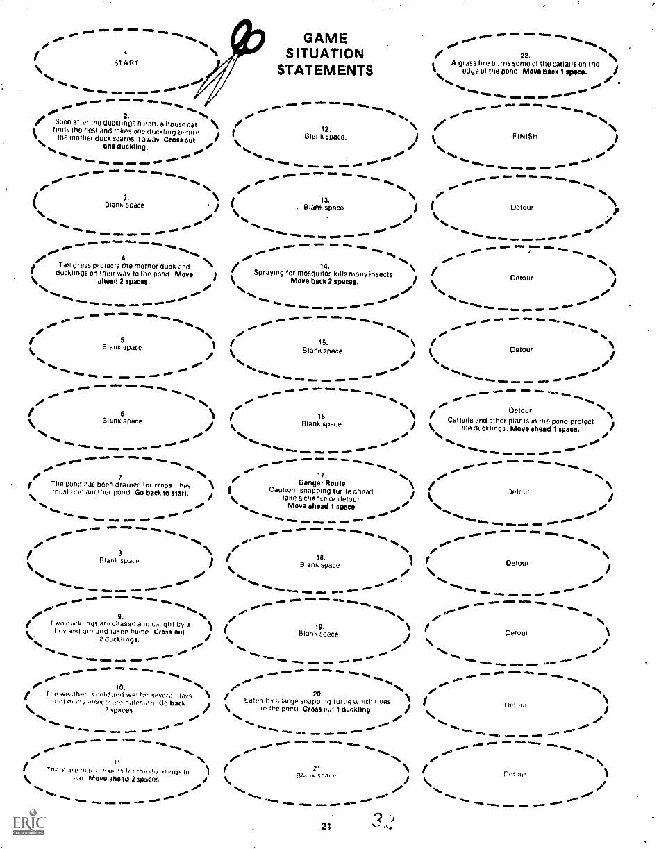
GAMESITUATION
. STATEMENTS
,........... ",/
.......
/...1
/...%
......
a
I
-
...,s,
/
,,,....
/,.
, ..,
.....
A A
.............
_.--
/
r '".... /.( '0-;
S.....,.... ....
..., I.....\ f
el ',
4.
.
.....- I
.....
ss
7 ..s:......-s, %/
O.I
Z..,f....Vac-) Ititma
%
/
/-/
/1
...... ......
.... e.......
....../L
\
..... "5 " / 1
f 4410 oar111,1. r...... -L \ I
RECOMMENDED FOR GRADES 4-6
WHAT ARE THEY?I nese are five independent indoor activities for smallgroups of 26 players. Each game is complete and con-sists of a game board. a sheet of game materials and areproducible direction and score sheet. The gamesdepict some environmental factors which influence thelives of five wildlife species: the fox, the eagle, thewhitetailed deer, the squirrel and the duck. Theplayers start the game with an equal number of one ofthe wildlife species. As they move along the gamehoard according to the numbers on a spinner, positiveah,t oeqative environmental factors are encountered.The player wrm finishes with the greatest number of
,lituals remaining IS the winner
0WHAT'S THEIR PURPOSE?
Whdo playing the games, students become acquaintednt the inter.ididds between living things and
15
the environment. These interactions include predator-prey relationships, the need for shelter, accidents, theeffects of pollution, and the activities of humans, Thisinformation is related to the content of some of theLevel I Outdoor Classroom Guides. This provides forlearning continuity from the indoor activities to themore complex, outdoor investigations.
HOW ARE THEY USED?
It is recommended that the games be set up as inde-pendent activities. If students can read the directionsthey should be able to play the games without adultassistance The situations depicted in each game arefactual and relate to a particular concept or problem.Many of the situations could serve as the basis for dis-cussion once students have completed a game. Thegames may also serve as pre-activities to the OutdoorClassroom Guides.
9,

. 3 , . . crA. ` 'i' '. C.
-SAMOLESCOReStig.Using thiaexamOIC-,students.will bea4leto rna)se up- ttlair ciyun . =
;-scbre stieel$. =. '
SPINNER:..-,' 7 i! - . ... ,
. . , t. , .. , . . . .
This can be traced or,photo;Oopleb WO giufid ,
to a pike oroardboard, e
DUCK GAME:There ere several duck nests,near the pond. Eadh
,nest produced six ducklings. The ducklints must
get to the water and find food and shelter to Ih1e.,;
There are many. dangerS .the Wes of clacks.
DIRECTIONS1. thie oho i);sinner ands* playing token for each :
Own% Insert pencil in spiretwas Mown.: .
: 2, Put players' namesonscdrestieethelow.-.
3: Player with ttiken No. i spins first. Side which
: lands on table shows rairnber of sP.ffes loamy*?
4, Playa must follow directions nrt step which
7 token lands on. The player may go either wayaround the p'Ond when the token lends
. step tabeiect !!.c.eution: Enapping Turtle.' ,. ,
5. Each times Player loses a duck, cross out oneduck on score sheet after that player's name. A
play& who loses al) ttlx ducks must drop out If
thegame.
7:
141.AYERDIRECTIONThese are simile forall rive games s thatatter learning tw to
. play one garnestudent's will *e able .
. to play the others.
PLAYERTPK ENS:These can he traeed orphotocopied andglued to a rilece at'cardbpard:
SCORE SHEET
.
1111fflitrunWEZ $ Tem'
'flails11111111111111111111
11111111111111111111111111111111
PIIIIIIIIIIIIIIIIIIIIIIIIIIIII1111111111111111111111111111111111
EMI III IMMOe 1111111111111.111111
6. Continuiptaying untilall Weyer; have reached
.
ducks Is the WINNER. If tWo players have theFINISH, Player finishingwith Mot surviiing --
same number of duckeieft; the one who got to .,
. "FINISH first it theWINNER. , , ,
:I -lb
,
' PLAYERTOKENS..... ..... ..... . Il OOP =0. _..". ...1 ...Alp. Mk. .1. 4
I
2'. I I . :;--.
II ', ; .;,
-- ; 4 ....... ...._______ ,,,.1_.--:
I , , :
%A
I----,,,.,
I c -.I
I
. 1,
t ,
1 ',.-_,1-
I.1, ....... ---.... I
I
A,
;IJ
c
GAMEHOARD FLAN:.Tni:5 plan shovis one
, way et arranging thegame situation state-ments on a large pieceof paper or cardboard. /NM 41,- ,711.,
lb* --7
/r.----."4"-1-7'14,
SINN 1.1SINit PENCIL
;V
c
4%,
GAME BOARD PLAN
<
.-

t.
.OIRECTIONS TO MAKING YOURrOWN GAMES.These are do-it-yourself 9axpes. All of the parts and the vide opportunities for uting techniques and skills founddirectiohs to ce4riprete each game are given. on the fel- In art, geometry and deeign, Some students may.alsolowing pages, `. get;somito 'fOr. .heW gameS depittlhg. the: OAS of
other animals.Students will need some assistance with constructing ,
the first gulp. HoweverNthey should. be able to corn- The following list describes each of the parts and givesplete ttle others without difficupy,.,This task will:pro- directions for conetructing the game:
.
At.
- .STAGT
a aaaaaa 611
GAMES ITUATiON
STATEMENTS
a. a a a a... .or
2 0Sco" artG, the duCklings halcit..a 11::,:se cal / 12.
. s (finds the no.51 anti takes end 06551153 telore I Blank space I 3..
the mono, duck SOWS ! dway ClOSSOUI 4,
4.a aa'''. al%
32.Blank IPael
23.Blank space.
i4.. WO d uskling a.' N.. .a. Is. I .#4et.. oo ... a AN., ..,_ ..., a
......_ ... a .... a ---.. a. a a. a a - .I aa a a a a a---. a a a ... a a '-- a a a a ....a ..... a a a aa - a a a ... a a aa a a i
a"aa
a ora #. aore'
/ .
\ / st3. \,a I. glank13aP2:0 / IBlank space..24.
Pl B ask sone
.1. "4.a a a Oa a- a a a .... a ..--___. a-- ,
.... _..... a ... a a a .... .... .
.... :L. 7. orar4 ft1.7 .......
a.44
a A-- -- ...--...... ... ....... ........ ,., ....
.- ..- - _ ._
_...-"..... ..--
0- ...4
Irail gre2e prqrkla toe Moine, OLOI.,a,: ,.**4A t/ 14. / l' 23:
. I Spraying lot mosquitos tuns many Insects Stank space.thiclingS On MO.. AM lo *Po pond Mars i / N
ahead 2 spaces. .0. 116
Move bask 2 span.a/
.... .00 ....a .... . .... a ..... a 1...4 ...
....ea a ". . ..
.
r0e4.04
..... a a a a ....a ...... MI, a .4. --"". aaa a a.. aa, a.4....'lb
S '00 26.
I I \ ' A grass firnburnh8Omi of the cattails onnig
Evan. speco space 1 OdgeOl the pond. May613+,41 awe.. ar.
'A.re' es, . . . .0aa eft ..aaaaa a a a a a at
rB:.,.65 3ce
is. / 27.
Mans spans kr.,Grain Crop near pond Wave ahead 3 specs.. 1
I #4
a a aaa .." aa a a a aa......a a a a a a .....
-- A. re. 44...... .
.... e ..., I ".o..... .0%. 17.
-%.1 l ....
f I tit i.urul "as o..t." Ir4.000 in, c,:i;a ir'ty \ 1/ . T / Caution Snipping Ttlitl0
21Tae a chance \ itank10.m I ^a
ace.
.
ns an"er o0"0 Go hack tO slutk / % /
,%e %,. .1
......0 .... Detour 4.0 ..... a #.
......a a a a a *a ..... ...a ao a- an........=........-- '
....
...,
t -- ......./..
ma .... sZaTal=wm.a a
aa ...' a
ea a a a 4 a NIq% #a ..." .44. a .' ./ %S. '44 9. J : t 21.
'4. ...,----. .4-4 ..... N... ..... ...... -°'"
....0.02°.
".....,..... ___-- ..... a a a ---' ..."."
. 16.. II
I .... .....0.4,S.
in the pond troll Out I duckling. / %%,
.... a aa a ...., a .... a a a... a'1 a ,a
..., a a. a .../ a a a . .4 .... ' r aal.a - ar... a 'al
9 0p N. / *s.% ro-- ,... iu......, : ', 40.1-.1w-en u a / ie. 30.Blank space.
1
..,, .1., .i A-4 ,1npe ' ., 0 01010 011t '... Blank apace i \....
2 ducklings / ...., /
.1. a,.A. I Eaton by a large Snappng turtle whch lives /
a 4 aa. a* a 4.. a ..__a. a a. a ....aa a a 44. a a a a a a ....
a a a a MY .44. a _,
.....
4.............._. a a a a a a.
a, a a 404. a aa .001 --". aa I°.
a t 0 'or. / rt ....1,--.,, . c.o a ,t .5, 1 o ./..a.A, liy, \ / miler pla,,ts .11 the pond a ()tut lk. f DuCk hop USOnloSkt.hOuses tor reallng irt20.
.., .: . atcls ; ^.'." og al be, ,1/4 hoe dockioga Move *Mud I ipaci / /\ 2 10.111 .... ..., . A
IOO Ran Moved ahead Zapata.46.
.." .. Is-S .....-a a a a4,7a a 44.a a a aa a a...,
.0' ..... "0. 0°
.1 ''.. .0..0' 21 \ // .... .. .1., 1.:.,.: - .1-: 0.: . ,,,,Aos I,. i I EllIps Strati) 1 \..,. .. .I.N.
AA. Maya ar.stoi 2 1paai . 1 \....,,
%.,.. ..a'.. ... ....P ...., _,,.. a....., ..... -A ..... a...a a -AA. a ..... a,
a a a aa .4a
32
. FINISH
"."aa a a a
GAMESITUATIONSTATEMENTS: .These are to be photo-copied, cut out and ar-ranged on a-gameboard according to thesequence shown onthe Game floard Plan.
,

'4*-104"!**4-10.1itN..2,. .4t*Alattiatiiat-il*;':2
18
' Photo Ed 'Hessler

1. DUCK GAMEpp 20-21
2. DEER GAMEpp 22-23
3. FOX GAMEpp 24-25
4. EAGLE GAMEpp 26-27
5. SQUIRREL GAMEpp 28-29
Portions of each Wildlife Survival Game need to be photo-copiedbefore they can be assembled.
19

DUCK GAMEThere are several duck nests near the pond. Eachnest produced six ducklings. The ducklings mustget to the water and find food and shelter to live.There are many dangers in the lives of ducks.
DIRECTIONS
1. Use one spinner and a playing token for eachplayr, . Insert pencil in spinner as shown.
2. Put players' names on score sheet below.
3. Player with token No. 1 spins first. Side whichlands on table shows number of spaces to move.
4. Player must follow directions on step whichtoken lands on. The player may go either wayaround the pond when the token lands on thestep labeled "Caution: Snapping Turtle."
5. Each time a player loses a duck, cross out oneduck on score sheet after that player's name. Aplayer who loses all six ducks must drop out ofthe game.
6. Continue playing until all players have reachedFINISH. Player finishing with most survivingducks is the WINNER. If two players have thesame number of ducks left, the one who got toFINISH first is the WINNER.
PLAYER TOKENS
;
W.IMNM MOW .=1 1 MEMMID .11MEMM
SCORE SHEET
NameNumber
11111E1
of Ducks TotalSurviving Ducks3 EIL1113
1. 1 1 a2. 13. III4. 15,
6.
NO My./ ./MO
\ SPINNER
A&71bm
,IN USING PENCIL
GAME BOARD PLAN
20
low&OM a ..MO
1.
START
*am%Nib
ear qiftre lam ems own 0.0.
GAMESITUATION
STATEMENTS
...... I0. 0 mom 011 es... so= woo Imo avow ft..VW' .11114,I
2. ie.% .60 ..... \r Soon af ter the ducklings hatch, a house cat \ /12.finds the nest and takes one (111chting before i I Blank space. )the mother duck scares it away Cross out \ /\ one duckling, / \ .0.
No. I41%. 000 .... 11111. 0 0 %I.. .0 ...----_..... ......0 0. 40 .0°WO. ftftft.
01* Me. 0 ...... 0 SIM em. 0 0.egg. 0oft%
%.../ /'i 3. \ i 13. \it Blank Space 1 i
1 . Blank space
0, 00 .......0/..., ......,
-.... 0 SEM 1110 0 IWO.
%mob/ 22. \A grass fire burns some of the cattails on the
edge ot the pond. Move back 1 apace.\ / .`,1. .00v. ...., , .0.- ......0. 0 0or.
0,0441.
FINISH
.1%009
row
-
Detour
e.g.. 0 06 0 10wel..- 0 0. ol101woo 0. .0.00 0 0 .... 0 ow. :7- ."." ....., ....,
or 4. N ....14,
it.,, o° ..et Tail grass pi weds the mother duck andducklings on their way to the pond Move )
/ Spraying for mosquitos kills many insects \, /% Move back 2 spaces. I
\ahead 2 spaces. \ Is , ...
Detour /%ft 0.1. %ft. O. 0..11., ...... WO. 0.1% OW.0 ....0 ..... 10 0 NmE.0 0 wmWM.
WO.IMO00.ft 10..4%
'S446005. 15.
Blank space16 Blank apace
of.%
""" a
isMIN SIMow.
Detour
OMEN. INISIMone
...1. 0 0 1111.4. ....._,..... MOM 0 ...... SMIM 0 Wow, ....._a... .--- 0 00. ".ft s...0. OOP 00. 00. 60ft 0.00.
0° re'6%
\ / \/ 6. \ 1. 18.Detoure
Cattails and other plants in the pond protectBlank space
N., Blank space. / the ducklings. Move ahead 1 space. I%I. .0/ I roo \
11.... I..... .0 4...., .0 ,...""1" .... 0 0 .... .... ....
OS.
.... 0. 0 0 0 0 .....coW. 0....... 0 ..... 0 ,..... 0 ..... 0110ftft 0... IA. ea.. 0.10°
1.0,.0' .0"
17. 60. \/ 7 / Uanger Route \ / \/ The pond has been drained for crops !hpy \ ,I Caution snapping turtle aheadroust f trid another pond Go back to start. / take a chance or detour / k /\ . \
Move ahead 1 space / /"te. a/ .,we ..
Detour
00... .5., 00 ....,,, ......,..,.....
...... .00, .....0. 0"ft..... 0 0 a..2 ... .ftftft...... min. 0 0 0 0 00.. ..ftftft *tr.. gag. ...... OW. ft."' 00 0 0 ..... W.. 0 0OW %ft. OW' 0.Oft. 0.. 00, ft% 0.1. .II..Ile
N / , / \flank sodie ) IBlank space
18.1 f /
/ 8
%II e, S..Oo. -....
Detour
.re111/4 \ / \
...... "" a ...,.. a ......,.... .... a .....
..."1"40 a a ..... ...... -.., a a .......,A+, .... 64.4". 0. ...Be ."*.
%.... 60
es.. 0 0 0. __. a.. 0 ............ 0 601. MN.
,..-0.. COft.AOI' 9. .1"s / '. / NBlank space " /
Ill1 Two ducklings are chased and caught by a \ ,
t 19.
V 2 ducklings. / \ I \ Detour0
bny and gal and taken home Cross out
%.. ..... .00. ...0 ...ft 0. 0.. 0.9 0.--... 0. 0. ....m .....
404C %.. 0, ......0 0. ww11 ..... ......em.. mum
.... ....m0. ... 0. .... ....0.Or° %ft,. .0.' 0 ..' 0Oft. %.,. 0.9 "0.._ 00°N.# 10. 4,46 I /20.
1 \I, T ho wpa their .s cold and wot for 5everal days. \ of ,Eaten hy a large snapping turtle which lives I Detour
.."\ 2 spaces / k in :be pond Cross out 1 duckling. I \ ieol rn.w.,, r,lects .1rP heitchtig 00 back
-.., .1/.4%,,..., ...... ... ....... ..... .0... 00.
I..° .4% 0... .111.8 .... mew a.* .--- ..--
O.. .... 0.0 -._......
ainNIM..... WO.
6009
...a /MM..1n.. 0O.°
deOft
0 000
I IT10,0 .01! 'I ill' 'h., 0. khoqs to
-at Move ahead 2 sp,sces
00'ammo.mosala mg.0 es 0a
offfsib 0 Vile
.0 0
21Biaok space
4113111111211, INMEEM
21
Det ti '

DEER GAMEThe large area shown on the game board is"home" for several deer. Here the deer must findfood, water and shelter in order to survive. Thereare many dangers in the lives of deer and many donot survive. This may seem bad at first, but it isimportant to know that if some deer didn't diethere would soon be too many deer in the area.When this happens they can starve or become sick.
DIRECTIONS1. Use one spinner and a playing token for each
player. Insert pencil in spinner as shown.
2. Put player's names on score sheet below,
3. Player with token No. 1 spins first. Side whichlands on table shows number of spaces to move.
4. Player must follow directions on step whichtoken lands on.
5. Each time a player loses a deer, cross out onedeer on score sheet after that players name. Aplayer who loses all 10 deer must drop out of thegame.
6. Continue playing until all players have reachedFINISH. Player finishing with most survivingdeer is the WINNER. If two players have thesame number of deer left, the one who got toFINISH first is the WINNER.
PLAYERTOKENS
s;\
SCORE SHEET
1.
2.
. ,
.
I
.
.
-
-
\ SPINNER
A=_
'SPIN USING PENCIL
v/
GAME BOARD PLAN
/(1
22

woe....0109 ""
MIMI OMB 4...00. 0E00 WINOS swa.
Oft, i.,, 00' .....00411./ N / N1. 23.il /START GAME Blank space. )\ \ ..... SITUATION ... ..., .......,
....,... ..... ......0.-- ......L.,....................-.... TS.0
STATEMEN ........................... 0.. -- .... MIMI am
40.Nt,de de/ 24./ 2.
Blank space.) 0.. aim ma, Ewe ..,,.%
Blank space ..... .... ..,too
.......a Wino MM. ....... IWO / The snow is too deep for the deer to uncover \ sob . - omo ' 6..
es%Nab 4111."" Waft
Ia. geolb \ .1%
min =MO OMB gm..... 0110.11 MOW *NEM eft. ....., food on the ground. Go back 2 spaces. / ....
N/ 3. \ 41111.4. OOP 25./ The deer population is too large for the food ea,. .00 / Deer use dense underbrush for protection: 1supply Three deer are taken during the ) kr...... .., ....... .0w
..... ..... several acres burn near the river bank.s,,, I° oe
.0.0 MEOW WON
.4114,.%II O.
hunting season. Stay where you are. do' .... \ Go back 1 space......, 0010 14. \ 0..., 00..000. .... ...... .....
.010...... ..- ..-... ..... - j ...... ...... ...Two deer are chased and killed by dogs..... qp Oil* INIIM ..... Gift. Cross out 2 deer.
I' eso..00.
OP4.
00%
\ N.
---04.
IP Iiii,'411b/ Many fawns have survived the summer
...,,,,. .=., ...... ...... f 26.Blank spaCe. ithere aro to0 many deer in the area. Go back 1 .....
2 spaces.
...15.00..... .... .....
SIM. OIMMO M.MMS ....aNIN ....
NINO / Deer ar e chased try snowmobilers. )." ..... ....
.....,waso 00.0= 4=. Trim.
gles, Go back 3 spaces.0,,, .../ moo 0...."" 5.
.414.
....i A farmer doesn't pick all of his corn, leaving 1 °M.o. OW. I 27,some for wiidlife food Move ahead 2 spaces. I ....
....... ....... ..... ....000.. Blank space. )
9116,
MIN.11.111. MIS NM' ....11 1."'''
_.... ON°de. d°9 oe
There are too many deer in the area: they16.t \ 41%
1.0."S.:: sm.o......10/...1.11.1.:". ."...
00141.
de11414,
IMO°ali MM. ..... -___.. / Waft,.61... begin to run out ot food. Cross out 3 deer. arm ....../ N 4.. ...... ...- 4". 28.
.ro N./ 6. )
...... -1.7.= :::. "' ...... / Deer eat acorns for food A large grove of oakBlank space INft.
.41., trees is bulldozed to make a new farm field. /\ Go back 2 spaces.oas 0, f.' 000 it.. .011. %aftOft,.
Ilo ........... 11"'....... ..... WOO. f Cold, wet weather weakens a fawn and it dies ) .....
of sickness and parasites. Cross out 1 dear....7.e.....r..........
/.....= ".....
,...., ..... .... N.0. 0...0.4'..... 00 ''' 29. N/ 7. 1 ...... .._ _. ..... ...... --- --- / A large farm field Is no longer plowed. Small\ Blank space / oise "w"*.
mil. MEM mr....\)
MN... fte..aIp.
trees and shrubs begin to tak.o over. /Move ahead 1 space.
....., ..... ...... \ .......... --- .-... -- . 4,..., 00
18 ...../ ... . .......
( There is an abundance of early green growth ,.... . ....... ...7....... . ... ..... .....
0,41.
foo. oft., for food Move ahead 2 spaces. / ....... 00.
.4' 4/N/ 8.
Dense evergreen trees provide protection 1..... ...... .....c. =N.= ow. aairO
amMe ...NM.100 00... / 30.
)\ from winter winds Move ahead 2 spaces.40"
..... -ft.. ....... Blank space.5% \
./.......... ... 00 / \ i... ....., .0,...., -.... 100.. / 19. ..... ".... min. ..r. ...n"..
%...0%. \ ) .0.
.... .... .......,.
,..., .... ... .... ...... Blank space ...as gifts../9 ...,/ N. ...0°. /In the winter. deer depend on the woody
N%ft.
"..... Vole/ twigs of certain trees and shrubs for food -.-............ .00' / A new highway opens and deer must cross it\ There is an abundance of these trees and /
%I. shrubs in the area Move ahead 3 spaces.... / ...0°ogy 0.... .... .....
..... \ \ ..to get to source. Two deer are
killed while crossing the highway.Cross out 2 deer. /
.....00. ..... ..... ..... ...... ...... ....m .....0 / 20.
...... Va..."..MII -"
... ...- .00
Blank space I ..... .... ............"....--- .- .... ...,
00.'0
I..... ik,#.' 44% /
-.........-.....-r.......-s 00m / 32./\ Bl.ink space
10. NI
)......
as,"
......,
....... ...... ......, \ Door make use of several agricultural crops Nfor food Move ahead 2 spaces. /N. #.." ....0 ....,
No 40/*ft,dor. ow.' 21.
N ....,...... .... ............, ....... ..... ..... ----. / ..... ... ......-.....
.11.0 WM..0. tow. emas A doe is killed by a car. her fawn cannot sur- ) ..... MU= ......00°
.00,1.4.,
\ vive alone and ches also Cross out 2 deer. ...o6,10.1
WM. ...MsWI%
%11
......
# Na. °' N...a.. .0.4.°' f 33./ 11 ....la Usint. sum. aeon.Nam ...... .....ra..."'"
mi.°)\ Fif.sok spare /
sof°' ''...'am ....., ....... \ Blank space /00. ,re°
1..4, Nb%Ib
am,....Rim ...I.
ailla. ........"'' ......."'".sm...
...M.
0.4. t Many fawns aro born in tho area22- N --; ......... ..12r ....."7". Wje
SO.'
Og#.°....ft Stay whore you ere. I ......0.,
oss.../ i.., .00° e,t 1 2. \ ...., ..... ....., ...... _... .....- ....-( 34. 1\ Blank space FINISHi \ /.0. *444
4bek..1*. 2 / "ft. '.. "a.0.1"
....... mom* am" -----"". °lad' s... :.2 3
FOX GAMEVIONIMINIMMOI
The red fox must live where it can find food, waterand shelter. It eats a great variety of animals andsome plants. The number of foxes in an area de-pends on the abundance of tood and other factorswhich effect its survival. Play the game and findout how many of your young foxes survive.
DIRECTIONS1. Use one spinner and a playing token fOr each
player. Insert pencil in spinner as shown.
2. Put players' names on score sheet below.
3. Player with token No. 1 spins first. Side whichlands on table shows number of spaces to move.
4. Play must follow directions on step which tokenlands on.
5. Each time a player loses a fox, cross out one foxon score sheet after that player's name. Aplayer who loses all six foxes must drop out ofthe game.
6. Continue playing until all players have reachedFINISH. Player finishing with most survivingfoxes is the WINNER. If two players have thesame number of foxes left, the one who got toFINISH first is the WINNER.
PLAYER TOKENS
ee"
" i.la 'Mr4.4f644, 100,K;,
/ 1, Silik ' 4V ,-- Illa IP
%
1...A
't
/14°1'
:41;d4sli"
, ..I 01 wolla
SCORE SHEET
NameNumber of Foxes Total
Surviving FoxesI 2 3 4 5 6
.
..
.
.
.
.
111, ,11110 .1.1 101, ---\\ *SPINNER
11°
111\
SPIN USING PENCIL
41 ,ffiN0
GAME BOARD PLAN
249

49.- f44101 GAME dr-
a... ..............____........ ...... -.a. .... ..,, .. ..........,tOd. 4111%
01...
24.f i.START SITUATION / El lank space. i
STATEMENTS \ ,4.....41111%,
ammo *IMO aNNIMI WPM°. "4. 41"..... ....7%Z.":-.----"'n-.... SOO .." allee ".......11ft Ofti..... 111111. "OM OMOINE .4".
dr-00. If% e- gf% O.. ...°
25.
IVIN,
%N
OP. l'''' 01000 ea,,,
2.13. 1( Field mice population has exploded' Plenty Il Blank space.
i Groat fall fruit and insect crop. Won't have to )to eat. Move ahead 3 spaces. I chase Speedy cottontail! Move ./
Seelahead 3 Spuds.
ors...ort v., .... ...... ai. .. ova" ....v...
f00.0 MOM WM Mae 410 _.... W. WO.al° ell\ 410.." "IP ..... Illab400°
.,111..111,6 00. ,
%Ilii%lb 40°. N / 26.3.
/ 14.a / The ground In the apple orchard IS covered
/ \/ Blank space. )I Population of foxes too large and disease sets i
with apples. Move *head 4 *pans. /`a.
%. I \ In. Lase 1 fox to rabies. Cross Out 1 fox. / \. 00aro 4%.. ..., da.., _ ........, mos 4., awl' - .... - - am. .....*Ana ... ..... ..... __,_,. ...., laii. ......,.... wow am= momaro.
...... we. um.. olio ..... Now, Was 111am aim'MEIN 1111114, 410.1. lift.O.. %II%
Oa°. II% NOWfak,
Nib Seoe 4. N e-
N a." 27.IS,/ Farmers conduct a den hunt and destroy fox 16.) / Blank space. r Blank space. )\ pups Cross out 1 fox. / \ /`v. / .00.0 v.,, ft..
.... ..... ....dora
.0.. ...... .... .... ,....a. a. - ... .... ...a "ft, .... ..._
......-,........:-:,:r"' .00 alf. wil..
ono.
eox 4...
"I% 0.4. .446 0.ao I Mal MOM .....
.*4
..abliWO" 1 "%MI eilli, MOW. ..1114, MO 0.11%..10.#el. f 18. N / N
Blank sh.' Nal I Plenty of berries. Living is easy. ) I Blank space.28.
IIf 5.
\*vo. I v.
Move ahead 2. / *. io d°I' .......... ...__......11 ONO
00°' .416, ..... OW" _ft,,,, JO.'tow a a a ---.---"'a a ma.. a.. .... ao IMMO ...... OM= ... emli .....-...... 4110, ...... 41.1. UM.WM' ...a MM. WSW, I..
aft% alOgl. ....-- "NM IWO.. 4111%.WO al%.411t,%II100.. _,.....40. 1% ql%
8. /29,.
o' e N/ Good don locations Brushy cover, Sandy soil, Ia
I Blank space. / ( Blank space. )\ woods and field. Move ahead 4 spaces.
.,.. ..v.. or..... or .4.. oarft... ...00 .... as .00° "' ft.,. mar ....... MM. ........_ a.m. OW...Y. ....... y....... %M %WM wora millie
011ie °S..MON= MOM ft...NM= MEM OM, et,...
....11 ...a. i ......SNIP eft.%t00.1 44% als. Nimb avoiik.00# Os..**, ag.
'444%# ' ,. or
k space. )30,/ 7. s #
Blan / Blanlispace. 1Blank space I t 18.\ \ \ /6/ v. ,. or*/.... a.. ...or. .... oor.... .00 "'", .....
/ 8. i. .0-
Scavenging of road kills provides good19.
v.,,\ (or-
Winter of little snow he e ehunters. Move ahead
31.Ipsi.""Ptio;":657ap
N)
-- .... - - - .... ..... ...-. - ...... --- - am. ....... "" Wila =WWI.. -"..OW- ..4.4 Pe." 1.14% 0°.
_,.. IOW 0..... 60... .114,... /OW .1%.0.4.
% Blank space / \ addition to diet. Move ahead 2. 1 \N,,, v.,oft.,,, or' .......
va ..... arms ei ausa. GIMP00°. ...._-- Or.. w OW. --"' !a WO°%am
ow.. NNE= amia ....as ........ ..www am= .....--. eimme rm.. moo .......... ow= 0.... da.M.
,I14. al....
.m... ......1%
ossw. ftws *aft Or% ..14.eMit, ena.". ftall VOWOP"0.'No ''%/ 9. Se /* 20. /
/ Food needs increase a3 buds are born June bugs and grasshoppers aro plentiful. \ / 32.Blank space.\ Go beck 1. /
ifrogether with fruits and berries thoy Satisfy\ hunger. Move ahead 4. \ /
.... v....... ..0 v... ..or .... __.. ..or..... ____ ......-wow e....117...... ."'"......
-ft.. .111s ...am mom do.. .. a ...a mt..cr..Ias..s...ara ...........ow.
emo .,,.. ...., or..., .....ma°
as. .. ...... do"00.
10.09 N 33./ 21.
/.1\ / / Abundant snow cover aids fox hunters. Foxo %I Blank ipace blank space ) cannot run fast in deep snow. Croix out 1 fox.Si\ / \
*vv. or' .... ..,. .00v., .00 .... .or ....- a ........- .......- r""' ...- ...... ....... ...-f ..., a a ..... ... ...., ..... ....
......................a................"....010 W.= Willa, ...... ow= NM..
t ea. 'II .111ram.01. OP.. .1144.
800.N.*Weft00 el% 00°' O.°/ 6%144.
11'N / 22. .v . / 34,
I tir.iw,,,t,o,rti anti Ottle, ,15('11.3 kilipil hy \ f Young foxes are forced out ot their parents' ( High rabbit population Plenty of winter 1issi4 f i i if's Go back I territory Lose 1 fox hli by a car as It crosses i food Move ahead 1 space. /\ / \ unfamiliar road. Cross out 1 fox. \
1.4, v.,, 400 .... 0,11.....,. ..0.° ... .0. .... .00...., ,,..... .....0 ..... ..... .... -- a. a -- -a a - a ..... .-- a a .... -- goti. OM. ~am mitil
..... Maas A.m... ......ans.. "... WOW'
...Oaf
40IP 041#1 *Ha%or v.,..4"" 0"/ 12. \ 23. 35. \
%Roadside w.id fruits and berries killed by ) I Price for fox pelts sears! Trapping increases_ \ if )poison sprays Go back 4. \ Cross out 1 fox. \ FINISH
t%%,,,,
4%,,ft.% owl"
.0...00°
ftlea, egO.MI° l. ; ) **%ft qea.
""1". 6.... vim EMO oral I..°0.#
...Ms MOO IMO MON MIWM ..sm NEN&
25
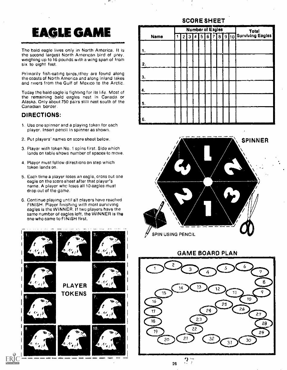
EA. LE GAMEThe bald eagle lives only in North America. It isthe second largest North Arnerican bird of prey,weighing up to 16 pounds with a wing span of fromsix to eight feet.
Primarily fish-eating birds,ithey are found alongthe coasts of North America and along inland lakesand rivers from the Gulf of Mexico to the Arctic.
Today the bald eagle is fighting for its life. Most ofthe remaining bald eagles nest in Canada orAlaska. Only about 750 pairs still nest south of theCanadian border.
DIRECTIONS:
1. Use one spinner and a playing token for eachplayer. Insert pencil in spinner as shown.
2. Put players' names on score sheet below.
3. Player with token No. 1 spins first. Side whichlands on table shows number of spaces.to move.
4. Player must follow directions on step whichtoken lands on.
5. Each time a player loses an eagle, cross out oneeagle on the score sheet after that player'sname. A player who loses all 10 eagles mustdrop out of the game.
6. Continue playing until all players have reachedFINISH. Player finishing with most survivingeagles is the WINNER. If two players have thesame number of eagles left, the WINNER is theone who came to FINISH first.
0
,fI' ,'4If
111111.
PLAYERTOKENS
,
4/0410
,0
V
,l,//4 I.
VEr
V
.!//4 j r
SCORE SHEET
Name
Number ot Eagles TotalSurviving Eagles1 2 3 4 5 6 7 8 9 10
.
._
, .
.
.
SPIN USING PENCIL
\ SPINNER
All10\\
-
GAME BOARD PLAN
28

emit0de 0INOM mimaiftlirs
go%
2.From 1917 through 1052. Alaska offered abounty for bald eagles Cross out 3 eagles.
Mom rm.& 000.
0102. .01.T0
mom.
to...
e. "tAlaska enters union 1.1 1959 and federal ia,. Nforbids killing eagles Move ahead 3 spaces.
000
.100
5.Blank space
.00110
MEM& mow.
.010 1111Mi
4.Blank space
.00.%010 mm1000000
0w0s 0.
1".". MN= MMOM
%%law
6.Blank space
Eimmoli
Maw.
woo°
. ..... . "...ama*Ir. 7. ....
0...Bald eagles do not get their white heads and s,tails until they are 312.41 2 years old Ahunter shoots a young eagle because ho\ thought it was a big brown hawk (It's also
"s illegal to shoot hawks, I Cross out 2 eagles../... .00...... .......... _ - ...... ......
.0010. MIMM
0.04.so. 4%.8
i:learcuitine iremoving or an trees from anareal eliminates nesting sites
Go back 2 spaces
%.0o.0.000.
II LIIINE1 ..117100
9W.nris r.esi t,eps
Go back 4 spaces
Mom.
,'
to,%W-mea
tomcto mmot
tO8,.trik 10.i. I 3
MM. =r,
1
llaii sua(P
%eat. .M_Moo. mom. Gam.. OP
ea%
'GAMESITUATION
STATEMENTS
mos ImInwool.OW. 12.The uses of long-lasting pesticides such as 4\
DOT increase greatly since 1947. Thesepesticides are passed on through food chains )and build up to high levels in the bodies of
meat eaters such as eagles1%.Go back 6 spaces.
sql"'"".0
0000 0MIN.
00. ..O..,
009 13.Federal regulations in the 1970s ban use of \
predator poisons on federal lands and
to.
restrict use on private land.Move ahead 2 spaces.
may, ..... MM.omit.0.0.
0.000
14.Blank space
0 0 0111M.
Mom.
0000 mmis 01.0
15.Blank space.
=16.11010 oMMli
.07M .SMOID
006. 16.
0010.
l*Rot
0.°A hunter shoots an eagle because hi's grand. 4%/ daddy told him they would carry off sheepand even young children. (It's impossible for3n eagle to carry more than it's weight. which /
is 8.16 pounds!) Cross out 2 eagles. ,o
1
wootosm.
..604
17.Law enacted in 1970s makes shooting wild- )
life from aircraft unlawfulMove ahead 2 spaces.
'Moo 0.0gamma
to.
ommmo 4001.0107
18.Blank space
0.70.5111.1.1. IMOrm ,
19Biank spacn
moiNEN.
00
"'000-
%orb
20.An inrreased number of people are using Neagle ',fisting areas for recr eahon This
.risluf !lance often causes eagles to abandon )the,r nests Go back to start
444, do°nom womm 04
U.,. 0MM. 00. 0000.. %Moo
0 .4".21
Bald Eagie Protection Act amended in the N( 1970 S making penalty fur killing bald eagles )$5 000 and or iiu to one voai in prison
Go ahead 3 spaces.
%Moli OMMemo
2 7 t-
mow WM. woo.woo' eiwaft
00'
mom.
22.Blank space
MEM. 00.0 MO. 000.2moVM. 0001
23./ Persistent pesticides other than DDT are stillboing used. Cross out 3 eagles.
..0'010
to,.00=
mom'o rd"
to%*moos
.001
.00.0
24.Blank space.
001..
am. 00.
lomft
000 0o 0.111.o.
/.. 25.Development of waterfront land Increases \taking much natural bald eagle habitat. )\ Go back 3 spaces. /
e`to .00..... ...*ft.. ........ ....... - '?..... ......0 0 ............ ...,000 ... 26.
Na.%
/ Conservation groups seCure cooperation of \utility companies tO modify existing power i
lines and put safeguards en new lines tO Stop /%. electrocution of bald eagles.... .009... Go ahead 2 spaces. .00'
.10
immoo,
27.Blank space
,B0 WA. Oa
.10116.1.
coomi0raw'
28.Blank space
0101.M1
29.High levels Of pesticides in the bodies offemale eagles may kill the developing
embryos in the eggs Cross out 5 eagles.
00.0
omM.
*ammo
.00
omoom
LLCM. 4.10
30.Most uses ol DDT are banned in 1972
Go ahead 2 spacesto,
IlLr010 ..1100 IIEG
to
31.Blank spa( A
Oftcyly em0m.01:9
32F INISH
11., Ander

SQUIRREL GAMEMany squirrels live in wooded city parks. Thesquirrels must find food and shelter here in orderto survive. There are many dangers in the lives ofsquirrels.
DIRECTIONS1. Use one spinner and a playing token for each
player. Insert pencil in spinner as shown.
2. Put players' names on score sheet below.
3. Player with token No. 1 spins first. Side whichlands on table shows number of spaces to move.
4. Player must follow directions on step tokenlands on.
5. Each time a player loses a squirrel, cross outone squirrel on score sheet after that player'sname. A player who loses all six squirrels mustdrop out of the game.
6. Continue playing until all players have reachedFINISH. Player finishing with most survivingsquirrels is the WINNER. If two players havethe same number of squirrels left, the one whogot to FINISH first is the WINNER.
17_PLAYER TOKENS
/M AILLMID iN7NOM MOIMME, MEIIII 110.0 =11111= &MEM. =1,
SCORE SHEET
NameNumber of Squirrels Total
Surviving Squirrels1 2 3 4 5 6
.
.
.
.
.
.
\ SPINNER
"SPIN USING PENCIL
GAME BOARD PLAN
28

.00.
MANO 411111i numOP.
1.
START
"NI* .41*Ate W.0 -."1°Mol NIM .4M
oar&
sees
A squirrel sees the iefking tail of an alarmedsquirrel followed by warning bark and is able\ to escape a house cat Move ahead 1 space.
Ni.00°
ftas. __... ......6 ...Ps ..... 1.0. .--....... =IN= 0Ib ~11 .......00.... .4....
00.. .1%.Ie
3.Blank space
GAME SITUATION STATEMENTS
/
vra.O.WOOMoir aft..
%aft4.
bquirrels eat corn scattered by peepte in the \park neighborhood People quit giving Squir-
\ rels corn because they decided squirrels were )a nuisance Crou out 1 squirrel.
aft.
A squirrel's body is designed so it can lump \from great heights without iniury A squirrel
\ lumps 40 feet to the ground to escape a house /cat Move ahead 2 spaces.
.009
_._... ono....sr ammo moma ado,
6.Squirrels area faVorite target tor kids and
adults armed with sling Shots air r,fies Beguns and rocks Cross out 1 squirrel.
.00*ft.
aiee.a*"
%N.
woe'
.EI MUM.
7
FPc-11`s snai. e
*0.1.
Squirrels 71,1 a oientat. 5u;,3:-, or .nSecr.s ,the tree hark and 4011 Move ahead 2 spaces
110#
Iftw. aCNIM.
Ogarj "ft*.9t Kidri ire rd ra.se, bony sgul rrei they caught
In thee ,to rho, ton't k('oW ,vrral l.i feed! Cross out I squirrel"
icir.gen m...rain, .15. War:,
dome'oro''
Wank spat e
om.e.
re,.
so'11
Arsi ,or len 4r",emiGo beck to START
m-4rem>
12jr 1,, Agusi Or togs a goOrt ("roc) of nuiS
Squ,r,10.4 0,10,n in (other and bury themMove ahead 1 space
ger.'°a0...OW.. MUM, .0...
moo
13.Blank space.
Oft,GIMW.
wow WNW MM.'MIMSOW" 0111ab
100°14,/ Community members organize and stop the 4
destruction of a large grove of oak trees.Squirrel homes and food are saved. Move I
ahead 3 spaces.,
ego
.0915.
Minn
remwe00.awP 4..M=1, 4.r
WINN.
400.#.00
eke%
%N.
Thoro aro few predators that are very good at I\hunting squirrels. However, a weasel is small\ enough to get in the den door and it kills a
Squirrel. Cross out 1 squirrel.
.00..14N1
swim
aro
am440,mow armWM. IN.m. omilm
4111%.
16.Blank space.
IsimMINED
woo' .00"""".41m.IMIns
Me%
17.Blank space
*or.,
'.4.4 .00°*Tift. ow'...N. ...ern. ..... olom exmlb .".....gums, ow..IN. 44.
woo°. a%18. N6There are plenty of hardwood trees to provide
1 shelter ana escape route for squirrels. Move\ ahead 2 spaces... .0/....ft MO.
...am ,..___ AN4440._..... mew. am.......... eal ...a .......OW" Safta
o'".. 19. qi,..
/ Squirrels depend on their sense of smell to '''Ni find buried nuts when hungry. Slightly moist \soil conducts Scenis best During a drought
\ year they have difficulty finding buried nuts. /Go back 2 spaces. .00or.
eirooam, NOM IMMO 0.1110 41144,
25,Blank space.
.004.
amP
25.IP Nuts from last fall are gone. Squirrels search
for fruits, berries, and early spring greeneryand find very little. Go back 2 spaces. /
..000"ftio. ore'141.110 MEND Mlle
owe. amt.wow40" 27.
/ Community members realize that I.eavingsome underbrush in their oak covered parkprovides shelter for squirrels. Move ahead /
3 spaces. a/."%a
s
000
4. m.P14, 41= woe....OM MOM oPIM OLil MEM..
20.Blank space
"Noah
0°.ammo Mso
40. .40%
.1%
21.Plant, of oak and hickor y trees provide foodano p1aces for nests Move ahead 3 spaces. 1
....,... NIMMY M=MI .....GOO'. "041
"9 22.
I it has been a long winter with little food1Some squirrels dovolop mango and other\ diseases Cross out 1 squirrel. 1.
-,...,,,....... oesrAft. ....... ....
4.4.414.
.10.440.
23......... .°
oeer Ma park has several .deal don treoc These \/ ware) lormeo in old white oaks whose deadlimns hold the,r bark, absorb moisture and )rUl quickly. forming safe dons Move ahead ,
`,.. re'2 spaces.,,,............, ..... .....".----, -.. ...... -,,,,-... ... .".
"`_ ....., w..
P \:II 1\
..,,. ..00am.. ..... ....r. ''''' ..'. si
4 4 4
24Blank space
ttlu,4.eura
29
wow° d."5.
ow.400
28.Blank space.
ommIMMO MM. Nu..
29.Blank space.
rm.spalla SiMMIB4011 sou.
..On.
100
30.Blank space.
"I%
or%4444,
.00--.00
.00
.09 31.( Squirrel runs into Street and IS killed by a car )Cross out 1 squirrel.
wore.MM. ...M....1
OW.32.
14" It is spring and the nuts stored last fall havebeen dug up and eaten. Because the corn. 1
munity left part of the park "wild-, there areN. plenty of fruits and berries. Move ahead 60.5. 1 space.
.1140.
'''.1110 Oft.00'
4.woe.
33.Blank spaco
MEraft6=Irt.
am.=Mao
34.Blank space.
mmw eve-...mmea-n
ee.*mom
ftr,%aft tft,
35.Over-population causes squirrels to migratoNow there is more food for those that remain
Move ahead 1 space.
SW110...
Way,NUN.
mOO.ganala moor.OMMID UMW oft.
38.FINISH
1111 0211=11
01'

Nit
..
.1 Sal
44 a
*
1.4
9
4
firt 4I * 6 e
4
.* 64 29'"3¢.4 ,
:
' .a ," la
a*
*a . . *. - ."..: it. .41er I s e
14.I, 6**-
.160. ,I4,..,-******s.
01**1..
41, s4 AKay as
a-
Is SW. 7C1* go cf*****11 al sows
raw.1,666,..*.4 .*096* 599 Vet
100 Sod,.40 ft***1 Oaal ars 04:113:- a
00 ay*14***4600,06. *SO IONt UM, 10 .1. ,t
r ..***490,,AIN*
aa.aao.14.4....vpok*,*, to.%-"- i s
919`10.16 as IP**4*** htleiaol.01119110 aiaavalarr: 44/ra: Ma..4 64 'II i
* a 4.4 a* IR" Vaalraw t ., * *44lima V*Wt... IV.
411,00.6101hta's laq41.014t elm,
4
4.aa a atwaspo'soma.
414?..440,6404::-4:*ka
. , . k . . . - , , ,,, , e4 .4 la **410 a'...1 121.0 WU4' 4 4. al 61,11,194NV*
,,.......4-6.7*,*,...:4i4.4741.will...tr.:4n% A art.,.
.60.,,a..6,...04.6 IP:e. IS aglal
WO,* 04, 6 a,144 ,: 4 . .4 a dr..: ,..3.6. **, a . . -*I
lir . es :416 Apra, :a - a. . a ...V..; ::,.4.1-:4....:;:',A-',.:::::::.,
".*:::."...4. ;7..,:,:!:::1,1LEIZIlb.
j",,...47> al"*".;44 .... , a 96 4, 9.. a .9 *6 a. pa a.... at- It.,..e., 4, * 6144ala aa. . ...a . -55555,al V a .
4. - a **a 6.91.,
-
.
etigs.41.
4.44,3rfr`
4
tft
4
'15
S'
IMO
Zt
'it ,./.1,*
'4 . P-'`.7)P41j,,5
7P;
54
14%
tt.6:1".4:4....1'444k.°
,
rser:?7,':
'Le
'44:6
5
441,15'
%
4.
44111111iii..,
r-
tw--44.

SECTION
CHOOSING WHAT YOU NEED
devolupecl these activities using content topics and skills which are. t..0 many programs, whether school-based or not. To help you select thetivitios that best fit your needs, we have classified the materials into categories.
0 bolow classifies the three major clusters of materials according to where.1r- iied and appropriate age levels.
tiTDOORATERIALS
OUTDOORCLASSROOM
GUIDES
LEVEL
IiGRAL)ES 4-61
LEVEL
II'GRADES
....,
,.
INOOORMATERIALS
ENV,DECISION
CARDS
WILDLIFESURVIVAL
GAMES
LEVEL
(GRADES 4-6)
LEVFL
A...,r t- hAr pi.iro 31 e Outdoor Classroorn Guides for levels I and li ann'.:he Environmental Decision Cards for level 11 and Wildlife Survival
c"mes :00.1 Tt, h,;ips classify each major cluster of materials but does noth.-01es vvithin each cluster ru describe each activity and to
, .j,ffeloot clusters relate to each other, three new categories:.,- 1:, : ir T hp% aro Seasonal Requirements Content Topics anc!,cess Skills ,1 t>.ic h r 11.Ic;tor br?Pf ;:lassifiod according tO tr1P,
T his makes or a classification ;:hart hon;, ,. of a sirvi:f. ot find rt,LitInnchvi.,
(.)!0,1(0 CLiF..,;, mot. Gun!,. . t i ;
=EMI
31

.
ouitoow
'GRADE4RANGES
SEASONALREQUIRE-
MENTS
CONTENTTOPICS
PROCESSSKILLS
Level "(Grades 4-8) i 151151B112115112151W11111111111111112113111111
MEN 1111 EE51151lSIIIIIIEIsonitillEndillrFAIMAIVA
e v 12111ilimi
riven .(Grades 7-12)Winter 1111.111111111usimm
imAnordaLmiormiraloicarjrAinnezertimnineranuromm1211121111211,2111111111111MME211111
kwicalumsimidmileiiiiirriniiwirg:-.._Summer -Fal;ADAPTA"WICULTURECommuNICATR5WINISAMMUIRZTET
ION AND TOLERANCES jnjlaillaIIIIIIHMIIIIIIIIIIIMUNIHMNLIHMIMINIIIIIIIIIIIIII11111101111111111111111111111111
IMIIIIIMMIIMINIINWIMINIMMIMINICINIMINMINIMMOMIIIIIIIIIIIMMONIMENINUNIONIIIIIIBMIIMMIBIIII
INIIIIIIIIIIIIIIIIINI1111111111111111111111111111111111111111111111111111111111111111111111.111111111
IIIIIIINIM-.....i.mmunignamaMIENIMIMI NMI
11011101111111111111111011111111111111111111111111
MI=11111111111111
MI= MI NOM
1111111111111101111
1.11.11110111111.111111111111111
11111ENVIRONMENTAL FACTORS(water, food, temperature,light, disease)PREDATION"FISH MANAGEMENTHABITATLIFE CYCLESMAN AND SOCIAL HISTORYagirMt--
Insects Islimulimimmum11111111111111
NMI MIIIWIIIIIIIIIIIIIIIIIIIIIIIIIIIIIIIIIIIIIIIIIIIII leON MianiiiiiiiiiiiIMINNIrdwianoINIMVIIIIIIIIII
1111111viall111111111111111111
IINNINIIIIIIIIIIIIIIIINNIIIIIIIIINIM
ME111111111111111011111111111111111.11111111111111111MNNI1111111111111111111111111111111111111111110im
IIIIIIIIIIMIIIIIIIIIIIIIIIIIMIIMI
wirmansumumi1111111111011111111MIN
aim1111111111.1MPINom
IIIMINNINIIINIM
1110
1111
v.
NOM=1111111111111
Mums=
MS
gniilINA
111.M.MUM
m
Small MammalsFishGophersAquatic' aidParrisD eerRedwinged BlackbirdWaterfowl
sommumMuskratMINIMINIIIIIIIMMEIMMIIIMMBald gni() ..,...
-giii_Fox 11/211111111111111111111 MINNGray Squirrel um animmum
111111 Min OMRuffed GrousePrairie Chicken MOM
EVIIIIIIIIIMINIMINIIIIIIJWBWII
INEll I,MVOMI imillIll
111111E1
MINM
11111111111EM
IZMIIIIIIIIIIIIIWIIIIIIIIve Iggissui
MN
111111.01111
MN
Ring-necked PheasantSharp-tailed Grouse
MIPHOTOGRAPHYPOETRYPOPULATIONS
Aversit , c_y_iensityL....VEGETATIONRECREATION NM
MNKiat-§"dioN 111111 111111111111111111 MOM'TERRITORIALITY
LEEillIllMIIMIIIIIII
pMINIIIIILIIIIIIInig
MI
ILMENIN
ICIIIMI
,pwier21
INIMI
.. mromaam
NOM
MI
INIMill
-i-/V-ITLAN-DIfrWATERSHEDWILDLIFE MANAGEMENtCLASSIFICATIONCaiSTRUCfliTG:
An Interview
IIIII
A QuestionnaireModelsEquipment
DATA:"Collection
1___yJ:Lati_onnter-
GRAPHINGW

r
..
LiLi
I.
,"1011112031111111
ifellIII 11 E
l41
1C
IIIIIIIIIIIMM
EIM
MIE
IM II I
I.il
tII I
..
I44.:11111020001110111
.'
44'1111111111111111111
1111111 SE
RI
IN
i
I,
:
I
i
O.
fI#
1I
IC
BI
I1111
I

.1 : , . -'X'777":1'n 17tr1;147:7;:.!:16:r..
:A. ur.`.
wETLANANDwILDLIF6Leiel II
Spring, Summer, Fall .
Environmental factors* Habitat
Waterfowl
WetlandsWatershed
. Wildlife managementClassificationData collectionInterpretationMapPing
Measurement / mathematics
;
-, 'FARMING AND wippFE.:.Level II
WhiterAgrIcUlture
- Environmental:4109re.,:le Habitat, '
. Manand hii.soolai hletorY`4, Populatlent - diversity:, :.
_Wildlife management:, Classification
Data collectien.-interPretation,;.Mappipg
Measurement/ mathematics :
` f
MATCHING ACTIVITIESTO YOUR NEEDS
To decide which cluetar of materials to begin with youwill need to consider site (indoor vs. outdoor),grade-range and seasonal requirement. Next, scan theContent Topics and Process Skills lists until yeti:findsome categories which match your program needs.Identify which activities deal with these categories bylinking the check marks to specific activity titles at thetop of the &art.
r-
dHECK YOUR STUDENTSFOR INVESTIGATION SKILLSStudents must be able to bee certain investigation :Otitisin order to complete each Outdoor Classroom Guideattivity. This may.roquire learning or practicing that('skills before beginning an Outdoor Classroom Guidoactivity. Check the section, Learning InvestigationSkills, for activities developed to help students withseveral important skills.
40.
.; ,;
. ,
Thee() doseriptiOns Indkate4at: beth activities InVolye..Investigation 'of :Wildlife ;And 'habitat -Aithough thehabitats and 'Wildlife species are different; both inVolVe-investigations ,,of the Yeltitionehipi(betWeen;: land ;and 'wildlife, Usingthe Clateltleatien .Chirt in Ahis ::wayhelps yoU -seledt: ifeVeral:::retated i'eXpeflendee;:whichcould take plea; Oyer: Were) days ot weeks.
This chart is alio. Useful fee: finding relatiOnShipsbetween twa or tnerejactivities.emong the three Majorclutters of -Materiale An indeer. Albilv4e0oh As one ofthe Wildlife SUNIval, Garnet deale with `Stinie Of :thetame Content topics aelleMe of the:Outdoor ClassroomGuides. As an eXample, the I:Welt Gums dealt. withson* of the same eentent tOpies as seri* of the OutdoorClassroom. Guides. At an exeMpla, .-the Duck Gimedeals with Some .of the -Same eMOronmental 'factorsfound -4n .the Otitdeor .:Platerooni Guide, FishHatcheries. This providet a Way of relating indoor andoutdoor learning experiencee This same process couldbe used in relating ati Environmental Decision Card toan Outdoor Classroom Guide activity.
.:;-
A ri.
L.6
v.i
. . -
.
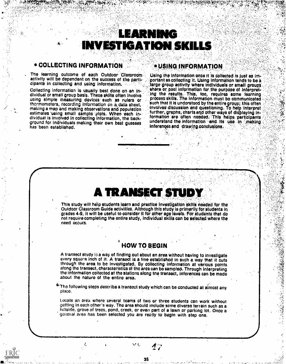
k14.44.0., '40At41
*- A,
P
COLLECTING INFORMATION, The learning outcome of each Outdoor 'ClassrooM'
activity will be dependent on the SUCCess of the partie ,
cipants in collecting and using information.
Collecting information is usually best done on an in-dividual or small group basis. These skills often involvensing simple measuring devices such as rulere orthermometers, recording Information on a, data sheet,making a map and making observations and populationestimates 'using small sample 'plots. When each In-dividual is involved in collecting information, the back-ground for individuals making their own best guesseshas been established.
ION SKIL
siNG INFoRmUsing the information once it is deflected is Net as kn.
. :portant at collecting it. Using Information tends to be alarge "group activity where individuals or small groups
:share or .pool information for,the purpose of interpret-"-ing the results. Thia, too, requires some learningprocess skills. The information muet be communicated -such that it IS understood by the entire group; this ofteninvolvet discussion and questioning. To help interpretfurtheri.graphs, charts :10 other waya of dielaying in-formation are 'often needed. "-This helps 'participantsunderstand the infermation end itt uss. .,Inahtnpinferenqes and drawlegPoncluSi0ns..
1111100NOMNIEN,
A TRAThis study will help students learn and practice inVestigation Ocilla needed fer theOutdoor Classroom Guide activities. AlthOugh this study.ispritherilyfOr students ingrades 4-9, it will be useful to consider it for other age-levels: For students that .donot require completing the entire study, individUal skills can be Selected..where theneed occurs.
a
HOW TO BEGINA transect stedy is a way of finding out about an area without having to investigateevery square inch of it. A transect is a line established in sudh a way that it cutsthrough the area to be investigated. By collecting information at various pointsalong the transect, characteristics of the area can be sampled. Through interpretingthe information collected at the stations along tne transect, inferences can be madeabout the nature of the entire area.
4'The following steps describe a transect study which can be conducted at almost anyplace.
Locate an area where several teams of two or three students can work withoutgetting in each other's way. The area should include some diverse terrain such as ahillside, grove of trees, pond, creek, or even part of a lawn or parking lot. Once ageneral area has been selected you are reedy to begin with step one.
rs,
as
,
,f;s1
'Y
.
Ti
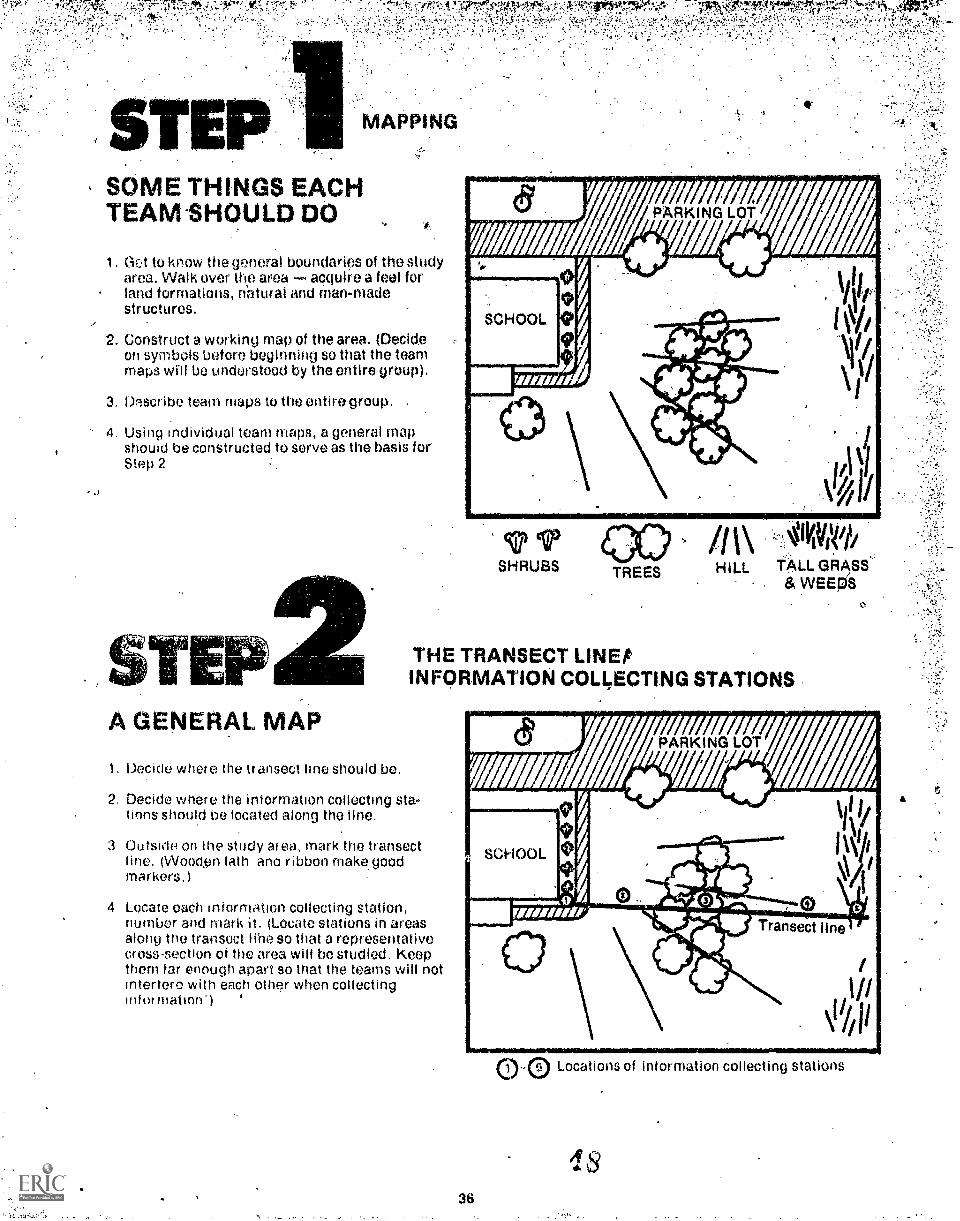
SOME THINGS EACHTEAM-SHOULD DO
1. Get to know the general boundaries of the studyarea. Walk over the area acquire a feel forland formations, natural and man-madestructures.
2. Construct a working map of the area. (DecideWI symbols before beginning so that the teammaps will be understood by the entire group).
3. Describe team maps to the entire-group. .
4. Using individual team maps, a general mapshouid be constructed to serve as the basis forStep 2
A GENERAL MAP
1. Decide where the If ansect line should be.
SHRUBS TREES
\HILL TALL GRASS
& WEEIA
THE TRANSECT LINEtINFORMATION COLLECTING STATIONS
2. Decide where the information collecting sta-tions should be located along the line.
3 Outsido on the study area, mark the transect(Wood,en lath ano ribbon make good
markers.)
4 Locate each information collecting station,number and mark it. (Locate stations in areasalong the transoct libe so that a representativecross-section of the area will bo studied. Keepthem far enough apart so that the teams will notinterfere with each other when collectinginfo! Inatton )
IIII3ARKING/LOT
1111
1vv1pSCHOOL
mom 0 Arzwizor
36
Transect line
0-0 Locations of information collecting stations

TECHNIQUES FORCOLLECTING INFORMATION
At each station collect some information on the physicalcharacteristics and the inhabitants of the place. Thiswill require some practice in using measurement andobservation techniques.
Brief technique descriptions are given below. Choosethe ones appropriate. for the area to be studied andthose which would benefit your students.
MEASURING WIND
This simple device can be used to compare windvelocities from one place to another.
The size of the angle between the string and the rulerwill indicate the intensity of wind. By drawing theangles indicated by the wind gauge, students can com-pare wind velocities among different places.
Measure Wind:at ground levelat waist levelabove the head
TAKING TEMPERATURESUse easy-to-read simple thermometers. It takes aboutthree minutes for a reliable reading to register. Taketemperatures at varying levels:
air temperature, measure at shoulder height
surface temperature, measure with the thermometerfiat on the ground
soil temperature, measure at about 4 inches below thesurface. Use a spoon or knife to make a hole thengently pack soil back around the thermometer bulb.
37

"T ..415
,
DESCRIBING SOIL
V
A
The only equipment needed .is old spoons or tableknives 'for shallow digging.
MOISTURE
Dry: fails apart and=tifta between the fingers
Slightly Moist: appears moist but does notstick together when squeezed
Moist: sticks in a clump when squeezed
Very Moist: squeezes freely and water isobvious
Wet: .water drips
%.18 ..
TEXTURE
Soil is usually a mixture of varying sizes ofparticles. The abundance of particles of a ,-certain size helps define a soil type. There-fore, soil texture is a major Characteristicused tO separate soils into types or groups.The relative texture of basic soil types may beillustrated by the use of four grades of sand-paper. For example:
Sand 3M (Sand Pak) Coarse #9003, coarsesoil
.Silt 3M (Sand Pak) Fine #9001, fine soilparticles
Amestlmation of the proportions of shade and sunlight .on the ground surface will *rally be adequate. The.KO given below oil! help Students make estimates:
7, Sunny about .3/4 of the ground surface IS- covered by sunlight
,,.
, ,
Very. Sunny most of the ground surface iscovered by sunlight
,.
, ^
I:Moderately Sunny equal amounts of suand shade on the ground surface
Shady about 3/4 of the -ground surface isCOvered by shade
Very Shady Most bf the ground surface iscovered by shade
DESCRIBING THE INHABITANTSOF A PLACE
Clay 3M (Sand Pak) Extra Fine #9000,extra fine soil particles
Loam 3M (Sand Pak) Medium #9002,medium soil particles
COLOR
Also note soil color. Generally dark soils con-tain more decayed plant and animal remainsthan lighter soils.
38
PLANTS
Ground cover plants: Use a coat hanger wire tb isolatesample plot anywhere within several feet of the stationmarker. Within the sample plot:
4

'r c* ,XVw.A4-;`V.?4-4;sti. .
Collect one of each different type of plant.
Count the numbers of each type
Wrap a piece of tape around each plant collectedand put the number on the tape.
0 Put the plants in a plastic bag.
SHRUBS AND TREES
Remove a twig with leaves from each of the mostcommon plant types within several feet of thestation marker.
Count the numbers ot each plant type and recordwhether they are trees or shrubs.
Put the number on a piece of tape and wrap itaround the twig.
The twigs should be placed in a plastic bag.
ANIMALSThe presence and activity of many Wins of animal lifecan be inferred from many signs. Encourage studentsto investigate slowly and critically by looking under,things, among leaves and twigs and by digging underthe litter on the ground surface.
Birds: Songbirds, geese, ducks, herons, hawksand more
songsegg shellsfoot printsbonesnestsfeathershalf-eaten seedsdroppings
Mammals: deer, rabbits, cats, dogs, mice,muskrats, humans and more
416
ee
tracksburrowsbonesfurmuskrat hous esholesdroppingstrails and mouse runsnut shells
$0
Insects: bees, ants, grasshoppers, butterflies,
Other:
gnatsant hillscocooncaterpillarschewed leaves
snakes-Wadssalamandersfrogswormsspiders ,
39

-.01111..
;
RECORDING THE INFORMATION
Decide on the kinds of information to be collected.
Make up a DATA SHEET to be used by each team ofstudents. (Make sure there is enough space for com-ments and sketches.)
Being able to put together a data sheet and recordingthe information as it is observed are important skills forinvestigating the environment. Discussion and infer-ences taking place later on will depend on how well ,
each team is able to complete this step.
DATASHEET
WIND
TEMPERATURE
SOIL
TRANSECT STUDY
Names
Date
Station Number ....AiMMY..171/M
,
Ground Level Waist Level Above Head
Air Temperature
Surface Tempera;ure _1
Soil Temperature
11116
Moisture:(Circle One)
Dry
Slightly Moist
Moist
Very Moist
Wet61111allIIMM161SIMMIENIMMEMIINIMENMIIIMMMEIMML
PLANTS: Describe or sketch your observations:
SUNLIGHT:(Circle One)
Very Sunny
Sunny
ModeratelySunny
Shady
Very Shady1MINNIMININIMIL
TYPE:(Circle One)
color
Sandy
Silt
Clay
Loan
ANIMALS: Describe the animals or signs of animals you found in yourarea on the back side of this sheet.
40
SP

...11/1111110. =sirn
SHARING INFORMATION
On theplackboard or a large sheet of paper draw apicture of the study area. Show some of the topographicfeatures and the locations of the collecting stations.
SOHOOL
Each team should display their data sheet and plants bythe station where each was collected.
Make sure students have the opportunity to read anddiscuss information collected by the other teams.
Encourage students to look for changes or_ similaritiesamong the stations.
3 WOODS
2
rerOrwar......ArbrraV.*eIVIA
wbV.Voam. aro
eamego .1 .0brArrIrs nrr
ftlaleft ma.wombs...taw.
Pow4 W./06m.
.0.41.4".. I.
4. FIELD5 WEEDS
...,11".,1MA,
srarromOr.ra4*.10.1.1...0tr
-err. am ~raftar01. ...N..-OBIWOO//*OW Arnarr~
novow."1.
Mb!~ "ft-.04441.1 00.,Aft. sw.61.1.
-0--.... .
.101.14error 0. rims&orrrrimraras.r r.....rear. ...row
4
LOOKING AT THE INFORMATION
At first the students may find it difficult to think aboutthe entire study area and the information collected at allthe stations.
Review the process of how the Information was collect-ed and that the display of data,sheets and plants are
measurements and observations that .help describe thestudy area.
Begin by looking for differences and similarities amongthe collecting stations. Single out one measurementsuch as ground surface temperature and follow it from
41
.5

station to station. Using graphs, charts or tables willhelp students visualize the range of temperatures.
if there is more than one temperature reading for eachstation, the average reading for each statIon should becalculated. Make sure they undiimstand the labels foreach axis. Note how the ground surface temperature
HILLTOP
changes among the stations. Help students interpretwhat the graph shows.
Using charts, tables and sketches are some other waysof comparing information and may prove htepful for-clarifying or uncovering relationships.
OROIJNO SURFACETEMPERATURES
, BOTTOMOF
HILL.
2 3 4
INFORMATION COLLECTING STATIONS
42

?t .4.3..y.e?.,
iVc,47:-"skYl-r c-`7,`a"V
,
!r4V
7-tet,..
.!»
4.; Tit
.46%. oZe!..'',"..13:72!.:?'".!
45,. -,: !):
t ;
v?itc,.
-:;' '
-.et .
"4.
7A;;;;4-,.;..Li" 0., -4 ::--.77!`""-^1""''-';,,,,--7-77-0,,f
JP,IL
Showing relationships within the information Will .holp : : ..oter1060,,Ornong,:shidenta:hr hOw:.=:t e ;:jrifOripatiOri,,10,',,' e A
S t Went s ask questions about the study area. Some --.:':i.nterprOted..01yerselitfwienCeilihvldiiii.04500i40d)ilquestions relating to the ground surface temaerfOrk. .. 'El 04-41.:44?--10f0i7fiiMA:i",:it.,:iiar,.i.46*t:h;!:?tclPtit.Si:Ake..,,,:',graph might be; . 1b040109t0740Aril.S.Oti*ithavii.tk)olififisiiir..:
Why 5 the temperature lower among the treestMions 3 and
*. Does plant cover affect the temperatures?
o Are there similar differences among the air and sotempetaho es?
Nestioning should be encouraged. However, studentsshould re§llize that not ail. questions can -be answeredosiog the available information. Some questiona mayiond to the neoxl to collect more information and further.investigations.
ln attempting to answer queitions, students should'besentouraged to make Inferenees based oo 'the informa-tion calistIted, it is important to allow for individual cid-
And abeve aliAlle investigative approach Should be onoof Share& reSpehrObilW :And . enloyMent, Students,:..shoOrd nOt only leekloIeti,:the teadher, for SUPpOrVarist
. help but toeacti.,etherMivestieation is not:Jutt findingAnswe'reliffi:alidihe pi:4:01'41*rib oak quiii,StIon'S arid.sham:WOO.'
'
groigici sOttaop temperature:
1. The temperature la lowest at stations 3 arid 5 becauselihe plants ;shade the ground..
2. The temperature is highest on the hare ',Maim. The/ soil IS also very dry..
3. Why isn't the temperature as high in the grass atstation 1?
a
'
1),,A.- .

alasFOR USING REFUGE AND FISH HATCHERY SITES
is essential for assuring a successful 'trip for, and y.oue students Once an activity has beentj hit-0:r. these two steps to complete your plans.
STEP ONE: MAKE ARRANGEMENTS
1A/ti'1:tte Refuges and National Fish Hatcheries(:pen fo, educationai purposes at any time duringitr ..-iover. during some periods roads are
STEP 'TWO:MAKE A CHECKLIST
closed due to snows or high water. Please check in ad-vance to assure availability of a site.
ivphone call is sufficient to reserve a site arid time. Youmay want to make a special appointMent with therefuge or hatchery manager to review the site beforearriving with your students. This would also allow youto pick up maps or equipment which could then be re-viewed with students before the trip. Be sure to discussthe activity with Fish and Wildlife Service personnel inorder to identify equipment or any special .assistance.
FOR EACH sTUDENT
WARM GI-071-1ING
Boors OR 0THERwtareaPRooF
FOOTWIAgOriany otip?ather)-
RANGEARCif fieGeS$a ry)
EaSOFFIC1kWrDATA .5 EC73
FOR EACH sTUDENT
ONE PENCIL OR BALLPOINT'
PL: Pt-R 57VDENT
LIST THE EQUIPMENTPOR THE INVF5rIGATION.
Forge CLASS
;31 bUS ARRANGEMENTS.
ElCLEARANCEwow PROPER
if AUTHORITIEs.
sifi: RESERVEDAT THE
/N5URANCEAND
R1:1-06;t OR HATCHERY
PERM155f0NFORMS
SURVEY CLAS5 MEMBERS
FOR ocrRA 13-QUIPiv1E.A177
I,UNCHcs AND DRINKS ARRANGED
POR (Schooi luilches canaelled)
FiR5T AID Krr (if school bos
ioes tiof tidy& 0.7e)
pick uP AMP, K fieccssar7),
D t5QUIPMENrroR THE
:NiVi-,5r/CATIONAT FUGRE-
qi:.A0()UAkTkR5 og HATcHERY
40QUARTERS_
,;,;,i.io whfm soipcting :in activity if it ic iint1.i; ,.h lit,. 1:1 (Mort; rii)y ti'i
MAN/ 5E-' jt 01.1:1:1 fieh! ,. f..:1'
44

SECTION
Now that you have used public lands and community resources to make student.earninq more real and worthwhile, we would like to offer our continued supportrhp U S Fish and Wildlife Service is already cooperating with State Depart-inprits of Education and Natural Resources. other federal agencies. and colleges
hplp teachers use commumty and public land resources

I 77:V,'"!!!' ."
t+
REGIONAL OFFICES
The Service has published other aids to environmental education. You pay writeto: U.S. Fish end Wildlife Service:
Region I P.O. Box 3737Portland, OR 97208
Region II P.O. Box 1306Albuquerque, NM 87103
Region III Federal BuildingFt. SnellingTwin Cities, MN 65111
Region IV 17 Executive Pk. Dr. NEAtlanta, GA 30329
Region V John W. McCormack PostOffice and CourthouseBoston, MA02109
Region VI P.O. Box 25486Denver Federal CenterDenver, CO 80225
Alaska Area Office813 D StreetAnchorage, AK 99501
MORE ENVIRONMENTAL EDUCATION RESOURCES
These will help you with your community environmental education program:
college credit EE methods courseEE use of public lands for resource managerscoordination methods tor building a community EE programslide-tape program showing how an elementary teacher can use a wildliferefugeoutdoor recreation facilitiesEE postereducational site selection
. ,

.
i.",,,,,,, : -
. .
EnvironmentalEducation Guide
Synopsis
.
, .
. -
, .
U.Sp Fisp and GuideWildlife Service Number
,t1K
PLANTS AND PLACES students are able to infer some rela-A counting technique is used to corn- tionships between soil moisture andpare the dentity of plants growing on plant density.places with differing amounts of soilmoisture. By pooling their data,
;
4 I'mPrepared by:U.S. Fish and Wildlife ServiceMinnesota Environmental Sciences Foundation, Inc.

ircorenoals
.,v
very citizen's decision, or lack ofdecision, in some way determines the
. use and the future of pubnc lands.
The U.S. Fish and Wildlife Service is.7--;;" this Nation's only Federal land
management agency solely responsiblefor fish and wildlife. it is the Service'sbelief that through education anddirect experience, citizens can gain in-formation, understanding and atti-tudes that will support wise use ofpublic lands.
pants andplaces
A. Purpose: This activity will acquaintstudents with-
1. The identification and meaning ofenvironmental factors.
2. The effects of soil moisture on plantdensity.
3. A technique for determining soilmoisture.
4. A technique for determining plantdensity.
B. Objectives: During this activitystudents will-
1. Identify and map areas of differingsoil moisture.
2. Sample plant density on two areasof differing soil moisture.
3. Interpret the collected informationand make some inferences about theeffects of soil moisture on plantdensity.
C. Activity requirements: Eachstudent, or team of students, willneed--
Copies of the data sheet, pencils andperhaps clip boards.
The class will need-
1. Large sheets of paper for mappingand stakes for marking collectingareas.
2. Large sheets of paper for poolinginformation from the individual datasheets.
Introduction
Being able to determine differences inenviror mental factors in an area helps
lkieintaining enVironniental herniohy isa crisis concern of the Service. Manmust continue to live in the world insome reasonable "balance" with theland and with other life, otherwise he,will not sUrviVe.
Service programs help people to learnabout land and wildlife, involve them-selves in interactions with the naturalworld, and enrich themselves throughthat strange aesthetic joy which can beexperienced in the midst of a wild en-yironment. Besides those, the Serviceattempts to make its It% ds a model ofenvironmental management.
Quality and harmony will remain a partof the environment and remain the
explain the diversity and density ofplant life. One environmental factor,soil moisture, has been selected forthis activity because it Is easy to deter-mine and can be related to dramaticdifferences in plant density.
To begin, students may need some
. .1 ,of r ''..guidelinee for pubiic land managementif citIZenssee value in these practices.
badkOtiotind-'*.Why do certain plants grow only insome Places? One might think it is-because that iewhere theseeds are.-.1tIs more than just seeds, because seedstend to get scattered all.over and manynever produce plants. instead, theenvironmental factors that exist In aplace favor the growth of plants whichdo best under that set of conditions:-Some of these factors are moisture
practice In identifying and describinghow an environmental factor differsfrom place to place. A walk around theschool grounds or surrounding areawill Identify places where there aredifferences in soil moisture. Use thefollowing guide to evaluate the soilmoisture conditions at each site.
Amount of Moisture in Soil
0
1 very moist, water runs betweenfingers when squeezed.
o
2 moist, clumps together whensqueezed.

SIDE ONE
41' .
Outdoor Classroom Guide Number 1
Plants and Places
Team
AREA 1DRY, SANDY SOIL
plot a plot b piot c
AREA 2WET, HUMUS SOIL
C

sunlight, temperature, and soil type: it-.s easy to compare these factors whencontratting two-very different places;such as desert and a tropical rainlerest 17104eVerdrainatie differeneesmay alitieidst froM place te'pliteewtthtr a relatively small areasuCh as a
), Acheolyard or City park..
A'
Environmental factors may changeover a period of time, cauaing changesin,the kinds and numberi.ef giants thatgrow in a partiCular area. This gradualchange is called succession. It follows,thiS Sequence: sun-loving annuals arecrowded out by perennial herbs andgrasses, which in turn are shaded outby woody shrubs and trees. At eachstage, new kinds of plants appear
V
It may be necessary to dig beneath thesurface to get an accurate sample ofthe soil. As sites are identified, recordthem on a large map for future refer-ence. It may also be necessary to markthe site with a stake and number. Tryto identify several sites for each of themoisture types above.
While this is going on, some studentsmay recognize that the amount of light,soil surface temperature and soil com-position also vary from place to place.This awareness should be encouraged;
-0;which, In-turnoty t different icInda:of animal
Dining this sloWprocess of change, thesoil is-being enriched by sedhhentation
_viand decaying plant remain*. Soil-moisture changes also; as shrubs andtress takeover the Wet aeliti, the soilbecomes less moiat and in.dry areas,the soil becomei more moist. Thus theinteraction of environmental factors
. and plante is a two-way process, eachinfluencing the,other".
these environmental factors could be c'investigated later on.Once several sites are recorded on themap, areas of extreme soil moistureconditions will be apparent. From, areato area the range might be from verymoist to very dry or, perhaps, from dryto very dry. On the map,^enclose areaswith similar soil moistures. Look forlarge areas rather than the exceptionalslte of limited size. These areas be-come the plant sampling sites for thenext part of the investigation. See thesample map.
AREA 1 1
1 dow444,"...........1
.,...44 1
.I.HILL
AREA 2 ll *I *101I II 4V1110/0SIDE II I No a milip
I
.
1 wigs vit
0 a viomovliStv
Iminunirlil luivorv
r
, ::,_;-
The ideal situation Is to find two largeareas, one with sandy, dry soil and theother with moist soli conditions. Onlytwo areas are needed for thisinvestigation.
Plant Sampling Activity Description
Teams of two students work best forthis activity.
In each area, each team will randomlyseiect three sample plots, (a, b and con the data sheet)..To select the plotsin each area, students can simply shuttheir eyes and drop their data sheets tothe ground. The area under the sheetbecomes one of the sample plots. Ateach plot in each area, students areasked to make a count of the number ofplants in each sample and write thISmeasurement in the appropriate boxon their data sheet.
Students will count the total number ofplants of any kind on an area of groundaproximately as big as the data sheetsthey have in their hands. They can holdtheir data sheet in one place over theplants and count those which de underit.
It Is not necessary that"data-sheet-size" counting areas beperfectly exact, nor is it critical If astudent wrongly identifies a completeplant. The results of this study arebased on a statistical average of allstudents' measurements.
Some plants may be dead. Countthem too because they were alsoproduced from this soil at another timeof year.
Some student may finish early. It is to
1heir benefit that they are then.freeattention to Other things around:-7 ;
theni.,Thle Investigation ISIdeilgned toalloW4tudents.to sea and experiencemore Than-IS Usual mppefuily More
.tellecting Data Using Student Data-,`Shoets .
_Make multiple copies of the printeddata sheet. Each student will need acopy and a pencil. Students shouldwrite only a number in each square ofthe data sheet.
Individual student counts of plantsfrom each plot may range from zero toseveral hundred. A more likely rangeis 3 to 25. Results will differ between
. students and plots.
"Does dry, sandy soil or wet, humussoil support more plants?" individualdata sheets may show a differencebetween area 1 and'area 2, or betweenindividual plots. It is interesting forstudents to speculate on conclusionsfrom their separate data; especially inthat many of their measurements willconflict in the differences they show.
after theinvestigation1. As a follow-up to this activity, other
environmental factors can be in-vestigated. Variation in light intens-ity, surface temperature, soil com-paction, and their effects on plantdensity can be compared using thetechniques in this activity.
2. It may also be informative to studythe effects of varying soil moistureon a much broader scale. Differ-ences in the amount of rainfall overan entire state or continent can beidentified and compared to differ-ences in vegetation types. Comparethe amount of rainfall with the loca-tions of natural plant communitiessuch as prairie vs. hardwood forest,and domestic plants such as smallgrains vs. corn.
_
:-Statistically, the information on One,.::.data sheet is not a valid sample of the
plants being counted. It Is not a largeenough sample. Mit if several students
,cir an entire clue saMplad the plante,,,,,, .
.2'4he information can be pooled Intolarge, valid sampling. Use p blank datasheetand write In the total from all in-dividual data sheets for each box:If .
this Is done on en overhead transpar-ency or enlarged wall chart of the data;sheet, all participants can see theresults at once. Now is there any In-dication of-an answer to the questionabove? Are there more plants In thewetor the dry area? is there anypattern between wet and dry soil andthe size of the plants?
for -information':;
Many Service land areas provideshelter, toilet facilities and limitedequipment for your use.' For trip re-servations andlurther information,Contact your local U.S. Fish and Wild-life Service office or the following re-gional Service officesi
Jenny Publishing Co./Inc.57 Queen Ave. So.
Minneapolis, Minnesota 55405'Copyright 1975 All Rights Reserved
Region 1:
Region II
Region III
P.O. Box 3737Portland, OR 97208
P.O. Box 1306Albuquerque, NM 87103
Federal BuildingFt. SnellingTwin Cities, MN 55111
Region IV 17 Executive Pk. Dr. NEAtlanta, GA 30329
Region V John W. McCormack PostOffice and CourthouseBoston, MA 02109
Region VI P.O. Box 25486 s'
Denver Federal CenterDenver, CO 80225
Alaska Area Office813 D StreetAnchorage, AK 99501
This Outdoor Classroom guide is one ofa series; others are available from yourlocal or regional Service repre-sentative.

: : A ,1-'1'1:j1;1.1f1144-4?-ifk#1.
;.E.1.;* :i7` a' '-..
ti'l=, i. .
"'
;;Y: 14- ,,, r-; r t X' .0 ;
,
.
Synopsis.WATER FLOW ANDIMPOUNDMENTStudents will apply skills of measuringand mapping to construct a model ofthe land's surface. They will apply
sh andWildlifeSetylde .
.11
these skills in the construction of amini-dam.
!..
. -4:
Guide-Number,:_;
Prepared by:U. S. Fish and Wildlife ServiceMinnesota Environmental Sciences Foundation, Inc.
.

vironmentalals
Every Citizen's decision, or lack ofdecision, in some way determines theuse and the future of public lands.
The U.S. Fish and Wildlife Service isThis Nation's only Federal landmanagement agency solely responsiblefor fish and wildlife. It is the Service'sbelief that through education anddirect experience, citizens can gain in-formation, understanding and atti-tudes that will support wise use ofpublic lands.
Water flow andimpoundment
WNW
A. Purpose: This activity will acquaintstudents with--
1. The construction of simplesurveying instruments.
2. How to survey a piece of land.
3. How to draw a topographic map.
4. How to build a three-dimensionalmodel of a topographic map.
5. How to construct a mini-dam.
B. Objectives: During this activitystudents will-
1. Understand the tools and the taskthrough building the tools themselves.
2. -Work together tO accomplish a classsurveying project.
3. Evaluate their surveying data inorder to choose a site for building amini-dam.
C. Activity requirements: you willneed-
1. Supplies to construct one surveyinginstrument for each team of 3 or 4students (see illustrations on DataSheet, Side 2).
2. Enough 8 to 10-foot poles to supplyeach team with one.
3. Three 2-foot lath stakes per team.
4. Compasses for each team.
5. A plumb line for each team.
6. Rope tor each team.
7. Large sheets of paper for mapping.
8. Cardboard for making athree-dimensional model of the map.
Maintaining erivlronmental harmenya crisis concern of the Service. Manmust continue to live in the world insome reasonable "balance" with theland and with other life, otherwise hewill hot survive.
Service programs help people to learn .
about land and wildlife, involve them-selves in interactions with the naturalworld, and enrich themselves throughthat strange aesthetic joy which can beexperienced in the midst of a wild en-vironment. Besides these, the Serviceattempts to make Its lands a model ofenvironmental management.
Quality and harmony will remain a partof the environmeilt and remain the
Before You Begin
The class can choose one of the sight-ing devices appearing on the DataSheet, Side 2, or each team can chooseits own. Using the illustration as aguide, each team can build the deviceit will use in the surveying activity.
Each team will also need to build onerange-pole. Using an 8 to 10-footlength of 1 x 1 inch clear, pine or abamboo pole, mark the pole in alter-nating 1-foot intervals with red paint,red cloth or plastic tape.
guidelines for rpubll.c land managementif citizens see value in these practices.
batkgroUndWildlife is decreasing because there isless and less place for It in man'smanaged habitats farmstowns, in-dustries, parks. One of the things landmanagement people are trying to do toreverse this trend is replace some ofthe drained wetlands, which previouslyprofided habitat for waterfowl, withman-made wetlands which are main-tained. This is accomplished mainly
Distance measurement requires atleast two students per team threeare bett.
Elevation is measured with the leveland range pole and some known eleva-tion to start with. Example:
out ion
Next, the class can learn to use theequipment by measuring furniture andstairways inside the school. They canalso go outdoors to measure variationsin the topography of the schoolgrounds. Practice measuring bothdistance as well as elevation.
Distance measurements are alwaysmade on the level. Example:
distance between two locations
measure to here
not to here
A plumb line can be extended to obtaina vertical above any location to makemeasuring more accurate or a rangepole can be balanced on end toestimate avertical. r ,)
S ft.- 3 ft.Trr
Increasedelevation
il.j
5 ft.7ft
=211.
1080 feet above seaievel at Location 1
n + 2 ft. = 1082 ft. elevationat Location
5 ft. 7.ft.
Location 3
1080 feet above tea level
OR at Location 1-2 ft. = 1078 ft. elevationat Location 3
Activity Procedure
An outdoor area must be selected forthis activity. The area should be of suf-ficient size to accommodate the classworking in teams of 3 or 4, at 10 to20-foot intervals. It can be a very smallvalley, or a large gulley. A guliey maybe available on school property or closeenough to make it unnecessary toarrange a field trip.
The following problem is proposed forstudents to solve: Given the smallvalley or gulley, where is the best placeto build a dam? -
C

SIDE ONE
c,
Baseline compass directionDistance between baseline stakesDirection of compass line across valley or gulley TowardElevation at stake No. 1
Zf
Outdoor Classroom Guide Number 2
Water Flow and Impoundment
Team No.Names
1.
2.
3.
4.
5.
6.
Two-foot elevation intervals along the compass line(in order of measurement) !
Elevation
7.
8.
9.
10.
12.
13.
14._15.
Distance from Baseline

SIDE TWO. .
Represent the interval locations along your compass line on this chart.
I I I
,.... ...... ..... i 1 .ml.m. . liaMOI
er.MO . ... ... I =MEM 4=MMO MM ..MOM OIMO IMM
ELEVATION ea am.. =1,
ow. ell Oviml.m
IMMIM19 111110M MIMMII 1110 .0MMO aolMIM 41=i 41111MMIMIII
..!crew Eye OPTIONSight
100 ft.
5 ft. fromline ofsight tobase or4 ft. forshorterstudents.
Weight for plumb line.
Sight
90°
OPTION 2
200 ft.
Distance Along Compass Line
SmallNailHole
Sight A
SIGHTINGDEVICES
Mason's line level
CardboardScale
5 ft.
Degree scale pivotson nail.Will read anglesup and down as wellas sight level.
C:11
OPTION 3
300 ft.
Juice Can
90°
5 ft.
400 ft.
Cross Threads
Weight ForPlumb Line
11.11.s.
RANGEPOLES
Marked inone footintervals.
8-10 ft.Tall

*through the building of ponds, al-. though some water areas are establish-ed by blasting,holes in dry marshes,.orby damming small waterways.
'Silting is one of the factors that con-tributes to the rapid death of ponds byencouraging growth of choking vegeta-tion. It is therefore (*considerableimportance in pond management thateverything possible be done to preventsiltation. One of the first rules is not tobuild the pond in a stream. Although itmay at first seem a logical place to im-pound water, a pond built In a streamhas many disadvantages. It is likely tobe subjected to unusually heavy over-flows during floods because of thelarge drainage area involved. The dam
First, a base line must be set up whichwill be long enough to allow all theteams to work along it at no less than10-foot intervals. This can be done bysighting a compass line roughlyparallel to the valley or gulley length.Set stakes along it at 10 to 20-footintervals, assigning each stake anumber corresponding to one of theteam numbers. The first stake at thetop of the base line will be markedStake #1, and will be the point of refer-ence. Its elevation should be arbitrarilynamed (perhaps 100 feet), and marked
Te:fi
and spillway are sublected to heavy,pressures and the pond itself to un-usua: sedimentation.
Among the unexpected things about apond is that the runoff from a ratherSmall watershed is sufficient to keep It,filled, especially where the soil is
-heavy and the climate humid, It neednot necessarily be fed by springs orflowing wells. The rainfall runningfrom crop fields, pastures andwoodlots can be depended upon tomaintain.a pond. The runoff need onlybe Sufficient to replenish the water lostby evaporation and seepage. The latterdepends upon annualtevaporationwhich varies from three feet In thehumid East) to six or more feet in the
=7".on the stake. Each team should recordthat information on the Data Sheet,Side 1.
The teams, each with.compass, level,range pole, and measuring rope areassigned to a numbered stake on thebase line.
Each Team sights a line perpendicularto the base line and across the valley tobe mapped. This will result in as manyparallel lines as there are teams. ifthere are only a few teams, more lines
rs;"1'7,:-U'-c,
arid Southwest.
Land management people need tounderstand the interrelationship of theseveral factors of land topography, soiltype, vegetation Over, and amount of .
precipitation and evaporation in alocatiola being considered for waterimpoundment. The activity followingeMphasizes topography.
will need to be surveyed later tccompletely map the area. A stake orflag can be placed at a distance point inline with the compass sighting toinsure that all measurements will be inline.
Returning to stake No. 1, each team isto find a location on their compass linewhich is a 2-foot multiple of the eleva-tion at stake No. 1. (See diagrambelow.) Having established this eleva-tion, the team will find all further2-foot elevation intervals along theircompass line and measure the distanceof each from the base line..
3
4
5 1
1
elevation
511080 +7 = 1084
105 ft 115 ft. 135 ft. 190ft. 210 ft.a°1-
Measurements of distance can only bemade to the limit of the rope, the rangepole, or the student's reach. Thus,each total measure must be broken intounits of level distance. The sightingdevice must likewise be moved tonewly measured locations when thelimit of the range pole is reached.
Ultimately the teams will havemeasured all 2-foot increments of ele-vation on a series of parallel linesrunning across the valley.
'

'
Record all measurements of distanceand elevation on the Data Sheet. Eachteam should also complete the chart onSide 2 of the Data Sheet.
*Using the Date
Back in the classroom, if the paralleltines are represented to scale on alarge piece of paper, and points Alike.elevation are connected with curvinglines, a contour map of the elevation ofthe valley will result.
Draw in the location of any landmarks.
1111111020R1RArg:91111111111E050111111111=0.11111wigaistmloimionisVarAPAKOPOIEWIIIIINII11051111/4110111111SIIIIIIIM11111MINPAWAIINAIMMIlliii1111:11111111,111111L111111111111/1
mopurEMIL! 1111111111rAll'AIII
111111111/14 001111./411111
After a scale map of about 1 inch re-presenting 10 feet has been drawn onlarge paper, draw a smaller scale mapot about 1/2 or 1/4 inches representing10 feet. Lay each contour line over aseparate sheet of cardboard and cutaway that portion of "land" which isbelow the elevation which that contourrepresents.
after theinvestigationHere is an additional activity that willgive students a chance to make an ap-plication of their surveying proberesults. Ideally, it should be done dur-ing the spring thaw. In some parts ofthe country. where there is no springthaw, a rainy day may be the onlyoption.
Take the class outdoors to build amini-dam If the gulley they surveyedand mapped is close at hand, theymight use it for their dam buildingproleet. If not, a school yard watershedarea. or a construction site wcald workwell. They will need to have ac-cumulated some building materialsbefore the day they begin to build 7--lumber scraps, loose dirt, boxes,bricks, stones. etc. They shoult be en-couraged to refresh their surveyingacid mapping data, and to apply whatthey learned
After the darn is built. it can be visitedof ten to cheek the results. Perhaps aweek or 10 days later, , the class cantake the dam apart, and return theterrain to the way they found it.
Glue one sheUtpf Cardboard overanother to represent
Would make it possible t6catchenough water without danger ofwabhing obt? Is this necessary in thisgulley?
'The students should decide where tobuild the dam, construct it on themodel, and calculate how large thewater surface would be if the dam wereactually to be constructed In ,the gulley.in order to make this calculation, a gridcan be imposed over, the model, using
- the same scale that you have used forthe model. Draw the grid on trans-parent paper so it can be laid over themodel.
the respectiVe Increases in 2-foot In-crements of ;elevation. Adtl_arLdmarksas desired. ,
I
Such questions as these will aid theclass In deciding where a dam might bebuilt in '
What wo Id be the result If Your dam .spanned the lower end of the gul ley?What would be the disadvantages of c,building the dam there?What ar6,the possible effects on adam of placing It where the waterrunoff Is fastest and heaviest?Where else could it be placed that
Jenny Publishing Co. Inc.57 Queen Ave. So.
Minneapolis, Minnesota 55405'Copyright 1975 All Rights Reserved
\,c
for informationMany Service land areas provideshelter, toilet facilities and limitedequipment for your use. For trip re-servations and further information,contact your local U.S. Fish and Wild-life Service office or the following re-gional Service offices:
Region I P.O. Box 3737Portland, OR 97208
Region II P.O. Box 1306Albuquerque, NM 87103
Region Ill Federal BuildingFt. SnellingTwin Cities, MN 5511),
t.
Region IV 17 Executive Pk. Dr. NEAtlanta, GA 30329
Region V John W. McCormack PostOffice and CourthouseBoston, MA 02109
Region VI P.O. Box 25486Denver Federal CenterDenver, CO 80225
Alaska Area Office813 D StreetAnchorage. AK 99501
This Outdoor Classroom guide is one ofa series; others are available from yourlocal or regional Service repre-sentative.

.
Environmental U.S. Fish andEducation Guide Wildlife Servipe
SyilopsisA POPULATION OF POCKETGOPHERSDuring this activity, students will Mapthe number and distribution of pocket
/gopher mound and come to some con-
clusions about their relationship to soil.moisture and to vegetation type.
GuideNumber
.4.
: ' .. : .. :
:
::;41teri:
..... .
P 7: ........I/Pk.%:pee Vg:
.../
:i, ,
-.II.
?;
r IPrepared by:U. S. Fish and Wildlife ServiceMinnesota Environmental Sciences Foundation, Inc.
C.

environmentalgoalsEvery citizen's decision, or lack ofdecision, in some way determines theuse and the future of public lands.
The U.S. Fish and Wildlife Service isthis Nation's only Federal landmanagement agency solely responsiblefor fish and wildlife. It is the Service'sbelief that through education anddirect experience, citizens can gain in-formation, understanding and atti-tudes that will support wise use ofpublic lands.
Apopulation ofpocket gophers
A. -r upose: This activity will acquaintstudents with-
S.
1. The mound-building habits ofpocket gophers.
2. Some environmental factors4hichinfluence pocket gopher distribution.
3. Some effects pocket gophers haveon their environment.
B. Objectives: During this activity-students will-
1. Map pocket gopher mounds.
2. Compare areas where pocketgopher mounds are numerous withareas where they are absent orinactive.
3. Discuss what might be somereasons for the difference.
C. Activity requirements: Each teamwill need
1. Data sheet.
2. Plastic bag.
3. Cardboard bex for map table
4. Rule with tab.
a. Pin or small nail
6. Tape
7. Two pieces 8- x 11-inch paper.
8. 50 feet of rope knotted at one-footintervals.
9. Small garden trowel.
7;°11.7. 7.e; 4r, fr:t:sq,:ltss+ r-NV ,.. .f.,%7!,,k...,...71r2,V.114%.,,y
Maintaining environmental harmony isa crisis concern of the Service. Manmust continue to live in the world insome reasonable "balance" with theland and with other life, otherwise hewill not survive,
Service programs help people to learnabout land and wildlife, involve them.selves in interactions with the naturalworld, and enrich themselves throughthat strange aesthetic Joy which can beexperienced in the midst of a wild en-vironment. Besides these, the Serviceattempts to make its lands a model ofenvironmental management.
Quality and harmony will remain a partof the environment and remain the
Introduction
Pocket gophers are rodents that liveunderground. They indicate theirpresence by mounds of earth that theythrow up on the surface above theirsystem of tuhriels. They prefer moistbut well-drained, sandy loam soils. Infarming areas they are most likely toinvade hay-crop fields or pastures,roadsides, and railroad right-of-ways.
In Its tunnels, about a foot beneath thesurface, a pocket gopher feeds ontubers and roots. It occasionally leavesits burrow to feed on surface vegeta-tion. Food items are cut into smallsections and stuffed into Its externalcheek pouches, and transported tostorage chambers in the tunnel.
Pocket gophers probably live solitarylives except for the period of matingand while the young are with themother. As soon as the young animalsare weaned they start their individualtunnel systems.
The tunnel system usually consists of amain tunnel with short laterals. At theends of these lateral tunnels are themounds of dirt, pushed up from below.Each gopher then constructs a clusterof mounds. Active clusters can bereadily identified because one or moremounds will have been dug recentlyenough to be darker and moister thanthe others. Each cluster is to becounted in this study and the clusterwill represent one animal.
Activity Procedure
For this activity it will be necessary tolocate a meadow or field where there isa substantial, active, pocket gopher
guidelines fOr public land managementif citizens see value in thesp practiceS.
backgroundIt is possible for a female meadow voleto produce three to four litters of younga year. The babies are on their ownwithin four weeks, each of the five tonine males start ,their own family whenthey are only two months old. Al-though not all wildlife species are soproductive, each does produce enoughyoung to maintain a healthy and stablepopulation.
population, but which has areas wherethere are no mounds.
Each team can be assigned to chooseone 100-foot circular area where thereis at least one cluster of active pocketgopher mounds, and another area ofeqbal size where there are no mounds.
In collecting data from active mounds,each team should place a stake or polenear the center of pocket gophermounds. Circumscribe an area aroundthe stake using a 50-foot cord tied tothe stake as the radius.
Each team can count and record thenumber of pocket gopher mounds andthe characteristics of the area using theData Sheet, Side 1, as a guide.
To determine soil moisture, teamsshould cut away the top 2 inches of soilin a small area within their circles,using a small garden trowel. Eachmember of the team might dig ahandful below that level, and feel it inorder to arrive at a team Judgement.
A map of the distribution of pocketgopher mounds can be drawn for eachlocation. The map will aid graphicallyin the interpretation of the collectedinformation.
The following mapping technique canbe used:
Replace the center stake with an over-turned cardboard box. The box willserve as a table upon which the mapwill be prepared. Tape two crossedpieces of 81/2 x 11-inch paper together'and place them on the center of thebox. Fasten (glue) a cardboard or stifftape tab on the back of a ruler as

DataSheetSIDE ONE
WITHIN A CIRCLE OF100-FOOT DIAMETER:Number of mound clusters:
Outdoor Classroom Guide Number 3
A Population of Pocket Gophers
Team:.Members:_Locationof Study:
Kind of Ground Cover Present Absent CgIrlaton
Grasses
Broad Leaf Ground Plants
Shrubs and Bushes
Trees
Sandy Very coarse, grainy and loose. Madeup of large particles.
_....,
Clay Tends to be clumpy and hard. Verytiny particles.
OrganicLoose, but not grainy. Dark colored.Contains decaying plants & animalmater[als.
LoamLooser than clay, finer than sand,lighter colored than organic, madeup of sand, silt and clay. '-
1
Dry Falls apart.
Slightly Appears moist but does not clumpMoist when squeezed.
Moist Clumps when squeezed.
Wet,
\Nater is obvious.

SIDE TWO
WITHIN A CIRCLE OF100-FOOT DIAMETER:
Number otmound clusters:
Outdoor Classroom Guide Number 3
A Population of Pocket Gophers
TeamMembers:_Locationof Study:
Kind of Ground Cover Present Absent MostCommon
Grasses
Broad Leaf Ground. Plants
Shrubs and Bushes
Trees
Sandy Very coarse, grainy and loose. Madeup of large particles.
Clay Tends to be clumpy and hard. Verytiny particles.,
OrganicLoose, but not grainy. Dark colored.Contains decaying plants & animalmaterials.
LoamLooser than clay, finer than sand,lighter colored than organic, madeup of sand, silt and clay.
Dry
SligtitlyMoist
Falls apart.
Appears moist but does not clumpwhen squeezed.
Moist Clumps when squeezed.
Wet Water is obvious.

inter placea'heaVyetress on indi-idual animall.due to weather, ;wipe-ition-for food;and lack of shelteringover ,HoweVer the surplus of yeu.- . rig
4that ars born each sprig and summer'make up for losses from winter hard-ships, illness, weakness, broken bonesand all other possible misfortunes.
Every area of land can support only acertain.number of each kind of animal
this is called its carrying capacity.For nearly every species, a surplus ofindividuals results in a deterioration ofliving conditions that affects the well-being of the whole population. Natureusually ensures that each population ofanimals has the capability to over-produce. The factors limiting actual
shown, and pin this sighting,device tothe center of the paper. Put the pin inat the zero end of the measuring edgeof the rule. Sight along the ruler edgeat a cluster of pocket gopher mounds.Another team member will measure
numberi are determined by the landrscarrying caPacity.
-
Betidea influencing_the SUrViVal Of1.4SUrplut animals, darryingdipacity at-facts production. EaCh.specles has anestablished social structure: Territorialcompetition in the spring fornestingsites and feeding territories limits thenumber of adults precluding yOUng.Man affects this production by chang-ing the habitat and making more orfewer nesting sites or feeding terri-tories available.
Through the discovery of populationfactors, including stress and thenumber of Individuals within a popula-tion, a student can better understand
the distance in feet from the box to thecluster of mounds. For each 10-footdistance, count out 1 inch along theruler and place a mark to represent thecluster on the paper at the edge of theruler.
his own environment and the J.I.balance.::*:.- of natUre..,?;This.balance inchides man;:ill well atcovery leads to quetitiohS Of .man.1(7,',i'i
populatien,;our oWn.litreisfactors andthe carrying capadtly of. theland fer man and his activities.
Do this for each cluster within the100-foot circle being investigated.Define the circle on the map at the5-inch mark on the ruler.
Attach the finished map to the DataSheet.
After mapping the mounds, teams canmove to areas where there are nomounds and use the Data Sheet, Side2, to record their observations. Repeatthe soil moisture procedure.
Using the Data
Back in the classroom, all the teams'maps can be arranged roughly in thesame relationship team areas had toeach other in the field. This will helpthe students to 'visualize the mounddistribution while they are discussingtheir data.

Using data both from sr-its-of gopheractivity and areas where there hi norm,
= class discussion can deal with Suchquestions as these:
.1.
. What are some possible reason's,:that pocket gophers Might have a-. 'bihdoned former Mounde la there.-
:::..evidence that f000 supply waS..exh_01014:,.ed? What:is the evidencet...-',3''
-S. Can 'you determine what effects .
these Pocket gophers have hed on thismeadow envirOnment? Good effects?Bad effects?
1..Do pocket goPherS usually chobse a. :L.-rzsouth-ficing. slope over a north.facing,Q-SlOpe?Why?
::2sWhat1 teems to be the relationship
fYpe? Soil moisture? Food supply?'Various coMbinations of these?
- 3. Does there seem to be a pattern tomound-building? Or does there seemto be no pattern at all?
4. Is there evidence of non-sociabilityamong the pocket gophers in this area?What is the evidence?
after theinvestigationIf the meadow is conveniently locatedand If the students are still interested,they could continue to watch gopheractivity over a longer period of time.Many of their conclusions could beverified in this way. They could get abetter idea of the relationship betweenmound-building and vegetation if theywere to determine which mounds areabandoned. If the marking stakes usedin the original activity could be left inplace, teams could later identify theareas of their original observations,and could watch what happens tomound-building and vegetation there.They could use their original recordsand compare them with the conditionsin their circles at the time mounds areabandoned. Have the kinds andamounts of ground cover changed? Agreat deal? What might this mean?Has there been comparable change inthe second (moundless) area theyoriginally obser ved? What does thisindicate?
Other interesting places where pocketgopher activity could be observed are ahillside with north and south-facirigslopes, or a road cut with north andsouth faces. Are there any mounds onthe north-facing slope? If so, are theremany more on the south-facing slope?Can you give an explanation for thisfact?
^
for informationMany Service land areas provideshelter, toilet facilities and limitedequipment for your use. For trip re-servations and further information,contact your local U.S. Fish and Wild-life Service office or the following re-gional Service offices:
Jenny Publishing Co. Inc.
57 Queen Ave. So.Minneapolis, Minnesota 55405
Copyright 1975 All.Rights Reserved
Region P.O. Box 3737Portland, OR 97208
Region II P.O. Box 1306Albuquerque, NM 87103
Region III Federal BuildingFt. SnellingTwin Cities, MN 55111
Region IV 17 Executive Pk. Dr. NEAtlanta, GA 30329
Region V John W. McCormack PostOffice and CourthouseBoston, MA 02109
Region VI P.O. Box 25486Denver Federal CenterDenver, CO 80225
Alaska Area Office813 0 StreetAnchorage, AK 99501
This Outdoor Classroom guide is one ofa series; others are available from yourlocal or regional Service repre-sentative.

ti
vironmental U.S. Fish and,. GuideNumber
t
SynopsisINSECTS AND PLANTS sects found in a semi-natural "weedy"in this activity students gain some area with those found In a lawn. Theyunderstanding of the link betWeen collect and display samples of each. .plant diversity and insect diversity bycomparing the variety of. plants and in-
't
'.11.11Y;
4:14
1!?
76
7
.
:
. *W4k.

,
MelAtainingenvirehniental harmOhy it' '--guidelinea-foi PtibliC land rilanagertieht. ,
a crisis concern of the ServICO.,Man if citizenS see value In these practices,.Vironmental
Every citizen's decision, or lack ofdecision, in some way determines theuse and the future of public lands.
The U.S. Fish and Wildlife Service isthis Nation's only Federal landmanagement agency solely responsiblefor fish and wildlife. It is the SeMce's_belief that through education anddirect experience, citizens can galn in-formation, understanding and atti-tudes that will support wise use ofpublic lands.
Insects andplants
A. Purpose: This activity will acquaintstudents with-
1. The variety of plants and insectsthat exists in semi-natural "weedy"area.
2. The'variety of plants and insectsthat exists on a lawn.
3. A way to collect, display, andcompare samples of plants and insects.
4. The construction of an insect net.
B. Objectives: During this activitystudents will-
1. Compare an area where plants andinsects are diverse with an area wherethey are not.
2. Make inferences about what causesthis diversity.
3. Make a display of plants and insectsto illustrate the concept of diversity.
C. Activity requirements: Eachstudent, or pair of students, willneed-
1. Materials to make an insect net:broom handle or equivalent, pantyhose, coat hanger, pliers, needle andthread, extra wire.
2. Killing jars: baby food jars withcaps, cotton soaked in fingernail polishremover or alcohol.
3. Grocery bag to contain plants.
The class will need-1. Large pieces of white paper for
displaying insects and plants.
2. White glue.
3. Felt-tipped markers.
4. Golden Series on Insects.
must contirfue to five ih the World insome reasonable "balance" with theland and with other 10,,9therwisehewill not surVive.
Service programs help people to learnabout land and wildlife, involve them-selves in interactions with the naturalworld, and enrich themselves throughthat strange aesthetic joy which can beexperienced in the midst of a wild en.:vironment. Besides these, the Serviceattempts to Make its lands a model ofenvironmental management.
Quality and harmony will remain a partof the environment and remain the
Li
Introduction
On a local scale the concept of diversitycan be studied and understood bystudents. This activity suggests a wayto compare an unmanaged, weedyroadside with its plant and insect lifeand a managed and manicured lawnwith its lack of plant and insect .
diversity.
COAT HANGER
Did you ever wonder why there are somany different kinds of the samething? There are numerous kinds.offlys, beetles, worms, algae, bacteria,trees, snakes, frogs, fishes, birds andmammals.
It may seem that animals of the samekind, such as sparrows, all behaveabout the same way. This is not true.
diversity.
Before You Begin
Each student can make a net, or Ifstudents will be working ih teams oftwo they, might make one net for eachpair. (See illustration.) Follow thisprocedure:
0-1'.00.00oose
LASH WITH WIRETHREAD OR STRING
PANTYHOSE
Remove the elastic waistband fromthe pantyhose;bend the coat hanger into a circle ofat least 10 inches in diameter, andtwist the ends around each othersecurely;fold the upper edge of the hose overthe circle at least 1 inch and whip
. ;
stitch with needle and thread;knot one leg tightly at the very topand cut it off below the knot;knot the other leg at the knee orbelow;lash the twisted ends of the coathanger to the broom handle (or stick)with an extra length of wire.

Ant ,
TypesBeetleTypes
G rass-hopperandCricketTypes
FlyTypes
BeeTypes
DragonflyTypes
Butter-fly andMothTypes
OtherCrittersSpidersWorms
,
PLANTS
?4,

hen one observes different speclia ofsparrows, it Is discovered that eachpecies behavas differently than the
others. It rnay differ in when add what, it sings; what, when and how it eats;
when and how..it,nesta;how,11 flya andwalks; etc.
Because of the diversity of plant andanimal life in the environment, eachspecies of sparrow has been able to
-- "put together" a unique composite ofbehaviors or niche. Since the niche ofeach species of sparrow is unique,"sparrows of different species are notcompeting direetly with each other.This allows several different kinds ofsparrows to live In the same place.
Planning the Activity
, Locate two areas to compare with oneanother; one managed by people andone unmanaged, weedy, and largeenough to allow the class to work inteams of two with plenty of space foreach team. An undisturbed roadside orrailroad right-of-way are good possibil-ities. The managed area might be agrassy area of the school grounds.
In order that comparisons between thetwo areas be accurate, the clasS shoulddecide how many sweeps with their neteach,team will make in each of the twoareas (4 or 5 sweeps is suggested). De-cide, too, how much time will be spent
And:so it li with Mast inimailife --diverse enyironmentwith diverse plantlife allows for a diverse animal life.Diversity then, creates a'complex
. fabric ainterrelationehipe among,the.'AenVironment, plants Ind animals; Thli
fabric is both flexible and durable.Even in the face of disaster cauSed byfloods or f ires or hurricanes,aome ofthe fabric remains tobegin again.
Many things can affect the naturaldiversity of the environment. Modernagriculture has turned the diversenative prairie into a domestic prairie ofcorn and wheat. What effects has thishad on prairie animal life? This activitymay help answer this question.
looking on the ground in eauh area forcrawling insects (5 minutes is suggest-ed). Finally, decide how,manydifferent plants tb collect at each area(5-10 is suggested).
Activity Description
When the class arrives at the weedyarea, assign each team to a generousspace. First teams should collect oneexample of each of 5 or 10 plants, pickthe plants at ground level, place themin a bag, and mark the bag with theirnames. Then they should make theagreed upon number of sweeps.withtheir nets, being careful to sweep at a.different level and a different place
each time. Next examine the groundfor crawling insects, and collect themfor the length of time agreed upon.Transfer all insects to killIrig jars, andmark the jars with team names and lo-cation. Leave the Insects In the Jars forat least an hour.
The procedure can be repeated whenthe class moves to the school lawn.Here, all sweeps will have to be madeat grasstop level. Spend the sameamount of time collecting crawling In-sects. Again, transfer to killing Jars,and mark the jars. In collecting plants,it may be impossible to locate 5 to 10different kinds. Perhaps students willhave to collect 5 to 10 graseplants.

ack in the classroOm, make two largedisplay* one of ,unmanaged area
.,plante and insects, and one of4 managed area Plants 'And insects..Cover twO tables (one for each area)with white paper, and draw columns on'the paper at illuStrated on the Data:Sheet. lt will not be necessary to knowAhe varieties of insects by name. Dividethe entire Class Collection from eacharea on the basis of look-alikes, e.g.ants, beetle-types, butterfly andmoth-types, etc. Line them up_in thecolumnar areas. On the other half ofthe table, arrange the plants collectedfrom the same area.
This process could be followed first byIndividual teams and then a group dis-play could be made using all of theinformation from the entire class.
after theinvestigationStudents might be interested inknowing what the names of theirinsects are. If so, they could use a fieldguide to insects to identify and labelthem.
They might make a more permanentdisplay of their collection which couldbe desighed in such a way that it wouldbe artistic while still illustrating theconcept of diversity. Plants and insectscould be glued to heavy paper in anapproximation of their natural appear-ance, like this:
With' thie visualization or diveraity Infront of theM, studehts Can begin.toask themselves some quettions:
. ,
Which-area ShoWS more ihseotdiiiersity; 'Plant diversitif?What could attract insects to anarea? Is it variety? Plant height andsize? Plant color? Might It be foodsupply? Shelter? Temperature? Acombination of reasons?If this great diversity +Wits whenpeople leave an area alone to grow anddevelop naturally, what do you thinkthe plant and insect life was like here150 years ago?What effect on insect variety does acultivated flower garden,have? Afield of corn?
for informationMany Service land areas provideshelter, toilet facilities and limitedequipment for your use. For trip re-servations and turther information,contact your local,U.S. Fish and Wild.life Service office or the following re-gional Service offices:
Jenny Publishing Co. Inc.57 Queen Ave. So.
Minneapolis, Minnesota 55405Copyright 1975 All Rights Reserved
INSECTS FROM ROADSIDE INSECTS FROM SCHOOL LAWN
WWlit
ir* 6 Iti W
.
Region I P.O. Box 3737Portland, OR 97208
Region II P.O. Box 1306Albuquerque, NM 87103
Region III Federal BuildingFt. SnellingTwin Cities, MN 55111
Region IV 47 Executive Pk. Dr. NEAtlanta, GA 30329
Region V John W. McCormack PostOffice and CourthouseBoston, MA 02109
Region VI P.O. Box 25486Denver Federal CenterDenver, CO 80225
..7
Alaska Area Office813 D Street .
Anchorage, AK 99501
This Outdoor Classroom guide is one ofa series; others are available from yourlocal or regional Service repre-sentative.

.-
.'
vironmental .
Education GuideI
SynopsisSNOW TEMPERATURESSnow temperatures are measured bystudents and compared to air tempera-tures and depth of snow to findpatterns of temperature variation.
U.S. Fish andWildlife Service s
Students use this information to deter-mine the relationship between snowand the survivalpf animals.
1
1:
41
:411/
1%.
.144:14.
. id.V4a. 1:7:7 All
. .
2Pt
.U.pared by':S. Fish and Wildlife Servicenesota Environmental Sciences Foundation, Inc.
4,

ironmentalais
,
tO
Every citizen's decision, or lack ofdecision, in some way determines theuse and the future of public lands.
The U.S. Fish and Wildlife Service isthis Nation's only Federal landmanagement agency solely responsiblefor fish and wildlife. It is the Service'sbelief that through education anddirect experience, citizens can gain in-formation, understanding and atti-tudes that will support wise use ofpublic lands.
Snowtemper*tires
A. Purpose: This activity will acquaintstudents wen
t W %ys to meaSure the temperatureoi snow.
2. Variables which influence snowtemperature such as:
a. temperature of the air
,b. depth of the snowc. depth within the snow at which
temperature is measuredd. whether snow is sheltered or
exposed.
3. Ways to identify the presence ofsmall animals.
B. O'Aectives: During this activitystudents will-
1. Discover the insulatingcharacteristics of snow, and what thatmeans in terms of soil temperature.
2. Discuss the affect on snowterhperature of different variables andcombinations of variables after usinggraphs to make comparisons.
3. In ,iestigate the relarionshipbetween the survival cif small animalsanu snow depth and Iiimporature.
C.
1.
Maintaining environmental harmOny is guidelines for public land managementa crisis concern of the Service. Man if citizens see value in these practices.'must continue to live in the world insome reasonable "balance" with theland and with other life, Otherwise he ,
will not survive.
Service programs help pe'ople to learnabout land and wildlife, involve them-selves in interactions with the naturalworld, and enrich themselves throughthat strange aesthetic joy which cah beexperienced in the midst of a wild en-vironment. Besides tone, the Serviceattempts to make its lands &model ofenvironmental management.
Quality and harmony will remain a partof the environment and remain the
2. One-hi- . inch diameter candle andmatche- for each tearo of two.students. .
3. Rulers or 'Measuring stick marked ininches or centimeters.
4. Copies of data sheets (one for eachteam) and pencils (pens will not workat temperatures below freezing)." .
Belore You.Segin
Practice using thermometers to get a. -"feel" for measuring teMperaturei.Spend 15 to 20 minutes with studentstaking temperateres in many differentplaces in air, under snow and soil, ingrass. in the sun and shade, In holes In
,46trees., under brush, und r conifertrees, and inside cloth Encouragean exchange of infor ation Whilestudents are measxing,, .
What-it the temperature today?Students will realize the answer to thisquestion depende upon where themeasurement is taken.
.StuCnts may vet varying measure-ments.when usilig thermometers in thesameplace. This uSually is due to hi)-eropertandling of the thermOmeter.In dold weather, warmth from a hand
. holding the thermometer can raise the.4ctivity requirements: measurement several degrees above\ - the irue temperature. It is best to setIiiermemetersaccurate to 1 deg. the thermometer down and wait untilF. or 1/2 deg. C. (40-10 deg. F. meta; (Ay
the indicator stops moving before aprobe. dial-type thermometer availablereading is taken. Warmth from the sunfrom refrieeration supply companies is
most durable and reliable for tnis 'Investigation. A cost from $2.50 to$5.00 each may require the use of lessexpensive and less accuratethermometers.) Tie on a long, coloredyarn to prevent loss in snow
can also give a false reading. Unless"in the sun" temperatures arespecifically sought, always measurewith the thermometer in a shadow. AweLthermometer will be cooled by Qevaporation (or warmed by freezing) .
badkgroundSnow performs a very Important role inprotecting plants and animals-fromfreezing. Because snow is a poor con-ductor of heat it has the capacity to in-sulate the soil underneath it. Thlsmeans that soil temperature will behigher under a cover of snow than itwould be if there were no snow. Tem-peratures under the snow at the soilsurface have been measured to be
and give a false reading. Studerlswant to test out these assertions andsee if they or other conditions willresult in large or small errors inmeasurement. One thermometershould always be used dry, shaded,and unheld as a eomparison.
Activity Procedure
Selection of an appropriate study site IsImportant. It must be large enough toaccommodate teams of studentsworking along a line with 141to 20-footintervals between teams. It should in-clude sheltered areak(woods or brush)and exposed areas (field), and whenpossible, a hillside with both north andsouth faces. It may be possible to findsuch an area on the school grounds orwithin walking distance.
Next, a series of stations should beselected and numbered in sequence.Teams can be assigned to stations bynumbering the data sheets to cor-respond with the station numbers, andassigning each team to a station.Students should tallow Side One of theData Sheet and record temperaturesfrom different snow depthe asindicated.
On Side Two of the Data Sheet, bachteam can make a , eco-d of everyevidence of small animal activity thatthey find at their station. They can lookfn, tracks, tunnels, scats, bits of furcaught on twigs or grasses, carcassesor parts of carcasses.
If there is time, an intriguing contestwhich is related to the investigationcan make a day in the snow much morefun.
Snow is a good insulator. (Students

ataSheet SIDE ONE
\TEMPERATURE READINGS:
/Air, feet abovesnow
/,°_,.......:.:,...s.......,.................r...............:..-- 7.7":":"...
At snow surface
Outdoor Classroom Guide Number 5
Snow Temperatures
NamesA
.Station Number DateSun E Partly Cloudy El Cloudy ElHow Windy
Midway betweensnow surface andsoil surface At soil surface
...// Pr','304lP 1,4/;1. 1/%1P', / %/, . .
Depth of snow
Air3 FeetAboveSnow
SnowSurface
!
1
1
.
-Midwayto SoilSurface
I._.
SoilSurface
DepthofSnow
,
_ . ._
t
.
1
,
1 2 3 4 5 6 7 8 9 10 11 12 13 14 15 16 17 18 19 20Station Numbers F..1

SIDE TWO
Station Number Date
Record every evidence of small animal activity that you find at your station,.ripMaMINM
Illustrate some common signs:tracks, nut shells, burrows, fur, feathers, etc.

32de8*iiknort$insoUwiths--Out:the:prolOction of .snow:SnoW altosAtusit's Ilower.fluctuation.jh soiLtemperature,
/he protection of snOw.has enabledsreall triarninala te turvi-VC the winter inregions where; WithtlUt its WirrninginflUonte, thia greOp of animate wouldperiskThis,'In turn; ensurea the init-vival of larger, carnivorous animalasuch as arctic fox, ermine, weasel andsable which feed on the smalleranimals in these regions.
may have made this assumption fromthe data collected.) The air in a small
ye:0 cave can be warmed many de:grees if the cave is properly Oesignedand heated. Many designs arepossible.
The contest is to see which team candesign a snow cave that can be heatedto the highest temperature. Twolimitations on the design are that theheated part of the caves cannot bb less.than 1 cubic foot in size (1 foot by'l,footby 1 foot) and only candles can be usedfor heating.
Thermometers should measure airtemperature and should be shadedfrom the candle flame so as not tomeasure radiant heat.
Remember that this learning experi-ence is all in fun and a little
_ _"cheating" here and there shouldnotbe considered detrimental to theobjectives. Discuss and compare snowcave designs and try to conclude whatdesign elements caused high or lowresultant temperatures.
Using the Data
The chart that appears on the DataSheet, Side One, can also be used tocombine the informatidin of all teams.Either each team can use one chart tocollect Other teams' information, or allteams can transfer their information toa large wall chart patterned after thedata sheet. The wall chart could looklike this:
iket If+t tyjIPSNOW
SURFACE
miewAyse soil,SURFACE
t-
:IC'.4 1 r
jo .1.4.
"III%.
,, *%.
-, 41.A.A.;
i
,
. U. .
SOILSURFACS.
DEPimoFSNoW
1 2 3 4 3 I s i 10 11 12. 13 14 15 16 17 la )9 20STATION NUMBERS
When team data have been transferredto the chart, the range of temperaturevariation can be noted and an appro-priate scale selected so that a linegraph can be drawn for each tempera-ture series.
For example, each line on the graphcould represent Y2 degresif there islittle variatiom in the measurements, or
dach tinecould represent 5 degrees ifthere is great variation in readings.Once a scale is selected, use it for :IIfour temperature measurement seriesso that the four line graphs are readilycornparable.
Take time to help students draw theirown assumptions about tbe relation-ships between temperature and en-
vironmental factors, and between thepresence of small animals and en-_vironmentat factors. Discussion.couldinclude these questions;
At which snow delAth is the tempera= .ture variation along the serieS thegreatest? What arse some reasons forthis fact?
At which station is there the greatestvariation bstween depths? Can yougive reasons why Mikis true?
What is the relationship betweentemperature and location of stations?
At which stations did you find evirdence of the greatest number of
6 small animals?. What is the relation-ship between the presence of smallanimals and snow depth? Snow tem-perature? Location'of station?
Be cautious That assumptions arebased only on collected data or the as-sumptions cannoete substantiated.
*!
Specific assumptions can'be tested ifstudents are Interested. Fat' example,several students may.want to verify orImprove the measurements taken on
° north.andsouth-facing slopes., .
Temperap.4res can be plotted against: snow depth if depth meastirements are
taken with a ruler. The threetemperatures taken at each stationshould be tied together with a line, asillustrated below. The slant of the linesshould present an interesting patternfor students to interpret. Notice that if .
measurements are taken on an un-usually warm day the lines willprobably slant in the opposite wayfrom those in the illustr ation; that is,the snow surface will be warmer thanthe soil surface.

noW Stir! Jflta.Pats :
Air Temp aNIMINSMorke
"Snow
inInches
0
Soli Surface\\
go.
-6 -5 -3 .imszommen-snoli-Ti"TrasrurriTemperature Degrees
after theinvestigationSilow Temperatures Thrqugh Time:
An interesting extension to-this in-vestigation is the construction of agraph which compares the fluctuatienof snow and sqil temperatures with theday by day fluctuation in airtemperature.
This requires that students find a loca-tion near the school where dailytemperatures of undisturbed snow canbe taken for several sequential days orweeks.
Consideration should be given to the --assumption that the temperature willfluctuate considerably in any one day.Perhaps students will want to measuredaily fluctuations as well, Or at leastrecord daily reeixilllum and minimumteMperatures.Charts might look like this:
Day 1
A.,. temp.Snow surf.MidwaySoil surf.
Snow depth
f. Air temp.Snow surf.
MidwaySoil surf.
Snow depth
Day
'
for riformationMany Service land areas provideshelter, toilet facilities and limitedeQuipment for your use. For trip re-servations and further Information,contact your local U.S. Fish and Wild-fife ServIckoff ice or the following re.gional Service offices:
Jenny Publishing Co. Inc.67 Queen Ave So.
Minneapolis, Minnesota 65405'Cppyright 1975 All Rights Reserved
7 AM 12 PM 3 PM
Pay 2
? AM 12 PM 3 PM
alm.__Aftwrrowarr
2 3 4 6 6
5"
Region f P.O. Box 3737Portland, OR 97208
Region II P.O. Box 1306Albuquerque, NM $7103
Region III Fede&tl BuildingFt. SnellingTwin Cities, MN 55111
Region IV 17 Executive Pk. Dr.'NEAtlanta, GA 30329
Region V John W. McCormack PostOffice and Courthouse ,
Boston, MA 02109
Region VI P.O. BEA 25486Denver Federal CenterDenver, CO 80225
Alaska Area Office813 D StreetAnchorage, AK 99501
This Outdoor Classroom guide is,.one ofa series; others are available from yourlocal or regional Service repre-sentative.

:51,trk
, .. . ,!. .
';:."i'3, I!,; =%trf,:- \' "", -,.-
SynopsisSNOW DEPTH AND SNOW MELTWith a tube designed to measure snowdepth, students are able to gather in-formation on the amount of snow-water
, which collects on the ground in differ-, ent locations. A calculation of the
." -; 1.Z.
. r
Wildlife vice
amount of spring melt-water availablein each of these areas can be made.Comparisons between the amount ofwate in different locations is possibleand assumptions can be drawn.
!,z.
uudeNUM `-;
:
1:.
I

EverY citizen's dicision, or lack of,dec;sion, in some way determines theuse and the future of public lands.
The U.S. Fish and Wildlife Service isthis Nation't only Federal landmanagement agency solely responsiblefor fish and wildlife, It is the Service'sbelief that through education anddirect experience, citizens can gain in-formation, understanding and atti-tufts that will support wise use ofpublic lands.
Snow depthand snow melt
A. Purpose: This activity will acquaintstudents with-
1 . The construction of a snow tube as ameasuring tool.
2. A way to measure snow depth.
3. A way to measure the water contentof snow.
B. Objectives; Duiing this activitystudents will-
1. Investigate relationships betweensnow characteristics and water contentin snow.
2. Make comparisons between !amounts of snow-water from onelocation to another.
3. Discover v. hat kind of locationcollects the greatest amount ofsnnw-waten.
C. Activity requirements;
Obtain--
1. Enough 1-7/8 Inch plastic drainprpe from a plumbing or hardwarestore to supply a 3-foot length to eachteam of student investigators.
2. Enough small plastic garbage bagsto supply one bag for eachmeasurement taken by each team.
Before You Begin
In thi8 activity each team of students isgiven the task of constructing the toolit will use for measuring snow depth.Each team of 3 or 4 students MI! need
Maintaining invirobrhental harmony ISa crisis concern of The Service. Man
/ must continuo tO live In the werld Insome reasonaNe "balance" with theland and with other- life, otherwisehewill not adiVive,
,Service programs help people to learnabout land and wildlife, involve,them-selvds In interactions with.the naturalworld, and enrich themselves throughthat 'strange aeathetic toy Which can beexperienced in the midst of a kvild en-
, vironment. OpsIdes these, tife Serviceattempts to make its lands a model ofenvironmental management.
Quality and hermony will remain a partof the environment and remain the
bS
a 3-foot length of plastic drain pipe.They should bevel the edge at thebottom end; mark off one-!noh inter-vals starting from the bottom and drill3/16-inch holeg at each mark for view-ing the 'nterior.
36"
'guidelines for public land managementif citizens See value In these practices1
ac groundWater impoundmeni is one of themajor management tool3 used to main-lain an environment forwaterfowl.This is particularly important In springwhen birds are mating atnd when waterplants and other poptilations arebeginning to reproduce again.
An understanding of how melting snowwill affect the amount of water in the
Activity Procedur.
For this activity, it will be best to select4 locations for snow sampling: openfield, open forest, dense forest, andconifer forest. Such locations may behard to locate within walking distance;it may be necessary to arrange a fieldtrip. If such locations are not accessibleat all, 4 different kinds of locations canbe substituted, provided they arechosen in areas where heavy humanactivity has not taken place; suchactivity would make the measurementsinaccurate.
Each team can take one measurementat each Of the 4 locations. To measuresnow depth the snow tube should bethrust vertically into the snow until ittouches the ground. Then the snowshould be dug away from the tube onone side so that a hand, card or shovelcan be slid underneath to hold thesnow inside. Lift the tube, read thesnow depth, and record it on the DataSheet. Transfer the snow to one of thegarbage bags, close tightly, and markthe bag with its location and the teamnumber.
Back in the classroom, the snow can bemeited. Unless there is reason tohurry, the bags can be left standinguntil the snow is melted. The waterfrom each bag can then be poured intoa graduated cylinder which willrneasurethe volume of water in milli.liters. At this point, because of the dif-ficulty of the math involved, it willprobably be necessary for the teacherto convert the water volume measurein milliliters to its equivalent depth ininctfes. In this way, students can com-pare snow depth and depth of watercontent. One inch within a tube having

SIDE ONE
Location1
Location2
Location3
DenseForestOpenField
OpenForest
Outdoor Classroom Guide Number 6
Snow Depth Snow Melt
Team No. DateNames
:;
.471S11
Snow DepthIn Inches
Water ContentIn Inches
Snow DepthIn Inches
Location4
ConiferForest
Water ContentIn Inches

0
fiemia
a 1.55-inch diameter would equal avolume of i .89 cubic inches or 30.9 (31)millilliterseR1H. So the depth of meltedsnow-water would equal its volume incubic inches divided by 1.89, or its
iilliliters divided by 30.9.(Om . nince = 1.8 cubic inches =29.6 num, ters.) Each team can thenrecord each water volume measure ininches on its data sheet. .
z
There is a great advantage in theteams of students pooling or averagingtheir measurements. The statistical --
validity of the investigation is in-creased.by smoothing out the variationin individual samples.
Using the Data
Assumptions and conclusions are mostvalidly made by all the students basedon the results of the pooled data. Suchquesions as these might help in classdiscussion:
How does snow depth compare fromone location to another?
Where is snow depth the least? Canyou give some reasons for this?
How might wind affect snow depth?
What is the relationship betweensnow density and water content?
At what location is snow most dense?
What might cause snow to be denserat one location than the others?
Here is a way to use the data that willenable students to visualize the massof the water content in snow, If thearea covered by the base of the snowtube is 1.89 square inches or about1175 of a square foot, calculate howmuch water it would take to cover asquare foot. Use the figures for aver-age snow depth and average watercontent that were arrived at by poolingthe class data. Find out the squarefootage of the schoolyard, and calcu-late how much water would bestanding on the schoolyard if the waterdid not run off at the spring melt.

7 4. 1'714. ,
C.,:/ 1.,
ve`.1
Ailityr,9; 'str -;'t
./,',4&,..r.:;;;;?.1-5`- ..,:-st"..t.::2A=',en, ..,---..,:r'e.:-..^ .r.,t..17,11. 'Ir'''';''''..f1.1:4"..
1
after theinvstigation
forMany Service land areas provideshelter, toilet facilities and iimitedequipment for your. use. For trip re-.servations and further inforrnation,contact your local U.S. Fish and Wild,life Service ()Rice or the following rer:gionai Service offices:
Jenny Publishing Co. Inc.57 Queen Ave. So,
Minneapolis, Minnesota 55405'Copyright 1975 Ali Rights Reserved
Here is an idea that will help studentsunderstand the variations of snowdepth and water content from locationto location and from year to year, andwhat this means. Contact the localweather station and ask to havesomeone come to class to talk with thestudents. Such a person could talk aboutwhere the water goes in the springthaw, what some of the conditions thatinfluence rate of snow melt are, whyflooding occurs some years and notothers, and what means are availableto control the run off in the ipring.Such discussion will increase the valueof the investigation for the students.
Q .c
Region I: P.O. Box 3737Portland, OR 97208
Region II P.O. Box 1306Albuquerque, NM 87103
Region III Federal BuildingFt. SnellingTwin Cities, MN 55111
Region IV 17 Executive Pk. Dr. NEAtlanta, GA 30329
Region V John W. McCormack PostOffice and CourthouseBoston, MA 02109
Region VI P.O. Box 25486Denver Federal CenterDenver, CO 8022k
Alaska Area Office813 D StreetAnchorage, AK 99501
This Ot.tdoor Classroom guide is one ofa series; others are available from yourlocal or regional Service repre-sentative.

;
."
7::!:AI 0 c
1,,
-../;;;;T:-.ir, a
vironmen US. Fish andEducation Guide Wildlife Swim
SynopsisSOCIAL HISTORY CEMETERY ity and reveals some of the environ-STUDY mental factors people lived with.Gathering information from a cemeterygives clues to the history of a corrimun-
rli.:
qp:. .I pig : :pt
: ./i1/4._, -----.0 qp.:: :.......:::!.- 1 ..
r ./'11: if
:ilkgli
..r 1 i:
ii.
':.; i' r:.:: ....ip
I l':si!
,:': 1:14% : . ; :!.. .4.rt. ::::.: ili: : .: -4.
if:::
di:., WO 4i : 7..1: ,f : ":
...::.
i
pari k:i1 1.14:.' 4::
r:I
:i
11r.r:
14,
93 Prepared by:U. S. Fish and Wildlife ServiceMinnesota Environmental Sciences Foundation, Inc.

vironmentalals
,4 Every citizen's decision, or lack ofdecision, some way determines theIlse and the future of public lands.
The U.S. Fish and Wildlife Service isthis Nation's only Federal landmanagement agency solely responsiblefor fish and wildlife. It is the Service'sbelief that through education anddirect experience, citizens can gain in-formation, understanding and atti-tudes that will support wise use ofpublic lands.
Social historycemetery study
A. Purpose: This activity will acquaintstudents with
1. Local social and histor4cal changes.
2. Some environmental factors whichaffected the lives of people in the past.
3. Some sources of information onlocal history.
B. Objectives: During this activitystudents will
1. Collect information from gravemarkers.
2. L:se the collected information tohow historical and environmental
patterns and events.
3. Discuss the implications of theirinformation.
C. Activity requirements:
1. Data sheets and materials forrecording information from gravemarkers.
2. Art materials for making rubbings.
3. Graph paper for interpretinginformation.
Introduction
Investigating local cemeteries can leadto knowledge and excitement forstudents. If their curiosity is whettedby their trips to cemetery sites, theycan go on, as a class or as individuals,to substantiate some of their infer-ences with the help of local historicalrecords.
c,,c5
Maintaining environmental harmony IS'a crisis concern of the Service. Manmust continue to live in the world insome reasonable "balance" with theland and with other life, Otherwise.hewill not survive.
Service programs help people to learnabout land and wildlife, involve them-selves in interactions with the naturalworld, arid enrich themselves throughthat strange aesthetic joy which can beexperienced in the midst of a wild en-vironment. Besides these, the Serviceattempts to make its lands a model ofenvironmental management.
Quality and harmony will remain a partof the environment and remain the
Because burial of the dead is a uniquehuman social function, cemeteries onrefuge lands have been retained. Theyoffer historical monurnents or locationswhich are considered to have socialand religious significance and value.Of course, this activityls appropriatefor all cemetery sites whether onrefuge lands or not.
It is possible to reconstruct some ofthis history of a region by collectingand processing information left ongrave markers by former inhabitants.This must be a careful and respectfulinvestigation, as any environmentalinVestigation must be. In this case it isespecially important becauseinformation is being collected from anenvironment which involves strongsocial attitudes as well as more physi-cal factors such as place, time, andkinds of people.
Respect tor cemeteries would, hope-fully, emanate from respect of anotherman's way of life (and death) and not..acessarily from current-day aversionto thinking about death. A little studywill show that death was a familiarthing to the families who first home-steaded the land years ago.
Incidentally, respect for the way of life(and death) of living things other thanhumans has led to the creation of thesocial monuments the NationalWildlife Refuges.
Locating A Cemetery-
There are usually several possiblechoices: cemeteries may be found onrefuges, churchyards, historical sites,military sites and certainly within mosttowns and cities. Be sure to secure
.guidelines for public land managementif citizens see value in these practices.
backgrowidCemeteries offer a remarkably variedgroup of possibilities for student in-volvement. Foreign language classescan use stone inscriptions as a startingpoint for translation and a study of theculture of immigrant groups; art stu-dents can use stones for makingbeautiful rubbings; natural sciencestudents can investigate vegetationand wildlife habitat as they are found
permission to visit the site. At thesame time, request maps and other in-formation such as acreage, number ofiWerments, availability of deathrecords, and the names of local peopJewho are knowledgeable about the .
cemetery and local history.
Collecting Information
Each student or group of studentsneeds a copy of the data sheet.Information from several grave mark-ers can be recorded on each sheet.Note the illustration for help in identi-fying types of markers. If thecomposition of markers is to be
. recorded, the differences amonggranite, limestone and sandstoneshould be reviewed. A class of 30students can easily collect informationon 500-600 markers in two to threehours with time for some relaxation.
Divide the cemetery into sections andassign sections by number to teams oftwo people each. Each team shouldhave many data sheets. Each datasheet should be labeled with respect tothe section and the sequential numberof the grave marker investigated inthat section.
Photographs are good ways toaccurately copy shapes and design ofmarkers, however inscriptions do notphotograph well unless lighting is justright.
At what time did inscriptions in foreignlanguages cease?
Was there a change In ornamentationor content of inscription over theyears?
_

a .41a
11. . .AI 0. , I i-4
a a . . a . II
= I MIIIMOr "PIMMIEM SEIMMEIMEE 111 a.
1.01.1.11
NEI
MMINNIEN.
MN IN
NM
N EMMEN... EMO MIIIIMMIWIMM......MMEMM_ M M E
_M ...MIMEM _ MM MN
N II MINIMM 0NM= II
N.IM 1 IN
M W M NIN MMN IN
WMi ME 1 MI MI MN MUM
_ MI MImum 1111 III III II IINM.. MN ; MEM.
MIMI _MN IMEIIME _ MEM E _ MIME NM R NM.1101111
MI N INII MEL NM INMEM
N
M a IN EMIINMO III . II IN EINEM 111MEM 1 III MNis Ma MuNM MEM !
MINNI !III MEM al IIIIMMII 111 III MINE MUM.

!.qn cemeteries; s al studies classes, . genet).6:will find a rich record of religious at- ., comp
:litudes and their evolution; econibmic ,cemeticonditions, in- and out-migrations,, ,brossenational makeup of populations,medical history, and other social up-heavals such as war, great epidemics,and great natural disasters such asfires. They offer students mute butstirring testimony that life was lived in
'a vastly different manner in genera-tions gone by.
It is true that cemeteries everywherehave general simularities, but at thesame time, each cemetery is unique incharacter. Consider Colonial ceme-teries in the eastern United States withtheir precise slate stones listing partial
Note any characteristic practices suchas both a headstone and a footstune at&single grave. Is such a practicerepeated?
What nationalities do the namessuggest?
Can family size be determined?
Can patterns of in,or_out-migratlolLfrom the region be determined?
Are there any unmarked graves? (LOokfor low mounds and differentvegetation on grave locations.) Whatmight explain many unmarked gravesin certain locations of the cemetery?
A better and far more enjoyable way topreserve both design and inscriptionsis to make a rubbing. This is done bycovering the marker with a piece of softpaper and rubbing over the paper witha large wax crayon to bring out thedifferences between raised and cutsurfaces. Rice paper works best buteven school manila drawing paperworks well. Newsprint is week andbreaks too,readily over sharp contours.Rubbings, when done carefully, can re-sult in attractive and strikingdecorations.
In some cemeteries permission tomake rubbings is required.
Processing the Colletted Information
Reconstructing the information from thedata sheets can be tedious unlesseveryone does a part. Each team canbe assigned a particular category of in-formation to collect and process fromall the data sheets (best way), or eachteam can be responsible for transfer-
Wein dignified colUmns,:ande them-to Rocky Mountainlea:With:their fading Woodenoffering such ihformatioh ai;
*1-In M otyat:Hon.e.'D:=Holbrook:'2nd Ter Itorial pelegate to Congressfrom Id Teri% Shot to death byCharles : 'Douglas in Idaho City, June18, 1870. ' They reflect with accuracythe spirit f people whop.iedin. that '-
plate In ttat tirne.;HoweVer, it is nbtnecessary o examine cemeteries 2600miles apart to be able to savor thisdistinctnes ; even tWocemeteries inthe same town will be different Incharacter. S arch for that uniqueness.
1
ring its data to master charts (moreawkward).
If the first way is Chosen, all datasheets can be enclosed in one loose-leaf hinder for convenience, each teamusing it in turn. Or several sets of allthe data sheets can be duplicated, onefor each team.
Categories of information and corn-..--parisons between categories which
have proved interesting and revealingare giveribelow. You will probably'think of othert:
Graph the No. of Deatha by year.
No. ofDeaths
5
4
1876 :1895
Graph the No. of Deaths by Month ofthe Yeal.
Jan.11111111111.MINIMMM
Mar.
Apr.
May
04tolow
Graph the age at death by year.Indicate males by ono color dot, femaleanother.
80
60 -
Age 40 -
20 -
00
S. 00 0%0 oo0 *so°.00-4-0
1875 1885 1895.
Graph the number of female deathsitagainst age at death.
No. ofDeaths
Age 6 10 15 20 25 30
Compare prevalence of stone type orstyle of marker by decade.
Block(square top)
Post
Block Slab75 (rounded top) 1876 1886 1895

it-'41441.1W-iiMefritiXiMe
tncoUrage the Students, as they tab-- ir uiate their data, to make Inferences
,
\ about the cultural conditions of earlier\\times based on the data. For example:
Cluestient aboUt the silleirnege andstatus: How can we tell from this in-formation what people think of thorn-selves? Whet they think of their rela-tives? Is there any indication that onepart of the cemetery might be moreimportant than another? That onecitizen might have had more promin-ence than others? In inscription? Instone material? In stone size?
About family life: What does yourdata indicate about famil!t size? Doesfamily size decline over the decades?How can you decide this? Can youguess why from your data? thenumber of family Wets decline jomany family name's reappear decadeafter decade? Doe* thitberrie de-cline? When? Why? is age at ddathlisted on the stone? is this practicemorefrequent the younger the de-ceased? Why might this be?
after theinvestigationLocate the death records for the ceme-tery you investigated. These recordsare commonly kept at the county courthouse, in local churiches or by morti-cians. It will be worth the effortinobtaining this information because itwill lead to Interesting social and his-torical insights. The following ques-tions should apply to these records.
About the state of medicine andhealth care: What does your data onage of death and cause of deathindicate about medical care in formerdecades? What evidence is there thathealth care improved? Are there otherpossible reasons for changes in ageand cause of death? What evidence isthere of the toll of epidemics? Do epi-demics appear to be seasonal? Whymight this be?
About local and national events: Isthere evidence of any of the maiornational epidemics, e.g. the influenzaepidemic in the early 1900's. Is thereevidence of local historical events?Fires? Indian wars or battles? Floods?Is there evidence of the Civil War?World War I? World War II? TheKorean War? The War in Viet Nam? Isthere any evidence of the Great De-pression of the 30's?
About national origins of groups andtheir assimilation into the community:When do inscriptions in variousforeign languages first appear? Whendo they completely cease? Do theycease suddenly or gradually? Can youguess why this might be? Is thereevidence of increasing prominence?Increasing decline?
About economic growth or decline ofthe community: Is there evidence thatone national group was socially domin-
7YOSPit00A,OPMfritg:;:h.
ant? What is it? HOw can you tell? Wasone family (or a few families) sociallydominant? What is yoUr evidence?Does there seem to be a period wherethe cemetery was abandoned or infre-quently used? Why midht this be? Isthere continuity of most family namesbefore and after this period? If not,what are possible reasons?
for informationMany Service land areas provideshelter, toilet facilities and limitedequipment for your use. For trip re-servations and further information,contact your local U.S. Fish and Wild-life Service office or the following re-gional Service offices:
Jenny Publishing Co. Inc.57 Queen Ave. So.
Minneapolis, Minnesota 55405Copyright 1975 All Rights Reserved
9 7
Region I: P.O. Box 3737Portland, OR 97208
Region II P.O. Box 1306Albuquerque, NM 87103
Region I H Federal BuiidingFt. SnellingTWin Cities, MN 55111
Region IV 17 Executive Pk. Dr. NEAtlanta, GA 30329
Region V John W. McCormack PostOffice and CourthouseBoston, MA 02109
Region Vi P.O. Box 25486Denver,Federal CenterDenver, CO 80225
Alaska Area Office813 D StreetAnchorage, AK 99501
This Outdoor Classruom guide is one ofa series; others are available from yourlocal or regional Service repre-sentative.
,.*

".,,,Q*4-,toutw'7:4%filt.VOP A-. X .' '44.e.A4 ..Ak
. q., , ", . ;' ..; . ," . " .;kci -',itisq'ftUr.". -" ..4vrpr, ;41/7%, ,y7^IttrirPT,3...:!
_ .
°,
tr
9
EnvironmentalEducation Guide
SynopsisOLD PONDS AND YOUNG PONDS(SUCCESSION)Two ponds of different ages are ldontl.fled and samples of small organismsare collected and counted from each
. A. A i6-.r.
1
US. Fish andWildlife Senfice
pond. Comparisons are made betweenthe ponds and the organisms that liveIri them.
a
GuideNumber
1
:
f
1.1
Prepared by:U. S. Fish and Wildlife ServiceMinnesota Environmental Sciences Foundation, Inc.
:fflmai,,w.41,i74.;qmot4-.N., ormeffitAiA447:"..imP.Al.fAeit,!.4;ilt:
determine whereplants and animalslive. Some of these environmental.characteristics are temperature, sun-light, soil type and amount ofmoisture, Because these environ-mental characteristics vary frem oneplace to another, so do the kinds andnumbers of plants and animals.
In any particular place, such as a pond,thousands of plants and animals existas a complex interrelating system. Theenvironmental characteristics of thepond influence which plants andanimals live there, and the plants andanimals affect each other and the en-vironmental characteristics, Plantsaffect the temperature of the water by,intercepting sunlight, the waste pro-ducts of animals.affect the compositionof soil and water. Thus the environ-ment affects the plants and animalsand the plants and animals affect the
environmentalgoalsEVery citizen's decision, or lack ofdecision, in some way determines theuse and the future of public lands.
The U.S. Fish ahd Wildlife Service IS,
,this Nation's only Federal land:management agency solely responsible
. for fish and wildlife. It is the Service'sbelief that through education anddirect experience, citizens can gain in-formation, understanding and atti-tudes that will support wise use ofpublic lands.
Maintaining environmental harmony isa crisis concern of, the Service. Manmust continue to live in the world insome reasonable "balance" with the
land and with other life, otherwise hewill not aprvive. \.
. . .
Service programs help people to learnabout land and wildilfe, involve them-seivei in interactiont With the naturalworld, and enrich themselves throughthat strange aesthetic joy which can beexperienced in the midst of a wild en-vironment. Besides these, the Serviceattempts to make its lands a model ofenviroemental management,
Quality and harmony will remain a partof the environment and remain theguidelines for public land managementif citizens see value in these practices.
backgroundCharacteristics of theenvironment
Old pondsand young ponds (succession)
A. Purpose; This activity will acquaintstudents with
1. Some plants and animals thatliVe in a pond envirenment.
2. Succession as a naturally oc-curring change in nature.
1 The relationship between achanging environment andkinds and numbers oforganisms.
4. Some sampling and data inter-pretation techniques.
o
B. Objectives: During this activitythe students will
1, DeterMine some of the char-acteristics of an "old" pondand a "young" pond.
2. Collect plants and animalsfrom ponds of different ages.
3. Determine some relationshiPsbetween ponds of differentages and the organisms thatlive in them.
4. Consider how some of man'sactivities affect the naturalaging of ponds.
C. Activity requirements:
k
1. Two ponds or marsh areas atdifferent stages of succession.(See Side Two of the datasheet.)
2. Description Quantity
Sampling 'containers with capsor small plastic bags 9 per team
Hand lens, 10X or 15X 1 per team[Microscopes and lights, dis-secting and/or zoom scopesIf available these can be usedto continue examination inyqur classroom.]
Lowdishes-for observing col-lecting material
Medicine droppers\[Microscope slides, coverglasses, culture dishes.]
3. Data sheets reproduced frommaster copy
4. An elementary field guide suchas Pond Life
5. Materials for making chartsand displaying information.
2-4 per team
2-4 per team
1-2 per team
Introduction
If we could use a time machine to goback In history and watch a pond, wewould see over the years a changingparade of different groups of plantsand animals. Each successive groupcould be seen taking over and then'gradually being replaced by the next.until the pond is no longer a pond butperhaps a wet meadow or low place inthe forest floor.
,
Succession is not a series of biq jumps;rather It is a progression of allsteps, one moving gradually into thenext. A single step may take a year, adecade, or pehaps a century. The on-ward progress is inevitable a naturalorderly sequence. The rate of changedepends on several factors such aswater quality, sedimentation, depthand size of pond, and bottom type.Therefore, it Is possible for two ponds
;Ve

a a--Sheet
SIDE ONE
Sampling Procedure
Use small capped containers or smallplastic bags of equal size for samplesof water. Fill the containers 3/4 full.Take samples from 2 ponds of differentages.
7,4-17.V"77."
\
Outdoor Classroom Guide Number 8Old Ponds and Young Ponds
(Succession)
Names
Location. Fyr.a.aLanolanm.....a.. Date ,4Me..-,
Pond No. 1Sample A Clear water near the surface
of the pond.Sample B Water and some bottom
materials a short distancefrom shcre
Sample C Some plant material andwater from among the plants
Pond No. 2 Same procedure
Several most-numerous organisms inthe samples from each pond. Identifyor draw a picture and give the totalnumber of this organism found in thecombined samples from each pond.
Number of Organisms of Each Kind

. tz.;
SIDE TWO
4
p e,^.^ "'"
Which pond would you call a "young" pond?How is it different from the other pond?
List some characteristics of a pond that will help you decide whetherit's "young" or "old" .
1.
2.
3.
4.
5.

nvitonitient.iThisedreateaa'kind of.="billinee"; where the eXiatehCe of ahy
'.?t'...erie factor (a:Modified bY the presence;..et.eil The pthe(fraOtOr4..,
, ., .
'Thdusands of factore got into"balance" by co-existing with eachother for a tong period of timeseveral years or perhaps severalthousands of years. This "balarice" is
. not a steady unvarying thing, butever changing.
If one factor in this "balance" ischanged or removed, there is generallyan unpredictable change among thethousands of other factors which wereoriginally In balance with the onefactor.
The change is unpredictable because itis almost impossible to measure all thethousands of ways that the changed
of the same age to be very different.One couid still be in the "pond stage"of succession, and the other more like awet meadow. The illustrations on SideTwo of the data sheet show examplesof two different ponds at differentstages in succession. To help differ-entiate between the two ponds, pond Ais referred to as a "young" pond (anearly successional stage) and pond Bas an "old" pond (a late successionalstage).
Activity Procedure
During this activity students first learnhow to identify "young" and "old"ponds. Then they collect samples fromeach type of pond to determine if thereare differences in numbers and kindsof organisms. Through observationand discussion the populations andkinds of organisms are determined andcompared to each pond.
Begin by helping students interpretthe illustrations and answer the ques-tions on Side Two of the data sheet .
After the discussion, students shouldbe able to identify ponds at early andlate stages of succession. Next, locatea "young" and "old" pond for sampl-ing. If there is none nearby, a trip to apark, nature center or wildlife refugewill be necessary.
Sampling and Organizing
Spend up to one hour making observa-tions and taking samples from theponds. Each team of two or threestudents should take three samplesfrom each of the two ponds according
-14000fleoted:theethatre. 'hat beeii proCeeding rntich Mere'raP41Y-In recent ,Yeare:
Sametin . t thie "iMbilance" Will behardly 'perCeptible:'SOMetiMet the able to decide yes Or no..X`imbilance" will reautt in ektrerrielY SOrike,Pf the "natio& balinCe"'.'diffeeent behavier-of-the other factora, changes WhIph hia teChnologyThis new behavior may lastenly ashort tIme Until a new "balance" re-suits, or the extremely different newbehavior may become the new balance.Always, however, whether one factoror many are changed, or whether theresults are hardly perceptible or great,there will be a new "balance" which isdifferent from the original..
One kind of "balance" change is calledsuccession. Succession Is a naturallyoccurring phenomenon which usuallyhappens very slowly. However,because of the many large changee dueto the presence of man's technologywithin the natural setting, succession
to the sampling procedure on the datasheet. Make sure the sampling con-tainers are properly closed beforetransporting them.
Identification of organisms by name isnot important, but in order to pool datalater, students should be able torecognize shape, size anti behavior oforganisms.
Be sure to check the school library foridentification guides. A Golden Guide,Pond Life by Western Publishing,Racine, Wisconsin, is an silentguide for this part of the activity.
Make a count of the kinds of organismsin each pond and fill in the data sheetwith drawings and numbers of kinds.Large numbers can be estimated.
Once students get a feel for the kind ofinformation which needs to be gather-ed, they might want to return to theponds to refine their collectingtechnique.
Before succeesien proceeds so rapidly .,tov. ,that he cannot keep pace with it, it 9J-7-would be well forman to be better. ..744..educated about what succession really --9.,...
Is. ' \ :
This investigation of pond successionwill acquaint students with a naturalphenomenon that may become man'sprimary concern within a very' ort .
time.\\
111=1111.
Pooling Data and interpreting Results
The counts of organisms recorded onindividual data shiets will allowstudents to compare the kinds andnumbers of organisms in the twoponds. However, the small sample thateach student collected is not a reliablerepresentation of the pond's popula-tions. Records may vary considerablyfrom student to stildent.
An important part of this investigationis the pooling of data from individualsamples. ^
After some students have completedcounting organisms in their samples,they can start.hiansferring the data to alarge wall chart. Allow up to an hourfor sorting and counting organisms.
Making a Composite Chart
A large wall chart Is used to display themults of the pond sampling. The chartshould look something like this:
POND1
POND2
LIC
L.]
utg
15-20STRIPS

eta:kir-6SO dedAilitiyi are deflectedOn &Separate strip oft paper. The strip"has an illuatration, sample, or otheridentif ication for the Organism at thetop..COrlect names for Orgarilsrrisare
-e-rtot iniportant. Equal spateS aroprovided for totaling the counts of theorganisms in each pond.
Separate strips of paper are used foreach organism so that, after the com-bining of data, the strips may be inter-changed in search for a pattern ofpopulation difference in the two differ-ent ponds. Determine if different or-ganisms or differing numbers of the
' same drganisms live in the two ponds.
_It may also be possible to recognizethat different organisms will have dif-ferent patterns of occurrence in the twoponds. This can be read vertically onthe d6art.
Students may be able to show that oneorganism's pattern of occurrence canbe compared to another. For example,a floating plant may occur in greatnumbers while a small fly larva occursin small numbers in pond No. 1, andthe reverse is the case for pond No. 2.
after theinvestigation.Find e pond or marsh area in your lo-cality that is being influenced byactivities such as construction work,farming, or lawn care of nearby resi-dents. Determine if these activities areaffecting the succession of the pond ormarsh.
1. List activities that could slow downsuccession and those that couldspeed up succession.
2. Which activities do you think couldbe good for the pond and whichcould be bad for the pond?
3. Do you think ponds and marsh areasshould be protected from someactivities? Which ones?
Jenny Publishing Co. Inc.57 Queen Ave. So.
Minneapolis, Minnesota 55495`Copyright 1975'All Rights Reserved
It IS possible to etrenge the strips ofpaper so that a pattern deVelops whichincludes most or all the organisms.Strips of high numbers for pond No. 1cOuld be pUt to the left Of the chart andall strips with high numberS for pondNo. 2 put to the right. Students maysuggest several schemes, some ofwhich yield patterns and some of whichdo not.
A method of making the total counts oforganisms easier to compare is to use adot of color to represent each popula-tion niimber or population size. A card
with holes in it can serve as a templatefor making different sized dets with amagic marker.Use a dot size to number ratio whichbest matches the results of your count.
Some Questions to Consider
1. Can the difference In the succes-sional stage of the ponds be demon-strated by the pattern of organismsin the chart?
2. Can students make any generalizedassumptions about the characteris-tics of young ponds or old ponds?
3. Is succession occurring in theseponds?
4. Do informal observations of theponds tend to agree with the data orpatterns in the chart?
for informationMany Service land areas provideshelter, toilet facilities and limitedequipment for your use. For trip re-servations and further Information,contact your local U.S. Fish and Wild-life Service nifice or the following re-gional Service offices:
Region I P.O. Box 3737Portland, OR 97208
Region II P.O. Box 1306Albuquerque, NM 87103
Region III Federal BuildingFt. SnellingTwin Cities, MN 554111
Region IV 17 Executive Pk. Dr. NEAtlanta, GA 30329
Region V John W. McCormack PostOffice and CourthouseBoston, MA 02109
Region VI P.O. Box 25486Denver Federal CenterDenver, CO 80225
Alaska Area Office813 D StreetAnchorage, AK 99591
This Outdoor Classroom guide is one ofa serien; others are available from yourlocal or regional Service repre-sentative.

M't%:'.".st,U4r4Itt. 41.0VitariSTAttAZi%.n c,, .NwhP1, ,11 ,O,nr,"`-'7fd.,64 ., .
. j. 9 ' 'We -.
_ 'F. ---,, s
EnvironmentalEducation Guide
Synopsis
MU.S. Fish and GuideWildlife Service Number
.4
DEER FOOD SURVEY estimated and related to the number ofWoody twigs are collected to deer which can be supported in thedetermine which ones are most fre- area.quently browsed by deer. The totalquantity of these food plants are
C.
ii
:*1
111211Fig= rilzq
1 04
:I:,
:?
1:.
:. :::11
: I PIP'',
.: ::
71.:.
..::
7:::...
4 :
illi
. i
..;
..::
..
.:P.
... ;!.,.
.:; iti .::: .:i,' 441.1 i
::.:.1. .
14.1 4
.i.: yiii.
1I;
. .p./1:14.
71111 .: 11.4 l'i
:... illill. 7::
ArL32351 L., ..:..i.laiNfl,_Prepared by:U. S. Fish and Wildlife ServiceMinnesota Environmental Sciences Foundation, Inc.

eyeaveekee''ereeeere
Maintaining environmental .harmony isa crisis concern of the Service. Manmust continue to live frtihe world insome reasonable "balance" with theland and with other life, otherwiSe hewill not SUNIVe. .
ironrnen..016
Every citizen's decision, or lack ofdecision, in some way determines theuse and the future of public lands.
The U.S. Fish and Wildlife Service isthis Nation's only Federal landmanagement agency solely responsibletor fish and wildlife. It is the Service'sbelief that througfi education anddirect experience, citizens can gain in-formation, understanding and atti-tudes that will support wise use ofpublic lands.
Deer foodsurvey
A. Purpose: This activity will acquaintstudents with
1. The food habits of white-taileddeer.
_ 2. The relationship ci availablefood and numbers of deer.
3. A food sampling techniqueused in deer management.
B. Objectives: During this activitythe students.wIll
1. Collect samples of browseplants available to deer inwinter.
2. Determine the kinds of plantseaten by deer and the totalamounts available for food.
3. Predict the number of deerthat can live on the area basedon their calculations of avail-able food.
C. Activity requirements:
1. Four 20-inch sticks per team.
2. One hedge clipper per team,
3. Ten medium-sized plastic bagsper team.
4. Identification guide for treesand shrubs.
5. Scale, postage-type, formeasuring ounces.
6. One data sheet-per team.
Service programe help people to learnabout land and wildlife, involve them-selves in interactions with the naturalworld, and enrich themselves throughthat strande aesthetic joy which can beexperienced in the midst of a wild en-vironment. Besides these, the'Serviceattempts to make Its lands a model ofenvironmental management.
Quality and harmony will remain a partof the environment and remain the
Introduction
In the northern United States, winter isoften a time of hardship for the white-tailed deer. Deer are herbivores, there-fore winter means a change in dietfrom the green, succulent foliage ofsummer to the woody tips of trees andshrubs in winter. This woody food,called browse, is usually the deer'sprimary winter subsistence diet, al-though nuts and some green vegeta-tion are alsci eaten if not buried toodeeply under the snow.
The magi interaction is between en-vironment (weather conditions and theamount and types of available food),and deer (population numbers andstate of health). Knowing the factorsand how they Influence this interactionis essential to maintaining a healthypopulation of deer in balance with whatthe environment can support. But notall of the factors are known and howthey work is even a greater mystery.Wildlife managers do not know all theanswers; they are always learning, al-ways changing iheir practices to beconsistent with additional knowledge.
Factors influencing interactionbetween deer and the winter environ-ment are numerous and complex.These factors include climate;weather; plant succession, variabilityand abundance; deer abundance, theirstate of health, mobility and foodhabits; and on and on. In this activity,just a few of the factors influencing thisinteraction will be investigated. Itshould be realized from the beginningthat our technique, measurements,calculations and conclusions are tenta-tive and subject to immense error. 1 t.)However, this should not discourage
:duldelinet fer piiblib land -Managementif Citizens see value in these practices.
backgroundIt is possible for a female meadow voleto produce three to four litters at younga year. The babies are on their ownwithin four weeks; tielch of the five toMild males and females potentiallymay start their own family when theyare only two months old. Although notall wildlife species are so productive,each does produce enough young tomaintain a healthy and stablepopulation.
111=11311MmYes=111the use of this activity, for here is anopportunity for new experiences andbetter understanding of wildlife andthe land.
In this activity, the number of deer agiven area can support (the carryingcapacity) in winter can be estimated bysampling the available food plants.
'Planning
Contact the refuge manager for assis-tance in identifying sites for thisactivity. A. trip to a refuge may not benecessary if suitable areas are avail-able nearby.
Activity Procedure
This activity is most easily done insmall teams of 2-4 students. Each teamshould have the necessary equipmentfor collecting samples and recordinginformation. A map of the study areashowing where eacheearn will collectsamples may be helpful.\.
Each team should sample ten differentplots. To identify each sample plot, oneof the sticks can be randomly tossed.Align the other three 20-inch stickswith the first one, forming a cross asillustrated below.

DataSheetSIDE ONE
Outdoor Classroom Guide Number 9
Deer Food Survey
Names_011yo.Imme leaLocationDate sow
1 Type of plant(e.g. bark, red buds
2 Numberof Twigs(237)
3 NumberBrowsed(33)
Ratio(.14)gray
11 samples)
1.
2.
3. .
4.
5.
1. Describe or name the types of plant collected. Record the total numberof samples for each type.
2. Count the number of twigs for each plant.3. Determine how many twigs have been browsed by deer for each plant.
See illustration.
Not browsed
shredded off
Browsed
clean cut, typicalof rabbit
Clipped by rabbit
4. Determine what ratio of twigs for each plant was actually eaten by deer.
number of twigs eaten by deerRatio total number iirtWiTs
By comparing the ratios, select the two most frequently eaten plants:

SIDE TWO
Estimating Carrying Capacity:
Assume that the highly browsed plants are uniformly spread throughoutthe area. The 40-inch diameter of the study plot equals 1/5000 of an acre.IMMIIIIIMIN1101.11111
total number of twigs x 50001. Twigs per acre =number of plots sampled
To estimate the carrying capacity of the area, it is necessary tocalci,late the amount of food available to deer. This requires twom3.;or assumptions:'
a.That the two plant foods are uniformly spread throughout the area
b. That about 1/2 of each twig is used as food by the deer.
Determine the average weight of a twig for each food plant by weighingseveral at once and calculating an average. Since about 1/2 of each twigis available for food, divide the average weight by 2.
w2. Average weight per twig eight of 10 twigs2
3. Weight of available food per twig = average weigt2)t per twig
To determine the total twigs of each food plant available in the area,multiply twigs per acre (No. 1 above) by the acres of habitat in the area.
Now multiply the total number of twigs in the area by the weight ofavailable food per twig (No. 3 above).
Total weight of available food* = -totalnumber of twigs x weight--
of available food per twig.
*Remember to determine this for both food plants. An average deer eatsabout seven pounds of food per day.
Given the length of winter in your locality, how many deer could survive athe winter based on your calculations of available food? Keep in mind that -the calculations are subject to a wide range of errors and thereforerepresent only approximations of actual ccnditions.
1

st
'.,i'04:1y0"";'!V.V54..Mrtifir69`Iff;,:gii041,0A-;'2M1.agitiVR.gr-rOti 4.4.A.ViWAP714:q.1,1WY;;Vig.r.ff;..t.trifli)47:;.}:pM:liz :MO 'Wk:NAllit
a
, , ;. .1
Winter places heavy stress on in-dividual animals due,je weather, com-petition for food and lack of shelteringcover. However, the surplus of youngthat ere born each spring arid summermake Up for losiee frOM Winter hard-ships, illness, weakness, broken bonesand all other possible miefortunes.
Every area of land can support only acertain number of each kind of animal
thee ls called its carrying capacity.For nearly every species, a surplus ofindividuals results in a deterioration ofliving conditions that affects the well-being of the whole population. Natureusually ensures that each population ofanimals has the capability to over-produce. The factors limiting actual
This forms a circular study plot, 40inches in diameter. It is important tosample food within the reach of deer.upward to a height of 6 feet. Thus, trsample plot becomes an imaginer ycylinder 40 inches in diameter aridabout 6 feet high.Clip about 6 inches off the tip of every
numbers are determined by the lend'scarrying capacity,
Besides influencing the survival ofserpiess animals, carryipg capacityaffects prodUction, Each Species h,as anestablished social structure. Territorial ,competition in the spring for nestingsites and feeding territories limits thenumber of adults producing youcie.Man affects this production ley chang-ing the habitat and making more orfewer nesting sites or feeding terri-tories available..
Through the discovery of populationfactors, including stress and the num-ber of individuals within a population,a student can better understand his
beanch in the plot, including those thatenter the imaginary walls from theoutside. Put all samples in plasticbags, keeping twigs from the sameplant together in the same plastic bag.Do not hesitate to clip the branchessince pruning will prodiece numerousnew sprouts next yeae.
"i Oar 1' I -.WNW 11111
Own envirenrhent and the "balance efnature." This balance inchides man aswell as the meadow vole. This dis-covery leads to questions of man's sur-plus population, oer own stress factorsand the carrying capacity of the landfor man and his activities.
Each team should sample as manyplots as time permits, using the sameprocedure for selection and sampling.Since the data will be pooled among allthe teams, it is nornecessary that eachteam sample several plots. Pooledsamples from the plots are usuallysufficient for most areas.
Pooling the Samples
Calculating which-plants are eatenmost:
Once the plant samples have been col-lected, move indcors for poolingsamples and calcuiations. A large sur-face will be needed for organizing thetwig samples into piles of similarplants.
Each team should take their samplesout of the bags, making sure thatsimilar plants are kept together inseparate piles. Now sort through thesamples from all, of the teams, puttingsimilar plants togeiher.
Be sure to record how many sampleswere poole to make each pile. Thisinformation will be needed later on. itis riot necessary to know the names ofthe plants, but by careful observationeach can be distinguished from theothers. Use characteristics such asbark color and texture; bud shape,color and arrangement; and oven thegeneral growth form of the twigs. Itmay also be helpful to use an identifi-cation guide to trees and shrubs inyour locality.
Once the twig samples have beenpooled and separated into piles ofsimilar plants, follow the directions onSide One of the Data Sheet.

,
siliniting..CatryiniapaPirofizff :
theCarriing Capacity is1IiidefinntiOdnerrnanagenient
.4eciitheitzit an eStimate.0f-the'number0..f:1:19er an area can Support 'at a earn-
Oirlarlime. NOW that the tWO most im-'`pertariltrOwse plants have beenifti:entIffedt the total quantity of these:toed plants can be calculated for thestedy area. See Side TM) of the Data
Sheet;
5
atter theinvestigationA simplified way to view deer manage-ment is that the carrying capacity ofthe environment and the number ofdeer should be in balance.
for-informationc
Many Service land areas provideshelter, toilet tacitities and limitedequipment for your use. For trip re-!_servations and further information,contact your Ideal U.S. Fish and Witd-.-life Service office or the fell:Owing re,gional Service o yips:
Environment.,... Number of(food) deer
However, these tWo factors are neverstatic. Plants communities change,from small tree and shrub associationsto mature stands of trees with little
, shrub understory. Deer populations,fluctuate from levels of abundancewhen food is plentiful to near depletionin times of scarcity.
Major winter survival requirementsarefood, liquid water supply, escapecover, and cover for protection fronywind and storms. Wildlife managetsattempt to maintain a healthy popifia.;---tion of deer consistent with what theenvironment can support (carryingodpacity).
List and discuss some ways the follow-ing practices can help and harm thebalance between the carrying capacityof the environment and the deerpopulation.
1. Hunting
2. Lumboring
3, Burning
e.
Jenny Publishing Co. Inc.57 Queen Ave. So.
Minneapolis, Minnesota 55405tCopyright 1975 All Rights Reserved
Region I: P.O. Box 3737Portland, OR 97208
Region II P.O. Box 1306Albuquerque, NM 87103 r
Region III Federal BuildingFt. SnellingTwin Cities, MN 55111
Region IV s 17 Executive Pk, Dr. NEAtlanta, GA 30329
RegioNst John W. MdCorrnack PostOffice and CourthouseBoston, MA 02109
Region VI P.O. Box 25486Denver Federal Center'Denver; CO 80225
Alaska Area Office813 D Street,Anchorage, 'Ai,c 99501
This Outqoor Classroom guide is one', ola series; others are available from NyOur.
local or regional Service repre-sentative. S.
3

7
.e
Environmental US. Fish and Guide-Education Guide Wildlife Service Number
,
. :38
SynopsisWATER QUALITY ANALYSISPeriodic water quality measurementsand freshwater organism samples are ,
taken at specific places in a water sys-tern. Changes In watersuality are
\compared with changes in organismpopulation densities.
4:41.
*re:re
:
........
Of eil.:!:41 'y:
,
A. .:
:t.
Prepared by:U. S. Fish and Wildlife SeryiceMinnesota ErMronmental Sciences Foundation, Inc.
-'1,12
"ftOr,-..

environmentalgoalsEvery citizen's decision, or lick ofdecision, in some way determines the.14ee and the future of public lands.
The U.S. Fish and Wildlife Service isthis Nation's only Federal landmanagement agency solely responsiblefor fish and wildlife. it is the Service'sbelief that through education anddirect experience, citizens can gain in-formation, understanding and atti-tudes that will support wise use ofpublic lands.
Water qualityanalysis
A. Purpose: This activity will acquaintstudents with
1 . Water sampling techniques.
2. Freshwater organism andsampling techniques.
3. Some effects of land use onwater quality.
4. Some effects of changing waterquality on fresh-waterorganisrns.
B. Objectives: During this activitystudents will
1. Determine sampling sites andscheduies for periodic analysisof water quality.
2. Collect data on water quality.
3. Collect data on fresh-waterorganisms.
4. Look for patterns of changebetween water quality and or-ganism density and diversity.
C. Activity requirements:
1 . Map of refuge and surround-ing area showing water areas.
2. Water sampling equipment:
Field test kits for dissolvedoxygen, nitrates, phosphates,pH, and sediment or turbidity.
An accurate thermometer.
Kits are available from theLa Motto Chemical Products
V
Maintaining environmental harmony isa crisis concern of the Service,, Manmust continue to live in the world insame reasonable "balance" with theland and with other life, otherwise hewill not survive
Service programs help people to learnabout land and wildlife, involve them-selves in interactians with the naturalworld, and enrich themselves throughthat strange aesthetic joy which can beexperienced in the midst of a wild en-vironment. Besides these, the Serviceattempts to make its lands a model ofenvironmental management.
Quality and harmony will remain a partof the environment and remain the
Company, Chestertown, Mary-land 21620, and from HachChemical Company, P,O. Box907, Ames, Iowa.
3. Organism samplingequipment:
Large funnels and filter paper.
Centigram balance
Liter measures
Fine mesh sieves or flat pansfor separating organisms fromsediment
Magnifiers or 15-30X binocularmicroscopes
Forceps or probes
Accurate thermometer
Secchi disc (available fromWildlife Supply Company,2200S. Hamilton St., Saginaw,MI 48602)
Introduction
Water is essential to the environmentalmanagement prOgramS of fishhatcheries and most wildlife refuges.The am :unts of sediment, mineralsand nutrients all influence waterquality characteristics. For instance, ifthe water source for a refuge containsgreat amounts of sediment or nutrientswhich can cause rapid plant growth,the living conditions within the waterwill be affected. Thus, environmentalmanagement program planning musttake into account present water.,
11 1.
guidelines for public land managementif citizens see value in these practices.
backgroundEutrophication:
Eutrophication is a natural processwhereby bodies of water change from aclear, fairly infertile condition with feworganisms to a condition 'of fertilitywith dense populations of many organ-isms clouding the water. When in afertile condition, bodies of watercollect sediment and fill until they turn
conditions and also how conditionsmight change in the future.
Thus, investigation will provide datawhich is useful for making decisionsfor managing waterfowl habitat. It issuggested that this study should beinitiated as a long-term study allowingfor data comparisons from year to year.
Planning the Study
Contact the refuge manager for a mapof the refuge and surrounding area.The map should be extensive enoughto show a major part of the watershedin which the study area is located. Ahighway map may also be necessary tolocate environmental factors whichinfluence water quality such as farmsand communities. The maps areneeded to help identify where watertesting sites should be located for yourstudy.
Where water testing sites are to belocated depends upon the kind ofinformation you want to collect. Anexample for this activity is illustratedbelow.
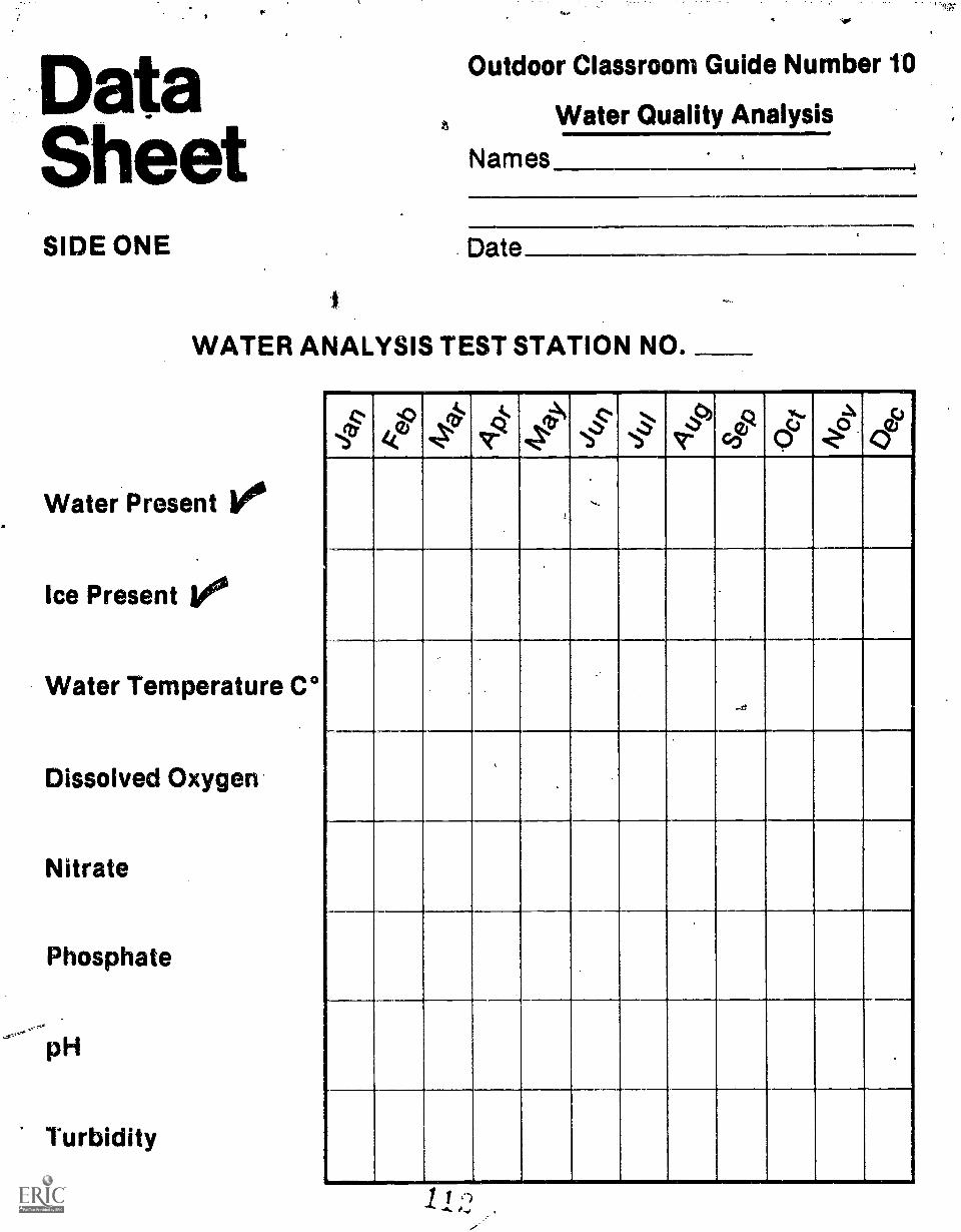
DataSheetSIDE ONE
Outdoor Classroom Guide Number 10
a Water Quality Analysis
Names
Date
WATER ANALYSIS TEST STATION NO.
Water Present v.
Ice Present vWater Temperature C°
Dissolved Oxygen
Nitrate
Phosphate
pH
Turbidity
kg' Nz9 iir"q
ca)
t
,.
.,
,
.

SIDE TWOName
Date
POPULATION AND DIVERSITY SAMPLING
STATION NO.
Temperature: Surface
Middepth
Bottom
Depth ofVisibility
SuspendedMaterial
Grams/Liter
Diversity No. ofin Water Species
Diversityin Sediment
No. ofLiters
No. ofSpecies
No. ofLiters
co-.)
a) a.>ias 42c >1
4 u)Z0
Pip'az V0
_
_._

from lakis into marehes, and frornmarshes Into meadows.
Several kinds of materials add to the,, sediment in water. The soil, rock, or
thist can be wathed or blown into thewater. Minerals can be precipitatedout of water solution. Plants andanimals which live in water die and fallto the bottom. Waste from other organ-isms, especially human waste, maycollect or be deposited in water.
Pollution:
Pollution adds excess materials towater and increases the rate or degreeof eutrophication. The greatest dangerof pollution is that increased growth of
The major concern is to identifythe possible sources of pollutionaffecting the water flowing into therefuge, so testing sites are locatedbefore and after each town and.wherefarm run-off can be analyzed. Tensites are then established on a refugelake and marsh for sampling organismpopulations. Comparisons can then bemade between water conditions andorganism populations.
Determine the question's that you findinteresting and need information aboutand then identify where the test sitesshould be located.
The following list may provide thebasis for discussion in identifying somequestions for investigation. Choose-factors appropriate for your area.
1) agricultural run off2) power plant discharge3) housing development4) solid waste dumping site5) highway construction6) recreational use7) other
Collecting Data
Periodic analyses should be made at allor at selected test sites. Theseanalyses are compared to organismpopulation samples taken at marsh and jlake sampling stations. Any fluctuationin the diversity or the population Size"of organisms will be checked againstany change in the water Composition.
.sk-F57
organisms in enriched Water may corn-plately use up the available supply ofoxygen, thus causing the death of
almost all organisms. This leads toanaerobic decay of the dead organismswith further increase of pollution.
A '
Water Analyses to Conduct at EachSite
Do water analysis tests in accordancewith the directions on each of the kits.
Population Sample to be Made atEach Marsh and Lake Station
You should consider taking populationsamples in places other than the studywatershed area. This information canthen be used as a control against datacollected from refuge sites.
Measurements
A. Temperature.
B. Depth of visibllity.
The Seccht disc is lowered until it nolonger can be seen through the water.The length of cord from the disc to thewater surface is recorded. Ahomemade disc can be made from alarge can cover 20 centimeters indiameter painted with alternate whiteand black quadrants.
11 4
If stain and sediment in the water donot fluctuate greatly, the depth ofvisibility is a reasonable indicator ofthe number of planktt5n organismspresent. Sediment, stain, andorganisms diminish light penetrationinto the water.
C. Weight of suspended material Inwater
Unless the water is severely stirred bywaves or flood, most suspendedmaterial filtered from water will beliving organisms. Algae, protozoans,bacteria, rotifers and crustaceans willbe most common.
Weigh a dry filter paper. Filter waterin multiples of one liter until there issome noticeable collection of material.(Several minutes are required to filterone liter. Other work can beperformed during this time or watersamples can be transported to a lab forvacuum filtration.) Dry the filter paperwith the collected material. Weigh,subtract the weight of the paper andrecord the weight of suspendedmaterial in terms of grams per liter.
D. Sampling aquatic organisms
1. Filter one liter multiples of waterand wash the collected material into ashallow dish with a small amount ofwater. Observe uncial* magnification.Record the number of differentspecies, or thediversity, oforganismsboth plant and animal. Itis helpful to be able to identify thevarious organisms but not essential.However, the most useful study willrequire a listing of organismsobserved. Record diversity oforganisms and the number of literssampled. Record population size foreach species if desired.

sehi .60 1ljdiiititigitibes 1'04:S4:. ..
olden Guide: Pond Life. Newrki:New York, Western Publishing.
'Jk Guide to MO StudY Of FreihWihirSiolOgy by James A. Needham andPaul Ft Needham. San Francisco,1-loiden-Day, 1967.
_Useful sarnpling techniqueeeferenoes;
Freshwater Ecology, EnglewoodCliffs, New Jersey, Prentice Hall,1972.
Field Biology and Ecology by Allen H.Benton and William E. Werner, Jr,Minneapolis, Minnesota, BurgessPublishing Company, 1967.
2. Collect one liter samples of bottomsediment. Wash away sediment andcount the diversily of organisms--plantand animal. Record the number oforganisms and the number of literssampled. Record the population size ofeach species if desired.
after theinvestigationAfter periodic samplings and analysesof the water have been made, look forany changes in diversity, in populationsize or in mineral and sediment contentof the water. Do any of the changesrelate to each other in times ofoccurrence?
Please send a copy of your data andyour conclusions to your refugemanager so that he may use it to helpdetermine management practices forthe refuge.
for information
Many Service land areas provideshelter, toilet facilities and limitedequipment for your use. For trip re-servations and further information,contact your local U.S. Fish end Wild-life Service office or the following re-gional Service offices:
Jenny Publishing Co. Inc.57 Queen Ave. So.
Minneapolis, Minnesota 55405'Copyright 1975 All Rights Reserved
Region I: P.O. Box 37 7Portland, OI 97208
Region II
Region ill
P.O. Box 1. 06Albuquerque, NM 87,103
Federal BuildingFt. SnellingTwin Cities,'MN 55111
Region IV 17 Executive Pk. Dr. NEAtlanta, GA 30329
Region V John W. McCormack PostOffice and CourthouseBoston, MA 02109
Region VI P.O. Box 25486Denver Federal CenterDenver, CO 80225
Alaska Area Office813 D StreetAnchorage, AK 99501
This Outdoor Classroom guide is one ofa series; others are available from yourlocal or regional Service repre-sentative.

:,, :
EnvironmentalEducation Guide
SynopsisPUBLIC USE OF PUBLIC LANDA questionhiliv and surrey procedureis used by studenteto determinepeople's intent and behavior duringuse of public lands.
gitS.7i X'IWAttralik-%, :\ ,-,., .4
U.S. Fish and GuideWildlife Service Number
"*.
***
' 44:
" ::///.:1I
. ::.7
1.4it . '..1.: i
lib ill .1' i104:7..
..4 !:eh
14::!
11 6
til
144
till
Prepared by: ,
U. S. Fish and Wildlife ServiceMinnesota Environmental Sciences Foundation, Inc.

vironrnenoals
E1.4ry ditizen's decision, or lack ofdecision, in some way determines the4.5e and the future of public lands.
The U.S. Fish and Wildlife Service Isthis Nation's only Federal land
, management agency solely responsiblefor fith and wildlife. It is the Service'sbelief that through education anddirect experience, citizens can gain in-formation. understanding and atti-tudes that will support wise use ofpublic lands.
Public use ofpublic land
A. Purpose: This activity will acquaintstudents with
1. The uses of refuges.
2. The recreational interests ofthe public.
3. A technique for surveyingpublic use.
B. Objectives: During this activitythe student will
1. ColleCt information using aninterview survey technique.
4
2. Graph the information to showpatterns of responses.
3. Describe their Interpretationsof the data.
4. Make some recommendationsbased on their interpretations.
C. Activity requirements:
1. Survey forms, clipboar.d andpencl Is.
2. Map of the refuge.
Introduction
National Wildlife Refuges exist to beused by people as well as wildlife. Theofficial use that may be made of refugelands is mainly in the areas of scientificresearch, education andwildlife-oriented recreation.
Major recreational uses of many,refuges are often known to someextent. However, specific information
Maintaining environmental harmony isa crisis concern of the Service. Manmust continue to live In the world insome reasonable "balance" with theland and with other life, otherwise hewill not Survive.
Service programs help people to learnabout land and wildlife, involve them-selves in Interactions with the naturalworld, and enrich themselves throughthat strange aesthetic joy which can beexperienced in the midst of a wild en-vironment. Besides these, the Ser.ticeattempts to make its lands a model ofenvironmental management.
Quality and harmony will remain a partof,the environment and remain the
on the variety and frequency of usesand future trends is usually notavailable,
Student teams can survey public use ofpublic land by asking Questions ofpeople as they enter or leaede therefuge.
Tegns of three students are stationedat all entrances during a selectedperiod of time, Information is collectedfrom all people and vehicles enteringor leaving the refuge by uslng,copjes ofthe enclosed survey sheet
One student asks questions of thepeople, a second recOrds their answersand a third records information aboutthe vehicle, weather conditions, etc.
guidelines for public land managementIf citizens see value In these practices.
backgroundAn Important goal of the NationalWildlife Refuge System Is "to promoteharmony between man and his en-vironment." One way to reach thisgoal is to allow the public to learn andexperience on refuge lands.
Our visitors come to a refuge for manyreasons to learn about theenvironment, to photograph animals or
Selecting a Study
It is known that public use of publiclands increases over weekends. Thisuse Is probably of a different kind fromweekday use, One of the best studieswill compare the differences In publicuse between weekend and weekdayduring the same time of year. This willrequire one or more (preferably many)surveys to be conducted on Saturdaysor Sundays and one or more(preferably many) surveys during theweek.
Another study can show the differencein public use with a change of season.This study requires one or more(preferably many) surveys conductedat each of two or more different timesof the year. These surveys must all beconducted on either e weekday or aweekend.
Other studies can be selected Jo suityour needs or interests. T "1
Locations for Surveys
Identify refuge entrances on the map.Teams should be located at eachentrance. Teams should start and endtheir surveying at the same previouslyarranged time. Teams must beequipped with survey sheets, pencils,and a friendly smile. Not all peoplewill respond cooperatively, butstudents should view the survey as anenjoyable, interesting experience toget the best results.

ata.Sheet
Outdoor Classroom Guide Number 11
Public Use of Public Land
Team No.Surveyors
SIDE ONE Date
<
SURVEYPUBLIC USE OF PUBLIC LAND
Have.you answered another survey today? Yes No
(If no,)Would you answer a few questions about why you came to this refuge?
. What kinds of activities have you engaged in or forwhat particular reason did you come to the refuge?
LIII Nature trail1 AMP'
Picnicking
Observing wildlife
Lii Walking, hiking...a
Li
Hunting
Snowskiing
Snowshoeing
LJ Trapping
Sightseeing from car 7 Educational
Photography 7 Scientific research
Birding F1 Local resident
,Berry picking LII County maintenance
ri Horseback riding El Business with refuge
1 1 Boating and canoeing EI Telephone, power, etc.
Fishing El Other

SIDE TWO
How many hours will you stay for your visit?
How many miles did you travel to get here?
Are you here as a member of a club or organization? Yes_
What is its name?
Are you here in connection with a school? Yes
Would you like some other kind of experience? Yes No_
Will you return soon? Yes No
For what kind of experience will you return?
Response:Cooperative Reluctant UncooperativeVehicle:Auto __Truck Camper TrailerMachinery BoatNumber of people: Adults _____CnildrenVehicle license (what state)
Weather nonditions: Temperature -WindCloud coverPrecipitation

tg-i -;ti.-;1.-''X'riTi"N-,',AVO,7''.1",-
plant life, to V) cineeltig.,.tO walk a! -wildlife trail or Wet to visit- a "quiet1- place."' AS man's. knowledge of the-j.-~environment becomes greater and1..= quiet elaees. for solitude become more
dethand fir utici_Of wildiandswill increaSe.
Most lands within the refuge systemare set aside by anAct of Congress thatestablishes the primary objective ofeach refuge. Although there are dif-ferent kinds of refuges,including somefor buffalo, elk or bighorn sheep,three-fourths of all these lands areestablished as resting, feeding andnesting areas for migratory waterfowl.
Although conserving wildlife and the
Analyzing the Information
Data can be extracted from the surveysheets and put into graphic form foreasiest analysis. For example, thenumber of miles that people drive toreach the refuge can be described byconcentric circles around the refugelocated on a state map; or the data canbe represented by a bar graph as in theexample below.
environment are oUrthain commit-rnents, providing for public onjoymentand appreciation of wildlife hasbecome increasingly more important.By surVeying the public use, publicattitudes, and AWarenesi of local com-munities e..ioncernine a refuge and itsprograths, a student may develop anappreciation of land use problems.Local comthunity and even nationalpressures may change or influenceland use policy. The problems of ad-ministering lands in public trust forpresent and future generations can bestudied. The values of wildlands andquiet places to a community can bediscovered.
Many comparisons can be made withthe information: number of peoplevisiting the refuge on weekendscompared to weekdays; number ofhunters compared to birdwatchers;number of camper vehicles compared.to hunting and fishing or non-huntingand fishing activities; number ofvisitors compared to weatherconditions.
Students should search for significantrelationships or patterns which occurin the data.
NO. OF CARS
30
25
10
5
SUNDAY JUNE 15
5-10 10-20 2040 30-40
MILES TRAVELED40-50 50-60
Tesszt:
,Y),
sJ

:
INIMPrISIMRWICIEXIM3111%11111:titgliirIC
REFUGE. MANAGERZiYAMMVIathargzerazzamtzsmaza
mamma
$74::
after theinvestigation1. Inform refuge personnel of theresults of your investigation. Send acopy of the data and a summary of youranalysis to the refuge manager. Thisinformation will help them plan bettersarvicns for public use of public lands.
2. It may be interesting for students tolook at their leisure time activities nowand what they might be in the future.Have students list their favoriteactivities and the average time theydevote to each in a month.
Jenny Publishing Co. Inc.57 Queen Ave. So.
Minneapolis, Minnesota 55405Copyright 1975 All Rights Reserved
for informationMany Service land areas provideshelter, toilet facilities and limitedequipment for your use. For trip re-servations and further information,contact your local U.S. Fish and Wild-life Service office or the following re-gional Service offices:
After discussing the lists, havestudents predict their future activitiesby preparing similar lists for 16, 30 and45 years from now. Because thinkinginto the future is not easy, somestudents may become frustrated withthis. However, this should be a funactivity where vild guessing is usuallythe rule and not the'exception.
Region I P.O. Box 3737Portland, OR 97208
Region II P.O. Box 1306Albuquerque, NM 87103
Region III Federal BuildingFt. SnellingTwin Cities, MN 55111
Region IV 17 Executive Fk. Dr. NEAtlanta, GA 30329
Region V John W. McCormack PostOffice and CourthouseBoston, MA 02109
Region VI P.O. Box 25486Denver Federal CenterDenver, CO 80225
Alaska Area Office813 0 StreetAnchorage, AK 99501
This Outdoor Classroom guide is one ofa series; others are available from yourlocal or regional Service repre-sentative.

:s'..
or
sroomEnvironmentalEducation Guide
Synopsis
4
0
U.S. Fish and GuideWildlife Service Number..
WILDLIFE/WILDLANDS graphic techniques for investigatingPHOTOGRAPHY the out-of-doors. Several short andThis probe is appropriate for ele- long term projects are described. .
mentary or secondary students. Itemphasizes the use of simple photo-
irk7
122
:.hqf
:Prepared by:U. S. Fish and Wildlife ServlceMinnesota Environmental Sciences Foundation, Inc.
:

-1,-:-.;:-..0,-----V- i --s 4, ,,,,, =.i.,.-.
. ,, ..
Maintaining,rn of the Service. Minenvironmental harmony is guidelin for public land managemeht
a crisii conce, ritinue.te livein the World in
if citizeni see valuein itylle practices.must cg
, . ... -
,
ironmentalIs
7
very citizen s decision, or lack ofdecition, in some way determines the
;.use and the future of ,public lands. I
The U.S. Fishand Wildlife Service Isthis Nation's only Federal land'Management agency Solely responsible.for f ish and wildlife. It is the Service'sbelief that through education anddirect experience, citizens can gain in-formation, understanding and atti-
-. tudes that will support wise Use ofpublic lands.
some reasonaple "balance" with the
will notsurvjve. bac groun,land and with other life, otherwise he
Service programs help peoele toabout land and wildlife, invok hem-selves in interactions wilh the'naturalworld, and enrich themselves throughthat strange aesthetic joy which can beexperienced In the midst of a wild en-vironment. Besides these, the Serviceattempts tp make its lands a model ofenvironmental management.
Quality and harmony will remain a partof the environment and remain the
Ono Way to take a close look at anatural area such as a wildlire refuge isthrough the lens (or viewfinder) of acamera. The cameramay,be thought Ofas another kind of eyi, althougti many 0
times our own eye sees differently.from the camera's eye.This Is one of ithe reasons that our photographs ofteA
Aurprise us. The camera seas only whatit Is pointed at, and Is not tnfluenced bysounds, feelings or thouahts.
W ildlifehindlands photographyA. Purose: This activity will acquaint
ltudents with
1. The value of refuges for naturephotography.
2. The variety of opportunities forusing photography to investi-gate the environment.
3. Some simple photographictechniques.
4. Photography rA a means ofcommunication.!
B. Objectives: During this activitystudents may select among-thelollowing activity options
1. Making a pin-hole camera.
2. Developing black and white
3. Making prints from negatives.
4. Activity options involvingshort-term projects.
5. Activity options Involving long-term projects.
6. Using prints and/or slides inpreparing a presentation.
C. Activity requirements (dependingon activity options):
1. Construction materials forMaking a pin-hole camera.
2. Chemicals and other materialtor .flim and picturedevelopment.
0. Any availaqle camera.
4: Special equipment (optional):
close-Up and telephotoiensfocal frame
remote shutter trippingdevice
construction materials for abltnd
5. Resources and equipment forpreparing a photographic pre-sentation.
Introduction
The activities described in this probedo not require a lot of experience andmaterials.- They have been written tohelp students become familiar withbasic photographic techniques andskills. Inexpensive and reasonabletechniques have been emphasized.
You and your students will be able tochoose fromamong several activityoptions. Some of the activity optionsare excellent starting points.forstudents with more photographicexperience. A brief technique sheethas been provided to assist you Indarkroom techniques and themanufacture of a pinhole camera.Have fun!
The enclosed slip sheet givesstep-by-step directions for techniqueswhich you may find useful incomplementing the activity options.
Some One-Trip Activities:
A. Photograph What You Like Best
Often when students are part of a classtheir activities are structured in aparticular direction. .
In this activity students should beallowed to explore freely andphotograph whatever most attracts1..;
C
them. The possibilities are limitleisand could include both natural andman-made subjects on the refuge.
Once the subject has been captuied onfilm, the student should describe whathe photographed7using another
-medium such as:
I. Poetryif may be necessary toacquaint students wall various forms -of poetic verse such ai free verse orhaiku.
2. A short paper--Descrlbe thesubject and its relationship to thesurrounding environment.
3. Art--A drawing may help emphasizethat which is.particularly interesting tothe student.
B. Getting ta Know ah Animal .
Before going to the refuge the studentshould select an animal that isinteresting to him and found in thearea. Through reading and othersources the student should becomefamiliar withthe natural history of hisanimal. Once this is known, the life ofthe animal can be documented usingphotos.
Go to the erea where the animal lives,its habitat. ,Begin by taking somegeneral pictures of the area from adistance at your eye level. Ts willprovide information on the grosscharacteristics of the place such asplant types and topography. Now takesome pictures at the animal's eyelevel. Photograph tracks, droppings,evidence of feeding, resting spots,nesting areas and other signs ofactivity. It may be useful to considerclose-up photography skills. Thesephotos, in addition to the natural
-`) history Information, will WI) you
4.

TechniqueSheet1. MAKING A PIN-HOLE CAMERA
Materials
a. 4- to 6-inch square box (1/2 gallonmilk carton bottom)
ti. Flat black paint
C. Heavy aluminum foil
d. Masking tape and black frictiontape
e. Sheet film (from photo store)
f. Needle or pin
Procedure
Make sure your bOx has a tight-fitting
Outdoor ClassroomGuide Number 12
Wildlife/Wildlands Photography
cover, or make one out of constructionpaper. Decide on one side for thefront; if it is longer than wide, use oneof the shorter sides or ends. Cut a1/2-inch diameter hole in the middle ofthe front. Next, paint the entire Insi0eand outside of the box black to preventtransmission and reflection of light.
Cut a circle of aluminum foil 1 Y2inches in diameter and glue or tape itover the hole on the inside. Paint itblack also (inside only). In the centerof the foil, prick a small hole with aneedle or pin.
Opposite the hole fasten an H-shapedpiece of masking tape, sticky side out,which will hold the film.
Place d piece of black friction tape overyour pin-hole until you are ready totake a picture.
Load a piece of film (emulsion sidetoward the pin-hole) IN ACOMPLETELY DARKENED ROOMSUCH AS A CLOSET. Tape the film tothe inside back of the camera.
When you decide on a subject set yourcamera down and aim it, and thenremove the friction tape. Leave thecamera undisturbed for severalminutes. You may have to experiment,varying the time from five to thirtyminutes.
You can now take pictures galore!
,)

2. DEVELOPING BLACK ANDWHITE FILM
Materials
a. Completely dark room
b. "Daylight" developing tank
c. Spring-type clothes pins
d. Plastic funnel
e. Sink or pan full.of water
f. Developing tray
g. The following chemicals (availableat a photo store)
(1) Film developer
(2) Stop bath
(3) Acid fixer
1111
Procedure
a. Load film into developing tankin complete darkness.
b. Replace lid and turn on ligot.
c. Place tank into one shallow tray andpour film developer into hOle in liduntil the chemical begins to overflow.
d. Start timing process according toinstructions on can of developer andturn reel once every 1/2 minute.
0. After proper time for development,tilt unopened tank and pour developerback into its jar.
f. Pour stop bath chemical intounopened tank, turning reel once ortwice.
g. Pour stop bath back into its jar.
h. Pour acid fixer into unopened tank,turning reel every 1/2 minute for fiveminutes.
j. Put tank under a cold water faucetfor 1/2 hour.
k. After the film is washed, turn offwater and add a few drops of"Photo-flo "
I. Hang film up to dry using clothespins. Put one on the end to keep filmstraight.
You now have negatives ready to beprinted.
3. MAKING BLACK AND WHITE CONTACT PRINTS
Materials
a. Four trays
b. Clear glass 100 watt white bulb
c. Red bulb (optional) for light
d. Photographic contact print paper
e Printing chemicals
(1) Paper developer
(2) Stop bath
(3) Acid tiger
(2) and (3) are the same chemicals usedin activity 2.
Procedure
a. Fill trays, each with one of the threechemicals.
b. Select a negative and remove onepiece of photographic paper. (Do notexpose photographic paper to light.)
c. Place between a piece of cardboardand clear plastic in this order:cardboard, paper (shiny side up),negative (shiny side up), clear plastic.Clip tightly together with a clothes pin.
d. Expose this to the white light, at 5to 10 feet, for 5 to 20 seconds.
e. Quickly pull out the paper and placeface down in print developer.
1 0 )
f. When the image is completelydeveloped, the edges of the paper willbe black. When this happens, quicklytransfer paper (face down) to stop bathfor 20 seconds.
g. Place in fixer for ten minutes.
h. Take fourth tray and place underrunning water. Put print in for at leastone hour.
i. Place print between papertowels and hang up to dry.
0
You now havea printed photograph.

The photograph bOornet a perinarientrecord of whethathere was UV muchor too tittle light; the Interplay ofshadow and light, coMposition andfocus. A good photograph often In-voiv0a a great deel'of. looking aroUnd.We may Walt for. the sun to be just theright height or a cloud to pass, or for aday when we can best capture themood of fog, snow, rain or sleet. Welook for patterns and wonder how we,can capture them. We think aboutcomposition and what we are trying todo, We try early morning and lateafternoon light, and are willing to in-vestigate an area in more and some-what different detail than we arenormally accustomed. Photographyseems to involve a lot of standing
011111
, something about the life of the animal.Explore several ways of arranging thephotos and telling the story.
C. Looking at Natural Communities
Communities usually consist of severaldifferent kinds of living things whichinfluence each other in various ways.For Instance, in a marsh communitymuskrats and cattails influence eachother, as do shrubs and trees in a -
forest community.
How do communities differ? Whatchanges are discovered whencomparing a marsh community and anupland forest community? Thestudent can record some of thesedifferences and changes usingphotography. Use photos to recordevidence of community characteristicssuch as:
1. Amount of moisture
2. Amount of light
3. Density of plant cover
4. Plant species
5. Animal species
6. Plantlanimal interactions
To record changes within and betweencommunities, the following techniquescould be used:
1. Photograph at different levels
2. Photograph at points along a line
3. Photograph at various directionsaround a particular point
D. Studying Careers
The management of natural resources
Toor,
around ald looking.
Perhaps If we call this "creative day-dreaming" we can see that thisprocess the decisions involved inmaking a picture øj s trulyeducational.
1.0fg%
To tell a story about the way a wildliferefuge works, to explore the interrela-tionships of plants and animals, tocapture and communicate yourfeelings about the refuge Or a subjecton that refuge can be as involving,challenging and as much fun as anyother kind of study of the Interrelation-ships of. the refuge and its wildlife. It isa search and exploration of the waythings are.
involves ieveral careers. The studentinterested In exploring these careerswill find photography a useful tool.Have the student select a career andthen contact a peeson who couldprovide on-site guidance.
It is important that the student isprepared to communicate effectively.Questions and other interviewconsiderations should be plannedbefore the visit. See Careers, OutdoorClassroom Guide No. 13, for details onplanning a career interview.
Working conditions and taskresponsibilitle4re two importantcareer characterIVIcs which can bephotographed. Perhaps it would bepossible for the student to spend sometime on-the-job as an assistant.Interview information along withactual on-the-job photos will provide afun and meaningful introduction to anycareer.
Some ideas for Long-Term Projects
These projects require several visits tothe same area over a period of weeks ormonths;students should thereforeselect study sites near their homes orschool.
All things change over time--the life ofa particular animal, a community, a Joband hopefully, our understanding ofthe environment. Each of the shorterterm projects could be improved byextending them over several visits.
Select one of the short-term activitiesbut plan several visits over a period of.weeks. It will be helpful to extend theproject over two seasons, or at leastfrom the beginning to the latter part ofone season. Make use of photographyto help record long-term changes.Some of the following questions mayhelp tpiotAdent get started:
4,)
. The InVolVeMent and results can leadto neW underitandingi and provide uswith another way of looking at andthinking about refuges. It may alsohelp us better understand the mannerin Which We are related and clarify theway we want to be related to theenvironment.
How does a particular place changefrom season to season?
How does the, life of a particular animalchange from season to season?
Which characteristics of a communitychange from season to season or over amuch longer period of time?
How do working conditions and jobsresponsibilitles change from season toseason? Do these changes affect yourideas about the job as a possiblecareer?
Special photographic techniques andequipment may be used for long-termprojects. Although these projectsrequire some training and moreadvanced equipment, a few studentsmay find them more appropriate fortheir interests and experience. A fewideas are :
1. Using special close-up andtelephoto lenses to record themicro-habitat, structure and behaviorof certain plants and animals.
2. Using remote releases andphotoflash equipment to photographwildlife at night.
1 Using a blind to photograph thebehavior of animals.
The local camera shop can provideuseful references such as bookletsproduced by the Eastman KodakCompany.
Follow-up Activities
A. Sharing the Results with Others
After completing one or more of theactivities, students should beencouraged to share their projects with

t.;d.otheri, Perhaps other classes wouldlike to learn about ngture photographyand some of the things the studentshave discovered.
'ifpriñtswerornade, a collage orexhibit of photos with captions can be
arranged to effectively relate an:experience or story.
A presentation using 35mm slides isanother way to communicate withsmall, or large groups. Each pictureshould make a point, draw attention ormake a conclusion; arrange them sothey tell the story smoothly.
Some of the following questions mayhelp students select an activity andalso organize their thoughts forpreparing a presentation.
1. Which kinds of photographs wouldyou rather take? Rank them from mostliked to least liked, and why?
a. People
b. Wildlife
c. Man-made objects
d. Landscapes
e. Cities
A.cti
2. Do You PrefOr tO IMO bilék gindwhite Or color pictures, end why?
3. Do your photOi give yeti the limefeelings end imprWitionO aswhen youwire tight thitC.tiking the Odin*?Tell how you tilt when you took thatphotograph. Tell how you felt whenyou saw the same photograph.
4. Fill in the open-ended sentences ofyour choice:
I think man takes photographs to...
I think photographs are better thanwords because...
I think photographs are as good aspaintings because...
I cannot take good pictures because...
I do not think photography Is much funbecause...
5. In what ways would your life bedifferent without photography?
B. Picture Taking in YourNeighborhood
From the skills and techniques learnedthrough nature photography, students
for informationMany Service land areas provideshelter, toilet facilities and limitedequipment for your use. For trip re-servations and further information,contact your local U.S. Fish and Wild-life Service office or the following re-gional Service offices:
coüld.devOJopá projett about their .
neighborhood, schoOl or community.Here are tome ideaS;
1, The way man uses his habitat
Shelter
Recreation
Travel lanes
- Escape routes .
- The way he uses it differently from4 other animals
His use of the environment
- His abuse of the environment.
2. A record of one day in the life of
- The student
- The teacher
- A community resident
- The janitor
- The principal.
Jenny Publishing Co. Inc.57 Queen Ave. So.
Minneapolis, Minnesota 55405Copyright 1975 All Rights Reserved
Region I P.O. Box 3737Portland, OR 97208
Region II P.O. Box 1306Albuquerque, NM 87103
Region I II Federal BuildingFt. SnellingTwin Cities, MN 55111
Region IV 17 Executive Pk. Dr. NEAtlanta, GA 30329
Region V John W. McCormack PostOffice and CourthouseBoston, MA 02109
Region Vi P.O. Box 25486Denver Federal CenterDenver, CO 80225
Alaska Area Office813 D StreetAnchorage, AK 99501
This Outdoor Classroom guide is one ofa series; others are available from yourlocal or regional Service repre-sentative.

". .
. . . ,...-' ,.'...' 4 r. ' , .:1"=,',:0: P..ii4.'el'i4$474...' .:7'""ik''.4":". . .. ... ..
..f..Ar,4,........,;,-,,....,.....4,-,..- ...,t1.....-"...1.,.1..1.,..-.-..:-.....--.."-;.-;:."- . '....4-.-...",4;-:',:'-.;,-..-',',,7-;-
.71,- ',-.' ''. '' :-' :4'' .--',,,Y'_,..: ik?-.....a..-:'!...1,4,g*.1;z.j-ii"..7'21.-2-....-7.:.--,;-,-,- ....'P,:i-.j:lit....!,::::1:4?..7..f.: ."0- V5.'...'ki._;''' "1:.....14.3"S-,%;-96-Z.I.:',.4_74... ''?"' ''''Igfi.'..'f'''L.1;rWi'gY ''', rN1'.*:)...-../.;-'11-'-'':%:-'' '
. '. -:;''';',..4"/5 ,.i''''' 1' .:..',....:'..n:../. ;:2'4,'... ..
/.:: -i,C.
1. .::---:',?....-.:q,:vA.',...' ,. : . . ...,-.....,-.- ,,..1,:..,,,,,,,,:::. -..-., P. ',.-/-r..,,Jr-c, .,.."."'.;.-1'....;,..: ... . . , .
-, -... -, ....:. ,:.::'''4..-
I ." %;
(Czif
-,.......:...,..,....."ft.
ot,...4,../.,....-.. ,.,-..,...,-...1..,...s..,...!-...1.....-.-.. - --. .
-. ,..:., . . ..
'''''''''''',i',.; ,
. . ...........
.
. ., , , - . , - , ,
konmentaiucation Guide
SynopsisCAREERS includes job possibilities and careerStudents plan, conduct and report training in the natural resourceresults of an interview with a refuge management field.
.employee. Information gathered
't.Ii-*p et:
1:
ti!fmari

t
vtronmentaloals
.EVerY Citizen's decision, or lack ot. decision, in some way determines the.use and the teture of public lands.
The U. S. Fish and Wildlife Service isthis Nation's only Federal land man-. .
,..,agernent agency solely responsiblefor fish and wildlife. It is the Service's
' belief that through education and di-rect experience, citizens can gain in-formation, understanding and attitudesthat will 'support wise use of publiclands.
0
Careers0111.1000.11111WINIMma
A. Purpose: This activity will acquaintstudents with--1. Most of the resource career
opportunities on refuge lands.2. Interview planning and develop-
ment.3. People inv4ved in resource
careers.4. A general process for exploring
career opportunities.B. Objectives: During this activity
students will-1. Plan and develop an interview
questionnaire.2. Conduct an interview with an
employee.3. Report the results of the inter-
view.C. Activity requirements:
Bureau employee time for partici-pating in the inteiviews.
General Job Descriptions
Although a refuge's main objectiveconcerns fish and wildlife management,its operations can be thought of as asmall business. Purchases, bills andprogram activities all must eventuallyresult in a product that serves thegeneral public This product comes inthe form of educatiOn, recreation anda diverse natural community.
Refuge positions reflect the manyservices it maintains and produces.There are positions for men andwomen; some require college educationand others require skills acquired fromworking experience with machinery.All have one goalthe managementand improvement of our naturalresources.
:
Maintiihing environniental harmony is-a crisis concern of the Service. Manmust continue to live in the world insome reasonable "balance with theland and with other life, otherwise hewill not survive:
Service programs help people to learnabout land and wildlife, involve them-selves In interactions with the naturalworld, and enrich themselves throughthat strange'aesthetic joy which can beexperienced In the midst of a wildenvironment. Beside this,-the Serviceattempts to make its lands a model ofenvironmental management.
Quality and harmony will remain apart of the environment and remain
the guideline for public land manage-ment if citizens See value in thesepractices.
backgroundRefuges play an important role in fishand wildlife management. Theycombine proper land managementtechniques with the disciplines of:modern science and technology to
- ensure wildlife populations for thefuture.
The range of occupations included inthe refuge cluster of jobs is surpris-
Although a brief description of refugecareers is included here, it isnecessary to visit a refuge and talk tothe employees to really discover whatthey do and their attitude about aparticular job.
A. Refuge ManagerA refuge manager plans and super-vises a yearly work program on therefuge. These duties include mainte-nance and improvement of wildlifehabitat, censusing and regulation ofwildlife populations, determination ofeconomic and public land use, publicrelations, financial decisions andenforcement of laws.
11.0111B. Soil ConservationistA soil conservationist determinesproper techniques for land manage-mentforthe benefit of wildlife, preparesand supervises land management plans,and is sometimes responsible forsupervising the work program andmaintenance of physical facilities suchas fences, buildings, roads, dikes, andprotection of the area against fire andtrespassing,
C. ClerkThe refuge clerk has responsibilitiesbeyond the expected routine office

SIDE ONE
Outdoor Classroom Guide Number 13
Names
Careers
Date
Site_ Job Title
1. Career Description:
2. Related Fields:
3. Working Conditions:
4. Abilities and Training:
5..Satisfactions:
6. Attitudes:
1

4\4,wide.'Refuge imployees serve as
technical advisors and mutt be able to.determine What action .is necestary to ,;
''..protect, modify, manage and IMprOVe,i3:, : .
our country's land, water, v0;040911:And wildlife,retiources .
Thes'e refuge employees Offer uniqueIntervieW:potsibflitietto -the Inter-ested student..Gaining ,firet-handinformatiOn about fob descriPtiens,satisfaetiont and its place in stationoPerationsgivesthestudent knowledgeof job"poisibilities and intreatedunderstanding of the refege's role innatural resource management.
4r
''' ,frfrff
matters. She or he must maintaincorrespondence, handle inquires forinformation from the public, and keepaccurate bookkeeping records involv-ing equipment inventories, purchases,and payroll. At times the clerk is theonly official refuge person in the officeand must handle visitors' inquiriesas well as provide assistance to toursand student grouos.
D. Wildlife BiologistThe wildlife biologist will form plans..for organizing and carrying out fieldbiology studies to make recommen-dations for new management programsand to determine effects of managementpractices on fish and wildlife popula-tions. Other duties include assistancein control of disease, predation, andother activities as directed.
E. Public Use SpecialistThe public use specialist plans anddirects all refuge recreational activi-ties, provides guidance and assistancefor environmental education programs,and is actively involved in refugepublic relations such as tours, speakingengagements and communicationsmedia (newspaper articles, radio andtelevision programs). This positionrequires creative and original thinking,writing and speaking abilities, andoften artistic talents.
F. MaintenanceA maintenance person must be ableto perform a variety of trade and craft*skills. The work is primarily outdoorsaccomplishing tasks related to fences,roads, building repairs, boat docksand recreational equipment. Welding,plumbing, masonry, carpentry, electricaland record keeping skills are needed
for a well-rounded maintenanceprogram,
G. Engineering Equipment OperaterThe operator performs a variety ofduties in operation of heavy equipment.The skills include operation and carefor equipment such as bulldozers,draglines, road graders, backhoe,truck-mounted cranes, front-endloaders, etc. The work projects maycall for road and dike construction andrepair, excavating ditches and ponds,stockpiling materials, trench digging,timber clearing, island building andother similar work.
Federal Fish HatcheriesFederal hatcheries are also Bureauproperty and students may find itinteresting to explore this.careerfield.
Fish Hatchery ManagerA hatchery manager plans and super-yips the fish rearing and distributionprograms in addition to the stationmaintenance program at the hatchery.Rearing fish species on a productionscale requires the practical applicationof fishery biology and the ability todiagnose and treat most of the commondiseases of fish. Other duties includemaking financial decisions andpublic relations.
1 3
Planning Your inteiview
The work descriptions of refuge em-ployees may help you decide who youwant to interview. A visit can be madeas a group or as an Individual who thencan report to his class.
Suggestions for a worthwhile visit:1. Decide who you want to interview,
and make an appointment by writingor calling the refuge. Explain whyyou would.like an interview and askfor a definite time and day.
2. Be on time for your visit. Takenotes and ask questions that inter-est youthis is your chance to getfirst-hand information.
3. If you plan to take pictures or usea tape recorder, ask for permission.Know how to use your equipmentlet it be a useful tool and not anuisance.
4. Summarize your impressions andrelate them to your host. He or shewill appreciate a sincere thank you.
5. As soon after your visit as possible,organize and collect your data so itcan be useful in a report to yourclass or organization.
Suggested QuestionsA successful career interview shouldcover the following six dimensions in-volved with any job. Often theemployee will volunteer information,making it unnecessary to ask questionsin each area. In any event, do nothesitate to ask what you want to know.
1. Career description:What kind of work is involved in
your job?How long have you worked at this
job?

t,
, 141:,..
elated fields:-OW does thit job fit into the )ur.
se and,objectiveti.bt.thi-- !,-refuge?
W does this lob relate to similarones in Other natural resource
,_'-agencies?
Working conditions' ,
Where do you workindoors vs._outdoors?
: With What other employees do youwork?
What should a new employeeexpect for a starting salary,advancement possibilities andfringe benefits?
4, Abilities and training:What preparation, background and
training is needed?-What personal abilities are needed?
5. Satisfactions:What would you do during a typical
day?Wilt do you enjcv the most; the
least?
1.4ek.i's 1, ' , .
' . . .V.0
5-2.'.`,',
6..Attitude:What advice do you have for a
young person who is interestedin this work? .
after theinvestigationPrepare a report for your Organizationor class.
Taking your information and datacollection Into consideration, noticethat there are satisfactions as well asdisagreeable duties which must beconsidered in refuge work as in allcareers. How do they all add upto you?
If you want additional information,contact your school counselor forinformation sources such as theGovernment Printing Office bulletins,State Department of Natural Re-sources, Regional Offices of theU. S. Fish and Wildlife Service. Man-power Employment Services, Uni-versity Extension Services and courseinstructions at vocational-technicalschools.
For personal involvement, otherOutdoor Classroom guides are avail-able from the refuge manager.
for infor.matIgnMany Service land areas provide
. designated activity sites, shelter,tollot facilities and limited equipment .
for your use. For trip reservations andfurther information, contact your localU.S. Fish and Wildlife Serviceoffice or the following regionalServices offices:
Developed with the assistance of:
Donald Johansen, CoordinatorCareers Project Co-sponsored byMinnesota Environmental SciencesFoundation, Inc. andRobbinsdale Area Schools. Inc.District t 281
..tenny Publishing Co. Inc.57 Queen Ave. So.
Minneapolis, Minnesota 55405Cop.yright 1975 All Rights Reserved
9 r)
Region I:
Region ll
Region I l
P.O. Box 3737Portland, OR 97208
P.O. Box 1306Albuquerque, NM 87103
Federal BuildingFt. SmillingTwin Cities, MN 55111
Region IV 17 Executive Pk. pr. N""Atlanta, GA 30329
--Region V John W. McCormack PostOffice and CourthouseBoston, MA 02109
Region VI P.O. Box 25486Denver Federal CenterDenver, CO 80225
Alaska Area Office813 D StreetAnchorage, AK 99501
This Outdoor Classroom guide is one ofa series; others are available from yourlocal or regional Service repre-
. sentative.
Sr

..-y-':. -,", . . .
-
k.:;:.v .-
SynopsisFOREIGN LANGUAGEStudents use language related toobjects in a natural environment tolearn foreign word definitions andsentence structure.
o
:. ,
1!
.11_44 fish atidWildlit6Service
tfi
ex
Number
,
.4:4,44:V4,4'4VIt:.
1441. .PII-Trj.a114 *.tP*4,r,,,..
....P1:74iIPPiPt
trot
.
1 rqi
.1
ii
133
:4,14
i'. .
P:14'/4:14
4I.
Prepared by:.U. S. Fish and Wildlife ServiceMinnesota Environmental Sciences Foundation, Inc.
7
141.:

VitOnmental..oals,
Every citizen's decision, or tack of.decision, in some way determines theuse and the future of public lands.
Thf U. S. Fish and Wildlife Service isthis Nation's only Federal land man-
-, agement agency solely responsiblefor fish and wildlife.,It is the Service'sbelief that through education and di-rect experience, citizens can gain in-formation, understanding and attitudesthat will support wise use of publiclands.
Ioreignlanguage
A. Purpose: This activity will acquaintstudents with-1. The natural setting as a useful
place for foreign languagestudy.
2. The natural setting as a stimu-lus for using their knowledgein a foreign language.
B. Objectives: During this activitystudents will-1. Translate a list of wOrds common
to a natural setting.2. Use the translated list as a
basis for labeling a map, writ-ing poetry, or composing shortdescriptive sentences.
C. Activity requirements:1. Gridded area for mapping.2. Map of area showing trails,
roads. etc.
In this activity guide, students wintranslate a list of words and then usethem in individual activities. Thesuggested vocabulary list consists ofwords commonly associated withnatural areas. This list should bechanged to fit the conditions of yourlocal area. After translating and learn-ing the list, students will use it as aword pool for individual activities in-volving mapping, writing poetry ariddescriptive composition.MaterialsStudents will need writing paper andpencilsTranslating the Vocabulary ListThe suggested vocabulary list on theStudent Data Sheet is the basis for theindividual activities described laterThis list was compiled by a group offoreign language teachers representingGerman, French, Spanish and Russian.
Maintaining,etwironinehtal harmony isa crisis concern of the Service. Manmust continue to live in the world insome reasonable "balance" with theeland and with other life, otherwise hewill not survive.
Service programs help people to learnabout land and wildlife, involve them-selves in interactions with the naturalworld, and enrich themselves throughthat strange aesthetic joy which can beexperienced in the midst of a wildenvironment. Beside this, the Serviceattempts to make its lands a model ofenvironmental management.
Quality and harmony will remain apars of the environment and remain
It should not be considered rigid andyou are encouraged to modify itaccording to your program needs andthe unique characteristics of yourlocality. If you choose not to use thesuggested words, perhaps you andyour students could work together inconstructing a new One.It is strongly suggested that studentstranslate and practice the list beforebeginning the individual activities.You may want to translate the words imthe classroom before taking the trip.However, students will find itinteresting to practice them once theyare at the natural area by trying tofind examples of the words.Directions for Individual ActivitiesThe following activities are designedto make use of the vocabulary list.They are suggested as ideas only andyou and yo.ur students are encouragedto modify or substitute others for them.Labeling a MapAn area of land has been selected andmarked to form a grid pattern of thesame proportion as the grid on thesample map arid on the student datasheet (side 2). The "gridded" area ofland contains a variety of habitats andsurface features to make exploring andmapping an interesting experience.Students can translate land features tothe data sheet and then use wordsfrom their list for labeling the features.The land surface you use may notnecessarily look like the sample mapbecause of differences in localfeatures.Your local land manager will directyou to the location prepared oç4hisactivity. .;
the guideline for public land manage-ment if citizens see value in thesepractices.'
backgroundWhy use a natural setting to teachforeign languages? The languages ofmost cultures are rich in words reflect-ing man's interest in describing nature.What better place to learn and usethese words than in the natural setting.In this setting students can find real
'examples of the words for vocabulary
INImwIIIIME1=1
Sample Map
Writing PoetrySome students may wish to find aquiet place and express their feelingsthrough poetry. To help them getstarted, use several examples of simplepoems with outdoor themes such asThe Poppy Field. Some could be highlystructured such as Haiku poetry andothers unstructured. Students couldthen be asked to write their own poemeither focusing on the whole setting

SIDE ONE
Outdoor Classroom Guide Number 14
Foreign Language
Names
Datel*N1/1
(e.g.) Translation
mushroom
moss
fox
Vocabulary List
mushroom wildflower nest
moss grass weed
fox raccoon muskrat
beaver squirrel
skunk deer
fish spider
bird frog grasshopper
rabbit
chipmunk..
snake
brush
birch
log
cone
duck willow
bush tree
fir branch
twig seasons
stream
forest
wind
beautiful
clear
_ moist rocky
marsh_._.. _ water
pond
sun meadow
fresh sky
peaceful
north__ ____
south summer
east .______ west
fall

SIDE TWO
Grid for the Mapping Activity: (1" - 25')
v_
')y
f

iuIldlnbgnd stimulus for usinghem. Pethaot thit exjuiriênCe Will not
ohly.helpstudents learn fereign lan-guages,. but will'also help them realize
. that natural areas are useful tor's, s
,ivariety aelivities and therefore: have4106 tb ill Of tat.
around them or one central object orfeature. They should attemptto use asmany of the words on the litt asthey can.
Das MohnfeldUnd auf der stillen Wiese standRings Mohn bei Mohn und unbewegtUnd war bis an den femsten RandDer rote Teppich hingelegt.
The Poppy FieldAnd in the quiet meadow stOodMotionless Ooppies all arqund,That stretched away to meet the
woodAnd decked with carpet red the
ground.Poem anti Translation fromGerman Poetry For Beginnersed. A. Watson, BainSt. Martin'S Press 1967
Descriptive CompositionSome students may want to describe
. smile features of the landscape orsome things they find by composingshort paragraphs or sentences. Someexamples are given below. By workingin small groups, students can quizeach other on the meanings of theircompositions.
Les Champignons poussent pths dumarais.
(The mushrooms are growing nearthe swamp.)
Des chouettes se sont applelees toutla twit.
(Owls called (hooted) all nightlong.)
Les troncos des arbres sont torduspar le vent.
(The tree trunks are twisted by thewind.)
gras
tpaba1 3

t. rrir,..7
4f.v.; .;* .172e- -J:
;
.
A
' ;It
Upontompletien of the activity, atnore detailed study of the results
;shoUld be Carried out in the classroorpWith,ParticLitaremphasis on grammati-
. Cal Atrueture, aS welt da further .
-:"Apvelopmeni of the vocabulary.Classroom conversation in the Ian-
based on what was seen in thenatural area, may be precticed.Prepare sentences and paragraphs forsupplementary reading which is related
-- :to the class experience. This shouldhelp to reinforce both the sense ofinvolvement and the word identitieswhich were part of the activity.Examples:
John 9ot wet when he reached forthe frog.
We were hidden in the bushes. The: west wind had blown the clouds
away.Susie sat on the moss and fed her
sandwich to the chipmunk:Das Lied der Vogel
Wir VOgel haben's wahrlich gut,Wir fliegen, hdpfen, springen;Wir singen frisch Lind wohlgemut,Dass Wald and Feld erkiingen,
The Song of the BirdsWe bird's have really got it good,We fly, we hop, we jump;We sing fresh' and Cheerfully,So that the wded.s andfields resound. .
Hoffman von Falle'rsleben
Translated by:Katharine Fournier, German Teacher .
North High SchoolNo. St. Paul, Minnesota
for informationMany Service land areds providedesignated activity sites, shelter,toilet facilities and limited equipmentfor your use. For trip reservations andfurther information, contact your localU.S. Fish and Wildlife Serviceoffice or the following regionalServices offices:
01.
Developed with the assistance of:Kenneth R Wagner, ChairmanForeign Langulige'DepartmentNorth High SchoolNo. St. Paul, Minnesota
. , Jenny Publishing Co. Inc.. 5j..Oueen)Vo. So.
Minnciapblis, Minnegota 55405'Copyright 1975 All Rights Reserved
67%
Region I: P.O. Box 3737Portland, OR 97208
Region II P.O. Box 1306Albuquerque, NM 87103
Region III Federal BuildingFt. SnellingTwin Cities, MN 55111
Region IV 17 Executive Pk. Dr. NEAtlanta, GA ,30329
Region V John W. McCormack PostOffice and Courthouse.Boston, MA 02109
Region VI P.O. Box 25486Denver Federal CenterDenver, CO 80225
Alaska Area Office813 D StreetAnchorage, AK 99501
This Outdoor Classroom guide is one ofa series; others are available from yourlocal or regional Service repre-,sentative.

.
e
Gdee
;qo11\. :
.
..
::.
1óGatto
.".
..
__-.\i
u'ce0t stchGt
0t'
H\
lt\I
a
r ç4a
i
a
a
L.
:
a
a
Ita.
13qAteso
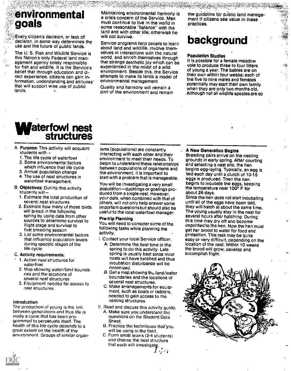
!;,ttl.c5S- .. .
'Arotimeritaloals
=EVery. citizen's decision, or lack of. dediSion, in some way determines the
uae and the future of public lands.
The U. S. Fish and Wildlife Service isthis Nation's only Federal land man-agement agency solely responsiblefor fish and wildlife. It is the Service'sbelief that through education and di-rect experience, citizens can gain in-formation, understanding and attitudesthat will support wise use of publiclands.
Waterfowl neststructures
1101.1A. Purpose: This activity will acquaint
students with1, The life cycle of waterfowl2. Some environmental factors
which influence that life cycle3. Annual population change4. The use of nest structures in
waterfowl management.
S. Objectives: During this activitystudents will.1. Estimate the total production of
severai nest structures2. Estimate how many of these birds
will breed in the followingspring by using data from othersources to determine survival toflight stage and survival tofirst breeding season
3. List some environmental factorsthat influence population levelsduring specific stages of thelife cycle.
C. Activity requirements:, 1. Active nest structures for
waterfowl2. Map showing water/land bounda-
ries and the locations ofseveral nest structures
3. Equipment needed for access tonest structures.
IntroductionThe production of young is the linkbetween generations and thus life isreally a cycle that has been Pro-grammed to perpetuate itself. Thehealth of this life cycle depends to agreat extent on the health of theenvironment. Groups of similar organ-
21w ra, 014a
I ;'17.! .7457.
Maintaining enVironmental harmony it the guideline far public land manage-a crisis concern of the Service, Man ment if citizens see value in thesemust continue to live in the world in practices.some reasonable "balance" with theland and with other life, otherwise hewill not survive
Service programs help people to learnabout land and wildlife, involve them-selves in interactions with the naturalworld, and enrich themselves throughthat strange aesthetic joy which can beexperienced in the midst of a wildenvironment. Beside this, the Serviceattempts to make its lands a model ofenvironmental management.Quality and harmony will remain apart of the environment and remain
isms (populations) are constantlyinteracting with each other and theirenvironment to meet their needs. Tobegin to understand these relationshipsbetween populations of organisms andthe environment, it is important tostart with a problem that is manageable.
You will be investigating a very smallpopulationducklings or goslings pro-duced from a single nest. However,your data, when combined with that ofothers, will not only help answer someimportant questions but should also beuseful to the local waterfowl manager.
Pre-trip PlanningYou will need to consider some of thefollowing tasks while planning theactivity.I. Centact your local Service officer.
A. Determine the best time in thespring to do this activity. Latespring is usually best since mostnests will have hatched and thusincubation disturbance will beminimized.
B. Get a map showing the land/waterboundaries and the locations ofseveral nest structures.
C. Make arranagements for equip-ment, such as boats or ladders,needed to gain access to thenesting structures.
II. Read and discuss this activity guide.A. Make sure you understand the
questions on the Student DataSheet.
13. Practice the techniques tharyouwill be using in the field.
C. Form small teams (2-4 students)and choose the nest structurethat each will investigaty.
backgroundPopulation StudiesIt is possible for a female meadowvole to produce three to four littersof young a year. The babies are ontheir own within four weeks; each ofthe five to nine males and femalespotentially may start their own familywhen they are only two months old.Although not all wildlife species are so
A New Generation BeginsBreeding pairs arrive on the nestinggrounds in early spring. After courtingand selecting a nest site, the henbegins egg-laying. Typically, an egg islaid each day until a cluteh of 10-15eggs is produced. Then the henbegins to incubate the eggs, keepingthe temperature near 100° F forabout 26 days.Since the hen does not start incubatinguntil all of the eggs have been laid,they will hatch at about the same time.The young usually stay in the nest forseveral hours after hatching. Duringthis time they dry off and becomeimprinted to the hen. Now the hen mustget her brood to water for food andprotection. This task may be quiteeasy or very difficult, depending on thelocation of the nest. Within 10 weeksthe brood will grow, develop andaccomplish flight.
f.

ataSheetSIDE ONE
Part A1. Team N urn ber___.2. Names3. Place4. Date
Outdoor Classroom Guide Number 15
Waterfowl Nest Structures
Part B Nest Structure Description1. Type and number of structure2. _Yes __NoUsed this spring by waterfowl
If yes, probable species_3. General condition of structure4. Miscl
Part C Production of Young1. Check one of the following:
a. __Eggs have hatched.b. .,__Eggs are being incubated.c. __Eggs are still being produced or have been
abandoned.2. Total number of eggs3. Estimated number of young that left the nest4. Misc. (unhatched eggs, dead ducklings, etc.)
5. Total production (total number of youngthat left all of the nests being studied).
Nest Structures

SIDE TWO
First Spring Summer
(Question 1)_breeding pairs
Fell/Winter
Approximately 52% of the _adult breeding pairswill die before the second spring, leaving
(Question 3)produce anaverage of
young
(Question 4)Approximately 50% ofthe young willdie before reachingflight stage,leaving young
Approximately 67% ofthe _young will diebefore spring, leavinga potential of
Second Spring
(Question 2)Approximately
breeding pairs
(Question 5)Approximately
breeding pairs
(Question 6)Total breeding
pairs
Part DList some environmental factors which influence survival for each numbered part in thelife equation (an example is given for each).
(1) Number of nestsites
(3) Weather(2 & 5) Disease Conditions (4) Predations
Part E1. How do your results compare with those from the Massachusetts study?
2. If they differ, what are some possible reasons for the differences?
ea Based on this investigation, predict if the population is increasing, decreasing orstaying about the same? What are the limitations,of your study in being able to makethe prediction above?
4
4. To maintain a population at the same level from year to year, what must be true about:the number of breeding pairs? the number of young produced? the environmental factorsinfluencing survival?

. -prOdUctiVe, each doeseroduèet enoughyoung te maintain a healthy and stable:populatidn.
.,Mipter,Olaces heavy stress ortindi-,pildual anithalti &let°, welither,Cempeti-tiori fOr,food, ahd lack of sheltering
coVer. However, the surplus of youngthat are born each spring and summermake up for losses from winter hard-ships, illness, weakness, broken bonesand all other possible misfortunes.Every area of land can support only acertain number of each kind of animalthis is called its carrying capacity.For nearly every species, a surplus ofindividuals results in a deteriorationof living conditions that affects the
Not all of the young that hatch thisspring will survive to flight stage.And of the young that survive to flightstage and r*grate in late fall, only afraction of them will survive to breedin the following spring. Those thatsurvive and breed are the vital linkfrom one generation to the nexttheystart the next life cycle. Produc tivityand survival are two very importantfactors to investigate. Waterfowl biolo-oists are concerned with these factorsand the ways the environment affectsthem. Here are three key questionsand some corresponding factors thatwill be considered in this activity:
1. How many ducklings or goslingshatched successfully?Production.
well-being.of the 'Whole poPulatiOh.Nature:Usually ensUret that each popu-lation Of animals has the capabilityto Overproduce: The factors limitingacteal:nuinberS aredetermlned by the .land's berrying OoPtiolhi.
Besides influencing the survival ofsurplus; animals, carrying capacityaffects production. Each species hasan established social structure.Territorial competition in the springfor nesting sites and feeding terri-tories limits the number of adultsproducing young. Man affects this
°production by changing the habitat;making more or fewer nesting sitesor feeding territories available.
Through the discovery of populationfactors, including stress and thenumber of individuals within a popula-
lion, a studept can better understand ,
Ills own enVirenment and the "taltince.*.i-gtof nature." This balance includes manas well as the meadow vole. This dis-covery leads to questions of man'ssurplus population, our own stressfactors and the carrying capacity of theland for man and his activities.
2. Of those that hatch, how manysurvive to reach the flight.stage?Loss between hatching and
flight.3. How many survive to the first
breeding season?Loss in first fall and winter.
You and your friends can begin to helpanswer these questions by collectingsome data on your nest structures andby using some additional informationwhich has been collected by waterfowlbiologists.
Collecting Your DataRefer to Parts A and B on the Student
Data Sheet.
This information is important becauseit describes what happened for eachnest structure and can be referred to infuture years. Use the illustrationsin this activity guide for B-1 and askfor help if you need it. (If your neststructure has not been used this spring,gosto another one or join another team).
Refer to Part C Production of Young.
egg membrane
...If your nest structure has been usedby a hen this spring, you will probablyfini one of these three possibilities:
' . The eggs have hatched.2. The eggs are still being incu-
bated (should be warm to thetouch).
3. The eggs are still being pro-duced by the hen (a late nestor a second attempt) or theeggs have been abandoned (thisis difficult to determine from .
only one observation).If the eggs have hatched, you canestimate the number of ducklings orgoslings produced by counting theintact egg membranes (see theillustration).
If the eggs are still being incubated,assume that about 85% of them willsuccessfully hatch and record thatestimate. (Your local Service officermay have a more accurate hatchingpercentage for your locality.)After you finish question 4, gettogether with the other teams anddetermine the total productivity for allthe nest structures investigated.This leads to the other two questionsmentioned earlier: (1) Of those thathatch, how many survive to reach theflight stage? and (2) How many surviveto the fi:st breeding season? Toanswer these questions we have tomake Li! of some information collect-ed by other investigators. Based on along-term study of wood ducks inMassachusetts, two waterfowl biologistsproposed a "Life Equation" giving ex-pected production and losses from onespring to the next. Read this lifeequation carefully and ask for help ifyou don't understand it.

. . 3 1'
-"Mit SOrilig
;..100 breeding pairs
produce anaverage of830 young
Sumner -Fell/Winter
Apptoximately 52% Of the.100 adult breeding-pairs
will dle before -the secant:1,21)4nm leaving -)P,.
IN*" MIR MI a Pt WM WM
ApproximatelY 50% ofthe 830 young will die
to. 315before reachingflight stage, leaving
ill.Mir Ma MI1 NO OR OM ml es, MO. ImIl *MP IN MO WO
Approximately 87% ofthe 315 young will die
young _.°OTore spring, leaving
I a potential of, Q
'.,
Second Spring
Approximately.48 breeding paiii
we OD 1118 111/11 INS VW SSW as S 11.11
Approximately52 breeding pairs
1
ae.
Total - 100 breedingpair
MASSACHUSETTS LIFE EQUATIONBefore you continue, answer these
.,questions:1. Of the 100 breeding pairs in the
FIRST SPRING, how many survivedto the NEXT SPRING?
2. Of the total number of ducklingsproduced in the FIRST SPRING, howmany breeding pairs could they formin the NEXT SPRING?
3. Do the number of breeding pairs in-crease, decrease, or stay about thesame from one spring to the next?
(Answers: (1) about 48 pairs; (2) about52 pairs; (3) stay, about the same.)
Refer to Pill D on the Data Sheet.If local information is not available,use the mortality percentages fromthe Massachusetts Life Equation as aguide for answering the questions.You and your friends have alreadydetermined total production (question3). Question 1 of Part D can becompleted by simply recording onebreeding pair for each successful nestin your study. Now answer questions2, 4, 5 and 6.
Refer to Part E on the Data Sheet.Draw conclusions from the data youhave collected. Use the questions asa guide.
after theinvestigationCould you construct a "Life Equation':for humans? (Ask your local life,insurance agent for help )
Would the human life equation differfrom the wood duck life equation?How? Compare the environmentalinfluences affecting Man with thoseaffeding other organisms.How could you improve your localenvironment for waterfowl? For otherwildlife species?Here id a suggestion: Erect some neststructures in a suitable place andmonitor their use. Ask for information'from your local service officer.
//
1.^,
for informationMany Service land areas providedesignated activity sites, shelter,toilet facilities and limited equipmentfor your use. For trip reservations andfurther information, contact your localU.S. Fish and Wildlife Serviceoffice or the following regionalService offices:
Jenny Publishing Co. Inc.57 Queen Ave. So.
Minneapolis, Minnesota 55405Copyright 1975 All Rights Reserited
Region I
Region II
Region lll
P.O. Box3737Portland, OR 97208
P.O. Box 13CSAlbuquerqu3,.NM 87103
Federal BuildingFt. SnellingTwin Cities, MN 55111
Region IV 17 Executive Pk. Dr. NEAtlanta, GA 30329
Region V. John W. McCormack PostOff ice and CourthouseBoston, MA 02109
Region VI P.O. Box 25486Denver Federal CenterDenver, CO80225
Alaska Area Office813 D StreetAnchorage, AK 99501
This Outdoor Classroom guide is one ofa series; others are available from yourlocal or regional Service repre-sentative.
trA-r,

..«,
............-
....'.4f4tr't:
..
. .
.
...
.....................N........
-............
..................................
......................:::::::::::::::::::::
..............: ..
..........
40.0/.0.4.0.4000.4000y.o..../.............................
.:::::::::::::::::::::::::-:::::::.-
...............
............
....................
.....................
...............
..--...-."..."."."0"."-".".....".."*"."."-""--.....---"."::::::;
...............
.........
........................
. .
...................:::::::::::---
....:::.
. .....--................
.... ::*
... .
.........
.. .
... ...
........
...
.................
:::::::::::::::.
.......
*.
..
........
000I* .....
....................................
. . .;.
..
........,...............
....................................,...
.....0. ..
..
...........
.........................
........
.-
..........
.......................
..
...
........Eiiii
.............
. ...:
: . ::
. ::::::
..
..........
........
.
.................
............
0.............
........
MO .0
00 . *O..0*
.....
ed,OM.M.ye
YIN. ...PO.
..0004.....
.
...........
.
.....
.::::::''-
............ :.................""::::::::. ::::::::!:..............,..
........................."
.-
::" .....
NO
.

9
Every cititen's decision, or lack ofdecision, in some way determines theuse and the future of public landS.
The U. S. Fish and Wildlife Service isthis Nation's only Federal land man-agement agency solely responsiblefor fish and wildlife. It is the Service'sbelief that through education and di-rect experience, citizens can gain in-formation, understanding and attitudesthat will support wise use of public .
lands.
1 ireI ecologyA. Purpose: This activity will
acquaint students with-
1. Some safe procedures for start-ing and controlling fire.
2. Factors which influence firesuch as:a. amount of fuelb, type of fuelc. moisture contentd. relative humiditye. windf. other climatic conditions.
3. Some effects of fire onvegetation.
4. The use of fire as a managementtool.
B. Objectives: During this activitystudents will-
1. Discuss how to control a pre-scribed fire.
2. Discuss some characteristicsof fire spread and temperaturein different locations: openmarsh, grassland, hardwoodforest, coniferous forest andmixed forest condition.
3. Investigate the effects of fireon diversity and growth patternsof vegetation by comparing aburn plot and a control plot.
C., Activity Requirements:1. Study plots: burn plots with
known fire histories and controlplots.
2. Materials for mapping the studyplots: maps of the area to bestudied and aerial photographsif available.
,Maintaining environmental harmOny isa crisis concern of the Service. Manmust continue to live In the world in
.,,some reasonable "balance" with theland and with other life, otherwise hewill not survive.
Service programs help people to learnabout land and wildlife, involve them-selves in interactions with the naturalworld, and enrich 'themselves throughthat strange aesthetic joy which can beexperienced in the midst of a wildenvironment. Beside this, the Serviceattempts to make its lands a model ofenvironmental management. .
Quality and harmony will remain apart of the environment and remain
IntroductionMany factors affect the vegetation andassociated animals that inhabit a givenarea. Plants provide the requiredenergy source for animals to survive.The type of plant cover fiqund in agiven location is directly related to thesoils, climatic conditions, and naturaland man-influenced forces thattaffect change.
One of the most powerful natural orman-caused effects on vegetationpatterns is that of fire. It has beenestimated that at one time, prairiesoccupied more than a billion acres othe North American continent. Exten-sive grasslands and prairie habitatsprovided desirable conditions formillions of buffalo, antelope and othergrazing animals. Fires were an impor-tant determinant in the maintenance ofprairie habitat.
Many forested areas are also affectedby fire, although significant andobservable changes may not be visiblefor hundreds of years. Ecologists tellus that the redwoods of Californiawould not be as abundant today hadit not been for fire.
Likewise, fires that burn over wetlandareas influence plant communities andanimal associations. Control of willowgrowth in wetland areas is essential ifcertain species of waterfowl aredesired. A technique utilized on many*refuges is burning marsh areas tocontrol extensive willow growth.
Uncontrolled fire can be very danger-ous to human life and property.However, under controlled andthoroughly managed conditions, fire isa valuable tool for the land manager.
1 A IN.t
'r'
e the guideline for public land manage-ment if citizens sea value in thesepractices.
backgroundPrairie fires were feared by almostevery pioneer. Each autumn andspring, fires set by lightning and manwould leave a path of ash, grass stubs,and scattered livestock.
For years many agencies and indivi-duals felt that fire had only disastrouseffects on the land and especially onwildlife populations. With increased
Planning the ActivityWhen planning this activity, contactthe refuge manager for informationand assistance. Be certain to ask aboutthe availability of suitable study plotsfor discussing a burn and for fireeffect comparisons.
Students should work in teams ofthree to five. Each team should bethoroughly familiar with the objectivesand data collection techniques in thisactivity.
Activity ProcedureThis lesson is designed to allow thestudent to investigate and learn aboutthe use of fire as a management tool.In the first part of the activity a fewbasic concepts relative to fire behaviorwill be examined. Due to the safetyhazards of involving students inconducting a burn, the major factors ofstarting and controlling a fire will bediscussed. After discussing and ob-serving a burned area, students willinvestigate the effects of fire onvegetation by comparing a burnedarea with a control area. Vegetativesampling can be Conducted in thesummer and winter if the ground hasless than 6 inches of snow cover.
Discussion of a Controlled BurnThree key ingredients are necessary inorder to have a fire. They are heat,air and fuel. By controlling thesupply of one or more of these threeelements, a fire can be controlled. Airis probably the most abundantingredient, with fuel being next, and asource of heat being last.

ataSheet
Outdoor Classroom Guide Number 10
Fire Ecology
Names
DateSIDE ONE Place
Mapping the Plots
A. Control plot (unburned)
1. Location:
2. Dimensions:
3. Land-use history:__
Imin
4. Average depth of litter:
5. Evidence of wildlife use:
6. Sketch the plotuse vegetation symbols and show mapping lanes:
hammy!grasses
47)49MtenefiniteA/rn*rim nigovin
nonwoodyherbaceous
plants
woody shrubsand
trees

SIDE TWO
B. Burn plot
1. Location:
2. Dimensions:
3. Land-use history:_1000010.0000000000.90.0011010.200000.000.0.
MNAIIMILMOMMININ011. 0. SiNIMM.....11.7
040010000610001000
Average depth of litter:
,abaN000 .0.0000 .000
w10,-.600 0.000.00
00Ment0-00000 SM000010..000
MEWM.....a.MM*4.5. Evidence of wildlife use: _ ......"......memarassicet
6. Sketch the plotuse vegetation symbols and show mappinglanes:
i/M101110inn0
grasses
/WI
Ip
_,A 101ow Avvion.,mi Ilenift Fr
Ain ins)
honwoodyherbaceous
plants
woody shrubsandtwos
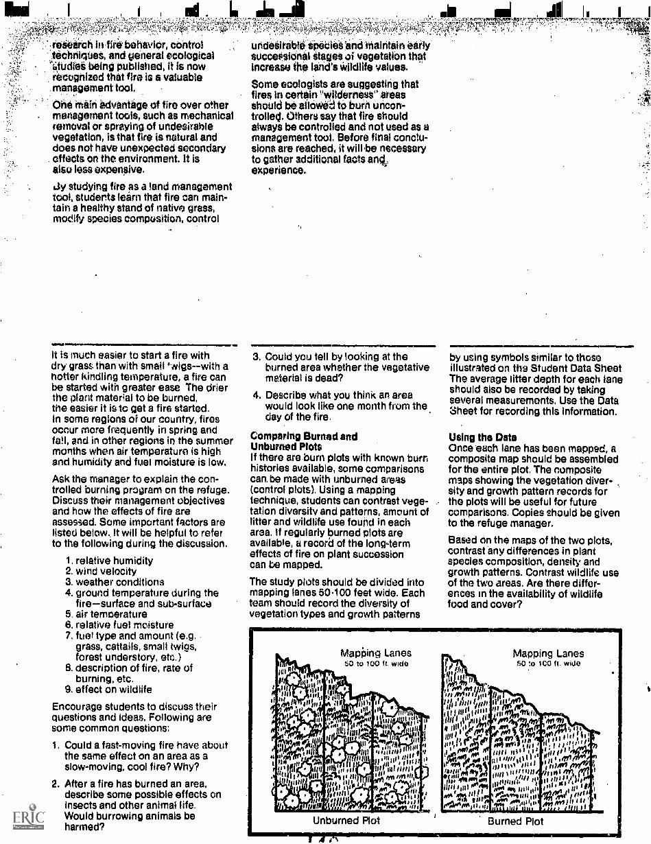
lila I
`;.tasiieerch in lire behavior, controltitchrileeet, and general ecologicaletUdiet being published, it is nowrecognized that fire is a valuable.management tool,
One Mein advantage of fire over other. management tools, such as mechanical
removal or spraying of undesirablevegetation, is that fire is natural anddoes not have unexpected secondaryeffects on the environment. It iselse less expeneive.
ely studying fire as a land managementtool, students learn that fire can main-tain a healthy stand of native grass1modify species composition, control
IRON. 1.1.944.0. ....It is much easier to start a fire withdry grass than with small '-eigswith ahotter kindling temperature, a fire canbe started with greater ease The drierthe plant material to be burned,the easier it is to get a fire started.In some regions of our country, firesoccur more frequently in spring andfee, and in other regions in the summermonths when air temperature is highand humidity and fuel moisture is low.
Ask the manager to explain the con-trolled burning program on the refuge.Discuss their management objectivesand how the effects of fire areassesied. Some important factors arelisted below. It will be helpful to referto the following during the discussion.
1. relative humidity2. wind velocity3. weather conditions4. ground temperature during the
firesurface and sub-surface5. air temperature6. relative fuel moisture7. fuel type and amount (e.g.
grass, cattails, small twigs,forest understory, etc.)
8. description of fire, rate ofburning, etc.
9. effect on wildlife
Encourage students to discuss theirquestions and ideas. Following aresome common questions:
1. Could a fast-moving fire have aboutthe same effect on an area as aslow-moving, cool fire? Why?
2. After a fire has burned an area,describe some possible effects oninsects and other animal life.Would burrowing animals beharmed?
uridesirgiele SPediet and hiairitain earlySUcceasienal Stages oi vegetation thetIncrease the land's Wildlife values.
Some ecologists are suggesting thatfires in certain IWilderelese areasshould be alleWed to burh uncon-trolled. Others say that fire shouldalways be controlled and not used as amanagement tool. Before final conclu-sions are reached, it will be necessaryto gather additional facts amt.experience.
iMmsIml......gn
a Could you tell by looking at theburned area whether the vegetativematerial is dead?
4. Describe what you think an areawould look like one month from thernday of the fire.
Comparing Burned andUnburned PlotsIf there are burn plots with known burnhistories available, some comparisonscan, be made with unburned areas(control plots). Using a mappingtechnique, students can contrast vege-tation diversity and patterns, amount oflitter and wildlife use found in eacharea. If regularly burned plots areavailable, a record of the long-termeffects of fire on plant successioncan be mapped.
The study plots should be divided intomapping lanes 50.100 feet wide. Eachteam should record the diversity ofvegetation types and growth patterns
by using symbols similar to thoseillustrated on the Student Data SheetThe average litter depth for each laneshould also be recorded by takingseveral measurements. Use the Datasheet for recording this information.
Using the DataOnce each lane has been mapped, acomposite map should be assembledfor the entire plot. The compositemaps showing the vegetation diver-sity and growth pattern records forthe plots will be useful for futurecomparisons. Copies should be givento the refuge manager.
Based on the maps of the two plots,contrast any differences in plantspecies composition, density andgrowth patterns. Contrast wildlife useof the two areas. Are there differ-ences in the availability of wildlifefood and cover?
Mapieng Lanes60 to 100 ft. wide
Unburned Plot
:1(114 nI.,
itIII fretif if 0111ii It' al isiv I Iltlf illii to it
0,111111111" "1 isinin'lYlitttill) ,111;nig441,90
eg;itairell mort14111).I I, itsN illleeIllit ,gs .4., Al Witl"Wilf"#.111$iililt DI Aer- ,11, ... 01_..-0, tilt 1111j1"'
0..70 0.0 col,41/ tow 1, owMil 06' III II 'sill'
1 1 tirt.
ii.111, ',illy inuito WI liSsimos'aill041411 011111JIIIIincehinlim, enfo, mum,. ,1,1,,,ifill to Il dili/
Ma 10111°1MM 1,ni ,,;;; iloi I at 1 I lit
"rnt4111111004PIA9111111:111*ltpil ill i it f I
0.0011___ Ill tr's 0'110 II oil An fro111 8 88,,Intl 141 Hi Anil 15111 I r
Mapping Lanes50 to 100 ft. wide
Burned Plot

Myr
ves t ation
0..h/cria
or at other time intervals,remap the vegetation and describeivildlife associations by the same
..::
f possible over a long period of time,,.adiacent OAS may be burned at inter'-
,
.::-;vals of one, five or ten years toprovide a series of artificial succession
-.3=1::stages frorri which future classes might::tenefit. Perhaps students may be
interested in assisting-refugepersonnel in establishing a series ofstudy plots.
-'1"'ir'Re'cl.k, 1:AY* 7
for informationMany Service land areas providedesignated activity sites, shelter,toilet facilities and limited equipmentfor your use, For trip reservations andfurther information, contact your localU.S. Fish and Wildlife Serviceoffice or the following regionalService offices:
Jenny Publishing Co. Inc,57 Queen Ave. So.
Minneapolis, Minnesota 55405Copyright 1975 All R:ghts Reserved
Region I
Region I I
Region Ill
P.O. Box 3737Portland, OR 97208
P.O. Box 1306Albuquerque, NM 87103
Federal BuildingFt. SnellingTwin Cities, MN 55111
Region IV 17 Executive Pk. Dr. NEAtlanta, GA 30329
Region V John W. McCormack PostOffice and CourthouseBoston, MA 02109
Region VI P.O. Box 25486Denver Federal CenterDenver, CO 80225
Alaska Area Office813 D StreetAnchorage, AK 99501
This Outdoor Classroom guide is one ofa series; others are available from yourlocal or regional Service repre-sentative.

nvironrnentai U.S. Fish and GuideEducation Guide Wildlife Service Number
SynopsisMUSKRATS maps and Additional data, someDuring this investigation students maja interesting marsh relationshipsa portion of marsh showing the loca- are uncovered.tions of dense cattail stands, openareas and muskrat houses. Using these
bfl
3
1
: .... -
::*
.211 ,
14:*:. .. 4 I .
:111/Fill 7:
4y:
Prepared by:
I I
' 14
1:::..
ili
Xi..
##:
/ .::.:
...a. a
Lai S. Fish and Wildlife Service J .Minnesota Environmental Sciences Foundation, Inc.
,
'47i
i
:if..
2..
:

environmentalgoalsEvery citizen's decision, or lack ofdec*on, in some way determihes theuse and the future of public lands.
The U. S. Fish and Wildlife See Vice isthis Nation's only Federal land man-agement agpncy solely responsiblefor fish and wildlife. It is the Service'sbelief that through education and di-rect experience, citizens can gain in-formation, understanding and attitudesthat will support wise use of publiclands.
uskrats
A. Purpose: This actMty will acquaintstudents with-
1. The life history of the niuskrat
2. Some environmental factorswhich influence muskratproductivity and survival.
3. Some influences muskrats haveon the environment.
4. Some of the relationships be-tween man's activities andmuskrat survival.
B. Objectives: During this activitystudents, will-
1. Map the locations of muskrathouses, cattail stands and openareas in a designated part ofthe marsh.
2. Make,comparisons between:a. density of muskrat housesb. density of cattail standsc. amount of' open area
3. Offer some explanations for theresults of the comparisons.
4 Open a muskrat house to deter-mine some food sources for themuskrat and to describe thecomposition and interior of the4iouse.
C Activity requirements:1 An area of marsh marked to form
a grid system for mapping.
2 The tools needed to open amuskrat house
IntroductionIt is winter in the marsh The marshwrens, swamp sparrows. redwinged
Maintaining.enVironinental harmony isa crisis concern Of the Service. Manmust continue to live in themorld insome reasonable -balancewith theland and with other life, otherwise hewill not survive.
Service programs help people to learnabout land and wildlife, involVe them-selves in interactions with the natUralworld, and enrich themselves throughthat strange aesthetic joy which can beexperienced in the midst of a wildenvironment. Beside this, the Serviceattempts to make its lands a model ofenvironmental management.
Quality and harmony will remain aPart of the environment and reinain
MEN.
blackbirds, ducks and geese have beengone for several weeks. Some of theprominent features of the winter marshare dense cattails, open areas nowfrozen over and the large mOund-likemuskrat houses.
Conspicuous plants in most marshesare the cattails. Clouds of their tiny ;wind-borne seeds scatter everywhere'as one trudges among them. Some-times called flags; cattails propagateby underground stems or rhizomes. Infact if growth is not controlled, cattailsmay cover the entire marsh therebyeliminating all Open water areas andhastening thechange of the marsh to agraSty meadow community.
Among the cattails and open areas arelarge, frozen mounds. These hollowmounds or lodges are built by a cqtypmon marsh inhabitant, the muskrat.This small, furry vegetarian is able tosurvive the winter months by fashion-ing underwater passageways under theice from the lodge to collect food.Depending on geographic location,muskrats breed several times duringthe year, producing four to eight youngper litter. Thus muskrats have a highpOiontial for rapid population growth.
Cattails. open areas and muskrat.houses form an interesting pattern.Some relationships of this pattern willbe investigated by-mapping theseprominentJeatyres of the marsh.
Pre-trip PlanningSome planning is necessary beforearriving at the study site.
1. Confact the refuge manager andmake arrangements for this activIty.He will be able to help you with thepldnning and possibly provide
the gUideline for public land Manage-ment if citizens see value in these,practices.
backgroundIt Is possible for a female meadow voleto produce three to fovr litters ofyoung a yeui . The babies are on theirowri within four weeks; each of the fiveto nine males and females potentiallymay start their own family when theyare only two months old. Although notall wildlife species are so productive,each does produce enough young tomaintain a healthy and stable
assistance and some equipment.
2. Make sure that the students under-stand thp.process of laying dut themapping lip'et,trhaPPihg the physical'features afid recordiffg.tt#datd.
3. Since this is a winter-time activityrequiring up to three hours, makesure students are clothed properly.
Establishing the 'Mapping LanesChoose an area of the marsh that con-tains dense cattail stands, open areasand several muskrat houses. Minimizethe danger by selecting a shallow areawith a safe ice cover. As you Win yourstudy sites, refer to the illustration'below.
, a
Students should begin by placingmarkers at regular intervals along,oneside to form a base line. The distancebetween Markers depends dn the areathat a small team can easily map,perhaps 50.foot or 100-foot intervalswould be appropriate. While thestudents are laying out the base-linemarkers,.each.should practice pacingand determine his length of stride. Forexample, if it takes 20 paces for a 50foot distance, the length of a stride is50 feet 2.5 feet.20 paces
Once the base line has been et-tablished, a corresponding row ofmarkers must be placed out in themarsh. Students can establish this rowby pacing a given distance into themarsh and tying markers to cattailclumps. Compasses would be handyhere to keep the mapping lanesstraight and uniform. These two rowsof Markers will establish mapPing lanesfor the area.
41.

DataSheet SIDE ONE
Part A
a
Outdoor Classroom Guide Number 17
Muskrats
Names
,Date
I. Mapping Lane number2. Label the mapping grid, giving
distances between markers--- and lengths of mapping lanes
3. Sketch the physical features on these mapping lanes:
SIDE TWO
Part B.. Association chart
Which two features are closely associated with each other?
Give some reasons for your answer for number 1 above. What arethe houses made of? What do you think muskrats eat?
0
Part NOP Opening a Muskrat House (optional)Sketch a cross-section of a muskrat house.
What is it made of?
Are there food plants inside?
Are there any signs that it is being used?

mg:k.
oPulation. ,
Winter places heavy stress on Indivi-dual animala dUe to weather, corn- 7
petition for food, and lad( of shelteringcoves However, the surplus of youngfft:at tie:born each tOring and Witmermake up for losSes from winterhardships, illness, weakness, brokenbones and all other possiblemisfortunes.
Every area of land can support only acertain number of each kind of animalthis is called its carrying capacity.For nearly every species, a surplus ofindividuals results in adeteriorationof living conditions that affects the
MappingStudents should form small mappingteams (2-4 students), and each teamshould be assigned one or more map-ping lanes. One student should be therecordar and sketch the features asthey are encountered. The otherstudents provide distances from thebase line and other pertinent dimen-sions of each feature. Remember, thethree most important features are thelocations and dimensions of cattailstands, muskrat houses and openareas. As an example, lane two in theillustration shows the location of amuskrat house about 100 teet from thebase line. The house is surrounded bycattails except for a 10 to 15-footopen area immediately around thehouse. Students should also beencouraged to note other observations
wolf-being-of thkwhote.poPulatiOniNatio* esUallVensUres that eaChpopulation Of aniniala NS the capabil-,ity to.overproduce. The factors limitingactual numbers are determined by theland'S carrying:Capaoity.
'Besides influencing the survival ofsurplus animals, carrying capacityaffects production. Each species hasan established social structure.Territorial competition In the springfor nesting sites and feeding terri-tories limits the number of adultsproducing young. Man affects thisproduction by changing the habitatand making more or fewer nesting sitesor feeding territories available.
r'IThrough the discovery of population '
faCtOra;indlUding stress and the num-' ber of indMduals Within a population, a
student Cah better understand hlsown ,
environment and the ',balanCe of?hature:'' Thit balande-includee Man,as
welt as the meadoW vole. This dis,
such as animal tracks, sightings, etc.All of this intormation should berecorded in Part A on the Student DataSheet.
After finishing the mapping activity,each team should answer the questionsin Part B on the Data Sheet.
Part 8The association chart below is a usefultechnique for identifying relationshipsbetween variables. In this investiga-tion, the variables are the threephysical features which you mappeddense cattails, open areas and muskrathouses.
300
200
100
BASE-LINE
. . . .. .
... ,q4ifl.e,:ii.';.
et ,Pdf:i:::i'ii.itelt,.:11:.;.e tIA, t...) /4
. 4. ii ....

t
1. Each team shOuldcontribide daInformationlo form a composite trap-
,- 4covering,the entire sti.idy-:area,"Once the cornposite:map iS Com-
ipleted,:the Whole ClaSs.Shoilld doapart fil'an the aata Sheet again.1)ifferentes in interpretatiOn amongThe:tea-Ms itibUld.be didmitsed,
;7:742Consider the following descriptionof areinterrelationship betweenCattails, muskrats and ducks.
Cattails, muskrats and ducks do not.teeM to have much in common. How-:ever, they are involved in a very real,interrelationship, one which iS
'7 essential to each. Muskrats use cattailsfor building materials and for food; atthe same time they help propagate thecattails. New plants get started whenthe muskrats' food gathering activitiesdisperse tuber fragments throughoutthe marsh. Young ducks and geesedepend on cattail cover for protectionand for the astociated food source ofinsect life. Adult mallards, teal andother waterfowl prefer open water withcattail and other vegetation clumpsand a pondweed diet. Thus a balanoemust exist between open water andcattail; the muskrat is the naturalcontrol. To upset this system jeopar-dizes the iptegrity of the marsh and,ultimate4. all its plant and animalspecies.
What could happen if the muskratpopulation is too low? Too high?
3. If each muskrat house contains anaverage of five muskrats, how many
Jive in the area mapped in yourstudy? is the pepulation high, low,or in between? Centact the refugemanager and find out how the musk-rat population is managed. if trappingis used, some of the students maywant to accompany one of the localtrappers while he is tending hislines or perhaps he would visitwith the entire class. The managercould help you organize this activity.
.
1,5
.; .
r 'NO
. .
for informationMany Service land areas providedesignated activity sites, shelter,Joilet facilities and lifnited equipmentfor your use. For trip reservations andfurther information, contact your localU.S. Fish and Wildlife Serviceoffice or the following regionalServices offices:
e
Jenny Publishing Co. Inc.57 Queen Ave. So.
Minneapolis, Minnesota 55405copyright 1975 All Rights Reserved
Region I:
Region I I
Region ill
Region IV
Region V
Region VI
P.O. Box 3737Portland, OR 97208
P.O. Box 1306Albuquerque, NM 87103
Federal BuildingFt. SnellingTwin Cities, MN 55111
17 Executive Pk. Or. NEAtlanta, GA 30329
John W. McCorMack PostOffice and CourthouseBoston, MA 02109
P.O. Box 25486Denver Federal CenterDenver, CO 80225
Alaska Area Office813 D StreetAnchorage, AK 99501
This Outdoor Classroom guide is one ofa series; others are available from yourlocal or regional Service repre-sentative.

NNSII.PAOS MADV40.006teatkon to IA eiiects vOkie.
Studer* akovey wet\and areas on \\s elkOeforkoe tAelA 2.00ed toSerNAce ptopeetv maigAng and *gond Wass knt'ne stLOnt
Svvopits
ooptotv teexocoes.Iottet Geo
iiaiNd \ell° tIse
VeGtGesateWAW:tie;:::
:!!!!!1111..5.
......
'.1..:."
;NV
....2i:.1 "
..: :
.:
".
.......... .......1
t..........:::::::;:
1141.1.4.4.011:611
.. n."1-
21"11'
......
ft
. .
li:21
.
1.
I
"iiii
!
1.
..:i1:1
::NIP!
11'qtr.
if
tgililit:
.
:I11 It :g.
Ii
:

very citizen's decision, or lack of,:.(166esion-;'in Some wav determines thetreSe and the feture of public lands.
The WS. Fish and Wildlife Service is- -this Nation's.only Federal land man-
agement agency solely iesponsible.-.-;,: for fish and wildlife. It is the Service-s
. belief that through education and di-rect experience; citizens can gain in-formation, understanding and attitudes
a critis concern of the Service. MenMust continue to live in the world insome reasonable "balance" with theland and with other life, otherwise hewill not survive.
Service programs help people-to learnabout land and wildlife, involve them-selves in interactiohs with the naturalworld, and enrich themselves throughthat strange aesthetic joy which can beexperienced in the midst of a wildenvironment. Beside this, the Serviceattempts to make its lands a model ofenvironmental management.
that will support wise use of public Quality and harmony will remain alands. part of the environment and remain
WetianScitagA. Purpose: This activity will acquaint.
students with--
1. The use of maps.
2. Wetlands and their importancefor wildlife.
3. The relationships between watermanagement practices and wild-life survival.
B. Objectives: During this activitystudents will-
1. Use and construct a map toillustrate:a. wetland drainage areasb. wetland cover characteris-
tics for wildlife
2. Identify and map the watermanagement areas and controlstructures.
3. Assess the management prac-tices in relation to their value forwildlife needs.
4. Survey and assess local commun-ity wetland areas for wildlifepotential.
C. Activity requirements:1. Map of Service property showing
wetland areas
2. Mapping materials.
3. Information and activity assis-tance from the refugemanager on:a. water control structures and
wetland management practicesb. assessing wetland cover
characteristics for certainlocal wildlife species
IntroductionThe lives of numerous wildlife species
a, intricately linked to wetlandareas-,-marshes, sloughs, ponds,swamps, coastal estuaries, river andcreek bottoms. These water-plantcommunities provide wildlife with theiressential life support requirementscover for protection and food andhome sites for breeding.
Local land use and water control prac-tices determine the health and qualityof wetland wildlife communities. Howdo land use and water control-prac-tices influence wetlands in yourcommunity?
In the first part of this activity,Service properties serve as modelfor wetland management practicesthat benefit wildlife. Students usemapping and a cover inventory systemto become familiar with thesepractices.
Although Service properties and localcommunities are managed for differentpurposes some Service managementpractices can be applied in order tosupport and benefit wildlife in thecommunity. Thus in the second partof this activity, students apply theinformation and techniques from thefirst activity section to assess thewetland wildlife areas in their owncommunity. Perhaps this can lead toactive student involvement in improv-ing local wetland wildlife conditions.
Pre-trip PlanningThe first part of this activity involving atrip to a Service-managed wetland areais the basis for student assol.sment otwetland wildlife areas ales- own
the gUideline for pbIic land Manage-.
ment if citizens see value in thesepractices.
backgroundA Watershed is an area of lanct from
.which water flows through a cormmonoutlet. The entire earth is a water-shed, as is the Mississippi River Valleyand itS tributaries. The upstream watersource flows to a lower area or valleycalled a floodplain, and then finally tothe ocean.
Man's activities often alter this
community. This will involve mappingtechniques, evaluating wetland habitatcharacteristics for wildlife, andgaining an understanding of theeffects of wetland managementpractices on wildlife habitat.
Contact the refuge manager formaps and other information severaldays before taking the trip. Studentsshould be familiar with the maps of thewetland areas and the,wildlife speciesto be studied in these areas. At thistime it would also be helpful for stu-dents to identify community wetlandareas they plan to investigate. This willbring up questions which can beexplored through Service personnelduring the trip.
Activity ProcedureIn order to help the students relate,their experiences from Service pro-erty to the community, wetland wildlifespecies that are common to both areasshould be emphasized. Some basicunderstanding of the natural historyand requirements of these speciesbefore beginning the field activitywill be helpful.
Part One2Service Property SurveySeveral types of wetland areas and/water control practices may be avail-able. The refuge manager shouldprovide maps of the entire area to beused by students as an orientationreference. A survey could be accom-plished on foot or via a bus tour,depending on the size of the area. Itmay be helpful to the students to havea refuge employee accompany themduring the activity, but riot necessary.

SIDE TWO
Part TwoAfter evaluation of several wetland wildlife areas in yourcommunity, consider these questions:
1. Which wetland areas offer good to excellent cover forwildlife and which do not?
2. List water control and land use practices that seem tobe beneficial to wildlife and those that seem to beharmful.
3. Do the results of the investigations show that yourcommunity values wildlife as an important part of theenvironment?
4. Predict whether the abundance of wildlife in the communitywill increase, decrease or stay about the same in thefuture.
5. Should future community development consider affects onwildlife or consider alternate sites for construction?Discuss long-term versus short-term benefits.
1 t!'

DataSheetSIDE ONE
ar
Outdoor Classroom Guide Number 18
Wetlands and Wildlife
Names
DatePlace
Part OneA.List the species of wildlife that are to be emphasized.
B. On your map identify and label:
1.Water inlet and outlet_and direction of flow.
What is the source,of the water?
Into what water system does it drain?
2. Water control structures and areas such as dikes, ditches,spillways, dams, impoundments, etc.
Describe the use of these structures for wetland wildlifemanagement of the species listed above.
3. Good cover areas for the wildlife species listed above.
For each wildlife species briefly describe what would constitutepoor cover, good cover and excellent cover. Consider food,protection and breeding sites in your descriptions.

:
,.riatural water.flow: Any. alteration...!mbstrearri:WatOS ekentUallyaffeCtaill
life fOrms along therloWer water course.ften When theae ch*angesare for ---
ailth as damt for water1,!.14torage.Or. chanrielafOt agOcultural
Iands..fishand wildlife are.on the loSing,s side through loss and destruction of
their habitat,
." All life depends on water for itsexistence. Through wetland studies astudent will learn how Mari trustconsidermildlife when planning watersflow manipulations. He may thenunderstand that any resulting changeof natural conditions affects man aswell as wildlife.
Using the Student Data Sheet as aguide, each student should: (1) labeland identify water inlets, outlets anddirections of flow; (2) label and .
identify water control structures andareas, and (3) label and identify goodcover areas for the wildlife speciesbeing emphasized. See the illustration
. of a sample map.
ildlife refuges and waterfowl:prpuc-,:tioriareaaoffer cititent ari OpPO Unity
see-Waterfowl.(arid Other wildlife)management plans-in practice. Gen-erally theieireas contain one or morewetland'Areas,either tiat4r?.!?.,pact4imedor neVylit created.
;11,1°1
I. i'' ,t ml
11/If /7. , . Creek
t .0::
'I.:
.
River
jIl
'--.77-1----117--r-Tir tliII
II \lb \11/ \11/ Ili/ 11/ ilb/
\Ili
\III \Ili ngarliives (Ili 1 uireservoir11V
OP'II
Ili - 4111LlUil
v
tit 1:19
WI
11// 1111/ "" Vif
annual,:
II/
naturaloutlet ,
III MI
In/
%Pt 41/
t11/ MI
till
119
VI, ill/ 01
011
sill
41,
iiIi /
Oh 011
ale IV )1J ,01
tIV
III
\VI 1111
5151 /II, 0,1:1:10II/ lin '111
no ri411 ,. Ito .4,1 fibjill
marsh ,/,4),;,,)"11volilU1, ifs
MI dill Mu IWO ll lilt, III I _10ii
411ito
tit6gte4*e#11'4'11k*:::411
et OW%
f/
"I
I .111
iii' \II 1 11/ kIXi"
IgWI
11°I Sr/ SI/ /1/17
gill
Ill
1.0)
VI
I
V/ I
IV I \I 1
Vi
V, /\II I
II,/ IV
7

fudents will be able to establish theatis of a cover inventory system to be
used in-Part/wo by stedy informationand references .:preVicled by the,Service
--...Part TwoLocal Community---se from Part One students should: (1) be
familiar with Sbme common local wild-species;:(2) be able to map a
...wetland area; (3) be able to identifysome water control structures andpractices, and (4) be able to use theirwildlife cover descriptions to inven- 2tory other areas. These become thebasis for evaluating wetland-wildlifeconditions in the local community.
Perhaps individual students or smallstudy teams could be responsible forcertain wetland areas in the commun-ity. They should follow the sameprocedures used in Part One. Onceseveral areas have been evaluated,stUdents should present and discuss'the results of their investigations. Thequestions on part two of the data sheetshould be considered,
after theinvestigationTalk to local citizens who own wetlandsor land adjacent to wetlands aboutprojects that would benefit wildlife ontheir land.
Present the results of your investiga-tion to local government officials andask for assistance in improving somewetland areas for wildlife.
Find information about federal or stateprograms ind grants that assist aprivate landowner with land manage-ment practices that benefit wildlife.
;
for informationMany Service land areas providedesignated activity sites, shelter,toilet facilities and limited equipmentfor your use. For trip reservations andfurther information, contact yoUr localU.S. Fish and Wildlife Serviceoffice or the following regionalService offices:
Jenny Publishing Co. Inc.57 Queen Ave. So
Minneapolis, Minnesota 55405Copyright 1975 All Rights Reserved
""
Region I
Region I I
Region ill
P.O. Box 3737Portland, OR 97208
P.O. Box 1306Albuquerque, NM 87103
Federal BuildingFt. SnellingTwin Cities, MN 55111
Region IV 17 Executive Pk. Dr. NEAtlanta, GA 30329
Region V John W. McCormack PostOffice and CourthouseBoston, MA 02109
Region VI P.O. Box 25486Denver Federal CenterDenver, CO 80225
Alaska Area Office813 D StreetAnchorage, AK 99501
This Outdoor Classroom guide is one ata series; others are available from yourlocal or regional Service repre-sentative.

EnvironmentalEducation Guide
SynopsisFISH POPULATIONSThis early summer activity involves theinvestigation of some characteristicsof fish populations. Students becomeacquainted with fish hatchery
U.S. Fish and GuideWildlife Service Number.
programs and are assisted by Federalfisheries personnel.
I I:
141.#
***4,1.,.
at;
4ga
;bpi1 '17
1::ipi:
. i
.:. i.:7 ..t.
. i .....
is
i :I/ 1.1
.
tLig111:: :.
..::**; .
kill. : Ab : ::
!.L
:. . .fri..
t. ?..ii1 I
.i. igh :
q :
..:.1:ir 74
:II*
Prepared by:el1. U. S. Fish and Wildlife Service
Minnesota Environmental Sciences Foundation, Inc.

,
'Maintaining environmental harmony is the gUideline 'for Public land manttgea crisis concern of the Service. Man ment if citizens see value in thesemust continue to live in the world in practices.some reasonable "balance" with theland and with other life, otherwise hewill not survive.
vironmentalgoa s
. Every citizen's decision, or lack ofdeciSion, in some.way determines tileuse and the future of public lands.
The U. S. Fish and Wildlife Service isthis Nation's only Federal land man-agement agence.solely responsiblefor .fish and wildlife. It is the Service'sbelief that through education and di-rect experience, citizens can gain in-
, formation, understanding and attitudesthat will support wise use of publiclands.
dishIpopulations
A. Purpose: This activity will acquaintstudents with-
1. Some differences between indi-viduals and populations.
2. Some important characteristicsof population dynamics suchas age class frequencies, rela-tionships between weight andlength, and relationshipsbetween frequency and length.
3. The importance of populationinformation to hatcheries andthe management of naturalpopulations through hatcheryprograms.
B. Objectives: During this activitystudents will
1. Measure, weigh and age twosample populations of fish:
, a. a uniform age class popula-tion at a hatchery
b. a multi-age class populationfrom a natural body of water
2. Construct graphs to show therelationships betweena. numbers and age classesb numbers and lengthc. weight and length
3. Use the data to make some infer-ences about fish populationdynamics and the role ofhatcheries in fish populationmanagement.
C Activity requirements:1. Equipment for capturing sample
populations of fish.2. Equipment for weighing. measur-
ing and aging fish.
3 Materials for constructing thegraphs.
Service programs help people to learnabout land and wildlife, involve them-selves in interactions with the naturalworld, and enrich themselves throughthat strange aesthetic joy which can beexperienced in the Midst of a wildenvironment. Beside this, the Serviceattempts to make its lands a model ofenvironmental management. .
Quality and harmony will remain aPart of the environment and remain
IntroductionMan, a terrestrial animal, is at home onland but not in water. Oceans, lakes,rivers and streams may seem some- .
what mysterious to us compared withforests, fields and meadows. By usingrather simple means we can get aroundon the water surface quite easily, butto go below the surface for more thana few minutes requires complexequipment. However, there are severalways to investigate what's going on inaquatic environments. The plants andanimals that make up the communitiesin these environments are importantto us and often closely linked withthose on land. In this activity studentswill be investigating some of thecharacteristics of fish populations.
This activity is written to begit, atthe fish hatchery where fisheriesmanagement personnel will be avail-able for assistance. Students willinvestigate a hatchery-rearedpopulation of fish and becomeacquainted with fish rearing programs.Following this, the same investigationtechniques are applied to a morenatural population of fish made up ofdiverse sizes and ages.
PlanningBegin planning this activity by contact-ing the Federal fish hatchery you planto visit. Ask for assistance inorganizing the following:1. This activity should be scheduled
when a suitable population of fishis available for study at thehatchery.
2. Locate a place where a natural popu-lation of fish can be investigated.For convenience this should be on ornear the hatchery.
1 r'.(
backgroundEvery pond has a specific carryingcapacity that determines the maximumpounds of fish the pond can support. .
The more fertile the pond, the morefish it will yield.This pond may contain several species,including small fish that feed mainlyon algae and insects (bluegill) andlarge predatory fishes (bass). If the
3. Form teams of 3 or 4 students.Students should be familiar with thedata collecting techniques and howto record their data on the StudentData Sheet.
4. The equipment needed for thisactivity is listed below. Theamounts will depend on the numberof study teams.a. measuring boards (marked in
inches)b. traps or seinee for capturing
fishc. scales (postal-type)d. plastic pailse. clipboardsf. graphing materialsg. dissecting scissors and forceps,
formaldehyde, plastic bags, bagfasteners (to carry fish back tothe classroom for aging anddissection)
5. If students are to handle seines,they are likely to get wet andshould be aware of this. Lifejackets may be needed for youngerstudents.
This activity is designed to givestudents actual practice with some ofthe techniques used to gain an under-standing of population characteristics.
An understanding of a populationcannot be inferred from an understand-ing of one individual. The life of anindividual organism has a definitebeginning (birth) and a definite end(death); a population has no definitebeginning and usually no definite end.Instead, it is a reproducing group ofindividuals of the same species whosenumbers may fluctuate from timeto time.
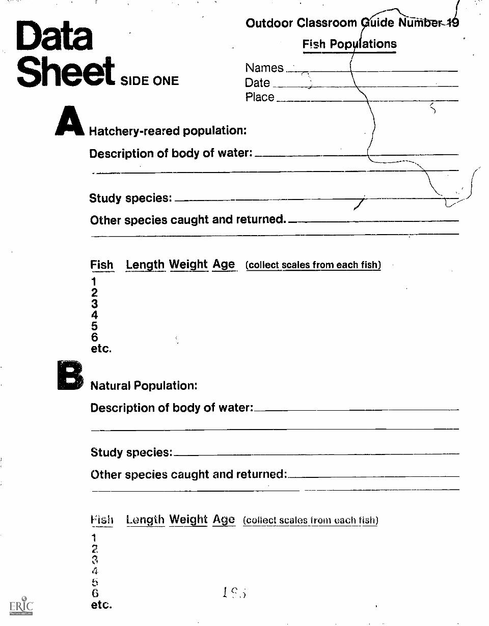
DataSheet SIDE ONE
Outdoor Classroom uide Mangler-
Fish Popy ations
NamesDate
Place
AHatchery-reared population:
Description of body of water: ______
Study species:
Other species caught and returned.
Fish Lentil Weight Age (collect scales from each fish)
1
23456etc.
Natural Population:
Description of body of water:
Study species:
Other species caught and returned:
riGh Length Weight A e (collect scales from each fish)
2
4
6etc.
f.)

SIDE TWO
CUsing the data:
Based on your graphs and keeping in mind the inadequaciesof the data, answer the following questions:
Total length
Name some environmental factors which would accountfor the steady decline in numbers as fish becomelarger? What might an irregular distribution ofnumbers indicate about spawning success from year to year?
What is the relatiOnship between weight and lengthaccording to your graph? Which part of the graph belowwould represent the -most fish?
I I II ( III20
16 't1
8 .4,
,
4 1
2 4 6 8 10 12 length.inchesi
Weight'ozs
Bluegill Sunfishfrom Farrow s Lake
June 3, 1971
What are some envIronmental factors that could accountfor two different aged fish (of the same species) beingthe same size? Discuss the meaning of the graph below:
Ikles
4 u 8 10,r.ii 11)1101 11)4 lit 4.4
Bluegill Sunfishfrom Fat tow s I. akt-
Juno 3. 1911
,

';',.Population 'Spur of balanceand thereis an overpopulation of either bluegillOr titass, the pond wili still contain thesame pOundage of fish. This maximumpoundage is determined by thecarrying capacity.
Fisheries managegfent attempts tokeep the differenkfish populations of abody of water in balance. If too.manyof a species are competing for the same -amount of food, then less of the foodenergy is converted into growth, beingmostly used for maintaining basicmetabolism. In this Way you may havea large population, but each individualis stunted in growth.
Therefore, information about the age
In this study. students apply investi-gative techniques to two different fishpopulations: (1) a managed populationin a rearing pond, and (2) another popu-lation found in more natural conditions.It is suggested that students firstinvestigate the hatchery-reared popula-tion of fish and then the population inmore natural conditions.It is doubtful that brood stock (adultfish used for production) would beutilized for this activity because ofthe danger of harming the fish.However, young fish, called finger-lings. are available in large numbers atcertain times. By beginnin§ with thispopulation, students will gain practicein handling fish properly and collect-ing their data. Also, a uniformly agedhatchery population win contrastsharply with a multi-aged natural popu-lation, proViditig some interestingquestions for 'discussion. However, ifa managed population is not available,this activity can be done with just thenatural population.
Since it is important to minimize thepossibility of harming the tish, thedata must be collected quickly withproper hdndling techniqups. Anysurface that the fish will come incontact with should be kept wetEach teen') member should be respon-sible.for one of the tasks with onestudent acting as a recorder.
Capture at least 50 fish of the samespecies and place them in plasticpails of fresh water. in the processof obtaining the study species, itmay be interesting to count the numberand frequency of different speciesfound in the net Perhaps some couldbe preserved and brought back to the
and growth of fiat, Can be useful irrmanaging fisheries. Growth ratesreveal the general condition of fishpopulations. Fish age can be deter-mined by seasonal changes in growthrates that leave annual marks on scales.spines and ear bones. A stunted fishof a known age indicates an unstablepopulation.
Through study of the processes thatcontrol the kinds of fish that dominatea pond, their age and growth relation-ships and their productivity, a studentcan learn how population dynamicsaffects the balance and health of apopulation,
classroom for identification andfurther study,Collecting the DataEach team should randomly select asmany fish as they have time for. Thelengths and weights are to be recordedon the data sheet for each team. Inorder to determine the ages of the fish,scales will have to be collected andbrought back to the classroom, On theStudent Data Sheet record foreach fish:
Total LengthLay the fish on the wet measuring
board and record the total length.
WeightPut the fish on the wet scale plat-
form. If very small fish are to beweighed such as sunfish fingerlings(approximately 200 per pound), severalmin be weighed in a plastic bag andthen an average weight per fish canbe calculated.
AgingThe hatchery employee will show the
students how to remove two or threescales from each fish without harmingit. The scales should be Placed in anenvelope and then labeled as to thesize range of the fish and collectingteam.
Using the DataCombine the fish scales from similarsizes of fish. Rinse the scales indetergent water, dry them, and thenglue them with white glue directly to amicroscope slide. Use one microscopeslide for each size range. Ages canthen be determined for eagh sizerange (see the illustration) Ask forinformation and assistance from thehatchery employee.
Q ,I
10
3
2
Distance betweenannuli =1 years growth
Graphing the combined team data willhelp show some relationships amongthe measured characterjstics of thepopulation. Bar graphs and/or linegraphs will be most useful for thefollowing:
Graph one: Weights of fish (x axis) /lengths of fish (y axis).
'totallength
(inches)
Bluegill Sunfishfrom Farrow's Lake
June 3, 1971
3 4 5 6 7 8Weight (ozs.)
Graph two: Lengths of fish (x axis) /age distribution of fish (y axis)
age(years)
i.
2 4 6 8 10 12
Total length (inches!
Bluegill Sunfishfrom Farrow a Lake
June 3. 1971

-Graph three: Lengths of fish (x axis) /number of fish in each length range(y axis): It will be helpful to groupsimilar lengths into length ranges such'as 0 1-1/4 in., 1-1/2 in. - 2-3/4 ii., etc.
Total length
measuring board
After students have constructed thegraphs, they should answer thequestions on the back of the StudentData Sheet. Other ways of graphing orrepresenting the data should be
,) encouraged.
after theinvestigationA healthy population of fish in naturalwaters is usually an aggregation ofvaried sizes and age ctasses. However,it is not uncommon, in small lakes orfarm ponds, to find an abundance (Sfuniformly sized fish such as sunfishor bass. Name some environmentalfactors that could cause this condition.What management techniques wouldyou use to correct this condition?How are fislya valuable resource inyoCir community? Stream improve-ment. farm pond management andcontrolling water pollution aremanagement practices for improvingthe fish resource.If you are interested in gettinginvolved in a fish management protect.tisk the hatchery employee for help inseleGting and planning an appropriateone for your community.
Can the population dynamics that affectthe balance and health of a fisnpopulation be applied to man'?
50
40
numberOf
fish
30
20
10
, Bluegill Sunfishfrom Farrow's Leke
June 3, 1971
1 I I 1
J 1
9 10-1/41-1/4 1-1/2 2-3/4 4 5-1/4 6-1/2 7-3/4
total length (inches)
Many Service land areas providedesignated activity sites, shelter,toilet facilities and limited equipmentfor your use. For trip reservattons andfurther information, contact your local.S: Fish and Wildlife Serviceoffice or vhe following regionalServices offices:
Jenny Publishing Co. Inc.57 Queen Ave So
Minnoapolis. Minnesota 55405Copyright 1975 All Rights Resorvod
\-)Region I P.O. Box 3737
Portland, OR 97208
F1egi.ln H Box 1306Albuquerque, NM 87103
Region III Federal F3uildingFt. SnellingTwin Cities, MN 55111
Region IV 17 Executive Pk. D. NI=Atlanta, GA 30329
Region V John W. McCormack PostOff ice and CourthouseBoston, MA 02109
Reg= VI P.O. Box 25486Denver Federal CenterDenver. CO 80225
Alaska Area Ofhee8130 Str\)etAnchorage. AK 99501
This Outdoor Classroom guide is one ofa series: others are available from yourlocal or regional Service repre-sentative.

Environmental'Education Guide
Synopsis
4.44,00z,,i1,-3:0,-**0140... ,.j..:1.5...i.-4,c;MWitnk-414 foO.E;#Wid..°644-.4,-!P`=4:19.71, 2.#140C,Nok.4414,-,' -' ' '!..v s'!,7" 'r 0-YIiiTs"T l'"".,-T+ J, :53 ; er
1141141.1.
PUBLIC SURVEY,Studentc, learn a survry technique.They gather information and opinionsabout jelcure time activity and the use
-7;
U.S. Fish andWildlife Service
r.
of public land from individuals within acommunity. Through analysis of thereturned information, they gain anunderstanding of the role of National
Aft
GuideNumber
Wildlife Refuges and the kinds ofpublic use these refuges are able toprovide wfthin the limits of theirprescribed function.
1 S9Minnesota Environmental Sciences Foundation, Inc.
Prepared by:U. S. Fish and Wildlife Service

',.:At'%'i."4.iIi'.4:k..t:iVtiW.`..04'SI I *NY?",
environmentalals
-EVery citiZen's decision, or lack ofdecision, in some way determines theuse and the future of public lands.
The U. S. Fish and Wildlife Service isthis Nation's only Federal land man-agement agency solely responsiblefor fish and Wildlife. It is the Service'sbelief that through education and di-rect experience, citizens can gain in-formation, understanding and attitudesthat will support wise use of publiclands.
Publicsurvey
A. Purpose:
1. To determine in what way publicattitudes toward public landaffects the use of those lands by:a. determining public attitudes
toward public propertyb. determining public use of a
refuge '
2. To determine community leisure-time activity needs.
3. To discuss with refuge managersthe appropriate ways of meetingwildlife-oriented recreationalneeds in the community.
4. To increase public awareness ofa nearby refuge.
B. Objectives: Sudents will-
1. Develop and administer to a por-tion of the community &check-list of leisure-time optionsperceived as needed by thecommunity.
2. Gather attitudinal data from theseveral communities locatednearest the refuge as it con-cerns:a. gathering data on present
level of community useb. awareness of the existence
of the refugec. awareness of its purpose,d. awareness of its public
programs
3. Match needs with attitudes andformulate conclusions andrecommendations which willstrengthen and enhance publicuse of public lands.
Maintaining environmental harmony isa crisis concern of the Service. Manmust continue to live in the world insome reasonable "balance" with theland and with other life, otherwise hewill not survive.
Service programs help people to learnabout land and wildlife, involve them-selves in interactions with the naturalworld, and enrich themselves throughthat strange aesthetic joy which can beexperienced in the midst of a wildenvironment. Beside this, the Serviceattempts to make its lands a model ofenvironmental management.
Quality and harmony will remain apart of the environment and remain
airomr.r.r INIMM110M11111
C. Activity requirements:1 . Construction of the folldwing
survey instruments:a. leisure-time needs inventoryb. present public land use formc. attitude-awareness form
2. Description of present refugeprograms and use data.
3. Formulation of a systematicmethod for administering varioussurveys.
4. Presentation to refuge manager.
Public use programs have evolvedover a considerable period of time andare designed to be compatible with thepurpose of the refugeto manageland for wildlife habitat. As timeschange and as the public's preferencesfor leieure activities change, managersof public properties must give thoughtto altering their programs so they willhelp meet public needs. They must dothis in such a way that the establishedpurpose of the refuge is..notjeopardized.
To seek out pl-evailing public needsand attitudes toward leisure time andto discover whether or not, in thepublic mind, public lands can or shouldprovide the means of satisfying someof these needs, questions must beasked of those most likely to be po-tential users. This means going intonearby communities and polling arepresentative sample of its peopleIn order to learn the process of poll-ing for information gathering, studentswith the help of teachers can developquestionnaires. The questionnairescan be administered, analyzed andcharted. The information can be
,
.1. I
V"fir
the guideline for public land manage-ment if citizens see value le.thesepractices.
backgroUndAn important goal of the NationalWildlife Refuge System is "To promoteharmony betweee man and his environ-ment," One way to reach this goal isto allow the public to learn andexperience on refuge lands.
Our visitors come to a refuge for manyreasonsto learn about the environ-ment, to photograph animals or place
presented in summary form to a refugemanager for discussion about helpingtanteet public needs.
Such a study, properly conducted, willengage students in many aspects ofcommunication and will also alerethepublic to wildlife oriented leisure-timeactivities offered by.refuges.
OrganizingTeachers and students should studymaps of their area to determine whichcommunities can be. surveyed feasibly.A coordinated intercommunity projectmay mean that no class would have tocollect data outside its own town. Therefuge manager may help studentsselect other cooperating communities,contact interested groups and bringtogether representatives who wouldattempt to Coordinate their studies bysharing survey items. However, amulticommunity involvement is not arequisite.for undertaking this project.Regardless of how a data pool isformed, the same method for commun-ity sUrvey should be observed by allinvestigators.
Constructing the QuestiopnairesStudents must first discuss theirreasons for undertaking this study.Such a discussion would touch onnational and local leisure-time needsas well as persp.nal needs. Increasingpopulation pressures on limited spaceand the varying compatibilities ofleisure activities can be examined.
Any use date already available frornthe Servite and state agencies wouldProvide background information forthese discussions Present use willalso provide a' basis for developing achecklist of items representing the

ataheet
SIDE ONE
C.
Outdoor Classroom Guide Number 20
Public Survey
INFORMATION SHEET:
SAMPLE QUESTIONS FOR EACH PART OF THE SURVEY
PART I: Community Leisure-Time Needs Checklist
Activity Number of ResponsesSnowmobilingPlaygroundsHikingRelaxation
PART II: COmmunity Leisure-Time Use (type and frequency)On The Refuge . Use time/year
Activity Seldom (1-2 times) Moderate (3-4) Frequent (5)Hunting
\ HikingPicnicking
PART III: Community Attitudes T,oward Refuge
Example 1:'People use the refuge for many different purposes. Pleaserate the following uses according to what you feel should bethe most important with "1" equaling most important, "4" least.
_ Photography, hiking, cross-country skiing__Hunting and fishing
Snowmobiling, wqter skiing
Example 2:Who should determine how the refuge is used? Check one.
The federal governmentThe local managerThe local peopleThose who use it most frequently
SIDE TWO
Example 3:Refuges are managed to protect our fish and wildlife. Whateffect do you think the following uses have on fish andwildlife?
CampingHuntingSnowmobilingHiking
Little Effect Somewhat Harmful Quite Harmful
STUDENT NOTES:
INTRODUCTORY NOTESWho am IName of schoolPurpose of surveyTime it will takeLIST OF PEOPLE TO BE SURVEYED-

life, to go canoeing, to walk a wildlifetrail or just to visit a "quiet place," ASman's knowledge of the environmentbecomes greater and quiet places forsolitude become more scarce, demandfor use of wildlands will increase.
Most lands within the refuge systemare set aside by an Act of Congress .
that establishes the primary objectiveof each refuge. Although there aredifferent kinds of refuges, includingsome for buffalo, elk or bighorn sheep,three-fourths of all these lands areestablished as resting, feeding aednesting areas for migratory waterfowl.
Although conserving wildlife and theenvironment are our main commit-
real range of activities in which peopleare typically involved on the refugeproperty.
The survey can be divided into threeparts, each of which can have its ownquestionnaire. Part I of the surveyshoUld assess community leisure-timeneeds. A checklist can be formulatedand some practice in survey methodscan be gained by polling fellowstudents. Once completed it will formthe basic checklist to survey commun-ity leisure-time needs. Another check-list should include all ppssible leisureactivities, not just these typical ofrefuges. For example. swimming pools,ball diamonds and playground equip-ment are not refuge facilities, .but they,,are often th6se provided by a com-munity for its residents. In order toestablish total community needs, awide range of items should beincluded.
Part II of the questionnaire shouldreveal the respondents awareness ofthe refuge. It is probable that manypeople will be unaware of the exist-ence of the refuge. Obviously nounaware respondent can answer allquestions of this questionnaire;this should be recorded.
For those who do use the refuge, stu-dents can obtain amount of use as wellas kind, of use. An example of a simpli-fied means of getting both kinds ofdata in one question is included on thestudent information sheet. The activityitems cante selected from Part I ofthe survey and from refuge data. Theactivoles given are just a sample, butthey will give students some ideas fordesigning this part of their survey.
rnents, providing for public enjoymentand appreciation of wildlife has becomeincreasingly mere important. Sysurveying the public use, publicattitudes, and awareness of localcommunities concerning a refuge andits programs, a student may develop anappreciation of land use problems.Local community and even nationalpressures may change or influenceland use policy. The problems ofadministering landS in public trustfor present and future generations canbe studied. The values of wildlandsand quiet places to a community canbe discovered.
Part III of the survey will revealattitudes. Attitudes are usuallyexpressed as opinions, so students willwant to elicit opinions about refugeresources. Opinions are usually notabsolutethey tend to fall someplacebetween positive or negative. There-fore, the construction of items for aquestionnaire should provide respon-dents with a range of choices. Toclarify their task, specify the choicerange.
Some examples of items specifying.choice range are found in Part III ofthe student information sheet. This willbe the most difficult part of thequestionnaire to construct becausethere are so many important questionsto ask. Perhaps the refuge managercan be givbn a list of tentative itemsfrom which i4could select the 10most important. The same list could bescanned by frequent users (peopleidentified by the manager) and they
I could select 10. The class could alsochoose 10. When there is some agree-.ment among raters (manager, users,students, etc.) these questions couldbe included in the questionnaire.
A "good" questionnaire is neitherlengthy nor difficult to complete. Oncethe identity of basic items is estab-lished, try it out on several groups toget an idea of time. ambiguity of itemsand interest. Perhaps other teacherswould be a good test group for atrial run.
Activity ProcedureOnce thequestionnaire has been for-mulated and trial tested, students willbe ready to administer it to a sample ofthe community. The question is then,-Who should be questioned and how
'.7.171F:rs.FMF.-..
la ill di 11,
.311114.41111111
should the survey be conducted?"
Sampling Criteria .
It is usually impossible to interviewall members of a community. Knowingthis, establish some ground rules forselection. Ask yourself how muchtime can be devoted to the study?What arrangements can be made toexecute it? How many should eachstudent administer? Answers to thesequestions will give you an estimateof your sample size.
Next, you'll want to vary the composi-tion of the sample by obtainingresponses from several age ranges,e.g. 15-25 years, 2645 years, etc. Youmust also remember that all peopleare potential uSers so you will want tosample a cross section of society.Establish age ranges and social cate-gories through discussion.'
Making the SurveyDevelop a brief introduction as a -guideline for students to use whenthey approach people. It shouldinclude the following;
1 Student identity.2. Purpose of the study.3. How long it should take to complete.4. What will be done with the data.
Many students may never have had anopportunity to engage in public surveyactivities. This is not a difficulttask and actually can be a great dealof fun. (It can also be a good publicrelatioo device for the school when itsrepresentatives are engaged in a pro-ject which concerns the public'sneeds.) Common sense suggests thatcooperation from the public proceedsfrom a polite and courteous manner.Students should be equipped to

.answer questions such as "Why areyou doing this?" "Is this what theschools think you should do?" "Who's
aying.for this?" etc.
If your past experience suggests thatsurveys best be taken during out-of-school time, negotiate for eveningsand Saturdays with your students.
Divide the work among class membersso that each student or team dealswith a manageable number of inter-views. They can help you decide whatis manageable.
For reliable return of questionnaires,a student should wait while the respon-dent completes it or return at aspecified time to pick it up.
Analyzing the DataAll questionnaires should be collectedand reviewed by the students who can,with help, decide on how to deal withthe information. Generally, the bestprocedures for analysis include thefollowing steps:
1. Tabulating raw data.
2. Obtaining averages, percentages orcorrelations where possible.
0 3. Describing the results obtained innumber 2 above.
4. Making inferences about the results;inferences must reflect the realdata.
t.41% 't "i,-, TI k .7 .1,,
Following is an example of applyingthe above guidelines for analysis:
EXAMPLE
Who should determine how, the refugeis used?
Rank order (N-62) Number PercentLocal people 7 11Local manager 22 35Federal government 27 44Frequent users 6 10
Total 62 100%
This tabular presentation gives rawdata and percentages as well as,therank order. In describing the meaningof this question it could be stated that"almost one-half of the people feel thatthe government should determinerefuge use." An inference would bethat ''many people, given a choice,would want government officials toprescnbe how they may use publicproperty.-
Each section Or question on the surveyshould be treated in a manner similarto the above example. Out of suchtreatment will arise information whichis both comprehensible and accurate.It will allow one survey response to be
compared with another and, in turn,'will provide students with guidelinesfor making a summary recommenda-tion to the manager. .
aftei\theinvestigationManaging resources is a balancebetween managed use and preserva-tion. In the case of National WildlifeRefuges, is the purpOse or intent ofrefuges in support of the perceivedleisure-time needs of the community'?If not, what agency, council or organi-zation can support these needs? Dothe students feel that the refege canfulfill a real public need for leisure-time activity? Is there any evideRce
that they are so doing? If so, what is it?Is the information from this surveysufficient to adequately support theconclusions?
for informationMany Service land areas providedesignated activity sites, shelter,toilet facilities and limited equipmentfor your use. For trip reservations andfurther information, contact your localU.S. Fish and Wildlife Serviceoffice or the following regionalServices offices:
Jenny Publishing Co. Inc.57 Queen Ave, So.
Minneapolis, Minnesota 55405Copyright 1975 All Rights Reserved
Region I; P.O. Box 3737Portland, OR 97208
Region II P.O. Box 1306Albuquerque, NM 87103
Region III Federal BuildingFt. SnellingTwin Cities, MN 55111
Region IV 17 Executive Pk: Dr. NEAtlanta, GA 30329
Region V Jehn W. McCormack PostOffice and CourthouseBoston, MA 02109
Region VI P.0 Box 25486Denver Federal CenterDenver, CO 80225
Alaska Area Office813 D StreetAnchorage, AK 99501
This Outdoor Classroom guide is one ofa series; others are available from yourlocal or regional Service repre-sentative.
0
nr3

.. ! . , ....,_,..,.
.ut oor...
.
,
I
! -
.-....,*J, ..:4.?
;......r -,.:1-4,....
-.. .-,-..-..r:
-
.. .
=r-=1::-..'1.-011.''1,4w1-'
Environmental U.S. Fish and GuideEducation Guide Wildlife Service Number
SynopsisFISH HATCHERIESBy observing hatchery ponds andinvestigating food sources, a studentcan learn about food chain relationshipsand fisheries Management.
.. :........
.
:1
::'t
.
l.
r:.71::
hi!
fl :
'ql

environmentalgoalsEvery citizen's decision, or lack ofdecision, in some way determines theuse and the future of public lands.
The U. S. Fish and Wildlife Service isthis Nation's only Federal land man-agement agency solely responsiblefor fish and wildlife. It is the Service'sbelief that through education and di-rect experience, citizens can gain in-formation, understanding and attitudesthat will support wise use of publiclands.
SishIhatcheriesActivity Description
Purpose: This activity will acquaintstudents with-
1. The life cycles of common gamefish.
2. Food chain management forrearing fish in natural ponds.
B. Objectives: During this activitystudents will-
1. Determine the major food sourcefor a population of fry in anatural pond by using a planktonseine and by analyzing stomachcontents.
2. Calculate the approximate weightof plankton needed to producethe fry population beinginvestigated.
3. Make some inferences about theproductivity of natural watersunder varying conditions afterbeing given some of the environ-mental factors which influenceplankton growth.
C Activity requirements:1 A population of fry being reared
in a pond
Information and assistance fromhatchery personnel
3 Each team will need the follow.ing equipment.a dissecting scissorsb net or trap fOr capttirIlq
fishc formaldehyde .5 solutiond scale postal type,e hanki lens 15x
2
Maintaining environmental harmony isa crisis concern of the Service. Manmust continue to live in the world insome reasonable "balance" with theland and with other life, otherwise hewill not survive.
Service programs help people to learnabout land and wildlife, involve them-selves in interactions with the naturalworld, and enrich themselves throughthat strange aesthetic joy which can beexperienced in the midst of a wildenvironment. beside tliis, the Serviceattempts to make its lands a model ofenvironmental management.
Quality and harmony will remain apart of the environment and remain
f. plankton seine or fine meshdip net
g. plastic bagsh. specimen dish or pani. eyedropper
REFERENCE BOOKSPond Life, Golden Nature Guides,Golden Press, New York, 1966How to Know Series, WM. C. BrownCompany Publishers, 135 South LocustStreet, Dubuque, Iowa 52003, 1958,
IntroductionThis activity is designed for pond fishor a warm water rearing program.Largemouth bass and bluegill sunfishare two common warmwater speciesreared for stocking. It is important toknow some aspects of the life cyclesof these two game fish.
Bass and bluegills are nest builders,which means that the male of thesespecies uses his tail to fan out adepression in the pond bottom inshallow water. The nest building urgeis triggered by water temperature.Bass begin to construct nests whenthe pond water warms up to 60-65° F.Bluegills wait until the water tempera-ture reaches 78°F, which means theydo not spawn until early summer. Bassspawn only once a year in the spring.but bluegills may spawn several timesduring one summer.
After he has made his nest, the malebass or bluegill encourages the femaleto deposit her eggs in it. he ferti-lizes them as they are laid The eggsstick to roots and other material in thebottom of the nest. They hatch intotiny fry that remain in the nest for ashort period until their yolk sacs areabsorbed The yolk sac is a built-in
f1
the guideline for public land manage-ment if citizens see value in thesepractices.
backgroundOver 90 National Fish Hatcheries areoperated throughout the country tokeep Federal lands stocked with fish.Their goal is to raise not only more,but healthier fish throubh researchand selective breeding.
Hatcheries in the northern and westernstates and in the mountainous regionsof the South raise trout or salm'on.
Refood supply and when it is used up thehungry young fish swim up off the nestin search of fpod.
"Swim-up" fry remain in the vicinity ofthe, nest for a few days. The male bassguards his young for a short time, butsoon reverts to his predatory instinctsand given the chance, will devourthem! To avoid cannibalism losses byadults, the hatchery personnel gentlyscoop up schools of bass fry with afine seine and transfer them to food-rich rearing ponds where they growinto fingerlings large enough to beshipped by tank truck to stocking sites.Bluegills, on the other hand, do noteat their young, so fry can be rearedto fingerling size in the same pondwith their parents.
PlanningThis activity depends on the availabil-ity of fry reared in a warmwater pond.Therefore, it is important to contactthe hatchery manager early in thespring to schedule the trip. Hatcherypersonnel may be able to providesome of the required equipment andassistance during the activity.
It is not important that students knowall about the hatchery before theybegin since a general orientation willbe part of the activities. However,students should be familiar with theequipment and the techniques used.
Activity ProcedureSuccessful warmwater fish productionis dependent upon an adeauate foodsupply at all times. This not onlyassures rapid growth but also reducescannibalism among fish such as large-mouth bass.
The basic requirement for any fishhatchery is a dependable supply of

DataSheetSIDE ONE
General Information1. Pond size:2. Pond volume:3. Study species:4. Number of fish stocked:5. Weight of fish stocked:6. Total weight of the fish in the pond:
Outdoor Classroom Guide Number 21
Fish Hatcheries
Names
DatePlace
__acresgallons
IMMMail11,
7. Total gain in weight since fish were placed in pond as fry:
8. Sketch some of the common food organisms.
1. 7

oiDE TWO
9. 10 4.5 lbs. zooplankton-I: _lbs. of zooplankton
1.0 lb.How many pounds of zooplankton will it take to support thispopulation to the fingerling stage? (Find out how much the fingerlingswill weigh when they are taken out of the rearing pond.) Why do youthink plankton are identified as the basis for aquatic food relation-ships? Does your data support this statement?
10.
FMAN141-
46-MADMairtlm.aiNg
=er....23-xr,no =-..7.s==....smeir-,,,,,,. .n-,-.1..2101aslWrIrM111,.."71...11.,11......31,1411111,
L_n.magm-frsammanaesissy4
ZOO PLANKTONDilaw.tossoClit+wammqramumminwm.....0Mea.,..s..ammi.

Others in the central and southernstates are pondfish hatcheries. Theseproduce largemouth bass, bluegill,
, and channel catfish and, to a lesserextent, other warmwater fish like small-mouth bass, redear sunfish, northernpike, and walleye.
A natural rearing pond supports a com-plex food chain of plants and animals.Plant nutrients dissolved in the waterpro./ide food for small aquatic plantscalled algae, which are then eaten bysmall Microscopic animals called.zooplankton. The zooplankton areeaten by insect larvae. Small fish feedon plankton and insect larvae, and inturn the smaller fish serve as a food
21410110.1.14.... 11.1.1.10.0.1
suitable water. Ponds for spawningatej rearing pondfish are of varioussiz.os, but preferably less than oneacre. The depth of water in each pondis from two to five feet.Thousands of fry are placed in a singlerearing pond until they have reachedone to two inches in size. This willtake about three weeks, dependingupon water temperature and otherconditions of the pond.
How does a small rearing pond supportthe growth of vast numbers of fry? Thefollowing activities will help studentsanswer this question. Each teen ofstudents should follow the activityprocedure given below and recordtheir observations on the StudentData Sheet.
« A hatchery representative willprovide the informatien for Questions
on the Data Sheet.
to Determine the total weight of thetr2h in the pond by weighing severalfish together and calculating anaverage weight per fish iQuestion 61.Caictilate the total ciain in weightsince the fish were first placed in thepond C:itiesticn 7)
Food supply. in order to determinethe food supply f:,r the fish. each teamshi.;u1d remove the qomachs frier, atlt?ast three freshly preserved fish. (Ascissors will be needed for dissectionand a 5,i.. solution of formaldehyde forkiliing and preserving the fish.)
The st:)mach c....yntents should bePlacel In water in a dish orshallow white pan for obser-vation with a 15X hand lens ormicroscope ";')
2 Each team should also use a plank-
source for larger predatory fish.
For certain species of warmwater fisha hatchery can propagate foodorganisms found in many naturalponds. Natural rearing ponds are usedto raise warmwater fish for stocking.
When a hatchery raises fish in man-made ponds or raceways, an artificialdiet often supplements or replaces thenatural diet fish would find in thewild. This artificial diet is carefullyplanned to promote normal growth andfreedom from disease.
ton seine or tine mesh dip net tocollect food organisms oresent inthe water.
Compare the stomach contents of thefish with the ornaiiisms collected inthe water. Are they similar? Sketchsome of the organisms found in thewater and in the stomachs on the datasheet. Perhaps hatchery personnelwill help identify them.
These tiny aouatic organisms arecalled zooplankton. How many of themdoes it rake to support the fish in thispond? Fisheries biologists have deter-mined that it takes about 4-1/2 poundsof zooplankton to produce one poundof fish flesh_ Using 4-1/2 pounds as aconversion factor. calculate the weightof zooplankton it took to produce the
rggi"rcF ifar"8411"""r11 rir "nP"SFIT'451Fsffp*
,
total pounds of fish flesh recorded forquestion 7 on the data sheet(Question 9).
This huge population of zooplankton ispropagated by fertilizing the rearingponds hist as a farmer fertilizes hisfields. Alfalfa hay is often used toencourage the growth of bacteriawhich are eaten by protozoa. Theprotozoa are food for the zooplankton.Data from a hatchery in Hebron, Ohiois given bctow.
Data from a Hatchery in Hebron, OhioPond size 1.0 acresPond volume 1,270,900 gallonsFertilizer applied 1,320 lbs. alfalfa
hay75 lbs. alfalfa
mealFish crop removed:
numbers 76,400weight 191 lbs
Weight of fishstocked 70 ounces
With ail this food present, the numberof zooplankton increases into thebillions, providing a food sepnly foithe young fish. When they havereached one to two inches in size..fishchange their food habits to includelarger anirrelle such as ineects, and inthe case of basi; and northerns, mayeven begin to eat each other! Asfingerlings they :are now large enoughto be shipped b,y tank truck tostocking sites.
Based on 'you( observations andother related information. till in rieintermediate levels in the food Tha.rtdiagram for number 10 on MC datasheet Discuss the possible choicesfor each level with th; membersof your team.
.r
76141,111117,

after the\investigation
I. The tremendous density Of planktonfound in rearing ponds is,usuallynot typical of natural lakes, ponds,rivers or streams. Yet planktonalso :c..rms the basis of foodreliships and thus the produc-tiviiy uf these bodies of water.Plankton population growth isinfluenced by many environmentalfactors. The relationships betweensome of these factors and planktongrowth are illustrated below.
Numbersof
Plankton
Numbersof
Plankton
45-55% 56-65 66-75 76-85Increasing
Temperature
IncreasingOrganic Waste Products
Based on these relationships, howcould chemical pollutants andthermal pollution affect the pro-ductivity of aduatdrnfnunities92 Stimulating the growth of aquaiic
organisms can be easily done in theclassroom by fertilizing pond waterwith hay or dried grasses Studentscan sample this 'hay infusion aivarious times to observe and recordthe presence and abundance oforganisms Fish such as guppiescan be reared in an aduarium where:Tganisms ore cultured in this way
3 Find out from the hatchery managerhow you can improve the fishri'yrpsouroo in your community
for informationMany Service land areas proy.icitdesignated activity sites, shezilter,-%-toilet faCilities and limited equipmentfor your use. For trip reservations andfurther information, contact your locdl.U.S. Fish and Wildlife Serviceoffice or the following regional \\.,Service off i ce s:
Jenny Publishing Co. luc.57 Queen Ave Se
Minneapolis. Minnesota 55405CopyriQh! 1975 AR Rights Reserveri
Region I P.O. Box 3737Portland, OR 97208
Region II P.O. Box 1306Albuquerque, NM 87103
Region III Federal BuildingFt. SnellingTwin Cities, MN 55111
Region IV 17 Executive Pk. Dr. NEAtlanta, GA 30329
Region V John W. McCormack PostOffice and CourthouseBoston, MA 02109
Region VI P 0. Box 25486Denver Federal CenterDenver, CO tio225
Alaska Area Office813 D Stt eetAnchorSge. AK 99501
This Outdoor Classroom guide is nne ofa series ,Jthers are available from youtlocal or regional Service repre-sentative

't ooruassroom
1
EnvironmentalEducation Guide
Synopsis
U.S. Fish andGuide 22Wildlife Service Number
FARMING ANn WILDLIFE wildlife use of food and obver areasIn this winter activity Students compare identified and analyzed.two farm sites which differ in land usepractices for wildlife. Phyiical andnatural features are mapped and
?.....a. ::
.
''''' ''
......
."idill"..:
,
.1
2.
::;11
:
.1.1114
::if!!
.
p:
. .
.......
il
i.
;
. :. 04:
181Prepared py:U. S. Fish and Wildlife ServiceMinnesota Environmental Sciences Foundation, Inc.
4-
7;14:4z.
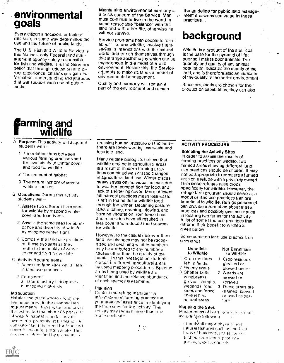
environmentalgoalsEvery citizen's decision, or lack ofdecision, in some way deteemines theuse and the future of public lands.
The U. S. Fish and Wildlife Service isthis Nation's only Federal land man-agement agency solely responsiblefor fish and wildlife. It is.the Service sbelief that through education and di-rect experience, citizens can gain in.formation, understanding and Vitudesthat will support wise use of public
farming andwildlife
A Purpose: This activity will acquaintstudents with-
1 The relationships betweenvarious farming practices andthe availability of winter coverand food for wildlife
2 The concept of habitat
3 The natural history of severalwildlife species
B Objectives: During this activitystudents will --
1. Assess two different farm sitesfor wildhfe by mapping wintercover and food types
2 Assess the same sites for abi n-dance and diversity of wildhfeby mapping winter signs
3 Compare the land use practiceson these two sites as theyrelate to the Quality of Aanteicover and food for wildlife
Activity Requirements:A(..cess tn farm sites whirm ,fiff$4in +anti us(' Practices
2 Equipmentnatei;ii hist, y fiekt
h mappinki material',
IntroductionHabitat. the place whore nigahisny,
Must prilvide the essential litereopirements food water and cnverIt is estimated that ataalt 85 per cent(if NNildliff, habitat is kinder privatiownetship prirn.vily ?is farmland r)iicultivate:I land the need 1,a andcowlr fur wi tfi is oftml acute T hihas befit) tiy 111
Maintaining environmental harmony isa crisis concern of the Service. Manmust continue to live in the world insome reasonable "balance" with theland and with other life, otherwise hewill not survive.
Service programs help people to learnabout od and wildlife, involve them-selves in interactions with the naturalworld, an'd enrich themselves, throughthat strange aesthetic joy which can beexperienced in the midst Of a wildenvironment. Beside this, the Serviceattempts to make its lands a model ofenvironmental management.
Quality and harmony will remain apart of the environment and remain
creasing human pressure on the landthere are fewer weedst less waste andless idle land.
Many wildlife biologists believe thatwildlife decline in agricultural areasis a result of modern farming prac-tices combined with drastic changesin agricultural land use. Winter placesheavy stress on individual animals dueto weather, competition for food, andlack of sheltering cover. More efficientfall harvest practices mean less wasteis left in the fields for wildlife foodthfough the winter. Declining pastureland, ditching, draining, plowing, andburning vegetation from fence linesand road sides have all resulted inless cover and reduced food sourcesfor wildlife
However, to the casual observer theseland use changes may not be recog-nized and declining wildlife numbersmay be attributed to any number ofeauses other than the quality of thehabitat In this investigation studentscomparb different agricultural areasby using mapping procedures Specific;areas being used by wildlife areidentified and the relative abundanceof each species is estimated
PlanningContact the refuge manager forinformation on farming practices inyt mr area and assistance in identifyingthe farm sites for the acbvity Thisactivity may !cc-11)1re mnre than onetop tti eai:h site
the guideline for public land manage'-, ment if citizens see value in these
practices.
backgroundWildlife is a product of the soil. soilis the base for the pyramid of life;poor soil malvas poor animals. Thequantity and quality of any animalpopulation indicates the quality of theland, and is therefOre.also an indicatorof the quality of the entire environment.
Since croplands are chosen for theirproduction capabilities, they can also
ACTIVITY PROCEDURE
Selecting the Activity SitesIn order to asse.ss the results offarming practices on wildlife, twofarmed areas showing different landuse practices should be chosee. It maynot be appropriate to compare a farmedarea on a refuge with a privately ownedfarm since refuges raise cropsspecifically for wildlife. However, therefuge farm program should serve as amodel of land use practices that arebeneficial to wildlife. Refuge personnelean provide information about thesepractices and possibly give assistancein locating two farms for the activity.A list of some land use practices thatdiffer in their benefit to wildlife isgiven below
Some common land use practices onfarm lands
Beneficialto Wildlife
Crop residues 1
left in fields.Weedy areasShelter belts. 2windbrea's,groves. sloughs,wetlands, road 3sides and fencelines ieft asnatural areas
Not Beneficialto Wildlife
Crop residuesgleaned orplowed underWeeds aremowed orsprayedThese areas aredrained, plowedor used as pas-ture
Mapping the SitesMaster.mapS of both farminclude\tie follrming
1 Identity\ all maim phy,-0(.;31;a1,1natural featores such as thetions of buildings. roads fonci,s'ti tctics. crop lands pastpics
is water areas Pt,
.0

DataSheetSIDE 9NE
Farm site one
Field notes
Outdoor Classroom Guide Number 22
Farming: Land Use and Wildlife
Names
Date
1. Field conditions: (plowed, not plowed, etc.)
2. Covet plants: (identification of specific plants)
3 -rood platits: (identification of specific plants)
4 Miscellaneous notes: (evidence of predation, death dtte toweathei, etc.)
Weather. conditions

SIDE TWO
Farm site two
Cj:
Field notes
1. Field conditions: (plowed, not plowed, etc.)
2. Cover plants: (identification of specific plants)
3. rood plants: (identification of specific plants)
4. Miscellaneous notes: (evidence of predation, death due toweather', etc.)
5. Weathe,v cuI
a
A
e

roef an eXcellentft:Ask:ling fOod and hOthea...tut mans
preblure fbi the,USe of More land; andMena Inten Sive Lite of-existing land& is
.f.:::drattically detreaSing the nuMbers ofother animals that can live there.
- 'Many National Wildlife Refuges areestablished en lands that were ecologi-cally disturbed by man's activities.Through better land use practices,their areas have been restored to amore natural environment.
By learning about the land manage-ment techniques that benefit wildlife,a seident can more readily understandthe land's sensitivity to change factors,its ability to recover from these
111111.0011
-,..t.--changesi and the ecological prbbleMSthat reselt:.401)it amatural habitat isdisturbed:
The private landowner will play anincreasingly irnp-ortant role in deter-
. mining thefuture of our Natioreswildlife retources by Witely Managingland tor man and wildlife, or by creatingbiologically sterile wastelands. Goodagricultural practices plus reasonableconsideration for wildlife are the mostimportant part of a management planfor fish, birds and maMmalt.
A)Vi
4. identify and label wildlife coverand food areas. Symbols could beused for these general vegetationtypes: grasses, nonwoody herba-ceous plants, and woody shrubs andtrees.
The Data Sheet can be used for roughsketches of the study sites and fieldnotes.
Recording Wildlife SignsStudents will be recording-tracks,droppings, sightings and other signs
as evidence for the presence of wild-life. Local wildlife species of all typesthat are active during the winter shouldbe considered. A fresh snowfall willoffer the best conditions for mapping.
Individual teams of students couldassess the sites for the presence ofone or two speciek Students shouldbecome familiar with the naturalhistory of the common species to bemapped.Evidence of wildlife should be
. recorded directly on the master map
or on acetate -lleets. A differentsymbol could !. used for each wildlifespecies or group, for example acifor songbirds,+for pheasants, 0 fordeer, etc. A separate symbol shouldbe used for different individuals of thesame?kind. For example, if twopheasants are using an area, tWo+ +should be recoided on the map. Ifeach team records their symbols onacetate sheets, they can be combinedand used as overlays on the mastermap. see the illustration.

léld NotesWhile stticlents are identifying and
generatfieldrniidellitheoUt points
of intereit stiould be recorded.:Students cOuld.identify specific coverOnd food plants by.uSing field guidesor cellecting samples to be identifiedlater in:the classroom.
Data AnalysisIf each team records their wildlife dataon acetate sheets andlhe master mapsare also transferred to acetate, then ,the;can be combined in nuiherousways on an overhead projector. The -follow)ng questions should bediscussed:
1. What areas do wildlife species use?Why?
2. W differences'in wildlife abun-dance and diversity exist between
,farm site one and f..irm site two?Do these differences relate to landuse practices?
3. Do certain groups of wildlife seemto frequent places with commoncharacteristics?'(For example, arebird species typically found wherethere has been grain spillage orwhere certain plant species exist?)
after theinvestigation
rlitf-Xt-'?f:,
'
to
for informationMany Service land areas providedesignated activity sites, shelter,toilet facilities and limited equipmentfor your use. For trip reservations and .
further information, contact your localU.S. Fish and Wildlife Serviceoffice or the.following regionalService offices:
1. Some students may be interested intalking to farmers and other resi-dents about wildlife in their area. 6
It may be pessible to piece togetherthe hiMory of wildlife changesthrough hunting stories, old photo-graphs and newspaper articles.Wildlife changes could be relatedto land use practices, life stylesand attitudes over a long periodof time.
2. Phvatq land owners could be inter-viewed; current attitudeeand landuse problemeshould be discussed.The attempt should be to arrive atthe reasons for opposing view points.
3. Wildlife habitat improvementprojects could be initiated bystudents. This wourd be particularlyvaluable if done cooperativelywith local land owners. The refugemanager can provide informationand assistance for getting started.
Jenny Publishing Co. Inc.57 Queen Ave. So
Minneapolis, Minnesota 55405Copyright 1975 All Rights Reserved
Region I P.O. Box 3737Portland, OR 97208
Region II P.O. Box 1306Albuquerque, NM 87103
Region Ill Federal BuildingFt. SnellingTwin Cities, MN 55111
Region IV 17 Executive Pk. Dr. NEAtlanta, GA 30329
Region V John kni. McCormack PostOffice and CourthouseBoston, MA 02109
egion VI P.O. Box 25486Denver Federal CenterDenver, CO 80225
Area Off ice813 D StreetAnchorage, AK 99501
This Outdoor Classroom guide is one ofa series: others are available from yourlocal or regional Service repre-sentative.

EnvironmentalEducation Guide
SynopsisREDWINGED BLACKBIRDIn this activity students will be ex-amining certain aspects of territorialbehavior of redwinged blackbirds. Theywill map the territories of several
U.S. Fish and Guide r.Wildlife Seivice . Number
.males in a marsh area, observe terri-torial behavior, and theolize aboutpossible relationships between terri.N,toriality and survival. One or moretrips will be taken to the study site.
11711/4471ill'
.1
1.
I.
11:111.11.144:,
f:
i.2.
:.
7 t
7
Prepared by:U. S. Fish and Wildlife ServiceMinnesota Environmental Sciences Foundation, Inc.

?...,;
environmentalgoalsEvery citizen's decision, or lack ofdecision, in some way determines theuse and the future of public lands.
The U, S. Fish and Wildlife Service isthis Nation's only Federal land man-agernent agency solely responsiblefor fish and wildlife. It is the Service'sbelief that through education and di-rect experience, citizens can gainformation, understanding and attitudesthatswill support wise use of publiclands.
redwingblackbirds
A. Purpose: This activity wiracquaintstudents with-1. Some aspects of the life history
of the redwinged blackbird.
2. Territoriality as a form ofsocial behavior among animals.
3. Territoriality as it affectsproductivity of redwinged black-birds.
4. Some f the relationships.between man's activities andblackbird survival.
B. Objectives: During this activitystudents will-
1. Map the nesting territories ofseveral blackbirds in a desig .nated area.
2 Describe the behavior andcommunications used to establishand hold territory..
Offer some explanations-kir thespatial relationships of theterritory boundaries
4 Suggest some influences thatterritory may have on produc-tivity
C Activity requirements:1 An area of marsh marked to form
a grid system for mapping
2 ..f3moculars should be availablefor observing behavior
IntroductionInvestigations Into the behavior ofmany species indicates that their socialorganization has survival valuesurvival for the indtvidue, as well astile species For example. a commonbehavior among birds is singing Wemay think birch sing for the fun of a
Maintaining environmental harmony isa crisis concern of the Service. Manmust continue to live in the world insome reasonable "balance" with theland and with other life, otherwise hewill not survive
Service programs help people to learnabout land arid wildlifeinvolve them-,selves in interactions with the naturalworld, and enrich themselves throughthat strange aesth0c joy which can beexperienced in the midst of a wildenvironment. Beside this, the Serviceattempts to make its lands a model ofenvironmental management.
Quality and harmonY will remain apart of the environment and remain
....ffilel, 11111/111=That may be true, but they also sing asa warning to other birds to stay awaytfrom their ter,ritpry. The latter songsmay not be appreciably different fromother singing, but they will occur withgreater frequency in the spring andthen diminish in the summer afterMating, egg production and the rear-ing of young. Thus, singing helpsestablish an area or territory whereindividuals of the same species breedand rear yoeng.
Living as we do with many kinds ofbirds, we're accustomecl to theirsinging and welcome it. Chane'es arewe attach little importance to it as faras it relates to the birds survival. Yet,singing is a manifestation of ferritonality which is a significant kind ofsocial t?eha\vior pbserved When ananimal acts`tO defend an area. The
s from physicalhasing andreally a type
defense behavior rangeattack of an intruder to c
.feather ruffling, which isof -psychological fighting Individual
ddefense of breeding territry may bethe popula-ritory. they
crucial to the survival oftion because without terusually...0AI not mate
Pro-trip PlanningContact the refuge manager andindicate your desire to do this activityWhile the, activity need not be doneexclus,voly on Service property. themanager is well informed, can provideassistance in creating and maintaininga study area and perhaps can evenloan students some equipment Themanager should definitely be consultedabout the following.
1 Identification of a suitable studysite on a refuge
2 Help in creating a grid system atthe study site
the guideline for public land manage-ment if citizens see value in these .
practices.
backgroundIt is possible for a female meadow voleto produce three to four litters ofyoung a year. The babies are.on theirown within four weeks; each of thefiVe to nine males and females poten-tially may starl their own family whenthey are only two months old. Althoughnot all wildlife species are soproductive, each does produce enough
Vs*
3. The availability of a boat (if itis needed).
4. Constructing observation points ifneeded.
5. Estimates of peak territorial dis-Play dates and times.
6. The availability of binocujars.
Pre-trip Activity SequenceStudents will need practice with theteChniques of observatio r? and map-ping. the, following are suggestedactivities that will help themDimprovetheir skills,
1. By observing birds it feeding stations, students.should be able toidentify spme common behaviors
-such-as feeding and aggression.Students must.be able to readilyidentify the redwinged blackbirdand some of the common communi-cation behaVibrs used to establishand hold the breeding territorp,Refer to Figure one and .two
2. On the study site, students shouldwork in small teams with one actingas the recorder and the others asobservers. Once the team has,'ioentified a territorial male, thecOmmubication behaviors of theredwinged blackbird will indicateits attachment fo a.general areaor territory
3 Students may need to practiceusing binoculars
4 Students will also need practice, indelineating and mapping an area ona grid system A football playingfield will serve as a convenientgrid-Sysjern. for the followingsuggestion

DataSheet SIDE ONE
;).
Outdoor Classroom Guide Number 23
Redwinged Blackbirds
NamesDate TimePlace
4411MIMAIM.
PARTA Map of territorial area for each team (see numbers 4 and 5. procedure at the study area).

SIDE TWO
PART
Figure Two ,a71. Perch 2. Singing
Behavior Checklist
Type of Behavior
1. Perch: Shoulder patchdisplay.11..=Ol
3. Flight 4. Fighting
Record Frequency forEach Observation Total
2. Singing: songscolding
3. Flight: hoveringdiving
4 Fighting: chasingencounters
5.
6.
PART Discussion Questions,
Do any territories overlap?\,Are some territories considrably larger than others?Does territory size seem to relate in any way to the
physical features of the marsh?Do you think yox presence at the marsh had any effect
on bird behaVioi?How might the size of territories relate to total egg
production in the marsh you siudied?Are there parts of the marsh which seem unoccupied?
If so, can you suggest why this is the case?What kind of b.,;.lavior was rnost frequently observed?
Can you offer some reasons for your observations?Considering the habitat preferred, how might draining
the marsh affect territory size? What effect would thishave on egg production?
.! ,4IL 1
7I
4 4 7 ' 4
I ,7, t , , 4
d . /44 , d ,
II ,04
4 `
1 / "y.%It,t 4
; < ' , 1'I I
At
d
..**/
4
d 4
,
t
i.0,4
IA , t4
,4 I , ;
'i-r
AL16011
4 4 . i 11// ,...
,i'
'
1' ',
-
.
414 4 4
4, / ,.. ,
I ,. i - I,,, ., ?
1 41, I *7 ,4 '',
'..).....
'.' ''. :/4 a 4
' ' --' '. ' ;
.
,
'4
{ .
a
. u J1,-. '
.. , -
k.,
4 ,\ .,, -2,41---,-...-----, , .,......,..........,_.
*--4.54x;rs,
'
, ..
.
..-
-;
, ...
_
1
7Figure ThroePortion of a Composite Map

young to maintain a healthy and stable.pOpulation.
Winter places heavy stress cn indivi-dual animals due to weather,cOmpetion for food, and lack ofsheltering cover. However, the surplusof young that are born each springand summer make up for losses fromwinter hardships, illness, weakness,broken bones and all other possiblemisfortunes. .
Every area of land can support oniji acertain number of each kind of animalthis is called its carrying capacity.For nearly every species, a surplus ofindividuals results in a deteriorationof living conditions that affects the
At various places on the field,students can simulate the movementof the redwings by running shortdistances from a central point andthen returning. A set of movements,when mapped, will look somethinglike the s%etch below.
11=11=1PINI.
......
\ \ I
------\----\,
I
/i ,, , ,, ,. ,
1\ \ I\,/---)e-r,---r-
-... , es1/..-.-' 7:/.'...
so
40
10
___=.........., ......'... s',..'"-.--
/ ..'./ 1\'
/ I ..".., \ ..
I
\--r-
.,- / 1
/ I-.7. .'''
/\ i\ , /-.,--,--N ,
- _ -.. . // ......:.-..11Z..-ip0 7--
....... .-. _
0 -----7' 4i:\I-.. -....
/ I \/ 1
, i \/I \
',..
....
\ t
/
Teams observing single student"birds should pcol their dataforming one big map to show the'territories- of allt1:le studentson the field.
Making a GridThe marsh can be a confusing sea ofcattails without the aid of a gridsystem as a reference for establishingpositions and distances. As you readthrough this description of a gridsystem, refer to the following f
well-being of the whole population.Nature usually ensures that eachpopulation of animals has the capabilityto overproduce, The factors limitingactual numbers are determined by theland's carrying capacity,
Besides influencing the survival ofsurplus animals, carrying capacityaffects production. Each species hasan established social structure.Territorial competition in the springfor nesting sites and feeding terri-tories limits the number of adultsproducing younb2Man affects thisproduction by changing the habitatand making more or fewer nestingsites or feeding territories available
11- +-i-f --0--. ? IP: 1 1 ! '
1
Z---i i -t- i -!--. --::+--- 4 4---,, I i
I .. .4 . i - .4. - ---.--_-... 4
LI, ---i--- 4. -'
North
ca
4114
road
CO
2
rAn area 1000 feet on a side will usuallyencompass several territories. How.ever, local conditions must beconsidered to determine this. The areashould overlay a dense population ofcattails or bullrushes, but not extendmuch into open water.
There are many ways to lay out a ridsystem. However, markers must beplaced at least around the entireboundary of the area. The illustrationshows two roads intersecting at theS. E. corner of the map. Note that themarkers on the road edge correspondto.the ones out in the marsh. Markerscould also be placed inside the areashowing the positions of grid line
! intersects. In this illustration, internalmarkers would be placed at 100-footintervals forming a giant checkerboardThis would help increase observationaccuracy.
Points on the grid can be marked withstakes and colored strips of plastic foreasy visability. Stakes can be placedthrough the ice in winter. If the marshis wadeable, they can be placed after
male
Figure No.1 female
the ice melts early in the spring. Themarker stakes must be tall enough tobe seen easily over the vegetationafter they have been driven severalfeet into the marsh soil.
If more than one trip is planned, stu-dents can help construct the gridsystem. They can easily lay out thegrid using tape measures and stakes.If open water is encounter ed, boats orcanoes would be useful; otherwise(assuming this is done in the spring),rubber waders will suffice. Observethe usual precaution of testing mudand water depth with a stake beforestepping about.
Procedure at the Study AreaPlan to make at least two or more tripsto complete the activities outlinedbelow. Since most terr:torial behaviorsoccur between dawn and 10:00 a m.,get there early. An option here is tocamp out overnight near the site, withpermission, in order to begin observ-ing at dawn. Also, some late afternoon(after 4:00 p.m.) territorial behaviorhas been observed
1. Plan to meet the refuge manager atthe gridded study site. Obtain abrief status report on the brrdsAre there many or few at the studysite? Are they iust males or havesome females returned?
2 Spend the time needed to familiar-ize the class with the area. Usingbinoculars. watch birds-bothPerched and in flight. Do somepreliminary tracking. cross-checkingdata from time to time. Is thetechnique simulated on the footballfield useful?

3. Preliminary obtervations should beconcluded when teams choose toobserve one particular bird. (Morethan one team can, and probablyshould, observe the same bird fromseveral view points.)
4. Within the.gridded area; map thegeneral characteristics of the marshhabitat. Sketch open water, cat-tails, trees, shrubs, old posts andother features. These will beuseful as reference points. UsoPart A on the data sheet.
5. Begin mapping the territories.Since each bird is different,territorial behavior will vary sosome may choose to remain perchedlonger than others, thus extendingthe observation time. Determine themajor perching place of the birdbeing observed. At the peak oftheir mating periods, birds showincreased antagonistic behaviorand more frequently perch at theboundaries of their territories.Indicate the kind and frequency ofthese behaviors on the data sheet.Also, mark the location where speci-fic behaviors occur.
Often twenty perch points will de-fine the territory. Mark thesepoints using the grid, recordingmovement according to the coordi-nate system. Each team should plotthe territory defined by their obser-vations. A composite map showingall of the territories can be madelater.
after theinvestigation1. Begin preparation of a composite
map. When complete it should showhabitat and territories. In someinstances only partial territorieswill show.
2 Number and estimate sizes often nories. Mark points wherespecific behaviors occur. Keythis data into a behavior table,include in legend form on the map
3 A eornpleied composite mignt re-.semble Figure 3 on the Data Sheet
4 Tabulate an the behavioral datagathered Determine the frequencyof certain kinds of behavior_
5 Discuss the questions in Part Con the data sheet.
.6 At some point it may be worthwhilefor interested students to acquaintthemselves with the life history ofredwinged blackbirds Some Stu-dents may wish to return to themarsh at regular iniervals during
the period in which eggs arehatched and the young are rearedto verify the status of the territoriesobserved during these initial studies.Redwings also nest in the uplandssuch as hayfields; this would alsoprovide investigation opportunities.
Sorne rather interesting projects canbe done to further gain more infor-mation about territoriality. Forexample, students can easily modelblackbirds with styrofoam and paint.What might happen if such a decoywere affixed to a stake and placedin a territory? Try both a male anda female. If students enter a
territory, how does the defenderbehave? The observable differencebetween males and females seemsto be the red color on the wings ofthe male. Students could designand conduct a study which revealsthe role of wing color and its rela-tionship to territorial behavior.
for informationMany Service land areas providedesignated activity sites, shelter,toilet facilities and limited equipmentfor your use. For trip reservations andfurther informati- ,11,".contact your localU.S. Fish and Wildlife Serviceoffice or the following regionalServices offices:
Jenny Publishing Ce Inc.57 Queen Ave So
Minnpapohs Minnesota 55405Copyright 1975 All Rights Resrved
Region I: P.O. Box 3737Portland, OR 97208
Region II P.O. Box 1206Albuquerque, NM 87103
Region HI Federal BuildingFt SnellingTwin Cities, MN 55111
Roc-lion IV 17 Executive Pk Dr NEAtlanta, GA 30329
Roo ion V John VV McCor mad. PostOffice and Cour thousoBoston, MA 02109
VI P.0 Box 25486DPnver FeOerai C:ritnerDonvot co 8022')
A d AT Off t,813 D StrpitAncrlorage AK r.,49r)01
i!..s Outdoor Ciassroom guide I, onti ifiothers are from vInif
local or regional Ser vicP repre-sontat.Ive

'-. i ilLik,1':
..
. ( -' . 4 ., .1:-.ei 4.:-
. . . .. .i.,:.. . , ' - . . .
nvironmental U.S,. Fish andducation Guide Wildlife Sörvice
SynopsisDIDANGERED SPECIES: MYSTERYBIRDSIntended for Junior-senior highschool students and involves class-room activities which tteal with differ-
ences within populations and betweenpopulations. The differences and somecommon life requirements are relatedto the survival of the populations.
GuideNumber
..14//77:*111
....I!
116
111.4:
771 41.
Prepared by:93 U. S. Fish and Wildlife Service
Minnesota Environmental Sciences Foundation, Inc.

A711,060A-mi
environmentalgoalsEvery citizen's decision, or lack ofdecision, in some way determines theuse and the future of public lands.
The U.S. Fish and Wildlife Service isthis Nation's only Federal landmanagement agency solely responsiblefor fish and wildlife. It is the Service'sbelief that through education anddirect experience, citizens can gain in-formation, understanding and atti-tudes that will support wise use ofpublic lands.
.7.14:INNIMAWKVAIMM47741,71TA344447,.:
Maintaining environmental harmony is . 'guidelines for public land managementa crisis concern of the Service. Man if citizens see value in these practices.must continue to live in the world insome reasonable "balance" with theland and with other life, otherwise hewill not survive.
Service programs help people to learnabout land and wildlife, involve them-selves in interactions with the naturalworld, and enrich themselves throughthat strange aesthetic joy whioh can beexperienced in the midst of a wild en-vironment. Besides these, the Serviceattempts to make its lands a model ofenvironmental management.
Quality and harmony will remain a partof the environment and remain the
E ndangered species:mystery birds
A. Purpose: This activity will acquaintstudents with
1. Some basic life requirementsof organisms.
2. The differing tolerances,among species of wild animals,to adapt to changes in theirenvironment.
3. The ways man influences thesuccess of animals.
B. Objectives: During this activitystudents will --
1. List and discuss their own pre-ferences to some environment-al factors.
2. Compare and discuss twohypothetical human popula-tions which are adapted to dif-ferent room temperatures.
3. Predict and discuss the toler-ance or adaptability of two dif-ferent unknown species ofbirds to present-day environ-mental conditions.
4. Have the opportunity to ex-plore their own values concern-ing endangered animals.
C. Activity requirements:
One data sheet for each student.
Introduction
In this Investigation students comparevariation within a population byexamining some of their owntolerances and preferences. Aconsideration of variation between two
different student populations is used tointroduce participanAs to a generaldiscussion of the life requirements oftwo mystery species, and the waysman may influence the survivalsuccess of animals.
Activities
1, Variation Within a Population:What Are Your Tolerances toEnvironmental Conditions?
Wildlife species possess differenttolerances. Environmental conditionssuch as temperature, food, sunlightand water are often called liferequirements.
The following activity dealing withsome basic human survivalrequirements will help studentsidentify their own individualtolerances. Although this activity willshow variation within a humanpopulation, the Information will beuseful later on ai dealing with variationbetween populations of differentspecies.
Students should individually indicatetheir tolerances based on their choiceof optimum level or preference for eachlife requirement continuum on the datasheet. The numbers, 1-7, do notindicate actual quantities but provide away to record a tendency on thecontinuum. Students should check anumber for each factor to indicate theirpreferences.
As a class, record student responses tothe choices. One method for compilingthe information is shown below.
Temperature: room temperaturelow high
// //11 OM- it //I / ///No. of Students 1 0 4
4
backgroundAn ecologist has described animalsand plants as actors in an evolutionarydrama. As they spread over the earth,they become distributed amongdifferent habitats and environments oron different ecological stages. Thisdrama is directed by interactionsamong the playerS: competition forenergy and resources, climate,catastrophe, the relative stability of
Discuss diversity or similarity ofchoices for each life requirement. Forexample, using the room temperatureresponses above, some discussionquestions might be: Are all of theresponses the same? What are somepossible reasons for variableresponses? How do Individuals ateither end tolerate room temperaturesthat are usually adjusted to the centerof the continuum? Are these means ofadjustment available to other animalspecies? Keep the information for thenext activity.
2. Variation Between Two DifferentPopulations; A Hypothetical Problem
Divide the class into two hypotheticalpopulations according to eye color. Allstudents with blue eyes or variations ofblue make up one population and allthose with brown eyes or variations ofbrown make up the other.
Assume tolerance or adaptation ofthese two populations to temperaturevariations is narrow. The blue-eyedanimal population requires a lowindoor temperature and thebrown-eyed animal population a highindoor temperature.
Some group discussion questions:
1. What consequences are there forsetting the temperature high? Low?
2. Should one population be allowed tosurvive at the expense of the other?
3. Could both populationssurvive? What would you do to allowfor the survival of both populations?
4. What competition pressures wouldexist between the two populations?
Tolerances and adaptation among wildplants and animals are comparable to
^ I.(tr

Sheet SIDE ON.E
Outdoor Classroom Guide Number 24
Endangered Species:Mystery Birds
Name aiwomm.
VARIATION WITHIN A POPULATION:WHAT ARE YOUR TOLERANCES?
Check a number for each life requirement continuum.
a. TemperatureFor the following room temperature levels, indicate your preference.
1 3 5 6 71
low Room Temperature high
b. Density. (Number of People per Unit of Area)rirthe following density levels of people, indicate your preference.
1 2 3MINIIIFr 4 51 I 6 7
low Density High
Light.Indicate the amount or intensity of light vs. darkness you prefer.
1 1 2 1 3 4 5 6 7 1
limiied Light Intensity abundant
d. Food.Indicate whether you would prefer a lot of different kinds of food or only
one or a few kinds of food.1 3 45 6
limited Variety of Food diverse
e. Protection.Indicate the type of shelter (degree of complexity) you prefer.
F....1...+ 2 3 4.4.....4 5--4
6i
7 1
1
crude . Type of Shelter complexI 95

SIDE TWO
Mystery Birds: A Real Problem
My prediction: The most abundant species isbecause (list some reasons).

_ Viarlouten4ironthehts and by ail kindsof chancesevents,
Extinctionof plaettAndanirnalahasOccUrred.many,times inithls -theatre al,thoUgh the cauSes and their signifcanes are not aiWays Well understood.For example, during the Permianperiod which Occurred some280,000,000 years ago, apprOximatelyhalf ofthe animal families on the Earthhad disappeared. These extinctions didnot occur all at once, of course; thisperiod was approximately 50,000,000years in length.
In the late Pleistocene (Ice Age) asimilar major extinction occurred.Many local North American mammals
the hypothetical eye color/temperatureproblem in the sense that differentorganisms use survival elements indifferent ways. Some can adapt tomany conditions, others cannot.However, this is not baied onpreference but on the adaptability ofthe species to evolutionary change.
3. Mystery Birds: A Real Problem
Two bird populations have beenselected for this actiVity. The followingchart gives some importantinformation about their life histories.
-Ibecame,eXtinct.Marii tiiiho the BeringLand Bridgit towoioortg to tnis doh-tinent, is implicated in this extinction.
Ititiheral ConCern,:direCtly caused bY man, and threat Ofextinctlen by ryieh, IS relatively recent.It Is only within the'past few years thatwe have gained an understanding ofour role in simplifying complex naturalcomMunities and the ways in whichthis leads to extermination of plantsand animals.
After reading the life historydescriptions, each student shouldrecord on the data sheet the species hethinks is most abundant and seinereasons for his choice. Now tally theinformation from the entire class, givethe number for each species along withsome of the major reasons for thechoices. Put this on the blackboardbefore discussing the followingquestions:
1. Which environment seems morestable to you? Which species wouldseem to demand a more stable
MYSTERY BIRDS
LIFE HISTORY CATEGORIES SPECIES A SPECIES B
1. Size Large Small
2. Range No. America No. America,Central America,and northernSo. America
3. Time to reach adult-hood
3-5 years 1 year
4. Lifespan of adult 20-40 years 2-3 years ,
6. Food Fish and smallmammals
insects and seeds
6. Number of mates: pair 1 male; 1 female 1 male:2-3 females
7. Size of breeding territory Large Small
IL Nesting habitat Large old trees Wetlands, grass-or cliffs; lands, grain
. large water fields or smallareas grains
9. Average youngproduced / pair eachyear
1-2 3-4
1. 9 7
environment? What reasons do youhave for your answers?
2. Which species would seem lesstolerant of human disturbance? Whatreasons do you have for your answer?
3. What do the feeding habits of theorganisms tell you about theorganism's behavior, physicalappearance, its physiology, its habitat?
4. In what ways would humanactivities intrude on the behavior andlife requirements of each organism?What are the reasons for youranswers?
5. Rank order, from most important toleast important, the environmentalchanges which would most affect eachorganism. (This list would begenerated in class.)
After discussing these questions,determine if any students want tochange their choices.
Let's end the mystery.
Turn to the back pagefor the names
of the mystery birds.

dertain y,a major concern, there are--i:-...numerous species of plants and
animali Classified as endangered In theUnited States, The following questions
indiVidimikle Identify theirparsonal underitanding and values:concerning this problem.
Many of the following discussionquestions are intended to helpstudents better identify theirinterests,concarns, attitudes and feelings aboutendangered species. Thus, thesequestions are deliberately opea-endedwith no precise right or wronganswers. These questions may or maynot lead to extended discussion; wheninterest wanes, it is time to move on.Usually every student will want torespond sometime during thediscussion. It is important that thequestions do not become an Interview.
after theinvestigationIf you are interested in moreinformation about endangered species,contact:
Public Information DepartmentNational Audubon Society950 Third AvenueNew York, N.Y. 10022
or one of the following regional Serviceoffices listed on the back page.
Mystery Species A: American BeldEagle (Haliaeetus leucocephalus)
"Most of the remaining bald eaglesnest in Canada or Alaska. Some, butnot all, bald eagles migrate (if food isreadily available all-9ear, they arelikely to remain near their nesting.region) and many of those that areseen in The lower 48 states during thewinter months are migrants fromCanada. Only about 750 pairs still nestsouth of the Canadian border."
(The Endangered Bald Eagle, PublicInformation Department. NationalAudubon Society, 950 Third Avenue,New York, N.Y. 10022)
Mystery Species B: Redwinged.Blackbird (Agelaius phoeniceus)
The redwinged blackbird, foundthroughout North America may be themost numerous breeding bird on theContinent. Breeding pairs number inthe 10's of millions and in some partsof the United States it is considered aserious agricultural pest.
non-judgemental atmosphere. Oftenadditional otatifying quelitk Is related*0 tents, meaning, aitiurnptions,implidationa, datatollectlohtechnIquet ;'Alterneitives,..etC. 'are oftenvery- helpful in leading to furtherunderstanding.
It Is important that students are notforced to answer these questions butare ellowed to deal with themaccording tO their interests. .
1. Which would you rather see? (Rankorder frbm first 12 last choice.)a. eagleb. deerc. mOosed. wolfee screech owl
What are the reasons for your choice?
of animals ?or man's purposes?
3. What can a person Mr age doAbout protecting 011dangered species?
4. What should other people \do toprotect endangered species? \5. Which of the following do you N.believe to be most important? Rankthem from most important to leastImportant.a. Protecting endangered speciesb. Finding a cure for cancerc. The manned space programd. Developing ways to use sewage inagriculture
6. What living things do you care mostand least about? What are the reasonsfor your choices?
Jenny Publishing Co. Inc.57 Queen Ave. So,
Minneapolis, Minnesota 55405Cooyright 1975 All Rights Reserved
''s:41374,1
for informationMany Service lAnd areas provideshelter, toilet facilities and limitedequipment for your use. For trip re-servations and further information,contact your local U.S. Fish and Wild-life Service office or the following re-gional Service offices:
Region 1: P.O. Box 3737Portland, OR 97208
Region II P.O. Box 1306Albuquerque, NM 87103
Region Ill Federal BuildingFt. SnellingTwin Cities, MN 55111
,
Region IV 17 Executi%,e Pk, Dr. NEAtlanta, GA 30329
Region V John W, McCormack PostOffice and CourthouseBoston, MA 02109
Region VI P.O. Box 25486Denver Federal CenterDenver, CO 80225
Alaska Area Office813 D StreetAnchorage, Al< 99501
This Outdoer Classroom guide is one ofa series; others are available from yourlocal or regional Service repre-sentative.