Marine Protected Areas in Southeast Asia
142
-
Upload
independent -
Category
Documents
-
view
0 -
download
0
Transcript of Marine Protected Areas in Southeast Asia


MARINE
PROTECTED
AREAS
IN
SOUTHEAST
ASIA

ii Marine Protected Areas in Southeast Asia
Marine Protected Areas in Southeast Asia
Compiled by: Catherine P. S. CheungAsian Bureau for ConservationPorfirio M. Aliño, Andre Jon Uychiaoco and Hazel O. ArceoUniversity of the Philippines-Marine Science Institute
Publisher: ASEAN Regional Centre for Biodiversity Conservation −Department of Environment and Natural Resources
Reproduction of this publication for educational or other non-commercial purposes is authorised withoutany prior written permission from the Publisher provided the authors and publisher are fully acknowledged.
Reproduction of this publication for sale or other commercial purposes is prohibited.
Citation: UP-MSI, ABC, ARCBC, DENR, ASEAN, 2002. Marine Protected Areas inSoutheast Asia. ASEAN Regional Centre for Biodiversity Conservation, Departmentof Environment and Natural Resources, Los Baños, Philippines. 142 pp., 10 maps.
ISBN: 971-8986-46-4
Editorial Consultants: Mike Appleton and Monina T. Uriarte
Editors: Bridget P. Botengan and Walane R. dela Cruz
Cover design & layout: Nanie S. Gonzales
Maps and Figures: Original maps and figures (WCMC,WRI), enhanced by ARCBC.
Photo credits: Protected Areas & Wildlife Bureau-DENR (Philippines), CRMP-Manado staff
(Indonesia), UUP-Police Air Force of Sabah (Malaysia), Maria Beger (Philippines),Chou Loke (Singapore), http://www.Gosouththai.com (Thailand), Vo Si Tuan
(Vietnam)
Printed by: WordShop Specialists Network, Inc.
Disclaimer: The views expressed are those of the authors and contributors and do notnecessarily reflect the views of the ASEAN Regional Centre for BiodiversityConservation (ARCBC), the Department of Environment and Natural Resources(DENR), the Association of Southeast Asian Nations (ASEAN) or the EuropeanCommission (EC).
Maps used in this book do not imply the expression of any opinion whatsoever onthe part of ARCBC, the DENR, the ASEAN Secretariat or the EC concerning thelegal status of any country, territory or area, or the delineation of its frontiers andbound aries.
Funding Partners: European CommissionDepartment of Environment and Natural Resources (Philippines)
Available from: ASEAN Regional Centre for Biodiversity Conservation (ARCBC)ERDB Bldg., UPLB-Forestry CampusCollege, Los Banos, LagunaPhilippinesTel: +63-49.536-1659 or 536-4042TeleFax: +63-49.536-3173 or 536-2865Email: [email protected]; [email protected];Website: http://www.arcbc.org.ph

Marine Protected Areas in Southeast Asia iii
The ASEAN region has the richest biodiversity, the most extensive coastline and mostdiverse coral reefs in the world. However, it is also one of the most threatened regions interms of coastal marine resources degradation.
Marine protected areas in Southeast Asia were assessed and reviewed to analyze theincreasing threats such as coastal development, collecting of endangered species, or-namental trading, overexploitation, pollution and tourism that lead to the depletion ofthe biodiversity resources of the marine protected areas in the region. Without properknowledge regarding conservation of biodiversity, degradation of resources will esca-late.
The ASEAN Regional Centre for Biodiversity Conservation (ARCBC) was establishedsince 1999 to strengthen biodiversity conservation in the ASEAN region. We hope thispublication will serve as a valued reference to the policy makers, planners, fishermenand other stakeholders as well as students, scientists and park managers. This assess-ment and its timely publication will be useful in the continuing efforts to plan for man-agement that will save, rehabilitate and safeguard our coastal marine resources in theregion.
GREGORIO I. TEXON JOHN R. MACKINNON
ASEAN Co-Director, ARCBC EU Co-Director, ARCBC
MESSAGE

iv Marine Protected Areas in Southeast Asia
FOREWORD
The last decade has seen a burgeoning of marine protected areas (MPAs) in theSoutheast Asian (SEA) region, in particular member countries of the Association of South-east Asian Nations (ASEAN), where it has been known to be the heart of highest marinebiodiversity. Perhaps due to the great value and importance of marine biodversity tohundreds of millions of diverse peoples, these resources have been considered to be atgreatest risk.
The tremendous challenges in marine biodiversity conservation have been met withan equally diverse way of doing things, from the large MPAs of Indonesia to the manysmall community based no-take marine sanctuaries of the Philippines. Eco-tourism mayhave shown some promising results in an increasing number of areas, but the number ofspecies still under threat from overexploitation is also increasing. The bilateral agree-ments between the Philippines and Malaysia on the Turtle Islands are exemplary ex-amples of promising efforts for endangered species and the beckoning need to scale upthe effectiveness of MPA management efforts. The constraints prevalent in a region ofdiverse cultures provide opportunities where potential global conflicts may be preventedby establishing joint cooperative stewardship arrangements through MPAs such as thosein the disputed islands of the Spratly’s. Transboundary opportunities may also be throughthe Sulu-Sulawesi ecoregion approach and those in the South China Sea. Other areasin the Indian Ocean and the Pacific Seaboard also show connectivity of marine organ-isms that indicates potential MPA corridors. Indeed, there is a greater demand to forgean ASEAN effort for marine conservation and a functional network of MPAs beyond theSEA region.
This review is both timely and appropriate for the SEA region. Past efforts have beenmade in MPAs, and various good global synopses have provided impetus for more exten-sive regional cooperation and deeper commitments in biodiversity conservation. The rati-fication of the Convention of Biological Diversity by most countries in the region and theestablishment of the ASEAN Regional Centre for Biodiversity Conservation (ARCBC) areindicative major responses by the region. The need for examples of best practices in MPAmanagement makes this review of MPAs in SEA important testaments of small steps thatmay contribute to great strides in understanding the significance of MPAs.
The continuous journey of the ASEAN in its common seas is on a sturdy boat; the ARCBCis one of its important engines. These MPA vignettes are important knowledge stars andlessons for us to navigate through a sea of change where MPAs help sustain biodiversity,the life support system of people.
Porfirio M. AliñoUniversity of the Philippines−Marine Science Institute

Marine Protected Areas in Southeast Asia v
ACKNOWLEDGEMENTS
Many hands and flippers have worked on this book. After some years as an unpub-lished report covering an initial 14 countries, the ASEAN Regional Centre for BiodiversityConservation (ARCBC) agreed to revamp the report, update and publish the accountsfor the 9 ASEAN member countries with marine areas.The ARCBC wishes to thank thefollowing individuals and institutions for their major and invaluable inputs:
• the Asian Bureau for Conservation (ABC) for executing the original work andCatherine Cheung of the ABC for preparing the original country drafts thatformed part of the Indo Malayan Protected Areas Review. Much of the inputresulted from an initial workshop that ABC had organised in Cisaua, Bogor,Indonesia from 23 – 25 January 1995;
• the participants from Indonesia, Malaysia, the Philippines, Thailandand Vietnam at the above-mentioned workshop and to several internationalexperts for their inputs especially Chris Bleakley from the IUCN-CNPPAMPA Programme, Prof. Chou Loke Ming from the National University ofSingapore, Nopadol Briksvan of Thailand, Arief Wicaksono and Graham Usher of the Bunaken Park in Manado, N. Sulawesi. Much of the background data on Indonesia was based on the earlier work of Dr. Rod Salm;
• Sheila Vergara of ICLARM and Eric Bacareza of ARCBC for their initial reviewof the draft;
• Dr. Porfirio M. Aliño, Andre Jon Uychiaoco and Hazel O. Arceo of theUniversity of the Philippines-Marine Science Institute for reviewing and updatingthe draft;
• the participants to the 9th International Coral Reef Symposium (2000) in Bali,Indonesia and the Regional Workshop on Networking of Marine Protected Areas (Coral Reefs) in the East Asian Seas (2001) in Sabah, Malaysia also for reviewing the draft especially: Sabri Haji Mohd. Taha, Kol Vathana, Has Vibol,Lida Pet-Soede, Suharsono, Rili Djohani, Annadel Cabanban, Jamili Nais,Hansa Chansang, Piyathip Eawpanich, Vo Si Tuan, Nin Vanntha, andNguyen Van Long;
• Charina Conte and Nadia Palomar both of UP-MSI for their administrativesupport especially for the MPA database;
• the Netherlands Ministry for Development Co-operation for the financialsupport to the original Indo-Malayan Protected Areas Review and the WorldBank, which managed that project; and
• Walane R. dela Cruz of ARCBC for doing most of the coordination and follow-up work between between ARCBC and the UP-MSI, for verifying data and information and helping in the copyediting and proofreading, and Jerome S.J. Alanofor enhancing the new maps.
Special thanks must be given to the European Commission for sponsoring theprinting of this book.

vi Marine Protected Areas in Southeast Asia
BLANK PAGE

Marine Protected Areas in Southeast Asia vii
TABLE OF CONTENTS
MESSAGE iiiFOREWORD ivACKNOWLEDGEMENTS vABSTRACT 1AN OVERVIEW 1
I. Scope and Methodologies of the Review 5II. Summary of Results 7III. Priority Marine Areas 10IV. Priority Actions and Recommendations 13
1. BRUNEI DARUSSALAM 17Background Facts 181.1 Coastal and Marine Ecosystems 181.2 Species of Significance 181.3 Legislation and Management Framework 191.4 Extent of Existing Marine Protected Areas (MPAs) System 191.5 Proposed Marine Protected Areas (MPAs) 201.6 Evaluation of MPAs − Status, Threats and Management 201.7 Priority Sites 211.8 Priority Actions 21
2. CAMBODIA 23Background Facts 242.1 Coastal and Marine Ecosystems 242.2 Significant Species 242.3 Legislation and Administrative Framework 252.4 Extent of Existing Marine Protected Areas (MPAs) System 272.5 Proposed MPAs 282.6 Evaluation of MPAs - Status, Threats and Management 282.7 Gaps in the MPA System 282.8 Priority Sites 292.9 Priority Actions 29
3. INDONESIA 31Background Facts 323.1. Coastal and Marine Ecosystems 323.2 Species of Significance 333.3 Legislation and Management Framework 343.4 Extent of the Existing Marine Protected Areas (MPAs) System 373.5 Proposed Marine Protected Areas (MPAs) 373.6 Evaluation of MPAs - Status, Threats and Management 373.7 Gaps in the MPA System 42

viii Marine Protected Areas in Southeast Asia
3.8 Priority Sites 423.9 Priority Actions 43
4. MALAYSIA 45Background Facts 464.1 Coastal and Marine Ecosystems 464.2 Species of Significance 474.3 Legislation and Management Framework 474.4 Extent of Existing Marine Protected Areas (MPAs) System 504.5 Proposed Marine Protected Areas (MPAs) 514.6 Evaluation of MPAs - Status, Threats and Management 524.7 Gaps in the MPA System 554.8 Priority Sites 554.9 Priority Actions 55
5. MYANMAR 59Background Facts 605.1 Coastal and Marine Ecosystems 605.2 Significant Species 605.3 Legislation and Management Framework 615.4 Extent of Existing Marine Protected Areas (MPAs) System 625.5 Proposed MPAs 625.6 Evaluation of MPAs - Status, Threats and Management 625.7 Gaps in the Existing MPA System 635.8 Priority Sites 635.9 Priority Actions 64
6. PHILIPPINES 65Background Facts 666.1 Coastal and Marine Ecosystems 666.2 Species of Significance 666.3 Legislation and Management Framework 676.4 Extent of Existing Marine Protected Areas (MPAs) System 706.5 Evaluation of MPAs - Status, Threats and Management 716.6 Proposed Marine Protected Areas (MPAs) 746.7 Gaps in the MPA System 746.8 Priority Sites 746.9 Priority Actions 75
7. SINGAPORE 79Background Facts 807.1 Coastal and Marine Ecosystems 807.2 Significant Species 807.3 Legislation and Management Framework 817.4 Extent of Existing Marine Protected Areas (MPAs) System 817.5 Proposed MPAs 82

Marine Protected Areas in Southeast Asia ix
7.6 Evaluation of MPAs - Status, Threats and Management 827.7 Gaps in the Existing MPA System 827.8 Priority Sites 837.9 Priority Actions 83
8. THAILAND 85Background Facts 868.1 Coastal and Marine Ecosystems 868.2 Significant Species 868.3 Legislation and Management Framework 878.4 Extent of Existing Marine Protected Areas (MPAs) System 888.5 Proposed Marine Protected Areas (MPAs) 888.6 Evaluation of MPAs - Status, Threats and Management 888.7 Gaps in the MPA System 918.8 Priority Sites 918.9 Priority Actions 91
9. VIETNAM 93Background Facts 949.1 Coastal and Marine Ecosystems 949.2 Species of Significance 959.3 Legislation and Management Framework 959.4 Extent of Existing Marine Protected Areas (MPAs) System 969.5 Proposed Marine Protected Areas (MPAs) 979.6 Evaluation of MPAs - Status, Threats and Management 979.7 Priority Sites 1019.8 Priority Actions 101
REFERENCES 115

x Marine Protected Areas in Southeast Asia
TABLES
An OverviewTable i.1 Counts of reef-associated fish in FishBase as of March 1995, for the seven
ASEAN member countries (FAO areas 51,57 and 71). 2Table i.2 Government Authorities for MPAs of nine ASEAN member countries 5Table i.3 Representation of MPAs in the nine ASEAN member countries. 8Table i.4 Number of priority MPAs of global/regional (A) and national (B)
significance 11Table i.5 List of existing (E) and proposed (P) MPAs of regional (A) and
national (B) conservation priorities. 12
Brunei DarussalamTable 1.1 Environmental legislations in Brunei Darussalam 19Table 1.2 Marine Protected Areas in Brunei Darussalam
CambodiaTable 2.1 Marine Protected Areas in Cambodia
IndonesiaTable 3.1 Legislative measures in relation with the management and protection
of Indonesia’s marine and other natural resources 36Table 3.2 Distribution of Existing and proposed MPAs in the Different
Biogeographic Divisions 42Table 3.3 Marine Protected Areas in Indonesia
MalaysiaTable 4.1 Federal laws relevant to parks and especially marine areas 48Table 4.2 Sabah laws relevant to parks and marine areas 49Table 4.3 Sarawak laws relevant to parks and marine areas 49Table 4.4 Turtle nesting sites in Penisula Malaysia and Sarawak that may
be proposed for protection 58Table 4.5 Marine Protected Areas in Malaysia
MyanmarTable 5.1 Marine Protected Areas in Myanmar
PhilippinesTable 6.1. Environmental legislations in the Philippines 68Table 6.2. Summary of the total number of MPAs of different categories 69Table 6.3. Summary of Philippine MPAs recorded in 1995, 1997 and 2000 70Table 6.4. Priority Sites for Marine Biodiversity Conservation in the Philippines 76Table 6.5. Important Marine Protected Areas and Managed Areas
in the Philippines

Marine Protected Areas in Southeast Asia xi
SingaporeTable 7.1. Marine Protected Areas in Singapore
ThailandTable 8.1. National Marine Parks (IUCN category II) of Thailand 92Table 8.2. Marine Protected Areas in Thailand
VietnamTable 9.1. Marine Protected Areas in Vietnam
FIGURES
An OverviewFigure i.1. Clinal distribution of the scleractinian coral genera showing the
highest generic distribution in the vicinity of the ASEAN region 2Figure i.2. Indicative size frequency of some marine protected ares in the ASEAN 8
Brunei DarussalamFigure 1.1. The different environmental threats that affect the coral reefs of Brunei
Darussalam. 21
CambodiaFigure 2.1. The different environmental threats that affect the coral reefs of
Cambodia 29
IndonesiaFigure 3.1. Threats to MPAs of Indonesia and to the country’s coral reefs
in general. 39
MalaysiaFigure 4.1. Threats to MPAs of Malaysia and to the country’s coral reefs
in general. 53
MyanmarFigure 5.1. Environmental threats to the coral reefs of Myanmar 63
PhilippinesFigure 6.1. Threats to MPAs of the Philippines and to the country’s coral reefs
in general. 73
SingaporeFigure 7.1 The different environmental threats that affect the coral reefs
of Singapore 83

xii Marine Protected Areas in Southeast Asia
ThailandFigure 8.1 Threats to MPAs of Thailand and to the country’s coral reefs
in general. 90
VietnamFigure 9.1 Threats to MPAs of Vietnam and to the country’s coral reefs
in general 99
MAPSMap 1. Types of Marine Protected Areas in Southeast Asia 104Map 2. Marine Protected Areas in Brunei Darussalam; East and West
Malaysia, and Singapore 105Map 3. Marine Protected Areas in Cambodia 106Map 4. Marine Protected Areas in Central Indonesia 107Map 5. Marine Protected Areas in Western Indonesia 108Map 6. Marine Protected Areas in Eastern Indonesia 109Map 7. Marine Protected Areas in Myanmar 110Map 8. Marine Protected Areas in the Philippines 111Map 9. Marine Protected Areas in Thailand 112Map 10. Marine Protected Areas in Vietnam 113

Marine Protected Areas in Southeast Asia 1
ABSTRACT
Marine Protected Areas (MPAs) of nine member countries of the Association of South-east Asian Nations (ASEAN) were reviewed. These countries are the Philippines, Malay-sia, Thailand, Indonesia, Vietnam, Brunei, Singapore, Cambodia and Myanmar. Differ-ent issues pertaining to MPAs of each country are assessed and their management con-cerns evaluated. The pressures (i.e. threats) on the marine environment, the state of theirhabitats and the important management needs are examined. A priority action agendaand a regional strategic MPA framework are also proposed.
The ASEAN region contains some of the most extensive coastlines and diverse coralreefs in the world but remains the most highly threatened. A proliferation of MPAs in theASEAN shows a growing consciousness on the need to deal with the increasing threats(e.g. coastal development, sedimentation and over-exploitation), leading to the degra-dation of the coastal and marine resources of the region. Although MPAs are recognizedas crucial to conserving biodiversity, only a few (around 10-20%) of the MPAs are effec-tively managed and as such, MPA management remains inadequate. Some of the sug-gested priority actions are the following: 1) improve and effectively implement legislativereforms to enhance MPA effectiveness, 2) incorporate MPA planning and managementinto an Integrated Coastal Management framework, 3) enhance sustaining mechanisms toenable managers and institutions to continue adaptive management, 4) fill in gaps in theestablishment and understanding of representatively adequate MPAs in the various bio-geographic zones (e.g. W. Sumatra, E. Philippines and Myanmar), and 5) improve andestablish joint research and cooperative management areas (e.g. the Turtle Islands and theSpratlys).
AN OVERVIEWCatherine Cheung and Porfirio M. AliñoContributors: Andre J. Uychiaoco and Hazel O. Arceo
The Southeast Asian region is well known for its rich marine biodiversity, attributedlargely to its abundant coral reefs. The compilation of known ranges and field records ofhermatypic coral genera indicates that Indonesia, Malaysia and the Philippines form thecentre of coral diversity of the world together with Papua New Guinea (Veron 2000; seealso Figure i.1). Reef fish diversity follows a similar trend as shown from the analysis byFishBase, a worldwide database on inland and marine fish (Table i.1). Reef fisheriessupply a large proportion of protein to many countries in the region, especially archipe-lagic (island) states like the Philippines and Indonesia. Reef fisheries, composed of fish,invertebrates and seaweeds, are not only essential for subsistence livelihood but are alsoimportant sources of income domestically and through exports. Hard corals and coralreefs also provide raw materials for construction, protect the shoreline from erosion andgenerate income through tourism. Seagrass, like coral reefs and mangroves, has acentre of generic diversity in the Indo-West Pacific, especially in the Philippines and westAustralia where most species are found (Fortes 1989). Seagrass beds are importanthabitats for the endangered sea cow (Dugong dugon) and green turtles (Groombridge

2 Marine Protected Areas in Southeast Asia
1993). They also serve as nursery grounds for fish. The complementary importance ofmangrove swamps and tidal marshes to the aforementioned habitats (e.g. for fisheriessustainability, nursery and feeding areas) also cannot be neglected. Other ecological func-tions of the coastal and marine habitats like coastal protection and greenhouse gasstabilisation have been recognised but remains to be fully evaluated (Costanza 1996).
Figure i.1. Clinal distribution of the scleractinian coral genera showing the highest genericdistribution in the vicinity of the ASEAN region (from Veron 1993).
Table i.1. Counts of reef-associated fish in FishBase as of 21 March 1995, for the nine ASEANmember countries (FAO areas 51, 57 and 71). Since FishBase does not contain all species forany of these countries and is constantly being updated, the actual counts will be higher.
Country No. of Reef-associated Fish Genera
Philippines 307
Indonesia – East 268
Indonesia – West 179
Malaysia – East 144
Malaysia – West 118
Vietnam 83
Singapore 77
Thailand – East 77
Thailand – West 70
Brunei 38
Cambodia 56
Myanmar 86

Marine Protected Areas in Southeast Asia 3
All six marine turtles: Loggerhead (Caretta caretta), Green (Chelonia mydas), Hawks-bill (Eretmochelys imbricata), Olive Ridley (Lepidochelys olivacea), Flatback (Natatordepressus) and Leatherback (Dermochelys coriacea), are found in the region.
These are classified as endangered or vulnerable in the IUCN Red List of ThreatenedAnimals (Groombridge 1993). Turtles, in particular, are very much like birds because oftheir faithful nesting behaviour, which makes them vulnerable to hunters and egg collec-tors.
Dugong dugon and other marine mammals found in the region are also included inthe Red List. Many of these species are comparable to migratory birds in their cross-country migratory behaviour and wide range. The transboundary habits of these speciesmake research and actions for conservation strategies extremely difficult unless regionaland international cooperation can be reached.
Marine ecosystems are by far the least known among the ecosystems in the world,especially in developing countries where research is often not a priority. Information onthe marine environment and species in Myanmar and Cambodia are especially scarce.Nevertheless, new species continue to be discovered worldwide. Which marine speciesof these little-known countries of the region are in a critical state either due to humanthreats or to naturally restricted range, and how many are only beginning to be ex-plored. What we know are wide under-estimations.
It is also significant to note that the Southeast Asian region, which is considered anarea of the highest marine biodiversity, is the most seriously threatened (see also Burke etal. 2002). Like its terrestrial counterpart, the marine biodiversity of the region suffersfrom high human density and heavy human dependence on natural resources. Povertyand hunger remain to be a main concern in most countries of this region, leading to theexacerbation of pressures on the marine environment. The rapid increases in humanpopulation, coastal urbanisation and development, and demand for export and casheconomy have contributed to the overexploitation and degradation of the coastal andmarine environment and resources. It has been estimated that 11% of the world’s coralreefs have already been degraded and about 16% are no longer fully functional; 14%are in a critical state such that they are likely to collapse within 2-10 years; and another18% are also threatened and may probably be destroyed in 10-30 years (Wilkinson2000).
The Philippines, Indonesia and Malaysia derive 60-70% of their animal protein in-take from marine fisheries (McManus 2000). With the onset of overfishing coupled withwealth disparity, subsistence and artisanal fishermen are often forced into destructivefishing techniques such as blastfishing and poisons (Pauly et al. 1989). Poisons likecyanide are generally used for catching aquarium fish and highly priced food fish suchas groupers and the maori wrasse (Cheilinus undulatus) for live fish exports for restau-rants.
Other techniques being used such as muro-ami in the Philippines are also destruc-tive, especially to coral reefs. The recent alternative gear, Pa-aling, is highly efficient incatching fish but also does not seem to be sustainable (Miclat et al. 1991; Abesamis etal. in press). Illegal trawling by commercial fishers, which is of particular concern in

4 Marine Protected Areas in Southeast Asia
Thailand and Malaysia, also causes serious damage to the habitat and overexploitation.Increased siltation and commercial fishing using push net and bottom trawl are believedto have caused the degradation and destruction of seagrass beds in the Andaman Sea(Chansang & Poovachiranon 1992). The loss of seagrass beds has led to the slowdisappearance of the dugong, especially in the Gulf of Thailand, where they are notonly killed accidentally by fishing gear, but also hunted (Nateekanjanalarp & Sudara1992). Terrestrial impacts on coastal habitats and biodiversity, often caused by riverrunoffs carrying pollutants and sediment from deforested hills, and coastal developmenthave been widely documented in the Philippines and the region as a whole (Hodgson &Dixon 1988; Chou 1994). Degradation caused by coal and sand mining, port develop-ment, marine traffic and overuse by tourism have been addressed nationwide in Vietnam(Biodiversity Action Plan Planning Team 1994). The conversion of mangrove areas forshrimp ponds and other development projects, not only destroys the mangrove habitatsbut also causes siltation of the water, which in turn can kill corals and seagrasses.
The countries of the region exhibit a wide range of legal and management frame-works and strategies for MPAs and marine conservation in general. Due to the longerhistory of terrestrial protected areas than MPAs, the mandate for the planning and man-agement of MPAs in most countries lies upon the Departments of Forestry or Environ-ment, which are traditionally the authority for nature reserves and national parks on land(see Table i.2). Such an arrangement is far from ideal since, in most cases, the legalframework and personnel capacity of these departments are inadequate or inappropri-ate for marine environmental issues. The governments of the Philippines and Singaporereceive a lot of assistance on MPA planning, monitoring and awareness promotion fromscientific institutions and non-government organisations. However, jurisdictional prob-lems occur due to unclear mechanisms for coordination among the government agen-cies. In the Philippines, complicated issues on coordination exist between the Depart-ment of Environment and Natural Resources (DENR) and the Bureau of Fisheries andAquatic Resources (BFAR) under the Department of Agriculture (DA), in addition to theconcerns of the local government.
Likewise for Peninsular Malaysia, MPAs are managed by the Fisheries Department, whichhas the knowledge on fisheries resources management although a change in perspective isnow beginning. However, this arrangement is hampered by the fact that the Fisheries Depart-ment does not have any jurisdiction over the terrestrial portions of the MPAs, hence negativeimpacts from terrestrial activities such as deforestation and coastal development within MPAsare often difficult to control. On the other hand, in Sabah of Eastern Malaysia, such problemsare less serious as all state-owned land or MPAs are managed by a single authority, theSabah Parks Wildlife Department. Protected areas outside of the state land are managedby the Wildlife Department.
Due to the different culture, tradition, land and marine tenure systems, managementcapabilities and the nature of threats imposed upon the marine environment, the strate-gies for planning and management of MPAs also vary widely from country to countryand among sites. Government support is important for the management of MPAs inMalaysia and most parts of Thailand and Indonesia. Community-based management ofMPAs and marine resources is very much advocated and practised in the Philippines andsome parts of Thailand (e.g. in dugong areas around Trang in the Andaman Sea).

Marine Protected Areas in Southeast Asia 5
Traditional management practices also occur in the Maluku of eastern Indonesia al-though, in some areas, financial constraints, inadequate developmental capability andundue government interference have impaired management effectiveness.
I. Scope and Methodologies of the Review
Marine Protected Area (MPA) is defined as any area of inter-tidal or sub-tidal terrain,together with its overlying waters and associated flora, fauna, historical and culturalfeatures, which has been reserved by legislation to protect part or all of the enclosedenvironment (IUCN 1988). This review will focus on sub-tidal areas and inter-tidal areasessential for marine species, such as coral reefs and turtle nesting beaches.
The Review follows the biogeographic division system adopted by the IUCN/CNPPAMPA Programme, which has classified the globe into 18 regions, each of which is furthersubdivided biogeographically (Kelleher et al. 1995). The IUCN East Asian Seas Regionencompasses all of the nine Pacific Ocean countries/territories except Papua New Guinea,which falls under the IUCN South Pacific Ocean Region. The East Asian Seas Region isdivided into 8 first-order and 22 second-order subdivisions. For this overview, the regionof the Western Coast of Myanmar is included even though it is considered under theCentral Indian Ocean region (see Map 7).
Table i.2. Government Authorities for MPAs of nine ASEAN member countries
Country
Brunei
Indonesia
Malaysia—Peninsula
Malaysia—Sabah
Philippines
Singapore
Thailand
Vietnam
Cambodia
Myanmar
Government Authorities for MPAS
Department of Fisheries; Department of Forestry;National Committee on the Environment
Ministry of Environment; Directorate for ForestProtection and Nature Conservation (PHPA), Ministry ofForestry; Ministry of Marine Affairs
Fisheries Department, Ministry of Agriculture;Department of Wildlife and National Parks andDepartment of Environment, Ministry of Science,Technology and Environment
Sabah Park Wildlife Department, Ministry of TourismDevelopment, Environmental, Science and Technology
Protected Areas and Wildlife Bureau (PAWB),Department of Environment and Natural Resources(DENR); Bureau of Fisheries and Aquatic Resources(BFAR), Department of Agriculture (DA)
Ministry of National Development
Marine National Parks Division, Royal ForestryDepartment (RFD); Department of Fisheries
Ministry of Science, Technology & Environment (MoSTE);Department of Fisheries Resources Protection, Ministryof Fisheries (MoF); Ministry of Forestry
Ministry of Environment (MoE); Ministry of Agriculture,Forestry and Fisheries (MAFF)
National Commission for Environmental Affairs (NCEA);Ministry of Forestry

6 Marine Protected Areas in Southeast Asia
In order to gather local knowledge and perception on the conservation values of andhuman-induced threats to the MPAs (declared and undeclared) of the region, a ques-tionnaire has been designed for national experts to rank the different values of andthreats to individual MPAs in their own countries. These data are presented in the form oftables listing the main habitats, species of significance and threats of high/medium/ lowintensities to each MPA. Data on threats are added and averaged over the number ofsites analysed, thus giving the overall relative frequency of different types of threats inthat particular country. To make comparisons more meaningful, only coral reef sites withgood knowledge are analysed and the results presented in the form of histograms (e.g.Figure i.1). The total impact (I) of a particular threat (T) of different intensities is ob-tained by the following:
Impact = 3xH + 2xM + L
Where:
H = averaged frequency of high intensity T
M = averaged frequency of medium intensity T
L = averaged frequency of low intensity T
As different types of threats cause different types and levels of impacts under differentenvironmental conditions, the total impact derived from this formula is a hypotheticalfigure designed to emphasize the differences in the intensities of threats and to facilitatecomparisons between threats. Instead of seeking a definitive measurement, the analysisseeks to understand and display the perceptions of the informants. These include theproblems of their marine areas, which reflect not only the actual situation of the sites, butalso, to some extent, the persons’ cultural, academic and political background. To re-duce the effects of the latter, an equal number of representatives both from the govern-ment and NGO/scientific communities have been asked to complete the question-naire wherever possible.
Histograms derived from Reefs at Risks exercises undertaken for the Southeast Asianregion provide a context of how these threats on MPAs relate to the overall national risklevel perceived and modelled through the World Resources Institute (WRI) and its col-laborators (Burke et al. 2001).
For comparisons among countries, the 13 types of threats are grouped into majorcategories related to the following and presented in pie charts:
a) Fisheries (overexploitation and destructive methods; dynamite & poison fishing,coral mining)
b) Ornamental trade (including aquarium fish and coral and shell souvenirs)
c) Hunting of endangered species (mainly turtles, also dugongs, whales and sharks)
d) Tourism (damage of habitats by tourists, anchors, pollution, and constructions)
e) Environmental degradation (siltation, pollution, coastal development, mining,dredging, etc.)

Marine Protected Areas in Southeast Asia 7
II. Summary of ResultsResults from the countries with sufficient threat data indicate that environmental deg-
radation is causing the most impacts on the marine environment and MPAs in almost allthe countries analysed, although the results are based on the perceptions of the infor-mants (Burke et al. 2001).
Environmental degradation is the most prominent in Malaysia where coastal devel-opment and economic growth are rapid. Most of the activities that cause environmentaldegradation are land-based, notably siltation from river runoffs and coastal construc-tion. Environmental degradation is less prominent in Vietnam and Indonesia where im-pacts from fishing activities appear more serious. Impacts from tourism are most promi-nent in Thailand and Indonesia. It is important to note that the relatively low tourismimpact presented in the case of Malaysia is an underestimation, possibly due to themasking effect of environmental degradation, which is often related to tourism develop-ment.
In addition, the array and intensity of threats vary from one site to another site. Forexample, sites in Peninsula Malaysia suffer much more from development than those inSabah where coral mining is a bigger problem.
II.A. Evaluation of Current Coverage by MPAsThe amount, completeness and accuracy of the data on MPAs vary among countries,
depending on the amount of research and government interest in the subject. Protectedareas data held by different agencies are not always consistent. The confusion is morenotable in the case of MPAs primarily due to inconsistent and ambiguous definitions andterminologies for marine areas. Due to the inadequate inventory of the marine habitatsand inaccessibility of available data, a number of MPAs in the database have no datainput for habitat types, species and threats. Some of the MPAs lack information on theirexact locations and most do not have a defined boundary or size, making quantitativecoverage comparisons impossible. The present analysis of coverage by the MPA systemis therefore restricted to only those sites with available information. The integration andinterpretation of such data into useful and applicable information require caution.
II.B. National Coverage
Each of the nine ASEAN member countries has declared MPAs (see Figure i.2 andTable i.2). The Philippines has the longest official MPA listing although Indonesia prob-ably has a similar total number if local MPAs not recognised by the central governmentare also counted. Brunei, Cambodia and Singapore, with very few MPAs (declared orproposed), have relatively short coastlines while Myanmar and Vietnam possess longcoastlines and a variety of coral reefs and other marine ecosystems. These countrieshowever, have major gaps in terms of MPA establishment on a national level.

8 Marine Protected Areas in Southeast Asia
Table i.3. Representation of marine protected areas (MPAs) in the nine ASEAN membercountries. MPAs refer only to protected areas with substantial marine areas; mangrovereserves with little marine areas are not listed. Proposed MPAs both include official andunofficial proposals.
Brunei 6 2 + 161
Indonesia 29 14 + 80,791
Malaysia 40 + 3 + 4, 675
Philippines 180 + 100+ 22,540
Singapore 2 4 193
Thailand 23 0 3,200
Vietnam 22 7 3,260
Cambodia 4 1 435
Myanmar 4 1 2,278
CountryLength of
Coastline (km)Proposed MPASDeclared MPAS
Figure i.2 Indicative size frequency of some marine protected areas in the ASEAN region.
II.C. Habitat CoverageAll the declared MPAs that have habitat data contain coral reefs. Meanwhile, seagrass
and other marine habitats such as tidal mud flats and marshes, especially those that arenot particularly important for birds, are inadequately covered by the MPA system. Docu-mented records pertaining to seagrass, estuaries and tidal flats have been minimal. Thelow numbers do not only reflect the fact that these habitats are under-represented in theMPA system, but also indicate the general negligence of these habitats by scientists andconservationists. Some of these habitats, noticeably tidal flats that occur within the MPAs,may not have been recorded. Without figures on the actual areas of different habitats in

Marine Protected Areas in Southeast Asia 9
individual MPAs and in the whole region, it would not be possible to come up with aquantitative answer as to how much each type of habitat is covered by the MPA system.
The initiatives by the World Conservation Monitoring Centre (WCMC) (WCMC, un-dated) and the WRI (Burke et al. 2002) provide a good start in estimating the coverageof the various marine habitats of the world.
II.D. Management LevelsOf the declared MPAs in the region that have entries for management levels on the
questionnaires, 46% has no or very little management; 28% is under moderate man-agement and only a handful is well managed. The proportions of unmanaged andpoorly managed MPAs are expected to be higher because sites that do not have man-agement data are unlikely to receive any management. The Global Representative Sys-tem of Marine Protected Areas (Kelleher, Bleakley and Wells 1995) concluded that 90%of the MPAs in the East Asian Seas region generally fail to, or only partially, achievemanagement objectives. The implication is that the present MPA system is extremelyineffective in terms of marine biodiversity conservation and that an increase in the physi-cal coverage of the MPA system alone will not improve marine conservation. Futureactions should therefore strengthen the management of existing MPAs and establish newMPAs of high conservation priority. There are many different approaches to MPA man-agement from top down, government-dominated approach to grass-root, community-based management, depending on local circumstances, government capability, andlocal culture. Limited by human and financial resources, the prioritisation of sites andconcentration of efforts become indispensable if conservation by MPA management is tobe cost-effective.
Several international efforts can be invoked to strengthen and support various localand regional initiatives such as the International Coral Reef Initiative (ICRI) and theConvention on Biological Diversity (CBD). The recently established ASEAN RegionalCentre for Biodiversity Conservation (ARCBC) and the ASEAN working group of theWorld Commission on Marine Protected Areas (WCMPA) are good developments thatcould help facilitate activities to improve MPA planning and management in the region.
II.E. Identification of Gaps in the MPA System
The third sub-regional workshop held in Indonesia has rightly pointed out the obvi-ous gap in the present MPA system of the region, namely western Sumatra and easternPhilippines where few MPAs and no priority sites have been identified (Cheung 1995).These two areas face intense oceanic actions and deep-sea trenches, and representthree distinct biogeographic divisions (13-VI-19, 13-VII and 13-IV) with very few MPAs inrelation to the size of these divisions. Further examination of the system reveals thatMyanmar (Divisions 10-III and 10-IV) is very much under-represented (see Map 7)because the country lacks field knowledge, conservation expertise and government in-terest. Finer gaps have been identified for individual countries. Some of the lesser knownareas and MPA gaps, e.g. Sulu-Tawi-Tawi (SW Philippines) and eastern Indonesia, arethe results of political or other security problems, which make them inaccessible to re-

10 Marine Protected Areas in Southeast Asia
searchers. In terms of habitat coverage, the seagrass and coastal ecosystems withoutmangroves, are poorly represented by the existing MPA system. Description of ecosystemfunctional attributes (e.g. nesting site, spawning area, connectivity, and resilience tonatural catastrophic stresses like El Niño) needs to be improved in the future.
III. Priority Marine AreasThe MPAs (declared and proposed) have been classified as global/regional (A), na-
tional (B) and local (C) priorities based on the following: i) the biodiversity and ecologi-cal values of MPAs; ii) consideration of the threats (existing and potential) imposed uponthem, and iii) feasibility of management (i.e. including the social environments that willdetermine the likelihood of success). An absolute distinction between global and re-gional priorities was not made because comparison of sites on the global scale is be-yond the scope of this Review. The majority of the A sites refers to regional priority areasexcept for those that have been internationally recognised (e.g. Mu Ko Similan, Surinand Tubbataha as World Heritage Sites; Khao Sam Roi Yot and Olango as RAMSARSites). The prioritisation process provides guidelines for resource allocation especially atthe international levels. International or bilateral programmes should support MPAs ofglobal/regional priority that contain high biodiversity values with a good chance ofbeing successfully conserved, and hence contribute effectively to global biodiversity con-servation. Greater national efforts, with or without foreign assistance, should be exertedon sites rated as nationally important to strengthen their management. Rather thanbeing obsolete or unimportant, the remaining MPAs of local priority are essential informing a healthy network of sites needed for marine conservation nationally and re-gionally, as well as for sustaining fisheries resources that local villagers depend upon(Aliño et al. 2000).
Several of the reviewed countries have already begun their own process of MPAprioritisation. The Biodiversity Action Plans for Indonesia (Haeruman 1993, as cited byCheung 1995) and Vietnam (BAP Planning Team, 1995 draft), for example, present thenational views on the priority sites and actions needed for biodiversity conservation. ThePhilippines has recently reviewed its priority areas (including MPAs) for protection underthe National Priority Setting for Biodiversity Conservation (DENR 2000). Care is neededduring the MPA rating process of the Review so that local and national opinions wouldbe well-represented while regional expertise would be brought in to verify sites that havebeen rated globally or regionally important. Other regional programmes with sharedobjectives such as the IUCN/CNPPA Global MPA Programme have been consulted dur-ing the rating process.
Some 27 “A” and 41 “B” priority MPAs or marine areas have been identified in theregion (Table i.4). At least one regional priority site has been chosen from each countryto encourage national conservation efforts and regional exchange and cooperation.Indonesia, being at the centre of marine biodiversity and having the widest spread geo-graphically, has the most “A” sites. The Philippines also has a large number of prioritysites. Note that some of the MPAs are very small and may be grouped to form a singlepriority site of greater size and sustainability (see also Figure i.2).

Marine Protected Areas in Southeast Asia 11
Table i.5 presents the list of Existing (E) and Proposed (P) MPAs of regional (A) andnational (B) conservation priorities. In addition to their high biodiversity, complexity ofecosystems, habitat extensiveness as well as intactness (e.g. islands of the Spratly andTubbataha Reef), some sites are rated highly due to their significance for endangeredmigratory species (e.g. turtles and dugongs). Some are situated close to national bor-ders and hence require trans-frontier cooperation in management (e.g. Pulau Semamaand Sangalaki in Indonesia, the Turtle Islands in Eastern Malaysia and SW Philippinesand the disputed islands in the Spratlys). The list of priority sites is not definitive orcomplete as there are still many unexplored areas and sites with insufficient data forassessment. For example, Teluk Raja Ampat and Kepuluan Karimata are believed to behigh priority areas but very little is known about them. Such sites require urgent fieldsurveys in order to re-assess their importance. Similarly, many of the marine areas inMyanmar fall under this category. It is just as important to note these “unknown” areasas to identify well-accepted priority sites. This prioritisation process serves to provide abroad overview of the conservation priorities of the region, pinpoint gaps in informationand forgotten areas, and emphasize priority actions needed. Protected area establish-ment thus requires institutional, policy and scientific support both within and beyond thesite boundary.
In addition to the priority sites of the East Asian Seas region, the Spratly Archipelagois one of the richest in terms of marine biodiversity, extensiveness and fisheries resources,and hence a site of very high regional priority if political obstacles could be overcome.Currently, six countries lay claim on the archipelago: China, Philippines, Taiwan, Viet-nam, Malaysia and Brunei. Frequent disputes arise among China, Philippines and Ma-laysia. An international marine park has been proposed at Spratly as a means to sustainfisheries and prevent environmental disasters due to oil exploration in the area (McManus1994). A study on pelagic larval movements suggested that the area, which is compa-rable to the size of the Great Barrier Reef Marine Park, could play an important role inreplenishing fisheries stocks in nearby countries of the South China Sea. If political
Table i.4. Number of priority MPAs of global/regional (A) and national (B) significance.MPAs refer primarily to Protected areas with substantial marine areas while mangrovereserves with little marine area are not counted. Both declared and proposed MPAs areincluded.
Brunei No Information 1 1+
Indonesia 10 7 17
Malaysia 2 6 8
Philippines 5 17 22
Thailand 4 7 11
Vietnam 1 8 9
Singapore 1 1 2
Cambodia 2 2 4
Myanmar 2 2 4
Country/Territory TotalNational “B”
RegionalGlobal “A”

12 Marine Protected Areas in Southeast Asia
hurdles can be overcome to materialize the proposal, marine conservation in the regionwould benefit to a large extent.
Table i.5. List of existing (E) and proposed (P) MPAs of regional (A) and national (B)conservation priorities. MPAs refer primarily to protected areas with substantial marineareas; mangrove reserves with little marine area are not listed.
E/P
P
EPEE
EEPEEEEEPEEE
E
EEEEEEEEEEEEEEEE
PEE
E
EPPE
P
Name of MPA
2. Palau Punyit
13. Bunaken National Park14. Jamursba Medi Nature Reserve15. Karimunjawa National Park16. Kepulauan Aru Tenggara Nature
Reserve17. Kep. Karimata18. Kep. Taka Bone Rate National Park19. Kep. Togian Marine Recreational Park20. Komodo National Park21. Laut Banda Recreational Park (RP)22. Pulau Krakatau Marine Nature Reserve23. Pulau Semama Wildlife Reserve24. Pulau Sangalaki RP25. Tanjung Putting26. Teluk Cenderawasih National Park27. Teluk Raja Ampat Wildlife Reserve28. Tujuh Belas Pulao Marine Nature
Reserve29. Ujung Kulon National Park
62. Batanes Islands PLS63. El Nido—Bacuit Bay MR/TZMR64. Apo Reef TZMR/PLS/CEP/IPAS65. Turtle Islands66. Tubbataha Reef NMR/NMP67. Apo Island TZMR68. Sumilon Island FS/NMP/MCRP/CEP69. Pamilacan Island MCRP/MP70. Panglao-Balicasag Island TZMR71. Taklong Island NMR72. Guiuan TZMR/PLS73. Sabgaku Cove—Sacol Island TZMR74. Sta. Cruz (Big & Small) Bay75. Samal Island TZMR76. Talicud Islands TZMR77. Siargao Island MSFR/WA
31. Layang-layang Island Marine Park32. Mersing Marine Park33. Pulau Talang—Talang Besar Fisheries
Protected Area34. Pulau Redang Marine Park
(+ Perhentian & Kapas Island35. Pulau Tiga Marine Park36. Semporna Islands Marine Park37. Sipadan Island Marine Park38. Turtle Islands (Pulau Penyu) Marine Park
78. Southern Islands (Include 4 sites: PulauHantu, Sudong, Semakau and St. John)
Priority
B
BBAB
BABAAAAAAABB
A
BBBAABBBBBBBBBBB
BBB
B
BABA
B
Country
Brunei
Indonesia
Philippines
Malaysia
Singapore

Marine Protected Areas in Southeast Asia 13
E/P
EEE
E
EEEEEEEP
PEEP
P
Name of MPA
88. Ao Phangna National Park89. Hat Chao Mai National Park90. Hat Nopharat Thara—Mu Ko Phi Phi
National Park91. Khao Lam Pi Hat Thai Muang National
Park92. Khao Sam Roi Yot National Park93. Laem Son National Park94. Mu Ko Chang National Park95. Mu Ko Similan National Park96. Mu Ko Surin National Park97. Sirinath National Park98. Tarutao National Park99. An Thoi (South Phu Quoc) Fisheries
Sanctuary
100. Bach Long Vi101. Cat Ba National Park102. Con Dao National Park103. Nam Du Islands
104. Preah Sihanouk National Park
105. Lampi Marine National Park106. Mergui Archipelago107. Moscos Islands108. Thamihia Kyun Game Sanctuary
Spratly Archipelagos
Priority
BBB
B
ABBAABAB
BBAB
A
Country
Thailand
Vietnam
Cambodia
Myanmar
Disputed
IV. Priority Actions and Recommendations
Actions to Strengthen MPA Management:
1. Improve and enforce existing laws and regulations on marine resources andMPA management, taking into account impacts from terrestrial sources.
2. Provide adequate training for MPA planners and managers.
3. Develop and implement comprehensive management plans for declared MPAs.Incorporate buffer zones for MPA management, especially for inhabited andheavily used sites. Utilise integrated coastal management (ICM) principles intoMPA zoning, e.g. including a landscape approach from the watershed to theoffshore areas.
4. Design strategies to resolve overlapping jurisdiction on MPAs and improve coor-dination between related agencies to allow effective management. Promote in-tegrated coastal zone management and take into account influences from de-structive activities on land.
5. Study and monitor carefully the development of marine ecotourism in and closeto MPAs to avoid degradation of MPAs.
6. Consider traditional knowledge and resource management practices in devel-oping management strategies. Encourage stakeholder participation and involve-ment in management.

14 Marine Protected Areas in Southeast Asia
7. Monitor the state of the marine environment and socio-economic impacts of MPAmanagement. Document and disseminate successful stories of MPA managementand other conservation efforts to encourage possible replication in other areas.
8. Map existing coastal and marine resources, threatened species, habitats (bothunspoiled and degraded) and MPAs for long-term monitoring. Such informationshould be popularly distributed among the countries involved and periodicallyreviewed to accommodate changes.
9. Incorporate a response feedback system into the monitoring and evaluationmechanism (e.g. MERFS sensu Aliño et al. 2000b). On a regional basis, estab-lish a collaborative monitoring and evaluation (CoME) akin to those regionalnodal networks proposed in the Global Coral Monitoring Network (GCRMN)and the ASEAN regional network of the World Conservation of Protected Areas(WCPA). These should incorporate the concept of adaptive management in themonitoring and evaluation of MPAs where management measures are not de-layed but instead serve as natural experiments to be tested (Walters and Hilborne1978).
10. Promote education and awareness programmes for decision-makers, adminis-trators, politicians as well as users of MPAs at the local, sub-national, nationaland regional scales.
11. Effectively manage human access and immigration to MPAs.
12. Form a network of NGO institutions concerned with the protection of naturalresources to facilitate exchange and strengthen conservation effort, and imple-ment a science-based functional network of MPAs.
13. Ensure country specific conservation planning and strategies so as to incorpo-rate their unique cultural, social, economic and political backgrounds.
14. Develop mechanisms for sustainable financing of MPAs, and enhance the capa-bilities of people and institutions managing MPAs.
Actions to Fill Gaps in MPA System Establishment:
15. Gazette and manage proposed high priority MPAs as soon as possible. Re-assess when necessary.
16. Carry out biodiversity surveys and assessment in potential MPAs with no or littleinformation available, especially where gaps have been identified in the Review;e.g. W. Sumatra, E. Philippines and Myanmar.
17. With the increased knowledge available, design, establish and implement asystem of MPAs with representative sites from all biogeographic zones.
Actions on Regional Cooperation:
18. Establish transfrontier MPAs in areas essential to the survival of species andhabitats of global or regional significance; e.g. Spratly Islands, Turtle Islands

Marine Protected Areas in Southeast Asia 15
between Sabah and the Philippines. Coordinate conservation activities and man-agement in cross-boundary MPAs.
19. Develop joint research and conservation programmes between countries forthreatened, migratory species. Utilise the scientific basis for a network of MPAsand facilitate cooperation based on the connectivity and functional attributes ofa large marine ecosystem.
20. Establish international linkages to assist countries with little experience in MPAmanagement, by means of technical transfer and financial assistance. This mayinclude cross visits and trainings.
21. Develop and maintain an up-to-date regional database network on marineresources and MPAs to facilitate information exchange and monitoring. Countrymembers involved should be kept in contact to allow inputs of new information.Organise and institutionalise regular venues for cooperation.
The existing ReefBase and FishBase at the International Centre for Living CoastalResources Management (ICLARM), the ASEAN - Coastal Living Resources project data-base in Thailand, and BIMS - Biodiversity Information Management System being devel-oped by the Asian Bureau for Conservation, provide some good starting points. TheWorld Commission on Protected Areas (WCPA) has established a regional committee,and the Association of Southeast Asian Nations (ASEAN) Senior Officers for the Environ-ment (ASOEN) has established through funds from the European Union (EU), the ASEANRegional Centre for Biodiversity Conservation (ARCBC). These are the possible venuesfor sustaining MPA implementation. Other venues for cooperation are the ASEAN dia-logue partners forum, UNCLOS, ICRI, UNEP-East Asian Seas and other conventions.

16 Marine Protected Areas in Southeast Asia
BLANK PAGE


18 Marine Protected Areas in Southeast Asia
BRUNEI DARUSSALAM
(Refer to Map 2 of Appendix for MPA sites and other relevant areas)
Background Facts
Coastline : 130 km (MacKinnon 1997) – 161 km (Tan 2000a)
Population : 338,480 (Gazetteer no date)
Population density : 53 to 58/km2 (as of 1997)
Land area : 5,765 km2 – 5,270 km2 (Tan 2000a)
Shelf to 200m depth : 9,390 km2 (continental shelf, IUCN/WCMC 1992)
EEZ : 38,600 km2 (Brunei Darussalam Fishery Limits)
Est. Coral Reef Area : 4.5 km2 (Chou et al. 1987) to 45 km2 (DOF-MIPR 1992)
Est. Mangrove Area : 184 km2 (Zamora 1992)
MPA Coverage : 50% of mangroves in 1 MPA, 10 ha. of coral reefs in 2 MPAs
1.1 Coastal and Marine EcosystemsSandy beaches, mud flats and estuaries with mangrove and peat swamps dominate
the coastal zone of Brunei Darussalam (e.g. IUCN/WCMC 1992). Of the 33 islands inthe country, all except two are located in river or estuarine environments consisting ofmangrove swamps or shifting vegetation (Chua, Chou and Sadorra 1987; DOF-MIPR1992). Brunei Darussalam is estimated to have 184 km2 of mangroves. These are mostlyfound on the coast of Temburong (East Brunei Darussalam) and between Tutong andTelisai (West Brunei Darussalam) (Spalding et al. 1997).
The only two oceanic islands, Pelong Rocks and Pulau Punyit are fringed with corals.Coral reefs are not well developed due to the high turbidity caused by runoff from fourmajor rivers and coastal development projects. Total known reef area is merely 45 km2
and is mostly confined to five areas far from the shore on offshore islands and shoals(the two largest areas being Ampa and Victoria patches off the coasts of Tutong andTelisai) (DOF-MIPR 1992). The reefs of the Champion Central Reef complex, PelongRocks, Pulau Punyit and Two Fathom Rocks have been studied by UP-MSI (unpublished)and Chou et al. (DOF-MIPR 1992). Seagrass beds are uncommon. The only referenceto seagrasses in Brunei Darussalam is on Halophila on the sandy shores of south BruneiDarussalam (DOF-MIPR 1992).
1.2 Species of SignificanceMangroves along the coast and on the islands together with other coastal vegetation
harbour at least four species of mammals (e.g. proboscis monkey (Nasalis larvatus) andflying foxes), nine birds and two reptiles, all listed in the IUCN Red List (DOF-MIPR1992). For the coral reefs, 185 species from 71 genera of hard corals and over 150species of fish from 30 families have been recorded. The number of fish species is likely
Andre Jon Uychiaoco, Catherine Cheung and Sabri Haji Mohd. Taha

Marine Protected Areas in Southeast Asia 19
Table 1.1. Environmental legislations in Brunei Darussalam.
Year Legislation
1934 (revised 1984) Forest Act – establishment of forest reserves with thefollowing classifications: protection forest, conservation area, recre-ational area, production forest and national park
1972 Fisheries Enactment – areas may be closed to fishing
1978 (revised 1984) Wildlife Protection Act – establishment of wildlifesanctuaries
to be much higher than reported. Three species of marine turtles, namely the GreenTurtle (Chelonia mydas), Hawksbill (Eretmochelys imbricata) and the Olive Ridley(Lepidochelys olivacea), are found nesting along the beaches mainly on the western partof Brunei Darussalam. The entire country is part of biogeographic sub-region I-8, whichit shares with Eastern Malaysia (Kelleher et al. 1995).
1.3 Legislation and Management Framework
The Brunei Museum is responsible for wildlife protection, the Department of Fisher-ies, for the protection of living marine resources, and the Department of Forestry, forforest (including mangrove) reserves (IUCN/WCMC 1992). The latter two departmentsare within the Ministry of Industry and Primary Resources. Up until 1992, there was nosingle environmental authority. The Ministry of Industry and Primary Resources and theMinistry of Development dealt with issues concerning the coastal zone (DOF-MIPR 1992).The National Committee on the Environment (NCE) is an inter-agency consultative bodyestablished in 1993 with representation from the relevant government departments andunits that are concerned with the environment. The NCE, which is chaired by the Minis-ter of Development, is tasked with providing the framework and coordinating environ-mental management. The Environment Unit within the Ministry of Development serves asthe NCE’s secretariat. In 1994, the NCE formed both the Solid Waste Management andWater Resources Management working groups (Tan 2000).
“Non-government conservation organisations include the Brunei Nature Society, basedin Bandar Seri Begawan and the Panaga Natural History Society, based in Seria and rununder the auspices of the Brunei Shell Petroleum Company Sdn Bhd.” (IUCN/WCMC 1992).
Logging as an industry and export-earner has been stopped, and the remainingrainforests are protected by law (Tan 2000). Commercial fisheries, mainly trawlers andpurse seiners owned by Malay and Thai expatriates, are not allowed to operate less than3 miles from the coast. Several NGOs (e.g. Brunei Nature Society, Brunei Yacht Cluband Brunei Sub-Aqua Club) are interested in promoting environmental awareness.
The Convention on Biological Diversity has not yet been ratified by Brunei Darussalam(as of January 1999) although the ASEAN Convention on the Conservation of Natureand Natural Resources, UNCLOS and MARPOL have been ratified. No World Heritageor UNESCO MAB sites have been declared in Brunei Darussalam.
1.4 Extent of Existing Marine Protected Areas (MPAs) System

20 Marine Protected Areas in Southeast Asia
Two small marine wildlife sanctuaries (islands) with coral reefs, Pelong Rocks (2 ha.)and Pulau Punyit (8 ha.), have been protected as historical sites through the Antiquitiesand Treasure Trove Enactment (1967), with a view of protecting their fauna and flora.One nature reserve, Pulau Berembang Nature Reserve (721 ha.), contains mangroves.Pulau Siarau has unofficially been declared by the Brunei Museum as a conservationarea to protect flying foxes and proboscis monkeys therein (488 ha., including man-grove). Labu Selirong, which contains a large area of mangrove, is a production forestreserve (14,348 + 2,566 ha.). Spalding et al. (1997) reported that a total of 50% ofBrunei Darussalam’s mangroves has been set aside for conservation but it could not bedetermined whether this referred to a portion of the mangroves in Labu Selirong, whichis actually a production forest reserve. A Pulau Chermin Reserve has been cited byBleakley and Wells (1995) though this has not been retained in the WCMC database ofprotected areas.
1.5 Proposed Marine Protected Areas (MPAs)The Integrated Management Plan for the Coastal Zone has proposed that all 33
islands of the country be classified into any of three categories: General use, Conserva-tion and Protection (DOF-MIPR 1992). Twenty-one islands have been selected for pro-tection (i.e. highest level of protection is afforded for biodiversity preservation), 10 forconservation (i.e. where regulated ecotourism, education, research and sustainable re-source exploitation are allowed) and two for general use. Pelong Rocks has been classi-fied for Conservation, and Punyit, for Protection.
1.6 Evaluation of MPAs - Status, Threats and Management
About 85% of the population lives in the coastal area. The major threats to thecoastal and marine environment are coastal erosion and increased siltation from graveland beach sand mining, and quarrying on hillsides (DOF-MIPR 1992). The continuousdemand for sand and gravel for landfills and construction is likely to intensify the prob-lems of soil and coastal erosion and increased siltation in the coastal waters. Coastaldevelopment, and domestic, agricultural and oil pollution are also major threats to thecoastal environment of Brunei Darussalam. The active petroleum industry and marinetraffic locally and in neighbouring Malaysia impose tremendous hazards of oil pollu-tion. This hazard has been recognised and a National Oil Spill Contingency Plan hasbeen approved.
There appears to be little, if any, threat from destructive fishing (Figure 1.1; WRI2002) or overfishing (Chou et al. 1992), although shrimp resources are believed to beover exploited. The limited coral reefs are not heavily exploited but are under increasingthreats from environmental degradation. There may be some blast fishing, possibly byforeign fishermen, but this has yet to be verified. The Department of Fisheries has de-ployed a large number of artificial reefs around patch reefs to deter commercial vesselsand attract marine life.
Mangroves outside reserves are mainly used for timber (Spalding et al. 1997). Barkstripping, encroachment by aquaculture farms, settlement or other uses are also com-

Marine Protected Areas in Southeast Asia 21
Figure 1.1. The different environmental threats that affect the coral reefs of Brunei Darussalam(Burke et al. 2002).
mon outside reserve areas.
The Coastal Zone Management Plan prepared under the ASEAN-US Coastal Re-sources Management Project has been implemented on a case-to-case basis. The De-partment of Fisheries has been implementing some of the Plan’s recommendations (SabriHaji Mohd. Taha. pers. comm.).
1.7 Priority SitesBased on limited information, the 21 islands proposed for protection warrant high
priority. Of these islands, only Pulau Punyit is fringed with coral reefs while the rest areprimarily mangrove areas.
1.8 Priority ActionsA. Fully implement the comprehensive Integrated Management Plan for the Coastal
Zone of Brunei Darussalam, which stipulates a wide range of programmes cover-ing water quality control, marine resource exploitation, island management,transnational collaboration (with Malaysia), research, and legal provisions (DOF-MIPR 1992).
B. Reclassify Labu Selirong from a production forest reserve to a protection forest orconservation area.

22 Marine Protected Areas in Southeast Asia
C. “One of the strategies included in the National Environment Strat-egy of Brunei Darussalam is the Strategy on Protection of Coastaland Marine Environmental Resources. This strategy comprises thefollowing programmes:
1) Strengthen Coastal Water Quality Management Programme;
2) Operationalise the National Oil Spill Contingency Plan;
3) Examine IMO conventions for their possible ratification;
4) Strengthen mangrove management;
5) Strengthen coral / artificial reef management;
6) Designate marine wildlife sanctuaries; and
7) Prevent coastal erosion.
D. Develop fisheries and MPA legislation and policies, water qualityand MPA management plans and personnel (ICRI 1997).

Marine Protected Areas in Southeast Asia 23

24 Marine Protected Areas in Southeast Asia
CAMBODIA
Background Facts
Biogeographic Divisions : East Asian Sea I-3
Coastline : 435 km (MacKinnon 1997)
Population : 11.3 M
Population density : 62/ km2
Land area : 181,035 km2 (MacKinnon 1997)
Shelf to 200m depth :
EEZ : 55,600 km2
Est. Coral Reef Area :
Est. Mangrove Area : 467 km2 (MacKinnon, 1997)
No. of MPAs : 4
Total Area of MPAs : 3,,,,,887 km2
Hazel O. Arceo and Catherine Cheung with contributions from Kol Vathana and Has Vibol
(Refer to Map 3 of Appendix for MPA sites and other relevant areas)
2.1. Coastal and Marine EcosystemsThe coastline of Cambodia contains sandy beaches, muddy and rocky shores that
are fringed by coral reefs and seagrass beds. Some 52 islands occur in near- andoffshore waters and many are uninhabited. Islands are wooded and a number of themhave fringing coral reefs with seagrass beds developing on reef flats. Aerial surveysdone in 1994 showed that coral reefs exist around much of Koh Rong, Koh Rong Samlem,Koh Sdach, Kos Pos, Koh Ta Kiev, Koh Thmey and Koh Seas (UNEP 2000).
Coastal mangroves are divided into four zones: a) the Avicennia-Sonneratia; b) theRhizophora; c) the Brugieria-Kandelia-Ceriops; and d) the Lumnitzera-Xylocarpus-Bruguiera.To the rear of the mangroves is a distinctive habitat dominated by Melaleuca leucadendronoften with the presence of the large fern Acrostichum sp., some palms and Nypa fructicans,and other trees and shrubs characteristic of mangroves.
Seagrass beds occur throughout the coastal zone of Cambodia but are most exten-sive in Kampot province and Kep municipality. There are two types of seagrass habitats:a) extensive seagrass meadows along the mainland, and b) patches of seagrass inter-mingled with corals around the islands.
2.2 Significant Species
A brief survey at Koh Tang identified around 70 species in 33 genera and 11 familiesof corals (UNEP 2000). Coral diversity is higher in offshore reefs while inshore areashave low species diversity and dominated by massive corals (Wilkinson 2000). There are435 fish species from 97 families in the waters falling within Cambodia’s exclusive

Marine Protected Areas in Southeast Asia 25
economic zone. Some 30 species of true mangroves have been recognised and eightspecies of seagrass have been identified so far.
Four species of marine turtles have been reportedly seen in the country’s waters in thepast. These include the Hawksbill (Eretmochelys imbricata), Green (Chelonia mydas),Olive Ridley (Lepodochelys olivacea), and Leatherback (Dermochelys coriacia) turtles.Fishers have reportedly sighted crocodiles probably Saltwater Crocodiles(Crocodylusporosus) in Koh Kong estuaries and Prek Toek Sap.
The endangered dugong (Dugong dugon) was reportedly abundant in parts of thecoast especially near Pre Ksach in Koh Kong District, and in Kampot Bay. The moreendangered Irrawaddy Dolphins (Orcaella brevirostris) have been reported in many placeswithin the Cambodian coastal zone. Other cetacean species known to occur in thecountry’s coastal zone are Indo-Pacific Humpback Dolphin (Sousa chinensis), CommonDolphin (Dephinus delphis), Bottle-nosed Dolphin (Tursiops truncatus), Spinner Dolphin(Stenela logirostris), and Finless Porpoise (Neophocaena phocaenoides) (Vathana andVibol, pers.comm).
2.3 Legislation and Administrative FrameworkOn 1 November 1993, His Majesty King Norodom Sihanouk issued a Royal Decree,
“Creation and Designation of Protected Areas”, designating 23 areas, covering some3.3 million hectares or almost 19% of Cambodia’s total land area, as National Parks,Wildlife Sanctuaries, Protected Landscapes, and Multiple Use Areas. Most of these areashave yet to be properly surveyed and demarcated. Minimal conservation managementhas actually been implemented on the ground. It should be noted that all the CoastalProtected Areas are part of the National Protected Area System.
Categories of Cambodia’s Protected Area (Royal Decree, 1 November 1993):
• National Park – National and scenic area of significance for their scientific, edu-cational and recreational values (equivalent to IUCN Category II – National Park);
• Wildlife Sanctuary – Natural area where nationally significant species of floraand fauna, natural communities, or physical features require specific interventionfor their perpetuation (equivalent to IUCN Category IV – Wildlife Sanctuary);
• Protected Landscapes – Nationally significant natural and semi-natural landscapesthat must be maintained to provide opportunity for recreation and tourism (equiva-lent to IUCN Category V – Protected Landscapes); and,
• Multiple-Use Management Areas – The areas that provide for the sustainability ofwater resources, timber, wildlife, fish, pasture, and recreation with the conserva-tion of nature primarily oriented to support these economic activities (equivalentto IUCN Category VIII – Multiple-Use Management Area).
Special International Categories:• UNESCO Man and the Biosphere Reserve (MAB Reserve) –The Tonle Sap Mul-
tiple-Use Management Area was nominated as Cambodia’s first MAB Reserve in

26 Marine Protected Areas in Southeast Asia
1997 and was approved by UNESCO in 1997; the MoE serves as the NationalFocal Point for this MAB Reserve;
• Ramsar Site – The Boeng Chmar portion of Tonle Sap Multiple-Use ManagementArea (28,000 ha.), the Koh Kapik wetland and associated islets in the Peam KrasopWS (12,000 ha.), and the Middle Stretches of the Mekong River Area between StoengTreng and the border with Laos (14,600 ha.) were designated as Ramsar Sites.
• ASEAN Heritage Site – Candidate sites could be National Parks (NPs) and NatureReserves that deserve the highest recognition so that their importance can berecognized regionally and internationally. On 20–23 September 2000, the Min-istry of Environment (MoE) sent its own delegation to attend the Workshop on theGuidelines and Criteria for the Selection of ASEAN Heritage Parks in Hanoi; mostof the Candidate sites submitted are terrestrial.
Other major environmental legislation
• Law on Environmental Protection and Natural Resource Management (1996)
• Law on Protection of Cultural and National Heritage
• Praka No. 1033 on the Protection of Natural Areas (3 June 1994)
• Decree No. 33 on Fishery Management and Administration;
• New Fisheries Policy and Fisheries Law (in the state of flux at the moment);
• Policy and Planning currently center on policy definition through the revision andelaboration of the public administration structure and legal framework of thecountry, such as:
• New version of the Forestry Law, Fisheries Law, Land Law, and Water Law, as well as associated Sub-Decrees such as the Protected Areas Sub-De cree, Community Forestry Sub-Decree, and Tonle Sap Protected Area (PA) Sub-Decree (all are still under preparation);
• The creation of new ministries whose mandates are likely to have a bearing on coastal and marine environment management – Ministry of Water Resources and Meteorology and the Ministry of Land Manage ment, Urbanization, and Construction; and
• The formation of various inter-ministerial committees as a means to achieve inter-agency coordination – National Committee for Forest Management Policy, National Committee for PA Management, National Coastal Steering Committee, etc.
• National Environmental Action Plan (1998-2002):
• First phase (1–2 yrs) – strengthening government policy, regulatory frame work, and preparation and enactment of a law on PA management
• Second phase (3–5 yrs) – human resource development, mobilizing financial resources, preparation and implementation of PA management plans for se lected reserves [e.g. Preah Sihanouk (Ream) National Park, Phnom Bokor National Park, and the Koh Kapik Ramsar Site].

Marine Protected Areas in Southeast Asia 27
• National Wetland Action Plan (1997) – is of high importance to PA design andmanagement countrywide as it alerts designers to areas of high biodiversity sig-nificance to assure that these special sites are included within the PA system andreceive appropriate management attention.
The seven government institutions responsible for coastal and marine resources ingeneral are:
• Ministry of Environment;
• Ministry of Agriculture, Forestry, and Fisheries;
• Ministry of Rural Development;
• Ministry of Tourism;
• Ministry of Land Management, Urbanization, and Construction;
• Ministry of Water Resources and Meteorology; and
• Provincial / Municipal Authorities.
The Ministry of Environment (MoE) and Ministry of Agriculture, Forestry, and Fisheries(MAFF) are the main government agencies responsible for biodiversity conservation.
The MoE oversees the following matters: (i) policy and planning; (ii) natural resourcemanagement; (iii) nature conservation and protection; (iv) environmental impact assess-ment (EIA) and pollution control; (v) education and communication; and (vi) legal af-fairs. The MAFF is mandated to manage the country’s forests, including inundated for-ests, mangroves, primary and secondary forests, forest concession management, as wellas wildlife and fisheries. Two technical departments of MAFF are directly relevant tobiodiversity management and protection. Administratively, the Fishery Department is re-sponsible for the marine water and mangrove areas while the MoE is responsible forprotected areas, whether terrestrial or marine.
Several on-going projects in coastal areas deal with environmental management.Specifically, the project on Coastal and Marine Environmental Management in the SouthChina Sea includes the development of a marine protected area plan for Cambodia(UNEP 2000).
2.4 Extent of Existing Marine Protected Areas (MPAs) System
Marine conservation through MPAs is a new concept to Cambodia despite the longhistory of terrestrial protected areas. The present system of coastal and marine protectedareas in Cambodia comprises six reserves, but two are wholly terrestrial. The four otherreserves that have marine components are:
• Botum Sakor National Park (171,250 ha, including terrestrial): encompasseswetland sites of international importance including Stoeng Taak and Stoeng Kol;
• Preah Sihanouk (Ream) National Park (21,000 ha): including offshore islandsand surrounding waters, although the marine boundary has never been preciselydefined;

28 Marine Protected Areas in Southeast Asia
• Dong Peng Multiple Use Area (27,700 ha): includes wetland sites of interna-tional importance including Prek Chrey, Prek Thnung, and Prek Kampong Som;
• Peam Krasop Wildlife Sanctuary (23,750 ha-terrestrial): encompasses the KohKapik Ramsar Site.
All coastal and marine protected areas need to undergo detailed resources andecological survey to configure their boundaries, and to include fully participatory com-munity involvement in finalising these boundaries.
The 15,000 ha. Ream National Park has recently been extended to include marineareas and renamed as Preah Sihanouk National Park in March 1995. The 23,750-haPeam Krasop Wildlife Sanctuary (declared in 1993) includes a narrow strip of coastalwaters, tidal flat, mangrove, Melaleuca forest and watershed areas. Preah Sihanouk(Ream) National Park and Koh Kapik were found to meet the international requirementto be included as regionally Important Bird Areas (IBAs).
2.5 Proposed MPAsThe coastal areas and associated islets of Kaoh Kapik close to the border with Thai-
land have been proposed for recognition as a RAMSAR site. The area has abundantsand flats and some mud flats between the alluvial islands, mangrove, Melaleuca andbeach vegetation.
2.6 Evaluation of MPAs - Status, Threats and Management
Most of the coastal wetland areas are threatened by encroachment of intensive shrimpponds, repeated burning of Melaleuca areas, and to a lesser extent, fuelwood andtimber cutting. Blast fishing, cyanide and coral collection, trawling and sewage run-offare major threats to corals (UNEP 2000). Blast fishing and extensive coral collectionseem to be the most alarming threats to country’s reefs, and have extensively damagedmany reef areas. Overfishing is also prevalent (UNEP 2000; WRI 2002, see Figure2.1).
The tourism industry made a comeback along the coast during the early 1990s butrecent violence directed at foreigners has slowed these activities. Should political stabil-ity be achieved, coastal resources would clearly come under pressure from the develop-ment of the tourism industry in a manner similar to Thailand.
2.7 Gaps in MPA SystemStatus and Inventory. Much of the coastal and marine biodiversity information is
anecdotal and not sufficient for obtaining a clear understanding of spatial and temporaltrends on coastal and marine biodiversity. No recent comprehensive coastal and marinesurveys have been undertaken and there is a tremendous shortage of available data andrecords. Since 1993, donors and non-government organisations (NGOs) have financedmost of the information on coastal and marine biodiversity, but these efforts have beensomewhat disparate, not comprehensive, and oftentimes not documented.

Marine Protected Areas in Southeast Asia 29
Figure 2.1. The different environmental threats that affect the coral reefs of Cambodia (Burkeet al. 2002)
Other important issues related to data and information include: very limited techni-cal comprehensive capabilities in many institutions, general weakness in existing statis-tical data, and limited information sharing among agencies.
2.8 Priority Sites
The only protected area with a substantial marine area, Preah Sihanouk NationalPark, is rated as national priority. No regional marine priority site can be identified at thisstage. Together, the Kaoh Kapik and Pream Krasop areas will form a high priority wet-land site.
2.9 Priority ActionsThe Government recognizes the serious degradation of the country’s natural resource
base and increasing environmental deterioration of urban areas. With the assistance ofUNDP, the government is currently preparing an Environmental Action Plan (UNEP 2000).
A. Carry out biodiversity survey and feasibility studies to evaluate the conservationpotential of the marine areas of the country. Cooperation with Thai and Vietnam-ese scientists is recommended.
B. Develop sustainable utilization of mangrove and Melaleuca resources. Controlthe spread of intensive shrimp culture and reforest with local species where nec-essary.

30 Marine Protected Areas in Southeast Asia
C. Promote exchange of scientific findings and management examples on coastalresources and shrimp culture with Thailand and Vietnam.
D. Provide training to MPA and coastal protected areas planners and managers.

Marine Protected Areas in Southeast Asia 31

32 Marine Protected Areas in Southeast Asia
INDONESIA
(Refer to Maps 4, 5 & 6 of Appendix for MPA sites and other relevant areas)
Background Facts
Coastline : 80,791 km (Moosa 1995) to 204,000 km(Tomascik et al. 1997)
Population : 213,524,012 (World Gazetteer, no date)
Population density : 109.3/km2; coastal (w/in 60 km of coast) pop. density 93/km2 (Bryant et al. 1998)
Land area : 1,919,445 km2 (IUCN/WCMC 1992)
Shelf to 200m depth : 2,776,900 km2 (World Resources Institute 1994)
EEZ : 5.8M km2 (Priyono and Sumiono 1997)
Est. Coral Reef Area : 42,000 km2 (Bryant et al. 1998) to 85,700 km2
(Tomascik et al. 1997)
Est. Mangrove Area : 38,000 km2 (Spalding et al. 1997)
MPA Coverage : 8 (2,538 km2, SME-GOI 1992); 30 (26,000 km2, Bleakleyand Wells 1995); 26 (30,405 km2, Bryant et al. 1998); 34
(46,190 km2, Moosa et al. 1996, cited in Nontji 2000)
Andre J. Uychiaoco and Catherine Cheung with contributions from Suharsono(2001 paper), Lida Pet-Soedeand Rili Djohani (2002)
3.1 Coastal and Marine EcosystemsComprised of some 17, 508 islands (Hopley & Suharsono 2000), the archipelagic
state of Indonesia spans a vast area across seven of the eight biogeographic divisions(1st order) of the East Asian Seas (i.e. I, II, III, V, VI, VII, VIII; Hayden et al. 1984 cited inBleakley and Wells 1995), from the Indian Ocean to the Pacific Ocean. The archi-pelago rests upon two continental shelves: the Sunda Shelf where Sumatra, Java andKalimantan are, and the Sahul Shelf, which carries Irian Jaya and the islands nearby.Between the two continental shelves are the islands of the Sulawesi, Maluku and NusaTenggara provinces surrounded by very deep, clear water seldom affected by the NW orSE monsoons (UNEP/IUCN 1988). Coral reefs may be found all around Sulawesi, NusaTenggara, Bali and Maluku; some reefs are also found in West Irian Jaya, islands Eastand West of Sumatra and East of Kalimantan. Reef fisheries are especially important forfood in East Indonesia.
Seagrasses have been reported from all Indonesian biogeographic sub-zones exceptfrom Irian Jaya (V and III-14) and north Sumatra (VI-19) (Kiswara 1994). However, thisabsence may be due to the remoteness of these locations and lack of research or pub-lications rather than the actual absence of seagrasses there. Studies on seagrass aremainly concentrated at Banten Bay in west Java and in south Sulawesi (Kiswara 1992;Verheij and Erftemeijer 1993; Erftemeijer and Allen 1993). Twelve seagrass species havebeen recorded in Indonesia (Fortes 1990), in varied habitats such as intertidal mudflats,shallow sandy beaches and reef flats.

Marine Protected Areas in Southeast Asia 33
In areas affected by large rivers such as most of Kalimantan, eastern Sumatra andsouthern Irian Jaya, mangroves are predominant. The estimated total area of man-groves in Indonesia is 38, 000 km2 but other estimates range from 21, 763 km2 to 42,550 km2 (Soemodihardjo et al. 1993; Spalding et al. 1997). Most mangroves are foundin Irian Jaya (29,000 km2), Sumatra (4,170 km2), Kalimantan (2,750 km2) and Java(343 km2) (Priyono and Sumiono 1997).
The country has the most coral reefs and mangroves in the region. The distribution ofcoral reefs, wetland, endangered species, as well as the basic physical and socio-eco-nomic environments have been mapped in the Conservation Atlas of Salm and Halim(1984). More recently, the status, threats and management of reef ecosystems in EasternIndonesia have been reviewed by Hopley and Suharsono (2000).
3.2 Species of SignificanceIndonesia is a megadiversity country and is currently the top among Southeast Asian
countries for marine biodiversity. Endangered marine species that may be found hereinclude dugongs, turtles (all six species found in the East Asian seas are also found inIndonesia), whales and dolphins (29 species) (Moosa 1999). At least 25 species andtaxa, including the dugong (Dugong dugon), six species of turtles, whales and 12 mol-luscs, have been listed for protection under various government decrees. The distribu-tion of dugongs is fairly widespread across the country although in low numbers as aresult of hunting and accidental catch. The major populations are in western Cenderawasihin Irian Jaya and Kepuluan Aru in the Arafura Sea (Husar 1978). Around 140 turtlenesting sites have been mapped (Salm and Halim 1984; Soehartono 1994), but thedegree of usage of these sites by substantial nesting populations is not clearly knownthough it is thought to be declining due to widespread habitat destruction and distur-bances.
The most common turtles are the wide-ranging Green (Chelonia mydas), followed bythe Hawksbill (Eretmochelys imbricata) and Loggerhead (Caretta caretta) turtles. TheOlive Ridley (Lepidochelys olivacea), Flatback (Natator depressus) and Leatherback(Dermochelys coriacea) turtles are rare and have been recorded only in south Sulawesi,Maluku and Irian Jaya. The major regular nesting site of the Leatherbacks is on thenorthern Irian Jaya coast.
The deep seas of Maluku and the Straits at Flores and Lombok form important migra-tory routes between the Pacific and Indian Oceans for whales, including the endangeredBlue whale (Balaenoptera musculus) and the vulnerable Fin (B. physalus) and Hump-back (Megaptera novaeangliae) whales.
Some 2,140 fish species (Hopley and Suharsono 2000), 782 algal species (green,brown and red) (Sugiarto and Polunin 1981), 13 seagrass species (Moosa 1999), 38mangrove species (Moosa 1999) and 450 scleractinian coral species (Tomascik et al.1997) have been reported from Indonesia. Moosa (1999) cited or estimated speciesdiversity of other marine organisms in Indonesia.

34 Marine Protected Areas in Southeast Asia
3.3 Legislation and Management FrameworkThe Ministry of Environment is the key national sustainable development coordina-
tion body. The Ministry of Forestry, specifically its Directorate General for Forest Protec-tion and Nature Conservation (PHPA), now known as the PKA, and the Ministry of Agri-culture also play important roles in coastal environmental matters. The newly estab-lished Ministry of Marine Affairs and Fisheries might prove to be the most relevant for thecoastal environment.
The Directorates under the PHPA are:
(1) Nature Conservation - Provides overall planning of the terrestrial and marineprotected areas network, drafting of conservation legislation and the proposal,establishment and management of individual protected areas.
(2) National Parks and Recreation Forest – Oversees the development of the na-tional parks programme.
The provincial offices of the PHPA, work with the regional planning boards (BAPPEDA).
Indonesia has established the National Clearing House on Biodiversity at the Ministryof Environment. Discussions are underway to form the National Coordinating Body onBiodiversity to supervise and plan all activities related to the conservation and sustain-able use of biodiversity (SME-GOI 1992).
The Marine Conservation Data Atlas (Salm and Halim 1984) produced as a col-laborative action between the PHPA, the IUCN and the WWF has provided the basis andguidelines for the development of marine conservation programmes and policies. In thelate 80’s, the government declared a policy to protect 10 M ha of marine and coastalareas by the end of REPELITA V (the 5th Five Year Development Plan, 1989-1994) and30 M ha by year 2000 (Hutomo et al. 1993).
In 1990, the “Conservation of Living Natural Resources and their Ecosystem Act”concerned with sustainable resource utilization and ecosystem maintenance, was passedand has become the fundamental legislative tool for the management of protectedareas. Based on this Act, the various MPAs of the country fall under four categories thatcorrespond with the IUCN (1994) classification (see Park Designations below). The Actalso transferred the responsibility for the drafting and implementation of the manage-ment plans from the national PHPA to the Regional Forestry (KANWIL-Forestry) in coop-eration with the Regional Development Planning Boards (BAPPEDA I). While the desig-nation of sites remains under the national PHPA, the BAPPEDA I and local, sub-regionaladministrator’s office (Bupati) are consulted during the selection processes.
Other departments and institutions are also involved in marine conservation andprotected areas, e.g. the Ministry of State for Population and Environment’s (KLH) Man-agement of Environmental Impacts (Bappedal), the Department of Agriculture’s Direc-torate of Fisheries, the Department of Communications’ Directorate of Marine Commu-nications, and the Indonesian Institute of Science (LIPI). The Bappedal coordinates coastalzone management issues and assesses development projects through the Analysis ofEnvironment Impacts (Amdal). LIPI’s Research and Development Centre for Oceanologyprovides scientific advice to other agencies
Marine Protected Areas in Southeast Asia 35
Apart from legislative control and government management, conservation programmesrun by NGOs play an important role in awareness promotion, community building,resource planning and management, both within and outside MPAs. Some 400 NGOscarry out various land and marine-based conservation activities in different parts of thecountry (Ministry of National Development Planning 1993). The major conservationNGOs are the WWF-Indonesia Programme (which has a large marine conservationprogramme), The Nature Conservancy and Conservation International (which appear tofocus more on terrestrial issues), and the local-run WALHI, MPLH and HUALOPU thathave launched varied conservation education, turtle and dugong protection activities.
Traditional community management of marine resources exists in some areas. Forexample, marine “sasi” is an old community management practice of the central Malukuwhereby a marine area owned by a particular coastal village with traditional use rights,is closed from harvest periodically (Zerner 1994). The exploitation of the mother-of-pearl shell (Trochus niloticus) from the 1960s to the 90s revealed that traditional com-munity management has been subjected to influence from government and market in-terference both positively and adversely. Progressive development of a revised sasi,incorporating contemporary environmental knowledge and strategies may generate ef-fective ways of community-based resource management in some areas. The CoastalResources Management Project (Indonesia) has facilitated the establishment of a coupleof community-based (village level) marine sanctuaries in North Sulawesi.
Park Designations:Nature Sanctuary
A specific terrestrial or aquatic area having protection as its main function to preservethe biodiversity of plants and animals, as well as their ecosystems that also act as lifesupport systems.
Cagar Alam (Nature reserve). IUCN category I nature sanctuary which, because ofits characteristic plants, animals and/or ecosystems, must be protected and allowedto develop naturally. Activities permitted are non-manipulative research, monitoringand the development of science, education and other activities protecting breedingstock. The government shall manage such areas in order to preserve the speciesdiversity of plants and animals and their ecosystems.
Suaka Margasatwa (Wildlife/Game reserve). IUCN category IV nature sanctuaryhaving high species diversity and/or unique animal species, in which the habitat maybe managed to assure the continued existence of these species. Activities are limitedto research, monitoring and education. The government shall implement manage-ment activities in an effort to preserve the diversity of plant and animal species andtheir ecosystems. Most of these areas are land-based and designated to protect ex-ploited species such as birds and turtles.
Biosphere Reserve. An area of unique and/or degraded ecosystems, which needsto be protected and conserved for its research and education value. Within the frame-work of international conservation and for those activities defined in Article 17, “sanc-tuary reserves” and other specified areas can be established as biosphere reserves.

36 Marine Protected Areas in Southeast Asia
Table 3.1. Legislative measures in relation with the management and protection ofIndonesia’s marine and other natural resources.
Year Legislation
1932 Colonial Nature Protection Ordinances of 1932 and then 1941(Staatsblad No. 17 & 167) provided for nature reserves (Cagar Alam)and game reserves (Suaka Margasatwa) and their management by theForest Department of the Ministry of Agriculture
1945 Constitution
1949 Independence
1971 Establishment of the Directorate of Nature Conservation and Wildlife(PPA) in whom rested responsibility for establishing and managingprotected areas (then under the Directorate General of Forestry which inturn was under the Ministry of Agriculture)
1980 Trawling ban (Sardjono 1980)
1982 Basic Environmental Law
1985 Directorate General for Fisheries Law No. 9. Ban on blast fishing
1990 Conservation of Living Natural Resources and their Ecosystems Actprovides for nature sanctuaries (nature and game reserves) and natureconservation areas (national parks and grand forest parks) includingadditional designation as biosphere reserves (UNESCO MAB,n=6+)…includes marine and terrestrial. Directorate General of ForestProtection and Nature Conservation (Director of Nature Conservation)
1992 (Act No.24) Spatial Planning Act specifies that land, sea and air resourcesmust be managed in a coordinated, integrated and sustainable manner(Abdullah and Hutomo, 1995)
1997 (Act No. 23) The Management of the Living Environment
1999 (Act No. 22) Decentralization of a lot of authority from the centralgovernment to the provincial and district governments
1999 Creation of the Ministry of Marine Affairs and Fisheries
& 1941
Kawasan Pelestarian Alam (Nature Conservation Area)
A specific terrestrial or aquatic area where the main functions are to protect lifesupport systems, to preserve diversity of plant and animal species, as well as to conserveliving natural resources and their ecosystems for sustainable utilization.
Taman Nasional (National park). IUCN category II nature conservation area ofoutstanding natural value of national, regional or global significance, which must belarge enough for recreational and educational use without affecting the conservationvalues. These parks are managed through a zoning system for research, science,education, supporting cultivation, recreation and tourism purposes. All national parksmust have an approved management plan following the PHPA National Park Plan-ning Guidelines (PHPA 1992) including a zoning plan, an outline of a 25-year strat-egy for park management, an initial five-year work plan and the first annual manage-ment work plan.
Taman Hutan Agung (Grand forest park). A nature conservation area created toprovide a collection of indigenous and/or introduced plants and animals for research,

Marine Protected Areas in Southeast Asia 37
science, education, supporting cultivation, culture, recreation and tourism purposes.
Taman Wisata Alam (Nature recreation park). IUCN category V nature conserva-tion area which may not have very high conservation value but is managed mainly forrecreation and tourism purposes.
Marine protected area categories are Marine Nature Reserve, Marine Wildlife Reserve, Marine National Park and Marine Recreation Park.
Indonesia participates in the World Heritage Convention, the UNESCO Man andBiosphere Programme and the ASEAN Convention on the Conservation of Nature andNatural Resources.
3.4 Extent of the Existing MPA SystemInformation on the MPAs is abundant but sometimes with discrepancies. Lists some-
times include sites with no marine area. Total area figures for MPAs are even moredifficult to verify because they may refer to the total area of a coastal protected area oronly the marine extension of the reserve. Some sites are primarily terrestrial and encom-pass less than 30% marine areas. Table 3.3 includes all protected areas that are pre-dominantly marine, are small islands or have a significant marine component (Suharsono,2001review). Given the size of Indonesia, this list is considered a small start to the long-term process of MPA establishment. This review does not assess the hundreds of coastalprotected areas that have a small marine component not recognized by the nationalgovernment.
3.5. Proposed MPAsAmong the hundreds of proposed MPAs, some of which have been surveyed by local
institutes, only few have been endorsed by the national government. Among the pro-posed protected areas endorsed are those in or close to Irian Jaya, in northern andsouthern Sulawesi, in southwest Kalimantan and on the islands west of Sumatra. Most ofthese areas have coral reefs except Jamursba Medi, which is a sandy coast important forLeatherback turtles and Tanjung Puting, a mangrove area. Most areas lack detailedinformation on the habitat, species and threats although some might have inaccessiblesurvey reports and notes in Indonesian.
3.6 Evaluation of MPAs - Status, Threats and ManagementIndonesian fisheries (for the country as a whole) used to be underexploited (mainly
because of underexploited pelagic fisheries; GOI 1997, Hopley and Suharsono 2000).However, the number of motorised fishing boats and overfishing has rapidly increasedespecially in the west (Priyono and Sumiono 1997). In particular, the threat of overfish-ing is estimated to be high or moderate around Indonesia except in Kalimantan andIrian Jaya (see Figure 3.1). Attracted by quick economic return, local fishermen some-times follow illegal fishing practices introduced by outsiders despite being aware of thelong-term impacts on the environment and resources (WWF Indonesia 1994). Fishingwith explosives, cyanide and bottom trawl are the main types of destructive fishing. There

38 Marine Protected Areas in Southeast Asia
has been an increasing use of hookah and scuba for highly priced products such asgroupers, maori wrasse, lobsters and various shells. Destructive fishing is high aroundSulawesi, Northwest Sumatra and some areas of West Irian Jaya and moderate in South-east Sumatra, Nusa Tenggara, Jakarta, between East and West Malaysia and North IrianJaya (WRI 2002). Turtles and dugong are also being caught illegally. While turtles havebeen traditionally hunted as part of the rituals and diet, most are now slaughtered for saleto restaurants or souvenir shops in cities. Mining of corals is also a major problem (SME-GOI 1992), e.g. in Seribu, Mentawai (West Sumatra), Riau and Bali (Nontji 2000). Theintrusion of technologically sophisticated foreign fishing boats in Indonesian waters is yetanother problem (SME-GOI 1992). Law enforcement is weak in eastern Indonesia (GOI1997).
The top source of domestic, agricultural and industrial pollution is Java. This is where~55% of the country’s population is concentrated such as in Jakarta and Surabaya. Thepopulation of eastern Indonesia is estimated to be 35 million (Hopley & Suharsono 2000).Java and Bali also produce ~70% of the national food supply largely through agriculture(IIED/GOI 1985). Phosphate and nitrate from agriculture and sediments from loggingand conversion of salt marshes and mangroves to rice paddies also flow into the marineestuaries (SME-GOI 1992). Land reclamation and other coastal development activitiesalso contribute to poor water quality. World Resources Institute (2002) estimates that Java,Bali, Sulawesi, Northwest and Southeast Sumatra, Nusa Tenggara, Maluku and West IrianJaya are under high threat from sedimentation and moderate to high threat from coastaldevelopment.
Transmigration has also distributed some of this population to other parts of thecountry with consequent spread of degradation. Already, 60% of Indonesia’s popula-tion lives on the coasts. Only 40% of the urban population has their solid wastes col-lected, while it is much less in rural areas. These wastes are typically burned or dumpedin streams or open land (SME-GOI 1992). Shipping, mining and oil exploitation arealso potentially significant sources of pollution since oil and tin are among Indonesia’stop exports and ships also frequently traverse the archipelago. Sedimentation due todeforestation is also a significant problem since timber is one of Indonesia’s top exports.
Recent estimates show that 40% of Indonesian coral reefs is in poor condition (≤25%coral cover) and only 6% is in excellent condition (>75% coral cover) with W Indonesiain the worst shape (Suharsono 2000, in Nontji 2000). It has been estimated that 30-40% of original seagrass meadows has been degraded (Fortes 1995) primarily due tosedimentation (Talaue-McManus 2000). Threats to mangroves are mainly due to con-version to shrimp ponds and logging (Spalding et al. 1997)
Global warming and sea level rise are other potential problems (GOI 1997) as hadalready been evidenced in the past (Pulau Seribu; Brown and Suharsono 1990) and bythe mass bleaching event of 1998 (Bali; Zamany et al. 1999). Volcanoes, earthquakes,and tsunamis are natural disturbances to Indonesia’s coral reefs (Nontji 2000).
Information on the status of the coral reefs and other habitats within MPAs is scarce,except for the marine national parks where management plans have been or are beingdeveloped, and at a few other sites that have been studied by research institutes orenvironmental NGOs for their outstanding conservation values and threats. For ex-

Marine Protected Areas in Southeast Asia 39
Figure 3.1. Threats to MPAs of Indonesia (top) (Cheung 1995) and to the country’s coral reefs ingeneral (bottom) (Burke et al. 2002).
ample, the escalating pressure from tourism development and pollution at KepuluanSeribu has triggered intensive studies and monitoring by UNESCO and LIPI since the80’s (Harger 1988). The situation both at Pulau Sangalaki and Pulau Semama is fairlywell understood because of the turtle conservation projects of WWF and PHPA. LautBanda has attracted the attention of international and local scientific communities be-cause of its special geological and ecological characteristics as demonstrated by therapid regeneration of coral reefs after a major volcanic eruption in the late 80’s.

40 Marine Protected Areas in Southeast Asia
Siltation from land-based sources, tourism activities and overfishing are the nextmost serious threats to most sites, notably Kepuluan Seribu and Bunaken Manado TuaNational Parks. Impacts from these threats are often inter-related; development of tour-ist resorts often leads to increased coastal erosion and siltation as well as the demandfor seafood. Industrial pollution including oil is particularly serious at sites near majorcities, ports or marine traffic routes.
There are no management activities for majority of the MPAs; only minimal levels ofmanagement in the marine national parks and some NGO activities are evident in a fewsites. Despite the drafting of a management plan in 1982 and a zoning plan in 1986,Kepulauan Seribu National Park is not fully managed as of 1995. The decade-long delaywas a result of unsolved inter-agency jurisdictional disputes and island ownership confu-sion, lack of financial and human resources, and inability to reach consensus over thezoning plan (Hutomo et al. 1993). Although conflicts over the zoning plan appeared tohave been solved in 1992, the revised zoning plan has yet to be implemented. As in manyother popular tourist destinations, Kepulauan Seribu suffers a great deal of environmentalimpacts as tourism grows hastily without comprehensive planning. Despite the tremendousgrowth in revenue derived from tourism (80,000 visitors in 1991), less than 5% of the localpopulation is employed in this industry. This has important implications as it worsens theconflicts of interest between the two major users − local fishermen and tourism developers/operators; stimulates resentment among the local community, and is unable to substan-tially reduce fishery pressure by taking away parts of the fishing labour.
At Bunaken Manado Tua National Park, disagreement among national and local agen-cies over the jurisdictional boundary of the park and responsibility sharing has been themajor obstacle to management. As in Kepulauan Seribu and many other heavily usedsites, a conflict exists between maximizing economic development and sustaining naturalresources and environmental integrity. The lack of a clear land tenure system and site-specific strategy for tourism development often resulted in competing land-uses and envi-ronmental degradation because of overuse. Management however has since improved.
The draft management plan of Taka Bone Rate National Park completed in 1994awaits implementation (EMDI 1994). The plan points out repeatedly the importance ofinter-agency coordination and the role of NGOs and community groups in the plan-ning, implementation and development of the park. WWF had launched two communitymarine conservation awareness programmes at Taka Bone Rate and Aru Strict NatureReserve in 1994 that would contribute to the future development of the two areas (WWF1994, Hitipeuw et al. 1994). The other two marine national parks, Karimunjawa andTeluk Cenderawasih do not yet have a management plan and are not being managed.The marine extensions of Ujung Kulon declared in 1992 receive minimal protectiveeffort. In contrast to all the above, Bali Barat Marine Reserve is afforded an effective levelof protection. Upon the request of the Department of Forestry and since 1995, TheNature Conservancy (TNC) has been assisting the Komodo National Park’s (KNP) au-thority in developing the marine component of the park. A combination of strategies thatinclude enforcement, monitoring, and alternative livelihood strategies are being testedand implemented. A 25-year management plan has recently been developed for themarine area of Komodo and was signed June 2000 by the local government, head ofthe park, and the central government (Pet et al. 2000).

Marine Protected Areas in Southeast Asia 41
Despite a very early start in the traditional “sasi” and much aid from intergovernmental(Food and Agriculture Organization, and United Nations Development Programme), inter-national (WWF, and The Nature Conservancy) and national non-government organisations,management has not been able to keep pace with the expanding protected areas network.Causes include the lack of funds, training and capable managerial personnel and conse-quent lack of organisational capability, technical personnel, motivation and enforcement.Personnel and capabilities were originally oriented towards the management of the terres-trial environment. There is also an inadequate management framework for identifying andcontrolling resource use, excessive centralization in management and low local communityparticipation (SME-GOI 1992)
The total number of existing and proposed parks, reserves and protected areas, forexample, is over 700, including marine areas. Mangroves are not well represented inthe current protected areas system. Of the 700, some 79 sites are priority in terms ofbiodiversity protection, but only 31 (including terrestrial) have complete managementplans, and not all have been implemented (World Bank 1994). Specifically, of the sixMarine National Parks, only three have management plans being implemented (Hopleyand Suharsono 2000). A large part of the 368 established protected areas has not beensurveyed, mapped or has clear boundaries (ADB 1995). Most other sites have not evenbeen accurately surveyed or mapped. There are also conflicts between national andlocal plans, conservation objectives and actual use (including mining and oil explora-tion initiatives). Fortunately, management is being directed towards greater integration;local communities are being involved and their concerns addressed (SME-GOI 1992).
Poverty, low public awareness and participation are also major stumbling blocks. TheGovernment of Indonesia launched the Coral Reef Rehabilitation and ManagementProgram (COREMAP) in 1998 for the protection, rehabilitation and sustainable use ofcoral reefs and associated ecosystems through co-management (i.e. with local govern-ment and local communities). This 15-year programme (1998-2013) covers 10 prov-inces (Maluku, Irian Jaya, South, Southeast, North Sulawesi, East and West Nusa Tenggara,Riau and North and West Sumatra). The major initiatives of COREMAP Phase 1includedpublic awareness campaigns, pilot community-based management, institutional devel-opment activities, an information and training network and development of a Monitor-ing, Control and Surveillance system.
The Indonesian Institute of Science has field stations in the vicinity of coral reefs andmonitors some of these areas: Ambon and Tual (Maluku), Biak (Irian Jaya), Bitung (NorthSulawesi) and Mataram (Lombok). Six state universities assigned to develop marine sci-ence have field stations as well (though it is not known whether they monitor such areas):Universitas Riau in Pekanbaru (Sumatra), Bogor Agricultural University (West Java),Diponegoro University in Semarang (central Java), Hasanuddin University in Makassar(South Sulawesi), Sam Ratulangi University in Manado (North Sulawesi), Pattimura Uni-versity in Ambon (Maluku). Patrolling and law enforcement have been intensified in thewaters of KNP. Researches in KNP directed at identifying reef fish spawning aggregationsites and at understanding the patterns in use in these sites by different fish indicate thatprotection of these sites from intensive fishing is vital for the reef fish stocks.

42 Marine Protected Areas in Southeast Asia
3.7 Gaps in the MPA SystemThe existing MPAs are quite well spread across the archipelago and cover all biogeo-
graphic divisions except Division I, with more in the larger and more complex divisionssuch as Divisions II and III and some concentration in western Java (Table 3.2).
With the proposed MPAs gazetted and effectively managed, the major gap, i.e. westSumatra, will be represented by the MPA system. However, the gap in BiogeographicDivision I, the islands between the southern tip of Peninsular Malaysia and western endof Kalimantan, will remain unrepresented. The political situation of these islands mayhave to be considered.
3.8. Priority Sites
This Review has rated 10 of the MPAs as having regional/global significance (Table3.3). The number of selected sites may increase, especially when sites in east Indonesiaare better known. Although Pulau Krakatau Strict Marine Nature Reserve has been de-clared part of Ujung Kulon National Park in 1983 (UNEP/IUCN 1988), it is not man-aged as such because it falls under a different province. Among these high priority sites,Teluk Cenderawasih, Laut Banda and Karimunjawa have been given regional priority inthe IUCN/CNPPA Global Representative MPA System Programme, based largely ontheir complex and relatively pristine ecosystems and biogeographic representativeness(Kelleher et al. 1995). Ujung Kulon National Park was approved as a World HeritageSite; Komodo National Park was declared a World Heritage site and a Man and Bio-sphere Reserve, and Tanjung Puting has been proposed as Biosphere Reserve. Theseglobal recognitions are attributed mainly to the presence of significant wetland or en-dangered and endemic fauna, noticeably the Javan Rhino (Rhinoceros sondaicus) inUjung Kulon, Komodo Dragon (Varanus komodoensis) in Komodo and the Orangutan,and extensive mangrove and swamp forests in Tanjung Puting. Although there is limiteddetailed information on the marine ecosystems of these three sites, Ujung Kulon (includ-ing Pulau Krakatau) is known to have rich coral reefs, and provides nesting sites forgreen and hawksbill turtles and the estuarine crocodile (Crocodylus porosus). The wa-ters around Komodo have rich coral reefs and are frequented by dugong, sperm whales(Physeteridus macrocephalus), blue whales and turtles (UNEP/IUCN 1988). Being an
Table 3.2 Distribution of Existing and Proposed MPAs in the Different BiogeographicDivisions (Cheung 1995)
Biogeographic Division No. of Existing MPAs No. of Proposed MPAs
I (I-Indonesia) 0 0
II (9,10,11,12) 10 3
III (13,14,15,16) 9 3
V 1 2
VI (19,20) 1 1
VII 5 2
VIII 3 0

Marine Protected Areas in Southeast Asia 43
extensive mangrove system, Tanjung Puting undoubtedly plays a vital role in sustainingmany marine species and resources.
Taka Bone Rate, the largest atoll in Indonesia and one of the largest in the world, israted highly as it is still in relatively good condition despite facing increasing exploitativepressure, especially from external fishing companies (WWF Indonesia 1994). Sangalakiand Semama are important green and hawksbill turtle nesting sites, which if managedas one, and jointly with the turtle conservation programmes in Sabah and the Philip-pines, would yield high conservation achievement. There may, however, be some diffi-culties in managing Semama because of local objections to discontinue turtle egg con-cessions.
Seven nationally important sites have been identified including Jamursba Medi (pro-posed nature reserve), which is a very important Leatherback turtle nesting site, andBunaken Manado Tua National Park, which may be used as a management demonstra-tion site for many of the MPAs not yet managed, especially sites with coral reefs suitablefor marine tourism that are also exploited for local fisheries. Three other sites − TelukRaja Ampat at the northwest tip of Irian Jaya, Kep. Karimata west of Kalimantan andTujuh Belas Pulau Nature Reserve off southern Sulawesi − require immediate surveys toconfirm their conservation potential to warrant national priority.
3.9. Priority ActionsA. Update and complete the national inventory of all existing and proposed MPAs
and protected areas on the coast and verify their official and management status.
B. Review the designation of existing MPAs, and revise these to accommodate tradi-tional uses and sustainable development where appropriate. Many of the StrictNature Reserves will probably have to be re-designated as Multiple-Use Reservesor Parks to make their management feasible.
C. Define clear boundaries in the gazettement of new MPAs and revise boundariesand zonation of existing MPAs where necessary. Manage adjacent and linked PAsas one and emphasise buffer zone planning and management.
D. Considering the vulnerability of MPAs to external influences (including terrigenousprocesses and hydrological forces that may carry pollutants from outside), em-ploy integrated coastal zone management, incorporating integrated buffer zoneslinking land and sea, and improve communication and cooperation betweenauthorities responsible for land and sea.
E. Switch the emphasis on small, isolated, highly protected MPAs to a system ofMPAs allowing multiple-use principles and networking.
F. Conduct strategic assessment of manpower requirements during the planningand management of individual MPAs and the MPA system.
G.Develop unified survey and monitoring procedures, mapping, GIS and databasesystems within PHPA to facilitate overall planning of and exchange within the MPAsystem.

44 Marine Protected Areas in Southeast Asia
H. Strengthen NGO capabilities in community conservation programmes.
I. Consider the need for more and more effective marine protected areas wherethese are least represented especially the bull’s eye of coral reef diversity in theworld (Wallace 2000, East Sulawesi sub-zone III-15), and also the Indonesianwaters between East and West Malaysia (I-Indonesia, where destructive fishing isalso high) and the Strait of Malacca (transboundary VI-20 and VI-22).
J. Continue to pursue the goal of PHPA (1992) to establish a 30 M-ha. network ofmarine protected areas by the year 2000.
K. Other priority action points identified are: (SME-GOI 1992)
1) Integrated Planning and Resource Development in Coastal Zones;
2) Monitoring and Protecting Coastal and Marine Environments;
3) Sustainable Utilization of Marine Resources;
4) Strengthening and Empowering Coastal Communities;
5) Sustainable Development of Small Islands;
6) Maintaining Security of the Exclusive Economic Zone (EEZ);
7) Managing the Impacts of Climate Change and Tidal Waves.
8) Managing the Protected Areas System More Effectively (see above);
9) Conserving Biodiversity in Agroecosystems and Non-Protected ProductionAreas;
10) Ex Situ Conservation of Biological Diversity;
11) Protecting Traditional Community Knowledge and Improving Knowledge onConservation of Biodiversity;
12) Developing and Maintaining a Sustainable Biological Diversity UtilizationSystem, Including Equitable Sharing of Benefits.
13) Data for management and continued training of scientific and managementpersonnel (Hopley and Suharsono 2000)
14) Training of managers and facilitators for community-based coastal man-agement (ICRI 1997)
L. See also the “National Policy and Strategy for Coral Reefs in Indonesia” being prepared by COREMAP and Bogor Agricultural University.
Based on the questionnaire results for 10 better known coral reef sites, the hunting of endangered species(turtles, dugongs and sharks) and destructive fishing practices have been perceived as causing the most
serious impacts (Figure 3.1).

Marine Protected Areas in Southeast Asia 45

46 Marine Protected Areas in Southeast Asia
MALAYSIA
(Refer to Map 2 of Appendix for MPA sites and other relevant areas)
Background Facts
National Peninsular Sarawak Sabah
Coastline : 4,675 km(WRI no date)
Population : 22,679,516M 18.309M 2.1279M 2.242M(Gazetteer, no date)
Population density : 61/km2 (as of 1997,World Bank, 1999)
Land area (km2) : 330,355 132,750 123,985 73,620
Shelf to 200m depth : 373,500 km2 (Abu Taliband Alias 1997)
EEZ : 475,600 km2
Est. Coral Reef Area : 4,000 (Burke et al. 2002)
Est. Mangrove Area : 6,412 km2 1,090 km2 1,667 km2 3,655 km2
(Chan et al. 1993) (Spalding et al. 1997)
MPA Coverage : 54 km2 (0.8%) 0.3% of 0.2% of 1.3% ofof mangroves sub-zone sub-zone sub-zonein 12 MPAs VI-22’s 8’s III-18’s
mangrove mangrove mangrove
Andre Jon Uychiaoco, Catherine Cheung and Annadel Cabanban, with contributions from Jamili Nais
4.1 Coastal and Marine EcosystemsThe coastlines of Malaysia vary widely from the west, bordered by the Straits of Ma-
lacca to the east, facing the deep Sulu and Sulawesi Seas. Coral reefs may be foundaround the islands off the coast of East and Northeast Peninsular Malaysia and less so inareas fringing East Peninsular Malaysia and in small patches fringing West PeninsularMalaysia (Abu Talib and Alias 1997). However, majority of Malaysia’s coral reefs isfound in the North peak (sub-zones I-8 and III-18) and Southeast of Sabah (sub-zone III-18, including Sipadan, Semporna and Layang-Layang) (WCMC/WRI 2002). The WestCoast of the Peninsula is less favourable to coral growth due to its turbid water, muddysubstrates and exposure to the Southwest monsoon. Coral reefs around Semporna andSipadan Islands in Southeast Sabah are the most well-developed due to the very clearwater and oceanic influence from the deep sea in the east. Fringing reefs are the mostcommon but patch and barrier reefs are also present. The only coral atoll is PulauLayang-Layang among the Spratly Archipelago far north from Sabah (UNEP/IUCN 1988).Veron (1993) estimated that 70 coral genera may be found in Malaysia but recentsurveys in Darvel Bay (Sabah) yielded 67 genera (Ditlev et al. 1999).
Seagrasses can be found in all Malaysian biogeographic sub-zones or in East andWest Peninsular Malaysia, Sabah and Sarawak (Japar 1994; EAS-TDA 1999, as cited

Marine Protected Areas in Southeast Asia 47
by McManus, 2000). Ten seagrass species have been reported from West PeninsularMalaysia, 11 from South Peninsular Malaysia (sub-zone VI-20) and seven from EastPeninsular Malaysia (sub-zone I-6 and I-7). One seagrass species has been reportedfrom Sarawak, nine from West Sabah (sub-zone I-8) and six species from East Sabah(Japar 1994).
Total estimated mangrove area is 6,412 km2 (Chan et al. 1993). Majority (57%) ofMalaysia’s mangroves is found in Sabah especially in the northeast (Bio-geographicsub-zone III-18). Due to the numerous rivers present, the coastline of Sarawak is pre-dominantly swamps, mangrove and sandy beaches. Sarawak holds 26% of Malaysia’smangroves near the Rajang and Sarawak rivers (sub-zone I-8) while some 17% ofMalaysia’s mangrove forests are in Peninsular Malaysia mostly on the west (near Matangand Kuala Lumpur), and on the southern tip near Singapore (i.e. mostly in biogeo-graphic sub-zone VI-22) (Spalding et al. 1997).
4.2 Species of SignificanceMalaysia, one of the 12 megadiversity countries of the world, spans five biogeo-
graphic sub-zones (VI-22, I-6, I-7, I-8 and III-18) in three zones (I, III, VI). It has severalmarine turtles. Green turtles (Chelonia mydas) nest on Sabah and Sarawak; the Hawks-bill (Eretmochelys imbricata), on Sabah; the Olive Ridley (Lepidochelys olivacea), mainlyin Sarawak, the northeast coast of the Peninsula and infrequently on Sabah, while theLeatherbacks are known to nest only on Terengganu. Dugongs and dolphins have alsobeen reported in Malaysian waters. The Estuarine Crocodile (Crocodylus porosus) ispresent in the Rejang River of Sarawak and is rare in Sabah (UNEP/IUCN 1988).
4.3 Legislation and Management Framework
Malaysia is a federation of 13 states and two federal territories. Eleven states and thefederal capital territory of Kuala Lumpur are on Peninsular Malaysia (West Malaysia)while the more autonomous states of Sabah and Sarawak and the federal territory ofLabuan are on northern Borneo (East Malaysia). The two laws applied nationally are theEnvironment Quality Act and the Fisheries Act. The federal government has jurisdictionover all living resources in the estuarine and marine waters, while the various stategovernments hold jurisdiction over all land, including the foreshore (Yaman 1993).
The Department of Wildlife and National Parks of the Ministry of Science, Technologyand Environment is the federal government agency tasked with the management ofTaman Negara (a national park in Peninsular Malaysia) and the implementation of theProtection of Wildlife Act (1972) and National Parks Act (1980). The Department ofFisheries of the Ministry of Agriculture is the federal government agency tasked with theprotection of marine resources including marine parks. States also have control overtheir coastal waters and can legislate protected areas as well (IUCN/WCMC 1992). TheDepartment of Environment of the Ministry of Science, Technology and Environment isresponsible for environmental protection especially pollution and waste management(Tan 2000).

48 Marine Protected Areas in Southeast Asia
The Fisheries Department manages areas prohibited for fishing activities in all States.In Peninsular Malaysia, only the Leatherback turtle is completely protected; for the otherturtle species, only the adults are protected. Eggs are allowed to be sold except for asmall proportion, which is left to incubate in hatcheries for later release. It is not clearwhether the habitats of the nesting sites are protected. This policy needs to be re-evalu-ated.
Sabah and Sarawak aim to keep their parks in their natural condition but open thesealso for recreation.
On Sabah, the Sabah Parks Board of Trustees (under the Ministry of Tourism Devel-opment, Environment, Science and Technology) is responsible for state parks includingmarine parks. Sabah Parks is divided into four divisions (administration, finance anddevelopment, park management and enforcement, and research and education). Thecentral office is based in Kota Kinabalu while each of the six parks has its own head-quarters. Sabah Parks owns the park areas and has the mandate to control activitiesboth in the terrestrial and marine portions. State Parks on Sabah are therefore protectedfrom harmful land-based activities to some extent, and are more effectively managed forconservation than the parks in peninsular Malaysia. The Department of Wildlife (of theMinistry of Tourism Development, Environment, Science and Technology), which imple-ments the Fauna Conservation Ordinance (1963), is responsible for the management of
Table 4.1 Federal laws relevant to parks and especially marine areas.
Year Legislation
1954 (Act 134, revised 1974) Aboriginal Peoples Act – No land within an ab-original area can be declared as a wildlife reserve or sanctuary (PeninsularMalaysia)
1959 (Act No. 298, revised 1983) Protected Areas & Protected Places Act
1963 (Act 210, amended 1985 by Act 317) Fisheries Act – establishment of ma-rine (high tide and deeper only) parks and reserves anywhere in Malaysianwaters for conservation and recreation
1972 (Act 76, revised 1976 and 1991) Protection of Wildlife Act – establishmentor closure of wildlife reserves in Peninsular Malaysia by state governmentsand management by the federal government
1974 (Act 127, amended 1985 by Act A636 and again in 1996 by Act A953)Environmental Quality Act – regulates pollution by requiring EIAs and pro-viding for licenses and penalties
1976 (Act 171) Local Government Act - Parts VII and XII give local authorities thepowers to establish and manage parks
1980 (Act 226 amended in 1983) National Parks Act – Establishment and man-agement of national parks in Malaysia (except Sarawak, Sabah and TamanNegara) including any marine area but this requires permission from therelevant state and so has not been used.
1984 (Act 313) National Forestry Act – classification of permanently reservedforests (i.e. forest sanctuary, virgin jungle reserve, amenity forest, educationforest and research forest) although these are not defined in the Act. Statesformally adopted the categories and specified restrictions for each categorythough restrictions vary slightly between states.

Marine Protected Areas in Southeast Asia 49
wildlife including the establishment of sanctuaries (e.g. bird sanctuaries). The SabahWildlife Department does not have the strong and clear-cut authority that Sabah Parkshas. At present, tourist operators voluntarily manage the surrounding reefs of Sipadan.
On Sarawak, the National Parks and Wildlife Office of the Sarawak Forestry Depart-ment is responsible both for the wildlife and their habitat in its implementation of theNational Parks Ordinance (1956) and the Wildlife Protection Ordinance (1990). OnSarawak, the Turtle Board Trust and the Sarawak Museum are both involved in turtleconservation on the shore while the Fisheries Department controls fisheries.
Park DesignationsFEDERAL/PENINSULAR MALAYSIANational Forestry Act 1984
Classifications: Timber production forest under sustained yield, Soil protection forest,Soil reclamation forest, Flood control forest, Water catchment forest, Forest sanctuary forwildlife, Virgin jungle reserved forest, Amenity forest, Education forest, Research forest,and Forest for federal purposes
Table 4.2 Sabah laws relevant to parks and marine areas.
Year Legislation
1962 (amended 1996) National Parks Ordinance replaced by the National ParksEnactment (1977) and again by the Parks Enactment (1984) – establishedSabah Parks Board and Sabah state parks for conservation and recreation
1963 (amended 1979) Fauna Conservation Ordinance – conserve wildlife andestablish protected areas for wildlife
1968 (amended 1984) Forests Enactment. Classified forests - Class V is man-grove forest. Previous forest reserves not explicitly included in the 1984amendment were de-gazetted as reserves.
1997 Wildlife Conservation Enactment provides for the conservation and man-agement of wildlife and its habitats in the state of Sabah.
Table 4.3 Sarawak laws relevant to parks and marine areas.
Year Legislation
1954 Forest Ordinance
1954 (Natural Resources Ordinance amended 1993) Natural Resources and En-vironment Ordinance
1956 (amended 1990) National Parks and Reserves Ordinance – establishmentand management of national parks
1990 Wildlife Protection Ordinance – protection of wildlife and its habitat (includ-ing through sanctuaries) from exploitation (including tourism).
1993 Public Parks and Greens Ordinance
1994 Natural Resources and Environment Order

50 Marine Protected Areas in Southeast Asia
Protection of Wildlife Act 1988
Wildlife reserve. Declared by the Ruler, or State Governor, on any state land, whichallows licensed hunting, but any species may be declared as protected from hunting.The Protection of Wildlife (Amendment) Act 1988 prohibits the disturbance, cutting orremoval of vegetation.
Wildlife sanctuaries. It is prohibited to shoot, kill or disturb any animal, or disturb orremove any vegetation.
Department of Fisheries
Marine Parks. All fishing and extractive activities are prohibited within two nauticalmiles around islands declared as marine parks (DOF-Malaysia, undated)
SABAHParks Enactment (Amendment) 1996
Park. Any land or state lands may be constituted as a park. Forest reserves declaredunder the Forest Enactment (1968), or any game sanctuary or bird sanctuary declaredunder the Fauna Conservation Ordinance (1963) may also be converted to a park.
Within a park, it is forbidden to hunt, damage vegetation, introduce or remove ani-mals or vegetation, remove minerals, or archaeological objects, etc; erect buildings orclear land, without prejudice to rights gained prior to commencement of the enactment,and to provisions of any written law relating to mining, or prospecting for metals orminerals in any park.
The Forests (Amendment) Act 1984
Classifications: Forest reserve (Protection forest (I), Commercial forest (II), Do-mestic forest (III), Amenity forest (IV), Mangrove forest (V), Virgin jungle reserve(VI), Wildlife reserve (VII)).
Malaysia participates in the World Heritage Convention and the UNESCO Man andBiosphere Programme.
4.4. Extent of Existing Marine Protected Areas (MPAs) SystemThe MPA system in Malaysia is relatively well developed with MPAs in most areas of
the country. In late 1994, the total number of islands included in the marine park systemof federal Malaysia was increased to 38 from the original 22 in 1985 (Hiew 1995).Today, about 40 Marine Parks are being managed by the federal Department of Fisher-ies (all rated well-managed “A”). In addition, there are three State Parks on Sabah andthree Fisheries Prohibited Areas (also protected as turtle sanctuaries) on Sarawak. Thethree state Parks on Sabah islands, all without mangrove but reported to have corals(22,533 ha.), are all rated “A” (one of which is Malaysian Turtle Islands). The federalMarine Parks and Sarawak MPAs are demarcated as the marine area within two nautical

Marine Protected Areas in Southeast Asia 51
miles around the specified islands, excluding the coastal land. On Sabah, all MPAscontain a small portion of the coast.
There are also three marine bird sanctuaries on Sabah (Pulau Mantanani, Kota Beludand Pulau Sipadan) with an aggregate area of 12,515 ha; the largest (12,200 ha.)contains mangroves (first two rated “B”, Sipadan rated “A”). Other MPAs, includingLayang-Layang and Sipadan (Sabah), are practically though not legally protected be-cause of dive-tourism (UNEP 2000). Pulau Sipadan is known for its good corals anddiverse marine life and has a dive resort (Best Dive Sites of the World). Semporna Man-grove Forest Reserve is rated “B” while Kulamba Wildlife Reserve, with a mangrove, onSabah is also rated “B”. There are two Wildlife Reserves on Sarawak: Samunsam (6,092ha.) with mangrove, and Pulau Tukong Ara-Banun, a 1 ha. island without mangrove.Two Sarawak “National” Parks: Bako and Similajau are both rated “A”. Bako is reportedin the WCMC database to have mangroves but appears to have none on the ABC/WCMC map (i.e. MacKinnon 1997). On the other hand, Similajau is reportedly withoutmangroves in the WCMC database but actually contains mangroves on the ABC/WCMCmap. Kuala Selangor Nature Park (rated “A”) in Selangor (Peninsular Malaysia) is alsoreported by the database to contain mangroves but doesn’t appear so on the ABC/WCMC map. The rest are forest reserves of various classifications (including the well-managed 407-km2 Matang Forest Reserve on the NW coast of Peninsular Malaysia) andwith mangroves assumed to be included in Spalding et al.’s (1997) estimates of pro-tected mangrove areas.
The Philippines’ Department of Environment and Natural Resources and Sabah Parkshave both established the transboundary Turtle Islands Heritage Protected Area (2,446km2).
4.5 Proposed Marine Protected Areas (MPAs)The Sabah Conservation Strategy has recommended the marine environments both
of Sipadan Bird Sanctuary and Semporna Mangrove Forest Reserve for inclusion into thecomprehensive and integrated system of conservation areas in Sabah (WWF Malaysia1992). The Sabah Wildlife Department is considering the recommendation (Bleakleyand Wells 1995). The Sipadan Bird Sanctuary was originally designated in 1933. Thehistorical dispute between Indonesia and Malaysia over these islands appeared close tofinal resolution in 1995.
The Kuala Setiu Baharu Turtle Sanctuary in Terengganu has been recommended byWWF to protect the largest populations of the nesting Painted Terrapin (Callagurborneoensis) and Olive Ridley Turtle of Peninsular Malaysia and the Green Turtle (Sharma1994). Other turtle nesting sites in Peninsula Malaysia and Sarawak that may be pro-posed for protection are listed in the following table.

52 Marine Protected Areas in Southeast Asia
Table 4.4 Turtle nesting sites in Peninsula Malaysia and Sarawak that may be proposed forprotection.
OliveHawksbill
Leather-Green TerrapinRidley back
Peninsular Malaysia:
Setiu x x
Rantau Abang x
Paka x x x
Chendor x
Pulau Kernet & Teluk Belanga x
Pantai Pasir Panjang (Perak) x
Pantai Keranchut (P. Pinang) x
P.Telur & P.Bidan (Kedah) x
Sarawak:
Coast from P.Badar to P. Satang x
Coast from Bintulu to Beting x
4.6. Evaluation of MPAs - Status, Threats and ManagementExtensive surveys from 1984−1994 under the ASEAN−Australia Living Coastal Re-
sources (LCR) Project have yielded a large quantity of data on the status of the coralreefs in Malaysia. Majority (64%) of the coral reefs surveyed is in fair condition (25-50%coral cover) (Rahman, in press). Coral reefs in the offshore islands on the east coast ofpeninsular Malaysia are in good condition (50-75% coral cover) while the fringing reefson the west coast of the peninsula and most of the reefs in Sabah are fair (25-50%cover). Most of the fringing reefs in Sarawak have good coral cover despite the highsediment load in the water due to their proximity to land and rivers. In general, the reefsof east Malaysia, including Layang-Layang, 130 nautical miles off the West Coast ofSabah, harbour higher fish diversity than the peninsular sites (Muhamad et al, in press).
Fisheries are more of a threat to East Malaysia [sub-zone I-8 and III-18] while sedi-mentation is more of a threat to West Peninsular Malaysia [sub-zone VI-22] (UNEP1997). Dredging, domestic and agricultural pollution are threats to both areas, andindustrial pollution is a threat to West Peninsular Malaysia (UNEP 1997). In the ques-tionnaire for rating threats, coastal development, tourism activities, and crown-of-thornsstarfish (COTS, Acanthaster planci)-infestation have been rated as high or medium levelthreats for most of the marine parks of peninsular Malaysia. Generally,coral mining,hunting of endangered species (including turtle egg consumption) and destructive fish-ing (mainly using dynamite) were more serious in the parks of east Malaysia. Much ofthe overfishing (mainly sports fishing) and siltation problems occur in Sarawak sites.Overall, the questionnaire indicated that coastal development is the most serious andcommon threat, followed by overfishing, tourism activities and siltation from land, andthird by pollution from domestic sources (Figure 4.1).

Marine Protected Areas in Southeast Asia 53
Figure 4.1. Threats to MPAs of Malaysia (top) (Cheung 1995) and to the country’s coral reefs ingeneral (bottom) (Burke et. al 2002).
Coastal development, including tourism-related development, is especially apparenton the peninsula. As noted above, both at Pulau Redang and Tioman Marine Parks,large resorts including golf courses increase sediment loading in the sea. This sedimen-tation was linked with increases in percentage of dead coral cover near the developmentsites (Ibrahim, Japar and Aikanathan 1993). The coral reefs at Pulau Tioman have alsosuffered from pollution (Aikanathan and Wong 1994) and commercial coral collection(Doug 1993). The rapid growth of reef-related recreational and tourism activities such

54 Marine Protected Areas in Southeast Asia
as SCUBA diving, swimming and boating, may damage MPAs because of too manydivers. The COTS has also infested most of the reefs surveyed on the east coast of thepeninsula (Rahman, in press). A recent visit to Pulau Redang in early 1995 also revealedextensive coral damage by COTS in many sites (Cheung, pers. comm.).
The threats of overfishing, sedimentation and coastal development are estimated tobe high around Sabah (especially on the west [bio-geographic sub-zone I-8] wherethere are two Parks, two Bird Sanctuaries and three Marine Parks) [sub-zone I-8 and III-18], Melaka, south Johor and Selangor [sub-zone VI-22] (see Figure 4.1, WRI 2002).There is also a moderate threat of destructive fishing South of Johor [sub-zone VI-22], inthe waters between East and West Malaysia (actually Indonesian waters [sub-zone I-Indonesia], Burke et al, 2002) and in East Malaysia [sub-zone I-6 and I-7] (UNEP 1997).In Labuan, a Federal Territory off Brunei Bay, fisheries exploitation and coral miningappear to be serious threats (Rahman, in press) although these activities are on thedecline.
Mangroves are primarily threatened by agriculture, urban development, shrimp ponds,and deforestation (Spalding et al. 1997).
Management (from IUCN/WCMC 1992)The management of Turtle Islands by means of hatchery and tagging programmes is
intensive (Basintal and Lakim 1993) though the effectiveness of such programmes forturtle conservation is controversial (Mortimer 1992). The three areas prohibited for fish-eries in Sarawak are not yet managed although some turtle research and protectionactivities have already begun. The management plan for Semporna is in its final stage ofevaluation for approval.
Management on land is controlled by individual states while management of Ma-rine Parks in peninsular Malaysia is regulated by the Fisheries Act of 1985, whichauthorises the Department of Fisheries (Ministry of Agriculture) to control activities atsea. Lack of coordination has resulted in land activities affecting marine parks at sea.Two recent cases, Pulau Redang (Mohd.Ibrahim et al. 1992) and Pulau Tioman Ma-rine Parks, demonstrate how this lack of integrated management and control over theland adjacent to marine parks can result in damages to the marine environment. Inboth cases, resort development involving large-scale land clearing, road and marinabuilding and construction are taking place (both legally and illegally), despite pre-dicted negative impacts on the marine environment. In practice, environmental pro-tection is hampered by jurisdictional issues between federal and state authorities andalso between different sectoral agencies (e.g. Departments of Wildlife and NationalParks, Environment and Fisheries).
Non-government organisations concerned with the environment include World WideFund for Nature – Malaysia, the Malaysian Nature Society, Sahabat Alam Malaysia(Friends of the Earth Malaysia), the Environmental Protection Society of Malaysia, theConsumers’ Association of Penang, the Sabah Society, Sarawak Nature Society and theMalaysian Society for Marine Sciences.
As of 1997 (Spalding et al. 1997), only 0.3% of W. Malaysia’s mangroves, 0.2% of

Marine Protected Areas in Southeast Asia 55
Sarawak’s mangroves and 1.3% of NE Sabah’s mangroves were within protected areas(12 MPAs containing mangrove). However, the mangroves of Matang on NW Peninsu-lar Malaysia have been sustainably managed since the turn of the century (Spalding etal. 1997).
Sabah Parks monitors the three marine parks in Sabah; University Pertanian Malaysiamonitors Pualu Redang (Terengganu, West Malaysia); Universiti Malaysia Sabah, thecoral reefs in Sabah; and Universiti Malaysia Sarawak, the Terumbu Layang-Layang(Spratly Islands). The Department of Fisheries monitors the Marine Parks of PeninsularMalaysia, Labuan and Terumbu Layang-Layang.
4.7. Gaps in the Marine Protected Area (MPA) System
Looking at the spread of the existing and proposed MPAs in the country, one obviousgap in the system is that only three of the islands of Sarawak are protected despite itslong coastline as compared to that of Sabah. Although nearshore coral reefs in thevicinity of river mouths are unlikely to flourish, islands and submerged banks, such as theLucania shoal, far from the shore have yet to be explored and their conservation poten-tial assessed. In addition to the existing turtle sanctuaries of the three prohibited areasfor fisheries, the stretch of coast from Bintulu to Beting towards central-east Sarawakalso serves as a frequent turtle-nesting site. More attention needs to be focused on theidentification and designation of MPAs in Sarawak.
The areas least represented by MPAs are the Strait of Malacca transboundary (VI-20 and VI-22) and Southeast Peninsular Malaysia (sub-zone I-7).
4.8. Priority SitesSeveral priority sites have been selected including the regionally significant sites,
Semporna and Turtle Islands, off Sabah (Table 4.4). Both Semporna and Sipadan arerich coral reef areas with near-pristine status, and are important nesting sites for theGreen and Hawksbill turtles. Sipadan is renowned as a world-class dive destination,and the management of activities in Sipadan is under Sabah Parks and Wildlife. Layang-Layang situated at the southern end of the disputed Spratlys may also warrant highpriority but little information is available for assessment. The island has recently beendeveloped for dive tourism. Turtle Islands, together with their neighbouring nine TurtleIslands of the Philippines, contribute a substantial proportion of the region’s Green turtlenesting population, and hence warrant regional priorities for joint conservation efforts. Ithas been approved as a transboundary Turtle Islands Heritage Protected Area.
4.9. Priority Actions
The main obstacle in the effective management of MPAs in Malaysia (except Sabah)is the Federal Government’s lack of jurisdiction over coastal land adjacent to MPAs.Until this limitation is rectified, the critical coastal areas within the marine parks shouldbe clearly identified and the State Governments advised on the positive protective con-trols needed to prevent degradation of the nearby marine areas and conflict with MPA

56 Marine Protected Areas in Southeast Asia
objectives. Such a process has been launched for the marine parks of peninsular Malay-sia through the management conceptual plan (Aikanathan and Wong 1994).
The plan contains detailed descriptions and analysis of the status of the marine re-sources and land use of the marine park islands of peninsular Malaysia as well ascomprehensive recommendations for each of the island groups, with special referenceto the management of critical habitats. In addition, the general negligence of the eco-nomic value of ecological resources is another major cause of poor planning of re-sources and development. Site-specific studies on the economics of conservation shouldtherefore be encouraged as part of the management plan design for MPAs. A series offour case studies on tin mining, development industries in place of quarrying, and thevalue of Matang mangroves and prawn culture in Perak, W. Malaysia are examples ofhow economic analysis can be used to help plan resource use (Cheng 1994). Thefollowing recommendations summarise the major recommendations listed in the con-ceptual plan and highlight some other site-specific issues:
A. Incorporate the protection of critical land adjacent to marine parks, includingwatersheds, into the land-use planning of the islands. Wherever possible, Stategovernments should declare all unalienated land on islands surrounded by ma-rine parks designated by the Federal government protected, and should buy pri-vate lands for inclusion in the State parks.
B. Do not allow development on very small islands within the marine parks.
C. Integrate the environmental assessment of development projects, including thetourism-related ones, with the impacts on both land and in the sea. Mitigationplans should seek to minimise irreversible impacts on the marine environments ofthe parks. EIAs must be carried out before the projects begin and subsequentactivities should be carried out in line with the findings of the approved EIA. Theeconomic cost of environmental degradation/loss due to development projectsshould be taken into account prior to project approval.
D. Develop and carry out monitoring programmes to investigate the carrying capac-ity of coral reefs for tourism use and to prevent further degradation. Develop andenforce a quota system that limits the number of visitors and vessels to popularmarine parks.
E. Revise existing boundaries for commercial and other fishing zones in the marineparks. No commercial fishing should be allowed within the parks.
F. Re-evaluate existing practices at turtle hatcheries and develop improved hatchingtechniques. Re-evaluate the regulations regarding turtle-egg collection to protectturtle eggs in situ wherever possible. In areas where only a portion of the turtleeggs are hatched and the rest allowed for sale, hatching programmes may bestrengthened by a seasonal ban on the sale of turtle eggs to raise the incentive oflicensed egg collectors to return the eggs to the hatcheries.
G. Designate Semporna and Sipadan Islands as State Parks and implement man-agement plans. Plan and regulate tourism development and activities at Sipadanthrough negotiations with dive operators.

Marine Protected Areas in Southeast Asia 57
H. Prepare and implement MPA management plans for Pulau Tioman, Mersing,Labuan, Turtle Islands, Pulau Tiga and Sipadan.
I. Develop joint research and turtle conservation programmes between the TurtleIslands of Sabah and the Philippines, including the enforcement of the trade banon turtle eggs. This may be expanded throughout the Sulu Sea and even eastKalimantan of Indonesia.
J. Upgrade the three Fisheries Prohibited Areas of Sarawak to Marine Parks andstrengthen their management.
K. Survey the coral reef and coastal sites of Sarawak to identify those with conserva-tion potentials.
L. Additional recommendations (from ICRI 1997)
• Formulate marine park zoning and management plans.
• Develop innovative sustainable financing for management and research.
• Monitor and evaluate the effectiveness of marine parks.
• Train managers and rangers.
• Conduct social and economic monitoring and evaluation.
• Conduct research and training on coral reef restoration techniques.
• Conduct training in the use of databases and in biostatistics.

58 Marine Protected Areas in Southeast Asia
BLANK PAGE

Marine Protected Areas in Southeast Asia 59

60 Marine Protected Areas in Southeast Asia
MYANMAR
(Refer to Map 7 of Appendix for MPA sites and other relevant areas)
Background Facts
Biogeographic Divisions : Central Indian Ocean III and IV
Coastline : 2,278 km (MacKinnon 1997)
Population : 46.5 M (as of 1995, Clarke 1999)
Population density : 67/km2
Land area : 676,577 km2 (MacKinnon 1997)
Shelf to 200m depth : 229,500 km2
EEZ : 509,500 km2
Est. Coral Reef Area : 1,500 km2 (Spalding 2000)
Est. Mangrove Area : 4,219 km2 (MacKinnon 1997)
No. of MPAs : 4
Total Area of MPAs : 387.5 km2
Hazel O. Arceo and Catherine Cheung
5.1 Coastal and Marine EcosystemsWith a coastline of 2,278 km, several large estuarine and delta systems, and numer-
ous offshore islands, Myanmar possesses a considerable diversity of coastal wetlandhabitats, including coral reefs, sandy beaches and mudflats (MacKinnon 1997). Severalmajor rivers including the Ganges in the north and Irrawaddy, Sittang and Salween inthe Gulf of Martaban have created soft shores where mangroves develop extensively.Total mangrove area covers about 4,219 km2, and only 0.6% is protected (MacKinnon1997).
Coral reefs are only found away from river deltas and mainly around islands along thesouthern coast, particularly in the Mergui Archipelago. This string of over 800 islands hasnot been studied properly since the 1800s (IUCN/UNEP 1988). Coral reefs are also foundaround the Coco Islands north of the Andaman Islands of India.
5.2 Significant SpeciesThere are no data on the ecology of coral reefs but 61 species in 31 genera have
been described in a study (Kyi 1985, in ICRI 1997), suggesting a moderate diversity.More recently, Spalding (2001) reports that there are around 97 scleractinian coralspecies and 67 hermatypic coral genera. Twenty-four mangrove and three seagrassspecies have been described in Myanmar (Spalding 2001).
Four species of marine turtles have been recorded in the country: Green, OliveRidley, Hawksbill and the very rare Leatherback. The Estuarine Crocodile (Crocodylusporosus) and the river terrapin (Batagur baska) occur in the Irrawaddy Delta al-

Marine Protected Areas in Southeast Asia 61
though the latter’s population has declined to possible extinction. Dugongs are rareand are mostly found west of the Irrawaddy Delta and further north of the maincoastline.
5.3 Legislation and Management FrameworkThere is no current legislation for establishing marine protected areas (IUCN/WCMC
1992). The titles used in the protected area list supplied by the Forest Department (in-cluding their brief descriptions) are as follows (from Clarke 1999):
• National park. Maintained for biodiversity conservation and representativeness.Firm management control. No settlement or resource harvesting allowed. Visitorspermitted.
• Marine national park. The same as national park but in marine, island andcoastal environments.
• Wildlife sanctuary. Species conservation. No settlement or resource harvestingallowed. Visitors permitted.
• Bird Sanctuary. The same as wildlife sanctuary but birdlife conservation is para-mount.
• Wildlife Park. Wild animals held in captivity and in the wild but on a fairly smallrange. For recreation and education. No settlement or resource harvesting al-lowed. Visitors encouraged.
• Mountain Park. Maintained to conserve landscapes, geomorphological fea-tures, and sites of religious significance. No settlement allowed. Visitors permit-ted, including pilgrims who are allowed to harvest limited supplies of naturalresources – bamboo shoots, mushrooms and edible fruits.
• Elephant range. A means of conserving the Asian elephant. Can include vil-lages, and may overlap with other protected areas although the only one thatexists at present does not overlap. Covers a range over which elephant herdsmove.
• ‘Protected area’. A misnomer adopted by the Planning and Statistics Division ofthe Forest Department, which failed to consult WNCD when drawing up thedeclarations. This is to be corrected, and the areas are likely to become wildlifesanctuaries.
The enactment of the Myanmar Fisheries Law in 1990 clearly prohibits the use ofexplosives, poisons and toxic chemicals, harmful agents and damaging gears, and thusprohibits fisheries that can destroy coral reefs (ICRI 1997).
The National Commission for Environmental Affairs (NCEA) is the focal point for allenvironmental affairs, including management (ICRI 1997). It is mandated to advise theCabinet on formulating policy, issue guidelines for implementing policy, guide and ad-vise regulatory agencies on legal matters, and formulate policies and strategies thattake into account environmental and developmental priorities (Clarke 1999). Fourspecialised committees report to the Commission:

62 Marine Protected Areas in Southeast Asia
• Committee on Conservation of Natural Resources.
• Committee on Control of Pollution.
• Committee on Research, Education and Information.
• Committee on International Cooperation.
One other technical department is the Ministry of Forestry, whose mandate includesgoverning all natural protected areas, both terrestrial and marine, and biodiversity.
5.4 Extent of Existing Marine Protected Areas System
There are two declared wildlife sanctuaries for turtle protection in the country: ThamihlaKyun or Diamond Island (88 ha) and Moscos Islands (4924 ha), but the marine habitatsare not protected. There is also one mangrove forest reserve, Wunbaik (22,919 ha).Lampi Island Marine National Park (112.5 km2) was established in 1996 to preserve theisland’s vast flora and fauna and coral reefs.
5.5 Proposed Marine Protected AreasThree wildlife sanctuaries are being recommended for establishment, namely,
Meinmahla Kyun, Kadonlay Kyun and Letkokken Islands at the mouth of the IrrawaddyDelta, for the protection of turtles, crocodiles and shorebirds (Wells 1988; Scott 1989).There are also proposals to extend Thamihla Kyun and Moscos Island Wildlife Sanctuar-ies to include their surrounding marine areas and coral reefs.
5.6 Evaluation of Marine Protected Areas - Status, Threats and ManagementLittle is known about the status of the marine environment of the country. The 90%
loss of turtle nesting population at Thamihla Kyun and the serious decline in dugongand river terrapin populations suggest overexploitation. While mangrove cutting andencroachment by shrimp farming have degraded some of the mangrove and estuarineareas (IUCN/UNEP 1988), dynamite fishing and sedimentation due to upland logginghave disturbed the coral reefs. Dynamite fishing, mainly by foreign poachers becauseexplosives are not readily available to Myanmar fishers, anchor damage, trampling,overfishing and over-harvesting have seriously degraded coral reefs and associated floraand fauna (ICRI 1997; see also Fig. 5.1). Unconfirmed reports reveal harvesting of livecoral (for marine aquarium) and of coral skeletons (for use as souvenirs or medicine).The offshore reefs at the southern end of the Mergui Archipelago are already exploitedfor dive tourism from Thailand.
The government of Myanmar has encouraged rapid exploitation of natural resources.When the universities were closed, many natural scientists became involved in the timberand marine products trade to survive. Large government joint ventures with foreign com-panies have been formed to exploit commercial fisheries. There is little support from thegovernment for conservation.

Marine Protected Areas in Southeast Asia 63
5.7 Gaps in the Existing Marine Protected Area SystemStatus and Inventory. Gaps in the existing system coincide closely with the lack of
inventory data of sites. Lack of information on the marine flora and fauna as well as lack oftrained divers to conduct surveys, especially in inaccessible areas, have hindered theeffective management of resources (ICRI 1997). Most of the islands of the Mergui Archi-pelago have not been surveyed although they are believed to have substantial coralreefs (UNEP/IUCN 1988). Cheduba Island and the islands off Akyab in the north, andthe islands between Thamihla Kyun and the Andaman Islands are also not well studied.
Enforcement. Political instability has basically made the management of protectedareas difficult. This has hindered progress in establishing more protected areas and inenforcing existing legislation (Clarke 1999).
Public Awareness and Support. Rural inhabitants in general are not in sympathywith government attempts to manage protected areas and conserve biodiversity, or arecompletely unaware of why these initiatives are being taken. Many groups are downrightantagonistic towards any government action (Clarke 1999).
5.8 Priority SitesBased on the limited information available, the Lampi Islands and the Mergui Archi-
pelago further north have been selected as regional priority areas whereas ThamihlaKyun and Moscos Islands warrant national priority.
Figure 5.1. Environmental threats to the coral reefs of Myanmar. (Burke et al. 2002)

64 Marine Protected Areas in Southeast Asia
5.9 Priority ActionsA. Secure technical and financial assistance from experienced countries for institutional
strengthening and capacity building of the Myanmar government.The governmentof Myanmar is many years behind its neighbours in recognizing and meeting theneed to identify and preserve natural resources.
B. Conduct major surveys to determine where various ecosystems are found and thestatus of each. Surveys should focus on little known areas, especially the MerguiArchipelago, to determine its conservation potential.
C. Train local scientists to survey and monitor coral reefs and other marine environ-ments. The university system in Myanmar was closed for several years, and manywell-trained scientists have already retired.
D. Organise training courses and study tours for MPA planners and managers toneighbouring countries with established MPAs.
Marine Protected Areas in Southeast Asia 65

66 Marine Protected Areas in Southeast Asia
PHILIPPINES
(Refer to Map 8 of Appendix for MPA sites and other relevant areas)
Background Facts
Biogeographic : East Asian Seas – I (UC), III (16,17) and IV (UC)Division
Coastline : 18,000 km to 22,540 km (World Resources Institute 1994)
Population : 75,579,487 (National Statistics Office website, 2000)
Population density : c. 234/km2; coastal (w/in 60 km of coast) pop. density174/km2 (Bryant et al. 1998)
Land area : 299,000 km2
Shelf to 200m depth : 178,400 km2 to 184,600 km2
EEZ : 1,786,000 km2 to 2.2 M km2
Est. Coral Reef Area : 13,000 km2 (Bryant et al. 1998), 24,000 km2 (Gomez et al.1994) to 27,000 km2 (White and Cruz-Trinidad 1998)
Est. Mangrove Area : 1,380 km2 (White and De Leon 1996, cited in White andCruz-Trinidad 1998); 1,607 km2 (Spalding et al. 1997)
No. of MPAs : >500
Total Area of MPAs : unknown
Andre Jon Uychiaoco, Hazel O. Arceo, Porfirio M. Aliño and Catherine Cheung with contributions from NadiaPalomar (MPA database)
6.1 Coastal and Marine EcosystemsThe Philippines is an archipelago consisting of over 7,100 islands. It is located en-
tirely in the tropics in the western Pacific Ocean, near the centre of diversity for manymarine organisms such as molluscs and corals. Most types of tropical coastal ecosys-tems such as coral reefs, seagrass beds and mangrove forests are found in the country.Coral reefs are widespread, and may be found around almost the entire archipelagoexcept perhaps in some portions of north and south central Mindanao and east ofnorthern Luzon. It has an estimated total area of 25,000 km2, which is almost 10% ofthe total land area (Gomez et al. 1994). Well-developed reefs are found in the VisayanIslands, around Palawan, on shoals in the Sulu Sea and the South China Sea. In addi-tion, more mangroves may be found in west Visayas and west of southern Luzon (WCMC,undated). The few primary stands of mangroves left are mostly found in Palawan, Samar(west Visayas) and Mindanao (Spalding et al. 1997).
6.2 Species of SignificanceThe Philippines is one of the megadiversity countries (Roberts et al. 2002) but is also
one of the most highly threatened. The country is at the junction of three bio-geographiczones: I (west), III (south and central) and IV (east). The nation includes three sub-zonesof zone III: III-16, III-17 and III-X (central Visayas). Sixteen out of the 20 seagrass speciesin the East Asian region have been found here (Fortes 1994). The country is part of the

Marine Protected Areas in Southeast Asia 67
world’s centre of marine biodiversity—the coral triangle—with at least 410 coral and1030 coral reef fish species (Jacinto et al. 2000). After Indonesia, it has the most coralreefs in the region.
Five species of turtles: Green, Hawksbill, Olive Ridley, Loggerhead and Leatherback,have been recorded, with the Green and Hawksbill being the most common. A total of22 species of marine mammals has been recorded (Jacinto et al. 2000). It is believedthat dugongs used to be found throughout the archipelago but excessive hunting anddestruction of seagrass beds have reduced their range. At present, Palawan and Saranganiare the only provinces where regular sightings of dugongs occur. The Tanon Strait be-tween Negros and Cebu Islands, and the Bohol sea are considered the most importantcetacean sites in the country although dolphins and whales can be found in other areasin Central Visayas, Palawan and Northern Mindanao. Important species being huntedare whale sharks, manta rays, giant clams and all turtle species.
6.3 Legislation and Management FrameworkThe Philippines has a long history in marine environment management. In addition
to traditional tribal customs dating hundreds of years back, as early as the 1870s,fishing was regulated in milkfish-fry collection areas. The first marine park in SoutheastAsia is believed to be the Hundred Islands National Park on the west coast of LuzonIsland, established in 1940 (White 1988). In addition to National Parks, a loose systemof Municipal Marine Parks has been growing since the late 1970s (Castañeda andMiclat 1981, Gomez et al. 1984), and new parks are in the planning stage (McManuset al. 1992). Since 1980, a large number of many different types of MPAs have beendeclared in the Philippines.
The Department of Environment and Natural Resources (DENR) and the Departmentof Agriculture’s Bureau of Fisheries and Aquatic Resources (DA-BFAR) are the two gov-ernment agencies mainly responsible for the national planning, policies and evaluationof the Philippine marine environment. In particular, the DENR’s Protected Areas andWildlife Bureau (PAWB) is responsible for marine protected areas and wildlife; the DENR’sCoastal Environment Project, for coastal monitoring and evaluation, and the DENR’sEnvironmental Management Bureau, for pollution management. However, much of theactual management authority and implementation has been decentralized to the localgovernment units (especially the Municipal level) after the ratification of the Local Gov-ernment Code of 1991. In 1992, Republic Act 7586 provided for the establishment andmanagement of a National Integrated Protected Areas System (NIPAS). The FisheriesCode of 1998 (Republic Act 8550) mandates in Section 80 the setting aside of 15% ofmunicipal waters for fish sanctuaries and allows 25-40% of fishing grounds beyondmunicipal waters for fish sanctuaries or mangrove reserves.
The three major DENR marine protected area/coastal management projects − PAWB’sConservation of Priority Protected Areas Project (CPPAP), National Integrated ProtectedAreas Programme (NIPAP) and the Coastal Resources Management Project (DENR/USAID),co-funded by the World Bank-Global Environment Facility, the European Union andUnited States Agency for International Development (USAID) respectively − are all wind-ing down. It remains to be seen if the DENR will be able to sustain the momentum of

68 Marine Protected Areas in Southeast Asia
these largely foreign-funded initiatives. Currently, the Fisheries Resource ManagementProgram (FRMP), which is the second phase of the Fisheries Sector Program (FSP), is themajor DA-BFAR initiative. FRMP aims to help manage the fisheries resources in 18 of thecountry’s bays/gulfs. In the FSP, the various components of its strategy in each bay/gulfwere sub-contracted to several parties whose activities were not necessarily always wellcoordinated or integrated. It remains to be seen if FRMP would suffer the same flaw. TheAgriculture and Fisheries Modernization Act (AFMA) also has initiatives aimed to ad-vance the nation’s fisheries management, specifically projects on marine fishery reserves,fisheries and oceanography, and upgrading of the national fisheries monitoring andevaluation database.
The activities of local non-government organisations (NGOs) have risen in the coun-try especially since the late-Marcos and early-Aquino periods. Established local NGOswith a history of working on coastal issues include the Haribon Foundation for theConservation of Nature, the Philippine Rural Reconstruction Movement, Tambuyog De-velopment Center, Centre for Empowerment and Resource Development, Environmental
Table 6.1 Environmental legislations in the Philippines.
Year Legislation
1964 National Water and Air Pollution Control Commission Act
1974 Revised Coast Guard Law
1976 Marine Pollution Decree
1976 National Pollution Control Commission
1978 The Water Code of the Philippines
1979 Environmental Impact Statement System
1980 Regulations for the Conservation of Marine Turtles
1981 The Coral Resources Development and Conservation Decree
1984 Environmental Impact Statement System – Areas/Types of Projects
1988 Small Scale Mining Law
1990 Philippine Environment Code
1992 National Integrated Protected Areas System
1992 Toxic Substances and Hazardous and Nuclear Wastes Control Act
1992 Strategic Environment Plan for Palawan Act
1995 Guidelines on Biological and Genetic Resources
1995 Philippine Mining Act
1995 The Water Crisis Act
1996 Preferential Treatment of Small Fisherfolks
1997 Agriculture and Fisheries Modernization Act
1997 Philippine Environment Policy
1998 Philippine Fisheries Code
1999 Philippine Clean Air Act
2001 Wildlife Resources Conservation and Protection Act

Marine Protected Areas in Southeast Asia 69
Legal Action Center, World Wide Fund for Nature−Philippines (a.k.a. Kabang Kalikasanng Pilipinas) and some of the various members of PHILDHRRA in the Visayas andMindanao.
The passage of the NIPAS Act and the Local Government Code, the formation of thePAWB, and the Adoption of the Strategic Environmental Plan for Palawan (1992), areexamples of a stronger PA management system (Baling 1995). The NIPAS will be ap-plied to “outstanding remarkable areas and biologically important public lands that arehabitats of rare and endangered species of plants and animals, bio-geographic zonesand related ecosystems, whether terrestrial, wetland or marine, all of which shall bedesignated as protected areas” and can only be effectively administrated “through co-operation among national government, local government and concerned private orga-nizations” (DENR 1992). The ten priority sites of the Integrated Protected Areas System(IPAS) Project administrated by DENR, include four marine sites: Batanes Islands (N.Luzon), Apo Reef (Mindoro), Turtle Islands (Sulu Sea) and Siargao Island (N. Mindanao).Including these IPAS priority sites, there are 12 different types of MPAs in the country(Table 6.2). A detailed description of the legal framework, jurisdiction, implementingagency and objectives of each type is beyond the scope of this Review.
Among the Southeast Asian countries, the Philippines has the most number of marineprotected areas: over 500 as of last count (Aliño et al. 2000). Its environmental legisla-tion (Table 6.1) is also probably one of the most advanced in the region (Tan 2000,Jacinto et al. 2000).
The country has also ratified the Convention on Biological Diversity, the ASEAN Con-vention on the Conservation of Nature and Natural Resources, UN Convention on theLaw of the Sea and MARPOL. World Heritage or UNESCO Man and Biosphere siteshave also been established.
Table 6.2 A summary of the total number of MPAs of different categories (data derived fromKelleher et al. 1995).
Code MPA Designation Status/ Category Total Number
ECA Environmentally Critical Area 1
FS Fish Sanctuary 31
MCRP Municipal Coral Reef Park/ Marine Park 7
MR Marine Reserve 1
MTS Marine Turtle Sanctuary 7
MSFR Mangrove Swamp Forest Reserve 83
NMP National Marine Park 1
NMR National Marine Reserve 1
PLS Protected Landscape and Seascape 2
SP Seashore Park 1
TZMR Tourist Zone Marine Reserve 65
WA Wilderness Area 52

70 Marine Protected Areas in Southeast Asia
6.4 Extent of Existing Marine Protected Areas (MPAs) SystemDue to overlapping jurisdictions among management agencies, the total number of
MPAs designated in the Philippines can only be estimated. Table 6.3 shows an increasein the number of MPAs from 1995 to 2000. A non-exhaustive compilation by Kelleher etal. (1995) listed a total of 252 coastal and marine protected areas. This compilationincludes protected areas that are not strictly marine, such as the 83 Mangrove SwampForest Reserves (MSFR) and 65 Tourist Zone Marine Reserves (TZMR). It should also benoted that some of the sites belong to more than one category such as Sumilon Island,which has been designated as FS, NMR, MCRP and CEP (Baling 1995). The coverage ofthe MPA system is skewed in favour of the Visayas (see also Aliño et al. 2000). MPAshave been designated in 37 of the 54 coastal provinces of the country (Table 6.3). Twothirds (69%) of these MPAs are found in the central and eastern Philippines (Visayasregion) and less than a quarter (22%) in the south and southeast (Mindanao region).There are relatively few MPAs in the west and southwest Philippines (Palawan and SuluSea region) or in the far north (only five on the west coast and four on the east coast ofLuzon). Note, however, that despite the large number of MPAs in the Visayas region,about half is mangrove sites (MSFR) or tourist zones (TZMR), which receive relatively littleprotection. Although there are relatively few MPAs in Palawan, the entire province hasbeen designated as an MSFR. The feasibility of managing such a large area in theframework of the Strategic Environment Plan for Palawan will be tested by the rapidpopulation growth there. (Refer to Table 6.5 and Map 8 for a condensed list of the100most significant MPAs − in terms of prominence, size and provincial representation.)
Indicative No. Indicative No.of MPAs of MPAs
(Pajaro et al 1999) (this study)
Existing Proposed Existing Proposed
I 3 6 4 4 0
II 4 4 0 5 0
III 2 6 9 7 1
IV 60 77 10 106 11
V 36 41 13 34 9
VI 3 18 11 88 10
VII 68 106 27 33 25
VIII 14 77 21 98 21
IX 7 23 15 29 13
X 4 16 6 20 5
XI 7 14 12 19 11
XII 1 3 5 5 4
CARAGA 38 44 3 46 3
NCR 0 2 0 1 0
ARMM 0 2 3 3 3
PoliticalRegions
IndicativeNo. of
Existing MPAs(Cheung 1995)
Table 6.3 A summary of Philippine MPAs recorded 1995, 1997 and 2000 (from Aliño et al. 2000)

Marine Protected Areas in Southeast Asia 71
6.5 Evaluation of MPAs - Status, Threats and ManagementConditions: Due to the leadership of the University of the Philippines-Marine Science
Institute (MSI), the Silliman University Marine Laboratory and the Coral Reef Division ofthe Bureau of Fisheries and Aquatic Resources, the Philippines has the strongest coralreef research programme in Asia. This has resulted in most sections of the country beingwell surveyed, some repeatedly and in great detail although many study sites were notwithin protected areas. Most marine survey work in the Philippines have concentrated oncoral reef resources, but, considerable attention has been given to seagrass, mangrovecommunities as well as particular organisms of interest such as dugongs, sea snakesand algae. Extensive surveys of coral cover in 735 coral reef sites between 1987 and1994 showed that 30.5% of the sites had live coral cover greater than 50%, the rest<50% (Gomez et al. 1994; Wilkinson et al. 1994). Fish populations were reported tobe low at all sites. Based on the results, it was concluded that many Philippine reefs werein “critical” condition. However, Gomez et al. (1994) pointed out that live coral cover isnot the sole indication of the healthiness of coral reefs as the cover can be affected byphysical factors such as substrate types and exposure to waves and typhoons.
Threats: About two-thirds of the Philippines’ 70M population live in the coastal area(Chua 1997); this translates to around 174 persons/km2 (Bryant et al. 1998). Over 10million people live in the National Capital Region (Manila and the surrounding area).Philippine coral reefs are mainly threatened by fishing (overfishing and destructive fish-ing), sedimentation and pollution (domestic, agricultural and industrial [including min-ing]). Pollution is most intense in the centres of coastal development: Metro Manila andCebu and nearby major Visayan cities; however, coastal development threat is moder-ate in all areas except E Luzon and W Mindanao. Coastal overfishing and sedimenta-tion threats are high nationwide, except in northern Palawan and far western Mindanaowhere overfishing is moderate and sedimentation is low. However, destructive fishing isalso most prevalent in northern Palawan, far western Mindanao and central Visayas(WRI 2002). The loss of mangroves has mainly been due to their conversion to fish-ponds.
Threats to the successful implementation of MPAs in the Philippines are rapid popu-lation growth, high demand for marine products, lack of employment other than marineresource extraction, law enforcement constraints, and poverty (McManus 1988). ThePhilippines has the highest per capita seafood consumption rate in Southeast Asia (33.8kg/year) and a high ratio of people to coastline (3,000/km2) (Wilkinson et al. 1994).The number of coastal inhabitants dependent on coral reef resources may reach severaltens of thousands per square kilometer of coral reef. This situation places intense pres-sure on the remaining resources.
Anthropogenic impacts on coral reefs in the Philippines cover the full range fromdirect exploitation to indirect damage (Hodgson 1992). The most serious anthropo-genic threat to coral reefs in the Philippines is believed to be siltation from poorly man-aged land uses (Hodgson and Dixon 1988; Hodgson and Dixon 1992). Other seriousimpacts are caused by pollution, mining, and destructive and unsustainable fishingmethods (Gomez et al. 1994).
Nationwide, sedimentation due to poorly controlled land use is one of the major

72 Marine Protected Areas in Southeast Asia
threats to MPAs as it threatens the coral reefs themselves (Gomez et al, 1994; Hodgson,pers.com). Poorly planned tourism development is another major threat to MPAs in thePhilippines. The specific effects are building of piers and bunds that block water flow onthe reef flat, discharging of untreated sewage, and providing reef access to large num-bers of tourists without giving proper training on how to avoid damaging the reef. Stillanother threat to MPAs is pollution, primarily due to domestic sewage, which sometimesleads to toxic algal bloom. Industrial pollution in the form of mine tailings, is oftencompounded with excessive sedimentation after dredging operations; e.g. in CalancanBay (Gomez et al. 1994). On the fisheries side, the major threat is overfishing due tohigh local and international demand. Although the curio trade causes exploitation of awide variety of invertebrate and vertebrate species, it is not clear if the level of extractionis above a sustainable rate in or outside MPAs. Mangrove forests are under heavy pres-sure due to timber extraction for rough lumber, for charcoal making and to make way forfishponds. The first two threats are most important with respect to MPAs. Within MPAs,the major threats to seagrass beds are dredging of the seabed to create navigationchannels (Figure 6.1).
The problem of destructive fisheries is strongly emphasised. Some of the tourism-related impacts are exemplified as siltation, pollution and environmental destructioncaused by development, and hence there is no peak in the tourism bar of the histogram.Notably, the impacts of human-induced threats are often compounded with natural to“semi-natural” events such as episodic storms, floods and crown-of-thorn starfish infes-tation. Marine scientists at the University of the Philippines-Marine Science Institute (UP-MSI) and other institutions have been investigating and comparing the impacts of stormson shallow reefs at a large number of sites, and hold a database on site-specific coralreef stresses but are not presented here.
Management: The Philippines, like many other countries, has a problem with “pa-per parks”; i.e. those that have been legally designated on paper, but for which insuffi-cient resources have been allocated to implement the protected area management strat-egy (Hodgson 1992). The problems can range from a lack of funds to buy gasoline forpatrol boats, to a complete lack of any resource to carry out any action. As in developedcountries (McNeill 1994), the management of Philippine MPAs and achievement ofconservation goals suffer to some extent from legislative and administrative instability,overlapping responsibilities among a large number of government agencies and NGOswith varying objectives and priorities.
An example of the successful cooperation of NGOs and government agencies inmanaging an MPA is the El Nido Marine Reserve in northern Palawan (Hodgson andDixon 1988). In the early 1980s, tourist resorts established in El Nido have workedtogether with NGOs to plan and manage tourist activities in Bacuit Bay. The resortowners recognized that any damage to the marine life in the bay would be detrimentalto their business. When threatened by illegal trawling and dynamite fishing inside thebay, the resorts provided logistic support (primarily food, gasoline and boats) to theenforcement agencies to enable them to carry out their enforcement roles.
Perhaps one of the nations’ strongest points has been its history of developing com-munity-based coastal resources management. In two well-documented cases − Sumilon

Marine Protected Areas in Southeast Asia 73
Figure 6.1. Threats to MPAs of the Philippines (top) (Cheung 1995) and to the country’s coralreefs in general (bottom) (Burke et.al 2002).
Island (Cebu) and Apo Island (Negros) in the Visayas − MPAs have been successful inachieving management objectives (Russ and Alcala 1999; White 1989). In both thesecases, however, the MPAs were geographically isolated. It has proven difficult to repli-cate these MPA models in other areas of the Philippines without natural barriers toexploitation by outsiders. Brief reviews of the status of MPAs in the Philippines have beengiven by White, (1988), Gomez et al. (1982), UNEP/IUCN (1988), and Aliño et al.(2000).

74 Marine Protected Areas in Southeast Asia
The UP−MSI, the Silliman University, the UP−Visayas (Institute of Marine Fisheries andOceanology and College of Arts and Sciences), the University of San Carlos MarineBiology Section and the Mindanao State University−Naawan are among major aca-demic institutions involved in Coastal environment research; some even have MPA moni-toring programmes. The DENR’s Coastal Environment Project, the Earthwatch Institute(c/o Alan T. White) and the DENR/US-AID’s Coastal Resource Management Project areother organisations with MPA monitoring programmes. (Refer to Uychiaoco et al. (2002)for an updated assessment of Philippine MPAs, and Ong (2002) and Ong et al. (2002)for the results of the National Biodiversity Priority Setting Workshop.
6.6 Proposed Marine Protected Areas (MPAs)
From a marine bio-geographical perspective, there are three major regions in thePhilippines: the East Coast, the central islands, and the West Coast including Palawanand the Spratly Islands (Hodgson, pers.comm). This division is overlain by a north-southlatitudinal gradient with cooler water and fewer species in the far north than in the south.The IPAS project distinguished six bio-geographic divisions (Aliño et al. 1992) whileGomez et al. (1994) developed a more detailed bio-geographic classification of thecountry. Although the exact locations of many MPAs are not clear, all the bio-geo-graphic divisions, whichever classification system is used, contain gazetted MPAs in widelyvarying numbers. However, there are three obvious gaps where few or no MPAs havebeen established: the East Coast of the Philippines, the Celebes Sea, and the reefs andislands of the Spratly Islands under Philippine claim. Due to difficult access and/or rebelactivity and/or political instability, these areas are poorly studied except for parts of theSpratly Islands where Filipino, Vietnamese, Russian and Chinese scientists have con-ducted surveys.
6.7 Gaps in the Marine Protected Area SystemThe national parks system needs strengthening through application of the community-
based approaches, which have mostly been successfully applied but only on very small scales.
6.8 Priority SitesPriority MPAs have been selected (Table 6.2) from a preliminary list of 30 priority
sites of Aliño and Uychiaoco (Table 6.3), including two of regional priority. TubbatahaReef warrants global priority as it has been accepted as a World Heritage Site since1993 due to its extensive coral reefs and active community and government support.The Turtle Islands (composed of nine islands), which harbour 80% of the country’s popu-lation of nesting Green Turtles, can contribute substantially to turtle conservation if jointmanagement plans are effectively implemented with the three neighbouring turtle is-lands of Sabah, Malaysia.
A number of the priority MPAs selected are very small and in close proximity to eachother. These may be grouped as a bigger priority site to strengthen their priority andintegrity. For example, Apo Island, Sumilon Island, Panglao-Balicasag and PamilacanIslands in the C. Visayas could form one priority network that is managed as a unit.

Marine Protected Areas in Southeast Asia 75
Putting aside political criteria, the Sulu and Tawi-tawi area at the southernmost endof the Philippines may be rated as regional priority as well. This large area is extremelydifficult to manage however, due to the insurgency problems that can effectively placethem out of government control. At a minimum, special educational efforts will be neededto reach the disparate cultural groups inhabiting these areas if any support for govern-ment plans is to be gained. It is not sure if there is any existing MPA among these islands.If better information could be obtained, conservation efforts could be concentrated onspecific islands chosen in the area. Conflicting territorial disputes have made it difficultto declare the Spratlys as an MPA despite the area’s importance in sustaining fisheries inthe Asian Seas region (McManus 1994). If political stability can be reached, however,such declaration jointly agreed and managed by the countries of interest will greatlybenefit fishermen as well as regional marine biodiversity.
Few priority sites have been selected from areas of the country that are poorly known such asNE Luzon and SE Philippines and where few MPAs exist. More surveys are needed to gatherbaseline information to assess the conservation potential and priorities of these little-knownareas. Also, few MPAs have been established in the northeastern part of the Philippines,specifically the coast facing the Pacific Ocean, and in the South China Sea region.
6.9 Priority ActionsThe following recommendations are listed in order of priority.
A. Establish one well-planned, well-funded, and well-implemented MPA in eachbio-geographic region to serve as an example for the public, the media, busi-ness, politicians and enforcement agencies to gain widespread support for theidea.
B. Establish an MPA working group including representatives from the academe, theprivate sector (tourism), politicians, and the media to:
1. review the current administrative framework; design strategies to resolve over-lapping legal authority, and jurisdiction in MPAs;
2. identify which MPAs are working and which are not, and why;
3. design a management plan for each existing and planned MPA that includesan identified source of operational funding (i.e. well beyond the initial fewyears funded by overseas donor agencies); and
4. design and recommend the implementation of a system whereby each munici-pality or village (barangay) is empowered to manage the reefs within its ownmunicipality or barangay.
C. Encourage the government and business to carry out integrated coastal zoneplanning and management (e.g. including upland watershed) as a method ofavoiding damage to critical marine resources.
D. Document successful case histories of MPA management and disseminate theseas guidance and encouragement for MPA managers and for possible replicationin other areas.

76 Marine Protected Areas in Southeast Asia
E. Establish an annual national monitoring programme at a few selected sites todocument natural and anthropogenic changes in coral reefs, seagrass beds andother habitats, and publish the results each year.
F. Re-evaluate research priorities. Research on the distribution of marine resources shouldbe extended to include poorly known areas such as the east coast of Luzon andMindanao and the Spratlys, and the results should be mapped and disseminated.Research should be divided between examining “pristine” sites such as Tubbatahaand damaged sites such as the west coast of Mactan Island to determine how heavilyexploited reefs and those exposed to pollution have fared. In addition, marine bio-logical research should be combined with socio-economic research to determinehow to maximize the chances for conserving high priority sites.
G. Use ASEAN and bilateral programmes to develop joint marine research and con-servation programmes with Malaysia, Vietnam and China.
H. Sustain and institutionalise support and participation in global coral reef monitoringand assessment efforts such as the International Coral Reef Initiative, InternationalYear of the Reef, Reefbase and IOC’s Global Coral Reef Monitoring Network.
Aliño et al. (2000) has also proposed the following 5-point agenda to serve as guide-lines for future direction in MPA initiatives.
1. Work for more effective MPAs facilitated under a National Coral Reef ManagementStrategy.
2. Advocate for at least one MPA per coastal municipality to be integrated into Coastaland Land Use Development Plans.
3. Facilitate comparable (if not common) monitoring and evaluation methods linkedto capacity-building for enhanced cost effectiveness of MPA benefits.
4. Develop criteria for a “successful” MPA to popularise the lessons learned andlead to a harmonised vision of coral reef management.
5. Look on how MPAs fit into the bigger picture of people and nature.
Table 6.4 Priority Sites for Marine Biodiversity Conservation in the Philippines (Aliño &Uychiaoco, 1995)
Batanes Group ofIslands
Fuga Island
SpratlyArchipelago
El Nido/ BacuitBay
Very ExposedReefs; SpectacularLandscapes &Seascapes
Coral Reefs;Manta Rays
Extensive Reefs(Shoals) & Islands
Coral Reefs
National
National
Global
National
PLS
TZMR
NotDesignated
MR/TZMR
BiogeographicZone
Name of Site/MPA Category Priority Remarks
Luzon
WesternPalawan

Marine Protected Areas in Southeast Asia 77
MalampayaSound
Ulugan Bay
Busuanga Island
Apo Reef &Mindoro Is.
Turtle Islands
Binunsalian(Honda) Bay &Oyster Bay
Tubbataha Reef &Basterra IslandGroup
1 Apo Island(Negros)
1 Sumilon Island
1 Panglao-Balicasag Is.
1 PamilacanIsland
Bais Bay
Mactan & OlangoIslands
Taklong Island
Guiuan
Rapu Rapu Island
Polilio Island
Siargao Island
2 Initao
2 Talisayan—Medina
Sacol Is.,SabgakuCoveSakol Is., Big &Small Sta. Cruz Is.
Sulu & Tawi- tawi
Saranggani Bay
Pujada Bay
Mangroves; Birds
Mangroves; Birds
Dugong; Seagrass
Coral Reefs;Seabirds
Green Turtles (80%of the Region’sNesting Population)
Mangroves; CoralReefs
Mangroves; CoralReefs
Coral Reefs
Coral Reefs
Coral Reefs
Mangroves; CoralReefs
Coral Reefs
Coral Reefs
Seabirds; CoralReefs
Coral Reefs;Marine Lake
Coral Reefs
Extensive CoralReefs
Tuna Stocks
Dugong
National
National
National
National
Regional
National
National
National
National
Nationa
National
National
National
National
National
National
National
National
National
National
National
Regional
National
TZMR/FR
TZMR
TZMR/PLS/CEP/IPAS
IPAS
MP/MCRP
NMR/MCRP
TZMR
FS/NMP/MCRP/CEP
MCRP/MP/TZMR
MCRP/MP
MSFR
TZMR/NMP/CEP
NMR/IPAS
TZMR/PLS
MSFR
MSFR/WA/IPAS
PSL/CEP
MR/CEP
TZMR
NotDesignated
PLS/CEP
PLS
BiogeographicZone
Name of Site/MPA Category Priority Remarks
WesternPalawan
Sulu Sea
CentralVisayas
EasternVisayas
NorthernMindanao
SW Mindanao
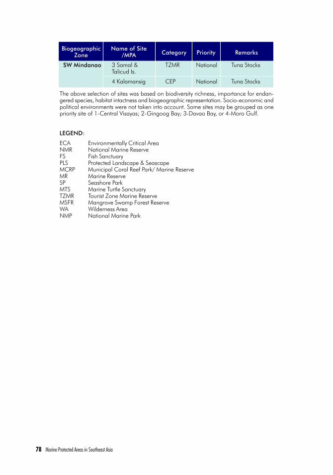
78 Marine Protected Areas in Southeast Asia
3 Samal &Talicud Is.
4 Kalamansig
Tuna Stocks
Tuna Stocks
National
National
TZMR
CEP
BiogeographicZone
Name of Site/MPA Category Priority Remarks
SW Mindanao
The above selection of sites was based on biodiversity richness, importance for endan-gered species, habitat intactness and biogeographic representation. Socio-economic andpolitical environments were not taken into account. Some sites may be grouped as onepriority site of 1-Central Visayas; 2-Gingoog Bay; 3-Davao Bay, or 4-Moro Gulf.
LEGEND:
ECA Environmentally Critical AreaNMR National Marine ReserveFS Fish SanctuaryPLS Protected Landscape & SeascapeMCRP Municipal Coral Reef Park/ Marine ReserveMR Marine ReserveSP Seashore ParkMTS Marine Turtle SanctuaryTZMR Tourist Zone Marine ReserveMSFR Mangrove Swamp Forest ReserveWA Wilderness AreaNMP National Marine Park

Marine Protected Areas in Southeast Asia 79

80 Marine Protected Areas in Southeast Asia
SINGAPORE
(Refer to Map 2 of Appendix for MPA sites and other relevant areas)
Background Facts
Biogeographic Divisions : East Asian Seas VI (22)
Coastline : 193 km (WRI 1994)
Population : 2.9 M (MacKinnon 1997)
Population density : 4600/km2
Land area : 636 km2 (MacKinnon 1997)
Shelf to 200m depth : 640 km2
EEZ : none
Est. Coral Reef Area :
Est. Mangrove Area : 22 km2 (MacKinnon 1997)
No. of islands : 60
No. of MPAs : 2 (2 others are terrestrial parks with marinecomponents)
Total Area of MPAs : 1,067 km2
Chou Loke Ming, Hazel O. Arceo, Catherine Cheung and Porfirio M. Aliño
7.1 Coastal and Marine EcosystemsThe coastal and marine ecosystems of Singapore are very limited and modified by
development and the port industry, which is one of the biggest income-earning busi-nesses in the country. Port limits extend to almost all the entire territorial waters, andreclamation has transformed almost the entire southern and northeastern coasts of themain island considerably (Chou 1995).
The steep beach front along the southeastern coast was once composed of sandybeaches and mudflats. Original rocky shores are found mainly on the southern offshoreislands and small parts of the northern coast. Around 22 km2 of mangroves (or less than1% of the original mangroves) remain in Singapore and none is protected (MacKinnon1997), except for 87 ha at the Sungei Buloh Nature Park. These are confined to isolatedpatches on the northern coast and northern offshore islands of Pulau Ubin and PulauTekong, and the eastern shore of Pulau Semakau in the south. The mangroves of PulauSemakau have since been cleared for the large offshore landfill, but the project involvesreplanting of mangroves at other sites of Pulau Semakau in order to maintain the eco-system. Seagrass beds can be found on the extensive reef flats of Cyrene reef and west ofPulau Semakau.
7.2 Significant SpeciesThe coral reefs are exceptionally diverse (197 species of scleractinian corals from 55
genera) despite the high turbidity in Singapore waters (Chou 1995). There are 31 man-

Marine Protected Areas in Southeast Asia 81
grove and 11 seagrass species found in the country (Spalding 2000). Marine turtles(Green, Hawksbill, Ridley’s), dugongs, dolphins (Indo-Pacific humpback) and four spe-cies of giant clams are also known to occur.
7.3 Legislation and Management FrameworkThe most significant government document regarding nature conservation and envi-
ronmental management is the national concept plan “Living the Next Lap” or GreenPlan” of 1991 (Chou and Goh 1998). The Plan mandates that 5% (3,310 ha) of thetotal land area be set aside for nature conservation. It has been further developed forimplementation by an Inter-Ministerial Steering Committee, under which the Ministry ofNational Development and other government agencies and a non-governmentorganisation (NGO) form a workgroup. In 1993, an Action Programme of the GreenPlan was passed to ensure the designation of 19 land conservation areas and protectionof four coral reef areas against commercial harvesting. The latter involves strengtheningenforcement by the Coast Guard, monitoring of water quality and reclamation projects,and awareness programmes. The Land Office grants coral collect permits only for scien-tific, conservation and research purposes. The “Green Plan” is presently under reviewand public consultation is being sought for the preparation of “Concept 2001”.
There are currently no specific laws for the protection of mangrove forests and exist-ing seagrass beds (ICRI 1997).
The Maritime and Port Authority (MPA) of Singapore is responsible for marine environ-ment protection from sea-based activities. MPA espouses a comprehensive approach to-wards the protection of the marine environment, based on prevention and preparedness.
Non-government organisations (NGOs) such as the Nature Society (Singapore) andthe Singapore Environmental Council are actively assisting in raising public and govern-ment awareness on environmental protection and nature conservation. The Republic ofSingapore Yacht Club, Singapore Institute of Biology, and Singapore Underwater Fed-eration jointly launched a reef survey and conservation planning programme in 1987,which resulted in the proposal of the four coral reef areas for conservation. CurrentNGO initiatives include coral translocation, reef protection, and education projects.Since 1996, a Singapore Reef and Marine Conservation Committee was formed tocoordinate reef and marine conservation efforts. It is composed of representatives fromRaffles Marina, Republic of Singapore Yacht Club, Singapore Institute of Biology, SingaporeUnderwater Federation and Nature Society (Singapore).
7.4 Extent of Existing Marine Protected Areas (MPAs) System
A network of 259 ha. of mangrove areas (about 50% of all remaining mangroveareas) is conserved, many of which are integrated into development projects nearby.
Only two locations are considered as MPAs. The first is the 87-ha Sungei Buloh NaturePark located along the northern coast of the mainland. It is a coastal mangrove habitat.The second is a group of southern offshore islands (St. John’s, Kusu, Lazarus and Sister’s)designated as a Marine Nature Area in 1996. These extend to about 500 ha.

82 Marine Protected Areas in Southeast Asia
7.5 Proposed Marine Protected AreasKhatib Bongsu mangrove is being proposed to be designated as a nature park (Chou
1995). Four coral reef areas (total 3,725 ha) have been identified for protection in theAction Programme of the Green Plan: St.John’s Islands, Pulau Hantu, Pulau Semakauand Pulau Sudong, all in the south (Cheung 1995). Of these, the St. John’s group ofIslands was designated as a Marine Nature Area in 1998. There are no other MPAs inSingapore.
7.6 Evaluation of MPAs - Status, Threats and ManagementThe Sungei Buloh Nature Park is effectively managed and backed by adequate sur-
veillance and enforcement. It has a suitable monitoring and research programme tosupport management planning. In contrast, the St. John’s group of islands, designatedas Marine Nature Area, has no clear management plan. Whatever form of managementthere is appears to be confined to the terrestrial component of the islands where certaintrees/plants considered to be of natural heritage value cannot be destroyed. Little canbe said about the management of the marine component except for the insistence ofEnvironmental Impact Assessments (EIAs) in connection with the proposed developmenton the islands (EIAs are not mandatory in Singapore). Furthermore, there is no surveil-lance or enforcement activity for the marine environment. Over the past few years, thereefs have suffered from the impacts of heavy sedimentation from human activities (landreclamation and dumping of earth spoils) at locations beyond the islands’ grouping.
Coastal development stands as the most serious threat to the coastal and marineenvironment (Figure 7.1). At least 60% of the fringing reefs in the south have beenburied by reclamation or transformed into swimming lagoons (Chou 1995). Dredgingand marine dumping have also greatly contributed in increasing the sedimentation loadingof the waters.
7.7 Gaps in the Existing Marine Protected Area System
Considering the intense competition among users of the limited coastal and marineareas, few areas can be identified for complete protection. Any reef area identified forprotection will have to permit multiple use. There is then a growing need to address thelack of institutional mechanisms to establish an integrated management strategy forcoastal waters and resources (ICRI 1997).
Enforcement/Management. Marine park management has often focused on ac-commodating visitor use rather than on resource protection and enforcement (ICRI 1997).Serious conflicts between resource users as well as jurisdictional conflicts have alsolimited the effective management of MPAs. Another problem is the lack of marine con-servation interest on the part of various agencies with jurisdiction over different islands.Most are developing the islands for purely economic reasons and appear unaware ofthe spirit of the Convention on Biological Diversity, and Chapter 17 of Agenda 21 of theUnited Nations Conference on Environment and Development (Rio de Janeiro 1992).

Marine Protected Areas in Southeast Asia 83
7.8 Priority Sites
The Sungei Buloh Nature Park (87 ha) declared in 1993 may be considered of re-gional priority due to its importance for migratory birds. The three proposed coral reefareas that have yet to be declared for protection are of national significance as theycontain the only substantial reefs remaining in the country. Their value in terms ofbiodiversity, education and awareness building is highly significant despite their smallsize and disturbed state.
7.9 Priority Actions
The current review of the Green Plan will address the deficiencies that became appar-ent over these years. These include the lack of a relevant management agency particu-larly for marine nature conservation. This is a major problem, as no agency appearswilling to handle the responsibility of managing marine living resources.
Figure 7.1. The different environmental threats that affect the coral reefs of Singapore (Burkeet al. 2002)

84 Marine Protected Areas in Southeast Asia
BLANK PAGE

Marine Protected Areas in Southeast Asia 85

86 Marine Protected Areas in Southeast Asia
THAILAND
(Refer to Map 9 of Appendix for MPA sites and other relevant areas)
Background Facts
Biogeographic Divisions : East Asian Seas – I (3,4,5), VI (21)
Coastline : 3,200 km (MacKinnon 1997)
Population : 60.8 M (1997) – (Clarke 1999)
Population density : 118/ km2
Land area : 513,517 km2 (MacKinnon 1997)
Shelf to 200m depth : 257,600 km2
EEZ : 85,800 km2
Est. Coral Reef Area : 153 km2 with 40.3% under protection (Chansang 2000)
Est. Mangrove Area : 1,946 km2 (MacKinnon 1997)
No. of islands :
No. of MPAs : 23 ( 2 designated as non-hunting areas)
Total Area of MPAs : 5,819 km2
Hazel O. Arceo and Catherine Cheung with contributions from Hansa Chansang and Piyathip Eawpanich
8.1 Coastal and Marine EcosystemsThe coastline of Thailand falls under the influence of two oceans; the East Coast
forms the Gulf of Thailand, which belongs to the Pacific, and the West Coast borders theAndamen Sea facing the Indian Ocean. The coral reefs, which are mostly small fringingreefs, are found both in the Gulf of Thailand (74.8 km2) and the Andaman Sea (78.56km2) (Chansang 2000). Due to the strong Southwest monsoon especially from May toOctober, most reefs are found on the eastern sides of these islands, notably along theSurin-Similan chain of islands. Mangrove development is favoured in the Gulf of Thai-land due to high sedimentation rates while the growth of corals is limited to islands farfrom the shore and at lower diversity than in the Andaman Sea. Around 1,946 km2 ofmangroves remain, and only 2.2% (or 261 km2) of these is protected (MacKinnon 1997).
8.2 Significant SpeciesA total of 240 species of scleractinian coral in 67 genera have been recorded in
Thailand (Spalding 2000). There are over 300 major reef groups covering an estimatedarea of 12,000 km2 divided into four areas: i) inner part of the Gulf of Thailand (Chonburi);ii) east side of the Gulf (Rayong and Trad); iii) west side of the Gulf (Prachuap Kirikhan,Chumporn, and Surathani); and iv) along the Andaman Sea coastline (Ranong, Phuket,Phang-Nga, Krabi, Trang, and Satun), where about 55% of Thailand’s reefs occur(Wilkinson 1998). About 35 species of mangroves and 15 species of seagrass havebeen reported (Spalding 2000).

Marine Protected Areas in Southeast Asia 87
Five species of marine turtles (Green, Hawksbill, Loggerhead, Olive Ridley and Leath-erback) have been recorded in Thailand (UNEP/IUCN 1988). Dugongs are found mainlyalong the southern part of the West Coast in the Andaman Sea and the eastern part ofthe Gulf of Thailand (Nateekanjanalarp and Sudara 1992).
8.3 Legislation and Management FrameworkThe establishment of national parks and fish sanctuaries falls under the National Park
Act of 1961 and Fisheries Law of 1947. Furthermore, under the National EnvironmentQuality Act, certain areas can be declared as “areas under protection,” and any mea-sures deemed necessary can be imposed (Chansang 2000).
In 1993, the Department of Fisheries initiated a programme for marine and fisheriesprotected areas to enhance the protection and conservation of breeding grounds in theGulf of Thailand (Agenda 21). Since 1995, the Department also has been implement-ing a coral reef management programme, which includes research, training and publiceducation, for reefs outside marine parks (Chansang 2000).
There are five categories of protected areas: national parks, national marineparks, wildlife sanctuaries (in some translations, “wildlife conservation areas”), for-est parks and non-hunting areas. National marine parks exist primarily to protectareas of coastal habitat and islands, and appear to have little relevance to water-shed management; some, however, extend inland to include even mountainous ter-rain (from Clarke 1999):
The National Park Act of 1961 states that a national park is to be, ‘preserved inits natural state for the public’s education and enjoyment’. National marine parkshave similar functions. Most are former national parks that have been reclassified.
The Wildlife Protection and Preservation Act of 1960 states that wildlife sanctuar-ies are areas for, ‘the conservation of wildlife habitat so that wildlife can freely breedand increase their populations in the natural environment’.
Forest parks are forested areas that have at least one significant feature such aswaterfalls, large trees or geomorphologic formations. These are provided for underthe National Reserve Forest Act of 1964, with the chief purpose of providing sites forlocal tourism and recreation.
Non-hunting areas protect land that is open to consumptive uses such as fishingand gathering of non-timber forest products but from which hunting is excluded.
The government agencies responsible for MPA management are the Royal ForestDepartment (RFD), which is responsible for marine park management, and the Depart-ment of Fisheries, which is responsible for aquatic resource management (Chansang2000). The Marine National Park Division of the RFD is mandated to manage marineparks and implement the relevant laws and regulations.
The National Mangrove Committee formed in 1978 screens development projects tobe located in mangrove areas and acts as a policy advisory body to the government.The National Park Committee focuses more on marine parks.

88 Marine Protected Areas in Southeast Asia
There is a growing trend of community-based management of coastal and marineresource conservation with the assistance of NGOs, especially in southern Thailandwhere trial projects have been encouraging (Sudara 1995). An active non-governmentorganisation (NGO) network in Thailand is assisting communities with the local man-agement of coral reefs, and restoration of forests and mangroves (Wilkinson 1998).DANCED has funded NGOs to strengthen their activities but most of these activities arenot in MPAs (Piyathip, pers. comm.)
8.4 Extent of Existing Marine Protected Areas (MPAs) SystemTwenty-one National Marine Parks have been declared (Piyathip, pers comm.;
Chansang 2000). Two other MPAs have been designated as non-hunting areas but alsoencompass coral and mangrove habitats (see Table 8.1). Of the 21 National MarineParks, 13 parks include coral reef areas, most of which are located in the Andaman Seaand only five are located in the Gulf of Thailand (Chansang 2000). Approximately 60%of the coral reef area is included within a protected area. There is no available informa-tion on the Fisheries Sanctuaries.
8.5 Proposed Marine Protected Areas (MPAs)
There are no known officially proposed MPAs in the country.
8.6 Evaluation of MPAs - Status, Threats and ManagementConditions and Threats: Reef surveys under the ASEAN−Australian−LCR Project in-
dicated that over 60% of the major reefs had poor (<25%) or fair (25-50%) coral cover,and less than 36% had good (50-75%) or excellent (>75%) coral cover (Wilkinson et al,1994). In the Gulf of Thailand, coral cover and overall reef fish abundance were bothfound to be higher on the west coast than on the east where fishing pressure, includingdestructive methods using dynamite, poison, traps and spear guns, was higher(Satumanatpan and Sudara 1992).
Sedimentation, nutrient pollution from development on the land and overfishing (par-ticularly by large trawlers now fishing close to the reefs) are causing major damage tothe reefs of Thailand, and over 60% of the reefs has less than 50% live coral cover(Wilkinson 1998). Other activities such as conversion of mangrove forest to shrimpfarms, excessive tourism activities, and improper management of pollution in the areashave further contributed to the degradation of coastal habitats and resources. Further-more, oil and gas operations and transportation also increase the risk to the coastal andmarine environment (Agenda 21). Agenda 21 also mentions the main sources of pollu-tion affecting ocean and coastal resources. For land-based pollution, the primary sourcesare domestic sources, industrial development and tourism areas, especially beach re-sorts and agriculture and aquaculture activities. Pollution from non-point sources in-clude agriculture and urban runoff and coastal erosion. The primary sources of sea-based pollution are offshore oil and gas operations, wastes from maritime transporta-tion, shipping, oil spills, dredging and the red tide and harmful algal bloom.

Marine Protected Areas in Southeast Asia 89
The loss of seagrass beds in the Andaman Sea has been attributed to increasedsiltation and use of push nets and bottom trawls in fishing (Chansang and Poovachiranon1992). This may have contributed to the slow decline of the dugong population, espe-cially in the Gulf of Thailand, where they are not only killed accidentally by fishing gear,but are also intentionally hunted for food (Nateekanjanalarp and Sudara 1992).
Results from the questionnaire for ranking the threats to MPAs indicate that overall,domestic pollution and development are perceived as the most serious threats, followedby tourism activities, siltation at sea and destructive fishing (Figure 8.1). The latterincludes not only dynamite and cyanide fishing, but also illegal trawling at a few sites,though these activities are becoming less of a threat as tourism becomes heavier. Ingeneral, over fishing and destructive fishing intensify at sites in the Andaman Sea wheredevelopment and pollution are less prominent than in the Gulf of Thailand (Table 8.2).Although not indicated in the graph, local outbreaks of the crown-of-thorn starfish havebeen reported in the Gulf of Thailand and the outbreaks in the Andaman Sea haveincreased significantly since 1982 (Sudara 1995).
Collection of other marine resources (particularly seashells) as tourist souvenirs andfor export and aquarium fish trade seems to have an equally damaging impact as that ofdestructive fishing outside established parks. Despite the ban on coral collection since1978, local collection of coral for sale as souvenir and for export still existed in the late80’s (Sudara and Nateekarnchanalap 1988). When tourism boomed in the 1980s,there was a rush for development resulting in a lack of planning. Beach areas such asPattaya, became internationally infamous as examples of how development can lead toenvironmental degradation and pollution. These problems have now shifted to the is-lands in the Gulf of Thailand and Andaman Sea. In recent years, Hat Nopharat Thara -Mu Ko Phi Phi and Khao Laem Ya - Mu Ko Samet have been affected by the rapid growthin tourism activities (Table 8.2). In just one year of tourist resort development on theislands of Samui, Pha Ngan, Tao and Ang Thong Marine National Park, coral reefs weresignificantly degraded to a cover of 20% (Sudara 1995). Although the revenue gener-ated from the tourism industry is high (e.g. Phuket earned 127 M baht or US$ 5M a yearfrom tour companies, tour boat operators, dive shops and curio shops; CRMP, 1991),environmental damage through habitat loss is usually not counted.
The large-scale clearance of mangroves for shrimp pond and development projects,though not directly addressed in this section, is one of the major causes of siltation on themarine environment and coral reefs. The destruction of mangroves is most severe in the Gulfof Thailand where only 0.5−8% of the original mangroves remains, the worst situationbeing in the inner part (Sudara 1995). Tin mining in mangrove swamp areas and shallowwaters by dredging have also caused the siltation and smothering of corals, notably inNW Phuket and Phangnga Bay (Chansang 1988; Chansang and Phongsuan 1994).
Management: Management of MPAs is generally weak, as the Marine National Divi-sion has a limited number of qualified staff and expertise and funds for marine resourcesand MPA management. Encroachment into and vandalism within MPAs often occur withlittle control. Mu Ko Similan and Mu Ko Surin are believed to be the best managed marineparks in the country although some degrees of degradation have occurred due to frequenttourism activities.

90 Marine Protected Areas in Southeast Asia
At Sattaheep south of Pattaya in the eastern Gulf of Thailand, the Navy strictly patrolsthe islands for turtle conservation, which also keeps the coral communities in very goodcondition (Sudara 1995). The proposed management plan of the west Gulf of Thailand(including Ang Thong, Samui and Pha Ngan Islands) divided the coral reefs into threezones for preservation, common uses or conservation, and private development (Sudaraet al. 1991).
Figure 8.1. Threats to MPAs of Thailand (top) (Cheung 1995) and to the country’s coral reefs ingeneral (bottom) (Burke et al. 2002).

Marine Protected Areas in Southeast Asia 91
8.7. Gaps in the MPA SystemThe National Park Act does not currently have specific provisions for marine parks
(Wells 1988).
Enforcement/Management. Marine park management has often focused on ac-commodating visitor use rather than on resource protection and enforcement (ICRI 1997).Serious conflicts between resource users as well as jurisdictional conflicts have alsolimited the effective management of MPAs. The major problems in marine park manage-ment has been improper planning in designating park areas, lack of manpower andequipment, lack of proper management plan, and inadequate technical know-how ofpark officials (Chansang 2000).
Public Participation and Education. Public participation or involvement in all as-pects of marine resources management, from policy formulation to actual manage-ment, should be encouraged and continued. Public involvement is starting to be em-ployed in coral reef management, especially in reef areas outside marine parks (Chansang2000). Awareness campaigns may also need to be strengthened to facilitate publicinvolvement in management matters.
8.8 Priority Sites
Among the 16 national parks, three are recognised internationally as globally signifi-cant: Mu Ko Similan and Mu Ko Surin form a World Heritage Site and Khao Sam Roi Yotis a RAMSAR site. Tarutao, though rejected as a World Heritage Site, is now an ASEANHeritage Site and warrants regional priority due to its relatively undisturbed reefs despitethe occurrence of crown-of-thorns infestation, some dynamite fishing and siltation fromlogging. Ao Phangna, which contains the last remaining substantial stand of mangrovesin the country and Hat Chao Mai, which is important for dugongs and has relativelyundisturbed coral reefs, are rated as national priority sites. Changthaburi-Trat is anotherpriority area for dugong conservation.
8.9. Priority Actions
Many of the recommendations focus on finding ways to strike a balance between short-term economic benefits and sustainable environment and development, which has beenidentified as the major obstacle against success in the management of MPAs and marineconservation as a whole.
A. Carry out research on economic gains from conservation versus costs due to envi-ronmental degradation and/or loss, and disseminate the findings to governmentand decision makers.
B. Study the issue on eco-tourism devlopment to generate guidelines that wouldminimise impacts on the environment.
C. Develop monitoring and restoration programmes on critical and damaged habitats.
D. Promote informal public education with emphases on protected areas and en-dangered species; strengthen dugong conservation activities.

92 Marine Protected Areas in Southeast Asia
Table 8. National marine parks (IUCN category II) of Thailand.
The first 16 national marine parks listed below were former national parks from vary-ing times between 1966 (when Khao Sam Roi Yot was declared) up until 1993, when aseparate management structure was created.
1. Khao Sam Roi Yot 98 21 No data
2. Tarutao 1,490 1,264 12.58
3. Thaleban 196 2 No data
4. Mu Ko Ang Thong 102 84 3.54
5. Ao Phang Nga 400 347 No data
6. Mu Ko Surin 135 103 12.01
7. Sirinath 90 68 2.06
8. Khao Laem Ya-Mu Ko Samet 131* 123 2.03
9. Hat Chao Mai 231* 137 1.29
10. Mu Ko Similan 140** 124 3.39
11. Mu Ko Chang 650 458 4.49
12. Laem Son 315 267 No data
13. Hat Nopharat Thara-Mu Ko Phi Phi 388* 326 7.77
14. Mu Ko Phetra 494 468 4.77
15. Khao Lam Pee-Hat Thai Muang 72 0 none
16. Mu Ko Lanta 134 109 8.24
17. Khao Lak-Lam Ru 125 0 none
18. Had Vanakorn 38 15 No data
19. Mu Ko Chumporn** 317** 0 3.52
20. Tarn boke Khoranee** 104** 266 0.42
21. Lam Nam Kraburi 160* 64 No data
Total national marine parks 5810 4246 66.11
22. Thale Sap 364.7
23. Pa Len Pak Phanang-Pa Len Ko Chai... 56.7
Total non-hunting areas 421.4
Size (km2)(land +marineareas)
Area ofmarine*(km2)
Area ofcoral
reefs**(km2)
MPA Name
(Clarke 1999)* Piyathip, pers.comm.** Chansang 2002
E. Develop national and regional databases on MPAs with frequent inputs from andexchange among nationals.
F. Strengthen networking of environmental NGOs within the country.
G. Review the MPA system and identify where MPA plans are being implemented andwhere enforcement is working. Use these MPAs as models for others.
A National Coral Reef Monitoring Program has been proposed, especially as Thailand’stourism industry and coastal development continues to expand in the coming years (ICRI1997).

Marine Protected Areas in Southeast Asia 93

94 Marine Protected Areas in Southeast Asia
VIETNAM
(Refer to Map 10 of Appendix for MPA sites and other relevant areas)
Background Facts
Biogeographic Divisions : I (1) and I (2)
Coastline : 3,260 km
Population : 78 M (1998)
Population density : 217/ km2
Land area : 332,000 km2 (MacKinnon 1997)
Shelf to 200m depth : 3,279,000 km2 (WRI 1994)
EEZ : 1,000,000 km2
Est. Coral Reef Area : 1,300 km2 (Spalding 2000)
Est. Mangrove Area : 1,100 km2 (ADB 5712 - REG)
No. of islands : 3,000+
No. of MPAs : 22
Total Area of MPAs : 2,576.5 km2
Hazel O. Arceo, Vo Si Tuan and Catherine Cheung
9.1 Coastal and Marine EcosystemsThe coastline of Vietnam extends for some 3,260 km through more than 15 degrees
of latitude from 8º30’ N to 23º N and shows a variation in climate and biodiversityalong this broad N-S cline. The country has more than 3,000 inshore and offshoreislands and islets that extend to claims covering the Spratly and Paracel Islands. Coralreefs are the richest marine habitats in the country with the greatest diversity of species.All coral reefs in the north are fringing; the more complex coastline and insignificanteffect of rivers in the south has also favored the development of fringing as well asplatform reefs. Atolls in the Spratly Islands enclose reefs hundreds of meters long andhave a high species diversity and cover. The most extensive tracts of seagrass occur inthe Thuy Trieu lagoon of Khanh Loa province with some 800 ha. The offshore islands ofCon Dao and Phu Quoc also have extensive tracts of seagrass beds of 200 ha and 300ha, respectively. Estuaries, river deltas, coastal lagoons and river mouths, tidal marshes,mud and salt flats are the other coastal and marine habitats of the country; it is in theseareas where the country’s mangroves can be found.
Mangrove formations now cover less than 150,000 ha and can be found in manyareas along Vietnam’s coastline. Extensive mangroves occur on Mekong Delta in thesouth and Red River Delta in the north. The southern estuaries of the Mekong and DongNai rivers are the most favorable for mangrove growth. The lower temperatures andpoorer soils in the north have limited the height of trees. Although mangroves occuralong the central coast, the narrow tidal flats in this region combined with poor sedi-mentation from rivers, and exposure to typhoons and floods offer less favourable condi-tions for growth in some of the regions that are most disaster prone.

Marine Protected Areas in Southeast Asia 95
9.2 Species of SignificanceOver 300 species of scleractinian corals are found in Vietnam’s coastal waters with
277 species belonging to 72 genera identified in the south, compared with the less diverseareas in the north of the country with 165 species in 52 genera. Fourteen seagrass specieshave been recorded in the shallow coastal waters of Vietnam, with species diversity in-creasing from the north with nine species, and to the south with 13. There are around 32true mangrove species and another 32 associate mangrove species.
Marine turtles include the Green (Chelonia mydas), the Hawksbill (Eretmochelysimbricata), the Loggerhead (Caretta olivacea) and the Olive Ridley (Lepidochelys olivacea),all of which have traditional nesting sites along the coast. Despite legal protection, theturtles are still hunted and their eggs collected. Northern populations are almost wipedout so most of the catch now comes from the south and mainly on islands and waters farfrom the mainland. They are very rare along the coast now except at Con Dao islandswhere they are protected by the National Park. Today, the endangered Dugong (Dugongdugon) is known to inhabit the waters of Con Dao islands. A dugong was captured nearNha Trang in 1962, and the animals were previously known to occur in the Tonkin Gulf,Phu Quoc islands of Thailand Gulf. Sixteen Cetaceans including one baleen whale and15 toothed whales (dolphins and porpoises) have thus far been sighted in Vietnamesewaters, though other species are likely to occur.
9.3 Legislation and Management FrameworkThe Law on Environmental Protection (LEP), which was passed by the National As-
sembly on 27 December 1993 but came into effect on 10 January 1994, sets out abroad and basic framework for policies on environmental protection. Chapter II pro-vides for the prevention of and combat against “environmental degradation, pollutionand incidents”. Chapter III outlines the remedies to be adopted against these environ-mental threats. The state apparatus and institutions for environmental protection are setout in Chapter IV, and the country’s international obligations with respect to environ-mental protection treaties are established by Chapter V. Chapter VI deals with breachesand violations of the LEP, and Chapter VII anticipates implementing provisions to enforcethe LEP. However, the lack of specificity of the LEP has resulted in many environmentalissues left without legal regulation. These include overlapping jurisdiction amongst gov-ernment bodies, EIA requirements for specific industries, international treaty obligations,harmonisation of liability for environmental violations, and new issues such as trade andthe environment and the use of economic instruments to motivate compliance (Tan 2000).
In addition, the Ordinance on Fisheries Resource Protection contains specific regula-tions on fish catch, methods, seasons, etc. that are being enforced by the Department ofFisheries Resources Protection, which was established in 1993 under the Ministry ofFisheries (MoF).
The Ministry of Forestry has the mandate and responsibility over nature reserves,national parks and other protected areas on land including mangrove areas. However,there is as yet no government department clearly authorised to manage MPAs althoughthe Ministry of Fisheries and the Ministry of Science, Technology and Environment (MOSTE)

96 Marine Protected Areas in Southeast Asia
have both shown concern about the issue. Management of existing island reserves tendsto be more focused on the terrestrial area since these are run by the Forestry Depart-ment. The lack of a clearly identified responsible authority has been repeatedly empha-sized as the major obstacle against marine conservation, and specifically on MPA viabil-ity (Biodiversity Action Plan Planning Committee, 1994 draft; Roop et al. 1994).
Institutional and administrative complications have been an impediment to effectiveprotected area design and management in the country. The planning process is sectoral-driven and centrally-oriented, often resulting in planning conflicts at the provincial leveland little recognition of real on-the-ground needs at the district level. The Ministry ofAgriculture and Rural Development (MARD) through its Forest Protection Department(FPD) is the designated management authority for all protected areas in the country, butis primarily focused on the terrestrial (forested) ecosystems. There remains an institu-tional vacuum and a limited management capacity to cover the needs of the MPA com-ponent. The initial result has been that all coastal protected areas lacked marine com-ponents; when extensions to cover the marine environment were confirmed (as in thecase of Cat Ba), management and staff on the ground were ill-prepared to carry out theactivities necessary in managing the marine environment. The staff were mainly trainedfor terrestrial conservation. Up to the present, there is no agency solely responsible formarine conservation. This means that management effectiveness for marine environ-ment may be lower than as discussed.
Recently, the Vietnam Government authorised the Ministry of Fisheries (MoFi) todevelop a National Plan for Marine Protected Areas. The results of the project,ADB5712-REG, have been used in this plan. The MoFi plan has put emphasis on areas (15areas listed) with dominantly marine components, particularly coral reefs and seagrassbeds, and also includes a marine protected area in the Spratly archipelago. The plan,which is pending approval by the government, will consequently address the problem ofinstitutional vacuum. This means that Vietnam will have two systems responsible formanaging PA systems in the future. The FPD of MARD will continue to manage terrestrialPAs including mangroves, and the coastal forest ecosystem while MoFi will be respon-sible for the MPAs with the objective of conserving mainly coral reefs, seagrass beds,island ecosystems and marine living resources, some of which the FPD presently man-ages.
9.4 Extent of Existing Marine Protected Areas (MPAs) SystemEstablishing protected areas was considered as a tool toward the conservation of
coastal and marine ecosystems in Vietnam in 1986 when some reserves dominated bymangroves such as Ca Mau cape, Bac Lieu were established. In the same year, the 15,043-ha Cat Ba National Park was approved. The Park included some 5, 400 ha ofcoastal waters, making it the first protected area in the country with an approved marinecomponent. Further, based on the marine surveys they conducted, the OceanographicInstitute in Haiphong had recommended an expanded marine component for the parkbut which is awaiting formal approval.
At present, there are 31 existing protected areas considered relatively as coastal andmarine protected areas with the purpose to conserve coastal forest, mangroves, seagrass

Marine Protected Areas in Southeast Asia 97
beds and wetlands (WCMC/WRI 2002). Besides Cat Ba and Con Dao National Parksand Halong Bay World Heritage, the others do not include marine areas. Marine com-ponents of former terrestrial reserves such as Cat Ba and Con Dao national parks haveonly recently been recognized as integral components of these protected areas, but evenso they still need to undergo further expansion to cover critical marine habitats. Pres-ently, only a nominal proportion of Vietnam’s coastal and marine resources are includedin the existing protected areas system.
Of these MPAs, three are designated as protected landscape, two as national parks,and 16 as nature reserves (WCMC/WRI 2002). Halong Bay, which surrounds around3,000 islands, was approved in 1994 as an UNESCO World Heritage Site and estab-lished for its landscape qualities. The famous site covers up to 43,700 ha, including themarine environment. The Red River Estuary is included as a Ramsar site (Kelleher et al.1995).
Based on the criteria of the project of Reefs at Risk in Southeast Asia, only two areas(Con Dao National Park and Can Gio Biosphere Reserve) are considered as havinggood management, while 13 others belong to the medium level of management effec-tiveness. Meanwhile, almost all MPAs (18 out of 22) still need highly enforced protec-tion.
It should be noted that all existing areas have been mainly designed for terrestrialbiodiversity conservation.
9.5 Proposed Marine Protected Areas (MPAs)
Six of the seven MPAs proposed as a result of the World Wildlife Fund (WWF) MarineConservation Project (1992-1994) that was launched to carry out biodiversity, socio-economic surveys and conservation potential, have already been established. Throughsubsequent surveys conducted by the Institute of Oceanography in large level at the sitesproposed by the WWF project and other sites, MPAs representative for the coastal eco-systems of Vietnam have been selected.
9.6 Evaluation of MPAs - Status, Threats and Management
By the end of the American war, some 105, 000 ha of mangroves or 36% of the totalmangrove formation in South Vietnam have been destroyed by herbicides. Since thenmost of the mangroves that were defoliated have recovered naturally or through replant-ing. However, human migration to the coast has since caused serious negative impactsto the mangrove and other coastal ecosystems. Mangroves have been cleared for aquac-ulture (shrimp and fish) in most coastal provinces, and have even replaced areas for-merly used for agriculture. These activities impact even on mangroves inside protectedareas such as Ca Mau and Can Gio.
The development and expansion of industry along the coast is beginning to add tothe pollution load, particularly poisonous heavy metal waste, which is often releasedinto the sea without any attempts to reduce toxicity. The expansion of ports and unregu-lated bilge cleaning is now becoming a more frequent source of coastal pollution,

98 Marine Protected Areas in Southeast Asia
particularly in the northern areas of Quang Ninh and Haiphong. Other MPAs, such asCat Ba, Ha Long Bay, are also vulnerable to this threat.
Overfishing, especially non-selective and illegal forms using poisons, explosives andfine mesh nets, had decreased somewhat but is still serious in some provinces. Otherforms of non-selective fishing such as sluice traps, electric fishing, gill nets and thetraditional gia cao (pelagic trawling net) continue to take their toll on marine fisheries.Rapid resource assessment (RRA) interviews conducted in early 1999 revealed that de-structive fishing methods were an issue in 21 to 29 provinces. The magnitude of thisissue not only encompasses the indiscriminate killing of incidental species, small fry andseedlings necessary for stock regeneration, and environmental damage, but also thesource of community conflict both for resident and non-resident marine harvesters thathas arisen due to the use of these methods.
Live trade of groupers and other fish species for the Hong Kong and Chinese marketsoperate with impunity in the northern and central parts of the country, and even in theproductive waters near the Con Dao National Park. Figures are difficult to determine,but fishermen in these areas illegally take the fish and sell them at sea to larger ‘tenders’for onward transport. Divers use cyanide to poison and stun the fish, which in turn killcoral and other biota outright. This is one reason why the density of commercial fish isvery low even in the waters of many MPAs.
Management of the marine areas at all three sites is minimal or non-existent. This islargely because the two national parks are under the Forestry Department, which has noauthority in the sea and no expertise in marine resource management. Local expatriatesand scientists at Hon Mun had done some voluntary activities including the installationof moorings and awareness programs, which were supported by provincial departments,but the government had not provided official management or protection effort. Statusand threats at other undeclared MPAs also vary. Overall, overfishing, hunting of endan-gered species, destructive fishing and the curio trade have been identified as causing themost serious impacts on both the existing and undeclared coral reef MPAs (Figure 9.1).
Institutional Responsibility. The lack of any legal framework for MPAs means that,at the moment, no government agency has the clear mandate for MPA management inVietnam.
Protected Area Boundaries. At present, there are no regulations specifying theprocess and materials required for submitting boundaries of candidate sites as MPAswhen proposals are being made. A number of existing MPAs and current reserve pro-posals are without specific boundaries or have only vague boundary descriptions. Shouldconflicts arise with other forms of coastal development (i.e. locations of factories, ports,or shipping routes), MPAs with ambiguous boundaries will be open to compromise.
Status, Condition, and Biodiversity Significance of Existing Reserves. Many ofthe existing coastal and marine protected areas in the country are relatively small com-pared to what is required to support biodiversity conservation or protection objectives.Generally, a minimum size of about 10,000 ha is required for these types of ecosystemsto ensure ecosystem and biodiversity integrity; for the protection of far-ranging species,the area should be much larger. The average size of Vietnam’s 20 existing coastal and

Marine Protected Areas in Southeast Asia 99
Figure 9.1. Threats to MPAs of Vetnam (top) (Cheung 1995) and to the country’s coral reefs ingeneral (bottom) (Burke et.al 2002).
marine protected areas is slightly more than 11,000 ha, which is encouraging.
However, none of the coastal and marine protected areas is in pristine condition,and many are degraded. The significant threats to coastal and marine ecosytems ofVietnam in general are unregulated access, over-exploitation of ecosystem resources,and habitat destruction. Marine resources are being exploited everywhere along thecoasts of the country. As these resources decline, harvesting efforts increase, leading to

100 Marine Protected Areas in Southeast Asia
increasing use of destructive fishing methods. Low returns on inshore harvesting effortsare due to declining marine resources, primitive fishing methods, and increased compe-tition. The declining marine resources are in turn linked to the overall poverty context ofinshore marine harvesting households to fishing methods and to changes in the marineenvironment. The situation is further exacerbated by competition and conflicts for pro-vincial territorial resources by outsiders, especially fishers from other provinces and also,to some degree, by non-Vietnamese fishers.
Awareness and Knowledge of Coastal and Marine PAs. There is a lack ofawareness and knowledge of coastal and marine protected areas among coastal com-munities in Vietnam. Most of those interviewed during the surveys had virtually no ideaof what an marine protected area is, even if a marine protected area exists in theirprovince. Those who ventured to guess were familiar with land-based protected areas.More importantly, many coastal communities’ concept of what a protected area mightbe is strongly tied to the notion of restrictions on fishing, whether these restrictions areseason, fishing method and gear type, or species and size. Coastal communities arefamiliar and comfortable with this notion of a protected area. Also, this understandingof restrictions on resource use in a protected area does not necessarily mean permanentprohibition of access to and harvesting of biological resources. A number of communesindicated reluctance to support a coastal and marine protection area if it meant thatpart of the marine area would be permanently off limits to biological resource harvest-ing. As the existence and maintenance of MPAs largely depend upon strong publicsupport, any programme or project relating to MPAs must focus on raising communitysupport to overcome the information vaccum at the outset.
Biological Basis for Protected Area Planning. Vietnam’s present system of coastaland marine protected areas has evolved through a series of proposals made over theyears by different government departments including MARD, MoF, MOCI, and the prov-inces. The resulting system is a collection of protected areas that have been establishedfor diverse purposes. It is not certain if the current system has developed from a consis-tent physical, biological, and socio-economic information base with an objective ofensuring representative ecosystem coverage. For example, the last comprehensive bio-logical surveys of the existing protected areas were conducted about ten years ago, withonly a few conducted in the last three years and some with incomplete surveys. Thismeans that the current coastal and marine protected area system for Vietnam may notbe completely representative of the biodiversity of these ecosystems. In the absence ofsuch a systematic analysis, it cannot be confirmed if the requirements for an ecologicallymeaningful system of coastal and marine protected areas is being met in Vietnam.
Financial Support. One of the biggest constraints to the correct management ofcoastal and marine protected areas in Vietnam (as elsewhere in the region) is financial.Public sector financing of investments is insufficient to establish and effectively managereserves. Even the bigger national reserves such as Cat Ba and Con Dao National Parksare underfunded − now receiving US $10/ha each year from the public sector for capitaland operating expenses. Reserves that are not national parks receive even less. This lowlevel of funding places constraints on what could be achieved with respect to effectiveprotected area management.

Marine Protected Areas in Southeast Asia 101
All protected areas are severely understaffed. Currently, slightly more than 685 per-manent staff are charged with protecting and managing some 226,400 ha of coastaland marine environment in Vietnam’s 20 existing coastal and marine protected areas.
The low levels of public sector funding mean that very little is left for protected areamanagement itself: equipment and facilities; public awareness programs; reserve infra-structure; and monitoring, let alone basic operation and maintenance. The result is acoastal and marine protected area system in Vietnam that is under-equipped, lacking inbasic infrastructure and facilities, and consequently limited in its capacity to achievemanagement, conservation, and protection objectives. An unfortunate consequence ofall this is that opportunities for local participation in protected area planning and man-agement have been very limited.
Management Capacity. Most of the staff in Vietnam’s reserves have limited formaleducation and are guided by managers who lack formal training in protected areamanagement. Even in the most important reserves, only one or two university level staffare among the officers assigned to the protected areas. Training and capacity buildingis required at all levels of marine protected areas management, but present opportuni-ties for the type and quality of training required are limited in the country.
9.7 Priority SitesThe draft Coastal and Marine Protected Areas Plan made by the project ADB 5712 - REG
(Phase 2) had ranked 20 areas as priority. This proposed national system includes coastaland marine protected areas. Six MPAs have been prioritised for management strengthen-ing, and eight others for expansion and management strengthening; six new MPAs will beestablished. Among these MPAs, eight are being considered of highest priority. Theseinclude the Con Dao and Cat Ba National Parks, the Ca Mau and Phu Quoc-An ThoiReserves, the Ha Long Bay World Heritage Site, the proposed Phu Qui Nature Reserve, theCu Lao Cham Nature Reserve, the proposed Hon Mun Marine Park, and the proposed CuLao Cau Habitat Protected Area. The Draft Plan made by the Ministry of Fisheries agreedwith this list. Although not listed here, the Spratly Islands is of great regional (if not global)significance for marine biodiversity and resources conservation if sovereignty disputes canbe settled.
With this plan, the areas of marine ecosystems will be increased significantly. Theobjectives and details of the plan were summarized by Vo Si Tuan et al. (in press). Thereport is available at Vietnam’s MOSTE or WWF-Indochina in Ha Noi.
9.8 Priority Actions
A. Identify a government body or a consortium of government bodies to be respon-sible for the planning, implementation and coordination of MPA establishmentand management.
B. Revise laws and regulations to accommodate MPA management.
C. In the planning and management of MPAs, take into account ongoing and plannedcoastal development and master plans. The formulation of coastal master plans

102 Marine Protected Areas in Southeast Asia
should in turn consider the existence of MPAs.
D. Quickly select pilot sites for MPA management. Document the ecological andsocio-economic outcome at these sites in detail for dissemination to the govern-ment and local communities so as to encourage follow-up activities and newMPA sites to be managed. Small and easily managed sites such as Hon Cau andHon Mun would be suitable pilot sites.
E. Provide training for MPA planners, managers and staff.
F. Promote non-destructive fishing techniques and alternative livelihood programmes,especially in and around MPAs.
G. Promote public awareness on marine conservation and sustainable resource uti-lization.
H. Carry out baseline surveys and feasibility studies to less-known sites, especiallynon-coral reef areas, to identify sites of high conservation priorities.
I. Promote Integrated Coastal Zone Management (ICZM) in MPA management (Tuan,pers. comm.).

Marine Protected Areas in Southeast Asia 103

104 Marine Protected Areas in Southeast Asia
Map
1. T
ypes
of M
arin
e Pr
otec
ted
Area
s in
Sou
thea
st A
sia

Marine Protected Areas in Southeast Asia 105
Map
2. M
arin
e Pr
otec
ted
Area
s in
Bru
nei D
arus
sala
m;
Mal
aysi
a an
d Si
ngap
ore

106 Marine Protected Areas in Southeast Asia
Map 3. Marine Protected Areas in Cambodia.

Marine Protected Areas in Southeast Asia 107
Map 4. Marine Protected Areas in Central Indonesia

108 Marine Protected Areas in Southeast Asia
Map 5. Marine Protected Areas in Western Indonesia.

Marine Protected Areas in Southeast Asia 109
Map 6. Marine Protected Areas in Eastern Indonesia.

110 Marine Protected Areas in Southeast Asia
Map 7. Marine Protected Areas in Myanmar.

Marine Protected Areas in Southeast Asia 111
Map 8. Marine Protected Areas in the Philippines.

112 Marine Protected Areas in Southeast Asia
Map 9. Marine Protected Areas in Thailand.

Marine Protected Areas in Southeast Asia 113
Map 10. Marine Protected Areas in Vietnam.

114 Marine Protected Areas in Southeast Asia
BLANK PAGE

Marine Protected Areas in Southeast Asia 115
REFERENCES
Abdullah, A. and M.Hutomo, 1995. Indonesian Marine Conservation Areas -Status, Problem and Development. In. Proc. of Third Regional Workshop for theReview of the Protected Areas of the IndoMalayan Realm, 23-25 Jan. 1995, Cisarua,Bogor, Indonesia. Asian Bureau for Conservation, Hong Kong and PHPA-Directorateof Forest Protection and Nature Conservation, Indonesia.: 17pp.
Abesamis, R.A., P.M. Aliño and D.G. Jocson,(in press). From Muro-ami to Pa-aling: More than just a Question of Destructive Fishing. Mar. Poll. Bull.
Abu Talib, A. and M. Alias,1997. Status of Fisheries in Malaysia – An Overview. In:Silvestre G, Pauly D. Status and Management of Tropical Coastal Fisheries in Asia.ICLARM Conf. Proc. 53: 47-61.
Agardy and Pernetta, 1993. Papua New Guinea Conservation Needs AssessmentReport. Biodiversity Support Program, and Department of Conservation andEnvironment of Papua New Guinea
Agenda 21, (undated). Natural Resource Aspects of Sustainable Development inThailand
Aikanathan, S. and E.F.H. Wong,1994. Marine Park Island ManagementConceptual Plan for Peninsular Malaysia. Report produced under Project MYS 256/93by the Department of Fisheries, Malaysia and the World Wide Fund For Nature (WWF)-Malaysia, sponsored by Canada Fund-Malaysia. 136 pp.
Alcala, A.C. 1988. Effects of Marine Reserves on Coral Fish Abundances and Yieldsof Philippine Coral Reefs. Ambio vol. 17 no.3., pp. 194-199.
Alcala, A.C. and G.R. Russ, 1990. A Direct Test of the Effects of ProtectiveManagement on Abundance and Yield of Tropical Marine Resources. J. Cons. int.Explor. Mer. Vol.46: 40-47.
Aliño, P.M., 1984. The Effect of Mine Tailings on the Structure of Coral Communitiesat Toledo, Cebu. In. Koh, L.L. and C.S.Hew (eds) 1984. Proc. 3rd Symposium on OurEnvironment. National University of Singapore.: 281-292.
Aliño, P.M., H.O. Arceo, N. Palomar and A.J. Uychiaoco, 2000. Challengesand Opportunities for Community Participation for the Management of MarineProtected Areas (MPAs) in the Philippines. Paper presented at the 9th International CoralReef Symposium, Bali, Indonesia, 23-27 October 2000.
Aliño, P.M. and A.J. Meñez,1999. Cooperative monitoring and evaluation in theSouth China Sea: An opportunity for adaptive management of biodiversity. Paperpresented at the 4th International Conference on the Biology of the South China Sea,Diliman, Quezon City, Philippines, 20-22 October 1999, p.2.4.
Aliño, P.M., A.J. Uychiaoco, N.A. Bermas and E.D. Gomez, 1992. AssemblageStructure of Coral Reef Fish: Multi-scale Correlations with Environmental Variables. InChou,L.M. & C.R.Wilkinson (eds). Third ASEAN Science and Technology WeekConf.Proc. Vol.6, Marine Science: Living Coastal Resources, 21-23 September 1992,Singapore. Dept of Zoology,National University of Singapore & National Science &Technology Board, Singapore, pp 119-124.
Aliño, P. M, A.J. Uychiaoco, and R. T. Campos, (undated). The Relevance ofPhilippine Coral Reef Community Ecological Research to Coastal Zone and ResourceManagement Issues and Challenges. (Unpublished). Paper presented at the 1stNational Symposium-Workshop on Coral Reef Resources Management andConservation, Olongapo, Philippines.
Allison, W.R., 1995. Changes in the Maldivian Reef System. Coastal Managementin Tropical Asia. No.4, March 95, Colombo, Sri Lanka:6-8.

116 Marine Protected Areas in Southeast Asia
Andau,P.M., D.L.A.Alisaputra, J.Payne and J.B.Sale, 1993. Marine ProtectedAreas in Sabah, Malaysia. In Report of the EAS 25 Workshop: Case Studies onMarine Protected Areas in the East Asian Seas & The Workshop on a GlobalRepresentative System of Marine Protected Areas in the Southeast Asian Region, 8-12Feb. 93, Penang, Malaysia. UNEP-COBSEA/MOSTE/DOF and IUCN/World Bank/GBRMPA.: 106-115.
Anderson, R.C. and Hudha Ahmed, 1993. The Shark Fisheries of the Maldives.Ministry of Fisheries and Agriculture, Republic of Maldives, and Food and Agriculture
Organization of UN. 76pp.
Arceo, H.O., M.C. Quibilan, P.M. Aliño, G. Lim and W.Y. Licuanan, 2002.Coral Bleaching in Philippine Reefs: Coincident Evidences with Mesoscale ThermalAnomalies (Bull. MarSci 69 (2): 579-594
Arceo, H.O., M.C. Quibilan and P.M. Aliño, 2000. Patterns of Recovery ofBleached Reefs in the Philippines: The Importance of Management Strategies. (abstract).In: Proceedings of the 9th International Coral Reef Symposium, Bali, Indonesia. 23-27Oct.2000. D. Hopely and P.M. Hopely, J. Tamelander and T. Done. p.261.
Asian Development Bank (ADB), 1995, cited in GOI, 1997 but exact citation is notavailable
Asian Development Bank, 2000. Coastal and Marine Environment Management inthe South China Sea (East Sea), Phase 2. Viet Nam Coastal and Marine Protected AreasPlan.
Bagarinao, T.U., 1984. The Natural Life History of Milkfish. SEAFDEC AsianAquaculture Publication. Southeast Asian Fisheries Development Center, Tigbauan,Iloilo. 8(3):3-6.
Baldwin, M.F. (Ed.), 1991. Natural Resources of Sri Lanka - Conditions and Trends.A report prepared for the Natural Resources, Energy and Science Authority of Sri
Lanka.: 280 pp.
Baling, N., 1995. Philippine Marine Protected Area Management. In: Proc. of the3rd Regional Workshop for the Review of the Protected Areas of the IndoMalayanRealm, 23-25 Jan 95, Cisarua, Bogor, Indonesia. Asian Bureau for Conservation,Hong Kong, and PHPA— Directorate of Forest Protection and Nature
Conservation,Indonesia.
Basintal, P. and M. Lakim,1993. Population Status and Management of Sea Turtlesat the Sabah Turtle Island Park. In: Proc. of 1st ASEAN Symposium-Workshop onMarine Turtle Conservation, Manila, Philippines, 1993. WWF and USAID incooperation with PCP-PAWB-DENR Pawikan Conservation WB-DENR (PawikanConservation Project- Protected Areas & Wildlife Bureau) & Marine Turtle Foundation,Inc. (.MTF). pp 139-146.
Best, M.B., R.H.Djohani, A.Noor and G.Reksodihardjo, 1992. Coastal MarineManagement Programs in Indonesia: Components for Effective Marine Conservation.In Proc. of 7th International Coral Reef Symposium, Guam, 1992, Vol.2.: 1001-1006.
Biodiversity Action Plan Planning Committee, 1994. Biodiversity Action Plan forVietnam (Draft). 210 pp.
Bleakley, C. and S. Wells (eds.), 1995. East Asian Seas. In: Kelleher G, Bleakley C,Wells S (eds.). A Global Representative System of Marine Protected Areas, Vol. III. WorldBank, Washington, DC, USA
Burke, L., E. Selig and M. Spalding,2002. Reefs at Risk in Southeast Asia. WorldResources Institute, Washington D.C., U.S.A. 72pp.
Bohnsack, J.A.1994. Marine Reserves: They Enhance Fisheries, Reduce Conflicts andProtect Resources. Naga, ICLARM Q. 17 (3): 4-7.

Marine Protected Areas in Southeast Asia 117
Brown, B.E. and Suharsono, 1990. Damage and Recovery of Coral Reefs Affectedby El Nino- related Seawater Warming in the Thousand Islands, Indonesia. Coral Reefs8:163-170.
Bryant D, L. Burke, J. McManus and M. Spalding,1998. Reefs at Risk. A Map-based Indicator of Threats to the World’s Coral Reefs. World Resources Institute,Washington D.C., U.S.A. 56pp.
Cabanban, A.S. and A.C.Alcala, 1992. The Status of Coral Reef Resource Systemsand Current Research Needs in the Philippines. In: Munro, J.L. and P.E. Munro (Eds).The Management of Coral Reef Resource Systems. ICLARM Conference Proc. 344.ICLARM, Philippines.: 16-18.
Carpenter, Richard A. & J.E. Maragos, 1989. How to Assess EnvironmentalImpacts on Tropical Islands and Coastal Areas - South Pacific Regional EnvironmentProgramme (SPREP) Training Manual. Sponsored by Asian Development Bank,prepared by Environment and Policy Institute, East-West Center: 345pp.
Castañeda, P.G. and R.I. Miclat, 1981. The Municipal Coral Reef Park in thePhilippines. Proc 4th Int. Coral Reef Symp., 1:283-285.
CCD - Coastal Conservation Department, 1990. Coastal Zone ManagementPlan. CCD and Coastal Resources Management Project of the University of RhodeIsland, Colombo, Sri Lanka.: 80pp.
Chan, H.T., J.E. Ong, W.K. Gong and A.Sasekumar, 1993. The Socio-Economic,Ecological and Environmental Values of Mangrove Ecosystems in Malaysia and theirPresent State of Conservation. In: The Economic and Environmental Values of Man-grove Forests and their Present State of Conservation in the South-East Asia/PacificRegion. Clough, B. (Ed.). Mangrove Ecosystems Technical Reports. International Societyfor Mangrove Ecosystems, Okinawa, Japan.pp.41-81.
Chansang, H. 2000. Coral Reef Management in Thailand. Presented presented at the9th International Coral Reef Symposium, Bali, Indonesia, Oct. 23-27, 2000.
Chansang, H. 1988. Coastal Tin Mining and Marine Pollution in Thailand. Ambio17(3):223-228.
Chansang. H. and N. Phongsuan, 1994. Health of Fringing Reefs of Asia througha Decade of Change: A Case History from Phuket Island, Thailand. In: Ginsbury, R.N.(compiler) 1993. Proc. Colloquium on the Global Aspects of Coral Reefs: Health,Hazards and History, 1993. Rosenstiel School of Marine and Atmostpheric Science,University of Miami. pp 286-292.
Chansang, H. and S. Poovachiranon, 1992. Distribution of Seagrass Beds in theAndaman Sea. In: Chou,L.M. and C.Wilkinson (eds), 1992. Third ASEAN Scienceand Technology Week Conf. Proc., Vol.6, Marine Science: Living Coastal Resources,21-23 Sept 92, Singapore. Dept of Zoology, National Un iversity of Singapore andNational Science and Technology Board, Singapore. pp 277-280.
Cheng, H.K. 1994. The Economics of Conservation in Perak: IntegratingEnvironmental Economics Analysis into Resource Use and Planning - A Series of FourCase Studies. WWF Malaysia Project Report, August 1994.
Cheung, C. 1995. Review of the Protected Area System of the Indo-Malayan Realm.Asia Bureau for Conservation, Hong Kong.
Chou, L.M. 1995. Efforts to Conserve Singapore’s Marine and Coastal Ecosystems.Regional Seminar on Conservation of Marine and Coastal Ecosystems, 16-17 March1995, Kuala Lumpur. Malaysian Institute of Maritime Affairs.
Chou, L.M., M.W.R.N De Silva and A. T. White, 1992. Coral Reefs, Algae andSeagrasses. In: Chua TE, Chou LM, Sadorra MSM (eds.) Coastal Environment Profile ofBrunei Darussalam: resource assessment and management issues. ICLARM Tech. Rep.18. 193 pp.

118 Marine Protected Areas in Southeast Asia
Chou, L.M. and B.P.L. Goh,1998. Singapore Coral Reefs – Balancing Developmentand Conservation. In: Morton, B. (ed). The Marine Biology of the South China Sea,Proceedings of the Third International Conference on the Biology of the South ChinaSea, 28 Oct. – 1 Nov. 1996, Hong Kong, Hong Kong University Press, pp.355-368.
Choudhury, B.C., C.S. Kar and Bivash Pandav, 1994. A Status Survey of OliveRidley Sea Turtle (Lepidochelys olivacea) and its Nesting Habitats along the OrissaCoast, India. Wildlife Institute of India.: 30pp.
Chua, T.E.1997. Marine Pollution Prevention and Management in the East Asian Seas:A Paradigm Shift in Concept, Approach and Methodology. (Cited in Philippines TDA-SAP)
Chua, T.E., L.M. Chou and M.S.M. Sadorra, 1987. Coastal Environment Profile ofBrunei Darussalam: Resource Assessment and Management Issues. ICLARM Tech. Rep.18. 193 pp.
Chua, T.E., M.A.A.Agulto, F.Y.Guarin and S.C.Guerrero, 1989. Directory ofInstitutions and Scientists in the ASEAN Region Involved in Research and/orManagement related to Coastal Areas. 378pp. International Center for Living Aquatic
Resources Management, Manila, Philippines: 373.
Clarke, J.E. 1999. Biodiversity and Protected Areas. Regional Environmental TechnicalAssistance 5771: Poverty Reduction & Environmental Management in Remote GreaterMekong Subregion (GMS) Watersheds Project (Phase I).
Clark, J.R., 1994. Report of Consultant on Coastal Wetlands and Coastal Zones. :30pp.
Costanza, R., R. d’Arge, R. de Groot, S. Farber, M. Grasso, B. Hannon, K.Limburg, S. Naeem, R.V. O’Neill, J. Paruelo, R.G. Raskin, P. Sutton and M.van den Belt,1997. The Value of the World’s Ecosystem Services and Natural Capital.Nature 387:253-259.
Crosby, M.P. and K.S. Geenen,2000. Implementation, Chapter 6. In: AlternativeAccess Management Strategies for Marine and Coastal Protected Areas. A referencemanual for their development and assessment. M.P. Crosby, K.S. Geenen and R. Bohne(eds). 80-93.
Dalzell, P. and A. Wright, 1986. An Assessment of the Exploitation of Coral ReefFishery Resources in Papua New Guinea. In: J.L.Maclean, L.B.Dizon and L.V.Hosillos(eds). The First Asian Fisheries Forum. Asian Fisheries Society, Manila, Philippines.:477-481.
De Silva, M.W.R.N. and A. Rajasuriya, 1985. Management Plans for theProposed Marine Park at Hikkaduwa. Paper presented at the 41st Annual Session ofSri Lanka Association for Advancement of Science, 9-13 December, Colombo. :
Ditlev, H., M.W. Ranjith De Silva , A.R. Ridzwan, D. Toerring and S.Widt,1999. Hard Corals of Darvel Bay. pp. 73-84. In: De Silva, M.W.R., R.A.Rahman, S. Mustafa and A.S. Cabanban (eds.). Exkpedisi Galaxea ’98: A study oflivng marine resources of Darvel Bay, Sabah, Malaysia. Kota Kinabalu: Bizrank Sdn.Bhd. 116 pp.
Djohani, R. 2002. Protected Areas in the 21st Century: Strengthening a network ofprotected areas in Indonesia. In: Tsai H-M (Ed.) Proceedings of the Fourth Conferenceon the Protected Areas of East Asia: Benefits Beyond Boundaries in East Asia. TaiwanOrganizing Committee for the Fourth Conference of the Protected Areas of East Asia,Taipei, Taiwan.
DOF-Malaysia (undated). Marine Parks of Malaysia. Department of Fisheries Malay-sia, Ministry of Agriculture, Kuala Lumpur, Malaysia.
DOF-MIPR (Department of Fisheries-Ministry of Industry and Primary Resources),1992. Integrated Management Plan for the Coastal Zone of Brunei Darussalam.ICLARM Tech. Rep. 29. 122 pp.

Marine Protected Areas in Southeast Asia 119
Dolar , M.L.L., W.F. Perrin, A.A. Yaptinchay, S.A. Jaaman, M.D. Santos, M.N.Alava and M.S. Suliansa, 1997. Preliminary Investigation of Marine MammalDistribution, Abundance and Interactions with Humans in the Southern Sulu Sea. AsianMar Biol 14:61-81.
Doug, T. 1993. Vanishing coral reefs - Plundering threatens Tioman and other Asiantourist centres. Far Eastern Economic Review, 7 Jan 1993. pp 24-25.
EMDI (Environmental Management and Development in Indonesia) Project,1994. Taka Bone Rate National Park Management Plan Draft (1994- 2019) Vol.1Management Plan. EMDI in collaboration with Ministry of Forestry & Ministry of Statefor Environmentm & WWF-Indonesia Prog. 81pp.
Environment Planning and Coordination Section, 1994. Fisheries Statistics1989-1993. Ministry of Fisheries and Agriculture, Male, Republic of Maldives.:23pp.
EPU-GOM (Economic Planning Unit-Government of Malaysia), 1997.Implementation of Agenda 21: Review of Progress Made Since the United NationsConference on Environment and Development, 1992. Malaysia Country Report. URLhttp://www.un.org/esa/agenda21/natlinfo
Erftemeijer, P.L.A. and G.R.Allen, 1993. Fish Fauna of Seagrass Beds in SouthSulawesi, Indonesia. Rec.West.Aus.Mus. 16(2): 269-277.
Fattah, Q. A., 1979. Protection of Marine Environment and Related Ecosystems ofSt.Martin’s Island. Proc.. National Seminar Protection Marine Environment Rel.Ecosystems, Dhaka 27-29 November.: 104-108.
Fortes, M.D.1995. Seagrasses of East Asia: Environmental and ManagementPerspectives. RCU/EAS Technical Report Series No. 6. UNEP, Bangkok, Thailand.
Fortes, M.D.1994. Philippine Seagrasses: Status and Perspectives. In: Wilkinson, C.R.,S. Sudara and L.M. Chou (eds.). Proceedings, Third ASEAN-Australia Symposium onLiving Coastal Resources Vol. 1, Australian Institute of Marine Science, Townsville,Australia.
Fortes, M.D. 1990. Seagrasses: A Resource Unknown in the ASEAN Region.ICLARM Education Series 5. International Center for Living Aquatic ResourcesManagement, Manila, Philippines. 46pp.
Ginsburg, Robert N. (Compiler), 1994. Proceedings of the Colloquium on GlobalAspects of Coral Reefs: Health, Hazards and History, 1993. Rosentiel School ofMarine and Atmospheric Science, University of Miami.: 420pp.
GOBD,1997. Government of Brunei Darussalam’s Agenda 21 Report Update.updated Dec. 1998.
GOI, 1997.(Government of Indonesia). Implementation of Agenda 21: Review ofProgress Made Since the United Nations Conference on Environment and Develop-ment, 1992. Indonesia Country Report. URL http://www.un.org/esa/agenda21/natlinfo/countr/indonesa/ natur.htm
Ginsburg, Robert N. (Compiler), 1994. Proceedings of the Colloquium on GlobalAspects of Coral Reefs: Health, Hazards and History, 1993. Rosentiel School ofMarine and Atmospheric Science, University of Miami.: 420pp.
Gomez, E.D., P.M. Aliño, H.T.Yap and W.Y.Licuanan, 1994. A Review of theStatus of Philippine Reefs. Marine Pollution Bulletin, Vol.29, Nos 1-3: 62-68.
Gomez, E.D., P.M.Aliño, W.Y.Licuanan, and H.T. Yap, 1994. Status Report onCoral Reefs of the Philippines 1994. In: Wilkinson CR, Sudara S, Chou LM (eds.)Proceedings, Third ASEAN-Australia Symposium on Living Coastal Resources Vol. 1,Australian Institute of Marine Science, Townsville, Australia.
Gomez, E.D., A.C. Alcala, and A.C. San Diego, 1982. Status of PhilippinesCoral Reefs. In: Gomez ED (ed.) Proc. 4th Intl. Coral Reef Symposium, Manila,
1981. 1:275-285.

120 Marine Protected Areas in Southeast Asia
Gomez, E.D, R.T. Biña and C.A. Rodriguez, 1984. Marine Parks in ASEANCountries. In: Proc First Asian Forestry Congress, Book III, 6:811-820.
Government of the Socialist Republic of Vietnam and Global EnvironmentFacility, 1995. Biodiversity Action Plan of Vietnam. Ha Noi. VIE/91/g31.
Grandperrin, R. 1978. Importance of Reefs to Ocean Production. In: Crossland J,Granperrin R. South Pacific Commission (Noumea, New Caledonia) Fisheries Newslet-ter 16:11-13.
Groombridge, B. (ed.). 1993. 1994 Red List of Threatened Animals. IUCN, Gland,
Switzerland and Cambridge, U.K.
Hayden, B.P., G.C.Ray and R. Dolan, 1984. Classification of Coastal and MarineEnvironments. Environmental Conservation 11(3):199-207.
Hiew, W.P. 1995. Marine Protected Areas in Malaysia. In: Proc. of 3rd RegionalWorkshop for the Review of the Protected Areas of the IndoMalayan Realm, 23-25Jan 95, Cisarua, Bogor, Indonesia. Asian Bureau for Conservation, Hong Kong, and
PHPA - Directorate of Forest Protection and Nature Conservation, Indonesia.:
Hitipeuw, C., C. Raymakers, V.S. Ruhunlela, K.S. Putra, J.Lefmanut andM.van der Wal, 1994. Awareness and Education Programme for a CommunityBased Management of the Marine Resources in Southeast Aru Strict Nature Reserve. ACollaboration between PSL/EPM, Yayasan HUALOPU and PHPA/WWF. 21pp +.
Hodgson, G. 1992. An Alternative to Paper Parks. In: Yap Son Kheong & Lee S.W.(Eds) 1992. Proceedings of the International Conference - “In Harmony with Nature”,12-16 June 1990, Kuala Lumpur, Malaysia. : 158-165.
Hodgson, G. and J.A. Dixon, 1992. Sedimentation Damage to Marine Resources:Environmental and Economic Analysis. In: Marsh, J.B. (Ed.) Resources andEnvironment in Asia’s Marine Sector. Taylor and Francis, Bristol, PA, USA. 488pp.:421-445.
Hodgson, G. and J.A.Dixon, 1988. Logging Versus Fisheries and Tourism:Environmental and Economic Dimensions. Occasional Paper 7. Environmental and
Policy Institute, East-West Center, Honolulu, Hawaii, USA. : 95pp.
Hopley, D. and Suharsono (eds.), 2000. The Status of Coral Reefs in EasternIndonesia. Australian Institute of Marine Science, Townsville, Australia.
Huber, M.E., 1994. An Assessment of the Status of the Coral Reefs of Papua NewGuinea. Marine Pollution Bulletin, Vol.29, Nos.1-3: 69-73.
Husar, S.L. 1978. Mammalian Species. Dugong dugon. Am Soc Mammalogists 88:1-7.
Hutomo, M., H.Uktolseya, N.A.Sloan, A.Abdullah, R.H.Djohani, J.Alder,M.H.Halim and Sutardjo, 1993. Marine Conservation Areas in Indonesia: TwoCase Studies of Kepulauan Seribu, Java and Bunaken, Sulawesi. Paper presented atthe UNEP-COBSEA/MOSTE Workshop EAS25: Case studies in planning andmanagement of marine protected areas/parks/ reserves, Penang, Malaysia, Feb1993. 24pp.
ICRI, 1997. Report of the International Coral Reef Initiative (ICRI). Second RegionalWorkshop for the East Asian Seas held in Okinawa. Environmental Agency, Govern-ment of Japan, Tokyo, March 1997.
IIED/GOI, I, I, I, I, 1985. A Review of Policies Affecting the Sustainable Development of ForestLands in Indonesia. Vol. III. Background paper. International Institute for Environmentand Development/Government of Indonesia, Jakarta. 142 pp.
IUCN, 1988. 1988 IUCN Red List of Threatened Animals. IUCN, Gland, Switzerlandand Cambridge, U.K.: 154 pp.

Marine Protected Areas in Southeast Asia 121
IUCN, 1991. IUCN Directory of Protected Areas in Oceania. Prepared by the WorldConservation Monitoring Centre. IUCN, Gland, Switzerland and Cambridge, UK.:447pp.
IUCN, 1994. Guidelines for Protected Area Management Categories. CNPPA withassistance of WCMC. IUCN, Gland, Switzerland and Cambridge, UK.: 261pp+.
IUCN/WCMC, 1992. Protected Areas of the World: A Review of National Systems.Volume 1: Indomalaya, Oceania, Australia and Antarctic. Prepared by the WorldConservation Monitoring Centre (WCMC). IUCN, Gland, Switzerland and Cambridge,UK. xx+352pp.
Jacinto, G.S., P.M. Aliño, C.L. Villanoy, L.Talaue-McManus and E.D. Gomez,2000. The Philippines. In: Sheppard CRC. Seas at the Millenium: An EnvironmentalEvaluation. Volume II Regional Chapters: The Indian Ocean to the Pacific. PergamonPress (Elsevier).
Jackson, J. (Consultant), 1997. Top Dive Sites of the World. New Holland of (Publish-ers) Ltd., Singapore.
Japar, S.B. 1994. Status of Seagrass Resources in Malaysia. In: Wilkinson, C.R, S.Sudara and L.M. Chou (eds.), Proceedings, Third ASEAN-Australia Symposium onLiving Coastal Resources Vol. 1, Australian Institute of Marine Science, Townsville,Australia.
Kelleher, G. 1999. Guidelines for Marine Protected Areas. IUCN, Gland, Switzerlandand Cambridge, UK. xxiv+107pp.
Kelleher, G., C. Bleakley and S. Wells (eds), 1995. A Global RepresentativeSystem of Marine Protected Areas. Great Barrier Reef Marine Park Authority, The WorldBank and The World Conservation Union, Washington, D.C., USA, Volume 3, 147pp.
Kelleher, G. and R. Kenchington,1992. Guidelines for Establishing MarineProtected Areas. A Marine Conservation and Development Report. IUCN, Gland,Switzerland. vii + 79pp.
Kenchington, Richard A., 1990. Managing Marine Environments. Taylor & FrancisPub.: 248pp.
Khan, M.A.R., 1985. St.Martins - A Vanishing Coral Island of Bangladesh.Tigerpaper 12(4): 6-12.
Khan, M.A.R., 1986. Wildlife in Bangladesh Mangrove Ecosystem.J.Bomb.Bat.Hist.Soc. 83(1): 32-48.
Kiswara, W. 1994. A Review: Seagrass Ecosystem Studies in Indonesian Waters. In:Wilkinson, C.R., S. Sudara, L.M. Chou (eds.), Proceedings, Third ASEAN-AustraliaSymposium on Living Coastal Resources Vol. 1, Australian Institute of Marine Science,Townsville, Australia.
Kiswara, W. 1992. Community Structure and Biomass Distribution of Seagrasses atBanten Bay, West Java, Indonesia. In Chou, L.M. and C.R. Wilkinson (eds), 1992. ThirdASEAN Science and Technology Week Conference Proceedings, Vol. 6, Marine Science:Living Coastal Resources, September 1992. Dept. of Zoology, National University ofSingapore and National Science & Technology Board. pp.241-250.
Kwapena, N., 1995. Papua New Guinea Status Report on Marine and Coastal ZoneManagement and Protected Areas. In: Proceedings of the Review of the ProtectedAreas System of the IndoMalayan Realm Regional Workshop, 23-25 Jan 95,Indonesia. Asian Bureau for Conservation a Conservation a nd PHPA-Directorate forForest Protection and Nature Conservation, Indonesia.: 9pp.
Latin, Howard, 1994. Why Conservation By Legal Fiat Does Not Work? In:Ginsbury, Robert N. (Compiler), 1994, Proc. of the Colloquium on Global Aspects of
Coral Reefs: Health, Hazards and History, 1993. Rosentiel School of Marine andAtmospheric Science, University of Miami: 113-119.

122 Marine Protected Areas in Southeast Asia
Low, J., A. Arshad and K.H. Lim, 1994. ASEAN Mangroves as Important Centers ofBiodiversity and Habitats for Endangered Species. In: Living Coastal Resources ofSoutheast Asia: Status and Management. Report on the Consultative Forum, Bangkok,Thailand. Wilkinson, C.R. (ed.). May 1994. pp. 71-76.
MacKinnon, J. (ed.), 1997. Protected Areas Systems Review of the Indo-MalayanRealm. Asian Bureau for Conservation Ltd., Hong Kong, China and World Conserva-tion Monitoring Center, Canterbury, United Kingdom. 198 pp.
McManus, J.W. 1985. Marine Speciation, Tectonics and Sea Level Changes inSoutheast Asia. Proc 5th Int. Coral Reef Cong 4:133-138.
McManus, J.W., 1994. The Spratly Islands: A Marine Park?. Ambio. Vol.23, No.3.:181-186.
McManus, J.W., C.L. Nanola, R.B. Reyes Jr, and K.N. Kesner Jr. 1992. ResourceEcology of the Bolinao Coral Reef System. ICLARM Study Review 22. ICLARM,
Philippines. 117pp.
McManus, L.T. 2000. Transboundary Diagnostic Analysis of the South China Sea.UNEP/EAS/RCU, Bangkok. Thailand. 84pp + annex.
McNeil, S.E. 1994. The Selection and Design of Marine Protected Areas: Australia asa Case Study. Biodiversity and Conservation. 3:586-605.
Mahmood, N. and S.M.B. Haider, 1992. A Preliminary Study on Corals of StMartin’s Island, Bangladesh. Institute of Marine Sciences University of Chittagong.:
Marine Research Section, 1995. Protected Marine Areas in the Maldives (DiveSites). Ministry of Fisheries and Agriculture, Male, Republic of Maldives: 40pp.
Mee, J.K.L., 1993. An Overview of the Ornamental Aquatics Sector in Sri Lanka.The Agro-Enterprise Development Project, Colombo, Sri Lanka. AgEnt 08-93; AgEntConsultant Report No.01.: 50pp.
Mendoza-Robertson, D. and O.T. Giba, 1994. Resource Development andEconomic Growth in Papua New Guinea. East Asian Executive Reports: 6-24.
Miclat, R.I., P.M. Aliño, N. Aragones, C. Nañola Jr., and E. Aguilar, 1991.Pa-aling: An Alternative to Muro-ami? Philippine Journal of Fisheries. 22:29-38.
Ministry of Fisheries (Vietnam), 2000. Draft Plan to Develop the National Systemof Marine Protected Areas.
Ministry of National Development Planning/National Development PlanningAgency, 1993. Biodiversity Action Plan for Indonesia. Ministry of NationalDevelopment Planning/National Development Planning Agency, Jakarta. 141 pp.
Ministry of Science, Technology and Environment, 1992. Red Data Book ofVietnam. Volume 1. Animals. Science and Technics Publishing House.: pp.396.
Ministry of Fisheries (Vietnam), 2000. Draft Plan to Develop the National System ofMarine Protected Areas.
Mohd. Ibrahim Hj., Japar Sidik Bujang Mohamed and S. Aikanathan, 1993.Development Impact on the Coral Reefs and Mangroves of Palau Redang - PalauRevisited (Data till Feb. 1993). Report produced under Project MYS 223/91. WWFMalaysia, Kuala Lumpur, Malaysia. 37 pp.
Mohd. Ibrahim Hj, and Yusoh M. Mohamed, 1992. Monitoring the DevelopmentImpacts on the Coastal Resourcess of Palau Redang Marine Park by Remote Sensing.In: Chou, L.M. and C. Wilkinson (eds), 1992. Third ASEAN Science and TechnologyWeek Conference Proceedings, Vol. 6, Marine Science: Living Coastal Resources, 21-23 September 1992, Singapore. Dept. of Zoology, National University of Singaporeand National Science & Technology Board, pp.407-414.

Marine Protected Areas in Southeast Asia 123
Mohamed Shiham, Adam, 1994. Report of the Preliminary Assessment of theStatus of some of the Ornamental Fish Holding Facilities, July 1994. MarineResearch Section, Ministry of Fisheries and Agriculture, Male, Republic of Maldives.:15pp.
Moosa, M.K. 1995. cited in Hopley and Suharsono 2000 but exact citation is missingfrom their reference list.
Moosa, M.K. 1999. The Extent of Knowledge About Marine Biodiversity in Indonesia.In: Rais, J., I.M. Dutton, L. Pantimena, J. Plouffe and R. Dahuri R (eds.) IntegratedCoastal and Marine Resource Management Proc. Inter. Symp. Malang, 1998, 126-153.
Moosa, M.K., R. Dahuri, M. Hutomo, I.S. Suwelo and S. Salim (eds.), 1996.Indonesian Country Study on Integrated Coastal and Marine Biodiversity Management.Ministry of State for Environment, Republic of Indonesia, in cooperation with Director-ate for Nature Management, Kingdom of Norway: 189 pages, Annexes 166 pages.
Mortimer, J.A. 1992. Marine Turtle Conservation in Malaysia. In: Yap Son Kheong andS.W. Lee (Eds), 1992. Proceedings of the International Conference on TropicalBiodiversity - “In Harmony with Nature”, 12-16 June 1990, Kuala Lumpur, Malaysia.pp. 353-361.
Mortimer, J.A., 1991. Recommendations for the Management of Turtle IslandsPark, Sabah. Report produced under WWF Project No.3868. WWF Malaysia, KualaLumpur, Malaysia. March 1991.: 28pp.
Murdy, E.O. and C.J. Ferraris, 1980. The Contribution of Coral Reef Fisheries toPhilippine Fisheries Production. ICLARM Newsletter No.3. Intl’ Center for LivingAquatic Resources Management.: 11-21.
Nakatani,K., A.Rajasuriya, A.Peremaratne and A.T.White (Eds.), 1994.The Coastal Environmental Profile of Hikkaduwa, Sri Lanka. Coastal ResourcesManagement Project, Colombo, Sri Lanka.: 70pp.
Nateekanjanalarp, S. and S. Sudara, 1992. Dugongs and a Plan for theirManagement in Thailand. In: Chou, L.M. and C. Wilkinson (eds), 1992. Third ASEANScience and Technology Week Conference Proceedings, Vol. 6, Marine Science: LivingCoastal Resources, 21-23 September 1992, Singapore. Dept. of Zoology, NationalUniversity of Singapore and National Science & Technology Board, pp. 459-462.
Nontji, A. 2000. Coral Reefs of Indonesia: Past, Present and Future. Paper presentedat the 9th International Coral Reef Symposium, Bali, Indonesia, 23-27 October 2000.
Nystrom, M., C. Folke and F. Moberg, 2000. Coral Reef Disturbance andResilience in a Human-dominated Environment. Trends in Ecology and Evolution. Vol.15, No. 10. 413 – 417.
ONEB - Office of National Environmental Board, 1991. A National Coral ReefStrategy for Thailand, Volume 1. Statement of Nced. Office of National EnvironmentalBoard, University of Rhode Island, and U.S. Agency for International Development. :33pp.
Ong, P.S. 2002, Current Status and Prospects of Protected Areas in the light of thePhilippine Biodiversity Conservation Priorities. In: Tsai H-M (Ed.), Proceedings of theFourth Conference on the Protected Areas of East Asia: Benefits Beyond Boundariesin East Asia. Taiwan Organizing Committee for the Fourth Conference of theProtected Areas of East Asia, Taipei, Taiwan.
Ong, P.S., L.E. Afuang and R.G. Rosell-Ambal (Eds.) (2002). The PhilippineBiodiversity Conservation Strategy and Action Plan. Conservation International,Manila, Philippines.

124 Marine Protected Areas in Southeast Asia
Olsen,S., D.Sadacharan, J.I.Samarakoon, A.T.White, H.J.M.Wickremeratneand M.S.Wijeratne., 1992. Coastal 2000: A Resource Management Strategy for SriLanka’s Coastal Region, Volumes 1 and 2. Coastal Resources Management Project
and CCD, Sri Lanka.: 81+21pp.
Pajaro, M., F. Olano and B. San Juan, 1999. Documentation and Review of MarineProtected Areas in the Philippines – A Preliminary Report. Haribon Foundation for theConservation of Natural Resources.
Pauly, D., and V. Christensen, 1993. Stratified Models of Large Marine Ecosystems:A General Approach and An Application to the South China Sea, pp. 148-174, In:K.L. Sherman, M. Alexander and B.D. Gold (eds.), Large Marine Ecosystems: Stress,Mitigation and Sustainability, Washington, D.C.: American Association for the Advance-ment of Science, AAAS Press, 376pp.
Pauly, D., G. Silvestre and I.R. Smith, 1989. On Development, Fisheries andDynamite: A Brief Review of Tropical Fisheries Management. Natural ResourceModeling. 3: 307-329.
Pernetta, J.C. (ed.), 1993a. Marine Protected Area Needs in the South Asian SeasRegion. Volume 5: Sri Lanka. A Marine Conservation and Development Report.IUCN, Gland, Switzerland.: 67pp.
Pernetta, J.C. (ed.), 1993d. Marine Protected Area Needs in the South Asian SeasRegion. Volume 1: Bangladesh. A Marine Conservation and Development Report.IUCN, Gland, Switzerland.: 42pp.
Pernetta, J.C., 1993b. Marine Protected Area Needs in the South Asian SeasRegion. Volume 2: India. A Marine Conservation and Development Report. IUCN,Gland, Switzerland.: 77pp.
Pernetta, J.C., 1993c. Marine Protected Area Needs in the South Asian Seas Region.Volume 3: Maldives. A Marine Conservation and Development Report. IUCN, Gland,Switzerland.: 38pp.
Pernetta, J. and D. Elder, 1993. Cross-Sectoral Integrated Coastal Area Planning:Guidelines and Principles for Coastal Area Development, IUCN, Switzerland.
Pet, J.S. and C. Yeager (Eds), 2000. 25-Year master Plan for Management, KomodoNational Park (Book 1-3). Department of Nature Protection and Conservation, Ministryof Forestry, Jakarta. The Nature Conservancy and Komodo National Park.
PHPA, 1995. (Directorate-General of Forest Protection and Nature Conservation)cited in GOI 1997 but exact citation is not available
Prioyono, B.E. and B. Sumiono, 1997. The Marine Fisheries of Indonesia, withemphasis on the Coastal Demersal Stocks of the Sunda Shelf. In: Silvestre, G., and D.Pauly: Status and Management of Tropical Coastal Fisheries in Asia. ICLARM Conf.Proc. 53: 38-46.
Ramsar Convention Website. http://ramsar.org./wwd2000_index.htm
Rajasuriya, A. and M.W.R.N. de Silva, 1988. Stony Corals of Fringing Reefs of theWestern, South-western and Southern Coasts of Sri Lanka. In Proceedings of the 6thInternational Coral Reef Symposium, Australia, Volume 3.: 287-296.
Rajasuriya, A. 1993b. Present Status of Coral Reefs in Sri Lanka. In Proceedings ofthe Colloquium on Global Aspects of Coral Reefs: Health, Hazards & History, 10,11June 1993. Compiled by R.N. Ginsburg. University of Miami and InternationalSociety for Reef Studies. r Reef Studies. : 410-415.
Rajasuriya, A. 1993a. Distribution of Butterflyfish (Family Chaetodontidae) on Reefsin the West Coast of Sri Lanka. Paper presented at the Annual Scientific Sessions,.National Aquatic Resources Agency, Colombo, Sri Lanka.:

Marine Protected Areas in Southeast Asia 125
Rajasuriya, A. 1994. Three genera and twelve species of stony corals new to SriLanka (abs). Paper presented at the 2nd Annual Scientific Sessions of the NationalAquatic Resources Agency (NARA), Colombo, Sri Lanka. :
Rajasuriya, A. 1995. The Present Status of Marine Protected Areas in Sri Lanka. InProceedings of the Marine Sessions of Third Regional Workshop for the Review of theProtected Areas System of the IndoMalayan Realm, 23-25 Jan 95, Cisarua, Bogor,Indonesia. Compiled by Catherine Cheung.: 20pp.
Rajasuriya, A. and A.T. White, 1994. Coral Reefs of Sri Lanka: Review of theirExtent, Condition and Management Status. Coastal Resources Management Project,Colombo, Sri Lanka. Working Paper No. 05/1994.: 18+.
Reese, Ernst S., 1994. Reef Fishes as Indicators of Conditions on Coral Reefs. InGinsburg, Robert N. (Compiler), 1994, Proceedings of the Colloquium on GlobalAspects of Coral Reefs: Health, Hazards and History, 1993. Rosentiel School ofMarine and Atmospheric Science, University of Miami.: 59-65.
Republic Act. 8550. 1998. The Philippine Fisheries Code.
Richards, A. 1994. Live Reef Fish Exports to S.E. Asia from the South Pacific. SouthPacific Commission Fisheries Newsletter.
Richards, A. 1993. Live Reef Fish Export Fisheries in Papua New Guinea: CurrentStatus and Future Prospects. FFA Report No.93/10. Forum Fisheries Agency.: 15pp.
Risk, Michael J., J.J.Dunn, W.R.Allison and C.Horrill, 1994. Reef Monitoring inMaldives and Zanzibar: Low-Tech and High-Tech Science. In Ginsburg,R.N.(Compiler) 1994. Proceedings of the Colloquium on Global Aspects of Coral Reefs:Health, Hazards and History, 1993. Rosentiel School of Marine and AtmosphericScience, University of Miami.: 66-72.
Roberts, C.M., J.M. Colin, J.E.N. Veron, J.P. Hawkins, G.R. Allen, D.E.McAllister, C.G. Mittermeier, F.W. Schueller, M. Spalding, F. Wells, C. Vynne,and T.B. Werner, 2002. Marine Biodiversity Hotspots and Conservation Priorities forTropical Reefs. Science 295:1280-1284
Roop, J., A.Bansgrove, S.England, N.N.Sinh and H.C.Thang (eds), 1994. Stateof the Coastal and Marine Environment Report, Viet Nam - 1994. Prepared by ESSATechnologies Ltd., Vancouver, Canada for Vietnam-Canada Ocean Cooperation
Program (VCOP) 93pp.
Russ, G.R. and A.C. Alcala, 1999. Management Histories of Sumilon and ApoMarine Reserves, Philippines, and their Influence on National Marine Resource Policy.Coral Reefs 18:307-319.
Sardjono, I.1980. Trawlers Banned in Indonesia. ICLARM Newsletter 3(4):3.
Satumanatpan, S. and S. Sudara, 1992. Reef Fish Communities in the Gulf ofThailand. In: Chou, L.M. and C. Wilkinson (eds), 1992. Third ASEAN Science andTechnology Week Conference Proceedings, Vol. 6, Marine Science: Living CoastalResources, 21-23 September 1992, Singapore. Dept. of Zoology, National University ofSingapore and National Science & Technology Board, pp. 145-150.
Scott, D.A. (Ed), 1989. A Directory of Asian Wetlands. IUCN, Gland, Switzerland andCambridge, U.K. 1181 pp.
Sharma, Dionysius S.K. 1994. Management Recommendations for the Establish-ment of a Turtle Sanctuary at Kuala Setiu Baharu, Terengganu. WWF-Malaysia projectReport (Produced under Project MYS 255/93), March 1994. 34 pp.
SME-GOI, 1992. Agenda 21. Indonesia Country Report. URL http://www.un.org/esa/agenda21/natlinfo
Soehartono, T. 1994. Marine Turtle Conservation in Indonesia. In: Proceedings of theFirst ASEAN Symposium-Workshop on Marine Turtle Conservation, Manila, Philippines,1993. WWF and USAID in cooperation with PCP-PAWB-DENR and MTF. pp 75-86.

126 Marine Protected Areas in Southeast Asia
Soemodihardjo, S., P. Wiroatmodjo, A. Abdullah, G.M. Tantra and A.Soegiarto, 1993. Condition, Socio-Economic Values and Environmental Significanceof Mangrove Areas. In: The Economic and Environmental Values of Mangrove Forestsand their Present State of Conservation in the South-East Asia/Pacific Region. Clough,B. (Ed.). Mangrove Ecosystems Technical Reports . International Society for MangroveEcosystems, Okinawa, Japan. pp.17-40.
Spalding, M., F. Blasco and C. Field, 1997. World Mangrove Atlas. The Interna-tional Society for Mangrove Ecosystems, Okinawa, Japan. 178 pp.
Spalding, M., C. Ravillious and E.P. Green, 2001. World Atlas of Coral Reefs.University of California Press, California, USA.
Sudara, S. 1995. Management of Marine Protected Areas in Thailand - Striking aBalance Between Conservation and Development. Paper presented in the RegionalSeminar on Conservation of Marine and Coastal Ecosystems, 16 March 1995, MIMA-Malaysian Institute of Maritime Affairs, Kuala Lumpur, Malaysia.
Sudara, S. and S. Nateekarnchanalap, 1988. Impact of Tourism Development onthe Reef in Thailand. In: Proc. 6th International Coral Reef Symposium, Australia, 19882: 273-278.
Sudara, S., T. Thamrongnawasawat, S. Nateekarnchanalap and P. Kuanman,1991. Coral Reef Management Plan for Conservation and Tourism Development in theAng Thong, Samui and Pha Ngan Islands, in the Gulf of Thailand. In: Proc. RegionalSymposium on Living Resources in Coastal Areas, Philippines. pp. 573-579.
Suharsono, 2001. Marine Protected Areas in Indonesia: Country Report. Presented atthe Regional Workshop on Networking of Marine Protected Areas (Coral Reefs) in theEast Asian Seas, held at the Universiti Sabah Malaysia, Kota Kinabalu, Sabah,Malaysia, 8-12 October 2001.
Swartzendruber, J.F., 1993. Papua New Guinea Conservation Needs Assessment -Synopsis Report. Government of Papua New Guinea, Dept. of Conservation &
Environment; Biodiversity Support Program.: 24pp.
Talaue-McManus, L. 2000. Transboundary Diagnostic Analysis for the South ChinaSea. EAS/RCU Technical Report Series No. 14. UNEP, Bangkok, Thailand.
Tan, A.K.J. 2000. Preliminary Assessment of ASEAN Environmental Law. Asian PacificCenter for Environmental Law, National University of Singapore, Singapore. URL http://sunsite.nus.edu.sg/apcel/index.html
Tomascik, T., A.J. Mah, A.Nontji and M.K. Moosa, 1997. The Ecology of theIndonesian Seas. Periplus, 2 vols. 1388 pp.
UNEP, 1986. Environmental Problems of the Marine and Coastal Area of Sri Lanka:
National Report. UNEP Regional Seas Report and Studies No.74.:
UNEP, 1997. Integrated Management of Watersheds in Relation to Management andConservation of Nearshore Coastal and Marine Areas in the East Asian Seas Region:Phase 1 – Assessment of effects of river discharges of sediments, nutrients andpollutants on coastal wetlands, seagrass beds and coral reefs. A regional overview.RCU/EAS Technical Reports Series No. 13. UNEP, Bangkok, Thailand
UNEP, 2000. Report on the Workshop of Coral Reef Monitoring and Data Acquisition,Phuket, Thailand, 9-11 May, 2000. EAS/RCU, UNEP, Bangkok, Thailand (32 pages)
UNEP/IUCN, 1988. Coral Reefs of the World. UNEP Regional Seas Directories andBiobliographies. IUCN, Gland, Switzerland and Cambridge, U.K./UNEP, Nairobi,Kenya. Volumes 1-3
UNEP: Chia, L.S. and H. Kirkman, 2000. Overview of Land-Based Sources andActivities Affecting the Marine Environment in the East Asian Seas. UNEP/GPA Coordi-nation Office & EAS/RCU (2000) Regional Seas Report and Studies Series. 74pp.

Marine Protected Areas in Southeast Asia 127
Uychiaoco, A.J., P.M. Aliño and A.T. White, 2002. Marine Protected Areas in thePhilippines: Towards Harmonizing Goals and Strategies. In: Tsai H-M (Ed.). Proceed-ings of the Fourth Conference on the Protected Areas of East Asia: Benefits BeyondBoundaries in East Asia. Taiwan Organizing Committee for the Fourth Conference ofthe Protected Areas of East Asia, Taipei, Taiwan.
Valencia, M.J., J.M. van Dyke and N.A. Ludwig, 1997. Sharing the Resources ofthe South China Sea. Kluwer Law International, The Hague, Netherlands, 280pp.
Verheij, E. and P.L.A. Erftemeijer, 1993. Distribution of Seagrasses andAssociated Macroalgae in South Sulawesi, Indonesia. Blumea, 38 (1993): 45-64.
Veron, J.E.N. 2000. Corals of the World. Australian Institute of Marine Science,Townsville, Australia. Vol. 1., 463 pp.
Veron, J.E.N. 1993. A Biogeographic Database of Hermatypic Corals. Species of thecentral Indo-pacific genera of the world. Australian Institute of Marine Science,Townsville, Australia.
Vietnam Forestry Science – Technology Association, 1995. The NationalConference on National Parks and Protected Areas of Viet Nam. Agricultural Publish-ing House. Ha Noi.
Vo Si Tuan, 2000. Ranking and Prioritizing the Coastal and Marine Protected Areas ofViet Nam. Collection of Marine Research Works. X. Institute of Oceanography, NhaTrang: 246-253.
Wallace, C.C. 2000. Journey to Centre of the Centre: Origins of High Marine FaunalDiversity in central Indonesia from the perspective of an Acropologist. Paper presentedat the 9th International Coral Reef Symposium, Bali, Indonesia, 23-27 October 2000.
Walters, C.J. and R. Hilborn, 1978. Ecological Optimization and Adaptive Man-agement. Annu Rev Ecol Syst 9:157-188.
WCMC (undated). Coral Reefs and Mangroves of the World (Poster). World Conserva-tion Monitoring Center, Canterbury, United Kingdom http://www.wcmc.org.uk/marine/data/coral_mangrove/marine.maps.main.html
Wells, S.M. (Ed) 1988. Coral Reefs of the World. Vol. 2. Indian Ocean, Red Sea andGulf. UNEP Regional Seas Directories and Bibliographies. IUCN, Gland, Switzerlandand Cambridge, UK/UNEP, Nairobi, Kenya.
White, A.T. 1989. Two Community-Based Marine Reserves: Lessons for CoastalManagement. In: Chua, T. E. and D. Pauly (Eds). Coastal Area Management inSoutheast Asia: Policies, Management Strategies and Case Studies. ICLARM Conf.Proc. 19. 245 pp. Ministry of Science, Technology and Environment, Kuala Lumpur:Johor State Economic Planning Unit, Johore Bahru and ICLARM, Manila. pp. 85-96.
White, A.T. 1979. Marine Park Management in the Philippines. Likas Yaman2(1):13-46.
White, A.T. and A. Cruz-Trinidad, 1998. The Values of Philippine CoastalResources: Why Protection and Management are Critical. Coastal Resource Manage-ment Project, Cebu City, Philippines. 96 pp.
White, A.T. and A. Cruz-Trinidad, 1998. The Values of Philippine Coastal Re-sources: Why Protection and Management are Critical. Coastal Resource Manage-ment Project, Cebu City, Philippines. 96 pp.
White, A.T. and R.O. De Leon, 1996. Mangrove Resource Decline in the Philip-pines: Government and Community Look for New Solutions. Tambuli 1996:6-11.
Wilkinson, C. (ed), 2000. Status of Coral Reefs of the World: 2000. Global CoralReef Monitoring Network, Australian Institute of Marine Science, Australia, 363p.
Wilkinson C.W. (ed), 1998. Status of Coral Reefs of the World: 1998. Global Coral
Reef Monitoring Network, Australian Institute of Marine Science, Australia.

128 Marine Protected Areas in Southeast Asia
Wilkinson, C. (Ed.) 1994. Living Coastal Resources of Southeast Asia: Status andManagement. Report of the Consultative Forum Third ASEAN-Australia Symposium onLiving Coastal Resources. Australian Agency for International Development, Bangkok,
Thailand, 16-20 May 1994, 133pp.
Wilkinson, C.R., L.M. Chou, E. Gomez, A.R. Ridzwan, S. Soekarno and S.Sudara, 1994. Status of Coral Reefs in Southeast Asia: Threats and Responses. In:Ginsburg, R.N. (Compiler), Proc. of the Colloquium on Global Aspects of Coral Reefs:Health, Hazards and History, 1993. Rosentiel School of Marine and AtmosphericScience, University of Miami, Miami, Florida, USA: 311-318
World Bank, 1994. cited in GOI 1997 but exact citation is not available
World Gazetteer (undated) http://www.gazetteer.de
WRI, 2000. (World Resources Institute), People, Communities and the CoastalEnvironment – Reefs at Risk Southeast Asia. October 2000.
WRI (undated) http://www.org/facts/cs-asia.html
WWF-Indonesia Programme, 1994. Taka Bone Rate National Park - CommunityMarine Conservation Awareness Program. WWF-Indonesia Programme, Jakarta,Indonesia.: 53pp.
White, A.T. and A. Rajasuriya, 1995. South Asian Regional Report on the Issuesand Activities Associated with Coral Reefs and Related Ecosystems. Working Paper,No.04: 34pp.
Wilkinson, C.R., L.M. Chou, E.Gomez, A.R.Ridzwan, S.Soekarno and S.Sudara, 1994. Status of Coral Reefs in Southeast Asia: Threats and Responses.In: Ginsburg, Robert N. (Compiler), 1994. Proceedings of the Colloquium on GlobalAspects of Coral Reefs: Health, Hazards and History, 1993. Rosentiel School ofMarine and Atmospheric Science, University of Miami.: 311-317.
Wright, A. and A.H. Richards, 1985. A Multi-species Fishery Associated withCoral Reefs in the Tigak Islands, Papua New Guinea. Asian Marine Biology (1985),2: 69-84.
WWF-Malaysia, 1992. Sabah Conservation Strategy. Final Report, Volume 2-ActionPlan. A report submitted to the Ministry of Tourism and Environment Development.
Yaman, Ab. Rahim Gor, 1993. Planning and management of Marine protectedAreas in Peninsular Malaysia: Case Study for the Pulau Redang Marine Park. In:Report of the EAS25 Workshop: Case Studies on Marine Protected Areas in the E.Asian Seas and the Workshop on a Global Representative System of Marine protectedAreas in SE Asian Marine Region, 8-2 Feb. 1993, Penang, Malaysia. UNEP andIUCN. pp. 116-134.
Zamany, N., M. Nurlidiasari, and K.S. Putra, 1999. Fenomena bleaching diperairan Amed, Bali: Monitoring 1997-1999. Lokakarya Pengelolaan dan IptekTerumbu Karang Indonesia, Jakarta 22-23 Nopember 1999. Program Rehabilitasi danPengelolaan Terumbu Karang (COREMAP), Lembaga Ilmu Pengetahuan Indonesia.
Zamora, P. 1992. Coastal Resources: Mangroves. In: Chua, T.E., L.M. Chou andM.S.M.Sadorra (Eds), Coastal Environment Profile of Brunei Darussalam: resourceassessment and management issues. ICLARM Tech. Rep. 18. 193 pp.