March 2019 Roecliffe and Westwick neighbourhood plan pre ...
39
Roecliffe & Westwick Parish Neighbourhood Plan 2019-2032 Pre-submission Draft March 2019 ROECLIFFE & WESTWICK PARISH COUNCIL
-
Upload
khangminh22 -
Category
Documents
-
view
3 -
download
0
Transcript of March 2019 Roecliffe and Westwick neighbourhood plan pre ...

Roecliffe & Westwick Parish Neighbourhood Plan
2019-2032Pre-submission Draft March 2019
ROECLIFFE & WESTWICK PARISH COUNCIL

ROECLIFFE & WESTWICK PARISH NEIGHBOURHOOD PLAN 2019-2032 3
The document colour scheme identifies Objectives, Policies and Projects through the use of background colour.
1. Foreword 42. Introduction 63. ThePreparationProcess 74. CommunityConsultation 95. Roecliffe&Westwick’sRuralLandscape 116. TheDevelopmentOfRoecliffeandWestwick 157. Roecliffe&WestwickToday 188. VisionAndObjectivesForRoecliffe&Westwick 199. PlanningPoliciesForRoecliffe&Westwick 21 A:PreservationandEnhancementoftheBuiltEnvironment 22 9.1 Design and Development 22 9.2 Design of Extensions 27 9.3 Community Involvement 28 9.4 Key Views 28 B:NewHousingDevelopment 32 9.5 Future Housing Development 32 9.6 Development criteria: Highways 35 C:VillageFacilitiesandServices 41 9.7VillageFacilitiesandServices 41 9.8 Non Designated Local Heritage Assets 44 D:Footpaths,CyclewaysandBridleways 47 9.9 Footpaths, Cycleways and Bridleways 47 E:GreenSpace 51 9.10LocalGreenSpace 51 9.11 Green Infrastructure 52 F:LocalEconomy 60 9.12LocalBusinessSupport 60 9.13Broadband/Connectivity 62 9.14 Industrial Zone 63 9.15 Policies Map 6410 DeliveringthePlan 67 10.1 Community Infrastructure Levy 67 10.2ProjectsforRoecliffe&Westwick 68 10.3DeliveryCommittee 69
Appendices 70
CONTENTS
Vicarage Farmhouse, Roecliffe

ROECLIFFE & WESTWICK PARISH NEIGHBOURHOOD PLAN 2019-2032 ROECLIFFE & WESTWICK PARISH NEIGHBOURHOOD PLAN 2019-20324 5
Your Plan for Roecliffe & WestwickTheNeighbourhoodPlanwillensurethatRoecliffeandWestwickcontinuestothriveas a distinct village community, proud of its long history and its tradition of offering the advantages of rural living in the heart of the countryside along with easy access to the amenities of nearby market towns and the rich cultural heritage of North Yorkshire.
The Neighbourhood Plan will preserve and improve the much cherished character and qualities of the village, both physical and social, and secure its long term identity, sustainability and vitality through planned and structured growth.
The east end of The Green
1 FOREWORD
The Neighbourhood Plan will seek to achieve this by:
• Encouraging proportionate housing development which is appropriate to the needs and wishes of residents in terms of volume, size and architectural design, commensurate with living in a conservation Village. The priorities identifiedintheHousingNeedsSurveyare provision within the village for older residents wishing to downsize, and of affordable homes for younger residents wishing to establish independent households.
• Preserving the green spaces, and the Village Conservation Area, consistent with the needs of the community and the environment, as well as the Village Green and the Roecliffe Common
• Maintaining and improving the quality and character of the built environment.
• Maintaining and improving the sustainability, quality and biodiversity of the natural environment.
• Improving public highway safety and amenity, through better traffic management.
• Identifying valuable community and heritage assets within the village, especially those which make major contributions to the character of Roecliffe andWestwick,withaviewtoensuringtheir sustainability in the long term.
• Encouraging appropriate business and commercial activity. This includes not only sectors of traditional importance (notably agriculture), but also support for the increasing numbers who wish to work from home, and proportionate additional commercial and retail activity where it can add to both the economy and the social fabric of the village.
• Encouraging healthy and active lifestyles, and strengthening the social fabric of the community, by developing and improving leisure provision.
• Improving pedestrian and cycle access throughout the Parish by maintaining, extending and further connecting the network of footpaths and bridleways, to enhance and secure its position as an ideal location for walking, cycling and equestrian activities.
The Roecliffe & Westwick Neighbourhood Plan sets out:
• TheVisionandObjectivesforRoecliffe&Westwick• The Planning Policies• How the Plan will be delivered• ProjectsforRoecliffe&Westwick

ROECLIFFE & WESTWICK PARISH NEIGHBOURHOOD PLAN 2019-2032 ROECLIFFE & WESTWICK PARISH NEIGHBOURHOOD PLAN 2019-20326 7
ThisPre-submissionDraftRoecliffe&WestwickNeighbourhoodPlanhasbeen prepared as a consequence of The Localism Act 2011, which was part of the Government’s approach to planning and gives the right to local people to shape future development in their community through Neighbourhood Plans.
Local communities can now set out their vision for an area and shape planning policies for the use and development of land. It is about local rather than strategic issues. This Neighbourhood Plan must be compatible with National and European Policies and the strategic elements of Harrogate Borough Council Local Development Framework (Local Plan).
In March 2012 the Government published the National Planning Policy Framework (NPPF, updated in July 2018) and when introducing it, the Minister for Planning stated that the purpose of planning is to help achieve sustainable development. That development is intended to be change for the better, not only in relation to buildings but also other aspects of the environment.
Harrogate Borough Council issued for consultation purposes, the publication draftofitsCoreStrategyinDecember2016. Following amendments from this consultation, Harrogate Borough Council anticipatesthatitsCoreStrategywillbefinallyapproved by the Inspector in Autumn 2018. This is the key part of the Harrogate Borough Council Local Plan
The village pond on The Common
TheCoreStrategyidentifiedahierarchyof settlements and directs development sequentially to the different levels in the hierarchy.Roecliffe&Westwickisnotdefinedin the hierarchy and is recognised to be a “village/rural” settlement.
The designated body with responsibility to produce the Neighbourhood Plan is Roecliffe&WestwickParishCouncil(ParishCouncil). This document relates to the area within the Parish boundary to the west of Boroughbridge, comprising the village of Roecliffe, and the individual houses and farms which are outside the Roecliffe village boundary but within the Parish boundary (the NeighbourhoodArea).(SeeMap1following). AtaParishCouncilmeetingon8thSeptember2014, a decision was taken to look into the production of a Neighbourhood Plan for the ParishesofRoecliffeandWestwickandtowork with the guidance of Harrogate Borough Council (HBC).
Although there is no legal requirement to produce such a plan, it is a right conferred by the present government. By creating such a plan, our own community will be able to play a much stronger role in shaping our area, and influencing Harrogate Borough Council, and North Yorkshire Borough Council over the coming years, especially in the area of Planning.
Upon application by the Parish Council and following thorough assessment and advertising, as required by the Regulations, RoecliffeandWestwickParishCouncilareawas formally designated as a Neighbourhood Area by Harrogate Borough Council in a letter dated4thSeptember2015.(SeeMap1forArea Designation).
A steering committee made up of local people including councillors was set up and at a Parish Council meeting on 30th November 2015. It was formally proposed by the Chairman of the Parish Council that theSteeringGroupwastooperateonbehalfof the Parish Council, and that the Roecliffe andWestwickParishCouncilapprovedof
them being set up to fulfil this function. This proposal was approved unanimously. The members of the steering committee was a mix of Parish Councillors and Local residents. It also included the Managing Director ofRoecliffe’s largest employer. The members were Andrew Baldwin, Jim Bolland, Richard Booth,KerryDalton,ScottGreen,JoMitchell,John Newberry, Keith Pettitt, Joyce Reeve, PaulSay,DaveSiswick,StuartVarley,andAdrianWebster.
2 INTRODUCTION 3 THE PREPARATION PROCESS
Fig 1: Plan production framework
Roecliffe&WestwickNDPCommittee
Consult/research/prepareproposalsforParishCouncilapprovalPreparedraftRoecliffe&
WestwickNDP
RoecliffeandWestwickNDPCommitteeconsultsallparishresidentsandstakeholders(Regulation14).
RoecliffeandWestwickNDPCommitteeproducesSubmissiondraftPlanforapprovalbyParishCouncil.
SubmissiontoHarrogateBoroughCouncilforRegulation16
consultationandExamination.

ROECLIFFE & WESTWICK PARISH NEIGHBOURHOOD PLAN 2019-2032 ROECLIFFE & WESTWICK PARISH NEIGHBOURHOOD PLAN 2019-20328 9
Roe
cliff
ean
d W
estw
ick
Roe
cliff
e
Roe
cliff
e M
oor
Ox
Clo
ses
Mul
with
Low
Fiel
ds
Byer
gate
s Fi
eld
Tutt
Hal
l
Sike
El
River
Car
rs
Farm
Man
or
Hou
se
Inn
Scho
ol
Min
skip
Sleight
Nur
sery
Gra
nge
Buck
Hill
Prim
ary
Bell
Holbeck
The
Stav
eley
Bric
kyar
d
Wes
twic
k
River U
re
FF
Ings Drain
Carr Drain
SikeDrain
Tk
Croft Drai
n
RiverTutt
Har
drig
gs
Bram
pton
Earth
wor
k
The Island
Garthends
Den
e W
ood
FB
Tutt
Brid
ge
Low
Cov
ert
Lang
thor
pe
Cro
w H
ouse
Westwick Cut
Burto
nW
ood
LB
Roe
cliff
e W
hin
Toft
Farm
Wea
ther
Hill
s
Sleight Drain
Car
avan
Site
Mul
with
Fa
rm
Mul
with
Woo
d
The
Com
mon
Stav
eley
C
arrs
Hol
beck
W
ood
BS
SS
Roe
cliff
e W
ood
Gar
then
dsD
rain
New
P
lant
atio
n
Whe
atla
nds
Farm
Thor
ns
Plan
tatio
n
Long
land
s Fa
rm
New
field
sFa
rm
Roe
cliff
e Lo
dge
Kettl
ewel
l C
arr
Big
Past
ure
Woo
d
Roe
cliff
e G
rang
e
Sir Richard's Wood
GP
Roc
kery
Brid
ge
(FB)
Cher
ryIsl
and
Woo
d
Tow
erM
arin
a
Hol
beck
P
lant
atio
n
CS
SD
Littl
e P
astu
re W
ood
Wes
twic
k M
oor E
dge
Far T
horn
s Pl
anta
tion
Bram
pton
P
lant
atio
n
Rive
rTut
torF
leetB
eck
Sta
View
Popl
ars
Indu
stria
l Est
ate
CR
Def
Cro
wn
Silo
Und
Stab
les
6
2
74
1
8 9
3
5
Orc
hard
A 1(M)
Wks St
John
s
Hent
horn
(um)
Ford
Rui
n
Path
Ho
ETL
Cot
tage
s
TheMount
Lila
c Fa
rm
Wei
r
(PH
)
Gre
ensi
de
El P
s
Pond
MP
s
TCB
Ivy
War
ehou
se
CG
St M
ary'
s C
h
Baulk
Moo
rhou
ses
Pum
p
GVC
Mas
t
Cou
rt MAINSTREET
Apex
H
ouse
Drain
The
Bun
galo
ws
Sprin
gfie
ld Fa
rm
Win
ch
Ashd
own
Par
k
Lodg
e Y
ard
Sprin
g
Ston
e
StM
onga
h's
Wel
l
Slui
ce
Build
ers
Yard
Roec
liffe
Park
ESS'
s
Wai
ngat
es Fa
rm
Pond
s
Riv
ersi
de
Saw
mills
Dep
ot
Ure
Spor
ts
Brid
ge
FSs
Hol
t
Gan
try
Wes
twic
k H
all F
arm
Car
r Top
Fa
rm
Poul
try
Wor
ks
Fair
Tunn
el
Peac
h Tre
e Fa
rm
Fost
er F
latts
Farm
26.8
m
28.4
m
25.1
m
29.3
m
30.2
m
36.8
m
37.7
m
28.0
m
27.7
m
34.0
m
15.5m 17
.8m
16.0
m22
.3m
32.7
m
16.1
m
31.0
m
30.5
m
18.3
m
28.2
m
18.7
m
27.6
m
27.4
m
19.6
m
27.1
m
26.3
m
23.1
m
26.1
m
26.0
m
25.6
m
22.5
m
16.2
m
15.4
m
17.5
m
23.0
m
23.7
m
16.5
m
25.2
m
19.8
m
20.6
m
24.0
m
25.0
m
22.4
m
16.6
m
24.9
m
20.9
m
24.7
m
23.4
m
23.6
m
21.0
m
24.6
m
22.0
m
17.2
m
21.6
m
21.7
m
24.5
m
24.3
m
24.2
m
21.9
m
17.3
m
30.4m
Fox
Issu
es
Trac
k
Cot
t
Oak
Lay-by
Stat
ion
ProspectTerrace
Tank
Sub
Sta
Folly
Dep
ots
Bolla
rds
Pum
ping
Fact
ory
Gar
age
Slip
way
Low
Hou
ses
Pont
oon
garth
Barn
WrT
wr
Arro
ws
Elm
s
Dal
e
Lila
c
Tank
s
Path (um)
Allo
t Gdn
s
El S
ub S
ta
Spen
Cro
ft
Silo
s
Ris
e
Turn
tabl
e
Pont
oons
Wes
t
Bank
Play
grou
nd
War
dBd
y
1.22
mFF
Cat
tle
Grid
Gar
th
Mon
umen
t
Her
a
Nur
serie
s
Arro
wfie
ld
Whi
te
Eagle
Sunn
y
Twin
1.83m
RH
1.22
mRH
1.14
mRH
Tith
e
Rid
geR
ose
Play
A
rea
Otte
rs
Lian
e
Land
ing
Sta
ge
Clo
se
Lock
Hou
se
Ris
ing
Mou
nt
Land
ing
Sta
ges
Lodg
e
Tow Path
Standing Stones
Will
ow
Foxhill
Den
by
Chu
rch
Barley
Shires
Beec
h
ED & Ward Bdy
ABEL
Gab
les
Che
rry
Villa
ge
LAN
E
Bogn
or
Rid
ings
The
Old
New
by
Will
ows
Popl
ars
DismantledRailway
Co
Con
st&
War
d Bd
y
Ashb
urn
Brek
ka
OldBarn
Past
ure
The
Anc
hor
A 168
WALK
Wes
twic
k Fa
rm
Bung
alow
Eslin
gton
War
ren
Co Const, ED & Ward Bdy
Denb
eri
Cottag
e
Gra
nary
WAT
ERSI
DE
The Devil 'sArrows
Byw
ays
Wai
nclif
f
Mal
lard
s
Orc
hard
s
(Tra
ck)
Bant
ams
MOORL
ANDS
LANE
Gal
aban
k
Pine
land
s
Fiel
dhea
d
Sunh
olme
Farm
Ho
Brewery
Mill
broo
k
King
fishe
r
Beac
hley
Beec
hley
Rid
ing
Sch
Beck
land
s
The
Cro
ft
Sout
hden
e
Buck
shae
Ure
Ban
k
Long
acre
Braeside
A6055
Woo
dlan
ds
Alm
sclyf
fe
The
Fern
s
The
Bot
hy
Kalostone
The
Bor
o
Will
owba
nk
Chelmarsh
Longmead
DRUIDS
Vica
rage
Willo
wCo
tt
The
Lila
cs
The
Gab
les
The
Smith
y
Ston
ybro
ok
Stra
thm
ore
Bar H
ouse
Fiel
dVi
ew
Wheat Croft
Field
Hous
e
The
Gra
nge
Riverslea
Oak House
Lodg
eFa
rm
Holm
eLe
a
Rose
wood
Gra
nge
Farm
LOW
FIE
LD
Xcel
Hou
se
Barro
wga
te
The
Mal
tings
Arde
nLo
dge
Lang
byLo
dge
The
Orc
hard
s
The
Cot
tage
Old
Vica
rage
New
H
ouse
FulmarHouse
Ivy C
otta
ge
GARDENS
Orc
hard
Lodg
e Alm
aHo
use
Cornerways
Urke
ttHo
useTh
orpe
Lodg
e
Ham
blet
onHo
The
Bee
ches
Acor
n H
ouse
Holm
side
Barn
PelhamHouse
Station View
BAR
LANE
The Yorkie
Appleby Cottage
Gre
en
Acr
es
Sprin
gban
k W
orks
Low
field
Gra
nge
Hol
msi
de
Farm
Riv
er R
each
Gro
veH
ouse
Kens
ingt
onLo
dge
Ashd
own
Lodg
e
Morto
nHo
use
Bell
Woo
d H
ouse
Dun
cann
e H
ouse
Pros
pect
Hou
se
Haze
lden
eFa
rm
Cre
agan
H
ouse
KING
FISH
ER
Riv
erC
otta
ge
GREEN BALK
Lang
thor
peHo
use
Roe
cliff
eH
ouse
Hav
en
Cot
tage
MAL
LARD
RIV
ERS
IDE
Templestow
CARR LANE
War
wic
k H
ouse
GREENHOLME
Alex
ande
r Hou
se
Lorv
eney
H
ous
e
Sycamore Cottage
Riv
ersi
deH
ouse
THORNSLANE
LOWFIELDLANE
OX CL
OSELA
NE
ROEC
LIFF
ELA
NE
Anch
orTe
rrac
e
19
25
8a
2760
35
63
48
29
16
20
42
68
38
51
76
61
24
43 91
52 15
22
13
14
32
21
1279
18
28
26
10
31 23
50
Boro
ughb
ridge
Man
oran
dLo
dge
The
Con
ifers
BECKLANDS CLOSE
CH
ATS
WO
RTH
BATTLE CLOSE
LONGLANDS LANE
BEC
KLAN
DS
LAN
E
ARROWS TERRACE
THORNDIK
ESLANE
BORO
UGHB
RID
GE
ROAD
BEAN
LAN
DS
LAN
E
CLAY
PITLA
NESH
EAF
LAN
DS
LAN
E
ALDB
ORO
UGH
GAT
E
FOTHERGILL WAY
BRICKYARDROAD
WAINGATESLANE
WH
EA
TLA
ND
SLA
NE
STATI
ON
TERRAC
E
VALU
ATI
ON
LAN
E
11
1O
127
103
159
137
167
10a
143
157
115
Lime
1 to 2
Gre
en
Cen
tre
Shirl
ian
Lync
roft
37 to 41
13 to 19
Wes
tEnd
Cob
bler
s
Wes
t Vie
w
IvyFm
Cott
Fell
Tree
Willo
wgarth
Greystones
Nor
thga
te
Ros
edal
e
The
Pad
dock
Vine
Cotta
ge
Edge
Hou
se
Emmerdale
Roe
cliff
e B
usin
ess
Beck
land
sLo
dge
Gudgeon'sDungeon
CYGNET
ARROWSCRESCENT LA
WSO
NA
VEN
UE
Will
owC
otta
ge
Dor
dy Fl
ats
Path
26
Drain
3
Holbeck
Drain
Wes
t4
1
Drai
n
CR
Riv
erTu
ttor
Flee
tBec
k
Silo
1
5
ElS
ubS
ta
Tank
s
Drain
Trac
k
Def
2
8
FB
LB
FB
Pond
1
1.22m RH
1
Track
Clo
se
Hou
se
Track
Pond
FB
4
Ings
Dra
in
1.83mRH
4
Drain
Pond
FB
FB
Pum
p
BEAN
LAN
DSLA
NE
Pond
s
Drain
Co Const&W
ard Bdy
Pond
Trac
k
Track
GP
DrainTHORNSLANE
Car
avan
Site
Pond
Hou
se
Co
Con
st&
War
d Bd
y
CS
1
Cot
tage
14
16.5
m
Drai
n
Silo
Path
(um
)
Path
(um
)
Track
26
1.83
mRH
Track
Drain
Trac
k
Bram
pton
Lodge
Silo
ED & Ward Bdy
Cot
tage
El S
ub S
ta
CG
CR
Track
ED&
War
d Bdy
Tk
Drain
1
Drain
CR
Track
CS
2
6
6
Roe
cliff
e M
oor
Co C
onst
&W
ard
Bdy
Pond
Sprin
g
Track
13
26
Drai
n
2
Byer
gate
s Fi
eld
Track
CR
Slip
way
Trac
k
Pond
ED&WardBdy
Path(um
)
Drain
Pond
Co C
onst
&W
ard
Bdy
Trac
k
FB
Drai
n
Co Const & Ward Bdy
CR
FB
5
Gantry
1.22
m R
H
Track
1.83
mR
H
1.22mRH
FB
Tank
1
2
Dra
in
1
Drain
Path(um)
FB
CS
Drain
Pont
oon
Def
FB
Riv
erU
re
BOROUGHBRID GE ROAD
Ford
1.22
m R
H
Path
Path(um
)
2
24
Pont
oons
Drain
9
Pond
Trac
k
6
Tank
s
Trac
k
GarthendsDrain
River U
re
Sprin
g
Slipway
7
(Tra
ck)
Dra
in
FB
Hou
se
38
Drai
n
3
Car
rDra
in
3
11
FB
3
FB
Track
Dep
ot
Pond
Dra
in
Drai
n
2
Rui
n
Tank
s
SS
Drain
Ston
e
Dra
in
10
Def
Riv
erU
re
21
FB
CR
5
Play
A
rea
Def
26
Clo
se
Field
head
Drain
Trac
k
SS
Def
Holbec
k
War
ehou
se
Silo
Def
Drain
21
Drain
Man
or
Issu
es
Track
Track
Drai
n
15
Baul
k
Cott
Bram
pton
1
Gra
nge
Pond
s
Farm
Trac
k
SS
20
Trac
k
LB
ED&
War
d Bdy
Dra
in
Drain
Hou
se
1.22mRH
Tank
s
Tank
Issu
es
Drain
12
11
Baulk
Mul
with
Trac
k
View
Pond
FB
Pond
Pond
A60
55
BAR
LANE
29
24
Trac
k
Def
25.0
m
Pond
10
Drain
6
Trac
k
2Mas
t
Wes
t
2
2
Hou
se
RiverTutt
Hou
se
1
War
ehou
se
SD
Ings Drain
Co
Con
st&
War
d Bd
y
9
Track
Sprin
g
River Ure
2
SD
Slip
way
A 1(M)
Drai
n
21
Beec
h
Wor
ks
Track
Baulk
Pond
Ward Bdy
Drain
Dep
ot
8
16
Cot
tage
s
Trac
k
FB
Silo
Drain
1
Silo
El Sub Sta
1.22
mR
H
CR
River Ure
FB
Path
(um
)
DismantledRailway
ETL
8
Pond
Man
or
BECKLANDS LANE
Drain
Drain
FB
Drain
GP
SikeDrain
CS
Def
Silo
Slipway
Tank
Ward Bdy
Har
drig
gs
ElS
ubS
ta
A 1(M)
TCB
2
2
Def
Pond
Trac
k
Drain
Co Const&Ward
Bdy
Dra
in
Issu
es
Pond
Farm
Dra
in
CR
1.22
mR
H
Drai
n
Pond
Def
Pond
Dra
in
Pum
p
Issu
es
Pond
25
8
Issu
es
Def
2
Hou
se
1.22m RH
Drai
n
Path
(um
)
1.22mRH
Baulk
Pont
oon
Drain
Trac
k
Co Const&Ward
Bdy
Pond
Riv
erU
re
Track
A 168
5
16
Min
skip
Tank
s
3
Drain
FB
ALDBOROUGHGATE
FB
9
Drain
THORNDIKESLANE
3
7
FB
CS
Drain
Trac
k
WrT
wr
Drai
n
Tank
s
Def
Riv
er
6
Pond
25.0
m
4
DrainPa
th(u
m)
FB
Pond
Gar
age
A 168
Def
CS
Drain
Def
6
Trac
k
Drai
n
Drain
10
20
Fiel
dhea
d
A60
55
Drain
FB
8
1.22m RH
Track
4
Drain
Wor
ks
Tank
6
Drai
n
Track
Path (um)
Pond
2
Def
16.0
m
Min
skip
Drain
Slip
way
Drain
Hou
se
5
FB
Drain
Track
Path (um)
Tk
Riv
erU
re
RiverTutt
1
El S
ub S
ta
Drain
Cotta
ge
Pond
Clo
se
11
Pond
1
SD
1
6
24.3
m
1
Def
Hou
se
Pond
CS
Gantry
FB
Issu
es
5
Pond
27.4
m
CR
Dra
in
Drain
El S
ub S
ta
CR
FB
ED&
War
dBd
y
GP
Gan
try
1
Track
3
Hou
se
CR
Drain
Pond
Tank
s
RiverTuttorFleetBeck
Def
Drain
7
Path
Track
FB
Barn
4350
00.0
0000
0
4350
00.0
0000
0
4360
00.0
0000
0
4360
00.0
0000
0
4370
00.0
0000
0
4370
00.0
0000
0
4380
00.0
0000
0
4380
00.0
0000
0
4390
00.0
0000
0
4390
00.0
0000
0
464000.000000
464000.000000
465000.000000
465000.000000
466000.000000
466000.000000
467000.000000
467000.000000
0O
neK
ilom
et re
1
© C
row
nco
pyrig
ht a
nd d
atab
ase
right
s 20
15 O
rdna
nce
Sur
vey
1000
1962
8
Lege
nd Paris
h C
ounc
il B
ound
arie
s
0 1
One
Mile
Roe
cliff
e &
Wes
twic
k N
eigh
bour
hood
Are
a
Map
1:
Roec
liffe
& W
estw
ick N
eigh
bour
hood
Are
a (b
ound
ed in
pur
ple)
, whi
ch co
incid
es w
ith th
e Pa
rish
boun
dary
.
The Terms of Reference for preparing the Roecliffe&WestwickLocalPlanwereagreedattheParishMeetingon8thSeptember2014, and these confirmed that the Neighbourhood Village Plan Committee would undertake all the necessary research and consultation, and present their findings and proposals to the Parish Council on a regular basis for discussion and approval. AllresidentsofRoecliffe&Westwickareentitled to attend the Neighbourhood Village Plan Committee meetings, together with relevant stakeholders. The Neighbourhood Plan Committee would report to the Parish Council and ensure that the Parish Council was consulted at all times. This is the procedure that has been followed throughout theproductionoftheRoecliffe&WestwickNeighbourhood Plan.
During the Plan preparation, the Neighbourhood Village Plan Committee has fully recognised the importance of community engagement and has made every effort to encourage as many residents and stakeholders as possible to attend the meetings.
Brief highlights are summarised below:
• New dedicated village website established and continuously updated with all Roecliffe&WestwickNeighbourhoodPlaninformation and documents.
• A total of 3 Newsletters hand delivered to all residents and/or emailed to relevant stakeholders.
• Atotalof12Roecliffe&WestwickNeighbourhood Plan meetings – up to the completion of this draft.
• A general Meeting - June 2016• VillageSurveyMarch2016
ApartfromtheregularRoecliffe&WestwickNeighbourhood Plan, three sub-teams were set up as follows:
• Car Park team – to look at opportunities to develop a Car Parking area
• ContactStakeholdersTeam• Traffic and Parking Team• Meeting Place team
TheaboveSub-committeesensuredthatwidecrosssectionsofRoecliffe&Westwickresidents were involved in the Plan preparation. The following key consultation was also undertaken during the Plan preparation:
• March2016–VillageSurvey.Therewasa 60% response (150 respondees from a total population of 250) of with over 1600 comments.
• The survey forms the strong evidence base for the Planning Policies.
DuringthePlanpreparation,theRoecliffe&WestwickNeighbourhoodPlanCommitteecontacted all the landowners in Roecliffe &WestwickortheiragentstoinformthemthatadraftRoecliffe&WestwickNeighbourhood Plan was being prepared and that any potential housing development sites would be reviewed during that process. NositesinRoecliffe&Westwickhadbeenidentified through Harrogate Borough Council’sStrategicHousingLandAvailabilityAssessment(SHLAA),andasaresultofthiscommunication, no site was put forward. All comments from the six weeks consultation exercise(theSurvey)wereanalysed(seeAppendix 4).
ThedraftSubmissionPlanwillthenbesubmitted to Harrogate Borough Council with all supporting documents and information. Harrogate Borough Council will publicise it, make it available for inspection and invite anyone interested to comment on it by a specific date (not less than 6 weeks from it
4 COMMUNITY CONSULTATION

ROECLIFFE & WESTWICK PARISH NEIGHBOURHOOD PLAN 2019-2032 ROECLIFFE & WESTWICK PARISH NEIGHBOURHOOD PLAN 2019-203210 11
being published). Harrogate Borough Council will also notify anyone referred to in the consultation statement that the plan has been received.
Following Regulation 16 publicity, Harrogate Borough Council will provide copies of all the required documents to an agreed Independent Examiner who will be appointed to report on how the Plan meets the statutory requirements. Basic conditions for Neighbourhood Plans and orders are:
• They must have appropriate regard to national policy;
• They must contribute to the achievement of sustainable development;
• They must be in general conformity with the strategic policies in the development plan for the local area;
• They must be compatible with EU Obligations, including human rights requirements.
Subjecttothesuccessfulexamination,theRoecliffe&WestwickPlanwillthenproceed to a local referendum organised by Harrogate Borough Council. The Harrogate Borough Council Examiner will make recommendations to Harrogate Borough Council with regard to any need to extend thereferendumoutsideRoecliffe&WestwickParish.
If there is a favourable response to the referendum (50% plus in favour of those whovote),theRoecliffe&WestwickNeighbourhood Plan will become part of the statutory Local Plan for the area and becomes an important document in deciding planning applicationsinRoecliffe&Westwick.
The name Roecliffe derives from the Old Norse ‘rauthr’ and ‘klif’, meaning ’the red cliff or bank’, clearly a reference to the right bank of the river Ure to the south of which it lies.in the early 1990’s remains of a Roman fort and adjacent settlement were found on the route of the A1M well to the east of the village. The fort was built shortly after AD71 and abandoned some 15 years later, being replaced with a more permanent site at Aldborough.
Roecliffe may have originated from its proximity to the rivers Ure and Tutt, and from its location at the junction of two ancient tracks which later connected Fountains Abbey with Boroughbridge, where goods were trans-shipped.
Riverside View across farmland from Roecliffe
The Manor of Roecliffe formally belonged to the Crown, forming part of the Parish of Aldborough, which is probably why it does not appear in the Domesday Book. Roeclif fe is first recorded in the Court Rolls of Edward 1 (1272). The Court was held twice a year, although it is not known where its business was transacted.
The medieval open system comprised fourfieldsinRoecliffetownship–WestField, Byergate Field, Boroughbridge Field and Holdbeck Field. By 1765, much of the
township land had been enclosed byagreement, and only small areas of open field remained, still under the control of the Tancred Estate. In 1841, the last remnants of the open fields were enclosed and allocated to landowners.
Part of the Public Footpath along the river side
The Roecliffe Tithe Map shows that by 1840, farms were locating on consolidated farm holdings west of the village at Roecliffe Grange,WheatlandsFarmandFosterFlats.This history of enclosure has resulted in some distinctive patterns of field boundaries which can still be seen in some areas of the Conservation area.
Roecliffe possessed a chale-of ease in medieval times. This may go back to soon after 1233, when the Pope granted a licence to the Archbishop of York to build chapels. The Court Rolls of Edwards 111 (1353) refer to ‘John Tankard, Chaplin’. It is not known where the Chapel stood, though there is good evidence that it was where the school now stands.
In 1835 a primitive Chapel was built in Roecliffe,followedin1844bySt.Mary’sChurch. In 1986 the Church was vested in the Redundant Churches fund.
5 ROECLIFFE & WESTWICK’S RURAL LANDSCAPE

ROECLIFFE & WESTWICK PARISH NEIGHBOURHOOD PLAN 2019-2032 ROECLIFFE & WESTWICK PARISH NEIGHBOURHOOD PLAN 2019-203212 13
Firm evidence of the existence of a school goes back to 1824, but the present building dates from 1874.
In the seventeenth century there are references of weavers. The existence of a blacksmith can be traced back to 1678, the last retiring in 1955. By the beginning of the nineteenth century, a number trades had become established. There was a cordwainer, a carpenter and a butcher. Brewing and selling of ale goes back a very long way. Records suggest that an inn has stood on the site of the present Crown Inn since the fourteenth century.
From the middle of the eighteenth century, brick and tile making were important. The opening of the Ripon Canal in 1770 stimulated this activity. Brickfield fronting Bar Lane are shown on a map circa 1850. By 1900, the clay pits had extended west of the railway. As they worked out (1964), they were abandoned, filled with water becoming a secondary woodland supporting much natural wildlife.
Yorkshire Rural Community Council ‘Best kept village’
Mature Trees in Roecliffe
Many of the trees and some of the areas of woodland are protected by Tree Preservation Orders and by the evidence of the Conservation Area.
5.1 Roecliffe Conservation AreaThe Roecliffe Conservation Area was first designated on March 17th 1976.
Approval was given by Harrogate Borough Council for the Conservation Area Character Appraisal on 10th October 2008.
The boundary was amended on 27th October 1994 and again following the Appraisal on 10th October 2008.
5.2 Roecliffe Village Development Limit 2016 The Draft Development Limit 2016 (Policy GS3)asdefinedbythismap(map 3 page 16) produced by Harrogate Borough Council, is fullysupportedbytheRoecliffe&WestwickNeighbourhood Plan.
Map
2: R
oecli
ffe C
onse
rvat
ion
Area
bou
ndar
y

ROECLIFFE & WESTWICK PARISH NEIGHBOURHOOD PLAN 2019-2032 ROECLIFFE & WESTWICK PARISH NEIGHBOURHOOD PLAN 2019-203214 15
Roecliffe is often described today as one of the prettiest villages in England. A charming church, picturesque village school, rolling village green and, there is the Crown Inn, theheartbeatofthevillage.WiththeRiverUre, all combine to create a rural landscape straight out of the pages of Thomas Hardy.
St.Mary’s Church
ThechurchofStMary’swasbuiltin1843and consecrated in 1844. It is believed to be the only one in the country with an entirely vaulted roof, which is in a shape known as ‘wagon-head’. Its marble floor and the steps to the chancel were originally part of the pavement in front of the high altar at York Minster.
The Crown Inn from the Village Green The Crown Inn stands where inns have stood since the 14th century.
The Village School
RoecliffeChurchofEnglandPrimarySchoolwas built 1874, and sits on the Village Green.
The Railway, built in 1875 and closed in 1955, ran through lots of different villages starting at Harrogate and going through Knaresborough then through Moor End, StaveleyandRoecliffe,finallyendingupat Boroughbridge. There was a siding into Roecliffe Brickworks, for transportation. The line was a great benefit to the farming industry but had little immediate impact on village growth. The line then went through Braferton to join the main railway line from LondontoScotland,whichstillremains.
The railway track-bed – only small parts remain as Public Footpath
6 THE DEVELOPMENT OF ROECLIFFE AND WESTWICK
Map
3: D
raft
Deve
lopm
ent L
imit

ROECLIFFE & WESTWICK PARISH NEIGHBOURHOOD PLAN 2019-2032 ROECLIFFE & WESTWICK PARISH NEIGHBOURHOOD PLAN 2019-203216 17
There has been little development in Roecliffe &Westwickovertheyears.(seemap3)
As can be seen from Map 4, many properties pre- date 1850. Only two properties – Manor Farm and Vicarage Farmhouse – are Listed Buildings.
Vicarage Farmhouse
Manor Farm- one of two Listed Buildings in Roecliffe Many properties of significant age have been tastefullymodernised.Someareformerfarmbuildings, others farm workers cottages.
Orchard Cottages
Orchard Cottages
The last significant housing developments took place on the Holmeside Farm site at the sideofSt.Mary’sChurch.
TheMainStreet,withthecarefultreatmentof the original cottages and buildings, retains virtually the same appearance now as it had pre-1900.
Chapel and Manor House - 1890
The Green around 1890 – with a pond
The old Methodist Chapel – 1835 - today The Green today
Map 4: The development of Roecliffe village

ROECLIFFE & WESTWICK PARISH NEIGHBOURHOOD PLAN 2019-2032 ROECLIFFE & WESTWICK PARISH NEIGHBOURHOOD PLAN 2019-203218 19
Roecliffe village is perceived to be a delightful, attractive village, which is unspoilt by modern developments. The village setting around the village green with the Roecliffe Primary Church ofEnglandSchoolinthecentreisamagnificentspectacle, especially in spring with snowdrops, crocus and daffodils flowering. There are also 38 mature trees on the village green of various species, which add to the attractiveness. Although the entrance to the village is spoiled by the Industrial Area one has to pass through, on all other sides the vista is rural with fields andsomewoodedarea.WhereasthereusedtobeeightfarmsinRoecliffeandWestwickthishas now fallen to four.
Over time there has been development especially in the Industrial Park with large companies like Reed Boardall and Paynes Dairies moving in. In the village itself the roads have been upgraded from tracks and kerb stones added. There has been a significant traffic increase, but not with standing all these changes the village still retains much of its historic character, and since 2008 the pretty, original centre of Roecliffe has been confirmed as a Conservation Area. It is now undoubtedly a neater and tidier village without herds of cows and flocks of sheep being driven through the village. The transition has been gradual and well managed. The village green now has a number of trees and bulbs in the spring.
Roecliffe Park is a development of 22 park homes and is located behind the Crown Inn. Purchase of these homes is restricted to those over the age of 55.
The population in the area has always been small and continues to be so to this day. It had a population of 238 according to the 2011 census. There have been fluctuations over time with its most significant decrease in the 1950s where it merely reached 150. The population in 2011 was very similar to what it was in 1871. In the past agriculture and general workers were the
most common occupation for males. Most females with declared occupations work in domestic service.
St.MarysChurchofRoecliffe,whichwasbuilt in 1843, fell into disrepair in 1977 when its barrel roof began to crack and was ruled unsafe. The church was fenced off and out of use until the Redundant Churches Fund took it over, put in tie bars and reinforced buttresses to secure the roof, The church reopened in 1989. The church is now owned by The Churches Conservation Trust.
The survey carried out for this Plan, suggests an age profile of very young children through to retired people in their 80s. In the past 15 years many more young families have moved to the village, many of the children going to the local school.
The Crown Inn
The Crown Inn and the school both serve as centres for activities, contributing to village life.
Use of the Green is made as a play and sports area for both the children attending Schoolandbylocalchildren.TheSchoolpromotes a desire to learn within a safe, happy and inspiring environment. Every child is recognised as an individual. Christian values and spirituality are at the heart of all aspects of school life, although children from all faiths and backgrounds and those of none, are welcomed.
7 ROECLIFFE & WESTWICK TODAY 8 VISION AND OBJECTIVES FOR ROECLIFFE & WESTWICK
Guiding principles for the emerging Plan were developed early in the plan preparation. Meetings were held with Officers from Harrogate Borough Council to give guidance, and open meetings with residents all helped drive decisions. Issues were identified by the responsestotheVillageSurvey(March2016)
and from discussions at the various Roecliffe &WestwickNeighbourhoodPlanCommitteemeetings over the past two years. The Vision and the Objectives have been posted on the village website inviting comments. These form the basis for this Plan, and in particular the Planning Policies and Projects.
8.1 Vision For Roecliffe & Westwick
“The distinctive character and appearance of Roecliffe & Westwick shall be preserved and enhanced, with particular reference to the Conservation Area and the defined
Development Limits by ensuring positive management of future developments and avoiding high density housing. A safer and more secure environment will be developed, particularly as regards highways, so that Roecliffe & Westwick continues to be a safe and peaceful rural community. Existing green space, footpaths and bridleways will be protected and preserved, to improve the quality of life for all people who live and work in Roecliffe & Westwick but also to enhance the visual appearance of the area and for the benefit of visitors. To continue building a stronger community spirit and greater cohesion, local residents will continue to be consulted and involved in delivery of all aspects of the Plan.”

ROECLIFFE & WESTWICK PARISH NEIGHBOURHOOD PLAN 2019-2032 ROECLIFFE & WESTWICK PARISH NEIGHBOURHOOD PLAN 2019-203220 21
PeopleinRoecliffe&WestwickappreciatethespecialqualitiesofRoecliffe&Westwickand essentially would like to see little change, continuing the historical background. However, they accept that the village cannot stand still in time and that further housing development will occur over the Plan period. One of the main objectives of this Plan is to ensure that any new housing development respects the character of the village and wider parish.
Any development must be sustainable – making environmental, social and economic progress for current and future generations. These three dimensions constitute what is sustainable in planning terms.
Environmental – contributing to protecting and enhancing our natural, built and historic environment
Social – supporting strong, vibrant and healthy communities
Economic – contributing to building a strong, responsive and competitive economy
The Planning Policies set out below have been devised to manage future development in order to achieve the Vision and Objectives for Roecliffe. The intention is that these policies must be taken into account by applicants and decision-makers as a whole, when an application is submitted and decisions are made as to whether an application would be acceptable.
The policies are divided into six themes, namely:A Preservation and Enhancement of the Built Environment;B New Housing Development;C VillageFacilities,ServicesandAssetsof Community Value;D Footpaths, Cycleway and Bridleways ; E GreenSpace;F Local Economy.
In order to assist those seeking to apply these policies, each policy has supporting text setting out the context in which the relevant policy has been formulated, the local community’s views on that subject and the evidence that supports the policy. All the policies have been carefully framed, taking account of the following:
• The National Planning Policy Framework;• TheRoecliffe&WestwickParishPlan;• TheRoecliffe&WestwickConservation
Area Appraisal and Management Plan (CAAMP);
• Harrogate Borough Council Local Plan/Harrogate Development Framework ;
• 2011OpenSpace,SportandrecreationAssessment(OpenSpaceAudit);and
• Local information collected through the Neighbourhood Plan communication and consultation process.
• To ensure sensitive development that protects and enriches the landscape and built setting throughout the Neighbourhood Area.
• To ensure that any housing development is tailored to the futureneedsofRoecliffe&Westwickresidents.
• To protect the landscape generally including agricultural land, woodland, wildlife habitats, the historic sites and particularly the key views into and out of the Conservation Area.
• ToprotectthevaluablegreenspaceswithinRoecliffe&Westwick.
• To improve the existing footpath network by creating new footpaths and cycle ways to extend connectivity and improve access to the surrounding rural countryside.
• To ensure all the ‘village assets’ are protected.
• To support and strengthen the small number of local businesses and assist those working from home.
• To support residents on an ongoing basis in the delivery and monitoring of the Plan.
• To seek on-going improvements to highways and develop a safer route for pedestrians passing through Roecliffe.
8.2 Objectives 9 PLANNING POLICIES FOR ROECLIFFE & WESTWICK

ROECLIFFE & WESTWICK PARISH NEIGHBOURHOOD PLAN 2019-2032 ROECLIFFE & WESTWICK PARISH NEIGHBOURHOOD PLAN 2019-203222 23
Objectives
• To ensure sensitive development that protects and enriches the landscape and built setting throughout the Neighbourhood Area.
• To protect the landscape generally including agricultural land, woodland, wildlife habitats, the historic sites and particularly the key views into and out of the Conservation Area.
• To support residents on an ongoing basis in the delivery and monitoring of the Plan.
9.1 Design and DevelopmentJustification and Evidence
Main road through the Village
TheearlyDevelopmentofRoecliffe&WestwickandRoecliffe&WestwickTodaysectionsofthisdocument(Sections6&7) outline the history of the Parish, and development of its character to date. The general built form is that of converted original
brick farm buildings and cottages scattered about the Village Green, with newer infill houses, predominantly two storey detachedin brick with some render. A key feature in the village is that the properties are set well off the road and without road-side footpath, retaining the rural village character. The main road winds through the village from Boroughbridge to Bishop Monkton and this gives rise to attractive unfolding views of the street scene in both directions.
West end of the green – tree and border planting
20th century development took the form of individual detached houses built along farm track cul-de-sacs, such as Barrowgates at the side of Manor Farm where an existing building was converted for residential use. A short row of terrace houses on the entrance to the village from Boroughbridge were originally built by the Rural District Council in 1947.
There is individuality in house styles, but a unity in terms of scale (two storey), and materials (predominantly brick, including garages), walls rather than fences, and/or grass verges and rustic hedges fronting highways.
The heart of the village is exclusively a Conservation Area. Harrogate Borough
Council approved the CAAMP on the 10th December 2008 to be used as a material consideration in the determination of planning decisions. This extended the original Conservation Area designated in 1981, and Map 2 identifies the extent of the revised Conservation Area.
Map 2 also indicates those buildings within the Conservation Area which have been identified as being ‘positive’, for one or more of the following reasons:
• Landmark buildings;
• Buildings which provide evidence of the village history and development;
• Buildings of architectural merit;
• Buildings with local historical associations;
• Buildings which exemplify local vernacular styles; and
• Groups of buildings which together make a positive contribution to the streetscape.
The CAAMP states that the Roecliffe Conservation Area is of both architectural and historic interest.
• important views both towards and away from the Conservation Area; and
• Risk of unsympathetic public realm having a detrimental effect.
The CAAMP also identifies the following key ways to retain character:
• Retention of mixed styles of architecture but principally two storey;
• Key views towards open countryside not to be compromised;
• Use of traditional local sourced bricks and pantiles for dwellings and in the construction of boundary walls alongside other properties with cement render and painted finish;
• Use of traditional hedge planting to farm land sides of building
• Retention of the permeability and accessibility of green spaces within and adjacent to the Conservation Area.
The Conservation Area is relatively flat and well above the river Ure flood line. The character of the Conservation Area has influenced and informed the development outside it. Generally, large detached dwellings are set within expansive plots, and the
A PRESERVATION AND ENHANCEMENT OF OF THE BUILT ENVIRONMENT
ROECLIFFE & WESTWICK PARISH NEIGHBOURHOOD PLAN 2019-2032 ROECLIFFE & WESTWICK PARISH NEIGHBOURHOOD PLAN 2019-203224 25
most common building material is brick. Occasionally architectural features similar to those of the Conservation Area have beenincluded in the detailing of the buildings. There are a great number of mature trees and hedgerows.
TheHarrogateBoroughCouncilCoreStrategyPolicy H2 describes density requirements for new housing. It recognises that settlements outside the hierarchy, and Roecliffe is such asettlement.(SecondaryServiceVillage).Itcontributes nothing to the overall housing numbers and that the area of land to be used for any housing development will be extremely small. No specific density criteria are therefore deemed necessary for future developments in Roecliffe. It is more important that any development reflects the existing spatial characteristics of the area.
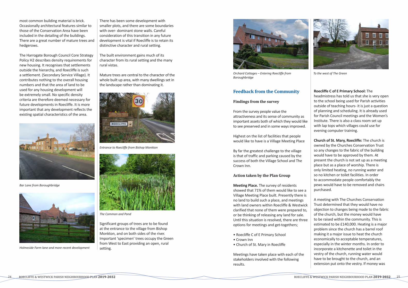
Bar Lane from Boroughbridge
Holmeside Farm lane and more recent development
There has been some development with smaller plots, and there are some boundaries with over- dominant stone walls. Careful consideration of this transition in any future development is vital if Roecliffe is to retain its distinctive character and rural setting.
The built environment gains much of its character from its rural setting and the many rural vistas.
Mature trees are central to the character of the whole built up area, with many dwellings set in the landscape rather than dominating it.
Entrance to Roecliffe from Bishop Monkton
The Common and Pond
Significantgroupsoftreesaretobefoundat the entrance to the village from Bishop Monkton, and on both sides of the river. Important ‘specimen’ trees occupy the Green fromWesttoEastprovidinganopen,ruralsetting.
Orchard Cottages – Entering Roecliffe from Boroughbridge
To the west of The Green
Feedback from the Community
Findings from the survey
From the survey people value the attractiveness and its sense of community as important assets both of which they would like to see preserved and in some ways improved.
Highest on the list of facilities that people would like to have is a Village Meeting Place
By far the greatest challenge to the village is that of traffic and parking caused by the successofboththeVillageSchoolandTheCrown Inn.
Action taken by the Plan Group
MeetingPlace. The survey of residents showed that 71% of them would like to see a Village Meeting Place built. Presently there is no land to build such a place, and meetings withlandownerswithinRoecliffe&Westwickclarified that none of them were prepared to, or be thinking of releasing any land for sale. Until this situation is resolved, there are three options for meetings and get-togethers;
•RoecliffeCofEPrimarySchool• Crown Inn•ChurchofSt.MaryinRoecliffe
Meetings have taken place with each of the stakeholders involved with the following results.
RoecliffeCofEPrimarySchool: The headmistress has told us that she is very open to the school being used for Parish activities outside of teaching hours- it is just a question of planning and scheduling. It is already used forParishCouncilmeetingsandtheWomen’sInstitute. There is also a class room set up with lap tops which villages could use for evening computer training.
ChurchofSt.Mary,Roecliffe: The church is owned by the Churches Conservation Trust so any changes to the fabric of the building would have to be approved by them. At present the church is not set up as a meeting place but as a place of worship. There is only limited heating, no running water and so no kitchen or toilet facilities. In order to accommodate people comfortably the pews would have to be removed and chairs purchased.
A meeting with The Churches Conservation Trust determined that they would have no objection to changes being made to the fabric of the church, but the money would have to be raised within the community. This is estimated to be £140,000. Heating is a major problem since the church has a barrel roof making it a major issue to heat the church economically to acceptable temperatures, especially in the winter months. In order to incorporate a kitchenette and toilet in the vestry of the church, running water would have to be brought to the church, and an extension put onto the vestry. If money was

ROECLIFFE & WESTWICK PARISH NEIGHBOURHOOD PLAN 2019-2032 ROECLIFFE & WESTWICK PARISH NEIGHBOURHOOD PLAN 2019-203226 27
raised in stages, this would enable work to be planned and scheduled accordingly. TheCrownInn: The landlord is most accommodating with villagers when they have events which require food and drink, and helps out as and when he can so long as it doesn’t affect his business. By planning ahead we have used The Coach house situated behind the restaurant for major village events, but for smaller events like Quiz Nights it is more cosy in the main restaurant of the Crown Inn.
ParkingandTraffic. Traffic calming measures have been looked into and will continues to be pursued. The school is considering arrangements that would reduce congestion particularly in the morning.
Conclusions. Parking is likely to remain a problem especially in relation to activities and functions at The Crown Inn.
POLICY A1: DESIGN AND DEVELOPMENT
New development proposals should demonstrate that they preserve and enhance the distinct rural feel of the village of Roecliffe and its surrounding rural environment by:
• Respecting the local character, historic and natural assets of the surrounding area, inparticular the Conservation Area, and taking every opportunity, through design and materials, to reinforce local distinctiveness and a strong sense of place.
• Ensuring that developments outside the Conservation Area do not adversely affect the character and appearance of the Conservation Area.
• Maintaining space and proportion of building plots.
• Ensuring that new structures do not dominate the village streetscape.
• Incorporating landscaping to mitigate the impact of development. Planting programmes for new development should incorporate native arboreal species local to the area.
• Prohibiting the removal of any trees that have a significant amenity value, without the support of an arboriculture report by a reputable company.
• Using traditional bricks and pantiles as the dominant construction material for new buildings and boundary walls.
• Maintaining the consistent two-storey eaves height found throughout the Conservation Area.
• Continuing to use rural and vernacular detailing on new build structures to ensure that the rural and historic character is retained.
• Providing pitched roofs and regularly spaced windows that do not dominate the street scene.
• Ensuring proposals for external lighting which require planning permission demonstrate how they respect local character, residential amenity and biodiversity.
COMMUNITY ACTIONS
• Create an overall tree management/planting strategy;• Assess requirement for additional Tree Preservation Orders/
registration of hedgerows;• Plant screening in those areas which have a negative impact on the
ruralcharacterofRoecliffe&Westwick;• Improve verges and paths using sympathetic materials;• Tidy and maintain road signs and other furniture consistent with the
local character; Additional bulb planting.• Monitor noise pollution in the Parish
9.2 Design of ExtensionsJustification and Evidence
MuchdevelopmentinRoecliffe&Westwickis likely to be by extension and modernisation of existing properties. These developments
have the potential to change the character of the built environment, and as indicated in the Survey,residentshaveawishtominimisethenegative impact of this type of development.
POLICY A2: DESIGN OF EXTENSIONS
In addition to the requirements of Policy A1 the following shall apply to the design of extensions where planning permission is required:• Extensions, including garages, should not cause the property to dominate its
neighbourhood and street scene, and space will be retained between buildings and the street similar to the space between neighbouring properties.
• Extensions will be in materials to complement the existing or neighbouring houses.• Original character features should be retained and replicated in the extension.• Dormer windows shall be avoided on front elevations. They should be set back from
the eaves, side/party walls and set down from ridgelines.• Door architraves, window styles and frames should closely reflect the style of the
original building.
Unsuitable roofing material in Roecliffe Village Flat roof extension in Roecliffe Village

ROECLIFFE & WESTWICK PARISH NEIGHBOURHOOD PLAN 2019-2032 ROECLIFFE & WESTWICK PARISH NEIGHBOURHOOD PLAN 2019-203228 29
9.3 Community Involvement
9.4 Key Views
Justification and Evidence
ThroughoutthepreparationoftheRoecliffe&WestwickNeighbourhoodPlan,thePlanCommittee has consulted on every aspect of the Plan preparation. This has encouraged a stronger community spirit
and it is vitally important that in the future residents continue to be involved in ensuring the Plan delivery. Over the Plan period, planning applications will come forward and the community should therefore be consulted on an on-going basis.
Justification and Evidence
Due to the mainly flat, open landscape of the Neighbourhood Area, the community of RoecliffeandWestwickbenefitfromanumberof key views in and out of the parish. The significance of retaining key views is confirmed by Harrogate Borough Council’s CAAMP (2008), which noted the importance of retaining views both in and out of the Conservation Area and Harrogate Borough Council’s draft policy NE4: Landscape Character which states that visually sensitive skylines, hills and valley sides and visual amenity are to be protected and/or enhanced.
ThekeyviewsinandoutofRoecliffe&Westwickare:
KeyView1 Of Roecliffe village when entering along Bar Lane from the east, with the backs of houses visible across small fields and paddocks.
KeyView2 From the footpath to the north-west across the fields from which views of
Roecliffe village, church and Old Vicarage can be obtained.
KeyView3 From Bar Lane and Thorns Lane where a distant view of the houses and gardens can be seen beyond the small hedged tofts stretching to Thorns Lane.
KeyView4 From the footpath to the north west of Roecliffe village where views back to the Parish Church can be had.
KeyView5The approach to the village is contained to the east by woodland. This contained entrance via narrow lanes between walls, hedges and woodland give way to the unexpected open vista of The Green.
KeyView6 The approach to the village is contained to the west by woodland at The Common and the water-filled clay pits at the former brick works. This contained entrance via a narrow lane between walls, hedges and woodland give way to the unexpected open vista of The Green, beyond the Crown Inn.
POLICY A3: COMMUNITY INVOLVEMENT
Planning applications for ten or more new dwellings shall be accompanied by a StatementofCommunityInvolvement.Thisstatementshouldinclude:
• An explanation of how the community has been consulted about the proposals;• A demonstration that a range of means has been used to engage with local people;• A record of the views expressed by local people;• An explanation of how the proposals have responded to local people’s views;
Any subsequent application will only be supported if it is clear the feedback from the community has been taken into account as far as practicable.
Key View 2 From the footpath to the north-west across the fields from which views of Roecliffe village, church and Old Vicarage can be obtained.
Key View 4 From the footpath to the north west of Roecliffe village where views back to the Parish Church can be had.
Key View 6 The approach to the village is contained to the west by woodland at The Common and the water-filled clay pits at the former brick works. This contained entrance via a narrow lane between walls, hedges and woodland give way to the unexpected open vista of The Green, beyond the Crown Inn.
Key View 1 Of Roecliffe village when entering along Bar Lane from the east, with the backs of houses visible across small fields and paddocks
Key View 3 From Bar Lane and Thorns Lane where a distant view of the houses and gardens can be seen beyond the small hedged tofts stretching to Thorns Lane.
Key View 5 The approach to the village is contained to the east by woodland. This contained entrance via narrow lanes between walls, hedges and woodland give way to the unexpected open vista of The Green.

ROECLIFFE & WESTWICK PARISH NEIGHBOURHOOD PLAN 2019-2032 ROECLIFFE & WESTWICK PARISH NEIGHBOURHOOD PLAN 2019-203230 31
POLICY A4: KEY VIEWS
Development should consider the visual impact of proposals and ensure careful design to protect the following key views, (also identified on the policies map), in order to maintainthecharacterandappearanceoftheparishofRoecliffeandWestwick.
• KeyView1 Of Roecliffe village when entering along Bar Lane from the east, with the backs of houses visible across small fields and paddocks.
• KeyView2 From the footpath to the north-west across the fields from which views of Roecliffe village, church and Old Vicarage can be obtained.
• KeyView3From Bar Lane and Thorns Lane where a distant view of the houses and gardens can be seen beyond the small hedged tofts stretching to Thorns Lane.
• KeyView4 From the footpath to the north west of Roecliffe village where views back to the Parish Church can be had.
• KeyView5The approach to the village is contained to the east by woodland. This contained entrance via narrow lanes between walls, hedges and woodland give way to the unexpected open vista of The Green.
• KeyView6The approach to the village is contained to the west by woodland at The Common and the water-filled clay pits at the former brick works. This contained entrance via a narrow lane between walls, hedges and woodland give way to the unexpected open vista of The Green, beyond the Crown Inn.
Map
5: K
ey v
iew
s
Roe
cliff
e &
Wes
twic
k K
ey V
iew
s M
ap
Key 1
Key
View
4
Key
View
3
Key
View
2
Key
View
1
Key
View
6
Key
View
5
65432
1
3
6
4
2
5

ROECLIFFE & WESTWICK PARISH NEIGHBOURHOOD PLAN 2019-2032 ROECLIFFE & WESTWICK PARISH NEIGHBOURHOOD PLAN 2019-203232 33
Objectives:
• To ensure sensitive development that protects and enriches the landscape and built setting throughout the Neighbourhood Area.
• To ensure that any housing development is tailored to the future needs of Roecliffe &Westwickresidents.
• To protect the landscape generally including agricultural land, woodland, wildlife habitats, the historic sites and particularly the key views into and out of the Conservation Area.
• To seek on-going improvements to highways and develop a safer route for pedestrians passing through Roecliffe.
9.5 Future Housing DevelopmentJustification and Evidence
TheHarrogateDistrictLocalPlan:SettlementHierarchy Background Paper (October 2016) designatedRoecliffeasaSecondaryServicevillage.SecondaryServiceVillagesprovideresidents and people living nearby with some basic services and facilities. These villages have a well-defined built up area, and:
• a key public service (such as a primary school and/or a GP surgery);
• community facilities (recreational facilities, and either a village hall or at least one place of worship);
• most of the villages also contain: a shop (a general store catering for day-to-day needs) or a pub or a café.
The Housing and Economic Development Needs Assessment report which was commissioned by Harrogate Brough Council, identifies Roecliffe as part of the Ripon and Boroughbridge sub area of Harrogate district. The report stated that “Ripon and Boroughbridge is the sub area with the second highest number of sales. The sub area shows the highest number of sales in detached houses, followed by terraced and then semi-detached. Flat sales levels are lowest and when compared to Harrogate sales, the difference is considerable. In Ripon and Boroughbridge sub-area, there is mostly demand for family houses, 2-3 bedroom and sometimes bungalows in the price range of £100,000-£200,000 up to £250,000. There is a significant gap in supply in terms of single person occupation such as 1-2 bedroom properties and bungalows for elderly couples. There is demand for downsizing from family homes to single person accommodation homes, typically this is from 3-4 bedroom houses to 1-2 bedroom ground floor flats or houses. There are many elderly couples who look for small flats, however there is a definite lack of supply of these.” This information is based on 2016 data and represents the whole of the Ripon and Boroughbridge area, not specifically RoecliffeandWestwick.
The report recommended that “in the Ripon and Boroughbridge sub-area the focus of delivery should still be 2 and 3 bedroom properties. The council may seek to deliver a slightly increased number of 1 bedroom flatted properties to address the identified gap in the market and to encourage downsizing.”
B NEW HOUSING DEVELOPMENT Harrogate’sStrategicHousingMarketAssessment(SHMA)highlightstheimportanceof providing a good mix of housing to accommodate older people and the changing requirements of out ageing population, throughoutthedistrict.TheSHMArecommends the focus of new developments is for 2 and 3 bedroom properties.
There are currently 78 dwellings in Roecliffe &Westwick.Thevastmajorityarewithinthemain village.
An examination was undertaken to establish which areas of land might be suitable to qualify for consideration as potential locationsasdevelopmentsites.Sitessuitablefor more than one property were examined. A number of such locations were identified.
In all cases except one, the landowners were strongly opposed to any development proposals. The “excepted site” is the so called “Arrows Field”.
Outside the village envelope all of the land within the Neighbourhood Area is Agricultural Land.
WithintheNeighbourhoodAreaworkingfarms still exist with extensive agricultural land in full use. The protection of this agricultural land is seen as vitally important and any proposal for housing development on such land should be refused. Roecliffe&Westwickhighwaysareoflimitedcapacity with some roads having single car width sections and poor geometry junctions. Changes to these road sections/junctions cannot be achieved without significant adverse effect on the distinctive village character in the Conservation Area. It can therefore be concluded that opportunities for housing development in Roecliffe village are severely restricted.
Harrogate Borough Council maintains a database of potential sites for housing and Industry.Forhousing,thisistheStrategicHousing Land Availability Assessment (SHLAA).
Harrogate District Council have identified adraftdevelopmentlimit(policyGS3)asshown on the map 3 outlined in red. This limits further building tightly to the core of the village and is well inside the present conservation area.
Notwithstanding the fact that Roecliffe &Westwickisnotconsideredtobea sustainable location for significant development, the Plan Committee undertook a thorough evaluation of all the possible sites. Areas of land that were large enough to accommodate more than a single dwelling were identified. Landowners and stakeholders of these sites were contacted. As a result of these enquires no land was available for further building.
After consulting with the various landowners the pros and cons for each site were discussed by the Plan Committee.
ItisfeltthatwhilstRoecliffeandWestwickisconsidered as a secondary service village, its close links with nearby Boroughbridge create a special situation wherein the possible future housing demand for the area cannot be separately identified.
HBC is better positioned to examine the strength of these potential demands, and to therefore allocate the land resources. Extensive draft allocations have been designated within the Boroughbridge boundary. The current total is approximately 400 properties.
Concern has been expressed in regard to the capacity of the infrastructure serving the locality in general to absorb these further developments. This extends beyond the sewage system, the roads infrastructure and similar hardware, to the schools, surgeries and capacity of the emergency services.
It is for these reasons that the decision has been taken not to make housing development allocations through the medium of the Neighbourhood Plan.

ROECLIFFE & WESTWICK PARISH NEIGHBOURHOOD PLAN 2019-2032 ROECLIFFE & WESTWICK PARISH NEIGHBOURHOOD PLAN 2019-203234 35
Additional on street parking facilities were created some years ago by means of the installation of approximately 100m of Grasscrete, at the expense of Village Green. Proposals for further similar encroachments have been rejected by the Parish Council.
Roecliffe village is expected to remain the same size with no plans for expansion of housing.
A problem exists within the Parish of overnight HGV parking on the various small roads serving the industrial areas of Roecliffe. These occurrences result in a residue of waste of all kinds being left behind when the vehicle continues its journey. There is the further nuisance of noise from these parked vehicles, some of which need to run their engines overnight in order to maintain refrigerator temperatures.
At the time of writing a project has been promised by NYCC whereby restrictions and signage will be put into force such that all HGV’s other than those with legitimate business in the area will be denied access to the area. The usefulness of these initiatives depends entirely on the policing of infringements. Meetings have been held with relevant interested local bodies, including the police, allowing the importance of this issue to be stressed. An undertaking was given to consider reports of
such infringements as high priority, and for suitable action to be taken.
Feedback from the Community
However despite the above, residents of Roecliffe&Westwickarenotessentiallyanti-development,asindicatedintheSurvey.They are aware that development could also bring some benefits to the community through the delivery of the improvements describedintheProjectsforRoecliffe&Westwicksection.Of the 176 returned surveys, over 70% of the respondents stated they were over 60 and 45% of those, stated they were 70 or over. These results indicate that Roecliffe and Westwickcurrentlyhasanageingpopulationwhich might in the future lead to a supply of larger or family houses being available if there are smaller properties in the vicinity that older people could downsize to.
The survey question relating to future domestic housing development in Roecliffe andWestwickresultedinnear50:50preferences. Those wishing no development registered 52% of total respondents; those in favour of some further qualified development registered 48%. Of those who wished to see further housing, a large proportion were in favour of affordable or communal housing.
POLICY B1: SMALL SCALE HOUSING DEVELOPMENT
Development proposals will be welcomed where these:
a) Are small-scale major developments (i.e. less than 10 dwellings);
b) Do not extend the village into the surrounding countryside outside the village of Roecliffe Development Limits (2016).
COMMUNITY ACTIONS
• Continue with consultation/education/co-operation with the school in highlighting and minimizing the impact of parking.
9.6 Development Criteria: HighwaysJustification and Evidence
The road from Boroughbridge to Roecliffe is Bar Lane. At the village the road diverges around the main area of the village green, forming Back Lane, and the main road, which, having no official name, will be referred to asMainStreet.Thesere-joinattheendofthe Green, whence commences the road toWestwick,andontoBishopMonkton.SheaflandsLaneproceedstotherightoffthis road at the edge of the village across the Common, and is a cul-de-sac serving farms. ThereisaninformaltrackoffSheaflandsserving as an access route to the market garden, whose proprietors have an agreement with the Parish Council giving access permissions across the Common, for the purpose of running their business.
TheRoecliffe&Westwickhighwaynetworkis shown on Map 1. The principal access road runsEast/Westthroughthevillagecentreconnecting the A168 (Knaresborough/Ripon road) just west of Boroughbridge Centre with the A61 at Bishop Monkton. This road can be busy at times, of car- borne visitors to the Crown Inn and of parents dropping off/collecting children from the school. The principal access road into the Village is Bar Lane,andthroughtheVillageisMainStreetand Back Lane.
Main Street Car parking/congestion by The Green
Damage to The Green opposite The Crown Inn
FromtheVillageSurveyOctober2016,itbecame very clear that Car Parking in the village of Roecliffe together with highway issues and safety were of very high importance to the villagers. Comments from the survey also covered such items as speeding traffic both through the village and on Bar Lane between the A1M round-a bout and the village, poor footpaths, constant damage to grass verges and parking of cars referred to.
The principal highway problems were identified as:
• MainStreet–althoughwideenoughfortwo cars to pass when no vehicle are parked, the main road through Roecliffe village is generally narrow with a blind bend to the west by the Crown Inn. This causes particular problems with
Back Lane

ROECLIFFE & WESTWICK PARISH NEIGHBOURHOOD PLAN 2019-2032 ROECLIFFE & WESTWICK PARISH NEIGHBOURHOOD PLAN 2019-203236 37
throughtrafficforallRoecliffe&Westwickresidents, buses which often need to reverse, and village residents seeking access to their property.
• To the east alongside of The Green, cars are regularly solidly parked round the bend as far as Ivy Farm both at school start/finish times and when there are visitors to the Crown Inn. The road is reduced to a single carriageway, preventing emergency vehicles and buses getting through.
• Whenschoolisinsession,vehiclesareregularly observed travelling too fast in the vicinity of very young children playing, often unsupervised, on The Green by the school.
• The reserved designated car parking area (shown blue on the maps) is only sufficient for visitors to local properties and for school staff.
• Back Lane is only one-car width and is suitable only for access, although the bus uses this route to turn round at this route terminus.
Congestion on the main road through village
• Difficulties are created for turning manoeuvres for large vehicles (buses) and also has poor sight lines.
Narrow entrance to Back Lane
• Vehicles are regularly observed parking to the North-west of The Crown Inn. The bend immediately to the west creates a potential danger to all road users. The 30 mph restriction is not observed and there is no lighting. The sight lines from both the west and east round The Crown Inn is a particularly dangerous place to be parked.
• There is significant support for a 20mph speed limit zone through the village centre.
In recognition of the importance of these issues, meetings were held with stakeholders, in order that a greater understanding of them could be gained.
Reed BoardallVolumes of traffic serving their premises are anticipated to remain at current levels in the short to medium term. Vehicles have become larger, with higher refrigerator vehicles now being available, and twenty four hour working now means a more even spread of traffic flow across a full day. Business conditions and demands are changing, and the “Monday morning Friday afternoon” spikes are expected to disappear. There may be limited congestion at shift changeover times of 0600, 1400, and 2200 each day, but it is hoped that these times are generally outside other traffic flow peaks.
Reed Boardall have a policy of continually reminding their driving staff of the need for courtesy to the local community.
Vehicles on the narrow main road through Roecliffe
Map
6: R
oecli
ffe V
illag
e Co
nges
tion
and
park
ing
Crow
n Co
pyrig
ht a
nd d
atab
ase
Ord
nanc
e Su
rvey
LA10
0019
567
Map
pro
duce
d by
MAG
IC o
n 8
Mar
ch,
2019
. (c
) Cro
wn
Cop
yrig
ht a
nd d
atab
ase
righ
ts 2
019.
Ord
nanc
e Sur
vey
10002
2861
. Cop
yrig
ht r
esid
es w
ith
the
data
sup
plie
rs a
nd t
he m
ap m
ust
not
be r
epro
duce
d w
itho
ut t
heir
per
mis
sion
. Som
e in
form
atio
n in
MA
GIC
is a
sna
psho
t of
the
info
rmat
ion
that
is b
eing
mai
ntai
ned
or
cont
inua
lly u
pdat
ed b
y th
e or
igin
atin
g or
gani
sation
. Pl
ease
ref
er t
o th
e m
etad
ata
for
deta
ils a
s in
form
atio
n m
ay b
e ill
ustr
ativ
e or
rep
rese
ntat
ive
rath
er t
han
defin
itiv
e at
thi
s st
age.
0
0.04
0.
08
km
LEG
END
Reg
ular
con
gest
ion
area
Sin
gle
wid
th r
oadw
ay
Des
igna
ted
park
ing
area

ROECLIFFE & WESTWICK PARISH NEIGHBOURHOOD PLAN 2019-2032 ROECLIFFE & WESTWICK PARISH NEIGHBOURHOOD PLAN 2019-203238 39
It is acknowledged that local parking is a problem and advice is issued to incoming drivers, by means of a leaflet which is available in a range of languages.
Litter picking local to the entrance of the premises is undertaken on a regular basis, as well as grass verge and roundabout maintenance.
Wasteisleftbyvisitingdriverswhohaveparked up overnight. This is offensive, and is a health hazard. HBC Environment Department are usually quick to respond to any report of this, removing the offending material quickly and safely.
Reed Boardall acknowledge their involvement in the overnight parking issues and are able to influence the behaviour of drivers who are visiting their premises. Any drivers waiting to load at Reed Boardall are advised to park elsewhere in future. They are unable to influence other drivers.
Paynes DairiesThe volumes of traffic visiting Paynes Dairies is not expected to increase in the short to medium term. In recognition of the local concerns regarding speeding down Bar Lane, Paynes have a commitment to driving within the highway speed limits. Mr. Payne noted that despite the volume of traffic his vehicles create, none of his drivers were caught in the police exercise to monitor speeding.
Methods of enforcing speed limits include“sleeping policemen” and “rumble strips”. The use of either of these would significantly increase the noise of the traffic, as well as increase the wear and tear on the vehicles.Land has been acquired by Paynes at the top of Brickyard Road, and a wagon park has been created. The use of this will remove the need for any Paynes vehicles to be parked on the highway. It will increase the traffic significantly up Brickyard Road, which will highlight the problems caused by visiting drivers overnighting.
Payne’s has a programme of litter picking outside their premises.
NYCC Highways DepartmentA meeting was held to establish what plans and budgets NYC might have which could impact on issues form the Neighbourhood Plan survey responses, and the Bar Lane traffic survey of 2015.
The early opinion expressed was that the issues highlighted were of low priority in comparison with those elsewhere, and that the budget available was zero. NYCC felt that the current highways infrastructure in the area was sufficient and satisfactory for its purpose. These conclusions had been reached after “road modelling” exercises. It was noted that this road modelling was performed during consideration of any significant planning application. NYCC were unable to acknowledge the concerns of the population in regard to the suitability of the footpath serving the local highways, and in particular Bar Lane, as well as the village of Roecliffe itself.
There are no plans to upgrade Bar Lane. Development proposals are reactive rather than proactive; no vision, no plan.
Road signage which will address the overnight parking problems has been the subject of considerable lobbying, and an undertaking to install such signs was finally given by NYCC in Spring2017.Theusefulnessofsuchasystemdepends on the underlying enforcement, and meetings with local politicians and police representatives have stressed how vital this matter is.
It is hoped that greater control and restriction of the parking will increase the road safety levels instead of waiting for some unfortunate occurrence to prompt action. SchoolSeveralmeetingsanddiscussionshavebeenheld with Mrs. Dalton, the head teacher. It is clear that a large part of the parking problem in the village is due to parents leaving and collecting children from the school. This issue
only exists for an hour in the morning and again in the afternoon. It is caused by the temporary influx of parents parking to collect or drop off the children.
Various alternatives for addressing the problem have been examined.These include the creation of a dedicated school bus service whereby a large number of children could be moved in or out in a single vehicle, from some local collection point, perhaps Boroughbridge car park. This has been dismissed as too expensive, and because it is not possible to make its use compulsory. It is felt that parents would probably not voluntarily use such a service.
The creation of a new, local car park has been examined, but no suitable land could be found available. Again, its use could not be made compulsory. There is an informal agreement with the Crown Inn management to use their car park and this is working to a degree.
A suggestion to stagger the start/finish time oftheschoolwasmade.Whilsttheextracostof the necessary supervision was prohibitive, a proposal is being considered to significantly increase the availability of pre-school and after school functions, which will have the effect of creating a stagger. It was felt that these functions would be in great demand, and be self-financing.
An informal one way system is in operation among the majority of parents which does
help considerably with traffic flows at school time.
There is a lay by and an area of “Grasscreted” Village Green which helps to accommodate parking. Other potential similar areas are being sought.
The Crown InnConsultation has been held with the former proprietor.
The car park has been marked out with permanent markers with the most efficient parking layout. This works well, and ensures the car park is used to its capacity, whilst at the same time preserving adequate access to Roecliffe Park, where there are 22 properties whose owners require access, as well as the need to leave access available for any emergency vehicles which may need to enter.
On busy function days, the overspill vehicles need to park in the village adding to the parking problem.
Feedback from the Community
IntheVillageSurvey,97%ofresponsesindicated that they were concerned about the impact of traffic on the village. The village is served by one bus route (into Boroughbridge and onward) and also has a number of school buses at appropriate times.
POLICY B2: DEVELOPMENT CRITERIA HIGHWAYS
Whereappropriate,measureswhichenhancetrafficmanagementandtheoperationof the highways will be encouraged where such can be shown to have a positive impact upon highway safety in and around Roecliffe village. Any measure should be of a design appropriate to the character of the village.

ROECLIFFE & WESTWICK PARISH NEIGHBOURHOOD PLAN 2019-2032 ROECLIFFE & WESTWICK PARISH NEIGHBOURHOOD PLAN 2019-203240 41
COMMUNITY ACTIONS
• Continue to monitor speeding incidents
• Support20mphzoneinMainStreet;
• Install 30mph flashing signs on Bar Lane travelling west/east; Create gateway features tothewestofthevillagebyTheCommon;ControlHGVaccessthroughRoecliffe&Westwick;and
• Lobby for improvements to highway drainage.
POLICY B3: ADEQUATE CAR-PARKING PROVISION
Residential car-parking In any new housing development should provide off-road car parking spaces in accordance with standards as set out by North Yorkshire County Council as a minimum. Development proposals must demonstrate that there will be no over-spillofresidentialcar-parkingontoMainStreet,Roecliffe.
9.7 Village facilities and servicesThe smallness of its population means that Roecliffe Village has few services or facilities within the village and is unlikely to be provided with any further facilities by outside bodies. Residents take advantage of the facilities in Boroughbridge: doctors, dentists, pharmacy, post office, secondary school, shops and library.
There are a number of issues raised by theSurveythatdemonstratethevalueofThe Green and having a regular venue for community organisations to meet and enjoy their interests.
LocalcommunitygroupsW.I.Racket ClubBook ClubCraft ClubRoecliffe Village Fund
Objective:
• To ensure all the ‘village assets’ are protected.
Justification and Evidence
Roecliffe&Westwickisseenasveryattractiveplace to live, but with few services. Many residents take advantage of the services availableinBoroughbridge,includingSecondarySchool,PostOffice,doctors,dentists,apharmacy and various small retail shops, major supermarket with petrol filling station.
In addition, an even wider number of services are available in Knaresborough and Ripon, which are classed as a major urban settlements. Examples of services available in Knaresborough include, banking,
supermarkets, estate agents and there are significant employment opportunities.
ManychildrenofRoecliffe&Westwickofprimary age attend the local school which is in walking distance from the heart of the village. That school is often over-subscribed for new entrants. ManyofthechildrenofRoecliffe&Westwickof secondary age attend Boroughbridge High School.
Although the village setting and the built environment are instrumental in preserving theruralcharacterofRoecliffe&Westwick,it is the valuable community facilities that helptomakeRoecliffe&Westwickapleasantplace to live. The ‘Assets of Community Value’ which contribute to the rural village character identifiedbytheresidentsofRoecliffe&Westwickarelisted.
The school was built over 100 years ago and the building has recently had some renovation and modernisation. It is the main facility in the village and to ensure it has a sustainable future and attracts community use, the SchoolGovernorsandHeadteachermustbe involved in the preparation and delivery oftheRoecliffe&WestwickNeighbourhoodPlan. The Parish Council supports the school and may need to look to raising additional funds to support community use.
Land is owned by the Parish Council that in the opinion of the Local Authority furthers the social well-being or social interest of the local community.Socialinterestincludescultural,recreational and sporting interest.
Feedback from the Community
IntheVillageSurveyof2016,thefollowingFacilitiesandServiceswerestronglysupported by the villagers.
C VILLAGE FACILITIES AND SERVICES

ROECLIFFE & WESTWICK PARISH NEIGHBOURHOOD PLAN 2019-2032 ROECLIFFE & WESTWICK PARISH NEIGHBOURHOOD PLAN 2019-203242 43
Public Footpaths Claypit Ponds
Buildings
The Crown Inn is a thriving Gastro pub which is a visual attraction to the village and attracts visitors from a wide area. The facilities are also enjoyed by residents of the village and its function room is sometimes available for village functions. From the Village survey a number of residents commented that they would like it to be available for more community functions. Thevillageprimaryschoolis a major asset to the village and occupies a prominent position
on the Village Green. The school is often oversubscribed with children travelling in from the surrounding areas. The sound and sight of children playing on the village green contributes to the vitality of the village and is appreciated especially by older house bound residents.
StMarysChurch is now in the care of The Churches Conversation Trust who maintains the building while the churchyard is cared for by Roecliffe Church Committee. The church community contribute to the upkeep of the church financially and volunteers ensure that
FacilitiesandServices Buildings Crown Inn VillageSchoolSt.Mary’sChurchandgraveyardNaturalEnvironmentThe Village Green The Common and Pond DesignatedFootpaths&BridlewaysRiver side Claypit Ponds CommunityFacilitiesWomen’sInstituteThe Village Fund Committee
the church is cleaned and cared for thereby offering a welcome to visitors. The church is used by the school and also hosts concerts from time to time.
Natural Environment
TheVillageGreen is a valuable asset to the village and has a major impact to on the attractiveness of the village. It is a major asset to the school being used as a playing and sports area. Village children use the green regularly for ball games. It is used by
residents for large village functions (weather permitting) such as The Big Lunch and celebrations for the Queen jubilee and the Royal wedding. The Parish Council encourages and supports such functions. From the survey residents would appreciate greater use of the green.
The Big Lunch Queen’s Jubilee celebration
The Common and pond. The upkeep of the Common and pond is supported by volunteers on an ad hoc basis and is likely to remain the case. The Parish Council appreciates resident’s contributions.
TheRiverside,FootpathsandBridleWays. These are enjoyed by residents but their upkeep is the responsibility of landowners. The Parish Council supports effects made to keep these rights of way in order.
ClaypitPonds. The flooded clay pit ponds aredesignatedanareaofSpecialScientificInterest and are in private ownership. This area provides a valuable buffer between the industrial development and the village. The Parish Council should protect this area and resist any development that would impact on its special status.
Community Facilities
TheWomen’sInstitute(WI).TheWIhasbeenestablished in the village for over 80 years and continues to be the most active group in the village. Many initiatives have originated from theWI.TheVillagenowhasaBookExchangeinstead of a ‘telephone exchange’ so keeping
The Crown Inn
St. Mary’s Church
The Village School
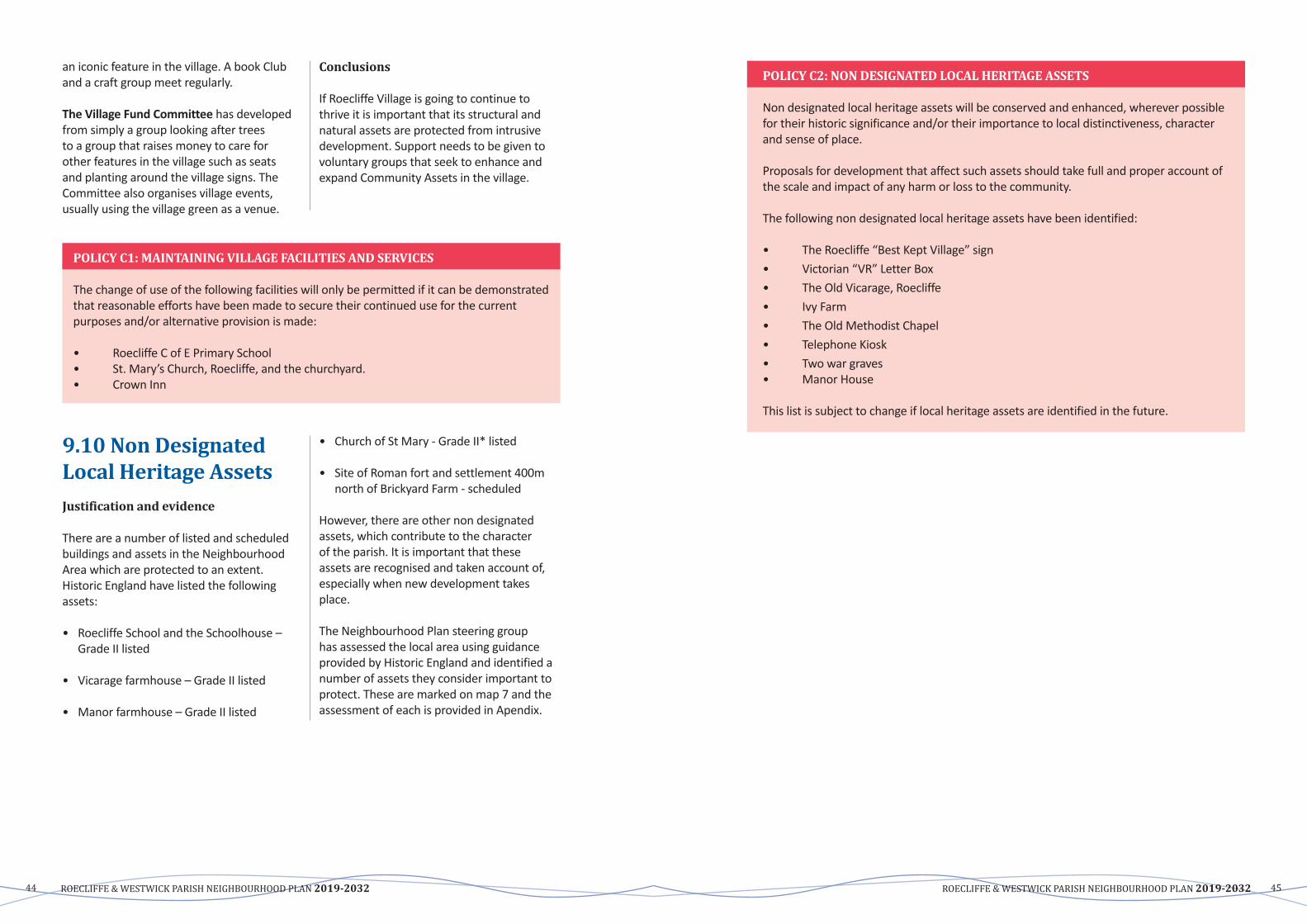
ROECLIFFE & WESTWICK PARISH NEIGHBOURHOOD PLAN 2019-2032 ROECLIFFE & WESTWICK PARISH NEIGHBOURHOOD PLAN 2019-203244 45
an iconic feature in the village. A book Club and a craft group meet regularly.
TheVillageFundCommittee has developed from simply a group looking after trees to a group that raises money to care for other features in the village such as seats and planting around the village signs. The Committee also organises village events, usually using the village green as a venue.
Conclusions
If Roecliffe Village is going to continue to thrive it is important that its structural and natural assets are protected from intrusive development.Supportneedstobegiventovoluntary groups that seek to enhance and expand Community Assets in the village.
POLICY C1: MAINTAINING VILLAGE FACILITIES AND SERVICES
The change of use of the following facilities will only be permitted if it can be demonstrated that reasonable efforts have been made to secure their continued use for the current purposes and/or alternative provision is made:
• RoecliffeCofEPrimarySchool• St.Mary’sChurch,Roecliffe,andthechurchyard.• Crown Inn
9.10 Non Designated Local Heritage AssetsJustification and evidence
There are a number of listed and scheduled buildings and assets in the Neighbourhood Area which are protected to an extent. Historic England have listed the following assets:
• RoecliffeSchoolandtheSchoolhouse–Grade II listed
• Vicarage farmhouse – Grade II listed
• Manor farmhouse – Grade II listed
• ChurchofStMary-GradeII*listed
• SiteofRomanfortandsettlement400mnorth of Brickyard Farm - scheduled
However, there are other non designated assets, which contribute to the character of the parish. It is important that these assets are recognised and taken account of, especially when new development takes place.
The Neighbourhood Plan steering group has assessed the local area using guidance provided by Historic England and identified a number of assets they consider important to protect. These are marked on map 7 and the assessment of each is provided in Apendix.
POLICY C2: NON DESIGNATED LOCAL HERITAGE ASSETS
Non designated local heritage assets will be conserved and enhanced, wherever possible for their historic significance and/or their importance to local distinctiveness, character and sense of place.
Proposals for development that affect such assets should take full and proper account of the scale and impact of any harm or loss to the community.
The following non designated local heritage assets have been identified:
• The Roecliffe “Best Kept Village” sign• Victorian “VR” Letter Box• The Old Vicarage, Roecliffe• Ivy Farm• The Old Methodist Chapel• Telephone Kiosk• Two war graves• Manor House
This list is subject to change if local heritage assets are identified in the future.

ROECLIFFE & WESTWICK PARISH NEIGHBOURHOOD PLAN 2019-2032 ROECLIFFE & WESTWICK PARISH NEIGHBOURHOOD PLAN 2019-203246 47
Map
7: R
oecli
ffe a
nd W
estw
ick C
omm
unity
Fac
ilitie
s and
Non
Des
igna
ted
Asse
ts M
ap
D FOOTPATHS, CYCLEWAYS AND BRIDLEWAYS
Objectives
• To improve the existing footpath network by creating new footpaths and cycle ways to extend connectivity and improve access to the surrounding rural countryside.
• To seek on-going improvements to highways and develop a safer route for pedestrians passing through Roecliffe.
9.9 Footpaths, cycleways and bridlewaysJustification and Evidence
The village has many narrow lanes and footpaths that are critical to maintaining the rural nature of the village. Up-keep of these Public rights-of-way is vital and many residents commented on this aspect in the Survey.
One of many Bridleway/Public Footpaths
FormostpeoplelivinginRoecliffe&Westwickthecarhasbecometheprincipalmode of transport, even for some of the shortest journeys. It is very important that
better footpaths and public rights of ways connecting to Boroughbridge are regularly maintained to encourage less use of cars and promote better health and well-being.
The principal footpath problems are as follows: • The footpath along Bar Lane varies in
width, creating difficulties for larger mobility scooters and baby strollers to pass. The grass verge to the path often over-grows onto the path, reducing usable width. There is a need to cross the road at Brickyard Road.
• ThefootpaththroughCherryIslandWoodon the riverside, is very poorly maintained and difficult to pass. This is part of the ‘Roecliffe Ramble’ signed route and much used by visitors and residents alike.
• ThefootpathtoStaveleyispoorlymaintained in parts and needs additional signage.
• ThefootpathalongSheaflandsLaneisverygood as far as the gate into the wooded part. From there to the Boroughbridge/Bishop Monkton road is in poor condition and requires maintenance
The footpath/bridleway between Boroughbridge/ Bishop Monkton road and Roecliffe Grange.
050
100
25
Met
ers
¯
© C
row
n co
pyrig
ht a
nd d
atab
ase
right
s 20
19 O
rdna
nce
Surv
ey 1
0001
9628
Roe
cliff
e an
d W
estw
ick
Nei
ghbo
ugho
od P
lan
Facl
ities
and
Ass
ets
Map
Lege
ndCo
mm
unity
Fac
ilitie
s
AR
oecl
iffe
C o
f E P
rimar
y S
choo
l
BSt
Mar
y's
Chr
uch,
Roe
cliff
e an
d ch
ruch
yard
CN
otic
e bo
ard
DBe
nche
s ar
ound
the
villa
ge
ED
efib
rilat
or
FTh
e C
row
n In
nNe
ighb
ourh
ood
Plan
Bou
ndar
y
Roe
cliff
e an
d W
estw
ick
1Th
e R
oecl
iffe
''Bes
t Kep
t Villa
ge' S
ign
2Vi
ctor
ian
'VR
' Let
ter B
ox
3Th
e O
ld V
icar
age,
Roe
cliff
e
4 Iv
y Fa
rm
5Th
e O
ld M
etho
dist
Cha
pel
6Te
leop
hone
Kio
sk
7Tw
o W
ar G
rave
s
8M
anor
Hou
se

ROECLIFFE & WESTWICK PARISH NEIGHBOURHOOD PLAN 2019-2032 ROECLIFFE & WESTWICK PARISH NEIGHBOURHOOD PLAN 2019-203248 49
• The footpath on The Common is in very poor condition, to the point that walkers use the road round the bend rather than the footpath.Reconstruction is required.
The footpath on The Common
146. The footpath from Roecliffe to Minskip (6 on Map 7) is in part, in very poor condition and poorly signed since part was re-routed some years ago.
Poorly maintained footpath between Roecliffe and Minskip
To enable a greater appreciation of the landscape features and interaction with the wildlife, access to the countryside is achieved via a network of public footpaths, however, small additional short footpaths would enable circular routes without necessitating a return via local roads.
The key routes shown on Map 8 are as follows:
• 1) Roecliffe Ramble – along the river Ure bank to the lock
• 2) As route 1 and returning to Roecliffe on route 2.
• 3)LeavingRoecliffetowardsWhingatesFarm, retuning to village.
• 4)Usingroute3toWhingateFarm,continue to Newfields Farm, continue routepastWheatlandsFarmandreturntovillage.
• 6)VariousroutesleadtoandfromStaveleywildlife Park (route 6)
Feedback from the Community
TheVillageSurveyrevealedtheextentofsupport for green space and public rights of way. Concern was expressed about the state and maintenance of particular areas e.g. Thorns Lane where there is indiscriminate use of the land surrounding the bridleway for unsightly commercial activity.
Map
8: F
ootp
aths
/Brid
lew
ays i
n Ro
eclif
fe &
Wes
twick
with
surr
ound
ing
conn
ectio
ns C
row
n Co
pyrig
ht a
nd d
atab
ase
right
Nor
th Yo
rksh
ire C
ounc
il 1
0001
7946
201
7
© C
row
n co
pyrig
ht. A
ll rig
hts
rese
rved
Nor
th Y
orks
hire
Cou
nty
Cou
ncil
1000
1794
6 20
17
0 km
1.5
km3
km
Scal
e 1
: 500
00
27 F
ebru
ary
2019
Map
Leg
end
Publ
ic ri
ghts
of w
ayN
Y_F
ootp
ath_
curr
ent
NY
_Brid
lew
ay_c
urre
nt
© C
row
n co
pyrig
ht. A
ll rig
hts
rese
rved
Nor
th Y
orks
hire
Cou
nty
Cou
ncil
1000
1794
6 20
17
0 km
1.5
km3
km
Scal
e 1
: 500
00
27 F
ebru
ary
2019
Map
Leg
end
Publ
ic ri
ghts
of w
ayN
Y_F
ootp
ath_
curr
ent
NY
_Brid
lew
ay_c
urre
nt

ROECLIFFE & WESTWICK PARISH NEIGHBOURHOOD PLAN 2019-2032 ROECLIFFE & WESTWICK PARISH NEIGHBOURHOOD PLAN 2019-203250 51
POLICY D1: FOOTPATHS, CYCLEWAYS AND BRIDLEWAYS
Development proposals will take all reasonable opportunities to improve footpath and bridleway access, by, for example, facilitating new circular walks and new safer alternatives to existing routes. Any proposed routes and changes to existing routes will be expected to take advantage of features such as good views, amenity areas and also provide further planting as part of the proposals.
The layout of any proposed development should take into consideration the possibility of future footpaths and bridleways and access links not directly provided by the developments.
COMMUNITY ACTIONS
• Improve signs for country walks;
• Provide map of routes on a new Community Noticeboard;
• Maintenance of footpaths and bridleways generally
Sign to Roecliffe Ramble A blocked footpath through Cherry Island Wood on the Roecliffe Ramble
Sign on The Common – requires up-grading
E GREEN SPACE
Objective
• ToprotectthevaluablegreenspaceswithinRoecliffe&Westwick.
9.10 Local Green SpaceJustification and Evidence
Although Roecliffe benefits from a large amount of surrounding open green fields and countryside, the village centre does not have many green spaces that residents and visitors can freely access. An assessment was undertaken by the steering group of all the
potentialareasofLocalGreenSpacewithinthe village. As a result only two local green spaces were identified, the village green andthecommon.TheseLocalGreenSpacesare marked on the policies map. The NPPF guidance (paragraphs 99-101) was utilised and is demonstrated in the Local Green SpacesAssessment(appendix2).
Local Green Spaces
Location LocalSignificance
The Village Green Centre of Roecliffe Village Use by school and village
Roecliffe Common To the west of Roecliffe Village Open aspect on entering Village
The Village Green The Common Pond
Feedback from the Community
TheVillageSurveyrevealedthatcommunityOpenSpaceshouldbeprotected.

ROECLIFFE & WESTWICK PARISH NEIGHBOURHOOD PLAN 2019-2032 ROECLIFFE & WESTWICK PARISH NEIGHBOURHOOD PLAN 2019-203252 53
POLICY E1: LOCAL GREEN SPACE
In accordance with national policy on Green Belts the following areas are designated asLocalGreenSpaceswherenewdevelopmentwillonlybeallowedinveryspecialcircumstances:
• LGS1:Thevillagegreen• LGS2:RoecliffeCommon
9.11 Green InfrastructureJustification and evidence
Roecliffe is a rural village and the parish is predominantly laid to agricultural land with industry confined to the southern aspect of BarLane.TheRoecliffeBrickandTileWorksestablished in the late 19th Century ceased to function in 1963 but a fortunate legacy is the large lake, formerly the source of clay which separates industry and the village at Thornfield Lane.
The Roecliffe Ramble was an original part of theUreWalksthroughTimeProjectbeginningat the church and proceeding along the bank oftheRiverUreandontoWestwickLock.Thehistoric coal barge traffic continued on to Ripon City via Bishop Monkton.
The Village Green and Roecliffe Common are registeredcommonlandandStaveleyQuarryisdesignatedasaSiteofImportanceforNatureConservation(SINC).GreenspacesandroutesintheRoecliffeandWestwickPlanareaprovideaccess for pedestrians, cyclists and horse riders.
RoecliffeandWestwickParishCouncilandtheRoecliffe Village Fund maintain the trees on the Village Green and have recently financed the enhancement of Roecliffe Common by felling dead trees and clear overgrowth of blackthorn etc.
The parish benefits from an abundant and diverse range of green corridors, nature areas and wildlife habitats. Local wildlife are attracted to the waterways, woodlands and opencountryside.Walking‘TheRoecliffeRamble’ route along the River Ure will often give seasonal sightings of roe deer, barn owl, tree sparrow, and finch flocks, as well as buzzards waterfowl and many different types of flora and fauna.
A number of nature areas are already protected by existing legislation, for example Bishop MonktonIngsSSSIandtheRomanFortandSettlement.Inaddition,totheeastofthevillage,the former clay pits have become flooded and surrounded by dense secondary woodland of ash, hawthorne and sycamore. This has been identified by Harrogate Borough Council’s draft LocalPlanasaSiteofImportanceforNatureConservation(SINC).
Harrogate Borough Council’s draft Local Plan supports the protection of the natural environment and draft policy NE3 states that development should not result in any net loss ofbiodiversity.SSSIsandSINCsareprotectedunder this policy. However, there are still some key areas that would benefit from protection under this Plan.
Landscape features
In 2010 study by Natural England1 looked at green infrastructure corridors for Yorkshire and the Humber. It determined that the regionally significant Ure corridor (R16) and the Tutt and
1 http://webarchive.nationalarchives.gov.uk/20140605112209/http://www.naturalengland.org.uk/regions/yorkshire_and_the_humber/ourwork/yandhgreeninfrastructuremappingproject.aspx
Bishop Monkton corridor (D77), which is of district significance, both run through the parish ofRoecliffeandWestwick.Anoverviewofbothcorridors, (extracted from Natural England’s report), follows:
Ure Corridor
The Ure corridor begins high on the Pennine watershedandrunsthroughWensleydaleto the Vales of Mowbray and York. It is regionally significant as one of the major Dales rivers, mostly retaining its natural form as an active gravel river and connects the upland landscapes of the Yorkshire Dales with lowland areas, passing through a transitional landscape of rolling foothills. It meetstheSwalecorridorsouthofMyton-on-SwaleatthenorthernendoftheOusecorridor. It passes through primarily mixed arable farmland and is comparatively rural and much of the corridor is well wooded. The corridor is recognised as a historically important link across the Pennines and embraces a diverse range of landscapes and a number of key settlements that act as service centres and hubs for tourism, including Hawes, Leyburn, Middleham, Masham,Ripon&Boroughbridge.Itisrichin historic assets from the roman castle at Bainbridge, through Middleham Castle to the prehistoric Thornborough Henges – which contain relics of the largest ancient ceremonial area in Britain, Newby Hall, the prehistoric Devil’s Arrows standing stones, Marmion Tower and Norton Conyers. It also incorporates several important nature conservationsitesincludingHackfallWoods– a glacial overflow channel renowned for its wild natural scenery, River Ure Grasslands which contains a number of rare plant species including the burnt orchid, and RiponParksSSSI.Recreationisimportantin this area and the corridor presents a key opportunity to promote recreation, linking key population centres with the wilder, more remote landscapes in the west. It also presents key opportunities to ameliorate flood risk given the extent of its catchment and the key settlements along its course. The River Ure Corridor and the
Neighbourhood AreaThe River Ure defines the northern boundary of the Neighbourhood Area and the. flat, linear floodplain of the River flows between Newby Hall and Boroughbridge. The area is intensively farmed for cereal crop production in large open fields crossed by ditches draining into the River Ure. The A1(M) is a dominant feature to the east of the character area and where it crosses the Rivier Ure it effectively cuts off the corridor from Boroughbridge.
The prehistoric, ancient monument, the Devil’s Arrows standing stones are to the east of the Neighbourhood Area but are physically located in the neighbouring parish of Boroughbridge.
To the north east of the Neighbourhood Area and 400m north of Brickyard Farm is the site of a Roman fort and adjacent settlement. Listed as an Ancient Monument. Historic England describes it as being as located on a raised river terrace, south of a bend of the River Ure. This area was prone to flooding which explains why the fort was constructed on raised ground, further back from the river. It was probably built shortly after AD71 when Petillius Cerealis began his push north into the territory of the native Brigantes and was abandoned in AD85, when a fort was established at nearby Aldborough.
Tutt and Bishop Monkton corridor (D77) The Tutt and Bishop Monkton corridor connects the Nidd corridor at Knaresborough to the Ure corridor via the River Tutt to Roecliffe and the Holbeck to Bishop Monkton. Of district significance, it comprises relatively flat largely agricultural land, which creates a landscape which feels remote and open. The corridor includes lowland basins drained by small rivers and sparse tree cover. The landscape contains historic wetlands such asBishopMonktonIngsSSSIandthelakes,andrecreatedwetlandsatStaveleyNatureReserve provide diversity in the landscape. The corridor drains into the Rive Ure which

ROECLIFFE & WESTWICK PARISH NEIGHBOURHOOD PLAN 2019-2032 ROECLIFFE & WESTWICK PARISH NEIGHBOURHOOD PLAN 2019-203254 55
can result in flooding issues. Controlling surface run off and flow within the catchment area is important.
In February 2004, Harrogate Borough Council conducted a thorough landscape character assessment of the area. The landscape characteristics of the parish of Roecliffe andWestcliffeareincludedinthefollowingcharacter areas:
Holbeck Valley Bottom Corridor– from Copgrove in a northerly direction to the River Ure
This character area is the remnant of an extensive wetland and is of great environmental value. Land use is diverse and fields at the north of the area are managed forbothgrassandarableproduction.Southof these fields, the landscape is open, marshy grassland, which is subject to winter flooding. Holbeck flows through the parish ofRoecliffeandWestwickandtogetherwithIngs Drain supports many species of marginal vegetation including strands of reeds, as well as providing drainage to the surrounding farmland. The corridor through the parish is well wooded and this blocked woodland, typically mixed and deciduous, along with the undulating landform of the surrounding arable land, encloses the area channeling and shortening views.
This character area includes Bishop Monkton IngsSSSI(SiteofSpecialScientificInterest).TheSSSIislocatedatthenorthwestoftheNeighbourhood Area with the majority of the site in the neighbouring parish of BishopMonkton.TheSSSIisdescibedinNatural England’s citation as follows: “Bishop Monkton Ings comprises a diverse range of wetland habitats on low-lying alluvial soils adjacent to the Holbeck, a north draining tributary of the River Ure, together with small areas of broadleaved woodland. The grassland and spring-line communities represent a remnant of a formerly more extensive wetland area of a type which is threatened by drainage and agricultural improvement.”
Knaresborough to Boroughbridge dismantled railway
The dismantled railway that runs through the Neighbourhood Area is part of the old Pilmoor, Boroughbridge and Knaresborough Railway Line. The section between Boroughbridge and Knaresborough opened in 1875 and was closed in 1964. The former railway line is now used as a footpath.
River Tutt low lying arable farmland – follows the River Tutt north east from Staveley to meet with the River Ure at Boroughbridge
River Tutt is a small watercourse within a flat area of land which is open due to generally sparse cover and flat landform. The floodplain is generally restricted as there are a number of ditches along straight field boundaries which drain into the river. The land is mainly grade 3 agricultural where the fields are managed for intensive arable production with pockets of grassland for livestock. Field boundaries are made up of hedges or post and rail or post and wire fences. The use of post and wire is common in the area and does not help to maintain landscape patterns. Roecliffe is a village on the edge of the character area. There is a public footpath that connects Roecliffe to Staveley.
Hadriggs and Roecliffe Moor – from Holbeck Valley Bottom to south of Newby Hall
This character area is described as a flat, uniform landscape of grade 3 agricultural fields, mostly managed for cereal production with a small number of grassland fields for livestock. There are few trees and large fields with missing boundaries, which creates an open landscape with uninterrupted views, broken by blocks of deciduous and mixed woodland. Views of large-scale storage sheds west of Boroughbridge and the A1(M) corridor impact on character and views from the area.
Woodlands
There are a number of deciduous woodlands in the Neighbourhood Area, including Cherry IslandWood,HolbeckWoodandHolbeckPlantation.
Watercourses
The main watercourses that run directly through the Neighbourhood Area are the River Ure and the River Tutt. There are several drains running off the rivers throughout the Neighbourhood Area. The Environment Agency’s flood maps below indicate the extent of flooding from both rivers and seas and surface water. Recently a new storm drain has been created by the Environment Agency linking the River Tutt to the River Ure. This‘RiverTuttDiversionScreen’isnowanimportant piece of local green infrastructure from the perspective of flood prevention.
Bar Lane Green Gap
To the east of the village is Bar Lane industrial estate. The estate accommodates approximately 30 light industrial and office based businesses. Although the estate provides good local employment opportunities, there are issues with high volumes of traffic in the area and HGV parking in village streets overnight.
To the south of the road lies Claypit PondsSSSI,alsoknownlocallyasRoecliffePonds and Meadows. Roecliffe Ponds and
Meadows is full of wildlife with the ponds supporting a good range of coarse fish, including carp, bream, perch, roach, eel and pike as well as water lilies, dragonflies and kingfishers. The meadows have developed naturally over the years and are now full of wild flowers and insects, including common spotted and bee orchids, birds foot trefoil, ox-eye daisy and knapweed.
Becklands Lane is lined with fine oaks and the ponds and meadows are surrounded by a wooded fringe of scrub, including hawthorn, elder and grey willow. These provide nesting and feeding sites for many species of birds, including sparrowhawk, great spotted woodpecker and chiffchaff.
The Green Gap as a whole provides a valuable buffer between the industrial estate and the village, including for noise reduction, ensuring there is a clear sense of entry into and out of the village and the integrity of the two zones – residential and industrial – should be maintained in order to protect valuable green space, farmland, habitats and the Conservation Area.
River Tutt Diversion Screen

ROECLIFFE & WESTWICK PARISH NEIGHBOURHOOD PLAN 2019-2032 ROECLIFFE & WESTWICK PARISH NEIGHBOURHOOD PLAN 2019-203256 57
Map 9: Environment Agency Flood Map – Flood risk from rivers or the sea
Map 10: Environment Agency Flood Map – Flood risk from surface water
Map
11:
Gre
en C
orrid
ors M
ap
Roe
cliff
e an
d W
estw
ick
Nei
ghbo
urho
od P
lan
Gre
en C
orrid
ors
Map
© C
row
n co
pyrig
ht a
nd d
atab
ase
right
s 20
19 O
rdna
nce
Surv
ey 1
0001
9628
¯
00.
51
0.25
Kilo
met
er
Lege
ndG
reen
Cor
ridor
sBa
r Lan
e G
reen
Gap
Hol
beck
Val
ley
Botto
m C
orrid
or
Knar
esbo
roug
h to
Bor
ough
brid
ge D
ism
antle
d R
ailw
ay C
orrid
or
Riv
er T
utt D
iver
sion
Scr
een
Cor
ridor
Riv
er U
re C
orrid
or
Tutt
and
Bish
op M
onkt
on C
orrid
or
Nei
ghbo
urho
od P
lan
Bou
ndar
yR
oecl
iffe
and
Wes
twic
k

ROECLIFFE & WESTWICK PARISH NEIGHBOURHOOD PLAN 2019-2032 ROECLIFFE & WESTWICK PARISH NEIGHBOURHOOD PLAN 2019-203258 59
POLICY E2: GREEN INFRASTRUCTURE
The following identified green corridors will be improved and protected for the multiple benefits derived from them for the community, including habitats preservation, flood risk mitigation, noise reduction, wildlife movement, health and recreational opportunities. Development proposals should not result in the disruption of the functioning of these corridors:• River Ure Corridor• Tutt and Bishop Monkton Corridor• Holbeck valley Bottom Corridor• Knaresborough to Boroughbridge dismantled railway corridor• River Tutt diversion screen• Bar Lane Green Gap
Development proposals within or adjacent to these corridors should seek to integrate strong green infrastructure, including:• New accessible public green spaces for formal and informal recreation. New green
space should seek to address identified deficits in the area and/or vicinity of the development.
• Retention of hedges, trees and landscape features.• Retention of existing street trees and those ‘off street’ which form part of the street
scene and provision of new trees wherever practicable. Existing trees in the street scene should be conserved and replaced on a like for like basis should felling be deemed inevitable.
• Provision of porous surfaces wherever hardstanding is required off the carriageway.• Provide corridors for wildlife to move through, around or across a development site.
F LOCAL ECONOMY
Objective
To support and strengthen the small number of local businesses and assist those working from home.
9.12 Local Business Support Agriculture and Farming remains a vital part of the local economy, adding greatly to the visual amenity of the Local Plan area.
Nation-wide horticulturist
Touring Caravan site
Payne’s Daries plant
Many SME’s on the old brick works site
Industrial Development of Roecliffe.
SouthoftheRiverUretherewasawestto east stratum of clay suitable for making bricks, tiles and pottery. The Roecliffe Brick Yard on Bar Lane was established in the early part of the 18th Century and after theconstructionofSmeaton’sCanalatBoroughbridge in 1770 the river became the transport mechanism to export bricks and tiles to Ripon, York and further afield.
Many of the properties in Roecliffe are constructed of the characteristic brick and pantiles including the present school constructed in 1874. The brickyard closed in 1964 when the clay deposit had been almost worked out but the clay pit ponds still exist as a nature reserve and fishing ground and are protected as a site of nature conservation.

ROECLIFFE & WESTWICK PARISH NEIGHBOURHOOD PLAN 2019-2032 ROECLIFFE & WESTWICK PARISH NEIGHBOURHOOD PLAN 2019-203260 61
The industrial designated land was purchased by a civil engineering firm who demolished some of the workers houses and the old buildings and has passed through several ownerships .and is currently owned by Bar Developments who have planning permission for office and light industry.
In the 1970s planning permission was given toWilsonTransporttorelocatefromChurchLane , Boroughbridge to agricultural land to the East of the brickyard site.
In1987WilsonTransportmergedwithAllertonColdStorageandin1992becameReed Bordall. Reed Bordall is in the food distribution business and is now the major employer in the region with over 700 employees working from the seven massive cold storage chambers. The site has extended to 55 acres and there are 180 truck movements daily.
A potato chip factory was developed on part of the original brick yard site together with a potato grading unit but that has since become Paynes Dairy who operate a milk processing and delivery service.
In addition to Reed Bordall and Paynes Dairy there are more than 50 businesses located in the Neighbourhood Plan area primarily office and light industrial on Becklands Close, Brickyard Lane and Clay Pit Lane.
The volume of car, lorry, HGV and 44 ton refrigerated vehicles accessing businesses on Bar Lane is a major concern to residents and pedestrians and cyclists face an uneasy challenge despite the 30 mph restriction. The capacity of this road continues to be questioned. The congestion, at times, caused by HGV’s, is a source of major concern and improvements will have to be instigated eventually if road safety standards are to be maintained.
Roecliffe Nursery established in 1989 on a siteoffSheaflandsLanewithaccessacrossCommon Land has expanded rapidly and now occupies over five acres of greenhouse
ownedbyJohnson’sofWhixley.
RoecliffeBusinessCentreonWaingatesLanewas founded in 2004 from the conversion of a group of disused farm buildings, formerly knownasWaingatesFarm.Thefarmwasbuiltin the late C19th, made from locally sourced materials (red brick from the Roecliffe Brick&TileCompanyandsandstonefromAldborough) and was originally run as a mixed farm comprising arable, dairy, sheep and cattle.
Sincetheearly‘80’sthefarmbuildingshad become increasingly redundant as the farming enterprise within the Roecliffe Estate evolved to become entirely arable. Today the Estate manages over 1000 acres of arable and woodland and includes another 8 restored properties, which are all let or service occupied, around 40 acres of woodland laid down in 1989 plus substantial set-aside field margins along the River Tut.
Current businesses in the Centre are:
• DeeSet• Time Outdoors• PremierWealthManagement• GapSolutions• WaingatesFarmHuts
Apart from The Crown Inn there are no business premises in Roecliffe Village but a few residents may work from home.
Reed-Boardall – the largest employer in the Parish.
POLICY F1: LOCAL BUSINESS SUPPORT
Development proposals which provide support and give encouragement to local businesses and ensure viability is maintained and strengthened will be supported provided that they:
a) Contribute to the character and vitality of the local area.
b) Protect residential amenity
c) Do not adversely impact upon road safety.
9.13 Broadband/ConnectivityJustification and Evidence
Broadband performance is very sketchy in Roecliffe. There is a “green box” in Bar Lane, and if “super-fast” Broadband has been installed then generally people get download speeds of 20 to 25mbps , and uploadofaround5mbps.Withoutthis,thena speed of 5mbps download is more likely. Even with super-fast broadband there are reports of pictures freezing, and some houses sharing a telephone line with neighbours,
which affect performance dramatically.
BestperformancesareinWestwicknextdoorto the Business Centre which have use of the 100mbps going into the Business Park. ElsewhereinWestwickonefindstheworstperformances of all with very little reception. However,Westwickisfarfromthe“greenbox” to be able to make use of it.
Feedback from the Community
TheRoecliffe&WestwickNeighbourhoodPlan Committee, in contacting various businesses and the school, was pleased to note wide use of this facility.
POLICY F2: BROADBAND/CONNECTIVITY
To support more people working from home and to encourage local micro/small business growth, this Plan supports the technology infrastructure that serves to improve broadband speed throughout the Neighbourhood Area.
Development proposals should demonstrate how they will contribute to and be compatible with internet connectivity. This should include plans showing suitable infrastructure provision to ensure all new developments are ‘fibre-ready’.
COMMUNITY ACTIONS
ImproveRoecliffe&Westwickwebsiteforlocalbusinesses.

ROECLIFFE & WESTWICK PARISH NEIGHBOURHOOD PLAN 2019-2032 ROECLIFFE & WESTWICK PARISH NEIGHBOURHOOD PLAN 2019-203262 63
POLICY F3: BAR LANE INDUSTRIAL ZONE
The area around the current Bar Lane Industrial Estate, as marked on the policies map, isdesignated an Industrial Zone. Business development schemes within this zone are encouraged provided that:• new buildings and structures are in keeping with its surroundings in terms of scale and
design.• adequate car-parking provision for on-site staff, commercial vehicles and visitors to
the extent that there will be no over-spill onto the highway, except in exceptional circumstances.
9.14 Bar Lane Industrial ZoneJustification and Evidence
Bar Lane Industrial Estate, Roecliffe, is a mixed use industrial estate with a number of light industrial and office based businesses
on site. Due to the location and number of activities occurring on the estate, there are ongoing issues with high volumes of traffic in the area and HGVs overnight parking in Roecliffe’s village streets. To contain these issues and to prevent an overspill of the estate into surrounding countryside or village, the area around Bar Lane Industrial Estate is designated an Industrial Zone.
COMMUNITY ACTIONS
To analyse which broadband providers provide the best coverage and speeds in the area and to look into ways in which coverage could be improved for those who are a significant distance away from the fibre cabinet.
Polic
ies m
ap 1
9.15 Policies Maps
Roe
cliff
ean
d W
estw
ick
Roe
cliff
e
Roe
cliff
e M
oor
Ox
Clo
ses
Mul
with
Low
Fiel
ds
Byer
gate
s Fi
eld
Tutt
Hal
l
Sike
El
River
Car
rs
Farm
Man
or
Hou
se
Inn
Scho
ol
Min
skip
Sleight
Nur
sery
Gra
nge
Buck
Hill
Prim
ary
Bell
Holbeck
The
Stav
eley
Bric
kyar
d
Wes
twic
k
River U
re
FF
Ings Drain
Carr Drain
SikeDrain
Tk
Croft Drai
n
RiverTutt
Har
drig
gs
Bram
pton
Earth
wor
k
The Island
Garthends
Den
e W
ood
FB
Tutt
Brid
ge
Low
Cov
ert
Lang
thor
pe
Cro
w H
ouse
Westwick Cut
Burto
nW
ood
LB
Roe
cliff
e W
hin
Toft
Farm
Wea
ther
Hill
s
Sleight Drain
Car
avan
Site
Mul
with
Fa
rm
Mul
with
Woo
d
The
Com
mon
Stav
eley
C
arrs
Hol
beck
W
ood
BS
SS
Roe
cliff
e W
ood
Gar
then
dsDr
ain
New
P
lant
atio
n
Whe
atla
nds
Farm
Thor
ns Pl
anta
tion
Long
land
s Fa
rm
New
field
sFa
rm
Roe
cliff
e Lo
dge
Kettl
ewel
l C
arr
Big
Past
ure
Woo
d
Roe
cliff
e G
rang
e
Sir Richard's Wood
GP
Roc
kery
Brid
ge
(FB)
Cher
ryIsl
and
Woo
d
Tow
erM
arin
a
Hol
beck
P
lant
atio
n
CS
SD
Littl
e P
astu
re W
ood
Wes
twic
k M
oor E
dge
Far T
horn
s Pl
anta
tion
Bram
pton
P
lant
atio
n
Rive
rTut
torF
leetB
eck
Sta
View
Popl
ars
Indu
stria
l Est
ate
CR
Def
Cro
wn
Silo
Und
Stab
les
6
2
74
1
8 9
3
5
Orc
hard
A 1(M)
Wks St
John
s
Hent
horn
(um)
Ford
Rui
n
Path
Ho
ETL
Cot
tage
s
TheMount
Lila
c Fa
rm
Wei
r
(PH
)
Gre
ensi
de
El P
s
Pond
MP
s
TCB
Ivy
War
ehou
se
CG
St M
ary'
s C
h
Baulk
Moo
rhou
ses
Pum
p
GVC
Mas
t
Cou
rt MAINSTREET
Apex
Hou
se
Drain
The
Bun
galo
ws
Sprin
gfie
ld Fa
rm
Win
ch
Ashd
own
Par
k
Lodg
e Y
ard
Sprin
g
Ston
e
StM
onga
h's
Wel
l
Slui
ce
Build
ers
Yard
Roec
liffe
Park
ESS'
s
Wai
ngat
es Fa
rm
Pond
s
Riv
ersi
de S
awm
ills
Dep
ot
Ure
Spor
ts
Brid
ge
FSs
Hol
t
Gan
try
Wes
twic
k H
all F
arm
Car
r Top
Fa
rm
Poul
try
Wor
ks
Fair
Tunn
el
Peac
h Tre
e Fa
rm
Fost
er F
latts
Farm
26.8
m
28.4
m
25.1
m
29.3
m
30.2
m
36.8
m
37.7
m
28.0
m
27.7
m
34.0
m
15.5m 17
.8m
16.0
m22
.3m
32.7
m
16.1
m
31.0
m
30.5
m
18.3
m
28.2
m
18.7
m
27.6
m
27.4
m
19.6
m
27.1
m
26.3
m
23.1
m
26.1
m
26.0
m
25.6
m
22.5
m
16.2
m
15.4
m
17.5
m
23.0
m
23.7
m
16.5
m
25.2
m
19.8
m
20.6
m
24.0
m
25.0
m
22.4
m
16.6
m
24.9
m
20.9
m
24.7
m
23.4
m
23.6
m
21.0
m
24.6
m
22.0
m
17.2
m
21.6
m
21.7
m
24.5
m
24.3
m
24.2
m
21.9
m
17.3
m
30.4m
Fox
Issu
es
Trac
k
Cot
t
Oak
Lay-by
Stat
ion
ProspectTerrace
Tank
Sub
Sta
Folly
Dep
ots
Bolla
rds
Pum
ping
Fact
ory
Gar
age
Slip
way
Low
Hou
ses
Pont
oon
garth
Barn
WrT
wr
Arro
ws
Elm
s
Dal
e
Lila
c
Tank
s
Path (um)
Allo
t Gdn
s
El S
ub S
ta
Spen
Cro
ft
Silo
s
Ris
e
Turn
table
Pont
oons
Wes
t
Bank
Play
grou
nd
War
dBd
y
1.22
mFF
Cat
tle G
rid
Gar
th
Mon
umen
t
Her
a
Nur
serie
s
Arro
wfie
ld
Whi
te
Eagle
Sunn
y
Twin
1.83m
RH
1.22m
RH
1.14
mRH
Tith
e
Rid
geR
ose
Play
Are
a
Otte
rs
Lian
e
Land
ing
Sta
ge
Clo
se
Lock
Hou
se
Ris
ing
Mou
nt
Land
ing
Sta
ges
Lodg
e
Tow Path
Standing Stones
Will
ow
Foxhill
Den
by
Chu
rch
Barley
Shires
Beec
h
ED & Ward Bdy
ABEL
Gab
les
Che
rry
Village
LAN
E
Bogn
or
Rid
ings
The
Old
New
by
Will
ows
Popla
rs
DismantledRailway
Co
Con
st&
War
d Bd
y
Ashb
urn
Brek
ka
OldBarn
Past
ure
The
Anc
hor
A 168
WALK
Wes
twic
k Fa
rm
Bung
alow
Eslin
gton
War
ren
Co Const, ED & Ward Bdy
Denb
eri
Cottag
e
Gra
nary
WAT
ERSI
DE
The Devil 'sArrows
Byw
ays
Wai
nclif
f
Mal
lard
s
Orc
hard
s
(Tra
ck)
Bant
ams
MOORL
ANDS
LANE
Gal
aban
k
Pine
land
s
Fiel
dhea
d
Sunh
olme
Farm
Ho
Brewery
Mill
broo
k
King
fishe
r
Beac
hley
Beec
hley
Rid
ing
Sch
Beck
land
s
The
Cro
ft
Sout
hden
e
Buck
shae
Ure
Ban
k
Long
acre
Braeside
A6055
Woo
dlan
ds
Alm
sclyf
fe
The
Fern
s
The
Bot
hy
Kalostone
The
Bor
o
Will
owba
nk
Chelmarsh
Longmead
DRUIDS
Vica
rage
Willo
wCo
tt
The
Lila
cs
The
Gab
les
The
Smith
y
Ston
ybro
ok
Stra
thm
ore
Bar H
ouse
Fiel
dVi
ew
Wheat Croft
Field
Hous
e
The
Gra
nge
Riverslea
Oak House
Lodg
eFa
rm
Holm
eLe
a
Rose
wood
Gra
nge
Farm
LOW
FIE
LD
Xcel
Hou
se
Barro
wga
te
The
Mal
tings
Arde
nLo
dge
Lang
byLo
dge
The
Orc
hard
s
The
Cot
tage
Old
Vica
rage
New
H
ouse
FulmarHouse
Ivy C
otta
ge
GARDENS
Orc
hard
Lodg
e Alm
aHo
use
Cornerways
Urke
ttHo
useTh
orpe
Lodg
e
Ham
blet
onHo
The
Bee
ches
Acor
n H
ouse
Holm
side
Barn
PelhamHouse
Station View
BAR
LANE
The Yorkie
Appleby Cottage
Gre
en
Acr
es
Sprin
gban
k W
orks
Low
field
Gra
nge
Hol
msi
de F
arm
Riv
er R
each
Gro
veH
ouse
Kens
ingt
onLo
dge
Ashd
own
Lodg
e
Morto
nHo
use
Bell
Woo
d H
ouse
Dun
cann
e H
ouse
Pros
pect
Hou
se
Haze
lden
eFa
rm
Cre
agan
Hou
se
KING
FISH
ER
Riv
erC
otta
ge
GREEN BALK
Lang
thor
peHo
use
Roe
cliff
eH
ouse
Hav
en
Cot
tage
MAL
LARD
RIV
ERS
IDE
Templestow
CARR LANE
War
wic
k H
ouse
GREENHOLME
Alex
ande
r Hou
se
Lorv
eney
Hou
se
Sycamore Cottage
Riv
ersi
deH
ouse
THORNSLANE
LOWFIELDLANE
OX CL
OSELA
NE
ROEC
LIFF
ELA
NE
Anch
orTe
rrac
e
19
25
8a
2760
35
63
48
29
16
20
42
68
38
51
76
61
24
43 91
52 15
22
13
14
32
21
1279
18
28
26
10
31 23
50
Boro
ughb
ridge
Man
oran
dLo
dge
The
Con
ifers
BECKLANDS CLOSE
CH
ATS
WO
RTH
BATTLE CLOSE
LONGLANDS LANE
BEC
KLAN
DS
LAN
E
ARROWS TERRACE
THORNDIK
ESLANE
BORO
UGHB
RID
GE
ROAD
BEAN
LAN
DS
LAN
E
CLAY
PITLA
NE
SHE
AFLA
ND
S LA
NE
ALDB
ORO
UGH
GAT
E
FOTHERGILL WAY
BRICKYARDROAD
WAINGATESLANE
WH
EA
TLA
ND
SLA
NE
STATI
ON
TERRAC
E
VALU
ATI
ON
LAN
E
11
1O
127
103
159
137
167
10a
143
157
115
Lime
1 to 2
Gre
en
Cen
tre
Shirl
ian
Lync
roft
37 to 41
13 to 19
Wes
tEnd
Cob
blers
Wes
t Vie
w
IvyFm
Cott
Fell
Tree
Willo
wgarth
Greystones
Nor
thga
te
Ros
edal
e
The
Pad
dock
Vine
Cotta
ge
Edge
Hou
se
Emmerdale
Roe
cliff
e B
usin
ess
Beck
land
sLo
dge
Gudgeon'sDungeon
CYGNET
ARROWSCRESCENT LA
WSO
NA
VEN
UE
Will
owC
otta
ge
Dor
dy Fl
ats
Path
26
Drain3
Holbeck
Drain
Wes
t4
1
Drai
n
CR
Rive
rTut
torF
leetB
eck
Silo
1
5
ElS
ubS
ta
Tank
s
Drain
Trac
k
Def
2
8
FB
LB
FB
Pond
1
1.22m RH
1
Track
Clo
se
Hou
se
Track
Pond
FB
4
Ings
Drai
n
1.83mRH
4
Drain
Pond
FB
FB
Pum
p
BEAN
LAND
SLA
NE
Pond
s
Drain
Co Const&W
ard Bdy
Pond
Trac
k
Track
GP
DrainTHORNSLANE
Car
avan
Site
Pond
Hou
se
Co
Con
st&
War
d Bd
y
CS
1
Cot
tage
14
16.5
m
Drai
n
Silo
Path
(um
)
Path
(um
)
Track
26
1.83
mRH
Track
Drain
Trac
k
Bram
pton
Lodge
Silo
ED & Ward Bdy
Cot
tage
El S
ub S
ta
CG
CR
Track
ED&
War
d Bdy
Tk
Drain
1
Drain
CR
Track
CS
2
6
6
Roe
cliff
e M
oor
Co C
onst
&W
ard
Bdy
Pond
Sprin
g
Track
13
26
Drai
n
2
Byer
gate
s Fi
eld
Track
CR
Slip
way
Trac
k
Pond
ED&WardBdy
Path(um
)
Drain
Pond
Co C
onst
&W
ard
Bdy
Trac
k
FB
Drai
n
Co Const & Ward Bdy
CR
FB
5
Gantry
1.22
m R
H
Track
1.83
mR
H
1.22mRH
FB
Tank
1
2
Dra
in
1
Drain
Path(um)
FB
CS
Drain
Pont
oon
Def
FB
Riv
erU
re
BOROUGHBRID GE ROAD
Ford
1.22
m R
H
Path
Path(um
)
2
24
Pont
oons
Drain
9
Pond
Trac
k
6
Tank
s
Trac
k
GarthendsDrain
RiverUre
Sprin
g
Slipway
7
(Tra
ck)
Dra
in
FB
Hou
se
38
Drai
n
3
Car
rDra
in
3
11
FB
3
FB
Track
Dep
ot
Pond
Dra
in
Drai
n
2
Rui
n
Tank
s
SS
Drain
Ston
e
Dra
in
10
Def
Riv
erU
re
21
FB
CR
5
Play
Are
a
Def
26
Clo
se
Field
head
Drain
Trac
k
SS
Def
Holbec
k
War
ehou
se
Silo
Def
Drain
21
Drain
Man
or
Issu
es
Track
Track
Drai
n
15
Baul
k
Cott
Bram
pton
1
Gra
nge
Pond
s
Farm
Trac
k
SS
20
Trac
k
LB
ED&
War
d Bdy
Dra
in
Drain
Hou
se
1.22mRH
Tank
s
Tank
Issu
es
Drain
12
11
Baulk
Mul
with
Trac
k
View
Pond
FB
Pond
Pond
A6055
BAR
LANE
29
24
Trac
k
Def
25.0
m
Pond
10
Drain
6
Trac
k
2Mas
t
Wes
t
2
2
Hou
se
RiverTutt
Hou
se
1
War
ehou
se
SD
Ings Drain
Co
Con
st&
War
d Bd
y
9
Track
Sprin
g
River Ure
2
SD
Slip
way
A 1(M)
Drai
n
21
Beec
h
Wor
ks
Track
Baulk
Pond
Ward Bdy
Drain
Dep
ot
8
16
Cot
tage
s
Trac
k
FB
Silo
Drain
1
Silo
El Sub Sta
1.22
mR
H
CR
River Ure
FB
Path
(um
)
DismantledRailway
ETL
8
Pond
Man
or
BECKLANDS LANE
Drain
Drain
FB
Drain
GP
SikeDrain
CS
Def
Silo
Slipway
Tank
Ward Bdy
Har
drig
gs
ElS
ubS
ta
A 1(M)
TCB
2
2
Def
Pond
Trac
k
Drain
Co Const&Ward Bdy
Dra
in
Issu
es
Pond
Farm
Dra
in
CR
1.22
mR
H
Drai
n
Pond
Def
Pond
Dra
in
Pum
p
Issu
es
Pond
25
8
Issu
es
Def
2
Hou
se
1.22m RH
Drai
n
Path
(um
)
1.22mRH
Baulk
Pont
oon
Drain
Trac
k
Co Const&Ward
Bdy
Pond
Riv
erU
re
Track
A 168
5
16
Min
skip
Tank
s
3
Drain
FB
ALDBOROUGHGATE
FB
9
Drain
THORNDIKESLANE
3
7
FB
CS
Drain
Trac
k
WrT
wr
Drai
n
Tank
s
Def
Riv
er
6
Pond
25.0
m
4
Drain
Path
(um
)
FB
Pond
Gar
age
A 168
Def
CS
Drain
Def
6
Trac
k
Drai
n
Drain
10
20
Fiel
dhea
d
A60
55
Drain
FB
8
1.22m RH
Track
4
Drain
Wor
ks
Tank
6
Drain
Track
Path (um)
Pond
2
Def
16.0
m
Min
skip
Drain
Slip
way
Drain
Hou
se
5
FB
Drain
Track
Path (um)
Tk
Riv
erU
re
RiverTutt
1
El S
ub S
ta
Drain
Cotta
ge
Pond
Clo
se
11
Pond
1
SD
1
6
24.3
m
1
Def
Hou
se
Pond
CS
Gantry
FB
Issu
es
5
Pond
27.4
m
CR
Dra
in
Drain
El S
ub S
ta
CR
FB
ED&
War
dBd
y
GP
Gan
try
1
Track
3
Hou
se
CR
Drain
Pond
Tank
s
RiverTuttorFleetBeck
Def
Drain
7
Path
Track
FB
Barn
4350
00.0
0000
0
4350
00.0
0000
0
4360
00.0
0000
0
4360
00.0
0000
0
4370
00.0
0000
0
4370
00.0
0000
0
4380
00.0
0000
0
4380
00.0
0000
0
4390
00.0
0000
0
4390
00.0
0000
0
464000.000000
464000.000000
465000.000000
465000.000000
466000.000000
466000.000000
467000.000000
467000.000000
0O
neK
ilom
et re
1
© C
row
nco
pyrig
ht a
nd d
atab
ase
right
s 20
15 O
rdna
nce
Sur
vey
1000
1962
8
0 1
One
Mile
Roe
cliff
e &
Wes
twic
k Po
licie
s M
ap
16
2
3
4
5

ROECLIFFE & WESTWICK PARISH NEIGHBOURHOOD PLAN 2019-2032 ROECLIFFE & WESTWICK PARISH NEIGHBOURHOOD PLAN 2019-203264 65
Polic
ies m
ap 2
Key
Roec
liffe
& W
estw
ick
Nei
ghbo
urho
od A
rea
Roec
liffe
& W
estw
ick
Cons
erva
tion
Area
New
Gre
en C
orrid
or
Draf
t Dev
elop
men
t Lim
it
Indu
stria
l Zon
e
Loca
l Gre
en S
pace
- Ro
eclif
fe C
omm
on
Loca
l Gre
en S
pace
- Th
e vi
llage
Gre
en
1 65432
Key
View
5
Key
View
4
Key
View
3
Key
View
2
Key
View
1
Key
View
6
Roec
liffe
C o
f E P
rimar
y Sc
hool
Com
mun
ity F
acili
ties
St M
ary’
s Chu
rch,
Roe
cliff
e an
d th
e ch
urch
yard
Two
notic
e bo
ards
Benc
hes a
roun
d th
e vi
llage
Defib
rilat
or
Crow
n In
n
The
Roec
liffe
“Be
st K
ept V
illag
e” si
gn
Non
Des
gina
ted
Loca
l Her
itage
Ass
ets
Vict
oria
n “V
R” L
ette
r Box
The
Old
Vic
arag
e, R
oecl
iffe
Ivy
Farm
5Th
e O
ld M
etho
dist
Cha
pel
61
Two
war
gra
ves
Tele
phon
e Ki
osk
Man
or H
ouse
Polic
ies m
ap ke
y

ROECLIFFE & WESTWICK PARISH NEIGHBOURHOOD PLAN 2019-2032 ROECLIFFE & WESTWICK PARISH NEIGHBOURHOOD PLAN 2019-203266 67
10.1 Community Infrastructure Levy (CIL)
The Community Infrastructure Levy (CIL) is a non-negotiable charge on new buildings in £s per square metre. A building becomes liable on the granting of planning permission and the CIL is paid when building commences on site. CIL is paid to the Local Authority (Harrogate Borough Council). In addition a “meaningful proportion” of the CIL is passed by the Local Authority to the Parish Council. If there is a Neighbourhood Plan adopted this proportion is 25%.
Both the Local Authority and Parish Council are required to spend this levy by funding the provision, improvement, replacement, operation or maintenance of infrastructure, or anything else that is concerned with addressing the demands that any development places on an area.
Harrogate Borough Council has produced a “Regulation 123” list that sets out the type of infrastructure projects that it intends will be wholly or partly funded by CIL. This includes transport schemes, public rights of way, flood protection schemes, primary and secondaryeducation, green infrastructure, community sports facilities, public realm improvements and public health improvements.
WhilsttheRoecliffe&WestwickNeighbourhood Plan is primarily a document relatingtoland-usewithinRoecliffe&Westwick,thecommunityhaveidentifieda number of projects, which will require co-operation, assistance and funding from outside stakeholders.
Potential Multiple housing development inRoecliffe&Westwick(EastofA1M)willno doubt increase pressure on highways inside the village and its surrounds, and also demands for local facilities such as schooling, healthcare, public utilities, policing, waste services and leisure, most of which arecurrentlyprovidedoutsideRoecliffe&Westwick.ThesearethetypesofprojectsHBC will be expected to fund through the CIL.
ToensuretheVisionforRoecliffe&Westwickis achieved and development is integrated sustainably into the village over the next 15 years, it is essential that the projects outlined in the Projects Priority List are supported. Many of the projects have little cost and it is anticipated that some will be achieved by local fund raising. It is envisaged that the Projects will also be funded from grants obtained from, for example, Lottery Funding, andSportsAidEngland.
Someoftheprojects,however,aremoresuitable for delivery by the Parish Council and some by Harrogate Borough Council. It is envisaged that the Parish Council will use its “meaningful proportion” and Harrogate Borough Council will use CIL funds accordingly. The Parish Council will receive “meaningful proportion” payments from Harrogate Borough Council and will then need to resolve how these payments are distributed between projectsinsupportofRoecliffe&Westwick.It is the responsibility of the Parish Council to make sure decisions made are fair and transparent, and are informed by appropriate community engagement. The Community Infrastructure Regulations require the Parish Council to report annually on how monies have been spent. This serves to provide appropriate checks and balances when spending this new source of revenue.
10 DELIVERING THE PLAN 10.2 Projects for Roecliffe & Westwick
It is intended that this Projects Priorities List could be used by the Parish Council when allocating any CIL that may be available.
No. ProjectsPriorityList
HighPriority
1 Traffic management.
2 Parking in the Village.
3 Meeting Place.
Medium Priority
4 List assets of community value.
5 Computer training courses.
6 Improve footpath through The Common.
7 Community transport scheme and community charging point.
8 Review and match housing to village demography.
9 Maintain and improve Visitor Information display board showing green space, footpaths, bridleways and other important features.
10 Improve Thorns Lane.
Ongoing
11 Litter Control.
Other
12 Create an overall tree management/planting strategy.
13 Monitor noise pollution in the Parish.
14 Investigate returning all or part of the village surrounding area not included in the Conservation area, to Green Belt and agricultural use.
15 Continue with consultation/education/co-operation with the school in highlighting and minimizing the impact of parking.
16 Introduce20mphzoneinMainStreet.
17 Improve signs for country walks.
18 ImproveRoecliffe&Westwickwebsiteforlocalbusinesses.
19 To analyse which broadband providers provide the best coverage and speeds in the area and to look into ways in which coverage could be improved for those who are a significant distance away from the fibre cabinet.
The above projects will be funded through:
• HBC and Parish Council Community Infrastructure Levy;• Grants;• Roecliffe&WestwickFundraising.

ROECLIFFE & WESTWICK PARISH NEIGHBOURHOOD PLAN 2019-203268
10.3 Delivery CommitteeConsideration has been given as to how the Roecliffe&WestwickNeighbourhoodPlanshould be monitored once adopted, and how the various agreed village improvements can be delivered. It is recommended that aRoecliffe&WestwickNeighbourhoodPlanDeliverySub-CommitteeoftheParish
Council be formed once the Plan is in place to act on behalf of the residents of Roecliffe &WestwickthroughtheParishCouncilandto work in very close co-operation with the Parish Council, Harrogate Borough Council and other relevant stakeholders.
Appendices

ROECLIFFE & WESTWICK PARISH NEIGHBOURHOOD PLAN 2019-2032 ROECLIFFE & WESTWICK PARISH NEIGHBOURHOOD PLAN 2019-203270 71
APPE
NDI
X 1
– CO
MM
UNIT
Y FA
CILI
TIES
ASS
ESSM
ENT
Nam
e of
faci
lity
Addr
ess
Prim
ary
use
User
gro
ups
Cond
ition
/Cap
acity
Reco
mm
enda
tion1
A Ro
eclif
fe C
of E
Prim
aryScho
olTh
e Gr
een,
Roe
cliffe
, Yo
rk Y
O51
9LY
Prim
ary
Educ
atio
nFa
mili
es w
ith y
oung
child
ren.
Out
side
scho
ol h
ours
the
scho
ol is
used
forP
arish
Cou
ncil,W
Iand
the
Annu
al A
ssem
bly
mee
tings
. The
sc
hool
will
also
be
a Re
scue
Cen
tre
in th
e ev
ent o
f a “d
isast
er”.
Good
cond
ition
; 100
ch
ildre
nSupp
orta
ndm
aintain
BSt.M
ary’sC
hurch,
Roec
liffe
, and
the
chur
chya
rd.
The
Gree
n, R
oecli
ffe,
York
YO
51 9
LYA
mon
thly
chur
ch se
rvice
fo
r the
vill
age,
and
pe
riodicS
choo
lservices.
Also
bap
tism
s, w
eddi
ngs
and
fune
rals.
Chu
rchy
ard
used
for i
nter
men
t an
d as
hes.
Mem
bers
of t
he v
illag
e pl
us
visit
ors.
Villa
ge sc
hool
for t
heir
serv
ices.
Chur
chya
rd u
sed
for
buria
ls fo
r vill
ager
s or p
eopl
e w
ith
conn
ectio
ns w
ith R
oecli
ffe a
nd
Westw
ick.
Wellm
aintaine
dbyth
eCh
urch
es C
onse
rvat
ion
Trus
t. Ho
lds 1
00
Supp
ortthe
Chu
rche
sCo
nser
vatio
n Tr
ust a
nd
mai
ntai
n th
e ch
urch
for
serv
ices
.
C Tw
o no
tice
boar
dsRo
eclif
fe V
illag
e Gr
een
and
Bar L
ane.
Upda
te v
illag
ers w
ith
usef
ul in
form
atio
nAl
l vill
ager
s and
visi
tors
Good
, but
nee
d an
nual
re
nova
tion
Keep
and
repl
ace
whe
n ne
cess
ary
D Be
nche
s aro
und
the
villa
geVa
rious
but
mai
nly
on th
e Vi
llage
Gre
enFo
r wea
ry tr
avel
lers
All v
illag
ers a
nd v
isito
rs.
Good
cond
ition
but
all
need
ann
ual r
enov
atio
nKe
ep a
nd re
plac
e w
hen
nece
ssar
y
E De
fibril
ator
At T
he C
row
n In
n,
Roec
liffe
, Yor
k
YO51
9LY
For e
mer
genc
y tr
eatm
ent
of h
eart
pro
blem
sAl
l vill
ager
s and
visi
tors
Good
cond
ition
whi
ch
need
s reg
ular
test
ing
Keep
, and
giv
e an
nual
tr
aini
ng se
ssio
ns
F Cr
own
Inn
Roec
liffe
, Yor
k
YO51
9LY
Old
Coa
chin
g Ho
use
rest
aura
nt a
nd p
ub w
ith
limite
d ac
com
odat
ion.
All v
illag
ers a
nd v
isito
rs.
AlsoaW
eddingven
ue,
Exce
llent
cond
ition
and
w
ell m
aint
aine
dKe
ep a
nd co
nsid
er a
s an
Ass
et o
f Com
mun
ity
Valu
e 1 A
reco
mm
enda
tion
can
be a
s sim
ple
as re
tain
for c
omm
unity
use
, or m
ake
refe
renc
e to
pot
entia
l im
prov
emen
ts th
at m
ay in
volv
e a
polic
y or
bec
ome
a pr
ojec
t.
APPE
NDI
X 2
– LO
CAL
GREE
N S
PACE
S AS
SESS
MEN
TSi
te n
ame/
loca
tion
Loca
l cha
ract
eris
tics o
f the
site
Clos
e pr
oxim
ity to
co
mm
unity
?Lo
cal s
peci
al si
gnifi
canc
eAr
ea in
he
ctar
esLa
nd o
wne
r/m
aint
enan
ceVi
llage
Gre
enO
n en
terin
g Ro
eclif
fe th
e ro
ad sp
lits i
nto
the
mai
n ro
ad a
nd th
e ba
ck la
ne, w
hich
mer
ge
agai
n on
leav
ing
the
villa
ge. T
he g
reat
er p
art
of th
e Gr
een
lies b
etw
een
the
two,
thou
gh
ther
e ar
e sm
alle
r are
as b
eyon
d, a
t the
nor
th-
east
and
sout
h-w
est e
nds,
and
exte
nsiv
e ve
rges
to th
e no
rth-
wes
t and
sout
h-ea
st.
Ther
e w
as fo
rmer
ly a
larg
e po
nd in
the
villa
ge
to th
e no
rth
of th
e sc
hool
but
it b
egan
to
drai
n aw
ay in
194
7. U
nsuc
cess
ful a
ttem
pts
wer
e m
ade
to re
-line
it b
ut, w
hen
the
Boro
ughb
ridge
by-
pass
was
bui
lt in
the
early
19
60’s,
surp
lus s
poil
from
its c
onst
ruct
ion
was
us
ed to
fill
it in
. The
site
now
form
s par
t of t
he
Gree
n.
Hous
es h
ave
been
bui
lt al
l aro
und
the
villa
ge
gree
n.
Ther
e ar
e no
w 3
9 tr
ees t
hat h
ave
been
pl
ante
d on
the
villa
ge g
reen
, som
e ov
er 1
20 y
ears
old
, and
oth
ers m
uch
mor
e re
cent
. The
re is
a g
ood
spre
ad
of d
iffer
ent v
arie
ty tr
ee. A
lso a
vas
t nu
mbe
r of s
prin
g flo
wer
s. Bu
t ove
rall
the
villa
ge g
reen
is a
n im
port
ant
land
scap
e fe
atur
e as
one
ent
ers t
he
villa
ge fr
om e
ither
Bor
ough
brid
ge, o
r Bi
shop
Mon
kton
.
0.82
Both
the
villa
ge
gree
n an
d th
e tr
ees
on it
are
mai
ntai
ned
byth
eRo
ecliffe&
Westw
ickParish
Coun
cil.
Roec
liffe
Co
mm
onRo
eclif
fe C
omm
on o
n th
e no
rthe
rn p
erip
hery
of
the
villa
ge p
rovi
des a
bac
kdro
p an
d he
lps
to so
ften
the
impa
ct o
f par
k ho
mes
at t
his e
nd
of th
e vi
llage
. The
Com
mon
sits
on
the
right
ha
nd si
de o
f the
road
as o
ne le
aves
the
villa
ge
tow
ards
Bish
op M
onkt
on.A
foot
path
has
bee
n se
t bet
wee
n th
e tr
ees w
hich
lead
s to
a po
nd
whi
ch co
ntai
ns d
iffer
ent f
auna
and
flor
a. T
his
new
pat
h no
w fo
rms p
art o
f the
Roe
cliffe
Ra
mbl
e
Roec
liffe
Com
mon
is o
n th
e no
rthe
rn e
nd o
f the
vi
llage
and
so is
clos
e to
th
e Vi
llage
Gre
en a
nd
resid
encie
s to
the
nort
h of
the
villa
ge.
Roec
liffe
Com
mon
is co
mm
on la
nd a
nd
so p
rote
cts t
his p
art o
f the
vill
age
from
an
y bu
ildin
g. It
also
affo
rds r
esid
ents
w
ith a
ple
asan
t wal
k th
roug
h th
e w
oods
as a
n al
tern
ativ
e to
wal
king
on
the
Bish
op M
onkt
on ro
ad. T
he o
nly
vehi
cles a
llow
ed to
cros
s the
Com
mon
viaSheafla
ndsL
ane,,areJo
hnson
ofW
hixleyveh
iclesa
ccessin
gtheir
Nur
serie
s, w
here
they
nur
ture
pla
nts
and
smal
l bus
hes.
1.54
Mai
ntai
ned
and
owne
d by
Roe
cliff
e &W
estw
ickParish
Coun
cil.
Not
e N
PPF
desc
ribes
Loca
l Gre
en S
pace
as f
ollo
ws:
The
Loca
l Gre
en S
pace
des
igna
tion
will
not
be
appr
opria
te fo
r mos
t gre
en a
reas
or o
pen
spac
e. T
he d
esig
natio
n sh
ould
onl
y be
use
d:•
whe
re th
e gr
een
spac
e is
in re
ason
ably
clos
e pr
oxim
ity to
the
com
mun
ity it
serv
es;
• w
here
the
gree
n ar
ea is
dem
onst
rabl
y sp
ecia
l to
a lo
cal c
omm
unity
and
hol
ds a
par
ticul
ar lo
cal s
igni
fican
ce, f
or e
xam
ple
beca
use
of it
s bea
uty,
hist
oric
signi
fican
ce, r
ecre
atio
nal v
alue
(inc
ludi
ng a
s a
play
ing
field
), tr
anqu
illity
or r
ichne
ss o
f its
wild
life;
and
• w
here
the
gree
n ar
ea co
ncer
ned
is lo
cal i
n ch
arac
ter a
nd is
not
an
exte
nsiv
e tr
act o
f lan
d.

ROECLIFFE & WESTWICK PARISH NEIGHBOURHOOD PLAN 2019-2032 ROECLIFFE & WESTWICK PARISH NEIGHBOURHOOD PLAN 2019-203272 73
APPE
NDI
X 3
– N
ON D
ESIG
NATE
D LO
CAL
HER
ITAG
E AS
SESS
MEN
TFe
atur
e na
me2
Loca
tion
Des
crip
tion3
Why
is th
e fe
atur
e of
inte
rest
and
si
gnifi
canc
e4 ? Wha
t evi
denc
e ex
ists
to
supp
ort t
he p
ropo
sed
sele
ctio
n?1
The
Roec
liffe
“Bes
t Ke
pt V
illag
e” si
gnTh
e Gr
een,
Roe
cliffe
, out
side
the
chur
chya
rd w
all
Beau
tiful
ly d
esig
ned
plaq
ue se
t on
a po
st to
co
mm
emor
ate
Roec
liffe
bei
ng th
e Be
st K
ept v
illag
e in
the
Low
er U
re in
199
8.
Rem
inde
r to
youn
ger g
ener
atio
ns o
f the
effo
rts
mad
e by
vill
ager
s to
keep
the
villa
ge ti
dy a
nd
beau
tiful
. Also
of i
nter
est f
or v
isito
rs to
see.
2 Vi
ctor
ian
“VR”
Le
tter B
oxN
ext t
o th
e Ph
one
Box
on
the
Villa
ge G
reen
A “V
R” Le
tter B
ox, s
till i
n us
e, se
t in
the
wal
l.“V
R” Le
tter B
oxes
are
rare
thes
e da
ys a
nd it
is
impo
rtan
t to
ensu
re th
ey a
re ke
pt fr
om th
e he
ritag
e po
int o
f vie
w.
3 Th
e O
ld V
icara
ge,
Roec
liffe
OntheLeftHa
ndSideof
Roec
liffe
chur
chM
ulti-
gabl
ed O
ld V
icara
ge, a
djac
ent t
o th
e ch
urch
, bui
lt of
br
ick in
186
5, b
ut w
ith u
nusu
al n
eo-N
orm
an st
one
deta
ils
to d
oors
and
win
dow
s, re
flect
ing
the
chur
ch.
Roec
liffe
Con
serv
atio
n Do
cum
ent w
ritte
n in
199
5 by
Har
roga
te B
orou
gh C
ounc
il (H
BC) s
uppo
rts t
his
sele
ctio
n. A
lso th
e fe
atur
es th
at re
flect
thos
e of
th
e ch
urch
nex
t doo
r nee
d pr
eser
ving
.4
Ivy F
arm
On th
e no
rth- e
ast e
nd o
f the
vil
lage
gre
en n
ext t
o Ba
r Lan
e.Iv
y Fa
rm is
a si
mpl
e bu
t att
ract
ive
early
C19
bui
ldin
g w
hich
mar
ks th
e no
rth-
east
ent
ranc
e to
the
villa
ge.
Roec
liffe
Con
serv
atio
n Do
cum
ent w
ritte
n in
199
5 by
HBC
supp
orts
this
sele
ctio
n.
5 Th
e O
ld M
etho
dist
Ch
apel
Situated
onthevillagegreen
at
the
nort
h ea
st e
nd o
f the
vi
llage
.
The
Prim
itive
Met
hodi
st C
hape
l, ha
ving
serv
ed fo
r man
y ye
ars a
s a v
illag
e sh
op, i
s now
a d
wel
ling.
A lo
t of h
istor
y in
this
build
ing
and
agai
n th
e Ro
eclif
fe C
onse
rvat
ion
Docu
men
t writ
ten
in 1
995
by H
BC s
uppo
rts t
his s
elec
tion.
6 Te
leph
one
Kios
kO
utsid
e Fo
rge
Hous
e an
d ne
xt to
the
“VR”
lette
r box
.An
orig
inal
K6
tele
phon
e ki
osk,
whi
ch th
e Pa
rish
Coun
cil
purc
hase
d fro
m B
T fo
r £1.
It is
an o
rigin
al K
6 te
leph
one
box
men
tione
d in
the
HBC’
s Ro
eclif
fe C
onse
rvat
ion
repo
rt o
f 199
5.
7Tw
oWarGraves
In th
e Ch
urch
yard
Two
war
gra
ves t
o pi
lots
, Flig
ht Li
eute
nant
Mich
ael
Thom
asGibsonHe
nry,39
876,DFC,R
AF35Squa
dron
,an
dSgtG
ilbertC
rozie
r221
3869
,165
1H.C.U.RA
F(VR)
(Wire
lessOpe
rator/AirG
unne
r,who
werekilledinth
eSecond
WorldW
arin194
1an
d19
44re
spectively.
Part
of t
he h
istor
y of
the
UK
and
Roec
liffe
in-
part
icul
ar.
8 M
anor
Hou
seO
n th
e no
rth
wes
t end
of t
he
villa
ge g
reen
.M
anor
Hou
se w
as p
art o
f the
Man
or o
f Ald
boro
ugh
and
was
refe
rred
to a
s The
Man
or H
ouse
in o
ld d
eeds
. It
was
no
t sol
d by
the
Law
son
Tanc
red'
s unt
il 19
35 w
hen
its la
nd
stre
tche
d to
the
river
and
it w
as a
mar
ket g
arde
n.
Man
or H
ouse
has
bee
n id
entif
ied
as th
e ol
dest
ho
use
in th
e vi
llage
by
Dere
k Bi
elby
whe
n he
w
rote
his
hist
ory
of th
e vi
llage
.
2 Does
the
feat
ure
have
a n
ame
loca
lly e
g bu
ildin
g na
me?
If n
ot, a
brie
f des
crip
tion.
3 A
mor
e de
taile
d de
scrip
tion
of th
e ph
ysica
l for
m.
4 Age,
Rar
ity, A
esth
etic
Valu
e, G
roup
val
ue (i
e a
grou
ping
of a
sser
ts
with
a cl
ear v
isual
, des
ign
or h
istor
ic re
latio
nshi
p), H
istor
ic as
socia
tion,
Arc
haeo
logi
cal i
nter
est,
Desig
ned
land
scap
es, L
andm
ark
stat
us, S
ocia
l or C
omm
unal
val
ue
IntheVillageSurveyMarch2016,176surveyswereissued.45.95%weremalerespondentsand54.05%werefemalerespondentsAge profile:18 – 29 0.9%30 – 44 12.61%45 – 59 13.51%60 – 69 27.93%65 – 69 0%70+ 45.05%
Question1(126respondents)ThinkingabouttheParishofRoecliffe&Westwickasawhole,whatdoyouthinkareitsmostimportantassets?43.65% - The people and sense of community 50.79% - The attractiveness of the village 12.29% - Access to the Motorway.
Question2(122respondents)AgainthinkingaboutRoecliffe&Westwickasawhole,whatdoyoubelieveareitsbiggestchallenges?24.59% Availability of public transport
46.72% - traffic9.02% Availability of housing 8.2% - Access
to services18.85 other(Inc.parking&HGVLorriesin
village)
Question3(100respondents)Pleasehelpusunderstandwhyyouselectedtheanswersabove.This was a long, detailed list of residents’ comments. (96 in total)
Question4(121respondents)Whenthinkingaboutrecreationalareasinthevillage,wouldyouliketoseeanyofthefollowingestablished?71% Village meeting place6.61% Children’s playground29.75% SportsgroundorfacilitiesOthers were specified inc. car park
Question5(121respondents)DoyouthinkRoecliffe&Westwickcanaccommodate
morenewhousing?49.59% Yes50.41% No
Question6(58respondents)wastoaskforindicationofhousingtypes,butnodetailofsortofhousingthatmightbeaccommodatedwasindicated.
Question7(59respondents)Canyouidentifyanysiteswhichyouthinkwouldbesuitableforhousingandcommercialdevelopment?Inc. Extension to Roecliffe Park and Brickyard Lane; Field on left entry to village and several fields between village and Boroughbridge; field adj. to A1M to Boroughbridge side.
Question8(59respondents)Pleasealsoidentifyanyareasoflandwhichyoufeelareunsuitableforhousingandcommercialdevelopment.Inc. Village Green; commercial building already saturated; caravan parks; any area subjecttoflooding;Westwick/BishopMonkton end of village should remain as a rural haven…; Land to the north/south/west is farming land and need to remain so Question9(117respondents)Gettingaround–TransportWeallneedtogetaroundourareainordertoliveourlives,andweusedifferentmeanstoachievethisi.e.bus,car,bicycleetc.Howcanweimprovegettingaround?41.88% Increased frequency of bus service
18.8% - Bicycle lanes and routes24.79% Voluntary car service24.79% other inc. yellow lines in village;
smaller buses; car parking all the edge of north side of Green; wider footpath from Village on Boroughbridge Road for larger Mobile scooters.
Question10(117respondents)LookingatRoecliffe&Westwick–EnvironmentCleanair,unclutteredstreets,unpollutedriversand
APPENDIX 4 – COMMUNITY SURVEY RESULTS

ROECLIFFE & WESTWICK PARISH NEIGHBOURHOOD PLAN 2019-203274
lotsofgreenspacesandhabitatsmakeanattractiveenvironmentinwhichtoliveandworkandvisit.Whatareyoursuggestionsastohowwecansustainanattractiveenvironment?26.5% Better street lighting21.37% Improved public rights of way 31.62% Street/footpathcleanliness58.12% Other inc. improvements to:
Common-Sheaflandslane;RoecliffeRamble; Thorns Lane; more signs or chain-link round Green to stop parking; improve Pond on Common; more litter-picks; car parking outside village and more.
Question11(112respondents)HealthyRoecliffe&Westwick-Community,voluntaryandhealth.Roecliffeisacaringandsupportivecommunitythatoffersopportunitiesforandaccessto,leisure,healthservices,andanetworkofvoluntarygroupsandfacilities.Whatareyourthreemostimportantsuggestionstohelpyou,andothers,becomeinvolvedinahealthy,activeandsupportivelocalcommunity?Answers included: eliminate noise from Pub after midnight; community meeting place; more village activities; good communication; police speed restriction through village; improve public footpaths … and more.
Question12(111respondents)Learning–educationAsRoecliffegrowsandchangesweneedtoprovideavarietyofplacestolearn,communicateandmeet.Whatareyourthreemostimportantsuggestionstoprovideopportunitiesandaccesstolifelonglearning?Answers included: Good school; keep fit classes; village hall; more use of Church building; evening classes; share skills with self-help classes; Computer Club; organised nature walks … and more.
Question13(110respondents)Meetingandgreeting–attractions.RoecliffehasthethreekeyattractionsofSt.Mary’schurch,TheCrownInnandRoecliffeCofEPrimarySchool,aswellasopenspacesforleisure,
walkingetc.Whatareyoursuggestionsformakingsurethattheseattractionsandthevillageopenspacesarebestusedtobenefitresidents?22.73% Reduce dog fouling62.73% Improve car parking for leisure
activities 37.27% - Use the Church for more meetings
28.18% other inc. improve Pub car park, tidy waste bins; clean up Common Pond; use school for more activities; pavement round village; improve public rights of way…and more.
Question15(27respondents)DoyoufeelsecurelivinginRoecliffe&Westwick?100% Yes0% No
Question16(83respondents)WhatareyoursuggestionsforimprovingsecurityResult28.92% More evidence of Neighbourhood
Watchactivities7.23% More police controls43.37% Traffic calming measures, particularly
round school20.48% Other inc: traffic calming on entry
to village; traffic calming between motorway and village; more street lighting; 20mph in village.
Question17(24respondents)WhatadditionalPolicecontrolsdoyouthinkarerequired?Answers include: parking on bend near pub; speed indicators in village; speed checks on Bar Lane. Question18(111respondents)Isthereanythingelsethatthisquestionnairehasn’tcoveredthatyoufeelwouldcontributetoabetterlifeinRoecliffeandWestwick?Answers include: extra open meetings; more opportunity to meet as a community; security cameras on A1M bridge; additional community funding; access to Roecliffe Park other than through pub car park… and more.