Carvolth Neighbourhood Plan - Township of Langley
97
-
Upload
khangminh22 -
Category
Documents
-
view
0 -
download
0
Transcript of Carvolth Neighbourhood Plan - Township of Langley


THE CORPORATION OF THE TOWNSHIP OF LANGLEY
Schedule W-7 Willoughby Community Plan
Carvolth Neighbourhood Plan
Bylaw No. 4995

THE CORPORATION OF THE TOWNSHIP OF LANGLEY
LANGLEY OFFICIAL COMMUNITY PLAN BY-LAW, 1979 NO. 1842 AMENDMENT (WILLOUGHBY COMMUNITY PLAN) BYLAW 1998 NO. 3800
AMENDMENT (CARVOLTH NEIGHBOURHOOD PLAN) BYLAW 2013 NO. 4995
Adopted by Council on May 27, 2013 CONSOLIDATED FOR CONVENIENCE ONLY
THIS IS A CONSOLIDATED BYLAW PREPARED BY THE CORPORATION OF THE TOWNSHIP OF LANGLEY FOR CONVENIENCE ONLY. THE TOWNSHIP DOES NOT
WARRANT THAT THE INFORMATION CONTAINED IN THIS CONSOLIDATION IS CURRENT. IT IS THE RESPONSIBILITY OF THE PERSON USING THIS CONSOLIDATION
TO ENSURE THAT IT ACCURATELY REFLECTS CURRENT BYLAW PROVISIONS.
AMENDMENTS
BYLAW NO./NAME TEXT/MAP CHANGE
DATE OF ADOPTION
5356 (Dead Frog Brewery) Text April 23, 2018 5374 (Quadra Carvolth) Text/Map October 1, 2018 5339 (Vesta Properties Ltd.) Text April 15, 2019 5398 (Vesta Properties Ltd. Phase 6) Text/Map July 22, 2019 5362 (Emporio Holdings Ltd.) Text/Map December 16, 2019 5528 (Carvolth 86th Ave LP) Text/Map November 23, 2020 5394 (Vesta Properties Ltd. Phase 7) Text/Map December 7, 2020

Table of Contents
1. Introduction, Background and Purpose ..................................................................... 1 Overview ........................................................................................................................ 1
1.1.1 Plan Area .......................................................................................................... 2 1.1.2 Policy Framework .............................................................................................. 3
Planning Process ........................................................................................................... 4 2. Plan Elements and Policies ......................................................................................... 6
Community Vision and Goals ......................................................................................... 6 2.1.1 Vision for the Carvolth Area ............................................................................... 6 2.1.2 Planning and Design Goals ............................................................................... 6
Character Areas ............................................................................................................. 7 Area Concept plan .......................................................................................................... 7 Land Use ........................................................................................................................ 9
2.4.1 General Objectives and Policies ........................................................................ 9 2.4.2 Gateway ...........................................................................................................11 2.4.3 Office/Mixed Use I ............................................................................................11 2.4.4 Office/Mixed Use II ...........................................................................................12 2.4.5 Office/Mixed Use III ..........................................................................................12 2.4.6 Flex Employment I ............................................................................................13 2.4.7 Flex Employment II ...........................................................................................13 2.4.8 High Street Mixed Use .....................................................................................15 2.4.9 Work/Live Flex Use ..........................................................................................16 2.4.10 Service Commercial .........................................................................................16 2.4.11 Townhouse Residential ....................................................................................17 2.4.12 Medium Density Residential .............................................................................17 2.4.13 High Density Residential ..................................................................................18 2.4.14 Transit Exchange .............................................................................................19 2.4.15 Integrated Open Space ....................................................................................19 2.4.16 Housing Policies ...............................................................................................20 2.4.17 Sustainable Building Energy .............................................................................20 2.4.18 Additional Land Use and Development Policies ...............................................22
Mobility ..........................................................................................................................23 2.5.1 General Policies and Objectives .......................................................................23 2.5.2 Mobility Network ...............................................................................................25 2.5.3 Street Classifications ........................................................................................27 2.5.4 Transit ..............................................................................................................29 2.5.5 Bicycle Network ................................................................................................30 2.5.6 Existing and Proposed New Streets .................................................................31
Public Realm, Parks, and Open Space ..........................................................................32 2.6.1 General Objectives and Policies .......................................................................34 2.6.2 Greenways/Trails .............................................................................................34 2.6.3 Conservation Areas ..........................................................................................36 2.6.4 School/Park ......................................................................................................36 2.6.5 Integrated Open Space ....................................................................................37 2.6.6 Pocket Park/Plaza ............................................................................................42 2.6.7 Stormwater Strategy .........................................................................................43
Servicing and Infrastructure ...........................................................................................45 2.7.1 Water ...............................................................................................................45 2.7.2 Sanitary Sewer .................................................................................................49 2.7.3 Stormwater Drainage .......................................................................................53 2.7.4 Road Network Infrastructure .............................................................................57 2.7.5 Neighbourhood Energy Infrastructure ...............................................................59
Financing and Implementation .......................................................................................60

2.8.1 Financing .........................................................................................................60 2.8.2 Implementation and Phasing ............................................................................60 2.8.3 Severability.......................................................................................................62
3. Design Guidelines .......................................................................................................62 Overview .......................................................................................................................62 Justification and Intent ...................................................................................................63 Designation ...................................................................................................................63 General Guidelines ........................................................................................................65
3.4.1 Connectivity ......................................................................................................65 3.4.2 Street Definition ................................................................................................65 3.4.3 Height and Massing ..........................................................................................66 3.4.4 Active Frontages ..............................................................................................66 3.4.5 Weather Protection ...........................................................................................68 3.4.6 Green Development .........................................................................................69 3.4.7 Public Realm ....................................................................................................72 3.4.8 Safety, Security and Accessibility .....................................................................73 3.4.9 Tall Buildings ....................................................................................................74 3.4.10 Master Planning Tall Buildings and Large Sites ................................................75 3.4.11 Parking, Servicing and Access .........................................................................76 3.4.12 Lighting ............................................................................................................77 3.4.13 Landscaping .....................................................................................................77 3.4.14 Stormwater Source Control ..............................................................................78
Character Area Guidelines ............................................................................................80 3.5.1 Gateway Node .................................................................................................82 3.5.2 Gateway Corridor .............................................................................................84 3.5.3 Transit Village ..................................................................................................86 3.5.4 Flex Employment..............................................................................................90

Carvolth Neighbourhood Plan| 1
1. INTRODUCTION, BACKGROUND AND PURPOSE OVERVIEW
The Carvolth Neighbourhood Plan represents a vision and implementation framework for creating a transit oriented, walkable and highly urban place at this important gateway to the Township of Langley. The new neighbourhood is envisioned to have a high quality of design and a balance of housing and jobs and be a regional showcase for sustainable neighbourhood design. It is projected to be home to approximately 5,000 residents and 12,800 jobs by build-out in 2041. The plan updates the Carvolth Business Park Plan adopted in 2001 which was intended to create a high quality business and employment node. Since 2001, there have been several regionally significant upgrades to transit infrastructure impacting the Carvolth area. These include dedicated bus lanes on Highway 1 and the regionally connected Carvolth Transit Exchange located within the plan area. The plan capitalizes on these significant transit investments and creates an integrated land use, transportation and urban design framework to support the planned future local and regional transit network and services, through compact, mixed use, and transit oriented development. Figure 1. Location of Carvolth Planning area
The plan includes a vision statement and set of goals, along with detailed objectives and policies, for land use, transportation, open space and urban design. It also includes design guidelines for form and character and energy efficiency, conceptual servicing and engineering plans for water, storm water and sanitary sewer, and policies for financing, phasing and implementation. The plan organizes the study area into four distinct ‘Character Areas’ each with a different land use focus and urban design expression.

Carvolth Neighbourhood Plan| 2
1.1.1 Plan Area The plan area is bounded by Highway 1 to the North, 196 Avenue to the West, 204 Avenue to the East and 82 Avenue to the South. It currently consists of some mixed use office/retail development and strip commercial uses along 200 Street, some warehousing, distribution and office uses west of 200 Street, and primarily rural residential uses on large lots East of 200 Street. The plan area has a number of water courses and Streamside Protected Areas. Notable developments in the study area includes the headquarters of the BC Government Employees Union (BCGEU), the world headquarters of Pharmasave, a distribution centre for Fraser Health, a Sandman Hotel, and the Carvolth Transit Exchange. Figure 2. Carvolth Neighbourhood Plan Area

Carvolth Neighbourhood Plan| 3
1.1.2 Policy Framework Several key provincial, regional and municipal planning and policy documents provide a framework for planning in the Carvolth area. These include:
• Metro Vancouver’s Regional Growth Strategy (RGS),
• The Township of Langley Official Community Plan (1979),
• The Township of Langley Sustainability Charter (2008),
• The Willoughby Community Plan (1998), and • The Carvolth Business Park Plan (2001).
There are also a number of transportation plans and initiatives impacting the Carvolth area, including:
• The Provincial Transit Plan (2008), • The Gateway Program (Province of B.C.)
including South Fraser Perimeter Road and Highway 1 Rapid Bus Service,
• South of Fraser Area Transit Plan (TransLink) (2008), and
• Langley Township Master Transportation Plan (2009).
Most of these plans and initiatives included substantial community engagement and are rooted in principles of smart growth and sustainability. Specifically, they are intended to accommodate future population growth in a manner that fosters livable, low-carbon communities, and equitable and resilient local economies. Carefully considering and incorporating relevant aspects of these policy frameworks and addressing linkages between Carvolth and the larger community and region is crucial to the effectiveness of this plan. The study area is currently designated as Business Park and Business Centre Mixed Use in the Willoughby Community Plan, permitting a mix of office, light industrial, retail and service commercial uses. The 2001 Carvolth Business Park Plan was premised on creating a high quality business park and employment node at a major gateway to Langley, providing significant job opportunities for area residents.
The Township of Langley Official Community Plan (OCP) includes a set of planning principles premised on achieving a network of complete, active, connected, and transit oriented communities that, through their layout and design, minimize environmental impacts. The following OCP policies related to Transit Oriented Development are relevant to this plan:
• All high-density development should be concentrated around key arterial intersection nodes and within 400 metres (walking distance) of transit routes.
• Consideration should be given to establishing appropriate high-rise development on selected / appropriate sites: » Adjacent to the 200 Street /
Highway interchange, including the Carvolth Business Park Plan area, south of Highway 1;
» Along and adjacent to the 200 Street corridor linking Willowbrook with the 200 Street/Highway 1 interchange.
Figure 3. The 2001 Carvolth Business Park Plan Land Use Concept

Carvolth Neighbourhood Plan| 4
The Metro Vancouver Regional Growth Strategy (RGS) establishes an integrated land use and transportation framework to encourage a concentration, mix and balance of jobs and housing to support transit use and walking and to preserve natural open spaces and agricultural lands. The RGS designates the Carvolth area for “Mixed Employment” and “General Urban” uses. Mixed employment includes light and heavy industrial uses, as well as stand-alone office and retail uses that are not suitable for Urban Centre locations. General Urban includes residential and supportive, local serving commercial uses and services. Sustainability by Design (SxD): In 2006, the Township participated in a six-month process led by the UBC Design Centre for Sustainability to create a 50-year vision for the 200 Street corridor. SxD confirmed and reinforced the role of Carvolth as an employment node with “gateway” characteristics. In 2009, as part of the Gateway Program, the province announced a $54.6 million Transit Exchange in Carvolth to link Langley with the SkyTrain Network through a TransLink Express Bus service using the HOV lanes along the TransCanada Highway. The Transit Exchange was opened in 2012. In 2009, the Township completed an Employment Lands Study (ELS) to assess the long-term need for employment lands in order to meet the goal of balanced residential and employment growth. The study concluded that Langley would capture a large share of employment growth in the region and that regional transportation improvements highlighted the attractiveness of the Carvolth area as a key component of Langley’s employment strategy. The Provincial Government is exploring the feasibility of incorporating mixed use development on the site of the Gateway Transit Exchange. A mixed use, transit-oriented development could make the area a vibrant urban “place” where people live, work and play, rather than a transit hub with transient activities. District Energy Prefeasibility Study: In 2010, Township Council received results of the District Energy Prefeasibility Study which examined different energy sources, technologies, utility ownership options, and locations for renewable district energy systems. Carvolth was one of the potential areas in the study. However, it was deemed to be not a good candidate based on permitted uses, projected floorspace, population density and economic viability. An Energy Charrette conducted in 2012 explored high level strategies that lead to energy conservation and reduction of greenhouse gas emissions related to buildings and infrastructure. Relevant recommendations from this study fed into the Carvolth Plan Update.
PLANNING PROCESS Planning for Carvolth was undertaken through an integrated and collaborative process. Detailed technical, design, and planning work was woven together with public, stakeholder and Council engagement at key stages of the project. This included a community design charrette at the outset of the process that resulted in a draft vision, set of principles and preliminary design concepts. Detailed market, transportation, infrastructure, urban design, environmental and other technical background work were key inputs into the Carvolth planning process. Up front and on-going consultation with land owners in the study area was carried out to ensure a balanced plan. A flow chart showing an overview of the process is shown in Figure 4.

Carvolth Neighbourhood Plan| 5
Council Resolution to include Regional Outlet
Distribution Centre
June 2010 Oct 2010 Nov 2010 March 2011 Jan 2012 Feb 2012 July 2012
Council Presentation #2
Present Draft Recommended Concept
Council
Presentation #1
Design Brief: Background Research & Site Familiarization
Carvolth Plan Update
Council Presentation #3
Present Recommended Concept
Final Plan Report
(March 2013)
Public Open House 1
Design Charrette
* Draft vision & goals
* Concept options
Neighbourhood Team Meeting
Public Open House 2
Revised Preferred Concept (Draft 2)
Refine Preferred Concept based on
public input
Ongoing Stakeholder
Input
Development of Draft Preferred
Concept
Figure 4. Process diagram.

Carvolth Neighbourhood Plan| 6
Figure 5. Illustrative Concept Sketch of 200 Street
2. PLAN ELEMENTS AND POLICIES COMMUNITY VISION AND GOALS
2.1.1 Vision for the Carvolth Area “In 2041, Carvolth will be a vibrant, mixed use gateway to Langley. As a transit hub and major employment node, Carvolth will be a livable, sustainable urban place with high quality amenities and green infrastructure integrated into the community fabric”.
2.1.2 Planning and Design Goals • Pedestrian and Transit Orientation: To plan and design Carvolth primarily for walkers and
transit users by incorporating transit supportive land uses and densities, human scale building and open space design and a well-connected network of green and pedestrian-friendly streets and open spaces.
• Good Jobs Close to Home: To develop a regionally significant employment centre, with job and business opportunities close to transit service, homes, and a range of private and public amenities.
• High Quality Gateway: To create a unique sense of arrival for people entering the Township and by emphasizing Carvolth as a sustainable, transit oriented, and highly urban place with a high quality of design.
• High Amenity: To provide high quality design and recreational, open space and urban amenities for current and anticipated future residents, workers, transit users and visitors alike.
• Economic Development: To promote a diversity of economic development activities including employment generating and residential uses that will have good uptake in the market place over the short (1-10 years), medium (10-20 years) and long (20 -30 years) term.
• Environmental Impacts: protect and enhance natural habitats and environments throughout Carvolth and encourage best practices in clean, green, lean and low carbon development.
• Traffic Impacts: emphasize land uses and development that reduces automobile use and enhances the street network to accommodate vehicle and commercial goods traffic and prioritize transit use, cycling and walking.
• Housing Choice: Facilitate diverse housing types, tenures and price points in order to support a range of ages, income levels and life styles.

Carvolth Neighbourhood Plan| 7
CHARACTER AREAS The Carvolth Neighbourhood Plan area has been planned and designed based on four character areas: the Gateway Node, Gateway Corridor, Transit Village and Flex Employment. Gateway Node The properties adjacent to the 200 Street Interchange make up the Gateway Node. This location marks a strategic access point to the Township of Langley. As such, it is intended that the Gateway Node will be developed as a visual signature that celebrates the moment of passage and builds anticipation for a significant arrival. Gateway Corridor The 200 Street corridor between 83 Avenue and 88 Avenue is intended to be a high quality employment corridor and urban gateway. It is intended as part of a major transit oriented, high density, mixed use corridor along 200 Street, building on the existing office mixed use developments already located here and the status of 200 Street as part of TransLink’s Frequent Transit Network. Transit Village The Transit Village is comprised of a compact, fine-grained mix of housing, local shops and services, parks and plazas. An interconnected network of pathways, pedestrian streets and greenways creates safe, attractive and accessible pedestrian and cycling connections to the Carvolth Transit Exchange, local shops and services, and the employment node/Frequent Transit Corridor along 200 Street. Flex Employment This area provides capacity for future employment uses. Light industrial development is preferred in this location because it is a fairly low intensity land use and generates less traffic than office, retail and residential uses. There is potential for an Outlet Distribution Centre in this area but any development of this type would require a Master Development Plan and traffic impact assessment and would need to conform to the design guidelines outlined in this plan.
AREA CONCEPT PLAN The Integrated Area Concept Plan (Figure 7) presents a “big picture” vision for the Carvolth area. It provides an overview of mobility and open space networks, special places and focal points, and their integration with the overall land use framework. Land use is presented in greater detail in the land use plan (Figure 8) and associated designations in Section 2.4. Transportation components are presented in Section 2.5, and parks and open space components in Section 2.6. The concept represents a planning and regulatory framework that is principled in fulfilling the vision, goals and policies of this plan, as well as the Township’s sustainable development objectives.
Figure 6. Character Areas

Carvolth Neighbourhood Plan| 8
Figure 7. Integrated Area Concept Plan

Carvolth Neighbourhood Plan| 9
LAND USE The land use map (Figure 8) and associated land use policies and designations describe in detail the location, density and type of land uses for the Carvolth area. Together with the objectives and policies presented below, the designations are intended to guide the re-zoning and development process. The land use designations take a form-based approach, illustrating appropriate building typologies and maximum building heights and development densities.
2.4.1 General Objectives and Policies Preamble: This plan, as a schedule to the Willoughby Community Plan, replaces the Carvolth Business Park Plan (2001). It has the statutory powers of an OCP as defined in the BC Local Government Act. The objectives and policies in this section outline the strategies for achieving the vision and goals identified in Section 2.1 of this plan.
Objective (1): to create opportunities to live, work, and recreate in the Carvolth area, and to support a vibrant, mixed-use gateway to the Township of Langley.
• Facilitate a mix of land uses including residential, office and retail commercial, light industrial, gateway and public spaces as identified in Figure 8: Land Use Plan.
• Reinforce this area as a major employment node by providing for a mix of warehousing, distribution and office development. This aims to support continued employment growth in the area and focus it on regionally significant and connected transit infrastructure.
• Direct a mix of new residential and commercial uses and services in accordance with Sections 2.4.5 - 2.4.15 to support transit use and walking and to capitalize on the Carvolth Transit Exchange and planned future frequent transit service along 200 Street.
• Create a retail high street within the Transit Village along 86 Avenue to create a neighbourhood focal point and to provide everyday goods and services to residents, employees, visitors and transit users within convenient walking distance.
• Connect homes, jobs, transit and amenities in the area with an attractive, safe and convenient public realm and open space network.
Objective (2): to reinforce the Carvolth area’s role as a transit hub and major employment node.
• Focus transit-supportive uses within 400 metres of transit infrastructure along 200 Street, 202 Street and the Carvolth transit Exchange.
• Concentrate professional and business offices along 200 Street and within areas designated for Gateway Mixed Use to create a high quality, walkable, transit-oriented employment district that enhances the vibrancy and safety of the area and creates alternatives to car travel.
• Preserve industrial areas in the Carvolth area for light industry uses that support Langley businesses and provide employment opportunities today and in the future.
• Accommodate ground oriented work/live uses in the Work/Live Flex Use areas provided they demonstrate appropriate levels of livability and do not significantly reduce the commercial or light industrial capacity of the site concerned. Work/Live buildings are defined as buildings where the owner/operator of the business lives on site and where the predominant use and majority of the building areas are dedicated to business purposes.

Carvolth Neighbourhood Plan| 10
Figure 8. Land Use Plan

Carvolth Neighbourhood Plan| 11
2.4.2 Gateway The intent of the Gateway designation is to create a sense of arrival to the community and to encourage development of landmark buildings at these high profile locations while ensuring the safety of the road network. Uses and requirements in the Gateway designation include:
• Hotel, including guest rooms, lobby, conference and meeting rooms, restaurant, pub, guest amenities (pool, exercise room, etc.) and limited commercial retail space located in the same building.
• Brewing and distilling uses including lounge area subject to the Liquor Control and Licensing Act on Strata Lot 4 Sections 26 and 35 Township 8 New Westminster District Plan BCS3048.
• Offices. • Retail commercial (the retail sale of goods and services,
including restaurants, financial institutions, recreation, entertainment and instruction uses, but excluding service stations and vehicle servicing).
• Gross office floorspace cannot be less than 1.5 times the gross commercial retail floorspace and must be constructed before or at the same time as the commercial retail floorspace. » For the purposes of calculating gross floor area, uses permitted under “hotel” and built
within the hotel building shall not be considered as commercial retail floorspace. • The maximum size of retail commercial uses shall be 1,000 m2 (10,764 ft2), with one store
up to 3,000 m2 (32,293 ft2) in each quadrant of the interchange designated Gateway. • Development may not exceed the traffic generation limits specified on any restrictive
covenant registered on the property. • Higher distinctive buildings are encouraged to mark the gateway to Langley; high quality
building design and landscaping will be required to assist in creating the gateway character. • Each phase of development shall provide up to one-third of the total parking requirement
underground, enclosed in a building or in a parking structure. • Minimum Building Height: 3 storeys.
2.4.3 Office/Mixed Use I The intent of the Office/Mixed Use I designation is to create a high quality, vibrant, pedestrian/transit oriented and regionally significant office and employment corridor focused on 200 Street that includes commercial amenities and services for employees of the area. Uses and requirements in the Office/Mixed Use I designation include:
• Corporate headquarters. • Business & professional offices. • Hotel/Conference Centre uses are permitted to serve office
and adjacent business office park and industrial uses. • Retail and services at grade up to a maximum of 1,000 m2
(10,764 ft2) for each individual unit and incorporated with office uses above.
5356 23/04/18

Carvolth Neighbourhood Plan| 12
• Minimum building height: 3 storeys. • Maximum Density: 2.5 FSR.
2.4.4 Office/Mixed Use II The intent of the Office/Mixed Use II designation is to create a high quality, vibrant, pedestrian/transit oriented and regionally significant office and employment corridor focused on 200 Street that includes commercial amenities and services for employees of the area, including the provision for a grocery store according to the conditions below. Uses and requirements in the Office/Mixed Use II designation include:
• Corporate headquarters. • Business & professional offices. • Hotel/Conference Centre uses are permitted to serve office
and adjacent business office park and industrial uses. • Retail and services at grade up to a maximum of 1,000 m2
(10,764 ft2) for each individual unit and incorporated with office uses above.
• One food/grocery store up to 5,000 m2 (53,821 ft2) on the west side of 200 Street to serve adjacent employment uses subject to the following conditions: » That the grocery store be permitted as part of an office
building development with a minimum office gross floor area of 7,000 m2 (75,350 ft2), or an office component that is 1.5 times the total gross floor area of the grocery component.
» That the office component must be built in conjunction with the grocery component.
» Each phase of development shall provide up to one-third of the total parking requirement underground, enclosed in a building or in a parking structure.
• Minimum Building Height: 3 storeys. • Maximum Density: 2.5 FSR.
2.4.5 Office/Mixed Use III The intent of the Office/Mixed Use III designation is to create a high quality, vibrant, pedestrian/transit oriented and regionally significant office and employment area that includes commercial amenities and services for employees of the area, including the provision for one larger anchor store according to the conditions below.
Uses and requirements in the Office/Mixed Use III designation include:
• Corporate headquarters. • Business & professional offices. • Hotel/Conference Centre uses are permitted to serve office
and adjacent business office park and industrial uses.

Carvolth Neighbourhood Plan| 13
• One larger anchor store up to 3,000 m2 (32,293 ft2) to serve adjacent employment and residential uses subject to the following conditions: » That the anchor store be permitted as a part of an office building development with an
office component that is 1.5 times the total gross floor area of the retail gross floor area on the site.
» That the office component must be built in conjunction with the anchor store. » That each phase of development shall provide up to one-third of the total parking
requirement underground, enclosed in a building or in a parking structure. • Minimum Building Height: 3 storeys. • Maximum Density: 2.5 FSR.
2.4.6 Flex Employment I The intent of the Flex Employment I designation is to ensure an adequate supply of land that supports a diverse mix of employment generators.
Uses and requirements in the Flex Employment I designation include:
• Research and development laboratories. • Warehousing and distribution. • Light manufacturing uses wholly enclosed within buildings. • Parking and loading shall be provided in accordance with
Commercial Uses in the Township of Langley Zoning Bylaw. • Public Works Yard.
2.4.7 Flex Employment II The intent of the Flex Employment II designation is to ensure an adequate supply of land that supports a diverse mix of employment and retail services. To allow for Council consideration of commercial retail uses associated with the provision of a regionally serving “Outlet Distribution Centre” subject to the conditions below.
Background: On July 23, 2012, Township Council directed staff to amend the definition of “Flex Employment” to allow for an Outlet Distribution Centre use. This new designation has been incorporated as a new designation: Flex Employment II. An Outlet Distribution Centre use in this designation brings with it significant challenges and constraints, including:
• Significant stress on the existing and planned future transportation network including access, circulation, infrastructure, capacity, and support for transit and walking.
• Competition with regional and neighbourhood centres where retail growth of this nature has been prioritized as set out in the existing Township Official Community Plan.

Carvolth Neighbourhood Plan| 14
Figure 9. Creative use of structured parking and incorporation of retail and pedestrian areas can help mitigate some of the impacts of large format retail and associated significant parking demands.
• Inconsistencies with existing planning policy and documents including: » The Township’s Official Community Plan. » The Willoughby Community Plan and Metro Vancouver’s
Regional Growth Strategy. » Township of Langley Master Transportation Plan. » TransLink 2040 South of Fraser Plan and Transit Oriented
Communities Design Guidelines; and » City of Surrey’s Master Transportation Plan.
As such, the following requirements should be incorporated for regionally serving commercial uses as part of an “Outlet Distribution Centre” in this location.
Uses and requirements in the Flex Employment II designation include:
• Research and development laboratories. • Warehousing and distribution. • Light manufacturing uses wholly enclosed within buildings. • Public Works Yard. • Regionally serving Outlet Distribution Centre uses may
be considered subject to the following conditions: » As part of an application for rezoning, the proponent
must develop a Master Development Plan (MDP) that documents in detail how the proposed development will meet the intent of the vision, goals and objectives of this plan. The MDP must clearly articulate in detail all impacts associated with the proposed development and propose strategies to mitigate these impacts. Impacts to address include but are not necessarily limited to urban design quality, automobile orientation and transportation demand management, and stormwater approach.
» At the time of rezoning, the proponent must undertake a detailed Transportation Impact Assessment (TIA) to be carried out independently by a qualified Engineering Consultant to be selected and managed by the Township. The TIA will be required to determine the transportation impact associated with development including consideration of upgrades identified in Section 2.7.4 and identify necessary infrastructure upgrades to adequately service and accommodate the proposed development. The TIA will further be required to identify appropriate transportation demand management strategies to mitigate impacts of proposed development. The TIA will be paid for in full by the proponent.
Figure 10. Retail developments permitted conditionally under the Flex Employment II designation will be required to incorporate significant open space and pedestrian amenities as illustrated by the images above.

Carvolth Neighbourhood Plan| 15
» Funding for the necessary transportation infrastructure upgrades identified in the TIA will be through the Flex Employment II Amenity Zoning Policy which will be required as part of the MDP and subsequent re-zoning.
» Provision of high amenity open space design including plazas, mews and pocket parks and appropriate planting, lighting, water features etc.
2.4.8 High Street Mixed Use The intent of the High Street Mixed Use designation is to create a high quality, vibrant, mixed-use, pedestrian and transit-oriented commercial high street that primarily serves local residential and employment areas. Uses and requirements in the High Street Mixed Use designation include:
• Residential. • A Provincially defined affordable housing project may be
considered as part of a mixed-use development between 86 Avenue and Carvolth Transit Exchange.
• Ground floor commercial. • Office. • One grocery store along 86 Avenue up to a maximum of
3,500 m2 (37,675 ft2). • Maximum Density: 2.5 FSR. • Minimum Building Height: 3 storeys. • Mixed use development with ground floor commercial
uses and office and/or residential uses above. Retail is required at grade.
• Individual retail units are restricted to a maximum gross floor area of 1,000 m2 (10,764 ft2) per unit.
• Structured parking including underground and concealed above ground parking, will not be considered part of the FSR calculation.
Figure 11. A neighbourhood serving grocery store incorporated with stacked townhouses above.
Figure 12. Four storey mixed-use building incorporating green roofs and underground parking.

Carvolth Neighbourhood Plan| 16
2.4.9 Work/Live Flex Use The intent of the Work/Live Flex Use designation is to provide opportunities for small business, artisan/craftspeople and small-scale retailers and institutional uses by creating flexible work/live environments in close proximity to one another in a mixed-use built form that allows flexibility and adaptability in use over time. Work/Live Flex Use provides a number of benefits to the community including incubator space for small business growth, reduction in commuting and vehicle miles traveled, affordable housing and added services for a neighbourhood. Uses and requirements in the Work/Live Flex Use designation include:
• Residential. • Office. • Retail. • Commercial. • Gym/yoga studios. • Art gallery. • Institutional space. • Maximum Density: 2.0 FSR. • Minimum Building Height: 3 storeys. • Individual retail units are restricted to a maximum gross
floor area of 1,000 m2 (10,764 ft2) per unit. • Hotel – on property located at 20088 – 86 Avenue
2.4.10 Service Commercial The intent of the Service Commercial designation is to accommodate current retail, service and tourist commercial uses within the Plan area with a maximum gross floor area of 500 m2
(5,382 ft2) per commercial unit.

Carvolth Neighbourhood Plan| 17
2.4.11 Townhouse Residential The intent of the Townhouse Residential designation is to expand options for affordable ground-oriented housing for families with children, seniors, and “empty nesters”. Uses and requirements in the Townhouse Residential designation include:
• Residential. • Maximum Density: 1.2 FSR. • Minimum Density: 0.9 FSR.
Figure 13. Traditional fee-simple row housing with car access from lane.
2.4.12 Medium Density Residential The intent of the Medium Density Residential designation is to create a mix of housing options suitable for and affordable to a range of income levels and lifestyles including singles, couples, seniors and young families. Uses and requirements in the Medium Density Residential designation include:
• Residential. • Maximum Density: 1.7 FSR. • Minimum Density: 1.3 FSR. • Maximum Building Height: 6 storeys. • Minimum Building Height: 3 storeys.
Figure 14. Four storey (wood frame) apartment incorporating green roofs and balconies.

Carvolth Neighbourhood Plan| 18
2.4.13 High Density Residential The intent of the High Density Residential designation is to create a mix of high density housing options that incorporate ground oriented uses such as townhouses located adjacent to services suitable for a range of income levels and lifestyles including singles, couples, seniors, and families with children. Uses and requirements in the High Density Residential designation include:
• Residential. • Maximum Density: 2.8 FSR. • Minimum Density: 1.5 FSR. • Maximum Building Height: 18 storeys. • Minimum Building Height: 4 storeys.
Figure 15. Six storey apartment (wood frame or concrete) incorporating green roofs and balconies.
Figure 16. High rise apartment incorporating green roofs and balconies with structured parking wrapped by townhouses at street level.

Carvolth Neighbourhood Plan| 19
2.4.14 Transit Exchange The intent of the Transit Exchange designation is to provide for the Carvolth Transit Exchange. Future expansion of uses described in Section 2.4.8 High Street Mixed Use within lands designated Transit Exchange may be considered.
2.4.15 Integrated Open Space The intent of the Integrated Open Space designation is to provide open spaces that connect with the larger public open space network and integrate stormwater functions, active and passive park space, hard and soft landscape features (including habitat and edible landscapes), and pedestrian and bicycle infrastructure. Areas designated as Integrated Open Space are intended to be key structural and urban design elements of the Transit Village Character Area. Integrated Open Spaces will be implemented and financed through the Greenway Amenity Bylaw. A detailed design vision and concept for the Integrated Open Space is included in Section 2.6.5.

Carvolth Neighbourhood Plan| 20
2.4.16 Housing Policies Objective (1): To provide diverse and appropriate housing types to meet the needs of a growing population within the Township of Langley with a range in income levels, lifestyles, ages and abilities. Objective (2): To encourage market and non-market affordable housing options, and choice in housing tenure, including rental and co-op housing, within Carvolth. Policies:
• Encourage a mix of ground-oriented units and apartments with a variety of unit sizes for different household types and income groups within individual multi-family developments.
• Prioritize development proposals that address known housing gaps in the Township as identified in the Township of Langley Housing Action Plan.
• Encourage a social mix within Carvolth through mixed housing developments (by type, tenure and design) while conforming to the residential designations of this plan.
• Support alternative housing tenures such as co-housing and cooperative housing, especially where they meet an affordable housing need.
• Work with community groups and the Province to increase well-managed, supportive or transitional housing for special needs groups, especially the physically or developmentally disabled, young people and others with unique social and health needs.
• Develop partnerships to create innovative housing that is accessible to residents with low incomes and/or special needs.
• Implement the Basic Adaptable Housing Policy (as amended) by requiring five percent of single family residential and townhouse units and ten percent of apartment units to provide adaptable housing features that allow for future conversion to universal housing features without extensive or expensive renovations.
• Consider use of the following tools available to encourage/increase the supply of rental housing: » Give future consideration to density bonusing for market rental or rentals for employees. » Encourage rental apartments above commercial. » Reduce parking requirements for purpose-built rental housing in walkable centres and
along main roads, as transit improves. » Reduce development fees for rental housing, secured with a Housing Agreement. » Reduce property taxes for a limited time period (e.g., 10 years,) and secured with a
Housing Agreement.
2.4.17 Sustainable Building Energy To advance broader sustainability objectives, a suite of financial, capacity building and regulatory policies has been developed to support carbon and energy management in the Carvolth area. These policies have been informed by initial consultations with land owners, developers and builders, and broader policy and planning priorities in the Township. The projected effect of these combined policies would reduce energy consumption in buildings by 11% annually compared to a business as usual build out. This amounts to annual savings of over $2,000,000 in electricity and natural gas bills across Carvolth and approximately 6,000 tonnes of greenhouse gas emissions, or a 45% reduction. A modest amount of these performance gains would be required - much of these improvements are expected to reflect compliance with the Building Code. Most would be incentive-driven and/or voluntary. Complementary energy policies contributing to these performance gains are under Servicing and Infrastructure, Section 2.7. For further detail on these policies, see HB Lanarc - Golder’s Carvolth Sustainable Energy Study prepared in 2013.

Carvolth Neighbourhood Plan| 21
Objective (1): Meet Local Policy Priorities: Contribute to the Township’s climate and energy policy and planning priorities as laid out in the Sustainability Charter, Official Community Plan, and Carvolth Vision. Objective (2): Mitigate Community Climate Change Impacts: Make a contribution to mitigating the incrementally mounting climate change impacts on local communities. The Township, in general, is vulnerable to property damage from flooding and intense rain episodes. Objective (3): Reduce Local Energy Vulnerability: Reduce energy bills for local residents and businesses and support neighbourhood-scale renewable energy in the face of rising energy costs rise and stagnant household incomes. Objective (4): Build Local Developer Capacity: Enable developers, builders and designers to stay ahead of the increasingly rapid changes to building technologies, practices and standards. Policies:
• Sustainable Development Checklist: Help guide rezoning and permitting process and foster awareness of energy efficient and low carbon energy supply construction practices through the development of a Sustainable Development Checklist that addresses energy sustainability for new construction at the site and building scale according to building type. Consult with Council, staff, developers, builders, designers, utilities and other key stakeholders to develop the Checklist, and consider integrating other sustainability practices such as ecosystem protection.
• Capacity Building Pilot: Phase in a program to build capacity in builders, developers as well as staff on sustainable energy in new construction, and use the Carvolth area as a pilot to work with several developers early in the build out to enable them to cost effectively go beyond code, and gain access to incentives, and promote their success.
• Utility Conservation Incentive Promotion: Develop a strategy to promote existing incentives to builders.
• Utility New Construction Program: Evaluate the potential to require participation in low cost, high impact offers in the New Construction programs offered by BC Hydro and FortisBC.
• Sustainable Energy Design Guidelines: Adopt Development Permit Area Guidelines that address energy and carbon management. See General Guidelines: Green Buildings Section 3.4.6.
• Permit Fast Tracking and Permit Fee Reductions: Establish Permit Fast Tracking and Permit Fee Reduction pilot programs in Carvolth to incentivize developers and builders for certifiable higher building performance.
• Code Capacity Building and Compliance: Increase energy efficiency through improved training and awareness of the BC Building Code for developers, builders, designers and Township staff, and evaluate enforcement practices for opportunities to improve energy oversights.
• Major Financial Strategy: Develop or facilitate development of a major financial instrument to overcome barriers to advancing higher building performance by considering a Community Energy Sustainability Fund financed by a community amenity contribution, and a Green Loan extended by a major financial institution.

Carvolth Neighbourhood Plan| 22
2.4.18 Additional Land Use and Development Policies • Density and land uses are as identified and laid out in Figure 8 Land Use Plan and
described in Sections 2.4.2 to 2.4.15 and may not be transferred to other areas. » Those lands identified outlined in dashed black on Figure 8: Land Use Plan may be
developed in accordance with the following site specific densities and heights (N/A where the provisions in Section 2.4.2 to 2.4.15 remain applicable):
# Designation Location Permitted
FSR Height
1 High Street Mixed Use
203 to 204 Street 2.8 N/A
High Street Mixed Use
202B Street to 203 Street
3.4 N/A
High Density Residential
203 to 204 Street 3.0 N/A
High Density Residential
202B Street to 203 Street
3.5 N/A
2 Medium Density 83A to 84 Avenue 2.8 N/A
Medium Density South of 83A Avenue 2.2 N/A
Office Mixed Use 1 South of 84 Avenue 3.1 N/A
3 High Density Residential
Northwest corner of 202 Street and 84 Avenue
2.86 max N/A
4 Work/Live Flex Use West of 201B Street 2.34 N/A
5 Medium Density Residential
Northwest corner of 201 Street and 84 Avenue
1.97 max
Medium Density Residential
Southwest corner of 201 Street and 85 Avenue
2.36 max N/A
High Density Residential
Northwest corner of 201 Street and 85 Avenue
5.0 max N/A
All other provisions of Section 2.4.2 to 2.4.15 continue to apply.
• Density is measured as a ratio of developable floor area to developable land area where: » Developable land area is net of Conservation Areas and identified future publicly
dedicated rights-of-way including streets and laneways identified in Figure 17 and Figure 20, and the Integrated Open Space identified in Figure 21; and
» Developable floor area is the sum total of floor areas in each storey in a building inclusive of exterior walls, excluding unenclosed balconies.
• Figure 8 Land Use Plan identifies Integrated Open Space to be located on properties located at 20320 - 86 Avenue and 20323 - 84 Avenue. Remnant pieces of land resulting
5374 01/10/18
5398 22/06/19
5362 16/12/19
5528 23/11/20
5394 07/12/20

Carvolth Neighbourhood Plan| 23
from the Integrated Open Space must be developed in conjunction with adjacent parcels of land.
• For lands legally described as Lot 62 Section 26 Township 8 New Westminster District Plan 63049 and designated Townhouse Residential, the permitted density may be calculated based on the provisions of Latimer Neighbourhood Plan Bylaw No. 5101 as Rowhouse / Townhouse A (8 – 15 upa) and Rowhouse / Townhouse B (8 – 22 upa), when developed in conjunction with the properties 20166, 20178 and 20210 – 84 Avenue and Lot 139 EPP71810.
MOBILITY The mobility plan for the Carvolth area integrates multiple modes and prioritizes walking, cycling and transit use to provide safe, convenient, sustainable and pleasant access to people of all ages and abilities while accommodating vehicle and commercial goods traffic and access to businesses and residences. The Carvolth Neighbourhood Plan integrates a number of new street network connections premised on:
• Creating more route options for vehicle traffic moving to, from, through and within the plan area, particularly for north-south vehicular traffic.
• Creating opportunities for higher land use and infrastructure efficiency. • Integrating multiple modes including cars, buses, commercial vehicles, pedestrians and
cyclists. • Integrating a boulevard treatment on streets with a priority for the Transit Village and
Gateway Corridor Character Areas. • Providing convenient access and services to the proposed new land uses including the
pedestrian oriented network of the Transit Village. • Providing rear lane access to residential, mixed use, and commercial uses to ensure a more
urban and pedestrian orientation to public streets and open spaces. • Providing on-street parking as much as possible and where appropriate.
2.5.1 General Policies and Objectives Objective (1): to prioritize walking, cycling, and transit use within the Carvolth area and to create safe, convenient, and pleasant access for people of all ages and abilities while accommodating vehicle travel and access to businesses and residences. Policies:
• Increase the capacity of the street network primarily for multi-modal mobility, rather than focusing solely on vehicle travel.
• Provide an integrated multi-modal transportation system and ensure all future private and public developments will contribute to safe and accessible pedestrian travel.
• Implement additions to the future street network as identified in section 2.5.2 through the re-zoning and subdivision process.
• Improve the pedestrian realm by incorporating public art, street trees, outdoor furniture, pedestrian lighting, architectural details, and by orienting buildings towards the public realm with “eyes” (i.e., windows, balconies, entrances) on the street.
• Equip designated bicycle routes with either shared or dedicated on-street lanes (as identified in section 2.5.3) along with adequate signage, marked lanes for both shared and dedicated lanes, and cyclist activated signals at key intersections.
• Consider widening of existing public rights-of-way for improved safety and convenience for pedestrian, bicycle, and transit travel along key multi-modal streets in the Carvolth area.
5339 15/04/19

Carvolth Neighbourhood Plan| 24
• Create a network of pedestrian and bicycle priority greenways (in accordance with Figure 17: Mobility Network Map) that provides safe and convenient connections to residential areas, parks, regional commuter and recreation trails, and other destinations in and around the Carvolth area.
Objective (2): to create a highly connective street and lane grid network for enhanced connectivity in the Carvolth area and the rest of the Township. Policies:
• Develop a traditional grid street/lane network for route options by creating new connections (as described in Figure 17: Mobility Network Map), including mid-block pedestrian connections between buildings.
• Provide safe pedestrian and cycle crossings at key intersections along 200 Street, 202 Street, 86 Avenue and other major streets with significant vehicle traffic in the Plan Area.
Objective (3): to make public transit a safe, viable and attractive option for travel to, from, through and within the Carvolth area and other parts of the region. Policies:
• Support the Carvolth Transit Exchange with pedestrian and bicycle connections to nearby housing, employment, schools and amenities and existing and future transit routes.
• Prioritize community-wide transit routes that facilitate access to Carvolth businesses and residential areas and allow safe and convenient connections with other public and private transit systems including regional bus, cycling, and both private and public shuttles.
• Support transit routes and corridors with pedestrian infrastructure including sidewalks, paved waiting and boarding areas, shelters, street trees, and seating for transit users.
Objective (4): to manage mobility demand by encouraging private and public developments to support non-automobile travel. Policies:
• Support alternative means of mobility with facilities such as bicycle racks and change/shower rooms.
• Consider a reduction in parking requirements for office and residential developments where: Transportation Demand Management (TDM) measures such as transit passes for
residents and employees, bicycle storage and facilities, and shared car programs for new development proposals are established; and/or
Connections to pedestrian and bicycle networks and public transit services are provided. • Encourage shared parking between projects where it does not generate significant negative
impacts. A traffic study by a qualified engineer is generally required. • Provide on-street parking where possible on all local and collector roads. • Accommodate off-street parking with underground parking or where not possible, assign it to
the side or rear of buildings. Off-street surface parking shall not be permitted between the front face of a building and the public sidewalk along pedestrian oriented residential and retail streets, and is strongly discouraged throughout the entire Carvolth area.
• Promote alternatives to surface parking, such as a central, shared structure for non-residential parking, or car co-ops.
• Where on-street parking is not possible along busy arterials and collectors, consider on-street parking during off-peak periods, particularly in commercial areas with street fronting businesses.

Carvolth Neighbourhood Plan| 25
• Ensure landscaping and natural stormwater infiltration on all off-street surface parking facilities.
• Screen or otherwise render unobtrusive off-street parking from public view. • A Traffic Impact Analysis may be required for major development applications at the
discretion of the Township. The study will recommend appropriate measures for turning, pedestrian crosswalks, signalization, access, servicing, parking, and transportation demand management.
Objective (5): to minimize the mobility network’s impact on the environment. Policies:
• Create rear lanes as shown in the transportation network plan map Figure 17 with green infrastructure including on-site infiltration.
• Incorporate street trees on all public streets that embrace stormwater and pollution management, in addition to the goals of beautifying and shading.
• Connect trails and greenways to sidewalks to create an interconnected pedestrian network • Incorporate rain gardens and swales in roadside landscaping to slow, store and filter
stormwater before discharging it to the drainage system.
2.5.2 Mobility Network The mobility strategy for the Carvolth area provides an integrated network that accommodates walking, cycling, and transit use while accommodating vehicle travel and access to businesses, residences, and other key destinations. Key vehicle routes are multi-modal as these are the most direct links between major destinations for all modes of travel. Major arterials are given a wider right of way to safely accommodate these multi-modal uses. Local/neighbourhood streets have narrower rights-of-way that provide a fine grained and highly connective street network to enhance the overall performance and walkability of the area. Key elements of the Carvolth mobility strategy are to:
• Create a grid street/lane network that enhances connectivity. • Ensure a safe, viable and attractive public transit option for getting around Carvolth and
reaching other parts of the township and region. • Ensure adequate parking while encouraging compact development, structured parking and
pedestrian-friendly urban design.

Carvolth Neighbourhood Plan| 26
Figure 17. Mobility Network Map.

Carvolth Neighbourhood Plan| 27
2.5.3 Street Classifications Major Arterial (202 Street) Major Arterials are the principal mobility corridors and have the highest vehicle capacity and level of transit service in the area (they can carry up to 30,000 vehicles per day). They also serve as key pedestrian routes, and should receive significant pedestrian amenities such as street trees, continuous sidewalks of ample width, greenways, and enhanced pedestrian crossings through the use of special paving materials and centre boulevards where possible. On street parking is prohibited at peak periods to accommodate the higher peak period traffic volumes and transit service. Major Collector Major Collectors receive traffic from local roads and provide a suitable route to arterials. Collector roads provide traffic movement and land access. Residential collectors can carry traffic volumes of up to 8,000 vehicles per day while industrial/commercial collector routes carry up to 12,000 vehicles per day.

Carvolth Neighbourhood Plan| 28
Local/ Neighbourhood Street Local/Neighbourhood streets function to provide land access with vehicle movement as a secondary function. Typical volumes on a local road are up to 1,000 vehicles per day for local residential roads, and 3,000 vehicles per day for local industrial/commercial roads. Lanes Lanes allow for safe and convenient vehicle access and servicing from the rear of properties to ensure a pedestrian orientation along the front of buildings and to allow for greater land use efficiency in a more urban context. Lanes shall be provided at the rezoning or subdivision stage according to the Mobility Network Map. Lanes shall be a minimum of 6 meters to allow for servicing and access including emergency vehicles.

Carvolth Neighbourhood Plan| 29
2.5.4 Transit The Carvolth area is a major destination on the Regional Transit Network. The Carvolth Transit Exchange will act as an eastern hub for a Rapid Bus service connecting Langley to the SkyTrain system. The Integrated Area Concept Plan is fundamentally premised on supporting and enhancing the transit infrastructure by concentrating a mix of employment and residential uses around the Carvolth Transit Exchange and the Frequent Transit Corridor along 200 Street. Figure 18. Carvolth Transit Village Illustrated Concept.
The Carvolth Transit Village and Gateway Corridor aim to create a highly walkable neighbourhood with a high quality of design including pedestrian oriented buildings, streets, plazas and other public open spaces. A fine grained street and open space/greenway network creates convenient pedestrian connections between jobs, homes, local shops, parks and schools which are located within a 5-10 minute walk of each other. The Transit Village includes a retail high street along 86 Avenue focused on a central plaza adjacent to the Transit Exchange to provide shops and services for residents as well as transit riders using the exchange. As part of the enhanced public realm network public parks and plazas adjacent and directly connected to the exchange will be important to integrate the high street and surrounding Transit Village with the Transit Exchange. Refer to Section 2.6 Public Realm, Parks and Open Space for more details.

Carvolth Neighbourhood Plan| 30
2.5.5 Bicycle Network The bicycle network within the Carvolth Neighbourhood Plan area is premised on creating a range of bike network options including both on and off street routes for different users of a range of ages and abilities including, commuter and recreational users. The bike network is also premised on integrating with the Township and regional bike network. Figure 19. Bicycle Network Plan.
Note: To serve the needs of this area, development must contribute towards the construction of a new school/park within or outside of Carvolth.
Priority On-street Bike Lanes
Off-street
Shared street

Carvolth Neighbourhood Plan| 31
2.5.6 Existing and Proposed New Streets The block structure and street network, presented in Figure 20 below, is premised on providing access to desired future development provided for by the plan, creating more route options for traffic moving to, from, through and within the Plan area, and creating a more walkable and transit oriented network structure. A more interconnected grid street network is shown for the Transit Village Character Area to provide access and services to the mix of uses provided for in this area, and to emphasize the pedestrian and transit orientation of this area. This includes a new Major Arterial along 202 that will connect Carvolth Exchange through Latimer and beyond to the south, and under Highway 1 to Walnut Grove to the north. The street network to the west of 200 Street is made up of large blocks with limited connectivity to surrounding areas due to a number of key constraints. These include: Highway 1 to the North; ALR within the City of Surrey to the West; and Latimer Creek Conservation Area/Riparian Buffer to the east. As such, land uses that minimize generation of vehicle trips are appropriate for this area. Figure 20. Existing and Proposed New Street Network.
Existing Streets Proposed New Streets

Carvolth Neighbourhood Plan| 32
PUBLIC REALM, PARKS, AND OPEN SPACE The Public Realm, Parks and Open Space Plan and the Mobility Plan described in Section 2.5 are inextricably linked. Both of these elements dramatically influence how people live in and move through their environment. Section 2.6.1 emphasizes integration of vehicle, pedestrian and bicycle movement. The objectives and policies focus on the pedestrian realm, the interface between private and public realms and the bicycle and pedestrian infrastructure. The open space network for Carvolth integrates on and off-street greenways to create a continuous pedestrian pathway between destinations throughout the plan area. Destinations include transit stops, the high street located along 86 Street adjacent to the Transit Exchange, office and retail uses along 200 Street along with parks and plazas located strategically as amenities for residents, workers, transit riders and visitors. Figure 21. Public Realm, Parks and Open Space Plan.

Carvolth Neighbourhood Plan| 33
Central to this strategy is the interface between the public and private realm to create an active, safe and comfortable public environment by ensuring private development presents a ‘friendly’ face to the public street. Other aspects include:
• Maintaining views from key public spaces. • Reinforcing gateways and the distinctive character of the different character areas. • Enhancing the safety of the public realm by orienting private development to overlook and
activate the public realm. • Ensuring that the public realm is accessible to all residents.
The open space network further integrates stormwater infrastructure and environmentally protected areas where appropriate. A key component of the open space network is the areas designated for Integrated Open Space which is described in Section 2.6.5. The provision and design of parks in the Carvolth Neighbourhood Plan area is premised on the more urban and compact condition desired for Carvolth. While high residential densities are envisioned for Carvolth, they are over a relatively compact area. The anticipated population for Carvolth is approximately 5,000 based on a full build out scenario. The parks envisioned for Carvolth will be integrated, compact and high amenity and to be consistent with the urban, pedestrian and transit oriented vision for the area. The parks and open space strategy is further premised on creating strong pedestrian connections between homes, jobs and existing and planned future park space both within Carvolth and to surrounding area. The parks and open space strategy includes the following key components:
• Integrated Open Spaces (including incorporation of a neighbourhood park, off street greenways, pocket parks and plazas).
• On-street greenways. • Pedestrian oriented streets throughout the
neighbourhood plan area. • Trail network. • Pocket parks and plazas. • Neighbourhood park (incorporated within Integrated
Open Spaces). • Combined School/Park (to serve the needs of this
area, development must contribute towards the construction of a new school/park within or outside the Carvolth Neighbourhood Plan area).
Figure 22. High quality neighbourhood design.

Carvolth Neighbourhood Plan| 34
2.6.1 General Objectives and Policies Objective (1): to ensure that there is an equitable distribution of neighbourhood, community and regional park facilities to meet neighbourhood needs. Policies:
• Prioritize the acquisition and development of parks in areas shows in the Parks and Open Space Map.
• Park and open space contribution will be required in accordance with Township policies. • Pocket Parks and Plazas shall be provided according to the general locations identified in
Figure 21 Public Realm, Parks and Open Space Plan, and according to the intent and general concept described in Section 2.6.6. Parks and Plazas shall be provided and maintained as part of private development and ensure public use and access.
Objective (2): to create an interconnected network of parks and open space that reinforces the livability and character of the Carvolth area. Policies:
• Design green links as physical, visual and habitat connections to other parks, trails, natural areas and multi-modal transportation hubs.
• Develop options and guidelines for integrated stormwater management practices that are compatible with greenway development.
Objective (3): to create active, safe and comfortable public pedestrian areas between building fronts and the street curb in commercial, office, industrial and residential areas. Policies:
• Require commercial and mixed-use development to provide visual and physical access into the building and a space for additional outdoor activities (where appropriate) such as vending, resting, sitting or dining. Street fronts can also feature art work, street furniture, and landscaping that is inviting and enhances the buildings setting.
• Design buildings to locate windows and main entrances on the main street frontage.
Objective (4): to cover the cost of construction of a high quality, integrated parks and open space network through development charges in the Carvolth area. Policies:
• Greenways and Integrated Open Spaces as shown in Figure 21 shall be funded through the Carvolth Greenway Amenity Zoning Policy.
• Additional park and open space land contributions will be required as follows: • A 5% parkland dedication or equivalent cash-in-lieu contribution shall be required at the time
of subdivision.
2.6.2 Greenways/Trails Greenways provide public access to areas of community value and are connected with the public street network to provide a continuous pedestrian route through and around the neighbourhood. Greenways include pedestrian and cycling trails that follow stream corridors, wooded areas and other conservation and environmentally sensitive areas.

Carvolth Neighbourhood Plan| 35
Urban Greenway The urban greenway provides a direct and efficient route for pedestrians and bicycles running parallel to the road. It includes a double row of street trees to provide definition and separation from traffic. In a commercial (or office) context the urban greenway is predominantly hardscaped with tree grates to prevent damage from trampling. In a residential context trees are planted in grass boulevards that allow their roots to expand along the length of the planted area. Suburban Greenway The suburban greenway is a less formal greenway that weaves throughout an expanded right of way. These greenways are appropriate in areas where more land is available for these expanded right of ways. Trails Trails adjacent to conservation areas will be located to provide a buffer between the conservation area and surrounding land uses while providing amenity for the community.
Figure 23. Urban Greenway: commercial context.
Figure 24. Urban Greenway: residential context.
Figure 25. Typical trail section.
Carvolth Neighbourhood Plan| 36
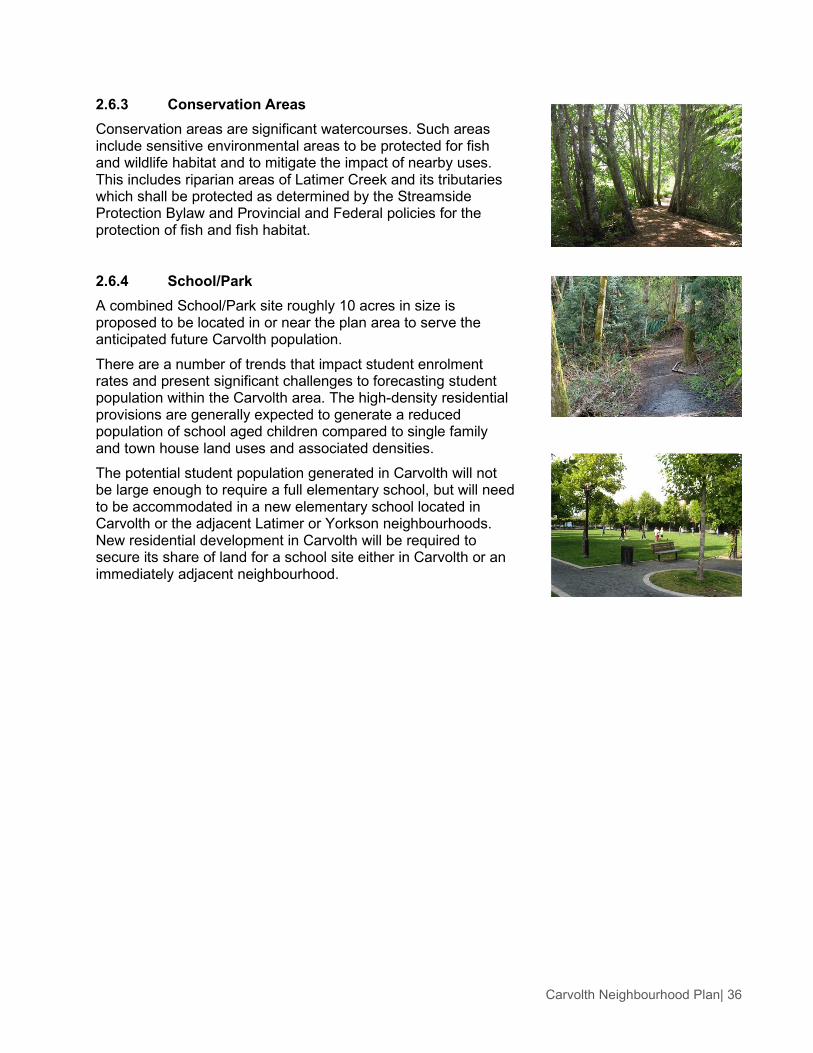
2.6.3 Conservation Areas Conservation areas are significant watercourses. Such areas include sensitive environmental areas to be protected for fish and wildlife habitat and to mitigate the impact of nearby uses. This includes riparian areas of Latimer Creek and its tributaries which shall be protected as determined by the Streamside Protection Bylaw and Provincial and Federal policies for the protection of fish and fish habitat.
2.6.4 School/Park A combined School/Park site roughly 10 acres in size is proposed to be located in or near the plan area to serve the anticipated future Carvolth population. There are a number of trends that impact student enrolment rates and present significant challenges to forecasting student population within the Carvolth area. The high-density residential provisions are generally expected to generate a reduced population of school aged children compared to single family and town house land uses and associated densities. The potential student population generated in Carvolth will not be large enough to require a full elementary school, but will need to be accommodated in a new elementary school located in Carvolth or the adjacent Latimer or Yorkson neighbourhoods. New residential development in Carvolth will be required to secure its share of land for a school site either in Carvolth or an immediately adjacent neighbourhood.

Carvolth Neighbourhood Plan| 37
2.6.5 Integrated Open Space Carvolth Integrated Open Space (IOS) is a linear greenway that provides a pedestrian link between 84 Avenue and 86 Avenue. These designated areas integrate stormwater capture, detention and release functions with public recreational and open space including parks, play areas for children and multi-purpose trails.
The IOS provides a link between residential and mixed-use areas. It will be lit throughout and planting will conform to Crime Prevention Through Environmental Design (CPTED) guidelines. Various seating areas are provided along the greenway with transitions from a natural character in the south to a more urban environment in the north.
The nature and the function of the different areas within the Integrated Open Space vary. While Carvolth Mews (1) is an aquatic compensatory habitat, Carvolth Commons (2) and High Street Plazas (3, 4) are pedestrian-oriented open spaces that integrate creative stormwater features, such as rain gardens or kinetic public art. Throughout the IOS, surface flow and the display of stormwater run-off is preferred to conventional methods of underground conveyance and piping.
The stormwater strategy for the IOS focuses on on-site infiltration and bio-filtration with backup detention and conveyance systems. The Carvolth Mews and the Carvolth Commons receive stormwater from adjacent properties. Along the length of the Carvolth Mews, runoff from roofs and other impervious areas is directed through overland flow or swales to the headwater wetland travelling the length of the Mews. This water is slowed by vegetation and check dams to facilitate infiltration into the soil below. In extreme storm events any overflow is captured in raingardens by an overflow catch basin and directed to the Carvolth Transit Exchange detention pond as shown in Figure 28. Otherwise the clean, cool and slow water will be piped to the Latimer Tributary at 86 Avenue where it will be slowly released into the natural water course.
In the Carvolth Commons runoff from impervious areas is directed through overland flow or swales to the central water course and raingarden.
The IOS drawings and illustrations are conceptual in nature and are intended to illustrate the vision and concept for the Integrated Open Space and its different components. They are to be used as the basis for more detailed design at the time of implementation. Future designs should also adhere to the Stormwater Source Control guidelines outlined in Section 3.4.12.
Figure 26. IOS Conceptual Site Plan.

Carvolth Neighbourhood Plan| 38
Carvolth Mews Carvolth Mews, between 84 Avenue and 85 Avenue, is intended to create the bio-physical model of a headwater wetland. Several connection points feed the constructed seasonal watercourse with stormwater run-off collected through bioswales, from the adjacent paved surfaces. The headwater wetland helps to slow the velocity of stormwater run-off and increase its quality through bio-filtration, before being slowly released at 85 Avenue to the Latimer Tributary at 86 Avenue. It is a densely vegetated area with native species and mesic plantings, dense organic soil, boulders and large organic debris to form an ecological unit. Several overflow catch basins should be installed at key locations as emergency spillways in case of a high storm event. A multi-use pathway meanders throughout Carvolth Mews for the use of residents and visitors alike. Several seating areas allow the passerby to rest and enjoy the ecological environment.
Figure 27. Carvolth Mews Typical Plan and Sections. Entry Trellis at Carvolth Mews.
Feature arbour.
Woody debris and native planting.
Natural wetland environment.
Boulders and vegetated bank.

Carvolth Neighbourhood Plan| 39
Carvolth Commons Carvolth Commons is a formal central park area that will provide an amenity area for local residents and visitors to the Carvolth neighbourhood. .Carvolth Commons is approximately 0.53 hectare (1.3 acres) in size. The open space includes a “natural” children play area, a spray park and an open lawn. A greenway/walkway is located along the perimeter of the Commons interfacing with adjacent high density apartment development. Feature arbours mark the entry to the park and to the perimeter greenway/walkway around the Commons. A wet detention pond/rain garden treats the stormwater run-off collected through bioswales from adjacent impervious surfaces.
Spray park.
Natural play area provides diverse opportunities for play and interaction with nature.
Meandering pathway and shade trees.
Figure 28. Carvolth Commons Typical Plan and Sections.

Carvolth Neighbourhood Plan| 40
Carvolth “High Street” Plazas Carvolth “High Street” Plazas are public open spaces adjacent to active, publicly oriented uses. South of 86 Avenue is a terraced plaza and featuring a stormwater channel. Open lawns will transition to hard surfaces to respond to a more dynamic, heavier pedestrian environment. North of 86 Avenue is a podium plaza with elevated planters and seating areas. The plaza spaces are flexible to allow for a wide range of activities including special events.
Figure 29. High Street Plaza Typical Plan and Sections. Creative use of water filtration.
Creative use of stormwater system.
Framed open lawn.
Paved plaza and water feature.

Carvolth Neighbourhood Plan| 41
Figure 31. High Street Plaza Typical Plan and Sections.
Figure 30. Public plaza situated along the Transit Village retail high street.
Vegetation creating outdoor rooms.
Seating spaces and walkways.
Different paving defining the space.

Carvolth Neighbourhood Plan| 42
2.6.6 Pocket Park/Plaza Located strategically to create green open space for sitting, eating lunch, resting or playing, a small urban park is approximately 0.2 hectare (0.5 acre) in size. Pocket Parks and Plazas are to be located as indicated on Figure 21. Pocket Parks and Plazas are to be provided, constructed and maintained by the adjacent private development and ensure public access and use according to the concept illustrated in Figure 32 and the accompanying images.
Seating and open lawn.
Trellis creating shade.
Figure 32. A typical plan of a pocket plaza.

Carvolth Neighbourhood Plan| 43
2.6.7 Stormwater Strategy Generally speaking, integrated stormwater management includes three main components or layers:
• Infiltrate the small events. • Detain the medium events. • Convey the large events.
The Carvolth Stormwater Strategy includes strategies for infiltration, detention and conveyance. The strategies outlined in this plan are meant to supplement the Latimer Master Drainage Plan (LMDP) with an emphasis on infiltration, both in the private and public realm. More detailed information on detention and conveyance is outlined in the LMDP.
The stormwater management strategy for Carvolth is one that integrates controls into the buildings and landscape near or at sources, rather than relying solely on large detention facilities downstream. The intent is to reduce the effective impermeable area (EIA) to pre-development conditions so to minimize the impact on downstream water receiving bodies.
Strategies specific to the public realm can be in found in Section 2.6.5 Integrated Open Space. These strategies apply specifically to the Integrated Open Space in the Carvolth area and are intended to increase onsite infiltration and provide educational opportunities for users of the site.
Strategies that apply to private development can be found in Section 3.4.12 General Design Guidelines: Stormwater Source Control. These guidelines provide direction to private developers to increase onsite infiltration and connect to the larger integrated stormwater management system.
Both the public realm and the private realm strategies introduce a performance based approach that recommends a combination of source controls and infiltration techniques. This approach is more flexible and allows some latitude to meet targets in a way that satisfies site-specific program requirements. Source controls can be in the form of the following:
1. Absorbent Landscapes Growing medium depths ranging from 300 mm to 1,000 mm for various planting applications will contribute significantly to the capture of the majority of rain events throughout the year. Water stored in soils becomes available to plant material and is cycled back into the atmosphere through evapotranspiration.
Figure 33. Bioswales can be implemented in many locations, including within a residential street ROW as shown above.
Figure 34. Green roofs store rainwater, help mitigate the urban heat island effect, and help to increase plant biodiversity.

Carvolth Neighbourhood Plan| 44
2. Raingardens Raingardens are planted depressions in the landscape designed to capture and hold runoff for a specified period. Water is held and slowly released into the receiving water body to mimic pre-development conditions. Runoff has time to drop sediment and cool, increasing water quality prior to release into downstream water bodies. Plant material that can tolerate periodic inundation is selected to stabilize soils, provide habitat and plant community diversity, and provide a positive visual amenity to the area.
3. Underground Storage and Release In many cases, a concrete tank or vault is constructed as part of development as a method to capture design target rainfall. The tank is constructed with observation/maintenance hatches and has a control mechanism to allow release of collected water at a prescribed rate into either surrounding subsoils or piped to a receiving water body. Overflow pipes convey water during storm events where the capacity of the vault is exceeded.
4. Green Roofs Green roofs, whether extensive or intensive, have the ability to capture and store rainwater in the pores between soil particles. Typically this can be 12-17% of the soil volume. It is likely impractical to store all of the design water capture targets in a green roof, but there are other benefits such as extending the life of the roof membrane by a factor of 3, reduced heat island effect, and increased plant biodiversity that make this option attractive to the municipality and property owners.
5. Bioswales and Infiltration Galleries The principle of bioswales and infiltration galleries is similar to a raingarden except that water is not visible during retention. Bioswales are designed to be of minimal gradients to allow collected water to percolate through soils into the subsoils below. Plant roots provide a soil stabilizing function and promote infiltration. Infiltration galleries can be located below or remote from a bioswale. They are essentially voids below the surface level substrate that allow incoming water to collect and infiltrate into subsoils. The finish over an infiltration gallery can be landscape, hard surfaces or permeable paving.
Figure 35. Raingardens are an attractive way to reduce stormwater runoff.

Carvolth Neighbourhood Plan| 45
SERVICING AND INFRASTRUCTURE
2.7.1 Water Existing Conditions A large part of the Carvolth Neighbourhood Plan area is a partially developed residential area consisting of large properties without any municipal water service. The existing homes are served by individual well water systems. Those areas that have been recently developed are primarily supplied with water from the Metro Vancouver transmission main from a source at Coquitlam Lake. The Metro Vancouver transmission main runs north – south along the eastern boundary (204 Street) of the plan area. The Metro Vancouver transmission main is connected to the existing Township of Langley water distribution system at three locations in the greater Northwest Langley area. The connection nearest to the plan area is located at 82 Avenue and 204 Street. There are additional Metro Vancouver connections at 96 Avenue and 201 Street and 73A Avenue and 204 Street. At all these locations there is a pressure reducing valve (PRV) station to provide adequate service pressure. The existing water system within the study area is currently divided into two pressure zones. Generally, properties adjacent to 200 Street and westward are in the 111m pressure zone. The areas north of Highway 1 are currently in the 81m pressure zone. Within the 111m pressure zone there is a well-developed network of existing mains including a 300mm diameter main along 200 Street, from 88 Avenue to the southern limit of the plan area, a 250mm diameter main along 86 Avenue, from approximately 196 Street to 200 Street, and a 250mm diameter main along 88 Avenue from the 19800 block to 201 Street. Currently the water distribution system within the plan area is undeveloped east of 201 Street and in the northwest corner of the plan area. A schematic plan of the existing water network can be found in Figure 36.

Carvolth Neighbourhood Plan| 46
Figure 36. Existing Servicing Plan: Water.

Carvolth Neighbourhood Plan| 47
Future Conditions The Township of Langley Master Water Plan Update (2008) recommends that the majority of the water system within the plan area be in the 81m pressure zone and only a small area in the southeast corner to be in the 111m pressure zone. To revise the current pressure zone boundaries to match the Township’s Master Plan, two new PRV stations are required at the boundaries of the pressure zones. One new PRV station is required along 200 Street at approximately 83 Avenue and a second PRV is required along 86 Avenue near 204 Street. Additional water distribution mains will also be required along the proposed new road alignments to service new developments including 196A Street, 87 Avenue, 201 Street, 202 Street, and 204 Street. Extensions of the existing water mains will also be required at various locations including those on 84 Avenue, 86 Avenue and 88 Avenue. A schematic plan for the future water network can be found in Figure 37.

Carvolth Neighbourhood Plan| 48
Figure 37. Proposed Servicing Plan: Water.

Carvolth Neighbourhood Plan| 49
2.7.2 Sanitary Sewer Existing Conditions A large part of the Carvolth Neighbourhood Plan area is a partially developed residential area consisting of large properties without any municipal sanitary sewer collection servicing. The existing homes are served by individual septic sewer systems. Those areas that have been recently developed, including the commercial developments at the Highway 1 Interchange and along the 200 Street corridor, have Township sanitary services. To provide services to these developments, a sanitary pump station is located near the plan area low point along 196 Street at 85 Avenue. Gravity sewers along 86 Avenue, 88 Avenue, and 198A Street collect sanitary sewer for discharge at this pump station. A force main runs from the pump station along 196 Street, east along 86 Avenue to the intersection at 200 Street. East of 200 Street a gravity sewer runs along 86 Avenue to 201 Street and eventually north across Highway 1 to Walnut Grove. The existing developed properties on the north side of Highway 1 are serviced with gravity sanitary sewer services directly from the Walnut Grove system. A schematic plan of the existing sanitary sewer network can be found in Figure 38.

Carvolth Neighbourhood Plan| 50
Figure 38. Existing Servicing Plan: Sanitary.

Carvolth Neighbourhood Plan| 51
Future Conditions In the future developed condition, sanitary sewer collected in the Carvolth Neighbourhood Plan area will continue to discharge north to Walnut Grove. Much of the sanitary sewer infrastructure required to provide service for the plan area has already been installed including a connection across Highway 1 and a sewage lift station. Generally, additional sanitary sewer mains required will be along all the proposed new road alignments to service new developments including 87 Avenue, 201 Street, 202 Street, and 204 Street. Extensions of the existing sewer mains will also be required at various other locations including those on 196A Street, 84 Avenue, 86 Avenue and 88 Avenue. The existing sanitary sewage pump station within the Carvolth Neighbourhood Plan area collects sanitary sewer from the significant areas outside of the plan area. A review of the pumping capacity will be required in conjunction with all development within the pump station catchment area including significant areas south of the plan area. A schematic plan for the future sanitary sewer system can be found in Figure 39.

Carvolth Neighbourhood Plan| 52
Figure 39. Proposed Servicing Plan: Sanitary.

Carvolth Neighbourhood Plan| 53
2.7.3 Stormwater Drainage The most significant drainage feature within the Carvolth Neighbourhood Plan area is Latimer Creek. Latimer Creek and its various tributaries originate within the Township of Langley and drain west into the Serpentine River which flows through the City of Surrey lowlands. Latimer Creek is a red coded stream which, by definition, indicates a year round presence of fish, both salmon and other regionally significant fish. As a joint initiative between the Township of Langley and the City of Surrey in response to the anticipated future development in Latimer Creek watershed, the Latimer Creek Master Drainage Plan was prepared. This Master Drainage Plan (MDP) was completed in 2003. The MDP indicates that the Latimer Creek watershed has a total area of 1036 hectares, of which 596 hectares are within the Township of Langley. The Latimer Creek MDP recommended various improvements to the existing drainage infrastructure within the catchment area to order to facilitate development. These recommendations included the construction of the community-based drainage ponds, culvert upgrades, and storm sewer diversions. The report indicates that six drainage ponds are required within Carvolth.1 The location of these ponds is primarily influenced by the natural topography of the area and the proximity of the downstream receiving water course. Existing Conditions A large part of the Carvolth Neighbourhood Plan area is a partially developed residential area consisting of large properties with rural road access. Drainage within these areas is predominately by roadside ditches and culverts. Within the areas that have been redeveloped for commercial use, various drainage mains and detention ponds have been installed. Drainage mains have been installed on 200 Street, 198A Street, and 85 Avenue while segments of drainage mains have also been installed on 86 Avenue, 88 Avenue, and 201 Street. Of the six detention ponds required by the Latimer Creek MDP, three have already been built. These include pond L3C near 19800 88 Avenue, pond L3A at the new transit exchange near 202 Street and Highway 1, and pond L4 at the southwest corner of 86 Avenue and 198A Street. Schematic plans of the existing drainage system can be found in Figure 40.
1 In the MDP these ponds are identified as L3A, L3C, L3-1, L4, and L4-1 and LC1-A. The MDP also indicates an existing detention pond identified as L3B, directly adjacent to the northern boundary of the plan area which serves the areas north of Highway 2 within the plan area.

Carvolth Neighbourhood Plan| 54
Figure 40. Existing Servicing Plan: Drainage.

Carvolth Neighbourhood Plan| 55
Future Conditions The Township of Langley bylaws require all new developments covered within a specific Master Drainage Plan must be in accordance with that plan. The Carvolth Neighbourhood Plan area falls entirely into the area covered by the Latimer Creek MDP, and therefore any new development must conform to the requirements of this plan. In order to proceed with a new development, the detention pond proposed for the projects specific catchment must be constructed in advance. The recommendations of the MDP include six community-based drainage ponds. Three of these drainage ponds have already been installed to facilitate the re-development that has already occurred in the plan area. The MDP further states that while the implementation of the community based pond is sufficient to control peak runoff, additional on-site drainage control policies are recommended. The Latimer Creek MDP also encourages the implementation of the Best Management Practices (BMPs) during the development of the catchment area. The recommended practices include:
• Reduced pavement width. • Grass lined swales. • Site grading that encourages infiltration. • Increasing road surface permeability. • Minimizing effective impervious areas. • Providing natural stream retention, buffer strips, and retaining vegetation.
As stated in the MDP, the effectiveness of these practices is dependent on the natural soil conditions and it will be the developer’s responsibility to investigate the soil conditions and select the most appropriate BMP. Schematic plans for the future drainage system can be found in Figure 41.

Carvolth Neighbourhood Plan| 56
Figure 41. Proposed Servicing Plan: Drainage.

Carvolth Neighbourhood Plan| 57
2.7.4 Road Network Infrastructure New road network connections as described in Section 2.5 of this plan will be in accordance with the Township of Langley’s Subdivision and Servicing bylaw. New Infrastructure Improvements Required A preliminary transportation impact assessment was conducted as part of the Carvolth planning process to determine the anticipated traffic to be generated given build out of the conceptual plan shown in section 2.3. A sketch plan demand modeling exercise was undertaken to assess the potential impact of proposed development on the surrounding road network. As a result of this exercise it is anticipated that full build out (including the Outlet Distribution Centre) would generate approximately 4,400 and 6,800 trips in the weekday AM and PM peak hours respectively as outlined in Table 1. Table 1. Trip Generation.
Description Period Vehicle Trips In Vehicle Trips Out
All Trips AM 4,753 2,412 PM 6,238 8,108
Less Internal Trips AM 350 161 PM 249 420
Less Pass-By Retail Trips AM 0 0 PM 834 868
Total Trips AM 4,403 2,251 PM 5,156 6,819
The ability of the future (2021) road network to accommodate the additional trips generated by the Carvolth conceptual plan is determined by the available road link capacity of existing and planned roads. Table 2 summarizes the road capacity required to accommodate development traffic in each direction of travel, assuming a lane capacity of 1,000 vehicles per lane. Table 2. Trip Assignment.
Description Period Vehicle Trips In Vehicle Trips Out
North AM 0.6 0.3 PM 0.7 0.9
East AM 0.8 0.4 PM 0.9 1.2
South AM 1.4 0.7 PM 1.6 2.1
West AM 1.2 0.6 PM 1.4 1.8
Taking into consideration the he limited capacity available in the surrounding road network, it is concluded that the Carvolth Neighbourhood Plan would require additional road capacity equivalent to one arterial lane in the north direction, two arterial lanes in the east and west directions, and three arterial lanes in the south direction.

Carvolth Neighbourhood Plan| 58
Road Capacity Improvements The following road link capacity improvements are recommended to accommodate anticipated traffic in Carvolth:
• Traffic to and from the north are limited to the use of the Golden Ears Bridge. This movement is, however, restricted by the current levels of congestion at the Highway 1 and 200 Street Interchange. Provision of a second freeway crossing would allow motorists to cross over the freeway and reroute back onto 200 Street to the north of Highway 1. This could be achieved by widening 208 Street and its freeway crossing to a 4-lane cross-section, which would provide one additional arterial lane capacity in the peak direction.
• Traffic to and from the east would ideally make use of Highway 1 to distribute to the eastern Fraser Valley. No road improvements are envisaged to serve outbound traffic, considering the location of the eastbound ramp terminal. Inbound traffic would, however, be restricted by the current levels of congestion at the 200 Street Interchange. Provision of a secondary access into the development area from the east would alleviate the demand on the already congested interchange. This could be achieved by providing the 216 Street Interchange. Continuity of the route to the development site would require widening of 80 Avenue to a 4-lane cross-section, which would provide two additional arterial lane capacities in the peak direction. It is likely a portion of the traffic currently using the congested 200 Street Interchange will reroute to also make use of the new interchange, thereby bringing some relief at 200 Street.
• Traffic to and from the south would ideally make use of 200 Street. A parallel arterial would be required to serve development traffic, which could be accommodated by constructing 202 Street to a 4-lane cross-section. This would provide two additional arterial lanes capacity in the peak direction.
• The additional road capacity required to serve development traffic to and from the south could be accommodated by constructing 201 Street to a 2-lane cross-section. This would provide one additional arterial lane capacity in the peak direction.
• The desired route for traffic to and from the west would be on Highway 1, but as mentioned previously, freeway accessibility is hampered by capacity constraints at the 200 Street Interchange. It is, however, anticipated that the additional capacity provision proposed along 208 Street would allow some traffic to reroute across Highway, 1 after which traffic can access the freeway westbound from the east.
• 88 Avenue is an alternative for traffic to and from the west. Additional road capacity would be required to serve development traffic, which could be accommodated by constructing 88 Avenue to a 4-lane cross-section. This would provide one additional arterial lane capacity in the peak direction. Taking into consideration the proximity of the light industrial land use to 88 Avenue, it would be advantageous to remove the heavy vehicle restriction currently in place. Otherwise truck traffic to and from the west would be forced to reroute to alternate roads such as 96 Avenue to the north, with the associated interchange capacity constraint, or the Fraser Highway and Highway 10 to the south, which in turn would necessitate additional road capacity to and from the south to access Carvolth. All these west side improvements require the approval and participation of the City of Surrey.
• The additional road capacity required to serve development traffic to and from the west could be accommodated by constructing 80 Avenue to a 4-lane cross-section. This would provide one additional arterial lane capacity in the peak direction.
• The additional road capacity required to serve development traffic in the Flex Employment II area could be accommodated by constructing 87 Avenue and extending 196 Street to intersect 88 Avenue at 196A Street. Alignment for these additional street connections can be found in Figure 17.

Carvolth Neighbourhood Plan| 59
The above road improvements represent additional road capacity improvements. A detailed traffic analysis would be required to quantify the extent of local road widening to achieve the desired intersections Levels of Service. Table 3. Road Improvements.
Direction Road Link Transportation Improvements
Internal
196 Street Extend to 88 Avenue
198 A Street Extend to 88 Avenue
87 Avenue Connect 196 Street and 198A Street
North 208 Street Widen to 4-lane cross-section, including the Highway 1 overpass
East Highway 1 Provide 216 Street Interchange
80 Avenue Widen to 4-lane cross-section
South 202 Street Provide 4-lane cross-section
201 Street Provide 2-lane cross-section
West 88 Avenue
Widen to 4-lane cross section
Remove heavy vehicle restriction
80 Avenue Widen to 4-lane cross section
2.7.5 Neighbourhood Energy Infrastructure There are measureable energy and carbon performance improvement opportunities that can be achieved with neighbourhood-scale infrastructure. These opportunities complement a suite of policies under Land Use: Sustainable Building Energy, Section 2.4.17. For further detail on these opportunities, see HB Lanarc - Golder’s Carvolth Sustainable Energy Study prepared in 2013. High-Efficiency Outdoor Lighting Lighting engineering standards for Carvolth will reflect the current best practice for efficiency, light pollution reduction, and service optimization. Best practices should be used for balancing safety with motion and photo-sensitive exterior lighting. Complementary lighting policies are included for the private realm under the Design Guidelines, Section 3.4. District Energy A district energy (DE) system for residential and commercial buildings in Carvolth will be evaluated in tandem with other opportunities in the Township. Community benefits including energy savings and reduced reliance on fossil fuels as well as technical potential, ownership, governance and policy implications will all be considered.
• If feasible from technical, policy and economic perspectives, the following infrastructure, policy and planning priorities for the neighbourhood, should be considered:
• Updating infrastructure plans to include DE piping and servicing in all rights-of-way. • Evaluating the appropriateness for Carvolth to be designated a District Energy Service Area,
requiring buildings be designed and constructed with hydronic heating/cooling systems and mechanical room space for DE equipment and connection.

Carvolth Neighbourhood Plan| 60
• Allocating space for a DE Energy Plant near the area with the highest demand for heating. • Encouraging phasing so that the largest buildings will not be constructed until a DE system
is in place, and so that development will radiate outward from that area in order to ensure development of heat demand over the short and medium term.
FINANCING AND IMPLEMENTATION
2.8.1 Financing The financial strategy is intended to assist in the orderly, cost effective and equitable development of the neighbourhood. It is based on principles that the Township will not finance, nor assume a financial risk, in the provision of engineering services required to support private development. As such, water, sanitary sewer, drainage, roads and parks are to be funded by development proponents or through the collection of Development Cost Charges (DCCs) together with other appropriate cost recovery mechanisms. Finally, it is the responsibility of the property owners and/ or the proponents of development to front-end the construction of engineering services. DCCs are levied against new development to assist in the financing of new servicing infrastructure and amenities required by, and benefiting new development. The Township’s DCC Bylaw sets rates for each engineering service and for parks and describes when and how they are to be paid. Rates are uniform across the Township so that similar developments are levied at the same rate regardless of their location. DCCs may exceed or be in deficit within an individual neighbourhood. Infrastructure that is eligible to be funded with DCC revenue is identified in the Township of Langley’s DCC program. An analysis of Carvolth’s sanitary sewer, water, roadwork and drainage servicing requirements was undertaken in order to identify DCC eligible infrastructure and amenities in section 2.7: Servicing and Engineering. Water, Sanitary Sewer and Stormwater services are to be solely funded through the collection of Development Cost Charges (DCC’s) or other appropriate cost recovery mechanisms. It is the responsibility of the property owners and/ or the proponents of development to front end the construction of engineering services. At present, the Township has infrastructure financing policies in place and has previously negotiated specific agreements to permit property owners to receive DCC credits to assist in the cost recovery of DCC works that they have constructed. It is Township Policy that property owners are responsible for front-ending all municipal infrastructure and amenities. Cost recovery agreements such as DCC credits, development works agreements, latecomer agreements and private agreements are available. Each of these offers the ability for front ending property owners to recover a proportion of their infrastructure investments.
2.8.2 Implementation and Phasing The implementation strategy identifies prerequisites to development and development phasing, and specific requirements for development permits. Development Prerequisites The following general prerequisites must be satisfied prior to the adoption of a rezoning bylaw or issuance of a Development Permit in any phase. This list is not deemed to be exhaustive, as other requirements may be added based on site specific conditions and changes to Township bylaws, policies and procedures.
• Although the student population in Carvolth is not anticipated to be large enough to require a full elementary school, prior to any rezoning bylaw accommodating residential development in Carvolth:

Carvolth Neighbourhood Plan| 61
» An elementary school and neighbourhood park site must be secured in Carvolth or an immediately adjacent neighbourhood (i.e., Yorkson or Latimer); and,
» Residential development in Carvolth must contribute its proportionate share of an elementary school and neighbourhood park site to the acceptance of the Township and School District prior to the approval of any rezoning bylaw accommodating residential development.
• Enter into a Servicing Agreement with the Township to secure required road and utility upgrades/extensions, and a stormwater management plan in accordance with the servicing provision of this neighbourhood plan together with existing servicing standards as set out in the Township’s Subdivision and Development Control Bylaw and the Erosion and Sediment Control Bylaw as amended from time to time.
• Secure road dedications and widening in accordance with Sections 2.5 and 2.7.4 of this plan, the Subdivision and Development Control Bylaw and the Master Transportation Plan as amended from time to time, to the acceptance of the Township of Langley.
• Compliance with Subdivision and Development Servicing Bylaw 2011 No. 4861 (Tree Protection), including provision of a final tree management plan incorporating tree retention, replacement and protection details, to the acceptance of the Township of Langley.
• Transfer any designated greenway, trail, pocket parks, plazas or any other greenspace as shown on the land use plan, including lands designated Integrated Open Space, to the acceptance of the Township of Langley.
• Where green space is designated on the subject lands, security must be provided within the Servicing Agreement for all approved Greenway / Trail construction.
• Compliance with the Streamside Protection Bylaw 2006 No. 4485 (as amended from time to time);
• Implementation of Streamside Protection and Enhancement Development Permit Areas (SPEDPAs) as determined by the process to comply with the Streamside Protection Bylaw, or as outlined in the NP, or as determined by DFO, including dedication as municipal lot or protection by restrictive covenant of SPEDPAs.
• Provide a Stage 1 Preliminary Site Investigation (Environmental), to the acceptance of the Township, where land is proposed to be transferred to the Township for conservation, park, greenway and/or trail use. If any indicators of site contamination are found during this initial assessment, a Certificate of Compliance (or equivalent) will be required to be submitted to and accepted by the Township. All remedial work will be at the sole cost of the proponent.
• Secure (through the Servicing Agreement) fencing for all developments that abut the greenways, parks and environmental area to municipal standard and to the acceptance of the Township of Langley.
• Secure public access right-of-way through developments for roads and sidewalks only. Public access shall not extend to on-street parking.
• Registration of restrictive covenants that may include, but not be limited to Non-disturbance setbacks Driveway access/ location and Building setback restrictions.
• Register a restrictive covenant on title for the maintenance and upkeep of the Pocket Parks and Plazas. The covenant shall address preventing developments construction or placement of any barriers such as fences, gates and signage that would prevent or discourage public access through these areas.
• Payment of rezoning, development permit and neighbourhood planning fees and open space levy.
• Consideration should be given to servicing cost recovery strategies, such as Latecomers Agreement, Development Works Agreement, and DCC rebates to the acceptance of the Township of Langley.

Carvolth Neighbourhood Plan| 62
• Consideration may be given to a Phased Development Agreement to stage development in line with infrastructure and amenity requirements to the acceptance of the Township of Langley.
• Density and uses as identified in Figure 8 Land Use Plan and described in Sections 2.4.2 to 2.4.15 may not be transferred but rather, is as identified and laid out Figure 8 Land Use Plan.
• Regionally serving Outlet Distribution Centre uses described under the Flex Employment II designation as identified in Figure 8 Land Use Plan and described in Section 2.4.7 may be considered if requested by a proponent subject to the following conditions: » As part of an application for rezoning, the proponent must develop a Master
Development Plan (MDP) that documents in detail how the proposed development will meet the intent of the vision, goals and objectives of this plan. The MDP must clearly articulate in detail all impacts associated with the proposed development and propose strategies to mitigate these impacts. Impacts to address include but are not necessarily limited to urban design quality, automobile orientation and transportation demand management, and stormwater approach.
» At the time of rezoning, the proponent must undertake a detailed Transportation Impact Assessment (TIA) at the full cost of the proponent, to be carried out independently by a qualified Engineering Consultant to be selected and managed by the Township. The TIA will be required to determine the transportation impact associated with development and identify necessary infrastructure upgrades including consideration of upgrades identified in section 2.7.4 to adequately service and accommodate the proposed development. The TIA will further be required to identify appropriate transportation demand management strategies to mitigate impacts of proposed development. The TIA will be paid for in full by the proponent.
» Funding for the necessary transportation infrastructure upgrades identified in the TIA will be through the Flex Employment II Amenity Zoning Policy. The Flex Employment II Amenity Zoning Policy will be required as part of the MDP and subsequent re-zoning.
» Provision of high amenity open space design including plazas, mews and pocket parks and appropriate planting, lighting, water features etc.
2.8.3 Severability If any section, subsection, clause or phrase of this Bylaw is for any reason held to be invalid by the decision of a court of competent jurisdiction, the invalid portion shall be severed and the decision that is invalid shall not affect the validity of the remaining parts of this Bylaw.
3. DESIGN GUIDELINES OVERVIEW
Urban design is the comprehensive and cohesive combination of buildings, streets, and open spaces to create memorable public spaces. The essence of good urbanism is determined by the relationship between the public and private realm. Buildings, streets, and other public open spaces scaled and designed for human comfort and use are essential to the creation of a functional, aesthetically rich and vibrant neighbourhood.

Carvolth Neighbourhood Plan| 63
JUSTIFICATION AND INTENT The broad intent of these design guidelines is to help shape and support high quality, attractive, functional urban design and a unique sense of place in the various Carvolth character areas. Specifically, the intent of the Carvolth Design Guidelines is:
• To emphasize building and open space design that enhances pedestrian activity, amenities, and safety.
• To encourage energy efficiency and low carbon building and neighbourhood design. • To foster transit oriented design. • To guide development of the Carvolth Neighbourhood as a major urban gateway to the
Township with a high quality of design and a unique identity and sense of place.
The Carvolth Design Guidelines translate Township objectives and policies and into a set of design strategies and approaches to help guide the development review process for both private and public realm development.
DESIGNATION The Carvolth Development Permit Area is identified in the Willoughby Community Plan as Development Permit Area “M”. The lands identified on Figure 42: Carvolth Development Permit Area are designated under the following sections of the Local Government Act:
• 919(1) (e) establishment of objectives for the form and character of intensive residential development.
• 919(1) (f) establishment of objectives for the form and character of commercial, industrial or multi-family residential development.
• 919(1) (h) establishment of objectives to promote energy conservation. • 919(1) (i) establishment of objectives to promote water conservation. • 919(1) (j) establishment of objectives to promote the reduction of greenhouse gas
emissions.
These sections of the Local Government Act allow regulation respecting the character of development within the Development Permit Area, including landscaping, and the siting, form, exterior design and finish of buildings and other structures, as justified by the special conditions and objectives in Section 3.2 of this Plan.

Carvolth Neighbourhood Plan| 64
In addition, Development Permit Area “F” - Agricultural Land Reserve, as identified in the Willoughby Community Plan, also applies to the Carvolth Neighbourhood Plan area. See Section 4.3.2 of the Willoughby Community Plan for details.
Figure 42. Carvolth Development Permit Area.

Carvolth Neighbourhood Plan| 65
GENERAL GUIDELINES The general guidelines described below will apply to all new development in the Carvolth area. They are premised on urban design principles that will create a vibrant and accessible urban environment that promotes pedestrian activity and street life.
3.4.1 Connectivity The intent of these guidelines is to ensure a highly connective street and open space network that creates more route options for pedestrian and bicycle traffic traveling to, from and within the downtown, and direct connections to key amenities and destinations within and adjacent to Carvolth.
• Look for opportunities to create additional mid-block pedestrian pathways to increase the number of pedestrian connections within and through the site.
3.4.2 Street Definition The intent of these guidelines is to site and design buildings to positively frame and define streets and other public open spaces, and to ensure a positive response to specific site conditions and opportunities.
• Minimize the distance buildings are set back from the sidewalk to create good street definition and a sense of enclosure.
• Build ground floor commercial uses up to the front property line to maintain a continuous commercial street frontage and positive street definition. A setback may be considered where there is a courtyard or other feature that benefits the pedestrian experience or responds to the building setback of an adjacent property.
• New developments with tall buildings (over 4 storeys in height) should incorporate a base building or street-wall at a scale similar to adjacent buildings and appropriate to the street width.
• Buildings should be sited and designed to create the following general building height to street width proportions: » 1:1 - 1:5 for mews or courtyards. » 1:2 - 1:3.5 for residential and commercial streets. » 1:3 - 1:5 for squares, plazas or wide boulevards.
Figure 43. Mid-block pedestrian pathways increase connectivity.
Figure 44. Buildings and street trees can be used to create “street definition”.
Figure 45. Use a common “build to line” to create a street definition and a sense of enclosure.

Carvolth Neighbourhood Plan| 66
3.4.3 Height and Massing The intent of these guidelines is to reduce the visual mass of large buildings, and ensure the sensitive transition from new development or redevelopment to existing adjacent buildings and open spaces.
• Site and design buildings to respond to specific site conditions and opportunities, including: prominent intersections, corner lots, steep topography, natural features, prominent open spaces and views.
• New development should reflect significant natural topographic features. Buildings should be designed to step down hillsides to accommodate significant changes in elevation and to connect with and transition well to the sidewalk and street.
• Break up the visual mass of large buildings to reduce their visual impact on the pedestrian realm and create variation along the street. Limit the visual mass of building facades to lengths of 40m or less.
• Buildings over 3 storeys in height shall have a maximum frontage length of 80m.
• Buildings 3 storeys in height or lower shall have a maximum frontage length of 40m.
• Buildings up to 4 storeys in height should step back the top storey back by a minimum of 1.5m.
• Building of 5 to 6 storeys in height should step back the top two storeys by a minimum of 1.5m.
• Minimize impacts from sloping sites on neighbouring development. Examples of treatments to minimize impacts include using terraced retaining walls of natural materials, or stepping a building to respond to the slope.
3.4.4 Active Frontages The intent of these guidelines is to ensure buildings are sited and designed to be welcoming, and encourage street vitality, visual interest, and safety.
• Site and orient buildings to overlook public streets, parks, walkways and communal spaces.
• Incorporate frequent entrances into commercial frontages facing the street with a maximum spacing of 15m. Ensure that these are active entrances. A maximum spacing of 10m for entrances is desired along retail high streets.
Figure 46. The base massing of this taller building should complement setbacks and heights of adjacent buildings.
Figure 47. Step buildings down to respond to the natural topography of the site.
Figure 48. Limit the visual mass of building façades to lengths of 40 m or less.

Carvolth Neighbourhood Plan| 67
• Recess building entrances by a minimum of 0.6m to provide for door swings, weather protection and to visually emphasize the building entrance.
• Large floor plate commercial developments shall respond to the prevailing street character along all commercial streets by incorporating small, transparent storefronts with frequent entrances.
• Large format commercial buildings with compatible uses should incorporate smaller shops wrapped around outside edges to better integrate these buildings and uses and make them more compatible with the desired character of the Carvolth area.
• Avoid expansive blank walls (over 5m in length) and retaining walls adjacent to public streets. When blank walls and retaining walls are unavoidable, use design treatments to break up the visual impact such as: » A vertical trellis with climbing vines or other plant
materials. » Wall setbacks to provide room for planters. » Wall murals, mosaics or other artistic features. » Quality materials of different colours and textures. » Special lighting, canopies, awnings, horizontal trellises or
other human-scale features. • Provide pedestrian access to buildings from the adjacent
public street, and orient upper-storey windows and balconies to overlook adjoining public open spaces.
• On corner sites, develop street-facing frontages for both streets and design front elevations with pronounced entrances oriented to the corner and/or primary streets.
• Maintain site lines from inside the buildings to public open space to allow for casual surveillance of the street and sidewalk.
• Ensure a minimum glazing area of 75% for frontages at grade along all commercial streets.
Figure 49. Vertical setbacks break up the visual mass of buildings.
Figure 50. When unavoidable, blank walls should be screened to make it more visually interesting.
Figure 51. Orient buildings to, and provide direct pedestrian access from, the adjacent public street/sidewalk.

Carvolth Neighbourhood Plan| 68
3.4.5 Weather Protection The intent of these guidelines is to provide comfort for pedestrians and enhance the pedestrian function of public streets through the provision of weather protection.
• Provide continuous weather protection along building frontages immediately adjacent to public streets, sidewalks or open space.
• Ensure that the depth, height and angle of weather protection are adequate to protect pedestrians from rain or snow that may be blown by the wind. » The width to height ratio should be 1:1 to 1:1.4. » The minimum height should be 2.5 m.
• Where sloping sidewalks occur, break up awnings and canopies into modules, and terrace them down to follow the profile of the street.
• Design canopies extending over building frontages greater than 30 m to reduce their apparent scale and length by, for example, breaking up the canopy to reflect the architecture and fenestration pattern of the building facade.
Figure 52. Weather protection to enhance pedestrian comfort.
Figure 53. Canopies provide weather protection over a large area in front of buildings.
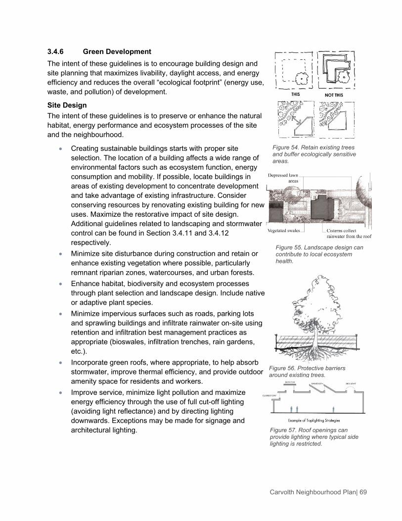
Carvolth Neighbourhood Plan| 69
3.4.6 Green Development The intent of these guidelines is to encourage building design and site planning that maximizes livability, daylight access, and energy efficiency and reduces the overall “ecological footprint” (energy use, waste, and pollution) of development.
Site Design The intent of these guidelines is to preserve or enhance the natural habitat, energy performance and ecosystem processes of the site and the neighbourhood.
• Creating sustainable buildings starts with proper site selection. The location of a building affects a wide range of environmental factors such as ecosystem function, energy consumption and mobility. If possible, locate buildings in areas of existing development to concentrate development and take advantage of existing infrastructure. Consider conserving resources by renovating existing building for new uses. Maximize the restorative impact of site design. Additional guidelines related to landscaping and stormwater control can be found in Section 3.4.11 and 3.4.12 respectively.
• Minimize site disturbance during construction and retain or enhance existing vegetation where possible, particularly remnant riparian zones, watercourses, and urban forests.
• Enhance habitat, biodiversity and ecosystem processes through plant selection and landscape design. Include native or adaptive plant species.
• Minimize impervious surfaces such as roads, parking lots and sprawling buildings and infiltrate rainwater on-site using retention and infiltration best management practices as appropriate (bioswales, infiltration trenches, rain gardens, etc.).
• Incorporate green roofs, where appropriate, to help absorb stormwater, improve thermal efficiency, and provide outdoor amenity space for residents and workers.
• Improve service, minimize light pollution and maximize energy efficiency through the use of full cut-off lighting (avoiding light reflectance) and by directing lighting downwards. Exceptions may be made for signage and architectural lighting.
Figure 54. Retain existing trees and buffer ecologically sensitive areas.
Figure 55. Landscape design can contribute to local ecosystem health.
Figure 56. Protective barriers around existing trees.
Figure 57. Roof openings can provide lighting where typical side lighting is restricted.

Carvolth Neighbourhood Plan| 70
• Where possible, locate new buildings within a five minute walk (400 metres) of frequent public transit and provide alternative transportation incentives such as bike storage, change rooms and priority parking for bicycles, carpool vehicles or alternative fuel vehicles.
• Retrofit existing building where possible and look for opportunities to intensify use adjacent to existing infrastructure.
Energy Performance The intent of these guidelines is to optimize building energy performance and where possible use energy from renewable sources.
• In this section it is important to balance complementary and competing priorities for passive design (efficiency, heating, cooling, daylighting and ventilation) to optimize energy performance and cost. Consider site and building constraints and the specific commercial, residential and institutional application in building design.
• Orient buildings to optimize passive solar energy potential. Most solar energy gain can be achieved when facing within around 20 degrees of solar south. For single loaded buildings, orient the building on an east-west axis and/or ensure a south facing roof aspect. For buildings that are double loaded, consider orienting the building on a north-south axis to ensure that units on both sides of the building receive some amount of solar exposure.
• To cost-effectively limit heat loss, limit fenestration to 40% of the total facade area (window to wall ratio). If higher fenestration ratios are desired, compensate with highly efficient windows. Fenestration should be emphasized on southern and western exposures and be minimized on northern and eastern exposures.
• Maximize daylight penetration by locating windows high on walls or by using clerestories and light shelves.
• Ensure solar shading with an emphasis on those buildings with high window to wall ratios. The benefits of reducing solar gains in summer should be balanced with the benefit of solar gains in the winter by taking advantage of the different seasonal sun angles. External shading such as recessed balconies, overhangs, and louvers are preferable over internal shading such as internal blinds.
Figure 58. Buildings oriented to maximize use of solar energy.
Figure 59. Corner and through units facilitate natural ventilation and daylight access.
Figure 60. Sun shade diagrams can help determine the siting of buildings to minimize overshadowing of adjacent open spaces and buildings.
Figure 61. Through units allow for natural ventilation and increased daylight access.

Carvolth Neighbourhood Plan| 71
• Balance narrow floor plans that increase the potential for cross ventilation and penetration of daylight into the building with minimizing the envelope to floor area ratio to optimize thermal efficiency.
• Design with greater floor-to-ceiling heights to increase the amount of interior space that can be lit from windows.
• Buildings should be narrow to increase the amount of interior space with access to day-lighting and winds for passive ventilation. Buildings with through units (i.e., units with exterior walls on at least two sides) can be created by incorporating a mews or central courtyard into the form and design of low rise buildings or into the base massing of tall buildings.
• Design residential buildings to receive daylight and natural ventilation from at least two sides of the building, or from one side and a roof. Where possible, dwellings should have a choice of aspect: front and back, or on two sides (for corner units).
• Ensure that the siting, form, and scale of buildings do not block significant views and solar access from existing or anticipated development, and that shadowing impacts on adjacent residential buildings and usable open spaces are minimized. Proposals for new projects should include sun/shade diagrams of the subject development and the surrounding properties at the following times: » Equinox: 8 a.m., 12 noon, 4 p.m. » Winter Solstice: 9 a.m., 12 noon, 3 p.m.
• Incorporate courtyards and greenways in residential and mixed-use projects to maximize the amount of direct sunlight received.
• Landscaping and building design should ensure solar access in winter and in summer provide shading of afternoon sun and reduce the urban heat island effect. Provide deciduous landscaping and/or shading devices on southern and western exposures.
• For all outdoor lighting, use efficient lighting design such as LEDs and motion or photo-sensitive lighting.
• Use energy efficient fixtures and design lighting for specific needs to reduce ambient lighting requirements.
Figure 62. Ensure light penetration into interior living spaces in winter, and protection from direct sunlight in the afternoon hours of summer.
Figure 63. Slender building forms enhance daylight penetration and cooling through cross ventilation.
Figure 64. Sun shading devices reduce lighting and cooling demands and protect the building envelope from pre-mature aging.

Carvolth Neighbourhood Plan| 72
• Acquire at least 5% of the building’s total energy through the use of on-site renewable energy systems with an emphasis on heating and cooling systems such as geo-exchange, air-source heat pumps, heat recovery from wastewater, biomass, or solar thermal. If a District Energy system is established in Carvolth, connection to the system could be considered to meet this guideline.
Water The intent of these guidelines is to protect and conserve fresh water resources.
• Limit or eliminate the use of potable water for landscape irrigation by using high-efficiency irrigation technology, captured rain or recycled site water and/or drought tolerant plant species.
• Design landscaping and select plants that are appropriate for the local climate, minimizing irrigation needs.
• Design lawns for residential and commercial use, rather than aesthetics, minimizing unnecessary irrigation.
• Reduce the generation of wastewater and potable water demand by using captured rainwater for sewage conveyance or by treating wastewater on site to tertiary standards.
• Employ water efficiency strategies such as water-conserving plumbing fixtures, appliances and control technologies.
3.4.7 Public Realm The intent of these guidelines is to ensure that the design of streets and open spaces creates visual interest, comfort and safety for pedestrians and contributes to a unique local identity and sense of place.
• Provide a continuous planting of street trees along both sides of streets in residential, commercial and office neighbourhoods.
• Provide a zebra- or ladder-painted crosswalks, or crosswalks made of special paving materials, at all key pedestrian crossings to increase driver awareness.
• Curb to curb widths of local streets should be as narrow as practical to accommodate expected traffic and services.
• Incorporate corner bulges into streetscape design to enhance pedestrian crossings and provide space for landscaping, stormwater management, seating and public art.
• Ensure a continuous public sidewalk on both sides of the street throughout the Carvolth area.
Figure 65. Shared composting facilities.
Figure 66. Buildings should be designed and oriented to encourage casual surveillance and “eyes on the street.”

Carvolth Neighbourhood Plan| 73
• Provide street furnishings, including transit shelters, benches, lighting, and waste receptacles to enhance the public realm.
• Cafes are permitted and encouraged on public sidewalks in commercial areas provided that safe passage for pedestrian and emergency services is maintained.
• Pedestrian-oriented lighting should be provided throughout residential, commercial and office areas.
• Distinctive bus shelters or deep canopies should be provided along major transit routes to provide comfort for transit users.
• Hydro kiosk/utility boxes to be incorporated wherever possible into landscape areas to reduce visual impact.
3.4.8 Safety, Security and Accessibility The intent of these guidelines is to enhance personal safety and security through building siting, orientation, and design, and to ensure buildings and open spaces accommodate and provide access for all users and abilities.
• Ensure the design of new development increases “eyes on the street” with the placement of windows, balconies and street-level uses, and allows for casual surveillance of parks, open spaces, and children’s play areas.
• Avoid blank, windowless walls that do not permit residents or workers to observe public streets and open spaces.
• Incorporate the creative use of ornamental grilles over ground-floor windows or as fencing, as necessary/appropriate.
• Provide adequate lighting along streets and at entrances to enhance the sense of personal safety and security.
• Design parking areas to allow natural surveillance by retaining clear lines of sight to and between public sidewalks and building entrances for those who park there and for users of nearby buildings.
• Ensure CPTED principles are adhered to with respect to landscape design and construction.
• Ensure all pedestrian routes including those leading to building entrances are safe and easy to use by a wide range of pedestrian abilities. Generally, such routes should be direct, level, obstacle-free, easily identifiable and clearly separated from vehicular routes.
Figure 67. Buildings oriented to the street with clear definition of the transition from public to private realm help to promote neighbourhood safety and security.
Figure 68. Security grilles can be incorporated in an attractive way.

Carvolth Neighbourhood Plan| 74
3.4.9 Tall Buildings The intent of these guidelines is to encourage siting, massing and design that minimizes negative impacts on views, privacy, and solar access for individual units, reduce the perceived bulk of tall buildings, and minimize impacts of tall buildings on adjacent public streets and open spaces.
Tall Buildings are defined as buildings over 6 storeys or 18 m in height. In addition to the preceding general guidelines (Sections 3.1 - 3.12), the following tall building guidelines are applicable to development proposals that include buildings over 6 storeys in height.
• An open spacing of tall buildings should be maintained to ensure adequate light, air, access and views for residents.
• The minimum facing distance between tall buildings should be 40 m.
• The placement of tall buildings should achieve a diagonal spacing to avoid tall buildings looking directly into each other.
• Tall buildings should have a maximum floor plate size of 700 sq. m.
• Tall buildings should have a maximum floor plate width of 24 m.
• The bulk of towers should be minimized using vertical and horizontal articulation, for example, by incorporating changes of plane, stepped terraces or modulated plan and facade forms.
• Tall buildings should have a maximum height of 50 m, excluding appurtenances and mechanical equipment.
• Tall buildings should generally be aligned parallel to the street in a north-south direction.
• New developments with tall buildings should incorporate a base building sited and scaled to complement adjacent buildings and to create a strong street edge definition. (See section Street Definition Guidelines, section 3.3).
• Tall buildings should incorporate ground floor uses that have views into and, where possible, access to, adjacent streets, parks and open spaces.
• Tall buildings should be set back a minimum of 5 m from the fronting public street or open space, while still achieving good address on the fronting public street or open space.
Figure 69. Tall buildings.
Figure 70. Ensure vertical and horizontal articulation.
Figure 71. Spacing of tall buildings.
Figure 72. Variation in tower form and design should be achieved.

Carvolth Neighbourhood Plan| 75
• Tall building address should be achieved by stepping back the base building (podium) at the primary entrance of tall buildings to allow the tall building to meet the street and by locating main building entrances so that they are clearly visible and directly accessible from the public sidewalk, plaza or other open space.
• An interesting and varied roof form should be achieved, for example, by incorporating a top pent house or amenity space to conceal appurtenances and mechanical equipment.
3.4.10 Master Planning Tall Buildings and Large Sites The intent of these guidelines is to ensure the integration of larger sites and sites with tall buildings with adjacent areas.
Proposals for Large Sites and sites with Tall Buildings should include a master plan. Master planning will enable tall buildings to be sited and organized in a way that provides desirable transitions to adjacent areas and ensures appropriate tall building separation. More broadly, a master planning process will help knit the public realm into a single, cohesive whole as demonstrated by the illustrative concept plan and encouraged by the design guidelines.
A Master Plan is to be provided at both the neighbourhood scale and the site or block scale and should reflect the intent of the Integrated Area Concept Plan (Figure 7) and Design Guidelines.
Tall Buildings are defined as buildings over 6 storeys or 18 m in height. Large Sites are defined as those over 5000 sq. m in size. However, the Township may, at its discretion, identify other sites with special characteristics or conditions where master plans will be required. A Master Plan for Large Sites and sites with Tall Buildings should describe in drawings and words for the site and its context the following issues:
• The location and dimensions of public streets, parks and accessible open spaces.
• General location and dimensions of pedestrian circulation and relationship to pedestrian sidewalks and paths, transit stops and shelters.
• General location of building footprints - base buildings and taller buildings. • General layout and dimensions of setbacks from streets, parks and open spaces, as well as
dimensions between base and tall buildings on the same site. • General location of building entrances for each building. • General location and dimensions of site access, service areas, ramps, drop-off and parking
for each building. • The location of watercourses including non-disturbance areas. • Phasing plan and schedule. • Perspective showing important views.
Figure 73. Master planning should reflect the pattern of streets, open spaces and built form described in this plan.

Carvolth Neighbourhood Plan| 76
• Shadowing impacts on adjacent buildings and open spaces using sun/shade diagrams at the following times: » Equinox: 8 a.m., 12 noon, 4 p.m. » Winter Solstice: 9 a.m., 12 noon, 3 p.m.
3.4.11 Parking, Servicing and Access The intent of these guidelines is to ensure the provision of adequate servicing, vehicle access, and parking while minimizing negative impacts on the safety and attractiveness of the pedestrian realm.
• Structured underground or “tuck-under” parking is preferred over off-street surface parking.
• Where off-street surface parking is unavoidable, it should be located to the rear of the building with parking access from the lane or side street.
• Off-street parking located between the front face of a building and the public sidewalk is not permitted.
• If surface parking is located beside the building and adjacent to the public sidewalk, screen these areas from sidewalks and other active open spaces using materials that provide a visual buffer while still allowing clear visibility into the parking areas to promote passive surveillance.
• Locate public on-street parking at the curb to provide convenient and easy access to commercial/residential entrances.
• In general, vehicular access should be from the lane. Where there is no lane, and where the reintroduction of a lane is not possible, access may be provided from the street, provided that: » The street is not a primary retail high street. » Access is from the long face of the block. » There is no more than one interruption per block face
and only one curb cut on the street. • Any vehicular entrance and its associated components
(doorways, ramps, etc.) should be architecturally integrated into the building so as to minimize the visual impact. » Avoid ramps located directly off the street or lane. » Use treatments such as screening, high-quality finishes,
sensitive lighting and landscaping to minimize the visual impact of parking ramps and entrances.
• Incorporate pedestrian pathways and landscaping into surface parking areas. Pedestrian sidewalks should be incorporated into islands to minimize conflict with vehicles.
Figure 74. Off-street parking uses should not be located between the front of a building and the public sidewalk.
Figure 75. Access to underground parking should be architecturally integrated to minimize the visual impact.
Figure 76. Screen surface parking using a trellis, landscaping, or climbing vines that maintain site lines.

Carvolth Neighbourhood Plan| 77
• Bicycle parking should be located in a visible, active and well lighted area convenient to primary building access and bike route access.
3.4.12 Lighting The intent of these guidelines is to contribute to the overall quality, character and safety of the Carvolth area.
• Illuminate building facades and features by providing architectural lighting on the face of commercial and office buildings and at the main entrances to multi-family residential buildings to help create a sense of safety and intimate space around the building.
• Light paths and entry areas sufficiently to ensure pedestrian comfort and safety while avoiding visible, glaring light sources.
3.4.13 Landscaping The intent of these guidelines is to contribute to the overall quality, character and ecological function of the Carvolth area.
• Use landscaping to create a positive interface between buildings and streets by using perennials, shrubs, and trees to soften buildings where appropriate.
• Use hard landscape features such as terraced retaining walls and planters to transition between grades.
• Provide a continuous planting of street trees along both sides of all public streets with a maximum tree spacing of 10 meters.
• Use native or adaptive plant species to enhance ecological function and reduce the need for external inputs such as additional watering and fertilizers.
• Irrigate landscape material during plant establishment. • Existing healthy trees should be preserved where possible.
Figure 77. A combination of wall-mounted lights and up lighting animate the building façade and adjacent pedestrian areas.

Carvolth Neighbourhood Plan| 78
3.4.14 Stormwater Source Control The intent of these guidelines is to provide guidance and inspiration on innovative means of achieving stormwater management objectives.
Absorbent Landscape: • Maximize the area of absorbent landscape on site and
conserve as much existing vegetation and undisturbed soil as possible.
• Disconnect impervious areas (such as roofs and parking lots) from the storm sewer system and have them drain into an absorbent landscape.
• Maximize the vegetation canopy cover over the site and provide multi-layered canopies where possible.
• Ensure adequate growing medium depth for horticulture and stormwater needs: a minimum of 150 mm for lawn areas, and 450 mm for shrub/tree areas.
Infiltration Swale: • Flow to the swale should be distributed sheet flow (i.e.,
travelling through a grassy filter area). Provide pre-treatment and erosion control to avoid sedimentation in the swale.
• Provide a 25 mm drop at the edge of paving to swale soil surface.
• Provide longitudinal slope of 1-2% and ensure side slopes are not more than 3 (horizontal): 1 (vertical).
• Provide weirs or check dams to slow water flow with a maximum ponding level of 150 mm.
Infiltration Rain Garden: • At point source inlets, install non-erodible material, sediment
cleanout basins, and weir flow spreaders; install a non-erodible outlet or spillway to discharge overflow.
• Soil depths of 450 mm to 1200 mm are desirable; use soils with a minimum infiltration rate of 13 mm/hour.
• Surface planting should be primarily trees, shrubs, and groundcovers, with planning designs respecting the various soil moisture conditions in the garden.
• Drain rock reservoir and perforated drain pipe may be avoided where infiltration tests by a design professional show subsoil infiltration rate that exceeds the inflow rate.
Figure 79. Weirs and check-dams help to slow the flow of water and facilitate infiltration.
Figure 80. Storm water source controls like these rain gardens reduce pollutant run-off.
Figure 78. Stormwater infiltration as an amenity for residents.

Carvolth Neighbourhood Plan| 79
Pervious Paving: • Ensure protection of pervious paving from sedimentation
during and after construction. • Surface slow should be at least 1% to avoid ponding and
related sedimentation of fine particulate matter. • Wrap paver bedding material with geotextile filter cloth on
bottom and sides to maintain water quality performance.
Extensive Green Roof • Ensure at least 2% slope for drainage. • Avoid monocultures to increase success of establishing a
self-maintaining plant community. • Provide plan free zones along the perimeter, adjacent
facades, expansion joints, and around each roof penetration. • Ensure intensive maintenance during establishment (2
years).
Infiltration Trench • Locate infiltration trenches at least 3.0 m from any building. • Provide access for periodic inspection and clean-out. • Install the infiltration trench in native ground, and avoid
over-compaction of the trench sides and bottom.

Carvolth Neighbourhood Plan| 80
CHARACTER AREA GUIDELINES The character area guidelines described below will provide additional detail about the unique character and urban design of the various character areas in Carvolth. These guidelines are intended to supplement the general design guidelines described in the previous section.

Carvolth Neighbourhood Plan| 81
Figure 82. Illustrative Concept Plan: Gateway Node.

Carvolth Neighbourhood Plan| 82
Figure 83. View of Carvolth Gateway Looking West From Highway 1.
3.5.1 Gateway Node The subject planning area, or ‘node’, is comprised of properties adjacent to the 200 Street Interchange at Carvolth. The location presents a significant opportunity to evoke a strong sense of arrival to this emerging community within the Township of Langley BC. The vehicle interchange is a strategic access point to the Township from the regional transportation network. Approximately 80,000 vehicles travel through this interchange every day and for many visitors it is their first impression of the community. It is intended that the area adjacent to the roadway interchange be developed as an urban Gateway. It will serve as a landmark that builds anticipation and celebrates arrival at Carvolth. Thoughtful urban design can improve the quality of experience and convenience of a street and a district. It can establish the physical character of Carvolth as a unique and definable place. Its image and identity can be partially formed by the placement, scale and architectural design of the buildings, open spaces and streetscapes. The composition and aesthetics of these elements can visually communicate the transition from highway to urban community. Along with individual expressive components overlaid on the buildings and spaces, the initiatives and activities of the people living and working Carvolth will animate the place and provide visual cues to motorists of a vital commercial, cultural and pedestrian- friendly precinct. To achieve the visual qualities and experience of an urban gateway, start with the following:
• Site prominent buildings with signature architecture in areas of key visibility. Design gateway buildings to emphasize the focal nature of these locations.
• Maintain a minimum facing distance between tall buildings of 35 m to ensure adequate light, air and views.
• Orient buildings so that they present an attractive facade toward the highway. • Utilize buildings and landscaping to effectively screen large parking areas, service and
loading areas. • Where possible buildings should be aligned parallel to the street. At intersections, buildings
should be placed at or near the sidewalk of both streets to “hold the corner.” • Provide visual design cues to motorists that they are entering an area with higher pedestrian
activity (i.e., change in paving patterns, narrower lane widths, street trees etc.).

Carvolth Neighbourhood Plan| 83
Figure 84. Illustrative Concept Plan: Gateway Corridor.

Carvolth Neighbourhood Plan| 84
Figure 85. View of Carvolth Gateway Corridor along 200 Street.
3.5.2 Gateway Corridor The 200 Street corridor between 88 Avenue and 83 Avenue is intended to be a high quality employment node and urban gateway into the Township of Langley. It is intended as part of a major transit oriented, high density, mixed use corridor along 200 Street, building on the existing office mixed use developments already located here and the status of 200 Street as part of TransLink’s Frequent Transit Network. The gateway corridor will allow corporate headquarters and business and professional offices to locate in a contemporary business park with complimentary commercial facilities and other amenities that support the employment area. It will be a high quality, well designed business park at this major gateway that will stimulate and promote economic growth in the Township. Office-Mixed Use Design Guidelines
• Provide a high standard of building and site design appropriate for a prestigious business park.
• Promote a development form which is sensitive to the natural environment and creates new natural features which can become part of the parks and open space network.
• Create visually attractive streetscapes and views along 200 Street.

Carvolth Neighbourhood Plan| 85
Figure 86. Illustrative Concept Plan: Transit Village.

Carvolth Neighbourhood Plan| 86
3.5.3 Transit Village The Carvolth Transit Village is comprised of a compact mix of housing, local shops and services, parks and plazas. An interconnected network of pathways, pedestrian streets and greenways creates safe, attractive and accessible pedestrian and cycling connections to the Carvolth Transit Exchange, local shops and services, and the employment node/Frequent Transit Corridor along 200 Street. Residential Buildings:
• Site and orient townhouses and apartments to overlook public streets, parks, walkways, and communal spaces, while ensuring the security and privacy of residents.
• Ground floor residential uses should emphasize ‘doors on the street’ by incorporating individual entrances to ground floor units in residential buildings that are accessible from the fronting street. This provides easy pedestrian connections to buildings, encourages street activity and walking, and enhances safety.
• Residential entries should be clearly visible and identifiable from the fronting public street to make the project more approachable and create a sense of association amongst neighbours.
• Set back residential buildings on the ground floor by a minimum of 2 m and a maximum of 4 m, and elevate by a minimum of 0.6 m to create a semi-private entry or transition zone to individual ground floor units. For these units, ensure an alternate access point that is accessible by wheelchair (as required by the B.C. Building Code).
• A landscaped transition zone in between the entryway and public sidewalk should be considered on streets with high traffic volumes.

Carvolth Neighbourhood Plan| 87
• Apartment lobbies and main building entries shall be clearly visible from the fronting street with direct sight lines into them. Where possible, apartment lobbies should have multiple access points to enhance building access and connectivity with adjacent open spaces.
• Lobbies and main building entries should be clearly visible from the street, and have direct sight lines into them. Seating in the lobby should be provided to ensure people with mobility issues have a comfortable secure place to sit while waiting for rides.
• Incorporate lobbies with multiple access points to enhance building access and connectivity with adjacent open spaces.
Human Scale: • The design of new buildings and renovated existing
buildings should express a unified architectural concept that incorporates both variation and consistency in façade treatments (for example, by articulating façades into a series of intervals).
• Design buildings to express their internal function and use.
• Incorporate into building façades a range of architectural features and design details that are rich and varied to create visual interest when approached by pedestrians.
• Examples of architectural features include: » Building height, massing, articulation and modulation. » Bay windows and balconies. » Corner features accent, such as turrets or cupolas. » Decorative rooflines and cornices. » Building entries. » Canopies and overhangs.
• Examples of architectural details include: » Treatment of masonry (ceramic tile, paving stones,
brick patterns, etc.). » Treatment of siding (for example, the use of score
lines, textures, and different materials or patterning to distinguish between different floors).
» Articulation of columns and pilasters. » Ornament or integrated artwork. » Integrated architectural lighting. » Detailed grilles and railings. » Substantial trim details and moldings. » Trellises and arbors.
Figure 87. Architectural details and features help to create visual interest when approached by pedestrians.
Figure 88. Architectural features and details combined in a simple and pleasing composition.

Carvolth Neighbourhood Plan| 88
• Locate and design entrances to create building identity and to distinguish between individual commercial and/or residential ground floor units. Use a high level of architectural detail and, where appropriate, landscape treatment to emphasize primary entrances and to provide “punctuation” in the overall streetscape treatment.
• Design balconies as integral parts of buildings and to maximize daylight access into dwellings through the use of glazed or narrow metal spindle guardrails.
• Clearly distinguish the roofline from the walls of buildings (for example, through the use of a cornice, overhang, or decorative motif).
Windows and Doors • Windows can be used to reinforce the human scale of
architecture by incorporating individual windows in upper storeys that: » Are vertically proportioned and approximately the
size and proportion of a traditional window. » Include substantial trim or molding. » Are separated from adjacent windows by a vertical
element. » Are made up of small panes of glass. » Are separated with moldings or jambs but grouped
together to form larger areas of glazing. • The use of figured or frosted glass or tinted glazing is
discouraged for windows facing the street except for compatible use of stained glass or where figured or frosted glass comprises a maximum 20% of the glazing. This creates a welcoming, visually interesting and transparent street frontage.
Figure 89. Punched windows with vertical proportions create variation and texture in the façade and help achieve a human scale.

Carvolth Neighbourhood Plan| 89
Exterior Materials • A key objective is to encourage the use and expression
of wood as a renewable resource. This can be achieved through the use of wood in façade design and the architectural expression of buildings.
• In general, new buildings should incorporate natural building materials into façades to avoid a “thin veneer” look and feel, incorporated with more modern treatments, including glass curtain walls for office buildings.
The following materials are recommended, acceptable, or discouraged for use:
• Recommended: » Natural wood materials, including: Milled and un-milled timbers. Window and door trim. Canopy structures and signage.
» Brick masonry, glazed tile, stone, concrete (painted). » Flat profile “slate” concrete tiles. » Glass and wood for window assemblies. » Standing seam metal roofing.
• Acceptable: » Pre-finished metal, non-corrugated type,
emphasizing either vertical or horizontal arrangements but not both.
» Limited amounts of stucco. • Discouraged:
» Vinyl siding or window frames. » Swirl Type Stucco.
Landscaping • Landscaping should be used to create a positive
interface between buildings and streets by using perennials, shrubs, and trees to soften buildings, where appropriate.
• Hard landscape treatments such as terraced retaining walls and planters should be used to transition between grades, where necessary. The following are preferred approaches for achieving this guideline: » Incorporate a planter guard or low planter wall as part
of the building design. » Use distinctive landscaping in open areas created by
building articulation. » Include a special feature such as a courtyard,
fountain, or pool. » Emphasize entries with special planting in
conjunction with trellises, decorative paving and/or lighting.
Figure 90. Tasteful use of timbers integrated with a range of complimentary colours and materials.

Carvolth Neighbourhood Plan| 90
3.5.4 Flex Employment This area provides future capacity for employment uses. It is constrained by the Agricultural Land Reserve (ALR) to the west, Highway 1 to the north and Latimer Creek to the south. Access within and through this area is highly constrained therefore it is important to carefully consider traffic impacts of new development.
Light industrial development is preferred in this location because it is a fairly low intensity land use and generates less traffic than office, retail and residential uses. There is provision for an Outlet Distribution Centre in this area but any development of this type would require a detailed traffic impact assessment and management plan and would need to conform to the design guidelines outlined in this plan.
Flex Employment II - Outlet Distribution Centre The intent of these guidelines is to provide direction on the development of a potential Outlet Distribution Centre in the Carvolth area. These guidelines emphasize a higher quality, more pedestrian oriented design that integrates large format retail into the surrounding context and provides amenities for the adjacent community.
Any development in this zone should adhere to the general design guidelines in Section 3.2 of this document. Where the type of land use presents additional challenges the following guidelines should be used to supplement the general guidelines.
• Any inward-looking, pedestrian-oriented circulation must be counter-balanced with a strong outward facing relationship between the development and the adjacent street network. Buildings must present a ‘friendly face’ to the street in addition to any internal ‘high-street’ condition that may be desired.
• Large surface parking lots should be avoided where possible. Where it is not possible, parking lots must be broken up with plantings and a clear, direct and defined (i.e., with different paving material) pedestrian network must be incorporated into the parking area to provide access between where people park and where they will enter the Outlet Distribution Centre. » Orient parking pattern to allow for logical pedestrian
circulation from parking area to buildings. » Provide preferential parking close to buildings for clean
or alternative fuel vehicles, carpool, co-op cars, families and handicap person’s vehicles.
Parking is tucked in behind buildings but lacks pedestrian
circulation and plantings.
Better surface parking design includes pedestrian connections
throughout and extensive plantings.
Figure 91. Strong pedestrian connections improve safety and accessibility and large planted areas break up the visual impact of the surface parking and provide opportunities for on-site infiltration.
Figure 92. Facade articulation and variation of the building height help to define the main entrance and reduce the visual impact.

Carvolth Neighbourhood Plan| 91
» Provide trees in planting strips and parking lot islands to provide shade and minimize the heat island effect.
» Direct runoff to landscape filter strips, bioswales and/or rain gardens within or adjacent to parking areas.
» Use permeable materials to increase infiltration of stormwater into soils.
» Install oil/water and soil/grit separators in the storm drainage system within parking areas.
• Provide a scale transition between existing large format retail buildings and their surrounding streets and adjacent properties to minimize the visual bulk of developments and/or create a street frontage by “wrapping or capping” a larger retail unit with smaller retail units that front the street edge or units directly around the existing building.
• Corner elements are required at major intersections and at the end of streets to ensure street definition is maintained.
• New development should address streets and other public spaces using entrances, windows and patios that are clearly visible from and, where appropriate overlook, public sidewalks and open spaces.
• Modulation of building facades at grade level should be used to enable street activity.
• Commercial buildings should be located to the edge of the sidewalk with parking located underground or in the rear.
• Ensure clear sight lines and accessible grades from the public sidewalk to the primary building entrance.
• Buildings should be sited in a manner that provides safe, attractive and accessible pedestrian networks that supplement the streetscape network.
• Public seating areas, nodes and gathering places should be appropriately scaled and located logically in relation to buildings and the overall pedestrian circulation network. Provide spatial definition and character through landscape elements and building facades while carefully considering climate and sun orientation.
• Locate loading bays, reduce, recycling, service and maintenance areas so they are easily accessible but not prominent from commercial entries or the street.
• Provide non-compacted soil and subsoil (30 cm) in landscape areas designed to absorb stormwater and to ensure healthy plant growth.
• Design and construct roofs to detail stormwater and capture and use rainwater for landscape irrigation.

Carvolth Neighbourhood Plan| 92