Kampot Livable Cities Investment Project: Initial Environ
257
Initial Environmental Examination Project Number: 53199-001 September 2021 Cambodia: Livable Cities Investment Project Kampot Prepared by Ministry of Public Works and Transport for the Asian Development Bank.
-
Upload
khangminh22 -
Category
Documents
-
view
0 -
download
0
Transcript of Kampot Livable Cities Investment Project: Initial Environ

Initial Environmental Examination
Project Number: 53199-001
September 2021
Cambodia: Livable Cities Investment Project
Kampot
Prepared by Ministry of Public Works and Transport for the Asian Development Bank.

CURRENCY EQUIVALENTS
(as of 2 September 2021)
Currency unit – riel (KR) KR1.00 = $0.00024
$1.00 = KR4,086
ABBREVIATIONS
ADB – Asian Development Bank AP – Affected Person CCCSP – Cambodia Climate Change Strategic Plan CEMP – Construction Environmental Management Plan CSIRO – Commonwealth Scientific and Industrial Research Organisation CSC – Construction Supervision Companies DCSC – Design and Construction Supervision Consultant DED – Detailed Engineering Design EA – Executing Agency EIA – Environmental Impact Assessment EIS – Environmental Impact Statement EMP – Environmental Management Plan EMoP – Environmental Monitoring Plan ESSF – Environmental and Social Safeguards Framework ESSP – Environmental and Social Safeguards Policy FGD – Focal Group Discussion FHH – Female Headed Household FS – Feasibility Study GAP – Gender Action Plan GCM – Global Climate Model GHG – Greenhouse Gas GMS – Greater Mekong Subregion project GMS 1 – Greater Mekong Subregion Southern Economic Corridor
Towns Development Project GMS 2 – Second Greater Mekong Subregion Corridor Towns
Development Project GRM – Grievance Redress Mechanism HH – Household IA – Implementing Agency IBAT – Integrated Biodiversity Assessment Tool IDF – Intensity Duration Frequency IEIA – Initial Environmental Impact Assessment IEE – Initial Environmental Examination IPCC – Intergovernmental Panel on Climate Change ILO – International Labor Organization IUCN – International Union for Conservation of Nature KII – Key Informant Interviews LCIP – Livable Cities Investment Project MA – Municipal Administration MEF – Ministry of Economy and Finance MIH – Ministry of Industry and Handicrafts

MOWRAM – Ministry of Water Resources and Meteorology MOE – Ministry of Environment MOI – Ministry of Interior MP – Master Plan MPWT – Ministry of Public Works and Transport O&M – Operation and Maintenance PA – Provincial Administration PDLMUPC – Provincial Department of Land Management, Urban Planning and
Construction PDOE – Province Department of Environment PDPWT – Province Department of Public Works and Transport PIU – Project Implementing Unit PIU-EO – PIU Environmental Officer PIU-SO – PIU Social Officer PMU – Project Management Unit PMU-EOs – PMU Environmental Officer PMU-SO – PMU Social Officer PPE – Personal Protective Equipment PS – Pumping Station PWTESPO – Public Works & Transport, Environmental, Sanitation, and Public
Order Office RCP – Representative Concentration Pathway REA – Rapid Environmental Assessment RGC – Royal Government of Cambodia RP – Resettlement Plan SC – Steering Committee SEZ – Special Economic Zone SOP – Standard Operating Procedure SPS – Safeguard Policy Statement SRES – Special Report on Emissions Scenarios SURF – Southeast Asia Urban Services Facility SWM – Solid Waste Management TA – Technical Assistance ToR – Terms of Reference TS 2 – Second Urban Environmental Management in the Tonle Sap
Basin UDS – Urban Development Strategy USD – United States Dollar UXO – Unexploded Ordnance WW – Wastewater WWTP – Wastewater Treatment Plant VAT – Valued Added Tax

NOTE
In this report, "$" refers to United States dollars.
This initial environmental examination is a document of the borrower. The views expressed herein do not necessarily represent those of ADB's Board of Directors, Management, or staff, and may be preliminary in nature. Your attention is directed to the “terms of use” section on ADB’s website. In preparing any country program or strategy, financing any project, or by making any designation of or reference to a particular territory or geographic area in this document, the Asian Development Bank does not intend to make any judgments as to the legal or other status of any territory or area.
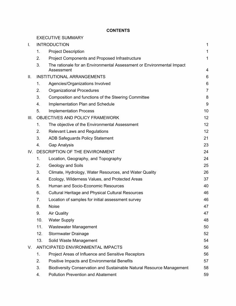
CONTENTS
EXECUTIVE SUMMARY
I. INTRODUCTION 1
1. Project Description 1
2. Project Components and Proposed Infrastructure 1
3. The rationale for an Environmental Assessment or Environmental Impact Assessment 4
II. INSTITUTIONAL ARRANGEMENTS 6
1. Agencies/Organizations Involved 6
2. Organizational Procedures 7
3. Composition and functions of the Steering Committee 8
4. Implementation Plan and Schedule 9
5. Implementation Process 10
III. OBJECTIVES AND POLICY FRAMEWORK 12
1. The objective of the Environmental Assessment 12
2. Relevant Laws and Regulations 12
3. ADB Safeguards Policy Statement 21
4. Gap Analysis 23
IV. DESCRIPTION OF THE ENVIRONMENT 24
1. Location, Geography, and Topography 24
2. Geology and Soils 25
3. Climate, Hydrology, Water Resources, and Water Quality 26
4. Ecology, Wilderness Values, and Protected Areas 37
5. Human and Socio-Economic Resources 40
6. Cultural Heritage and Physical Cultural Resources 46
7. Location of samples for initial assessment survey 46
8. Noise 47
9. Air Quality 47
10. Water Supply 48
11. Wastewater Management 50
12. Stormwater Drainage 52
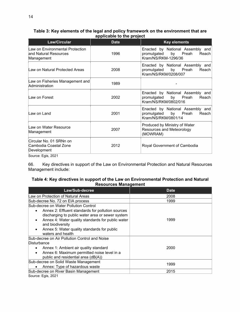
13. Solid Waste Management 54
V. ANTICIPATED ENVIRONMENTAL IMPACTS 56
1. Project Areas of Influence and Sensitive Receptors 56
2. Positive Impacts and Environmental Benefits 57
3. Biodiversity Conservation and Sustainable Natural Resource Management 58
4. Pollution Prevention and Abatement 59

5. Health and Safety (Occupational Health and Safety; Community Health and Safety) 62
6. Physical Cultural Resources 68
7. Climate Change and Natural Hazards 68
8. Indirect, Induced, and Cumulative Impacts 69
VI. ANALYSIS OF ALTERNATIVES 71
1. Master Plan 71
2. Site Alternatives 72
3. 72
VII. CONSULTATION AND PARTICIPATION 73
1. Consultations undertaken 73
2. Results of consultations 73
3. Roles of Stakeholders in Planning, Design, and Implementation 74
4. Stakeholder Consultation Plan 75
5. Next public consultations 75
VIII. INFORMATION DISCLOSURE 76
IX. GRIEVANCE REDRESS MECHANISM 77
X. ENVIRONMENTAL MANAGEMENT PLAN 78
1. Overview 78
2. Objective and Scope 78
3. Structure of the EMP 78
4. Implementation Arrangements 79
5. Documentation and Record Keeping 83
6. Management of Change 85
7. Consultation and Participation 85
8. Information Disclosure 86
9. Grievance Redress Mechanism 87
10. Environmental Management Plan 90
11. Environmental Monitoring Plan 99
12. Construction Environmental Monitoring 103
13. Cost of EMP Implementation 104
XI. CONCLUSION AND RECOMMENDATIONS 105
XII. APPENDICES 106
1. Environmental baseline survey report 106
2. Integrated Biodiversity Assessment Tool (IBAT) Report 107
3. Public consultations 108
4. Safeguards Monitoring Report Template 129

5. GRM Complaint Form 130
6. GRM register 131
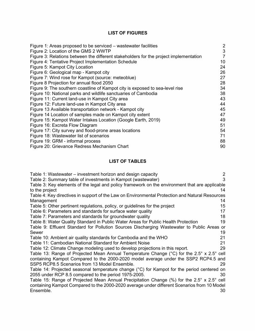
LIST OF FIGURES
Figure 1: Areas proposed to be serviced – wastewater facilities 2 Figure 2: Location of the GMS 2 WWTP 3 Figure 3: Relations between the different stakeholders for the project implementation 7 Figure 4: Tentative Project Implementation Schedule 10 Figure 5: Kampot City Location 24 Figure 6: Geological map - Kampot city 26 Figure 7: Wind rose for Kampot (source: meteoblue) 27 Figure 8 Projection for annual flood 2050 28 Figure 9: The southern coastline of Kampot city is exposed to sea-level rise 34 Figure 10: National parks and wildlife sanctuaries of Cambodia 38 Figure 11: Current land-use in Kampot City area 43 Figure 12: Future land-use in Kampot City area 44 Figure 13 Available transportation network - Kampot city 45 Figure 14 Location of samples made on Kampot city extent 47 Figure 15: Kampot Water Intakes Location (Google Earth, 2019) 49 Figure 16: Excreta Flow Diagram 51 Figure 17: City survey and flood-prone areas locations 54 Figure 18: Wastewater list of scenarios 71 Figure 19: GRM - informal process 88 Figure 20: Grievance Redress Mechanism Chart 90
LIST OF TABLES
Table 1: Wastewater – investment horizon and design capacity 2 Table 2: Summary table of investments in Kampot (wastewater) 3 Table 3: Key elements of the legal and policy framework on the environment that are applicable to the project 14 Table 4: Key directives in support of the Law on Environmental Protection and Natural Resources Management 14 Table 5: Other pertinent regulations, policy, or guidelines for the project 15 Table 6: Parameters and standards for surface water quality 17 Table 7: Parameters and standards for groundwater quality 18 Table 8: Water Quality Standard in Public Water Areas for Public Health Protection 19 Table 9: Effluent Standard for Pollution Sources Discharging Wastewater to Public Areas or Sewer 19 Table 10: Ambient air quality standards for Cambodia and the WHO 21 Table 11: Cambodian National Standard for Ambient Noise 21 Table 12: Climate Change modeling used to develop projections in this report. 29 Table 13: Range of Projected Mean Annual Temperature Change (°C) for the 2.5° x 2.5° cell containing Kampot Compared to the 2000-2020 model average under the SSP2 RCP4.5 and SSP5 RCP8.5 Scenarios from 13 Model Ensemble. 29 Table 14: Projected seasonal temperature change (°C) for Kampot for the period centered on 2055 under RCP 8.5 compared to the period 1975-2005. 30 Table 15: Range of Projected Mean Annual Precipitation Change (%) for the 2.5° x 2.5° cell containing Kampot Compared to the 2000-2020 average under different Scenarios from 10 Model Ensemble. 30
Table 16: Projected change in extreme rainfall parameters (mm) for Kampot for the period centered on 2055 under RCP 8.5 compared to the period 1975-2005. 32 Table 17: Absolute value (mm) and percentage projected change in extreme daily rainfall intensity for different return periods for Rach Gia, Vietnam, for 2030 and 2050, for two emission scenarios (A2 and B2) specifying 25th, 50th and 75th percentile results 32 Table 18: Projected Sea Level Rise for the West Coast of Vietnam compared to 1980 – 1999 baseline using downscaling from PRECIS for three emission scenarios. 33 Table 19: Water sampling station of the GMS2 project in Kampot city 36 Table 20: Water sampling station of the GMS2 project in Kampot city 36 Table 21: Sensitive receptors to proposed construction activities 56 Table 22: Construction Equipment Noise 63 Table 23: Consultations undertaken in Kampot 73 Table 37: Institutional responsibilities for EMP implementation 79 Table 25: Project Environment Training Program 82 Table 26: Estimated Costs for training of the Project Environment Management Plan 83 Table 27: Reporting Requirements 84 Table 29: Review Process 85 Table 30: Public Consultation and Participation Plan for Environment Safeguards 86 Table 31: Potential impacts of the subprojects during project preparation, design, construction and operation, and the mitigation measures 91 Table 32: Environmental Impact Monitoring for sewer network 101 Table 33: Estimated Costs for Implementation of the Project Environment Management Plan 104

EXECUTIVE SUMMARY
1. Introduction
1. At the request of the Kingdom of Cambodia, the Asian Development Bank (ADB) is developing the Livable Cities Investment Project (LCIP) to improve the environment of several secondary cities in Cambodia, including Kampot, Bavet, and Poipet. 2. Project outputs include (i) Output 1: policy and regulatory environment improved, (ii) Output 2: urban infrastructure improved, and (iii) Output 3: institutional effectiveness and governance improved. 3. The scope of this Feasibility Stage Borrower Initial Environmental Examination (IEE) and Environmental Management Plan (EMP) concerns subprojects under Output 2 only.For the short term (to 2025 horizon), the identified subproject in in Kampot under LCIP Output 2 are as follows:
a. Construct sewer pipes to service the south part of the city, which includes provisions to extend for future growth;
b. Provide households connection in the center of Kampot and south part of the city; and c. Provide public toilets within the service area and septic tanks or latrines for poor or
vulnerable households within the service area. 4. The IEE identifies and assesses potential impacts and risks arising from the implementation of the proposed project on the physical, biological, physical cultural and socioeconomic environment; and recommends measures to avoid, mitigate, and compensate for adverse impacts, while enhancing positive impacts. The EMP describes the project requirements and methods for environmental mitigation measures, monitoring, reporting, roles and responsibilities, budget, and the grievance redress mechanism (GRM). The EMP will be the key guiding document for environmental-related issues for project construction and operation. 5. The IEE and EMP will be updated at Detailed Engineering Design (DED) stage, and the updated DED stage EMP will form part of the bidding documents. The Project also requires the completion of domestic environmental assessments for national regulatory compliance; one Initial Environmental Impact Assessment. 2. Description of the Environment
6. Location, Geography, and Topography. The land of Kampot Province comprises small and large settlement areas, such as Kampot City, as well as barren areas, which are common in the area, such as rock outcrops. Dense broad-leafed forests are located within the Bokor Mountain National Park in the western part of the province. On the flatter coastal plain, areas including rice paddy and salt farms predominate. Kampot is characterized by a flat coastal topography. The city lies in the flood plain and estuary of the Preaek Tuek Chhu River. Northwest of the city, higher areas are found, the highest point being the Bokor Mountain. 7. Geology and Soils. In the region of Kampot, the geological map of Cambodia displays upper Jurassic-Cretaceous sedimentary unit and old (Precambrian-Paleozoic) high-grade metamorphics basements. The prevailing soil type of Kampot is young alluvium soil made up of sediment deposits from rivers and streams, which normally result in fertile land. 8. Climate and Climate Change. The tropical monsoon climate of Cambodia has two distinct seasons: (i) the dry season, which lasts approximately from November to April; (ii) the wet
season, lasting from May to October. The mean maximum temperature is 28°C, and the mean minimum temperature is 22°C. In coastal areas, annual rainfall ranges from 1,000 mm to 3,000 mm. Due to climate change, the number of days above 35°C is projected to increase from 2-3 days per year to over ten days per year under Representative Concentration Pathway (RCP) 8.5. Climate models mostly project a future decrease in tropical cyclone numbers and an increase in the intensities of the strongest storms. 9. Hydrology, Water Resources, and Quality. Many rivers drain to the coastal area of Kampot. During the dry season, the lower reaches of the rivers are brackish, and some of the rivers commonly dry up. Kampot can be largely flooded by the river during heavy rainfall storm events. Flood is mainly related to river overflow above the river banks/sides. The Preaek Tuek Chhu River plays a major role as it is the final receptor for stormwater, and it is the city's only water resource, with two water intakes located on the river and two plants used to treat the water. The water quality in the eastern/south-east open channel (coming from the city center) is considered poor, especially during the dry season when the dilution of wastewater by clear stormwater is less effective. 10. Ecology, Wilderness Values, and Protected Areas. Results of the proximity report from the Integrated Biodiversity Assessment Tool (IBAT) data analysis confirms that one protected ecological area and its associated key biodiversity area are close to Kampot City: Preah Monivong “Bokor” and Phnom Bokor, respectively. Neither are within the project area of influence and no high value or significant natural species of flora or fauna has been observed in the immediate surroundings of the project. 11. Human and Socio-Economic Context. At the time of the population census of 2018, 38,595 people lived in Kampot, making it the fourth most populous settlement in Cambodia. In 2018, 57.10% of the population aged from 18 to 60 were employed: 71% in the service sector, 27% in the agricultural sector, and 2% in the industry sector. In 2018, urban land use represented the biggest portion of the city at 36.7%, followed by natural forest at 27.38%, agricultural use at 26.49%, and water at 7.96%. Kampot's coastal area plays an important role by supporting the fisheries, aquaculture, agriculture, and tourism sectors. 12. Social and Transport Infrastructures. In 2017, the town had one referral hospital and two private hospitals. In 2018, there were 12 state primary schools, five state secondary schools, and two high schools in Kampot. Kampot is accessible by rail and by road through the NR 3 and NR 33. Water transport infrastructure consists of the Prek Kampot River Port and the Kampot International Port (under construction). 13. Cultural Heritage and Physical Cultural Resources. Traces of the French colonial-era remained in the architecture of Kampot City. Few cultural monuments are found in the city, and cultural heritage is mostly represented by mosques and pagodas, as well as within the provincial museum of Kampot. 14. Noise. In the outskirts of the city, the acoustic ambiance is relatively calm: the suburban area northwest of the city center is close to the Bokor National Park and dominated by agricultural fields and forests, and so is the island in the south. The heart of the city provides a noisier background, with its urban-life activities, markets, as well as the traffic of national roads NR 3 and NR 33. 15. Air Quality. In general, air quality in Cambodian rural areas is still good. Kampot City is located on the coast, in an area opened to the winds and dominated by agricultural fields and

forests. Thus air can be considered to be of good quality in the city. However, the increases in socioeconomic development along new road corridors will bring air pollution from vehicle traffic and industrialization. Moreover, local air quality is already affected by the existing dumpsite (waste burning, odors, etc.). Recurring and generalized waste burning are observed in Cambodia. This practice induces air pollution by releasing dust and fine particles, and is also a source of odor nuisance. Other sources of air pollutants are gases from untreated wastewater. 16. Water Supply. The piped water supply is available for 89% of the population, with 79% connected to it and only 38% using it as the main source of drinking water. 4% of the population has its own borehole, and the water has to be boiled or filtered. The accessibility of bottled drinking water is good in Kampot. 17. Wastewater Management. It is estimated that 77% of the excreta generated in Kampot is not safely managed. 87% of the population in Kampot has an onsite sanitation containment, which is emptied manually (the sludge is most of the time dumped onto paddy field or to a water body) or by pump trucks from the two emptying companies operating in Kampot. There is currently no wastewater treatment plant (WWTP) in operation. A new facility is under construction as part of the Second Greater Mekong Subregion Corridor Towns Development Project (GMS 2).1 Fecal sludge is sold to farmers for use as a fertilizer, mainly in durian plantations, or disposed off in fields outside the city. 18. Stormwater Drainage. The existing gravity lines are used to drain stormwater from the dense urban areas toward rural areas/rivers. There is no existing global strategy for the development planification of stormwater/wastewater drainage networks. Recurrent floods are reported by inhabitants and local authorities, and bad odors are released from the drainage system. 19. Solid Waste Management. In 2018, 38% of the households in the city had access to solid waste collection services. The collection coverage is low/medium, and most wastes are either burnt or dumped into the environment, resulting in blockages in the drainage system. The solid waste is taken to an open dumpsite located approximately 10 km from the city, which is in poor condition and posing significant risks to the environment and human health. 3. Anticipated Environmental Impacts
20. The sensitive receptors within the project area of influence were identified to determine positive and negative impacts and associated measures. The following paragraphs present the main impacts identified for the project. 3.1. Positive Impacts and Environmental Benefits
21. A wastewater network made of pipes will improve the quality of life by reducing odor nuisances due to the practice of emptying sanitation containments directly into the environment. Also, the amount of untreated wastewater directly rejected into the environment will be minimized. Collection and treatment of wastewater is also a matter of public health, as it will diminish the incidence of water-borne infections and diseases associated with inadequate sanitation. On-site septage collection will also improve the quality of life in rural areas. Finally, operation, monitoring,
1 ADB. Second Greater Mekong Subregion Corridor Towns Development Project. https://www.adb.org/projects/46443-
002/main

and maintenance of the new network, as well as on-site sanitation, will enable the creation of employment opportunities for the population. 22. Land Acquisition. In urban areas, the implementation of the sewerage system will be associated with a temporary impact due to the construction of the underground network. This impact will be limited in time and space and will mainly be related to impeded access to houses and to public and commercial facilities. No land acquisition is necessary, but an official authorization for works will be required. Mitigation measures to preserve the area surrounding the project site will include avoiding unnecessary earth movement and removal of vegetation, and temporary fences. 23. Hydrology and Water Availability. The project does not involve any works that would neither affect lake and river hydrology nor water resources. 24. Ecological and Wilderness Values. The construction phase could cause short-term noise and visual disturbance which may disrupt breeding or foraging by the resident or migratory fauna. However, the construction works will take place within the urban context, and there are no known rare or endangered wildlife species or critical habitats in the immediate environment of the site. Only ornamental plants and domestic fauna were observed during the field survey from September 2020; therefore, ecological-related risks are considered to be very low. 3.2. Pollution Prevention and Abatement
25. Geology and Soil. No new natural material extraction or material preparation sites will be created for this project, minimizing the impact of materials sourcing. 26. Soil contamination can be caused by improper transport, storage, handling, and/or disposal of wastes, as well as accidental spills or leaks during the works phase. This risk will be managed through strict on-site measures. During the operational phase, soil contamination can also be due to faulty pipelines or equipment of the wastewater treatment system. All equipment and processes will be maintained in good working order, with back-up material in critical areas. 27. Water Quality and Wastewater Management. Earthworks, excavation, and/or inappropriate storage and handling of fuel, accidental spills, and wash-down water for machinery and vehicles could contaminate surface waterways during works. Water pollution will be minimized by implementing measures such as the implementation of water collection basins and sediment traps on washing sites of the construction equipment and secured areas for storage facilities for hazardous materials. During the operational phase, surface water or groundwater contamination can also be due to faulty pipelines or equipment of the wastewater treatment system. All equipment and processes will be maintained in good working order, with back-up material in critical areas. 28. Air Quality. Air pollution from dust, material preparation, vehicle and machinery emissions are expected during these works. The exhaust emissions generated can cause respiratory issues for the residents living close to the construction site, especially for the vulnerable population, including the elderly and the very young. Overall, the risk of air pollution and disturbance to residents related to air quality is low because of the relatively small scope of project works, and will be mitigating through measures including spraying water on exposed construction sites where fugitive dust is being generated, secured storage of harmful materials, turning off equipment/ vehicle when not in use.
29. Solid Waste. Solid waste will comprise domestic solid waste from workers and construction waste materials. Covered garbage bins will be installed at each site of works and waste collection and disposal methods will follow strict procedures. 3.3. Health and Safety
30. Geology and Soil. Construction sites may be concerned by unexploded ordnance (UXO), which can be uncovered by earthworks. Sites for earthworks that are suspected of having UXO will be surveyed by the Government prior to construction. 31. Noise. Construction may cause a neighboring disturbance that could lead to health issues, mainly in urban areas. Mitigation measures comprise: properly maintaining construction vehicles and machinery to minimize noise, prohibiting the operation of high-noise machinery and movement of heavy vehicles at night, noise monitoring at sensitive areas, conducting regular interviews with residents adjacent to construction sites. 32. Vibration. Vibration impacts will arise from the movement and/or operation of vehicles and equipment, earthworks, drilling, and excavation. To address these issues: high vibration activities, such as compaction operations, will be prohibited at night, and communities will be consulted prior to large earthworks to ensure they are informed. 33. Social Issues. Network works may cause temporary disruptions of vehicle access and utility services; traffic flow will be temporarily impeded, and parking space in front of the residents' houses will be reduced. In order to limit inconveniences, a traffic management plan will be prepared and implemented in coordination with local authorities and communities; safe access to blocked properties will be ensured; network implementation will be undertaken on one side of the road at a time, and close coordination with utility companies will prevent the disruption of utility services such as water and electricity supply due to damaged lines. 34. The hiring of Workers. Recruitment of construction workers will prioritize local residents to reduce the number of migrant workers. 35. Community and Worker Health and Safety. Traffic congestion and the risk of accidents may increase with construction traffic. Construction workers will be exposed to social conflicts with communities, transmittable diseases in the community, the presence of unexploded ordnance (UXO), large moving and operating construction vehicles and equipment, pits and excavations, fire and chemical hazards. Mitigation measures will include implementation of health and safety plans, provision of Personal Protective Equipment (PPE) for workers, providing training for all workers, as well as COVID-19 specific measures. During the operational phase, working conditions of monitoring and maintenance of the wastewater network could potentially deteriorate over time if no monitoring is carried out to ensure the workers' health and safety conditions. 36. Air Quality. The design of the sewer network will include the maintenance of self-cleaning velocities, a proper venting arrangement, prevention of accumulation of grits/debris in the sewer. 3.4. Physical Cultural Resources
37. Any local cultural site will be protected from disturbances due to the construction activities, will be remote from disturbances due to the project operation, and their access will not be impeded. If the surroundings of the cultural sites are affected by construction works, they will be restored to their initial conditions.

38. Chance-find procedures are included in the EMP. In the event that any artifacts are found, works in the site will cease immediately, the site cordoned off, and the Kampot provincial government, EA, and Ministry of Culture notified. 3.5. Climate Change and Natural Hazards
39. Geology and Soil. Potential impacts include poorly planned excavation, causing erosion. These risks will be managed through strict on-site measures. 4. Consultation, Participation and Disclosure
40. Consultations were undertaken during the preparation of the IEE. This included interviews with a range of expert stakeholders and affected people, and completion of a questionnaire form on social and environmental factors. The views of stakeholders are integrated into the EMP where approproiate. A Public Consultation and Participation Plan is included in the EMP to outline the plans for future stakheolder engagment. 41. Information Disclosure will be maintained during project design and implementation. All stakeholders will be provided with information on the subproject component including the Grievance Redress Mechanism. Local disclosure and disclosure on ADB’s website is outlined in the EMP. 5. Grievance Redress Mechanism
42. A project GRM has been developed in compliance with ADB’s SPS (2009) requirement to address environmental, health, safety, and social concerns associated with project construction and operation. Resettlement issues are dealt with through a separate mechanism. 43. The GRM is accessible to all members of the community, including women, youth, remote farmers and communities, and residents in poverty. Multiple points of entry are available, including face-to-face meetings, written complaints, telephone conversations, e-mail, and social media. It includes clear timescales and steps for rectifying issues arising and will provide clear and open channels of communication for affected people. 6. Conclusion and Recommendations
44. Based on the information presented in this IEE, and assuming full and effective implementation of the EMP, loan assurances, and training, potential adverse environmental impacts are expected to be minimized and/or mitigated within the standards applied in this IEE.


1
I. INTRODUCTION
1. Project Description
1. At the request of the Kingdom of Cambodia, the Asian Development Bank (ADB) is developing the Livable Cities Investment Project (LCIP) to facilitate long-term sustainable and economic growth. The project is aligned with the Government's policies and national strategies, in particular, the Government's Rectangular Strategy – Phase IV2 and ADB Strategy 2030.3 2. The project will concentrate on the secondary cities of Kampot, Poipet, and Bavet, due to their economic potential and location at key trade and tourism zones. The project will focus on enhancing urban planning, building community resilience, and providing infrastructure. Project outputs include (i) output 1: policy and regulatory environment improved, (ii) output 2: urban infrastructure improved, and (iii) output 3: institutional effectiveness and governance improved. 3. As a result of recent population growth, these cities have identified that the limited infrastructure is restricting their development potential. Existing services are no longer operating optimally and incapable of servicing demands. The LCIP proposes to adopt a holistic methodology, comprising of an integrated urban development approach, to ensure interventions consider land use, long term city needs, asset management, and asset financing for sustainable operations. 4. To ensure climate resilient and sustainable development of participating cities, the project adopts a climate-centric city development approach. Appropriate structural and non-structural measures are incorporated to ensure climate change risks are appropriately mitigated to avoid the future cost associated with the climate change impact. 2. Project Components and Proposed Infrastructure
5. The scope of this Initial Environmental Examination (IEE) concerns output 2 only. The project components under output 2 are improved wastewater management systems (wastewater collection networks). 2.1. Wastewater
6. There is, at present, no public wastewater system. However, a wastewater treatment plant (WWTP) is under construction, funded by the ADB funded Second Greater Mekong Subregion Corridor Towns Development Project (GMS 2). 7. To further expand on the sewerage network initiated by GMS 2 (refer footnote 1), it is proposed to:
(i) Construct sewer pipes to service the south part of the city, which includes provisions to extend for future growth;
2 Rectangular strategy for growth, employment, equity and efficiency: building the foundation toward realizing the Cambodia vision 2050 phase IV of the Royal Government of Cambodia of the sixth legislature of the national assembly. Phnom Penh http://cnv.org.kh/wp-content/uploads/2012/10/Rectangular-Strategy-Phase-IV-of-the-Royal-Government-of-Cambodia-of-the-Sixth-Legislature-of-the-National-Assembly-2018-2023.pdf
3 Strategy 2030, Achieving a Prosperous, Inclusive, Resilient, and Sustainable Asia and the Pacific. ADB, July 2018 https://www.adb.org/sites/default/files/institutional-document/435391/strategy-2030-main-document.pdf
2
(ii) Provide households connection in the center of Kampot and south part of the city.
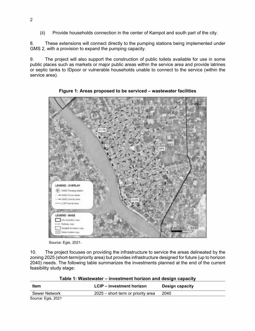
8. These extensions will connect directly to the pumping stations being implemented under GMS 2, with a provision to expand the pumping capacity. 9. The project will also support the construction of public toilets available for use in some public places such as markets or major public areas within the service area and provide latrines or septic tanks to IDpoor or vulnerable households unable to connect to the service (within the service area).
Figure 1: Areas proposed to be serviced – wastewater facilities
Source: Egis, 2021.
10. The project focuses on providing the infrastructure to service the areas delineated by the zoning 2025 (short-term/priority area) but provides infrastructure designed for future (up to horizon 2040) needs. The following table summarizes the investments planned at the end of the current feasibility study stage:
Table 1: Wastewater – investment horizon and design capacity
Item LCIP – investment horizon Design capacity
Sewer Network 2025 – short term or priority area 2040 Source: Egis, 2021

Table 2: Summary table of investments in Kampot (wastewater) Investment Area
Components
Networks 7.5 km of gravity lines Note: Pumping stations and force mains are now under GMS2 scope. LCIP includes design and provision to increase
the GMS2 C3 pumping station capacity Source: Egis, 2021
2.1.1. Wastewater Treatment Plant
11. As mentioned previously, a WWTP is under implementation as part of the GMS 2 project in Kampot and the extensions proposed under LCIP project for the wastewater network will be connected to the pumping station proposed under GMS 2 (pumping station C3 PS). 12. The WWTP site is located north-east of the city, as shown in the Figure below. The site was a rice field located approximately 2.5km distance from NR.3.
Figure 2: Location of the GMS 2 WWTP
Source: Egis, 2021
4
2.1.2. Sewer
13. The capacity of the gravity sewer proposed by the LCIP project is designed to receive the wastewater flow at the horizon 2040, according to the future extension of the urban area. 14. Gravity Network. The following technical options are selected for the project:
(i) Maximal depth: 6m; (ii) Pipe material: PVC.
15. Sewer lines are expected to follow existing and projected road alignments. This aims to avoid land acquisition or resettlement. 16. Maintenance. As the network will be new, the breakage rate is expected to remain low for the network. No maintenance is scheduled for the concrete structures. However, equipment such as trucks will require preventing maintenance (on a regular basis), and reactive maintenance will be performed in case of failure.
2.1.3. Equipment
17. Two vacuum trucks are needed for septage collection (to service horizon 2030). In addition to these vacuum trucks, it is considered that one additional vacuum truck will be required for maintenance purposes on the sewer network (assuming that one vacuum truck can clean up to 3km/day and that 15% of the overall network length should be cleaned each year). In total, three vacuums trucks are required. 18. Based on the total number of vacuum trucks available in the city (2 from the private sector), added to one vacuum truck supported by GMS 2, it is assumed that the service could already be operational. Therefore, it is suggested that only one additional vehicle can be purchased as part of the project. This vehicle will be managed through government services. 19. Two pick-up cars and one utility truck are also considered for the daily needs of the staff. 3. The rationale for an Environmental Assessment or Environmental Impact Assessment
3.1. Cambodian Background
20. In 1996, the Law on Environmental Protection and Natural Resources Management (NS/RKM/1296/36) came into force. The law requires the government to prepare national and regional environmental plans and sub-decrees concerning a wide range of environmental issues, including environmental impact assessments (EIAs), pollution prevention and control, public participation, and access to information. The Law on Environmental Protection and Natural Resource Management (1996) is the enabling legislation which allows the MOE to pass sub-decrees and regulations to protect the environment. Several sub-decrees are already laws while there are sub-decrees which have been drafted and are expected to become law in the near future. 21. Environmental impact assessment in Cambodia is guided by the Royal Government of Cambodia Sub-decree No. 72 ANRK.BK on EIA, and the classification of EIA study level under the Prakas No.21, 2020 on Environmental Impact Assessment Classification for Development Projects. In compliance with the regulation in Cambodia, all individuals, private companies, joint venture companies, public companies, ministries and government agencies are obliged to
conduct an environmental impact assessment for proposed projects or activities, which must be submitted for approval by the MOE. 22. The Annex of the decree No.72 provides a list of project types that proponents use to screen projects for requiring either an EIA or initial environmental impact assessments (IEIA). Since the project will involve rehabilitation, extension, or creation of new public facilities an IEIA will be required. 23. IEIA and EIA are not necessary for the project preparation and loan signature but will be required prior to the implementation of the sub-project components, in this case the IEIA. 3.2. ADB Background
24. Approved by ADB’s Board of Directors in July 2009, the Safeguard Policy Statement (SPS) builds upon the three previous safeguard policies on the environment, involuntary resettlement, and indigenous peoples, and brings them into a consolidated policy framework that enhances effectiveness and relevance. The SPS applies to all ADB-supported projects reviewed by ADB’s management after 20 January 2010. 25. ADB will not finance projects that do not comply with its safeguard policy statement, nor it will finance projects that do not comply with the host country's social and environmental laws and regulations, including those laws implementing host country obligations under international law. In addition, ADB will not finance activities on the prohibited investment activities list. 26. The project screening and categorization at the earliest stage of project preparation have identified LCIP as “Environment” Category B. Therefore, an Initial Environmental Examination (IEE) is required. Further details on ADB’s SPS is described in Section IV.

6
II. INSTITUTIONAL ARRANGEMENTS
1. Agencies/Organizations Involved
27. The national agencies that oversee the environment and natural resources management are listed below.
(i) Ministry of Environment (MoE); (ii) Ministry of Agriculture, Forestry and Fisheries (MAFF); (iii) Ministry of Water Resources and Meteorology (MOWRAM); (iv) Ministry of Mines and Energy (MIME); (v) Ministry of Industry, Technology, Science and Innovation (MISTI); (vi) Ministry of Land Management Urban Planning and Construction (MLMUPC); (vii) Ministry of Tourism (MoT); (viii) Ministry of Public Works and Transport (MPWT); (ix) National Climate Change Committee (NCCC).
28. The ministries are represented and supported at the provincial, town, and district/commune levels by counterpart line departments, agencies, and sub-offices. Then counterparts are responsible for extending and implement the mandate of their parent ministries to the commune level. 29. The MoE is the primary agency mandated to implement Article 50 of the 1993 Constitution. The MoE is tasked to promote environmental protection and conservation of natural resources, thus, contributing to the improvement of environmental quality, public welfare, national culture, and the economy. This is embodied in the three pillars of development of the Royal Government of Cambodia. One of the three pillars is the sustainable use of natural resources and sound environmental management to reduce poverty and improve the livelihood of all Cambodians. 30. The EIA Department of the MoE oversees and regulates EIA and coordinates the implementation of projects in collaboration with project executive agencies and concerned ministries. The MoE has the following responsibilities:
(i) Review, evaluate, and approve submitted environmental impact assessments in collaboration with other concerned ministries; and
(ii) Monitor to ensure a project owner (the executing agency of the project) satisfactorily implements the EMP throughout the pre-construction, construction, and operational phases of the projects.
31. The MAFF are responsible for the management and protection of coastal mangrove forests and wildlife and fisheries. 32. The MPWT developed an Environmental and Social Safeguards Policy (ESSP) for the Road Asset Management Project in 2008 to ensure that the rehabilitation of roads meets the social and environmental safeguard requirements of the MoE and donors such as the ADB and International Development Assistance. The ESSP is supported by an implementation framework (ESSF). The ESSF is applied to projects funded by all donors, which includes a screening process for the general environment, protected areas, resettlement, and ethnic minorities. Specific technical, environmental guidelines have been prepared to ensure proper environmental management of activities within protected areas. 33. As the Executive Agency (EA) and Project Implementing Agency (PIA) are both under the umbrella of MPWT, MPWT ensures EMP implementation across all the project stages (pre-

construction, construction, and operation and maintenance) as stated in IEIA/EIA (under national law) which is to be written in Khmer and should be carried out during the detailed engineering design (DED) phase of the project. 34. The local authorities including police force will be responsible for facilitation, controlling, and solving of any social conflicts that may happen in the project area. They will also assist the project executive agency to prevent illegal activities in the project area. So MPWT will work closely with them to ensure the project will be implemented smoothly. 2. Organizational Procedures
35. The proposed institutional arrangement during the project implementation are presented in the following Figure 3
Figure 3: Relations between the different stakeholders for the project implementation
36. Borrower. As Borrower of the loan, the MEF has overall responsibility for the effective management and administration of public investment projects in Cambodia. It has a wide range of responsibilities which are described in its Standard Operating Procedure (SOP).4 37. Executing Agency. The MPWT has been designated by the MEF to be the EA for all Project sub-components. . A PMU will be set up at the EA level. The PMU will be held accountable for the implementation and operation of the subproject on behalf of the EA and will work as a national subproject agency. The PMU will be led by a project director, who will be supported by deputy project directors, project managers, engineers/technical officers, safeguard specialists, procurement and financial specialists and administration support. It is recommended that at least one senior staff from the General Department of Sewerage and Wastewater Management
4 MEF, December 2019. Standard Operating Procedure on Project Management for all Externally Financed Projects/ Programs in Cambodia.

8
(GDSWM) be part of the PMU to ensure an effective transition between the implementation hase and the future monitoring of the infrastructure.5 38. A PIA will be established to supervise and coordinate the implementation of the subproject investments. It will be responsible for coordinating with participating agencies and institutions to ensure broad participation in subproject related activities and to further enhance subproject ownership. A Project Implementation Unit (PIU) will be set up under the PIA, to coordinate the day-to-day implementation of the subproject. The PIU should include representatives of the municipal administration (MA), and the key departments such as the director/deputy director of the Provincial Department of Public Works and Transport (PDPWT), technical staff of the Provincial Department of Environment (PDOE), a technical staff of the Provincial Department of Land Management Urban Planning and Construction (PDLMUPC), and environment officer (PIU-EO) and social officer (PIU-SO). The MA, either through the participation of the Municipal Council members or technical staff of the Office of Public Works, Transport, Environment, Sanitation and Public Order Office (PWTESPO), should be closely associated with the PIU. 39. Consulting support. In addition, it is recommended that a Design and Construction Supervision Consultant (DCSC) be engaged, by the EA, which will include project management and capacity building services. 40. The DCSC will provide: (i) technical support, including the preparation of detailed engineering designs, technical specifications and bidding documents; (ii) construction supervision and contract administration; (iii) compliance with government and national policies and regulations, ADB’s procurement policies and guidelines, Safeguards Policy statement, Gender and Development Policy, and Guidelines for Gender Mainstreaming Categories of ADB Projects; (iv) institutional capacity development; and (v) stakeholder engagement, awareness and communication activities. 41. The DCSC will also provide technical support to the PMU and PIAs concerning project management, financial, monitoring, evaluation procedures: (i) ensure that periodic project reviews are carried out; (ii) coordinate the reporting activities of the PMU, (iii) monitor and coordinate project-related procurement to ensure compliance with safeguard requirements; (iv) and support the PMU in implementation of the procedures required for land acquisition, including conducting and documenting consultations and the Grievance Redress Mechanism (GRM). The DCSC will also ensure that capacity within the PMU is built regarding ADB social safeguards requirements using both workshops and on-the-job training. The scope of the DCSC will also include conducting a behavior change analysis and awareness campaign, and developing a communication strategy on wastewater and solid waste management to support the project in its social components. 3. Composition and functions of the Steering Committee
42. As indicated in paragraph 62 of the MEF SOP, a Steering Committee is recommended when more than one line ministry or agency is involved in implementing the Project. 43. Although not mandatory, a project steering committee is suggested, given the scale of the project and the fact that it will involve a number of different line ministries, in particular, the MoE on environmental approvals, and MLMUPC on land use and spatial planning.
5 In December 2019, through sub-decree 220 ANKR BK, the Government established the General Directorate of Sewerage and Wastewater Management under the supervision of MPWT.

44. It is proposed for the LCIP Project Steering Committee (PSC) to have the following responsibilities:
(i) Provide guidance and policy direction to facilitate project implementation (iii) Facilitate interagency and inter-ministerial coordination (iv) Coordination of discussion among central level agencies
45. The members of the Project Steering Committee should include (at least) the following representatives:
(i) MPWT Chair (ii) MPWT/GDSWM member (iii) MEF member (iv) MoE member (v) MoI member (vi) MISTI member (vii) MLMUPC member
46. To be official, the Project Steering Committee should be installed through a Prakas, and the members nominated through their positions – and not their names. Having the representatives mobilized based on their functions allows saving time, should the staff at the function changed. 47. The Steering committee will liaise with and be supported by other sub-committees, including:
(i) The existing Inter-ministerial Sub-Committee on Cost Recovery and Tariff Setting, chaired by MEF;
(ii) The existing Technical Sub-Working Group on Wastewater Management, Chaired by MPWT.
4. Implementation Plan and Schedule
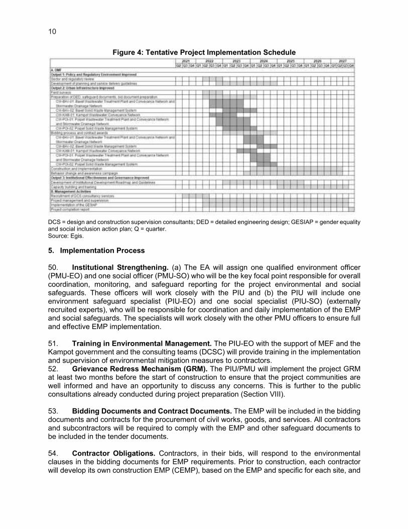
48. The project is expected to be implemented over a 75-month period from August 2021 to December 2027 as shown in Figure 4. 49. This tentative implementation schedule is developed in conjunction with the Strategic Procurement Planning which assumes a DCSC will service the entire project. Within the DCSC, multiple design teams will therefore be required to carry out the study and supervision of the different components in parallel in order to achieve the project objectives.
10
Figure 4: Tentative Project Implementation Schedule
DCS = design and construction supervision consultants; DED = detailed engineering design; GESIAP = gender equality and social inclusion action plan; Q = quarter. Source: Egis.
5. Implementation Process
50. Institutional Strengthening. (a) The EA will assign one qualified environment officer (PMU-EO) and one social officer (PMU-SO) who will be the key focal point responsible for overall coordination, monitoring, and safeguard reporting for the project environmental and social safeguards. These officers will work closely with the PIU and (b) the PIU will include one environment safeguard specialist (PIU-EO) and one social specialist (PIU-SO) (externally recruited experts), who will be responsible for coordination and daily implementation of the EMP and social safeguards. The specialists will work closely with the other PMU officers to ensure full and effective EMP implementation. 51. Training in Environmental Management. The PIU-EO with the support of MEF and the Kampot government and the consulting teams (DCSC) will provide training in the implementation and supervision of environmental mitigation measures to contractors. 52. Grievance Redress Mechanism (GRM). The PIU/PMU will implement the project GRM at least two months before the start of construction to ensure that the project communities are well informed and have an opportunity to discuss any concerns. This is further to the public consultations already conducted during project preparation (Section VIII). 53. Bidding Documents and Contract Documents. The EMP will be included in the bidding documents and contracts for the procurement of civil works, goods, and services. All contractors and subcontractors will be required to comply with the EMP and other safeguard documents to be included in the tender documents. 54. Contractor Obligations. Contractors, in their bids, will respond to the environmental clauses in the bidding documents for EMP requirements. Prior to construction, each contractor will develop its own construction EMP (CEMP), based on the EMP and specific for each site, and

11
assign at least one person responsible for Environment, Health, and Safety (EHS). Each CEMP shall include the following: (a) surface water protection (especially, to avoid or minimize impacts to water bodies); (b) spill control and management; (c) site drainage and soil erosion protection; (d) health and safety taking into account COVID-19 national guidance and international guidance6; (e) temporary traffic management; (f) construction site access control. CEMP will be submitted to the PMU for review (with consultant team review support) and endorsement and its implementation will be reported monthly to the PIU. Each contractor will establish a grievance register and incident register and comply with the labor law of Cambodia and core labor standards of International Labour Organization (ILO). 55. Consultations and Disclosures. Consultations and disclosure activities will be maintained with affected people and other involved stakeholders to ensure continued communication, including, for example works schedule, details of activities including those that result in nuisances and disturbances, the status of claims, and other aspects.
6 See e.g.: World Health Organization. 2020. Considerations for public health and social measures in the workplace in
the context of COVID-19. Geneva. Available here: https://www.who.int/publications-detail/considerations-for-public-health-and-social-measures-in-the-workplace-in-the-context-of-covid-19; HM Government. 2020. Working safely during COVID-19 in construction and other outdoor work. Guidance for employers, employees and the self-employed. Available here: https://assets.publishing.service.gov.uk/media/5eb961bfe90e070834b6675f/working-safely-during-covid-19-construction-outdoors-110520.pdf. The Canadian Construction Association. 2020. COVID 19 Standard Protocols. Available here: https://www.cca-acc.com/wp-content/uploads/2020/04/CCA-COVID-19-Standardized-Protocols-for-All-Canadian-Construction-Sites-04-16-20.pdf

12
III. OBJECTIVES AND POLICY FRAMEWORK
1. The objective of the Environmental Assessment
56. The IEE and EMP have been prepared in accordance with the Safeguard Policy Statement (SPS, June 2009) of the Asian Development Bank (ADB) and the Law on Environmental Protection and Natural Resources Management, enacted by the National Assembly (1996) of Cambodia and Sub-decree No. 72 ANRK.BK on EIA, its implementing guidelines. These IEE and EMP: (i) identify and assess potential impacts and risks arising from the implementation of the proposed project on the physical, biological, physical cultural, and socioeconomic environment; and (ii) recommend measures to avoid, mitigate, and compensate for adverse impacts, and enhance positive impacts. 57. The IEE is based on on-site reconnaissance, relevant reports and documents (inception reports, sector master plans, urban development scenarios, and environmental and social baseline survey reports prepared by the TRTA7 (Transaction Technical Assistance) of the three target cities), consultations with communities, and meetings and discussions with the government agencies. 2. Relevant Laws and Regulations
2.1. International Regulations, Conventions, and Treaties
58. Cambodia is a signatory to many international environmental treaties and conventions which provide a comprehensive legal framework related to coastal management. These include the Coordinating Body of the Seas of East Asia (1995), Association of Southeast Asian Nations (1999), Marine Pollution (MARPOL, 1994), Biodiversity Convention (1994), Convention on International Trade in Endangered Species of Fauna and Flora (CITES) (1997), Ramsar Convention (1999) and Climate Change Convention (1995) (MoE 2006); Paris Agreement on Climate Change (2016) ; and Sendai Framework for Disaster Risk Reduction 2015-2030. 59. The Royal Government of Cambodia promulgated the Cambodia Climate Change Strategic Plan 2014–2023 (CCCSP) in response to the country's commitment to the United Nations Framework Convention on Climate Change. The CCCSP was prepared following the guidelines of the Council of Ministers and consultation stakeholders. The CCCSP is designed to address a wide range of climate change issues concerning adaptation, greenhouse gas (GHG) mitigation, and low-carbon development.8 The MPWT's Climate Change Action Plan for Transport Sector 2014–2018 identified priority climate adaptation actions that include: (i) develop national road construction and maintenance design standards for national roads, taking into account climate change impact; (ii) repair and rehabilitate existing road infrastructure taking into account climate change impact and various other actions in relation to raising capacity and public awareness of climate change impacts, and (iii) capacity building and institutional strengthening for addressing climate change impacts. 60. The Royal Government of Cambodia is one of the pilot countries participating in the Pilot Program for Climate Resilience (PPCR) – one of the three sub-programs of the Strategic Climate Fund (SCF). The PPCR provides incentives for scaled-up action and transformational change in integrating consideration of climate risks and resilience in national development planning,
7 TA 9554-REG:Southeast Asia Urban Services Facility. 8 Cambodia Climate Change Strategic Plan 2014-2023. www.bb.undp.org. 6 February 2017.
13
consistent with poverty reduction and sustainable development goals. The priority sectors for PPCR in Cambodia include water resources, agriculture, and infrastructure. In June 2011, the PPCR sub-committee endorsed Cambodia's Strategic Program for Climate Resilience with a funding envelope of up to $86 million ($50 million in grants and up to $36 million in concessional credit). Of this, an allocation of $17 million ($10 million loans and $7 million grant) was endorsed for "Climate-proofing of Roads in Prey Veng, Svay Rieng, Kampong Chhnang, and Kampong Speu Provinces" as part of the ADB-funded PRIP. The PRIP includes piloting of approaches to strengthen civil works design and planning, as well as to reduce risks of damages resulting from climate change impacts through implementing ecosystem-based adaptation measures and emergency management responses.9 61. For all other applicable environmental standards and criteria such as ambient air quality, vibration, noise, contaminated soil, and workplace and community safety, the standards and protocols of the World Bank Group EHS (2007) will apply particularly for standards which impose stricter limits such as noise in the immediate vicinity of residential and commercial areas. 2.2. National Laws and Regulations
62. The hierarchy of legislation in Cambodia is: (i) Royal Decree signed by the King; (ii) Sub-decree signed by the Prime Minister; (iii) Ministerial Decision signed by a Minister; (iv) Regulation issued by a Ministry.
63. The major legislation in Cambodia is the Royal Decree, which ratifies laws passed by parliament. These can be supplemented by "prakas" or ministerial decisions. These laws allow sub-decrees and regulations to be passed, which can stipulate procedures and standards to be met in order to ensure compliance with the law. Many of these sub-decrees and standards have been drafted but have not yet been ratified by parliament. 64. In 1993, the Royal Government of Cambodia confirmed a new Constitution in which environmental considerations were included for the first time. Specifically, Article 59 requires the State to protect the environment and balance of abundant natural resources and establish a precise plan of management of land, water, air, wind, geology, ecological system, mines, energy, petrol and gas, rock and sand, gems, forests and forestry products, wildlife, fish and aquatic resources and it was within this constitutional context that the Ministry of Environment (MoE) was established. 65. The Government of Cambodia has established specific laws and regulations for forests, protected areas, and land management to ensure sustainable development. The key elements of the legal and policy framework on the environment that are applicable to the project include the following:
9 PRIP Climate change outputs include Climate Modeling Report, Flood Risk Management Interface Manual v10,
Infrastructure Rehabilitation for Climate Resilience, Knowledge Management Report, Non mandatory guidelines for FPR v1,6, Reinforcing community flood resilience, Road Design Standard v6-hun-1 and Vulnerability Report v5. (http://prip.mpwt.gov.kh/documentation).
14
Table 3: Key elements of the legal and policy framework on the environment that are applicable to the project
Law/Circular Date Key elements
Law on Environmental Protection and Natural Resources Management
1996 Enacted by National Assembly and promulgated by Preah Reach Kram/NS/RKM-1296/36
Law on Natural Protected Areas 2008 Enacted by National Assembly and promulgated by Preah Reach Kram/NS/RKM/0208/007
Law on Fisheries Management and Administration
1989 -
Law on Forest 2002 Enacted by National Assembly and promulgated by Preah Reach Kram/NS/RKM/0802/016
Law on Land 2001 Enacted by National Assembly and promulgated by Preah Reach Kram/NS/RKM/0801/14
Law on Water Resource Management
2007 Produced by Ministry of Water Resources and Meteorology (MOWRAM)
Circular No. 01 SRNn on Cambodia Coastal Zone Development
2012 Royal Government of Cambodia
Source: Egis, 2021
66. Key directives in support of the Law on Environmental Protection and Natural Resources Management include:
Table 4: Key directives in support of the Law on Environmental Protection and Natural Resources Management
Law/Sub-decree Date
Law on Protection of Natural Areas 2008 Sub-decree No. 72 on EIA process 1999 Sub-decree on Water Pollution Control
Annex 2: Effluent standards for pollution sources discharging to public water area or sewer system
Annex 4: Water quality standards for public water and biodiversity
Annex 5: Water quality standards for public waters and health
1999
Sub-decree on Air Pollution Control and Noise Disturbance
Annex 1: Ambient air quality standard Annex 6: Maximum permitted noise level in a
public and residential area (dB(A))
2000
Sub-decree on Solid Waste Management Annex: Type of hazardous waste
1999
Sub-decree on River Basin Management 2015 Source: Egis, 2021
15
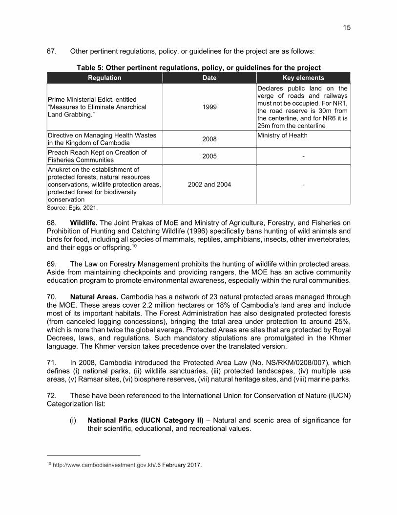
67. Other pertinent regulations, policy, or guidelines for the project are as follows:
Table 5: Other pertinent regulations, policy, or guidelines for the project
Regulation Date Key elements
Prime Ministerial Edict. entitled “Measures to Eliminate Anarchical Land Grabbing.”
1999
Declares public land on the verge of roads and railways must not be occupied. For NR1, the road reserve is 30m from the centerline, and for NR6 it is 25m from the centerline
Directive on Managing Health Wastes in the Kingdom of Cambodia
2008 Ministry of Health
Preach Reach Kept on Creation of Fisheries Communities
2005 -
Anukret on the establishment of protected forests, natural resources conservations, wildlife protection areas, protected forest for biodiversity conservation
2002 and 2004 -
Source: Egis, 2021.
68. Wildlife. The Joint Prakas of MoE and Ministry of Agriculture, Forestry, and Fisheries on Prohibition of Hunting and Catching Wildlife (1996) specifically bans hunting of wild animals and birds for food, including all species of mammals, reptiles, amphibians, insects, other invertebrates, and their eggs or offspring.10 69. The Law on Forestry Management prohibits the hunting of wildlife within protected areas. Aside from maintaining checkpoints and providing rangers, the MOE has an active community education program to promote environmental awareness, especially within the rural communities. 70. Natural Areas. Cambodia has a network of 23 natural protected areas managed through the MOE. These areas cover 2.2 million hectares or 18% of Cambodia’s land area and include most of its important habitats. The Forest Administration has also designated protected forests (from canceled logging concessions), bringing the total area under protection to around 25%, which is more than twice the global average. Protected Areas are sites that are protected by Royal Decrees, laws, and regulations. Such mandatory stipulations are promulgated in the Khmer language. The Khmer version takes precedence over the translated version. 71. In 2008, Cambodia introduced the Protected Area Law (No. NS/RKM/0208/007), which defines (i) national parks, (ii) wildlife sanctuaries, (iii) protected landscapes, (iv) multiple use areas, (v) Ramsar sites, (vi) biosphere reserves, (vii) natural heritage sites, and (viii) marine parks. 72. These have been referenced to the International Union for Conservation of Nature (IUCN) Categorization list:
(i) National Parks (IUCN Category II) – Natural and scenic area of significance for their scientific, educational, and recreational values.
10 http://www.cambodiainvestment.gov.kh/.6 February 2017.

16
(ii) Wildlife Sanctuaries (IUCN Category IV) – Natural area where nationally significant species of flora or fauna, natural communities, or physical features require specific intervention for their perpetuation.
(iii) Protected Landscapes (IUCN Category V) – Nationally significant natural and semi-natural landscapes that must be maintained to provide opportunities for recreation.
(iv) Multiple-Use Areas (IUCN Category VIII) – Areas that provide for the sustainable use of water resources, timber, wildlife, fish, pasture, and recreation with the conservation of nature primarily oriented to support these economic activities.
(v) Ramsar Sites – There are two sites in the IUCN Categories IV and VIII above and one site in the middle stretches of the Mekong River between Stung Treng and the border with Laos.
(vi) Biosphere Reserve – The Tonle Sap Multiple-Use Area was nominated as Cambodia’s first Biosphere Reserve in 1997. The Boeung Chmar portion of Tonle Sap Multiple-Use area (28,000 hectares) is designated as a Ramsar site.
73. Under Article 11 of the law, each protected area is divided into four management zoning systems as follows:
(i) Core Zone: management area(s) of high conservation values containing threatened and critically endangered species and fragile ecosystems. Access to the zone is prohibited except the Nature Conservation and Protection Administration’s officials and researchers who, with prior permission from the Ministry of Environment, conduct nature and scientific studies for the purpose of preservation and protection of biological resources and natural environment with the exception of national security and defense sectors.
(ii) Conservation Zone: management area(s) of high conservation values containing natural resources, ecosystems, watershed areas, and natural landscape located adjacent to the core zone. Access to the zone is allowed only with the prior consent of the Nature Conservation and Protection Administration at the area, with the exception of national security and defense sectors. The small-scale community uses of non-timber forest products (NTFPs) to support local ethnic minorities’ livelihood may be allowed under strict control, provided that they do not present serious adverse impacts on biodiversity within the zone.
(iii) Sustainable Use Zone: management area(s) of high economic values for national economic development and management, and conservation of the protected area(s) itself thus contributing to the local community and indigenous ethnic minorities’ livelihood improvement. After consulting with relevant ministries and institutions, local authorities, and local communities in accordance with relevant laws and procedures, the Royal Government of Cambodia may permit development and investment activities in this zone in accordance with the request from the Ministry of Environment.
(iv) Community Zone: management area(s) for socio-economic development of the local communities and indigenous ethnic minorities and may contain existing residential lands, paddy field and field garden or swidden (Chamkar11) or farming. Issuing of land title or permission to use land in this zone shall have prior agreement from the Ministry of Environment in accordance with the Land Law. This management area does not cover the APSARA (Authority for the Protection and
11 Swidden or Chamkar is also known as slash and burn or shifting cultivation.

17
Management of Angkor and the Region of Siem Reap) authorities and other authorities designated and management area(s) to which the Royal Government has allocated the tasks.
74. Historical Monuments and Cultural Heritage. The Law on Protection of Cultural and National Heritage (1996) is the general law in Cambodia which covers all national monuments. This is supplemented by the “Decision on the Definition of Three Zones to Protect Temple and Surrounding Areas in all Provinces and Municipalities except Angkor Wat” (1996). These laws protect small temples or ancient structures. 75. Solid Waste Management. The Sub-decree on Solid Waste Management No.36 ANRK/BK (1999) regulates the collection, storage, disposal, dumping, recycling of solid domestic and industrial, commercial, hospital, and other assorted waste in order to prevent any ecological damage to the ecosystem and to avoid pollution of both soil and water. The sub-decree No.113 ANRK/BK (2015) delegates the management of waste to municipal and district administrations with a differentiation made between urban solid waste and garbage and set outs responsibilities for separation of recyclable materials. 76. National Occupational Health and Safety Standards. Occupational and CommunitySafety and Health (OHS) guidelines for Government follow the recent OHS Programme for Cambodia (2010-2013) that was developed by the ILO. The guidelines provide the framework for instituting OHS at the workplace and in the community. 2.3. National and International Environmental Standards
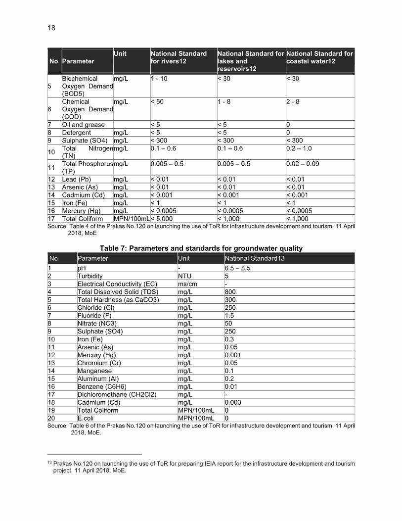
77. Cambodia has national standards for a range of environmental parameters. Standards that were applied for the IEE are: (i) water quality standards (Sub-decree No.27 ANRK/BK, 1999, updated by the Prakas No.120 on 11 April 2018, MoE); (ii) ambient air quality and Noise disturbance level standards (Anukret No.42 ANK/BK, 2000); and (iii) occupational health and safety standard (OHS Programme for Cambodia, 2010-2013). Comparison with the World Bank Group’s Environmental, Health, and Safety (EHS) Guidelines is given below. 78. Water Quality. The following tables summarize Cambodian water quality standards and international standards: Cambodian standards are more stringent than international ones when they exist, except for the TSS parameter. For the project, the values listed in the column "Effluent standard for pollution sources discharging to water areas or public sewers" apply to this project.”
Table 6: Parameters and standards for surface water quality
No Parameter Unit National Standard
for rivers12 National Standard for lakes and reservoirs12
National Standard for coastal water12
1 pH - 6.5 - 8.5 6.5 - 8.5 7.0 – 8.3
2 Total Dissolved Solid (TDS)
mg/L < 1,000 < 1,000 < 1,000
3 Total Suspended Solid (TSS)
mg/L 25 - 100 1 - 15 < 60
4 Dissolved Oxygen (DO)
mg/L 2.0 - 7.5 2.0 - 7.5 2.0 – 7.5
12 Sub-Decree No. 27, updated by the Prakas No.120 on launching the use of ToR for infrastructure development and
tourism, 11 April 2018, MoE.
18
No Parameter Unit National Standard
for rivers12 National Standard for lakes and reservoirs12
National Standard for coastal water12
5 Biochemical Oxygen Demand (BOD5)
mg/L 1 - 10 < 30 < 30
6 Chemical Oxygen Demand (COD)
mg/L < 50 1 - 8 2 - 8
7 Oil and grease < 5 < 5 0 8 Detergent mg/L < 5 < 5 0 9 Sulphate (SO4) mg/L < 300 < 300 < 300
10 Total Nitrogen (TN)
mg/L 0.1 – 0.6 0.1 – 0.6 0.2 – 1.0
11 Total Phosphorus (TP)
mg/L 0.005 – 0.5 0.005 – 0.5 0.02 – 0.09
12 Lead (Pb) mg/L < 0.01 < 0.01 < 0.01 13 Arsenic (As) mg/L < 0.01 < 0.01 < 0.01 14 Cadmium (Cd) mg/L < 0.001 < 0.001 < 0.001 15 Iron (Fe) mg/L < 1 < 1 < 1 16 Mercury (Hg) mg/L < 0.0005 < 0.0005 < 0.0005 17 Total Coliform MPN/100mL < 5,000 < 1,000 < 1,000 Source: Table 4 of the Prakas No.120 on launching the use of ToR for infrastructure development and tourism, 11 April
2018, MoE
Table 7: Parameters and standards for groundwater quality
No Parameter Unit National Standard13
1 pH - 6.5 – 8.5 2 Turbidity NTU 5 3 Electrical Conductivity (EC) ms/cm - 4 Total Dissolved Solid (TDS) mg/L 800 5 Total Hardness (as CaCO3) mg/L 300 6 Chloride (Cl) mg/L 250 7 Fluoride (F) mg/L 1.5 8 Nitrate (NO3) mg/L 50 9 Sulphate (SO4) mg/L 250 10 Iron (Fe) mg/L 0.3 11 Arsenic (As) mg/L 0.05 12 Mercury (Hg) mg/L 0.001 13 Chromium (Cr) mg/L 0.05 14 Manganese mg/L 0.1 15 Aluminum (Al) mg/L 0.2 16 Benzene (C6H6) mg/L 0.01 17 Dichloromethane (CH2Cl2) mg/L - 18 Cadmium (Cd) mg/L 0.003 19 Total Coliform MPN/100mL 0 20 E.coli MPN/100mL 0 Source: Table 6 of the Prakas No.120 on launching the use of ToR for infrastructure development and tourism, 11 April
2018, MoE.
13 Prakas No.120 on launching the use of ToR for preparing IEIA report for the infrastructure development and tourism
project, 11 April 2018, MoE.
19
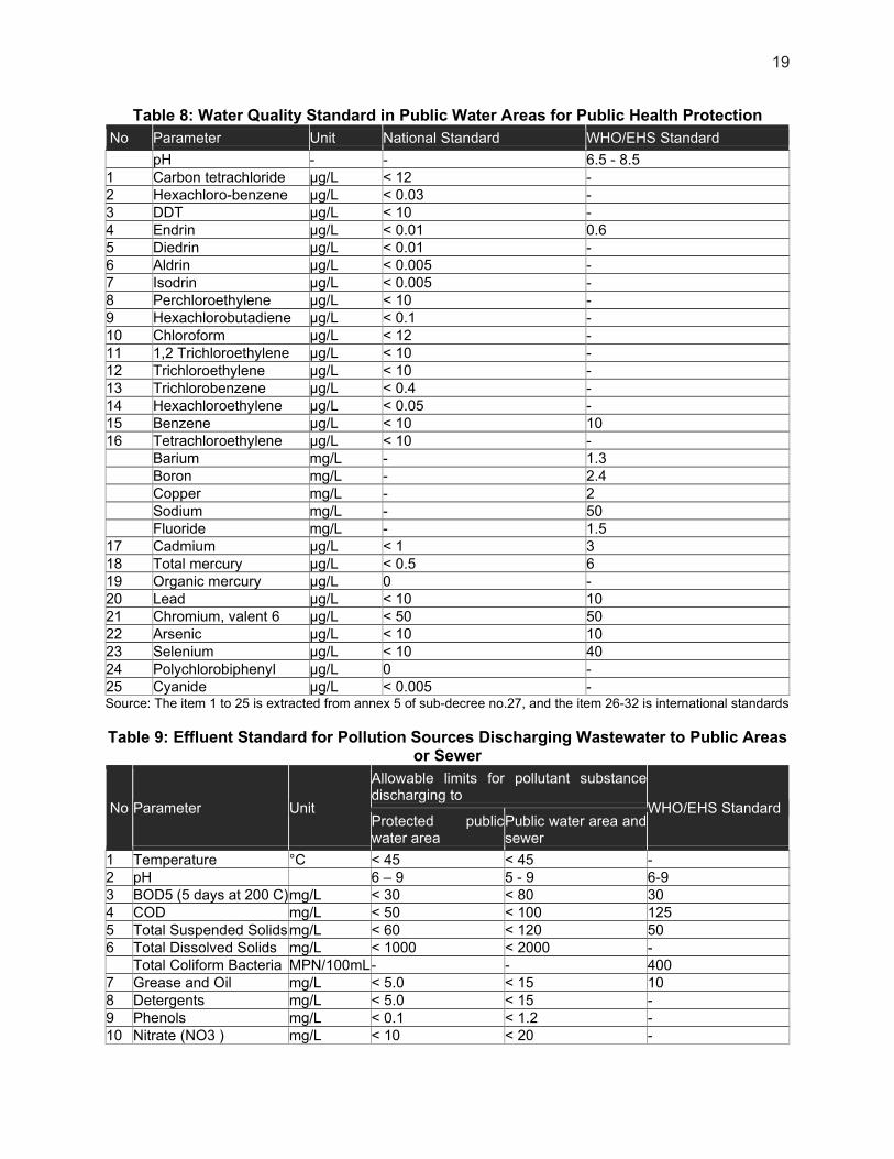
Table 8: Water Quality Standard in Public Water Areas for Public Health Protection
No Parameter Unit National Standard WHO/EHS Standard
pH - - 6.5 - 8.5 1 Carbon tetrachloride µg/L < 12 - 2 Hexachloro-benzene µg/L < 0.03 - 3 DDT µg/L < 10 - 4 Endrin µg/L < 0.01 0.6 5 Diedrin µg/L < 0.01 - 6 Aldrin µg/L < 0.005 - 7 Isodrin µg/L < 0.005 - 8 Perchloroethylene µg/L < 10 - 9 Hexachlorobutadiene µg/L < 0.1 - 10 Chloroform µg/L < 12 - 11 1,2 Trichloroethylene µg/L < 10 - 12 Trichloroethylene µg/L < 10 - 13 Trichlorobenzene µg/L < 0.4 - 14 Hexachloroethylene µg/L < 0.05 - 15 Benzene µg/L < 10 10 16 Tetrachloroethylene µg/L < 10 - Barium mg/L - 1.3 Boron mg/L - 2.4 Copper mg/L - 2 Sodium mg/L - 50 Fluoride mg/L - 1.5 17 Cadmium µg/L < 1 3 18 Total mercury µg/L < 0.5 6 19 Organic mercury µg/L 0 - 20 Lead µg/L < 10 10 21 Chromium, valent 6 µg/L < 50 50 22 Arsenic µg/L < 10 10 23 Selenium µg/L < 10 40 24 Polychlorobiphenyl µg/L 0 - 25 Cyanide µg/L < 0.005 - Source: The item 1 to 25 is extracted from annex 5 of sub-decree no.27, and the item 26-32 is international standards
Table 9: Effluent Standard for Pollution Sources Discharging Wastewater to Public Areas or Sewer
No Parameter Unit
Allowable limits for pollutant substance discharging to
WHO/EHS Standard Protected public water area
Public water area and sewer
1 Temperature °C < 45 < 45 - 2 pH 6 – 9 5 - 9 6-9 3 BOD5 (5 days at 200 C)mg/L < 30 < 80 30 4 COD mg/L < 50 < 100 125 5 Total Suspended Solids mg/L < 60 < 120 50 6 Total Dissolved Solids mg/L < 1000 < 2000 - Total Coliform Bacteria MPN/100mL - - 400 7 Grease and Oil mg/L < 5.0 < 15 10 8 Detergents mg/L < 5.0 < 15 - 9 Phenols mg/L < 0.1 < 1.2 - 10 Nitrate (NO3 ) mg/L < 10 < 20 -

20
No Parameter Unit
Allowable limits for pollutant substance discharging to
WHO/EHS Standard Protected public water area
Public water area and sewer
Total Nitrogen mg/L - - 10 11 Chlorine ( free ) mg/L < 1.0 < 2.0 - 12 Chloride ( ion ) mg/L < 500 < 700 - 13 Sulphate ( as SO4 ) mg/L < 300 < 500 - 14 Sulphide (as Sulphur ) mg/L < 0.2 < 1.0 - 15 Phosphate (PO4 ) mg/L < 3.0 < 6.0 - Total Phosphorus mg/L - - 2 16 Cyanide ( CN ) mg/L < 0.2 < 1.5 - 17 Barium ( Ba ) mg/L < 4.0 < 7.0 - 18 Arsenic ( As ) mg/L < 0.10 < 1.0 - 19 Tin ( Sn ) mg/L < 2.0 < 8.0 - 20 Iron ( Fe ) mg/L < 1.0 < 20 - 21 Boron ( B ) mg/L < 1.0 < 5.0 - 22 Manganese ( Mn ) mg/L < 1.0 < 5.0 - 23 Cadmium ( Cd ) mg/L < 0.1 < 0.5 - 24 Chromium ( Cr )+3 mg/L < 0.2 < 1.0 - 25 Chromium ( Cr )+6 mg/L < 0.05 < 0.5 - 26 Copper ( Cu ) mg/L < 0.2 < 1.0 - 27 Lead ( Pb ) mg/L < 0.1 < 1.0 - 28 Mercury (Hg ) mg/L < 0.002 < 0.05 - 29 Nickel ( Ni ) mg/L < 0.2 < 1.0 - 30 Selenium ( Se ) mg/L < 0.05 < 0.5 - 31 Silver ( Ag ) mg/L < 0.1 < 0.5 - 32 Zinc ( Zn ) mg/L < 1.0 < 3.0 - 33 Molybdenum ( Mo ) mg/L < 0.1 < 1.0 - 34 Ammonia ( NH3 ) mg/L < 5.0 < 7.0 - 35 DO mg/L > 2.0 > 1.0 - 36 Polychlorinated
Biphenyl mg/L < 0.003 < 0.003 -
37 Calcium mg/L < 150 < 200 - 38 Magnesium mg/L < 150 < 200 - 39 Carbon tetrachloride mg/L < 3 < 3 - 40 Hexachloro benzene mg/L < 2 < 2 - 41 DTT mg/L < 1.3 < 1.3 - 42 Endrin mg/L < 0.01 < 0.01 - 43 Dieldrin mg/L < 0.01 < 0.01 - 44 Aldrin mg/L < 0.01 < 0.01 - 45 Isodrin mg/L < 0.01 < 0.01 - 46 Perchloro ethylene mg/L < 2.5 < 2.5 - 47 Hexachloro butadiene mg/L < 3 < 3 - 48 Chloroform mg/L < 1 < 1 - 49 1,2 Dichloro ethylene mg/L < 2.5 < 2.5 - 50 Trichloro ethylene mg/L < 1 < 1 - 51 Trichloro benzene mg/L < 2 < 2 - 52 Hexachlorocyclohexanemg/L < 2 < 2 - Source: Column 2-4 is from Annex 2 of the sub-decree No.27, April 1999
79. Air Quality. The ambient air quality standards for Cambodia (Anukret No42 ANK/BK, 2000) and the World Health Organization (WHO) (identical to EHS standards) are below.

21
Table 10: Ambient air quality standards for Cambodia and the WHO
Pollutant Averaging period National Standard (mg/m3) EHS/WHO5 (µg/m3)
Carbone Monoxide (CO) 1 hour 40 - 8 hours 20 -
Nitrogen Dioxide (NO2) 1 hour 0,3 0,2 24 hours 0,1 0,04
Sulphur Dioxide (SO2) 1 hour 0,5 - 24 hours 0,3 20
Ozone (O3) 1 hour 0,2 - 8 hour - 160
Lead (Pb) 24 hours 0,005 - Total suspended particulate (TSP)
24 hours 0,33 - Annual 0,10 -
Source: Annex 1 of the Sub-Decree on Air Pollution, 1999
80. Noise. Cambodian National Standard for Ambient Noise sets an allowable limit for noise in the daytime at 60 dB (45 dB(A) in quiet areas), and night at 45 dB (35 dB(A) in quiet areas), with the night being 10 pm-6 am according to the anukret on the control of air pollution and disturbance. The comparison made with World Bank EHS standards shows that the EHS standards are less stringent than the national standard during the day.
Table 11: Cambodian National Standard for Ambient Noise
Standard
Maximum allowable noise limit, 1 hr LAeq in dBA
Day (6:00 – 18:00)Mid (18:00 - 22:00) Night (22:00 –
06:00)
WB/IFC Guideline Industrial/commercial 70 - 70 Residential/Institutional/Educational 55 - 45 Cambodian National Standard Quiet areas (hospital, libraries, school, kindergarten)
45 40 35
Residential areas (hotels, administrative offices, villas, flats)
60 50 45
Commercial and Service Areas and Area of multiple businesses
70 65 50
Small industrial factories mingling in a residential area
75 70 50
Source: Annex 6 of the Sub-Decree on Air Pollution, 1999
3. ADB Safeguards Policy Statement
81. ADB’s SPS (2009) provides the joint basis for this IEE. All projects funded by ADB must comply with the SPS. The purpose of the SPS is to ensure that projects are environmentally sound, designed to operate in line with applicable regulatory requirements, and are not likely to cause significant environmental, biology, health, or safety hazards. The SPS sets out the policy objectives, scope, and triggers, and principles for three key safeguard areas: (i) environmental safeguards; (ii) involuntary resettlement safeguards; and (iii) indigenous Peoples safeguards. The policies seek to avoid, minimize, or mitigate adverse environmental and social impacts, including protecting the rights of those likely to be affected or marginalized by the development process. The objectives of ADB’s safeguards are to (i) avoid adverse impacts of projects on the environment and affected people, where possible; (ii) minimize, mitigate, and/or compensate for

22
adverse project impacts on the environment and affected people when avoidance is not possible; and, (iii) help borrowers/clients to strengthen their safeguard systems and develop the capacity to manage environmental and social risks. The SPS is underpinned by the ADB Operations Manual for the SPS (OM Section F1, 2010), and guidance is provided by the ADB Environmental Safeguards - A Good Practice Sourcebook (2012). 82. The SPS also promotes the use of international standards, including the World Bank Group’s EHS Guidelines. EHS guidelines relevant to the project include environment protection, water conservation, hazardous materials, waste management, noise control, sanitation, and community and occupational health and safety. Where EHS standards are higher than national standards, efforts are made for ADB-funded projects to target the EHS standards. The standards applied to this project are based on a comparison of national and EHS thresholds; in cases where no EHS thresholds are available, or the Cambodian standards are identical to or higher than the EHS standards, the national standards are applied. In general, several Cambodian standards are equal to, or higher than, the EHS standards. 83. Compared with the Cambodian EIA requirements, the SPS emphasizes additional requirements, including (i) a project grievance redress mechanism; (ii) definition of the project area of influence; (iii) due diligence of associated facilities; (iv) climate change mitigation and adaptation; (v) impacts on livelihoods through environmental media; and (vi) biodiversity conservation. 84. At an early stage in the project cycle, typically the project identification stage, ADB screens and categorizes proposed projects based on the significance of potential project impacts and risks. A project’s environment category is determined by the category of its most environmentally sensitive component, including direct, indirect, induced, and cumulative impacts. Project screening and categorization are undertaken to (i) reflect the significance of the project’s potential environmental impacts; (ii) identify the type and level of environmental assessment and institutional resources required for the safeguard measures proportionate to the nature, scale, magnitude, and sensitivity of the proposed project’s potential impacts; and, (iii) determine consultation and disclosure requirements. 85. SPS and Protected Areas. The SPS requires that project activities will not be implemented in areas of critical habitat, which includes areas with high biodiversity value, including habitat required for the survival of critically endangered or endangered species; areas having special significance for endemic or restricted-range species; sites that are critical for the survival of migratory species; areas supporting globally significant concentrations or numbers of individuals of congregation species; areas with unique assemblages of species or that are associated with key evolutionary processes or provide key ecosystem services; and areas having biodiversity of significant social, economic, or cultural importance to local communities. 86. SPS requires to identify measures to avoid, minimize, or mitigate potentially adverse impacts and risks on biodiversity and natural resource and, as a last resort, propose compensatory measures, such as biodiversity offsets, to achieve no net loss or a net gain of the affected biodiversity. In areas where the natural habitat has apparently been altered, any further conversion or degradation of such habitat have to be minimized, and opportunities to enhance habitat and protect and conserve biodiversity as part of project operations have to be identified. 87. ADB assigns a proposed project to one of the following categories based on the potential environmental impacts:
23
(i) Category A. Proposed project is likely to have significant adverse environmental impacts that are irreversible, diverse, or unprecedented; impacts may affect an area larger than the sites or facilities subject to physical works. A full-scale EIA, including an EMP, is required.
(ii) Category B. Proposed project’s potential environmental impacts are less adverse and fewer in number than those of category A projects; impacts are site-specific, few if any of them are irreversible, and impacts can be readily addressed through mitigation measures. An IEE, including an EMP, is required.
(iii) Category C. Proposed project is likely to have minimal or no adverse environmental impacts. No EIA or IEE is required, although environmental implications need to be reviewed.
88. This project is categorized by ADB as category B for the environment. This IEE and EMP were prepared by the TRTA consultant on behalf of the MPWT, the executing agency. 89. Climate Risk and Vulnerability Assessment. The ADB also requires the identification of climate change risks to the proposed project early in the project cycle and to identify actions to screen projects for climate risks, assess these risks, and address them in the project design. Technical guidelines have been developed by the ADB to aid in climate risk and vulnerability assessment.14 Likewise, the Guidelines on Climate Proofing Investment in the Water Sector: Water Supply and Sanitation15 was issued to present a step-by-step methodology to help project teams incorporate climate adaptation into the water supply and sanitation sector investment projects. 4. Gap Analysis
90. Regarding the national regulation and international standards (such as WHO/EHS), numerous standards exist. Comparison with the World Bank Group’s Environmental, Health and Safety (EHS) Guidelines has been carried out: where national and international thresholds differ, the most stringent value is preferred.
14 https://www.adb.org/sites/default/files/publication/148796/climate-risk-management-adb-projects.pdf. 15 https://www.adb.org/sites/default/files/institutional-document/32772/files/guidelines-climate-proofing-water.pdf.

24
IV. DESCRIPTION OF THE ENVIRONMENT
1. Location, Geography, and Topography
91. Cambodia lies in the southwestern part of the Southeast Asian peninsula. International borders are shared with Thailand to the west and northwest, the Lao People's Democratic Republic to the north, and the Socialist Republic of Vietnam on the east and southeast. The country is bounded to the southwest by the Gulf of Thailand. 92. The topography of Cambodia is described as “bowl-shaped” and expands about 181,035km2. There are three distinct topographic regions: (i) central plains, (ii) flat coastal areas, and (iii) mountain ranges with high plateaus. The coastal area lies on shouth-east to north-west with approximately of 440km of shoreline. 93. Kampot city is the provincial capital of Kampot Province located in the southern coastal region of Cambodia, 150 km from Phnom Penh by NR 3. Kampot City is surrounded by the District Tuek Chhu on the west-north-eastern side and by the sea on the southern side.
Figure 5: Kampot City Location
Source: Egis, 2021
94. The approved land area of Kampot City is 54.10km2, and the city consists of five quarters (Sangkat):
(i) Sangkat Kampong Bay (1.81km2), composed of two villages (Phum);
25
(ii) Sangkat Kampong Kandal (2km2), composed of two villages; (iii) Sangkat Krang Ampil (2.48km2), composed of two villages; (iv) Sangkat Traeuy Kaoh (21.60km2), composed of four villages; (v) Sangkat Andoung Khmer (26.20km2), composed of five villages.
95. The land of Kampot Province comprises of small and large settlement areas, such as Kampot City, as well as barren areas, which are common in the area, such as rock outcrops. Dense broad-leafed forests are located within the Bokor Mountain National Park in the western part of the province. On the flatter coastal plain, areas including rice paddy and salt farms predominate.16 96. Forest cover in Kampot is relatively sparse, essentially located in Bokor National Park northwest of Kampot16 and composed of evergreen and semi-evergreen forests17. 1 Kampot is characterized by a flat coastal topography. The city lies in the flood plain and estuary of the Preaek Tuek Chhu River18. Northwest of the city, higher areas are found, the highest point being the Bokor Mountain (1,081m from msl). 2. Geology and Soils
2 In the Kampot region, the geological map of Cambodia displays upper Jurassic-Cretaceous sedimentary unit basement westward, and old (Precambrian-Paleozoic) high-grade metamorphics basement eastward. Due to its coastal location, influenced by river plain deposits, two main types of substratum or layers are sitting around Kampot:
(i) Coastal plain deposits; (ii) Tidal flats deposits.
97. In the northwestern part of the city, close to the Bokor Moutain National Park, four different geological layers are encountered: pediments, formation (siltstone, schists, and marl), colluvial (Talus cones), and sandstone. 98. At the southernmost tip of the city, sandstone and rhyolite layers are identified.
16 Ministry of Tourism, Cambodia. Initial Environemental Examination. Kingdom of Cambodia: Greater Mekong
Subregion Tourism Infrastructure for Inclusive Growth Project - Kampot and Kep Provinces. March 2014. 17 NREM DATA TOOL BOX -Royal Danish Embassy- Danida - Phnom Penh, Cambodia, March 2007. 18 Ministry of Tourism, Cambodia. Initial Environemental Examination. Kingdom of Cambodia: Second Greater Mekong
Subregion Corridor Towns Development Project. August 2015.

26
Figure 6: Geological map - Kampot city
Source: Egis, 2021
99. The prevailing soil type of Kampot is a mix of old and young alluvium soils of sediment deposits from rivers and streams19. As they are mostly finer sediments, a high concentration of silt is found in the coastal and nearshore areas. Alluvial deposits normally result in fertile land.1620 100. Over the four hydrologic soil groups defined by the Natural Resource Conservation Service, the Kampot soil is classified as a group D soil. Category A soil generally have the smallest runoff potential while Category D have the greatest. 3. Climate, Hydrology, Water Resources, and Water Quality
3.1. Climate
101. The tropical monsoon climate of Southern Cambodia has two distinct seasons: (i) the dry season, which lasts approximately from November to April and is associated with the northeast
19 Ministry of Environment, Cambodia. 2004.
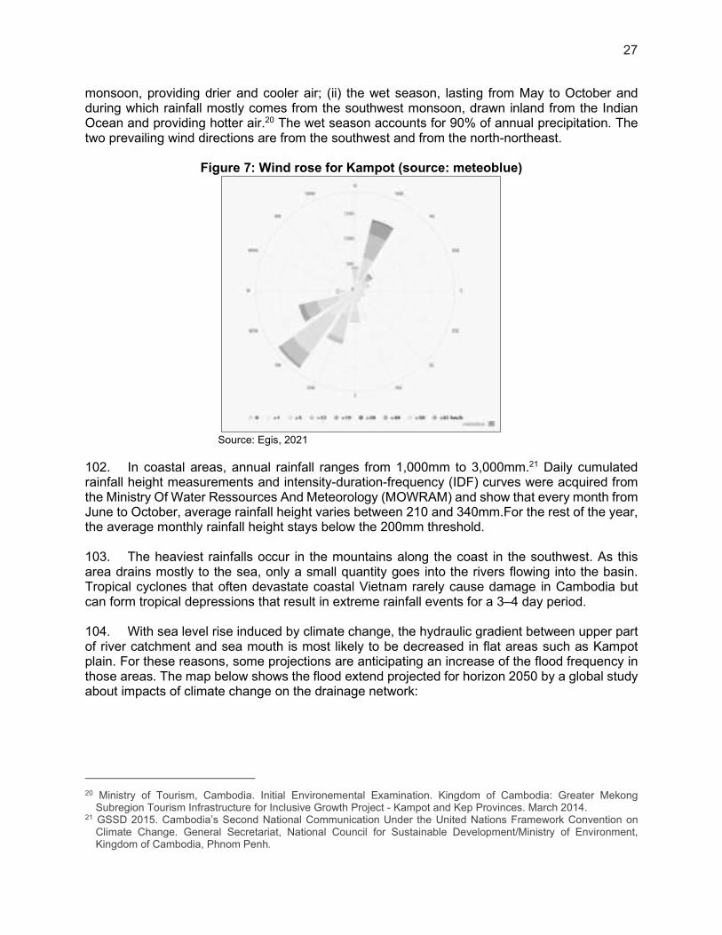
27
monsoon, providing drier and cooler air; (ii) the wet season, lasting from May to October and during which rainfall mostly comes from the southwest monsoon, drawn inland from the Indian Ocean and providing hotter air.20 The wet season accounts for 90% of annual precipitation. The two prevailing wind directions are from the southwest and from the north-northeast.
Figure 7: Wind rose for Kampot (source: meteoblue)
Source: Egis, 2021
102. In coastal areas, annual rainfall ranges from 1,000mm to 3,000mm.21 Daily cumulated rainfall height measurements and intensity-duration-frequency (IDF) curves were acquired from the Ministry Of Water Ressources And Meteorology (MOWRAM) and show that every month from June to October, average rainfall height varies between 210 and 340mm.For the rest of the year, the average monthly rainfall height stays below the 200mm threshold. 103. The heaviest rainfalls occur in the mountains along the coast in the southwest. As this area drains mostly to the sea, only a small quantity goes into the rivers flowing into the basin. Tropical cyclones that often devastate coastal Vietnam rarely cause damage in Cambodia but can form tropical depressions that result in extreme rainfall events for a 3–4 day period. 104. With sea level rise induced by climate change, the hydraulic gradient between upper part of river catchment and sea mouth is most likely to be decreased in flat areas such as Kampot plain. For these reasons, some projections are anticipating an increase of the flood frequency in those areas. The map below shows the flood extend projected for horizon 2050 by a global study about impacts of climate change on the drainage network:
20 Ministry of Tourism, Cambodia. Initial Environemental Examination. Kingdom of Cambodia: Greater Mekong
Subregion Tourism Infrastructure for Inclusive Growth Project - Kampot and Kep Provinces. March 2014. 21 GSSD 2015. Cambodia’s Second National Communication Under the United Nations Framework Convention on
Climate Change. General Secretariat, National Council for Sustainable Development/Ministry of Environment, Kingdom of Cambodia, Phnom Penh.

28
Figure 8 Projection for annual flood 2050
Source: Egis, 2021
105. The mean maximum temperature is 28°C, and the mean minimum temperature is 22°C. Maximum temperatures above 32°C are common before the start of the rainy season and may rise to more than 38°C. During the dry season, the province of Kampot experiences high temperatures in April with an average of 36.6°C and the coldest temperature in February with an average of 21.10°C.16
3.2. Climate Change
106. Generally, climate modeling has been based on older generations of climate models released under the Climate Model Intercomparison Project (CMIP3) and using the third Intergovernmental Panel on Climate Change (IPCC3) Special Report on Emissions Scenarios (SRES) CO2 scenarios. Climate change modeling reports that present data for Cambodia are summarized in Table 12. The Second National Communication released in 2015, did not provide any recent modeling results and relied on projections from earlier reports. The Climate Futures program of the Commonwealth Scientific and Industrial Research Organisation (CSIRO) funded by Ausaid used 6 CMIP5 Global Climate Model (GCM) models and Representative Concentration Pathways (RCP) to create climate projections for Cambodia and Vietnam. The study produced downscaled projections from a Regional Climate Model with a resolution of 10 km, with six model runs based on inputs from each of the 6 GCMs. The CSIRO reports present maps of the average value of the projections from the six Regional Climate Model (RCM). Because of the higher

29
resolution of the CSIRO RCM, where possible the results of the for RCP8.5 for the 20 year period centered on 2055 are used for projections presented below. Those projections are used for the design of the proposed infrastructure. 107. To provide more information on the range of individual GCM projections, results from the Royal Netherlands Meteorological Institute (KNMI) Climate Explorer Website are also presented. The Climate Explorer Website supported by the World Meteorological Organization, presents data from the latest CMIP6 models. The data consists of projections from a 13 ensemble of GCMs and is at the resolution of the original models with no downscaling (2.5° x 2.5° grid). Data was downloaded and compared to baseline of 2000 – 2020. 108. A discussion of the selection of projections to use for the design of project infrastructure is presented in section IV. 6 below.
Table 12: Climate Change modeling used to develop projections in this report.
Report Year Released
Model generation No. Models CO2 future Scenario
Baseline
Second National Communication
2015 CMIP3 2 SRES A2 2002
Climate Futures Program, CSIRO (Ausaid)
2013 CMIP5 6 RPC8.5 1975-2005
KNMI. Climate Explorer (www.climexp.knmi.nl).
2021 CMIP6 13 SSP2 RCP4.5 SSP5 RCP8.5
2000-2020
SRES = CO2 scenarios developed for the IPCC3 Special Report on Emissions Scenarios RCP = CO2 Representative Concentration Pathways developed for IPCC5 SSP = Shared Socioeconomic Pathways CMIP = Climate Model Intercomparison Project carried out for IPCC3, IPCC5 or IPCC6
Source: Egis, 2021.
3.2.1. Temperature
109. Climate change models are very consistent in projecting an increase in temperature across Cambodia in the future. The table below shows the median and range of a 13 ensemble of GCM’s projections of mean annual temperature anomalies relative to the mean climate of 2000-2020 under the two scenarios for three 20 year time periods. Average annual temperature for Kampot is projected to increase by 0.6 °C by 2030, by 1.4 °C by 2050 and by 3.4°C by the end of the century under RCP8.5. Projections for 2050 under RCP 4.5 are slightly less out to 2050, but the difference is larger by the end of the century.
Table 13: Range of Projected Mean Annual Temperature Change (°C) for the 2.5° x 2.5° cell containing Kampot Compared to the 2000-2020 model average under the SSP2
RCP4.5 and SSP5 RCP8.5 Scenarios from 13 Model Ensemble.
20 yr period 2030 2050 2090
Scenario Min Av Max Min Av Max Min Av Max
SSP2 RCP4.5 0.1 0.5 0.8 0.6 1.1 1.6 0.9 1.7 2.9
SSP5 RCP8.5 0.2 0.6 0.8 0.8 1.4 2.2 2.2 3.4 5.5
Source. KNMI. Climate Explorer (www.climexp.knmi.nl).

30
110. The projected change in seasonal temperature for Kampot for the period centered on 2055 compared to the period 1975-2005 under RCP8.5 is shown in Table 14. Temperature changes are projected to be relatively even across the year under RCP8.5. Table 14: Projected seasonal temperature change (°C) for Kampot for the period centered
on 2055 under RCP 8.5 compared to the period 1975-2005.
Parameter Value
Mean Annual Temperature (°C) 1.8
April-May Temperature (°C) 1.8
June-September Temperature (°C) 1.75
October-November Temperature (°C) 1.75
December-March Temperature (°C) 1.8
Source. Katzfey, J., Jiao, X., Suppiah, R., Hoffmann, P., Nguyen, K. C. and Poun, S, Climate change projections for Mondulkiri and Koh Kong Provinces in Cambodia, 2013.
Number of Hot Days 111. The UNDP report defines a hot day threshold as the temperature exceeding 10% of days or nights during the period 1970-1999. The report presents projected changes in the number of Hot days in the region around Kampot of 22 days by 2060 from an ensemble of 15 models (Model range is 15-59 days) under the SRES A2 scenario. However, modeling carried out by the CSIRO presents projections of the number of days above 35°C, which is a more realistic measure of potential heat stress conditions. The CSIRO modeling indicates that the number of days above 35°C is projected to increase from 2-3 days per year to over ten days per year by 2050 under RCP8.5 and that the number of consecutive hot days will increase from 8 to over 10.22
3.2.2. Rainfall
3 The projected change in rainfall from climate models is much more variable than it is for temperature. The Second National Communication states that under the A2 scenario, annual rainfall for Cambodia in 2100 would increase between 3% and 35% from current rainfall (2015), depending on location, while under SRES B1 the increase would be smaller. The projected annual rainfall change for Kampot from an ensemble of 10 CMIP6 GCMs is shown in Table 15. The average projection for annual rainfall from the GCMs used in this study is for an increase by 2030 but little change into the future. With regards to the range of outputs, some models project a decrease, -4% by 2030, -3% for 2050 and -6% for 2090, while others project an increase of up to 8% by the end of the century. The results for RCP4.5 are generally lower.
Table 15: Range of Projected Mean Annual Precipitation Change (%) for the 2.5° x 2.5° cell containing Kampot Compared to the 2000-2020 average under different Scenarios from 10 Model
Ensemble.
Year Scenario Min 25th Av 75th Max
2030 SSP2 RCP4.5 -1 0 3 4 6
SSP5 RCP8.5 -4 1 6 8 8
2050 SSP2 RCP4.5 -3 -2 -1 2 5
22 Katzfey, J. et al, 2013. Climate change projections for Mondulkiri and Koh Kong Provinces in Cambodia.

31
Year Scenario Min 25th Av 75th Max
SSP5 RCP8.5 -1 0 1 4 6
2090 SSP2 RCP4.5 -4 -3 0 3 8
SSP5 RCP8.5 -6 -4 0 4 6
Source. KNMI. Climate Explorer (www.climexp.knmi.nl).
3.2.3. Extreme weather events and flooding
112. Typhoons making landfall on the coast of Vietnam often impact Cambodia as a tropical depression and can bring widespread heavy rainfall and subsequent flooding. The MRC State of the Basin Report found no increasing or decreasing trend in the number of tropical storms over the last ten years.23 However, there is a growing level of consistency between global climate models that on a global basis, the frequency of tropical cyclones is likely to decrease by the end of the 21st century. A CSIRO report found that the majority of GCMs project that there will be a decrease in tropical cyclone formation off the coast of Vietnam. This is consistent with a previous study by Chand et al. 2016.24 There is also a general agreement between models that the trade-off to the decrease in frequency is an increase in the intensity of wind speeds of 1.3 m/s,25 and an increase in rainfall rates of the order of 20% within 100 km of the cyclone center 26. Studies of the northwest Pacific region off the coast of Vietnam project an increase in typhoon strength of around 5% by 2050.27 This indicates that extreme rainfall events that result from tropical depressions crossing Cambodia will decrease in frequency, but each event will bring more rain. This increased strength will also occur for any typhoons that pass over southern Vietnam and reform in the Gulf of Thailand as Typhoon Linda did in 1997. 113. Table 16 shows the projected increase in extreme rainfall events from two sources; the KNMI website, and the CSIRO study. Both results are based on outputs from CMIP5 GCM data. The KNMI website presents GCM data in 2.5° x 2.5° pixels, outputs from 10 models shown to be suitable for the region were assessed. The CSIRO study used 6 CMIP5 models as an input to a 10 km x 10km pixel Regional Climate Model. The KNMI data showed that climate models produced a wide range of projected changes and the average projection was for a change of 8%. The average of the ensemble used in the CSIRO study is lower than the KNMI data. These projections are consistent with the projected changes in rainfall that will result from tropical depressions crossing into Cambodia from typhoons landing in Vietnam. For the 5 day extreme events, the CSIRO study projected a decrease in 5 day events of 2.5 mm, which is not consistent with the projections for increased tropical storm intensity. Additionally, the coastal location of Kampot indicates that increased wet season monsoons could be expected to result in larger rainfall from extreme events.
23 The Mekong River Commission 2019. State of the Basin Report 2018. The Mekong River Commission, Vientiane
Lao PDR. 24 Chand, S.; Tory, K.; Ye, H. & Walsh, K. (2016), 'Projected increase in El Niño-driven tropical cyclone frequency in
the Pacific', Nature Climate Change 7. 25 Kang, N.-Y., and J.B. Elsner. 2015. Trade-off between intensity and frequency of global tropical cyclones. Nature
Climate Change. 26 Knutson, T.R., McBride, J.L., Chan, J., Emanuel, K., Holland, G., Landsea, C., Held, I., Kossin, J.P., Srivastava, A.K.,
and Sugi, M., (2010), Tropical cyclones and climate change: Nature Geoscience, v. 3, p. 157-163. 27 For detailed review see Walsh et al. (2016) Tropical cyclones and climate change. Wiley Interdisciplinary Reviews-
Climate Change, 7 (1), pp. 65 – 89.
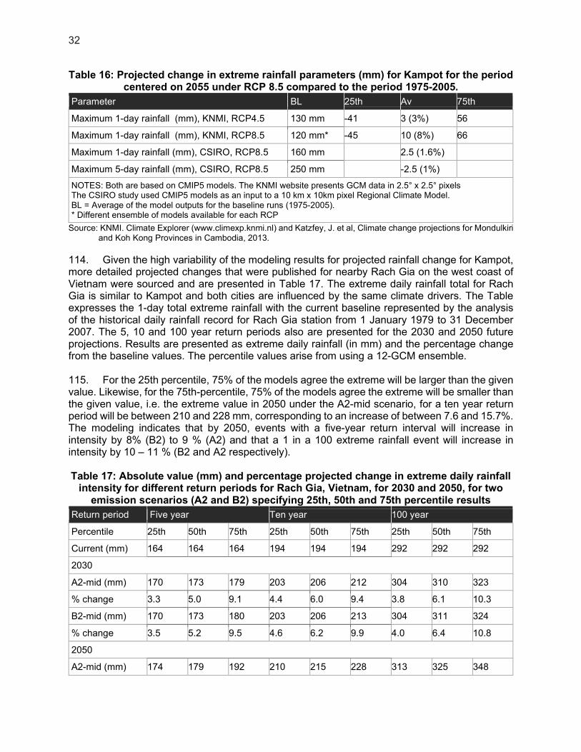
32
Table 16: Projected change in extreme rainfall parameters (mm) for Kampot for the period centered on 2055 under RCP 8.5 compared to the period 1975-2005.
Parameter BL 25th Av 75th
Maximum 1-day rainfall (mm), KNMI, RCP4.5 130 mm -41 3 (3%) 56
Maximum 1-day rainfall (mm), KNMI, RCP8.5 120 mm* -45 10 (8%) 66
Maximum 1-day rainfall (mm), CSIRO, RCP8.5 160 mm 2.5 (1.6%)
Maximum 5-day rainfall (mm), CSIRO, RCP8.5 250 mm -2.5 (1%)
NOTES: Both are based on CMIP5 models. The KNMI website presents GCM data in 2.5° x 2.5° pixels The CSIRO study used CMIP5 models as an input to a 10 km x 10km pixel Regional Climate Model. BL = Average of the model outputs for the baseline runs (1975-2005). * Different ensemble of models available for each RCP
Source: KNMI. Climate Explorer (www.climexp.knmi.nl) and Katzfey, J. et al, Climate change projections for Mondulkiri and Koh Kong Provinces in Cambodia, 2013.
114. Given the high variability of the modeling results for projected rainfall change for Kampot, more detailed projected changes that were published for nearby Rach Gia on the west coast of Vietnam were sourced and are presented in Table 17. The extreme daily rainfall total for Rach Gia is similar to Kampot and both cities are influenced by the same climate drivers. The Table expresses the 1-day total extreme rainfall with the current baseline represented by the analysis of the historical daily rainfall record for Rach Gia station from 1 January 1979 to 31 December 2007. The 5, 10 and 100 year return periods also are presented for the 2030 and 2050 future projections. Results are presented as extreme daily rainfall (in mm) and the percentage change from the baseline values. The percentile values arise from using a 12-GCM ensemble. 115. For the 25th percentile, 75% of the models agree the extreme will be larger than the given value. Likewise, for the 75th-percentile, 75% of the models agree the extreme will be smaller than the given value, i.e. the extreme value in 2050 under the A2-mid scenario, for a ten year return period will be between 210 and 228 mm, corresponding to an increase of between 7.6 and 15.7%. The modeling indicates that by 2050, events with a five-year return interval will increase in intensity by 8% (B2) to 9 % (A2) and that a 1 in a 100 extreme rainfall event will increase in intensity by 10 – 11 % (B2 and A2 respectively). Table 17: Absolute value (mm) and percentage projected change in extreme daily rainfall
intensity for different return periods for Rach Gia, Vietnam, for 2030 and 2050, for two emission scenarios (A2 and B2) specifying 25th, 50th and 75th percentile results
Return period Five year Ten year 100 year
Percentile 25th 50th 75th 25th 50th 75th 25th 50th 75th
Current (mm) 164 164 164 194 194 194 292 292 292
2030
A2-mid (mm) 170 173 179 203 206 212 304 310 323
% change 3.3 5.0 9.1 4.4 6.0 9.4 3.8 6.1 10.3
B2-mid (mm) 170 173 180 203 206 213 304 311 324
% change 3.5 5.2 9.5 4.6 6.2 9.9 4.0 6.4 10.8
2050
A2-mid (mm) 174 179 192 210 215 228 313 325 348
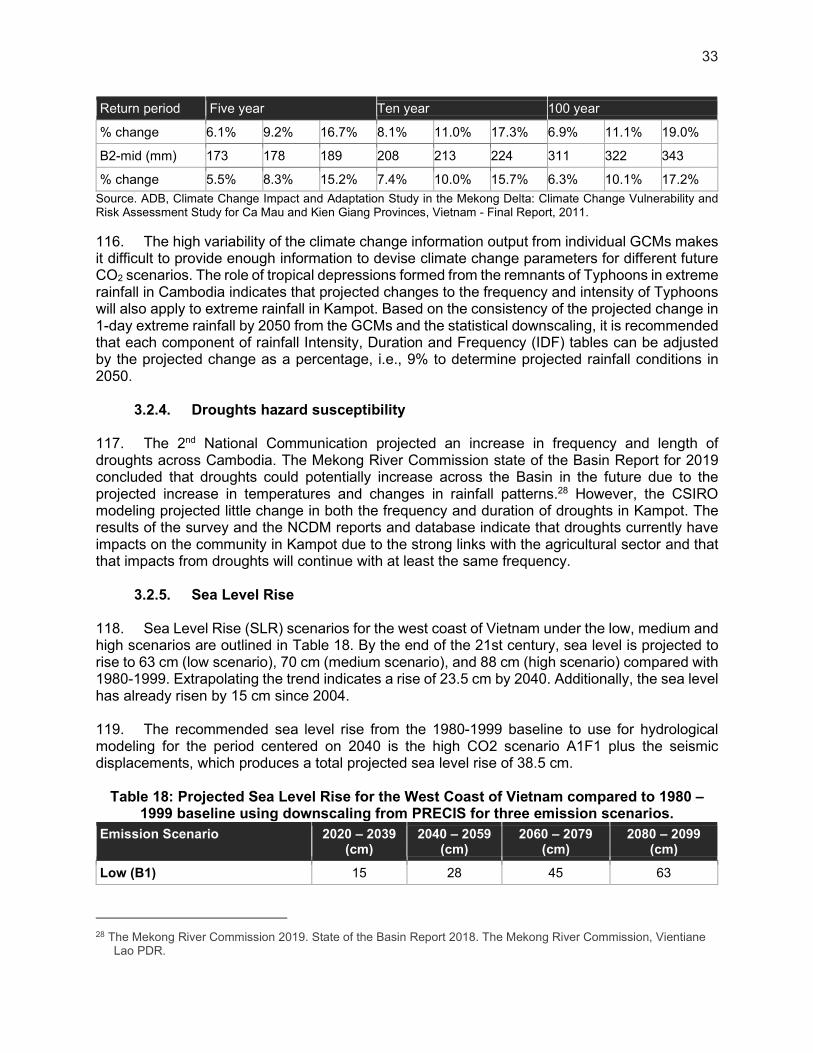
33
Return period Five year Ten year 100 year
% change 6.1% 9.2% 16.7% 8.1% 11.0% 17.3% 6.9% 11.1% 19.0%
B2-mid (mm) 173 178 189 208 213 224 311 322 343
% change 5.5% 8.3% 15.2% 7.4% 10.0% 15.7% 6.3% 10.1% 17.2%
Source. ADB, Climate Change Impact and Adaptation Study in the Mekong Delta: Climate Change Vulnerability and Risk Assessment Study for Ca Mau and Kien Giang Provinces, Vietnam - Final Report, 2011.
116. The high variability of the climate change information output from individual GCMs makes it difficult to provide enough information to devise climate change parameters for different future CO2 scenarios. The role of tropical depressions formed from the remnants of Typhoons in extreme rainfall in Cambodia indicates that projected changes to the frequency and intensity of Typhoons will also apply to extreme rainfall in Kampot. Based on the consistency of the projected change in 1-day extreme rainfall by 2050 from the GCMs and the statistical downscaling, it is recommended that each component of rainfall Intensity, Duration and Frequency (IDF) tables can be adjusted by the projected change as a percentage, i.e., 9% to determine projected rainfall conditions in 2050.
3.2.4. Droughts hazard susceptibility
117. The 2nd National Communication projected an increase in frequency and length of droughts across Cambodia. The Mekong River Commission state of the Basin Report for 2019 concluded that droughts could potentially increase across the Basin in the future due to the projected increase in temperatures and changes in rainfall patterns.28 However, the CSIRO modeling projected little change in both the frequency and duration of droughts in Kampot. The results of the survey and the NCDM reports and database indicate that droughts currently have impacts on the community in Kampot due to the strong links with the agricultural sector and that that impacts from droughts will continue with at least the same frequency.
3.2.5. Sea Level Rise
118. Sea Level Rise (SLR) scenarios for the west coast of Vietnam under the low, medium and high scenarios are outlined in Table 18. By the end of the 21st century, sea level is projected to rise to 63 cm (low scenario), 70 cm (medium scenario), and 88 cm (high scenario) compared with 1980-1999. Extrapolating the trend indicates a rise of 23.5 cm by 2040. Additionally, the sea level has already risen by 15 cm since 2004. 119. The recommended sea level rise from the 1980-1999 baseline to use for hydrological modeling for the period centered on 2040 is the high CO2 scenario A1F1 plus the seismic displacements, which produces a total projected sea level rise of 38.5 cm.
Table 18: Projected Sea Level Rise for the West Coast of Vietnam compared to 1980 – 1999 baseline using downscaling from PRECIS for three emission scenarios.
Emission Scenario 2020 – 2039 (cm)
2040 – 2059 (cm)
2060 – 2079 (cm)
2080 – 2099 (cm)
Low (B1) 15 28 45 63
28 The Mekong River Commission 2019. State of the Basin Report 2018. The Mekong River Commission, Vientiane
Lao PDR.

34
Emission Scenario 2020 – 2039 (cm)
2040 – 2059 (cm)
2060 – 2079 (cm)
2080 – 2099 (cm)
Medium (B2) 15 30 49 70
High (A1F1) 16 32 57 88
Source, ADB, Climate Risks in the Mekong Delta: Ca Mau and Kien Giang Provinces of Viet Nam, 2013.
Figure 9: The southern coastline of Kampot city is exposed to sea-level rise
Source: Charles Rodgers, Senior Advisor, Climate Change Adaptation SDCD, ADB.
3.3. Hydrology
120. Many rivers drain to the coastal area of Kampot. During the dry season, the lower reaches of the rivers are brackish, and some of the rivers commonly dry up. Some rivers in Kampot City emptying into the sea are the following:29
(i) Kbal Romeas Preaek, flowing from Kam Chai Mountain; (ii) Preaek Tuek Chhu River, flowing through Kampot City south to Kampot Bay; (iii) Koh Toch Preaek, flowing from Bokor area; (iv) Kdart Preaek, flowing from Bokor area; (v) Smach Preaek, flowing from Bokor area; (vi) Thnaout Preaek, flowing from Bokor area;
29 DOE and Danida, 2002. State of Environment Report for Kampot province.
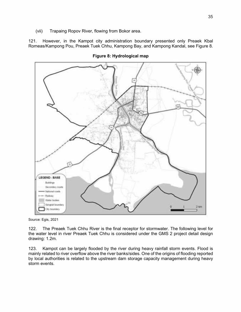
35
(vii) Trapaing Ropov River, flowing from Bokor area.
121. However, in the Kampot city administration boundary presented only Preaek Kbal Romeas/Kampong Pou, Preaek Tuek Chhu, Kampong Bay, and Kampong Kandal, see Figure 8.
Figure 8: Hydrological map
Source: Egis, 2021
122. The Preaek Tuek Chhu River is the final receptor for stormwater. The following level for the water level in river Preaek Tuek Chhu is considered under the GMS 2 project detail design drawing: 1.2m. 123. Kampot can be largely flooded by the river during heavy rainfall storm events. Flood is mainly related to river overflow above the river banks/sides. One of the origins of flooding reported by local authorities is related to the upstream dam storage capacity management during heavy storm events.
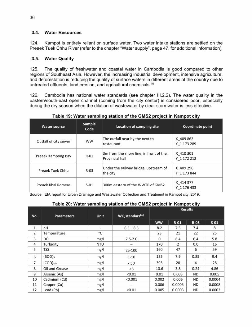
36
3.4. Water Resources
124. Kampot is entirely reliant on surface water. Two water intake stations are settled on the Preaek Tuek Chhu River (refer to the chapter “Water supply”, page 47, for additional information). 3.5. Water Quality
125. The quality of freshwater and coastal water in Cambodia is good compared to other regions of Southeast Asia. However, the increasing industrial development, intensive agriculture, and deforestation is reducing the quality of surface waters in different areas of the country due to untreated effluents, land erosion, and agricultural chemicals.16 126. Cambodia has national water standards (see chapter III.2.2). The water quality in the eastern/south-east open channel (coming from the city center) is considered poor, especially during the dry season when the dilution of wastewater by clear stormwater is less effective.
Table 19: Water sampling station of the GMS2 project in Kampot city
Water source Sample
Code Location of sampling site Coordinate point
Outfall of city sewer WW The outfall near by the next to
restaurant X_409 862 Y_1 173 289
Preaek Kampong Bay R-01 3m from the shore line, in front of the
Provincial hall X_410 301
Y_1 172 212
Preaek Tuek Chhu R-03 Under the railway bridge, upstream of
the city X_409 296
Y_1 173 844
Preaek Kbal Romeas S-01 300m eastern of the WWTP of GMS2 X_414 377
Y_1 176 433
Source: IEIA report for Urban Drainage and Wastewater Collection and Treatment in Kampot city, 2019.
Table 20: Water sampling station of the GMS2 project in Kampot city
No. Parameters Unit WQ standars(*)
Results
WW R-01 R-03 S-01
1 pH - 6.5 – 8.5 8.2 7.5 7.4 8
2 Temperature oC 23 21 22 25
3 DO mg/l 7.5-2.0 0 6.4 6.4 5.8
4 Turbidity NTU 170 2 0.0 16
5 TSS mg/l 25-100 160 47 6 59
6 (BOD)5 mg/l 1-10 135 7.9 0.85 9.4
7 (COD)Mn mg/l 50 395 20 4 28
8 Oil and Grease mg/l 5 10.6 3.8 0.24 4.86
9 Arsenic (As) mg/l <0.01 0.01 0.003 ND 0.005
10 Cadmium (Cd) mg/l <0.001 0.002 0.006 ND 0.0004
11 Copper (Cu) mg/l 0.006 0.0005 ND 0.0008
12 Lead (Pb) mg/l <0.01 0.005 0.0003 ND 0.0002

37
No. Parameters Unit WQ standars(*)
Results
WW R-01 R-03 S-01
13 Mercury (Hg-Total) mg/l <0.0005 0.0007 0.0002 ND 0.0003
14 Total Coli form MPN/100ml <5,000 46×103 2.4×10³ 1.4×10² 14.6×10³
Note: (*) Water quality standards for River/Preaek, Praaks No.120, MoE, April 2018 ND- Not detected
Source: IEIA report for Urban Drainage and Wastewater Collection and Treatment in Kampot city, 2019.
4. Ecology, Wilderness Values, and Protected Areas
4.1. Protected Areas
127. Results of the proximity report from the IBAT data analysis (see appendices) confirms that one protected ecological area and its associated key biodiversity area are close to Kampot City: Preah Monivong “Bokor” and Phnom Bokor, respectively. 128. The Bokor National Park is located northwest of the city, at more than 5km from the city center.16 It covers a total area of 150,000ha. It is estimated that 97% of the park’s land use is natural or semi-natural, and 3% is transformed30. The park is situated on a sandstone massif, which is the only high mountain on the coast, rising to an altitude of more than 1,000m. It contains a wide range of habitats, including both low- and medium-altitude vegetation and numerous waterfalls.31
129. The park provides habitat for a number of internationally critical and endangered species, including tigers, leopards, Asian elephants, gaurs, Sun bears, pileated gibbons, and hornbills, as well as a wide range of fauna of conservation significance, including peafowls and a number of hornbill species.31 Inside of the Bokor National Park are located Important Bird Areas (IBA).32 Two hundred twenty-three bird species have been recorded in the park, of which six are globally significant, 13 are regionally significant, and 12 were the first ever recorded in the country.33 130. The area is characterized by high rainfall.31 Bokor National Park is a valuable source of water for Kampot City. Its high plateaus and ranges of the mountain form an important watershed and provide a catchment area for several rivers. These rivers provide domestic and industrial water supplies for Kampot City and other towns; they also feed small-scale and commercial irrigation developments and sustain downstream fisheries. Hydro-electric facilities utilizing the rivers whose headwaters lie in the protected areas have been established in the park.31
30 IUCN. The Conservation and Sustainable Use of Biological Resources Associated With Protected Areas of Southern
Cambodia. The Parks, People and Biodiversity Project: A Concept Paper. IUCN – The World Conservation Union, Phnom Penh. 52 pp. 1997.
31 International Centre for Environmental Management. Review of protected areas and development in the four countries of the Lower Mekong River Region - Economic Benefits of Protected Areas - Field Studies in Cambodia,Lao PDR, Thailand and Vietnam. 2003.
32 http://datazone.birdlife.org/site/factsheet/16682 33 ADB. Final Report : ADB 5712-REG: Coastal and Marine Management in the South China Sea, Phase2. 303 pp.
2000.
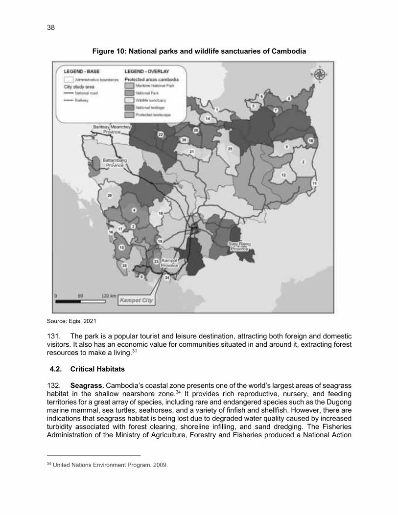
38
Figure 10: National parks and wildlife sanctuaries of Cambodia
Source: Egis, 2021
131. The park is a popular tourist and leisure destination, attracting both foreign and domestic visitors. It also has an economic value for communities situated in and around it, extracting forest resources to make a living.31
4.2. Critical Habitats
132. Seagrass. Cambodia’s coastal zone presents one of the world’s largest areas of seagrass habitat in the shallow nearshore zone.34 It provides rich reproductive, nursery, and feeding territories for a great array of species, including rare and endangered species such as the Dugong marine mammal, sea turtles, seahorses, and a variety of finfish and shellfish. However, there are indications that seagrass habitat is being lost due to degraded water quality caused by increased turbidity associated with forest clearing, shoreline infilling, and sand dredging. The Fisheries Administration of the Ministry of Agriculture, Forestry and Fisheries produced a National Action
34 United Nations Environment Program. 2009.
39
Plan for Coral Reef and Seagrass Management in Cambodia (2006-2015).35 According to the survey conducted by the Department of Fisheries on the territory of Cambodia in 2004, seagrass is located in the coastal area of Kampot, at more than 5km from LCIP’s service area, which is the closest to the coast. 133. Coral Reefs. Cambodia presents a surface area of approximately 2,700ha of coral reefs, with one of the most extensive coverages occurring in Kampot. Around 70 coral species are found within the coastal zone. Threats towards these reefs comprise development, overfishing, coral harvesting, degradation of the water quality, and destructive fishing practices such as dynamite. Coral reefs are also concerned by the National Action Plan for Coral Reef and Seagrass Management in Cambodia (2006-2015). The area of mangrove forests along the coastline of Cambodia has declined significantly over the last two decades. However, the estimated 56,000ha that remains represents a rich resource and area of critical habitat in relation to other areas in Southeast Asia. Koh Kong province supports the largest area of mangroves. Similar to seagrass, mangrove forests are critical habitat and play an essential role in the lifecycle of many marine organisms, and provide spawning or nursery grounds that support the rich biodiversity of fish species, which include commercially important species. The mangroves forests of Koh Kong provide habitat for two rare and endangered species of the otter: the smooth-coated and the hairy-nosed otters.16 According to the survey conducted by the Department of Fisheries in Cambodia in 2003, coral reefs are located west of Kampot, at more than 10km from LCIP’s service area, which is the closest to the coast. 134. Mangroves. The surface area of mangrove forests along the coastline of Cambodia has decreased considerably over the last two decades due to shoreline infilling and development, illegal harvesting for firewood and charcoal, and shrimp aquaculture, among other uses. The mangroves remaining in Kampot coastal area is 1900 ha (source FAO, 2010). Similar to seagrass, mangrove forests play an essential role in the lifecycle of many marine organisms and supports the rich biodiversity of fish species. Mangroves are also fundamental in the protection of the coastline and in providing an effective buffer against climate change-related sea level rise, cyclonic activity, and storm surges.16
135. Dense mangrove forests grow along the west bank of the Preaek Tuek Chhu River south of Kampot and extend west along the coastline of Kampot Bay.16
4.3. Fauna and Flora in Kampot Area
136. Among the 132 species listed in the IBAT analysis report, belonging to the IUCN Red List, 28 are identified as Critically Endangered and 50 as Endangered. In the city area, IUCN data website lists only two species which are on the Red list:
(i) Auriglobus nefastus (Greenbottle pufferfish) is categorized LC-Least Concerned in the UICN classification. It occurs in wetlands (inland), flowing waters of rivers and streams, and may also be found in flooded forests and plains during the river's high water levels.
(ii) Nepenthes kampotiana is a tropical pitcher plant native to southern coastal Cambodia (altitudinal distribution of 0–600 m above sea level), categorized LC-Least Concerned in the UICN classification. The specific epithet kampotiana refers to Kampot, close to which the first specimens of this species were collected. Its natural habitats are wetlands, shrublands, and savanna. It is threatened by agriculture (annual and perennial non-timber crops) and by biological resource use (logging and wood harvesting).
35 MAFF, 2006. ‘NationalActionPlanforCoralReefand SeagrassManagement’; 2006-2015.
40
137. During the field survey in September 2020, neither Auriglobus nefastus nor Nepenthes kampotiana were identified. Moreover, no high-value natural species have been observed. In the urban context of the project, only ornamental plants and domestic/ordinary fauna were identified. A previous study (rapid environmental assessment for WWTP site of GMS2 project, July 2018) found 4 trees species were identified (Rhizophora mucronata, Eugenia spp, Mclaleuca leucadendron, Combretum quadrangulare) as common species according to both Cambodian status and IUCN status, and the Kbal Romeas creek/preaek, which is located 100m from the WWTP site, was noted as containing no fishing activities and no wildlife or shorebirds were recorded. 5. Human and Socio-Economic Resources
5.1. The population of the City
138. At the time of the population census of 2018, 38,595 people lived in Kampot city. This corresponds to population growth of 16.51% over a period of 20 years, based on the comparison of the censuses of 1998 and 2018. 5.2. Poverty Impact and Social Dimensions
139. Between the 21st of December 2019 and the 15th of January 2020, a Comprehensive City Survey (CCS) was carried out in Kampot. 669 Households have been surveyed, and this sample size guarantees a minimum of 95% confidence level with a 5% margin of error. 140. The households present the following socioeconomic status:
(i) 70% of the household heads are males; (ii) 64% of the Survey respondents are women; (iii) 94% are married or widow/er; (iv) The households are on average constituted of 5.2 persons; (v) The average monthly income of the household is $607, the median is $488; (vi) 15% of the respondents did not attend primary school. 25% continued in High
School; (vii) 80% of the families have lived in their house for more than ten years; (viii) 16% of the respondents are Cham or Khmer-Islam.
141. The temporary or informal housing/shelters seem to be mainly located in downtown areas. Low income and disadvantaged people may need special assistance to benefit equitably from new infrastructure. 5.3. Gender and Development
142. Women generally have a higher health risk exposure from sanitation and sewage, as the primary contributors toward household and community sanitation tasks. 143. Women are the main users of water in the households who are also primarily responsible for solid waste, liquid waste, and wastewater management on the household level. Water shortages also significantly increase the time needed for cooking, cleaning, and caring for both children, the sick and disabled members. In addition, women who work in kindergarten, schools, and hospitals bear the responsibility of fetching water and cleaning the toilets. A lack or low quality of potable water and sanitation also increase the incidences of water-borne diseases and thus households’ expenditures on medicine and doctors’ fees.

41
5.4. City Economic Conditions
144. Employment. In 2018, 57.10% of the City population aged from 18 to 60 were employed. The employed population with the main occupation36 increased by 7.1%, from 20,570 in 2014 to 22,037 in 2018. An increasing trend in employment was observed from 2012 to 2015, but 2015 recorded a decrease with 20,309 employed persons. In 2018, 27% of the population was working in the agricultural sector, 2% in the industry sector, and 71% in the service sector. 145. Agriculture. Although the majority of the land uses are non-agricultural, and about ¼ of the city’s total land area remains for cultivation, Kampot still receives a significant contribution from agriculture to boost its local economy. The existing Land Use Plan 2015-2030 identified rice, pepper, coffee, and durian among the leading agricultural products. The City is also a known producer of sea salt. Figure 11 shows that agricultural production within the Kampot territory boundaries is based on salt marshes, orchards, and rice paddies. 146. Industries. There is no Special Economic Zones (SEZ) within the city’s administrative boundary. Kampot is seen as a future industrial city in this part of Cambodia, but this will only be possible if Koh Toc, where Kampot SEZ is located, is integrated into Kampot City. 147. Service Sectors and Tourism. As a provincial capital, Kampot serves as the gateway to the province’s four historical/cultural areas, including wildlife sanctuaries and protected areas (abundant green Elephant Mountains and the famous Bokor Hill Station) in the neighboring towns. Its main tourist attraction is its tranquil riverside setting. The heaviest concentration of foreigner-oriented tourist business establishments is located within one or two blocks back from the river promenade in the old quarter and around the renovated “Old Market.” Provincial tourists arrival statistics showed an increasing trend from 1.27M in 2014 to 1.63M in 2019, except during the period 2016-2017 where it dwindled by 138,071 (10.98%). Domestic visitors do not usually spend the night in Kampot City but mainly make round trips to the city, while international tourists stay for two to three nights on average. 148. Coastal Resources. Cambodia’s coastal resources, especially mangroves, seagrass, and corals, play an important role in the country’s development by supporting the fisheries, aquaculture, agriculture, and tourism sectors.16 Specifically, in Kampot coastal area these economic activities are prevalent. 149. Marine Fisheries. The average annual catch of fish in Kampot province is estimated between 7,000 and 8,000 tons37. The common groups caught are fish, shrimp, and octopus. While overall fish catch has been expanding since about 1980 with an increase in marine fishermen and industrial-scale technologies, fish catch per unit has been declining, principally due to an increasing coastal population and unrestricted development in ecologically-sensitive habitats.16,
20 5.5. Social Infrastructure
150. Health. In 2017, there were three health centers in Kampot City: one referral hospital with 155 beds and two private hospitals with 25 beds. 151. Education. In 2018, there were 12 state primary schools with 130 rooms. Given 3,818 students and 146 teachers in the state primary schools, the ratio of students to teachers was 26:1.
36 Principal work or means of earning a living as defined in the yearly City Socio-Economic Status report. 37 MOE and Danida. State of Environment Report for Kampot. 2002.
42
There were also five state secondary schools with 71 classrooms in Kampot. With 1,413 students and 115 teachers in the state secondary schools, the ratio of students to teachers was 12:1. In two public high schools with 35 rooms, there were 72 teachers for 1,131 students, corresponding to a 16:1 ratio. These student-teacher ratios are below the international average ratio of 1 teacher for 23 students, except for the primary school level.38 There is no university in the city. 152. Social Welfare and Vulnerable Persons. In 2018, there were 292 vulnerable people in the city (0.79% of the population). In 2017, there were 1,988 orphans (<18 years), 5,463 persons with disabilities who were at least 18-year old, 998 persons with disabilities who were less than 18-year old, 126 homeless, 552 defenseless elderly persons, and 1,526 households residing on public lands. 153. Public Open Space and Recreational Facilities. Public spaces include 13 gardens and parks: i) Western Market Fabric Garden; ii) Center Market Fabric Garden; iii) Eastern Market Fabric Garden; iv) 2000 Year Circles; v) Salt move Circles; vi) Garden 8 on 1 May Village; vii) Sangkat Kampong Kandal Waterfront Garden (from Ta Orv to the swimming pool) on 7 May Village; ix) Kindergarten open space in Sangkat Kampong Bay Cambodia-Korean Circles in Sangkat Andoung Khmer; x) Srah Chhouk Resort in Sovan Sakor Village; xi) Garden in front of Cow Sambat Land in Sovan Sakor Village, Sangkat Kampong Kandal; xii) Mangrove area in Sangkat Kampong Kandal; and xiii) Dong Mountain Resort in Sangkat Traeuy Kaoh. 5.6. Land Use
154. In 2018, urban land use represented the biggest portion of the city at 36.7%, followed by natural forest at 27.38%, agricultural use at 26.49%, and water at 7.96%. 155. The land use of the coastal zone south of Kampot City is defined by a mix of relatively sparse agriculture, salt-harvesting fields, and mangrove forests observed alongside the Preaek Tuek Chhu River. Adjacent to this river; salt-producing operations (seawater evaporation) are extensive and dominate the peri-urban land use of the area.16
38 https://data.worldbank.org/indicator/. Retrieved on 18/12/2019.

43
Figure 11: Current land-use in Kampot City area
Source: Egis, 2021

44
Figure 12: Future land-use in Kampot City area
Source: Egis, 2021
5.7. Transport Infrastructures
156. Providers. The MPWT is the main responsible agency for the provision of roads and transport infrastructure. A few private companies have been provided transportation service with a medium and large bus. 157. Access to Services. Kampot is accessible by rail and by road through NR 3 and NR 33. It is one of the few destinations of the train service that runs from Phnom Penh via Takeo and Kampot, terminating in Sihanoukville. Water transport infrastructure consists of the Preaek Kampot River Port and the Kampot International Port (under construction). The city has a total road length of 87,655m, of which 3.54km consists of concrete urban roads.
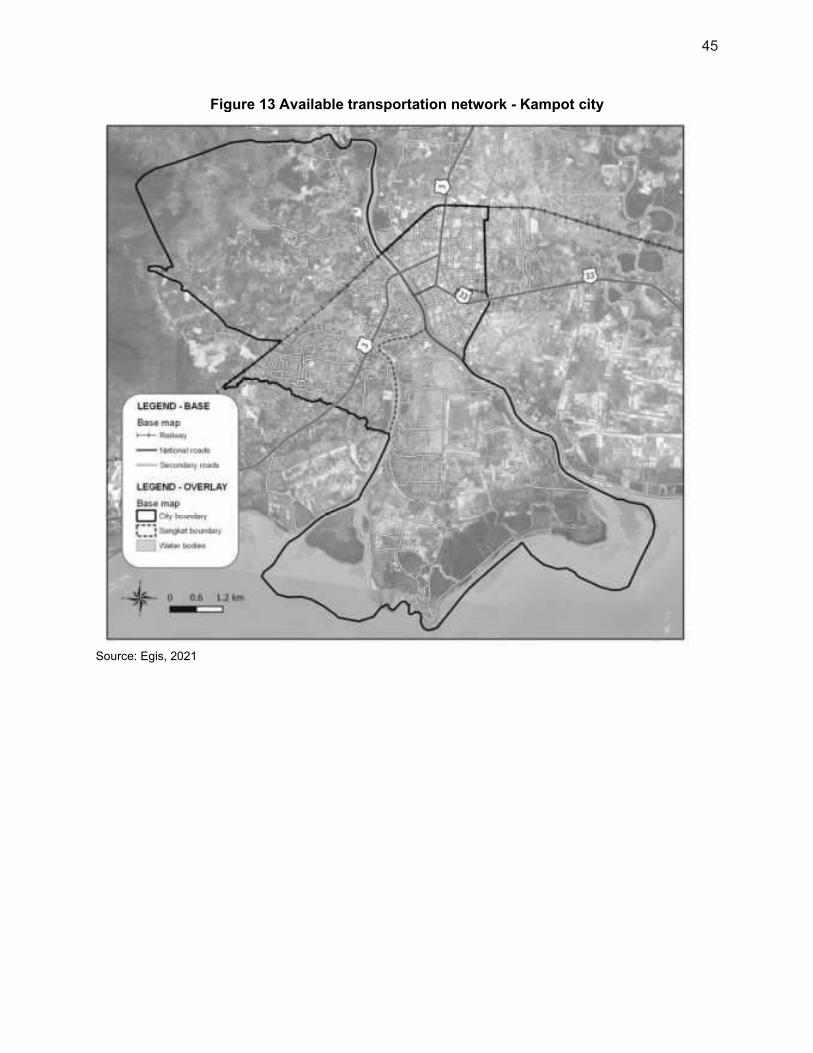
45
Figure 13 Available transportation network - Kampot city
Source: Egis, 2021
46
158. Service Quality and Consistency. Many of the local road sections that need upgrading are under the City Government. Some of the transport issues noted were: i) congested city center with a high heavy loaded vehicle traffic but limited road networks; ii) fragmented bus terminals scattered along major thoroughfare generating traffic along NR1; iii) roads with poor or missing drainage system resulting to flooding especially during the rainy season; iv) lack of traffic signs and road marking along with some road segments; v) old bridges requiring rehabilitation; vi) railway system reliability needs improvement by ascertaining trip schedule; and vii) non-compliance of the road users with traffic regulations. 159. Institutional Arrangements. National roads are under the MPWT, while roads within the city and the whole province are under the Provincial Department of Public Works and Transport (PDPWT). The Department of Railway under the MPWT-General Inspectorate is the responsible agency for the railway system in the country. The Royal Railway Co. Ltd. is a private company contracted to operate the railway system both passenger for and freight services. 160. Financial Status. The service is financed by the public sector through national budget allocations (at the provincial or municipal level) or by financial and technical partners of Cambodia through specific projects. 6. Cultural Heritage and Physical Cultural Resources
161. Traces of the French colonial-era remained in the architecture of Kampot City. These remnants can be observed on buildings such as restaurants, shops, hotels, on the provincial museum of Kampot, or on the national bank of Cambodia, for instance. 162. Few cultural monuments are found in the city, and cultural heritage is mostly represented by mosques and pagodas, as well as within the provincial museum of Kampot. 163. During the field survey in September 2020, no cultural heritage places were found in the 300m buffer zone along the sewer network. 7. Location of samples for initial assessment survey
164. Several samples have been done during the initial assessment field survey. Their location is shown on the map below:

47
Figure 14 Location of samples made on Kampot city extent
Source: Egis, 2021
8. Noise
165. In the outskirts of the city, the acoustic ambiance is relatively calm: the suburban area northwest of the city center is close to the Bokor National Park and dominated by agricultural fields and forests, and so is the island in the south. The heart of the city provides a noisier background, with its urban-life activities, markets, as well as the traffic of national roads NR 3 and NR 33. 9. Air Quality
166. There is growing concern regarding increasingly poor air quality in urban areas of Cambodia. Air pollution is being linked to increases in the number of vehicles, industrial development, and overall urbanization that is occurring. The general lack of air quality data

48
outside of major centers such as Phnom Penh is because air pollution in rural areas is relatively low.39
167. In general, in rural areas, air quality is still good. Kampot City is located on the coast, in an area opened to the winds and dominated by agricultural fields and forests. Thus air can be considered to be of good quality in the city. 168. However, the increases in socioeconomic development along new road corridors will bring air pollution from vehicle traffic and industrialization. Both in urban and rural areas, air quality is also impacted by dust from unpaved roads. Moreover, local air quality is already affected by the existing dumpsite (waste burning, odors, etc.). Recurring and generalized waste burning are observed in Cambodia. This practice induces air pollution by releasing dust and fine particles, and it is also a source of odor nuisance. Other sources of air pollutants are gases from untreated wastewater. 10. Water Supply
169. Providers. The Kampot water supply is operated by a public company: Kampot Waterwork Unit (KWU). 170. Water Resource. Kampot is entirely reliant on surface water. Two water intake stations have been constructed along the Preaek Tuek Chhu River, around 8.3 km upstream the “old” water treatment plant (WTP) and 5.3 km upstream of the “new” WTP (both located downstream of the Kamchay hydroelectric dam), as shown in Figure 15.
39 Communication from EIA Head of MOE, 2016 conducted by TA consultants of Second RAMP

49
Figure 15: Kampot Water Intakes Location (Google Earth, 2019)
Source: Egis, 2021.
171. No consistent data concerning the Preaek Tuek Chhu River were gathered (hydrological evolutions), but, according to KWU representatives, this resource does not have quantity issues, and its raw water quality is considered suitable for drinkable water purpose. 172. Access to Services. The piped water supply is available for 89% of the population, and 79% is connected to it. 38% of the population use it as the main source of drinking water. The average consumption is 5m3/month40. The survey respondents are mainly satisfied with the water supply network; 55% have not reported any complaint. Some customers complained about the price deemed too expensive (22%), the poor quality of the drinking water (24%), the poor service water pressure (18%), the lack of customer services (3%). 173. 4% of the population has its own borehole41 and uses the water from it as the main source of drinking water.40 When used to drink, the borehole water is always treated:41 94% of the
40 Comprehensive City Survey (CCS), Egis 2019. 41 Focus Groups Discussions.

50
population treat it daily, 4% weekly, and 2% monthly.40 83% of the population boil the water before drinking it, and 15% use a filter. 174. The accessibility of bottled drinking water is good in Kampot. Even in remote villages, 20L bottles can be found in small grocery shops. It costs around $1 to fill the 20L container. 175. Water Treatment Plant. In 2015, a Japanese Official Development Assistance Grant Aid Project commenced works to expand the water supply system in Kampot. Two plants operate on different sites, as seen in Figure 15. The average current operation rate shows a total of 10,470m3/day, for a built capacity of 13,260m3/day. The treatment consists of a typical surface water process, with a final chlorine disinfection stage & inletting to the underground tanks (6,000m3). 176. Distribution Network. The distribution network was 200km long in 2019 (Ø32 to 400 mm), mainly in high-density polyethylene. The global coverage was 77% in 2019 - 10,352 household connections. According to JICA, the results of this project will increase access to clean water in Kampot from 47% in 2013 (pre-project) to 92% by 2021. 177. The non-revenue water was approximately 15% in September 2019. While the domestic water needs ratio cannot be determined (no distinction between households and other consumption), the global ratio is around 860L/day/connection. 178. Quality. The treatment process from raw water to treated water is efficient for turbidity, color, and pH; no exceedance of the quality standard was observed during 2017 and 2018. Considering these results, the water quality management appears good and efficient in Kampot. 179. Institutional Arrangements. The Ministry of Industry, Science, Technology and Innovation (MISTI) plays an important role in i) preparing policies, strategies, guidelines, and regulations related to the potable water sector; ii) developing technical standards or norms for potable water production and supply. 180. Financial Status. The water supply service is financed by a user-pay arrangement. Billings are issued and collected by KWU directly to end-users. The tariff guidelines are approved by the government (≈1,420 Riel/m3). 11. Wastewater Management
181. It is estimated that 77% of the excreta generated in Kampot is not safely managed.
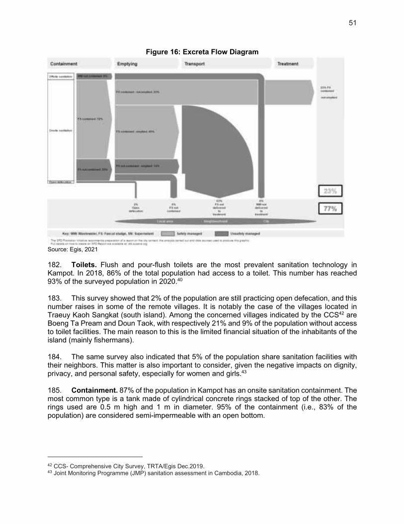
51
Figure 16: Excreta Flow Diagram
Source: Egis, 2021
182. Toilets. Flush and pour-flush toilets are the most prevalent sanitation technology in Kampot. In 2018, 86% of the total population had access to a toilet. This number has reached 93% of the surveyed population in 2020.40 183. This survey showed that 2% of the population are still practicing open defecation, and this number raises in some of the remote villages. It is notably the case of the villages located in Traeuy Kaoh Sangkat (south island). Among the concerned villages indicated by the CCS42 are Boeng Ta Pream and Doun Taok, with respectively 21% and 9% of the population without access to toilet facilities. The main reason to this is the limited financial situation of the inhabitants of the island (mainly fishermans). 184. The same survey also indicated that 5% of the population share sanitation facilities with their neighbors. This matter is also important to consider, given the negative impacts on dignity, privacy, and personal safety, especially for women and girls.43 185. Containment. 87% of the population in Kampot has an onsite sanitation containment. The most common type is a tank made of cylindrical concrete rings stacked of top of the other. The rings used are 0.5 m high and 1 m in diameter. 95% of the containment (i.e., 83% of the population) are considered semi-impermeable with an open bottom.
42 CCS- Comprehensive City Survey, TRTA/Egis Dec.2019. 43 Joint Monitoring Programme (JMP) sanitation assessment in Cambodia, 2018.

52
186. In the urban area (e.g., Tvi Khang Tboung Village), 20% of the containments located along the main roads have connections with drainage pipes. In rural areas, 3% of the overflow pipes from the containment or soak away tanks are connected to the surrounding area or rice paddies.41 187. Inadequate sanitation is closely associated with diarrheal diseases, which exacerbate malnutrition and remain a leading global cause of child deaths, as well as parasitic infections such as soil-transmitted helminths (worms) and a range of other neglected tropical diseases.43 188. Emptying and Transport. 20% of the population has never emptied its sanitation containment; 16% have hired a pump truck to empty and transport the faecal sludge, while 4% did it manually40. When emptied manually, the sludge is most of the time dumped onto paddy fields or to the water body. In some places (e.g., Traeuy Kaoh Sangkat), the habitants prefer burying the tank when it is full and to build a new one rather than emptying it for financial reasons. Due to the lack of spaces in urban areas, this solution is not preferable. It also requires a long time (i.e., 3 to 5 years44) to fill up the semi-permeable containments with faecal sludge. 189. There are two emptying services that operate in Kampot. One service provider comes from the Takeo Province, and operates with a truck volume of 8.5m3. Due to the large capacity of the truck and the distance separating Takeo to Kampot, the price for a single emptying service is around $200. When three or four households have to empty their tanks on the same day, the price can decrease to $50. The second company has adopted a similar price, and is located near Kampot city. It does not depend on the number of tanks to empty and operates with a truck volume of 5m3. 190. Treatment. While access to a hygienic toilet facility is essential for reducing the transmission of pathogens, it is equally important to ensure safe treatment and disposal of the excreta produced43. There is at present no functioning treatment facility, however a WWTP of 3,300m3/day is under implementation as part of the GMS 2 project in Kampot city. The faecal sludge is currently sold to farmers that use it as a fertilizer, mainly in durian plantations.41 It can also be disposed off in fields outside of the city. The location of these fields change constantly. 191. Groundwater Contamination. 53% of the population drinks water from water vendors, 38% use the water supply network, and 4% have their own borehole40. Due to the low (i.e., less than 25% of the population) percentage of drinking water produced from a groundwater source, groundwater pollution presents a low risk.45 12. Stormwater Drainage
192. Natural Transport. Kampot and the surrounding region have more than 16 km of existing open-channels and concrete circular pipes. Concrete circular pipes are commonly disposed of in the city center, and earth open-channel are used to drain stormwater from the dense urban area toward rural areas/river. 193. Some key canals are totally blocked, leading to an inability to drain the collected water from the secondary network. Artificial restriction of channel section is at the origin of most of blockages. Local households build earthen access through the channel, leaving only small concrete pipes to carry the flow through the access road.
44 KIIs – Emptying Company. 45 SFD Manual, Volume 1 and 2, Version 2.0, July 2017.
53
194. None of the canals are lined with concrete material. At some locations, this leads to important bank erosion. 195. Due to the low flow in the canals, especially during the dry season, plants and algae overgrow the banks and encroach into the canals. This leads to a reduction of the flow capacity. 196. Urban Drainage. Recurrent floods are reported by inhabitants and local authorities. Main stormwater channels are operating properly, but their capacity is not sufficient to ensure proper drainage of the city center. 197. The main common issues identified in the urban area are the following:
(i) The existing sewers and stormwater pipelines have a high level of sediment within the city.
(ii) A lot of operating stormwater drainage lines are obstructed by solid waste. Particularly in Kampot, the lack of existing facilities for solid waste collection and treatment leads the households to release solid waste into the stormwater system.
(iii) Because of stagnant wastewater, bad odors are released from the drainage system. To avoid odor nuisances, the local inhabitants obstruct the catch pits grids with plastic waste. This obstruction reduces the capacity of the existing drainage system drastically.
(iv) A lack of inlets and undersized grids are regularly observed along with the drainage network. Many streets are only serviced on one side by a road drainage network. For this reason, the inlets are insufficient to carry all the runoff coming from the impervious urban areas.
(v) Frequent inconsistencies are noticed in the design of road drainage. There is no existing global strategy for the development of planning of stormwater/wastewater drainage networks. For this reason, inconsistencies could be noticed in the conception/design of the existing drainage networks (pipelines are connected to the existing system in the wrong direction, other pipelines are not connected to the existing primary drainage system).
(vi) Along roads, household residents often developed their own stormwater drainage system. Those pipes are not always connected to each other due to the lack of vision and overall strategy.
198. It has been estimated by the CCS that 28% of the population is experiencing flooding in their village, and 37% in their house at every intense rainfall events. 18% of the population experiences average flood depth between 20 and 30cm, and 24% between 30 and 50cm. For the average flooding event, the village is impacted during one day (14%) or more (43%). The WWTP’s site and the water treatment plants for the water supply are located outside of these flood-prone areas.

54
Figure 17: City survey and flood-prone areas locations
Source: Egis, 2021
13. Solid Waste Management
199. Kampot currently lacks facilities for effective solid waste management. Solid waste services are currently outsourced to Global Action for Environment Awareness (GAEA). The company is responsible for collecting, transporting, and disposing of solid waste. 200. In 2018, 2,971 households (38.13%) in the City had access to solid waste collection services. The collection coverage is low/medium, and most wastes are either burnt or dumped into the environment, resulting in blockages in the drainage system. 201. An existing dumpsite with an area of approximately 6ha is located 11km north from the city. There is no treatment facility for hazardous waste. The dumpsite is in poor condition, posing significant risks to the environment and human health. Approximately 60 tons/day of solid waste is collected and brought to the dumpsite by the waste collection service provider (GAEA). Fire occasionally occurs at the dumpsite, and it is not equipped to prevent underground water pollution. A new landfill has been designed and will be constructed as part of the GMS 2 project.

55
The proposed site for this new landfill is about 3.5km north-east of the existing dumpsite and 14.5km north of the city, on 10ha of government land in the Prey Khmum commune, in the Tuek Chhu district.
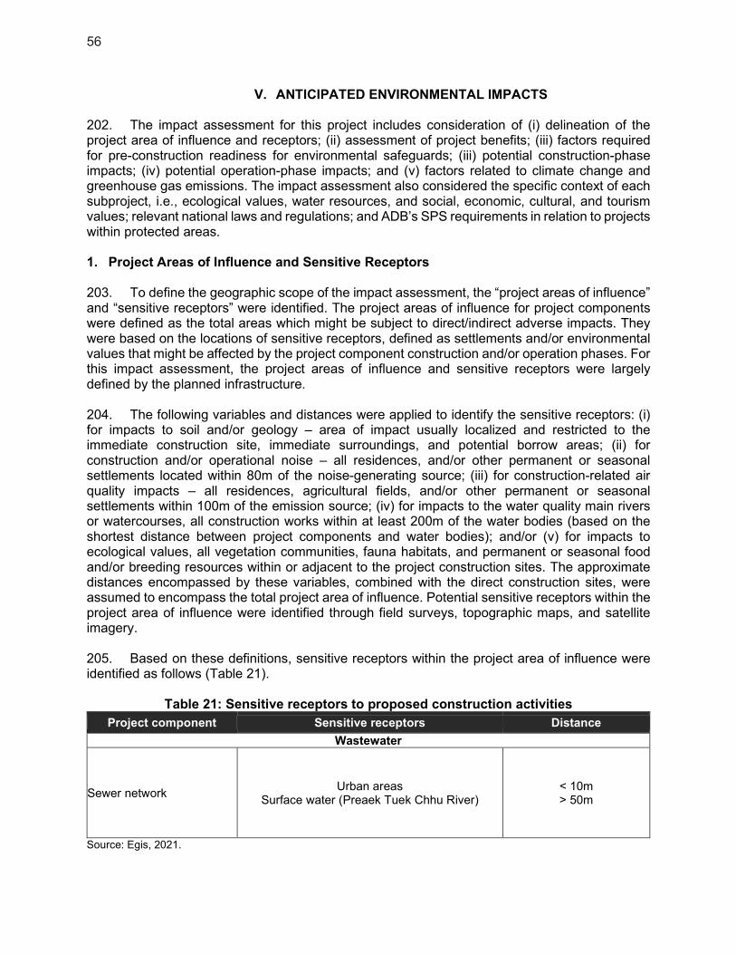
56
V. ANTICIPATED ENVIRONMENTAL IMPACTS
202. The impact assessment for this project includes consideration of (i) delineation of the project area of influence and receptors; (ii) assessment of project benefits; (iii) factors required for pre-construction readiness for environmental safeguards; (iii) potential construction-phase impacts; (iv) potential operation-phase impacts; and (v) factors related to climate change and greenhouse gas emissions. The impact assessment also considered the specific context of each subproject, i.e., ecological values, water resources, and social, economic, cultural, and tourism values; relevant national laws and regulations; and ADB’s SPS requirements in relation to projects within protected areas. 1. Project Areas of Influence and Sensitive Receptors
203. To define the geographic scope of the impact assessment, the “project areas of influence” and “sensitive receptors” were identified. The project areas of influence for project components were defined as the total areas which might be subject to direct/indirect adverse impacts. They were based on the locations of sensitive receptors, defined as settlements and/or environmental values that might be affected by the project component construction and/or operation phases. For this impact assessment, the project areas of influence and sensitive receptors were largely defined by the planned infrastructure. 204. The following variables and distances were applied to identify the sensitive receptors: (i) for impacts to soil and/or geology – area of impact usually localized and restricted to the immediate construction site, immediate surroundings, and potential borrow areas; (ii) for construction and/or operational noise – all residences, and/or other permanent or seasonal settlements located within 80m of the noise-generating source; (iii) for construction-related air quality impacts – all residences, agricultural fields, and/or other permanent or seasonal settlements within 100m of the emission source; (iv) for impacts to the water quality main rivers or watercourses, all construction works within at least 200m of the water bodies (based on the shortest distance between project components and water bodies); and/or (v) for impacts to ecological values, all vegetation communities, fauna habitats, and permanent or seasonal food and/or breeding resources within or adjacent to the project construction sites. The approximate distances encompassed by these variables, combined with the direct construction sites, were assumed to encompass the total project area of influence. Potential sensitive receptors within the project area of influence were identified through field surveys, topographic maps, and satellite imagery. 205. Based on these definitions, sensitive receptors within the project area of influence were identified as follows (Table 21).
Table 21: Sensitive receptors to proposed construction activities
Project component Sensitive receptors Distance
Wastewater
Sewer network Urban areas
Surface water (Preaek Tuek Chhu River) < 10m > 50m
Source: Egis, 2021.

57
206. The buried network for the wastewater treatment in the service area of C3 PS (GMS 2) will connect 1,298 households to the WWTP. This network will be implemented in the city center, and eastern part of the city in priority, and then will be extended westward. Sensitive receptors will include buildings (houses, stores, farms, hotels) located along the network lines. 2. Positive Impacts and Environmental Benefits
2.1. Environmental Benefits
207. By establishing a wastewater treatment system, groundwater pollution will be reduced, as a higher quantity of the excreta produced in Kampot will be safely managed. 208. The WWTP from GMS 2 and its associated collection network will improve the quality of the effluents discharges and, thus, the quality of the natural receptors (water bodies), thanks to the removal of raw water discharges. 209. Access to the wastewater treatment network will also restrain the practice of burying sanitation containments once they are full. 2.2. Socio-Economic Benefits
210. Women may benefit more from improved water and sewer services as they generally have a higher risk to health from exposure to pathogens as the primary contributors towards household and community sanitation tasks. A specific Gender Equality and Social Inclusion Action Plan has been prepared to include this social issue in the project implementation. 211. Additionally, employment increases and education opportunities may be able to provide more gender equality. 212. By 2040, the project aims for 100% of excreta safely managed at the end of the sanitation chain, with 72% of the households connected to the sewer network (including population growth). 213. Collection and treatment of wastewater is a matter of public health, as it will diminish the incidence of water-borne infections and diseases associated with inadequate sanitation. 214. The quality of life will also be improved with the reduction of odor nuisances, which can occur due to the practice of emptying the untreated contents of sanitation containments directly into the environment. The urban environment for residents and visitors will, therefore, be improved. 215. The construction works, which are scheduled to last 18 months, will require between 40 and 50 workers; local workers will be given preference. 216. Sludge collection from septic tanks, sewer maintenance, administrative works, management, and daily cleaning will enable the creation of employment opportunities for the population. In total, eight full-time employees are required.
58
3. Biodiversity Conservation and Sustainable Natural Resource Management
3.1. Construction Phase
217. The clearing of vegetation, scouring, stripping, earthworks, and the leveling of work areas is limited strictly to as little as necessary.
(i) Land Acquisition 218. Network. In urban areas, the implementation of the sewerage system will be associated to a temporary impact due to the construction of the underground network. This impact will be limited in time and space and will mainly be related to impeded access to houses and to public and commercial facilities. No land acquisition is necessary. 219. Mitigation measures. The measures to preserve the area surrounding the project site will include: (i) avoidance of unnecessary earth movement and removal of vegetation; (ii) temporary high-visibility fences around the work area, in order to avoid any into or outside by wild fauna and workers (permanent 1.8m fences during the operation phase).
(ii) Hydrology and Water Availability 220. The project does not involve any works that would affect lake and river hydrology. Construction works will require water for the mixing of materials, wash-down of equipment, and drinking water for workers. This will be pumped directly into a water truck and transported to the work sites. 221. Measures. Pumping will occur at agricultural canals, at sites with existing road and jetty access. No works or machine wash-down will be conducted at the pumping site. Contractors should ensure permission for use of irrigation water from relevant authority in order to ensure the project does not deplete downstream user.
(iii) Ecological and Wilderness Values 222. Construction will cause short-term noise and visual disturbance, which may disrupt breeding or foraging by the resident or migratory fauna. The construction works will take place within the urban context of Kampot, and the Bokor National Park is located far from the subproject. At the feasibility design stage, there are no known rare or endangered wildlife species or critical habitats in the immediate environment of the project, 223. Measures. These risks have been minimized as follows:
a) Careful designs to minimize the need for safeguard measures and impact to adjacent vegetation;
b) Setting up protective physical barriers around vegetation that do not have to be removed. If the removal of vegetation cannot be avoided and does not concern public land, private owners of the concerned vegetation will be provided compensation;
c) Pre-inspection of each tree to be removed, to ensure that no nesting fauna are present; d) Individual removal of each tree (rather than bulldozing) to minimize impacts to
surrounding trees; e) Soil stabilization after tree removal to avoid local erosion; f) Strict speed limits (maximum 50km/h) for work vehicles around construction sites to
minimize the risk of collisions with fauna, livestock, or people; g) Restriction on any construction activity and project vehicle activity between 6.00 pm
and 5.00 am to minimize the risk of collisions with fauna at night (when some mammals are more active).
59
224. Based on the effective implementation of these measures, ecological-related construction risks are considered to be very low. 3.2. Operational Phase
(i) Ecological and Wilderness Values 225. An impact on aquatic life may be generated in case water quality is altered by effluents discharge (effluent leakage, pipe rupture) in receiving water bodies. 226. Measures. These risks have been minimized as follows:
a) Adapt the maintenance activities as far as possible to nesting or reproduction periods, to avoid fauna disturbance (e.g. tree pruning operations);
b) Restriction on project vehicle circulation between 6:00 pm and 5:00 am to minimize the risk of collisions with fauna at night (when some mammals are more active);
c) Regular control and maintenance of equipment and installations; d) ensure maintenance of the network and maintain, education and communication for
householders on what to dispose of in a sewer.
227. Based on the effective implementation of these measures, ecological-related impacts are considered to be low. 4. Pollution Prevention and Abatement
4.1. Construction phase
(i) Geology and Soil 228. Materials Sources. Raw materials for concrete infrastructures will be selected in the existing quarries or concrete plants to avoid the excavation of borrow pits and quarries, which may be a threat to the environment when left uncared for frequent sliding, loss of ecosystem, groundwater pollution, and loss of arable land. No new natural material extraction site will be created for this project. 229. Preparation of concrete mix, asphalt, and other materials. Due to the rapid urban development of Kampot, asphalt, and concrete plants or material preparation sites already exist in the vicinity of project sites. They will supply the project works as necessary, without creating additional impact compared to the present situation. 230. Measures. Manufactured materials and products will also be prepared in Kampot and transported, given the relatively short distance. 231. Soil Contamination. Potential impacts include soil contamination, which may be caused by (i) improper transport, storage, handling and/or disposal of solid wastes, septic wastes, hazardous wastes, and hazardous substances, such as petroleum products from equipment operation and maintenance, lubricants, paints, chemicals, curing compounds, asphalt products, among others; and (ii) accidental spills or leaks of hazardous wastes and substances. 232. General measures. These risks will be managed through strict on-site measures including stabilization of exposed surfaces with ditches and/or sheeting; minimizing the duration that surfaces are exposed for; timing works for dry seasons, when rains are minimal, and the ground is firm (to minimize infiltration of any contaminants); and, management of site stockpiles and storage sites for fuels and machinery. Pending effective management of the EMP, these risks are considered manageable.

60
233. Specific measures. To reduce the risk of soil contamination from construction machinery, contractors will do the following: (i) store petroleum products, hazardous materials, and wastes on impermeable surfaces in secured and covered areas, provided with bunds; (ii) remove all construction wastes from the work sites to approved waste disposal sites; (iii) establish emergency preparedness and response actions; (iv) provide spill cleanup measures and equipment at each construction site; and (v) train contractors and crews in emergency spill response procedures.
(ii) Water Quality and Wastewater Management 234. Earthworks, excavation, and/or inappropriate storage and handling of fuel, accidental spills, and wash-down water for machinery and vehicles could contaminate soil or surface waterways. Construction wastewater will come from washing aggregates, pouring and curing concrete, cleaning of construction machinery and vehicles, and human wastes and wastewater from workers camp. The surface water bodies that could be potentially affected by project works are the existing agricultural channels/drainage network and the Preaek Tuek Chu River. Construction may cause a temporary impact on these receptors when adjacent to the project sites, mainly due to dust and waste production. Moreover, local water quality could be altered. 235. Measures. The following measures will be implemented to minimize water pollution:
a) Timing of construction to avoid peak rainfall during the rainy season (from May to October). Construction during other months imparts much lower construction risk as the ground is hard, infiltration is limited, and there will be limited runoff from work sites;
b) Plan and implement construction in staged sections, with one section completed and stabilized before beginning the next; and minimize open excavation areas;
c) Construct intercepting channels and drains to prevent runoff entering construction sites and to divert runoff from sites to existing drainage or open ground;
d) Contractors will develop actions to control of oil and other dangerous substances as part of their site EMPs;
e) All sites for washing of construction equipment will be equipped with water collection basins and sediment traps;
f) Fuel storage, machinery maintenance workshop, and vehicle cleaning areas will be stationed at least 100m from natural water bodies and 20m from channels;
g) Storage facilities for fuels, oil, and other hazardous materials will be within secured areas on impermeable surfaces and provided with bunds and cleanup installations; sell the used oil and lubricant to an appropriate recycling agency/company.
h) Contractors’ fuel suppliers must be properly licensed and will follow established protocol for transferring fuel;
i) Portable water, electrical lighting, toilets, and solid waste collection facilities will be installed along with proper maintenance protocols in both construction sites and workers camp (if camps are required).
(iii) Air Quality 236. Air pollution sources include: (i) dust from earth excavation, backfilling, road breaking, loading, hauling, bare earth surfaces, uncovered construction areas, and vehicle movements on unpaved roads, especially on windy days; (ii) aggregate preparation and concrete-mixing; (iii) vehicle and machinery emissions (gaseous CO, SOx and NOx). No asphalt heating and mixing processes are expected during these works. The exhaust emissions generated can cause respiratory issues for the residents living close to the construction site, especially for the vulnerable population, including the elderly and the very young. Asphalt materials for road reinstatement will be provided ready to use by a local supplier.
61
237. Measures. Mitigation measures to reduce impacts on air quality are as follows: a) Spraying water on exposed construction sites where fugitive dust is being generated.
Prolonged use of temporary storage piles should be avoided, or covered, or wetted regularly to prevent dust and erosion;
b) Storing petroleum or other harmful materials in appropriate places and covering to minimize fugitive dust and emission;
c) Covering materials during truck transportation, in particular, fine material, to avoid spillage or dust generation;
d) Regulation by speed limits of access roads to the construction sites; e) Maintenance of project vehicles to minimize greenhouse gas emissions; f) Turning off equipment/ vehicle when not in use; limiting engine idling to a max. of 5
minutes; g) For odor: disinfection/deodorization/sanitizing affected latrines prior to clearing;
provision of adequate sanitation facilities; and strict enforcement of sanitation practices; prompt disposal of, organic and hazardous wastes; and timely community consultations to ensure awareness of the risk of odors prior to works;
h) Prohibit burning of wastes; i) Timely monitoring of air quality and inspections during construction.
238. Moreover, particular attention will be paid to limiting dust production when work is carried out near sensitive receptors e.g., schools, hospitals, residential areas. 239. Overall, the risk of air pollution and disturbance to residents related to air quality is low because of the relatively small scope of project works.
(iv) Solid Waste 240. Solid waste will comprise domestic solid waste from workers and construction waste materials. 241. Measures. Covered garbage bins will be installed at each site of works. The construction contractors will be responsible for transporting the containers and dispose of them at the existing dumpsite, as the existing waste collection services are not adequate to address the project needs. Waste collection and disposal methods will follow strict procedures to ensure that only non-hazardous waste is disposed of and that recyclable wastes are separated (as a minimum plastic bottles). Hazardous wastes (discarded fuel, oil, spills) will be stored in sealed drums and transported to the official landfill site in accordance with national regulations, e.g sell the used oil and lubricant to an appropriate recycling agency/company, and hazardous wastes (e.g paint container, batteries)) be transported to dispose in permitted industrial landfill in outskirt of Phnom Penh. Waste burning will be forbidden. 4.2. Operational Phase
(i) Geology and Soil 242. Soil Contamination. Soil contamination from spills or uncontrolled discharge of untreated or treated water can occur due to faulty pipelines or equipment of the wastewater treatment system. 243. Measures. To reduce the risk of soil contamination, all equipment and processes will be maintained in good working order, with back-up material in critical areas. Engineering and management systems will be set up to prevent and handle emergency situations.
62
(ii) Water Quality and Wastewater Management 244. Improved sanitation and solid waste management will reduce the volume of sewage and solid waste entering local water bodies and particularly Preaek Tuek Chhu River. 245. Surface water or groundwater contamination from spills or uncontrolled discharge of untreated or treated water can occur due to faulty pipelines or equipment of the wastewater treatment system. 246. Accidental leakage from the wastewater treatment system may impact surface water and groundwater quality, depending on local groundwater depth. This impact might be increased in case of flooding. 247. Measures for water contamination due to the wastewater treatment system. To reduce the risk of surface water and groundwater contamination, all equipment and processes will be maintained in good working order, with back-up material in critical areas. Engineering and management systems will be set up to prevent and handle emergency situations. Operators will schedule drain clearing maintenance program in order to ensure design flow is maintained for sewer and drainage networks. Monitoring of the quality of the wastewater effluents will be set up to ensure they meet design criteria and can assimilate the treated effluent year-round. 248. The impacts will be mitigated through: (i) O&M procedures to ensure that the facilities operate as intended over the long term, (ii) continuous monitoring of groundwater quality to detect and mitigate any subsurface spill. 5. Health and Safety (Occupational Health and Safety; Community Health and Safety)
5.1. Construction Phase
(i) Geology and Soil 249. UXO. Construction sites may be concerned by unexploded ordnance (UXO), which can be uncovered by earthworks. 250. Measures. Sites for earthworks that are suspected to have UXO should be declared free of UXO by the CMAC (Cambodian Mine Action Centre) or by the Government46 prior to construction (confirmation in writing will be required). Should an ordnance be detected, clearing work will be commissioned prior to undertaking earthworks. Basic training on UXO will be provided to contractor engineers/construction workers by demining organization such as CMAC. Training will focus on actions to take if UXO is identified during excavations / earth moving and how to report to CMAC.
46 The government should provide certificate on free of UXO in case the area has been identified in the CMAC map as
“no risk of mines.”
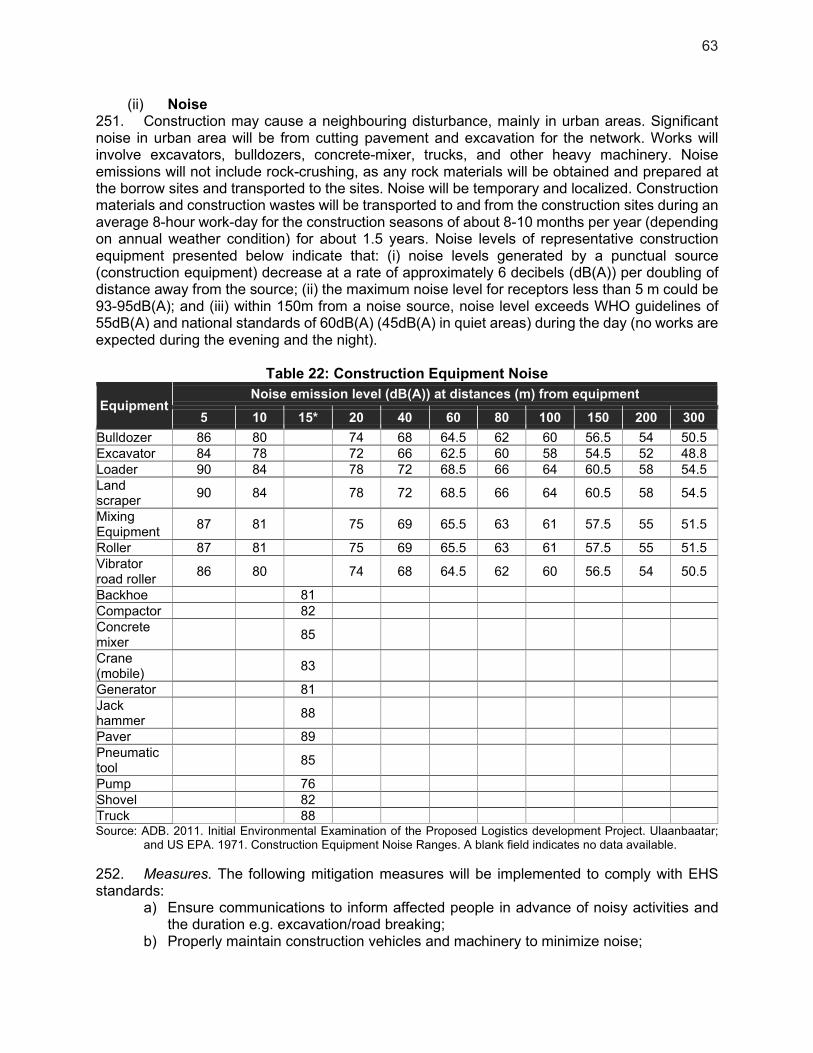
63
(ii) Noise 251. Construction may cause a neighbouring disturbance, mainly in urban areas. Significant noise in urban area will be from cutting pavement and excavation for the network. Works will involve excavators, bulldozers, concrete-mixer, trucks, and other heavy machinery. Noise emissions will not include rock-crushing, as any rock materials will be obtained and prepared at the borrow sites and transported to the sites. Noise will be temporary and localized. Construction materials and construction wastes will be transported to and from the construction sites during an average 8-hour work-day for the construction seasons of about 8-10 months per year (depending on annual weather condition) for about 1.5 years. Noise levels of representative construction equipment presented below indicate that: (i) noise levels generated by a punctual source (construction equipment) decrease at a rate of approximately 6 decibels (dB(A)) per doubling of distance away from the source; (ii) the maximum noise level for receptors less than 5 m could be 93-95dB(A); and (iii) within 150m from a noise source, noise level exceeds WHO guidelines of 55dB(A) and national standards of 60dB(A) (45dB(A) in quiet areas) during the day (no works are expected during the evening and the night).
Table 22: Construction Equipment Noise
Equipment Noise emission level (dB(A)) at distances (m) from equipment
5 10 15* 20 40 60 80 100 150 200 300
Bulldozer 86 80 74 68 64.5 62 60 56.5 54 50.5 Excavator 84 78 72 66 62.5 60 58 54.5 52 48.8 Loader 90 84 78 72 68.5 66 64 60.5 58 54.5 Land scraper
90 84 78 72 68.5 66 64 60.5 58 54.5
Mixing Equipment
87 81 75 69 65.5 63 61 57.5 55 51.5
Roller 87 81 75 69 65.5 63 61 57.5 55 51.5 Vibrator road roller
86 80 74 68 64.5 62 60 56.5 54 50.5
Backhoe 81 Compactor 82 Concrete mixer
85
Crane (mobile)
83
Generator 81 Jack hammer
88
Paver 89 Pneumatic tool
85
Pump 76 Shovel 82 Truck 88 Source: ADB. 2011. Initial Environmental Examination of the Proposed Logistics development Project. Ulaanbaatar;
and US EPA. 1971. Construction Equipment Noise Ranges. A blank field indicates no data available.
252. Measures. The following mitigation measures will be implemented to comply with EHS standards:
a) Ensure communications to inform affected people in advance of noisy activities and the duration e.g. excavation/road breaking;
b) Properly maintain construction vehicles and machinery to minimize noise;
64
c) Apply noise reduction devices and methods for high noise equipment operating within 150m of the sensitive sites i.e., schools, health centers, and religious sites;
d) Prohibit operation of high-noise machinery and movement of heavy vehicles along urban and village roads, between 6:00 pm and 8:00 am;
e) Place temporary hoardings or noise barriers around noise sources during construction; f) Monitor noise at sensitive areas at regular intervals. If noise standards are exceeded,
equipment and construction conditions shall be checked, and mitigation measures shall be implemented to rectify the situation;
g) Conduct regular interviews with residents/villagers adjacent to construction sites to identify noise disturbance. Community feedback will be used to adjust the work hours of noisy machinery.
(iii) Vibration 253. Vibration impacts will arise from the movement and/or operation of vehicles and equipment, earthworks, drilling, and excavation. Mechanical vibration may be sudden and discontinuous, which can cause stress among workers and communities. Vibration levels for machinery can be high and could affect buildings and infrastructure. 254. Measures. To address these issues: (i) high vibration activities, such as compaction operations will be prohibited at night from 6:00 pm to 8:00 am; (ii) Building owners and communities will be consulted prior to large earthworks to ensure they are informed and to avoid sensitive timing e.g., exams at nearby schools or festivals, (iii) contractors will organize photograph surveys of state of buildings. Vibration impacts are not considered a key risk due to the relatively limited scope of works.
(iv) Social Issues 255. Network works may cause temporary disruptions to vehicle access; traffic flow will be temporarily impeded, and parking space in front of the residents’ houses will be reduced. Additionally, access to public facilities such as schools and health centers/hospitals may be disturbed and exposed to safety risks. 256. Crossings of the water supply network by the wastewater network do not present technical implementation difficulties. 257. Measures. These impacts will be minimized as follows:
a) To limit inconveniences, work vehicles should use different roads or dedicated lanes, and the implementation of wastewater and drainage networks will be undertaken on one side of the road at a time;
b) Preparation and implementation of a traffic management plan and coordination with local authorities and communities;
c) Information disclosure: villagers, residents, public facilities (e.g. schools, health centers/hospitals) and businesses will be informed in advance through media and information boards at construction sites of the construction activities, given the dates and duration of the expected disruption;
d) Public consultations on work phasing and schedules, anticipated access blocking, provisions for safe access for blocked properties, and temporary parking for blocked garages/driveways;
e) Contractors will have to prepare as necessary an access plan which must be submitted to managers of public facilities in order to avoid any disruption of public service. Special attention will be paid to the surroundings of schools and health care buildings. This plan will be validated by the Municipality;

65
f) Posting of billboards on the road/lane closure, traffic rerouting plan at strategic places, at least one week prior to works;
g) Posting of traffic (flag) persons during entire working hours if necessary; h) Spreading out the schedule for materials delivery in non-peak hours as far as possible; i) Efficient management of truck arrival/departure; j) Provision of safe access, if needed, to blocked properties, e.g., steel planks of
adequate grade, width, and length, and if necessary, with guide rail; k) Close coordination with utility companies will prevent the disruption of utility services
such as water and electricity supply due to damaged lines.
(v) Network Disruption 258. At the beginning of the design phase, it is recommended that a detailed ground topography study be conducted to identify all existing network. During construction phase, existing pipes and cables (piped water, fibre cables, power supply) could be temporarely impacted with potential disruption of the service. The duration of the service disruption will be reduced as much as possible and contractors will have to contact and make arrangements with all the utilities suppliers in order to minimize the impacts.
(vi) Hiring of Workers 259. Recruitment of construction workers will prioritize local residents to reduce the number of migrant workers. Thus, construction camps with overnight accomodation will not be necessary. In case of external workers needing accomodation, local guest houses will be selected. On site construction camps will only provide daytime facilities for workers needs during working hours (clean water/sanitation, offices, refectory).
(vii) Community and Occupational Health and Safety 260. For the community: Traffic congestion and the risk of accidents may increase with construction traffic, causing temporary inconvenience to traffic, residents, commercial operations, and institutions. 261. Measures for Community H&S. For the communities where excavation in the street is required, the following measures will be implemented: (i) night lighting/reflectors around excavations, (ii) barrier/safety fencing installation along the construction site/trench, and (iii) access to properties will be maintained safely, particularly allowing older people safe access to their homes across any excavations. 262. For construction workers: Construction workers will be exposed to social conflicts with communities, transmittable diseases in the community, the presence of unexploded ordnance (UXO), large moving and operating construction vehicles and equipment, and pits and excavations. 263. The construction industry is also considered to be one of the most hazardous industries. Use of heavy construction machinery, tools, and materials present physical hazards including noise and vibration, dust, handling heavy materials and equipment, falling objects, work on slippery surfaces, fire hazards, and chemical hazards such as toxic fumes and vapors. 264. Measures for Occupational H&S. The proposed mitigation measures are the following:
a) Contractor compliance with environmental and occupational health and safety guidelines, and also with international guidance (ILO) on worker housing to address quality of, for example, accommodation, sanitation, facilitation, fire equipment;
b) Contractor’s site EMPs will include health and safety plans;

66
c) Provision of Personal Protective Equipment (PPE) for workers; d) Contractors will organize an initial Environmental, Health and Safety training for their
workers, and short but regular reminder meetings will be organized (biweekly); e) Adequate worksite lighting, water supply, sanitation facilities, and safe access; f) Establishment of a first-response team comprising trained staff, equipment, tools,
supplies, and an adequate office/clinic. The first response team will be linked to ultimate responders;
g) Appointment of a qualified Environmental, Health, and Safety Officer; h) Contractors will comply with local statutory requirements for the use of construction
equipment.
265. Additionally, each project contractor will prepare an environmental, health, and safety management plan, which will include the following:
a) Construction site protection: clear signs will be placed at construction sites in view of the public, informing people about the project’s GRM, and warning people against potential dangers such as moving vehicles, hazardous materials, and excavations, and raising awareness on safety issues. Heavy machinery will not be used at night. All sites will be secured, disabling access by the public through appropriate fencing whenever appropriate;
b) Provide a clean and sufficient supply of freshwater for construction sites; c) Provide an adequate number of latrines at construction sites and ensure that they are
cleaned and maintained in a hygienic state; d) Garbage receptacles at construction sites will be set up, which will be periodically
cleared to prevent the outbreak of diseases; e) Provide personal protection equipment e.g., safety boots, helmets, gloves, protective
clothing, goggles, earplugs; f) Emergency preparedness and response plan for accidents and emergencies,
including environmental and public health emergencies associated with hazardous material spills and similar events. These plans will be submitted to the local authorities for review and approval. Emergency phone link with the health center/hospital of Kampot will be established. Each worksite will have basic first aid kits;
g) A records management system that will store and maintain easily retrievable records against loss or damage will be established. It will include documenting and reporting occupational accidents, diseases, and incidents. The records will be reviewed during compliance monitoring and audits;
h) Occupational health and safety matters will be given a high degree of publicity to all work personnel, and posters will be displayed prominently at construction sites;
i) All workers will be given basic training in sanitation, general health and safety matters, and work hazards. An awareness program for HIV/AIDS and other communicable diseases will be implemented for workers and the local communities;
j) Core labor standards will be implemented. Civil works contracts will stipulate priorities to: (i) employ local people for works; (ii) ensure equal opportunities for women and men; (iii) pay equal wages for work of equal value and pay women’s wages directly to them; and (iv) not employ child or forced labor. Specific targets for employment have been included in the project gender action plan.
266. Moreover, at the end of the construction phase, the following measures (minimum requirements) will be implemented to ensure site clean up to an appropriate standard on completion of construction works:
a) Surplus materials evacuation; b) Decommissioning of construction camp facilities and equipment;
67
c) Waste removal; d) Contaminated soil removal/treatment; e) Leveling of soil.
267. COVID-19 Specific measures. To protect the health and safety of workers as well as communities potentially affected by ADB-financed and/or administered projects, contractors are required to conduct a COVID-19 risk assessment and to incorporate COVID-19 health risks as part of their health and safety (H&S) plans, which are part of their site-specific CEMP. These H&S plans should be aligned with any government regulations and guidelines on COVID-19 prevention and control, or in the absence thereof, with international good practice guidelines as may be updated from time to time. The plans need to include sensitization measures to ensure proper briefings and education/capacity development materials, and proper signage for the workers. The contractors’ H&S plans should be reviewed and cleared by the Engineer or supervision consultant in consultation with public health inspectors of the area, local medical officers, and other relevant health specialists. 268. The Engineer (or supervision consultant) shall be adequately staffed to undertake a professional review and make recommendations to the EA and monitor the contractors’ H&S plans. The TOR of the Engineer (or supervision consultant) reflects the need to supervise and report on the contractors’ H&S plans, including COVID-19 risk management. The contractors’ CEMP, including the H&S plan, shall be cleared by the Engineer (or supervision consultant) prior to mobilization of construction workers. 269. For all works contracts, contract provision on H&S shall include the requirement to submit a specific COVID-19 risk management plan (as part of the H&S plan) showing what type of arrangements the contractor will take to address this risk. 270. Quarterly project progress reports and the semi-annual environment monitoring reports shall report on the findings of the project-level COVID-19 risk assessment and risk mitigation measures, shall confirm that such mitigation measures have been incorporated in all the contractors’ H&S plans before works resumed/commenced at the site, and shall report on H&S plan implementation progress. 5.2. Operational Phase
(i) Air Quality 271. The discharge of septic sewage can be a significant source of odors at the discharge point, whether to a pumping station or to the inlet of WWTP. The odor threshold level of hydrogen sulfide measured in a laboratory is about 0.5 parts per billion (ppb). The level above which odor problems can occur is typically ten times this value. 272. Measures. The following guidelines should be given proper attention in the design of the sewer network:
a) Maintaining self-cleaning velocities; b) Minimizing turbulence wherever there is a hydraulic fall of sewer line; c) Ventilation of (gravity) sewers by proper venting arrangement; d) Design to ensure prevention of accumulation of grits/debris in the sewer; e) Routing maintenance shall consider using chemicals application in sewer lines close
to populated neighborhoods for controlling septicity.
(ii) Noise
68
273. It is considered that the gravity sewer is not a source of noise emision.
(iii) Social Issues 274. Landscape Modification and Visual Impact associated with the new project facilities are very limited, as the network for the wastewater collection is buried. Thus, other mitigation measures are not deemed necessary at this stage of the project.
(iv) Community and Occupational Health and Safety 275. No community H&S issues are anticipated during operation. For Occupational H&S issues: Working conditions of operation, monitoring, and maintenance of the new wastewater network could potentially deteriorate over time if no monitoring is carried out to ensure the workers’ health and safety conditions. Additionally, new projects have to include COVID-19 measures. 276. Measures. The working conditions will be reviewed regularly to maintain adequate health and safety conditions for the workers, including COVID-19 national guidance (if it does not exist, international guidance will be used). All workers will be trained with regular refresher courses. 6. Physical Cultural Resources
6.1. Construction Phase
277. Any local cultural sites will be protected from disturbances due to the construction activities, and their access will not be impeded. If the surroundings of the cultural sites are affected by construction works, they will be restored to their initial conditions. 278. Chance-find procedures are included in the EMP. In the event that any artifacts are found, works in the site will cease immediately, the site cordoned off, and the Kampot government, EA, and Ministry of Culture notified. 6.2. Operational Phase
279. Any local cultural site will be remote from disturbances due to the project operation, and their access will not be impeded. Hence, no specific mitigation measure is proposed. 7. Climate Change and Natural Hazards
7.1. Construction Phase
(i) Geology and Soil 280. Erosion. Potential impacts include poorly planned excavation, causing erosion induced by rainfall events, of which the intensity could increase drastically due to the climate change. 281. Erosion may be caused rainwater flows, and compounded by construction works and/or vibration from movement and operation of construction vehicles/equipment near slopes, particularly at unprotected banks of gullies, creeks, and moderately sloping terrain. Erosion could also occur after completion of construction, where site restoration is inadequate. Works may also raise dust, which may reduce photosynthesis processes of natural vegetation by deposits on plants which could lead to lowered productivity.

69
282. General measures. These risks will be managed through strict on-site measures including stabilization of exposed surfaces with ditches and/or sheeting; minimizing the duration that surfaces are exposed for; timing works for dry seasons, when rains are minimal, and the ground is firm (to minimize infiltration of any contaminants); and, management of site stockpiles and storage sites for fuels and machinery. Pending effective management of the EMP, these risks are considered manageable. 283. Specific measures. Earthworks will be carried out during dry periods as much as possible to avoid erosion and sediment transport. Before construction, contractors will include site-specific drainage and soil erosion control measures as part of their site-specific EMPs, which will include and be modeled on the following actions:
a) Plan and implement construction in staged sections, with one section completed and stabilized before beginning the next;
b) Minimize open excavation areas; c) Construct intercepting channels and drains to prevent runoff entering construction
sites and to divert runoff from sites to existing drainage or open ground; d) Stabilize all cut slopes, embankments, and other erosion-prone working areas; e) Stabilize all earthwork disturbance areas within 15 days after earthworks are
completed; f) Provide temporary detention ponds or containment to control silt runoff; g) Strip and stockpile topsoil, and cover (by geotechnical cloth) or seed temporary soil
stockpiles; h) Limit construction and material handling during periods of rains and high winds; i) Properly slope or re-vegetate disturbed surfaces, e.g., pipeline trenches and cut
banks. In the urban street, disturbed surfaces could be covered by concrete or asphalt coating;
j) Landscaping will only use native plant species; k) Storage areas will be located to minimize the land area required.
7.2. Operational Phase
(i) Greenhouse Gas Emissions 284. The Cambodian Government has a number of national strategies to reduce greenhouse gas emissions, and where possible, these will be incorporated into the project. The CCCSP has a strategic objective to promote low-carbon planning and technologies to support sustainable development. General mitigation strategies will be used as part of the overall project strategy where possible such as the use of modern materials and equipement, and regular maintenance: it will ensure efficiency of the installations, reducing the energy use and associated GHG emissions. 8. Indirect, Induced, and Cumulative Impacts
285. Indirect impacts are adverse and/or beneficial environmental impacts that cannot be immediately traced to a project activity but can be causally linked. Induced impacts are adverse and/or beneficial impacts on areas and communities from unintended but predictable developments caused by a project which may occur later or at a different location. Cumulative impacts are the combination of multiple impacts from existing projects, the proposed project, and anticipated future projects that may result in significant adverse and/or beneficial impacts that would not be expected in the case of a stand-alone project.47
47 ADB. 2011. Sourcebook for Safeguard Requirement 1: Environment. ADB, Manila.

70
286. Indirect and Induced Impacts. The project is expected to result in few indirect or induced impacts, such as increased urban development in areas where service facilities are improved, which are not consistent with the existing land use plan of the municipality. Such in-migration and additional stress on resource needs should be further related to the assimilative capacity of Kampot. 287. Cumulative Impacts. During the construction period, other infrastructure projects, such as GMS 2, road repair, or road widening activities, may be implemented at the same time as the proposed subprojects. As such, potential localized impacts may be felt to a greater extent in the project influence areas (i.e., additional dust generation from road construction). To minimize these impacts, the following measures can be implemented: (i) communications/consultation/ collaboration with other major project construction teams; (ii) co-ordination between project owners.
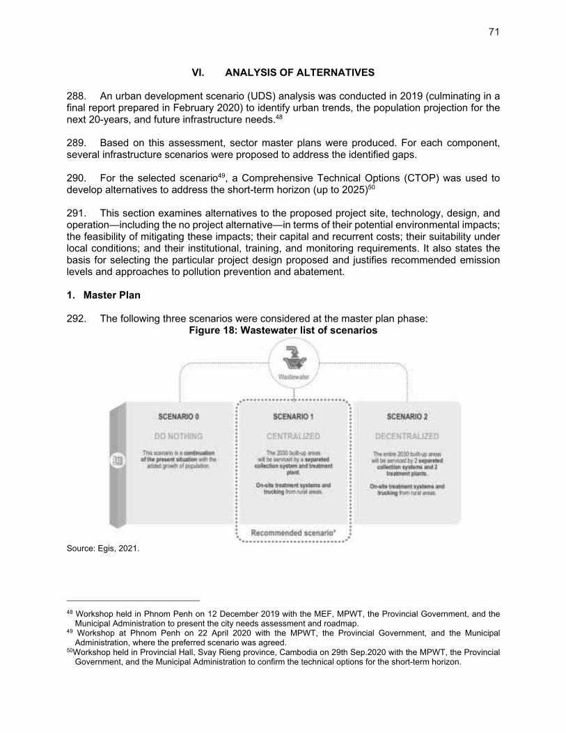
71
VI. ANALYSIS OF ALTERNATIVES
288. An urban development scenario (UDS) analysis was conducted in 2019 (culminating in a final report prepared in February 2020) to identify urban trends, the population projection for the next 20-years, and future infrastructure needs.48 289. Based on this assessment, sector master plans were produced. For each component, several infrastructure scenarios were proposed to address the identified gaps. 290. For the selected scenario49, a Comprehensive Technical Options (CTOP) was used to develop alternatives to address the short-term horizon (up to 2025)50 291. This section examines alternatives to the proposed project site, technology, design, and operation—including the no project alternative—in terms of their potential environmental impacts; the feasibility of mitigating these impacts; their capital and recurrent costs; their suitability under local conditions; and their institutional, training, and monitoring requirements. It also states the basis for selecting the particular project design proposed and justifies recommended emission levels and approaches to pollution prevention and abatement. 1. Master Plan
292. The following three scenarios were considered at the master plan phase:
Figure 18: Wastewater list of scenarios
Source: Egis, 2021.
48 Workshop held in Phnom Penh on 12 December 2019 with the MEF, MPWT, the Provincial Government, and the
Municipal Administration to present the city needs assessment and roadmap. 49 Workshop at Phnom Penh on 22 April 2020 with the MPWT, the Provincial Government, and the Municipal
Administration, where the preferred scenario was agreed. 50Workshop held in Provincial Hall, Svay Rieng province, Cambodia on 29th Sep.2020 with the MPWT, the Provincial
Government, and the Municipal Administration to confirm the technical options for the short-term horizon.
72
293. Scenario 0 – “Do nothing.” The “Do nothing” scenario is a continuation of the current situation with the added growth of population, commercial and industrial buildings in the built-up area. There is no public wastewater treatment plant or piped collection system. 294. As this scenario does not propose any treatment facility for fecal sludge, the “unsafely managed sanitation practices” proportion will rise to 77% in 2040. The 23% of “safely managed sanitation practices” corresponds to households located in rural and urban areas that are applying retention of wastewater and not emptying their retention tanks. 295. Scenario 1 – “Centralized.” The “Centralized” scenario proposes to service the whole built-up areas of Kampot (based on the projected land use 2030) with a centralized wastewater treatment plant. In this scheme, all wastewater is collected by pipes and carried to the treatment plant. Trucking from rural areas will continue for the remaining on-site treatment area. 296. Scenario 2 – “Decentralized.” In the “Decentralized” scenario, the whole built-up areas of Kampot (based on the projected land use 2030) is serviced with two treatment plants. One treatment plant is located on the left river bank and serves mostly the dense city-center. The other is located on the right bank and serves the villages of Tvi Khang tboung, Andoung Khmaer, and Tvi Khang cheung. 297. Scenario Analysis. Scenario 1 requires more pumping stations than scenario 2. However, the “decentralized” scenario requires land acquisition for the development of an additional wastewater treatment plant. For this reason, scenario 1 was preferred because the investments and operation costs for the additional pumping stations required are lower than the investment and operation costs related to the construction and operation of an additional treatment plant. 2. Site Alternatives
298. No site alternatives have been studied for the Kampot WWTP as this is undertaken by the GMS 2 project.
73
VII. CONSULTATION AND PARTICIPATION
1. Consultations undertaken
299. As a first step in preparing LCIP, a stakeholder analysis was completed to identify the key actors, their interests, and strategies to maximize their participation in the project. Information was gathered from (i) the different government organizations that will be involved in project implementation, (ii) civil society, (iii) public and private actors in the water and waste management sectors, and (iv) community members living in the project area. 300. In developing the project, a series of stakeholder consultations and workshops were carried out by the technical assistance team comprising international and national specialists with representatives at Sangkat, Municipality, Province, and Ministry levels, with community members and with private companies. In particular, detailed environmental consultations were undertaken as part of the social consultation in September 2020 (see Appendix 3 for details). 301. As summarized in Table 23, consultations comprise interviews with stakeholders and completion of a questionnaire form. The consultations focused on: (i) current household livelihoods and living conditions (income, water and electricity supply, sanitation and waste disposal); (ii) community observations and concerns on current environmental and climate changes; (iii) social and gender issues (gender division of labor and decision-making, opportunities for poor and disabled persons); and (iv) existing needs and priority actions required for improvement of the livability of the city and for its sustainability.
Table 23: Consultations undertaken in Kampot No Name of the meeting Date Location Total
participant Female
(Person) A The General consultation
1 In an urban Area 14/09/2020 DPWT (Kampot) 40 33
2 In a Rural Area 15/09/2020 Sangkat Trey Kaoh 54 32
B Focus Group Discussion
3 FGD 1 ID Poor 14/09/2020
DPWT (Kampot)
10 8
4 FGD 2 FHHs 14/09/2020 11 11
5 FGD 3 Elders 14/09/2020 11 10
6 FGD 4 Disable people 15/09/2020
Sangkat Trey Kaoh hall,
Kampot city
11 9
7 FGD 5 Youth (12-15 years old
at high school)
15/09/2020 7 7
8 FGD 6 Indigenous People 15/09/2020 11 2
9 FGD 7 Local authorities 14/09/2020 DPWT (Kampot) 13 4
C Consult key CBOs/ NGOs
10 Buddhist Library Cambodia
Project Org
14/09/2020 Buddhist Library of Cambodia 4 1
Source: Egis/KCC, 2020 - Social Survey
2. Results of consultations
302. Consultations provided input on the design of the project, it helped determine project priorities, socio-economic objectives, and confirm linkages with local development plans and aspirations. The information and recommendations gathered from the various stakeholder consultations has been incorporated into the design of the project to ensure that the investments
74
align with local priorities and development plans, and that they will deliver equitable socio-economic benefits to the whole population, including women, the poor and vulnerable. 303. The results of the pre-implementation consultations are summarized in Appendix 3. There is broad community support for the project’s approach to combine urban infrastructure development with capacity building to improve wastewater governance and management, improve urban sanitation and increase the city attractiveness. 304. In COVID-19 context, measures to minimize health risks during gathering meetings with community, including FGD, and HH survey, were applied in two ways:
(i) In communities with no presence of COVID-19 detected, face to face meeting could be organized but with respect to the following rules: a. prevention methods should be applied, such as, wearing masks, washing hands,
and respecting social distances of at least 1.5m between each participant; b. the number of participants shall not exceed more than 50 persons; c. The meeting must take place in open spaces, without air conditioning.
(ii) In communities where the presence of COVID-19 has been detected, only the online method should be used for both FGD and the HH survey.
3. Roles of Stakeholders in Planning, Design, and Implementation
305. ADB is committed to putting meaningful consultation processes into practice. Meaningful consultation is a process that (i) begins early in the project preparation stage and is carried out on an ongoing basis throughout the project cycle; (ii) provides timely disclosure of relevant and adequate information that is understandable and readily accessible to affected people; (iii) is undertaken in an atmosphere free of intimidation or coercion; (iv) is gender-inclusive and responsive, and tailored to the needs of disadvantaged and vulnerable groups; and (v) enables the incorporation of all relevant views of affected people and other stakeholders into decision makings, such as project design, mitigation measures, the sharing of development benefits and opportunities, and implementation issues. 306. ADB requires borrowers/clients to engage with communities, groups, or people affected by proposed projects and with civil society through information disclosure, consultation, and informed participation in a commensurate manner about the risks and impacts on affected communities. Enhancing stakeholder participation has also been shown to build understanding and support among diverse groups, which can improve project design and impacts. 307. Consistent with these efforts, the objectives of the consultation and participation plan and related stakeholder communication strategy are to: (i) fully disclose information on the proposed project, its components, and its activities with the beneficiary communities and stakeholders, (ii) obtain information about the opinions, needs and priorities of beneficiary communities and stakeholders; social input and feedbacks eg. on the quality and affordability of services, (iii) encourage the participation of beneficiary communities and stakeholders in project activities such as the payment for connection or services, changes in waste management practices, change in the extend and quality of services delivered, participation to O&M, awareness-raising activities, capacity building, enforcement of local regulations and monitoring; (iv) obtain the cooperation of beneficiary communities and stakeholders for activities required to be undertaken as part of project planning and operation, (v) establish clear monitoring and effective grievance redress mechanism; and (vi) ensure transparency in all project activities.
75
4. Stakeholder Consultation Plan
308. The public consultation plan is described in the chapter Environmental Management Plan. In general, regular information exchange meetings with stakeholders are recommended throughout the implementation of the subprojects. 309. More specifically, stakeholders who may be affected by a subproject, or concerned about its environmental impacts, are entitled to lodge complaints regarding any aspect of the subproject, from its preparation to its implementation. In this regard, the grievance redress mechanism (see page 77) aims to resolve complaints promptly and locally, through a conciliation process, and, as a last resort, to provide clear and transparent procedures for appeal. 5. Next public consultations
310. A public consultation campaign should be organized prior to DED phase completion, in order to accommodate any project changes and schedule adjustments. Any future consultations will be required to follow national guidance from the Ministry of Health regarding COVID-19 protection for all participants.

76
VIII. INFORMATION DISCLOSURE
311. All stakeholders will be provided with information on the subproject component, comprising: (i) description of project components; (ii) site locations; (iii) proposed construction measures; (iv) environmental impact assessment procedures; (v) avenues for public feedback; (vi) contact details of the executing and implementing agencies; and (vii) procedures and scope of the EIS. This IEE and corresponding EMP as well as the updated versions at detailed engineering design stage, and Semi-Annual Environmental Monitoring reports for the Project will be submitted to ADB and disclosed on their website when the documents are cleared. 312. The domestic disclosure will be conducted by the posting of information on government websites and on public notice boards in the city halls and by distributing information booklets. 313. Once more advanced preparations of the project designs are undertaken, the second round of information will be conducted to seek public feedback on the findings, including potential impacts, mitigation measures, and consultations with communities and businesses in and near project sites.
77
IX. GRIEVANCE REDRESS MECHANISM
314. The grievance redress mechanism (GRM) is described in more detail in chapter X.9 of the Environmental Management Plan. A summary is provided below. 315. A GRM has been developed in compliance with ADB’s SPS (2009) requirement to address environmental, health, safety, and social concerns associated with project construction and operation. The GRM is designed to achieve the following objectives: (i) provide channels of communication for local communities to raise concerns about the environment- and social-related grievances which might result from the project; (ii) prevent and mitigate adverse environmental and social impacts to communities caused by project construction and operation; (iii) improve mutual trust and respect and promote productive relationships between the project agencies and local communities; and (iv) build community acceptance of the project. The GRM is accessible to all members of the community, including women, youth, remote farmers and communities, and poverty-stricken residents. Multiple points of entry are available, including face-to-face meetings, written complaints, telephone conversations, e-mail, and social media. 316. Public grievances to be addressed by the GRM are most likely to involve disturbance from construction dust, noise, traffic, soil erosion, interruption of public services, inappropriate disposal of construction materials, and safety for the general public and construction workers. 317. Currently in Cambodia, there is no legally established system to resolve environmental grievances and complaints. The MPWT, as the EA of the LCIP, establishes the GRM before the start of the construction phase and counts members from the PMU, the district authority, and the commune government within its ranks (here, commune councils). The PMU’s Environment Officer (PMU-EO), as the focal point, will supervise the mechanism’s implementation with technical support from the PMU’s environmental safeguard consultants and will be responsible for updating the PMU. The Project Implementing Unit’s environmental officer (PIU-EO) will be accountable for guaranteeing the implementation of the GRM at the subproject level, in collaboration with the PIU Social Officer (PIU-SO). 318. The PMU is assigned the role of ensuring the awareness of the public and stakeholders of their rights to access the GRM without administrative or legal charges. The existence of the GRM will be fully disseminated before construction works begin, through an effective public information campaign (public consultations, posters, distribution of information booklets), in an effort to inform the stakeholders concerning their rights and the procedures for filing grievances and understanding the GRM access points available to them.

78
X. ENVIRONMENTAL MANAGEMENT PLAN
1. Overview
319. The Environmental Management Plan (EMP) presents the mitigation and enhancement principles, practices, and technologies aimed at minimizing and/or eliminating the potential impacts of the project to its surrounding environment. The EMP is a dynamic document that may be updated any time during project implementation if it is found inadequate. Corrective actions or additional mitigation measures may be included. 2. Objective and Scope
320. This EMP is for the Kampot subproject of the Livable Cities Investment Project - LCIP (hereafter referred to as the project). The EMP is to be implemented in all phases of each subproject – design, pre-construction, construction, and operation. The EMP is to ensure project compliance with Cambodia’s environmental laws and the Safeguard Policy Statement (SPS, 2009) of the Asian Development Bank (ADB). 321. During the preparation of the detailed engineering design (DED), the PIU, acting on behalf of the EA and PIA, will pass this EMP to the engineering design team for the incorporation of the mitigation measures into the detailed designs. 322. The EMP will be updated at DED stage to be aligned to the updated design and any MoE requirements and conditions in the domestic environmental assessment shall be incorporated into the respective IEEs and corresponding EMPs, ideally before bidding, and latest before works commence. 323. The updated DED stage EMP will be as part of the bidding documents. This updated bidding-ready version of the EMP (and updated IEE) shall be shared with ADB for clearance and disclosure on the ADB website. 324. To ensure that bidders will respond to the EMP’s provisions, the PIU will prepare and provide the following specification clauses for incorporation into the bidding documents:
(i) a list of environmental management requirements to be budgeted by the bidders in their proposals;
(ii) environmental clauses for contractual terms and conditions, and; (iii) the updated EMP, for compliance.
325. If any variation orders take place under project implementation it shall be assessed by ADB if the environmental due diligence will need to be further update and re-disclosed. 3. Structure of the EMP
326. The EMP describes the roles and responsibilities of relevant institutions for EMP implementation; potential impacts and the measures to mitigate them; environmental monitoring and inspection; institutional strengthening and training; inspection, monitoring, reporting arrangements, and EMP’s implementation costs; grievance redress mechanism (GRM); and, future public consultation.
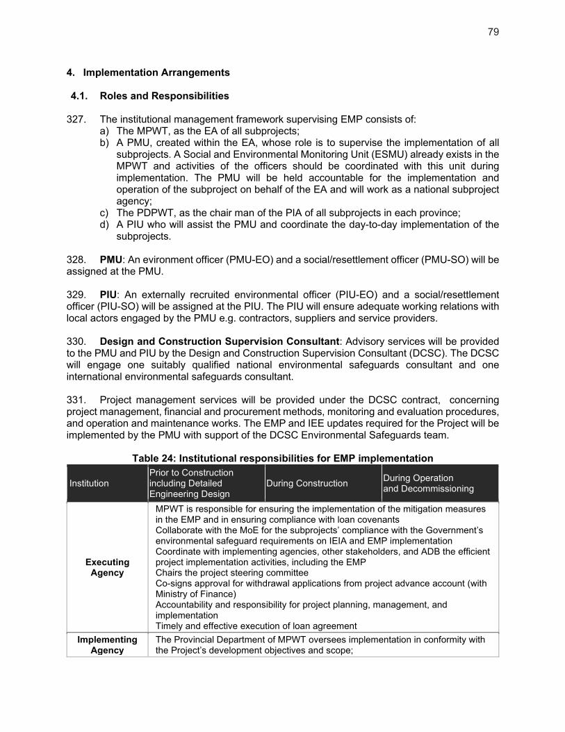
79
4. Implementation Arrangements
4.1. Roles and Responsibilities
327. The institutional management framework supervising EMP consists of: a) The MPWT, as the EA of all subprojects; b) A PMU, created within the EA, whose role is to supervise the implementation of all
subprojects. A Social and Environmental Monitoring Unit (ESMU) already exists in the MPWT and activities of the officers should be coordinated with this unit during implementation. The PMU will be held accountable for the implementation and operation of the subproject on behalf of the EA and will work as a national subproject agency;
c) The PDPWT, as the chair man of the PIA of all subprojects in each province; d) A PIU who will assist the PMU and coordinate the day-to-day implementation of the
subprojects.
328. PMU: An evironment officer (PMU-EO) and a social/resettlement officer (PMU-SO) will be assigned at the PMU. 329. PIU: An externally recruited environmental officer (PIU-EO) and a social/resettlement officer (PIU-SO) will be assigned at the PIU. The PIU will ensure adequate working relations with local actors engaged by the PMU e.g. contractors, suppliers and service providers. 330. Design and Construction Supervision Consultant: Advisory services will be provided to the PMU and PIU by the Design and Construction Supervision Consultant (DCSC). The DCSC will engage one suitably qualified national environmental safeguards consultant and one international environmental safeguards consultant. 331. Project management services will be provided under the DCSC contract, concerning project management, financial and procurement methods, monitoring and evaluation procedures, and operation and maintenance works. The EMP and IEE updates required for the Project will be implemented by the PMU with support of the DCSC Environmental Safeguards team.
Table 24: Institutional responsibilities for EMP implementation
Institution Prior to Construction including Detailed Engineering Design
During Construction During Operation and Decommissioning
Executing Agency
MPWT is responsible for ensuring the implementation of the mitigation measures in the EMP and in ensuring compliance with loan covenants Collaborate with the MoE for the subprojects’ compliance with the Government’s environmental safeguard requirements on IEIA and EMP implementation Coordinate with implementing agencies, other stakeholders, and ADB the efficient project implementation activities, including the EMP Chairs the project steering committee Co-signs approval for withdrawal applications from project advance account (with Ministry of Finance) Accountability and responsibility for project planning, management, and implementation Timely and effective execution of loan agreement
Implementing Agency
The Provincial Department of MPWT oversees implementation in conformity with the Project’s development objectives and scope;
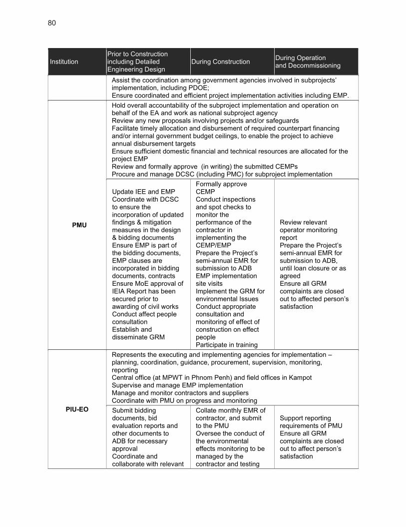
80
Institution Prior to Construction including Detailed Engineering Design
During Construction During Operation and Decommissioning
Assist the coordination among government agencies involved in subprojects’ implementation, including PDOE; Ensure coordinated and efficient project implementation activities including EMP.
PMU
Hold overall accountability of the subproject implementation and operation on behalf of the EA and work as national subproject agency Review any new proposals involving projects and/or safeguards Facilitate timely allocation and disbursement of required counterpart financing and/or internal government budget ceilings, to enable the project to achieve annual disbursement targets Ensure sufficient domestic financial and technical resources are allocated for the project EMP Review and formally approve (in writing) the submitted CEMPs Procure and manage DCSC (including PMC) for subproject implementation
Update IEE and EMP Coordinate with DCSC to ensure the incorporation of updated findings & mitigation measures in the design & bidding documents Ensure EMP is part of the bidding documents, EMP clauses are incorporated in bidding documents, contracts Ensure MoE approval of IEIA Report has been secured prior to awarding of civil works Conduct affect people consultation Establish and disseminate GRM
Formally approve CEMP Conduct inspections and spot checks to monitor the performance of the contractor in implementing the CEMP/EMP Prepare the Project’s semi-annual EMR for submission to ADB EMP implementation site visits Implement the GRM for environmental Issues Conduct appropriate consultation and monitoring of effect of construction on effect people Participate in training
Review relevant operator monitoring report Prepare the Project’s semi-annual EMR for submission to ADB, until loan closure or as agreed Ensure all GRM complaints are closed out to affected person’s satisfaction
PIU-EO
Represents the executing and implementing agencies for implementation – planning, coordination, guidance, procurement, supervision, monitoring, reporting Central office (at MPWT in Phnom Penh) and field offices in Kampot Supervise and manage EMP implementation Manage and monitor contractors and suppliers Coordinate with PMU on progress and monitoring
Submit bidding documents, bid evaluation reports and other documents to ADB for necessary approval Coordinate and collaborate with relevant
Collate monthly EMR of contractor, and submit to the PMU Oversee the conduct of the environmental effects monitoring to be managed by the contractor and testing
Support reporting requirements of PMU Ensure all GRM complaints are closed out to affect person’s satisfaction

81
Institution Prior to Construction including Detailed Engineering Design
During Construction During Operation and Decommissioning
provincial agencies, as necessary Support PMU-EO Conduct affected people consultation Establish health and safety baseline conditions in affected villages Establish GRM for environmental Issues Conduct trainings in collaboration with DCSC
to be conducted by MoE Laboratory Implement the GRM for environmental issue Conduct consultation and monitoring of construction impacts on people Conduct training in collaboration with DCSC Verify EMP implementation and report on it
ADB
Clear and disclose updated IEE/EMP, review bidding documents, confirm readiness of subproject Undertake periodic loan review missions to check EMP compliance
Undertake loan review missions to check EMP compliance Clear and disclose semi-annual EMR
Contractor
Prepare a CEMP that addresses as minimum the requirements of the EMP Engage EHS specialist for construction site(s)
Implement mitigation measures & conduct internal EMP implementation monitoring Conduct environmental quality monitoring of the EMP. (If an independent licensed laboratory will not be engaged) Prepare Monthly and semi-annual EMRs
Operator Ensure budget for O&M to ensure design standard of operation
Implement mitigation measures & conduct internal EMP implementation monitoring Prepare Monthly and Annual EMRs
MoE / PDOE Review, comment on approve EIA/IEIA Report.
Monitor compliance with approved EIA/IEIA & EMP
Monitor compliance with environmental standards
Municipality
Facilitate obtaining the necessary inputs from and/or participation/ cooperation of, concerned communes and villages through
Participate in monitoring of the performance of contractor with the CEMP implementation
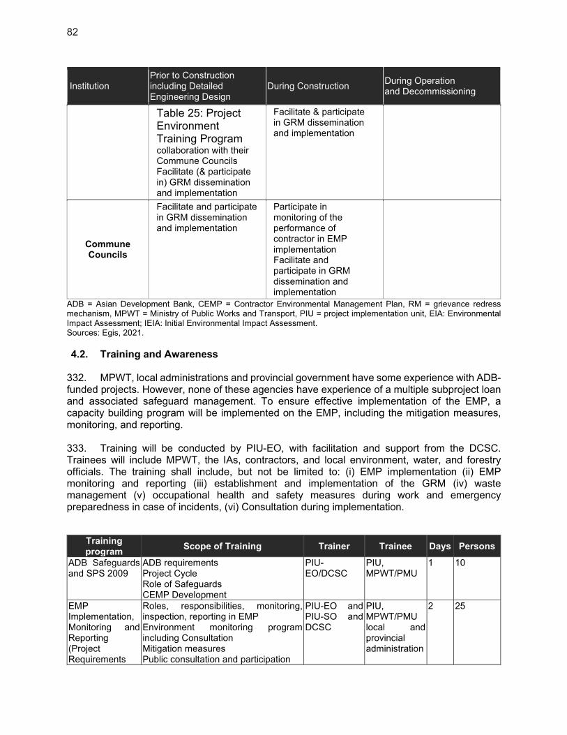
82
Institution Prior to Construction including Detailed Engineering Design
During Construction During Operation and Decommissioning
Table 25: Project Environment Training Program collaboration with their Commune Councils Facilitate (& participate in) GRM dissemination and implementation
Facilitate & participate in GRM dissemination and implementation
Commune Councils
Facilitate and participate in GRM dissemination and implementation
Participate in monitoring of the performance of contractor in EMP implementation Facilitate and participate in GRM dissemination and implementation
ADB = Asian Development Bank, CEMP = Contractor Environmental Management Plan, RM = grievance redress mechanism, MPWT = Ministry of Public Works and Transport, PIU = project implementation unit, EIA: Environmental Impact Assessment; IEIA: Initial Environmental Impact Assessment. Sources: Egis, 2021.
4.2. Training and Awareness
332. MPWT, local administrations and provincial government have some experience with ADB-funded projects. However, none of these agencies have experience of a multiple subproject loan and associated safeguard management. To ensure effective implementation of the EMP, a capacity building program will be implemented on the EMP, including the mitigation measures, monitoring, and reporting. 333. Training will be conducted by PIU-EO, with facilitation and support from the DCSC. Trainees will include MPWT, the IAs, contractors, and local environment, water, and forestry officials. The training shall include, but not be limited to: (i) EMP implementation (ii) EMP monitoring and reporting (iii) establishment and implementation of the GRM (iv) waste management (v) occupational health and safety measures during work and emergency preparedness in case of incidents, (vi) Consultation during implementation.
Training program
Scope of Training Trainer Trainee Days Persons
ADB Safeguards and SPS 2009
ADB requirements Project Cycle Role of Safeguards CEMP Development
PIU-EO/DCSC
PIU, MPWT/PMU
1 10
EMP Implementation, Monitoring and Reporting (Project Requirements
Roles, responsibilities, monitoring, inspection, reporting in EMP Environment monitoring program including Consultation Mitigation measures Public consultation and participation
PIU-EO and PIU-SO and DCSC
PIU, MPWT/PMU local and provincial administration
2 25
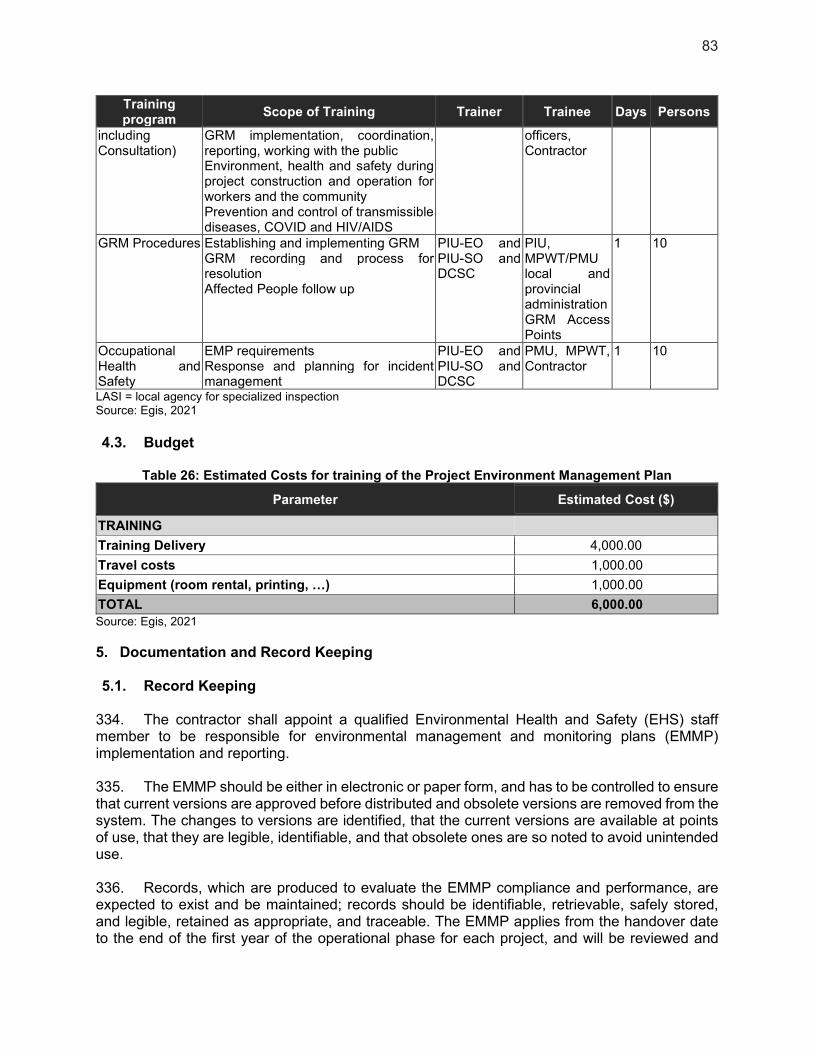
83
Training program
Scope of Training Trainer Trainee Days Persons
including Consultation)
GRM implementation, coordination, reporting, working with the public Environment, health and safety during project construction and operation for workers and the community Prevention and control of transmissible diseases, COVID and HIV/AIDS
officers, Contractor
GRM Procedures Establishing and implementing GRM GRM recording and process for resolution Affected People follow up
PIU-EO and PIU-SO and DCSC
PIU, MPWT/PMU local and provincial administration GRM Access Points
1 10
Occupational Health and Safety
EMP requirements Response and planning for incident management
PIU-EO and PIU-SO and DCSC
PMU, MPWT, Contractor
1 10
LASI = local agency for specialized inspection Source: Egis, 2021
4.3. Budget
Table 26: Estimated Costs for training of the Project Environment Management Plan
Parameter Estimated Cost ($)
TRAINING
Training Delivery 4,000.00
Travel costs 1,000.00
Equipment (room rental, printing, …) 1,000.00
TOTAL 6,000.00
Source: Egis, 2021
5. Documentation and Record Keeping
5.1. Record Keeping
334. The contractor shall appoint a qualified Environmental Health and Safety (EHS) staff member to be responsible for environmental management and monitoring plans (EMMP) implementation and reporting. 335. The EMMP should be either in electronic or paper form, and has to be controlled to ensure that current versions are approved before distributed and obsolete versions are removed from the system. The changes to versions are identified, that the current versions are available at points of use, that they are legible, identifiable, and that obsolete ones are so noted to avoid unintended use. 336. Records, which are produced to evaluate the EMMP compliance and performance, are expected to exist and be maintained; records should be identifiable, retrievable, safely stored, and legible, retained as appropriate, and traceable. The EMMP applies from the handover date to the end of the first year of the operational phase for each project, and will be reviewed and
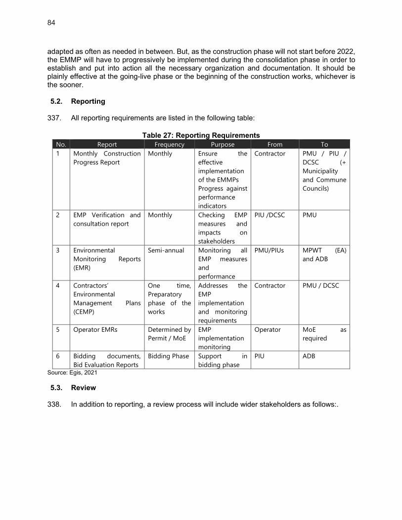
84
adapted as often as needed in between. But, as the construction phase will not start before 2022, the EMMP will have to progressively be implemented during the consolidation phase in order to establish and put into action all the necessary organization and documentation. It should be plainly effective at the going-live phase or the beginning of the construction works, whichever is the sooner. 5.2. Reporting
337. All reporting requirements are listed in the following table:
Table 27: Reporting Requirements
No. Report Frequency Purpose From To
1 Monthly Construction
Progress Report
Monthly Ensure the
effective
implementation
of the EMMPs
Progress against
performance
indicators
Contractor PMU / PIU /
DCSC (+
Municipality
and Commune
Councils)
2 EMP Verification and
consultation report
Monthly Checking EMP
measures and
impacts on
stakeholders
PIU /DCSC PMU
3 Environmental
Monitoring Reports
(EMR)
Semi-annual Monitoring all
EMP measures
and
performance
PMU/PIUs MPWT (EA)
and ADB
4 Contractors’
Environmental
Management Plans
(CEMP)
One time,
Preparatory
phase of the
works
Addresses the
EMP
implementation
and monitoring
requirements
Contractor PMU / DCSC
5 Operator EMRs Determined by
Permit / MoE
EMP
implementation
monitoring
Operator MoE as
required
6 Bidding documents,
Bid Evaluation Reports
Bidding Phase Support in
bidding phase
PIU ADB
Source: Egis, 2021
5.3. Review
338. In addition to reporting, a review process will include wider stakeholders as follows:.
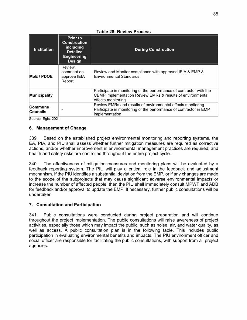
85
Table 28: Review Process
Institution
Prior to Construction
including Detailed
Engineering Design
During Construction
MoE / PDOE
Review, comment on approve IEIA Report
Review and Monitor compliance with approved IEIA & EMP & Environmental Standards
Municipality Participate in monitoring of the performance of contractor with the CEMP implementation Review EMRs & results of environmental effects monitoring
Commune Councils
- Review EMRs and results of environmental effects monitoring Participate in monitoring of the performance of contractor in EMP implementation
Source: Egis, 2021
6. Management of Change
339. Based on the established project environmental monitoring and reporting systems, the EA, PIA, and PIU shall assess whether further mitigation measures are required as corrective actions, and/or whether improvement in environmental management practices are required, and health and safety risks are controlled throughout the entire project cycle. 340. The effectiveness of mitigation measures and monitoring plans will be evaluated by a feedback reporting system. The PIU will play a critical role in the feedback and adjustment mechanism. If the PIU identifies a substantial deviation from the EMP, or if any changes are made to the scope of the subprojects that may cause significant adverse environmental impacts or increase the number of affected people, then the PIU shall immediately consult MPWT and ADB for feedback and/or approval to update the EMP. If necessary, further public consultations will be undertaken. 7. Consultation and Participation
341. Public consultations were conducted during project preparation and will continue throughout the project implementation. The public consultations will raise awareness of project activities, especially those which may impact the public, such as noise, air, and water quality, as well as access. A public consultation plan is in the following table. This includes public participation in evaluating environmental benefits and impacts. The PIU environment officer and social officer are responsible for facilitating the public consultations, with support from all project agencies.

86
Table 29: Public Consultation and Participation Plan for Environment Safeguards Organizer Approach Times/Frequency Subjects Participants
Construction PIU A questionnaire
survey, site visits, and/or informal interviews
At least monthly during peak construction
Construction impacts; adjusting mitigation measures if necessary; feedback
Workers, residents in construction areas
Public workshops At least twice per year during peak construction
EMP implementation progress; construction impacts; adjusting mitigation measures if necessary; feedback
Residents, affected persons, social sectors
Operation PIU, operators of project facilities
Public consultation and site visits
At least once in the first year of operation
Effects of mitigation measures, impacts of operation, feedback
Residents, affected persons adjacent to project facilities
Public workshop As needed based on public consultation
Effects of mitigation measures, impacts of operation, feedback
Residents, affected persons, social sectors
Public satisfaction survey
At least once after one year of operation
Comments and suggestions
Project beneficiaries
EMP = environment management plan, PIU = project implementing unit. Source: Egis, 2021
8. Information Disclosure
342. Information disclosure and public consultation will continue throughout project implementation. Further information disclosure will be as follows.
(i) Copies of the domestic environmental impact assessments in the Cambodian language, completed for the subproject in Kampot, are available on request at MPWT in Phnom Penh; the Province’s office, and the Kampot’s Municipality offices.
(ii) This IEE and corresponding EMP are disclosed on the ADB public website on behalf of the borrower and at detailed engineering design stage (DED) updated versions to reflect DED and any further changes and corresponding environmental due diligence will be disclosed.
(iii) The project environment monitoring reports will be prepared on a semi-annual basis and disclosed on the ADB public website.
343. Future public consultations will be facilitated by the PIU environment and social officers and will involve the Kampot’s municipal administration, provincial government, and work contractors. All agencies will work together with the PIU to provide timely communications and consultations with stakeholders. Prior to works, the PIU will lead disclosure and consultation with local communities, and other relevant stakeholders, on the scope and planned dates for works, potential issues (e.g., noise, dust, temporary traffic, and residential/economic activities access disturbance), and the planned mitigation measures. This will include, but not be limited to, public notices and meetings. Information on the GRM will be highlighted through these approaches. During construction, the PIU and Kampot’s Municipality will conduct frequent consultations to identify any public concerns and respond to them promptly. These approaches will be continued for at least one year after the completion of works (i.e., up to a maximum of one year after completion of the overall project) by the Kampot’s municipal administration to identify any concerns with the completed works.

87
9. Grievance Redress Mechanism
9.1. The objective of the Grievance Redress Mechanism
344. A grievance redress mechanism (GRM), consistent with the requirements of the ADB Safeguard Policy Statement (2009) will be established to prevent and address community concerns, reduce risks, and assist the project to maximize environmental and social benefits. In addition to serving as a platform to resolve grievances, the GRM has been designed to help achieve the following objectives: (i) open channels for effective communication, including the identification of new environmental issues of concern arising from the project; (ii) demonstrate concerns about community members and their environmental well-being; and (iii) prevent and mitigate any adverse environmental impacts on communities caused by project implementation and operations. The GRM is accessible to all members of the community. 345. This project GRM is separate from the GRM system managed by the General Department of Resettlement (for resettlement issue only)and described in the Land Acquisition and Involuntary Resettlement - Standard Operating Procedures for Externally Financed Projects in Cambodia (RGC, 2018) 9.2. Proposed GRM System
346. In Cambodia, there is currently no existing legally established system to resolve environmental concerns and complaints. The MPWT, as the EA of the LCIP, establishes the GRM before commencement of site works and have members from the PMU, the district authority, and the commune councils. Grievances can be filed in writing or verbally with any entry point of the GRM. PMU-EO will oversee the implementation of the mechanism with technical support from the PMU engaged Project Management Consultants as needed and will be responsible for keeping the PMU informed. The PIU-EO, in collaboration with the PIU-SO will be responsible for ensuring GRM implementation at the subproject level and report on the observance/implementation of the GRM in the monthly progress reports and in the periodic Environmental Monitoring Report that will be submitted to the PMU. Examples of a GRM register and GRM complaint form can be found in appendix 5 and 6. 347. The GRM will accommodate both informally and formally lodged eligible, grievances. The GRM aims to solve any complaints/disputes prior to using the Cambodian judicial system, but shall not impede access to it. Access to the Cambodian judicial system and the GRM may be simultaneous. However, all cost associated to the project GRM are borne by the PMU. 9.3. Access to the Mechanism
348. Grievances raised on environmental impacts are critical to the health and safety of Affected Persons (AP). Hence, the proposed mechanism intends to be easily accessible, free of charge, and promptly responsive to APs’ complaints. 349. A grievance redress and resolution mechanism has been established to resolve grievances and complaints in all subprojects of GMS-2, and it can also be replicated for LCIP. The PMU, through its PMU-EO or PIU-EO will ensure that the public and all stakeholders are aware of their rights to access, and will have access to the GRM free of administrative and legal charges. The GRM is fully disclosed prior to construction during public consultations and through posters displayed in the commune office (posters to include names and contact details of the PIU).
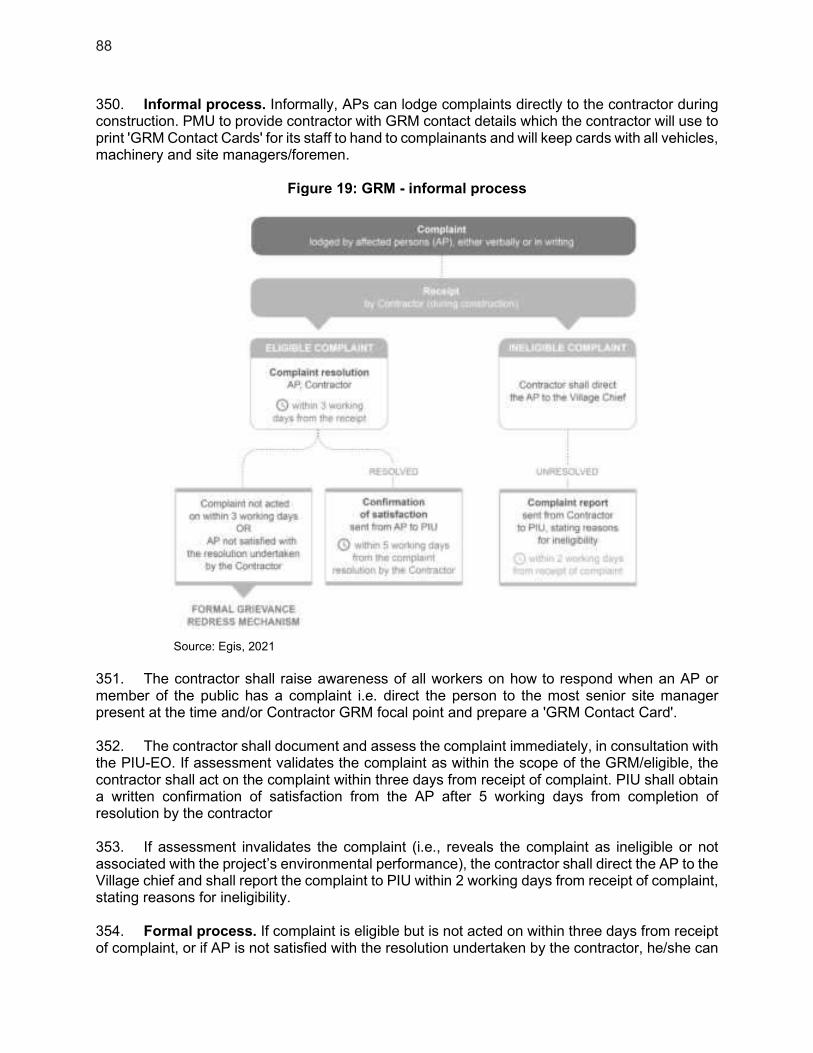
88
350. Informal process. Informally, APs can lodge complaints directly to the contractor during construction. PMU to provide contractor with GRM contact details which the contractor will use to print 'GRM Contact Cards' for its staff to hand to complainants and will keep cards with all vehicles, machinery and site managers/foremen.
Figure 19: GRM - informal process
Source: Egis, 2021
351. The contractor shall raise awareness of all workers on how to respond when an AP or member of the public has a complaint i.e. direct the person to the most senior site manager present at the time and/or Contractor GRM focal point and prepare a 'GRM Contact Card'. 352. The contractor shall document and assess the complaint immediately, in consultation with the PIU-EO. If assessment validates the complaint as within the scope of the GRM/eligible, the contractor shall act on the complaint within three days from receipt of complaint. PIU shall obtain a written confirmation of satisfaction from the AP after 5 working days from completion of resolution by the contractor 353. If assessment invalidates the complaint (i.e., reveals the complaint as ineligible or not associated with the project’s environmental performance), the contractor shall direct the AP to the Village chief and shall report the complaint to PIU within 2 working days from receipt of complaint, stating reasons for ineligibility. 354. Formal process. If complaint is eligible but is not acted on within three days from receipt of complaint, or if AP is not satisfied with the resolution undertaken by the contractor, he/she can

89
access the formal mechanism. The grievance redress process includes four steps before complaints may be elevated to the ADB as a last resort, as follows:
(i) First step (Village/Sangkat level): 5 working days - Complaints and grievances are reported verbally or submitted in writing to the Village chief or Sangkat chief or to contractor. The receiving agent will provide immediate written confirmation of the receipt of the complaint. If after 5 days the complainant does not hear from the contractor, Village or Sangkat chief or if the complainant is not satisfied with the decision taken in the first step, the complaint may be brought to the Municipal Office or Project Implementation Unit (PIU).
(i) Second step (Municipal level): 10 working days - The Municipal Office or the PIU have 10 days within which to resolve the complaint to the satisfaction of all concerned. If the complaint cannot be solved at this stage, the Municipal Office or the PIU will bring the case to the Provincial Administration (PA) - Provincial Grievance Redress Committee (PGRC) or to the Project Management Unit (PMU) which will then inform the complainant.
(ii) Third step (Provincial level): 10 working days - The PGRC or the PMU have 10 days within which to resolve the complaint to the satisfaction of all concerned. If the complaint cannot be solved at this stage, the PGRC or the PMU will bring the case to the national level (line-ministries concerned by the issue), which will then inform the complainant.
(iii) Fourth step (National level): 20 working days - The representative of the concerned line Ministry or the Project Management Unit (PMU) meets with the aggrieved party to resolve the complaint/issue. Within 20 days of the submission of the grievance, the Committee or the PMU will make a written decision and submit a copy to the ADB. If the complaint cannot be solved at this stage, the MEF or EA or the PMU will bring the case to ADB.
(iv) Fifth step (ADB): ADB has developed an Accountability Mechanism51 to address the grievances of people adversely affected by ADB-assisted projects and ensure compliance with ADB operational policies and procedures. The mechanism is described on the ADB website.
51 https://www.adb.org/who-we-are/accountability-mechanism/main .

90
Figure 20: Grievance Redress Mechanism Chart
Source: Egis, 2021.
10. Environmental Management Plan
355. The following tables summarize the potential impacts of the subprojects during project preparation, design, construction and operation, and the mitigation measures. They include: (i) anticipated significant adverse environmental impacts and risks; (ii) mitigation measure with technical details, including the type of impact to which it relates, and the conditions under which it is required; (iii) links to any other mitigation plans required for the project; and (iv) roles and responsibilities for implementing the mitigation measure. 356. These EMP requirements will be incorporated into bidding documents, construction contracts and operational management manuals, during detailed design and contractors during

91
construction, under the supervision of the PIU and DCSC. The effectiveness of the measures will be evaluated based on environmental inspections and monitoring to determine whether they should be continued, improved or adjusted.
Table 30: Potential impacts of the subprojects during project preparation, design, construction and operation, and the mitigation measures
Aspect Potential
Environmental Impact
Proposed Mitigation Measure Responsible Party for
ImplementationSupervision
Design and Pre-construction
Land and geology
No significant impact - - -
Ecology and biodiversity
No significant impact - - -
Water resources
No significant impact - - -
Air quality No significant impact - - -
Noise and vibration
Noise emissions which should cause neighbouring disturbance
Project designs defined to mitigate noise emissions as far as possible.
Operator PMU, PIU, IA
Materials and waste
The project should need the use of materials and generate waste
Design and daily processes have been defined to limit material needs and waste production.
Operator PMU, PIU,
IA
Archeology and cultural heritage
No significant impact - - -
Socio-economic and community health and safety
No significant impact -
- -
Construction
Land and geology
Excavation of borrow pits and quarries may be a threat to the environment when left uncared for frequent sliding, loss of ecosystem, groundwater pollution, and loss of arable land
No new natural material extraction site will be created for this project; Manufactured materials and products will also be prepared in Kampot and transported, given the relatively short distance.
Contractor PIU, PMU
Land and geology
Soil contamination: (i) improper transport, storage, handling, and/or disposal of solid
Stabilization of exposed surfaces with ditches and/or sheeting; Minimize the duration that surfaces are exposed for;
Contractor PIU, PMU
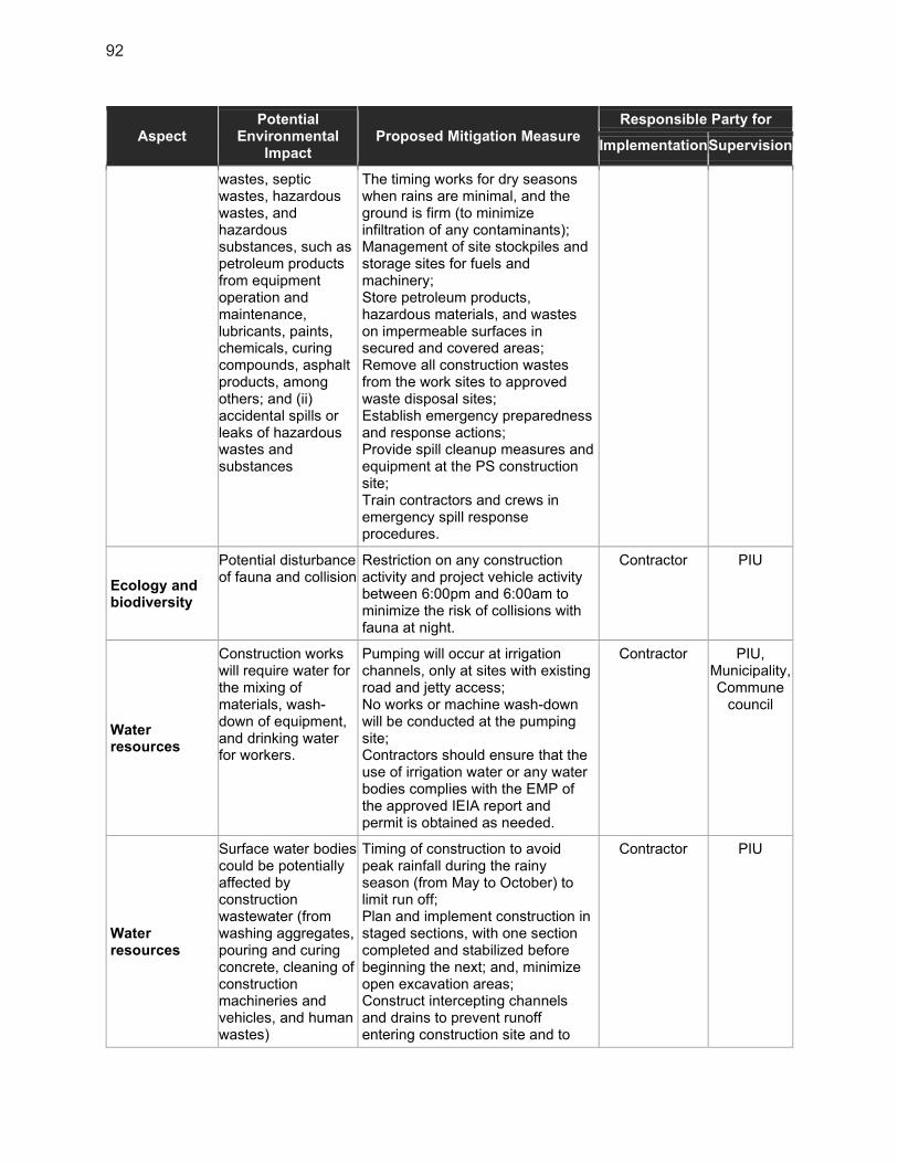
92
Aspect Potential
Environmental Impact
Proposed Mitigation Measure Responsible Party for
ImplementationSupervision
wastes, septic wastes, hazardous wastes, and hazardous substances, such as petroleum products from equipment operation and maintenance, lubricants, paints, chemicals, curing compounds, asphalt products, among others; and (ii) accidental spills or leaks of hazardous wastes and substances
The timing works for dry seasons when rains are minimal, and the ground is firm (to minimize infiltration of any contaminants); Management of site stockpiles and storage sites for fuels and machinery; Store petroleum products, hazardous materials, and wastes on impermeable surfaces in secured and covered areas; Remove all construction wastes from the work sites to approved waste disposal sites; Establish emergency preparedness and response actions; Provide spill cleanup measures and equipment at the PS construction site; Train contractors and crews in emergency spill response procedures.
Ecology and biodiversity
Potential disturbance of fauna and collision
Restriction on any construction activity and project vehicle activity between 6:00pm and 6:00am to minimize the risk of collisions with fauna at night.
Contractor PIU
Water resources
Construction works will require water for the mixing of materials, wash-down of equipment, and drinking water for workers.
Pumping will occur at irrigation channels, only at sites with existing road and jetty access; No works or machine wash-down will be conducted at the pumping site; Contractors should ensure that the use of irrigation water or any water bodies complies with the EMP of the approved IEIA report and permit is obtained as needed.
Contractor PIU, Municipality, Commune
council
Water resources
Surface water bodies could be potentially affected by construction wastewater (from washing aggregates, pouring and curing concrete, cleaning of construction machineries and vehicles, and human wastes)
Timing of construction to avoid peak rainfall during the rainy season (from May to October) to limit run off; Plan and implement construction in staged sections, with one section completed and stabilized before beginning the next; and, minimize open excavation areas; Construct intercepting channels and drains to prevent runoff entering construction site and to
Contractor PIU

93
Aspect Potential
Environmental Impact
Proposed Mitigation Measure Responsible Party for
ImplementationSupervision
divert runoff from works’ sites to existing drainage or open ground; Contractors will develop actions for control of oil and other dangerous substances as part of their site Contractor-EMPs; All sites for washing of construction equipment will be equipped with water collection basins and sediment traps; Fuel storage, machinery maintenance workshop and vehicle cleaning areas will be stationed at least 100m from the natural waterbodies and 20m from channels; Storage facilities for fuels, oil, and other hazardous materials will be within secured areas on impermeable surfaces and provided with bunds and cleanup installations; Contractors’ fuel suppliers must be properly licensed and will follow established protocol for transferring fuel; Portable toilets and on-site wastewater pre-treatment systems will be installed at construction sites along with proper maintenance protocols.
Air quality
Dust emissions, air pollution from aggregate preparation and concrete-mixing, air pollution from vehicle and machinery emissions
Spraying water on the exposed construction site where fugitive dust is being generated. Prolonged use of temporary storage piles should be avoided, or covered, or wetted regularly to prevent dust and erosion; Storing petroleum or other harmful materials inappropriate places and covering to minimize fugitive dust and emission; Covering materials during truck transportation, in particular, fine material, to avoid spillage or dust generation; Regulation by speed limits of access roads to the PS construction site;
Contractor PIU

94
Aspect Potential
Environmental Impact
Proposed Mitigation Measure Responsible Party for
ImplementationSupervision
Maintenance of project vehicles to minimize greenhouse gas emissions; Turning off equipment/ vehicle when not in use; limiting engine idling to a max. of 5 minutes; For odor: disinfection/ deodorization/ sanitizing affected latrines prior to clearing; provision of adequate sanitation facilities; and strict enforcement of sanitation practices; prompt disposal of organic and hazardous wastes; and timely community consultations to ensure awareness of the risk of odors prior to works; Prohibit burning of wastes; Timely monitoring of air quality and inspections during construction.
Noise and vibration
Construction works may cause neighbouring noise disturbance, mainly in the urban areas
Properly maintain construction vehicles and machinery to minimize noise; Apply noise reduction devices and methods for high noise equipment operating within 150m of the sensitive sites i.e., schools, health centers, and religious sites; Prohibit operation of high-noise machinery and movement of heavy vehicles along urban and village roads, between 6:00 pm and 8:00 am; Place temporary hoardings or noise barriers around noise sources during construction; Monitor noise at sensitive areas at regular intervals. If noise standards are exceeded, equipment and construction conditions shall be checked, and mitigation measures shall be implemented to rectify the situation; Conduct regular interviews with residents/villagers adjacent to construction sites to identify noise disturbance. Community feedback will be used to adjust the work hours of noisy machinery.
Contractor PIU, Municipality, Commune
council
Noise and vibration
Construction works may cause neighboring vibration
High vibration activities, such as compaction operations, will be
Contractor PIU, Municipality,

95
Aspect Potential
Environmental Impact
Proposed Mitigation Measure Responsible Party for
ImplementationSupervision
disturbance, mainly in the urban areas
prohibited at night from 6:00 pm to 8:00 am; Communities will be consulted prior to large earthworks to ensure they are informed and to avoid sensitive timing.
Commune council
Materials and waste
Domestic solid waste from workers and construction waste materials
Covered garbage bins will be installed at each site of works; The contractors will be responsible for transporting the containers and disposing them at the existing dumpsite; Waste collection and disposal methods will follow strict procedures to ensure that only non-hazardous waste is disposed of; Hazardous wastes (discarded fuel, oil, spills) will be stored in sealed drums and transported to the official landfill site in accordance with national regulations; Waste burning will be forbidden.
Contractor PIU
Archaeology and cultural heritage
No significant impact -
- -
Socio-economic and community health and safety
Job creation during works
Local people employment. Contractor PIU, Municipality, Commune
council
Community health and safety
Deliberate or accidental access to construction site works
Construction site protection will include clear signs placed at construction sites in view of the public, informing people about the project’s GRM, and warning people against potential dangers such as moving vehicles, hazardous materials, and excavations, and raising awareness on safety issues; Heavy machinery will not be used at night; All sites will be secured, disabling access by the public through appropriate fencing whenever appropriate;
Contractor PIU Municipality, Commune
council
community health and safety
Network works may cause temporary disruptions to vehicle access; traffic flow
Construction vehicles should use different roads or dedicated lanes and the implementation of wastewater and drainage networks
Contractor PIU Municipality, Commune
council
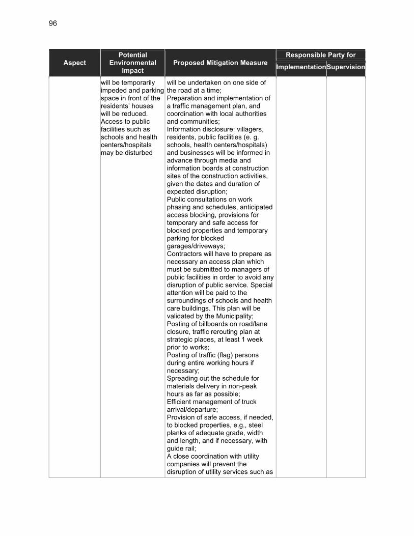
96
Aspect Potential
Environmental Impact
Proposed Mitigation Measure Responsible Party for
ImplementationSupervision
will be temporarily impeded and parking space in front of the residents’ houses will be reduced. Access to public facilities such as schools and health centers/hospitals may be disturbed
will be undertaken on one side of the road at a time; Preparation and implementation of a traffic management plan, and coordination with local authorities and communities; Information disclosure: villagers, residents, public facilities (e. g. schools, health centers/hospitals) and businesses will be informed in advance through media and information boards at construction sites of the construction activities, given the dates and duration of expected disruption; Public consultations on work phasing and schedules, anticipated access blocking, provisions for temporary and safe access for blocked properties and temporary parking for blocked garages/driveways; Contractors will have to prepare as necessary an access plan which must be submitted to managers of public facilities in order to avoid any disruption of public service. Special attention will be paid to the surroundings of schools and health care buildings. This plan will be validated by the Municipality; Posting of billboards on road/lane closure, traffic rerouting plan at strategic places, at least 1 week prior to works; Posting of traffic (flag) persons during entire working hours if necessary; Spreading out the schedule for materials delivery in non-peak hours as far as possible; Efficient management of truck arrival/departure; Provision of safe access, if needed, to blocked properties, e.g., steel planks of adequate grade, width and length, and if necessary, with guide rail; A close coordination with utility companies will prevent the disruption of utility services such as
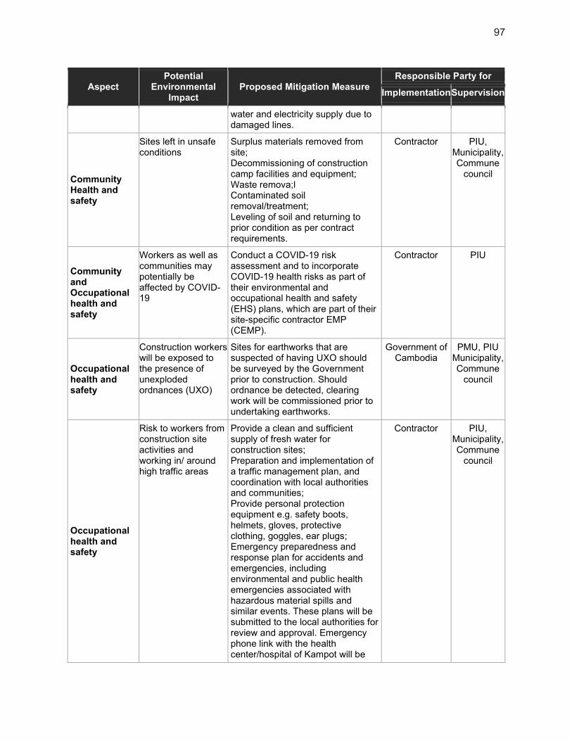
97
Aspect Potential
Environmental Impact
Proposed Mitigation Measure Responsible Party for
ImplementationSupervision
water and electricity supply due to damaged lines.
Community Health and safety
Sites left in unsafe conditions
Surplus materials removed from site; Decommissioning of construction camp facilities and equipment; Waste remova;l Contaminated soil removal/treatment; Leveling of soil and returning to prior condition as per contract requirements.
Contractor PIU, Municipality, Commune
council
Community and Occupational health and safety
Workers as well as communities may potentially be affected by COVID-19
Conduct a COVID-19 risk assessment and to incorporate COVID-19 health risks as part of their environmental and occupational health and safety (EHS) plans, which are part of their site-specific contractor EMP (CEMP).
Contractor PIU
Occupational health and safety
Construction workers will be exposed to the presence of unexploded ordnances (UXO)
Sites for earthworks that are suspected of having UXO should be surveyed by the Government prior to construction. Should ordnance be detected, clearing work will be commissioned prior to undertaking earthworks.
Government of Cambodia
PMU, PIU Municipality, Commune
council
Occupational health and safety
Risk to workers from construction site activities and working in/ around high traffic areas
Provide a clean and sufficient supply of fresh water for construction sites; Preparation and implementation of a traffic management plan, and coordination with local authorities and communities; Provide personal protection equipment e.g. safety boots, helmets, gloves, protective clothing, goggles, ear plugs; Emergency preparedness and response plan for accidents and emergencies, including environmental and public health emergencies associated with hazardous material spills and similar events. These plans will be submitted to the local authorities for review and approval. Emergency phone link with the health center/hospital of Kampot will be
Contractor PIU, Municipality, Commune
council

98
Aspect Potential
Environmental Impact
Proposed Mitigation Measure Responsible Party for
ImplementationSupervision
established. Each site of works will have basic first aid kits; A records management system that will store and maintain easily retrievable records against loss or damage will be established. It will include documenting and reporting of occupational accidents, diseases, and incidents. The records will be reviewed during compliance monitoring and audits; Occupational health and safety matters will be given a high degree of publicity to all work personnel and posters will be displayed prominently at construction sites; Contractors will organize an initial Environmental, Health and Safety training for their workers, and short but regular reminder meetings will be organized (biweekly); An awareness program for HIV/AIDS and other communicable diseases will be implemented for workers and the local communities; Core labor standards will be implemented. Civil works contracts will stipulate priorities to: (i) employ local people for works; (ii) ensure equal opportunities for women and men; (iii) pay equal wages for work of equal value and pay women’s wages directly to them; and (iv) not employ child or forced labor. Specific targets for employment have been included in the project gender action plan.
Operation
Land and geology
Soil contamination (from the uncontrolled discharge of untreated or treated water) can occur due to a faulty pipeline.
All equipment and processes will be maintained in good working order, with back-up material in critical areas; Engineering and management systems will be set up to prevent and handle emergency situations.
Operator PDPWT/ PDOE
PMU, PIU
Ecology and biodiversity
No significant impact -
- -
Water resources
No significant impact -
- -
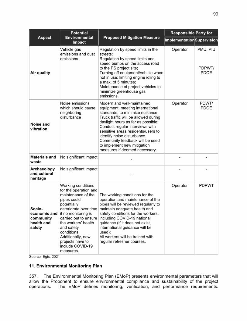
99
Aspect Potential
Environmental Impact
Proposed Mitigation Measure Responsible Party for
ImplementationSupervision
Air quality
Vehicle gas emissions and dust emissions
Regulation by speed limits in the streets; Regulation by speed limits and speed bumps on the access road to the PS project site; Turning off equipment/vehicle when not in use; limiting engine idling to a max. of 5 minutes; Maintenance of project vehicles to minimize greenhouse gas emissions.
Operator PMU, PIU
PDPWT/ PDOE
Noise and vibration
Noise emissions which should cause neighboring disturbance
Modern and well-maintained equipment, meeting international standards, to minimize nuisance; Truck traffic will be allowed during daylight hours as far as possible; Conduct regular interviews with sensitive areas residents/users to identify noise disturbance. Community feedback will be used to implement new mitigation measures if deemed necessary.
Operator PDWT/ PDOE
Materials and waste
No significant impact -
- -
Archaeology and cultural heritage
No significant impact -
- -
Socio-economic and community health and safety
Working conditions for the operation and maintenance of the pipes could potentially deteriorate over time if no monitoring is carried out to ensure the workers’ health and safety conditions. Additionally, new projects have to include COVID-19 measures.
The working conditions for the operation and maintenance of the pipes will be reviewed regularly to maintain adequate health and safety conditions for the workers, including COVID-19 national guidance (if it does not exist, international guidance will be used); All workers will be trained with regular refresher courses.
Operator PDPWT
Source: Egis, 2021
11. Environmental Monitoring Plan
357. The Environmental Monitoring Plan (EMoP) presents environmental parameters that will allow the Proponent to ensure environmental compliance and sustainability of the project operations. The EMoP defines monitoring, verification, and performance requirements.

100
Information obtained during the EMoP implementation can be used in examining the short- and long-term effects of the project’s environmental aspects, from which future strategies on environmental enhancement measures can be formulated. 358. The following table presents the proposed EMoP that will be implemented by the Proponent. Its shows concerns, parameters to be monitored, as well as the corresponding sampling and measurement plan (method, frequency, location), responsible party, and estimated budget.
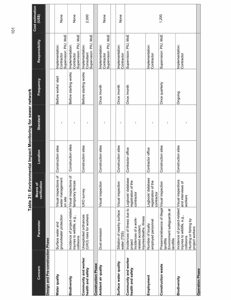
101
Tab
le 3
1:
En
vir
on
men
tal Im
pact
Mo
nit
ori
ng
fo
r sew
er
netw
ork
Co
nc
ern
P
ara
me
ter
Me
an
s o
f v
eri
fic
ati
on
L
oc
ati
on
S
tan
da
rd
Fre
qu
en
cy
Re
sp
on
sib
ilit
y
Co
st
es
tim
ati
on
(U
S$
)
De
sig
n a
nd
Pre
-co
ns
tru
cti
on
Ph
as
e
Wa
ter
qu
ali
ty
S
urf
ace
wa
ter
an
d
gro
un
dw
ate
r pro
tectio
n
Vis
ual in
spe
ctio
ns o
f w
ate
r m
an
age
men
t o
n s
ite
Co
nstr
uctio
n s
ites
- B
efo
re w
ork
s’ s
tart
Im
ple
men
tatio
n:
Co
ntr
act
or
Su
pe
rvis
ion
: P
IU,
Mo
E
No
ne
Bio
div
ers
ity
In
cid
ence
of
pro
ject
-re
late
d
inju
rie
s to
wild
life
, e
.g.,
co
llisi
ons
Vis
ual in
spe
ctio
ns o
f te
mpo
rary
fe
nces
Co
nstr
uctio
n s
ites
- B
efo
re s
tart
ing
work
s Im
ple
men
tatio
n:
Co
ntr
act
or
Su
pe
rvis
ion
: P
IU,
Mo
E
No
ne
Co
mm
un
ity a
nd
wo
rke
r h
ea
lth
an
d s
afe
ty
Un
explo
ded
ord
na
nces
(UX
O)
risks
fo
r w
ork
ers
U
XO
su
rvey
Co
nstr
uctio
n s
ites
- B
efo
re s
tart
ing
work
s Im
ple
men
tatio
n:
Co
nsulta
nt
Su
pe
rvis
ion
: P
IU,
Mo
E
2,0
00
Co
ns
tru
cti
on
Ph
ase
Am
bie
nt
air
qu
ality
Du
st
em
issio
n
Vis
ual in
spe
ctio
n
Co
nstr
uctio
n s
ites
- O
nce
/m
on
th
Imp
lem
en
tatio
n:
Co
ntr
act
or
Su
pe
rvis
ion
: P
IU,
Mo
E
No
ne
Su
rfa
ce
wa
ter
qu
ali
ty
S
ilta
tion
of
nea
rby s
urf
ace
w
ate
r (T
SS
) V
isu
al in
spe
ctio
n
Co
nstr
uctio
n s
ites
- O
nce
/m
on
th
Imp
lem
en
tatio
n:
Co
ntr
act
or
No
ne
Co
mm
un
ity a
nd
wo
rke
r h
ea
lth
an
d s
afe
ty
Incid
ence
s o
f ill
ne
ss d
ue
to
pro
ject
Incid
ence
s o
f a w
ork
-re
late
d a
ccid
en
t,
inju
rie
s/d
eath
s, illn
ess
Lo
gb
oo
k/ d
ata
base
re
gis
tra
tion
of
the
co
ntr
acto
r
Co
ntr
act
or
offic
e
-
On
ce
/m
on
th
Su
pe
rvis
ion
: P
IU,
Mo
E
1,2
00
Em
plo
ym
en
t N
um
be
r o
f lo
cally
e
mp
loyed
pe
rson
nel
Lo
gb
oo
k/ d
ata
base
re
gis
tra
tion
of
the
co
ntr
acto
r
Co
ntr
act
or
offic
e
-
Imp
lem
en
tatio
n:
Co
ntr
act
or
Co
ns
tru
cti
on
was
te
Pre
se
nce
/ab
sen
ce o
f ill
eg
al
lan
dfil
ls
En
vir
on
men
t sa
feg
ua
rds a
t la
nd
fills
Vis
ual in
spe
ctio
n
Co
nstr
uctio
n s
ites
-
On
ce
qua
rte
rly
Su
pe
rvis
ion
: P
IU,
Mo
E
Bio
div
ers
ity
In
cid
ence
of
pro
ject
-re
late
d
inju
rie
s to
wild
life
, e
.g.,
co
llisi
ons
Hu
ntin
g o
r fis
hin
g b
y
pro
ject
wo
rke
rs
Vis
ual in
spe
ctio
ns
an
d in
terv
iew
s o
f w
ork
ers
Co
nstr
uctio
n s
ites
-
On
go
ing
Imp
lem
en
tatio
n:
Co
ntr
act
or
Op
era
tio
n P
has
e

102
Co
mm
un
ity a
nd
wo
rke
r h
ea
lth
an
d s
afe
ty
Incid
ence
s o
f ill
ne
ss d
ue
to
pro
ject
Incid
ence
s o
f a w
ork
-re
late
d a
ccid
en
t,
inju
rie
s/d
eath
s, illn
ess
Lo
gb
oo
k/ d
ata
base
re
gis
tra
tion
of
the
op
era
tor
WW
TP
offic
e
-
On
ce
/ 1
st y
ea
r Im
ple
men
tatio
n:
Op
era
tor
Em
plo
ym
en
t N
um
be
r o
f lo
cally
e
mp
loyed
pe
rson
nel
Lo
gb
oo
k/ d
ata
base
re
gis
tra
tion
of
the
op
era
tor
WW
TP
offic
e
O
nce
/ 1
st y
ea
r S
up
erv
isio
n:
PIU
, M
oE
No
te:
for
all
pa
ram
ete
rs,
the
re
sp
on
sib
ility
fo
r im
ple
me
nta
tion
will
be
a lic
en
sed
la
bo
rato
ry (
recru
ite
d b
y t
he
co
ntr
acto
r);
an
d t
he
re
spo
nsib
ility
fo
r su
pe
rvis
ion is t
he
PIU
. S
ou
rce:
Eg
is,
20
21

103
12. Construction Environmental Monitoring
359. The construction environmental management plan (CEMP) shall be prepared by all contractors before the start of the construction works and shall be approved by PIU and the PMU. This requirement shall be included in the construction contracts. 360. The purpose of a CEMP is to outline how a construction project will avoid, minimize or mitigate effects on the environment and surrounding area. 361. The CEMP details the implementation of measures in accordance with environmental commitments outlined in; an Environmental Statement, an environmental policy or environmental plan, requirements of planning conditions, agreements or other legislative requirements. They are ‘live’ documents that are reviewed and updated at regular intervals throughout the project life cycle. 362. The purpose of the CEMP is to:
(i) Highlight stakeholder requirements; (ii) Ensure that the development is compliant with current Cambodian environmental
legislation and international standards (WHO, IFC, …); (iii) Outline Environmental Management Systems e.g. ISO 14001; (iv) Detail the mitigation committed to within the Environmental Statement and how it will
be implemented on site; (v) Ensure that any adverse effects are minimized during construction; (vi) Describe any site-specific method statements required.
363. The basic scope of the CEMP shall consider the following subject areas, as applicable to the individual projects: soil, water quality and drainage, noise and air quality disturbances, nature conservation (biodiversity), archaeology and cultural heritage, people and communities, waste management, energy consumption, transport and materials. 364. The CEMP shall be structured as follows:
(i) Introduction – General purpose, scope, and structure of the document; (ii) Scope of work and project description – Information about the development; (iii) Environmental requirements and controls –
a. environmental impacts and risks; b. Mitigation measures (minimum as set out in this EMP) and pollution
control measures (air, noise, surface water, and groundwater quality); c. Monitoring procedures for monitoring construction processes against
requirements (minimum as set out in this EMP). (iv) Roles and responsibilities; (v) Consents, commitments, and permissions;
a. Appropriate environmental legislation, planning conditions, and any other consents or licensing.
(vi) Management plans – Specific management plans such as ecology, noise, dust, waste, traffic disturbance, access disturbance;
(vii) Emergency response plan; (viii) Communication – External and internal consultations.
365. CEMP should also include an Environmental and occupational health and safety plan, including COVID-19 measures, which should be defined according national guidance from
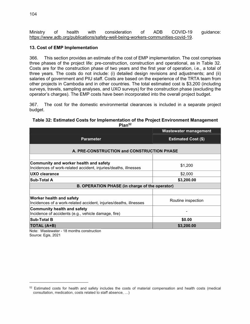
104
Ministry of health with consideration of ADB COVID-19 guidance: https://www.adb.org/publications/safety-well-being-workers-communities-covid-19. 13. Cost of EMP Implementation
366. This section provides an estimate of the cost of EMP implementation. The cost comprises three phases of the project life: pre-construction, construction and operational, as in Table 32. Costs are for the construction phase of two years and the first year of operation, i.e., a total of three years. The costs do not include: (i) detailed design revisions and adjustments; and (ii) salaries of government and PIU staff. Costs are based on the experience of the TRTA team from other projects in Cambodia and in other countries. The total estimated cost is $3,200 (including surveys, travels, sampling analyses, and UXO surveys) for the construction phase (excluding the operator’s charges). The EMP costs have been incorporated into the overall project budget. 367. The cost for the domestic environmental clearances is included in a separate project budget.
Table 32: Estimated Costs for Implementation of the Project Environment Management Plan52
Wastewater management
Parameter Estimated Cost ($)
A. PRE-CONSTRUCTION and CONSTRUCTION PHASE
Community and worker health and safety Incidences of work-related accident, injuries/deaths, illnesses
$1,200
UXO clearance $2,000
Sub-Total A $3,200.00
B. OPERATION PHASE (in charge of the operator)
Worker health and safety Incidences of a work-related accident, injuries/deaths, illnesses
Routine inspection
Community health and safety Incidence of accidents (e.g., vehicle damage, fire)
-
Sub-Total B $0.00
TOTAL (A+B) $3,200.00
Note: Wastewater - 18 months construction Source: Egis, 2021
52 Estimated costs for health and safety includes the costs of material compensation and health costs (medical
consultation, medication, costs related to staff absence, …)
105
XI. CONCLUSION AND RECOMMENDATIONS
368. An IEE is deemed sufficient for the LCIP given its categorization as Category B for Environment and Category B for Involuntary Resettlement and Category C for Indigenous Peoples as per ADB SPS 2009. 369. During construction, anticipated project impacts on noise, dust, traffic, health, and safety will be localized, temporary, intermittent in nature and can be readily addressed through the implementation of the measures outlined in the EMP. Land clearing and grading will be limited to areas where necessary. A detailed tree inventory and survey (if required) will be undertaken as part of the tree cutting permit application in coordination with the concerned MoE office and the Government of Kampot. 370. During operation, the project is expected to have positive social impacts in terms of the generation of local benefits. It is expected to generate/contribute additional local employment and livelihood opportunities and local government revenues. 371. The Proponent is fully committed to its environmental and social responsibilities, including compliance with national environmental, health, and safety regulations and ADB SPS requirements. 372. Should there be changes in the project scope or location of the facilities that would result insignificant impacts not included in this assessment, an updated or a new Borrower IEE will be prepared. 373. This is a feasibility study phase IEE; an updated Borrower IEE and standalone bidding ready EMP and domestic IEIA in Khmer will be prepared during the detailed design phase. The domestic IEIA will be submitted to the MoE, in accordance national legislation.

106
XII. APPENDICES
1. Environmental baseline survey report
ASIAN DEVELOPMENT BANK
TA-9554 – REG: SOUTHEAST ASIA URBAN SERVICES FACILITY
CONTRACT NO: 143221-S53314
CAM: LIVABLE CITIES INVESTMENT PROJECT
Baseline Environmental Survey for Kampot City
Prepared by
January 2021
WWTP site
PS_03 site
MPS site Noise measurement C1PS site
i
CONTENTS
CONTENTS ................................................................................................................................. i
List of Tables ............................................................................................................................. ii
List of Figures .......................................................................................................................... iii
List of Abbreviation .................................................................................................................. v
1. Introduction and Background ......................................................................................... 1
1.1 Background ....................................................................................................................... 1
1.2 Study Area......................................................................................................................... 1
1.3 Survey Objective ............................................................................................................... 2
1.4 Methodology ...................................................................................................................... 3
1.5 Survey Team Member ....................................................................................................... 3
2. Environmental Legislation ............................................................................................... 4
3. Project Description ........................................................................................................ 13
3.1 Wastewater ..................................................................................................................... 13
3.2 Stormwater drainage ....................................................................................................... 14
4. Baseline Survey Results ................................................................................................ 14
4.1 Overall environmental aspect .......................................................................................... 14
4.1.1 Geographical of Kampot city ..................................................................................... 14
4.1.2 Land use ................................................................................................................... 15
4.1.3 Geology and Soil ....................................................................................................... 16
4.1.4 Hydrology .................................................................................................................. 17
4.1.5 Protection area .......................................................................................................... 18
4.1.6 Climate Change ........................................................................................................ 19
4.1.7 Existing Network Facilities......................................................................................... 21
4.2 Characteristic of the project area ..................................................................................... 24
4.2.1 Wastewater Treatment Plant (WWTP) ...................................................................... 24
4.2.2 Pumping Station ........................................................................................................ 33
4.2.3 Storm Drainage Outfall .............................................................................................. 45
4.3 Cultural Heritage ........................................................................................................... 54
4.3.1 Methodology ............................................................................................................. 54
4.3.2 Finding ...................................................................................................................... 54
4.4 Noise ............................................................................................................................. 55
4.4.1 Methodology ............................................................................................................. 55
4.4.2 Finding ...................................................................................................................... 56
5. Conclusions .................................................................................................................... 58
5.1 Environmental Regulation ................................................................................................ 58
BASELINE ENVIRONMENTAL SURVEY REPORT, KAMPOT CITY
ii
5.2 Project Description .......................................................................................................... 58
5.3 Baseline survey ............................................................................................................... 58
5.3.1 Overall environmental aspect .................................................................................... 58
5.3.2 Characteristic of the project area............................................................................... 58
5.3.2 Cultural Heritage ....................................................................................................... 59
5.3.2 Noise ........................................................................................................................ 59
6 References .......................................................................................................................... 60
LIST OF ANNEX
Annex 1: Lab‘s sheet of Noise Level Measurement ................................................................... 61
Annex 2: The attendance list meeting ....................................................................................... 61
LIST OF TABLES
Table 1.3-1: List of the team members of the environment study ................................................ 3
Table 4.1.5-1: List of protected areas in Cambodia ................................................................... 18
Table 4.2.2-1: The location of the pumping station in Kampot city ............................................. 34
Table 4.4.1-1: The maximum standard of noise level, in dB(A) ................................................. 55
Table 4.4.2-1: Noise sampling dated and location ..................................................................... 56
Table 4.4.2-2: The noise level measurement at the lift pumping and the main pumping station.57
BASELINE ENVIRONMENTAL SURVEY REPORT, KAMPOT CITY
iii
LIST OF FIGURES
Figure 1.2-1: The map of the Kampot city ................................................................................... 2
Figure 3.1-1: Wastewater collection and treatment subproject in Kampot city ........................... 13
Figure 3.2-1: Stormwater drainage subproject in Kampot city ................................................... 14
Figure 4.1.1-1: Map of Kampot city ........................................................................................... 15
Figure 4.1.2-1: Present Land-use Map of Kampot city .............................................................. 15
Figure 4.1.3-1: Geological map of the project area .................................................................... 16
Figure 4.1.3-2: Soil type of the project area............................................................................... 17
Figure 4.1.4-1: Map of the water bodies in the project area ....................................................... 17
Figure 4.1.5-1: Map of protected area in Cambodia .................................................................. 19
Figure 4.1.7-1: The road network in Kampot city ....................................................................... 21
Figure 4.1.7-2: Kampot Water Supply facilities .......................................................................... 22
Figure 4.1.7-3: The existing of stormwater drainage in Kampot city .......................................... 23
Figure 4.2.1-1: Map of the WWTP site with 300m buffer ........................................................... 25
Figure 4.2.1-2: Location of the WWTP site ................................................................................ 26
Figure 4.2.1-3: Map of community structure close to the WWTP site ........................................ 27
Figure 4.2.1-4: Present condition of the access road ................................................................ 27
Figure 4.2.1.5-1: Water bodies adjacent to the project site ........................................................ 29
Figure 4.2.1-7: Electrical pole in front of the WWTP site ........................................................... 29
Figure 4.2.1-8: Map of distance from schools to WWTP site ..................................................... 31
Figure 4.2.1-9: Map of project area concerned with the protected area ..................................... 32
Figure 4.2.2-1: The map location of the pumping station in the Kampot city .............................. 33
Figure 4.2.2.1-1: The location of the CMPS with 300m buffer ................................................... 34
Figure 4.2.2.1-2: The community structure in the buffer zone of CMPS .................................... 35
Figure 4.2.2.1-3: Present condition of the access road ............................................................. 36
Figure 4.2.2.1-4: Land use in/adjunction of the CMPS ............................................................. 36
Figure 4.2.2.1-5: Map of distance from schools to CMPS site ................................................... 37
Figure 4.2.2.2-2: The settles in the buffer zone of the C1PS ..................................................... 39
Figure 4.2.2.2-3: The present condition of the access road ....................................................... 39
Figure 4.2.2.3-1: The location of the PS_FS_01 with 300m buffer ............................................ 41
Figure 4.2.2.3-2: The houses close to the PS_FS_01 site ......................................................... 41
Figure 4.2.2.3-3: The present condition of the access road ....................................................... 42
Figure 4.2.2.4-1: The location of the PS_FS_03 with 300m buffer ........................................... 43
Figure 4.2.2.4-2: The settles in the buffer zone of the PS_FS_03 ............................................. 43
Figure 4.2.3-1: Map of the proposed outfall for stormwater drainage with 300m buffer ............. 45
Figure 4.2.3.1-1: The location of the Outfall_02 with 300m buffer ............................................ 46
Figure 4.2.3.1-2: The settles in the buffer zone of the Outfall_02 .............................................. 47
BASELINE ENVIRONMENTAL SURVEY REPORT, KAMPOT CITY
iv
Figure 4.2.3.2-1: The location of the Outfall_03 with 300m buffer ............................................ 48
Figure 4.2.3.2-2: The settles in the buffer zone of the Outfall_03 .............................................. 48
Figure 4.2.3.4-1: The location of the Outfall_04 with 300m buffer ............................................ 49
Figure 4.2.3.4-2: The settles in the buffer zone of the Outfall_04 .............................................. 50
Figure 4.2.3.5-1: The location of the Outfall_05 with 300m buffer ............................................ 51
Figure 4.2.3.5-3: The access road condition, (st.735) ............................................................... 52
Figure 4.2.3.6-1: The location of the Outfall_06 with 300m buffer ............................................ 52
Figure 4.2.3.6-2: The settles in the buffer zone of the Outfall_06 .............................................. 53
Figure 4..2-1: Activities of consultation for cultural heritage ....................................................... 54
Figure 4.4.1-1: The location of the sampling points/stations ...................................................... 56
Figure 4.4.2-1: The noise measurement at the lift pumping station and a close house .............. 56
Figure 4.4.2-2: The noise measurement at the main pumping station and a close house. ........ 57
BASELINE ENVIRONMENTAL SURVEY REPORT, KAMPOT CITY
v
LIST OF ABBREVIATION
ADB : The Asian Development Bank DPWT : Department of Public Works and Transport EA : Executing Agency
EIA : Environmental Impact Assessment EMP : Environment Management Plan
FS : Feasibility Study GPS : Global Positioning System GRC : Royal Government of Cambodia
GMS : Greater Mekong Sub-region
IEE : Initial Environmental Examination IEIA : Initial Environmental Impact Assessment
KCC : Key Consultants (CAMBODIA) MAFF : Ministry of Agriculture, Forestry, and Fisheries MEF : Ministry of Economy and Finance MOE : Ministry of Environment MPWT : Ministry of Public Works and Transport MRC : Mekong River Commission PIC : Project Implementation Consultant
PIU : Project Implementation Unit PMU : Project Management Unit SURF : The Southeast Asia Urban Services Facility UTM : Universal Transverse Mercator WWTP : Wastewater Treatment Plant

BASELINE ENVIRONMENTAL SURVEY REPORT, KAMPOT CITY
1
INTRODUCTION AND BACKGROUND
1.1 Background
At the request of the Kingdom of Cambodia, the Asian Development Bank is developing a
project to improve the environment of secondary cities in Cambodia. There are three targeted
cities include Bavet, Kampot, and Poipet city.
The Southeast Asia Urban Services Facility (SURF), a transaction technical assistance facility
led by EGIS EAU, will support the project preparation and conduct technical, financial,
economic, institutional, sector policy, legal, regulatory, poverty, social, gender, and safeguard
assessments. The purpose of Egis Eau's service is to provide assistance to government
authorities to prepare the project in compliance with the ADB requirements.
The project stage is in the Feasibility Study (FS) with a period of approximately 3 months (Sept.-
Nov.2020). The social survey was awarded to Key Consultants (CAMBODIA) KCC to carry out
by Egis Eau.
This report focuses only on the subprojects in Kampot city, including only wastewater collection
and treatment plant and storm drainage.
1.2 Study Area
Kampot city is a corridor city in the Cambodia coastal area; Kampot city is about 150 km from
Phnom Penh towards the sea area. It is located in the southwestern part of Cambodia. Takeo
borders it to the East, Kampong Spue to the north, Preah Sihanouk to the west, and Koh Kong
to the northwest. To the south, the province has a coastline of around 45 km on the Gulf of
Thailand. It is 4,873 km2 and has low arable lands and abundant natural resources. The
Kampot city visualizes to become commercial and modern tourism for sustainable development
cities in the coastal area. The Kampot city is an influential city in tourism; it is an attractive place
for tourism development with Cambodia's natural and historical tour.
The annual growth rate of commercial areas and tourism facilities is increasing year by year. In
the last seven years, the growth of tourists is growing from 0.97 million in 2012 to 1.9 million in
2019, and it estimates to 3.1 million people go to visit Kampot province in 2025 when the
facilities in Kampot have been developed1. The population in the Kampot town is about people
38,595 total populations, with 19,976 females (690,920 people in Kampot province, database in
2018). However, the urban development area is located at Sangkat Kampong Kandal, Sangkat
Kampong Bay, and Sangkat Krang Ampil, with 494 ha and a total population of 17,079 (3,662
households)2 in the first criteria to develop the facilities in the town. Improving urban
infrastructure supports urban development and national economic growth due to increasing
investment activities in all sectors, mainly tourism in the Kampot province.
1TOURISM DEMAND ANALYSIS, https://www.adb.org/sites/default/files/linked-documents/46293-004-sd-
02.pdf 2 IESIA (Initial Environmental and Social Impact Assessment) report of Wastewater Collection and Treatment
system and Drainage system in Kampot town, 2019.
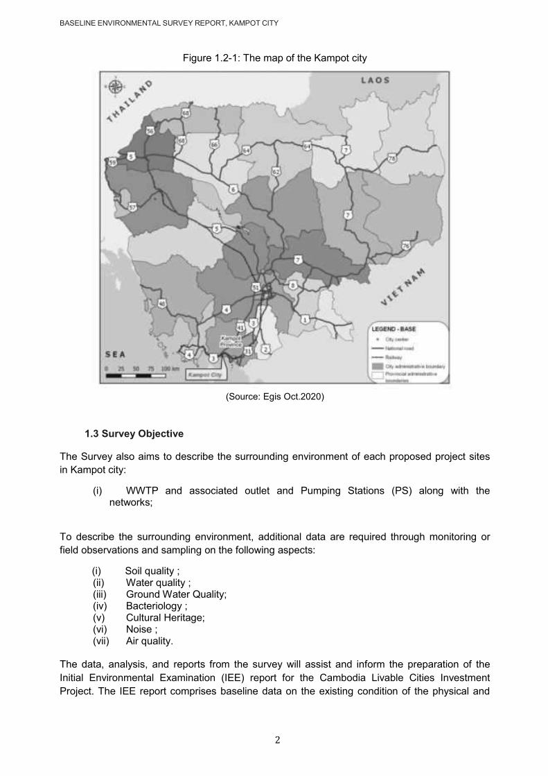
BASELINE ENVIRONMENTAL SURVEY REPORT, KAMPOT CITY
2
Figure 1.2-1: The map of the Kampot city
(Source: Egis Oct.2020)
1.3 Survey Objective
The Survey also aims to describe the surrounding environment of each proposed project sites
in Kampot city:
(i) WWTP and associated outlet and Pumping Stations (PS) along with the networks;
To describe the surrounding environment, additional data are required through monitoring or
field observations and sampling on the following aspects:
(i) Soil quality ; (ii) Water quality ; (iii) Ground Water Quality; (iv) Bacteriology ; (v) Cultural Heritage; (vi) Noise ; (vii) Air quality.
The data, analysis, and reports from the survey will assist and inform the preparation of the
Initial Environmental Examination (IEE) report for the Cambodia Livable Cities Investment
Project. The IEE report comprises baseline data on the existing condition of the physical and
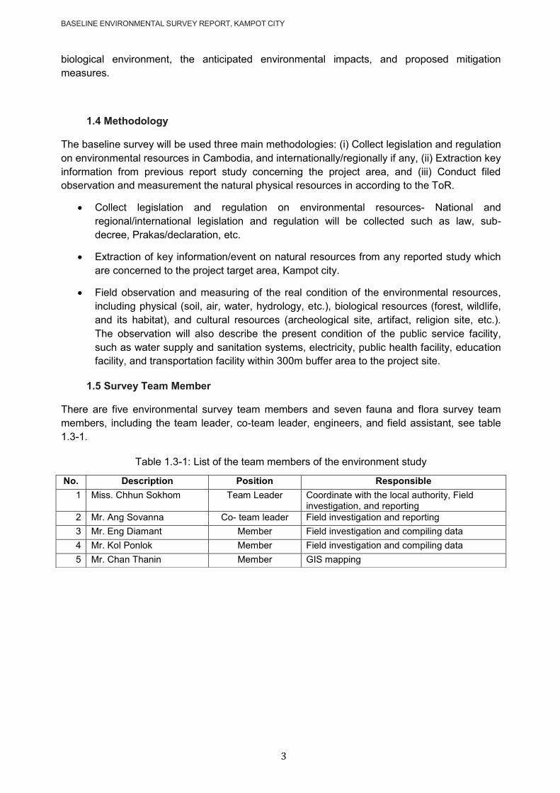
BASELINE ENVIRONMENTAL SURVEY REPORT, KAMPOT CITY
3
biological environment, the anticipated environmental impacts, and proposed mitigation
measures.
1.4 Methodology
The baseline survey will be used three main methodologies: (i) Collect legislation and regulation
on environmental resources in Cambodia, and internationally/regionally if any, (ii) Extraction key
information from previous report study concerning the project area, and (iii) Conduct filed
observation and measurement the natural physical resources in according to the ToR.
Collect legislation and regulation on environmental resources- National and
regional/international legislation and regulation will be collected such as law, sub-
decree, Prakas/declaration, etc.
Extraction of key information/event on natural resources from any reported study which
are concerned to the project target area, Kampot city.
Field observation and measuring of the real condition of the environmental resources,
including physical (soil, air, water, hydrology, etc.), biological resources (forest, wildlife,
and its habitat), and cultural resources (archeological site, artifact, religion site, etc.).
The observation will also describe the present condition of the public service facility,
such as water supply and sanitation systems, electricity, public health facility, education
facility, and transportation facility within 300m buffer area to the project site.
1.5 Survey Team Member
There are five environmental survey team members and seven fauna and flora survey team
members, including the team leader, co-team leader, engineers, and field assistant, see table
1.3-1.
Table 1.3-1: List of the team members of the environment study
No. Description Position Responsible
1 Miss. Chhun Sokhom Team Leader Coordinate with the local authority, Field investigation, and reporting
2 Mr. Ang Sovanna Co- team leader Field investigation and reporting
3 Mr. Eng Diamant Member Field investigation and compiling data
4 Mr. Kol Ponlok Member Field investigation and compiling data
5 Mr. Chan Thanin Member GIS mapping
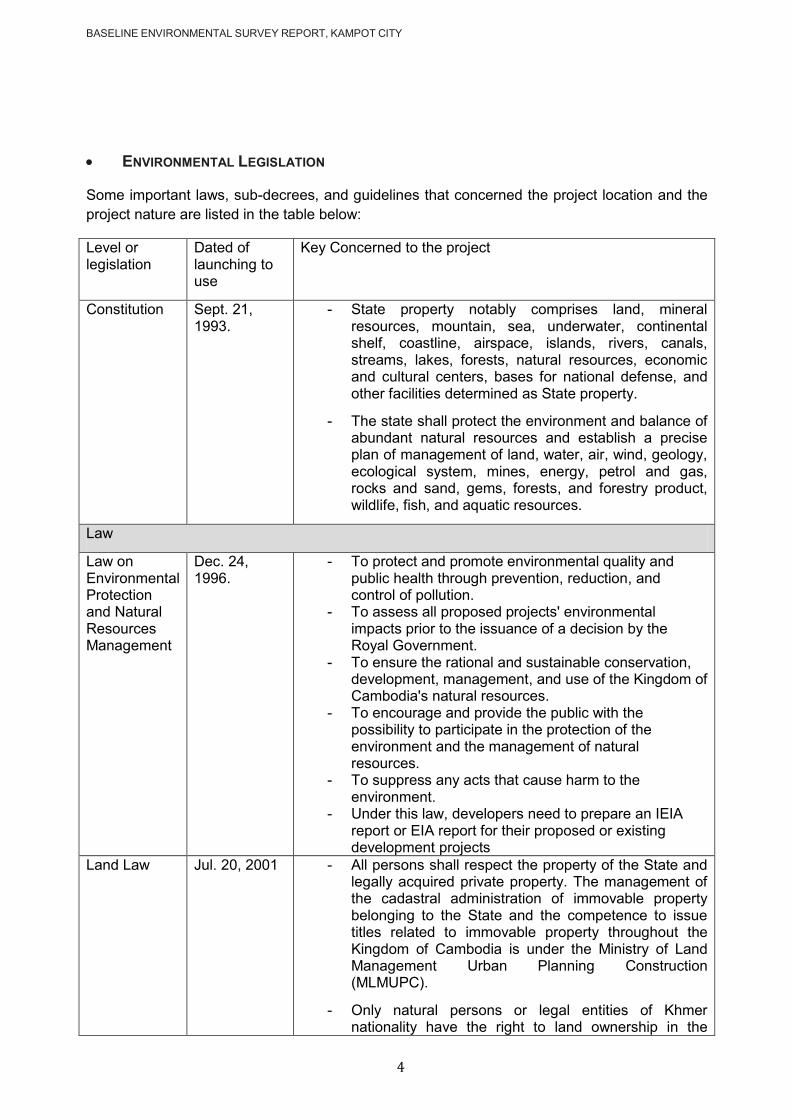
BASELINE ENVIRONMENTAL SURVEY REPORT, KAMPOT CITY
4
ENVIRONMENTAL LEGISLATION
Some important laws, sub-decrees, and guidelines that concerned the project location and the
project nature are listed in the table below:
Level or legislation
Dated of launching to use
Key Concerned to the project
Constitution
Sept. 21, 1993.
- State property notably comprises land, mineral resources, mountain, sea, underwater, continental shelf, coastline, airspace, islands, rivers, canals, streams, lakes, forests, natural resources, economic and cultural centers, bases for national defense, and other facilities determined as State property.
- The state shall protect the environment and balance of abundant natural resources and establish a precise plan of management of land, water, air, wind, geology, ecological system, mines, energy, petrol and gas, rocks and sand, gems, forests, and forestry product, wildlife, fish, and aquatic resources.
Law
Law on Environmental Protection and Natural Resources Management
Dec. 24, 1996.
- To protect and promote environmental quality and public health through prevention, reduction, and control of pollution.
- To assess all proposed projects' environmental impacts prior to the issuance of a decision by the Royal Government.
- To ensure the rational and sustainable conservation, development, management, and use of the Kingdom of Cambodia's natural resources.
- To encourage and provide the public with the possibility to participate in the protection of the environment and the management of natural resources.
- To suppress any acts that cause harm to the environment.
- Under this law, developers need to prepare an IEIA report or EIA report for their proposed or existing development projects
Land Law Jul. 20, 2001 - All persons shall respect the property of the State and legally acquired private property. The management of the cadastral administration of immovable property belonging to the State and the competence to issue titles related to immovable property throughout the Kingdom of Cambodia is under the Ministry of Land Management Urban Planning Construction (MLMUPC).
- Only natural persons or legal entities of Khmer nationality have the right to land ownership in the

BASELINE ENVIRONMENTAL SURVEY REPORT, KAMPOT CITY
5
Kingdom of Cambodia.
- Any person who, for no less than five years prior to the promulgation of this law, enjoyed peaceful, uncontested possession of immovable property that can lawfully be privately possessed has the right to request a definitive title of ownership.
Law of Water Resources Management
May 22, 2007 - Filling of the river, tributary, stream, natural lakes, canal, and reservoirs should subject to license or permitted letter.
- The discharge, disposal, or deposit of polluting substances that are likely to deteriorate the quality of water or to endanger human, animal, and plant health into the water, the soil, or the subsoil shall be subject to a license or permission form will be stated in Sub-decree.
Law on Protected Areas
Jan. 4, 2008 - This law defines the framework of management, conservation, and development of protected areas. The objectives of this law are to ensure the management, conservation of biodiversity, and sustainable use of natural resources in protected areas.
- The establishment or modification of any protected area shall be based on the results of research studies, criteria, management objectives, and access rights to resource use, land titles, and other relevant aspects.
- Each protected area shall be divided into four (4) management zoning systems as the following:
1. Core zone: management area(s) of high conservation values containing threatened and critically endangered species and fragile ecosystems. Access to the zone is prohibited except the Nature Conservation and Protection Administration's officials and researchers who, with prior permission from the Ministry of Environment, conduct nature and scientific studies for the purpose of preservation and protection of biological resources and natural environment with the exception of national security and defense sectors.
2. Conservation zone: management area(s) of high conservation values containing natural resources, ecosystems, watershed areas, and natural landscape located adjacent to the core zone. Access to the zone is allowed only with the prior consent of the Nature Conservation and Protection Administration at the area, with the exception of national security and defense sectors. The small-scale community uses of non-timber forest products (NTFPs) to support local ethnic minorities' livelihood may be allowed under strict control, provided that they do not present serious adverse impacts on biodiversity within the zone.
3. Sustainable use zone: management area(s) of high economic values for national economic development and management, and conservation of the protected area(s) itself, thus contributing to the local community and indigenous ethnic minorities‘ livelihood improvement.
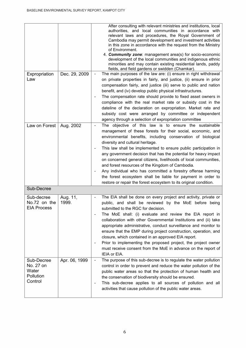
BASELINE ENVIRONMENTAL SURVEY REPORT, KAMPOT CITY
6
After consulting with relevant ministries and institutions, local authorities, and local communities in accordance with relevant laws and procedures, the Royal Government of Cambodia may permit development and investment activities in this zone in accordance with the request from the Ministry of Environment.
4. Community zone: management area(s) for socio-economic development of the local communities and indigenous ethnic minorities and may contain existing residential lands, paddy fields, and field gardens or swidden (Chamkar).
Expropriation Law
Dec. 29, 2009 - The main purposes of the law are: (i) ensure in right withdrawal
on private properties in fairly, and justice, (ii) ensure in prior
compensation fairly, and justice (iii) serve to public and nation
benefit, and (iv) develop public physical infrastructures.
- The compensation rate should provide to fixed asset owners in
compliance with the real market rate or subsidy cost in the
dateline of the declaration on expropriation. Market rate and
subsidy cost were arranged by committee or independent
agency through a selection of expropriation committee
Law on Forest Aug. 2002 - The objective of this law is to ensure the sustainable
management of these forests for their social, economic, and
environmental benefits, including conservation of biological
diversity and cultural heritage.
- This law shall be implemented to ensure public participation in
any government decision that has the potential for heavy impact
on concerned general citizens, livelihoods of local communities,
and forest resources of the Kingdom of Cambodia.
- Any individual who has committed a forestry offense harming
the forest ecosystem shall be liable for payment in order to
restore or repair the forest ecosystem to its original condition.
Sub-Decree
Sub-decree No.72 on the EIA Process
Aug. 11, 1999.
- The EIA shall be done on every project and activity, private or
public, and shall be reviewed by the MoE before being
submitted to the RGC for decision.
- The MoE shall: (i) evaluate and review the EIA report in
collaboration with other Governmental Institutions and (ii) take
appropriate administrative, conduct surveillance and monitor to
ensure that the EMP during project construction, operation, and
closure, which contained in an approved EIA report.
- Prior to implementing the proposed project, the project owner
must receive consent from the MoE in advance on the report of
IEIA or EIA.
Sub-Decree No. 27 on Water Pollution Control
Apr. 06, 1999 - The purpose of this sub-decree is to regulate the water pollution
control in order to prevent and reduce the water pollution of the
public water areas so that the protection of human health and
the conservation of biodiversity should be ensured.
- This sub-decree applies to all sources of pollution and all
activities that cause pollution of the public water areas.

BASELINE ENVIRONMENTAL SURVEY REPORT, KAMPOT CITY
7
Annex 2 Effluent standard for pollution sources
discharging wastewater to public water areas or sewer
No Parameters Unit
Allowable limits for pollutant substance discharging to
Protected public water area
Public water area and sewer
1 Temperature 0C < 45 < 45
2 pH 6 – 9 5 - 9
3 BOD5 ( 5 days at 20 0 C ) mg/l < 30 < 80
4 COD mg/l < 50 < 100
5 Total Suspended Solids mg/l < 60 < 120
6 Total Dissolved Solids mg/l < 1000 < 2000
7 Grease and Oil mg/l < 5.0 < 15
8 Detergents mg/l < 5.0 < 15
9 Phenols mg/l < 0.1 < 1.2
10 Nitrate (NO3 ) mg/l < 10 < 20
11 Chlorine ( free ) mg/l < 1.0 < 2.0
12 Chloride ( ion ) mg/l < 500 < 700
13 Sulphate ( as SO4 ) mg/l < 300 < 500
14 Sulphide ( as Sulphur ) mg/l < 0.2 < 1.0
15 Phosphate ( PO4 ) mg/l < 3.0 < 6.0
16 Cyanide ( CN ) mg/l < 0.2 < 1.5
17 Barium ( Ba ) mg/l < 4.0 < 7.0
18 Arsenic ( As ) mg/l < 0.10 < 1.0
19 Tin ( Sn ) mg/l < 2.0 < 8.0
20 Iron ( Fe ) mg/l < 1.0 < 20
21 Boron ( B ) mg/l < 1.0 < 5.0
22 Manganese ( Mn ) mg/l < 1.0 < 5.0
23 Cadmium ( Cd ) mg/l < 0.1 < 0.5
24 Chromium ( Cr )+3 mg/l < 0.2 < 1.0
25 Chromium ( Cr )+6 mg/l < 0.05 < 0.5
26 Copper ( Cu ) mg/l < 0.2 < 1.0
27 Lead ( Pb ) mg/l < 0.1 < 1.0
28 Mercury (Hg ) mg/l < 0.002 < 0.05
29 Nickel ( Ni ) mg/l < 0.2 < 1.0
30 Selenium ( Se ) mg/l < 0.05 < 0.5
31 Silver ( Ag ) mg/l < 0.1 < 0.5
32 Zinc ( Zn ) mg/l < 1.0 < 3.0
33 Molybdenum ( Mo ) mg/l < 0.1 < 1.0
34 Ammonia ( NH3 ) mg/l < 5.0 < 7.0
35 DO mg/l >2.0 >1.0
36 Polychlorinated Byphemyl mg/l <0.003 <0.003
37 Calcium mg/l <150 <200
38 Magnesium mg/l <150 <200
39 Carbon tetrachloride mg/l <3 <3
40 Hexachloro benzene mg/l <2 <2
41 DTT mg/l <1.3 <1.3
42 Endrin mg/l <0.01 <0.01
43 Dieldrin mg/l <0.01 <0.01
44 Aldrin mg/l <0.01 <0.01
45 Isodrin mg/l <0.01 <0.01
46 Perchloro ethylene mg/l <2.5 <2.5
47 Hexachloro butadiene mg/l <3 <3
48 Chloroform mg/l <1 <1
49 1,2 Dichloro ethylene mg/l <2.5 <2.5
50 Trichloro ethylene mg/l <1 <1
51 Trichloro benzene mg/l <2 <2
52 Hexaxhloro cyclohexene mg/l <2 <2
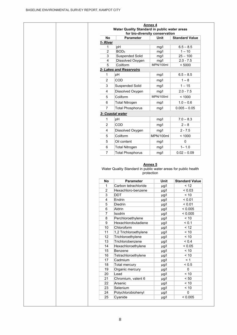
BASELINE ENVIRONMENTAL SURVEY REPORT, KAMPOT CITY
8
Annex 4 Water Quality Standard in public water areas
for bio-diversity conservation No Parameter Unit Standard Value
1- River
1 pH mg/l 6.5 – 8.5 2 BOD5 mg/l 1 – 10 3 Suspended Solid mg/l 25 – 100 4 Dissolved Oxygen mg/l 2.0 - 7.5 5 Coliform MPN/100ml < 5000
2- Lakes and Reservoirs
1 pH mg/l 6.5 – 8.5
2 COD mg/l 1 – 8
3 Suspended Solid mg/l 1 – 15
4 Dissolved Oxygen mg/l 2.0 - 7.5
5 Coliform MPN/100ml < 1000
6 Total Nitrogen mg/l 1.0 – 0.6
7 Total Phosphorus mg/l 0.005 – 0.05
3- Coastal water
1 pH mg/l 7.0 – 8.3
2 COD mg/l 2 – 8
4 Dissolved Oxygen mg/l 2 - 7.5
5 Coliform MPN/100ml < 1000
5 Oil content mg/l 0
6 Total Nitrogen mg/l 1– 1.0
7 Total Phosphorus mg/l 0.02 – 0.09
Annex 5
Water Quality Standard in public water areas for public health protection
No Parameter Unit Standard Value
1 Carbon tetrachloride µg/l < 12
2 Hexachloro-benzene µg/l < 0.03
3 DDT µg/l < 10
4 Endrin µg/l < 0.01
5 Diedrin µg/l < 0.01
6 Aldrin µg/l < 0.005
7 Isodrin µg/l < 0.005
8 Perchloroethylene µg/l < 10
9 Hexachlorobutadiene µg/l < 0.1
10 Chloroform µg/l < 12
11 1,2 Trichloroethylene µg/l < 10
12 Trichloroethylene µg/l < 10
13 Trichlorobenzene µg/l < 0.4
14 Hexachloroethylene µg/l < 0.05
15 Benzene µg/l < 10
16 Tetrachloroethylene µg/l < 10
17 Cadmium µg/l < 1
18 Total mercury µg/l < 0.5
19 Organic mercury µg/l 0
20 Lead µg/l < 10
21 Chromium, valent 6 µg/l < 50
22 Arsenic µg/l < 10
23 Selenium µg/l < 10
24 Polychlorobiohenyl µg/l 0
25 Cyanide µg/l < 0.005
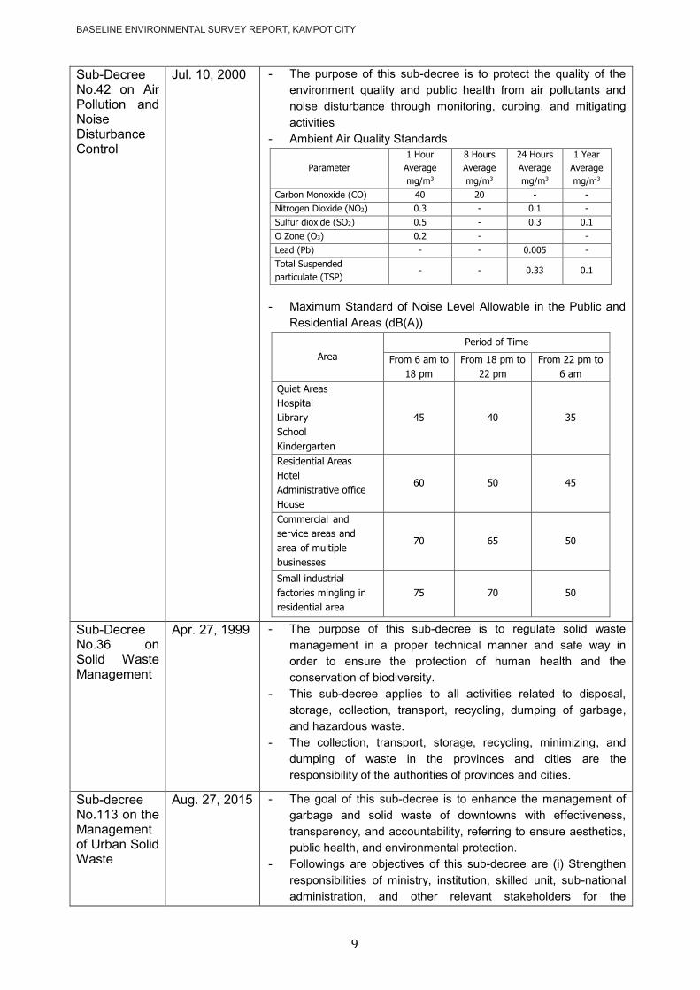
BASELINE ENVIRONMENTAL SURVEY REPORT, KAMPOT CITY
9
Sub-Decree No.42 on Air Pollution and Noise Disturbance Control
Jul. 10, 2000 - The purpose of this sub-decree is to protect the quality of the
environment quality and public health from air pollutants and
noise disturbance through monitoring, curbing, and mitigating
activities
- Ambient Air Quality Standards
- Maximum Standard of Noise Level Allowable in the Public and
Residential Areas (dB(A))
Sub-Decree No.36 on Solid Waste Management
Apr. 27, 1999 - The purpose of this sub-decree is to regulate solid waste
management in a proper technical manner and safe way in
order to ensure the protection of human health and the
conservation of biodiversity.
- This sub-decree applies to all activities related to disposal,
storage, collection, transport, recycling, dumping of garbage,
and hazardous waste.
- The collection, transport, storage, recycling, minimizing, and
dumping of waste in the provinces and cities are the
responsibility of the authorities of provinces and cities.
Sub-decree No.113 on the Management of Urban Solid Waste
Aug. 27, 2015 - The goal of this sub-decree is to enhance the management of
garbage and solid waste of downtowns with effectiveness,
transparency, and accountability, referring to ensure aesthetics,
public health, and environmental protection.
- Followings are objectives of this sub-decree are (i) Strengthen
responsibilities of ministry, institution, skilled unit, sub-national
administration, and other relevant stakeholders for the
Parameter
1 Hour
Average
mg/m3
8 Hours
Average
mg/m3
24 Hours
Average
mg/m3
1 Year
Average
mg/m3
Carbon Monoxide (CO) 40 20 - -
Nitrogen Dioxide (NO2) 0.3 - 0.1 -
Sulfur dioxide (SO2) 0.5 - 0.3 0.1
O Zone (O3) 0.2 - -
Lead (Pb) - - 0.005 -
Total Suspended
particulate (TSP) - - 0.33 0.1
Area
Period of Time
From 6 am to
18 pm
From 18 pm to
22 pm
From 22 pm to
6 am
Quiet Areas
Hospital
Library
School
Kindergarten
45 40 35
Residential Areas
Hotel
Administrative office
House
60 50 45
Commercial and
service areas and
area of multiple
businesses
70 65 50
Small industrial
factories mingling in
residential area
75 70 50
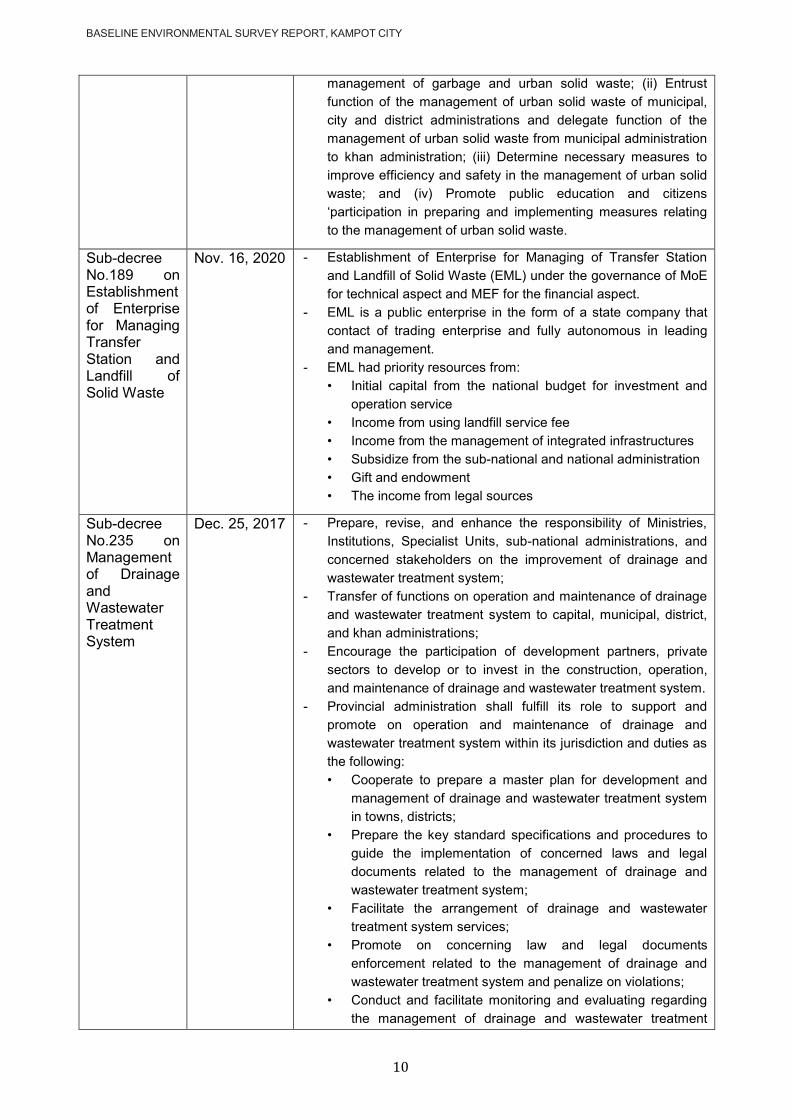
BASELINE ENVIRONMENTAL SURVEY REPORT, KAMPOT CITY
10
management of garbage and urban solid waste; (ii) Entrust
function of the management of urban solid waste of municipal,
city and district administrations and delegate function of the
management of urban solid waste from municipal administration
to khan administration; (iii) Determine necessary measures to
improve efficiency and safety in the management of urban solid
waste; and (iv) Promote public education and citizens
‗participation in preparing and implementing measures relating to the management of urban solid waste.
Sub-decree No.189 on Establishment of Enterprise for Managing Transfer Station and Landfill of Solid Waste
Nov. 16, 2020 - Establishment of Enterprise for Managing of Transfer Station
and Landfill of Solid Waste (EML) under the governance of MoE
for technical aspect and MEF for the financial aspect.
- EML is a public enterprise in the form of a state company that
contact of trading enterprise and fully autonomous in leading
and management.
- EML had priority resources from:
• Initial capital from the national budget for investment and
operation service
• Income from using landfill service fee
• Income from the management of integrated infrastructures
• Subsidize from the sub-national and national administration
• Gift and endowment
• The income from legal sources
Sub-decree No.235 on Management of Drainage and Wastewater Treatment System
Dec. 25, 2017 - Prepare, revise, and enhance the responsibility of Ministries,
Institutions, Specialist Units, sub-national administrations, and
concerned stakeholders on the improvement of drainage and
wastewater treatment system;
- Transfer of functions on operation and maintenance of drainage
and wastewater treatment system to capital, municipal, district,
and khan administrations;
- Encourage the participation of development partners, private
sectors to develop or to invest in the construction, operation,
and maintenance of drainage and wastewater treatment system.
- Provincial administration shall fulfill its role to support and
promote on operation and maintenance of drainage and
wastewater treatment system within its jurisdiction and duties as
the following:
• Cooperate to prepare a master plan for development and
management of drainage and wastewater treatment system
in towns, districts;
• Prepare the key standard specifications and procedures to
guide the implementation of concerned laws and legal
documents related to the management of drainage and
wastewater treatment system;
• Facilitate the arrangement of drainage and wastewater
treatment system services;
• Promote on concerning law and legal documents
enforcement related to the management of drainage and
wastewater treatment system and penalize on violations;
• Conduct and facilitate monitoring and evaluating regarding
the management of drainage and wastewater treatment
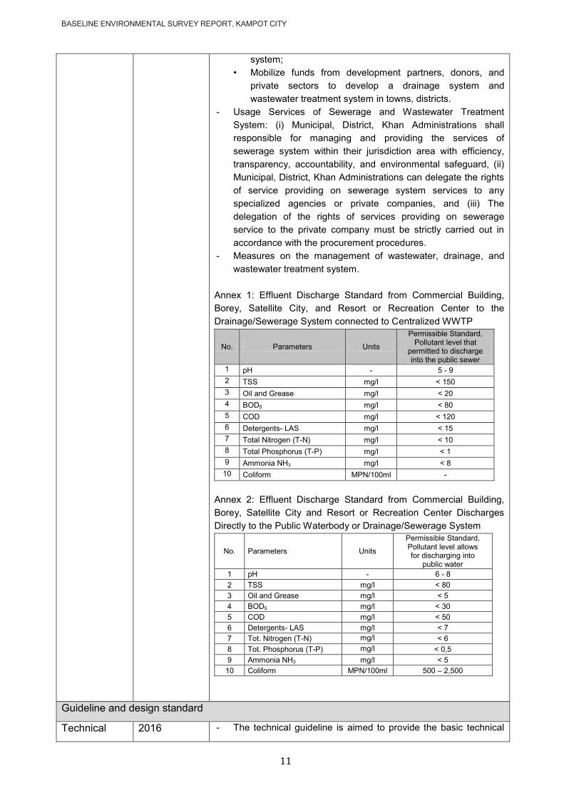
BASELINE ENVIRONMENTAL SURVEY REPORT, KAMPOT CITY
11
system;
• Mobilize funds from development partners, donors, and
private sectors to develop a drainage system and
wastewater treatment system in towns, districts.
- Usage Services of Sewerage and Wastewater Treatment
System: (i) Municipal, District, Khan Administrations shall
responsible for managing and providing the services of
sewerage system within their jurisdiction area with efficiency,
transparency, accountability, and environmental safeguard, (ii)
Municipal, District, Khan Administrations can delegate the rights
of service providing on sewerage system services to any
specialized agencies or private companies, and (iii) The
delegation of the rights of services providing on sewerage
service to the private company must be strictly carried out in
accordance with the procurement procedures.
- Measures on the management of wastewater, drainage, and
wastewater treatment system.
Annex 1: Effluent Discharge Standard from Commercial Building,
Borey, Satellite City, and Resort or Recreation Center to the
Drainage/Sewerage System connected to Centralized WWTP
No. Parameters Units
Permissible Standard, Pollutant level that
permitted to discharge into the public sewer
1 pH - 5 - 9
2 TSS mg/l < 150
3 Oil and Grease mg/l < 20
4 BOD5 mg/l < 80
5 COD mg/l < 120
6 Detergents- LAS mg/l < 15
7 Total Nitrogen (T-N) mg/l < 10
8 Total Phosphorus (T-P) mg/l < 1
9 Ammonia NH3 mg/l < 8
10 Coliform MPN/100ml -
Annex 2: Effluent Discharge Standard from Commercial Building,
Borey, Satellite City and Resort or Recreation Center Discharges
Directly to the Public Waterbody or Drainage/Sewerage System
No. Parameters Units
Permissible Standard, Pollutant level allows for discharging into
public water
1 pH - 6 - 8
2 TSS mg/l < 80
3 Oil and Grease mg/l < 5
4 BOD5 mg/l < 30
5 COD mg/l < 50
6 Detergents- LAS mg/l < 7
7 Tot. Nitrogen (T-N) mg/l < 6
8 Tot. Phosphorus (T-P) mg/l < 0,5
9 Ammonia NH3 mg/l < 5
10 Coliform MPN/100ml 500 – 2,500
Guideline and design standard
Technical 2016 - The technical guideline is aimed to provide the basic technical
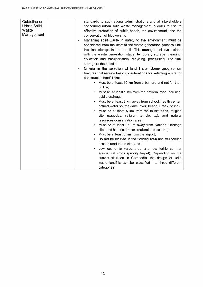
BASELINE ENVIRONMENTAL SURVEY REPORT, KAMPOT CITY
12
Guideline on Urban Solid Waste Management
standards to sub-national administrations and all stakeholders
concerning urban solid waste management in order to ensure
effective protection of public health, the environment, and the
conservation of biodiversity.
- Managing solid waste in safety to the environment must be
considered from the start of the waste generation process until
the final storage in the landfill. This management cycle starts
with the waste generation stage, temporary storage, cleaning,
collection and transportation, recycling, processing, and final
storage at the landfill.
- Criteria in the selection of landfill site: Some geographical
features that require basic considerations for selecting a site for
construction landfill are:
• Must be at least 10 km from urban are and not far than
50 km;
• Must be at least 1 km from the national road, housing,
public drainage;
• Must be at least 3 km away from school, health center,
natural water source (lake, river, beach, Praek, stung);
• Must be at least 5 km from the tourist sites, religion
site (pagodas, religion temple, ...), and natural
resources conservation area;
• Must be at least 15 km away from National Heritage
sites and historical resort (natural and cultural);
• Must be at least 8 km from the airport;
• Do not be located in the flooded area and year-round
access road to the site; and
• Low economic value area and low fertile soil for
agricultural crops (priority target). Depending on the
current situation in Cambodia, the design of solid
waste landfills can be classified into three different
categories

BASELINE ENVIRONMENTAL SURVEY REPORT, KAMPOT CITY
13
PROJECT DESCRIPTION
The project aims to improve the population‘s access to urban infrastructure through components:
(i) Improved wastewater management systems (pumping stations, network, and
treatment plants)
(ii) Improved drainage system to manage stormwater flow
The sub-project component for Kampot city are the following:
3.1 Wastewater
- 50km of network
- 2 pumping stations
- 7.5km of force main
Figure 3.1-1: Wastewater collection and treatment subproject in Kampot city
Note: ―C1PS‖ and ―CMPS‖ are two pumping stations forming part of the GMS2 project. (Source: Egis Oct.2020)
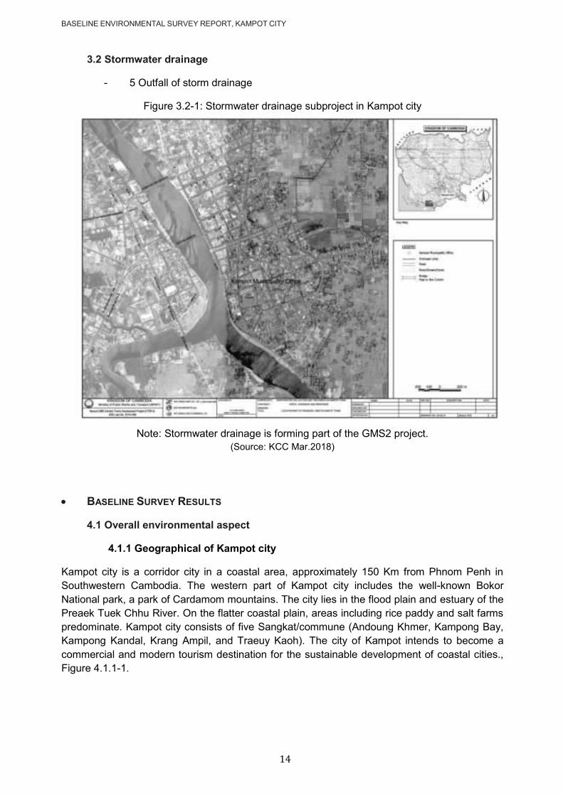
BASELINE ENVIRONMENTAL SURVEY REPORT, KAMPOT CITY
14
3.2 Stormwater drainage
- 5 Outfall of storm drainage
Figure 3.2-1: Stormwater drainage subproject in Kampot city
Note: Stormwater drainage is forming part of the GMS2 project.
(Source: KCC Mar.2018)
BASELINE SURVEY RESULTS
4.1 Overall environmental aspect
4.1.1 Geographical of Kampot city
Kampot city is a corridor city in a coastal area, approximately 150 Km from Phnom Penh in
Southwestern Cambodia. The western part of Kampot city includes the well-known Bokor
National park, a park of Cardamom mountains. The city lies in the flood plain and estuary of the
Preaek Tuek Chhu River. On the flatter coastal plain, areas including rice paddy and salt farms
predominate. Kampot city consists of five Sangkat/commune (Andoung Khmer, Kampong Bay,
Kampong Kandal, Krang Ampil, and Traeuy Kaoh). The city of Kampot intends to become a
commercial and modern tourism destination for the sustainable development of coastal cities.,
Figure 4.1.1-1.
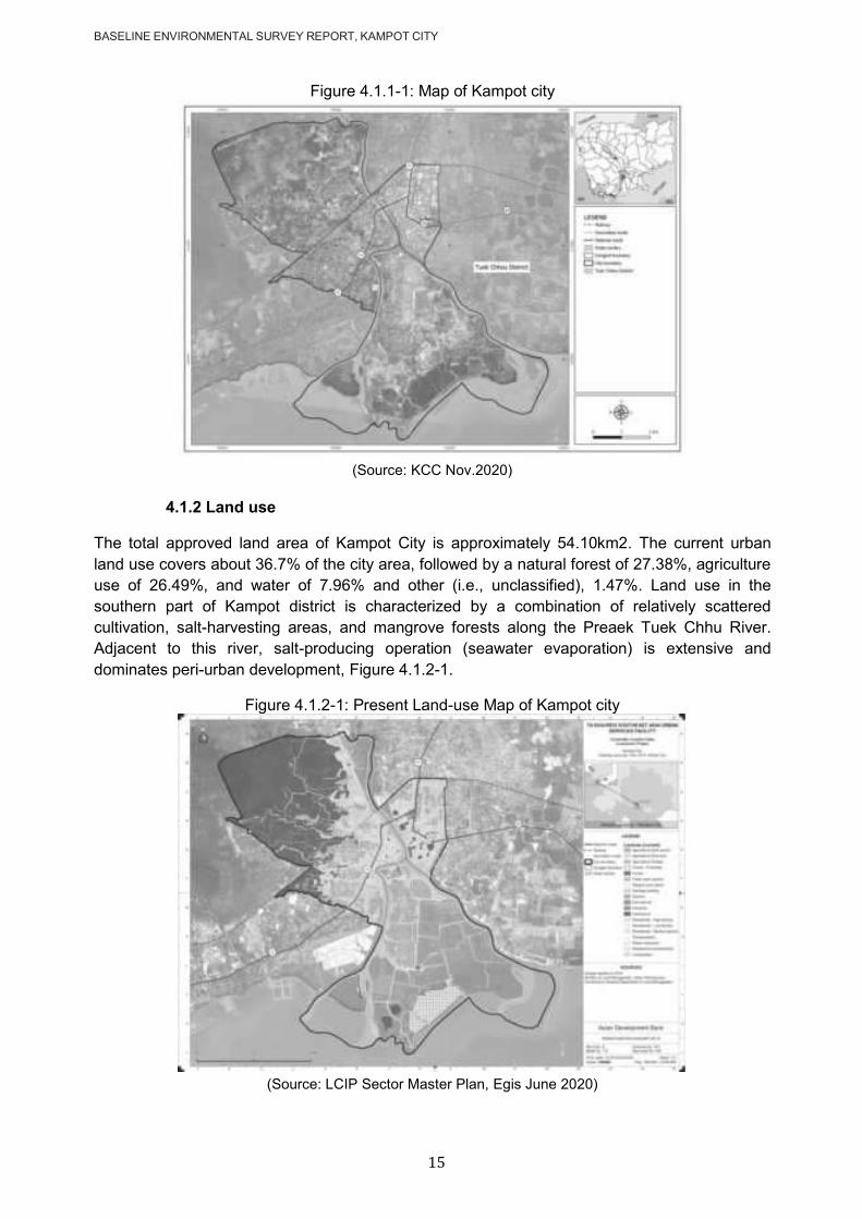
BASELINE ENVIRONMENTAL SURVEY REPORT, KAMPOT CITY
15
Figure 4.1.1-1: Map of Kampot city
(Source: KCC Nov.2020)
4.1.2 Land use
The total approved land area of Kampot City is approximately 54.10km2. The current urban
land use covers about 36.7% of the city area, followed by a natural forest of 27.38%, agriculture
use of 26.49%, and water of 7.96% and other (i.e., unclassified), 1.47%. Land use in the
southern part of Kampot district is characterized by a combination of relatively scattered
cultivation, salt-harvesting areas, and mangrove forests along the Preaek Tuek Chhu River.
Adjacent to this river, salt-producing operation (seawater evaporation) is extensive and
dominates peri-urban development, Figure 4.1.2-1.
Figure 4.1.2-1: Present Land-use Map of Kampot city
(Source: LCIP Sector Master Plan, Egis June 2020)
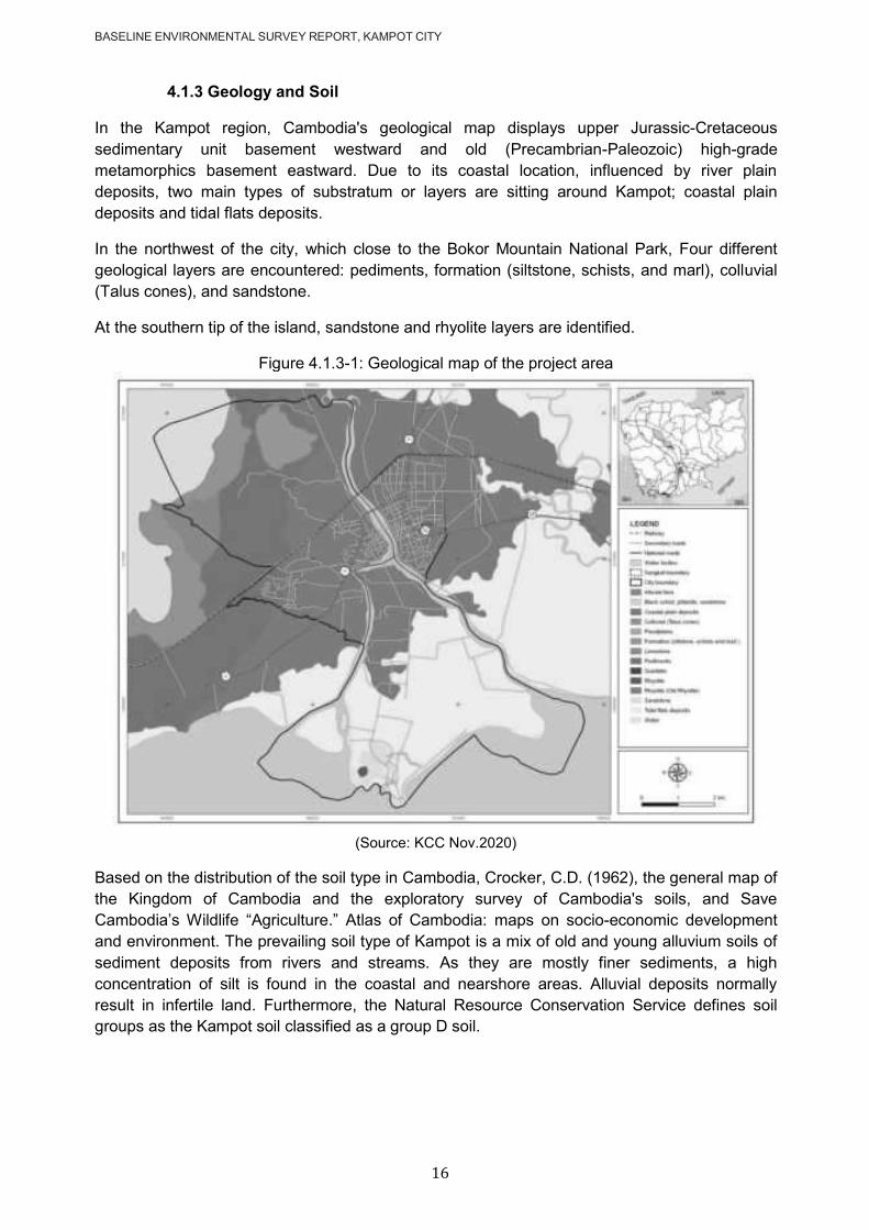
BASELINE ENVIRONMENTAL SURVEY REPORT, KAMPOT CITY
16
4.1.3 Geology and Soil
In the Kampot region, Cambodia's geological map displays upper Jurassic-Cretaceous
sedimentary unit basement westward and old (Precambrian-Paleozoic) high-grade
metamorphics basement eastward. Due to its coastal location, influenced by river plain
deposits, two main types of substratum or layers are sitting around Kampot; coastal plain
deposits and tidal flats deposits.
In the northwest of the city, which close to the Bokor Mountain National Park, Four different
geological layers are encountered: pediments, formation (siltstone, schists, and marl), colluvial
(Talus cones), and sandstone.
At the southern tip of the island, sandstone and rhyolite layers are identified.
Figure 4.1.3-1: Geological map of the project area
(Source: KCC Nov.2020)
Based on the distribution of the soil type in Cambodia, Crocker, C.D. (1962), the general map of
the Kingdom of Cambodia and the exploratory survey of Cambodia's soils, and Save
Cambodia‘s Wildlife ―Agriculture.‖ Atlas of Cambodia: maps on socio-economic development
and environment. The prevailing soil type of Kampot is a mix of old and young alluvium soils of
sediment deposits from rivers and streams. As they are mostly finer sediments, a high
concentration of silt is found in the coastal and nearshore areas. Alluvial deposits normally
result in infertile land. Furthermore, the Natural Resource Conservation Service defines soil
groups as the Kampot soil classified as a group D soil.
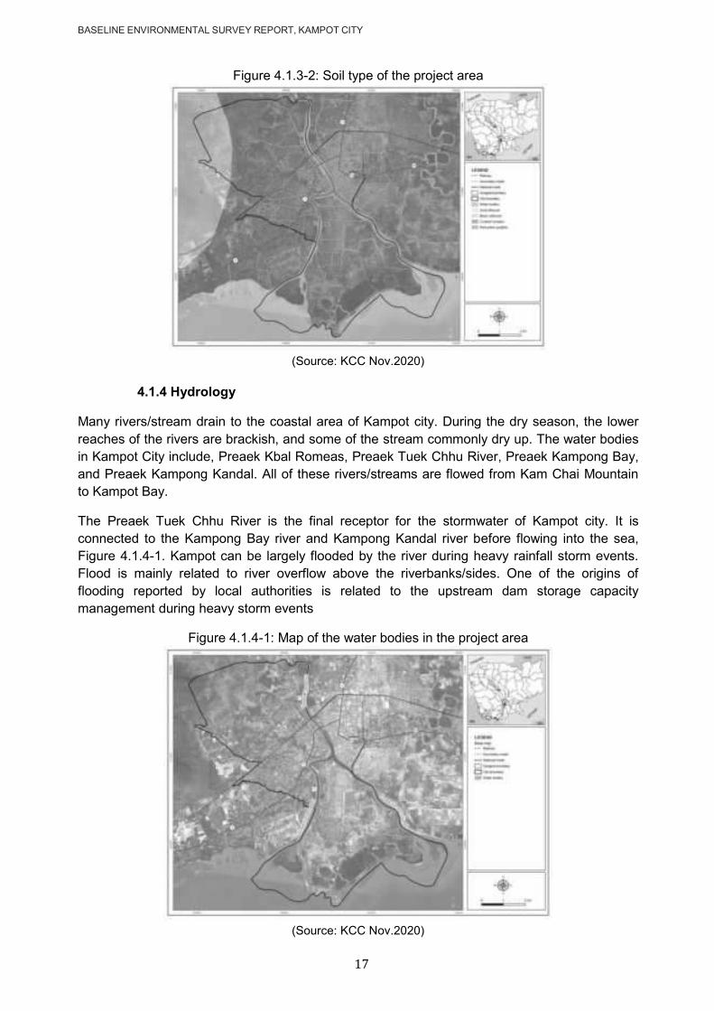
BASELINE ENVIRONMENTAL SURVEY REPORT, KAMPOT CITY
17
Figure 4.1.3-2: Soil type of the project area
(Source: KCC Nov.2020)
4.1.4 Hydrology
Many rivers/stream drain to the coastal area of Kampot city. During the dry season, the lower
reaches of the rivers are brackish, and some of the stream commonly dry up. The water bodies
in Kampot City include, Preaek Kbal Romeas, Preaek Tuek Chhu River, Preaek Kampong Bay,
and Preaek Kampong Kandal. All of these rivers/streams are flowed from Kam Chai Mountain
to Kampot Bay.
The Preaek Tuek Chhu River is the final receptor for the stormwater of Kampot city. It is
connected to the Kampong Bay river and Kampong Kandal river before flowing into the sea,
Figure 4.1.4-1. Kampot can be largely flooded by the river during heavy rainfall storm events.
Flood is mainly related to river overflow above the riverbanks/sides. One of the origins of
flooding reported by local authorities is related to the upstream dam storage capacity
management during heavy storm events
Figure 4.1.4-1: Map of the water bodies in the project area
(Source: KCC Nov.2020)

BASELINE ENVIRONMENTAL SURVEY REPORT, KAMPOT CITY
18
4.1.5 Protection area
There is one protected ecological area close to Kampot City: the Bokor National Park (BNP),
located approximately 25km northwest of the city. BNP covers a total area of 140,000 ha. It is
estimated that 97% of the land cover is natural or semi-natural, and 3% is transformed.
The park is situated on a sandstone massif, which is the only high mountain on the coast, rising
to an altitude of more than 1,000m. It contains a wide range of habitats, including both low- and
medium-altitude vegetation and numerous waterfalls. The park provides habitat for a number of
internationally endangered species, including tigers, leopards, Asian elephants, gaurs, Sun
bears, pileated gibbons, hornbills, and a wide range of fauna of conservation significance,
including peafowls and a number of hornbill species. Inside of the Bokor National Park is
located Important Bird Areas (IBA). Two hundred twenty-three bird species have been recorded
in the park, of which six are globally significant, 13 are regionally significant, and 12 were the
first ever recorded in the country. The area is characterized by high rainfall. BNP is a valuable
source of water for Kampot City. Its high plateaus and ranges of the mountain form an important
watershed and provide a catchment area for several rivers. These rivers provide domestic and
industrial water supplies for Kampot city and other towns; they also feed small-scale and
commercial irrigation developments and sustain downstream fisheries. Hydro-electric facilities
utilizing the rivers whose headwaters lie in the protected areas have been established in the
park.
Table 4.1.5-1: List of protected areas in Cambodia
Kind of Protected Areas
Name of Protected Areas Location of Protected Areas Size
(Hectare)
1. National Park
1. Preah Soramrith Kosomak ―Kirirom.‖ Kampong Speu & Koh Kong 35
2. Preah Monivong ―Bokor.‖
Kamport, Kampong Speu, Koh Kong & Krong Preah Sihanouk
140
3. Preah Sihanouk ―Ream ―Krong Preah Sihanouk‖ 21
4. Preah Chey Varaman- Norodom ―Phnom Kulen‖ Siem Reap 37.5
5. Virakchey Rottanak Kiri & Stung Treng 332.5
6. Kep Krong Kep 5
7. Botum-Sakor Koh Kong 171.25
2. wildlife sanctuary
1. Phnom Aural Kampong Speu, Pursat, & Kampong Chhnang
253.75
2. Phnom Samkos Pursat, Battambang, & Koh Kong 333.75
3. Lompart Rottanak Kiri & Mondul Kiri 250
4. Phnom Prich Mondul Kiri 222.5
5. Snuol Kratie & Mondul Kiri 75
6. Boeng Per Kampong Thom, Preah Vihear, Siem Reap
242.5
7. Peam Krosop Koh Kong 23.75
8. Roniem Daun Sam Battambang & Banteay Meanchey 40.021
9. Kulen-Prum Tep Preah Vihear, Siem Reap, & Oddar Meanchey
402.5
10. Phnom Narm Lear Mondul Kiri 47.5
3. Protected Landscape
1. Angkor Siem Reap 10.8
2. Preah Vihear Preah Vihear 5
3. Banteay Chhmar Bantey Meanchey & Oddar Meanchey 81.2
4. Multiple Use Site
1. Dong Peng Koh Kong 27.7 2. Samlaut Pailin & Battambang 60
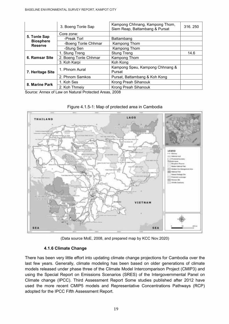
BASELINE ENVIRONMENTAL SURVEY REPORT, KAMPOT CITY
19
3. Boeng Tonle Sap Kampong Chhnang, Kampong Thom, Siem Reap, Battambang & Pursat
316. 250
5. Tonle Sap Biosphere Reserve
Core zone:
-Preak Torl Battambang
-Boeng Tonle Chhmar Kampong Thom
-Stung Sen Kampong Thom
6. Ramsar Site
1. Stung Treng Stung Treng 14.6
2. Boeng Tonle Chhmar Kampong Thom
3. Koh Karpi Koh Kong
7. Heritage Site 1. Phnom Aural
Kampong Speu, Kampong Chhnang & Pursat
2. Phnom Samkos Pursat, Battambang & Koh Kong
8. Marine Park 1. Koh Ses Krong Preah Sihanouk
2. Koh Thmeiy Krong Preah Sihanouk
Source: Annex of Law on Natural Protected Areas, 2008
Figure 4.1.5-1: Map of protected area in Cambodia
(Data source MoE, 2008, and prepared map by KCC Nov.2020)
4.1.6 Climate Change
There has been very little effort into updating climate change projections for Cambodia over the
last few years. Generally, climate modeling has been based on older generations of climate
models released under phase three of the Climate Model Intercomparison Project (CMIP3) and
using the Special Report on Emissions Scenarios (SRES) of the Intergovernmental Panel on
Climate change (IPCC). Third Assessment Report Some studies published after 2012 have
used the more recent CMIP5 models and Representative Concentrations Pathways (RCP)
adopted for the IPCC Fifth Assessment Report.

BASELINE ENVIRONMENTAL SURVEY REPORT, KAMPOT CITY
20
Temperature: The average annual temperature is projected to increase by 0.9°C by 2030, by
2.1°C by 2050, and by 3.4°C by the end of the century. The number of days above 35°C is
projected to increase from 2-3 days per year to over ten days per year. The projected increase
in temperature and number of hot days will potentially put added stress on project components.
Water demand may increase, and evaporation from water storage will increase. While there is
no projected change in drought, it will continue to put stress on water supplies. Any diversion of
water to irrigation from the source in order to cope with the increased soil moisture deficit will
also reduce the available water for urban use in the future.
Rainfall: With regards to the projected change in rainfall, the emission of scenarios A2 of the
climate models project is increasing. Moreover, there is a growing level of consistency between
global climate models that, on a global basis, the frequency of tropical cyclones is likely to
decrease by the end of the 21st century, but each event will bring more rain. Extreme rainfall
will result from tropical depressions crossing into Cambodia from typhoons landing in Vietnam.
Studies of the North West Pacific region off the coast of Vietnam project an increase in typhoon
strength of around 5% by 2050. This increased strength will also occur for the tropical
depressions that form from the degrading typhoons over Cambodia. The modeling indicates
that by 2050, events with a 5-year return interval will increase in intensity by 8% (B2) to 9% (A2)
and that a 1 in a 100 extreme rainfall event will increase in intensity by 10 – 11% (B2 and A2
respectively). For the long-term horizon (2050), the maximum one-day rainfall intensity is
predicted to be larger. An increase of 5% has been applied to all the rainfall intensities.
Tyhoon: Typhoons making landfall on the coast of Vietnam often impact Cambodia as a
tropical depression and can bring widespread heavy rainfall. There is a growing level of
consistency between global climate models that, on a global basis, the frequency of tropical
cyclones is likely to decrease by the end of the 21st century. A Commonwealth Scientific and
Industrial Research Organisation (CSIRO) report found that there will be a decrease in tropical
cyclone formation off the coast of Vietnam. This is consistent with the previous study by a
recent study by Chand et al. 20163. There is also a general agreement between models that the
trade-off to the decrease in frequency is an increase in the intensity of wind speeds of
1.3m/s4and an increase in rainfall rates of the order of 20% within 100km of the cyclone center5.
This indicates that extreme rainfall events that result from tropical depressions crossing
Cambodia will decrease in frequency, but each event will bring more rain.
Sea Level: Sea Level Rise (SLR) scenarios for the west coast of Vietnam under the low,
medium and high scenarios are outlined in the table below. By the end of the 21st century, sea
level is projected to rise to 63cm (low scenario), 70cm (medium scenario), and 88cm (high
scenario) compared with 1980-1999. The recommended sea level rise value to use for
hydrological modeling is the high CO2 scenario A1F1, which is 32cm for the period centered on
2050. The southern coastline of Kampot city is exposed to sea-level rise.
Kampot Province indicates stronger winds, higher waves, and an increase in the frequency of
storms. Storms, water temperature increases, heavy rainfall, and sea-level rise. Under the high
emissions scenario, the rainy season will start later, wet season rainfall will increase (bringing
more flooding), and dry season rainfall will decrease. Under a low emissions scenario, the
probability is lower, but the trends are similar. As a result, widespread flooding from typhoons
and other large tropical storm systems occurs across the Province in the wet season. However,
3 Chand, S.; Tory, K.; Ye, H. & Walsh, K. (2016), 'Projected increase in El Niño-driven tropical cyclone frequency in the Pacific',
Nature Climate Change 7. 4 Kang, N.-Y., and J.B. Elsner. 2015. Trade-off between intensity and frequency of global tropical cyclones. Nature Climate Change.
5 Knutson, T.R., McBride, J.L., Chan, J., Emanuel, K., Holland, G., Landsea, C., Held, I., Kossin, J.P., Srivastava, A.K., and Sugi,
M., (2010), Tropical cyclones and climate change: Nature Geoscience, v. 3, p. 157-163.

BASELINE ENVIRONMENTAL SURVEY REPORT, KAMPOT CITY
21
the major cause of flooding around the city is no natural drainage combined with inadequate
drainage that cannot deal with intense rainfall events exacerbated by obstruction of flows due to
poor road design or other anthropogenic activities and interventions.
4.1.7 Existing Network Facilities
Road network
The Ministry of Public Works and Transport (MPWT) is the main responsible agency for the
provision of roads and transport infrastructure.
Kampot is accessible by rail and by road through the National Road NR 3 and NR 33. It is one
of the few destinations of the train service that runs from Phnom Penh via Takeo and Kampot,
terminating in Sihanoukville. Water transport infrastructure consists of the Preaek Tuek Chhu
River Port and the Kampot International Port (under construction). The City is provided with a
total road length of 87,655m, of which 3.54km consists of concrete urban roads. Many of the
local road sections that need upgrading are under the City Government. Some of the transport
issues noted were: (i) congested city center with heavily loaded vehicle traffic but restricted road
networks; (ii) dispersed bus terminals scattered along major traffic-generating highways along
NR3; (iii) roads with weak or incomplete drainage structures resulting in flooding, especially
during the rainy season; (iv) absence of road signs and road markers along with some road
segments; (v) old bridges needing rehabilitation; V) old bridges requiring rehabilitation; vi) the
stability of the train infrastructure needs to be strengthened by deciding the travel timetable, and
vii) the non-compliance of road users with traffic regulations.
Figure 4.1.7-1: The road network in Kampot city
Old bridges across Preaek Tuek Chhu National Road No.3
Road in the city (Road No735) National Road No.33
(Source: KCC Sep.2020)
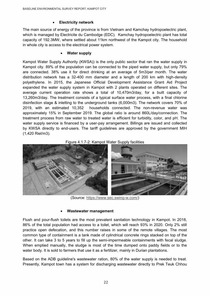
BASELINE ENVIRONMENTAL SURVEY REPORT, KAMPOT CITY
22
Electricity network
The main source of energy of the province is from Vietnam and Kamchay hydropoelectric plant,
which is managed by Electricite du Cambodge (EDC). Kamchay hydropoelectric plant has total
capacity of 192.3MW, where settled about 11km northwest of the Kampot city. The household
in whole city is access to the electrical power system.
Water supply
Kampot Water Supply Authority (KWSA)) is the only public sector that ran the water supply in
Kampot city. 89% of the population can be connected to the piped water supply, but only 79%
are connected. 38% use it for direct drinking at an average of 5m3/per month. The water
distribution network has a 32-400 mm diameter and a length of 200 km with high-density
polyethylene. In 2015, the Japanese Official Development Assistance Grant Aid Project
expanded the water supply system in Kampot with 2 plants operated on different sites. The
average current operation rate shows a total of 10,470m3/day, for a built capacity of
13,260m3/day. The treatment consists of a typical surface water process, with a final chlorine
disinfection stage & inletting to the underground tanks (6,000m3). The network covers 70% of
2019, with an estimated 10,352 households connected. The non-revenue water was
approximately 15% in September 2019. The global ratio is around 860L/day/connection. The
treatment process from raw water to treated water is efficient for turbidity, color, and pH. The
water supply service is financed by a user-pay arrangement. Billings are issued and collected
by KWSA directly to end-users. The tariff guidelines are approved by the government MIH
(1,420 Riel/m3).
Figure 4.1.7-2: Kampot Water Supply facilities
(Source: https://www.sec.swing-w.com/)
Wastewater management
Flush and pour-flush toilets are the most prevalent sanitation technology in Kampot. In 2018,
86% of the total population had access to a toilet, which will reach 93% in 2020. Only 2% still
practice open defecation, and this number raises in some of the remote villages. The most
common type of containment is a tank made of cylindrical concrete rings stacked on top of the
other. It can take 3 to 5 years to fill up the semi-impermeable containments with fecal sludge.
When emptied manually, the sludge is most of the time dumped onto paddy fields or to the
water body. It is sold to farmers that use it as a fertilizer, mainly in Durian plantations.
Based on the ADB guideline's wastewater ration, 80% of the water supply is needed to treat.
Presently, Kampot town has a system for discharging wastewater directly to Prek Teuk Chhou
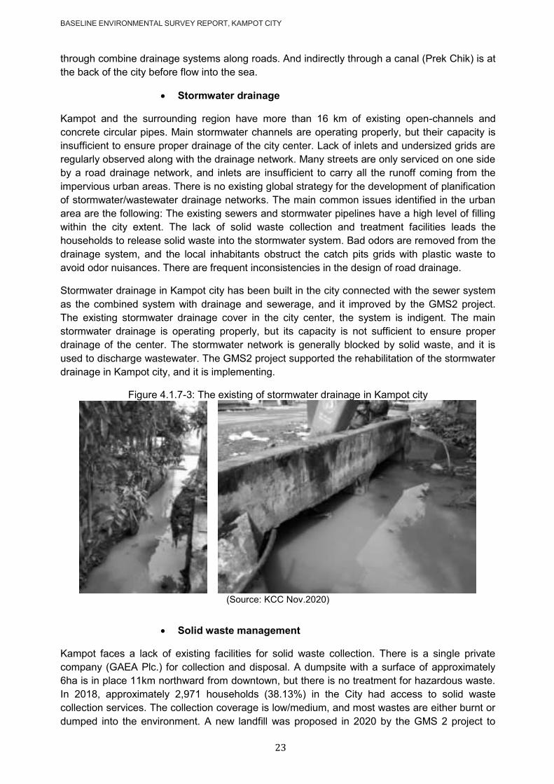
BASELINE ENVIRONMENTAL SURVEY REPORT, KAMPOT CITY
23
through combine drainage systems along roads. And indirectly through a canal (Prek Chik) is at
the back of the city before flow into the sea.
Stormwater drainage
Kampot and the surrounding region have more than 16 km of existing open-channels and
concrete circular pipes. Main stormwater channels are operating properly, but their capacity is
insufficient to ensure proper drainage of the city center. Lack of inlets and undersized grids are
regularly observed along with the drainage network. Many streets are only serviced on one side
by a road drainage network, and inlets are insufficient to carry all the runoff coming from the
impervious urban areas. There is no existing global strategy for the development of planification
of stormwater/wastewater drainage networks. The main common issues identified in the urban
area are the following: The existing sewers and stormwater pipelines have a high level of filling
within the city extent. The lack of solid waste collection and treatment facilities leads the
households to release solid waste into the stormwater system. Bad odors are removed from the
drainage system, and the local inhabitants obstruct the catch pits grids with plastic waste to
avoid odor nuisances. There are frequent inconsistencies in the design of road drainage.
Stormwater drainage in Kampot city has been built in the city connected with the sewer system
as the combined system with drainage and sewerage, and it improved by the GMS2 project.
The existing stormwater drainage cover in the city center, the system is indigent. The main
stormwater drainage is operating properly, but its capacity is not sufficient to ensure proper
drainage of the center. The stormwater network is generally blocked by solid waste, and it is
used to discharge wastewater. The GMS2 project supported the rehabilitation of the stormwater
drainage in Kampot city, and it is implementing.
Figure 4.1.7-3: The existing of stormwater drainage in Kampot city
(Source: KCC Nov.2020)
Solid waste management
Kampot faces a lack of existing facilities for solid waste collection. There is a single private
company (GAEA Plc.) for collection and disposal. A dumpsite with a surface of approximately
6ha is in place 11km northward from downtown, but there is no treatment for hazardous waste.
In 2018, approximately 2,971 households (38.13%) in the City had access to solid waste
collection services. The collection coverage is low/medium, and most wastes are either burnt or
dumped into the environment. A new landfill was proposed in 2020 by the GMS 2 project to

BASELINE ENVIRONMENTAL SURVEY REPORT, KAMPOT CITY
24
improve solid waste management in the Kampot area. The company is responsible for
collecting, transporting, and disposing of solid waste. GAEA is outsourced to the provincial
governor, but the MEF reviews and endorses the waste collection contract. The Ministry of
Environment (MOE) plays an important role in establishing guidelines on disposal, collection,
transport, storage, recycling, minimizing, and dumping household waste. A user-pay
arrangement finances the service. The tariff guidelines are in its contract and approved by the
government MOE.
Education facilities
According to Commune Database (CDB) 2018, 12 primary schools with 130 rooms, given 3,818
students and 146 teachers in the primary schools, students' ratio to teachers was 26:1. There
were also five secondary schools with 71 classrooms in Kampot city. With 1,413 students and
115 teachers in the secondary schools, the students' ratio to teachers was 12:1. In 2 public high
schools with 35 rooms, there were 72 teachers for 1,131 students, corresponding to a 16:1
ratio. These student-teacher ratios are below the international average ratio of 23:1, except for
the primary school level. There is no public university in Kampot city.
Health facilities
There is only one referral hospital, three health centers, and two private hospitals to provide
medical and health services in Kampot city. The total staff in health centers is 31 persons
consist of 6 beds only. One referral hospital and two private hospitals will provide180 beds to
patients. The key health strategy in the City 5-Year Development Plan pertains to access to
clean water and sanitation, citing that not all families have access to clean water supply
systems and sanitary toilets.
4.2 Characteristic of the project area
4.2.1 Wastewater Treatment Plant (WWTP)
The baseline survey for environmental resources (physical and biological) will be focus on the
proposed WWTP site within a 300m buffer area; see Figure 4.2.1-1. While the baseline survey
for social resources (village structure, land use, hydrology, and existing public facilities) and
protected area) will expanse to the whole territory of Sangkat or the city itself. The characteristic
in/adjacent of the proposed landfill site is described in the following points.
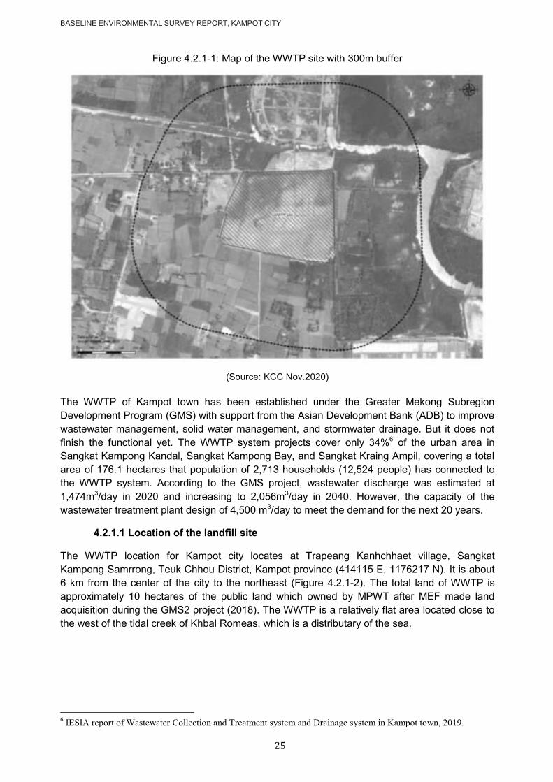
BASELINE ENVIRONMENTAL SURVEY REPORT, KAMPOT CITY
25
Figure 4.2.1-1: Map of the WWTP site with 300m buffer
(Source: KCC Nov.2020)
The WWTP of Kampot town has been established under the Greater Mekong Subregion
Development Program (GMS) with support from the Asian Development Bank (ADB) to improve
wastewater management, solid water management, and stormwater drainage. But it does not
finish the functional yet. The WWTP system projects cover only 34%6 of the urban area in
Sangkat Kampong Kandal, Sangkat Kampong Bay, and Sangkat Kraing Ampil, covering a total
area of 176.1 hectares that population of 2,713 households (12,524 people) has connected to
the WWTP system. According to the GMS project, wastewater discharge was estimated at
1,474m3/day in 2020 and increasing to 2,056m3/day in 2040. However, the capacity of the
wastewater treatment plant design of 4,500 m3/day to meet the demand for the next 20 years.
4.2.1.1 Location of the landfill site
The WWTP location for Kampot city locates at Trapeang Kanhchhaet village, Sangkat
Kampong Samrrong, Teuk Chhou District, Kampot province (414115 E, 1176217 N). It is about
6 km from the center of the city to the northeast (Figure 4.2.1-2). The total land of WWTP is
approximately 10 hectares of the public land which owned by MPWT after MEF made land
acquisition during the GMS2 project (2018). The WWTP is a relatively flat area located close to
the west of the tidal creek of Khbal Romeas, which is a distributary of the sea.
6 IESIA report of Wastewater Collection and Treatment system and Drainage system in Kampot town, 2019.
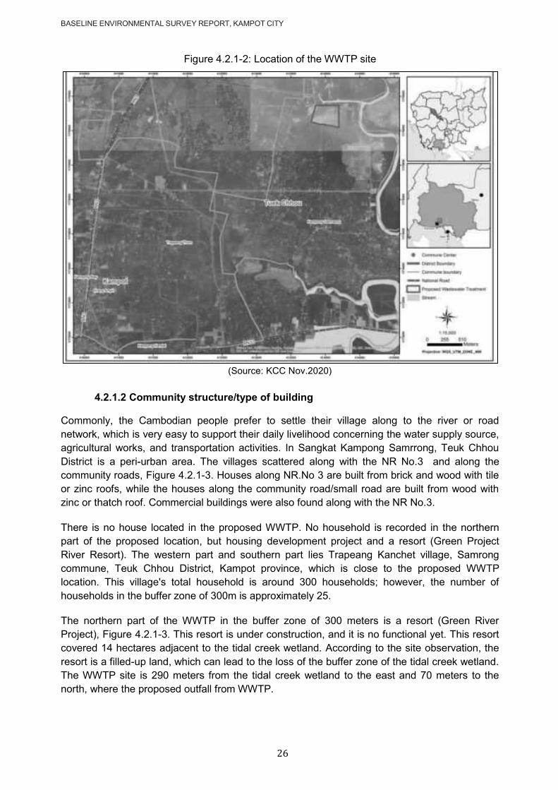
BASELINE ENVIRONMENTAL SURVEY REPORT, KAMPOT CITY
26
Figure 4.2.1-2: Location of the WWTP site
(Source: KCC Nov.2020)
4.2.1.2 Community structure/type of building
Commonly, the Cambodian people prefer to settle their village along to the river or road
network, which is very easy to support their daily livelihood concerning the water supply source,
agricultural works, and transportation activities. In Sangkat Kampong Samrrong, Teuk Chhou
District is a peri-urban area. The villages scattered along with the NR No.3 and along the
community roads, Figure 4.2.1-3. Houses along NR.No 3 are built from brick and wood with tile
or zinc roofs, while the houses along the community road/small road are built from wood with
zinc or thatch roof. Commercial buildings were also found along with the NR No.3.
There is no house located in the proposed WWTP. No household is recorded in the northern
part of the proposed location, but housing development project and a resort (Green Project
River Resort). The western part and southern part lies Trapeang Kanchet village, Samrong
commune, Teuk Chhou District, Kampot province, which is close to the proposed WWTP
location. This village's total household is around 300 households; however, the number of
households in the buffer zone of 300m is approximately 25.
The northern part of the WWTP in the buffer zone of 300 meters is a resort (Green River
Project), Figure 4.2.1-3. This resort is under construction, and it is no functional yet. This resort
covered 14 hectares adjacent to the tidal creek wetland. According to the site observation, the
resort is a filled-up land, which can lead to the loss of the buffer zone of the tidal creek wetland.
The WWTP site is 290 meters from the tidal creek wetland to the east and 70 meters to the
north, where the proposed outfall from WWTP.

BASELINE ENVIRONMENTAL SURVEY REPORT, KAMPOT CITY
27
Figure 4.2.1-3: Map of community structure close to the WWTP site
(Source: KCC Nov.2020)
4.2.1.3 Access road
The WWTP site is 3,150 m from the National Road No.3 (NR3) and starts from Prey Kum
Pagoda's entrance gate. It is a laterite road with 6 meters in width and good condition (Figure
4.2.1-4). There is no need for road rehabilitation; however, the project needs to improve the
proposed WWTP site's road.
Figure 4.2.1-4: Present condition of the access road
(Source: KCC field survey Sept.2020)
290m
70m
100m

BASELINE ENVIRONMENTAL SURVEY REPORT, KAMPOT CITY
28
4.2.1.4 Land use
There are four main forms of land use around the WWTP site: (i) residential area in the north-
west and northern, including a resort named Green River Project under construction, (ii)
agricultural area (rice field) in the southern, (iii) grassland mixed with the small tree area at
eastern and north-east, and (iv) water body (Preael Kbal Romeas), Figure 4.2.1-5. Beside
above mention abandon salty field found at the eastern part.
Based on interviewing with local community, it was informed that the WWTP site was previously
used as the salt farm in decades ago. It was no longer used for the past serval years. The
abandoned salt marsh was found on the east side of the Preaek Kbal Romeas too.
Figure 4.2.1-5: The land use type of the WWTP site in the buffer zone
The Green River Project at the northern part Grassland regeneration in the east
some melaleuca shrub at the north & east Trapeang Kanchet village at the north-west
(Source: KCC field survey Sept.2020)
4.2.1.5 Hydrology/river system
The water bodies presented adjacent to the WWTP site include Preaek Kbal Romeas and
Chinese Canal, Figure 4.2.1-6. Preaek Kbal Romeas is flowing from Kam Chai Mountain into
the sea. It is about 290m in the east and about 100m in the north of the WWTP site and flows to
the east through a long estuary downward to the south before ending up into the sea. The
Preaek Kbal Romeas is connected to the sea as it plays an important role in regulating water of
the natural inflow and outflow movement. The Chinese canal is an irrigation canal to end up in
the northern part of the WWTP with a distance of 100m from the site before flow into the Preaek
Kbal Romeas. This man-made canal is not only an irrigation canal but also is to evacuate
rainwater from the updtream of Kampot city. The total amount of freshwater discharged into the
Preaek Kbal Romeas is unknown.
It may not change the wetland's ecosystem during the rainy season since water in the wetland
turns to be a bit fresh due to the inflow of a large amount of water from rainfall and watershed. It
may cause problems during the dry season, especially when water in tidal creek recedes,
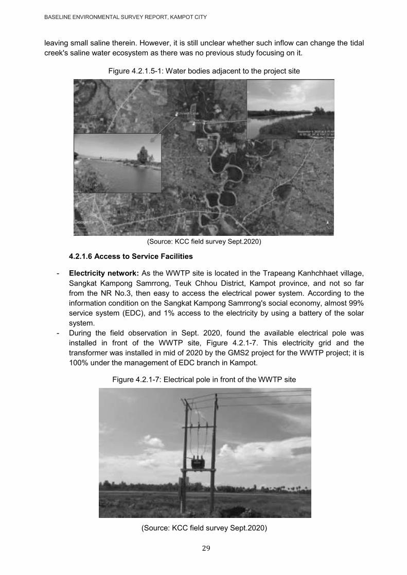
BASELINE ENVIRONMENTAL SURVEY REPORT, KAMPOT CITY
29
leaving small saline therein. However, it is still unclear whether such inflow can change the tidal
creek's saline water ecosystem as there was no previous study focusing on it.
Figure 4.2.1.5-1: Water bodies adjacent to the project site
(Source: KCC field survey Sept.2020)
4.2.1.6 Access to Service Facilities
- Electricity network: As the WWTP site is located in the Trapeang Kanhchhaet village,
Sangkat Kampong Samrrong, Teuk Chhou District, Kampot province, and not so far
from the NR No.3, then easy to access the electrical power system. According to the
information condition on the Sangkat Kampong Samrrong's social economy, almost 99%
service system (EDC), and 1% access to the electricity by using a battery of the solar
system.
- During the field observation in Sept. 2020, found the available electrical pole was
installed in front of the WWTP site, Figure 4.2.1-7. This electricity grid and the
transformer was installed in mid of 2020 by the GMS2 project for the WWTP project; it is
100% under the management of EDC branch in Kampot.
Figure 4.2.1-7: Electrical pole in front of the WWTP site
(Source: KCC field survey Sept.2020)

BASELINE ENVIRONMENTAL SURVEY REPORT, KAMPOT CITY
30
- Water supply network: Kampot Water Supply Unit (KWSU) is a public institution under
Dep. of Industry Science Technology and Innovation of MISTI. The system have
capacity of 13,260m3/day, and recently supplies to 14,457 customers in Kampot city and
some communes of Tuek Chhu district (source data obtained from KWSU, Dec. 2020).
The water source of KWS is Tek Chhou River, which originates in the Bokor Mountains.
The people who are living in the Kampot city served by the water supply system 100%,
while 73.3% of the people who are living in Tuek Chhu district accessed to the KWS
system.
- Within the 300m buffer to the WWTP site, there is no KWS system yet. The water supply
system is available in the community settled along with NR No3 and NR No33. The
WWTP site is about 3.15 km from the NR No3. The accessibility of bottled drinking water
is good in Kampot. Even in remote villages, 20L bottles can be found in small grocery
shops. Only 4% of the population have their borehole due to the low percentage of
drinking water produced from a groundwater source, and groundwater pollution presents
a low risk7.
- Solid waste management: In 2019, 40% in Kampot city and only 2% of Tuek Chhou
district households had access to the solid waste collection service in the commune
database. Kampong Samraong commune, where the WWTP site settled did not access
to the solid waste collection service. According to field observation in Sept. 2020,
people use to burn or bury their domestic waste in their land lot. Some plastic waste was
spread in open space in the community and further in the agricultural canal.
- Education facilities: In Kampong Samraong commune, there is one primary school
with 6 rooms with 386 students and 13 teachers, and one secondary school with five
rooms with 116 students and 12 teachers. However, all of these schools are far from the
proposed WWTP site (4.8 to 5.0km), Figure 4.2.1-8. There are no education facilities
settled within the buffer zone 300 meters of the proposed WWTP site.
7 SFD Manual, Volume 1 and 2, Version 2.0, July 2017.
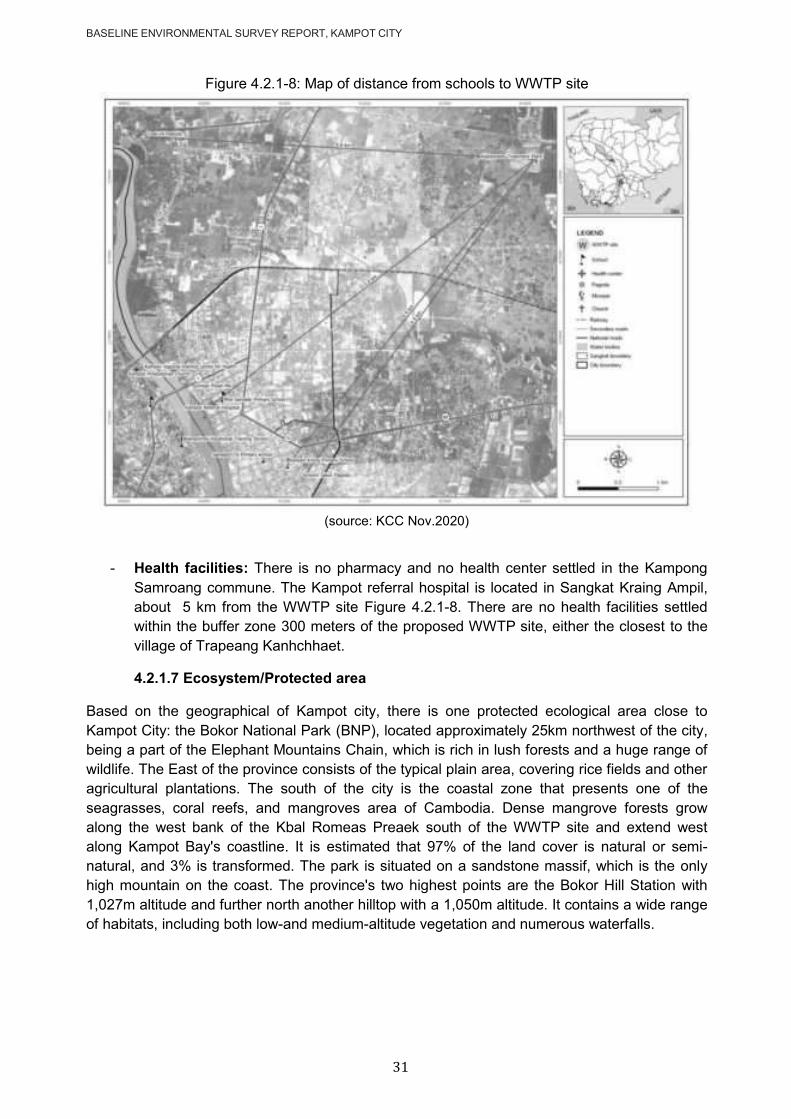
BASELINE ENVIRONMENTAL SURVEY REPORT, KAMPOT CITY
31
Figure 4.2.1-8: Map of distance from schools to WWTP site
(source: KCC Nov.2020)
- Health facilities: There is no pharmacy and no health center settled in the Kampong
Samroang commune. The Kampot referral hospital is located in Sangkat Kraing Ampil,
about 5 km from the WWTP site Figure 4.2.1-8. There are no health facilities settled
within the buffer zone 300 meters of the proposed WWTP site, either the closest to the
village of Trapeang Kanhchhaet.
4.2.1.7 Ecosystem/Protected area
Based on the geographical of Kampot city, there is one protected ecological area close to
Kampot City: the Bokor National Park (BNP), located approximately 25km northwest of the city,
being a part of the Elephant Mountains Chain, which is rich in lush forests and a huge range of
wildlife. The East of the province consists of the typical plain area, covering rice fields and other
agricultural plantations. The south of the city is the coastal zone that presents one of the
seagrasses, coral reefs, and mangroves area of Cambodia. Dense mangrove forests grow
along the west bank of the Kbal Romeas Preaek south of the WWTP site and extend west
along Kampot Bay's coastline. It is estimated that 97% of the land cover is natural or semi-
natural, and 3% is transformed. The park is situated on a sandstone massif, which is the only
high mountain on the coast. The province's two highest points are the Bokor Hill Station with
1,027m altitude and further north another hilltop with a 1,050m altitude. It contains a wide range
of habitats, including both low-and medium-altitude vegetation and numerous waterfalls.
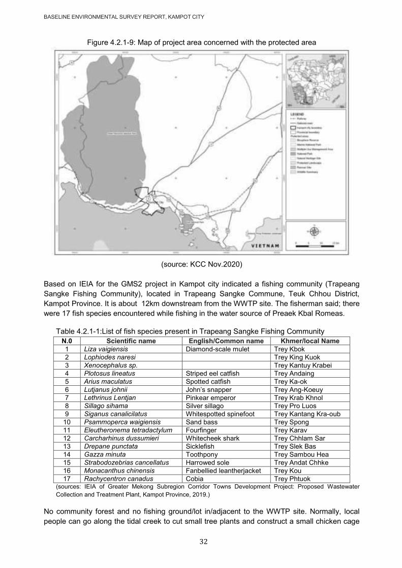
BASELINE ENVIRONMENTAL SURVEY REPORT, KAMPOT CITY
32
Figure 4.2.1-9: Map of project area concerned with the protected area
(source: KCC Nov.2020)
Based on IEIA for the GMS2 project in Kampot city indicated a fishing community (Trapeang
Sangke Fishing Community), located in Trapeang Sangke Commune, Teuk Chhou District,
Kampot Province. It is about 12km downstream from the WWTP site. The fisherman said; there
were 17 fish species encountered while fishing in the water source of Preaek Kbal Romeas.
Table 4.2.1-1:List of fish species present in Trapeang Sangke Fishing Community
N.0 Scientific name English/Common name Khmer/local Name
1 Liza vaigiensis Diamond-scale mulet Trey Kbok
2 Lophiodes naresi Trey King Kuok
3 Xenocephalus sp. Trey Kantuy Krabei
4 Plotosus lineatus Striped eel catfish Trey Andaing
5 Arius maculatus Spotted catfish Trey Ka-ok
6 Lutjanus johnii John‘s snapper Trey Ang-Koeuy
7 Lethrinus Lentjan Pinkear emperor Trey Krab Khnol
8 Sillago sihama Silver sillago Trey Pro Luos
9 Siganus canalicilatus Whitespotted spinefoot Trey Kantang Kra-oub
10 Psammoperca waigiensis Sand bass Trey Spong
11 Eleutheronema tetradactylum Fourfinger Trey Karav
12 Carcharhinus dussumieri Whitecheek shark Trey Chhlam Sar
13 Drepane punctata Sicklefish Trey Slek Bas
14 Gazza minuta Toothpony Trey Sambou Hea
15 Strabodozebrias cancellatus Harrowed sole Trey Andat Chhke
16 Monacanthus chinensis Fanbellied leantherjacket Trey Kou
17 Rachycentron canadus Cobia Trey Phtuok (sources: IEIA of Greater Mekong Subregion Corridor Towns Development Project: Proposed Wastewater
Collection and Treatment Plant, Kampot Province, 2019.)
No community forest and no fishing ground/lot in/adjacent to the WWTP site. Normally, local
people can go along the tidal creek to cut small tree plants and construct a small chicken cage
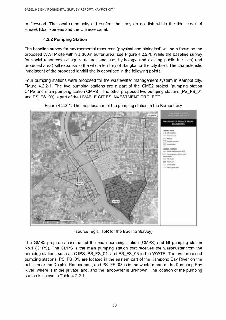
BASELINE ENVIRONMENTAL SURVEY REPORT, KAMPOT CITY
33
or firewood. The local community did confirm that they do not fish within the tidal creek of
Preaek Kbal Romeas and the Chinese canal.
4.2.2 Pumping Station
The baseline survey for environmental resources (physical and biological) will be a focus on the
proposed WWTP site within a 300m buffer area; see Figure 4.2.2-1. While the baseline survey
for social resources (village structure, land use, hydrology, and existing public facilities) and
protected area) will expanse to the whole territory of Sangkat or the city itself. The characteristic
in/adjacent of the proposed landfill site is described in the following points.
Four pumping stations were proposed for the wastewater management system in Kampot city,
Figure 4.2.2-1. The two pumping stations are a part of the GMS2 project (pumping station
C1PS and main pumping station CMPS). The other proposed two pumping stations (PS_FS_01
and PS_FS_03) is part of the LIVABLE CITIES INVESTMENT PROJECT.
Figure 4.2.2-1: The map location of the pumping station in the Kampot city
(source: Egis, ToR for the Baeline Survey)
The GMS2 project is constructed the mian pumping station (CMPS) and lift pumping station
No.1 (C1PS). The CMPS is the main pumping station that receives the wastewater from the
pumping stations such as C1PS, PS_FS_01, and PS_FS_03 to the WWTP. The two proposed
pumping stations, PS_FS_01, are located in the eastern part of the Kampong Bay River on the
public near the Dolphin Roundabout, and PS_FS_03 is in the western part of the Kampong Bay
River, where is in the private land, and the landowner is unknown. The location of the pumping
station is shown in Table 4.2.2-1.

BASELINE ENVIRONMENTAL SURVEY REPORT, KAMPOT CITY
34
Table 4.2.2-1: The location of the pumping station in Kampot city
Name Location Coordinates
CMPS (Main Pumping Station) Krang village, Sangkat Kraing Ampil, Kampot city 411050 E, 1172903 N
C1PS (Catchment 1 Pumping Station)
Near the River Park & Caffee restaurant adjacent to the riverside, Kampong Bay Khang Tboung village, Sangkat Kampong Bay, Kampot city
409888 E, 1173297 N
PS_FS_01 (Pumping Station for a feasibility study)
Tvi khang Tboung village, Sangkat Andong Khmer, Kampot city
409314 E, 1172573 N
PS_FS_03 (Pumping Station for a feasibility study)
Near the Dolphin roundabout, Phum Muoy Ousaphea, Sangkat Kampong Kandal, Kampot city
410532 E, 1171970 N
4.2.2.1 Main Pumping Station (CMPS)
Location: The proposed CMPS site for Kampot city is located in Krang village, Sangkat
Kraing Ampil, Kampot city, about 600m from the Durian Roundabout; see Figure 4.2.1.1-
1. The CMPS collects wastewater from small pumping stations and conveys it to the
WWTP through pipes with a total length of 6.115 km within 450 mm diameter. The pipe
installed along the road and the canal‘s embankment. The CMPS is approximately 2.9
hectares. The main pumping station consists of two pumps with a 74 kW and 44 kW
alternating operation capacity with a capacity of 340 m3/h. According to the IEIA report
in 2019, the CMPS area will construct a building for the administration to support the
wastewater management system. The pumping station needs only a small size, and the
total area is available to plant the trees for green space to reduce the environmental and
social impact around particularly smell and noise.
Figure 4.2.2.1-1: The location of the CMPS with 300m buffer
(Source: KCC Nov.2020)
Community structure/type of building: Sangkat Kraing Ampil is an urban area, and
the house was commonly built from brick and wood with tile or zinc roof. In the buffer
zone of CMPS, we found that the settlements and urbanization are in the northern part,
the western part, and the southern part of the site area. The settlements settle along the
road are built from brick and wood with tile or zinc roofs, and many settlements are
situated in the buffer zone of 300 m, where are located in the western part and southern
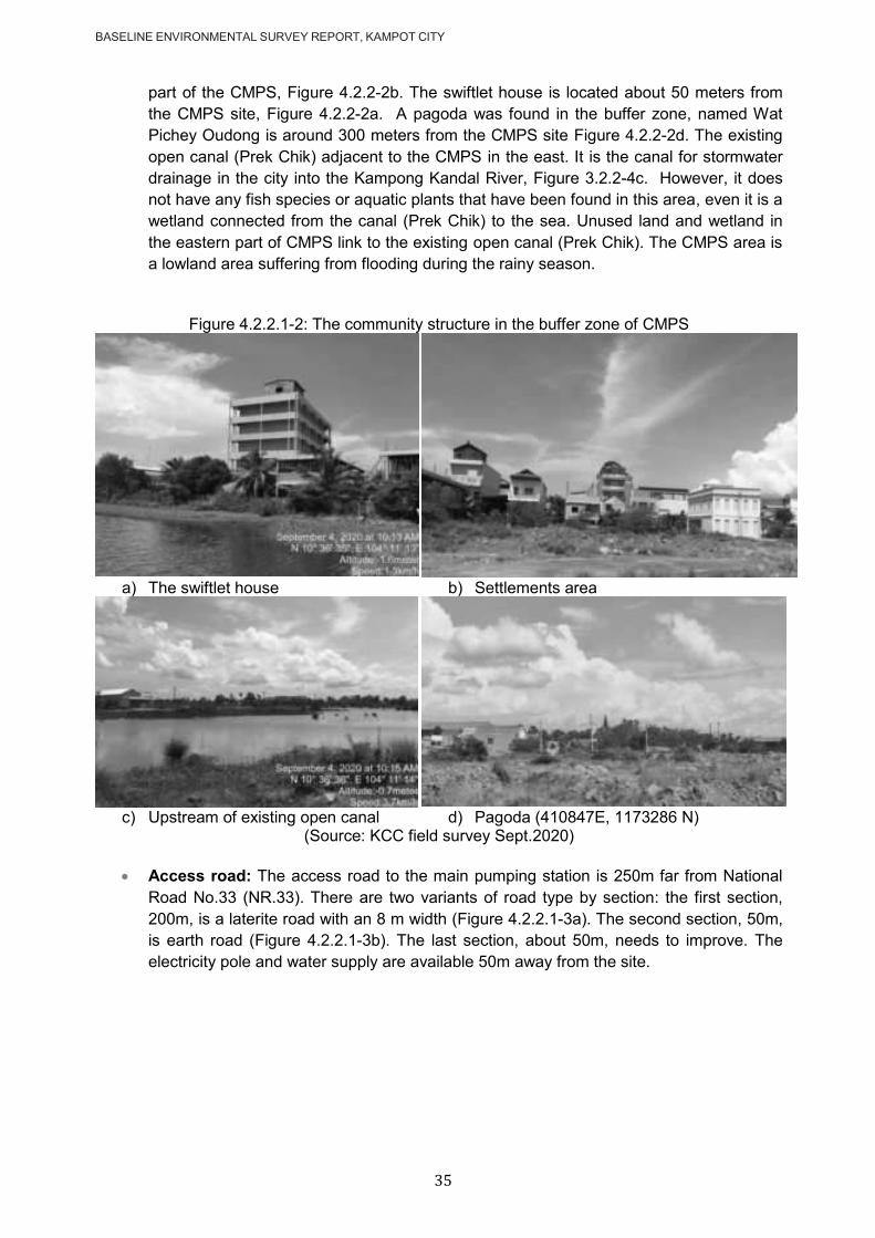
BASELINE ENVIRONMENTAL SURVEY REPORT, KAMPOT CITY
35
part of the CMPS, Figure 4.2.2-2b. The swiftlet house is located about 50 meters from
the CMPS site, Figure 4.2.2-2a. A pagoda was found in the buffer zone, named Wat
Pichey Oudong is around 300 meters from the CMPS site Figure 4.2.2-2d. The existing
open canal (Prek Chik) adjacent to the CMPS in the east. It is the canal for stormwater
drainage in the city into the Kampong Kandal River, Figure 3.2.2-4c. However, it does
not have any fish species or aquatic plants that have been found in this area, even it is a
wetland connected from the canal (Prek Chik) to the sea. Unused land and wetland in
the eastern part of CMPS link to the existing open canal (Prek Chik). The CMPS area is
a lowland area suffering from flooding during the rainy season.
Figure 4.2.2.1-2: The community structure in the buffer zone of CMPS
a) The swiftlet house b) Settlements area
c) Upstream of existing open canal d) Pagoda (410847E, 1173286 N)
(Source: KCC field survey Sept.2020)
Access road: The access road to the main pumping station is 250m far from National
Road No.33 (NR.33). There are two variants of road type by section: the first section,
200m, is a laterite road with an 8 m width (Figure 4.2.2.1-3a). The second section, 50m,
is earth road (Figure 4.2.2.1-3b). The last section, about 50m, needs to improve. The
electricity pole and water supply are available 50m away from the site.
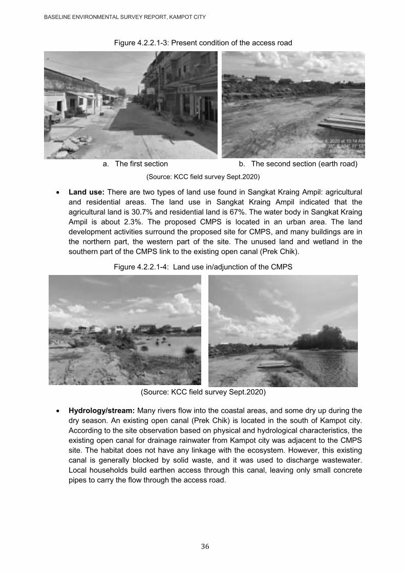
BASELINE ENVIRONMENTAL SURVEY REPORT, KAMPOT CITY
36
Figure 4.2.2.1-3: Present condition of the access road
a. The first section b. The second section (earth road)
(Source: KCC field survey Sept.2020)
Land use: There are two types of land use found in Sangkat Kraing Ampil: agricultural
and residential areas. The land use in Sangkat Kraing Ampil indicated that the
agricultural land is 30.7% and residential land is 67%. The water body in Sangkat Kraing
Ampil is about 2.3%. The proposed CMPS is located in an urban area. The land
development activities surround the proposed site for CMPS, and many buildings are in
the northern part, the western part of the site. The unused land and wetland in the
southern part of the CMPS link to the existing open canal (Prek Chik).
Figure 4.2.2.1-4: Land use in/adjunction of the CMPS
(Source: KCC field survey Sept.2020)
Hydrology/stream: Many rivers flow into the coastal areas, and some dry up during the
dry season. An existing open canal (Prek Chik) is located in the south of Kampot city.
According to the site observation based on physical and hydrological characteristics, the
existing open canal for drainage rainwater from Kampot city was adjacent to the CMPS
site. The habitat does not have any linkage with the ecosystem. However, this existing
canal is generally blocked by solid waste, and it was used to discharge wastewater.
Local households build earthen access through this canal, leaving only small concrete
pipes to carry the flow through the access road.
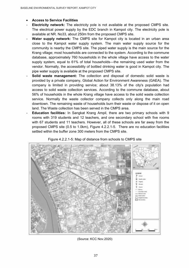
BASELINE ENVIRONMENTAL SURVEY REPORT, KAMPOT CITY
37
Access to Service Facilities
- Electricity network: The electricity pole is not available at the proposed CMPS site.
The electrical power supply by the EDC branch in Kampot city. The electricity pole is
available at NR. No33, about 250m from the proposed CMPS site.
- Water supply network: The CMPS site for Kampot city is located in an urban area
close to the Kampot water supply system. The main water supply source for the
community is nearby the CMPS site. The piped water supply is the main source for the
Krang village; most households are connected to the system. According to the commune
database, approximately 760 households in the whole village have access to the water
supply system, equal to 61% of total households—the remaining used water from the
vendor. Normally, the accessibility of bottled drinking water is good in Kampot city. The
pipe water supply is available at the proposed CMPS site.
- Solid waste management: The collection and disposal of domestic solid waste is
provided by a private company, Global Action for Environment Awareness (GAEA). The
company is limited in providing service; about 38.13% of the city's population had
access to solid waste collection services. According to the commune database, about
56% of households in the whole Krang village have access to the solid waste collection
service. Normally the waste collector company collects only along the main road
downtown. The remaining waste of households burn their waste or dispose of it on open
land. The Waste collection has been served in the CMPS area.
- Education facilities: In Sangkat Krang Ampil, there are two primary schools with 9
rooms with 319 students and 12 teachers, and one secondary school with five rooms
with 67 students and 11 teachers. However, all of these schools are far away from the
proposed CMPS site (0.5 to 1.0km), Figure 4.2.2.1-5. There are no education facilities
settled within the buffer zone 300 meters from the CMPS site.
Figure 4.2.2.1-5: Map of distance from schools to CMPS site
(Source: KCC Nov.2020)

BASELINE ENVIRONMENTAL SURVEY REPORT, KAMPOT CITY
38
- Health facilities: There is no pharmacy, and one health center settled in the Sangkat
Kraing Ampil, about 1.2 km from the proposed CMPS site. The Kampot referral hospital
is located in Sangkat Kraing Ampil, where is about 1.2 km from the proposed CMPS site
Figure 4.2.2.1-5. There are no health facilities settled within the buffer zone 300 meters
of the proposed CMPS site.
4.2.2.2 The C1PS
Location: The C1PS has received wastewater from PS_FS_01 and convey it to the
CMPS. It is located in the public land near the River Park & Coffee restaurant, and it
adjacent to the riverside of Kampong Bay river (Figure 4.2.2.2-1). The C1PS is located
in Kampong Bay Khang Tboung village, Sangkat Kampong Bay, Kampot city (Table
4.2.2-1) with coordinate 409888 E, 1173297N. The site is under construction. The size
of C1PS is 16 square meters (4mx4m).
Figure 4.2.2.2-1: The location of the C1PS with 300m buffer
(Source: KCC Nov.2020)
Community structure/ type of building: Sangkat Kampong Bay is an urban area, and
the house was commonly built from brick and wood with tile or zinc roof. The C1PS is
situated on the Kampong Bay riverbank of the east. The C1PS is located on the eastern
part of the Kampong Bay riverbank. There is a commercial area including the
settlements, administration, and commercial building besides the C1PS.
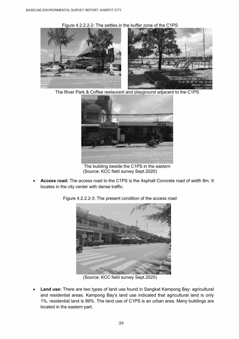
BASELINE ENVIRONMENTAL SURVEY REPORT, KAMPOT CITY
39
Figure 4.2.2.2-2: The settles in the buffer zone of the C1PS
The River Park & Coffee restaurant and playground adjacent to the C1PS
The building beside the C1PS in the eastern (Source: KCC field survey Sept.2020)
Access road: The access road to the C1PS is the Asphalt Concrete road of width 8m. It
locates in the city center with dense traffic.
Figure 4.2.2.2-3: The present condition of the access road
(Source: KCC field survey Sept.2020)
Land use: There are two types of land use found in Sangkat Kampong Bay: agricultural
and residential areas. Kampong Bay's land use indicated that agricultural land is only
1%, residential land is 99%. The land use of C1PS is an urban area. Many buildings are
located in the eastern part.

BASELINE ENVIRONMENTAL SURVEY REPORT, KAMPOT CITY
40
Access to services facilities:
- Electricity Network: The electricity pole is available around 10 meters from the
proposed C1PS site. The electrical power supply by the EDC branch in Kampot.
- Water Supply: Kampot Water Supply Authority (KWSA) serves water supply in
Kampot city. The piped water supply is available for 89% of the population, and 79%
is connected to it. 38% of the population use it as the main source of drinking water
in Kampot city. According to Egis (2020), the survey respondents are mainly
satisfied with the water supply network; 55% have not reported any complaints.
Some customers complained about the price deemed too expensive (22%), the poor
quality of the drinking water (24%), the poor service water pressure (18%), the lack
of customer services (3%). The cost of pipe water is approximately 1,420 Riel/m3.
The accessibility of bottled drinking water is good in Kampot. The pipe water supply
is available at the C1PS site. According to the commune database, almost 100% of
households in the whole village of Kampong Bay Khang Tboung have access to the
water supply system.
- Solid Waste Management: According to the commune database in 2018, about
81% of households in the whole Sangkat Kampong Bay have access to the solid
waste collection service. And in Kampong Bay Khang Tboung village, this 92% of
households have access to the solid waste collection service. Normally the waste
collector company collects only along the main road in the city. The remaining waste
of households burn their waste or dispose of it on open land. Waste collection has
been served in the C1PS area.
- Drainage Network: At present, the wastewater flowed through the existing drainage
system along the roadway. The existing sewers and stormwater system in Kampot
city is a combined system. The pipelines have a high level of filling within the city
extent. The lack of solid waste collection and treatment facilities leads the
households to release solid waste into the stormwater system is the main concern.
Sometimes, household residents often developed their stormwater drainage system.
Those pipes are not always connected to each other due to the lack of vision and
overall strategy. Presently, the GMS2 project implemented the stormwater system
for a better drainage network in Kampot city. The stormwater drainage in the C1PS
area has been improved by the GMS2 project.
- The school, hospital, and heritage place did not found in the buffer zone of 300
meters. There is no significant affected on the socio-economic and environment in
this place.
4.2.2.3 The Pumping Station 01 (PS_FS_01)
Location: The proposed pumping station (PS_FS_01) is in Tvi Khang Tboung village,
Sangkat Andong Khmer, Kampot city, with coordinate 409314 E, 1172573 N. It will
collect the wastewater from the residential and commercial area in Sangkat Andong
Khmer and convey it to the C1PS. It is situated on private land with an unknown property
owner.

BASELINE ENVIRONMENTAL SURVEY REPORT, KAMPOT CITY
41
Figure 4.2.2.3-1: The location of the PS_FS_01 with 300m buffer
(Source: KCC Nov.2020)
Community structure/ type of building: Sangkat Andong Khmer is an urban area, and
the house was commonly built from brick and wood with tile or zinc roof. There are many
settlements located around the PS site, situated in the northern, southern, and eastern
parts. The agricultural land is in the western part. There are two houses close to the
proposed site. One is in front, and the other one is next to the proposed PS_FS_01,
Figure 4.2.2.3-2. According to the observation surrounding the proposed PS site, it is an
urban development area, but the drainage system is not available yet.
Figure 4.2.2.3-2: The houses close to the PS_FS_01 site
a. House in front of the PS_FS_01 b. House next to the PS_FS_01
(Source: KCC field survey Sept.2020)
Access road: The access road to the proposed PS_FS_01 site is about 50 m long from
NR No.03 and starts from the entrance gate of Onduong Preng Pagoda (Figure 4.2.2.3-
3). However, the Onduong Preng pagoda is 1.7 km far from the proposed point. It is a
concrete road with a 6m width and good condition.

BASELINE ENVIRONMENTAL SURVEY REPORT, KAMPOT CITY
42
Figure 4.2.2.3-3: The present condition of the access road
(Source: KCC field survey Sept.2020)
Land use: There are three types of land use found in Sangkat Andong Khmer:
agricultural area, residential area, and shrubland. Sangkat Andong Khmer's land use
indicated that the agricultural land is 26%, residential land is 54%, and grassland/bush is
20%. The land use of PS_FS_01 is an urban area. Many buildings are located
surrounding the proposed site. Small agricultural land (paddy) is found in the south-west
part of the site Figure 4.2.2.3-1.
Access to services facilities:
- Electricity Network: The electricity pole is available around 10 meters from the
proposed PSFS_01 site. The electrical power supply by the EDC branch in Kampot.
- Water Supply: Kampot Water Supply Authority (KWSA) serves water supply in
Kampot city. According to Sangkat Andong Khmer's commune database,
approximately 77% of the population have access to the water supply system.
However, in Tvi Khang Tboung village is 100% of the population has access to the
water supply system. The cost of pipe water is approximately 1,420 Riel/m3. The
accessibility of bottled drinking water is good in Kampot.
- Solid Waste Management: The collection and disposal of domestic solid waste are
provided by a private company, Global Action for Environment Awareness (GAEA).
According to the commune database in 2018, about 32% of households in the whole
Sangkat Andong Khmer have access to the solid waste collection service.
Furthermore, about 32% of households in the whole village of Tvi Khang Tboung
have access to the solid waste collection service. Normally the waste collector
company collects only along the main road in the city. The remaining waste of
households burn their waste or dispose of it on open land. Waste collection has
been served in the PS_FS_01 area.
- Drainage Network: At present, the wastewater flowed through the existing drainage
system along the roadway. The existing sewers and stormwater system in Kampot
city is a combined system, running into the Kampong Kandal river. According to field
observation, the drainage system does not exist in the proposed PS_FS_01 area.
The wastewater and stormwater will discharge by gravity flow into the Kampong
Kandal river through an improper drainage system.
- The school, hospital, and heritage place did not found in the buffer zone of 300
meters. There is no significant affected on the socio-economic and environment in
this place.

BASELINE ENVIRONMENTAL SURVEY REPORT, KAMPOT CITY
43
4.2.2.4 The Pumping Station 01 (PS_FS_03)
Location: The proposed pumping station (PS_FS_03) (410513 E, 1171941 N) is in
Mouy Ousaphea Village, Sangkat Kampong Kandal, Kampot city on the public land. It is
close to Kampot city's Dolphin Roundabout, Figure 4.2.2.4-1. It will collect the
wastewater from the residential and commercial areas in Sangkat Kampong Kandal and
convey it to the main pumping station MPS.
Figure 4.2.2.4-1: The location of the PS_FS_03 with 300m buffer
(Source: KCC Nov.2020)
Community structure/ type of building: Sangkat Kampong Kandal is an urban area,
and the house was commonly built from brick and wood with tile or zinc roof. There are
many settlements located around the PS site, situated in the northern and eastern parts.
A restaurant (Kampot River restaurant) is located in the eastern part, where adjacent to
PS_FS_03; It was built from brick. V.Bran restaurant is located in the south-west, and it
is about 50m from the proposed PS site. In the buffer zoned of the PS, this a playground
situated along the riverbank. It is about 40m from the proposed PS site. According to the
observation surrounding the proposed PS site, it is an urban development area.
Figure 4.2.2.4-2: The settles in the buffer zone of the PS_FS_03
V. Bran restaurant close to the PS site A small restaurant adjacent to the site
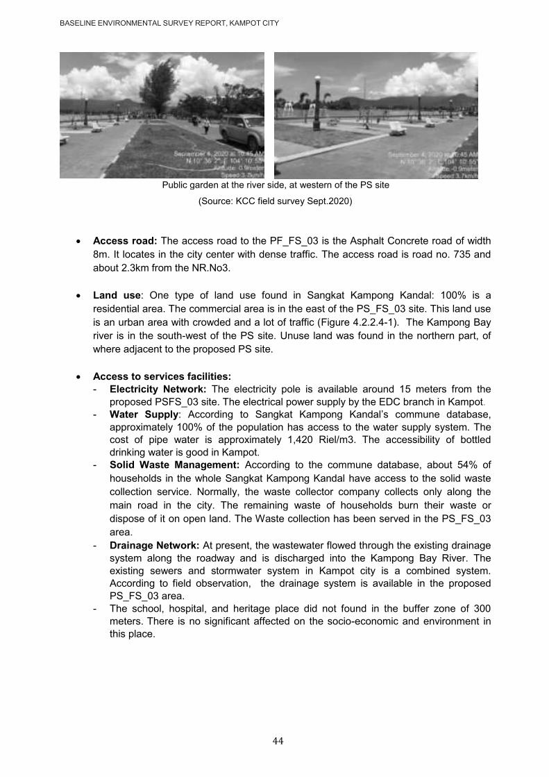
BASELINE ENVIRONMENTAL SURVEY REPORT, KAMPOT CITY
44
Public garden at the river side, at western of the PS site
(Source: KCC field survey Sept.2020)
Access road: The access road to the PF_FS_03 is the Asphalt Concrete road of width
8m. It locates in the city center with dense traffic. The access road is road no. 735 and
about 2.3km from the NR.No3.
Land use: One type of land use found in Sangkat Kampong Kandal: 100% is a
residential area. The commercial area is in the east of the PS_FS_03 site. This land use
is an urban area with crowded and a lot of traffic (Figure 4.2.2.4-1). The Kampong Bay
river is in the south-west of the PS site. Unuse land was found in the northern part, of
where adjacent to the proposed PS site.
Access to services facilities:
- Electricity Network: The electricity pole is available around 15 meters from the
proposed PSFS_03 site. The electrical power supply by the EDC branch in Kampot.
- Water Supply: According to Sangkat Kampong Kandal‘s commune database,
approximately 100% of the population has access to the water supply system. The
cost of pipe water is approximately 1,420 Riel/m3. The accessibility of bottled
drinking water is good in Kampot.
- Solid Waste Management: According to the commune database, about 54% of
households in the whole Sangkat Kampong Kandal have access to the solid waste
collection service. Normally, the waste collector company collects only along the
main road in the city. The remaining waste of households burn their waste or
dispose of it on open land. The Waste collection has been served in the PS_FS_03
area.
- Drainage Network: At present, the wastewater flowed through the existing drainage
system along the roadway and is discharged into the Kampong Bay River. The
existing sewers and stormwater system in Kampot city is a combined system.
According to field observation, the drainage system is available in the proposed
PS_FS_03 area.
- The school, hospital, and heritage place did not found in the buffer zone of 300
meters. There is no significant affected on the socio-economic and environment in
this place.
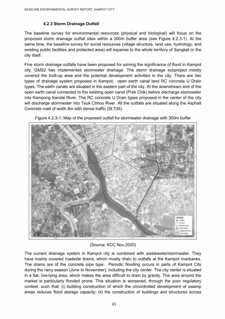
BASELINE ENVIRONMENTAL SURVEY REPORT, KAMPOT CITY
45
4.2.3 Storm Drainage Outfall
The baseline survey for environmental resources (physical and biological) will focus on the
proposed storm drainage outfall sites within a 300m buffer area (see Figure 4.2.3-1). At the
same time, the baseline survey for social resources (village structure, land use, hydrology, and
existing public facilities and protected area) will expanse to the whole territory of Sangkat or the
city itself.
Five storm drainage outfalls have been proposed for solving the significance of flood in Kampot
city. GMS2 has implemented stormwater drainage. The storm drainage subproject mostly
covered the built-up area and the potential development activities in the city. There are two
types of drainage system proposed in Kampot, open earth canal land RC concrete U Drain
types. The earth canals are situated in the eastern part of the city. At the downstream end of the
open earth canal connected to the existing open canal (Prek Chik) before discharge stormwater
into Kampong Kandal River. The RC concrete U Drain types proposed in the center of the city
will discharge stormwater into Teuk Chhou River. All the outfalls are situated along the Asphalt
Concrete road of width 8m with dense traffic (St.735).
Figure 4.2.3-1: Map of the proposed outfall for stormwater drainage with 300m buffer
(Source: KCC Nov.2020)
The current drainage system in Kampot city is combined with wastewater/stormwater. They
have mainly covered roadside drains, which mostly drain to outfalls at the Kampot riverbanks.
The drains are of the concrete pipe type. Periodic flooding occurs in parts of Kampot City
during the rainy season (June to November), including the city center. The city center is situated
in a flat, low-lying area, which makes the area difficult to drain by gravity. The area around the
market is particularly flooded prone. This situation is worsened, through the poor regulatory
context, such that: (i) building construction of which the uncontrolled development of swamp
areas reduces flood storage capacity; (ii) the construction of buildings and structures across

BASELINE ENVIRONMENTAL SURVEY REPORT, KAMPOT CITY
46
flow paths and drainage channels; and (iii) limited maintenance of the existing stormwater
canal.
The improved drainage network in the city will greatly reduce the seasonal major flooding
events that occur during heavy rainfall. The absence of untreated sewage and flooding in the
streets will enhance the city's natural beauty and enrich the tourist experience of Kampot. All of
these infrastructure investments will lead to the socio-economic development of the city and the
immediate area.
4.2.3.1 The Outfall_02
Location: The Outfall_02 is located in Kampong Bay Khang Tboung village, Sangkat
Kampong Bay, Kampot city, with coordinate 409870 E, 1173294N. The drainage for
outfall_02 will collect stormwater around the Samaki market and run along with the road
No.714 before connecting to the Kampot riverbank. The outfall_02 is next to the C1PS
site.
Figure 4.2.3.1-1: The location of the Outfall_02 with 300m buffer
(Source: KCC Nov.2020)
Community structure/ type of building: As the location of this outfall_02 is very close
to The C1PS, so the community structure is same as described in C1PS section. It
mean that is an urban area, and the house was commonly built from brick and wood with
tile or zinc roof. Other physical structure and public garden equipped with play-ground
facilities were found within 300m buffer of the outfall site, Figure 4.2.3.1-2.

BASELINE ENVIRONMENTAL SURVEY REPORT, KAMPOT CITY
47
Figure 4.2.3.1-2: The settles in the buffer zone of the Outfall_02
The settlements beside the outfall_02 The River Park & Coffee restaurant
The C1PS site The playground close to the outfall_02
(Source: KCC field)
Access road: The outfall_02 is close to the Asphalt Concrete road of width 8m with
dense traffic (St.735), Figure 4.2.3.1-2. It could be reach to the outfall point by walking
on the concrete block of the public garden, Figure 4.2.3.1-3.
Figure 4.2.3.1-2: The closest road to Outfall_02
Figure 4.2.3.1-3: Parth walk to reach the outfall point
(Source: KCC Nov.2020)
Land use: same as decribed in C1PS section.
Access to services facilities: same as decribed in C1PS section.

BASELINE ENVIRONMENTAL SURVEY REPORT, KAMPOT CITY
48
4.2.3.2 The Outfall_03
Location: The Outfall_03 is located in Kampong Bay Khang Tboung village, Sangkat
Kampong Bay, Kampot city, with coordinate 410055 E, 1172977N. The drainage for
outfall_03 will collect stormwater around the Durian Roundabout and run along with the
road No.720 before connecting to the Kampot riverbank. It will discharge into the Teuk
Chhou River.
Figure 4.2.3.2-1: The location of the Outfall_03 with 300m buffer
(Source: KCC Nov.2020)
Community structure/ type of building: Sangkat Kampong Kandal is an urban area,
and the house was commonly built from brick and wood with tile or zinc roof. It is
opposite the Sotheara River Residence. The Kampot referral hospital is situated about
100m from the Outfall_03 point, just pass the street No.720 and the public garden at the
river bank, Figure 4.2.3.2-2 .
Figure 4.2.3.2-2: The settles in the buffer zone of the Outfall_03
The Sotheara River Residence. The Kampot referral hospital
(Source: KCC field survey Sept.2020)
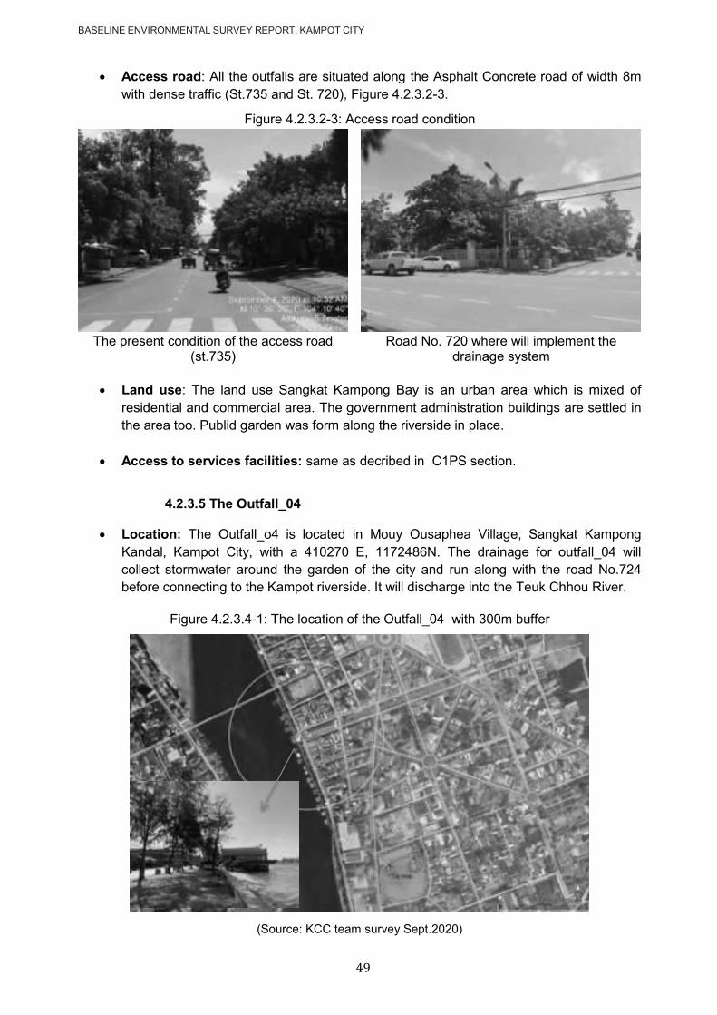
BASELINE ENVIRONMENTAL SURVEY REPORT, KAMPOT CITY
49
Access road: All the outfalls are situated along the Asphalt Concrete road of width 8m
with dense traffic (St.735 and St. 720), Figure 4.2.3.2-3.
Figure 4.2.3.2-3: Access road condition
The present condition of the access road
(st.735) Road No. 720 where will implement the
drainage system
Land use: The land use Sangkat Kampong Bay is an urban area which is mixed of
residential and commercial area. The government administration buildings are settled in
the area too. Publid garden was form along the riverside in place.
Access to services facilities: same as decribed in C1PS section.
4.2.3.5 The Outfall_04
Location: The Outfall_o4 is located in Mouy Ousaphea Village, Sangkat Kampong
Kandal, Kampot City, with a 410270 E, 1172486N. The drainage for outfall_04 will
collect stormwater around the garden of the city and run along with the road No.724
before connecting to the Kampot riverside. It will discharge into the Teuk Chhou River.
Figure 4.2.3.4-1: The location of the Outfall_04 with 300m buffer
(Source: KCC team survey Sept.2020)

BASELINE ENVIRONMENTAL SURVEY REPORT, KAMPOT CITY
50
Community structure/ type of building: Sangkat Kampong Kandal is an urban area,
and the house was commonly built from brick and wood with tile or zinc roof. At the river
side is a old fishing market building (recently is a coffee shop), and at left side is the old
central maket building (built in freach colonel resiem), Figure 4.2.3.4-2. The plat with
French colonel stile settled both side of the central market.
The school, hospital, and heritage place did not found in the buffer zone of 300 meters.
There is no significant affected on the socio-economic and environment in this place.
Figure 4.2.3.4-2: The settles in the buffer zone of the Outfall_04
The old fish market (now coffee shop) The old central market
The riverbank adjacent to the outfall site The plat with French colonel stile
(Source: KCC field survey Sept.2020)
Access road: All the outfalls are situated along the Asphalt Concrete road of width 8m
with dense traffic (St.735).
Land use: same as outfall_03
Access to services facilities: same as decribed in C1PS section.
4.2.3.5 The Outfall_05
Location: The Outfall_05 is located in Mouy Ousaphea Village, Sangkat Kampong
Kandal, Kampot city, with coordinate 410168 E, 1172731N. The drainage for outfall_05
will collect stormwater around 8 Minea Roundabout and continue to Sre Ambil
Roundabout. Finally, it runs along with road No.730 before connecting to the Kampot
riverside. It will discharge into the Teuk Chhou River.

BASELINE ENVIRONMENTAL SURVEY REPORT, KAMPOT CITY
51
Figure 4.2.3.5-1: The location of the Outfall_05 with 300m buffer
(Source: KCC field survey Sept.2020)
Community structure/ type of building: Sangkat Kampong Kandal is an urban area,
and the house was commonly built from brick and wood with tile or zinc roof. The
Kampot provincial hall building is settled about 150m from the outfall point. Many
residents and gorvement building were found at left side of the outfall, especially
Cambodia Red Cross, Figure 4.2.3.5-2.
The school, hospital, and heritage place did not found in the buffer zone of 300 meters.
There is no significant affected on the socio-economic and environment in this place.
Figure 4.2.3.5-2: Cambodian Red Cross buildings
(Source: KCC field survey Sept.2020)
Access road: All the outfalls are situated along the Asphalt Concrete road of width 8m
with dense traffic (St.735).
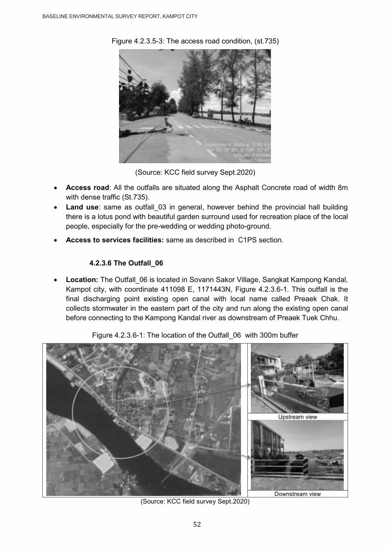
BASELINE ENVIRONMENTAL SURVEY REPORT, KAMPOT CITY
52
Figure 4.2.3.5-3: The access road condition, (st.735)
(Source: KCC field survey Sept.2020)
Access road: All the outfalls are situated along the Asphalt Concrete road of width 8m
with dense traffic (St.735).
Land use: same as outfall_03 in general, however behind the provincial hall building
there is a lotus pond with beautiful garden surround used for recreation place of the local
people, especially for the pre-wedding or wedding photo-ground.
Access to services facilities: same as described in C1PS section.
4.2.3.6 The Outfall_06
Location: The Outfall_06 is located in Sovann Sakor Village, Sangkat Kampong Kandal,
Kampot city, with coordinate 411098 E, 1171443N, Figure 4.2.3.6-1. This outfall is the
final discharging point existing open canal with local name called Preaek Chak. It
collects stormwater in the eastern part of the city and run along the existing open canal
before connecting to the Kampong Kandal river as downstream of Preaek Tuek Chhu.
Figure 4.2.3.6-1: The location of the Outfall_06 with 300m buffer
Upstream view
Downstream view
(Source: KCC field survey Sept.2020)

BASELINE ENVIRONMENTAL SURVEY REPORT, KAMPOT CITY
53
Community structure/ type of building: Sangkat Kampong Kandal is an urban area,
and the house was commonly built from brick and wood with tile or zinc roof. However,
within 300m buffer of the Outfall_06 is not so densly resident like a bit outskird of the
city. Furthermore the community is this area is mixed of Khmer (Cambodian) and Khmer
islam (Cham). One coffee shop mamed ―Phka Kravan Café‖ settled next door to the outfall point, Figure 4.2.3.6-2. The settlement in this area were built along both side of
the main road and open canal (Preaek Chak).
The school, hospital, and heritage place did not found in the buffer zone of 300 meters.
Figure 4.2.3.6-2: The settles in the buffer zone of the Outfall_06
The Phka Kravan cafe adjacent to the outfall The present condition of the outfall
(Source: KCC field survey Sept.2020)
Access road: All the outfalls are situated along the Asphalt Concrete road of width 8m
with dense traffic (St.735), Figure 4.2.3.6-3.
Figure 4.2.3.6-3: The present condition of the access road (St.735)
Source: KCC survey team, Sept.2020
Land use: The Kampong Kandal sangkat had total area of 170ha which classified as
residential area, according to the commune database, 2019. Anyway as outskir of the
city so some land lot are presented of orchard or small rice filed land.
Access to services facilities: same as decribed in C1PS section.

BASELINE ENVIRONMENTAL SURVEY REPORT, KAMPOT CITY
54
4.3 Cultural Heritage
4.3.1 Methodology
To observe cultural heritage places in/adjacent to the project sites (WWTP, Landfill,
Stormwater drainage outfall). The consultation with the village/Sangkat chief and locale people
(elderly) as well as the representative of the Community Forest in place, who well known the
heritage in the area (temples, pagodas, ancient pond, ancient gave area, archeological site,
etc.) and within 300 meters from the project sites. Observation is one of the founding principles
of the scientific method, and it can be a very effective tool for studying human-environment
interactions around the project area.
4.3.2 Finding
According to the observation, we found that there is no cultural heritage place in the buffer zone
300 m of the project areas, according to the site observation and interview with the local people.
The consultation with local authority members in Sept, Figure 4.6.2-1. The key results of the
discussion meeting with stakeholders show in Table 4.6.2-1. The attendance lists eclose in
annex 2.
Figure 4..2-1: Activities of consultation for cultural heritage
(Source: KCC field survey Sept.2020)
Table 4.6.2-1: Key discussion meeting with stakeholders at the community level
N.o Name Date Opinion
1
Mr. Chhoun Heng (Chief of Sangkat Kraing Ampil)
05-Sep-2020
- He said no heritage in the proposed site (temples, pagodas, ancient pond, ancient gave area, the archeological site within 300 meters from the proposed main pumping station site.
- This is an urban area; settlements settle in this area's buffer zone; however, the building is not significantly affected by the project.
2
Ms. So Dannavy (Deputy chief village of Kraing Ampil)
05-Sep-2020
- The main pumping station is located in the center of the city. Development always slightly impact but has many benefits for the people.
- There are no schools, hospitals, and heritage sites that have been found in the buffer zone 300m from the proposed landfill site.
- A pagoda was found, about 300m from the main pumping station, named Wat Pichey Oudong; however, it is an entry difference access road.
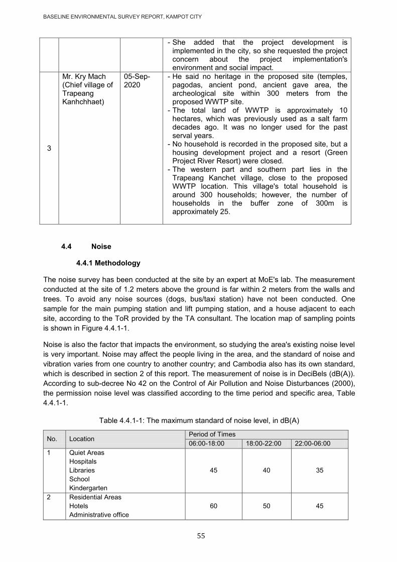
BASELINE ENVIRONMENTAL SURVEY REPORT, KAMPOT CITY
55
- She added that the project development is implemented in the city, so she requested the project concern about the project implementation's environment and social impact.
3
Mr. Kry Mach (Chief village of Trapeang Kanhchhaet)
05-Sep-2020
- He said no heritage in the proposed site (temples, pagodas, ancient pond, ancient gave area, the archeological site within 300 meters from the proposed WWTP site.
- The total land of WWTP is approximately 10 hectares, which was previously used as a salt farm decades ago. It was no longer used for the past serval years.
- No household is recorded in the proposed site, but a housing development project and a resort (Green Project River Resort) were closed.
- The western part and southern part lies in the Trapeang Kanchet village, close to the proposed WWTP location. This village's total household is around 300 households; however, the number of households in the buffer zone of 300m is approximately 25.
4.4 Noise
4.4.1 Methodology
The noise survey has been conducted at the site by an expert at MoE's lab. The measurement
conducted at the site of 1.2 meters above the ground is far within 2 meters from the walls and
trees. To avoid any noise sources (dogs, bus/taxi station) have not been conducted. One
sample for the main pumping station and lift pumping station, and a house adjacent to each
site, according to the ToR provided by the TA consultant. The location map of sampling points
is shown in Figure 4.4.1-1.
Noise is also the factor that impacts the environment, so studying the area's existing noise level
is very important. Noise may affect the people living in the area, and the standard of noise and
vibration varies from one country to another country; and Cambodia also has its own standard,
which is described in section 2 of this report. The measurement of noise is in DeciBels (dB(A)).
According to sub-decree No 42 on the Control of Air Pollution and Noise Disturbances (2000),
the permission noise level was classified according to the time period and specific area, Table
4.4.1-1.
Table 4.4.1-1: The maximum standard of noise level, in dB(A)
No. Location Period of Times
06:00-18:00 18:00-22:00 22:00-06:00
1 Quiet Areas
Hospitals
Libraries
School
Kindergarten
45 40 35
2 Residential Areas
Hotels
Administrative office
60 50 45
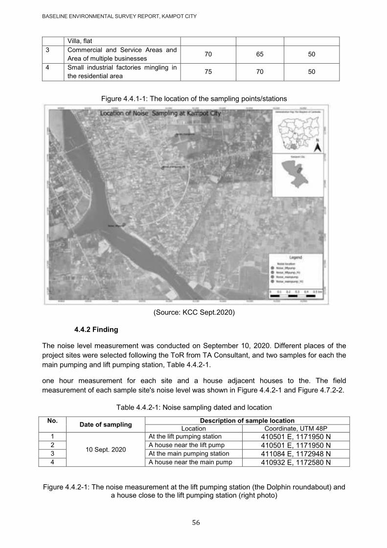
BASELINE ENVIRONMENTAL SURVEY REPORT, KAMPOT CITY
56
Villa, flat
3 Commercial and Service Areas and
Area of multiple businesses 70 65 50
4 Small industrial factories mingling in
the residential area 75 70 50
Figure 4.4.1-1: The location of the sampling points/stations
(Source: KCC Sept.2020)
4.4.2 Finding
The noise level measurement was conducted on September 10, 2020. Different places of the
project sites were selected following the ToR from TA Consultant, and two samples for each the
main pumping and lift pumping station, Table 4.4.2-1.
one hour measurement for each site and a house adjacent houses to the. The field
measurement of each sample site's noise level was shown in Figure 4.4.2-1 and Figure 4.7.2-2.
Table 4.4.2-1: Noise sampling dated and location
No. Date of sampling
Description of sample location
Location Coordinate, UTM 48P
1
10 Sept. 2020
At the lift pumping station 410501 E, 1171950 N
2 A house near the lift pump 410501 E, 1171950 N
3 At the main pumping station 411084 E, 1172948 N
4 A house near the main pump 410932 E, 1172580 N
Figure 4.4.2-1: The noise measurement at the lift pumping station (the Dolphin roundabout) and a house close to the lift pumping station (right photo)

BASELINE ENVIRONMENTAL SURVEY REPORT, KAMPOT CITY
57
(Source: MoE Sept.2020)
Figure 4.4.2-2: The noise measurement at the main pumping station and a house close to the main pumping station (right photo).
(Source: MOE Sept.2020)
The detailed results of the noise measurement were described in the following table below and
the detailed lab sheets in Annex 1.
Table 4.4.2-2: The noise level measurement at the lift pumping and the main pumping station.
Location Survey period Noise Level dB(A)
LAeq Standard (Leq) Lmax Lmin
Lift pumping station 11:00-12:00 43.1
60-70
50.4 32.2
A house close to lift pumping station
12:00-13:00 39.4 49.3 31.1
Main pumping station 13:00-14:00 42.5 54.6 33.1
A house close to the main pumping station
14:00-15:00 44.0 58.2 33.4
Note: (i)
60 dB(A) for residential areas, hotels, administrative office, and villa/flat, day time (6:00-18:00)
70 dB(A) for commercial, service areas, and area of multiple businesses, day time (6:00-18:00)
The average noise level in one hour of the lift pump station and the main pumping station has
been measured. The average noise level at the lift pumping station is 43.1 d(B)A that a
maximum of 50.4 dB(A) and a minimum of 32.2 dB(A). The average noise level at the main
pumping station is 42.5 d(B)A that a maximum of 54.6 dB(A), and a minimum of 33.1 dB(A).
The standard of noise disturbance is 70 dB(A) issued by MoE to define the commercial and
service areas and multiple businesses' areas. There is no concern about the noise disturbance
yet.

BASELINE ENVIRONMENTAL SURVEY REPORT, KAMPOT CITY
58
The average noise level in one hour of the houses close to the lift pumping station is 39.4
dB(A). The maximum is around 49.3 dB(A). The average noise level in one hour of the houses
close to the main pumping station is 44.0 dB(A). The maximum is around 58.2 dB(A), while the
standard of noise disturbance is 70 dB(A) issued by MoE. There is no concern about the noise
disturbance yet.
CONCLUSIONS
5.1 Environmental Regulation
There are some laws, sub-decrees, Prakas, and guidelines relevant to environmental protection
and monitoring to prevent the natural and social resources in good mainer and sustainable
development. The detailed objective and aim of these regulations are described in section 2 of
this report.
5.2 Project Description
Two subprojects were proposed for Kampot city, according to the project component in the
LCIP. Those subprojects include Wastewater and Storm Drainage. The detailed subproject
component was described in section 3 of this report.
5.3 Baseline survey
5.3.1 Overall environmental aspect
Kampot city is a corridor city in a coastal area, approximately 150 Km from Phnom Penh in
Southwestern Cambodia. The city of Kampot intends to become a commercial and modern
tourism destination for the sustainable development of coastal cities. It dominates agricultural
area land with about 27% of the total area, and residential and commercial areas settled mostly
along with NR#3. Bokor National Park (BNP), located approximately 25km northwest of the city.
BNP covers a total area of 140,000 ha. It is estimated that 97% of the land cover is natural or
semi-natural, and 3% is transformed.
Kampot is located in lowland, and the river can largely flood it during heavy rainfall storm
events. Flood is mainly related to river overflow above the riverbanks/sides. Therefore young
alluvium soils are made up of sediment deposits from rivers and streams. The area is face with
climate change, include temperature increase by 2.1°C by 2050, precipitation increase of 5% by
2050. However, the city is the shortage of urban infrastructures because it was just classified as
a city in 2008.
5.3.2 Characteristic of the project area
The WWTP location for Kampot city locates peri-urban. It is about 6 km from the center of the.
The total land of WWTP is approximately 10 hectares. The WWTP locates 100 to 200 meters
from the tidal creek of Khbal Romeas. The WWTP is a relatively flat area located close to the
west of the tidal creek of Khbal Romeas, which is a distributary of the sea. There is no house
located in the proposed WWTP that was previously used as the salt farm decades ago. It was
no longer used for the past serval years. Therefore, it results in the uncovered soil in the middle
of the site and some common plant species regeneration. The abandoned salt marsh was found
on the east side of the Preaek Kbal Romeas. The small grassland habitat can also be found on
the field located on the west of the WWTP site. It is a normal habitat, in short.

BASELINE ENVIRONMENTAL SURVEY REPORT, KAMPOT CITY
59
Some minor concerns can be sorted out, as discussed in section 4.2.1. Therefore, this project
should be allowed to be implemented as it will have an essential benefit to Kampot province, a
well-known province of tourist destinations in the country.
The main pumping station site for Kampot city is located in Krang village, Sangkat Kraing Ampil,
Kampot city, about 600m from the Durian Roundabout. It is located in the city center. The
settlements and urbanization are in the northern part, the western part, and the southern part of
the site area. The unused land and wetland in the southern part of the CMPS link to the existing
open canal (Preaek Chak). The habitat does not have any linkage with the ecosystem.
However, this existing canal is generally blocked by solid waste, and it was used to discharge
wastewater. Local households build earthen access through this canal, leaving only small
concrete pipes to carry the flow through the access road.
The facilities development for improvement in Kampot city, the pumping station, and the
wastewater treatment plant for improving the city's wastewater management system do not
cause any significant social and environmental impacts, but they will improve the urban
environment sanitation in Kampot city to increase the likelihood of the drweler and support other
development sectors.
Trees should be replanted at the perimeter site of the WWTP site and the main pumping station
to protect the odor, noise, and nature-based. Also, it is important to compensate as replant the
trees for sustainable development. The replanted should be local trees that available in the
market. However, the existing flora can be replanted; it is the priority to consider. The available
land, such as in public gardens, along the road, green space as reserves by the city
administration, and mostly in the national park (Bokor National Park), should replant the trees to
compensate for the project development.
5.3.2 Cultural Heritage
There are not cultural heritage places that have been found within 300 meters of the buffer
zone.
5.3.2 Noise
The result of the noise disturbance measurement in all sites indicated is below the standard of
MoE. The noise level measurement might be fluctuating depending on human activities. The
main pumping station's baseline noise level, the lifts pumping station, and houses close to the
main pumping station and lifts pumping station do not disturb villagers because most of the
stations are located in the city's center with crowded.
BASELINE ENVIRONMENTAL SURVEY REPORT, KAMPOT CITY
60
6 REFERENCES
Sub-Decree No. 42 ANK.BK on The Control of Air Pollution and Noise Disturbance,2000
Sub-Decree No. 27 ANRK.BK on water pollution control, 1999
Sub-Decree No. 72 ANRK.BK on Environmental Impact Assessment Process, 1999
Sub-Degree No. 235 ANRK. BK on the Management of Drainage system and Wastewater
Treatment System, 2017
Sub-Degree No. 113 ANRK. BK on Management of Garbage and Solid Waste of Downtowns,
2015
The Prakas No.120 PK.BST on launching the use of ToR for infrastructure development and
tourism of MoE, 2018.
ADB, 2018 Rapid Environmental Assessment Report Greater Mekong Subregion Corridor Towns Development Project: Proposed Wastewater Collection and Treatment Plant, Kampot Province.
ADB, 2015 Initial Environmental Examination Greater Mekong Subregion Corridor Towns Development Project: Kampot and Sihanoukville Town, Cambodia. Subprojects Updated Initial Environmental Examination PPTA-8425, Cambodia.

BASELINE ENVIRONMENTAL SURVEY REPORT, KAMPOT CITY
61
ANNEX 1: LAB’S SHEET OF NOISE LEVEL MEASUREMENT
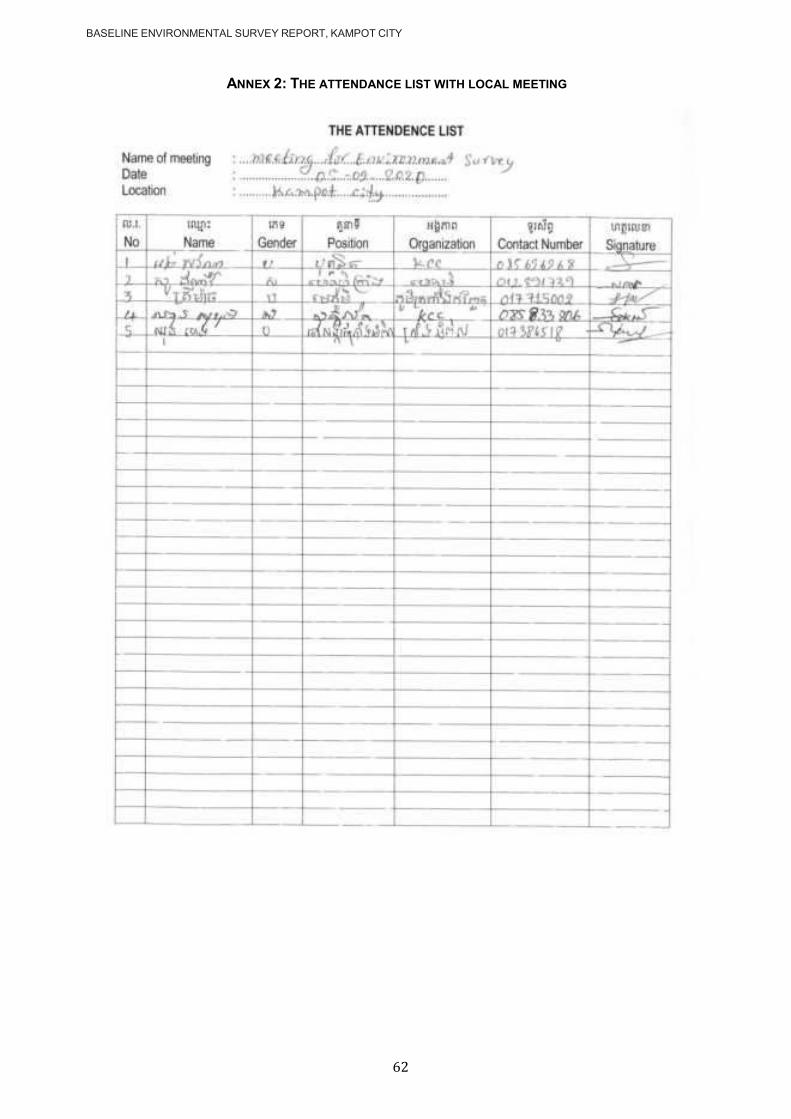
BASELINE ENVIRONMENTAL SURVEY REPORT, KAMPOT CITY
62
ANNEX 2: THE ATTENDANCE LIST WITH LOCAL MEETING

107
2. Integrated Biodiversity Assessment Tool (IBAT) Report
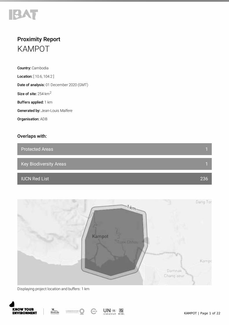
KAMPOT | Page 1 of 22
1
1
236
Proximity Report
KAMPOT
Country: Cambodia
Location: [ 10.6, 104.2 ]
Date of analysis: 01 December 2020 (GMT)
Size of site: 254 km2
Buffers applied: 1 km
Generated by: Jean-Louis Malfere
Organisation: ADB
Overlaps with:
Protected Areas
Key Biodiversity Areas
IUCN Red List
Displaying project location and buffers: 1 km

KAMPOT | Page 2 of 22
About this report
This report presents the results of [5956-12646] proximity analysis to identify the biodiversity features and specieswhich are located within the following buffers: 1 km.
This report is one part of a package generated by IBAT on 01 December 2020 (GMT) that includes full list of all species,protected areas, Key Biodiversity Areas in CSV format, maps showing the area of interest in relation to these features,and a ‘How to read IBAT reports’ document.
Data used to generate this report
UNEP-WCMC and IUCN, 2020. Protected Planet: The World Database on Protected Areas (WDPA)[On-line],Cambridge, UK: UNEP-WCMC and IUCN. Available at: www.protectedplanet.net - December 2020.
BirdLife International (on behalf of the KBA Partnership), 2020. Key Biodiversity Areas - October 2020.
IUCN, 2020. IUCN Red List of Threatened Species - July 2020.
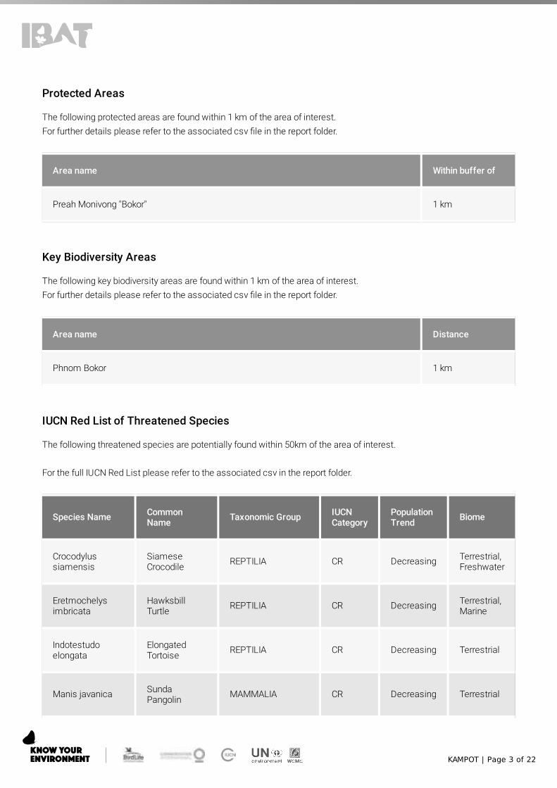
KAMPOT | Page 3 of 22
Protected Areas
The following protected areas are found within 1 km of the area of interest. For further details please refer to the associated csv �le in the report folder.
Area name Within buffer of
Preah Monivong "Bokor" 1 km
Key Biodiversity Areas
The following key biodiversity areas are found within 1 km of the area of interest. For further details please refer to the associated csv �le in the report folder.
Area name Distance
Phnom Bokor 1 km
IUCN Red List of Threatened Species
The following threatened species are potentially found within 50km of the area of interest.
For the full IUCN Red List please refer to the associated csv in the report folder.
Species Name CommonName Taxonomic Group IUCN
CategoryPopulationTrend Biome
Crocodylussiamensis
SiameseCrocodile REPTILIA CR Decreasing Terrestrial,
Freshwater
Eretmochelysimbricata
HawksbillTurtle REPTILIA CR Decreasing Terrestrial,
Marine
Indotestudoelongata
ElongatedTortoise REPTILIA CR Decreasing Terrestrial
Manis javanica SundaPangolin MAMMALIA CR Decreasing Terrestrial

KAMPOT | Page 4 of 22
Species Name CommonName Taxonomic Group IUCN
CategoryPopulationTrend Biome
Pangasiussanitwongsei
GiantPangasius ACTINOPTERYGII CR Decreasing Freshwater
Aquilaria crassna Agarwood MAGNOLIOPSIDA CR Decreasing Terrestrial
Carcharhinushemiodon
PondicherryShark CHONDRICHTHYES CR Unknown Marine
Carcharhinuslongimanus
OceanicWhitetip Shark CHONDRICHTHYES CR Decreasing Marine
Sphyrna lewini ScallopedHammerhead CHONDRICHTHYES CR Decreasing Marine
Sphyrnamokarran
GreatHammerhead CHONDRICHTHYES CR Decreasing Marine
Pristis zijsron Green Saw�sh CHONDRICHTHYES CR Decreasing Marine
Rhinaancylostoma
BowmouthGuitar�sh CHONDRICHTHYES CR Decreasing Marine
Rhynchobatusaustraliae
BottlenoseWedge�sh CHONDRICHTHYES CR Decreasing Marine
Glaucostegusthouin
ClubnoseGuitar�sh CHONDRICHTHYES CR Unknown Marine
Rhynchobatusspringeri
BroadnoseWedge�sh CHONDRICHTHYES CR Decreasing Marine
Batagur a�nis Southern RiverTerrapin REPTILIA CR Decreasing
Terrestrial,Marine,Freshwater
Catlocarpiosiamensis Giant Carp ACTINOPTERYGII CR Decreasing Freshwater
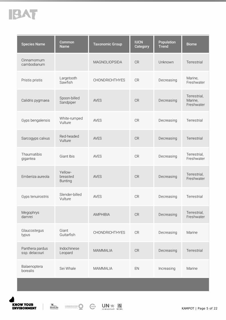
KAMPOT | Page 5 of 22
Species Name CommonName Taxonomic Group IUCN
CategoryPopulationTrend Biome
Cinnamomumcambodianum MAGNOLIOPSIDA CR Unknown Terrestrial
Pristis pristis LargetoothSaw�sh CHONDRICHTHYES CR Decreasing Marine,
Freshwater
Calidris pygmaea Spoon-billedSandpiper AVES CR Decreasing
Terrestrial,Marine,Freshwater
Gyps bengalensis White-rumpedVulture AVES CR Decreasing Terrestrial
Sarcogyps calvus Red-headedVulture AVES CR Decreasing Terrestrial
Thaumatibisgigantea Giant Ibis AVES CR Decreasing Terrestrial,
Freshwater
Emberiza aureolaYellow-breastedBunting
AVES CR Decreasing Terrestrial,Freshwater
Gyps tenuirostris Slender-billedVulture AVES CR Decreasing Terrestrial
Megophrysdamrei AMPHIBIA CR Decreasing Terrestrial,
Freshwater
Glaucostegustypus
GiantGuitar�sh CHONDRICHTHYES CR Decreasing Marine
Panthera pardusssp. delacouri
IndochineseLeopard MAMMALIA CR Decreasing Terrestrial
Balaenopteraborealis Sei Whale MAMMALIA EN Increasing Marine

KAMPOT | Page 6 of 22
Species Name CommonName Taxonomic Group IUCN
CategoryPopulationTrend Biome
Balaenopteramusculus Blue Whale MAMMALIA EN Increasing Marine
Bos javanicus Banteng MAMMALIA EN Decreasing Terrestrial
Laubukacaeruleostigmata Flying Minnow ACTINOPTERYGII EN Decreasing Freshwater
Cuon alpinus Dhole MAMMALIA EN Decreasing Terrestrial
Cuoraamboinensis
SoutheastAsian BoxTurtle
REPTILIA EN Decreasing Terrestrial,Freshwater
Elephasmaximus Asian Elephant MAMMALIA EN Decreasing Terrestrial
Hylobatespileatus
PileatedGibbon MAMMALIA EN Decreasing Terrestrial
Lutra sumatrana Hairy-nosedOtter MAMMALIA EN Decreasing
Terrestrial,Marine,Freshwater
Orcaellabrevirostris
IrrawaddyDolphin MAMMALIA EN Decreasing Marine,
Freshwater
Panthera tigris Tiger MAMMALIA EN Decreasing Terrestrial
Rhincodon typus Whale Shark CHONDRICHTHYES EN Decreasing Marine
Pterocarpusmacrocarpus Burma Padauk MAGNOLIOPSIDA EN Decreasing Terrestrial
Hopea helferi MAGNOLIOPSIDA EN Decreasing Terrestrial

KAMPOT | Page 7 of 22
Species Name CommonName Taxonomic Group IUCN
CategoryPopulationTrend Biome
Dipterocarpusdyeri MAGNOLIOPSIDA EN Decreasing Terrestrial
Shorea hypochra White Meranti MAGNOLIOPSIDA EN Decreasing Terrestrial
Hopea ferrea MAGNOLIOPSIDA EN Decreasing Terrestrial
Anisopteracostata MAGNOLIOPSIDA EN Decreasing Terrestrial
Dipterocarpusintricatus MAGNOLIOPSIDA EN Decreasing Terrestrial
Isurus oxyrinchus Short�n Mako CHONDRICHTHYES EN Decreasing Marine
Anoxypristiscuspidata
NarrowSaw�sh CHONDRICHTHYES EN Decreasing Marine
Nycticebusbengalensis
Bengal SlowLoris MAMMALIA EN Decreasing Terrestrial
Trachypithecusgermaini
IndochineseSilveredLangur
MAMMALIA EN Decreasing Terrestrial
Viverramegaspila
Large-spottedCivet MAMMALIA EN Decreasing Terrestrial
Eusphyra blochii WingheadShark CHONDRICHTHYES EN Decreasing Marine
Mobulaeregoodoo
LonghornedPygmy DevilRay
CHONDRICHTHYES EN Decreasing Marine
Stegostomatigrinum Zebra Shark CHONDRICHTHYES EN Decreasing Marine
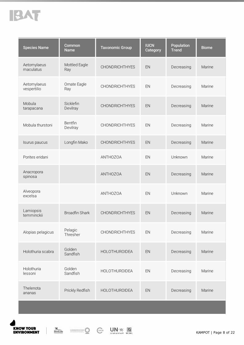
KAMPOT | Page 8 of 22
Species Name CommonName Taxonomic Group IUCN
CategoryPopulationTrend Biome
Aetomylaeusmaculatus
Mottled EagleRay CHONDRICHTHYES EN Decreasing Marine
Aetomylaeusvespertilio
Ornate EagleRay CHONDRICHTHYES EN Decreasing Marine
Mobulatarapacana
Sickle�nDevilray CHONDRICHTHYES EN Decreasing Marine
Mobula thurstoni Bent�nDevilray CHONDRICHTHYES EN Decreasing Marine
Isurus paucus Long�n Mako CHONDRICHTHYES EN Decreasing Marine
Porites eridani ANTHOZOA EN Unknown Marine
Anacroporaspinosa ANTHOZOA EN Decreasing Marine
Alveoporaexcelsa ANTHOZOA EN Unknown Marine
Lamiopsistemminckii Broad�n Shark CHONDRICHTHYES EN Decreasing Marine
Alopias pelagicus PelagicThresher CHONDRICHTHYES EN Decreasing Marine
Holothuria scabra GoldenSand�sh HOLOTHUROIDEA EN Decreasing Marine
Holothurialessoni
GoldenSand�sh HOLOTHUROIDEA EN Decreasing Marine
Thelenotaananas Prickly Red�sh HOLOTHUROIDEA EN Decreasing Marine
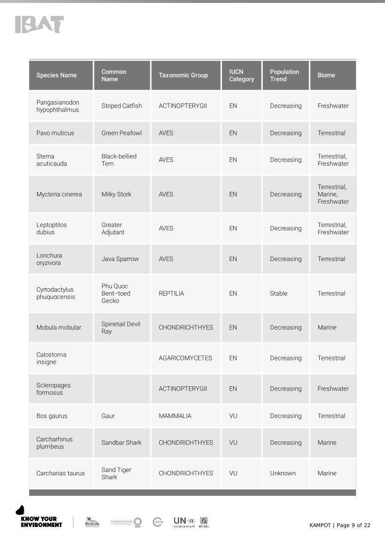
KAMPOT | Page 9 of 22
Species Name CommonName Taxonomic Group IUCN
CategoryPopulationTrend Biome
Pangasianodonhypophthalmus Striped Cat�sh ACTINOPTERYGII EN Decreasing Freshwater
Pavo muticus Green Peafowl AVES EN Decreasing Terrestrial
Sternaacuticauda
Black-belliedTern AVES EN Decreasing Terrestrial,
Freshwater
Mycteria cinerea Milky Stork AVES EN DecreasingTerrestrial,Marine,Freshwater
Leptoptilosdubius
GreaterAdjutant AVES EN Decreasing Terrestrial,
Freshwater
Lonchuraoryzivora Java Sparrow AVES EN Decreasing Terrestrial
Cyrtodactylusphuquocensis
Phu QuocBent–toedGecko
REPTILIA EN Stable Terrestrial
Mobula mobular Spinetail DevilRay CHONDRICHTHYES EN Decreasing Marine
Calostomainsigne AGARICOMYCETES EN Decreasing Terrestrial
Scleropagesformosus ACTINOPTERYGII EN Decreasing Freshwater
Bos gaurus Gaur MAMMALIA VU Decreasing Terrestrial
Carcharhinusplumbeus Sandbar Shark CHONDRICHTHYES VU Decreasing Marine
Carcharias taurus Sand TigerShark CHONDRICHTHYES VU Unknown Marine
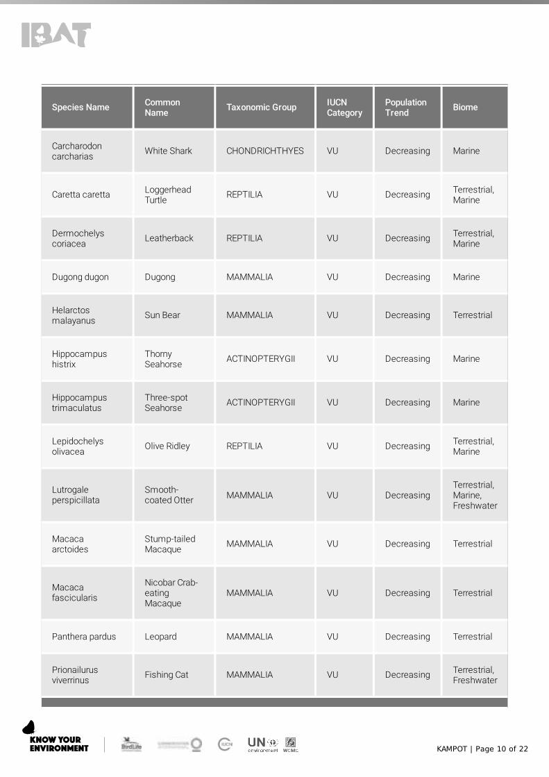
KAMPOT | Page 10 of 22
Species Name CommonName Taxonomic Group IUCN
CategoryPopulationTrend Biome
Carcharodoncarcharias White Shark CHONDRICHTHYES VU Decreasing Marine
Caretta caretta LoggerheadTurtle REPTILIA VU Decreasing Terrestrial,
Marine
Dermochelyscoriacea Leatherback REPTILIA VU Decreasing Terrestrial,
Marine
Dugong dugon Dugong MAMMALIA VU Decreasing Marine
Helarctosmalayanus Sun Bear MAMMALIA VU Decreasing Terrestrial
Hippocampushistrix
ThornySeahorse ACTINOPTERYGII VU Decreasing Marine
Hippocampustrimaculatus
Three-spotSeahorse ACTINOPTERYGII VU Decreasing Marine
Lepidochelysolivacea Olive Ridley REPTILIA VU Decreasing Terrestrial,
Marine
Lutrogaleperspicillata
Smooth-coated Otter MAMMALIA VU Decreasing
Terrestrial,Marine,Freshwater
Macacaarctoides
Stump-tailedMacaque MAMMALIA VU Decreasing Terrestrial
Macacafascicularis
Nicobar Crab-eatingMacaque
MAMMALIA VU Decreasing Terrestrial
Panthera pardus Leopard MAMMALIA VU Decreasing Terrestrial
Prionailurusviverrinus Fishing Cat MAMMALIA VU Decreasing Terrestrial,
Freshwater

KAMPOT | Page 11 of 22
Species Name CommonName Taxonomic Group IUCN
CategoryPopulationTrend Biome
Pteropus lylei Lyle's FlyingFox MAMMALIA VU Decreasing Terrestrial
Ursus thibetanus Asiatic BlackBear MAMMALIA VU Decreasing Terrestrial
Hopea odorata MAGNOLIOPSIDA VU Decreasing Terrestrial
Dipterocarpusalatus MAGNOLIOPSIDA VU Decreasing Terrestrial
Dipterocarpuscostatus MAGNOLIOPSIDA VU Decreasing Terrestrial
Shorea roxburghii White Meranti MAGNOLIOPSIDA VU Decreasing Terrestrial
Hopea pierrei MAGNOLIOPSIDA VU Decreasing Terrestrial
Shorea guiso Red Balau MAGNOLIOPSIDA VU Decreasing Terrestrial
Shorea thorelii MAGNOLIOPSIDA VU Decreasing Terrestrial
Alopias vulpinus CommonThresher CHONDRICHTHYES VU Decreasing Marine
Carcharhinusfalciformis Silky Shark CHONDRICHTHYES VU Decreasing Marine
Urogymnusasperrimus Porcupine Ray CHONDRICHTHYES VU Decreasing Marine
Macaca leoninaNorthern Pig-tailedMacaque
MAMMALIA VU Decreasing Terrestrial
Hippocampuscomes
Tiger TailSeahorse ACTINOPTERYGII VU Decreasing Marine
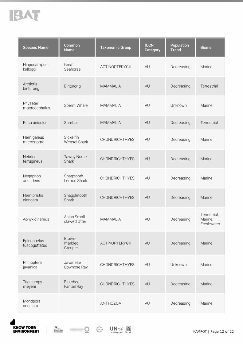
KAMPOT | Page 12 of 22
Species Name CommonName Taxonomic Group IUCN
CategoryPopulationTrend Biome
Hippocampuskelloggi
GreatSeahorse ACTINOPTERYGII VU Decreasing Marine
Arctictisbinturong Binturong MAMMALIA VU Decreasing Terrestrial
Physetermacrocephalus Sperm Whale MAMMALIA VU Unknown Marine
Rusa unicolor Sambar MAMMALIA VU Decreasing Terrestrial
Hemigaleusmicrostoma
Sickel�nWeasel Shark CHONDRICHTHYES VU Decreasing Marine
Nebriusferrugineus
Tawny NurseShark CHONDRICHTHYES VU Decreasing Marine
Negaprionacutidens
SharptoothLemon Shark CHONDRICHTHYES VU Decreasing Marine
Hemipristiselongata
SnaggletoothShark CHONDRICHTHYES VU Decreasing Marine
Aonyx cinereus Asian Small-clawed Otter MAMMALIA VU Decreasing
Terrestrial,Marine,Freshwater
Epinephelusfuscoguttatus
Brown-marbledGrouper
ACTINOPTERYGII VU Decreasing Marine
Rhinopterajavanica
JavaneseCownose Ray CHONDRICHTHYES VU Unknown Marine
Taeniuropsmeyeni
BlotchedFantail Ray CHONDRICHTHYES VU Decreasing Marine
Montiporaangulata ANTHOZOA VU Decreasing Marine

KAMPOT | Page 13 of 22
Species Name CommonName Taxonomic Group IUCN
CategoryPopulationTrend Biome
Moseleyalatistellata ANTHOZOA VU Decreasing Marine
Pavona venosa ANTHOZOA VU Unknown Marine
Catalaphylliajardinei ANTHOZOA VU Unknown Marine
Alveoporamarionensis ANTHOZOA VU Unknown Marine
Pectinia lactuca Lettuce Coral ANTHOZOA VU Unknown Marine
Acropora willisae ANTHOZOA VU Decreasing Marine
Acroporaacuminata ANTHOZOA VU Decreasing Marine
Pectiniaalcicornis ANTHOZOA VU Unknown Marine
Turbinaria bifrons ANTHOZOA VU Unknown Marine
Acropora listeri ANTHOZOA VU Decreasing Marine
Acroporapaniculata ANTHOZOA VU Decreasing Marine
Gonioporaplanulata ANTHOZOA VU Unknown Marine
Gonioporapolyformis ANTHOZOA VU Unknown Marine
Acroporavaughani ANTHOZOA VU Decreasing Marine
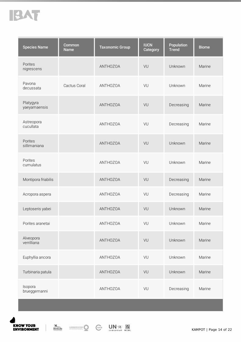
KAMPOT | Page 14 of 22
Species Name CommonName Taxonomic Group IUCN
CategoryPopulationTrend Biome
Poritesnigrescens ANTHOZOA VU Unknown Marine
Pavonadecussata Cactus Coral ANTHOZOA VU Unknown Marine
Platygyrayaeyamaensis ANTHOZOA VU Decreasing Marine
Astreoporacucullata ANTHOZOA VU Decreasing Marine
Poritessillimaniana ANTHOZOA VU Unknown Marine
Poritescumulatus ANTHOZOA VU Unknown Marine
Montipora friabilis ANTHOZOA VU Decreasing Marine
Acropora aspera ANTHOZOA VU Decreasing Marine
Leptoseris yabei ANTHOZOA VU Unknown Marine
Porites aranetai ANTHOZOA VU Unknown Marine
Alveoporaverrilliana ANTHOZOA VU Unknown Marine
Euphyllia ancora ANTHOZOA VU Unknown Marine
Turbinaria patula ANTHOZOA VU Unknown Marine
Isoporabrueggemanni ANTHOZOA VU Decreasing Marine
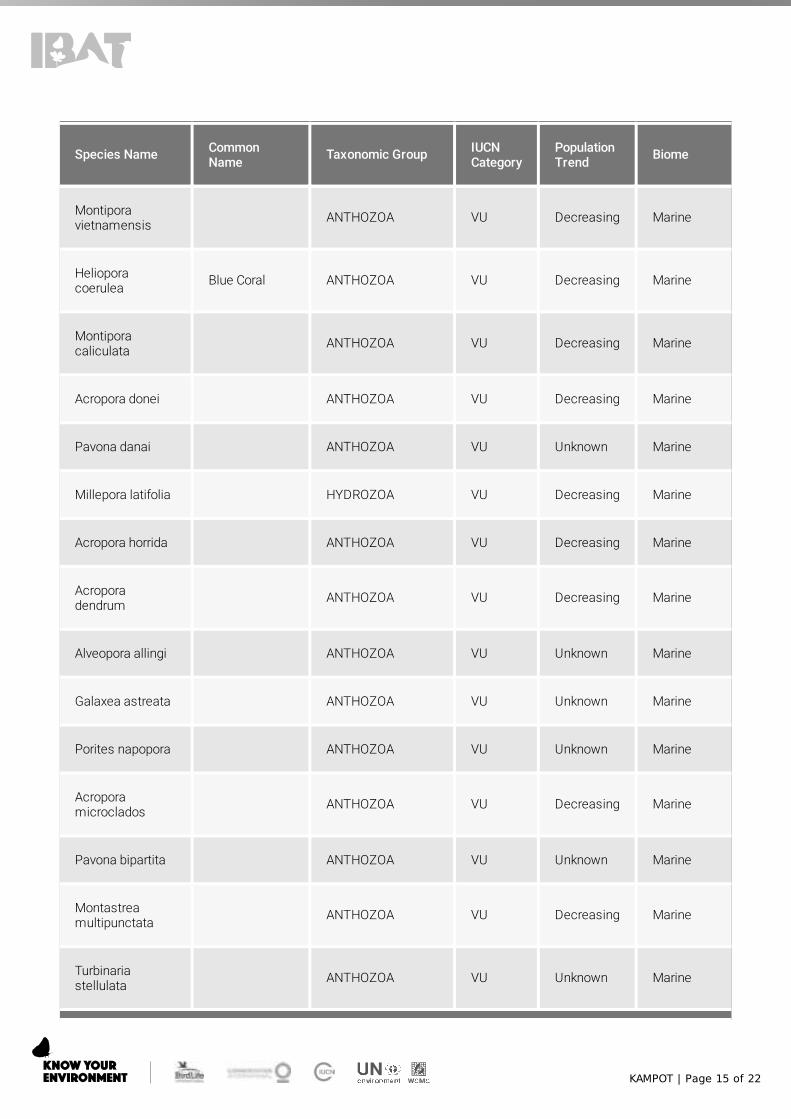
KAMPOT | Page 15 of 22
Species Name CommonName Taxonomic Group IUCN
CategoryPopulationTrend Biome
Montiporavietnamensis ANTHOZOA VU Decreasing Marine
Helioporacoerulea Blue Coral ANTHOZOA VU Decreasing Marine
Montiporacaliculata ANTHOZOA VU Decreasing Marine
Acropora donei ANTHOZOA VU Decreasing Marine
Pavona danai ANTHOZOA VU Unknown Marine
Millepora latifolia HYDROZOA VU Decreasing Marine
Acropora horrida ANTHOZOA VU Decreasing Marine
Acroporadendrum ANTHOZOA VU Decreasing Marine
Alveopora allingi ANTHOZOA VU Unknown Marine
Galaxea astreata ANTHOZOA VU Unknown Marine
Porites napopora ANTHOZOA VU Unknown Marine
Acroporamicroclados ANTHOZOA VU Decreasing Marine
Pavona bipartita ANTHOZOA VU Unknown Marine
Montastreamultipunctata ANTHOZOA VU Decreasing Marine
Turbinariastellulata ANTHOZOA VU Unknown Marine
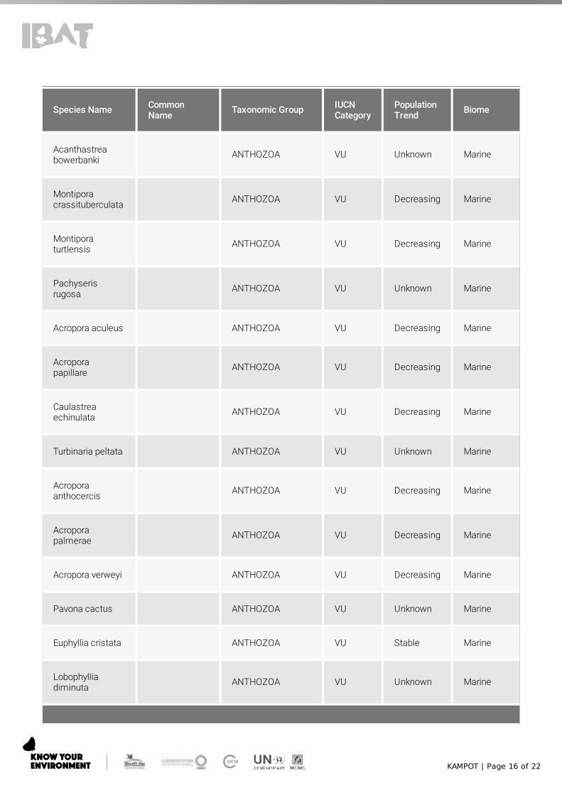
KAMPOT | Page 16 of 22
Species Name CommonName Taxonomic Group IUCN
CategoryPopulationTrend Biome
Acanthastreabowerbanki ANTHOZOA VU Unknown Marine
Montiporacrassituberculata ANTHOZOA VU Decreasing Marine
Montiporaturtlensis ANTHOZOA VU Decreasing Marine
Pachyserisrugosa ANTHOZOA VU Unknown Marine
Acropora aculeus ANTHOZOA VU Decreasing Marine
Acroporapapillare ANTHOZOA VU Decreasing Marine
Caulastreaechinulata ANTHOZOA VU Decreasing Marine
Turbinaria peltata ANTHOZOA VU Unknown Marine
Acroporaanthocercis ANTHOZOA VU Decreasing Marine
Acroporapalmerae ANTHOZOA VU Decreasing Marine
Acropora verweyi ANTHOZOA VU Decreasing Marine
Pavona cactus ANTHOZOA VU Unknown Marine
Euphyllia cristata ANTHOZOA VU Stable Marine
Lobophylliadiminuta ANTHOZOA VU Unknown Marine
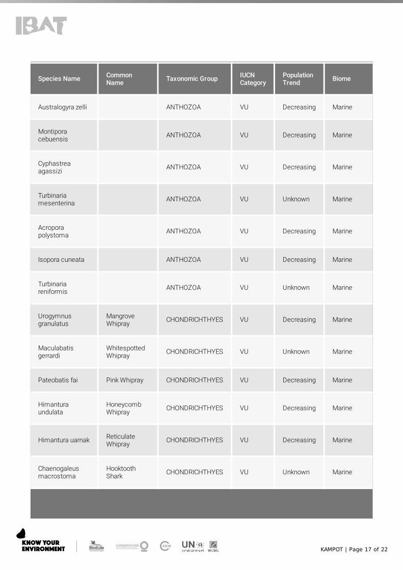
KAMPOT | Page 17 of 22
Species Name CommonName Taxonomic Group IUCN
CategoryPopulationTrend Biome
Australogyra zelli ANTHOZOA VU Decreasing Marine
Montiporacebuensis ANTHOZOA VU Decreasing Marine
Cyphastreaagassizi ANTHOZOA VU Decreasing Marine
Turbinariamesenterina ANTHOZOA VU Unknown Marine
Acroporapolystoma ANTHOZOA VU Decreasing Marine
Isopora cuneata ANTHOZOA VU Decreasing Marine
Turbinariareniformis ANTHOZOA VU Unknown Marine
Urogymnusgranulatus
MangroveWhipray CHONDRICHTHYES VU Decreasing Marine
Maculabatisgerrardi
WhitespottedWhipray CHONDRICHTHYES VU Unknown Marine
Pateobatis fai Pink Whipray CHONDRICHTHYES VU Decreasing Marine
Himanturaundulata
HoneycombWhipray CHONDRICHTHYES VU Decreasing Marine
Himantura uarnak ReticulateWhipray CHONDRICHTHYES VU Decreasing Marine
Chaenogaleusmacrostoma
HooktoothShark CHONDRICHTHYES VU Unknown Marine
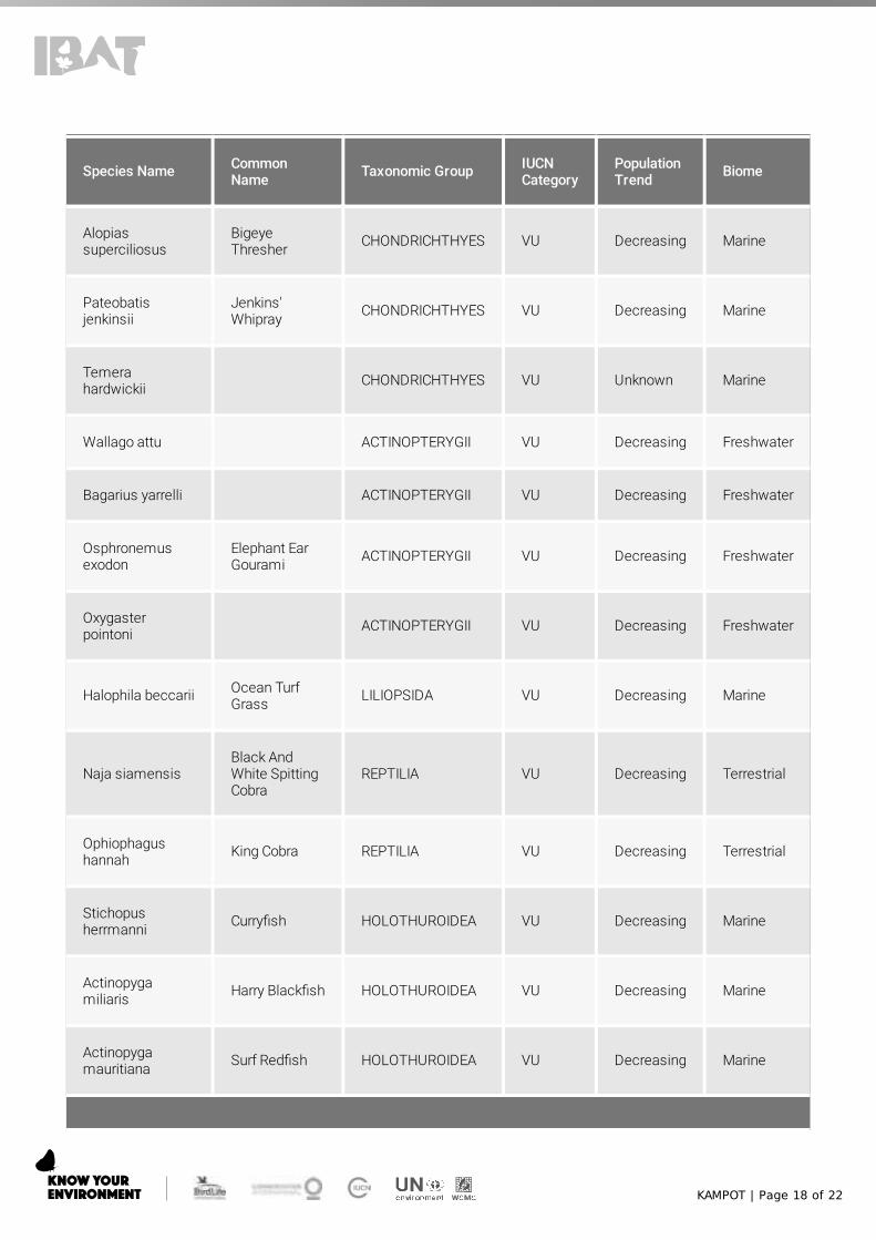
KAMPOT | Page 18 of 22
Species Name CommonName Taxonomic Group IUCN
CategoryPopulationTrend Biome
Alopiassuperciliosus
BigeyeThresher CHONDRICHTHYES VU Decreasing Marine
Pateobatisjenkinsii
Jenkins'Whipray CHONDRICHTHYES VU Decreasing Marine
Temerahardwickii CHONDRICHTHYES VU Unknown Marine
Wallago attu ACTINOPTERYGII VU Decreasing Freshwater
Bagarius yarrelli ACTINOPTERYGII VU Decreasing Freshwater
Osphronemusexodon
Elephant EarGourami ACTINOPTERYGII VU Decreasing Freshwater
Oxygasterpointoni ACTINOPTERYGII VU Decreasing Freshwater
Halophila beccarii Ocean TurfGrass LILIOPSIDA VU Decreasing Marine
Naja siamensisBlack AndWhite SpittingCobra
REPTILIA VU Decreasing Terrestrial
Ophiophagushannah King Cobra REPTILIA VU Decreasing Terrestrial
Stichopusherrmanni Curry�sh HOLOTHUROIDEA VU Decreasing Marine
Actinopygamiliaris Harry Black�sh HOLOTHUROIDEA VU Decreasing Marine
Actinopygamauritiana Surf Red�sh HOLOTHUROIDEA VU Decreasing Marine

KAMPOT | Page 19 of 22
Species Name CommonName Taxonomic Group IUCN
CategoryPopulationTrend Biome
Actinopygaechinites
Deep WaterRed�sh HOLOTHUROIDEA VU Decreasing Marine
Datnioidesundecimradiatus ACTINOPTERYGII VU Decreasing Freshwater
Cirrhinusmicrolepis
Small ScaledMud Carp ACTINOPTERYGII VU Decreasing Freshwater
Pangasiuskremp� ACTINOPTERYGII VU Decreasing Marine,
Freshwater
Mola mola Ocean Sun�sh ACTINOPTERYGII VU Decreasing Marine
Python bivittatus BurmesePython REPTILIA VU Decreasing Terrestrial
Himanturaleoparda
LeopardWhipray CHONDRICHTHYES VU Decreasing Marine
Mobula alfredi Reef MantaRay CHONDRICHTHYES VU Decreasing Marine
Neophocaenaphocaenoides
Indo-Paci�cFinlessPorpoise
MAMMALIA VU Decreasing Marine
Mobula birostris Giant MantaRay CHONDRICHTHYES VU Decreasing Marine
Holothuriafuscogilva HOLOTHUROIDEA VU Decreasing Marine
Mulleripicuspulverulentus
Great SlatyWoodpecker AVES VU Decreasing Terrestrial
Buceros bicornis Great Hornbill AVES VU Decreasing Terrestrial

KAMPOT | Page 20 of 22
Species Name CommonName Taxonomic Group IUCN
CategoryPopulationTrend Biome
Rhyticerosundulatus
WreathedHornbill AVES VU Decreasing Terrestrial
Carpococcyxrenauldi
Coral-billedGround-cuckoo
AVES VU Decreasing Terrestrial
Rynchopsalbicollis
IndianSkimmer AVES VU Decreasing Terrestrial,
Freshwater
Clanga clanga GreaterSpotted Eagle AVES VU Decreasing Terrestrial,
Freshwater
Leptoptilosjavanicus
LesserAdjutant AVES VU Decreasing
Terrestrial,Marine,Freshwater
Ciconiaepiscopus
AsianWoollyneck AVES VU Decreasing
Terrestrial,Marine,Freshwater
Aetobatusocellatus
Spotted EagleRay CHONDRICHTHYES VU Decreasing Marine
Omobranchussmithi ACTINOPTERYGII VU Unknown Marine
Arctonyx collaris Greater HogBadger MAMMALIA VU Decreasing Terrestrial
Sousa chinensisIndo-Paci�cHumpbackDolphin
MAMMALIA VU Decreasing Marine,Freshwater
Aetomylaeusnicho�i
Banded EagleRay CHONDRICHTHYES VU Decreasing Marine
Anonyxmolyteslilliput INSECTA VU Decreasing Terrestrial
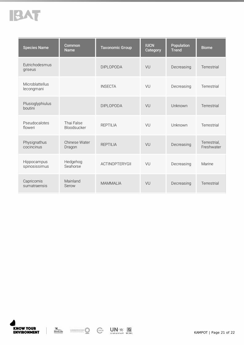
KAMPOT | Page 21 of 22
Species Name CommonName Taxonomic Group IUCN
CategoryPopulationTrend Biome
Eutrichodesmusgriseus DIPLOPODA VU Decreasing Terrestrial
Microblattelluslecongmani INSECTA VU Decreasing Terrestrial
Plusioglyphiulusboutini DIPLOPODA VU Unknown Terrestrial
Pseudocalotes�oweri
Thai FalseBloodsucker REPTILIA VU Unknown Terrestrial
Physignathuscocincinus
Chinese WaterDragon REPTILIA VU Decreasing Terrestrial,
Freshwater
Hippocampusspinosissimus
HedgehogSeahorse ACTINOPTERYGII VU Decreasing Marine
Capricornissumatraensis
MainlandSerow MAMMALIA VU Decreasing Terrestrial

KAMPOT | Page 22 of 22
Recommended citation
IBAT Proximity Report. Generated under licence 5956-12646 from the Integrated Biodiversity Assessment Tool on 01December 2020 (GMT). www.ibat-alliance.org
How to use this report
This report provides an indication of the potential biodiversity-related features - protected areas, key biodiversity areasand species - close to the speci�ed location. It provides an early indication of potential biodiversity concerns, and canprovide valuable guidance in making decisions. For example, this information can be helpful when assessing thepotential environmental risk and impact of a site, categorising investments/projects, preparing the terms of referencefor an impact assessment, focusing attention on key species of conservation concern and sites of known conservationvalue, and reviewing the results of an impact assessment.
The report does not provide details of potential indirect, downstream or cumulative impacts. Furthermore, the reportshould be regarded as a “�rst-step”, providing a set of conservation values sourced from global data sets, and is not asubstitute for further investigation and due diligence, especially concerning national and/or local conservation priorities.
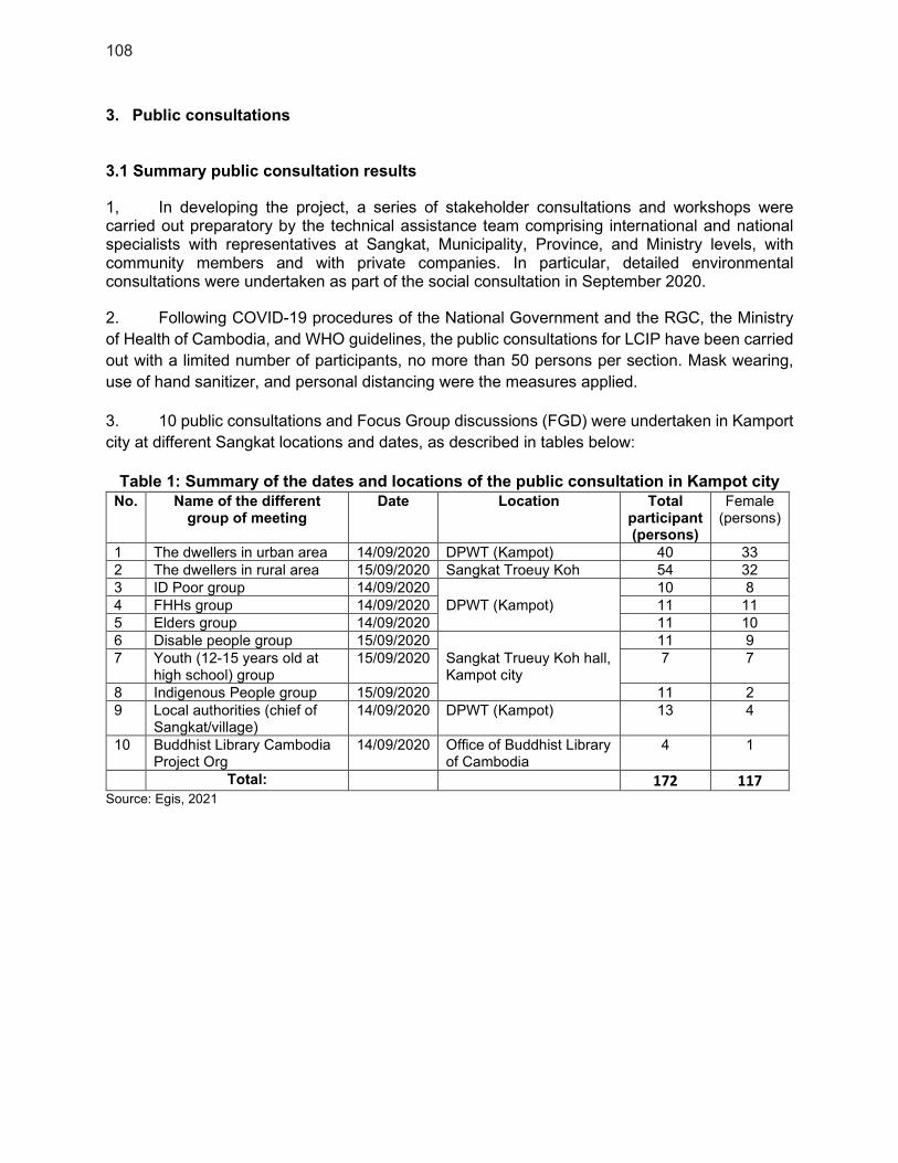
108
3. Public consultations 3.1 Summary public consultation results
1, In developing the project, a series of stakeholder consultations and workshops were carried out preparatory by the technical assistance team comprising international and national specialists with representatives at Sangkat, Municipality, Province, and Ministry levels, with community members and with private companies. In particular, detailed environmental consultations were undertaken as part of the social consultation in September 2020.
2. Following COVID-19 procedures of the National Government and the RGC, the Ministry
of Health of Cambodia, and WHO guidelines, the public consultations for LCIP have been carried
out with a limited number of participants, no more than 50 persons per section. Mask wearing,
use of hand sanitizer, and personal distancing were the measures applied.
3. 10 public consultations and Focus Group discussions (FGD) were undertaken in Kamport
city at different Sangkat locations and dates, as described in tables below:
Table 1: Summary of the dates and locations of the public consultation in Kampot city
No. Name of the different group of meeting
Date Location Total participant (persons)
Female (persons)
1 The dwellers in urban area 14/09/2020 DPWT (Kampot) 40 33
2 The dwellers in rural area 15/09/2020 Sangkat Troeuy Koh 54 32
3 ID Poor group 14/09/2020
DPWT (Kampot)
10 8
4 FHHs group 14/09/2020 11 11
5 Elders group 14/09/2020 11 10
6 Disable people group 15/09/2020
Sangkat Trueuy Koh hall, Kampot city
11 9
7 Youth (12-15 years old at high school) group
15/09/2020 7 7
8 Indigenous People group 15/09/2020 11 2
9 Local authorities (chief of Sangkat/village)
14/09/2020 DPWT (Kampot) 13 4
10 Buddhist Library Cambodia Project Org
14/09/2020 Office of Buddhist Library of Cambodia
4 1
Total: 172 117
Source: Egis, 2021

109
Table 2: Summary results of the public consultation in Kampot city
No. Name of the different group
of meeting
Perception to the
project
Suggestions and Recommendations
1 The dwellers in Kampot city both urban and rural area
All of them
understand the
project, which will
provide many
benefits to the
whole people in
Kampot City and
contribute to the
provincial as well as
national economic
development
through various
activities, especially
tourism.
All participants in
the different PCs
welcome and 100%
support the project.
- Suggested to construct both wastewater
networks and drainage at the same time
- In Sangkat Troeuy Koh, they suggested
providing solid waste management service in
their area.
- The O&M of the drainage and sewerage
system agency should be available in the
project operation phase.
- Should provide training program on safety,
health, and operation for workers and
operational staffs.
- Should provide education and awareness
program to residents and others in the vicinity
of the drainage system avoiding disposal of
solid waste/rubbish into the manhole.
2 ID Poor group - The project should recruit local workforces as
much as possible to provide job opportunities
for them.
- The contractor should inform the local people
before starting construction activities in
certain location.
- They cannot afford to pay the connection cost
and service fee with high cost.
- Any campaigning project activities/program in
effeteness should be through local NGO and
the TVs.
3 FHHs group - Should provide project construction schedule
to the villagers who living surrounding the
project area.
- Should keep the reasonable access road for
the resident during the construction phase.
- The contractor should follow the law of the
Ministry of labor and vocational training
- The traffic sign, barrier, and detour road
should install and construct.
- Vocational training is needed such as chef,
hairdresser, and tailor for the affected people.
- The media that they use the most to get
information is social media (Facebook), TV,
and some NGO/CBO working in villages, so
any campaigning project activities/program in
effeteness should be through local NGO and
the TVs.
4 Elders group - Suggest training on solid waste management
as reduce, reuse, and recycle.

110
- Should provide campaign to promote the
benefits of wastewater systems.
- The traffic sign, barrier, and detour road
should be provided in construction phase.
- They suggest for free of charge for
connection fee for sewerage system.
- Project information should be informed to the
local people before the construction phase.
- Radio and TV are good media for sanitation
campaigning to the local people.
5 Disable people group
- Safe equipment should provide during the
construction and operation phases.
- Suggest providing vocational training to the
project affected people for supporting their
livelihood.
- The project construction in dry season is
requested.
- They suggested in providing discount price or
free of using sanitation system for disabled
people.
6 Youth (12-15 years old at high school) group
- Should encourage people not to burn
garbage. It causes human health problems.
- The project owner should provide any
workshops or campaigns about the
advantage of solid waste and wastewater
system management.
- Should disseminate the benefits of the LCIP
project to the people for encouraging them to
involve in supporting O&M cost.
- Training in solid waste and wastewater
management should provide to local authority
as well as operation agency.
- Radios and the TVs are good media for
campaigning of the sanitation program.
7 Indigenous People group
- Training on solid waste
sorting/reduction/recycle is needed.
- Awareness campaigning on the benefit of the
wastewater management system is
suggested.
- Improvement on the solid waste service in
their community is much more required.
- The project construction schedule should be
sufficiently provided to the AHs/APs before
the construction phase.
- The most active organization in their
community is the CWDCC organization, so
they can share different kind information to
the local people here.
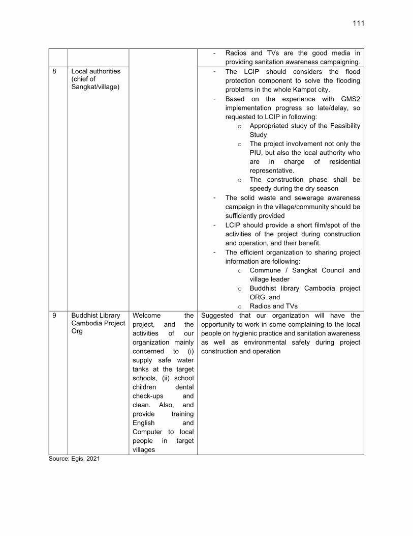
111
- Radios and TVs are the good media in
providing sanitation awareness campaigning.
8 Local authorities (chief of Sangkat/village)
- The LCIP should considers the flood
protection component to solve the flooding
problems in the whole Kampot city.
- Based on the experience with GMS2
implementation progress so late/delay, so
requested to LCIP in following:
o Appropriated study of the Feasibility
Study
o The project involvement not only the
PIU, but also the local authority who
are in charge of residential
representative.
o The construction phase shall be
speedy during the dry season
- The solid waste and sewerage awareness
campaign in the village/community should be
sufficiently provided
- LCIP should provide a short film/spot of the
activities of the project during construction
and operation, and their benefit.
- The efficient organization to sharing project
information are following:
o Commune / Sangkat Council and
village leader
o Buddhist library Cambodia project
ORG. and
o Radios and TVs
9 Buddhist Library Cambodia Project Org
Welcome the
project, and the
activities of our
organization mainly
concerned to (i)
supply safe water
tanks at the target
schools, (ii) school
children dental
check-ups and
clean. Also, and
provide training
English and
Computer to local
people in target
villages
Suggested that our organization will have the
opportunity to work in some complaining to the local
people on hygienic practice and sanitation awareness
as well as environmental safety during project
construction and operation
Source: Egis, 2021
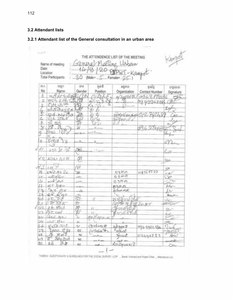
112
3.2 Attendant lists
3.2.1 Attendant list of the General consultation in an urban area
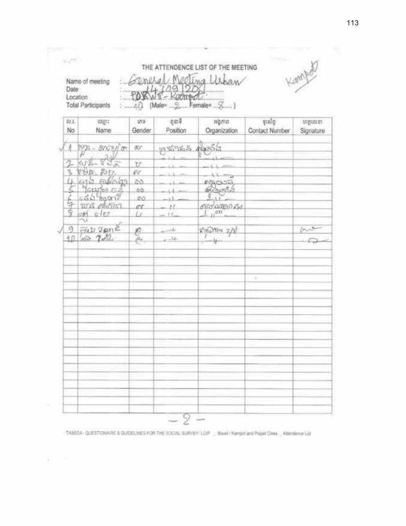
113
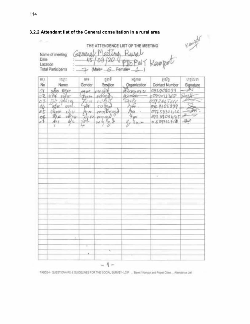
114
3.2.2 Attendant list of the General consultation in a rural area
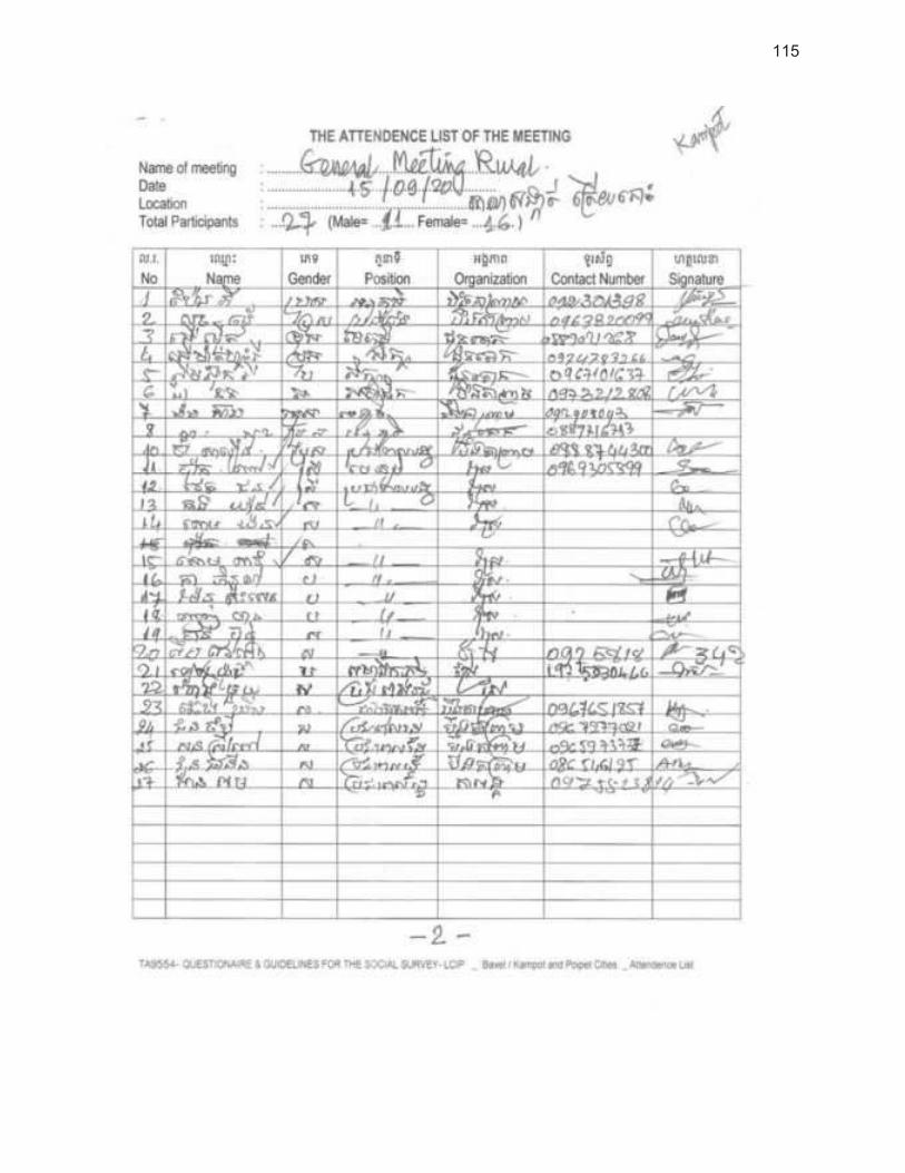
115
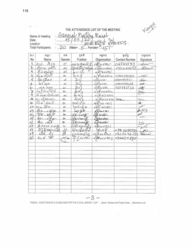
116

117
3.2.3 Attendant list of the FGD 1 ID Poor

118
3.2.4 Attendant list of the FGD 2 FHHs
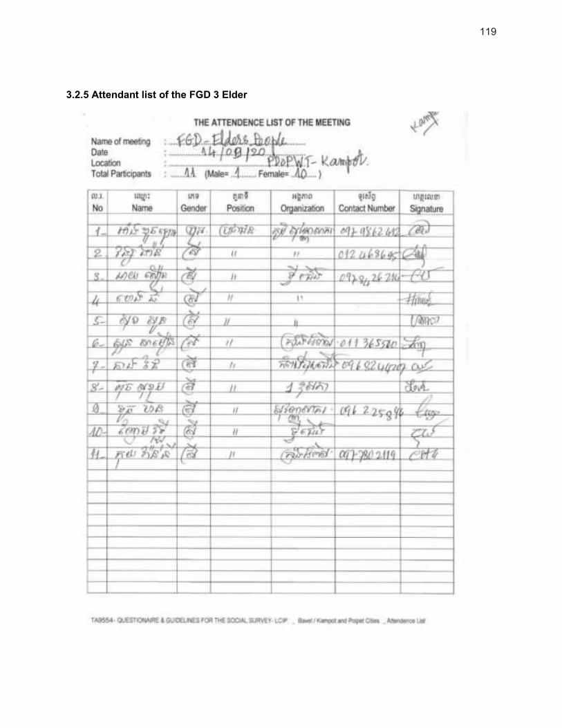
119
3.2.5 Attendant list of the FGD 3 Elder

120
3.2.6 Attendant list of the FGD 4 Disabled People

121
3.2.7 Attendant list of the FGD 5 Youth (12-15 years old at high school)
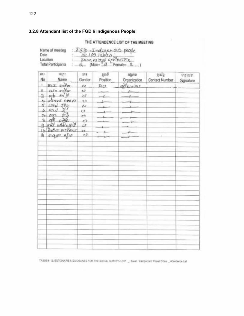
122
3.2.8 Attendant list of the FGD 6 Indigenous People

123
3.2.9 Attendant list of the FGD 7 Local Authority
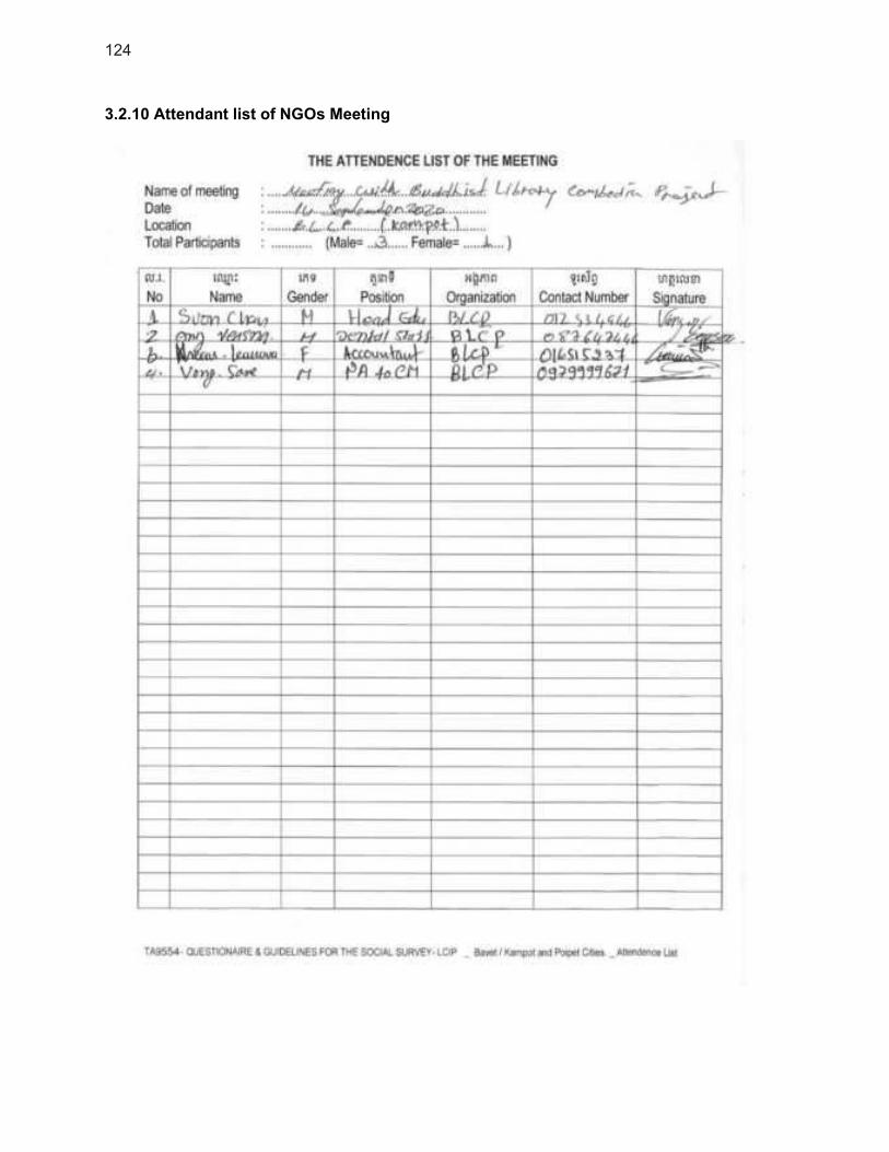
124
3.2.10 Attendant list of NGOs Meeting

125
3.3 Activities of Public consultants
3.3.1 Activities of the general meeting with dwellers in Kampot city
The General Meeting in Urban Area
The General Meeting in Rural Area
3.3.2 Activities of the FGD 1 ID Poor
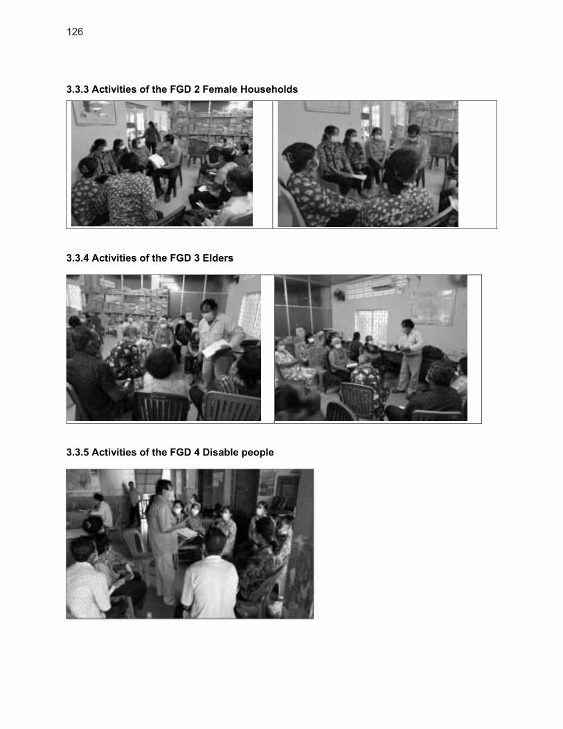
126
3.3.3 Activities of the FGD 2 Female Households
3.3.4 Activities of the FGD 3 Elders
3.3.5 Activities of the FGD 4 Disable people
127
3.3.6 Activities of the FDG 5 Youth
3.3.7 Activities of FGD 6 indigenous people
3.3.8 Activities of FGD 7 local authorities

128
3.3.9 Activities with NGOs-CBO
129
4. Safeguards Monitoring Report Template
Semi-Annual Environmental Monitoring Report
COUNTRY [complete]
Ministry of [complete]
[Project Number/Name]
Reporting Period: [date covered by this report]
Date: [date of issue of this report]
SEMR Report Number: [1, 2 or 3 ... – depending on how many SEMRs issued before]
Contents
1 ENVIRONMENTAL SAFEGUARDS SUMMARY 1
1.1 Summary of Project Progress 1
1.2 Summary of EMP Implementation 2
1.3 Summary of EMP Monitoring 2
1.4 Summary of Complaints, Issues and Corrective Action 2
2 SAFEGUARDS STAFF, TRAINING AND DOCUMENTATION 3
2.1 Implementation Arrangements 3
2.2 Training & Capacity Building 3
2.3 ADB Clearances 4
2.4 National Approvals 4
2.5 Construction Environmental Management Plan (CEMP) Approvals 5
3 EMP IMPLEMENTATION 5
3.1 Environmental Performance 5
3.2 Health and Safety Performance 7
4 EMP MONITORING 9
4.1 Environmental Quality Monitoring 9
4.2 Construction Phase Affected People Consultation 10
5 COMPLAINTS, ISSUES, CORRECTIVE ACTION 11
5.1 Information Disclosure 11
5.2 Grievance Redress Mechanism 12
5.3 Corrective Action 14
6 CONCLUSION AND RECOMMENDATIONS 15
Tables
Table 1 Project Progress Summary ....................................................................................... 1 Table 2. Status of Environmental Safeguard Roles ............................................................... 3 Table 3. Environmental Safeguards Training Provided and Planned ..................................... 4 Table 4. Status of Environmental Safeguard Documents ...................................................... 4 Table 5. Status of National Approvals for Environmental Documents .................................... 4 Table 6. Status of CEMP Approvals ...................................................................................... 5 Table 7. Status of EMP Compliance [subproject] .................................................................. 6 Table 8. EMP– Actions Needed for Compliance [subproject] ............................................... 7 Table 9. EMP Compliance Outstanding Issues from Previous Report(s) [subproject] ........... 7 Table 10. Status of Health and Safety Compliance - ALL subprojects ................................... 8
Table 10. Status of Health and Safety Actions Needed for Compliance - ALL subprojects .... 8 Table 11. EMP Compliance Outstanding Issues from Previous Report(s) – ALL subrojects . 9 Table 12. EMP Environmental Quality Monitoring Requirements ......................................... 9 Table 13. EMP Environmental Quality Monitoring implemented ........................................... 9 Table 14. Construction Phase Affected People Consultation ............................................... 11 Table 15. Information Disclosure ......................................................................................... 11 Table 16. Project Complaints or Issues ............................................................................... 13 Table 17. Project Complaints or Issues – Not resolved from previous reports ..................... 13 Table 18. Corrective Action Issued...................................................................................... 14
Annexes
Annex 1 Environmental Quality Monitoring Results ............................................................. 16 Annex 2 Photo Record – Visits, Monitoring, Consultation .................................................... 17

Notes on this template:
[Advice: text in red} - this gives the PMU help on what information to add into the
sections of the report. Delete the red text when the report is complete.
[text in yellow] - delete this text and add the relevant answer. Delete the text in yellow
when the answers are completed.

1
1 ENVIRONMENTAL SAFEGUARDS SUMMARY
[Advice: Complete this summary under each heading. This summary can be copied directly into the
main report to support with the Main Report preparation]
1. The [1st,2nd, 3rd etc] Semi-annual Environment Monitoring Report (SEMR) covers the period of [start month – end month and year] for [Project Name]. The SEMR has been prepared to fulfil the safeguard policy requirement of ADB.
2. The SEMR is prepared by [name of organisation and function e.g External Monitoring Consultant or Support Consultant] and checked by [PMU or Ministry].
1.1 Summary of Project Progress
[Advice: Complete the summary table below. Section 2 gives more detail Project Progress]
3. The following table gives a brief summary of the project progress for contract award, construction and key activities in this reporting period:
Table 1 Project Progress Summary
Safeguards Category Environment B
Reporting Period: [Months/ Year] Date Last Report Issued: [Month/ Year]
Contracts Awarded to Date:
[Advice: For each Civil Works Contract to be awarded, give progress to date] CW1 [contractor name, award date, subproject] CW2 [contractor name, award date, subproject]
Construction Progress to Date:
[Advice: For each Civil Works Contract to be awarded, at END of Reporting Period] As of [Month/Year of this reporting period] the physical construction progress is as follows: CW1 [x %] construction completed CW2 [x %] construction completed
Key Sub-project Activities in this Reporting Period:
[Advice: For each Civil Works (CW) Contract, write the key activities that have taken place on construction sites during the 6 months covered in this report] Construction Activities CW1 [e.g. ground clearance and preparation, excavation of site] CW2 [e.g. ground clearance and preparation, excavation of site] [Advice: Include any consents or permissions in this section such as UXO clearance, EIA Approval, Waste disposal permission – include any issued during the 6 months covered in this report]
Permits or Consents Issued: Permit / Consent for [activity] issued by [Authority] on [date]

2
1.2 Summary of EMP Implementation
[Advice: This section gives a high level summary of how the progress on implementing the EMP and the mitigation measures is progressing, in this reporting period. Consider any main issues – the detail will be in the EMP Implementation section of the main report]
4. EMP implementation is summarised in the following points, for this reporting period:
[mitigation measures in use]
[overall progress and performance of contractors]
[other issues affecting project environmental performance?]
1.3 Summary of EMP Monitoring
[Advice: This section gives a high level summary of how the EMP has been monitored in this reporting period. This includes site visits by PIU, PMU, Construction Supervision Contractor, Independent Monitoring Organisation. The EMP will say who should be monitoring and when. Detail will be in the EMP Monitoring section of the main report]
5. EMP monitoring is summarised in the following points, for this reporting period:
Number of Monitoring Visits to Construction Site and wider area:
o [Number of] visits by PMU/PIU
o [Number of] visits by [others e.g. Independent Monitoring Organisation, MoE, CSC]
Number of Environmental Samples Tested:
o [Number of] water quality samples tested
o [Number of] air quality samples tested
o [Number of] water quality samples tested
1.4 Summary of Complaints, Issues and Corrective Action
[Advice: This section informs the Project and ADB of any potential problems that have been addressed or need to be addressed. It can include formal complaints through project Grievance Redress Mechanism. This is main issues only – the detail will be in the Corrective Actions/GRM part of the main report]
6. Any complaints, issues and corrective action that has been identified or implement is summarised in the following points, for this reporting period:
Issues Raised: [issues on construction sites e.g. dust, noise, traffic]
Grievances Raised with GRM: [Number of] grievances
Corrective Action issued by project to Contractor:
o [problem that needed corrective action]
o problem that needed corrective action]
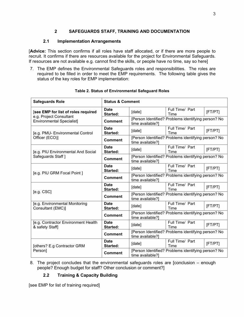
3
2 SAFEGUARDS STAFF, TRAINING AND DOCUMENTATION
2.1 Implementation Arrangements
[Advice: This section confirms if all roles have staff allocated, or if there are more people to recruit. It confirms if there are resources available for the project for Environmental Safeguards. If resources are not available e.g. cannot find the skills, or people have no time, say so here]
7. The EMP defines the Environmental Safeguards roles and responsibilities. The roles are required to be filled in order to meet the EMP requirements. The following table gives the status of the key roles for EMP implementation:
Table 2. Status of Environmental Safeguard Roles
Safeguards Role Status & Comment
[see EMP for list of roles required e.g. Project Consultant Environmental Specialist]
Date Started:
[date] Full Time/ Part Time
[FT/PT]
Comment [Person Identified? Problems identifying person? No time available?]
[e.g. PMU- Environmental Control Officer (ECO)]
Date Started:
[date] Full Time/ Part Time
[FT/PT]
Comment [Person Identified? Problems identifying person? No time available?]
[e.g. PIU Environmental And Social Safeguards Staff ]
Date Started:
[date] Full Time/ Part Time
[FT/PT]
Comment [Person Identified? Problems identifying person? No time available?]
[e.g. PIU GRM Focal Point ]
Date Started:
[date] Full Time/ Part Time
[FT/PT]
Comment [Person Identified? Problems identifying person? No time available?]
[e.g. CSC]
Date Started:
[date] Full Time/ Part Time
[FT/PT]
Comment [Person Identified? Problems identifying person? No time available?]
[e.g. Environmental Monitoring Consultant (EMC)]
Date Started:
[date] Full Time/ Part Time
[FT/PT]
Comment [Person Identified? Problems identifying person? No time available?]
[e.g. Contractor Environment Health & safety Staff]
Date Started:
[date] Full Time/ Part Time
[FT/PT]
Comment [Person Identified? Problems identifying person? No time available?]
[others? E.g Contractor GRM Person]
Date Started:
[date] Full Time/ Part Time
[FT/PT]
Comment [Person Identified? Problems identifying person? No time available?]
8. The project concludes that the environmental safeguards roles are [conclusion – enough people? Enough budget for staff? Other conclusion or comment?]
2.2 Training & Capacity Building
[see EMP for list of training required]

4
9. The following table gives the environmental safeguards training courses that have been completed during this reporting period and the planned training courses for the next six months:
Table 3. Environmental Safeguards Training Provided and Planned
Training Course Title Training Date Participants Training Provider
[E.g CEMP /EMP preparation]
[date – completed or future]
[e.g. No. of PIU/PMU, Contractors]
[e.g. Support consultants, MoE, Independent trainer]
2.3 ADB Clearances
[Advice: This section updates ADB with the current progress on the EMP and IEE for the project. Ensure the up to date documents are available and it is clear which is the latest version of each document]
10. The following table gives information on the status of the safeguards documents.
Table 4. Status of Environmental Safeguard Documents
Safeguards Documents Update Issued
(Latest Version) Submitted to MoE
Submitted to
ADB
[e.g. IEE] [date] [date or Not Applicable] [date]
[e.g. EMP subproject 1] [date] [date or Not Applicable] [date]
[e.g. EMP Subproject 2] [date] [date or Not Applicable] [date]
[e.g. EMP Subproject 3] [date] [date or Not Applicable] [date]
2.4 National Approvals
[Advice: This section updates ADB with the current progress on any national approvals and/or certifications needed such as final Environmental Impact Assessment (EIA), IEIA, ECC, Environmental Protections Contract, etc. (varies from country to country) or EMP approvals from the relevant Ministry. If there is no change between this reporting period and the last, the table in the previous report can be used here]
11. The following table gives an update on the necessary national approvals required for the project to proceed.
Table 5. Status of National Approvals for Environmental Documents
Documents Submitted to MoE Approved
By MoE:
Status – if
not
approved
Comment
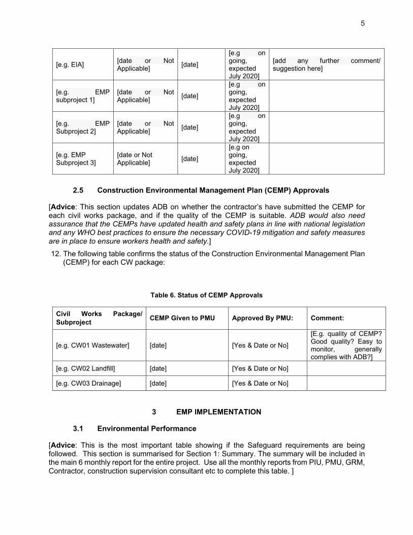
5
[e.g. EIA] [date or Not Applicable]
[date]
[e.g on going, expected July 2020]
[add any further comment/ suggestion here]
[e.g. EMP subproject 1]
[date or Not Applicable]
[date]
[e.g on going, expected July 2020]
[e.g. EMP Subproject 2]
[date or Not Applicable]
[date]
[e.g on going, expected July 2020]
[e.g. EMP Subproject 3]
[date or Not Applicable]
[date]
[e.g on going, expected July 2020]
2.5 Construction Environmental Management Plan (CEMP) Approvals
[Advice: This section updates ADB on whether the contractor’s have submitted the CEMP for each civil works package, and if the quality of the CEMP is suitable. ADB would also need assurance that the CEMPs have updated health and safety plans in line with national legislation and any WHO best practices to ensure the necessary COVID-19 mitigation and safety measures are in place to ensure workers health and safety.]
12. The following table confirms the status of the Construction Environmental Management Plan (CEMP) for each CW package:
Table 6. Status of CEMP Approvals
Civil Works Package/
Subproject CEMP Given to PMU Approved By PMU: Comment:
[e.g. CW01 Wastewater] [date] [Yes & Date or No]
[E.g. quality of CEMP? Good quality? Easy to monitor, generally complies with ADB?]
[e.g. CW02 Landfill] [date] [Yes & Date or No]
[e.g. CW03 Drainage] [date] [Yes & Date or No]
3 EMP IMPLEMENTATION
3.1 Environmental Performance
[Advice: This is the most important table showing if the Safeguard requirements are being followed. This section is summarised for Section 1: Summary. The summary will be included in the main 6 monthly report for the entire project. Use all the monthly reports from PIU, PMU, GRM, Contractor, construction supervision consultant etc to complete this table. ]

6
13. The following table gives the environmental impact mitigation measures in the Borrower (Project) EMP and the corresponding CEMP and how the project is progressing with implementing the mitigation measures, for each subproject.
14. The evidence for the compliance is through a combination of:
Site visits to observe site practices;
Consultation with affected people;
Regular environmental reporting from [CSC, Contractor, others, according to EMP requirements].
[Advice: This table needs to be repeated for each sub-project. Each subproject can EMP has different
Mitigation Measures & progress to report on. Health & safety Mitigation measures are reported
separately]
Table 7. Status of EMP Compliance [subproject]
EMP Requirement (Mitigation Measure)
Compliance & Description (Yes, No, Partial)
Comment or Further Explanation if Needed
Reasons for Not Full Compliance
1 Example 1. Worker Camp Sanitation
Yes Camp includes septic tank
which is installed -
2
Example 2. Noise and Dust Management
Partial
Contractor given corrective
action issued 21-07-19:
-Spray 3x daily
-Start work 7am
-Water is not sprayed
2x daily;
-Working outside
allowed hours, starting
at 6:30am
1 [mitigation measure] [Yes/No/Partial]
[comment on evidence of compliance if needed – any additional information]
[give reason/evidence for non-compliance]
2
3
4
5
6 [continue]
15. For all ‘Partial’ or ‘No’ compliance issues in the table above, the actions needed to solve the compliance issues are in the table below:
[Advice: For any Partial or Not Compliance issues in the table above, the table below shows ADB what actions will be taken to ensure compliance]
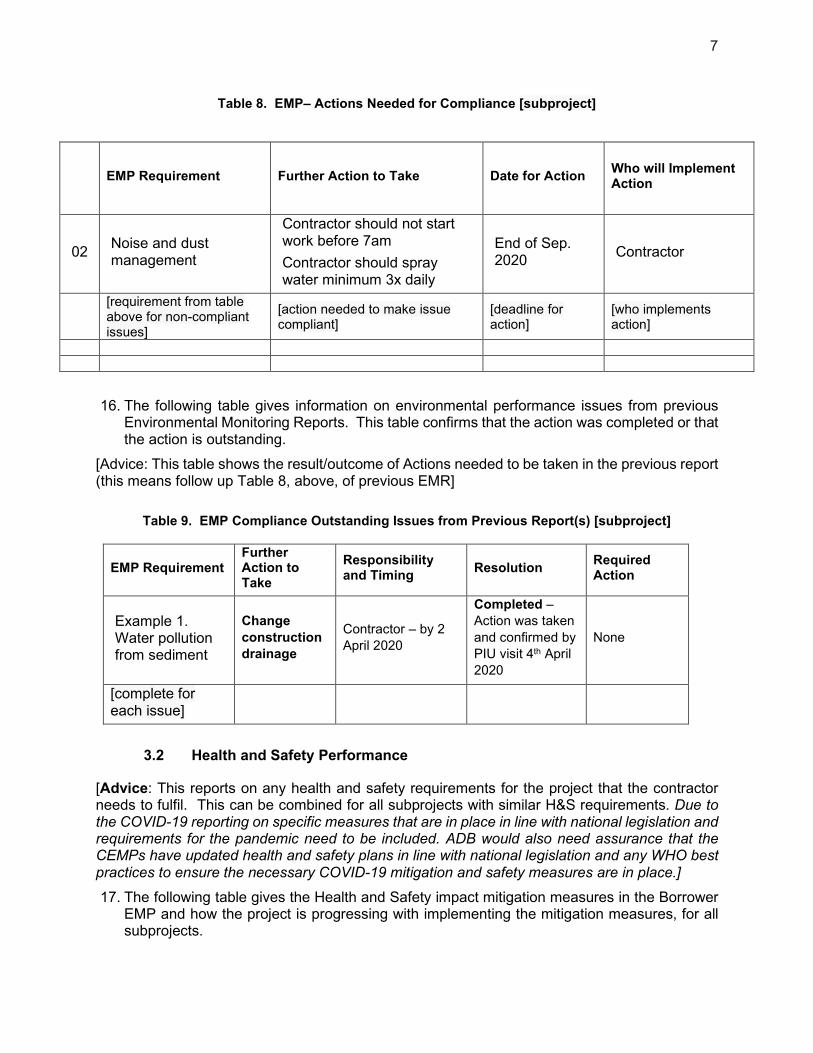
7
Table 8. EMP– Actions Needed for Compliance [subproject]
EMP Requirement Further Action to Take Date for Action Who will Implement Action
02 Noise and dust management
Contractor should not start work before 7am
Contractor should spray water minimum 3x daily
End of Sep. 2020
Contractor
[requirement from table above for non-compliant issues]
[action needed to make issue compliant]
[deadline for action]
[who implements action]
16. The following table gives information on environmental performance issues from previous Environmental Monitoring Reports. This table confirms that the action was completed or that the action is outstanding.
[Advice: This table shows the result/outcome of Actions needed to be taken in the previous report (this means follow up Table 8, above, of previous EMR]
Table 9. EMP Compliance Outstanding Issues from Previous Report(s) [subproject]
EMP Requirement Further Action to Take
Responsibility and Timing
Resolution Required Action
Example 1. Water pollution from sediment
Change
construction
drainage
Contractor – by 2
April 2020
Completed –
Action was taken
and confirmed by
PIU visit 4th April
2020
None
[complete for each issue]
3.2 Health and Safety Performance
[Advice: This reports on any health and safety requirements for the project that the contractor needs to fulfil. This can be combined for all subprojects with similar H&S requirements. Due to the COVID-19 reporting on specific measures that are in place in line with national legislation and requirements for the pandemic need to be included. ADB would also need assurance that the CEMPs have updated health and safety plans in line with national legislation and any WHO best practices to ensure the necessary COVID-19 mitigation and safety measures are in place.]
17. The following table gives the Health and Safety impact mitigation measures in the Borrower EMP and how the project is progressing with implementing the mitigation measures, for all subprojects.
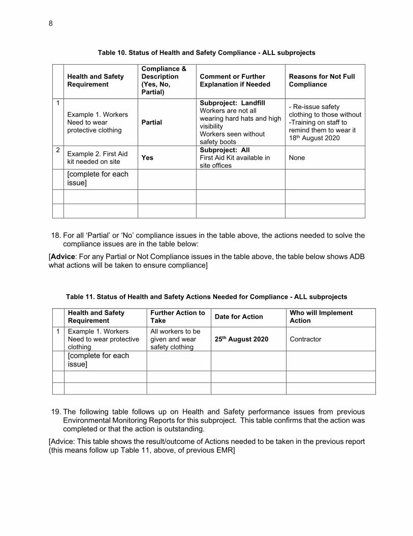
8
Table 10. Status of Health and Safety Compliance - ALL subprojects
Health and Safety Requirement
Compliance & Description (Yes, No, Partial)
Comment or Further Explanation if Needed
Reasons for Not Full Compliance
1
Example 1. Workers Need to wear protective clothing
Partial
Subproject: Landfill Workers are not all wearing hard hats and high visibility Workers seen without safety boots
- Re-issue safety clothing to those without -Training on staff to remind them to wear it 18th August 2020
2 Example 2. First Aid kit needed on site
Yes Subproject: All First Aid Kit available in site offices
None
[complete for each issue]
18. For all ‘Partial’ or ‘No’ compliance issues in the table above, the actions needed to solve the compliance issues are in the table below:
[Advice: For any Partial or Not Compliance issues in the table above, the table below shows ADB what actions will be taken to ensure compliance]
Table 11. Status of Health and Safety Actions Needed for Compliance - ALL subprojects
Health and Safety Requirement
Further Action to Take
Date for Action Who will Implement Action
1 Example 1. Workers Need to wear protective clothing
All workers to be given and wear safety clothing
25th August 2020 Contractor
[complete for each issue]
19. The following table follows up on Health and Safety performance issues from previous Environmental Monitoring Reports for this subproject. This table confirms that the action was completed or that the action is outstanding.
[Advice: This table shows the result/outcome of Actions needed to be taken in the previous report (this means follow up Table 11, above, of previous EMR]
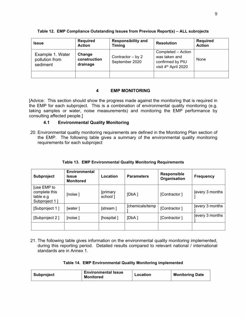
9
Table 12. EMP Compliance Outstanding Issues from Previous Report(s) – ALL subrojects
Issue Required Action
Responsibility and Timing
Resolution Required Action
Example 1. Water pollution from sediment
Change
construction
drainage
Contractor – by 2
September 2020
Completed – Action
was taken and
confirmed by PIU
visit 4th April 2020
None
4 EMP MONITORING
[Advice: This section should show the progress made against the monitoring that is required in the EMP for each subproject. This is a combination of environmental quality monitoring (e.g. taking samples or water, noise measurements) and monitoring the EMP performance by consulting affected people.]
4.1 Environmental Quality Monitoring
20. Environmental quality monitoring requirements are defined in the Monitoring Plan section of the EMP. The following table gives a summary of the environmental quality monitoring requirements for each subproject
Table 13. EMP Environmental Quality Monitoring Requirements
Subproject Environmental Issue Monitored
Location Parameters Responsible Organisation
Frequency
[use EMP to complete this table e.g Subproject 1 ]
[noise ] [primary school ]
[DbA ] [Contractor ] [every 3 months ]
[Subproject 1 ] [water ] [stream ] [chemicals/temp ]
[Contractor ] [every 3 months ]
[Subproject 2 ] [noise ] [hospital ] [DbA ] [Contractor ] [every 3 months ]
21. The following table gives information on the environmental quality monitoring implemented, during this reporting period. Detailed results compared to relevant national / international standards are in Annex 1.
Table 14. EMP Environmental Quality Monitoring implemented
Subproject Environmental Issue Monitored
Location Monitoring Date
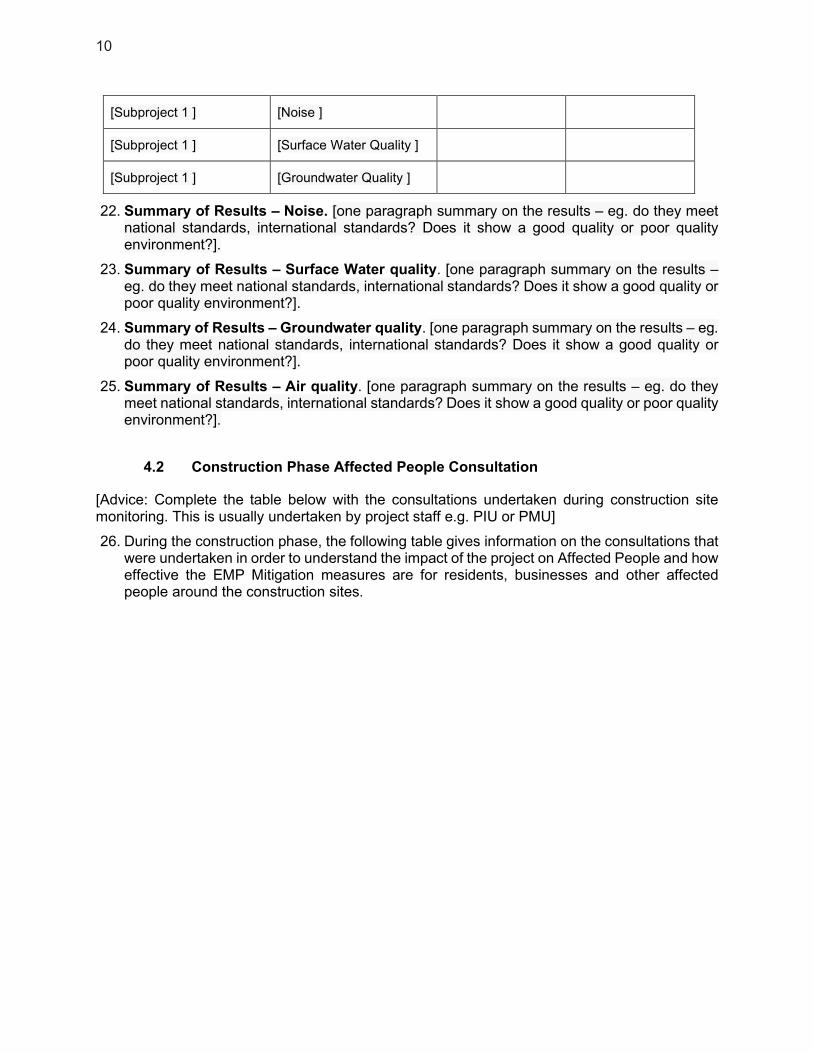
10
[Subproject 1 ] [Noise ]
[Subproject 1 ] [Surface Water Quality ]
[Subproject 1 ] [Groundwater Quality ]
22. Summary of Results – Noise. [one paragraph summary on the results – eg. do they meet national standards, international standards? Does it show a good quality or poor quality environment?].
23. Summary of Results – Surface Water quality. [one paragraph summary on the results – eg. do they meet national standards, international standards? Does it show a good quality or poor quality environment?].
24. Summary of Results – Groundwater quality. [one paragraph summary on the results – eg. do they meet national standards, international standards? Does it show a good quality or poor quality environment?].
25. Summary of Results – Air quality. [one paragraph summary on the results – eg. do they meet national standards, international standards? Does it show a good quality or poor quality environment?].
4.2 Construction Phase Affected People Consultation
[Advice: Complete the table below with the consultations undertaken during construction site monitoring. This is usually undertaken by project staff e.g. PIU or PMU]
26. During the construction phase, the following table gives information on the consultations that were undertaken in order to understand the impact of the project on Affected People and how effective the EMP Mitigation measures are for residents, businesses and other affected people around the construction sites.
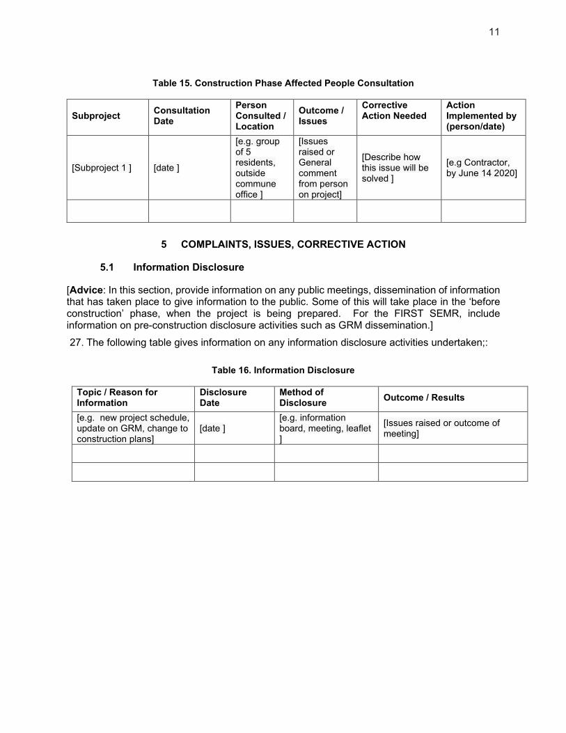
11
Table 15. Construction Phase Affected People Consultation
Subproject Consultation Date
Person Consulted / Location
Outcome / Issues
Corrective Action Needed
Action Implemented by (person/date)
[Subproject 1 ] [date ]
[e.g. group of 5 residents, outside commune office ]
[Issues raised or General comment from person on project]
[Describe how this issue will be solved ]
[e.g Contractor, by June 14 2020]
5 COMPLAINTS, ISSUES, CORRECTIVE ACTION
5.1 Information Disclosure
[Advice: In this section, provide information on any public meetings, dissemination of information that has taken place to give information to the public. Some of this will take place in the ‘before construction’ phase, when the project is being prepared. For the FIRST SEMR, include information on pre-construction disclosure activities such as GRM dissemination.]
27. The following table gives information on any information disclosure activities undertaken;:
Table 16. Information Disclosure
Topic / Reason for Information
Disclosure Date
Method of Disclosure
Outcome / Results
[e.g. new project schedule, update on GRM, change to construction plans]
[date ] [e.g. information board, meeting, leaflet ]
[Issues raised or outcome of meeting]

2
5.2 Grievance Redress Mechanism
[Advice: In this section include any complaints made through the GRM INCLUDING those made during any consultation with Affected People – such as issued raised in
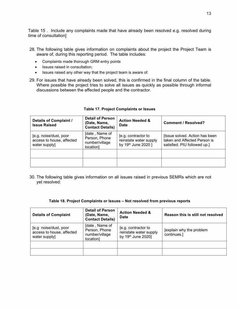
13
Table 15 . Include any complaints made that have already been resolved e.g. resolved during time of consultation]
28. The following table gives information on complaints about the project the Project Team is aware of, during this reporting period. The table includes:
Complaints made thorough GRM entry points
Issues raised in consultation;
Issues raised any other way that the project team is aware of.
29. For issues that have already been solved, this is confirmed in the final column of the table. Where possible the project tries to solve all issues as quickly as possible through informal discussions between the affected people and the contractor.
Table 17. Project Complaints or Issues
Details of Complaint / Issue Raised
Detail of Person (Date, Name, Contact Details)
Action Needed & Date
Comment / Resolved?
[e.g. noise/dust, poor access to house, affected water supply]
[date , Name of Person, Phone number/village location]
[e.g. contractor to reinstate water supply by 19th June 2020 ]
[Issue solved. Action has been taken and Affected Person is satisfied. PIU followed up.]
30. The following table gives information on all issues raised in previous SEMRs which are not yet resolved:
Table 18. Project Complaints or Issues – Not resolved from previous reports
Details of Complaint Detail of Person (Date, Name, Contact Details)
Action Needed & Date
Reason this is still not resolved
[e.g noise/dust, poor access to house, affected water supply]
[date , Name of Person, Phone number/village location]
[e.g. contractor to reinstate water supply by 19th June 2020]
[explain why the problem continues.]
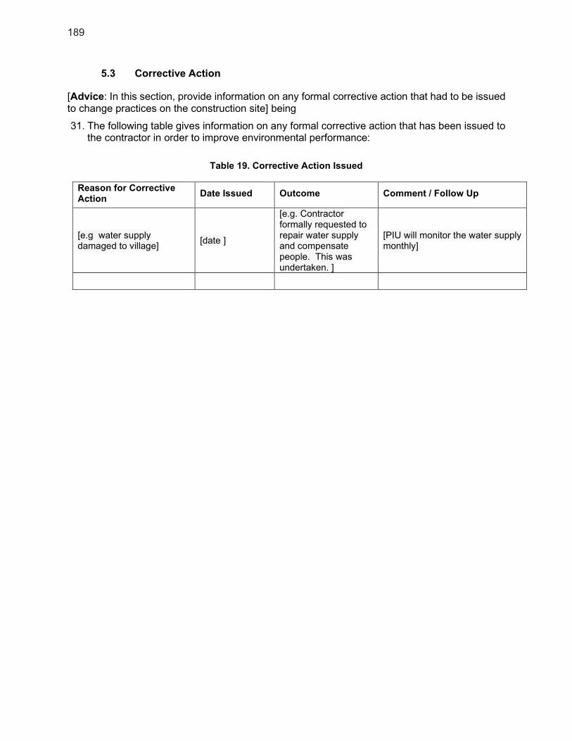
189
5.3 Corrective Action
[Advice: In this section, provide information on any formal corrective action that had to be issued to change practices on the construction site] being
31. The following table gives information on any formal corrective action that has been issued to the contractor in order to improve environmental performance:
Table 19. Corrective Action Issued
Reason for Corrective Action
Date Issued Outcome Comment / Follow Up
[e.g water supply damaged to village]
[date ]
[e.g. Contractor formally requested to repair water supply and compensate people. This was undertaken. ]
[PIU will monitor the water supply monthly]

15
6 Conclusion and recommendations
[Advice: Summarise if the EMP is being followed and if the Environmental Safeguards are adequate. Make recommendations on what will happen to improve the project environmental performance in the next reporting period]
1. Conclusion: [on general environmental progress]
2. Recommendations: [ on next steps and actions to take to make improvements in environmental performance of the project]

16
Annex 1 Environmental Quality Monitoring Results
[Insert Table of results and relevant national/international standard]
17
Annex 2 Photo Record – Visits, Monitoring, Consultation
Photographs of Site Visits
Photographs of Environmental Quality Monitoring
Photographs of Consultation

130
5. GRM Complaint Form Grievance ID:
The _____________________________________ Project welcomes complaints, suggestions, queries, and comments regarding project implementation. We encourage persons with grievance to provide their name and contact information to enable us to get in touch with you for clarification and feedback.
Should you choose to include your personal details but want that information to remain confidential, please inform us by writing/typing *(CONFIDENTIAL)* above your name.
Thank you.
Date Place where grievance is filed:
Contact Information/Personal Details
Name Gender * Male
* Female
Age
Home Address
Place
Phone No.
Complaint/Suggestion/Comment/Question details (who, what, where, and how) of your grievance below:
How do you want us to reach you for feedback or update on your comment/grievance?
If included as attachment/note/letter, please stick here:

131
6. GRM register