Early Medieval Dwellings and Settlements in Ireland, AD400 ...
The
lnternational Caver Magazine
Number seventeen 1 996
CONTENTS
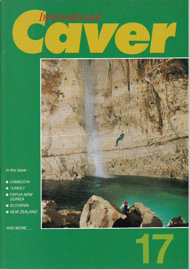
lnvestigation of the ancient settlements in SubterraneanCappadocia, Turkey - R.Bixio, V.Castellani, & C.Succhiarelli ...
New explorations in Bohemia Cave, New Zealand- Radko Tğsler
Muruk : The Southern Hemisphere's first -1000 m, PapuaNew Guinea - Jean-Paul Sounier
The palaeolithic easel at LascauxGraham Mullan
Vandima : Slovenia's third -1000 m cave- Franci Gabrovğek
First Look - Cambodia 1996- Michael Laumanns
Reviews
The Caving Scene :the latest lnternational News
l.C.Bookstore
Cover photographs : Front - The bottom of the Visconte Shaft at -404 m in Muruk, PapuaNew Guinea (Jean-Paul Sounier)BacR - The 6 m wateıfall at the resurgence of Muruk's river (Jean-Paul Sounier)
3
13
17
26
29
34
40
43
44
The lnternational Caver MagazineISSN 0963-7095@ Copyright 1996No articles, maps, reports, or photographs may be reproduced without theexpress permission of the author and/or the Edilor.
Published by Aven lnternational Publications, Shaftesbury Centre,Percy Street, Swindon SN2 2AZ, England, U.K.rel. +44 (0)1793 828236 Fax. +44 (0)1793 512477e-mail : 1 01 566.361 [email protected] Site - http://ourworld.compuserve.com/homepages/AVENEDITOR:TlM STRATFORDReprographics : Scanplan, Swindon, U.K. Tel. 01793 541222
Origin, Swansea, U.K. Tel. 01792 774794Printing:EJW Print, Swindon, UK. Te|.01793 533466
TRANSLAT|ONS : Thomas Knoell, Maurizio Ruggieri, CarolineMartaud, and carlos puch
REGlONAL REPRESENTATlVES : Speleo Projects, Therwiler-strasse 43, 4054 Basel, Switzerland ; Spelunca Librairie, Le Devenson B,
Allee des Pins, 13009 Marseille, France;J-M.Mattlet,243 chaussee deHaecht, ,1030 Bruxelles, Belgium ; Alexander Klimchouk, P.o.Box 22418,
Kiev-3o, 252030 Ukraine (for cls countries).
Annual subscription Rates (4 issues) :-
United Kingdom t13.70 Europe t15.70 (airmail)America & canada f15.70 (surface) ı21.,l0 (airmail)Australia & New Zealand f 15.70 (surface) i22.90 (airmail)Japan & the Far East t15.70 (surface) İ22.90 (airmail)Rest of the World f15.70 (surface) t21.10 (airmail)Subscriptions should be senı to lC Subscriptions, Aven Publications,Shaftesbury centre, Percy Street, Swindon sN2 2Az, England, U.K. or phone+44 (0)1793 828236 with your Mastercard or Visa credit card details.
The International Caver (l7) 1996
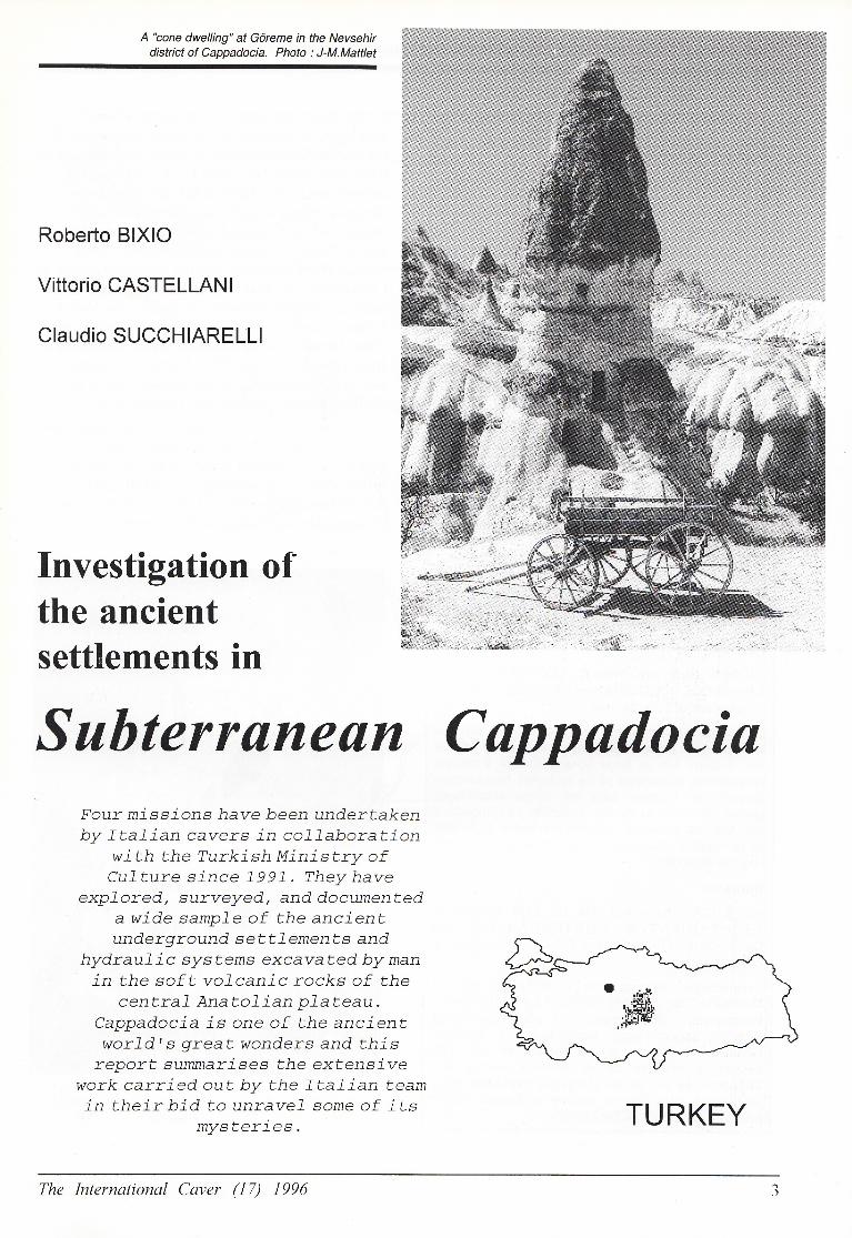
A "cone dwelling" at Göreme in the Nevsehirdistrict of cappadocia. Photo : J-M.Mattlet
Roberto BlxlO
Vittorio CASTELLANl
Claudio SUCCHIARELLl
Investigation ofthe ancientsettlements İn
Subterrüneün CuppadociaFour missions hawe been undertakenby ItaLian cavers in co]-laboration
with the Turkish Ministry ofCu]-ture since ]-997. They have
exp7oredt surveyed, and documenteda wide samp7e of the ancientunderground s e t tJ_ ement s and
hydrau7 ic sys tems excavated by manin the sof t vo]-canic rocks of the
centra7 Anatof ian pLateau.Cappadocia is one of the ancientwor]_dls great wonders and this
report summarises the extensivework carried out by the Itafian teamin their bid to unrave]- some of its
mysteries.
The lnlernational Caver (ü7) I996
TURKEY
lnvestigation of the ancient settlements in Subterranean Cappadocia, TURKEY. 3-72
Zusammenfassung ,
ERFORSCHUNG DER FRÜGESCHlCHTLİCHENSlEDLUNGEN İM UNTERGRUND VONcAPPADoclA, TÜRKEI, von R.Bixo, V.castellani, und
C.Succhiarelli.
ln zusammenarbeit mit dem türkischenkultusministerium haben italienische Höhlenforschereine groBe Anzahl von'Höhienwohnungen und derenvon Menschenhand in den weichen vulkanischen steingegrabenen Wasserleitungen erforscht, vermessenund dokumentiert. Die' auf der HochebneZentralanatoliens gelegene ForschungsstötteCappadocia ist eines der groBen Wunder der frühen
Weltgeschichte, und unser Artikel ist Zeuge derausgedehnten Arbeit des italiensichen Teams.
Riassunto
ESPLoRAzloNl DEGLl ANTlcHl lNSEDlAMENTlSoTTERRANE| lN cAPPADocıA, TURcHtA, di
R.Bixo, V-Casıellani, e G,Succhiarelli.
Speleologi italiani in collaborazione con il Ministerodella Cultura Turco hanno esplorato, topografato, edocumentato un gran numero di insediamentisotterranei e sistemi idraulici scavatl in passato
dall'uomo nelle tenere rocce vuicaniche del plateau
centrale dell'Anatolia. La Cappadocia ğ una delle piü
grandi meraviglie del mondo; questo rapporto riassumeil grande lavoro portato avanti dal gruppo italiano,
R6sum6
Eruors DES ANcIENNES CoLoNlES DE LACAPPADOCE SOUTERRA|NE (TUROUlE), par R.Bixo,V.Castellani, et C.Succhiarelli.
Des sp6l6ologues italiens, en col|aboration avec le
Ministğre Turc de la Culture ont explor6, 6tudi6 r6alis6des dossiers sur un large 6chantillonnage d'ancienspeuplements souterrains et de systemes hydrau|iques
excİves par l'homme dans les roches volcaniquestendies au centre du Plaİeau anatolien. La Cappadoceest l'une des anciennes grandes merveilles du monde
et ce rapport r6sume le travail immense fourni par
|'öquipe italienne.
Sumario
lNVEsTlGAcloNES AcERcA DE LoS ANTIGUoSASENTAMlENTOS SUBTERRANEOS ENcAPADoClA, TUROUIA, por R.Bixo, V.Castellani, y
C.Succhiarelli.
Espeleölogos italianos, en colaboracion con el
Ministerio de Cultura turco, han explorado,topografiado y documentado una gran variedad de
antiguos asentamientos subterrineos y . sislemas
hidraü|icos excavados por el hombre en las rocas
volcinicas blandas de la Anatolia central, LaCapadocia es una de las maravillas mundiales de |a
"nİigrleO"d, Este informe resume el intenso trabajo
llevado a cabo por el equipo italiano.
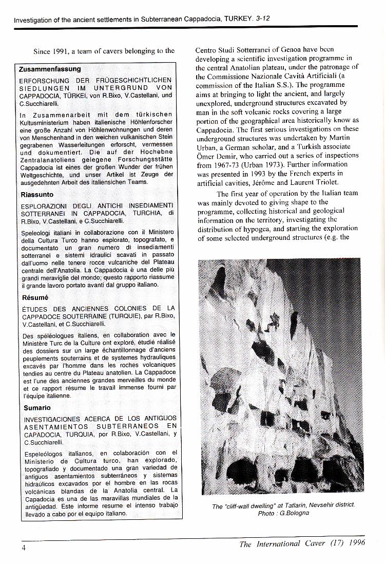
Since l99l, a team of cavers belonging to the centro studi sotterranei of Genoa have been
developing a scientific investigation programme in
the central Anatolian plateau, under the patronage ofthe Commissione Nazionale Cavitö Artificiali (a
commission of the Italian S.S.). The programme
aims at bringing to light the ancient, and largely
unexplored, underground structures excavated byman in the soft volcanic rocks covering a large
portion of the geographical area historically know as
Cappadocia. The first serious investigations on these
underground structures was undertaken by MartinUrban, a German scholar, and a Turkish associate
Ömer Demir, who carried out a series of inspectionsfrom 1967-73 (Urban |973). Further information
was presented in 1993 by the French experts in
artificial cavities, J6röme and Laurent Triolet.
The first year of operation by the Italian team
was mainly devoted to giving shape to the
programme, collecting historical and geological
information on the territory, investigating the
distribution of hypogea, and starting the exploration
of some selected underground structures (e.g. the
The "cliff-wall dwelling" at Tatlarin, Nevsehir districtPhoto : G.Bologna
The International Caver (17) 1996
lnvestigation of the ancient settlements in Subterranean Cappadocia, TURKEY, 3-72
M ucur
Kozakl i
!\\!1
/ı'-.,,,,ı'?'
(
-'\q,
\.
t1
i
Develi
\liı
1ı
Urgüp
NEVSEHIR
./.-'Derinkuyu
!İ
l
ffi g
pRıNcıpALTow,ı l ıırvsgıın l
NlGDE
Eregli
ı
ll
\' ,'-'- \\.-.-./' \
The International Caver (l7) 1996
lnvestigation of the ancient settlements in Subterranean Cappadocia, TURKEY, 3-72
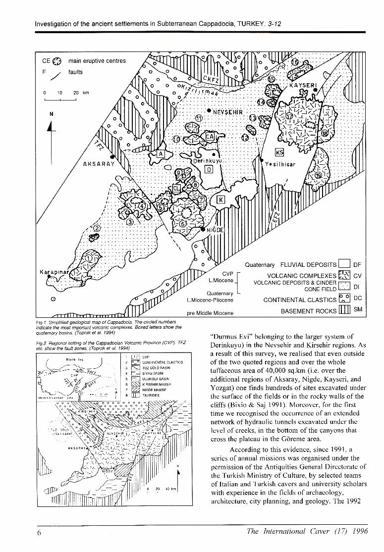
Fig,1- Simplified geological map oi Cappadocia. The circled numbersindicate the most imporİant volcanic complexes. Boxed letters Show thequaternary basins. (Toprak et al. 1994)
Fig.2. Begional setting of the Cappadocian Volcanic Province (cVP). TFzetc. show the fault zones. (Toprak et al. 1994)
'oDurmus Evi" belonging to the larger system ofDerinkuyu) in the Nevsehir and Kirsehir regions. Asa result of this survey, we realised that even outsideof the two quoted regions and over the wholetuffaceous area of 40,000 sq.km (i.e. over theadditional regions of Aksaray, Nigde, Kayseri, andYozgat) one finds hundreds of sites excavated underthe surface of the fields or in the rocky walls of thecliffs (Bixio & Saj 1991). Moreover, for the firsttime we recognised the occurrence of an extendednetwork of hydraulic tunnels excavated under thelevel of creeks, in the bottom of the canyons thatcross the plateau in the Göreme area.
According to this evidence, since l99l, a
series of annual missions was organised under thepermission of the Antiquities General Directorate ofthe Turkish Ministry of Culture, by selected teamsof ltalian and Turkish cavers and university scholarswith experience in the fields of archaeology,architecture, city planning, and geology. The 1992
ı ğcvez ffi coıırııeNTALcLAsTıcs3 E TUzGöLüBAslNa P sıvısaısıtıs f] uruxısrn ansıııo § xıRsrHını.,ııssırı ffi ı,ııeatuıssıto ffi rnuRıors
o o o o o o o o oa§\
-.--.---:-----.-=
The International Caver (I7) ]996

lnvestigation of the ancient settlements in Subterranean Cappadocia, TURKEy. 3-72
DERıNKUYU 4SYSTEM DURMUS EVl
DERlNKUYU, NEVsEHlR
10 20 30m
N
GRAPHlC DES|GN : R.MANAGLIA
cElL|NG PlPE
WELL EMlLL-SToNE DooR ıOPERAT|NG ROOM 19f
DRY WALL EE
lNFlLL ,9ı;§
STEPS slt
_/ STABLES
DURMUS,S HOUSEv
W|NE RooM
The International Caver (l7) 1996
lnvestigation of the ancient settlements of Subterranean Cappadocia, TURKEY. 3-72
expedition was mainly devoted to the extensiveexploration of the underground settlement ofGokcetoprak (ancient Sivasa) in the district ofGülsehir. We located and surveyed l1 undergroundsystems, finding inside many wells supplying waterfrom the water table lying some 25 m below thesurface. In the same district a small karst cave wasexplored, opening inside a limestone depositsurrounded by tuffaceous rocks. In that cave wefound neolithic and early Bronze Age fictileremains, among them four well preserved potteryvases, now at the Nevsehir Museum. In addition,two new relevant settlements were surveyed in theNevsehir district: (i) Kurugöl, excavated in theslopes of a volcanic cone, and (ii) Topada, a smallunderground village, with the entrance close to ahittite hieroglyphic rock inscription (Bixio l993,1994).
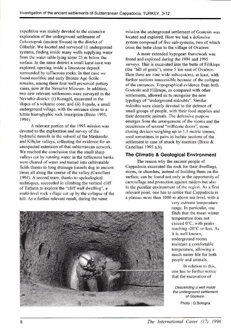
A relevant portion of the l993 mission wasdevoted to the exploration and survey ofthehydraulic tunnels in the subsoil of the Meskendirand Kiliçlar valleys, collecting the evidence for anunexpected extension of that subterranean network.We reached the conclusion that the small sharpvalleys cut by running water in the tuffaceous bankswere cleared of water and turned into cultivatablefields thanks to long drainage tunnels dug in ancienttimes all along the course of the valley (Castellani1994). A second team, thanks to speleologicaltechniques, succeeded in climbing the vertical cliffof Tatlarin to explore the "cliff wall dwelling", amulti-level rock village cut up by the collapse of thehill. As a further relevant result, during the same
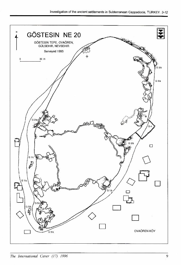
mission the underground sefflement of Gostesin waslocated and explored. Here we had a defensivesystem composed of five sub-systems, two of whichcross the buffe close to the village of Ovaören.
A more extended hypogean framework wasfound and explored during the 1994 and 1995surveys. This is excavated into the butte of Filiktepe(the "hill of goats"), some 5 km east of Ovaören.Here there are nine wide sub-systems, at least, withfurther sections inaccessible because ofthe collapseofthe entrances. Topographical evidence from bothGostesin and Filiktepe, as compared with othersettlements, allowed us to recognise the newtypology of "underground redoubts". Similarredoubts were clearly devoted to the defence ofsmall groups of people, with their food supplies andtheir domestic animals. The defensive purposeemerges from the arrangement of the rooms and theoccuffence of several "millstone doors", Stoneclosing devices weighing up to 1.5 metric tonnes,used sometimes in pairs to isolate sections of thesettlement in case of affack by enemies (Bixio &Castellani 1995 a,b).
The CIimatic & Geological EnvironmentThe reason why the ancient people of
Cappadocia excavated the rock for their dwellings,stores, or churches, instead ofbuilding them on thesurface, can be found not only in the opportunity ofcamouflage and protection against raiders but alsoin the peculiar environment of the region. As a firstrelevant point, one has to notice that Cappadocia isa plateau more than l000 m above sea level, with a
Very extreme temperaturerange. In particular, onefinds that the mean wintertemperature does notexceed 0"C, with peaksreaching -20"C or less. Asit is well known,underground roomsmaintain a comfortabletemperature, allowing a
much easier life for bothpeople and animals.
In relation to this,one has to fufther noticethat the excavation of
Descending a well insidethe unCergrou nd settlement
of Göstesin,
Photo : G.Bologna
The International Caver (l7) ]996
lnvestigation of the ancient settlements in Subteı:ranean Cappadocia, TURKEy. 3-12
GOSTES|N NE 20GöSTES|N TEPE, OVAöREN,
GÜLSEHıR, NEVSEHIR
Surveyed 1993
30m
ü
ffiaE
t]
EOVAÖREN KÖY
The International Caver (l7) 1996
lnvestigation of the ancient settlements in Subterranean Cappadocia, TURKEY. 3-72
underground tunnels and rooms is made easier bythe peculiar terrain of the Cappadocian VolcanicProvince (CVP: Fig.Z), a modern geological unitwhich corresponds to the ancient province of theRoman Empire (l7 A.D.- IV century) with itscapital Caesareia (the modern Kayseri). Most of the
territory is covered by effusive rocks with basalts,andesites, dacites, and rhyolites, following effusive(lava flows, endogenous and exogenous domes) andexplosive eruptions (ignimbrites, plinian fallout, andsurge deposits).
The volcanism of the cvp is related to thecontinental collision between the Afro-Arabian andEuroasian plates. This volcanism probably started
early in the Upper Miocene (14-10 Ma), andcontinued during the Quaternary (first century A.D.,see Innocenti et al, 1975). The combined effect offaulting and volcanism led to the formation ofQuaternary basins (Derinkuyu, Kayseri-Sultansazligi, Ciftlik, Konakli, Agacli, and Cardak)in the central part of the Cappadocian VolcanicProvince (Fig.l).
Historical and archaeological data prove thatthe volcanoes were still active at the end of the firstcentury A.D. in the surrounding of Acigol and ofthe volcanic complexes (Pasquare l968). At present,post-volcanic activity is characterised by mildfumarolic emissions from Mt.Erciyes and by springs(22"-42"C) and warm-water wells within the Acigolarea.
Historical Referenceswhen and who excavated the hundreds of
underground settlements and tens of kilometres oftunnels, we don't know. We only know thatByzantine people lived there from the 6th to 14th
centuries A.D., as shown by the rock churches withtheir wall paintings. However, one finds suggestionfor a much earlier utilisation of this subterraneanhabitat. Why not, if Xenophon at the end of the 5th
century B.C. describes in his Anabasis an
underground village located in the Armenianregion? As a maffer of fact, Cappadocia was alreadywell populated since the Neolithic, keeping evidenceof many relevant civilisations. Rock inscriptionsscattered across the region document the presence ofHittites, followed by Phrygians, who possiblyestablished there a sort of ancient "Maginot Line"against the Assires. The land was conquered byPerses in 546 B.C. and by Alexander The Great in
333 B.C. After the first century A.D., Cappadociabecame a Roman province and, in the meantime,
settlement of the early Christian communities,
remaining as the south-eastern border of theByzantine empire till the 1lth century, when firstthe Seljuks, and later the Ottomans (both Turkishtribes from Central Asia) conquered all Asia Minor.
As a conclusion, one finds that overmillennia, Cappadocia, owing to its strategicalposition, has been the theatre of continual conquestsand/or of internal politic-religious power struggles.During both the 6th and 10th centuries A.D. theregion saw the expansion of great families againstsmall farmers. From the 8th to 9th century A.D., atthe same time as the expansion of Arabian people,the Byzantine empire was shaken by iconoclasticpersecutions against the monks, who in Cappadociabecame so numerous to be considered a danger bythe Byzantine central power. Which of these eventsmay have pushed local people underground insearch of safety and protection? Was it a matter ofsingle or concomitant events, of natural or strategiccircumstances? The investigation by the Italiancavers, far from offering a conclusion, has onlyopened a window on the history of the rock culturewhich produced the widest and most articulatedsystem of hypogea in the Mediterranean basin.
The Underground StructuresIn this final section we show selected results
of our investigation, to be regarded as an indicativesample of the Cappadocian underground structures.A more detailed description of the surveyedstructures has been reported and discussed in themission report, published in l995 by the ItalianSpeleological Society.* TatlarinViilage : Tatlarin - District : NevsehirProvince: NevsehirType of Structure : Cliff-Wall Village
This settlement is constituted by two systems:the first one is excavated in the cliff, below thepresent-day village built on the surface. There areseveral entrances along the rock wall, opening atvarious levels corresponding to the stratification ofthe cliff. In the central sector there is a complexnetwork of rooms connected by tunnels andprotected by several mill-stone doors. The longerinternal cuniculus is collapsed. Close to the entrancethere are two frescoed subterranean churches. Thesecond system is located on the other side ofthecliff. The high vertical rock wall has collapsed, so
that the five floors are cut like a section, open to the
air. The upper levels can only be explored bydescending on ropes from the top ofthe cliff. It
appears that the rooms are excavated only in the
10 The International Caver (l7) 1996

lnvestigation of the ancient settlements in Subterranean Cappadocia, TURKEy. 3-72
0
ffi6rı
section ffim
o i+,
I-;T3 ı-1.
o l-r,
o .{'
@
O o-o,
o P-p'
o q-q'
TATLARıN NE 27TATLAR|N KÖY, NEVSEHlR
Surveyed 1993
ffi
first belt of the c|iff.* SivasaVillage: Gokcetoprak - District : GülsehirProvince: NevsehirType ot Structure: Underground Redoubt
This settlement is constituted by manysub-systems whose entrances are scaffered overabout 1200 metres along the low cliff of a butte,partially close to the houses of the village ofGokcetoprak. We have explored and surveyed l lsystems, all excavated according to a cleardefensive scheme: a first room excavated in the beltof the hill is connected by a short cuniculus with aninternal room defended by mill-stone doors. This"redoubt" is connected by means of longer andnarrow cuniculi with other similar structures, so thatthey constitute an inner network of shelters, withstores and wells-
* GöstesinVillage: Övaoren - District : GülsehftProvince: NevsehirType of Structure : Underground Redoubt
The surface village of Övaoren lies at the footof a butte, on the southern side. The underground
settlement consists of 5 sub-systems whoseentrances are scattered all along the cliff, close tothe modern village. The |ayout of each network isthe same as at sivasa but with the Gl and G2systems being somewhat different. Both systems areconstituted by two unities (wide room-shortconnection-inner room) on opposite sides of thebutte, connected by a long cuniculus, ofabout 160m, crossing the hill. The excavation has beencarried out from the two opposite sides, with theintersection point about half way, in correspondenceof a sudden ingenious change of direction to assurethe match of the two segments of tunnel.
* FiliktepeVillage: Övaoren - District : GülsehirProvince: NevsehirType of Structure : Underground Redoubt
This sefflement is excavated in a butte, 5 kmeast of the village of Övaoren. The entrances arescattered along 900 metres on the southern side ofthe hill, open either in the vertical cliff or directlyon the ground. In the last case, several smalldepressions like dolines give evidence to theoccurrence of collapsed rooms whose explorationwould require difficult excavation work. We
The International Caver (l7) 1996 l1
lnvestigation of the ancient settlements in Subterranean Cappadocia, TURKEY. 3-72
surveyed 9 systems which show the same scheme as
in Sivasa and Göstesin. In detail, theFllF2lF3systems have a plan development of about 700metres, with a central room fiffed with smallerstores to the sides and bell-like reservoirs under thefloor. This shelter, developed on the whole overabout 2000 m, was very well protected, with manyinner redoubts defended by mill-stone doors, oftencoupled, with wells for water supply and stables fordomestic animals. However, the settlement showsevidence of a violent invasion, we don't knowwhen.
* DerinkuyuVillage: Derinkuyu - District : DerinkuyuProvince : NevsehirType ot Structure : Underground Town
This is the largest settlement which has beendiscovered, to date, in Cappadocia. Owing to thecomplex subterranean planning, we can properlydefine it as an "underground town". It has beenexcavated under the field level, in the flat plateauwhere the present-day surface village of Derinkuyulies. According to information from Ömer Demir, itappears that there are more than 300 entrances,hidden in the couğards and in the cellars ofmodern houses, giving access to an undergroundsystem formed by 8 or more interconnected levels.Outside the tourist sector, we surveyed the DurmusEvi (Evi : house) system. The survey shows thatthe network is developed on three levels, the lowestone reaching the depth of -42 m, likelycorresponding to the water table. We have alsoquickly explored a further four systems (Monastir,Ismet Aktepe Evi, Mumin Hoca Evi, and MustafaSen) to assess a working schedule for futureexplorations.
- Kliçlar vadisi, Meskendir vadislVillage: Göreme - District : NevsehirProvince :NevsehirType of Structure : Underground Hydraulic System
Under the surface ofboth canyons, all alongthe bed of the valleys, one finds long tunnelscollecting and transporting the meteoric water, lnthis way the valleys were set free of torrentialstreams and made available for cultivation. Afurther system ofcuniculi appears scattered alongthe walls of the valleys to reach the water tableunder the surrounding hills, supplying water forirrigation. Some tunnels show the effects of such animpressive erosion that it cannot be the result of ashort period of time. The diameter of the maincollector, originally presenting a cross section of 0.7x 1.8 m, is often as large as 4 m, or more, with only
scarce evidence ofthe original cuniculus engravedon the vaulted roof.
AcknowledgmentsWe would like to thank the Turkish Ministry of Culture,Archaeological Museum of Nevsehir, lstituto ltaliano dicultura in Ankara, and the commissione NazionaleCavitö Artificiali della Societö Speleo|ogica ltaliana forgeneral assistance and advice. Gruppo Duracell forlighting. Repetto Sport of Genoa, Alp Design, Amorini,Bineco, Camp, Daar, Ferrino, Petzl, and Steimberg forspeleological equipment. And for personal support,Francesco Dal Cin of the Gruppo SpeleologicoTrevisano.
selected ReferencesBlXlO,R. 1994. Le cittğ,sotterranee della Cappadocia.Le Scienze (313), pp 34-43.
BlXlO,R. & CASTELLANl,V. 1995a. New tipologies ofCappadocian undergrounds: the redaübts and ihehy d i c i n stall aiıons., Proc. 1 7th l ni.Symp.of Excavations,T.C. Kultur Bakantiğ-Anitlar. Genel' Mudurlugu, Ankara.
BlXlO,R. & CASTELLANI,V. 1995b. Categoies ofhypogean Cappadocian structures. Proc.lnt.Symp.onSouterrains, Maastricht.
CASTELLAN|,V. 1 994. Evidences for hydrogeotogicatplanning in ancient Cappadocia. Jln.AncientTopography 3,pp2O7.lNNOCENT|,F. et al. 1975. The Neogene calc-alkalineVolcanism of Central Anatolia: geochronological Dataof Kaysei Nidge Area, Geol.Mag. (1,1Z1, pp 3+S-SOO.
PASQUARE,G. 1968. Geology of the Cenozoicvolcanic area of Central Ai,natolia, Atti Accad;Naz.Lincel9, pp 53-204.
TRIOLET,J. & L. 1993. Les yil/es souterraines deCappadoce. Editions DMl, Torcy.
URBAN,M. 1973. Das Rafse/ der unteirdischen StadteSudostanatoliens. Vorland (6), pp150-153; (7), pp174-181; (8), pp 205-212.
Roberto Bixiocentro studi sotterraneiVia Pacinotti 5/616151 Genova, ltaly
vittorio castellaniDip.di Fisica - Universitö di PisaPiazza Torricelli256100 Pisa, ltaly
claudio succhiarelliVia Menghini2,100179 Roma, ltaly
12 The International Caver (l7) 1996
Copyright © 2022 FDOKUMEN