Glacier surface-area changes in Sagarmatha national park ...

CHAPTER1
Introduction: Global glacier monitoring—a long-term task integrating in situ
observations and remote sensing
Michael Zemp, Richard Armstrong, Isabelle Gartner-Roer, Wilfried Haeberli,
Martin Hoelzle, Andreas Kaab, Jeffrey S. Kargel, Siri Jodha S. Khalsa,
Gregory J. Leonard, Frank Paul, and Bruce H. Raup
ABSTRACT
This book focuses on the complexities of glaciersas documented via satellite observations. Thecomplexities drive much scientific interest in thesubject. The essence—that the world’s glaciersand ice caps exhibit overwhelming retreat—is alsodeveloped by this book. In this introductorychapter, we aim at providing the reader withbackground information to better understand theintegration of the glacier-mapping initiativeknown as Global Land Ice Measurements fromSpace (GLIMS, http://www.glims.org) within theframework of internationally coordinated glacier-monitoring activities. The chapter begins withgeneral definitions of perennial ice on land and itsglobal coverage, followed by a section on therelation between glaciers and climate. Briefoverviews on the specific history of internationallycoordinated glacier monitoring and the globalmonitoring strategy for glaciers and ice caps arefollowed by a summary of available data. Weintroduce the potential and challenges of satelliteremote sensing for glacier monitoring in the 21stcentury and emphasize the importance of integra-tive change assessments. Lastly, we provide asynopsis of the book structure as well as someconcluding remarks on worldwide glacier monitor-ing.
1.1 WHY THIS BOOK?
The fluctuation of Earth’s glaciers—their waxingand waning (e.g., Fig. 1.1)—and glacier ice itselfhas been a chief source of insight and hard con-straints regarding the climate history of Earthand of other planets since the early 1800s (Agassiz1840, Haeberli 2008; and see the Prologue in theprelims of this book). We have had 50 years ofsatellite imaging of glaciers starting with the now-declassified observations made by the Coronaseries. With just over a decade of systematic mon-itoring by an advanced generation of orbitingmultispectral imaging sensors, it is time for a bookthat documents the advanced methods of analysisof newer data, and the quantitative use of oldersatellite data as well. This book is finishing aboutthe same time as the USGS super-series of volumes,Satellite Image Atlas of the Glaciers of the World(Williams and Ferrigno et al. 2012), which was amammoth, 30-year undertaking. This book is notan atlas of glacier changes, as a geographically com-plete or balanced coverage is not its overarchingaim. Rather, we examine more completely than everbefore the range of measurement methods andproducts, and the type of knowledge that can begained from satellite remote sensing, especiallyfrom multispectral imaging, of the world’s glaciersand ice caps.
J. S. Kargel et al. (eds.), Global Land Ice Measurements from Space, Springer Praxis Books, 1DOI: 10.1007/978-3-540-79818-7_1, ! Springer-Verlag Berlin Heidelberg 2014

The subjects of this book are perennial massesof flowing surface ice, as distinguished from othercomponents of the cryosphere, such as snow, riverand lake ice, and permafrost. In the next section wedefine the major categories of flowing ice.
1.2 PERENNIAL SURFACE ICE ON LAND
1.2.1 Definitions
Glaciologists generally differentiate flowing massesof perennial ice into four major types (cf. IPCC2007, UNEP 2007):
Ice sheet: a mass of land ice, of continental size,thick enough to cover the underlying bedrock
topography. Its shape is mainly determined by thedynamics of its outward flow. There are only twoice sheets in the modern world, on Greenland andAntarctica; during glacial periods there were others.
Ice shelf: a thick, floating slab of freshwater iceextending from the coast (originating as land ice).Most present ice shelves, and all of the large ones,are found around Antarctica.
Glacier: a mass of ice on the land surface whichflows downhill under gravity and is constrainedby internal stress and friction at the base and sides.In general, a glacier is formed and maintained by
2 Introduction: Global glacier monitoring
Figure 1.1. Retreat of South Cascade Glacier, U.S.A.: Photographic record of the shrinking South Cascade Glacierin the North CascadeMountains ofWashington, U.S. Note the perennial snow banks at the lower right that are moreor less unchanged since 1966 (from http://ak.water.usgs.gov/glaciology/south_cascade/index.html).

accumulation of snow at high altitudes, balanced bymelting at low altitudes or calving into the sea orlakes.Ice cap: dome-shaped ice mass with radial flow,usually completely covering surface topography.Much smaller than an ice sheet.
These are the subjects of this book. In some con-texts, the noun glacier or adjective glacial may beused in reference to any of the deforming types ofperennial ice, as in the phrase ‘‘multispectral glacialanalysis,’’ which may refer to analysis of polar icesheets and ice caps as well as glaciers senso stricto.We note that floating ice, whether ice shelvesattached to the polar ice sheets or glacier ice floatingin lakes or the sea, or icebergs, is no longer ‘‘landice’’, but it is nonetheless included in this bookbecause of its close association with grounded, trueland ice.
In the context of glaciers and ice caps as anessential climate variable, the term ‘‘glacier’’ is usedas a synonym for several glacier types, such as icefields, valley and mountain glaciers, and glacierets.These general definitions are extended here to morespecific classifications that serve the requirements ofthe corresponding applications and should also beunderstood and referenced in that context. Thisbook uses many technical glaciological terms,which are generally understood by specialists inour field and are not specifically defined here, exceptas deemed appropriate by the authors. Rather thanrepeat a glossary of terms, we refer to excellentdownloadable glossaries, such as Cogley et al.(2011). For more detailed and fully illustrateddescriptions and explanations of terminology, con-sult The Encyclopedia of Snow, Ice, and Glaciers(Singh et al. 2011).
Standards and guidelines for the compilation ofan inventory of perennial surface ice on landfrom aerial photographs, maps, and early satelliteimages, including such detailed classificationschemes, have been defined for the compilation ofthe World Glacier Inventory (WGI; WGMS 1989)and can be found in UNESCO (1970, 1970/73),Muller et al. (1977), Muller (1978), and Scherler(1983). These standards are also used for in situglacier fluctuation series (e.g., front variation andmass balance measurements; cf. WGMS Mass Bal-ance Bulletins) and have been revised and updatedfor satellite-based inventories within the GLIMSproject (Rau et al. 2005, Raup and Khalsa 2010).
1.2.2 Global coverage
Perennial surface ice on land presently covers some10% (or 1.6! 106 km2) of the Earth’s land surface;coverage during the ice age maxima attained up toabout three times this amount (Paterson 1994, Bennand Evans 1998). An overview of area, volume, andsea level equivalent of ice sheets, ice shelves, gla-ciers, and ice caps is given in Table 1.1, based onIPCC (2007). Glaciers and ice caps, excluding thoseadjacent to the ice sheets of Greenland and Antarc-tica, cover an estimated area between 500 and550! 103 km2 (e.g., 510! 103 km2 by Ohmura2004; 518! 103 km2 by Radic and Hock 2011, or540! 103 km2 by Dyurgerov and Meier 2005).These estimates are based mainly on the WGI(WGMS 1989). If all surface land ice melted away,sea level would rise by about 64 m, with the Ant-arctic Ice Sheet contributing 57 m, the GreenlandIce Sheet about 7 m and all other glaciers and icecaps a few decimeters.There are fundamental differences in the pro-
cesses (and their timescales) driving the changingproperties of perennial surface ice on land. Dueto the large volumes and areas, the two continentalice sheets actively influence global weather andclimate over timescales of days to millennia,whereas their dynamical responses (such as flowspeeds) to climate changes tend to occur quite slug-gishly—on timescales of decades to millennia,according to our current understanding. Glaciersand small ice caps, with their much smaller volumesand areas, react much faster to climatic effects (i.e.,
Perennial surface ice on land 3
Table 1.1. Area, volume, and sea level equivalent ofperennial surface ice on land components (fromIPCC 2007).
Cryospheric Area Volume Potentialcomponent sea level rise
(106 km2) (106 km3) (m)
Ice sheets 14.0 27.6 63.7
Ice shelves 1.5 0.7 "0
Glaciers and 0.51–0.54 0.05–0.13 0.15–0.37ice caps
Data for the ice sheet in Greenland come from Bamber et al.(2001); the numbers for the ice sheet in Antarctica and the iceshelves are published by Lythe et al. (2001). The minimum andmaximum estimates for glaciers and ice caps are from Ohmura(2004) and Dyurgerov and Meier (2005), respectively, which areboth mainly based on theWGI (WGMS 1989), excluding glaciersand ice caps surrounding Greenland and Antarctica.

timescales range between months and centuries);though the smaller ice masses influence localclimate, their influence on global climate is minor.The smaller ice masses are good indicators ofclimate change on the human timescales of modernconcern, and they influence ecosystems and humanactivities on a local to regional scale. As the focus ofthis book is on glaciers and ice caps, and less on thepolar ice sheets, our introduction concentrates onthese two components of land ice. We use the term‘‘glacier’’ in this book to represent both alpine gla-ciers and ice caps, since the same measurementprinciples are applicable. Good overviews on thestate of the art concerning the monitoring of icesheets and ice shelves can be found in Bentley etal. (2007) and in IPCC (2007).
1.3 GLACIERS AND CLIMATE
1.3.1 Formation of glaciers and theirdynamical controls
Glaciers form where snow deposited during the coldor humid season does not entirely melt during thewarm or dry portions of the year. This seasonalsnow gradually densifies under the weight of theoverlying layers and transforms into perennial firnand finally, after the interconnecting air passagesbetween the grains are closed off, into ice (Paterson1994). The ice from such accumulation areas thenflows under the influence of gravity down to lower
elevations, where it melts and sublimates in ablationareas. Accumulation and ablation areas are sepa-rated by the equilibrium line, where the balancebetween gain and loss in ice mass in a given seasonis exactly zero. The so-called equilibrium line is ofcourse not really a line, but rather a meanderingand highly dynamic feature which is normallyapproximated as a single elevation (equilibrium linealtitude, ELA) for a given year. The spatial distribu-tion of glaciers is thus primarily a function ofclimate, including mean annual air temperatureand annual precipitation (Fig. 1.2), modified bythe terrain which influences (1) the amount ofincoming direct solar radiation and indirect radia-tion reflected by or emitted from nearby terrain orblocked in shadow areas; (2) microclimate; (3) theflow of ice from higher elevations to lower eleva-tions; (4) the supply of rock debris; and (5) theaccumulation of snow due to indirect sources suchas avalanches and wind-blown snow. Other locallyimportant controls on glaciers, which may varylocally, include deposition of albedo-lowering aero-sols and dust, as well as suspended atmosphericaerosols, which can affect atmospheric lapse rates.These many variables can result in differentdynamical behavior of adjacent glaciers and con-tribute to a wide variation in regional and globalbehavior of glaciers.In humid maritime regions, with relatively high
precipitation and temperature, and long meltingseasons, the equilibrium line occurs at relativelylow altitude because of the large amount of ablationrequired to eliminate thick snow layers (Shumskii1964, Haeberli and Burn 2002). ‘‘Temperate’’glaciers with firn and ice at melting temperaturedominate these landscapes. Such ice bodies typic-ally exhibit relatively rapid flow, high mass turnover(where mass turnover may be defined as the sum ofthe absolute values of ablation and accumulation),and react strongly to atmospheric warming byenhanced melt and runoff. The glaciers and ice capsof Patagonia and Iceland, the western Cordilleraof North America and in the mountains of NewZealand and Norway are of this type. The lowerparts of temperate glaciers may extend into forestedvalleys, where summer warmth and winter snowaccumulation prevent development of permafrost.In contrast, under dry continental conditions, withlow precipitation and temperature, and short melt-ing seasons, such as in northern Alaska, arcticCanada, subarctic Russia, parts of the Andes nearthe Atacama desert, and in many central Asianmountain chains, the equilibrium line is usually
4 Introduction: Global glacier monitoring
Figure 1.2. Schematic diagram of glacier, permafrost,and forest limits as a function of mean annual air tem-perature and average annual precipitation. Forestsverge on glaciers in humid maritime climates and growabove permafrost in dry continental areas (based onShumskii 1964 and Haeberli and Burn 2002).

found at relatively high elevation. In these regions,glaciers lying far above the tree line can contain—orentirely consist of—cold firn/ice well below meltingtemperature, have low mass turnover, and are oftensurrounded by permafrost (Shumskii 1964).
1.3.2 Glacier reactions to climate change,and response times
The reaction of a glacier to a change in climateinvolves a complex chain of processes (Nye 1960,Meier 1984). Atmospheric conditions (solar radia-tion, air temperature, precipitation, wind, cloudi-ness, etc.) influence the mass and energy balanceat the glacier surface (cf. Kuhn 1981, Oerlemans2001). Air temperature plays a dominant role as itis related to the radiation balance, turbulent heatexchange, and controls solid versus liquid precipita-tion. Over periods of years to decades, changes inmass balance cause volume and thickness changes,which in turn affect the flow of ice via internaldeformation and basal sliding. This dynamic reac-tion finally leads to changes in glacier length, theadvance or retreat of glacier tongues, and thicken-ing or thinning of ice. In short, the glacier massbalance at a point is the direct and undelayed signalof annual atmospheric conditions, whereas theadvance or retreat of glacier tongues (i.e., the ‘‘hori-zontal’’ length change or the glacier area) constitu-tes an indirect, delayed, integrated, and easilyobserved, filtered signal of climatic change(Haeberli 1998). Glacier attributes such as slopeand hypsometry (distribution of ice area or masswith elevation) affect the response time throughtheir influence on flow speeds and volume of iceresponding at different elevations (Raper andBraithwaite 2009). Total glacier mass divided bytotal annual accumulation (above the equilibriumline) has the units of time and is a reasonable char-acteristic response time that can be assigned to anyglacier. Variability in response times (howeverdefined) is a source of variability in observed glacierresponses to climate change in space and time; het-erogeneity in regional climate change is anothermajor cause.
The complexities of the dynamic responsebecome less important if the time interval consid-ered is sufficiently long (i.e., longer than it takes aglacier to complete its adjustment to a specific cli-matic change—Johannesson et al. 1989, Haeberliand Hoelzle 1995, Raper and Braithwaite 2009).Over such extended time periods—several decadesfor most smaller glaciers—cumulative length and
mass change can be directly compared (Hoelzle etal. 2003). Exceptions to these rules include: heavilydebris-covered glaciers, which have reduced meltingand retreat and thinning rates; glaciers terminatingin deep water bodies, which cause enhanced meltingand calving; and glaciers periodically undergoingmechanical instability and rapid advance (‘‘surges’’or similar) after extended periods of stagnation andrecovery. Glaciers that are not influenced by suchconditions are widely recognized to be among thebest climate change indicators (IPCC 2001, 2007,GCOS 2004, 2006). They convert small changes inclimate into a pronounced length and thicknesschange. Length fluctuations—even more so thanarea and volume—are easily understood by the gen-eral public as caused by climate change (Fig. 1.1);spatiotemporal (heterogeneous) variability inlength responses, though, is harder for the publicto understand and remains a key area where scien-tists must communicate complexity—in simple,comprehensible terms—to the public. Large gla-ciers, and small ones in polar climates, have suchlow mass turnover relative to total glacier mass thatthey take a very long time to respond to climatechange; hence, they are still responding to climateconditions integrated over periods extending wellbefore the increase of greenhouse gases, but increas-ingly these glaciers are starting to respond to themore recent changes. We refer readers to thisbook’s Chapter 33 (Kargel et al.) for further expla-nations, illustrations, and implications of glacierresponse times and reaction times.
1.3.3 Reporting glacier change rates
The length, area, thickness, and volume or mass ofglaciers are fundamental measurable parameters.Glaciers’ dimensional changes may be comparedin absolute terms (m/yr, m2/yr, and m3/yr, forexample), but such comparisons are strongly depen-dent on glacier size and are not very useful in com-paring dynamical conditions.A more meaningful approach to comparing
glaciers’ dynamical states is to report area changerates in relative terms (i.e., percentage change inarea per unit time). But surprisingly unstated inthe glaciology community is the precise meaningof percent per annum (%/yr) change. Twoapproaches are used in this book, including simpledivision and compound interest formulations,described below. Neither method is a correct modelfor all glaciers generally, but for small percentagesof cumulative change over the reporting period they
Glaciers and climate 5

both converge to the same values, and they eachoffer a way to compare retreat or growth rates. Inthe regional chapters of this book, both reportingmethods are used, according to author preference aswell as the nature of glacier retreat (or in somecases, growth) in those regions.
One method—most commonly used in the litera-ture—is a division of the percentage change in thearea of a glacier by the number of years betweentwo observations of area to get a number with units%/yr. For example, 50% loss over 10 years wouldbe reported as an area loss of 5%/yr, where the 5%is relative to the area present at the start of theperiod. However, this approach does poorly forlarge total percentage changes; consider, forexample, that percentage shrinkage rates reportedfor the same glacier, hypothetically shrinking at aconstant rate of area loss, will yield different shrink-age %/yr for different time periods, because theinitial area at each time period differs. A furtherimplication is that the retreat rate of the marginsdrastically increases as shrinkage progresses;glaciers generally do not retreat that way.
An alternative way to annualize changes that aremeasured over multiple years is to use the com-pound interest formula. Use of this formula impliesthat the glacier annually loses the same percent ofeach year’s updated area. The compound interestcase implies deceleration of area lost per year. Thisslowing can have a physical interpretation, such asreduced perimeter or retreat into higher elevationsand into shadowed niches, but it also implies thatthe glacier can never disappear.
1.4 INTERNATIONAL GLACIERMONITORING
Throughout the history of modern science, glaciershave not only been a source of fascination but also akey element in discussions about Earth evolutionand climate change (see the Prologue in the prelimsof this book). The discovery and early characteriza-tion of ice ages in the 19th century, and theirconnection to modern glaciation significantly con-tributed to the understanding of the evolutionarydevelopment of the Earth; they also demonstratedthe possibility of important climate changes involv-ing dramatic environmental effects at global scale(Forel 1895). When systematic glacier observationbegan in the late 19th century, it was hoped thatlong-term glacier monitoring would provide insightinto processes of the formation of the ice ages
(Agassiz 1840). Since then, the goals of inter-national glacier monitoring have evolved and multi-plied (Haeberli 2004). The origin and developmentof the GLIMS initiative, including its internationalorganization and structure, was summarized in thePreface. The international scope of GLIMS—including core institutions, regional centers, stew-ard institutions, and others who are affiliated indir-ectly through authorship in this book—is furtherindicated in Fig. 1.3. The fact is, the task to assessthe state and dynamics of the world’s glaciers is animmense undertaking and is internationally recog-nized as important. Today, glaciers are recognizedas key indicators of global climate change and asimportant contributors to global sea level rise, re-gional water cycle, and local alpine hazards.
1.4.1 History of international glaciermonitoring in the 19th and 20thcenturies
Worldwide collection of information aboutongoing glacier changes was initiated in 1894 withthe foundation of the International Glacier Com-mission at the Sixth International Geological Con-gress in Zurich, Switzerland. In the beginning,internationally coordinated glacier monitoringfocused mainly on glacier fluctuations, beginningwith collection and publication of front variationdata and, after the late 1940s, expanding to includeglacier mass balance series (Haeberli 2007). Today,satellite image analysis requires validation byground-based studies as well as a longer baselineof observations provided by the long-term monitor-ing of ‘‘benchmark glaciers’’. The validity andunderstanding of satellite-based analysis dependson the systematic acquisition of a rich variety ofglaciological parameters for benchmark glaciers.Needed as well is archival of historic map andphotographic evidence of glacier behavior in thedecades preceding the advent of satellite imagingand continuing still (e.g., image coverage of SouthCascade Glacier, Fig. 1.1). Some European glaciershave accurate terminus position data going back tothe mid-19th century.Summaries of references to historical reports are
given in Hoelzle et al. (2003) and WGMS (2008). Inthe 1970s a world glacier inventory had beenplanned, resulting in the compilation of detailedand preliminary regional inventories that form astatistical basis for the geography of the world’sglaciers (WGI; WGMS 1989). In 1986 the WorldGlacier Monitoring Service (WGMS; http://
6 Introduction: Global glacier monitoring
www.wgms.ch) took on the maintenance and con-tinuation of the collection of standardized informa-tion about ongoing glacier changes, when the twoformer ICSI (International Commission on Snow
and Ice) services, the PSFG (Permanent Service onthe Fluctuations of Glaciers) and TTS/WGI (Tem-poral Technical Secretary for the World GlacierInventory) were combined (Haeberli 2007). Today
International glacier monitoring 7
Figure 1.3. (A) Global distribution of the institutions affiliated with GLIMS (RC¼Regional Center;RGI¼Randolph Glacier Inventory); and (B) global distribution of authors associated with this book. Figure alsoavailable as high-resolution Online Supplement 1.1.

theWGMS is a service of the International Associa-tion of the Cryospheric Sciences (IACS) within theInternational Union of Geodesy and Geophysics(IUGG) and of the International Council forScience (ICSU). It maintains a network of localinvestigators and national correspondents in allthe countries involved in glacier monitoring.
1.4.2 The Global Terrestrial Network forGlaciers (GTN-G)
In close collaboration with the National Snow andIce Data Center in Boulder, Colorado (NSIDC) aswell as with the GLIMS initiative, the WGMS hasbeen in charge of the Global Terrestrial Networkfor Glaciers (GTN-G) within the Global Climate/Terrestrial Observing System (GCOS/GTOS, cf.Haeberli et al. 2000, Haeberli 2004) since its crea-tion in 1998 (Haeberli et al. 2000). A recently estab-lished GTN-G Steering Committee coordinates,supports, and advises the three operational bodies(i.e., WGMS, NSIDC, GLIMS) concerning themonitoring of glaciers. This Steering Committeeconsists of an Executive Board that is responsiblefor the development and the implementation of themonitoring strategy as well as for the coordinationof the operational work, and an Advisory Boardunder the lead of the IACS/IUGG that is taskedto support, consult, and periodically evaluate thework of the Executive Board and its three bodies.
GTN-G aims at combining (a) in situ observa-tions with remotely sensed data, (b) glacier processunderstanding with global coverage, and (c) tradi-tional measurements with new technologies byusing an integrated and multilevel strategy(Haeberli 1998, 2004). With this strategy, GTN-Gis designed to provide quantitative, comprehensive,and easily understood information in connectionwith questions about process understanding,change detection, model validation, and environ-mental impacts. The intended audience includesthe scientific community, policymakers, the media,and the public. A Global Hierarchical ObservingStrategy (GHOST) was developed to bridge thegap in scale, logistics, and resolution betweendetailed process studies at a few selected sites andglobal coverage at pixel resolution using techniquesof remote sensing and geoinformatics. The GTN-Gmultilevel monitoring strategy following GHOSTincludes the following main components or ‘‘tiers’’:
Tier 1: Multicomponent system observation acrossenvironmental gradients. This first level stresses the
importance of establishing a multicomponentglacier observation system across environmentalgradients with primary emphasis on spatial diver-sity at large (continental) scales or along elevationbelts of high-mountain areas. Special attention isgiven to long-term measurements. These are to becomplemented by new observation series in order tocover large-scale transects such as the AmericanCordilleras or a profile from the Pyrenees throughthe Alps and Scandinavia to Svalbard.
Tier 2: Extensive glacier mass balance and flow stu-dies within major climatic zones for improved processunderstanding and calibration of numerical models.Full parameterization of coupled numerical energy,mass balance, and flow models is based on detailedobservations for improved process understanding,sensitivity experiments, and extrapolation toregions having less comprehensive measurements.Ideally, sites are located near the center of the rangeof environmental conditions of the zone that theyare representing. The actual locations will dependmore on existing infrastructure and logistical feasi-bility than on strict spatial guidelines, but there is aneed to capture a broad range of climatic zones(such as tropical, subtropical, monsoon-type, mid-latitude maritime/continental, subpolar, and polar).
Tier 3: Determination of regional glacier volumechange within major mountain systems using low-costmethods. There are numerous sites that reflect re-gional patterns of glacier mass change within majormountain systems, but they are not optimally dis-tributed. Observations with a limited number ofstrategically selected index stakes (annual time reso-lution) combined with precision mapping at aboutdecadal intervals (volume change of entire glaciers)for smaller ice bodies, or with laser altimetry orkinematic GPS for large glaciers constitute optimaldata compilations that contribute towards analyti-cal extrapolation into remote areas of difficultaccess. Repeated mapping alone provide importantdata at a lower time resolution (decades).
Tier 4: Long-term observations of glacier lengthchange within major mountain ranges for assessingthe representativeness of mass balance and volumechange measurements.At this level, spatial represen-tativeness is the highest priority. Locations are opti-mally based on statistical considerations concerningclimate characteristics, size effects, and dynamics(calving, surge, debris cover, etc.). Long-termobservations of glacier length change at a minimumof about 10 sites within each of the important
8 Introduction: Global glacier monitoring

mountain ranges should be measured either in situor with remote-sensing techniques at annual tomultiannual frequencies.
Tier 5: Glacier inventories repeated at time intervalsof a few decades through satellite remote sensing.Continuous updating of preliminary inventoriesand repetition of detailed inventories using aerialphotography or satellite imagery should make itpossible to attain global coverage and to serve asvalidation of climate models. The use of digitalterrain information in geographic informationsystems (GISs) greatly facilitates automated proce-dures of image analysis, data processing, andmodeling and interpretation of newly availableinformation. Preparation of data products fromsatellite measurements must be based on a long-term program of data acquisition, archiving,product generation, and quality control.
Tiers 2 and 4 mainly represent traditional meth-odologies, which remain fundamentally importantfor deeper understanding of the involved processes,as training components in environment-related edu-cational programs and as unique demonstrationobjects for the public. Tiers 3 and 5 representopportunities for the application of new tech-nologies.
Detailed information on GTN-G and GHOSTcan be found in Haeberli et al. (2000) and Haeberli(2004) with updates on the present state in severalGTOS reports (Haeberli and Barry 2006, Zemp etal. 2008, 2009).
1.4.3 Available datasets
The WGMS hosts an unprecedented collection ofinformation about spatial glacier distribution andchanges over time that is readily available to thescientific community and the public. At present, thedatabase contains glacier front variations and massbalance observations. The available length changeand mass balance observations are both stronglybiased towards the Northern Hemisphere and Eur-ope (Fig. 1.4). The WGI is mainly based on aerialphotographs and maps and includes detailed infor-mation on location, classification, area, length,orientation, and altitude range.
GLIMS was established in 1999 to continue theinventory task with spaceborne sensors (cf. Kiefferet al. 2000, Bishop et al. 2004, Kargel et al. 2005) inclose cooperation with the National Snow and IceData Center (NSIDC; http://www.nsidc.org) and
the WGMS. A geographic database and Web inter-face were designed and implemented at NSIDC tohost and distribute both the data from the WorldGlacier Inventory (glacier label points with attri-bute tables) and the new GLIMS data (glacier out-lines with attribute tables) (Raup et al. 2007a, b). Inaddition to the WGI data, the GLIMS database asof press time (early 2014) contains 122,414 digitaloutlines and other data for 117,201 glaciers totaling420,859 km2 (latest snapshot only); in addition,3,403 glaciers have multitemporal outlines (Fig.1.5). Complementary projects, such as the Inter-national Polar Year (IPY) by both NASA andESA and GlobGlacier by the European SpaceAgency (cf. Paul et al. 2009), have aimed at makingmajor contributions to the current WGMS andGLIMS databases. Most recently, a program toaugment and fill in the gaps of the GLIMS inven-tory for the purpose of sea level predictions for thenext IPCC Assessment Report was undertaken inthe development of the Randolph Glacier inven-tories (up to version 3 at press time).Within GTN-G, consistency and interoperability
of the different glacier databases is a goal of currentwork. A map-based Web interface is currentlyunder implementation (http://www.gtn-g.org). Thisnew one-stop portal is being developed to spatiallylink the different datasets and to provide users witha fast overview of all available data and corre-sponding metainformation. It will also offer guid-ance for data submission and requests in digital andstandardized formats. The GLIMS database vieweralso gives access to various glacier data sets, such asthe WGI.
1.4.4 Challenges of the 21st century
Glaciers around the globe have been shrinkingdramatically since their Holocene maximum extenttowards the end of the Little Ice Age, between the17th and the second half of the 19th century, withincreasing rates of ice loss since the mid-1980s(Zemp et al. 2007a, WGMS 2008). Under the pres-ent climate scenarios (cf. IPCC 2007), the ongoingrapid and perhaps accelerating trend of worldwideglacier shrinkage, on the century timescale, is mostlikely of nonperiodic nature. International monitor-ing strategies, hence, have to consider extreme per-spectives such as the deglaciation of large parts ofmany mountain ranges within the coming decades(e.g., Zemp et al. 2006, Nesje et al. 2007). In thatcontext, international glacier monitoring facesmajor challenges, such as the following:
International glacier monitoring 9

10 Introduction: Global glacier monitoring
Figure 1.4. Worldwide glacier monitoring. The global distribution of ice on the land surface (blue) is shown withlocations of glacier front variation (black circles) and mass balance measurements (red triangles: direct glaciologic;yellow squares: geodetic). Data sources: locations of glacier observations provided by the WGMS, Zurich, Switzer-land; background glacier cover is based on the glacier layer of the Digital Chart of theWorld, provided by theNSIDC,Boulder, U.S.A. Figure also available as Online Supplement 1.2.
Figure 1.5. Global distribution of inventoried glaciers. The global distribution of surface land ice (blue) is overlainwith the location of glaciers with available digital outlines collected within the GLIMS initiative (red) and thelocations of the point coordinates of glaciers with detailed information of the WGI (WGMS green). Data sources:WGI data provided by the WGMS, Zurich, Switzerland; glacier layers of GLIMS data and of the Digital Chart of theWorld provided by NSIDC/GLIMS, Boulder, U.S.A. GLIMS Inventory date: January 2014. Figure also available ashigh-resolution Online Supplement 1.3.

. The dramatic changes leading to the completevanishing of some glaciers within the front varia-tion and mass balance monitoring network.
. The downwasting of many glaciers, rather thantheir dynamic retreat, over the past two decadesthat has decoupled glacier horizontal extent (i.e.,length, area) from current climate, so that glacierlength and area changes have become a climateproxy for nonlinear behavior.
. The current high rates of ice loss demanding arepetition rate of glacier inventory activities of lessthan a few decades.
. Regional pilot studies (e.g., from the EuropeanAlps) showing that detailed change assessmentsbased on inventories of different time periods andsources (e.g., 1850s based on historical maps andmoraine dating, 1970s based on aerial photo-graphs and maps, and 2000 based on satelliteimages) are laborious and often hampered byproblems with firn–ice differentiation as well aswith disintegration and vanishing of glaciers be-tween the times analyzed.
. The limited capacities of traditional glacier-monitoring systems of the 19th and 20th century,which are mainly based on research institutionsand funded through time-limited researchprojects.
. The growing resources needed to manage theexponentially increasing data volume fromremote-sensing analysis and the correspondingmetadata and data quality information.
. The bias of the present monitoring network to-ward observations in the Northern Hemisphere.
. The interruption of long-term glacier observationseries due to financial, political, and other reasons.
To keep track of fast environmental changes andto assess corresponding impacts on landscape evo-lution, freshwater supply and natural hazards,international glacier-monitoring efforts will haveto make use of the rapidly developing new tech-nologies (remote sensing and geoinformatics) andrelate them to the more traditional methods. Inorder to face such challenges of historical dimen-sion, it is fundamental that glacier monitoring ofthe 21st century:
. Completes a detailed global glacier inventoryfrom early in the period of anthropogenic globalwarming to serve as a baseline (e.g., for the1970s—cf. WGMS 1989).
. Extends the inventorying effort to another com-
plete inventory during the early 21st centurysatellite observation era.
. Continues long-term fluctuation series (i.e., frontvariation and mass balance) in combination withsatellite-based decadal determinations of volume/thickness, and length changes fromgeodeticmeth-ods in order to verify annual in situ observations.
. Reinitiates interrupted field monitoring to pro-vide long-term series in strategically importantregions and strengthens the current monitoringnetwork in the Tropics and the Southern Hemi-sphere.
. Integrates reconstructed glacier states and varia-tions into the present monitoring system in orderto extend the historical set of front variation dataand to place the measured glacier fluctuations ofthe last 150 years into context with glacier varia-tions during the Holocene.
. Concentrates the extension of the in situ observa-tion network mainly on (seasonal) mass balancemeasurements, because they are the direct glaciersignal to atmospheric conditions.
. Adds to the present long-termmonitoring series ofbenchmark glaciers (many of which are soon tovanish) with parallel observations on larger orhigher elevation glaciers (a new benchmark pro-gram).
. Makes use of decadal-scale digital elevationmodel differencing, and similar techniques, toextend and understand the representativeness ofin-situ mass balance measurements for regionalice volume changes.
. Defines key regions where the glacier cover isrelevant for climate change, sea level rise, waterresources, and natural hazards, in which glacierchanges since the end of the Little Ice Age, untilthe beginning of the 21st century and the comingdecades are inventoried on a detailed level.
. Periodically reevaluates the feasibility and rele-vance of the monitoring strategy and its imple-mentation.
Glacier monitoring has to overcome nationalboundaries in order to coordinate observationsover entire mountain ranges. Glacier observationdata are to be provided, via the corresponding datacenters, to the scientific community and wider pub-lic according to international standards and strate-gies. This requires recognition of the importance ofmonitoring activities, data standards, and metadataby the sponsoring agencies and the research institu-tions. For this purpose the organizational structureand cooperation of the services involved in inter-
International glacier monitoring 11

national glacier monitoring (i.e., WGMS, NSIDC,and GLIMS) shall be further strengthened withinGTN-G. The central monitoring services should becoordinated by an international cooperation struc-ture with links to scientific umbrella organizations,have an adequate financial basis, and work tostrengthen their network to data providers, datausers, national agencies, and international organ-izations.
1.5 GLACIER OBSERVATIONSFROM SPACE
Glaciers were one focus of satellite observationsfrom the beginning of the Landsat mission (1972).Although the large regions covered by satellite datawere mentioned in most studies as a strong benefitfor glacier-related applications, mapping of glacierextent was introduced quite late. Early applicationsfocused on the mapping of snowlines (Østrem 1975,Rott 1976) or the analysis of glacier movement andflow (Krimmel and Meier 1975), at that time usingcontrast-enhanced photographic prints rather thandigital data. The full potential of working directlywith the digital data was delayed until appropriatecomputer technology became available. The utilityof these data for glacier mapping was advanced byRundquist et al. (1980) and Howarth and Omman-ney (1986) when they proposed to use Landsat datafor creating glacier inventories.
With the availability of higher spatial resolution(30 m) data in six spectral bands from the ThematicMapper (TM) sensor in 1984, an important stepforward was achieved for spaceborne glacier mon-itoring. This instrument demonstrated that snowand ice were spectrally distinguishable from clouds,and automated glacier mapping at a global scalebecame feasible. In the following years, a largenumber of studies used TM data for glaciologicalapplications (e.g., mapping of outlines and terminuschanges, snow and ice zones, flow velocities). Withthe advent of the Terra ASTER and LandsatETMþ sensors, glaciers were one of the major tar-gets from the beginning (Bindschadler and Scambos1991, Kieffer et al. 2000, Raup et al. 2000) andsimple but robust techniques were developed tomap (debris-free) glaciers automatically (Albert2002, Paul 2002). In combination with geographicinformation systems (GISs) and DEM fusion, theautomated extraction of detailed glacier inventorydata for all glaciers in a satellite scene became feas-ible (Kaab et al. 2002, Paul et al. 2002).
In parallel, microwave sensors were also increas-ingly being used for glaciological studies, in particu-lar for multitemporal observations of the firn line,to derive glacier velocity and elevation changesfrom interferometric techniques, or to measurechanging terminus positions of tidewater glaciers(cf. Bamber 2006). In contrast to optical sensors,clouds are transparent to microwaves, allowing forthe study of glaciers independent of cloud con-ditions and solar illumination, and thus on a morefrequent basis. Due to the similarity of microwavebackscatter from snow and ice with other surround-ing material, mapping of glacier extent from micro-wave sensors has only rarely been tested (e.g., Hallet al. 2000). Hence, the specific glaciological appli-cations of microwave sensors are different fromthose of optical sensors.
1.5.1 Satellite observations in GTN-G
As described above (Section 1.4.2), the frequentupdate of glacier inventories from satellite data attime intervals of a few decades is implemented asTier 5 in the GTN-G (e.g., Haeberli 2006). In thisregard, Landsat TM/ETMþ data are particularlyuseful for this task due to the large area covered in asingle image and the free availability of the scenesstored in the USGS archive (USGS 2008). To date,two major tasks can be identified for glacier mon-itoring from satellite data (GCOS 2006): (1) creat-ing a digital two-dimensional (2D) baseline glacierinventory and (2) change assessment from repeatcoverage. This is also related to the two main def-icits of the former World Glacier Inventory (WGI)from the 1970s (WGMS 1989): The detailed inven-tory information in the WGI is not complete andthe data are stored as point information. While theincompleteness causes large uncertainties for pre-diction of future sea level rise (e.g., Raper andBraithwaite 2006, Rahmstorf 2007), the lack ofmapped outlines means that change assessment isnearly impossible. Moreover, in most countriesabout 30 years have passed since the last inventorywork was done, and the time for an update hascome. It is a specific aim of the GLIMS initiativeto overcome these issues by deriving the requiredglacier information from satellite data in yet uncov-ered regions and supplement the WGI with outlineinformation in a digital vector format (Kargel et al.2005, Raup et al. 2007a).In principle, this aim is achievable as Landsat
TM/ETMþ data of glaciers exist from all aroundthe world and applicable ASTER data become
12 Introduction: Global glacier monitoring

increasingly available. The developed methods forautomated and thus efficient glacier mappingand characterization (Chapters 2, 3, 4, and 5) areapplicable to nearly all multispectral sensors (e.g.ASTER, ETMþ, IRS-1C, SPOT) that includebands in the visible and shortwave infrared (SWIR;though we note that ASTER’s SWIR subsystemfailed in 2008). Under good conditions, the spatialresolution of relevant SWIR bands (20 to 30 m)allows mapping of glaciers as small as 0.05 to0.02 km2 in area, which is sufficient for a detailedglacier inventory of even very small glaciers (Paul2007, Andreassen et al. 2008). Despite the muchsmaller area covered per ASTER scene comparedwith Landsat (one ninth the area per scene), thesensor is particularly useful for creating glacierinventories, as a DEM for extraction of topo-graphic glacier data can be derived from itsalong-track NIR stereo bands (e.g., Toutin 2002,Kaab et al. 2003, Khalsa et al. 2004). The two-timeshigher spatial resolution in the visible and nearinfrared (VNIR) bands (15 m) further facilitates anumber of other glaciological applications (Kaab2005, Racoviteanu et al. 2007, Toutin 2008).
Compared with traditional glacier mapping fromconventional frame camera aerial photography, inparticular historic photos (with its much higherspatial resolution), the major advantages of satellitedata are: the larger area covered at the same time,the possibility of automated mapping using multi-ple spectral bands, easier and more accurate ortho-rectification, the potential to convert raw data tophysical units (reflectance or albedo) and the digitalformat of the raw data. In principal, glacier outlinesderived from high-resolution sensors (1 m or better)can be more precise, but it has to be kept in mindthat the accuracy of the derived glacier extent isgoverned less by spatial resolution, and more bysnow conditions (e.g., snow hiding the glacierperimeter, especially in the accumulation area)and interpretation errors (e.g., debris-covered ice,attached perennial snow fields—Paul and Andreas-sen 2009). Moreover, due to a lack of contrast andspectral differentiation, mono or panchromaticimages from high-resolution sensors are often muchmore difficult to interpret than images from multi-spectral sensors. An example of the ambiguityrelated to spatial versus spectral information isdepicted in Fig. 1.6 for the IRS-1C and LandsatETMþ sensor. In times of rapid glacier change itmight also be more valuable to have a higher updatefrequency (e.g., 5 years) than a very high precision(meter accuracy) of the outline. Machine-based
automatic classifications now bring tremendouscapability to utilize many spectral bands simul-taneously, thus far exceeding the abilities of thehuman eye in differentiating color and composi-tional units.
1.5.2 Possible applications
The available orbital sensors cover a wide range oftemporal resolutions for glacier analysis (days todecades), spatial resolutions (0.5 m to 5,000 km),as well as a wide range of the spectral resolution(wavelengths from meters to nanometers). Thenumerous glaciological applications emerging fromthis variety of sensors are not discussed here, butdetailed overviews can be found in Williams andHall (1993, 1998), Bindschadler et al (2001), Kargelet al. (2005), Bamber (2006), Rees (2006), and theIGOS cryosphere theme report (IGOS 2007). More-over, numerous applications are discussed in theregional chapters of this book and widely foundin the literature (e.g., Haeberli and Hoelzle 1995,Dyurgerov and Meier 2005, Evans 2006, Raper andBraithwaite 2006).Regarding the monitoring strategy of GTN-G,
the principal thrust of satellite observations isapplied towards detailed assessments (individualglaciers) at regional scales (i.e., entire mountainranges) in typical time periods of 5–10 years. Theobservations include changes in glacier length, area(repeat inventories), and volume (geodetic massbalance) to allow extrapolation of related fieldmeasurements in space and time, and to validatethem. Besides the possible extension of the rela-tively small sample of ground measurements inmost regions of the world (cf. WGMS 2008), a par-ticularly useful application at the regional scale isthe evaluation of the representativeness of the gla-ciers selected for field measurements (e.g., mass bal-ance) for an entire mountain range (Paul andHaeberli 2008). Other useful advanced satellite-derived products include snow cover extent at theend of the ablation period and glacier velocity fieldsfrom repeat pass data. In principle, all these prod-ucts can be derived from optical satellite data, butglacier velocities and in particular DEMs (e.g., theSRTM DEM) are also obtained from microwavedata (e.g., Rabus et al. 2003, Strozzi et al. 2008).For precise measurements of glacier elevation
changes, airborne laser scanning or altimetry isincreasingly used (Arendt et al. 2006, Geist andStotter 2008). LiDAR data from spaceborne instru-ments (e.g., ICESat) were also used to test the accu-
Glacier observations from space 13

racy of DEMs from other sources (e.g., Kaab 2008)or to determine elevation changes at orbit-crossingpoints (e.g., Slobbe et al. 2008). Value-addedproducts can be created when such products arecombined. For example, glacier outlines and aDEM can provide for topographic glacier inventorydata, or mapped snow extent and glacier outlinesgives accumulation area ratios (AARs). Relatedmethodologies have been explored, applied, anddocumented within the framework of EuropeanSpace Agency (ESA) projects called GlobGlacierand Glaciers Climate Change Initiative (Paul etal. 2009). In any case, ground observations remainmandatory for calibration and validation of satel-lite data (IGOS 2007).
1.5.3 Challenges
The most important challenges in the use of opticalsatellite data for glacier mapping and monitoringare: (a) frequent cloud cover and seasonal non-glacial snow, (b) debris-covered glacier parts, (c)definition of the glacier entity, and (d) comparisonwith former inventories or with field measurements(e.g.. length change, mass balance). A recent over-
view with proposed solutions is given by Paul andAndreassen (2009) and Racoviteanu et al. (2009).Further examples can be found in the regionalchapters of this book. The best recommendationto overcome point (a) is to invest time in selectingthe best available images for processing, and usemosaicking of multiple scenes when cloud coveris hiding parts of the glaciers, instead of usingcloud-free scenes with seasonal snow. Mosaicking,however, results in an image with an ‘‘averaged’’time stamp from the selection of multitemporalimages applied. For point (b) a number of semi-automated mapping methods have been developed(e.g., Paul et al. 2004), but expert manual delinea-tion on contrast-enhanced and false-color compo-site imagery still provides the best results. TheGLIMS guidelines by Raup and Khalsa (2010)provide detailed instructions for defining a glacierentity (point c). In most cases, a quality DEM isneeded for a clear separation of ice and snow facies,and adjacent glaciers in the accumulation region.Comparison with previous datasets for changeassessment (point d) can only be performed whenthe same entities or measurements are compared.This generally requires that the respective datasets
14 Introduction: Global glacier monitoring
Figure 1.6. Comparison of spatial resolution versus spectral information for Forno Glacier in southwesternSwitzerland. (a) Despite the higher spatial resolution (here 10 m) of the IRS-1C image many glaciers are barelyrecognizable in the panchromatic band. (b) The Landsat TM image has a lower spatial resolution (here 25m), but allglaciers can be identified clearly in this false-color composite with SWIR–VNIR bands 5, 4, and 3 as RGB. IRS-1Cdata were obtained from the Swiss NPOC.

are available in a digital format and are accuratelygeoreferenced.
Despite the magnitude of these hurdles, in view ofthe ongoing efforts from the GLIMS initiative andESA’s GlobGlacier and Climate Change Initiativeglacier projects, we are confident that most of thechallenges can be solved and a more complete data-set of global glacier coverage can be realized withinthe next few years.
1.6 INTEGRATIVE GLACIER CHANGEASSESSMENTS
The numerous length change series together withthe positions of moraines give a good qualitativeoverview of global and regional glacier changessince their Little Ice Age maximum extents, whereasthe mass balance series provide quantitative meas-ures of ice loss since the late 1940s. However, therelatively few glacier mass balance series cannottruly represent the changes of the global ice cover.Many regions with large amounts of ice cover arestrongly underrepresented in the datasets or lackany observations whatsoever. As a consequence,the field measurements with a high temporal reso-lution (but limited in spatial coverage) must becomplemented with remotely sensed decadal areaand volume change assessment (e.g., Rignot et al.2003, Larsen et al. 2007, Paul and Haeberli 2008) inorder to get a representative view of climate changeimpacts.
Examples for such integrative glacier changeassessments for entire mountain ranges are givenby Molnia (2007) for Alaska, by Casassa et al.(2007) for the Andes, by Kaser and Osmaston(2002) for tropical glaciers, by Andreassen et al.(2005) for Norway, by Haeberli et al. (2007) andZemp et al. (2007b) for the European Alps, byKonovalov and Desinov (2007) for the Pamirs,and by Chinn et al. (2005) for New Zealand andNorway, and many others, as well as by Hoelzle etal. (2003), Zemp et al. (2007a), and WGMS (2008)for global overviews.
In addition, numerical modeling studies are usedto bridge the gap between local process studies andcoverage at the global scale (e.g., Raper andBraithwaite 2006), to link glacier fluctuations toclimate forcing (e.g., Greuell and Oerlemans1986), and to downscale global and regional climate
modeling scenarios for use in local process models(e.g., Machguth et al., 2009).
1.7 SYNOPSIS AND ORGANIZATIONOF THE BOOK
This book is broadly organized in three main cat-egories of writing. The first category includes theForeword (a personal perspective on the origins ofGLIMS), the Prologue (a historical overview of thedevelopment of glacier science and climate changescience), this introduction (Chapter 1), the booksummary (Chapter 33), and Epilogue—each is anoverview, a preview, or a retrospective of somebroad type. The second category represented byChapters 2–7, reviews the technology (e.g., satel-lites, sensors, and software) and methodologicalapproaches to making measurements of glacierstate and dynamics based mainly of satellite data.The third category, represented by Chapters 8–32,are regional chapters covering entire GLIMSregional centers or smaller areas. The regionalchapters have a roughly uniform layout thatincludes an introduction, regional context (geologicand climatologic), case studies and special thematictopics, and summary and conclusions.The set of technology chapters include treatments
of remote-sensing science; radiative transfer,specifically in glacier materials; glacier mappingwith multispectral reflectance data; DEM models,geomorphometry, and glacier mapping with DEMdata; satellite image preprocessing; and the GLIMSdatabase and comparison of analysis results. Theregional chapters are generally sequenced fromhighest northern latitudes to highest southern lati-tudes, and grouped in rough accordance to theclimatological and geographic structure of theEarth.Readers will invariably draw comparisons with
the massive series, Satellite Image Atlas of theGlaciers of the World (henceforth, The Atlas, Wil-liams and Ferigno et al. 2012), which has been threedecades in the making but is coming to completionthe same year as this book. This book is not a moresensor-advanced version of The Atlas. That series isintentionally geographically complete. There is nopretense that this book is an atlas or is geograph-ically complete, though we did make efforts to coverthe full range of glacier types. Particularly lacking ismuch coverage of Antarctica. Other regions aremissing as well. Furthermore, the types of sensorsused and analysis performed varies from one chap-
Synopsis and organization of the book 15
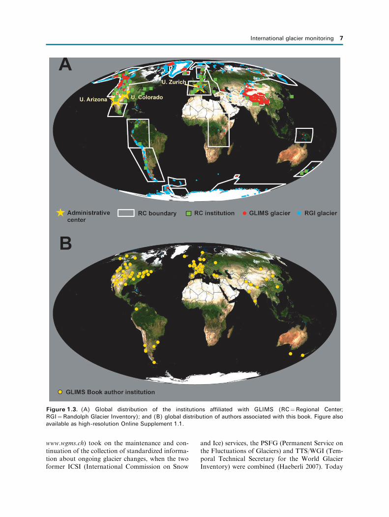
ter to another— reflecting each set of authors’ pre-ferred analysis, available data, and experience base.Thus, the result is a book containing a rich varietyof methodologies, glacier types, and satellites andsensors. Indeed, we feel that this book will serve as auseful companion to The Atlas series. Furthermore,and highly relevant to the interpretation of glacierchanges documented in this book, the quadren-nially released comprehensive assessments by theIntergovernmental Panel on Climate Change pro-vides the most thorough assessments of climatechange relevant to glaciers.
Overall, as most of the 25 regional chapters show,glaciers around the globe have been shrinkingdramatically since their Holocene maximum extenttowards the end of the Little Ice Age. In some cases,the shrinkage in more recent years of satellite obser-vations may include lingering responses to the endof the Little Ice Age, which in different parts of theworld lasted from the 17th to late 19th centuries,and elsewhere terminated earlier in the 19th cen-tury. In other cases, such a lingering response isnot possible, and the more recent decades of retreatmust be due to 20th and 21st century climatechange, especially with increasing rates of ice losssince the mid-1980s. On a timescale of decades,glaciers in various mountain ranges have shownintermittent readvances. However, under thepresent climate scenarios, the ongoing trend ofworldwide and fast, if not accelerating glaciershrinkage on the century timescale is not a periodicchange, and may lead to deglaciation of large partsof many mountain regions by the end of the 21stcentury.
This said, regional anomalies exist, no doubtindicating that climatic changes in some regionsfavor glacier growth. Furthermore, not all glaciervariations are due to climate change. Episodicemplacement of supraglacial rock debris, especiallyby landslides—sometimes triggered by seismicactivity—and a host of processes related to glaciercalving and glacier sliding are responsible for muchof the diversity of glacier changes observed in theworld. Finally, among those changes linked toclimate change, it is not only global warming: someparts of the planet are cooling, some are affected bychanging seasonality of cloud cover, some by atmo-spheric aerosol pollutants; the list of variables anddynamic forcing factors is long. Global warming isat the top of the list globally, but in some placesother factors are more important.
We shall return to matters dealing with the anal-ysis of results chapter by chapter and then again
more comprehensively as a synthesis within thesummary chapter.
1.8 CONCLUSIONS
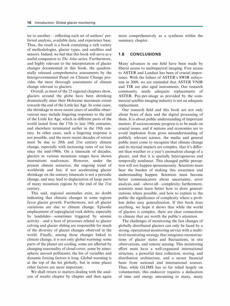
Many advances in our field have been made byliberal access to multispectral imaging. Free accessto ASTER and Landsat has been of crucial impor-tance. With the failure of ASTER’s SWIR subsys-tem in 2008, we are reminded that ASTER VNIRand TIR are also aged instruments. Our researchcommunity needs adequate replacements ofASTER. Pay-per-image as provided by the com-mercial satellite imaging industry is not an adequatereplacement.Our research field and this book are not only
about bytes of data and the digital processing ofthem. It is about public understanding of importantmatters. If socioeconomic progress is to be made oncrucial issues, and if nations and economies are toavoid implosion from gross misunderstanding ofpublicly relevant science, the media and generalpublic must come to recognize that climate changeand its myriad impacts are complex, that it’s differ-ent than weather or a year’s anomalous change of aglacier, and that it is spatially heterogeneous andtemporally nonlinear. This changed public percep-tion will not happen spontaneously. Scientists mustbear the burden of making this awareness andunderstanding happen. Scientists must becomebetter communicators about uncertainty, erroranalysis, and—above all—complexity; furthermore,scientists must learn better how to draw general-izations where possible, and how to explain to thepublic the significance of complexity where a prob-lem defies easy generalization. If this book doesanything, we hope it shows that while the worldof glaciers is complex, there are clear connectionsto climate that are worth the public’s attention.The challenges of monitoring the fast changes of
globally distributed glaciers can only be faced by astrong, operational monitoring service with a multi-level monitoring strategy that integrates reconstruc-tions of glacier states and fluctuations, in situobservations, and remote sensing. This monitoringeffort must have a well-organized internationalstructure, a powerful data collection, storing, anddistribution architecture, and a secure financialbasis from national and international sources.Thus, while GLIMS has so far relied largely onvolunteerism, this endeavor requires a dedicationof time and energy amounting to many, many
16 Introduction: Global glacier monitoring

careers. The spirit of volunteerism that hasnourished GLIMS is centered in this community’sperspective on data: it is the open-access movement,where we volunteer to give up (or share in) ourownership of much of our intellectual property inthe best interests of our science community, ournations, of global civilization—indeed of the planetitself.
1.9 ACKNOWLEDGMENTS
Our sincere thanks go to the national correspon-dents and principal investigators of the WGMS andto the GLIMS community for the collection andfree exchange of important data over many years.We thank Hugh Kieffer and Michael Bishop forhelpful reviews. We are particularly indebted toNASA and ESA and other space agencies andnational research agencies for providing financialsupport to the many researchers who havecontributed to this book.
1.10 REFERENCES
Agassiz, L. (1840) Etudes sur les glaciers. Jent et Gass-man, Neuchatel, Switzerland. A scan of this rare bookis available for free download from the University ofToronto Libraries: https://archive.org/details/etudes-surlesglacages. For an English translation see A.V.Carozzi, Studies on Glaciers Preceded by the Discourseof Neuchatel (1967), Hafner, New York, 166 pp.
Albert, T. (2002) Evaluations of remote sensing tech-niques for ice-area classifications applied to the tropi-cal Quelccaya Ice Cap, Peru. Polar Geography, 26,210–226.
Andreassen, L.M., Elverøy, H., Kjøllmoen, B., Engeset,R.V., and Haakensen, N. (2005) Glacier mass-balanceand length variation in Norway. Ann. Glaciol., 42, 317–325.
Andreassen, L.M., Paul, F., Kaab, A., and Hausberg,J.E. (2008) The new Landsat-derived glacier inventoryfor Jotunheimen, Norway, and deduced glacierchanges since the 1930s. The Cryosphere, 2, 131–145.
Arendt, A., Echelmeyer, K., Harrison, W., Lingle, C.,Zirnheld, S., Valentine, V., Ritchie B., and Drucken-miller, M. (2006) Updated estimates of glacier volumechanges in the western Chugach Mountains, Alaska,and a comparison of regional extrapolation methods.Journal of Geophysical Research, 111, F03019.
Arendt, A., Bolch, T., Cogley, J.G., Gardner, A., Hagen,R., Hock, J.-O., Kaser, G., Pfeffer, W.T., Moholdt, G.,Paul, F. et al. (2012) Randolph Glacier Inventory[v1.0]: A Dataset of Global Glacier Outlines. Global
Land Ice Measurements from Space, Boulder, Colorado,U.S.A. (digital media). Available at http://www.glims.org/RGI/randolph.html
Bamber, J. (2006) Remote sensing in glaciology. In: P.G.Knight (Ed.), Glacier Science and EnvironmentalChange, Blackwell Publishing, Oxford, U.K., pp. 370–382.
Bamber, J.L., Layberry, R.L., and Gogineni, S.P. (2001)A new ice thickness and bed data set for the Greenlandice sheet, 1. Measurement, data reduction, and errors.Journal of Geophysical Research, 106, 33733–33780.
Benn, D.I., and Evans, D.J.A. (1998) Glaciers and Glacia-tion. Arnold, 734 pp.
Bentley, C.R., Thomas, R.H., and Velicogna, I. (2007) Icesheets. In: UNEP (Ed.), Global Outlook for Ice andSnow. UNEP/GRID, Arendal, Norway, 235 pp.
Bindschadler, R.A., and T.A. Scambos (1991) Satellite-image-derived velocity field of an Antarctic ice stream.Science, 252, 242–246.
Bindschadler, R., Dowdeswell, J., Hall, D., and Winther,J.-G. (2001), Glaciological applications with Landsat-7imagery: Early assessments. Remote Sensing of En-vironment, 78, 163–179.
Bishop, M.P., Olsenholler, J.A., Shroder, J.F., Barry,R.G., Raup, B.H., Bush, A.B.G., Coplan, L., Dwyer,J.L., Fountain, A.G., Haeberli, W. et al. (2004) Globalland ice measurements from space (GLIMS): Remotesensing and GIS investigations of the Earth’s cryo-sphere. Geocarto International, 19(2), 57–84.
Casassa, G., Rivera, A., Haeberli, W., Jones, G., Kaser,G., Ribstein, P., and Schneider, C. (2007) Editorial:Current status of Andean glaciers. Global andPlanetary Change, 59, 1–9.
Chinn, T., Winkler, S., Salinger, M.J., and Haakensen, N.(2005) Recent glacier advances in Norway and NewZealand: A comparison of their glaciological andmeteorological causes, Geografiska Annaler, 87A,141–157.
Cogley, J.G., Hock, R., Rasmussen, L.A., Arendt, A.A.,Bauder, A., Braithwaite, R.J., Jansson, P., Kaser, G.,Moller, M., Nicholson L. et al. (2011) Glossary ofGlacier Mass Balance and Related Terms (IHP-VIITechnical Documents in Hydrology No. 86, IACSContribution No. 2), UNESCO-IHP, Paris. Availableat http://unesdoc.unesco.org/images/0019/001925/192525e.pdf
Dyurgerov, M., and M.F. Meier (2005) Glaciers and theChanging Earth System: A 2004 Snapshot (OccasionalPaper 58), Institute of Arctic and Alpine Research,University of Colorado, Boulder, CO, 118 pp.
Evans, I.S. (2006) Local aspect asymmetry of mountainglaciation: A global survey of consistency of favoureddirections for glacier numbers and altitudes. Geomor-phology, 73(1/2), 166–184.
Forel, F.A. (1895) Les variations periodiques des glaciers.Discours preliminaire. Extrait des Archives desSciences Physiques et Naturelles, XXXIV, 209–229.
References 17

GCOS (2004) Implementation Plan for the Global Observ-ing System for Climate in Support of the UNFCCC(Report GCOS—92, WMO/TD No. 1219), WorldMeteorological Organization, Geneva, Switzerland136 pp.
GCOS (2006) Systematic observation requirements forsatellite-based products for climate. SupplementalDetails to the Satellite-based Component of the ‘‘Imple-mentation Plan for the Global Observing System forClimate in Support of the UNFCCC’’ (ReportGCOS-107, WMO/TD No. 1338), World Meteoro-logical Organization, Geneva, Switzerland, 90 pp.
Geist, T., and Stotter, J. (2008) Documentation of glaciersurface elevation change with multi-temporal airbornelaser scanner data case study: Hintereisferner andKesselwandferner, Tyrol, Austria. Zeitschrift furGletscherkunde und Glazialgeologie, 41, 77–106.
Greuell, W., and Oerlemans, J. (1986): Sensitivity studieswith a mass balance model including temperature pro-file calculations inside the glacier. Zeitschrift furGletscherkunde und Glazialgeologie, 22(2), 101–124.
Haeberli, W. (1998) Historical evolution and operationalaspects of worldwide glacier monitoring. Into the Sec-ond Century of World Glacier Monitoring: Prospectsand Strategies. UNESCO, Paris, Vol. 56, pp. 35–51.
Haeberli, W. (2004) Glaciers and ice caps: Historicalbackground and strategies of world-wide monitoring.In: J.L. Bamber and A.J. Payne (Eds.), Mass Balanceof the Cryosphere. Cambridge University Press, Cam-bridge, U.K., pp. 559–578.
Haeberli, W. (2006) Integrated perception of glacierchanges: A challenge of historical dimensions. In:P.G. Knight (Ed.), Glacier Science and EnvironmentalChange. Oxford, U.K., Blackwell Publishing, pp. 423–430.
Haeberli, W. (2008) Changing views of changing glaciers.In: B. Orlove, E. Wiegandt, and B.H. Luckman (Eds.),The Darkening Peaks: Glacial Retreat in Scientific andSocial Context, University of California Press,Berkeley, CA, pp. 23–32.
Haeberli, W., and Barry, R. (2006) Global TerrestrialNetwork for Glaciers (GTN-G). In: GTOS (2006):GTOS Biennial Report 2004–2005 (GTOS Document40), Global Terrestrial Observing System, Rome, pp.30–31.
Haeberli, W., and Burn, C. (2002) Natural hazards inforests: Glacier and permafrost effects as related toclimate changes. In: R.C. Sidle (Ed.), EnvironmentalChange and Geomorphic Hazards in Forests (IUFROResearch Series, No. 9), CABI Publishing, Walling-ford, U.K., pp. 167–202.
Haeberli, W., and Hoelzle, M. (1995) Application ofinventory data for estimating characteristics of andregional climate-change effects on mountain glaciers:A pilot study with the European Alps. Annals ofGlaciology, 21, 206–212.
Haeberli, W., Cihlar, J., and Barry, R.G. (2000) Glaciermonitoring within the Global Climate ObservingSystem. Annals of Glaciology, 31, 241–246.
Haeberli, W., Hoelzle, M., Paul, F., and Zemp, M. (2007)Integrated monitoring of mountain glaciers as keyindicators of global climate change: the EuropeanAlps. Annals of Glaciology, 46, 150–160.
Hall, D.K., Williams, R.S., Jr., J.S. Barton, O. Sigurds-son, L.C. Smith, and J.B. Garvin (2000) Evaluation ofremote-sensing techniques to measure decadal-scalechanges of Hofsjokull ice cap, Iceland. Journal ofGlaciology, 46(154), 375–380.
Hoelzle, M., Haeberli, W., Dischl, M., and Peschke, W.(2003) Secular glacier mass balances derived fromcumulative glacier length changes. Global andPlanetary Change, 36(4), 77–89.
Howarth, P., and Ommanney, C.S. (1986) The use ofLandsat digital data for glacier inventories. Annals ofGlaciology, 8, 90–92.
IGOS (2007) Integrated Global Observing StrategyCryosphere Theme Report: For the Monitoring of ourEnvironment from Space and from Earth (WMO/TD-No. 1405), World Meteorological Organization, Gen-eva, Switzerland, 100 pp.
IPCC (2001) Climate Change 2001: The Scientific Basis(Contribution of Working Group I to the ThirdAssessment Report of the Intergovernmental Panelon Climate Change), Cambridge University Press,Cambridge, U.K., 881 pp.
IPCC (2007) Climate Change 2007: The Physical ScienceBasis (Contribution of Working Group 1 to the FourthAssessment Report of the Intergovernmental Panel onClimate Change, edited by S. Solomon, D. Qin, M.Manning, Z. Chen, M.C. Marquis, K. Averyt, M.Tignor, and H.L. Miller), Intergovernmental Panelon Climate Change, Cambridge, U.K.
Johannesson, T., Raymond, C., and Waddington, E.(1989) Time-scale for adjustment of glaciers to changesin mass balance. Journal of Glaciology, 35(121), 355–369.
Kaab, A. (2005) Combination of SRTM3 and repeatASTER data for deriving alpine glacier flow velocitiesin the Buthan Himalaya. Remote Sensing of Environ-ment, 94, 463–474.
Kaab, A. (2008) Glacier volume changes using ASTERsatellite stereo and ICESat GLAS laser altimetry: Atest study on Edgeøya, Eastern Svalbard. IEEE Trans-actions on Geosciences and Remote Sensing, 46(10),2823–2830.
Kaab, A., Paul, F., Maisch, M., Hoelzle, M., andHaeberli, W. (2002) The new remote-sensing derivedSwiss Glacier Inventory, II: First results. Annals ofGlaciology, 34, 362–366.
Kaab, A., Huggel, C., Paul, F., Wessels, R., Raup, B.,Kieffer, H., and Kargel, J. (2003) Glacier monitoringfrom ASTER imagery: Accuracy and applications.Paper presented at Proceedings of EARSeL–LISSIG-
18 Introduction: Global glacier monitoring

Workshop Observing Our Cryosphere from Space,March 11–13, 2002, Bern, Switzerland, Vol. 2, pp.43–53.
Kargel, J.S., Abrams, M.J., Bishop, M.P., Bush, A.,Hamilton, G., Jiskoot, H., Kaab, A., Kieffer, H.H.,Lee, E.M., Paul, F. et al. (2005) Multispectral imagingcontributions to Global Land Ice Measurements fromSpace. Remote Sensing of Environment, 99(1/2), 187–219.
Kaser, G., and Osmaston, H. (2002) Tropical Glaciers(International Hydrology Series), Cambridge Univer-sity Press, Cambridge, U.K., 207 pp.
Khalsa, S.J.S., Dyurgerov, M.B., Raup, B.H., and Barry,R.G. (2004) Space-based mapping of glacier changesusing ASTER and GIS Tools. IEEE Transactions onGeosciences and Remote Sensing, 42, 2177–2183.
Kieffer, H., Kargel, J. et al. (2000) New eyes in the skymeasure glaciers and ice sheets. Eos Transactions,American Geophysical Union, 81(24), June.
Konovalov, V.G., and Desinov, L.V. (2007) Remotesensing monitoring of the long-term regime of thePamirs glaciers. Paper presented at Remote Sensingfor Environmental Monitoring and Change Detection;Proceedings of Symposium HS3007 at IUGG2007, Per-ugia, July 2007 (IAHS Publication 316), InternationalAssociation of Hydrological Sciences, Christchurch,New Zealand, pp. 149–156.
Krimmel, R.M., and Meier, M.F. (1975) Glacier applica-tions of ERTS-1 images. Journal of Glaciology, 15(73),391– 402.
Kuhn, M. (1981) Climate and glaciers. Journal of theIAHS, 131, 3–20.
Larsen, C.F., Motyka, R.J., Arendt, A.A., Echelmeyer,K.A., and Geissler, P.E. (2007) Glacier changes insoutheast Alaska and northwest British Columbiaand contribution to sea level rise. Journal of Geo-physical Research, 112(F1), F01007, doi: 10.1029/2006JF000586.
Lythe, M.B., Vaughan, D.G., and the BEDMAP Group(2001) BEDMAP: A new ice thickness and subglacialtopographic model of Antarctica. Journal of Geophys-ical Research, 106(B6), 11335–11351.
Machguth, H., Kotlarski, S., Hoelzle, M., Paul, F., andHaeberli, W. (2009) Calculating distributed glaciermass balance for the Swiss Alps from RCM output:A methodical description and interpretation of theresults, Journal of Geophysical Research, 114,D19106, doi: 10.1029/2009JD011775.
Meier, M.F. (1984) The contribution of small glaciers tosea level rise. Science, 226, 1418–1421.
Molnia, B. (2007) Late nineteenth to early twenty-firstcentury behavior of Alaskan glaciers as indicators ofchanging regional climate. Global and PlanetaryChange, 56(1/2), 23-56.
Muller, F. (Ed.) (1978) Instructions for the Compilationand Assemblage of Data for a World Glacier Inventory(Supplement: Identification/glacier number IAH-
S(ICSI)/UNEP/UNESCO report), Temporal Techni-cal Secretariat for the World Glacier Inventory(TTS/WGI), ETH Zurich, Switzerland.
Muller, F., Caflisch, T., and Muller, G. (Eds.) (1977)Instructions for the Compilation and Assemblage ofData for a World Glacier Inventory (IAHS(ICSI)/UNESCO report), Temporal Technical Secretariatfor the World Glacier Inventory (TTS/WGI), ETHZurich, Switzerland, 22 pp.
Nesje, A., Bakke, J., Dahl, S.O., Lie, Ø., and Matthews,J.A. (2007) Norwegian mountain glaciers in the past,present and future. Global and Planetary Change, 60(1/2), 10–27.
Nye, J.F. (1960) The response of glaciers and ice-sheets toseasonal and climatic changes. Proceedings of theRoyal Society of London A, 256, 559–584.
Oerlemans, J. (2001) Glaciers and Climate Change, A.A.Balkema, Lisse, The Netherlands, 148 pp.
Ohmura, A. (2004) Cryosphere during the twentieth cen-tury. In: R.S.J. Sparks and C.J. Hawkesworth (Eds.),The State of the Planet: Frontiers and Challenges inGeophysics (Geophysical Monograph 150), Inter-national Union of Geodesy and Geophysics, Boulder,CO and American Geophysical Union, Washington,D.C., pp. 239–257.
Østrem, G. (1975) ERTS data in glaciology: An effort tomonitor glacier mass balance from satellite imagery.J. Glaciol., 15, 403–415.
Paterson, W.S.B. (1994) The Physics of Glaciers (ThirdEdition), Pergamon Press, Oxford, U.K., 480 pp.
Paul, F. (2007) The New Swiss Glacier Inventory 2000:Application of Remote Sensing and GIS (SchriftenreihePhysische Geographie 52), Universitat Zurich, 210 pp.
Paul, F., and Andreassen, L.M. (2009) Creating a glacierinventory for the Svartisen region (Norway) fromLandsat ETMþ satellite data: Challenges and results.Journal of Glaciology, 55(192), 607–618.
Paul, F., and Haeberli, W. (2008) Spatial variability ofglacier elevation changes in the Swiss Alps obtainedfrom two digital elevation models. GeophysicalResearch Letters, 35, L21502.
Paul, F., Kaab, A., Maisch, M., Kellenberger, T., andHaeberli, W. (2002) The new remote sensing-derivedSwiss Glacier Inventory, I: Methods. Annals of Glaciol-ogy, 34, 355–361.
Paul, F., Huggel, C., and Kaab, A. (2004) Combiningsatellite multispectral image data and a digital eleva-tion model for mapping of debris-covered glaciers.Remote Sensing of Environment, 89, 510–518.
Paul, F., Kaab, A., Rott, H., Shephard, A., Strozzi, T.,and Volden, E. (2009) GlobGlacier: A new ESA pro-ject to map the world’s glaciers and ice caps fromspace. EARSeL eProceedings, 8, 11–25.
Rabus, B., Eineder, M., Roth, A., and Bamler, R. (2003)The shuttle radar topography mission: A new class ofdigital elevation models acquired by spaceborne radar.
References 19
ISPRS Journal of Photogrammetry and RemoteSensing, 57(4), 241–262.
Racoviteanu, A.E., Manley, W.F., Arnaud, Y., andWilliams, M.W. (2007) Evaluating digital elevationmodels for glaciological applications: An examplefrom Nevado Coropuna, Peruvian Andes. Global andPlanetary Change, 59, 110–125.
Racoviteanu, A.E, Paul, F., Raup, B., Khalsa, S.J.S., andArmstrong, R. (2009) Challenges in glacier mappingfrom space: Recommendations from the Global LandIce Measurements from Space (GLIMS) initiative.Annals of Glaciology, 50(53), 53–69.
Radic, V., and R. Hock (2011) Regionally differentiatedcontribution of mountain glaciers and ice caps tofuture sea-level rise. Nature Geoscience, 4, 91–94.
Rahmstorf, S. (2007) A semi-empirical approach to pro-jecting future sea-level rise. Science, 315(5810), 368–370.
Raper, S.C.B., and Braithwaite, R.J. (2006) Low sea levelrise projections from mountain glaciers and icecapsunder global warming. Nature, 439(7074), 311–313.
Raper, S.C.B., and Braithwaite, R.J. (2009) Glaciervolume response time and its links to climate andtopography based on a conceptual model of glacierhypsometry. The Cryosphere, 3, 183–194.
Rau, F., Mauz, F., Vogt, S., Khalsa, S.J., and Raup, B.(2005) Illustrated GLIMS Glacier Classification Man-ual: Glacier Classification Guidance for the GLIMSGlacier Inventory, Institut fur Physische Geographie,Freiburg, Germany, 36 pp.
Raup, B.H., and Khalsa, J.S. (2010) GLIMS analysistutorial, 15 pp. Available at http://www.glims.org/MapsAndDocs/assets/GLIMS_Analysis_Tutoria-l_a4.pdf
Raup, B.H., Kieffer, H.H., Hare, T.M., and Kargel, J.S.(2000) Generation of data acquisition requests for theASTER satellite instrument for monitoring a globallydistributed target: Glaciers. IEEE Transactions OnGeoscience and Remote Sensing, 38, 1105–1112.
Raup, B., Kaab, A., Kargel, J.S., Bishop, M.P., Hamil-ton, G., Lee, E., Paul, F., Rau, F., Soltesz, D., Khalsa,S.J.S. et al. (2007a) Remote sensing and GIS technol-ogy in the Global Land Ice Measurements from Space(GLIMS) project. Computers and Geosciences, 33, 104–125, doi: 10.1016/j.cageo.2006.05.015.
Raup, B.H., Racoviteanu, A., Khalsa, S.J.S., Helm, C.,Armstrong, R., and Arnaud Y. (2007b) The GLIMSGeospatial Glacier Database: A new tool for studyingglacier change. Global and Planetary Change, 56, 101–110, doi: 10.1016/j.gloplacha.2006.07.018.
Rees, W.G. (2006) Remote Sensing of Snow and Ice.Taylor & Francis, Boca Raton, FL.
Rignot, E., Rivera, A., and Casassa, G. (2003) Contribu-tion of the Patagonian icefields of South America tosea level rise. Science, 302(5644), 434–437.
Rott, H. (1976) Analyse der Schneeflachen auf Gletschernder Tiroler Zentralalpen aus Landsat Bildern. Zeits-
chrift fur Gletscherkunde und Glazialgeologie, 12, 1–28 [in German].
Rundquist, D.C., Collins, S.C., Barnes, R.B., Bussom,D.E., Samson, S.A., and Peake, J.S. (1980) The useof Landsat digital information for assessing glacierinventory parameters. Journal of the IAHS, 126,321–331.
Scherler, K. (Ed.) (1983) Guidelines for PreliminaryGlacier Inventories (IAHS(ICSI)/UNEP/UNESCOreport, Temporal Technical Secretariat for the WorldGlacier Inventory (TTS/WGI)), ETH Zurich, Switzer-land.
Shumskii, P.A. (1964) Principles of Structural Glaciology(translated from the Russian by D. Kraus), DoverPublications, New York, 497 pp.
Singh, V.P., Singh, P., and Haritashya, U.K. (Eds.)(2011) Encyclopedia of Snow, Ice, and Glaciers,Springer-Verlag, Dordrecht, The Netherlands, ISBN:978-90-481-2641-5.
Slobbe, D.C., Lindenbergh, R.C., and Ditmar. P. (2008)Estimation of volume change rates of Greenland’s icesheet from ICESat data using overlapping footprints.Remote Sensing of Environment, 112(12), 4204–4213.
Strozzi, T., Kouraev, A., Wiesmann, A., Wegmuller, U.,Sharov, A., andWerner, C. (2008) Estimation of Arcticglacier motion with satellite L-band SAR data. RemoteSensing of Environment, 112(3), 636–645.
Toutin, T. (2002) 3D topographic mapping with ASTERstereo data in rugged topography. IEEE Transactionson Geoscience and Remote Sensing, 40, 2241–2247.
Toutin, T. (2008) ASTER DEMs for geomatic and geo-scientific applications: A review. International Journalof Remote Sensing, 29(7), 1855–1875.
UNEP (2007) Global Outlook for Ice and Snow, UNEP/GRID-Arendal, Norway, 235 pp.
UNESCO (1970) Perennial Ice and SnowMasses: A Guidefor Compilation and Assemblage of Data for the WorldGlacier Inventory (Technical Papers in Hydrology No.1), UNESCO, Paris, France.
UNESCO (1970/73) Combined Heat, Ice and Water Bal-ances at Selected Glacier Basins, Part I: A Guide forCompilation and Assemblage of Data for Glacier MassBalance Measurements. Part II: Specifications, Stan-dards and Data Exchange (UNESCO/IAHS TechnicalPapers in Hydrology 5), UNESCO, Paris, France.
USGS (2008) Opening the Landsat Archive (USGS Fact-sheet 2008-3091). Available at http://pubs.usgs.gov/fs/2008/3091/pdf/fs2008-3091.pdf
WGMS (1989) World Glacier Inventory: Status 1988(edited by W. Haeberli, H. Bosch, K. Scherler, G.Østrem, and C.C. Wallen), IAHS(ICSI)/UNEP/UNESCO, World Glacier Monitoring Service,Nairobi, Kenya, 458 pp.
WGMS (2007) Glacier Mass Balance Bulletin No. 9(2004–2005) (edited by W. Haeberli, M. Hoelzle,and M. Zemp), ICSU(FAGS)/IUGG(IACS)/UNEP/
20 Introduction: Global glacier monitoring
UNESCO/WMO, World Glacier Monitoring Service,Zurich, Switzerland, 100 pp.
WGMS (2008) Global Glacier Changes: Facts and Figures(edited by M. Zemp, I. Roer, A. Kaab, M. Hoelzle, F.Paul, and W. Haeberli), UNEP, World Glacier Mon-itoring Service, Zurich, Switzerland, 88 pp.
Williams, R.S., Jr., and Hall, D.K. (1993) Glaciers. In:R.J. Gurey, J.L. Foster, and C.L. Parkinson (Eds.),Atlas of Satellite Observations Related to GlobalChange, Cambridge University Press, Cambridge,U.K., pp. 401–421.
Williams, R.S., Jr., and Hall, D.K. (1998) Use of remote-sensing techniques. In: W. Haeberli, M Hoelzle, and S.Suter (Eds.), Into the Second Century of WorldwideGlacier Monitoring: Prospects and Strategies,UNESCO, Paris, France pp. 97–111.
Williams, R.S., Jr., and Ferrigno, J.G. (Eds.) (2012) Satel-lite image atlas of glaciers of the world. In: State of theEarth’s Cryosphere at the Beginning of the 21st Cen-tury: Glaciers, Snow Cover, Floating Ice, and Perma-frost and Periglacial Environments (U.S. GeologicalSurvey Professional Paper 1386-A), U.S. GeologicalSurvey, Reston, VA.
Williams, R.S., Jr., and Ferrigno, J.G. (2012) Introduc-tion, with a section on Intensification of the globalhydrologic cycle, by T.G. Huntington, R.S. Williams,Jr., and J.G. Ferrigno (A-1); Glaciers, with sections onice-cores, high-mountain glaciers, and climate, by L.G.Thompson; Glacier mass changes and their effect onthe Earth System, byM.B. Dyurgerov andM.F. Meier;Global land ice measurements from space (GLIMS),by B.H. Raup and J.S. Kargel (A-2); Global snowcover, by D.K. Hall, and D.A. Robinson (A-3); Float-ing ice, by C.L. Parkinson and D.J. Cavalieri; Sea ice,by M.O. Jeffries, K. Morris, and C.R. Duguay; Lake
ice and river ice, by J.A. Heginbottom, J. Brown, O.Humlum, and H. Svensson, (A-4); Permafrost andperiglacial environments (A-5). In R.S. Williams, Jr.,and J.G. Ferrigno (Eds.), Satellite Image Atlas ofGlaciers of the World (USGS Professional Paper1386-A), U.S. Geological Survey, Reston, VA.
Zemp, M., Haeberli, W., Hoelzle, M., and Paul, F. (2006)Alpine glaciers to disappear within decades? Geo-physical Research Letters, 33, L13504, doi: 10.1029/2006GL026319.
Zemp, M., Haeberli, W., Bajracharya, S., Chinn, T.J.,Fountain, A.G., Hagen, J.O., Huggel, C., Kaab, A.,Kaltenborn, B.P., Karki, M. et al. (2007a) Glaciers andice caps, Part I: Global overview and outlook; Part II:Glacier changes around the world. In: UNEP: GlobalOutlook for Ice and Snow, UNEP/GRID-Arendal,Norway, pp. 115–152.
Zemp, M., Haeberli, W., Hoelzle, M., and Paul, F.(2007b) Glacier fluctuations in the European Alps1850–2000: An overview and spatio-temporal analysisof available data. In: B. Orlove, E. Wiegandt, and B.H.Luckman (Eds.), Darkening Peaks: Glacier Retreat,Science, and Society, University of California Press,Berkeley, CA.
Zemp, M., Haeberli, W., Hoelzle, M., and Paul, F. (2008)Glaciers and ice caps. In: GTOS Biennial Report 2006–2007 (GTOS Document 50), Global TerrestrialObserving System, Rome, pp. 2–3.
Zemp, M., Roer-Gartner, I., Haeberli, W., Hoelzle, M.,and Paul, F. (2009) ECV T6: Glaciers and Ice Caps—Assessment of the Status of the Development ofStandards for the Terrestrial Essential ClimateVariables (GTOS Document 61), Global TerrestrialObserving System, Rome, 26 pp.
References 21
Copyright © 2022 FDOKUMEN