ING THE COMPREHENSIVE ZONING ORDINANCE OF THE ...
186
ORDINANCE NO. 85-25 AN ORDINANCE OF THE CITY OF ROCKWALL, TEXAS" AMEND- ING THE COMPREHENSIVE ZONING ORDINANCE OF THE CITY OF ROCKWALL AS HERETOFORE AMENDED SO AS TO CHANGE THE ZONING ON A TRACT OF LAND MORE FULLY DESCRIBED HEREIN FROM "A" AGRICULTURAL DISTRICT CLASSIFICATION TO "GR" GENERAL RETAIL DISTRICT CLASSIFICATION; PROVIDING FOR A PENALTY OF FINE NOT TO EXCEED THE SUM OF ONE THOUSAND DOLLARS (1,000) FOR EACH OFFENSE; PROVIDING FOR A SEVER- ABILITY CLAUSE; PROVIDING FOR A REPEALER CLAUSE; AND PROVIDING FOR AN EFFECTIVE DATE. WHEREAS, the Planning and Zoning Commission of the City of Rockwall and the governing body of the City of Rockwall, in com- pliance with the laws of the State of Texas and the ordinances of the City of Rockwall, have given the requisite notices by pub- lication and otherwise, and have held public hearings and afforded a full and fair hearing to all property owners generally, and to all persons interested in and situated in the affected area and in the vicinity thereof, the governing body in the exercise of its legislative discretion has concluded that the Comprehensive Zoning Ordinance of the City of Rockwall should be amended as follows: NOW, THEREFORE, BE IT ORDAINED by the City Council of the City of Rockwall, Texas: SECTION 1. That the Comprehensive Zoning Ordinance of the City of Rockwall, as heretofore amended, be and the same is hereby amended by amending the Zoning map of the City of Rockwall so as to grant a zoning change from "A" Agricultural District Classifi- cation to "GR" General Retail District Classification on the pro- perty specifically described in Exhibit "A" .. SECTION 2. The above described tract of land shall be used only in the manner and for the purposes provided for in the
-
Upload
khangminh22 -
Category
Documents
-
view
2 -
download
0
Transcript of ING THE COMPREHENSIVE ZONING ORDINANCE OF THE ...

ORDINANCE NO. 85-25
AN ORDINANCE OF THE CITY OF ROCKWALL, TEXAS" AMENDING THE COMPREHENSIVE ZONING ORDINANCE OF THE CITY OF ROCKWALL AS HERETOFORE AMENDED SO AS TO CHANGE THE ZONING ON A TRACT OF LAND MORE FULLY DESCRIBED HEREIN FROM "A" AGRICULTURAL DISTRICT CLASSIFICATION TO "GR" GENERAL RETAIL DISTRICT CLASSIFICATION; PROVIDING FOR A PENALTY OF FINE NOT TO EXCEED THE SUM OF ONE THOUSAND DOLLARS (1,000) FOR EACH OFFENSE; PROVIDING FOR A SEVERABILITY CLAUSE; PROVIDING FOR A REPEALER CLAUSE; AND PROVIDING FOR AN EFFECTIVE DATE.
WHEREAS, the Planning and Zoning Commission of the City of
Rockwall and the governing body of the City of Rockwall, in com-
pliance with the laws of the State of Texas and the ordinances
of the City of Rockwall, have given the requisite notices by pub-
lication and otherwise, and have held public hearings and afforded
a full and fair hearing to all property owners generally, and to
all persons interested in and situated in the affected area and in
the vicinity thereof, the governing body in the exercise of its
legislative discretion has concluded that the Comprehensive Zoning
Ordinance of the City of Rockwall should be amended as follows:
NOW, THEREFORE, BE IT ORDAINED by the City Council of the
City of Rockwall, Texas:
SECTION 1. That the Comprehensive Zoning Ordinance of the
City of Rockwall, as heretofore amended, be and the same is hereby
amended by amending the Zoning map of the City of Rockwall so as
to grant a zoning change from "A" Agricultural District Classifi-
cation to "GR" General Retail District Classification on the pro-
perty specifically described in Exhibit "A" ..
SECTION 2. The above described tract of land shall be used
only in the manner and for the purposes provided for in the

Comprehensive Zoning Ordinance of the City of Rockwall as here-
tofore amended, as amended herein by granting of this zoning
change, and as may be amended in the ~·uture ..
SECTION 3. If any section, subsection, sentence, phrase,
paragraph, provision of this ordinance or the application of that
section, subsection, sentence, phrase, paragraph, or provision to
any person, firm, corporation, situation, circumstance is for any
reason judged invalid, the adjudication shall not affect any other
section, sentence, phrase, word, paragraph, or provision of this
ordinance or the application of any other section, subsection,
sentence, phrase, paragraph, or provision of the Comprehensive
Zoning Ordinance No. 83-23 of the City of Rockwall, Texas, and the
City Council declares that it would have adopted the valid portions
and applications of the ordinance without the invalid parts and
to this end bhe provisions for this ordinance are declared to be
severable ..
SECTION 4. That all ordinances of the City of Rockwall in con-
flict with the provisions of this be and the same are hereby re-
pealed, and all other ordinances of the City of Rockwall not in con-
flict with the provisions of this ordinance shall remain in full
force and effect.
SECTION 5.. That this ordinance shall take effect immediately
from.and after its passage and the publication of the caption of
said ordinance as the law in such cases provides ..
DULY PASSED AND APPROVED this 8th day of April, 1985.
~i~st reading· . 4/1/85
Second reading 4/8/85
ATTEST:

EXHIBIT "A"
Tracts 2, 3, and 6 of that certain lot, tract or parcel of land ly~ng in the County of Rockwall, State of Texas, Edward Teal Survey and belng 23.52 acres of land conveyed to Isaac Brown out of a 87.5 ac~e tract by John Martin et ux, and-G. W. Moton the 7th dav of January 1905 of re~ord in Vol. 31, page 235 Deed Records of Rockwali Co~nty, Texas, descrlbed as follows:
BEGINNING at a stake in the Northeast line of said E. Teal Survey at the intersection of F. M. Road No. 740 West right-of-way line:
o THENCE: South 13 08' West 15 ft. to a stake;
THENCE; South 45 0 00' West 1139 -ft. wi th old fence line to a stake in fence line at the Northeast corner of a cemetery;
THENCE: North 42 0 43' West 228 ft. to an angle in line, continuing North 49 0 15' West 132.5 ft. to an iron pin for a corner;
THENCE: South 23 0 OO! West 24.8 ft. to an iron pin for a corner;
TIIENCE: with the meanders of a small creek average distances and courses, o 0 . 0 r·Jorth 15 OO'~'J. 74 ft6; South 70 00' West 100 ft. ;oSouth 66 30' West 246.5 ft6; South 73 30' West 133.5 ft. i North 71 lS'W. 46.5 ft.; North 58 10' West 63.5 ft. to an iron pin in the Southwest corner of said tract, said point being also the southeast corner of the Moton land;
THENCE: North 45 0 00' East 1440 ft. to a stake in public road and survey line;
THENCE: South 450 00' East 855.5 ft. wlth road and survey line to the place of beginning containing 23.52 acres to be divided into 16 tracts.
ORDINANCE NO. 85-26
AN ORDINANCE OF THE CITY OF ROCKWALL, TEXAS, AMENDING THE COMPREHENSIVE ZONING ORDINANCE OF THE CITY OF ROCKWALL AS HERETOFORE AMENDED SO AS TO CHANGE THE ZONING ON A TRACT OF LAND MORE FULLY DESCRIBED HEREIN FROM "An AGRICULTURAL DISTRICT CLASSIFICATION TO "GR" GENERAL RETAIL DISTRICT CLASSIFICATION; PROVIDING FOR A PENALTY OF FINE NOT TO EXCEED THE SUM OF ONE THOUSAND DOLLARS ($1,000) FOR EACH OFFENSE; PROVIDING FOR A SEVERABILITY CLAUSE; PROVIDING FOR A REPEALER CLAUSE; AND PROVIDING FOR AN EFFECTIVE DATE.
WHEREAS, the Planning and Zoning Commission of the City of
Rockwall and the governing body of the City of Rockwall, in com-
pliance with the laws of the State of Texas and the ordinances
of the City of Rockwall, have given the requisite notices by
pUblication and otherwise, and have held public hearings and
afforded a full and fair hearing to all property owners generally,
and to all persons interested in and situated in the affected
area and in the vicinity thereof, the governing body in the exer-
cise of its legislative discretion has concluded that the Com-
prehensive Zoning Ordinance of the City of Rockwall should be
amended as foliows:
NOW, THEREFORE, BE IT ORDAINED by the City Council of the
City of Rockwall, Texas:
SECTION 1. That the Comprehensive Zoning Ordinance of the
City of Rockwall' as heretofore amended, be and the same is hereby
amended by amending the Zoning map of the City of Rockwall so as
to. grant a zoning change from "A" Agricultural District Classifi-
cation to "GR" General Retail District Classification on the
property specifically described in Exhibit "A".
SECTION 2. The above described tract of land shall be used
only in the manner and for the purposes provided for in the

Comprehensive Zoning Ordinance of the City of Rockwall as here
tofore amended, as amended herein by granting of this zoning
change, and as may be amended in the future.
SECTION 3. If any section, subsection, sentence, phrase,
paragraph, provision of this ordinance or the application of that
section, subsection, sentence, phrase, paragraph, or provision to
any person, firm, corporation, situation, circumstance is for any
reason judged invalid, the adjudication shall not affect any other
section, sentence, phrase, word, paragraph, or provision of this
ordinance or the application of any other section, subsection,
sentence, phrase, paragraph, or provision of the Comprehensive
Zoning Ordinance No. 83-23 of the City of Rockwall, Texas, and
the City Council declares that it would have adopted the valid
portions and applications of the ordinance without the invalid
parts and to this end the provisions for this ordinance are de
clared to be severable.
SECTION 4. That all ordinances of the City of Rockwall in
conflict with the provisions of this be and the same are hereby
repealed, and all other ordinances of the City of Rockwall not in
conflict with the provisions of this ordinance shall remain in
full force and effect.
SECTION 5. That this ordinance shall take effect immediately
from and after its passage and the publication of the caption
of said ordinance as the law in such cases provides.
DULY PASSED AND APPROVED this 8th day of April, 1985.
APPROVED:
First Reading ______ 4_/_I_/_8_5 __
Second Reading 4/8/85 ---=----!---

EXHIBIT "A"
Tracts T and 8 of that certain lot, tract or parcel of land lying in the County of Rockwall, State of Texas, Edward Teal Survey and being 23.52 acres of land conveyed to Isaac Brown out of a 87.5 acre tract Iy John Martin et ux, and G. W. Moton the 7th day of January 1905 of
record in Vol. 31, page 235 Deed Records of Rockwall County Texas described as follows:
BEGINNING at a stake in the Northeast line of said' E. Teal Survey at the intersection of F. M. Road No. 740 West right-of-way line:
o THENCE: South 13 08' West 15 ft. to a stake;
THENCE; South 45 0 00' West 1139 ft. with old fence line to a stake in fence line at the Northeast corner of a cemetery;
THENCE: North 420 43' West 228 ft. to an angle in line, continuing North 49 0 15' West 132.5 ft. to an iron pin for a corner;
THENCE: o South 23 00' West 24.8 ft. to an iron pin for a corner;
THENCE: ~ith the meanders of aosmall creek average distanc~s and courses, North 45 QO~W. 74 fto; South 70 00' West 100 ft.;oSouth 66 30' West 246.5 fto; South 73 30' West 133.5 ft.; North 71 l5'W~ 46.5 ft.; North 58 10' West 63.5 ft. to an iron pin in the Southwest corner of said tract, said point being also the southeast corner of the Moton land;
THENCE: North 45 0 00' East 1440 ft. to a stake in public road and survey line;
THENCE: South 450 00' East 855.5 ft. with road and survey line to the place of beginning containing 23.52 acres to be divided into 16 tracts.

ORDINANCE NO. 89-20
AN ORDINANCE OF THE CITY OF ROCK\V ALL, TEXAS, AMENDING THE COMPREHENSIVE ZONING ORDINANCE OF THE CITY OF ROCKWALL AS HERETOFORE AMENDED SO AS TO GRANT A ZONING CHANGE ON A TRACT OF LAND MORE FULLY DESCRIBED HEREIN; ORDERING A CHANGE IN THE USE OF SAID PROPERTY FROM "AG" AGRICULTURAL TO "PD-32" PLANNED DEVELOPMENT NUMBER 32; PROVIDING SPECIAL CONDITIONS; PROVIDING FOR A PENALTY OF FINE NOT TO EXCEED THE SUM OF TWO THOUSAND DOLLARS ($2,000) FOR EACH OFFENSE; PROVIDING FOR A SEVERABILITY CLAUSE; PROVIDING FOR A REPEALER CLAUSE; AND PROVIDING FOR AN EFFECTIVE DATE.
WHEREAS, a change in zoning from "A" Agricultural to "PD-32" Planned Development 32 on the property described on Exhibit "A" has been requested by Phillip Williams; and
WHEREAS, the Planning and Zoning Commission of the City of Rockwall and the governing body of the City of Rockwall in compliance with the laws of the State of TExas and the ordinance of the City of Rockwall, have given the requisite notices by publication and otherwise, and have held public hearings and afforded a full and fair hearing to all property owners generally and to all persons interested in and situated in the affected area, and in the vicinity thereof, and the governing body in the exercise of its legislative discretion, has concluded that the Comprehensive Zoning Ordinance of the City of Rockwall should be amended as follows,
NOW, THEREFORE, BE IT ORDAINED by the City Council of the City of Rockwall, Texas:
SECTION 1. That the Comprehensive Zoning Ordinance of the City of Rockwall, Texas as heretofore amended, be and the same is hereby amended by amending the Zoning Map of the City of Rockwall so as to grant a zoning change from Agricultural to "PD" Planned Development District No. 32 on the property specifically described in Exhibit "A",
SECTION 2. That Planned Development District Number 32 shall be used only in the manner and for the purposes authorized by the Comprehensive Zoning Ordinance of the City of Rockwall, as heretofore amended and as amended hereby provided that the granting of Planned Development District No.32 to the above described tract of land is subject to the following special conditions:
A. Prior to the issuance of any building permit for any buildings in Planned Development District No. 32 a comprehensive development plan shall be filed with the Planning and Zoning Commission, and after hearing, the City Council shall approve a final development plan, which shall be filed and included as Exhibit "B" and made a part of this ordinance for all purposes. Such development plan shall set forth in detail the requirements for ingress and egress to the property, public or private streets or drives, with adequate right-of-way to the Thoroughfare Plan of the City of Rocbvall, sidewalks, utilities,

drainage, parking space, height of buildings, maximum lot coverage, yards and open spaces, screening walls or fences and other development and protective requirements considered necessary by the City Council so as to create a reasonable transition to and protection of the adjacent property.
B. All development of property covered by Planned Development District No 32 shall be in accordance with the provisions of this ordinance and the finally approved comprehensive site plan and list of approved uses, and no substantial change in the development shall be permitted, except after obtaining approval of the change of such site plan in the manner required for changes and amendments to the comprehensive Zoning Ordinance.
C. Development of Planned Development District No. shall be regulated by the following requirements:
1. PD-32 shall have the uses, area requirements, and development standards of the Commercial zoning category of the Comprehensive Zoning Ordinance as currently adopted except as otherwise provided in this ordinance
2. Gasoline service stations, retail outlets where gasoline products are sold, automotive repair as an accessory to a permitted retail use, car washes, drivein businesses, and rail and motor vehicle transportation passenger terminals shall require a Conditional Use Permit
3. Prior to the development of any property within the PD a circulation plan for the area identified as Exhibit "C" and attached to this ordinance will be submitted and approved.
4. Prior to the development of any property within the PD adequate access necessary to serve that development in conformance with the approved circulation plan will be constructed.
5. Any development within the PD will be reviewed to insure that views and the unique characteristics of the area are maintained and enhanced where possible.
6. All buildings within the PD are subject to height and elevation approval at the time of development plan submission
SECTION 3. Any person, firm or corporation violating any of the provisions of this ordinance shall be punished by a penalty of fine not to exceed the sum of T\VO THOUSAND DOLLARS ($2,000) for each offense and each and every day such offense continues shall be deemed to constitute a separate offense.
SECTION 4. If any section or provision of this ordinance or the application of that section or provision to any person, firm, corporation, situation or circumstance is for any reason judged invalid, the adjudication shall not affect any other section of provision of this ordinance or the application of any other section or provision to any other person, firm, corporation, situation, or circumstance, nor shall adjudication affect any other section or

provision of the Comprehensive Zoning Ordinance of the City of Rockwall, Texas, and the City Council declares that it would have adopted the valid portions and applications of the ordinance without the invalid parts and to this end the provisions of this ordinance shall remain in full force and effect.
SECTION 5. That all ordinance of the City of Rockwall in conflict with the provisions of this be and the same area hereby repealed to the extent of that conflict.
SECTION 6. That this ordinance shall take effect immediately from and after its passage and the publication of the caption of said ordinance as the law in such as the law in such case provides.
DULY PASSED AND APPROVED this 19 th day of June I 1989 ------~----------
1ST READING 6/5/89
2ND READING 6/19/89
APPROVED

EXHIBIT "A" PLANNED DEVELOPMENT NUMBER 32
Lots 2~ 5~ 6A, 7A, 8A, James Brown Partition
Lot 1, Block 7, George Moton Subdivision
Lot 2, Block 13, George Moton Subdivision
and the following tract of land:
\) ESCI{ II'T J liN
BFI:':(; ... tri!\'l L,r LII1l1 ~lllI;lt€'d in the ~1.1. ·B;II·ks.lrile Sllrvl'\'. ,\hstri)l"t 7\,). II ilnd the E. Tf",q ';\I/'\,'(.'\'. I\hstnllot :--;n. ~07. 1\'~'kw;Ill COllnt~'. Tex;ls :1I1d heinh p:lrt Ilf Ih~lt 13 ClerE' triW( as f('c\·rdec :n \,.dlllll· 18. Page 5h5, llil'ed J{c"uros, 1{,"I(°k\. • .':ll1 C,lllnt\', TexHs, <-Inti ht>ing nlllre p,qn i("IIL.rlv dt;'scrit 1<'; r (I 11,1 .... :s ;
I~H;I:,:-:I:\(;. rtl tll:' South Corner of C, .... dC!r r.rov~ Christiclll Church. a 1:2" irll l1 Sl;lkt-> f"lll1d for II rill' r.
nlf-::':CE, ~:. 4)" 32' lJ" F .• it Jist.1nce of 70.00 fE'f't tn a point ,'n thE' Sp\ltl1erly litH' I,f Hill "[l ilriv<>. s,qid po inl bt'in~ thE' beginning llf a C"llrVe to the l('ft ll.,ving rt centr-,ql ;:ili~ll' .,1 (JC' Oql
,2" ;lnd .. r.1dius (,\f J~O.OO f~E't Cl~" iron stakl' set f(\r cnrner. rJIE:-':CI·:. (lr(\IJll(} said curvE' and along the Southe·rly 1 int' pf ifillttlp Orive. it di~(;lncp "f ~O. J:
l't;'t I" f 11(' E'nJ of ~aid ("lin'€' .1 tJ' i. rt'n stt1ke St;~t f(\r corner. Tln~Cl~,~. 4~o 2R' 11" E., fill)!)).! the SOllt};t;.>rly line ('If Hillrnp DrivE';} di~tall(,l' pC lY.49 fpc
I' ;1 1/' i r \1 n s l a k e s E' t for "Oll r n t: r .
I~."
,
n1E~CE. S. 44° 08' 24" E., leaving the SOlilhE'rly line oY Hilltop Drive ,1 distance I)f 150.714 ttl CI Y' i r<'n stakE' [(lund fl't' ('orner. Tt:r:;-a:F., S. 45° 03' 45" W., a distance l,f 325.09 feet to a I~" irlln stake tl' lll1d fnr l'CI·I"Ie-r. Tii t-.NC E. ~. 44° 56 ' fH !:NeE, S. 45° 01' THr:~Cr: • S. I , 0
~ S-f,' THf:}JC E, " . !. I) 0 OJ' THE~E, ~. 44":0 O~'
THENCE 9 ~ . 45° S5' THENCE, S. 43° 52' iron Slake set fnr
THENCE,N.45°00'E.,
15" W., a distance of 104.40 feet to a f("'lInd fllr cl'rner. I" i r("ln stake -:z
4 5 ,. \0/., a dis tan ceo rIO 4 • 40- feE' t t 0 a f ,) II n d f (J r l· I l r n e r . 1" iron stakE" l
) 5" E ., a dis t ;1 nee ('I flO 4 • 40 fee t t 0 :1 f "l 1111 cl f I' r l'" r n E' r • 1 .. in"lJ1 sta;';'e -:z 45" W., a distance of 357.73 fee>t tll a St>t f('lr Cl'rner. I" irnl1 stMke ~
30 " W. 9 a dis tan ceo f 3 til . 1 1 fee t t ("I C1 S t> t f () r (" II r n (. r . I" irpil S t ,I kp -:z 42" E., a distance of 242.45 feet to .1 '/1 in)n ~t.Jke set fl\r c('rnE'r. 12" E .. a distan('e ()f 126.85 feE't to the :;ollth Cl'rnt;'f" (,I' Hilltop Drive. ClH'ne r •
alon g t he Sou t he r 1 y l .. t n e 0 f HilI t a fl Dr i ve, a dis tan ceo f 11 2 . 5 3 fee
o a point for corner; . ,;....... . N· S 43°40'35"E 1 . th said Southerly line- of Hilltop Dri.ve, a- -distance c THE CE,. . ., eavlng e
4.61 feet to a 'point for corner; HENCE, N.44°59' 13"E. I a distance of 303.70 feet to the PLACt OF BEGINNING and 'containing 3.8E cres of land. This description is based on the Land Title 'Survey and Plat made by Bob O. Bro .... ·r
.egistered Public Surveyor on July 24, 1984 and Revised on February 3, 1989.

\,~~!
<. ~'
<5 \.)
\a.. '0
" 1

ORDINANCE NO. -.;;;...._
OF ROCKWALL, TEXAS, AMENDING ZONING ORDINANCE OF
CITY OF ROCKWALL AS PREVIOUSLY AMENDED AND ORDINANCE NO. 89-20 SO AS TO CHANGE
ZONING ON PROPERTY DESCRIBED HEREIN AS EXHIBIT "A", FROM "A" AGRICULTURAL, "GR"; GENERAL RETAIL AND "C", COMMERCIAL, TO PLANNED DEVELOPMENT DISTRICT NO. 32; CORRECTING THE OFFICIAL ZONING MAP; PROVIDING FOR A PENAL TV OF FINE NOT EXCEED SUM OF TWO THOUSAND DOLLARS ($2,000) FOR EACH OFFENSE; PROVIDING A SEVERABILITY CLAUSE; PROVIDING FOR A REPEALER CLAUSE; AND PROVIDING FOR AN DATE.
WHEREAS, the Planning and Zoning Commission of the City of Rockwall and the governing body of the City of Rockwall in compliance with the laws of the State of Texas and the ordinances of the City of Rockwall have given the requisite notices by publication and otherwise, and have held public hearings and afforded a full and fair hearing to all property owners generally and to all persons interested in and situated in the affected area, and in the vicinity thereof, and the governing body in the exercise of its legislative discretion, has concluded that the Comprehensive Zoning Ordinance of the City of Rockwall should be amended as follows:
NOW, THEREFORE, BE IT ORDAINED by the City Council of the City of Rockwall, Texas:
Section 1. That the Comprehensive Zoning Ordinance of the City of Rockwall, Texas, as heretofore amended, be and the same are hereby amended by amending the zoning map of the City of Rockwall so as amend "PD-32", Planned Development No. 32, and change the zoning on a tract of land which is more fully described herein as Exhibit "A" from "A", Agricultural, "GR", General Retail and "C", Commercial, to "PD-32", Planned Development District No. 32, and;
That the property described herein shall be used only in the manner and for the purposes provided for in "PD .. 32", Planned Development District No. 32 of the Comprehensive Zoning Ordinance of the City of Rockwall as heretofore amended, as amended herein by granting of this zoning change, and as may be amended in the future and subject to the following additional conditions.
A. Prior to the issuance of any building permit for any buildings in Planned Development District No. 32 a comprehensive development plan shall be filed with the Planning and Zoning Commission, and after hearing, the City Council
PZ-2002-87 .. z/PD- PD-32 Amendment to Ord. 89-20 (1 of 3)

shall approve a final development plan, which shall be filed and included as Exhibit "B" and made a part of this ordinance for all purposes. Such development plan shall set forth in detail the requirements for ingress and egress to the property, public or private streets or drives, with adequate right.of-way to the Thoroughfare Plan of the City of Rockwall, sidewalks, utiiities, drainage, parking space, height of buildings, maximum lot coverage, yards and open spaces, screening walls or fences and other development and protective requirements considered necessary by the City C ounci! so as to c reate a reasonable transition to and protection of the adjacent property.
B. All development of property covered by the Planned Development District No. 32 shall be in accordance with the provisions of this ordinance and the finally approved comprehensive site plan and list of approved uses, and no sUbstantial change in the development shall be permitted, except after obtaining approval of the change of such site plan in the manner required for changes and amendments to the comprehensive Zoning Ordinance.
C. Development of Planned Development District-No. 32 shall be regulated by the following requirements:
1. PD-32 shall have the uses, area requirements, and development standards of Section 2.11 (GR) General Retail District of the Comprehensive Zoning Ordinance as currently adopted except as otherwise provided in this ordinance .
. 2. No retail outlets where gasoline products are sold and automotive repair as an accessory to a permitted retail use shall be allowed.
3. Priorto the development of any property within the PO a circulation plan forthe area identified as Exhibit "C" and attached to this ordinance will be submitted and approved.
4. Prior to the development of any property within the PO adequate access necessary to serve that development in conformance with the approved circulation plan will be constructed.
5. Any development within the PO will be reviewed to insure that views and the unique characte~istics of the area are maintained and enhanced where possible.
6. All buildings within the PO are subject to height and elevation approval at the time of development plan submission.
7. All properties within PD-32 shall be subject be to architectural review as prescribed to by Section 3.1 of the Comprehensive Zoning Code of the City of Rockwall for any proposed development.
PZ·2002·87-z/PD- PD-32 Amendment to Ord. 89-20 (2 of 3)

Section 3. That the official zoning map of the City be corrected to reflect the changes in zoning described herein.
Section 4. Any person, firm, or corporation violating any of the provisions of this ordinance shall be punished by a penalty of fine not to exceed the sum of TWO THOUSAND DOLLARS ($2,000.00) for each offense and each and every day such offense shall continue shall be deemed to constitute a separate offense.
~~;mJ~ If any section or provision of this ordinance orthe application of that section or . provision to any person, firm, corporation, situation, or circumstance is for any reason judged invalid, the adjudication shall not affect any other section or provision of this ordinance or the application of any other section or provision to any other person, firm, corporation, situation, or circumstance, nor shall adjudication affect any other section or provision of the Comprehensive Zoning Ordinance of the City of Rockwall, Texas, and the City Council declares that it would have adopted the valid portions and applications of the ordinance without the invalid parts and to this end the provisions of this ordinance shall remain in full force and effect.
Section 6. That all ordinances of the City of Rockwall in conflict with the provisions of this be and the same are hereby repealed, and all other ordinances of the City of Rockwall not in conflict with the provisions of this ordinance shall remain in full force and effect.
Section 7. That this ordinance shall take effect immediately from and after its passage and the publication of the caption of said ordinance as the law in such cases provides.
PASS~D APP CITY COUNCIL OF THE CITY OF ROCKWALL, TEXAS, this t' day of~-.IF-"'-"""-'''-'''';;:;;; __ ~' 2002.
Pete Eckert, City Attorney
1 st Reading: ______ _ 2nd Reading: ______ ;.--s:;.._
PZ-2002-87-z/PD- PD-32 Amendment to Ord. 89-20 (3 of 3)

.q: N
ROCKWALL REOR
JOIN VENTURE
VOL. 617/PG. 106
1.\.f1t?S' ~ It 30
LAGO VISTA
CAB. C/SLIDE 226
N
('/") en I s::
D ~ Os:: CL 0_ 0
c; 5 N o~ N a 021 tJ (.!) ~~o~ ~o = 1= .u~~ ~01-1l0-y<:)
IA'.-tt ~ ~.>
:J
>-+-L. W 0... 0 L.
CL +-u w 0-")
..0 ::J
V)
.q: =
..0
...c x w
o N
I 0\ 00
-0 t-O N M
I
Q a.. o +-+s::: ~
E -0 s::: ~
E '« Q a.. ......... N
I
f'... 00
I N o o N
I
N a..


BE~3INNINIG at a Horizon Rd);
corner;
""'Ilthorn most corner of Block Aj Lot 1 of the
boundary line the
of .u nC1rr!l('t 207 E a corner;
of
lines
a corner;
Hills
.61 feet to a
separating of way of
a corner;
a corner;
a

prOljOSE~d PD-32 1. .. """,.11 .ugl Sub-Areas
The City of Rockwall GIS are continually under de"elolom.ent and therefore subject to notice. While we emjeavor to provide and infl:mrlaUon, we make no guaranlees. City of Rockwall makes or implied, warranties of merchantability for
of the information the sole responsibility


CITY OF ROCKWALL, TEXAS
ORDINANCE NO. 10-21
AN ORDINANCE OF THE CITY COUNCIL OF THE CITY OF ROCKWALL, TEXAS, AMENDING THE UNIFIED DEVELOPMENT CODE OF THE CITY OF ROCKWALL, AS PREVIOUSLY AMENDED, SO AS TO APPROVE AN AMENDMENT TO (PD-32) PLANNED DEVELOPMENT NO. 32 DISTRICT (ORO. NO. OS-11 ), SPECIFICALLY BY REZONING THE LAND DESCRIBED BELOW TO EXPAND THE DISTRICT BOUNDARIES; BY INCORPORATING A CONCEPT PLAN THAT APPLIES TO LAND NOW ZONED PD-32 AND THE ADDED LAND, AND THAT DIVIDES THE DISTRICT INTO SUB-DISTRICTS; BY ESTABLISHING LAND USES FOR EACH SUB-DISTRICT; BY PRESCRIBING DEVELOPMENT STANDARDS FOR EACH SUBDISTRICT; BY DEFINING PROCEDURES FOR APPROVING DEVELOPMENT WITHIN THE DISTRICT; AND BY DEFINING TYPES AND LOCATIONS FOR STREETS WITHIN THE DISTRICT, AND ESTABLISHING STANDARDS FOR THE CONSTRUCTION, DESIGN AND STREETSCAPE FOR SUCH STREETS; INCLUDING AN EXPANSION OF THE DISTRICT TO REZONE APPROXIMATELY 1.15-ACRES FROM (GR) GENERAL RETAIL DISTRICT TO (PD-32) PLANNED DEVELOPMENT NO. 32 DISTRICT, REZONING APPROXIMATEL V 3.0SACRES FROM (C) COMMERCIAL DISTRIST TO (PD-32) PLANNED DEVELOPMENT NO. 32 DISTRICT, AND REZONING APPROXIMATELY 11.21-ACRES FROM (PD-7) PLANNED DEVELOPMENT NO.7 DISTRICT TO (PD-32) PLANNED DEVELOPMENT NO. 32 DISTRICT, BEING APPROXIMATELY 78.S9-ACRES OVERALL AND MORE SPECIFICALLY DESCRIBED HEREIN AS EXHIBITS "A" AND "A-1", AND THE ADOPTION OF A CONCEPT DEVELOPMENT PLAN AS DESCRIBED HEREIN AS EXHIBIT "B" INCLUDING COMPREHENSIVE DEVELOPMENT STANDARDS AS DESCRIBED HEREIN; PROVIDING FOR SPECIAL CONDITIONS; PROVIDING FOR A PENAL TV OF FINE NOT TO EXCEED THE SUM OF TWO THOUSAND DOLLARS ($2,000.00) FOR EACH OFFENSE; PROVIDING FOR A SEVERABILITY CLAUSE; PROVIDING FOR A REPEALER CLAUSE; PROVIDING FOR AN EFFECTIVE DATE.
WHEREAS, the City of Rockwall has initiated an amendment to (PD-32) Planned Development No. 32 District (Ord. No. 08-11), specifically by rezoning the land described below to expand the district boundaries; by incorporating a concept plan that applies to land now zoned PD-32 and the added land, and that divides the district into sub-districts; by establishing land uses for each sub-district; by prescribing development standards for each sub-district; by defining procedures for approving development within the district; and by defining types and locations for streets within the district, and establishing standards for the construction, design and streetscape for such streets; including an expansion of the district to rezone by approximately i.i5-acres from (GR) General Retail district to (PD-32) Planned Development No. 32 District, rezoning approximately 3.08-acres from (C) Commercial District to (PD-32) Planned Development No. 32 District, and rezoning approximately 1i.21-acres from (PD~7) Planned Development No.7 District to (PO) Planned Development No. 32 District, and being approximately 78.89-acres overall and more specifically described herein as Exhibits "A" and "A-1", and the adoption of a concept development plan as described herein as Exhibit "8" including development standards as described herein; and
Ordinance #10·21 #10-21 PD-32 Zoning Amendment_2nd reading_09-20-10 Page 1 of 5

WHEREAS, the Planning and Zoning Commission of the City of Rockwall and the governing body of the City of Rockwall, in compliance with the laws of the State of Texas and the ordinances of the City of Rockwall, have given the requisite notices by publication and otherwise, and have held public hearings and afforded a full and fair hearing to all property owners generally, and to all persons interested in and situated in the affected area and in the vicinity thereof, the governing body in the exercise of its legislative discretion has concluded that the Unified Development Code of the City of Rockwall should be amended as follows.
NOW, THEREFORE, BE IT ORDAINED by the City Council of the City of Rockwall, Texas:
Section 1. Zoning Ordinance Amendments. That the Unified Development Code of the City of Rockwall and Ordinance No. 08-11, as amended, shall be and the same are hereby amended by amending the official Zoning Map to expand the boundaries of Planned Development No. 32 District ("PD-32"), by approving a new Concept Plan for the District that delineates subdistrict boundaries, and by incorporating revised District standards that apply to each sub-district.
Section 2. District Boundary Amendment. That the boundaries of PD-32 hereby are amended to encompass all the land described in Exhibit A attached hereto and incorporated by reference herein, and the official zoning map of the City shall be amended to reflect the changes in the boundaries of PD-32 described herein.
Section 3. Concept Plan. That the Concept Plan for PD-32, as herein expanded, shall be amended to divide the District into the following sub-districts, as depicted on Exhibit B (consisting of a General Land Use Plan for the District and a SUb-District Plan) attached hereto and incorporated herein by reference as Exhibits B-1 and B-2, and shall replace all prior Concept Plans for the District in their entirety:
1. Harbor Residential Sub-District 2. Freeway Frontage Sub-District 3. Harbor Link Mixed Use SUb-District 4. Hillside Sub-District 5. Hillside Mixed Use Sub-District 6. Summit Office Sub-District 7. Horizon/Summer Lee Sub-District 8. Interior Sub-District 9. Residential Sub-District 10. Ridge Road Retail Sub-District
Section 4. Master Plans. That aU development within PD-32, as herein expanded, shall conform to the following generally applicable plans:
A. Utility Master Plans for Water, Wastewater and Drainage, as set forth in Exhibits C-1 through C-3, which are attached hereto and incorporated herein by reference;
B. Streetscape Plan, as set forth in Exhibit C-4, which is attached hereto and incorporated herein by reference, and as may be more particularly described in individual Sub-District plans;
C. Master Grading Plan, as set forth in Exhibit C-5, which is attached hereto and incorporated herein by reference, and as may be more particularly described in individual Sub-District plans;
D. Master Tree Planting Plan, as set forth in Exhibit C-6, which is attached hereto and
Ordinance #10-21 #10-21 PD-32 Zoning Amendment_2nd readin9_09-20-10 Page 2 of 5

incorporated herein by reference;
Section 5. Land Use. That use of the property in PD-32, as herein expanded, shall be limited to those uses set forth by Sub-District in the Land Use Chart attached hereto as Exhibit 0 and incorporated herein by reference. Uses listed as "s" in Exhibit 0 shall require approval of a specific use permit by the City Council, following a public hearing, and upon the report of the Planning and Zoning Commission. A PO site plan shall be required to accompany such use. Unless expressly provided to the contrary, a use granted by specific use permit shall be subject to all standards with the Sub-District in which the use is to be located.
Section 6. Residential Density. That no more than 1,161 urban residential units shall be allowed in PD-32, which may include condominium and/or townhouse units, in addition to a maximum of 49 single-family zero lot line units (patio homes).
Section 7. Sub-District Development Standards. That all development within each Sub-District shall conform to the standards depicted and set forth in each Sub-District plan for building placement, use of ground and upper floors, height, encroachments and parking standards, as more particularly described in Exhibits E-1 through E-1 0 attached hereto and incorporated herein by reference.
Section 8. District-wide Development Standards. That the following additional standards and requirements shall apply to development in PD-32:
A. Parking standards, as set forth in Exhibit F-1, which is attached hereto and incorporated herein by reference, shall apply;
B. Retaining wall standards, as set forth in Exhibit F-2, which is attached hereto and incorporated herein by reference, shaJI apply;
C. Prior to the development of any property within PD-32, adequate access necessary to serve that development in conformance with the streetscape plan for the SubDistrict or with Exhibit C-4 shall be constructed.
D. All development within PD-32 shall be subject to Architectural Review as prescribed by the Unified Development Code of the City of Rockwall.
E. Pedestrian ways or mews shall be utilized to link freeway frontage parking areas and block-interiors to the public street frontage. The maximum cross slope within a pedestrian-way or mews shall be 2%.
F. Parking garages must meet the following standards:
(1) Garages must have guard rail height precast spandrel panels with enhanced detailing on exposed facades to screen parked cars.
(2) A minimum of 25% of an exposed garage fayade must be screened with vines on a greenscreen or cable type system.
(3) Exposed slab and cable guard rails are not permitted on exposed garage facades.
(4) Parking garages may contain other permitted uses above the parking level provided the maximum building height of the Sub-district is not exceeded.
G. Unless otherwise provided for by this PO ordinance, all development within PD-32 shall be subject to the procedures and standards in Article X, Planned Development, of the City of Rockwall Unified Development Code, unless such standards or
Ordinance #10-21 #10-21 PD-32 Zoning Amendment_2nd reading_09-20-10 Page 3 of 5

procedures are clearly in conflict with the provisions of this ordinance, in which case the provisions of this ordinance shall prevail.
H. Open space shall be provided in accordance with Article X, Planned Development, and the subdivision regulations of the City of Rockwall. The open space configuration shown on the PD Concept Plan or Sub-district Plans may be reconfigured for a proposed development that otherwise meets the intent of the PD District or Sub-district and the open space standards for the District.
Section 9. Procedures.
A. Development Plans. A development plan shall be required if a proposed development within any SUb-district does not meet the intent of the PD Concept Plan or the Sub-district Plan, or requires waivers not provided for in Section 9.C. of this ordinance. The Commission, upon the recommendation of the Planning Director, may deny a proposed PD site plan if it determines that a development plan is required under this section. If a development plan is required it shall be submitted and approved in accordance with Article X, Planned Development, of the City of Rockwall Unified Development Code.
B. Site Plans. A PO site plan is mandatory for all uses permitted under Exhibit D, and shall be submitted and approved in accordance with Article X, Planned Development, of the City of R.ockwall Unified Development Code, unless the proposed use requires approval by specific use permit, in which case the PO site plan shall be decided with the application for the specific use permit.
C. Waivers of Design Standards. In order to provide flexibility and create high quality projects, an applicant for development within the PD District may request a waiver of the following District or SUb-district standards:
(1) Building Placement Requirements
(2) Landscape Standards
(3) Parking requirements
(4) Parking Garage Design Standards
(5) Increased Building Height in any Sub-District
All other proposed changes must be processed as an amendment to the PD District ordinance. Requests for waivers shall not be subject to review or decision by the Zoning Board of Adjustment. A waiver request may only be made in conjunction with an application for a PD Development Plan or a PO Site Plan. Waivers may only be approved by the City Council following a recommendation by the Planning and Zoning Commission. In order to approve a waiver, the City Council must find that the waiver:
a. Meets the general intent of PD District or Sub-district in which the property is located, and
b. Will result in an improved project which will be an attractive contribution to the PD District or Sub-district; and
c. Will not prevent the implementation of the intent of this PD District.
The City Council may impose conditions on granting any waiver to mitigate negative impacts to neighboring properties or public streets or open space, or to implement the intent of the District or SUb-district.
Ordinance #10-21 #10-21 PD-32 Zoning Amendment_2nd reading_09-20-10 Page 4 of 5
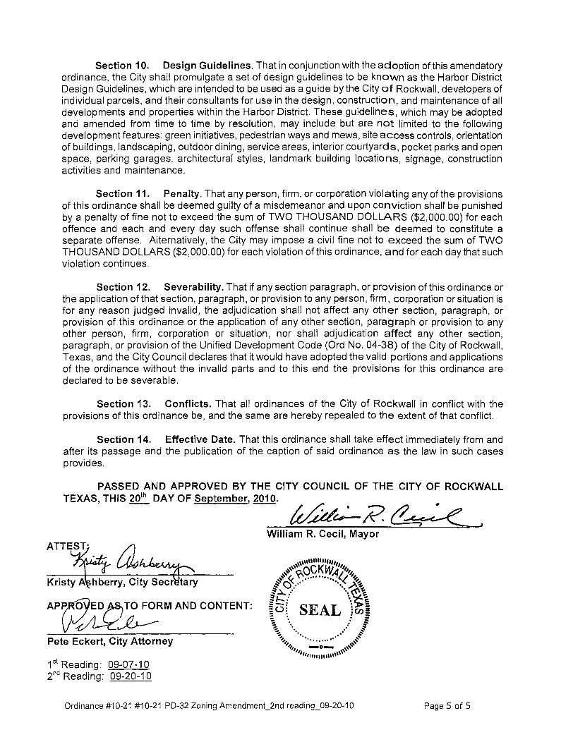
Section 10. Design Guidelines. That in conjunction with the adoption of this amendatory ordinance, the City shall promulgate a set of design guidelines to be known as the Harbor District Design Guidelines, which are intended to be used as a guide by the City of Rockwall, developers of individual parcels, and their consultants for use in the design, construction, and maintenance of all developments and properties within the Harbor District. These guidelines, which may be adopted and amended from time to time by resolution, may include but are not limited to the following development features: green initiatives, pedestrian ways and mews, site access controls, orientation of buildings, landscaping, outdoor dining, service areas, interior courtyards, pocket parks and open space, parking garages, architectural styles, landmark building locations, signage, construction activities and maintenance.
Section 11. Penalty. That any person, firm, or corporation violating any of the provisions of this ordinance shall be deemed guilty of a misdemeanor and upon conviction shall be punished by a penalty of fine not to exceed the sum of TWO THOUSAND DOLLARS ($2,000.00) for each offence and each and every day such offense shall continue shall be deemed to constitute a separate offense. Alternatively, the City may impose a civil fine not to exceed the sum of TWO THOUSAND DOLLARS ($2,000.00) for each violation of this ordinance, and for each day that such violation continues.
Section 12. Severability. That if any section paragraph, or provision ofthis ordinance or the application of that section, paragraph, or provision to any person, firm, corporation or situation is for any reason judged invalid, the adjudication shall not affect any other section, paragraph, or provision of this ordinance or the application of any other section, paragraph or provision to any other person, firm, corporation or situation, nor shall adjudication affect any other section, paragraph, or proviSion of the Unified Development Code (Ord No. 04-38) of the City of Rockwall, Texas, and the City Council declares that it would have adopted the valid portions and applications of the ordinance without the invalid parts and to this end the provisions for this ordinance are declared to be severable.
Section 13. Conflicts. That all ordinances of the City of Rockwall in conflict with the provisions of this ordinance be, and the same are hereby repealed to the extent of that conflict.
Section 14. Effective Date. That this ordinance shall take effect immediately from and after its passage and the publication of the caption of said ordinance as the law in such cases provides.
PASSED AND APPROVED BY THE CITY COUNCIL OF THE CITY OF ROCKWALL TEXAS, THIS 20th DAY OF September, 2010. "
ft/idu:-R, C'~~
AP~ZRM AND CONTENT:
Pete Eckert, City Attorney
1st Reading: 09-07-10 2nd Reading: 09-20-10
William R. Cecil, Mayor
Ordinance #10-21 #10-21 PD-32 Zoning Amendment_2nd reading_09-20-10 Page 5 of 5

!
!
!
!
!
!
!
!
!
!
!
!
!!!
!!
!
!
!
!!
!!
!
!
!
!
!
!
!!
!
!!!!!!!
!
!
!
!!
!
! !
!
!
!
!
!
!
!
!
!
(Area 1)
C
§¦30
(Area 1)
HORIZON RD
RIDGE
RD
MARCIE LN CEMETERY RD
PARKSID
E CIR
SHADY GROVE CIR
E IH 30
LAGOVISTA LN
SHORELINE TR
W IH 30
MARINA DR
LAKEFRONT TR
MIR
A VISTA
LN
SUMMER LEE DR
Lake Ray Hubbard
ELCHICO'S
24 hrFITNESS
WAL
GREE
NS
COLDWEL
L
BANKER
HOME
BANK
JONES
PARTNERS
OAR
HOUSE
CARWASH
SCOTTIES
CONVENIENCE
STORE
CEDAR GROVE
CHRISTIANCHURCH
WHITTLE
DEVELO
PMENT
LIBERTY DIALYSIS
THE FITEAGENCY
ROCKWALLREHAB
WILLISBUILDING
ZEUS
POTRILLODE
LASANDIA
L' EGANTZ
COTED'
AZUR
AFFINITY
SALON
AND SPA
GENUINE
JAKE
GLORIAS
RUBY
TUESDAYS
DODIES
CAJUN DINER
HOLLYWOOD
NAILS
ANDSPA
CINE
MARK
LARRY
NORTH
FITNESS
CULPEPPER'S
BLUE
CANYON
TILLA
INTERNATIONAL
COLD STONECREAMERY
CONFERENCECENTER
ROCKWALL
LIGHTIN
G
BEAL
LS
OFFICE
DEPOT
WORLD
SAVIN
GSLAD
BARBER
SHOP
NAIL
UNIQUE
PHOS
GARDEN
RADIO
SHAC
K
SUNST
ONE
YOGA CICIS
PIZZA
SHOGUNEXPRESS
KNOCK-OUTS
VAN CHANCHINESE
ROMAS
BOOKS
PIZZ
AGE
TTICONTOURS
EXPRESS
BLUE
CANYON
AGAVE
CELEBRITY
BAKERY
BABYGRACE
ENFUEGO
TOBACCO
RIJA
BOUTIQUE
ROCKYMTN
CHOCOLATEJUVANEW
MEDSPA
C &B BAR
ELEVATOR
SUBWAY
HI-TECH SIGNS
TANIKASALON
DAY SPA
DONUTPALACE
HALLM
ARK
BOUNTIFUL
MINTHDENISTRY
PARKAVENUECLEANER
SUPERIORLENDING
HERITAGETITLE CO
STRAUGHAN
PROPERTIES
ARKOMA
BASIN
J.
DAFFRON
LAWOFC OF
T. EASTER
RIDGE ROADANIMALHOSPITAL
CVS PHARMACY
STER
LING
BANK
PLAT
INUMNAIL
SAN
D SPA
FREEM
ANS
CLEANER
SMCLINTOCKBLDG
Area 160.267 ac
Area 216.824 ac
Area 31.799 ac
μCity ofRockwall JUNE 30, 2010
PD-32 BOUNDARYEXHIBIT A
!
NEW PD-32 BOUNDARY78.89 AC

Exhibit “A-1” Amended PD-32 Boundary Description
Project No. Z2010-012
1
BEING approximately 78.89 acres of land located in the M.J. Barksdale (Abstract 11) and E. Teal (Abstract 207) Surveys of the City of Rockwall, Rockwall County, Texas to be known as the Amended PD-32 Zoning Boundary and being more particularly described as follows: BEGINNING at a point in intersection of Horizon Rd and the south service road of Interstate Highway 30 (GPS Coordinates N2589965.033 E7014570.874); 1 THENCE S45-3-43E along the centerline of Horizon Rd for a distance of 359.75 feet to a point; 2 THENCE S45-9-15E continuing along said centerline for a distance of 922.798 feet to a point; 3 THENCE S45-7-2W along the western boundary of the Eckerd Addition for a distance of 338.85 feet to
a point; 4 THENCE S45-31-32E along the southern boundary of the Eckerd Addition for a distance of 339.158 feet
to a point; 5 THENCE S44-34-41W along the southeastern boundary of the Isaac Brown Addition for a distance of
594.34 feet to a point; 6 THENCE S75-48-35E along the northern boundary of Lakeridge Estates, Lot 26 for a distance of 304.035
feet to a point; 7 THENCE S34-45-14W for a distance of 85.563 feet to a point; 8 THENCE S28-45-41W for a distance of 78.959 feet to a point; 9 THENCE S23-0-35W for a distance of 78.959 feet to a point; 10 THENCE N75-6-11W along the north boundary of the Willis-Sealock Addition for a distance of 371.56
feet to a point; 11 THENCE N42-41-6E for a distance of 124.594 feet to a point; 12 THENCE N43-28-45W along the southwestern boundary of the Isaac Brown Addition for a distance of
228.343 feet to a point; 13 THENCE N50-43-21W for a distance of 132.929 feet to a point; 14 THENCE S23-32-21W for a distance of 65.722 feet to a point; 15 THENCE N64-32-23W for a distance of 69.271 feet to a point; 16 THENCE S78-40-26W following along the northern boundary of the Lago Vista Addition for a distance of
for a distance of 90.8 feet to a point; 17 THENCE N66-47-33W continuing along said boundary for a distance of 159.22 feet to a point; 18 THENCE N75-45-16W for a distance of 80.21 feet to a point; 19 THENCE S72-39-11W for a distance of 143.44 feet to a point; 20 THENCE N59-46-23W for a distance of 557.634 feet to a point; 21 THENCE S45-59-1W for a distance of 77.538 feet to a point; 22 THENCE N44-47-20W for a distance of 138.413 feet to a point; 23 THENCE N42-57-48W for a distance of 38.504 feet to a point; 24 THENCE N39-43-7W for a distance of 38.504 feet to a point; 25 THENCE N36-28-26W for a distance of 38.504 feet to a point; 26 THENCE S53-20-53W following along the northern boundary of the Harbor-Rockwall Addition for a
distance of 47.636 feet to a point; 27 THENCE N89-33-5W continuing along said boundary for a distance of 208.66 feet to a point; 28 THENCE S79-6-40W for a distance of 20.72 feet to a point; 29 THENCE N66-23-19W for a distance of 45 feet to a point; 30 THENCE S80-59-47W for a distance of 19.85 feet to a point; 31 THENCE N77-4-50W for a distance of 17.5 feet to a point; 32 THENCE S86-11-31W for a distance of 22.15 feet to a point; 33 THENCE S87-31-10W for a distance of 18.75 feet to a point; 34 THENCE N82-39-16W for a distance of 17.59 feet to a point;

Exhibit “A-1” Amended PD-32 Boundary Description
Project No. Z2010-012
2
35 THENCE S68-51-13W for a distance of 13.2 feet to a point; 36 THENCE S75-7-26W for a distance of 12.97 feet to a point; 37 THENCE S36-31-5W for a distance of 17.64 feet to a point; 38 THENCE S2-59-22W for a distance of 38.81 feet to a point; 39 THENCE S48-52-49E for a distance of 18.61 feet to a point; 40 THENCE S17-8-14W for a distance of 87.301 feet to a point; 41 THENCE S60-34-34W for a distance of 160.015 feet to a point; 42 THENCE S73-43-56W for a distance of 67.56 feet to a point; 43 THENCE S74-42-54W for a distance of 63.28 feet to a point; 44 THENCE S80-10-12W for a distance of 142.24 feet to a point; 45 THENCE S64-3-37W for a distance of 24.61 feet to a point; 46 THENCE N2-50-21E for a distance of 126.02 feet to a point; 47 THENCE N24-40-2W along the western boundary of the Rockwall Harbor Phase 1 Addition for a distance
of 125.683 feet to a point; 48 THENCE N22-55-59W continuing along said boundary for a distance of 368.32 feet to a point; 49 THENCE N22-55-59W for a distance of 32.765 feet to a point; 50 THENCE N58-47-23E following along the centerline of the south service road of Interstate Highway 30 for
a distance of 190.81 feet to a point; 51 THENCE N58-58-59E continuing along said centerline for a distance of 212.916 feet to a point; 52 THENCE N61-2-53E for a distance of 271.157 feet to a point; 53 THENCE N62-2-17E for a distance of 412.293 feet to a point; 54 THENCE N61-44-10E for a distance of 183.797 feet to a point; 55 THENCE N64-7-43E for a distance of 151.311 feet to a point; 56 THENCE N68-43-57E for a distance of 118.858 feet to a point; 57 THENCE N72-59-9E for a distance of 118.858 feet to a point; 58 THENCE N76-2-6E for a distance of 279.139 feet to a point; 59 THENCE N81-22-36E for a distance of 181.597 feet to a point; 60 THENCE N76-12-48E for a distance of 97.497 feet to a point; 61 THENCE N70-6-13E for a distance of 97.497 feet to a point; 62 THENCE N63-59-38E for a distance of 97.497 feet to the Point of Beginning, Containing approximately
78.89 acres (3436420.51186 square feet) of land, more or less.

Exhibit B-1 Planned Development Concept Plan
~
~ • • • • ~ w ,
i ! ~ .. •
If ' •• • ..-. , . • •
\ . \' , I • • r
• •
• • l".l ,,,y " u •• " II 0 .~*,.
~t~ M-_.~
• • , • • • ,

Subdistricts Plan Exhibit “B-2”
Page 1 of 1
)- .IDGI ROAD RfTAi. SUBDISTRICT

Exhibit C-1 Water Improvements Plan
PROPO S ED WATER IMPROVEMENT S
I ""'" I _ ~ ... - r _ _~ __ _ r. _
'"

Exhibit C-2 Wastewater Improvements Plan
PROPOSED SEWER IMPROVEMENT S

Exhibit C-3 Drainage Improvements Plan
PROPOSED DRAINAGE IMPROVEMENTS
----
~" 1Io.J .~
Il ip, ~'h
""

Exhibit C-4 (Page 1 of 18) Streetscape Plan
P 1 A N
--e -

Exhibit C-4 (Page 2 of 18) Streetscape Plan
S T R E E T T V P E A
Stroot type 'A' serves as a fl"ima ryentry in to the K ... bor District from the Eastbol!nd IntefState 300ff ramp. Th is SlTOO! type consiSisa tv.u 22 ' wideooemy streets divided by a 2O' landscape media'! with in a v<I'iable wicAA r~t of my. A mix ri (drop)' and crmmentB l trees ae P'(NOO in naIad I ~r>gs wim in the right ot way. Sidewalks may be provided on 1OO1e pcrtKlro of the street Pede5trioo sca le strOOl: 191ts fl"e provided at 50' O,C. Long itLd iml slop3s 00 this street type Jdrq:J from 1% \0 1()%, At strOOl: inter>octms and key pedestrian crossing area<; sklpes are limi ted to 29'. fOf OC(essib lity.
:-"'",<-+ STftEEl UGHl
STREET
'S"RIt!HTOfW",Y Vo\RlES
MEDI~Jf STlIEET IDEWA \.. lANDSCAPE WIDTH VAAIES

Exhibit C-4 (Page 3 of 18) Streetscape Plan
S T R E E T T V P E B
Stroot type 's ' coosists of a 2~' wide snoot wi th in a 48 ' f~ ht of way. M 8'
wide sidewa lk maybe Jl"(N;ood 00 porti OO'J rithe snoot Street trees may be p"CNkB! in either S' x 10' Jeawoots spaced at 30' O,c. or in natlXal ~r>gs wimin the ri ght of way. PeOOstrian J.(a le stroot 1 ~\5 fl"e proMed at 60' O,C. Long iu.d ina l 510pes 00 th is Slroot twe range frO'll 1% to 109',. At , treet intefsa:tKlns aM key pedes!fiJn CfolsirY:I ocea<; slopes are limi ted to 2% for OCl:essib lity.
:r~~~=======l:'"W ~ SIDEWAll(
! !fffi '
~ - ,
6 --jf-__ 7 I..1.NDSCAI'£ - TRANSITI ON ZONE
B Hf'''f-----'rsnuT LIGHT
, 0 ~
J
•
4U!!iHIOfWAY
, .~
N IUlDlItG FACAIIl
t-----t" '"'.-----~~>l~'F~'------_, -~ WASllW"TEII
-,~
mIUTU6KTCOIIDUR. llIft SUIOIWII. & lII"o\TJCHIiI .... ..... I
iliUM FACME
mlinUGIIl .... ,~ ST1Il£T I.J&IIT COfIOUIT. TIEE IUIDMIK.. --... ..~
S·-fI" MIN·"-'--1mlili,t---T,".·~1'i.--_t.!~",,,,,"II1~',",",,,,, L\N~ SCAPe' 10M STflEET ID EW l.o\NDSCAPE WIDTH VARIES
WI DTH VAR IES

Exhibit C-4 (Page 4 of 18) Streetscape Plan
S T R E E T T V P E c Stroot Type 'C' Sffi'eS ilIa Pfima!)'wmector tolheexist irY,l Harbor develop;lent and is a fl" imary street frOO\<I9'! fcr reta il and mixoo-me oo~mert with in adjacent distri cts. n is street type coosim of drY,lied head-in paki ng on txJtI1 sides of a 30' wide woot within a 00' r;g ht of way. M 11 '~ · wide siOOwa Ik is p"CNkBj 00 both siOOs ohhe WOOl with streetuoos !ocalOO in pa'"ki ng islJrnls at appoximately 52 ' O,C. am p:ldesUian 5l:a1e l;ght fix\lIBS spacoo at 52' O,C. The peOOstria n pavirY,j material is (l)('Oete p<l19S, Lorq itud iml slop3s on thi s strOOl: typ:J are betv.Qln 1 r. arnl5%. At street i rtEf5eCtiOO'J and key JIOOes!rian cf()5S ing .. eas slopes are lirrited to 2% fcr access ibility.
+-+ - SlDEWALJ(
~l~~~'-__ ~~t+=~~=smEET UGH; n! OUTOOOR DININ G n n OPI'OIHU ~1TY
n U STflEElTREf
Ill' RIGHI DfW8Y

Exhibit C-4 (Page 5 of 18) Streetscape Plan
S T R E E T T V P E o Stroot Type '0' smes a<; a fl'um ry wmector to the existing Harbor oovelqrnem and is a fl' ima!)' stroot frootag:l fcr [eta i L resiOOntiaL am mixeduse development with in oojocem S<JtxJ imkts. This street type coosists of pa ra llel pa rking 00 txJth sides d a 30' wkle stroot witll in a 70' f i~t r:i my. M 1 r -6" wkle sidewalk is provided on tJotI1 sides of the street with street trees in S' x 10' leave outs spaced at 30' O,C. and pedesUiJn scale weel li~t fi xtlles spaced at 60' O,C. The pedesUiJn paving matefia l is UlOCfe(e pavers. lnngitlKJ ina l slopes 00 tIl is street typ:J oce genera lly 1()%, M. weel interSKtKlns aM key pedestrian CfolsirY:I ocea<; slopes are li mited to 2% for
a PHM:STRl-\~·\
Of'f'\JH TU~1I a

Exhibit C-4 (Page 6 of 18) Streetscape Plan
S T R E E T T V P E E
Stroot type 'E' serves as a ~ ima!'f WOOl frontage Ie. retail. residential, and mixed-me development with in oojacrot d isul;~, Th is weel type coosists of ar.g1ed head-in panilJ,! 00 both sides r:l a 2~' wide SlIeel with in a 7f/ riglt of way. A 7'-11 " Wde stOOwa lk is fJ"oviOOd O~ bOO! .-.iOOs of the Wee! with \tmet
trees klcated in p.1OOr.g isl<l/ld<; al appfOx imately 52 ' O,C. and pOOeSlrian ~a le
li ght fix\1IllS spaced al 52' O,C. PeOOstrioo paving materials may be a mix r:i cooaem pa\'efS and oooaete. Loro:litLd inJ l slopes 00 tlis suoot type <I'll li rnted 10 5% max irm.m. At woot inter>llClioos 1Ild key pedestr ian wIssing !lHJaS 510pes are limited to 2% foc occessibilfty.
I • r~ Jo! I N , SIDlWAUI WlOll! VARIES
I • .o.NGLID PAIIKING
I • ''''a I • ANGLED
PARKING
,I ~~~III.IT. L -...
I ""M" I 19

Exhibit C-4 (Page 7 of 18) Streetscape Plan
S T R E E T T V P E F
Stroot typ:J 'f' 93rWS as a primay stroot frontage for mil<ed-lISe Oevelop"nent wim in adjacenl dislrict5. This stroot typ:J (lJ(l';jsts of afY:l led head-i n panir.g 00 one siOO Ii a 24' wide street with in a 70' f~\(i way. A 4'-6" wtOO sidewa lk is prCNKlld 00 one side d the street wi th street trees Iocal:ld in pa rting islands at afVoxirmtely 52" O,C. am peOOslJi an scale light fi mxes spaced at 52 ' o,c. PedesuiJn paving materials may be a mix of Ulocrnte f"I'MS ami coocrete. lmgiu.d i nat slopes 00 tIl is street type are li m~ed to 5% maxi rrun. AI street intersoclKJos aM key pede5lfiJn Cfolsing ocea<; slopes He li mited to 2% for OCl:es.-.Jb lity,
"-- "'h"'loi;c---- STREET UGHT
.-''+7'<1'--- SIDEW.wc
--+)..0 .--- STREET TJI1(
~--l-':j"i::"t_-- ROSIDENTIAL r.: LAHDSl:Id'E
'00'
IUIlDIIIG FAtAOl
"' .. ".~
1
'~ I MIN. MIN RESIDENTJAL )
Ll.HOSCAPl (OGE W10TMVARltS
SIOEW .Offi YAAl ES
ANGllO PAIOO ~ G
1IrRIGH10FW~Y
STREET
1
l2'-VMIN. lANOSC...,.EWlDTH VMIES

Exhibit C-4 (Page 8 of 18) Streetscape Plan
S T R E E T T V P E G
Stroot type 'G' serves as an edge to the open space subd istrict. This weel tjpe COOsiSiS of paa Il el pal<.i ng oosiglated 00 ooe SJOO ri a 24 ' vMe weel wim in a 60' r~t ofway. ArlS ' widecoo;rel:e sidewa lk with stroot trees in 5' x 10' ~aw ruts spaced at 30' O,C. and pOOeslrian xa1e woo! licjlts spaced at 60' O,C. is ~ovided OIl the p.1 rallel p.1r1:. irY,j siOO of the snoot. M 8' IIItOO coocrete sidiMta lk is p"cMOOd 00 the open space side ri the snoot with weel trees spaced at 30' o,c. am pedes!fian sca~ l~t fixtlles spaced at 60' o,c. wim in an 8' wide parhltay. Existing trees may be preserved with in 1M r~\ of my wOOn po5.S i b~, LongitLd im I slopes on tIlis strOOl: type are booItoon 1 % and 10'%. At street intefsectKlns and key peOOstrian crossing arEas slq>es ..-e li rrited to 29'. fcr occessib ili ty.
WRIGHfOfWAY

Exhibit C-4 (Page 9 of 18) Streetscape Plan
S TREET T V P E H
Stroot ~ ' ff se-ves as a tr<llsitioo between the HartxJr Re5iOOnliai stb:J istrict ard the Freeway Froolag:J5WdiSlrict. Th is stroot type consists of a 24 ' wtOO strOOl: with in a 70' f~ ht of way. Para llel p.1r~rY:! 93rWS 1M Harbor Residential side with an 8' wide coo::rete s;oowalk ard stroot trees in 5' x 10' leave 00\5 spaced at 30' O,C. aM pedes!fi,m J.Ca1e ,treet lig hts spaced at 60' O,C. AIlg led Mad-i n parting J.erVB5 the FrOONay F rootllgl Slb:Jistricl side with CdrtO!1l' ard urmstll)' trees ~ov;OOd in nauxal ~~i ngs.
~i1')--1iil;tl~t~'--- PARALlU PARI()~G
~-{lC7.Lf<""'--- SICEWAlJ(
~1--'OTtt""t=:-- 5TRUT TREE
1)''';i,¥;P'---(ij~I:f''Iii:=-- POCkET PARX DPPORTIlN(1Y

Exhibit C-4 (Page 10 of 18) Streetscape Plan
S T R E E T T V P E
Stroot (jpe T J.erWS as the primay frootage IU 1M HJrbof Residential stixJistrK;t. Thi s street twe wruists of pa rall el pa1<.ing pwvided 00 both sides d a 2()' wide ooe-wiIj strOOl withi n a 56' riglt r:i way. A g'~ . wKie siOOwa Ik wim WOOl trees in 5' x 10' leave outs spaced at 30' O,C. and pi!OOstrian
scakl streel l ~ht5 spaced at 50' O,c. is prOiOO on both side;<; of the stroot PedeslriJn paving materials may be a mix of concrEte pa'MS ami concrete. lmgiu.d i nal slopes 00 tIlis street type arE l i m~oo to 5% maxi rrun. At street intefsaboos aM key pede5lri,m crossing ocea<; slopes are limi ted \0 2% for
~
t
t!tc~------f-- s~EW~~ _ ________ + _RESIOEHTIAL
lANOSC...,.E lDGE
~ ________ -+ __ STHEET TREE
~Hf---------l-- PARAU.El PAIIKING
'l~~,"========;F= "OW ~ STlIHTlICHT
'8~~--------l-- ONEWAY TRAme
55"RlGHTQFWAV

Exhibit C-4 (Page 11 of 18) Streetscape Plan
S T R E E T T V P E J
Stroot type . J' seMIS as the prilTl1ll)' frontage b the H1stu ResUlntial 5lb:listrict. Thisstreet type COII5I5IS of parallel pilrki~ JWlid!!donone..rnof a 20' wide CIlIl-waystreet WIthin 8 56' rigtI r:I way. An S' wide silewalk wiIh street trees 11 5' l 10' !ea'0<9 OW sp!ICed at J)' O.C. and pMestrian =Ie stroot
W1ttS spaced at 50' O.C. is prOYided on both sr:Ias of the WOOL Pedestrian paving rnatIlfiais may be 8 mIX of concrete paoq<; am concrete. L.oo:IitWiml stIpeS 00 thIS street type are ~mitE!d to 5% maximum. AI. weel irru:r.;a:tioos
an:llrej pedeSlrilrl crossitr;l areas 9opes.we limited to 2'X> fa a::cessibility.
~ ~ B NESIDEIfTIAl
\MIOSWE EDGE
t .... w -STJllEEJ 1fIU
mlfflUGIIT
, ...... ua , AIIIING
8

Exhibit C-4 (Page 12 of 18) Streetscape Plan
S T R E E T T V P E K
Stroot twe 'K' serves as a suface pa'~ ng ocea linking the [e!:a il aM mixeduses of Itle Harbof liri S<Jtxl iltrkt <I\d tile Hil lside Mixoo-1Jse subdistr kt. Th is street type coosists of a kIop oftv.o 24 ' wioo OfIe-waystreets w~h <Ilg led Mad-in p.1 rki rY,l 00 both sJOOs wi th in a 130' r~t r:l way. A 4'-6" Wde siOOwa Ik is provk!ed on txxh siOO5 r:l the stroot with stroot trOO5 located in pa rting islards at ap~l"Ox i m ately 52 ' O,C. am pede5Ui<rl scale light fi l<:tl!re5 spaced at 52 ' O,C. The pedesuia'l paving rmt~i a l is wroe!:e pa'I~s. Long itLd iml slop35 O!l this stroot tjpe 8m OOI:\\Qln 1% ard 5%. At stroot intersections ard key pedestria n crossing OCBaS sklpe5 are limimd to 29'. foc occessilli lity.
snu:rT UGIIT ct*)Urr. taU SUllDIIAII.' ""'1'1011
\
I " ... " I SlDtwW WIDTHVMIES
... PAIIKINC . •
1311' RIGIIT Of WAY
... I .. . • PARKING PMlKING .. . . PARKINC
""'" "'" COMIUrr. T'IIU ......... ... " .. L __ ~
" 51DEWW WIDllI VMllS

Exhibit C-4 (Page 13 of 18) Streetscape Plan
S T R E E T T V P E L
Stroot twe 'l' is a traffi c cfele >MlK:h saves as a centra l poirt of the distrK:t This circkl is a mfd po int in the link to 1M exiSl irY,l K ... bor OOielopmenl. This strOOl: type coosim r:i a 30' wide ooo-way lane arru'ld a centra llardSE~
islard with in a 170' diJme!er rig tt of way. A 9'-6" wide sideY;a lk is
p"CNkBj fl"oond the entire circle with pedestrian sca~ street l ~ h\5 spaced at app"ox imall>ly 4()' D.C Til<> wI1icu lar pavi"l matOfia l i. COOCf«. pawl'
aa;ented with wroete band<;. The peOO5tria n paving mat~ia l is concrEte pal'efs. Slopes across the traffic CifCk! oce OOtweerl 4% ard Sr. . At street interSK\KJos aM key pedesUiJn aOlsifY:! area') slopes are li mitOO to 2% for OCl:essib lity
ID(W WID"" VAlliE
~~~~~~'--l--"'+"'''/.f--PAVEIIS
510[WAIJ( - +---"'''/-,1.. ,"w ---t------Jl STREET lIG~ -1'--7"V~"l
110" RlGII1DfW.l.Y
o ~ P 0 R r U If 11 Y)
IstANO m IOEWAUC WID AIlE

Exhibit C-4 (Page 14 of 18) Streetscape Plan
S T R E E T T V P E M
Stroot type 'M' serves as 1M fl' irmry sJngle farrily residential neigtmooJd street. Thi s stroot type wmiSiS of a 30' wide stroot with in a !ill' rig ht of my. O!l stroot partir>g is pilrrri tted 00 this stroot twe. Stroot trees are spaced at 30' O,C. w~h i n a 4 ·~· wide paawaywi th pi!OOstrian Sl:ale stroot lights spac:ld at 51r O,C. A S' wide coocrete siOOwa Ik is p"o"';OOc! 00 both sides d the street This weel tJPll may inclLde fealll'!!S 5ILh a'J e~om cr landscape islJrds and med ians.
S T R E E T T V P E N
Street twe 'N' serves as an a ll ey within the sirijle fam ily residenl~ 1
neigtrotood, This street type (l)(l';jsts of a IS' wide a lley witrin a 20' riglt
otway. No street trees. light fix\lJ"!!S, ()" siOOwa lks fI"!! proMed in this street
'YI".
-.-
-. , \. }'·:-""~ROW -. --.
mEET UGIIT
, ~
I
-. -
, r
L _ _ _ ._
-.-
1
I .. ~ U.~ l t"NO$CAP{ SlOE <PARi
wm WAY
5IrRIGH'DFW~Y 1
STREET WAYWAlJ(
2O'RI &HTOFWAY , ,
"

Exhibit C-4 (Page 15 of 18) Streetscape Plan
STREET TYPE 0 ( S UMMER LEE DRIVE IMPROVEMENT S )
The type '0' WOOl coosiltS of strOO(swpe ilTl!l'Oiements and paa Il el pa rting dedK:atioo on bah sides of an exist irY:I 29' wkle street w~h i n 1M existing 1)5' Surrmer Lee [Xiv!! f i~t of way. An S' IIItOO sidewa lk is proMed 00 txJtIl side;<; of the strOOl: with street trees in S' x 10' ~I'!! oots spaced at 30' O,c. and pedes!fial scale street li ght fi mxes spaced at 50' O,C. Nedoo'Mls ail
prCNkied at intefsectKJos to prOiioo a defl'ly defined pedestrian space. The pedes!fiJn p.1ving materia l is (l)('Oete sidewalk. lmgiu.d i na l slopes 00 this stroot type are range from 1.59'. - 7%. At street intersections peOOstr ia n wa lkmy slopes are li rrited to 2% fcr accessib ili ty.
S IDI;WAlJI
PARALlEL PAIIKING
STREETTlIU
~ - "~
NECK-OOWh' AT INTIRSECTIONS
i ", -, Ii
Q ~
- , ST!I!fTUGHT
IiS'RlG HTOfWAl , , ! !
STI!EET TREE
STREETliCHT
l ,~ l ,~ l l~~1m~wJ W~ "SIDEWAUCrpARALUt STI!EET
PARKING PARKING
STlIEET TREE rnEETLIGHT

Exhibit C-4 (Page 16 of 18) Streetscape Plan
S T R E E T seA P E ELEMENTS
PEDESTRIAN PAVING MATERIALS
Concrete Paving All coocrete p:ldil>trian walkway; sIla ll 00 an uP!1aOOd pedes!rian roruete paving with inlt'gfal cOO lSutiel;l Ch({rnix C-24 Charcoa l (J" C-15 Coachella SardJ , light sa~ast flnish. 1Ild SoalM:ut control j~nts,
Concrete Pavers Corvete pa'MS ,hil ll be l'a\le5tDne coocrete paver'., fJoIiartd 98 Paaway Pro\\?OCial. AmKjLll TMa cata color. 6 em thKkness' Pawn shall be placed in a fl.Ming bond pattErn p3/perdiclJlar to the 5trOO\ C\Xb
VE HICULAR PAVING MATERIALS
Concrete Paving The 5!11rldad vehicula paving material sIla II be roooe!e in occordm::e witi1 City of Rockwa ll stardard<;.
Concrete Pavers Upgnded vehiruiar paving sha ll be wocrete pavers, Cooaete p,jVln sha ll be Pavestooo corcrnte pa'I!H, KoIiarld 98 PiI'l<way Pro;endal. AntiqLe Tma COM cokx. 8 em thidlle5s. P<M:fs sha ll be placed in a haTingbooe bond paltern.
STREET FURNISHINGS
Bench l aOOscape fomr.; - Scarlxlrl:o:lh bad<.ed M!izootal strap booch. polldefcoatrob RAL 17003 Moss Gmy
Bike Rack focm5 . SiJfaces - Trio Bike Rock. poIIda"coat co!a RAJ.. 17003 Moss Gtf!f
Bollard Hess - Paris 1100 Twe 'f'. f~ed ballard, polldefcoat coh RAL 17003 Moss Qey
Seatwall CaS{-in-pIace {oocrete _ twa ll with arrnitectlnl finisll

Exhibit C-4 (Page 17 of 18) Streetscape Plan
S T R E E T seA P E ELEMENTS
LlGtfTING
Pedestrian Seal. SlfMllighl IIega 9701 MH l00w Metal Halide rlllll'e on Bega 1108 HR 11 '-8- t!lpered rani pole wnh Inlegal baM8f arrns, pov.der coot col« AAL '7003 Moss GrtI):
" - • ,
- -~ " ,
"-
- : -L.,
P. rkinglot Ligh. fi .h.e Garda! Gullwirg Gl8-1·J)Q·4OOMH-XXX-SC on ~ RTSP 22.S·6.foO.l1-l.NA·DM21to.BC pov.der coot coler AAL 11003 Moss GrtIy Paking lob mati be ~luminated 10 an Mr89B ~inOO Ie\1:!I of 1.S ·2 foolo:::aOOle5.
'::+lTt ",,;;, __ TOP Of fOOTING ~ SIIAU I[ r-r
AIIIM '~V1"G
Tlee Upli~
All WOOl trees WIthin !he riglt d ~y shall be uptight WIth B-1{ HP2-PAR202I).TR·sg.SAP·11·m·AHIC~
Exhibit C-4 (Page 18 of 18) Streetscape Plan
STREETSCAPE ELEMENTS
LANDSCAPE
Tree leave-outs Pavir.g leal'!!-oot5 for street trees sha ll be 5' x 10' adjacent to the bad of me stroot
w b. AJ I street tree-; in tree Ieave-OOlS oc in head-in parking isioMs. 5ha ll have uee s!.txia inage \;00 to the S\mll ~a in s)'5tem, In ad:l ilKl1 to the street troo. all leill'e OiJlS shall [oolain one d the fo ll owirq: ~ioo A: A mix rJ 5rrrn. peremial. orrumentlll g-ass. aoo ~()()f'Ii;o_ plamirog. fUll matefials 5ha ll pwide 8 rrix of heiglt. coIu, lElltlJ'e. aM eY!!f~een SlrlJ::tlre, OjXion B: Mexkan Beach Slone pebbles, A coosistoot treatment must be provided foc a contirLOJ'i blodlengtl!.
Tree Leave-out Option A Tree Leave-out Option B
Decorali l'e POlS Use docaalive pots to accem the strootscape envi romnem. !)eeocaliw pots
rrmt be WITlpalible with the StrlOlllding flThitoctLra l It'j1 1)5, Dewfa\ive pots rallt be an wapriate pedeSlJian ~ale, All OOcofalive pots sha ll be irrigated and hal'llliainage tiild to !he I!ocm (!ra in system, RecoomenOOd OOcaative IXXS: Stonewear 1em ~ies. 58 32 finish Stooowear Gmcian _ies, S8 32 finill1 RectangJ llIf metal plantErs
Grading The max irrum cross slope on all pedewian walkway; sha ll 00 2%. The
max irrum kmg iu.d ina l slope 00 all pedes!ri<ln wa lkw'ays sha ll tie 5%, except where tile loogiuxJ iroa l slope of the 5trOOt exceeds 59' •.

Exhibit C-5 Master Grading Plan
MA S TER G RADING
The SIIe's ~ 1OpOoJap:!y has been carel'ullyCOlSidered in !he development of the Harbor Dis1Jlct master plan. Refer 10 ird.mal stMWkt wctions for graclir,;! plan enlargemene; .
•
P l A N
• •

Exhibit C-6 Master Tree Planting Plan
A ma~ tree planting plan has bMI estabW5hi!d b the Harber Diwi:t 10 (fI'J,I"e lnfymg Slreet Irea plantmg WIthin the right of way aoo unifying IrOO planong wntun IJivate 0Mi0pment palteb. The fotlowing ~ies of IrIleS ITI.Ist be planted 8S the domlratt ~treet Of p3IkIng lot tree accmIing 10 the ma~ troo planting plan. Additional landscaping 800 aa:ern llees may al'D be usedWlthm eadl5ltdSIIICt All street oees III tree IeaY!Hlut.s Of in head-in
paoong islands, shall h8Ye llee Sltd"ainage tied 10 tOO mm diain system.
Street trees witllin the l;g'lt ofway wll 00 the foiluMng silllS: Street trees in Iree wells at lY D.C. wll be 4" c.&lipe.. 100 !pl. Street trees in parl:.ing isl3005 &t 52· O.C. shal l be 8" calipa-
LE G EN D
D Cocl.l r Elm
D Saki Cypress
D A mil( of any of the fotloNing canopy &00 om<mentallrees in naunl9"oupingo;. lMil Oak. Cedar Elm. Red Oak. Burr Oak. Chirqoapin Oak. Sakl Cypress. Pond Cypress. t-.te.icaI1 PkIm. Desert WiltoN. Ctilll!:le Pistoche. YaLplfl Holly. Red 9.td, Crape M)ttIe. Vital, Ew's NedIaa!
o ",,"'k
0 ..,,,,,,

Exhibit DSubdistrict Land Use Chart
Z2010-012: PD-32 Amendment
P = PermittedA = Accessory UseS = SUP
Land UsesRESIDENTIAL USES Harbor
ResidentialFreeway Frontage
Harbor Link Mixed-Use Hillside Hillside
Mixed-UseSummit Office
Horizon / Summer Lee Interior Residential Ridge Road
Retail
Accessory Building + P
Home Occupation + P P P P P P P P P P
Hotel S S S S S S S S S S
Hotel, Full Service S S S S S S S S S S
Hotel, Residence S S S S S S S S S S
Motel S S S S S S S S S S
Single Family, Zero Lot Line P
Townhouse P P P P P S S P S S
Urban Residential + (Condominium Units Only) P P P P P S S P S S
OFFICE USES Harbor Residential
Freeway Frontage
Harbor Link Mixed-Use Hillside Hillside
Mixed-UseSummit Office
Horizon / Summer Lee Interior Residential Ridge Road
Retail
Animal Clinic for small animals, no outdoor pens + S S S S S S S S S S
Church/House of Worship + P P P P P P P P S P
Day Care (7 or More Children)+ P P P P P P P P S P
Financial Institution without Drive-Through P P P P P P P P S P
Government Facility P P P P P P P P S P
Library, Art Gallery or Museum (Public) P P P P P P P P S P
Office, General P P P P P P P P S P
Office Building, less than 5,000 s.f. P P P P P P P P S P
Office Building, 5,000 s.f. or more P P P P P P P P S P
Post Office, Local Service P P P P P P P P S P
Research & Technology / Light Assembly S S S S S S S S S S
Trade School S S S S S S S S S S
Subdistricts
Exhibit D (Subdistrict Land Use Chart)
"+" = Permitted with Conditions. See Article IV, Permissible Uses, of the City of Rockwall Unified Development Code , as amended, for conditions of each use.
Note: All listed uses below shall be further regulated and/or limited within the specific Subdistrict standards included in Exhibits C-2 through C-11, with the exception of the "Other Uses" category which shall be permitted by right or allowed with an SUP as outlined, regardless of Subdistrict.
Page 1

Exhibit DSubdistrict Land Use Chart
Z2010-012: PD-32 Amendment
Land UsesRETAIL / RESTAURANT USES Harbor
ResidentialFreeway Frontage
Harbor Link Mixed-Use Hillside Hillside
Mixed-UseSummit Office
Horizon / Summer Lee Interior Residential Ridge Road
Retail
Antique/Collectible Store P P P P P P P S S P
Automobile Rental S S S S S S S S S S
Banquet Facility P P P P P P P S S P
Business School P P P P P P P S S P
Catering Service P P P P P P P S S P
Commercial Amusement/ Recreation (Inside) + S S S S S S S S S S
Community or Recreation Club, Public or Private (Accessory) P P P P P P P S S P
Copy Center P P P P P P P S S P
Display, Incidental + P P P P P P P S S P
Electrical, Watch, Clock, Jewelry & Similar Repair P P P P P P P S S P
Garden Supply/Plant Nursery S S S S S S S S S S
General Personal Service P P P P P P P S S P
General Retail Store P P P P P P P S S P
Hair Salon, Manicurist P P P P P P P S S P
Health Club P P P P P P P S S P
Laundry, Drop-off/Pickup P P P P P P P S S P
Locksmith P P P P P P P S S P
Massage Therapist P P P P P P P S S P
Museum or Art Gallery (Private) P P P P P P P S S P
Night Club, Discoteque, or Dance Hall S S S S S S S S S S
Pet Shop P P P P P P P S S P
Private Club + P P P P P P P S S P
Private Club, Lodge or Fraternal Organization P P P P P P P S S P
Restaurant, Less than 2000 Sq. Ft., w/o Drive-Thru or Drive-in P P P P P P P S S P
Restaurant, 2000 Sq. Ft. or more, w/o Drive-Thru or Drive-in P P P P P P P S S P
Restaurant with accessory Private Club or Brew Pub + P P P P P P P S S P
Retail store with gasoline product sales (Limited to "Area 3" only as shown on Exhibit A) P
Shoe and Boot Repair and Sales P P P P P P P S S P
Studio - Art, Photography or Music P P P P P P P S S P
Tailor, Clothing or Apparel Shop P P P P P P P S S P
Theater S P S P S P S S S S
Wholesale Showroom Facility S S S S S S S S S S
Subdistricts
Page 2

Exhibit DSubdistrict Land Use Chart
Z2010-012: PD-32 Amendment
OTHER USES
The following shall be permitted by right in all subdistrictsAntenna, Accessory +Antenna, Amateur Radio +Antenna, Dish +Asphalt or Concrete Batch Plant, Temporary +Fund Raising Events by Non-Profit, Indoor or Outdoor, Temporary +Garage (Accessory Use)Municipally Owned or Controlled Facilities, Utilities and UsesParking, CommercialParking Lot, non-commercialPublic Park or PlaygroundRadio BroadcastingReal Estate Sales Office, On-site, Temporary +Recording StudioSatellite Dish +Swimming Pool, Private (Accessory Use)Temporary On-site Construction Office +
The following shall be allowed with an SUP in all subdistrictsAntenna, Commercial +Antenna, Commercial, Free-Standing +Antenna, Commercial, Mounted +HelipadPrivate StreetsTennis Courts (Not accessory to a public or private club)Transit Passenger FacilityTV Broadcasting & Other Communication ServiceUtilities Holding a Franchise from City of RockwallUtility Installation, Other than ListedUtility/ Transmission LinesWireless Communication Tower
Page 3

Exhibit E-1 (Page 1 of 2) Harbor Residential Subdistrict
H ARB 0 R RE S IDENTIAL S UBDI S TRI C T
The fJimarY intent of the Harbor Resr.:lanual subdistrn is to p-tlYide a aJJIter part 10 the I!listirYJ Hartn ~m wl\dl 1oYI1 , 'Woo a Yill"ant atm:lSJilere 5000U00Ing thIiI existUlgceotrai fOllllain feaue. Q(lRI rm reta~ ~lI"e irleOOed 10 lilt th9 HartXJ District WIth thee..lStlng I-9bcr de>lelopnent. The Ulitbn Ii residential u:1its will captalLN on the _ <WId adjacero::ies III lab! Ray fkJtbard Existing ropes wi thin this !iUbdistflct are in the J% .8% range.
Bulld '(0).1(". (Dlltanct from Ito .w . II .... ! g" eeI Type I 10' Streel Type E T S1f1Ml1 Type J S' street Type H (J
Bulldln!l Form EOOh bIOC:I< lac. mUSI ~a,,* a ............ um 01 90'" of iIlI kIoalh delIr.ed b'f a DUIdlOO 1~00e.
Streel Type I I~_ DUn 10 Bn Streel Type e I~_ DUn \(I eTl Streel Type J ''"W- 0011:110 BTl StrMl Type HI~ c..I~ 10 BTl
.,. .,. .,. .,. ----
RemoInIroO I~ mUll De l'(llesl th., 'Z and I'ID greDIIIr .... n 12' 110m ne BTL
-,. WhWl an abutllrog prt'Ipfit)I wIIh an e:d$1Ing I>I.-.u has _ lact'O to 1fIe 11M. a'IV new oolldhg -""II pmvIde al INs! 10 _ of sepomIUon.
10 ..
Ground FlOOr
1'S1lt Maxim"", BYI<!Ing H'"Oh1 Maximum BYI<!Ing H""Oh1 la4l<:eo( to 8x1s11ng dIlema)
"' .. mum Isllk>of <XIn'lm&fcl~ ~I (with oIhe< u .... _ I)
jEncroactvnenh
SIr"'" Type E Slf8111 Type J SIr"'" Type H -..
I I:)rIeS I ilelQhl 5 / 75'
2 135'
".
C"""",", """'000. boI_. IIOOd ~ O'IIem;ngs mall' '""'"""'" ""If "" BTL as ano...n in ne Ia"'-_.0
,. ,.
st,eet Type I 1 street Twe E. H 2 st, .... t Type J 2
Pt d .. 111,..,way" M&WI (MInimum number per block lac*! ~f .... tType I 1 ~f .... t Type E. H t ~f""t Type J 0
_ .... .........
LWIUl TIIUNE
2 Story eornn-cia l Bui lding
.....,"'"
I.-. UIUl TIl LINE
1 StoryCommen:ial Building
_ .... -f-J
-"'" _ ....
""'"'"
..... ,"'"
3·5 Story Building

Exhibit E-1 (Page 2 of 2) Harbor Residential Subdistrict
HARBOR RESIOENTIAl SUBOISTRICT
GRA DING PLAN
I

Exhibit E-2 (Page 1 of 2) Freeway Frontage Subdistrict
F R EE WAY FR O NT AG E S UBOI S TRI C T
The irtanl oflhe Frooway Fr~ SLtxfsul:l is to fWide rOO-size fl:(a il ardu5 IM tIl ~ visJtl lity tt.t am comibJte to the aeatim r:l avO-art. pOOestria n Cl"imtOO <fla(oc:tEf with n the Halo" OiWl:t am the existio;l Ha1lcr oowiop'nert. Prime view; <Ild aa;e;<;s frml lntEr5tate:rl co:rtJire:l wittl stcrefrcrt ~e5e('(:IJ a\:n;l the ma in flJOOWoo aOO"gjuJ..- cmm IIittln me district make mil Slb:Jiwl:t 00 mal kx3:;oo fa" few ;1 ardors. Exi~rq sIope5 witti n !tis 5ltxfsukt oce in me 39'. - 69'. J<l!YJl.
Bull d·to·llne (Dl stance lrom R.O.W. line) Stroot TYP9 C :r Stroot TypQ E T
Setback (Dl stance l rom R.O.W. line) Stroot Type A 5' Stroot Type H 10' Inl""'l~a 30 Frool3gQ 25{)'
Buil ding Form Stroot TYP9 C _ 'OCI! must MvQ a miruoomo! 90% of its klngth <Mned by a buikllllll !",ada
Street Type E tJIoct 10C8 JruSt hal'!! a rrinunun 0180% 01 ~s klngth <Mned by a buikllllll !",ada
Stroot TYP9 C I~ bui lt 10 BTL Stroot Type E tao;aoo 00" to BTL
.,. .,. Ramao"ing !",ad!! must 00 no .... s thoo T 000 no Df~ "1e< than 12'!rom the BTL
Notes Wh<!n an OOU1~ng Pfoperty with 00 .. xis~1lIl buikllng has windows fadng to too ski!! , 8nf new tlIlliding .hai l provk!o.' k!ast 10 feel 01 """""" ion IOu
Ground Floor
Upp'" Floors
R~ail
R!lSlaumnt
Ralail R!lS13umnt ~
!Reight
Maximum Building H!Hgh1 • s1or ... I hoIg/ll 2 145'
MinOmum lsi 1100< <Xlmn~«:i" K<Mgh1 i w1lh othe, uses aboo.tQ)
MinOmum I slory commo,ci" HeOiltoI:
Noles
'" " • 000 additkln .. s10ry may b<I added lor upper 1Ioor otflc8 USQ only
j Enc, oad;"en1s
Location S11OO1 TypQ C 51'001 Type E 51,,,,,1 Type A 51,,,,,1 Type H l~arsl31a 30 Fronlaga
Noles
" " " " " CooopIa. , a .... "1/. , ba""""es . ood roof oo;emang. m3'f ancroacll ovar tho BTL a. silo..., 10 "" I:lblo aboo.tQ
jParking
51,,,,,1 Type E 51,,,,,1 Type A 51,,,,,1 Type H l~ersl31" 30 Fronlaga
Surface Pa,klng Lots
'" '" '" ~
"
A maxirrum or 100" 01 Ih9 lot .. paJ1<ing 1<>< lhl •• ubdi.1Jlcl may b<I • ..-1""" parking
D~veway. (Maximum numbe, pe, block l ace) 51,,,,,1 Type C 0 51'001 Type E H 51'001 Type A l~ars131" 30 Fronlaga 0
!---BUIlD TO lI~E 1 Story Conuner~ia l Building
-- " ~ 0
--------- -
~ ~ _.-til
!---BUILD TO lI~E 2-3 StoryCommelc ia l Bui lding
Exhibit E-2 (Page 2 of 2) Freeway Frontage Subdistrict
FREEWAY FRONTAGE SUBDISTRICT
GRAD IN G PLAN

Exhibit E-3 (Page 1 of 2) Harbor Link Mixed-Use Subdistrict
HARBOR L IN K MI X ED-USE SUBDISTRICT
The P'irrwy intenI r:J the Harbor Link Mi l({!d.~ Slbdi5lri::l ~ to JWYD! a mil of rOOI~ and resi:lentJai U'llS in close proll/lllty to the existirg IDtu ~qxnent that tan ton1Jibute to the CJeatioo of a vitwant. pedeStr iiln a-ienu:d chilract~ within the H1sba District (Dj the eXlstinJ Hartu development. ExistillJ ~ within this ~\I 1Ct life in the3.5%· 6%III'lge.
liiJidlnil PGC:m:nI
BuIId-lo.ll r\41 (DlI Unce from RO.W. 11M) Slreel Type C 10' Slreel Type K 7.S' SlrOl<ll Type E 0' SlrOl<ll Type F (J
Bulldlnq Fonn EI>tII bkICI< face mUSI nave a miru'rlum 0115% <Jf"" length danned by a bulkII"IlI~_.
SWeet Type C f~ IJuift kI BTl. Slreet Type K r~tOe DUft to BTL
Sir", Type E '''''tOe DUll to BTL sreet Type F r~ bOil; Ie) BTl
". ... ". ".
RemaInhg r~ I\'IU4I 0. no .... l!1a1 2' lind no IJf9'lteI !han 12' fltl/l1 me BTL.
-" ....,..,.,. an abuIIng P<OPtfTY """" an "trig bulking has ~ lact'Ig to the Ik». any JMW DI*Wlg shall JIR)'I'Ide al least 10 IgeI ohel)llflilUon.
Ground Floor
Uppe:, Floor,
!!SIII I IOIIiS I r.tIghl
MaxlmlmBcoldIng HtoIgtrt 5 175" MlrOmum 151 Il00< oomne<cI:M HeIgN ('Mth _ laM GlxHe) IS'
Minimum 1 S!cry OOII"fTItfclpj HeIghC 25'
li ne.oaetlm" lI .
l ocation SI,,,,,' Type C SIn, .. ' Type K Sir"'" Type E Sir_ Type F SIl......- l .... Qrlve SIr_ Type B
Not ..
" " " " " , CanopI8l. a~. baioonI ... ond fOOf ov~ may """""""" "" .... 1Ile BTl .. sho..., In t>t tIIlIt _.
surtac. P .... 1ng k l>ack (O~ frOfll R.O.W. NMI Str_T~C 10' Str_T~K
,. Str_ Type E , . SU_T~ F
,. Str_T~ B
,. SU.....- L ... onv. " SUr1ace Palklnp l o r. A maxIm.m <Jf ~ 01 ... lOCal ~Ior !rlll ~ mBy
be""-OOII J>Ofl<In\l
D~v.wa yl (Ma "m .... nU/I'IIH, ptr block lac.! SU981 Type C , SIr981 Type K, B SIr981 Type E. F 1 SUn-mw L .. onv. 0
PedU lr!anwan I 101 .... , (MInimum numbtr ptr blOCk lacel 51, .... ) Type C 1 51, .... ) Type K. B 51, .... ) Type E. F
-- j • --------- -
~ ! ; ..... -
L 'UIUl TOUNE
2 SloryConmercia l Building
MEZZMIIE
.......... L 'UILO TO UNE
1 Story Convnofcial Building
"'---.-------- - -.l -- • .-------- - ~ · _ .... z
-~ • .-------- ::;
-"'" -------- -~ ...... "'"
IN I.-BUIlO TO UNE
.,

Exhibit E-3 (Page 2 of 2) Harbor Link Mixed-Use Subdistrict
H ARB 0 R
GRAD ING PLAN
LIN K MIXED-USE SUBDISTRICT

Exhibit E-4 (Page 1 of 2) Hillside Subdistrict
HILLSIDE SUBDISTRICT
The iment of the Hi l/side subd iltrict is to prOOde a cllJ5!er rl re5WLJra nt ardla"s that can cootritue to the UealKln r:l a vit.<flt pedestrian ocfented character with n the HJrtxx DiS!rict. Existing slqJes with in th is subd islrict are in the B% - 12% rarY,lll.
Bulld·to·llne (Dl stance lrom R.O.W. line) Str .... t TYJl9 0 8' Str .... t TYJl9 E 4'
Setback (Dl stan ce lrom R.O.W. line) Str .... t TYJlI! A 5' Str .... t TYJlI! B 5' Inl""'l~e 30 Fronl"1/11 250'
" I<!ntJIh <ktnood by a bYikllrlg fa<;ada Str .... t TYPII E bIod< 1008 ....,s! haw G mOou<r<.<n 01 100% ofits I<i<Vh oonood by a buikllr>g fa<;"""
Street Type 0 fa.;:aoo bui lt 10 BTL Street Type E ("I''''''' 00" to BTL
.,. .,. Rem""ing (""ad!! must tlI! no .... s thoo T and no IIfO.1Ilf lhGn 12'!rom the BTL
". Notes Wh<If1 an 0001~r>g Pfop<ll1y with 00 eJ(is~"Il building has windows ladng to t .... _ . Bnf .... w building .1> .. 1 provOOo al least 10 feel 01 """""'lion
luu
Ground Floor
Upper Floors
Ralajl Ras13umo!
Rmail Raslaumo! ~
!Height
Maxim"", Building Helgh1' MinOmum 151Il00< <:<lIllfOOfci .. H<Mgh! (with 0100. u .... ilii00;8)
MinOmum 1 story <X>II'lfOOfci" He+;ToI:
Not ..
slof"'l h<!~1 2/35'
'" '" • 000 additklo .. slo<y may b<I adOOd 10< Upjl8O" Iloo< otflc8us8 ooly
IEncroad;"ents
Location Slroot TYJl!! D Slroot TYJl!! E Slreet TYJl!! A Slreet TYJl!! B InCersl"t. 30 Front"ll'l
Notu
" " " " " C"""I>i<>' , ....... "1/. , 00"""" ... !lI)(j roof ""lIftlang' m3'j' encroacll over tho B11- ... sho..., In the t:lblo at>oo<.
iParking
Surface Parktng Se1back (Dtstance lrom R.o.W. nne) Slreet TYJl!! D 10" Slroot TYJl!! E 10" Slroot TYJl!! A 10" Slroot TYJl!! B 10" InCersl,,!. 30 Front"ll'l 20"
Surface parktn%k0ts A max., .. ,"" 1 'iE> or Ih9 10101 paJ1<ing rOf thl •• ubdi.tilCt may b<I • ..-1""" parl<:lng
D~veway. (Maxtmum number per btock l ace) Slroot TYJl!! D 0 Slroot TYJl!! E B Slreet TYJl!! A InCersl,,!. 30 Front"ll'l 0
!---BUl.D TO lI~E 1 Story Commercia l Building
-- • ~ • • --------- -
:::... ! _.-rru
!---BUILD TO LINE
2 Story Commercia l Building

Exhibit E-4 (Page 2 of 2) Hillside Subdistrict
HUtSIDf SUBDISTRICT GRADING PlAN

Exhibit E-5 (Page 1 of 2) Hillside Mixed-Use Subdistrict
SUBDISTRICTS
HILLSIDE MIXED-USE SUBDISTRICT
The p"irM)' irtert r:l the Hill liOO Mixoo-lhJ SlMsul:t is to p"o,,;oo a rrix r::l fOOl il am fesmntial lJ5e5 dkn',l the ma in pede5Uian <I'd wilWW carm witllifl the listrict. A h'r:jl q..<fllity r:l resiOOnW l 00 \5 wittl n this Slb:l iwkt wi ll cootri tlJte to Ihe <M'fa ll oom!)' r:i lhe cfWkt. Existir"9 sIqP5 witti n th is SLtrlSUl:t Me in the 8% - 12% f<nge .
IBUilding placement I !Reight I
Bulld·to·l lne (Dl stance lrom R.O.W. line) Stroot Type 0 :r svoo( Type K 7.5' Stroot Type E 4' Stroot Type F T
Setback (Dl stance lrom R.O.W. line) S<..mIoo< Lee 001.... 5' Street Type B "
Str""tTYP90 1~boiltIoBTL 45% Street Type K t<>;aoo 00" to BTL 45% Street Type E t<>;aoo 00" to BTL 45% SVOO( Type F tao;ade burl \0 BTL 45%
Ram""ing tao;ad!I must 00 no .... s thoo T 000 no Df~"1e< than 12' !rom tho! BTL
"" Notes Wh<In an 0001~1lIJ PfOP""Y with 00 9J(isUr>g buikling has windows tadng to too ski!!, 8nf new tlIlliding .1l .. 1 provk!o 01 lIIas! 10 1001 of ""II" .... 11on
luu Ground Floor
Upp'" Floors
Ralajl R!lS13um nt R!ISklon~"
Maximum Building HeIgtol MinOmum 1511'100< <:<lIllfOOfci .. HfMght (with 0100< u .... ilii00;8)
MinO mum 1 story commo,ci" HeIgtot
jEnc,oad;"en1s
Location 51'001 TYJI'I D 51'001 TYJI'I K 51'001 TYJI'I E 51'001 TYJI'I F SU.....- Lee Oo1ve S1,eel TYJI'I B
Noles
stones I he~1 5 /75'
'" '"
" " " " " " C"""'IlI<Is , a wni"lls , 00"""" ... . and roof oo;lIffiangs m 3'f ellCfoocll ove, 11>11 B11- .. s shown In 1h!! lablo aboo;"
jparking
Surface Parking Selback (Dls tancel,om R.o.W. line) S1,eei TYJI'I D 10" S1,eei TYJI'I K 10" 51'001 TYJI'I E 10" 51'001 TYJI'I F 10" 51'001 TYJI'I B 10"
'" Surface parkln~ Lots A max....." Of % 01 11>11 Iolal paJl<ong lor Ihls subdislJICI may b<I s ..-l""" parl<:l"ll
D~veways (Maximum numbe, pe, block lace) 51'001 TYJI'I D I 51'001 TYJI'I K B S1,eei TYJI'I E S1,eei TYJI'I E B 51'001 TYJI'I F, B SU.....- Lee Oo1ve
Pedeslrlanways I Mews (Minimum numbe, pe, block lace) 51'001 TYJI'I D 1 51'001 TYJI'I KB S1,eei TYJI'I E S1,eei TYJI'I E B
_ .... • • " %
• --------- -
~ • • • ......... ~
LSUILD TOUNE
2 Slory Commerc ial Building
MUZAII.n
.......... L SUILDTO liNE
1 Slory Commerc ial Building
'" ......... .-------- - --.J _ ....
" .-------- - • • % · ......... z • .-------- - .. .........
.-------- - ~ .......... ~
L BUILD TO liNE
3 - 5 Siory Building

Exhibit E-5 (Page 2 of 2) Hillside Mixed-Use Subdistrict
HILL S IDE MIXED-USE SUBDISTRICT
GRAD IN G PLAN

Exhibit E-6 (Page 1 of 2) Summit Office Subdistrict
SUMM IT OFFICE S UBDISTRICT
The primary intentol' the Surrmt OffICe $l.b;li50itt is to capitaWze on the o;uperU views at Lake Ray Itbbard bYp'OYiojng rrid·nse dflCe ~ Keyctwacll!r~ Ii !lis Udstricts IIltLOe opxI vlSibiWty and ease of aa:ess from Irtrutate 30 an:! Horilal Road. Exis~ng slopeS WIth,n tIllS SJbdiwict (M"Q in the 8'X. .. 12% rlIIJ}!.
Si<Jlilic:ant mming of exISting trees 4f9 ~so P'_rt .....tthin ~ ~ whi:h 5houkl be ~ v.tIefe possible.
IBUid!flil ptKtmMl
Bulld .(O).II ... (OiltlOlCt lTorn R.O.W. 11M! 5"HI T)'I)I E 25' S1feel T)'I)I E 10'
Setb.ilck (Dllt.net lrom R.O.W. lint ) I ':~O Frontage Rood 50' HOOZOI1 ROOO 150' SIr&flI Type B 5'
S1rMI Type E (1·30 00f\fleC1kln) 1~1>de bIi~ IG BTL 45'110 S1reeI Type E (HOrizon oonnecton)
~ bUn 10 BTL 45""
~~ must 0. f'O) I.n than Z and m gno3'irthan 12' l rom 1M BTL
-" _ an IItKItIIng ~ wit> an exldng bl-.g hal _ fact'G 10 me 11M, a'I)' new buIIdhg $h.aII pr<>II\de at
.as! 10 feel of I81»nulon.
10 ..
Ground FlOOr
Upper Floor.
""'" ... , R9$laumn,
Maxlm"", BY-.g HIjQhI Maximum Mechanical Saeen Heig~1
IEneroaelliilent.
Not ..
I I::>IIeI I IIetOiIi 81 121r
'"
" " ClIOO(lIes, 91Wiogs, bOlOOnIfi. lind roof OIJiIhorQs m:f)' ~.,.. ... "" BTl as 1IlO..." in lilt!;)" _eo
'p3
5 strMtTypeE 1(7 SUM Typoo B 1(7 1-30 Frontage R <»d 2ft -- ., " maJdIiiiri Ii Oi Iii IOtiI po .... Fij IOi thIi ii1IdiitiICt may INI su1_ porklng.
Slreet T)'I)I E. B (HOrttoo COI'\MCO;)<l) 2 SIr"'" Type E. B (I-JO 00I'II'Ied1on) 2 1.30 F.ootagoo _ (I -- ,
-
........
........
........
........
........
........
..... - -- I:>---L llIILD TO l INE
8 StoryOlfice Building

Exhibit E-6 (Page 2 of 2) Summit Office Subdistrict
SUMMIT OFFICE
GRAD ING PLAN
SUBOISTRICT
" \ , , , \', \ \
\
( / / /
/
, ' ;.~-
.. ..-. : I i
:/ ~I , ,l

Exhibit E-7 (Page 1 of 2) Horizon / Summer Lee Subdistrict
-
HORIZON / SUMME R lEE SUBDISTRICT -
The p-imary intMt of the Hor,m I Slnrner Lee 5tlbdistric1 is 10 pIOYIie doo!IopnerI.lhat will seMI as a gateway into the HaII:a' DIstrICt MId.nse otrltl tI.JiIdirq> ~ ____ ~ ~ wi tapualile on ~i(I' Yiews d lakll Ray HttitIzrd. UistIl'l9 slopes wlllun tits sttdstrict a't in the 6'11. • 15~ '~. ~ic.aN. masS11'9 d uislJng UBIS WIthin a nannl "mgt carmINe also plesal wlt/Jll this 5lb;Iisan;1 whid1 !hUd be p"1!58VI!d wlue possible.
.,
5ummef l .. Dr ,,,,,,!>de ooit 10 BTL ~$"
~lIInhg !~ ",,,,I bt no .... !han Z and no 01'_ hill 12' ITom hi BTL
""' .. _ an atIU!InO ~ will '" p1f1llng bulking '-~ I~ 10 u,....,.. q NW 1luIiJng.nall ~ oM "asll0Mlf1~.
10 ..
Ground Floor
!@ilN ,_I /lIIIgIl1
Ma.o:Imun BuIdIng HeIghI "iN MaxImom M«NInIcIII s.:r- H~ 20'
-SI,6fIt Type F SIr....t Type B SCI'" TypeG
Notn COOO9llI. DYll'ingI, boIoooIM, DOd roof (I\/~ ITIII')' ~ ov.,.1t>oo BTl ... Ih:lwn in h IaDle_.
Su rlKe PM_log S41l)ltCk 1011' __ If or. R. Q W ..... )
su- Type F 10' SliM! TYPe B 111 strMt Type G 10' SUn'mtr LH onv. 30' -- ., A iiWihU1i 21HIO Of Iii IOiDI Piib10 IOi' .. iiliiJiti1Ct ~ be~~.
SliM! TYPe F. B I streel Type B 1 Slreel Type G 0 Sun'mIf L .. DrIv40 2 -- ,
_ ... --_ ... _ ... _ ... _ ...
---------- --I>........ I..-BlIIlO TO Ulj(
8 Story OffICe Building

Exhibit E-7 (Page 2 of 2) Horizon / Summer Lee Subdistrict
HORIZON/SUMMER LEE SUBOIS TRIC T
GRADING PLAN

Exhibit E-8 (Page 1 of 2) Interior Subdistrict
INTERIOR S UBOI S TRI C T
TM Pfima!)' intent r:J 1M Intern S<Jtxlistr kt is to provide an area thaI can fllflCtiO!l as eitta ofnce. resi OOnliJ L or sena livirtg lJ5e. Kel ch..-octa"istic.s of this sutxJistrKt inc lL.de ~ views d; Lake Ray ftbba rd ard adjacency to open space. Existi ng slopes witti n th is subd istrict are in the 6% - 10% rdrY,ill . Sigl ific<rll mass ing of ex isting trees ..-e also present wi tll in th is 5Wd i~trict wh ich sOOuld be preserved wtlere possJble,
IBUiidillj! placement
Setback (Dl stance lrom R.O.W. IIn_)
Stroo(TYPI'G 5'mirOmum, 2\1' minOmOOl ave<ag<o
Notes
Wh<In ao 00U1~ r>g Pfop<lrty with 00 eJ(isUog buikling has windows facing to t .... sIOO , Bnf .... w bolldhg .1> .. , provOOo al "'as\ 10 fool of S<IP'lrnlion
!Reight
Maximum Build ing Heigh! MinOmum Is111oo< oomma,d " K<Mgnt (w1th oIM( u .... above)
Ii!ncroactvnent.
Location SUmmer LQQ Oo1v~ 51,oo! Typ!! G
Notes
510< ... I h<!~1 5/75'
'"
" " C"""!liIIs , a ..... ngs , ba"""" ... <lI)(j roof O'VlIIt1ang s may
~llCfoacll ov .... "" BTL as silo..., In "" table above
jParkins
'" ........ --------- - ..J ........
• --------- - • ,
• ........ z • • --------- - • ........ --------- - ~ ........
IN l--BUl lDTO UNE I
0" 3 · 5 Story Building
10 .. Surface Parking Selback (Dlslance Irom R.o.W. line) INTEItDII COllllTYAlill OI'POIHU~ lrr -------,-"''''01
51rool Typ!! G 10" Ground Floor 5o.....-Lee Oo1ve 15·
Upper Floors
Pedeslrlanways (Minimum number per block lac_) 51r001 Typ!! G 1 50.....- Lee Oo1ve
21). M I ~ . AIIG.

Exhibit E-8 (Page 2 of 2) Interior Subdistrict
INTERIO R SUBDISTRICT
GRAD IN G PLAN

Exhibit E-9 (Page 1 of 6) Residential Subdistrict
RESIDENTIAL SUB DISTRICT
The I!esr:lEfltial 5lIbdiSt1lC' is reserved fa zero k:It Woo 5ingIe fanily resiIentiaI twsing. A k;J.o..v Qme fA UafflC WI tIllS <Ilea d the IWIIa" DiMrict mate this qjxjjstrlCl ide.!l1 to' 5IIJ9Ie family USIl. Key ctaaclllri5tio Ii this ~= incWe aIj.Keocy to opan sp.!ICe 8IId stoop slopes wtOCh offl<l views of !hi! suro.nI~
Bra/!. ExIstlllg slopes Wlthio tIls subdistrict are in the Ii% . 16% rarg!. This Slbdisuict is p"~vegetated by masSIf-.;! fA existu'g tree5 'Mlich WJId be p"es9Ved when possible.
lilUldlnii PGC:m:nI
Setback (OI , t _ _ !rom R.O.W. 11M)
Street Type N 5'
"'" " Z~lOll" 0'
A mjnimum o f SO"- 01 , .... IlOuIldOry with 0\8 ()pEtn Space
sutxIIsVlct along I lreoell)'l)l G muSI bt ~ pWlk: sir"", (1yp8 M).
Building Form SWeet Type M '~8de bU~ 10 BTL
M........." LOI C<MI<lI(Ie '" ". lO"1IIT
jO ..
Ground Floor
Upper Floor.
I""!iihl
jEncroad,n; .... I.
l ocation Front
Not ..
,""HIs I I1eigtl1 3136'
" 51_ . • ~. In:! roof ~ "'II'f eoctOIIICI\ OVI< 'tie en ... shown., the ..... 01>0 ....
..... -
.....---
L SUIlDTOllN(
3 Story S.F. Resldemlal

Exhibit E-9 (Page 2 of 6) Residential Subdistrict
RES DEN T A l 5 u B o flOOA PlANIELEVATlON REPETITION
To ~ lepelltion an;I 8 II1OIIOIOmUS look to the 'ilDIistria IlIIYiroomerK. the foloNing g.ndelroes apPy reg!l"~ the repetition d fro ~ an:! •..•. ,," """ 1 When widing 8 house having the sarna noor plan am the same eleYation w.ethef on the $MI'I& Of opposilO !>ida of the stroot. f(U (4) full k115 fllISl be skippecI. Different paintcolor most be USIld. See fipe A.
ease 2 When tMJ ildirrg a r.w..e tlaving the same noor plan BOO a diHerenl elevation 00 the same side of the WOOl &ree 13J full kxs rrust be skipped. Different fIlI int coJo( trust be used. See f~e 8.
Case 3 When boJ ildirrg 3 ~ ha",;ng the samll floor plan aOO a different ele'lation 00 the opposite side of Itle stroot. IWJ (2) fu ll lots JTll\l be sl:.ipped, Different painl ,oJo( trust be used. See Fig..wt! B.
5 T R C T
; •
•
1
r ! ,-I
" MIN.
A ll [ ,
H f l 'ft'ORHOOD iTRfET " P [ M
=~N 11 -·-----------"'=1~~::!1I-- BUaD IN G SfTI.o\CI[
..., -_*-- COlllT'l ..... O
S TREET

Exhibit E-9 (Page 3 of 6) Residential Subdistrict
RES DEN T A l SUB D
ARCHITECTURAL GUIDELINES
Site Layout. Grading and Drainage
1, Ruooff 0(1\0 adjocert f)"op:lI'lfes is proh ibimd.
4. Firjslled floo elevations sha ll be set in OfOOt" to pwvide positive (h inage away frO'll all tlJ il ()f9S.
S, Oeale 5lOOCXh sklpe transitions. tJi.erd irY,l with natll"a l ~00e5, with max irT1!l1lslopes in lawn areas beirY,l4:1.
6. Do not rllfl ~a i rlJ9'l5wales from planting areas ocross paved ocw.;,
landscape Structures
1, Basketba ll ~Is, play SUlrtlJ"es, swirY:I >ets and sirrila elements may only be iocalOO in sioo Of rea( yocds,
2. All vertical Wflsuwioo ioclLd ing g"-ages, gazebos, .. Ins. tJarbeq<Jes and fireplaces!TlJSl WITpi)' with front. side and rea J.Il\bad:s.
3. lJse materials. IUrns, stykls ard coos vJlkh maIm ()" ae corrpklmemw)' to the flThitectlral5t'jie aM deta il irY:I r:i the llotr;e,
Pools and Water Features
1, Swimming pools. spas ard wal~ features rTlJ5t comp ly wilil frO'll, siOO am mar setbacks. N:me ~ade pools ()" spas oce rlOl fll'minoo.
2. Foocing ()" OOsigl sokrtKJn\ wt'idl pr(Nide erdOSlxe:s in ocOJoorce with klca I ooJ imrces aM rB}JkJtioos rruS! be pwvided,
3. Med)[flK;a1 eqJ iprrnmt fex pools and spa<; rT1!ISt 00 located J,() as to 00: be visib~ from adj acent propertfe5 ()" the street. locate cr ooclose equipment to rri nimi ze noise intrllSioo,
lighting, Utilities and Service
1, Exter;oc ornamenllli and acCalt l i~ting may be lI5ed in rroOOratioo to cOfTl!llement land5cape fI\d archi tectLXa l fealll'es. li~t fixllIre:s sha ll have aWDpfiate hght cutoff sh~s to prevem lIlWanted glare to neiglboring propi'fties ami streets,
S T R C T
2, Pas! rroooted light fi ){lil'es 1I\d bo ll<l'd lighti r.g fl"e 00: permitted, Pathway li ~ti r.g may be used, limited to 18 irx:hes in hei~t.
3. Cokm:t Ml.U!rrent and neon liglting is f)"oo ibited, aAArsive HID seuxity lightir.g fixlll'es are proo ibited,
4, Exposed extel';oc fIood l iglts cr wa II pocks are rKlt permitted,
5, All site Illi lilies sha ll be un<:JoJ~oood, Trarl5tO'mers, me(ers ami cxher uti li ty eq.J ipmem sha ll be screened by planting or by fl"chiteclll'a l medrr.;, Amid clipped hedges fl"ruld uti l it)' boxes.
Irrigation Design
1, ~rigatioois requ iredtO' all homesites andsha ll bea n automatK: . Il\OOr~oood system with ra in 1I\d freeze sensus,
2, Design irrigatioo systems to sepaately circu it irr igatioo zones IU pia'lt materia ls havir.g different watering r!qJ rements. soch as lawns and >trubs.
Driveways
1. Cfiveways sha ll be p.1voo with coo;rete. p.1vers. IJ inl<9'a lly colornd coocrete with charcoal fJf!j color, Cherrical slll ining erruocemerts are 00:
permined, C\'iveways may rot be pa irtedwith an ~ coatir.g,
Garages
1. Garages m.JS! be rM loaded from an alley,
2, All garages fTl'JSt tllKJ a rri ri rtU11 of me ami a max irTH.Jmd t\\IJ ca rs, Goost parl:. ing spaces sha II be 00 street.
Building Massing
1, The roose fOO\jl'int sha ll be cO!TlfXl9'ld of SlfJfI"es 1I\d roctangies placed at ri~t angles to ooe another, The geometry of each of these shapes sha ll be lll intOO'upted by adj acent shapes.
2, All bJ ikJ ing fooljJ' ints sha ll be at r~t angles to tM propi'fty lines, Compose ha.r;e forrro to credte exteriCl' space,
3. Massing may be either syrrmetrical or asymmetri cal. The OOminant fl"clltoctura l mass sha ll be located near the ce nter 0( the corrposiboo,
Roo"
1, The irdivirual shapes -Mlicn corrpose the 00!r;e footprint sha ll eadl be ((xied by a symmetrica l gable, hip. cr a simple roof form
2, The ~ d eadl roof form sha ll be uninterrupted by adjacent rooffmm Va ll eys are di scOJ~. except for ciooners,
Wall Materials
1, Extern wa ll materials sha ll be any d the fo ll owing: A. Fiber cement board sid ing and sll ng~s . primed and pa intoo, "Hardfe"
type bo..-ds, Sid ir.g shall be irl5taHed rorilOOlll lly oo ly. lapped c~ board styk! with narrow lap exposues preferred over wide expoSlXes,
8, Putland cement su.cco with integ'al color C, Brick masorY)' D, Stooe fTmOO'y E. CaS! stone masorY)'
f, Fireplace masses and ch imneys sha II be clad in noocomrust ible materia Is to matm extericr house materials.
G, Alurrinoo\. masooite, and vi n'j1 sid ing fl"e 00: permitted,
2, Exter;oc wa ll materials may CMf'9l at a vertica l li ne -Mlicn OOI ineates a CMf'9l in bu ilding bm. or aklrq rorizOIllll l1 ires.
Exterior Finishes
1, All wood and rompos~e sOOaces sha ll be fi nished with p.1 i rt, aW"ied lJIeI' an appropriate p'imer, 0paqJe and semi-opaqu:l sta in may be used,
Trim
1, All tri m IMlere used. sha ll be cemert fioor bod'd, cedar, or lfJil li ty v.ood proolrts, Trim sha ll be a minifTUTl 3/4" thick with Mat smOCQS, Bu iltl4J assemb li es, shafled profi kls, and ornamenllli embe lli sl'ments are to 00 alUiOOd,
"

Exhibit E-9 (Page 4 of 6) Residential Subdistrict
RES DEN T A l SUB 0
ARCHITECTURAL GUIDELINES
1, Al l elUB"icr OOas sha ll be 'MKl1 cr metal . h i ngat of rail a nd S( i Ie coo<; troctioo. with 1 to 6 p.1ools. Dormers abow docrs am eocOU'aged. P<IlIlls sN II be glazed cr flat wood (not raised panels), Ooo"s shall be pa inted.
2. Extefia docrs sha ll be swing l'j?I!. 0( ~K! wood cr \\OOd I'eflOOf, ard sha ll be pa inted. or clad in pre-finished metal.
Screen Doors
1. Screen cloGs am alkMted. Screen docrs sha ll tJe of IIOOd ra il am stile UlJlSlflnkln with 1 to 6 panels, All p.nels sha ll 00 screened. ScrOOJl clros sha ll be pa inted.
2. S\crm OOa"s fl"e 00: fIIllTn itted at the front docr tlIl oce alloNed at side and rea r docrs.
Garage Doors
1, Ga ragelt«s sIlJ ll beaverhead roi l-u pOJ!lSlrldioo wim rorilOOta l iflSlJ lated mew l p.nels.
2. Garages may MI'e rmxirrum 18 foot wide OOcrs.
Exterior Door Hardware
1, Oiersile ()" overly OHlamented 000r haraware a eJ.CUlcheoo tri m pkltes ae 00: permitted on the front 00\)".
Windows
1. Wirdom sIla ll be casements. awnings. cr oo..t>le Of single Iulg. Each window sha ll be glazed by a si rY:l~ panel d insu lated glaSs. cr may be diviOOd into 00 flUe ma n 4 panels, fa ke mJ ll ioos ocediSCOJ~
2. Windom may be d v.ood . therrr.a lly b"oken alumirun ()" alu rrirlOOl ·dad IIOOd coostrldioo. VirT)'l ()" vi nyl -dad coostr\dion is ncx p9"miued.
3. Al l operab~ wirrows 5ha ll be ~ppedwith irl5l!C1 scroofl').
S T R C T
4. Bay wirrows 5ha ll be glazed a rrini m..m of 809'. d thei r width.
EKlerior Window Shutters
1. Wirdow slutters ae p9"miued provKled they oce prqx>rtiOfied to fully(l)\g the wirdms they wook:J fl'otec\. Stmters may be wood cr s'flthetk.
Awnings
1. WirOOw awn ings am 00: p9"miued, with the exoop:ioo of 5hm[!J awrir.gs.
Glazing
1. Wirdow and 00cr gklzifY:l sha ll be c~a, iJl<>J latoo, OOuble-pane, kmeMssivity 93S<;' ~fedwirnbw fil ms ae 00: p9"rri tted.
Roo"
1. Roofs may be ((N[!Jed in corrp:>Site dSjtiJ It 5h ifY:l1es. Compositioo stingles must be mini JTIIJm 25 yea dimensioru L IaJrimted twe. Flat. 3.-tab sl"ingles will Jllt be p9"m itted. An example of awolW rocl5h i fY:l~ type is Ta mko "Heritag:l30'" StamiJ19 seam meta l roofing and otIu mew I rocl types may
00 """.
2. All roof penetratioos, otIu tha n dl iJTllll!'fS. sha ll be gOl4JOO a<; far from frootBges as poss ible, sha ll Jllt be vis ible from the street am sha ll be pa irted as JleI!OOd to match roof. SkyIiglts sha ll not be vis i b~ from the 5trOOt.
3. All soffit venting 5ha II be 2 ir.cn wnti JUl!I'J venting cr pefcrated "H a reli suffi t" p.1nels. ND box vents 5ha ll be used. No vir¥ material may be used.
4. Dormers sN II 00 awopiately fl'oportioned, hi p cr ~tJIe, with a rriri rrun 6112 pitch. They sha ll be glazed a minirrun of 00'% of the ir foce am JIlJ5l
be open to the interior roof ocea beyocd.
S. Roof vert ilation !bmers ae perrritted oo ly on tile 5ioo and rear ekNatioro am rllN be verted a rri ni rrun of m. of their face.
6. Dormers sha ll haole minirrum overhangs am eaves. Stocco cr "Hardi" Sid ing cr Panek ae rncorrrnended in!bmeJ ~tJIes.
7. Al l exp:>Sed mew I fta<; ting5ha ll be Illpa intedl}l lva lu me , p.1 int-g ipcr I}l IVfll iled
''''' 8. Roof auk vents sN II be contiJUl!l'J ridge vents 50ch a<; "Cool RKk]e. " Pov.ered
auk verts are 00: alkmed. TlXh ine vents may be allov.ed by vaiaree, but must not be visible frcrn the stroot.
g. Sate llite dishes and root anteJlll3e sha ll flOt be visibkl from the street.
Chimneys
1. Al l ch i 1IlJle)'S JTllst be fitted wilil a I}ltvarized mew l chi rmey cap with a 'roof tM t is tile same size ami 5hape a<; the chi rmey it C<MlJS. The rocl fcrm may be fi at cr hi pped.
2. The dl irmey cap JTJ()5t iociLde meta l mesh, scroon OJ gid to fl'event ani mals from enter ing the dl im ney. Acceptable p'00u:15 iocluOO the 5IlJies 0( blad<. I}l lva niled ch iJro'li!)' cap" by Gelco.
3. Accepwb~ fin ishes aJE rutlSa l ' p.1 int-g ip' galva nized cr pa inted I}ltvoo ized.
Rain Gutters
1. Ra in ~tters and ooll'll">pOJts may be of any p'ofi Ie COfTIl><Jl ible with the styk! of the roose ami roc{. Gutters and ooW!lSjlOJts sIla ll be located in a wiJj as to JlOt
(jaw attention to therrr5I:llves.
2. Qm[!Js aM cbw!tspOO:s sIla ll be urva inted I}ltva lll!le, "pa int..gip" stool ()' lire finishes, alttoogl p'efi nisiled meta l finishes may be per mi tted.
3. DoW!lSjlOOts 5ha ll t[!Jrrinate at splash blocks. gavel , brH ()' Wf'Ue!:e.
Paint
1. Al l exterior finish coat pa int sha ll be acryl ic latex ()' latex emmel.

Exhibit E-9 (Page 5 of 6) Residential Subdistrict
RESIDENTIAL SUBDISTRICT
ARCHITECTURAL GUIDELINES
Porch ComAruclion
1. FUch coIu!ll\S 5h.5I1 be wood posts. minirrun 6x6. painted and fme of omamenlatioo.
2. Paches sllal! ha>e wood railings.l!ailing deta~smn. be iocltrled 'Nith plan sutrnissions fc( awOO.
l. Pi:M"ct1 floocs shall be c.oncrete, stone ()' trick. P!lrth COO<;trll:OOo shal l be OOOO'ete slab fou!1datkm. bui lt 8'l part of the hoole,
Elements NOI Permlned
Tt.! foHONirtglist of eIemiIMts 81'S ra penritted in 1he deYelojlnmt:
W,noow Ale oo its Exterict fIuore5CQrot liojlting SoIilf ~ed landscape ligtting SoffIVcomic& ligltiroJ visibie from 6 p.lb~c way Skylights visible from a ~ic way Anteonas Of satellite dishes '1eater tron 18" !la. DecoratMI flags. p"~ displajOO Anuican flags lI'e allowad Coo:rete statuarYVlSlbIe from p.lblic way Plastic fu'oitu"e Of 8rt1fICiai plants Vl5i1lla from 8 ~ic way ~kOlga'lelctrves
Residential Street Edge Condition Residenlial Street Edge Condition 51

Exhibit E-9 (Page 6 of 6) Residential Subdistrict
RESIDENTIAL SUB DISTRICT
GRAD IN G PLAN
I!! ~
-?,-.=:;-"
.. 1>

Exhibit E-10 (Page 1 of 1) Ridge Road Retail Subdistrict
RID G E R 0 A D RETAIL SUBDISTRICT
The intent r:l1he R~ Road Retail SltIdistnCl is to pwide retail a restar.lrt usewith Ridge Rd frontage. Key dl5aclElflStKs of tIllS Slb:Iistrct RUle hijI mibility
and frontage on ~ Road. Ulstmg sIopeSwithin thr.; ~iWi:l are in 1fE R -1~ farge. ThlS5Ubdistrict contIIins massinJ of existir.J tree5 whid1 5IoJd be ~asEf'Ied when possible.
lilUldlnii PGC ........ Setback (0111 __ trom RO.W. liM)
".
NOlet
'MIen an Pbu1~ng 1)r000rty wlm 00 ",,~ang bolklr.g has IW>dowt foci'lg 10 &>e 1kIt. Q/IY'/ .... w building SIl .. 1 provk!o 01 "'osl 10 feoel of Mj)OI'IIUOI1.
10 ..
Ground Floor
11GIifi!
R_ I RHtouranl 0,""
~,-1135-,.
l ocation
Notes CIlOO\li8s. . ....... "11 • . b<>k:<:IrO ... ond roof O'o'.mano' may """,,<lOCI> ov",1I>a selbl>Cl< at s/IoWn In tile IMIe QbOvt .
jPartOi"j!
Sur1ace Par1<lng S.lback (D III.nee l ro," R O.W. lint) Slf""'Type~ 10' - , Re... 10' Ridg8 Road FmnI:age 10'
Str_T~1oI 2 - , ~. , RIdge Road F"",,-
• 1W77'" ~ ----- ~ i .... , .... •
LUTlAC' 1 Story Commercial Building

Exhibit F-1Parking Lot Requirements
PARKING lOT S
Orientation and Design of Par1r.ing LOIs
1. Pffking lot location md desg15ha1l minirrize c.onnicts betv.oon W!hWar and pedeStrian cirwiation. [}i'w! aisles may be ol'lertecl either !Balle! a JUperOcular to the face r:J ruildrol Vv'IIIl"e G'Ne &Isles tie parallel to the fa:e r:Jwllcling. ~ islilrds in the IWkin] lois With pecIeSlrl3l'l walks linking the perking lot \0 the rmin widing envy
2. 10 the maxiroom extern prnctirable. off·street parking spaces IIJJ5I be located within ooildiJ195 .. belird ooildings so that buildirgs can screen par'o:.ing areas from PU~K; strOOl:s.
3. Par ki ng lot la)UJt sha ll rri nimi ll! irTllOCt 10 tr.e site ,oooil;oo.;,
., Parking Iotg~ may rotexcood 3% silJ98. Al l &e.eeSsible parnng spacesaoo aisles mustra exceed 2% ~ in 3nydi'ection. S~ Iran" · lion aMl\w:p lirtilf:j ceUs of parking may IlaI'Q transition sq:,es III geater .., 12'1<
Parlting Spaces Required by Uw
1. ~SJI0CIl5ITU1t ooflWDldtcr each pJt&Ia:::o:rdrr;llDtIlI1'dbt.inJtatE Rest.uam 11100 sf Retail 11250sf Office 1f3oos( Med~ Offke 11200sf Residootial 1.5/00il ,5(jnior living l/ooit
2. An mU1l!l1I1 500 fHking spaces rrost be ~Gvided witll in the HarOODistrict to serve a"; 0'Mfkm parking for the mung Hartlof development The &<kIitiooal spaces rn.r;t be in excess rJ the parking re<pJired by tlis code aoo may be provided as 5lIfaoo a stru:tu"ed p<l"king. AlkIc.!tion d the irllitional SOO parking spaces rrw. 00 diYiIed be~ the Herber Resilenlial. Harlu
Lilt MOO!d.tJse. alii Hilside Mill!d-Use o;ubdi5tllcts. with each of tffi<J! SltIdisVlCls pwiding II minimlm ell67 ~ 10000ds \hi'! atkIitiooal500. Additional!} on S1ffie( parking will Ill.! p'cNided 8100;1 porticm cI s...me lee Of within the Hartx:f ~S1Iin.
3. Joint ~ parkirg adjJ.stmeots may be allowed accor~rg \0 Artiele VI 'Pa/king 300 loadirg', Sec\ioo 3 'Gelll'fal PrOYisiol'ls', subsectioo 3.3, B of the City of Rockwall Uo ifK!d DiMlIopmeot Code (Zoning il'clirmcel.
L8IIdsuping Requiretnel1ts
1. 01e j caliper 65galDlClHVftrll! IlUitbepuYi;led 101 Ml!)'8waoo ~ spns~ CaIUp'j lroos 1m)' be puYi;Ied in 5' ~ 5' oomon:l part~OI in i!J¥ld pallUirS.
2. IsI<n:I pIIJ'IIlrS ~ 011 wffi of 8 p:ri:nJ ..,.... Wli oonsisI of a mil; If crmmentailrees wi1h~ p!Jl'fIfiaI, crmtmtal!1l!SS, 01 !1I>1Jl1IlMlf, Too fOl p<tI£(te !ilall oonsisIlf ~t '0'.11.".,., Sttt lrot'!\u.a,1Ql '1Ixca. AW.m Sa.]!. Bas Sage, Qj' ~ ll"d'OOu M.Uj, Wooprq lJ::Ne GI!1S5 cr sirrillr pIart m:J([J~.
3. P.:r\(j ng areas adjacem to ~ie StIOOti sna il ~\1Vi a laoocape buffer consisting of a m i ~of carqrj aoo (J'namemal trees &00 SM, peremial, mdloc omJme~ 9'asses 00'1fl9OO in r'lIl1'a l 9'~
Typ ica l P.rklng Lot Island Plaming Plan
Elample 01 Parking Lot Island Plaming
Typical Puking Lot lIndscape Buffer
Typ ical P.rking Lot With Diamond Tree Planters
ROI'f "IIIOWIS_I 11)0 ...... U$I wous .. AIIfAS _ ROI'f WI.1 DtUD~'
Typ ica l Parking Lot On Steep Slope With Tmaced Parking Bays
31

Exhibit F-2 Retaining Wall Requirements
RET A N N G W All S
Reta ini rY:I wa ll s fTIIIS\ be ooe 0( tile ~Iowing tjpe5: stone slab feW ini rY,l wa II . tl'Kk or Slooe _ on coo::rete reta ining wa ll, occhitoctlJ"a lly finished cor.crete reta ining wa ll. Reta ining wa lls fTIIISt SI~ with ~ade. 1M tops d reta iring wa ll s may rot be slop:ld. Rew ini rY,! wa ll lhiMgll may not dJyligll ttl"()lJgo1 face d wa II via 1I'Ili'pS. tie a II reta ining wa ll stMainage 10 Siocm oca in li nes.
TYPE 1 Stone Slab Gravity Retaining Wa ll SKrn rrooriJ lSlaI 00 Iarln nmcrn~ rf ~rgmri'gcrthei*JNi"g: - 8" md x 2'-3' wklth x 4'-8' f3rWm ~ths - 10· -12" lhd x 2'-3' wicih x 4'-8' f3rOOm Iingttrs All stone materia l sm ll Mve a nalln l Slone fi rish on exfXl9'ld S<JrfOCe5 ard ecJ::le5. a II stone sha ll be J.et plumb and ~I, stagge ri rIiJ of each ause sIlookJ vary to crBale si~ iflal nt rei ief 0CI"3S'J till faoo of the wa ll ,
GEOGRID G[oTOOllE fAfffilC
flU ,~ FABIRC SO l SEPAAA TOil MNn NG MIX
LAAGE SlAB STO NE CAP
" \~ lARGE SLABSTO NE STAC~COOOSES <;; l E'.'ElA.~L RUBBlf SJ(] NE SHAll ,,-- BE HluuEN fOOM Io1 EW
fllEE DRAINING, WI\S11EO GflAVEL
~ Ii' FLEX BASE SEn ING liED
,,,",",",,'--_-==c--- SIJ6{lRAINAGf
Stone Slab Retaining Wa ll Detai l
Stone Slab Retaining Wa ll
TYPE, Brick or Stone Veneer on Concrete Retaining Wa ll BrKk or Slone veneer rrusI be cornp.1 tible with adjacent a chitecwral stykl. IJse loca l stone materia ls.
Stone Veneer Retaining Wa ll
TYPE, Architecturally Finished Concrete Retaining Wa ll COrlCfete reta ining m ils sha ll be form fi risn with exposed tfe-bacl<.s or tJoo rd form finisn. ~ finisn coo::rete m ils ae I'KX permitted.
• •
•
-... ~
-
• • •
--Board Form Finished Concrete Retaining Wall
•
• •
32

CITY OF ROCKWALL
ORDINANCE NO. 11-43
AN ORDINANCE OF THE CITY COUNCIL OF THE CITY OF ROCKWALL, TEXAS, AMENDING THE UNIFIED DEVELOPMENT CODE OF THE CITY OF ROCKWALL AND (PD-32) PLANNED DEVELOPMENT NO. 32 DISTRICT (ORDINANCE NO. 10-21), SO AS TO APPROVE A DEVELOPMENT PLAN ON APPROXIMATELY 12.72-ACRES COMPRISED OF TRACTS 12, 12-1, 16 AND 16-1, ABSTRACT 11, M. J . BARKSDALE SURVEY, LOT 1-1, BLOCK A, HENRY AFRICA SUBDIVISION AND LOT 3A, BLOCK A, SHORELINE PLAZAADDITION, SAID 12.72-ACRES MORE SPECIFICALLY DESCRIBED HEREIN AS EXHIBIT "A"; PROVIDING FOR SPECIAL CONDITIONS; PROVIDING FOR A PENALTY OF FINE NOT TO EXCEED THE SUM OF TWO THOUSAND DOLLARS ($2,000.00) FOR EACH OFFENSE; PROVIDING FOR A SEVERABILITY CLAUSE; PROVIDING FOR A REPEALER CLAUSE; PROVIDING FOR AN EFFECTIVE DATE.
WHEREAS, approval of a PO Development Plan within (PD-32) Planned Development No. 32 district has been requested by Rob Whittle for a 12.72-acre tract of land situated along the south side of the IH-30 service road west of Shoreline Drive and more specifically described herein as Exhibit "A"; and
WHEREAS, the Planning and Zoning Commission of the City of Rockwall and the governing body of the City of Rockwall in compliance with the laws of the State of Texas and the ordinances of the City of Rockwall have given the requisite notices by publication and otherwise, and have held public hearings and afforded a full and fair hearing to all property owners generally and to all persons interested in and situated in the affected area, and in the vicinity thereof, and the governing body in the exercise of its legislative discretion , has concluded that the Unified Development Code of the City of Rockwall should be amended as follows:
NOW, THEREFORE, BE IT ORDAINED BY THE CITY COUNCIL OF THE CITY OF ROCKWALL, TEXAS:
Section 1. That the Unified Development Code (Ord. No. 04-38) of the City of Rockwall , Texas, as heretofore amended, and (PD-32) Planned Development No. 32 district (Ord. No. 1 0-21), be and the same are hereby amended by amending the zoning map of the City of Rockwall so as to approve a PO Development Plan for a 12.72-acre tract within the "Harbor Residential," "Freeway Frontage" and "Harbor Link Mixed Use" subdistricts within (PD-32), said tract being situated along the south side of the IH-30 service road west of Shoreline Drive and more specifically described herein as Exhibit "A"; and
Section 2. That the tract of land described in the attached Exhibit "A" shall be used only in the manner and for the purposes provided for in the Unified Development Code (Ord . No. 04-38) of the City of Rockwall and (PD-32) Planned Development No. 32 district (Ord. No. 1 0-21), as heretofore amended, and subject to the following additional conditions and requirements :
1. Future submittal and approval of detailed PO Site Plan shall be required , which shall indicate compliance with all applicable standards of the PD-32 district (Ordinance No. 10-21), as amended , with the exception of the following
Ord. # 11-43 #11-43 Z2011-020_PD-32 Dev Plan_Harbor Ph 2 Page 1 of 3

modifications to the Street Type requirements :
a. The north/south public road connecting IH-30 to Summer Lee, and situated adjacent to the east side of the proposed 5-story residential building and parking garage, shall be relocated as shown on the PD Development Plan attached hereto as Exhibit "B." The road shall be designed and constructed in accordance with the "Street Type H" and/or "Street Type E" standards as outlined in Exhibit C-4 of Ordinance No. 1 0-21 .
b. The public road situated between the existing Harbor Fountain and the proposed "retail/restaurant/residential" building on the PD Development Plan (Exhibit B) shall be built according to the "Revised Type J Street" section depicted on page 2 of Exhibit B.
2. Future submittal and approval of all required subdivision plats.
3. All required parking for the development shall be met with parking provided by this development (i.e. garage, surface, on-street, etc).
4. Architectural design of all buildings within the Harbor Residential and Freeway Frontage Subdistricts of the PD-32 district shall be subject to the Harbor District Design Guidelines as adopted by Resolution No. 10-40, Exhibit "A" and to architectural review as prescribed by the Unified Development Code.
5. In the event that the ground level of the proposed "retail / restaurant! residential" building(s) are utilized for restaurant uses with outdoor patios, the on-street parking areas directly in front of those restaurant(s) shall be reserved for valet and/or other temporary loading or drop-off areas only. If the ground level uses are retail , office or residential uses, the on-street parking areas shall be dedicated to permanent parking spaces.
6. Facilities agreement outlining the appropriate permitting and construction responsibilities for the portion of public or private drives within the City of Dallas Takeline area shall be considered prior to or concurrently with the preliminary plat for the development.
7. Facilities agreement for the abandonment of the north portion of Lakefront Trail shall be considered prior to or concurrently with the preliminary plat for the development.
Section 3. That the official zoning map of the City be corrected to reflect the changes in zoning described herein.
Section 4. Any person, firm, or corporation violating any of the provisions of this ordinance shall be deemed guilty of a misdemeanor and upon conviction shall be punished by a penalty of fine not to exceed the sum ofTWO THOUSAND DOLLARS ($2,000.00) for each offence and each and every day such offense shall continue shall be deemed to constitute a separate offense.
Section 5. If any section, paragraph, or provision of this ordinance or the application of
Ord. # 11-43 #11-43 Z2011 -020_PD-32 Dev Plan_Harbor Ph 2 Page 2 of 3

that section, paragraph, or provision to any person, firm, corporation or situation is for any reason judged invalid, the adjudication shall not affect any other section, paragraph, or provision of this ordinance or the application of any other section, paragraph or provision to any other person, firm, corporation or situation, nor shall adjudication affect any other section , paragraph, or provision of the Unified Development Code of the City of Rockwall , Texas, and the City Council declares that it would have adopted the valid portions and applications of the ordinance without the invalid parts and to this end the provisions for this ordinance are declared to be severable.
Section 6. That all ordinances of the City of Rockwall in conflict with the provisions of this be and the same are hereby repealed, and all other ordinances of the City of Rockwall not in conflict with the provisions of this ordinance shall remain in full force and effect.
Section 7. That this ordinance shall take effect immediately from and after its passage and the publication of the caption of said ordinance as the law in such cases provides.
PASSED AND APPROVED BY THE CITY COUNCIL OF THE CITY OF ROCKWALL,
TE)(AS. thl' ~" d., ofO,,,,,,,,,. 201 t. ~ £ .. .,£--: Davi 'Sweet, Maybr
ATTEST:
1 Sl Reading: 09-19-11
2nd Reading: 10-03-11
Ord . # 11-43 #11-43 Z2011-020_PD·32 Dev Plan_Harbor Ph 2
~\\"'''"IU''''1 »,"\\ OCKWA 1111,,.
;,'~. \lI ..... ..... ~(( '~ §O'··4' .... A ;:: . . ~~ "'~ : ... '~.:~ "/-.. ' -=-i SEAL ; ~ -0 · 'cn-
\ \....... . ..... // '-', ......... ", ....
"""" _.- ", 1
111"" 11111""'\\\\\
Page 3 of 3

Exhibit "A" Page 1 of 6
(lClNC 0 UO,.\ of [Clt\d I:IIUOled hii'll! W.J. Oorl<l(la!~ ~y. N;oclr6Cl No. 11, CHr o! RodIIIIOIt, l'!ocSo. .. OIl COo\Il'Ily, TIll_OIl.. ClAd btil\9 <Ofl of m~I~" tl6t:(.I! ~¥CI)"d Ie. tfob l. Oemoqt~ CI (~'C'«<I ~ Vo!~e !i20:S, PQI' 2JO, Wume $'20.:5, Po;t 2.37. VQlI.It'M ~1l15. PI?9C 2151. vOlume. 0933. ft09¢ 210; of the dc.d ,ocatcb. 01 Jtodcwo'l Caun1r. ':'UOII ond .f.o b."i pOid or tol .3 ~ A of Stlotcin!: P\cIC AddlUOL'l 0;; rctG:'6cd h Coblnll 0, Pogc 2S; oj ltwl Piol IlDOC1f'tJl of ~ockwoP. ~IY, 'feJ:G$ ond :)c-lng Qlo;"t! ~1k:u1o.1,. deaa1bed ~)' molee 6116 b~d: c, ~lIo'llt
etc/WlIHO ot UI ~,." .. t 11'1 cOI\c."'elo on tho ~UtW&.lI t;"hl of .et li!lll' Cllnt61do\c- Hiott~Q)' NC!. :lO (0 'l'Q'bbte width ri911\ of wa-y) a:t Ute to!orl-.=.t ,.ornO::" or ~Pd Oorob L. a~~tl .... ott 01; rocClf'd.d 1'\ \lti;:ui'Nt 5203. POtO 230 or IIoOId 0,,'(1 ft~o: .
lliCHCt:: NorL/-. 511 ~ ~a mV\1Ile;; 27 DC'C«I6:: EQ1l. do:\~ \.'lei ~UI r19ht .. r .. ~ Iii, or tn&~Ii\gl. Hlvrtwcy Ho. 3(1. of'd lila HOC'lh I!nc of .o'd 8'* l... o.mMt~ \tocl 0 dlt~ of 35.41 reMIt \0 G \/2"
, !!:'on rod (Co:.H\d ~l the N~\ c.om.w or or IooId Seb t.. 0.-.1.&1\\1 \to:t l~ ~ YoU/IDe 41111, ~ 'ZIP tltao 1Kba l'lc K'¥t",,"l ~ Clf Bt:b l. a_I. lr6et ~ ~ YdIll'l1" cell. P09G n~ of ~!d 0004 Aocccd ... ~ paCtl ~t ~ ~ e( 0 c::unot to \1M rIVI\ ~~ f'OdVa !c 1',lO9.2.0 f .. l g'1eS who.e IOI'\Q <:hon.1 beonr North e4 cl.tfruc 16 tnnil.N 2.5 MCC'Id. ~!., 2C7.71 reet;
lHCHC£ oicn9 oold cur-.. ta the right CItIeS ~ the SO&Ilh r~l 01 .0)" t ... of.clef Int..,tot. l~wo,. Ho. ,30 CI c.ntrai U\9P at 01 ...... 03 mlnUt .. oe ~I! .. '9n vr;: '-'\lth of 20??'I '"t to Q 1fl- ron 1"Od ... t wIth cap .I~ ON;
n«H~ SIiI.IIh 2e d~ •• 5l I'I\ioul" 2' ~ EtMiL klll~ ttu: Sot.i:Ih right al ")' Un. 01 ~t .. tDt. ~way HQ. 3Q. "Cl tll.-toncv of 2.!1.3e tnt lo 0 lIT hili roO .. \ .·Un .. ~ "tCltnp"d OAJ;
.TliE:Nc(: Norttl &0 CI~U :)2; rnhvl .. 01 MC«Id. (OS\" III CllAten ... c! 1~7.82 IMl ~o 0 1/Z' ~ f04 fit .dlh QI;J fll.ocnp.d 011.1 0'\ tho WMlel'1y In''of 1.c:M.&onl ,.,01 (0 10 r,,1 right (If .. ~) IoCI II! ~1 CIt_ beh; mo\td n II.
' SoUUMltly dlrllCt/<Irt alCI\ t • QlI"I'Q \0 ""I "lin DtI 1to'tCtI9 0 ro~,j. of 1.2!5.;l1 , .. t -en en; dlr~C6- of 17M fHl fr\lm U)a S.,lhMIt eotn., Clf Lot % ~ A Of ohn-aclhS ~cr.UM PkJ;zo MdltlcQ" I>CIld ~t ~Q en c. CtIfW to the. I .. tc ~ ml" dI~ bien SGJt.h :1! ~ 0&6 rnlfWl~.~ .... condl t.n:t. 8 5.3.3 ( .. Itt • '
Th.I'ICtI otClh; la1d:"Cl.IC"W 10 In. krt Gll.d dong tnll w .. lMr (',"I" 01 .ey lin .. ;, or Lak. lrtlnt Ttci 0 ,Gtnit:« 0:'11/1'.' 0(. 02 ~ >' 1'I'\"",-l •• « ...cond1J.,'gn er'Cl ~th or 4S$3 f_t l<;. 0: t/2- irOt\ tod f~ III thll beqhn~g, .f III CUI'W. to 010 Ittl __ rocsw: II 50.00 feel eM. tIhoti lonq chMS '",ora
• $ou\h :u dOQNA·.34 ~.c 57 .«~" [al\, 70.1' ,..~ ". • • ,,, " · '. '. " . . 'lhon __ dlXli Md'~ to tho ,.-It Q'ld P~9 L ... weatOffy ri9ht or YO)' MM at lournanl TfI)JI Q •
• CMnlr'ol of\d. ql 6t .. *7 .... 01 mInI/I ... 27 MCUld .. on b-c I~Qlh cf 77.30 foct ta GA .. ~ _1 ~ ·OCIrtQ"Ue of the bto91mlni of 4'C~ to tho (eU ...no.. naAll b.ara lJ7a.fO r .. \ ClOd ./1044 Ioc!i dICIt'd been: Sou~ ZO d'gn" ~O: tnl!Wtol JB .~6I: Eoal. t08,'& 1Mt:
TMnc-c oiIWJ ~4 9JfW lo·theJo~ CIneS ctWlg 1M W,,\1('I1 t19tl\ or W'Gyotla •• ot Lofolrot'lt 1(0.11 0 c.ntrcl • ~ .r 07 ....... ~ mhut .. 0«) MtOtIc[','on CL"C .kintll 01 106.78- '-140 0 1/2- it:OrI nxs m .. )th.
cap dalMe4 DAZ at Ut& N~l ~ (It tal 5 9oc:k A, R.p!4t of SktINI!b1e ptUII ~ os ~ , on Cc:IbWI.{ 0. f"ovc IU tit IIw PkI\ I"I:~. of ~ Ccu:l.1)" T.~· ' , . Th",~ Soulh <4 HvrKa 12. mbttCl, :i4 oUt-on" Wd;.l oIon, tho Hottfl rn. c! ~kll..at 5 BlodI: .A., 10 dll1ance of 2l.4.a8 Ie4t to ell ....... t k\ CCIflCt'.te Cit tl\e Scouan-l elm .. 01 BdI L OMnMlto ltoct NOOI"d~ h VoWml ~ p~ :1.37. of.aold -0.011 ReconSo; •
" ThWltD North 4!a cSW*" 32 "'ul .. 52 MeCotI4f. " .. t. o1ont tho w.t.t,ri,. Itt. of .okI Bob L. O'tmento' troc\ '~>l!'I.~ $iOl.'POQe·23.1,'d"CIIlcriCa .r1t.641 .... t te .. • .... wet !'(tII _ In·GOI\.CRt .. «t ttno bl;gIM\'\i}; 6! .. it CUI"W t. "'. Hit -"~II rocIlu, bkIA S .. s.~~ t ... t .-.cI __ M<19 d>ocd b--. Mat1h 51 ~~"' 50 mtlut •• to? woond. Wewl., t~2M , ... t: ".' •
, Th __ ctOc"l9 "W CW~ 10 Ih. lIn q r:wutct 1Iln9I- o f 12 4Io9f." 40 t'iU'll,I\ .. 1i 1oIIOtnd., Vf\ 11.('1: 1~91h at 142.77 , .. 1 to an -I;'" 'J61 t'I COftChh: CIt thIl b~hm~ of 0 ~ to tM '~l wt\04lt I"Hluti bllGft 4.8,21 fll.' .... " .tIo,. IQn; chQr/l bo;IOo'I NC(VI 4;) ,,~ 62 mlnul.d 50 AQfIfld.a W"t. ;nV.~9 rao\;
'Th~. "Qn; _okS ~. to tho ri9tl1 Q -",,\rill ClfI~. of 21 ~ .......... 2a mlrNt ... 01 "~. on ore ~1jIu. of J22.1:IO (.4' to on ). ... 1 ito CC!nGIWW gO'\ ~ Wnt.trlylitte g{ Ie ttVfrt to Boa \.. Qemlnb rcc«d,~ In
• Velume 520); f'"ollt 230 of .old Died f\eQOtds; "
'nlm« North 28 ........ .)8 rMllrtH 51 '~IW' Wul 01""" IoOId Sct.r L Com ... ts Wuttll1y Iin& 0 cSlilClltlOtl OT. 6.t«l rqt ~c lhe PQKT Of" 6EaN~C cr'1f con~t 2.01514 ~ of land, (nOn Gl'lna,. , ,
Tract I - 2. 96-acres (Lot 1-1, Block A, Henry Africa Addition and Lot 3A, Block A, Shoreline Plaza Addition)

LEGAL oeSCRIP nON
Exhibit "A" Page 2 of6
PART of Iha J.(.J. SQrksda!c:: Survcy. Ab£~roct r-lo. n. "i\\lolcd ~ th~ City o f Rockwoll. R9'ekl'{QU Coynty. l txoJO, and <:rnbrocin9 0 11 of c \raet or lona dtf;crlbtd in ltle deed to Modon Gey OC:\"I:lopmcnl. Inc. (ccocdl:d In Vo!um:: 2'61. PcrO' \:SO Qr the Dud Record. Of Rock\l:'oil County, T(l(O$ ,Qnd belnq more partto.:forty c:escfib ed 0$ 10110 .. , :
srcnmtNG ot 0 1/2 lnch iran rod round ot tho l1.£en ec\lon 01 the !:>cuthcasl linc of 1. H. ;'0, y ¥QnoblG "ddth "9hl-ot-woy. 'il:lIh the oowti1w'lJt nne of Lat.. front 'frail. a vartab[c: tddtll r19nt-c f-wlly.
''TH£''iCE South 29 degrees SB m1nv tes 5J _ccQnd$ Eo~t. ol009 the soutnwclt Une of Bald ~drcnl l'roR. 0 dla;tOMCC Qf 10.00 reet to Q t/2 lncn Ircr. rod rlXlttd for 1he b C:Oktl"llnO at c eurY'QI to th, IoU:
ltiENct In 0 'D<JIh~.leMr di"cctl.n """g th. "",,\hwu1 nne of .old l.Gkcfl'O!'!t Tta! <3nd l aId CUrYa lo the lett. noWt'i cr rodkl:lrt IOff 680.00 fo.t. <S C4IIn.tl'Gi 00"'. o( 2B d_g<> .. c 2.8 mltwte. 29 •• condo. 0 chord ...tddl boors Scull> 4) d."", •• 53 mInul~1ii OG -.:c:onds EC5t at <J ~t\Gncc at 3::54.48 fed.
· <sod on ere lonSth .r .'\37,94 t •• l 1 •• 5/e Inch !roo rod ... th ;;gp I'tomp,~ "R.P.L.S. 5'30· nt for tka ~.~f'IlrI~ or a ClJ~ •
(e \h. right.;
· THEf4CE in a: .oythea~\brly dlrccUOC! along the .ou~'I'I"O~t line .,t . old "01<_,"",1' T,,,1I end .01d Ql .... ·t. tho "girt. h.1I4nV 0
.. rod". 01 620;00 lee\, a centrd ' ''''gle of .2 ~_ :s~ . _, . minute.. Q1 ..,ccnclS, a chord ><hI"" b ..... South 51 d09!'ee.
0<:9 mlnu\n 46 . dconcfa Earl 1ft ., cktencc of 1:55.91 f6Dt. ond tin Ot'c. length of 136.1:9 fco.t to Clt'! '-X- cut nt ot the eru:l of . •• Iet eum 10 tho rlot1~ . . .
TliE:NCE Soatit ~ degreea .n mtnutca ·1<4- coeonCS. Ealit, olcm.g the ..oulhw. r:t .line of acid 1AketrCt!t TraUc ~D di~onee of 84.59
• fe.t .to a SIB .,ai Iron rod with cap .... "R.P.LS. 5':'30' .on fot' tho bevinrllr\g of • ell .... 10 tho rfVht '
)
ltiEl;lct In 0 .outhoolt.-1y d1rocl!on . loog the . outh" .. l lin. 0/ aafd Lok'I,anl Th:!, and ocld CUM to tho ri~t. hQ\'ing • rOdlu. 01 no.oo feot, a c""lra l ""gle of lQ <I~re .. ~1' n:1Rut ... 10 DWCDlldG. Q d10rd whtd'l boors South -40 degrees H mlnu\e. 40 .. condo' Eo*t .at a dbtoncc of. 1l5.~7 r ... ~ .. o.d .""_ ' •. ' •. ot<: (""9th of It 5.6J I •• t \0 G 1/2 lr\ch !roo rod round at th. enG or D<i1d t;llrVo \D U'IG rlqhti
lHENCt Sovlll ~4 d.Ii ..... 5i' ",tnvt .. 05 '",ond. E;oct, 01009 the: 'l.outhwed Hne of .ald Lakofront Trolc Cf dh:tonce of fig," f .. t to " I 11 ln~ ,roo rod fOllnd for \hl blOglnnlng of • curva to the foft;
' .. '
Tract II - 8.5-acres (+1_) (Tracts 12. 12-1 . and 16-1. Abstract 11 , M. J . BarksdaleSuNey)

Exhibit "A" Page 3 016
mCNct ... 0 'WI~(;U1Icrl,. dic ~(' \ ; ol\ o\orlQ li l t $oulhl:'est rne of ~Clid Lok<!ron \ ''':~ tI"d $",d (lit,..., Ie the Jdl. '-a"';"q G 'od'<,r" 01 680.00: 'tel, Q (. tlllrol Go'Iql t af 02 deati!'Cl ~ mirl"" lc c 4(0 tttond'S, 0 chou! "';'\ct-. bfCHIi: Soat,,~ :iS deIl'f.~; "60 I";\kllflc.~ 76 "-='011\1( ( Ol! 01 c dlitone" or 2$1.(11 f«-t. '11'1(, «I t;I'C I""91h 01 2~.62 r.cl 10 eM "X· CI.II rc",~d lor II .. , "'Orihc .. :; ~ ccrn ~r or nlO Hcrbo( ... Rodc.'IoCIlI. roll oddil~ to the C:ly r;:rr RoeJ.:wcll, Roc:K\:!"t'Ir. ~ ... ,,.. ftto s: rtc.Ol"~tG ~ C,~tt.d r. SlIde \&J 'Ill '~f'; " Ia\ Hcc0<"41 ... 1 ~~ ev"ly. TC)lctI:
lH(NC( $cu\h ~J oeQrt'CG 3~ moult' \( ";ccond. W'n:I. "~"urtno the S"O(,Iihwc:d liM CIt sold lol(dr'Ml Yrtl ll ()I'\d clOt'l!l Ih c. tlgt tl . line of ,old The Hcrrtroc-'Wc1<W(ti O1:ldiUo~, CI
d:~\~ce (II H.2S led to on ")::'" cut fOlJnq to:' comer:
TI-I(UCE Horl1'l 59 de9l'tU 33 m¥lLlh, OS ",oMs ~C$t. oI~ It-Ill nCt'th lin. of .oW The ~ortJoc .. Rod<tnlIl oddiUon, (I
dlll tClnct ~f 20~.1G foel to 05/8 Nt. .. on rodtlalnd r~ CQrne:r:
IHEMet Soottl 79 cI~f"t'C' 06 mtruJ\u oW I«Ottd. l{eot, <3IOI\V tht! nCll"Vl 11ft. of elote! 'Tha Hor\er-Rodilwott D4d1Uon. ~ dl,lernetl of 1e.72. r .. l to (I ~/6 lnch k~ rodtound fOl"~nl:r:
'niF.NCE H:Qrth " dcgrur :U mlnl/l e& 19 IIt'GOndtt 'lHet j o\OtI. ~ \1"10 nDrtn !-Inc:; Dl fi eld The Wcrbol' ... Radt.wo;( Dddtl\otl, CI dl.s:lcl'\ClI of 45,00 1_t tQ 0 $/8 hd\ Von rod (<;JUnd for t;;Omc.r:
lHENCC S¢I.M ISO 6eo;r'e:e5 5; ."Inulu 41 , c<:otI.:k W .. rl. oIong the norUl line of loki Th:; HOf'bor-RadtwQl ocWlUon, G dlf tc~c: e Clf 1~.6~ rtet,to c :;;e inttIlnm m flXol l\d 1orcomtt':
1HEliCE N~Lk 17 G'f~r .... 04 rNtIulco :50 KCOI'I;de Wu1. alar.gth" north &, of ICIlfi 111, "I~D('-Roek"o( oddtUon. 0 df,~onC6 of 17..sa tMt tc II Sill ~ ron tlIJdlOUClC iqfc:OI"nI(';
1H~CC South M dqan 11 rnlttutu .:n k .. r:on4c 'fit.lOt., alonv ' lite ~crtll ~o ~r troi4 lh. H"rtI.pr-~~wof1 Gcf4ttiQn. U • dJdcncc(or :a.1!i 1m lo al'r -X'" Ql1 1QJ1'\d f~ (omOt": •
, '" , . .. '.. . . 'THOlct StNth &7 dC9rcu JI' mlraJtu \0 Hlconds !Kat. -dong Ih$ " oc'{h fWl , of aaf4 lb, liCN'bor'-kocX'lfcili 'IIIddltb:\, G di .. lQr1c~ of 18,75 '"1 to 0 S/8 1nc;h hn rod.'~ttd for~": .
'niDlCt Horth a.t eI'9I'U5' JS! mtnutu 1t1 1OC'CIl"ld, W~It. d01l9 tho no(\h lint. Clf hld Tho Hor'aDr-ltRkwoll uOclllb\. 11.
.dllWncE ~f 17,51 (~t 10 II S/', irte:~ hn rodffN"d 'orCOP'nlrl .
'Tt-CEWct Soij\h ~6 dC9f1tUl S1 ",inutCI 1~ 1tC'=l)fId, ",,,t. c::I9C\; tho north fino IiIf .aU '1ho HttbIlf"'-Ft9~ft.'1 c,dcUt\On. 0 diQtoncu of 13.20 'tut to 0 stu lncb k'wI rodfv.md forcomllt'!
'rHDleE $/Nth '15 d~r .. d'1 mlnu\u 26 ~ w.o.t. ' il1cnv 1h, nMth en. of .elk! 'rM H~Roc;bolt odcftt~ "
\o1,(DI\Co Of I2.C7 ' f':'.t (c'. sis ~ lrOn rod' ttfth'oop , , ' r .~ompdd "R.P.L.s. 643"0· fcluncl tOl" comer:
mOlCE ~th 3G cI.MIR 3t rnk1ut.. os. .. o~cIc WMI., oI'i11'~ 11\. ",ortt\ IlW of .,aIel '1),. Horbor-~otI cu;SOI.tlon. CI
d!dc:n~ of 17.64 fMt to 0 s/a Inch II'9n rod '-ilh cop I't~ "R.P.t..s. ,~1 fcnlnd for". comer:
ntENCt South 0% PF_IUI 59 ,..!",\J{t:_ 22 M'C"OI"ICh: Wn\;, allM1V tho north ,.,. or ,utll Th. HG/'boro-ft~U oddlUor,. 0 dlatone. of Mol1 feet 10 • ~/8 inch \tOft 106 with cop eltlrtlped "lLP~ 5430" foun" lOt' com..-;
n-tEl'la: SQuHt 4a cleqn.K ~Z rn1nutu ~i MCQnda ,Ea at.. don; lh. norih In. of sold ,n,," tklriM:Jr-RCI'C'k"oU szdG\V;oh, Q
4111tOl'l'" a' 18.61 f"l W 0 'rJ/~ h:tI 'ltDtl rod 'frlUJ oop .I\Qn'1DoQ' -R..P.l.S. ~ .. tcu/fd rot' G9lnlr,
THENCE South 17 4*9/"11111 08 mtwtM no MOQt1dc "'nt-. don;. the north u.o.o of Hid The l-IwW-RoctnIIH addlUon. • 6~\o"ee o( a'1.~~ 'm lQ on -)(' wt found C .. oomer:

)
Exhibit "A" Page 4 016
tHeNc e SCIJ\h GO dc9rt~' ~ " mifwiu O~ n co. ... dc Wctl. al(>t'.q lila: fWldh lhe of =~d t he KAtbot-Rge".ol( 9<ldilioll, II Gi,lO".,e Q( 162.25 ftt! Ie Qn -)<" tu \ iour.d lot c:om~I'
n'c .... a: Soulh 1'3 de9rcet "-.} m'otWtet ~ H,~dt> \I::'~L clDnQ Un' ""or ll'!. Ih~ Col ! riGid Tho HQI1>of- RO'C;kpglJ o<,l d rt~ ... d tllhmt~;:o f 6 i',56 teet (0 0 !J/~!rIct'> k'c.> rodltJ./nd.(o:'"~«"H :
~HC'i: ";)lXIl t1 H d C9fcCi <42 mmllle:; So! c;eC~~t \'{ell. (lI~ lhe north 1~ or ~ Cl Ld The ... cl'b .... -Flodc. .. oII: e~6(l ....... c d if, IQ.'1O:c 01 6J.za ItOl (0 gn .l(~ <;v\ 1(1;,111(1 fClf "omOf:
TH!~ $oU l h. BO cS,~ec' 10 ~iJ\Ll1cl 12 U(.(Xld .. Wct:t.. ~0"I'i 1/'1" lioMh iE1, Colt coid Tho; Korbot'--R~wo(l ~dltlall, Col
d'!f\OM;c; (If '''~.Z4 1 .... 1 10 CUI ·X" cul louI\d fQf c;cm~:
Trl'ENCC Soc!lh 611 ~C:llf 3i ""In., lcc J7 IIC(~c!~ We::\. o{Qtl9 \hc "91h 1b>l1II of IIClICI 1lu:I ti~R.odt.ml Q\Sdillon, II dh: tQl"l.C:O:- of 2.1..~1 fe.:t \0 Ot't ... ~ a.tt fCH.lnd WI the t.~~ k oy Hl,lbbord lcn.:l11 I!t,e fer C:I)/'M:r~
n«;f.lC( NOf"" 04 dVllfGC:J a.2' mlnoItq ~S 'ct«l(\ds Weet. CliDfl.o;1 sold loi.;~ Ray Kubwrd lo\(e littc. e d1cl~co o r l7,61J f~1. to CI ~t forcCIITI«':
'THENCE North oa .poe 06 m~'" 53 a~c Wut, cien" gc'id lAke Roy Hllbbanf {eke tfr\c, II ~n ef (2~ feet \e Q' 1/2 Inch k"c::n cod fClUlI~ for c;-om.r;
iliEtia: Nann 2Z 4-vr.n 213 mWrtac: 54 ~ W,,~ oral';' '~<:ld t.cn;, Roy liub'pord \.k.c Ih .. at Cf dt.b:Inec tlf '1.047 fed '~ 1l1c: fOCTn()l" aouthw .. , com« al the npCol of Lot. 4, bt«>c:k A or J(1I(::i(wcIJ H~ ~. On" Qf1 oOdtOon: to ttlc cay of Rcd(woII, Rodcwon. CCMmty. ' r.JI;" ~ In ceolno\ C. Sl!de f>7 ot .aid Ph,l Record ... ~ Itf ~ -.veotad by pill t~ tI Coohat. D. Slid. as of aqid f'tIs\ kec«'dc oJ'ld ~UI\lllrl9 for 0 16ta1 cj lltCl,," of tC9.8 S1 1111:\ to 0 112 \nell ~0tI rod lwnd f« lmI "CIII' 1ovlhwu1 CII;Jt'n.r cClll1 lAt <4 . Siqc;k A: ", • " . ' ,
"i"HtNCE N~h ~. deG~~ ~fI :mk1lJttIG ~ .~dlL £.011.. c1Qn'l l~v iIO'olth lin. lilt n14 Lot. 4-. B1OQic. 1\ • ~khln" or .3~.711 f •• t to a 1/2 VH::h II'Otl rod founo fo r the .ott com~ of lalel Lot · ~. Bock A:
lHtNCC North <5 ci.',.. •• .::sS nMw~ 2.6 .. co"d, w.o..l. 0101'\11' the OO&t IIno fir ' CIIld Lol 4. 6loeit A.. 0. ifkl.oncfl of 157.69 e.ot i a iii \/J. t,etJ ht\ f'06 found fQ('" G f1OC1hV'H1 oom«' of .aid ),IU$ah eQ)' D~",.nt.. Inc. tr~ "",",eci h Vo!UTn6 2\il, p~ 130 a:td the .wl;"1II ... t (:10m" of ~ tfVc::l a( 10'14 d.oQ"I:J.d In the cI •• d 10 \.Iat!«t BoY DfWlocImenl, ktc. uwt r~od In VoI'Um. 4424. Pc~. 12'1 of ~id 00.4 R~. , . , . lHOlct fotorth 42 d-vn •• 51 mlttuti. 68 ."~ Eut along c tl'tIt'th.oollrns of HSd,~rictI , .. y D.wI~\. Ine. net 1'9OQr410' n Vo/uma 2t61. Povo 1;,0 ~ tbo eouth flrr,. of .aId 1o(~1\ SCI)'" O-.4ooprT\Dn.l. in,.. troct f'IOQInf,d k1 YaI""" ~4. P~. '21_ • dI:.tan<G of t'1~.2V r.at to < 11'Z hch .... r'CKI f~ fer IQOm4Ir:
lHEtlct NIIIf\t'I 0(,0 dogr._ 11 mkw:loV: 2.5 ~ WeI\. clon9 \h. lIInt "'\1 tor "Id wQ~" BOl D.'Nto;tmcn\' ktc. troct rc(lOl"dGd Ir'I Vo/urna 21S1, p,"e 1:SO emf tn. wrt tin: of Mo'I'fah Be)' O.-,..4optn.nl. Ina. wet I'KO"dod In VQNmc ""Z~. r~ 127, " ~tanro:tl lil t 15$.20 r-t t.o (I 1/% Inch ht\ ro4 founO' In the OCKIttltml lk\e of IfCI:W I. H. la fvr ttl. not1h_ell ~ ~f .old WDrial1 Bo), OewIopm~t. lnI;, net .-.conf_d In Vcl.lHl'UI tUil. POfe 1;)0 ~ tht nor1h..,ct CQmOI" of aoW "~Gh ~QY Dn.iIbP",vnt, 1M:. trcI~ rrocrdllCf ., VQumc 04q. ... Poge 1~r:'
l1'1!)(CE North 50 d'9'"s 21 M!l'ict\ .. fJ1 ncDfJ4.~"" cdWlg t". eou~.a.t 11(1:. IIIf ."'d t. H. 30 .,,, thll. t':Clrthcfl Rnf or IICri6 Wodoh Ba)' PIIWIk!pm.,t, toICo hel ~ '" Voh.IrnfL 211'. p. 130, II 4!at.lGe of 211M fMt 1o the Point of 5CJ19tn1'~ ~~ cmttGnk1g, ,::164;S47 _q.t.n tnt W' a.'~ atr" ~ lcn'ld,JII_ ., Ie... '
Tract II - 8.5-acres (+1-) (Tracts 12, 12-1, and 16-1 , Abstract 11 , M. J . Barksdale Survey)

Exhibit "A" Page 5 of 6
)
BEING A TRACT OF LAND SlTUATED IN THE MJ. BARKSJ)ALE SURVEY, ABSTRACT NO. 1 I, CITY OF ROCKWALL, ROCKWALL COUNTY, TEXAS, AND BEING A 1.225 ACRE TRACT OUT OF A 55.20 ACRE TRACT AS RECORDED IN VOLUME 59, PAGE 383, J)EED RECORDS OF ROCK WALL COUNTY, TEXAS, AND BEING MORE PARTICULARLY DESCRlBED AS FOLLOWS:
BEGINNING AT A POINT ON THE SOUTHEAST LINE OF INTERSTATE HIGHWAY NO. 30, SAID POINT BEING 286.5 FEET MORE OR LESS, FROM THE NORTH CORNER OF SAID 55.20 ACRE TRACT, A 3/8" IRON ROD FOUND FOR CORNER;
THENCE, SOUTH 38 DEGREES 29 MINUTES 38 SECONDS EAST, LEAVING THE SAID SOUTHEAST LINE OF INTERSTATE HIGHWAY NO. 30, A DISTANCE OF 254.63 FEET TO A 5/8" IRON ROD FOUND FOR CORNER;
THENCE SOUTH 44 DEGREES 24 MINUTES 14 SECONDS WEST, A DISTANCE OF 176.46 FEET TO A 'h" IRON ROD FOUND FOR CORNER;
THENCE NORTH 43 DEGREES 48 MINUTES 20 SECONDS WEST, A DIST ANeE OF 311.10 FEET TO A POINT ON THE SOUTHEAST LINE OF INTERSTATE HIGHWAY NO. 30, A 3/8" IRON ROD SET FOR CORNER;
THENCE NORTH 50 DEGREES 48 MINUTES EAST, ALONG THE SOUTHEAST LINE OF INTERSTATE HIGHWAY NO. 30, A DISTANCE OF 206.43 FEET TO THE PLACE OF BEGINNING AND CONTAlNlNG 53,371.640 SQUARE FEET OR 1.225 ACRES OF LAND, MORE OR LESS.
Tract 111 - 1.225-acres (Tract 16, Abstract 11 , M. J. Barksdale Survey)

Legend
D Subject Property Exhibit "A" Page6of 6
N
A
206 2065 2066 2069 2070
\ ..
2055
Z2011·020 PD Development Plan
The Harbor Phase II
Rockwall, TX 75032
110 220 "OF .. , L-~~ __ ~~I __ ~~~~I August 23, 2011
City of Rockwall WNW rockwall.com
CITY OF ROCKWAll DEPARTMENT OF PLANNING AND ZONING
The City of Rockwall GIS maps are continually under development and Ihefefore subject to change without notice. VVhile we endeavor to provide timely and accurate information, we make no guarantees. The City of Rockwall makes no warranty, express or implied . induding warranties of merchantability and fitness for a particular purpose. Use of the Information is the sole responsibility of the user.

Exhibit "8" PD Development Plan Z2011-020 - Harbor Phase 2 Page 1
THE HARBOR PHASE II ROCKWAll, TX
WHITTLE
- - - CURRENT PROPERTY LINES PER LEGAL DESCIPTIONS
- PROPOSED PROPERTY LINES
TABULATIONS:
~i.I~6LS~RACT RETAiURESTAURANT
RETAIUREST. PKG. 9.53 SP/1000 SF
,281 SP PROVo
RETAIL TRACT: TOTAL : PUBLIC R.OW.:
NOTE:
3.59AC
3.38AC 8.02AC 2.85AC
AlL AAEAS ARE .oJ>PR(»(It,IATE AND SHN..l 6E VERIFIED BY CML ENGINEER
GRAPHIC SCALE,..,." '." , ." .. ~ .. ~, I'J t'I,1. - __ _
I. !~ F£I:T I , In,'" - 60 " ',cq"
SP-45 SCA.Ui . 1"-eu.(l' • .ICIIOO' ~. lSSlJEo.o.re WI"V" ~Ol'f' O"'rf'.
0'. II J I 1>1

Exhibit "B" PO Development Plan Z2011-020 - Harbor Phase 2 Page 2
I
I
REVISED TYPE J STREET
THE HARBOR PHASE II ROCKWALL, TX
CI RETAIL! RESTAURANT _ RESIDENTIAL
RET. / REST. / RESIDENTAIL FLEX SPACE
261 ,327 SF ( INCLUDING CLUBHOUSE / LEASING OFFICE AT LVL 01)
63,715 SF GROSS 52,883 SF NET 59 UNITS/LEVEL 1900 SF AVERAGE - 236 62 UNITSILEVEL 850 SF AVERAGE - 248 66 UNITSILEVEL 800 SF AVERAGE = 264 4 LEVELS 236 x 1.6 = 378 SP 108 SP x 3.5 LEVELS = 378 SP BELOW WEST WING = 38 SP TOTAL SPACES = 416 SP 1.8 SP/ UNIT
SP-45 UPPER LEVELS :sc;....a. ,._..,. . ~. _ . OI.&UI:DI\TIf. D!W.2{,' _DaY, tIA~
.......

CITY OF ROCKWALL
ORDINANCE NO. 14 -51
AN ORDINANCE OF THE CITY COUNCIL OF THE CITY OFROCKWALL, TEXAS, AMENDING ORDINANCE NO. 10 -21 OFPLANNED DEVELOPMENT DISTRICT 32 ( PD -32) AND THE UNIFIED
DEVELOPMENT CODE [ ORDINANCE NO. 04 -381 OF THE CITY OFROCKWALL, AS HERETOFORE AMENDED, SO AS TO APPROVE ADEVELOPMENT PLAN FOR RETAIL /RESTAURANT PAD SITES ON A2.893 -ACRE PARCEL OF LAND IDENTIFIED AS LOT 1, BLOCK B, HARBOR DISTRICT ADDITION, CITY OF ROCKWALL, ROCKWALLCOUNTY, TEXAS AND MORE FULLY DESCRIBED HEREIN BY EXHIBITA'; PROVIDING FOR SPECIAL CONDITIONS; PROVIDING FOR APENALTY OF FINE NOT TO EXCEED THE SUM OF TWO THOUSANDDOLLARS ($ 2,000.00) FOR EACH OFFENSE; PROVIDING FOR ASEVERABILITY CLAUSE; PROVIDING FOR A REPEALER CLAUSE; PROVIDING FOR AN EFFECTIVE DATE.
WHEREAS, the City has received a request from Jimmy Strohmeyer of Strohmeyer Architects, Inc. on behalf of D. W. Bobst of J -BR2, LLC for an amendment to Ordinance No. 10 -21 of PlannedDevelopment District 32 (PD -32) and the Unified Development Code [Ordinance No. 04 -38] forthepurpose of establishing a PD Development Plan for retail /restaurant pad sites within the Hillside
Subdistrict, on a 2.893 -acre parcel of land identified as Lot 1, Block B, Harbor District Addition, Cityof Rockwall, Rockwall County, Texas and more fully described in Exhibit A' of this ordinance, whichhereinafter shall be referred to as the Subject Property and incorporated by reference herein; and
WHEREAS, the Planning and Zoning Commission of the City of Rockwall and the governing body ofthe City of Rockwall in compliance with the laws of the State of Texas and the ordinances of the Cityof Rockwall have given the requisite notices by publication and otherwise, and have held publichearings and afforded a full and fair hearing to all property owners generally and to all personsinterested in and situated in the affected area, and in the vicinity thereof, and the governing body inthe exercise of its legislative discretion, has concluded that Planned Development District 32 ( PD- 32) [ Ordinance No. 10 -21] and the Unified Development Code [ Ordinance No. 04 -38] should beamended as follows:
NOW, THEREFORE, BE IT ORDAINED BY THE CITY COUNCIL OF THE CITY OF ROCKWALL, TEXAS:
SECTION 1. That Planned Development District 32 (PD -32) [ Ordinance No. 10 -21] and the UnifiedDevelopment Code [ Ordinance No. 04 -38], as heretofore amended, shall be further amended byadopting this PD Development Plan and amending the official zoning map of the City of Rockwall forthe Subject Property; and,
SECTION 2. That development of the Subject Property shall generally be in accordance with thePD Development Plan, described in Exhibit B' of this ordinance, attached hereto and incorporatedherein by reference as Exhibit `B', which is deemed hereby to be a condition of approval of theamended zoning classification for the Subject Property; and,
SECTION 3. That development of the Subject Property shall generally be in accordance with theConcept Building Elevations, described in Exhibit `C' of this ordinance, attached hereto andincorporated herein by reference as Exhibit `C', which is deemed hereby to be a condition ofapproval of the amended zoning classification for the Subject Property; and,
Z2014 -031: Harbor Heights Retail /Restaurant Page 1 City of Rockwall, TexasOrdinance No. 14 -51; PD -32 Development Plan

SECTION 4. That the Subject Property shall be used only in the manner and for the purposesprovided for in Planned Development District 32 ( PD -32) [ Ordinance No. 10 -211, the UnifiedDevelopment Code [ Ordinance No. 04 -38], and in compliance with the following conditions andrequirements:
1) Development of this property shall generally conform to the PD Development Plan depictedin Exhibit B' of this ordinance;
2) Development of this property shall generally conform to the Building Elevations depicted inExhibit 'C' of this ordinance;
3) All buildings shall be developed with consideration to the pedestrian access adjacent to
Harbor Heights Drive. Additionally, the design of the buildings shall include four (4) sidedarchitecture that creates a dual entry appearance, with buildings fronting on to IH -30 andHarbor Heights Drive;
4) Building facades must be situated no greater than 27 -feet from the build -to -line adjacent toHarbor Heights Drive;
5) All building materials and color schemes proposed for this development should conform tothe requirements stipulated by Planned Development District 32 ( PD -32);
6) Prior to the issuance of a Building Permit the applicant shall submit and seek approval for adetailed PD Site Plan that demonstrates compliance with all applicable standards of PlannedDevelopment District 32 ( PD -32) [ as amended] and with the requirements approved in thisordinance;
7) All buildings throughout the development shall be constructed with a consistent design
scheme, and be approved by the Architectural Review Board (ARB) at the time of the PDSite Plan;
8) Prior to the issuance of a Building Permit the applicant shall submit and seek approval forareplat that indicates all necessary easements; and,
9) The proposed uses for this development shall be required to demonstrate that they haveaccess to a sufficient number of parking spaces within the development itself to support theuse.
SECTIONS. That any person, firm, or corporation violating any of the provisions of this ordinanceshall be deemed guilty of a misdemeanor and upon conviction shall be punished bya penalty of finenot to exceed the sum of Two Thousand Dollars ($2,000.00) for each offense and each and everyday such offense shall continue shall be deemed to constitute a separate offense;
SECTION & That if any section, paragraph, or provision of this ordinance or the application of thatsection, paragraph, or provision to any person, firm, corporation or situation is for any reason judgedinvalid, the adjudication shall not affect any other section, paragraph, or provision of this ordinanceor the application of any other section, paragraph or provision to any other person, firm, corporationor situation, nor shall adjudication affect any other section, paragraph, or provision of the UnifiedDevelopment Code, and the City Council declares that it would have adopted the valid portions andapplications of the ordinance without the invalid parts and to this end the provisions for thisordinance are declared to be severable;
SECTION 7. The standards in this ordinance shall control in the event of a conflict between this
22014 -031: Harbor Heights Retail /Restaurant Page 2 City of Rockwall, TexasOrdinance No. 14 -51; PD -32 Development Plan

ordinance and any provision of the Unified Development Code or any provision of the City Code, ordinance, resolution, rule, regulation, or procedure that provides a specific standard that is different
from and inconsistent with this ordinance. References to zoning district regulations or otherstandards in the Unified Development Code ( including references to the Unified DevelopmentCode), and references to overlay districts, in this ordinance orany of the Exhibits hereto are those ineffect on the date this ordinance was passed and approved by the City Council of the City ofRockwall, Texas;
SECTION & That this ordinance shall take effect immediately from and after its passage and thepublication of the caption of said ordinance as the law in such cases provides;
PASSED AND APPROVED BY THE CITY COUNCIL OF F ROCKWALL, TEXAS, THIS THE 17TH DAY OF NOVEMBER, 2014.
D d Swe MayorATTEST:
Kri y Ash rry; City Secreta
APROVED AS TO FORM:
U SEALlank
y:11/ 03/2014
Cjq Attorney
1 st Rea //
2n
Reading: 11/ 17/2014
Z2014 -031: Harbor Heights Retail /Restaurant Page 3 City of Rockwall, TexasOrdinance No. 14 -51; PD -32 Development Plan

Exhibit' A':
Legal DescriptionLot 1, Block B, Harbor District Addition)
rbp5
S b,
Gz
c+ r
QVJV 2L8 1R i
1 W < Z
lib
91 1ya , y , ,
w'y`
f'
dns r 13 8 3\ - Q 00
vm ¢
J
g • S 4"d`' . ^, ` J ` i s
3 r a. °''
s Sy e >\ - S o U i
pR\ VE
NZI-
if
5
p6 atiq t \ in E
22014 -031: Harbor Heights Retail /Restaurant Page 4 City of Rockwall, TexasOrdinance No. 1451; PD -32 Development Plan

Exhibit `B':
PD Development Plan
1W."+ ff1, Y
MMSan adhwvwj MOUV80dMW DY1 sp I U49TIMI , " ! ki,
z0
U
it
ILA
SUNSCETRLDGEEIRP
tt
t
we
igyc
ea
SLINSE1 RIME MIINk
Iii
I
gilt
Yoh
4-i " 11 - i IM
HT
F'.
OR
ilg tIla
ifil vnlak
ZNZN
22014031: Harbor Heights Retail/ Restaurant Page 5 City of Rockwall, TexasOrdinance No. 1451; PD-32 Development Plan

Exhibit `V:
Building Elevations
N7
gE
SN0 0 0 0 0 oa a $ iz
c3za o o o g i & Zmnm WW W . C
59
w 5 _ LL000 p ° p
6 O 0W C U
I+ I` ry\ I
g
W
zot p r
ggq
W8u ® 3ino
g¢t
3 8
a mom
o
ORi Fa IQii NK) q
zwz
zw
1a
VO 016W iiii3 Vim%
aIa a iiU z y
Ui
Ian . I oi
ypy
ui \
iiiiie n W. 000T6
Oozm
22014 - 031: Harbor Heights Retail / Restaurant Page 6 City of Rockwall, TexasOrdinance No. 14 - 51; PD - 32 Development Plan
91
Irl-
LL7 W W. rm 26Q NA I G•
a Zvl zy 0FQt
N7
gE
SN0 0 0 0 0 oa a $ iz
c3za o o o g i & Zmnm WW W . C
59
w 5 _ LL000 p ° p
6 O 0W C U
I+ I` ry\ I
g
W
zot p r
ggq
W8u ® 3ino
g¢t
3 8
a mom
o
ORi Fa IQii NK) q
zwz
zw
1a
VO 016W iiii3 Vim%
aIa a iiU z y
Ui
Ian . I oi
ypy
ui \
iiiiie n W. 000T6
Oozm
22014 - 031: Harbor Heights Retail / Restaurant Page 6 City of Rockwall, TexasOrdinance No. 14 - 51; PD - 32 Development Plan

CITY OF ROCKWALL
ORDINANCE NO. 13 -16
AN ORDINANCE OF THE CITY COUNCIL OF THE CITY OF
ROCKWALL, TEXAS, AMENDING ORDINANCE NO. 11 -43, PLANNED
DEVELOPMENT DISTRICT 32 ( PD -32) [ ORDINANCE NO. 10 -211 ANDTHE UNIFIED DEVELOPMENT CODE [ORDINANCE NO. 04- 381 OF THECITY OF ROCKWALL, AS HERETOFORE AMENDED, SO AS TO
APPROVE A DEVELOPMENT PLAN ON APPROXIMATELY 12. 72 -
ACRES FOR PROPERTY IDENTIFIED AS TRACTS 16 & 16 -1, M. J.
BARKSDALE SURVEY, ABSTRACT NO. 11; LOT 7, BLOCK A, THE
HARBOR - ROCKWALL ADDITION; LOT 1 - 1, BLOCK A, HENRY AFRICA
SUBDIVISION ADDITION; AND LOT 3A, BLOCK A, SHORELINE PLAZA
ADDITION, CITY OF ROCKWALL, ROCKWALL COUNTY, TEXAS; AND
MORE FULLY DESCRIBED HEREIN BY EXHIBIT `A'; PROVIDING FOR
SPECIAL CONDITIONS; PROVIDING FOR A PENALTY OF FINE NOT
TO EXCEED THE SUM OF TWO THOUSAND DOLLARS ($ 2,000.00)
FOR EACH OFFENSE; PROVIDING FOR A SEVERABILITY CLAUSE;
PROVIDING FOR A REPEALER CLAUSE; PROVIDING FOR AN
EFFECTIVE DATE.
WHEREAS, the City has received a request from Russell Phillips on behalf of Randall Noewith Rockwall Rental Properties, L. P., for a Planned Development ( PD) Development Plan within
Planned Development District 32 (PD -32) on an approximately 12. 72 -acre tract of land identified asTracts 16 & 16 -1, M. J. Barksdale Survey, Abstract No. 11; Lot 7, Block A, The Harbor - RockwallAddition; Lot 1 - 1, Block A, Shoreline Plaza Addition; and Lot 3A, Block A, Shoreline Plaza Addition,
City of Rockwall, Rockwall County, Texas; and more fully described in Exhibit' A' of this ordinance, which hereinafter shall be referred to as the Subject Property and incorporated by reference herein; and
WHEREAS, the Planning and Zoning Commission of the City of Rockwall and the governingbody of the City of Rockwall in compliance with the laws of the State of Texas and the ordinances ofthe City of Rockwall have given the requisite notices by publication and otherwise, and have heldpublic hearings and afforded a full and fair hearing to all property owners generally and to allpersons interested in and situated in the affected area, and in the vicinity thereof, and the governingbody in the exercise of its legislative discretion, has concluded that Ordinance No. 11 -43, PlannedDevelopment District 32 ( PD -32) [ Ordinance No. 10 -211 and the Unified Development CodeOrdinance No. 04 -38] should be amended as follows:
NOW, THEREFORE, BE IT ORDAINED BY THE CITY COUNCIL OF THE CITY OF
ROCKWALL, TEXAS:
Section 1. That Planned Development District 32 ( PD -32) [ Ordinance No. 10 -21] and the
Unified Development Code [ Ordinance No. 04 -381, as heretofore amended, shall be furtheramended by amending the PD Development Plan approved with Ordinance No. 11 - 43 and theofficial zoning map of the City of Rockwall so as to approve a PD Development Plan for the SubjectProperty; and,
Section 2. That development of the Subject Propertyshall generally be in accordance withthe PD Development Plan, described in Exhibit ' B' of this ordinance, attached hereto and
Z2013 -011: PD -32 Development Plan Page 1 City of Rockwall, TexasOrdinance No. 13 -16
incorporated herein by reference as Exhibit B', which is deemed hereby to be a condition ofapproval of the amended zoning classification for the Subject Property; and,
Section 3. That the Subject Property shall be used only in the manner and for the purposesprovided for in Planned Development District 32 ( PD -32) [ Ordinance No. 10 -21], the Unified
Development Code [ Ordinance No. 04 -381, and in compliance with the following conditions andrequirements:
1) Development of this property shall generally conform to the Zoning Exhibit depicted inExhibit B' of this ordinance;
2) Future submittals shall conform to all requirements stipulated in Planned DevelopmentDistrict 32 (PD -32) as specified in Ordinance No. 10 -21 [ as amended], with the exception of
the modifications stipulated in this ordinance, specifically with regard to the followingrequirements concerning street types:
a. Lakefront Trail ( i. e. the north /south public road connecting Interstate Highway 30 toSummer Lee) shall be designed and constructed in accordance with the Street TypeE' standards stipulated in Ordinance No. 10 -21 and outlined in the draft ordinance,
and
b. Harbor Heights Drive ( i. e. the east/west public road connecting Lakefront Trail andShoreline Circle) shall be designed and constructed in accordance with the Street
Type 'Di' standards stipulated in Exhibit 'C' of this ordinance.
3) Prior to the issuance of a Building Permit the applicant shall submit and seek approval for adetailed PD Site Plan that demonstrates compliance with all applicable standards of PlannedDevelopment District 32 ( PD -32) [ as amended] and with the requirements approved in this
ordinance;
4) Prior to the issuance of a Building Permit the applicant shall submit and seek approval for asubdivision plat;
5) The architectural design of all buildings within the three ( 3) affected subdistricts ( i. e. the
Harbor Residential Subdistrict, the Freeway Frontage Subdistrict and the Harbor Link Mixed - Use Subdistrict) shall conform to the Harbor District Guidelines ( Resolution 10 -40 [Exhibit
A j), all applicable ordinances associated with Planned Development District 32 (PD -32) [asamended], and to the Unified Development Code;
6) All buildings throughout the development shall be constructed with a consistent design
scheme, and be approved by the Architectural Review Board (ARB);
7) The pedestrian access extending from Lakefront Trail to the Harbor Fountain will be requiredto be located within a Pedestrian Access Easement to be shown of the final plat; and
8) The proposed uses for this development shall be required to demonstrate that they haveaccess to a sufficient number of parking spaces within the development itself to support theiruse.
Section 4. The official zoning map of the City of Rockwall, Texas be corrected to reflect thechanges in zoning described in this ordinance;
22013 -011: PD -32 Development Plan Page 2 City of Rockwall, TexasOrdinance No. 13 -16

Section 5. That any person, firm, or corporation violating any of the provisions of thisordinance shall be deemed guilty of a misdemeanor and upon conviction shall be punished by apenalty of fine not to exceed the sum of TWO THOUSAND DOLLARS ($2, 000.00) for each offenseand each and every day such offense shall continue shall be deemed to constitute a separateoffense;
Section 6. That if any section, paragraph, or provision of this ordinance or the application ofthat section, paragraph, or provision to any person, firm, corporation or situation is for any reasonjudged invalid, the adjudication shall not affect any other section, paragraph, or provision of thisordinance or the application of any other section, paragraph or provision to any other person, firm, corporation or situation, nor shall adjudication affect any other section, paragraph, or provision of theUnified Development Code, and the City Council declares that it would have adopted the validportions and applications of the ordinance without the invalid parts and to this end the provisions for
this ordinance are declared to be severable;
Section 7. The standards in this ordinance shall control in the event of a conflict between
this ordinance and any provision of the Unified Development Code or any provision of the City Code, ordinance, resolution, rule, regulation, or procedure that provides a specific standard that is different
from and inconsistent with this ordinance. References to zoning district regulations or otherstandards in the Unified Development Code ( including references to the Unified DevelopmentCode), and references to overlay districts, in this ordinance or any of the Exhibits hereto are those ineffect on the date this ordinance was passed and approved by the City Council of the City ofRockwall, Texas;
Section 8. That this ordinance shall take effect immediately from and after its passage andthe publication of the caption of said ordinance as the law in such cases provides;
PASSED AND APPROVED BY THE CITY C
THIS THE 17° i DAY OF JUNE, 2013.
ATTEST:
Kr ty A berry, City SecrrTO FORM:
Attorney
15t Reading: June 3, 2013
2nd Reading: June 17, 2013
SEAL:
22013 -011: PD -32 Development Plan Page 3 City of Rockwall, TexasOrdinance No. 13 -16

Exhibit `A':
Legal Description
Tract 1 ( 2. 96- Acres): Lot 1 - 1, Block A, Henry Africa Addition & Lot 3A, Block A, Shoreline Plaza Addition
LEGAL OUMPT1Oa
UWG o tract of land rllualed n the Y.. L Uorkada't Sorwy. AbaVOdl No. It. City of ROCtaa44RW,. all Ceunly, ie- 04 and being Oil of rnWi t Vocte ctn` eyed to tla0 L QomoaW w evu dcdin Volumc 5203, Pags 230, Vdume 5203, Pogt 237. Vouma 4116, Page 210, Votwnt 0333, Pogo 214of Inc deed racordD of Rockwell Canty, Tatoa and ate being pal of lot 3 6tetk A Of ShapineMarc AddlVm at recmead h Cabinet 0, Page 288 of Lhc Plot Records of Rackk'00 Catfnly, let" and oeing ma'd Pnrlloula'1y deaceibed by metet and beunda at fo2owc
BEfY MN13 d; On ' a' set in Concrete on the SwLfi e z right of key Eve of Intarcla( c Highway NO. 30 ( e n lcblowidth right of way) at the Nortwwae corner of w;d Bab L Ctealoate tract at mcceel. d h Valumo 5203. Page230 of add Dead R• cordx
THENCE Na! U 5E degretc 58 ;: tklute- 27 oeemd0. Earl, aiatg the aoulh right of way 11139 Of Vilrttale141 hety NO. 30 and Nta North Una of sold Bob L Cement. Vaal o dietanot of 55. 41 foal to 0 t/ 2' km red found at the Nrtheost caTa of of sot Bob L Ccn4eltt Duet feeordid In Vellum 4216, Page216 ales being Lhc Merlotti. corner of BEd, L Cornerit tract retarded IA Martin OEM, Papa Z14 of GoldDeed Recorda, sold Point Wing the bea} etkng Of o curve to the right ahata radkm 1e 11. 304. 20 1041and whose long 4 WO boors North 62 drpnn 1e atltuta 2S asaands Ectt, 207. 71 feel;
TWO= along 00ld Larne to the tight and along the South right of way the of acid Intentota 14hady No. 30 o conifer Mo. elf of ow" c 03 minutm 128 + stands, on arc innolh of 2o7-7i fiat to a 1/ 2' tanrod est with cop atrnpsd CAL'
71fE14CE. 544j1h 2E degroed 63 mi,wtaa 27 . aeutdi CUL leaving the South tight of way One of tnteelelcHighway he. 30, a dlalanty of 21136 foal W O 1/ 2' itwn rod Col wits cap stomped DAI;
THENCE Morin 60 desmae 52 mlrwtot 06 seconds EmL a eflaton" of 157.62 fact to a I/ 2' lean rod sit vllh MP
almnpsd DAI on the Westerly lilf' of Lakebont Troll ( a 76 feat fight 0193ay) sold Point elm being Mated in aSoisifhany dratdon along a Curve W the' lafl on honing a radtis tin 1, 21 lost at arc detainee, of17. 64 fat ftn the Swihaast Bomar of Lot 2 Bletlt A of ofernoold Shoretinc Plain Addition, soldPoke temp at a curve W the [ aft whose long. thard bean South 26 degrom 48 m11049. 05 0atande EatL65133 1461
Thence ding said canoe to ( he left and along the Weettely tight• at key line of of Lakefront Tf04 0Omkof mqn4• or. 02 aeoreat 54 mkuLes 44 s, candr,' an mo length of 85;53 feet to a t/ 2' ion rodfoime at rho beghnLig of a curve to the ( aft Wwae to" to 30.00 teal and, e4teao long thord' btors . South 23 degnm•34 mill 57 anceldD• Ecti, 70. 18 foQ
Thar;m ciaerg odd' o to the tall and oteng Life was2oltytight of way Iran of Lakefront Tre% aoankd attgfa of 60 d ores Og minutst 27 aeearldu on tae fadgir of 77.80 fact It Ira ' a' " I Intoevsie alt O, a begkriing of o• cr: te to tiro left whose eodaa boots 779. 60 fee; and ehnea Long dtard . . Doors South 20 " Wage 40 Minutes . T8 sender EWL Milli loot
Thence obng cold lama to• thoyaN and dorl4 the watedy right of voy' Ikte. of Lafelrent T116 c eentrotam& of 07 draraca• 50 minutes 40 beamdt,• m arc• lrtoth of 106. 78. feel.,to a 1/R2 loon foot oat with. cap elatnood 0Al at the NoflNenel eacnsr of tnl 5 Bloch A. Replel 61 SNerdh a P181e A" UM as toca , In CWinoii G. Pogo III of the Poet fterarda of Rodtwaa Comfy, Tends:•
Throw South 44 degroa 22 anbdstas 54 n4cmdc Wdst ailing the Wafth Iho of sold dot 5 Block A. o dletantoof 224.88 tool to an V got In aonmete at the SWU+weil eanor of Bob L 176menta tract recorded inVolume 5203, Page. 237 of." Id Used Raaorda,
Thanes North 4b degrees 32 mint" 62 seconds WOOL clang the Wastsliy lino of sold Bob L Own" lc Voctswowded••N. Yduma 5203.• Poga' 237.• d•'4dWLWida of 72.64 4set to -on Wit Nab not at• oonsr ha at live froemiie ofe pure to the tall wt,oso rodlue bete•r 645.54 tout and Wa a tang ebecd bean North 51 deg! set 50 " Utes
57 saoond. W" I, 142. 48 iw4 _ •
Thant, alma sold MM to the left a confect Origin of 12 dogmst 40 tnhules 12 eacmtdc on ado lengthof 142. 77 foal to On ' K not M to crete at the begkwjnD of a Cute+ to tin right afros, tedfua bade, 048,¢ 1 feet end whefe long chars baba North 43 elogto" 52 minutss 50 sacenda west, 319,39 fa0h
Thenea daag said Leine to the rtghl a aenlyd angle of 28 d. yaea 26 a1•tlwteg of soaande, on oft lengthof 322.90 feat to an ' a' eel In CC tzolo an the Westerly We at c trod to Bob L Cldnsnte rctwdtd inVolume 52". Page 230 of sold Died Records '
Thrtca North 20 a 36 tflhtate4 61 6414o409 Wall deg sold Bob L Mmants WaslaAy Iles a d4lonuaof. 6.16 feet to life POIKT OF IKQNWKC aid crttoNho 2, 0674 oay of land, Loma or fns '
Z2013 -011: PD -32 Development Plan Page 4 City of Rockwall, TexasOrdinance No. 13 -16

Exhibit' A':
Legal Description
Tract 2 ( 8.5- Acres): Tracts 12, 12 -1 & 16 -1, Abstract 11, M. J. Barksdale Survey
LEGAL DESCRIPTION
PAR! al the u_-. so, kedo: e Survey. Abrtraet No. 11. . ituotedin the City of Rockwoil. Rockwall County. Tacos, and en:broeingall of c Eruct of land decanted n Lhe dead to Warloh 0eyDcmlop,nenL, Inc, recorded In Volume ME. Page 130 of theDead Records of Rockwol County, Taxos. ond belle moreporticufany described as fullowse
BEGINNING at a 1/ 2 Inch iron rod found of the litersecllon ofthe southeast line of L H. 30, a wriobiv width right-of-way. with the aculh rest gee of Lok. froni Trail, a wrlable widthright - oF - way.
T E! tiCE South 29 degrees S8 minutes 53 second; East, alongthe southwest line of mold L kefrool Trop, a ditionca of 10. 00Ceti to c 1/ 2 Inch free. rod found for the beginning of 0
urvle to the loft:
THENCE n a souheasturiy direction long the southwest lineof sold Lakefront Trait and sold curve to the left. haying arodiu. of 580.00 teal a central angle of 25 dmgrlma 25mFwico 2S aeconde, a thtad which beam South 43 acres53 minutes 06 seconds East at a cAstante at 354,48 foal. and on arc length of 337.94 feat to a 5/ 8 Inch Iron rod with
cap stampla ' R, P.LS. 5430' set for the bwgnnfng of a wr+roto the right;
THENCE kin a southoustbq dieetlen along the southwest Inaat iakd Lakefrael' Trail and gold auiva' to the right, 'hadng arodkra of 620,00 test, a rented "a1 e of 12 dagr:aPS 35, rnnulee 07 ascends, o chord ahlOtt boas South 51 degrees - 49 mklulce 48 ... and, East at a eastence of 135.91 fool, and
an ore length of 136AP feet to an " X' cot act at the end ofoak- Burk to the right: .
THENCE South 45 amorous 32 minutes .14 ascends East, alongMt seuihwad IMe of gold Lakefront Trage Watanee of 134.59faet. ta a 5/ 8 ncd Iron rod with cap 6tamPed ° RP.L.S. 5, 30' net for the begiming of c curet to tho' riyhl;
nerNCC in a LWlh, u, Rrty Mecciidn cuing tht toVlle, el theof col Lakdreni Teat and ao; d emvr la The Pull, I. a q a
d'wc of 660.00 1.. t, a etnird angle of 07 degrees 3Cm'nuter eel eeeond;, o chord wb1ch Dear. South 36 ciegreotJ5 m11111ce 76 meond. Fosi of a dlst, nee of 29. 61 fact, andcn rrc tmgm aI 29, 62 rd, i I. en ' x' eul found la Ihrnord,e,.' t torn,, of Eno He W- R akwalt n edd+tLOn to IN, City of Rockwell, Rueleor, Courtly. Tteoo rtrardld In Ccbincl r, finee fez at the Plat Hcco, dt of Ilaat.. G oaa nty, I..;
IHCHCE Seulh 53 eegreec 32 minute. 14 tecend, West, dtpurl'ng lh, southeast line of SOW Lokefrrnt Trot and alongthe haehw the of auk Thu Her6or- Roek. dF ad9tl. n, vdytunoe o1 47. 25 feel 1a an "., out round foe, coona,:
THENCE North 59 dagrett 33 minul„ 05 second; West. don9the noe1h [ In. of oak The Harbor- Rodcwul atdtbn. a41etan, e of 209AG fad to a 5/ 8 twin trop r. dfounl foecarne,;
IHENCE South 78 dryhoe fM minute. 40 ettond. West, alongMe north Ma of co;d 71ha Norber« ReckwoN . 46t3on. cdistance of 20, 72 feat to a 5/ 6 inch kon rod round fee donor:
THENCE North rib degree, 23 " Wee 19 weeanda Ideal, don; IM north We of cold Tina Horby.. RetdewaT oddllbh, a
diclona a 45.00 teat to 0 5/ e nth Lan rod found far aumrr;
IHENCC Stuff; I50 cheer. 59 minutes 47 eeeonde Wool• alongthe north In, of edld The Herber- Rodecag addition, adlstonoe . 119.65 fat 10 C 5/ 8 Each tram red found two"&:
THENCE North 77 depreet 04 mhuieo 50 aeemde We" alongin. north Mae of mid Th, Harbor- Rodktol oddltion, o
THENCE In a eoutheostarly direction, atmg U. aouthreal Inaor told Lekdfrant TtuX and told torte to the rJoIt. having aradius or 620.00 feet. a , antral angle of 10 dogmas 41• mlrlulos 10 aecondm, a chord which boors South 40 degree. 11
minulee 40 txrohde- Eatt. at a distance of. 115. 47 foal. ond .an- . arc length of 115. 63 feel to a 1/ 2 inch Iron rod found at theand of mid curve to the right;
THENCE SwAh 54 146reas SS minutes 05 ttconde East alongthe ewthweal line of acid Lekelmnt Trail, a d1donce of 09.41feel to . 1/ 2 Ind, iron rod found for the beginning of aour" to the iefh
Z2013 -011: PD -32 Development Plan Page 5
Ordinance No. 13 -16
alliance of 17.50 Net It o 5/ 6 Man ton rod found toe earner;
1HEHCC South 86 dagruc 11 mnutu 31 stcand. Watt, long . the nenh find of cold The HO,bprRookadl 9" M110n, adltienes" of 2215 feet to an ' S' at tared fee comes:
THENCE South 87 dagrees 31, ft" h i 10 seeends WazL dungthe no'1h fine of molt The Hoebor- Rockwell vddltIW6 adi, tonee of 16, 75 test to 0 6/ 8 Inch Yon rod found for unnerve;
THENCE North 52 of race 39 rdnMu 15 mcands Watt, dungthe north Ile of told fie HurborRact cif uMitfam, aeltIcna of 17.51 fact to 0 5/ 8 Inch Yon radicand forcdnri .
THENCE South 65 degr. 0 51 mndtes 15 etcunds Wet, donqthe north lint of mold 7ho Har6er- R9ckaol addition, adistance of 13.20 last to 0 5/ 8 Inch Ian rod found for cornr:
IK04CE Swill 75 dagroom d7 minutee 26 eeCandc Wo. l.'elongthe north the of NOW ' ON itorpor- Raekwall addelby oddanoe ; If 1297' 14t We 51e Mein I,Wl redwtlh- eop ' tamped ' flP.LS. 6430' faded lo, romcr;
THENCE South 36 alms,", 31 mkot. 05 gamnde Weal alongMs - oath Nina of old Tina Nmrber- Radewaa additl n o
dktcnce of 17. 54 feet to 0 VIE Inch Iron rod with caprtomped MP,LS 64W found Nr• comar
THENCE Sloth 02 degeaw 59 r -MV1aa 22 . ae'cc d Wut, alongthe north lint of mud Th. Harber- R olnecll oddRian, o
distance of 3G.et hat to c 5/ 8 inch Van rod wlth rapclamPdd - R. p" 5430• found la camR;
THENCE South 4h dsepprrau 57 rranuces 49 exonda. Eual donethe " tell, the of cold .Thc Harbor- flgolewu0 addition, dditkohr. of 1661 fact To a 6/ a i ah Iron rod with cope1" Pod ' AP.LS 5430' found fa cams:
THENCE South 17 delross 08 returnee no wounds Watt, done . the north lino of " Id The Hoe•bw- flockeoll addition, odstonca of 87.39 feet t. on ' r' call found far avenue:
City of Rockwall, Texas

Exhibit A':
Legal Description
Tract 2 ( 8. 5- Acres): Tracts 12, 12 -1 & 16 -1, Abstract 11, M. J. Barksdale Survey
TNENCC SWlh 60 6" fteo 54 nrwlof 03 Isladt Well. mrqthe — rlh In, of toed The Narbo.- ROCkedi add \ ion. aalclolct of 16$. 25 trot to on ' R' eel facd la cvnr,'
i11CNCE SwLh 73 de9taer 43 ns to M ocmde W .(- alon9Ina nw1h I"ne el avid lho Narbor- ROekvs: . 4dnby sd;aioncc o1 67. 66 fact it o $ 14 hcn km rod tared Wct+nrr:
TKNLS Sw1n 74 cognst. 42 mlruiat 54 cecordr Vol. of" the north me of tole Tnr Her6r -Rrk. W odd;.: , e
dialmce of 63.2E trot to an ' x' ant land ter eomor•,
Ti< N— Sall, 80 dogreee 10 minutes 12 n rod. Wool o; ono1l,. north lilo of tad Tht Hofblft.alondl aIldltlan, edlftoKC of 14224 1c. 1 to on ' x' cut toand fo, camp;
RfZNCC Stith 66 dogner 39 mlv,l. s 57 eeeandt t 1.. dmqthe nOih the of " 1d Thc ii epr- K k r P eddRiOn a
diclmc. of 24.61 feat Ie e,n ' k: tut frond In the L. lt RoyHubb. rd lake line far earner{
THENCC Noro 04 d. 9r^ st 52' mlesrt" 35' eeoondt pal oim9sold Lk, Roy Hr abO d I&. lins, a dlclma of 17.69 roof WC Point for comer:
THENCE North 08 degn" D6 mlWt. 53 oetandr p":, at" Paid Lek, Ray Hubbard Lake the, a dlatmlc. at 12CM Imt ita 1/ 2 Inch km rod found IV corner:
KM North 22 deg... 20 rrI. lto. 54 saris& Wert. dmgcola Was Roy Rubbord lakc tor, at a ditatet of IL47 feelpp8a010paea[
kthe formor saatha " mt comer of the rrplal of Let 4,
of Rorkead, RockwellcW+
oRNarborPh " a One, on addition to Ina MY
Cn/ nty,' Ume rrc. rd. d In C* 61nel C. Wde 67 of add Plot Rm flc pod of . 4" vocated by Platreaotd4d In C. bhral 0, Slide 85 of avid Plel Recerdc andcon WW1 for a total dlatanae of 109.09 fact to 0 1/ 21, 111train red leered Ior the na. roothee. t utter toM Inn 4, WeakA;
YHU,'CE Nactr. 59 de9rtec 46, mkvt" 54 ewa'ida Eo. l elohqthe tooth Inn. of sold Wt 4, Mark A e M. nm of 346.76r.. t to a 1/ 2 hh Han rnd found for the Mel cane, of tawLat' 4, Sock AI -
THrN= Neryh 45 dep... 55 mharleo 28 .. mnd. ehtl, almq1ht met Ilno of told Wl 4, & oak A. a dlakt r of 67.60 feetto o i/ 2 knoll Ym Ted frond fa a Porlha. cl Clamor of MkMaleth Day Drvdoprltent, Ina. troct rectrdad In Vkatno 2161, Po" 130 a,d the . a1hWe. t came, of a trod . 11md04e0Qe4 In the d.. e 9e, Moorish SO Omtopmer'
ROwNoIrons[ InroW14. d Volume 4424, Page f of " id Deed
1HENCC North 42 dr.. 51 minatoe 66 @" Mlde Evil almgd dortnellna of " Id, Marlo, Hery Ooydoomnll hm trust
0 rdod h volume 2161, Pop. 130 a'1d the math the of midMa1ah Day V. n, 19Pmael, ha treat ructral" In Val", 4424,
F.. 127, a 09alans6 of 176,29 feet to d 0 hch Yon redfrond for donor:
THENCE North 40 degrees 11 mhatm 25 " oande A'cal, alongIno a.. t lino of Mkt Marklh Bey Derela;,m t. ha. tractreoor kd In Vdama 2161, Pate 130 & od the met Ins ofMarton Hoy O. eMOpmm4 Y1a treat needed h VOlams 4424, Pepe 127, a Malboram of 255.20 Mt to a 1/ 2 Inch 1, 0% redfound h the oathmet line of oak 1. ll 30 M the hoffheeetaomm of mid Mofloh Dry DcMrptnml Ina. Vect raeord. d InVolume 2161, Pug. 130 end the northea" cater a " Idw DrIch Der Derelepmanl Ina " zi nomd. d h Warns 4424, Pape 127:'
THWOE N. mh 50 dogrow. 21 mina{" 07 ereoado Cori almqthe mull¢ j Ins of cold h H, 30 me the naMaly one ofa. W Motion Hoy D. Vdapnnl t, Ina treat roomded in Volume2161, Pogo 130, o d2etmra of VISM flat to the Point ofeothinke . 9 coitolnklq, 354,547 oaaare feet ar 4139 arrasof Iand, mm r 1 " e
Z2013 -011: PD -32 Development Plan Page 6 City of Rockwall, TexasOrdinance No. 13 -16

Exhibit A': Legal Description
Tract 3 ( 1. 225- Acres): Tract 16, Abstract 11, M. J. Barksdale Survey
BEING A TRACT OF LAND SITUATED IN THE M.J. BARKSDALE SURVEY, ABSTRACT NO. 11, CITY OF ROCKWALL, ROCKWALL COUNTY, TEXAS, AND BEING A 3. 225 ACRE TRACT OUTOF A 55. 20 ACRE TRACT' AS RECORDED IN VOLUME 59, PAGE 383, DEED RECORDS OFROCKWALL COUNTY, TEXAS, AND BEING MORE PARTICULARLY DESCRIBED ASFOLLOWS:
BEGINNING AT A POINT ON THE SOUTHEAST LINE OF INTERSTATE HIGHWAY NO. 30, SAID POINT BEING 286.5 FEET MORE OR LESS, FROM THE NORTH CORNER OF SAID 55.20ACRE TRACT, A 3/ 8" IRON ROD FOUND FOR CORNER;
THENCE, SOUTH 38 DEGREES 29 MINUTES 38 SECONDS EAST, LEAVING THE SAIDSOUTHEAST LINE OF INTERSTATE HIGHWAY NO. 30, A DISTANCE OP 254.63 FEET TO A5/ 8" IRON ROD FOUND FOR CORNER;
THENCE SOUTH 44 DEGREES 24 MINUTES 14 SECONDS WEST, A DISTANCE OF 176. 46 FEETTO A Y/ 2" IRON ROD FOUND FOR CORNER;
TI3ENCE NORTH 43 DEGREES 48 MINUTES 20 SECONDS WEST, A DISTANCE OF 311. 10 FEETTO A POINT ON THE SOUTHEAST LINE OF INTERSTATE HIGHWAY NO. 30, A 3/ 8" IRON RODSET FORCORNER;
THENCE NORTH 50 DEGREES 48 MINUTES EAST, ALONG THE SOUTHEAST LINE OFINTERSTATE HIGHWAY NO. 30, A DISTANCE OF 206.43 FEET TO THE PLACE OF BEGINNINGAND CONTAINING 53, 371. 640 SQUARE FEET OR 1. 225 ACRES OF LAND, MORE OR LESS.
22013 -011: PD -32 Development Plan Page 7 City of Rockwall, TexasOrdinance No. 13 -16

Exhibit `B':
Zoning Exhibit
xy I -] N,AXs: x>a
HOV I' IIA VNIHVW0
0
22013 -011: PD -32 Development Plan Page 8 City of Rockwall, TexasOrdinance No. 13 -16

GC
G
V)
1-- LI 1
W
N
Exhibit' C':
Street Type 'D,' Design Standards
x1 rTtFrn" xDoa
HOV I' IIA VNINVW
SEq H4 Cbr
n i t.O C Cin
q- v V v
A
Em § o
n m C r r €'E c
q5 ax o ro
O
a p
1113
n« nog uoi
V V V ' V°
s
O
s
v
o
CdZ
s
22013 -011: PD -32 Development Plan Page 10 City of Rockwall, TexasOrdinance No. 13 -16


CITY OF ROCKWALL
ORDINANCE NO. 16 -48
AN ORDINANCE OF THE CITY COUNCIL OF THE CITY OFROCKWALL, TEXAS, AMENDING PLANNED DEVELOPMENT
DISTRICT 32 ( PD -32) [ ORDINANCE NO. 10 -211 AND THE UNIFIEDDEVELOPMENT CODE [ ORDINANCE NO. 04 -381 OF THE CITY OFROCKWALL, AS HERETOFORE AMENDED, SO AS TO APPROVE ADEVELOPMENT PLAN FOR A 4. 034 -ACRE PORTION OF A LARGER6.915 -ACRE TRACT OF LAND IDENTIFIED AS LOTS 3A, 4A & 5A,
ISAAC BROWN ADDITION, CITY OF ROCKWALL, ROCKWALLCOUNTY, TEXAS AND MORE FULLY DESCRIBED HEREIN BYEXHIBIT 'A'; PROVIDING FOR SPECIAL CONDITIONS; PROVIDINGFOR A PENALTY OF FINE NOT TO EXCEED THE SUM OF TWOTHOUSAND DOLLARS ($ 2,000. 00) FOR EACH OFFENSE;
PROVIDING FOR A SEVERABILITY CLAUSE; PROVIDING FOR AREPEALER CLAUSE; PROVIDING FOR AN EFFECTIVE DATE.
WHEREAS, the City has received a request by Jason Lentz of Atticus Real Estate on behalf ofAtticus Rockwall, LLC for the approval of a PD Development Plan for 36 townhomes to besituated within the Residential Subdistrict of Planned Development District 32 ( PD -32) on a4.034 -acre portion of a larger 6. 915 -acre tract of land identified as Lots 3A, 4A & 5A, Isaac
Brown Addition, City of Rockwall, Rockwall County, Texas, and more fully described in ExhibitA' of this ordinance, which hereinafter shall be referred to as the Subject Property andincorporated by reference herein; and
WHEREAS, the Planning and Zoning Commission of the City of Rockwall and the governingbody of the City of Rockwall in compliance with the laws of the State of Texas and theordinances of the City of Rockwall have given the requisite notices by publication and otherwise, and have held public hearings and afforded a full and fair hearing to all property ownersgenerally and to all persons interested in and situated in the affected area, and in the vicinitythereof, and the governing body in the exercise of its legislative discretion, has concluded thatPlanned Development District 32 ( PD -32) [ Ordinance No. 10 -21] and the Unified DevelopmentCode [ Ordinance No. 04 -381 should be amended as follows:
NOW, THEREFORE, BE IT ORDAINED BY THE CITY COUNCIL OF THE CITY OFROCKWALL, TEXAS:
Section 1. That Planned Development District 32 ( PD -32) [ Ordinance No. 10 -21] and the
Unified Development Code [ Ordinance No. 04 -381, as heretofore amended, shall be furtheramended by amending the Concept Plan approved with Ordinance No. 10 -21 and the officialzoning map of the City of Rockwall so as to approve a PD Development Plan for the SubjectProperty; and,
Section 2. That development of the Subject Property shall generally be in accordance withthe PD Development Plan, depicted in Exhibit ` B' of this ordinance, attached hereto and
incorporated herein by reference as Exhibit `B', which is deemed hereby to be a condition ofapproval of the amended zoning classification for the Subject Property, and,
Section 3. That development of the Subject Property shall generally be in accordance withthe Concept Building Elevations, depicted in Exhibit `C' of this ordinance, attached hereto andincorporated herein by reference as Exhibit `C', which is deemed hereby to be a condition of
Z2016 -026: Harbor Urban Center Townhomes Page 1 City of Rockwall, TexasOrdinance No. 16 -48; PD -32

approval of the amended zoning classification for the Subject Property; and,
Section 4. That the Subject Property shall be used only in the manner and for the purposesprovided for in Planned Development District 32 ( PD -32) [ Ordinance No. 10 -21], the Unified
Development Code [ Ordinance No. 04 -38], and in compliance with the following conditions andrequirements:
1) Cross access ( as depicted in Exhibit ` 8' of this ordinance) shall be provided to the
property directly north of the subject property;
2) Prior to the submittal of a final plat the applicant shall submit and seek approval of adetailed site plan that demonstrates compliance with all applicable standards of PlannedDevelopment District 32 ( PD -32) [ as amended] and this ordinance, and with theguidelines contained in Resolution No. 10 -40; and,
3) The building elevations submitted with the site plan will require a recommendation fromthe Architectural Review Board ( ARB) prior to approval by the Planning and ZoningCommission ( and City Council if necessary); and,
4) An open space master plan will need to be submitted with the site plan. The open space
master plan will need to be reviewed by the Parks Board; and,
5) Prior to the issuance of a building permit, the applicant shall submit and seek approval ofa final plat.
Section 5. The official zoning map of the City of Rockwall, Texas be corrected to reflect thechanges in zoning described in this ordinance;
Section 6. That any person, firm, or corporation violating any of the provisions of thisordinance shall be deemed guilty of a misdemeanor and upon conviction shall be punished by apenalty of fine not to exceed the sum of Two Thousand Dollars ($2,000.00) for each offense andeach and every day such offense shall continue shall be deemed to constitute a separateoffense;
Section 7. That if any section, paragraph, or provision of this ordinance or the application ofthat section, paragraph, or provision to any person, firm, corporation or situation is for anyreason judged invalid, the adjudication shall not affect any other section, paragraph, or provisionof this ordinance or the application of any other section, paragraph or provision to any otherperson, firm, corporation or situation, nor shall adjudication affect any other section, paragraph, or provision of the Unified Development Code, and the City Council declares that it would haveadopted the valid portions and applications of the ordinance without the invalid parts and to thisend the provisions for this ordinance are declared to be severable;
Section S. The standards in this ordinance shall control in the event of a conflict between
this ordinance and any provision of the Unified Development Code or any provision of the CityCode, ordinance, resolution, rule, regulation, or procedure that provides a specific standard that
is different from and inconsistent with this ordinance. References to zoning district regulations orother standards in the Unified Development Code ( including references to the UnifiedDevelopment Code), and references to overlay districts, in this ordinance or any of the Exhibitshereto are those in effect on the date this ordinance was passed and approved by the CityCouncil of the City of Rockwall, Texas;
Section 9. That this ordinance shall take effect immediately from and after its passage and
22016 -026: Harbor Urban Center Townhomes Page 2 City of Rockwall, TexasOrdinance No. 16-48; PD -32

the publication of the caption of said ordinance as the law in such cases provides;
PASSED AND APPROVED BY THE CITY COUNCIL OF
THIS THE 19TH DAY OF SEPTEMBER, 2016.
ATTEST:
Kr' y- Co , City Secretary
TO FORM:
City Attorney
1st
f# eadirye' 09 -06 -2016
2ntl
Reading: 09 -19 -2016
Jim
SEAL
ROCKWALL, TEXAS,
Z2016 -026: Harbor Urban Center Townhomes Page 3 City of Rockwall, TexasOrdinance No. 16 -48; PD -32

Exhibit `A':
Legal Description
BEING situated in the Edward Teal Survey, Abstract Number 207, Rockwall County, Texas and being aportion of Lots 3A, 4A and 5A of Isaac Brown' s Land Partitioned to His Heirs, an addition to the City ofRockwall according to the plat thereof recorded in Cabinet A, Slide 57, Plat Records, Rockwall County, Texas and being more particularly described by metes and bounds as follows:
BEGINNING at 1/ 2 inch iron rod with cap found at the northerly corner of said Lot 3A, said iron rod alsobeing in the southeast right -of -way line of Summer Lee Drive (Variable Width Right -of -Way);
THENCE South 45 degrees 18 minutes 32 seconds East, 832.95 feet along the northeast line of said Lot3A and the southwest line of Lot 2A of said Land Partitioned to a 1/ 2 inch iron rod with cap stampedRSCI" found at the easterly corner of said Lot 3A, said iron rod also being the southerly corner of said
Lot 2A and being in the northwest line of Lot 1, Block 1, Hammer Addition, an addition to the City ofRockwall according to the plat thereof recorded in Cabinet D, Slide 210, Plat Records, Rockwall County, Texas;
THENCE South 43 degrees 52 minutes 08 seconds West, 359.62 feet along the southeast line of saidLots 3A, 4A and 5A and along said northwest line of Hammer Addition and along the northwest line of Lot1, Block A, Murphy Plaza, an addition to the City of Rockwall according to the plat thereof recorded inCabinet C, Slide 79, Plat Records, Rockwall County, Texas and along the northwest line of Lot 1, BlockA, Murphy Plaza No. 2, an addition to the City of Rockwall according to the plat thereof recorded inCabinet G, Slide 255, Plat Records, Rockwall County, Texas to a 1/ 2 inch iron rod with cap stampedRSCI" found at the southerly corner of said Lot 5A, said iron rod also being the easterly corner of Lot 6A
of said Land Partitioned;
THENCE North 45 degrees 23 minutes 09 seconds West, 302. 11 feet along the southwest line of said Lot5A and the northeast line of said Lot 6A;
THENCE North 37 degrees 38 minutes 28 seconds East, 1. 94 feet, departing said southwest line of Lot5A and said northeast line of Lot 6A to the beginning of a curve to the left;
THENCE 154.89 feet, with said curve to the left, having a radius of 136.00 feet, through a central angle of65 degrees 15 minutes 22 seconds, whose long chord bears North 05 degrees 00 minutes 47 secondsEast, 146.66 feet to the beginning of a reverse curve to the right;
THENCE 65. 78 feet, with said reverse curve to the right, having a radius of 138.00 feet, through a centralangle of 27 degrees 18 minutes 33 seconds, whose long chord bears North 13 degrees 57 minutes 37seconds West, 65. 15 feet;
THENCE North 00 degrees 18 minutes 21 seconds West, 137.25 feet to the beginning of a curve to theleft;
THENCE 255.82 feet, with said curve to the left, having a radius of 339.00 feet, through a central angle of43 degrees 14 minutes 11 seconds, whose long chord bears North 23 degrees 39 minutes 31 secondsWest, 249.79 feet;
THENCE North 45 degrees 16 minutes 37 seconds West, 56.95 feet to a point in said southeast right -of- way line of Summer Lee Drive;
THENCE North 43 degrees 50 minutes 20 seconds East, 22.06 feet along said southeast right -of -way lineof Summer Lee Drive to the POINT OF BEGINNING and containing 175,714 square feet or 4.034 acresof land, more or less.
22016 -026: Harbor Urban Center Townhomes Page 4 City of Rockwall, TexasOrdinance No. 16-48; PD -32

mk «:
Dew Plan
k W |: k :
a"
5
o
E
Z2016- 026: Harbor Urban Center e__ s Page c a Rockwall, raOrdinance », G « PD- @
D
m | a•, 4figIi
i
9aa G !|
k W |: k :
a"
5
o
E
Z2016- 026: Harbor Urban Center e__ s Page c a Rockwall, raOrdinance », G « PD- @

Exhibit `C':
Concept Building Elevations
C14 W
z
O
22016- 026: Harbor Urban Center Townhomes Page 6
Ordinance No. 16- 48; PD- 32City of Rockwall, Texas
W .. Z
co
RR criED Vy
23 rm
Fm0 0
Zr77
0
22016- 026: Harbor Urban Center Townhomes Page 6
Ordinance No. 16- 48; PD- 32City of Rockwall, Texas

Exhibit `C':
Concept Building Elevations
d
0awW
Z
K /LL
22016 -026: Harbor Urban Center Townhomes
Ordinance No. 16 -48; PD -32
CO- WA55YZG 11
u
amrc
rc00mmax
AK
T. m
E7 Lo N
11 zo
U - 1— ll W Rye
LL
Em
rIII
it4
JWC
m Ey
r
ElM
a
WNF_
CQ
W
G F
f
Ti3
Page 7 City of Rockwall, Texas
I
Exhibit `C':
Concept Building Elevations
22016- 026: Harbor Urban Center Townhomes Page 8
Ordinance No. 16- 48; PD- 32
CNA R
vazw
0
K
I
X
City of Rockwall, Texas
B ED
C=
mN0
C= 1II
0m
22016- 026: Harbor Urban Center Townhomes Page 8
Ordinance No. 16- 48; PD- 32
CNA R
vazw
0
K
I
X
City of Rockwall, Texas


CITY OF ROCKWALL
ORDINANCE NO. 11-16
AN ORDINANCE OF THE CITY COUNCIL OF THE CITY OF ROCKWALL, TEXAS, AMENDING THE UNIFIED DEVELOPMENT CODE OF THE CITY OF ROCKWALL AND (PD-32) PLANNED DEVELOPMENT NO. 32 DISTRICT (ORDINANCE NO. 10-21), SO AS TO APPROVE A DEVELOPMENT PLAN ON APPROXIMATELY 3.945-ACRES AND MORE SPECIFICALLY DESCRIBED HEREIN AS EXHIBIT "A"; PROVIDING FOR SPECIAL CONDITIONS; PROVIDING FOR A PENALTY OF FINE NOT TO EXCEED THE SUM OF TWO THOUSAND DOLLARS ($2,000.00) FOR EACH OFFENSE; PROVIDING FOR A SEVERABILITY CLAUSE; PROVIDING FOR A REPEALER CLAUSE; PROVIDING FOR AN EFFECTIVE DATE.
WHEREAS, approval of a PD Development Plan within (PD-32) Planned Development No. 32 district has been requested by Russell Phillips of Harbor Heights Investors, LP, for a 3.945-acre tract of land situated along the south side of the IH-30 service road west of Horizon Road and more specifically described herein as Exhibit "A"; and
WHEREAS, the Planning and Zoning Commission of the City of Rockwall and the governing body of the City of Rockwall in compliance with the laws of the State ofT exas and the ordinances of the City of Rockwall have given the requisite notices by publication and otherwise, and have held public hearings and afforded a full and fair hearing to all property owners generally and to all persons interested in and situated in the affected area, and in the vicinity thereof, and the governing body in the exercise of its legislative discretion, has concluded that the Unified Development Code of the City of Rockwall should be amended as follows:
NOW, THEREFORE, BE IT ORDAINED BY THE CITY COUNCIL OF THE CITY OF ROCKWALL, TEXAS:
Section 1. That the Unified Development Code (Ord. No. 04-38) of the City of Rockwall , Texas, as heretofore amended, and (PD-32) Planned Development No. 32 district (Ord. No. 1 0-21), be and the same are hereby amended by amending the zoning map of the City of Rockwall so as to approve a PD Development Plan for a 3.945-acre tract within the "Summit Office" subdistrict within (PD-32), said tract being situated along the south side of the IH-30 service road west of Horizon Road and more specifically described herein as Exhibit "A"; and
Section 2. That the tract of land described in the attached Exhibit "A" shall be used only in the manner and for the purposes provided for in the Unified Deve lopment Code (Ord. No. 04-38) of the City of Rockwall and (PD-32) Planned Development No. 32 district (Ord. No. 1 0-21), as heretofore amended, and subject to the following additional conditions and requirements:
1. Future submittal and approval of detailed PD Site Plan for review, which shall indicate compliance with all applicable standards of the PD-32 district with the following exceptions:
a. Restaurant/retail use shall be allowed on the top floor of the proposed office tower and on the pad site indicated on the approved Development Plan attached hereto as Exhibit "B."
#11 -1 6 Z2011-007 _PD-32 Dev Plan_Harbor Heights.doc Page 1 of 3

b. A drive-through shall be permissible in conjunction with a financial institution, but shall strictly adhere to the approved Development Plan attached hereto as Exhibit "8."
c. All streets shall be designed and constructed in accordance to the streetscape requirements of Ordinance No.1 0-21 , as amended, except that the onstreet parking for "Street C" on the Development Plan shall be modified as shown on Exhibit "8." Other streetscape elements such as landscaping, sidewalks, lighting, etc shall be provided to the furthest extent possible for "Street C" in accordance with the adopted streetscape requirements, and as otherwise approved by the City of Rockwall.
2. Future submittal and approval of all required subdivision plats.
3. All required parking for the additional restaurant/retail use(s) granted by approval of this PD Development Plan shall be met with the parking provided by this development (i.e. garage, surface, etc).
4. Architectural design of all buildings within the Summit Office Subdistrict of the PD-32 district shall be subject to the Harbor District Design Guidelines as adopted by Resolution No. 10-40, Exhibit "A" and to architectural review as prescribed by the Unified Development Code.
Section 3. That the official zoning map of the City be corrected to reflect the changes in zoning described herein.
Section 4. Any person, firm, or corporation violating any of the provIsions of this ordinance shall be deemed guilty of a misdemeanor and upon conviction shall be punished by a penalty offine not to exceed the sum ofTWO THOUSAND DOLLARS ($2,000.00) for each offence and each and every day such offense shall continue shall be deemed to constitute a separate offense.
Section 5. If any section, paragraph, or provision of this ordinance or the application of that section, paragraph, or provision to any person, finn , corporation or situation is for any reason judged invalid, the adjudication shall not affect any other section, paragraph, or provision of this ordinance or the application of any other section, paragraph or provision to any other person, firm, corporation or situation, nor shall adjudication affect any other section, paragraph, or provision of the Unified Development Code of the City of Rockwall, Texas, and the City Council declares that it would have adopted the valid portions and applications of the ordinance without the invalid parts and to this end the prOVisions for this ordinance are declared to be severable.
Section 6. That all ordinances of the City of Rockwall in conflict with the provisions of this be and the same are hereby repealed, and all other ordinances of the City of Rockwall not in conflict with the provisions of this ordinance shall remain in full force and effect.
Section 7. That this ordinance shall take effect immediately from and after its passage and the publication of the caption of said ordinance as the law in such cases provides.
PASSED AND APPROVED BY THE CITY COUNCIL OF THE CITY OF ROCKWALL, TEXAS, this 2nd day of ~ 2011.
#11-16 Z2011-007 _PD-32 Dev Plan_Harbor Heights.doc Page 2 of3

ArrEST:
Kristy, Ash
APtJ~~;o;°RM: Pete Eckert, City Attorney
1st Reading: 04-18-11
2nd Reading: 05-02-11
#11-16 Z2011-007 _PD-32 Dev Plan_Harbor Heights.doc
)
William R. Cecil , Mayor
Page 3 of3

EXHIBIT" A" Legal Description
Z2011 -007
PART of the M.J. Barksdale Survey, Abstract No. II, embracing a portion of Hill Top Drive, a 30 feet wide platted right of way, CulpepperlSpatex Joint Venture recorded in Volume 209, Pag e 484, BB Asset Management recorded in Volume 2027, Page 322, Cny of Rockwall recorded in Volume 4324, Page 290, Rockwall Rental Properties, L.P. recorded in Volume 4710, Page 236, Faulkner Investment CO. LTD. Properties recorded in Volumes 1542, Page 296, Volume 1656, Page 83, Volume 4330, Page 108 of the Deed Records of Rockwall County Texas and being more particularly described as follows: '
BEGINNING at a 112 inch Iron rod found at the northeast corner of said Faulkner 1 nvestment CO. LTD. tract Volume 1656, Page 83 of said Deed Records and the southerly line of tH. 30 (a variable width right-of-way);
THENCE South 42 degrees 49 minutes 03 seconds West, along the southeast line of said Faulkner Investment CO. LTD. tract Volume 1656, Page 83 and the northwest line of Lot 1 Block A Christian Church Addition tract Cabinet A, Slide 217 Plat Records Rockwall County Texas, a distance of 11'6.07 feet to 1/2 inch iron rod found at the southwest corner of said Faulkner Investment CO. LTD. tract Volume 1656, Page 83 for comer;
THENCE South 44 degrees 02 minutes 50 seconds West along the southerly line of said Faulkner Investment CO. LTD. tract Volume 1542, Page 296, a distance of 15.09 feet to a 112 inch iron rod found at the most northerly comer of said Faulkner Investment CO. LTD. tract Volume 4330, Page 108 for comer;
THENCE South 46 degrees 02 minutes 42 seconds East, along the northeast line of said Faulkner Investment CO. LTD. tract Volume 4330, Page 108 and the southwest line of Lot 1 Block A Christian Church Addition tract Cabinet A, Slide 217, a distance of 90.07 feet to a 1/2 inch iron rod found at the northeast corner of said Faulkner Investment CO. LTD. Tract Volume 4330, Page 108 and the northwest line of said Hill Top Drive for comer;
THENCE South 46 degrees 44 minutes 44 seconds East, along the northeast line of said Hill Top Drive, a distance of 46.79 feet to a 1/2 inch iron rod found at the southeast line of said Hill Top Drive and the northwest comer of said CulpepperlSpatex Joint Venture tract;
THENCE South 46 degrees 19 minutes 52 seconds East, along the northeast line of said CulpepperlSpatex Joint Venture tract, a distance of 57.97 feet to a 1/2 inch iron rod found at the northeast corner of said CulpepperlSpatex Joint Venture tract and the southeast corner of Lot 1 Block A Christian Church Addition tract Cabinet A, Slide 217
THENCE North 44 degrees 06 minutes 26 seconds East, along the southeast line of said CulpepperlSpatex Joint Venture tract, a distance of 69.90 feet to a 1/2 inch iron rod found at the beginning of a curve to the left having a radius of 120.00 feel, a central angle of 04 degrees 36 minutes 27 seconds, and a chord which bears North 59 degrees 51 minutes 34 seconds East, 9.65 feet;
THENCE along said curve to the left, an arc distance of 9.65 feet to a 11, inch iron rod found for comer;
THENCE Soulh 45 degrees 21 minutes 12 seconds East, a distance of 162.85 feel to a 11, inch iron rod found for corn~r;
THENCE South 44 degrees 22 minules 17 seconds West, a distance of 207.22 feet to a 11, Inch iron rod found for corner;
THENCE South 45 degrees 10 minutes 59 seconds East, a distance of 24.49 feet to a point for corner;
THENCE South 72 degrees 44 minutes 07 seconds West, through Ihe interior of the aforementioned Cay of
Page 1 012

EXHIBIT" A" Legal Description
Z2011-007
Rockwall tract a distance of 297.95 feet to a point for comer;
THENCE Nor:th 17 degrees 15 minutes 53 seconds West, a distance of 262.21 feet to a 5/8 inch iron rod with cap stamped "R.P.L.S. 5430" found for corner;
THENCE South 72 degrees 44 minutes 07 seconds West, a distance of 14.00 feet to a 518 inch iron rod with cap stamped "R.P.L.S. 5430" found for comer;
THENCE North 17 degrees 15 minutes 53 seconds West, through the interior of the aforementioned Rockwall Rental Properties loP., a distance of 260.20 feet to a 5/8 inch Iron rod with cap stamped "R.P.L.S. 5430" found on the aforementioned southerly line of I.H. 30 for comer;
THENCE North 74 degrees 49 minutes 50 seconds East along the northerly line Of said Rockwall Rental Properties L.F~ . , and the southerly line of I.H. 30 (a variable width right of way), a distance 0132.37 feet to a Wood Right of Way Monument found at the northwest comer of the aforementioned FaUlkner InVestment CO. LTD. tract Volume 1542, Page 296 for corner;
THENCE North 82 degrees 56 minutes 00 seconds East, continuing along the souther1y line of I.H. 30 (a variable width right 01 way) and the northerly line of said Faulkner Investment CO. LTD. tract VolUme 1542 Page 296, a distance of 238.63 feet to a 1/2 inch iron rod found at the northwest corner of said Faulkner ' Investment CO. LTD. tract Volume 1656, Page 83 for comer;
THENCE North 82 degrees 42 minutes 41 second East continuing along the southerly line of I.H. 30 (a variable width right 01 way) and the northerly line of said Faulkner Investment CO. LTD. tract Volume 1656, Page 83,a distance of 88.82 feet to the POINT OF BEGINNING and containing 171 ,884 square feet or 3.945 acres 01 land. SAVE AND EXCEPT THE FOLLOWING 1.151 SQUARE FEET PORTION OF THE FOREGOING PROPERTY:
PART of the M.J. Barksdale Survey, Abstract No. 11, embracing a portion 01 FaUlkner Investment CO. LTD. recorded in Volume 1542, Page 296, of the Deed Records 01 Rockwall County Texas and being more particularly described as follows:
BEGINNING at a Wood Right of Way Monument lound at the northwest comer of tine said Faulkner Investment CO. LTD. tract the northeast corner of Rockwall Rental Properties, LP. recorded in Volume 4710, Page 236, and the southerly line 01 I.H. 30 (a variable width right-<lf-way);
THENCE North 82 degrees 56 minutes 19 seconds East, along the said southerly line of I.H. 30 (a variable width right-of-way) and the northerly line of said Faulkner Investment CO. LTD. tract, a distance of 7.75 feet to a 1/2 inch iron rod found for comer;
THENCE South 16 degrees 31 minutes 11 seconds East, departing the southerly line of said I.H. 30 (a variable width right-of-way), and the northerly line of the aforementioned Faulkner Investmenl CO. LTD. tract, a distance of 49.46 feet to a 1/2 Inch Iron rod found for comer;
THENCE South 73 degrees 25 minutes 30 seconds West, a distance 0136.01 feet to a 1/2 Inch iron rod found lying on a southwest line of the aforementioned Faulkner Investment CO. LTD. tract and lying on a northeast line of the aforementioned Rockwall Rental Properties, LP. tract for comer;
THENCE North 49 degrees 36 minutes 39 seconds West, along a common line of said Rockwall Rental Properties, L.P. and Faulkner Investment CO. LTD. a distance of 1.89 feet to a 1/2 inch iron rod found at an angle point in same;
THENCE North 14 degrees 20 minutes 24 seconds East, along a common line of said Rockwall Rental Properties, LP. and Faulkner Investment CO. LTD. a distance of 57.31 leet to the POINT OF BEGINNING and containing 1,151 square feet or 0.02601 an acre of land.
Page 2 of2

I' \1 :1 I'
Il 'I !. !
" 1,
I!
EXHIBIT "B" PD Development Plan
Z2011-007
A 3.945 A,,-re Portiun of me FJ3Ibor Distdct (PD·J2)
RoC'l.'"w:J1l, T<' l a.)
Harbor Heigbt:; Ibroor H(dg/m !tJw:~<tor:r, L P.
"':! /jori~OfJ COU,'T, H~·atb. h. :'$,)12 Pb. 91]· 772·9400 h>: 91.!. 71l-6.~{)J

CITY OF ROCKWALL
ORDINANCE NO. 14 -51
AN ORDINANCE OF THE CITY COUNCIL OF THE CITY OFROCKWALL, TEXAS, AMENDING ORDINANCE NO. 10 -21 OFPLANNED DEVELOPMENT DISTRICT 32 ( PD -32) AND THE UNIFIED
DEVELOPMENT CODE [ ORDINANCE NO. 04 -381 OF THE CITY OFROCKWALL, AS HERETOFORE AMENDED, SO AS TO APPROVE ADEVELOPMENT PLAN FOR RETAIL /RESTAURANT PAD SITES ON A2.893 -ACRE PARCEL OF LAND IDENTIFIED AS LOT 1, BLOCK B, HARBOR DISTRICT ADDITION, CITY OF ROCKWALL, ROCKWALLCOUNTY, TEXAS AND MORE FULLY DESCRIBED HEREIN BY EXHIBITA'; PROVIDING FOR SPECIAL CONDITIONS; PROVIDING FOR APENALTY OF FINE NOT TO EXCEED THE SUM OF TWO THOUSANDDOLLARS ($ 2,000.00) FOR EACH OFFENSE; PROVIDING FOR ASEVERABILITY CLAUSE; PROVIDING FOR A REPEALER CLAUSE; PROVIDING FOR AN EFFECTIVE DATE.
WHEREAS, the City has received a request from Jimmy Strohmeyer of Strohmeyer Architects, Inc. on behalf of D. W. Bobst of J -BR2, LLC for an amendment to Ordinance No. 10 -21 of PlannedDevelopment District 32 (PD -32) and the Unified Development Code [Ordinance No. 04 -38] forthepurpose of establishing a PD Development Plan for retail /restaurant pad sites within the Hillside
Subdistrict, on a 2.893 -acre parcel of land identified as Lot 1, Block B, Harbor District Addition, Cityof Rockwall, Rockwall County, Texas and more fully described in Exhibit A' of this ordinance, whichhereinafter shall be referred to as the Subject Property and incorporated by reference herein; and
WHEREAS, the Planning and Zoning Commission of the City of Rockwall and the governing body ofthe City of Rockwall in compliance with the laws of the State of Texas and the ordinances of the Cityof Rockwall have given the requisite notices by publication and otherwise, and have held publichearings and afforded a full and fair hearing to all property owners generally and to all personsinterested in and situated in the affected area, and in the vicinity thereof, and the governing body inthe exercise of its legislative discretion, has concluded that Planned Development District 32 ( PD- 32) [ Ordinance No. 10 -21] and the Unified Development Code [ Ordinance No. 04 -38] should beamended as follows:
NOW, THEREFORE, BE IT ORDAINED BY THE CITY COUNCIL OF THE CITY OF ROCKWALL, TEXAS:
SECTION 1. That Planned Development District 32 (PD -32) [ Ordinance No. 10 -21] and the UnifiedDevelopment Code [ Ordinance No. 04 -38], as heretofore amended, shall be further amended byadopting this PD Development Plan and amending the official zoning map of the City of Rockwall forthe Subject Property; and,
SECTION 2. That development of the Subject Property shall generally be in accordance with thePD Development Plan, described in Exhibit B' of this ordinance, attached hereto and incorporatedherein by reference as Exhibit `B', which is deemed hereby to be a condition of approval of theamended zoning classification for the Subject Property; and,
SECTION 3. That development of the Subject Property shall generally be in accordance with theConcept Building Elevations, described in Exhibit `C' of this ordinance, attached hereto andincorporated herein by reference as Exhibit `C', which is deemed hereby to be a condition ofapproval of the amended zoning classification for the Subject Property; and,
Z2014 -031: Harbor Heights Retail /Restaurant Page 1 City of Rockwall, TexasOrdinance No. 14 -51; PD -32 Development Plan

SECTION 4. That the Subject Property shall be used only in the manner and for the purposesprovided for in Planned Development District 32 ( PD -32) [ Ordinance No. 10 -211, the UnifiedDevelopment Code [ Ordinance No. 04 -38], and in compliance with the following conditions andrequirements:
1) Development of this property shall generally conform to the PD Development Plan depictedin Exhibit B' of this ordinance;
2) Development of this property shall generally conform to the Building Elevations depicted inExhibit 'C' of this ordinance;
3) All buildings shall be developed with consideration to the pedestrian access adjacent to
Harbor Heights Drive. Additionally, the design of the buildings shall include four (4) sidedarchitecture that creates a dual entry appearance, with buildings fronting on to IH -30 andHarbor Heights Drive;
4) Building facades must be situated no greater than 27 -feet from the build -to -line adjacent toHarbor Heights Drive;
5) All building materials and color schemes proposed for this development should conform tothe requirements stipulated by Planned Development District 32 ( PD -32);
6) Prior to the issuance of a Building Permit the applicant shall submit and seek approval for adetailed PD Site Plan that demonstrates compliance with all applicable standards of PlannedDevelopment District 32 ( PD -32) [ as amended] and with the requirements approved in thisordinance;
7) All buildings throughout the development shall be constructed with a consistent design
scheme, and be approved by the Architectural Review Board (ARB) at the time of the PDSite Plan;
8) Prior to the issuance of a Building Permit the applicant shall submit and seek approval forareplat that indicates all necessary easements; and,
9) The proposed uses for this development shall be required to demonstrate that they haveaccess to a sufficient number of parking spaces within the development itself to support theuse.
SECTIONS. That any person, firm, or corporation violating any of the provisions of this ordinanceshall be deemed guilty of a misdemeanor and upon conviction shall be punished bya penalty of finenot to exceed the sum of Two Thousand Dollars ($2,000.00) for each offense and each and everyday such offense shall continue shall be deemed to constitute a separate offense;
SECTION & That if any section, paragraph, or provision of this ordinance or the application of thatsection, paragraph, or provision to any person, firm, corporation or situation is for any reason judgedinvalid, the adjudication shall not affect any other section, paragraph, or provision of this ordinanceor the application of any other section, paragraph or provision to any other person, firm, corporationor situation, nor shall adjudication affect any other section, paragraph, or provision of the UnifiedDevelopment Code, and the City Council declares that it would have adopted the valid portions andapplications of the ordinance without the invalid parts and to this end the provisions for thisordinance are declared to be severable;
SECTION 7. The standards in this ordinance shall control in the event of a conflict between this
22014 -031: Harbor Heights Retail /Restaurant Page 2 City of Rockwall, TexasOrdinance No. 14 -51; PD -32 Development Plan

ordinance and any provision of the Unified Development Code or any provision of the City Code, ordinance, resolution, rule, regulation, or procedure that provides a specific standard that is different
from and inconsistent with this ordinance. References to zoning district regulations or otherstandards in the Unified Development Code ( including references to the Unified DevelopmentCode), and references to overlay districts, in this ordinance orany of the Exhibits hereto are those ineffect on the date this ordinance was passed and approved by the City Council of the City ofRockwall, Texas;
SECTION & That this ordinance shall take effect immediately from and after its passage and thepublication of the caption of said ordinance as the law in such cases provides;
PASSED AND APPROVED BY THE CITY COUNCIL OF F ROCKWALL, TEXAS, THIS THE 17TH DAY OF NOVEMBER, 2014.
D d Swe MayorATTEST:
Kri y Ash rry; City Secreta
APROVED AS TO FORM:
U SEALlank
y:11/ 03/2014
Cjq Attorney
1 st Rea //
2n
Reading: 11/ 17/2014
Z2014 -031: Harbor Heights Retail /Restaurant Page 3 City of Rockwall, TexasOrdinance No. 14 -51; PD -32 Development Plan

Exhibit' A':
Legal DescriptionLot 1, Block B, Harbor District Addition)
rbp5
S b,
Gz
c+ r
QVJV 2L8 1R i
1 W < Z
lib
91 1ya , y , ,
w'y`
f'
dns r 13 8 3\ - Q 00
vm ¢
J
g • S 4"d`' . ^, ` J ` i s
3 r a. °''
s Sy e >\ - S o U i
pR\ VE
NZI-
if
5
p6 atiq t \ in E
22014 -031: Harbor Heights Retail /Restaurant Page 4 City of Rockwall, TexasOrdinance No. 1451; PD -32 Development Plan

Exhibit `B':
PD Development Plan
1W."+ ff1, Y
MMSan adhwvwj MOUV80dMW DY1 sp I U49TIMI , " ! ki,
z0
U
it
ILA
SUNSCETRLDGEEIRP
tt
t
we
igyc
ea
SLINSE1 RIME MIINk
Iii
I
gilt
Yoh
4-i " 11 - i IM
HT
F'.
OR
ilg tIla
ifil vnlak
ZNZN
22014031: Harbor Heights Retail/ Restaurant Page 5 City of Rockwall, TexasOrdinance No. 1451; PD-32 Development Plan

Exhibit `V:
Building Elevations
N7
gE
SN0 0 0 0 0 oa a $ iz
c3za o o o g i & Zmnm WW W . C
59
w 5 _ LL000 p ° p
6 O 0W C U
I+ I` ry\ I
g
W
zot p r
ggq
W8u ® 3ino
g¢t
3 8
a mom
o
ORi Fa IQii NK) q
zwz
zw
1a
VO 016W iiii3 Vim%
aIa a iiU z y
Ui
Ian . I oi
ypy
ui \
iiiiie n W. 000T6
Oozm
22014 - 031: Harbor Heights Retail / Restaurant Page 6 City of Rockwall, TexasOrdinance No. 14 - 51; PD - 32 Development Plan
91
Irl-
LL7 W W. rm 26Q NA I G•
a Zvl zy 0FQt
N7
gE
SN0 0 0 0 0 oa a $ iz
c3za o o o g i & Zmnm WW W . C
59
w 5 _ LL000 p ° p
6 O 0W C U
I+ I` ry\ I
g
W
zot p r
ggq
W8u ® 3ino
g¢t
3 8
a mom
o
ORi Fa IQii NK) q
zwz
zw
1a
VO 016W iiii3 Vim%
aIa a iiU z y
Ui
Ian . I oi
ypy
ui \
iiiiie n W. 000T6
Oozm
22014 - 031: Harbor Heights Retail / Restaurant Page 6 City of Rockwall, TexasOrdinance No. 14 - 51; PD - 32 Development Plan