Hilderstone Hall, Staffordshire DBA
36
birmingham archaeology IFA R E G I S T E R E D O R G A N I S A T I O N PN 2121 Hilderstone Hall Staffordshire Archaeological Desk-Based Assessment October 2010
Transcript of Hilderstone Hall, Staffordshire DBA

birmingham archaeology
IFA
REGISTERED
ORGANISATIO
N
PN 2121
Hilderstone HallStaffordshire
ArchaeologicalDesk-BasedAssessment
October 2010

PN: 2121 Hilderstone Hall, Hilderstone, Staffordshire
Archaeological Desk-Based Assessment
birmingham archaeology i
Hilderstone Hall, Hilderstone, Staffordshire
Archaeological Desk-Based Assessment
TABLE OF CONTENTS
Summary........................................................................................................ iii
1 INTRODUCTION ..........................................................................................................................1
1.1 Background to the Project..................................................................................1 1.2 Background to Proposed Development.................................................................1
2 SITE LOCATION AND DESIGNATIONS .........................................................................................1
2.1 Site Location ....................................................................................................1 2.2 Designations ....................................................................................................2
3 TOPOGRAPHY AND GEOLOGY......................................................................................................3
3.1 Topography......................................................................................................3 3.2 Geology...........................................................................................................3
4 AIMS AND OBJECTIVES...............................................................................................................3
4.1 Desk-based Assessment ....................................................................................3
5 METHODOLOGY ...........................................................................................................................3
5.1 Desk-based Assessment ....................................................................................3 5.2 Walkover Survey ..............................................................................................3
6 GENERAL ARCHAEOLOGICAL AND HISTORICAL CONTEXT OF STUDY AREA .................................4
6.1 Pre-Anglo Saxon Period .....................................................................................4 6.2 The Anglo Saxon Period .....................................................................................4 6.3 The Medieval Period ..........................................................................................4 6.4 The Post Medieval Period ...................................................................................4
7 WALKOVER SURVEY ....................................................................................................................5
8 THE HISTORICAL DEVELOPMENT OF THE STUDY AREA ...............................................................5
8.1 Known Archaeological Sites................................................................................5 8.2 Early History ....................................................................................................7 8.3 Later History ....................................................................................................7
9 DISCUSSION AND CONCLUSIONS ...............................................................................................9
9.1 Archaeological Potential .....................................................................................9 9.2 Archaeological Mitigation ...................................................................................9
10 ACKNOWLEDGEMENTS ..............................................................................................................10
11 SOURCES...................................................................................................................................11
APPENDIX A: Glossary of Terms ...............................................................................................................12
APPENDIX B: Listed Building Description for Hilderstone Hall........................................................................15

PN: 2121 Hilderstone Hall, Hilderstone, Staffordshire
Archaeological Desk-Based Assessment
birmingham archaeology ii
List of Figures
Figure 1: Location plan.
Figure 2: Study Area and Site Plan.
Figure 3: Aerial Photograph of the site (Courtesy of Google Earth).
Figure 4: Proposed bedroom extension indicative 3D Views (Courtesy of Gelder and
Kitchen.
Figure 5: SCC HER Sites within the Study Area.
Figure 6: Ordnance Survey County Series 1st Edition 1:2500 map of 1880.
Figure 7: Ordnance Survey County Series 1st Revision 1:2500 map of 1901.
Figure 8: Ordnance Survey County Series 2nd Revision 1:2500 map of 1924.
Figure 9: Ordnance Survey County Series 3rd Revision 1:2500 map of 1954.
Figure 10: Ordnance Survey National Grid Series 1:2500 map of 1973.
Figure 11: Ordnance Survey National Grid Series 1:1250 map of 1980.
List of Plates
Plate 1: Hilderstone Hall from south.
Plate 2: Hilderstone Hall from northwest.
Plate 3: Christ Church, Hilderstone, from Hilderstone Hall.
Plate 4: Proposed Dayroom site from west.
Plate 5: Walled garden (exterior) from northwest.
Plate 6: Gate pier to walled garden from north.
Plate 7: Entrance to walled garden from north (Coach House in background).
Plate 8: Coach House from north.
Plate 9: Garage from south.
Plate 10: Walled garden (interior) from south.
Plate 11: Walled garden (interior) from east.
Plate 12: Section of wall and lean-to from southwest.

PN: 2121 Hilderstone Hall, Hilderstone, Staffordshire
Archaeological Desk-Based Assessment
birmingham archaeology iii
Hilderstone Hall, Hilderstone, Staffordshire
Archaeological Desk-Based Assessment
SUMMARY
Birmingham Archaeology was commissioned by Gelder and Kitchen on behalf of
Barchester Healthcare in September 2010 to undertake an archaeological desk-based
assessment in respect of the area of a proposed bedroom block extension at Hilderstone
Hall, Staffordshire (centred on NGR: SJ 95697, 349222) to determine the need for further
archaeological assessment in advance of submission of a planning application. The principal
aim of the archaeological desk-based assessment was to collate existing archaeological and
historic information relating to the proposed development site and its immediate environs.
The assessment has established that the proposed development site is located within an
area that was within the vicinity of a known Anglo Saxon settlement and formed part of an
intensively managed medieval landscape which was administrated from the predecessor of
Hilderstone Hall on a nearby moated site from at least the 13th century. It would seem that
current Hilderstone Hall appears to date from the mid-18th century and that it is likely that it
was constructed on a virgin site relatively adjacent to the earlier manor house which
occupied the moated site. It is unclear as to when the walled garden that will be affected by
the proposed development was laid out, however it appears on the 1844 tithe map along
with some of its associated structures, whilst it is also apparent that the internal elevation
of the north wall, which will be obscured by the proposed development, was lined with
greenhouses from at least the 1870s. Two extant structures seen on late 19th century
Ordnance Survey maps will be partially obscured and altered by the proposals.
Recommendations are made for archaeological mitigation by way of an archaeological
watching brief during groundworks, and historic building recording of the affected elevations
of the structures and garden wall that would be obscured and altered by the proposals.

PN: 2121 Hilderstone Hall, Hilderstone, Staffordshire
Archaeological Desk-Based Assessment
birmingham archaeology 1
Hilderstone Hall, Hilderstone, Staffordshire
Archaeological Desk-Based Assessment
1 INTRODUCTION
1.1 Background to the Project
1.1.1 Birmingham Archaeology was commissioned by Gelder and Kitchen on behalf of
Barchester Healthcare in September 2010 to undertake an archaeological desk-
based assessment in respect of Hilderstone Hall, Hilderstone, Staffordshire (centred
on NGR: SJ 95697, 349222; see Figure 1) to determine the need for further
archaeological assessment in advance of consideration of future development
proposals.
1.1.2 This report outlines the results of the assessment which was prepared in
accordance with the Institute for Archaeologists’ Standard and Guidance for
Archaeological Desk-Based Assessment (2008).
1.1.3 The archaeological desk-based assessment was requested in accordance with Policy
HE6 of Government Guidance PPS5 (DCLG 2010, 6) which requires that, where a
proposed development may have an impact upon a heritage asset, the applicant
should provide an assessment of the importance of the heritage asset and of the
likely impacts of the proposed development upon that significance.
1.1.4 This report has been prepared based upon information current and available as of
October 2010. Details of archaeological terms used in this report are given in the
glossary appended as Appendix A.
1.2 Background to Proposed Development
1.2.1 Barchester Healthcare is developing proposals to extend their current care-home
premises by means of a single storey bedroom block to the rear and a
conservatory/dayroom extension to one of the returns. The proposed new bedroom
block is to be located in the walled garden to the rear of Hilderstone Hall and will
consist of a link block between the existing ‘Coach House’ building and an existing
garage, which will be converted for use as a kitchen and dayspace respectively.
The new bedrooms will be located in a lean-to block running from the ‘garage’ and
will make use of the current garden wall as its rear elevation. The dayroom
extension/conservatory is to be added to the return of a late 20th century extension
to the historic Hilderstone Hall, and its unintrusive nature means that it is unlikely
to affect any underground archaeology and as such will not be assessed in detail
here.
2 SITE LOCATION AND DESIGNATIONS
2.1 Site Location
2.1.1 The proposed bedroom block, hereafter known as the proposed development site is
located approximately 50m to the northeast of Hilderstone Hall, and is c.1km
northeast of the village of Hilderstone. It is located approximately 6km northeast of
Stone and 13 km northeast of Stafford, the county town. Hilderstone Hall is

PN: 2121 Hilderstone Hall, Hilderstone, Staffordshire
Archaeological Desk-Based Assessment
birmingham archaeology 2
accessed via Hall Lane from Creswell Road, which runs through the village of
Hilderstone. Set in extensive grounds, which includes a walled garden area to the
rear, fishponds, a moated site, an ancient Lebanese cedar tree
(www.staffspasttrack.org.uk), and an avenue of poplar trees which runs to the
nearby Christ Church, Hilderstone Hall forms the centrepiece of an intensively
managed historic landscape and formal garden setting. The hall itself has had a
large extension added to its northern return in recent times, this was presumably
as part of its conversion for use as a care home. The main house overlooks rolling
countryside to the west, with the avenue of poplar trees serving to frame the views
from the hall. The principal historic entrance to the south overlooks a semi-circular
balustraded garden feature, a series of fishponds and a moated site.
2.1.2 To the east of Hilderstone Hall are the walled garden area and a wooded area
known as New Forest. The walled garden area has been much altered, the northern
wall, i.e. the wall that will be utilised as part of the proposed bedroom
development, appears, particularly on the internal side1, to have been rebuilt or
refaced at some point in the 20th century. This has had a red brick leant-to
structure added to it on the interior and there are a number of blocked openings. A
relatively large red brick structure on the external face of the wall appears to have
been a boiler house related to greenhouses which previously lined the internal
elevation. It would seem that the east wall has been severely truncated and now
stands to c.0.5m high with a concrete slab coping. The western side of the garden
is bounded by the ‘Coach House’ and the Garage. The ‘Coach House’ is a late
Victorian two storey dwelling (perhaps for the gardener or estate manager), with a
prominent hipped roof porch to the north. The single storey Garage is perhaps of a
similar date and is of red brick with four-centred arch headed double doors, corner
piers with stone finials, and a sloping roof light. The garden is accessed from the
north through two red brick gate piers with stone ball finials which are likely to be
affected by the proposed bedroom development. The south wall of the garden has
been removed although it is hoped to reinstate this as part of the proposed
development works.
2.2 Designations
2.2.1 Hilderstone Hall is a Grade II listed building, which the listed description describes
as being a large, irregular mansion built c.1810 set back from the road in grounds
(see Appendix 2 for complete description). Whilst the walled garden or any of the
structures affected by the proposed bedroom development are not mentioned in
the listed description, they can be considered as being in the curtilage of the listed
building and should be treated accordingly.
2.2.2 The proposed development site is not located within a Scheduled Monument nor a
designated conservation area; however, it is located in close proximity to the
Scheduled Ancient Monument ‘Hilderstone Moated Site’ which is c.200m to the
southwest, whilst the Hilderstone Conservation Area is located c.450m to the west.
The proposed development site does not encompass any sites, monuments, or
events which are included in the Staffordshire Historic Environment Record (HER),
however a number of entries within the wider study area (i.e. within 1km of the
proposed development site, see Table 1 below).
1 The external face is almost completely obscured by vegetation.

PN: 2121 Hilderstone Hall, Hilderstone, Staffordshire
Archaeological Desk-Based Assessment
birmingham archaeology 3
3 TOPOGRAPHY AND GEOLOGY
3.1 Topography
3.1.1 The proposed development site is located in the midst of rolling countryside. The
walled garden area appears to be relatively level, taking advantage of what
appears to be a natural or manmade plateau on an undulating hillside which slopes
upwards from west to east.
3.2 Geology
3.2.1 The underlying bedrock comprises mudstone of the Mercian Mudstone Group. The
overlying geology within the wider study area consists of glacial till and alluvium
deposits.
4 AIMS AND OBJECTIVES
4.1 Desk-based Assessment
4.1.1 The principal aim of the archaeological desk-based assessment was to collate
existing archaeological and historic information relating to the proposed
development site and its immediate environs. A further objective was to access and
establish their historical context and archaeological potential to enable informed
decisions to be made regarding any further archaeological input that may be
required by means of mitigation as a condition of planning consent.
5 METHODOLOGY
5.1 Desk-based Assessment
5.1.1 A search was made of all relevant and readily available published and unpublished
documentary source material, including historic maps, early photographs and
drawings, written descriptions, and primary and secondary sources related to the
study area held by Staffordshire Records Office, the William Salt Library, and more
general reference materials held by the libraries of the University of Birmingham.
5.1.2 The Staffordshire Historic Environment Record (HER), the principal sources of
archaeological data for the county and standard on-line resources such as A2A,
were also consulted. A full list of sources consulted is included below at section
§.11.
5.1.3 For the purposes of the current assessment, a study area of 1km radius around the
site outline, centred on SJ 95697, 349222 has been considered (see Figure 2), to
place the site within a local physical and historical context.
5.2 Walkover Survey
5.2.1 Subsequent to the completion of initial documentary research as outlined above, a
walkover survey of the study area was undertaken in order to assess the
topography of the site and any above-ground archaeology, including the remains of
any standing buildings.

PN: 2121 Hilderstone Hall, Hilderstone, Staffordshire
Archaeological Desk-Based Assessment
birmingham archaeology 4
6 GENERAL ARCHAEOLOGICAL AND HISTORICAL CONTEXT OF STUDY AREA
6.1 Pre-Anglo Saxon Period
6.1.1 There is a paucity of archaeological or documentary evidence for the history or
development of the study area prior to the Anglo-Saxon Period. Tim Cockin notes in
his Staffordshire Encyclopaedia (2000, 286) that there is a dilapidated burial
mound on the west side of the village, whilst a Roman coin was found in the garden
of the vicarage in 1896.
6.2 The Anglo Saxon Period
6.2.1 The principal sources of evidence for some form of Anglo Saxon activity or
settlement in the study area are from place-name evidence and from the
Domesday Survey. The place-name Hilderstone, which appeared as Hilduvestone in
the Domesday Book (1086), derives from the Anglo-Saxon personal name
Hildewulf, meaning warrior wolf, and the suffix ton, meaning settlement/farmstead,
Hilderstone being the settlement/farmstead of the warrior wolf (Ekwall 1951, 228,
Poulten-Smith 1996, 61). Interestingly there are two entries for the manor
Hilderstone in the Domesday Book, one of which was held by the King and the
other held by Robert de Stafford, whose portion held enough arable land to support
three plough teams, whilst there were also 700 acres of woodland in the manor at
that time (www.staffspasttrack.org.uk). It is believed that the smaller King’s manor
of Hilderstone was annexed by Robert de Stafford soon after 1086 (Cockin 2000,
286).
6.3 The Medieval Period
6.3.1 The manor of Hilderstone passed through a number of families during this period.
It is believed that land in the manor was granted to Robert Fitzodo in 1138, the
manor was later to be passed to the de Huggesford family, who in turn passed it to
Sir John Delves, whose daughter Helen married Sir Robert Sheffield, who became
recorder of London (www.miscellany.freeuk.com). The estate appears to have
remained in the hands of the Sheffield family until 1674 when it was sold to Sir
Gilbert Gerard of Gerards Bromley (www.miscellany.freeuk.com and Cockin 2000,
286). It seems likely that the manor house was located at the moated site to the
southwest of the current Hilderstone Hall, especially considering that the
Staffordshire HER records that there was a house on this site dating back to the
13th century.
6.4 The Post Medieval Period
6.4.1 Nine families were recorded in Hilderstone in 1532-33, whilst in 1666 it was
recorded that 40 people in the constablewick of Hilderstone were assessed for the
payment of Hearth Tax, the largest house of which, the forerunner of Hilderstone
Hall, which at this time was occupied by John Gerard esq. had 12 hearths
(www.staffspasttrack.org.uk). The three field strip system, which had medieval
origins, was practiced in some parts of the village until the 19th century; these were
known as the Hilderstone Doles. This practice ceased when Hilderstone was
enclosed in 1814 (Act of Inclosure) which saw 92 acres of common and waste land
enclosed, whilst it became a separate ecclesiastical parish in 1833 and a separate
civil parish in 1897.

PN: 2121 Hilderstone Hall, Hilderstone, Staffordshire
Archaeological Desk-Based Assessment
birmingham archaeology 5
6.4.2 The manor passed through the Gerard family, then onto the Berringtons, the
Fleetwoods, the Meynells, the Fitzherberts and Beresfords, the Vernons, and then
to the Ralph Bourne. The Bourne Family had considerable wealth, much of which
derived from a successful pottery business. It is unclear as to when the Bourne’s
took over the manor, some sources such as Cockin (2000, 286) and
www.staffspasttrack.org.uk suggest that they built the current Hilderstone Hall on
the site of a former house in c.1750, whilst others suggest that they purchased the
manor from the Vernon Family in 1816 or 18182 (www.miscellany.freeuk.com,
Bossen 1992, 61). It is also unclear as to whether the Bourne family purchased the
estate with the current Hilderstone Hall already constructed (the listed building
description suggests it was built c.1810) or whether they built the building
themselves upon assuming ownership of the manor. It is also uncertain as to if the
hall was constructed on a virgin site, on the site of a former house, or did they
add/extend an existing building. What is known is that Ralph Bourne was
particularly generous with his wealth providing the endowment for the nearby
Christ Church which was built in 1827-29 to the design of Thomas Trubshawe, and
the village school which opened in 1819.
6.4.3 Ralph had one child, James, who died unmarried in 1844, nine years after his
father. As Ralph’s eldest brother John was also unmarried the estate passed to the
family of Ralph’s younger brother Charles, who unfortunately died in the same year
as John. Charles’s third son John took over Hilderstone Hall until he died in 1898
leaving the estate in great financial difficulty. John Bourne was survived by his wife
Ethel and his two sons John and Arthur. Winifred Bossen notes that when John (i.e.
Charles’ son) married a new wing was added on to the hall (1990, 66). When John
died Hilderstone Hall passed to his daughter Gladys Candy and then to her son
Derrick Candy and then finally to John Sadler before the estate was broken up in
the 1950s. The hall passed through several owners and occupiers until the late
1980s when it was converted for use as a care home for the elderly.
7 WALKOVER SURVEY
7.1.1 No obvious features of archaeological significance other than the extant standing
structures (including the wall itself) were noted during the walkover survey of the
proposed development site.
8 THE HISTORICAL DEVELOPMENT OF THE STUDY AREA
This section of the assessment describes the known archaeological and historical
development of the study area. It is based upon information current and available as of
October 2010. Other areas of archaeological or historical importance, not presently
recorded, may be identified during subsequent phases of field investigation. For the
purposes of this report, a study area of 1km radius has been considered around the
boundaries of the site (see Figure 2).
8.1 Known Archaeological Sites
8.1.1 As noted above there are no known sites located within the proposed development
site. However, a total of 25 sites (including Hilderstone Hall itself) are recorded on
2 This would appear consistent with the fact that George Vernon esq is described as Lord of the Manor in the Act of Enclosure 1814.

PN: 2121 Hilderstone Hall, Hilderstone, Staffordshire
Archaeological Desk-Based Assessment
birmingham archaeology 6
the Staffordshire HER within the wider study area; the sites are summarised in
tabulated form below and locations are illustrated in Figure 5.
HER Ref.
Type* Site name/description NGR Period/Date
02480 DE Hilderstone/Helduluestone settlement SJ 949 347 Anglo Saxon
00679 SAM Hilderstone Moated Site SJ 9558 3471 Medieval
00680 AS Fishpond south of Hilderstone Moat SJ 9560 3464 Medieval/Post Medieval
54120 AS Fishpond northeast of Hilderstone Moat SJ 9570 3477 Medieval/Post Medieval
02661 AS Field system, south-east of Christ Church
SJ 9523 3425 Medieval
60658 FS Token Findspots, Hilderstone SJ 95 34 Medieval/Post Medieval
40088 HPG Hilderstone Hall Park SJ 9570 3470 Post Medieval
51326 HB Milepost, Hilderstone SJ 948 346 Post Medieval
54123 HB/DE Bank Top Farm/ Home Farm, Creswell Road, Hilderstone
SJ 9533 3532 Post Medieval
54124 HB/DE High Elms, Creswell Road, Hilderstone SJ 9546 3544 Post Medieval
07684 LB (II) Barn, Hall Farmhouse, Hilderstone SJ 9575 3434 17th century
53195 HB/DE Hall Farm, Hilderstone SJ 9575 3434 17th century
07690 LB (II) Horseshoe Farmhouse and Cottages, Hilderstone
SJ 9484 3461 18th and 19th century
07688 LB (II) The Shop and Copes Cottage, Hilderstone
SJ 9486 3466 18th and early 19th century
07683 LB (II) Hilderstone Hall, Hilderstone SJ 9568 3490 c.1810 or earlier
07681 LB (II) Hilderstone House, Creswell Road, Hilderstone
SJ 9512 3492 Early 19th century
07682 LB (II) Church Farmhouse, Creswell Road, Hilderstone
SJ 9506 3484 Early 19th century
07685 LB (II) The Smithy and School House, Hilderstone Road
SJ 9488 3471 Early 19th century
07687 LB (II) Lower Farmhouse, Hilderstone Road SJ 9489 3468 Early 19th century
07698 LB (II) The Stores, Hilderstone Road SJ 9481 3457 Early 19th and late 19th century
07699 LB (II) Yew Tree House, Hilderstone Road SJ 9481 3447 Early 19th century
07694 LB (II) Hall Farm Cottages, Hilderstone Road SJ 9484 3457 Early 19th century
07679 LB (II) Christ Church, Creswell Road, Hilderstone
SJ 9502 3473 1827-9
07680 LB (II) Churchyard Wall, gate piers and gates SJ 9498 3475 1829
13008 LB (II) Telephone Box, Main Road, Hilderstone SJ 9489 3470 1935
* Site Classification:
SAM: Scheduled Ancient Monument PAW: Previous Archaeological Work
HPG: Historic Park or Garden LB: Listed Building (Grade in brackets) AS: Archaeological Site LLB: Locally Listed Building
FS: Archaeological Findspot HB: Historic Building (unlisted)
DE: Documentary Evidence
Table 1: Archaeological sites registered with the Staffordshire HER within/adjoining the Study
Area (see Figure 5).
8.1.2 As can be seen from Table 1 above, the vast majority of sites and monuments
identified by the Staffordshire HER within the study area are post medieval in date.
Those that pre-date this period are medieval and are related to Hilderstone Moated
Site (SCC HER 00679) apart from Hilderstone village (SCC HER 02480) which was
recorded in the Domesday Survey suggesting that it pre-dates the Conquest as a
settlement and is likely to be Anglo Saxon in origin. The HER records that
Hilderstone Moated Site had a house on it which dated back to the 13th century.
This also has two associated fishponds (SCC HER 00680 and SCC HER 54120), the
former being included in the scheduled area. Staffordshire HER does proffer the

PN: 2121 Hilderstone Hall, Hilderstone, Staffordshire
Archaeological Desk-Based Assessment
birmingham archaeology 7
caveat that these fishponds may in fact be part of the Georgian Landscaping of the
Hilderstone Estate rather than being related to the moated site.
8.1.3 The only other known medieval site within the study area is a well preserved area
of ridge and furrow (SCC HER 02661).
8.1.4 The vast majority of the post-medieval sites/monuments recorded on the HER
within the study area are listed/historic buildings/structures or refer to
documentary evidence for previous structures. These structures include High Elms
(SCC HER 54124) an isolated, dispersed plan farmstead which was extant by the
early 19th century, Hilderstone House (SCC HER 07681) a listed early 19th century
Regency style villa, and Christ Church a listed early 19th century church built by
Thomas Trubshaw for Ralph Bourne the then owner of Hilderstone Hall.
8.1.5 The only non-historic building related entries are a findspot for cast lead tokens of
15th/17th century date (SCC HER 60658) which were found by metal detecting in
the area, and Hilderstone Hall Park itself (SCC HER 40088).
8.2 Early History
8.2.1 As seen above, there is good potential for some level of Anglo-Saxon or medieval
activity within the study area. However, little is known about the exact nature of
the proposed site prior to the mid-19th century.
8.3 Later History
8.3.1 The development of the site and wider study area from the mid-19th century
onwards is perhaps best expressed by the cartographic evidence.
Early Maps and Plans
8.3.2 Antiquarian maps such as those produced by Speed (1610) and Yates (1798) are
not detailed enough to provide an understanding of the nature of the proposed
development site at that time.
8.3.3 The first map to show the proposed development site and Hilderstone Hall in detail
is The Township of Hilderstone in the Parish of Stone Tithe map 1840 (not
illustrated in this report due to copyright restrictions). The tithe apportionment that
accompanies this map shows that the land surrounding Hilderstone Hall and the
houses’ grounds were owned by the Bourne family trustees at this time. It shows
that much of the land was occupied by other individuals such as the large field to
the west, which was utilised by a Thomas Heath, and a field to the northeast known
as the meadow, which was occupied by the Rev. R.B. Baker. The house and
immediate grounds was occupied by the Bourne family and is described as ‘hall,
plantations, pleasure grounds etc.’ What is particularly interesting about this map is
the fact that the Hall is much smaller in scale than later maps, essentially
consisting of an ‘E’ plan structure which now forms the northern wing of the historic
section of the care home. This would suggest that the assertion in section 6.4.3
above that a new wing was added to celebrate the marriage of John Bourne in the
mid-19th century.

PN: 2121 Hilderstone Hall, Hilderstone, Staffordshire
Archaeological Desk-Based Assessment
birmingham archaeology 8
8.3.4 The walled garden is present on this map; it would seem that this has a wall on
each of its sides, with a structure along the external side of the north wall and
another structure in a similar position to the current ‘Coach House’.
8.3.5 An 1870 estate plan of Hilderstone Hall (Not illustrated in this report due to
copyright restrictions) shows that the much larger south wing of the hall had been
constructed, whilst it appears that greenhouses had been constructed along the
internal elevation of the north wall of the walled garden.
Ordnance Survey Maps
8.3.6 The 1st Edition Ordnance Survey map of 1880 shows Hilderstone Hall and its
surrounds in great detail. The hall footprint is similar to that of the 1870 estate
plan, whilst the exact nature and position of the greenhouses and what is likely to
have been a boiler house along the north wall of the walled garden. The current
coach house is shown as a rectangular in plan structure with outshuts to the north,
whilst the site of the current garage appears to be occupied by two greenhouses,
although an examination of later maps suggest that this is actually the current
garage structure and the glass marked on the map is the current lightwell.
8.3.7 The later historic Ordnance Survey maps show few changes to both the footprint of
Hilderstone Hall and its surroundings over the course of the next century. On the
Revised 1st Edition map 1902 the main difference is the marking out of a circulatory
pathway along the inside edges of the walled garden. The 2nd Edition map of 1924
shows the construction of another greenhouse along the internal elevation of the
north wall of the walled garden. The 1954 map is of too poor a resolution to
observe any significant changes, whilst some changes appear to have been made
to the boiler house, the outshuts of the ‘Coach House’ and to the greenhouses by
the time of the 1973 map, although some or all of these could be related to the
difference in detail of the survey (to the 1924 map) than to actual changes. The
1980 map is the last map produced before the addition of the large extension to
the north of Hilderstone Hall in the late 1980s.

PN: 2121 Hilderstone Hall, Hilderstone, Staffordshire
Archaeological Desk-Based Assessment
birmingham archaeology 9
9 DISCUSSION AND CONCLUSIONS
NB: The comments and recommendations made in this report are subject
to review and revision by the Local Planning Authority and it should be
noted that decisions regarding the requirement for, and nature and extent
of any further programme of archaeological works rests with the relevant
planning archaeologist.
9.1 Archaeological Potential
9.1.1 The assessment has established that the proposed development site lies in an area
that was within the vicinity of a known Anglo Saxon settlement and formed part of
an intensively managed medieval landscape which was administrated from the
predecessor of Hilderstone Hall on a nearby moated site from at least the 13th
century. It would seem that current Hilderstone Hall appears to date from the mid-
18th century and that it is likely that it was constructed on a virgin site relatively
adjacent to the earlier manor house which occupied the moated site. It is unclear
as to when the walled garden that will be affected by the proposed development
was laid out, however it appears on the 1844 tithe map along with some of its
associated structures, whilst it is also apparent that the internal elevation of the
north wall, which will be obscured by the proposed development, was lined with
greenhouses from at least the 1870s. It is also certain that the very little fabric
remains of the original walls of the walled garden; the south and west walls have
been completely removed, the east wall has been severely truncated, and the
internal face of the north wall has been altered, punctuated and considerably
refaced in new brickwork in recent times.
9.1.2 It is this internal wall elevation and the principal elevations of the ‘Coach House’
and garage that will be most effected by the proposed development. The ‘Coach
House’ and the garage appear to be of a mid/late 19th century date from historic
cartographic evidence and as such, particularly in lieu of the fact they from part of
the curtilage of a listed structure should be treated as heritage assets as specified
in HE6 of PPS5.
9.2 Archaeological Mitigation
9.2.1 It is recommended that the following are carried out by way of archaeological
mitigation3 before and/or during the development works take place:
• An archaeological watching brief should be carried out during any subsurface
intervention due to the potential (albeit low) for Anglo Saxon or Medieval
remains, it is also possible that flues or heating apparatus relating to the boiler
house and the walled garden during such works, and these should be
appropriately recorded.
3 Please note that the final decision on the nature of archaeological mitigation rests solely with Staffordshire’s Planning Archaeologist. Also these recommendations only relate to archaeological issues such as potential subsurface features and extant historic buildings/structures, they do not take into account conservation issues or building regulations.

PN: 2121 Hilderstone Hall, Hilderstone, Staffordshire
Archaeological Desk-Based Assessment
birmingham archaeology 10
• A level 2 record4 of the affected elevations of the ‘Coach House’ and the garage
should be carried out prior to any works that would serve to obscure them; this
would entail a photographic, drawn, and analytical record.
• A level 2 record should also be made of the internal elevation of north wall
attempt to identify and record any original fabric prior to any works that would
obscure it.
10 ACKNOWLEDGEMENTS
The project was commissioned by Gelder and Kitchen on behalf of Barchester
Healthcare. Thanks are due to Richard Woodcook of Gelder and Kitchen, and Harry
H Kelly for their assistance during the course of this project. Thanks are also
extended to Andrew Paul and the staff of Hilderstone Hall Care Home for their help
during the site visit. Thanks also to Suzy Blake (SCC) for carrying out the Historic
Environment Record searches, and to the staff at the Staffordshire Records Office,
the William Salt Library.
The project was managed for Birmingham Archaeology by Shane Kelleher AIfA,
who also undertook the historical research and site assessment, and collated and
illustrated the current report.
4 As specified by English Heritage 2006.

PN: 2121 Hilderstone Hall, Hilderstone, Staffordshire
Archaeological Desk-Based Assessment
birmingham archaeology
11 SOURCES
(a) Cartographic Sources (in chronological order)
• 1610 Speed’s Map of Staffordshire
• 1792 Yates’ Map of Staffordshire
• 1840 The Township of Hilderstone in the Parish of Stone Tithe map
• 1870 Estate Map of Hilderstone Hall (SRO 4641/D/3/4)
• 1880 Ordnance Survey County Series 1st Edition 1:2500 map.
• 1924 Ordnance Survey County Series 1st Revision 1:2500 map.
• 1954 Ordnance Survey County Series 2nd Revision 1:2500 map.
• 1973 Ordnance Survey National Grid Series 1:2500 map.
• 1980 Ordnance Survey National Grid Series 1:1250 map.
(b) Written Sources
Bossen, W. 1990 A Peep in to the History of Hilderstone. Hilderstone.
Cockin, T. 2000 The Staffordshire Encyclopaedia. Barlaston, Malthouse Press.
DCLG, 2010. Planning Policy Statement 5: Planning for the Historic Environment. Norwich, The
Stationery Office.
Ekwall, E. 1951 Concise Oxford dictionary of English place-names. Oxford, Oxford University
Press.
English Heritage 2006 Understanding Historic Buildings: A Guide to Good Recording Practice.
English Heritage.
IfA, 2008. Standard and Guidance for Archaeological Desk-Based Assessment.
(c) Internet Resources
www.staffspastrack.org.uk
www.miscellany.freeuk.com Website about the parish of Hilderstone

PN: 2121 Hilderstone Hall, Hilderstone, Staffordshire
Archaeological Desk-Based Assessment
birmingham archaeology
APPENDIX A: Glossary of Terms
Archaeological Periods and Date Ranges
Period Date Range
Prehistoric
Paleolithic 500,000 BC – 10,000 BC
Mesolithic 10,000 BC – 4,000 BC
Neolithic 4,000 BC – 2,400 BC
Bronze Age 2,400 BC – 700 BC
Iron Age 700 BC – AD 43
Historic
Roman AD 43 – AD410
Anglo-Saxon/Early Medieval AD410 – AD 1066
Medieval AD 1066 – AD1539
Post Medieval AD 1540 – AD 1900
Modern AD 1901 - present
Statutory Designations
Scheduled Ancient Monument (SAM)
'Scheduling' is the process through which nationally important sites and monuments are given legal
protection. A schedule has been kept since 1882 of monuments whose preservation is given priority over
other land uses. The current legislation, the Ancient Monuments and Archaeological Areas Act 1979,
supports a formal system of Scheduled Monument Consent (SMC, see below) for any work to a designated
monument.
Conservation Area (CA)
Conservation Areas are any areas of ‘special architectural or historic interest, the character or appearance
of which it is desirable to preserve or enhance' and are designated by Local Authorities. There are now more
than 8,000 conservation areas in England. Designation introduces a general control over the demolition of
unlisted buildings and provides the basis for policies designed to preserve or enhance all the aspects of
character or appearance that define an area's special interest.
Listed Building (LB)
A ‘Listed Building’ is a structure that has been placed on the statutory lists of buildings of 'special
architectural or historic interest' compiled by the Secretary of State for Culture, Media and Sport on advice
from English Heritage. When a building is listed, it is listed in its entirety, which means that both the
exterior and the interior are protected. In addition, any object or structure fixed to the building, and any
object or structure within the curtilage of the building, which although not fixed to the building, forms part
of the land and has done so since before 1 July 1948, are treated as part of the listed building.
Locally Listed Building (LLB)
A Locally Listed Building is a building, structure or feature which, whilst not Statutorily listed by the
Secretary of State, a local authority feels to make a significant contribution to the local environment and an
important part of an area’s heritage due to its architectural, archaeological significance or historical
associations. Inclusion on a Local List does not give a building any statutory protection
Registered Parks and Gardens (RPG)
The Register of Parks and Gardens of special historic interest in England, compiled and maintained by
English Heritage, currently includes nearly 1450 sites, divided into three grade bands. The majority of the
sites identified through the Register as being of a sufficiently high level of interest to merit a national

PN: 2121 Hilderstone Hall, Hilderstone, Staffordshire
Archaeological Desk-Based Assessment
birmingham archaeology
designation, are designated Grade II. Around 30% of the 1450 are considered to be of exceptional historic
interest and are awarded a star giving them Grade II* status while a further 10% are of international
importance, and are classified as Grade I.
Archaeological Priority Area (APA)
An Archaeological Priority Area is an area specified by Local Planning Authorities to help protect
archaeological remains that might be affected by development. This means that a site in such an area
should be assessed for their archaeological potential when application is made for their redevelopment.
The Planning Process
Scheduled Monument Consent (SMC)
The Secretary of State must be informed about any work which might affect a monument above or below
ground, and English Heritage gives advice to the Government on each application. In assessing each
application the Secretary of State will try to ensure that damage done to protected sites is kept to a
minimum. Written consent must always be obtained before any work can begin. Some
development may also need planning permission.
Listed Building Consent (LBC)
Listed Building Consent (LBC) is required in order to carry out any works to a Listed Building which will
affect its special value for listing purposes. This will almost certainly be necessary for any major works, but
may also be necessary for minor alterations and possibly even repairs and maintenance. LBC may also be
necessary for a change of use of the property. It is a criminal offence to carry out work which needs
listed building consent without obtaining it beforehand.
The Archaeological Process
The Principle Stages for handling archaeology within the planning process, in line with the Government's
Planning Policy Guidance notes PPG 15 and PPG16 are:
• Pre-determination: desk-based assessment, archaeological evaluation
• Post-determination: preservation in situ, preservation by record (excavation)
Stages of Archaeological Work
Written Scheme of Investigation (WSI)
Any programme of archaeological work will normally be undertaken in accordance with a Written Scheme of
Investigation (WSI), clearly stating the scope and extent of work, the aims and objectives, and the
methodology to be employed during the course of work. The WSI will be prepared by the contracted
archaeological organisation and approved in advance of work by the archaeological officer of the relevant
LPA.
Archaeological Desk-Based Assessment (DBA)
An archaeological desk-based assessment (DBA) constitutes a first stage, non-invasive assessment of the
archaeological potential of a site, undertaken in advance of any development. Research will normally
comprise a search of all readily available documentary and archival sources pertaining to a site combined
with an on-site ‘walkover’ survey to assess surviving archaeological remains / built heritage of the area.
Archaeological Evaluation
An archaeological evaluation is a limited programme of intrusive or non-intrusive fieldwork undertaken to
establish the extent of survival of archaeological deposits within a site and to determine the character, date,
state of preservation and potential significance of any buried remains. An evaluation is often required prior
to the determination of a planning application for development and will normally be undertaken subsequent
to a desk-based assessment. A variety of techniques may be employed including geophysical survey,

PN: 2121 Hilderstone Hall, Hilderstone, Staffordshire
Archaeological Desk-Based Assessment
birmingham archaeology
fieldwalking, trial trenching and test pitting. The results of evaluation will be used to establish the
necessity for and determine the requirements of any further stage of archaeological work.
Archaeological Excavation
An archaeological excavation is a programme of controlled, intrusive fieldwork, normally undertaken by
means of open area excavation, with the purpose of examining and recording archaeological deposits,
features and structures identified by documentary research and/or archaeological evaluation.
Archaeological excavation will normally lead on to a programme of post-excavation analysis and publication.
Archaeological Watching Brief
An archaeological watching brief is a formal programme of observation and investigation conducted during
any operation carried out for non-archaeological reasons within an area or site where there is a possibility
of archaeological deposits being disturbed or destroyed. Groundworks will normally be undertaken by a
principal contractor under the supervision of an attending archaeologist.
Preservation in-situ
Foundation design to avoid or minimise impact on archaeology may be sought. This might include locating
buildings to avoid archaeology; display of remains; sympathetic location of piled foundations and piling
techniques; raising floor or ground beam levels; the routing of services; management of ground water.
Landscaping and planting may also be constrained. Monitoring over a number of years after completion
may be needed to assess if the preservation techniques have been successful.
Historic Building Recording (HBR)
A Historic Building Record (HBR) is a programme of work intended to establish the character, history,
dating, form and archaeological development of a specified building, structure or complex and its setting. A
programme of historic building recording will often be required as a condition of planning consent / listed
building consent, to be taken in advance of (pre-determination) and/or during building refurbishment /
alterations / demolitions (post determination). HBR can be undertaken to a range of different levels
(Levels 1 – 4 as defined by English Heritage) dependent upon the significance of the building under
consideration and the extent of the proposed works.

PN: 2121 Hilderstone Hall, Hilderstone, Staffordshire
Archaeological Desk-Based Assessment
birmingham archaeology
APPENDIX B: Listed Building Description for Hilderstone Hall
Hilderstone Hall (formerly listed as SJ 93 SE 12/4 10.1.53. The Hall 2. Circa 1810. Large, irregular
mansion set back from road in grounds. Stucco; 1, 2 and 3 storeys; 6 sash windows; 3 window
projecting wing on south-west side; entrance hall in one-storeyed projecting bay with stone Doric
column portico; hipped slate roof.

www.barch.bham.ac.uk Figure 1 : Location Plan
PN: 2121Hilderstone Hall, Hilderstone, Staffordshire
N
Reproduced from the Ordnance Survey1:50,000 Landranger map (Sheets 139)with the permission of the controller of Her Majesty’sStationery Office.
c
Licence Number AL 51303 A
Licensee: Field Archaeology Unit Birmingham University Edgbaston Birmingham B15 2TT Crown Copyright
see Figure 2

www.barch.bham.ac.uk Figure 2 : Study Area and Site Plan
PN: 2121Hilderstone Hall, Hilderstone, Staffordshire
see detail (b)
Hilderstone Hall
See detail (b)
study area
(a) Study area in context (b) Detail of site areas

www.barch.bham.ac.uk Figure 3 : Aerial photograph of the site (courtesy Google Earth)
PN: 2121Hilderstone Hall, Hilderstone, Staffordshire

www.barch.bham.ac.uk Figure 4: Proposed bedroom extension indicative 3D Views (courtesy of Gelder and Kitchen)
PN: 2121Hilderstone Hall, Hilderstone, Staffordshire

www.barch.bham.ac.uk Figure 5 : SCC HER sites
PN: 2121Hilderstone Hall, Hilderstone, Staffordshire
Hilderstone Hall
study area
(a) SCC HER entries within Study Area (b) SCC HER entries within Study Area in detail (see table 1 for more information)

www.barch.bham.ac.uk Figure 6 : Ordnance Survey County Series 1st Edition 1:2500 map of 1880
PN: 2121Hilderstone Hall, Hilderstone, Staffordshire
see detail (b)
study area
(a) Study area in context (b) Detail of site areas

www.barch.bham.ac.uk Figure 7 : Ordnance Survey County Series 1st Revision 1:2500 map of 1901
PN: 2121Hilderstone Hall, Hilderstone, Staffordshire
see detail (b)
study area
(a) Study area in context (b) Detail of site areas
see detail (b)

www.barch.bham.ac.uk Figure 8: Ordnance Survey County Series 2nd Revision 1:2500 map of 1924
PN: 2121Hilderstone Hall, Hilderstone, Staffordshire
see detail (b)
study area
(a) Study area in context (b) Detail of site areas

www.barch.bham.ac.uk Figure 9: Ordnance Survey County Series 3rd Revision 1:2500 map of 1954
PN: 2121
Hilderstone Hall, Hilderstone, Staffordshire
see detail (b)
see detail (b)
study area
(a) Study area in context (b) Detail of site areas

www.barch.bham.ac.uk Figure 10 : Ordnance Survey National Grid Series 1:2500 map of 1973
PN: 2121Hilderstone Hall, Hilderstone, Staffordshire
see detail (b)
see detail (b)
study area
(a) Study area in context(b) Detail of site areas
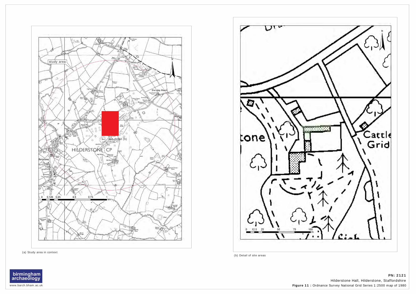
www.barch.bham.ac.uk Figure 11 : Ordnance Survey National Grid Series 1:2500 map of 1980
PN: 2121Hilderstone Hall, Hilderstone, Staffordshire
see detail (b)
see detail (b)
study area
(a) Study area in context(b) Detail of site areas

PN: 2121 Hilderstone Hall, Hilderstone, Staffordshire
Archaeological Desk-Based Assessment
Plate 1: Hilderstone Hall from south.
Plate 2: Hilderstone Hall from northwest.
birmingham archaeology Plates

PN: 2121 Hilderstone Hall, Hilderstone, Staffordshire
Archaeological Desk-Based Assessment
Plate 3: Christ Church, Hilderstone, from Hilderstone Hall.
Plate 4: Proposed Dayroom site from west.
birmingham archaeology Plates

PN: 2121 Hilderstone Hall, Hilderstone, Staffordshire
Archaeological Desk-Based Assessment
Plate 5: Walled garden (exterior) from northwest.
Plate 6: Gate pier to walled garden from north.
birmingham archaeology Plates

PN: 2121 Hilderstone Hall, Hilderstone, Staffordshire
Archaeological Desk-Based Assessment
Plate 7: Entrance to walled garden from north (Coach House in background).
Plate 8: Coach House from north.
birmingham archaeology Plates

PN: 2121 Hilderstone Hall, Hilderstone, Staffordshire
Archaeological Desk-Based Assessment
Plate 9:Garage from south.
Plate 10: Walled garden (interior) from south.
birmingham archaeology Plates

PN: 2121 Hilderstone Hall, Hilderstone, Staffordshire
Archaeological Desk-Based Assessment
Plate 11: Walled garden (interior) from east.
Plate 12: Section of wall and lean-to from southwest.
birmingham archaeology Plates