Highlands TDR: Creating Voluntary Receiving Zones - APA-NJ
28
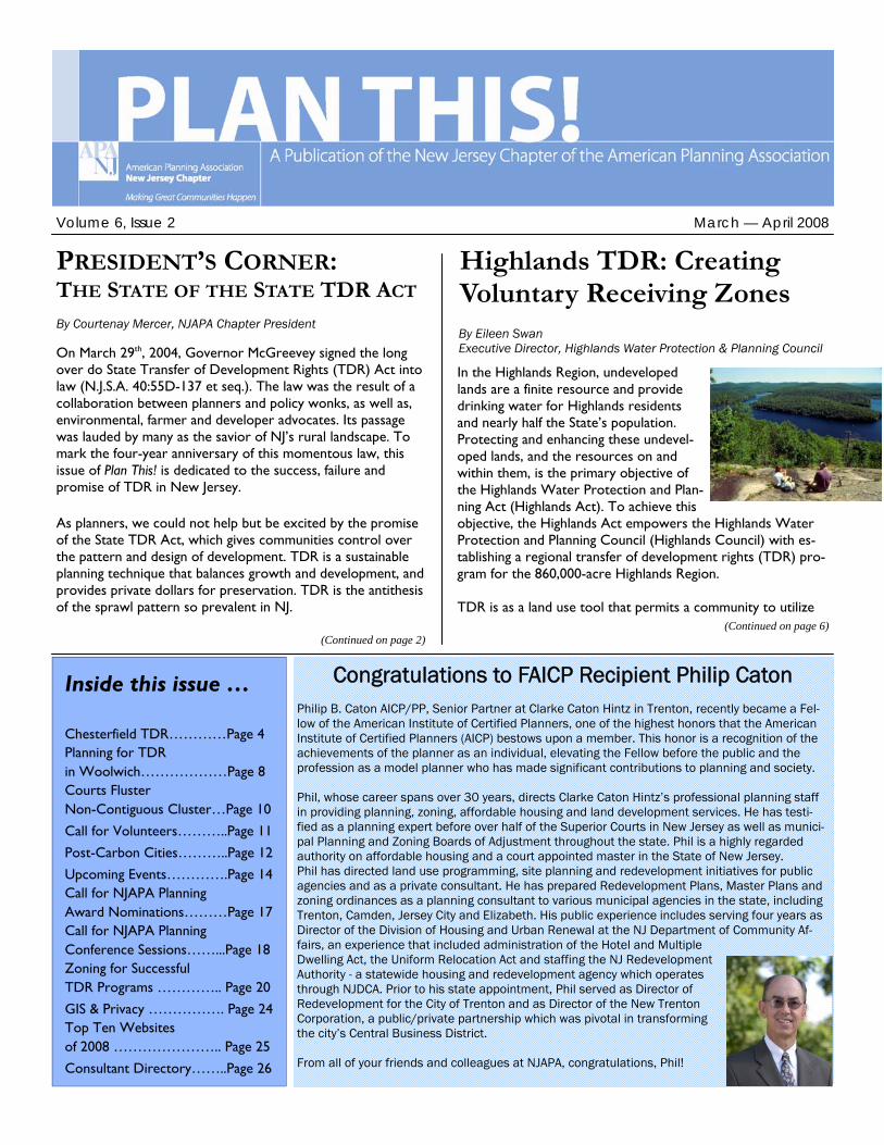
Inside this issue … Chesterfield TDR…………Page 4 Planning for TDR in Woolwich………………Page 8 Courts Fluster Non-Contiguous Cluster…Page 10 Call for Volunteers………..Page 11 Post-Carbon Cities………..Page 12 Upcoming Events………….Page 14 Call for NJAPA Planning Award Nominations………Page 17 Call for NJAPA Planning Conference Sessions……...Page 18 Zoning for Successful TDR Programs ………….. Page 20 GIS & Privacy ……………. Page 24 Top Ten Websites of 2008 ………………….. Page 25 Consultant Directory……..Page 26 Volume 6, Issue 2 In the Highlands Region, undeveloped lands are a finite resource and provide drinking water for Highlands residents and nearly half the State’s population. Protecting and enhancing these undevel- oped lands, and the resources on and within them, is the primary objective of the Highlands Water Protection and Plan- ning Act (Highlands Act). To achieve this objective, the Highlands Act empowers the Highlands Water Protection and Planning Council (Highlands Council) with es- tablishing a regional transfer of development rights (TDR) pro- gram for the 860,000-acre Highlands Region. TDR is as a land use tool that permits a community to utilize (Continued on page 6) Highlands TDR: Creating Voluntary Receiving Zones By Eileen Swan Executive Director, Highlands Water Protection & Planning Council March — April 2008 Congratulations to FAICP Recipient Philip Caton Philip B. Caton AICP/PP, Senior Partner at Clarke Caton Hintz in Trenton, recently became a Fel- low of the American Institute of Certified Planners, one of the highest honors that the American Institute of Certified Planners (AICP) bestows upon a member. This honor is a recognition of the achievements of the planner as an individual, elevating the Fellow before the public and the profession as a model planner who has made significant contributions to planning and society. Phil, whose career spans over 30 years, directs Clarke Caton Hintz’s professional planning staff in providing planning, zoning, affordable housing and land development services. He has testi- fied as a planning expert before over half of the Superior Courts in New Jersey as well as munici- pal Planning and Zoning Boards of Adjustment throughout the state. Phil is a highly regarded authority on affordable housing and a court appointed master in the State of New Jersey. Phil has directed land use programming, site planning and redevelopment initiatives for public agencies and as a private consultant. He has prepared Redevelopment Plans, Master Plans and zoning ordinances as a planning consultant to various municipal agencies in the state, including Trenton, Camden, Jersey City and Elizabeth. His public experience includes serving four years as Director of the Division of Housing and Urban Renewal at the NJ Department of Community Af- fairs, an experience that included administration of the Hotel and Multiple Dwelling Act, the Uniform Relocation Act and staffing the NJ Redevelopment Authority - a statewide housing and redevelopment agency which operates through NJDCA. Prior to his state appointment, Phil served as Director of Redevelopment for the City of Trenton and as Director of the New Trenton Corporation, a public/private partnership which was pivotal in transforming the city’s Central Business District. From all of your friends and colleagues at NJAPA, congratulations, Phil! PRESIDENT’S CORNER: THE STATE OF THE STATE TDR ACT By Courtenay Mercer, NJAPA Chapter President On March 29 th , 2004, Governor McGreevey signed the long over do State Transfer of Development Rights (TDR) Act into law (N.J.S.A. 40:55D-137 et seq.). The law was the result of a collaboration between planners and policy wonks, as well as, environmental, farmer and developer advocates. Its passage was lauded by many as the savior of NJ’s rural landscape. To mark the four-year anniversary of this momentous law, this issue of Plan This! is dedicated to the success, failure and promise of TDR in New Jersey. As planners, we could not help but be excited by the promise of the State TDR Act, which gives communities control over the pattern and design of development. TDR is a sustainable planning technique that balances growth and development, and provides private dollars for preservation. TDR is the antithesis of the sprawl pattern so prevalent in NJ. (Continued on page 2)
-
Upload
khangminh22 -
Category
Documents
-
view
4 -
download
0
Transcript of Highlands TDR: Creating Voluntary Receiving Zones - APA-NJ
Inside this issue …
Chesterfield TDR…………Page 4 Planning for TDR in Woolwich………………Page 8 Courts Fluster Non-Contiguous Cluster…Page 10
Call for Volunteers………..Page 11 Post-Carbon Cities………..Page 12 Upcoming Events………….Page 14 Call for NJAPA Planning Award Nominations………Page 17 Call for NJAPA Planning Conference Sessions……...Page 18 Zoning for Successful TDR Programs ………….. Page 20 GIS & Privacy ……………. Page 24 Top Ten Websites of 2008 ………………….. Page 25 Consultant Directory……..Page 26
Volume 6, Issue 2
In the Highlands Region, undeveloped lands are a finite resource and provide drinking water for Highlands residents and nearly half the State’s population. Protecting and enhancing these undevel-oped lands, and the resources on and within them, is the primary objective of the Highlands Water Protection and Plan-ning Act (Highlands Act). To achieve this objective, the Highlands Act empowers the Highlands Water Protection and Planning Council (Highlands Council) with es-tablishing a regional transfer of development rights (TDR) pro-gram for the 860,000-acre Highlands Region. TDR is as a land use tool that permits a community to utilize
(Continued on page 6)
Highlands TDR: Creating Voluntary Receiving Zones By Eileen Swan Executive Director, Highlands Water Protection & Planning Council
March — April 2008
Congratulations to FAICP Recipient Philip Caton Philip B. Caton AICP/PP, Senior Partner at Clarke Caton Hintz in Trenton, recently became a Fel-low of the American Institute of Certified Planners, one of the highest honors that the American Institute of Certified Planners (AICP) bestows upon a member. This honor is a recognition of the achievements of the planner as an individual, elevating the Fellow before the public and the profession as a model planner who has made significant contributions to planning and society. Phil, whose career spans over 30 years, directs Clarke Caton Hintz’s professional planning staff in providing planning, zoning, affordable housing and land development services. He has testi-fied as a planning expert before over half of the Superior Courts in New Jersey as well as munici-pal Planning and Zoning Boards of Adjustment throughout the state. Phil is a highly regarded authority on affordable housing and a court appointed master in the State of New Jersey. Phil has directed land use programming, site planning and redevelopment initiatives for public agencies and as a private consultant. He has prepared Redevelopment Plans, Master Plans and zoning ordinances as a planning consultant to various municipal agencies in the state, including Trenton, Camden, Jersey City and Elizabeth. His public experience includes serving four years as Director of the Division of Housing and Urban Renewal at the NJ Department of Community Af-fairs, an experience that included administration of the Hotel and Multiple Dwelling Act, the Uniform Relocation Act and staffing the NJ Redevelopment Authority - a statewide housing and redevelopment agency which operates through NJDCA. Prior to his state appointment, Phil served as Director of Redevelopment for the City of Trenton and as Director of the New Trenton Corporation, a public/private partnership which was pivotal in transforming the city’s Central Business District. From all of your friends and colleagues at NJAPA, congratulations, Phil!
PRESIDENT’S CORNER: THE STATE OF THE STATE TDR ACT By Courtenay Mercer, NJAPA Chapter President
On March 29th, 2004, Governor McGreevey signed the long over do State Transfer of Development Rights (TDR) Act into law (N.J.S.A. 40:55D-137 et seq.). The law was the result of a collaboration between planners and policy wonks, as well as, environmental, farmer and developer advocates. Its passage was lauded by many as the savior of NJ’s rural landscape. To mark the four-year anniversary of this momentous law, this issue of Plan This! is dedicated to the success, failure and promise of TDR in New Jersey. As planners, we could not help but be excited by the promise of the State TDR Act, which gives communities control over the pattern and design of development. TDR is a sustainable planning technique that balances growth and development, and provides private dollars for preservation. TDR is the antithesis of the sprawl pattern so prevalent in NJ.
(Continued on page 2)

Page 2 Volume 6, Issue 2
plummeting bond ratings, it may still be a jagged pill to swallow. Unfortunately, the Act only allows for a $40,000 cost-share grant through the State TDR Bank, and the competitive grants from the Office of Smart Growth still cannot cover the difference. A community wishing to pur-sue TDR has go into it with eyes open, and think about the long-term return on investment, both in attracting appropri-ate ratables and maintaining quality of life. In addition to the planning costs, are those costs associated with the bricks and mortar implementation of TDR. Again, this burden is heavier for rural communities without access to sewer and/or water, and with limited transpor-tation infrastructure. Moreover, in most cases, development occurs at a faster rate in TDR communities because of desirable densities and the relative ease of local approval for those densities. This faster paced development will mean a more rapid expansion of resident needs like education, emergency services and recreational facilities. Compared to sprawl development, the municipality can be more prepared and expect savings over the long run for these services and infrastructure, but that is hardly a relief when you have to explain the coming years’ budgets to the taxpayers. Finally, communities (and developers) wishing to pursue TDR still have to make their way through the bureaucratic red tape at the State for permits and infrastructure improvements. State Plan Endorsement*, a requirement of the State TDR Act, gives the community a nod of approval for their efforts and affords them greater access to the State agencies. Still, TDR communities need even more assistance to make the TDR program become a reality. All of the above are the main reasons why only one community, Woolwich Township, is approaching the TDR finish line after four years. This diatribe is not to say that TDR is unattainable or im-practical. Perseverance and strong com-
PLAN THIS Is a bi-monthly publica-tion of the New Jersey Chapter of the American Planning Associa-tion. This publication is available only to members of the New Jer-sey Chapter. The NJAPA Bulletin committee welcomes submission of original articles, editorial letters, photo-graphs, news items, and classified advertisements. The committee reserves the right to only publish submissions that are deemed ap-propriate for this publication. The views published in the bulletin are not necessarily those of the NJAPA. Rebecca M. Hersh, AICP/PP Bulletin Editor [email protected] Michael L. Powell [email protected] Jeffrey Perlman [email protected] To find out more information on joining the New Jersey Chapter or if you would like to place an ad-vertisement in future bulletins please contact: Michael E. Levine, AICP NJAPA Chapter Administrator P. O. Box 200402 One Riverfront Plaza Newark, NJ 07102-9715 Phone (973) 286-4708 Fax: (973) 504-7097 [email protected] Submit all address changes to: American Planning Association 122 S. Michigan Avenue Chicago, IL 60603-6107 (312) 431-9100 Or online at: www.planning.org
Recognizing the importance of this bal-anced growth tool, the State dedicated significant technical and financial re-sources to assist municipalities in imple-menting TDR. So why, nearly four years later, has not a single municipality adopted a TDR ordinance pursuant to the Act? Moreover, why have several municipalities tried to circumvent the Act with “almost” TDR ordinances (discussed in further detail in a subse-quent article)? Having worked tirelessly over the past four years to implement TDR, I am intimately aware of the issues facing TDR, and the incentives needed to make it a more viable tool. One of the most common complaints about TDR is that it is complicated. The concept in itself is baffling to many, and the intricacies required in the Act do not make it any simpler. I personally feel that the requirements of the law are neces-sary to ensure a viable and equitable TDR program. It is the responsibility of professional planners to know the re-quirements of the Act, and relay them to their clients in a manner that makes sense. Meanwhile, the public misconcep-tions and misunderstandings about TDR can be remedied through public out-reach that occurs early and often. Fre-quently, the very people TDR is meant to help—the landowners—are the most vocal opponents. Including landowners and other key stakeholders throughout the process is critical to achieving suc-cess. Communicating the TDR message is probably the easiest challenge to over-come if the community is willing to have an open, collaborative planning process. Harder to overcome than communica-tion is the cost of TDR. For a rural mu-nicipality without access to infrastruc-ture, the cost to plan for TDR can be upwards of a half a million dollars. The cost goes down proportionally for sub-urban and urban communities. When weighed against the cost to the munici-pality to purchase development rights, the cost to plan for TDR is cheap. How-ever, in this time of budget caps and
(Continued from page 1)
...THE STATE OF THE STATE TDR ACT

Page 3 Plan This!
munity leadership can overcome these challenges (as was the case in Chester-field and Woolwich, both discussed in detail in subsequent articles). Neverthe-less, why should these challenges be born largely by the community and its leaders? The State agencies have done their best to provide assistance, but are limited by financial, statutory and/or regulatory obstacles that even the best intentioned cannot overcome. I know this well, having been one of those “best intentioned” for the past four years. Real institutional change needs to occur to make TDR and other smart growth prin-ciples easier to implement than sprawl. Below are a few recommendations that would make TDR easier for towns: • Raise the statutory $40,000 cost-share
planning grant from the State TDR Bank to at least $100,000.
• Provide an exemption to the municipal budget cap for State Plan Endorse-ment, which would also cover the costs associated with TDR.
• Prioritize State infrastructure funds to Plan Endorsed communities, and TDR receiving zones in particular:
∗ The State Transportation Im-provement Program (TIP) should prioritize projects in TDR receiv-ing areas. The TIP currently pri-oritizes projects on a “need” ba-sis, in other words, where con-gestion has gotten so bad that improvements are necessary. TDR communities have made the effort to head off the congestion by reducing sprawl and designing a better road network for the im-pending development. These pro-active projects should be priori-tized for funding over projects that are necessary only because of poor planning.
∗ Providing multi-modal transporta-tion opportunities is critical to any center-based development. The NJ Transit should prioritize the routing of transit service to town or regional centers that accom-modate TDR credits.
∗ Supporting water and sewer infra-
structure is critical to achieve TDR densities. Accordingly, the Environmental Infrastructure Trust (EIT) should expand the Smart Growth Financing Program to include TDR receiving areas.
• Various State entities should provide for more flexibility in the review of projects in TDR receiving areas:
∗ The NJDOT Highway Access Code should more easily accom-modate traffic patterns associated with center-based development by providing for a specialized and flexible access level for Plan En-dorsed communities.
∗ The Residential Site Improvement Standards (RSIS) should provide an easier waiver process for Plan Endorsed communities.
∗ NJDEP should provide a “one-stop” permitting process for TDR receiving areas where permits can be considered regionally for the entire receiving area, rather than one project at a time. Moreover, the review of these permits should be prioritized over other permits.
• Incentive programs, similar to those associated with Urban Enterprise Zones and redevelopment areas, should be created for TDR receiving areas. These programs could provide funding for needed infrastructure and services without additionally burden-ing the municipality or developers.
• Property tax relief and Extraordinary Aid should be prioritized to Plan En-dorsed communities.
• In recognition of the savings TDR af-fords the Garden State Preservation Trust (GSPT), TDR communities should have access to a dedicated pot of funding for open space acquisition and park development that supports the TDR receiving area. The funding should be automatic and be some per-centage of the value of the TDR cred-its purchased by private interests.
• Similar to Maryland and Massachu-setts, there should be a State entity that has jurisdiction over all of the State’s land use agencies to ensure
that there is a real and coordinated effort to promote sustainable land use practices. The State Planning Commis-sion (SPC), already populated with the Commissioners of these agencies, seems most appropriate. Accordingly, the SPC and the Office of Smart Growth should be empowered to coordinate any regulatory changes necessary to make the above happen.
Municipalities have difficult short-term fiscal and political choices to make, which despite the long-term benefits of smart growth, the up-front costs often cause municipalities to make not so sus-tainable decisions. As we all know, these decisions have resulted in sprawl. The above is just a small sampling of initia-tives that could make smart growth land use practices easier to implement. As planners, we need to advocate for the institutional changes that will make smart growth easier than sprawl. The passage of the State TDR Act gave us the tool, now we need the support to make that tool work. * References to State Plan Endorsement can be interchanged with Highlands Plan Confor-mance or Pinelands Certification, as applicable. The President’s Corner reflects the President’s opinion and not necessar-ily that of the NJAPA Executive Com-mittee or NJAPA membership. The President can be contacted at [email protected].
Write for the NJAPA Newsletter!
The NJAPA Bulletin welcomes plan-ning-related articles, editorials, event announcements, and photos. E-mail submissions and questions to NJAPA Bulletin Editor Rebecca Hersh at: [email protected] Upcoming Deadlines: • Friday, April 25 for the May/June
2008 issue • Friday, June 27 or the July/August
2008 issue • Friday, August 29 for the Sept/Oct
2008 issue

Volume 6, Issue 2 Page 4
Ten years ago Chesterfield Township, a rural community in northern Burlington County, enacted a Transfer of Develop-ment Rights (TDR) ordinance designed to channel future residential growth into a new neo-traditional village. Notwith-standing some minor setbacks and ad-justments along the way, the program has been a tremendous success and is accomplishing the goals established by the Township Committee and Planning Board when they endorsed TDR. Al-though TDR in Chesterfield is voluntary, not mandatory, not a single major subdi-vision application for land in the Town-ship’s Sending Area has been processed by the Planning Board since TDR was enacted. Instead, virtually all the residen-tial development during that period has been channeled into the Receiving Area. Landowners, farmers, homebuilders, affordable housing advocates, and open
Chesterfield Township TDR: A New Jersey Success Story By Philip B. Caton, PP, AICP and Lisa Specca, PP, AICP of Clarke Caton Hintz, consulting planners to Chesterfield Township
space preservationists share common ground in Chesterfield to make the vi-sion of TDR a reality. While Old York Village has been taking shape, the agricul-tural heritage of the rest of Chesterfield has been enhanced with over 6,800 acres of its land preserved through TDR implementation and the County and State Farmland Preservation Programs. These advances in preserved agriculture and open space lands were accomplished despite burgeoning residential growth in neighboring communities. The Success of the Receiving Area Drives the Success of the Program When fully developed, Old York Village will consist of up to 1,200 homes in a wide variety of attached and detached models, a new elementary school adja-cent to centralized recreational facilities, a network of neighborhood parks, and a mixed use village center with neighbor-
hood retail and con-venience uses to serve local market needs. Subdivision approv-als have been granted or are pending for 90% of the village and con-struction is pro-ceeding in five of the developments by four different homebuilders. Over 250 certificates of occupancy have been issued, with nearly 600 addi-tional units ap-proved or under construction. A mixed use neighbor-hood including over 275 residential units and 44,000 square feet of commercial use is currently un-der Planning Board review. Residential sales at Old York
Village have held up in the recent eco-nomic downtown. Although the village is not immune from the softening in the housing market which extends to nearly every corner of the state, developers in Chesterfield were able to hold prices until the fall of 2007 before moving to price concessions and other incentives. In order to maintain tight control over aesthetics and design, the plans for each tract must conform to the Township’s conceptual village plan. Site planning and architectural design standards have been adopted to ensure the design of build-ings and the relationship among them echoes traditional American building styles and development patterns. Costs of roads, sewer infrastructure, drainage facilities, and common recreational facili-ties are distributed equitably among the developers through offsite cost-sharing ordinances. Construction of several neighborhood parks and the Village Square is proceeding in step with resi-dential development. A school referendum was passed by the Chesterfield voters in December of 2007 for construction of a new elemen-tary school in the middle of the new village within convenient walking dis-tance of the vast majority of new homes. The Township is partnering with the School Board on the purchase of land for the recreational facilities adjacent to the school. Consequently, the public will be able to utilize the facilities when school is not in session pursuant to an agreement between the Township and the School Board. Coordinated planning and design of the new school to address educational and recreational needs is projected in 2008. The Village Design Plan In 2002, the Township adopted an amendment to the 1997 Master Plan, the plan from which the Transfer of Devel-opment Rights (TDR) concept originated in Chesterfield. This Master Plan Amend-ment, which was created with funding assistance by a Department of Commu-nity Affairs Smart Growth Grant, refined

Page 5 Plan This!
the planning for circula-tion, recreation, open space, commercial, civic, and residential compo-nents of the Planned Village within the Re-ceiving Area. Design Guidelines and Bulk Standards following tra-ditional neighborhood design principles were adopted in December 2002. A Special Area Standard for Streets and Sidewalks in Old York Village which differs from the Residential Site Improvement Standards (RSIS) was adopted by the New Jersey Site Im-provement Advisory Board in October 2003. Development Credit Values Burlington County commissioned a real estate study in 2000 to determine the value of credits in Chesterfield. This study concluded that credits at that time should fall within a range of $18,000 to $24,000 per credit. In fact, many of the sales which occurred at the beginning of the program were at $23,000 per credit. However, as the program matured and developers optioned land in Receiving Area the value of credits escalated to contracts which were signed at $65,000 per credit in 2006. The high value of credits has been critical in maintaining TDR’s attractiveness to landowners as compared with selling to a developer on-site development. Receiving Area Infrastructure Developing infrastructure to provide for sewer service and potable water was a significant accomplishment in the TDR process. The Township created a new Wastewater Management Plan (WWMP), which was approved by the NJDEP in 1999, to provide sewer service to the Receiving Area. In addition, sewer service was extended to bordering resi-dences and the Village of Crosswicks to solve septic problems on small historic village lots. A total of $5.7 million was bonded through the Environmental Infra-structure Trust Fund to provide a pump station and force main connections from
the sewage treatment plant located at the State’s Wagner Youth Correctional Facility. The 1999 WWMP also coordi-nated a water franchise area for potable water for the Receiving Area. COAH The Township is meeting it affordable housing obligation by integrating low and moderate income housing units with market rate units throughout the Re-ceiving Area. A key component of Ches-terfield’s TDR program was the satisfac-tion of the Township’s twelve (12) year cumulative low and moderate affordable housing obligation of 67 affordable hous-ing units. In 2003 the Hon. John A. Sweeney, AJSC entered a Final Judgment of Compliance and Repose which found the Township’s Housing Element and Fair Share Plan to be in compliance with the NJ Fair Housing Act and the Mount Laurel doctrine in satisfying the munici-pality’s first and second round fair share need. That judicial determination pro-vided the Township with 6 years of re-pose (until 2009). All of the Township’s affordable housing is being constructed within the Receiving Area and integrated architecturally with the market rate housing units. Afford-able housing in Chesterfield has taken the form of twins and quads, in buildings
which approximate the scale of single family detached houses, row houses and apartments over shops. Outside Agency Support Chesterfield has consistently received critical financial and technical support from Burlington County over the ten years of the program. The County has provided valuable technical assistance and has been instrumental in planning two credit auctions. The State of New Jersey Department of Community Affairs and Environmental Protection have also been instrumental to the success of the TDR program. This assistance was piv-otal, particularly given the Chesterfield’s small tax base and limited resources. Recognizing Chesterfield’s Planning Chesterfield Township’s TDR program and Village Plan have been recognized with a 2004 national planning award from the American Planning Association and with awards from the American Society of Landscape Architects (N J Chapter), New Jersey Future, the NJ Department of Environmental Protec-tion and the American Planning Associa-tion (NJ Chapter). The success of the Chesterfield program helped fuel the New Jersey Legislature’s decision in 2004 to extend the authority for munici-
(Continued on page 16)
Volume 6, Issue 2 Page 6
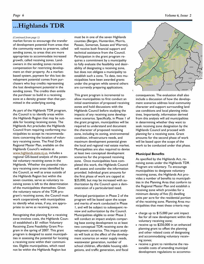
market forces to encourage the transfer of development potential from areas that the community wants to preserve, called sending zones, to areas that are more appropriate to accommodate increased growth, called receiving zones. Land-owners in the sending zones receive compensation for restricting develop-ment on their property. As a market-based system, payment for this lost de-velopment potential comes from pur-chasers who buy credits representing the lost development potential in the sending zones. The credits then entitle the purchaser to build in a receiving zone at a density greater than that per-mitted in the underlying zoning. As part of the Highlands TDR program, the Council is to identify areas within the Highlands Region that may be suit-able for locating receiving zones. The Highlands Act precludes the Highlands Council from requiring conforming mu-nicipalities to accept its recommenda-tions concerning the location of volun-tary receiving zones. The Final Draft Regional Master Plan, available on the Highlands Council’s website at www.highlands.state.nj.us, includes a regional GIS-based analysis of the poten-tial voluntary receiving zones in the Highlands. Whether the potential volun-tary receiving zone areas identified by the Council, as well as areas outside of the Highlands Region but within the seven counties, serve as voluntary re-ceiving zones is left to the determination of the municipalities themselves. Given the voluntary nature of the TDR pro-gram’s receiving zones, the Council must work cooperatively with municipalities to identify what areas, if any, are appro-priate to serve as receiving zones. Recognizing that planning for a receiving zone involves costs, the Highlands Coun-cil established a $1 million Voluntary Receiving Zone Feasibility Grant Pro-gram in the spring of 2007. This grant program is designed to assist municipali-ties in assessing the potential for locating a receiving zone within their communi-ties. Eligible municipalities, which need not be within the Highlands Region but
(Continued from page 1) must be in one of the seven Highlands counties (Bergen, Hunterdon, Morris, Passaic, Somerset, Sussex and Warren), will receive both financial support and technical assistance from the Council. Participation in the grant program re-quires a commitment by a municipality to fully evaluate the feasibility and desir-ability of designating a receiving zone, but does not obligate a municipality to establish such a zone. To date, two mu-nicipalities have been awarded grants under the program while several others are currently preparing applications. This grant program is incremental to allow municipalities to first conduct an initial examination of proposed receiving zones and hold discussions with the Highlands Council before studying the impacts of any receiving zone develop-ment scenarios. Specifically, in Phase 1 of the grant program, municipalities will be required to understand and document the character of proposed receiving zone, including its zoning, environmental condition, infrastructure needs, and maximum development potential given the local and regional real estate market. Municipalities are also required to devise at least two conceptual development scenarios for the proposed receiving zone. Once municipalities have com-pleted this work, the Highlands Council will assess and consider the information provided. Individual grant amounts for the first phase of work are capped at $25,000, but may be increased with au-thorization by the Council upon a dem-onstration of a particularized need. Municipal participation in Phase 2 of the program will be based upon the scope and merits of work conducted in Phase 1, and will be subject to subsequent re-view and authorization by the Council. Municipalities eligible to enter Phase 2 will conduct an impact analysis compar-ing base zoning development to at least two conceptual TDR receiving zone de-velopment scenarios. This impact analy-sis will look at the affect of the develop-ment scenarios on water supply needs, wastewater generation, number of school children, affordable housing obli-gations, and traffic generation, and fiscal
consequences. The evaluation shall also include a discussion of how the develop-ment scenarios address local community character and support surrounding land use conditions and local planning initia-tives. Importantly, information derived from this analysis will aid municipalities in determining whether they want to seek receiving zone designation by the Highlands Council and proceed with planning for a receiving zone. Grant amounts for the second phase of work will be based upon the scope of the work to be conducted under that phase. Municipal Benefits As specified by the Highlands Act, re-ceiving zones under the Highlands TDR Program are voluntary. To encourage municipalities to designate voluntary receiving zones, the Highlands Act pro-vides a number of benefits to municipali-ties in the Planning Area that conform to the Regional Master Plan and establish a receiving zone which provides for a minimum density of five (5) dwelling units per acre for the residential portion of the receiving zone. Planning Area mu-nicipalities that meet these criteria may: • charge up to $15,000 per unit impact
fee for all new development within the voluntary receiving zone;
• receive up to $250,000 in an enhanced planning grant to offset the planning and other related costs of designating and accommodating voluntary receiv-ing zones;
• receive a grant to reimburse the rea-sonable costs of amending municipal development regulations to accommo-
...Highlands TDR
Page 7
Plan This!
date voluntary receiving zones; • receive legal representation by the
State in actions challenging municipal decisions regarding TDR provided that pre-requisites are met; and
• receive priority status in for any State capital or infrastructure programs.
For municipalities outside of the Region but within the seven Highlands counties, they are entitled to the same benefits above except for legal representation and priority status. Importantly, munici-palities outside the Region must receive plan endorsement from the State Plan-ning Commission to participate in the Highlands TDR Program. For Preservation Area municipalities or Planning Area municipalities that choose not to conform to the Regional Master Plan, the Council has separate authority to provide financial and technical assis-tance to implement participation in the Highlands TDR Program. Additionally, such authority may be used to provide financial and technical assistance to mu-nicipalities that choose not to satisfy the five dwelling unit per acre threshold and instead seek to designate a receiving zone with a lower residential density. Process
The process is initiated by a municipality submitting to the Highlands Council a resolution from the governing body indi-cating the municipality’s interest in as-sessing the feasibility of establishing a voluntary receiving zone. Along with the resolution, the municipality must com-plete and submit the grant application. As part of the application, the municipal-ity must attach a scope of work, cost proposal, and schedule addressing the requirements of the grant program. Ad-ditionally, the municipality must identify any outside consultants and sub-consultants that will be assisting the mu-nicipality with work under the grant and include a detailed scope and cost pro-posal submitted by the consultants in support of grant activities. Upon receipt of the grant application, the Highlands Council Staff will review the application and make a recommenda-
tion to the Highlands Council for ap-proval and award of the grant. Upon grant award, the municipality is entitled to receive half of the grant amount. The remainder of the grant will be provided on a reimbursement basis upon submis-sion of the final Phase 1 report and ac-ceptance by the Highlands Council. If the results of Phase 1 indicate that a pro-posed receiving zone may be feasible and the municipality desires to proceed, then the Highlands Council may award a grant to complete an impact analysis and de-velopment scenario evaluation required during Phase 2. Grant Activities
There are many tasks to be conducted by a municipality under the grant. First, the municipality must identify and evalu-ate potential receiving zones based upon municipal vision as articulated in the mu-nicipality’s master plan, and if within the Highlands Region, the Highlands Plan. The town must explain why particular sites were selected and the criteria used in making selections. Second, the municipality must provide a description of the physical characteristics and zoning of the potential receiving zone. This information includes identify-ing environmental constraints within one mile of the potential zone such as streams corridors/buffers, wetlands, 100-year floodplains, threatened and endangered species habitat, steep slopes, forest and woodlands, existing open space, and important soils/recharge ar-eas. The municipality must also describe the extent of development currently built within the potential zone along with that permitted by the municipality’s de-velopment regulations. Additionally, the municipality must identify water supply and wastewater utilities provided to the zone, discuss whether those utilities have capacity to service additional devel-opment and describe if there is public transportation access to the zone. Third, the town must do a real estate market analysis of the potential receiving zone. This includes discussing the unit values of various residential and non-residential development, underlying land
values, and the local real estate market’s ability to absorb additional development within the potential receiving zone. Fourth, the municipality must devise at least two conceptual development sce-narios for the potential receiving zone based upon the results of the real estate market analysis. This requires describing the type and number of additional units (including commercial and mixed use if appropriate) above base density that is acceptable to the municipality; discuss-ing how parking, ingress, egress, infra-structure needs and emergency services will be addressed; and providing an esti-mate of the potential project value of the two development scenarios. It is also critical that the municipality state whether existing utilities have the capac-ity to service the additional develop-ment by providing either an Intent to Serve letter from the local utility au-thority or an engineering report indicat-ing that there is sufficient capacity to meet increased utility demand. Fifth, and finally, the municipality must prepare a draft Phase 1 report to the Highlands Council comprehensively dis-cussing each of the items above. In order to fulfill the resource protec-tions contemplated by the Highlands Act, the Legislature realized that there must be various mechanisms to pre-serve environmentally sensitive lands in the Highlands Region. TDR is one of those tools. Successful implementation of the Highlands TDR program will en-sure that additional growth is properly planned and help support ongoing re-gional land preservation needs. For more information regarding the High-lands Receiving Zone Feasibility Grant Program, please contact Jeffrey LeJava, Highlands TDR Program Administrator & Staff Attorney, at (908) 879-6737 ext. 131 or by e-mail at [email protected].
In March 2007, Woolwich Township New Jersey became the first municipality in the state to adopt a Transfer of De-velopment Rights Plan under the 2004 TDR statewide enabling legislation. Such acclaim, however, is not an end to itself, but rather a means to an end. For with-out the ability to implement TDR, Woolwich Township’s agrarian roots will rapidly vanish.
Despite its location just 30 minutes from Philadelphia, Woolwich Township’s ru-ral, agricultural heritage endured through most of the 20th century. As recently as 1990, only 1,459 people re-sided in this 21-square mile community. However, in the decade following, devel-opment pressures sent its population soaring by nearly 108% to 3,032. Be-tween 2000 and 2005, the Township’s population grew by another 148% to 7,518, according it the second highest growth rate in the entire northeastern United States. Though it surrounds the small town of Swedesboro, Woolwich historically lacked its own traditional town center or main street to anchor new develop-ment. Consequently, the influx in popu-lation quickly resulted in unchecked sprawl. The impacts of past planning decisions – sprawling, large lot residen-tial development, consumption of farm-land, school construction costs, traffic and absence of commercial ratables – raised the ire of residents and prompted Township leaders to reverse these
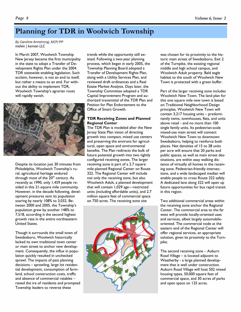
trends while the opportunity still ex-isted. Following a two-year planning process, which began in early 2005, the Township Planning Board adopted a Transfer of Development Rights Plan, along with a Utility Services Plan, and reviewed draft ordinances and a Real Estate Market Analysis. Days later, the Township Committee adopted a TDR Capital Improvement Program and au-thorized transmittal of the TDR Plan and Petition for Plan Endorsement to the Office of Smart Growth. TDR Receiving Zones and Planned Regional Center The TDR Plan is modeled after the New Jersey State Plan vision of directing growth into compact, mixed use centers and preserving the environs for agricul-tural, open space and environmental benefits. The Plan redirects the bulk of future potential growth into two tightly configured receiving zones. The larger receiving zone is part of a 2.7 square mile planned Regional Center on Route 322. The Regional Center will include not only the receiving zone, but also Woolwich Adult, a planned development that will contain 1,029 age—restricted units (including affordable units), and 2.7 million square feet of commercial space on 750 acres. The receiving zone site
was chosen for its proximity to the his-toric main street of Swedesboro, Exit 2 of the Turnpike, the existing regional middle and high school campus, and Woolwich Adult property. Bald eagle habitat to the south of Woolwich New Town is protected with a green buffer. Part of the larger receiving zone includes Woolwich New Town. The land plan for this one square mile new town is based on Traditional Neighborhood Design principles. Woolwich New Town will contain 3,217 housing units – predomi-nantly twins, townhouses, flats, and units above retail - and no more than 100 single family units. Its pedestrian-scale mixed-use main street will connect Woolwich New Town to downtown Swedesboro, helping to reinforce both places. Net densities of 15 to 28 units per acre will ensure that 20 parks and public spaces, as well as main street des-tinations, are within easy walking dis-tance of virtually all homes in the receiv-ing zone. Pedestrian-friendly intersec-tions, and a wide landscaped median will enable people to cross Route 322 safely. A dedicated lane along 322 will open up future opportunities for bus rapid transit in this region. Two additional commercial areas within the receiving zone anchor the Regional Center. The commercial area to the far west will provide locally-oriented uses and services, albeit largely automobile-oriented. The commercial node at the eastern end of the Regional Center will offer regional services, an appropriate solution, given its proximity to the Turn-pike. The second receiving zone – Auburn Road Village – is located adjacent to Weatherby - a large planned develop-ment that is well under construction. Auburn Road Village will host 502 mixed housing types, 50,000 square feet of commercial space, and 30 acres of parks and open space on 125 acres.
Planning for TDR in Woolwich Township
Volume 6, Issue 2 Page 8
By Caroline Armstrong, AICP/PP melvin | kernan LLC
Page 9 Plan This!
Zoning and design standards set forth regulations at a town, block, site and building scale in the form of an urban design code. Photos and graphics are used to illustrate the intended purpose and goals of the code. These are com-plemented by minimum and maximum standards for architecture and design, parking, edge, buffer and environment, which establish an appropriate rhythm to the buildings and streetscape. While respecting traditional design principles, the code also encourages innovation and sustainable development practices to achieve state-of-the-art 21st century so-lutions, setting forth practices such as low-impact stormwater management techniques and green building solutions.
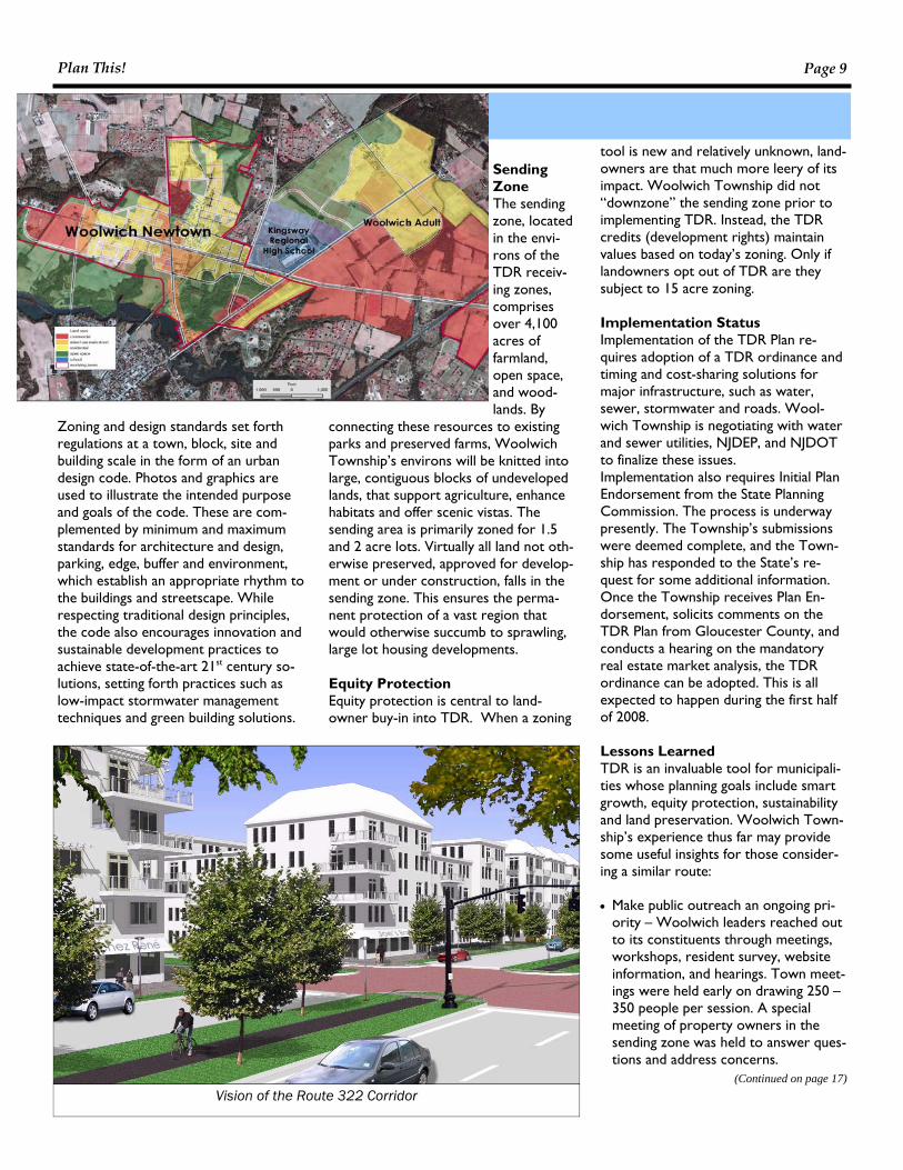
Sending Zone The sending zone, located in the envi-rons of the TDR receiv-ing zones, comprises over 4,100 acres of farmland, open space, and wood-lands. By
connecting these resources to existing parks and preserved farms, Woolwich Township’s environs will be knitted into large, contiguous blocks of undeveloped lands, that support agriculture, enhance habitats and offer scenic vistas. The sending area is primarily zoned for 1.5 and 2 acre lots. Virtually all land not oth-erwise preserved, approved for develop-ment or under construction, falls in the sending zone. This ensures the perma-nent protection of a vast region that would otherwise succumb to sprawling, large lot housing developments. Equity Protection Equity protection is central to land-owner buy-in into TDR. When a zoning
tool is new and relatively unknown, land-owners are that much more leery of its impact. Woolwich Township did not “downzone” the sending zone prior to implementing TDR. Instead, the TDR credits (development rights) maintain values based on today’s zoning. Only if landowners opt out of TDR are they subject to 15 acre zoning. Implementation Status Implementation of the TDR Plan re-quires adoption of a TDR ordinance and timing and cost-sharing solutions for major infrastructure, such as water, sewer, stormwater and roads. Wool-wich Township is negotiating with water and sewer utilities, NJDEP, and NJDOT to finalize these issues. Implementation also requires Initial Plan Endorsement from the State Planning Commission. The process is underway presently. The Township’s submissions were deemed complete, and the Town-ship has responded to the State’s re-quest for some additional information. Once the Township receives Plan En-dorsement, solicits comments on the TDR Plan from Gloucester County, and conducts a hearing on the mandatory real estate market analysis, the TDR ordinance can be adopted. This is all expected to happen during the first half of 2008. Lessons Learned TDR is an invaluable tool for municipali-ties whose planning goals include smart growth, equity protection, sustainability and land preservation. Woolwich Town-ship’s experience thus far may provide some useful insights for those consider-ing a similar route: • Make public outreach an ongoing pri-
ority – Woolwich leaders reached out to its constituents through meetings, workshops, resident survey, website information, and hearings. Town meet-ings were held early on drawing 250 – 350 people per session. A special meeting of property owners in the sending zone was held to answer ques-tions and address concerns.
(Continued on page 17)
Vision of the Route 322 Corridor

mits the statewide Transfer of Develop-ment Rights.” In September 2004, the Township amended its zoning code and map to put all land in the R-A Residential District into either a Sending Area or a Receiving Area (Ordinance No. 4004-13). The ordinance did allow for conventional subdivisions and contiguous clusters in both the sending and receiving areas; however, allowed for non-contiguous planned residential development to oc-cur only in the receiving area. In addi-tion, it allowed non-contiguous lands to be combined to create a conforming lot. In October 2004, the Builders League of South Jersey filed suit with the Superior Court of New Jersey, Gloucester County Law Division, claiming among other things, that Franklin’s ordinance “established a TDR program in a manner not authorized by the MLUL” (Docket No. GLO L-1753-04-PW). The Town-ship contended that the ordinance was not TDR because it was voluntary to transfer rights to the receiving area. Judge Bowen found for the Plaintiff in September 2005, and invalidated the ordinance “insofar as it is non-compliant with N.J.S.A. 40:55D-137 et seq”. The Township appealed the decision to the Superior Court of New Jersey Appellate Division (Docket No. A-1247-05T5). In July 2007, the Appellate Division af-firmed the lower court decision and provided detailed reasoning for the same. The Court determined that the Town-ship’s ordinance exceeded the authority granted by the MLUL for non-contiguous PUD, because it was not limited to planned developments and that it did not require that the properties be developed as a “single entity” or be in “common ownership”—the hallmarks of a PUD. Moreover, the Court determined that several aspects of the ordinance made it reminiscent of TDR; including, “the es-tablishment of sending and receiving ar-
eas…preliminary studies of topography and critical habitat, restrictions on future development, density bonuses and mu-nicipal authority to enforce the develop-ment restrictions”. Thus, the court determined that the Township was seeking to implement a transfer of development rights program. As such, the ordinance was invalid be-cause it did not meet the requirements of the State TDR Act. Flynn Tucker, L.L.C., et al vs. Township of Springfield et al Docket No. L-108-06 (Consolidated) The background of the adoption of the three Springfield Ordinances in question is rather convoluted, and accordingly, the Court invalidated them on the basis of procedure. Despite Judge Sweeney’s ability to end his decision with the pro-cedural invalidation, he opted to “rule upon the procedural challenges…lest the defendants assume that the ordinances are substantially valid and can be re-adopted in their same form”. For the purposes of this article, the procedural issues are not relevant, and only Judge Sweeney’s opinion as it relates to TDR will be discussed. In March 2006, Springfield Township (Burlington) adopted three ordinances that allowed for a transfer of density from sending zones to receiving zones at three-acre zoning. If property-owners opted not to participate in the density transfer, they were subject to ten-acre zoning. (Ordinances 2006-5, 2006-6 and 2006-7) The Township contended that they adopted these ordinances under the “non-contiguous density transfer” provisions of the MLUL (N.J.S.A. 40-55D-65(c)). Judge Sweeney, however, emphasized that the MLUL does not contain such a term, and that the only allowance for “clustering between non-contiguous parcels” was through planned unit development. Judge Sweeney ultimately concluded that the Township had created a “hybrid form” of TDR. First, the ordinance es-
Courts Fluster Non-Contiguous Cluster
Volume 6, Issue 2 Page 10
Before the State TDR Act, the Ogden Amendment (L. 1995, c. 364, § 2) to the Municipal Land Use Law (MLUL) pro-vided for cluster development between noncontiguous parcels. From 1995 to 2004, non-contiguous planned unit de-velopment (PUD) was the only game in town for municipalities outside Burling-ton County or the Pinelands. Often thought of as TDR-“lite”, non-contiguous cluster is less complicated to implement and still results in land pre-served through private investment. The non-contiguous cluster provision of the MLUL, however, is rather ambigu-ous and vague. Municipalities have inter-preted it in myriad ways to satisfy their growth management needs. It was com-monly thought that a few municipalities over-stretched their authority under the non-contiguous cluster provision, but were able to rebuke challenge in the absence of TDR. Upon the passage of the State TDR Act, planners and land-use attorneys theorized that the courts would be less flexible in their interpreta-tion of the non-contiguous PUD now that TDR was permissible throughout the state. Two municipalities recently proved this conjecture accurate when the courts invalidated their “non-contiguous cluster” ordinances because they too closely resembled TDR. Builders League of South Jersey, Inc. vs. Township of Franklin et als Docket No. A-1247-05T5 The 2004 Franklin Township (Gloucester) Master Plan called for the conservation of land and channeling of growth through the use of non-contiguous planned residential develop-ment that would allow “[d]evelopment rights within the sending area…be transferred into the Receiving Area” (2004 Master Plan, Franklin Township, Gloucester County). Not so cleverly as it turns out, the Master Plan went on to say, “that this use of non-contiguous planned residential clusters is not intended to be interpreted under the recently enacted legislation that per-
By Courtenay D. Mercer, PP/AICP

Page 11
Plan This!
tablished districts where development rights could be transferred to and from, effectively creating TDR sending and receiving zones. Moreover, the ordi-nance included terms such as “development potential”, “development transfer” and “development potential transfer”, which by definition, are all associated with the TDR provisions of the MLUL. The ordinance also provided for a preservation mechanism, another concept associated with TDR. Judge Sweeney also took issue with the fact that the Township ordinance openly admitted that the bonus densities might not be attainable if some parties in the sending or receiving zone opted not to participate. He said that this was evi-dence of “a TDR plan without the assur-ances necessary to render it a TDR plan in compliance with the MLUL”, indirectly referring to the provisions for a market analysis in both the Burlington and State TDR enabling legislation. Due to the over-reaching yet unsupported nature of the Springfield ordinances, Judge
Sweeney deemed them invalid insofar as they did not meet the statutory require-ments of the TDR provisions of the MLUL. Conclusion In both cases, the Courts determined that the municipalities exceeded the authority of the non-contiguous cluster provisions of the MLUL. The Courts were vehement about the need for any non-contiguous clustering to occur pur-suant to PUD. Any deviation from this provision would render the scheme a TDR. In the Franklin case, the Court was also keen to point out that the develop-ment was to be treated as a “single en-tity” or be in “common ownership”. In both cases, the municipalities admitted that they had passed their non-contiguous ordinances because they did not have the resources or political will to pursue TDR. The Courts took excep-tion to this, and pointed out the legisla-ture’s desire to provide safeguards and assurances for all parties through the TDR provisions of the MLUL. The Ap-
pellate Division put it best in the Frank-lin decision, “[s]imply stated, municipali-ties are not free to pick and choose the elements of the TDR program that it likes and disregard the provisions that it finds burdensome.” These Court decisions do not disqualify one’s ability to pursue non-contiguous cluster via the planned development provisions of the MLUL. Instead, they put municipalities, planners and land use attorneys on notice that the courts are using a strict interpretation of those provisions. Non-contiguous cluster, when implemented appropriately, is a good first step toward balanced growth. If your non-contiguous cluster ordinance walks, talks or quacks like TDR, how-ever, it will be interpreted as TDR. Please note that this unsolicited advice is coming from a professional planner—a land use attorney should be consulted when pur-suing non-contiguous cluster.
Call for NJ APA Volunteers The NJAPA is seeking volunteers to participate in the following initiatives: • The Sustainable Design Committee is creating a pro-bono Planning
Assistance Program to assist municipal governments with sustainable design plans. The goal of this program is to advance community development projects that embody sustainability principles and practices in both de-sign and operation. The Planning Assistance Program will be an two and a half day workshop in which the chosen municipality will receive the assistance of a team of NJ Professional Planners to create a Sustainable Design Plan for a site of the municipality’s choosing. The session will include public information gathering ses-sions, stakeholder interviews, design sessions and a final recommendation presentation. The municipality will receive a report that summarizes the planning process, rendered design concepts, design standards, imple-mentation strategies, and professional services recommendations and costs estimates to implement the Plan. The APA-NJ feels that it is important to assist communities and offer services such as this to bring sustainability issues to the forefront. We seek to build a pool of members interested in volunteering their time to staff a work-shop. We hope to run one to two programs a year, starting this fall. Volunteers will not be asked to serve on every panel, but rather will be chosen based on their expertise and the needs of the community.
• he NJAPA is looking to form an ad hoc Committee to update The Complete Guide to Planning in New Jersey.
There have been a number of legislative and regulatory changes since the guide’s last publication. The Com-mittee will serve to review, revise and/or seek contributors to up-date this publication.
If you would like to participate in any of these initiatives, please contact the Chapter Administrator, Michael Le-
vine, at [email protected] or (973) 286-4708.

Portions of this article are used with permis-sion from “Post Carbon Cities: Planning for Energy and Climate Uncertainty,” by Daniel Lerch, The Post Carbon Institute, www.postcarboncities.net. Is your town ready for peak oil and global warming? Since the February 2007 release of the highly publicized report by the Intergovernmental Panel on Climate Change (IPCC), we have been hearing much about the unprecedented chal-lenges that climate change brings to hu-manity. Peak oil, defined by Daniel Lerch of the Post Carbon Institute as “the coming high point and subsequent de-cline of world oil production,” presents similarly complex challenges. According to Mr. Lerch, an increasing number of petroleum analysts estimate that we will likely pass peak oil by 2010, which trans-lates into escalating oil prices and volatil-ity in supply and price. In his recently released guidebook, “Post Carbon Cit-ies: Planning for Energy and Climate Un-certainty,” Mr. Lerch sums up the oil problem in three main points: 1. Production of “easy oil” has peaked. 2. “Difficult oil” can’t make up the dif-
ference.
3. The remaining oil isn’t all ours to buy. Demand is rising, especially from developing countries, and more oil is coming from troubled parts of the world.
“Post Carbon Cities” conjoins the issues of peak oil and global warming, the latter largely being a product of fossil fuel con-sumption, in a “climate-peak conver-gence.” The guidebook meets energy and climate uncertainty head-on with a call to action to those involved with mu-nicipal government. Act Locally Greenhouse gas concentrations are up and rising. The average global tempera-ture continues to rise, with uncertain consequences. Some effects on the global ecosystem are inevitable. In the short term, we need to sharply reduce greenhouse gas emissions and adapt to the first effects of global warming. Over the long term, we don’t know how the global ecosystem will change, and how, in turn, local and regional climates will change. And we certainly don’t know how these changes will affect the local and regional economies.
These uncertainties create a number of vulnerabilities for local governments. For instance, what if the price of oil passes $100 a barrel? How will local activities be impacted? How will the local water supply be affected by shifting cli-mate? As we witnessed after Hurricane Katrina, state and federal governments do not have the ability to meet each municipality’s needs in a crisis. Hence, communities need to prepare for peak oil and climate change. But how can our municipalities set meaningful budg-ets, make long-range land use and trans-portation plans, and serve residents and the local business community in the face of such uncertainty? “Post Carbon Cit-ies” responds with guidance to meet three critical goals: 1. Break dependence on oil; 2. Stop contributions to global warming; 3. Prepare the community for energy
and climate uncertainty. Take Four Initial Steps Mr. Lerch draws upon the experiences of local governments to provide four initial steps your municipality can take to address peak oil and global warming: 1. Sign the Mayors Climate Protection
Agreement and endorse the World Mayors and Municipal Leaders Decla-ration on Climate Change. Your mayor’s signature commits your mu-nicipality to achieving greenhouse gas reductions in the absence of federal leadership. See www.coolmayors.com and www.iclei.org/montrealsummit.
2. Join the ICLEI (International Council for Local Environmental Initiatives)’s Cities for Climate Protection Cam-paign. ICLEI works with municipalities worldwide to reduce greenhouse gas emissions. See www.iclei.org.
3. Sign the Oil Depletion Protocol to set a target for reducing oil consump-tion in your community. See www.oildepletionprotocol.org.
4. Establish a Peak Oil Task Force. A volunteer task force can assess your community’s vulnerabilities in peak
Post Carbon Cities: Planning for Energy & Climate Uncertainty
Volume 6, Issue 2 Page 12
By Linda E. Wills, PP/AICP

Page 13 Plan This!
oil and develop recommendations for actions. The “Post Carbon Cities” guidebook provides suggestions for organizing and operating a task force.
Adopt Five Principles for the Long Term Integrate these principles into your mu-nicipality’s decision-making and planning: 1. Deal with transportation and land use (or you may as well stop now). The built-in oil dependency of our cities and suburbs is the biggest ob-stacle to significantly reducing energy use. Incorporate peak oil and climate change in your long range land use and transportation planning now. Don’t just tinker with zoning codes and transporta-tion funding – take the time and commit the resources to make serious changes.
• Fundamentally rethink your munici-pality’s land use and transportation practices, from building and zoning codes to long-range planning. Are your regulations and procedures encouraging developers to build the best possible buildings and neighbor-hoods for a world without cheap oil? Are you discouraging the kinds of developments that will function poorly when gasoline is three times as expensive as today?
• Make land use and transportation decisions with 100 year time-frames. What are the energy and mobility assumptions going into your current
big infra-structure invest-ments? Are you planting the seeds
for energy prudent land use pat-terns?
• Organize with neighboring jurisdic-tions to address challenges at a re-gional level. Are you integrating cit-ies and suburbs in a regional trans-portation plan? Are you protecting farmland and industrial areas throughout the region?
2. Tackle private energy consumption.
• Use the tools you already have to encourage energy conservation and
efficiency in the private sector. Cre-ate incentives and support for inno-vations like zero-energy buildings, combined heat and power systems, and industrial symbiosis. Lead by example in public projects and pub-lic-private partnerships.
• Engage the business community ag-gressively. Resource efficiency saves money, and new “green” industrial and business practices are a growing opportunity for economic develop-ment. Challenge your local business leaders to reinvent the local econ-omy for the post-carbon world.
3. Attack the problems piece-by-piece and from many angles. • Meet your goals with multiple,
proven solutions. Don’t look for a few big fixes on energy and green-house gases. Instead, pursue many different kinds of solutions at differ-ent scales, from promoting individ-ual energy efficiency to rethinking the fundamentals of your economy.
• Enlist the entire community. Set community goals and then spur ac-tion from all sides – supply and de-mand, public and private, household and business – to meet them.
4. Plan for fundamental changes...and make fundamental changes happen. • Educate and involve fellow elected
officials and staff about the challenges of energy and climate uncertainty and the need to change their operating assumptions accordingly. These are the people who will be guiding your community through the coming crises. Raise awareness of the problems and they will be better prepared to come up with solutions.
• Educate and involve other stake-holders, which include business lead-ers, real estate developers, planners, architects, landowners, financers, engi-neers, community leaders, and citi-zens. Make sure they understand the seriousness of the challenges, and chal-lenge them to come up with solutions.
• Lead your municipality’s transition by integrating peak oil and climate change considerations into your own deci-sion-making. See that every project smoothes the transition and reduces
energy and climate vulnerability. 5. Build a sense of community. Neighborhoods with a strong sense of community are usually the ones that fare best in the long run: citizens, businesses, and local institutions help each other weather short-term challenges, and they organize to meet long-term challenges. The knowledge, skills, experiences, and social capital of a strong community con-tribute more to a municipality’s resil-ience over time than any multi-million dollar infrastructure project. More than anything else, the resilience that comes from a strong sense of community will help your municipality meet the challenges of energy and climate uncertainty. Here are ways to build a sense of community throughout your neighborhoods: • Strengthen neighborhood associations; • Protect neighborhood schools and set
up community-school partnerships; • Allow a mix of uses in both buildings
and neighborhoods; • Protect affordable housing, and allow
accessory dwellings; • Develop a community policing pro-
gram; • Encourage street fairs and farmers
markets; and • Build public squares to encourage pub-
lic interaction.
In short, do anything you can to get peo-ple talking, forming relationships, and investing in the larger community.
Join the Post Carbon Cities Network The Post Carbon Cities network pro-vides news, resources for policymakers and planners, and forums for sharing common problems and lessons learned. See www.postcarboncities.net.
Volume 6, Issue 2 Page 14
UPCOMING EVENTS TransAction 2008 April 2-4 Atlantic City, NJ The 32nd Annual NJ State Transportation Conference & Expo will be held at the Taj Mahal Hotel & Casino in Atlantic City and will feature federal, state, local and private experts on funding sources, planning, oprtations, services, consulting, and tech-nology. Qualifies for 4.5 CM credits through AICP. For more information, visit the conference website: http://www.njcost.com/transaction.htm. Building Capacity in Community-Based Organizations for Brownfields Redevelopment April 4, 2008, 9am-4pm New Brunswick, NJ Learn about a program to build capacity in CDCs and other community-based or-ganizations to participate in brownfields redevelopments. Workshop qualifies for 4.5 CM credits through AICP and features regional expert panels, break out ses-sions, and a luncheon. Hosted by Na-tional Center for Neighborhood and Brownfields Redevelopment with support from the U.S. Environmental Protection Agency. Register online at: http://policy.rutgers.edu/brownfields MAC URISA 2008 Regional GIS Confer-ence April 7-9 Mount Laurel, NJ Conference information, registration and the conference brochure is available at http://www.macurisa.org. MTA’s Sustainability Agenda April 14, 6pm New York, NY The Metropolitan Transportation Authority presents a discussion of "The MTA's Sus-tainability Agenda" led by MTA Director of
Policy and Media Relations Ernest Toller-son. The presentation will be followed by a question-and-answer session. Wollman Lounge, Albert Nerken School of Engi-neering, 51 Astor Place, Manhattan. Free. For information, go to: http://www.cooper.edu/month.html. Regional Plan Association’s 18th an-nual Regional Assembly April 18, 2008 New York, NY RPA’s 18th Annual Regional Assembly, titled “Oil & Water: Adapting to Scarcity” focuses on the need for creative ap-proaches to the region’s and America’s urgent energy and climate concerns. As the presidential election looms on the horizon, discussing these pressing topics of national significance in our region can help lay the groundwork for an enlight-ened vision of sustainability both region-ally and nationally. For more information, go to http://www.rpa.org/ra2008. APA National Annual Conference 2008 April 27-May 1, 2008 Las Vegas, NV Come to the 100th annual planning con-ference in Las Vegas, Nevada from Sun-day April 27 to Thursday May 1, 2008. Enjoy 200-plus conference sessions, mo-bile workshops, training seminars, and networking opportunities in a city that is tackling a wide range of planning issues and problems as it continues to grow. For more information, and to register for the conference, visit www.planning.org. Greening Rooftops for Sustainable Communities Conference April 30-May 2 Baltimore, MD This annual event features the very latest in green roof and green wall research,
design, and policies. Hosted by the City of Baltimore and Green Roofs for Healthy Cities, the conference also includes a two day industry tradeshow featuring a wide range of exhibitors showcasing the latest in green roof and green wall technology. All policy related sessions and workshops delivered at the conference have been approved for AICP continuing education credits. For more information and to reg-ister go to www.greenroofs.org. SPRAWL March 20th – August 24, 2008 Jersey City Museum Jersey City Museum, in collaboration with several other participating New Jersey venues, has organized SPRAWL, a bold, multi-venue exhibition that will bring to-gether work by artists statewide to focus on New Jersey's legacy of sprawl. The effects on urban, suburban, rural and marginalized landscapes are all ad-dressed by these exhibitions. For infor-mation, go to http://www.artdaily.com/index.asp?int_sec=2&int_new=23130 Climate Change & Land Use: Global warming impacts on land use planning and project approvals May 5 & 6, Tarrytown, NY First-of-its-kind conference on the im-pacts of climate change on land use. Ex-perts from early adopter jurisdictions around the country and leading land use professionals and attorneys have been assembled.For more information, call 1-800-854-8009; or email [email protected]. To include an event on this calendar, please e-mail [email protected]
The Harrison Approach: Getting There from Here Friday, May 16, 2008, 1 – 4 pm
Experience first-hand how brownfield revitalization is transforming the Town of Harrison, with its 300 acres of abandoned industrial sites, into a New Urbanist community. The APA-NJ Chapter invites members to a motorcoach/walking tour and a panel session with leading brownfield redevelopment practitioners. Further details will be announced in the near future at www.njapa.org.
President Courtenay Mercer, AICP/P.P. Mercer Planning Associates 46 Marlborough Avenue Middlesex, NJ 08846 Term: 11/07-11/10 Phone: (732) 369-6491 E-Mail: [email protected] Past President Carlos Rodrigues, AICP/P.P. Regional Plan Association 179 Nassau Street, 2nd floor Princeton, NJ 08542 Term: 11/07-10/09 Phone: (609) 228-7080 E-Mail: [email protected] First Vice-President Deborah Lawlor AICP/P.P. New Jersey Meadowlands Commission 1 DeKorte Park Plaza Lyndhurst, NJ 07071 Term: 11/07 - 11/09 Phone: (201) 460-4671 E-Mail: [email protected] Second Vice-President Jeffrey Perlman, AICP Heyer, Gruel, & Associates 63 Church Street New Brunswick, NJ 08901 Term: 11/06-10/08 Phone: (732) 828-2200 E-Mail: [email protected] Treasurer John Reiser Planning - Office of Smart Growth P.O. Box 800 Trenton, NJ 08625-0800 Term: 11/07-10/09 Phone: (609) 943-9938 E-Mail: [email protected] Secretary Amy Sarrinikolaou, AICP/P.P. CMX 200 State Highway Nine Manalapan, NJ 07726-0900 Term: 11/07 – 10/09 Phone: (732) 577-9000 E-Mail: [email protected] Professional Development Officer Charles Latini Jr., AICP/P.P. Heyer, Gruel & Associates 63 Church Street New Brunswick, NJ 08901 Term: Appointed Annually Phone: (732) 828-2200 E-Mail: [email protected]
Housing Committee Chair Vito A Gallo, P.P. 17 Sheridan Road Summit, NJ 07901 Term: Appointed Annually Phone: (908) 418-3732 E-Mail: [email protected] Legislative Committee Chair Michael Powell NJ Community Development Corporation P.O. Box 6976 Paterson, NJ 07509 Term: Appointed Annually Phone: (973) 413-1635 E-Mail: [email protected] Redevelopment Committee Chair Robert Cotter AICP/P.P. Jersey City Division of City Planning 30 Montgomery Street, Suite 1400 Jersey City, NJ 07302 Term: Appointed Annually Phone: (201) 547-5010 Fax: (201) 547-4323 E-Mail: [email protected] Sustainable Design Committee Angela S. Clerico, LEED-AP Banisch Associates, Inc 111 Main Street Flemington, NJ 08822 Term: Appointed Annually Phone: (908) 782-0835 x21 E-Mail: [email protected] Northeast Area Representative Linda Wills, AICP/P.P. 878 Traphagen Road Wayne, NJ 07470-7996 Term: 11/06 – 10/08 Phone: (201) 460-3879 E-Mail: [email protected] Northwest Area Representative Eric Snyder, AICP/P.P. Sussex County Administrative Center 1 Spring Street, Newton 07860 Term: 11/06 - 10/08 Work: (973) 579-0500 Phone: (973) 267-3244 E-Mail: [email protected] Central Area Representative Maura McManimon-Fennessy, AICP/P.P. NJ Housing and Mortgage Finance Agency P.O. Box 18550 Trenton, NJ 08650-2085 Term: 11/06 – 10/08 Phone: (609) 278-8803 E-Mail: [email protected]
Southern Representative Tara B. Paxton AICP/P.P. Township of Brick 401 Chambers Bridge Road Brick, NJ 08723 Term: 11/06 - 10/08 Phone: (732) 262-4783 E-Mail: [email protected] Southern Shore Representative Louis C. Joyce, AICP/P.P. Land Dimensions Engineering 6 East High Street Glassboro, NJ 08028 Term: 11/06 – 10/08 Phone: (856) 307-7800 E-Mail: [email protected] Bulletin Editor Rebecca Hersh, AICP/P.P. Alan M. Voorhees Transportation Center Bloustein School of Planning & Public Policy Rutgers, The State University of New Jersey 33 Livingston Avenue, Fifth Floor New Brunswick, New Jersey 08901 Term: Appointed Annually Phone: (609) 915-5365 E-Mail: [email protected] 1st Year Student Representative Katie White Rutgers University 27 Seaman Street New Brunswick, NJ 08901 Phone: (952) 200-6416 E-Mail: [email protected] 2nd Year Student Representative Carrie McCarthy Rutgers University 63 South Adelaide Ave Highland Park, NJ 08904 Phone: (703) 725-2901 E-Mail: [email protected] Chapter Administrator Michael E. Levine, AICP NJ Chapter of the APA C/O URS Corporation One Riverfront Plaza 14th floor, P.O. Box 790 Newark, NJ 07102-9715 Phone: (973) 286-4708 Fax: (973) 504-7097 E-mail: [email protected] Webmaster Brian Carson E-Mail: [email protected]
NJ APA Executive Committee

Volume 6, Issue 2 Page 16
palities to enact TDR ordinances from Burlington County to the entire state. Lessons from Chesterfield’s TDR Planning matters. The design (not just the zone plan) of the Receiving Area – circulation, stormwater management, open spaces, recreation, elementary school and other institutions, commer-cial center, walking and bicycling paths – was critical to the success of Old York Village. The design plan makes the proc-ess predictable for the Planning Board, the applicants and the public and ensures that the design of each successive subdi-vision will be coordinated with the oth-ers in the Receiving Area. The high qual-ity of the Village plan supports the value of Receiving Area real estate which, in turn, supports the value of credits in the Sending Area. TDR creates a collaborative dynamic between the Planning Board and the applicant. In Chesterfield, both the Plan-ning Board and the applicants have a clear understanding at the outset of the components of the Receiving Area plan set forth in the Master Plan. Further-more, the Planning Board recognizes that six acres of land will be preserved in the Sending Area for every house con-structed in the Receiving Area.. The dy-namic with the applicant is collaborative, not combative as it can be in communi-ties where residential development is
(Continued from page 5) perceived as a burden. TDR can accelerate the pace of develop-ment and generate pressure on the local tax rate. Chesterfield averaged 13 resi-dential building permits annually between 1990 and 2000 (prior to the start of construction of Old York Village) and has averaged over 50 building permits annually since the construction started. Not surprisingly, this growth is putting stress on the public sector infrastruc-ture. As an illustration, a $38 million bond referendum was passed by the voters in December, 2007 to fund a new, consolidated elementary school in the Receiving Area. Since the State is promoting TDR as a land use policy which embodies the philosophy of the State Plan, it is counter-productive to saddle TDR towns with the fiscal burden of accelerated development. The TDR statute should be amended to provide towns which implement TDR sufficient State funding to neutralize any net nega-tive fiscal impacts of TDR. TDR is a complex and expensive under-taking which requires a sustained com-mitment from local political and planning leaders. The State statute sets forth a rigorous process to which municipalities must adhere prior to the adoption of an ordinance implementing TDR. The stat-ute requires that the municipality pre-pare a series of Master Plan Elements, a Capital Improvement Plan and a Real
Estate Market Analysis and elicit com-ment from the public, the County and the State government (through Plan En-dorsement). While this framework may be appropriate for mandatory TDR, the expense and complexity of the current statutory requirements are obstacles even to municipalities which are inter-ested in a voluntary TDR program. The TDR statute should be amended to cre-ate a distinction between mandatory and voluntary TDR and to require a lower level of analysis and documentation for voluntary versus mandatory TDR. TDR is worth it! Notwithstanding the amount political will, administrative time and money required to prepare for and launch a TDR program, the results of that effort can be stunning. Chesterfield is channeling virtually all of the residen-tial growth which – under conventional zoning – would have sprawled across over 10,000 acres into a neo-traditional, mixed-use, walkable community of 1,200 homes on 560 acres. The two “futures” of Chesterfield could not be more diver-gent. Consequently, although there is certainly room for improvement in the statute as noted above, if the conditions are suitable for TDR it presents an op-portunity for municipalities to effect positive change in their patterns of land use which cannot be approached through any other mechanism.
...Chesterfield Township TDR: A New Jersey Success Story
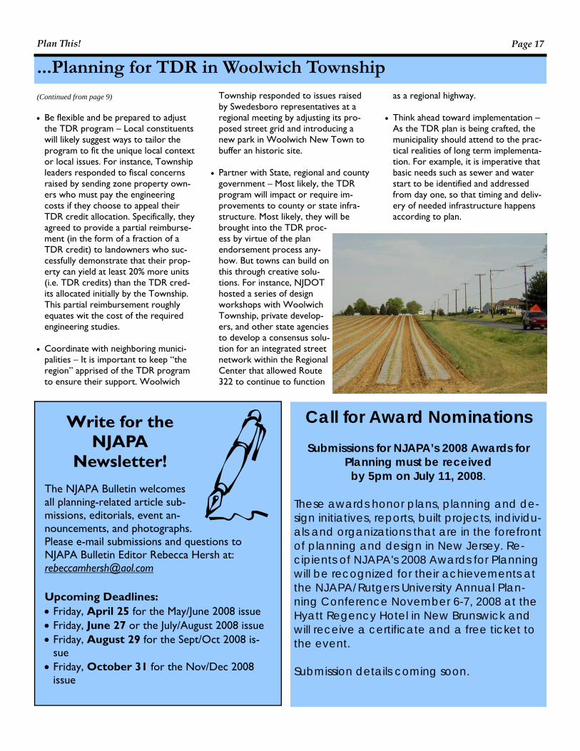
Write for the NJAPA
Newsletter! The NJAPA Bulletin welcomes all planning-related article sub-missions, editorials, event an-nouncements, and photographs. Please e-mail submissions and questions to NJAPA Bulletin Editor Rebecca Hersh at: [email protected] Upcoming Deadlines: • Friday, April 25 for the May/June 2008 issue • Friday, June 27 or the July/August 2008 issue • Friday, August 29 for the Sept/Oct 2008 is-
sue • Friday, October 31 for the Nov/Dec 2008
issue
...Planning for TDR in Woolwich Township
• Be flexible and be prepared to adjust
the TDR program – Local constituents will likely suggest ways to tailor the program to fit the unique local context or local issues. For instance, Township leaders responded to fiscal concerns raised by sending zone property own-ers who must pay the engineering costs if they choose to appeal their TDR credit allocation. Specifically, they agreed to provide a partial reimburse-ment (in the form of a fraction of a TDR credit) to landowners who suc-cessfully demonstrate that their prop-erty can yield at least 20% more units (i.e. TDR credits) than the TDR cred-its allocated initially by the Township. This partial reimbursement roughly equates wit the cost of the required engineering studies.
• Coordinate with neighboring munici-
palities – It is important to keep “the region” apprised of the TDR program to ensure their support. Woolwich
(Continued from page 9) Township responded to issues raised by Swedesboro representatives at a regional meeting by adjusting its pro-posed street grid and introducing a new park in Woolwich New Town to buffer an historic site.
• Partner with State, regional and county
government – Most likely, the TDR program will impact or require im-provements to county or state infra-structure. Most likely, they will be brought into the TDR proc-ess by virtue of the plan endorsement process any-how. But towns can build on this through creative solu-tions. For instance, NJDOT hosted a series of design workshops with Woolwich Township, private develop-ers, and other state agencies to develop a consensus solu-tion for an integrated street network within the Regional Center that allowed Route 322 to continue to function
as a regional highway. • Think ahead toward implementation –
As the TDR plan is being crafted, the municipality should attend to the prac-tical realities of long term implementa-tion. For example, it is imperative that basic needs such as sewer and water start to be identified and addressed from day one, so that timing and deliv-ery of needed infrastructure happens according to plan.
Call for Award Nominations
Submissions for NJAPA’s 2008 Awards for Planning must be received by 5pm on July 11, 2008.
These awards honor plans, planning and de-sign initiatives, reports, built projects, individu-als and organizations that are in the forefront of planning and design in New Jersey. Re-cipients of NJAPA's 2008 Awards for Planning will be recognized for their achievements at the NJAPA/Rutgers University Annual Plan-ning Conference November 6-7, 2008 at the Hyatt Regency Hotel in New Brunswick and will receive a certificate and a free ticket to the event. Submission details coming soon.
Plan This! Page 17
Volume 6, Issue 2 Page 18
Call For Sessions 2008 Annual Planning Conference
Hyatt Regency Hotel
New Brunswick, New Jersey November 6 – 7, 2008
New Jersey Chapter of the American Planning Association
and Edward J. Bloustein School of Planning and Public Policy at Rutgers, The State University of New Jersey
Session Proposals Due June 16, 2008 Send submissions to: Rebecca Hersh, AICP/PP Phone: 609-915-5365 Email: [email protected] All proposals MUST include: 1. Session Title 2. A brief (1-2 paragraphs) description of the session 3. Proposed speakers and moderators 4. Session coordinator/moderator contact information 5. How the session will meet AICP Certification Maintenance (CM) criteria
• The content of CM activities must be designed to meet a specific planning-related training objective. • The content of CM activities must be designed to teach subjects in appropriate depth and scope for
the level of the typical AICP member (i.e. a planner in current practice with at least two years of pro-fessional experience). Note: Activities that are intended for planning commissioners are not eligible.
• The content of CM activities must be unbiased and non-promotional. An organization's services or products may be discussed prior to or after the completion of the CM credit portion of the activity.
• The content of CM activities must address demonstrated educational needs of AICP members. • The content of CM activities must communicate a clearly identified educational purpose or objective. • Activities must be led by one or more experts on the subject discussed during the activity. An expert is
defined by APA as a professional who has made a contribution to the profession through practice, teaching, research, or publications; completed works that proclaim individuality and mastery of the principles of planning taught; and whose work demonstrates outstanding quality and professionalism.
• CM activities must use learning methodologies and formats that are appropriate to the activity's edu-cational purpose or objectives.
Sessions that do not contain this information will not be considered. Tips for Successful Sessions • Provide a discussion groups/exchange format rather than a lecture • Focus on findings, not on process • Be ready to provide contact information session notes, and handouts to all attendees • Focus on best practices that can be applied in other localities • Present tangible issues (as opposed to research results) • Use expert speakers • Visual (PowerPoint) presentations Note: All session speakers, moderators and panelists must register and pay for the conference.
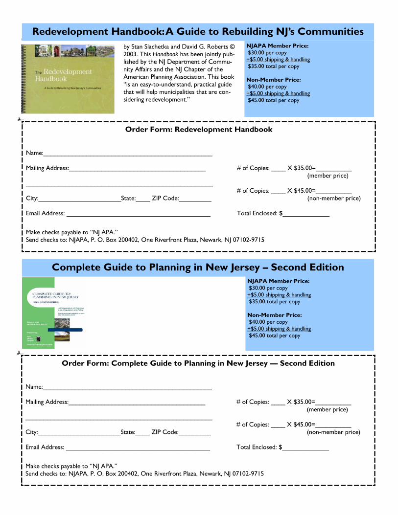
by Stan Slachetka and David G. Roberts © 2003. This Handbook has been jointly pub-lished by the NJ Department of Commu-nity Affairs and the NJ Chapter of the American Planning Association. This book “is an easy-to-understand, practical guide that will help municipalities that are con-sidering redevelopment.”
Redevelopment Handbook: A Guide to Rebuilding NJ’s Communities NJAPA Member Price: $30.00 per copy +$5.00 shipping & handling $35.00 total per copy Non-Member Price: $40.00 per copy +$5.00 shipping & handling $45.00 total per copy
Order Form: Redevelopment Handbook Name:_______________________________________________ Mailing Address:______________________________________ # of Copies: ____ X $35.00=__________ (member price) ____________________________________________________ # of Copies: ____ X $45.00=__________ City:_______________________State:____ ZIP Code:_________ (non-member price) Email Address: ________________________________________ Total Enclosed: $_____________
Make checks payable to “NJ APA.” Send checks to: NJAPA, P. O. Box 200402, One Riverfront Plaza, Newark, NJ 07102-9715
Complete Guide to Planning in New Jersey – Second Edition NJAPA Member Price: $30.00 per copy +$5.00 shipping & handling $35.00 total per copy Non-Member Price: $40.00 per copy +$5.00 shipping & handling $45.00 total per copy
Order Form: Complete Guide to Planning in New Jersey — Second Edition Name:_______________________________________________ Mailing Address:______________________________________ # of Copies: ____ X $35.00=__________ (member price) ____________________________________________________ # of Copies: ____ X $45.00=__________ City:_______________________State:____ ZIP Code:_________ (non-member price) Email Address: ________________________________________ Total Enclosed: $_____________
Make checks payable to “NJ APA.” Send checks to: NJAPA, P. O. Box 200402, One Riverfront Plaza, Newark, NJ 07102-9715

Volume 6, Issue 2 Page 20
Zoning for Successful TDR Programs
Reprinted by permission of the Ameri-can Planning Association. All rights reserved. This article appeared in the December issue of “Zoning Practice”. It provides a good historical perspective and national examples of TDR, as well as tips for implementing TDR. Please note, how-ever, that some information contained in this article may not be relevant to TDR in NJ. The State TDR Act (N.J.S.A. 40:55D-137 et seq.) should be refer-enced when pursuing TDR in NJ. Good development design and the protec-tion of large areas of farmland, open space, and natural areas are two primary goals of smart growth. Yet achieving these goals in a common process is often elusive. Since the late 1960s, the transfer of development rights has held considerable promise for preserving rural landscapes by moving de-velopment potential from the countryside into designated growth areas. To date, thousands of TDR transactions have oc-curred, but not as many as some propo-nents might have hoped. A major obstacle to the creation of effec-tive TDR programs has been local zoning. A local government’s by-right zoning may allow ample development opportunities for developers who choose not to acquire TDRs, and local elected officials may choose to grant greater densities through bonus zoning without requiring that devel-opers acquire and apply TDRs. Also, devel-opers may be wary of encountering bu-reaucratic and procedural delays if they propose a development that uses TDRs, compared to a development that simply
follows by-right zoning. Within designated growth areas, local residents may oppose increased densities that come with devel-opments that use TDRs, for fear that the increased density will not be well designed, will result in more congestion, and will reduce property values. In areas designated for resource protection, rural landowners may resist suggested downzonings that may be used in conjunction with TDRs because they perceive a loss in property values. There are several ways local governments can use the zoning ordinance to create effective TDR programs. But first it is im-portant to understand how the TDR proc-ess works. WHAT IS A TRANSFERABLE DE-VELOPMENT RIGHT AND HOW DOES IT WORK? A transferable development right is the right to create a residential building lot or to construct a dwelling unit or build addi-tional square footage onto a commercial, industrial, or residential structure. A TDR is not one of the rights that come with property ownership. A TDR must be cre-ated through state enabling legislation and a local ordinance to allow a landowner to transfer a development right to another parcel owned by someone else. A local government creates a market in develop-ment rights between landowners in desig-nated preservation areas (sellers) and de-velopers (buyers) who can then use the TDRs to build at a higher density in the designated growth areas. A local government creates a TDR pro-gram through four main steps. First, the
By Tom Daniels local government identifies one or more sending areas from which TDR will be moved and gives landowners in the sending areas a certain number of TDRs. For in-stance, Montgomery County, Maryland, gave landowners in its sending area one TDR for every five acres owned. So a land-owner who had 100 acres received 20 TDRs. This allocation formula, together with the size of the sending areas, deter-mines the total potential number of TDRs available. Next, the local government must identify one or more receiving areas that could accommodate higher density development than currently exists in the receiving area. Then the local government determines how many TDRs a developer must acquire from one or more landowners in the send-ing areas in order to receive approval for increased density. For instance, Montgom-ery County allowed one additional dwell-ing unit on an acre for each TDR a devel-oper purchased and applied to a residential development project in the receiving area. The local government must set a maximum for the total potential number of TDRs that can be applied in the receiving areas, thus establishing the maximum amount of development those receiving areas can accommodate. Finally, the local govern-ment must set up a process for: • confirming the use of TDRs by a devel-
oper; • placing a conservation easement on
lands in the sending area from which TDRs have been sold; and
• keeping track of how many TDRs land-owners in the sending areas still have.
A developer will need to execute a deed of transferable development rights to show that TDRs have been severed and pur-chased from a property in the sending area. A conservation easement is a legally binding contract between the landowner and the local government, stating the re-strictions (for example, agricultural, for-estry, or open space land uses) that apply to the property. The property is still pri-vately owned, and there is usually no right of public access. In sum, a local government creates a mar-
ket for TDRs by assigning a certain number of TDRs to landowners in sending (or preservation) areas and requiring develop-ers who want to build at higher than by-right densities in receiving (or growth) areas to purchase TDRs from landowners in the sending areas. The price of the TDRs is established through negotiations between a willing buyer and a willing seller, like an ordinary real estate transaction. A key feature of successful TDR programs is continued demand for TDRs from devel-opers who see potential profits from pur-chasing TDRs and using them to develop projects in the receiving areas. One reason that TDR programs have not worked well in rural areas is that there is often insuffi-cient development activity and little de-mand from developers for TDRs.
An overall rule of thumb is that at the start of a TDR pro-gram there should be twice as many receiv-ing sites for TDRs as there are TDRs to send from the sending areas. This will help
ensure that TDRs have a value. Another reason that TDR programs have a poor track record in rural areas is that there are usually many more TDRs in the sending areas than there are places to use them in the receiving area. This oversupply of TDRs drives down prices and discourages landowners in the sending areas from sell-
ing TDRs. PUTTING THE TDR PROGRAM IN THE ZONING ORDI-NANCE The local government can create a separate TDR ordinance, but a better approach is to include it as part of the local zoning code. Be-cause a comprehensive plan sets the legal foundation for the zon-ing ordinance or TDR program, a local government should first amend its com-prehensive plan to reflect the identified sending and receiving areas. To add a TDR program to the zoning ordi-nance involves several changes. First, new definitions must be added to reflect the language of the TDR program, such as definitions for transferable development rights, sending area, receiving area, deed of transferable development rights, and deed of easement. Next, the TDR option must be added to the list of permitted uses in the zoning districts that are the designated sending areas, along with the minimum size parcel eligible for TDRs, the TDR alloca-tion method, and the procedures for le-gally severing TDR and using a conserva-tion easement to permanently preserve the sending area property. Then the TDR option must be added to the list of permit-ted uses, special exceptions, or conditional uses within the zoning districts that com-prise the receiving areas. Although developers may prefer by-right zoning for the use of TDRs, the conditional use process allows the governing body to impose conditions for approval to address development impacts that may affect the community. The conditional use process
also allows the local government greater discretion than simply subjecting a TDR re-ceiving area develop-ment to subdivision and land development stan-dards. In short, the zoning ordinance can require a conditional use process for new developments that use TDRs in the receiving areas, and describe the process for approval of a development that uses TDRs. For instance,
once a conditional use permit has been granted, a local government could waive the preliminary land development plan and go straight to the final plan stage. This in effect grants the developer vested rights in the development, and final approval is mainly a formality. The zoning ordinance
should include: a. a purpose clause, explaining the reason
for establishing the TDR ordinance; b. the authorization for the TDR ordinance
in the state enabling legislation, and a basic explanation of the TDR program;
c. the procedure for sale of TDRs from a sending area, including a definition of the send ing area, how TDRs are calculated, procedures for severing TDRs from land in the sending area, and the conservation easement that is applied to land from which TDRs have been severed;
d. how TDRs can be used in a receiving area, including a definition of the receiv-ing area, how the use of TDRs is calcu-lated, design requirements and changes to base zoning standards (area and bulk standards), and the conditional use proc-ess and the land development and subdi-vision plan process for approval of a development that uses TDRs; and
e. definition in the ordinance spelling out whether the TDR program is mandatory or voluntary. Most are voluntary, allow-ing a landowner the choice of selling off a certain number of building lots and selling a certain number of TDRs. (Under a mandatory program, such as at Lake Tahoe, Nevada, a landowner may not be allowed to build on the property, but can still sell TDRs.)
HOW CAN THE TDR PROGRAM AVOID ZONING OBSTACLES? A TDR program blends financial incentives with planning and zoning. For a TDR pro-gram to be effective, developers need to recognize that their use of TDRs will result in better financial returns than develop-ments that meet only by-right zoning. Lo-cal officials are often eager to encourage development in designated growth areas and may grant developers bonus density in return for certain design features or infra-structure. For TDR programs to work, local officials cannot “give away” density in designated receiving areas. Any increase in
(Continued on page 22)
A local government creates a market for TDRs by assigning a certain number of TDRs to landowners in sending areas and requiring developers in receiving areas to purchase TDRs from landowners in the sending areas.
Developers need to recognize that their use of TDRs will re-sult in better finan-cial returns than de-velopments that meet only by-right zoning.

Volume 6, Issue 2 Page 22
density through a rezoning in a receiving area must require the developer to acquire and apply development rights. This re-quirement can be spelled out in the zoning ordinance. Local governments may find that there is some trial and error involved in setting byright zoning in the send-ing and receiving areas and as bonus densities in the receiving areas. Don’t be afraid to make changes. Over time the TDR program may require occasional ad-justments to the zoning ordinance to re-spond to changing conditions in the real estate market, changes in the comprehen-sive plan, or density or land-use provisions that did not produce the intended out-comes. Calvert County, Maryland, began the na-tion’s first county-level TDR program to preserve open space in 1978. Part of the program has featured a single-zone TDR in which the sending area and the receiving area are the same. Calvert County started with an existing zoning density standard that allowed one house per five acres and allowed one house per 2.5 acres in its Ru-ral Community districts with the purchase of TDRs. In 1999 the county attempted to slow development by downzoning its Rural Community districts to one house per 10 acres, but allowed up to one house per two acres with the purchase of TDRs. Then, in 2003, in the face of continued growth pressures, the county again down-zoned the Rural Community districts to one house per 20 acres, allowing only one house per four acres with the purchase of TDRs (see McConnell et al,2007). A TDR program can incorporate bonus zoning through the use of multipliers. Mul-tipliers are bonus TDRs that reward devel-opers for building desirable developments in the receiving areas. For example, St. Lucie County, Florida, gave one TDR per acre to landowners in its sending area be-cause the underlying zoning is one dwelling unit per acre. A developer who buys a
(Continued from page 21) TDR can obtain a TDR bonus of 1.5 addi-tional TDRs for each TDR purchased by building workforce housing (based on 80 to 120 percent of the median area house-
hold income), build-ing higher education facilities, building a research and devel-opment park, or attracting a “targeted industry,” such as an electron-ics manufacturer. Developers want as much certainty as
possible in the development process. Thus, expedited rezoning and subdivision and land development reviews are important to encourage developers to use TDRs. West Lampeter Township in Lancaster County, Pennsylvania, requires a developer to apply for a conditional use permit when proposing a development that uses TDRs. The conditional use process means that the elected officials will have to vote on the project. Once the project receives conditional use approval, the township will waive the preliminary plan review and go straight to final plan review. This waiver in effect grants a developer vested rights in the project. One way to keep property owners in re-ceiving areas mollified is to use a form-based code. Ultimately, a form-based code is easier to do if the receiving area is a greenfield site. St. Lucie County has incor-porated form-based code elements into its land development regulations, which relate to the TDR ordinance. The ordinance won an Award of Excellence from the Florida Chapter of the American Planning Associa-tion in 2006 and an award from the Form-Based Codes Institute in 2007. The county’s land development regulations include, for example: • The development shall incorporate prin-ciples of Traditional Neighborhood Design, including a mix of land uses, a mix of build-ing types, a mix of housing for different income levels, a pedestrian-friendly block and street network, and a significant amount of public open space. • Neighborhood size shall be scaled upon a
five-minute walk radius (approximately 0.25 mile) or a total area of 125 acres, as measured from the Neighborhood Center. • Each neighborhood shall have well-defined edges, and range from 80 to 150 acres in size. The shape or form of the neighborhood is flexible, provided that the 0.25-mile radius benchmark for scale is maintained. • A neighborhood shall provide a variety of dwelling unit types and prices that support a broad range of family sizes and incomes. • A neighborhood shall contain at least one civic building, such as a school, social cen-ter, fire or police station. • A neighborhood shall contain at least one local store. • Blocks shall be scaled to accommodate a variety of building types. • A neighborhood shall have an intercon-nected network of public streets designed to balance the needs of all users, including pedestrians, bicyclists, and motor vehicle operators (Treasure Coast Regional Plan-ning Council, 2006b). Warwick Township in Lancaster County, Pennsylvania, created a dual-zone TDR program to preserve farmland in the send-ing areas but tied it to the expansion of commercial and industrial space in its re-ceiving area. The increased development in the receiving area thus expands the local property tax base without adding school-age children. This produces a net revenue gain for the township. The Campus Indus-trial Zone receiving area is 167 acres. The township zoning allows only 10 percent maximum lot coverage by-right. For each TDR that a landowner/developer acquires, another 4,000 square feet of lot coverage is allowed, up to a maximum of 70 percent coverage. The township has preserved nearly 1,000 acres of farmland through its TDR program, which got a major boost when a regional hospital decided to locate in the Campus Industrial Zone and needed to purchase more than 100 TDRs. Downzoning in sending areas has been a major obstacle to creating effective TDR programs. One way that local governments have attempted to minimize the effects of downzoning is to create single zones that serve as both the sending and receiving areas. In a single-zone TDR, the transfer of development rights rearranges develop-
...Zoning for Successful TDR Programs
One way that local govern-ments have attempted to minimize the effects of downzoning is to create single zones that serve as both the sending and re-ceiving areas.
ment, often to cluster the development and maintain some open space. This is primarily a rural residential strategy. The by-right zoning in a single-zone TDR pro-gram generally uses a density standard, so that one house lot may be developed for every certain number of acres. For in-stance, if the density standard is one house per five acres and a landowner has 20 acres, then the landowner could create four building lots by right. The landowner could purchase a TDR from another prop-erty and create an additional lot, for a total of five lots on the 20 acres, but some of the open land, such as 50 percent or 10 acres, would be placed under a conserva-tion easement restricting future develop-ment. Farmland protection zoning of one house per 20 acres (or more) is rarely used in a single-zone TDR. The single-zone TDR is not a recom-mended method for several reasons. First, it encourages more people to move out to the countryside and live in automobile-dependent developments. In other words, this new development adds to sprawl, though perhaps in a more attractive set-ting. Second, the additional development is likely to lead to increased conflicts with nearby farm operations. And third, it en-courages greater use of on-site septic sys-tems, which contribute to groundwater pollution. In Maryland, for example, there are 14 county TDR programs, of which only Montgomery County uses a dual zone that clearly separates sending and receiving areas. Montgomery County downzoned its rural area from one house per five acres to one per 25 and then gave each landowner in the sending area one TDR per five acres. St. Lucie County adopted a single-zone TDR program, but requires that a land-owner or two or more landowners have a minimum of 500 acres and develop their land in a new urbanist town or village. In return, the county agrees to provide cen-tral sewer and water service, even to new towns or villages outside the county’s ur-ban service boundary. Take the case of an owner of a 500-acre parcel outside the USB who proposes to build a new village development: • The landowner must set aside at least 75 percent of the site as open space. • The minimum density is five dwelling units per acre, so the 125 acres of devel-opment land must support at least 625 dwelling units, of which 50 units (eight
percent) must be Workforce Housing units. • Transferable development rights moved from the open space for use as Workforce Housing receive a multiplier of 2.5. The remaining land set aside for open space receives a multiplier of 1.25. • The landowner can receive additional TDR multipliers (bonuses) by attracting a target industry, institution of higher learn-ing, or a research facility. TDRS: THE NEXT GENERATION The next generation of TDRs will feature the transfer of development rights across political jurisdictions and landscape-scale preservation. TDR programs may provide a way to encourage greater regional coop-eration, especially in the Northeast, where townships control planning and zoning. In 2000, the State of Pennsylvania author-ized the use of TDRs across municipal boundaries if the municipalities have a written intergovernmental agreement or have adopted a multimunicipal plan. Even though dozens of multimunicipal plans have been completed, to date, no TDRs have moved from one municipality to another. An obvious problem: Why would one mu-nicipality want to provide space for an-other’s development? In 2004, the State of New Jersey passed legislation allowing the transfer of develop-ment rights not only across municipal boundaries but from a sending area any-where in the state to a receiving area any-where in the state. New Jersey is propos-ing to use transfer of development rights as a key tool in preserving the NJ High-lands. King County, Washington, has preserved more than 92,000 acres since 1999, mainly through a single transaction that enabled it to put many TDRs in its bank. In 2004, the county paid $22 million for TDRs from a 90,000-acre tract owned by Hancock Tim-ber Resource Group. Development rights can be transferred to inside Seattle’s urban growth boundary to allow taller buildings in down town Seattle, or for a 50 percent increase in the number of homes allowed in some unincorporated parts of the county. For instance, in 2006, R.C. Hedreen Co. paid $930,000 to King County’s TDR Bank for 31 rural develop-ment rights. In exchange, the company was allowed to add 62,000 square feet of resi-dential space and increase the height of a building it owned above 300 feet.
THE LEGALITY OF TDRS
The concept of transferable devel-opment rights came into practice in 1968 when New York City adopted a TDR program in the form of transferable air rights to protect historic landmarks (Preutz 1997). In 1978, the U.S. Supreme Court upheld New York City’s transferable air rights pro-gram and found that the owners of Grand Central Station could earn a reasonable profit by trans-ferring development potential above the station to another site in the city. That is, the owners of Grand Central could build higher than the zoning height limit would normally allow on another site (see Penn Central Transp. v. New York City, 438 U.S. 104 (1978)). TDRs have drawn the interest of elected local officials because of the potential to avoid the Fifth Amendment takings issue that has plagued proposals to down-zone property as a way to man-age growth. Thus far, the courts have not given definitive direction on the legality of using TDRs as just compensation. In Suitum v. Tahoe Regional Planning Agency, 96 U.S. 243 (1997), the U.S. Su-preme Court ruled that the plain-tiff, Mrs. Suitum, did not have a “ripe” situation because she had not tried to sell her TDRs and had not determined what they were worth. In Williamstown County Regional Planning Commission v. Hamilton Bank of Johnson City, 473 U.S. 172 (1985), the Supreme Court ruled that “if a State provides an adequate procedure for seeking just compensation, the property owner cannot claim a violation of the Just Compensation Clause [of the Fifth Amendment] until it has used the procedure and been de-nied just compensation.” In short, the role of TDRs as “just compen-sation” has not been fully re-solved by the courts.
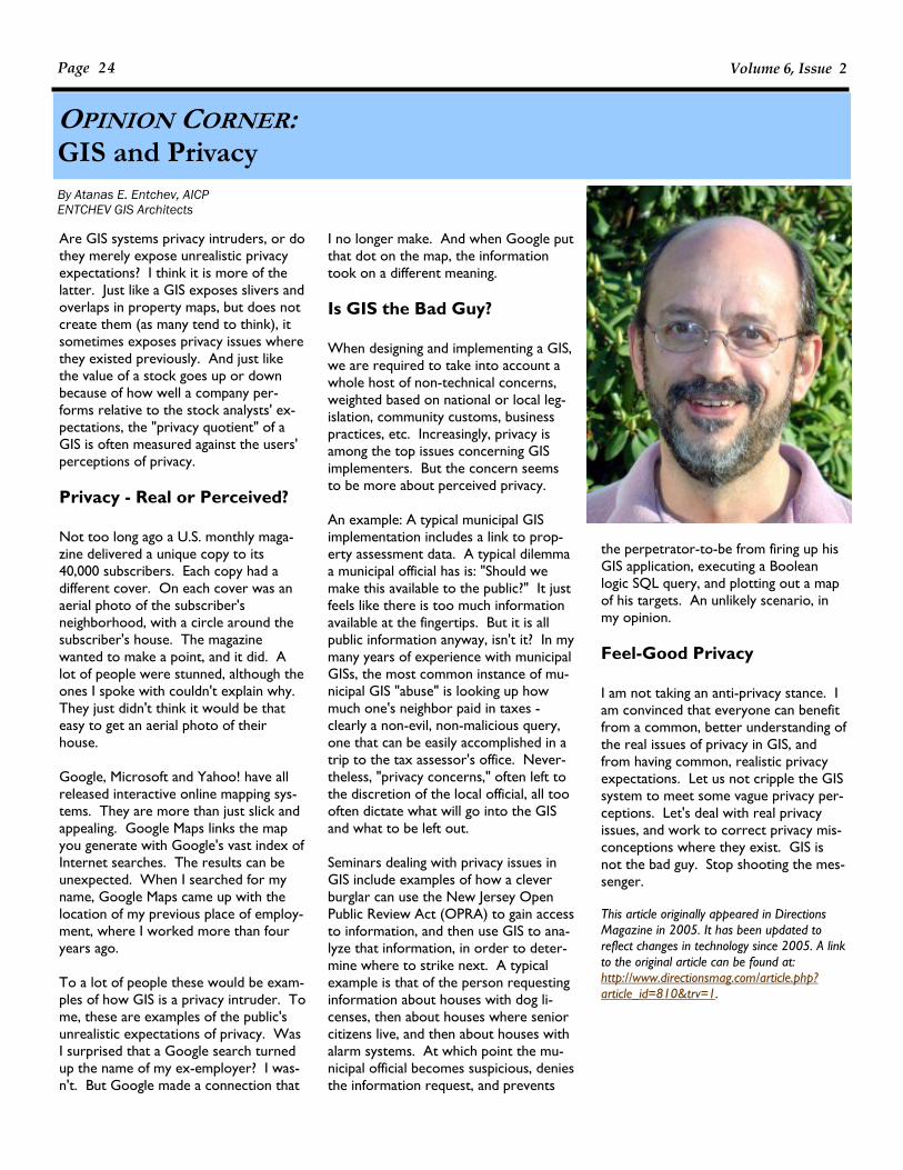
Volume 6, Issue 2 Page 24
OPINION CORNER: GIS and Privacy
Are GIS systems privacy intruders, or do they merely expose unrealistic privacy expectations? I think it is more of the latter. Just like a GIS exposes slivers and overlaps in property maps, but does not create them (as many tend to think), it sometimes exposes privacy issues where they existed previously. And just like the value of a stock goes up or down because of how well a company per-forms relative to the stock analysts' ex-pectations, the "privacy quotient" of a GIS is often measured against the users' perceptions of privacy. Privacy - Real or Perceived? Not too long ago a U.S. monthly maga-zine delivered a unique copy to its 40,000 subscribers. Each copy had a different cover. On each cover was an aerial photo of the subscriber's neighborhood, with a circle around the subscriber's house. The magazine wanted to make a point, and it did. A lot of people were stunned, although the ones I spoke with couldn't explain why. They just didn't think it would be that easy to get an aerial photo of their house. Google, Microsoft and Yahoo! have all released interactive online mapping sys-tems. They are more than just slick and appealing. Google Maps links the map you generate with Google's vast index of Internet searches. The results can be unexpected. When I searched for my name, Google Maps came up with the location of my previous place of employ-ment, where I worked more than four years ago. To a lot of people these would be exam-ples of how GIS is a privacy intruder. To me, these are examples of the public's unrealistic expectations of privacy. Was I surprised that a Google search turned up the name of my ex-employer? I was-n't. But Google made a connection that
I no longer make. And when Google put that dot on the map, the information took on a different meaning. Is GIS the Bad Guy? When designing and implementing a GIS, we are required to take into account a whole host of non-technical concerns, weighted based on national or local leg-islation, community customs, business practices, etc. Increasingly, privacy is among the top issues concerning GIS implementers. But the concern seems to be more about perceived privacy. An example: A typical municipal GIS implementation includes a link to prop-erty assessment data. A typical dilemma a municipal official has is: "Should we make this available to the public?" It just feels like there is too much information available at the fingertips. But it is all public information anyway, isn't it? In my many years of experience with municipal GISs, the most common instance of mu-nicipal GIS "abuse" is looking up how much one's neighbor paid in taxes - clearly a non-evil, non-malicious query, one that can be easily accomplished in a trip to the tax assessor's office. Never-theless, "privacy concerns," often left to the discretion of the local official, all too often dictate what will go into the GIS and what to be left out. Seminars dealing with privacy issues in GIS include examples of how a clever burglar can use the New Jersey Open Public Review Act (OPRA) to gain access to information, and then use GIS to ana-lyze that information, in order to deter-mine where to strike next. A typical example is that of the person requesting information about houses with dog li-censes, then about houses where senior citizens live, and then about houses with alarm systems. At which point the mu-nicipal official becomes suspicious, denies the information request, and prevents
By Atanas E. Entchev, AICP ENTCHEV GIS Architects
the perpetrator-to-be from firing up his GIS application, executing a Boolean logic SQL query, and plotting out a map of his targets. An unlikely scenario, in my opinion. Feel-Good Privacy I am not taking an anti-privacy stance. I am convinced that everyone can benefit from a common, better understanding of the real issues of privacy in GIS, and from having common, realistic privacy expectations. Let us not cripple the GIS system to meet some vague privacy per-ceptions. Let's deal with real privacy issues, and work to correct privacy mis-conceptions where they exist. GIS is not the bad guy. Stop shooting the mes-senger. This article originally appeared in Directions Magazine in 2005. It has been updated to reflect changes in technology since 2005. A link to the original article can be found at: http://www.directionsmag.com/article.php?article_id=810&trv=1.
This list of the top ten planning websites appears on the website Planetizen. Each year Planetizen compiles a list of the top planning websites of the year. This year’s list, as well as lists from previous years, can be found at: http://www.planetizen.com/websites/2008. Planetizen’s annual list of the 10 best planning, design and development websites (along with a few honorable mentions) represents some of the top web resources for those interested in planning, design, and development. This list is based on nominations by Planetizen readers and staff, and judged against a common set of criteria, including stan-dards of web accessibility. Please contact Planetizen at [email protected] if you have nominations for next year's list. City of Sound www.cityofsound.com The engrossing posts on this blog cover topics as various as singing roads and Antarctic substations – but somehow they all connect back to the shared themes of cities, architecture, design, media and culture. Penned by Dan Hill, a Swiss-born Englishman living in Sydney, Australia, City of Sound is consistently well-written, thoughtful, and surprising. Honorable Mention: WebUrbanist -- another standout blog that blends cities and culture. Florida Housing Data Clearinghouse Shimberg Center for Affordable Housing, Univ. of Florida flhousingdata.shimberg.ufl.edu The Florida Housing Data Clearinghouse website is a great example for agencies who want to provide access to relevant data and statistics. Visitors to the site are greeted with a map of the state, and can drill down into individual cities and counties to retrieve figures affecting the availability of affordable housing. Users can find population growth projections, new construction and sales data, and housing and wage trends with data access tools that allow comparisons by jurisdiction. Honorable Mention: Urban Design Tools - Low Impact Development -- a useful site for planners looking to learn more about stormwater managment techniques. NYC/London Interactive Transit Map brail.org/transit/ These two web tools by software developer Gregory J. Brail combine transit data and Google Maps to create the easiest way yet to figure out how to get somewhere using public transit in New York and Lon-don. By clicking (or typing in the address) of your starting point and destination, these interactive transit maps instantly plot the shortest travel route using each city's underground metro. Even Google's own Transit website doesn't provide such easy point-and-click trip planning. Ourbania www.ourbania.com Ourbania is a fun, interactive site that lets you explore the world through buildings. Supported by an online community of "real estate enthusiasts," the site encourages visitors to post information about real life structures - from bridges to skyscrapers. Users can add photos and notes, and plot a building's location using a Google-powered map. Like the design of certain building? Visitors can find out the architect, and see what other buildings they might have designed (provided they are uploaded to the site). With a large base of international members, Ourbania lets anyone who's interested in buildings connect.
Post Carbon Cities www.postcarboncities.net With global warming on the minds of the people in charge of managing cities, many officials are looking to learn about sustainable urban poli-cies and practices. Post Carbon Cities has taken up the challenge of helping local governments understand and respond to the challenges of peak oil and global warming by bringing together a valuable set of re-sources on energy and climate change. The site's blog provides over-views and advice on topics such as green building and transit-oriented development. A Planetizen reader favorite. Rethink College Park www.rethinkcollegepark.net/blog David Daddio and Rob Goodspeed, two planning students at the Uni-versity of Maryland, wanted to put their planning and technology skills to work to help the college town of College Park, Maryland. The result is Rethink College Park, a website that provides community members with information on plans in the community, as well as a way to discuss proposals. The site features a blog and an interactive development map that plots development projects and proposed transit routes. Honorable Mention: Ballpark and Beyond -- another great citizen planner-driven blog tracking development in their community. StreetsBlog NYC Streets Renaissance/Open Planning Project www.streetsblog.org StreetsBlog provides unparalleled coverage of transportation and plan-ning issues in New York City, making it the envy of transportation advocates in cities across the country. Part of the NYC Streets Ren-aissance Campaign sponsored by the Open Planning Project, the web-site supports the group's efforts to reorient the city's transportation policies away from the car and towards cyclists and pedestrians. Daily updates on issues from congestion and parking pricing to road and sidewalk design make StreetsBlog a must read for anyone who's inter-ested in creating sustainable transportation policies. Survey LA Office of Historic Resources, Dept. of City Planning, City of L.A. preservation.lacity.org/survey The SurveyLA website is part of the City of Los Angeles' Historic Re-sources Survey – a five-year effort partially funded by the Getty Foun-dation to identify all the historically significant buildings and structures in the city. In addition to providing information about the project to the public, the site allows visitors to participate in the multi-year plan-ning effort by identifying historic resources through an online sur-vey. In addition, visitors can search for surveyed properties and view images of the city's historic and cultural landmarks. Full disclosure: Planetizen's parent company, Urban Insight, was hired by the City of L.A. and the Getty Foundation to develop the SurveyLA website. Trulia Hindsight hindsight.trulia.com A side project of the real estate site Trulia.com, Hindsight uses home sales data to create animated maps of development over time. Using color coded dots on the street grids of urban areas, visitors can watch as the population of Plano, Texas doubles in a decade and examine the effect of growth controls on towns like Bolinas, CA. You'll be hard pressed to find a more vivid portrait of how cities grow. Walk Score www.walkscore.com Looking to find a house where you don't have to get in your car every time you want to get a gallon of milk? That's where Walk Score comes in. Enter your address, and it finds the distance to the nearest grocery stores, post offices, restaurants, libraries, movie theaters and other destinations, and then assigns a score based on the walkability of your location. Walk Score is the perfect tool for anyone looking to find a home or office in a walkable neighborhood.

Traffic Engineers & Transportation Planners
MBE Certified www.eng-wongtaub.com
• Traffic Engineering • Transportation Planning • Master Planning • Pedestrian, Bicycle & Parking • Traffic Simulation & Analysis • Transit Studies & Traffic Safety
One Gateway Center, 26th Fl. Newark, NJ 07102 (973) 693-4488
Volume 6, Issue 2 Page 26
CONSULTANT DIRECTORY
To place an event announcements classified ad, consultant directory ad, single insertion ad, RFP, RFQ, or other notice in the NJAPA newsletter, please contact Chapter Administrator Michael Levine at [email protected] or (973) 286-4708.
CONSULTANT DIRECTORY
Plan This! Page 27
To place an event announcements classified ad, consultant directory ad, single insertion ad, RFP, RFQ, or other notice in the NJAPA newsletter, please contact Chapter Administrator Michael Levine at [email protected] or (973) 286-4708.

Sign up for APA’s 2008 National Planning Conference in Las Vegas Come to the 100th annual planning conference in Las Vegas, Nevada from Sunday April 27 to Thursday May 1, 2008. Enjoy 200-plus conference sessions, mobile workshops, training seminars, and networking op-portunities in a city that is tackling a wide range of planning issues and problems as it continues to grow. For more information, and to register for the conference, visit www.planning.org.
CONSULTANT DIRECTORY
To place an event announcements classified ad, consultant directory ad, single insertion ad, RFP, RFQ, or other notice in the NJAPA newsletter, please contact Chapter Administrator Michael Levine at [email protected] or (973) 286-4708.