First MODIS Images Catalog of Aves Ridge Solitons in the Caribbean Sea (2008-2013)
32
First MODIS Images Catalog of Aves Ridge Solitons in the Caribbean Sea (2008-2013) By Edwin Alfonso-Sosa, Ph.D. Ocean Physics Education, Inc. 2013
Transcript of First MODIS Images Catalog of Aves Ridge Solitons in the Caribbean Sea (2008-2013)

First MODIS Images Catalog of Aves Ridge Solitons in the Caribbean Sea (2008-2013)
By
Edwin Alfonso-Sosa, Ph.D.
Ocean Physics Education, Inc.
2013

2
Overview
Recently, 250-m resolution MODIS images acquired by the Earth Observing System Terra and Aqua Satellites during sunglint conditions allowed
us to survey high-frequency nonlinear internal solitary wave occurrences on a near-global scale (Christopher Jackson, 2007). It is possible to
detect internal solitons packets leaving the generation area during fortuitous conditions: minimum cloud cover, near-specular reflectance
pattern of sunlight off the ocean surface (sunglint) and strong oceanic stratification.
The Rapid Response system was developed to generate user-specified, geo-referenced MODIS Subsets and MODIS Near Real-Time (Orbit Swath)
Images. We acknowledge the use of Rapid Response imagery from the Land Atmosphere Near-real time Capability for EOS (LANCE) system
operated by the NASA/GSFC/Earth Science Data and Information System (ESDIS) with funding provided by NASA/HQ.
Between year 2008 and 2013 we acquired MODIS Aqua/Terra images from the Eastern Caribbean Sea during fortuitous conditions. About 30
images show clear surface patterns associated with internal soliton packets departing from the Aves Ridge, The images KML files in Google Earth
allowed us to measure and characterize the internal wave packets. The displacements of some packets were tracked in sequential images
allowing estimating their speeds (Alfonso-Sosa, 2012). The image catalog shows the following information next to the image. It includes: image
date (UTC), original image file name, inter packets distance (IPD) in kilometers, leader soliton separation distance (LSS) in kilometers, soliton
packet name with suffix, distance from source point in kilometers (Dist.), time period between images in seconds and the speed expressed in
meters per seconds . The suffix corresponds to the image year day. The origin point for our distance measurements was selected at the southern
tip of the prominent Aves crest, the origin coordinates were: 14° 03’ 12” N, 63° 36’ 35” W. Negative Dist values means the wave is located East
of the origin. The first figure show the image crop frames of the interest areas.
References
Alfonso-Sosa, E., 2012. Estimated Speed of Aves Ridge Solitons Packets by Analysis of Sequential Images from the Moderate Resolution Imaging
Spectroradiometer (MODIS) 11 pp. 2.55 MB PDF File.
Christopher Jackson, 2007. Internal wave detection using the Moderate Resolution Imaging Spectroradiometer (MODIS). JOURNAL OF
GEOPHYSICAL RESEARCH, VOL. 112, C11012, doi:10.1029/2007JC004220.

3
Image’s Crop Frame Locations.

4
LesserAntilles.2008260.terra.250m

5
LesserAntilles.2009175.terra.250m
LesserAntilles.2009175.terra.721.250m

6
Date Image IPD LSS Name Dist.
3/29/2010 17:30 LesserAntilles.2010088.aqua.721.250m 107 18 Bejarano088 8.24

7
Date Image IPD LSS Name Dist. Period Speed
3/30/2010 15:05 LesserAntilles.2010089.terra.721.250m 84 15 Bejarano089 92 77700 1.08

8

9
Date Image IPD LSS Name Dist.
4/1/2010 14:55 LesserAntilles.2010091.terra.721.250m 96 6 Corredor -14
10
Date Image IPD LSS Name Dist.
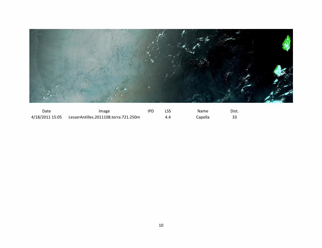
4/18/2011 15:05 LesserAntilles.2011108.terra.721.250m
4.4 Capella 33

11
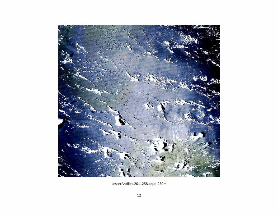
LesserAntilles.2011258.aqua.721.250m
12
LesserAntilles.2011258.aqua.250m

13
5/12/2012 17:30 LesserAntilles.2012133.aqua.721.250m

14
08/19/2012 15:05 LesserAntilles.2012232.terra.721.250m

15
Date Image IPD LSS Name Dist.
9/1/2012 17:30 LesserAntilles.2012245.aqua.721.250m 68 4 Forel 265
9/1/2012 17:30 LesserAntilles.2012245.aqua.721.250m 68 9 Harris 224
9/1/2012 17:30 LesserAntilles.2012245.aqua.721.250m 101 9 Hollander245 120
9/1/2012 17:30 LesserAntilles.2012245.aqua.721.250m 98 7.6 Lopez245 22

16
Date Image IPD LSS Name Dist. Period Speed
9/2/2012 15:15 LesserAntilles.2012246.terra.721.250m 87 7.3 Lopez246 109 78300 1.11
9/2/2012 15:15 LesserAntilles.2012246.terra.721.250m 70 9 Hollander246 190 78300 0.89

17
LesserAntilles.2012246.terra.721.250m

18
LesserAntilles.2012248.terra.250m
19
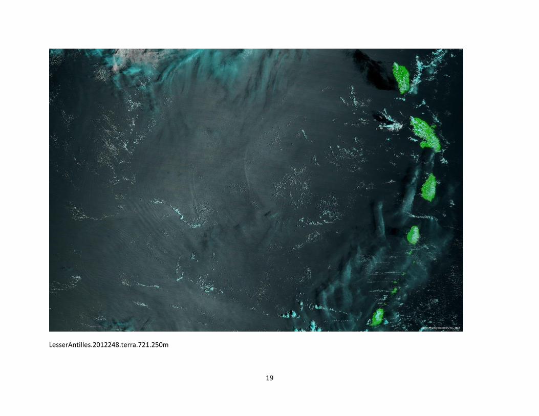
LesserAntilles.2012248.terra.721.250m

20
9/4/2012 15:00 LesserAntilles.2012248.terra.721.250m 134.6 10.97 Lopez248 243.6 171900 0.78
Date Image IPD LSS Name Dist. Period Speed

21
Date Image IPD LSS Name Dist.
9/17/12 17:30 LesserAntilles.2012261.aqua.721.250m
7 Apel261 174

22
Date Image IPD LSS Name Dist. Period Speed
9/18/12 15:10 LesserAntilles.2012262.terra.721.250m 62.96 9.84 Apel262 236.96 78000 0.81
9/18/12 15:10 LesserAntilles.2012262.terra.721.250m
6.24 Chapman262 116.26

23
Date Image IPD LSS Name Dist. Period Speed
9/19/12 17:20 LesserAntilles.2012263.aqua.250m 114.68 4.14 Chapman263 230.94 94200 1.22

24
Date Image IPD LSS Name Dist. Period Speed
9/20/12 15:00 LesserAntilles.2012264.terra.250m 136.55 12.69 Chapman264 367.49 78000 1.75
9/20/12 15:00 LesserAntilles.2012264.terra.250m
Lee Wave -18.69

25
Date Image IPD LSS Name Dist.
11/14/2012 15:05 LesserAntilles.2012319.terra.250m 88.56
Packet4_2012_319_terra 8
11/14/2012 15:05 LesserAntilles.2012319.terra.250m 81.22
Packet3_2012_319_terra 96.56
11/14/2012 15:05 LesserAntilles.2012319.terra.250m
Packet2_2012_319_terra 177.78

26
Date Image IPD LSS Name Dist. Period Speed
11/15/2012 17:15 LesserAntilles.2012320.aqua.250m
Packet6_2012_320_aqua 19.14 11/15/2012 17:15 LesserAntilles.2012320.aqua.250m
Packet5_2012_320_aqua 101.47
11/15/2012 17:15 LesserAntilles.2012320.aqua.250m 164.82
Packet4_2012_320_aqua 172.82 94200 1.75
11/15/2012 17:15 LesserAntilles.2012320.aqua.250m 204.29
Packet3_2012_320_aqua 300.85 94200 2.17
27
Date Image IPD LSS Name Dist.
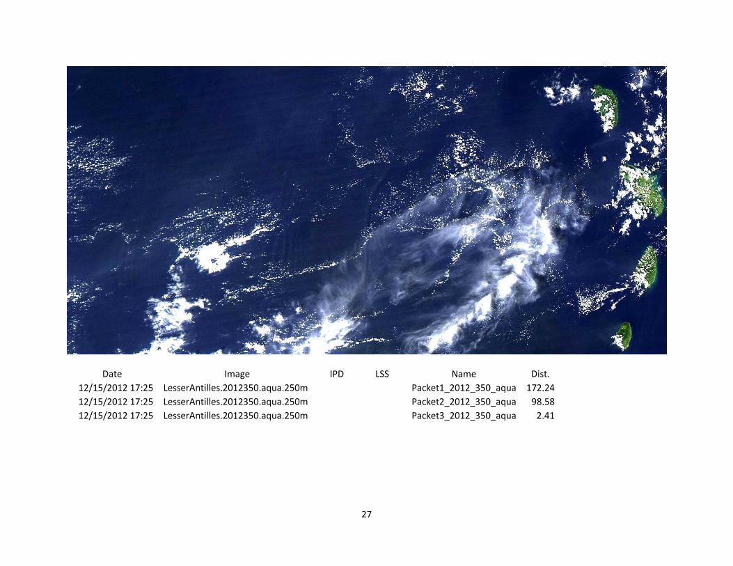
12/15/2012 17:25 LesserAntilles.2012350.aqua.250m
Packet1_2012_350_aqua 172.24
12/15/2012 17:25 LesserAntilles.2012350.aqua.250m
Packet2_2012_350_aqua 98.58
12/15/2012 17:25 LesserAntilles.2012350.aqua.250m
Packet3_2012_350_aqua 2.41

28
Date Image IPD LSS Name Dist. Period Speed
12/16/2012 15:05 LesserAntilles.2012351.terra.250m 152.28
Packet1_2012_351_aqua 324.52 78000 1.95
12/16/2012 15:05 LesserAntilles.2012351.terra.250m 125.99
Packet2_2012_351_aqua 224.57 78000 1.62
12/16/2012 15:05 LesserAntilles.2012351.terra.250m 152.31
Packet3_2012_351_aqua 154.72 78000 1.95

29
Date Image IPD LSS Name Dist.
2/10/2013 17:20 LesserAntilles.2013041.aqua.250m
Packet1_2013_041_aqua -1.89

30
Date Image IPD LSS Name Dist. Period Speed
2/11/2013 15:00 LesserAntilles.2013042.terra.250m 129.49
Packet1_2013_042_terra 127.6 78000 1.66

31
Date Image IPD LSS Name Dist. Period Speed
7/12/13 15:05 LesserAntilles.2013193.terra.721.250m 65.89
78000 0.84

32
LesserAntilles.2013266.terra.250m