Tish statement Stirs [ of Draft Mofement - Summerland Museum
Upload
khangminh22Category
view
0download
0
iÉ~Ç=kbm^=^ÖÉåÅóW=k~íáçå~ä=m~êâ=pÉêîáÅÉI=dêÉ~í=pãçâó=jçìåí~áåë=k~íáçå~ä=m~êâ
`ççéÉê~íáåÖ=^ÖÉåÅáÉëW=cÉÇÉê~ä=eáÖÜï~ó=^Çãáåáëíê~íáçåI=b~ëíÉêå=cÉÇÉê~ä=i~åÇë=eáÖÜï~ó=aáîáëáçåX=qÉååÉëëÉÉ=s~ääÉó=^ìíÜçêáíóX=~åÇ=íÜÉ=råáíÉÇ=pí~íÉë=^êãó=`çêéë=çÑ=båÖáåÉÉêë
aê~Ñí=båîáêçåãÉåí~ä=fãé~Åí=pí~íÉãÉåí=kçêíÜ=pÜçêÉ=oç~Ç=
sçäìãÉ=f=J kçîÉãÄÉê=OMMR

Acronyms – A-1 North Shore Road Draft Environmental Impact Statement
List of Acronyms
AADT annual average daily traffic AAL Acceptable Ambient Levels AASHTO American Association of State Highway and Transportation Officials ACHP Advisory Council on Historic Preservation ADA Americans with Disabilities Act ADT average daily (2-way, 24-hour) traffic AMSL above mean sea level ANSI American National Standard Institute AP acid-producing rock APE area of potential effect ARPA Archaeological Resources Protection Act ASA Acoustical Society of America AST aboveground storage tank ASTM American Society for Testing and Materials AT Appalachian National Scenic Trail ATBI All Taxa Biodiversity Inventory ATC Appalachian Trail Conference BA Biological Assessment BBD beech bark disease BLM Bureau of Land Management BMP best management practice(s) BMT Benton MacKaye Trail BMTA Benton MacKaye Trail Association CAA Clean Air Act CAAA Clean Air Act Amendments CAIR Clean Air Interstate Rule CASTNet Clean Air Status and Trends Network CCC Civilian Conservation Corps CEQ Council on Environmental Quality CERCLA Comprehensive Environmental Response, Compensation and Liability Act of 1980 CERCLIS Comprehensive Environmental Response, Compensation and Liability List CFR code of federal regulations CO carbon monoxide CRSM Center for Remote Sensing and Mapping Science CWA Clean Water Act DAT Deposition Analysis Thresholds dBA decibel (A-weighted scale) DBE disadvantaged business enterprise DED Dutch elm disease DEIS Draft Environmental Impact Statement DEM digital elevation model DLIA Discover Life in America DO Director’s Order DOI Department of the Interior DOT Department of Transportation EA Environmental Assessment EBCI Eastern Band of the Cherokee Indians ECR Existing Conditions Report EDR Environmental Data Resources, Inc. EFLHD Eastern Federal Lands Highway Division EIS Environmental Impact Statement EJ Environmental Justice EMT emergency medical technician EO executive order

Acronyms – A-2 North Shore Road Draft Environmental Impact Statement
ESA Endangered Species Act of 1973, as amended FAA Federal Aviation Administration FEIS Final Environmental Impact Statement FEMA Federal Emergency Management Agency FHWA Federal Highway Administration FISWRG Federal Interagency Stream Restoration Working Group FLAG Federal Land Managers’ Air Quality Related Values Work Group FLM federal land management/manager FSC federal species of concern ft foot FTA Federal Transit Administration GIS geographic information system GMP general management plan GPS global positioning system GSMA Great Smoky Mountains Association GSMNP Great Smoky Mountains National Park, also referred to as “the Park” GSMR Great Smoky Mountains Railroad ha hectare HAP hazardous air pollutants ICEC International Classification of Ecological Communities ICOMOS International Council on Monuments and Sites IMPLAN impact analysis for planning IMPROVE Interagency Monitoring of Protected Visual Environments in inch INHS Illinois Natural History Survey ISTEA Intermodal Surface Transportation Efficiency Act ISTEA-21 Intermodal Surface Transportation Efficiency Act for the 21st Century ITE Institute for Transportation Engineers km kilometer kph kilometer per hour LEDPA least environmentally damaging practicable alternative LOS level of service LRTP long-range transportation plan LUST leaking underground storage tank LWCF Land and Water Conservation Fund Act of 1965 m meter MACT maximum achievable control technology MBTA Migratory Bird Treaty Act MCSD Master Comment Summary Database MDN Mercury Deposition Network mg/l milligrams per liter μg/l micrograms per liter mg/m3 milligrams per cubic meter µg/m3 micrograms per cubic meter mm millimeter MOA Memorandum of Agreement mph miles per hour msl mean sea level MST Mountains to Sea Trail NAAQS national ambient air quality standards NAC noise abatement criteria NADP National Atmospheric Deposition Program NAGPRA Native American Graves Protection and Repatriation Act NCBI North Carolina Biotic Index NCCGIA North Carolina Center for Geographic Information & Analysis NCDAQ North Carolina Division of Air Quality

Acronyms – A-3 North Shore Road Draft Environmental Impact Statement
NCDENR North Carolina Department of Environment and Natural Resources NCDFR North Carolina Division of Forest Resources NCDOA North Carolina Department of Administration NCDOT North Carolina Department of Transportation NCDWQ North Carolina Division of Water Quality NCNHP North Carolina Natural Heritage Program NCOSA North Carolina Office of State Archaeology NCTSI North Carolina Trophic State Index NCWRC North Carolina Wildlife Resources Commission NEPA National Environmental Policy Act NESHAP National Emission Standards for Hazardous Air Pollutants NFIP National Flood Insurance Program NHI National Highway Institute NHL National Historic Landmark NHPA National Historic Preservation Act NHS National Highway System NOA Notice of Availability NOI Notice of Intent NOx oxide of nitrogen NORMs Naturally Occurring Radioactive Materials NPDES National Pollution Discharge Elimination System NPL National Priorities List NPS National Park Service NRCS Natural Resources Conservation Service NRHP National Register of Historic Places NRI Nationwide Rivers Inventory NTI National Transit Institute NTMB Neotropical Migratory Bird NTP Notice to Proceed NTU Nephelometric Turbidity Units NWI National Wetlands Inventory O3 ozone O&M operations and maintenance OAHP Office of Archaeology and Historic Preservation ORNL Oak Ridge National Laboratories ORWs Outstanding Resource Waters OSHA Occupational, Safety and Health Association oz ounce Pb lead PE professional engineer PIP public involvement plan PM particulate matter PMOA Programmatic Memorandum of Agreement (Cultural Resources) Ppm parts per million by volume PSD prevention of significant deterioration PUC Public Utilities Commission QA/QC quality assurance/quality control RCRA Resource Conservation and Recovery Act RCRIS Resource Conservation and Recovery Information System ROD Record of Decision ROE right-of-entry ROW right-of-way RR railroad SAMI Southern Appalachian Mountains Initiative SARA Superfund Amendments and Reauthorization Act of 1986 SEAC Southeast Archaeological Center

Acronyms – A-4 North Shore Road Draft Environmental Impact Statement
sec second SHPO State Historic Preservation Office SIP State Implementation Plan SOD sudden oak death SOx dioxide of sulfur sq ft square feet SR significantly rare SRO Southeast Regional Office STAMINA standard method of noise analysis STIP Statewide Transportation Improvement Plan SWMP Storm Water Management Plan T/E threatened and/or endangered species TCM transportation control measure TCP traditional cultural property TDOT Tennessee Department of Transportation TEA-21 Transportation Equity Act for the 21st Century THPO Tribal Historic Preservation Office TIP Transportation Improvement Plan TNC The Nature Conservancy TSM Transportation System Management TSP total suspended particulate TTST tractor-trailers and semi-trailers TVA Tennessee Valley Authority TVPPA Tennessee Valley Public Power Association, Inc. UATMP Urban Air Toxics Monitoring Program USACE United States Army Corps of Engineers USASI United States of America Standards Institute USC United States Code USCG United States Coast Guard USDA United States Department of Agriculture USDOT United States Department of Transportation (sometimes DOT) USEPA United States Environmental Protection Agency USFS United States Forest Service USFWS United States Fish and Wildlife Service USGS United States Geological Survey UST underground storage tank VCP variable circular plots VOC volatile organic compounds VPD vehicles per day WPP Wellhead Protection Program YTD year to date

Summary – S-1 North Shore Road Draft Environmental Impact Statement
Summary
In accordance with Section 102(2)(C) of the National Environmental Policy Act (NEPA) (42 USC 4321 et.seq.), the National Park Service (NPS) is preparing an Environmental Impact Statement (EIS) to analyze alternatives for resolving issues related to the North Shore Road. The project study area is in western North Carolina and includes a portion of the Great Smoky Mountains National Park (GSMNP, also referred to as the Park) in Swain County and a portion of the Appalachian National Scenic Trail (AT) in Swain and Graham counties. Both the GSMNP and the AT are individual units of the national park system within the NPS. All alternatives requiring construction are located within the GSMNP and some alternatives cross the AT. The Record of Decision for this EIS will serve as a General Management Plan (GMP) Amendment for GSMNP if an alternative that is not consistent with the Park’s GMP is selected for implementation.
S-1. Project Background
In July 1943, the Tennessee Valley Authority (TVA), the U.S. Department of the Interior (DOI), the state of North Carolina, and Swain County, North Carolina, entered into a Memorandum of Agreement (1943 Agreement) that dealt with the creation of Fontana Dam and Reservoir and the resultant flooding of lands and roads within Swain County. As part of the 1943 Agreement, 44,170 acres (17,875 hectares [ha]) of land were ultimately transferred to the DOI and made part of GSMNP. The 1943 Agreement also contained a provision by which the state of North Carolina was to construct a road from Bryson City to the GSMNP boundary, and the DOI was to
construct a road through GSMNP, along the north shore of the newly formed Fontana Reservoir, to replace the flooded NC 288. The state of North Carolina completed this obligation in 1959.
The obligation of the DOI to construct the road was subject to and contingent on an appropriation by Congress of all funds necessary for the road’s construction. The United States was at war when the 1943 Agreement was executed, and no funds were appropriated for construction. After the war, between 1948 and 1970, the DOI, through the NPS, built 7.2 miles (11.6 kilometers [km]) of the proposed road. (Approximately 30 miles [48.3 km] have not been constructed.)
During the early construction projects, it was discovered that the route of the proposed road would be through very unstable terrain, resulting in the possibility of landslides, both during and after construction, and requiring more invasive engineering techniques than originally considered. In addition, a particular stratum encountered produced acidic drainage when disturbed and not properly handled and contained. Due to these environmental concerns and associated costs, construction was stopped in 1972.
In October 2000, Congress appropriated $16 million to the U. S. Department of Transportation “for construction of, and improvements to, North Shore Road in Swain County, North Carolina.” Advocates of building a road maintain that the government has an obligation to uphold the 1943 Agreement as a matter of principle and credibility. Families that lived along the north shore of the Little Tennessee River prior to the flooding of the river and the transfer of land to GSMNP feel that the road would allow access to old home sites and family cemeteries. Other proponents believe the road would provide economic benefits to Swain County in the form of increased tourism. Local and national environmental groups contend that construction
Fontana Lake

Summary – S-2 North Shore Road Draft Environmental Impact Statement
Large constraints map illustrated sensitive areas.
and use of the road would harm Park resources. Some support a cash settlement in lieu of the road to boost Swain County’s economy.
S-2. Purpose and Need
The purpose of this action is to discharge and satisfy any obligations on the part of the United States that presently exist as the result of the 1943 Agreement. The need of the project is to determine whether or not it is feasible to complete the road and to evaluate other alternatives that would satisfy the obligation.
While addressing the project's purpose and need and ensuring that resources within GSMNP, as well as along the AT, are unimpaired for the enjoyment of future generations, the following goals will be fulfilled:
Ensure that proposed management actions are consistent with legislative and executive mandates and NPS policies.
Protect the significant and diverse natural resources and ecosystems (forest communities, water resources, and soundscapes) and the intangible benefits (peace and solitude) currently available in the areas where natural processes dominate.
Protect the tangible (archaeological sites, cemeteries, historic structures, landscapes, and Traditional Cultural Properties [TCPs]) and the intangible (feelings of attachment, family life, myth, folklore, and ideology) aspects of the cultural resources.
Foster and build relationships with Swain County and other North Carolina gateway communities.
Continue to provide the traditional recreational activities of hiking, camping, fishing, and horse use.
Avoid alternatives that would require taking of privately held lands.
S-3. Public Involvement and Agency Coordination
The North Shore Road Project has over a 60-year history related to the construction of the Fontana Dam in western North Carolina. For decades prior to the onset of the EIS and official start of the public involvement program, the public and media have commented on issues surrounding the land that is now included in the EIS study area and on the North Shore Road. There is a strong interest in this project among numerous people with various viewpoints, both locally and nationwide. Public involvement is an essential component of the EIS, supporting an informed decision-making process. It is integral in selecting
appropriate study alternatives, analyzing potential impacts, and fulfilling NEPA requirements. In accordance with NEPA and implementing regulations, the NPS and the Federal Highway Administration (FHWA) developed an extensive public involvement program. The North Shore Road Public Involvement Program includes a variety of media to inform the public on the status of the EIS planning process and to solicit and incorporate public feedback. It included numerous public meetings at multiple locations, social
Tunnel at end of Lake View Road constructed in 1970.

Summary – S-3 North Shore Road Draft Environmental Impact Statement
advertisements in local newspapers, national press releases, a comprehensive mailing list for project newsletters, and an interactive project website.
In addition, interagency coordination and informal consultation facilitated distribution of project information, open communication, and the collection of comments. Input from state and federal resource and regulatory agencies was incorporated throughout all phases of the project’s planning process. Meetings were held to collect existing data, discuss necessary fieldwork, solicit comments on the planning process, obtain concurrence on the draft EIS (DEIS) detailed study alternatives, and review impacts.
S-4. Proposed Alternatives
S-4.1 Development of Preliminary Study Alternatives
An extensive list of approximately 100 initial options to be considered was compiled after review of previously documented concepts and recommended alternatives. Alternatives were evaluated based on a list of variables that includes environmental, social, economic, and engineering constraints, as well as documented data on existing conditions. Those alternatives that were likely to have the greatest impacts or that appeared to offer little benefit to the study area were eliminated from further study. The results of this initial review assisted in the decision to suggest six preliminary study alternatives for more detailed evaluation in the DEIS. These six alternatives were presented to the public and resource agencies. Public and agency comments and review of GSMNP visitor needs were considered in determining the facilities, amenities, and alternatives to be studied in the DEIS. One alternative was eliminated due to conflicts with the United States Forest Service (USFS) Nantahala/Pisgah Land and Resource Management Plan (Forest Plan). Other alternatives that included additional corridor options to cross Forney Creek, as well as another to access the Proctor area, were considered.
S-4.2 Detailed Study Alternatives
As a result of the preceding review and input from the public, resource agencies, NPS, FHWA, and private consultants, five alternatives were selected for detailed study in the DEIS. Two of the alternatives, the Partial-Build Alternative to Bushnell and the Northern Shore

Summary – S-4 North Shore Road Draft Environmental Impact Statement
Laurel Branch Picnic Area – Conceptual Plan
Corridor, are presented throughout the document as baseline routes with segment options and two road type options. The baseline routes for these alternatives share the same northern alignment for 8.0 miles related the Primitive Park Road and 5.8 miles related the Principal Park Road. Baseline routes for each road type have been compared to existing conditions (i.e., the No-Action Alternative). Impact analyses for the options are shown as a difference from the associated baseline route. Southern crossings of embayments and the terminus location provide options that may be used in any combination to form alternate routes for the Northern Shore Corridor and the Partial-Build Alternative to Bushnell. These two alternatives are described and were analyzed in this fashion to simplify the information for the public and reviewers. Refer to the previous page for a comprehensive list of route and road type combinations.
The study alternatives analyzed in Chapter 4 are described below:
No-Action Alternative: NEPA requires the No-Action Alternative as a basis for comparing the potential benefits and impacts of other alternatives. This alternative would avoid study area disturbance and adverse impacts to cultural and natural resources.
Monetary Settlement Alternative: The Swain County Commissioners passed a resolution on February 11, 2003, that stated the county would accept a monetary settlement of $52 million to settle the 1943 Agreement. It was suggested for detailed study in the DEIS because it would avoid disturbance and other adverse impacts to the existing natural environment, cultural resources, and recreational resources (including GSMNP, the AT, and the Nantahala National Forest). It would also provide Swain County with a monetary benefit. Swain County may choose to pursue economic development opportunities within the county’s jurisdiction, which would potentially enhance public facilities, employment opportunities, and/or the local tourism industry.
Laurel Branch Picnic Area (partial-build): The Laurel Branch Picnic Area would consist of a day-use area on the north side of existing Lake View Road, just east of the existing tunnel parking area. A new, two-way, paved entrance/exit road would provide access to the day-use area. Outdoor facilities would include a multi-use picnic shelter, picnic tables, several loop trails, drinking fountains, and restrooms. The trails would provide an opportunity to explore stream ecology along Laurel Branch and to present local history. Wayside exhibit panels would provide a tribute to local heritage. Occasional ranger-led programs would be conducted from the day-use area, including educational programs.
Partial-Build Alternative to Bushnell: This alternative would include up to 8 miles (12.9 km) of new roadway from the existing tunnel west to the vicinity of the former Bushnell settlement. This alternative would include a bridge crossing Forney Creek north of the impounded waters (also referred to as the baseline). The alternative would provide a boat-launching ramp and restricted boat dock. The dock would accommodate

Summary – S-5 North Shore Road Draft Environmental Impact Statement
Partial-build Alternative to Bushnell – Conceptual Plan
NPS or concession-operated boats that would provide transportation on Cemetery Decoration Days from Bushnell or Cable Cove, as appropriate. The boat dock would also be used for scenic boat tours and would be available to the public for temporary docking to access concessions, restrooms, and other facilities.
Exhibit space would be designed to highlight local heritage of the area and may include concession opportunities. Located near the terminus of the new roadway would be a multi-use picnic shelter and picnic tables, a backcountry permit station, an information kiosk, restrooms, and a parking area. Interpretive, self-guided loop trails would recognize local heritage through a series of wayside exhibits explaining particular points of interest along the trails.
The Partial-Build Alternative to Bushnell would also include provisions for enhancements at Hazel Creek for the former community of Proctor. A new, accessible trail from the boat dock to Proctor and new wayside exhibits would convey the history of the area.
The Bushnell Area would provide a unique park experience because it would have the only boating access directly in GSMNP boundaries. It would likely attract a broad range of visitors to the North Carolina side of GSMNP. If this alternative were selected, a Commercial Services Plan would be prepared to determine the
type of concessions that would be necessary and appropriate, financially viable, and of service to the public. In conjunction with the design and construction of the roadway leading to the Partial-Build Alternative to Bushnell’s destination, planning and public involvement activities would be conducted to detail the final complement of facilities and design their location on the landscape.
Southern Option at Forney Creek Embayment: A major
bridge crossing of the Forney Creek embayment was studied as an option to the baseline corridor. The Southern Option at Forney Creek Embayment would continue west past the existing tunnel and turn to the south to cross the Forney Creek embayment. This route is approximately 1.3 miles (2.1 km) to 1.5 miles (2.4 km) shorter in length than the baseline.
Northern Shore Corridor: The Northern Shore Corridor is the only full-build alternative evaluated in the DEIS. It would connect Lake View Road to NC 28. The alternative (or baseline corridor) would include a small bridge crossing of Forney Creek north of the impounded waters and would avoid major bridge crossings of the Hazel Creek and Eagle Creek embayments. The corridor would turn north just west of Calhoun and Mill branches to follow Lakeshore Trail to the vicinity of the former Proctor settlement. Once north of the Hazel Creek embayment, the corridor would turn to the west and continue through a portion of Flint Gap. West of Eagle Creek, the corridor would turn to the south and continue west to NC 28 toward

Summary – S-6 North Shore Road Draft Environmental Impact Statement
Northern Shore Corridor ranges from 25 – 34 miles.
Deals Gap. The estimated length of the baseline corridor is 30.8 miles (49.6 km) or 34.3 miles (55.2 km) depending on road type. Depending on options chosen at Forney, Hazel, and Eagle creeks and the western terminus, the length ranges from approximately 24.9 to 34.3 miles (40.2 to 55.2 km). These three options are discussed in more detail below.
The Northern Shore Corridor would include provisions for the development of an auto-tour guide describing the historic and natural points of interest along the route for the study area, telling local history, and illustrating the location of trails and backcountry campsites. Wayside exhibit panels would be provided along the new road and at appropriate pull-off areas and overlooks. Interpretation would be provided at Proctor. Also, restrooms would be built at appropriate locations.
Major bridge crossings of the Forney, Hazel, and Eagle Creek embayments were studied as options to the baseline corridor. In addition to these options, another option for the western terminus would involve the corridor tying into Fontana Dam Road and crossing Fontana Dam before intersecting with NC 28. (Lengths vary depending on the road type.)
Southern Option at Forney Creek Embayment: This option would continue west past the existing tunnel and turn to the south to cross the Forney Creek embayment. This route is approximately 1.3 miles (2.1 km) or 1.5 miles (2.4 km) shorter in length than the baseline.
Southern Option at Hazel and Eagle Creek Embayments: This option would continue west past Calhoun and Mill branches, bridging Hazel Creek and Eagle Creek embayments. This route is approximately 2.3 miles (3.7 km) or 3.1 miles (5.0 km) shorter in length than the baseline. This option would turn to the north near Calhoun and Mill branches.
Southern Option Crossing Fontana Dam: This option would tie the Northern Shore Corridor into the existing GSMNP roadway segment that crosses Fontana Dam. This connection would have less roadway construction (approximately 1.5 miles [2.4 km] or 1.6 miles [2.6 km] shorter in length than the baseline corridor).
All detailed study alternatives include continued cemetery access into GSMNP. Annual ferry service, as it is currently provided by the NPS, would continue under alternatives that would not include provisions for a new road, would not intersect an administrative road, or would reach only a portion of the cemeteries.

Summary – S-7 North Shore Road Draft Environmental Impact Statement
Top Photo: Principal Park Road (example) Bottom Photo: Primitive Park Road (example)
Several enhancement features are recommended for consideration with all detailed study alternatives. These include coordinating with the TVA to rehabilitate and enhance interpretive exhibits at the Fontana Dam visitor information center so they would include local history; adding informational exhibits at the GSMNP boundary, in the vicinity of Bryson City, to orient the public; and providing scheduled, ranger-led programs.
Road Types: Two road types, Principal Park Road and Primitive Park Road, were recommended for detailed study in the DEIS for the partial-build and build alternatives.
Principal Park Road: The proposed roadway typical section for the Principal Park Road has a two-way, asphalt surface with two 10-foot (3-meter [m]) travel lanes and 3-foot-wide (1-m) grass shoulders. It has a maximum posted speed limit of 30 mph (50 kilometers per hour [kph]).
Primitive Park Road: The proposed roadway typical section for the Primitive Park Road has a two-way, gravel surface with two 9-foot (2.8-m) travel lanes and 2-foot-wide (0.6-m) grass shoulders. It has a maximum posted speed limit of 15 mph (25 kph).

Summary – S-8 North Shore Road Draft Environmental Impact Statement
S-4.3 Cost
Costs were developed for construction, operation, and maintenance of the detailed study alternatives. Costs for the detailed study alternatives are presented in Table S-1.
Table S-1. Costs (in 2006 dollars)
Alternative Capital Costs and/or Funding
Total Additional GSMNP Operations and
Maintenance Costs Associated with
Construction
Increases to GSMNP Annual Operations and
Maintenance Costs Post-Construction
No-Action N/A N/A N/A
Monetary Settlement $52,000,000 N/A N/A
Laurel Branch Picnic Area $13,700,000 $454,000 $313,000
Primitive Park Road
Principal Park Road
Primitive Park Road
Principal Park Road
Primitive Park Road
Principal Park Road
Partial-Build Alternative to Bushnell (baseline)
$92,200,000 $148,600,000 $4,110,000 $4,110,000 $951,000 $951,000
Southern Option at Forney Creek Embayment
+$7,600,000 -$18,900,000 No change from baseline
No change from baseline
No change from baseline
No change from baseline
Northern Shore Corridor (baseline) $344,900,000 $589,700,000 $14,284,000 $14,310,000 $1,391,000 $1,523,000
Southern Option at Forney Creek Embayment
+$7,600,000 -$18,900,000 No change from baseline
No change from baseline
No change from baseline
No change from baseline
Southern Option at Hazel and Eagle Creek Embayments
+$37,000,000 -$24,500,000 No change from baseline
No change from baseline
No change from baseline
No change from baseline
Southern Option Crossing Fontana Dam
-$9,800,000 -$13,600,000 No change from baseline
No change from baseline
No change from baseline
No change from baseline
Notes: Numbers for options are the difference in cost compared with the baseline corridor. The southern options do not alter the operations and maintenance costs for the Partial-Build Alternative to Bushnell or the Northern Shore Corridor. Costs include currently anticipated mitigation. Additional mitigation would be identified during final design.
S-5. Environmental Consequences
The following section summarizes the primary impacts by resource topic. Impact topics were based on federal laws, regulations, and Executive Orders; NPS management policies; and resource studies and knowledge of existing conditions. Impact topics were identified by the study team (NPS, FHWA, private consultants) and finalized through input from the public.

_______________ Clarification of the term “baseline” for this project: The Partial-Build Alternative to Bushnell and the Northern Shore Corridor include a baseline route, as well as options to that route. The baseline routes and options are detailed in Section S-4.2 and shown on Figure 2-8. Baseline routes have been compared to existing conditions. Impact analyses for the options are shown as a difference from the associated baseline route.
Summary – S-9
North Shore Road Draft Environmental Impact Statement
The potential impacts of each alternative, including road type where applicable, were analyzed and quantified to establish an understanding of the magnitude of the likely impact. Potential impacts were also evaluated for consideration of potential impairment to the resources and values of GSMNP and the AT.
Alternatives that would avoid impacts or have negligible impacts are generally omitted from the following summary; however, negligible impacts are identified with some topics for clarification. Impacts outside of GSMNP (and in some cases indirect impacts to GSMNP) resulting from the Monetary Settlement would depend on how funds are used by Swain County.
The Summary of Impacts Table (Table S-2) provides a comparison matrix of the study alternatives by impact topic. More detailed impact evaluations are provided in Chapter 4.
Direct, indirect, and cumulative impacts were analyzed. Direct effects are caused by the action and occur at the same time and place. The Council on Environmental Quality (CEQ) defines indirect impacts as those "that are caused by the action and are later in time or farther removed in distance, but are still reasonably foreseeable" (40 CFR 1508.8). The CEQ regulations to implement the NEPA require assessment of cumulative impacts in the decision-making process. Cumulative impacts are defined as "impacts on the environment which result from the incremental impact of the action when added to other past, present, and reasonably foreseeable future actions regardless of what agency (federal or nonfederal) or person undertakes such other actions" (40 CFR 1508.7). Past, present, and reasonably foreseeable future actions in the area are
discussed throughout Chapter 4 and summarized in Section 4.1.2.1.
This EIS documents the analysis of impacts without detailed mitigation, based on information known to date. Detailed mitigation plans would be developed before implementation of an alternative. Development of a Memorandum of Understanding (MOU) between the NPS and FHWA is currently underway to document the commitment of the two agencies to jointly produce detailed mitigation plans if a partial-build or build alternative is implemented. Final design and detailed mitigation may reveal site specific impacts that are not currently known. Additional NEPA analysis would be required if impacts were found to be greater than identified in this EIS for any of the partial-build or build alternatives.
S-5.1 Traffic, Mobility, and Access
Each of the partial-build and build alternatives is expected to generate a relatively low volume of traffic. The Northern Shore Corridor (Principal Park Road)

_______________ Clarification of the term “baseline” for this project: The Partial-Build Alternative to Bushnell and the Northern Shore Corridor include a baseline route, as well as options to that route. The baseline routes and options are detailed in Section S-4.2 and shown on Figure 2-8. Baseline routes have been compared to existing conditions. Impact analyses for the options are shown as a difference from the associated baseline route.
Summary – S-10
North Shore Road Draft Environmental Impact Statement
NC 28 serves as the main route from Bryson City to Fontana in western NC.
would generate the most traffic, 475 annual average daily traffic (AADT), followed by the Partial-Build Alternative to Bushnell (Principal Park Road) which would generate 226 AADT. The Laurel Branch Picnic Area would generate the least amount of traffic, 64 AADT.
During construction, traffic would increase in the areas surrounding the project, including Bryson City and the Fontana Dam area. The construction traffic, composed primarily of trucks hauling materials and equipment, would adversely affect local intersection and roadway capacities during this phase of the project.
The Northern Shore Corridor (any option) would result in beneficial or indeterminate, long-term changes to mobility and access in the study area and the surrounding region. These impacts would be moderate for the Principal Park Road, but minor for the Primitive Park Road due to the additional length and the extremely low-speed road conditions. The Northern Shore Corridor (any option and either road type) would create a new travel route between Deals Gap and Bryson City, providing between 24.9 (40.1 km) to 34.3 miles (55.2 km) of additional road into the Park and improved access to some cemeteries. The Northern Shore Corridor (any option) would also result in moderate, adverse impacts during the 15-year construction period.
The effects of the Partial-Build Alternative to Bushnell (any option) on mobility and access would be minor for the Principal Park Road and negligible to minor for the Primitive Park Road, due to road conditions and lower traffic volumes. The Partial-Build Alternative to Bushnell (any option) would also result in moderate, adverse impacts during the five-year construction period and would actually result in the greatest daily truck traffic due to the amount of earthwork and the construction schedule.
S-5.2 Community Impacts
Community impacts consist of population, housing, and community infrastructure impacts and social infrastructure impacts. In regard to community effects, few standards exist as to what constitutes beneficial or positive changes or those considered adverse or negative. For example, the TVA’s construction of Fontana Dam during World War II resulted in new jobs but required relocations. This event may be viewed as adverse by some and beneficial by others. For this analysis, an attempt was made to capture the major issues that frame whether various groups view an alternative positively or negatively. Local and national special interest groups have expressed deep-rooted concern, as well as passionate support for different alternatives. It is important to note that while representative groups share some issues and values, an individual may hold any one or a set of these values differently than another individual and may feel much more or less strongly about a given value than others do.
S-5.2.1 Population, Housing, and Community Infrastructure
The Northern Shore Corridor, the Partial-Build Alternative to Bushnell, and the Monetary Settlement would likely result in changes to population, housing, and infrastructure in the communities in and around the study area. Rental and permanent housing stock may increase in response to increased demands for housing
_______________ Clarification of the term “baseline” for this project: The Partial-Build Alternative to Bushnell and the Northern Shore Corridor include a baseline route, as well as options to that route. The baseline routes and options are detailed in Section S-4.2 and shown on Figure 2-8. Baseline routes have been compared to existing conditions. Impact analyses for the options are shown as a difference from the associated baseline route.
Summary – S-11
North Shore Road Draft Environmental Impact Statement
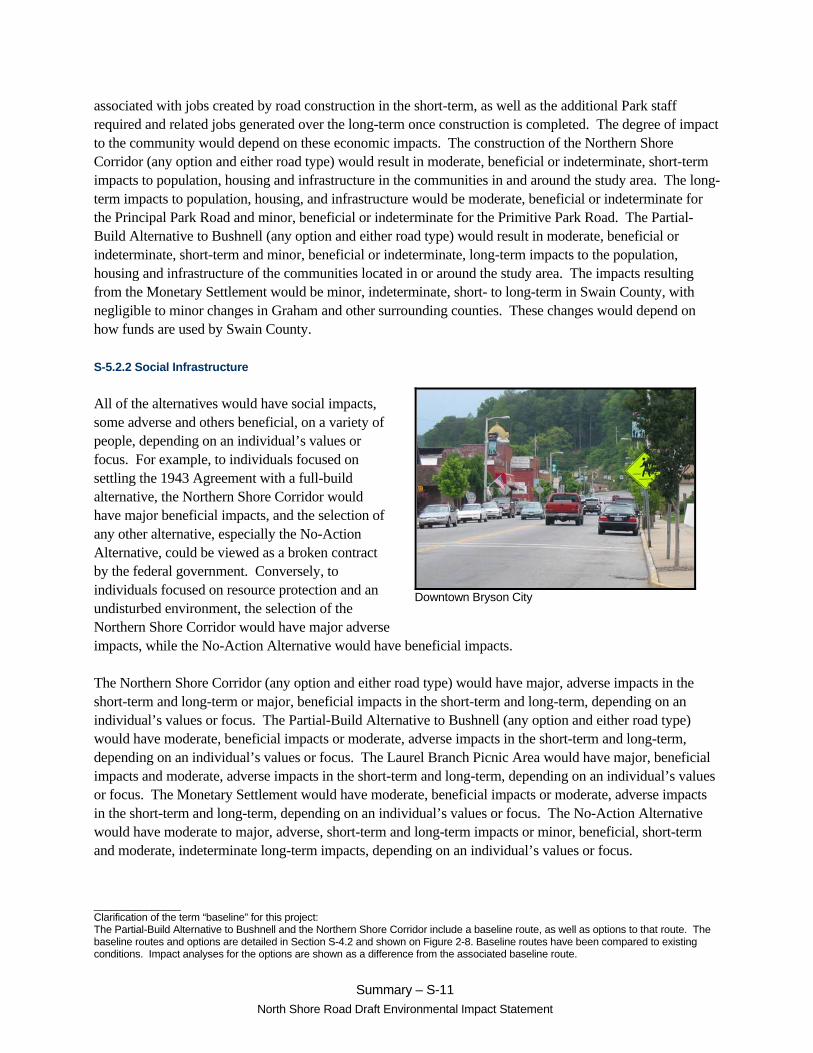
Downtown Bryson City
associated with jobs created by road construction in the short-term, as well as the additional Park staff required and related jobs generated over the long-term once construction is completed. The degree of impact to the community would depend on these economic impacts. The construction of the Northern Shore Corridor (any option and either road type) would result in moderate, beneficial or indeterminate, short-term impacts to population, housing and infrastructure in the communities in and around the study area. The long-term impacts to population, housing, and infrastructure would be moderate, beneficial or indeterminate for the Principal Park Road and minor, beneficial or indeterminate for the Primitive Park Road. The Partial-Build Alternative to Bushnell (any option and either road type) would result in moderate, beneficial or indeterminate, short-term and minor, beneficial or indeterminate, long-term impacts to the population, housing and infrastructure of the communities located in or around the study area. The impacts resulting from the Monetary Settlement would be minor, indeterminate, short- to long-term in Swain County, with negligible to minor changes in Graham and other surrounding counties. These changes would depend on how funds are used by Swain County.
S-5.2.2 Social Infrastructure
All of the alternatives would have social impacts, some adverse and others beneficial, on a variety of people, depending on an individual’s values or focus. For example, to individuals focused on settling the 1943 Agreement with a full-build alternative, the Northern Shore Corridor would have major beneficial impacts, and the selection of any other alternative, especially the No-Action Alternative, could be viewed as a broken contract by the federal government. Conversely, to individuals focused on resource protection and an undisturbed environment, the selection of the Northern Shore Corridor would have major adverse impacts, while the No-Action Alternative would have beneficial impacts.
The Northern Shore Corridor (any option and either road type) would have major, adverse impacts in the short-term and long-term or major, beneficial impacts in the short-term and long-term, depending on an individual’s values or focus. The Partial-Build Alternative to Bushnell (any option and either road type) would have moderate, beneficial impacts or moderate, adverse impacts in the short-term and long-term, depending on an individual’s values or focus. The Laurel Branch Picnic Area would have major, beneficial impacts and moderate, adverse impacts in the short-term and long-term, depending on an individual’s values or focus. The Monetary Settlement would have moderate, beneficial impacts or moderate, adverse impacts in the short-term and long-term, depending on an individual’s values or focus. The No-Action Alternative would have moderate to major, adverse, short-term and long-term impacts or minor, beneficial, short-term and moderate, indeterminate long-term impacts, depending on an individual’s values or focus.

_______________ Clarification of the term “baseline” for this project: The Partial-Build Alternative to Bushnell and the Northern Shore Corridor include a baseline route, as well as options to that route. The baseline routes and options are detailed in Section S-4.2 and shown on Figure 2-8. Baseline routes have been compared to existing conditions. Impact analyses for the options are shown as a difference from the associated baseline route.
Summary – S-12
North Shore Road Draft Environmental Impact Statement
Autumn in the Smokies
S-5.3 Economic Impacts
Construction of one of the partial-build or build alternatives or the Monetary Settlement would provide a new stimulus to the regional economy, generating economic benefits for residents, businesses, and local governments in the area.
The Northern Shore Corridor (Principal Park Road) and the Partial-Build Alternative to Bushnell (Principal Park Road) would result in major, short-term economic benefits to the area, primarily in Swain and Graham counties, as jobs would be created during construction. Northern Shore Corridor (Primitive Park Road) and the Partial-Build Alternative to Bushnell (Primitive Park Road) would result in moderate, short-term economic benefits to the area, associated with construction. Differences in short-term impacts to jobs, income, and retail sales, both in magnitude and duration, would be attributable to differences in project construction costs (Table S-1).
After construction, these alternatives are expected to increase Park visitation, resulting in minor to moderate long-term economic benefits to the area. The Northern Shore Corridor (Principal Park Road, any option) would yield the greatest economic benefits in the long-term, due to greater expected increases in visitation. This alternative would also result in some redirection of travel flows within the region, potentially altering the established geographic distribution of economic stimulus associated with existing visitation patterns. Moderate, long-term benefits are expected with the Principal Park Road (any option) and minor, long-term benefits are expected with the Primitive Park Road (any option). Minor, long-term benefits are also expected with the Partial-Build Alternative to Bushnell (any option).
The proceeds of the Monetary Settlement would result in moderate, beneficial, short-term and long-term impacts. The Monetary Settlement would provide Swain County with an opportunity to spur local economic and community development efforts. Depending on the use of funds by Swain County, this alternative would have the potential to stimulate economic diversification and sustainability, resulting in shifts in intraregional competitiveness to an extent not achieved with other alternatives. Some secondary economic benefits associated with the Monetary Settlement could accrue in the surrounding region.
S-5.4 Land Use Impacts
The Northern Shore Corridor (any option and either road type) and the Partial-Build Alternative to Bushnell (any option and either road type) would change land use within the Park, resulting in major and moderate impacts, respectively. Impacts for both alternatives would be adverse and long-term. These alternatives are not in compliance with the current GSMNP GMP. With the Northern Shore Corridor (Principal Park Road), approximately 823 acres (333.05 ha) would be reclassified from “Natural Environment – Type I” to “Transportation” subzone. With the Northern Shore Corridor (Primitive

_______________ Clarification of the term “baseline” for this project: The Partial-Build Alternative to Bushnell and the Northern Shore Corridor include a baseline route, as well as options to that route. The baseline routes and options are detailed in Section S-4.2 and shown on Figure 2-8. Baseline routes have been compared to existing conditions. Impact analyses for the options are shown as a difference from the associated baseline route.
Summary – S-13
North Shore Road Draft Environmental Impact Statement
Old roadbeds are maintained as hiking trails and administrative access roads.
Park Road) approximately 906 acres (366.64 ha) would be reclassified. The Southern Option at Forney Creek Embayment would reduce the area to be reclassified by approximately 34 acres (13.76 ha) with the Principal Park Road and by approximately 40 acres (16.19 ha) with the Primitive Park Road. The Southern Option at Hazel and Eagle Creek Embayments would reduce the area to be reclassified by approximately 83 acres (33.59 ha) with the Principal Park Road and by approximately 60 acres (24.28 ha) with the Primitive Park Road. With the Southern Option Crossing Fontana Dam, the size of the area to be reclassified from “Natural Environment – Type I” to “Transportation” subzone would be reduced by approximately 41 acres (16.59 ha) with the Principal Park Road and by approximately 42 acres (17.00 ha) with the Primitive Park Road.
With the Partial-Build Alternative to Bushnell, the road corridor would also be reclassified from “Natural Environment” to “Transportation” subzone. For the baseline Partial-Build Alternative to Bushnell, the Principal Park Road would include approximately 155 acres (62.73 ha) and the Primitive Park Road corridor would include approximately 205 acres (82.96 ha). The southern option would reduce the size of the reclassified “Transportation” subzone by approximately 34 acres (13.76 ha) using the Principal Park Road and by approximately 40 acres (16.19 ha) using the Primitive Park Road. With the Partial-Build Alternative to Bushnell (either road type or option), approximately 8 acres (3.24 ha) would be reclassified from “Natural Environment – Type I” to “General Park Development.”
In addition, the Northern Shore Corridor would reduce the area that would potentially be considered for future wilderness designation, with the Primitive Park Road having the greatest impact. The Principal Park Road would eliminate approximately 5,215 acres (2,110.40 ha) from future wilderness consideration and the Primitive Park Road would eliminate approximately 5,314 acres (2,150.46 ha) from future consideration. The Southern Option at Forney Creek Embayment would reduce the impact by approximately 258 acres (104.41 ha) with the Principal Park Road and by approximately 451 acres (182.51 ha) with the Primitive Park Road. The Southern Option at Hazel and Eagle Creek Embayments would reduce the impact by approximately 630 acres (254.95 ha) with the Principal Park Road and by approximately 687 acres (278.01 ha) with the Primitive Park Road. With the Southern Option Crossing Fontana Dam, the impact would be reduced by approximately 551 acres (222.98 ha) with the Principal Park Road and by approximately 550 acres (222.57 ha) with the Primitive Park Road.
With the baseline Partial-Build Alternative to Bushnell, the area that would potentially be considered for future wilderness designation would be reduced by approximately 1,658 acres (670.96 ha) with the Principal Park Road and by approximately 1,839 acres (744.20 ha) with the Primitive Park Road. If the Southern Option at Forney Creek Embayment were selected, this impact would be reduced by approximately 258 acres (104.41 ha) with the Principal Park Road and by approximately 451 acres (182.51 ha) with the Primitive Park Road.

_______________ Clarification of the term “baseline” for this project: The Partial-Build Alternative to Bushnell and the Northern Shore Corridor include a baseline route, as well as options to that route. The baseline routes and options are detailed in Section S-4.2 and shown on Figure 2-8. Baseline routes have been compared to existing conditions. Impact analyses for the options are shown as a difference from the associated baseline route.
Summary – S-14
North Shore Road Draft Environmental Impact Statement
Kiosk provides visitor information.
The reduction of acreage potentially considered for future wilderness designation resulting from the Northern Shore Corridor and the Partial-Build Alternative to Bushnell does not affect the potential for the future wilderness designation of the remaining acreage within GSMNP. However, urbanization and suburbanization along the eastern seaboard of the United States have resulted in a reduction in the amount of undeveloped areas including open space, forested land and other natural areas. The portion of the project study area within GSMNP, along with a larger portion of GSMNP contiguous to the study area, is one of the largest land tracts in the eastern United States that is not impacted by or easily accessible from modern roads.
Land use outside GSMNP is likely to be affected by the construction of either the Northern Shore Corridor or the Partial-Build Alternative to Bushnell. The Northern Shore Corridor would have a minor (Primitive Park Road) to moderate (Principal Park Road) indirect impact on land use outside the Park, especially in downtown Bryson City. At the western terminus, the Northern Shore Corridor would likely create development potential on privately owned properties on the south side of NC 28 outside GSMNP. The Partial-Build Alternative to Bushnell would have a minor, indeterminate impact on land use change and development patterns outside the Park, primarily along Fontana Road and in downtown Bryson City.
Development potential is also likely as a cumulative impact if either the Northern Shore Corridor (either road type or any option) or the Partial-Build Alternative to Bushnell (either road type or any option) is constructed. Impacts resulting from the Northern Shore Corridor, when added to the development expected in Bryson City, Cherokee, and surrounding counties, would result in greater cumulative impacts to surrounding communities than would other alternatives. However, development potential in the region is limited by the large percentage of land under public ownership.
S-5.5 Visitor Use and Experience
The majority of impacts would be felt by the casual and active visitor. In most cases, the active visitor would be displaced to other areas of GSMNP. Over time, the loss of this backcountry area and the displacement of visitors to other areas would deteriorate resources, causing some active users to no longer recreate in GSMNP. Some new opportunities would be created for the passive and casual visitors, including additional driving, day-hiking, and picnicking opportunities. New interpretive opportunities would be created for all visitors. The opportunity for visitors to experience the Park as a sanctuary and refuge from life’s daily activities and routines would be impacted. The intrusion of the partial-build and build alternatives into the backcountry would reduce the sense of wildness and solitude in this area of the Park. While the loss of some resources could be mitigated, the intangible values and experiences that some Park visitors desire during their visit could not. Overall, visitor experience would be adversely impacted as a result.
The Northern Shore Corridor (any option and either road type), the Partial-Build Alternative to Bushnell (any option and either road type), and the Laurel Branch Picnic Area are likely to impact visitor experience in the Park. Whether impacts are perceived as adverse or beneficial depends upon the perspective of the

_______________ Clarification of the term “baseline” for this project: The Partial-Build Alternative to Bushnell and the Northern Shore Corridor include a baseline route, as well as options to that route. The baseline routes and options are detailed in Section S-4.2 and shown on Figure 2-8. Baseline routes have been compared to existing conditions. Impact analyses for the options are shown as a difference from the associated baseline route.
Summary – S-15
North Shore Road Draft Environmental Impact Statement
individual visitor. Three visitor types -- passive, casual, and active -- were used to differentiate between adverse and beneficial impacts. In general, all the partial-build and build alternatives would have beneficial effects on the passive visitor. The Northern Shore Corridor and the Partial-Build Alternative to Bushnell would adversely impact the casual and active visitor by reducing opportunities for backcountry experiences and solitude.
The Northern Shore Corridor (Principal Park Road) would have major, adverse impacts, resulting in the loss of seven backcountry campsites and impacts to three trails, including the loss of 30.9 miles (49.7 km) of Lakeshore Trail. This alternative would require the AT to cross a new roadway, resulting in a major, adverse, and long-term impact to the AT. This alternative would also result in major, adverse, long-term impacts to horse use; moderate, adverse, long-term impacts to wildlife viewing, photography, and nature study; major, adverse, long-term impacts to nostalgia/refuge; and moderate to major, adverse, long-term impacts to solitude. This alternative would also result in minor to major visual impacts and major soundscape impacts, which affect the visitor’s experience. Impacts to fishing would be moderate, adverse and moderate, beneficial in the long-term. Minor to moderate beneficial impacts include the interpretive and scenic driving opportunities presented by this alternative. The Southern Option at Forney Creek Embayment would avoid impacts to one trail, including 0.8 miles (1.3 km) of Lakeshore Trail. The Southern Option at Hazel and Eagle Creek Embayments would avoid impacts to one trail, including 5.7 miles (9.2 km) of Lakeshore Trail. The Southern Option Crossing Fontana Dam would entail re-routing a 0.8 mile (1.3 km) portion of the AT.
The Northern Shore Corridor (Primitive Park Road) would also have major, adverse impacts, resulting in the loss of seven backcountry campsites and impacts to six trails, including the loss of 31.3 miles (50.4 km) of Lakeshore Trail and impacts to the AT. Adverse impacts to fishing would be major in the long-term. This alternative would also result in moderate soundscape impacts. Other impacts are similar to the impacts resulting from the Principal Park Road for this alternative. The Southern Option at Forney Creek Embayment would avoid the loss of one backcountry campsite and impacts to three trails, including 1.2 miles (1.9 km) of Lakeshore Trail. The Southern Option at Hazel and Eagle Creek Embayments would avoid the loss of two backcountry campsites and impacts to one trail, including 5.7 miles (9.2 km) of Lakeshore Trail. The impacts resulting from the Southern Option Crossing Fontana Dam (Primitive Park Road) would be the same as the impacts resulting from the Principal Park Road for this option.
The Partial-Build Alternative to Bushnell (Principal Park Road) would have moderate impacts, resulting in the loss of two backcountry campsites and impacts to three trails, including 7.9 miles (12.7 km) of Lakeshore Trail. This alternative would result in minor to moderate, adverse, long-term impacts to horse use; minor, adverse, long-term impacts to wildlife viewing, photography, and nature study; and moderate, adverse, long-term impacts to nostalgia/refuge. Solitude impacts would be minor to moderate, adverse for casual visitors and major, adverse for active visitors. This alternative would also result in minor to major, adverse visual impacts and moderate, adverse soundscape impacts, which affect the visitor’s experience. Impacts to fishing would be moderate, adverse and moderate, beneficial in the long-term. Benefits would also include minor to major impacts for new interpretive, scenic driving, day-hiking, and picnicking opportunities. The Southern Option at Forney Creek Embayment would avoid impacts to one trail, including 0.8 miles (1.3 km) of Lakeshore Trail.

_______________ Clarification of the term “baseline” for this project: The Partial-Build Alternative to Bushnell and the Northern Shore Corridor include a baseline route, as well as options to that route. The baseline routes and options are detailed in Section S-4.2 and shown on Figure 2-8. Baseline routes have been compared to existing conditions. Impact analyses for the options are shown as a difference from the associated baseline route.
Summary – S-16
North Shore Road Draft Environmental Impact Statement
European-Americans began entering the area in the 1820s.
The Partial-Build Alternative to Bushnell (Primitive Park Road) would have moderate impacts, resulting in the loss of two backcountry campsites and impacts to five trails, including the loss of 8.3 miles (13.4 km) of Lakeshore Trail. Adverse soundscape impacts would be minor, while impacts to fishing would be major in the long-term. Other impacts are similar to the impacts resulting from the Principal Park Road for this alternative. The Southern Option at Forney Creek Embayment would avoid the loss of one backcountry campsite and impacts to three trails, including 1.2 miles (2.9 km) of Lakeshore Trail.
The Laurel Branch Picnic Area would not impact existing campsites or trails and would add interpretive, scenic driving, day-hiking, and picnic opportunities, resulting in a minor, beneficial impact. However, the development of the day-use area and associated increase in visitors would result in minor, adverse impacts to the sense of wildness and solitude currently experienced by active visitors in this area of the Park. In addition, the Laurel Branch Picnic Area site development would have minor, adverse, long-term impacts to scenic views for casual and active visitors.
S-5.6 Cultural Resources
Section 106 of the National Historic Preservation Act of 1966 (NHPA) requires the identification and evaluation of impacts to historic properties. As part of the Section 106 consultation, a Programmatic Agreement (PA) was developed to document the Section 106 process as it pertains to the North Shore Road EIS. Potential impacts were assessed for four types of cultural resources: archaeological sites, historic structures, and TCPs; and for a separate potential historic resource, the AT.
S-5.6.1 Archaeological Sites
NPS conducted sample archaeological surveys of approximately 10 percent of the study corridor between the Chambers Creek vicinity and the Lake View Road tunnel to predict landforms likely to contain significant archaeological sites. Approximately 15 percent of the unsurveyed parts of the study corridors (excluding Fontana Lake) are considered to be moderate to high probability areas for site occurrence. If the alternative selected in the Record of Decision is a partial-build or build alternative, additional identification and evaluation efforts may be needed.
The Northern Shore Corridor (both road types) would result in the most adverse impacts to archaeological resources. The baseline Northern Shore Corridor (Principal Park Road) would result in adverse, long-term impacts to six known archaeological resources, including one major impact, one moderate impact, and one minor impact, as well as impact three unevaluated sites. This alternative would also impact 41 potential historic period archaeological sites, and approximately 63.81 acres (25.8 ha) of unsurveyed moderate to high probability area. If the Southern Option at Forney Creek Embayment were chosen (Principal Park Road), it would result in one less impact to an archaeological site and would impact an additional 3.65 acres (1.5 ha) of unsurveyed, moderate to high probability area. The Southern Option at Hazel and Eagle Creek Embayments (Principal Park Road) would result in one fewer potential impact to an unevaluated site, 27 fewer impacts to potential historic period archaeological sites, and would impact 17.40 fewer acres (7.04 ha)

_______________ Clarification of the term “baseline” for this project: The Partial-Build Alternative to Bushnell and the Northern Shore Corridor include a baseline route, as well as options to that route. The baseline routes and options are detailed in Section S-4.2 and shown on Figure 2-8. Baseline routes have been compared to existing conditions. Impact analyses for the options are shown as a difference from the associated baseline route.
Summary – S-17
North Shore Road Draft Environmental Impact Statement
Remaining structure associated with the Ritter Lumber operations at Proctor
of unsurveyed moderate to high probability area. The Southern Option Crossing Fontana Dam (Principal Park Road) would result in five fewer impacts to potential historic period archaeological sites and would impact 5.32 fewer acres (2.16 ha) of unsurveyed, moderate to high probability area.
Impacts resulting from the baseline Northern Shore Corridor (Primitive Park Road) would vary slightly from the impacts due to the Principal Park Road. This alternative would result in adverse, long-term impacts to four known archaeological resources, including two major impacts and one minor impact, as well as impact one unevaluated site. This alternative would also impact 45 potential historic period archaeological sites and would impact approximately 59.35 acres (24.02 ha) of unsurveyed moderate to high probability area. The Southern Option at Forney Creek Embayment (Primitive Park Road) would result in one less major impact to an archaeological site but would add a potential adverse impact to an unevaluated site. It also would impact an additional 4.42 acres (1.79 ha) of unsurveyed, moderate to high probability area. The Southern Option at Hazel and Eagle Creek Embayments (Primitive Park Road) would result in one fewer potential impact to an unevaluated site, 27 fewer impacts to potential historic period archaeological sites, and would impact 14.67 fewer acres (5.94 ha) of unsurveyed, moderate to high probability area. The Southern Option Crossing Fontana Dam (Primitive Park Road) would result in five fewer impacts to potential historic period archaeological sites and would impact 4.43 fewer acres (1.79 ha) of unsurveyed, moderate to high
probability area.
The baseline Partial-Build Alternative to Bushnell (Principal Park Road) would result in major, adverse, long-term impacts to two archaeological sites and a minor adverse impact to an additional site. This option would also impact one identified but unevaluated site, two potential historic period archaeological sites, and about 6.87 acres (2.78 ha) of unsurveyed moderate to high probability area. The Southern Option at Forney Creek Embayment (Principal Park Road) would result in one less impact to an archaeological site and there would be an increase of 3.65 acres (1.48 ha) of unsurveyed moderate to high probability area that would be impacted.
Impacts to known archaeological sites would be similar if the Primitive Park Road is selected for the Partial-Build Alternative to Bushnell. The only difference is that the Primitive Park Road would not impact an unevaluated site. However, because of its length and location, the Partial-Build Alternative to Bushnell (Primitive Park Road) would have slightly greater potential for impacts to unknown archaeological resources than the Principal Park Road. This option would impact three potential historic period archaeological sites, and 7.66 acres (3.10 ha) of unsurveyed moderate to high probability area. The Southern Option at Forney Creek would result in one fewer major impact to an archaeological site but would potentially impact one identified but unevaluated site. It would no longer impact any potential historic period archaeological sites and would increase the unsurveyed moderate to high probability area by 4.42 acres (1.79 ha).
The Laurel Branch Picnic Area would include one potential historic period archaeological site and approximately 3.95 acres (1.60 ha) of unsurveyed area with moderate to high probability for archaeological sites.

_______________ Clarification of the term “baseline” for this project: The Partial-Build Alternative to Bushnell and the Northern Shore Corridor include a baseline route, as well as options to that route. The baseline routes and options are detailed in Section S-4.2 and shown on Figure 2-8. Baseline routes have been compared to existing conditions. Impact analyses for the options are shown as a difference from the associated baseline route.
Summary – S-18
North Shore Road Draft Environmental Impact Statement
Calhoun House built in 1928
S-5.6.2 Historic Structures
The Northern Shore Corridor (both road types) would result in impacts to up to six historic structures, which are potentially eligible for listing in the National Register of Historic Places. The Southern Option at Hazel and Eagle Creek Embayments (both road types) would eliminate those potential impacts, while the Southern Option Crossing Fontana Dam (both road types) would impact the Fontana Dam, a potential National Historic Landmark.
S-5.6.3 Traditional Cultural Properties
Both beneficial and adverse indirect impacts to TCPs, primarily related to Decoration Days, would result from the Northern Shore Corridor and the Partial-Build Alternative to Bushnell. These impacts would be due to either elimination of current NPS-provided vehicular access or increased ease in private vehicular access to cemeteries resulting from the elevation and location of a new roadway. None of the alternatives would involve relocation of known grave sites.
The Northern Shore Corridor (Principal Park Road) would result in a moderate, adverse access impact to one contributing resource to the Cemetery Decoration Days TCP (Woody Cemetery) and minor, indeterminate, access impacts to two cemeteries (Orr and Payne cemeteries), but would have major, beneficial, access impacts to three cemeteries (Bradshaw, McClure, and Proctor cemeteries) and to the Proctor Baptizing Hole TCP; moderate, beneficial, access impacts to eight cemeteries (Bone Valley, Calhoun, Hall, Higdon, McCampbell Gap, Mitchell, Walker, and Wike cemeteries); and minor, beneficial, access impacts to two cemeteries (Cook and Fairview cemeteries). All these impacts would be long-term. This option would also result in adverse, short-term impacts due to trail disruptions during construction. These impacts include minor access impacts to 15 cemeteries (Bone Valley, Bradshaw, Calhoun, Hall, Higdon, McCampbell Gap, Mitchell, Orr, Payne, Pilkey, Posey, Proctor, Walker, Wike, and Woody cemeteries) and to the Proctor Baptizing Hole TCP. The Southern Option at Forney Creek Embayment (Principal Park Road) would eliminate the long-term and short-term access impacts to the Woody Cemetery. The Southern Option at Hazel and Eagle Creek Embayments would eliminate major, beneficial access impacts to the Proctor Baptizing Hole TCP and to two contributing resources to the Cemetery Decoration Days TCP (Bradshaw and Proctor cemeteries); the moderate, beneficial access impacts to seven cemeteries (Bone Valley, Calhoun, Hall, Higdon, McCampbell Gap, Walker, and Wike cemeteries); and minor, short-term, adverse access impacts to the Proctor Baptizing Hole TCP and to nine cemeteries (Bone Valley, Bradshaw, Calhoun, Hall, Higdon, McCampbell Gap, Proctor, Walker, and Wike cemeteries). The Southern Option Crossing Fontana Dam (Principal Park Road) would eliminate two minor, long-term, indeterminate access impacts and two short-term, adverse, access impacts (Orr and Payne cemeteries).
The Northern Shore Corridor (Primitive Park Road) would result in moderate, adverse access impacts to three contributing resources to the Cemetery Decoration Days TCP (Hoyle, Pilkey and Posey cemeteries) and a minor to moderate, indeterminate, access impact to one cemetery (Woody Cemetery) due to elimination of current NPS-provided vehicular access. It would result in major, beneficial, access impacts to

_______________ Clarification of the term “baseline” for this project: The Partial-Build Alternative to Bushnell and the Northern Shore Corridor include a baseline route, as well as options to that route. The baseline routes and options are detailed in Section S-4.2 and shown on Figure 2-8. Baseline routes have been compared to existing conditions. Impact analyses for the options are shown as a difference from the associated baseline route.
Summary – S-19
North Shore Road Draft Environmental Impact Statement
The Orr Cemetery is one of 27 cemeteries located north of Fontana Lake.
three cemeteries (Bradshaw, McClure, and Proctor cemeteries) and to the Proctor Baptizing Hole TCP; moderate, beneficial access impacts to eight cemeteries (Bone Valley, Calhoun, Hall, Higdon, McCampbell Gap, Mitchell, Walker, and Wike cemeteries), and minor, beneficial, access impacts to two cemeteries (Cook and Fairview cemeteries) due to increased ease in private vehicular access, and minor, indeterminate, access impacts to two cemeteries (Orr and Payne cemeteries). All these impacts would be long-term. The option would also result in the following adverse, short-term impacts: a minor to moderate access impact to one cemetery (Hoyle Cemetery) and minor access impacts to 15 cemeteries (Bone Valley,
Bradshaw, Calhoun, Hall, Higdon, McCampbell Gap, Mitchell, Orr, Payne, Pilkey, Posey, Proctor, Walker, Wike, and Woody cemeteries) and to the Proctor Baptizing Hole TCP, all due to trail disruptions during construction. The Southern Option at Forney Creek Embayment (Principal Park Road) would eliminate the long-term and short-term access impacts to the Hoyle and Woody cemeteries. The Southern Option at Hazel and Eagle Creek Embayments would eliminate the major, beneficial access impacts to the Proctor Baptizing Hole TCP and to two cemeteries (Bradshaw and Proctor cemeteries); moderate, beneficial access impacts to seven cemeteries (Bone Valley, Calhoun, Hall, Higdon, McCampbell Gap, Walker, and Wike cemeteries); and the minor, adverse, short-term access impacts to the Proctor Baptizing Hole TCP and to nine cemeteries (Bone Valley, Bradshaw, Calhoun, Hall, Higdon, McCampbell Gap, Proctor, Walker, and Wike cemeteries). The Southern Option Crossing Fontana Dam (Principal Park Road) would eliminate the minor, indeterminate, long-term access impacts and the adverse, short-term access impacts to two cemeteries (Orr and Payne cemeteries).
The Partial-Build Alternative to Bushnell (Principal Park Road) would result in a moderate, adverse, long-term access impact to one contributing resource to the Cemetery Decoration Days TCP (Woody Cemetery) by eliminating current NPS vehicular access. The option also would result in a major, beneficial, long-term access impact to the McClure Cemetery and a minor, beneficial, long-term access impact to the Welch Cemetery, in both cases by improving current access. Finally, the option would result in a minor to moderate, adverse, short-term access impact to the Woody Cemetery and a minor, adverse, short-term access impact to the McClure Cemetery due to trail disruptions during construction. The Southern Option at Forney Creek Embayment (Principal Park Road) would eliminate the long-term and short-term access impacts to the Woody Cemetery.
The Partial-Build Alternative to Bushnell (Primitive Park Road) would result in a moderate, adverse, long-term access impact to one contributing resource to the Cemetery Decoration Days TCP (Hoyle Cemetery) and a minor to moderate, indeterminate or adverse, long-term access impact to a second contributing resource (Woody Cemetery), in both cases by eliminating current NPS-provided vehicular access. The option also would result in a major, beneficial, long-term access impact to the McClure Cemetery and a minor, beneficial, long-term access impact to the Welch Cemetery, however, in both cases by improving current access. Finally, the option would result in minor, adverse, short-term, access impacts to the two

_______________ Clarification of the term “baseline” for this project: The Partial-Build Alternative to Bushnell and the Northern Shore Corridor include a baseline route, as well as options to that route. The baseline routes and options are detailed in Section S-4.2 and shown on Figure 2-8. Baseline routes have been compared to existing conditions. Impact analyses for the options are shown as a difference from the associated baseline route.
Summary – S-20
North Shore Road Draft Environmental Impact Statement
AT covers 2,167 miles from Maine to Georgia.
cemeteries (Woody and McClure cemeteries), and a minor to moderate, adverse, short-term access impact to one cemetery (Hoyle Cemetery) due to trail disruptions during construction. The Southern Option at Forney Creek Embayment (Primitive Park Road) would eliminate the long-term and short-term access impacts to two cemeteries (Hoyle and Woody cemeteries).
S-5.6.4 Appalachian National Scenic Trail
Adverse impacts to the AT, a potential historic property, would result where a partial-build or build alternative crosses the trail or where it is visible from the trail. Compared to the baseline Northern Shore Corridor (both road types), the southern options are likely to result in greater impacts to the AT. Visitor use and experience impacts associated with the AT are summarized in Section S-5.4.
The baseline Northern Shore Corridor (both road types) would result in moderate, direct, and negligible to minor indirect, adverse impacts to the AT. The Southern Option at Forney Creek Embayment (Principal Park Road) would also result in an additional minor, indirect, adverse impact to the AT, due to construction of a bridge across the Forney Creek embayment that would be visible from the trail. The Southern Option at Hazel and Eagle Creek Embayments would also result in additional minor indirect, adverse impacts to the AT because bridges across the Hazel and Eagle creek embayments would be visible from the trail. The Southern Option Crossing Fontana Dam (Principal Park Road) would result in additional direct and indirect, adverse impacts to the AT. It would run along the existing AT route for about 3,800 feet (1,158 m), resulting in a moderate, indirect impact to the trail, and would also be visible from the trail at several locations, constituting minor, indirect impacts to the trail.
The Partial-Build Alternative to Bushnell with the Southern Option at Forney Creek Embayment (both road types) would also result in an additional minor, indirect, adverse impact to the AT, due to construction of a bridge across the Forney Creek embayment that would be visible from the trail.
S-5.7 Topography, Geology, and Soils
Major adverse impacts to geology would occur with all partial-build and build alternatives because they would require rock and soil excavation and embankment with the potential to produce acid. The baseline Northern Shore Corridor (Principal Park Road) would involve excavation of approximately 2.9 million cubic yards (2.2 million m3) and embankment of approximately 2.5 million cubic yards (1.9 million m3) of rock and soil, resulting in a major, adverse, long-term impact. The baseline Northern Shore Corridor (Primitive Park Road) would involve excavation of approximately 1.7 million cubic yards (1.3 million m3) and embankment of approximately 1.3 million cubic yards (1.0 million m3), also resulting in a major adverse impact. The southern options (both road types) would decrease these volumes.
The baseline Partial-Build Alternative to Bushnell (Principal Park Road) would involve excavation of approximately 945,100 cubic yards (722,600 m3) and embankment of approximately 662,800 cubic yards

_______________ Clarification of the term “baseline” for this project: The Partial-Build Alternative to Bushnell and the Northern Shore Corridor include a baseline route, as well as options to that route. The baseline routes and options are detailed in Section S-4.2 and shown on Figure 2-8. Baseline routes have been compared to existing conditions. Impact analyses for the options are shown as a difference from the associated baseline route.
Summary – S-21
North Shore Road Draft Environmental Impact Statement
Stream impacts may be avoided and/or minimized by bridging the streams and associated floodplains.
(506,700 m3), while the Primitive Park Road would involve excavation of approximately 693,900 cubic yards (530,600 m3) and embankment of approximately 356,500 cubic yards (272,500 m3). Adverse impacts due to both road types would be major and long-term.
The Laurel Branch Picnic Area would involve excavation of approximately 24,700 cubic yards (18,900 m3) and embankment of approximately 23,300 cubic yards (19,300 m3), resulting in a major, adverse, long-term impact.
While problematic rock formations are located throughout the study area, the Northern Shore Corridor would involve construction west of the confluence of Hazel Creek and Fontana Lake, where the underlying rocks are believed to have the highest potential for acid production and are likely to contain higher concentrations of metallic minerals than the surrounding rocks. All disturbed rock and soil would require testing for acid potential and could require major mitigation and monitoring efforts such as encapsulation, removal, and pre- and post-construction monitoring. Capital costs (Table S-1) capture the costs associated with encapsulation methods, based on functional designs and an assumption that all excavation requires treatment.
S-5.8 Floodplains and Floodways
In compliance with Executive Order 11988 and Director’s Order #77-2, a Statement of Findings for floodplains would be developed and released for public review if a partial-build or build alternative was selected.
The Northern Shore Corridor (all options and either road type) and the Partial-Build Alternative to Bushnell (all options and either road type) would encroach on the 100-year floodplain at major stream crossings. The encroachments consist of fill in the existing floodplains due to roadway embankments. The intensities of the impacts result from the increase in 100-year flood elevations due to the size of the proposed drainage structures and the site topography. All impacts noted would be adverse and long-term. The intensity of the impacts would vary with the amount of fill and length of bridge encroachment within the floodplain. If an alternative involving construction is implemented, encroachments could be minimized during more detailed design.
Impacts for the baseline Northern Shore Corridor (Principal Park Road) would include approximately 4.8 acres (2.0 ha) of minor impacts, 1.6 acres (0.7 ha) of moderate impacts, and 1.6 acres (0.6 ha) of major impacts caused by fill. This alternative would also include 570 linear feet (174 m) of minor impacts caused by bridge encroachment within the floodplain. As compared to the baseline, the Southern Option at Forney Creek Embayment (Principal Park Road) would have approximately 100 additional feet (30 m) of bridge encroachment related to minor impacts. The Southern Option at Hazel and Eagle Creek Embayments (Principal Park Road) would avoid minor and major impacts caused by fill and have approximately 1.2 fewer acres (0.5 ha) of fill related to moderate impacts. This option would also have approximately 180 fewer linear feet (55 m) of bridge encroachment related to minor impacts. The Southern Option Crossing Fontana

_______________ Clarification of the term “baseline” for this project: The Partial-Build Alternative to Bushnell and the Northern Shore Corridor include a baseline route, as well as options to that route. The baseline routes and options are detailed in Section S-4.2 and shown on Figure 2-8. Baseline routes have been compared to existing conditions. Impact analyses for the options are shown as a difference from the associated baseline route.
Summary – S-22
North Shore Road Draft Environmental Impact Statement
Dam (Principal Park Roads), as compared to the baseline, would have approximately 0.2 fewer acres (0.08 ha) of fill related to moderate impacts.
Local impacts for the baseline Northern Shore Corridor (Primitive Park Road) would include approximately 3.7 acres (1.5 ha) of minor impacts, 2.3 acres (0.88 ha) of moderate impacts, and 1.7 acres (0.7 ha) of major impacts caused by fill. This alternative would also have approximately 180 linear feet (55 m) of minor impacts caused by bridge encroachment within the floodplain. The Southern Option at Forney Creek Embayment (Primitive Park Road) would have approximately 0.3 fewer acres (0.12 ha) of fill related to moderate impacts. However, it also would have roughly 420 additional feet (128 m) of bridge encroachment related to minor impacts. As compared with the baseline, the Southern Option at Hazel and Eagle Creek Embayments (Primitive Park Road) would have 3.7 fewer acres (1.5 ha) of fill related to minor impacts, 1.3 fewer acres (0.5 ha) of fill related to moderate impacts, and 1.6 fewer acres (0.6 ha) of fill related to major impacts. This option would also have 180 fewer linear feet (55 m) of bridge encroachment related to minor impacts. The Southern Option Crossing Fontana Dam (Primitive Park Road), as compared to the baseline, would have approximately 0.2 fewer acres (0.08 ha) of fill related to moderate impacts.
The Partial-Build Alternative to Bushnell (Principal Park Road) would include approximately 390 linear feet (119 m) of bridge encroachment, resulting in minor impacts. The Southern Option at Forney Creek Embayment for the Principal Park Road would include an additional 100 linear feet (30 m) of bridge encroachment.
The Partial-Build Alternative to Bushnell (Primitive Park Road) would include approximately 0.3 acre (0.12 ha) of fill within the floodplain, resulting in moderate impacts. The Southern Option at Forney Creek Embayment for the Primitive Park Road would avoid fill within the floodplain; however, the southern option for the Primitive Park Road would have roughly 420 feet (128 m) of impacts related to bridge encroachment within the floodplain.
Impacts for the Laurel Branch Picnic Area would include approximately 0.5 acre (0.2 ha) of fill within the floodplain. While the areas of impact would be smaller than those for the Northern Shore Corridor (all options and either road type), the impacts would be major due to anticipated inundation of the entrance/exit road during storm events.
S-5.9 Air Quality
Air quality impacts are likely to occur during construction for the proposed partial-build and build alternatives as a result of the actions of disturbing soil, clearing timber, and paving. Concurrently, the internal combustion engines in the construction equipment used for the project, such as excavators, dozers, and dump trucks, would also contribute emissions of regulated air pollutants within the area of construction. Emissions from these activities are estimated to produce localized impacts on air quality, especially for particulate matter (dust). These impacts were estimated for each partial-build and build alternative using emission rate calculations, emission rate models and dispersion modeling techniques.

_______________ Clarification of the term “baseline” for this project: The Partial-Build Alternative to Bushnell and the Northern Shore Corridor include a baseline route, as well as options to that route. The baseline routes and options are detailed in Section S-4.2 and shown on Figure 2-8. Baseline routes have been compared to existing conditions. Impact analyses for the options are shown as a difference from the associated baseline route.
Summary – S-23
North Shore Road Draft Environmental Impact Statement
Air quality impacts from construction activities are expected to be major and adverse for particulate matter with aerodynamic diameters of up to 10 microns (PM10) and sulfur dioxide (SO2), moderate and adverse for nitrogen oxides (NOx), minor and adverse for carbon monoxide (CO) and volatile organic compounds (VOC), and negligible and adverse for benzene at various locations for each of the partial-build and build alternatives. These activities may cause reductions in visibility and increased pollutant deposition that are considered major. The location of the highest impacts is likely to occur predominantly within the immediate vicinity of the active construction area (approximately 1,000 feet [300 m]), dissipating rapidly with distance. Consequently, as the active construction area would proceed over the length of the project for the 5-year and 15-year construction periods for the Partial-Build Alternative to Bushnell and the Northern Shore Corridor, respectively, so too would the location of the maximum air quality impacts of these pollutants. Generally, the areas requiring the greatest volume of earthwork (i.e. highest intensity of construction activity) were found to have the highest impacts of these pollutants to air quality. Impacts to visibility would be major and adverse at low levels near the construction area, but are expected to decline rapidly with height. Impacts to sulfur and nitrogen deposition would be major and adverse for every partial-build and build alternative.
Once the roadway is open to traffic, the internal combustion engines in the vehicles traversing the road would produce emissions of regulated air pollutants. Emissions of NOx and CO from motor vehicles have the greatest potential to impact the local air quality. Using projected traffic volume information, emission rate models, and air dispersion and deposition modeling techniques, the potential impacts from tail-pipe emissions are shown to have negligible impacts of PM10, PM2.5, SO2, CO, and benzene. Impacts of NOx and VOC are also negligible for the partial-build alternatives, but minor for the full build Northern Shore Corridor (either road type). Potential effects of tail-pipe emissions on visibility are estimated to be negligible once the road alternatives are in operation. Nitrogen deposition rates, and sulfur deposition rates were also evaluated within the GSMNP (specifically at Clingman’s Dome) and are expected to be negligible for all partial-build and build options.
S-5.10 Soundscapes
Compared with the overall size of GSMNP, soundscape impacts from traffic noise are small for the partial-build and build alternatives. However, Park visitors that have an aversion to any perceptible change in sound levels would be adversely affected even with a relatively small impact area. An increase of 1 dBA is the smallest change in sound levels that can be detected by people during active listening.
The baseline Northern Shore Corridor (Principal Park Road) has the highest projected traffic volumes of the study alternatives; and adverse soundscape impacts would be moderate and long-term. This alternative would result in sound level increases at or greater than 1 dBA above the existing levels within 202 feet (61.6 m) of the edge of roadway. Soundscape impacts related to traffic noise for the Northern Shore Corridor (Primitive Park Road) would include sound-level increases equal to or greater than 1 dBA above the existing levels within 82 feet (25.0 m) of the edge of roadway. Soundscape impacts would also be moderate and long-term. The traffic noise associated with all of the southern options (both road types) would be equivalent to the sound levels expected with the baseline route.

_______________ Clarification of the term “baseline” for this project: The Partial-Build Alternative to Bushnell and the Northern Shore Corridor include a baseline route, as well as options to that route. The baseline routes and options are detailed in Section S-4.2 and shown on Figure 2-8. Baseline routes have been compared to existing conditions. Impact analyses for the options are shown as a difference from the associated baseline route.
Summary – S-24
North Shore Road Draft Environmental Impact Statement
Many mountain wetlands are small in area, but have a high diversity of plant and animal species.
Soundscape impacts from traffic noise for the baseline Partial-Build Alternative to Bushnell would include increases equal to or exceeding 1 dBA above existing levels within 169 feet (51.5 m) of the edge of the Principal Park Road and 94 feet (28.7 m) of the edge of the Primitive Park Road. Adverse impacts would be moderate and long-term with the Principal Park Road and minor and long-term with the Primitive Park Road. The traffic noise associated with the southern options (both road types) would be equivalent to the sound levels expected with the baseline route.
Soundscape impacts from traffic noise for the Laurel Branch Picnic Area would include sound level increases at or exceeding 1 dBA of existing conditions within approximately 58 feet (17.7 m) of the edge of roadway. Long-term impacts for the Laurel Branch Picnic Area would be adverse and minor.
Individual events, such as a motorcycle or other loud vehicle, may produce a higher level of sound traveling a further distance at a given point in time compared with the traffic noise level impacts above, which represent the overall profile of traffic over a period of an hour. The Northern Shore Corridor (Principal Park Road) would attract a substantially higher percentage of motorcycle traffic, especially during peak tourist seasons in the summer and fall months.
The highest sound levels would occur during construction. The equivalent sound levels would likely be greater than 80 dBA 100 feet (30 m) from the roadways during the construction period. These impacts are considered short-term.
S-5.11 Natural Resources
S-5.11.1 Wetlands
In compliance with Executive Order 11990 and Director’s Order #77-1, a Statement of Findings for wetlands would be developed and released for public review if a partial-build or build alternative was selected.
Field surveys within the study corridors identified 69 wetlands totaling approximately 6.9 acres (2.8 ha). Direct impacts to
wetlands would occur within the construction footprint of a partial-build or build alternative due to a new roadway’s embankment (fill), or due to significant alteration of hydrology or vegetation. Changes to hydrology, vegetation, or other environmental factors that influence the composition and function of wetlands may result in indirect impacts upstream or downstream from the construction footprint. Impacts would be adverse and permanent.
The Northern Shore Corridor would have greater impacts than the other alternatives. With the baseline Northern Shore Corridor, the Principal Park Road would have more direct impacts than the Primitive Park Road and approximately equal indirect impacts to jurisdictional wetlands and special aquatic habitats. The Principal Park Road would directly affect 15 jurisdictional wetlands comprising approximately 1.60 acres (0.65 ha). Of the 15 wetlands, 13 are rare communities and comprise approximately 0.98 acre (0.40 ha).

_______________ Clarification of the term “baseline” for this project: The Partial-Build Alternative to Bushnell and the Northern Shore Corridor include a baseline route, as well as options to that route. The baseline routes and options are detailed in Section S-4.2 and shown on Figure 2-8. Baseline routes have been compared to existing conditions. Impact analyses for the options are shown as a difference from the associated baseline route.
Summary – S-25
North Shore Road Draft Environmental Impact Statement
This relict pond is now a wetland providing unique habitat in GSMNP.
These direct impacts would be major. The Principal Park Road would directly impact two special aquatic habitats comprising approximately 0.03 acre (0.01 ha); however, both are rare communities, so the impacts would be moderate. The Principal Park Road would indirectly impact 16 jurisdictional wetlands comprising approximately 2.09 acres (0.85 ha), of which approximately 1.85 acres (0.75 ha) are rare, and eight special aquatic habitats comprising approximately 0.57 acre (0.23 ha), of which all are rare. Therefore, indirect impacts would be major to both wetland types for the Principal Park Road.
The baseline Northern Shore Corridor (Primitive Park Road) would directly impact 10 jurisdictional wetlands comprising approximately 1.23 acres (0.50 ha), of which nine are rare communities comprising approximately 1.02 acres (0.41 ha). These impacts would be major. The indirect impacts from the Primitive Park Road would be similar to the indirect impacts from the Principal Park Road. The Primitive Park Road would indirectly impact 16 jurisdictional wetlands comprising approximately 2.18 acres (0.88 ha) and six special aquatic habitats comprising approximately 0.53 acre (0.21 ha). Thirteen of the 16 jurisdictional wetlands are rare (approximately 1.61 acres [0.65 ha]), and all of the special aquatic habitats are rare. Similar to the Principal Park Road, the Primitive Park Road would have major indirect impacts to jurisdictional wetlands and special aquatic habitats.
Selection of any of the southern options would reduce the potential for direct wetland impacts. As compared with the baseline Northern Shore Corridor, the Southern Option at Forney Creek Embayment (both road types) would avoid impacts to jurisdictional wetlands and special aquatic habitats associated with Forney and Gray Wolf creeks by bridging the Forney Creek arm of Fontana Lake. However, this option would impact wetlands associated with Glady Branch. The Principal Park Road would reduce direct impacts to jurisdictional wetlands, including rare communities. Indirect impacts to jurisdictional wetlands from the Principal Park Road would increase, but indirect impacts to rare communities would decrease. The
Principal Park Road would directly and indirectly impact fewer acres of special aquatic habitat. All of these special aquatic habitat areas are classified as rare communities. The Primitive Park Road would reduce direct impacts to jurisdictional wetlands, but increase indirect impacts. With the Southern Option at Forney Creek (Primitive Park Road), there would be no change in the amount of direct or indirect impacts to special aquatic habitats from the baseline Northern Shore Corridor.
When compared with the baseline Northern Shore Corridor, the Southern Option at Hazel and Eagle Creek Embayments would eliminate impacts to wetlands associated with these two stream systems but would increase indirect impacts. For this option, both road types would have similar footprints with almost identical impacts. The Principal and Primitive Park Roads would reduce direct impacts to two jurisdictional wetlands; both are rare communities. There would be no change from the baseline Northern Shore Corridor in the direct impacts to special aquatic habitats for both road types. The indirect impacts to jurisdictional wetlands would also be the same for both road types. There would be an increase in indirect impacts, all of which are in rare communities. There would be a slight difference in the amount of indirect impacts to special aquatic habitats for the two road types. The Primitive Park Road would impact one additional special

_______________ Clarification of the term “baseline” for this project: The Partial-Build Alternative to Bushnell and the Northern Shore Corridor include a baseline route, as well as options to that route. The baseline routes and options are detailed in Section S-4.2 and shown on Figure 2-8. Baseline routes have been compared to existing conditions. Impact analyses for the options are shown as a difference from the associated baseline route.
Summary – S-26
North Shore Road Draft Environmental Impact Statement
Appalachian Montane Alluvial Forests are found along medium-sized streams and are rare in GSMNP.
Wetlands and small streams provide habitat for salamanders and other amphibians.
aquatic habitat, and there would be no change from the baseline Northern Shore Corridor for the Principal Park Road.
The Southern Option Crossing Fontana Dam would only decrease impacts to jurisdictional wetlands and special aquatic habitats, as this section of road would not impact any additional wetlands (for both Principal and Primitive Park Road designs). All impacts would be reduced from the baseline Northern Shore Corridor due to the avoidance of wetlands. In addition, the reductions would be the same for both road types and are discussed together. The direct and indirect impacts to jurisdictional wetlands would be reduced by avoiding five wetland areas, all of which are rare communities. There would be no change from the baseline Northern Shore Corridor in the amount of special aquatic habitats directly impacted for either road type, but indirect impacts would be reduced by avoiding one rare wetland community.
The baseline Partial-Build Alternative to Bushnell would impact wetlands in three general areas: Gray Wolf Creek, Forney Creek, and Glady Branch. The Principal Park Road would directly impact five jurisdictional wetlands totaling approximately 0.42 acre (0.17 ha), of which approximately 0.13 acre (0.05 ha) are classified as rare, and indirectly impact two jurisdictional wetlands totaling approximately 0.13 acre (0.05 ha), which are also classified as rare. The direct and indirect impacts would be major due to the presence of rare communities. Impacts to special aquatic habitats may also occur from the Principal Park Road. Impacts would directly occur to one special aquatic habitat comprising approximately 0.007 acre (0.003 ha) and indirectly occur to three special aquatic habitats comprising approximately 0.26 acre (0.11 ha). All four are rare communities. The direct impact to special aquatic habitat for the Principal Park Road would be moderate, and the indirect impacts would be major. The Primitive Park Road would directly impact one jurisdictional wetland totaling approximately 0.21 acre (0.09 ha) and indirectly impact four jurisdictional wetlands totaling approximately 0.22 acre (0.09 ha). All four of the jurisdictional wetlands that may be indirectly impacted are rare. The Primitive Park Road would have no direct impacts to special aquatic habitat areas, but may indirectly impact approximately 0.26 acre
(0.10 ha) of three wetlands classified as rare. Direct impacts to jurisdictional wetlands and special aquatic habitats would be moderate; however, due to the presence of rare communities, the indirect impacts would be major.
As compared to the baseline Partial-Build Alternative to Bushnell, the Southern Option at Forney Creek Embayment (both road types) would avoid impacts to jurisdictional wetlands and special aquatic habitats associated with Gray Wolf and Forney creeks. However, this option would impact wetlands associated with Glady Branch. The Principal Park Road would reduce direct impacts to jurisdictional wetlands, including rare communities. Indirect impacts
to jurisdictional wetlands from the Principal Park Road would increase, but indirect impacts to rare communities would decrease. The Principal Park Road would directly and indirectly impact fewer acres of

_______________ Clarification of the term “baseline” for this project: The Partial-Build Alternative to Bushnell and the Northern Shore Corridor include a baseline route, as well as options to that route. The baseline routes and options are detailed in Section S-4.2 and shown on Figure 2-8. Baseline routes have been compared to existing conditions. Impact analyses for the options are shown as a difference from the associated baseline route.
Summary – S-27
North Shore Road Draft Environmental Impact Statement
special aquatic habitat. All of these special aquatic habitat areas are classified as rare communities. The Primitive Park Road would reduce direct impacts to jurisdictional wetlands but increase indirect impacts. For the Primitive Park Road, there would be no change from baseline Partial-Build Alternative to Bushnell for direct or indirect impacts to special aquatic habitats.
S-5.11.2 Water Quality
Each stream crossing creates an opportunity for a water quality impact. The steep terrain causes streams to respond quickly to rainfall events, and any pollutants would quickly enter waterbodies during these events.
The primary water quality concerns for the construction of a road in the project study area are the presence of potentially acid-producing rock and sedimentation due to land disturbing activities. Exposure or disturbance of acid-producing rock could result in increased acidity, increased sulfates, increased heavy metals, and aquatic wildlife mortality in streams and lakes within the project study area. Construction activities would likely result in decreased dissolved oxygen from decomposition of organic material in receiving waters and from increased sedimentation from land disturbing activities and erosion. These adverse impacts would result from all the partial-build and build alternatives.
Impacts with the baseline Northern Shore Corridor would be the greatest of the partial-build and build alternatives, due to its length, proximity to known acid-producing rock, and 141 stream crossings. The southern options, which have 12 to 17 fewer stream crossings, would reduce the potential water quality impacts. However, the intensity of the impacts would not change. Impacts to water quality would still occur but at fewer locations. For the most part, no difference in impacts is expected between the Principal Park Road and the Primitive Park Road.
S-5.11.2.1 pH
Impacts to pH with the baseline Northern Shore Corridor (any option and both road types) would be major (violations likely to occur), long-term and permanent due to intrusive rock between Eagle and Hazel creeks. Since detailed geology is unknown, impacts for the baseline Partial-Build Alternative to Bushnell would be moderate (violations may occur), long-term and permanent due to the potential of acid-producing rocks (any option and both road types). With the Laurel Branch Picnic Area, impacts would be moderate (violations may occur), long-term and permanent if there were no special mitigation or avoidance of acid runoff.
S-5.11.2.2 Dissolved Oxygen
With the Northern Shore Corridor (any option and both road types), the short-term and long-term impacts from decreased dissolved oxygen (DO) would be moderate (violations may occur). After construction was completed, the DO concentrations would return to pre-construction levels since no additional organic matter (vegetation) would be entering the system. Thus, permanent impacts to DO would likely be negligible. The short-term and long-term impacts resulting from the Partial-Build Alternative to Bushnell (any option and both road types) would be moderate (violations may occur), and the permanent impacts would be negligible.

_______________ Clarification of the term “baseline” for this project: The Partial-Build Alternative to Bushnell and the Northern Shore Corridor include a baseline route, as well as options to that route. The baseline routes and options are detailed in Section S-4.2 and shown on Figure 2-8. Baseline routes have been compared to existing conditions. Impact analyses for the options are shown as a difference from the associated baseline route.
Summary – S-28
North Shore Road Draft Environmental Impact Statement
Moderate (violations may occur), short-term impacts would be anticipated with the Laurel Branch Picnic Area.
S-5.11.2.3 Heavy Metals
Based on the geology for the Northern Shore Corridor, there would be major (violations likely to occur) impacts for the baseline Northern Shore Corridor. The potential for the impacts would exist in the short-term and long-term during construction, when the minerals could be exposed at unknown locations. There would be subsequent permanent impacts if these areas were not mitigated. Due to the low traffic volumes, the permanent impacts from vehicular sources of metals would be negligible for the Principal Park Road and minor for the Primitive Park Road.
Based upon the geology for the Partial-Build Alternative to Bushnell (any option and both road types), moderate (violations may occur), short-term, long-term, and permanent impacts would be anticipated from potential naturally occurring heavy metals. Due to the potential recreational and parking facilities at Bushnell, minor, long-term and permanent impacts are anticipated from vehicular sources and runoff from parking areas.
Minor, short-term, long-term, and permanent impacts would be anticipated with the Laurel Branch Picnic Area if there were no avoidance or minimization techniques. Due to the anticipated traffic volume, impacts from vehicular sources of heavy metals would be minor, long-term, and permanent.
S-5.11.2.4 Turbidity
Sedimentation and an increase in turbidity would have the greatest impact at stream crossings. The baseline Northern Shore Corridor (both road types) would have major (violations likely to occur), short-term and long-term impacts during construction. The permanent impacts would be negligible for the Principal Park Road and minor for the Primitive Park Road. The southern options would reduce stream crossings, but overall impact intensities would not change.
Major, short-term and long-term impacts due to construction runoff and sedimentation would occur with the Partial-Build Alternative to Bushnell (both road types). The permanent impacts would be negligible for the Principal Park Road. The permanent impacts would be minor for the Primitive Park Road due to runoff from the gravel surface of the road.
The Laurel Branch Picnic Area would have major (violations would likely occur), short-term impacts due to sedimentation from construction-related activities. Long-term and permanent impacts from runoff from the parking lot and recreational activities would be minor.

_______________ Clarification of the term “baseline” for this project: The Partial-Build Alternative to Bushnell and the Northern Shore Corridor include a baseline route, as well as options to that route. The baseline routes and options are detailed in Section S-4.2 and shown on Figure 2-8. Baseline routes have been compared to existing conditions. Impact analyses for the options are shown as a difference from the associated baseline route.
Summary – S-29
North Shore Road Draft Environmental Impact Statement
The olive darter is a Federal Species of Concern.
S-5.11.3 Aquatic Ecology
Adverse impacts to aquatic wildlife within lakes, streams, and wetlands (collectively referred to as aquatic habitat) are expected as a result of a partial-build or build alternative. Impacts to aquatic wildlife habitat could result from sedimentation altering habitat or decreasing visibility, stream crossings causing fish-passage barriers, riparian buffer removal altering available food and thermal regulation, runoff from exposed acid-producing rock, and water-level fluctuations. Any partial-build or build alternative would have
impacts to aquatic wildlife, with the Northern Shore Corridor having the greatest potential and the Laurel Branch Picnic Area having the least potential.
The baseline Northern Shore Corridor would have major, and long-term to permanent impacts to aquatic wildlife habitat within streams for both the Principal and Primitive Park Roads. This alternative would potentially impact greater than 0.5 mile (0.8 km) of riparian buffers along three streams: Shehan Branch, Hazel Creek, and an unnamed tributary to Cheoah Lake. The Southern Option at Forney Creek Embayment would avoid impacts to Forney Creek. This option would reduce direct impacts of the Principal and Primitive Park Roads by approximately 10 percent as compared with the baseline Northern Shore Corridor. Indirect impacts would still occur, but would be reduced from the baseline Northern Shore Corridor. The Southern Option at Hazel and Eagle Creek Embayments would reduce direct impacts by approximately 36 and 41 percent, respectively, for the Principal and Primitive Park Roads, as compared with the baseline Northern Shore Corridor. Indirect impacts would be expected, but would be reduced from the baseline Northern Shore Corridor due to fewer stream crossings. The Southern Option Crossing Fontana Dam would avoid up to 16 stream crossings potentially reducing the direct and indirect impacts to aquatic wildlife streams by approximately 11 percent for each road type.
The baseline Partial-Build Alternative to Bushnell which includes a boat ramp would result in the complete loss of approximately 0.34 acre (0.14 ha) of aquatic habitat within Fontana Lake. Impacts from the boat ramp would be moderate and permanent. Indirect impacts to aquatic habitat within Fontana Lake would be moderate, long-term and permanent. Impacts from both road types, based upon the area of impact, would have major, permanent direct impacts and major, long-term indirect impacts to stream and wetland aquatic habitat. With the Southern Option at Forney Creek Embayment, the potential for direct and indirect impacts to aquatic habitat would be reduced from the baseline Partial-Build Alternative to Bushnell for both road types by crossing 50 percent fewer streams.
Direct impacts to aquatic wildlife habitat within streams would be moderate and permanent with the Laurel Branch Picnic Area. Indirect impacts would be moderate, and short-term and long-term.

_______________ Clarification of the term “baseline” for this project: The Partial-Build Alternative to Bushnell and the Northern Shore Corridor include a baseline route, as well as options to that route. The baseline routes and options are detailed in Section S-4.2 and shown on Figure 2-8. Baseline routes have been compared to existing conditions. Impact analyses for the options are shown as a difference from the associated baseline route.
Summary – S-30
North Shore Road Draft Environmental Impact Statement
Blue phlox (Phlox divaricata)
Yellow-fringed orchid can be found in upland hardwood communities.
S-5.11.4 Vegetation Communities
Direct impacts to vegetation communities would occur as land is disturbed in constructing a partial-build or build alternative. Potential alteration of downstream hydrology; changes in environmental conditions associated with edge effects such as alteration of atmospheric moisture levels, increased wind and sunlight exposure, and changes in temperature regimes; and the increased potential for human disturbance have the potential to indirectly impact the distributions of vegetation species and thus alter the vegetation community type. These impacts would be adverse and permanent.
The Northern Shore Corridor (both road types) would result in major impacts to rare vegetation communities and major impacts to secure vegetation communities. The Northern Shore Corridor (Principal Park Road) would directly impact approximately 36.4 acres (14.7 ha) of rare
vegetation communities and approximately 351.53 acres (142.26 ha) of secure vegetation communities. The Northern Shore Corridor (Primitive Park Road) would directly impact approximately 38.1 acres (15.8 ha) of rare vegetation communities and approximately 358.95 acres (145.26 ha) of secure vegetation communities. For both road types, the Southern Option at Forney Creek Embayment and the Southern Option at Hazel and Eagle Creek Embayments would reduce direct and indirect impacts. The Southern Option at Forney Creek Embayment (Principal Park Road) would reduce the direct impacts to rare vegetation communities by approximately 7.29 acres (2.95 ha) and to secure communities by approximately 8.00 acres (3.24 ha). The Southern Option at Forney Creek Embayment (Primitive Park Road) would reduce the direct impacts to rare vegetation communities by approximately 5.51 acres (2.23 ha), and to secure communities by approximately 4.30 acres (1.74 ha). There would be an associated proportional decrease in the indirect impacts (both road types). For the Southern Option at Hazel and Eagle Creek Embayments, the Principal Park Road would reduce the direct impacts to rare vegetation communities by approximately 18.47 acres (7.48 ha) and to secure communities by approximately 19.02 acres (7.70 ha); while the Primitive Park Road would reduce the direct impacts to rare vegetation communities by approximately 19.49 acres (7.89 ha) and to secure communities by approximately 10.18 acres (4.12 ha). There would also be an associated proportional decrease in the indirect impacts to both community categories. For the Southern Option Crossing Fontana Dam, there would be no change from impacts to rare vegetation communities from the baseline Northern Shore Corridor (both road types). However, the impacts to secure communities would be reduced by approximately 18.80 acres (7.61 ha) with the Principal Park Road, and by approximately 18.86 acres (7.64 ha) with the Primitive Park Road with an associated proportional decrease in the indirect impacts to the secure vegetation communities.

_______________ Clarification of the term “baseline” for this project: The Partial-Build Alternative to Bushnell and the Northern Shore Corridor include a baseline route, as well as options to that route. The baseline routes and options are detailed in Section S-4.2 and shown on Figure 2-8. Baseline routes have been compared to existing conditions. Impact analyses for the options are shown as a difference from the associated baseline route.
Summary – S-31
North Shore Road Draft Environmental Impact Statement
Eastern American Toad (Bufo americanus americanus)
Impacts resulting from the partial-build alternatives would be less than from the Northern Shore Corridor. The Partial-Build Alternative to Bushnell (Principal Park Road) would directly impact approximately 19.90 acres (8.05 ha) of rare vegetation communities and approximately 71.53 acres (28.95 ha) of secure vegetation communities. The Primitive Park Road would impact approximately 18.34 acres (7.34 ha) of Appalachian Montane Alluvial Forest, a rare community. Additionally, approximately 80.76 acres (32.70 ha) of secure vegetation communities would be directly impacted. The direct and indirect impacts to rare communities were assessed to be major and the direct and indirect impacts to the secure communities would be minor (both road types). The Southern Option at Forney Creek Embayment (Primitive Park Road) would reduce the direct impacts to Montane Alluvial Forest Community by approximately 5.51 acres (2.23 ha) and to secure communities by approximately 4.30 acres (1.74 ha). The Southern Option at Forney Creek Embayment (Principal Park Road) would reduce the direct impacts to rare vegetation communities by approximately 7.29 acres (2.95 ha), and to secure communities by approximately 8.00 acres (3.24 ha).
The Laurel Branch Picnic Area would directly impact approximately 3.40 acres (1.38 ha) of Appalachian Montane Alluvial Forest. This impact to this rare community would be minor, while the indirect impacts to the remaining local portions of the rare vegetation communities would be minor. In addition, approximately 5.54 acres (2.24 ha) of secure vegetation communities would be directly impacted. The direct and indirect impacts to the secure communities from this alternative would be negligible.
S-5.11.5 Terrestrial Wildlife
All of the undeveloped areas within the study corridors are considered to be habitat for the range of terrestrial wildlife known to live in GSMNP. Both direct and indirect impacts to terrestrial wildlife may result from a partial-build or build alternative. A direct impact to terrestrial wildlife would be the loss of habitat within the construction footprint, while indirect impacts could include habitat fragmentation, interruption of migration patterns, increased sound from human activity, and decreased habitat quality. Impacts are adverse and directly related to the length of the partial-build or build alternative and its distance from the northern shore of Fontana Lake.
The greatest impacts are associated with the baseline Northern Shore Corridor, which would result in the direct loss of approximately 392.2 acres (158.8 ha) and 400.6 acres (162.2 ha) of potential terrestrial habitat associated with the Principal Park Road and Primitive Park Road, respectively. Impacts due to the direct loss of habitat, as well as from ecosystem fragmentation, are anticipated to be major and permanent (both road types). Impacts related to sound level increases would most likely be major and long-term. The southern options, which bypass a more interior portion of the Park, would result in less fragmentation of habitat. For the Southern Option at Forney Creek
Embayment, the Principal Park Road would reduce the direct loss of habitat by approximately 15.9 acres (6.4 ha) and the Primitive Park Road would reduce the direct loss of habitat by approximately 9.5 acres (3.8 ha). The Southern Option at Hazel and Eagle Creek Embayments would reduce the direct loss of habitat by

_______________ Clarification of the term “baseline” for this project: The Partial-Build Alternative to Bushnell and the Northern Shore Corridor include a baseline route, as well as options to that route. The baseline routes and options are detailed in Section S-4.2 and shown on Figure 2-8. Baseline routes have been compared to existing conditions. Impact analyses for the options are shown as a difference from the associated baseline route.
Summary – S-32
North Shore Road Draft Environmental Impact Statement
Timber rattlesnakes are found in mixed oak-pine forests, open grassy areas, and mature cove forests.
Montane Oak-Hickory Forest
approximately 37.1 acres (15.0 ha) with the Principal Park Road and by approximately 25.4 acres (10.3 ha) with the Primitive Park Road. With the Southern Option Crossing Fontana Dam, direct loss of habitat resulting from construction of the Principal Park Road would be reduced by approximately 21.2 acres (8.6 ha) and direct loss of habitat associated with the Primitive Park Road would be reduced by approximately 20.7 acres (8.4 ha).
The Partial-Build Alternative to Bushnell would result in the same type of impacts that would result from the Northern Shore Corridor, but the area of direct impact would be reduced. The baseline Partial-Build Alternative to Bushnell (Principal Park Road) would result in the direct loss of approximately 92.4 acres (37.4 ha) of habitat. The Primitive Park Road would result in the direct loss of approximately 99.4 acres (40.2 ha) of habitat. Impacts due to the direct loss of habitat within the construction footprint and due to habitat fragmentation (both road types) would be minor and permanent. Impacts due to sound created by human activity, such as roadway
construction, would be minor and long-term (both road types). As compared to the baseline Partial-Build Alternative to Bushnell, the Southern Option at Forney Creek Embayment would reduce the overall impacts within the project study corridors. The Principal Park Road would reduce the direct loss of habitat by approximately 15.6 acres (6.3 ha) and the Primitive Park Road would reduce the direct loss of habitat by approximately 9.5 acres (3.8 ha).
An estimated 9 acres (3.6 ha) of habitat would be lost from building the Laurel Branch Picnic Area. Impacts from direct loss of habitat would be negligible and permanent. The sound created by construction and other human-caused disturbance activities would directly affect wildlife by causing avoidance of habitat. Soundscape impacts from traffic noise would be negligible and long-term.
S-5.11.6 Migratory Birds
The migratory bird species that winter and breed in the project study area are critical components of ecosystems within GSMNP. Assessment of impacts to migratory birds and their habitats is required by law prior to any action, as directed by Executive Order 13186 and the Migratory Bird Treaty Act (MBTA). Secondly, these impacts are outlined due to the importance of migratory birds to biodiversity, ecosystem functions and to human monitoring of environmental conditions.
Potential impacts resulting from the partial-build and build alternatives include migratory bird habitat loss, habitat fragmentation/edge effect and soundscape disturbance. Impacts would be adverse and permanent,

_______________ Clarification of the term “baseline” for this project: The Partial-Build Alternative to Bushnell and the Northern Shore Corridor include a baseline route, as well as options to that route. The baseline routes and options are detailed in Section S-4.2 and shown on Figure 2-8. Baseline routes have been compared to existing conditions. Impact analyses for the options are shown as a difference from the associated baseline route.
Summary – S-33
North Shore Road Draft Environmental Impact Statement
Hemlock woolly adelgid has become a serious threat to the survival of hemlock trees.
with the exception of construction-related impacts which would be long-term. The Northern Shore Corridor would have the greatest impact on migratory birds, as compared with the other alternatives, due to the size of the construction footprint and the expected duration of construction. The Principal Park Road would impact approximately 392.2 acres (158.8 ha) of migratory bird habitat and the Primitive Park Road would impact approximately 400.6 acres (162.2 ha) of migratory bird habitat. Potential impacts due to habitat loss, impacts from sound generated by construction activities and facility operations, and effects related to habitat fragmentation and edge effects would be major (both road types). Impacts would be slightly reduced with the southern options, as these options would impact less migratory bird habitat than would the baseline Northern Shore Corridor. Also in these options, decreases in sound levels and habitat fragmentation may accompany the smaller construction footprint. For both road types, the Southern Option at Forney Creek Embayment would provide a small decrease in the construction footprint, soundscape intrusion, and possible negative effects of habitat fragmentation relative to the baseline Northern Shore Corridor. The Principal Park Road would reduce the construction footprint by approximately 15.9 acres (6.4 ha.) and the Primitive Park Road would reduce the construction footprint by approximately 9.5 acres (3.8 ha.). The Southern Option at Hazel and Eagle Creek Embayments would impact approximately 37.1 fewer acres (15.0-ha) of habitat with the Principal Park Road and approximately 25.4 fewer acres (10.3 ha) of habitat using the Primitive Park Road. These options would also result in less soundscape intrusion and habitat fragmentation than with the baseline Northern Shore Corridor. Construction of the Southern Option Crossing Fontana Dam using the Primitive Park Road would impact approximately 20.7 fewer acres (8.4 ha) of migratory bird habitat than the baseline Northern Shore Corridor. The Principal Park Road under this option would affect approximately 21.2 fewer acres (8.6 ha) than the baseline Northern Shore Corridor.
The Partial-Build Alternative to Bushnell, which has a smaller construction footprint and shorter construction period, would result in fewer impacts than the Northern Shore Corridor. Possible impacts for this alternative also include migratory bird habitat loss, habitat fragmentation, and soundscape disturbance. These impacts would be minor for the Principal Park Road and Primitive Park Road. The construction footprint resulting from the Principal Park Road would be approximately 92.4 acres (37.4 ha) and the construction footprint resulting from the Primitive Park Road would be approximately 99.4 acres (40.2 ha).
S-5.11.7 Invasive Exotics
The partial-build and build alternatives would create conditions such as disturbed roadside, forest edges, and open spaces that favor invasive exotic species. These adverse impacts would cause the loss of native plant habitat due to the loss of shading, temperature changes, new wind patterns, changes in soil conditions, and creation of roadside habitats.
The baseline Northern Shore Corridor would have the greatest potential to create favorable conditions for invasive exotics, as compared with the other alternatives. The baseline Northern Shore Corridor would impact 30.8 miles (49.6 km) with the Principal Park Road and 34.3 miles (55.2 km) with the Primitive Park Road. These impacts would be major and permanent. The southern options decrease the potential for invasive species to penetrate to more interior portions of the Park. The Southern

_______________ Clarification of the term “baseline” for this project: The Partial-Build Alternative to Bushnell and the Northern Shore Corridor include a baseline route, as well as options to that route. The baseline routes and options are detailed in Section S-4.2 and shown on Figure 2-8. Baseline routes have been compared to existing conditions. Impact analyses for the options are shown as a difference from the associated baseline route.
Summary – S-34
North Shore Road Draft Environmental Impact Statement
Option at Forney Creek Embayment would result in 1.3 fewer miles (2.1 km) of impact for the Principal Park Road and 1.5 fewer miles (2.4 km) of impact for the Primitive Park Road. The Southern Option at Hazel and Eagle Creek Embayments would have 3.1 fewer miles (5.0 km) of impact for the Principal Park Road and 2.3 fewer miles (3.7 km) of impacts from the Primitive Park Road. The Southern Option Crossing Fontana Dam would have 1.5 fewer miles (2.4 km) of impact from the Principal Park Road and 1.6 fewer miles (2.6 km) of impact for the Primitive Park Road.
The baseline Partial-Build Alternative to Bushnell would cause approximately 6.5 miles (10.5 km) of impact from the Principal Park Road and approximately 8.0 miles (12.9 km) of impact from the Primitive Park Road. Impacts from both road types would be minor and permanent. The Southern Option at Forney Creek Embayment would have 1.3 fewer miles (2.0 km) of impact for the Principal Park Road and 1.5 fewer miles (2.4 km) of impact for the Primitive Park Road.
S-5.11.8 Protected Species
S-5.11.8.1 Federally Protected Species
Impacts are assessed on the known population of bald eagles and potential habitat for the bald eagle and Indiana bat within or near the study corridors. Both are federally protected endangered and threatened species. Direct loss of habitat would occur within construction limits. Soundscape impacts from traffic noise associated with road construction activities and human disturbances from the utilization of a roadway and any associated facilities are anticipated with the Northern Shore Corridor and Partial-Build Alternative to Bushnell for the bald eagle and with the Laurel Branch Picnic Area for the Indiana bat. These impacts would be adverse and permanent. Section 7 of the ESA requires federal agencies to consult with the United States Fish and Wildlife Service (USFWS) when any action that the agency carries out, funds, or authorizes may affect a listed endangered or threatened species.
Indiana Bat
Impacts to the Indiana bat due to direct habitat loss and potential reduction in habitat utilization surrounding the new roadway and any associated facilities would be greatest with the baseline Northern Shore Corridor. Approximately 387.03 acres (156.63 ha) of potential habitat would be impacted by the Principal Park Road. The Primitive Park Road would impact approximately 397.79 acres (160.98 ha) of potential habitat. Impacts due to direct habitat loss and potential reduction in habitat utilization surrounding the road and facilities would likely be minor. These impacts are the same for both the Primitive and Principal Park Roads. All of the southern options would likely decrease possible impacts due to decreases in the construction footprint, human influence zone, and habitat fragmentation.
The Partial-Build Alternative to Bushnell would impact approximately 91.43 acres (37.02 ha) of habitat with the Principal Park Road and approximately 100.42 acres (40.64 ha) of habitat with the Primitive Park Road. Impacts due to direct habitat loss and potential reduction in habitat utilization surrounding the road and facilities would likely be minor. These impacts are the same for both the Primitive and Principal Park

_______________ Clarification of the term “baseline” for this project: The Partial-Build Alternative to Bushnell and the Northern Shore Corridor include a baseline route, as well as options to that route. The baseline routes and options are detailed in Section S-4.2 and shown on Figure 2-8. Baseline routes have been compared to existing conditions. Impact analyses for the options are shown as a difference from the associated baseline route.
Summary – S-35
North Shore Road Draft Environmental Impact Statement
Roads. As compared to the baseline Partial-Build Alternative to Bushnell, the impacts would likely be reduced for the Southern Option at Forney Creek Embayment.
Approximately 8.96 acres (3.63 ha) of habitat within GSMNP would be impacted by the Laurel Branch Picnic Area. Impacts due to direct loss or potential reduction of habitat utilization surrounding the road and facilities would likely be minor.
If a partial-build or build alternative is selected, NPS would develop a comprehensive survey plan for the Indiana bat to determine this species’ status in the vicinity of the alternative. Coordination with the USFWS would be ongoing to determine the need for additional recommendations to protect or mitigate for impacts to the Indiana bat.
Bald Eagle
The majority of the construction footprint for any option, as well as both road types, associated with the Northern Shore Corridor is located within 1.0 mile (1.6 km) of open water, resulting in potential impacts to the bald eagle habitat. Approximately 300 linear feet (91 m) of the baseline Principal Park Road would be within the secondary management zone for bald eagles. Impacts due to sound associated with construction activities and due to human disturbance from utilization of the road and facilities would likely be minor, long-term to permanent with the Principal Park Road and the Primitive Park Road. For the Southern Option at Forney Creek, approximately 2,375 linear feet (725 m) of the Principal Park Road and 3,775 linear feet (1,150 m) of the Primitive Park Road would be located in the secondary eagle management zone. This option has an increased potential for impacts due to its greater presence in the vicinity of a bald eagle nest. The remaining southern options would likely increase possible impacts due to proximity to bald eagle habitat.
The Partial-Build Alternative to Bushnell would impact foraging activities of the bald eagle due to increased boating associated with lake access at the proposed facility. Development of the Bushnell area, especially the boat ramp, would likely lead to increased boating activity in the vicinity of a known bald eagle nest. Portions of Fontana Lake in the vicinity of the eagle nest are within areas designated as primary and secondary bald eagle management zones. Approximately 300 linear feet (91 m) of the baseline Principal Park Road are within the secondary bald eagle management zone. Impacts due to sound associated with construction activities would likely be minor and long-term. Impacts due to human disturbance from utilization of the road and facilities would likely be minor and permanent. Impacts on foraging activities due to increased boating associated with potential increased lake access at the proposed facility would likely be adverse, local to regional, permanent, and moderate.
As compared to the baseline Partial-Build Alternative to Bushnell, the Southern Option at Forney Creek would have approximately 2,375 linear feet (725 m) of the Principal Park Road and 3,775 linear feet (1,150 m) of the Primitive Park Road within in the secondary eagle management zone. The possibilities for other impacts are likely to be increased due to proximity to bald eagle habitat.

_______________ Clarification of the term “baseline” for this project: The Partial-Build Alternative to Bushnell and the Northern Shore Corridor include a baseline route, as well as options to that route. The baseline routes and options are detailed in Section S-4.2 and shown on Figure 2-8. Baseline routes have been compared to existing conditions. Impact analyses for the options are shown as a difference from the associated baseline route.
Summary – S-36
North Shore Road Draft Environmental Impact Statement
If an alternative involving construction, other than the Laurel Branch Picnic Area, is implemented, NPS would develop a comprehensive survey and monitoring plan for the bald eagle to determine this species’ status in the Park. Coordination with USFWS would be ongoing to determine the need for additional recommendations to protect or mitigate for impacts to the bald eagle.
S-5.11.8.1 Other Species
The USFWS has identified 25 Federal Species of Concern (FSC) for Graham County, North Carolina and 46 FSC and one Candidate species for Swain County, North Carolina. These species are not protected under the provisions of Section 7 of the Endangered Species Act. Additional species receive protections under North Carolina General Statutes or state laws. NPS policy includes protection of FSC, candidate, and state protected species to the same level as threatened and endangered species. Of these species (FSC, Candidate or state-protected), there are 12 vertebrates, 5 invertebrates, and 3 plant species known to occur within the project study corridors.
The total range and status of FSC and state protected species in GSMNP is not complete. Investigations undertaken for this study have discovered species new to the Park, new records for species known from the Park, and species new to science. These investigations did not constitute a comprehensive survey of the project study corridors and they covered less than 1 percent of the total land contained within the Park.
Olive Darter
There are two confirmed populations of the olive darter within GSMNP, one each in Forney and Hazel creeks. There is also a potential population in Noland Creek; however, this population has not been observed in the last 15 years.
The baseline Northern Shore Corridor (Principal Park Road) would have major impacts due to potential loss of individuals, habitat modification, and negative changes in water quality. Impacts from this alternative could reduce one population of this fish. The baseline Northern Shore Corridor (Primitive Park Road) would have major impacts due to potential loss of individuals, habitat modification, and negative changes in water quality. These impacts could lead to a reduction in two populations of olive darter. The southern options for this alternative (both road types) would likely reduce the impacts.
The baseline Partial-Build Alternative to Bushnell (Principal Park Road) would have minor impacts. The Primitive Park Road would have major impacts due to potential loss of individuals, habitat modification, and negative changes in water quality. These impacts could lead to a reduction in one population of olive darter. The southern options for these alternatives (either road type) would likely reduce the impacts.

_______________ Clarification of the term “baseline” for this project: The Partial-Build Alternative to Bushnell and the Northern Shore Corridor include a baseline route, as well as options to that route. The baseline routes and options are detailed in Section S-4.2 and shown on Figure 2-8. Baseline routes have been compared to existing conditions. Impact analyses for the options are shown as a difference from the associated baseline route.
Summary – S-37
North Shore Road Draft Environmental Impact Statement
Pendleton Creek Overlook
S-5.12 Aesthetic and Visual Resources
The Northern Shore Corridor and the Partial-Build Alternative to Bushnell would adversely impact visual resources in the project area. All impacts would be long-term. Impacts were evaluated by assessing 14 views that have the potential to be substantially altered by the partial-build or build alternatives.
Within the study area, viewpoints located at higher locations would generally have greater impacts because more segments are visible from the higher elevations. The magnitude of bridges necessary to cross Eagle, Hazel, and Forney Creek embayments with the southern options would result in a greater impact at the viewpoints along the AT and those at lake-level. Other visual impacts resulting from partial-build and build alternatives would include light pollution due to car headlights and the sun reflecting off vehicles, producing glare visible to nearby hikers.
Portions of the baseline Northern Shore Corridor (both road types) would be visible from seven of the 14 viewpoints, resulting in major impacts to the viewpoints at Shuckstack, AT South of Shuckstack, Proctor, Fontana Dam and High Rocks; and minor impacts to the viewpoints at Tsali and Meetinghouse Mountain. The Southern Option at Forney Creek Embayment would result in one less major impact to the view from High Rocks. The Southern Option at Hazel and Eagle Creek Embayments would be visible from 6 viewpoints, including additional major impacts to the views from Black Gum Gap (during leaf-off conditions), Fontana Dam, Shuckstack and the NC 28 Hazel Creek Overlook; a moderate impact to the view from Cable Cove; and a minor impact to the view from Fontana Lake (below Lakeshore Trail). The intensity of the impact to the view from the Shuckstack viewpoint would increase with this option, and the major impact to the view from Proctor would be avoided. The Southern Option Crossing Fontana Dam would result in an additional major impact to the viewpoint at Fontana Dam, but would avoid the major impact to the view from the AT South of Shuckstack.
Portions of the baseline Partial-Build Alternative to Bushnell (both road types) would be visible from two viewpoints, resulting in major impacts to the views at High Rocks and Tsali. The Southern Option at Forney Creek Embayment would eliminate the major impact to the view from High Rocks.
S-5.13 Collective Impacts, Sustainability, and Long-Term Management
A review of collective impacts was undertaken to consider all impacts to social, economic, natural, and cultural resources that would result from the proposed alternatives. Sustainability and long-term management of GSMNP resources and the ecosystem and the biodiversity values for which the Park was created were considered. The Partial-Build Alternative to Bushnell (both road types) and the Northern Shore Corridor (both road types) would have the greatest effects on both short-term uses of the environment and the maintenance and enhancement of long-term productivity within ecological systems. Effects of all of the

_______________ Clarification of the term “baseline” for this project: The Partial-Build Alternative to Bushnell and the Northern Shore Corridor include a baseline route, as well as options to that route. The baseline routes and options are detailed in Section S-4.2 and shown on Figure 2-8. Baseline routes have been compared to existing conditions. Impact analyses for the options are shown as a difference from the associated baseline route.
Summary – S-38
North Shore Road Draft Environmental Impact Statement
partial-build and build alternatives would involve permanent changes to a variety of social, economic, natural and cultural resources.
The local short-term impacts of Partial-Build Alternative to Bushnell (both road types) and the Northern Shore Corridor (both road types) would be largely related to construction and include substantial impacts related to air quality, disturbance of acid-producing rock and related impacts to water quality, wildlife, and vegetation, introduction of invasive exotics, alteration of the backcountry landscape and potential for wilderness designation, and visual resources.
The Partial-Build Alternative to Bushnell (both road types) and the Northern Shore Corridor (both road types) would result in the permanent loss of aquatic and terrestrial habitat, affect movement of species, and introduce roadway mortality and habitat fragmentation. The long-term effects to water quality and aquatic species would be substantial for these alternatives, caused by construction and disturbance of the geology, soils, and hydrology of the area. These alternatives would impact the maintenance and enhancement of GSMNP’s aesthetic experience as well as the backcountry experience by altering the landscape and eliminating backcountry campsites and portions of Lakeshore Trail. Increased sound levels also would be disruptive to backcountry visitors, as well as to some wildlife species. New recreational amenities would be provided and new access would be added to cultural resources in GSMNP, including areas with local traditional importance. Visitation increases associated with the Partial-Build Alternative to Bushnell (both road types) and the Northern Shore Corridor (both road types) would require in an increase in NPS management of these areas. Federal funds would be committed to both the construction and long-term maintenance of these alternatives. The Monetary Settlement would also involve a substantial commitment of federal funds. The economic investments for all of these alternatives would result in short-term economic benefits during construction and long-term benefits to the local tourism industry.
The majority of social, economic natural, and cultural resource impacts associated with the Laurel Branch Picnic Area are substantially less than impacts for the Partial-Build Alternative to Bushnell (both road types) and the Northern Shore Corridor (both road types). The southern route options for the Partial-Build Alternative to Bushnell (both road types) and the Northern Shore Corridor (both road types) could avoid or minimize some of the short and long-term effects to natural resources, geology and soils, backcountry campsites, and cultural resources, although the bridges would introduce aesthetic impacts.
If any partial-build or build alternative route or road type were selected, avoidance, minimization, and mitigation would be undertaken to reduce individual and collective impacts to resources. However, construction of any of the partial-build or build alternatives would result in adverse impacts to the local geology, soils, backcountry campsites, trails, visual resources, cultural resources, and natural resources that cannot be avoided or fully mitigated.

Summary – S-39
North Shore Road Draft Environmental Impact Statement
S-6. Impairment Evaluation
References to the purpose of GSMNP are provided in the NPS Organic Act of 1916 and in the legislation establishing the Park. The National Park Service Organic Act of 1916 states that the NPS: “…shall promote and regulate the use of the Federal areas known as national parks, monuments, and reservations hereinafter specified …by such means and measures as conform to the fundamental purpose of the said parks, monuments, and reservations, which purpose is to conserve the scenery and the natural and historic objects and the wildlife therein and to provide for the enjoyment of the same in such manner and by such means as will leave them unimpaired for the enjoyment of future generations.” The Park’s enabling legislation states that GSMNP is “for the benefit and enjoyment of the people" and directed that the newly created park be administered, protected and developed under the direction of the Secretary of Interior. As further refined in the Park’s 2005-2008 Strategic Plan, the purpose of GSMNP is “to preserve its exceptionally diverse natural and cultural resources, and to provide for public benefit from and enjoyment of those resources in ways that will leave them basically unaltered by modern human influences.”
An impact would be more likely to constitute an impairment to the extent that it affects a resource or value whose conservation is:
necessary to fulfill specific purposes identified in the establishing legislation or proclamation of the park;
key to the natural or cultural integrity of the park or to opportunities for enjoyment of the park; or
identified as a specific goal in the park’s general management plan or other relevant NPS planning documents.
The environmental impacts described in this document are based on functional designs without detailed mitigation. After a final decision is reached (with respect to the selected alternative), additional design would be undertaken for any alternative involving construction in order to further avoid, minimize, and mitigate impacts to resources of GSMNP and the AT, as well as to provide an efficient design. It is anticipated that the current alignments being evaluated would be adjusted within their study corridor and, in some cases perhaps outside their study corridor. Therefore, it is anticipated that the impacts associated with any alternative selected would be reduced through the more detailed phase of design. Additional NEPA analysis would be required if impacts are found to be greater than identified in this DEIS for any of the partial-build or build alternatives.
A thorough evaluation of social, economic, natural, and cultural resource impacts has been undertaken. There are various environmental impacts associated with the Laurel Branch Picnic Area, as well as the baseline, any of the options, and either road type for the Partial-Build Alternative to Bushnell and the Northern Shore Corridor, some of which would be reduced when designing the project; however, all impacts may not be possible to eliminate.
Based on the information obtained to date, which is presented in the impact analysis, none of the alternatives would harm the integrity of GSMNP or AT resources or values, including the opportunities that otherwise would be present for the enjoyment of those resources or values. The No-Action, Monetary Settlement, Laurel Branch Picnic Area, and the Partial-Build Alternative to Bushnell are not anticipated to impair resources of GSMNP or the AT. The Northern Shore Corridor is not anticipated to cause impairment to

Summary – S-40
North Shore Road Draft Environmental Impact Statement
either GSMNP or the AT based on the information obtained to date. Due to the magnitude of this build alternative it is likely that additional NEPA documentation would be required to address site specific impacts not previously known and to determine detailed mitigation measures as they relate to final design. The impairment determinations would be re-evaluated in such documentation.
S-7. Environmentally Preferred Alternative
As defined by the CEQ: “The environmentally preferable alternative is the alternative that will promote the national environmental policy as expressed in NEPA’s Section 101. Ordinarily, this means the alternative that causes the least damage to the biological and physical environment; it also means the alternative which best protects, preserves, and enhances historic, cultural, and natural resources.” (CEQ 2005a) After consideration of Section 101 with regards to the detailed study alternatives, the Monetary Settlement Alternative was selected as the Environmentally Preferred Alternative for this project because it best adheres to the goals described by CEQ. This alternative is not necessarily the same as the Preferred Alternative nor is the NPS required to select this alternative as the Preferred Alternative.
S-8. Least Environmentally Damaging Practicable Alternative
The Section 404(b)(1) Guidelines, published by the Environmental Protection Agency (EPA) in conjunction with the United States Army Corps of Engineers (USACE), contain substantive environmental criteria used in evaluating discharges of dredged or fill material. Under these guidelines, no discharge can be permitted if a practicable alternative with less adverse impact on the aquatic environment (unless the identified alternative poses other significant environmental consequences) is available. The USACE requires that an EIS, being prepared for an action which will require a Section 404 permit, identify the Least Environmentally Damaging Practicable Alternative (LEDPA) on the aquatic environment in accordance with the Section 404(b)(1) Guidelines. However, the USACE’s evaluation of a Section 404 permit application is a two part test involving (1) a determination of whether the project complies with the Section 404(b)(1) Guidelines, and (2) a public interest review. This public interest review is a balancing test in which the public and private benefits of a project are compared against its adverse impacts to the environment. It includes such considerations as conservation, economics, aesthetics, navigation, fish and wildlife values, water supply, water quality, energy needs, flood damage prevention, and cultural resources. The USACE also considers all comments received in the permit process, whether in response to a public notice or a public hearing. A permit cannot be issued or an application must be denied if the project fails to comply with the Guidelines or is found to be contrary to the public interest. In that the Monetary Settlement Alternative would not involve fill in “Waters of the United States,” and would have no effect on the aquatic environment, it was selected as the LEDPA.
S-9. Preferred Alternative
The Preferred Alternative is the alternative that best meets a project’s purpose and need and accomplishes the project’s goals and objectives. “This is the alternative the park service believes would best accomplish its goals after the in-house NEPA analysis has been completed, when the choice of an alternative as ‘preferred’ is appropriate” (NPS, 2001a). To date the National Park Service has not determined a Preferred Alternative. After full review of the DEIS and careful consideration of comments, a Preferred Alternative will be identified and made available to the public in the Final Environmental Impact Statement.

Table S-2 Summary of Impacts
Summary – S-
North Shore Road Draft Environmental Impact Statement 41
Impact Topic Monetary Settlement
Laurel Branch Picnic Area
Road Type
Partial-Build Alternative to
Bushnell (baseline)
Southern Option at Forney Creek
Embayment
Northern Shore Corridor
(baseline)
Southern Option at
Forney Creek Embayment
Southern Option at
Hazel/Eagle Creek
Embayments
Southern Option
Crossing Fontana Dam
Primitive Park Road:
144 AADT Mobility and Access: Moderate, adverse, short-term; Negligible to minor, indeterminate, long-term
Same as baseline Bushnell Mobility and Access: Similar to baseline Bushnell
150 AADT Mobility and Access: Moderate, adverse, short-term and minor, beneficial or indeterminate, long-term
Same as baseline Northern Shore Corridor Mobility and Access: Similar to baseline Northern Shore Corridor
Same as baseline Northern Shore Corridor Mobility and Access: Similar to baseline Northern Shore Corridor
Same as baseline Northern Shore Corridor Mobility and Access: Similar to baseline Northern Shore Corridor Traffic, Mobility, and
Access
Traffic volumes depend on local use of funds Mobility and Access: Negligible, indeterm-inate, short- and long-term
64 AADT Mobility and Access: Minor, adverse, short-term; Negligible, beneficial, long-term Principal Park
Road:
226 AADT Mobility and Access: Moderate, adverse, short-term; Minor, indeterminate, long-term
Same as baseline Bushnell Mobility and Access: Similar to baseline Bushnell
475 AADT Mobility and Access: Moderate, adverse, short-term and moderate, beneficial or indeterminate, long-term
Same as baseline Northern Shore Corridor Mobility and Access: Similar to baseline Northern Shore Corridor
Same as baseline Northern Shore Corridor Mobility and Access: Similar to baseline Northern Shore Corridor
Same as baseline Northern Shore Corridor Mobility and Access: Similar to baseline Northern Shore Corridor
Primitive Park Road:
Population, Housing, and Infrastructure: Moderate, beneficial or indeterminate, short-term; Minor, beneficial or indeterminate, long-term Social Infrastructure: Moderate, beneficial and moderate, adverse, short-term and long-term
Population, Housing, and Infrastructure: Similar to baseline Bushnell Social Infrastructure: Similar to baseline Bushnell
Population, Housing, and Infrastructure: Moderate, beneficial or indeterminate, short-term; Minor, beneficial or indeterminate, long-term Social Infrastructure: Major, beneficial and adverse, short and long-term
Population, Housing, and Infrastructure: Similar to baseline Northern Shore Corridor Social Infrastructure: Similar to baseline Northern Shore Corridor
Population, Housing, and Infrastructure: Similar to baseline Northern Shore Corridor Social Infrastructure: Similar to baseline Northern Shore Corridor
Population, Housing, and Infrastructure: Similar to baseline Northern Shore Corridor Social Infrastructure: Similar to baseline Northern Shore Corridor
Community
Population, Housing, and Infrastructure: Negligible to minor, indeterminate, short- and long-term Social Infrastructure: Moderate, beneficial and adverse, short-term and long-term
Population, Housing, and Infrastructure: Negligible, indeterminate, short- and long-term Social Infrastructure: Major, beneficial and moderate, adverse, short-term and long-term Principal Park
Road: Same as above Same as above Same as above Same as above Same as above Same as above
Primitive Park Road:
Moderate, beneficial, short-term and minor, beneficial, long-term
Similar to baseline Bushnell; Increased economic return due to differences in construction costs
Moderate, beneficial, short-term and minor, beneficial, long-term
Similar to baseline Northern Shore Corridor; Increased economic return due to differences in construction costs
Similar to baseline Northern Shore Corridor; Increased economic return due to differences in construction costs
Similar to baseline Northern Shore Corridor; Decreased economic return due to differences in construction costs
Economic
Moderate, beneficial, short-term and long-term
Negligible, beneficial, short-term and long-term
Principal Park Road:
Major, beneficial, short-term and minor, beneficial, long-term
Similar to baseline Bushnell; Decreased economic return due to differences in construction costs
Major, beneficial, short-term and moderate, beneficial, long-term
Similar to baseline Northern Shore Corridor; Decreased economic return due to differences in construction costs
Similar to baseline Northern Shore Corridor; Decreased economic return due to differences in construction costs
Similar to baseline Northern Shore Corridor; Decreased economic return due to differences in construction costs

Table S-2 Summary of Impacts
Summary – S-
North Shore Road Draft Environmental Impact Statement 42
Impact Topic Monetary Settlement
Laurel Branch Picnic Area
Road Type
Partial-Build Alternative to
Bushnell (baseline)
Southern Option at Forney Creek
Embayment
Northern Shore Corridor
(baseline)
Southern Option at
Forney Creek Embayment
Southern Option at
Hazel/Eagle Creek
Embayments
Southern Option
Crossing Fontana Dam
Primitive Park Road:
Moderate, adverse, long-term inside the Park; Minor, indeterminate, long-term outside the Park
Similar to baseline Bushnell
Major, adverse, long-term inside the Park; Minor, indeterminate, long-term outside the Park
Similar to baseline Northern Shore Corridor
Similar to baseline Northern Shore Corridor
Similar to baseline Northern Shore Corridor
Land Use
Negligible impact; depends on local use of funds
Negligible
Principal Park Road:
Same as above Similar to baseline Bushnell
Major, adverse, long-term inside the Park; Moderate, indeterminate, long-term outside the Park
Similar to baseline Northern Shore Corridor
Similar to baseline Northern Shore Corridor
Similar to baseline Northern Shore Corridor
Primitive Park Road:
Negligible to major, adverse, long-term; Negligible to major, beneficial, long-term
Impacts are reduced Minor to major, adverse, long-term; Minor to moderate, beneficial, long-term;
Impacts are reduced
Impacts are reduced
Impacts are increased
Visitor Use and Experience
No/negligible; Depends on local use of funds
No/negligible to minor, adverse, long-term; Minor, beneficial, long-term Principal Park
Road:
Negligible to major, adverse, long-term; Minor to major, beneficial, long-term
Same as above Similar to Primitive Park Road
Same as above Same as above Same as above
Primitive Park Road:
Archaeology: Minor and major, adverse, long-term Historic structures: No/negligible TCPs: Minor to moderate, adverse, short-term; Minor to moderate, indeterminate or adverse, long-term; Minor and major, beneficial, long-term Other cultural resources: No/negligible
Archaeology: Impacts are reduced Historic structures: Same as baseline Bushnell TCPs: Impacts are reduced Other cultural resources: Minor, adverse, long-term impact is added
Archaeology: Minor and major, adverse, long-term Historic structures: Potential, major, adverse, long-term TCPs: Minor to moderate, adverse, short-term; Minor to moderate, indeterminate or adverse, long-term; Minor to major, beneficial, long-term Other cultural resources: Minor to moderate, adverse, long-term
Archaeology: Impacts are reduced Historic structures: Same as baseline Northern Shore Corridor TCPs: Impacts are reduced Other cultural resources: Impacts are increased
Archaeology: Potential impacts are reduced Historic structures: Impacts are reduced TCPs: Impacts are reduced Other cultural resources: Impacts are increased
Archaeology: Potential impacts are reduced Historic structures: Impacts are increased TCPs: Impacts are reduced Other cultural resources: Impacts are increased
Cultural Resources
Archaeology: No/negligible Historic structures: No/negligible TCPs: No/negligible Other cultural resources: No/negligible
Archaeology: No/negligible Historic structures: No/negligible TCPs: No/negligible Other cultural resources: No/negligible
Principal Park Road:
Archaeology: Minor to major, adverse, long-term Historic structures: No/negligible TCPs: Minor to moderate, adverse, short-term; Moderate, adverse, long-term;
Archaeology: Impacts are reduced Historic structures: Same as baseline Bushnell TCPs: Impacts are reduced
Archaeology: Minor to major, adverse, long-term Historic structures: Potential, major, adverse, long-term TCPs: Minor, adverse, short-term; Moderate, adverse, long-term;
Archaeology: Impacts are reduced Historic structures: Same as baseline Northern Shore Corridor TCPs: Impacts are reduced
Archaeology: Potential impacts are reduced Historic structures: Impacts are reduced TCPs: Impacts are reduced
Archaeology: Potential impacts are reduced Historic structures: Impacts are increased TCPs: Impacts are reduced

Table S-2 Summary of Impacts
Summary – S-
North Shore Road Draft Environmental Impact Statement 43
Impact Topic Monetary Settlement
Laurel Branch Picnic Area
Road Type
Partial-Build Alternative to
Bushnell (baseline)
Southern Option at Forney Creek
Embayment
Northern Shore Corridor
(baseline)
Southern Option at
Forney Creek Embayment
Southern Option at
Hazel/Eagle Creek
Embayments
Southern Option
Crossing Fontana Dam
Minor and major, beneficial, long-term Other cultural resources: No/negligible
Other cultural resources: Minor, adverse, long-term impact is added
Minor, indeterminate, long-term; Minor to major, beneficial, long-term Other cultural resources: Minor and moderate, adverse, long-term
Other cultural resources: Impacts are increased
Other cultural resources: Impacts are increased
Other cultural resources: Impacts are increased
Primitive Park Road:
Moderate, adverse, long-term
Impacts are reduced No/negligible to major, adverse, long-term
Impacts are reduced
Impacts are reduced
Impacts are reduced
Floodplains No/negligible Major, adverse, long-term Principal Park
Road: No/negligible, to minor, adverse, long-term
Impacts are increased
No/negligible to major, adverse, long-term
Impacts are reduced
Impacts are reduced
Impacts are reduced
Primitive Park Road:
Major, adverse, long-term
Similar to baseline Bushnell; earthwork volumes reduced
Major, adverse, long-term
Similar to baseline Northern Shore Corridor; earthwork volumes reduced
Similar to baseline Northern Shore Corridor; earthwork volumes reduced
Similar to baseline Northern Shore Corridor; earthwork volumes reduced
Topography,
Geology, and Soils
No/negligible Major, adverse, long-term
Principal Park Road:
Same as above Same as above Same as above Same as above Same as above Same as above
Primitive Park Road:
Negligible to major, adverse, short-term Negligible, adverse, long-term
Similar to baseline Bushnell
Negligible to major, adverse, short-term Negligible to minor, adverse, long-term
Similar to baseline Northern Shore Corridor
Similar to baseline Northern Shore Corridor
Similar to baseline Northern Shore Corridor
Air Quality No/negligible
Negligible to major, adverse, short-term; Negligible, adverse, long-term Principal Park
Road: Same as above Same as above Same as above Same as above Same as above Same as above
Primitive Park Road:
Minor, adverse, long-term
Similar to baseline Bushnell
Moderate, adverse, long-term
Similar to baseline Northern Shore Corridor
Similar to baseline Northern Shore Corridor
Similar to baseline Northern Shore Corridor
Soundscapes No/negligible Minor, adverse, long-term
Principal Park Road:
Moderate, adverse, long-term
Similar to baseline Bushnell
Major, adverse, long-term
Similar to baseline Northern Shore Corridor
Similar to baseline Northern Shore Corridor
Similar to baseline Northern Shore Corridor
Primitive Park Road:
Moderate adverse, permanent direct; Major adverse, permanent indirect
Direct impacts are reduced; Indirect impacts are increased
Major adverse, permanent direct and indirect
Direct impacts are reduced; Indirect impacts are increased
Direct impacts are reduced Indirect impacts are increased
Impacts are reduced
Wetlands (Jurisdictional)
No/negligible No/negligible
Principal Park Road:
Major, adverse, permanent direct and indirect
Direct impacts are reduced; Indirect impacts are increased
Major, adverse, permanent direct and indirect
Direct impacts are reduced; Indirect impacts are increased
Direct impacts are reduced; Indirect impacts are increased
Impacts are reduced

Table S-2 Summary of Impacts
Summary – S-
North Shore Road Draft Environmental Impact Statement 44
Impact Topic Monetary Settlement
Laurel Branch Picnic Area
Road Type
Partial-Build Alternative to
Bushnell (baseline)
Southern Option at Forney Creek
Embayment
Northern Shore Corridor
(baseline)
Southern Option at
Forney Creek Embayment
Southern Option at
Hazel/Eagle Creek
Embayments
Southern Option
Crossing Fontana Dam
Primitive Park Road:
No/negligible direct; Major, adverse, permanent indirect
Same as baseline Bushnell
No/negligible direct; Major, adverse, permanent indirect
Similar to baseline Northern Shore Corridor
Direct impacts are similar to baseline Northern Shore Corridor; Indirect impacts are increased
Direct impacts are similar to baseline Northern Shore Corridor; Indirect impacts are reduced Wetlands
(Special Aquatic Habitats)
No/negligible No/negligible
Principal Park Road:
Moderate adverse, permanent direct; Major adverse, permanent indirect
Direct and indirect impacts are reduced
Moderate adverse, permanent direct; Major adverse, permanent indirect
Impacts are reduced
Similar to baseline Northern Shore Corridor
Direct impacts are similar to baseline Northern Shore Corridor; Indirect impacts are reduced
Primitive Park Road:
Moderate to major, adverse, short-term and long-term; Negligible to moderate, adverse, long-term and permanent
Similar to baseline Bushnell
Moderate to major, adverse, short-term and long-term; Negligible to major, adverse, long-term and permanent
Similar to baseline Northern Shore Corridor
Similar to baseline Northern Shore Corridor
Similar to baseline Northern Shore Corridor
Water Quality
No/negligible
Minor to moderate, adverse, short-term; Minor to moderate, adverse, long-term and permanent
Principal Park Road:
Same as above Same as above Same as above Same as above Same as above Same as above
Primitive Park Road:
Lakes: Moderate, adverse, long-term and permanent, direct and indirect Streams: Major, adverse, long-term and permanent, direct and indirect Wetlands: Major, adverse, long-term and permanent, direct; Moderate, adverse indirect
Lakes: Impacts are reduced Streams: Impacts are reduced Wetlands: Direct impacts are reduced; Indirect impacts are increased
Lakes: No/negligible, adverse, long-term and permanent impacts Streams and Wetlands: Major, adverse, long-term and permanent, direct and indirect
Lakes: Impacts are reduced Streams: Impacts are reduced Wetlands: Direct impacts are reduced; Indirect impacts are increased
Lakes: Impacts are reduced Streams: Impacts are reduced Wetlands: Direct impacts are reduced; Indirect impacts are increased
Lakes: Impacts are reduced Streams and Wetlands: Impacts are reduced
Aquatic Ecology
No/negligible
Lakes: No/negligible Streams: Moderate, adverse, long-term and permanent, direct and indirect Wetlands: No/negligible
Principal Park Road:
Lakes and Streams: Same as above Wetlands: Major, adverse, long-term and permanent, direct and indirect
Same as above Same as above
Same as above
Same as above
Same as above

Table S-2 Summary of Impacts
Summary – S-
North Shore Road Draft Environmental Impact Statement 45
Impact Topic Monetary Settlement
Laurel Branch Picnic Area
Road Type
Partial-Build Alternative to
Bushnell (baseline)
Southern Option at Forney Creek
Embayment
Northern Shore Corridor
(baseline)
Southern Option at
Forney Creek Embayment
Southern Option at
Hazel/Eagle Creek
Embayments
Southern Option
Crossing Fontana Dam
Primitive Park Road:
Rare Communities: Major, adverse, permanent direct and indirect Secure Communities: Minor, adverse, permanent direct and indirect
Rare Communities: Impacts are reduced Secure Communities: Impacts are reduced
Rare Communities: Major, adverse, permanent direct and indirect Secure Communities: Major, adverse, permanent direct and indirect
Rare Communities: Impacts are reduced Secure Communities: Impacts are reduced
Rare Communities: Impacts are reduced Secure Communities: Impacts are reduced
Rare Communities: Similar to baseline Northern Shore Corridor Secure Communities: Impacts are reduced
Vegetation Communities
No/negligible
Rare Communities: Minor, adverse, permanent direct and indirect Secure Communities: No/negligible adverse, permanent direct and indirect
Principal Park Road:
Same as above Same as above Same as above Same as above Same as above Same as above
Primitive Park Road:
Habitat Loss and Habitat Quality: Minor, adverse, permanent Habitat Fragmentation: Minor, adverse, permanent Noise: minor, adverse, long-term
Habitat Loss and Habitat Quality: Impacts are reduced Habitat Fragmentation: Impacts are reduced Noise: Impacts are reduced
Habitat Loss and Habitat Quality: Major, adverse, permanent Habitat Fragmentation: Major, adverse, permanent Noise: Major, adverse, long-term
Habitat Loss and Habitat Quality: Impacts are reduced Habitat Fragmentation: Impacts are reduced Noise: Impacts are reduced
Habitat Loss and Habitat Quality: Impacts are reduced Habitat Fragmentation: Impacts are reduced Noise: Impacts are reduced
Habitat Loss and Fragmentation: Impacts are reduced Avoidance Behavior: Impacts are reduced Habitat Modifications: Impacts are reduced
Terrestrial Wildlife No/negligible
Habitat Loss and Habitat Quality: Negligible, adverse, permanent Habitat Fragmentation: No/negligible Noise: Negligible, adverse, long-term and permanent
Principal Park Road:
Same as above Same as above Same as above Same as above Same as above Same as above
Primitive Park Road:
Habitat Loss and Fragmentation: Major, adverse, permanent Behavior (nuisance bears): Major, adverse, permanent
Habitat Loss and Fragmentation: Impacts are reduced Behavior (nuisance bears): Similar to baseline Bushnell
Habitat Loss and Fragmentation: Major, adverse, permanent Behavior (nuisance bears): Major, adverse, permanent
Habitat Loss and Fragmentation: Impacts are reduced Behavior (nuisance bears): Impacts are reduced
Habitat Loss and Fragmentation: Impacts are reduced Behavior (nuisance bears): Impacts are reduced
Habitat Loss and Fragmentation: Impacts are reduced Behavior (nuisance bears): Impacts are reduced Black Bears No/negligible
Habitat Loss and Fragmentation: Moderate, adverse, permanent; no fragmentation of bear habitat Behavior (nuisance bears): Moderate, adverse, permanent
Principal Park Road:
Same as above Same as above Same as above Same as above Same as above Same as above
Primitive Park Road:
Minor, adverse. permanent
Impacts are reduced Major, adverse, permanent
Impacts are reduced
Impacts are reduced
Impacts are reduced
Migratory Birds No/negligible
No/negligible, adverse, permanent Principal Park
Road:
Same as above Same as above Same as above Same as above Same as above Same as above

Table S-2 Summary of Impacts
Summary – S-
North Shore Road Draft Environmental Impact Statement 46
Impact Topic Monetary Settlement
Laurel Branch Picnic Area
Road Type
Partial-Build Alternative to
Bushnell (baseline)
Southern Option at Forney Creek
Embayment
Northern Shore Corridor
(baseline)
Southern Option at
Forney Creek Embayment
Southern Option at
Hazel/Eagle Creek
Embayments
Southern Option
Crossing Fontana Dam
Primitive Park Road:
Minor, adverse, permanent
Impacts are reduced
Major, adverse, permanent
Impacts are reduced
Impacts are reduced
Impacts are reduced Invasive Exotics No/negligible
No/negligible, adverse, permanent Principal Park
Road: Same as above Same as above Same as above Same as above Same as above Same as above
Primitive Park Road:
Indiana Bat: Minor, adverse, permanent Bald Eagle: Minor to moderate, adverse, long-term to permanent
Indiana Bat: Impacts are reduced Bald Eagle: Impacts are increased
Indiana Bat: Minor, adverse, permanent Bald Eagle: Minor, adverse, long-term to permanent
Indiana Bat: Impacts are reduced Bald Eagle: Impacts are increased
Indiana Bat: Impacts are reduced Bald Eagle: Impacts are increased
Indiana Bat: Impacts are reduced Bald Eagle: Impacts are increased
Federally Protected Species
No/negligible
Indiana Bat: Minor, adverse, permanent Bald Eagle: no/negligible
Principal Park Road:
Same as above Same as above Same as above Same as above Same as above Same as above
Primitive Park Road:
Minor, adverse, permanent impacts to 12 species Moderate, adverse, permanent impacts to 9 species Major, adverse, permanent impacts to 1 species (olive darter)
Avoids impacts to known populations of 5 species (including the olive darter) Reduces impacts to potential habitats
Minor, adverse permanent impacts to 2 species Moderate, adverse, permanent impacts to 19 species Major, adverse, permanent impacts to 1 species (olive darter)
Avoids impacts to known populations of 5 species (including the olive darter) Reduces impacts to potential habitats
Avoids impacts to known populations of 6 species (including the olive darter) Reduces impacts to potential habitats
Reduces impacts to potential habitats
Federal Species of Concern, Candidate and State Protected
Species No/negligible
Negligible, adverse, permanent impacts to 2 species Minor, adverse, permanent impacts to 19 species Moderate, adverse, permanent impacts to 1 species
Principal Park Road:
Minor, adverse, permanent impacts to 14 species Moderate, adverse, permanent impacts to 8 species
Avoids impacts to known populations of 5 species Reduces impacts to potential habitats
Minor, adverse permanent impacts to 3 species Moderate, adverse, permanent impacts to 18 species Major, adverse, permanent impacts to 1 species (olive darter)
Same as above Same as above Same as above
Primitive Park Road:
Major, adverse, long-term
Impacts are reduced Major and minor, adverse, long-term
Impacts are reduced
Impacts are increased
Similar to baseline Northern Shore Corridor
Aesthetics and Visual Resources
No/negligible No/negligible
Principal Park Road:
Same as above Same as above Same as above Same as above Same as above Same as above

Table of Contents – i North Shore Road Draft Environmental Impact Statement
Acronymns A-1
Summary S-1
NK fåíêçÇìÅíáçå= NJN
NKN mêçàÉÅí=mìêéçëÉ=~åÇ=kÉÉÇW==íÜÉ=NVQP=^ÖêÉÉãÉåí= NJN
NKO mêçàÉÅí=dç~äë=~åÇ=lÄàÉÅíáîÉë= NJN
NKOKN dç~äë= NJO
NKOKO lÄàÉÅíáîÉë= NJO
NKP `ççéÉê~íáåÖ=^ÖÉåÅáÉë= NJP
NKQ mêçàÉÅí=eáëíçêó=~åÇ=_~ÅâÖêçìåÇ= NJP
NKQKN iÉÖáëä~íáîÉ=eáëíçêó= NJP
NKQKO mêçàÉÅí=eáëíçêó= NJP
NKR mêçàÉÅí=pÉííáåÖ= NJQ
NKS póëíÉã=iáåâ~ÖÉ= NJQ
NKSKN oç~Ç=kÉíïçêâë= NJQ
NKSKO o~áäêç~Çë= NJQ
NKSKP ^áêéçêíë= NJR
NKSKQ _áÅóÅäÉë=~åÇ=mÉÇÉëíêá~åë= NJR
NKT píìÇó=fëëìÉë= NJR
OK aÉëÅêáéíáçå=çÑ=^äíÉêå~íáîÉë= OJN
OKN aÉîÉäçéãÉåí=çÑ=mêÉäáãáå~êó=píìÇó=^äíÉêå~íáîÉë= OJN
OKNKN pÅêÉÉåáåÖ=`êáíÉêá~= OJN
OKNKO oç~Çï~ó=aÉëáÖå=`êáíÉêá~= OJN
OKNKP fåáíá~ä=léíáçåë=`çåëáÇÉêÉÇ= OJO
OKNKQ fåáíá~ä=m~êíá~äJ_ìáäÇ=~åÇ=_ìáäÇ=`çåÅÉéíë=`çåëáÇÉêÉÇ= OJQ
OKO aÉëÅêáéíáçå=çÑ=mêÉäáãáå~êó=píìÇó=^äíÉêå~íáîÉë= OJQ

Table of Contents – ii North Shore Road Draft Environmental Impact Statement
OKOKN kçJ^Åíáçå= OJR
OKOKO jçåÉí~êó=pÉííäÉãÉåí= OJR
OKOKP m~êíá~äJ_ìáäÇ=`çêêáÇçêë= OJS
OKOKQ _ìáäÇ=`çêêáÇçêë= OJS
OKOKR mçíÉåíá~ä=Ñçê=j~àçê=_êáÇÖÉë= OJT
OKP cê~ãÉïçêâ=Ñçê=aÉÅáëáçåJã~âáåÖW==pìãã~êó=çÑ=mçíÉåíá~ä=fãé~Åíë= OJU
OKPKN `çãé~êáëçå=j~íêáñ= OJU
OKPKO ^äíÉêå~íáîÉë=bäáãáå~íÉÇ=Ñêçã=cìêíÜÉê=píìÇó= OJU
OKPKP ^äíÉêå~íáîÉë=fåáíá~ääó=pìÖÖÉëíÉÇ=Ñçê=aÉí~áäÉÇ=píìÇó=áå=íÜÉ=abfp= OJV
OKQ ^äíÉêå~íáîÉë=oÉÑáåÉãÉåí= OJNN
OKQKN qïç=oç~Ç=qóéÉë=oÉÅçããÉåÇÉÇ=Ñçê=aÉí~áäÉÇ=píìÇó= OJNO
OKQKO bäáãáå~íáçå=çÑ=íÜÉ=`~ÄäÉ=`çîÉ=_êáÇÖÉ=`çêêáÇçê= OJNO
OKQKP ^ÇÇáíáçå=çÑ=íÜÉ=mêçÅíçê=léíáçå=EjçÇáÑáÉÇ=sÉêëáçå=çÑ=íÜÉ=cäáåí=d~é=`çêêáÇçê=~åÇ=é~êí=çÑ=íÜÉ=_~ëÉäáåÉ=kçêíÜÉêå=pÜçêÉ=`çêêáÇçêF= OJNP
OKQKQ ^ÇÇáíáçå=çÑ=íÜÉ=cçêåÉó=`êÉÉâ=`êçëëáåÖ=léíáçå= OJNP
OKR aÉí~áäÉÇ=píìÇó=^äíÉêå~íáîÉë= OJNP
OKRKN kçJ^Åíáçå= OJNR
OKRKO jçåÉí~êó=pÉííäÉãÉåí= OJNR
OKRKP i~ìêÉä=_ê~åÅÜ=máÅåáÅ=^êÉ~= OJNR
OKRKQ m~êíá~äJ_ìáäÇ=^äíÉêå~íáîÉ=íç=_ìëÜåÉää= OJNS
OKRKR kçêíÜÉêå=pÜçêÉ=`çêêáÇçê= OJNT
OKRKS léíáçåë=íç=íÜÉ=_~ëÉäáåÉ=`çêêáÇçêë= OJNT
OKS `çåëáëíÉåÅó=ïáíÜ=pÉÅíáçåë=NMNEÄF=~åÇ=NMOENF=çÑ=kbm^= OJNU
OKSKN kçJ^Åíáçå= OJNV
OKSKO jçåÉí~êó=pÉííäÉãÉåí= OJNV
OKSKP i~ìêÉä=_ê~åÅÜ=máÅåáÅ=^êÉ~= OJNV
OKSKQ m~êíá~äJ_ìáäÇ=^äíÉêå~íáîÉ=íç=_ìëÜåÉää= OJNV

Table of Contents – iii North Shore Road Draft Environmental Impact Statement
OKSKR kçêíÜÉêå=pÜçêÉ=`çêêáÇçê= OJNV
OKT båîáêçåãÉåí~ääó=mêÉÑÉêêÉÇ=^äíÉêå~íáîÉ= OJOM
OKU iÉ~ëí=båîáêçåãÉåí~ääó=a~ã~ÖáåÖ=mê~ÅíáÅ~ÄäÉ=^äíÉêå~íáîÉ= OJOM
OKV mêÉÑÉêêÉÇ=^äíÉêå~íáîÉ= OJOM
OKNM `çëí= = OJON
OKNMKN `~éáí~ä=`çëíëLcìåÇáåÖ= OJON
OKNMKO léÉê~íáçåë=~åÇ=j~áåíÉå~åÅÉ=`çëíë= OJON
OKNN `çãé~êáëçå=çÑ=^äíÉêå~íáîÉë= OJOP
PK ^ÑÑÉÅíÉÇ=båîáêçåãÉåí= PJN
PKN bñáëíáåÖ=oç~Çï~ó=~åÇ=qê~ÑÑáÅ=`çåÇáíáçåë= PJN
PKNKN oç~Çï~ó=~åÇ=qê~ÑÑáÅ=`çåÇáíáçåë= PJN
PKNKO oç~Çï~ó=`~é~Åáíó= PJO
PKNKP ^ÅÅáÇÉåí=^å~äóëáë= PJQ
PKO bñáëíáåÖ=eìã~å=båîáêçåãÉåí= PJQ
PKOKN pçÅáçÉÅçåçãáÅ=~åÇ=`çããìåáíó=cÉ~íìêÉë= PJQ
PKOKO i~åÇ=rëÉ=EbñáëíáåÖ=~åÇ=cìíìêÉF= PJT
PKOKP ríáäáíáÉë= PJV
PKOKQ `ìäíìê~ä=oÉëçìêÅÉë= PJNM
PKOKR m~êâä~åÇI=k~íáçå~ä=cçêÉëíI=~åÇ=oÉÅêÉ~íáçå~ä=c~ÅáäáíáÉë= PJOM
PKP bñáëíáåÖ=mÜóëáÅ~ä=båîáêçåãÉåí= PJOS
PKPKN qçéçÖê~éÜóI=dÉçäçÖóI=~åÇ=pçáäë= PJOS
PKPKO cäççÇéä~áåë= PJOT
PKPKP e~ò~êÇçìë=j~íÉêá~äë=~åÇ=råÇÉêÖêçìåÇ=píçê~ÖÉ=q~åâë= PJOU
PKPKQ ^áê=nì~äáíó= PJOU
PKPKR pçìåÇëÅ~éÉë= PJPR
PKQ bñáëíáåÖ=k~íìê~ä=båîáêçåãÉåí= PJPT
PKQKN tÉíä~åÇë= PJPT

Table of Contents – iv North Shore Road Draft Environmental Impact Statement
PKQKO i~âÉëI=oáîÉêëI=~åÇ=píêÉ~ãë= PJQM
PKQKP t~íÉê=nì~äáíó= PJQO
PKQKQ ^èì~íáÅ=bÅçäçÖó= PJQR
PKQKR sÉÖÉí~íáçå=`çããìåáíáÉë= PJQU
PKQKS qÉêêÉëíêá~ä=táäÇäáÑÉ= PJRQ
PKQKT _ä~Åâ=_É~êë= PJRV
PKQKU jáÖê~íçêó=_áêÇë= PJSN
PKQKV fåî~ëáîÉ=bñçíáÅë= PJSP
PKQKNM mêçíÉÅíÉÇ=péÉÅáÉë= PJSR
PKR ^ÉëíÜÉíáÅë=~åÇ=sáëì~ä=oÉëçìêÅÉë= PJTN
PKRKN pìãã~êó=çÑ=bñáëíáåÖ=`çåÇáíáçåë= PJTO
QK båîáêçåãÉåí~ä=`çåëÉèìÉåÅÉë= QJN
QKN fåíêçÇìÅíáçå= QJN
QKNKN fãé~Åí=jÉíÜçÇëLqÜêÉëÜçäÇë= QJO
QKNKO `ìãìä~íáîÉ=fãé~Åíë= QJP
QKNKP fãé~áêãÉåí= QJNM
QKO fãé~Åíë=íç=íÜÉ=eìã~å=båîáêçåãÉåí= QJNN
QKOKN qê~ÑÑáÅI=jçÄáäáíóI=~åÇ=^ÅÅÉëë= QJNN
QKOKO `çããìåáíó= QJOQ
QKOKP bÅçåçãáÅë= QJPR
QKOKQ i~åÇ=rëÉ= QJQT
QKOKR sáëáíçê=rëÉ=~åÇ=bñéÉêáÉåÅÉ= QJRR
QKOKS båîáêçåãÉåí~ä=gìëíáÅÉ=~åÇ=qáíäÉ=sf=çÑ=íÜÉ=`áîáä=oáÖÜíë=^Åí=çÑ=NVSQ= QJUO
QKOKT ríáäáíáÉë= QJUQ
QKOKU `ìäíìê~ä=oÉëçìêÅÉë= QJUQ
QKOKV mìÄäáÅ=eÉ~äíÜ=~åÇ=p~ÑÉíó= QJVT
QKP fãé~Åíë=íç=íÜÉ=mÜóëáÅ~ä=båîáêçåãÉåí= QJVV

Table of Contents – v North Shore Road Draft Environmental Impact Statement
QKPKN qçéçÖê~éÜóI=dÉçäçÖóI=~åÇ=pçáäë= QJVV
QKPKO cäççÇéä~áåë=~åÇ=cäççÇï~óë= QJNMR
QKPKP e~ò~êÇçìë=j~íÉêá~äë=~åÇ=råÇÉêÖêçìåÇ=píçê~ÖÉ=q~åâë= QJNNO
QKPKQ ^áê=nì~äáíó= QJNNP
QKPKR pçìåÇëÅ~éÉë= QJNPV
QKQ fãé~Åíë=íç=íÜÉ=k~íìê~ä=båîáêçåãÉåí= QJNQU
QKQKN tÉíä~åÇë= QJNQU
QKQKO i~âÉëI=oáîÉêëI=~åÇ=píêÉ~ãë= QJNRU
QKQKP t~íÉê=nì~äáíó= QJNSR
QKQKQ ^èì~íáÅ=bÅçäçÖó= QJNTV
QKQKR sÉÖÉí~íáçå=`çããìåáíáÉë= QJNUV
QKQKS qÉêêÉëíêá~ä=táäÇäáÑÉ= QJNVV
QKQKT _ä~Åâ=_É~êë= QJOMT
QKQKU jáÖê~íçêó=_áêÇë= QJONQ
QKQKV fåî~ëáîÉ=bñçíáÅë= QJOOM
QKQKNM mêçíÉÅíÉÇ=péÉÅáÉë= QJOOV
QKR fãé~Åíë=íç=^ÉëíÜÉíáÅë=~åÇ=sáëì~ä=oÉëçìêÅÉë= QJOQO
QKRKN jÉíÜçÇçäçÖó=Ñçê=^ëëÉëëáåÖ=fãé~Åíë=íç=^ÉëíÜÉíáÅë=~åÇ=sáëì~ä=oÉëçìêÅÉë= QJOQP
QKRKO pìãã~êó=çÑ=fãé~Åíë=íç=^ÉëíÜÉíáÅë=~åÇ=sáëì~ä=oÉëçìêÅÉë= QJOQQ
QKRKP sáÉïë=`êÉ~íÉÇ=Äó=^äíÉêå~íáîÉë= QJOQU
QKRKQ léíáçåë=íç=^ÇÇêÉëë=mçíÉåíá~ä=fãé~Åíë= QJOQU
QKRKR fãé~áêãÉåí=bî~äì~íáçå= QJOQV
QKS båÉêÖó=fãé~Åíë= QJOQV
QKSKN `çåíáåìáåÖ=båÉêÖó=`çåëìãéíáçå= QJOQV
QKSKO `çåëíêìÅíáçå=cìÉä=`çåëìãéíáçå= QJORO
QKSKP `ìãìä~íáîÉ=fãé~Åíë= QJORP

Table of Contents – vi North Shore Road Draft Environmental Impact Statement
QKT mêáî~íÉ=fåJeçäÇáåÖë= QJORP
QKTKN pìãã~êó=çÑ=fãé~Åíë=íç=mêáî~íÉ=fåJeçäÇáåÖë= QJORP
QKU `çääÉÅíáîÉ=fãé~ÅíëI=pìëí~áå~ÄáäáíóI=~åÇ=içåÖJqÉêã=j~å~ÖÉãÉåí= QJORQ
QKUKN içÅ~ä=pÜçêíJqÉêã=rëÉë=çÑ=båîáêçåãÉåí=~åÇ=içåÖJqÉêã=mêçÇìÅíáîáíó= QJORQ
QKUKO fêêÉîÉêëáÄäÉ=çê=fêêÉíêáÉî~ÄäÉ=`çããáíãÉåí=çÑ=oÉëçìêÅÉë= QJORR
QKUKP ^ÇîÉêëÉ=fãé~Åíë=íÜ~í=`çìäÇ=kçí=_É=^îçáÇÉÇ= QJORT
QKV fãé~áêãÉåí=bî~äì~íáçå=pìãã~êó= QJORU
QKVKN _~ÅâÖêçìåÇ= QJORU
QKVKO `çåÅäìëáçåë= QJORV
RK ^ÖÉåÅó=`çåëìäí~íáçå=~åÇ=`ççêÇáå~íáçå= RJN
RKN fåíÉê~ÖÉåÅó=jÉÉíáåÖ=kçK=NW==pÅçéáåÖ=Ej~êÅÜ=NOI=OMMPF= RJN
RKO kçíáÅÉ=çÑ=fåíÉåí=E^éêáä=OQI=OMMPF= RJO
RKP fåíÉê~ÖÉåÅó=jÉÉíáåÖ=kçK=OW==bñáëíáåÖ=`çåÇáíáçåë=EpÉéíÉãÄÉê=NMI=OMMPF= RJO
RKQ fåíÉê~ÖÉåÅó=jÉÉíáåÖ=kçK=PW==^äíÉêå~íáîÉë=aÉîÉäçéãÉåí=Ej~êÅÜ=OQ=~åÇ=^éêáä=OOI=OMMQF= RJO
RKR pÉÅíáçå=NMS=`çåëìäíáåÖ=m~êíáÉë=jÉÉíáåÖ=kçK=N=E^ìÖìëí=QI=OMMQ)= RJP
RKS k~íìê~ä=oÉëçìêÅÉë=^ÖÉåÅó=cáÉäÇ=jÉÉíáåÖ=ElÅíçÄÉê=NVI=OMMQF= RJQ
RKT pÉÅíáçå=NMS=`çåëìäíáåÖ=m~êíáÉë=jÉÉíáåÖ=kçK=O=EcÉÄêì~êó=UI=OMMRF= RJQ
RKU fåíÉê~ÖÉåÅó=jÉÉíáåÖ=kçK=QW==fãé~Åí=^å~äóëáë=EcÉÄêì~êó=OPI=OMMRF= RJQ
RKV båÇ~åÖÉêÉÇ=péÉÅáÉë=^Åí=`ççêÇáå~íáçå= RJQ
RKNM `çåëìäí~íáçå=oÉÖ~êÇáåÖ=íÜÉ=`äÉ~å=^áê=^Åí= RJR
RKNN `ççêÇáå~íáçå=ÄÉíïÉÉå=íÜÉ=páÖå~íçêáÉë=çÑ=íÜÉ=NVQP=^ÖêÉÉãÉåí= RJR
RKNO líÜÉê=`ççêÇáå~íáçå= RJS
RKNP iáëí=çÑ=mêÉé~êÉêë= RJS
RKNQ iáëí=çÑ=oÉîáÉïÉêë= RJNR
RKNR iáëí=çÑ=abfp=oÉÅáéáÉåíë= RJNS

Table of Contents – vii North Shore Road Draft Environmental Impact Statement
SK mìÄäáÅ=fåîçäîÉãÉåí= SJN
SKN fåíêçÇìÅíáçå= SJN
SKO jÉÇá~=píê~íÉÖáÉë= SJN
SKOKN j~áäáåÖ=iáëí= SJO
SKOKO kÉïëäÉííÉêë= SJP
SKOKP tÉÄëáíÉ= SJP
SKOKQ líÜÉê=açÅìãÉåí=içÅ~íáçåë= SJQ
SKOKR mêÉëë=oÉäÉ~ëÉ=~åÇ=mìÄäáÅ=^ååçìåÅÉãÉåíë= SJQ
SKOKS pçÅá~ä=^ÇîÉêíáëÉãÉåí= SJQ
SKP båÜ~åÅÉÇ=lìíêÉ~ÅÜ= SJR
SKQ mìÄäáÅ=m~êíáÅáé~íáçå=lééçêíìåáíáÉë= SJR
SKQKN mêçàÉÅí=qáãÉÑê~ãÉ= SJR
SKQKO mìÄäáÅ=jÉÉíáåÖë= SJR
SKR mìÄäáÅ=`çããÉåíë= SJU
SKRKN j~ëíÉê=`çããÉåí=pìãã~êó=a~í~Ä~ëÉ=Ej`paF= SJU
SKRKO mìÄäáÅ=`çããÉåí=pìãã~êáÉë= SJU
SKRKP qÜ~åâ=vçì=oÉëéçåëÉ= SJU
TK oÉÑÉêÉåÅÉëI=^ÅêçåóãëI=däçëë~êóI=~åÇ=hÉó=tçêÇ=fåÇÉñ= TJN
TKN oÉÑÉêÉåÅÉë= TJN
TKO iáëí=çÑ=^Åêçåóãë= TJOQ
TKP däçëë~êó= TJOU
TKQ hÉó=tçêÇ=fåÇÉñ= TJQT
Tables
2-1 Roadway Design Criteria Guidance
2-2 Length of New Roadway
2-3 Capital Costs and/or Funding Amount

Table of Contents – viii North Shore Road Draft Environmental Impact Statement
2-4 Total Additional GSMNP Operations and Maintenance Costs Associated with Construction
2-5 Increases to GSMNP Operations and Maintenance Costs Post-Construction
2-6 Comparison of Alternatives and Impacts
3-1 Archaeological Sites and Isolated Finds in North Shore Road EIS Study Corridors
3-2 Potential Traditional Cultural Properties In and Adjacent to the Study Corridors
3-3 National and North Carolina Ambient Air Quality Standards
3-4 Typical Human Hearing Levels
3-5 Approximate Area by USFWS Classification of All Wetlands within the Project Study Corridors
3-6 Approximate Area by TNC Vegetation Classification of All Wetlands Within the Project Study Corridors
3-7 Summary of Stream Flow Classifications within the Project Study Corridors
3-8 Targeted Aquatic Species List
3-9 Detailed Vegetation Communities and Their Global Ranking
3-10 Targeted Terrestrial Species List
3-11 Federally Listed Threatened and Endangered Species and Their State Status Evaluated for Potential Occurrence within the Project Study Corridors
3-12 Federal Species of Concern and State Protected Species Found within the Project Study Corridors
4-1 2025 Traffic Volumes
4-2 Monthly Traffic Volume Percentages
4-3 Vehicle Classification Assumptions
4-4 Intersection Level of Service – Unsignalized (2025)
4-5 Intersection Level of Service – Signalized (2025)
4-6 Level of Service - 2025
4-7 Level of Service for an Alternative’s New Roadway – 2025

Table of Contents – ix North Shore Road Draft Environmental Impact Statement
4-8 Projected Annual Recreation Visitor Use, Total and Net New for the Partial-Build and Build Alternatives
4-9 Impact of the Southern Options on Annual Jobs During Construction
4-10 Annual Long-Term Increases in Personal Income and Net Retail Sales
4-11 Lengths of GSMNP Trail Eliminated or Rerouted
4-12 Cultural Resources Threshold Definitions
4-13 Construction Phase Emissions within 1,000 feet (300 m) of the Partial-Build and Build Alternatives
4-14 Operational Emissions of the Partial-Build and Build Alternatives
4-15 FHWA Noise Abatement Criteria
4-16 Year 2025 Average Traffic Noise Contours
4-17a Direct and Indirect Jurisdictional Wetland Impacts within the Proposed Partial-Build and Build Alternatives
4-17b Direct and Indirect Impacts to Special Aquatic Habitats within the Proposed Partial-Build and Build Alternatives
4-18 Stream Impacts within the Proposed Partial-Build and Build Alternatives
4-19 NCDWQ Water Quality Standards per Use Classification
4-20 Water Quality Impacts – Quantity and Usage Classification of Streams within the Partial-Build and Build Alternatives
4-21 Direct Impacts to Terrestrial Wildlife Habitat Within the Construction Footprint for Each Partial-Build and Build Alternative
4-22 Invasive Exotic Impact Indicator - Length of New Roadway
4-23 Partial-Build and Build Alternatives 2025 Future Traffic Volumes
4-24 Energy Consumption
5-1 List of Preparers
5-2 List of Reviewers
5-3 List of DEIS Recipients
6-1 Initial Project Mailing List
6-2 Current Project Mailing List (as of February 2005)
6-3 Public Workshop Information

Table of Contents – x North Shore Road Draft Environmental Impact Statement
Charts
4-1 Annual Jobs During Project Construction
4-2 Long-Terms Jobs After Project Construction
Figures
1-1 General Vicinity Map
2-1 Photographic Examples of Road Types
2-2 Principal Park Road Typical Section
2-3 Special Purpose Park Road Typical Section
2-4 Primitive Park Road/Administrative Access Road Typcial Section
2-5 Initial Concepts Considered
2-6 Preliminary Study Alternatives
2-7 Alternatives Initially Suggested for Detailed Study in the DEIS
2-8 Detailed Study Alternatives
2-9 Laurel Branch Picnic Area Conceptual Plan
2-10 Laurel Branch Picnic Area Example Structures
2-11 Bushnell Area Conceptual Plan
2-12 Bushnell Area Example Structures
3-1 Census Boundaries
3-2 GMP Proposed Management Zoning
3-3 Floodplains
3-4 Ambient Sound levels
3-5 Streams and Wetlands
3-6 Vegetation Communities
3-7 Viewpoints for Detailed Analysis
4-1 Traffic Data and Capacity Analysis Intersection, Peak Hour Volumes A.M./P.M. Year 2025 (No-Action)
4-2 Traffic Data and Capacity Analysis Intersection, Peak Hour Volumes A.M./P.M. Year 2025 (Laurel Branch)

Table of Contents – xi North Shore Road Draft Environmental Impact Statement
4-3 Traffic Data and Capacity Analysis Intersection, Peak Hour Volumes A.M./P.M. Year 2025 (Bushnell – Primitive)
4-4 Traffic Data and Capacity Analysis Intersection, Peak Hour Volumes A.M./P.M. Year 2025 (Bushnell – Principal)
4-5 Traffic Data and Capacity Analysis Intersection, Peak Hour Volumes A.M./P.M. Year 2025 (Northern Shore Corridor – Primitive)
4-6 Traffic Data and Capacity Analysis Intersection, Peak Hour Volumes A.M./P.M. Year 2025 (Northern Shore Corridor – Principal)
4-7 Traffic Data and Capacity Analysis Intersection, Level of Service Year 2025 (No-Action)
4-8 Traffic Data and Capacity Analysis Intersection, Level of Service Year 2025 (Laurel Branch)
4-9 Traffic Data and Capacity Analysis Intersection, Level of Service Year 2025 (Bushnell – Primitive)
4-10 Traffic Data and Capacity Analysis Intersection, Level of Service Year 2025 (Bushnell – Principal)
4-11 Traffic Data and Capacity Analysis Intersection, Level of Service Year 2025 (Northern Shore Corridor – Primitive)
4-12 Traffic Data and Capacity Analysis Intersection, Level of Service Year 2025 (Northern Shore Corridor – Principal)
4-13 Backcountry Campsite and Trail Elimination
4-14 Private In-Holdings
Appendices
A 1943 Agreement
B Screening Criteria
C Initial Options Considered & Preliminary Alternatives Comparison Matrix
D Local Government Resolutions and Correspondence
E Capital Cost Estimate Assumptions
F Regional Economic Impacts Technical Report
G North Shore Cemetery Decoration Project Technical Report
H Programmatic Agreement Among the National Park Service, Federal Highway Administration, and the North Carolina State Historic Preservation Officer for the North Shore Road Project

Table of Contents – xii North Shore Road Draft Environmental Impact Statement
I Topography, Geology, and Soils Technical Report
J Public Involvement Comment Summary
K Air Quality Technical Report
L Cherohala Skyway: An Evaluation of Construction Techniques, Water Quality, and Similarities with the North Shore Road Project
M Water Resources Technical Report
N Terrestrial Resources Technical Report
O Aesthetics and Visual Resources Analysis
P Agency Consultation and Coordination Letters
Q Great Smoky Mountains National Park Enabling Legislation

Introduction - NJN North Shore Road Draft Environmental Impact Statement
Fontana Dam
1. Introduction
1.1 Project Purpose and Need: the 1943 Agreement
The purpose of the proposed action is to discharge and satisfy any obligations on the part of the United States that presently exist as the result of the July 30, 1943, Memorandum of Agreement (1943 Agreement) among the United States Department of Interior (DOI), Tennessee Valley Authority (TVA), Swain County, North Carolina, and the state of North Carolina. The 1943 Agreement, which is included in Appendix A, dealt with the creation of Fontana Dam and Reservoir (referred to as Fontana Lake) that caused the flooding of lands and roads within Swain County. As part of the 1943 Agreement, 44,170 acres (17,875 hectares [ha]) of land were ultimately transferred to the DOI and made part of Great Smoky Mountains National Park (GSMNP, also referred to as the Park). The 1943 Agreement contained a provision by which the DOI was to construct a road through GSMNP, along the north shore of the newly formed Fontana Lake (generally located between Fontana Dam and Bryson City, North Carolina), to replace the flooded NC 288. The 1943 Agreement also called for the state of North Carolina to construct a road from Bryson City to the GSMNP boundary. That road (Fontana Road [SR 1364]) was completed in 1959.
Approximately 7.2 miles (11.5 kilometers [km]) of the originally proposed North Shore Road (known as Lake View Road) have been constructed within GSMNP, with the last segment being completed in the 1970s. Due to environmental concerns with acid rock, high construction cost, and construction feasibility, construction of Lake View Road was stopped in 1972. The need of the project is to determine whether or not it is feasible to complete the road and to evaluate other alternatives that would satisfy the obligation. Recognizing that the National Environmental Policy Act of 1969, as amended, (NEPA) requires consideration of a reasonable range of alternatives that would address the purpose and need for a proposed action, this Environmental Impact Statement (EIS) includes several different alternatives for detailed study. The detailed study alternatives include: No-Action, Monetary Settlement, Laurel Branch Picnic Area, Partial-Build Alternative to Bushnell, and the Northern Shore Corridor. The development of these alternatives was based on their ability to address the purpose and need, while attempting to avoid known and sensitive resources. This Record of Decision for this EIS will serve as a General Management Plan (GMP) Amendment if an alternative that is not consistent with the Park’s GMP is selected for implementation. Since the Laurel Branch Picnic Area is included in the current GMP and because the Monetary Settlement would not involve changes to GSMNP, neither would require the GMP to be amended.
1.2 Project Goals and Objectives
Project goals and objectives are what the National Park Service (NPS) intends to accomplish by taking the proposed action. They are meant to protect the Park’s resources and to ensure the action is meaningful. The project study team developed the goals and objectives for the project by reviewing the GSMNP’s GMP, other management documents, and public and agency input.
Draft goals and objectives were presented to the public and agencies at March 2003 scoping meetings. After reviewing all public and agency comments, the study team finalized the goals and objectives below.

Introduction - NJO North Shore Road Draft Environmental Impact Statement
1.2.1 Goals
While addressing the project's purpose and need and ensuring that resources within GSMNP, including the Appalachian National Scenic Trail (AT), are unimpaired for the enjoyment of future generations, the following goals will be fulfilled:
Ensure that proposed management actions are consistent with legislative and executive mandates and NPS policies.
Protect the significant and diverse natural resources and ecosystems (forest communities, water resources, and soundscapes) and the intangible benefits (peace and solitude) currently available in the areas where natural processes dominate.
Protect the tangible (archaeological sites, cemeteries, historic structures, landscapes, and Traditional Cultural Properties [TCPs]) and the intangible (feelings of attachment, family life, myth, folklore, and ideology) aspects of the cultural resources.
Foster and build relationships with Swain County and other North Carolina gateway communities.
Continue to provide the traditional recreational activities of hiking, camping, fishing, and horse use.
Avoid alternatives that would require taking of privately held lands.
1.2.2 Objectives
Alternatives will incorporate natural resource management strategies that include the following elements:
Protect streams, seeps, wetlands, floodplains, and other water resources.
Protect federally-listed threatened and endangered species and their habitats.
Develop alternatives that minimize areas of disturbance. If disturbance is required, maximize the use of previously used roadway corridors.
Protect park resources from adverse effects of problematic geologic formations and acidic runoff.
Alternatives will incorporate cultural resource management strategies that include the following elements:
Ensure that any human remains, funerary objects, objects of cultural patrimony, or traditional grave sites are treated in accordance with the provisions of the Native American Graves Protection and Repatriation Act, and any other applicable laws and regulations.
Protect TCPs present within the study area.
Ensure that all cultural resources located within the study area are evaluated and considered in accordance with the provisions of the National Historic Preservation Act (NHPA).
NPS will complete a comprehensive and inclusive public involvement program that will incorporate full consideration of all input provided by the public.

Introduction - NJP North Shore Road Draft Environmental Impact Statement
1.3 Cooperating Agencies
When more than one federal agency is involved in approving a proposed project, NEPA regulations require the agencies to work together to produce only one NEPA document. The lead agency is in charge of preparing the environmental document and all other agencies with jurisdiction by law, permitting or funding authority, or special expertise in an area of the document are cooperating agencies. For this project, NPS is the lead agency and FHWA, TVA, and the United States Army Corp of Engineers (USACE) are cooperating agencies.
FHWA is a cooperating agency because it manages the Federal Lands Highway Program. TVA is a cooperating agency because it owns property below elevation 1,710 feet (521 meters [m]), which would be affected by several alternatives, and because permits would be needed for road crossings and shoreline facilities under Section 26a of the TVA Act. Also, TVA was a signatory to the 1943 Agreement. USACE is a cooperating agency because of its permitting jurisdiction under Section 404 of the Clean Water Act (CWA).
1.4 Project History and Background
1.4.1 Legislative History
The 1943 Agreement, described in Section 1.1, stated that the obligation of the DOI to construct the road was subject to and contingent on the appropriation by Congress of all funds necessary for the road’s construction. The United States was at war when the 1943 Agreement was executed, and no funds were appropriated for construction at that time. After the war, between 1948 and 1970, the DOI, through the NPS, built 7.2 miles (11.6 km) of the proposed road. (Approximately 30 miles [48.3 km] remain to be constructed.)
In October 2000, Congress budgeted $16 million of U. S. Department of Transportation appropriations “for construction of, and improvements to, North Shore Road in Swain County, North Carolina.” Because the road would be constructed on federal land with federal money, the Federal Highway Administration-Eastern Federal Lands Highway Division (FHWA-EFLHD) and the NPS are preparing an EIS in accordance with Section 102(2)(C) of the NEPA.
1.4.2 Project History
Construction of North Shore Road began in 1947, with roughly 7.2 miles (11.6 km) completed (1 mile [1.6 km] on the Fontana Dam side of GSMNP and 6.2 miles [10 km] on the Bryson City side of GSMNP). Due to environmental concerns and funding issues, the project ended in 1972 after completion of a tunnel on the Bryson City side of GSMNP. Today, the two completed segments of North Shore Road are known as Lake View Road (also known as Lakeview Drive).
The North Shore Road Project has a long and contested history, spanning more than six decades. Advocates of building a road maintain that the government has an obligation to uphold its part of the 1943 Agreement as a matter of principle and credibility. Families that lived along the north shore of the Little Tennessee River prior to the flooding of the river and the transfer of land to GSMNP feel that the road would allow access to old home sites and family cemeteries. Other proponents believe the road would provide economic benefits to Swain County in the form of increased tourism. Local and national environmental groups oppose

Introduction - NJQ North Shore Road Draft Environmental Impact Statement
Park entrance sign
the road because they contend that construction and use of the road would harm both terrestrial and aquatic species. Some support a cash settlement in lieu of the road to boost Swain County’s economy.
1.5 Project Setting
The project study area, shown in Figure 1-1, is in western North Carolina and includes a portion of GSMNP in Swain County and a portion of the AT in Swain and Graham counties. Both the GSMNP and the AT are individual units of the national park system within the NPS. The study area extends from just west of Fontana Village to the eastern municipal limits of Bryson City, covering an area of roughly 120,000 acres (48,562 ha). Fontana Lake divides the study area into halves to include land south and north of the lake. The southern limits of the study area are parallel to and just south of NC 28 and US 19/US 74, while the northern limits follow
an arc that includes the majority of land transferred in the 1943 Agreement. To provide the full range of study alternatives and thorough analyses that are required by NEPA, the EIS study area covers a large expanse of land. Specifically, the inclusion of land south of Fontana Lake is necessary to evaluate the existing roadway network, the area’s transportation needs, and potential access options across Fontana Lake. The inclusion of rural communities such as Lauada, Almond, Stecoah, and Bryson City, to name just a few, provides insight on the local population’s economy, demographics, and social values.
1.6 System Linkage
1.6.1 Road Networks
The existing road network services the areas surrounding Fontana Lake and connects Bryson City and various secondary roads to regions outside the study area. The primary east-west roadways in the study area include US 19, US 74, and NC 28. US 19 is a two-lane facility that goes through downtown Bryson City before merging with US 74 southwest of town. The merged US 19/US 74 is a four-lane, divided facility with a grass median, which then transitions to a five-lane, undivided section west of the Little Tennessee River. In the study area, NC 28 extends from US 19/US 74 in Swain County to Lake Cheoah in Graham County.
1.6.2 Railroads
The Great Smoky Mountains Railroad (GSMR) services the Bryson City region, connecting Dillsboro, Bryson City, and Nantahala. The 53-mile (85-km) line was owned by Norfolk Southern Railroad until 1988, when it was purchased by the state of North Carolina and leased to the Great Smoky Mountains Railroad, Inc. It is now primarily used for passenger travel as a tourist attraction for the area. No other passenger or freight service is available in the study area.

Introduction - NJR North Shore Road Draft Environmental Impact Statement
1.6.3 Airports
No airports are in the study area. The nearest airport, Macon County Airport, which has one landing strip, is off NC 28 south of the study area. The nearest major airport, McGhee Tyson Airport in Knoxville, Tennessee, is roughly 50 miles (80.5 km) northwest of the study area.
1.6.4 Bicycles and Pedestrians
There are no North Carolina Department of Transportation (NCDOT)-designated bicycle routes within the study area. However, due to the scenery and recreational characteristics of the study area in proximity to the AT, the Mountains to Sea Trail, and the Blue Ridge Parkway, cyclists, hikers, and pedestrians are a common sight along some of the roadways within the study area, especially during the summer months. More information concerning biking and hiking trails within GSMNP and the Nantahala National Forest is included in Section 3.2.5 of this document. Within Bryson City, sidewalks and roadways serve pedestrian and bicycle traffic. Outside the city limits, all roadways are either two-lane rural highways with minimal shoulders or four-lane freeways, which are not bicycle or pedestrian friendly. No dedicated bicycle lanes are within the study area.
1.7 Study Issues
Environmental impact topics were identified by the study team and finalized through input from the public The impact topics that were identified, and analyzed in Chapter 4, include: community, economic, land use, visitor use and experience, environmental justice, cultural resources, public health and safety, geology, floodplains, air quality, soundscapes, wetlands (jurisdictional and special aquatic habitats), streams and lakes, water quality, aquatic ecology, vegetation communities, terrestrial wildlife, black bears, migratory birds, invasive exotics, federally protected species, and visual resources. Other topics with discussions of effects in Chapter 4 include utilities, hazardous materials, energy, indirect and cumulative effects, private in-holdings, and sustainability and long-term management.
Topics that were dismissed from further analysis in this EIS were farmlands, relocation, Section 4(f), and Section 6(f).
Farmlands are protected under the Farmland Protection Policy Act of 1981 (7 CFR Part 658) (“the Act”), which establishes criteria for identifying and considering the effects of Federal programs on the conversion of farmland to nonagricultural uses. The project study area does not meet the Act’s definition of farmland. Therefore, the provisions of the Act do not apply to this project.
None of the detailed study alternatives would directly result in relocation impacts. All partial-build and build alternatives are located within GSMNP. Furthermore, offsite disposal of pyritic rock would not require relocation of any residences or businesses. Potential property acquisitions due to actions undertaken with the Monetary Settlement would depend on local use of funds.
Section 4(f) of the Department of Transportation Act of 1966, as amended, stipulates that the FHWA will not approve any program or project which requires the use of publicly owned park land, recreation area, wildlife or waterfowl refuge, or land of a significant historic site unless there is no feasible and prudent alternative and all possible planning to minimize harm resulting from such use is included. However, this provision

Introduction - NJS North Shore Road Draft Environmental Impact Statement
does not apply to any project for a park road or parkway under Section 204 Federal Lands Highways Program, of Title 23, USC. The partial-build and build alternatives would be constructed as park roads under the Federal Lands Highways Program. Therefore, Section 4(f) does not apply.
Section 6(f) of the Land and Water Conservation Fund Act of 1965 (LWCF) protects grant-assisted areas from conversions. It requires replacement of any land improved with LWCF monies that is converted to non-recreational purposes. No portions of GSMNP in the study area were funded with LWCF monies. Therefore, there is no use of Section 6(f) resources.
THIS SPACE HAS BEEN INTENTIONALLY LEFT BLANK.

Description of Alternatives - OJN North Shore Road Draft Environmental Impact Statement
2. Description of Alternatives
2.1 Development of Preliminary Study Alternatives
2.1.1 Screening Criteria
All study alternatives must meet the purpose and need for the project, adhere to the project’s goals and objectives, and be reasonable. The purpose and need for the project and the project’s goals and objectives are described in Section 1.1 and Section 1.2, respectively.
The regulations developed by the Council on Environmental Quality (CEQ) for the implementation of NEPA require an objective evaluation of “all reasonable alternatives.” These regulations do not provide a definition for reasonable. However, “reasonable” can be defined as prudent (“wise in the management of practical affairs1”) and feasible (“capable of being done or carried out1”). To be reasonable, an alternative must not create any truly unique problems such as unusual factors, extraordinary magnitude of cost compared to benefits, community or environmental disruption of extraordinary magnitude, loss of irretrievable GSMNP resources, or an accumulation of these factors. This initial review for reasonability provided an appropriate level of detail to proceed with the NEPA process. Additional information obtained at any time in the NEPA process may cause elimination of an alternative if that alternative is found not to be reasonable or feasible in the future.
The selection and evaluation of partial-build and build preliminary study alternatives included consideration of a variety of screening criteria, which consisted of environmental, social, economic, and engineering constraints. Suggested impact topics utilized in screening alternatives were presented to the public at the March 2003 Scoping Meetings and were finalized at the September 2003 Public Workshops. These impact topics provided the foundation of the screening criteria, shown in Appendix B. Also included in the criteria were the various laws and requirements addressed under the NEPA planning process. Both partial-build and build alternatives were located to avoid previously documented sensitive areas to the greatest extent possible and to minimize potential impacts without compromising the engineering standards of the project or unreasonably increasing construction costs.
2.1.2 Roadway Design Criteria
Roadway design criteria (also referred to as roadway design standards) were developed to determine the proposed typical sections (road types) for each of the partial-build and build preliminary study alternatives. The road types evaluated include: Principal Park Road, Special Purpose Park Road, Primitive Park Road, and Administrative Access Road. A Primitive Park Road and an Administrative Access Road follow the same roadway design criteria; however, they differ in that a Primitive Park Road would be open to public access at all times while an Administrative Access Road would be gated and only open to the public based
1 Merriam-Webster Dictionary. http://www.m-w.com/cgi-bin/dictionary. Accessed on October 20, 2003.

Description of Alternatives - OJO North Shore Road Draft Environmental Impact Statement
on a pre-arranged schedule. The roadway design criteria are shown in Table 2-1. (Note: The roadway design criteria in Table 2-1 show standard guidance, which may require variations during implementation.) Figure 2-1 shows photographic examples of these road types, and typical sections are shown in Figures 2-2, 2-3, and 2-4, respectively. Section 2.4.1 explains the elimination of the Special Purpose Park Road and the Administrative Access Road from further study.
Principal Park Road
The proposed roadway typical section for the Principal Park Road has a two-way, asphalt surface with two 10-foot (3-m) travel lanes and 3-foot-wide (1-m-wide) grass shoulders. It has a maximum posted speed limit of 30 mph (50 kph).
Special Purpose Park Road
The proposed roadway typical section for the Special Purpose Park Road has a one-way, asphalt or gravel surface with one 12-foot (3.7-m) travel lane and 3-foot-wide (1-m-wide) grass shoulders. It has a maximum posted speed limit of 20 mph (30 kph).
Primitive Park Road/Administrative Access Road
The proposed roadway typical section for the Primitive Park Road/Administrative Access Road has a two-way, gravel surface with two 9-foot (2.7-m) travel lanes and 2-foot-wide (0.6-m-wide) grass shoulders. It has a maximum posted speed limit of 15 mph (25 kph). (Note: A Primitive Park Road would be open to public access at all times while an Administrative Access Road would be gated and only open to the public based on a pre-arranged schedule.)
2.1.3 Initial Options Considered
An extensive list of initial options to be considered was compiled after review of previously documented concepts and recommended alternatives from various sources. NCDOT files related to Lake View Road and GSMNP documents were reviewed. GSMNP documents included: the GMP, GMP Final EIS, Road System Evaluation, Transportation Concepts, and the Development Concept Plan Environmental Assessment for Deep Creek and Laurel Branch. The 1943 Agreement was taken into consideration as well as various other correspondences spanning the project’s history, including public comments received since the study began and agency letters. Public comments were obtained through court reporter transcripts from public meetings; written correspondence sent to the project post office box, NPS, and FHWA; and electronic correspondence sent to the project website.
All options were given consideration during development of the preliminary study alternatives. Preliminary review of the list of approximately 100 options determined if the options met the following criteria, which were described previously: purpose and need, 1943 Agreement, goals and objectives, reasonability of the option, and screening criteria. Those that did not meet the criteria were eliminated from further consideration. In addition, those options that were considered to have a substantially higher magnitude of adverse impact were eliminated from further consideration. The initial options are shown in Appendix C. This list was included in the handout provided at the public workshops in February/March 2004 and on the project website.

Description of Alternatives - OJP North Shore Road Draft Environmental Impact Statement
Table 2-1. Roadway Design Criteria Guidance
Type of Facility Primitive Park Road/
Administrative Access Road
2-lane, 2-way
Principal Park Road 2-lane, 2-way
Special Purpose Park Road
1-lane, 1-way
Design Year Average Daily Traffic Volume 1 < 200 vpd 400 – 1,000 vpd < 400 vpd
Percentage of Tractor-Trailers and Semi-trailers (TTST) 0% 0% 0%
Percentage of Single-unit Truck with Dual Tires (Duals) 8% 8% 8%
Percentage of Directional Split 60% 60% NA Terrain Type Mountainous Mountainous Mountainous Design Speed Range 15 mph (25 kph) 25-35 mph (40-60 kph) 15-30 mph (20-50 kph) Proposed Design Speed 15 mph (25 kph) 35 mph (60 kph) 20 mph (30 kph) Posted Speed 2 15 mph (25 kph) 30 mph (50 kph) 20 mph (30 kph) Typical Section Type 2-lane 2-lane 1-lane Travel Lane Width 9 feet (2.8 m) 10 feet (3.0 m) 12 feet (3.6 m) Sidewalks None None None Bicycle Lanes None None None Width of Grass Shoulder 3 Without Guardrail With Guardrail
2 feet (0.6 m) 5 feet (1.5 m)
3 feet (1.0 m) 6 feet (1.8 m)
3 feet (1.0 m) 6 feet (1.8 m)
Surface Pavement Type Gravel Asphalt Asphalt or Gravel Grade Maximum 4
Minimum
17% 0.3%
13% 0.3%
16% 0.3%
Minimum K Value 5
Sag Crest
10 (3) 3 (1)
26 (9) 49 (18)
17 (6) 7 (2)
Horizontal Alignment Maximum Superelevation Minimum Radius Spiral Curves
4%
70 feet (15 m) None
6%
185-380 feet (55-135 m) None
4%
125 feet (35 m) None
Cross Slopes Pavement Grass Shoulder
0.02 0.08
0.02 0.08
0.02 0.08
Clear Zone 2 feet (0.6 m) 5 feet (1.5 m) 3 feet (0.9 m)
1 The average daily traffic volumes were preliminary assumptions based on the range of traffic appropriate for each roadway type.
2 Roadway curvature advisory postings may have lower speed limits. 3 The width of grass shoulders may vary in some locations. 4 Slopes shown represent maximum grades listed in AASHTO (2001); however, a 10 percent maximum grade is
primarily utilized in the functional design. 5 The K Value is associated with vertical curvature and stopping sight distance (AASHTO 2001).

Description of Alternatives - OJQ North Shore Road Draft Environmental Impact Statement
Transportation improvement projects typically include consideration of Transportation System Management (TSM) and Mass Transit alternatives. These alternatives are usually relevant only for major projects that are proposed in urbanized areas with populations over 200,000.
The TSM alternative can include a variety of strategies for maximizing the efficiency and effectiveness of existing transportation facilities. Since the study area’s main east-west route (NC 28, US 19/US 74) is operating at an acceptable level of service (LOS) and the purpose and need for the project does not include travel efficiency improvements, TSM options were eliminated from further study.
Mass Transit includes reasonable and feasible transit options, such as bus or rail. No public bus service is currently operating in the area. Furthermore, because of the need for flat grades and gentle curves, the construction of a rail line through the study area would cause much greater environmental damage than any of the partial-build or build alternatives evaluated in this document. For these reasons, Mass Transit was eliminated from further study.
Whereas NC 28 and US 19/US 74 have adequate capacity to serve through and local east-west traffic south of the lake, they offer no access to the north shore of Fontana Lake. Although the existing route adequately serves local and through traffic, it does not provide a visitor driving experience within GSMNP. The 1943 Agreement specified a road on the north shore of Fontana Lake, connecting Bryson City and Deal’s Gap. While the existing road system provides an east-west connection from Bryson City to Deal’s Gap, it is doubtful that improving the present system would meet the full intent of the 1943 Agreement because NC 28 does not traverse north of Fontana Lake. Therefore, any plans to improve existing NC 28 were eliminated from further consideration.
2.1.4 Initial Partial-Build and Build Concepts Considered
The initial partial-build and build concepts are shown as corridor segments in Figure 2-5. These concepts were part of the initial options previously discussed, which during preliminary review met the project’s purpose and need, goals and objectives, and were considered reasonable. The screening criteria and roadway design criteria were used to locate these corridor segments. Because of the rugged terrain, engineering constraints such as the horizontal and vertical alignment were given careful consideration in the development of these corridor segments. After a review of the corridor segments, certain segments and destination locations were eliminated from further study due to the anticipated magnitude of their impacts as compared with the other corridor segments. The anticipated impacts included the likelihood for greater habitat fragmentation, wildlife segmentation, and other impacts to the backcountry experience. These potential segments would also likely have required substantial earthwork, resulting in deeper cuts and higher fills. The remaining segments are shown in Figure 2-6 as the preliminary study alternatives. The partial-build and build preliminary study alternatives were analyzed as entire corridors rather than by individual segment.
2.2 Description of Preliminary Study Alternatives
After consideration of approximately 100 initial options and a number of potential roadway alignments, nine preliminary study alternatives were developed. They are described below and include: No-Action, Monetary Settlement, Laurel Branch Picnic Area, Bushnell Area (since referred to as the Partial-Build Alternative to Bushnell), Buckeye Branch Bridge Corridor, Cable Cove Bridge Corridor, Northern Shore Corridor, Interior Corridor, and Flint Gap Corridor. For purposes of describing some of the alternatives,

Description of Alternatives - OJR North Shore Road Draft Environmental Impact Statement
reference is made to the Northern Shore Corridor. The Northern Shore Corridor is the most east-west corridor, and segments of many of the other corridors, both partial-build and build alternatives, utilize the same path. Since it is the most common link among the alternatives, it is used as a basis for describing the other corridors (Figure 2-6). The lengths noted in Section 2.2.3 and Appendix C (Preliminary Alternatives Comparison Matrix, as discussed in Section 2.3.1) are approximate and based on the centerline of the preliminary study corridors.
NPS provides annual ferry service for cemetery access on a scheduled basis for the public. Eleven trips are made to visit 20 cemeteries along the northern shore of Fontana Lake each year. The annual ferry service would continue if:
an alternative does not include provisions for a new road,
a partial-build or build alternative does not intersect an administrative road, or
a partial-build or build alternative only reaches a portion of the cemeteries.
If a partial-build or build alternative intersects a maintained GSMNP administrative road, the public would be allowed access to the administrative road on a scheduled basis for cemetery visitation. Transportation would be provided by NPS or personal vehicle, depending on the condition of the road.
2.2.1 No-Action
The No-Action Alternative would forego any improvements to Lake View Road with the exception of routine maintenance. Under this alternative, there would be no changes to the existing conditions within the study area. No compensation would be provided in lieu of building the road. NPS would continue to provide transportation across Fontana Lake for annual cemetery visits and would maintain current amenities, policies, and practices of GSMNP.
NEPA requires a No-Action Alternative. Because the No-Action Alternative would avoid any adverse environmental impacts, it provides a basis for comparing the potential impacts and benefits of the partial-build and build alternatives.
2.2.2 Monetary Settlement
The Monetary Settlement Alternative would provide monetary compensation to Swain County. No additional roadway would be constructed. NPS would continue to provide transportation across Fontana Lake for annual cemetery visits and would continue current amenities, policies, and practices of GSMNP.
The Swain County Commissioners passed a resolution on February 11, 2003 that stated the county would accept a monetary settlement of $52 million to settle the 1943 Agreement. Bryson City passed a similar resolution on March 3, 2003. Copies of these resolutions are included in Appendix D. The amount of $52 million was assumed for analysis purposes in Section 4.2.3.

Description of Alternatives - OJS North Shore Road Draft Environmental Impact Statement
2.2.3 Partial-Build Corridors
2.2.3.1 Laurel Branch Picnic Area (Initial Concept)
The Laurel Branch Picnic Area would include a day-use area just prior to the existing tunnel. Lake View Road would end at the existing parking area east of the tunnel. A new, two-way, paved entrance/exit road near the parking area would provide access from Lake View Road to the picnic area. Outdoor facilities would include covered picnic tables, an interpretive trail, drinking fountains, and restrooms. Section 2.5.3 of this report details the refined concept for this alternative.
2.2.3.2 Bushnell Area (Initial Concept)
This alternative would follow the Northern Shore Corridor to the vicinity of Monteith Branch and provides a new destination that would offer some type of visitor services, a tribute to local heritage, and educational opportunities. This corridor would require a major bridge crossing of the Forney Creek embayment. The total length of this corridor is 4.7 miles (7.6 km). Section 2.5.4 of this report details the refined concept for this alternative.
2.2.3.3 Buckeye Branch Bridge Corridor
The Buckeye Branch Bridge Corridor would follow the Northern Shore Corridor roughly 4.9 miles (7.9 km) to just east of the Chambers Creek embayment. At this point, it would continue south to southwest toward Fontana Lake. After bridging the lake, the corridor would tie into Meetinghouse Mountain Road south of the lake in the Nantahala National Forest. The corridor would follow this road to NC 28. This corridor would involve approximately 7 miles (11.3 km) of new construction within GSMNP, in addition to approximately 5.4 miles (8.7 km) of improvements to Meetinghouse Mountain Road in the Nantahala National Forest.
2.2.3.4 Cable Cove Bridge Corridor
The Cable Cove Bridge Corridor would follow the Northern Shore Corridor to just east of Hazel Creek. At this point, the corridor would cross Fontana Lake, tying into Cable Cove Road west of the Cable Cove Recreation Area. Cable Cove Road is on Nantahala National Forest lands and has an existing intersection with NC 28. Improvements to Cable Cove Road would be necessary with this corridor. The total length of this corridor is 21.4 miles (34.4 km), approximately 19 miles (30.6 km) of which are within GSMNP.
2.2.4 Build Corridors
The following build corridors noted in Sections 2.2.4.1 through 2.2.4.3 below have two options for the western terminus, both in the vicinity of the Fontana Dam. One of the options would tie the proposed corridor directly into the existing GSMNP roadway segment that crosses Fontana Dam, while the other would follow a short portion of an old roadbed to tie directly into NC 28. The connection closest to Fontana Dam would have less roadway construction (roughly 1.5 miles [2.4 km]) as compared with the other terminus. However, introducing additional vehicles over Fontana Dam may generate security concerns and would have the potential to increase the structure’s maintenance costs.

Description of Alternatives - OJT North Shore Road Draft Environmental Impact Statement
2.2.4.1 Northern Shore Corridor
The Northern Shore Corridor continues west past the Lake View Road tunnel on a course that generally follows the northern shore of Fontana Lake to the vicinity of Fontana Dam, for a total of roughly 27 miles2 (43.5 km). This corridor utilizes remaining portions of NC 288 to the extent possible. Major bridge crossings of the Forney Creek, Hazel Creek, and Eagle Creek embayments would be necessary.
2.2.4.2 Interior Corridor
The Interior Corridor turns to the north from the Lake View Road tunnel to follow Bear Creek Valley as it continues into the interior of GSMNP. After its climb levels off, the corridor follows the mountainside. Just east of Hazel Creek, the corridor turns south to tie into the Northern Shore Corridor in the vicinity of the confluence of the Hazel Creek embayment and Fontana Lake. Major bridge crossings of the Hazel Creek and Eagle Creek embayments would be required. This route continues to follow the Northern Shore Corridor to the vicinity of Fontana Dam. A tunnel would be required where the topography transitions from valley to mountainside. This corridor is roughly 26 miles (41.8 km) long.
2.2.4.3 Flint Gap Corridor
The Flint Gap Corridor would follow the Northern Shore Corridor from the Lake View Road tunnel for roughly 16 miles (25.7 km) to just east of Hazel Creek. From here, it would continue north to northwest toward the interior of GSMNP. Just west of Eagle Creek, the corridor would turn south to tie into the Northern Shore Corridor in the vicinity of the confluence of the Eagle Creek embayment and Fontana Lake. This route would continue to follow the Northern Shore Corridor to the vicinity of Fontana Dam. This corridor is the longest of the preliminary study alternatives, with a total length of roughly 34 miles (54.7 km).
2.2.5 Potential for Major Bridges
The partial-build and build alternatives have the potential to cross one or more very deep and wide bodies of water. Fontana Dam created a reservoir that is in excess of 200 feet (61 m) deep. This area includes Fontana Lake as well as the impounded waters of major creeks, such as Forney, Hazel and Eagle creeks. It is anticipated that crossings of these waterbodies would have spans ranging from 1,500 to 3,000 feet in length. Bridge substructure height (water depth plus height above water) could range from 300 to 600 feet (91.4 to 182.9 m). Preliminary consideration of major bridge crossings indicates the need for non-conventional structures.
Non-conventional structures are able to accommodate the expected combination of relatively long spans and high substructure support columns related to the deep water levels and the height above water. These types of structures would allow potential roadway designs to follow the existing topography more closely at major creek and lake crossings. This ability to more closely follow the topography would minimize impacts by eliminating or reducing the need for steep cuts (reducing excavation) and would potentially reduce the quantity and area of retaining walls that may be required.
2 Length is approximate and based on the centerline of the preliminary study corridor. However, functional designs provide more refined detail, which is reflected in the updated lengths provided in Section 2.5

Description of Alternatives - OJU North Shore Road Draft Environmental Impact Statement
There are several options for designing non-conventional structures, including steel-arch bridges and cable-stayed bridges. These structures are typically large, which may impact visual resources within the existing environment. To minimize these impacts, special application and visualization techniques may be applied to create a more aesthetically sound structure that blends with the existing landscape. If a partial-build or build alternative requires a major bridge, the most appropriate and sensitive method would be utilized in the design. Opportunities to reduce bridge size may exist using a longer roadway, lower design speeds, or incorporating specialized engineering techniques that are appropriate for sensitive areas.
2.3 Framework for Decision-making: Summary of Potential Impacts
2.3.1 Comparison Matrix
The nine preliminary study alternatives were examined using the Preliminary Alternatives Comparison Matrix shown in Appendix C. The matrix evaluated the preliminary study alternatives based on a list of variables that includes environmental, social, economic, and engineering constraints, and on documented existing conditions data. The results of this initial review led to the elimination of two, modification of one, and the continued study of six preliminary study alternatives for more detailed evaluation.
The quantities shown in the matrix were an approximation of known data within the 2,000-foot-wide (609.6-m-wide) study corridors for each preliminary study alternative and do not equate to impacts. These approximations were based on data obtained for the January 2004 Existing Conditions Report (ECR). Benefits and/or impacts for the Monetary Settlement Alternative were not addressed with regard to what Swain County would do with the money. The county could choose to spend the money in ways that result in impacts and/or benefits to environmental (human and natural) and cultural resources. These potential benefits and/or impacts were not taken into account in the matrix, as they are unknown.
2.3.2 Alternatives Eliminated from Further Study
Three of the nine preliminary study alternatives were suggested for elimination from further study based on the matrix. The suggestions were made by comparing the alternatives, and those that were likely to have higher impacts were suggested for elimination. In addition, those alternatives that appeared to offer little benefit to the study area were also suggested for elimination. The three alternatives suggested for elimination are the Buckeye Branch Bridge Corridor, the Interior Corridor, and the Flint Gap Corridor. Reasons for elimination are discussed in Sections 2.3.2.1, 2.3.2.2, and 2.3.2.3.
2.3.2.1 Buckeye Branch Bridge Corridor
When compared with the other preliminary study alternatives, this corridor would have minimal benefits for local communities and GSMNP visitors. Benefits associated with this alternative would include a short segment of new vehicular access within GSMNP and a new connection between GSMNP and the Nantahala National Forest. These benefits were not expected to justify the cost and environmental impacts associated with the corridor and a major bridge crossing of Fontana Lake. This alternative was recommended for elimination because it would likely provide few enhancement opportunities to the GSMNP experience and likely would not satisfy the 1943 Agreement.

Description of Alternatives - OJV North Shore Road Draft Environmental Impact Statement
2.3.2.2 Interior Corridor
When compared with the other corridors, the Interior Corridor would likely have a high potential to fragment habitat, impact wildlife, and alter the backcountry experience. While problematic rock formations are located throughout the study area, this corridor would involve construction west of the confluence of Hazel Creek and Fontana Lake, where the underlying rocks are believed to have the highest potential for acid production and are likely to contain higher concentrations of metallic minerals than the surrounding rocks. An alternative in this corridor may generate moderate increases in the number of visitors to the study area, and the new access in GSMNP may indirectly provide moderate economic development opportunities in Bryson City and other communities in the study area. This corridor would have the potential to have major impacts to the AT. Although this corridor complies with the original intent of the 1943 Agreement, the cumulative impact of the factors mentioned above were expected to be greater than those of the alternatives recommended for detailed study. Therefore, this corridor was recommended for elimination.
2.3.2.3 Flint Gap Corridor
The Flint Gap Corridor, when compared with the other corridors, would likely have a high potential to fragment habitat, impact wildlife, and alter the backcountry experience. In addition, this corridor would likely impact a high number of potential cultural resource sites and streams. While problematic rock formations are located throughout the study area, this corridor would involve construction west of the confluence of Hazel Creek and Fontana Lake, where the underlying rocks are believed to have the highest potential for acid production and are likely to contain higher concentrations of metallic minerals than the surrounding rocks. This corridor may generate moderate increases in the number of visitors to the study area and may indirectly provide moderate economic development opportunities in Bryson City and other communities in the study area. This corridor would have the potential to have major impacts to the AT. This corridor would avoid major bridge crossings at the Hazel Creek and Eagle Creek embayments by diverting north from the Northern Shore Corridor toward the interior of GSMNP. While this corridor would comply with the original intent of the 1943 Agreement, the Flint Gap Corridor was initially recommended for elimination because of the impacts mentioned above. (Note: Based on public interest, this corridor was modified and incorporated into the Northern Shore Corridor for detailed study. The modification of the Flint Gap Corridor (since referred to as the Proctor option and as part of the Northern Shore Corridor baseline) addressed public requests to avoid major bridge crossings and provide access to the former community of Proctor. The modifications are explained in more detail in Section 2.4.3.).
2.3.3 Alternatives Initially Suggested for Detailed Study in the DEIS
Six alternatives were initially suggested for detailed study in the Draft Environmental Impact Statement (DEIS) and presented to the public and resource agencies for review and comment. Information on why these alternatives were suggested for detailed study is included below. Four of the six alternatives suggested for detailed study are partial-build or build corridors. The remaining two alternatives are the No-Action Alternative and the Monetary Settlement Alternative. Figure 2-7 shows the partial-build and build alternatives that were initially suggested for detailed study in the DEIS.

Description of Alternatives - OJNM North Shore Road Draft Environmental Impact Statement
2.3.3.1 No-Action Alternative
NEPA requires the No-Action Alternative as a basis for comparing the potential benefits and impacts of other alternatives. This alternative would avoid disturbance and adverse impacts to cultural and natural resources.
2.3.3.2 Monetary Settlement
Based on the Swain County Board of Commissioners Resolution, the Monetary Settlement may be a viable solution to settle the 1943 Agreement. It was suggested for detailed study because it would avoid disturbance and other adverse impacts to the existing natural environment, cultural resources, and recreational resources (including GSMNP, the AT, and the Nantahala National Forest). It would also provide Swain County with a monetary benefit. Swain County may choose to pursue economic development opportunities within the county’s jurisdiction, which would potentially enhance public facilities, employment opportunities, and/or the local tourism industry. This alternative does not directly provide new opportunities to interpret local heritage within GSMNP, but Swain County may choose to pursue interpretive possibilities for local heritage within the county’s jurisdiction.
2.3.3.3 Laurel Branch Picnic Area (Initial Concept)
Although the Laurel Branch Picnic Area (proposed to be located along or at the end of the existing section of Lake View Road) does not comply with the original intent of the 1943 Agreement, it may be a viable solution to settle the 1943 Agreement. It was suggested for detailed study because it would provide a new destination and additional opportunities to interpret local heritage with relatively few impacts to the natural environment and almost no impact to the GSMNP backcountry experience. This alternative would avoid disturbance and other adverse impacts to the AT and the Nantahala National Forest. The new facilities would likely attract visitors to the Bryson City entrance of GSMNP. The interpretive trail would provide an opportunity to explore stream ecology along Laurel Branch, while roadside signs would provide a tribute to local heritage. In addition, this alternative may indirectly provide minor economic development opportunities for Bryson City. Section 2.5.3 of this report details the refined concept for this alternative.
2.3.3.4 Bushnell Area (Initial Concept)
Based on public comment, the Bushnell Area may be a viable solution to settle the 1943 Agreement. It was suggested for detailed study because it would provide a new destination and new vehicular access within GSMNP with relatively low potential impacts to the natural environment and the GSMNP backcountry experience as compared with the other preliminary study alternatives. This alternative would avoid disturbance and other adverse impacts to the AT and the Nantahala National Forest. It would likely attract visitors to the Bryson City entrance of GSMNP, which may indirectly provide moderate economic development opportunities for Bryson City. This alternative would avoid construction west of the confluence of Hazel Creek and Fontana Lake, where the underlying rocks are believed to have the highest potential for acid production and are likely to contain higher concentrations of metallic minerals than the surrounding rocks. In addition, this alternative has the potential to provide access to cultural resources for interpretive opportunities and heritage recognition. Furthermore, it would offer a new trailhead for access to the backcountry. Section 2.5.4 of this report details the refined concept for this alternative.

Description of Alternatives - OJNN North Shore Road Draft Environmental Impact Statement
2.3.3.5 Cable Cove Bridge Corridor
The Cable Cove Bridge Corridor was suggested for detailed study because it would likely have fewer impacts than the other build alternatives and appeared to be a viable solution to settle the 1943 Agreement by providing vehicular access along most of the northern shore of Fontana Lake. This new route and connection between GSMNP and the Cable Cove Recreation Area may generate moderate increases in the number of visitors to the study area. This alternative may also have the potential to indirectly provide economic development opportunities for Bryson City and other communities in the study area. As compared with the alternatives that terminate near Fontana Dam, this alternative’s crossing over Fontana Lake would avoid two other major bridge crossings (one each at the Hazel Creek and Eagle Creek embayments). While problematic rock formations are located throughout the study area, the Cable Cove Corridor would avoid construction west of the confluence of Hazel Creek and Fontana Lake, where the underlying rocks are believed to have the highest potential for acid production and are likely to contain higher concentrations of metallic minerals than the surrounding rocks. In addition, this alternative would avoid impacts to the AT. Overall, environmental impacts associated with this alternative are expected to be generally moderate as compared with the other preliminary study alternatives.
2.3.3.6 Northern Shore Corridor
This corridor was suggested for detailed study because it would likely have fewer impacts than the two build alternatives recommended for elimination and would comply with the original intent of the 1943 Agreement by providing vehicular access along the northern shore of Fontana Lake. This new vehicular access may have the potential to indirectly provide moderate economic development opportunities for Bryson City and other communities in the study area. In addition, this alternative may generate moderate increases in the number of visitors to the study area. While problematic rock formations are located throughout the study area, the Northern Shore Corridor would likely involve construction west of the confluence of Hazel Creek and Fontana Lake, where the underlying rocks are believed to have the highest potential for acid production and are likely to contain higher concentrations of metallic minerals than the surrounding rocks. Impacts through this area would be reduced through the use of major bridge crossings at the Hazel Creek and Eagle Creek arms of Fontana Lake. As compared with corridors that are located farther north toward the interior of GSMNP, the proposed location of this corridor along the northern shore of Fontana Lake would involve topography with generally less drastic elevation changes and would reduce the potential for habitat fragmentation. The Northern Shore Corridor would have major impacts on the GSMNP backcountry experience, and its terminus near Fontana Dam would have the potential for major impacts on the AT, as compared with the other alternatives. This study corridor, relative to the other corridors, would traverse the largest amount of the water supply watershed critical area, the most wetlands (per the National Wetland Inventory [NWI]), and the largest area of floodplains (per the 100-year designations by the Federal Emergency Management Agency [FEMA]). Overall, environmental impacts associated with this alternative are expected to be generally moderate to high as compared with the other preliminary study alternatives.
2.4 Alternatives Refinement
Public and agency comments and review of GSMNP visitor needs were given consideration in determining the facilities, amenities, and alternatives that were chosen for detailed study. Revisions to the initially suggested study alternatives include the following:

Description of Alternatives - OJNO North Shore Road Draft Environmental Impact Statement
elimination of the Special Purpose Park Road,
elimination of the Administrative Access Road,
elimination of the Cable Cove Bridge Corridor,
addition of the Proctor Option (modified version of the Flint Gap Corridor and part of the baseline Northern Shore Corridor), and
addition of a northern crossing of Forney Creek.
2.4.1 Two Road Types Recommended for Detailed Study
The Special Purpose Park Road was eliminated from further study due to the problems associated with a very long road (roughly 30 miles [48 km]) that provides travel in only one direction. A road would provide new vehicular access for emergency service vehicles attending to both visitor and vehicular incidents; however, the one-way road would not be able to provide a quick return route. The return route would include NC 28 and US 19/US 74 which, as compared with a two-way road, would delay the return of emergency vehicles. Also, motorists are not expected to utilize a long one-way road due to the inconvenience of this return route. The use of a pair of one-way, one-lane roads could reduce travel time and improve the usefulness of the road. However, the area of impact would be greater than that of the two-lane road types recommended for further study.
The Administrative Access Road was also eliminated from further study. Since the Administrative Access Road would not be opened to the public on a regular basis, the benefits for local communities and GSMNP visitors were not expected to justify the anticipated cost and environmental impacts associated with construction of the roadway. In addition, the roadway’s designated use is inconsistent with the intent of the 1943 Agreement.
The remaining two road types, Principal Park Road and Primitive Park Road, were recommended for further study for the partial-build and build corridors (as described in Section 2.1.2 and illustrated in Figure 2-2 and Figure 2-4).
2.4.2 Elimination of the Cable Cove Bridge Corridor
The Cable Cove Bridge Corridor was proposed to cross Fontana Lake via a major bridge crossing to tie into Cable Cove Road within the Nantahala National Forest lands. Upon review, the United States Forest Service (USFS) determined and stated in a June 29, 2004 letter that the Cable Cove Bridge Corridor is not consistent with their current standards and guidelines as defined in the Nantahala/Pisgah Land and Resource Management Plan (Forest Plan). The USFS manages many of these areas for wildlife habitat and quality scenery, with limited disturbance from motorized vehicles. Many of these areas are also classified as Retention Visual Quality Objective because of visibility from Fontana Lake. This classification does not allow visual evidence or differentiate impacts to the surrounding characteristic landscape. In addition, the USFS’ Transportation System Management guidelines require limits on motorized vehicles in certain areas, and the area that would be affected by the proposed alternative already exceeds that limit.

Description of Alternatives - OJNP North Shore Road Draft Environmental Impact Statement
NPS could not proceed with implementation of this alternative without revision to the Forest Plan and USFS approval. In addition, based on comments received, the alternative seemed to lack public interest and support. Therefore, this alternative was dropped from further consideration.
2.4.3 Addition of the Proctor Option (Modified Version of the Flint Gap Corridor and part of the Baseline Northern Shore Corridor)
As noted in Section 2.3.2.3, the Flint Gap Corridor was modified to reduce impacts and to address the public’s desire to avoid major bridge crossings and to have access to the Proctor area. The Flint Gap Corridor modification was renamed the Proctor option and incorporated into the baseline Northern Shore Corridor. The Proctor option would turn north just east of Hazel Creek to follow Lakeshore Trail for approximately 2.7 miles (4.3 km). The Proctor option would then turn to the west continuing to follow Lakeshore Trail to the vicinity of Fontana Lake and the Eagle Creek embayment. This route is shown on Figure 2-8 as the Northern Shore Corridor.
In addition to the Proctor option, another route was considered to address the public’s desires. This route, the Deep Gap route, would turn north in the vicinity of Pilkey Creek and Clark Branch and continue through the Deep Gap for approximately 3.8 miles (6.1 km) (this route was considered during the initial-options phase and is shown on Figure 2-5 as segment 31). From here, this route would follow Lakeshore Trail to the west, overlapping the route of the Proctor option.
The Deep Gap route, as compared with the Proctor option, was expected to have a greater potential to inhibit the ability for vehicles to stop (due to steep grades), more frequent road closures, and increased erosion problems. The use of steep grades for long distances, especially with the presence of precipitation, is a greater concern with the Deep Gap route than with the Proctor option. More than half the length (approximately 2.7 miles [4.3 km]) of the Deep Gap route involves continual steep grades. In addition to snow and ice necessitating road closure, frost occurrences would likely hinder proper vehicle control and cause more closures for the Deep Gap route. Based on these concerns, the Deep Gap route was not recommended for further study.
2.4.4 Addition of the Forney Creek Crossing Option
Based on the public’s concern regarding the aesthetic impact and financial cost associated with major bridge crossings, two options for crossing Forney Creek are under consideration for the Partial-Build Alternative to Bushnell and the Northern Shore Corridor (Figure 2-8). In addition to the original crossing proposed at the Forney Creek embayment, an option was added to avoid the major bridge crossing by following a northern route to cross Forney Creek upstream of the impounded waters. This northern route will be considered the baseline for the Partial-Build Alternative to Bushnell and the Northern Shore Corridor in the detailed analysis. The option around the Forney Creek embayment is more than a mile (1.6 km) longer than the option that crosses it.
2.5 Detailed Study Alternatives
The detailed study alternatives are described in Sections 2.5.1 through 2.5.6.3. The partial-build and build alternatives are shown in Figure 2-8.

Description of Alternatives - OJNQ North Shore Road Draft Environmental Impact Statement
The Partial-Build Alternative to Bushnell and the Northern Shore Corridor include a baseline route, as well as road types (discussed in Section 2.4.1) and options (discussed in Sections 2.5.4 through 2.5.6.3). The baseline routes and all options were afforded the same level of detail during the analysis. Southern crossings of embayments and the terminus location provide options that may be used in any combination to form alternate routes for the Northern Shore Corridor and the Partial-Build Alternative to Bushnell, as shown on Figure 2-8. These two alternatives are described in this fashion to simplify the information for the public and reviewers. Refer to the adjacent table for a comprehensive list of route and road type combinations.
All detailed study alternatives would include continued cemetery access into GSMNP. Annual ferry service, as it is currently provided by the NPS, would continue if an alternative does not include provisions for a new road or does not intersect an administrative road or if an alternative only reaches a portion of the cemeteries.
Several enhancement features were recommended for all detailed study alternatives, including the No-Action, Monetary Settlement, Laurel Branch Picnic Area, Partial-Build Alternative to Bushnell, and Northern Shore Corridor. These include coordinating with the TVA to rehabilitate and enhance interpretive exhibits currently housed at the Fontana Dam visitor information center to include local history; adding informational exhibits at the GSMNP boundary in the vicinity of Bryson City to orient the public; and providing scheduled, ranger-led programs.
The lengths of the partial-build and build alternatives, based on functional designs, are shown in Table 2-2.

Description of Alternatives - OJNR North Shore Road Draft Environmental Impact Statement
Laurel Branch Picnic Area – Conceptual Plan
Table 2-2. Length of New Roadway
Alternative Length of new roadway in miles (km)
Laurel Branch Picnic Area 0.8 (1.3)
Primitive Park Road Principal Park Road
Partial-Build Alternative to Bushnell (baseline) 8 (12.9) 6.5 (10.5)
Southern Option at Forney Creek Embayment -1.5 (-2.4) -1.3 (-2.1)
Northern Shore Corridor (baseline) 34.3 (55.2) 30.8 (49.6)
Southern Option at Forney Creek Embayment -1.5 (-2.4) -1.3 (-2.1)
Southern Option at Hazel and Eagle Creek Embayments -2.3 (-3.7) -3.1 (-5)
Southern Option Crossing Fontana Dam -1.6 (-2.6) -1.5 (-2.4)
Note: Lengths for options are the difference in length compared with the baseline corridor.
2.5.1 No-Action
The No-Action Alternative, as required by NEPA, remains the same as described in Sections 2.2.1 and 2.3.3.1.
2.5.2 Monetary Settlement
The Monetary Settlement Alternative remains the same as described in Sections 2.2.2 and 2.3.3.2.
2.5.3 Laurel Branch Picnic Area
A conceptual plan of the day-use development area is shown in Figure 2-9 and example structures for the picnic area are shown in Figure 2-10. The Laurel Branch Picnic Area would consist of a day-use area on the north side of existing Lake View Road, just east of the existing tunnel parking area. A new, two-way, paved entrance/exit road would provide access to the day-use area. A wayside exhibit, consisting of a three-panel display, would be built at the existing Lake View Road
tunnel parking area to provide GSMNP orientation information and to indicate trails, backcountry campsites, and the Laurel Branch Picnic Area. Outdoor facilities at the day-use area would include a multi-use picnic shelter, picnic tables, several loop trails, drinking fountains, and restrooms. The loop trails would include a short and a long trail as well as an interpretive, self-guided trail. The trails would provide an opportunity to explore stream ecology along Laurel Branch, and the interpretive trail would present local history. Wayside exhibit panels would provide a tribute to local heritage. Occasional ranger-led programs would be conducted from the day-use area, including educational programs. In addition to the above amenities, a publication telling the story of the area would be published.

Description of Alternatives - OJNS North Shore Road Draft Environmental Impact Statement
Partial-build Alternative to Bushnell – Conceptual Plan
Exhibit Center (example)
2.5.4 Partial-Build Alternative to Bushnell
The Partial-Build Alternative to Bushnell would include up to 8 miles of new roadway from the existing tunnel west to the vicinity of the Bushnell area where a day-use area would be developed. Figure 2-11 shows the conceptual plan for the day-use development area and example structures are shown on Figure 2-12. As stated in Section 2.4.4, the baseline corridor would avoid the major bridge crossing of the Forney Creek embayment, by crossing Forney Creek north of the impounded waters. The day-use area would include a boat-launching ramp and restricted boat dock. The dock would be used to house NPS or concession-operated boats that would provide transportation on cemetery decoration days from Bushnell or Cable Cove, as appropriate. The boat dock would also be used for scenic boat tours and would be available to the public for temporary docking to access concessions, restrooms, and other facilities.
Exhibit space would be designed to highlight local heritage of the area. This alternative may also include concession opportunities to sell camping and hiking supplies, local goods, boat tours, and publications pertaining to the region and GSMNP. GSMNP visitor centers would provide information about the day-use area to promote this destination.
Located near the terminus of the new roadway would be a multi-use picnic shelter and picnic tables, a backcountry permit station, an information kiosk, restrooms, and a parking area to accommodate motorized vehicles and horse and boat trailers. Interpretive, self-guided loop trails would recognize local heritage through a series of wayside exhibits explaining particular points of interest along the trails.
The Partial-Build Alternative to Bushnell would also include provisions for enhancements at Hazel Creek for the former community of Proctor. A new, accessible trail from the boat dock to Proctor and new wayside exhibits would convey the history of the area.
The Bushnell Area would provide an experience unique to GSMNP, by having the only boat access directly in GSMNP boundaries. It is likely to attract a broad range of visitors to the North Carolina side of GSMNP. If this alternative is selected, a Commercial Services Plan would be prepared to determine the type of concessions that would be necessary and appropriate, financially viable, and serve the public.
In conjunction with the design and construction of the roadway leading to the Partial-Build Alternative to Bushnell’s destination, planning and public involvement activities would be conducted to detail the final complement of facilities and design their location on the landscape.

Description of Alternatives - OJNT North Shore Road Draft Environmental Impact Statement
Lakeshore Trail
2.5.5 Northern Shore Corridor
The Northern Shore Corridor is somewhat different from the preliminary study alternative described in Section 2.2.4.1. The revised alternative, or baseline corridor, would include a smaller bridge crossing of Forney Creek north of the impounded waters and the Proctor option (discussed in Section 2.4.3) that avoids the major bridge crossings of the Hazel Creek and Eagle Creek embayments. Following the Proctor option, the corridor would turn north just east of Hazel Creek to follow the Lakeshore Trail to the area of the former Proctor settlement. Once north of the Hazel Creek embayment, the corridor would turn to the west and continue through a portion of Flint Gap. Past Eagle Creek, the corridor would turn to the south and continue west to NC 28 toward Deals Gap (an option that would cross Fontana Dam was also studied for the western terminus and is explained in Section 2.5.6.3). The estimated length of the baseline corridor is 34.3 miles (55.2 km). Depending on options chosen at Forney, Hazel, and Eagle creeks and the western terminus, the length ranges from roughly 25 to 34.3 miles (40.2 to 55.2 km). These three options are discussed in more detail below.
The Northern Shore Corridor would include provisions for the development of an auto-tour guide describing the historic and natural points of interest along the route for the study area, telling local history and illustrating the location of trails and backcountry campsites. Wayside exhibit panels would be provided along the new road and at appropriate pull-off areas and overlooks. Interpretation would be provided at Proctor with the baseline corridor. Also, restrooms would be built at appropriate locations.
2.5.6 Options to the Baseline Corridors
As described in Sections 2.2.5, 2.5.4 and 2.5.5, the major bridge crossings of the Forney Creek, Hazel Creek, and Eagle Creek embayments are options to the baseline corridors of the Partial-Build Alternative to Bushnell and the Northern Shore Corridor, respectively. In addition to these options, another option exists for the western terminus of the Northern Shore Corridor that would involve the corridor’s tying into Fontana Dam Road and crossing the Fontana Dam before intersecting with NC 28.
2.5.6.1 Southern Option at Forney Creek Embayment
This option would continue west past the existing tunnel and turn to the south to cross the Forney Creek embayment. Refer to Table 2-2 for information on the length of this option.
2.5.6.2 Southern Option at Hazel and Eagle Creek Embayments
This option would continue west past Hazel Creek, bridging Hazel Creek and Eagle Creek embayments. Refer to Table 2-2 for information on the length of this option.

Description of Alternatives - OJNU North Shore Road Draft Environmental Impact Statement
2.5.6.3 Southern Option Crossing Fontana Dam
This option would tie the Northern Shore Corridor into the existing GSMNP roadway segment that crosses Fontana Dam. Refer to Table 2-2 for information on the length of this option.
2.6 Consistency with Sections 101(b) and 102(1) of NEPA
NPS requirements for implementing NEPA include an analysis of how each alternative meets or achieves the purposes of NEPA, as stated in Sections 101(b) and 102(1). Section 101(b) of NEPA establishes goals for carrying out the policy set forth in the Act. The section states “it is the continuing responsibility of the Federal Government to use all practicable means, consistent with other essential considerations of national policy, to improve and coordinate Federal plans, functions, programs, and resources to the end that the Nation may:
1. “fulfill the responsibilities of each generation as trustee of the environment for succeeding generations;
2. assure for all Americans safe, healthful, productive, and aesthetically and culturally pleasing surroundings;
3. attain the widest range of beneficial uses of the environment without degradation, risk to health or safety, or other undesirable and unintended consequences;
4. preserve important historic, cultural, and natural aspects of our national heritage, and maintain, wherever possible, an environment which supports diversity, and variety of individual choice;
5. achieve a balance between population and resource use which will permit high standards of living and a wide sharing of life’s amenities; and
6. enhance the quality of renewable resources and approach the maximum attainable recycling of depletable resources” (CEQ 2005b).
To comply with NEPA, the proposed project should be consistent with these goals and not hinder the Nation’s ability to attain them. It should be noted that, given the wide-ranging and subjective nature of these goals, consistency may be interpreted differently by various individuals or groups, depending on their values.
Section 102 of NEPA provides a means for carrying out NEPA policy. Section 102(1) states that, to the fullest extent possible, “the policies, regulations, and public laws of the United States shall be interpreted and administered in accordance with the policies set forth in the Act.”
While all alternatives would result in both adverse and beneficial impacts, the magnitude of these impacts would vary. (The extent of these impacts is detailed in Chapter 4 for each alternative and resource topic.) All alternatives would be consistent, to varying degrees, with the goals established in Section 101(b). With environmental safeguards included in partial-build and build alternatives, a wide range of beneficial uses of the environment could be obtained without degradation or unintended consequences. In addition, no inconsistencies between the alternatives and other environmental laws and policies were found, as directed by Section 102(1).

Description of Alternatives - OJNV North Shore Road Draft Environmental Impact Statement
Each alternative was further analyzed as to how it meets the goals outlined in Section 101(b). The following sections provide a comparative summary.
2.6.1 No-Action
The No-Action Alternative would avoid disturbance and adverse impacts to cultural and natural resources in the Park. Based on NPS management policies for the Park as stated in the GMP, the No-Action Alternative would be consistent with the purposes of NEPA as stated in Sections 101(b) and 102(1). However, the No-Action Alternative would not offer a full range of choices, as compared to other alternatives.
2.6.2 Monetary Settlement
The Monetary Settlement would also avoid disturbance and other adverse impacts to the existing natural environment, cultural resources, and recreational resources (including GSMNP, the AT, and the Nantahala National Forest). It would also provide a monetary benefit to Swain County. While this alternative would meet the purposes of Sections 101(b) and 102(1), the degree of consistency would depend on how Swain County uses the funds.
2.6.3 Laurel Branch Picnic Area
The Laurel Branch Picnic Area would involve development in a small portion of the Park. This alternative would provide a beneficial use with the least environmental impact as compared to the Partial-Build Alternative to Bushnell and the Northern Shore Corridor. With mitigation of impacts, the Laurel Branch Picnic Area would be consistent with the purposes of NEPA as stated in Sections 101(b) and 102(1). However, this alternative would not offer the range of choices afforded by the Partial-Build Alternative to Bushnell and the Northern Shore Corridor.
2.6.4 Partial-Build Alternative to Bushnell
Overall, the Partial-Build Alternative to Bushnell would be consistent with Section 101(b) and 102(1) of NEPA. The Partial-Build Alternative to Bushnell would provide a wider range of beneficial uses in the Park than the No-Action Alternative, Laurel Branch Picnic Area, and the Northern Shore Corridor. With appropriate mitigation included in this alternative, this wide range of beneficial uses of the environment could be obtained without degradation or unintended consequences. This partial-build alternative would involve development in a smaller area of the Park than the Northern Shore Corridor.
2.6.5 Northern Shore Corridor
The Northern Shore Corridor would allow a larger segment of the population to access the Park than the No-Action and Monetary Settlement Alternatives, and would provide access to a larger area of the Park than the Laurel Branch Picnic Area and the Partial-Build Alternative to Bushnell. Providing motor recreation in the form of a recreational road is one possible way of attaining a wide variety of beneficial uses of the environment. But the Northern Shore Corridor would result in undesirable consequences to the environment. As compared with the other study alternatives, this alternative has the most severe impacts to Park resources overall. However, with appropriate avoidance, minimization, and mitigation it would be consistent with the

Description of Alternatives - OJOM North Shore Road Draft Environmental Impact Statement
general purposes set forth in NEPA Sections 101(b) and 102(1). NPS policies provide a framework to balance visitor use and resource protection and values to be preserved for future generations.
2.7 Environmentally Preferred Alternative
As defined by the CEQ: “The environmentally preferable alternative is the alternative that will promote the national environmental policy as expressed in NEPA’s Section 101. Ordinarily, this means the alternative that causes the least damage to the biological and physical environment; it also means the alternative which best protects, preserves, and enhances historic, cultural, and natural resources” (CEQ 2005a).
After careful consideration of Section 101 with regards to the detailed study alternatives, the Monetary Settlement Alternative was selected as the Environmentally Preferred Alternative for this project because it best promotes the goals described in the requirements above. The Monetary Settlement Alternative is not expected to impact GSMNP resources. This alternative is not necessarily the same as the Preferred Alternative nor is the NPS required to select this alternative as the Preferred Alternative.
2.8 Least Environmentally Damaging Practicable Alternative
The Section 404(b)(1) Guidelines, published by the Environmental Protection Agency (USEPA) in conjunction with the United States Army Corps of Engineers (USACE), contain substantive environmental criteria used in evaluating discharges of dredged or fill material. Under these guidelines, no discharge can be permitted if a practicable alternative with less adverse impact on the aquatic environment (unless the identified alternative poses other significant environmental consequences) is available. The USACE requires that an EIS, being prepared for an action which will require a Section 404 permit, identify the Least Environmentally Damaging Practicable Alternative (LEDPA) on the aquatic environment in accordance with the Section 404(b)(1) Guidelines. However, the USACE’s evaluation of a Section 404 permit application is a two part test involving (1) a determination of whether the project complies with the Section 404(b)(1) Guidelines, and (2) a public interest review. This public interest review is a balancing test in which the public and private benefits of a project are compared against its adverse impacts to the environment. It includes such considerations as conservation, economics, aesthetics, navigation, fish and wildlife values, water supply, water quality, energy needs, flood damage prevention, and cultural resources. The USACE also considers all comments received in the permit process, whether in response to a public notice or a public hearing. A permit cannot be issued or an application must be denied if the project fails to comply with the Guidelines or is found to be contrary to the public interest.
In that the Monetary Settlement Alternative would not involve fill in “Waters of the United States,” and would have no effect on the aquatic environment, it was selected as the LEDPA.
2.9 Preferred Alternative
The Preferred Alternative is the alternative that best meets a project’s purpose and need and accomplishes the project’s goals and objectives. “This is the alternative the park service believes would best accomplish its goals after the in-house NEPA analysis has been completed, when the choice of an alternative as ‘preferred’ is appropriate” (NPS, 2001a). To date the National Park Service has not determined a Preferred Alternative. After full review of the DEIS and careful consideration of comments, a Preferred Alternative will be identified and made available to the public in the Final Environmental Impact Statement.

Description of Alternatives - OJON North Shore Road Draft Environmental Impact Statement
2.10 Cost
Costs were developed for construction, operation, and maintenance of the detailed study alternatives.
2.10.1 Capital Costs/Funding
Construction estimates were developed using information from sources including FHWA-EFLHD, NPS, NCDOT, the Tennessee Department of Transportation (TDOT), Tennessee contractors and quarries. Costs for the day-use development areas, which are included with the Laurel Branch Picnic Area and the Partial-Build Alternative to Bushnell, were developed based on historical construction data of similar facilities, RS Means Construction Cost Estimating resources, and costs specific to NPS for certain Park amenities. For more details on the development of construction costs, see the Capital Cost Estimate Assumptions (Appendix E). The following assumptions were used for calculating cost:
FY 2006 dollars without further inflation or incremental funding.
Costs include currently anticipated mitigation; however, additional mitigation may be identified during final design.
Assumes pyritic rock throughout the study corridors.
Construction is continuous over a specific time period:
• 2 years for Laurel Branch Picnic Area
• 5 years for Partial-Build Alternative to Bushnell
• 15 years for Northern Shore Corridor
The Monetary Settlement Alternative would involve federal funding. Whether or not these funds would result in construction expenditures would depend on use of these funds by Swain County. The Swain County Commissioners passed a resolution on February 11, 2003, that stated the County would accept a monetary settlement of $52 million to settle the 1943 Agreement. Bryson City passed a similar resolution on March 3, 2003 (Appendix D). The amount of $52 million was used for analysis purposes in Section 4.2.3.
Costs for the detailed study alternatives are presented in Table 2-3.
2.10.2 Operations and Maintenance Costs
The partial-build and build alternatives involving construction in GSMNP would create the need for additional staff and equipment to serve this area of the Park. Additional Park staff and equipment would be required to help plan for construction and to address construction impacts and mitigation requirements of the partial-build and build alternatives. Once construction is completed and roadways and new facilities are opened to visitors, impacts are expected to Park maintenance of roads, buildings, and trails, management of natural and cultural resources, and provision of visitor services, as well as the demand for rangers and law enforcement and activities associated with long-term mitigation requirements. In addition to annual operations and maintenance costs, the partial-build and build alternatives would create the need for capital outlays for equipment and maintenance yards to serve this area of the Park.

Description of Alternatives - OJOO North Shore Road Draft Environmental Impact Statement
Table 2-3. Capital Costs and/or Funding Amount
Alternative Costs (in millions of 2006 dollars)
No-Action N/A
Monetary Settlement 52
Laurel Branch Picnic Area 13.7
Primitive Park Road Principal Park Road
Partial-Build Alternative to Bushnell (baseline) 92.2 148.6
Southern Option at Forney Creek Embayment +7.6 -18.9
Northern Shore Corridor (baseline) 344.9 589.7
Southern Option at Forney Creek Embayment +7.6 -18.9
Southern Option at Hazel and Eagle Creek Embayments +37.0 -24.5
Southern Option Crossing Fontana Dam -9.8 -13.6
Note: Numbers for options are the difference in cost compared with the baseline corridor.
Current operations and maintenance practices and costs were reviewed with GSMNP staff from the Park’s South District. Impacts to operations including staffing and equipment needs were discussed and reviewed with the South District staff. Operations and maintenance for the day-use development areas for the Laurel Branch Picnic Area and the Partial-Build Alternative to Bushnell as well as the Northern Shore Corridor are included in the estimates. More information on operations and maintenance costs can be found in the Regional Economic Impacts Technical Report (Appendix F).
Total GSMNP operations and maintenance costs associated with construction of the partial-build and build alternatives including initial capital outlays for equipment and maintenance yards are presented in Table 2-4.
Table 2-4. Total Additional GSMNP Operations and Maintenance Costs Associated with Construction
Alternative Cost (in thousands of 2006 dollars)
No-Action N/A
Monetary Settlement N/A
Laurel Branch Picnic Area 454
Primitive Park Road Principal Park Road
Partial-Build Alternative to Bushnell (baseline) 4,110 Same
Northern Shore Corridor (baseline) 14,284 14,310 Note: Operations and Maintenance costs to plan for construction and to address construction
impacts and mitigation requirements for the Partial-Build Alternative to Bushnell and the Northern Shore Corridor are not altered by the road type or southern options.
Increases to annual GSMNP operations and maintenance costs for the partial-build and build alternatives after construction is completed are presented in Table 2-5.

Description of Alternatives - OJOP North Shore Road Draft Environmental Impact Statement
Table 2-5. Increases to Annual GSMNP Operations and Maintenance Costs Post-Construction
Alternative Cost (in thousands of 2006 dollars)
No-Action N/A
Monetary Settlement N/A
Laurel Branch Picnic Area 313
Primitive Park Road Principal Park Road
Partial-Build Alternative to Bushnell (baseline) 951 951
Northern Shore Corridor (baseline) 1,391 1,523
Note: The southern options do not alter the Operations and Maintenance costs for the Partial-Build Alternative to Bushnell or the Northern Shore Corridor.
The GSMNP Business Plan (NPS 2002) identifies funding shortfalls to existing GSMNP maintenance and operation of facilities of $5.2 million out of an overall $11.5 million Park operating shortfall.
2.11 Comparison of Alternatives
Table 2-6 provides a comparison of study alternatives and impacts. These impacts are discussed in detail in Chapter 4. The impact thresholds that are referenced in Table 2-6 are defined in Chapter 4. The topics that are included in Table 2-6 are the same as those listed in Section 1.7.
NEPA requires that all federal agencies avoid or minimize any possible adverse effects of their actions on the environment. Mitigation and enhancement measures are also to be employed to address potential impacts.
Avoidance is the concept of altering a project so that the impact does not occur. Minimization addresses the impacts by modifying the design to reduce the severity of the impacts. Mitigation involves any action that alleviates or offsets any anticipated adverse impacts or replaces a lost resource. Enhancement measures involve adding a desirable or attractive feature to the proposed project to make it fit more harmoniously into its surroundings. Enhancement measures are not designed to replace lost resources or alleviate impacts caused by a proposed project. Avoidance, minimization, mitigation, and enhancement measures are discussed by impact topic in Chapter 4.

Description of Alternatives - OJOQ North Shore Road Draft Environmental Impact Statement
THIS PAGE HAS BEEN INTENTIONALLY LEFT BLANK.

Table 2-6. Comparison of Alternatives and Impacts
Note: All values shown are approximate and based on functional designs prior to mitigation.
Environmental Consequences – 2-25 North Shore Road Draft Environmental Impact Statement
Impact Topic Monetary Settlement Laurel Branch Picnic Area
Road Type
Partial-Build Alternative to Bushnell (baseline)
Southern Option at Forney Creek Embayment
Northern Shore Corridor (baseline)
Southern Option at Forney Creek Embayment
Southern Option at Hazel/Eagle Creek
Embayments Southern Option
Crossing Fontana Dam
Primitive Park Road:
AADT would be 144 vehicles. Mobility and Access: Moderate, adverse, short-term impacts due to truck traffic during construction and negligible to minor, indeterminate, long-term impacts to the study area and surrounding region, with up to 8 miles of additional road into the Park.
AADT same as the baseline Partial-Build Alternative to Bushnell. Mobility and Access: Similar to the baseline Partial-Build Alternative to Bushnell.
AADT would be 150 vehicles. Mobility and Access: Moderate, adverse, short-term impacts due to truck traffic during construction and minor, beneficial or indeterminate long-term impacts to the area and the surrounding region, with up to 34 miles of additional road into the Park.
AADT same as the baseline Northern Shore Corridor. Mobility and Access: Similar to the baseline Northern Shore Corridor.
AADT same as the baseline Northern Shore Corridor. Mobility and Access: Similar to the baseline Northern Shore Corridor.
AADT same as the baseline Northern Shore Corridor. Mobility and Access: Similar to the baseline Northern Shore Corridor.
Traffic, Mobility, and Access
Potential impacts to traffic outside of GSMNP would depend on local use of funds. Mobility and Access: Negligible, indeterm-inate, short-term and long-term impacts to the study area and surrounding region.
Annual Average Daily Traffic (AADT) would be 64 vehicles. Mobility and Access: Minor, adverse, short-term impacts due to truck traffic during construction and negligible, beneficial, long-term impacts to the study area and surrounding region.
Principal Park Road:
AADT would be 226 vehicles. Mobility and Access: Moderate, adverse, short-term impacts due to truck traffic during construction and minor, indeterminate, long-term impacts to the study area and surrounding region, with up to 6.5 miles of additional paved road into the Park..
AADT same as the baseline Partial-Build Alternative to Bushnell. Mobility and Access: Similar to the baseline Partial-Build Alternative to Bushnell.
AADT would be 475 vehicles. Mobility and Access: Moderate, adverse, short-term impacts due to truck traffic during construction and moderate, beneficial or indeterminate, long-term impacts to the study area and the surrounding region, with up to 31 miles of additional paved road into the Park.
AADT same as the baseline Northern Shore Corridor. Mobility and Access: Similar to the baseline Northern Shore Corridor.
AADT same as the baseline Northern Shore Corridor. Mobility and Access: Similar to the baseline Northern Shore Corridor.
AADT same as the baseline Northern Shore Corridor. Mobility and Access: Similar to the baseline Northern Shore Corridor.
Primitive Park Road:
Population, Housing, and Infrastructure: Moderate, beneficial or indeterminate short-term and minor, beneficial or indeterminate, long-term impacts to communities in or around the study area. Social Infrastructure: Moderate, beneficial or adverse, short-term and long-term impacts depending on individual’s values or focus.
Population, Housing, and Infrastructure: Similar to the baseline Partial-Build Alternative to Bushnell. Social Infrastructure: Similar to the baseline Partial-Build Alternative to Bushnell.
Population, Housing, and Infrastructure: Moderate, beneficial or indeterminate short-term and minor, beneficial or indeterminate long-term, impacts to communities in and around the study area. Social Infrastructure: Major, adverse or beneficial, short-term and long-term impacts depending on individual’s values or focus.
Population, Housing, and Infrastructure: Similar to the baseline Northern Shore Corridor. Social Infrastructure: Similar to the baseline Northern Shore Corridor.
Population, Housing, and Infrastructure: Similar to the baseline Northern Shore Corridor. Social Infrastructure: Similar to the baseline Northern Shore Corridor. however, decreased access for those who visit cemeteries and other historic resources in the vicinity of Proctor.
Population, Housing, and Infrastructure: Similar to the baseline Northern Shore Corridor. Social Infrastructure: Similar to the baseline Northern Shore Corridor.
Community
Population, Housing, and Infrastructure: Minor, indeterminate, short-term and long-term impacts to Swain County communities with negligible to minor changes in Graham and other surrounding counties, depending on how the Monetary Settlement is invested in the local communities. Social Infrastructure: Moderate, beneficial or adverse or indeterminate, short-term and long-term impacts depending on an individual’s values or focus.
Population, Housing, and Infrastructure: Negligible, indeterminate, short-term and long-term impacts to communities in and around the study area. Social Infrastructure: Major, beneficial or moderate, adverse, short-term and long-term impacts depending on an individual’s values or focus.
Principal Park Road:
Similar to the Primitive Park Road.
Similar to the Primitive Park Road.
Similar to the Primitive Park Road.
Similar to the Primitive Park Road.
Similar to the Primitive Park Road.
Similar to the Primitive Park Road.

Table 2-6. Comparison of Alternatives and Impacts
Note: All values shown are approximate and based on functional designs prior to mitigation.
Environmental Consequences – 2-26 North Shore Road Draft Environmental Impact Statement
Impact Topic Monetary Settlement Laurel Branch Picnic Area
Road Type
Partial-Build Alternative to Bushnell (baseline)
Southern Option at Forney Creek Embayment
Northern Shore Corridor (baseline)
Southern Option at Forney Creek Embayment
Southern Option at Hazel/Eagle Creek
Embayments Southern Option
Crossing Fontana Dam
Primitive Park Road:
Construction provides moderate, beneficial, short-term and minor, beneficial, long-term impacts associated with construction costs in the short-term and limited long-term gains in new visitors. Expands the scale and type of recreation opportunities in the Park. Has little effect on intraregional competitiveness or economic development.
Similar to the baseline Partial-Build Alternative to Bushnell. Increases in short-term impacts to employment, income, and retail sales would be attributable to differences in project construction costs.
Moderate, beneficial, short-term impacts during construction and minor, beneficial, long-term impacts due to increase in visitor use. Increase in visitation would have a delayed onset. Some redirection of travel flows within the region, affecting intraregional competitiveness. Reinforces existing seasonal economic cycles and dependency on tourism.
Similar to the baseline Northern Shore Corridor. Increases in short-term impacts to employment, income, and retail sales would be attributable to differences in project construction costs.
Similar to the baseline Northern Shore Corridor. Increases in short-term impacts to employment, income, and retail sales would be attributable to differences in project construction costs.
Similar to the baseline Northern Shore Corridor. Reductions in short-term impacts to employment, income, and retail sales would be attributable to differences in project construction costs.
Economic
Moderate, beneficial, short-term and long-term economic impacts. Provides Swain County a unique opportunity to spur local economic and community development efforts. Over the long-term, it could stimulate economic diversification and sustainability and result in shifts in intraregional competitiveness to an extent not achieved with other alternatives.
Negligible, beneficial short-term and long-term economic impacts due to relatively low construction cost and limited draw of the facility for new visitors.
Principal Park Road:
Major, beneficial, short-term impacts due to higher construction costs, and minor, beneficial, long-term impacts with somewhat greater increases in visitor use than for the Primitive Park Road.
Similar to the baseline Partial-Build Alternative to Bushnell. Reductions in short-term impacts to employment, income, and retail sales attributable to differences in project construction costs.
Major, beneficial, short-term impacts due to higher construction costs and moderate, beneficial, long-term impacts due to greater increases in visitor use than for the Primitive Park Road.
Similar to the baseline Northern Shore Corridor. Reductions in short-term impacts to employment, income, and retail sales would be attributable to differences in project construction costs.
Similar to the baseline Northern Shore Corridor. Reductions in short-term impacts to employment, income, and retail sales would be attributable to differences in project construction costs.
Similar to the baseline Northern Shore Corridor. Reductions in short-term impacts to employment, income, and retail sales would be attributable to differences in project construction costs.
Primitive Park Road:
Moderate, adverse, long-term impacts to land use inside the Park due to reclassification of GMP management subzones (213 acres [86.20 ha]) and reduction of potential wilderness designation area by 1,839 acres [744.20 ha]; Minor, indeterminate, long-term impacts to land use outside the Park due to increased visitor use, in combination with the other tourism trends in the area increasing beyond.
Decrease in GMP reclassification by 40 acres (16.19 ha), decrease in potential wilderness reduction area by 451 acres (182.51 ha); Similar impacts to the baseline Partial-Build Alternative to Bushnell for land use change outside the Park.
Major, adverse, long-term impacts to land use inside the Park due to reclassification of GMP management subzones (906 acres [366.64 ha]) and reduction of potential wilderness designation area by 5,314 acres (2,150.46 ha); Minor, indeterminate, long-term impacts to land use outside the Park due to increased visitor use, in combination with other tourism trends in the area.
Decrease in GMP reclassification by 40 acres (16.19 ha), decrease in potential wilderness reduction area by 451 acres (182.51 ha); Similar to the baseline Northern Shore Corridor for land use change outside the Park.
Decrease in GMP reclassification by 60 acres (24.28 ha), decrease in potential wilderness reduction area by 687 acres (278.01 ha); Similar to the baseline Northern Shore Corridor for land use change outside the Park.
Decrease in GMP reclassification by 42 acres (17.00 ha), decrease in potential wilderness reduction area by 550 acres (222.57 ha); Similar to the baseline Northern Shore Corridor outside the Park, except land use change at western terminus is not expected.
Land Use
No direct impact to land use or development in the area. Indirect land use change likely as the funds provide an opportunity for Swain County to stimulate local economic and community development. Specific changes and the cumulative impact when combined with trends in tourism, second homes and gaming would depend on local use of funds.
Negligible impacts to land use due to limited draw of the facility for new visitor use. Principal Park
Road: Moderate, adverse, long-term impacts to land use inside the Park due to reclassification of GMP management subzones (163 acres [65.96 ha]) and reduction of potential wilderness designation area by 1,658 acres [670.96 ha]; Slight increase in development and land use change outside the Park compared with the Primitive Park Road, due to higher levels of visitor use, however, these impacts
Decrease in GMP reclassification by 34 acres (13.76 ha), decrease in potential wilderness reduction area by 258 acres (104.41 ha); Similar impacts to the baseline Partial-Build Alternative to Bushnell for land use change outside the Park.
Major, adverse, long-term impacts to land use inside the Park due to reclassification of GMP management subzones (823 acres [333.05 ha]) and reduction of potential wilderness designation area by 5,215 acres (2,110.40 ha); Moderate impacts to land use outside the Park compared with the Primitive Park Road, due to substantially higher levels of visitor use.
Decrease in GMP reclassification by 34 acres (13.76 ha), decrease in potential wilderness reduction area by 258 acres (104.41 ha); Similar to the baseline Northern Shore Corridor for land use change outside the Park.
Decrease in GMP reclassification by 83 acres (33.59 ha), decrease in potential wilderness reduction area by 630 acres (254.95 ha); Similar to the baseline Northern Shore Corridor for land use change outside the Park.
Decrease in GMP reclassification by 41 acres (16.59 ha), decrease in potential wilderness reduction area by 551 acres (222.98 ha); Similar to the baseline Northern Shore Corridor outside the Park, except land use change at western terminus is not expected.

Table 2-6. Comparison of Alternatives and Impacts
Note: All values shown are approximate and based on functional designs prior to mitigation.
Environmental Consequences – 2-27 North Shore Road Draft Environmental Impact Statement
Impact Topic Monetary Settlement Laurel Branch Picnic Area
Road Type
Partial-Build Alternative to Bushnell (baseline)
Southern Option at Forney Creek Embayment
Northern Shore Corridor (baseline)
Southern Option at Forney Creek Embayment
Southern Option at Hazel/Eagle Creek
Embayments Southern Option
Crossing Fontana Dam
remain minor.
Primitive Park Road:
Moderate to major, adverse, long-term impacts due to loss of 2 campsites and impacts to 5 trails (9 miles [14.5 km] eliminated or rerouted, 8.3 miles [13.4 km] are Lakeshore Trail); Negligible adverse impact to the AT; Minor to moderate, adverse, long-term impacts to horse use due to loss of one backcountry campsite and impacts to 5 trails; Major, adverse to moderate, beneficial, long-term impacts to fishing; Minor to major, beneficial, long-term impacts for new interpretive, scenic driving, and day-hiking opportunities; Minor to major, adverse, long-term impacts to wildlife viewing, photography, nature study, nostalgia/refuge, and solitude; Major, adverse, long-term impacts to general scenic views.
Avoids the loss of 1 campsite; Avoids impacts to 3 trails (1.8 fewer miles [2.9 km] eliminated, including 1.2 miles [1.9 km] of Lakeshore Trail); Fewer impacts to horse use; Fewer impacts on fishing; Increases impacts to general scenic views.
Major, adverse, long-term impacts due to loss of 7 campsites and impacts to 6 trails (32.4 miles [52.1 km] eliminated or rerouted, 31.3 miles [50.4 km] are Lakeshore Trail); Major, adverse, long-term impacts to AT; Major, adverse, long-term impacts to horse use due to the loss of 6 campsites and impacts to 6 trails; Major, adverse to moderate, beneficial, long-term impacts to fishing; Minor to moderate, beneficial, long-term impacts for new interpretive and scenic driving opportunities; Moderate to major, adverse, long-term impacts to wildlife viewing, photography, nature study, nostalgia/refuge, and solitude. Major, adverse, long-term impacts to general scenic views.
Avoids loss of 1 campsite; Avoids impacts to 3 trails (1.8 fewer miles [2.9 km] eliminated, including 1.2 fewer miles [1.9 km] of Lakeshore Trail); Fewer impacts to horse use; Fewer impacts on fishing; Increases impacts to general scenic views.
Avoids loss of 2 campsites and avoids impacts to 1 trail (6.1 fewer miles [9.8 km] eliminated, including 5.7 fewer miles [9.2 km] of Lakeshore Trail); Fewer impacts to horse use; Fewer impacts on fishing; Increases impacts to general scenic views.
Avoids major, adverse, long-term impacts to AT; Adds a major impact due to 0.8 mile [1.3 km] reroute of AT; Adds impacts to solitude, esp. on the AT; Increases impacts to general scenic views along the AT.
Visitor Use and Experience
Possible changes due to potential increase in visitor use, depending on local use of funds.
Negligible adverse impact to the AT, other existing trails, campsites, horse use, and fishing; Minor, beneficial, long-term impacts for new day-hiking and interpretive opportunities; No impact to scenic driving; Negligible to minor, adverse, long- term impacts to solitude; Negligible, adverse, long-term impacts to wildlife viewing, photography, nature study, and nostalgia/refuge; Minor, adverse, long-term impacts to general scenic views. Principal Park
Road: Similar to the Primitive Park Road. Moderate, adverse and beneficial, long-term impacts to fishing; Avoids impacts to 2 trails (0.9 fewer miles [1.4 km] eliminated, including 0.4 miles [0.6 km] of Lakeshore Trail).
Avoids the loss of 1 campsite; Avoids impacts to 3 trails (0.9 fewer miles [1.4 km] eliminated, including 0.8 miles [1.3 km] of Lakeshore Trail); Fewer impacts to horse use; Fewer impacts on fishing; Increases impacts to general scenic views.
Similar to Primitive Park Road. Moderate, adverse and beneficial, long-term impacts to fishing. Avoids impacts to 2 trails (0.9 fewer miles [1.4 km] eliminated, including 0.4 miles [0.6 km] of Lakeshore Trail).
Avoids loss of 1 campsite; Avoids impacts to 3 trails (0.9 fewer miles [1.4 km] eliminated, including 0.8 miles [1.3 km] of Lakeshore Trail); Fewer impacts to horse use; Fewer impacts on fishing; Increases impacts to general scenic views.
Avoids loss of 2 campsites and avoids impacts to 1 trail (6.1 fewer miles [9.8 km] eliminated, including 5.7 miles [9.2 km] of Lakeshore Trail); Fewer impacts on fishing; Increases impacts to general scenic views.
Avoids major, adverse, long-term impacts to AT; Adds a major impact due to 0.8 mile [1.3 km] reroute of AT; Adds impacts to solitude, esp. on the AT; Increases impacts to general scenic views along the AT.
Primitive Park Road:
No disproportionately high or adverse impacts to minorities or low-income populations are expected.
Similar to the baseline Partial-Build Alternative to Bushnell.
No disproportionately high or adverse impacts to minorities or low-income populations are expected.
Similar to the baseline Northern Shore Corridor.
Similar to the baseline Northern Shore Corridor.
Similar to the baseline Northern Shore Corridor.
Environmental
Justice
Depends on local use of funds, but not expected to result in dispropor- tionately high or adverse effects on minorities or low-income populations.
No disproportionately high or adverse impacts to minorities or low-income populations are expected.
Principal Park Road:
Similar to the Primitive Park Road.
Similar to the baseline Partial-Build Alternative to Bushnell.
Similar to the Primitive Park Road.
Similar to the baseline Northern Shore Corridor.
Similar to the baseline Northern Shore Corridor.
Similar to the baseline Northern Shore Corridor.

Table 2-6. Comparison of Alternatives and Impacts
Note: All values shown are approximate and based on functional designs prior to mitigation.
Environmental Consequences – 2-28 North Shore Road Draft Environmental Impact Statement
Impact Topic Monetary Settlement Laurel Branch Picnic Area
Road Type
Partial-Build Alternative to Bushnell (baseline)
Southern Option at Forney Creek Embayment
Northern Shore Corridor (baseline)
Southern Option at Forney Creek Embayment
Southern Option at Hazel/Eagle Creek
Embayments Southern Option
Crossing Fontana Dam
Primitive Park Road:
Archaeology: 3 known resources, 2 major adverse long-term impacts, 1 minor adverse long-term impact, 0 unevaluated sites, 3 potential historic sites from maps, 7.66 unsurveyed acres (3.10 ha) with moderate to high probability. Historic structures: No impacts. TCPs: 1 minor to moderate, adverse, short-term impact and 2 minor, adverse, short-term impacts; 1 moderate, adverse, long-term impact; 1 minor to moderate, indeterminate or adverse, long-term impact; 1 major, beneficial, long-term impact; 1 minor, beneficial, long-term impacts. Other cultural resources: no impact to AT.
Archaeology: 1 fewer major, adverse, long-term impacts; 1 more unevaluated site; 3 fewer impacts to potential historic sites from maps; Additional 4.42 unsurveyed acres (1.79 ha) with moderate to high probability. Historic structures: Same as the baseline Partial-Build Alternative to Bushnell. TCPs: 1 fewer minor to moderate, adverse, short-term impact and 1 fewer minor, adverse, short-term impact; 1 fewer moderate, adverse, long-term impact; 1 fewer minor to moderate, indeterminate or adverse, long-term impact. Other cultural resources: Potential negligible to minor, adverse, long-term, indirect impact to AT.
Archaeology: 4 known resources; 2 major, adverse, long-term impacts; 1 minor, adverse, long-term impact; 1 unevaluated site; 45 potential historic sites from maps (many in Proctor vicinity); 59.35 unsurveyed acres (24.02 ha) with moderate to high probability. Historic structures: Major, adverse, impacts to 6 potentially significant structures. TCPs: 1 minor to moderate, adverse, short-term impact; 16 minor, adverse, short-term impacts;: 3 moderate, adverse, long-term impacts; 1 minor to moderate, indeterminate or adverse, long-term impact; 2 minor indeterminate long-term impacts; 4 major beneficial long-term impacts; 8 moderate, beneficial, long-term impacts; 2 minor, beneficial long-term impacts. Other cultural resources: Moderate, adverse, direct and minor, adverse, indirect long-term impacts to AT.
Archaeology: 1 fewer major, adverse, long-term impacts; 1 more unevaluated site; No change in potential historic sites from maps; Additional 4.42 unsurveyed acres (1.79 ha) with moderate to high probability. Historic structures: Similar to the baseline Northern Shore Corridor. TCPs: 1 fewer minor to moderate, adverse, short-term impacts and 1 fewer minor, adverse, short-term impact;: 1 fewer moderate, adverse, long-term impacts; 1 fewer minor to moderate, indeterminate, long-term impacts. Other cultural resources: 1 additional minor, adverse, indirect long-term impact to AT.
Archaeology: No change in known impacts; 1 fewer unevaluated sites; 27 fewer potential historic sites from maps; 14.67 fewer acres (5.94 ha) with moderate to high probability. Historic structures: 6 fewer major adverse impacts to potentially significant structures. TCPs: 10 fewer minor, adverse, short-term, impacts; 3 fewer major, beneficial, long-term impacts; 7 fewer moderate, beneficial, long-term impacts. Other cultural resources: 2 additional minor, adverse, indirect, long-term impacts to AT.
Archaeology: No change in known impacts; No change in unevaluated sites; 5 fewer potential historic sites from maps; 4.43 fewer unsurveyed acres (1.79 ha) with moderate to high probability. Historic structures: 1 additional negligible to minor, adverse, long-term impact to Fontana Dam, a potential NHL. TCPs: 2 fewer minor adverse, short-term impacts; 2 fewer minor, indeterminate, long-term impacts. Other cultural resources: additional moderate and adverse, direct and minor, indirect, long-term impacts to AT. Cultural
Resources
No/Negligible impacts. Potential for indirect or cumulative impacts to archaeological sites, historic structures, or the AT outside the Park, depending on local use of funds.
Archaeology: No known resources. No known impacts, 0 unevaluated sites, 1 potential historic site from maps, 3.95 acres (1.60 ha) with moderate to high probability of site occurrence. No impacts to historic structures, TCPs or AT.
Principal Park Road:
Archaeology: 4 known resources; 2 major, adverse, long-term impacts; 1 minor, adverse, long-term impact; 1 unevaluated site; 2 potential historic sites from maps; 6.87 unsurveyed acres (2.78 ha) with moderate to high probability. Historic structures: No impacts. TCPs: 1 minor to moderate, adverse, short-term impact; 1 minor, adverse, short-
Archaeology: 1 fewer major, adverse, long-term impact; No change in unevaluated sites; No change in potential historic sites from maps; Additional 3.65 unsurveyed acres (1.48 ha) with moderate to high probability. Historic structures: Same as the baseline Partial-Build Alternative to Bushnell. TCPs: 1 fewer minor to
Archaeology: 6 known resources, 1 major and 1 moderate, adverse, long-term impact and 1 minor adverse long-term impact, 3 unevaluated sites, 41 potential historic sites from maps (many in Proctor vicinity), 63.81 unsurveyed acres (25.82 ha) with moderate to high probability. Historic structures: major adverse impacts to 6 potentially significant structures.
Archaeology: 1 fewer major, adverse, long-term impact; No change in unevaluated sites; No change in potential historic sites from maps; Additional 3.65 unsurveyed acres (1.50 ha) with moderate to high probability. Historic structures: Similar to the baseline Northern Shore Corridor. TCPs: 1 fewer minor, adverse, short-term
Archaeology: No change in known impacts; 1 fewer unevaluated site; 27 fewer potential historic sites from maps; 17.40 fewer unsurveyed acres (7.04 ha) with moderate to high probability. Historic structures: 6 fewer major, adverse, impacts to potentially significant structures. TCPs: 10 fewer minor, adverse, short-term impacts;
Archaeology: No change in known impacts; No change in unevaluated sites; 5 fewer potential historic sites from maps; 5.32 fewer unsurveyed acres (2.16 ha) with moderate to high probability. Historic structures: 1 additional negligible to minor; adverse, long-term impact to Fontana Dam a potential NHL. TCPs: 2 fewer minor,

Table 2-6. Comparison of Alternatives and Impacts
Note: All values shown are approximate and based on functional designs prior to mitigation.
Environmental Consequences – 2-29 North Shore Road Draft Environmental Impact Statement
Impact Topic Monetary Settlement Laurel Branch Picnic Area
Road Type
Partial-Build Alternative to Bushnell (baseline)
Southern Option at Forney Creek Embayment
Northern Shore Corridor (baseline)
Southern Option at Forney Creek Embayment
Southern Option at Hazel/Eagle Creek
Embayments Southern Option
Crossing Fontana Dam
term impact; 1 moderate adverse long-term impact; 1 major beneficial long-term impact; 1 minor beneficial long-term impact. Other cultural resources: No impact to AT.
moderate, adverse, short-term impact. 1 fewer moderate, adverse, long-term impact; Other cultural resources: Potential negligible to minor, adverse, indirect long-term impact to AT.
TCPs: 16 minor, adverse, short-term impacts; 1 moderate, adverse, long-term impact; 2 minor, indeterminate, long-term impacts; 4 major, beneficial, long-term impacts; 8 moderate, beneficial, long-term impacts; 2 minor, beneficial, long-term impacts. Other cultural resources: Moderate, adverse, direct and minor, adverse, indirect long-term impacts to AT.
impacts; 1 fewer moderate, adverse, long-term impact s. Other cultural resources: 1 additional minor, adverse, indirect, long-term impact to AT.
3 fewer major, beneficial, long-term impacts; 7 fewer moderate, beneficial, long-term impacts. Other cultural resources: 2 additional minor, adverse, indirect, long-term impacts to AT.
adverse, short-term impacts; 2 fewer minor, indeterminate, long-term impacts. Other cultural resources: Additional moderate, adverse, direct and indirect long-term impacts to AT.
Primitive Park Road:
An increase in the occurrences of illegal activities is a concern. Impacts may occur to the local area.
Similar to the baseline Partial-Build Alternative to Bushnell.
An increase in the occurrences of illegal activities is a concern. Use of street-legal dirt bikes taken off-road is a concern. Impacts may occur to the local area.
Similar to the baseline Northern Shore Corridor.
Similar to the baseline Northern Shore Corridor.
Similar to the baseline Northern Shore Corridor.
Public Health
and Safety
May impact local police, fire, and EMS protection needs; however, impacts would depend on the use of local funds.
Increased use may lead to additional vandalism at tunnel. No impacts to the local area outside GSMNP are expected. Principal Park
Road: Similar to the Primitive Park Road.
Similar to the baseline Partial-Build Alternative to Bushnell.
Similar to the Primitive Park Road. Use of the roadway by motorcycles would require speed enforcement.
Similar to the baseline Northern Shore Corridor.
Similar to the baseline Northern Shore Corridor.
Similar to the baseline Northern Shore Corridor.
Primitive Park Road:
Major, adverse, long-term impacts to geology; 693,900 cubic yards (530,600 cubic m) of excavation and 356,500 cubic yards (272,500 cubic m) of embankment of rock and soil with potential to produce acid.
Decreases in excavation and embankment of rock and soil.
Major, adverse, long-term impacts to geology; 1,714,300 cubic yards (1,310,700 cubic m) of excavation and 1,299,500 cubic yards (993,600 cubic m) of embankment of rock and soil with potential to produce acid.
Decreases in excavation and embankment of rock and soil.
Decreases in excavation and embankment of rock and soil.
Decreases in excavation and embankment of rock and soil.
Topography, Geology, and
Soils
Impacts would depend on local use of funds.
Major, adverse, long-term impacts to geology; 24,700 cubic yards (18,900 cubic m) of excavation and 25,300 cubic yards (19,300 cubic m) of embankment of rock and soil with potential to produce acid.
Principal Park Road:
Major, adverse, long-term impacts to geology; 948,100 cubic yards (722,600 cubic m) of excavation and 662,800 cubic yards (506,700 cubic m) of embankment of rock and soil with potential to produce acid.
Decreases in excavation and embankment of rock and soil.
Major, adverse, long-term impacts to geology; 2,906,600 cubic yards (2,222,300 cubic m) of excavation and 2,512,600 cubic yards (1,921,000 cubic m) of embankment of rock and soil with potential to produce acid.
Decreases in excavation and embankment of rock and soil.
Decreases in excavation and embankment of rock and soil.
Decreases in excavation and embankment of rock and soil.

Table 2-6. Comparison of Alternatives and Impacts
Note: All values shown are approximate and based on functional designs prior to mitigation.
Environmental Consequences – 2-30 North Shore Road Draft Environmental Impact Statement
Impact Topic Monetary Settlement Laurel Branch Picnic Area
Road Type
Partial-Build Alternative to Bushnell (baseline)
Southern Option at Forney Creek Embayment
Northern Shore Corridor (baseline)
Southern Option at Forney Creek Embayment
Southern Option at Hazel/Eagle Creek
Embayments Southern Option
Crossing Fontana Dam
Primitive Park Road:
Negligible, adverse, local, long-term impacts. Moderate, adverse, regional, long-term impacts would include approximately 0.3 acres (0.12 ha) of fill within the floodplain.
Avoid moderate regional impacts. Minor, adverse, local, long-term impacts would include approximately 420 feet (128 m) of bridge encroachment.
Negligible, adverse, local, long-term impacts would include 155 feet (47 m) of bridge encroachment. Minor, adverse, local, long-term impacts would include approximately 3.7 acres (1.5 ha) of fill and 180 feet (55 m) of bridge encroachment. Moderate, adverse, local, long-term impacts would include approximately 0.2 acres (0.08 ha) of fill. Moderate, adverse, regional, long-term impacts would include approximately 2.1 acres (0.8 ha) of fill. Major, adverse, regional, long-term impacts would include approximately 1.7 acres (0.7 ha) of fill.
Minor, adverse, local, long-term impacts would include an additional 420 feet (128 m) of bridge encroachment. Moderate, adverse, regional, long-term impacts would include 0.3 acres (0.12 ha) less of fill.
Negligible, adverse, local, long-term impacts would include an additional 2,445 feet (745 m) of bridge encroachment. Minor, adverse, local, long-term impacts would include 3.7 acres (1.5 ha) less of fill and 180 feet (55 m) less of bridge encroachment. Moderate, adverse, regional, long-term impacts would include approximately 1.3 acres (0.5 ha) less of fill. Major, adverse, regional, long-term impacts would include approximately 1.6 acres (0.6 ha) less of fill.
Moderate, adverse, local, long-term impacts would include approximately 0.2 acres (0.08 ha) less of fill.
Floodplains
No impact to floodplains within GSMNP. Impacts to floodplains outside of GSMNP would depend on local use of funds.
Major, adverse, local, long-term impacts would include approximately 0.4 acres (0.16 ha) of fill. Major, adverse, regional, long-term impacts include approximately 0.1 acres (0.04 ha) of fill.
Principal Park Road:
Minor, adverse, local, long-term impacts would include approximately 390 feet (119 m) of bridge encroachment. No regional impacts expected.
Minor, adverse, local, long-term impacts would include an additional 100 feet (30 m) of bridge encroachment.
Negligible, adverse, local, long-term impacts would include approximately 240 feet (73 m) of bridge encroachment. Minor, adverse, local, long-term impacts would include approximately 1.7 acres (0.7 ha) of fill and 570 feet (174 m) of bridge encroachment. Moderate, adverse, local, long-term impacts would include approximately 0.4 acres (0.2 ha) of fill. Minor, adverse, regional, long-term impacts would include approximately 3.1 acres (1.3 ha) of fill. Moderate, adverse, regional, long-term impacts would include approximately 1.2 acres (0.5 ha) of fill. Major, adverse, regional, long-term impacts would include approximately 1.6 acres (0.6 ha) of fill.
Minor, adverse, local, long-term impacts would include an additional 100 feet (30 m) of bridge encroachment.
Negligible, adverse, local, long-term impacts would include an additional 2,445 feet (745 m) of bridge encroachment. Minor, adverse, local, long-term impacts would include approximately 1.7 acres (0.7 ha) less fill. Bridge encroachment same as above for the Primitive Park Road. Minor, adverse, regional, long-term impacts would include approximately 3.1 acres (1.3 ha) less of fill. Moderate, adverse, regional, long-term impacts would include approximately 1.2 acres (0.5 ha) less of fill. Major, adverse, regional, long-term impacts would include approximately 1.6 acres (0.6 ha) less of fill.
Moderate, adverse, local, long-term impacts would include approximately 0.2 acres (0.08 ha) less of fill.

Table 2-6. Comparison of Alternatives and Impacts
Note: All values shown are approximate and based on functional designs prior to mitigation.
Environmental Consequences – 2-31 North Shore Road Draft Environmental Impact Statement
Impact Topic Monetary Settlement Laurel Branch Picnic Area
Road Type
Partial-Build Alternative to Bushnell (baseline)
Southern Option at Forney Creek Embayment
Northern Shore Corridor (baseline)
Southern Option at Forney Creek Embayment
Southern Option at Hazel/Eagle Creek
Embayments Southern Option
Crossing Fontana Dam
Primitive Park Road:
Construction Phase: Negligible, adverse for benzene; Minor, adverse for VOC and CO; Moderate, adverse for NOx; Major, adverse for PM10, SO2, nitrogen and sulfur deposition and visibility. Operational Phase: Negligible, adverse for PM10, SO2, NOx, CO, benzene, visibility, and nitrogen and sulfur deposition.
Similar to the baseline Partial-Build Alternative to Bushnell. Reduced concentrations and emissions. Major bridge creates sustained source in one location.
Construction Phase: Negligible, adverse for benzene; Minor, adverse for VOC and CO; Moderate, adverse for NOx; Major, adverse for PM10, SO2, nitrogen and sulfur deposition and visibility. Operational Phase: Negligible, adverse for PM10, SO2, CO, benzene, visibility, and nitrogen and sulfur deposition. Minor, adverse for NOx, and VOC.
Similar to the baseline Northern Shore Corridor. Reduced concentrations and emissions. Major bridge creates sustained source in one location.
Similar to the baseline Northern Shore Corridor. Reduced concentrations and emissions. Major bridge creates sustained source in one location.
Similar to the baseline Northern Shore Corridor.
Air Quality No/Negligible Impact
Construction Phase: Negligible, adverse for benzene; Minor, adverse for VOC and CO; Moderate, adverse for NOx; Major, adverse for PM10, SO2, nitrogen and sulfur deposition, and visibility. Operational Phase: Negligible, adverse for PM10, SO2, NOx, CO, benzene, visibility, and nitrogen and sulfur deposition.
Principal Park Road:
Similar to the Primitive Park Road.
Similar to the Primitive Park Road.
Similar to the Primitive Park Road. Operational phase impacts for CO are minor and adverse.
Similar to the Primitive Park Road.
Similar to the Primitive Park Road.
Similar to the Primitive Park Road.
Primitive Park Road:
Minor, adverse, long-term impacts; Noise level increases at or exceeding 1 dBA from existing conditions within 94 feet (28.7 m) of the edge of roadway. Noise levels would be at or above 56 dBA within 6 feet (1.8 m) of the edge of roadway. Noise levels would be at or above 15 dBA within 9 feet (2.7 m) of the edge of roadway. An Individual vehicle may produce a higher level of sound.
Similar to the baseline Partial-Build Alternative to Bushnell.
Moderate adverse, long-term impacts; Noise level increases at or exceeding 1 dBA from existing conditions within 82 feet (25.0 m) of the edge of roadway. Noise levels would be at or above 56 dBA within 4 feet (1.2 m) of the edge of roadway. Noise levels would be at or above 15 dBA within 2 feet (0.6 m) of the edge of roadway. An individual vehicle may produce a higher level of sound.
Similar to the baseline Northern Shore Corridor.
Similar to the baseline Northern Shore Corridor.
Similar to the baseline Northern Shore Corridor.
Soundscapes No/Negligible Impact
Minor, adverse, long-term impacts due to noise level increases at or exceeding 1 dBA from existing conditions within 58 feet (17.7 m) of the edge of roadway. An Individual vehicle, such as a motorcycle, may produce a higher level of sound at a given point in time compared with traffic noise level impacts, which represent the overall profile of traffic over a period of an hour.
Principal Park Road:
Moderate, adverse, long-term impacts; Noise level increases at or exceeding 1 dBA from existing conditions within 169 feet (51.5 m) of the edge of roadway. Noise levels would be at or above 56 dBA within 19 feet (5.8 m) of the edge of roadway. Noise levels would be at or above 15 dBA within 13 feet (4.0 m) of the edge of roadway. An Individual vehicle may produce a higher level of sound.
Similar to the baseline Partial-Build Alternative to Bushnell.
Major, adverse long-term impacts; Noise level increases at or exceeding 1 dBA from existing conditions within 202 feet (61.6 m) of the edge of roadway. Noise levels would be at or above 56 dBA within 23 feet (7.0 m) of the edge of roadway. Noise levels would be at or above 15 dBA within 16 feet (4.9 m) of the edge of roadway. An individual vehicle may produce a higher level of sound. Substantial motorcycle traffic.
Similar to the baseline Northern Shore Corridor.
Similar to the baseline Northern Shore Corridor.
Similar to the baseline Northern Shore Corridor.

Table 2-6. Comparison of Alternatives and Impacts
Note: All values shown are approximate and based on functional designs prior to mitigation.
Environmental Consequences – 2-32 North Shore Road Draft Environmental Impact Statement
Impact Topic Monetary Settlement Laurel Branch Picnic Area
Road Type
Partial-Build Alternative to Bushnell (baseline)
Southern Option at Forney Creek Embayment
Northern Shore Corridor (baseline)
Southern Option at Forney Creek Embayment
Southern Option at Hazel/Eagle Creek
Embayments Southern Option
Crossing Fontana Dam
Primitive Park Road:
Moderate, adverse, permanent, direct impacts to 1 jurisdictional wetland totaling approximately 0.21 acres (0.09 ha). Major, adverse, permanent, indirect, impacts to 4 jurisdictional wetland totaling approximately 0.22 acres (0.09 ha).
Avoids all direct jurisdictional wetland impacts. Indirectly impacts 2 additional jurisdictional wetland areas increasing impacts by approximately 0.10 acres (0.04 ha).
Major, adverse, permanent, direct impacts to 10 jurisdictional wetland areas totaling approximately 1.23 acres (0.50 ha). Major, adverse, permanent, indirect impacts to 16 jurisdictional wetland areas totaling approximately 2.18 acres (0.88 ha).
Direct impacts to 9 fewer jurisdictional wetland areas reducing impacts by 0.21 acres (0.09 ha). Indirectly impacts 2 additional jurisdictional wetland areas increasing impacts by approximately 0.10 acres (0.04 ha).
Direct impacts to 2 fewer jurisdictional wetland areas reducing impacts by 0.09 acres (0.04 ha). Indirect impacts to no additional jurisdictional wetland areas, but impacts increase by 0.19 acres (0.08 ha).
Avoids direct impacts to 5 jurisdictional wetland areas reducing impacts by 0.63 acres (0.26 ha). Avoids indirect impacts to 3 jurisdictional wetland areas reducing impacts by 0.68 acres (0.28 ha).
Wetlands (Jurisdictional) No/Negligible Impact
No jurisdictional wetlands were identified within this alternative. No direct or indirect impacts would be anticipated.
Principal Park Road:
Major, adverse, permanent, direct impacts to 5 jurisdictional wetlands totaling approximately 0.42 acres (0.17 ha). Major, adverse, permanent indirect impacts to 2 jurisdictional wetland totaling approximately 0.13 acres (0.05 ha).
Avoids direct impacts to 3 jurisdictional wetland areas, reducing impacts by 0.28 acres (0.11 ha). Indirectly impacts 3 additional jurisdictional wetland areas increasing impacts by 0.20 acres (0.08 ha).
Major, adverse, permanent, direct impacts to 15 jurisdictional wetlands totaling approximately 1.60 acres (0.65 ha). Major, adverse, permanent indirect impacts to 16 jurisdictional wetlands totaling 2.09 acres (0.85 ha).
Avoids direct impacts to 3 jurisdictional wetland area reducing impacts by 0.28 acres (0.11 ha). Indirectly impacts 3 additional jurisdictional wetland areas increasing impacts by 0.20 acres (0.08 ha).
Direct impacts to 2 fewer jurisdictional wetland areas reducing impacts by 0.09 acres (0.04 ha). Indirect impacts to no additional jurisdictional wetland areas, but impacts increase by 0.19 acres (0.08 ha).
Avoids direct impacts to 5 jurisdictional wetland areas reducing impacts by 0.63 acres (0.26 ha). Avoids indirect impacts to 3 jurisdictional wetland areas reducing impacts by 0.68 acres (0.28 ha).
Primitive Park Road:
There are no direct impacts to special aquatic habitats. Major, adverse, permanent, indirect, impacts to 3 special aquatic habitats totaling approximately 0.26 acres (0.10 ha).
No change from the baseline.
There are no direct impacts to special aquatic habitats. Major, adverse, permanent, indirect impacts to 6 special aquatic habitats totaling approximately 0.53 acres (0.21 ha).
No change from the baseline.
Indirectly impacts one additional special aquatic habitat, increasing impacts by 0.03 acres (0.01 ha).
Avoids indirect impacts to 1 special aquatic habitat, reducing impacts by 0.02 acres (0.008 ha).
Wetlands (Special Aquatic
Habitats) No/Negligible Impact
No special aquatic habitats were identified within this alternative. No direct or indirect impacts would be anticipated.
Principal Park Road:
Moderate, adverse, permanent, direct impacts to 1 special aquatic habitats totaling approximately 0.007 acres (0.003 ha). Major, adverse, permanent indirect impacts to 3 special aquatic habitats totaling approximately 0.26 acres (0.11 ha).
Avoids direct impacts to 1 special aquatic habitats, reducing impacts by 0.007 acres (0.003 ha). Avoids indirect impacts 1 special aquatic habitats decreasing impacts by 0.01 acres (0.004 ha).
Moderate, adverse, permanent, direct impacts to 2 special aquatic habitats totaling approximately 0.03 acres (0.01 ha). Major, adverse, permanent indirect impacts to 8 special aquatic habitats totaling 0.57 acres (0.23 ha).
Avoids direct impacts to 1 special aquatic habitats area reducing impacts by 0.007 acres (0.003 ha). Avoids indirect impacts to 1 special aquatic habitats reducing impacts by 0.01 acres (0.004 ha).
No change from the baseline.
Avoids indirect impacts to 1 special aquatic habitat, reducing impacts by 0.02 acres (0.008 ha).
Streams and Lakes
No/Negligible Impact
Moderate, adverse, site-specific, permanent, direct impacts due to 9 stream crossings. Minor, adverse, local, permanent, indirect impacts from this alternative paralleling Laurel Branch disrupting the riparian zone and existing hydrology.
Primitive Park Road:
Major, adverse, site-specific, permanent, direct impacts due to 34 stream crossings. Minor, adverse, local, permanent, indirect impacts would occur from this alternative paralleling 3 streams. Moderate, adverse, local, permanent impacts to Fontana Lake due to the
Similar to the baseline Partial-Build Alternative to Bushnell; This option would have 8 fewer stream crossings. This option would avoid paralleling 1 stream, but would have greater impacts to another stream. Similar to the baseline Partial-Build Alternative to Bushnell for impacts to
Major, adverse, site-specific, permanent, direct impacts due to 131 stream crossings. Major, adverse, local, permanent, indirect impacts would occur from paralleling 6 streams. No/Negligible impacts to lakes.
This option would have 8 fewer stream crossings. This option would avoid paralleling 1 stream, but would have greater impacts to another stream. Similar to the baseline Northern Shore Corridor for impacts to lakes.
This option would have 8 fewer stream crossings. This option would avoid paralleling 2 streams, but would impact another stream. Similar to the baseline Northern Shore Corridor for impacts to lakes.
This option would have 15 fewer stream crossings. The option would avoid impacts to paralleling unnamed tributaries to Cheoah Lake. Similar to the baseline Northern Shore Corridor for impacts to lakes.

Table 2-6. Comparison of Alternatives and Impacts
Note: All values shown are approximate and based on functional designs prior to mitigation.
Environmental Consequences – 2-33 North Shore Road Draft Environmental Impact Statement
Impact Topic Monetary Settlement Laurel Branch Picnic Area
Road Type
Partial-Build Alternative to Bushnell (baseline)
Southern Option at Forney Creek Embayment
Northern Shore Corridor (baseline)
Southern Option at Forney Creek Embayment
Southern Option at Hazel/Eagle Creek
Embayments Southern Option
Crossing Fontana Dam
proposed boat ramp. lakes.
No/Negligible impacts to lakes.
Principal Park Road:
Major, adverse, site-specific, permanent, direct impacts due to 35 stream crossings. Minor, adverse, local, permanent, indirect impacts would occur from this alternative paralleling 2 streams. Moderate, adverse, local, permanent impacts to Fontana Lake would occur due to the proposed boat ramp.
Similar to baseline Partial-Build Alternative to Bushnell; This option would have 12 fewer stream crossings. This option would avoid paralleling 1 stream, but would have greater impacts to another stream. Similar to the baseline Partial-Build Alternative to Bushnell for impacts to lakes.
Major, adverse, site-specific, permanent, direct impacts due to 141 stream crossings. Major, adverse, local, permanent, indirect impacts would occur from paralleling 4 streams. No/Negligible impacts to Fontana Lake or Cheoah Lake.
This option would have 12 fewer stream crossings. This option would avoid paralleling 1 stream, but would have greater impacts to another stream. Similar to the baseline Northern Shore Corridor for impacts to lakes.
This option would have 17 fewer stream crossings. This option would avoid paralleling 2 streams, but would impact another stream. Similar to the baseline Northern Shore Corridor for impacts to lakes.
This option would have 16 fewer stream crossings. This option would avoid paralleling unnamed tributaries to Cheoah Lake. Similar to the baseline Northern Shore Corridor for impacts to lakes.
Water Quality
No/Negligible Impact
Moderate, adverse, long-term and permanent impacts may occur from increased acidity. Moderate, adverse, short-term impacts due to decreased dissolved oxygen from decomposition of organic material in receiving waters. Minor, adverse, short-term, long-term and permanent impacts may occur from increased heavy metals in receiving waters; Minor, adverse, long-term and permanent impacts from vehicular sources of heavy metals Major, adverse, short-term impacts due to sedimentation due to construction-related activities; Minor, adverse, long-term and permanent impacts from runoff from the parking lot and recreational activities
Primitive Park Road:
Moderate, adverse, long-term and permanent impacts from increased acidity from geological sources Moderate, adverse, short-term and long-term impacts and negligible, adverse, permanent impacts due to decreased dissolved oxygen from decomposition of organic material in receiving waters. Moderate, adverse, short-term, long-term and permanent impacts from increased heavy metals in receiving waters; Minor, adverse, long-term and permanent impacts from vehicular sources of heavy metals Major, adverse, short-term impacts due to sedimentation due to construction-related activities; Minor, adverse, permanent impacts may occur due to runoff from the gravel road surface.
Similar to the baseline Partial-Build Alternative to Bushnell except this option would reduce dissolved oxygen and sedimentation impacts.
Major, adverse, long-term and permanent impacts from increased acidity from geological sources Moderate, adverse, short-term and long-term impacts and negligible, adverse, permanent impacts due to decreased dissolved oxygen from decomposition of organic material in receiving waters. Major, adverse, short-term, long-term and permanent impacts from increased heavy metals in receiving waters; Minor, adverse, long-term and permanent impacts from vehicular sources of heavy metals Major, adverse, short-term impacts due to sedimentation due to construction-related activities; Minor, adverse, permanent impacts may occur due to runoff from the gravel road surface.
Similar to the baseline Northern Shore Corridor except this option would reduce the potential impacts from decreased dissolved oxygen and increased sedimentation by having fewer stream crossings.
Similar to the baseline Northern Shore Corridor except this option would reduce the potential impacts from decreased dissolved oxygen and increased sedimentation by having fewer stream crossings.
Similar to the baseline Northern Shore Corridor except this option would reduce the potential impacts from decreased dissolved oxygen and increased sedimentation by having fewer stream crossings.

Table 2-6. Comparison of Alternatives and Impacts
Note: All values shown are approximate and based on functional designs prior to mitigation.
Environmental Consequences – 2-34 North Shore Road Draft Environmental Impact Statement
Impact Topic Monetary Settlement Laurel Branch Picnic Area
Road Type
Partial-Build Alternative to Bushnell (baseline)
Southern Option at Forney Creek Embayment
Northern Shore Corridor (baseline)
Southern Option at Forney Creek Embayment
Southern Option at Hazel/Eagle Creek
Embayments Southern Option
Crossing Fontana Dam
Principal Park Road:
Similar to the Primitive Park Road, except permanent impacts from increased sedimentation from the asphalt road surface would be negligible.
Similar to the Primitive Park Road.
Similar to the Primitive Park Road, except permanent impacts from increased sedimentation from the asphalt road surface would be negligible.
Similar to the Primitive Park Road.
Similar to the Primitive Park Road.
Similar to the Primitive Park Road.
Primitive Park Road:
Lakes: Moderate, adverse, long-term and permanent, direct impacts from the construction of a boat ramp. Moderate, adverse indirect impacts to aquatic wildlife within Fontana Lake due to changes in water quality. Streams: Major, adverse, long-term and permanent, direct and indirect impacts to aquatic wildlife in streams during and after construction from sediment runoff and riparian buffer loss. Wetlands: Moderate, adverse, long-term and permanent, direct impacts to aquatic wildlife due to loss of habitat; Major, adverse, long-term and permanent, indirect impacts due to water quality and hydrologic alterations.
Lakes: Reduces impacts to Fontana Lake due to fewer stream crossings; Runoff from the bridge may increase impacts to the aquatic wildlife within Fontana Lake. Streams: Reduces impacts to aquatic wildlife by crossing fewer streams. Wetlands: Reduces direct impacts but increases indirect impacts to aquatic wildlife in wetlands.
Lakes: Negligible, adverse, long-term and permanent, impacts to aquatic wildlife in Fontana Lake and Cheoah Lake. Streams and Wetlands: Major, adverse, long-term and permanent, direct and indirect impacts to aquatic wildlife within streams and wetlands due to habitat degradation, sedimentation, riparian buffer removal, and alteration of hydrology.
Lakes: Reduces impacts to Fontana Lake from the baseline Northern Shore Corridor due to less sedimentation runoff due to fewer stream crossings; Runoff from the bridge may increase impacts to the aquatic wildlife within Fontana Lake. Streams: Reduces impacts from the baseline Northern Shore Corridor to aquatic wildlife by crossing fewer streams. Wetlands: Reduces direct impacts but increases indirect impacts to aquatic wildlife in wetlands.
Lakes: Reduces impacts to Fontana Lake from the baseline Northern Shore Corridor due to less sedimentation runoff due to fewer stream crossings; Runoff from the bridge may increase impacts to the aquatic wildlife within Fontana Lake. Streams: Reduces impacts from the baseline Northern Shore Corridor to aquatic wildlife by crossing fewer streams through bridging the Hazel and Eagle Creek Embayments. Wetlands: Reduces direct impacts but increases indirect impacts to aquatic wildlife in wetlands.
Lakes: Avoids impacts to aquatic wildlife in Cheoah Lake; Same as baseline Northern Shore Corridor for Fontana Lake. Streams and Wetlands: Reduces impacts from the baseline Northern Shore Corridor to aquatic wildlife in streams and wetlands by avoiding these habitats.
Aquatic Ecology
No/Negligible Impact
Lakes: Negligible, adverse, long-term and permanent impacts to the aquatic wildlife in Fontana Lake. Streams: Moderate, adverse, short-term, long-term, and permanent, direct and indirect impacts to aquatic wildlife within streams; And alteration in hydrology during and after construction from sediment runoff and riparian buffer loss. Wetlands: No impacts to aquatic wildlife within wetlands.
Principal Park Road:
Lakes and Streams: Similar to the Primitive Park Road; Avoids sedimentation impacts from gravel road runoff. Wetlands: Major, adverse, long-term and permanent, direct and indirect impacts to aquatic wildlife due to loss of habitat, hydrologic alterations, and water quality changes.
Similar to the Primitive Park Road, except avoids sedimentation impacts from gravel road runoff.
Similar to Primitive Park Road, except avoids sedimentation impacts from gravel road runoff.
Similar to the Primitive Park Road, except avoids sedimentation impacts from gravel road runoff.
Similar to the Primitive Park Road, except avoids sedimentation impacts from gravel road runoff.
Similar to the Primitive Park Road, except avoids sedimentation impacts from gravel road runoff.

Table 2-6. Comparison of Alternatives and Impacts
Note: All values shown are approximate and based on functional designs prior to mitigation.
Environmental Consequences – 2-35 North Shore Road Draft Environmental Impact Statement
Impact Topic Monetary Settlement Laurel Branch Picnic Area
Road Type
Partial-Build Alternative to Bushnell (baseline)
Southern Option at Forney Creek Embayment
Northern Shore Corridor (baseline)
Southern Option at Forney Creek Embayment
Southern Option at Hazel/Eagle Creek
Embayments Southern Option
Crossing Fontana Dam
Primitive Park Road:
Rare Communities: Major, adverse impacts due to direct loss of 18.3 acres (7.4 ha) of Appalachian Montane Alluvial Forest and increased exposure to invasive species and abiotic changes. Secure Communities: Minor, adverse impacts due to direct loss 80.8 acres (32.7 ha) of habitat and increased exposure invasive species and abiotic changes.
Rare Communities: Reduces impacts by 5.5 acres (2.2 ha). Secure Communities: Reduces impacts by 4.3 acres (1.7 ha).
Rare Communities: Major, adverse impacts due to direct loss of 37.7 acres (15.3 ha) of Appalachian Montane Alluvial Forest and 1.1 acres (0.5 ha) of Southern Appalachian Red Oak Cove Forest communities and due to increased exposure to invasive species and abiotic changes. Secure Communities: Major, adverse impacts due to direct loss of 359.0 acres (145.3 ha) of habitat and increased exposure to invasive species and abiotic changes.
Rare Communities: Reduces impacts by 5.5 acres (2.2 ha) for Appalachian Montane Alluvial Forest. Secure Communities: Reduces impacts by 4.3 acres (1.7 ha).
Rare Communities: Reduces impacts by 19.5 acres (7.9 ha) for Appalachian Montane Alluvial Forest and 1.6 acres (0.6 ha) for Southern Appalachian Red Oak Cove Forest. Secure Communities: Reduces impacts by 10.2 acres (4.1 ha).
Rare Communities: Similar to the baseline Northern Shore Corridor. Secure Communities: Reduces impacts by 18.8 acres (7.6 ha).
Vegetation Communities
No/Negligible Impact
Rare Communities: Minor to Moderate, adverse impacts due to direct loss of 3.4 acres (1.4 ha) of Appalachian Montane Alluvial Forest and increased exposure to invasive species and abiotic changes. Secure Communities: No/Negligible impacts to direct loss of 5.5 acres (2.2 ha) of habitat.
Principal Park Road:
Rare Communities: Major, adverse impacts due to direct loss of 19.9 acres (8.1 ha) of Appalachian Montane Alluvial Forest and increased exposure to invasive species and abiotic changes. Secure Communities: Minor, adverse impacts due to direct loss of 71.5 acres (29.0 ha) of habitat and increased exposure invasive species and abiotic changes.
Rare Communities: Reduces impacts by 7.3 acres (3.0 ha). Secure Communities: Reduces impacts by 8.0 acres (3.2 ha).
Rare Communities: Major, adverse impacts due to direct loss of 35.7 acres (14.4 ha) of Appalachian Montane Alluvial Forest and 0.7 acres (0.3 ha) of Southern Appalachian Red Oak Cove Forest communities and due to increased exposure to invasive species and abiotic changes. Secure Communities: Major, adverse impacts due to direct loss of 351.3 acres (142.2 ha) of habitat and increased exposure invasive species and abiotic changes.
Rare Communities: Reduces impacts by 7.3 acres (3.0 ha). Secure Communities: Reduces impacts by 8.0 acres (3.2 ha).
Rare Communities: Reduces impacts by 18.4 acres (7.4 ha) for Appalachian Montane Alluvial Forest and 0.1 acres (0.05 ha) for Southern Appalachian Red Oak Cove Forest communities. Secure Communities: Reduces impacts by 19.0 acres (7.7 ha).
Rare Communities: Similar to the baseline Northern Shore Corridor. Secure Communities: Reduces impacts by 18.9 acres (7.6 ha).
Terrestrial Wildlife No/Negligible Impact
Habitat Loss and Habitat Quality: Negligible, adverse impacts are anticipated due to direct loss of habitat within the construction limits and to changes in habitat quality. Habitat Fragmentation: Habitat fragmentation should not occur as a result of this option.
Primitive Park Road:
Habitat Loss and Habitat Quality: Minor, adverse impacts due to direct loss of habitat within the construction limits and to changes in habitat quality. Habitat Fragmentation: Minor, adverse impacts due to fragmentation of habitat, resulting in changes in daily and seasonal migration
Habitat Loss and Habitat Quality: Decrease in direct loss of habitat and impacts to habitat quality. Habitat Fragmentation: Reduces impacts due to habitat fragmentation. Noise: Reduces impacts from noise.
Habitat Loss and Habitat Quality: Major, adverse impacts due to direct loss of habitat within the construction limits and to decreased habitat quality. Habitat Fragmentation: Major, adverse impacts due to fragmentation of habitat, resulting in changes in daily and seasonal migration
Habitat Loss and Habitat Quality: Decrease in direct loss of habitat and impacts to habitat quality. Habitat Fragmentation: Reduces impacts due to habitat fragmentation. Noise: Reduces impacts from noise.
Habitat Loss and Habitat Quality: Decrease in direct loss of habitat and impacts to habitat quality. Habitat Fragmentation: Reduces impacts due to habitat fragmentation. Noise: Reduces impacts from noise.
Habitat Loss and Habitat Quality: Decrease in direct loss of habitat and impacts to habitat quality. Habitat Fragmentation: Reduces impacts due to habitat fragmentation. Noise: Reduces impacts from noise.

Table 2-6. Comparison of Alternatives and Impacts
Note: All values shown are approximate and based on functional designs prior to mitigation.
Environmental Consequences – 2-36 North Shore Road Draft Environmental Impact Statement
Impact Topic Monetary Settlement Laurel Branch Picnic Area
Road Type
Partial-Build Alternative to Bushnell (baseline)
Southern Option at Forney Creek Embayment
Northern Shore Corridor (baseline)
Southern Option at Forney Creek Embayment
Southern Option at Hazel/Eagle Creek
Embayments Southern Option
Crossing Fontana Dam
behaviors. Noise: Minor, adverse impacts from noise created during and after construction would cause wildlife to avoid habitat.
behaviors. Noise: Major, adverse impacts from noise created during and after construction would cause wildlife to avoid habitat.
Noise: Negligible, adverse impacts (specifically avoidance of habitat) created by construction and other human caused disturbance activities. Principal Park
Road: Similar to the Primitive Park Road.
Similar to the Primitive Park Road.
Similar to the Primitive Park Road.
Similar to the Primitive Park Road.
Similar to the Primitive Park Road.
Similar to the Primitive Park Road.
Primitive Park Road:
Habitat Loss and Fragmentation: Major, adverse impacts due to direct loss of habitat within the construction limits combined with indirect loss of habitat from avoidance behavior from human activity associated with the road and recreational facility at Bushnell. Fragmentation of bear habitat will also occur. Behavior (nuisance bears): Major, adverse impacts due to changes in the distribution of individuals and increased nuisance bear activity as the result of rewarded foraging along the road and at the recreational facilities at Bushnell.
Habitat Loss and Fragmentation: Reduces impacts by decreasing the area of the direct habitat loss, and by decreasing the interior areas accessible to human disturbance. Behavior (nuisance bears): Similar to baseline Partial-Build Alternative to Bushnell.
Habitat Loss and Fragmentation: Major, adverse impacts due to direct loss of habitat within the construction limits combined with indirect loss of habitat from avoidance behavior from the human activity associated with the road. Fragmentation of bear habitat will also occur. Behavior (nuisance bears): Major, adverse impacts associated with changes in the distribution of individuals and increased nuisance bear activity as the result of rewarded foraging along the road and at restroom facilities.
Habitat Loss and Fragmentation: Reduces impacts by decreasing the area of the direct habitat loss and by decreasing the interior areas accessible to human disturbance. Behavior (nuisance bears): Decreases potential human-bear interactions by reducing the area of road for potential foraging.
Habitat Loss and Fragmentation: Reduces impacts by decreasing the area of the direct habitat loss and by decreasing the interior areas accessible to human disturbance. Behavior (nuisance bears): Decreases potential human-bear interactions by reducing the area of road for potential foraging.
Habitat Loss and Fragmentation: Reduces impacts by decreasing the area of the direct habitat loss and by decreasing the interior areas accessible to human disturbance. Behavior (nuisance bears): Decreases potential human-bear interactions by using existing road ways. Black Bears No/Negligible Impact
Habitat Loss and Fragmentation: Moderate, adverse impacts due to direct loss of habitat within the construction limits combined with indirect loss of habitat from avoidance behavior from the human activity associated with the picnic area. Behavior (nuisance bears): Moderate, adverse impacts due to changes in the distribution of individuals and increased nuisance bear activity as the result of rewarded foraging at the picnic area.
Principal Park Road:
Similar to the Primitive Park Road.
Similar to the Primitive Park Road.
Similar to the Primitive Park Road.
Similar to the Primitive Park Road.
Similar to the Primitive Park Road.
Similar to the Primitive Park Road.
Primitive Park Road:
Minor, adverse impacts due to direct loss of habitat for migratory birds within the construction limits. Minor, adverse impacts due to facility related noises on breeding bird territory. Minor, adverse impacts from habitat fragmentation would occur.
Reduces impacts due to a decrease in the construction footprint, noise intrusion and habitat fragmentation. Avoids impacts to interior bird habitat.
Major, adverse impacts due to direct loss of habitat for migratory birds within the construction limits. Major, adverse impacts due to facility related noises on breeding bird territory. Major, adverse impacts from habitat fragmentation would occur.
Reduces impacts due to a decrease in the construction footprint, noise intrusion and habitat fragmentation. Avoids impacts to interior bird habitat.
Reduces impacts due to a decrease in the construction footprint, noise intrusion and habitat fragmentation. Avoids impacts to interior bird habitat.
Reduces impacts due to a decrease in the construction footprint, noise intrusion and habitat fragmentation. Avoid impacts to interior bird habitat.
Migratory Birds No/Negligible Impact
Negligible, adverse impacts due to direct loss of habitat for migratory birds within the construction limits. Negligible, adverse impacts due to facility related noises on breeding bird territory. Negligible, adverse impacts from habitat fragmentation would occur.
Principal Park Road:
Similar to the Primitive Park Road.
Similar to the Primitive Park Road.
Similar to the Primitive Park Road.
Similar to Primitive Park Road.
Similar to Primitive Park Road.
Simliar to Primitive Park Road.

Table 2-6. Comparison of Alternatives and Impacts
Note: All values shown are approximate and based on functional designs prior to mitigation.
Environmental Consequences – 2-37 North Shore Road Draft Environmental Impact Statement
Impact Topic Monetary Settlement Laurel Branch Picnic Area
Road Type
Partial-Build Alternative to Bushnell (baseline)
Southern Option at Forney Creek Embayment
Northern Shore Corridor (baseline)
Southern Option at Forney Creek Embayment
Southern Option at Hazel/Eagle Creek
Embayments Southern Option
Crossing Fontana Dam
Primitive Park Road:
Minor, adverse, regional, permanent impacts from 8.0 miles (12.9 km) of road. Increases access to the interior of the Park and creates habitats that may attract invasive exotic plants, vertebrates, invertebrates, and forest diseases.
Impacts 1.5 fewer miles (2.4 km) of road. Eliminates accessibility for invasive exotics to spread into a more northerly interior portion of the Park.
Major, adverse, regional, and permanent impacts from 34.3 miles (55.2 km) of road are expected. Increases access to the interior of the Park and creates habitats that may attract invasive exotic plants, vertebrates, invertebrates, and forest diseases.
Impacts 1.5 fewer miles (2.4 km) of road. Less forest edges and roadsides which prevent invasive exotics access to more interior portion of the Park.
Impacts 2.3 fewer miles (3.7 km) road than the baseline Northern Shore Corridor. Less forest edges and roadsides which prevent invasive exotics access to more interior portion of the Park.
Impacts 1.6 fewer miles (2.6 km) road than the baseline Northern Shore Corridor. Less forest edges and roadsides which prevent invasive exotics access to more interior portion of the Park.
Invasive Exotics No/Negligible Impact
Negligible, adverse, regional, permanent impacts from 0.8 miles (1.3 km) of road. The degradation of habitat caused by the picnic area creates favorable habitats that may attract invasive vertebrates, invertebrates, plants, and forest diseases that already exist along Lake View Road.
Principal Park Road:
Similar to the Primitive Park Road; Impacts from 6.5 miles (10.5 km) of road.
Similar to the Primitive Park Road; Impacts from 1.3 fewer miles (2.1 km) road.
Similar to the Primitive Park Road; Impacts from 30.8 miles (49.6 km) of road.
Similar to the Primitive Park Road; Impacts from 1.3 fewer miles (2.1 km) of road.
Similar to the Primitive Park Road; Impacts from 3.1 fewer miles (5.0 km) road.
Similar to the Primitive Park Road; Impacts from 1.5 fewer miles (2.4 km) of road.
Primitive Park Road:
Indiana Bat: Minor, adverse, direct impacts due to loss of potential habitat within the construction limits. Bald Eagle: Minor, adverse impacts to habitat from noise associated with road construction activities and human disturbances from the utilization of the road and facilities. Moderate, adverse impacts to foraging associated with increase boating activity. This alternative is adjacent to management zone 2 (within 5,860 feet [1,786 m] of an eagle nest) and within 1.0 mile (1.6 km) of open water.
Indiana Bat: Reduces impacts due to decreases in the construction footprint, human influence zone, and habitat fragmentation. Bald Eagle: Increases impacts due to greater potential for construction, related noise, and human disturbance within management zone 2. No change in foraging impacts associated with boating activities.
Indiana Bat: Minor, adverse direct impacts due to loss of potential habitat within the construction limits. Bald Eagle: Minor, adverse impacts to habitat would be expected due to noise associated with road construction activities and human disturbances from the utilization of the road and facilities. This alternative would be located within 1.0 mile (1.6 km) of open water and is adjacent to management zone 2 (within 5,860 feet [1,786 m] of an eagle nest).
Indiana Bat: Reduces impacts due to decreases in the construction footprint, human influence zone, and habitat fragmentation. Bald Eagle: Increases impacts to habitat due to greater potential for construction related noise and human disturbance with management zone 2.
Indiana Bat: Reduces impacts due to decreases in the construction footprint, human influence zone, and habitat fragmentation. Bald Eagle: Increases impacts to habitat due to greater potential for construction related noise and human disturbance within potential eagle nesting and foraging habitat.
Indiana Bat: Reduces impacts due to decreases in the construction footprint, human influence zone, and habitat fragmentation. Bald Eagle: Increases impacts to habitat due to greater potential for construction related noise and human disturbance within potential eagle nesting and foraging habitat.
Federally Protected Species
No/Negligible Impact
Indiana Bat: Minor, adverse impacts due to direct loss of potential Indiana bat habitat. Bald Eagle: No impacts because the location of this alternative is greater than 1.0 mile (1.6 km) from open water.
Principal Park Road:
Similar to the Primitive Park Road.
Similar to the Primitive Park Road.
Similar to the Primitive Park Road.
Similar to the Primitive Park Road.
Similar to the Primitive Park Road.
Similar to the Primitive Park Road.
Federal Species of Concern,
Candidate and State Protected
Species
No/Negligible Impact
Negligible, adverse, site-specific to local and permanent impacts to 2 species. Minor, adverse, site-specific to local and permanent impacts to 19 species.
Primitive Park Road:
Minor, adverse, site-specific to local and permanent impacts to 12 species. Moderate, adverse, site-specific to local and permanent impacts to 9 species.
Avoids impacts to known populations of 5 species, including the olive darter. Reduces impacts to potential habitats.
Minor, adverse, site-specific to local and permanent impacts to 2 species. Moderate, adverse, site-specific to local and permanent impacts to 19 species.
Avoids impacts to known populations of 5 species, including the olive darter. Reduces impacts to potential habitats.
Avoids impacts to known populations of 6 species, including the olive darter. Reduces impacts to potential habitats.
Reduces impacts to potential habitats.

Table 2-6. Comparison of Alternatives and Impacts
Note: All values shown are approximate and based on functional designs prior to mitigation.
Environmental Consequences – 2-38 North Shore Road Draft Environmental Impact Statement
Impact Topic Monetary Settlement Laurel Branch Picnic Area
Road Type
Partial-Build Alternative to Bushnell (baseline)
Southern Option at Forney Creek Embayment
Northern Shore Corridor (baseline)
Southern Option at Forney Creek Embayment
Southern Option at Hazel/Eagle Creek
Embayments Southern Option
Crossing Fontana Dam
Major, adverse, site-specific to local and permanent impacts to 1 species, the olive darter
Major, adverse, site-specific to local and permanent impacts to 1 species, the olive darter.
Moderate, adverse, site-specific to local and permanent impacts to 1 species.
Principal Park Road:
Minor, adverse, site-specific to local and permanent impacts to 14 species. Moderate, adverse, site-specific to local and permanent impacts to 8 species.
Avoids impacts to known populations of 5 species. Reduces impacts to potential habitats.
Minor, adverse, site-specific to local and permanent impacts to 3 species. Moderate, adverse, site-specific to local and permanent impacts to 18 species. Major, adverse, site-specific to local and permanent impacts to 1 species, the olive darter.
Avoids impacts to known populations of 5 species, including the olive darter. Reduces impacts to potential habitats.
Avoids impacts to known populations of 6 species, including the olive darter. Reduces impacts to potential habitats.
Reduces impacts to potential habitats.
Primitive Park Road:
Major, adverse, long-term impacts to the view points at High Rocks and Tsali as portions of this alternative would be visible.
1 less major, adverse, long-term impact to the view from High Rocks.
Major, adverse, long-term impacts to the view points at Shuckstack, Appalachian Trail South of Shuckstack, Proctor, Fontana Dam, and High Rocks; Minor, adverse, long-term, impacts to the view points at Tsali and Meetinghouse Mountain, as portions of this alternative would be visible.
1 less major, adverse, long-term impact to the view from High Rocks.
3 additional major, adverse, long-term impacts to the views from Black Gum Gap (during leaf-off conditions), Fontana Dam and the NC 28 Hazel Creek Overlook; Increases the intensity of the impact at the Shuckstack view; Moderate, adverse, long-term impact to the view from Cable Cove; Minor, adverse, long-term impact to the view from Fontana Lake (Below Lakeshore Trail). 1 less major, adverse, long-term impact to the view from Proctor.
1 additional major, adverse, long-term impact to the view point at Fontana Dam. 1 less major, adverse, long-term impact to the view from the Appalachian Trail South of Shuckstack.
Visual Resources No/Negligible Impact No/Negligible Impact
Principal Park Road:
Similar to the Primitive Park Road.
Similar to the Primitive Park Road.
Similar to the Primitive Park Road.
Simliar to the Primitive Park Road.
Similar to the Primitive Park Road.
Similar to the Primitive Park Road.

Affected Environment - PJN North Shore Road Draft Environmental Impact Statement
Widening of NC 28 to four lanes
3. Affected Environment
3. Affected Environment
This chapter describes the existing conditions of the study area, including the human, cultural, physical, and natural aspects of the environment. It also includes topics such as the transportation network and viewsheds. Information in this chapter is drawn from the Technical Report Appendices and the Existing Conditions Report (ECR) dated January 2004. This information has been used to evaluate each alternative’s possible environmental impacts, which are discussed in Chapter 4.
3.1 Existing Roadway and Traffic Conditions
3.1.1 Roadway and Traffic Conditions
The primary transportation network between Bryson City and Fontana Dam includes US 19, US 74, and NC 28, all south of Fontana Lake. US 19 is a two-lane facility that goes through downtown Bryson City before merging with US 74 southwest of town. Beginning southwest of Bryson City, the merged US 19/US 74 is a four-lane, divided facility with a grass median, then transitions to a five-lane, undivided section west of the Little Tennessee River. NC 28, although a north-south route overall, runs east-west through the study area. The Transportation Planning Branch of the NCDOT records the functional classification of US 19 as a “major collector” and both US 74 and NC 28 as “principal arterials.”
The 2003 average daily traffic (ADT) volumes for US 19 range from approximately 3,800 to 10,400 vehicles per day (vpd) from the US 74 interchange through Bryson City, while US 74 ranges from approximately 8,600 to 10,200 vpd within the study area. The 2003 ADT volumes for NC 28 range from approximately 230 to 2,100 vpd between Deals Gap and US 19/US 74. ADT volumes are primarily associated with land use and population density; therefore, the higher volumes are in proximity to Bryson City, while the lowest volumes occur in the more remote portions of the study area.
US 19 from the US 74 interchange through Bryson City has a variable posted speed limit ranging from 20 to 45 mph (30 to 70 kph). The speed limit along US 74 within the study area is constant at 55 mph (90 kph). The posted speed limits along NC 28 between Deals Gap and the US 19/US 74 intersection range between 20 and 55 miles per hour (mph) (30 and 90 kilometers per hour [kph]).
Roadways on the north side of Fontana Lake in the project vicinity are limited. Fontana Road intersects US 19 in Bryson City and extends northwest to GSMNP. At the boundary of GSMNP, Fontana Road becomes Lake View Road (also known as Lakeview Drive or North Shore Road). This roadway from Bryson City into GSMNP has posted speed limits ranging from 20 to 35 mph (30 to 55 kph). The western segment of Lake View Road includes a tunnel that was completed in 1970, but is not utilized by vehicular traffic.
Within the GSMNP portion of the study area, many old roadbeds exist. Although some of these old roadbeds have been completely abandoned, several of them have been partly or wholly converted to, and are maintained as, hiking trails. Of greatest significance is former NC 288. Much of this old road is now

Affected Environment - PJO North Shore Road Draft Environmental Impact Statement
3.1.1 Roadway and Traffic Conditions (continued)
submerged under Fontana Lake; however, some sections are above the lake’s high-water level. Most of these sections are now used for Lakeshore Trail. NPS uses several other old roads as administrative roads for service vehicle access, including Forney Creek Trail and Noland Creek Trail.
The condition of these roadways and trails is further described in Section 2.1 of the ECR. Tunnel and bridge conditions are described in Section 2.1.3 of the ECR.
3.1.2 Roadway Capacity
A capacity analysis was completed to determine the impact of the region’s transportation demand on the study area’s existing transportation network. Analyses were conducted for existing US 74, US 19, NC 28, and Fontana Road for the base year 2003 using adjusted traffic volumes. (Refer to the 2003 Traffic Surveys Section of the ECR, Section 2.2.4.) Traffic within the study area is adequately accommodated by the existing roadway system, even during the peak traffic volume months of July and August. Areas of moderate congestion occur during the summer months within Bryson City, and there are a few areas with capacity deficiencies. There are relatively low volumes of traffic within the study area, even during the peak summer months, and no areas of significant congestion.
Level of service (LOS) is a qualitative measure used to describe the operating conditions of a roadway. The Highway Capacity Manual (Transportation Research Board 2000) generally describes LOS in terms of factors such as speed, travel time, freedom to maneuver, traffic interruptions, driver comfort and convenience, and safety. LOS is represented by a letter ranking from “A” to “F,” with “A” representing free-flow conditions, and “F” representing traffic-breakdown conditions. Levels of service are described as follows:
LOS A Vehicles move in free-flow traffic conditions to select their desired speed. Motorists have great maneuverability with the traffic stream. The general level of travel comfort and convenience is excellent.
LOS B Vehicles move in stable-flow conditions. Motorists’ operating speeds are somewhat affected by other vehicles. Motorists experience a slight decline in the freedom to maneuver within the traffic stream.
LOS C Vehicles move in stable-flow traffic conditions. Motorists’ operating speeds and maneuverability are substantially affected by other vehicles. The general level of comfort and convenience declines noticeably.
LOS D The stable traffic flow begins to become unstable due to a higher density of vehicles. Travel speeds and freedom to maneuver are severely restricted. The general level of comfort and convenience is poor. Operational problems occur with small increases in traffic volumes.

Affected Environment - PJP North Shore Road Draft Environmental Impact Statement
3.1.2 Roadway Capacity (continued)
LOS E Vehicles move in unstable-flow traffic conditions. Speeds are uniformly reduced. Traffic volumes are at or approaching the roadway's capacity level Motorists’ freedom to maneuver within the traffic stream is extremely constrained. The general level of travel comfort and convenience is extremely poor. Breakdowns in the transportation system are caused by small increases in traffic volumes.
LOS F Vehicles move in forced-flow (stop-and-go) traffic conditions. Traffic volumes exceed the roadway capacity level. Hazardous queues develop. Traffic congestion causes traffic to be stopped for long periods.
Existing LOS on area roadways and at intersections is summarized below and presented in more detail in the Roadway Capacity Section of the ECR, Section 2.2.5.
3.1.2.1 Corridor Conditions
Four of the five mainlines examined operate at acceptable levels of service under current roadway conditions. The majority of the roadways within the study area are found to have an acceptable LOS due to low volumes of traffic, even during the area’s peak tourism season. While most of the roadways studied operate at LOS A, representing free-flow conditions, Fontana Road, from Bryson City to GSMNP, operates closer to capacity at LOS C. This is due to a combination of steep grade and lack of passing zones. US 19 operates at LOS E through Bryson City, from the US 74 interchange to SR 1168 (Walker Woody Road), due to relatively heavy traffic volumes and a large number of access points.
3.1.2.2 Intersection Conditions
The majority of intersections along US 74 and NC 28 operate at acceptable capacities, while intersections within Bryson City (such as Everett Street with Depot Street) can approach, or operate at, unacceptable capacities during peak hours throughout tourist season.
The unsignalized intersection of Everett Street and Depot Street in Bryson City operates at an unacceptable LOS during the p.m. peak-traffic hour. This is primarily due to the number of left-turning vehicles, coming from northeast Bryson City on westbound Depot Street that must stop and wait for a pause in the Everett Street traffic. Since there are only single-lane approaches to this intersection, on all four legs, the number of traffic gaps available for turning movements is minimal. Furthermore, each stopped vehicle impedes all other movements on that leg, which can cause significant queues.
The LOS of the signalized intersection of US 19 and Veterans Boulevard was also found to deteriorate during the p.m. peak hour. This deficiency is due to the relatively large numbers of westbound and southbound left-turn movements sharing lanes with through-moving vehicles under a two-phase signal control.

Affected Environment - PJQ North Shore Road Draft Environmental Impact Statement
3.1.3 Accident Analysis
3.1.3 Accident Analysis
Accident data were obtained from the Traffic Engineering Branch of the NCDOT for the study area. The data include four mainline sections of US 74, US 19, NC 28, and Fontana Road and ten intersections along these roadways. The data represent all reported accidents occurring within a 3-year period from the fall of 1999 through the fall of 2002.
During this 3-year period, 76 accidents were reported at the 10 intersections, and 208 accidents were reported along approximately 54.6 miles (88 km) of primary mainline sections, between intersections, within the study area. US 74 has an accident rate well below the average state rate, while US 19 has an accident rate approximately 80 percent higher than the statewide average for rural US routes. The accident rate for NC 28 is approximately 45 percent higher than the North Carolina average. Rear-end accidents are the most common accident type for intersections. Along mainline sections, “vehicles driving off the road” was the most common type of accident.
A relatively large amount of motorcycle traffic is in the study area during the summer and fall months. The region is very popular with motorcyclists, likely because of the scenic views and curved roadways. Motorcycle racing has been reported along NC 28 between NC 143 and US 129 in Deals Gap. This activity has contributed to a high probability for motorcycle accidents. Roughly 14 percent of mainline roadway accidents involved motorcycles.
For specific corridor and intersection accident rates, refer to the Accident Analysis Section of the ECR, Section 2.3.
3.2 Existing Human Environment
3.2.1 Socioeconomic and Community Features
The region surrounding the North Shore Road Project is rural, sparsely populated and growing more slowly than the state of North Carolina, but at a moderate pace. The majority of lands in both Swain and Graham counties are federally owned. Small communities and development are concentrated along major roads and highways such as US 19, US 74, and NC 28. Bryson City is the largest town in the area.
The area’s economy is transitioning to a predominantly service-based economy centered on tourism associated with public and private outdoor recreation activities and other unique attractions such as the GSMR and the Cherokee casino. Economic conditions lag state averages, despite gains since 1990.
The region has been shaped by historic Cherokee presence, early agricultural settlements, the timber industry, mining operations, and major public works that include the Fontana Dam, creation and expansion of GSMNP, and USFS Nantahala National Forest creation and acquisitions.
Details of the area’s history and its influence on people living in the area of the North Shore Road Project today, are discussed in the Socioeconomic and Community Features and Cultural Resources sections of the ECR (Sections 3.2 and 3.3, respectively).

Affected Environment - PJR North Shore Road Draft Environmental Impact Statement
3.2.1 Socioeconomic and Community Features (continued)
3.2.1.1 Demographic Profile of Area
According to U.S. Census data, population growth rates in the region lag statewide levels. Residents identifying themselves as racially White comprise the largest share of the region’s population. The largest minority group in the region is Native American, with few other racial or ethnic minorities represented. Household and individual incomes among residents have increased in recent years, but continuing a long-term trend, still lag statewide averages. In part, that pattern reflects a relatively high dependency on seasonal jobs and persistent high unemployment in the wake of declining manufacturing across the region. Housing values are below statewide averages and a larger share of the local housing supply is used on a seasonal, recreational or occasional basis.
According to U.S. Census data, the population of the region surrounding the project has grown since 1990, although growth rates generally have lagged statewide population growth rates. Swain and Graham counties had a combined population of 18,497 in 1990, 21,008 in 2000, and 21,120 in 2003. Between 1990 and 2000, population growth was slowest in Graham County (11.2 percent), compared with population growth in neighboring counties including Haywood (15.1 percent), Jackson (23.6 percent), Macon (26.9 percent) and Swain (15.1 percent) counties. Growth in Swain County was driven in part by growth in Bryson City (23.2 percent) that exceeded the statewide growth rate (21.4 percent) for the same period. Outside of Bryson City, the other rapidly growing area in the vicinity of the project is on the south side of Fontana Lake. Moderate population growth is projected to continue in the region, with Graham County projected to continue to grow at a slower rate than neighboring counties.
2000 U.S. Census data indicates that the percentage of Swain County population that was racially White (66.3 percent) was lower than the statewide percentage (72.1 percent). In Bryson City, the White population constituted 90.9 percent of the city’s population, well above the statewide figure. The percentage of Swain County residents classified as American Indian or Alaska Natives (29.0 percent) was substantially higher than the statewide percentage of these populations (1.2 percent). In Bryson City the percentage of residents classified as American Indian or Alaska Natives (5.0 percent), while higher than the statewide percentage, was well below the county level. These figures reflect the presence and location of the Qualla Boundary in Swain County. The population of Graham County is much more homogeneous than those of Swain County and the state, with the White population comprising 91.9 percent of the county and Native Americans comprising the largest racial minority at 6.8 percent. The Native American population percentages in both Swain and Graham counties rose slightly from 1990 to 2000.
Household incomes in the area surrounding the project increased between 1989 and 1999, but the median household incomes of Graham County ($26,645) and Swain County ($28,608) continued to lag the statewide average ($39,184) by considerable margins. According to the U.S. Bureau of Economic Analysis, personal incomes have continued to grow, reaching $166.1 million in Graham County and $255.9 million in Swain County in 2002. However, personal income in the two counties on a per capita basis in 2002 were still lower than those in neighboring Haywood, Jackson and Macon counties, and the statewide average.
According to the U.S. Census Bureau, in 2000 median housing values in Swain and Graham counties and the areas in proximity to the project were lower than the statewide median housing value. Both Swain and

Affected Environment - PJS North Shore Road Draft Environmental Impact Statement
Center for the Arts at Swain County High School holds drama and cultural events for Bryson City.
3.2.1 Socioeconomic and Community Features (continued)
Graham counties have much higher percentages of seasonal, recreation or occasional-use housing units than the statewide percentage for such units.
More detailed data on population, demographic, housing and other trends can be found in the Demographic Profile of the Project Study Area Section of the ECR, Section 3.2.1, as well as the Regional Economic Impacts Technical Report (Appendix F). Census tracts and block groups are shown in Figure 3-1.
3.2.1.2 Community Facilities
The region is rural and sparsely populated, with the majority of community facilities in the vicinity of the project located along NC 28 or US 19/US 74 and in Bryson City. Scattered residential development (including vacation homes), small businesses, community centers, schools, churches, and cemeteries are located in communities interspersed with USFS land from Bryson City to Fontana Village. Bryson City is the largest community in proximity to the project and is characterized by more compact residential development and larger commercial businesses serving tourists and residents of surrounding communities. Swain County High School, which also houses the Swain County Center for the Arts, is north of Bryson City along Fontana Road. GSMNP, the Nantahala National Forest, and Fontana Lake serve as major recreational facilities not only for outside visitors, but also for residents of the communities in the region.
More detailed information on the individual communities and community facilities located near the project can be found in the Community Facilities and Land Use Sections of the ECR (Sections 3.1 and 3.2.3, respectively).
3.2.1.3 Economy and Employment
The region surrounding the project is in transition from a resource-based commodity production and manufacturing economy to a more service and technology-oriented economic base. Various forms of outdoor recreation and tourism, including scenic touring, heritage tourism, and more recently, casino-style gaming and related entertainment on the Cherokee Reservation, are becoming the dominant influences shaping the region’s economic base.
The combined local employment of Swain and Graham counties in 2003 was 10,596 part-time and full-time jobs. In Swain County, 60 percent of all employment is concentrated in the retail trade, tourism-related services and government sectors. Graham County, with employment concentrations in manufacturing, construction, transportation and utilities, has a more industrialized economy compared to the economy of Swain County. Private and public sector enterprises in Swain and Graham counties recorded total gross retail sales, including receipts of lodging accommodations, of $135.5 million in fiscal year 2003-04. Unemployment rates in the area have historically been higher than the statewide average, although these rates have fallen substantially since the mid-1990s and the disparity from the statewide average is less pronounced. Unemployment in the region fluctuates seasonally, with fullest employment in summer and fall coinciding with the peak of tourism in the area. Many local residents

Affected Environment - PJT North Shore Road Draft Environmental Impact Statement
3.2.1 Socioeconomic and Community Features (continued)
commute to jobs in neighboring counties in North Carolina and to locations in the surrounding states. In part, such commuting reflects weaknesses in the local economy.
Attracting more than three million patrons per year, the casino in Cherokee has spawned extensive commercial development, directly added more than 1,800 jobs, supported tribal infrastructure and program development, and increased tribal and personal incomes of the Eastern Band of Cherokee Indians (ECBI).
GSMNP, Blue Ridge Parkway, GSMR, Nantahala National Forest, and Fontana Lake host substantial recreation visitation that further supports the region’s economy. Additional visitation is generated by such attractions as the Cherohala Skyway, Mountain Waters Byway, other scenic touring corridors, and a stretch of US 129 in Tennessee and North Carolina known as the “Tail of the Dragon” that is especially popular among motorcycle enthusiasts.
Swain and Graham counties are part of the congressionally-designated Blue Ridge National Heritage Area. National Heritage Areas are regions where natural, cultural, historic and recreational resources combine to form a nationally distinctive landscape of human activity shaped by geography. Following designation, a collaborative partnership between residents, private businesses, public sector governmental entities, and non-profit groups develops a strategy to plan and implement programs and projects that recognize, preserve and celebrate the heritage of a region. Since its establishment in November 2003, various development initiatives have been developed for the Blue Ridge National Heritage Area. These initiatives include one for Swain County and one for the Eastern Band of Cherokee Indians (EBCI), which together outline $18.3 million in projects and programs to achieve heritage development goals for the region.
Detailed information on population and employment trends can be found in the Regional Economic Impacts Technical Report (Appendix F) as well as the Economy and Employment Section of the ECR, Section 3.2.4.
3.2.2 Land Use (Existing and Future)
3.2.2.1 Existing Land Use
Portions of the study area are within the planning jurisdictions of Swain County, Bryson City, and Graham County. The area has a large percentage of federally owned lands, including TVA-owned property, GSMNP, and Nantahala National Forest. Swain County has roughly 80 percent of its land under federal jurisdiction, while Graham County has over 50 percent under federal jurisdiction.
TVA has ownership of the land around Fontana Lake below 1,710 feet (521.2 m) in elevation from mean sea level (msl), while GSMNP manages to the centerline of the lake. NPS has authority over GSMNP, while the USFS has jurisdiction over Nantahala National Forest lands within the study area. Virtually all parklands within the project vicinity are forested. Land surrounding the Park is primarily forested foothills and mountains, and nearly all cultivatable land is farmed.
The study corridors are within GSMNP. GSMNP encompasses approximately 800 square miles (2,072 km2) in Swain and Haywood counties in North Carolina, and Blount, Sevier, and Cocke counties in Tennessee (NPS 2003). GSMNP is designated by the United Nations Educational, Scientific, and Cultural

Affected Environment - PJU North Shore Road Draft Environmental Impact Statement
3.2.2 Land Use (continued)
Organization (UNESCO) as an International Biosphere Reserve. UNESCO describes Biosphere Reserves as “areas of terrestrial and coastal ecosystems promoting solutions to reconcile the conservation of biodiversity with its sustainable use” (UNESCO 2003). GSMNP is also one of 20 World Heritage Sites in the United States. The World Heritage Convention is part of the International Council on Monuments and Sites (ICOMOS) of UNESCO.
Land use within GSMNP is primarily preservation with appropriate recreational opportunities. Hiking and backcountry camping, as well as horseback use and fishing are the primary recreational uses that occur in GSMNP in the project vicinity. Other visitor uses include educational activities (research, nature study) and photography. GSMNP manages the portion of the Park within the study area as backcountry. Backcountry campsites, trails, Lake View Road are the only facilities in the project vicinity. Visitor use is further described in Park Visitor Use, Operations and Maintenance, Section 3.2.5.1.1.
In Bryson City, most development is situated linearly along main roads on non-federal lands. Land use in downtown Bryson City is predominantly commercial business mixed with some residential development. Land use surrounding Bryson City is predominantly scattered, large-lot, residential development. Existing land use in the study area is further described in the Land Use (Existing and Future) Section of the ECR, Section 3.1.
3.2.2.2 Future Land Use and Planning
3.2.2.2.1 Great Smoky Mountains National Park
The GSMNP GMP, published in 1982, functions as a management guide for the Park. The Park’s primary purpose, as stated in the GMP is “to provide for visitor enjoyment compatible with preserving the rich assemblage of natural resources.” The GMP designates management zones to indicate appropriate uses, activities, and management actions for the Park. The GMP’s Proposed Management Zoning Map is included as Figure 3-2.
“Natural” management zones encompass the natural resource areas of the Park, and it is the predominant designation for the majority of the management zone areas.
Most of the GSMNP, including much of the area encompassing the partial-build and build alternatives, is managed as a “Natural Environment - Type I” subzone. The GMP states, “In this subzone, visitor uses and park management practices are to be of a transient nature and non-motorized except in extreme emergencies involving either human safety or critical resource protection needs.” The subzone includes most of an area (425,384 acres [172,147 ha]) recommended by the NPS for designation as a “Wilderness” area.
Within the proposed “Wilderness” area is a large tract of land (44,170 acres [17,875 ha]) that was transferred to the NPS from the TVA in 1949. The tract is considered a “Reserved Rights” subzone within the “Special Use” management zone. Rights-of-way, water rights, burial rights, and other reserved rights restrict NPS management of this area. However, NPS maintains this area as if it were part of the “Natural” management zone to the fullest extent possible (NPS 1982b).

Affected Environment - PJV North Shore Road Draft Environmental Impact Statement
3.2.2 Land Use (continued)
In the vicinity of the project alternatives, there are two locations classified as “Natural Environment - Type II” subzones. This subzone is designated for small tracts inside the Park boundary and tracts adjacent to development zones that are established for developed uses or require mechanized equipment for entry, such as cemetery and utility access roads, stables, and paved or heavily used trails. Two such areas are a linear corridor that extends north from Lake View Road, following Noland Creek, to Upper and Lower Noland Cemeteries, and an area along the backwaters of the Hazel Creek arm of Fontana Lake in the former town of Proctor, where the Proctor and Bradshaw cemeteries are located. The “Natural Environment - Type II” subzone along Noland Creek is outside the study corridors, although it could be affected by the project alternatives. The subzone along Hazel Creek at Proctor falls in the study corridor for the baseline North Shore Corridor Alternative.
A “Development” management zone was established for areas with access roads, parking, interpretive facilities, camping, picnic grounds, buildings, or utility systems, as well as parking areas or storage facilities for Park operation and maintenance. In the vicinity of the project alternatives, a linear corridor along Lake View Road and an area around the Fontana Dam Area are classified as “Transportation” subzones, which is a classification for public road corridors. The “General Park Development” subzone classification consists of picnic areas, camping areas, lodging areas, interpretive centers, major parking areas, Park operational and maintenance facilities, and staff housing. A small area west of Forney Creek and north of Lake View Road has been given this designation. This area would be the location of the Laurel Branch Picnic Area and is currently undeveloped.
The GSMNP GMP is further described in the Great Smoky Mountains National Park Section of the ECR, Section 3.1.1.
3.2.2.2.2 Other Plans
No land use plans or zoning regulations are in effect for the portions of the study area under the jurisdiction of Bryson City, Swain County, or Graham County. The NCDOT Thoroughfare Plan for Bryson City, March 1993, states, “Future development is likely to occur west of town along US 19, due to favorable water and sewer conditions, reasonable accessibility, and topographic advantages. There is also some potential for redevelopment and infill in the central part of town. Significant portions of the land north of the Tuckasegee River are either inappropriately or inadequately utilized” (NCDOT 1993).
The Land and Resource Management Plan (1986-2000) for Nantahala National Forest and the TVA land-management philosophy are described in the Land Use (Existing and Future) Section of the ECR, Section 3.1.
3.2.3 Utilities
Electric power, natural gas, and water and wastewater facilities for the study area outside of GSMNP are discussed in the Utilities Section of the ECR, Section 3.14.

Affected Environment - PJNM North Shore Road Draft Environmental Impact Statement
Fontana Reservoir provides 300 MW of electrical generating capacity.
3.2.3 Utilities (continued)
3.2.3.1 GSMNP
Facilities within GSMNP that require utilities are concentrated around developed areas such as the visitor centers and the campgrounds. No utilities are provided within the study area portion of the Park. A power transmission line servicing Fontana Dam traverses the western portion of the study area within GSMNP’s boundary.
3.2.3.2 TVA’s Fontana Reservoir
The TVA Fontana Reservoir provides 300 MW of electrical generating capacity and 583,000 acre-feet (774,383 ha-m) of flood storage capacity. It also plays an important role in operation of downstream hydraulic plants operated by Tapoco and the TVA and in providing summer cooling water for downstream nuclear plants at Watts Bar, Sequoyah, and Browns Ferry. It is the largest tributary reservoir in terms of generating capacity and one of the most important tributary reservoirs in the operation of TVA’s integrated river management system.
The Tennessee Valley Public Power Association, Inc. (TVPPA) is the non-profit, regional service organization that represents the interests of consumer-owned electric utilities operating within the TVA service area. They serve more than 8.5 million customers in Alabama, Georgia, Tennessee, Mississippi, Kentucky, Virginia, and North Carolina, although no customers are located within the study area (TVPPA 2003). TVA power is primarily distributed through municipal utilities and rural electric cooperatives. TVA directly serves customers at Fontana Village and in the Bee Cove area.
Additional information on the TVA Fontana Reservoir is provided in the Tennessee Valley Authority Section of the ECR, Section 3.1.6.
3.2.4 Cultural Resources
The study area’s rich history is detailed in the Cultural Resources Existing Conditions Report, North Shore Road EIS, Swain and Graham Counties, North Carolina, by TRC Garrow Associates, Inc. (Webb 2004), and summarized in the ECR. As those reports show, many families in Swain and Graham counties have deep roots in the Little Tennessee Valley and the southern Appalachians. The area has witnessed Native American occupation for at least the past 10,000 years, including several hundred years of historic Cherokee presence. The Cherokees lost their lands north of the Tuckasegee and Little Tennessee rivers in the project area by treaty in 1819, and most were removed from the south portion of the study area via the Trail of Tears in 1838. Other Cherokees remained in the area, however, and formed the nucleus of the present-day Eastern Band of Cherokee Indians.
European-Americans began to enter the area primarily in the 1820s, living first in dispersed settlements, some of which later developed into such communities as Bryson City, Bushnell, Proctor, Almond, and Judson. The relatively self-sufficient farming/herding/hunting lifestyles of the 19th century began to change

Affected Environment - PJNN North Shore Road Draft Environmental Impact Statement
3.2.4 Cultural Resources (continued)
with the arrival of the railroad and the beginning of logging and mining operations in the 1880s and 1890s. Lifestyles were modified greatly with the commencement of large-scale logging operations by about 1910. Lumber companies such as Ritter, Norwood, Whiting, and Montvale logged extensive parts of the study area before leaving the area in the late 1920s. By the time the lumber companies left, Alcoa (previously the Aluminum Company of America prior to a 1999 name change) had developed plans for Fontana Dam and Reservoir along the Little Tennessee and had begun buying bottomland in the area. TVA took over the Fontana Project in 1941 and completed construction of the dam and reservoir in 1944.
Each of these varied occupations has potentially left physical traces that could constitute significant cultural resources, including archaeological sites and historic structures, and there also are potential Traditional Cultural Properties (TCPs) in the study area. Due to the isolated nature of the North Shore area and the lack of intensive recent development, very few detailed cultural resource studies had been conducted within the EIS study corridors prior to the present project. Since the size of the study areas has made a complete cultural resource inventory impractical, a phased approach to cultural resource identification and evaluation has been undertaken, as provided for under Protection of Historic Properties (36 CFR 800.4(b)(2)), the regulations implementing Section 106 of the NHPA [16 U.S.C. 470(f)]. Consequently, a combination of current documentation, historical information, field investigations, and physiographic-based predictive modeling has been used to provide information on the quantity and likely distribution of cultural resources in the study area.
The significance of these resources is evaluated in terms of their eligibility for the National Register of Historic Places (NRHP), as outlined in 36 CFR 60.4. The National Register Eligibility Criteria are outlined in 36 CFR 60.4, and state:
The quality of significance in American history, architecture, archeology, engineering, and culture is present in districts, sites, buildings, structures and objects that possess integrity of location, design, setting, materials, workmanship, feeling and association. (a). That are associated with events that have made a significant contribution to the broad patterns of our history; or (b). That are associated with the lives of persons significant in our past; or (c). That embody the distinctive characteristics of a type, period, or method of construction; or that represent the work of a master, or that possess high artistic values; or that represent a significant and distinguishable entity whose components may lack individual distinction; or (d). That have yielded, or may be likely to yield, information important in prehistory or history.
The regulations also outline several criteria considerations that that should be taken into account when evaluating eligibility of some types of resources.
A NRHP-eligible property may also eligible for determination as a National Historic Landmark (NHL). The NHL criteria are codified in 36 CFR 65.4(a), Specific Criteria of National Significance:
The quality of national significance is ascribed to districts, sites, buildings, structures and objects that possess exceptional value or quality in illustrating or interpreting the heritage of the United States in history, architecture, archeology, engineering and culture and that possess a high degree of integrity of location, design, setting, materials, workmanship, feeling and association, and:

Affected Environment - PJNO North Shore Road Draft Environmental Impact Statement
3.2.4 Cultural Resources (continued)
(1). That are associated with events that have made a significant contribution to, and are identified with, or that outstandingly represent, the broad national patterns of United States history and from which an understanding and appreciation of those patterns may be gained; or (2). That are associated importantly with the lives of persons nationally significant in the history of the United States; or (3). That represent some great idea or ideal of the American people; or (4). That embody the distinguishing characteristics of an architectural type specimen exceptionally valuable for a study of a period, style or method of construction, or that represent a significant, distinctive and exceptional entity whose components may lack individual distinction; or (5). That are composed of integral parts of the environment not sufficiently significant by reason of historical association or artistic merit to warrant individual recognition but [that] collectively compose an entity of exceptional historical or artistic significance, or outstandingly commemorate or illustrate a way of life or culture; or (6). That have yielded or may be likely to yield information of major scientific importance by revealing new cultures, or by shedding light upon periods of occupation over large areas of the United States. Such sites are those which have yielded, or which may reasonably be expected to yield, data affecting theories, concepts and ideas to a major degree.
The NHL regulations also include criteria considerations, which are contained in 36 CFR 65.4(b).
3.2.4.1 Archaeological Sites
Information on previously recorded archaeological sites within the study corridors initially was obtained from the North Carolina State Historic Preservation Office (SHPO), GSMNP files, published reports, and through conversations with GSMNP personnel. Additional data on site occurrence were gathered during a preliminary reconnaissance in 2003 and an intensive sample survey in 2004. Finally, information on potential site locations was gathered through examination of historic period maps and records and through geographic information system- (GIS) based landform analyses.
Prior to the current EIS effort, the only systematic archaeological survey within the study corridors was a 1997 survey of areas to be affected by trail renovations in the Forney Creek and Hazel Creek areas (Cornelison et al. 1999). That survey recorded six sites (31SW336, 31SW338, 31SW340, 31SW341, 31SW342, and 31SW343) within the study corridors. Only four other sites (31SW53, 31SW56, 31SW57, and 31SW62) had been recorded in the study corridors prior to 2004; all were found during reconnaissance-level surveys conducted by early Park employees (George McPherson and Hiram Wilburn) in 1936 and 1940.
An intensive survey of 800 acres (323.7 ha) in the eastern part of the study corridors was conducted in 2004 as part of the present EIS project (Webb and Jones 2005). That survey recorded 27 new sites or isolated finds within the corridors (in addition to reexamining previously recorded site 31SW336), thereby accounting for 73.0 percent of the 37 known archaeological resources present in that area (Table 3-1).
Twenty-nine (78.3 percent) of the 37 sites or isolated finds contain prehistoric American Indian or Historic Cherokee components. Nine of those sites or finds produced temporally diagnostic artifacts and contain at least 12 components dating to the Archaic period (pre-1000 B.C.), six dating to the Woodland period (ca. 1000 B.C. – A.D. 1000), and two representing Mississippian period (ca. A.D. 1000 – 1350) or later Historic

Affected Environment - PJNP North Shore Road Draft Environmental Impact Statement
3.2.4 Cultural Resources (continued)
Cherokee occupations. The ages of the prehistoric components at 20 other sites cannot presently be determined. Detailed data on site functions are not available, but all the prehistoric and Historic Cherokee sites appear to be habitation sites. Historic European-American components are present on at least 22 (59.5 percent) of the recorded sites or finds, with all of the recorded components apparently dating to the late-19th century or later. Most of those components appear to represent domestic occupations, but at least two may be associated with 20th century logging activity.
Besides these 37 recorded sites, six other unrecorded sites were noted during a walkover of parts of the corridors by project personnel in 2003, but were not assigned site numbers. Those sites contain at least three unidentified prehistoric components and three late 19th to 20th century components.
Eight sites (31SW336, 31SW419, 31SW422, 31SW423, 31SW424, 31SW425, 31SW426, and 31SW428) that were recorded or revisited during the recent North Shore EIS survey (Webb and Jones 2005) have been determined eligible for the National Register of Historic Places (NRHP), and the eligibility of another 15 (40.5 percent) of the recorded sites (including all those discovered during the 1997 or earlier work and not revisited during 2004) has not been assessed. Consequently, those 23 sites are considered significant or potentially significant resources and must be considered in the EIS process. The remaining 14 sites and isolated finds (representing 37.8 percent of the total) have been determined ineligible for the NRHP and require no further consideration in the planning process. Only about 7.8 percent of the approximately 10,260 acres (excluding parts of Fontana Lake) within the study corridors has been intensively surveyed, and it is evident that numerous additional prehistoric American Indian, Historic Cherokee, and Euro-American archaeological sites are probably present there. Information on the potential locations of these resources has been developed through the use of historic period data and landform-based predictive modeling of site locations.
The former locations of many 19th to mid-20th century structures, each of which could represent a significant archaeological site, have been determined through examination of a variety of historic period maps, including early USGS planimetric and topographic maps, TVA land-acquisition maps, and others. A total of 202 former historic structure locations (including inundated locations, but excluding sheds, barns, and similar outbuildings) have been identified within the study corridors. Each of these locations could represent a significant (NHRP-eligible) archaeological site, as could some of the former roadways (including surviving segments of NC 288) in the project area. Many of these former structure locations and other potential historic period site locations are concentrated in the Proctor and Shehan Branch (Possum Hollow) areas of Hazel Creek.

Affected Environment - PJNQ North Shore Road Draft Environmental Impact Statement
Table 3-1. Archaeological Sites and Isolated Finds in North Shore Road EIS Study Corridors
NC State No. United States Geological Survey (USGS) Quadrangle Component(s) National Register Status
31SW053 Fontana Dam Prehistoric: Early/Middle Archaic; Early/Middle/Late Woodland, Pisgah Unassessed
31SW056 Tuskeegee Prehistoric: Early/Middle Archaic; Woodland Unassessed
31SW057 Tuskeegee Prehistoric: Middle and Late Archaic Unassessed
31SW062 Noland Creek Prehistoric: Late Archaic Unassessed
31SW336 Noland Creek Prehistoric: Middle Archaic, Late Archaic, Middle Woodland; Mississippian/Historic Cherokee; Historic: 19th-20th century
Eligible
31SW338 Noland Creek Prehistoric: Unknown Lithic Unassessed
31SW340 Noland Creek Historic: 19th-20th century Unassessed
31SW341 Noland Creek Prehistoric: Unknown Lithic; Historic: 19th-20th century Unassessed
31SW342 Tuskeegee Historic: 19th-20th century Unassessed
31SW343 Tuskeegee Historic: 19th-20th century Unassessed
31SW419 Noland Creek Prehistoric: Middle Archaic, Early Woodland; Historic: 19th-20th century Eligible
31SW420 Noland Creek Prehistoric: Late Archaic; Historic: 19th-20th century Not Eligible
31SW421 Noland Creek Prehistoric: Unknown Lithic Not Eligible
31SW422 Noland Creek Prehistoric: Unknown Lithic; Historic: 19th-20th century Eligible
31SW423 Noland Creek Historic: 19th-20th century Eligible
31SW424 Noland Creek Prehistoric: Middle Archaic, Late Archaic, Early Woodland; Historic Cherokee; Historic: 19th-20th century
Eligible
31SW425 Noland Creek Prehistoric: Unknown Lithic; Historic: 19th-20th century Eligible
31SW426 Noland Creek Prehistoric: Unknown Lithic; Historic: 19th-20th century Eligible
31SW427 Noland Creek Historic: 19th-20th century Unassessed
31SW428 Noland Creek Prehistoric: Unknown Lithic; Historic: 19th-20th century Eligible
31SW429 Noland Creek Prehistoric: Unknown Lithic Not Eligible
31SW430 Noland Creek Prehistoric: Unknown Lithic Not Eligible
31SW431 Noland Creek Historic: 19th-20th century Unassessed

Affected Environment - PJNR North Shore Road Draft Environmental Impact Statement
Table 3-1. Archaeological Sites and Isolated Finds in North Shore Road EIS Study Corridors
NC State No. United States Geological Survey (USGS) Quadrangle Component(s) National Register Status
31SW432 Noland Creek Prehistoric: Unknown Lithic; Historic: 19th-20th century Unassessed
31SW433 Noland Creek Prehistoric: Unknown Lithic Not Eligible
31SW434 Noland Creek Historic: 19th-20th century Not Eligible
31SW435 Noland Creek Prehistoric: Unknown Lithic Not Eligible
31SW436 Noland Creek Prehistoric: Unknown Lithic Not Eligible
31SW437 Noland Creek Prehistoric: Unknown Lithic Not Eligible
31SW438 Noland Creek Prehistoric: Unknown Lithic Not Eligible
31SW439 Noland Creek Prehistoric: Unknown Lithic Not Eligible
31SW440 Noland Creek Historic: 19th-20th century Not Eligible
31SW441 Noland Creek Prehistoric: Unknown Lithic Not Eligible
31SW442 Noland Creek Prehistoric: Unknown Lithic; Historic: 19th-20th century Not Eligible
31SW443 Noland Creek Prehistoric: Unknown Lithic; Historic: 19th-20th century Unassessed
31SW444 Noland Creek Historic: 19th-20th century Unassessed
31SW445 Noland Creek Prehistoric: Unknown Lithic Unassessed
31SW448 Noland Creek Prehistoric: Unknown Lithic Unassessed
Unrecorded - 2 Noland Creek Prehistoric: Unknown Lithic Unassessed
Unrecorded - 3 Noland Creek Prehistoric: Unknown Lithic Unassessed
Unrecorded - 4 Noland Creek Prehistoric: Unknown Lithic Unassessed
Unrecorded - 5 Noland Creek Historic: 19th-20th century Unassessed
Unrecorded - 6 Noland Creek Historic: 19th-20th century Unassessed
Unrecorded - 8 Noland Creek Historic: 19th-20th century Unassessed

Affected Environment - PJNS North Shore Road Draft Environmental Impact Statement
Calhoun House, built in 1928
3.2.4 Cultural Resources (continued)
Previous regional studies (Joy 2002, 2003; Webb 2004:130–131), as well as 2004 project survey data (Webb and Jones 2005) indicate that the potential locations of most prehistoric American Indian, Historic Cherokee, and unmapped Historic Euro-American sites in the region can be predicted based on landform analysis. In particular, the data indicate that, except for specialized site types such as quarries, almost all such sites are located on areas possessing 15 percent or less slope. For example, Joy (2002, 2003) found that 100 percent of 250 components in the Santeetlah Lake area (southwest of the present study area) were situated in locations within roughly 984 feet (300 m) of water and possessing less than 15 percent slope. Similarly, all 20 sites and 11 isolated finds recorded or revisited during the 2004 survey were located on areas exhibiting 15 percent or less slope (Webb and Jones 2005).
In order to identify such areas within the project corridor, a slope model was generated based on a 33-foot (10-m) (horizontal) interval Digital Elevation Model (DEM) of the area obtained from the USGS (Webb 2004:131). That analysis indicates that about 1,590 unsurveyed acres (640 ha), or about 15.4 percent of the unsurveyed parts of the study corridors (excluding Fontana Lake), have 15 percent or less slope and thus can be considered moderate to high probability areas for site occurrence.
3.2.4.2 Historic Structures
Information on historic period structures in and adjacent to the study area was gathered from published surveys (e.g., Bisher et al. 1999) and SHPO and NPS files. The data indicate that there are no NRHP-listed structures in the study corridors, although one building, the Calhoun House at Proctor, is managed by GSMNP as a NRHP-eligible property. The Calhoun House is a frame dwelling that was built in 1928 at the close of the Ritter Lumber Company era. It was occupied by Granville and Lily Calhoun until 1944 and was later used for many years as the Hazel Creek Ranger Station (Oliver 1989:93; 1998). A 1997 NPS condition assessment (Miri 1997) recommended removal of a 1966 NPS addition to restore the structure’s “character and originality” as well as stabilization or reconstruction of a river rock wall and other protective measures. Those changes were completed between 1997 and 2000 (Erik Kreusch, personal communication 2003).
Besides the Calhoun House, a few other standing buildings within the study corridors may also be NRHP-eligible, including the dry kilns, pump house, valve house, and stream gauge at the Ritter mill site in Proctor, and possibly former roads or railroad grades. The eligibility of those resources will require assessment if they are to be impacted by the project, along with associated ruins and archaeological deposits as part of a potential Proctor historic district.
Fontana Dam is partly within the study corridors at their southwestern end. The significance of Fontana Dam and its affiliated structures has not been assessed, although Fontana Dam has recently been recommended for study as a potential National Historic Landmark due to its association with World War II and the American Home Front, a recent National Historic Landscape Theme Study (Harper et al. 2004:155–156). These structures may also be National Register eligible under Criteria A and/or C as well (Bisher et al. 1999:395–397; Jackson 1988:180).

Affected Environment - PJNT North Shore Road Draft Environmental Impact Statement
3.2.4 Cultural Resources (continued)
3.2.4.3 Cultural Landscapes
Another potential type of cultural resource is the cultural landscape, which is defined as:
a geographic area, including both natural and cultural resources, associated with a historic event, activity, or person. NPS recognizes four cultural landscape categories: historic designed landscapes, historic vernacular landscapes, historic sites, and ethnographic landscapes (NPS 1998a:87).
The potential for historic vernacular landscapes and ethnographic landscapes in the study area was considered. As defined by the NPS (1998a:87), “historic vernacular landscapes illustrate peoples’ values and attitudes towards the land and reflect patterns of settlement, use, and development over time.”
NPS has identified two potential cultural landscapes in the Proctor vicinity: the Calhoun House landscape and the Proctor/Ritter Lumber Mill landscape. These landscapes were evaluated by the NPS on April 15, 2005 (David Chapman, personal communication 2005) and were determined not eligible for the NRHP. Ethnographic landscapes are “associated with contemporary groups and typically are used or valued in traditional ways” (NPS 1998a:78), and are thus similar to TCPs (see Traditional Cultural Properties, Section 3.2.4.4). As mentioned above, given the history of the project area, there is some potential for ethnographic landscapes and TCPs associated with Cherokee populations in the area, and research concerning this topic is ongoing.
3.2.4.4 Traditional Cultural Properties
Traditional Cultural Properties (TCPs) are defined as places that are associated with the cultural practices or beliefs of a living community. Such properties can be determined eligible for the NHRP under Criterion A if they are rooted in that community’s history and are important in maintaining the continuing cultural identity of the community, and they may also be eligible under other criteria (Parker and King 1992). Although TCPs are often thought of as Native American “sacred sites,” they can also be traditional resource procurement areas (locations at which groups traditionally gathered foodstuffs, medicinal plants, or other materials) or sacred or secular locations important to other ethnic groups. Information on TCPs’ locations and significance may not be published or otherwise widely disseminated because these details are frequently restricted to elders, religious leaders, or other specific segments of the community. Consequently, identifying TCPs is often a difficult and complicated process and may require extensive and intensive consultation with the communities involved.
NPS is conducting nation-to-nation consultation with the EBCI and other American Indian groups in an attempt to identify TCPs related to those populations in the project area.
Research has also been conducted to evaluate the potential for TCPs associated with non-American Indian populations in the project area. This research has focused on the cemetery “Decoration Day” beliefs and practices, which appear to represent a variant of a broader pattern of cemetery-related activities that is practiced in the Upland South and elsewhere. Historical data demonstrates that at least some cemeteries on

Affected Environment - PJNU North Shore Road Draft Environmental Impact Statement
3.2.4 Cultural Resources (continued)
what is now the North Shore of Fontana Lake were given special importance prior to the depopulation of the area in the 1940s (Oliver 1989:89). Prior to the creation of Fontana Lake in the early 1940s, local residents had the opportunity to have family graves relocated from cemeteries that would be flooded, disturbed by dam construction, or made inaccessible by the construction of the dam and the resulting flooding of NC 288 (TVA 1950:509). While some people agreed to cemetery relocation, others chose not to have graves moved from cemeteries located outside the reservoir pool. Some family members explain that their choices not to relocate graves were based on the promise of a new road to replace NC 288, which would facilitate access to graves remaining north of Fontana Lake (Appendix G). The Decoration Days described for the pre-1944 period were revived in the 1970s by former residents and their descendants, and since that time the NPS has provided annual ferry trips across the lake to access the North Shore cemeteries. These trips have helped to maintain local ties to the North Shore area as well as group identity among the people that were dispossessed of their former lands (Anonymous 1978; Cable 1998; Cantrell 2000; Chandler 1986; Holland 2001:193–194; Taylor 2001:141–142). For more information see the Park Policies Concerning Cemeteries: 1930s to 1960s Section of the North Shore Cemetery Decoration Project Report (Appendix G).
The “Decoration Day” studies were conducted in July through November of 2004, and included extensive interviews as well as ethnographic fieldwork. Based on this work, the researchers have recommended that the 27 North Shore cemeteries that are regularly decorated (Table 3-2), including a number that are outside the study corridors, be considered a NRHP-eligible TCP and, for that reason, require consideration as part of the EIS process (Appendix G).
The study also identified another TCP within the study corridor, consisting of the “Baptizing Hole” or “Sand Hole” in Hazel Creek at Proctor (Appendix G). Although this property is located near the Proctor Cemetery, it is considered a separate property due to the different nature of the associated cultural practices.

Affected Environment - PJNV North Shore Road Draft Environmental Impact Statement
Table 3-2. Potential Traditional Cultural Properties In and Adjacent to the Study Corridors
North Shore Decoration Day Cemeteries
Quadrangle Drainage(s) Decoration Date
Located in Study Corridors
McClure Tuskeegee Chambers Creek September - 1st
Mitchell Tuskeegee Chesquaw Branch September - 4th
Orr Fontana Dam Little Tennessee River May - 2nd Sunday
Payne Fontana Dam Little Tennessee River May - 2nd Sunday
Proctor Tuskeegee Hazel Creek (Shehan Branch) July - 1st Sunday
Welch Tuskeegee Kirkland Branch September - 1st
Woody Noland Creek Forney Creek (Woody May - 1st Sunday
Proctor Baptizing Hole Tuskeegee/Hazel Creek Tuskeegee/Hazel Creek N/A
Other
Bone Valley Tuskeegee Hazel Creek (Bone Valley Creek) June - 4th Sunday
Bradshaw Tuskeegee Hazel Creek (Shehan Branch) July - 1st Sunday
Branton Bryson City Noland Creek April - 4th Sunday
Cable Tuskeegee Slick Rock Branch May - 3rd Sunday
Cable Branch Tuskeegee Hazel Creek (Cable Branch) August - 1st Sunday
Calhoun Thunderhead Mountain Hazel Creek (Bee Gum Branch) October - 2nd Sunday
Conner Noland Creek Hickory Flat Branch June - 2nd Sunday
Cook Tuskeegee Mill Branch July - 3rd Sunday
Fairview Tuskeegee Mill Branch area July - 3rd Sunday
Hall Thunderhead Mountain Hazel Creek (Big Flat Branch) June - 4th Sunday
Higdon Tuskeegee Hazel Creek (Hall Gap Branch) August - 3rd Sunday
Hoyle Noland Creek Forney Creek (Bear Creek) May - 1st Sunday
Lower Noland Noland Creek Noland Creek April - 4th Sunday
McCampbell Gap Thunderhead Mountain Hazel Creek August - 3rd Sunday
Pilkey Tuskeegee Pilkey Creek June - 1st Sunday
Posey Tuskeegee Pilkey Creek June - 1st Sunday
Stiles Noland Creek Hickory Flat Branch June - 2nd Sunday
Walker Thunderhead Mountain Hazel Creek (Walker Creek) October - 2nd Sunday
Wiggins Clingmans Dome Noland Creek October - 4th Sunday
Wike Silers Bald Hazel Creek (Proctor Creek) October - 2nd Sunday

Affected Environment - PJOM North Shore Road Draft Environmental Impact Statement
AT was the first National Scenic Trail.
3.2.4 Cultural Resources (continued)
3.2.4.5 Other Cultural Resources
Two other classes of cultural resources are not easily characterized but also merit consideration.
The potential significance of 20th century hiking trails (and any older trails) also needs to be considered. The assembly or emigration routes associated with the Trail of Tears did not cross the study corridors, although there is potential for removal-related sites in the inundated areas around Bushnell. There also are no known nineteenth or early twentieth century trails within the study corridors, but the corridors do cross the AT, the first long-distance
hiking trail in the nation. Portions of the AT, have been determined to be NRHP-eligible in other states (e.g., Goodwin and Associates 2004), and the part of the trail through GSMNP is considered NRHP-eligible pending further study (Webb and Jones 2005). The only segment of the AT within the study corridors is an approximately 6,562-foot (2,000-m) section located north of Fontana Dam, which was created in 1946-1947 as part of a route change that brought the trail down from Doe Knob (on the crest of the Smokies) past Shuckstack to the Dam (ATC 1973:6-8), although other sections of the trail may also be indirectly impacted by some project alternatives. This resource will require evaluation should one or more of those alternatives be chosen for implementation. Additional information related to future evaluations is included in the PA (Appendix H). There are no potentially significant AT shelters within the study area (ATC 1973:8-11; Morgan Sommerville, personal communication 2003). There are no known hiking trails or shelters within the study corridors that were built by the Civilian Conservation Corps (CCC) (David Chapman, personal communication 2003).
Another class of cultural resource consists of cemeteries and other burial sites. Although cemeteries are generally not considered eligible for the NRHP, in some cases they have been determined eligible or listed either as part of larger NRHP districts or because they meet one or more of the NRHP criteria considerations (Potter and Boland 1992). In the present case, as discussed above, a group of 27 cemeteries north of Fontana Lake has been recommended to be eligible as a TCP. Seven of those cemeteries (McClure, Mitchell, Orr, Payne, Proctor, Welch, and Woody) are within the study corridors, although access routes to a number of others could be affected by one or more project alternatives. Apart from their potential NRHP status, cemeteries also are protected by such federal and state statutes as the Archaeological Resources Protection Act (ARPA) (graves over 100 years old), the Native American Graves Protection and Repatriation Act (NAGPRA) (Native American graves on federal land), and North Carolina General Statutes Chapters 65 and 70.3.
3.2.5 Parkland, National Forest, and Recreational Facilities
Recreational opportunities abound in the study area. The NPS, USFS, and TVA all encourage the use of federally designated lands for recreation. The majority of the study area is within GSMNP. The AT crosses the western portion of the study area. Nantahala National Forest encompasses a portion of the study area south of Fontana Lake, and the TVA owns Fontana Lake and its shoreline. Information on the recreational

Affected Environment - PJON North Shore Road Draft Environmental Impact Statement
3.2.5 Parkland, National Forest, and Recreational Facilities (continued)
opportunities of GSMNP and Nantahala National Forest is provided below. Other recreational opportunities in the study area are discussed in the Parklands and Recreational Facilities Section of the ECR, Section 3.4.
3.2.5.1 Great Smoky Mountains National Park
The NPS Organic Act of August 25, 1916, states that the fundamental purpose of national parks is “to conserve the scenery and the natural and historic objects and the wild life therein and to provide for the enjoyment of the same in such manner and by such means as will leave them unimpaired for the enjoyment of future generations.”
GSMNP was established through legislation adopted by Congress on May 22, 1926 (44 Stat. 616). This Act states that GSMNP is “for the benefit and enjoyment of the people." The Act directed that the newly created park be administered, protected and developed under the direction of the Secretary of Interior. The 1926 Act set the approximate acreage of GSMNP as 704,000 acres (284,893 ha), but specified that the minimum area to be administered and protected by the NPS had to be at least 150,000 acres (60,702 ha) before the Park would be established. On June 15, 1934, Congress approved an act (48 Stat. 964) acknowledging that 400,000 acres (161,817 ha) had been acquired within the boundaries of the GSMNP and that the GSMNP was “established as a completed park for administration, protection and development.” This act stated that additional lands acquired for conservation or forestation purposes within the Park's authorized boundary would also be managed as directed by the May 22, 1926 Act. (GSMNP enabling legislation is included in Appendix Q.)
The purpose of GSMNP is based on the NPS Organic Act, the legislation establishing the Park, and various reports and statements which express the intent of the original founders of the Park. As further refined in the Park’s 2005-2008 Strategic Plan, the purpose of GSMNP is “to preserve its exceptionally diverse natural and cultural resources, and to provide for public benefit from and enjoyment of those resources in ways that will leave them basically unaltered by modern human influences.”
3.2.5.1.1 Park Visitor Use, Operations, and Maintenance
GSMNP, which encompasses more than 521,000 acres (210,842 ha), is the most visited national park in the nation (Cox 1998). Total recreation visits for 2004 were 9,167,046 (NPS 2005a). The highest recorded visitation occurred in 1999 when there were 10.3 million visitors. October is the single busiest month, according to Park officials. However, the months of June to August have the most visitors in a 3-month period.
The Cooperative Park Studies Unit at the University of Idaho completed a Visitor Studies Report for GSMNP in 1997. The studies were conducted in the summer and fall of 1996. In the summer, 1,191 questionnaires were distributed with 919 returned, a response rate of 77 percent. The fall response rate was higher at 82 percent (1,158 questionnaires distributed and 945 returned).
Family groups comprised the majority of summer and fall visitors. The age of visitors varied. Visitors aged 31 to 50 years old accounted for 39 percent of the visitors in the summer. Another 26 percent of summer

Affected Environment - PJOO North Shore Road Draft Environmental Impact Statement
3.2.5 Parkland, National Forest, and Recreational Facilities (continued)
visitors were 15 years old or younger. Fall visitors were older, with 45 percent aged 46 to 65 years old (Littlejohn 1997).
International visitors accounted for 2 percent of the total visitors in both the summer and fall. Of the international visitors, the largest group was from England, totaling 23 percent in the summer and 26 percent in the fall. Of visitors from the United States, Tennessee and Florida residents make up the highest percentages. Tennessee residents accounted for 17 percent of the United States visitors in both seasons. Florida followed with 11 percent in the summer and 14 percent in the fall. GSMNP was the primary destination for over half of the visitors in the summer and fall. Furthermore, 65 percent of summer visitors and 79 percent of fall visitors had previously visited GSMNP (Littlejohn 1997).
The most popular activities for summer and fall visitors were viewing scenery, wildlife, and wildflowers; photography; and visiting historic sites. Most visitors entered and exited the Park from Gatlinburg during both seasons. Approximately two-thirds of summer and fall visitors stayed less than one day in the Park. The most visited place in the Park was Cades Cove Loop Road (54 percent in the summer and 61 percent in the fall). The overall quality of services in the Park were rated as “good” or “very good” by 90 percent of visitors in the summer and 91 percent of visitors in the fall (Littlejohn 1997).
The Park administers a permit system for use of its backcountry campsites to protect the Park and its resources. Through use of the system, the Park strives to offer the highest-quality visitor experience without degrading the natural environment. Approximately 13,000 backcountry permits are issued yearly (Minnigh 2003). On average, the permits are for 2.5 persons.
The Park’s 1982 GMP establishes long-range strategies for resource management and visitor use. In order to meet these objectives, the plan established management zones, which indicate appropriate uses, activities, and management actions for the Park. The management zones are discussed in Land Use (Existing and Future), Section 3.2.2.
Administrative roads throughout GSMNP are used for maintenance and emergency response. In addition, the Park provides transportation to and/or maintains access (vehicular or pedestrian) to the cemeteries within its boundary. Within the study area, public vehicular access to most of the cemeteries was eliminated with the flooding of NC 288. For these cemeteries, annual access is provided by the NPS and includes boat access across Fontana Lake and vehicular access to, or to the vicinity of, the cemeteries. For those cemeteries accessible by land, the Park maintains access corridors to them. Refer to Cultural Resources, Section 3.2.4, for more information.
Wilderness, as defined in the 1964 Wilderness Act, is "an area of undeveloped federal land retaining its primeval character and influence, without permanent improvements or human habitation, which is protected and managed so as to preserve its natural conditions and which (1) generally appears to have been affected primarily by the forces of nature, with the imprint of man's work substantially unnoticeable; (2) has outstanding opportunities for solitude or a primitive and unconfined type of recreation; (3) has at least 5,000 acres (2,020 ha) of land or is of sufficient size as to make practicable its preservation and use in an unimpaired condition; and (4) may also contain ecological, geological, or other features of scientific, educational, scenic, or historical value."

Affected Environment - PJOP North Shore Road Draft Environmental Impact Statement
3.2.5 Parkland, National Forest, and Recreational Facilities (continued)
The Wilderness Act directed the secretary of the DOI to study all roadless National Park areas of 5,000 or more contiguous acres (2,020 ha) for wilderness designation. In accordance with these requirements, the
NPS conducted a wilderness suitability study of GSMNP and in 1966 released to the public a recommendation that approximately 247,000 acres (99,960 ha) be designated as wilderness in an effort to protect and perpetuate the Park's scenic and biotic resources. Due to public request for inclusion of additional lands in the designation, the NPS subsequently released a revised recommendation. President Ford transmitted the 1974 Wilderness Recommendation to Congress, accompanied by a DEIS. The recommendation proposed that 390,500 acres (158,030 ha) within the Park be designated as wilderness. However, Congress did not pass the 1974 recommendation, and in 1978 the DOI recommended that no action be taken until some resolution was reached concerning the 1943 Agreement pertaining to North Shore Road. The wilderness recommendation boundary is shown in Figure 3-2 along with the potential wilderness addition.
In 1979, another attempt was made to address the wilderness issue. This revision totaled 425,384 acres (172,147 ha) to include, among other things, the roughly 44,000-acre (17,800-ha) former North Shore/TVA tract. However, the revision was never transmitted to Congress. In 1999, the original GSMNP recommendation of 390,500 acres (158,030 ha) from 1974 was approved for retransmittal to Congress because it was the only recommendation that had NEPA compliance documents. However, the CEQ was not willing to re-transmit the recommendations to Congress because the 1974 compliance documents were outdated. In light of the 1999 decision by CEQ, the designation of any lands within GSMNP as wilderness will require the completion of a new wilderness suitability assessment and proposal. NPS has determined that in light of the difficulties encountered in the previous wilderness proposals, any future consideration of wilderness designation should not take place until the North Shore Road issue is resolved. However, the Park currently manages all of the proposed area in accordance with NPS wilderness policies to preserve the characteristics that make it eligible as a designated wilderness.
The portion of the project study area within GSMNP, along with a larger portion of GSMNP contiguous to the study area, is one of the largest land tracts in the eastern United States that is not impacted by or easily accessible from modern roads.
3.2.5.1.2 Recreational Amenities and Facilities
GSMNP accounts for roughly 52,600 acres (21.3 ha) of the study area. The Park’s recreational facilities make it popular for both local and destination travel.
The Park operates 10 developed campgrounds (frontcountry), which total approximately 980 campsites. In addition to the developed campgrounds, 89 backcountry campsites and 15 backcountry shelters are available to overnight visitors (NPS, GSMNP 2001). Vehicle access to the developed campgrounds is available, while campers are required to hike to the backcountry campsites. Approximately 850 miles (1,368 km) of hiking trails connect the backcountry campsites throughout the Park (NPS 2003a). Of the 850 miles (1,368 km) of hiking trails, approximately 550 miles (885 km) allow horses. In addition, there are five horse camps in GSMNP. Although bicycles are not allowed on any trails within the study area, bicycles can travel on some trails and most roads within the remainder of the Park.

Affected Environment - PJOQ North Shore Road Draft Environmental Impact Statement
Oconaluftee Visitor Center in Cherokee, NC.
3.2.5 Parkland, National Forest, and Recreational Facilities (continued)
Three visitor centers are located within GSMNP: Cades Cove Visitor Center, Oconaluftee Visitor Center, and Sugarlands Visitor Center. Ranger-led programs are conducted seasonally from each of these visitor centers. Other places to visit within the Park include Cades Cove Loop Road, Foothills Parkway, Roaring Fork Motor Nature Trail, Cable Mill Complex (water-powered grist mill), Mingus Mill (turbine-powered grist mill), Newfound Gap, Clingman’s Dome, Chimney Tops, Laurel Falls, Mountain Farm Museum, and Cataloochee.
In addition, 27.5 miles (44 km) of the Mountains to Sea Trail (MST) traverses GSMNP northeast of the study area (UNC 2003). When
complete, the MST will cover approximately 900 miles (1,448 km) from Clingman’s Dome in GSMNP to Jockey’s Ridge State Park on the Outer Banks of North Carolina. Currently, approximately 400 miles (644 km) are complete.
The portion of GSMNP within the study area is considered backcountry. Backcountry campsites and trails are the only recreational facilities within the study area. Of the Park’s 89 backcountry campsites, 22 are within the study area. Fifteen trails traverse the study area, providing access to these campsites. Within the study area, horses are allowed on all but one of the trails and in 14 of the campsites.
3.2.5.2 Appalachian National Scenic Trail
The AT crosses the western portion of the study area. The AT covers 2,167 miles (3,487 km) from Katahdin Mountain in Maine to Springer Mountain in north Georgia, traversing 14 states (NPS 2004c). Completed in 1937, the trail was designated as the first National Scenic Trail by Congress when it passed the National Trails System Act of 1968. National Scenic Trails are defined by the act as “extended trails so located as to provide for maximum outdoor recreation potential and for the conservation and enjoyment of the nationally significant scenic, historic, natural, or cultural qualities of the areas through which such trails may pass” (NPS 1982b). The act lists facilities and uses that are allowed along the trail. As the longest unit of the National Park System, the AT provides opportunities for millions of visitors each year to experience countless wild, scenic, and pastoral settings. It also affords opportunities for continuous long-distance hiking that are unparalleled anywhere else in the world (NPS 2005b). Trail management within GSMNP is implemented through a backcountry management plan. The backcountry management plan meets the objectives of the Park’s GMP (NPS 1982b). The 70-mile (113-km) section of the AT in GSMNP contains only one road crossing at Newfound Gap. Roughly 6 miles (9.7 km) of the AT traverse the study area. Within the study area, the AT runs from Stecoah Gap northwest through Sweetwater Gap and crosses the Fontana Dam. Shuckstack marks the end of the AT within the study area. Horses are not allowed on the AT within the study area. However, horse use is allowed on other portions of the AT within GSMNP. Additional information on the AT’s eligibility for the NRHP is included in Cultural Resources, Section 3.2.4.

Affected Environment - PJOR North Shore Road Draft Environmental Impact Statement
3.2.5 Parkland, National Forest, and Recreational Facilities (continued)
3.2.5.3 Benton Mackaye Trail
The Benton MacKaye Trail (BMT) is an alternative hiking route for AT hikers from Springer Mountain, Georgia, to Davenport Gap, Tennessee. The trail is named in remembrance of Benton MacKaye, who originated the idea of the AT. It took 20 years of trail building to complete this 291-mile (468-km) trail.
The Benton MacKaye Trail Association (BMTA) is a well organized group of volunteers who have been involved with the trail project from conception in 1979 until April 2005 when construction was complete. In November 2004, GSMNP signed an agreement with the BMTA to extend the trail through GSMNP. The agreement included provisions to utilize Lakeshore Trail; however, it noted that any portions of Lakeshore Trail eliminated by a study alternative would result in relocation of the BMTA. This agreement was signed with the understanding that while trail impacts would be addressed in this DEIS for existing Lakeshore Trail, impacts to the BMTA would not be separately addressed.
In May 2005, the BMTA marked the trail route through GSMNP on the existing trail corridors from Twenty Mile Ranger Station to Davenport Gap near the Big Creek Ranger Station. The trail dedication ceremony was held on July 16, 2005, on the Cherohala Skyway in the Cherokee National Forest. The route crosses the AT twice at opposite ends of the Park, creating a loop hike of almost 180 miles (289.7 km) within GSMNP (BMTA 2005). The BMT, within the study area, includes the portion from the AT (at Sassafras Gap) along Lost Cove Trail and Lakeshore Trail (to the tunnel on Lake View Road) to Noland Creek Trail.
3.2.5.4 Nantahala National Forest
Nantahala National Forest offers opportunities similar to those in GSMNP, as well as gamelands for hunting and mountain bike trails at the Tsali recreation area. The USFS Land and Resource Management Plan for Nantahala and Pisgah national forests speaks to the location and type of recreational opportunities offered. It indicates approximately 180 developed recreation areas exist within Nantahala and Pisgah national forests, including campgrounds, picnic areas, trailheads, swimming, and observation areas, among others. The USFS also allows motorized recreation such as the use of off-road vehicles on approximately 100,000 acres (40,469 ha) of forest land (USDA 1987).
The management plan’s goals include “providing for a forest environment for the public to enjoy while complying with laws and regulations established for the administration of USFS lands, and to maintain the unique character of special interest and specially designated areas, including Wilderness, research natural areas, developed recreation and scenic areas, Native American religious sites, and significant cultural resources” (USDA 1987).
3.2.5.5 Other Opportunities
Recreational opportunities at Fontana Lake are also numerous. They include water skiing, canoeing, sailing, windsurfing, fishing, swimming, hiking, nature photography, picnicking, bird watching, and camping. The TVA Visitor’s Center offers hot showers and picnic tables. The lake has boat docks and launching ramps. Fishing is popular at Fontana Lake with its abundant supply of rainbow, brown, and brook trout, largemouth

Affected Environment - PJOS North Shore Road Draft Environmental Impact Statement
3.2.5 Parkland, National Forest, and Recreational Facilities (continued)
and smallmouth bass, walleye, pike, perch, sunfish, and crappie. The historic Fontana Village Resort is a year-round vacation spot whose appeal is in part due to its location adjacent to GSMNP.
3.3 Existing Physical Environment
3.3.1 Topography, Geology, and Soils
The study area involves mountainous terrain with high ridges, steep slopes, and deep ravines. A considerable topographic relief of 3,650 feet (1,113 m) occurs across the study area. The geologic setting of the study area consists of highly deformed metamorphic Precambrian sedimentary rocks. These rocks have been folded and faulted in multiple uplift episodes, and the orientation of these rocks is highly variable. Area soils are derived from in-situ weathering of the parent rock; the steep slopes do not allow for thick soil development. Both the rock and soil contain sulfide minerals, which can produce acid drainage when disturbed and exposed to oxygen and water. The following paragraphs summarize these existing conditions, and a more detailed report is included in Appendix I.
The terrain of the alternative corridors consists primarily of steep peaks, ridges and mountains with alternating ravines and benches. Specifically, this region consists of three distinct topographic settings. Broad to narrow flats form floodplains which have been incised by rivers and streams. Rolling hills and moderate slopes are found on lower intermediate mountains and side ridges. Finally, steep slopes are found on the larger high mountain divides. The elevations range from approximately 1,275 feet (389 m) msl to approximately 5,000 feet (1,524 m) msl.
The study area lies within the Blue Ridge physiographic province of North Carolina. Locally within the alternative corridors, the rocks are comprised primarily of metamorphic Precambrian sedimentary rocks of the Ocoee Supergroup. This group of rocks includes slates, phyllites, schists, and quartzites – all with varying degrees of metamorphism. Approximately 10 miles (16 km) south, the Cherohala Skyway was constructed in the same group of rocks (Appendix L). During construction, it was realized that rocks of the Ocoee Supergroup contained enough iron-sulfide minerals to produce acid drainage when disturbed. This chemical reaction is caused when sulfide minerals oxidize resulting in the production of sulfuric acid, sulfate salts, and iron hydroxide. The pH of the drainage can vary from 2.0 to 4.5, which is acidic enough to degrade the remaining minerals in the rocks. Some rocks within the corridors contain heavy metal minerals (i.e., copper, lead, and zinc). When disturbed, these minerals can leach from the rock, mobilize, and concentrate to further degrade the quality of the drainage.
Two Ocoee Supergroup rock formations underlie the alternative corridors, the Copperhill Formation and the slate of the Copperhill Formation. The Copperhill Formation is primarily a light gray, coarse- and medium-grained, feldspathic metasandstone or metagraywacke with minor proportions of a graphitic and sulfidic mica schist. The Slate of the Copperhill Formation consists of dark-gray to black, graphitic, sulfidic slate, phyllite and schist, and this formation contains the heavy metal bearing sulfide deposits associated with the Swain County copper districts.

Affected Environment - PJOT North Shore Road Draft Environmental Impact Statement
3.3.1 Topography, Geology, and Soils (continued)
Some of the study area’s underlying rocks are known to contain “black shales” or monazite deposits. Monazite contains varying levels of variety elements, such as thorium and uranium, which are radioactive. Such rocks have been termed NORMs – Naturally Occurring Radioactive Materials (Kohn, 2005).
Structural deformation has occurred across the entire study area. A typical section through this area shows an undulating surface of alternating anticlines and synclines separated by occasional faults. This deformation is the result of multiple mountain-building episodes that have occurred throughout. Regional strike is generally northeast/southwest, but it is highly variable across the site depending on proximity of the immediate structural feature. Regional dip direction is southeast or northwest depending on which limb of the fold is being oriented. Dip angles can be as great as 90 degrees, and numerous overturned beds occur throughout the corridors.
The soils along the study corridors are broken into three major series of soil. These soils are a product of the natural weathering of the parent rocks and have been modified by the site topography, vegetation, erosion and climate. The soils include but are not exclusive to the Junaluska, Soco, and Spivey-Cataska series. The soils are typically found in mountainous topography with thin ridges, narrow valleys and steep slopes. Each soil is very acidic due to the weathering of the sulfide minerals contained in the parent rocks. The Junaluska series forms from weathering of the Copperhill formation. These soils are generally found along the northern shoreline of Fontana Lake. The soil taxonomy is fine loamy, mixed, sub-active, mesic Typic Hapludults. The Soco soils are weathered from coarse grained low-grade metasedimentary rocks such as metasandstone and metagraywacke, occasionally interbedded with phyllite or slate. The soil taxonomy is coarse-loamy, mixed, active, mesic Typic Dystrudepts. The Spivey-Cataska soils are formed from the weathering of the slate of the Copperhill Formation which includes low-grade metasedimentary rocks such as siltstone, slate, and phyllite. These soils are found in a thin band trending northeast from Fontana Dam. The soil taxonomic class is loamy skeletal, semiactive, mesic, Typic and Humic Dystrudepts.
3.3.2 Floodplains
Executive Order (EO) 11988, Floodplain Management, directs federal agencies “. . . to avoid to the extent possible the long and short-term adverse impacts associated with the occupancy and modification of floodplains and to avoid direct or indirect support of floodplain development wherever there is a practicable alternative” (Carter 1977). Development of floodplains within GSMNP is protected and monitored under DO #77-2: Floodplain Management (NPS 2003c).
The FEMA identifies and maps floodplains as part of the National Flood Insurance Program (NFIP). The NFIP was created to reduce the costs of flood damage to and the potential for future damage to man-made facilities. Because of the very limited extent of development within GSMNP, neither floodplain limits nor flood elevations have been determined by FEMA for flood prone areas within GSMNP.
For purposes of this study, approximate methods of flood analyses were used to estimate floodplain boundaries within GSMNP. General topography in this region is steep, and most stream valleys are confined so that the extent of floodplain is limited. Additional detail on FEMA maps is included in the Floodplains Section of the ECR, Section 3-8. Figure 3-3 illustrates the extent of FEMA mapped floodplains in the study area.

Affected Environment - PJOU North Shore Road Draft Environmental Impact Statement
3.3.3 Hazardous Materials and Underground Storage Tanks
3.3.3 Hazardous Materials and Underground Storage Tanks
Hazardous material and waste sites are regulated by the Resource Conservation and Recovery Act of 1976 (RCRA), as amended; the Comprehensive Environmental Response, Compensation, and Liability Act of 1980 (CERCLA), as amended; and the Superfund Amendments and Reauthorization Act of 1986 (SARA). Hazardous waste is generally defined as any material that has or, when combined with other materials, will have a deleterious effect on humans or the natural environment. Characterized as reactive, toxic, infectious, flammable, explosive, corrosive, or radioactive, hazardous waste may be solid, sludge, liquid, or gas. Potential hazardous material and waste sites include service stations, landfills, dumps, pits, lagoons, salvage yards, and industrial sites, as well as aboveground and underground storage tanks (ASTs and USTs).
Environmental Data Resources, Inc., (EDR) was contracted to search the appropriate federal and state databases for facilities of potential concern that may be located within the study area. EDR identified 54 sites within the study area. None of these sites were located within GSMNP. More information on the sites identified by EDR is provided in the Hazardous Material and Waste Sites Section of the ECR, Section 3.13.
Prior to its conversion into GSMNP, the development along what is now the northern shore of Fontana Lake consisted of residential, commercial, and industrial uses. Although there is no evidence of registered ASTs or USTs, it is possible that they exist in former inhabited areas within GSMNP. Furthermore, mining operations were once active at such locations as Hazel Creek and Eagle Creek. The presence of hazardous material and waste sites related to these operations as well as the aforementioned land uses is unknown.
3.3.4 Air Quality
3.3.4.1 Ambient Air Quality Standards
The USEPA, North Carolina Department of Environment and Natural Resources (NCDENR) and some local level administrative authorities are jointly responsible for protecting air quality within the state. The quality of air in a given region is managed under the auspices of the Clean Air Act (CAA) by tracking the presence of certain airborne constituents that are known to have adverse effects on human health and the environment. These constituents are generally referred to as the “criteria” air pollutants, for which the USEPA has set both primary and secondary NAAQS. Primary standards represent air quality concentrations that are protective of public health. Secondary standards or “welfare” standards represent air quality concentrations that safeguard visibility, comfort, animals, and property from the deleterious affects of poor air quality. If the concentrations of these regulated airborne constituents are measured over a sustained period to be greater than the NAAQS, the subject region is designated as “non-attainment” for that regulated air pollutant.
Specifically, NAAQS were established for the following air pollutants: carbon monoxide (CO), lead (Pb), nitrogen dioxide (NO2), sulfur dioxide (SO2), ozone (O3), and particulate matter (PM). Particulate matter is regulated as three groupings, based on particle size. The particle size is measured as the effective aerodynamic diameter and is the key factor that differentiates particles that affect visibility, from those that cause stress to the respiratory track, and those that can become trapped within the lungs or become entrained into the bloodstream. Under the NAAQS, particulate matter is regulated as PM10, which are airborne

Affected Environment - PJOV North Shore Road Draft Environmental Impact Statement
USEPA designated the GSMNP portion of Swain County as non-attainment for ozone in 2004.
3.3.4 Air Quality (continued)
particles with aerodynamic diameters of 10 microns less in size; and PM2.5, which are particles with aerodynamic diameters of 2.5 microns or less.
In addition to the NAAQS, the state of North Carolina has an ambient air quality standard for Total Suspended Particulate (TSP), which refers to particles with an aerodynamic diameter of 100 microns or less. Table 3-3 lists the NAAQS, including the North Carolina standard for TSP. Also shown are the monitored values from air quality monitoring sites in Bryson City and in the Park at Purchase Knob, Clingman’s Dome, and Look Rock for various criteria pollutants. Note that the monitored values may not be representative of the air quality throughout the entire study area.
Monitors located in the Park indicate that air quality concentrations of regulated air pollutants (primarily O3 and PM2.5), visibility parameters, and atmospheric deposition rates for nitrogen and sulfur compounds are declining, especially over the past 5 years. The air quality in GSMNP is improving and is expected to continue to improve in the years to come as a result of regulatory actions such as the NOx SIP Call, Regional Haze Rule, Non-Road Diesel Engine Rule, the Clean Air Interstate Rule (CAIR), the Tennessee Valley Authority’s emissions reduction program, the North Carolina Clean Smokestacks Act, clean fuels program for gasoline and diesel fuels, and
future revisions to State Implementation Plan (SIP) within the region that will address recent non-attainment designations for ozone and PM2.5 discussed in the next section.
THIS SPACE HAS BEEN INTENTIONALLY LEFT BLANK.

Affected Environment - PJPM North Shore Road Draft Environmental Impact Statement
3.3.4 Air Quality (continued)
Table 3-3. National and North Carolina Ambient Air Quality Standards
Pollutant Type of Standard
Averaging Time
Standard Value**
Monitored Value
Location
Carbon Monoxide (CO) Primary 8-hour*
1-hour* 9 ppm (10 mg/m3) 35 ppm (40 mg/m3) ---------- ----------
Nitrogen Dioxide (NO2)
Primary and Secondary
Annual Arithmetic Mean
0.053 ppm (100 µg/m3) ---------- ----------
Ozone (O3) Primary and Secondary
8-hour^ 8-hour 8-hour 8-hour 1-hour
0.08 ppm (157 µg/m3) 0.08 ppm (157 µg/m3) 0.08 ppm (157 µg/m3) 0.08 ppm (157 µg/m3) 0.12 ppm (235 µg/m3)
0.074 ppm 0.085 ppm 0.092 ppm 0.092 ppm 0.091 ppm
Bryson City Purchase Knob Clingman’s DomeLook Rock Bryson City
Annual Geometric Mean 75 µg/m3 ---------- ----------
Total Suspended Particulate (TSP)
Primary and Secondary
24-hr* 150 µg/m3 ---------- ----------
Annual Arithmetic Mean 50 µg/m3 21 µg/m
13.5 µg/m3 Bryson City Look Rock Particulate Matter
(PM 10) Primary and Secondary
24-hour 150 µg/m3 100 µg/m3
51.12 µg/m3 Bryson City Look Rock
Annual Arithmetic Mean 15 µg/m3 13.4 µg/m3
10.7 µg/m3 Bryson City Look Rock Particulate Matter
(PM 2.5) Primary and Secondary
24-hour 65 µg/m3 30.9 µg/m3
31.98 µg/m3 Bryson City Look Rock
Annual Arithmetic Mean 0.030 ppm (80 µg/m3) 0.0016 ppm Bryson City
Primary 24-hour 0.14 ppm (365 µg/m3) 0.008 ppm Bryson City
Sulfur Dioxide (SO2)
Secondary 3-hour 0.50 ppm (1,300 µg/m3) 0.013 ppm Bryson City
Lead (Pb)
Primary and Secondary Quarterly Average 1.5 µg/m3 ---------- ----------
* Not to be exceeded more than once per year.
^ To attain the 8-hour standard, the 3-year average of the fourth-highest daily maximum 8-hour average of continuous ambient air monitoring data over each year must not exceed the standard value. To attain the 1-hour standard, the daily maximum 1-hour average concentration measured by a continuous ambient air monitor must not exceed the standard value more than once per year, averaged over 3 consecutive years.
** Parenthetical value is an approximately equivalent concentration. Units of measure for the values are parts per million (ppm) by volume, milligrams per cubic meter of air (mg/m3), and micrograms per cubic meter of air (µg/m3).
Sources: www.epa.gov/airs/criteria.html USEPA, Air Quality System Quick Look Report 2000, 2001, and 2002 http://vista.cira.colostate.edu/views; NPS Monitors AQS#:37-087-0036; AQS#:47-155-0102; AQS#:47-009-0101

Affected Environment - PJPN North Shore Road Draft Environmental Impact Statement
3.3.4 Air Quality (continued)
3.3.4.2 Non-Attainment Designations
USEPA designates an area as “attainment” if monitoring data indicate that the ambient concentrations of the criteria pollutants meet or are below the NAAQS. A designation of “non-attainment” is given for areas that exceed or “violate” the standard, or have contributed to violations of the NAAQS. There are several levels of attainment (basic, marginal, moderate, serious, severe, or extreme) based on the severity of the violating conditions.
On April 15, 2004, the USEPA made final non-attainment designations of the 8-hour ozone standard nationwide, designating the GSMNP as “basic non-attainment,” including only the parts of both Swain and Haywood counties in the Park. This partial two-county area is known as the “Great Smoky Mountains National Park non-attainment area.” The Park counties on the Tennessee-side of the Park are part of the seven-county Knoxville non-attainment area. These designations indicate that air quality within the Park meets the 1-hour ozone standard, but does not meet the 8-hour standard. As a result of this designation and other non-attainment area designations made across the state, NCDENR must take action toward improving air quality to attain the new 8-hour ozone standard by the federally mandated deadlines established by the 1990 Clean Air Act Amendments (CAAA). This requires a revision to the SIP that establishes emission control requirements and permitting requirements for various sources of air pollution that contribute to the ozone violation.
At this time, NCDENR is in the process of revising its SIP. The proposed SIP must be submitted by April 2007. Concurrently, the USEPA has been taking a wide range of national clean air actions that will help all areas across the country significantly improve ozone air quality. Ozone is not directly emitted to the atmosphere from air emission sources, but is a pollutant that forms as a result of the atmospheric reactions of nitrogen oxides (NOx) with volatile organic compounds (VOC) in the presence of sunlight. Ozone levels tend to be higher during the warmer months between May through September. Therefore, the USEPA’s actions for reducing ozone concentrations are implemented by reducing emissions of NOx from various emission source types. Note that in certain forested areas, especially GSMNP, VOCs are produced and emitted to the atmosphere by natural biological processes that cannot be controlled. For these areas especially, ozone is most effectively controlled by reducing concentrations of NOx.
Many of these federal clean air actions are expected to bring local areas into attainment without any additional local controls. These national clean air control programs include:
USEPA’s regional ozone transport rule (known as the NOx SIP Call),
USEPA’s Clean Air Interstate Rule which addresses issues of pollution transported across state boundaries,
Clean Air Diesel Rules targeting diesel emissions from on road and off road diesel engines, and
USEPA is also phasing in very stringent tailpipe standards for cars, trucks, and SUVs that also reduce NOx emissions.

Affected Environment - PJPO North Shore Road Draft Environmental Impact Statement
3.3.4 Air Quality (continued)
While these actions are being implemented, in the interim, non-attainment areas must demonstrate that they are making reasonable further progress toward improving their air quality.
Transportation conformity and associated requirements were introduced in the CAA of 1977 and made more rigorous in the CAAA of 1990. A transportation conformity regulation was issued in November, 1993 detailing implementation of the 1990 requirements. "Transportation conformity is a way to ensure that Federal funding and approval goes to those transportation activities that are consistent with air quality goals," and applies to approval or funding by FHWA of projects in non-attainment areas (NCDOT 2004). As discussed in Section 5.10, NPS and FHWA have coordinated with NCDOT and the North Carolina Division of Air Quality regarding conformity requirements that could apply to the North Shore Road Project.
3.3.4.3 The Clean Air Act and Class 1 Areas
The CAA passed in 1970 established national policy to preserve, protect, and enhance air quality. The 1977 CAAA established the Prevention of Significant Deterioration (PSD) rules and defined Class I areas. All national parks that exceed 6,000 acres (2,428 ha) in size, as of 1977, are designated Class I areas, including GSMNP. Class I areas are afforded the greatest degree of air quality protection under the Act. PSD increment concentrations were established for sulfur dioxide, particulate matter, and nitrogen dioxide within the Class I areas. New or expanding major facilities that will potentially affect the air quality of a Class I area must prove that they will not add emissions that will cause ambient concentrations in Class I areas to increase above the allowable PSD increment values. In addition, Federal land managers (FLMs) have the responsibility to protect the quality of air in Class I areas. FLMs are to take an active role and err on the side of protection when making decisions on air quality. Reviewing permits and projects for new and expanding major sources of air pollution is part of their responsibility. This review process allows the FLMs the opportunity to serve in an advisory role and to comment on whether these new sources of pollution will adversely affect the air quality of nearby Class I areas.
Protecting the air quality of Class I areas, specifically GSMNP, is difficult because most of the air pollutants threatening the Park, are emitted outside the Park. Due to prevailing air currents and the terrain of the region, pollutants from urban and industrial areas in the Tennessee, Ohio, and Mississippi river valleys are trapped and concentrated in the southern Appalachians. In addition, pollutants from the Northeast, Southeast, and Midwest threaten the air quality of the region.
Sulfur dioxide and nitrogen oxides, emitted from the burning of fossil fuels, are responsible for the majority of air quality impacts at GSMNP. These emissions convert to harmful secondary pollutants (e.g.., sulfate, nitrates, particulate matter, and ozone). Ozone pollution is responsible for harming human health and damaging vegetation. High levels of ozone can irritate the respiratory track and lungs of Park visitors and employees. The effects of elevated ozone concentrations on vegetation can range from foliar injury and premature leaf loss to reduced photosynthesis and reduced growth in sensitive plant species. The impacts of existing ozone on vegetation are discussed in Vegetation Communities, Section 3.4.5. One metric used for evaluating potential biological effects of ozone exposure is the SUM06 statistic, which is the sum of hourly average ozone concentrations greater than or equal to 0.06 parts per million calculated over a 3-month period. Generally, a SUM06 value of less than or equal to 8 ppm-hrs is considered to be protective against

Affected Environment - PJPP North Shore Road Draft Environmental Impact Statement
3.3.4 Air Quality (continued)
foliar injury and growth loss. The SUM06 ozone exposures recorded in GSMNP at Look Rock and Clingmans Dome over a 5-year period between 2000 and 2004 are 31 ppm-hrs and 34 ppm-hrs, respectively.
In addition to the formation of ozone, air pollution results in deposition of airborne sulfur and nitrogen compounds under both wet and dry weather conditions. Nitrogen and sulfur deposition phenomena is adversely affecting streams and soils in the higher elevation spruce-fir forests of the Park and is well documented in the Park’s Noland Divide Watershed in Swain County. In fact, Noland Divide receives some of the highest rates of nitrogen and sulfur deposition compared to any other monitored location in North America. Research shows that certain high elevation forests are receiving so much airborne nitrogen that they are suffering from advanced stages of nitrogen saturation. This condition limits the availability of forest nutrients, especially calcium, to plants and animals, and causes the release of toxic aluminum that can harm vegetation and stream-life. The degradation of these resources is impacting aquatic as well as terrestrial resources. Mountain streams and forest soils are being acidified to the point that the health of the Park’s high elevation ecosystems are in jeopardy. The impacts of current deposition and acidified soil conditions on Park water quality and vegetation are discussed in Section 3.4.3 and Section 3.4.5, respectively.
Monitoring of both wet and dry weather deposition rates is ongoing in GSMNP. In 1990, USEPA established the Clean Air Status and Trends Network (CASTNet) as a nationwide network of monitoring stations that collect actual deposition samples of sulfur and nitrogen particles and gases during dry conditions. CASTNet operates a deposition monitor at Look Rock, Tennessee. At the same time, the National Atmospheric Deposition Program (NADP), which is a collaborative effort between multiple government and state agencies, operates a network of monitors measuring wet deposition rates across the country, including a monitor in GSMNP at Elkmont, Tennessee. Existing deposition rates calculated from data obtained from the CASTNet and NADP monitoring sites indicate that the average annual deposition rate for total sulfur between 2000-03 is 8.95 kg/ha/yr. During the same period, an annual average total nitrogen deposition rate of 8.52 kg/ha/yr was measured.
Poor air quality also jeopardizes visitor enjoyment of the Park by reducing visibility. Visibility at GSMNP has been greatly degraded due to air pollution during the last 50 years. The annual average visual range at scenic views is currently 25 miles (40.2 km), when historically it was over 110 miles (177 km). Most of the Park’s haze comes from particulate matter made up of a mixture of chemical, primarily sulfate, particles which scatter and degrade visibility. Recent visitor surveys have shown that visitors to the Park said that clean air was extremely important to them during their stay in the Park, and that 84 percent said that scenic views were extremely important. Viewing scenery is the number one activity reported by Park visitors. (NPS 2001c).
Under the Clean Air Act Regional Haze Program, visual air quality in 156 Class I areas across the country is being monitored. Visual quality is measured in terms of the 20 percent clearest (best) days and the 20 percent haziest (worst) days over a 5-year period. The ultimate goal of the Regional Haze Program is to restore visual clarity to the level defined as the “natural visibility conditions” for the 20 percent haziest days and prevent visibility on the 20 percent best days from getting worse. Natural visibility conditions represent the long-term degree of visibility that is estimated to exist in the absence of human-caused effects.

Affected Environment - PJPQ North Shore Road Draft Environmental Impact Statement
3.3.4 Air Quality (continued)
Visibility conditions, progress goals, and changes in natural visibility conditions are expressed in terms of deciview (dv) units, per 40 CFR 51.308(d)(1). The deciview is a unit of measurement of haze that indicates changes in perception of haziness (derived from light extinction). The approved methodology for calculating visibility in Federal Class I areas was established by the Interagency Monitoring of Protected Visual
Environments (IMPROVE). Concentrations of particulate matter species are summed in conjunction with the relative humidity averages for a given area. The values collected by the IMPROVE monitor located at Look Rock indicate approximate 5-year (2000-2004) averages of 29.1 dv representing the 20 percent worst days and 13.9 dv representing the 20 percent best days. The default natural visibility parameters for all mandatory federal Class I areas are provided in USEPA’s Guidance for Estimating Natural Visibility Conditions Under the Regional Haze Rule (USEPA 2003a). Default natural visibility values for GSMNP are 3.76 dv and 11.44 dv for the best and worst days, respectively.
3.3.4.4 Air Toxics
Under the CAAA of 1990, the USEPA significantly expanded its list of toxic air pollutants. Toxic air pollutants, also known as hazardous air pollutants (HAP), are those pollutants that are known or suspected to cause cancer or other serious health effects, such as reproductive effects or birth defects, or adverse environmental effects. USEPA is working with state, local, and tribal governments to reduce air toxics releases of 188 pollutants to the environment. Examples of toxic air pollutants include benzene, which is found in gasoline; perchlorethlyene, which is emitted from some dry cleaning facilities; and methylene chloride, which is used as a solvent and paint stripper by a number of industries. Examples of other listed air toxics include dioxin, asbestos, toluene, and metals such as cadmium, mercury, chromium, and lead compounds.
USEPA monitors ambient air concentrations of some HAP compounds under the Urban Air Toxics Monitoring Program (UATMP), which is a program that is designed to characterize the magnitude and composition of potentially toxic air pollution in, or near, urban locations. The UATMP includes 53 monitoring stations, including one located in Kingsport, Tennessee, and one in Loudon, Tennessee (southwest of Knoxville). The most recent data available from these monitors show that benzene and acetaldehyde are the most prevalent HAP compounds detected, as provided in 2003 Urban Air Toxics Monitoring Program July 2004 Final Report (USEPA 2004a). Ambient concentrations of HAP vary widely throughout the UATMP network since many of the HAP compounds originate from a variety of industrial, motor vehicle, and natural emission sources.
The Park and TVA are currently monitoring mercury deposition at Clingman’s Dome and Elkmont as part of the Mercury Deposition Network (MDN). Monitoring results from 2002-2004 show that deposition of total mercury at the Park is in the top 10 percent of the national network. The Clean Air Mercury Rule should help to reduce mercury deposition at the Park. To reduce HAP nationwide, the USEPA has promulgated National Emission Standards for Hazardous Air Pollutants (NESHAP) that are aimed at reducing emissions of HAP at specific industrial processes that are known to emit significant quantities of HAP compounds. Some examples of affected processes are industrial boilers, organic chemical manufacturers, refineries, and pulp and paper manufacturers. The NESHAP are technology-based standards that require emission sources to implement Maximum Achievable Control Technology (MACT) to reduce HAP emissions. Many HAP

Affected Environment - PJPR North Shore Road Draft Environmental Impact Statement
3.3.4 Air Quality (continued)
emission sources affected by these new rules are currently in the process of installing MACT. For GSMNP, and other regions across the nation, concentrations of HAP are continuing to be reduced through the implementation of the new NESHAP rules.
3.3.5 Soundscapes
Sounds from wind, moving water, and wildlife dominate the soundscape of the study corridors. The existing soundscape and ambient sound levels in the study area are briefly summarized in this section and are detailed in the Noise Section of the ECR, Section 3.12. The goal of preservation, maintain or restore the natural soundscape, is an NPS policy (Management Policies 2001, 4.9). Human-caused sound from such sources as traffic or motorized equipment can degrade the natural soundscape. As noted in Solitude Impacts, Section 4.2.5.2.9, the existing GSMNP soundscape north of Fontana Lake provides serenity and a sense of solitude to visitors.
Examples of sound levels related to human perception, in an A-weighted decibel level (dBA), are listed in Table 3-4. These are provided for context only. Various levels of sound and how they are perceived to fall within a continuum of very quiet to loud are highly dependent upon type of environment in which they are experienced. Perceptions of “loudness” or annoyance, for example, may be very different between an urban environment and a national park environment. Decibel level is not the only determinant of annoyance. The frequency, or tone, of sound may also be perceived as out of character for a given setting, especially when people expect “quiet” or to hear only natural sounds. Some sounds may be deemed as annoying regardless of their decibel level.
THIS SPACE HAS BEEN INTENTIONALLY LEFT BLANK.

Affected Environment - PJPS North Shore Road Draft Environmental Impact Statement
3.3.5 Soundscapes (continued)
Table 3-4. Typical Human Hearing Levels A-weighted decibel levels
(dBA)
140 Shotgun blast, jet 100 feet (30 m) away at takeoff
Painfully loud Human ear pain threshold
130
120 Firecrackers Severe thunder, pneumatic jackhammer Hockey crowd Amplified rock music
Uncomfortably loud
110
100 Textile loom Subway train, elevated train, farm tractor Power lawn mower, newspaper press Heavy city traffic, noisy factory
Loud
90
80 Diesel truck 40 mph (65 kph), 50 feet (15 m) away Crowded restaurant, garbage disposal Average factory, vacuum cleaner Passenger car 50 mph (80 mph), 50 feet (15 m) away
Moderately loud
70
60 Quiet typewriter Singing birds, window air conditioner Quiet automobile Normal conversation, average office
Quiet
50 Household refrigerator
Quiet office Very quiet
40
30
20
Average home Dripping faucet Whisper 5 feet (1.5 m) away Light rainfall, rustle of leaves Whisper
Average person’s threshold of hearing Just audible
10 0 Threshold for acute hearing
Source: World Book, Rand McNally Atlas of the Human Body, Encyclopedia Americana, “Industrial Noise and Hearing Conversation” by J. B. Olishifski and E. R. Harford (Researched by N. Jane Hunt and published in the Chicago Tribune in an illustrated graphic by Tom Heinz). Original table title, “Hearing: Sounds that Bombard Us Daily.”
Ambient1 sound level measurements taken in 2003 are shown on Figure 3-4, which help to quantify the existing acoustic environment and provide a basis for assessing potential future impacts, which are discussed in Chapter 4. Differences in the measured sound levels are attributed to variations in site conditions and traffic volumes. The sound level distribution for the study area ranges from 35 dBA to 79 dBA. The higher range values occur on NC 28 in the vicinity of existing road construction. Lower-range values occur in and close to GSMNP. Sound readings north of Fontana Lake were approximately 43.3 dBA, as detailed in the Noise Section of the ECR, Section 3.12.
1 Ambient level refers to the total sound environment combining all natural sounds with all human caused sounds, including traffic, overflights and other sound sources.

Affected Environment - PJPT North Shore Road Draft Environmental Impact Statement
3.4 Existing Natural Environment
3.4 Existing Natural Environment
3.4.1 Wetlands
“Waters of the United States,” or jurisdictional waters, are defined in the Clean Water Act (CWA) (32 USC 1251 et seq) as waterbodies including lakes, rivers and streams, and wetlands. Wetlands, for the purposes of the CWA, are those areas that are inundated or saturated by surface water or groundwater at a frequency and duration sufficient to support, and under normal circumstances do support, a prevalence of vegetation typically adapted for life in saturated soil conditions (33 CFR 328.3). Under Section 404 of the CWA, the USACE issues permits for activities that result in discharge of dredged or fill material into “Waters of the United States,” including wetlands. EO 11990, establishes the “Protection of Wetlands” for federal agencies and covers a broader range of actions that can have adverse impacts on wetlands, including groundwater withdrawals, water diversions, and nutrient enrichment.
NPS uses the wetlands definition that was developed by the United States Fish and Wildlife Service (USFWS), which view wetlands from a more ecological standpoint. This definition includes wetlands defined by USACE under the CWA, plus some additional areas. The USFWS classification system is found in Classification of Wetlands and Deepwater Habitats of the United States (Cowardin et al. 1979). The USFWS classification system is used for mapping wetlands for the NWI Project.
For the purposes of this report, wetland areas regulated by the USACE are strictly referred to as jurisdictional wetlands. Any additional areas classified as wetlands by the USFWS system, but not jurisdictional wetlands, are referred to in this document as special aquatic habitats. In this report, the general term ‘wetland’ will be used to refer to the combined jurisdictional wetlands and special aquatic habitats found in the project study corridor.
3.4.1.1 Wetlands in Project Area
The Wetlands Section of the ECR summarizes the existing wet habitats within the project study area based on USFWS NWI maps. These maps show the location, size, and type of wet habitats within defined geographical areas and are typically used for planning purposes only. NWI maps attempt to show all types of wetlands and deepwater habitats. NWI identifications are limited to the scale, quality, and time of year of the aerial photographs. These maps are not field-verified and tend to omit drier or forested wetlands and wetlands less than 3.0 acres (7.4 ha) in size (Tiner 1997). Digital NWI mapping indicates approximately 10,333 acres (4,182 ha) of wetlands or deepwater habitats are within the project study area, comprising three different systems: lacustrine, riverine, and palustrine. The open waters of Fontana and Cheoah Lakes are classified as lacustine deepwater habitats and comprise 10,232 acres (4,140 ha), or 99 percent of the NWI mapped wet habitats within the project study area. No riverine or palustrine wetlands were identified on NWI maps within the project study corridors.
Since NWI mapping tends to omit forested wetlands and smaller wetlands and in order to obtain more accurate results, field investigations were conducted in the project study corridors to determine the approximate location, type, and acreage of any unmapped wetlands. Wetland locations were determined by a single GPS (Global Positioning System) point taken near the center of the wetland. The approximate size

Affected Environment - PJPU North Shore Road Draft Environmental Impact Statement
3.4.1 Wetlands (continued)
of each wetland was estimated in the field by estimating the average length and width of the wetland. Most wetlands were less than 0.1 acre (0.4 ha) in size. It is necessary to show wetland acreage to two decimal places to account for the small size of wetlands. However, the area is approximate and if a partial-build or build alternative is selected, wetland delineations would have to be conducted to determine the precise location and size of each wetland. Sixty-nine wetlands were identified within the project study corridors, 49 of them jurisdictional wetlands totaling approximately 6.15 acres (2.49 ha) and 20 of them special aquatic habitat totaling approximately 0.78 acre (0.32 ha). A complete list of all identified wetlands is in Attachment M-3 (Water Resources Technical Report). The majority of these wetlands are associated with large stream systems such as Forney Creek, Chambers Creek, Shehan Branch, and Gray Wolf Creek. A summary of all identified wetlands based on the USFWS classification system is listed in Table 3-5.
Table 3-5. Approximate Area by USFWS Classification of All Wetlands within the Project Study Corridors
Wetland Classification Area1 USFWS Description
PEM1B 1.54 ac (0.62 ha) Palustrine, emergent, persistent, saturated
PEM1C 0.87 ac (0.35 ha) Palustrine, emergent, persistent, seasonally flooded
PFO1A 0.41 ac (0.17 ha) Palustrine, forested, broad-leaved deciduous, temporarily flooded
PFO1B 2.19 ac (0.89 ha) Palustrine, forested, broad-leaved deciduous, saturated
PRB1F 0.04ac (0.02 ha) Palustrine, rock bottom, bedrock, semi-permanently flooded
PSS1B 0.70 ac (0.28 ha) Palustrine, scrub shrub, broad-leaved deciduous, saturated
PSS1J 0.40 ac (0.16 ha) Palustrine, scrub shrub, broad-leaved deciduous, intermittently flooded
PSS3J 0.71 ac (0.29 ha) Palustrine, scrub shrub, broad-leaved evergreen, intermittently flooded
PUB1F 0.07 ac (0.03 ha) Palustrine, unconsolidated bottom, cobble-gravel, semi-permanently flooded
1 Wetland areas are approximate and individual wetland areas are generally less than 0.1 acre (0.04 ha). Delineations would have to be conducted to determine the precise size of all wetlands.
Wetlands can also be classified by the vegetation community within which they occur. For this report, a vegetation classification system developed by The Nature Conservancy (TNC) as reported in White et al. (2003) was used. Each vegetation classification is given a conservation status rank based on a global (G) scale of 1 to 5, with 1 indicating critical imperilment and 5 indicating little or no risk of elimination (Grossman et al. 1998; Anderson et al. 1998). A question mark (?) added to a rank expresses an uncertainty about the rank in the range of 1 either way on the 1-5 scale. Five different vegetation communities of wetlands exist within the project study corridors. Three out of the five vegetation communities are considered rare (G1 or G2) due to the low level of known occurrences. One community is classified as GW, indicating that invasive exotic species dominate the vegetation of that wetland community. Table 3-6 summarizes all wetlands communities and their conservation status ranking (global rank).

Affected Environment - PJPV North Shore Road Draft Environmental Impact Statement
3.4.1 Wetlands (continued)
Table 3-6. Approximate Area by TNC Vegetation Classification of All Wetlands within the Project Study Corridors
Global Ranking Area1 Vegetation Classification
GW 0.14 ac (0.06 ha) Artificial Lake Drawdown Zone
G2? 1.73 ac (0.70 ha) Appalachian Montane Alluvial Forest
G2? 3.42 ac (1.39 ha) Montane Low-Elevation Seep
G2G3 0.25 ac (0.10 ha) Southern Appalachian Wetland Seep
G4? 1.06 ac (0.43 ha) Southern Blue Ridge Beaver Marsh 1 Wetland areas are approximate and individual wetland areas are generally less than 0.1 acre (0.04 ha).
Delineations would have to be conducted to determine the precise size of all wetlands.
3.4.1.2 Regulatory Requirements
Actions that affect wetlands are guided and regulated by EO 11990 and the CWA. Section 3.4.2.3 has additional information on permit requirements.
EO 11990 requires the protection of wetlands by federal agencies in order to “avoid to the extent possible the long and short-term adverse impacts associated with the destruction or modification of wetlands and to avoid the direct or indirect support of new construction in wetlands wherever there is a practicable alternative.” In compliance with EO 11990, the NPS has developed policies and procedures in DO 77-1: Wetland Protection. Included in DO 77-1 were a goal of “no net loss of wetlands” and adoption of the USFWS’s classification system for defining, classifying, and inventorying wetlands.
The CWA, enacted in October of 1972, requires regulation of discharges into “Waters of the United States.” The objective of the CWA is to maintain and restore the chemical, physical, and biological integrity of the “Waters of the United States.” The USEPA is the principal administrative agency of the CWA. However, the USACE has responsibility for implementation, permitting, and enforcement of provisions of the CWA. Specifically, Section 404 of the CWA requires a permit from the USACE for the discharge of dredged or fill material into “Water of the United States” including jurisdictional wetlands, rivers, lakes, and streams. Based on the potential impacts to “Waters of the United States,” it likely that a Section 404 permit would be required for any of the partial-build or build alternatives. A 404 permit would require that all impacts be avoided and minimized to the extent practicable and require mitigation for all unavoidable impacts.
Section 401 of the CWA requires a Water Quality Certification for any activity that requires a federal permit. In North Carolina, the NCDWQ is responsible for issuing a Section 401 Water Quality Certification. The USACE cannot issue a Section 404 permit until a Section 401 certification is issued or waived. A 401 permit would likely require that all impacts be avoided and minimized to the extent practicable. Special coordination with the NCWRC is required for projects occurring impacting trout waters. In addition, NCDWQ would also require a 25-foot (7.6-m) riparian buffer on Trout waters.
Section 402 of the CWA requires a National Pollutant Discharge Elimination System (NPDES) permit for stormwater discharges into “Water of the United States” when the discharges are associated with

Affected Environment - PJQM North Shore Road Draft Environmental Impact Statement
Streams within the study corridor are classified as trout and water supply waters.
3.4.1 Wetlands (continued)
construction activities. Therefore, a NPDES permit would be required for any construction activities resulting from the proposed project.
3.4.2 Lakes, Rivers, and Streams
The project study area is situated in USGS hydrologic units 06010202, 06010203, and 06010204 and NCDWQ Subbasin 04-04-02. The project study area is located within portions of three different drainage systems: the Little Tennessee River, the Nantahala River, and the Tuckasegee River. The Little Tennessee River flows into Fontana Lake at the southeastern edge of the study area; however, no free-flowing portions of the river are within the study area. Cheoah Lake begins immediately downstream of Fontana Dam. Tributaries to both Fontana and Cheoah Lakes are part of the Little Tennessee River system. The Nantahala and Tuckasegee Rivers drain portions of the study area and drain into the Little Tennessee River at Fontana Lake.
3.4.2.1 Lakes
Both Fontana and Cheoah lakes are impoundments or reservoirs on the Little Tennessee River. TVA impounded the Little Tennessee River to form Fontana Lake in 1944. Fontana Lake extends for 29 miles (24 km) along the southern boundary of GSMNP and has a perimeter of approximately 240 miles (386 km). Although the mean depth of Fontana Lake is approximately 135 feet (41 m), it reaches a maximum depth of approximately 440 feet (134 m) at the dam. More than 1,570 square miles (4,066 km2) of mountainous terrain drain into Fontana Lake (TVA no date). Cheoah Dam was completed in 1919 by the Tallassee Power Company (now Tapoco, Inc.). Cheoah Lake has a normal pool area of approximately 615 acres (249 ha) and a drainage area of 1,608 square miles (4,165 km2) (Alcoa 2005).
3.4.2.2 Rivers and Streams
The NCDWQ is the principal administrative agency of the Section 401 of the CWA Surface Water and Wetland Standards, which are defined in North Carolina Administration Code 15A NCAC 02B .0100 and .0200. NCDWQ has created definitions for the identification of jurisdictional streams as perennial or intermittent (NCDENR 2004). NCDWQ defines a perennial stream as a clearly defined channel that contains water year-round during a year of normal rainfall and has aquatic bed located below the water table for most of the year (15A NCAC 02B .0233[2][i]). NCDWQ defines an intermittent stream as a well-defined channel that contains water for only part of the year, typically during the winter and spring when the aquatic bed is below the water table (15A NCAC 02B .0233[2][g]).
The Water Resources Section of the ECR summarizes the named, perennial streams as depicted on the USGS 7.5-minute topographic quadrangle maps of the project study area. In order to obtain more accurate results, field surveys were conducted from May through October 2004 to identify jurisdictional streams within the project study corridors. Field investigations involved pedestrian surveys within the project study corridors and focused on low-lying areas and valleys to identify jurisdictional streams. The length and

Affected Environment - PJQN North Shore Road Draft Environmental Impact Statement
3.4.2 Lakes, Rivers, and Streams (continued)
location of stream features are approximate. If a partial-build or build alternative is selected, stream delineations may need to be conducted to determine the exact location and classification of stream features.
Four hundred and five (405) streams totaling approximately 77.5 linear miles (124.7 km) were identified within the project study corridors. Of these, 292 streams were not previously delineated on USGS topographic maps, which total approximately 34.3 linear miles (55.2 km). The remaining 113 streams that were on existing USGS maps were field verified and total approximately 43.2 linear miles (69.5 km). The streams are located on Figure 3-5 and detailed descriptions are in the Water Resources Technical Report (Appendix M). Table 3-7 summarizes the flow classification of the streams. The stream classification is based on definitions by the NCDWQ (15A NCAC 02B .0100 and .0200).
Table 3-7. Summary of Stream Flow Classifications within the Project Study Corridors1
Classification Count Length (miles) Length (kilometers)
Ephemeral 2 0.1 0.2
Intermittent 71 6.4 10.3
Perennial 332 71.0 114.3 1 All classifications and lengths are approximate and based on general determinations.
3.4.2.3 Regulatory Requirements
“Waters of the United States,” or jurisdictional waters, are defined in the CWA (32 USC 1251 et seq) as waterbodies including lakes, rivers and streams, and wetlands. Actions that affect streams are guided and regulated by EO 11990, the CWA, the Rivers and Harbors Act of 1899, and the TVA Act. EO 11990 and the CWA are described in Section 3.4.1 of this report.
The Rivers and Harbors Act of 1899 (33 USC 403) prohibits the creation of any obstruction to the navigable capacity of any “Waters of the United States” without approval of Congress. Section 9 of the Act provides for permitting the clearances for bridges over navigable waters. The United States Coast Guard (USCG) has the overall responsibility of determining whether or not a permit is required and, in those cases where a bridge permit is required, has the approval authority for the bridge location, alignment, and appropriate navigational clearances; however, 23 USC 144(h) gave the FHWA the responsibility of determining whether or not a Federal-aid highway bridge requires a USCG permit. A USCG permit is not required if the FHWA determines that the proposed federal-aid highway bridge is over waters which are not used or are not susceptible to be used in their natural condition, or by reasonable improvement, as a means to transport interstate or foreign commerce and which are not tidal. Fontana Lake has been determined to be navigable waters; however, it is neither used nor likely to be used for interstate or foreign commerce and it is not tidal. Therefore, it is anticipated that a USCG permit would not be required for any bridge being considered that would cross an embayment of Fontana Lake.
Section 10 of the Rivers and Harbors Act of 1899 requires a permit for the building of any wharfs, piers, jetties, and other structures in navigable waters. A Section 10 permit would be required if the proposed project includes the building of boat ramp, dock, or other structure in the waters of Fontana Lake.

Affected Environment - PJQO North Shore Road Draft Environmental Impact Statement
3.4.2 Lakes, Rivers, and Streams (continued)
Section 26a of the Tennessee Valley Authority Act of 1933 requires approval from TVA before any construction activities may be conducted that affect navigation, flood control, or public lands along the shoreline of the TVA reservoirs including Fontana Lake. Therefore, prior approval would be required from TVA if the proposed project includes the building of boat ramp, dock, bridges, or other structures that would affect Fontana Lake.
National wild and scenic rivers (WSR) are designated by 16 USC 1271-1287. Selected waterbodies possess outstandingly remarkable scenic, recreational, geological, fish and wildlife, historic, cultural, or other similar values, and shall be preserved in free-flowing conditions. There are no WSR designations within the project study area (NPS 2003b).
The Nationwide Rivers Inventory (NRI) is a register of river segments that potentially qualify as national wild, scenic, or recreational rivers areas under Section 5(d) of the National Wild and Scenic Rivers Act. Two river segments within the study area are listed on the NRI. These two segments are the Nantahala River from Nantahala Lake to Fontana Lake and the Tuckasegee River between Bryson City and Lake Cedar Cliff. The Nantahala River is located approximately 10 miles (16 km) south of the project study corridors, and the Tuckasegee River is located approximately 5 miles (8 km) east of the project study corridors. There are no streams or rivers within the project study corridors included on the NRI (NPS 2001d).
The USEPA protects waters that are designated as a sole source aquifer and has developed the Wellhead Protection Program (WPP). No sole source aquifer areas are designated (USEPA 2003b) and no wellhead protection plans have been approved for any community within the project study area (NCDENR 2005a). The entire project study area also is considered a recharge zone. Additional discussion on recharge areas is included in the Groundwater Recharge Areas Section of Appendix M, Section 6.3.
3.4.3 Water Quality
The Existing Conditions Report, North Shore Road EIS, Swain and Graham Counties, North Carolina (ARCADIS 2004a) summarizes the existing water quality data for streams and lakes within the project study area. The data is based on published and unpublished reports, literature searches, and personal communications. Complete results and discussion are located in the Water Resources Technical Report (Appendix M).
3.4.3.1 Streams
Based on published data from NCDWQ (1997), the Little Tennessee River within the project study area contains some of the cleanest water in North Carolina. The portion of the basin surrounding Fontana Lake also contains some of the most famous trout streams in the state, including Hazel, Forney, and Noland creeks. Streams in the Little Tennessee River subbasin are characterized as having slightly acidic pH, being low in nutrient concentrations, and having low conductivity.
The NCDWQ classifies surfaces waters based on their existing or proposed uses. The primary classification system distinguishes the following basic usage categories: water used for public water supply and food processing (Classes WS-I through WS-V); waters used for frequent swimming or bathing (Class B); and

Affected Environment - PJQP North Shore Road Draft Environmental Impact Statement
3.4.3 Water Quality (continued)
waters used for neither of these purposes (Class C). The supplemental classifications CA and Tr denote water supply critical areas and trout waters, respectively. A list of jurisdictional streams and their NCDWQ primary use classification found within the project study corridors is in Attachment M-5. More information on this classification system is in Appendix M. On June 21, 2005, the North Carolina Legislature ratified a bill to reclassify all the streams that drain to the north shore of Fontana Lake between Eagle and Forney Creeks as outstanding resource waters (ORWs) based upon the excellent water quality of these streams and that these waters are a special and unique resource (15A NCAC 02B.0225). All of these streams are located within the project study corridors (Figure 3-5).
The main water quality concerns for the construction of a road in the project study area would be the presence of potentially acid-producing rock and sedimentation due to land disturbing activities. Exposure or disturbance of acid-producing rock could result in increased acidity (reduced pH), increased sulfates, increased heavy metals, and aquatic wildlife mortality. Additional information on acid-producing rock is provided in Section 3.3.1 of this report.
The pH level serves as an overall indicator of the ability of a waterbody to sustain aquatic life. High concentrations of the anions sulfate and nitrate (found in bedrock and rainwater) will reduce stream pH. The pH level is measured on a scale of 0 to 14 with less than 7 being acidic and greater than 7 being basic. NPS has conducted studies of the streams within GSMNP to monitor the potential impacts from acidic atmospheric deposition (NCDWQ 2000; Flum et al. 1997; Robinson et al. 2002; Robinson et al. 2003). The effects of acid deposition are greatest at higher elevations that have become saturated with nitrogen. GSMNP streams are experiencing chronic and episodic acidification that is caused, in a large part, by acidic deposition. Noland Divide watershed is currently at “stage 2” nitrogen saturation, exporting large amounts of nitrogen into Park streams during the growing season (NPS and USFWS, 2000). A main concern is that nitrogen saturation and subsequent increases in stream acidity at higher elevations will eventually impact lower elevation streams and lakes. Stream pH is declining at all elevations in the park (NPS and USFWS, 2000). Compounding the problem in the study area is the absence of available cations (such as calcium and magnesium) to safely buffer anions (nitrates and sulfates). Instead, anions could cause the leaching of potentially toxic metal ions such as aluminum. Leaching rates are thus the key to understanding the loss of base cations, soil acidification, and ultimately stream acidification in GSMNP (Flum et al. 1997). Discussions of nitrogen and sulfur deposition rates are presented in Section 3.3.4, Air Quality.
Streams carry a certain load of sediment in a state of equilibrium. When this sediment load increases, deposition can occur in the stream channel. Conversely, when this sediment load is reduced, the stream may erode its channel to re-establish the original sediment load. Construction is a land-disturbing activity and would be a significant source of sedimentation in the short-term and long-term durations of the project. The severity and extent of sedimentation would depend upon many factors, including rainfall intensity and frequency, distance from stream, slope (steepness), soil type (stability and erodibility), characteristics of vegetated buffer (width and density), and time of year.
USGS has conducted studies of the effects of historical mining operations on the groundwater and surface waters in the area surrounding the mines (Hammarstrom et al. 2003; Seal et al. 1997). The two historical mines that were researched and studied are the Fontana Mine, located east of the Eagle Creek Arm of Fontana Lake, and the Hazel Creek Mine, located near the headwaters of Hazel Creek. Results from

Affected Environment - PJQQ North Shore Road Draft Environmental Impact Statement
3.4.3 Water Quality (continued)
sampling the waters near the mines reveal variability in the water quality both upstream and downstream of the mine sites. With the exceptions of iron and aluminum, the dissolved constituent concentrations in streams near the mines were lower than those in the mine waters and higher than those in the waters situated away from known mining activity (Seal et al. 1997). However, elevated metal concentrations in stream sediment was detected downstream of the mines (Hammarstrom et al. 2003). In the cases of iron and aluminum, the waters away from the mines contain higher concentrations than do the waters near the mines. It is presumed that areas of natural “acid-rock drainage” within the geological formation away from the mines are the cause of the elevated levels of dissolved iron and aluminum in these waters (Seal et al. 1997).
3.4.3.2 Lakes
The U.S. Geological Survey (USGS) sampled portions of Fontana Lake in order to determine the effects of the mining activities on its water quality (Hammarstrom et al. 2003; Seal et al. 1997). From these data, it is concluded that the historic mining activity in the Fontana Lake watershed area is negatively impacting the water quality of nearby surface waters; however, the mining activity is not currently having a negative impact on the waters of Fontana Lake. Natural dilution of the stream waters as they flow toward the lake appears to be an effective mitigation process. However, sediments in the Hazel Creek and Eagle Creek Arms of Fontana Lake have higher concentrations of metals compared to sediments elsewhere in Fontana Lake (Hammarstorm et al. 2003; Abernathy et al. 1984).
The TVA and the NCDWQ have monitored the water quality in Fontana Lake for several years. The North Carolina Trophic State Index (NCTSI) is based on total phosphorus, total organic nitrogen, secchi disk depth, and chlorophyll-a collected within the photic zone of a lake. NCTSI rates a lake based on its productivity, which can range from oligotrophic (infertile) to mesotrophic (moderately infertile) to eutrophic (fertile). Overall, Fontana Lake is classified as oligotrophic by both TVA (TVA 2003) and NCDWQ (NCDWQ 2004). Water quality sampling is not conducted on Cheoah Lake. The North Carolina Wildlife Resources Commission (NCWRC) stocks Cheoah Lake with brook, rainbow, and brown trout between March and July (NCWRC 2004). Based on the undeveloped nature of the watershed and fish stocking, current water quality is believed to be good for Cheoah Lake.
3.4.3.3 Benthic Macroinvertebrates
Monitoring of benthic macroinvertebrates (aquatic insects) provides a reliable tool for determining water quality conditions. Some benthic macroinvertebrates are sensitive to subtle changes in water quality and have life cycles ranging from six months to a few years. The NCDWQ has developed the North Carolina Biotic Index (NCBI) and uses it in conjunction with taxa richness to classify the water quality of streams as Excellent, Good, Good-Fair, Fair, and Poor. The NCDWQ developed the NCBI specifically for North Carolina, and it is based on the abundance and tolerance value of species. NCBI is inversely related to stream water quality meaning a low NCBI value indicates high stream water quality (NCDWQ 2001). The NCDWQ has benthic macroinvertebrate monitoring stations on Hazel Creek, Forney Creek, and Noland Creek. Based on the NCBI, all three sites rated Excellent in 1999 (NCDWQ 2002). However, Noland Creek rated only Good in 2004 with Hazel and Forney creeks still Excellent (NCDENR 2005b).

Affected Environment - PJQR North Shore Road Draft Environmental Impact Statement
3.4.3 Water Quality (continued)
To supplement these data, 13 streams within the project study corridors were selected by the NPS and sampled for benthic macroinvertebrates in 2004. The streams sampled were Augerhole Branch, Calhoun Branch, Chambers Creek, Eagle Creek, Gray Wolf Creek, Kirkland Branch, Laurel Branch, Lewellyn Branch, Lost Cove Branch, Matt Branch, Pilkey Creek, Shehan Branch, and Welch Branch. Sampling and analysis procedures developed by the NCDWQ Biological Assessment Unit were used (NCDWQ 2001). All streams sampled had a bioclassification of Excellent. NCBI values ranged from 2.04 at Chambers Creek to 3.13 at Kirkland Branch. Complete results and a detailed discussion of the findings are in the Attachment M-7.
3.4.4 Aquatic Ecology
Aquatic organisms such as fish, crayfish, aquatic salamanders, and aquatic invertebrates exist in a variety of aquatic habitats throughout the project study area. These habitats include wetlands (jurisdictional wetlands and special aquatic habitats), streams, and open water impoundments (Fontana and Cheoah lakes).
The Aquatic Wildlife Section of the ECR summarizes aquatic communities within the project study area. Detailed field investigations were conducted from May through October 2004 within the project study corridors. Active searches were conducted in streams and wetlands for aquatic invertebrates, amphibians, reptiles, mammal signs, and fish by turning over rocks and leaf/root mats and using hand-held dip nets. Specialized surveys were conducted for targeted aquatic species in the project study corridors including fish, freshwater mussels, crayfish, streamside and aquatic salamanders, and aquatic invertebrates. Detailed methodologies and results are discussed in the Water Resources Technical Report (Appendix M).
3.4.4.1 Fontana Lake
Sport fishing is a major use by visitors to Fontana Lake. Management of these fishery resources is essential to the continued survival of fish and the enjoyment of anglers. Fish observed within Fontana Lake include smallmouth bass (Micropterus dolomieu), largemouth bass (M. salmoides), walleye (Stizostedion vitreum), bluegill (Lepomis macrochirus), common carp (Cyprinus carpio), channel catfish (Ictalurus punctatus), and flathead catfish (Pylodictis olivaris). Other major sport fish that were found in the larger streams of the project study corridors and in Fontana Lake are the rainbow trout (Oncorhynchus mykiss) and brown trout (Salmo trutta). Different aquatic macroinvertebrates may be found within the limnetic, littoral, and profundal zones of Fontana Lake. Aquatic macroinvertebrates that may be found in Fontana Lake include Hexagenia sp., Ephemera sp., Chironomus sp., Tanytarsus sp., and Megaloptera sp. (Merritt and Cummins 1984).
3.4.4.2 Streams
Streams within the project study corridors provide habitat for organisms such as fish, crayfish, amphibians, reptiles, and invertebrates. Targeted aquatic species subject to federal or state protection were surveyed as a part of the natural resources investigations conducted from May to October 2004. Table 3-8 provides the scientific and common name, the federal and state protection status, and whether the species was observed in 2004. Section 3.4.10 of this report discusses known records for all federally and state protected species.

Affected Environment - PJQS North Shore Road Draft Environmental Impact Statement
3.4.4 Aquatic Ecology (continued)
Table 3-8. Targeted Aquatic Species List
Group Scientific Name Common Name Federal Status1
NC Status2
Observed During 2004
Surveys3
Fish Cyprinella monacha4 Spotfin chub T T No
Fish Etheostoma vulneratum Wounded darter None SC No
Fish Noturus flavus Stonecat None E No
Fish Percina squamata Olive darter FSC SC Yes
Fish Clinostomus funduloides ssp.1
Smokey dace5 FSC SC Yes
Fish Moxostoma sp.1 Sicklefin redhorse C SR (PT) No
Freshwater mussel
Alasmidonta raveneliana Appalachian elktoe
E E No
Freshwater mussel
Alasmidonta viridis Slippershell mussel
None E No
Freshwater mussel
Elliptio dilatata Spike None SC No
Freshwater mussel
Fusconaia barnesiana Tennessee pigtoe None E No
Freshwater mussel
Lampsilis fasciola Wavy-rayed lampmussel
None SC No
Freshwater mussel
Pegias fabula Little-wing pearlymussel
E E No
Freshwater mussel
Villosa iris Rainbow None SC No
Aquatic salamander
Cryptobranchus alleganiensis
Hellbender FSC SC Yes
Streamside salamander
Desmognathus aeneus Seepage salamander
FSC6 SR Yes
Streamside salamander
Eurycea junaluska Junaluska salamander
FSC T No
Streamside salamander
Eurycea longicauda longicauda
Long-tailed salamander
None SC No
Crayfish Cambarus sp. (Puncticambarus sp.)
Undescribed species
None None Yes
1 E = Endangered; T = Threatened; FSC = Federal Species of Concern; C = Candidate 2 T=Threatened; E=Endangered; SC = Special Concern; SR = Significantly Rare; P = Proposed 3 Observed in 2004 Surveys (Appendix M) 4 Synonyms: Hybopsis monacha or Erimonax monachus 5 Little Tennessee River rosyside dace 6 NCNHP lists this federal status for this species.

Affected Environment - PJQT North Shore Road Draft Environmental Impact Statement
3.4.4 Aquatic Ecology (continued)
One aquatic salamander species was found during stream surveys. The eastern hellbender, which reaches lengths of up to 2 feet (0.6 m), was found in Forney Creek, Hazel Creek, and Chambers Creek. Although not found in 2004 surveys, the eastern hellbender is suspected to be in Eagle Creek (see Attachment N-8). The hellbender consumes crayfish and aquatic insects and inhabits rivers and larger streams where water is running and shelter such as large rocks, limbs, or debris is available (Conant and Collins 1998). Streamside salamanders observed include the spotted dusky salamander (Desmognathus fuscus), seal salamander (Desmognathus monticola), black-bellied salamander (Desmognathus quadramaculatus), seepage salamander (Desmognathus aeneus), Blue Ridge two-lined salamander (Eurycea wilderae), and the three-lined salamander (Eurycea guttolineata). Although not observed in 2004, the Junaluska salamander (Eurycea junaluska) is known to occur within Lower Hazel Creek (Dodd 2004). This species is difficult to find until late summer and fall, which may account for why this species was not found in 2004 surveys.
Three species of crayfish were observed in the project study corridors, including the Appalachian brook crayfish, also known as the eastern crayfish (Cambarus bartoni), Cambarus asperimanus (no common name), and an undescribed crayfish species. The Appalachian brook crayfish was found in the following streams: Laurel Branch, Forney Creek, Chambers Creek, Upper Pilkey Creek, Lower Pilkey Creek, Hazel Creek, Shehan Branch, Eagle Creek, Lost Cove Creek, and Lewellyn Branch. Cambarus asperimanus was observed only in Lost Cove Creek, and the undescribed crayfish species was observed in Hazel Creek.
The Tennessee River system has the most diverse mussel population in the United States (Stein et al. 2000); however, no mussels were observed within the project study corridors. Mussels possibly existed in lower portions of Hazel Creek prior to logging activities that took place within the study area in the early 1900s. The USFWS determined that Hazel Creek is potential habitat for several protected mussel species and could be used as a potential reintroduction site (Fridell, personal communication, 2005). However, Mr. Fridell also stated that the USFWS has made no additional determinations or evaluations regarding the feasibility of reintroductions at this site. Any potential reintroductions would have to be coordinated with the NPS, and the USFWS has not initiated coordination.
Aquatic invertebrates, otherwise referred to as benthic macroinvertebrates, are very abundant in the streams within the project study area. The NCDWQ (2002) found over 186 species of macroinvertebrates in the streams within the project study area. GSMNP records indicate there are approximately 665 species of macroinvertebrates within the Park (Discover Life in America [DLIA] 2004). Approximately 148 species were identified in the 13 streams that ARCADIS surveyed in 2004 (Water Resources Technical Report, Appendix M). No new Park or state records were collected in the surveys conducted 2004.
3.4.4.3 Wetlands
Wetlands, Section 3.4.1 explains the definitions for jurisdictional wetlands as defined by the USACE and special aquatic habitats as defined by the USFWS. Both provide habitat for similar aquatic species, and they will be collectively referred to as wetlands in this section. These natural communities provide food and dense cover for small and large animals. Animals residing in these communities must cope with periodic flooding but adjust poorly to a changing environment caused by human activity.

Affected Environment - PJQU North Shore Road Draft Environmental Impact Statement
3.4.4 Aquatic Ecology (continued)
Species such as crayfish, mayflies, caddisflies, dobsonflies, and springtails were found in wetlands as well as streams during field surveys within the project study corridors. Mammals that are expected to occur within the project study corridors and are accustomed to life partially spent in water include the beaver (Castor canadensis), muskrat (Ondata zibethicus), mink (Mustela vison), and northern river otter (Lutra canadensis). The wild hog (Sus scrofa) is not an aquatic species, but its presence within wetlands was obvious from tracks, wallows, and rooting signs observed. Hogs damage wetlands by digging for roots, tubers, and insects. Most of the wetlands observed within the project study corridors appeared to have been disturbed by wild hogs.
GSMNP is known to contain approximately 30 species of salamanders (Tilley and Huheey 2001). The moist environment of wetlands is ideal for salamanders and other amphibians, and most are associated with small streams and seepages. Salamanders observed within the project study corridors included the spotted dusky salamander, seal salamander, black-bellied salamander, seepage salamander, Blue Ridge two-lined salamander, and three-lined salamander (see Water Resources Technical Report, Appendix M).
Snakes observed in wetlands include the northern water snake (Nerodia sipedon) and the copperhead (Agkistrodon contortrix). Other species that may be found within wetlands, but were not observed, include the queen snake (Regina septemvittata) and the northern rough greensnake (Opheodrys aestivus aestivus). Turtle species that may be found within the wetland habitats include the bog turtle (Glyptemys muhlenbergii), snapping turtle (Chelydra serpentina), and eastern spiny softshell (Apalone spinifera spinifera). However, none of these reptilian species were observed within the project study corridors.
3.4.5 Vegetation Communities
3.4.5.1 Methodology
The Center for Remote Sensing and Mapping Science (CRSM) at the University of Georgia created a detailed vegetation database and maps by utilizing 1:12,000- and 1:40,000-scale color infrared aerial photographs. The data for GSMNP include 100 overstory and 70 understory association-level vegetation classes. The vegetation classification is based on the USGS Biological Resources Division/NPS National Vegetation Classification System developed by The Nature Conservancy (TNC) as part of a nationwide-vegetation mapping program (Welch et al. 2002). Detailed descriptions of the vegetation communities found in GSMNP are available as part of TNC’s nationwide vegetation classification and may be accessed at www.NatureServe.org or in the International Classification of Ecological Communities: Terrestrial Vegetation – Great Smoky Mountains National Park subset (ICEC-GSMNP) (White et al. 2003). The vegetation database and maps are utilized in this report to describe the vegetation of the project study corridors. Additional information regarding the database and maps is available in Appendix M.
From May to October 2004, biologists conducted field surveys in the project study corridors, primarily from west to east. These surveys were intended to collect general information on vegetation communities and wildlife, and to identify the locations of unmapped wetlands and streams in the project study corridors. Additional information on these surveys is available in Appendix M.

Affected Environment - PJQV North Shore Road Draft Environmental Impact Statement
3.4.5 Vegetation Communities (continued)
Scientific names of plant species generally follow Weakley (2004) or species list provided by NPS (2004e). Scientific nomenclature and common names (when applicable) are provided for each plant species listed. Subsequent references to the same species use the common name.
3.4.5.2 Existing Conditions
3.4.5.2.1 General Conditions
The project study corridors are located entirely within GSMNP and consists of at least 93 percent forested vegetation (CRSM 2004).
The distribution and composition of the vegetation communities in the Great Smoky Mountains is essentially driven by abiotic factors. This relationship between the environment and disturbance influencing plant communities has been widely studied. The primary factors are elevation, moisture regime, and exposure (Whittaker 1956). Soil characteristics, microclimate, slope, and atmospheric moisture (Mowbray and Oosting 1968), and ecosystem disturbance (Harmon et al. 1983) also influence the distribution of vegetation and thus a vegetation community’s plant assemblage.
Much of the Southern Appalachians, which includes the project study corridors, was intensively logged in the first quarter of the 20th century, and most of the forest is young (less than 100 years old) (Brown 2000). In GSMNP, approximately one-fifth of the forests was not logged, and they are primary in nature. While the process of reforestation of the cleared areas has occurred, the forest in the region has been shaped by a series of disturbances that have altered the composition of the forest from that which occurred in the late 19th and early 20th centuries. Invasions of exotic diseases and pests, such as chestnut blight (Cryphonectria parasitica), butternut canker (Sirococcus clavigignenti juglandacearum), dogwood anthracnose (Discula destructiva), and hemlock woolly adelgid (HWA) (Adelges tsugae), have and continue to modify the composition of the forest. Alterations in forest composition are important because they have influenced the ability of the forest to support wildlife and to provide for often unrecognized human needs such as clean water, clean air and wood products (Brown 2000; Barbour et al. 1987).
While forests in GSMNP are protected from timber harvesting and development, a large portion of the surrounding region is part of the national forest system in which timber harvesting is a part of forest management. The remaining lands are privately held and are pressured for timber harvesting and development. GSMNP is the largest block of protected forested land in the region and is the area most likely in the future to support mature or old growth forest. Scattered old trees, greater than 125 years old, can be found in the project study corridor. One example is the 312-year-old (estimated age) white oak (Quercus alba) (NPS 2004e). While these individual trees do not form an intact stand, they are unique biological resources that are an important habitat component for wildlife such as the black bear (Ursus americanus) and Indiana bat (Myotis sodalis). Mature forest and/or contiguous tracts of unfragmented forest are necessary habitat for many wildlife species. As a protected landscape, the maturing forest habitats in GSMNP, including areas within the project study corridors, provide an important source of a diverse population of wildlife species.

Affected Environment - PJRM North Shore Road Draft Environmental Impact Statement
3.4.5 Vegetation Communities (continued)
The forested ecosystems of the Eastern United States, including those in GSMNP, are experiencing air quality related impacts from two sources: atmospheric deposition inputs that alter forest soil and water chemistry, and ozone foliar damage. Air quality is discussed in Section 3.3.4 of this report. Two atmospheric inputs are contributing to tree stress in the forests: nitrogen deposition and acid deposition. Nitrogen deposition contributes to nitrogen saturation of the ecosystem. Nitrogen saturation in eastern forest ecosystems occurs when atmospheric sources (N deposition) and biological sources (N mineralization) of nitrogen exceed the N uptake capacity by biotic organisms (NPS and USFWS 2000). Nitrogen saturation is induced when increased rates of N deposition cause increased leaching (export) of nitrate, which in turn causes soil and water acidification. Losses of base cations (Ca and Mg) from soils and the mobilization of soil Al, then contribute to nutritional imbalances and growth decreases in trees along with water quality degradation. Acidic deposition is also causing forest ecosystems to experience chemical imbalances that are contributing to tree stress (NPS and USFWS 2000). Additional information on nitrogen and acid deposition changes in the ecosystem are included in Water Quality (Section 3.4.3 and Appendix M). Foliar ozone damage is discussed below.
3.4.5.2.2 Foliar Ozone Damage
The following text was taken from Sections 2 and 3 of Technical Information in Support of the Department of the Interior's Request for a Rule to Restore and Protect Air Quality Related Values (NPS and USFWS 2000).
Ozone is one of the most phytotoxic air pollutants, and causes considerable damage to vegetation throughout the world. Data have shown that plants are more sensitive to ozone than are humans. Although most ozone effects research has been on crops, and large economic losses have been documented for U.S. agriculture, many native plants in natural ecosystems are sensitive to ozone.
Ozone enters plants through leaf stomata and oxidizes plant tissue, causing changes in biochemical and physiological processes. The injured plant cells eventually die, resulting in visible foliar injury. In the case of broadleaf plants, this injury is visible as a small black or brown interveinal necrotic lesion on the upper surface of the leaf, called “oxidant stipple.” In conifers, ozone injury appears as yellow or chlorotic spots on needles.
Ozone also causes premature leaf loss; reduced photosynthesis; and reduced leaf, root, and total dry weights in sensitive plant species. These physiological changes can occur in the absence of foliar injury, and vice versa. In a natural ecosystem, many other factors can ameliorate or magnify the extent of ozone injury at various times and places such as soil moisture, presence of other air pollutants, insects or diseases, and other environmental stresses.
In the past few years, there have been a number of attempts to evaluate the geographic extent, and environmental consequences, of ozone exposure. All of these efforts have focused on the eastern United States. The Southern Appalachian Mountains Initiative (SAMI), with funding from the USEPA, initiated a series of projects evaluating the effects of current, increased, and decreased ozone concentrations on vegetation found in the Southern Appalachian Mountains. Recent studies summarized previous ozone effects work in the area and concluded (1) ozone-induced foliar injury has been documented on a number of

Affected Environment - PJRN North Shore Road Draft Environmental Impact Statement
3.4.5 Vegetation Communities (continued)
tree species throughout much of the eastern United States, and (2) growth losses at ambient ozone levels in the eastern United States tend to be in the range of 0 to 10 percent per year. Scientists have linked TREGRO, a mechanistic model of an individual tree, to ZELIG, a forest stand model, to examine the responses of loblolly pine (Pinus taeda) and tulip poplar (Liriodendron tulipifera) to various ozone exposure regimes. They found that even moderate levels of ozone can have a significant effect on tree and forest response if adequate soil moisture is available. The models predicted substantial changes in basal area of both species in small areas of their range. Others have also examined the interacting effects of ozone exposure and soil moisture in the Southern Appalachian Mountains and concluded that in a small number of areas, sensitive species, such as black cherry (Prunus serotina), could experience growth losses. USEPA used a GIS to prepare a spatially based risk assessment for the eastern United States. They concluded that for sensitive species, such as black cherry and aspen (Populus tremuloides), there could be a 14 to 33 percent biomass loss over 50 percent of their distribution due to current ozone concentrations.
Based on reports in the late 1970s of foliar symptoms consistent with ozone injury in GSMNP, an ozone fumigation facility was established in the Park, at Twin Creeks, in 1987. The purpose of the fumigations was to evaluate the effects of ambient and elevated ozone concentrations on species found in the Park and to verify if foliar symptoms observed in the field were due to ozone. Between 1987 and 1991, 39 species were tested in the fumigation chambers. Visible injury similar to that in the field was observed on 25 of the 39 species. Subsequent work identified five additional species with confirmed ozone-induced foliar injury.
For some of the fumigated species, biomass loss increased with ozone exposure. Black cherry seedlings were particularly sensitive to ozone concentrations typical of high elevation sites in GSMNP. Of the parameters examined, ozone-induced reductions in leaf and root biomass were most significant. Scientists have concluded that while annual growth reduction of black cherry might be minor, large cumulative reductions could occur over the long lifespan of a tree. The conclusions about black cherry sensitivity to ozone in GSMNP are supported by work conducted in other places which indicates ozone can reduce photosynthesis and accelerate leaf senescence in this species.
Concurrent with the trend plot work in Shenandoah National Park discussed above, plots were established near ozone monitors at Cove Mountain, Look Rock, and Twin Creeks in GSMNP. Black cherry, tulip poplar, and sassafras (Sassafras albidum) trees were examined in 1991, 1992, and 1993. Foliar injury was observed on trees of all species at all locations during all years of the study. Ozone injury on black cherry and sassafras was greatest at Cove Mountain, the highest elevation site, which also had the highest ozone concentrations. Concurrent tree coring indicated tulip poplar and black cherry trees exhibiting ozone-induced foliar injury also had reduced radial growth. For black cherry, the cores showed a 12 percent reduction over 5 years and an 8 percent reduction over 10 years. Results were even more dramatic for tulip poplar, with the cores showing a 43 percent reduction over 5 years and a 30 percent reduction over 10 years. Scientists examined the combined data from the GSMNP and Shenandoah National Park trend plots. They found a clear correlation between elevational gradients of ozone exposure and foliar injury of black cherry, with higher ozone concentrations, and a greater percent of trees injured, at higher elevations. The correlation was particularly strong for the GSMNP data. A similar correlation, although not as strong, was found for sassafras.

Affected Environment - PJRO North Shore Road Draft Environmental Impact Statement
3.4.5 Vegetation Communities (continued)
In addition to the trend plots, foliar injury surveys were conducted along hiking trails in GSMNP. In 1992, black cherry and tall milkweed (Asclepias exaltata) along 500 km of trail were examined for ozone-induced foliar injury. Injured plants were widely distributed throughout the park and the percent of injured plants was quite high, i.e., 47 percent of the black cherry trees exhibited ozone-induced foliar injury and 74 percent of the milkweed plants were injured.
Ambient ozone data collected by the NPS indicate maximum 3-month, 8:00 a.m. to 8:00 p.m., ozone concentrations ranged between 11 and 34 ppm-hr during the years the trend plots were evaluated. Subsequent data show ozone concentrations have been increasing significantly since 1993, which suggests ozone injury has continued in GSMNP.
In summary, both fumigation studies and foliar injury surveys have shown that there are a number of species in GSMNP that are sensitive to ozone. The fumigation studies showed that in addition to foliar injury, ozone concentrations typical of higher elevations in the park are sufficient to cause biomass loss in sensitive species.
3.4.5.2.3 Vegetation in the Project Study Corridors
Vegetation documented on ARCADIS’ general observation datasheets from May to October 2004 is listed in Appendix N (Attachment N-3). While this list is not comprehensive of all of the plant species growing in the project study corridors, it does provide a general overview.
The GSMNP vegetation distribution map is depicted in Figure 3-6. The GSMNP vegetation communities for the study corridors were segregated into 12 community categories, based on a GSMNP generalized vegetation communities map legend. Eleven of the generalized community categories include one or more detailed vegetation communities in the ICEC-GSMNP, for a total of 22 detailed vegetation communities (Table 3-9). Some mapped areas are not defined by the vegetation classification system. They were allocated to the twelfth category of “Other/Miscellaneous.” Examples of undefined areas are “dead vegetation” and “water.” The 11 remaining vegetation community categories are Montane Alluvial Forest, Hemlock Forest, Cove Mixed Hardwoods, Mesic Hardwood Forest, Sub-mesic to Mesic Oak and Oak-Hickory Forest, Sub-xeric Oak and Oak-Hickory Forest, Mesic Pine and Pine-Oak Forest, Xeric Pine and Pine-Oak Forests/Woodlands, Early Successional Hardwood Forest, Nonalluvial Herbaceous Wetlands, and Cultivated Meadow. The 12 categories and their associated detailed vegetation communities are described in detail in Appendix N.

Affected Environment - PJRP North Shore Road Draft Environmental Impact Statement
Table 3-9. Detailed Vegetation Communities and Their Global Ranking
Generalized Community Category Detailed Vegetation Community (ICEC-GSMNP)
Global Rank
Montane Alluvial Forest Appalachian Montane Alluvial Forest G2? Hemlock Forest Southern Appalachian Eastern Hemlock Forest G3G4 Cove Mixed Hardwood Forests Southern Appalachian Cove Forest - Typic Montane Type G4 Southern Appalachian Cove Forest - Rich Montane Type G3G4 Southern Appalachian Acid Cove Forest - Typic Type G5 Southern Appalachian Red Oak Cove Forest G3? Mesic Hardwood Forests Southern Appalachian Mixed Hardwood Forest GM Sub-Mesic to Mesic Oak and Oak-Hickory Forest Appalachian Montane Oak Hickory Forest - Typic Acidic Type G5 Appalachian Montane Oak Hickory Forest - Red Oak Type G4? Appalachian Montane Oak Hickory Forest - Rich Type G3 Sub-xeric Oak and Oak-Hickory Forest Appalachian Montane Oak-Hickory Forest - Chestnut Oak
Type G4G5
Chestnut Oak Forest - Xeric Ridge Type G5 Mesic Pine and Pine-Oak Forests Eastern White Pine Successional Forest GD Appalachian White Pine - Mesic Oak Forest G2G3 Xeric Pine and Pine-Oak Forests/Woodlands Appalachian Low Elevation Mixed Pine/Hillside Blueberry
Forest G4?
Blue Ridge Table Mountain Pine-Pitch Pine Woodland G3 Pitch Pine Xeric Woodlands* NA Yellow Pine Xeric Woodlands* NA Early Successional Hardwood Forest Early Successional Appalachian Hardwood Forest GD Nonalluvial Herbaceous Wetlands Rush Marsh G5 Cultivated Meadow Cultivated Meadow GW Other/Miscellaneous Human Influence, Roads, Sparse Vegetation, Rock Outcrop,
etc.* NA
* Community is not linked to a detailed vegetation community as described in the ICEC-GSMNP. NA Not Available
G1 CRITICALLY IMPERILED - Generally 5 or fewer occurrences and/or very few remaining acres or very vulnerable to elimination throughout its range due to other factor(s). G2 IMPERILED - Generally 6-20 occurrences and/or few remaining acres or very vulnerable to elimination throughout its range due to other factor(s). G3 VULNERABLE - Generally 21-100 occurrences. Both very rare and local throughout its range or found locally, even abundantly, within a restricted range or vulnerable to elimination throughout its range due to specific factors. G4 APPARENTLY SECURE - Uncommon, but not rare (although it may be quite rare in parts of its range, especially at the periphery). Apparently not vulnerable in most of its range. G5 SECURE - Common, widespread, and abundant (though it may be quite rare in parts of its range, especially at the periphery). Not vulnerable in most of its range. ? - A question mark added to a rank expresses an uncertainty about the rank in the range of 1 either way on the 1-5 scale. For example, a G2? rank indicates that the rank is thought to be a G2, but could be a G1 or a G3. GD - RUDERAL - Vegetation resulting from succession following anthropogenic disturbance of an area. Generally characterized by unnatural combinations of species (primarily native species, though often containing slight to substantial numbers and amounts of species alien to the region.) GM - MODIFIED/MANAGED - Vegetation resulting from the management or modification of natural/near natural vegetation, but producing a structural and floristic combination not clearly known to have a natural analogue. GW – INVASIVE – Vegetation dominated by invasive alien species; the vegetation is spontaneous, self-perpetuating, and is not the (immediate) result of planting, cultivation, or human maintenance.

Affected Environment - PJRQ North Shore Road Draft Environmental Impact Statement
3.4.5 Vegetation Communities (continued)
Upland hardwood forests, consisting of Cove Mixed Hardwoods, Mesic Hardwood Forest, Sub-mesic to Mesic Oak and Oak-Hickory Forest, Sub-xeric Oak and Oak-Hickory Forest, and Early Successional Hardwood Forest, are the most prevalent forest types in the project study corridors and cover approximately 70 percent of the project study corridors. The forest dominated by eastern hemlock (Hemlock Forest) is the least prevalent, covering less than 1 percent of the project study corridors.
Global Ranking
Within the ICEC-GSMNP classification system (White et al. 2003), communities are given a conservation status rank based on factors such as present geographic extent, threats, number of distinct occurrences, degree of decline from historic extent, and degree of alteration of natural processes affecting the dynamics, composition, or function of the type. Communities are ranked on a global (G) scale of 1 to 5, with 1 indicating critical imperilment and 5 indicating little or no risk of extirpation or elimination in most of its range (Grossman et al. 1998; Anderson et al. 1998). Additional modifiers may be added to the rank to indicate a degree of uncertainty in the assigned rank or to indicate modification or disturbance of the community. Table 3-9 lists the assigned ranks.
3.4.6 Terrestrial Wildlife
3.4.6.1 Methodology
Terrestrial wildlife surveys were based on active search and capture practices, including the use of binoculars and recognition of scat. Recommendations for lists of target species and their survey locations came from GSMNP staff, ARCADIS staff, USFWS, NCNHP, NCWRC, and experts of each of the target species. Targeted groups included small mammals, bats, birds, reptiles, streamside salamanders, dragonflies, butterflies, moths, duff invertebrates, and land snails (Table 3-10). This list of species or groups of species targeted for detailed surveys was based on the likelihood of habitat being present to support these animals in the project study corridors. Site locations were selected according to the habitat requirement for each species (ARCADIS 2004a). Detailed sampling methodologies are in Appendix N.
Surveys for small mammals were conducted at eight sites utilizing trapping and visual searches conducted between June and September 2004. Four state listed species (North Carolina Species of Special Concern) were targeted for survey: long-tailed shrew (Sorex dispar), southern water shrew (S. palustris punctulatus), southern Appalachian woodrat (Neotoma floridana haematoreia), and southern rock vole (Microtus chrotorrhinus carolinensis). The Appalachian cottontail (Sylvilagus obscurus), which is endemic to the Appalachian Mountains, was also targeted. Techniques for bat surveys included the Anabat system (acoustic identification), mist-netting, and visual surveys. Mist-nets were set up on six consecutive nights in July 2004 at six different sites within the project study corridors. An abandoned metal boiler, known to be inhabited by Rafinesque’s big-eared bats (Corynorhinus rafinesquii) during summer, was also examined for bat presence.
Bird populations were estimated using variable circular plots (VCP) throughout the western portions of the project study corridors during three weeks in May and June, 2004. A VCP census is conducted by an observer standing in one central position for 10 minutes and recording all birds detected aurally and visually.

Affected Environment - PJRR North Shore Road Draft Environmental Impact Statement
3.4.6 Terrestrial Wildlife (continued)
These data augmented an existing data set for the eastern portion of the project study corridors (Shriner 2001). Individual species were not targeted during these surveys.
Reptilian sampling occurred for three target species: the bog turtle, timber rattlesnake (Crotalus horridus), and the northern pinesnake (Pituophis melanoleucus melanoleucus) between May and September 2004. Sampling methods for reptiles included scanning with binoculars, searching for signs such as shed skins and shells, use of funnel traps placed along natural drift lines such as downed trees or large rocks, probing mud pockets and sphagnum/grass tussocks with small metal rods, and checking under rocks and downed vegetation.
Streamside salamander surveys were conducted at 12 stream sites within the project study corridors between June 15 and July 5, 2004. The three species of special interest sought within the project study corridors were the seepage salamander, Junaluska salamander, and the long-tailed salamander (E. longicauda longicauda). Search efforts were concentrated beneath cover objects (rocks, logs, vegetation mats, etc.), in rock crevices, and in seeps. Individuals were captured using dip nets.
Dragonfly specimens were collected in June and July 2004 using a large insect net in riparian zones along three streams (Forney, Hazel, and Eagle creeks). The mountain river cruiser (Macromia margarita) was targeted. All dragonfly specimens were preserved and labeled for later identification. Butterfly surveys were conducted according to the peak flight periods for the tawny cresent (Phyciodes batesii) and the Diana fritillary (Speyeria diana) during the week of May 31 and the week of July 5, 2004. Crews targeted areas of suitable habitat throughout the project study corridors using binoculars to identify specimens or collecting individuals with nets. Moth species were collected at six sites by using 15-watt black-light bucket traps that were operated for one night each in both June and July of 2004. Trapping was confined to the week of the new moon in order to maximize trapping success. Twenty soil and litter samples containing duff invertebrates were collected from a variety of habitats between April and July 2004. Each sample was placed in a Tullgren funnel apparatus for three days (until samples were dry) to allow for the extraction of arthropods. Specimens were then preserved and identified. Land snail investigations were conducted at 94 survey locations (129 samples) evenly spaced throughout the project study corridors. Areas surveyed included: under leaf litter, rocks, logs, bark, hollow and damaged trees, fungus/moss matts, man-made features, discarded bottles or other discarded refuse, and boulder fields. Individual species were not targeted during moth or duff invertebrate sampling.
3.4.6.2 Existing Conditions
The following information provides summaries of findings from surveys conducted for terrestrial wildlife, including small mammals, birds, reptiles, amphibians, dragonflies, butterflies, moths, duff invertebrates, and land snails. Table 3-10 lists the targeted species and if they were observed in surveys conducted in 2004. Complete results on all species are in Appendix N.

Affected Environment - PJRS North Shore Road Draft Environmental Impact Statement
Table 3-10. Targeted Terrestrial Species List
Group Scientific Name Common Name Federal Status1
NC Status2
Observed During 2004
Surveys3
Small mammal Microtus chrotorrhinus carolinensis
Southern rock vole FSC SC No
Small mammal Neotoma floridana haematoreia
Southern Appalachian woodrat
FSC SC Yes
Small mammal Sorex dispar Long-tailed shrew None SC Yes
Small mammal Sorex palustris punctulatus
Southern water shrew FSC SC Yes
Small mammal Sylvilagus transitionalis4 Appalachian cottontail FSC SR No
Bat Corynorhinus rafinesquii Rafinesque’s big-eared bats
FSC T Yes
Bat Myotis leibii Eastern small-footed bat
FSC SC No
Bat Myotis septentrionalis Northern long-eared bat
None SC Yes
Bat Myotis sodalis Indiana bat E E No
Reptile Crotalus horridus Timber rattlesnake None SC Yes
Reptile Clemmys muhlenbergii Bog turtle T (S/A) T No
Reptile Pituophis melanoleucus melanoleucus
Northern pinesnake FSC SC No
Dragonfly Macromia margarita Mountain river cruiser FSC None No
Butterfly Phyciodes batesii Tawny cresent FSC SR No
Butterfly Speyeria diana Diana fritillary FSC SR Yes
Land Snail Appalachina chilhoweensis
Queen crater None SC Yes
Land Snail Fumonelix wheatleyi clingmanicus5
Clingman covert FSC T No
Land Snail Glyphyalinia junaluskana Dark glyph None SC Yes
Land Snail Glyphyalinia pentadelphia
Pink glyph None SC No
Land Snail Haplotrema kendeighi Blue-footed lancetooth None SC No
Land Snail Helicodiscus bonamicus Spiral coil None SC No
Land Snail Helicodiscus fimbriatus Fringed coil None SC Yes
Land Snail Inflectarius ferrissi Smoky Mountain covert
None T No
Land Snail Paravitrea lacteodens Ramp Cove supercoil None SC No
Land Snail Paravitrea lamellidens Lamellate supercoil None SC No
Land Snail Paravitrea placentula Glossy supercoil None SC No
Land Snail Paravitrea umbilicaris Open supercoil None SC No

Affected Environment - PJRT North Shore Road Draft Environmental Impact Statement
Group Scientific Name Common Name Federal Status1
NC Status2
Observed During 2004
Surveys3
Land Snail Patera clarki Dwarf proud globe None SC Yes
Land Snail Patera clarki nantahala Noonday globe T T No
Land Snail Stenotrema depilatum Great Smoky slitmouth None SC No
Land Snail Zonitoides patuloides Appalachian gloss None SC No
1- E = Endangered; T = Threatened; FSC = Federal Species of Concern; T(S/A) – Threatened Due to Similarity of Appearance
2- T=Threatened; E=Endangered; SC = Special Concern; SR = Significantly Rare 3- Observed in 2004 Surveys (Appendix N)
4- Synonym Sylvilagus obscurus
5- Synonym Mesodon wheatleyi clingmanicus
3.4.6.2.1 Mammals
A diverse mammal population is expected to be associated with the vegetation communities found within the project study corridors. Currently, 66 species of mammals inhabit GSMNP (DLIA 2005; Linzey 1995). Three of the five targeted mammal species were captured. The capture included five southern Appalachian woodrats, one long-tailed shrew, and one southern water shrew. Other small mammals captured included the white-footed mouse (Peromyscus leucopus), cotton mouse (P. gossypinus), smoky shrew (Sorex fumeus), masked shrew (S. cinereus), short-tailed shrew (Blarina brevicauda), and golden mouse (Ochrotomys nuttalli). The white-footed mouse was the most common, representing 36 percent of the total small mammals documented. Complete results of small mammal surveys are found in Attachment N-6.
Two of the four targeted bat species were found during field surveys: Rafinesque’s big-eared bat and northern long-eared bat (Myotis septentrionalis). Seven species of bats were identified from six survey sites. Mist-netting resulted in the capture of 67 individuals of 5 species including; 1 big brown bat (Eptesicus fuscus), 3 eastern red bats (Lasiurus borealis), 20 Rafinesque’s big-eared bats, 36 little brown bats (Myotis lucifugus), and 7 northern long-eared bats. Anabat sampling resulted in the recording of 5,247 bat calls, representing six species: big brown bat, eastern red bat, little brown bat, northern long-eared bat, eastern pipistrelle (Pipistrellus subflavus), and hoary bat (Lasiurus cinereus). An abandoned metal boiler near the Eagle Creek copper mines housed approximately 50 Rafinesque’s big-eared bats. Indiana bats (Myotis sodalis), listed as endangered by the USFWS, and eastern small-footed bats (M. leibii), listed as a federal species of concern by the USFWS, were not netted or detected during this study. Attachment N-5 contains more information on bat surveys.
3.4.6.2.2 Birds
Detailed results from the Neotropical Migratory Bird (NTMB) survey are discussed in Section 3.4.8 of this report. Additional information about protected species of birds is in Section 3.4.10 of this report. In general, bird species diversity in the southern Appalachians is related to the complex of vegetation community types present. Game species such as wild turkey (Meleagris gallopavo) and ruffed grouse (Bonasa umbellus) are found throughout GSMNP. Red-tailed hawk (Buteo jamaicensis) and broad-winged hawk (B. platypterus) forage and nest in and adjacent to the project study corridors, while osprey (Pandion haliaetus) and bald

Affected Environment - PJRU North Shore Road Draft Environmental Impact Statement
3.4.6 Terrestrial Wildlife (continued)
eagles (Haliaeetus leucocephalus) use Fontana and Cheoah lakes and their tributaries for forage. Barred owls (Strix varia) and screech owls (Otus asio) are additional forest predators present. Other species found to utilize lakes, shorelines and tributaries include belted kingfisher (Ceryle alcyon), great-blue heron (Ardea herodias), and wood duck (Aix sponsa). A list of all bird species observed during investigations is in Attachment N-3.
3.4.6.2.3 Reptiles
Of the three target reptilian species, only the timber rattlesnake was found within the project study corridors. Eastern box turtles (Terrapene carolina carolina) were the most common terrestrial species of turtle identified during these surveys. Northern fence-lizards (Sceloporus undulatus hyacinthinus) and broad-headed skinks (Eumeces laticeps) were observed across the project study corridors as well. Snakes were the most common reptiles encountered during the field investigations. Timber rattlesnake, northern copperhead (Agkistrodon contortrix mokasen), and northern watersnake (Nerodia sipedon sipedon) were most often observed in close proximity to stream systems, while eastern gartersnakes (Thamnophis sirtalis sirtalis) and northern black racers (Coluber constrictor constrictor) tended to be seen in upland areas. Additional information on reptiles is contained in Attachment N-3 and Attachment N-7.
3.4.6.2.4 Amphibians
A total of 403 individuals of 9 species of amphibians was identified at the 12 survey locations. Seal salamander dominated species abundance in nearly every site. Other species were scattered in distribution and occurred in much lower abundance. Of the three streamside salamander target species, only one, the seepage salamander, was found, although suitable habitat for the long-tailed and Junaluska salamanders was present in all of the sample sites. Complete results for salamanders are discussed in Aquatic Ecology, Section 3.4.4.
Few frog and toad species are known from the southern portion of GSMNP. Eastern American toad (Bufo americanus americanus) and Fowler’s toad (B. fowleri) were observed during general field surveys. American bullfrogs (Rana catesbeiana) were evident along streams and the shore of Fontana Lake. One sighting of Rana species other than the bullfrog was possibly the pickerel frog (R. palustris) or the northern leopard frog (R. pipiens); however, investigators were unable to capture the individual for positive identification.
3.4.6.2.5 Invertebrates
Twelve species of dragonflies were found during the surveys: common green darner (Anax junius), stream cruiser (Didymops transversa), tiger spiketail (Cordulegaster erronea), an unidentified spiketail (Cordulegaster sp.), sable clubtail (Gomphus rogersi), widow skimmer (Libellula luctuosa), great blue skimmer (Ladona vibrans), blue corporal (L. deplanta), blue dasher (Pachydiplax longipennis), eastern amberwing (Perithemis tenera), an unidentified emerald (Somatochlora sp.), and gray petaltail (Tachopteryx thoreyi). The mountain river cruiser, a target species, was not observed. None of the species identified are considered to be rare or are protected. For additional information on dragonfly surveys refer to Attachment N-8.

Affected Environment - PJRV North Shore Road Draft Environmental Impact Statement
3.4.6 Terrestrial Wildlife (continued)
Fifty butterfly species were identified during field surveys. The tawny cresent and Diana fritillary are federal species of concern and were targeted in this study. The tawny cresent was not found within the project study corridors. Eight Diana fritillaries were observed within the Hazel Creek and Shehan Branch riparian areas on three occasions. Three species listed as Significantly Rare (SR) by the NCNHP were also identified: mottled duskywing (Erynnis martialis), gold-banded skipper (Autochton cellus), and reversed roadside skipper (Amblyscirtes reversa). Additional information on butterflies is in Section 7 and Attachment N-8.
Moth sampling produced 347 species within the project study corridors. Of these species, 104 are considered unique. Euchlaena milnei, found at the Goldmine Creek site, was the first specimen of this rare species taken in North Carolina since the 1940s. Quinter genus 2, species 4, an undescribed species, was found at Welch Ridge associated with large stands of cane (Arundinaria sp.). The Welch Ridge site produced a disproportionate number of unique species, while Hazel and Forney creeks had the fewest unique species. In general, the macromoth fauna found within the project study corridors is typical of the rich, mixed canopy woodlands occurring below 2,500 feet (762 m) in GSMNP on the North Carolina side. Because the study was limited to two months, little can be said of the remainder of the seasonal fauna. For additional information on moths found within the project study corridors refer to Attachment N-9.
Even though 20 samples represent a very modest collecting effort for enumerating soil arthropods (duff invertebrates) along the project study corridors, the results demonstrate a high diversity of Coleoptera, Collembola, Pauropoda, and Protura in this area of GSMNP. Apparent endemism is proven high in the project study corridors, with 25 undescribed species of the 171 total collected species. Two collembolan taxa, Folsomia fimetaria and Neotropiella sp., are new records for the United States, and one collembolan in the family Neanuridae cannot be placed in any known genus. For additional information on duff invertebrates refer to Attachment N-10.
Land snails provide forage for a range of small mammals, salamanders and songbirds. Surveys for land snails found 3,800 specimens from 129 sample sites and represented 72 native snail species and 1 exotic slug (Arion subfuscus). Five of the 16 targeted species were collected including queen crater (Appalachina chilhoweensis), dark glyph (Glyphyalinia junaluskana), fringed coil (Helicodiscus fimbriatus), open supercoil (Paravitrea umbilicaris), and dwarf proud globe (Patera clarki). Three species, a Stenotrema, a Punctum, and a Carychium, are likely new to science. Six species are new records for GSMNP: copper dome (Ventridens theloides), toga mantleslug (Philomycus togatus), obese thorn (Carychium exiguum), toothed hive (Euconulus dentatus), club supercoil (Paravitrea bellona) and oldfield coil (Helicodiscus inermis). In addition, 5 species are new records for North Carolina; 29 species are new records for Swain County; and 5 species are listed as Special Concern by NCNHP. For additional information on land snails, refer to Attachment N-11.
3.4.7 Black Bears
3.4.7.1 Methodology
Information regarding the existing conditions for black bears within the project study area was derived by reviewing literature from the NCWRC, USDA Forest Service, Proceedings of the International Conference

Affected Environment - PJSM North Shore Road Draft Environmental Impact Statement
Bears forage on nuts, grasses, fruits, and insects in GSMNP.
3.4.7 Black Bears (continued)
on Ecology and Transportation, credited journals, and dissertations. Information was also obtained through personal contact with biologists and resource managers.
A general assessment of the existing conditions and black bear habitat was conducted between May and September 2003 within the study area and between May and October 2004 within the project study corridors. Teams of natural resource specialists walked the project study corridors to allow for the greatest extent of survey coverage, including stream valleys, ridges, lakeshore and valley slopes. Observations of black bears and their sign during these general surveys of communities were recorded on data sheets.
3.4.7.2 Existing Conditions
Black bears are creatures of forested habitats (Eason 2002). Short, curved claws allow them to climb trees suggesting their compatibility with the forest environment (Seibert 1989). Black bears occur throughout all elevations of the Park with greater activity occurring in the warmer months (Stiver 1991). Activity is highest during the day time in all seasons with night time activity highest during the fall. Changing activity patterns are influenced by breeding activity as well as seasonal food supplies (Quigley 1982). In GSMNP, Van Manen (1994) estimated that a black bear’s home range is between 2.0 and 27.5 square miles (5.3 and 71.2 km2) for females and 9.5 and 39.3 square miles (24.5 and 101.7 km2) for males. Larger home ranges in the fall as compared to spring/summer reflect increased feeding activity prior to denning (Quigley 1982). Settlage et al. (2004) estimate the black bear population in GSMNP to be approximately 1,600 individuals (with a 95 percent confidence interval of 908-2,368).
Black bears are opportunistic omnivores that require large contiguous forested tracts for extensive home ranges (Quigley 1982). Black bears may shift the locations of their home ranges to avoid roads. Information on roads and their influence on bear behavior is located in Section 4.4.7.1. Prime black bear habitat is characterized by relatively inaccessible terrain, thick understory vegetation, and abundant sources of food in the form of shrub or tree-borne soft or hard mast (Pelton 1982). During the fall, bears feed mainly on hard mast (acorns) to store fat in preparation for winter denning. In the spring and summer, black bears eat a variety of grasses, and fruits of huckleberries, blackberries, and blueberries. In addition, they
will eat a variety of insects, including beetles, yellow jackets, wasps, hornets, and ants. Human-created food sources in the form of garbage and handouts from campgrounds and picnic areas are also known to be consumed by bears in the GSMNP with the greatest nuisance activity occurring in the summer months (Stiver, personal communication, 2005).
In GSMNP, Van Manen (1994) found that female black bears frequently used habitats characterized by mixed mesic hardwood or xeric oak vegetation types, middle elevations (1,970 to 3,280 feet [600 to 1,000 m] msl), moderately steep slopes (greater than 15 degrees), northwestern aspects, proximity to historic settlement areas, proximity to trails (less than 738 feet [225 m]), and large distances from human activity sites (greater than 3.6 miles [5.7 km]) and improved roads (greater than 1.5 miles [2.5 km]). Male black bears used similar habitat, but were also frequently found in pine woodlands and cove hardwood vegetation,

Affected Environment - PJSN North Shore Road Draft Environmental Impact Statement
3.4.7 Black Bears (continued)
historically uncut areas, and areas between 2.3 and 4.9 miles (3.7 and 8.0 km) from human activity centers (human activity centers include campgrounds, other heavily used visitor attractions, and residential areas) and less than 3.7 miles (5.9 km) from improved roads. Upland hardwood forests, consisting of Cove Mixed Hardwoods, Mesic Hardwood Forest, Sub-mesic to Mesic Oak and Oak-Hickory Forest, Sub-xeric Oak and
Oak-Hickory Forest, and Early Successional Hardwood Forest, cover approximately 70 percent of the project study corridors. See Section 3.4.5 for more detailed information on vegetative communities. These community types dominate more interior areas of the southern portion of GSMNP and provide highly valuable bear habitat (Van Manen, personal communication, 2005). The high quality bear habitat is due to the hard and soft mast producing plants found here.
Bears in the southern Appalachians exist primarily on federally owned lands such as national forests or national parks (Seibert 1989). Often, black bears will travel outside these boundaries if their habitat is disturbed, human presence is increased, or food becomes less available, where they become susceptible to mortality and habitat impacts. Consequently, nuisance activities, road kills, and hunter harvest of bears outside GSMNP are affected by the dynamics of bears within GSMNP and vice versa (Eason 2002). See Appendix N for more information about black bears.
3.4.8 Migratory Birds
GSMNP is known for a high diversity (MacArthur 1972) and species richness of forest-breeding NTMBs (Terborgh 1989). NTMBs include warblers, vireos, and flycatchers. NTMBs undergo two long-distance migrations annually. They breed in temperate regions (e.g., parts of the United States) and winter in areas with less seasonality (e.g., Central and South America). Many NTMBs are considered area-sensitive; in order to successfully reproduce, they require large, unfragmented tracts of breeding habitat. Just such expanses of forest occur in GSMNP, and thus, the Park harbors an exceptionally high species richness and abundance of forest-breeding NTMBs. Indeed in some habitats in the park, NTMBs represent 80 percent of the breeding avifauna (Terborgh 1989).
3.4.8.1 Methodology
From 1996 through 1999, an in-depth study of the breeding bird communities of GSMNP was conducted by Shriner (2001). This study assessed breeding bird populations throughout the Park using trails as access for conducting variable circular plot (VCP) censuses. However, Shriner collected no data within the western portion of the project study corridors on either side of Eagle Creek and Hazel Creek including Welch Ridge. In 2004, ARCADIS collected additional migratory bird data within this portion of the project study corridors. Surveys were conducted near the approximate center of the project study corridors with the center of each plot at least 820 feet (250 m) apart. These data were intended to supplement data from Shriner (2001), such that a complete picture of migratory bird communities within the project study corridors could be estimated. Both surveys used the standardized VCP bird-counting methods developed by Ralph et al. (1997). Detailed methodologies are outlined in Attachment N-12.
During the summers of 2003 and 2004, biologists conducted field surveys in the project study corridors. These surveys were intended to collect general information on vegetation communities and wildlife, and to

Affected Environment - PJSO North Shore Road Draft Environmental Impact Statement
3.4.8 Migratory Birds (continued)
identify the locations of unmapped wetlands and streams in the project study corridors. Bird species observed by sight and sound were recorded.
3.4.8.2 Existing Conditions
The VCP study conducted by Shriner (2001) detected 113 migratory birds occurring throughout GSMNP. In 2003, initial screening for bird species resulted in identification of 23 species within the project study area. Due to the fact that observations were conducted over a longer period of time, more species were detected in the general 2004 observations (52 species). During VCP bird censuses in 2004, 47 species were observed, 44 of which were also observed by Shriner (2001). Furthermore, 2004 VCP bird data were divided based upon whether the birds were detected in the interior (42 species) or shoreline corridors (38 species) in the section of the project study corridors between Eagle and Hazel creeks. Complete results are listed in Appendix N and a list of species observed in Attachment N-3. In general, results of VCP censuses in the 2004 study and the Shriner study are similar. Of the four dominant species observed by ARCADIS [in descending order: red-eyed vireo (Vireo olivaceus), ovenbird (Seiurus aurocapilla), black-throated green warbler (Dendroica virens), and black-and-white warbler (Mniotilta varia)], three were also among the dominant four species observed by Shriner (red-eyed vireo, dark-eyed junco [Junco hyemalis], ovenbird, and black-throated green warbler).
Birds of Conservation Concern 2002 (USFWS 2002b) is the most recent effort to carry out the Fish and Wildlife Conservation Act that mandates the USFWS to identify species, subspecies, and populations of all migratory, nongame birds that, without additional conservation actions, are likely to become candidates for listing under the ESA (USFWS 2002b). GSMNP is located in bird conservation region (BCR) 28 for the Appalachian Mountains. Birds of Conservation Concern 2002 lists 27 birds within BCR 28. Of these 27 birds, 6 were identified within the project study corridors: Acadian flycatcher (Empidonax virescens), wood thrush (Hylocichla mustelina), cerulean warbler (Dendroica cerulea), worm-eating warbler (Helmitheros vermivorus), Louisiana warbler (Seiurus motacilla), and Kentucky warbler (Oporornis formosus).
There are two federally protected species and seven state protected species listed as potentially occurring within the study area (see Section 3.4.10). There is evidence of three of these protected species occurring within the study area: sightings of cerulean warbler and bald eagle, and evidence of yellow-bellied sapsucker (Sphyrapicus varius). One male cerulean warbler was detected by VCP bird census in 2004. The individual was observed on two separate days and was determined not to be paired with a female. This individual may have been in suboptimal or marginal habitat that had not yet attracted females. However, the presence of this individual indicates that there is potential cerulean warbler habitat in the project study corridors.
Yellow-bellied sapsuckers were not observed in the project study area (Shriner 2001; Attachment N-12). In the Southern Appalachians, yellow-bellied sapsuckers breed exclusively above 3,500 feet (1,067 m) msl. The project study corridors are not within this elevation range. However, an abundance of sap wells were observed in mature trees throughout the project study corridors. The yellow-bellied sapsucker is known to occupy lower elevations in the winter (Simpson 1992). Based on winter census data from the Tennessee side

Affected Environment - PJSP North Shore Road Draft Environmental Impact Statement
3.4.8 Migratory Birds (continued)
of GSMNP within the same elevation range as the project study corridors, yellow-bellied sapsuckers have been recorded for over the last 20 years (National Audubon Society 2002). Therefore, it is likely that the yellow-bellied sapsucker winters in the project study corridors. It is unknown if these birds consist of the protected subspecies (Sphyrapicus varius appalachienesis).
No censuses of wintering species in the project study corridors have been conducted to assess the use of this area by these species. Historic bird records indicate the birds expected to be found in the area (Appendix N). However, far fewer species winter in the areas proximal to the project study corridors than breed there due the relatively harsh winter climates. Examples of wintering bird species likely to be found in the project study corridors include the ruby-crowned kinglet (Regulus calendula), hermit thrush (Catharus guttatus), yellow-rumped warbler (Dendroica coronata), white-throated sparrow (Zonotrichia albicollis), and white-crowned sparrow (Zonotrichia leucophrys).
3.4.9 Invasive Exotics
3.4.9.1 Methodology
Data were obtained from published reports (including websites), literature searches, and personal communications. Information on invasive exotics in the project study corridors was collected and is summarized here. GIS data, provided by GSMNP, was used to determine known locations of invasive exotic plants and invertebrates within the project study corridors (NPS 2005c). In this case, location refers to an area where an invasive exotic plant or HWA currently exists or previously existed and is being monitored to prevent population re-establishment. Data gathered by the Illinois Natural History Survey (INHS), which systematically inventoried vascular plants and lichens of the GSMNP in 2003 and 2004, was used to find invasive exotic plant locations within the project study corridors (Marcum 2005). This information does not include vertebrates, forest diseases, and invertebrates. Detailed field investigations were conducted from May through October 2004 in the project study corridors. Invasive exotic species observed within the project study corridors were recorded on field data sheets during the field investigations. The invasive exotic plants observed were found mostly in areas where disturbance has occurred such as trails, old home sites, and along stream corridors. Invasive exotics are divided into four groups (vertebrates, invertebrates, plants, and diseases) for the purpose of discussions.
3.4.9.2 Existing Conditions
There are approximately 35 invasive exotic species known to occur within GSMNP. Of these, 31 are known to occur within the project study corridors, including 5 vertebrates, 3 invertebrates, 19 plants, and 4 forest diseases. There are three aquatic and two terrestrial species of vertebrates. The three aquatic vertebrates are rainbow trout, brown trout, and the common carp. The two terrestrial vertebrates are the house mouse (Mus musculus) and the wild hog. The invertebrates found within the project corridor are the dusky slug (Arion subfuscus), beech scale (Cryptococcus fagisuga), and the HWA.
There are 19 invasive exotic plant species that have been observed within the project study corridors. Exotic plant species are discussed according to their rank provided in the revised 2004 Invasive Exotic Pest Plants in Tennessee list. Rank 1 species are a severe threat, meaning these exotic species have characteristics of

Affected Environment - PJSQ North Shore Road Draft Environmental Impact Statement
Hemlock woolly adelgid has become a serious threat to the survival of hemlock trees.
3.4.9 Invasive Exotics (continued)
invasive species and spread easily into native plant communities and displace native vegetation. Rank 2 species are a significant threat, meaning these exotic species have characteristics of invasive species but are not considered to spread as easily into native plant communities as the Rank 1 species. Rank 3 species are a lesser threat, meaning these exotic species spread in or near disturbed areas, and are not presently considered a threat to native plant communities (TN-EPPC 2004).
Eleven Rank 1 species are known to occur within the project study corridors. These species are: mimosa (Albizia julibrissin), Japanese honeysuckle (Lonicera japonica), Oriental bittersweet (Celastrus orbiculatus), kudzu (Pueraria montana var. lobata), common privet (Ligustrum vulgare), Chinese privet (L. sinense), multiflora rose (Rosa multiflora), Japanese grass (Microstegium vimineum), cuneate bush-clover (Lespedeza cuneata), Johnson grass (Sorghum halepense), and English ivy (Hedera helix). Six Rank 2 species known to occur within the Park include: white poplar (Populus alba), Japanese wisteria (Wisteria floribunda), common mullein (Verbascum thapsus), periwinkle (Vinca minor), Queen Anne’s lace (Daucus carota), and white sweet-clover (Melilotus albus). Two Rank 3 species include: wineberry (Rubus phoenicolasius) and daisy (Leucanthemum vulgare).
Invasive forest diseases exist within the project study corridors, for example, the butternut canker, dogwood anthracnose, chestnut blight, and beech bark disease (Nectria sp.), all of which are different forms of fungi.
There are 31 invasive exotic species found within the project study corridors. Of these species, 10 invasive exotic plant species and one invasive exotic invertebrate species are currently being monitored by GSMNP. Unknown locations of invasive exotic species may exist within the project study corridors. Monitored populations of invasive plant species are mostly found near trails, streams, and old home sites. There are nine locations of kudzu populations, seven locations of periwinkle populations, three locations of Oriental bittersweet populations, four locations of white poplar, three locations of English ivy, one location of wineberry, one location of Japanese wisteria, one location of Japanese honeysuckle, three locations of common privet, one location of mimosa and one location of HWA. See Appendix N for the location of these invasive exotic species. Populations of HWA and Japanese grass are ubiquitous throughout the project study corridors. Multiflora rose, common privet, and Japanese honeysuckle are very common along the shore of Fontana Lake.
The goal of the Park’s invasive plant management action is not just to kill alien plants but also to protect and/or restore the function, structure, and composition of the systems NPS is entrusted to manage. NPS has four general inventory and monitoring goals for invasive plant efforts. The first goal is to determine the distribution and abundance of known plant species within the Park and its surroundings and assessing which have high potential to be invasive. The second goal is to prevent, detect, and eradicate new alien plant invasions. The third goal is to evaluate the effects of management actions on targeted plant species and the ecosystems that they have invaded and determine whether strategic goals have been accomplished. Finally, the goal is to determine the status and trends of plant invasion over time and space and develop predictive capabilities to better guide future monitoring and management efforts (NPS 2002b).

Affected Environment - PJSR North Shore Road Draft Environmental Impact Statement
3.4.10 Protected Species
3.4.10 Protected Species
3.4.10.1 Federally Protected
Some populations of fauna and flora have been or are in the process of decline due to either natural forces or their inability to coexist with humans. Federal law (under the provisions of Section 7 of the Endangered Species Act [ESA] of 1973, as amended) requires that any federal action likely to adversely affect a species classified as federally protected be subject to review by the USFWS. Other species may receive additional protection under separate laws.
3.4.10.1.1 Methodology
General field surveys and detailed surveys for targeted species were conducted between May and October 2004 within the project study corridors. The methodologies for these surveys are described in Aquatic Wildlife, Section 3.4.4.1; Vegetation Communities, Section 3.4.5.1; and Terrestrial Wildlife, Section 3.4.6.1.
3.4.10.1.2 Existing Conditions
As of February 2003, the USFWS had identified seven endangered species and three threatened species as potentially occurring in Swain County, North Carolina, and four endangered species, one threatened species, one species threatened due to similarity of appearance as potentially occurring in Graham County, North Carolina (Table 3-11). Four additional federally protected species that have historic ranges near the project study area were also included. These additional species are red wolf (Canis rufus), bald eagle, red-cockaded woodpecker (Picoides borealis), and small-whorled pogonia (Isotria medeoloides).
All federally protected species listed in Table 3-11 are described in Appendix N. Habitat is available in the project study corridors for all federally protected species listed in Table 3-11 except for the Carolina northern flying squirrel (Glaucomys sabrinus coloratus), noonday globe (Paterna clarki nantahala), spruce-fir moss spider (Microhexura montivaga), and rock gnome lichen (Gymnoderma lineare) due to elevation requirements. Historic records exist for the spotfin chub (Cyprinella monacha) and eastern cougar (Puma concolor couguar) in or near the project study corridor; however, neither has been recorded as occurring within the project study corridors in over 20 years. The eastern cougar, the red-cockaded woodpecker and the red wolf are thought to be extirpated from GSMNP. These three species and the spotfin chub are not considered to be occurring with the project study area. Only two federally protected species are discussed in detail in this report. These species are the bald eagle, which is known to be present, and the Indiana bat, which is likely to be present within 2 miles (3.2 km) of the project study corridors.

Affected Environment - PJSS North Shore Road Draft Environmental Impact Statement
Table 3-11. Federally Listed Threatened and Endangered Species and Their State Status Evaluated for Potential Occurrence within the Project Study Corridors
Common Name Scientific Name Federal Status
State Status
Habitat Available
Identified In or Near Project Corridors1
Vertebrates
Bald Eagle Haliaeetus leucocephalus2
T (PD) T3 Yes Yes
Bog turtle Clemmys muhlenbergii
T(S/A) T Yes No
Carolina northern flying squirrel
Glaucomys sabrinus coloratus
E E No No
Eastern cougar Puma concolor couguar4
E E Yes Yes (> 20 years)5
Indiana bat Myotis sodalis E E Yes No
Red Wolf Canis rufus2 E SR3 Yes No
Red-cockaded woodpecker
Picoides borealis2 E E3 Yes No
Spotfin chub Cyprinella monacha6 T T Yes Yes (>20 years)
Invertebrates
Appalachian elktoe Alasmidonta raveneliana
E E Yes No
Little-wing pearlymussel Pegias fabula E E Yes No
Noonday globe Patera clarki nantahala
T T No No
Spruce-fir moss spider Microhexura montivaga
E SR No No
Vascular Plants
Small-whorled pogonia Isotria medeoloides2 T E3 Yes No
Virginia spiraea Spiraea virginiana T E Yes No
Nonvascular Plants
Rock gnome lichen Gymnoderma lineare E T No No
Notes: E – Endangered; T – Threatened; T(S/A) – Threatened Due to Similarity of Appearance; PD - Proposed Delisted; SR – State Rare
1 Populations of these species have been identified in the project study corridors or within a 2-mile (3.2-km) radius of the project study corridors, based on information from USFWS, GSMNP, NCNHP and other data sources as applicable within the last 20 years.
2 Species added at the request of NPS biologists. 3 Not state listed as existing in Graham or Swain Counties, North Carolina. 4 Synonym: Felis concolor couguar 5 Cougars, according to NPS biologists, are not currently known to occur in the GSMNP portion of the project
study area. The last known documented sighting, based on USFWS and NCNHP records, was over 20 years ago. There have been regular sightings of an animal thought to be a cougar within GSMNP in the past few years; however, the sightings have not be scientifically proven to be a cougar.
6 Synonyms: Hybopsis monacha or Erimonax monachus.

Affected Environment - PJST North Shore Road Draft Environmental Impact Statement
3.4.10 Protected Species (continued)
Bald Eagle
Bald eagles are primarily associated with large bodies of water such as Fontana Lake and Cheoah Lake, where food is plentiful. Eagle nests are found in proximity to water (usually within 0.5 mile [0.8 km]) with a clear flight path to the water, in the largest living tree in an area, with an open view of the surrounding land. Fontana Lake is the only body of water in GSMNP that provides foraging habitat for bald eagles. Human disturbance can cause nest abandonment. In this region, the breeding season for the bald eagle begins in December and January.
As of July 6, 1999, this species was under consideration by the USFWS for a proposed de-listing of its threatened status. However, this raptor would still be protected under the Migratory Bird Treaty Act and the Bald and Golden Eagle Protection Act. Under provisions of the Endangered Species Act of 1973, as amended (ESA) if the bald eagle is de-listed, populations will continue to be monitored for at least 5 years.
The Habitat Management Guidelines for the Bald Eagle in the Southeast Region (USFWS 1987) were put in place in order to protect critical habitat required for the survival of bald eagles in the Southeastern United States. It is the nesting site that is of critical importance to this species. Abandoned nests are likely to be reoccupied and when nests are destroyed (e.g., blown from trees by storms), the resident bald eagle pair are likely to re-nest in the same tree. The Habitat Management Guidelines implement management zones (primary and secondary) around bald eagle nests to protect them from disturbance. The primary zone encompasses 750 to 1,500 feet (229 to 457 m) outward from the nest site. Restrictions in this area include development, tree cutting, and construction. The secondary zone extends from the edge of the primary zone 750 feet to 1.0 mile (229 to 1,609 m).
For several years prior to this report, bald eagles have been regularly sighted utilizing Fontana Lake. A potential nesting site was observed during the summer of 2004, on the southern shore of Fontana Lake on Nantahala National Forest property near the eastern portion of the project study corridors. A helicopter survey in February 2005 by NCWRC of the shoreline of Fontana Lake confirmed that this is an active nest site (McGrath, personal communications, 2005). However, the nest is located in a dead pine tree.
Indiana Bat
Indiana bats hibernate for the winter in limestone caverns and abandoned mines, usually near water, and in large colonies. The bats roost during the summer months in snags or in shaggy-barked live trees near water and exposed to the sun. These “roost trees” can be found within riparian areas, bottomland hardwoods, and upland hardwoods. Mating generally occurs from late August to early October prior to hibernation. Ovulation takes place after the bats emerge from hibernation in the spring, and young are born in June and July. One young is born to each mother, and they leave the roost approximately 30 days after birth (USFWS 1999).
In 2000, surveys resulted in the capture of three Indiana bats at two sites located approximately 6 miles (9.6 km) west of the project study area (Eco-Tech, Inc. 2000). Two maternity colonies are known to be present in the Forge Creek and Parson Branch areas of GSMNP, a few miles north of the project study corridors (Harvey and Britzke 2002). A large wintering colony consisting of more than 5,000 Indiana bats hibernates

Affected Environment - PJSU North Shore Road Draft Environmental Impact Statement
3.4.10 Protected Species (continued)
in GSMNP and nearby caves. Indiana bats have been observed in eastern and western Swain County, and the potential exists for additional Indiana bat maternity colonies to occur in the GSMNP area (Appendix N, Attachment N-5).
Suitable summering habitat for the Indiana bat is found within the project study corridors. Surveys for bats, utilizing both mist nets and an Anabat system were conducted in the project study corridors during the summer of 2004 (Appendix N, Attachment N-5). No Indiana bats were captured or recorded during this survey. There are no documented populations of this species within a 2-mile (3.2-km) radius of the project study area.
3.4.10.2 Federal Species of Concern and State Protected Species
3.4.10.2.1 Methodology
General surveys and detailed surveys for targeted species were conducted between May and October 2004 within the project study corridors. The methodologies for these surveys are described in Section 3.4.4.1 (Aquatic Wildlife), Section 3.4.5.1 (Vegetation Communities), Section 3.4.6.1 (Terrestrial Wildlife), and Section 3.4.8.1 (Migratory Birds).
3.4.10.2.2 Existing Conditions
The USFWS has identified 25 Federal Species of Concern (FSC) for Graham County, North Carolina and 47 FSC for Swain County, North Carolina. These species are not protected under the provisions of Section 7 of the ESA, but are defined as species under consideration for listing as threatened or endangered (formerly C2 candidate species). The North Carolina General Statutes 113-331 to 113-337 and the Plant Protection and Conservation Act authorize NCWRC and North Carolina Department of Agriculture to monitor and protect rare animals and plants, respectively. NCNHP lists these rare species and have identified 56 species receiving protection under state laws for Graham and Swain Counties, North Carolina. State laws do not normally apply to a federal project. All of these species, their federal and state status, presence of available habitat, and presence within the project study corridors are listed in Appendix N. Only the species that have been found within the project study corridors are discussed in this report and are listed in Table 3-12.
THIS SPACE HAS BEEN INTENTIONALLY LEFT BLANK.

Affected Environment - PJSV North Shore Road Draft Environmental Impact Statement
Table 3-12. Federal Species of Concern and State Protected Species Found
within the Project Study Corridors
Common Name Scientific Name Federal Status1
State Status2 Preferred Habitat
Vertebrates
Mammals
Rafinesque’s big-eared bat Corynorhinus rafinesquii FSC T Trees, caves, and buildings along bodies of water
Northern long-eared bat Myotis septentrionalis - SC Caves, mines, buildings, or
hollow trees
Southern Appalachian woodrat
Neotoma floridana haematoreia
FSC SC Rocky areas at elevations up to 2,500 feet (762 m)
Long-tailed shrew Sorex dispar - SC High elevation talus slopes and
rockslides
Southern water shrew Sorex palustris punctulatus FSC SC Swiftly flowing streams under overhanging banks and crevices
Amphibians
Hellbender Cryptobranchus alleganiensis
FSC SC Rivers and large streams with large rocks, snags, or debris
Junaluska salamander Eurycea junaluska FSC T Low elevations under rocks or objects along streams
Seepage salamander Desmognathus aeneus FSC3 SR Wet leaf litter, rocks, and surface
debris
Reptiles
Timber rattlesnake Crotalus horridus - SC Dry rocky hillsides, forested
wetlands, and grassy meadows
Northern pine snake Pituophis melanoleucus melanoleucus
FSC SC Dry upland forests
Fish
Smoky dace Clinostomus funduloides ssp.1
FSC SC Rocky flowing pools of headwaters and creeks
Sicklefin redhorse Moxostoma sp. C SR (PT) Silty to rocky pools and slow runs of small to medium rivers
Olive darter Percina squamata FSC SC Deep boulder riffles and runs of small to medium rivers
Birds4
Cerulean warbler Dendroica cerulea FSC SR Mature hardwood forests on steep slopes and coves
Invertebrates
Terrestrial Snails/Slugs
Queen crater Appalachina chilhoweensis -
SC Low elevation mixed hardwood
forests or on dry acid ridges
Dark glyph Glyphyalinia junaluskana - SC Upland area under leaf litter in
mixed hardwood forests

Affected Environment - PJTM North Shore Road Draft Environmental Impact Statement
Common Name Scientific Name Federal Status1
State Status2 Preferred Habitat
Fringed coil Helicodiscus fimbriatus - SC Leaf litter and under rocks on
wooded hillsides
Dwarf proud globe Patera clarki - SC Leaf litter in mesic woods near
streams and rock talus
Insects5
Diana fritillary Speyeria diana FSC SR Openings in wet, forested valleys or mountainsides
Vascular Plants
Butternut Juglans cinerea FSC - Along stream banks, in mesic bottomlands and hillsides
Sweet pine-sap Monotropsis odorata FSC SR-T Dry to mesic upland woods, heath-covered slopes
Carolina saxifrage Saxifraga caroliniana FSC SR-T Organic layer and moss on the surface of exposed rocks
Notes:
1 FSC – Federal Species of Concern; C - Candidate 2 T – Threatened; SR – Significantly Rare; SC – Special Concern; -T – Throughout 3 NCNHP lists this species as a Federal Species of Concern. 4 Southern Appalachian yellow-bellied sapsucker (Sphyrapicus varius appalachiensis) is not considered as “found” in
the project study corridors since it breeds above 3,500 feet (1,065 m), which is above the elevation of the study corridors. Sap-wells attributed to yellow-bellied sapsuckers (S. varius) are visible in the project study corridors, suggesting utilization of the area by a wintering population; however, it is unknown which sub-species is creating this evidence.
5 Euchlaena milnei, a moth, was found within the project study corridors. It had not been observed in the state in over 50 years. However, with this rediscovery, it will most likely be added to the state’s FSC list (Ratzlaff, personal communication, 2005).
Vertebrates
There are 14 vertebrate species listed as FSC, candidate, or state protected that have been identified as occurring directly in or within 2 miles (3.2 km) of the project study corridors. Of these vertebrates, the following species were found in terrestrial landscapes: Rafinesque’s big-eared bat, northern long-eared bat, Southern Appalachian woodrat, long-tailed shrew, southern water shrew, timber rattlesnake, Northern pinesnake, and Cerulean warbler. The remaining vertebrates are found in aquatic ecosystems: hellbender, Junaluska salamander, seepage salamander, smoky dace, sicklefin redhorse, and olive darter. Habitat is available for seven additional vertebrate species within the project study corridors: southern rock vole (Microtus chrotorrhinus carolinensis), small-footed myotis (Myotis leibii), Appalachian cottontail (Sylvilagus transitionalis), long-tailed salamander (Eurycea longicauda longicauda), four-toed salamander (Hemidactylium scutatum), wounded darter (Etheostoma vulneratum), and stonecat (Noturus flavus). Details regarding preferred habitat for these species are located in Appendix N.
Invertebrates
Five invertebrate species listed as FSC or state protected have been identified as occurring directly in or within 2 miles (3.2 km) of the project study corridors. Four of these species are terrestrial snails (queen crater, dark glyph, fringed coil, and dwarf proud globe), and one species is the Diana fritillary. Habitat is

Affected Environment - PJTN North Shore Road Draft Environmental Impact Statement
3.4.10 Protected Species (continued)
available within the project study corridors for additional invertebrate species. These species include five mussels: slippershell mussel (Alasmidonata viridis), spike (Elliptio dilatata), Tennessee pigtoe (Fusconaia barnesiana), wavy-rayed lampmussel (Lampsilis fasciola) and rainbow (Villosa iris); nine terrestrial snails and slugs: pink glyph (Glyphyalinia pentadelphia), blue-footed lancetooth (Haplotrema kendeighi), spiral coil, Smoky Mountain covert, ramp cove supercoil, lamellate supercoil, open supercoil, glossy supercoil, and Appalachian gloss; and one dragonfly: mountain river cruiser. During field surveys, Euchlaena milnei, a moth, was found within the project study corridors. This species had not been observed in the state in over 50 years. However, with this discovery, it will most likely be added to the state’s FSC list (Ratzlaff, personal communication, 2005).
Plants
There are three vascular plants listed as FSC or state protected that have been identified as occurring directly in or within 2 miles (3.2 km) of the project study corridors. These species include the butternut, sweet pinesap, and Carolina saxifrage. No non-vascular plants with special protection are known to occur within the project study corridors. Two additional vascular plants including piratebush (Buckleya distichophylla) and hairy blueberry (Vaccinium hirsutum) and two non-vascular plants including Plagiochila sullivantii var. sullivanti (no common name) and Porella wataugensis (no common name) have available habitat within the project study corridors.
3.5 Aesthetics and Visual Resources
Aesthetics and scenic views are important characteristics of GSMNP and the study area. The preservation of the land in its natural state has attracted tourists from all over the world in search of the unfettered scenery at GSMNP. The scenic environment of the study area is also integral to recreational resources throughout the area.
Federal land management (FLM) agencies, such as the NPS and the FHWA-EFLHD, are charged with managing the nation’s federally-owned lands in an effort to protect our natural resources for passive and active recreational purposes. In addition, NEPA mandates the assessment of impacts to visual resources as part of the EIS process. Therefore, the aesthetic and visual resources in the study area were analyzed to comply with NEPA and satisfy the requirements of the FLM agencies that are affected by the project.
Special areas of concern include those areas that have high visual quality or should not be visually impacted for reasons of resource protection. Some landscape components are considered visually sensitive for historic, scientific, or recreational reasons, while other landscapes and resources may be important only to the local community. The GSMNPs standing as an International Biosphere Reserve and World Heritage Site and the local community’s historical connection to the study area make it particularly sensitive to visual resource impacts.
Citizen participation activities and interagency coordination revealed that special areas of concern are views along the AT, the view from High Rocks, and the aesthetic character at Proctor. Within the interior of GSMNP, there are numerous areas of unique visual quality. The wide valleys of Hazel and Eagle creeks provide a clear view to the top of the highest ridges in the Park. The lookout atop Shuckstack Mountain in

Affected Environment - PJTO North Shore Road Draft Environmental Impact Statement
3.5 Aesthetics and Visual Resources (continued)
the westernmost portion of the study area gives a panoramic view that includes Fontana Lake. Scenic overlooks are plentiful throughout the study area in locations such as along NC 28, various hiking trails, and Fontana Dam. Thirty views were initially identified and described. The selection of the 30 viewpoints included input from the USFS, TVA, NPS, the Appalachian Trail Conference (ATC), and the public. These views were then narrowed down to 14 that have the potential to be substantially altered by the alternatives. These 14 viewpoints are illustrated in Figure 3-7. The 14 views underwent detailed study, including field inspection and GIS analysis.
Further information, including the process to select the views for additional study, can be found in the Aesthetic and Visual Resources Technical Report (Appendix O).
3.5.1 Summary of Existing Conditions
3.5.1.1 Fontana Dam (Viewpoint 1)
This viewpoint is located just north of NC 28 at the western end of Fontana Lake. This view is a panoramic lake and mountain scene, as it includes the western-most section of Fontana Lake and surrounding mountains. This view was observed standing on the north side of the dam looking east and is located on the AT, which crosses the dam. Generally, visibility extends approximately 5 miles (8 km) across Fontana Lake and west along the Little Tennessee River. The degree of discernable detail is good up to the foreground (0 to 0.5 mile [0 to 0.8 km]), and decreases in the middle ground (0.5 to 4 miles [0.8 to 6.4 km]). Seasonal variations do not obstruct the view.
3.5.1.2 Shuckstack (Viewpoint 2)
This viewpoint is located at the top of Shuckstack Mountain on the AT in the westernmost portion of the study area. The observation tower provides an elevated view into the study area. The accessibility of this view, as well as the duration of the view, ranks it high compared to the other viewpoints for viewer frequency. The western slopes of the ridges in the western portion of the study area are visible from the observation tower. This view offers a high degree of discernable detail of the area north of Fontana Lake. Despite the length of the view, which continues into the horizon because of the height of the observation tower, the details of the view are best within the immediate foreground to the middle ground. Seasonal variations will alter the view as the vegetation visible from this location is estimated to be 70 percent deciduous species.
3.5.1.3 NC 28 Overlook at Hazel Creek (Viewpoint 3)
This viewpoint is located at one of the overlooks along NC 28 between Bryson City and Fontana Dam. This viewpoint faces north toward the Hazel Creek arm of the backwaters of Fontana Lake. The location of this view along NC 28 allows easy accessibility because people can drive to it. Therefore, the frequency of visitors at this viewpoint is high compared to other viewpoints that are accessible via hiking trails. Visibility is approximately 3.5 miles (5.6 km) to the north. The view is intact and vivid in the immediate foreground providing a view of the vegetation sloping toward the lake from the south shore. Seasonal variations at this

Affected Environment - PJTP North Shore Road Draft Environmental Impact Statement
3.5 Aesthetics and Visual Resources (continued)
viewpoint will affect the view as the vegetation is a mix of species (70 percent deciduous and 30 percent coniferous). During leaf-off conditions, a portion of the lake would likely be visible from this viewpoint.
3.5.1.4 Cable Cove (Viewpoint 4)
This viewpoint is located at the boat ramp at the Cable Cove Recreation Area, with a view looking north/northwest toward Fontana Lake and its northern shoreline. From the boat ramp, one can see a view of the southern facing ridges. The enclosed nature of the landscape contributes to the small scale of this view because it is blocked by landforms to the north, east, and west. The majority of viewers at this location are boaters. The duration of the view extends to the middle ground. Beyond the middle ground, the degree of discernable detail declines. Seasonal variations will be noticeable at this location because of the lake level fluctuations between the summer and winter months and because of the mix of tree species inhabiting the surrounding mountains (70 percent deciduous and 30 percent coniferous).
3.5.1.5 Appalachian Trail South of Shuckstack (Viewpoint 5)
This viewpoint is located along the AT approximately three-quarters of the way up to the Shuckstack observation tower from the dam. The direction of the view is looking approximately south/southwest down the valley that Lewellyn Branch flows through. It is an obvious overlook as it is the first clear panoramic view available from this section of trail coming from the dam. Generally, the viewers at this viewpoint are hikers along the AT or day hikers in the area. The degree of discernable detail is good up to the middle ground. Seasonal alterations of this view are likely as the dominant vegetation visible from this location is a mix of deciduous (70 percent) and coniferous (30 percent) species.
3.5.1.6 Black Gum Gap (Viewpoint 6)
The view from the Yellow Creek Mountains was suggested by both USFS personnel and Appalachian Trail Conference (ATC) personnel. In addition, it is one of the views suggested in public comments. In attempting to locate a representative view from the Yellow Creek Mountains, three sites along this section of the AT were observed. They were Bee Cove Knob/Bee Cove Lead, Black Gum Gap, and Walker Gap. None of these approximate locations offered a view of the study area during the month of June (leaf-on conditions).
The view from Black Gum Gap was enclosed by the surrounding vegetation and offered only a short glimpse to the north in the direction of Fontana Lake (June 2004). A subsequent site visit, during January 2005, offered a panoramic view of the northern shore of Fontana Lake, demonstrating the substantial seasonal variations in the view.
3.5.1.7 Fontana Lake below Lakeshore Trail (Viewpoint 7)
This view was observed from a boat on Fontana Lake, just west of Whiteside Creek and north of Poison Cove. Because this view is only accessible by water, all of the viewers at this location are boaters. The view from the boat offers a panorama of a portion of the northern shoreline of Fontana Lake. The first ridges north of the lake are visible from this vantage point. The degree of discernable detail from this viewpoint

Affected Environment - PJTQ North Shore Road Draft Environmental Impact Statement
Tsali Overlook on NC 28
3.5 Aesthetics and Visual Resources (continued)
depends on the boater’s distance from the shoreline. The further from the shoreline, the less detail one can see. Many local residents and vacationers own or rent boats to frequent the lake. Seasonal variations at this viewpoint are noticeable. In addition, the lake’s water levels have as much as an 80-foot (24-m) lake-level difference between the summer and winter seasons.
3.5.1.8 Proctor (Viewpoint 8)
This viewpoint is located at the former town of Proctor within GSMNP. This view was observed from the south side of Hazel Creek, adjacent to the bridge at Struttin’ Street. The view is enclosed. Visible from this viewpoint are the main streets in the former town of Proctor, and the Calhoun House.
Details in this view are most vivid in the immediate foreground. Seasonal variations affect the colors in the landscape. This view is unique compared to the other viewpoints because it is one of the few locations in the northern part of the study area with standing structures from a former town.
3.5.1.9 Tsali Recreation Area (Viewpoint 9)
This viewpoint is located at the overlook at the left loop trail at Tsali Recreation Area (Overlook #1) on land owned by the USFS. The view from Tsali Recreation Area overlooks Fontana Lake and offers a feature landscape view of the northern shoreline in this area, specifically; the former Bushnell area. Details can be seen up to the foreground. Seasonal variations affect this view because of the drawdown of the lake levels exposing the shoreline and the leaf-off conditions. The frequency of viewers at this viewpoint is high because of Tsali’s fame as a recreational area in the mountains of North Carolina.
3.5.1.10 High Rocks (Viewpoint 10)
This viewpoint is located at High Rocks, approximately 5,188 feet (1.6 km) above msl north of Fontana Lake. It is accessed via Welch Ridge Trail or Cold Spring Gap Trail in GSMNP and overlooks the area north of Fontana Lake, providing a panorama that includes where the Little Tennessee River flows into Fontana Lake. This view is unique to the area and the Park because it provides a broad overlook and elevated vantage point to view the northern shore of Fontana Lake. The degree of discernable detail is good up to the foreground. In the middle ground, the view becomes hazy even on a clear day.
3.5.1.11 Clingman’s Dome (Viewpoint 11)
At 6,643 feet (2 km) msl, Clingman’s Dome is GSMNP’s highest point and North Carolina’s second highest point. This viewpoint is located at the observation tower at Clingman’s Dome looking southwest toward the study area. The view from Clingman’s Dome is typically cloudy and misty, with a blue tint that is characteristic of the Blue Ridge Mountains. Fraser fir and red spruce, a large number of which are dead due to invasive exotic pests and diseases, populate Clingman’s Dome. The view from this location is vivid in the

Affected Environment - PJTR North Shore Road Draft Environmental Impact Statement
3.5 Aesthetics and Visual Resources (continued)
immediate foreground; however haze and clouds often overtake the view. Although this is a magnificent view, the invasive exotic pests and diseases have compromised the scenic integrity of the view from Clingman’s Dome.
3.5.1.12 NC 28 Overlook East of Tsali Recreation Area (Viewpoint 12)
This view was observed from a well maintained pull-off along NC 28 approximately 0.25 mile (0.4 km) east of Tsali recreation area. This is one of two overlooks along NC 28 between Bryson City and Fontana Dam. The view from this location is directed toward the north/northwest toward the northern shore of Fontana Lake. This is a panoramic view of the mountains and Fontana Lake where the Little Tennessee River enters it. This large-scale panoramic view depicts some development on the south side of Fontana Lake from private owners; however, the remainder of the view is of the backcountry.
From this location, one can see at least 8 to 10 miles (13 to 16 km) to the north, northeast, and northwest. The view to the west/northwest is blocked by the trees along NC 28. Likewise, the view looking east/northeast is blocked by vegetation. The degree of discernable detail and vividness is good up to the foreground.
3.5.1.13 Meetinghouse Mountain (Viewpoint 13)
This view was observed from a horse trail located on USFS lands on Meetinghouse Mountain. The only view available from Meetinghouse Mountain overlooks Pendleton Creek on the west side of Meetinghouse Mountain, and offers a view of USFS lands on the south side of Fontana Lake. Because of the direction of the view from this location, the area north of Fontana Lake was not visible.
3.5.1.14 Cheoah Bald (Viewpoint 14)
This view was observed from Cheoah Bald along the AT. Looking north toward the study area is a wide panorama; however, it is not possible to discern elements of the study area due to the distance of the view. This view includes some development on private land on the south side of the lake. The duration of the view is approximately 10 miles (16 km) on a clear day. The degree of discernable detail is best in the immediate foreground.

Affected Environment - PJTS North Shore Road Draft Environmental Impact Statement
THIS PAGE HAS BEEN INTENTIONALLY LEFT BLANK.

___________________ Clarification of the term “baseline” for this project: The Partial-Build Alternative to Bushnell and the Northern Shore Corridor include a baseline route, as well as options to that route. Baseline routes and options are detailed in Section 2.5 and shown on Figure 2-8. Baseline routes have been compared to existing conditions. Impact analyses for the options are shown as a difference from the associated baseline route.
Environmental Consequences - QJN
North Shore Road Draft Environmental Impact Statement
4. Environmental Consequences
4. Environmental Consequences
4.1 Introduction
This chapter provides the analysis of the potential direct and indirect effects of each alternative on the environmental resources discussed in Chapter 3. Direct effects are caused by the action and occur at the same time and place. The CEQ defines indirect impacts as those “that are caused by the action and are later in time or farther removed in distance, but are still reasonably foreseeable” (40 CFR 1508.8). Potential impacts of the alternatives are identified for each resource and are evaluated for consideration of potential impairment to GSMNP resources and values.
NEPA, as amended, requires all federal agencies to prepare a detailed environmental statement for any proposed major action significantly affecting the quality of the human environment. Furthermore, the agency is to study, develop, and describe appropriate alternative courses of action in any proposal that involves unresolved conflicts concerning alternative uses of available resources. In 1978, the CEQ developed Regulations for Implementing the Procedural Provisions of the National Environmental Policy Act. The CEQ regulations require a rigorous exploration and objective evaluation of all reasonable alternatives. In addition, the CEQ regulations required each federal agency to adopt procedures to supplement the CEQ regulations. In compliance, DOI produced its NEPA regulations as Part 516 of its departmental manual. Subsequently, in January 2001, NPS issued DO-12: Conservation Planning, Environmental Impact Analysis, and Decision-making and Handbook. DO-12 and its Handbook

___________________ Clarification of the term “baseline” for this project: The Partial-Build Alternative to Bushnell and the Northern Shore Corridor include a baseline route, as well as options to that route. Baseline routes and options are detailed in Section 2.5 and shown on Figure 2-8. Baseline routes have been compared to existing conditions. Impact analyses for the options are shown as a difference from the associated baseline route.
Environmental Consequences - QJO
North Shore Road Draft Environmental Impact Statement
4.1 Introduction (continued)
provide the policy and procedures for how the NPS will comply with NEPA. The process must provide reasonable alternatives that minimize adverse impacts. The impact analysis must utilize the best scientific information available, be scrutinized by other agencies and the public, and include direct, indirect, and cumulative impacts (NPS 2001a). Overall guidance on defining and evaluating impacts and assessing the potential for impairment to NPS resources is provided in the sections below.
Two of the alternatives, the Partial-Build Alternative to Bushnell and the Northern Shore Corridor, are presented throughout the document as baseline routes with segment options and two road type options, as detailed in Section 2.5. The baseline routes for these alternatives share the same northern alignment for 8.0 miles related the Primitive Park Road and 5.8 miles related the Principal Park Road. The baseline route and all options were afforded the same level of detail during the analysis. Baseline routes for each road type have been compared to existing conditions (i.e., the No-Action Alternative). Southern crossings of embayments and the terminus location provide options that may be used in any combination to form alternate routes for the Northern Shore Corridor and the Partial-Build Alternative to Bushnell, as shown on Figure 2-8. Impact analyses for the options are shown as a difference from the associated baseline route. Refer to the previous page for a comprehensive list of route and road type combinations.
This EIS documents the analysis of impacts without detailed mitigation, based on information known to date. Detailed mitigation plans would be developed before implementation of an alternative. Development of a Memorandum of Understanding (MOU) between the NPS and FHWA is currently underway to document the commitment of the two agencies to jointly produce detailed mitigation plans if a partial-build or build alternative is implemented. Final design and detailed mitigation may reveal site specific impacts that are not currently known. Additional NEPA analysis would be required if impacts were found to be greater than identified in this EIS for any of the partial-build or build alternatives.
4.1.1 Impact Methods/Thresholds
DO-12 requires that an EIS must discuss the impacts of each reasonable alternative under consideration and must quantify the impacts in terms of their type, context, duration, and intensity. This section defines the type, context, duration, and intensity for impacts based upon NPS technical guidance and internal documents.
Methodologies, detailed guidance and regulations, and tailored definitions of impact intensity are provided for each resource, or group of resources, in the corresponding section in this chapter. Definitions for the impact to each resource topic are specific in an individual EIS.
Type
Impacts are identified as beneficial or adverse. In rare circumstances, impacts are found to be indeterminate for impacts that were not clearly adverse or beneficial or which might result in effects of both types.

___________________ Clarification of the term “baseline” for this project: The Partial-Build Alternative to Bushnell and the Northern Shore Corridor include a baseline route, as well as options to that route. Baseline routes and options are detailed in Section 2.5 and shown on Figure 2-8. Baseline routes have been compared to existing conditions. Impact analyses for the options are shown as a difference from the associated baseline route.
Environmental Consequences - QJP
North Shore Road Draft Environmental Impact Statement
4.1.1 Impact Methods/Thresholds (continued)
Context
Effects to a resource are based on a relevant context for that resource, which may be based on geographic areas, relevant population of the resource, or, in the case of many socioeconomic effects, the perceptions of affected individuals or groups.
Duration
Effects are short-term, long-term, or permanent. Defining short-term and long-term effects of the alternatives is complicated in that the construction alternatives require a range of years to complete. For the purpose of analysis, construction periods were assumed to be 2 years for the Laurel Branch Picnic Area, 5 years for the Partial-Build Alternative to Bushnell, and 15 years for the Northern Shore Corridor. The definition of permanent is incorporated, in particular, with natural resource impacts, since long-term effects may occur well before the time-period of construction is complete.
Intensity
As noted, the intensity of the impacts varies for each resource, but is categorized by NPS guidance as no/negligible, minor, moderate, or major. The intensity of direct and indirect impacts to the same resource may vary. Direct impacts are not necessarily more intense than indirect impacts.
4.1.2 Cumulative Impacts
The CEQ regulations to implement the NEPA require assessment of cumulative impacts in the decision-making process. Cumulative impacts are defined as "impacts on the environment which result from the incremental impact of the action when added to other past, present, and reasonably foreseeable future actions regardless of what agency (federal or nonfederal) or person undertakes such other actions" (40 CFR 1508.7).
Cumulative effects were determined for each resource by combining the direct and indirect impacts of the alternatives being considered with other applicable past, present, and reasonably foreseeable future actions in the study area. The study area for cumulative impacts was expanded to include the entire GSMNP in order to adequately address cumulative impacts to Park resources. Cumulative impacts of some resource topics (e.g., economics) have the potential to extend outside this defined study area boundary and are discussed from a regional perspective. In addition, some past, current, or future actions outside this study area are discussed due to their relevance to the project or their regional impact.
Cumulative effects can be distant from the project in time, as well as space; therefore, a time horizon for the analysis was also considered. The temporal boundary for the analysis was set generally beginning in the late nineteenth century in order to consider those past actions that played a major role in shaping the study area. A future temporal boundary of 20 years (2025) was set to encompass planned projects in the study area, as

___________________ Clarification of the term “baseline” for this project: The Partial-Build Alternative to Bushnell and the Northern Shore Corridor include a baseline route, as well as options to that route. Baseline routes and options are detailed in Section 2.5 and shown on Figure 2-8. Baseline routes have been compared to existing conditions. Impact analyses for the options are shown as a difference from the associated baseline route.
Environmental Consequences - QJQ
North Shore Road Draft Environmental Impact Statement
4.1.2 Cumulative Impacts (continued)
well as to include the construction period of the full-build alternative. This temporal boundary also corresponds with the future year traffic projections.
Cumulative impacts are documented for each resource topic following the corresponding analysis of direct and indirect impacts. These cumulative impacts were considered in the determination of overall impact thresholds for each impacted resource. An evaluation of collective impacts to Park resources resulting from the proposed alternatives is presented in Collective Impacts, Sustainability, and Long-Term Management, Section 4.8.
4.1.2.1 Actions in the Area
A number of projects and trends in the study area vicinity were evaluated to determine their potential, when combined with the North Shore Road Project, to have cumulative impact on the study area resources. This information also describes, in part, the baseline conditions of the study area under the No-Action Alternative.
Several past public and private actions dramatically shaped the study area and changed the economic and social conditions of the region. The relatively self-sufficient farming/herding/hunting lifestyles of the nineteenth century began to change with the arrival of the railroad and the beginning of logging and mining operations in the 1880s and 1890s. Lifestyles were modified greatly with the commencement of large-scale logging operations by about 1910. By the time the lumber companies left, starting in the late 1920s, Alcoa had developed plans for Fontana Dam and Reservoir along the Little Tennessee and had begun buying bottomland in the area.
Past federal actions considered include the 1838 “Trail of Tears;” the purchase of forestland in the region, beginning in 1911, for what is now the Nantahala National Forest; the establishment of the TVA in 1933; the establishment of GSMNP in 1934; and the construction of Fontana Dam beginning in 1942. These actions resulted in a decline in Swain County’s population. The flooding of the Little Tennessee River Valley due to the construction of Fontana Dam eliminated lower reaches of many streams and the associated floodplain wetlands. The dam flooded more than 10,000 acres (4,050 ha) of the Little Tennessee, Tuckasegee, and Nantahala valleys, including areas that had been inhabited in some cases by generations by the people of the Tennessee Valley. The project caused the loss of many farms and communities, as well as railroad lines and NC 288, the area's main east-west roadway. More than 44,000 acres (17,800 ha) along the north shore of Fontana Lake became inaccessible due to the flooding. The land was acquired by the TVA and added to GSMNP. However, the construction of Fontana Dam also brought jobs for thousands of people in the area. The effects of these public and private actions on the local economy and the people of the area are discussed further in the Environmental Justice Section of the ECR, Section 3.2.2.
Other past actions, as well as some of the present and reasonably foreseeable projects and trends in the study area vicinity are summarized below. Several projects were analyzed and determined to have no cumulative effect on the study area when combined with potential impacts due to proposed North Shore Road

___________________ Clarification of the term “baseline” for this project: The Partial-Build Alternative to Bushnell and the Northern Shore Corridor include a baseline route, as well as options to that route. Baseline routes and options are detailed in Section 2.5 and shown on Figure 2-8. Baseline routes have been compared to existing conditions. Impact analyses for the options are shown as a difference from the associated baseline route.
Environmental Consequences - QJR
North Shore Road Draft Environmental Impact Statement
4.1.2 Cumulative Impacts (continued)
alternatives. These projects include the potential removal of the Dillsboro Dam and the rehabilitation of Newfound Gap Road.
Public projects that could impact the study area include NCDOT Transportation Improvement Program (TIP) projects, projects included in local thoroughfare plans, and GSMNP projects. (These projects are described in more detail in the Public Projects in the Vicinity of the Study Area Section of the ECR, Section 3.15.) In addition, recent trends, including gaming operations in Cherokee and increased second-home construction, are expected to continue to shape the region. The planned relocation of the GSMR headquarters to downtown Bryson City will likely result in dramatic changes to Bryson City in the foreseeable future.
4.1.2.1.1 Cherohala Skyway
Construction of the Cherohala Skyway began in 1965. The completed roadway is approximately 40 miles (64.4 km) long and located in the Cherokee and Nantahala national forests between Tellico Plains, Tennessee and Robbinsville, North Carolina, southwest of the project study area. The road ascends to elevations above 5,000 feet (1,524 m) and generally follows the crest line of that portion of the Blue Ridge Mountains.
4.1.2.1.2 NCDOT Transportation Improvement Program (TIP) Projects
TIP Project No. A-9 consists of widening approximately 27 miles (43.5 km) of US 74 from Andrews to NC 28 east of Almond to a four-lane divided facility, primarily on new location. While portions of the project are complete, the entire project is scheduled for completion after 2012. Project No. B-3701 involves the replacement of a bridge over Alarka Creek on Lower Alarka Road. Construction is scheduled for fiscal year 2006. Project No. E-4588 involved streetscape improvements to Everett Street in Bryson City. Project No. E-4972, which involves streetscape improvement to Depot Street in Bryson City, is scheduled for construction in fiscal year 2007.
4.1.2.1.3 Appalachian Development Highway System
The Appalachian Regional Commission (ARC) was established in the 1960s to address poverty in the Appalachian Region of the United States. With the priority on developing a modern highway system as the key to economic development, Congress authorized the construction of the Appalachian Development Highway System (ADHS) in 1965. The ADHS is currently authorized at 3,090 miles. By the end of FY 2004, 2,627 miles were complete or under construction (ARC 2005). NCDOT TIP Project No. A-9 is funded through the ADHS program.
4.1.2.1.4 Thoroughfare Plans
Thoroughfare plans are completed by the NCDOT Statewide Planning Branch in conjunction with local jurisdictions. The plans document existing and future deficiencies in the local and regional transportation

___________________ Clarification of the term “baseline” for this project: The Partial-Build Alternative to Bushnell and the Northern Shore Corridor include a baseline route, as well as options to that route. Baseline routes and options are detailed in Section 2.5 and shown on Figure 2-8. Baseline routes have been compared to existing conditions. Impact analyses for the options are shown as a difference from the associated baseline route.
Environmental Consequences - QJS
North Shore Road Draft Environmental Impact Statement
4.1.2 Cumulative Impacts (continued)
system and long-range plans for new or improved facilities. The recommended projects must be funded locally or placed on the NCDOT TIP list to be constructed.
Widening projects proposed in the Bryson City Thoroughfare Plan (1993) include Spring Street, US 19, Main Street, Everett Street, Slope Street, Gibson Street, and Locust Street. Other improvements include a new frontage road and interchange along US 74. The Spring Street widening is complete. No other improvements have been completed, nor are any listed on the NCDOT TIP.
Updated in 1998, the Thoroughfare Plan Technical Report for Graham County and Robbinsville addresses two projects that are in the NCDOT TIP: Project A-9 and Project No. R-2407. R-2407 ties into A-9 and also involves the widening and realigning of NC 28. However, this project is currently not funded.
4.1.2.1.5 GSMNP Projects
The ECR discussed several projects proposed or underway in GSMNP. Projects determined to have the potential to cumulatively, with the North Shore Road Project, impact GSMNP and/or the study area are outlined below.
Elkmont Historic District Planning
The Elkmont Historic District is located on the Tennessee side of GSMNP. It consists of contributing and non-contributing buildings, cultural landscape elements, and features associated with two private vacation resort communities that date back to the early part of the twentieth century. When land for GSMNP was being set aside in the 1920s and 1930s, owners within the club towns were offered one-half payment for their property in exchange for a lifetime lease of the structures. All leases expired in 1992, with the exception of one that expired in 1996 and two that expired in 2001. The GSMNP GMP states that all buildings are to be removed upon termination of the leases and the building sites are to be returned to a natural state. The GMP has not been implemented on this issue due to the fact that Elkmont was listed in the NRHP as an historic district in 1994. A GMP Amendment/EIS is being prepared to enable the Park to make a decision on future management of this district.
The environmental compliance process, which formally began in spring 2002, effectively combines guidelines laid out by the NHPA and NEPA. Alternatives developed include various mixes of cultural and natural preservation strategies, which range from complete removal of structures to varying degrees of preservation and uses of structures. The Draft EIS is scheduled for release in fall/winter 2005.
Foothills Parkway
The Foothills Parkway was authorized by Congress as a scenic parkway on February 22, 1944. The purpose of the Foothills Parkway is to provide beautiful vistas of the Great Smoky Mountains from the north flank and to disperse visitor traffic. The Parkway parallels GSMNP's northern boundary as it extends east from

___________________ Clarification of the term “baseline” for this project: The Partial-Build Alternative to Bushnell and the Northern Shore Corridor include a baseline route, as well as options to that route. Baseline routes and options are detailed in Section 2.5 and shown on Figure 2-8. Baseline routes have been compared to existing conditions. Impact analyses for the options are shown as a difference from the associated baseline route.
Environmental Consequences - QJT
North Shore Road Draft Environmental Impact Statement
4.1.2 Cumulative Impacts (continued)
Chilhowee Lake on US 129 to I-40 near Cosby, Tennessee. To date, only two discontinuous segments, totaling 22.5 miles (36.2 km) of the 72-mile (115.9-km) parkway, have been completed and opened to vehicular traffic.
In 1984 and 1985, two contracts were awarded to construct 16.1 miles of the Parkway between Walland and US 321 in Wears Valley. Both projects experienced such severe slides and erosion problems that work was suspended, leaving a 1.6-mile "missing link." A new design, which uses 10 bridges to minimize surface disturbance and resulting environmental impacts, was developed for this 1.6-mile segment. To date, two bridges have been completed. It is expected that construction on another bridge began in summer 2005. Completion of the "missing link" is a priority, but it depends on available funding. Completion of the remainder of the Parkway also depends on available funding, as well as adequate mitigation of environmental impacts and allocation of sufficient base funding for operation of the highway.
Lake View Road
In 1959, the state of North Carolina completed a road from Bryson City to the GSMNP boundary. Approximately 7.2 miles of the originally proposed North Shore Road, including a tunnel, have been constructed within GSMNP. The last segment was completed in the 1970s. Known as Lake View Road, the road and the existing tunnel will require rehabilitation in the foreseeable future. If a partial-build or build alternative were selected, this rehabilitation would have to be finished prior to completion of construction. There are also rehabilitation needs for the road crossing and extending north of Fontana Dam. Constructing the Northern Shore Corridor using the Southern Option Crossing Fontana Dam would require that this rehabilitation occur prior to completion of construction. More detailed study of these rehabilitation needs and associated costs would be required if any of the partial-build or build alternatives were selected for implementation.
Ravensford Land Exchange
A land exchange between the EBCI and NPS was authorized by congressional action in 2003. Through the exchange, the EBCI acquired a site for new schools. The Ravensford site is located just east of Newfound Gap Road north of Cherokee. The NPS received a tract of land at Waterrock Knob, which is near the Jackson and Haywood county line more than 15 miles (24 km) east of Bryson City.
Cades Cove Opportunities Plan
The Cades Cove area of GSMNP receives up to 2 million visitors each year, making it one of the most visited areas in the national park system. As a result, one major issue faced in Cades Cove is congestion. The 11-mile loop road that encircles the valley floor is at a LOS of E or F 50 percent of the time during peak visitation (June, July, August, and October). Five alternatives (one No-Action and four action alternatives) are being studied for Cades Cove. The action alternatives are comprised of varying combinations of the following options: completing roadway and parking improvements, requiring reservations for private

___________________ Clarification of the term “baseline” for this project: The Partial-Build Alternative to Bushnell and the Northern Shore Corridor include a baseline route, as well as options to that route. Baseline routes and options are detailed in Section 2.5 and shown on Figure 2-8. Baseline routes have been compared to existing conditions. Impact analyses for the options are shown as a difference from the associated baseline route.
Environmental Consequences - QJU
North Shore Road Draft Environmental Impact Statement
4.1.2 Cumulative Impacts (continued)
vehicular use of the road, utilizing a transit system, utilizing intelligent transportation systems, and constructing visitor centers. GSMNP is preparing an EIS to identify a preferred alternative for Cades Cove.
Aggregate Surfacing of Cemetery Access Roads
This action involves resurfacing sections of five cemetery access roads on the north side of Fontana Lake in GSMNP. The affected roads are Bone Valley Road (1.8 miles [2.9 km]), Woody Cemetery Road (0.8 miles [1.3 km]), Pilkey Creek Road (0.9 miles [1.4 km]), Cable Branch Road (0.6 miles [1.0 km]), and Chambers Creek Road (0.7 miles [1.1 km]). The work also includes roadway stabilization and replacement of deteriorated log retaining walls. The work is funded and the project’s construction is underway.
4.1.2.1.6 Wilderness Designation
As discussed in the Parklands and Recreational Facilities Section of the ECR, Section 3.4, the Wilderness Act (September 1964) directed the Secretary of the Interior to study all roadless National Park areas of 5,000 or more contiguous acres (2,000 ha) for wilderness designation. Since 1966, the NPS has been pursuing wilderness designation for GSMNP in an effort to protect and perpetuate its scenic and biotic resources. Throughout the 1980s and 1990s, Congress debated the issue and drafted numerous bills either for or against designation of wilderness within GSMNP. Additional detail related to the history of wilderness designation recommendations related to GSMNP is included Section 3.2.5.1.1 of this document.
4.1.2.1.7 Urbanization in the Eastern United States
Urbanization and suburbanization along the eastern seaboard of the United States has resulted in a reduction in the amount of undeveloped areas including open space, forested land and other natural areas. Growth and development has accelerated in the past few decades in the southeastern United States. Public lands without public vehicular access comprise only 3 percent of the land in the Southern Appalachian region of Alabama, Georgia, Kentucky, North Carolina, South Carolina, Tennessee, Virginia, and West Virginia. GSMNP has been identified as having the largest total area (more than 464,000 acres) without roads that have public vehicular access in the Southern Appalachian region, or more than one-third of such land in the region (USDA, 2004). This land area is almost twice as large as the largest National Forest area without public vehicular access east of the Mississippi (USDA, 2000). Potential changes to land use and management in GSMNP are discussed in Land Use, Section 4.2.4.
4.1.2.1.8 Cherokee Casino
The 1997 opening and subsequent expansions of Cherokee Casino and Hotel/Conference Center by the EBCI is the single largest influence shaping recent economic trends in the region. The casino has become the area's largest employer. Through its local purchases of goods and services and expenditures by the more than 3.3 million annual visitors, the casino indirectly supports many more jobs in construction, lodging and

___________________ Clarification of the term “baseline” for this project: The Partial-Build Alternative to Bushnell and the Northern Shore Corridor include a baseline route, as well as options to that route. Baseline routes and options are detailed in Section 2.5 and shown on Figure 2-8. Baseline routes have been compared to existing conditions. Impact analyses for the options are shown as a difference from the associated baseline route.
Environmental Consequences - QJV
North Shore Road Draft Environmental Impact Statement
4.1.2 Cumulative Impacts (continued)
food service establishments, trade, and the services sector. The gaming-related revenues have allowed tribal operations to expand, funding infrastructure investments and added services and programs.
4.1.2.1.9 Relocation of Great Smoky Mountains Railroad Headquarters to Bryson City
The GSMR, presently headquartered in Dillsboro, is widely credited with fostering a renewal of the community's downtown. It is expected that the relocation of the GSMR headquarters to downtown Bryson City will have a similar revitalizing effect in that location as well. Implementation of a strategic relocation plan has begun with the renovation of an existing building near the Bryson City depot to include a combination of ground-floor retail and second-floor offices for the company's administrative functions. Those functions expect to relocate within the year. Future plans include additional redevelopment of existing buildings, construction of a roundhouse and turntable for storage and maintenance of the company's locomotives and rolling stock, a hotel/motel, and expanded parking. Full implementation will be a long-term endeavor requiring 10 or more years. However, even prior to full implementation, Bryson City will become the primary terminal for most of the GSMR's scheduled excursions. That change will dramatically increase the number of people and traffic in downtown Bryson City, lengthen the duration of their visits, and provide an economic infusion that would ripple across the downtown landscape, stimulating new business startups, reinvestment in existing structures, and new development.
4.1.2.1.10 Private Development (outside GSMNP)
With its outstanding scenic and recreational resources, western North Carolina has long been host to many second-homes for use on a seasonal or occasional basis. The development in Swain and Graham counties, which has increased in recent years, includes a substantial amount of retirement and second-home construction intended primarily for seasonal or occasional occupancy. Meeting the needs and wishes of the owners and guest of these units, in addition to those of traditional tourists, is seen as becoming a driving force for economic development and redevelopment in Swain and Graham counties and elsewhere in the region.
4.1.2.1.11 Other Trends
As demonstrated by the designation of western North Carolina as the Blue Ridge National Heritage Area, heritage tourism plays an important role in the regional economy. As noted in Economic Impacts, Section 4.2.2, tourism and recreation visitation are major drivers of long-term economic growth across the region. While the number of visitors to the area is not expected to see large year-over-year increases, expenditures by those who do visit the area are expected to rise. The number of touring motorcyclists, which increased in the study area region over the last 10 to 15 years, can be expected to remain a part of the tourism market for the foreseeable future.

___________________ Clarification of the term “baseline” for this project: The Partial-Build Alternative to Bushnell and the Northern Shore Corridor include a baseline route, as well as options to that route. Baseline routes and options are detailed in Section 2.5 and shown on Figure 2-8. Baseline routes have been compared to existing conditions. Impact analyses for the options are shown as a difference from the associated baseline route.
Environmental Consequences - QJNM
North Shore Road Draft Environmental Impact Statement
4.1.3 Impairment
4.1.3 Impairment
References to the purpose of GSMNP are provided in the NPS Organic Act of 1916 and in the legislation establishing the Park. The National Park Service Organic Act of 1916 states that the NPS: “…shall promote and regulate the use of the Federal areas known as national parks, monuments, and reservations hereinafter specified …by such means and measures as conform to the fundamental purpose of the said parks, monuments, and reservations, which purpose is to conserve the scenery and the natural and historic objects and the wildlife where in and to provide for the enjoyment of the same in such manner and by such means as will leave them unimpaired for the enjoyment of future generations.” The Park’s enabling legislation states that GSMNP is “for the benefit and enjoyment of the people" and directed that the newly created park be administered, protected and developed under the direction of the Secretary of Interior. As further refined in the Park’s 2005-2008 Strategic Plan, the purpose of GSMNP is “to preserve its exceptionally diverse natural and cultural resources, and to provide for public benefit from and enjoyment of those resources in ways that will leave them basically unaltered by modern human influences.” (Additional information about GSMNP enabling legislation is included in Great Smoky Mountains National Park, Section 3.2.5.1. GSMNP enabling legislation is included in Appendix Q.)
NPS managers must always seek ways to avoid, or to minimize to the greatest degree practicable, adverse impacts on park resources and values. However, the laws establishing the national park system give the NPS management discretion to allow certain impacts to park resources and values when necessary and appropriate to fulfill the purpose of a park, so long as the impact does not constitute impairment of the affected resources and values.
NPS Management Policies 2001 leave determinations of impairment to the responsible park manager and only direct that an action should be considered to constitute impairment if, in the manager’s professional judgment, the action “would harm the integrity of the park resources or values, including the opportunities that otherwise would be present for the enjoyment of those resources or values.” NPS policies further state that whether an impact meets this definition depends on:
the particular resources and values that would be affected;
the severity, duration, and timing of the impact;
the direct and indirect effects of the impact; and the cumulative effects of the impact in question along with other impacts that are in existence.
NPS management policies do not state what would be acceptable or not acceptable (i.e., constitute impairment) under any of these factors. It is left to the manager to assess information on each of these factors, weigh that information, and use professional judgment to decide if the integrity of the park resources or values would be harmed by the action.

___________________ Clarification of the term “baseline” for this project: The Partial-Build Alternative to Bushnell and the Northern Shore Corridor include a baseline route, as well as options to that route. Baseline routes and options are detailed in Section 2.5 and shown on Figure 2-8. Baseline routes have been compared to existing conditions. Impact analyses for the options are shown as a difference from the associated baseline route.
Environmental Consequences - QJNN
North Shore Road Draft Environmental Impact Statement
4.1.3 Impairment (continued)
An impact would be more likely to constitute impairment to the extent that it affects a resource or value whose conservation is:
necessary to fulfill specific purposes identified in the establishing legislation or proclamation of the park;
key to the natural or cultural integrity of the park or to opportunities for enjoyment of the park; or identified as a specific goal in the park’s general management plan or other relevant NPS planning
documents.
An impact would be less likely to constitute impairment to the extent that it is an unavoidable result, which cannot reasonably be further mitigated, of an action necessary to preserve or restore the integrity of park resources or values.
Impairment evaluations for GSMNP and AT resources are included throughout Chapter 4 and summarized in Section 4.9.
4.2 Impacts to the Human Environment
4.2.1 Traffic, Mobility, and Access
4.2.1.1 Methodology for Assessing Traffic, Mobility, and Access Impacts
The methodology used in this analysis includes development of traffic projections for the partial-build and build alternatives and an evaluation of operations on area roadways and at key intersections. Traffic during construction also is considered. The approach to assessing impacts of traffic generated by the study alternatives on the surrounding community focuses on changes in mobility and access to community facilities and transportation networks. For these factors, the direct, indirect, and cumulative consequences of likely project-related changes are assessed. Direct effects could include alteration in access to GSMNP resources. Indirect effects could include changes in local traffic patterns in response to truck traffic traveling on local roads during construction.
The analysis considers the type, context, duration, and intensity of impacts to mobility and access.
Type
Mobility and access impacts are characterized as beneficial or adverse. Beneficial impacts might include relieving traffic congestion or providing new access or roadway connections. Adverse impacts include increasing local traffic congestion or degrading existing access.

___________________ Clarification of the term “baseline” for this project: The Partial-Build Alternative to Bushnell and the Northern Shore Corridor include a baseline route, as well as options to that route. Baseline routes and options are detailed in Section 2.5 and shown on Figure 2-8. Baseline routes have been compared to existing conditions. Impact analyses for the options are shown as a difference from the associated baseline route.
Environmental Consequences - QJNO
North Shore Road Draft Environmental Impact Statement
4.2.1 Traffic, Mobility, and Access (continued)
Context
Impacts to mobility and access could occur within GSMNP and at the local and regional levels.
Duration
Mobility and access impacts can be temporary or extend over a longer period. Impacts are characterized as short-term if they are temporary or transient in nature, for example, impacts to local roads and intersections from truck traffic related to roadway construction. Long-term impacts are those that would occur regularly for many years or on an ongoing basis into the foreseeable future, for example, increased traffic on local roads associated with visitors to the North Shore Road.
Intensity
No/Negligible
Effects on mobility and access would be below detectable levels or detectable only through indirect means, and they would have no discernible effect on local or regional traffic or travel patterns.
Minor
Effects on mobility and access would be detectable, but limited in number of locations or traffic volumes affected. Effects would not be expected to alter local or regional traffic or travel patterns.
Moderate
Effects on mobility and access would be readily detectable across a broad geographic area or segment of the community and could have an appreciable effect on local or regional traffic or travel patterns.
Major
Effects on mobility and access would be readily apparent, would extend across the entire community or region, and would have a highly noticeable influence on local or regional traffic or travel patterns.
4.2.1.2 Summary of Traffic, Mobility, and Access Impacts
Traffic projections were developed for the partial-build and build alternatives after they open and are fully operational. Seasonal factors and vehicle classification percentages were developed for the alternatives. Traffic operations on the partial-build and build alternatives, as well as on area roadways and at area

___________________ Clarification of the term “baseline” for this project: The Partial-Build Alternative to Bushnell and the Northern Shore Corridor include a baseline route, as well as options to that route. Baseline routes and options are detailed in Section 2.5 and shown on Figure 2-8. Baseline routes have been compared to existing conditions. Impact analyses for the options are shown as a difference from the associated baseline route.
Environmental Consequences - QJNP
North Shore Road Draft Environmental Impact Statement
4.2.1 Traffic, Mobility, and Access (continued)
intersections were evaluated and construction traffic and accident rates were reviewed. This information is incorporated into mobility and access impact determinations for all alternatives.
4.2.1.2.1 2025 Traffic Projections
To determine background traffic volumes for the future design year, a growth factor of 1.9 percent per year was applied to the 2003 peak-hour traffic to obtain the 2025 peak-hour volumes. This is the volume of traffic that would be expected on roadways in the study area if none of the build alternatives were constructed and represents the No-Action Alternative. Figure 4-1 shows the projected 2025 peak-hour traffic volumes on area roadways.
Potential traffic volumes on area roadways outside of GSMNP resulting from the Monetary Settlement would depend on local use of funds.
Traffic volumes along the partial-build and build alternatives are shown in Table 4-1.
Table 4-1. 2025 Traffic Volumes
Alternative AADT* (vpd)
Peak Hour (vph)
Seasonal Average
Day (vpd)
Peak Hour (vph)
Seasonal Peak Day
(vpd)
Peak Hour (vph)
Laurel Branch Picnic Area 64 5 140 11 298 21
Bushnell (Primitive Park Road) 144 12 328 26 586 41
Bushnell (Principal Park Road) 226 18 612 49 1102 77
Northern Shore Corridor (Primitive Park Road) 150 12 311 25 554 44
Northern Shore Corridor (Principal Park Road) 475 38 746 60 1342 107
*AADT – Annual Average Daily Traffic
In predicting traffic volumes for the Laurel Branch Picnic Area and the Partial-Build Alternative to Bushnell, two different approaches were applied to achieve somewhat similar results. One approach was to consult Institute for Transportation Engineers’ (ITE’s) Trip Generation Manual to determine the traffic that would use each day-use development area (facility), based upon acreage. The other approach was to perform an economic analysis based on the types of amenities at each facility and determine traffic volumes from facility usage. Assumptions were made to determine reasonable traffic volumes for each facility. Since recreational facilities are not a category in the ITE manual, and the types of amenities available are not adjustable, an assumption was made that each facility would be similar to a Regional Park (Category 417). The size of each facility was based on preliminary footprints, topography, existing trail locations, and lake frontage. Traffic volumes obtained from the ITE manual were assumed to be during the peak tourist season. For the

___________________ Clarification of the term “baseline” for this project: The Partial-Build Alternative to Bushnell and the Northern Shore Corridor include a baseline route, as well as options to that route. Baseline routes and options are detailed in Section 2.5 and shown on Figure 2-8. Baseline routes have been compared to existing conditions. Impact analyses for the options are shown as a difference from the associated baseline route.
Environmental Consequences - QJNQ
North Shore Road Draft Environmental Impact Statement
4.2.1 Traffic, Mobility, and Access (continued)
economic analysis, the number of uses were estimated for each facility for different day types (summer weekend, off-season weekday, etc.) and combined with vehicle occupancies to obtain number of vehicles.
With the Laurel Branch Picnic Area, all of the traffic would come from or through the Bryson City area. Figure 4-2 shows the projected 2025 peak-hour traffic volumes on area roadways for this alternative.
With the Partial-Build Alternative to Bushnell, all of the traffic will come from or through the Bryson City area. It is assumed that the volume of traffic to the facility at the Partial-Build Alternative to Bushnell with a Primitive Park Road would be 50 to 60 percent less than for a Principal Park Road due to the Primitive Park Road being less desirable to travel with much lower travel speeds. Figures 4-3 and 4-4 show the projected 2025 peak-hour traffic volumes on area roadways for the Partial-Build Alternative to Bushnell (Primitive and Principal Park Roads).
In projecting future vehicles along the Northern Shore Corridor, traffic volumes were reviewed for scenic roadways within the region that were thought to be somewhat similar to the Northern Shore Corridor. In addition, projected economic impacts were utilized in developing traffic projections. Assumptions were made to determine reasonable traffic volumes for the Northern Shore Corridor. Once complete, the Northern Shore Corridor (Principal Park Road) would become an attractive scenic route for tourists, as well as a connector between Bryson City and Fontana Dam/NC 28. In that other roadways used for comparison have been in service for a number of years, volumes shown for this alternative represent stabilized, long-term volumes once the road has been completed and is well known and the initial surge effects have subsided. These estimates were made based on comparisons with sections of similar scenic roadways in the area (Blue Ridge Parkway, Skyline Drive, Cherohala Skyway, and NC 28). The volume of traffic on the Northern Shore Corridor would decrease an estimated 30 to 35 percent for a Primitive Park Road because this lower-speed unpaved roadway is expected to be less desirable for travel. For the Northern Shore Corridor, it was assumed that 50 percent of the traffic created by the road would come from the Bryson City area and 50 percent would come from the Fontana Dam area. For traffic from the Fontana Dam area, it was further assumed that 80 percent would be coming and going from the Tennessee direction (Deals Gap) while 20 percent would be from the Fontana Village direction. Figures 4-5 and 4-6 show the projected 2025 peak-hour traffic volumes on area roadways for the Northern Shore Corridor (Primitive and Principal Park Roads).
4.2.1.2.2 Seasonal Factors
Monthly traffic volume data and seasonal factors provided by NCDOT, TDOT, and the NPS were reviewed to derive monthly traffic volume factors for application to this project. As shown in Table 4-2, July is the peak month, although in the case of the Northern Shore Corridor it is matched by October, reflecting the role of the fall color season as a major tourist attraction for the region. Again, assumptions were made regarding the attractiveness of the Primitive Park Road and the number of amenities available at each facility in predicting seasonal factors. It was also assumed that the Northern Shore Corridor (Primitive Park Road) would be closed during the winter months.

___________________ Clarification of the term “baseline” for this project: The Partial-Build Alternative to Bushnell and the Northern Shore Corridor include a baseline route, as well as options to that route. Baseline routes and options are detailed in Section 2.5 and shown on Figure 2-8. Baseline routes have been compared to existing conditions. Impact analyses for the options are shown as a difference from the associated baseline route.
Environmental Consequences - QJNR
North Shore Road Draft Environmental Impact Statement
4.2.1 Traffic, Mobility, and Access (continued)
Table 4-2. Monthly Traffic Volume Percentages
Month
Laurel Branch
Picnic Area
Partial-Build to Bushnell
(Primitive Park Rd)
Partial-Build to Bushnell
(Principal Park Rd)
Northern Shore Corridor
(Primitive Park Rd)
Northern Shore Corridor
(Principal Park Rd)
January 50% 38% 29% 0% 46%
February 50% 38% 29% 0% 52%
March 50% 38% 29% 30% 61%
April 50% 38% 29% 74% 90%
May 62% 54% 46% 109% 104%
June 119% 131% 102% 140% 140%
July 218% 228% 271% 207% 157%
August 193% 213% 252% 170% 139%
September 193% 213% 252% 122% 120%
October 119% 131% 102% 207% 153%
November 50% 38% 29% 0% 90%
December 50% 38% 29% 0% 49%
Percentages are based on an average month, which is defined as 100 percent, and would equal one-twelfth of total annual traffic.
4.2.1.2.3 Vehicle Classifications
In order to determine the percentage of vehicle types, vehicle volumes were reviewed for scenic roadways within the region that were thought to be somewhat similar to the Northern Shore Corridor. Again, percentages were derived based on comparisons and assumptions regarding each type of facility, the attractiveness of each road type, and the amenities available. The vehicle classification percentages are shown in Table 4-3.
Table 4-3. Vehicle Classification Assumptions
Northern Shore Corridor (Principal Park Rd)
Laurel Branch
Picnic Area
Partial -Build to Bushnell (Primitive Park Rd)
Partial -Build to Bushnell (Principal Park Rd)
Northern Shore
Corridor (Primitive Park Rd)
Peak Season Off-Season
Motorcycles 5% 5% 5% 7% 15% 6%
Cars/SUVs 84% 85% 84% 86% 77% 91%
RVs/Trailers 10% 10% 10% 7% 7% 3%
Buses 1% 0.5% 1% 0% 1% 0.25%

___________________ Clarification of the term “baseline” for this project: The Partial-Build Alternative to Bushnell and the Northern Shore Corridor include a baseline route, as well as options to that route. Baseline routes and options are detailed in Section 2.5 and shown on Figure 2-8. Baseline routes have been compared to existing conditions. Impact analyses for the options are shown as a difference from the associated baseline route.
Environmental Consequences - QJNS
North Shore Road Draft Environmental Impact Statement
4.2.1 Traffic, Mobility, and Access (continued)
4.2.1.2.4 Traffic Operations Analysis – 2025
4.2.1.2.4.1 Intersections
The LOS was studied at seven intersections that would be affected by the various alternatives. Since no provisions have been made for improvements to these intersections, they were analyzed as they exist. Figure 4-7 shows the LOS for the No-Action Alternative. The intersections with stop sign control were assumed to remain with stop sign control, and the two signalized intersections were assumed to remain signalized. With the normal increase of traffic from 2003 to 2025, some intersections will operate at an undesirable LOS with or without any of the alternatives.
Figures 4-8 through 4-12 show the LOS at each intersection for the alternatives. Tables 4-4 and 4-5 show the LOS and the delay at each unsignalized and signalized intersection, respectively, for the partial-build and build alternatives. Data for the No-Action Alternative are also included for comparison purposes.
THIS SPACE HAS BEEN INTENTIONALLY LEFT BLANK.

___________________ Clarification of the term “baseline” for this project: The Partial-Build Alternative to Bushnell and the Northern Shore Corridor include a baseline route, as well as options to that route. Baseline routes and options are detailed in Section 2.5 and shown on Figure 2-8. Baseline routes have been compared to existing conditions. Impact analyses for the options are shown as a difference from the associated baseline route.
Environmental Consequences - QJNT
North Shore Road Draft Environmental Impact Statement
4.2.1 Traffic, Mobility, and Access (continued)
Table 4-4. Intersection Level of Service – Unsignalized (2025)
Mainline Side Street Intersection LOS
(a.m./p.m.) Delay
in seconds (a.m./p.m.)
LOS (a.m./p.m.)
Delay in seconds (a.m./p.m.)
#1 – Welch Road (SR 1246) and NC 28 No-Action A/A 7.3/7.4 A/A 8.8/8.9 Laurel Branch Picnic Area A/A 7.3/7.4 A/A 8.8/8.9 Partial-Build to Bushnell (Primitive Park Road) A/A 7.3/7.4 A/A 8.8/8.9 Partial-Build to Bushnell (Principal Park Road) A/A 7.3/7.4 A/A 8.8/8.9 Northern Shore Corridor (Primitive Park Road) A/A 7.3/7.4 A/A 8.9/8.9 Northern Shore Corridor (Principal Park Road) A/A 7.4/7.4 A/A 9.0/9.0 #2 - NC 143 and NC 28 No-Action A/A 8.5/8.1 B/B 12.6/14.5 Laurel Branch Picnic Area A/A 8.5/8.1 B/B 12.6/14.5 Partial-Build to Bushnell (Primitive Park Road) A/A 8.5/8.1 B/B 12.6/14.5 Partial-Build to Bushnell (Principal Park Road) A/A 8.5/8.1 B/B 12.6/14.5 Northern Shore Corridor (Primitive Park Road) A/A 8.5/8.1 B/B 12.6/14.6 Northern Shore Corridor (Principal Park Road) A/A 8.5/8.1 B/B 12.9/15.0 #3 - US 19/US 74 and NC 28 North No-Action A/A 8.7/9.4 D/D 25.3/28.4 Laurel Branch Picnic Area A/A 8.7/9.4 D/D 25.3/28.4 Partial-Build to Bushnell (Primitive Park Road) A/A 8.7/9.4 D/D 25.3/28.4 Partial-Build to Bushnell (Principal Park Road) A/A 8.7/9.4 D/D 25.3/28.4 Northern Shore Corridor (Primitive Park Road) A/A 8.7/9.4 D/D 25.6/28.8 Northern Shore Corridor (Principal Park Road) A/A 8.7/9.4 D/D 26.6/29.8 #4 - US 19/US 74 and NC 28 South No-Action A/A 9.2/9.2 B/B 14.9/13.8 Laurel Branch Picnic Area A/A 9.2/9.2 B/B 14.9/13.8 Partial-Build to Bushnell (Primitive Park Road) A/A 9.2/9.2 B/B 14.9/13.8 Partial-Build to Bushnell (Principal Park Road) A/A 9.2/9.2 B/B 14.9/13.8 Northern Shore Corridor (Primitive Park Road) A/A 9.2/9.2 C/B 15.1/13.8 Northern Shore Corridor (Principal Park Road) A/A 9.2/9.2 C/B 15.2/13.9 #7 - Everett Street and Depot Street No-Action A/B 9.8/10.1 F/F 167.0/808.6 Laurel Branch Picnic Area A/B 9.8/10.1 F/F 186.8/864.2 Partial-Build to Bushnell (Primitive Park Road) A/B 9.8/10.2 F/F 200.4/904.1 Partial-Build to Bushnell (Principal Park Road) B/B 10.0/10.3 F/F 233.9/-* Northern Shore Corridor (Primitive Park Road) A/B 9.8/10.1 F/F 186.8/864.8 Northern Shore Corridor (Principal Park Road) A/B 9.9/10.2 F/F 212.0/957.7
Note: Intersection numbers correspond to the numbers on Figures 4-1 through 4-12. Intersection #5 and #6 are listed in Table 4-5 because they are signalized.
* Results greater than allowable in the analysis software.

___________________ Clarification of the term “baseline” for this project: The Partial-Build Alternative to Bushnell and the Northern Shore Corridor include a baseline route, as well as options to that route. Baseline routes and options are detailed in Section 2.5 and shown on Figure 2-8. Baseline routes have been compared to existing conditions. Impact analyses for the options are shown as a difference from the associated baseline route.
Environmental Consequences - QJNU
North Shore Road Draft Environmental Impact Statement
4.2.1 Traffic, Mobility, and Access (continued)
Table 4-5. Intersection Level of Service – Signalized (2025)
Total Intersection Intersection LOS
(a.m./p.m.) Delay in seconds
(a.m./p.m.)
#5 - US 19/US 74 Main Street and Veterans Boulevard
No-Action D/F 42.7/113.5
Laurel Branch Picnic Area D/F 44.3/114.3
Partial-Build to Bushnell (Primitive Park Road) D/F 45.1/113.9
Partial-Build Bushnell (Principal Park Road) D/F 45.6/118.2
Northern Shore Corridor (Primitive Park Road) D/F 44.6/115.2
Northern Shore Corridor (Principal Park Road) D/F 50.7/117.4
#6 - US 19/US 74 Main Street and Everett Street
No-Action B/B 17.9/19.3
Laurel Branch Picnic Area B/C 18.7/20.0
Partial-Build to Bushnell (Primitive Park Road) C/C 21.7/21.5
Partial-Build to Bushnell (Principal Park Road) C/C 22.7/22.2
Northern Shore Corridor (Primitive Park Road) B/C 18.6/20.1
Northern Shore Corridor (Principal Park Road) B/C 18.9/20.7
Note: Intersection numbers correspond to the numbers on Figures 4-1 through 4-12. Intersection #1-4 and #7 are listed in Table 4-4 because they are not signalized.
4.2.1.2.4.2 Area Roadway Corridors
Mainline LOS values for the major roadways analyzed are listed in Table 4-6. Four of the six mainlines examined appear to operate at acceptable levels of service under 2025 roadway conditions. The majority of the roadways within the study area are found to have an acceptable LOS due to low volumes of traffic, even during the area’s peak tourism season. While most of the roadways studied operate at LOS A, Fontana Road from Bryson City to GSMNP appears to operate closer to capacity at LOS C. This is likely due to a combination of steep grade and lack of passing zones. The two sections of US 19 operate at LOS E through Bryson City, from the US 74 interchange to SR 1168 (Walker Woody Road), due to relatively heavy traffic volumes and a large number of access points. As shown in Table 4-6, none of the alternatives are projected to affect the LOS for major roadways in the area.

___________________ Clarification of the term “baseline” for this project: The Partial-Build Alternative to Bushnell and the Northern Shore Corridor include a baseline route, as well as options to that route. Baseline routes and options are detailed in Section 2.5 and shown on Figure 2-8. Baseline routes have been compared to existing conditions. Impact analyses for the options are shown as a difference from the associated baseline route.
Environmental Consequences - QJNV
North Shore Road Draft Environmental Impact Statement
4.2.1 Traffic, Mobility, and Access (continued)
Table 4-6. Level of Service – 2025
Mainline Roadway LOS
SR 1364 (Fontana Road) No-Action C Laurel Branch Picnic Area C Partial-Build to Bushnell (Primitive Park Road) C Partial-Build to Bushnell (Principal Park Road) C Northern Shore Corridor (Primitive Park Road) C Northern Shore Corridor (Principal Park Road) C US 19 from Bryson City to SR 1168 (Walker Woody Road) No-Action E Laurel Branch Picnic Area E Partial-Build to Bushnell (Primitive Park Road) E Partial-Build to Bushnell (Principal Park Road) E Northern Shore Corridor (Primitive Park Road) E Northern Shore Corridor (Principal Park Road) E US 19 from US 74 Interchange to Bryson City No-Action E Laurel Branch Picnic Area E Partial-Build to Bushnell (Primitive Park Road) E Partial-Build to Bushnell (Principal Park Road) E Northern Shore Corridor (Primitive Park Road) E Northern Shore Corridor (Principal Park Road) E US 74 from NC 28 Intersection to SR 1190 Interchange No-Action A Laurel Branch Picnic Area A Partial-Build to Bushnell (Primitive Park Road) A Partial-Build to Bushnell (Principal Park Road) A Northern Shore Corridor (Primitive Park Road) A Northern Shore Corridor (Principal Park Road) A NC 28 from Almond to Stecoah No-Action A Laurel Branch Picnic Area A Partial-Build to Bushnell (Primitive Park Road) A Partial-Build to Bushnell (Principal Park Road) A Northern Shore Corridor (Primitive Park Road) A Northern Shore Corridor (Principal Park Road) A NC 28 from Stecoah to Fontana Village No-Action A Laurel Branch Picnic Area A Partial-Build to Bushnell (Primitive Park Road) A Partial-Build to Bushnell (Principal Park Road) A Northern Shore Corridor (Primitive Park Road) A Northern Shore Corridor (Principal Park Road) A

___________________ Clarification of the term “baseline” for this project: The Partial-Build Alternative to Bushnell and the Northern Shore Corridor include a baseline route, as well as options to that route. Baseline routes and options are detailed in Section 2.5 and shown on Figure 2-8. Baseline routes have been compared to existing conditions. Impact analyses for the options are shown as a difference from the associated baseline route.
Environmental Consequences - QJOM
North Shore Road Draft Environmental Impact Statement
4.2.1 Traffic, Mobility, and Access (continued)
4.2.1.2.4.3 Project Corridor Conditions
Each of the alternative corridors in the study is expected to generate a relatively low volume of traffic. The Northern Shore Corridor (Principal Park Road) from Bryson City to NC 28 west of Fontana Lake would generate the most traffic, while the road to the Laurel Branch Picnic Area would generate the least amount of traffic. Table 4-7 gives the expected LOS for the different alternates. Each alternative is expected to operate at LOS A.
Table 4-7. Level of Service for an Alternative’s New Roadway - 2025
Alternative Peak Season ADT (vpd)
Peak Hour LOS
No-Action --- NA
Monetary Settlement --- NA
Laurel Branch 298 A
Partial-Build to Bushnell (Principal Park Road) 1,102 A
Partial-Build to Bushnell (Primitive Park Road) 586 A
Northern Shore (Principal Park Road) 1,342 A
Northern Shore (Primitive Park Road) 554 A
4.2.1.2.5 Construction Traffic
During construction, traffic is expected to increase in the areas surrounding the project, including Bryson City and Fontana Dam. A majority of the construction traffic would be composed of trucks hauling materials and equipment to and from the construction area. Due to these traffic increases, and the types of vehicles associated with construction, intersection and roadway capacities are expected to be adversely affected during this phase of the project.
Construction activities that would require numerous trips to haul materials include clearing and grubbing, excavation of pyritic material, placement of stable fill, limestone treatment of pyritic material, subgrade placement, and asphalt paving. The actual number of construction vehicles would be based upon many factors such as construction schedule, construction process, number of workers, types of equipment, location of materials, and others, depending on which alternative is chosen. As an example, truck traffic associated with the excavation of pyritic material and limestone treatment has been estimated to range between 5 and 56 roundtrips into and out of the Park per day, or 1 to 6 trucks making such a roundtrip each hour during the hauling phases of construction. The Laurel Branch Picnic Area would generate the lowest number of additional trucks per day, since it is smaller in size, while the Partial-Build Alternative to Bushnell would

___________________ Clarification of the term “baseline” for this project: The Partial-Build Alternative to Bushnell and the Northern Shore Corridor include a baseline route, as well as options to that route. Baseline routes and options are detailed in Section 2.5 and shown on Figure 2-8. Baseline routes have been compared to existing conditions. Impact analyses for the options are shown as a difference from the associated baseline route.
Environmental Consequences - QJON
North Shore Road Draft Environmental Impact Statement
4.2.1 Traffic, Mobility, and Access (continued)
generate the largest number of trucks per day due to its size and projected 5-year construction schedule.
Excess excavated pyritic material would be hauled offsite and treated with limestone. The nearest supply of limestone for onsite embankment treatment as well as the offsite treatment of excess pyritic material would likely come from Tennessee.
The numbers of truck trips discussed above reflect hauling of materials into and out of the Park only. These estimates do not include traffic generated by workers commuting to the project site each day. In addition, on-site hauling activities and movements of construction equipment would substantially increase the number of vehicles operating on each section of the project within the Park while that section is actively under construction.
The addition of vehicles associated with construction is expected to adversely affect the existing roadway networks in Bryson City and surrounding areas. To reduce these impacts, it would be necessary to pursue or create alternate hauling routes that do not follow the main roadways. Future design would be undertaken to reduce the amount of excavation and balance earthwork to minimize the amount of excess pyritic rock. However, the amount of excess pyritic rock to be hauled off likely would necessitate an encapsulation site near the project, north of Bryson City and possibly an additional site on the western end of the project (Northern Shore Corridor) to help reduce construction traffic impacts and costs. Disposal of excess pyritic material would require specific geology, soils, and site conditions and a plan for encapsulation at the site(s). The project contractor would be responsible for identifying off-site borrow waste locations and obtaining permits.
4.2.1.2.6 Accident Rates
If the No-Action Alternative is chosen and no improvements are made to the roadway system, the accident rates on area roads can be expected to increase as the LOS decreases over time with natural traffic growth throughout the region.
The Northern Shore Corridor (Principal Park Road) would add 475 annual average daily traffic (AADT) to the area, more than any of the other build alternatives. When the 475 is broken down into peak hour volumes and disbursed among local intersections in the area, it would have little effect on the accident rate at any one intersection. The other build alternatives would result in fewer impacts, due to lower associated traffic volumes.
4.2.1.2.7 Mobility and Access Impacts
4.2.1.2.7.1 No-Action
The No-Action Alternative would result in no changes to mobility and access to the study area or surrounding region.
___________________ Clarification of the term “baseline” for this project: The Partial-Build Alternative to Bushnell and the Northern Shore Corridor include a baseline route, as well as options to that route. Baseline routes and options are detailed in Section 2.5 and shown on Figure 2-8. Baseline routes have been compared to existing conditions. Impact analyses for the options are shown as a difference from the associated baseline route.
Environmental Consequences - QJOO
North Shore Road Draft Environmental Impact Statement
4.2.1 Traffic, Mobility, and Access (continued)
4.2.1.2.7.2 Monetary Settlement
The Monetary Settlement Alternative would result in negligible, indeterminate, short-term and long-term changes to mobility and access the study area or surrounding region. On the one hand, local investments of the Monetary Settlement may create some additional traffic in area communities, including Bryson City. New traffic in Bryson City would be in addition to traffic generated when the GSMR relocates its headquarters to Bryson City. On the other hand, portions of the Monetary Settlement could be used for local communities to improve the capacity of local transportation networks and improve or add public infrastructure and amenities, enhancing mobility and access. While changes due to the Monetary Settlement might be permanent, their duration would depend on the how the settlement is invested into the local communities.
4.2.1.2.7.3 Laurel Branch Picnic Area
The Laurel Branch Picnic Area would result in minor, adverse, short-term impacts during construction and a negligible, beneficial, long-term change to mobility and access in the study area and the surrounding region generating little additional traffic and providing access to limited amenities at the end of existing Lake View Road once construction was completed.
4.2.1.2.7.4 Partial-Build Alternative to Bushnell (Primitive and Principal Park Roads)
The Partial-Build Alternative to Bushnell (Primitive or Principal Park Road) would result in moderate, adverse, short-term impacts and negligible to minor, indeterminate, long-term changes to mobility and access in the study area and surrounding region. The long-term impacts would be negligible to minor for the Primitive Park Road, due to road conditions and lower traffic volumes, and minor for the Principal Park Road. The Partial-Build Alternative to Bushnell would not create any new connections in the region’s transportation network. The Partial-Build Alternative to Bushnell would provide increased access into GSMNP for area residents and outside visitors to this area of the Park, specifically providing up to 8 miles (13 km) of additional road into the Park and a new driving experience, access to several cemeteries, new short hikes at the Bushnell site, and closer access to the lake, including a boat ramp. The additional traffic generated by the amenities at Bushnell and during construction would add to traffic in downtown Bryson City, which currently experiences some congestion during peak periods and will experience traffic growth due to natural population growth and increases in the number of visitors to the area, as well as added traffic once the GSMR relocates its headquarters to Bryson City. Access to Swain County High School along Fontana Road would be impacted, primarily during morning and afternoon peak periods, by additional traffic traveling to and from the Bushnell destination, as well as traffic during construction. While construction impacts would be more evenly distributed throughout the year, the long-term impacts due to additional visitor traffic would be concentrated on weekends and during the summer peak season when school is not in session.

___________________ Clarification of the term “baseline” for this project: The Partial-Build Alternative to Bushnell and the Northern Shore Corridor include a baseline route, as well as options to that route. Baseline routes and options are detailed in Section 2.5 and shown on Figure 2-8. Baseline routes have been compared to existing conditions. Impact analyses for the options are shown as a difference from the associated baseline route.
Environmental Consequences - QJOP
North Shore Road Draft Environmental Impact Statement
4.2.1 Traffic, Mobility, and Access (continued)
Southern Option at Forney Creek Embayment
The Southern Option at Forney Creek Embayment would not alter impacts to mobility and access that would result from the Partial-Build Alternative to Bushnell.
4.2.1.2.7.5 Northern Shore Corridor (Primitive and Principal Park Roads)
The Northern Shore Corridor (Primitive or Principal Park Road) would result in moderate, adverse, short-term impacts and minor to moderate, beneficial or indeterminate, long-term changes to mobility and access in the study area and the surrounding region. The long-term impacts would be moderate for the Principal Park Road, but minor for the Primitive Park Road due to the additional length and the extremely low-speed road conditions. The Northern Shore Corridor would connect Lake View Road to NC 28. The Northern Shore Corridor would provide increased access into GSMNP for area residents and outside visitors to this area of the Park. This alternative would provide up to 34 miles (55 km) of additional road into the Park and a new driving experience, access to several additional cemeteries and trails, and closer access to the lake via these trails throughout the portion of the study area within GSMNP. The additional traffic generated by the Northern Shore Corridor and during its construction would increase traffic in downtown Bryson City, which currently experiences some congestion during peak periods and will experience natural growth of its population and visitors, as well as added traffic once the GSMR relocates its headquarters to Bryson City and has additional departures. Access to Swain County High School along Fontana Road would be impacted, primarily during morning and afternoon peak periods while school is in session, by the additional traffic traveling on the Northern Shore Corridor, as well as traffic during construction.
Southern Option at Forney Creek Embayment, Hazel and Eagle Creek Embayments, and Crossing Fontana Dam
The Southern Options at Forney Creek Embayment, Hazel and Eagle Creek Embayments, and Crossing Fontana Dam would not affect impacts to mobility and access resulting from the Northern Shore Corridor.
4.2.1.2.8 Cumulative Impacts
Projected economic impacts and development trends were taken into account in developing 2025 traffic projections. Due to the limited volume of increased traffic, there would be no further cumulative impacts to mobility and access in the study area resulting from the proposed alternatives.
4.2.1.2.9 Wildlife Impacts
The introduction of traffic from alternatives that involve building new roadway sections could result in increased mortality to wildlife having to cross the road. These effects are incorporated into overall impacts presented in Terrestrial Wildlife, Section 4.4.6. Noise during construction and from traffic introduced by roadway alternatives would result in impacts to the behavior of migratory birds and other wildlife.

___________________ Clarification of the term “baseline” for this project: The Partial-Build Alternative to Bushnell and the Northern Shore Corridor include a baseline route, as well as options to that route. Baseline routes and options are detailed in Section 2.5 and shown on Figure 2-8. Baseline routes have been compared to existing conditions. Impact analyses for the options are shown as a difference from the associated baseline route.
Environmental Consequences - QJOQ
North Shore Road Draft Environmental Impact Statement
4.2.1 Traffic, Mobility, and Access (continued)
Additional information on soundscape impacts to wildlife and section references are in Soundscapes, Section 4.3.5.
4.2.1.3 Mitigation Options to Address Potential Mobility and Access Impacts
Options to address potential mobility and access impacts include:
Identification of hauling routes that minimize traffic on congested roadways, and/or
location of encapsulation sites near the project, north of Bryson City as well as possibly on the western end of the project (for the Northern Shore Corridor).
4.2.2 Community
The study alternatives would have a variety of impacts to the physical and social infrastructure of communities adjacent to GSMNP, as well as to outside communities interested in GSMNP and its natural and cultural resources.
4.2.2.1 Methodology for Assessing Community Impacts
The approach to assessing impacts of the study alternatives on the surrounding community considers two factors: (1) existing conditions of the surrounding study area in regards to the physical infrastructure and (2) effects on the social networks and social and psychological perspectives (social infrastructure) of former residents, current residents, and visitors in the study area. For these factors, the direct, indirect, and cumulative community consequences of likely project-related changes are assessed. Direct effects could include alteration in access to GSMNP cultural or natural resources. Indirect effects could include short-term demands for local housing created as a result of jobs provided during road construction or long-term impacts to local populations due to changes in the number of annual visitors to the Park and surrounding areas.
The analysis considers the type, context, duration, and intensity of the community consequences.
Type
In regard to community effects, few standards exist as to what constitutes beneficial or positive changes or those considered adverse or negative. For example, the TVA’s construction of Fontana Dam during World War II resulted in new jobs but required relocations. This event may be viewed as adverse by some and beneficial by others. For this analysis, an attempt was made to capture the major issues that frame whether various groups view an alternative positively or negatively. It is important to note that while representative groups share some issues and values, an individual may hold any one or a set of these values differently than another individual and may feel much more or less strongly about a given value than others do. For additional insight into issues of concern to the public regarding the North Shore Road Project, summaries of

___________________ Clarification of the term “baseline” for this project: The Partial-Build Alternative to Bushnell and the Northern Shore Corridor include a baseline route, as well as options to that route. Baseline routes and options are detailed in Section 2.5 and shown on Figure 2-8. Baseline routes have been compared to existing conditions. Impact analyses for the options are shown as a difference from the associated baseline route.
Environmental Consequences - QJOR
North Shore Road Draft Environmental Impact Statement
4.2.2 Community (continued)
public comments on the project from the DEIS planning phases are found in the Public Involvement Comment Summary (Appendix J).
Context
The physical, social, and psychological effects of the alternatives would be felt at local, regional and national levels. The existing relationship between the Park and the local community is shaped by the Park’s proximity to the community; the more-than-60-year history involving the 1943 Agreement; the limited private land in the area; the geographical relationship between the Park and the regional highway network; and the Park’s outstanding scenic beauty and recreational, historical, natural, and cultural resources. These last factors, combined with the annual recreation visits by over 9 million people consistently rank GSMNP as the most-visited national park in the United States and create conditions in which the Park is integral to shaping the local community and the region, as well as being of national importance.
Duration
Impacts to communities can be temporary or extend over a longer period. Impacts are characterized as short-term if they are temporary or transient in nature, for example, impacts to population and housing demand resulting from temporary labor force immigration related to roadway construction. Long-term impacts are those that would occur regularly for many years or on an ongoing basis into the foreseeable future, for example, increased access to cemeteries for Decoration Day ceremonies. A phased implementation of any alternative could result in varying short-term or long-term impacts, depending on the magnitude of changes which occur over a certain time period.
Intensity
No/Negligible
Effects on population, housing, community infrastructure, social institutions, social and psychological perspectives, or quality of life would be below detectable levels or detectable only through indirect means, and they would have no discernible effect on the character of the community.
Minor
Effects on population, housing, community infrastructure, social institutions, social and psychological perspectives, or quality of life would be detectable, but localized in geographic extent or size of population affected. They would not be expected to alter the character of the community.

___________________ Clarification of the term “baseline” for this project: The Partial-Build Alternative to Bushnell and the Northern Shore Corridor include a baseline route, as well as options to that route. Baseline routes and options are detailed in Section 2.5 and shown on Figure 2-8. Baseline routes have been compared to existing conditions. Impact analyses for the options are shown as a difference from the associated baseline route.
Environmental Consequences - QJOS
North Shore Road Draft Environmental Impact Statement
4.2.2 Community (continued)
Moderate
Effects on population, housing, community infrastructure, social institutions, social and psychological perspectives, or quality of life would be readily detectable across a broad geographic area or segment of the community and could have an appreciable effect on the character of the community.
Major
Effects on population, housing, community infrastructure, social institutions, social and psychological perspectives, or quality of life would be readily apparent, would affect a substantial segment of the population, would extend across the entire community or region, and likely would have a highly noticeable influence on the character of the community.
4.2.2.2 Summary of Community Impacts
4.2.2.2.1 No-Action
Impacts to Population, Housing, and Community Infrastructure
The No-Action Alternative would result in no impacts to population, housing, or community infrastructure in communities in or around the study area.
The No-Action Alternative would occur against a backdrop of a long-term population gain of approximately 6,200 residents in Swain and Graham counties by 2030 (North Carolina Department of Commerce, 2004). This continues a long-term historical trend wherein local population growth rates lag behind population growth rates for the surrounding region and across the state as a whole (North Carolina Department of Commerce, 2004).
New residential development would continue due to projected population growth, as well as in response to market interest for second-home/vacation home development in the area. Most new residential development across the region in recent years has been in unincorporated areas, a pattern that is expected to continue in the future. The amount of land in private ownership in the study area, however, is limited.
The residential development pattern described above imposes relatively little demand on traditional infrastructure systems, such as wastewater treatment, but increases demands on law enforcement, other emergency responders and local road and bridge maintenance functions. These increased demands would likely be met by the economic growth associated with the development, as discussed in Economic Impacts, Section 4.2.3.

___________________ Clarification of the term “baseline” for this project: The Partial-Build Alternative to Bushnell and the Northern Shore Corridor include a baseline route, as well as options to that route. Baseline routes and options are detailed in Section 2.5 and shown on Figure 2-8. Baseline routes have been compared to existing conditions. Impact analyses for the options are shown as a difference from the associated baseline route.
Environmental Consequences - QJOT
North Shore Road Draft Environmental Impact Statement
4.2.2 Community (continued)
Social Infrastructure
The No-Action Alternative would have social infrastructure impacts to a variety of groups, mainly those with long-term involvement with the issues surrounding the North Shore Road. These impacts would be viewed as positive by some and negative by others.
Impacts of the No-Action Alternative are likely to be minor and beneficial in the short-term and moderate and indeterminate in the long-term for individuals focused on:
leaving an undisturbed environment and potential wilderness designation,
the solitude of this region of the Park,
preservation of Park, rural and cultural resources with no change, and/or
minimizing public capital and operating and maintenance expenses.
Although these impacts would likely be perceived as beneficial due to the fact that no action would be taken, they would be moderate and indeterminate in the long-term because the 1943 Agreement could remain unfulfilled.
Impacts of the No-Action Alternative are likely to be moderate to major and adverse in the short-term and the long-term, with effects on some indeterminate in the long-term, for individuals focused on:
settling the 1943 Agreement in some manner,
acknowledgement of the area’s history and culture,
increased access to the natural and cultural resources (especially cemeteries) within this area, and/or
economic investment and/or development in this region.
In particular, many former residents and their descendents have expressed that they would view selection of the No-Action Alternative as a breach of contract by the federal government. Many of those same individuals have felt the cumulative effects of the withdrawal of industry from the area, relocation from their residences by the TVA project, and the outstanding obligations of the 1943 Agreement. The majority of these residents are in an older demographic, so in the perspective of their lifetimes, the impact could be considered long-term. For younger generations, economic developers and some others, the long-term effects may be more indeterminate, due to the potential to continue to pursue resolution of the 1943 Agreement.

___________________ Clarification of the term “baseline” for this project: The Partial-Build Alternative to Bushnell and the Northern Shore Corridor include a baseline route, as well as options to that route. Baseline routes and options are detailed in Section 2.5 and shown on Figure 2-8. Baseline routes have been compared to existing conditions. Impact analyses for the options are shown as a difference from the associated baseline route.
Environmental Consequences - QJOU
North Shore Road Draft Environmental Impact Statement
4.2.2 Community (continued)
4.2.2.2.2 Monetary Settlement
Impacts to Population, Housing, and Community Infrastructure
The Monetary Settlement Alternative would likely result in minor, indeterminate, short-term and long-term changes to population, housing, and community infrastructure in Swain County communities with negligible to minor changes in Graham and other surrounding counties due to moderate economic impacts associated with the alternative. (Economics, Section 4.2.3 and Land Use, Section 4.2.4.) While these changes might be permanent, this would depend on how the settlement is invested in the local communities.
Social Infrastructure Impacts
Providing monetary compensation to Swain County would have social infrastructure impacts to a variety of groups. Again, these impacts would be viewed as positive by some and negative by others.
The Monetary Settlement Alternative impacts are likely to be moderate and beneficial or indeterminate in the short-term and long-term for individuals focused on:
leaving an undisturbed environment and potential wilderness designation,
the solitude of this region of the Park,
preservation of Park, rural and cultural resources with no change,
minimizing public capital and operating and maintenance expenses,
economic investment and/or development in this region, and/or
any government action taken to settle the 1943 Agreement.
Impacts would likely be beneficial to individuals holding such values if the 1943 Agreement were resolved. Some effects would be indeterminate due to the fact that impacts to some of these values depend on local use of funds.
Monetary Settlement Alternative impacts are likely to be moderate and adverse or indeterminate in the short-term and long-term for individuals focused on:
settling the 1943 Agreement only through building a full or partial road into the Park,
acknowledgement of the area’s history and culture,
increased access to the natural and cultural resources (especially cemeteries) within this area,
investing in development within GSMNP, and/or
concerns about future government allocation of the settlement proceeds.

___________________ Clarification of the term “baseline” for this project: The Partial-Build Alternative to Bushnell and the Northern Shore Corridor include a baseline route, as well as options to that route. Baseline routes and options are detailed in Section 2.5 and shown on Figure 2-8. Baseline routes have been compared to existing conditions. Impact analyses for the options are shown as a difference from the associated baseline route.
Environmental Consequences - QJOV
North Shore Road Draft Environmental Impact Statement
4.2.2 Community (continued)
Many residents in pursuit of increased vehicular access have stated that they would view selection of the Monetary Settlement Alternative as not settling the 1943 Agreement. However, impacts resulting from the projected investment of the Monetary Settlement are indeterminate, as the effects on quality of life related to some of the above issues would depend on local use of funds.
4.2.2.2.3 Laurel Branch Picnic Area
Impacts to Population, Housing, and Community Infrastructure
The Laurel Branch Picnic Area would result in negligible, indeterminate, short-term and long-term impacts to the population, housing and community infrastructure of the communities in or around the study area. These impacts include small changes in the local population and the demand for temporary housing during the construction period. The Laurel Branch Picnic Area would provide 104 annual jobs over the 2-year construction period and 13 long-term jobs (Economics, Section 4.2.3). While some jobs during the construction period would be filled by area residents or regional commuters, the increase in jobs during the construction period would result in some demand for temporary housing by workers temporarily relocating either for the duration of construction or on a part-time basis (e.g., during the workweek). However, this housing demand would be further limited by the relatively short 2-year construction period and no appreciable infrastructure demands would be anticipated in the short-term or long-term.
Social Infrastructure Impacts
The Laurel Branch Picnic Area would have social infrastructure impacts to a variety of groups. These impacts would be viewed as positive by some and negative by others.
If the 1943 Agreement were resolved by the action, Laurel Branch Picnic Area impacts are likely to be major and beneficial in the short-term and long-term as compared to the other alternatives for individuals focused on:
leaving an undisturbed environment and potential wilderness designation,
the solitude of this region of the Park,
preservation of Park, rural and cultural resources with no change, and/or
minimizing public capital and operating and maintenance expenses.
There also would be some beneficial effect to individuals who would be satisfied with any type of resolution to the 1943 Agreement.

___________________ Clarification of the term “baseline” for this project: The Partial-Build Alternative to Bushnell and the Northern Shore Corridor include a baseline route, as well as options to that route. Baseline routes and options are detailed in Section 2.5 and shown on Figure 2-8. Baseline routes have been compared to existing conditions. Impact analyses for the options are shown as a difference from the associated baseline route.
Environmental Consequences - QJPM
North Shore Road Draft Environmental Impact Statement
4.2.2 Community (continued)
Laurel Branch Picnic Area impacts are likely to be moderate and adverse in the short-term and long-term for individuals focused on:
settling the 1943 Agreement by a major action,
acknowledgement of the area’s history and culture,
increased access to the natural and cultural resources (especially cemeteries) of this area, and/or
economic investment and/or development in this region.
As with the No-Action and Monetary Settlement Alternatives, those wanting increased access into GSMNP have stated that they would not view selection of this alternative as satisfying the 1943 Agreement.
4.2.2.2.4 Partial-Build Alternative to Bushnell (Primitive and Principal Park Roads)
Impacts to Population, Housing, and Community Infrastructure
The Partial-Build Alternative to Bushnell (Primitive and Principal Park Roads) would result in moderate, beneficial or indeterminate, short-term and minor, beneficial or indeterminate, long-term impacts to the population, housing, and infrastructure of the communities located in or around the study area.
During the 5-year construction period, the Partial-Build Alternative to Bushnell would provide an increase in annual employment of 238 jobs for the Primitive Park Road and 376 jobs for the Principal Park Road (Economics, Section 4.2.3). These short-term employment impacts are substantial when compared to current employment in excess of 10,000 jobs in Graham and Swain Counties (Socioeconomic and Community Features, Section 3.2.1). However, some of these jobs may be filled by residents of the area with appropriate skills, some may be filled by individuals commuting from the wider region, and others may be filled by workers who relocate to the region either on a full-time or a part-time basis (e.g. during the workweek). The resulting demands on local housing markets and community infrastructure would be geographically dispersed, but noticeable within the region. Given current high rates of unemployment in Graham and Swain County and recent initiatives focused on economic development (Socioeconomic and Community Features, Section 3.2.1), private development interests and local governments would likely respond by providing the necessary housing and infrastructure in anticipation of the projected economic impacts (Economics, Section 4.2.3).
Impacts to housing and infrastructure would result from increases in local employment associated with the additional Park staff required and tourism-related jobs generated over the long-term once construction is completed for the Partial-Build Alternative to Bushnell. The additional visitors to the area would also generate some demands on housing and community infrastructure. However, the overall scale of the long-term effects to housing and infrastructure would be limited given the relative magnitudes of the long-term

___________________ Clarification of the term “baseline” for this project: The Partial-Build Alternative to Bushnell and the Northern Shore Corridor include a baseline route, as well as options to that route. Baseline routes and options are detailed in Section 2.5 and shown on Figure 2-8. Baseline routes have been compared to existing conditions. Impact analyses for the options are shown as a difference from the associated baseline route.
Environmental Consequences - QJPN
North Shore Road Draft Environmental Impact Statement
4.2.2 Community (continued)
employment changes, a projected 37 jobs for the Primitive Park Road and 51 jobs for the Principal Park Road, when compared with current employment levels in Swain and Graham counties.
Social Infrastructure Impacts
The Partial-Build Alternative to Bushnell would have social infrastructure impacts to a variety of groups. These impacts would be viewed as positive by some and negative by others.
The impacts of the Partial-Build Alternative to Bushnell are likely to be moderate and beneficial in the short-term and long-term for individuals focused on:
settling the 1943 Agreement by some major action,
increased access to the natural and cultural resources (especially cemeteries) of this area east of and in the vicinity of Bushnell,
acknowledgement of the area’s history and culture,
some preservation of wilderness, solitude and the rural and cultural resources of this region of the Park by avoiding a full-build road option, and/or
economic investment and/or development in this region of some sort.
Partial-Build Alternative to Bushnell impacts are likely to be moderate and adverse in the short-term and long-term for individuals focused on:
settling the 1943 Agreement by a full-build road option,
leaving an undisturbed environment and potential wilderness designation,
the solitude of this region of the Park in its current state,
preservation of Park, rural and cultural resources with no change,
increased access to the natural and cultural resources (especially cemeteries) west of Partial-Build Alternative to Bushnell (Proctor, etc.), and/or
economic investment and/or development in this region, especially those who view a full-build road as key to that economic return.
The impacts for the Partial-Build Alternative to Bushnell are listed above for the Principal Park Road. The Primitive Park Road impacts would not differ in a substantial manner or involve modified thresholds. The changes in social infrastructure impacts due to the Primitive Park Road include a slight reduction in the level of access, due to lower-speed road conditions (especially for those interested in a dustless surface), and a reduction in the anticipated economic return of the Partial-Build Alternative to Bushnell.

___________________ Clarification of the term “baseline” for this project: The Partial-Build Alternative to Bushnell and the Northern Shore Corridor include a baseline route, as well as options to that route. Baseline routes and options are detailed in Section 2.5 and shown on Figure 2-8. Baseline routes have been compared to existing conditions. Impact analyses for the options are shown as a difference from the associated baseline route.
Environmental Consequences - QJPO
North Shore Road Draft Environmental Impact Statement
4.2.2 Community (continued)
Southern Option at Forney Creek Embayment (Primitive and Principal Park Roads)
The Southern Option at Forney Creek Embayment would not alter the impacts to population, housing, or community infrastructure that would result from the Partial-Build Alternative to Bushnell. Impacts to social infrastructure would be slightly altered for those interested in cemetery access east of Bushnell because the Southern Option at Forney Creek Embayment would improve or degrade that access (Cultural Resources, Section 4.2.8). These changes would not alter the overall social infrastructure impacts discussed above.
4.2.2.2.5 Northern Shore Corridor (Primitive and Principal Park Roads)
Impacts to Population, Housing, and Community Infrastructure
The construction of the Northern Shore Corridor (Primitive Park Road) would result in moderate, beneficial or indeterminate, short-term and minor, beneficial or indeterminate, long-term impacts to population, housing, and infrastructure in the communities in and around the study area. The Northern Shore Corridor (Principal Park Road) would result in moderate, beneficial or indeterminate, short-term and long-term impacts to population, housing, and infrastructure in the communities in and around the study area due to higher levels of projected tourism and economic impacts.
During the 15-year construction period, the Northern Shore Corridor would provide an increase in employment of 293 jobs for the Primitive Park Road and 488 jobs for the Principal Park Road (Economics, Section 4.2.3). These short-term employment impacts are substantial when compared to current employment levels in excess of 10,000 jobs in Graham and Swain Counties (Socioeconomic and Community Features, Section 3.2.1). However, some of these jobs may be filled by residents of the area, some maybe filled by individuals commuting from the wider region, and others may be filled by workers who relocate to the region either on a full-time or a part-time basis (e.g. during the workweek). The resulting demands on local housing markets and community infrastructure would be geographically dispersed, but noticeable within the region. Given current high rates of unemployment in Graham and Swain County and recent initiatives focused on economic development (Socioeconomic and Community Features, Section 3.2.1), private development interests and local governments would likely respond by providing the necessary housing and infrastructure in anticipation of the projected economic impacts (Economics, Section 4.2.3).
Impacts to housing and infrastructure would result from increases in local employment associated with the additional Park staff required and tourism-related jobs generated over the long-term once construction is completed for the Northern Shore Corridor (Primitive and Principal Park Roads). The additional visitors to the area would also generate some demands on housing and community infrastructure. For the Primitive Park Road, the overall scale of the long-term effects to housing and infrastructure would be limited given the relative magnitudes of the long-term employment change (82 jobs) when compared with current employment levels in Swain and Graham counties, as well as lower projected visitation levels. The higher level of long-term employment change (223 jobs) for the Principal Park Road approaches the level of impacts during construction and when combined with greater levels of anticipated visitation, would result in a similar degree

___________________ Clarification of the term “baseline” for this project: The Partial-Build Alternative to Bushnell and the Northern Shore Corridor include a baseline route, as well as options to that route. Baseline routes and options are detailed in Section 2.5 and shown on Figure 2-8. Baseline routes have been compared to existing conditions. Impact analyses for the options are shown as a difference from the associated baseline route.
Environmental Consequences - QJPP
North Shore Road Draft Environmental Impact Statement
4.2.2 Community (continued)
of impacts to local housing markets and community infrastructure in the long-term as would occur during construction. Again, it is anticipated that private development interests and local governments would structure responses to these housing and infrastructure demands in anticipation of the projected economic impacts.
Social Infrastructure Impacts
The Northern Shore Corridor would have social infrastructure impacts to a variety of groups. These impacts would be viewed as positive by some and negative by others.
Impacts of the Northern Shore Corridor are likely to be major and adverse in the short-term and long-term for individuals focused on:
leaving an undisturbed environment and potential wilderness designation,
the solitude of this region of the Park,
preservation of Park, rural and cultural resources with no change,
minimizing public capital and operating and maintenance expenses, and/or
access to cemeteries where access is degraded during construction or would be degraded in the long-term without major rework to access roads.
Due to the fact that the Northern Shore Corridor does adversely affect access to many cemetery roads or trails in the short-term and a few in the long-term, some individuals who expect the Northern Shore Corridor to provide beneficial impacts to cemetery access and visitation may, in fact, experience adverse effects for an individual cemetery in the short-term and/or long-term (Cultural Resources, Section 4.2.8).
Impacts of the Northern Shore Corridor are likely to be major and beneficial in the short-term and the long-term for individuals focused on:
settling the 1943 Agreement,
acknowledgement of the area’s history and culture,
increased access to the natural and cultural resources (especially cemeteries), and/or
economic investment and/or development in this region.
Due to the fact that the Northern Shore Corridor does adversely affect access to many cemeteries in the short-term and a few in the long-term, individuals interested in cemetery access who would experience beneficial impacts from the Northern Shore Corridor would be those for whom cemetery access is enhanced in the short-term and/or long-term (Cultural Resources, Section 4.2.8).

___________________ Clarification of the term “baseline” for this project: The Partial-Build Alternative to Bushnell and the Northern Shore Corridor include a baseline route, as well as options to that route. Baseline routes and options are detailed in Section 2.5 and shown on Figure 2-8. Baseline routes have been compared to existing conditions. Impact analyses for the options are shown as a difference from the associated baseline route.
Environmental Consequences - QJPQ
North Shore Road Draft Environmental Impact Statement
4.2.2 Community (continued)
The Northern Shore Corridor impacts described above are for a Principal Park Road, but would not differ in a substantial manner for a Primitive Park Road. The changes to social infrastructure impacts for a Primitive Park Road would include a slight reduction in the level of access, due to lower-speed road conditions (especially for those interested in a dustless surface), and a reduction in the anticipated economic return of the Northern Shore Corridor.
Southern Option at Forney Creek Embayment (Primitive and Principal Park Roads)
The Southern Option at Forney Creek Embayment would not affect impacts to population, housing, and community infrastructure resulting from the Northern Shore Corridor. Impacts to social infrastructure would be altered for those interested in cemetery access on the eastern end of the proposed Northern Shore Corridor (Cultural Resources, Section 4.2.8). These small changes would not alter the overall social infrastructure impacts discussed above.
Southern Option at Hazel and Eagle Creek Embayments (Primitive and Principal Park Roads)
The Southern Option at Hazel and Eagle Creek Embayments would not affect impacts to population, housing, and community infrastructure resulting from the Northern Shore Corridor. Impacts to social infrastructure would be altered for those interested in cemetery access in the vicinity of Proctor and other historic communities along the more northern baseline alignment because the Southern Option at Hazel and Eagle Creek Embayments would reduce that access (Cultural Resources, Section 4.2.8). Social infrastructure impacts also would be slightly altered for those interested in preservation of Park’s natural and cultural resources undisturbed. Those people view the more southern alignment as having less of an adverse impact on those resources. These changes to individuals or groups holding either of the above values would not alter the overall social infrastructure impacts discussed above.
Southern Option Crossing Fontana Dam (Primitive and Principal Park Roads)
The Southern Option Crossing Fontana Dam would not have a discernable change from the baseline to population, housing, and community infrastructure or social infrastructure.
4.2.2.2.6 Cumulative Impacts
Economic impacts and land use changes in the study area were reviewed to determine impacts to population, housing and community infrastructure; therefore, cumulative impacts are reflected in the overall impacts for each alternative. In assessing impacts to social infrastructure, it would be difficult to separate how individuals perceive impacts independent from the histories and experiences which shape their perspectives, therefore cumulative impacts are reflected in the social infrastructure impacts for each alternative. As described previously, the major past actions that have affected individuals in the study area include the

___________________ Clarification of the term “baseline” for this project: The Partial-Build Alternative to Bushnell and the Northern Shore Corridor include a baseline route, as well as options to that route. Baseline routes and options are detailed in Section 2.5 and shown on Figure 2-8. Baseline routes have been compared to existing conditions. Impact analyses for the options are shown as a difference from the associated baseline route.
Environmental Consequences - QJPR
North Shore Road Draft Environmental Impact Statement
4.2.2 Community (continued)
withdrawal of industry from the area and the relocation of some individuals from their residences by the TVA project beginning in the late 1920s, as well as the outstanding obligations of the 1943 Agreement.
4.2.2.3 Mitigation Options to Address Potential Community Impacts
Options to address potential community impacts include:
identification and development of heritage and interpretation opportunities to accompany any alternative,
Park management strategies regarding cultural and natural resources,
improvements to connections to cemetery access roads or trails by a given alternative (Cultural Resources, Section 4.2.8),
use of the Monetary Settlement for public works projects to enhance quality of life in the area and/or to focus on specific social infrastructure impact concerns, particularly those pertaining to local heritage and culture, and/or
continued public consultation and coordination on the North Shore Road Project and on subsequent actions and strategies related to the project.
4.2.3 Economics
Construction of one of the partial-build or build alternatives or selection of the Monetary Settlement would provide a new stimulus to the regional economy, generating economic benefits for residents, businesses, and local governments in the area. Such effects include additional jobs, personal income, and retail sales.
4.2.3.1 Methodology for Assessing the Economic Impacts
The methodology used in this analysis of economic impacts is driven by four parameters: (1) estimated construction cost of the road alternatives and proposed amount of the Monetary Settlement; (2) estimated additional Park staff and operating expenditures; (3) estimated traffic/visitor volumes for each alternative; and (4) economic characteristics of visitors in terms of origin and typical spending characteristics. Inputs related to these parameters are entered into a version of the IMPLAN model (IMpact Analysis for PLANning) originally developed by the USFS to assist in land resource management planning, but subsequently privatized and widely adopted for use in a host of planning and economic impact assessment applications.
Resulting economic impacts are described by five parameters: (1) new jobs supported; (2) personal income generated; (3) retail sales generated; (4) intraregional shifts in economic activity; and (5) economic development and sustainability. Examples of direct impacts include jobs for construction of the partial-

___________________ Clarification of the term “baseline” for this project: The Partial-Build Alternative to Bushnell and the Northern Shore Corridor include a baseline route, as well as options to that route. Baseline routes and options are detailed in Section 2.5 and shown on Figure 2-8. Baseline routes have been compared to existing conditions. Impact analyses for the options are shown as a difference from the associated baseline route.
Environmental Consequences - QJPS
North Shore Road Draft Environmental Impact Statement
4.2.3 Economics (continued)
build and build alternatives and the hiring of additional NPS staff. An example of indirect economic impacts is new service jobs in local restaurants, stores, and motels resulting from increased visitation to the Park and surrounding communities. The direct, indirect, and cumulative consequences of the project-related changes are assessed.
Economic impacts are assessed in terms of type, duration, and intensity. More detail on the economic analysis approach and assumptions can be found in the Regional Economic Impacts Technical Report (Appendix F).
Type
Economic effects can be beneficial, adverse or indeterminate. Beneficial effects are those that are broadly accepted or recognized as improving economic conditions, either in general or for a specific group of individuals, economic entities, or organizations and institutions. Examples of beneficial effects include reduced unemployment, higher personal income, and economic diversification and sustainability.
Adverse effects are those generally recognized as representing a diminishment of economic welfare, either in general or for a specific group of individuals, economic entities, or organizations and institutions. Examples of adverse effects include a decrease in employment opportunities, an increase in the cost of living unmatched by higher incomes, or the erosion of public sector fiscal resources to fund public facilities and services.
Indeterminate effects are those for which the incidence, magnitude, timing, or distribution of the impacts cannot be determined or which include both beneficial and adverse effects, in some instances accruing to different communities, populations, or public entities or jurisdictions, such that the net effect is indeterminate.
Duration
Economic changes attributable to the alternatives can be temporary or can extend over a lengthier period. The principal characteristic of duration related to the alternatives relates to the temporal relationship between direct construction activity and any induced impacts that may extend beyond the construction period.
Short-term effects are those that occur during the planning, design and construction activities associated with the initial federal government funding provided for each alternative. Long-term effects are those that extend beyond completion of direct activities associated with the initial federal government funding provided for each alternative or that are initiated after completion. Such activities include ongoing operations and maintenance of federally funded improvements and those effects associated with increased visitation to GSMNP.

___________________ Clarification of the term “baseline” for this project: The Partial-Build Alternative to Bushnell and the Northern Shore Corridor include a baseline route, as well as options to that route. Baseline routes and options are detailed in Section 2.5 and shown on Figure 2-8. Baseline routes have been compared to existing conditions. Impact analyses for the options are shown as a difference from the associated baseline route.
Environmental Consequences - QJPT
North Shore Road Draft Environmental Impact Statement
4.2.3 Economics (continued)
Timing
This factor, characterized as either immediate or having a delayed/deferred onset, is a modifier indicating that the effects do not begin concurrently with construction of the project, but rather are a delayed or deferred pending completion of all or major portions of the project. For example, increased visitor use associated with a build alternative would not begin until construction was complete and the entire road was opened to travel by the public.
Intensity
The scale or intensity of the economic impacts refers to the relative change(s) associated with the alternatives when compared with current conditions or future conditions under the No-Action Alternative. Where possible, both the change and the baseline conditions are quantified, but the relative changes may be assessed on a qualitative basis. In addition to the relative magnitude, factors considered when assessing the scale or intensity parameter include the degree of awareness or ease of measurement of the changes and the geographic scope or size of population affected. The impact thresholds for economic conditions are defined below.
No/Negligible
Effects on employment, personal income, public sector revenues, or the structure and functioning of the local/regional economy would be below detectable levels or detectable only through indirect means and would have no discernible effect on economic conditions.
Minor
Effects on employment, personal income, public sector revenues, or the structure and functioning of the local/regional economy would be detectable or observable, but would be localized in geographic extent and/or population or size of group affected, comparable in scale/magnitude to typical year-to-year or seasonal variations, and not expected to substantively alter the established economic structure and environment.
Moderate
Effects on employment, personal income, public sector revenues, or the structure and functioning of the local/regional economy would be readily detectable or observable across a broad geographic area or segment of the community and could have noticeable effects on the established economic structure and conditions.

___________________ Clarification of the term “baseline” for this project: The Partial-Build Alternative to Bushnell and the Northern Shore Corridor include a baseline route, as well as options to that route. Baseline routes and options are detailed in Section 2.5 and shown on Figure 2-8. Baseline routes have been compared to existing conditions. Impact analyses for the options are shown as a difference from the associated baseline route.
Environmental Consequences - QJPU
North Shore Road Draft Environmental Impact Statement
4.2.3 Economics (continued)
Major
Effects on employment, personal income, public sector revenues, or the structure and functioning of the local/regional economy would be readily detectable or observable, affect a substantial segment of the population, would extend across much of a community or region, and would be likely to have a substantive influence on the economic environment.
4.2.3.2 Summary of Economic Impacts
Annual visitation, jobs, personal income, and taxable retail sales were evaluated for the alternatives.
Under the No-Action Alternative, projected long-term population growth described in Community Impacts, Section 4.2.2, for Swain and Graham counties would be accompanied by economic growth of an estimated 3,200 jobs between 2003 and 2025 beyond the combined total of 10,864 jobs for the two counties in 2003. Increases in the number of jobs and resident population will also be reflected in increased total personal income and retail sales in the two counties, which recorded a combined $432 million in personal income (US Bureau of Economic Analysis 2005) and a combined $135 million in retail sales in 2003 (North Carolina Department of Revenue 2004).
Driving forces underlying changes in the region include the relocation of the GSMR headquarters to Bryson City, gaming operations and associated development in Cherokee, the trend for increased second home construction in western North Carolina, and general increases in tourism and outdoor recreation in respond to regional and national growth. Many of the jobs supported by these driving forces will be seasonal in nature. That pattern will heighten the region’s current dependency on such seasonal jobs, along with the associated effects on unemployment and personal income. Because of that, local economic development initiatives have focused on creation of year-round jobs in the area.
The GSMNP recorded 2004 recreation visitation of 9.2 million (NPS 2005a). The highest recorded GSMNP visitation occurred in 1999 when there were 10.3 million visitors, with lower levels of recreation visitation recorded in recent years. However, recreation visits to GSMNP have trended upwards over the long-term, despite similar periodic declines. More information on GSMNP visitation trends is presented in the Regional Economic Impacts Technical Report (Appendix F).
The projected annual visitation for the partial-build and build alternatives is shown in Table 4-8. Table 4-8 also shows the portion of the annual visitors to the partial-build and build alternatives who represent new visitors rather than visitors attracted from other locations in the Park or region. Variations in projected visitation reflect the different road designs, the type and capacity of travel and supported recreational use, the length of season, and full or partial-build design. More information on the visitor projections and how they were derived is presented in the Regional Economic Impacts Technical Report (Appendix F). No direct impacts on recreation use and visitation to the Park or broader region would result from the Monetary

___________________ Clarification of the term “baseline” for this project: The Partial-Build Alternative to Bushnell and the Northern Shore Corridor include a baseline route, as well as options to that route. Baseline routes and options are detailed in Section 2.5 and shown on Figure 2-8. Baseline routes have been compared to existing conditions. Impact analyses for the options are shown as a difference from the associated baseline route.
Environmental Consequences - QJPV
North Shore Road Draft Environmental Impact Statement
4.2.3 Economics (continued)
Settlement Alternative, although induced impacts on visitation could result, depending on what investments Swain County makes using proceeds of the settlement.
Table 4-8. Projected Annual Recreation Visitor Use, Total and Net New for the Partial-Build and Build Alternatives*
Primitive Park Road Principal Park Road Laurel Branch Picnic Area Total Annual Visitors Not Applicable 38,900 Net New Annual Visitors Not Applicable 10,500 Partial-Build Alternative to Bushnell Total Annual Visitors 77,600 123,500 Net New Annual Visitors 21,300 38,200 Northern Shore Corridor Total Annual Visitors 118,800 463,600 Net New Annual Visitors 70,900 279,300
* Projected use is in addition to current recreation use on Lake View Road. Source: ARCADIS DEIS Project Team, 2005.
The short-term and long-term job impacts of the alternatives are shown in Charts 4-1 and 4-2 and Table 4-9. Jobs would primarily be located in Swain and Graham counties.
Short-term job impacts are primarily a function of the estimated project construction costs (Cost, Section 2.10), with the more costly projects generating higher levels of short-term employment. Chart 4-1 compares average annual job impacts of each alternative, which range from 45 jobs per year for 18 years for Monetary Settlement to 488 jobs per year for 15 years for the Northern Shore Corridor (Principal Park Road).
* Investments by Swain County could induce increases in economic activities that result in employment gains higher than shown. However, the timing and magnitude of such impacts would depend on how Swain County uses the funds.
Chart 4-1Annual Jobs During Project Construction
0100200300400500600
Mon
etar
ySe
ttle
men
t*
Laur
elB
ranc
h
Bus
hnel
l -Pr
imiti
ve
Bus
hnel
l -Pr
inci
pal
Nor
ther
nSh
ore
-Pr
imiti
ve
Nor
ther
nSh
ore
-Pr
inci
pal

___________________ Clarification of the term “baseline” for this project: The Partial-Build Alternative to Bushnell and the Northern Shore Corridor include a baseline route, as well as options to that route. Baseline routes and options are detailed in Section 2.5 and shown on Figure 2-8. Baseline routes have been compared to existing conditions. Impact analyses for the options are shown as a difference from the associated baseline route.
Environmental Consequences - QJQM
North Shore Road Draft Environmental Impact Statement
4.2.3 Economics (continued)
Total job impacts due to construction will compare differently than the average annual jobs shown above because the length of construction varies by alternative:
18 years for the Monetary Settlement for a total of 806 job-years of employment,
2 years for Laurel Branch Picnic Area for a total of 207 job-years,
5 years for the Partial-Build Alternative to Bushnell for a total of 1,191 job-years for the Primitive Park Road and 1,882 job-years for the Principal Park Road, and
15 years for the Northern Shore Corridor for a total of 4,391 job-years for the Primitive Park Road and 7,315 job-years for the Principal Park Road.
The two southern options at the three embayments and the Southern Option Crossing Fontana Dam affect short-term job impacts due to the associated changes in construction costs. These changes to annual short-term job impacts are shown in Table 4-9. As with the annual short-term job impacts, the total effect of these increases and decreases in annual jobs during construction would be multiplied by the length of the associated construction periods of 5 years for the Partial-Build Alternative to Bushnell and 15 years for the Northern Shore Corridor.
Table 4-9. Impact of the Southern Options on Annual Jobs During Construction
Primitive Park Road Principal Park Road
Partial-Build Alternative to Bushnell
Option at Forney Creek Embayment +20 jobs / yr -46 jobs / yr
Northern Shore Corridor
Option at Forney Creek Embayment +6 jobs / yr -15 jobs / yr
Option at Hazel and Eagle Creek Embayments +29 jobs / yr -20 jobs / yr
Option Crossing Fontana Dam -8 jobs / yr -11 jobs / yr

___________________ Clarification of the term “baseline” for this project: The Partial-Build Alternative to Bushnell and the Northern Shore Corridor include a baseline route, as well as options to that route. Baseline routes and options are detailed in Section 2.5 and shown on Figure 2-8. Baseline routes have been compared to existing conditions. Impact analyses for the options are shown as a difference from the associated baseline route.
Environmental Consequences - QJQN
North Shore Road Draft Environmental Impact Statement
4.2.3 Economics (continued)
Long-term job impacts are a function of the demand for services in and around GSMNP caused by increased visitation to the Park and the surrounding area. Long-term job impacts for the action alternatives range from 13 for Laurel Branch Picnic Area to 223 for the Northern Shore Corridor (Principal Park Road) and are shown in Chart 4-2.
* Investments by Swain County could induce increases in economic activities that result in employment gains higher
than shown. However, the timing and magnitude of such impacts would depend on how Swain County uses the funds.
Economic effects of the alternatives on personal income and net retail sales are shown in Table 4-10 and generally mirror the levels of visitors and job impacts described above for the alternatives. However, the relationship between personal income and net retail sales varies due to the substantially lower number of new visitors with the primitive road design and partial-build alternatives.
Table 4-10. Annual Long-Term Increases in Personal Income and Net Retail Sales Alternative Road Type Total Personal Incomes - Per Year Net Retail Sales - Per Year
Monetary Settlement* $ 470,000 $ 140,000
Laurel Branch Picnic Area $ 490,000 $ 590,000
Partial-Build Alternative to Bushnell
Primitive Park Road $ 1,230,000 $ 1,370,000
Principal Park Road $ 1,521,000 $ 2,240,000
Northern Shore Corridor
Primitive Park Road $ 2,390,000 $ 4,040,000
Principal Park Road $ 5,670,000 $14,270,000
* Investments by Swain County could induce additional increases in economic activities. The timing and magnitudes of such increases would depend on how Swain County uses the funds and are beyond the scope of this analysis.
Chart 4-2Long-Term Jobs After Project Construction
0
50
100
150
200
250
Mon
etar
ySe
ttle
men
t*
Laur
elB
ranc
h
Bus
hnel
l -Pr
imiti
ve
Bus
hnel
l -Pr
inci
pal
Nor
ther
nSh
ore
-Pr
imiti
ve
Nor
ther
nSh
ore
-Pr
inci
pal

___________________ Clarification of the term “baseline” for this project: The Partial-Build Alternative to Bushnell and the Northern Shore Corridor include a baseline route, as well as options to that route. Baseline routes and options are detailed in Section 2.5 and shown on Figure 2-8. Baseline routes have been compared to existing conditions. Impact analyses for the options are shown as a difference from the associated baseline route.
Environmental Consequences - QJQO
North Shore Road Draft Environmental Impact Statement
4.2.3 Economics (continued)
The full economic analysis is presented in the Regional Economic Impacts Technical Report (Appendix F). Overall economic impacts taking into consideration not only the quantifiable visitation, job, income, and sales impacts, but also effects on intraregional economic competitiveness and economic development and sustainability, for each alternative are summarized in the following sections.
4.2.3.2.1 No-Action
The No-Action Alternative would not impact local or regional economies. The region will continue to experience changes due primarily to the relocation of the GSMR headquarters to downtown Bryson City, the trend for increased seasonal home construction in western North Carolina, and gaming operations and hotels in Cherokee. These existing trends and planned actions are further described in Cumulative Impacts, Section 4.1.2.
4.2.3.2.2 Monetary Settlement
The Monetary Settlement is projected to result in moderate, beneficial impacts in the short-term and long-term, characterized by some deferral, but increasing over time as subsequent investments and expenditures are made.
The impact of the Monetary Settlement on visitation, jobs, income, and retail sales are presented in Charts 4-1 and 4-2, and Tables 4-8 through 4-10. Projected impacts of 45 annual jobs during the initial investment period would represent 0.4 percent of total jobs in Swain and Graham counties in 2003. The projected 16 long-term jobs would represent 0.1 percent of total jobs in the two counties in 2003 and 0.5 percent of estimated job growth by 2025. The projected long-term impacts on total annual personal income and net retail sales are $470,000 and $140,000, respectively, which each would represent 0.1 percent of the respective total personal income and retail sales figures for Swain and Graham counties in 2003. More detailed information on economic impacts of the Monetary Settlement is presented in the Regional Economic Impacts Technical Report (Appendix F).
The job estimates for the Monetary Settlement and resulting income and sales impacts are conservative because they do not include induced or indirect jobs generated by capital projects or economic development opportunities in which Swain County might choose to invest. The proceeds of the Monetary Settlement would provide a unique opportunity for Swain County to spur local economic and community development efforts. Over the long term, this alternative could stimulate economic diversification and sustainability and result in shifts in intraregional competitiveness to an extent not achieved with other alternatives. In addition, the way in which these economic changes could combine with other planned

___________________ Clarification of the term “baseline” for this project: The Partial-Build Alternative to Bushnell and the Northern Shore Corridor include a baseline route, as well as options to that route. Baseline routes and options are detailed in Section 2.5 and shown on Figure 2-8. Baseline routes have been compared to existing conditions. Impact analyses for the options are shown as a difference from the associated baseline route.
Environmental Consequences - QJQP
North Shore Road Draft Environmental Impact Statement
4.2.3 Economics (continued)
actions and existing trends discussed under the No-Action Alternative would depend on how Swain County uses the funds.
4.2.3.2.3 Laurel Branch Picnic Area
This alternative would result in negligible, beneficial economic impacts in the short-term and long-term due to relatively low construction cost and limited draw of the facility for new visitor use. These slight economic impacts would not be likely to result in greater cumulative impacts even when combined with other planned actions and existing trends.
The impact of the Laurel Branch Picnic Area on visitation, jobs, income, and retail sales are presented in Tables 4-8 through 4-10. Projected impacts of 104 annual jobs during the 2-year construction period would represent 1.0 percent of total jobs in Swain and Graham counties in 2003. The projected 13 long-term jobs would represent 0.1 percent of total jobs in the two counties in 2003 and 0.4 percent of the projected job growth by 2025. The projected long-term impacts on total annual personal income and net retail sales are $490,000 and $590,000, respectively, which would represent 0.1 percent and 0.4 percent of total personal income and retail sales figures for Swain and Graham counties in 2003. More detailed information on economic impacts of the Laurel Branch Picnic Area is presented in the Regional Economic Impacts Technical Report (Appendix F).
4.2.3.2.4 Partial-Build Alternative to Bushnell (Primitive and Principal Park Roads)
Construction of the Partial-Build Alternative to Bushnell (Primitive Park Road) would provide moderate, short-term economic benefits and minor, long-term economic benefits associated with limited long-term gains in new recreation visitors. Short- and long-term economic benefits would be larger for the Principal Park Road than for the Primitive Park Road due to higher construction costs and larger increases in visitor use associated with the improved access, particularly boating and heritage tourism use. The Partial-Build Alternative to Bushnell (Principal Park Road) would provide major short-term benefits. However, the difference in specific benefits associated with long-term increases in visitor use would not be substantial enough to change the overall level of long-term economic impact for the Principal Park Road from minor.
The Partial-Build Alternative to Bushnell (Primitive and Principal Park Roads) would expand the scale and type of recreation and heritage tourism opportunities in the Park. However, although benefits would be concentrated in Swain County and specifically Bryson City, there would be little effect on intraregional competitiveness or economic development. The long-term benefits would be slightly delayed in onset, beginning when the road and amenities were open to the public following the 5-year construction period.
The impact of the Partial-Build Alternative to Bushnell on visitation, jobs, income, and retail sales are presented in Tables 4-8 through 4-10, and Charts 4-1 and 4-2. The moderate, short-term impacts for the Primitive Park Road include 238 annual jobs during the 5-year construction period, which would represent

___________________ Clarification of the term “baseline” for this project: The Partial-Build Alternative to Bushnell and the Northern Shore Corridor include a baseline route, as well as options to that route. Baseline routes and options are detailed in Section 2.5 and shown on Figure 2-8. Baseline routes have been compared to existing conditions. Impact analyses for the options are shown as a difference from the associated baseline route.
Environmental Consequences - QJQQ
North Shore Road Draft Environmental Impact Statement
4.2.3 Economics (continued)
2.2 percent of total jobs in Swain and Graham counties in 2003. The major, short-term impacts for the Principal Park Road include 376 annual jobs during the 5-year construction period, which would represent 3.5 percent of total jobs in Swain and Graham counties in 2003. As noted, long-term economic impacts for the Partial-Build Alternative to Bushnell are minor for both road types. The projected 37 long-term jobs for the Primitive Park Road and 51 long-term jobs for the Principal Park Road would represent 0.3 percent and 0.5 percent, respectively, of total jobs in the two counties in 2003 and would represent 1.2 and 1.6 percent, respectively, of the projected job growth by 2025. The projected long-term impacts on total annual personal income are $1,230,000 for the Primitive Park Road and $1,521,000 for the Principal Park Road, which would represent 0.3 percent and 0.4 percent of total personal income for Swain and Graham counties in 2003. Projected long-term changes in net retail sales are $1,370,000 for the Primitive Park Road and $2,240,000 for the Principal Park Road, which represent 1.0 percent and 1.7 percent, respectively, of total retail sales for Swain and Graham counties in 2003. More detailed information on economic impacts of the Partial-Build Alternative to Bushnell (Primitive and Principal Park Roads) is presented in the Regional Economic Impacts Technical Report (Appendix F).
These impacts, when added to the other planned actions and trends would likely result in some cumulative impacts to the area, but these indirect and cumulative economic impacts would be limited by the heavy use of the alternative by local users and would remain localized in nature, most particularly in Swain County and Bryson City.
Southern Option at Forney Creek Embayment (Primitive and Principal Park Roads)
The Southern Option at Forney Creek Embayment would not affect overall economic impacts resulting from the Partial-Build Alternative to Bushnell. Although, there would be increases in short-term, construction-related jobs, income, and retail sales for the Primitive Park Road and decreases in short-term, construction-related jobs, income, and retail sales for the Principal Park Road due to the difference in construction costs, these changes would not alter the overall short-term economic impacts of the Northern Shore Corridor.
4.2.3.2.5 Northern Shore Corridor (Primitive and Principal Park Roads)
The Northern Shore Corridor (Primitive Park Road) would yield moderate, short-term economic benefits associated with construction of the road, transitioning to minor benefits in the long-term associated with limited increases in visitation, which have a delayed onset until the road is completed and opened following a 15-year construction period. The road would result in some redirection of traffic flows, affecting intraregional competitiveness. However, it would reinforce existing seasonal economic cycles and dependency on tourism.
The impact of the Northern Shore Corridor (Primitive Park Road) on visitation, jobs, income, and retail sales are presented in Tables 4-8 through 4-10, and Charts 4-1 and 4-2. Projected impacts of 293 annual jobs during the 15-year construction period would represent 1.0 percent of total jobs in Swain and Graham

___________________ Clarification of the term “baseline” for this project: The Partial-Build Alternative to Bushnell and the Northern Shore Corridor include a baseline route, as well as options to that route. Baseline routes and options are detailed in Section 2.5 and shown on Figure 2-8. Baseline routes have been compared to existing conditions. Impact analyses for the options are shown as a difference from the associated baseline route.
Environmental Consequences - QJQR
North Shore Road Draft Environmental Impact Statement
4.2.3 Economics (continued)
counties in 2003. The projected 82 long-term jobs would represent 0.8 percent of total jobs in the two counties in 2003 and 2.6 percent of the projected job growth by 2025. The projected long-term impacts on total annual personal income and net retail sales are $2,390,000 and $4,040,000, respectively, which would represent 0.6 percent and 3.0 percent of total personal income and retail sales figures for Swain and Graham counties in 2003. More detailed information on economic impacts of the Northern Shore Corridor (Primitive Park Road) is presented in the Regional Economic Impacts Technical Report (Appendix F).
The Northern Shore Corridor (Principal Park Road) would yield major, short-term economic benefits due to higher construction costs for the road and moderate benefits in the long-term associated with greater expected increases in visitation due to better driving conditions. Again, visitation increases and associated impacts would have a delayed onset until the road is completed and opened. The road would result in greater redirection of traffic flows and have more effect on intraregional competitiveness. However, like the Primitive Park Road, the Principal Park Road would continue to reinforce existing seasonal economic cycles and dependency on tourism.
The impact of the Northern Shore Corridor (Principal Park Road) on visitation, jobs, income, and retail sales are presented in Tables 4-8 through 4-10, and Charts 4-1 and 4-2. Projected impacts of 488 annual jobs during the 15-year construction period would represent 4.5 percent of total jobs in Swain and Graham counties in 2003. The projected 223 long-term jobs would represent 2.1 percent of total jobs in the two counties in 2003 and 7.0 percent of the projected job growth by 2025. The projected long-term impacts on total annual personal income and net retail sales are $5,670,000 and $14,270,000, respectively, which would represent 1.3 percent and 10.5 percent of total personal income and retail sales figures for Swain and Graham counties in 2003. More detailed information on economic impacts of the Northern Shore Corridor (Principal Park Road) is presented in the Regional Economic Impacts Technical Report (Appendix F).
These impacts, when added to the other planned economic actions and trends would result in greater cumulative impacts to Bryson City, Cherokee, Swain, Graham, and surrounding counties than would result from the Partial-Build Alternative to Bushnell, as the Northern Shore Corridor would be projected to attract more visitation from outside the area (non-local use). These cumulative impacts would be substantially greater for the Principal Park Road due to higher levels of projected visitation.
Southern Option at Forney Creek Embayment (Primitive and Principal Park Roads)
The Southern Option at Forney Creek Embayment would not affect overall, long-term economic impacts resulting from the Northern Shore Corridor. Although, there would be increases in short-term, construction-related jobs, income, and retail sales for the Primitive Park Road and decreases in short-term, construction-related jobs, income, and retail sales for the Principal Park Road due to the difference in construction costs, these changes would not alter the overall short-term economic impacts of the Northern Shore Corridor.

___________________ Clarification of the term “baseline” for this project: The Partial-Build Alternative to Bushnell and the Northern Shore Corridor include a baseline route, as well as options to that route. Baseline routes and options are detailed in Section 2.5 and shown on Figure 2-8. Baseline routes have been compared to existing conditions. Impact analyses for the options are shown as a difference from the associated baseline route.
Environmental Consequences - QJQS
North Shore Road Draft Environmental Impact Statement
4.2.3 Economics (continued)
Southern Option at Hazel and Eagle Creek Embayments (Primitive and Principal Park Roads)
The Southern Option at Hazel and Eagle Creek Embayments would not affect overall economic impacts resulting from the Northern Shore Corridor. Although, there would be increases in short-term, construction-related jobs, income, and retail sales for the Primitive Park Road and decreases in short-term, construction-related jobs, income, and retail sales for the Principal Park Road due to the difference in construction costs, these changes would not alter the overall short-term economic impacts of the Northern Shore Corridor.
Southern Option Crossing Fontana Dam (Primitive and Principal Park Roads)
The Southern Option Crossing Fontana Dam would not affect overall, long-term economic impacts resulting from the Northern Shore Corridor. Although, there would be reductions in short-term, construction-related jobs, income, and retail sales due to the difference in construction costs, these changes would not alter the overall short-term economic impacts of the Northern Shore Corridor.
4.2.3.2.6 Cumulative Impacts
The region’s economy has been shaped over the past 200 years by historic Cherokee presence, early agricultural settlements, the timber industry, mining operations, and major public works that have included the Fontana Dam, creation and expansion of GSMNP, and USFS Nantahala National Forest creation and acquisitions.
The area’s economy has been transitioning to a predominantly service-based economy centered on tourism associated with public and private outdoor recreation activities and other unique attractions such as the GSMR and the Cherokee casino. The relocation of the GSMR headquarters to Bryson City over the next 10 years will shift some economic activity within the region, adding to current tourism trends in Bryson City. The ongoing construction of retirement and second homes will also continue to play a role in the region’s economy.
The economic effects of the North Shore Road alternatives when combined with these past actions, existing conditions, current trends and planned actions in the region were taken into account in assessing the economic impacts of the alternatives. Those impacts are summarized here.
The Monetary Settlement has the potential for substantial cumulative economic impacts in the study area, because the proceeds of the Monetary Settlement would provide a unique opportunity for Swain County to spur local economic and community development efforts. This alternative could stimulate economic diversification and sustainability and result in shifts in intraregional competitiveness to an extent not achieved with other alternatives. However, the nature and extent of these economic changes would depend on how Swain County uses the funds.

___________________ Clarification of the term “baseline” for this project: The Partial-Build Alternative to Bushnell and the Northern Shore Corridor include a baseline route, as well as options to that route. Baseline routes and options are detailed in Section 2.5 and shown on Figure 2-8. Baseline routes have been compared to existing conditions. Impact analyses for the options are shown as a difference from the associated baseline route.
Environmental Consequences - QJQT
North Shore Road Draft Environmental Impact Statement
4.2.3 Economics (continued)
The limited economic impacts resulting from the Laurel Branch Picnic Area would not be likely to result in cumulative impacts even when combined with other planned actions and existing trends in the area.
The Partial-Build Alternative to Bushnell (Primitive and Principal Park Roads) would result in some cumulative economic impacts to the study area, but these economic impacts would be limited by relatively low levels of projected visitation and the large portion of this visitation that would be local users.
The Northern Shore Corridor would result in the greatest cumulative impacts among the partial-build and build alternatives, attracting more new visitors to the study area from outside the region. The cumulative impacts would be substantially greater for the Principal Park Road due to higher levels of projected visitation.
4.2.4 Land Use
4.2.4.1 Methodology for Assessing Land Use Impacts
Figure 3-2 illustrates the GSMNP GMP Proposed Management Zoning. Also included on Figure 3-2 are the wilderness recommendation boundary and the potential wilderness addition.
In order to assess the impacts of the study alternatives on GSMNP GMP land use and land use outside GSMNP, the following were considered: (1) existing land use in the study area, especially along the proposed roadway alternatives; (2) land management plans and policies in the study area; (3) traffic volumes projected for roadway alternatives; (4) land ownership (public or private) in the study area, particularly along the proposed roadway alternatives; and (5) future land use in the area under a No-Action Alternative. Projected change in travel patterns within and through the study area, as well as economic drivers and projected economic impacts of the alternatives, were also considered in determining potential indirect and cumulative impacts on land use. The direct and indirect consequences of the project-related changes were assessed for each alternative. For example, direct land use impacts would include revisions to the GSMNP GMP and indirect land use impacts could include induced development outside GSMNP. Land use impacts are assessed in terms of type, duration, and intensity.
Type
In regards to land use effects, few standards exist as to what constitutes beneficial or positive changes and which are considered adverse or negative. For example, the conversion of an undeveloped property to a commercial use may be viewed to some as beneficial if the new use provides a needed community service. Others may view this change in land use as adverse if it alters the natural landscape and impacts community character. Those desiring improved economic conditions may welcome any new development as beneficial. Therefore, the land use impacts of the project alternatives are described without any attempt to determine whether the impact would be beneficial or adverse.

___________________ Clarification of the term “baseline” for this project: The Partial-Build Alternative to Bushnell and the Northern Shore Corridor include a baseline route, as well as options to that route. Baseline routes and options are detailed in Section 2.5 and shown on Figure 2-8. Baseline routes have been compared to existing conditions. Impact analyses for the options are shown as a difference from the associated baseline route.
Environmental Consequences - QJQU
North Shore Road Draft Environmental Impact Statement
4.2.4 Land Use (continued)
Duration
Land use impacts attributed to the project alternatives can be temporary or extend over a longer period. Land use impacts are characterized as short-term if they are temporary or transient in nature, for example, a change in land use or development associated with construction activities. Land use impacts are characterized as long-term if they would occur regularly for many years or on an ongoing basis into the foreseeable future, for example, a change in land use or development to provide services for tourists.
Intensity
The scale or intensity of the land use impacts refers to the relative change(s) associated with the project alternatives when compared with current conditions or future conditions under the No-Action Alternative. The following thresholds were used to determine the magnitude of land use change that would likely result from the alternative being considered. These thresholds consider the degree of detection of the changes and the geographic area affected.
No/Negligible
Any change in land use and/or development is barely perceptible and has no discernable effect on the character of the area.
Minor
While some change in land use and/or development would be detectable, it would be slight and geographically limited and would have minimal effect on the character of the area. Existing land use and development patterns would not change.
Moderate
Changes in land use and/or development would be readily apparent, affecting somewhat larger areas, but would remain geographically localized, resulting in a detectable, long-term effect on the character of these areas. Existing land use and development patterns in these areas would be altered.
Major
Changes in land use and/or development extend across an entire community or region; resulting in a substantial and highly noticeable effect on the character of the area. Existing land use and development patterns for the community or region would be altered.

___________________ Clarification of the term “baseline” for this project: The Partial-Build Alternative to Bushnell and the Northern Shore Corridor include a baseline route, as well as options to that route. Baseline routes and options are detailed in Section 2.5 and shown on Figure 2-8. Baseline routes have been compared to existing conditions. Impact analyses for the options are shown as a difference from the associated baseline route.
Environmental Consequences - QJQV
North Shore Road Draft Environmental Impact Statement
4.2.4 Land Use (continued)
4.2.4.2 Summary of Land Use Impacts
4.2.4.2.1 No-Action
The No-Action Alternative would not impact land use or affect development in GSMNP or the study area. Land use changes and development in the region outside of GSMNP would be driven by economic forces including the relocation of the GSMR headquarters to Bryson City, gaming operations and associated development in Cherokee, the continuing trend for increased second home construction in western North Carolina, and general increases in tourism and outdoor recreation in response to regional and national growth.
4.2.4.2.2 Monetary Settlement
The Monetary Settlement Alternative would not directly impact land use or affect development in GSMNP or the study area. With the Monetary Settlement Alternative, indirect land use change outside GSMNP is likely, as these funds would provide a unique opportunity for Swain County to stimulate local economic and community development efforts. The flexibility offered by the Monetary Settlement Alternative would provide Swain County with the potential to pursue a wide range of options. While it is unknown how funds would be utilized, it is assumed that they would be used for some purpose that would directly or indirectly create jobs and/or increase tourism in Swain County, both of which would induce development to a degree. Whether funds are used for some type of capital project(s), an economic development program, or other use, the Monetary Settlement Alternative would provide Swain County with a competitive edge over adjacent counties. Specific impacts would depend on how the county uses the funds.
4.2.4.2.3 Laurel Branch Picnic Area
The Laurel Branch Picnic Area includes additional picnic facilities in the Park in compliance with the GSMNP GMP. This alternative would not otherwise directly impact land use or affect development in the study area. The alternative would have only a slight impact on GSMNP visitation and other economic indicators; therefore a negligible impact on land use and development patterns would be expected.
4.2.4.2.4 Partial-Build Alternative to Bushnell (Primitive and Principal Park Roads)
The Partial-Build Alternative to Bushnell would have a moderate, adverse, long-term impact on land use in GSMNP with both the Primitive and Principal Park Roads. With the Partial-Build Alternative to Bushnell, approximately 8 acres (3.24 ha) would be reclassified from “Natural Environment – Type I” to “General Park Development.” The road corridor leading to the Partial-Build Alternative to Bushnell site would be reclassified from “Natural Environment – Type I” to “Transportation” subzone, which is a classification for public road corridors. The Primitive Park Road corridor includes approximately 205 acres (82.96 ha) and the Principal Park Road includes approximately 155 acres (62.73 ha).

___________________ Clarification of the term “baseline” for this project: The Partial-Build Alternative to Bushnell and the Northern Shore Corridor include a baseline route, as well as options to that route. Baseline routes and options are detailed in Section 2.5 and shown on Figure 2-8. Baseline routes have been compared to existing conditions. Impact analyses for the options are shown as a difference from the associated baseline route.
Environmental Consequences - QJRM
North Shore Road Draft Environmental Impact Statement
4.2.4 Land Use (continued)
The Partial-Build Alternative to Bushnell would also reduce the area that would potentially be eligible for wilderness designation. The size of the excluded area would vary depending on which road type is selected. With the Primitive Park Road approximately 1,839 acres (744.20 ha) would be excluded and with the Principal Park Road approximately 1,658 acres (670.96 ha) would be excluded. These reductions do not affect the potential for the future wilderness designation of the remaining acreage within GSMNP discussed in Section 3.2.5.1.1 of this document.
In addition, upon construction of the roadway and the facilities, portions of Lakeshore Trail would be eliminated, along with some backcountry camping sites. Backcountry use would shift away from the roadway corridor and the facilities at Bushnell (Visitor Use and Experience, Section 4.2.5). Frontcountry use would increase, particularly in the vicinity of the Partial-Build Alternative to Bushnell recreational facilities.
The Partial-Build Alternative to Bushnell would have a minor, indeterminate, indirect, long-term impact on land use change and development patterns in the area outside GSMNP due to increased visitor use, traffic volumes and associated economic activity (Economics, Section 4.2.3). The higher visitor use estimated with the Principal Park Road would result in a slight difference in economic effects, but no discernable difference in land use effects. Some change in land use would likely occur along Fontana Road between downtown Bryson City and the GSMNP entrance due to increased visitor use and traffic volumes. New development could provide services and supplies for Park visitors. To reach this new facility, visitors would travel through downtown Bryson City, exposing them to services and attractions in the town and nearby areas. In addition, this alternative is projected to increase jobs and local personal income. For these reasons, indirect land use impacts are expected, particularly in Bryson City, although such change is not anticipated to be extensive.
Overall land use impacts resulting from the Partial-Build Alternative to Bushnell would be moderate, as land use change would be detectable but geographically limited. The slightly higher visitor use and traffic volumes estimated with a Principal Park Road would result in a slight difference in economic and land use effects outside the Park (Economics, Section 4.2.3), but land use impacts remain within the threshold of a moderate effect for both road types.
Southern Option at Forney Creek Embayment (Primitive and Principal Park Roads)
The Southern Option at Forney Creek Embayment would slightly alter land use impacts in GSMNP as compared to the baseline Partial-Build Alternative to Bushnell. For example, the size of the area to be reclassified from “Natural Environment – Type I” to “Transportation” would be reduced by approximately 40 acres (16.19 ha) with the Primitive Park Road and by approximately 34 acres (13.76 ha) with the Principal Park Road. Also with this option, less area would be excluded from future consideration of wilderness designation as compared with the baseline Partial-Build Alternative to Bushnell. With the Primitive Park Road approximately 451 acres (182.51 ha) less would be excluded and with the Principal Park Road approximately 258 acres (104.41 ha) less would be excluded.

___________________ Clarification of the term “baseline” for this project: The Partial-Build Alternative to Bushnell and the Northern Shore Corridor include a baseline route, as well as options to that route. Baseline routes and options are detailed in Section 2.5 and shown on Figure 2-8. Baseline routes have been compared to existing conditions. Impact analyses for the options are shown as a difference from the associated baseline route.
Environmental Consequences - QJRN
North Shore Road Draft Environmental Impact Statement
4.2.4 Land Use (continued)
Impacts to backcountry use in GSMNP would be slightly altered in the vicinity of Forney Creek and the embayment due to the more southerly route and altered proximity to trails and backcountry campsites (Visitor Use and Experience, Section 4.2.5). These slight changes would not alter overall land use impacts of the Partial-Build Alternative to Bushnell. Indirect impacts to land use outside the Park would not change from the impacts expected with the baseline Partial-Build Alternative to Bushnell.
4.2.4.2.5 Northern Shore Corridor (Primitive and Principal Park Roads)
The Northern Shore Corridor would have a major, adverse, long-term impact on land use in GSMNP with both road types. A new roadway would change the current land use by introducing manmade features (e.g., the roadway, retaining walls, bridges) and vehicular traffic. The proposed roadway would also require cuts and fills that would alter the current landscape. The roadway corridor would be reclassified from “Natural Environment” to “Transportation” subzone. The Primitive Park Road corridor includes approximately 906 acres (366.64 ha) and the Principal Park Road includes approximately 823 acres (333.05 ha).
In addition, the Northern Shore Corridor traverses the Park’s potential wilderness designation area. If this alternative were constructed, the area generally from the roadway to Fontana Lake would be excluded from potential consideration of wilderness designation. The size of the excluded area would vary depending on which road type is selected. With the Primitive Park Road approximately 5,314 acres (2,150.46 ha) would be excluded and with the Principal Park Road approximately 5,215 (2,110.40 ha) acres would be excluded. These reductions do not affect the potential for the future wilderness designation of the remaining acreage within GSMNP discussed in Section 3.2.5.1.1 of this document.
Upon construction of the Northern Shore Corridor, approximately 31.1 miles (50 km) of Lakeshore Trail would be eliminated and backcountry use would shift away from the roadway corridor. These changes in visitor use are further described in Section 4.2.5.
The potential for indirect land use impacts outside the Park was also considered. The Northern Shore Corridor connects directly to NC 28 to the west of Fontana Dam. If the baseline Northern Shore Corridor were selected, some land use impacts would be likely to result in this area. Development potential exists on privately owned properties on the south side of NC 28 outside GSMNP. (These private in-holdings are within the boundary of the Nantahala National Forest. Private in-holdings are discussed in Section 4.7.) Based on traffic volumes, the probability for induced development at the western terminus resulting from a Principal Park Road is projected to be somewhat higher than with a Primitive Park Road. However, due to the limited amount of land in private ownership in this area, this potential land use impact would be localized regardless of road type.
Long-term indirect land use impacts would not be fully realized until the road is complete. The Northern Shore Corridor would likely increase the number of Park visitors and vehicle trips and thus induce some development in the area. Bryson City would likely see most of this increased development. The roadway

___________________ Clarification of the term “baseline” for this project: The Partial-Build Alternative to Bushnell and the Northern Shore Corridor include a baseline route, as well as options to that route. Baseline routes and options are detailed in Section 2.5 and shown on Figure 2-8. Baseline routes have been compared to existing conditions. Impact analyses for the options are shown as a difference from the associated baseline route.
Environmental Consequences - QJRO
North Shore Road Draft Environmental Impact Statement
4.2.4 Land Use (continued)
would also likely to influence regional development decisions. New services to accommodate travelers would include restaurants, grocery stores, hotels, gas stations and convenience stores, other retail establishments, and entertainment facilities. Due to the higher volume of traffic projected with a Principal Park Road there is greater potential for induced development with this design. Land use impacts outside of the Park would be moderate and land use impacts outside of the Park for the Primitive Park Road would be minor.
Overall land use impacts resulting from the Northern Shore Corridor (Primitive Park Road) would be major due to land use change inside GSMNP and revisions to the GMP. Most land use change outside GSMNP would be localized at the western terminus and in Bryson City. Overall land use impacts resulting from the Northern Shore Corridor (Principal Park Road) would also be expected to be major. Land use change outside GSMNP would result in detectable effects on the character of some local communities, most noticeably Bryson City, but not extending across nor altering development patterns for an entire community or the entire region.
Southern Option at Forney Creek Embayment (Primitive and Principal Park Roads)
The Southern Option at Forney Creek Embayment would slightly alter land use impacts in GSMNP as compared to the baseline Northern Shore Corridor. For example, the size of the area to be reclassified from “Natural Environment – Type I” to “Transportation” subzone would be reduced by approximately 40 acres (16.19 ha) with the Primitive Park Road and by approximately 34 acres (13.76 ha) with the Principal Park Road. Also with this option, less area would be excluded from future consideration of wilderness designation as compared with the baseline Northern Shore Corridor. With the Primitive Park Road approximately 451 acres (182.51 ha) less would be excluded and with the Principal Park Road approximately 258 acres (104.41 ha) less would be excluded.
Impacts to backcountry use in GSMNP would be slightly altered in the vicinity of Forney Creek and the embayment due to the more southerly route and altered proximity to trails and backcountry campsites (Visitor Use and Experience, Section 4.2.5). These slight changes would not alter overall land use impacts. Indirect impacts to land use outside the Park would not change from the impacts expected with the baseline Northern Shore Corridor.
Southern Option at Hazel and Eagle Creek Embayments (Primitive and Principal Park Roads)
The Southern Option at Hazel and Eagle Creek Embayments would also alter land use impacts in GSMNP as compared to the baseline Northern Shore Corridor. The size of the area to be reclassified from “Natural Environment – Type I” to “Transportation” subzone would be reduced by approximately 60 acres (24.28 ha) with the Primitive Park Road and by approximately 83 acres (33.59 ha) with the Principal Park Road. Also with this option, less area would be excluded from future consideration of wilderness designation as compared with the baseline Northern Shore Corridor. With the Primitive Park Road approximately 687

___________________ Clarification of the term “baseline” for this project: The Partial-Build Alternative to Bushnell and the Northern Shore Corridor include a baseline route, as well as options to that route. Baseline routes and options are detailed in Section 2.5 and shown on Figure 2-8. Baseline routes have been compared to existing conditions. Impact analyses for the options are shown as a difference from the associated baseline route.
Environmental Consequences - QJRP
North Shore Road Draft Environmental Impact Statement
4.2.4 Land Use (continued)
acres (278.01 ha) less would be excluded and with the Principal Park Road approximately 630 acres (254.95 ha) less would be excluded, due to the more southerly route of this option.
Impacts to backcountry use in GSMNP would be altered in the vicinity of Proctor and of Hazel and Eagle creeks and their embayments due to the more southerly route location and altered proximity to trails and backcountry campsites (Visitor Use and Experience, Section 4.2.5). These slight changes would not alter overall land use impacts. Indirect impacts to land use outside the Park would not change from the impacts expected with the baseline Northern Shore Corridor.
Southern Option Crossing Fontana Dam (Primitive and Principal Park Roads)
The Southern Option Crossing Fontana Dam would slightly affect land use impacts in the Park as compared to the baseline Northern Shore Corridor. The size of the area to be reclassified from “Natural Environment – Type I” to “Transportation” subzone would be reduced by approximately 42 acres (17.00 ha) with the Primitive Park Road and by approximately 41 acres (16.59 ha) with the Principal Park Road. Also with this option, less area would be excluded from future consideration of wilderness designation as compared with the baseline Northern Shore Corridor. With the Primitive Park Road approximately 550 acres (222.57 ha) less would be excluded and with the Principal Park Road approximately 551 acres (222.98 ha) less would be excluded.
The route across the dam eliminates the potential for development at the immediate western terminus of the project. Impacts to backcountry use in GSMNP would be slightly altered in the vicinity of Fontana Dam due to the route location and altered proximity to trails and backcountry campsites (Visitor Use and Experience, Section 4.2.5). These slight changes would not alter overall land use impacts.
4.2.4.2.6 Cumulative Impacts
Past federal actions such as the purchase of forestland in the region beginning in 1911, the establishment of GSMNP in 1934, the completion of Fontana Dam in 1944, and the expansion of the Park to include land purchased on the north shore of Fontana Lake, had a considerable impact on land use in the Park and study area. In addition, the construction of Lake View Road, the Ravensford Land Exchange, and the Cades Cove Opportunities Plan have affected or have the potential to affect land use in the Park. Lake View Road is a 7.2 mile segment of the originally proposed North Shore Road that was extended into the Park, converting a natural area to transportation use. Through the Ravensford Land Exchange, the ECBI acquired an undeveloped site for construction of new schools. The Cades Cove Opportunities Plan includes options that have the potential to alter land use, such as completing roadway and parking improvements and constructing visitor centers. The impacts to land use in the Park are considered in the context of decreases in open space, forested land, and other natural areas in the eastern United States as a result of overall patterns of urbanization and suburbanization. As discussed in Section 4.1.2.1.6, the GSMNP has been identified as

___________________ Clarification of the term “baseline” for this project: The Partial-Build Alternative to Bushnell and the Northern Shore Corridor include a baseline route, as well as options to that route. Baseline routes and options are detailed in Section 2.5 and shown on Figure 2-8. Baseline routes have been compared to existing conditions. Impact analyses for the options are shown as a difference from the associated baseline route.
Environmental Consequences - QJRQ
North Shore Road Draft Environmental Impact Statement
4.2.4 Land Use (continued)
having the largest total area (more than 464,000 acres) without public vehicular access roads in the Southern Appalachian region.
Land use outside GSMNP will continue to change. Development in the study area region will be primarily due to the relocation of the GSMR headquarters to downtown Bryson City, the trend for increased seasonal home construction in western North Carolina, and gaming operations in Cherokee. The railway headquarters relocation will result in development in Bryson City, including renovation of existing buildings and new construction. The railway headquarters will attract additional tourists who support restaurants, grocery stores, gas stations, hotels, and other entertainment venues. An increase in seasonal population in the region would likely result in the need for additional services and would also promote development in the foreseeable future. The seasonal population would support many of the same services, with the exception of hotels. In addition, overall Park visitation will change over time.
Cumulative impacts to land use in the Park are not expected with the monetary settlement. Cumulative impacts to study area land use outside the Park due to the Monetary Settlement are likely, especially if Swain County uses funds for some purpose that would enhance current trends.
Due to the negligible impacts to land use, no cumulative effects were identified with the Laurel Branch Picnic Area.
The Partial-Build Alternative to Bushnell, when combined with other projects that altered or have the potential to alter land use in the Park, would result in some cumulative land use impacts in the Park. Cumulative impacts due to the Partial-Build Alternative to Bushnell are also likely outside the Park, as the land use change in the study area expected with this alternative would combine with land use change expected under current trends. Based on current assumptions, land use change resulting from this alternative would be localized, following existing development patterns.
When added to other projects in the Park, construction of the Northern Shore Corridor would result in cumulative land use impacts in the Park. Long-term indirect land use impacts outside the Park, especially in Bryson City, are expected upon completion of the Northern Shore Corridor. These impacts, when added to the development expected in Bryson City and Cherokee and in Swain, Graham and surrounding counties under current trends, would result in greater cumulative impacts to the study area than would other alternatives, but cumulative land use impacts would still be somewhat localized in nature. Overall development in the region is limited due to the large percentage of land under public ownership.
4.2.4.3 Options to Address Potential Impacts
The GMP establishes broad management strategies for the Park. These strategies, along with Park operational decisions, could be used to manage the impacts to backcountry use in the vicinity of the Partial-Build Alternative to Bushnell or Northern Shore Corridor.

___________________ Clarification of the term “baseline” for this project: The Partial-Build Alternative to Bushnell and the Northern Shore Corridor include a baseline route, as well as options to that route. Baseline routes and options are detailed in Section 2.5 and shown on Figure 2-8. Baseline routes have been compared to existing conditions. Impact analyses for the options are shown as a difference from the associated baseline route.
Environmental Consequences - QJRR
North Shore Road Draft Environmental Impact Statement
4.2.5 Visitor Use and Experience
4.2.5 Visitor Use and Experience
This section documents the impacts that the detailed study alternatives would have on the visitor use and experience of GSMNP, including the segments of the AT within the Park. The GSMNP recorded 2004 recreation visitation of 9.2 million (NPS 2005a). The highest recorded GSMNP visitation occurred in 1999
when there were 10.3 million visitors, with lower levels of recreation visitation recorded in recent years. However, recreation visits to GSMNP have trended upwards over the long-term, despite similar periodic declines, and this long-term upward trend in visitation is expected to continue. More information on GSMNP visitation trends is presented in the Regional Economic Impacts Technical Report (Appendix F).
According to the GSMNP GMP, GSMNP manages the portion of the study area within its jurisdiction as primarily “Natural Environment - Type I” subzone. There is a pocket of “Natural Environment - Type II” subzone near Proctor at the Hazel Creek embayment and a linear designation of “Natural Environment - Type II” subzone following Noland Creek. Lake View Road and Fontana Dam are managed as “Transportation” subzones. Prior to the existing Lake View Road tunnel, there is a small pocket of land classified as “General Park Development” subzone. This location is the future site of a day-use area. It also would be the location of the Laurel Branch Picnic Area.
Hiking and backcountry camping are allowed in the “Natural” management zones, with the “Natural Environment - Type II” subzone designating areas of cemetery and utility access roads, stables, and paved, or heavily used trails. Public road access is allowed in the “Transportation” subzone. Picnic areas, camping areas, lodging areas, interpretive centers, major parking areas, Park operational and maintenance facilities, and staff housing are allowed in the “General Park Development” subzone. Additional information on these management zones is included in Land Use (Existing and Future), Section 3.2.2. Information on the management of GSMNP with regards to the recommended Wilderness designation, the backcountry permit system, and the need for and use of administrative roads is discussed in Parkland, National Forest, and Recreational Facilities, Section 3.2.5. Detailed information on changes to the management zones and the future potential consideration of wilderness designation is included in Land Use, Section 4.2.4. Cemetery visitation is discussed in Cultural Resources, Section 4.2.8.
4.2.5.1 Methodology for Assessing Impacts to Visitor Use and Experience
In addition to recreational resources, the Park is the keeper of intangible resources. The Park provides opportunities for urbanized people to experience sanctuary, wilderness, solitude, and a respite from the impacts of modern technological society. In addition, folklore, literature, and music contribute to tell the stories of both Native American and Euro-American peoples, connecting one generation to another (NPS, GSMNP 2001). This impact analysis addresses the visitor use and experience related to GSMNP and the portions of the AT located within GSMNP.

___________________ Clarification of the term “baseline” for this project: The Partial-Build Alternative to Bushnell and the Northern Shore Corridor include a baseline route, as well as options to that route. Baseline routes and options are detailed in Section 2.5 and shown on Figure 2-8. Baseline routes have been compared to existing conditions. Impact analyses for the options are shown as a difference from the associated baseline route.
Environmental Consequences - QJRS
North Shore Road Draft Environmental Impact Statement
4.2.5 Visitor Use and Experience (continued)
Existing visitor activities and experiences include the following:
backcountry camping,
hiking,
horse use,
the AT,
fishing,
interpretive opportunities,
scenic/driving opportunities,
nature study,
photography,
wildlife viewing,
a sense of wildness and solitude, and
nostalgia and refuge (including a connection to the past and a sense of place).
Based on the November 2004 agreement between GSMNP and the BMTA, portions of the BMT through GSMNP would be relocated in any locations where Lakeshore Trail would be eliminated by an alternative. This agreement was signed with the understanding that while trail impacts would be addressed in the DEIS for the existing Lakeshore Trail, impacts to the BMT would not be separately addressed. More information on the BMT is included in Benton MacKaye Trail, Section 3.2.5.3.
Impacts to visitor use and experience were analyzed according to the criteria defined below. The criteria used were visitor type, visitor experience goals, context, duration, and intensity of the impact. An impact can have both adverse and beneficial aspects. For visitor use and experience, this largely depends on the perspective of the visitor with relation to the experience and associated impact.
Visitor Types
Determining whether impacts are adverse or beneficial was based on the perspective of the individual visitor. Three visitor types -- passive, casual, and active -- were used to differentiate between adverse and beneficial impacts and are defined below. Visitor experience relates to the Park’s purpose and significance as a place of refuge (NPS, GSMNP 2001). In addition, the Recreation Opportunity Spectrum (ROS) Primer and Field Guide (USFS) provides insight on the recreational opportunities that different visitors seek and how visitors perceive solitude. Visitors could be hiking, camping, horseback riding, and/or fishing. Other experiences could include nature study, photography, wildlife viewing, a sense of wildness and solitude, and

___________________ Clarification of the term “baseline” for this project: The Partial-Build Alternative to Bushnell and the Northern Shore Corridor include a baseline route, as well as options to that route. Baseline routes and options are detailed in Section 2.5 and shown on Figure 2-8. Baseline routes have been compared to existing conditions. Impact analyses for the options are shown as a difference from the associated baseline route.
Environmental Consequences - QJRT
North Shore Road Draft Environmental Impact Statement
4.2.5 Visitor Use and Experience (continued)
nostalgia/refuge. Visitors may desire a variety of experiences that may be differentiated by comfort levels, length of stay, and the degree of accessibility, as defined below.
Passive visitors: Would stay in developed areas accessible by vehicle. Typically, these visitors would only exit their vehicles for a short period of time at an overlook or visitor center. Their stays would likely last a few hours to a day.
Casual visitors: In addition to experiencing the Park from their vehicles, these visitors would go on day hikes and would camp at developed campgrounds or backcountry campsites that are easily accessible. Casual visitors would also access the Park by boat. Visitors’ preferences are for socializing and maintaining a comfort and safety level that put them within easy access of modern conveniences. Lengths of stay for these visitors can be from a few hours to a few days.
Active or backcountry visitors: Seek risks and challenges in more remote settings and rely very little on modern conveniences. These visitors avoid visitor facilities and amenities in order to achieve a sense of self-reliance and independence. These visitors would remain in the backcountry for a few days to a week or more, camping at backcountry campsites.
Context
As previously stated, the portion of the Park that is within the study area and that would be directly impacted by the alternatives is used primarily by the casual and active visitor. Some opportunities also exist for passive visitors. Due to the Park’s status as the most-visited national park in the United States, the effects of the alternatives may be felt by all visitor types and at local, regional, and national levels. Furthermore, the AT is the nation’s most famous long-distance hiking trail. AT users are primarily casual and active visitors.
Duration
Impacts during construction are considered to be short-term. Impacts that occur or persist post-construction are considered to be long-term.
Intensity
No/Negligible
No impact to visitor use is expected. Impacts to campsites and/or trails would not occur. Additional visitor amenities are not expected.

___________________ Clarification of the term “baseline” for this project: The Partial-Build Alternative to Bushnell and the Northern Shore Corridor include a baseline route, as well as options to that route. Baseline routes and options are detailed in Section 2.5 and shown on Figure 2-8. Baseline routes have been compared to existing conditions. Impact analyses for the options are shown as a difference from the associated baseline route.
Environmental Consequences - QJRU
North Shore Road Draft Environmental Impact Statement
4.2.5 Visitor Use and Experience (continued)
Minor
Visitor-use impacts would be minimal, with only slight effects on overall visitor experience. Impacts to existing campsites and/or trails might occur, but would be minimal. Comparable opportunities would still be available elsewhere in the Park with only a slight effect (beneficial or adverse) on visitor experience. Any additional visitor amenities would be minimal.
Moderate
Impacts to visitor use would be more noticeable and could impact overall visitor experience. Impacts to campsites and/or trails would be evident to the visitor. Comparable opportunities would still be available elsewhere in the Park, but the effect (beneficial or adverse) on visitor experience would be measurable. Any additional visitor amenities would be easily recognizable.
Major
Impacts would be very evident and would impact visitor use indefinitely. Elimination of campsites and/or trails and/or elimination of access to existing campsites and/or trails would be frequent. Comparable opportunities may be available at a great distance elsewhere in the Park or elsewhere in the region, but the effect (beneficial or adverse) on visitor experience would be readily apparent. Any additional visitor amenities would be obvious to visitors.
4.2.5.2 Summary of Impacts to Visitor Use and Experience
The impacts to visitor use and experience include both direct impacts, such as the elimination of resources and access-related issues, as well as indirect impacts, such as the change in visitor experience. This section also includes a summary of soundscape impacts, visual resources impacts, construction impacts, safety considerations, and a discussion of illegal activities. In this section, it is noted if an impact would be applicable to only one road type. Otherwise, the impacts would be the same for both the Principal and Primitive Park Roads.
Some of the impacts that are discussed in the following sections would be avoided or minimized through the techniques summarized in Options to Address Potential Impacts, Section 4.2.5.4. Figure 4-13 shows the campsites and hiking trails that would be eliminated with the partial-build and build alternatives. For these alternatives, at-grade crossovers may be required in certain locations to avoid impacts to existing trails. Where crossovers would be necessary, they would be included in the design and are therefore not addressed as a mitigation technique.

___________________ Clarification of the term “baseline” for this project: The Partial-Build Alternative to Bushnell and the Northern Shore Corridor include a baseline route, as well as options to that route. Baseline routes and options are detailed in Section 2.5 and shown on Figure 2-8. Baseline routes have been compared to existing conditions. Impact analyses for the options are shown as a difference from the associated baseline route.
Environmental Consequences - QJRV
North Shore Road Draft Environmental Impact Statement
4.2.5 Visitor Use and Experience (continued)
4.2.5.2.1 Backcountry Camping
While no backcountry campsites are located within the area of impact for any of the partial-build or build alternatives, elimination of campsites would occur due to access and proximity impacts. The GSMNP campsite designation number is included in parenthesis or brackets following the campsite name.
No-Action
The No-Action Alternative would have no impacts to backcountry camping.
Monetary Settlement
Impacts to backcountry camping associated with the Monetary Settlement Alternative are anticipated to be negligible; however, indirect impacts to the backcountry camping experience of GSMNP and the AT would be contingent on the local use of funds.
Laurel Branch Picnic Area
The Laurel Branch Picnic Area would have no impact to backcountry camping.
Partial-Build Alternative to Bushnell (Primitive and Principal Park Roads)
The baseline Partial-Build Alternative to Bushnell would have moderate, adverse, and long-term impacts to backcountry camping for active visitors. This alternative would eliminate two campsites, Lower Forney (No. 74) and Chambers Creek (No. 98).
Southern Option at Forney Creek Embayment (Primitive and Principal Park Roads)
As compared to the baseline Partial-Build Alternative to Bushnell, the Southern Option at Forney Creek Embayment would have one less campsite impact (Lower Forney [No. 74]).
Northern Shore Corridor (Primitive and Principal Park Roads)
The baseline Northern Shore Corridor would have major, adverse, and long-term impacts to backcountry camping for active visitors. This alternative would eliminate seven campsites: Lower Forney (No. 74), Chambers Creek (No. 98), Kirkland Creek (No. 76), Pilkey Creek (No. 77), North Shore (No. 81), Proctor (No. 86), and Lost Cove (No. 90).

___________________ Clarification of the term “baseline” for this project: The Partial-Build Alternative to Bushnell and the Northern Shore Corridor include a baseline route, as well as options to that route. Baseline routes and options are detailed in Section 2.5 and shown on Figure 2-8. Baseline routes have been compared to existing conditions. Impact analyses for the options are shown as a difference from the associated baseline route.
Environmental Consequences - QJSM
North Shore Road Draft Environmental Impact Statement
4.2.5 Visitor Use and Experience (continued)
Southern Option at Forney Creek Embayment (Primitive and Principal Park Roads)
As compared to the baseline Northern Shore Corridor, the Southern Option at Forney Creek Embayment would have one less campsite impact (Lower Forney [No. 74]).
Southern Option at Hazel and Eagle Creek Embayments (Primitive and Principal Park Roads)
As compared to the baseline Northern Shore Corridor, the Southern Option at Hazel and Eagle Creek Embayments would have two less campsite impacts (Proctor [No. 86] and Lost Cove [No. 90]).
Southern Option Crossing Fontana Dam (Primitive and Principal Park Roads)
The Southern Option Crossing Fontana Dam would not change impacts from the baseline Northern Shore Corridor.
4.2.5.2.2 Hiking
Table 4-11 provides a breakdown of total trail length eliminated or rerouted by each alternative. Alternatives and options that do not impact existing trails are not included in the table; these include No-Action, Monetary Settlement, Laurel Branch Picnic Area, and the Southern Option Crossing Fontana Dam. (Note: Impacts to the AT are discussed in Section 4.2.5.2.4.)
No-Action
The No-Action Alternative would have no impacts to hiking.
Monetary Settlement
Impacts to hiking associated with the Monetary Settlement Alternative are anticipated to be negligible; however, indirect impacts to hiking in GSMNP and along the AT would be contingent on the local use of funds.
Laurel Branch Picnic Area
The Laurel Branch Picnic Area would not impact any existing trails. However, this alternative would include three new interpretive loop trails, which would offer new day-hiking opportunities. The new trails would have a minor, beneficial, and long-term impact to hiking for casual visitors.

___________________ Clarification of the term “baseline” for this project: The Partial-Build Alternative to Bushnell and the Northern Shore Corridor include a baseline route, as well as options to that route. Baseline routes and options are detailed in Section 2.5 and shown on Figure 2-8. Baseline routes have been compared to existing conditions. Impact analyses for the options are shown as a difference from the associated baseline route.
Environmental Consequences - QJSN
North Shore Road Draft Environmental Impact Statement
Table 4-11. Lengths of GSMNP Trail Eliminated or Rerouted
Trail Road Type
Partial- Build Alternative to
Bushnell (baseline)
Southern Option at Forney Creek
Embayment
Northern Shore Corridor
(baseline)
Southern Option at Forney Creek Embayment
Southern Option at Hazel and Eagle Creek Embayments
Lakeshore Trail
(Primitive)
(Principal)
8.3 miles (13.4 km)
7.9 miles (12.7 km)
-1.2 miles (-1.9 km)
-0.8 mile (-1.3 km)
31.3 miles (50.4 km)
30.9 miles (49.7 km)
-1.2 miles (-1.9 km)
-0.8 mile (-1.3 km)
-5.7 miles (-9.2 km)
-5.7 miles (-9.2 km)
Tunnel Bypass Trail (Rerouting)
(Primitive)
(Principal)
0.1 mile* (0.2 km)*
0.1 mile* (0.2 km)*
No change from baseline Bushnell
No change from baseline Bushnell
0.1 mile* (0.2 km)*
0.1 mile* (0.2 km)*
No change from baseline Northern
Shore Corridor
No change from baseline Northern
Shore Corridor
No change from baseline Northern
Shore Corridor
No change from baseline Northern
Shore Corridor
Whiteoak Branch Trail (Rerouting)
(Primitive)
(Principal)
0.08 mile* (0.1 km)*
0.08 mile* (0.1 km)*
-0.08 mile (-0.1 km)
-0.08 mile (-0.1 km)
0.08 mile* (0.1 km)*
0.08 mile* (0.1 km)*
-0.08 mile (-0.1 km)
-0.08 mile (-0.1 km)
No change from baseline Northern
Shore Corridor
No change from baseline Northern
Shore Corridor
Forney Creek Trail
(Primitive)
(Principal)
0.4 mile (0.6 km)
0
-0.4 mile (-0.6 km)
No change from baseline Bushnell
0.4 mile (0.6 km)
0
-0.4 mile (-0.6 km)
No change from baseline Northern
Shore Corridor
No change from baseline Northern
Shore Corridor
No change from baseline Northern
Shore Corridor
Bear Creek Trail
(Primitive)
(Principal)
0.1 mile (0.2 km)
0
-0.1 mile (-0.2 km)
No change from baseline Bushnell
0.1 mile (0.2 km)
0
-0.1 mile (-0.2 km)
No change from baseline Northern
Shore Corridor
No change from baseline
No change from baseline Northern
Shore Corridor
Hazel Creek Trail
(Primitive)
(Principal)
0
0
No change from baseline Bushnell
No change from baseline Bushnell
0.4 mile (0.6 km)
0.4 mile (0.6 km)
No change from baseline
No change from baseline Northern
Shore Corridor
-0.4 mile (-0.6 km)
-0.4 mile (-0.6 km)
Total
(Primitive)
(Principal)
9.0 miles (14.5 km)
8.1 miles (13.0 km)
-1.8 miles (-2.9 km)
-0.9 miles (-1.4 km)
32.4 miles (52.1 km)
31.5 miles (51.7 km)
-1.8 miles (-2.9 km)
-0.9 miles (-1.4 km)
-6.1 miles (-9.8 km)
-6.1 miles (-9.8 km)
1 Impacts to the AT are discussed separately in Section 4.2.5.2.4. 2 These sections of Tunnel Bypass Trail and Whiteoak Branch Trail would be rerouted rather than fully eliminated.
Note: All values shown are approximate and based on functional designs prior to mitigation.

___________________ Clarification of the term “baseline” for this project: The Partial-Build Alternative to Bushnell and the Northern Shore Corridor include a baseline route, as well as options to that route. Baseline routes and options are detailed in Section 2.5 and shown on Figure 2-8. Baseline routes have been compared to existing conditions. Impact analyses for the options are shown as a difference from the associated baseline route.
Environmental Consequences - QJSO
North Shore Road Draft Environmental Impact Statement
4.2.5 Visitor Use and Experience (continued)
Partial-Build Alternative to Bushnell (Primitive and Principal Park Roads)
The baseline Partial-Build Alternative to Bushnell would have moderate, adverse, and long-term impacts to hiking for casual and active visitors. This alternative would impact five existing trails: Lakeshore Trail, Tunnel Bypass Trail, Whiteoak Branch Trail, Forney Creek Trail (Primitive Park Road only), and Bear Creek Trail (Primitive Park Road only). Lakeshore Trail would be eliminated from Whiteoak Branch Trail west to the day-use development area, a total of approximately 7.7 miles (12.4 km). (Note: with the Principal Park Road, an approximately 0.4-mile [0.6-km] portion of Lakeshore Trail from Forney Creek to Forney Creek Trail would remain open for access from the water. More information on this is provided in Fishing, Section 4.2.5.2.6.) Another approximately 0.64-mile (1-km) portion of Lakeshore Trail would be eliminated through the tunnel and west to where Goldmine Loop Trail meets Lakeshore Trail. A crossover would connect Goldmine Loop Trail to Lakeshore Trail. An approximately 0.1-mile (0.2-km) section of Tunnel Bypass Trail would have to be rerouted where the trail currently meets Lakeshore Trail (east of Goldmine Loop Trail) to the crossover at Goldmine Loop Trail. Where Whiteoak Branch Trail meets Lakeshore Trail, an approximately 0.08-mile (0.1-km) section of Whiteoak Branch Trail would be rerouted. Approximately 0.4 miles (0.6 km) of Forney Creek Trail (at Lakeshore Trail) and approximately 0.1 miles (0.2 km) of Bear Creek Trail (at Forney Creek Trail) would also be eliminated (Primitive Park Road only). The day-use area would serve as the new trailhead for Lakeshore Trail, providing access to the backcountry. Two new loop trails would be built at the day-use development area, offering new day-hiking opportunities. The two new trails would have minor, beneficial, and long-term impacts to hiking for casual visitors. (Note: While no sections of the AT are crossed by the Partial-Build Alternative to Bushnell baseline corridor, other impacts to the AT are discussed in Section 4.2.5.2.4.)
Southern Option at Forney Creek Embayment (Primitive and Principal Park Roads)
As compared to the baseline Partial-Build Alternative to Bushnell, the Southern Option at Forney Creek Embayment would have less hiking impacts. Impacts to Whiteoak Branch Trail, Forney Creek Trail, and Bear Creek Trail would be avoided with the Southern Option at Forney Creek Embayment. Lakeshore Trail would still be impacted through the tunnel; however, this option would avoid impacts on Lakeshore Trail from White Oak Branch Trail to Forney Creek, just past Lakeshore Trail’s intersection with Forney Creek Trail. The remainder of Lakeshore Trail to the day-use area still would be eliminated. Rerouting of Tunnel Bypass Trail still would be necessary. (Note: While no sections of the AT are crossed by the Southern Option at Forney Creek Embayments, other impacts to the AT are discussed in Section 4.2.5.2.4.)
Northern Shore Corridor (Primitive and Principal Park Roads)
The baseline Northern Shore Corridor would have major, adverse, and long-term impacts to hiking for active visitors. This alternative would impact six trails: Lakeshore Trail, Tunnel Bypass Trail, Whiteoak Branch Trail, Forney Creek Trail (Primitive Park Road only), Bear Creek Trail (Primitive Park Road only), and Hazel Creek Trail. An approximately 0.1-mile (0.2-km) section of Tunnel Bypass Trail would have to be rerouted where the trail currently meets Lakeshore Trail (east of Goldmine Loop Trail) to the crossover at

___________________ Clarification of the term “baseline” for this project: The Partial-Build Alternative to Bushnell and the Northern Shore Corridor include a baseline route, as well as options to that route. Baseline routes and options are detailed in Section 2.5 and shown on Figure 2-8. Baseline routes have been compared to existing conditions. Impact analyses for the options are shown as a difference from the associated baseline route.
Environmental Consequences - QJSP
North Shore Road Draft Environmental Impact Statement
4.2.5 Visitor Use and Experience (continued)
Goldmine Loop Trail. Where Whiteoak Branch Trail meets Lakeshore Trail, an approximately 0.08-mile (0.1-km) section of Whiteoak Branch Trail would be rerouted. Approximately 0.4 miles (0.6 km) of Forney
Creek Trail (at Lakeshore Trail) and approximately 0.1 miles (0.2 km) of Bear Creek Trail (at Forney Creek Trail) would also be eliminated (Primitive Park Road only).
Lakeshore Trail impacts include a total of approximately 31.3 miles (50.4 km). Exceptions to this include maintaining two segments north of the Hazel and Eagle Creek embayments. The first is an approximately 0.8-mile (1.3-km) portion from a proposed parking area to Hazel Creek Trail. (Note: An approximately 0.4-mile [0.6-km] reroute of Hazel Creek Trail would be required for the connection.) The second segment, approximately 0.8 mile (1.3 km), would connect Lost Cove Trail to Eagle Creek Trail. The new roadway would bridge this section of Lakeshore Trail twice, allowing the trail to stay open. Additional trail impacts include the elimination of an approximately 0.4-mile (0.6-km) portion of Hazel Creek Trail, which would be rerouted, as noted above. (Note: Impacts to the AT are discussed in Section 4.2.5.2.4.)
Southern Option at Forney Creek Embayment (Primitive and Principal Park Roads)
As compared to the baseline Northern Shore Corridor, the Southern Option at Forney Creek Embayment would have less hiking impacts. Impacts to Whiteoak Branch Trail, Forney Creek Trail, and Bear Creek Trail would be avoided with the Southern Option at Forney Creek Embayment. Lakeshore Trail would still be impacted through the tunnel; however, this option avoids impacts on Lakeshore Trail from White Oak Branch Trail to Forney Creek, just past Lakeshore Trail’s intersection with Forney Creek Trail. Impacts to trails west of Forney Creek Trail would be the same as listed for the baseline. Rerouting of Tunnel Bypass Trail would still be necessary. While no sections of the AT are crossed by the Southern Option at Forney Creek Embayment, other impacts to the AT are discussed in Section 4.2.5.2.4.
Southern Option at Hazel and Eagle Creek Embayments (Primitive and Principal Park Roads)
The Southern Option at Hazel and Eagle Creek Embayments would reduce hiking impacts as compared to the baseline Northern Shore Corridor. This option would avoid impacts to 0.4 miles of Hazel Creek Trail. A proposed parking area would offer access to Lakeshore Trail (near Calhoun and Mill branches). From the proposed parking area, Lakeshore Trail would continue to Lost Cove Trail. The remainder of Lakeshore Trail would still be eliminated, as with the baseline corridor. While no sections of the AT are crossed by the Southern Option at Hazel and Eagle Creek Embayments, other impacts to the AT are discussed in Section 4.2.5.2.4.
Southern Option Crossing Fontana Dam (Primitive and Principal Park Roads)
The Southern Option Crossing Fontana Dam would not change hiking impacts from the baseline Northern Shore Corridor. However, refer to Section 4.2.5.2.4 for a discussion on impacts to the AT related to this

___________________ Clarification of the term “baseline” for this project: The Partial-Build Alternative to Bushnell and the Northern Shore Corridor include a baseline route, as well as options to that route. Baseline routes and options are detailed in Section 2.5 and shown on Figure 2-8. Baseline routes have been compared to existing conditions. Impact analyses for the options are shown as a difference from the associated baseline route.
Environmental Consequences - QJSQ
North Shore Road Draft Environmental Impact Statement
4.2.5 Visitor Use and Experience (continued)
option. Impacts to the AT with the Southern Option Crossing Fontana Dam are discussed in Section 4.2.5.2.4.
4.2.5.2.3 Horse Use
Horse use impacts closely relate to hiking impacts because all hiking trails that are impacted allow horses. In addition to trail impacts, horse use would be impacted by the loss of any campsites that allow horses. These impacts would be similar to those previously described for backcountry camping, with one exception. Horses are not currently allowed at the Lower Forney campsite (No. 74).
No-Action
The No-Action Alternative would have no impacts to horse use.
Monetary Settlement
Impacts to horse use associated with the Monetary Settlement Alternative are anticipated to be negligible; however, indirect impacts to horse use in GSMNP would be contingent on the local use of funds.
Laurel Branch Picnic Area
The Laurel Branch Picnic Area would have no impact to horse use.
Partial-Build Alternative to Bushnell (Primitive and Principal Park Roads)
The baseline Partial-Build Alternative to Bushnell would have minor, adverse, and long-term impacts to horse use (for active visitors) due to loss of one backcountry campsite, as detailed in Section 4.2.5.2.1. This alternative would have moderate, adverse, and long-term impacts to horse use (for casual and active visitors) due to the elimination of trails, as detailed in Section 4.2.5.2.2.
Southern Option at Forney Creek Embayment (Primitive and Principal Park Roads)
The Southern Option at Forney Creek Embayment would not change impacts to horse use related to the loss of backcountry campsites. However, impacts to horse use related to the elimination of trails would be reduced as compared to the baseline Partial-Build Alternative to Bushnell, as detailed in Sections 4.2.5.2.1 and 4.2.5.2.2.

___________________ Clarification of the term “baseline” for this project: The Partial-Build Alternative to Bushnell and the Northern Shore Corridor include a baseline route, as well as options to that route. Baseline routes and options are detailed in Section 2.5 and shown on Figure 2-8. Baseline routes have been compared to existing conditions. Impact analyses for the options are shown as a difference from the associated baseline route.
Environmental Consequences - QJSR
North Shore Road Draft Environmental Impact Statement
4.2.5 Visitor Use and Experience (continued)
Northern Shore Corridor (Primitive and Principal Park Roads)
The baseline Northern Shore Corridor would have major, adverse, and long-term impacts to horse use (for active visitors) due to the loss of six campsites, as detailed in Section 4.2.5.2.1. This alternative would have major, adverse, and long-term impacts to horse use (for active visitors) due to the elimination of trails, as
detailed in Section 4.2.5.2.2. As described in Section 4.2.5.2.2, Lost Cove Trail would connect directly to Eagle Creek Trail due to the elimination of Lakeshore Trail with the baseline Northern Shore Corridor. Lost Cove Trail allows horses, but Eagle Creek Trail does not. Because of this, a new trail that allows horses would need to be built from where Lost Cove Trail and Eagle Creek Trail meet to Hazel Creek Trail, a total of approximately 5 miles (8 km).
Southern Option at Forney Creek Embayment (Primitive and Principal Park Roads)
The Southern Option at Forney Creek Embayment would not change impacts to horse use related to the loss of backcountry campsites. However, impacts to horse use related to the elimination of trails would be reduced as compared to the baseline Northern Shore Corridor, as detailed in Sections 4.2.5.2.1 and 4.2.5.2.2.
Southern Option at Hazel and Eagle Creek Embayments (Primitive and Principal Park Roads)
The Southern Option at Hazel and Eagle Creek Embayments would lessen impacts to horse use as compared to the baseline Northern Shore Corridor since it reduces the loss of campsites and eliminates less trail length, as detailed in Sections 4.2.5.2.1 and 4.2.5.2.2. The need for 5 miles (8 km) of new trail to connect to Hazel Creek Trail from where Lost Cove Trail and Eagle Creek Trail meet would be eliminated.
Southern Option Crossing Fontana Dam (Primitive and Principal Park Roads)
The Southern Option Crossing Fontana Dam would not change impacts to horse use from the baseline Northern Shore Corridor.

___________________ Clarification of the term “baseline” for this project: The Partial-Build Alternative to Bushnell and the Northern Shore Corridor include a baseline route, as well as options to that route. Baseline routes and options are detailed in Section 2.5 and shown on Figure 2-8. Baseline routes have been compared to existing conditions. Impact analyses for the options are shown as a difference from the associated baseline route.
Environmental Consequences - QJSS
North Shore Road Draft Environmental Impact Statement
4.2.5 Visitor Use and Experience (continued)
4.2.5.2.4 Appalachian National Scenic Trail
This section summarizes impacts to the visitor experience along the AT, including discussion of impacts to views from the AT. More detailed information on impacts to particular viewpoints and general views along the AT is presented in Section 4.5 and Section 4.2.5.2.10. More information on noise impacts and the AT is presented in Soundscapes, Section 4.3.5. In addition, other aspects of the AT visitor experience are discussed in further depth within the remaining impact topics in this visitor use section (Section 4.2.5.2). Discussion of impacts to the AT as a cultural resource is presented in Section 4.2.8.3.
No-Action
The No-Action Alternative would have no impacts to the AT.
Monetary Settlement
Impacts to the AT associated with the Monetary Settlement Alternative are anticipated to be negligible; however, indirect impacts to visitor use and experience of the AT would be contingent on the local use of funds.
Laurel Branch Picnic Area
The Laurel Branch Picnic Area would have no impacts to the AT.
Partial-Build Alternative to Bushnell (Primitive and Principal Park Roads)
The baseline Partial-Build Alternative to Bushnell would have a negligible, adverse, long-term impact to the AT for casual and active visitors. The Partial-Build Alternative to Bushnell would not cross the AT. The bridge associated with the baseline Bushnell corridor may potentially be visible from the AT. Refer to Section 4.5 and Section 4.2.5.2.10 for more information on impacts to select viewpoints and general views along the AT.
Southern Option at Forney Creek Embayment (Primitive and Principal Park Roads)
The Southern Option at Forney Creek Embayment would not change direct impacts to the AT from the baseline Partial-Build Alternative to Bushnell. The bridge associated with the Southern Option at Forney Creek Embayment would be visible from multiple locations along the AT. Refer to Section 4.5 and Section 4.2.5.2.10 for more information on impacts to select viewpoints and general views along the AT.

___________________ Clarification of the term “baseline” for this project: The Partial-Build Alternative to Bushnell and the Northern Shore Corridor include a baseline route, as well as options to that route. Baseline routes and options are detailed in Section 2.5 and shown on Figure 2-8. Baseline routes have been compared to existing conditions. Impact analyses for the options are shown as a difference from the associated baseline route.
Environmental Consequences - QJST
North Shore Road Draft Environmental Impact Statement
4.2.5 Visitor Use and Experience (continued)
Northern Shore Corridor (Primitive and Principal Park Roads)
The baseline Northern Shore Corridor would have a major, adverse, and long-term impact to the AT for casual and active visitors. This alternative would require the AT to cross a new roadway. This new crossing would be located in the western portion of the study area, just north of Fontana Dam. No provisions are included to allow the baseline Northern Shore Corridor to tie into the existing roadway; therefore, new vehicular access would not be provided to Fontana Dam. Impacts to visitors on the AT would include a loss of solitude and remoteness due to traffic and related soundscape impacts. Soundscape impacts are presented in Section 4.3.5. The aesthetics of the AT would also be impacted. In addition to affecting views in the western portion of the study area, the bridge associated with the baseline Bushnell corridor may potentially be visible from the AT. Refer to Section 4.5 and Section 4.2.5.2.10 for more information on impacts to select viewpoints and general views along the AT.
Southern Option at Forney Creek Embayment (Primitive and Principal Park Roads)
The Southern Option at Forney Creek Embayment would not change direct impacts to the AT from the baseline Northern Shore Corridor. The bridge associated with the Southern Option at Forney Creek Embayment would be visible from multiple locations along the AT. Refer to Section 4.5 and Section 4.2.5.2.10 for more information on impacts to select viewpoints and general views along the AT.
Southern Option at Hazel and Eagle Creek Embayments (Primitive and Principal Park Roads)
The Southern Option at Hazel and Eagle Creek Embayments would increase visual impacts to the AT (including on Fontana Dam) from the baseline Northern Shore Corridor. Refer to Section 4.5 and Section 4.2.5.2.10 for more information on impacts to select viewpoints and general views along the AT.
Southern Option Crossing Fontana Dam (Primitive and Principal Park Roads)
The Southern Option Crossing Fontana Dam would avoid major, adverse, and long-term impacts, (for casual and active visitors), related to the new crossover for the baseline Northern Shore Corridor. However, it would create major, adverse, and long-term impacts, (for casual and active visitors), related to rerouting the AT. This option would follow the current route of the AT, which is on existing roadway. Due to increased traffic along this portion of the AT, a portion of the AT would be rerouted west of the existing roadway associated with the Southern Option Crossing Fontana Dam. Before crossing Fontana Dam, the AT would tie back into the roadway and continue south. Although only approximately 0.8 mile (1.3 km) would be eliminated, approximately 1.5 miles (2.4 km) of new trail would be required to reroute the trail back to Fontana Dam. Refer to Figure 4-13 for the portion of trail eliminated. Soundscape impacts related to traffic along this portion of the AT would impact visitor experience, resulting in a loss of solitude and remoteness. Soundscape impacts are presented in Section 4.3.5. The Southern Option Crossing Fontana Dam would change visual impacts to the AT (including on Fontana Dam) compared with the baseline Northern Shore

___________________ Clarification of the term “baseline” for this project: The Partial-Build Alternative to Bushnell and the Northern Shore Corridor include a baseline route, as well as options to that route. Baseline routes and options are detailed in Section 2.5 and shown on Figure 2-8. Baseline routes have been compared to existing conditions. Impact analyses for the options are shown as a difference from the associated baseline route.
Environmental Consequences - QJSU
North Shore Road Draft Environmental Impact Statement
4.2.5 Visitor Use and Experience (continued)
Corridor. Refer to Section 4.5 and Section 4.2.5.2.10 for more information on impacts to select viewpoints and general views along the AT.
4.2.5.2.5 Fishing
Hazel, Eagle, Forney, and Bear creeks (a tributary of Forney Creek), were assessed for fishing impacts. GSMNP has determined that Hazel and Forney creeks are the most popular fishing creeks in the study area.
Section 4.4.3 discusses water quality impacts due to construction and use of the new roadway and/or day-use areas. Refer to Section 4.4.4 for information on impacts to aquatic ecology as a result of water quality impacts.
No-Action
The No-Action Alternative would have no impacts to fishing.
Monetary Settlement
Impacts to fishing associated with the Monetary Settlement Alternative are anticipated to be negligible; however, indirect impacts to fishing in GSMNP would be contingent on the local use of funds.
Laurel Branch Picnic Area
The Laurel Branch Picnic Area would have no impacts to fishing in GSMNP.
Partial-Build Alternative to Bushnell (Primitive and Principal Park Roads)
The baseline Partial-Build Alternative to Bushnell (Primitive Park Road) would have major, adverse, and long-term impacts to fishing, (for casual and active visitors), related to boat and trail access changes. The Primitive Park Road would eliminate the existing trail and boat access to Forney and Bear creeks. The Principal Park Road would not impact boat access and has less trail impacts than the Primitive Park Road. The baseline Partial-Build Alternative to Bushnell (Principal Park Road) would have moderate, adverse, and long-term impacts to fishing, (for casual and active visitors), related to trail access changes. For both the Principal and Primitive Park Roads, the new boat ramp would have moderate, beneficial, and long-term impacts to fishing for casual visitors.
For both the Principal and Primitive Park Roads, trail access (Lakeshore Trail) would be impacted at the tunnel, requiring visitors to take Tunnel Bypass Trail to access Lakeshore Trail (at the Goldmine Loop Trail crossover discussed in Section 4.2.5.2.2) and continue to Whiteoak Branch Trail. Due to additional impacts to Lakeshore Trail, visitors would be required to take Whiteoak Branch Trail to Forney Creek Trail and Bear Creek Trail for fishing at the two creeks. A new connection (approximately 0.05 miles [0.08 km]) from

___________________ Clarification of the term “baseline” for this project: The Partial-Build Alternative to Bushnell and the Northern Shore Corridor include a baseline route, as well as options to that route. Baseline routes and options are detailed in Section 2.5 and shown on Figure 2-8. Baseline routes have been compared to existing conditions. Impact analyses for the options are shown as a difference from the associated baseline route.
Environmental Consequences - QJSV
North Shore Road Draft Environmental Impact Statement
4.2.5 Visitor Use and Experience (continued)
Forney Creek Trail to Bear Creek Trail would be required with the Primitive Park Road due to its trail impacts.
Water access (from creek to trail) would not be impacted with the Principal Park Road. Visitors boating to Forney Creek would still be able to access Lakeshore Trail from the water and continue to Forney Creek Trail. However, the Primitive Park Road would cut off access from the water due to impacts to Forney Creek and Bear Creek trails. A new trail would need to be built from the shore to where a crossover would allow access over the new roadway to Forney Creek and Bear Creek trails. (The route of this new trail and crossover is unknown at this time.) The boat ramp at the day-use area would provide additional access to Fontana Lake. This might improve boat access to some of the creeks feeding Fontana Lake.
Southern Option at Forney Creek Embayment (Primitive and Principal Park Roads)
The Southern Option at Forney Creek Embayment would reduce fishing impacts as compared to the baseline Partial-Build Alternative to Bushnell. As compared to the baseline, this alternative avoids boat access impacts to Forney and Bear creeks and avoids trail impacts except the impacts to Tunnel Bypass Trail and Lakeshore Trail at the tunnel.
Northern Shore Corridor (Primitive and Principal Park Roads)
The baseline Northern Shore Corridor (Primitive Park Road) would have major, adverse, and long-term impacts to fishing (for casual and active visitors) related to boat and trail access changes. The Primitive Park Road would eliminate the existing trail and boat access to Forney and Bear creeks. The Principal Park Road would not impact boat access and has less trail impacts than the Primitive Park Road. The baseline Northern Shore Corridor (Principal Park Road) would have moderate, adverse, and long-term impacts to fishing (for casual and active visitors) related to trail access changes. For both the Principal and Primitive Park Roads, the baseline Northern Shore Corridor would have moderate, beneficial, and long-term impacts to fishing (for casual and active visitors) due to improved access related to trailhead parking.
For both the Principal and Primitive Park Roads, trail access (Lakeshore Trail) would be impacted at the tunnel, requiring visitors to take Tunnel Bypass Trail to access Lakeshore Trail (at the Goldmine Loop Trail crossover discussed in Section 4.2.5.2.2) and continue to Whiteoak Branch Trail. Due to additional impacts to Lakeshore Trail, visitors would be required to take Whiteoak Branch Trail to Forney Creek Trail and Bear Creek Trail for fishing at the two creeks. A new connection (approximately 0.05 mile [0.08 km]) from Forney Creek Trail to Bear Creek Trail would be required with the Primitive Park Road due to its trail impacts.
Water access (from creek to trail) would not be impacted with the Principal Park Road. Visitors boating to Forney Creek would still be able to access Lakeshore Trail from the water and continue to Forney Creek Trail. However, the Primitive Park Road would cut off access from the water due to impacts to Forney Creek and Bear Creek trails. A new trail would need to be built from the shore to where a crossover would

___________________ Clarification of the term “baseline” for this project: The Partial-Build Alternative to Bushnell and the Northern Shore Corridor include a baseline route, as well as options to that route. Baseline routes and options are detailed in Section 2.5 and shown on Figure 2-8. Baseline routes have been compared to existing conditions. Impact analyses for the options are shown as a difference from the associated baseline route.
Environmental Consequences - QJTM
North Shore Road Draft Environmental Impact Statement
Recreational activities on Fontana Lake include: boating, waterskiing, canoeing, sailing, windsurfing, and fishing.
4.2.5 Visitor Use and Experience (continued)
allow access over the new roadway to Forney Creek and Bear Creek trails. (The route of this new trail and crossover is unknown at this time.)
This alternative (Primitive and Principal Park Roads) would impact water access to Hazel Creek. From the Hazel Creek connector trail (from the water) to Lakeshore Trail, visitors would be required to cross over the proposed roadway and follow approximately 0.05 miles (0.08 km) of new trail to Lakeshore Trail. At the intersection of Lakeshore Trail and Hazel Creek Trail, an approximate 0.4-mile (0.6-km) trail realignment would provide access to Hazel Creek Trail and Hazel Creek. Trail access would be improved to Hazel Creek Trail, due to a proposed parking area. From the parking area, visitors would be able to access Lakeshore Trail, following it to the east for approximately 0.8 mile (1.3 km). Trail access to Eagle Creek from Lakeshore Trail would be eliminated. Visitors could take Lost Cove Trail to access Eagle Creek Trail and Eagle Creek. Visitors could also follow Lakeshore Trail (from the proposed parking area) to Hazel Creek Trail to access the new trail to Eagle Creek Trail. Water access to Eagle Creek would not be impacted.
Southern Option at Forney Creek Embayment (Primitive and Principal Park Roads)
The Southern Option at Forney Creek Embayment would reduce fishing impacts as compared to the baseline Northern Shore Corridor. As compared to the baseline Northern Shore Corridor, this alternative avoids boat access impacts to Forney and Bear creeks and avoids trail impacts except the impacts to Tunnel Bypass Trail and Lakeshore Trail at the tunnel.
Southern Option at Hazel and Eagle Creek Embayments (Primitive and Principal Park Roads)
The Southern Option at Hazel and Eagle Creek Embayments would reduce fishing impacts as compared to the baseline Northern Shore Corridor. As compared to the baseline, this alternative avoids impacts to fishing at Hazel and Eagle creeks.
Southern Option Crossing Fontana Dam (Primitive and Principal Park Roads)
The Southern Option Crossing Fontana Dam would not change impacts from the baseline Northern Shore Corridor.

___________________ Clarification of the term “baseline” for this project: The Partial-Build Alternative to Bushnell and the Northern Shore Corridor include a baseline route, as well as options to that route. Baseline routes and options are detailed in Section 2.5 and shown on Figure 2-8. Baseline routes have been compared to existing conditions. Impact analyses for the options are shown as a difference from the associated baseline route.
Environmental Consequences - QJTN
North Shore Road Draft Environmental Impact Statement
4.2.5 Visitor Use and Experience (continued)
4.2.5.2.6 Interpretive Opportunities
No-Action
The No-Action Alternative would have no impact on interpretive opportunities.
Monetary Settlement
Impacts to interpretive opportunities associated with the Monetary Settlement Alternative are anticipated to be negligible; however, indirect impacts to interpretive opportunities of GSMNP and the AT would be contingent on the local use of funds.
Laurel Branch Picnic Area
As detailed in Section 2.5.3, Laurel Branch Picnic Area would provide interpretive opportunities through three new loop trails, wayside exhibit panels, ranger-led programs, and a publication telling the story of the area. This alternative would have minor, beneficial, and long-term impacts related to interpretive opportunities for passive and casual visitors.
Partial-Build Alternative to Bushnell (both options for the Primitive and Principal Park Roads)
As detailed in Section 2.5.4, the Partial-Build Alternative to Bushnell would offer interpretive opportunities which include provisions for exhibit space, wayside exhibit panels, concession opportunities, and two interpretive loop trails. This alternative would have moderate to major, beneficial, and long-term impacts related to interpretive opportunities for passive and casual visitors.
Northern Shore Corridor (all options for the Primitive and Principal Park Roads)
As detailed in Section 2.5.5, the Northern Shore Corridor would offer interpretive opportunities. These opportunities would be provided through such means as the auto-tour guide and wayside exhibit panels. This alternative would have minor to moderate, beneficial, and long-term impacts related to interpretive opportunities for passive and casual visitors.
4.2.5.2.7 Scenic/Driving Opportunities
As stated in the GMP, viewing the Park by vehicle is a recreational activity. While a new roadway would offer opportunities to view the Park, existing scenic views would be impacted due to the presence of a new roadway in the Park as discussed in Section 4.2.5.2.10.

___________________ Clarification of the term “baseline” for this project: The Partial-Build Alternative to Bushnell and the Northern Shore Corridor include a baseline route, as well as options to that route. Baseline routes and options are detailed in Section 2.5 and shown on Figure 2-8. Baseline routes have been compared to existing conditions. Impact analyses for the options are shown as a difference from the associated baseline route.
Environmental Consequences - QJTO
North Shore Road Draft Environmental Impact Statement
4.2.5 Visitor Use and Experience (continued)
No-Action
The No-Action Alternative would have no impact on scenic/driving opportunities.
Monetary Settlement
Impacts to scenic/driving opportunities associated with the Monetary Settlement Alternative are anticipated to be negligible; however, indirect impacts to scenic/driving opportunities in GSMNP would be contingent on the local use of funds.
Laurel Branch Picnic Area
The Laurel Branch Picnic Area would not provide new scenic/driving opportunities.
Partial-Build Alternative to Bushnell (any option for the Primitive and Principal Park Roads)
The Partial-Build Alternative to Bushnell would provide up to 8 miles (13 km) of new roadway within GSMNP, providing new scenic/driving opportunities. Impact thresholds differ slightly between the road types due to the difference in experience related to driving surfaces and speeds. The Partial-Build Alternative to Bushnell (Primitive Park Road) would have negligible to minor, beneficial, and long-term impacts to scenic/driving opportunities for passive visitors. The Principal Park Road would have minor, beneficial, and long-term impacts to scenic/driving opportunities for passive visitors.
Northern Shore Corridor (all options for the Primitive and Principal Park Roads)
The Northern Shore Corridor would provide up to 34 miles (55 km) of new roadway within GSMNP, providing new scenic/driving opportunities. Impact thresholds differ between the road types due to the difference in experience related to driving surfaces and speeds. The Northern Shore Corridor (Primitive Park Road) would have minor, beneficial, and long-term impacts to scenic/driving opportunities for passive visitors. The Principal Park Road would have moderate, beneficial, and long-term impacts to scenic/driving opportunities for passive visitors.
4.2.5.2.8 Other Visitor Experiences
Other visitor experiences addressed in this analysis include wildlife viewing, photography, nature study, and nostalgia/refuge. Impacts to the backcountry lessen the opportunities for these visitor experiences.

___________________ Clarification of the term “baseline” for this project: The Partial-Build Alternative to Bushnell and the Northern Shore Corridor include a baseline route, as well as options to that route. Baseline routes and options are detailed in Section 2.5 and shown on Figure 2-8. Baseline routes have been compared to existing conditions. Impact analyses for the options are shown as a difference from the associated baseline route.
Environmental Consequences - QJTP
North Shore Road Draft Environmental Impact Statement
4.2.5 Visitor Use and Experience (continued)
No-Action
The No-Action Alternative would have no impacts to wildlife viewing, photography, nature study, and nostalgia/refuge.
Monetary Settlement
Impacts to wildlife viewing, photography, nature study, and nostalgia/refuge associated with the Monetary Settlement Alternative are anticipated to be negligible; however, indirect impacts to visitor use and experience of GSMNP and the AT would be contingent on the local use of funds.
Laurel Branch Picnic Area
The Laurel Branch Picnic Area would have negligible, adverse impacts to wildlife viewing, photography, nature study, and nostalgia/refuge.
Partial-Build Alternative to Bushnell (any option for the Primitive and Principal Park Roads)
The Partial-Build Alternative to Bushnell would have minor, adverse, and long-term impacts to wildlife viewing, photography, and nature study for casual and active visitors. This alternative would have moderate, adverse, and long-term impacts to nostalgia/refuge for casual and active visitors.
Northern Shore Corridor (any option for the Primitive and Principal Park Roads)
The Northern Shore Corridor would have moderate, adverse, and long-term impacts to wildlife viewing, photography, and nature study for casual and active visitors. This alternative would have major, adverse, and long-term impacts to nostalgia/refuge for casual and active visitors.
4.2.5.2.9 Solitude Impacts
Solitude is a feeling of being alone and separated from society. The desire for solitude is one of the reasons for visiting GSMNP. The natural soundscapes throughout the northern shore of Fontana Lake provide an intrinsic value, which adds to the solitude and unique experience of the study area. The intrusion of man-made facilities, including roads and other visitor amenities into the backcountry, can reduce feelings of solitude due to increased sound levels, overcrowding, and access.
Sound level increases occurring during construction and resulting from traffic generated by the study alternatives are detailed in Soundscapes, Section 4.3.5. In addition to solitude impacts associated with changes in sound levels, increased visitation and the displacement of visitors to other areas of GSMNP (which are detailed in Economics, Section 4.2.3) would impact visitor solitude. Over time, the increase in visitors could lead to overcrowding, impacting the backcountry experience by intruding on solitude and

___________________ Clarification of the term “baseline” for this project: The Partial-Build Alternative to Bushnell and the Northern Shore Corridor include a baseline route, as well as options to that route. Baseline routes and options are detailed in Section 2.5 and shown on Figure 2-8. Baseline routes have been compared to existing conditions. Impact analyses for the options are shown as a difference from the associated baseline route.
Environmental Consequences - QJTQ
North Shore Road Draft Environmental Impact Statement
4.2.5 Visitor Use and Experience (continued)
feelings of remoteness. According to the ROS, remoteness is defined as “the extent to which individuals perceive themselves removed from the sights and sounds of human activity” (USDA 1990). Overcrowding would also deteriorate resources more quickly, requiring more frequent maintenance of trails, and may alter wildlife behavior.
No-Action
The No-Action Alternative would have no impacts to solitude.
Monetary Settlement
Impacts to solitude associated with the Monetary Settlement Alternative are anticipated to be negligible; however, indirect impacts to solitude of GSMNP and the AT would be contingent on the local use of funds.
Laurel Branch Picnic Area
The Laurel Branch Picnic Area would have negligible, adverse, long-term impacts to solitude for passive and casual visitors; however, it may have minor, adverse, long-term impacts to solitude for active visitors.
Partial-Build Alternative to Bushnell (Primitive and Principal Park Roads)
The Partial-Build Alternative to Bushnell would have minor to moderate, adverse, long-term impacts to solitude for casual visitors and major, adverse, long-term impacts to solitude for active visitors. While the Primitive Park Road would have less impact associated with traffic than the Principal Park Road due to a lower design speed and smaller traffic volumes, the gravel surface may cause additional noise and dust for each individual vehicle as compared to a paved roadway. Visitors may experience a reduced sense of solitude due to sound-level increases on Lakeshore Trail (north of the new roadway), Whiteoak Branch Trail, Tunnel Bypass Trail, Goldmine Loop Trail, Forney Creek Trail, and Bear Creek Trail. These impacts would lessen as visitors hike farther into the backcountry on Whiteoak Branch Trail, Forney Creek Trail, and Bear Creek Trail. Visitors fishing at Forney and Bear creeks may experience a loss of solitude.
Southern Option at Forney Creek Embayment (Primitive and Principal Park Roads)
Solitude impacts related to the Southern Option at Forney Creek Embayment may be either avoided or created, depending on the location of the visitor in relation to the new roadway and/or the new amenities.
Northern Shore Corridor (Primitive and Principal Park Roads)
The Northern Shore Corridor (Primitive and Principal Park Roads) would have moderate to major, adverse, long-term impacts to solitude for casual and active visitors. While the Primitive Park Road would have less impact than the Principal Park Road due to a lower design speed and smaller traffic volumes, the gravel

___________________ Clarification of the term “baseline” for this project: The Partial-Build Alternative to Bushnell and the Northern Shore Corridor include a baseline route, as well as options to that route. Baseline routes and options are detailed in Section 2.5 and shown on Figure 2-8. Baseline routes have been compared to existing conditions. Impact analyses for the options are shown as a difference from the associated baseline route.
Environmental Consequences - QJTR
North Shore Road Draft Environmental Impact Statement
4.2.5 Visitor Use and Experience (continued)
surface may cause additional noise and dust for each individual vehicle as compared to a paved roadway. The Principal Park Road may be popular with motorcyclists (Traffic, Mobility, and Access, Section 4.2.1). During heavy motorcycle use, the intrusion of noise might extend further into the backcountry because most motorcycles generate more noise than a car or small truck.
Visitors may experience a reduced sense of solitude due to sound-level increases on Lakeshore Trail (north of the new roadway), Whiteoak Branch Trail, Tunnel Bypass Trail, Goldmine Loop Trail, Forney Creek Trail, and Bear Creek Trail. These impacts would lessen as visitors hike farther into the backcountry on Whiteoak Branch Trail, Forney Creek Trail, and Bear Creek Trail. Visitors fishing at Forney and Bear creeks may experience a loss of solitude. The baseline Northern Shore Corridor may also impact the solitude of Hazel Creek, Eagle Creek, and Lost Cove trails in the vicinity of the new roadway. The solitude of the area for visitors fishing at Hazel and Eagle creeks may also be impacted by the baseline Northern Shore Corridor. Visitors on the two sections of Lakeshore Trail that would remain open would also experience solitude impacts. The baseline Northern Shore Corridor would adversely impact opportunities for solitude on the AT.
Southern Option at Forney Creek Embayment (Primitive and Principal Park Roads)
Solitude impacts related to the Southern Option at Forney Creek Embayment may either be avoided or created, depending on the location of the visitor in relation to the new roadway.
Southern Option at Hazel and Eagle Creek Embayments (Primitive and Principal Park Roads)
Solitude impacts related to the Southern Option at Hazel and Eagle Creek Embayments may either be avoided or created, depending on the location of the visitor in relation to the new roadway.
Southern Option Crossing Fontana Dam (Primitive and Principal Park Roads)
The Southern Option Crossing Fontana Dam would increase impacts to solitude on the AT. However, hikers on the AT in the vicinity of Fontana Dam currently experience higher sound levels than at more secluded areas. Existing sound levels in this area are primarily due to current traffic on Fontana Dam Road, water passing through the dam’s spillway, and human activities surrounding the dam, lake, and visitor center.
4.2.5.2.10 Visual Resources/General Scenic Views
A summary of impacts identified in the Aesthetics and Visual Resources Analysis for specific viewpoints, along with a general discussion of impacts to general scenic views is provided below by alternative. Refer to Aesthetics and Visual Resources, Section 4.5 and Appendix O for additional information on the viewpoint analysis. Figure 3-7 illustrates the location of the viewpoints analyzed and is referenced below. The partial-build and build alternatives would open new areas for scenic views from the new roadways and/or amenities. More information on this is available in Appendix O.

___________________ Clarification of the term “baseline” for this project: The Partial-Build Alternative to Bushnell and the Northern Shore Corridor include a baseline route, as well as options to that route. Baseline routes and options are detailed in Section 2.5 and shown on Figure 2-8. Baseline routes have been compared to existing conditions. Impact analyses for the options are shown as a difference from the associated baseline route.
Environmental Consequences - QJTS
North Shore Road Draft Environmental Impact Statement
4.2.5 Visitor Use and Experience (continued)
No-Action
The No-Action Alternative would have no impact to visual resources.
Monetary Settlement
Impacts to visual resources associated with the Monetary Settlement Alternative are anticipated to be negligible; however, indirect impacts to visual resources of GSMNP and the AT would be contingent on the local use of funds.
Laurel Branch Picnic Area
The Laurel Branch Picnic Area is not expected to be visible from any of the viewpoints chosen for detailed analysis. The Laurel Branch Picnic Area site development would have minor, adverse, long-term impacts to other scenic views for casual and active visitors. It would be visible in the immediate vicinity of the development, primarily by visitors using facilities at the site.
Partial-Build Alternative to Bushnell (Primitive and Principal Park Roads)
The baseline Partial-Build Alternative to Bushnell would have major, adverse, and long-term impacts to the viewpoint at High Rocks. Impacts to the view from Tsali would be minor to major, adverse, and long-term depending on the design of the day-use development area. According to NPS backcountry specialists, the entire Forney Creek embayment can be seen from multiple locations along the AT between Clingmans Dome and Silers Bald while the leaves are on the trees (Sommerville 2005). Therefore, the bridge associated with the baseline Bushnell corridor may potentially be visible from the AT. Overall, the roadway and development associated with the Partial-Build Alternative to Bushnell would have a major, adverse, and long-term impact to other scenic views for casual and active visitors.
Southern Option at Forney Creek Embayment (Primitive and Principal Park Roads)
The Southern Option at Forney Creek Embayment would eliminate the impact to the viewpoint at High Rocks; however, it would increase impacts to other scenic views due to its major bridge structure. The structure would be visible from multiple locations along the AT, as well as from other areas within GSMNP.
Northern Shore Corridor (Primitive and Principal Park Roads)
The baseline Northern Shore Corridor would have major, adverse, long-term impacts to the views from High Rocks, Shuckstack, the AT (south of Shuckstack), Fontana Dam, and Proctor. Any view of the road from the AT would be a severe impact, as the AT hiker is looking for solitude and wilderness in their aesthetic experience. The baseline Northern Shore Corridor would have minor impacts to the viewpoints at Tsali and Meetinghouse Mountain (during leaf-off conditions). Other scenic views in the western portion of the study

___________________ Clarification of the term “baseline” for this project: The Partial-Build Alternative to Bushnell and the Northern Shore Corridor include a baseline route, as well as options to that route. Baseline routes and options are detailed in Section 2.5 and shown on Figure 2-8. Baseline routes have been compared to existing conditions. Impact analyses for the options are shown as a difference from the associated baseline route.
Environmental Consequences - QJTT
North Shore Road Draft Environmental Impact Statement
4.2.5 Visitor Use and Experience (continued)
area would be affected and the bridge associated with the baseline Bushnell corridor may potentially be visible from the AT, as well as locations within GSMNP. The Northern Shore Corridor would have major, adverse, and long-term impacts to scenic views for casual and active visitors.
Southern Option at Forney Creek Embayment (Primitive and Principal Park Roads)
The Southern Option at Forney Creek Embayment would eliminate the impact to the viewpoint at High Rocks; however, it would increase impacts to other scenic views due to its major bridge structure. The structure would be visible from multiple locations along the AT, as well as from other areas within GSMNP.
Southern Option at Hazel and Eagle Creek Embayments
The Southern Option at Hazel and Eagle Creek Embayments would eliminate the impact to the viewpoint at Proctor, but would add impacts to five other viewpoints: major impacts to Black Gum Gap (during leaf-off conditions), Shuckstack, Fontana Dam, and NC 28 Overlook at Hazel Creek; moderate impacts to Cable Cove; and a minor impact to Fontana Lake (below Lakeshore Trail). This option would increase impacts to other scenic views due to its two major bridge structures.
Southern Option Crossing Fontana Dam
The Southern Option Crossing Fontana Dam would avoid major impacts to the view from the AT (south of Shuckstack) and add a major impact to the view from Fontana Dam (located on the AT). Impacts to other scenic views for visitors to the AT would increase; however, impacts to other GSMNP scenic views may either be avoided or created, depending on the location of the visitor in relation to the new roadway.
4.2.5.2.11 Construction Activities
Construction activities would impact the solitude of the backcountry due to blasting, heavy truck traffic, and other construction-related activities. Access to the backcountry would also be impacted around existing trailheads (the tunnel and Fontana Dam areas). Other concerns during construction include the safety of visitors. More information on safety is provided in Section 4.2.5.2.12.
4.2.5.2.12 Safety of Visitors
Safety concerns include conflicts with vehicular and pedestrian traffic in locations where trails would cross the roadway. Appropriate signage for vehicles and pedestrians regarding trail crossovers would be required for the partial-build and build alternatives. In addition, signs would be required informing pedestrians not to use the existing tunnel on Lake View Road. The existing tunnel is not wide enough to allow safe passage of both pedestrians and vehicles. The proposed parking areas, in addition to providing parking and access to the Park, would provide areas for vehicle users to rest.
___________________ Clarification of the term “baseline” for this project: The Partial-Build Alternative to Bushnell and the Northern Shore Corridor include a baseline route, as well as options to that route. Baseline routes and options are detailed in Section 2.5 and shown on Figure 2-8. Baseline routes have been compared to existing conditions. Impact analyses for the options are shown as a difference from the associated baseline route.
Environmental Consequences - QJTU
North Shore Road Draft Environmental Impact Statement
4.2.5 Visitor Use and Experience (continued)
During inclement weather, roadways within GSMNP are closed to motor vehicles due to unsafe driving conditions. A new roadway would fall under this policy and would experience times of closure to help protect motorists.
4.2.5.2.13 Illegal Activities
Several illegal activities pose a threat to GSMNP resources and visitor safety. These activities include arson; vandalism; the release of live animals, including use of live bait for fishing and wild boar releases; and poaching (plant, animal, and cultural resources). Some information is provided below regarding arson, vandalism, and the release of live animals. Information on plant and animal poaching is in Impacts to the Natural Environment, Section 4.4, information on the impact of illegal activities on public health and safety is in Section 4.2.9, and information on cultural resource impacts is in Section 4.2.8. Illegal drug activity, including the growing of marijuana and the manufacturing and dumping of methamphetamine and its byproducts, is also a concern for GSMNP (Hazardous Materials and Underground Storage Tanks, Section 4.3.3).
Fire frequency along existing Lake View Road has been a problem over the past few decades and is believed to arise from the illegal acts of protesters and careless hikers. Increased access to GSMNP would raise concern for additional arson-related activities. Construction could lead to an increase in fire via humans, as has been found in other road construction projects (Forman and Hersperger 1996). Additional information on arson is included in Vegetation Communities, Section 4.4.5.
The Park already has vandalism problems at the tunnel, primarily with graffiti. Other vandalism targets include parked cars at trailhead access areas and cultural resources.
The release of live animals, particularly wild boars (non-native species) results in damage to cemeteries as the animals knock over headstones and root in dirt mounded over the gravesites. The animals also damage natural resources. More information on this is included in Invasive Exotics, Section 4.4.9.
Increased access to the Park with the partial-build and build alternatives could lead to additional acts of arson, vandalism, the release of live animals, poaching, and illegal drug activity. Each of these acts has the potential to degrade natural and cultural resources and visitor experience. The Laurel Branch Picnic Area may increase the occurrence of these activities. However, the Partial-Build Alternative to Bushnell and the Northern Shore Corridor would allow further intrusion of these activities into the Park. The costs of additional Park staff to respond to incidents and manage these areas has been included in operations and maintenance costs for each alternative, Section 2.10.2 .
4.2.5.2.14 Conclusions
The majority of visitor use impacts would be felt by casual and active visitors. In most cases, the active visitor would be displaced to other areas of GSMNP. Over time, the loss of this backcountry area and the

___________________ Clarification of the term “baseline” for this project: The Partial-Build Alternative to Bushnell and the Northern Shore Corridor include a baseline route, as well as options to that route. Baseline routes and options are detailed in Section 2.5 and shown on Figure 2-8. Baseline routes have been compared to existing conditions. Impact analyses for the options are shown as a difference from the associated baseline route.
Environmental Consequences - QJTV
North Shore Road Draft Environmental Impact Statement
4.2.5 Visitor Use and Experience (continued)
displacement of visitors to other areas would deteriorate resources, causing some active users to no longer recreate in GSMNP. Some new opportunities would be created for the passive and casual visitors, including additional driving, day-hiking, and picnicking opportunities. New interpretive opportunities would be created for all visitors. The opportunity for visitors to experience the Park as a sanctuary and refuge from life’s daily activities and routines would be impacted. The presence of the partial-build and build alternatives in the backcountry would reduce the sense of wildness and solitude in this area of the Park. While the loss of some resources could be mitigated, other impacts related to intangible values and experiences may have no mitigation options. Overall, visitor experience would be adversely impacted as a result of the Partial-Build Alternative to Bushnell and the Northern Shore Corridor.
As discussed in Section 4.2.5.2.12, during inclement weather, roadways within GSMNP are closed to motor vehicle due to unsafe driving conditions. During these times, new access from the parking areas to trails and campsites would be impacted.
Laurel Branch Picnic Area
Among the partial-build and build alternatives, the Laurel Branch Picnic Area would have the least impact on visitor use and experience. However, the development of the day-use area and associated increase in visitors would impact the sense of wildness and solitude currently experienced in this area of the Park. No existing trails or campsites would be impacted nor would this alternative be visible from any of the viewpoints analyzed in the Visual Resources Analysis. Furthermore, this alternative would offer new day hiking, interpretive, and picnicking opportunities.
Partial-Build Alternative to Bushnell (Principal and Primitive Park Roads)
The baseline Partial-Build Alternative to Bushnell would have more impact on visitor use and experience than the Laurel Branch Picnic Area; however, this alternative would offer the most interpretive opportunities as compared with the Laurel Branch Picnic Area and the Northern Shore Corridor. This alternative would offer new day-hiking opportunities, picnicking opportunities, and driving access to the Park, including the opportunity for scenic views. Additionally, this alternative would provide the only boating access within the Park. Impacts to campsites and trails would occur. Occurrences of the illegal activities discussed in Illegal Activities, Section 4.2.5.2.13 could increase as a result of this alternative. As discussed in Appendix O, the day-use area at the Partial-Build Alternative to Bushnell would be visible from Tsali. This alternative would also be visible from the viewpoint at High Rocks. The Southern Option at Forney Creek Embayment would result in impacts to general views, including those from the AT. Sound level increases generated from the use of the roadway would impact the solitude of the backcountry. The development of the day-use area, new roadway facility, and associated increase in visitors would impact the sense of wildness and solitude of the backcountry experience in the Park.

___________________ Clarification of the term “baseline” for this project: The Partial-Build Alternative to Bushnell and the Northern Shore Corridor include a baseline route, as well as options to that route. Baseline routes and options are detailed in Section 2.5 and shown on Figure 2-8. Baseline routes have been compared to existing conditions. Impact analyses for the options are shown as a difference from the associated baseline route.
Environmental Consequences - QJUM
North Shore Road Draft Environmental Impact Statement
4.2.5 Visitor Use and Experience (continued)
Northern Shore Corridor (Principal and Primitive Park Roads)
The baseline Northern Shore Corridor would have the most impact on visitor use and experience due to the length and intrusion into the backcountry. The new roadway facility and associated increase in visitors would result in a loss of wildness and solitude. This alternative would eliminate the most trails and campsites of the three partial-build or build alternatives. Lakeshore Trail would be almost eliminated with this corridor. This alternative would also have major, adverse impacts to the AT. This alternative would offer some interpretive opportunities and provide the most new roadway for driving access within GSMNP. Additional scenic views would be created. However, this alternative would impact seven existing views that were analyzed in the Visual Resources Analysis. Impacts from sound-level increases are expected to be greater with this alternative than with the other partial-build and build alternatives. Parking areas would provide new options for access to the backcountry. Offering the most new access to the Park, this alternative would cause the highest potential increase of the illegal activities discussed in Section 4.2.5.2.13.
Overall, the two southern options at the three embayments would impact fewer campsites and trails and result in less impact to the visitor experience of GSMNP as compared to the baseline routes. However, as detailed in Appendix O, the Southern Option at Hazel and Eagle Creek Embayments would require major bridges, which would impact the views from several locations, including the AT. The Southern Option Crossing Fontana Dam would have few impacts, except to the AT.
4.2.5.2.15 Cumulative Impacts
Past and planned actions in the study area vicinity, both within and outside the Park, have affected and will continue to affect the experience of the region’s visitors. The Foothills Parkway provides a benefit for viewing scenery from the road. The Cherokee Casino has increased tourism in the area. The relocation of the GSMR will increase the number of tourists in Bryson City and potentially visiting the Park. The importance of heritage tourism in the region, which includes Park visitation, was recognized with the Blue Ridge Heritage Initiative.
The impacts to solitude offered by the GSMNP are considered in the context of decreases in open space, forested land, and other natural areas in the eastern United States as a result of overall patterns of urbanization and suburbanization. As discussed in Section 4.1.2.1.6, the GSMNP has been identified as having the largest total area (more than 464,000 acres [187,774 ha]) without public vehicular access roads in the Southern Appalachian region. Past actions in the project vicinity such as the Ravensford Land Exchange resulted in impacts to the sense of solitude experienced in the area.
Impacts that may result from the study alternatives would contribute to any cumulative effects on visitor use and experience within GSMNP when added to the effects of these past, present and reasonably foreseeable actions in the area.

___________________ Clarification of the term “baseline” for this project: The Partial-Build Alternative to Bushnell and the Northern Shore Corridor include a baseline route, as well as options to that route. Baseline routes and options are detailed in Section 2.5 and shown on Figure 2-8. Baseline routes have been compared to existing conditions. Impact analyses for the options are shown as a difference from the associated baseline route.
Environmental Consequences - QJUN
North Shore Road Draft Environmental Impact Statement
4.2.5 Visitor Use and Experience (continued)
4.2.5.3 Options to Address Potential Impacts
Proposed parking areas along the roadway of the Partial-Build Alternative to Bushnell and the Northern Shore Corridor could reduce access impacts to trails and campsites. Furthermore, the two southern options at the three embayments would avoid some impacts to the trails and campsites that would occur with the baseline corridors. However, the major bridge structures required for these southern options would impact the aesthetics of the area. Other techniques for avoiding or reducing impacts are described below. Furthermore, additional options would address impacts to aesthetics and visual resources and are discussed in Appendix O.
4.2.5.3.1 Avoidance Techniques
The impacts of the partial-build and build alternatives would be avoided with the No-Action or Monetary Settlement Alternatives. No additional techniques are proposed for the Laurel Branch Picnic Area or the Partial-Build Alternative to Bushnell.
Provisions for bollards along the western end of the roadway (baseline Northern Shore Corridor) where it would cross the existing roadway to Fontana Dam would prevent traffic from accessing the existing roadway from the new roadway. In addition, a gate near Fontana Dam would prevent vehicles from continuing on the existing roadway to the baseline Northern Shore Corridor. These provisions would avoid additional impacts to the AT.
4.2.5.3.2 Minimization Techniques
Provisions for access to the backcountry, including parking would be maintained during construction at the tunnel with any of the partial-build and build alternatives, as well as at Fontana Dam with the Northern Shore Corridor. Parking accommodations for horse trailers at the day-use area for the Partial-Build Alternative to Bushnell and at the parking areas/overlooks along the new roadway (where access is provided to trails) could reduce impacts to horse use or improve access for horse use in the backcountry.
Whiteoak Branch and Tunnel Bypass trails would be rerouted to minimize trail impacts with the Partial-Build Alternative to Bushnell. With a Primitive Park Road, Forney Creek Trail would be rerouted to Bear Creek Trail. More information on these reroutings is included in Hiking, Section 4.2.5.2.2.
In addition to the techniques proposed for the Partial-Build Alternative to Bushnell, the baseline Northern Shore Corridor would require a rerouting of Hazel Creek Trail and a new segment of trail from the water at Hazel Creek to Lakeshore Trail to minimize access impacts. The AT would also be rerouted to minimize impacts with the Southern Option Crossing Fontana Dam. More information on these reroutings is included in Hiking, Section 4.2.5.2.2, and in Appalachian National Scenic Trail, Section 4.2.5.2.4.

___________________ Clarification of the term “baseline” for this project: The Partial-Build Alternative to Bushnell and the Northern Shore Corridor include a baseline route, as well as options to that route. Baseline routes and options are detailed in Section 2.5 and shown on Figure 2-8. Baseline routes have been compared to existing conditions. Impact analyses for the options are shown as a difference from the associated baseline route.
Environmental Consequences - QJUO
North Shore Road Draft Environmental Impact Statement
4.2.5 Visitor Use and Experience (continued)
4.2.5.3.3 Mitigation Techniques
No techniques are proposed for the Laurel Branch Picnic Area.
For the Partial-Build Alternative to Bushnell, two new backcountry campsites could be created, one along Welch Ridge Trail and one along Cold Spring Gap Trail, to mitigate the loss of campsites. A new trail would be built to provide access from the Forney Creek embayment to Forney Creek and Bear Creek trails (for fishing) with a Primitive Park Road.
In addition to the techniques proposed for the Partial-Build Alternative to Bushnell, a new trail would be necessary to connect Eagle Creek Trail to Hazel Creek Trail to provide east-west continuity of the Park’s trail system for the baseline Northern Shore Corridor.
4.2.5.3.4 Enhancement Measures
Enhancement measures, noted in Section 2.5, have been incorporated into the development of the study alternatives. Additional enhancement measures could include improvement to campsites and trails (e.g., needed maintenance) within the study area or other areas of the Park.
4.2.5.4 Impairment Evaluation
Impairment to the visitor use and experience of GSMNP and the AT would not occur under the No-Action Alternative, Monetary Settlement Alternative, Laurel Branch Picnic Area, and the Partial-Build Alternative to Bushnell. The Northern Shore Corridor is not likely to impair the visitor use and experience of GSMNP or the AT based on the information obtained to date. Due to the magnitude of this alternative, it is likely that additional NEPA documentation would be required to address site specific impacts not currently known and to determine detailed mitigation measures as they relate to final design. The impairment determination related to visitor use and experience would be re-evaluated in such documentation.
4.2.6 Environmental Justice and Title VI of the Civil Rights Act of 1964
4.2.6.1 Regulations
In 1994, President Clinton signed EO 12898, which directs each federal agency to address, as appropriate, “disproportionately high and adverse human health or environmental effects of its programs, policies, and activities on minority populations and low-income populations.” The CEQ, which is charged with ensuring that all federal agencies comply with NEPA and EO 12898, developed guidance for identifying and addressing environmental justice issues.

___________________ Clarification of the term “baseline” for this project: The Partial-Build Alternative to Bushnell and the Northern Shore Corridor include a baseline route, as well as options to that route. Baseline routes and options are detailed in Section 2.5 and shown on Figure 2-8. Baseline routes have been compared to existing conditions. Impact analyses for the options are shown as a difference from the associated baseline route.
Environmental Consequences - QJUP
North Shore Road Draft Environmental Impact Statement
4.2.6 Environmental Justice and Title VI of the Civil Rights Act of 1964 (continued)
Title VI of the Civil Rights Act of 1964 makes it illegal to show discrimination in the conduct of all federal activities. Specifically, Title VI states that, “No person in the United States shall, on the ground of race, color, or national origin be excluded from participation in, be denied the benefits of, or be subjected to discrimination under any program or activity receiving federal financial assistance.”
4.2.6.2 Area Demographics
Although the study area is predominantly a homogeneous population of Caucasians, census data show a higher percentage of American Indian or Alaska Natives inhabiting the study area census geographies when compared with the North Carolina percentage. Few other racial or ethnic minorities are represented. United States Census data show Graham and Swain counties have substantially lower median household incomes compared with the state, although incomes in the area have increased relative to statewide incomes in recent years. The composition of the study area is further described in Socioeconomic and Community Features, Section 3.2.1; the Regional Economic Impacts Technical Report (Appendix F); and the Environmental Justice Section of the ECR, Section 3.2.2. Relevant historical information, which was analyzed to consider cumulative environmental justice issues, is detailed in Indirect and Cumulative Impacts, Section 4.1.2, and in the Environmental Justice Section of the ECR, Section 3.2.2.
4.2.6.3 Summary of Impacts to Minorities and Low-income Populations
Due to the location of the proposed project in GSMNP, no direct impacts to minorities or low-income populations are expected.
Indirect impacts, such as economic and community impacts, would not result in disproportionately high or adverse impacts to minorities or low-income populations.
The entire study area population is expected to benefit from economic impacts resulting from the alternatives. Economic impacts, such as creation of jobs and increased personal income, could be beneficial to low-income populations. The area’s American Indian population would benefit from any synergistic effects of the action alternatives (all alternatives except for No-Action) on the Cherokee Casino through increased tourism.
Residents of Bryson City may be more affected by traffic, construction, and land use impacts than residents in other portions of the study area due to proximity to the eastern project terminus. However, these impacts would not be expected to result in disproportionately high or adverse effects on minorities or low-income populations.
None of the alternatives would result in disproportionately high or adverse impacts to minorities or low-income populations, thus there would be no cumulative disproportionate or adverse impacts resulting from the proposed alternatives.

___________________ Clarification of the term “baseline” for this project: The Partial-Build Alternative to Bushnell and the Northern Shore Corridor include a baseline route, as well as options to that route. Baseline routes and options are detailed in Section 2.5 and shown on Figure 2-8. Baseline routes have been compared to existing conditions. Impact analyses for the options are shown as a difference from the associated baseline route.
Environmental Consequences - QJUQ
North Shore Road Draft Environmental Impact Statement
4.2.7 Utilities
4.2.7 Utilities
The No-Action Alternative is not expected to have an impact on utilities. This alternative would not impact existing utilities or require new utilities.
The Monetary Settlement Alternative may impact local utilities. However, impacts are not known because they would depend on the use of local funds.
The Laurel Branch Picnic Area Alternative would require electric power for the restroom facility proposed at the day-use development area.
The Partial-Build Alternative to Bushnell (Primitive and Principal Park Roads) would require electric power and phone service for the day-use development area, including the restroom facility. Phone service to Bushnell would require an underground extension from Bryson City.
The Northern Shore Corridor (Primitive and Principal Park Roads) would require electric power at the two restroom facilities. The baseline alignment of the Northern Shore Corridor follows the Fontana Dam power line access road (from Fontana Dam west to NC 28). The Southern Option Crossing Fontana Dam would avoid any impacts to the power line access road.
For each partial-build and build alternative, electric power would be generator-supplied or underground utility lines would be extended from north of Bryson City. Electric power lines (if extended from Bryson City) and phone lines would be buried adjacent to the roadway, including the existing Lake View Road in GSMNP and Fontana Road outside of GSMNP. Water supply and sewer treatment (septic) would be handled on site at each development area or facility.
No cumulative effects to utilities were identified.
4.2.8 Cultural Resources
4.2.8.1 Methodology for Assessing Impacts to Cultural Resources
Potential impacts have been assessed for four types of cultural resources, including archaeological sites, historic structures, TCPs and, for a separate potential resource, the AT. Direct impacts to cultural resources include those to archaeological sites that are intersected by the proposed construction footprint. Indirect impacts would include impacts to cemetery access routes, as well as visual impacts to the AT. Since the potential Cemetery Decoration TCP includes 27 spatially distinct and widely dispersed cemeteries as contributing resources (Appendix G), the potential indirect impacts to each cemetery have been assessed and listed separately. First, a combination of existing data (Webb 2004), sample surveys and other studies (Appendix G; Webb and Jones 2005), and predictive modeling (Webb 2004; Webb and Jones 2005) was used to generate information concerning the nature and potential location of potentially significant cultural

___________________ Clarification of the term “baseline” for this project: The Partial-Build Alternative to Bushnell and the Northern Shore Corridor include a baseline route, as well as options to that route. Baseline routes and options are detailed in Section 2.5 and shown on Figure 2-8. Baseline routes have been compared to existing conditions. Impact analyses for the options are shown as a difference from the associated baseline route.
Environmental Consequences - QJUR
North Shore Road Draft Environmental Impact Statement
4.2.8 Cultural Resources (continued)
resources within the study corridors. These resources were then mapped as GIS layers. Potential impacts were then identified by comparing the construction footprint for each alternative with maps of the various types of resources.
Type
Impacts were categorized as adverse or beneficial, as defined for each type of cultural resource in Table 4-12. Some of the impacts to TCPs were found to be indeterminate based on changes to access trails and roads that were not clearly adverse or beneficial or that might result in some effects of both types. Impacts were also classified as indirect or direct, following the definition in Table 4-12. The potential for cumulative impacts associated with cultural resources is discussed in Section 4.2.8.4.
Duration
Impacts to cultural resources are characterized as short-term if they would occur only during the construction period, which is anticipated to last just one or a few years in any given locality. An example of a short-term impact might be disturbance to access to a TCP due to construction effects on trail use. Long-term impacts extend beyond the construction period into the indefinite future. Examples of a long-term impact might be destruction of part to an archaeological site by construction activities or a permanent change in access to a TCP due to elimination of vehicular access via a Park Administrative Road.
THIS SPACE HAS BEEN INTENTIONALLY LEFT BLANK.
Roxie McClure Dismantled Mill

Table 4-12. Cultural Resources Threshold Definitions
Environmental Consequences – 4-US North Shore Road Draft Environmental Impact Statement
Impact Thresholds Cultural Resource No/Negligible Minor Moderate Major
Archaeological Sites
Impact(s) to a NHRP-listed or eligible site(s) is not measurable or at the lowest level of detection – barely measurable with no perceptible consequences, either adverse or beneficial. For purposes of Section 106, the determination of effect would be no historic properties affected or no adverse effect.
Adverse impact – disturbance of a site(s) results in little effect on any of the characteristics that qualify it for the NRHP, and little loss of integrity or information potential (the ability to provide information relevant to significant research questions), and the NHRP-listing/eligibility of the site is unaffected. For purposes of Section 106, the determination of effect would be no adverse effect. Beneficial impact – the alternative would result in retention of the site(s) in its existing condition. For purposes of Section 106, the determination of effect would be no adverse effect.
Adverse impact – disturbance of a site(s) would affect any of the characteristics that qualify it for the NRHP, or result in loss of integrity or information potential to the extent that its NRHP-listing/eligibility is jeopardized. For purposes of Section 106, the determination of effect would be adverse effect. Beneficial impact –the alternative would noticeably enhance the protection or preservation of a site(s). For purposes of Section 106, the determination of effect would be no adverse effect.
Adverse impact – disturbance of a site(s) would result in substantial effect on one or more of the characteristics that qualify it for the NRHP, resulting in loss of integrity or information potential to the extent that it would no longer be eligible for listing in the NRHP. For purposes of Section 106, the determination of effect would be adverse effect. Beneficial impact – the alternative would substantially enhance the ability to protect and interpret important archaeological resources. For purposes of Section 106, the determination of effect would be no adverse effect.
Historic Structures
Impact(s) to a NRHP-listed or eligible structure(s) or building(s) is not measurable or at the lowest level of detection – barely measurable with no perceptible consequences, either adverse or beneficial. For purposes of Section 106, the determination of effect would be no historic properties affected or adverse effect.
Adverse impact – impact results in little effect on any of the character defining feature(s) of a NRHP-eligible or listed structure(s) or building(s), and little loss of resource integrity, and its NRHP-listing/eligibility is unaffected. For purposes of Section 106, the determination of effect would be no adverse effect. Beneficial impact – the alternative would maintain the existing integrity and condition of character-defining features of the building or structure in accordance with the Secretary of the Interior’s Standards for Treatment of Historic Properties. For purposes of Section 106, the determination of effect would be no adverse effect.
Adverse impact – impact would alter a character defining feature(s) of the structure(s) or building(s) and would diminish the integrity of the resource to the extent that its NHRP-listing/eligibility is jeopardized. For purposes of Section 106, the determination of effect would be adverse effect. Beneficial impact – the alternative would noticeably enhance the protection or preservation of the character-defining features of a building or structure in accordance with the Secretary of the Interior’s Standards for the Treatment of Historic Properties. For purposes of Section 106, the determination of effect would be no adverse effect.
Adverse impact – impact would alter a character defining feature(s) of the structure(s) or building(s) diminishing the integrity of the resource to the extent that it is no longer eligible to be listed in the NRHP. For purposes of Section 106, the determination of effect would be adverse effect. Beneficial impact – the alternative would substantially enhance the preservation or protection of the character-defining features of a building or structure in accordance with the Secretary of the Interior’s Standards. For purposes of Section 106, the determination of effect would be no adverse effect.

Table 4-12. Cultural Resources Threshold Definitions
Environmental Consequences – 4-UT North Shore Road Draft Environmental Impact Statement
Impact Thresholds Cultural Resource No/Negligible Minor Moderate Major
Traditional Cultural Properties
Impact(s) to a NRHP-listed or eligible property(ies) is not measurable or at the lowest level of detection, and would not alter resource conditions, such as access or site preservation, nor the relationship between the resource and the affiliated group’s body of beliefs and practices. For purposes of Section 106, the determination of effect would be no historic properties affected or no adverse effect.
Adverse impact – impact(s) would be slight but apparent, but would neither appreciably alter resource conditions, such as access or site preservation, nor the relationship between the resource and the affiliated group’s body of beliefs and practices. For purposes of Section 106, the determination of effect would be no adverse effect. Beneficial impact – impact would accommodate a group’s traditional practices or beliefs. For purposes of Section 106, the determination of effect would be no adverse effect.
Adverse impact – impact(s) would be apparent and would alter resource conditions, such as access or site preservation, and/or the relationship between the resource and the affiliated group’s beliefs and practices, even though those beliefs and practices would survive. For purposes of Section 106, the determination of effect would be adverse effect. Beneficial impact – impact would facilitate a group’s beliefs and practices. For purposes of Section 106, the determination of effect would be no adverse effect.
Adverse impact – impact would alter resource conditions, such as access or site preservation, and/or the relationship between the resource and the affiliated group’s body of beliefs and practices, to the extent that the survival of a group’s beliefs and/or practices would be jeopardized. For purposes of Section 106, the determination of effect would be adverse effect. Beneficial impact – impact would encourage a group’s beliefs and practices. For purposes of Section 106, the determination of effect would be no adverse effect.

___________________ Clarification of the term “baseline” for this project: The Partial-Build Alternative to Bushnell and the Northern Shore Corridor include a baseline route, as well as options to that route. Baseline routes and options are detailed in Section 2.5 and shown on Figure 2-8. Baseline routes have been compared to existing conditions. Impact analyses for the options are shown as a difference from the associated baseline route.
Environmental Consequences - QJUU
North Shore Road Draft Environmental Impact Statement
4.2.8 Cultural Resources (continued)
Intensity
Impacts were categorized as no/negligible, minor, moderate, or major based on the available information on each resource and in accordance with the impact definitions and thresholds provided for each type of cultural resource in Table 4-12 in accordance with NPS guidance. The guidance and the definitions also cross-reference the impact assessments to effect determinations under Section 106 of the NHPA.
4.2.8.2 Regulations and Policies Concerning Cultural Resources
The CEQ regulations (40 CFR 1500-1508) implementing NEPA require consideration of “historic and cultural resources” (40 CFR 1500.16) during the EIS process, as well as “the degree to which the action may adversely affect districts, sites, highways, structures, or objects listed in or eligible for listing in the NRHP or may cause loss or destruction of significant scientific, cultural, or historical resources” (40 CFR 1508.27). See Cultural Resources, Section 3.2.4.1 for definitions of the NRHP eligibility criteria. A NRHP-eligible property might also be eligible for determination as a NHL (see Section 3.2.4.1). Because of the special importance of NHLs, special requirements and procedures for protecting them are provided in 36 CFR 800.10, Special Requirements for Protecting National Historic Landmarks.
In addition to these regulations, other relevant laws and regulations include the National Park Service Act of 1916, as amended (16 USC 1 et seq.); the 1926 Enabling Legislation for GSMNP (16 USC 460a-2 et seq.); the National Historic Preservation Act of 1966, as amended (16 USC 470 et seq.) and its implementing regulations; the American Indian Religious Freedom Act of 1978 (42 USC 1996); the Archaeological Resources Protection Act of 1979, as amended (16 USC 470 et seq.); the Native American Graves Protection and Repatriation Act of 1990 (25 USC 3001); and Protection and Enhancement of the Cultural Environment (Executive Order 11593). Relevant NPS policies are outlined in DO-12 and orders 28 (Cultural Resource Management), 28B (Archaeology), and 28C (Draft Handbook for Oral History in the National Park Service).
4.2.8.3 Impacts to Cultural Resources
The following sections present impacts to cultural resources by alternatives. Unless otherwise noted, all impacts discussed are direct and long-term.
Impacts to the TCP cemeteries are assessed based on the potential impact of the alternatives on the current access to those properties. NPS provides annual ferry service for cemetery access on a scheduled basis for the public. Eleven trips are made to visit 20 cemeteries along the northern shore of Fontana Lake each year. The annual ferry service would continue if:
an alternative does not include provisions for a new road,
a partial-build or build alternative does not intersect an administrative road, or
a partial-build or build alternative only reaches a portion of the cemeteries.

___________________ Clarification of the term “baseline” for this project: The Partial-Build Alternative to Bushnell and the Northern Shore Corridor include a baseline route, as well as options to that route. Baseline routes and options are detailed in Section 2.5 and shown on Figure 2-8. Baseline routes have been compared to existing conditions. Impact analyses for the options are shown as a difference from the associated baseline route.
Environmental Consequences - QJUV
North Shore Road Draft Environmental Impact Statement
4.2.8 Cultural Resources (continued)
If a partial-build or build alternative intersects a maintained GSMNP administrative road, the public would be allowed access to the administrative road on a scheduled basis for cemetery visitation. Transportation would be provided by NPS or personal vehicle, depending on the condition of the road.
4.2.8.3.1 No-Action
The No-Action Alternative would have no foreseeable impacts to cultural resources. The archaeological sites within the proposed impact footprints would remain in their current state, as would any historic structures that might be present. Similarly, the No-Action Alternative would have no impacts to TCPs. The known TCPs (Decoration Day Cemeteries and Proctor Baptizing Hole) would be unaffected, and access to these resources would continue in the present manner. Any American Indian TCPs that might be present would also be unaffected by this alternative. Finally, there would be no impacts to the AT, a potential historic property, under the No-Action Alternative.
4.2.8.3.2 Monetary Settlement
The Monetary Settlement Alternative would have no or negligible impacts to cultural resources. As with the No-Action Alternative, resources within the Park would not be affected by this alternative. There may be potential for negligible indirect or cumulative impacts to resources outside the Park; however, those effects would depend on how the Monetary Settlement proceeds are used.
4.2.8.3.3 Laurel Branch Picnic Area
Impacts to Archaeological Sites
The Laurel Branch Picnic Area Alternative would result in no impacts to known archaeological sites, although there is one potential historic period archaeological site and about 3.95 acres (1.60 ha) of unsurveyed area with moderate to high probability for archaeological sites (area of 15 percent or less slope) within the construction footprint.
Impacts to Historic Structures
The Laurel Branch Picnic Area Alternative would result in no impacts to historic structures.
Impacts to Traditional Cultural Properties
The Laurel Branch Picnic Area Alternative would result in no impacts to TCPs.

___________________ Clarification of the term “baseline” for this project: The Partial-Build Alternative to Bushnell and the Northern Shore Corridor include a baseline route, as well as options to that route. Baseline routes and options are detailed in Section 2.5 and shown on Figure 2-8. Baseline routes have been compared to existing conditions. Impact analyses for the options are shown as a difference from the associated baseline route.
Environmental Consequences - QJVM
North Shore Road Draft Environmental Impact Statement
4.2.8 Cultural Resources (continued)
Impacts to Other Cultural Resources
The Laurel Branch Picnic Area Alternative would result in no impacts to the AT, a potential historic property.
4.2.8.3.4 Partial-Build Alternative to Bushnell (Primitive and Principal Park Roads)
Partial-Build Alternative to Bushnell (Primitive Park Road)
Impacts to Archaeological Sites
The Partial-Build Alternative to Bushnell (Primitive Park Road) would result in major, adverse impacts to two archaeological sites (31SW336 and 31SW422) and a minor adverse impact to a third site (31SW424). (As discussed in Section 4.2.8.4, if those impacts cannot be avoided or minimized through redesign, they can potentially be reduced to the moderate level through implementation of mitigation measures.) This option would also impact three potential historic period archaeological sites and 7.66 acres (3.10 ha) of unsurveyed moderate to high probability area.
Impacts to Historic Structures
The Partial-Build Alternative to Bushnell (Primitive Park Road) would result in no impacts to historic structures.
Impacts to Traditional Cultural Properties
The Partial-Build Alternative to Bushnell (Primitive Park Road) would result in a moderate, adverse, indirect impact to one contributing resource to the Cemetery Decoration TCP (Hoyle Cemetery) and a minor to moderate, indeterminate or adverse, indirect impact to a second contributing resource (Woody Cemetery), in both cases by cutting current NPS-provided vehicular access. The option also would result in a major, beneficial, indirect impact to the McClure Cemetery and a minor, beneficial, indirect impact to the Welch Cemetery, however, in both cases by improving current access. Finally, the option would result in minor, short-term, adverse, indirect impacts to the Woody and McClure cemeteries, and a minor to moderate, short-term, adverse, indirect impact to the Hoyle Cemetery due to trail disruptions during construction.
Impacts to Other Cultural Resources
The Partial-Build Alternative to Bushnell (Primitive Park Road) would result in no impacts to the AT, a potential historic property.
___________________ Clarification of the term “baseline” for this project: The Partial-Build Alternative to Bushnell and the Northern Shore Corridor include a baseline route, as well as options to that route. Baseline routes and options are detailed in Section 2.5 and shown on Figure 2-8. Baseline routes have been compared to existing conditions. Impact analyses for the options are shown as a difference from the associated baseline route.
Environmental Consequences - QJVN
North Shore Road Draft Environmental Impact Statement
4.2.8 Cultural Resources (continued)
Southern Option at Forney Creek Embayment (Primitive Park Road)
If the Southern Option at Forney Creek Embayment were chosen for the Primitive Park Road Type, this option would result in one less adverse impact to a significant archaeological site (31SW336), but would potentially impact one identified but unevaluated site (Unrecorded site 3). It would no longer impact any potential historic period archaeological sites, but would impact an additional 4.42 acres (1.79 ha) of unsurveyed moderate to high probability area. The long-term and short-term indirect impacts to the Hoyle and Woody cemeteries would also be eliminated. This option would also result in a minor, adverse, indirect impact to the AT, a potential historic property, due to construction of a bridge across the Forney Creek embayment that would be visible from the trail.
Partial-Build Alternative to Bushnell (Principal Park Road)
Impacts to Archaeological Sites
The Partial-Build Alternative to Bushnell (Principal Park Road) would result in major, adverse impacts to two archaeological sites (31SW336 and 31SW422) and a minor, adverse impact to an additional site (31SW424). This option would also impact one identified but unevaluated site (Unrecorded site 3) and two potential historic period archaeological sites, and would impact about 6.87 acres (2.78 ha) of unsurveyed moderate to high probability area.
Impacts to Historic Structures
The Partial-Build Alternative to Bushnell (Principal Park Road) would result in no impacts to historic structures
Impacts to Traditional Cultural Properties
The Partial-Build Alternative to Bushnell (Principal Park Road) would result in a moderate, adverse, indirect impact to one contributing resource to the Cemetery Decoration TCP (Woody Cemetery) by cutting current NPS vehicular access. The option also would result in a major, beneficial, indirect impact to the McClure Cemetery and a minor, beneficial, indirect, impact to the Welch Cemetery, in both cases by improving current access. Finally, the option would result in a minor to moderate, adverse, short-term, indirect impact to the Woody Cemetery and a minor, adverse, short-term, indirect impact to the McClure Cemetery due to trail disruptions during construction.
Impacts to Other Cultural Resources
The Partial-Build Alternative to Bushnell (Principal Park Road) might result in a negligible, adverse, indirect impact to the AT, a potential historic property, due to construction of a bridge across at the north side of the Forney Creek embayment that might be visible from the trail.

___________________ Clarification of the term “baseline” for this project: The Partial-Build Alternative to Bushnell and the Northern Shore Corridor include a baseline route, as well as options to that route. Baseline routes and options are detailed in Section 2.5 and shown on Figure 2-8. Baseline routes have been compared to existing conditions. Impact analyses for the options are shown as a difference from the associated baseline route.
Environmental Consequences - QJVO
North Shore Road Draft Environmental Impact Statement
Chambers Creek Church
4.2.8 Cultural Resources (continued)
Southern Option at Forney Creek Embayment (Principal Park Road)
If the Southern Option at Forney Creek Embayment were chosen for the Principal Park Road, it would result in one less adverse impact to an archaeological site (31SW336). There would be no changes in impacts to unevaluated sites or potential historic period archaeological sites, but there would be an increase of 3.65 acres (1.48 ha) of unsurveyed moderate to high probability area that would be impacted. The long-term and short-term indirect impacts to the Woody Cemetery would be eliminated. This option would also result in a minor, adverse, indirect impact to the AT, a potential historic property, due to construction of a bridge across the Forney Creek embayment that would be visible from the trail.
4.2.8.3.5 Northern Shore Corridor (Primitive and Principal Park Roads)
Northern Shore Corridor (Primitive Park Road)
Impacts to Archaeological Sites
The Northern Shore Corridor (Primitive Park Road) would result in major, adverse impacts to two archaeological sites (31SW336 and 31SW422) and minor adverse impacts to an additional site (31SW424). This option would also impact one unevaluated site (31SW56) and 45 potential historic period archaeological sites, and would impact about 59.35 acres (24.02 ha) of unsurveyed moderate to high probability area. Many of these potential sites are in the Proctor area, which also contains potential historic structures and is being studied by the Park as a potential NRHP district. If not avoided, minimized, or mitigated, impacts to this complex of resources would potentially constitute a major, adverse impact.
Impacts to Historic Structures
The Northern Shore Corridor (Primitive Park Road) would result in major impacts to up to six potentially significant historic structures, should those be determined eligible for the NRHP.
Impacts to Traditional Cultural Properties
The Northern Shore Corridor (Primitive Park Road) would result in moderate, adverse, indirect impacts to three contributing resources to the Cemetery Decoration TCP (Hoyle, Pilkey and Posey cemeteries) and a minor to moderate, indeterminate, impact to the Woody Cemetery due to elimination of current NPS-provided vehicular access. It would result in major, beneficial, indirect impacts to the Bradshaw, McClure, and Proctor cemeteries and to the Proctor Baptizing Hole TCP, moderate, beneficial, indirect impacts to the Bone Valley, Calhoun, Hall, Higdon, McCampbell Gap, Mitchell, Walker, and Wike cemeteries, and minor, beneficial, indirect impacts to the Cook and Fairview cemeteries due to increased ease in private vehicular access, and minor, indeterminate, indirect impacts to the Orr and Payne cemeteries. The option would also

___________________ Clarification of the term “baseline” for this project: The Partial-Build Alternative to Bushnell and the Northern Shore Corridor include a baseline route, as well as options to that route. Baseline routes and options are detailed in Section 2.5 and shown on Figure 2-8. Baseline routes have been compared to existing conditions. Impact analyses for the options are shown as a difference from the associated baseline route.
Environmental Consequences - QJVP
North Shore Road Draft Environmental Impact Statement
4.2.8 Cultural Resources (continued)
result in a minor to moderate, short-term, adverse, indirect impact to the Hoyle Cemetery and minor, short-term, adverse, indirect impacts to the Bone Valley, Bradshaw, Calhoun, Hall, Higdon, McCampbell Gap, Mitchell, Orr, Payne, Pilkey, Posey, Proctor, Walker, Wike, and Woody cemeteries and to the Proctor Baptizing Hole TCP due to trail disruptions during construction.
Impacts to Other Cultural Resources
The Northern Shore Corridor (Primitive Park Road) would result in moderate, adverse, direct and minor, indirect impacts to the AT, a potential historic property, due to the road’s intersection with the trail near the west end of the corridor and visibility from other points along the trail in that area. (For additional impacts to the AT see Visitor Use and Experience, Section 4.2.5.)
Southern Option at Forney Creek Embayment (Primitive Park Road)
If the Southern Option at Forney Creek Embayment were chosen for the Primitive Park Road, it would result in one fewer adverse impact to an archaeological site (31SW336), but would result in an additional potential adverse impact to an unevaluated site (Unrecorded site 3). It also would impact an additional 4.42 acres (1.79 ha) of unsurveyed, moderate to high probability area. The long-term and short-term, indirect impacts to the Hoyle and Woody cemeteries would be eliminated. This option would also result in an additional minor, adverse, indirect impact to the AT, a potential historic property, due to construction across the Forney Creek Embayment of a major bridge structure that would be visible from the trail.
Southern Option at Hazel and Eagle Creek Embayments (Primitive Park Road)
If the Southern Option at Hazel and Eagle Creek Embayments (Primitive Park Road) were chosen, this option would result in 1 fewer potential impact to an unevaluated site (31SW56), 27 fewer impacts to potential historic period archaeological sites and would impact 14.67 fewer acres (5.94 ha) of unsurveyed, moderate to high probability area. This option would eliminate potential impacts to six potentially significant historic structures in the Proctor vicinity. This option would also eliminate the major, beneficial impacts to the Proctor Baptizing Hole TCP and to the Bradshaw and Proctor cemeteries; the moderate, beneficial impacts to the Bone Valley, Calhoun, Hall, Higdon, McCampbell Gap, Walker, and Wike cemeteries; and the minor, short-term, adverse impacts to the Proctor Baptizing Hole TCP and to the Bone Valley, Bradshaw, Calhoun, Hall, Higdon, McCampbell Gap, Proctor, Walker, and Wike cemeteries. This option would also result in additional minor, adverse, indirect impacts to the AT, a potential historic property, due to construction of bridges across the Hazel and Eagle Creek Embayments that would be visible from the trail.
Southern Option Crossing Fontana Dam (Primitive Park Road)
If the Southern Option Crossing Fontana Dam were chosen (Primitive Park Road), this option would result in five fewer impacts to potential historic period archaeological sites and would impact 4.43 fewer acres

___________________ Clarification of the term “baseline” for this project: The Partial-Build Alternative to Bushnell and the Northern Shore Corridor include a baseline route, as well as options to that route. Baseline routes and options are detailed in Section 2.5 and shown on Figure 2-8. Baseline routes have been compared to existing conditions. Impact analyses for the options are shown as a difference from the associated baseline route.
Environmental Consequences - QJVQ
North Shore Road Draft Environmental Impact Statement
4.2.8 Cultural Resources (continued)
(1.79 ha) of unsurveyed, moderate to high probability area. This option would result in a negligible to minor, adverse impact to Fontana Dam, a potential NHL, as it would tie directly into the existing road across the dam. There would be two fewer minor, long-term, indeterminate impacts and two fewer short-term, adverse, indirect impacts to the Orr and Payne cemeteries. This option would also result in both direct and indirect impacts to the AT, a potential historic property. It would run along the existing AT route for about 3,800 feet (1,158 m), resulting in a moderate, adverse, direct impact to the trail and would also be visible from the trail at several locations, constituting minor, adverse, indirect impacts to the trail.
Northern Shore Corridor (Principal Park Road)
Impacts to Archaeological Sites
The Northern Shore Corridor (Principal Park Road) would result in a major, adverse, impact to one archaeological site (31SW336); a moderate, adverse, impact to one site (31SW426); and a minor, adverse impact to one site (31SW425). This option would also impact 3 unevaluated sites (Unrecorded site 3, 31SW56, and 31SW445) and 41 potential historic period archaeological sites and would impact approximately 63.81 acres (25.82 ha) of unsurveyed, moderate to high probability area. Many of these potential sites are in the Proctor area, which also contains potential historic structures and is being studied by the Park as a potential NRHP district. If not avoided, minimized, or mitigated, impacts to this complex of resources would constitute a major, adverse impact.
Impacts to Historic Structures
The Northern Shore Corridor (Principal Park Road) would result in major impacts to up to six potentially significant historic structures, should those be determined eligible for the NRHP.
Impacts to Traditional Cultural Properties
The Northern Shore Corridor (Principal Park Road) would result in a moderate, adverse, indirect impact to one contributing resource to the Cemetery Decoration TCP (Woody Cemetery) and minor, indeterminate, indirect impacts to the Orr and Payne cemeteries, but would have major, beneficial, indirect impacts to the Bradshaw, McClure, and Proctor cemeteries and to the Proctor Baptizing Hole TCP; moderate, beneficial, indirect impacts to the Bone Valley, Calhoun, Hall, Higdon, McCampbell Gap, Mitchell, Walker, and Wike cemeteries; and minor, beneficial, indirect impacts to the Cook and Fairview cemeteries. The option would also result in minor, short-term, adverse indirect impacts to the Bone Valley, Bradshaw, Calhoun, Hall, Higdon, McCampbell Gap, Mitchell, Orr, Payne, Pilkey, Posey, Proctor, Walker, Wike, and Woody cemeteries and to the Proctor Baptizing Hole TCP due to trail disruptions during construction.
___________________ Clarification of the term “baseline” for this project: The Partial-Build Alternative to Bushnell and the Northern Shore Corridor include a baseline route, as well as options to that route. Baseline routes and options are detailed in Section 2.5 and shown on Figure 2-8. Baseline routes have been compared to existing conditions. Impact analyses for the options are shown as a difference from the associated baseline route.
Environmental Consequences - QJVR
North Shore Road Draft Environmental Impact Statement
4.2.8 Cultural Resources (continued)
Impacts to Other Cultural Resources
The Northern Shore Corridor (Principal Park Road) would result in moderate, adverse direct, and minor, indirect impacts to the AT, a potential historic property. It would cross the trail near the west end of the corridor, resulting in a minor, adverse, direct impact; other minor, adverse, indirect impacts would result from the visibility of this alternative from the trail in that area, as well as the potential visibility of the bridge structure on the north side of the Forney Creek embayment. (For additional impacts to the AT see Visitor Use and Experience, Section 4.2.5.)
Southern Option at Forney Creek Embayment (Principal Park Road)
If the Southern Option at Forney Creek Embayment were chosen for the Principal Park Road, it would result in one less adverse impact to an archaeological site (31SW336). It also would impact an additional 3.65 acres (1.5 ha) of unsurveyed, moderate to high probability area. The long-term and short-term impacts to the Woody Cemetery would also be eliminated. This option would also result in an additional minor, adverse, indirect impact to the AT, a potential historic property, due to construction of a bridge across the Forney Creek Embayment that would be visible from the trail.
Southern Option at Hazel and Eagle Creek Embayments (Principal Park Road)
If the Southern Option at Hazel and Eagle Creek Embayments were chosen for the Principal Park Road, this alternative would result in one fewer potential impact to an unevaluated site (31SW56), 27 fewer impacts to potential historic period archaeological sites, and impact 17.40 fewer acres (7.04 ha) of unsurveyed moderate to high probability area. This option would eliminate potential impacts to six potentially significant historic structures in the Proctor vicinity. The option would eliminate major, beneficial impacts to the Proctor Baptizing Hole TCP and to two contributing resources to the Cemetery Decoration TCP (the Bradshaw and Proctor cemeteries); the moderate beneficial impacts to the Bone Valley, Calhoun, Hall, Higdon, McCampbell Gap, Walker, and Wike cemeteries; and minor, short-term, adverse impacts to the Proctor Baptizing Hole TCP and to the Bone Valley, Bradshaw, Calhoun, Hall, Higdon, McCampbell Gap, Proctor, Walker, and Wike cemeteries. This option would also result in additional minor, adverse, indirect impacts to the AT, a potential historic property, because bridges across the Hazel and Eagle Creek Embayments would be visible from the trail.
Southern Option Crossing Fontana Dam (Principal Park Road)
If the Southern Option Crossing Fontana Dam (Principal Park Road) were chosen, it would result in five fewer impacts to potential historic period archaeological sites and would impact 5.32 fewer acres (2.16 ha) of unsurveyed, moderate to high probability area. This option would result in a negligible to minor, adverse impact to Fontana Dam, a potential NHL, because it would tie directly into the existing road across the dam. There would be two fewer minor, long-term, indeterminate impacts and two fewer short-term, adverse, indirect impacts to the Orr and Payne cemeteries. This option would also result in additional direct and

___________________ Clarification of the term “baseline” for this project: The Partial-Build Alternative to Bushnell and the Northern Shore Corridor include a baseline route, as well as options to that route. Baseline routes and options are detailed in Section 2.5 and shown on Figure 2-8. Baseline routes have been compared to existing conditions. Impact analyses for the options are shown as a difference from the associated baseline route.
Environmental Consequences - QJVS
North Shore Road Draft Environmental Impact Statement
4.2.8 Cultural Resources (continued)
indirect impacts to the AT, a potential historic property. It would run along the existing AT route for about 3,800 feet (1,158 m) , resulting in a moderate, adverse, indirect impact to the trail, and would also be visible from the trail at several locations, constituting minor, adverse, indirect impacts to the trail.
4.2.8.3.6 Cumulative Impacts
Some of the projects listed in Section 4.1.2, including the construction of Fontana Dam and Lake, the Ravensford Land Exchange, the Cades Cove Opportunities Plan, seasonal home construction, and aggregate surfacing of cemetery access roads, have affected or have the potential to affect cultural resources in the study area and vicinity. When added to those projects, it is possible that the impacts to archaeological sites, and possibly to other cultural resources, to be caused by the North Shore Road Project would constitute cumulative adverse impacts on the cultural resources of the region. Most of those impacts would be minor. However, the potential adverse impacts to the former Ritter Lumber Mill complex and associated structural and archaeological resources at Proctor that might result from selection of the Northern Shore Corridor could constitute a major, cumulative impact on cultural resources. When considered with the aggregate surfacing of cemetery access roads, the changes in cemetery access due to selection of the Northern Shore Corridor could constitute a minor, cumulative, beneficial impact on the Cemetery Decoration TCP.
4.2.8.4 Avoidance, Minimization, and Mitigation Measures
Several strategies can be used to mitigate impacts to cultural resources. Adverse impacts to archaeological sites would be avoided entirely with the No-Action or Monetary Settlement alternatives. They would be minimized with the partial-build alternatives or Northern Shore Corridor options (specifically the Southern Options at Forney Creek Embayment, Hazel and Eagle Creek Embayments) that avoid large expanses of stream floodplains and terraces, such as those at Gray Wolf Creek and around Proctor and Shehan Branch. Impacts to individual archeological sites also would be minimized, if not avoided, through minor road modifications and/or realignments. In cases where impacts cannot be entirely avoided, they can be mitigated through data-recovery excavations and accompanying displays, publications, and other measures, as provided for in the (Programmatic Agreement [PA]) (Appendix H) concerning cultural resources. Such mitigation measures would reduce the impacts from major to moderate under NEPA and the definitions provided in Section 4.2.8.1, although they would not eliminate adverse effects under Section 106 of NHPA. If the alternative selected in the Record of Decision is a partial-build or build alternative, the signatories of the PA will consult to determine what additional identification and evaluation efforts are needed.
The potential adverse impacts to historic structures associated with the Northern Shore Corridor would be eliminated with the Southern Option at Hazel and Eagle Creek Embayments. With the baseline Northern Shore Corridor Alternative, impacts to structures in the Proctor vicinity would potentially be avoided or minimized through modifications to the road alignment, the use of sensitive design techniques, and such measures as plantings. The potential minor, adverse, impact to Fontana Dam would be eliminated with the baseline Northern Shore Corridor Alternative (i.e., if the Southern Option Crossing Fontana Dam was not chosen).

___________________ Clarification of the term “baseline” for this project: The Partial-Build Alternative to Bushnell and the Northern Shore Corridor include a baseline route, as well as options to that route. Baseline routes and options are detailed in Section 2.5 and shown on Figure 2-8. Baseline routes have been compared to existing conditions. Impact analyses for the options are shown as a difference from the associated baseline route.
Environmental Consequences - QJVT
North Shore Road Draft Environmental Impact Statement
4.2.8 Cultural Resources (continued)
Adverse impacts associated with the partial-build and build alternatives to TCPs would likely be avoided or minimized through design modifications, such as modifications to roadway designs to provide bridges over existing access routes, realignment of sections of the intersecting access routes to accommodate vehicular access, or by the addition of steps along grade changes between the roadway and access routes and/or the addition of parking areas.
Adverse impacts associated with the partial-build and build alternatives to the AT, a potential historic property, would be reduced, but not entirely eliminated, with the two southern options at the three embayments, elimination of the Southern Option Crossing Fontana Dam, and use of appropriate design practices to minimize road visibility from the trail.
4.2.8.5 Impairment Evaluation
Impairment to the cultural resources of GSMNP and the AT would not occur under the No-Action Alternative, Monetary Settlement Alternative, Laurel Branch Picnic Area, and the Partial-Build Alternative to Bushnell. The Northern Shore Corridor is not likely to impair the cultural resources of GSMNP or the AT based on the information obtained to date. Due to the magnitude of this alternative, it is likely that additional NEPA documentation would be required to address site specific impacts not currently known and to determine detailed mitigation measures as they relate to final design. The impairment determination related to cultural resources would be re-evaluated in such documentation.
4.2.9 Public Health and Safety
Within GSMNP, the Ranger Activities Division oversees all aspects of law enforcement. In addition to law enforcement, rangers provide search and rescue and emergency medical services (EMS); manage the campgrounds, backcountry campsites, and group camping areas; monitor road conditions; and provide fire protection. There are 15 rangers for the North Carolina side of the Park (Dutton 2005). These rangers provide coverage from 7:00 a.m. to midnight during the summer months, with rangers called out to after-hours incidents as needed. No ranger stations are in the study area. Two are in the vicinity of Bryson City, at Oconaluftee and Deep Creek, and another is at Twentymile, west of the study area along NC 28.
Although some rangers are certified emergency medical technicians (EMTs), GSMNP has mutual aid agreements with local responders for medical evacuations. These agreements allow the responders to cross county, but not state, lines.
4.2.9.1 Summary of Impacts
4.2.9.1.1 No-Action
The No-Action Alternative is not expected to have an impact on the public health and safety of GSMNP or the local area surrounding GSMNP.

___________________ Clarification of the term “baseline” for this project: The Partial-Build Alternative to Bushnell and the Northern Shore Corridor include a baseline route, as well as options to that route. Baseline routes and options are detailed in Section 2.5 and shown on Figure 2-8. Baseline routes have been compared to existing conditions. Impact analyses for the options are shown as a difference from the associated baseline route.
Environmental Consequences - QJVU
North Shore Road Draft Environmental Impact Statement
4.2.9 Public Health and Safety (continued)
4.2.9.1.2 Monetary Settlement
The Monetary Settlement Alternative may impact local police, fire, and EMS protection needs, although impacts would depend on the use of local funds.
4.2.9.1.3 Laurel Branch Picnic Area
Currently, there are some problems with vandalism at the tunnel. The increased use of the day-use area could lead to additional vandalism. The Laurel Branch Picnic Area Alternative would require one additional part-time ranger to assist existing staff with patrol of the day-use area. The cost of this additional staff has been included in operations and maintenance costs, Section 2.10.2. During the summer, there could be a strain on the existing staff due to higher visitation, especially on the weekends. No impacts to public health and safety in the local area surrounding GSMNP are expected.
4.2.9.1.4 Partial-Build Alternative to Bushnell (Primitive and Principal Park Roads)
The occurrences of crimes such as arson, vandalism, the release of live animals, poaching, and drug activity likely would increase with this alternative (Illegal Activities, Section 4.2.5.2.13). The Partial-Build Alternative to Bushnell would require two additional full-time rangers and one seasonal ranger for patrol. The cost of this additional staff has been included in operations and maintenance costs, Section 2.10.2. Public health and safety in the local area surrounding GSMNP might be impacted due to modifications of the mutual aid agreements for medical evacuations.
4.2.9.1.5 Northern Shore Corridor (Primitive and Principal Park Roads)
The Northern Shore Corridor would have the most impact on the public health and safety operations of GSMNP. The increased access would result in visitors getting further into the backcountry, resulting in longer response times for medical emergencies and evacuations. The frequency of crimes, including vandalism to vehicles at the parking areas/pull-offs, likely would increase. The likely popularity of the route among motorcyclists and the low posted speed limit would require speed enforcement. More vehicle accidents likely would occur, requiring rangers to respond and investigate. The western end of this alternative would pose the most problems due to response times. Six additional full-time rangers would be needed to patrol the area. A new ranger station may be required along the new roadway to reduce response times and make patrol of the area easier. The cost of this additional staff has been included in Operations and Maintenance Costs, Section 2.10.2. For the Primitive Park Road, additional full-time rangers might be reduced to three. However, the use of street-legal dirt bikes, which likely would be taken off-road inside GSMNP, would increase with the Primitive Park Road. Public health and safety in the local area surrounding GSMNP might be impacted due to modifications of the mutual aid agreements for medical evacuations.

___________________ Clarification of the term “baseline” for this project: The Partial-Build Alternative to Bushnell and the Northern Shore Corridor include a baseline route, as well as options to that route. Baseline routes and options are detailed in Section 2.5 and shown on Figure 2-8. Baseline routes have been compared to existing conditions. Impact analyses for the options are shown as a difference from the associated baseline route.
Environmental Consequences - QJVV
North Shore Road Draft Environmental Impact Statement
4.2.9 Public Health and Safety (continued)
4.2.9.1.6 Cumulative Impacts
As mentioned above, poaching, vandalism at the tunnel and other illegal activities have occurred and continue to occur in the Park. As tourism increases and residential populations in the study area surrounding GSMNP continue to grow, these activities would be likely to continue and potentially increase. The limited impacts to public health and safety from the proposed alternatives would have a slight cumulative effect on public health and safety in the study area when added to the effects of past, present and reasonably foreseeable actions in the area.
4.3 Impacts to the Physical Environment
4.3.1 Topography, Geology, and Soils
4.3.1.1 Methodology for Assessing Impacts to Topography, Geology, and Soils
The following paragraphs summarize the impact topics, thresholds and durations as defined for topography, geology, and soils. A more detailed report is included in Appendix I.
To develop the impact thresholds related to the topography, geology, and soils, the following topics were reviewed for each alternative corridor.
Topographic relief
Engineering aspects
Site layout
Natural drainage patterns
Views and vistas
Uniqueness and historical significance
Environmental aspects
Rock and soil types and mineral assemblages
Similar projects occurring under the same geologic conditions
Type
In regards to geology, topography, and soil resources, any disturbance of the existing geology, topography, and soils as a result of the proposed project is considered to be an adverse impact.

___________________ Clarification of the term “baseline” for this project: The Partial-Build Alternative to Bushnell and the Northern Shore Corridor include a baseline route, as well as options to that route. Baseline routes and options are detailed in Section 2.5 and shown on Figure 2-8. Baseline routes have been compared to existing conditions. Impact analyses for the options are shown as a difference from the associated baseline route.
Environmental Consequences - QJNMM
North Shore Road Draft Environmental Impact Statement
4.3.1 Topography, Geology, and Soils (continued)
Duration
To assign durations of impact, the following parameters were considered for each alternative corridor: area of disturbance, volume of disturbance, revegetation process, erosion characteristics, and construction intervals. The durations are short-term and long-term and have been defined as follows.
Short-term impacts include areas that would not be impacted for longer than 2 years past completion of construction and re-vegetation. This involves smaller areas of minimal disturbance where re-vegetation is relatively simple and quickly achieved.
Long-term impacts include areas that would be impacted for greater than 2 years past completion of construction and re-vegetation. These areas would have substantial cuts or fills, considerable topographic relief, and modifications that involve complete clearing on steep slopes.
Intensity
To help quantify potential impacts, a set of thresholds were defined so that a relative comparison could be made within the study corridors. The impact thresholds were: no/negligible, minor, moderate, and major. They are defined below.
No/Negligible
Disturbances of geologic features, soils, and topographic features are slightly detectable in localized areas. These disturbances occur only in areas where rock and soil have no acid potential. The disturbances result in no changes to natural drainage patterns.
Minor
Disturbances of geologic features, soils and topographic features are detectable including the removal and relocation of relatively small volumes of rock and soil cover. The disturbance of acid-producing (AP) rock and acidic soil would be avoided within the corridor. Localized areas of cut and fill would require slightly detectable slope modifications. Subtle changes to topographic features would occur without detectable changes occurring to the natural drainage patterns. No slope hazards would be created by excavation.
Moderate
Disturbances of and modifications to the geologic features, soils, and topographic features are readily apparent. Large areas are disturbed by excavation across multiple locations. The disturbance of AP rock and acidic soil is unavoidable, and modifications would require localized, engineered cut and fill areas capable of encapsulating rock and soil that have acid potential. Regional areas would require slope modifications

___________________ Clarification of the term “baseline” for this project: The Partial-Build Alternative to Bushnell and the Northern Shore Corridor include a baseline route, as well as options to that route. Baseline routes and options are detailed in Section 2.5 and shown on Figure 2-8. Baseline routes have been compared to existing conditions. Impact analyses for the options are shown as a difference from the associated baseline route.
Environmental Consequences - QJNMN
North Shore Road Draft Environmental Impact Statement
4.3.1 Topography, Geology, and Soils (continued)
including man-made reinforcement measures. Large, localized changes to topographic features would occur, requiring slight modifications to natural drainage patterns.
Major
Disturbance of and modifications to geologic features, soils, and topographic features are readily apparent and change the character of these features over large areas. Large areas of cut and fill would be required, and excavation of AP rock and acidic soil is unavoidable. Large quantities of AP rock and acidic soil would require treatment or transport offsite. If used onsite as fill, large encapsulation cells would be necessary for proper disposal. Disturbances will require extensive slope stability modifications, and large areas of fill would be necessary to maintain road alignment. Natural drainage patterns would be disturbed and modified.
4.3.1.2 Summary of Impacts
Impacts for each alternative and the southern options, where applicable, are summarized below and in the impact matrix summary in Appendix I. The impacts on the Park’s natural resources from disturbing AP rock and acidic soils are addressed in Impacts to the Natural Environment, Section 4.4. All excavated materials were assumed to require treatment to neutralize AP rock.
Some of the study area’s underlying rocks are known to contain “black shales” or monazite deposits. Monazite contains varying levels of variety elements, such as thorium and uranium, which are radioactive. Such rocks have been termed NORMs – Naturally Occurring Radioactive Materials (Kohn, 2005). The need for geotechnical testing related to NORMs would be considered if an alternative involving construction is implemented.
4.3.1.2.1 No-Action
The No-Action Alternative is not expected to cause adverse impacts to geology, topography, or soils.
4.3.1.2.2 Monetary Settlement
The Monetary Settlement Alternative is not expected to cause adverse impacts to geology, topography, or soils. Impacts to topography, geology, and soils could occur at a later date, time, and at locations outside of GSMNP, depending on the use of local funds.
4.3.1.2.3 Laurel Branch Picnic Area
Functional designs for the Laurel Branch Picnic Area Alternative include a 0.766-mile-long (1.2 km) paved, two-way entrance/exit road. This alternative would involve excavation of approximately 24,700 cubic yards

___________________ Clarification of the term “baseline” for this project: The Partial-Build Alternative to Bushnell and the Northern Shore Corridor include a baseline route, as well as options to that route. Baseline routes and options are detailed in Section 2.5 and shown on Figure 2-8. Baseline routes have been compared to existing conditions. Impact analyses for the options are shown as a difference from the associated baseline route.
Environmental Consequences - QJNMO
North Shore Road Draft Environmental Impact Statement
4.3.1 Topography, Geology, and Soils (continued)
(18,900 m3) and embankment of approximately 25,300 cubic yards (19,300 m3) of rock and soil with the potential to produce acid. All disturbed rock and soil would require testing for acid potential and may require major mitigation and monitoring efforts such as encapsulation, removal, and pre- and post-construction monitoring. Soils within this corridor are members of the Soco series and classify as very strongly acidic with thicknesses averaging 30 inches (76.2 cm). The acidic nature of these soils indicates that rocks within this corridor would produce acid. The rocks underlying this corridor are mapped as the Copperhill Formation, which includes feldspathic metasandstone with interbedding of metaconglomerate, graphitic and sulfidic mica schist, and nodular calc-silicate granofels. Adverse impacts to topographic features and natural drainage patterns would be major due to a topographic relief of approximately 70 feet (76 cm) within the footprint. Erosion control measures would be required throughout construction and re-vegetation. Based on the impact threshold definitions, this alternative would have major, adverse, long-term impacts to both geology and soils, and the topographic features would face major, adverse, and short-term impacts.
4.3.1.2.4 Partial-Build Alternative to Bushnell (Primitive and Principal Park Roads)
The Primitive Park Road to and development at Bushnell would involve excavation of approximately 693,900 cubic yards (530,600 m3) and embankment of approximately 356,500 cubic yards (272,500 m3) of rock and soil. The Principal Park Road to and development at Bushnell would involve excavation of approximately 945,100 cubic yards (722,600 m3) and embankment of approximately 662,800 cubic yards (506,700 m3) of rock and soil. Again, it is likely that this material would produce acid drainage if disturbed. The soils are Junaluska series and classify as very strongly to strongly acidic, and the rocks are of the Copperhill Formation as described for the previous alternative. The topographic relief across this alternative is approximately 300 feet (91.4 m), and the area to be disturbed by excavation and embankment construction averages 95 acres (38.4 ha) for either road design. Based on the impact threshold definitions, this alternative would have major, adverse, long-term impacts to topography, geology, and soils.
Southern Option at Forney Creek Embayment
While there is a decrease in the amount of soil disturbed with the southern option to the Partial-Build Alternative to Bushnell, these changes do not alter the overall geologic impact of this alternative.
4.3.1.2.5 Northern Shore Corridor (Primitive and Principal Park Roads)
Construction of the Primitive Park Road would involve excavation of approximately 1,714,300 cubic yards (1,310,700 m3) and embankment of approximately 1,299,500 cubic yards (993,600 m3) of rock and soil. The baseline Northern Shore Corridor (Principal Park Road) would involve excavation of approximately 2,906,600 cubic yards (2,222,300 m3) and embankment of approximately 2,512,600 cubic yards (1,921,000 m3) of rock and soil. While problematic rock formations are located throughout the study area, this corridor would involve construction west of the confluence of Hazel Creek and Fontana Lake, where the underlying rocks are believed to have the highest potential for acid production and are likely to contain higher

___________________ Clarification of the term “baseline” for this project: The Partial-Build Alternative to Bushnell and the Northern Shore Corridor include a baseline route, as well as options to that route. Baseline routes and options are detailed in Section 2.5 and shown on Figure 2-8. Baseline routes have been compared to existing conditions. Impact analyses for the options are shown as a difference from the associated baseline route.
Environmental Consequences - QJNMP
North Shore Road Draft Environmental Impact Statement
4.3.1 Topography, Geology, and Soils (continued)
concentrations of metallic minerals than the surrounding rocks. The soils are Junaluska series and classify as very strongly to strongly acidic, and the rocks are of the Copperhill Formation previously described. The topographic relief across this alternative is approximately 300 feet (91.4 m), and the area of disturbance averages 395 acres (159.9 ha), depending upon the road type. Based on the impact threshold definitions, this alternative would have major, adverse, long-term impacts to topography, geology, and soils.
Southern Options at Forney Creek Embayment, Hazel and Eagle Creek Embayments, and Crossing Fontana Dam (Primitive and Principal Park Roads)
While there is a decrease in the amount of soil disturbed with the southern options of the Northern Shore Corridor, these changes do not alter the overall geologic impact of this alternative.
4.3.1.2.6 Construction Impacts
Each alternative corridor involves complex mountainous terrain with complicated geologic structures. This combination would necessitate geological, geotechnical, and engineering expertise throughout all phases of the project, including design and construction. The potential impact with primary concern is the disturbance of AP rock and acidic soils. If disturbed, this material can only be dealt with in two ways. This material could be blended with neutralizing agents and reused as common fill in embankments. If this is not an option, the material must be disposed of in an appropriate off-site area. Should a partial-build or build alternative be implemented, additional testing would be conducted prior to construction to determine the extent of AP rock. (Note: Geotechnical drilling may cause impacts to other resources within the Park.) A more detailed report regarding the potential for construction impacts related to topography, geology and soils is included as Appendix I.
For road construction, mountainous topography requires the greatest extent of earthwork. Additionally, a warm and humid environment greatly increases the oxidation rate of sulfide minerals. Therefore, rock and soil with acid potential must be dealt with immediately upon excavation. To avoid, minimize or mitigate adverse impacts to plants, wildlife, and water quality when excavating AP material, special design and construction practices are required.
4.3.1.2.7 Cumulative Impacts
Several past actions have occurred within the study area that affected topographic, geologic, and soil resources in addition to the effects of the presently proposed action. Past actions that have affected these resources date back to the mining and the timber industries during the early 1900s and include the construction of Fontana Dam and the partial construction of Lake View Road (up to the tunnel). The timber and mining industries of the early 1900s resulted in a loss of topsoil and removed geologic resources. The mining industry also exposed AP rock to the elements, causing other resources within the Park to be affected by acid drainage. The creation and expansion of the GSMNP preserved large natural areas, allowing vegetation to re-establish in many areas, stabilizing topsoil and minimizing exposure of AP rock. The

___________________ Clarification of the term “baseline” for this project: The Partial-Build Alternative to Bushnell and the Northern Shore Corridor include a baseline route, as well as options to that route. Baseline routes and options are detailed in Section 2.5 and shown on Figure 2-8. Baseline routes have been compared to existing conditions. Impact analyses for the options are shown as a difference from the associated baseline route.
Environmental Consequences - QJNMQ
North Shore Road Draft Environmental Impact Statement
4.3.1 Topography, Geology, and Soils (continued)
flooding of land as a result of construction of Fontana Dam in the early 1940s permanently altered the topography and soils in the area. The construction of Lake View Road required blasting and exposed AP rock to the elements, affecting other resources with acid drainage. The proposed partial-build and build alternatives would require large quantities of excavation resulting in major impacts to geology, topography and soils as discussed above and resulting in the potential for acid drainage. Additional information on the effects of exposing AP rock to the elements is discussed in Water Quality, Section 4.4.3.
Other projects, such as completed sections of Foothills Parkway and Cherohala Skyway, have changed specific topography and removed/altered soils in the study area vicinity. Future projects, such as the completion of Foothills Parkway, have the potential to further these impacts. The addition of soils and rock to the existing landscape can result in indirect impacts such as the spread of invasive exotics. Offsite materials used for fill material often harbor seeds of invasive exotics and other non-native pests. These impacts are discussed in Invasive Exotics, Section 4.4.9.
4.3.1.3 Avoidance and Minimization Techniques
The best technique for avoiding and minimizing deleterious rock would involve designing road grades and alignments based on the rock’s AP potential. Totally avoiding AP rock and acidic soil would not be practical, however. To minimize the disturbance of this material, a “plan-in-hand” method may be the best approach for road alignment. Designing with the plan-in-hand method involves characterizing the rock and soil along the road alignment far in advance of any earthwork for road construction. However, getting the equipment necessary for preliminary drilling into the sampling locations would involve earthwork to create an access road. An analysis of the impacts of preliminary drilling would need to be conducted before beginning such activities. The plan-in-hand method involves preliminary drilling and sampling and visual classification of the material supplemented by laboratory testing. Early characterization is beneficial when adjustments in road alignments are necessary to minimize disturbance of AP rock.
4.3.1.4 Mitigation and Monitoring Techniques
If an alternative involved road construction were executed, an approved work plan and material handling plan would be in place prior to any disturbance or excavation. Standard guidelines for handling deleterious material are included in the FHWA’s 1990 publication, Guidelines For Handling Excavated Acid-Producing Materials. This publication offers detailed guidelines for the preliminary investigations, the design phase, and the construction phase for projects that involve the excavation of deleterious rock and associated acidic soil.
The three most restrictive characteristics regarding this project are:
the inability of the local rocks and soils to buffer or neutralize acid,
the distance to a rock quarry that contains sufficient quantities of acid-neutralizing rocks, and

___________________ Clarification of the term “baseline” for this project: The Partial-Build Alternative to Bushnell and the Northern Shore Corridor include a baseline route, as well as options to that route. Baseline routes and options are detailed in Section 2.5 and shown on Figure 2-8. Baseline routes have been compared to existing conditions. Impact analyses for the options are shown as a difference from the associated baseline route.
Environmental Consequences - QJNMR
North Shore Road Draft Environmental Impact Statement
4.3.1 Topography, Geology, and Soils (continued)
the volumes of cut and fill necessary for construction in the mountainous terrain.
Based on the mineralogy, geochemistry, and low concentration of alkalinities in the waters of the study area, the rocks are believed to have an extremely low acid-buffering capacity. AP rock and acidic soil excavated for the project would be used fill for embankments would have to be treated with limestone and encapsulated. Excess excavated AP rock and acidic soil would be hauled offsite and also would be treated with limestone. Preliminary estimates show that the volumes of limestone required to construct encapsulated embankments for the partial-build and build alternatives would vary from approximately 25,000 tons for Laurel Branch Picnic Area to 544,000 tons of limestone for the Northern Shore Corridor (Principal Park Road). The nearest limestone quarry is 85 miles (137 km) away in Maryville, Tennessee.
Gravel can be a vector for seeds of invasive exotic plants, thus bringing limestone into GSMNP to construct the encapsulated embankments could increase the spread of invasive exotic plants in the area. Quarry inspections and other Park protocol should be followed to reduce the introduction of weeds.
4.3.1.5 Impairment Evaluation
Impairment to the topography, geology, and soils of GSMNP and the AT would not occur under the No-Action Alternative, Monetary Settlement Alternative, Laurel Branch Picnic Area, and the Partial-Build Alternative to Bushnell. The Northern Shore Corridor is not likely to impair the topography, geology, and soils of GSMNP or the AT based on the information obtained to date. Due to the magnitude of this alternative, it is likely that additional NEPA documentation would be required to address site specific impacts not currently known and to determine detailed mitigation measures as they relate to final design. The impairment determination related to topography, geology, and soils would be re-evaluated in such documentation.
4.3.2 Floodplains and Floodways
While the No-Action and Monetary Settlement would not impact floodplains within GSMNP, Laurel Branch Picnic Area, the Partial-Build Alternative to Bushnell, and the Northern Shore Corridor would encroach on the 100-year floodplain at locations of major stream crossings (Figure 3-3). If an alternative involving construction is implemented, encroachments could be minimized during more detailed design.
In compliance with Executive Order 11988 and Director’s Order #77-2, a Statement of Findings for floodplains would be developed and released for public review if a partial-build or build alternative was selected for implementation. A Statement of Findings explains why an alternative with floodplain impacts was identified as the preferred alternative, and details such information as a description of the flood hazard assumed by implementation of the proposed action, an analysis of the comparative flood risk among alternatives, a summary of the effects on floodplain values associated with the proposed action, and an evaluation of the proposed mitigation measures. For any study alternative that impacts floodplains, more detailed design and additional field surveys may be required before a Statement of Findings is developed.

___________________ Clarification of the term “baseline” for this project: The Partial-Build Alternative to Bushnell and the Northern Shore Corridor include a baseline route, as well as options to that route. Baseline routes and options are detailed in Section 2.5 and shown on Figure 2-8. Baseline routes have been compared to existing conditions. Impact analyses for the options are shown as a difference from the associated baseline route.
Environmental Consequences - QJNMS
North Shore Road Draft Environmental Impact Statement
4.3.2 Floodplains and Floodways (continued)
4.3.2.1 Methodology for Assessing Floodplain Impacts
Existing conditions were assessed based on available topographic data of GSMNP. A Flood Insurance Study (FIS) for Swain County, North Carolina was prepared by the FEMA in 1983. However, the FIS did not include base flood elevations within GSMNP. The locations of 100-year floodplains for drainage areas of 1 square mile (260 ha) or greater at proposed roadway crossings were identified on the topographic maps from approximate flood heights computed using a technique developed by the United States Geological Survey (Coble 1979), which is based on statistical data obtained from stream gages located in the North Carolina mountains.
The streams in the project area are steep with narrow, confined valleys and floodplains. Drainage areas, associated with alternatives that include roadways that traverse streams, ranged in size from 1 to 45 square miles (260 to 11,655 ha). Flood heights for the 100-year flood event ranged from 4 to 9 feet (1.2 to 2.7 m) above the channel bottom, with the resulting width of the floodplain varying from 30 to 350 feet (9 to 107 m).
This section refers to the associated roadway, as applicable, for the Laurel Branch Picnic Area, Partial-Build Alternative to Bushnell, and the Northern Shore Corridor. It does not discuss any related overlooks, parking lots, picnic shelters, restroom facilities, or buildings because these other site-specific facilities likely would be located above the 100-year floodplain, based on the topographic conditions of the area.
Under the guidelines of NPS DO 77-2 the Laurel Branch Picnic Area entrance/exit road, as well as the Principal Park Road and Primitive Park Road, were determined to be Class I Actions, because they are man-made features that are prone to flood damage, result in impacts to natural floodplain values, and are occupied by individuals. Class I Actions are subject to the FPS floodplain policies and procedures if they lie within the 100-year floodplain.
Proposed conditions were assessed based on horizontal and vertical alignments (functional level of design) of an alternative’s roadway overlaid on topographic data of GSMNP. Preliminary bridge or culvert sizes were determined at each of the major stream crossings based on a headwater-to-depth ratio of about 1.2 for an assumed 25-year design storm, following general highway hydraulic design guidelines. Hydrologic computations for these determinations were prepared using regional regression equations (Pope et al 2001) and hydraulic structure sizing was accomplished in accordance with NCDOT guidelines (Hankins 1999).
The severity and extent of impacts were generally evaluated in terms of the change in flooding depths upstream of a proposed bridge or culvert. Flood hazard was assessed in terms of overtopping of an alternative’s roadway.
Encroachment of construction activities, such as placement of roadway embankment, can change the hydraulic characteristics of a floodplain, directly affecting its function as a resource and causing impacts to surrounding areas due to changes in the extent of inundation. The affected flood levels occur infrequently

___________________ Clarification of the term “baseline” for this project: The Partial-Build Alternative to Bushnell and the Northern Shore Corridor include a baseline route, as well as options to that route. Baseline routes and options are detailed in Section 2.5 and shown on Figure 2-8. Baseline routes have been compared to existing conditions. Impact analyses for the options are shown as a difference from the associated baseline route.
Environmental Consequences - QJNMT
North Shore Road Draft Environmental Impact Statement
4.3.2 Floodplains and Floodways (continued)
during the life of a constructed facility after discrete storm events, with inundation lasting from hours to several days, depending on the size of the watershed. The 100-year flood event has a probability of occurrence of 1 percent during any given year.
Floodplain impacts are addressed with respect to their potential effects on existing natural resources, such as terrestrial communities and wildlife, and on existing and proposed man-made facilities located within and adjacent to the floodplains. Impacts to streams channels and riparian areas are addressed in Section 4.4.2 of this document, and additional detail is provided in Appendix M.
Type
Impact types are either beneficial (having a positive effect on floodplains) or adverse (having a negative effect on floodplains).
Context
Context categorizes the extent of the impact as local or regional. Local impacts extend upstream a distance equal to the width of the floodplain or downstream four times the width of the floodplain, measured from the limits of the encroachment. Regional impacts extend upstream or downstream within the subject watershed and beyond the local limits.
Duration
Short-term impacts are those that occur only during construction of a partial-build or build alternative. Long-term impacts remain after construction is complete.
Intensity
Intensity defines the severity of the impact and ranges from no/negligible to major.
No/Negligible
Effects cause no measurable or perceptible changes in floodplain size, integrity, continuity, or function.
Minor
Effects are measurable or perceptible and localized within a relatively small area. Floodplain storage capacity would not be affected. Impacts result in 100-year flood elevations up to 1 foot (0.3 m) higher than the existing flood elevations and would not be expected to affect the function of the alternative or surrounding resources.

___________________ Clarification of the term “baseline” for this project: The Partial-Build Alternative to Bushnell and the Northern Shore Corridor include a baseline route, as well as options to that route. Baseline routes and options are detailed in Section 2.5 and shown on Figure 2-8. Baseline routes have been compared to existing conditions. Impact analyses for the options are shown as a difference from the associated baseline route.
Environmental Consequences - QJNMU
North Shore Road Draft Environmental Impact Statement
4.3.2 Floodplains and Floodways (continued)
Moderate
Effects would cause a long-term change in the floodplain in terms of primary functions and values. Impacts result in 100-year flood elevations more than 1 foot (0.3 m) higher than the existing flood elevations and would not be expected to affect the function of the alternative or surrounding resources, but may require special mitigation design.
Major
Effects on the floodplains would be substantial and permanent; floodplain storage capacity would be changed; floodplain function would be permanently altered. Impacts result in 100-year flood elevations more than 1 foot (0.3 m) higher than the existing flood elevations, have the potential to affect the function of the alternative or surrounding resources, and require special mitigation design.
4.3.2.2 Summary of Impacts
The proposed actions were found to encroach on the 100-year floodplain at the locations of major stream crossings, which are shown in Figure 3-5. The encroachments consist of fill in the existing floodplains due to roadway embankments. The intensities of the impacts result from the increase in 100-year flood elevations due to the size of the proposed drainage structures and the site topography. The amount of encroachment could be reduced by moving the roadways farther from existing floodplains. The intensities of impacts could be reduced by the use of larger drainage structures or longer bridges. There is no significant difference in impacts among the various alternatives with the exception of the Southern Option at Hazel and Eagle Creek Embayments. This option has substantially fewer impacts than the Northern Shore Corridor baseline because it avoids the parallel encroachment of Shehan Branch.
All impacts noted in this section for the Laurel Branch Picnic Area, as well as all options and road types associated with the Partial-Build Alternative to Bushnell and the Northern Shore Corridor, would be adverse and long-term. However, the intensity of the impacts would vary with the amount of fill and length of bridge encroachment within the floodplain. While the area of impact for the Laurel Branch Picnic Area would be smaller than that of the Northern Shore Corridor, the impact intensity would be major due to anticipated inundation of the roadway.
4.3.2.2.1 No-Action
The No-Action Alternative would have no impact on floodplains.

___________________ Clarification of the term “baseline” for this project: The Partial-Build Alternative to Bushnell and the Northern Shore Corridor include a baseline route, as well as options to that route. Baseline routes and options are detailed in Section 2.5 and shown on Figure 2-8. Baseline routes have been compared to existing conditions. Impact analyses for the options are shown as a difference from the associated baseline route.
Environmental Consequences - QJNMV
North Shore Road Draft Environmental Impact Statement
4.3.2 Floodplains and Floodways (continued)
4.3.2.2.2 Monetary Settlement
The Monetary Settlement Alternative would not directly impact floodplains in the project study corridors. Impacts resulting from this alternative to floodplains outside of GSMNP would depend on how funds are used by Swain County.
4.3.2.2.3 Laurel Branch Picnic Area
Local impacts for Laurel Branch Picnic Area may include approximately 0.4 acre (0.16 ha) of fill within the floodplain, while regional impacts may include roughly 0.1 acre (0.04 ha) of fill within the floodplain. While these areas of impact would be smaller than those for the Northern Shore Corridor, both would result in impacts that would be major due to anticipated inundation of the roadway.
4.3.2.2.4 Partial-Build Alternative to Bushnell (Primitive and Principal Park Roads)
The Partial-Build Alternative to Bushnell (Primitive Park Road) would not be expected to result in local impacts. Regional impacts for the Partial-Build Alternative to Bushnell (Primitive Park Road) would include approximately 0.3 acre (0.12 ha) of fill within the floodplain, resulting in impacts that would be moderate.
Local impacts for the Partial-Build Alternative to Bushnell (Principal Park Road) would include approximately 390 linear feet (119 m) of bridge encroachment, resulting in impacts that would be minor. The Partial-Build Alternative to Bushnell (Principal Park Road) would not be expected to result in regional impacts.
Southern Option at Forney Creek Embayment (Primitive and Principal Park Roads)
The Southern Option at Forney Creek Embayment for the Primitive Park Road would avoid fill within the floodplain, avoiding the moderate, regional impact described for the baseline route. However, unlike the northern route at Forney Creek, which would avoid bridge encroachment, the southern option for the Primitive Park Road would have roughly 420 feet (128 m) of impacts related to bridge encroachment within the floodplain. This impact would be local and minor.
The Southern Option at Forney Creek Embayment for the Principal Park Road would include an additional 100 linear feet (30 m) of bridge encroachment that would be local. Even with the additional length, it would not be expected to alter the local, minor impact for the Partial-Build Alternative to Bushnell (Principal Park Road).
4.3.2.2.5 Northern Shore Corridor (Primitive and Principal Park Roads)
Local impacts for the Northern Shore Corridor (Primitive Park Road) would include approximately 3.7 acres (1.5 ha) of minor impacts and 0.2 acres (0.08 ha) of moderate impacts caused by fill and roughly 155 linear

___________________ Clarification of the term “baseline” for this project: The Partial-Build Alternative to Bushnell and the Northern Shore Corridor include a baseline route, as well as options to that route. Baseline routes and options are detailed in Section 2.5 and shown on Figure 2-8. Baseline routes have been compared to existing conditions. Impact analyses for the options are shown as a difference from the associated baseline route.
Environmental Consequences - QJNNM
North Shore Road Draft Environmental Impact Statement
4.3.2 Floodplains and Floodways (continued)
feet (47 m) of negligible impacts and 180 linear feet (55 m) of minor impacts caused by bridge encroachment within the floodplain. Regional impacts for the Northern Shore Corridor (Primitive Park Road) would include approximately 2.1 acres (0.8 ha) of moderate impacts and 1.7 acres (0.7 ha) of major impacts caused by fill within the floodplain.
Local impacts for the Northern Shore Corridor (Principal Park Road) would include approximately 1.7 acres (0.7 ha) of minor impacts and 0.4 acres (0.2 ha) of moderate impacts caused by fill, as well as 240 linear feet (73 m) of negligible impacts and 570 linear feet (174 m) of minor impacts caused by bridge encroachment within the floodplain. Regional impacts for the Northern Shore Corridor (Principal Park Road) would include approximately 3.1 acres (1.3 ha) of minor impacts, 1.2 acres (0.5 ha) of moderate impacts, and 1.6 acres (0.6 ha) of major impacts caused by fill within the floodplain.
Southern Option at Forney Creek Embayment (Primitive and Principal Park Roads)
As compared with the baseline, the Southern Option at Forney Creek Embayment (Primitive Park Road) would have approximately 0.3 fewer acre (0.12 ha) of fill related to impacts that would be regional and moderate. However, it also would have roughly 420 additional feet (128 m) of bridge encroachment related to impacts that are local and minor.
As compared to the baseline, the Southern Option at Forney Creek Embayment (Principal Park Road) would have has approximately 100 additional feet (30 m) of bridge encroachment related to impacts that are local and minor.
Southern Option at Hazel and Eagle Creek Embayments (Primitive and Principal Park Roads)
As compared with the baseline, the Southern Option at Hazel and Eagle Creek Embayments (Primitive Park Road) would have 3.7 fewer acres (1.5 ha) of fill and 180 fewer linear feet (55 m) of bridge encroachment related to impacts that are local and minor. However, it also would have 2,445 additional linear feet (745 m) of bridge encroachment that are local and negligible. This southern option also would have less regional impacts with roughly 1.3 fewer acres (0.5 ha) of fill related to moderate impacts, and 1.6 fewer acres (0.6 ha) of fill related to major impacts.
As compared to the baseline, the Southern Option at Hazel and Eagle Creek Embayments (Principal Park Road) would have approximately 1.7 fewer acres (0.7 ha) of fill and 180 fewer linear feet (55 m) of bridge encroachment related to impacts that are local and minor. However, it also would have 2,445 additional linear feet (745 m) of bridge encroachment that are local and negligible. This southern option would have less regional impacts with roughly 3.1 fewer acres (1.3 ha) of fill related to minor impacts, 1.2 fewer acres (0.5 ha) of fill related to moderate impacts, and 1.6 fewer acres (0.6 ha) of fill related to major impacts.

___________________ Clarification of the term “baseline” for this project: The Partial-Build Alternative to Bushnell and the Northern Shore Corridor include a baseline route, as well as options to that route. Baseline routes and options are detailed in Section 2.5 and shown on Figure 2-8. Baseline routes have been compared to existing conditions. Impact analyses for the options are shown as a difference from the associated baseline route.
Environmental Consequences - QJNNN
North Shore Road Draft Environmental Impact Statement
4.3.2 Floodplains and Floodways (continued)
Southern Option Crossing Fontana Dam (Primitive and Principal Park Roads)
The Southern Option Crossing Fontana Dam (Primitive Park and Principal Park Roads), as compared to the baseline, would have approximately 0.2 fewer acres (0.08 ha) of fill related to impacts that are local and moderate.
4.3.2.2.6 Cumulative Impacts
Other actions in the study area were reviewed to determine potential cumulative impacts to floodplains and floodways. The Fontana Dam, as an impoundment of the Little Tennessee River, flooded large portions of its floodplain. The Ravensford Land Exchange resulted in the transfer of approximately 4 percent (80 acres [32.37 ha]) of the floodplains within GSMNP according to the project’s EIS. While this impact would constitute a minor to moderate impact overall on this resource, the impacts due to proposed development on this site were determined to be negligible. While private development outside the Park could impact floodplains and floodways in the study area, overall development is limited due to the large percentage of land under public ownership. As a result, these impacts are expected to be negligible.
4.3.2.3 Options to Address Potential Impacts
If the Laurel Branch Picnic Area, Partial-Build Alternative at Bushnell, or the Northern Shore Corridor is implemented, more detailed designs would be developed that provide additional information and opportunities for avoidance, minimization, and mitigation of floodplain impacts. Design strategies that could be employed are listed below.
Avoidance Techniques
In some areas where embankment (fill) would be placed in the floodplain and parallel to the stream, it may be desirable to shift the roadway alignment further away from the stream to avoid the encroachment. Shifting the alignment may result in changes to slope stability, earthwork quantities, and impacts on other adjacent resources. In some cases of perpendicular crossings of flood prone areas, it may be possible to avoid impacts by completely spanning the floodplain. Some design modifications that include longer bridges or roadway length increase may also raise the construction costs.
Minimization Techniques
Methods for minimization of floodplain impacts include the avoidance techniques described above. Additionally, consideration can be given to increasing the hydraulic capacity of crossing structures by increasing the height and width of culverts, or by providing longer bridge spans and/or a higher bridge deck with more room for the water to flow under the bridge. The addition of supplementary structures, such as additional culverts or bridges adjacent to the primary stream crossing, can serve to lessen flood impacts while relieving erosive stresses on the stream channel during flooding events.

___________________ Clarification of the term “baseline” for this project: The Partial-Build Alternative to Bushnell and the Northern Shore Corridor include a baseline route, as well as options to that route. Baseline routes and options are detailed in Section 2.5 and shown on Figure 2-8. Baseline routes have been compared to existing conditions. Impact analyses for the options are shown as a difference from the associated baseline route.
Environmental Consequences - QJNNO
North Shore Road Draft Environmental Impact Statement
4.3.2 Floodplains and Floodways (continued)
Mitigation Techniques
Embankment slopes subject to overtopping or otherwise exposed to swiftly moving flood waters may be protected by armoring or vegetative plantings. Higher embankments may be considered to preclude overtopping of roadways. However, any roadways subject to inundation would require warning signs.
4.3.2.4 Impairment Evaluation
Impairment to the floodplains and floodways of GSMNP and the AT would not occur under the No-Action Alternative, Monetary Settlement Alternative, Laurel Branch Picnic Area, and the Partial-Build Alternative to Bushnell. The Northern Shore Corridor is not likely to impair the floodplains and floodways of GSMNP or the AT based on the information obtained to date. Due to the magnitude of this alternative, it is likely that additional NEPA documentation would be required to address site specific impacts not currently known and to determine detailed mitigation measures as they relate to final design. The impairment determination related to floodplains and floodways would be re-evaluated in such documentation.
4.3.3 Hazardous Materials and Underground Storage Tanks
The No-Action Alternative is not expected to have an impact on the hazardous material and waste sites identified and discussed in Section 3.3.3.
The Monetary Settlement Alternative may impact hazardous material and waste sites; however, impacts are not known because they would depend on the use of local funds.
The Laurel Branch Picnic Area, Partial-Build Alternative to Bushnell, and the Northern Shore Corridor could impact these sites because the alternatives would require construction activities. However, because these three alternatives are entirely within GSMNP and none of the known hazardous material or waste sites are within GSMNP, impacts are unlikely.
Illegal drug activity, especially the manufacturing and dumping of methamphetamine, is a concern. Although made mostly by mixing common household ingredients, a potentially harmful chemical is produced in the process. Therefore, a drug production and dump site would be a potential hazardous waste site. Increased access to GSMNP with the Partial-Build Alternative to Bushnell or the Northern Shore Corridor would increase the potential for manufacturing methamphetamine within the Park.
These assessments are preliminary and are not intended to stand in place of more detailed studies of subsurface soils and groundwater, if warranted, at a later date. Furthermore, if a partial-build or build alternative were chosen, site conditions would be thoroughly assessed prior to construction to ensure that no hazardous materials or waste sites are encountered.

___________________ Clarification of the term “baseline” for this project: The Partial-Build Alternative to Bushnell and the Northern Shore Corridor include a baseline route, as well as options to that route. Baseline routes and options are detailed in Section 2.5 and shown on Figure 2-8. Baseline routes have been compared to existing conditions. Impact analyses for the options are shown as a difference from the associated baseline route.
Environmental Consequences - QJNNP
North Shore Road Draft Environmental Impact Statement
4.3.3 Hazardous Materials and Underground Storage Tanks (continued)
Due to the low potential for impacts to underground storage tanks and most hazardous materials, few cumulative effects were identified. The Partial-Build Alternative to Bushnell and Northern Shore Corridor would provide new access into the Park and add to the total number of potential locations for illegal drug activity, including the manufacturing and dumping of methamphetamines. However, since these alternatives would extend existing Lake View Road and would not connect to other roadways in the Park network they would not increase the occurrence of those illegal activities on other Park roads.
4.3.4 Air Quality
Air quality impacts are likely to occur during construction for the proposed partial-build and build alternatives as a result of the actions of disturbing soil, clearing timber, and paving. Concurrently, the internal combustion engines in the construction equipment used for the project, such as excavators, dozers, and dump trucks, would also contribute emissions of regulated air pollutants within the area of construction. Emissions from these activities are estimated to produce localized impacts on air quality, especially for particulate matter (dust). These impacts were estimated for each partial-build and build alternative using emission rate calculations, emission rate models and dispersion modeling techniques.
Air quality impacts from construction activities are expected to be major and adverse for particulate matter with aerodynamic diameters of up to 10 microns (PM10) sulfur dioxide (SO2), moderate and adverse for nitrogen oxides (NOx), minor and adverse for carbon monoxide (CO) and volatile organic compounds (VOC), and negligible and adverse for benzene at various locations for each of the partial-build and build alternatives. These activities may cause reductions in visibility and increased pollutant deposition that are considered major. The location of the highest impacts is likely to occur predominantly within the immediate vicinity of the active construction area (approximately 1,000 feet [300 m]), dissipating rapidly with distance. Consequently, as the active construction area would proceed over the length of the project for the 5-year and 15-year construction periods for the Partial-Build Alternative to Bushnell and the Northern Shore Corridor, respectively, so too would the location of the maximum air quality impacts of these pollutants. Generally, the areas requiring the greatest volume of earthwork (i.e., highest intensity of construction activity) were found to have the highest impacts of these pollutants to air quality. Impacts to visibility would be major and adverse at low elevations near the construction area, but are expected to decline rapidly with height. Impacts to sulfur and nitrogen deposition would be minor and adverse for every partial-build and build alternative.
Once the roadway is open to traffic, the internal combustion engines in the vehicles traversing the road would produce emissions of regulated air pollutants. Emissions of NOx, VOC and CO from motor vehicles have the greatest potential to impact the local air quality. Using projected traffic volume information, emission rate models, and air dispersion and deposition modeling techniques, the potential concentration impacts from tail-pipe emissions are shown to be negligible for the partial-build and build alternatives. Potential impacts of NOx and VOC on the total annual emissions in the Park are minor for the full-build Northern Shore Corridor (Primitive and Principal Park Roads) and negligible for all other alternatives. Potential impacts of CO on the total annual emissions in the Park are minor for the full-build Northern Shore

___________________ Clarification of the term “baseline” for this project: The Partial-Build Alternative to Bushnell and the Northern Shore Corridor include a baseline route, as well as options to that route. Baseline routes and options are detailed in Section 2.5 and shown on Figure 2-8. Baseline routes have been compared to existing conditions. Impact analyses for the options are shown as a difference from the associated baseline route.
Environmental Consequences - QJNNQ
North Shore Road Draft Environmental Impact Statement
4.3.4 Air Quality (continued)
Corridor for the Principal Park Road, but negligible for all other alternatives. Potential effects of tail-pipe emissions on visibility are estimated to be negligible once the road alternatives are in operation. Additional nitrogen and sulfur deposition rates associated with tail-pipe emissions from traffic for the partial-build and build alternatives were also evaluated within the GSMNP (specifically at Clingman’s Dome) and are estimated to be negligible.
4.3.4.1 Methodology for Assessing the Impacts of the Proposed Alternatives
Air quality concentration impacts are evaluated by pollutant type per the Clean Air Act (CAA) and NAAQS that are used for measuring the quality of air on a regional scale, and are considered protective of human health and the environment. The list of air pollutants is commonly referred to as the criteria air pollutants. In addition to criteria pollutants, exhaust from internal combustion equipment includes various compounds that are considered to be toxic. One of the most prevalent toxic compounds in vehicle exhaust is benzene. Therefore, benzene emissions were also analyzed. Specifically, the pollutants evaluated are:
Nitrogen Dioxide (NO2)
Sulfur Dioxide (SO2)
Particulate Matter – 10 micron (PM10) 2.5 micron (PM2.5)
Total Suspended Particulate – 100 micron (NC standard only)
Carbon Monoxide (CO)
Volatile Organic Compounds (VOC)
Benzene
Emission rates for each of these pollutants were developed for the construction activities and for the vehicle traffic traversing the finished road based on published emission estimating techniques. The methods for estimating these emissions are discussed in further detail below. The emission rates were subsequently used as a basis for predicting air concentrations of these pollutants (except VOC) over the study area. Predictions of air concentrations were made by executing an air dispersion model that takes into account not only the emission rates of each of these pollutants, but also the local meteorology, topography, precipitation, and spatial location in the Park. The presence of these pollutants in the air over a sustained period not only affect human health but also park resources by causing reduced visibility and increased deposition rates of nitrogen and sulfur compounds in the area. These secondary effects were also modeled for the study area, including the Clingman’s Dome area, which is especially sensitive to acid deposition phenomena.

___________________ Clarification of the term “baseline” for this project: The Partial-Build Alternative to Bushnell and the Northern Shore Corridor include a baseline route, as well as options to that route. Baseline routes and options are detailed in Section 2.5 and shown on Figure 2-8. Baseline routes have been compared to existing conditions. Impact analyses for the options are shown as a difference from the associated baseline route.
Environmental Consequences - QJNNR
North Shore Road Draft Environmental Impact Statement
4.3.4 Air Quality (continued)
4.3.4.1.1 Construction Emissions
Emission rates from the internal combustion engines and from fugitive dust-generating construction activities were developed using USEPA’s AP-42 Compilation of Air Pollutant Emission Factors, USEPA’s NONROAD2004 emission rate model for vehicle emissions, and other published emission estimating
techniques. Emissions rate estimates were developed for each of three phases of construction: clearing and grubbing (tree removal); earthwork (cut and fill), and laying the roadbed (gravel and asphalt paving). An approximate construction plan was developed for each phase based on productivity rates of the construction equipment. The intensity of construction during the cut and fill phase was estimated based on preliminary earthwork cut and fill data (using functional designs) and the average equipment productivity for various construction equipment (average excavating rate of 90 cubic yards per hour [70 m3/hr]). Construction emissions were developed and modeled for each roadway segment, taking into account the geographic location, average elevation changes along the segment, and projected haul distances to and from the segment. Emissions occurring within active construction areas were subsequently modeled using the USEPA and NPS-approved CALPUFF modeling system. To define the construction emissions for the model, emissions from both the internal combustion engines and the fugitive dust-generating construction activities were added together. The total emissions were assumed to occur within an active construction zone that covers approximately 3000 m2 (30 m x 100 m) during a 24 hour period. The CALPUFF modeling system compiles this emission source information with a complex set of input data including meteorological data, elevation data, average humidity factors, and a coordinate grid system of receptor points. Concentrations for each regulated air pollutant are calculated by CALPUFF over an array of receptors and for appropriate time-averaging period as defined by the air quality standards. Maximum concentrations from each segment and each build alternative were compiled and compared to the NAAQS concentration, Class I Prevention of Significant Deterioration (PSD) increment concentrations, and North Carolina Acceptable Ambient Levels (AAL). Secondary atmospheric chemical reactions were also modeled evaluate the effects on visibility and quantify the potential nitrogen and sulfur deposition effects. Deposition rates were developed and compared to the Deposition Analysis Thresholds (DAT) calculated per NPS guidance.
In addition, NPS completed a near field visible plume analysis using the USEPA VISCREEN model. This model is more appropriate for assessing impacts close to the source of emissions and can estimate the effects from the primary pollutants of NOx, fugitive, PM10, and, and PM2.5 emissions from the diesel construction equipment. The VISCREEN model calculates the change in the color difference index (delta E) and the contrast between the plume and the viewing background. Values of delta E and plume contrast are based on the concentrations of fine primary particulates (including soot), NO2, and the geometry of the observer, target, plume, and the position of the sun. Plume contrast results from an increase or decrease in light transmitted from the viewing background through the plume to the observer. The threshold values of a detectable plume are a delta E greater than 2.0 or a contrast value of greater than (+/-) 0.05. The analysis followed NPS Federal Land Managers’ Air Quality Related Values Work Group (FLAG) recommendations and applied the visual range corresponding to natural conditions at GSMNP of 114 miles (183 km) to generate the hourly estimates of delta E and plume contrast.

___________________ Clarification of the term “baseline” for this project: The Partial-Build Alternative to Bushnell and the Northern Shore Corridor include a baseline route, as well as options to that route. Baseline routes and options are detailed in Section 2.5 and shown on Figure 2-8. Baseline routes have been compared to existing conditions. Impact analyses for the options are shown as a difference from the associated baseline route.
Environmental Consequences - QJNNS
North Shore Road Draft Environmental Impact Statement
4.3.4 Air Quality (continued)
For the near-field visibility analysis using VISCREEN, two vistas for the Partial-Build Alternative to Bushnell and the Northern Shore Corridor were analyzed. The first was a generalized close vista view of the construction site from a trail 2 miles (3 km) away. The second generalized vista was from the distance from Clingmans Dome to the construction site approximately 8 miles (13 km) away. The generalized construction source site was characterized as a virtual point source in the VISCREEN model to replicate the area source
nature of the construction sites. VISCREEN was run in a generalized Level 2 mode. The meteorological conditions analyzed were based on the USEPA SCREEN3 model’s default 64 one-hour combinations of six atmospheric stabilities and associated wind speeds. Stable atmospheric conditions occur usually during the early morning hours from sunrise until 1-2 hours after sunrise, and possibly the hour before sunset and are characterized by low wind speeds. Neutral and unstable atmospheric conditions occur an hour or two after sunrises until the hour before or just prior to sunset. Neutral and unstable conditions are representative a light wind moderate to windy conditions and are associated with a well mixed atmosphere.
4.3.4.1.2 Roadway Vehicle Emissions
Air emission rates from future roadway vehicles were estimated using USEPA’s MOBILE 6.2 emission factor model. This model calculates emission rates for a wide selection of vehicle types primarily based on their size and whether they are gasoline or diesel powered. Specific factors regarding vehicle maintenance, average vehicle age, condition, and vehicle emission control system tampering rates were obtained from the NCDENR. This model also accounts for projected improvements to fuel combustion efficiency and overall vehicle performance expected to be realized by the time that construction is completed. The emission factor data obtained from the MOBILE model were subsequently used with future projected vehicle traffic volumes for each build alternative to develop the peak hourly emission rates over the roadway. Seasonal factors are also taken into account in both the emission factor model and the projected volume of vehicle traffic. Similar to the construction phase emissions, the effects of air dispersion on the peak predicted vehicle emissions was modeled using the CALPUFF modeling system. The CALPUFF model provides estimates of the ambient concentrations of each regulated air pollutant over a grid of receptor locations in the study area using actual meteorological data, topographical elevation data, and spatial location within the Park. Additionally, the CALPUFF model was implemented to predict the secondary effects that emissions could have on visibility and acid deposition rates of nitrogen and sulfur. Emissions were developed for each roadway segment and defined in the CALPUFF model as “line” sources, taking into account the elevation changes across the segment. The CALPUFF modeling system calculated the maximum concentrations and deposition rates within the study area and within sensitive areas in the Park (e.g., Clingman’s Dome area). The maximum concentrations predicted for each proposed alternative were identified and compared with the NAAQS concentration, Class I PSD increment concentrations, and North Carolina AAL for each alternative. The deposition rates of acid gases predicted by CALPUFF are evaluated with respect to the DAT.

___________________ Clarification of the term “baseline” for this project: The Partial-Build Alternative to Bushnell and the Northern Shore Corridor include a baseline route, as well as options to that route. Baseline routes and options are detailed in Section 2.5 and shown on Figure 2-8. Baseline routes have been compared to existing conditions. Impact analyses for the options are shown as a difference from the associated baseline route.
Environmental Consequences - QJNNT
North Shore Road Draft Environmental Impact Statement
4.3.4 Air Quality (continued)
Air quality impacts were assessed in terms of type, context, duration, and intensity.
Type
Type includes whether an impact is beneficial or adverse for a specified pollutant. Beneficial impacts are changes that result in decreases in amounts of a pollutant while adverse impacts are changes that result in increases in amounts of a pollutant. Beneficial visibility impacts would involve improved visibility, while adverse impacts would deteriorate views.
Context/Duration
Air quality impacts are evaluated in terms of the potential for short-term effects to occur within the near-field vicinity of the emission source, and, for those emissions that are estimated to persist over a sustained period, the potential for long-term effects on the regional air quality around the emission source are also evaluated. The short-term impacts are generally those which occur within a 1-hour, 24-hour, or 3-month time period. The location of the maximum short-term impacts is usually governed by the emission source dimensions, emission rate, and surrounding topography. The long-term regional impacts are typically evaluated over a period of 1-year or 5-year period. The regional impacts incorporate the effects of atmospheric mixing, transport, and secondary chemical reactions in the atmosphere. The location of the maximum impacts over the long-term is generally a function of the prevailing wind direction for the region.
Intensity
Impact categories are used to assess potential airborne pollution impacts on (1) human health (linked to the amount of projected emissions and national air quality health-based standards); and (2) Park resources (linked to current and projected air quality and resource impacts). The impact levels utilize ambient concentration values that are loosely based on some of the emissions thresholds found in the PSD and Conformity sections of the CAA, as applicable, as well as the rationale in setting the NAAQS. While these emissions thresholds do not apply here in the same strict regulatory sense as in the CAA, they do reflect potential levels of concern.
Existing conditions are particularly important in air quality impact and impairment determinations, because of the potentially large degree of current impact caused by air pollution coming from outside the Park. In many cases, the degree to which air pollution has currently affected Park resources will directly affect the amount of additional emissions that can be added before “impairment” to these resources occurs. Sometimes (as with visibility) a very clean current condition provides a higher likelihood that a small amount of added air pollution emissions would produce a perceptible visual impact. In other cases, (as with atmospheric deposition), an already high amount of current deposition (relative to natural background deposition levels) would also create a high likelihood that a small additional amount of emissions would cause resource impacts.

___________________ Clarification of the term “baseline” for this project: The Partial-Build Alternative to Bushnell and the Northern Shore Corridor include a baseline route, as well as options to that route. Baseline routes and options are detailed in Section 2.5 and shown on Figure 2-8. Baseline routes have been compared to existing conditions. Impact analyses for the options are shown as a difference from the associated baseline route.
Environmental Consequences - QJNNU
North Shore Road Draft Environmental Impact Statement
4.3.4 Air Quality (continued)
Impact levels are characterized as “likely” when one or more of the criteria in the “proposed action” category are true. Current condition information is used as a modifier to adjust the impact upward or downward taking into account the weight of evidence and management objectives.
No/Negligible
Negligible impacts may occur when current air quality conditions in the Park are characterized as follows:
SUM06 ozone < 8 ppm-hrs. for the 3-month summer season
Deposition of wet N (NO3-N +NH4-N) is less than 1 kg/ha/yr, and wet SO4 is less than 3 kg/ha/yr.
Annual average visibility conditions (in units of deciview) are better than or equal to estimated natural conditions.
And the air quality metrics from the proposed actions are characterized as follows:
Predicted emissions result in a decrease in emissions of pollutants for which the study area is designated non-attainment.
Predicted emissions increases are less than 50 tons per year (TPY) for pollutants for which the study area is designated attainment.
Predicted concentrations of regulated air pollutants do not exceed the NAAQS or PSD increment concentrations.
Predicted (i.e., modeled) visibility, nitrogen, and sulfur are below thresholds listed in NPS FLAG and DAT guidance.
No perceptible visibility impacts are likely (no visible smoke, plume, or haze).
Minor
Air quality impacts that are minor can occur when the current air quality conditions in the Park are characterized as:
SUM06 ozone between 8-15 ppm-hrs. for the 3-month summer season.
Deposition of wet N (NO3-N +NH4-N) is above 1 kg/ha/yr, and wet SO4 is above 3 kg/ha/yr, and insufficient evidence of deposition sensitive or nutrient sensitive ecosystems exists.
Annual average visibility conditions (in units of deciview) are more than one but less than or equal to one and one-half times estimated natural conditions.
And the air quality metrics from the proposed actions are characterized as follows:

___________________ Clarification of the term “baseline” for this project: The Partial-Build Alternative to Bushnell and the Northern Shore Corridor include a baseline route, as well as options to that route. Baseline routes and options are detailed in Section 2.5 and shown on Figure 2-8. Baseline routes have been compared to existing conditions. Impact analyses for the options are shown as a difference from the associated baseline route.
Environmental Consequences - QJNNV
North Shore Road Draft Environmental Impact Statement
4.3.4 Air Quality (continued)
Predicted emissions increases are between 1 and 5 TPY for pollutants for which the study area is designated non-attainment or maintenance.
Predicted emissions increases are between 50 and 100 TPY for pollutants for which the study area is designated attainment.
Predicted concentrations of regulated air pollutants do not exceed the NAAQS or PSD increment concentrations.
Predicted (i.e., modeled) visibility, nitrogen, and sulfur are approaching (between 90-100 percent) of thresholds listed in NPS FLAG and DAT guidance.
Perceptible visibility impacts occur, but are only visible from a small area of the Park, are of short duration (less than 1 day) and visible to only a few Park visitors on the days that they occur.
Moderate
Air quality impacts that are moderate can occur when the current air quality conditions in the Park are characterized as:
SUM06 ozone between 15-25 ppm-hrs. for the 3-month summer season.
Deposition of wet N (NO3-N +NH4-N) is above 1 kg/ha/yr, and wet SO4 is above 3 kg/ha/yr, and sensitive ecosystems are present in the Park that could likely be impacted in some way (change to physical, chemical, or biological processes) from deposition.
Annual average visibility conditions (in units of deciview) are more than one and one-half but less than or equal to three times estimated natural conditions.
And the air quality metrics from the proposed actions are characterized as follows:
Predicted emissions increases are above 5 TPY for pollutants for which the study area is designated non-attainment or maintenance.
Predicted emissions increases are between 100 and 250 TPY for pollutants for which the study area is designated attainment.
Predicted concentrations of regulated air pollutants do not exceed the NAAQS, but may exceed PSD increment concentrations.
Predicted (i.e., modeled) visibility, nitrogen, and sulfur exceed thresholds listed in NPS FLAG and DAT guidance, but NPS does not believe impacts will harm integrity of the resources.
Perceptible visibility impacts occur, and are visible from several areas of the Park, between one and several days, and many Park visitors may observe them on the days that they occur.

___________________ Clarification of the term “baseline” for this project: The Partial-Build Alternative to Bushnell and the Northern Shore Corridor include a baseline route, as well as options to that route. Baseline routes and options are detailed in Section 2.5 and shown on Figure 2-8. Baseline routes have been compared to existing conditions. Impact analyses for the options are shown as a difference from the associated baseline route.
Environmental Consequences - QJNOM
North Shore Road Draft Environmental Impact Statement
4.3.4 Air Quality (continued)
Major
Air quality impacts that are major can occur when the current air quality conditions in the Park are characterized as:
SUM06 ozone > 25 ppm-hrs. for the 3-month summer season.
Deposition impacts to Air Quality Related Values have been documented in the Park.
Visibility conditions are worsening (trending downward based on GPRA 10-yr. trends information) at the Park.
And the air quality metrics from the proposed actions are characterized as follows:
Predicted emissions increases are above conformity deminimus levels for pollutants for which the study area is designated non-attainment or maintenance.
Predicted emissions increases are above 250 TPY for pollutants for which the study area is designated attainment.
Predicted concentrations of regulated air pollutants may exceed both the NAAQS and PSD increment concentrations.
Predicted (i.e., modeled) visibility, nitrogen, and sulfur exceed thresholds listed in NPS FLAG and DAT guidance, and NPS believes impacts will harm integrity of the resources.
Perceptible visibility impacts occur, and are visible from many areas of the Park, many days over the course of a year, or are visible to a majority of Park visitors on the days that they occur.
4.3.4.2 Summary of Impacts
The results of this analysis indicate that the impacts during the construction phase of the project for the partial-build and build alternatives would be major for PM10, and SO2, moderate for NOx , minor for CO and VOC, and negligible for benzene during construction. Impacts to visibility would be major during construction, but limited to elevations below 100 m. Deposition of sulfur and nitrogen within the region are estimated to be small in magnitude, but major for all partial-build and build alternatives during construction due to the existing deposition rates. Air quality impacts are adverse, unless otherwise noted. The maximum potential impacts from construction are temporary, short-term increases in ambient concentrations that are confined to the active construction area. Long-range transport of pollutants is not estimated to occur to an appreciable degree because the emissions are generated near ground level, whether they originate from the internal combustion engines of the construction equipment or from the dust-generating actions associated with clearing, excavation, grading or paving. Furthermore, the mountainous terrain has a tendency to hinder the transport of air pollutants to areas beyond the construction area.

___________________ Clarification of the term “baseline” for this project: The Partial-Build Alternative to Bushnell and the Northern Shore Corridor include a baseline route, as well as options to that route. Baseline routes and options are detailed in Section 2.5 and shown on Figure 2-8. Baseline routes have been compared to existing conditions. Impact analyses for the options are shown as a difference from the associated baseline route.
Environmental Consequences - QJNON
North Shore Road Draft Environmental Impact Statement
4.3.4 Air Quality (continued)
Results for the construction period from each alternative, therefore, are comparable. Although the construction period varies between the alternatives (2 years for Laurel Branch, 5 years for the Partial-Build Alternative to Bushnell, and 15 years for the Northern Shore Corridor), the air quality thresholds used for measuring the intensity of the air quality impacts are given in terms of concentrations for periods of 1 year or less. The emissions from construction activities are not expected to aggregate in one particular area. Rather they are estimated to remain localized around the active construction site, especially during cut and fill phases of construction. As construction progresses over the length of the project, so too would the location of the maximum air quality impacts. From a long-term and regional scale perspective, the emissions occurring as a result of construction will contribute to the influx of emissions originating from sources located outside the Park.
After the road is built, the primary source of air emissions would be the vehicles traversing the road. Emissions of tail-pipe pollutants were modeled for each of the partial-build and build alternatives and are shown to have negligible impacts of PM10, PM2.5, SO2, CO, and benzene. Impacts of NOx and VOC are also negligible for the partial-build alternatives but minor for the full build Northern Shore Corridor alternatives. Impacts to visibility and deposition are estimated to be negligible for each alternative. The analysis includes emissions from idling vehicles in parking areas for the Laurel Branch and Partial-Build Altrnative to Bushnell alternatives, where they are likely to congregate. While maximum changes in ambient concentrations are predicted to occur in the local proximity to the road, from the large-scale regional perspective, the emissions will contribute to the large influx of air pollutants from outside the Park.
4.3.4.2.1 No Action
The No-Action Alternative would not change ambient levels of regulated air pollutants in the study corridors. There would be no short-term or long-term impacts from the No-Action Alternative.
4.3.4.2.2 Monetary Settlement
The Monetary Settlement Alternative would not change ambient levels of regulated air pollutants in GSMNP. There are no anticipated short-term or long-term impacts to air quality. Impacts outside GSMNP would depend on how Swain County uses the funds.
4.3.4.2.3 Laurel Branch Picnic Area
Air quality impacts for the Laurel Branch Picnic Area are estimated to be major for PM10 and SO2, moderate for NOx , minor for VOC and CO, and negligible for benzene during the construction phase. Impacts on visibility are estimated to be major and the effects of deposition of sulfur and nitrogen within the region are determined to be major during the construction phase. Elevated ambient air concentrations of these pollutants can be expected to occur within the limited area (approximately 1,000-foot [approximately 300-m] radius) of the active construction zone, declining rapidly with distance from the location of the active construction equipment.

___________________ Clarification of the term “baseline” for this project: The Partial-Build Alternative to Bushnell and the Northern Shore Corridor include a baseline route, as well as options to that route. Baseline routes and options are detailed in Section 2.5 and shown on Figure 2-8. Baseline routes have been compared to existing conditions. Impact analyses for the options are shown as a difference from the associated baseline route.
Environmental Consequences - QJNOO
North Shore Road Draft Environmental Impact Statement
4.3.4 Air Quality (continued)
Over the 2-year duration of the construction period, it is estimated that 1.1 tons of PM10 will be emitted from the construction engines and fugitively from construction activities. Maximum ambient air concentrations of PM10 within 1,000 feet (300 m) of the construction zone are predicted to be near 31 µg/m3 on a 24-hour average, which is well below the NAAQS (150 µg/m3) but greater than the Class I PSD Increment (8 µg/m3). The annual average concentration of PM10 is predicted to be about 2.1 µg/m3, which is below the Class I PSD Increment (4 µg/m3) and well below the NAAQS (50 µg/m3). Maximum ambient air concentrations of SO2 within 1,000 feet [300 m] of the construction zone are predicted to be near 7.3 µg/m3 on a 24-hour average, which is well below the NAAQS (365 µg/m3) but greater than the Class I PSD Increment (5 µg/m3). The annual average concentration of SO2 is predicted to be about 0.5 µg/m3, which is below both the Class I PSD Increment (2 µg/m3) and the NAAQS (80 µg/m3). Estimated maximum concentrations and total emission rates for all pollutants including NOx, VOC, CO and benzene during construction are shown in Table 4-13. Major impacts to visibility include an estimated maximum reduction in visibility of 12 dv in the active construction area. The maximum value represents a view at or near ground level and limited additional analysis at elevated heights (approximately 30 m, representing the height of the tree line) indicates that change in visibility is likely to be about four times less. Effects on nitrogen and sulfur deposition of 0.05 kg/ha/yr and 0.01 kg/ha/yr, respectively, are determined to be major and adverse when considered in relation to existing conditions in GSMNP.
After construction is completed, emissions are estimated to occur primarily from motor vehicles traversing the access road and potentially congregating in the parking lot. Access to the Laurel Branch Picnic Area would be via a short loop road that ties into existing Lake View Road. Traffic volumes on this loop road are projected to be very low and could result in very small, localized, and temporary concentrations slightly above background levels. Impacts to air quality in the GSMNP for the operational phase of this alternative are expected to be negligible. Effects on visibility (0.003 dv) and deposition rates of nitrogen and sulfur (0.00014 kg/ha/yr and 0.000008 kg/ha/yr, respectively) within the GSMNP are estimated to be negligible. The tail-pipe and fugitive emission rate of PM10 combine for a total of approximately 0.33 tons per year. Estimated maximum concentrations and total emission rates for all pollutants including NOx, SO2, CO, VOC and benzene for the partial-build and build alternatives once they are fully operational are shown in Table 4-14.
4.3.4.2.4 Partial-Build Alternative to Bushnell
Partial-Build Alternative to Bushnell (Primitive Park Road)
Air quality impacts for the Partial-Build Alternative to Bushnell (Primitive Park Road) are estimated to be major for PM10 and SO2, moderate for NOx , minor for VOC and CO, and negligible for benzene during the construction phase. Impacts on visibility are estimated to be major and the effects of deposition of sulfur and nitrogen within the region are determined to be major during the construction phase. Elevated ambient air concentrations of these pollutants can be expected to occur within the limited area (approximately 1,000-foot

Environmental Consequences – 4-123 North Shore Road Draft Environmental Impact Statement
Table 4-13. Construction Phase Emissions within 1,000 feet (300 meters) of the Partial-Build and Build Alternatives
Pollutant Averaging Time
Road Type
Laurel Branch Partial-Build to Bushnell (baseline)
Southern Option at Forney Creek
Embayment
Northern Shore Corridor
(baseline)
Southern Option at Forney Creek
Embayment
Southern Option at Hazel/Eagle
Creek
Southern Option Crossing
Fontana Dam
Annual Average
--- 9.0 µg/m3 Decrease of 0.8 µg/m3
6.2 µg/m3 Decrease of 0.5 µg/m3
Decrease of 0.3 µg/m3
Increase of 0.8 µg/m3
Annual Total
--- 11.8 tons/yr (10.7 metric tons/yr)
1.6 fewer tons/yr (1.5 fewer metric tons/yr)
14.7 tons/yr (13.3 metric tons/yr)
0.5 fewer tons/yr (0.5 fewer metric tons/yr)
1.8 fewer tons/yr (1.6 fewer metric tons/yr)
0.2 fewer tons/yr (0.2 fewer metric tons/yr)
Construction Total
Primitive Park Road:
--- 59 tons (54 metric tons)
8 fewer tons (7 metric tons)
221 tons (201 metric tons)
8 fewer tons (7 metric tons)
27 fewer (24 metric tons)
3 fewer tons (3 metric tons)
Annual Average
3.8 µg/m3 8.4 µg/m3 Decrease of 1.0 µg/m3
8.2 µg/m3 Decrease of 0.5 µg/m3
Decrease of 0.3 µg/m3
Increase of 0.5 µg/m3
Annual Total
2.7 tons/yr 12.2 tons/yr (11.1 metric tons/yr)
3.2 fewer tons/yr (2.9 fewer metric tons/yr)
16.8 tons/yr (15.2 metric tons/yr)
1.1 fewer tons/yr (1.0 fewer metric tons/yr)
1.3 fewer tons/yr (1.2 fewer metric tons/yr)
0.2 fewer tons/yr (0.2 fewer metric tons/yr)
NOx
Construction Total
Principal Park Road:
5.4 tons (4.8 metric tons)
61 tons (56 metric tons)
16 fewer tons (15 metric tons)
252 tons (229 metric tons)
17 fewer tons (15 metric tons)
19 fewer tons (17 metric tons)
3 fewer tons (3 metric tons)
Annual Average
--- 0.9 µg/m3 Decrease of 0.1 µg/m3
0.6 µg/m3 Decrease of 0.1 µg/m3
Decrease of 0.1 µg/m3
No change
24-hour --- 9.3 µg/m3 Decrease of 0.6 µg/m3
6.3 µg/m3 Decrease of 0.3 µg/m3
Decrease of 0.2 µg/m3
No change
3-hour --- 85 µg/m3 Decrease of 6 µg/m3
61 µg/m3 Decrease of 3 µg/m3
Decrease of 3 µg/m3
No change
Annual Total
--- 1.1 tons/yr (1.0 metric tons/yr)
0.16 fewer tons/yr (0.15 fewer metric tons/yr)
1.3 tons/yr (1.2 metric tons/yr)
0.04 fewer tons/yr (0.04 fewer metric tons/yr)
0.15 fewer tons/yr (0.14 fewer metric tons/yr)
0.02 fewer tons/yr (0.02 fewer metric tons/yr)
SO2
Construction Total
Primitive Park Road:
--- 5.3 tons (4.9 metric tons)
0.8 fewer tons (0.7 fewer metric tons)
20 tons (18 metric tons)
0.6 fewer tons (0.6 metric tons)
2.2 fewer tons (2.0 metric tons)
0.3 fewer tons (0.3 metric tons)

Environmental Consequences – 4-124 North Shore Road Draft Environmental Impact Statement
Table 4-13. Construction Phase Emissions within 1,000 feet (300 meters) of the Partial-Build and Build Alternatives
Pollutant Averaging Time
Road Type
Laurel Branch Partial-Build to Bushnell (baseline)
Southern Option at Forney Creek Embayment
Northern Shore Corridor
(baseline)
Southern Option at Forney Creek Embayment
Southern Option at Hazel/Eagle Creek
Southern Option Crossing
Fontana Dam
Annual Average
0.5 µg/m3 0.7 µg/m3 No change 0.7 µg/m3 No change No change No change
24-hour 7.3 µg/m3 7.6 µg/m3 Decrease of 0.7 µg/m3
7.2 µg/m3 Decrease of 0.3 µg/m3
Decrease of 0.3 µg/m3
Increase of 0.1 µg/m3
3-hour 60 µg/m3 70 µg/m3 Decrease of 7 µg/m3
70 µg/m3 Decrease of 4 µg/m3
Decrease of 5 µg/m3
No change
Annual Total
0.25 tons/yr (0.23 metric tons/yr)
1.1 tons/yr (1.0 metric tons/yr)
0.16 fewer tons/yr (0.15 fewer metric tons/yr)
1.3 tons/yr (1.2 fewer metric tons/yr)
0.04 fewer tons/yr (0.04 fewer metric tons/yr)
0.15 fewer tons/yr (0.14 fewer metric tons/yr)
0.02 fewer tons/yr (0.02 fewer metric tons/yr)
SO2
Construction Total
Principal Park Road
0.5 tons (0.5 metric tons)
5.6 tons (5.1 metric tons)
1.4 fewer tons (1.3 metric tons)
22 tons (20 metric tons)
1.4 fewer tons (1.3 metric tons)
1.5 fewer tons (1.4 metric tons)
0.3 fewer tons (0.3 metric tons)
Annual Average
--- 4.8 µg/m3 Decrease of 1.0 µg/m3
3.6 µg/m3 Decrease of 0.5 µg/m3
Decrease of 0.2 µg/m3
No change
24-hour --- 49 µg/m3 Decrease of 9 µg/m3
40 µg/m3 Decrease of 4 µg/m3
Decrease of 3 µg/m3
Decrease of 2 µg/m3
Annual Total
--- 4.5 tons/yr (4.1 metric tons/yr)
1.2 fewer tons/yr (1.1 fewer metric tons/yr)
6.6 tons/yr (6.0 metric tons/yr)
0.35 fewer tons/yr (0.32 fewer metric tons/yr)
1.3 fewer tons/yr (1.2 fewer metric tons/yr)
0.04 fewer tons/yr (0.04 fewer metric tons/yr)
Construction Total
Primitive Park Road:
--- 23 tons (21 metric tons)
6.0 fewer tons (5 fewer metric tons)
100 tons (91 metric tons)
5.3 fewer tons (4.9 fewer metric tons)
19 fewer tons (18 fewer metric tons)
0.6 fewer tons (0.6 fewer metric tons)
Annual Average
2.1 µg/m3 4.6 µg/m3 Decrease of 1.3 µg/m3
5.4 µg/m3 Decrease of 0.6 µg/m3
Decrease of 0.5 µg/m3
No change
24-hour 31 µg/m3 48 µg/m3 Decrease of 13 µg/m3
57 µg/m3 Decrease of 7 µg/m3
Decrease of 6 µg/m3
Decrease of 2 µg/m3
Annual Total
0.5 tons/yr (0.5 metric tons/yr)
4.8 tons/yr (4.4 metric tons/yr)
2.0 fewer tons/yr (1.8 fewer metric tons/yr)
8.3 tons/yr (7.5 metric tons/yr)
0.7 fewer tons/yr (0.6 fewer metric tons/yr)
0.7 fewer tons/yr (0.6 fewer metric tons/yr)
0.04 fewer tons/yr (0.04 fewer metric tons/yr)
PM 10
Construction Total
Principal Park Road:
1.1 tons (1.0 metric tons)
24 tons (22 metric tons)
10 fewer tons (9.3 metric tons)
125 tons (114 metric tons)
10 fewer tons (9.3 metric tons)
11 fewer tons (10 metric tons)
0.6 fewer tons (0.6 metric tons)

Environmental Consequences – 4-125 North Shore Road Draft Environmental Impact Statement
Table 4-13. Construction Phase Emissions within 1,000 feet (300 meters) of the Partial-Build and Build Alternatives
Pollutant Averaging Time
Road Type
Laurel Branch Partial-Build to Bushnell (baseline)
Southern Option at Forney Creek Embayment
Northern Shore Corridor
(baseline)
Southern Option at Forney Creek Embayment
Southern Option at Hazel/Eagle Creek
Southern Option Crossing
Fontana Dam
Annual Total
--- 1.7 tons/yr (1.6 metric tons/yr)
0.3 fewer tons/yr (0.3 fewer metric tons/yr)
2.4 tons/yr (2.2 metric tons/yr)
0.3 fewer tons/yr (0.3 fewer metric tons/yr)
0.4 fewer tons/yr (0.4 fewer metric tons/yr)
0.02 fewer tons/yr (0.02 fewer metric tons/yr)
Construction Total
Primitive Park Road:
--- 8.6 tons (7.8 metric tons)
1.7 fewer tons (1.5 metric tons)
36 tons (32 metric tons)
1.7 fewer tons (1.5 metric tons)
6.0 fewer tons (5.4 metric tons)
0.3 fewer tons (0.3 metric tons)
Annual Total
0.25 tons/yr (0.23 metric tons/yr)
1.8 tons/yr (1.6 metric tons/yr)
0.7 fewer tons/yr (0.6 fewer metric tons/yr)
2.9 tons/yr (2.6 metric tons/yr)
0.7 fewer tons/yr (0.6 fewer metric tons/yr)
0.7 fewer tons/yr (0.6 fewer metric tons/yr)
0.02 fewer tons/yr (0.02 fewer metric tons/yr)
PM 2.5
Construction Total
Principal Park Road: 0.5 tons
(0.5 metric tons)
9.0 tons (8.2 metric tons)
3.3 fewer tons (3.0 metric tons)
43 tons (39 metric tons)
3.3 fewer tons (3.0 metric tons)
3.7 fewer tons (3.3 metric tons)
0.3 fewer tons (0.3 metric tons)
Annual Average
--- 4.8 µg/m3 Decrease of 1.0 µg/m3
3.6 µg/m3 Decrease of 0.5 µg/m3
Decrease of 0.2 µg/m3
No change
24-hour --- 49 µg/m3 Decrease of
9 µg/m3 40 µg/m3 Decrease of
4 µg/m3 Decrease of 3 µg/m3
Decrease of 2 µg/m3
Annual Total
--- 4.5 tons/yr (4.1 metric tons/yr)
1.2 fewer tons/yr (1.1 fewer metric tons/yr)
6.6 tons/yr (5.9 metric tons/yr)
0.35 fewer tons/yr (0.32 fewer metric tons/yr)
1.3 fewer tons/yr (1.2 fewer metric tons/yr)
0.04 fewer tons/yr (0.04 fewer metric tons/yr)
Construction Total
Primitive Park Road:
--- 23 tons (21 metric tons)
6 fewer tons (5 metric tons)
100 tons (91 metric tons)
5.3 fewer tons (4.9 metric tons)
19 fewer tons (18 metric tons)
0.6 fewer tons (0.6 metric tons)
Annual Average
2.1 µg/m3 4.6 µg/m3 Decrease of 1.3 µg/m3
5.4 µg/m3 Decrease of 0.6 µg/m3
Decrease of 0.5 µg/m3
No change
24-hour 30.6 µg/m3 48 µg/m3 Decrease of 13 µg/m3
57 µg/m3 Decrease of 7 µg/m3
Decrease of 6 µg/m3
Decrease of 2 µg/m3
Annual Total
0.5 tons/yr (0.5 metric tons/yr)
4.8 tons/yr (4.4 metric tons/yr)
2.0 fewer tons/yr (1.8 fewer metric tons/yr)
8.3 tons/yr (7.5 metric tons/yr)
0.7 fewer tons/yr (0.6 fewer metric tons/yr)
0.7 fewer tons/yr (0.6 fewer metric tons/yr)
0.04 fewer tons/yr (0.04 fewer metric tons/yr)
TSP
Construction Total
Principle Park Road:
1.1 tons (1.0 metric tons)
24 tons (22 metric tons)
10 fewer tons (9.3 metric tons)
125 tons (114 metric tons)
10 fewer tons (9.3 metric tons)
11 fewer tons (10 metric tons)
0.6 fewer tons (0.6 metric tons)

Environmental Consequences – 4-126 North Shore Road Draft Environmental Impact Statement
Table 4-13. Construction Phase Emissions within 1,000 feet (300 meters) of the Partial-Build and Build Alternatives
Pollutant Averaging Time
Road Type
Laurel Branch Partial-Build to Bushnell (baseline)
Southern Option at Forney Creek
Embayment
Northern Shore Corridor
(baseline)
Southern Option at Forney Creek
Embayment
Southern Option at Hazel/Eagle
Creek
Southern Option
Crossing Fontana Dam
8-hour* --- 142 µg/m3 Decrease of 12 µg/m3
97 µg/m3 Decrease of 6 µg/m3
Decrease of 2 µg/m3
Increase of 7 µg/m3
1-hour*
--- 1045 µg/m3 Decrease of 91 µg/m3
707 µg/m3 Decrease of 45 µg/m3
Decrease of 42 µg/m3
Decrease of 9 µg/m3
Annual Total
--- 6.8 tons/yr (6.1 metric tons/yr)
0.9 fewer tons/yr (0.8 fewer metric tons/yr)
8.7 tons/yr (7.9 fewer metric tons/yr)
0.3 fewer tons/yr (0.3 fewer metric tons/yr)
1.1 fewer tons/yr (1.0 fewer metric tons/yr)
1.9 fewer tons/yr (1.7 fewer metric tons/yr)
Construction Total
Primitive Park Road:
--- 34 tons (31 metric tons)
4.7 fewer tons (4.3 metric tons)
130 tons (118 metric tons)
4.7 fewer tons (4.3 metric tons)
16 fewer tons (15 metric tons)
1.9 fewer tons (1.7 metric tons)
8-hour* 72 µg/m3 134 µg/m3 Decrease of 10 µg/m3
127 µg/m3 Decrease of 5 µg/m3
Decrease of 9 µg/m3
Increase of 2 µg/m3
1-hour*
472 µg/m3 920 µg/m3 Decrease of 69 µg/m3
916 µg/m3 Decrease of 35 µg/m3
Decrease of 76 µg/m3
Decrease of 3 µg/m3
Annual Total
1.6 tons/yr (1.5 metric tons/yr)
7.0 tons/yr (6.3 metric tons/yr)
0.6 fewer tons/yr (0.5 fewer metric tons/yr)
9.8 tons/yr (8.8 metric tons/yr)
0.6 fewer tons/yr (0.5 fewer metric tons/yr)
0.7 fewer tons/yr (0.6 fewer metric tons/yr)
0.1 fewer tons/yr (0.1 fewer metric tons/yr)
CO
Construction Total
Principal Park Road:
3.2 tons (2.9 metric tons)
35 tons (32 metric tons)
9.6 fewer tons (8.7 metric tons)
147 tons (134 metric tons)
9.6 fewer tons (8.7 metric tons)
11 fewer tons (10 metric tons)
2.0 fewer tons (1.8 metric tons)
Annual Total
--- 1.0 tons/yr (0.9 metric tons/yr)
0.1 fewer tons/yr (0.1 fewer metric tons/yr)
1.3 tons/yr (1.2 metric tons/yr)
0.05 fewer tons/yr (0.05 fewer metric tons/yr)
0.19 fewer tons/yr (0.17 fewer metric tons/yr)
0.01 fewer tons/yr (0.01 fewer metric tons/yr)
Construction Total
Primitive Park Road: --- 5.0 tons
(4.5 metric tons)
0.5 fewer tons (0.45 metric tons)
19.5 tons (17.5 metric tons)
0.75 fewer tons (0.68 metric tons)
2.8 fewer tons (2.5 metric tons)
0.15 fewer tons (0.14 metric tons)
Annual Total
0.2 tons/yr (0.2 metric tons/yr)
1.0 tons/yr (0.9 metric tons/yr)
0.3 fewer tons/yr (0.3 fewer metric tons/yr)
1.5 tons/yr (1.4 metric tons/yr)
0.11 fewer tons/yr (0.10 fewer metric tons/yr)
0.12 fewer tons/yr (0.11 fewer metric tons/yr)
0.02 fewer tons/yr (0.02 fewer metric tons/yr)
VOCs
Construction Total
Principal Park Road: 0.4 tons
(0.4 metric tons) 5.0 tons (4.5 metric tons)
1.5 fewer tons (1.4 metric tons)
22.5 tons (20.4 metric tons)
1.7 fewer tons (1.5 metric tons)
1.8 fewer tons (1.6 metric tons)
0.30 fewer tons (0.27 metric tons)

Environmental Consequences – 4-127 North Shore Road Draft Environmental Impact Statement
Table 4-13. Construction Phase Emissions within 1,000 feet (300 meters) of the Partial-Build and Build Alternatives
Pollutant Averaging Time
Road Type
Laurel Branch
Partial-Build to Bushnell (baseline)
Southern Option at Forney Creek
Embayment
Northern Shore Corridor (baseline)
Southern Option at Forney Creek
Embayment
Southern Option at Hazel/Eagle
Creek
Southern Option Crossing Fontana
Dam
Annual Average
--- 0.010 µg/m3 Decrease of 0.001 µg/m3
0.006 µg/m3 No change No change No change
Annual Total
--- 0.012 tons/yr (0.011 metric tons/yr)
0.002 fewer tons/yr (0.002 fewer metric tons/yr)
0.014 tons/yr (0.013 metric tons/yr)
0.0007 fewer tons/yr (0.006 fewer metric tons/yr)
0.002 fewer tons/yr (0.002 fewer metric tons/yr)
0.0002 fewer tons/yr (0.0002 fewer metric tons/yr)
Construction Total
Primitive Park Road:
--- 0.06 tons (0.05 metric tons)
0.008 fewer tons (0.007 metric tons)
0.21 tons (0.19 metric tons)
0.01 fewer tons (0.01 metric tons)
0.03 fewer tons (0.03 metric tons)
0.003 fewer tons (0.003 metric tons)
Annual Average
0.005 µg/m3 0.008 µg/m3 Decrease of 0.001 µg/m3
0.008 µg/m3 No change No change Increase of 0.001 µg/m3
Annual Total
0.002 tons/yr (0.002 metric tons/yr)
0.012 tons/yr (0.011 metric tons/yr)
0.003 fewer tons/yr (0.003 fewer metric tons/yr)
0.016 tons/yr (0.015 metric tons/yr)
0.004 fewer tons/yr (0.004 fewer metric tons/yr)
0.004 fewer tons/yr (0.004 fewer metric tons/yr)
0.0002 fewer tons/yr (0.0002 fewer metric tons/yr)
Benzene
Construction Total
Principal Park Road:
0.005 tons (0.005 metric tons)
0.06 tons (0.05 metric tons)
0.016 fewer tons (0.015 metric tons)
0.24 tons (0.22 metric tons)
0.02 fewer tons (0.02 metric tons)
0.02 fewer tons (0.02 metric tons)
0.003 fewer tons (0.003 metric tons)

Environmental Consequences – 4-128 North Shore Road Draft Environmental Impact Statement
Table 4-14. Operational Emissions of the Partial-Build and Build Alternatives
Pollutant Averaging Time
Road Type
Laurel Branch Partial-Build to Bushnell (baseline)
Southern Option at Forney Creek
Embayment
Northern Shore
Corridor (baseline)
Southern Option at Forney Creek
Embayment
Southern Option at Hazel/Eagle
Creek
Southern Option
Crossing Fontana Dam
Annual Average
--- 2.46E-03 µg/m3 No change 2.69E-03 µg/m3
Decrease of 5.0E-04 µg/m3
Decrease of 4.0E-05 µg/m3
No change
Annual Total
Primitive Park Road:
--- 0.42 tons/yr (0.38 metric tons/yr)
0.08 fewer tons/yr (0.07 metric tons/yr)
1.0 tons/yr (0.9 metric tons/yr)
0.05 fewer tons/yr (0.05 metric tons/yr)
0.07 fewer tons/yr (0.06 metric tons/yr)
0.05 fewer tons/yr (0.05 metric tons/yr)
Annual Average
3.53E-03 µg/m3 2.46E-03 µg/m3 No change 2.69E-03 µg/m3
Decrease of 5.0E-04 µg/m3
Decrease of 4.0E-05 µg/m3
No change NOx
Annual Total
Principal Park Road:
0.03 tons/yr (0.03 metric tons/yr)
0.46 tons/yr (0.42 metric tons/yr)
0.10 fewer tons/yr (0.09 metric tons/yr)
3.3 tons/yr (3.0 metric tons/yr)
0.14 fewer tons/yr (0.13 metric tons/yr)
0.33 fewer tons/yr (0.30 metric tons/yr)
0.16 fewer tons/yr (0.15 metric tons/yr)
Annual Average
--- 6.52E-05 µg/m3 No change 7.73E-05 µg/m3
Decrease of 1.35E-05 µg/m3
Decrease of 1.6E-06 µg/m3
No change
24-hour --- 8.76E-04 µg/m3 No change 9.99E-04 µg/m3
Decrease of 1.65E-04 µg/m3
Decrease of 3.6E-05 µg/m3
No change
3-hour --- 3.18E-03 µg/m3 No change 3.99E-03 µg/m3
Decrease of 5.9E-04 µg/m3
Decrease of 1.6E-04 µg/m3
No change
Annual Total
Primitive Park Road:
--- 0.004 tons/yr (0.0004 metric tons/yr)
0.001 fewer tons/yr (0.001 metric tons/yr)
0.018 tons/yr (0.016 metric tons/yr)
0.0008 fewer tons/yr (0.0007 metric tons/yr)
0.0012 fewer tons/yr (0.0011 metric tons/yr)
0.0009 fewer tons/yr (0.0008 metric tons/yr)
Annual Average
2.38E-05 µg/m3 6.52E-05 µg/m3 No change 7.73E-05 µg/m3
Decrease of 1.35E-05 µg/m3
Decrease of 1.6E-06 µg/m3
No change
24-hour 1.85E-04 µg/m3 8.76E-04 µg/m3 No change 9.99E-04 µg/m3
Decrease of 1.65E-04 µg/m3
Decrease of 3.6E-05 µg/m3
No change
3-hour 5.83E-04 µg/m3 3.18E-03 µg/m3 No change 3.99E-03 µg/m3
Decrease of 5.9E-04 µg/m3
Decrease of 1.6E-04 µg/m3
No change
SO2
Annual Total
Principal Park Road
0.0002 tons/yr (0.0002 metric tons/yr)
0.005 tons/yr (0.005 metric tons/yr)
0.001 fewer tons/yr (0.001 metric tons/yr)
0.050 tons/yr (0.045 metric tons/yr)
0.0020 fewer tons/yr (0.0018 metric tons/yr)
0.0050 fewer tons/yr (0.0045 metric tons/yr)
0.0024 fewer tons/yr (0.0022 metric tons/yr)

Environmental Consequences – 4-129 North Shore Road Draft Environmental Impact Statement
Table 4-14. Operational Emissions of the Partial-Build and Build Alternatives
Pollutant Averaging Time
Road Type
Laurel Branch Partial-Build to Bushnell (baseline)
Southern Option at Forney Creek
Embayment
Northern Shore
Corridor (baseline)
Southern Option at Forney Creek
Embayment
Southern Option at Hazel/Eagle
Creek
Southern Option
Crossing Fontana Dam
Annual Average
--- 9.29E-06 µg/m3
No change 6.23E-03 µg/m3 Decrease of 1.4E-03 µg/m3
Decrease of 2.7E-04 µg/m3
No change
24-hour --- 1.07E-04 µg/m3
No change 6.85E-02 µg/m3 Decrease of 6.4E-03 µg/m3
Decrease of 1.2E-05 µg/m3
No change
Annual Total
Primitive Park Road: --- 4.8 tons/yr
(4.4 metric tons/yr)
0.92 fewer tons/yr (0.83 metric tons/yr)
22 tons/yr (20 metric tons/yr)
0.90 fewer tons/yr (0.82 metric tons/yr)
1.5 fewer tons/yr (1.4 metric tons/yr)
1.0 fewer tons/yr (0.91 metric tons/yr)
Annual Average
7.98E-06 µg/m3 9.29E-06 µg/m3
No change 2.05E-05 µg/m3 Decrease of 8.0E-07 µg/m3
Decrease of 1.2E-06 µg/m3
No change
24-hour 4.53E-05 µg/m3 1.07E-04 µg/m3
No change 2.40E-04 µg/m3 Increase of 1.2E-05 µg/m3
Decrease of 4.9E-05 µg/m3
No change
PM 10
Annual Total
Principal Park Road: 0.001 tons/yr
(0.001 metric tons/yr)
0.016 tons/yr (0.014 metric tons/yr)
0.003 fewer tons/yr (0.003 metric tons/yr)
0.046 tons/yr (0.042 metric tons/yr)
0.002 fewer tons/yr (0.002 metric tons/yr)
0.005 fewer tons/yr (0.004 metric tons/yr)
0.002 fewer tons/yr (0.002 metric tons/yr)
Annual Total
Primitive Park Road:
--- 1.0 tons/yr (0.91 metric tons/yr)
.19 fewer tons/yr (0.17 metric tons/yr)
4.7 tons/yr (4.3 metric tons/yr)
0.20 fewer tons/yr (0.18 metric tons/yr)
0.30 fewer tons/yr (0.27 metric tons/yr)
0.20 fewer tons/yr (0.18 metric tons/yr)
PM 2.5 Annual Total
Principal Park Road:
0.00044 tons/yr (0.00040 metric tons/yr)
0.008 tons/yr (0.007 metric tons/yr)
0.002 fewer tons/yr (0.002 metric tons/yr)
0.08 tons/yr (0.07 metric tons/yr)
0.003 fewer tons/yr (0.003 metric tons/yr)
0.008 fewer tons/yr (0.007 metric tons/yr)
0.004 fewer tons/yr (0.004 metric tons/yr)

Environmental Consequences – 4-130 North Shore Road Draft Environmental Impact Statement
Table 4-14. Operational Emissions of the Partial-Build and Build Alternatives
Pollutant Averaging Time
Road Type
Laurel Branch Partial-Build to Bushnell (baseline)
Southern Option at Forney Creek
Embayment
Northern Shore
Corridor (baseline)
Southern Option at Forney Creek
Embayment
Southern Option at Hazel/Eagle
Creek
Southern Option
Crossing Fontana Dam
Annual Average
--- 9.29E-06 µg/m3 No change 2.05E-05 µg/m3 Decrease of 8.0E-07 µg/m3
Decrease of 1.2E-06 µg/m3
No change
24-hour --- 1.07E-04 µg/m3 No change 2.40E-04 µg/m3 Increase of 1.2E-05 µg/m3
Decrease of 4.9E-05 µg/m3
No change
Annual Total
Primitive Park Road: --- 4.8 tons/yr
(4.4 metric tons/yr)
0.92 fewer tons/yr (0.83 metric tons/yr)
22 tons/yr (20 metric tons/yr)
0.9 fewer tons/yr (0.82 metric tons/yr)
1.5 fewer tons/yr (1.4 metric tons/yr)
1.0 fewer tons/yr (0.91 metric tons/yr)
Annual Average
7.98E-06 µg/m3 9.29E-06 µg/m3 No change 2.05E-05 µg/m3 Decrease of 8.0E-07 µg/m3
Decrease of 1.2E-06 µg/m3
No change
24-hour 4.53E-05 µg/m3 1.07E-04 µg/m3 No change 2.40E-04 µg/m3 Increase of 1.2E-05 µg/m3
Decrease of 4.9E-05 µg/m3
No change
TSP
Annual Total
Principal Park Road: 0.001 tons/yr
(0.001 metric tons/yr)
0.016 tons/yr (0.014 metric tons/yr)
0.003 fewer tons/yr (0.003 metric tons/yr)
0.046 tons/yr (0.042 metric tons/yr)
0.002 fewer tons/yr (0.002 metric tons/yr)
0.005 fewer tons/yr (0.004 metric tons/yr)
0.002 fewer tons/yr (0.002 metric tons/yr)
8-hour*
--- 1.57 µg/m3
No change 1.57 µg/m3
Decrease of 0.41 µg/m3
Decrease of 0.06 µg/m3
No change
1-hour*
--- 6.46 µg/m3
No change 6.46 µg/m3
Decrease of 3.61 µg/m3
Decrease of 0.12 µg/m3
No change
Annual Total
Primitive Park Road:
--- 7.3 tons/yr (6.7 metric tons/yr)
1.3 fewer tons/yr (1.2 metric tons/yr)
27 tons/yr (24 metric tons/yr)
1.2 fewer tons/yr (1.1 metric tons/yr)
1.8 fewer tons/yr (1.6 metric tons/yr)
1.2 fewer tons/yr (1.1 metric tons/yr)
8-hour* 1.19 µg/m3
1.57 µg/m3
No change 1.57 µg/m3
Decrease of 0.41 µg/m3
Decrease of 0.06 µg/m3
No change
1-hour*
2.99 µg/m3
6.46 µg/m3
No change 6.46 µg/m3
Decrease of 3.61 µg/m3
Decrease of 0.12 µg/m3
No change
CO
Annual Total
Principal Park Road:
0.52 tons/yr (0.47 metric tons/yr)
7.3 tons/yr (6.7 metric tons/yr)
1.5 fewer tons/yr (1.3 metric tons/yr)
64 tons/yr (58 metric tons/yr)
2.7 fewer tons/yr (2.4 metric tons/yr)
6.5 fewer tons/yr (5.9 metric tons/yr)
3.1 fewer tons/yr (2.8 metric tons/yr)

Environmental Consequences – 4-131 North Shore Road Draft Environmental Impact Statement
Table 4-14. Operational Emissions of the Partial-Build and Build Alternatives
Pollutant Averaging Time
Road Type
Laurel Branch Partial-Build to Bushnell (baseline)
Southern Option at Forney Creek Embayment
Northern Shore
Corridor (baseline)
Southern Option at Forney Creek Embayment
Southern Option at Hazel/Eagle
Creek
Southern Option
Crossing Fontana Dam
Annual Total
Primitive Park Road
--- 0.47 tons/yr (0.43 metric tons/yr)
0.08 fewer tons/yr (0.07 metric tons/yr)
1.4 tons/yr (1.3 metric tons/yr)
0.07 fewer tons/yr (0.06 metric tons/yr)
0.10 fewer tons/yr (0.09 metric tons/yr)
0.07 fewer tons/yr (0.06 metric tons/yr)
VOCs Annual Total
Principle Park Road
0.044 tons/yr (0.04 metric tons/yr)
0.40 tons/yr (0.36 metric tons/yr)
0.07 fewer tons/yr (0.06 metric tons/yr)
3.7 tons/yr (3.3 metric tons/yr)
0.15 fewer tons/yr (0.14 metric tons/yr)
0.37 fewer tons/yr (0.33 metric tons/yr)
0.18 fewer tons/yr (0.16 metric tons/yr)
Annual Average
--- 1.64E-04 µg/m3
No change 1.94E-04 µg/m3
Decrease of 3.0E-05 µg/m3
Decrease of 4.0E-06 µg/m3
No change
Annual Total
Primitive Park Road
--- 0.014 tons/yr (0.012 metric tons/yr)
0.002 fewer tons/yr (0.002 metric tons/yr)
0.044 tons/yr (0.040 metric tons/yr)
0.0019 fewer tons/yr (0.0017 metric tons/yr)
0.0030 fewer tons/yr (0.0027 metric tons/yr)
0.0021 fewer tons/yr (0.0019 metric tons/yr)
Annual Average
2.49E-04 µg/m3 1.64E-04 µg/m3
No change 1.94E-04 µg/m3
Decrease of 3.0E-05 µg/m3
Decrease of 4.0E-06 µg/m3
No change Benzene
Annual Total
Principle Park Road
0.0011 tons/yr (0.0010 metric tons/yr)
0.010 tons/yr (0.009 metric tons/yr)
0.002 fewer tons/yr (0.002 metric tons/yr)
0.12 tons/yr (0.11 metric tons/yr)
0.0052 fewer tons/yr (0.0047 metric tons/yr)
0.0081 fewer tons/yr (0.0073 metric tons/yr)
0.0056 fewer tons/yr (0.0051 metric tons/yr)

Environmental Consequences – 4-132 North Shore Road Draft Environmental Impact Statement
THIS PAGE HAS BEEN INTENTIALLY LEFT BLANK.

___________________ Clarification of the term “baseline” for this project: The Partial-Build Alternative to Bushnell and the Northern Shore Corridor include a baseline route, as well as options to that route. Baseline routes and options are detailed in Section 2.5 and shown on Figure 2-8. Baseline routes have been compared to existing conditions. Impact analyses for the options are shown as a difference from the associated baseline route.
Environmental Consequences - QJNPO
North Shore Road Draft Environmental Impact Statement
4.3.4 Air Quality (continued)
[approximately 300-m] radius) of the active construction zone, declining rapidly with distance from the location of the active construction equipment.
Over the 5-year duration of the construction period, it is estimated that 23 tons of PM10 will be emitted from the construction engines and fugitively from construction activities. Maximum ambient air concentrations of PM10 within roughly 1,000 feet (300 m) of the construction zone are predicted to be near 49 µg/m3 on a 24-hour average, which is well below the NAAQS (150 µg/m3) but greater than the Class I PSD Increment (8 µg/m3). The annual average concentration of PM10 is predicted to be about 4.8 µg/m3, which is also greater than the Class I PSD Increment (4 µg/m3), yet well below the NAAQS (50 ug/m3). Maximum ambient air concentrations of SO2 within 1,000 feet (300 m) of the construction zone are predicted to be near 9.3 µg/m3 on a 24-hour average, which is well below the NAAQS (365 µg/m3) but greater than the Class I PSD Increment (5 µg/m3). The annual average concentration of SO2 is predicted to be about 0.7 µg/m3, which is below both the Class I PSD Increment (2 µg/m3) and the NAAQS (80 µg/m3). Estimated maximum concentrations and total emission rates for all pollutants including NOx, CO, VOC and benzene during construction are shown in Table 4-13. Major impacts to visibility include an estimated maximum reduction in visibility of 13 dv in the active construction area. The maximum value represents a view at or near ground level and limited additional analysis at elevated heights (approximately 30 m, representing the height of the tree line) indicates that change in visibility is likely to be about four times less. The VISCREEN analysis indicates that a plume will likely be visible to visitors from a location 2 miles (3 km) from the construction area during the early morning and late afternoon. From mid-morning through late afternoon, no plume will likely be visible to visitors. For visitors located approximately 8 miles (13 km) from the construction area (the approximate distance from Clingman’s Dome), a visible plume would only be observed from sunrise until approximately 1 to 2 hours after sunrise. Visitors would not observe a visible plume from a location at this distance from mid-morning through sunset. Effects on nitrogen and sulfur deposition rates of 0.07 kg/ha/yr and 0.015 kg/ha/yr, respectively, are determined to be major and adverse when considered in relation to existing conditions in GSMNP.
Emissions occurring after construction is completed would likely be limited to tail-pipe emissions from motor vehicles traversing the road and potentially congregating in the parking lots. Projected traffic volumes for this alternative are small. Increases in ambient air concentrations of regulated air pollutants would be temporary, localized and negligible in magnitude. Air quality impacts are expected to be negligible once the road is opened and fully operational. The annual average concentration of PM10 is predicted to be about 0.000009 µg/m3, well below both the Class I PSD Increment (4 µg/m3) and NAAQS (50 µg/m3). Tail-pipe and fugitive emission rates of PM10 combine for a total of approximately 7.5 tons per year, a negligible impact, but greater than total annual emissions for the Principal Park Road. Effects on visibility (0.002 dv) and deposition rates of nitrogen and sulfur within the GSMNP are estimated to be negligible (0.00014 kg/ha/yr and 0.000008 kg/ha/yr). Estimated maximum concentrations and total emission rates for all pollutants including NOx, SO2, CO, VOC and benzene for the partial-build and build alternatives once they are fully operational are shown in Table 4-14.

___________________ Clarification of the term “baseline” for this project: The Partial-Build Alternative to Bushnell and the Northern Shore Corridor include a baseline route, as well as options to that route. Baseline routes and options are detailed in Section 2.5 and shown on Figure 2-8. Baseline routes have been compared to existing conditions. Impact analyses for the options are shown as a difference from the associated baseline route.
Environmental Consequences - QJNPP
North Shore Road Draft Environmental Impact Statement
4.3.4 Air Quality (continued)
Southern Option at Forney Creek Embayment (Primitive Park Road)
These options primarily differ from the baseline Partial-Build Alternative to Bushnell due to their location. The construction intensity and average rate of emissions are similar to the baseline route, but the alignment puts the construction activity further from the center of the Park. These impacts are estimated to occur in proximity to the construction area. Estimated concentrations and total emissions are somewhat reduced from the baseline route. However, this option requires the construction of a bridge, which requires construction equipment to remain within a relatively small area over a longer time frame. The effect of this could be a more sustained source of air emissions during bridge construction. Although this could result in slightly higher ambient concentrations compared with those occurring during construction of the baseline route, they would likewise be temporary. Estimated maximum concentrations and total emission rates for all pollutants during construction are shown in Table 4-13.
With respect to the vehicle emissions after the construction is complete, this option would decrease the distance and average time it would take for motor vehicles to reach Bushnell. Consequently, long-term emissions from traffic traversing the Southern Option at Forney Creek Embayment are expected to be slightly less than the baseline route due to the shorter route and average time that motor vehicles are operating in the Park. Estimated maximum concentrations and total emission rates for all pollutants for the partial-build and build alternatives, including southern options once they are fully operational are shown in Table 4-14.
Partial-Build Alternative to Bushnell (Principal Park Road)
The magnitude of air quality impacts associated with the construction period for the Partial-Build Alternative to Bushnell (Principal Park Road) are predicted to be nearly the same as those stated above for the Primitive Park Road with impacts estimated to be major for PM10, SO2, visibility (maximum value of 13 dv), and deposition of nitrogen and sulfur (0.07 kg/ha/yr and 0.015 kg/ha/yr, respectively) during the construction phase. Estimated maximum concentrations and total emission rates for all pollutants during construction are shown in Table 4-13.
With respect to the vehicle emissions after the construction is complete, this option would decrease the distance and average time it would take for motor vehicles to reach Bushnell. Consequently, total long-term emissions from traffic traversing the Southern Option at Forney Creek Embayment are expected to be slightly less than the baseline route due to the shorter route and average time that motor vehicles are operating in the Park. Short-term impacts to air quality in the nearby vicinity of the road would be negligible. Effects on visibility (0.002 dv) and deposition rates of nitrogen and sulfur within the GSMNP are estimated to be negligible (0.001 kg/ha/yr and 0.00004 kg/ha/yr). Fugitive emissions of PM10 occurring as road dust under this option are substantially less than emissions for the Primitive Park Road. Tail-pipe and fugitive emission rates of PM10 combine for a total of approximately 0.02 tons per year. Estimated maximum concentrations and total emission rates for all pollutants including NOx, SO2, CO, VOC and benzene for the partial-build and build alternatives once they are fully operational are shown in Table 4-14.

___________________ Clarification of the term “baseline” for this project: The Partial-Build Alternative to Bushnell and the Northern Shore Corridor include a baseline route, as well as options to that route. Baseline routes and options are detailed in Section 2.5 and shown on Figure 2-8. Baseline routes have been compared to existing conditions. Impact analyses for the options are shown as a difference from the associated baseline route.
Environmental Consequences - QJNPQ
North Shore Road Draft Environmental Impact Statement
4.3.4 Air Quality (continued)
Southern Option at Forney Creek Embayment (Principal Park Road)
These options primarily differ from the baseline Partial-Build Alternative to Bushnell due to their location. The construction intensity and average rate of emissions are similar to the baseline route, but the alignment puts the construction activity further from the center of the Park. These impacts are estimated to occur in proximity to the construction area. Estimated concentrations and total emissions are somewhat reduced from the baseline route. However, this option requires the construction of a bridge, which requires construction equipment to remain within a relatively small area over a longer time frame. The effect of this could be a more sustained source of air emissions during bridge construction. Although this could result in slightly higher ambient concentrations compared with those occurring during construction of the baseline route, they would likewise be temporary. Estimated maximum concentrations and total emission rates for all pollutants during construction are shown in Table 4-13.
As discussed for the Primitive Park Road, this option would decrease the distance and average time it would take for motor vehicles to reach Bushnell. Consequently, the long-term emissions from traffic traversing the Southern Option at Forney Creek Embayment are expected to be slightly less than the baseline route. Estimated maximum concentrations and total emission rates for all pollutants for the partial-build and build alternatives including southern options once they are fully operational are shown in Table 4-14.
4.3.4.2.5 Northern Shore Corridor
Northern Shore Corridor (Primitive Park Road)
Air quality impacts during the construction phase of the Northern Shore Corridor (Primitive Park Road) are estimated to be major for PM10 and SO2, moderate for NOx , minor for VOC and CO, and negligible for benzene. Impacts on visibility are estimated to be major and the effects of deposition of sulfur and nitrogen within the region are determined to be major during the construction phase. Elevated ambient air concentrations of these pollutants can be expected to occur within the limited area (approximately 1,000-foot [approximately 300-m] radius) of the active construction zone, declining rapidly with distance from the location of the active construction equipment.
Over the 15-year duration of the construction period, it is estimated that 100 tons of PM10 will be emitted from the construction engines and fugitively from construction activities. Average ambient air concentrations of PM10 within roughly 1,000 feet (300 m) of the construction zone are predicted to be near 40 µg/m3 on a 24-hour average, which is well below the NAAQS (150 ug/m3) but greater than the Class I PSD Increment (8 µg/m3). The annual average concentration of PM10 is predicted to be about 3.6 µg/m3, which is also below the Class I PSD Increment (4 µg/m3) and the NAAQS (50 µg/m3). Construction for some segments may result in annual average concentrations that are slightly greater than the Class I PSD Increment. Maximum ambient air concentrations of SO2 within 1,000 feet [300 m] of the construction zone are predicted to be near 6.3 µg/m3 on a 24-hour average, which is well below the NAAQS (365 µg/m3) but greater than the Class I PSD Increment (5 µg/m3). The annual average concentration of SO2 is predicted to

___________________ Clarification of the term “baseline” for this project: The Partial-Build Alternative to Bushnell and the Northern Shore Corridor include a baseline route, as well as options to that route. Baseline routes and options are detailed in Section 2.5 and shown on Figure 2-8. Baseline routes have been compared to existing conditions. Impact analyses for the options are shown as a difference from the associated baseline route.
Environmental Consequences - QJNPR
North Shore Road Draft Environmental Impact Statement
4.3.4 Air Quality (continued)
be about 0.6 µg/m3, which is below both the Class I PSD Increment (2 µg/m3) and the NAAQS (80 µg/m3). Estimated maximum concentrations and total emission rates for all pollutants including NOx, CO, VOC and benzene during construction are shown in Table 4-13. Major impacts to visibility include an estimated maximum reduction in visibility of 9.5 dv in the active construction area. The maximum value represents a view at or near ground level and limited additional analysis at elevated heights (approximately 30 m, representing the height of the tree line) indicates that change in visibility is likely to be about four times less. The VISCREEN analysis indicates that a plume will likely be visible to visitors from a location 2 miles (3 km) from the construction area during the early morning and late afternoon. From mid-morning through late afternoon, no plume will likely be visible to visitors. For visitors located approximately 8 miles (13 km) from the construction area (the approximate distance from Clingman’s Dome), a visible plume would only be observed from sunrise until approximately 1-2 hours after sunrise. Visitors would not observe a visible plume from a location at this distance from mid-morning through sunset. Effects on nitrogen and sulfur deposition rates of 0.07 kg/ha/yr and 0.015 kg/ha/yr, respectively, are determined to be major and adverse when considered in relation to existing conditions in GSMNP.
After the roadway construction is completed, air quality impacts from vehicles traveling the Northern Shore Corridor (Primitive Park Road) are estimated to be minor for NOx and VOC, and negligible for PM10, PM2.5, SO2, CO, and benzene. Effects of vehicle exhaust emissions on nitrogen deposition rates, sulfur deposition rates, and visibility conditions in the Park are estimated to be negligible. Vehicle miles traveled through the Park would be greater than the Partial-Build Alternative to Bushnell or the Laurel Branch Picnic Area, resulting in a greater increase in net emissions within the Park over an extended period. It is for this reason that the impacts for NOx and VOC are minor. Estimated maximum concentrations and total emission rates for all pollutants including NOx, SO2, CO, VOC and benzene for the partial-build and build alternatives once they are fully operational are shown in Table 4-14.
Southern Option at Forney Creek Embayment, Southern Option at Hazel and Eagle Creek Embayments, and Southern Option Crossing the Fontana Dam (Primitive Park Road)
These options only differ from the baseline Northern Shore Corridor due to their location. The construction intensity and average rate of emissions are very similar to the baseline route, but the alignment puts the construction activity further from the center of the Park. These impacts are estimated to occur in proximity to the construction area. Estimated concentrations and total emissions are somewhat reduced from the baseline route. However, the two southern options at the three embayments (Forney, Hazel, and Eagle Creek embayments) require the construction of a bridge, which requires construction equipment to remain within a relatively small area over a longer time frame. The effect of this could be a more sustained source of air emissions during bridge construction. Although this could result in slightly higher ambient concentrations compared with those occurring during construction of the baseline Northern Shore Corridor route, they would likewise be temporary. Estimated maximum concentrations and total emission rates for all pollutants during construction are shown in Table 4-13.

___________________ Clarification of the term “baseline” for this project: The Partial-Build Alternative to Bushnell and the Northern Shore Corridor include a baseline route, as well as options to that route. Baseline routes and options are detailed in Section 2.5 and shown on Figure 2-8. Baseline routes have been compared to existing conditions. Impact analyses for the options are shown as a difference from the associated baseline route.
Environmental Consequences - QJNPS
North Shore Road Draft Environmental Impact Statement
4.3.4 Air Quality (continued)
Once the roadway is opened to traffic, the southern options offer a shorter route and, consequently, would result in a reduced average in vehicle miles traveled compared with the Northern Shore Corridor. This results in a lower estimated net increase in emissions from vehicular traffic. Estimated maximum concentrations and total emission rates for all pollutants for the partial-build and build alternatives including southern options once they are fully operational are shown in Table 4-14.
Northern Shore Corridor (Principal Park Road)
Air quality impacts for the Northern Shore Corridor (Primitive Park Road) are estimated to be major for PM10 and SO2, moderate for NOx , minor for VOC and CO, and negligible for benzene during the construction phase. Impacts on visibility are estimated to be major and the effects of deposition of sulfur and nitrogen within the region are determined to be major during the construction phase. Elevated ambient air concentrations of these pollutants can be expected to occur within the limited area (approximately 1,000-foot [approximately 300-m] radius) of the active construction zone, declining rapidly with distance from the location of the active construction equipment.
Over the 15-year duration of the construction period, it is estimated that 125 tons of PM10 will be emitted from the construction engines and fugitively from construction activities. Average ambient air concentrations of PM10 within 1,000 feet (300 m) of the construction zone are predicted to be near 57 µg/m3 on a 24-hour average, which is well below the NAAQS (150 µg/m3) but greater than the Class I PSD Increment (8 µg/m3). The annual average concentration of PM10 is predicted to be about 5.2 µg/m3, which is slightly above the Class I PSD Increment (4 µg/m3) yet is well below the NAAQS (50 µg/m3). Maximum ambient air concentrations of SO2 within 1,000 feet (300 m) of the construction zone are predicted to be near 7.2 µg/m3 on a 24-hour average, which is well below the NAAQS (365 µg/m3) but greater than the Class I PSD Increment (5 µg/m3). The annual average concentration of SO2 is predicted to be about 0.7 µg/m3, which is below both the Class I PSD Increment (2 µg/m3) and the NAAQS (80 µg/m3). Estimated maximum concentrations and total emission rates for all pollutants including NOx, CO, VOC and benzene during construction are shown in Table 4-13. Major impacts to visibility include an estimated maximum reduction in visibility of 9.5 dv in the active construction area. The maximum value represents a view at or near ground level and limited additional analysis at elevated heights (approximately 30 m, representing the height of the tree line) indicates that the change in visibility is likely to be about four times less. The VISCREEN analysis indicates that a plume will likely be visible to visitors from a location 2 miles (3 km) from the construction area during the early morning and late afternoon. From mid-morning through late afternoon, no plume will likely be visible to visitors. For visitors located approximately 8 miles (13 km) from the construction area (the approximate distance from Clingman’s Dome), a visible plume would only be observed from sunrise until approximately 1 to 2 hours after sunrise. Visitors would not observe a visible plume from a location at this distance from mid-morning through sunset. Effects on nitrogen and sulfur deposition rates of 0.1 kg/ha/yr and 0.2 kg/ha/yr, respectively, are determined to be major and adverse when considered in relation to existing conditions in GSMNP.

___________________ Clarification of the term “baseline” for this project: The Partial-Build Alternative to Bushnell and the Northern Shore Corridor include a baseline route, as well as options to that route. Baseline routes and options are detailed in Section 2.5 and shown on Figure 2-8. Baseline routes have been compared to existing conditions. Impact analyses for the options are shown as a difference from the associated baseline route.
Environmental Consequences - QJNPT
North Shore Road Draft Environmental Impact Statement
4.3.4 Air Quality (continued)
After the roadway construction is completed, air quality impacts from vehicles traveling the Northern Shore Corridor (Principal Park Road) are estimated to be minor for NOx, VOC, and CO and negligible for PM10, PM2.5, SO2, and benzene. The evaluation of emissions show a much lower level of emissions of particulate matter (dust) generated as road dust when comparing this option with the Primitive Park Road. Effects on visibility (0.002 dv) and deposition rates of nitrogen and sulfur within the GSMNP are estimated to be negligible (0.001 kg/ha/yr and 0.00004 kg/ha/yr). Vehicle miles traveled through the Park would be greater than the Partial-Build Alternative to Bushnell or Laurel Branch Picnic Area, resulting in a greater increase in net emissions within the Park over an extended period. Estimated maximum concentrations and total emission rates for all pollutants including NOx, SO2, CO, VOC and benzene for the partial-build and build alternatives once they are fully operational are shown in Table 4-14.
Southern Option at Forney Creek Embayment, Southern Option at Hazel and Eagle Creek Embayments, and Southern Option Crossing the Fontana Dam (Principal Park Road)
These options only differ from the baseline Northern Shore Corridor due to their location. The construction intensity and average rate of emissions are very similar to the baseline route, but the alignment puts the construction activity further from the center of the Park. These impacts would be temporary and are estimated to occur within close proximity to the construction area. Estimated concentrations and total emissions are somewhat reduced from the baseline route. However, the two southern options at the three embayments (Forney, Hazel and Eagle Creek embayments) require the construction of a bridge, which requires construction equipment to remain within a relatively small area over a longer time frame. The effect of this could be a more sustained source of air emissions during bridge construction. Although this could result in slightly higher ambient concentrations compared with those occurring during construction of the baseline Northern Shore Corridor route, they would likewise be temporary. The magnitude of the predicted impact concentrations are nearly the same as those provided above for the baseline option. Estimated maximum concentrations and total emission rates for all pollutants during construction are shown in Table 4-13.
Over the long term, the southern options offer a shorter route and, consequently, would result in a reduced average in vehicle miles traveled compared with the Northern Shore Corridor. This results in a lower estimated net increase in emissions from vehicular traffic. Estimated maximum concentrations and total emission rates for all pollutants for the partial-build and build alternatives including southern options once they are fully operational are shown in Table 4-14.
4.3.4.2.6 Cumulative Impacts
In recent years, monitoring and research has shown that airborne pollutants originating from emission sources located outside the Park and transported into the Park are impacting streams, soils, vegetation, visibility, visitor enjoyment and public health. Winds coming into the southern Appalachian Mountains have been shown to carry pollutants originating from as far away as the Tennessee, Ohio, and Mississippi River valleys and the industrial cities of the Southeast and Midwest. The complex mountainous terrain of the

___________________ Clarification of the term “baseline” for this project: The Partial-Build Alternative to Bushnell and the Northern Shore Corridor include a baseline route, as well as options to that route. Baseline routes and options are detailed in Section 2.5 and shown on Figure 2-8. Baseline routes have been compared to existing conditions. Impact analyses for the options are shown as a difference from the associated baseline route.
Environmental Consequences - QJNPU
North Shore Road Draft Environmental Impact Statement
4.3.4 Air Quality (continued)
GSMNP, combined with predominant weather patterns, tend to collect and trap air pollutants entrained in currents entering the Park. Products of fossil fuel combustion include nitrogen oxides, sulfur dioxide and particulate matter that chemically convert in the atmosphere to secondary pollutants such as ozone (smog), sulfates, and nitrates which hinder visibility and increase deposition rates of nitrogen, sulfur, and particulate matter within the Park, especially at higher elevations.
Air quality impacts, while major for PM10 and SO2 and moderate for NOx during the construction phases of the partial-build and build alternatives, are estimated to occur in proximity to the active construction areas. This is due in large part to the mountainous terrain of the Park where topography can play a significant role to impede long-range transport and air dispersion. Air dispersion modeling of projected emissions indicates that air pollutants emitted from the construction activities would not add measurably to the air quality concentrations, haziness, or acid deposition phenomena at more distant higher elevations in the Park, such as Clingman’s Dome.
Projected 2025 traffic volumes for study area roadways and all partial-build and build alternatives are relatively low. While the increase in traffic from any of these alternatives will result in some additional air pollution emissions in the Park, over the long term these emission levels are estimated to be negligible, especially in the regional context. Moreover, the absence of intersections and stoplights in the partial-build and build alternatives enables traffic to remain free flowing such that hot spots of vehicle exhaust are not likely to develop. However, as the state of North Carolina and USEPA plan for attainment of the NAAQS and implement transportation conformity (if necessary), even relatively small increases in emissions and changes in air quality could be important to meeting these CAA requirements.
4.3.4.3 Mitigation
Many of the existing conditions for air quality are regional, resulting from emissions from many different sources located within several hundred miles of GSMNP. Regulatory requirements recently promulgated by USEPA, such as the Regional Haze Rule, Clean Air Interstate Rule, and Heavy-Duty Highway Diesel Fuel Rule, among others, are expected to have a significantly improve air quality within the region.
Potential impacts to air quality for the proposed partial-build and build alternatives could be minimized by implementing the following:
Minimize earthwork (cut and fill) volumes in the design process;
Minimize cut and fill haul distances in the construction planning process;
Use new construction equipment with engines that conform to recent low emissions standards;
Use dust-suppression techniques during construction;
For near-field short-term impacts, limit the amount of construction equipment operating concurrently in a single construction zone;

___________________ Clarification of the term “baseline” for this project: The Partial-Build Alternative to Bushnell and the Northern Shore Corridor include a baseline route, as well as options to that route. Baseline routes and options are detailed in Section 2.5 and shown on Figure 2-8. Baseline routes have been compared to existing conditions. Impact analyses for the options are shown as a difference from the associated baseline route.
Environmental Consequences - QJNPV
North Shore Road Draft Environmental Impact Statement
4.3.4 Air Quality (continued)
Implement best construction management practices to minimize impact to air quality. Generally, this involves maximizing equipment efficiency; minimizing the time that multiple stages of construction (clearing, grading, and paving) are occurring within the same vicinity; and maximizing the distance between simultaneous construction operations so that the air quality impacts do not overlap over a given zone; and
For the operating phase, if a Primitive Park Road (gravel) is constructed, minimize road dust by applying a stabilizer or dust suppressant to the roadway. Effective stabilizers include magnesium chloride, calcium chloride, lignosulfonates, resins, natural clays, liquid asphalts, or soybean oil.
4.3.5 Soundscapes
The purpose of a traffic noise study is to determine potential impacts caused by noise generated both during construction and from vehicles after a project has been completed. Traffic noise associated with the alternatives has the potential to impact the experience of people visiting the Park as well as wildlife in the Park. Increases in sound levels could be particularly disturbing to people with hearing sensitivity, and the level of annoyance may vary among individuals. The degree of disturbance by unwanted sound depends essentially on the amount and type of the intruding noise, the relationship between the background sounds and the intruding noise, and the type of activity occurring when a sound is heard. The degree to which a person may be affected by a change in sound levels also depends upon the person’s expectations regarding the experience, as well as the person’s sensitivity to the sound component of that experience.
In comparison with the overall size of GSMNP, the soundscape impact areas for the alternatives would be small. However, Park visitors who have an aversion to any perceptible change in sound levels would be adversely affected. This is discussed further in Solitude Impacts, Section 4.2.5.2.9.
4.3.5.1 Methodology for Assessing Traffic Noise and Soundscape Impacts
To determine if future traffic noise levels are compatible with various land uses, the FHWA developed NAC and procedures to be used in the planning and design of roadways. A summary of the NAC for various land uses is presented in Table 4-15. Sound levels are expressed as sound equivalents (Leq), which represent the steady sound level that over a defined period of time would produce the same total sound energy that the actual fluctuating sounds produce over that period of time. Individual events, such as a motorcycle or other loud vehicle riding past, may produce a higher level of noise at any given point in time than the Leq level. The Leq is generally used by FHWA when determining the effects of traffic noise. The occurrence of and amount of sound created by individual vehicles fluctuate and modeling individual noise events is not widely used in determining future noise impacts due to traffic. The Leq levels given in Table 4-15 represent the upper limit of acceptable noise conditions. The Park is considered to be in Activity Category A. This category is defined as “lands on which serenity and quiet are of extraordinary significance and serve an important public need [and] where the preservation of those qualities is essential if the area is to continue to serve its intended purpose.”

___________________ Clarification of the term “baseline” for this project: The Partial-Build Alternative to Bushnell and the Northern Shore Corridor include a baseline route, as well as options to that route. Baseline routes and options are detailed in Section 2.5 and shown on Figure 2-8. Baseline routes have been compared to existing conditions. Impact analyses for the options are shown as a difference from the associated baseline route.
Environmental Consequences - QJNQM
North Shore Road Draft Environmental Impact Statement
4.3.5 Soundscapes (continued)
Table 4-15. FHWA Noise Abatement Criteria
Activity Category
Hourly Leq Description of Activity Category
A 57 dBA (Exterior)
Lands on which serenity and quiet are of extraordinary significance and serve an important public need and where the preservation of those qualities is essential if the area is to continue to serve its intended purpose.
B 67 dBA (Exterior)
Picnic areas, recreation areas, playgrounds, active sports areas, parks, residences, motels, hotels, schools, churches, libraries, and hospitals.
C 72 dBA (Exterior)
Developed lands, properties, or activities not included in categories A or B above.
D ----- Undeveloped lands.
E 52 dBA (Interior)
Residences, motels, hotels, public meeting rooms, schools, churches, libraries, hospitals, and auditoriums.
Source: 23 CFR 772, USDOT, FHWA.
Noise abatement must be considered if the NAC values are approached or exceeded. Approach is defined as 1 dBA, which equates to 56 dBA for Activity Category A. Noise abatement is also considered if there are substantial increases over the ambient sound levels. A substantial increase is defined as either a 15-dBA or greater increase above existing sound levels that are less than or equal to 50 dBA, or a 10-dBA increase above existing sound levels that are greater than 50 dBA. Existing sound levels in the study area are briefly summarized in Chapter 3 and are detailed in the Noise Section of the ECR, Section 3.12. Sound level measurements taken in 2003 are shown on Figure 3-4. A typical Park reading within the study area is roughly 43.3 dBA.
Anticipated sound levels were generated as a function of the distance from the edge of pavement. The average daily peak-hour traffic volumes from the peak summer tourist season were used to determine soundscape impacts. These traffic volumes do not reflect the unique volumes associated with holiday weekends or the lower sound levels in winter and early spring. The sound levels calculated for each alternative represent the average equivalent sound level that would occur during 1 hour. As mentioned previously, this average may be much lower than the sound level associated with an isolated event, such as a particularly loud vehicle.
Table 4-16 lists the extent of the traffic noise contours generated using the FHWA Traffic Noise Model for 1 dBA and 15 dBA increases, as well as for Leq=56dBA. The lengths noted in the table indicate the distance from the edge of pavement or gravel (relative to each side of the roadway) that a person would be able to perceive 1 dBA and 15 dBA increases over existing sound levels or a future sound level at or greater than 56 dBA. An increase of 1 dBA is the smallest change in sound levels that is detectable by people during active listening. A 15 dBA increase over existing conditions is considered to be a substantial sound level increase within the Park. At 56 dBA, anticipated sound levels are considered to approach the NAC for the Park. The

___________________ Clarification of the term “baseline” for this project: The Partial-Build Alternative to Bushnell and the Northern Shore Corridor include a baseline route, as well as options to that route. Baseline routes and options are detailed in Section 2.5 and shown on Figure 2-8. Baseline routes have been compared to existing conditions. Impact analyses for the options are shown as a difference from the associated baseline route.
Environmental Consequences - QJNQN
North Shore Road Draft Environmental Impact Statement
4.3.5 Soundscapes (continued)
noise contours do not reflect the potential for landforms to block noise nor for a drop-off or valley near the edge of the road to permit noise to travel farther. In addition to topographic conditions, the right air conditions and absence of leaves from the trees may permit noise to travel further distances. Park backcountry specialists have heard traffic noise from Newfound Gap Road while on the AT near Mt. Kephart.
Table 4-16. Year 2025 Average Traffic Noise Contours1
Alternative 1 dBA Leq Increase 2,3
15 dBA Leq Increase 4 Leq = 56 dBA 5
No-Action NA6 NA NA
Monetary Settlement NA NA NA
Laurel Branch Picnic Area 58 feet
(17.7 m) NA
1 foot
(0.3 m)
Bushnell (Primitive Park Road) 94 feet
(28.7 m)
9 feet
(2.7 m)
6 feet
(1.8 m)
Bushnell (Principal Park Road) 169 feet
(51.5 m)
13 feet
(4.0 m)
19 feet
(5.8 m)
Northern Shore Corridor (Primitive Park Road)
82 feet
(25.0 m)
2 feet
(0.6 m)
4 feet
(1.2 m)
Northern Shore Corridor (Principal Park Road)
202 feet
(61.6 m)
16 feet
(4.9 m)
23 feet
(7.0 m)
1 Distances are measured from the edge of pavement outward, and apply to each side of the roadway. These distances are based on post-construction conditions. Individual noise events could extend to greater distances.
2 Leq – sound level equivalent for an hour. 3 A 1 dBA change in sound levels is the lowest change detectable during active listening. 4 A 15 dBA increase over existing sound levels is the NAC threshold for a substantial impact to humans,
based on the typical 43.3 dBA existing GSMNP sound level in the study area. 5 Leq of 56 dBA is the level approaching (i.e., 1 dBA less than) the NAC threshold for Activity Category A. 6 NA = Not applicable because the alternative does not cause a change in sound levels within or applicable
to this category.
Type
Beneficial impacts are changes that result in a decrease in sound levels when compared with existing conditions. Adverse impacts are changes that result in an increase in sound levels when compared with existing conditions.

___________________ Clarification of the term “baseline” for this project: The Partial-Build Alternative to Bushnell and the Northern Shore Corridor include a baseline route, as well as options to that route. Baseline routes and options are detailed in Section 2.5 and shown on Figure 2-8. Baseline routes have been compared to existing conditions. Impact analyses for the options are shown as a difference from the associated baseline route.
Environmental Consequences - QJNQO
North Shore Road Draft Environmental Impact Statement
4.3.5 Soundscapes (continued)
Context
Traffic or construction noise will be highest in immediate vicinity of the road and will dissipate with distance. Individual events, such as a motorcycle or other loud vehicle, may produce a higher level of noise traveling a further distance at a given point in time. Human activity and wildlife in the vicinity of a proposed project or action, along with associated existing sound levels, also influence the degree to which noise associated with the proposed action affects park visitors or wildlife.
Duration
Soundscape impacts are characterized as short-term if they would occur during the construction of an alternative. Long-term impacts are considered to be changes that would continue after construction. For resources impacted by noise, such as terrestrial wildlife, bears, and migratory birds impact durations may vary as they are uniquely defined for each affected resource (Impacts to the Natural Environment, Section 4.4).
Intensity
Due to the value associated with solitude and the natural soundscape within GSMNP, the intensity thresholds are based on the distance from the roadway that a person actively listening would be able to perceive an increase in sound levels.
No/Negligible
There would either be no change in sound levels from existing conditions, or the change would not exceed 1 dBA past 50 feet (15 m) from the edge of pavement.
Minor
Sound levels would change at least 1 dBA from existing conditions; however, the change would not exceed 1 dBA past 100 feet (30 m) from the edge of pavement.
Moderate
Sound levels would change at least 1 dBA from existing conditions, and the change would not exceed 1 dBA past 200 feet (61 m) from the edge of pavement.
Major
Sound levels would change at least 1 dBA from existing conditions, and the change would exceed 1 dBA past 200 feet (61 m) from the edge of pavement.

___________________ Clarification of the term “baseline” for this project: The Partial-Build Alternative to Bushnell and the Northern Shore Corridor include a baseline route, as well as options to that route. Baseline routes and options are detailed in Section 2.5 and shown on Figure 2-8. Baseline routes have been compared to existing conditions. Impact analyses for the options are shown as a difference from the associated baseline route.
Environmental Consequences - QJNQP
North Shore Road Draft Environmental Impact Statement
4.3.5 Soundscapes (continued)
4.3.5.2 Summary of Soundscape Impacts
The sound-level increases associated with the alternatives present a worst-case scenario (post-construction) because they were modeled during the peak tourist season and peak hour of the day. The anticipated sound levels would not be constant throughout a day, nor would they be expected throughout the entire year. However, individual events, such as a motorcycle or other loud vehicle, may produce a higher level of noise traveling a further distance at a given point in time. Air conditions and leafing conditions may also permit noise to travel farther, however, the lowest levels of projected traffic and associated noise levels correspond to the winter months when leaves are off the trees in the Park.
The highest sound levels would occur during construction. Major noise-producing elements of the alternatives involving construction would include blasting, earth removal, hauling, grading, and paving. It is assumed that equivalent sound levels would typically be greater than 80 dBA at least 100 feet (30 m) from the proposed work area during the construction period, based on data provided by FHWA. This would be considered a major, short-term soundscape impact within the study corridors throughout the construction period for Laurel Branch Picnic Area, the Partial-Build Alternative to Bushnell, and the Northern Shore Corridor, based on the intensity criteria described previously. Major soundscape impacts, specifically for the Northern Shore Corridor, would not be expected to occur along the entire length of the project concurrently. Construction periods are considered short-term relative to the life of each alternative. Typical construction limitations, such as work hours during daylight and seasonal factors, reduce the duration of construction-related soundscape impacts.
Direct impacts to soundscapes are discussed for each alternative. Indirect impacts could result as the behavior of wildlife and visitors changes in response to the introduction of noise from the proposed build alternatives. A brief discussion of soundscape impacts to wildlife and the AT are presented in this section.
4.3.5.2.1 No-Action
The No-Action Alternative would not change sound levels in the study corridors. There would be no short-term or long-term impacts to soundscapes.
4.3.5.2.2 Monetary Settlement
The Monetary Settlement Alternative would not change sound levels in GSMNP. There are no anticipated short-term or long-term impacts to soundscapes. Impacts outside GSMNP would be unlikely; however, they would depend on how Swain County uses funds.
4.3.5.2.3 Laurel Branch Picnic Area
Long-term soundscape impacts for the Laurel Branch Picnic Area would be adverse and minor. Access to this recreational area would be via a short loop road that ties into existing Lake View Road. Traffic volumes

___________________ Clarification of the term “baseline” for this project: The Partial-Build Alternative to Bushnell and the Northern Shore Corridor include a baseline route, as well as options to that route. Baseline routes and options are detailed in Section 2.5 and shown on Figure 2-8. Baseline routes have been compared to existing conditions. Impact analyses for the options are shown as a difference from the associated baseline route.
Environmental Consequences - QJNQQ
North Shore Road Draft Environmental Impact Statement
4.3.5 Soundscapes (continued)
on this loop road would be low, which would create small changes from existing sound levels. Increases at or greater than 1 dBA would be within approximately 58 feet (17.7 m) of the edge of roadway. Sound-level changes from existing conditions would not reach 15 dBA. Sound levels would be at or above 56 dBA only within the roadway construction footprint. The people experiencing the sound-level increases would primarily be those creating the increase.
4.3.5.2.4 Partial-Build Alternative to Bushnell (Primitive and Principal Park Roads)
Partial-Build Alternative to Bushnell (Primitive Park Road)
Adverse soundscape impacts with the Partial-Build Alternative to Bushnell (Primitive Park Road) would be minor and long-term. Sound level increases above the current ambient levels would be detectible by people actively listening (at or greater than 1 dBA) within 94 feet (28.7 m) from the edge of roadway. Sound level changes would be equal to or greater than 15 dBA above the existing sound levels within 9 feet (2.7 m) of the edge of roadway. Sound levels would be at or above 56 dBA within 6 feet (1.8 m) of the edge of roadway. The Partial-Build Alternative to Bushnell (Primitive Park Road) also would result in increased noise from boats accessing the boat ramp at the development area, however, this would be limited by wake restrictions.
Southern Option at Forney Creek Embayment (Primitive Park Road)
This alternative differs from the baseline route only due to its location, and therefore they differ only in the associated origin of the traffic noise. The Southern Option at Forney Creek Embayment would result in a change in sound levels equivalent to the baseline route.
Partial-Build Alternative to Bushnell (Principal Park Road)
Adverse soundscape impacts with the Partial-Build Alternative to Bushnell (Principal Park Road) would be moderate and long-term. Sound level increases above the current ambient levels would be detectible by people actively listening (at or greater than 1 dBA) within 169 feet (51.5 m) from the edge of roadway. Sound levels would be equal to or greater than 15 dBA above the existing sound levels within 13 feet (4.0 m) of the edge of pavement. Sound levels would be at or above 56 dBA within 19 feet (5.8 m) of the edge of pavement. The Partial-Build Alternative to Bushnell (Principal Park Road) also would result in increased noise from boats accessing the boat ramp at the development area, however, this would be limited by any wake restrictions.
Southern Option at Forney Creek Embayment (Principal Park Road)
This alternative differs from the baseline route only due to its location, and therefore they differ only in the associated origin of the traffic noise. The Southern Option at Forney Creek Embayment would result in a change in sound levels equivalent to the baseline route.

___________________ Clarification of the term “baseline” for this project: The Partial-Build Alternative to Bushnell and the Northern Shore Corridor include a baseline route, as well as options to that route. Baseline routes and options are detailed in Section 2.5 and shown on Figure 2-8. Baseline routes have been compared to existing conditions. Impact analyses for the options are shown as a difference from the associated baseline route.
Environmental Consequences - QJNQR
North Shore Road Draft Environmental Impact Statement
4.3.5 Soundscapes (continued)
4.3.5.2.5 Northern Shore Corridor (Primitive and Principal Park Roads)
Northern Shore Corridor (Primitive Park Road)
Adverse soundscape impacts with the Northern Shore Corridor (Primitive Park Road) would be moderate and long-term. Sound level increases above the current ambient levels would be detectible by people actively listening (at or greater than 1 dBA) within 82 feet (25.0 m) from the edge of roadway. Sound-level changes would be equal to or greater than 15 dBA above the existing sound levels within 2 feet (0.6 m) of the edge of roadway, basically along the shoulder. Sound levels would be at or above 56 dBA within 4 feet (1.2 m) of the edge of roadway.
Southern Option at Forney Creek Embayment, Southern Option at Hazel and Eagle Creek Embayments, and Southern Option Crossing the Fontana Dam (Primitive Park Road)
These alternatives only differ from the baseline route due to their location, and therefore the difference is only in the associated origin of the traffic noise. These options would result in an equivalent change in sound levels as the baseline route previously discussed.
Northern Shore Corridor (Principal Park Road)
The Northern Shore Corridor (Principal Park Road) has the highest projected traffic volumes of the study alternatives; therefore, it also has the most adverse soundscape impacts of all of the alternatives. Sound-level increases from this alternative would be major and long-term. Sound level increases above the current ambient levels would be detectible (at or greater than 1 dBA) within 202 feet (61.6 m) from the edge of roadway. Sound levels would be equal to or greater than 15 dBA above the existing sound levels within 16 feet (4.9 m) of the edge of pavement. Sound levels would be at or above 56 dBA within 23 feet (7.0 m) of the edge of pavement. In addition to having the highest projected total traffic volumes, the Northern Shore Corridor is projected to result in the highest percentage of motorcycle traffic (15 percent in the peak tourist season and 6 percent during the off-peak season) compared with the other partial-build and build alternatives (7 percent year-round for the Northern Shore Corridor [Primitive Park Road] and 5 percent for the Partial-Build Alternative to Bushnell [Primitive or Principal Park Road] and the Laurel Branch Picnic Area), thus resulting in greater noise impacts associated with motorcycles.
Southern Option at Forney Creek Embayment, Southern Option at Hazel and Eagle Creek Embayments, and Southern Option Crossing the Fontana Dam (Principal Park Road)
These alternatives differ from the baseline route only due to their locations, and therefore differ only in the associated origin of the traffic noise. These options would result in a change in sound levels equivalent to the baseline route.

___________________ Clarification of the term “baseline” for this project: The Partial-Build Alternative to Bushnell and the Northern Shore Corridor include a baseline route, as well as options to that route. Baseline routes and options are detailed in Section 2.5 and shown on Figure 2-8. Baseline routes have been compared to existing conditions. Impact analyses for the options are shown as a difference from the associated baseline route.
Environmental Consequences - QJNQS
North Shore Road Draft Environmental Impact Statement
4.3.5 Soundscapes (continued)
4.3.5.2.6 Cumulative Impacts
The creation and expansion of GSMNP and the creation of Fontana Dam in the early to mid-twentieth century resulted in study area soundscapes that experience predominantly natural and little man-made sounds. Traffic traveling on Lake View Road and the road across Fontana Dam may be heard at the western and eastern ends of the areas being studied for the project. In addition, wildlife and Park visitors are exposed to some noise from boat traffic on Fontana Lake, as well as loud vehicles, such as certain motorcycles or trucks, on area roadways south of Fontana Lake. Population growth in the study area and foreseeable future projects such as NCDOT TIP projects in proximity to the Park also has the potential to impact study area soundscapes. The introduction of traffic by the proposed partial-build or build alternatives would add to the noise experienced by some wildlife and Park visitors, particularly south of the proposed alternatives.
4.3.5.2.7 Wildlife Impacts
Noise from construction activity and traffic can cause avoidance behavior in wildlife. However, it has been observed that while noise affects the suitablity of habitat surrounding roadway corridors and development, wildlife tend to be more adversely affected by human activities than the sounds associated with those activities. Soundscape impacts were considered in determining the overall impacts for Terrestrial Wildlife and Black Bears and are presented in Sections 4.4.6 and 4.4.7, respectively. As noted previously, individual events such as a loud vehicle may result in higher levels of noise at a given point in time, even during the off-peak season for visitors.
Migratory birds that inhabit the study area can be adversely affected during mating by sound levels above 50 dBA. The birds’ mating season is during the spring and does not correspond to the peak tourist season, therefore traffic volumes and associated sound levels would be at lower levels than indicated previously. This would tend to reduce the area of sound-level impacts due to traffic noise during the bird’s mating season. However, there is some overlap between peak tourist seasons and feeding and territory maintenance seasons for migratory birds. The potential noise levels above 50 dBa during the peak visitor season are likely to affect migratory bird feeding and territory maintenance behavior. Soundscape impacts were considered in determining the overall impacts for Migratory Birds, Section 4.4.8. As noted previously, individual events such as a loud vehicle may result in higher levels of noise at a given point in time, even during the off-peak season for visitors.
4.3.5.2.8 Appalachian National Scenic Trail
The AT enters the study area near Fontana Dam and then follows Fontana Dam Road across the dam and continues for roughly 0.75 miles (1.2 km) on paved roadway. The Northern Shore Corridor would cross the AT near Fontana Dam, with one option tying into the existing Fontana Dam Road to cross the dam. Hikers on the AT in the vicinity of Fontana Dam currently experience higher sound levels than at more secluded areas. This existing soundscape is associated with current traffic on Fontana Dam Road, water passing through the dam’s spillway, and human activities surrounding the dam, lake, and visitor center. Considering

___________________ Clarification of the term “baseline” for this project: The Partial-Build Alternative to Bushnell and the Northern Shore Corridor include a baseline route, as well as options to that route. Baseline routes and options are detailed in Section 2.5 and shown on Figure 2-8. Baseline routes have been compared to existing conditions. Impact analyses for the options are shown as a difference from the associated baseline route.
Environmental Consequences - QJNQT
North Shore Road Draft Environmental Impact Statement
4.3.5 Soundscapes (continued)
the current level of activity in this area and associated background soundscape, the change in sound levels associated with the Northern Shore Corridor would be moderate. Overall impacts to the AT are summarized within Visitor Use and Experience in Section 4.2.5.2.4.
4.3.5.3 Mitigation
When traffic noise and soundscape impacts are predicted, examination and evaluation of alternative noise abatement measures for reducing or eliminating the noise and associated soundscape impacts must be considered.
4.3.5.3.1 Roadway Alignment
Alignment selection involves the horizontal and vertical orientation of the roadway. The selection of alternative alignments for noise-abatement purposes includes consideration for the balance between soundscape impacts and other engineering parameters and environmental impacts. However, there are no stationary receivers within the Park from which the roadway could be moved further away to lessen traffic noise and soundscape impacts. Therefore, changing the roadway alignment would not reduce impacts associated with the alternatives.
4.3.5.3.2 Traffic System Management Measures
Traffic management measures that limit vehicle type, speed, volume, and time of operation are often effective noise-abatement measures. Commercial truck traffic is prohibited within GSMNP. Also, the two roadway types being considered have low operating speeds and low traffic volumes. The Primitive Park Road has a 15 mph (25 kph) speed limit while the Principal Park Road has a 30 mph (50 kph) speed limit. These factors have been included in the noise analysis and are reflected in the results shown in Table 4-16.
4.3.5.3.3 Noise Barriers
Noise barriers reduce sound levels by blocking the sound path between a noise-sensitive area and a roadway. In that there are no stationary receivers and the Park as a whole is a noise-sensitive area, barriers would not be an effective solution to reduce sound levels.
4.3.5.3.4 Enhanced Public Relations and Communication
Due to the importance and preservation commitment regarding natural soundscapes, any construction plans for the project would include methods for reducing construction noise and soundscape impacts as much as practical to keep sound levels to a minimum. One method to reduce impacts would be to implement a Public Outreach Program informing gateway communities and Park visitors of construction activities and schedules and soliciting public comments throughout the construction period. Another method would be to specify

___________________ Clarification of the term “baseline” for this project: The Partial-Build Alternative to Bushnell and the Northern Shore Corridor include a baseline route, as well as options to that route. Baseline routes and options are detailed in Section 2.5 and shown on Figure 2-8. Baseline routes have been compared to existing conditions. Impact analyses for the options are shown as a difference from the associated baseline route.
Environmental Consequences - QJNQU
North Shore Road Draft Environmental Impact Statement
4.3.5 Soundscapes (continued)
newer and quieter types of equipment that have such features as low-noise mufflers and/or rubber tires instead of metal tracks. Portable noise barriers could also be considered for use around noisy pieces of stationary equipment.
4.3.5.4 Impairment Evaluation
Impairment to the existing soundscape of GSMNP and the AT would not occur under the No-Action Alternative, Monetary Settlement Alternative, Laurel Branch Picnic Area, and the Partial-Build Alternative to Bushnell. The Northern Shore Corridor is not likely to impair the existing soundscape of GSMNP or the AT based on the information obtained to date. Due to the magnitude of this alternative, it is likely that additional NEPA documentation would be required to address site specific impacts not currently known and to determine detailed mitigation measures as they relate to final design. The impairment determination related to the existing soundscape would be re-evaluated in such documentation.
4.4 Impacts to the Natural Environment
4.4.1 Wetlands
In compliance with Executive Order 11990 and Director’s Order #77-1, a Statement of Findings for wetlands would be developed and released for public review if a partial-build or build alternative was selected for implementation. A Statement of Findings explains why an alternative with wetland impacts was identified as the preferred alternative, and includes such information as the delineated wetland mapping, a description of the wetlands, disclosure of the adverse impacts, minimization efforts, and proposed compensation. For any study alternative that impacts wetlands, more detailed design and additional field surveys may be required before a Statement of Findings is developed.
4.4.1.1 Methodology for Assessing the Wetland Impacts
Wetlands, both jurisdictional wetland and special aquatic habitats, were evaluated to determine impacts. Details regarding wetland types and classifications are discussed in Section 3.4.1, Appendix M, and Attachment M-3 and approximate wetland locations are depicted in Figure 3-5. Wetland impact analysis utilizes the wetland acreage expected to be lost or altered as a result of the new location of a road or recreational facilities or disturbance during construction. ArcGIS software was used to determine the wetlands directly and indirectly impacted by the potential construction footprint. Within the project study corridor, wetlands were identified by a GPS point, and acreages were estimated in the field. As a result of potential GPS inaccuracy and location of the single GPS point, direct impacts were determined as wetland GPS points that occurred directly in or within 100 feet (30 m) of the construction footprint. Indirect impacts were calculated as wetlands outside of the direct impacts but within 330 feet (100 m) upstream or 1,320 feet (400 m) downstream (based on NCDOT guidelines). Detailed discussions of methodologies are described in Appendix M.

___________________ Clarification of the term “baseline” for this project: The Partial-Build Alternative to Bushnell and the Northern Shore Corridor include a baseline route, as well as options to that route. Baseline routes and options are detailed in Section 2.5 and shown on Figure 2-8. Baseline routes have been compared to existing conditions. Impact analyses for the options are shown as a difference from the associated baseline route.
Environmental Consequences - QJNQV
North Shore Road Draft Environmental Impact Statement
4.4.1 Wetlands (continued)
Type
Impact types are either beneficial and/or adverse. Beneficial impacts are defined as having a positive effect on jurisdictional wetlands or special aquatic habitat. Adverse impacts have a negative effect on jurisdictional wetlands or special aquatic habitat.
Context
Context is defined as site-specific, local, or regional. Site-specific impacts are wetlands that would be filled or otherwise altered by a construction footprint. Local impacts are based on current NCDOT guidelines. Local impacts would occur within 330 feet (100 m) upstream and 1,320 feet (400 m) downstream of the construction footprint. These areas would not be directly affected by the road footprint but may have altered flow regimes or sedimentation from a project, especially during construction. Regional impacts are those impacts that occur downstream and outside of the localized impacts.
Duration
Short-term impacts are those that would occur for less than 1 year, typically as an episodic or temporary event. Long-term effects occur as a result of construction activities at a specific location throughout the life of construction (this is assumed to be between 1 year and 15 years), but the impact is more than that of a temporary event. Permanent impacts are considered to be anything that persist throughout the construction period. These impacts include the permanent loss of wetland acreage and function.
Intensity
The definitions for the wetland intensity levels are based on the current USACE agency requirements associated with permitting for linear transportation projects (Nationwide Permit 14). Due to the potentially large number of wetlands that would be filled and the total area of fill needed, selection of the partial-build or build alternatives would likely exceed the threshold of a Nationwide Permit 14 and it is likely that an Individual Permit would be required. Estimated wetland acreage for each alternative are used to determine intensity impacts. The indicated threshold limits for each threshold level were used to determine the intensity for both direct and indirect impacts.
For the purposes of this analysis, communities were considered rare when the Global Rank was G1 or G2, or when the Global Rank indicated an uncertainty, (G2? or G3?) that included the potential for a G1 or G2 community. All other community Global Ranks (G3, G4, G5, GD, and GW) were considered as secure. It should, however, be noted that under this Global Ranking system G3 communities are defined as vulnerable, but not imperiled.

___________________ Clarification of the term “baseline” for this project: The Partial-Build Alternative to Bushnell and the Northern Shore Corridor include a baseline route, as well as options to that route. Baseline routes and options are detailed in Section 2.5 and shown on Figure 2-8. Baseline routes have been compared to existing conditions. Impact analyses for the options are shown as a difference from the associated baseline route.
Environmental Consequences - QJNRM
North Shore Road Draft Environmental Impact Statement
4.4.1 Wetlands (continued)
No/Negligible
Impacts may occur, but are not detectable and have no observable effects on jurisdictional wetlands and special aquatic habitats. These are impacts that are not expected to be significant or observable.
Minor
Impacts associated with the fill or complete loss of less than 0.1 acre (0.04 ha) of jurisdictional wetlands and special aquatic habitats or when the construction footprint is within 50 feet (16 m) of a jurisdictional wetland and special aquatic habitat.
Moderate
Impacts associated with the fill or total loss of between 0.1 acre (0.04 ha) and 0.5 acre (0.20 ha) of jurisdictional wetlands and special aquatic habitats or up to 0.1 acre (0.04 ha) of jurisdictional wetlands and special aquatic habitats ranked G1 or G2, meaning a globally rare community.
Major
Impacts associated with the fill or total loss of more than 0.5 acre (0.20 ha) of jurisdictional wetlands and special aquatic habitats or more than 0.1 acre (0.04 ha) of jurisdictional wetlands and special aquatic habitats ranked G1 or G2, meaning a globally rare community.
4.4.1.2 Summary of Impacts
The most obvious impact to a wetland community is filling for a road crossing. Aside from the direct filling of wetlands, an increase or decrease in hydrologic inputs to a wetland adjacent to a road is a likely indirect consequence. Indirect upstream impacts are caused by damming effects, while indirect downstream impacts are caused by loss of hydrology due to culverts and a road re-directing flow. Other indirect impacts include shading and the possible introduction of invasive exotic species. Direct and indirect impacts to jurisdictional wetlands are summarized in Table 4-17a. Direct and indirect impacts to special aquatic habitats are summarized in Table 4-17b. Detailed impacts to both jurisdictional wetlands and special aquatic habitats are in Attachment M-1. All values of impact are approximate and are based on function designs prior to inclusion mitigation.

___________________ Clarification of the term “baseline” for this project: The Partial-Build Alternative to Bushnell and the Northern Shore Corridor include a baseline route, as well as options to that route. Baseline routes and options are detailed in Section 2.5 and shown on Figure 2-8. Baseline routes have been compared to existing conditions. Impact analyses for the options are shown as a difference from the associated baseline route.
Environmental Consequences - QJNRN
North Shore Road Draft Environmental Impact Statement
4.4.1 Wetlands (continued)
Table 4-17a. Direct and Indirect Jurisdictional Wetland Impacts within the Proposed Partial-Build
and Build Alternatives1
1 All values shown are approximate and based on functional designs prior to mitigation. 2 The entrance/exit road to Laurel Branch Picnic Area is best discussed as a Primitive Park Road, but its design does not
necessarily conform to the NPS design criteria for a Primitive Park Road. NA Not Applicable.
Laurel Branch Picnic Area2
Partial-Build Alternative to
Bushnell (baseline)
Southern Option at
Forney Creek Embayment
Northern Shore
Corridor (baseline)
Southern Option at
Forney Creek Embayment
Southern Option at
Hazel/Eagle Creek
Embayments
Southern Option
Crossing Fontana Dam
Primitive Park Road
Direct Impacts
Count 0 1 1 less than baseline 10 9 less than
baseline 2 less than baseline
5 less than baseline
Total Acreage (ha) 0 0.21 (0.09)
0.21 (0.09) less than baseline
1.23 (0.50) 0.21 (0.09) less than baseline
0.09 (0.04) less than baseline
0.63 (0.26) less than baseline
Primitive Park Road
Indirect Impacts
Count 0 4 2 more than baseline 16 2 more than
baseline
No change from
baseline
3 less than baseline
Total Acreage (ha) 0 0.22 (0.09)
0.10 (0.04) more than baseline
2.18 (0.88) 0.10 (0.04) more than baseline
0.19 (0.08) more than baseline
0.68 (0.28) less than baseline
Principal Park Road
Direct Impacts
Count NA 5 3 less than baseline 15 3 less than
baseline 2 less than baseline
5 less than baseline
Total Acreage (ha) NA 0.42 (0.17)
0.28 (0.11) less than baseline
1.60 (0.65) 0.28 (0.11) less than baseline
0.09 (0.04) less than baseline
0.63 (0.26) less than baseline
Principal Park Road
Indirect Impacts
Count NA 2 3 more than baseline 16 3 more than
baseline
No change from
baseline
3 less than baseline
Total Acreage (ha) NA 0.13 (0.05)
0.20 (0.08) more than baseline
2.09 (0.85) 0.20 (0.08) more than baseline
0.19 (0.08) more than baseline
0.68 (0.28) less than baseline

___________________ Clarification of the term “baseline” for this project: The Partial-Build Alternative to Bushnell and the Northern Shore Corridor include a baseline route, as well as options to that route. Baseline routes and options are detailed in Section 2.5 and shown on Figure 2-8. Baseline routes have been compared to existing conditions. Impact analyses for the options are shown as a difference from the associated baseline route.
Environmental Consequences - QJNRO
North Shore Road Draft Environmental Impact Statement
4.4.1 Wetlands (continued)
Table 4-17b. Direct and Indirect Special Aquatic Habitat Impacts within the Proposed
Partial-Build and Build Alternatives1
1 All values shown are approximate and based on functional designs prior to mitigation. 2 The entrance/exit road to Laurel Branch Picnic Area is best discussed as a Primitive Park Road, but its design does not
necessarily conform to the NPS design criteria for a Primitive Park Road. NA Not Applicable.
Laurel Branch Picnic Area2
Partial-Build Alternative to
Bushnell (baseline)
Southern Option at
Forney Creek Embayment
Northern Shore
Corridor (baseline)
Southern Option at
Forney Creek Embayment
Southern Option at
Hazel/Eagle Creek
Embayments
Southern Option
Crossing Fontana Dam
Primitive Park Road
Direct Impacts
Count 0 0 No change
from baseline
0 No change
from baseline
No change from
baseline
No change from
baseline
Total Acreage (ha) 0 0
No change from
baseline 0
No change from
baseline
No change from
baseline
No change from
baseline Primitive Park
Road Indirect Impacts
Count 0 3 No change
from baseline
6 No change
from baseline
1 more than baseline
1 less than baseline
Total Acreage (ha) 0 0.26 (0.10)
No change from
baseline 0.53 (0.21)
No change from
baseline
0.03 (0.01) more than baseline
0.02 (0.008) less than baseline
Principal Park Road
Direct Impacts
Count NA 1 1 less than baseline 2 1 less than
baseline
No change from
baseline
No change from
baseline
Total Acreage (ha) NA 0.007
(0.003)
0.007 (0.003) less
than baseline
0.03 (0.01)
0.007 (0.003) less
than baseline
No change from
baseline
No change from
baseline
Principal Park Road
Indirect Impacts
Count NA 3 1 less than baseline 8 1 less than
baseline
No change from
baseline
1 less than baseline
Total Acreage (ha) NA 0.26 (0.11)
0.01 (0.004) less than baseline
0.57 (0.23) 0.01 (0.004)
less than baseline
No change from
baseline
0.02 (0.008) less than baseline

___________________ Clarification of the term “baseline” for this project: The Partial-Build Alternative to Bushnell and the Northern Shore Corridor include a baseline route, as well as options to that route. Baseline routes and options are detailed in Section 2.5 and shown on Figure 2-8. Baseline routes have been compared to existing conditions. Impact analyses for the options are shown as a difference from the associated baseline route.
Environmental Consequences - QJNRP
North Shore Road Draft Environmental Impact Statement
4.4.1 Wetlands (continued)
4.4.1.2.1 No-Action
The No-Action Alternative would not impact jurisdictional wetlands or special aquatic habitats in the project study corridors.
4.4.1.2.2 Monetary Settlement
The Monetary Settlement Alternative would not directly impact jurisdictional wetlands or special aquatic habitats in the project study corridors. Impacts resulting from this alternative would depend on how funds are used by Swain County. Indirect impacts to jurisdictional wetlands or special aquatic habitats within GSMNP would be unlikely.
4.4.1.2.3 Laurel Branch Picnic Area
No jurisdictional wetlands or special aquatic habitats were identified within the project study corridors for this alternative; therefore, no direct or indirect impacts to jurisdictional wetlands and special aquatic habitats within GSMNP would be anticipated.
4.4.1.2.4 Partial-Build Alternative to Bushnell (Primitive and Principal Park Roads)
The baseline Partial-Build Alternative to Bushnell would impact wetlands in three general areas: Gray Wolf Creek, Forney Creek, and Glady Branch. The Primitive Park Road would directly impact one jurisdictional wetland totaling 0.21 acre (0.09 ha) and indirectly impact four jurisdictional wetlands totaling 0.22 acre (0.09 ha). All four of the jurisdictional wetlands that may be indirectly impacted are ranked as globally rare. The Primitive Park Road would have no direct impacts to special aquatic habitat areas, but may indirectly impact 0.26 acre (0.10 ha) of three wetlands all classified as globally rare. Direct impacts to jurisdictional wetlands would be moderate and permanent. Due to the presence of rare communities the indirect impacts to jurisdictional wetlands and special aquatic habitats would be major and permanent. The Principal Park Road would directly impact five jurisdictional wetlands totaling 0.42 acre (0.17 ha), of which 0.13 acre (0.05 ha) are classified as rare, and indirectly impact two jurisdictional wetlands totaling 0.13 acre (0.05 ha), which are also classified as rare. The direct and indirect impacts would be major and permanent due to the presence of rare communities. Impacts to special aquatic habitats may also occur from the Principal Park Road. Impacts would directly occur to one special aquatic habitat comprising 0.007 acre (0.003 ha) and indirectly occur to three special aquatic habitats comprising 0.26 acre (0.11 ha). All four are rare communities. Again, the direct impact to special aquatic habitats for the Principal Park Road would be moderate, and the indirect impacts would be major.
Southern Option at Forney Creek Embayment (Primitive and Principal Park Roads)
As compared to the baseline Partial-Build Alternative to Bushnell, the Southern Option at Forney Creek Embayment would avoid impacts to jurisdictional wetlands and special aquatic habitats associated with Gray

___________________ Clarification of the term “baseline” for this project: The Partial-Build Alternative to Bushnell and the Northern Shore Corridor include a baseline route, as well as options to that route. Baseline routes and options are detailed in Section 2.5 and shown on Figure 2-8. Baseline routes have been compared to existing conditions. Impact analyses for the options are shown as a difference from the associated baseline route.
Environmental Consequences - QJNRQ
North Shore Road Draft Environmental Impact Statement
4.4.1 Wetlands (continued)
Wolf Creek and Forney Creek. However, this option would impact wetlands associated with Glady Branch. The Primitive Park Road would reduce direct impacts to jurisdictional wetlands, but increase indirect impacts. For the Primitive Park Road, there would be no change from baseline Partial-Build Alternative to Bushnell for direct or indirect impacts to special aquatic habitats. The Principal Park Road would reduce direct impacts to jurisdictional wetlands, including rare communities. Indirect impacts to jurisdictional wetlands from the Principal Park Road would increase, but indirect impacts to rare communities would decrease. The Principal Park Road would directly and indirectly impact fewer acres of special aquatic habitat. All of these special aquatic habitat areas are classified as rare communities.
4.4.1.2.5 Northern Shore Corridor (Primitive and Principal Park Roads)
The baseline Northern Shore Corridor Primitive Park Road would have fewer direct impacts than the Principal Park Road and approximately equal indirect impacts to jurisdictional wetlands and special aquatic habitats. The Primitive Park Road would directly impact 10 jurisdictional wetlands comprising 1.23 acres (0.50 ha), of which nine are rare communities comprising 1.02 acres (0.41 ha). These impacts would be major and permanent. There would be no direct impacts to special aquatic habitats from the Primitive Park Road. The Primitive Park Road would indirectly impact 16 jurisdictional wetlands comprising 2.18 acres (0.88 ha) and six special aquatic habitats comprising 0.53 acre (0.21 ha). Thirteen of the 16 jurisdictional wetlands are rare (1.61 acres [0.65 ha]), and all of the special aquatic habitats are rare. Therefore, indirect impacts would be major to both wetland types for the Primitive Park Road.
The Principal Park Road would directly affect 15 jurisdictional wetlands comprising 1.60 acres (0.65 ha). Of the 15 wetlands, 13 are rare communities and comprise 0.98 acre (0.40 ha). These direct impacts would be major. The Principal Park Road would directly impact two special aquatic habitats comprising 0.03 acre (0.01 ha); however, both are rare communities, so the impacts would be moderate. The indirect impacts from the Principal Park Road are similar to the indirect impacts from the Primitive Park Road. The Principal Park Road would indirectly impact 16 jurisdictional wetlands comprising 2.09 acres (0.85 ha), of which 1.85 acres (0.75 ha) are rare, and eight special aquatic habitats comprising 0.57 acre (0.23 ha), of which all are rare. Similar to the Primitive Park Road, the Principal Park Road would have major indirect impacts to jurisdictional wetlands and special aquatic habitats.
Southern Option at Forney Creek Embayment (Primitive and Principal Park Roads)
As compared with the baseline Northern Shore Corridor described above, the Southern Option at Forney Creek Embayment would eliminate impacts to jurisdictional wetlands and special aquatic habitats associated with Forney and Gray Wolf creeks by bridging the Forney Creek Arm of Fontana Lake. However, this option would impact wetlands associated with Glady Branch. For the Primitive Park Road, this option would decrease direct impacts to jurisdictional wetlands, with no change in the impacts to rare communities. Indirect impacts to jurisdictional wetlands would increase, but the indirect impacts to rare communities would decrease. There would be no change from the baseline Northern Shore Corridor in the amount of direct or indirect impacts to special aquatic habitats for the Primitive Park Road at the Southern Option at

___________________ Clarification of the term “baseline” for this project: The Partial-Build Alternative to Bushnell and the Northern Shore Corridor include a baseline route, as well as options to that route. Baseline routes and options are detailed in Section 2.5 and shown on Figure 2-8. Baseline routes have been compared to existing conditions. Impact analyses for the options are shown as a difference from the associated baseline route.
Environmental Consequences - QJNRR
North Shore Road Draft Environmental Impact Statement
4.4.1 Wetlands (continued)
Forney Creek. The Principal Park Road would decrease the direct impacts to jurisdictional wetlands and special aquatic habitats including rare communities when compared with the baseline Northern Shore Corridor.
Southern Option at Hazel and Eagle Creek Embayments (Primitive and Principal Park Roads)
When compared with the baseline Northern Shore Corridor, the Southern Option at Hazel and Eagle Creek Embayments would eliminate impacts to wetlands associated with these two stream systems but increase indirect impacts. For this option, the Primitive and Principal Park Roads would have similar footprints with almost identical impacts. The Primitive and Principal Park Roads would reduce direct impacts to two jurisdictional wetlands; both are rare communities. There would be no change from the baseline Northern Shore Corridor in the direct impacts to special aquatic habitats for both road types. The indirect impacts to jurisdictional wetlands would also be the same for both road types. There would be an increase in indirect impacts, all of which are in rare communities. There is a slight difference in the amount of indirect impacts to special aquatic habitats for the two road types. The Primitive Park Road would impact one additional special aquatic habitat, and there would be no change from the baseline Northern Shore Corridor for the Principal Park Road.
Southern Option Crossing Fontana Dam (Primitive and Principal Park Roads)
The Southern Option Crossing Fontana Dam could only decrease impacts to jurisdictional wetlands and special aquatic habitats, as this section of road does not impact any additional wetlands (for both Primitive and Principal Park Roads). All impacts are reductions from the baseline Northern Shore Corridor by avoiding wetlands. In addition, the reductions are the same for both road types and are discussed together. The direct and indirect impacts to jurisdictional wetlands are reduced by avoiding five wetland areas, all of which are rare communities. There would be no change from the baseline Northern Shore Corridor in the amount of special aquatic habitats directly impacted for either road type, but indirect impacts would be reduced by avoiding one rare wetland community.
4.4.1.2.6 Cumulative Impacts
USFWS NWI mapping indicates approximately 10,333 acres (4,182 ha) of wetlands in the study area. Field investigations identified 69 wetlands totaling 6.93 acres (2.81 ha) in the project study corridors. The baseline Northern Shore Corridor for the Primitive Park Road would directly impact 17 wetland areas totaling approximately 1.63 acres (0.66 ha) and indirectly impact 24 wetland areas totaling approximately 2.66 acres (1.08 ha).
Past actions in the study area, described in Section 4.1.2, affected wetlands in the study area with Fontana Dam and development prior to the dam having the most evident impact. The creation and subsequent flooding of Fontana Dam and the series of impoundments on the Little Tennessee River eliminated the wetland area associated with these waters. Currently, many wetlands are located in areas that were disturbed

___________________ Clarification of the term “baseline” for this project: The Partial-Build Alternative to Bushnell and the Northern Shore Corridor include a baseline route, as well as options to that route. Baseline routes and options are detailed in Section 2.5 and shown on Figure 2-8. Baseline routes have been compared to existing conditions. Impact analyses for the options are shown as a difference from the associated baseline route.
Environmental Consequences - QJNRS
North Shore Road Draft Environmental Impact Statement
4.4.1 Wetlands (continued)
by settlements for farming or housing or by the mining and timber industries during the later 1800s and early 1900s.
The wetland impacts from other projects in the area were considered to determine the potential for cumulative impacts. The Ravensford Land Exchange would transfer less than 0.1 acre (0.04 ha) of wetlands to the EBCI, although none of these wetlands would be directly affected by construction on the site. A proposed wetland enhancement/restoration plan would compensate the loss of wetland to GSMNP. Mitigation is proposed to off-set indirect impacts due to construction of the schools.
Wetlands were also identified within and adjacent to the NPS right-of-way for Foothills Parkway (Section 8D) and might be adversely affected by construction of the parkway. With mitigation, the total wetland indirectly affected would be less than 1 acre (0.4 ha). Wetland impacts associated with all sections of Foothills Parkway are not known at this time.
While major wetland impacts are expected due to the construction of the Northern Shore Corridor, these impacts would be reduced through avoidance and minimization techniques. Avoiding impacts to wetlands may result in additional impacts to other resources. The potential benefits of avoidance for one resource will need to be weighed against the potential to impact other resources on a case-by-case basis. Remaining wetland degradation or loss would be offset through wetland compensation. This project combined with other current or planned projects in the area are not expected to have cumulative impacts to wetlands in the study area.
4.4.1.3 Options to Address Potential Impacts
Wetlands (referring to both jurisdictional wetlands and special aquatic habitats) are identified by the NPS as important natural resources. NPS has implemented a “no net loss of wetlands” policy in national parks and strives to achieve a “net gain” of wetlands across the national park system through restoration of previously degraded or destroyed wetlands. When planning for future development or other activities occurring in national parks, the NPS tries to avoid wetlands whenever practicable, minimize wetland impacts when avoidance is not possible, and mitigate all wetland impacts.
Avoidance Techniques
Once delineations have been conducted, the preliminary road designs would be re-evaluated to avoid direct and indirect impacts whenever possible. Direct impacts for wetland permitting requirements could be avoided by changing the footprint of the road or bridging the entire wetland system; however, the ecologic function of the wetland could still be impacted.

___________________ Clarification of the term “baseline” for this project: The Partial-Build Alternative to Bushnell and the Northern Shore Corridor include a baseline route, as well as options to that route. Baseline routes and options are detailed in Section 2.5 and shown on Figure 2-8. Baseline routes have been compared to existing conditions. Impact analyses for the options are shown as a difference from the associated baseline route.
Environmental Consequences - QJNRT
North Shore Road Draft Environmental Impact Statement
4.4.1 Wetlands (continued)
Minimization Techniques
Where no alternatives that avoid adverse impacts on wetlands are found to be practicable, minimization steps must be employed to reduce adverse impacts. Implementation of these steps would be required through design modifications and implementation of best management practices (BMPs) to limit and control impacts during and after project construction. Every practicable effort must be made to maintain the integrity of the natural wetland systems, preserving their features and functions.
Mitigation Techniques
After avoidance and minimization have been applied to the maximum practicable extent, remaining wetland degradation or loss must be offset through wetland compensation. Compensatory mitigation for wetlands will be determined by both the USACE and the NPS. Compensatory actions include restoration, creation, and enhancement of wetlands. Restoration is the returning of a degraded wetland to a pre-existing condition; creation is converting non-jurisdictional uplands to a wetland through site manipulation; and enhancement is increasing one or more of the functions preformed by an existing wetland beyond what exists in the wetland (USEPA no date).
For the purpose of wetland compensation, wetland restoration proposals must, at a minimum, provide 1:1 wetland function replacement and a minimum of 1:1 wetland acreage replacement (NPS 1998b). Wetland mitigation sites must be on lands managed by the NPS and in the following order of preference: (1) within the same wetland system as the impacted wetland, (2) within the same watershed, or (3) in another watershed within the same NPS unit (NPS 1998b). The process for compensatory mitigation for wetland impacts may be time consuming, expensive, and complex. The success of restoration efforts, including the final community type, is uncertain, and the functionality may never fully reach that of the naturally occurring community.
Final compensatory mitigation requirements of USACE permits would be commensurate with the type and amount of impact associated with the permitted activity. It is unknown if compensatory mitigation would be required for the proposed project. NCDWQ may also require mitigation for wetland impacts as a condition of the Section 401 Water Quality Certification.
4.4.1.4 Impairment Evaluation
Impairment to the wetlands of GSMNP and the AT would not occur under the No-Action Alternative, Monetary Settlement Alternative, Laurel Branch Picnic Area, and the Partial-Build Alternative to Bushnell. The Northern Shore Corridor is not likely to impair the wetlands of GSMNP or the AT based on the information obtained to date. Due to the magnitude of this alternative, it is likely that additional NEPA documentation would be required to address site specific impacts not currently known and to determine detailed mitigation measures as they relate to final design. The impairment determination related to wetlands would be re-evaluated in such documentation.

___________________ Clarification of the term “baseline” for this project: The Partial-Build Alternative to Bushnell and the Northern Shore Corridor include a baseline route, as well as options to that route. Baseline routes and options are detailed in Section 2.5 and shown on Figure 2-8. Baseline routes have been compared to existing conditions. Impact analyses for the options are shown as a difference from the associated baseline route.
Environmental Consequences - QJNRU
North Shore Road Draft Environmental Impact Statement
4.4.2 Lakes, Rivers, and Streams
4.4.2 Lakes, Rivers, and Streams
4.4.2.1 Methodology for Assessing the Impacts of the Proposed Alternatives
Stream impact analysis utilizes the approximate stream acreage (length to be impacted multiplied by average width of that stream) expected to be permanently lost or temporarily affected as a result of new location transportation infrastructure and/or disturbances during construction. Length of stream impacts was calculated using ArcGIS software by overlying streams with the potential construction footprint for both the Primitive and Principal Park Roads. Streams are identified and depicted in Figure 3-5. Attachment M-6 identifies each stream impacted per alternative and the approximate linear footage and area impacted based upon stream determinations and functional designs prior to mitigation. Both permanent and short-term impacts to streams would be expected from the potential project. If a partial-build or build alternative is selected, stream delineations may need to be conducted to determine the exact location, length, and width of stream features. Impacts to stream water quality are discussed in Section 4.4.3 of this report.
Type
Impact types are either beneficial and/or adverse. Beneficial impacts are defined as having a positive effect on streams. Adverse impacts have a negative effect on streams.
Context
Context is defined as site-specific, local, or regional. Site-specific impacts are the portions of the streams that would be filled for crossings or have culverts placed directly within their channel. Local impacts are based on current NCDOT procedures for road crossings and mussel surveys associated with streams. Localized impacts occur within 330 feet (100 m) upstream and 1,320 feet (400 m) downstream of the construction footprint. These areas would not be significantly affected by the road but may have altered flow regimes or sedimentation from the proposed project, especially during construction. Regional impacts are those impacts that occur downstream and outside of the localized impacts.
Duration
Short-term impacts are those that would occur for less than 1 year, typically as an episodic or temporary event. Long-term effects occur as a result of construction activities at a specific location throughout the life of construction (this is assumed to be between 1 year and 15 years), but the impact is more than that of a temporary event. Permanent impacts are considered to be anything that persist throughout the construction period. These impacts include the permanent loss of the stream functions (sometimes associated with culverts or fill areas) from the new road itself, and may include a complete loss of stream function.

___________________ Clarification of the term “baseline” for this project: The Partial-Build Alternative to Bushnell and the Northern Shore Corridor include a baseline route, as well as options to that route. Baseline routes and options are detailed in Section 2.5 and shown on Figure 2-8. Baseline routes have been compared to existing conditions. Impact analyses for the options are shown as a difference from the associated baseline route.
Environmental Consequences - QJNRV
North Shore Road Draft Environmental Impact Statement
4.4.2 Lakes, Rivers, and Streams (continued)
Intensity
Intensity is the degree to which resources are affected and is categorized as negligible, minor, moderate, or major. The definitions for the stream impacts are based on the current USACE agency requirements associated with permitting for linear transportation projects (Nationwide Permit 14). Due to the potentially large number of streams that would be filled and the total area of fill needed, selection of the partial-build or build alternatives would likely exceed the threshold of a Nationwide Permit 14 and it is likely that an Individual Permit would be required. For all permits, USACE requirements utilize stream acreage impacts per linear transportation crossing to determine permitting and mitigation needs.
No/Negligible
Impacts may occur, but are not detectable and have no observable effects on streams. These impacts are not expected to be significant or observable.
Minor
Impacts associated with the fill of or complete loss of less than 0.10 acre (0.04 ha) of stream and/or occurring when the proposed project does not cross a stream but is parallel to and within 50 feet (15.2 m) of a stream. These impacts occur when a small portion of stream is impacted by fill or culvert and when the proposed road comes within a 50-foot (15.2-m) buffer of the stream but does not directly impact the stream.
Moderate
Impacts associated with the fill of or complete loss of more than 0.10 acre (0.04 ha) but less than 0.5 acre (0.2 ha) of stream.
Major
Impacts associated with the fill of or complete loss of greater than 0.5 acre (0.2 ha) of stream.
4.4.2.2 Summary of Impacts
Stream impacts for each alternative and road design are listed in Table 4-18. Vegetated buffers would also be impacted on both sides of a stream for typical road crossings. Most culverts are designed to carry a typical storm flow for a stream, but scouring and erosion may occur during high flows upstream and downstream of stream crossings. Detailed impacts to jurisdictional stream are in Attachment M-1. Impacts are based on current functional design without implementation of avoidance or minimization techniques. All values of impact are approximate and are based on function designs prior to mitigation.

___________________ Clarification of the term “baseline” for this project: The Partial-Build Alternative to Bushnell and the Northern Shore Corridor include a baseline route, as well as options to that route. Baseline routes and options are detailed in Section 2.5 and shown on Figure 2-8. Baseline routes have been compared to existing conditions. Impact analyses for the options are shown as a difference from the associated baseline route.
Environmental Consequences - QJNSM
North Shore Road Draft Environmental Impact Statement
4.4.2 Lakes, Rivers, and Streams (continued)
There would be no impacts to any national wild and scenic rivers or rivers listed on the NRI. Also, there would be no impacts to areas designed as sole-source aquifers, groundwater recharge zones, or other groundwater drinking water sources.
Table 4-18. Stream Impacts within the Proposed Partial-Build and Build Alternatives1
1 All values shown are approximate and based on functional designs prior to mitigation. 2 The entrance/exit road to Laurel Branch Picnic Area is best discussed as a Primitive Park Road, but its design does not
necessarily conform to the NPS design criteria for a Primitive Park Road. N/A Not Applicable
4.4.2.2.1 No-Action
The No-Action Alternative would not impact streams and lakes in the project study corridors.
4.4.2.2.2 Monetary Settlement
The Monetary Settlement Alternative would not directly impact streams or lakes in the project study corridors. Impacts resulting from this alternative would depend on how funds are used by Swain County. Indirect impacts to streams within GSMNP would be unlikely.
Laurel Branch Picnic Area2
Partial-Build Alternative to Bushnell (baseline)
Southern Option at Forney Creek
Embayment
Northern Shore
Corridor (baseline)
Southern Option at
Forney Creek Embayment
Southern Option at
Hazel/Eagle Creek
Embayments
Southern Option Crossing Fontana
Dam
Primitive Park Road
Stream Crossings
9 34 8 less than baseline 131 8 less than
baseline 8 less than baseline
15 less than baseline
Total Acreage
(ha)
0.17 (0.07) 0.69 (0.28) 0.37 (0.15) less
than baseline 3.86 (1.56) 0.37 (0.15) less than baseline
1.41 (0.57) less than baseline
0.44 (0.18) less than baseline
Total Linear Feet (m) 1,249
(381) 4,714
(1,437) 982 (303) less than baseline
23,230 (7,081)
982 (303) less than baseline
5,709 (1,740) less than baseline
2,422 (738) less than baseline
Principal Park Road
Stream Crossings
NA 35 12 less than baseline 141 12 less than
baseline 17 less than
baseline 16 less than
baseline
Total Acreage
(ha) NA 0.73 (0.30) 0.37 (0.15) less
than baseline 4.27 (1.73) 0.37 (0.15) less than baseline
1.76 (0.71) less than baseline
0.48 (0.19) less than baseline
Total Linear Feet (m) NA 5,300
(1,615)
2,102 (641) less than baseline
25,374 (7,734)
2,102 (641) less than baseline
7,298 (2,224) less than baseline
2,656 (810) less than baseline

___________________ Clarification of the term “baseline” for this project: The Partial-Build Alternative to Bushnell and the Northern Shore Corridor include a baseline route, as well as options to that route. Baseline routes and options are detailed in Section 2.5 and shown on Figure 2-8. Baseline routes have been compared to existing conditions. Impact analyses for the options are shown as a difference from the associated baseline route.
Environmental Consequences - QJNSN
North Shore Road Draft Environmental Impact Statement
4.4.2 Lakes, Rivers, and Streams (continued)
4.4.2.2.3 Laurel Branch Picnic Area
The Laurel Branch Picnic Area would have nine stream crossings that include one named stream, Laurel Branch, and eight unnamed tributaries to Laurel Branch totaling approximately 0.17 acre (0.07 ha) or 1,249 linear feet (381 m). Direct loss of stream channel is confined to the construction footprint; therefore, impacts would be moderate, adverse, site-specific, and permanent. Indirect impacts occur when a road parallels a stream, especially within 50 feet (15 m). The existing hydrology or floodplain of the stream may be altered. Based on the potential road designs, the road would parallel short sections of stream channel. Indirect impacts would be minor, adverse, local, and permanent.
The Laurel Branch Picnic Area would have no impacts to Fontana Lake.
4.4.2.2.4 Partial-Build Alternative to Bushnell (Primitive and Principal Park Roads)
For the Primitive Park Road, the baseline Partial-Build Alternative to Bushnell would cross nine named streams and 25 unnamed tributaries totaling approximately 0.69 acre (0.28 ha) or 4,714 linear feet (1,437 m). The named streams include Goldmine Branch, Gray Wolf Creek, Glady Branch, Forney Creek, Jenny Branch, Gunter Branch, Monteith Branch, Chambers Creek, and Anthony Branch. The Principal Park Road would cross all of the same streams except Forney Creek and would cross 27 unnamed tributaries totaling approximately 0.73 acre (0.30 ha) or 5,300 linear feet (1,615 m). Direct impacts for both road types area classified as major, adverse, site-specific, and permanent. The existing hydrology or floodplain of the stream may be altered. Indirect impacts for both road types would be minor, adverse, local, and permanent for the baseline Partial-Build Alternative to Bushnell.
The baseline Partial-Build Alternative to Bushnell would have direct impacts to Fontana Lake. Functional designs have a boat ramp that would impact approximately 0.3 acres (0.1 ha) of the lake. These impacts would be moderate, adverse, local, and permanent.
Southern Option at Forney Creek Embayment (Primitive and Principal Park Roads)
As compared to the baseline Partial-Build Alternative to Bushnell, the Southern Option at Forney Creek Embayment would avoid impacts to Forney and Gray Wolf creeks. Both the Primitive and Principal Park Road designs for this option could cross Glady Branch and Goldmine Branch in addition to Jenny, Gunter, and Monteith branches. This alternative would reduce direct impacts for both road types. Indirect impacts would be decreased from the baseline Partial-Build Alternative to Bushnell by avoiding Gray Wolf Creek.
This option would have the same direct impacts to Fontana Lake as the baseline Partial-Build Alternative to Bushnell. The bridge proposed for this option is designed to be a steel arch bridge that would span the entire lake. Therefore, there would be no additional impacts to Fontana Lake.

___________________ Clarification of the term “baseline” for this project: The Partial-Build Alternative to Bushnell and the Northern Shore Corridor include a baseline route, as well as options to that route. Baseline routes and options are detailed in Section 2.5 and shown on Figure 2-8. Baseline routes have been compared to existing conditions. Impact analyses for the options are shown as a difference from the associated baseline route.
Environmental Consequences - QJNSO
North Shore Road Draft Environmental Impact Statement
4.4.2 Lakes, Rivers, and Streams (continued)
4.4.2.2.5 Northern Shore Corridor (Primitive and Principal Park Roads)
The baseline Northern Shore Corridor is the longest of the alternatives and consequently has the greatest amount of impacts to streams. Both the Primitive and Principal Park Roads would cross 131 and 141 streams, respectively. The Primitive Park Road would directly impact approximately 3.86 acres (1.56 ha) comprising 23,230 linear feet (7,081 m) of stream. The Principal Park Road design would impact approximately 4.27 acres (1.73 ha) comprising 25,374 linear feet (7,734 m) of stream. Direct impacts for both road types for this alternative would be major, adverse, site-specific, and permanent. Indirect impacts would occur with the baseline Northern Shore Corridor, as the road would parallel several stream channels, including Gray Wolf Creek, Mill Branch, Pilkey Creek (Primitive Park Road), Chambers Creek (Primitive Park Road), Shehan Branch, and Hazel Creek. Indirect impacts for both road types would be major, adverse, local, and permanent.
The baseline Northern Shore Corridor would have no impacts to Fontana or Cheoah lakes.
Southern Option at Forney Creek Embayment (Primitive and Principal Park Roads)
The Southern Option at Forney Creek Embayment would avoid direct and indirect impacts to Forney and Gray Wolf creeks and their tributaries as compared to the baseline Northern Shore Corridor. This option would reduce direct impacts for both the Primitive and Principal Park Roads. Indirect impacts for both road types also would be decreased from the baseline Northern Shore Corridor by avoiding Gray Wolf Creek.
This option would have the same direct impacts to Fontana Lake as the baseline Northern Shore Corridor. The bridge anticipated for this option (e.g., steel arch) would span the entire lake. Therefore, there would be no additional impacts to Fontana Lake.
Southern Option at Hazel and Eagle Creek Embayments (Primitive and Principal Park Roads)
The Southern Option at Hazel and Eagle Creek Embayments would significantly reduce direct and indirect impacts to streams. By bridging both embayments, impacts would be avoided to Birchfield Branch, Lost Cove Creek, Eagle Creek, Shehan Branch, Laurel Branch, and Hazel Creek. This option would avoid many stream crossings by following the ridgeline of Welch Ridge, but would directly impact Augerhole Branch, Myers Branch, and Johnny Branch (Primitive Park Road only). Direct impacts would be reduced from the baseline Northern Shore Corridor for the Primitive and Principal Park Roads. Indirect impact would be reduced by not paralleling Shehan Branch and Hazel Creek. Augerhole Branch would have indirect impacts.
This option would have the same direct impacts to Fontana Lake as the baseline Northern Shore Corridor. The bridge proposed for this option is designed to be a steel arch bridge that would span the entire lake. Therefore, there would be no additional impacts to Fontana Lake.

___________________ Clarification of the term “baseline” for this project: The Partial-Build Alternative to Bushnell and the Northern Shore Corridor include a baseline route, as well as options to that route. Baseline routes and options are detailed in Section 2.5 and shown on Figure 2-8. Baseline routes have been compared to existing conditions. Impact analyses for the options are shown as a difference from the associated baseline route.
Environmental Consequences - QJNSP
North Shore Road Draft Environmental Impact Statement
4.4.2 Lakes, Rivers, and Streams (continued)
Southern Option Crossing Fontana Dam (Primitive and Principal Park Roads)
The Southern Option Crossing Fontana Dam would avoid direct impacts for both road types to three named streams: Sweet Branch, Lewellyn Branch, and Fox Branch. Both road types of this option would directly impact two small unnamed tributaries to Fontana Lake. Indirect impacts would be reduced by avoiding indirect impacts to unnamed tributaries to Cheoah Lake.
4.4.2.2.6 Cumulative Impacts
Past actions, described in Section 4.1.2, affected streams and lakes in the study area, with the 1944 completion of Fontana Dam having the most evident impact. Past activities with the Park have caused streams in the project study corridors to be straightened, channelized, and piped. Present and reasonably foreseeable projects in the area that are in proximity to streams or include stream crossings also have the potential to impact this resource. These other projects include NCDOT TIP projects, road construction listed in local thoroughfare plans, the Ravensford Land Exchange, future sections of Foothills Parkway, and private development.
The Northern Shore Corridor, which has substantially more stream crossings than other alternatives, is projected to include as many as 141 stream crossings, resulting in major impacts. These impacts would be minimized to the extent practicable and remaining stream degradation or loss would be offset through mitigation. Due to the site-specific nature of impacts expected, no cumulative effects were identified.
4.4.2.3 Options to Address Potential Impacts
NPS would require a sequence of avoiding adverse stream impacts to the extent practicable, minimizing impacts that could not be avoided, and mitigating for remaining unavoidable adverse impacts via restoration of degraded streams. It may not be possible to avoid or mitigate all stream impacts.
Avoidance Techniques
Avoidance examines all appropriate and practicable possibilities of averting impacts to “Waters of the United States.” According to a 1990 Memorandum of Agreement (MOA) between the USEPA and the USACE, in determining “appropriate and practicable” measures to offset unavoidable impacts, such measures would be appropriate to the scope and degree of those impacts and practicable in terms of cost, existing technology, and logistics in light of overall project purposes. Main avoidance techniques include relocating a road to eliminate stream crossings, bridging an entire stream and its floodplain, and reducing the width of a road. Stream crossings can be eliminated by having the road on high elevations; however, due to steep terrain, these options are not always practicable.

___________________ Clarification of the term “baseline” for this project: The Partial-Build Alternative to Bushnell and the Northern Shore Corridor include a baseline route, as well as options to that route. Baseline routes and options are detailed in Section 2.5 and shown on Figure 2-8. Baseline routes have been compared to existing conditions. Impact analyses for the options are shown as a difference from the associated baseline route.
Environmental Consequences - QJNSQ
North Shore Road Draft Environmental Impact Statement
4.4.2 Lakes, Rivers, and Streams (continued)
Minimization Techniques
Where no alternatives that avoid adverse impacts on streams are found to be practicable, minimization steps must be employed to reduce adverse impacts. Implementation of these steps would be required through design modifications and implementation of BMPs to limit and control impacts during and after project construction. Every practicable effort would be made to maintain the integrity of the natural stream systems, preserving their features and functions.
Design modifications that can minimize impacts are bottomless arch culverts or buried culverts. Traditional culverts have a bottom that can impact the hydrology and aquatic biology of the stream. Bottomless culverts avoid impacts to the stream bed and allow for the normal flow, substrate, and passage of aquatic species. The arch culvert would impact the flooding regime and stream banks. Another design modification that minimizes impacts is to construct all stream crossings perpendicular to the streams. This would limit the direct impacts to the stream, to riparian buffers, and to the hydrologic regime.
In order to determine the effectiveness of BMPs and the actual impacts on streams, NPS would conduct water quality and aquatic ecology monitoring before construction, during construction, and after construction. In addition, surveys for benthic macroinvertebrates and fish would be conducted at least once prior to construction. Monitoring during construction would be conducted to determine immediate changes in water quality. This could be achieved by continuous monitoring of physical parameters such as pH, turbidity, and conductivity. Any changes to water quality could be immediately addressed or could trigger additional water quality monitoring. Post-construction monitoring would most likely follow the same sampling regime as pre-construction monitoring.
Mitigation Techniques
After avoidance and minimization have been applied to the maximum practicable extent, remaining stream degradation or loss must be offset through mitigation. Mitigation is achieved by restoring the natural function, stability and biological condition to an existing degraded stream. Both the federal and state governments recognize natural stream channel design as the preferred restoration technique (FISWRG 1998; Doll et al. 2000). Enhancement is a type of mitigation which involves the manipulation of the physical, chemical, or biological characteristics of streams to improve specific functions. The improvements are achieved by addressing the source of degradation, usually without major channel modifications. Mitigation must often be conducted within the same watershed and be the same type of stream that was impacted. If mitigation is necessary, the NPS is committed to keep mitigation efforts within GSMNP.
4.4.2.4 Impairment Evaluation
Impairment to the streams of GSMNP and the AT would not occur under the No-Action Alternative, Monetary Settlement Alternative, Laurel Branch Picnic Area, and the Partial-Build Alternative to Bushnell. The Northern Shore Corridor is not likely to impair the streams of GSMNP or the AT based on the

___________________ Clarification of the term “baseline” for this project: The Partial-Build Alternative to Bushnell and the Northern Shore Corridor include a baseline route, as well as options to that route. Baseline routes and options are detailed in Section 2.5 and shown on Figure 2-8. Baseline routes have been compared to existing conditions. Impact analyses for the options are shown as a difference from the associated baseline route.
Environmental Consequences - QJNSR
North Shore Road Draft Environmental Impact Statement
4.4.2 Lakes, Rivers, and Streams (continued)
information obtained to date. Due to the magnitude of this alternative, it is likely that additional NEPA documentation would be required to address site specific impacts not currently known and to determine detailed mitigation measures as they relate to final design. The impairment determination related to streams would be re-evaluated in such documentation.
4.4.3 Water Quality
4.4.3.1 Methodology for Assessing the Water Quality Impacts
Detailed methodologies for water quality impact analyses are listed in Appendix M. As described in Section 3.4.3.1 of this report, NCDWQ classifies surface waters of the state based on their existing or proposed uses and subsequent water quality standards. Impacts were assessed based on the designated use and classification of the water body. Each stream and/or waterbody directly crossed by the potential road or the lake downstream of the crossed streams is evaluated for each applicable water quality standard. A summary list of North Carolina state water quality standards is available in Table 4-19 (NCDENR 2004).
Because data from water quality sampling is often episodic, biological indices are another method of evaluating water quality of streams and represent long-term (several years) water quality conditions. Impacts are evaluated on changes to the comprehensive NCBI scores: Excellent (<4.05), Good (4.06 – 4.88), Good-Fair (4.89 – 5.74), Fair (5.75 – 7.00), or Poor (>7.00).
Potential impacts to Fontana Lake are evaluated by the NCTSI. The NCTSI is based on a numerical score that classifies lakes as oligotrophic, mesotrophic, eutrophic, or hypereutrophic. Currently, TVA and NCDWQ collect samples from eight points on Fontana Lake. The impacts are considered for any of the sampling sites, not the overall classification for the lake.
Type
Impact types are either beneficial and/or adverse. Beneficial impacts are defined as having a positive effect on water quality. Adverse impacts have a negative effect on water quality.
Context
Context is defined as site-specific, local, or regional. The region of influence for water quality is based on the number of stream crossings and size of watersheds impacted. Site-specific impacts occur to individual stream crossings with drainage areas less than 100 acres (40.5 ha). Local impacts occur with any number of stream crossings, but with one of the stream drainage areas greater than 100 acres (40.5 ha). This drainage of greater than 100 acres (40.5 ha) is considered a large watershed. Regional impacts occur when two or more large watersheds are affected.

___________________ Clarification of the term “baseline” for this project: The Partial-Build Alternative to Bushnell and the Northern Shore Corridor include a baseline route, as well as options to that route. Baseline routes and options are detailed in Section 2.5 and shown on Figure 2-8. Baseline routes have been compared to existing conditions. Impact analyses for the options are shown as a difference from the associated baseline route.
Environmental Consequences - QJNSS
North Shore Road Draft Environmental Impact Statement
4.4.3 Water Quality (continued)
Table 4-19. NCDWQ Water Quality Standards per Use Classification
Parameter Class C Trout Waters Class WS-IV
Temperature <5.04°F (2.8°C) above natural water temperature; not to exceed 84°F (29°C)
< 0.9°F (0.5°C) above natural water temperature; not to
exceed 68°F (20°C)
5.04°F (2.8°C) above natural water
temperature; not to exceed 84°F (29°C)
pH (su) 6.0 - 9.0 6.0 – 9.0; <1.0 over 24 hours 6.0 - 9.0
Dissolved Oxygen (mg/l) > 5.0 > 6.0 > 5.0
Turbidity (NTU) 50 streams
25 lakes
10 streams and lakes 50 streams
25 lakes
Arsenic (μg/l) 50 50 10
Cadmium (μg/l) 2.0 0.04 0.04
Chromium (μg/l) 50 50 50
Copper (μg/l) 7 7 7
Lead (μg/l) 25 25 25
Nickel (μg/l) 88 88 25
Silver (μg/l) 0.06 0.06 0.06
Zinc (μg/l) 50 50 50
Iron (mg/l) 1.0 1.0 1.0
Nitrate (mg/l) None None 10
Sulfate (mg/l) None None 250
Fecal Coliform (MPN/100ml)
400 400 400
Chlorophyll-a (μg/l) 40 15 40
Notes: Class C – Usage of waters for aquatic life propagation, maintenance of biological integrity, wildlife, secondary recreation, or agriculture. Trout Waters – freshwaters protected for natural trout propagation and survival of stocked trout. Class Water Supply (WS-IV) – waters protected as water supplies for drinking of food-processing purposes.
Duration
Short-term impacts are those that would occur for less than 1 year, typically as an episodic or temporary event. Long-term effects occur as a result of construction activities at a specific location throughout the life of construction (this is assumed to be between 1 year and 15 years), but the impact is more than that of a temporary event. Permanent impacts are considered to be anything that persist throughout the construction period. These impacts are expected to cause water quality degradation due to continuous pollution sources.

___________________ Clarification of the term “baseline” for this project: The Partial-Build Alternative to Bushnell and the Northern Shore Corridor include a baseline route, as well as options to that route. Baseline routes and options are detailed in Section 2.5 and shown on Figure 2-8. Baseline routes have been compared to existing conditions. Impact analyses for the options are shown as a difference from the associated baseline route.
Environmental Consequences - QJNST
North Shore Road Draft Environmental Impact Statement
4.4.3 Water Quality (continued)
Intensity
Intensity is the degree to which resources are affected and is categorized as negligible, minor, moderate, or major. The definitions for each category are based on the best available scientific information and are specific for an individual EIS. As previously described, the NCDWQ uses water quality standards that are based upon the designated use of each water system. The impacts to water resources are based upon criteria for meeting or exceeding these standards.
4.4.3.1.1 Water Quality Standards
No/Negligible
Measurable changes in water quality parameters would be within natural variability and water quality would remain within current North Carolina (15A NCAC 02B.0200 and .0300) standards for designated uses.
Minor
Changes in water quality would be measurable and greater than the natural variability, but water quality would remain within current North Carolina (15A NCAC 02B.0200 and .0300) standards for designated uses.
Moderate
Changes in water quality would be measurable and greater than the natural variability and water quality may violate current North Carolina (15A NCAC 02B.0200 and .0300) standards for designated uses.
Major
Changes in water quality would be measurable and greater than the natural variability and water quality is likely to violate current North Carolina (15A NCAC 02B.0200 and .0300) standards for designated uses.
4.4.3.1.2 Benthic Macroinvertebrates
Biological indices for macroinvertebrates represent water quality and habitat quality conditions over the life span of the aquatic organisms. Natural variability would exist from year to year depending upon time of year of the sampling, annual rainfall, and recent weather conditions. Since all streams sampled within the study area are rated as Excellent (Appendix M, Attachment M-7), degradation of the water quality and/or habitat would have to occur in order for the class rating to drop to Good or Good-Fair. If episodic degradation of a macroinvertebrate community occurs, the streams are expected to recover to pre-disturbance ratings.

___________________ Clarification of the term “baseline” for this project: The Partial-Build Alternative to Bushnell and the Northern Shore Corridor include a baseline route, as well as options to that route. Baseline routes and options are detailed in Section 2.5 and shown on Figure 2-8. Baseline routes have been compared to existing conditions. Impact analyses for the options are shown as a difference from the associated baseline route.
Environmental Consequences - QJNSU
North Shore Road Draft Environmental Impact Statement
4.4.3 Water Quality (continued)
No/Negligible
Changes in biotic metrics are within the natural variability of sampling.
Minor
Changes in the biotic metrics are not due to natural variability, but do not alter the bioclassification/integrity class rating.
Moderate
Changes in the biotic metrics are measurable and decrease the bioclassification/ integrity class rating by one level.
Major
Changes in the biotic metrics are measurable and decrease the bioclassification/ integrity class rating by two or more levels.
4.4.3.1.3 Lake Trophic Level
The waters of Fontana Lake are subject to the same use classification and water quality standards as streams. The NCTSI is a compilation of water quality parameters at specified depths that determine the productivity of the lake. Currently, Fontana Lake is classified as oligotrophic (Section 3.4.3.2). The impacts are considered for any of the sampling sites, not the overall classification for the lake.
No/Negligible
No measurable changes in the NCTSI score and no changes in the individual scores of the index.
Minor
Changes in the NCTSI score are measurable, but do not change the classification of the trophic state.
Moderate
Changes in the NCTSI score are measurable and the trophic state of the lake is mesotrophic.
Major
Changes in the NCTSI score are measurable and the trophic state of the lake is eutrophic or hypereutrophic.

___________________ Clarification of the term “baseline” for this project: The Partial-Build Alternative to Bushnell and the Northern Shore Corridor include a baseline route, as well as options to that route. Baseline routes and options are detailed in Section 2.5 and shown on Figure 2-8. Baseline routes have been compared to existing conditions. Impact analyses for the options are shown as a difference from the associated baseline route.
Environmental Consequences - QJNSV
North Shore Road Draft Environmental Impact Statement
4.4.3 Water Quality (continued)
4.4.3.2 Summary of Impacts
Each stream crossing creates an opportunity for water quality impacts within 320 feet (100 m) upstream and in all the waterways downstream of the crossing to Fontana or Cheoah lakes. The steep terrain causes streams to respond quickly to rainfall events, and any pollutants would quickly enter waterbodies during these events. In addition, the unknown geology and soils create a potential for water quality impacts throughout the project study corridors. Atmospheric deposition also has the potential to alter water quality. (Nitrogen and sulfur deposition rate impacts are presented in Section 4.3.4.) These concerns can be addressed with minimization and avoidance techniques; however, impact analysis is conducted without the implementation of any of these techniques. Table 4-20 and Attachment M-1 both summarize the impacts for each partial-build and build alternative.
pH: Based on Section 3.3.1, all portions of the proposed alternatives contain rock and soil capable of producing acid runoff. The current NCDWQ standard for pH is a range from 6.0-9.0 for all waters; however, impacts are anticipated to be in the acidic range of <6. Without avoidance, minimization, or mitigation practices, exposure of this rock could lead to stream impacts as seen on early construction of the Cherohala Skyway in Tennessee, where streams had pH values of less than 5 and 100 percent mortality of fish in 1978 (Morgan et al. 1978).
Dissolved Oxygen: Dissolved oxygen is necessary for the respiration of aquatic organisms and is consumed by the decomposition of organic matter. Oxygen is supplied to streams and lakes from the air (aeration) and plant respiration. Generally, the higher the dissolved oxygen concentrations are, the better the water quality is. During construction, sediment and organic matter from vegetation would likely enter receiving streams. As a result of the breakdown of organic matter, there would likely be a temporary decrease in dissolved oxygen concentrations (American Road & Transportation Builders Association 2000).
Heavy Metals: High concentrations of metallic minerals exist in the slate of the underlying bedrock in the project study corridors. These metals included copper (Cu), zinc (Zn), lead (Pb), aluminum (Al), iron (Fe) and arsenic (As). Low pH would mobilize heavy metals in the watershed, and they would be deposited into streams and Fontana and Cheoah lakes. Since detailed subsurface geology is unknown, large areas containing these metallic minerals might be exposed in any portion of the project study corridors. Toxic levels of heavy metals may be reached in receiving water, causing human consumption warnings and/or loss of aquatic life.
Another source of heavy metals is roadway runoff from vehicles (brake dust, tires, fluid leakage). The wearing of tires and brakes are primary sources of cadmium, copper, lead, and zinc (Sansalone and Buchberger 1997). The Principal Park Road would generate higher concentrations of brake and tire debris than the Primitive Park Road due to higher traffic volumes and more braking due to the higher travel speed. The parking and recreation facilities at Laurel Branch and Bushnell alternatives would have higher metal concentrations not only from travel but from fluids leaking from parked vehicles. However, compared with urban roadways, the expected traffic volume would be extremely low.

___________________ Clarification of the term “baseline” for this project: The Partial-Build Alternative to Bushnell and the Northern Shore Corridor include a baseline route, as well as options to that route. Baseline routes and options are detailed in Section 2.5 and shown on Figure 2-8. Baseline routes have been compared to existing conditions. Impact analyses for the options are shown as a difference from the associated baseline route.
Environmental Consequences - QJNTM
North Shore Road Draft Environmental Impact Statement
4.4.3 Water Quality (continued)
Table 4-20. Water Quality Impacts – Quantity and Usage Classification of Streams within the Partial-Build and Build Alternatives
Laurel Branch Picnic Area*
Partial-Build
Alternative to Bushnell (baseline)
Southern Option at Forney Creek
Embayment
Northern Shore
Corridor (baseline)
Southern Option at Forney Creek
Embayment
Southern Option at
Hazel/Eagle Creek
Embayments
Southern Option
Crossing Fontana
Dam
Primitive Park Road
Stream Crossings 9 34 8 less than
baseline 131 8 less than baseline
8 less than baseline
15 less than
baseline
Large Watersheds 1 5 2 less than
baseline 25 2 less than baseline
5 less than baseline
5 less than
baseline
Trout Streams 9 21
No change from
baseline 96
No change from
baseline
22 less than baseline
17 less than
baseline
Water Supply Streams 0 0
No change from
baseline 39
No change from
baseline
35 less than baseline
2 more than
baseline
Principal Park Road
Stream Crossings NA 35
12 less than
baseline 141
12 less than
baseline
17 less than baseline
16 less than
baseline
Large Watersheds NA 4 1 less than
baseline 22 1 less than baseline
3 less than baseline
5 less than
baseline
Trout Streams NA 18
1 more than
baseline 99 1 less than
baseline 25 less than
baseline
18 less than
baseline
Water Supply Streams NA 0
No change from
baseline 39 No change 14 less than
baseline
2 more than
baseline
* The entrance/exit road to Laurel Branch Picnic Area is best discussed as Primitive Park Road, but its design does not necessarily conform to the NPS design criteria for a Primitive Park Road.
N/A Not Applicable
Turbidity: For the purpose of this impact analysis, suspended sediment is deemed to be the main cause of increased turbidity. The severity and type of sedimentation would depend on the type of road: gravel Primitive Park Road vs. asphalt Principal Park Road. The gravel Primitive Park Road would become a permanent source of sedimentation, whereas the asphalt Principal Park Road would provide a short-term source (Clinton and Vose 2003). Road length between culverts, gradient, and soil type were important

___________________ Clarification of the term “baseline” for this project: The Partial-Build Alternative to Bushnell and the Northern Shore Corridor include a baseline route, as well as options to that route. Baseline routes and options are detailed in Section 2.5 and shown on Figure 2-8. Baseline routes have been compared to existing conditions. Impact analyses for the options are shown as a difference from the associated baseline route.
Environmental Consequences - QJNTN
North Shore Road Draft Environmental Impact Statement
4.4.3 Water Quality (continued)
factors in erosion of the road surface, while ditch length and roughness were important factors in ditch erosion. Vehicular traffic on the Primitive Park Road will cause dust emissions from the force of the wheels, pulverizing the surface material (USEPA 2004b).
Other Water Quality Factors: Oil and grease from potential fuel spills or from leaking vehicles would be potential pollutants from construction equipment, passenger vehicles once the road is complete, and boats as a result of the Partial-Build Alternative to Bushnell. Potential spills during construction would be addressed in the BMPs for construction. The boat ramp and dock proposed for the facility at Bushnell would be intended for temporary docking and storage of boats and would most likely operate from later spring to early fall, when the water level of the lake is close to the permanent pool elevation. No fuel or maintenance capabilities are planned for such a facility. Therefore, there would be negligible potential impacts for any portion of the road with the implementation of proper minimization and avoidance practices.
NPS does not employ widespread application pesticides and herbicides to maintain roadside vegetation or suppress nuisance species. Selective application of these chemicals is used for site-specific treatment of nuisance species. Therefore, no impacts are anticipated from these chemicals entering the water system. NPS practices call for manual mowing and vegetation control along roadsides and at recreational facilities. No impacts are anticipated under any of the proposed alternatives.
Snow removal would be managed by the NPS, and all of the potential alternatives would follow the practices currently used on Lake View Road. The road would be plowed, but only after Newfound Gap Road is cleared. Therefore, sometimes Lake View Road and any new road would be plowed, and other times they would remain closed. In addition to plowing, a mixture of sand and chat could also be applied to the road. However, due the low elevation of a new road (as compared with Newfound Gap Road), it is anticipated that treatment would be rare (Wegwerth, personal communications, 2005). Due to the low level of occurrence, negligible impacts would be anticipated unless a revised snow removal plan were implemented.
For the purpose of this impact analysis, only areas with restroom and/or picnic facilities are assumed to potentially provide a negligible source of increased fecal coliform bacteria. An adequate number of restroom facilities to serve the public need are necessary to prevent nonpoint source water quality concerns related to people that may be drawn to a similar area yet do not utilize the restroom facilities (e.g., if there is a wait). This can unintentionally result in a limited outdoor area having a concentration of human waste.
Benthic Marcorinvertebrates: Macroinvertebrates reflect the combined impact of all the previously listed water quality parameters, including changes in habitat and flow regime. In general, acidic waters have lower species richness, abundance, and biomass than non-acidic waters (Arnold et al. 1981). Aquatic insects are negatively impacted by low pH in at least three ways: (1) low pH affects the physiology of organisms; (2) metal released at low pH may be toxic to the organisms; and (3) indirect effects occur through the reduction of primary productivity (Hall et al. 1980).

___________________ Clarification of the term “baseline” for this project: The Partial-Build Alternative to Bushnell and the Northern Shore Corridor include a baseline route, as well as options to that route. Baseline routes and options are detailed in Section 2.5 and shown on Figure 2-8. Baseline routes have been compared to existing conditions. Impact analyses for the options are shown as a difference from the associated baseline route.
Environmental Consequences - QJNTO
North Shore Road Draft Environmental Impact Statement
4.4.3 Water Quality (continued)
Sedimentation from road construction likely would decrease the species richness and abundance and decrease the NCBI. Cline et al. (1981) suggest that the effects of road construction are minimal and, where changes occur, recovery is rapid. Insects in mountain streams have evolved to withstand periods of high runoff and their associated high levels of sediments. Another study has shown sedimentation from road construction leads to decreased abundance for at least 6 years (Taylor and Roff 1986). The recovery of macroinvertebrates may occur after the depositional material is flushed out of the system. For this to occur, however, recolonization by drift from upstream areas is necessary (Resh and Rosenberg 1984). This recolonization has been seen with GSMNP, where the fish toxicant, antimycin, was applied to streams for the re-introduction of brook trout; normal macroinvertebrate populations were present within 4 to 6 months (Walker 2003).
4.4.3.2.1 No-Action
The No-Action Alternative would not impact water quality in the project study corridors.
4.4.3.2.2 Monetary Settlement
The Monetary Settlement Alternative would not directly impact water quality in GSMNP and indirect impacts to water quality within GSMNP are unlikely. Impacts outside GSMNP from this alternative would depend on how funds are used by Swain County.
4.4.3.2.3 Laurel Branch Picnic Area
Water Quality Standards
pH
Impacts would be moderate (violations may occur), adverse, long-term, and permanent if there were no special mitigation or avoidance of acid runoff. Cut and fill slopes could expose acid-producing rock to rain. It is assumed that acidic runoff would be a chronic condition.
Dissolved Oxygen
All streams within the Laurel Branch Picnic Area are classified as trout waters, which has more stringent water quality standards for DO than Class C and Water Supply waters. The source of organic input (vegetation) would occur for less than 1 year. Therefore, moderate (violations may occur), adverse, local, short-term impacts would be anticipated.

___________________ Clarification of the term “baseline” for this project: The Partial-Build Alternative to Bushnell and the Northern Shore Corridor include a baseline route, as well as options to that route. Baseline routes and options are detailed in Section 2.5 and shown on Figure 2-8. Baseline routes have been compared to existing conditions. Impact analyses for the options are shown as a difference from the associated baseline route.
Environmental Consequences - QJNTP
North Shore Road Draft Environmental Impact Statement
4.4.3 Water Quality (continued)
Heavy Metals
Based upon the geology of the Laurel Branch Picnic Area, minor, adverse, local, short-term, long-term, and permanent impacts would be anticipated if there were no avoidance or minimization techniques. Due to the anticipated traffic volume, impacts from vehicular sources of heavy metals would be minor, adverse, local, long-term, and permanent.
Turbidity
Trout waters have more stringent water quality standard than Class C and Water Supply waters. All streams within the Laurel Branch Picnic Area Alternative are classified as trout waters. Impacts would be major (violations would likely occur), adverse, local, and short-term due to sedimentation from construction-related activities. Long-term and permanent impacts from runoff from the parking lot and recreational activities would be minor, adverse, and local.
Benthic Macroinvertebrates
Short-term impacts due to construction activities would be moderate (violations may occur), adverse, and local. Long-term and permanent impacts would be minor, adverse, and local due to changes in habitat, water quality, and allochthonous inputs.
Lake Trophic Level
Impacts from the Laurel Branch Picnic Area are expected to be negligible, adverse, local, short-term, long-term, and permanent due to the distance from Fontana Lake and the dilution of pollutants before the runoff would impact water quality of the lake.
4.4.3.2.4 Partial-Build Alternative to Bushnell (Primitive and Principal Park Roads)
Water Quality
pH
Since detailed geology is unknown, impacts for the baseline Partial-Build Alternative to Bushnell would be moderate (violations may occur), adverse, regional, long-term and permanent due to the potential of acid-producing rocks.
Dissolved Oxygen
Over half of the streams within the baseline Partial-Build Alternative to Bushnell are classified as trout waters, which have more stringent water quality standards for DO than Class C and Water Supply waters.
___________________ Clarification of the term “baseline” for this project: The Partial-Build Alternative to Bushnell and the Northern Shore Corridor include a baseline route, as well as options to that route. Baseline routes and options are detailed in Section 2.5 and shown on Figure 2-8. Baseline routes have been compared to existing conditions. Impact analyses for the options are shown as a difference from the associated baseline route.
Environmental Consequences - QJNTQ
North Shore Road Draft Environmental Impact Statement
4.4.3 Water Quality (continued)
The source organic input (vegetation) would occur for between 1 and 15 years. As a result, the short-term and long-term impacts would likely be moderate (violations may occur), adverse, and regional, and the permanent impacts would be negligible, adverse, and regional. The impacts would be the same for the Primitive and Principal Park Roads.
Heavy Metals
Based upon the geology for the baseline Partial-Build Alternative to Bushnell, moderate (violations may occur), adverse, local, short-term, long-term, and permanent impacts would be anticipated from potential naturally occurring heavy metals. Due to the potential recreational and parking facilities at Bushnell, minor, adverse, local, long-term and permanent impacts are anticipated from vehicular sources and runoff from parking areas. Impacts would be the same for the Primitive and Principal Park Roads
Turbidity
Trout waters have a more stringent numerical standard for turbidity than Class C and Water Supply waters. Over half of the streams within the baseline Partial-Build Alternative to Bushnell are classified as trout waters (21 for the Primitive Park Road and 18 for the Principal Park Road). Major, adverse, regional, short-term and long-term impacts due to construction runoff and sedimentation would be expected. The Primitive Park Road would likely have minor, adverse, regional, and permanent impacts due to runoff from the gravel surface of the road. The Principal Park Road would have negligible, adverse, regional, and permanent impacts due to increased volume of runoff.
Bacteria
Increased bacteria from the potential recreational facilities and visitor use would likely cause minor, adverse, regional, long-term and permanent impacts.
Benthic Macroinvertebrates
The baseline Partial-Build Alternative to Bushnell would have moderate, adverse, regional, short-term and long-term impacts associated with construction activities. Macroinvertebrate communities are expected to recover sufficiently to have minor, adverse, regional, permanent impacts. However, some change in the communities is expected due to permanent alteration of flow regime, sediment load, canopy coverage, input of terrestrial insects and organic matter, and water quality. Impacts would be similar for both road types.
Lake Trophic Level
The Partial-Build Alternative to Bushnell would likely result in minor, adverse, regional, short-term impacts to Fontana Lake, mainly due to sedimentation and nutrient runoff during land-disturbing activities. Decreased turbidity or increased nitrogen and phosphorus could alter the NCTSI. However, the permanent

___________________ Clarification of the term “baseline” for this project: The Partial-Build Alternative to Bushnell and the Northern Shore Corridor include a baseline route, as well as options to that route. Baseline routes and options are detailed in Section 2.5 and shown on Figure 2-8. Baseline routes have been compared to existing conditions. Impact analyses for the options are shown as a difference from the associated baseline route.
Environmental Consequences - QJNTR
North Shore Road Draft Environmental Impact Statement
4.4.3 Water Quality (continued)
impacts to lake trophic state would be negligible, adverse, and regional due to the size and mixing of the lake. Impacts would be similar for the Primitive and Principal Park Roads.
Southern Option at Forney Creek Embayment (Primitive and Principal Park Roads)
The Southern Option at Forney Creek Embayment could potentially reduce impacts by crossing fewer streams than the baseline Partial-Build Alternative to Bushnell. However, this option would not reduce the number of trout waters crossed for the Primitive Park Road and would cross one fewer for the Principal Park Road. Therefore, intensities would not change for either road type. There would be no change in impacts from the proposed recreational facilities at Bushnell.
4.4.3.2.5 Northern Shore Corridor (Primitive and Principal Park Roads)
Water Quality
pH
The impacts would be major (violations likely to occur), adverse, regional, long-term and permanent for the baseline Northern Shore Corridor due to intrusive rock between Eagle Creek and Hazel Creek. Cut-and-fill slopes could expose this acid-producing rock to rain. It is assumed that acidic runoff would be a chronic condition. Impacts would be similar for the Primitive and Principal Park Roads.
Dissolved Oxygen
The baseline Northern Shore Corridor and all of its options would cross trout waters. The short-term and long-term impacts from decreased DO would be moderate (violations may occur), adverse, and regional. After construction was completed, the DO concentrations would return to pre-construction levels, since no additional organic matter (vegetation) would be entering the system. Thus, permanent impacts to DO would likely be negligible, adverse, and regional. Impacts would be similar for the Primitive and Principal Park Roads.
Heavy Metals
Most of the potential impacts to water quality from heavy metals would be anticipated from naturally-occurring sources. Based on the geology for the Northern Shore Corridor, there would be major (violations likely to occur), adverse, regional impacts for the baseline Northern Shore Corridor. The potential for the impacts would exist in the short-term and long-term during construction, when the minerals could be exposed at unknown locations. There would be subsequent permanent impacts if these areas were not mitigated. Due to the low traffic volumes, the impacts from vehicular sources of metals would be negligible, adverse, regional, and permanent for the Principal Park Road and minor, adverse, regional, and permanent for the Primitive Park Road.

___________________ Clarification of the term “baseline” for this project: The Partial-Build Alternative to Bushnell and the Northern Shore Corridor include a baseline route, as well as options to that route. Baseline routes and options are detailed in Section 2.5 and shown on Figure 2-8. Baseline routes have been compared to existing conditions. Impact analyses for the options are shown as a difference from the associated baseline route.
Environmental Consequences - QJNTS
North Shore Road Draft Environmental Impact Statement
4.4.3 Water Quality (continued)
Turbidity
Sedimentation and an increase in turbidity would have the greatest impact at stream crossings (Lane and Sheridan 2001). The baseline Northern Shore Corridor would have major (violations likely to occur), regional, short-term and long-term impacts during construction; the permanent impacts would be minor for the Primitive Park Road and negligible for the Principal Park Road.
Benthic Macroinvertebrates
Short-term and long-term impacts to benthic macroinvertebrates would be moderate, adverse, and regional. After completion of construction, macroinvertebrate communities would have minor, adverse, regional, and permanent impacts. However, some change in the communities would be expected due to permanent alteration of flow regime, sediment load, canopy coverage, input of terrestrial insects and organic matter, and water quality.
Lake Trophic Level
Short-term and long-term impacts to benthic macroinvertebrates would be moderate, adverse, and regional. After completion of construction, macroinvertebrate communities would likely recover, and have minor, adverse, regional, and permanent impacts. However, some change in the communities would be expected due to permanent alteration of flow regime, sediment load, canopy coverage, input of terrestrial insects and organic matter, and water quality.
Southern Option at Forney Creek Embayment (Primitive and Principal Park Roads)
Selection of the Southern Option at Forney Creek Embayment would potentially decrease impacts on water quality and benthic macroinvertebrates by crossing fewer streams for both road types. However, the intensity of the impacts would not likely change. Impacts to water quality would still occur; just at fewer locations. The Southern Option at Forney Creek Embayment would reduce impacts from stream sedimentation during construction by reducing the number of stream crossings. This would reduce impacts to Fontana Lake and the bridge structure would not increase impacts.
Southern Option at Hazel and Eagle Creek Embayments (Primitive and Principal Park Roads)
The Southern Option at Hazel and Eagle Creek Embayments would reduce but not eliminate impacts on pH by largely avoiding areas of known pyritic rock. In addition, this option would reduce the number or streams crossed, especially the popular trout waters associated with Eagle and Hazel creeks. Subsequently, this would be expected to reduce impacts to streams within the baseline Northern Shore Corridor. Impacts would occur to other streams crossed by this option and Fontana Lake.

___________________ Clarification of the term “baseline” for this project: The Partial-Build Alternative to Bushnell and the Northern Shore Corridor include a baseline route, as well as options to that route. Baseline routes and options are detailed in Section 2.5 and shown on Figure 2-8. Baseline routes have been compared to existing conditions. Impact analyses for the options are shown as a difference from the associated baseline route.
Environmental Consequences - QJNTT
North Shore Road Draft Environmental Impact Statement
4.4.3 Water Quality (continued)
Southern Option Crossing Fontana Dam (Primitive and Principal Park Roads)
As compared to the baseline Northern Shore Corridor, the Southern Option Crossing Fontana Dam would avoid potential impacts to Cheoah Lake by crossing 17 fewer streams draining to Cheoah Lake and could increase impacts to Fontana Lake by crossing two additional Water Supply streams draining to Fontana Lake. However, an existing road already crosses these streams, so impacts to Fontana Lake would not be expected to increase.
4.4.3.2.6 Cumulative Impacts
Cumulative effects to water quality were determined by combining the impacts of the alternatives being considered with other past, present, and reasonably foreseeable future actions in the study area vicinity. These cumulative effects have occurred and will continue to occur as a result of landscape modification. Water quality in the study area has been altered by commercial and residential development, mining, tourism, timber operations, and agricultural practices. For example, the byproducts of mining operations in the study area continue to contribute to the degradation of water resources.
In the foreseeable future, water quality will be largely influenced by development in the region and atmospheric deposition. However, the large amount of protected lands, including GSMNP and the adjacent national forests, greatly limits the impacts of potential development in the study area as well as the region.
Impacts that may result from either of the two partial-build alternatives or the build alternative for the proposed project would contribute to any cumulative effects on water quality in the study area. Mitigation to protect and enhance water quality would minimize the potential cumulative effects on the region’s water resources.
4.4.3.3 Options to Address Potential Impacts
NPS would employ a sequence of avoiding adverse water quality impacts to the extent practicable, minimizing impacts that could not be avoided, and compensating for remaining unavoidable adverse impacts via restoration of degraded waters. It will not be possible to avoid or mitigate for all water quality impacts. Examples of water quality degradation include low pH, increased turbidity, and increased levels of heavy metals. The options to address potential impacts to streams described in Section 4.4.2.3 would also be applicable to address potential water quality impacts.
Avoidance Techniques
Avoidance examines all appropriate and practicable possibilities of averting impacts to “Waters of the United States.” According to a 1990 MOA between the USEPA and the USACE, “appropriate and practicable” measures to offset unavoidable impacts, would be appropriate to the scope and degree of those impacts and practicable in terms of cost, existing technology, and logistics in light of overall project

___________________ Clarification of the term “baseline” for this project: The Partial-Build Alternative to Bushnell and the Northern Shore Corridor include a baseline route, as well as options to that route. Baseline routes and options are detailed in Section 2.5 and shown on Figure 2-8. Baseline routes have been compared to existing conditions. Impact analyses for the options are shown as a difference from the associated baseline route.
Environmental Consequences - QJNTU
North Shore Road Draft Environmental Impact Statement
4.4.3 Water Quality (continued)
purposes. The main avoidance technique is to relocate the footprint of a road to eliminate stream crossings or bridge an entire stream and its floodplain and to avoid known areas of pyritic rock. Stream crossings could be eliminated by having a road on high elevations; however, due to the steep terrain in the project study area, these options would not always be practicable.
Minimization Techniques
Where no alternatives that avoid adverse impacts on streams are found to be practicable, minimization steps must be employed to reduce adverse impacts. These steps would include design modifications and implementation of enhanced BMPs to limit and control impacts during and after project construction. A complete list of minimization techniques is provided in Section 4.3.2 of Appendix M. Every practicable effort would be made to maintain the integrity of the natural stream systems, preserving their features and functions.
The encapsulation of acid-producing rock would minimize impacts from pH and heavy metals. Basic procedures for handling acid-producing materials during construction were established by Byerly (1990a,b) and have been used by the FHWA, NCDOT, NPS, and TVA. The FHWA design for on-site encapsulation at the Cherohala Skyway has been found effective to prevent water quality impairment (ARCADIS 2004b). Detailed descriptions of this technique are provided in Appendix L and minimization techniques are described in Sections 4.3.1.3 and 4.3.1.4.
Mitigation Techniques
After avoidance and minimization have been applied to the maximum practicable extent, remaining water quality degradation may be offset through compensatory mitigation. In addition to sedimentation, acidity and heavy metals would be the two main water quality concerns for building any section of the road. Potential acidification from the road would be very similar to problems associated with acid mine drainage typical of areas in Pennsylvania, Virginia, and West Virginia. Mitigation techniques used there could be adapted to treat potential acidic impacts (see Appendix M).
Enhancement is a type of mitigation that manipulates the physical, chemical, or biological characteristics of a stream or wetland to improve the overall water quality of the system. Enhancement measures that would manipulate the physical characteristics of streams to achieve water quality improvements include stabilizing stream banks to reduce sedimentation. The chemical characteristic of a water body can be altered by addition of storm water BMPs to treat rainwater runoff from impervious sites. Establishment or enhancement of riparian buffers along streams and wetlands provides water quality improvement by trapping and filtering pollutants and providing additional organic input (food) for aquatic wildlife. These mitigation techniques may not be able to offset all water quality impacts.

___________________ Clarification of the term “baseline” for this project: The Partial-Build Alternative to Bushnell and the Northern Shore Corridor include a baseline route, as well as options to that route. Baseline routes and options are detailed in Section 2.5 and shown on Figure 2-8. Baseline routes have been compared to existing conditions. Impact analyses for the options are shown as a difference from the associated baseline route.
Environmental Consequences - QJNTV
North Shore Road Draft Environmental Impact Statement
4.4.3 Water Quality (continued)
4.4.3.4 Impairment Evaluation
Impairment of water quality in GSMNP and along the AT would not occur under the No-Action Alternative, Monetary Settlement Alternative, Laurel Branch Picnic Area, and the Partial-Build Alternative to Bushnell. The Northern Shore Corridor is not likely to impair water quality in GSMNP or along the AT based on the information obtained to date. Due to the magnitude of this alternative, it is likely that additional NEPA documentation would be required to address site specific impacts not currently known and to determine detailed mitigation measures as they relate to final design. The impairment determination related to water quality would be re-evaluated in such documentation.
4.4.4 Aquatic Ecology
4.4.4.1 Methodology for Assessing the Aquatic Ecology Impacts
Analysis of impacts to aquatic wildlife within the lake, streams, and wetlands (collectively referred to as aquatic habitat) utilizes the approximate acreage expected to be permanently lost or temporarily affected by the presence of a road and/or disturbances that would occur during construction. The locations of streams and wet habitats in the project study corridors are depicted in Figure 3-5. Area of aquatic habitat potentially impacted and linear feet of impacts to riparian buffers were calculated using ArcGIS software (Appendix M). Direct impacts would occur from loss of habitat within the construction footprint of the potential road design. Indirect impacts would occur as a result of the potential road design, such as alteration of hydrology, vegetation, or other environmental factors that influence the composition and function of the habitat. Indirect impacts to aquatic habitats were defined as those that could affect aquatic habitats within 330 feet (100 m) upstream and 1,320 feet (400 m) downstream of the construction footprint.
Type
Impacts are beneficial and/or adverse. Beneficial impacts are defined as having a positive effect on aquatic wildlife. Adverse impacts have a negative effect on aquatic wildlife.
Duration
Short-term impacts are those that would occur for less than 1 year, typically as an episodic or temporary event. These impacts may occur as land disturbing activities begin or when BMPs fail. Typically, the source of the impact would be stabilized or repaired. Long-term effects occur as a result of construction activities at a specific location throughout the life of construction (this is assumed to be between 1 year and 15 years), but the impact is more than that of a temporary event. Permanent impacts are considered to be anything that persist throughout the construction period.

___________________ Clarification of the term “baseline” for this project: The Partial-Build Alternative to Bushnell and the Northern Shore Corridor include a baseline route, as well as options to that route. Baseline routes and options are detailed in Section 2.5 and shown on Figure 2-8. Baseline routes have been compared to existing conditions. Impact analyses for the options are shown as a difference from the associated baseline route.
Environmental Consequences - QJNUM
North Shore Road Draft Environmental Impact Statement
4.4.4 Aquatic Ecology (continued)
Context
Context is defined as site-specific, local, or regional. Site-specific impacts would affect the portions of aquatic habitat within construction footprints. These also are referred to as direct impacts. Local impacts to aquatic wildlife are based on current NCDOT procedures for road crossings and mussel surveys associated with transportation crossings over streams. Local impacts would occur within 330 feet (100 m) upstream/upslope and 1,320 feet (400 m) downstream/downslope of the construction footprint also referred to as indirect impacts. Regional impacts are those that would occur in the area bounded on the south by Fontana Lake, on the north by the North Carolina/Tennessee state line, on the west by Twentymile Ridge, and on the east by Noland Creek.
Intensity
Intensity is the degree to which resources are affected and is categorized as negligible, minor, moderate, or major. The definitions of each category are based on the best available scientific information and are specific for this DEIS. The definitions for the impacts to aquatic wildlife are based on the current USACE requirements associated with permitting for linear transportation projects (Nationwide Permit 14). However, potential impacts, the degree of public controversy, and the potential for impacts to other resources make it likely that the USACE would require an individual permit. For all permits, USACE requirements utilize acreage impacts per linear transportation crossing to determine permitting and mitigation needs. These definitions are used to compare the alternatives.
No/Negligible
No impacts occur, or if impacts occur they are not detectable and have no observable effects on aquatic wildlife. These impacts are not expected to be significant or observable.
Minor
Impacts associated with the filling of or complete loss of less than 0.10 acre (0.04 ha) of aquatic habitat and/or occurring when the proposed project does not cross aquatic habitat but is parallel to and within 50 feet (15.2 m) of the habitat.
Moderate
Impacts associated with the filling or total loss of between 0.10 acre (0.04 ha) and 0.50 acre (0.20 ha) of aquatic habitat or less than 0.10 acre (0.04 ha) of aquatic habitat that is ranked G1 or G2, meaning a globally rare community. More information on the global ranking of wetlands is in Section 3.4.1.

___________________ Clarification of the term “baseline” for this project: The Partial-Build Alternative to Bushnell and the Northern Shore Corridor include a baseline route, as well as options to that route. Baseline routes and options are detailed in Section 2.5 and shown on Figure 2-8. Baseline routes have been compared to existing conditions. Impact analyses for the options are shown as a difference from the associated baseline route.
Environmental Consequences - QJNUN
North Shore Road Draft Environmental Impact Statement
4.4.4 Aquatic Ecology (continued)
Major
Impacts associated with the filling or total loss of more than 0.50 acre (0.20 ha) of aquatic wildlife habitat or more than 0.10 acre (0.04 ha) of aquatic wildlife habitat ranked G1 or G2, meaning a globally rare community.
4.4.4.2 Summary of Impacts
The following factors may cause impacts to aquatic wildlife, both directly and indirectly as a result of the potential road designs. Impacts to wetland habitat are summarized in Table 4-17a and b and impacts to stream habitat are summarized in Table 4-18. A table of all impacts to aquatic wildlife, including approximate area of impacts, is in Appendix M (Attachment M-1). Refer to this table for the approximate amount of area impacted and the summary of impacts for all the options and alternatives. Impacts to federally protected and state protected aquatic species are discussed in Sections 4.4.10.1 and 4.4.10.2.
Sedimentation
Sedimentation may occur from road construction due to creation of spoil piles, exposed or unvegetated surfaces, and dust accumulation. Habitat degradation from sedimentation includes fewer pools, relatively uniform riffles and runs, an embedded substrate, elevated conductivity, sediment deposition, bank erosion, and abundant periphyton. Increased impervious surfaces in areas such as recreational facilities and parking areas would increase surface runoff. Increased velocities may cause erosion around culverts, ponding upstream of culverts, and transport of larger sized particles, resulting in gravel washout.
The Primitive Park Road provides a larger source of sedimentation material as compared with the Principal Park Road. While the amount of potential impervious area would be reduced with the Primitive Park Road, dust and runoff from the gravel road surface would be additional sources of sedimentation causing adverse habitat impacts. The Primitive Park Road would require more maintenance than the Principal Park Road. Ground disturbance, resulting from maintenance activities such as road blading, could result in direct sediment delivery to adjacent streams (Sheehy 2001).
Elevated levels of sediment and turbidity can reduce the biological productivity of aquatic systems. Intolerant fish species such as darters may avoid what once was optimal habitat and resort to a sub-optimal habitat. Sedimentation may lower the diversity of fish populations, and more tolerant fish species may become more abundant. Silt accumulation results in reduced substrate permeability, velocity, and dissolved oxygen which may impact the success rate of fish reproduction. Research has shown that the mortality of incubating eggs increases as the levels of silt and sand accumulation increases (American Fisheries Society 2004). Sediment decreases visibility in the water column, affecting species that rely on sight to capture their food. Most fish species feed by watching for food items from low-velocity cover and moving into high-velocity areas to pick out food particles.

___________________ Clarification of the term “baseline” for this project: The Partial-Build Alternative to Bushnell and the Northern Shore Corridor include a baseline route, as well as options to that route. Baseline routes and options are detailed in Section 2.5 and shown on Figure 2-8. Baseline routes have been compared to existing conditions. Impact analyses for the options are shown as a difference from the associated baseline route.
Environmental Consequences - QJNUO
North Shore Road Draft Environmental Impact Statement
4.4.4 Aquatic Ecology (continued)
Excessive sedimentation can smother eggs of many amphibians and alter food sources. The North American dusky salamander (Desmognathus fuscus) is reportedly very sensitive to effects of bank erosion, sedimentation, and turbidity (Adamus 1990). High stream flows causing streambank erosion along with carrying sediment runoff from side slopes could cause a great deal of streambed movement and stream turbidity. Streambed movement can crush and dislodge developing salmonid embryos and fry (Burns 1972). Hellbenders feed primarily on crayfish, earthworms, fish, frogs, and a variety of invertebrates. Sedimentation may lower the abundance of these food sources for hellbenders and other aquatic organisms.
Increased sediment deposition affects the feeding and resulting growth, habitat, and community composition of macroinvertebrates. Sedimentation can impede filter-feeding by clogging the food-trapping apparatus and reducing the area of suitable attachment surfaces (Ryan 1991). Fine sediments impact macroinvertebrate habitat by infiltrating the interstitial spaces between coarser substrates and blocking connections between surface and hyporheic sediments (Waters 1995). This may make macroinvertebrates more susceptible to predation and the effects of floods, and is likely to result in greater exposure to high current velocity, thus increasing energy expenditure (Harding et al. 2000). Increased sediment will initiate drift of animals from an impacted site, and long-term exposure will alter the type, number, and density of species (Resh and Rosenberg 1984). Species with adaptations to withstand high sediment load may become more abundant. For example, some species of Chironomidae that are protected by a movable case or can burrow will avoid or be protected from sedimentation (Rosenberg and Wiens 1980). Some species of Ephemeroptera have the capacity to inhabit alternative microhabitat as substrate becomes filled with sand (McClelland and Brusven 1980).
Fish Passage Barriers
Improperly designed stream crossings can create barriers to fish passage, resulting in habitat fragmentation and habitat loss. A passage barrier may result in local fish populations being divided into smaller, isolated populations. Isolated populations have a greater risk of extinction due to random processes and loss of genetic diversity (Ruediger and Ruediger 1999).
Riparian Buffer
Alteration of stream riparian zones is known to influence the numbers and composition of organisms present within streams. Stream temperatures may increase in areas where the canopy has been removed, which could result in avoidance behaviors by fish. Impacts to salamander habitat may also occur from canopy removal, which would increase temperatures and possibly reduce the moisture regimes of the adjacent communities. For benthic macroinvertebrates, temperature serves as a cue to life-cycle responses; therefore, alterations in temperate could have measurable impacts. Riparian buffers provide organic carbon, nutrients, and woody debris that aquatic invertebrates especially favor for food and habitat. Removal of riparian buffers could also cause a shift in the food chain.

___________________ Clarification of the term “baseline” for this project: The Partial-Build Alternative to Bushnell and the Northern Shore Corridor include a baseline route, as well as options to that route. Baseline routes and options are detailed in Section 2.5 and shown on Figure 2-8. Baseline routes have been compared to existing conditions. Impact analyses for the options are shown as a difference from the associated baseline route.
Environmental Consequences - QJNUP
North Shore Road Draft Environmental Impact Statement
4.4.4 Aquatic Ecology (continued)
Hydrology
A road and associated stream crossings would alter the hydrology of streams and wetlands. Upstream of the road, there may be an increase in hydrologic events due to the damming effect from the road. Downstream of the road, hydrologic functions may be lost due to culverts, concentrating water at a point, which could result in fluctuations of water levels in jurisdictional wetlands and special aquatic habitat areas. These fluctuations may alter the quality and quantity of aquatic habitat, which could result in species immigration, emigration, and decreased breeding of certain species and their predators.
4.4.4.2.1 No-Action
The No-Action Alternative would not impact aquatic wildlife within the project study corridors.
4.4.4.2.2 Monetary Settlement
The Monetary Settlement Alternative would not directly impact aquatic wildlife in the project study corridors. Impacts resulting from this alternative outside GSMNP would depend on how Swain County uses the funds. Indirect impacts to aquatic wildlife inside GSMNP would be unlikely.
4.4.4.2.3 Laurel Branch Picnic Area
Lakes
There are no direct impacts to aquatic wildlife within Fontana Lake from this alternative. Indirect impacts to aquatic wildlife habitat may be expected from factors such as increased sedimentation and changes to water quality. These impacts are anticipated to be adverse, negligible, regional, and long-term to permanent.
Streams
During stream surveys, a federal species of concern and state species of special concern, the smoky dace, was observed within the Noland Creek watershed. Direct impacts are anticipated to be adverse, moderate, site-specific, and permanent. Indirect impacts are anticipated to be adverse, moderate, local, and short-term to long-term.
Wetlands
No wetlands were identified within the project study corridor for the Laurel Branch Picnic Area; therefore, no direct or indirect impacts would be anticipated.

___________________ Clarification of the term “baseline” for this project: The Partial-Build Alternative to Bushnell and the Northern Shore Corridor include a baseline route, as well as options to that route. Baseline routes and options are detailed in Section 2.5 and shown on Figure 2-8. Baseline routes have been compared to existing conditions. Impact analyses for the options are shown as a difference from the associated baseline route.
Environmental Consequences - QJNUQ
North Shore Road Draft Environmental Impact Statement
4.4.4 Aquatic Ecology (continued)
4.4.4.2.4 Partial-Build Alternative to Bushnell (Primitive and Principal Park Roads)
Lake
The baseline Partial-Build Alternative to Bushnell includes a boat ramp would impact approximately 0.34 acre (0.14 ha) of aquatic habitat within Fontana Lake. Impacts from the boat ramp would be anticipated to be adverse, moderate, site-specific, and permanent. Indirect impacts to aquatic habitat within Fontana Lake would be anticipated to be adverse, moderate, regional, and long-term and permanent.
Streams
Based upon the area of impact, the baseline Partial-Build Alternative to Bushnell would have adverse, major, site-specific, and permanent direct impacts and adverse, major, local and regional, long-term indirect impacts from both potential road types. The Primitive Park Road would cross Forney Creek, which contains two FSC species, the olive darter and the hellbender, and Chambers Creek, which has the hellbender. The Principal Park Road would avoid impacts at Forney Creek but would cross Chambers Creek.
Wetlands
The baseline Partial-Build Alternative to Bushnell would have adverse, moderate, site-specific, and long-term and permanent impacts to wetland habitat within the footprint of the Primitive Park Road and major impacts from the Principal Park Road. Indirect impacts due to changes in hydrology, vegetation, and water quality would have adverse, major, local, long-term and permanent impacts to aquatic wildlife within wetlands.
Southern Option at Forney Creek Embayment (Primitive and Principal Park Roads)
Lake
No change in impacts from the baseline Partial-Build Alternative to Bushnell is expected.
Streams
The Southern Option at Forney Creek Embayment, which has one bridge crossing, would avoid impacts to the olive darter and hellbender populations in Forney Creek. There would still potentially be impacts to the hellbender at Chambers Creek. The potential for direct and indirect impacts is reduced from the baseline Partial-Build Alternative to Bushnell for both road types by crossing approximately 50 percent fewer streams.

___________________ Clarification of the term “baseline” for this project: The Partial-Build Alternative to Bushnell and the Northern Shore Corridor include a baseline route, as well as options to that route. Baseline routes and options are detailed in Section 2.5 and shown on Figure 2-8. Baseline routes have been compared to existing conditions. Impact analyses for the options are shown as a difference from the associated baseline route.
Environmental Consequences - QJNUR
North Shore Road Draft Environmental Impact Statement
4.4.4 Aquatic Ecology (continued)
Wetlands
This option would avoid all impacts to aquatic wildlife within wetlands around Forney Creek. There would be no direct impacts to wetland wildlife habitat within the construction footprint of the Primitive Park Road, and direct impacts from the Principal Park Road would be reduced by approximately 67 percent. However, the local (indirect) impacts would increase from the baseline Partial-Build Alternative to Bushnell by approximately 21 and 54 percent for the Primitive and Principal Park roads, respectively.
4.4.4.2.5 Northern Shore Corridor (Primitive and Principal Park Roads)
Lake
The baseline Northern Shore Corridor would have negligible direct impacts to aquatic wildlife habitat associated with Fontana or Cheoah Lakes. Indirect impacts to aquatic wildlife habitat within the lakes could occur from upstream runoff causing adverse, negligible, regional, long-term and permanent impacts.
Streams
The baseline Northern Shore Corridor would have adverse, major, site-specific, and permanent direct impacts to aquatic wildlife habitat within streams for both the Primitive and Principal Park Roads. The olive darter was found in Forney Creek, Hazel Creek, and Chambers Creek. The smokey dace, a federal species of concern, was observed in Hazel and Eagle creeks. The hellbender was found in Forney, Hazel, and Chambers creeks, and is suspected to be in Eagle Creek. An undescribed crayfish species was found in Hazel Creek. Indirect impacts are anticipated to be adverse, major, local, long-term and permanent. This alternative could potentially impact greater than 0.5 mile (0.8 km) of riparian buffers along three streams: Shehan Branch, Hazel Creek, and an unnamed tributary to Cheoah Lake.
Wetlands
The direct and indirect impacts from both road designs would be adverse, major, site-specific, and long-term to permanent for the baseline Northern Shore Corridor.
Southern Option at Forney Creek Embayment (Primitive and Principal Park Roads)
Lake
No change in impacts from the baseline Northern Shore Corridor is expected.

___________________ Clarification of the term “baseline” for this project: The Partial-Build Alternative to Bushnell and the Northern Shore Corridor include a baseline route, as well as options to that route. Baseline routes and options are detailed in Section 2.5 and shown on Figure 2-8. Baseline routes have been compared to existing conditions. Impact analyses for the options are shown as a difference from the associated baseline route.
Environmental Consequences - QJNUS
North Shore Road Draft Environmental Impact Statement
4.4.4 Aquatic Ecology (continued)
Streams
The Southern Option at Forney Creek Embayment would avoid impacts to Forney Creek and the olive darter and hellbender. This option would reduce direct impacts of the Primitive and Principal Park Roads by approximately 10 percent as compared with the baseline Northern Shore Corridor. Indirect impacts would still occur, but would be anticipated to be reduced from the baseline Northern Shore Corridor.
Wetlands
The Southern Option at Forney Creek Embayment would avoid impacts to aquatic wildlife in the wetlands associated with Forney and Gray Wolf creeks. This option would reduce direct impacts by approximately 17 and 18 percent, respectively, for the Primitive and Principal Park Roads as compared to the baseline Northern Shore Corridor. Indirect impacts would be decreased by approximately 4 and 8 percent, respectively, for the Primitive and Principal Park Roads.
Southern Option at Hazel and Eagle Creek Embayments (Primitive and Principal Park Roads)
Lake
No change in impacts from the baseline Northern Shore Corridor is expected.
Streams
The Southern Option at Hazel and Eagle Creek Embayments would avoid impacts to the smoky dace, the olive darter, the hellbender, and the undescribed crayfish species. Direct impacts would be reduced by approximately 36 and 41 percent, respectively, for the Primitive and Principal Park Roads, as compared with the baseline Northern Shore Corridor. Indirect impacts would be expected, but could be reduced from baseline Northern Shore Corridor due to fewer stream crossings.
Wetlands
The Southern Option at Hazel and Eagle Creek Embayments would avoid impacts to Hazel Creek, Eagle Creek, and Shehan Branch, thereby avoiding impacts to the wetland habitat associated with these streams. As compared to the baseline Northern Shore Corridor, direct impacts to aquatic habitat would be reduced by approximately 7 and 5 percent for the Primitive and Principal Park Roads, respectively. Indirect impacts would be reduced by approximately 8 and 7 percent, respectively, for the Primitive and Principal Park Roads.

___________________ Clarification of the term “baseline” for this project: The Partial-Build Alternative to Bushnell and the Northern Shore Corridor include a baseline route, as well as options to that route. Baseline routes and options are detailed in Section 2.5 and shown on Figure 2-8. Baseline routes have been compared to existing conditions. Impact analyses for the options are shown as a difference from the associated baseline route.
Environmental Consequences - QJNUT
North Shore Road Draft Environmental Impact Statement
4.4.4 Aquatic Ecology (continued)
Southern Option Crossing Fontana Dam (Primitive and Principal Park Roads)
Lake
No change in impacts from the baseline Northern Shore Corridor is expected. This option would avoid all indirect impacts to Cheoah Lake.
Streams
The Southern Option Crossing Fontana Dam would avoid up to 16 streams crossings potentially reducing the direct and indirect impacts to aquatic wildlife streams by approximately 11 percent for each potential road type.
Wetlands
Selection of this option would reduce direct impacts by 51 percent for the Primitive Park Road and by 39 percent for the Principal Park Road as compared with the baseline Northern Shore Corridor. Indirect impacts would still occur, but would be reduced by 26 percent for each road type.
4.4.4.2.6 Cumulative Impacts
Past actions in the study area, described in Section 4.1.2 affected the aquatic ecology of the study area, with the 1944 completion of Fontana Dam having the most evident impact. Fontana Lake and other impoundments on the Tennessee River have caused the elimination of aquatic habitat for many species while creating open water habitat for other aquatic species. The impoundments isolated certain species and limited habitat causing many of these species to be rare (see Section 4.4.10 for more information on protected species). Aquatic habitats within the study area have been altered by commercial and residential development, mining, tourism, timber operations, and agricultural practices that have channelized and straightened streams and eliminated wetlands.
Aquatic ecology continues to be affected by on-going private development. Other actions in the study area vicinity that would affect aquatic ecology include the Ravensford Land Exchange, and Foothills Parkway. Construction of other roadways, such as NCDOT TIP projects and thoroughfare plan projects, could also impact aquatic ecology in the study area vicinity.
Sediment may impact Fontana Lake if the Dillsboro Dam, located upstream on the Tuckasegee River in Dillsboro, North Carolina, is removed. A decision has not been made concerning the future of the dam. The Dillsboro Dam is at approximately River Mile 31.7, which is approximately 25 river miles (40 km) upstream from the mouth of Noland Creek on Fontana Lake. An estimated 102,168 cubic yards (78,113 m3) of sediment are stored behind the dam (Duke Energy Corporation 2004). Removing this dam would release the sediment into the Tuckasegee River and could ultimately impact aquatic wildlife within Fontana Lake. The

___________________ Clarification of the term “baseline” for this project: The Partial-Build Alternative to Bushnell and the Northern Shore Corridor include a baseline route, as well as options to that route. Baseline routes and options are detailed in Section 2.5 and shown on Figure 2-8. Baseline routes have been compared to existing conditions. Impact analyses for the options are shown as a difference from the associated baseline route.
Environmental Consequences - QJNUU
North Shore Road Draft Environmental Impact Statement
4.4.4 Aquatic Ecology (continued)
combined release of sediment from the Dillsboro Dam removal and the construction of any of the alternatives are not expected to significantly impact aquatic wildlife in Fontana Lake. Short-term impacts may decrease visibility and cause fish avoidance behavior, but no long-term or permanent impacts are anticipated to community structure or habitat quality.
Impacts to lakes, streams and wetlands that may result from either of the two partial-build alternatives or the build alternative for the proposed project would contribute to any cumulative effects on aquatic ecology in the study area and region. These effects could include changes in hydrology and water quality and resulting degradation of aquatic habitats. Mitigation to protect and enhance water quality would minimize the potential cumulative effects on the region’s water resources.
4.4.4.3 Options to Address Potential Impacts
NPS would employ a sequence of steps to avoid adverse impacts to aquatic wildlife to the extent practicable, minimize impacts that could not be avoided and mitigate for unavoidable adverse impacts. These practices are discussed in Sections 4.4.1.3 (Wetlands), 4.4.2.3 (Streams), 4.4.3.3 (Water Quality), and 4.4.10 (Protected Species). Due to the unique nature of the aquatic wildlife and habitat present within the project study corridors, it is unlikely that suitable mitigation for all unavoidable adverse impacts will be possible.
Avoidance Techniques
Final avoidance strategies could not be determined unless and until delineations and habitat evaluations are completed. Once that is done, a road could be evaluated to avoid direct and indirect impacts whenever possible. Listed below are techniques that could avoid impacts to aquatic wildlife.
Avoidance of direct impacts to aquatic wildlife in Fontana Lake would be achieved through a steel-arch bridge design, which would not use footers in the lake.
Direct impacts to streams and wetlands could be avoided by changing the footprint of the road. Indirect impacts from changes in hydrology could be avoided by bridging entire streams and/or wetland systems.
Minimization Techniques
Where no alternatives that avoid adverse impacts to aquatic wildlife habitat were found to be practicable, minimization steps would have to be employed to reduce adverse impacts. Implementation of these steps would require design modifications and implementation of BMPs to limit and control impacts during and after project construction. Listed below are techniques that could minimize impacts specific to aquatic wildlife.
Bottomless culverts could prevent passage barriers and eliminate destruction of available substrate, providing habitat connectivity for aquatic organisms.

___________________ Clarification of the term “baseline” for this project: The Partial-Build Alternative to Bushnell and the Northern Shore Corridor include a baseline route, as well as options to that route. Baseline routes and options are detailed in Section 2.5 and shown on Figure 2-8. Baseline routes have been compared to existing conditions. Impact analyses for the options are shown as a difference from the associated baseline route.
Environmental Consequences - QJNUV
North Shore Road Draft Environmental Impact Statement
4.4.4 Aquatic Ecology (continued)
Timing impacts to avoid interruption of critical natural cycles such as breeding and migration seasons.
Maintaining buffers around aquatic habitat, including streams, lakes, and wetlands.
Impacts due to dust from the gravel road can be minimized by the application of stabilizers. A list of potential types of stailizers is included in Appendix M.
Mitigation Techniques
After avoidance and minimization techniques have been applied to the maximum practicable extent, remaining impacts to aquatic wildlife would be offset through mitigation. Restoration of degraded systems would create habitat for aquatic species. If mitigation is necessary, the NPS is committed to keep mitigation efforts within GSMNP to maintain the quantity and quality of aquatic habitat in GSMNP. On-site mitigation of areas that might be impacted during disturbance activities (such as construction) could be addressed after the disturbance period. For example, loss of species due to changes in water quality could be mitigated through re-introduction of species after water quality has stabilized. Mitigation includes the enhancement of impacted habitat or education about aquatic wildlife.
4.4.4.4 Impairment Evaluation
Impairment to the aquatic wildlife of GSMNP and the AT would not occur under the No-Action Alternative, Monetary Settlement Alternative, Laurel Branch Picnic Area, and the Partial-Build Alternative to Bushnell. The Northern Shore Corridor is not likely to impair the aquatic wildlife of GSMNP or the AT based on the information obtained to date. Due to the magnitude of this alternative, it is likely that additional NEPA documentation would be required to address site specific impacts not currently known and to determine detailed mitigation measures as they relate to final design. The impairment determination related to aquatic wildlife would be re-evaluated in such documentation.
4.4.5 Vegetation Communities
4.4.5.1 Methodology for Assessing Impacts to Vegetation Communities
The following sections define the duration, context, and intensity for evaluating impacts to vegetation communities and summarize the impacts of the alternatives. Impacts on ecosystems involve the evaluation of component resources, as well as the spatial and temporal organization (patterns and process) of these components with consideration for rare species and biological communities in ecosystems. For the purposes of this analysis, communities were considered rare when the Global Rank was G1 or G2 or when the global rank indicated an uncertainty (G2? or G3?) that included the potential for a G1 or G2 community. All other community global ranks (G3, G4, G5, GD, GW) were considered as secure. It should, however, be noted that under this ranking system that G3 communities are defined as vulnerable, but not imperiled. Table 3-9

___________________ Clarification of the term “baseline” for this project: The Partial-Build Alternative to Bushnell and the Northern Shore Corridor include a baseline route, as well as options to that route. Baseline routes and options are detailed in Section 2.5 and shown on Figure 2-8. Baseline routes have been compared to existing conditions. Impact analyses for the options are shown as a difference from the associated baseline route.
Environmental Consequences - QJNVM
North Shore Road Draft Environmental Impact Statement
4.4.5 Vegetation Communities (continued)
lists the global rank for all of the vegetation communities within the project study corridors, and they are depicted in Figure 3-6.
Vegetation community impact analysis utilizes the acreage expected to be lost or altered as a result of the new location of a road or recreational facilities or disturbance during construction. ArcGIS software was used to determine the approximate area of vegetation community, as mapped on the GSMNP final vegetation thematic map (CRSM 2004), which would be directly impacted by the construction limits. The construction limits include estimated cut-and-fill slopes for the proposed road designs and a construction access buffer.
Based on a review of the described communities in the ICEC-GSMNP, especially the rare vegetation communities, it was noted that they primarily consist of unique assemblages of relatively common plant species in a relatively uncommon microenvironment. In other words, the communities are rare due to abiotic factors (topographic position, aspect, soil type, hydrology and exposure) or due to prior human activities and not due to the rarity of any one or more plant species. Impacts to the community at one location should not affect the ability of the community at another location to survive (regional impacts as defined below).
The potential for indirect impacts to bisected or exposed portions of a vegetation community (local impacts as defined below) due to changes in abiotic factors are expected. These abiotic factors include potential alteration of downstream hydrology, changes in environmental conditions associated with edge effects such as alteration of atmospheric moisture levels, increased wind and sunlight exposure, and changes in temperature regimes. Other indirect impacts include the increased potential for human disturbance, such as the creation of unplanned walking trails or the occasional Park maintenance need to remove a “hazard tree.” Indirect impacts are also expected from the increased potential of arson and spread of invasive exotic species.
Fire is a natural process that is important in maintaining healthy, diverse ecosystems. From the 1930s until 1996, fire suppression was practiced with GSMNP. GSMNP currently manages fires by suppressing fires that endanger human life or structures, and by utilizing prescribed burns to invigorate a species or ecosystem that benefits from fire (such as table mountain pine and red-cockaded woodpecker) and/or to reduce accumulation of fuel (dead wood/debris). While fires can be beneficial to adapted species or vegetation communities, arson fires often occur in areas not normally subject to natural fire. Therefore, arson fires can be harmful and endanger rare species or vegetation communities. Increased access to this section of the Park is likely to increase the incidence of arson fires (Forman and Hersperger 1996). (See Section 4.2.5.2.13 for more information on arson.)
Fire and fire-fighting activities also increase the potential for the spread of invasive exotic plant species, which can also have adverse impacts. Invasive exotic species are non-indigenous species able to aggressively proliferate and alter or displace indigenous biological communities. One such species, royal princess tree (Paulownia tomentosa), is a major concern after a fire as it is known to quickly colonize recently burned sites. The impacts caused by the invasive exotics include decrease in biodiversity, disturbance to or elimination of habitat for rare and endangered species as well as for other native species,

___________________ Clarification of the term “baseline” for this project: The Partial-Build Alternative to Bushnell and the Northern Shore Corridor include a baseline route, as well as options to that route. Baseline routes and options are detailed in Section 2.5 and shown on Figure 2-8. Baseline routes have been compared to existing conditions. Impact analyses for the options are shown as a difference from the associated baseline route.
Environmental Consequences - QJNVN
North Shore Road Draft Environmental Impact Statement
4.4.5 Vegetation Communities (continued)
and an alteration of the relationship between native animal and plant communities. The road will increase the potential for the introduction and spread of invasive exotic species that could dramatically alter the current natural communities present within the project study corridors. These impacts are discussed in Section 4.4.9.
Context
Context is defined as site-specific, local, or regional. Site-specific is the area within the construction footprint of the road. Local is defined as the area within 2 miles (3.2 km) of the construction footprint or the northern shore of Fontana Lake (whichever is less). The 2-mile (3.2-km) radius was selected because it is the general rule utilized within North Carolina when discussing a known population of threatened or endangered species. Regional is the area bounded by the northern shore of Fontana Lake, the North Carolina/Tennessee state line, Twentymile Ridge on the west, and Noland Creek on the east. This area was selected because the mountain ridges and lake form a natural ecological boundary, and it is an area for which a suitable analysis and discussion of possible impacts could be undertaken.
Duration
Short-term impacts are those that would occur for less than 1 year, typically as an episodic or temporary event. Long-term effects occur as a result of construction activities at a specific location throughout the life of construction (this is assumed to be between 1 year and 15 years), but the impact is more than that of a temporary event. Permanent impacts are considered to be anything that persist throughout the construction period.
Intensity
Intensity is the degree to which resources would be affected and is categorized as no/negligible, minor, moderate, or major.
The intensity definitions for vegetation communities were based on consideration of a wide range of factors including the type of communities impacted, their degree of rarity (based on the Global Ranking system [Grossman et al. 1998; Anderson et al. 1998]), the size and shape of the direct impact under the construction footprint, indirect modifications to the remaining bisected communities, the potential for increased arson fires, and the potential introduction of invasive exotic species. There are 22 vegetation communities identified in the project study corridors, three of which are considered rare. Direct impact sizes, from the construction footprint of the various alternatives and options, range from approximately 10 acres (4 ha) to just over 400 acres (162 ha). Roads and other facilities can modify the surrounding environment which will tend to modify the vegetation community. For instance, roads may modify the depth of forest leaf litter up to 328 feet (100 m) from the facility (Haskell 2000). Increased access, through addition of a road or trail, is likely to increase the incidence of arson fires (Forman and Hersperger 1996). Roads provide dispersal of invasive exotic species through providing habitat by altering existing conditions, making invasion more

___________________ Clarification of the term “baseline” for this project: The Partial-Build Alternative to Bushnell and the Northern Shore Corridor include a baseline route, as well as options to that route. Baseline routes and options are detailed in Section 2.5 and shown on Figure 2-8. Baseline routes have been compared to existing conditions. Impact analyses for the options are shown as a difference from the associated baseline route.
Environmental Consequences - QJNVO
North Shore Road Draft Environmental Impact Statement
4.4.5 Vegetation Communities (continued)
likely by stressing or removing native species, modification of light levels in potential invasion sites and allowing easier movement by wild or human vectors (Parendas and Jones 2000; Trombulak and Frissel 2000). Additionally, consideration was given to the size of disturbance events occurring in the forest, such as landslides and fires. Landslides were considered to impact a small area, estimated a less than 5 acres (2 ha). The average area burned in a fire in GSMNP is just under 100 acres (40.5 ha) (NPS 2003d).
The following intensity definitions apply to the various vegetation communities found within or adjacent to the construction footprint of the proposed project. The construction footprint includes the proposed area of pavement, the adjoining cut and fill slopes, and the surrounding construction access buffer. There is no scientific literature available that provides a scale to define or rank the severity of impacts from a project. Therefore, the following intensity definitions are based on best professional judgment of what is reasonable considering the complex interactions of the factors noted above.
Additionally, rare communities are already in peril and therefore, have much lower impact thresholds than secure communities. Because the size of the rare communities is generally smaller than the size of the secure communities, indirect impacts to the remaining bisected portions of a rare vegetation community would have a proportionally greater effect on the rare community than the relative impacts on the secure communities.
Negligible
The project impacts are less than 1.0 acre (0.4 ha) for rare communities and less than 20.0 acres (8.1 ha) for secure communities.
Minor
The project impacts are from 1.0 to 5.0 acres (0.4 to 2.0 ha) for rare communities and from 20.0 to 100.0 acres (8.1 to 40.5 ha) for secure communities.
Moderate
The project impacts are from 5.0 to 10.0 acres (2.0 to 4.1 ha) for rare communities and from 100.0 to 200.0 acres (40.5 to 80.9 ha) for secure communities.
Major
The project impacts are greater than 10.0 acres (4.1 ha) for rare communities and greater than 200.0 acres (80.9 ha) for secure communities.

___________________ Clarification of the term “baseline” for this project: The Partial-Build Alternative to Bushnell and the Northern Shore Corridor include a baseline route, as well as options to that route. Baseline routes and options are detailed in Section 2.5 and shown on Figure 2-8. Baseline routes have been compared to existing conditions. Impact analyses for the options are shown as a difference from the associated baseline route.
Environmental Consequences - QJNVP
North Shore Road Draft Environmental Impact Statement
4.4.5 Vegetation Communities (continued)
4.4.5.2 Summary of Impacts
4.4.5.2.1 No-Action
The No-Action Alternative would have no impacts on vegetation communities in the project study corridors.
4.4.5.2.2 Monetary Settlement
The Monetary Settlement Alternative would not directly or indirectly impact vegetation communities in the project study corridors. Potential impacts to vegetation communities outside of GSMNP resulting from the Monetary Settlement would depend on local use of funds.
4.4.5.2.3 Laurel Branch Picnic Area
The Laurel Branch Picnic Area would directly impact 3.40 acres (1.38 ha) of Appalachian Montane Alluvial Forest, a G2-ranked community. This impact to this rare community was assessed to be minor, adverse, site-specific, and permanent. Potential alteration of downstream hydrology, changes in environmental conditions associated with edge effects such as alteration of atmospheric moisture levels, increased wind and sunlight exposure, changes in temperature regimes, and the increased potential for human disturbance have the potential to indirectly impact vegetation species distributions and thus alter the vegetation community type. The indirect impacts to the remaining local portions of the rare vegetation communities were assessed to be minor, adverse and permanent. Additionally, 5.54 acres (2.24 ha) of secure vegetation communities would be directly impacted. The direct and indirect impacts to the secure communities from this alternative would be negligible, adverse, site-specific, and permanent.
4.4.5.2.4 Partial-Build Alternative to Bushnell (Primitive and Principal Park Roads)
Partial-Build Alternative to Bushnell (Primitive Park Road)
The baseline Partial-Build Alternative to Bushnell (Primitive Park Road) would directly impact 18.34 acres (7.34 ha) of Appalachian Montane Alluvial Forest, a G2-ranked community. This impact to this rare community was assessed to be major, adverse, site-specific, and permanent. The potential type of indirect impact is the same as noted above. The indirect impacts to the remaining local portions of the rare vegetation communities were assessed to be major, adverse, and permanent. Additionally, 80.76 acres (32.70 ha) of secure vegetation communities would be directly impacted. The direct and indirect impacts to the secure communities from this alternative would be minor, adverse, site-specific, and permanent.
Southern Option at Forney Creek Embayment (Primitive Park Road)
The Southern Option at Forney Creek Embayment would reduce the direct impacts to Appalachian Montane Alluvial Forest Community by 5.51 acres (2.23 ha) and to secure communities by 4.30 acres (1.74 ha)

___________________ Clarification of the term “baseline” for this project: The Partial-Build Alternative to Bushnell and the Northern Shore Corridor include a baseline route, as well as options to that route. Baseline routes and options are detailed in Section 2.5 and shown on Figure 2-8. Baseline routes have been compared to existing conditions. Impact analyses for the options are shown as a difference from the associated baseline route.
Environmental Consequences - QJNVQ
North Shore Road Draft Environmental Impact Statement
4.4.5 Vegetation Communities (continued)
compared to the baseline Partial-Build Alternative to Bushnell (Primitive Park Road). There would be an associated proportional decrease in the potential indirect impacts.
Partial-Build Alternative to Bushnell (Principal Park Road)
The baseline Partial-Build Alternative to Bushnell (Principal Park Road) would directly impact 19.90 acres (8.06 ha) of rare vegetation communities and 71.53 acres (28.96 ha) of secure vegetation communities. The assessed impact thresholds would be the same as for the Primitive Park Road.
Southern Option at Forney Creek Embayment (Principal Park Road)
The Southern Option at Forney Creek Embayment would reduce the direct impacts to rare vegetation communities by 7.29 acres (2.95 ha), and to secure communities by 8.00 acres (3.24 ha) compared to the baseline Partial-Build Alternative to Bushnell (Principal Park Road). There would be an associated proportional decrease in the potential indirect impacts.
4.4.5.2.5 Northern Shore Corridor (Primitive and Principal Park Roads)
Northern Shore Corridor (Primitive Park Road)
The baseline Northern Shore Corridor (Primitive Park Road) would directly impact 38.8 acres (15.8 ha) of rare vegetation communities. This impact to these rare communities was assessed to be major, adverse, site-specific, and permanent. The indirect impacts to the remaining local portions of the rare vegetation communities were assessed to be major, adverse, and permanent. Additionally, 358.95 acres (145.32 ha) of secure vegetation communities would be directly impacted. The direct and indirect impacts to the secure communities from this alternative would be major, adverse, site-specific, and permanent.
Southern Option at Forney Creek Embayment (Primitive Park Road)
The Southern Option at Forney Creek Embayment would reduce the direct impacts, from the baseline Northern Shore Corridor (Primitive Park Road), to rare vegetation communities by 5.51 acres (2.23 ha), and to secure communities by 4.30 acres (1.74 ha). There would be an associated proportional decrease in the indirect impacts.
Southern Option at Hazel and Eagle Creek Embayments (Primitive Park Road)
The Southern Option at Hazel and Eagle Creek Embayments would reduce the direct impacts to rare vegetation communities by 19.49 acres (7.89 ha) and to secure communities by 10.18 acres (4.12 ha) compared to the baseline Northern Shore Corridor (Primitive Park Road). There would be an associated proportional decrease in the indirect impacts to both community categories.

___________________ Clarification of the term “baseline” for this project: The Partial-Build Alternative to Bushnell and the Northern Shore Corridor include a baseline route, as well as options to that route. Baseline routes and options are detailed in Section 2.5 and shown on Figure 2-8. Baseline routes have been compared to existing conditions. Impact analyses for the options are shown as a difference from the associated baseline route.
Environmental Consequences - QJNVR
North Shore Road Draft Environmental Impact Statement
Appalachian Montane Oak-Hickory Forests are common within the study corridors.
4.4.5 Vegetation Communities (continued)
Southern Option Crossing Fontana Dam (Primitive Park Road)
For the Southern Option Crossing Fontana Dam, there would be no change from the baseline Northern Shore Corridor (Primitive Park Road) impacts for rare vegetation communities and a reduction to secure communities of 18.86 acres (7.64 ha). There would be an associated proportional decrease in the indirect impacts to the secure vegetation communities.
Northern Shore Corridor (Principal Park Road)
The baseline Northern Shore Corridor (Principal Park Road) would directly impact 36.4 acres (14.7 ha) of rare vegetation communities and 351.30 acres (142.23 ha) of secure vegetation communities. The assessed impact thresholds would be the same as noted for the baseline Northern Shore Corridor Primitive Park Road.
Southern Option at Forney Creek Embayment (Principal Park Road)
The Southern Option at Forney Creek Embayment would reduce the direct impacts, from the baseline Northern Shore Corridor (Principal Park Road), to rare vegetation communities by 7.29 acres (2.95 ha) and to secure communities by 8.00 acres (3.24 ha). There would be an associated proportional decrease in the indirect impacts.
Southern Option at Hazel and Eagle Creek Embayments (Principal Park Road)
The Southern Option at Hazel and Eagle Creek Embayments would reduce the direct impacts to rare vegetation communities by 18.47 acres (7.48 ha) and to secure communities by 19.02 acres (7.70 ha) compared to the baseline Northern Shore Corridor (Principal Park Road). There would be an associated proportional decrease in the indirect impacts to both community categories.
Southern Option Crossing Fontana Dam (Principal Park Road)
For the Southern Option Crossing Fontana Dam, there would be no change from the baseline Northern Shore Corridor (Principal Park Road) impacts for rare vegetation communities and a reduction to secure communities of 18.80 acres (7.61 ha). There would be an associated proportional decrease in the potential indirect impacts to the secure vegetation communities.
4.4.5.2.6 Cumulative Impacts
Other actions in the study area were reviewed to determine potential cumulative impacts. Some of the projects listed in Section 4.1.2 have affected or have the potential to affect vegetation communities, including Appalachian Montane Alluvial Forest, in the study area. In the past, the study area’s historically forested

___________________ Clarification of the term “baseline” for this project: The Partial-Build Alternative to Bushnell and the Northern Shore Corridor include a baseline route, as well as options to that route. Baseline routes and options are detailed in Section 2.5 and shown on Figure 2-8. Baseline routes have been compared to existing conditions. Impact analyses for the options are shown as a difference from the associated baseline route.
Environmental Consequences - QJNVS
North Shore Road Draft Environmental Impact Statement
4.4.5 Vegetation Communities (continued)
landscapes have been divided by roads and reduced by commercial and residential development. The Appalachian Montane Alluvial Forest Community is typically found along medium to large sized rivers.
The creation of Fontana Dam significantly reduced this community type in the study area. In addition, development on the wide, flat floodplains where this Appalachian Montane Alluvial Forest occurs has further reduced this community type.
Approximately 30 acres (12 ha) of Appalachian Montane Alluvial Forest were excluded from the Park in the Ravensford Land Exchange. The implementation of the Elkmont Historic District plan would also impact the Appalachian Montane Alluvial Forest. Future projects including NCDOT TIP projects and future sections of Foothills Parkway, would result in loss of vegetation communities in the study area vicinity. Private development, although greatly limited in the study area due to the amount of publicly-owned land, would also affect vegetation. When combined with the partial-build alternatives or the build alternative, these projects would result a cumulative loss of vegetation communities in the study area.
4.4.5.3 Options to Address Potential Impacts
NPS would employ a sequence of avoiding adverse impacts to vegetative communities to the extent practicable, minimizing impacts that could not be avoided, and compensating for remaining unavoidable adverse impacts via restoration of degraded communities. The construction footprint for any of the partial-build or build alternatives would result in direct impacts to vegetation communities. Indirect impacts would also likely take place. Avoidance and minimization techniques, along with enhancement measures, are available and may reduce total acreage of impacts to vegetation communities. However, the successful implementation and application of these techniques is uncertain. Impacts would still occur to vegetation communities as the result of a partial-build or build alternative.
The following techniques focus on avoiding and minimizing impacts to rare vegetation communities. However, these techniques could be applied to vegetation communities generally within any portions of the partial-build or build alternatives.
Avoidance Techniques
Selection of the No-Action or Monetary Settlement Alternatives would avoid impacts to vegetation communities within GSMNP from this project.
The two rare vegetation communities potentially directly impacted by the partial-build and build alternatives are Southern Appalachian Red Oak Cove Forest and Appalachian Montane Alluvial Forest. The potential impacts to Southern Appalachian Red Oak Cove Forest consist of relatively small areas, generally under 2.0 acres (0.8 ha). In areas mapped as Southern Appalachian Red Oak Cove Forest, the construction footprint could potentially be realigned to avoid all impacts to this community. However, realignment may cause additional impacts to other resources, including other rare vegetation communities. The potential benefits of

___________________ Clarification of the term “baseline” for this project: The Partial-Build Alternative to Bushnell and the Northern Shore Corridor include a baseline route, as well as options to that route. Baseline routes and options are detailed in Section 2.5 and shown on Figure 2-8. Baseline routes have been compared to existing conditions. Impact analyses for the options are shown as a difference from the associated baseline route.
Environmental Consequences - QJNVT
North Shore Road Draft Environmental Impact Statement
4.4.5 Vegetation Communities (continued)
avoidance for one resource will need to be weighed against the potential to impact other resources on a case-by-case basis.
Over 90 percent of the potential impacts to rare vegetation communities are to Appalachian Montane Alluvial Forest. The Appalachian Montane Alluvial Forest is found in narrow bands in floodplains parallel to many streams in the project study corridors and often spans the width of the project study corridors. Therefore, in many cases, the build footprint cannot be realigned within the corridors to avoid all impacts to Appalachian Montane Alluvial Forest.
Shifting the alignment outside of the existing project study corridors would not avoid all impacts to this community. Stream bottoms containing Appalachian Montane Alluvial Forest are found throughout the project study area. Most study area streams run in a north-south alignment, while the alignment of the proposed roadway is generally east-west. Therefore, it would be impossible to avoid all impacts to Appalachian Montane Alluvial Forest. Bridging structures over the smaller streams would not avoid direct or indirect impacts to this forest community, since a mature forest cannot exist underneath a bridge and the potential for alteration to abiotic factors would still exist.
Minimization Techniques
Impacts to Appalachian Montane Alluvial Forest would be minimized by selection of either or both of the two southern options at the three embayments.
Where no alternatives that avoid adverse impacts on rare vegetation communities are found to be practicable, steps must be employed to minimize adverse impacts. Implementation of these steps would occur through design modifications and implementation of BMPs to limit and control impacts during and after project construction.
Realignment of the proposed roadway, in some cases, would minimize the impacts to Appalachian Montane Alluvial Forest. For instance, the proposed alignments along Gray Wolf Creek and Shehan Branch occur through long, narrow zones of Appalachian Montane Alluvial Forest. Shifting the alignments upslope away from the creek bottoms in these areas would create large reductions in the impacts to this vegetation community.
Additionally, there is a generally accepted technique to minimize impacts to stream channels that would also minimize impacts to a vegetation community paralleling a stream channel. It is commonly understood in roadway design that crossing a stream at a 90-degree angle (perpendicular to the flow), plus or minus 15 degrees, has the smallest direct impact on the channel. Extending this perpendicular-crossing technique out to the edges of the Appalachian Montane Alluvial Forest would minimize the direct and indirect impacts to this community.

___________________ Clarification of the term “baseline” for this project: The Partial-Build Alternative to Bushnell and the Northern Shore Corridor include a baseline route, as well as options to that route. Baseline routes and options are detailed in Section 2.5 and shown on Figure 2-8. Baseline routes have been compared to existing conditions. Impact analyses for the options are shown as a difference from the associated baseline route.
Environmental Consequences - QJNVU
North Shore Road Draft Environmental Impact Statement
4.4.5 Vegetation Communities (continued)
Further reduction of the construction footprint in areas containing Appalachian Montane Alluvial Forest could be accomplished through additional use of retaining walls or construction of a viaduct. This would reduce direct impacts, although not necessarily indirect impacts. The cost of such additional structures, especially viaducts, has not been calculated, but could be significant.
As an additional minimization technique, the construction drawings for the partial-build or build alternative would note the location of sensitive resources, such as rare vegetation communities, adjoining the construction area. The construction contract language and drawings would note that the storage of equipment and stock-piling of materials are prohibited in these sensitive areas.
Mitigation Techniques
The most common mitigation technique is compensatory mitigation. Compensatory mitigation for unavoidable impacts to rare vegetation communities would involve restoring forest vegetation to an area that previously supported the rare community. Such areas include pastures, mowed meadows, and other non-forested sites. Appalachian Montane Alluvial Forest communities could be restored to an area that has existing soils and hydrology, but lacks appropriate vegetation. Often the vegetation is being mowed, grazed, or otherwise maintained. Potentially, Appalachian Montane Alluvial Forest can be restored by removing this maintenance factor and planting appropriate vegetation. However, there are limited areas where this restoration could take place within the Park, and success is not guaranteed. Care would be taken to utilize only appropriate native woody and herbaceous vegetation in appropriate ratios to approximate the community type being restored. Vegetation (primarily herbs and small shrubs) or seeds could potentially be salvaged from a construction location. Replanting of salvaged vegetation would tend to limit the introduction of exotic plant species. Priority for restoration would be given to appropriate non-forested sites within GSMNP. The minimum ratio for restoration would be 1:1.
Mitigation of impacts, through restoration, is to be used as a last resort after avoidance and minimization efforts have been exhausted. The forested vegetation communities within the project study area have taken over 70 years to establish and any restoration of communities would not have the same ecological function until the trees at the restoration site would mature. The process to mitigate for vegetation impacts is time consuming, expensive, and complex. The success of restoration efforts is uncertain, and the functionality may never fully reach that of the naturally occurring community.
Enhancement Measures
Enhancement measures are additional forms of mitigation that may be used to reduce impacts that result from project construction. Such actions may increase the ecosystem value of an already existing, but degraded, vegetation community or may focus on other Park needs related to natural resources. Additional funding for invasive Park-wide exotic species management, increased law enforcement, and public awareness educational programs are examples of enhancement measures.

___________________ Clarification of the term “baseline” for this project: The Partial-Build Alternative to Bushnell and the Northern Shore Corridor include a baseline route, as well as options to that route. Baseline routes and options are detailed in Section 2.5 and shown on Figure 2-8. Baseline routes have been compared to existing conditions. Impact analyses for the options are shown as a difference from the associated baseline route.
Environmental Consequences - QJNVV
North Shore Road Draft Environmental Impact Statement
4.4.5 Vegetation Communities (continued)
4.4.5.4 Impairment Evaluation
Impairment to the vegetation communities of GSMNP and the AT would not occur under the No-Action Alternative, Monetary Settlement Alternative, Laurel Branch Picnic Area, and the Partial-Build Alternative to Bushnell. The Northern Shore Corridor is not likely to impair the vegetation communities of GSMNP or the AT based on the information obtained to date. Due to the magnitude of this alternative, it is likely that additional NEPA documentation would be required to address site specific impacts not currently known and to determine detailed mitigation measures as they relate to final design. The impairment determination related to vegetation communities would be re-evaluated in such documentation.
4.4.6 Terrestrial Wildlife
4.4.6.1 Methodology for Assessing Impacts
All of the undeveloped areas within the project study corridors are considered to be habitat for the range of terrestrial wildlife known to live in GSMNP. Impacts were calculated based on the area of the construction footprints for each alternative. Detailed methodology and discussion of impacts is listed in Appendix N.
Type
There are two types of impacts, beneficial or adverse. Beneficial impacts have a positive effect on terrestrial wildlife resources, whereas adverse impacts have a negative effect.
Context
Context is defined as site-specific, local, or regional. Site-specific impacts would occur within the construction footprint. Local impacts would occur within 2 miles (3.2 km) of the construction footprint or the northern shore of Fontana Lake (whichever is less). Regional impacts would occur outside of the localized impacts and in an area north of Fontana Lake, south of the North Carolina/Tennessee state line, east of Twentymile Ridge, and west of Noland Creek.
Duration
Short-term impacts are those that would occur for less than 1 year, typically as an episodic or temporary event. Long-term effects occur as a result of construction activities at a specific location throughout the life of construction (this is assumed to be between 1 year and 15 years), but the impact is more than that of a temporary event. Permanent impacts are considered to be anything that persists throughout the construction period. These impacts include the permanent loss of terrestrial wildlife acreage and function.

___________________ Clarification of the term “baseline” for this project: The Partial-Build Alternative to Bushnell and the Northern Shore Corridor include a baseline route, as well as options to that route. Baseline routes and options are detailed in Section 2.5 and shown on Figure 2-8. Baseline routes have been compared to existing conditions. Impact analyses for the options are shown as a difference from the associated baseline route.
Environmental Consequences - QJOMM
North Shore Road Draft Environmental Impact Statement
4.4.6 Terrestrial Wildlife (continued)
Intensity
Intensity is the degree to which resources would be affected and is categorized as no/negligible, minor, moderate, or major. The intensity definitions for terrestrial wildlife were based on consideration of a wide
range of factors including the diversity of species included in this topic, the breadth of home range sizes, avoidance and attraction behaviors, direct loss of habitat and indirect modifications to the remaining bisected habitat, and the potential for habitat fragmentation. The terrestrial wildlife covered in this topic range from small insects such as ants, to small mammals and amphibians such as shrews and salamanders, to large mammals such as bobcats and white-tailed deer. Each of the animals covered under this topic has different habitat requirements. Home range sizes may range from about 10 square feet (1 m2) for invertebrates such as snails (Attachment N-11), to an average of 1.0 acre (0.4 ha) for small animals such as shrews (DLIA 2005) to an average of 50 acres (20 ha) for medium sized animals such as raccoons (DLIA 2005). Some animals such as raccoons, opossums, and black bears are attracted to and may become “nuisance” animals at facilities where human food waste becomes available, such as picnic areas (Stiver 1991). Conversely, roads and other facilities can modify the surrounding habitat making it less suitable for terrestrial wildlife. Potential habitat modifications considered included factors such as potential changes in downstream hydrology, alteration of atmospheric moisture levels, and the introduction of invasive exotic species. For instance, roads may modify the depth of forest leaf litter up to 328 feet (100 m) from the facility. This may reduce the population of forest floor insects that are a food source for small mammals, salamanders and some birds (Haskell 2000). Changes in animal behavior have been noted in areas adjoining roads. Human disturbance and road noise can lead to animal avoidance behavior (Clevenger and Waltho 2000; Trombulak and Frissel 2000). Roads, as narrow as 10 feet (3 m), may act a physical barrier to small animals (Trombulak and Frissel 2000; Forman and Hersperger 1996). Finally, operation of the facility leads to increased mortality due to vehicle strikes (Oxley et al. 1974).
The following intensity definitions apply to the broad range of terrestrial wildlife found within or adjacent to the construction footprint of the proposed project. The construction footprint includes the proposed area of pavement, the adjoining cut and fill slopes, and the surrounding construction access buffer. There is no scientific literature available that provides a scale to define or rank the severity of impacts from a project. Therefore, the following intensity definitions are based on best professional judgment of what is reasonable considering the complex interactions of the factors noted above.
No/Negligible
Negligible is defined as impacts that would occur to less than 25 acres (10 ha) of terrestrial wildlife habitat.
Minor
Minor is defined as impacts to terrestrial wildlife habitat greater than 25 acres (10 ha) but less than 100 acres (40 ha).

___________________ Clarification of the term “baseline” for this project: The Partial-Build Alternative to Bushnell and the Northern Shore Corridor include a baseline route, as well as options to that route. Baseline routes and options are detailed in Section 2.5 and shown on Figure 2-8. Baseline routes have been compared to existing conditions. Impact analyses for the options are shown as a difference from the associated baseline route.
Environmental Consequences - QJOMN
North Shore Road Draft Environmental Impact Statement
4.4.6 Terrestrial Wildlife (continued)
Moderate
Moderate is defined as impacts to terrestrial wildlife habitat greater than 100 acres (40 ha) but less than 200 acres (81 ha).
Major
Major is defined as impacts that would occur to greater than 200 acres (81 ha) of terrestrial wildlife habitat.
4.4.6.2 Summary of Impacts
Wildlife diversity is a direct result of the structure and composition of the communities found on the landscape. Both direct and indirect impacts may occur if there is project construction. Direct impacts to terrestrial wildlife include loss of habitat within the construction footprint (Table 4-21).
Table 4-21. Direct Impacts to Terrestrial Wildlife Habitat within the Construction Footprint for Each Partial-Build and Build Alternative1
Laurel Branch
Picnic Area2
Partial-Build Alternative to Bushnell (baseline)
Southern Option at
Forney Creek Embayment
Northern Shore
Corridor (baseline)
Southern Option at
Forney Creek Embayment
Southern Option at
Hazel/Eagle Creek
Embayments
Southern Option
Crossing Fontana Dam
Primitive Park Road
Total Acreage (ha)
9.0 (3.6)
99.4 (40.2)
9.5 (3.8) less than baseline
400.6 (162.1)
9.5 (3.8) less than baseline
25.4 (10.3) less than baseline
20.7 (8.4) less than baseline
Principal Park Road
Total Acreage (ha) NA 92.4
(37.4)
15.6 (6.3) less than baseline
392.2 (158.8)
15.6 (6.3) less than baseline
37.1 (15.0) less than baseline
21.2 (8.6) less than baseline
1 All values shown are approximate and based on functional designs prior to mitigation. 2 The entrance/exit road to Laurel Branch Picnic Area is best discussed as a Primitive Park Road, but its design does not necessarily
conform to the NPS design criteria for a Primitive Park Road. NA Not Applicable.
Indirect impacts to terrestrial wildlife may occur as a result of construction associated with a partial-build or build alternative, and may include habitat fragmentation including the interruption of migration patterns, increased noise from human activity, and decreased habitat quality. Impacts are directly related to the length of the proposed roadway and its distance from the northern shore of Fontana Lake.

___________________ Clarification of the term “baseline” for this project: The Partial-Build Alternative to Bushnell and the Northern Shore Corridor include a baseline route, as well as options to that route. Baseline routes and options are detailed in Section 2.5 and shown on Figure 2-8. Baseline routes have been compared to existing conditions. Impact analyses for the options are shown as a difference from the associated baseline route.
Environmental Consequences - QJOMO
North Shore Road Draft Environmental Impact Statement
4.4.6 Terrestrial Wildlife (continued)
Habitat Loss/Habitat Quality
Changes in microclimate (moisture regimes, wind access, and available light) and microhabitat (wetlands, seeps, and boulder fields) can negatively affect animals (salamanders, snails and duff invertebrates) that rely on small pockets of these resources. Cut-and-fill activities associated with construction can modify hydrologic regimes of groundwater. Crossings of streams and wetlands can also change hydrologic patterns of these habitats, affecting the animals that live there. The wetness or dryness of the landscape may be locally modified to the extent that microhabitats for resource specific animals are lost not only in the construction footprint but also in areas adjacent to the construction footprint. Land snails, butterflies and other animals that depend on relatively small specialized habitats for survival are examples of species that can be affected in these situations.
Roads also alter soil physical properties. Soil within and adjacent to the construction footprint will likely become compacted, reducing its ability to transport water and diminishing the habitat for soil fauna. Roads also have a negative impact on macroinvertebrate soil fauna by reducing the leaf-litter depth and faunal abundance up to 328 feet (100 m) into the forest (Haskell 2000). Decreases in macroinvertebrate soil fauna may also affect vertebrate fauna of the forest, such as birds and salamanders, which rely heavily on them as a source of food. Reduction in the abundance and richness of soil fauna will also decrease the soils ability to process energy and nutrients, and may impact the distribution and abundance of other organisms, particularly plants (Haskell 2000).
Habitat Fragmentation
Habitat fragmentation on previously unfragmented landscapes divides ecological units and increases wildlife competition, mortality, and avoidance behavior and potentially lowers wildlife diversity. Resources such as refuge, breeding, and forage habitat are reduced, causing reconfiguration of home ranges. The linear aspects of a road could create travel barriers to less mobile species such as certain invertebrates, amphibians, reptiles and small mammals (Forman and Hersperger 1996). This barrier may result in the interruption of daily and seasonal migrations. Species such as salamanders, toads, and frogs migrate seasonally for breeding purposes and may exhibit high mortality rates from having to cross a road. Factors, such as road surface and clearance, also affect migration and mortality of less mobile species. One study found that the type of road surface (i.e., asphalt vs. gravel) does not inhibit small mammal migration; however, it does affect traffic volume and speed, and thus influences road mortality (Oxley et al. 1974). The same study indicated that small forest mammals were reluctant to cross roads where the distance between forest margins exceeded 65 feet (20 m), indicating that road clearance is also an influencing factor in small mammal migration. Some animals, such as land snails, avoid crossing roads altogether, even those as narrow as 10 feet (3 m) (Baur and Baur 1990). Fragmentation of habitats and home ranges can also affect more mobile organisms (black bear, white-tailed deer, and eastern wild turkey). Some animals like black bear may not approach or cross roads to access resources that were available to them prior to the existence of the development (Van Manen 1994).

___________________ Clarification of the term “baseline” for this project: The Partial-Build Alternative to Bushnell and the Northern Shore Corridor include a baseline route, as well as options to that route. Baseline routes and options are detailed in Section 2.5 and shown on Figure 2-8. Baseline routes have been compared to existing conditions. Impact analyses for the options are shown as a difference from the associated baseline route.
Environmental Consequences - QJOMP
North Shore Road Draft Environmental Impact Statement
4.4.6 Terrestrial Wildlife (continued)
Noise
Noise from construction activity, roadway, and increased human activity can cause avoidance behavior in wildlife. Species, such as birds, that utilize vocalization for establishment of nesting territories may move away from the roadway. Bald eagles will preferentially nest away from roads, and their productivity has been shown to decline with increasing proximity to roads (Anthony and Isaacs 1989). This response will result in additional loss of nesting habitat beyond which is impacted by the construction footprint. Increased human activity associated with the road may result in increased passive harassment of animals (Trombulak and Frissel 2000). This behavior could promote avoidance of areas adjacent to roads, further reducing available habitat for many species. Sound levels outside the construction footprint will be less than 50 decibels approximately 90 percent of the time, with seasonal differences and individual events that are occasionally higher. For additional information on sound levels within the project study corridors refer to Section 4.3.5.
4.4.6.2.1 No-Action
The No-Action Alternative would involve no construction or alteration to the natural environment. For this reason, no impacts to terrestrial wildlife within GSMNP would be expected.
4.4.6.2.2 Monetary Settlement
The Monetary Settlement Alternative would not impact terrestrial wildlife in the project study corridors. Potential impacts to terrestrial wildlife outside of GSMNP would depend on local use of funds.
4.4.6.2.3 Laurel Branch Picnic Area
An estimated 9 acres (3.6 ha) of habitat would be lost by building the Laurel Branch Picnic Area. Impacts from direct loss of habitat would be negligible, adverse, site-specific, and permanent. The noise created by construction and other human caused disturbance activities would directly affect wildlife by causing avoidance of habitat. However, impacts from noise would be negligible, adverse, local, and long-term. No impacts from habitat fragmentation would occur from building the Laurel Branch Picnic Area.
4.4.6.2.4 Partial-Build Alternative to Bushnell (Primitive and Principal Park Roads)
The baseline Partial-Build Alternative to Bushnell (Primitive Park Road) would result in the direct loss of approximately 99.4 acres (40.2 ha) of habitat. The Principal Park Road would result in the direct loss of approximately 92.4 acres (37.4 ha) of habitat. Impacts due to the direct loss of habitat within the construction footprint are anticipated to be minor, adverse, site-specific, and permanent. Habitat fragmentation from construction of this alternative would result in minor, adverse, local, and permanent impacts. Impacts due to noise created by human activity, such as roadway construction, would be minor, adverse, local, and long-term.

___________________ Clarification of the term “baseline” for this project: The Partial-Build Alternative to Bushnell and the Northern Shore Corridor include a baseline route, as well as options to that route. Baseline routes and options are detailed in Section 2.5 and shown on Figure 2-8. Baseline routes have been compared to existing conditions. Impact analyses for the options are shown as a difference from the associated baseline route.
Environmental Consequences - QJOMQ
North Shore Road Draft Environmental Impact Statement
4.4.6 Terrestrial Wildlife (continued)
Southern Option at Forney Creek Embayment (Primitive and Principal Park Roads)
As compared to the baseline Partial-Build Alternative to Bushnell, this option would reduce the overall impacts within the project study corridors. The Primitive Park Road would reduce the direct loss of habitat by approximately 9.5 acres (3.8 ha), and the Principal Park Road would reduce the direct loss of habitat by approximately 15.6 acres (6.3 ha). This option includes a bridge over Fontana Lake which would reduce impacts to forested, interior (non-edge) wildlife habitat. Decreases in the construction footprint, noise intrusion, and habitat fragmentation ultimately would reduce the potential for impacts.
4.4.6.2.5 Northern Shore Corridor (Primitive and Principal Park Roads)
The design for the baseline Northern Shore Corridor would result in the direct loss of approximately 400.6 acres (162.2 ha) and 392.2 acres (158.8 ha) of potential terrestrial habitat associated with the Primitive Park Road and Principal Park Road, respectively. Impacts for both road types would be the same and are discussed together. Impacts due to the direct loss of habitat are anticipated to be major, adverse, site-specific and permanent. Impacts from ecosystem fragmentation are expected to be major, adverse, local, and permanent. Impacts due to noise would most likely be major, adverse, local, and long-term.
Southern Option at Forney Creek Embayment (Primitive and Principal Park Roads)
As compared to the baseline Northern Shore Corridor, this option would reduce the overall impacts. The Primitive Park Road would reduce the direct loss of habitat by approximately 9.5 acres (3.8 ha), and the Principal Park Road would reduce the direct loss of habitat by approximately 15.6 acres (6.3 ha). This option includes a bridge over Fontana Lake, which would reduce impacts to forested, interior (non-edge) wildlife habitat. Decreases in the construction footprint, noise intrusion, and habitat fragmentation ultimately would reduce the potential for impacts.
Southern Option at Hazel and Eagle Creek Embayments (Primitive and Principal Park Roads)
The Southern Option at Hazel and Eagle Creek Embayments includes two bridges over Fontana Lake, thereby impacting less forested, interior (non-edge) wildlife habitat than the baseline Northern Shore Corridor. Direct loss of habitat resulting from construction of the Primitive Park Road and the Principal Park Road would be reduced by approximately 25.4 acres (10.3 ha) and 37.1 acres (15.0 ha), respectively. Decreases in the construction footprint associated with this option and the subsequent reduction in noise intrusion and habitat fragmentation could reduce the potential for impacts to terrestrial wildlife.
Southern Option Crossing Fontana Dam (Primitive and Principal Park Roads)
The Southern Option Crossing Fontana Dam would impact less forested, interior (non-edge) wildlife habitat than the baseline Northern Shore Corridor. Direct loss of habitat resulting from construction of the Primitive Park Road would be reduced by approximately 20.7 acres (8.4 ha), and direct loss of habitat associated with

___________________ Clarification of the term “baseline” for this project: The Partial-Build Alternative to Bushnell and the Northern Shore Corridor include a baseline route, as well as options to that route. Baseline routes and options are detailed in Section 2.5 and shown on Figure 2-8. Baseline routes have been compared to existing conditions. Impact analyses for the options are shown as a difference from the associated baseline route.
Environmental Consequences - QJOMR
North Shore Road Draft Environmental Impact Statement
4.4.6 Terrestrial Wildlife (continued)
the Principal Park Road would be reduced by approximately 21.2 acres (8.6 ha). Decreases in the construction footprint associated with this option and the subsequent reduction in noise intrusion and habitat fragmentation could reduce the potential for impacts to terrestrial wildlife.
4.4.6.2.6 Cumulative Impacts
Some of the projects listed in Section 4.1.2 have affected or have the potential to affect terrestrial wildlife in the study area. In the past, areas of historically forested landscapes have been divided by roads and reduced by commercial and residential development. Future projects including NCDOT TIP projects, construction on the Ravensford site, and completion of Foothills Parkway, would result in habitat loss, habitat fragmentation, reduced habitat quality, road mortality, and wildlife avoidance behaviors. Private development, although greatly limited in the study area due to the amount of publicly-owned land, would also affect terrestrial resources.
When added to those projects it is possible that the impacts to terrestrial resources to be caused by the partial-build alternatives and the build alternatives could constitute cumulative impacts on the terrestrial resources of the region. These cumulative effects have occurred and will continue to occur in the foreseeable future as a result of landscape modification. Mitigation to protect, enhance, and restore sensitive habitats would minimize the potential cumulative effects on the region’s terrestrial resources.
4.4.6.3 Options to Address Potential Impacts
NPS would employ a sequence of avoiding adverse impacts to terrestrial wildlife to the extent practicable, minimizing impacts that could not be avoided, and compensating for remaining adverse impacts. It will not be possible to avoid or mitigate for all terrestrial wildlife impacts.
Avoidance Techniques
Selection of the No-Action or Monetary Settlement Alternatives would avoid impacts to terrestrial wildlife within GSMNP from this project. With selection of a partial-build of build alternative, it would difficult to avoid impacts to terrestrial wildlife, given the range of size, mobility, and fauna. Therefore, the design of the proposed road should attempt to bridge or bypass sensitive habitats and natural travel corridors, such as wetlands, boulder complexes, streams, and ridge lines. For example, bridge structures that completely span water resources and which are long enough to allow wildlife the option of traveling along stream systems without having to cross the road would avoid impacts at this location.
Minimization Techniques
Minimization techniques may be used to reduce impacts to terrestrial wildlife. The road could be designed with structures allowing wildlife to move across landscapes that are fragmented by roads. Amphibian pipes or eco-pipes have been used with success in Europe and the United States (Jackson and Tyning 1989).

___________________ Clarification of the term “baseline” for this project: The Partial-Build Alternative to Bushnell and the Northern Shore Corridor include a baseline route, as well as options to that route. Baseline routes and options are detailed in Section 2.5 and shown on Figure 2-8. Baseline routes have been compared to existing conditions. Impact analyses for the options are shown as a difference from the associated baseline route.
Environmental Consequences - QJOMS
North Shore Road Draft Environmental Impact Statement
4.4.6 Terrestrial Wildlife (continued)
Tunnels and culverts allow for mid-sized mammals and other species to move from one habitat area to another without having to cross the road surface. Wildlife underpasses and overpasses, along with landscape connectors, are used by large animals such as black bear and white-tailed deer.
In order to design effective wildlife passage structures, the following factors must be considered: placement, size, light, moisture, temperature, noise, substrate, approaches, and fencing (Jackson and Griffin 1998). Correct placement, location, and sizing of wildlife passages are extremely important and can become the difference between success and failure of such minimization techniques (Forman and Hersperger 1996). Species prefer to use structures with dimensions that most closely reflect those of their natural environment (Clevenger et al. 2001; Ng et al. 2004). In order to accommodate as many species as possible, it is important to incorporate a variety of different structures with varying dimensions (Yanes et al. 1995). The effectiveness of these structures can be maximized by positioning them near natural wildlife corridors, such as streams and valley bottoms. Limiting human activity near these passages is also an important component of the previously mentioned minimization techniques. Locating foot trails away from these passages and restricting human use of underpasses and overpasses will improve the success rate of the proposed minimization techniques (Clevenger and Waltho 2000). The use of fencing increases the effectiveness of these structures by helping to guide species into the wildlife passages (Ng et al. 2004; Jackson and Griffin 1998). The placement of fencing within GSMNP may not be feasible.
Reduction of the construction footprint could be accomplished through additional use of retaining walls or construction of a viaduct. This would reduce direct impacts to terrestrial wildlife habitat, although not necessarily indirect impacts. The cost of such additional structures, especially viaducts, has not been calculated, but could be significant.
Mitigation Techniques
Mitigation of impacts that cannot be avoided or minimized may include funding for habitat creation and restoration, rare species management, and the establishment of interpretive programs related to interactions between the natural environment and development within GSMNP. GSMNP is committed to mitigation of impacts as part of its ongoing Park policies; however, mitigation opportunities for impacts to terrestrial wildlife within GSMNP are limited. Specific needs for mitigation would be identified as necessary.
Enhancement Measures
Enhancement measures are additional forms of mitigation that may be used to reduce impacts that result from project construction. Enhancement actions allow for improvements of terrestrial wildlife and their habitat that may have become degraded in the Park. Additional funding for invasive exotic species management, increased law enforcement, and public awareness educational programs are examples of enhancement measures.

___________________ Clarification of the term “baseline” for this project: The Partial-Build Alternative to Bushnell and the Northern Shore Corridor include a baseline route, as well as options to that route. Baseline routes and options are detailed in Section 2.5 and shown on Figure 2-8. Baseline routes have been compared to existing conditions. Impact analyses for the options are shown as a difference from the associated baseline route.
Environmental Consequences - QJOMT
North Shore Road Draft Environmental Impact Statement
4.4.6 Terrestrial Wildlife (continued)
4.4.6.4 Impairment Evaluation
Impairment to the terrestrial wildlife of GSMNP and the AT would not occur under the No-Action Alternative, Monetary Settlement Alternative, Laurel Branch Picnic Area, and the Partial-Build Alternative to Bushnell. The Northern Shore Corridor is not likely to impair the terrestrial wildlife of GSMNP or the AT based on the information obtained to date. Due to the magnitude of this alternative, it is likely that additional NEPA documentation would be required to address site specific impacts not currently known and to determine detailed mitigation measures as they relate to final design. The impairment determination related to terrestrial wildlife would be re-evaluated in such documentation.
4.4.7 Black Bears
All of the lands in the project study corridors are considered to be habitat for the black bear. Impact amounts were calculated based on the approximate area of construction footprint for each alternative. Detailed methodology and discussion of impacts is listed in Appendix N.
Type
There are two types of impacts, beneficial and adverse. Beneficial impacts have a positive effect on the black bear population. Adverse impacts have a negative effect on the black bear population.
Context
Context is defined as site-specific, local, or regional. Site-specific impacts would occur within the construction footprint of the road. Local impacts would occur within 2 miles (3.2 km) of the construction footprint or the northern shore of Fontana Lake (whichever is less). Regional impacts would occur outside of the localized impacts and in the area north of Fontana Lake, south of the North Carolina/Tennessee state line, east of Twentymile Ridge, and west of Noland Creek.
Duration
Short-term impacts are those that would occur for less than 1 year, typically as an episodic or temporary event. Long-term effects occur as a result of construction activities at a specific location throughout the life of construction (this is assumed to be between 1 year and 15 years), but the impact is more than that of a temporary event. Permanent impacts are considered to be anything that persists throughout the construction period. These impacts include the permanent loss of black bear habitat and function.
Intensity
Intensity is the degree to which resources would be affected and is categorized as no/negligible, minor, moderate, or major. The intensity definitions for black bear habitat were based on consideration of a wide

___________________ Clarification of the term “baseline” for this project: The Partial-Build Alternative to Bushnell and the Northern Shore Corridor include a baseline route, as well as options to that route. Baseline routes and options are detailed in Section 2.5 and shown on Figure 2-8. Baseline routes have been compared to existing conditions. Impact analyses for the options are shown as a difference from the associated baseline route.
Environmental Consequences - QJOMU
North Shore Road Draft Environmental Impact Statement
4.4.7 Black Bears (continued)
range of factors including the breadth of home range size, avoidance and attraction behaviors, direct loss of habitat and indirect modifications to the remaining bisected habitat, and the potential for habitat fragmentation. The average home range for bears is 15 square miles (38 km2) for females and 24 square miles (63 km2) for males (Van Manen 1994). Larger home ranges in the fall as compared to spring/summer reflect increased feeding activity prior to denning (Quigley 1982). It is well known that black bears are attracted to and may become “nuisance” animals at facilities where human food waste becomes available, such as picnic areas (Stiver 1991). Roads and other facilities can modify the surrounding habitat making it less suitable for terrestrial wildlife. Changes in animal behavior have been noted in areas adjoining roads. Human disturbance and road noise can lead to animal avoidance behavior (Clevenger and Waltho 2000; Trombulak and Frissel 2000). Roads, as narrow as 10 feet (3 m), may act as a physical barrier to animal movements (Trombulak and Frissel 2000). In addition, the road may lead to increased bear mortality due to vehicle strikes (Oxley et al. 1974).
The following intensity definitions apply to black bear habitat found within or adjacent to the construction footprint of the proposed project. The construction footprint includes the proposed area of pavement, the adjoining cut and fill slopes, and the surrounding construction access buffer. In addition to the acreage of habitat present within the construction footprint, the presence of concentrated visitor use areas, such as picnic areas, increases the intensity impact to at least moderate or if already minor or moderate based on acreage then the intensity is major. There is no scientific literature available that provides a scale to define or rank the severity of impacts from a project. Therefore, the following intensity definitions are based on best professional judgment of what is reasonable considering the complex interactions of the factors noted above.
No/Negligible
No/negligible impacts are those that would occur to less than 25 acres (10 ha) of black bear habitat and no concentrated visitor use areas.
Minor
Minor is defined as any impacts to black bear habitat greater than 25 acres (10 ha) but less than 100 acres (40.5 ha) and no concentrated visitor use areas.
Moderate
Moderate is defined as any impacts to black bear habitat greater than 100 acres (40.5 ha) but less than 200 acres (81 ha) or less than 25 acres (10 ha) of impacted bear habitat associated with the presence of one concentrated visitor use area.

___________________ Clarification of the term “baseline” for this project: The Partial-Build Alternative to Bushnell and the Northern Shore Corridor include a baseline route, as well as options to that route. Baseline routes and options are detailed in Section 2.5 and shown on Figure 2-8. Baseline routes have been compared to existing conditions. Impact analyses for the options are shown as a difference from the associated baseline route.
Environmental Consequences - QJOMV
North Shore Road Draft Environmental Impact Statement
4.4.7 Black Bears (continued)
Major
Major is defined as any impacts to black bear habitat greater than 200 acres (80 ha) or greater than 25 acres (10 ha) of impacted bear habitat associated with the presence of one concentrated visitor use area.
4.4.7.1 Summary of Impacts
Habitat Loss and Fragmentation
Avoidance behavior may occur during and after construction of a road. As traffic volume increases, so may a bear’s avoidance behavior. Black bears are deterred by human activity more so than noise disturbance. Van Manen (1994) found that black bears tend to avoid areas up to 3.5 miles (5.7 km) away from human activity and up to 3.6 miles (5.8 km) away from improved roads. An average of other studies (Clark 1991; Kasworm and Manley 1990; Reagan 1991) shows a width of 1,640 feet (500 m) of avoided habitat along roads. This width is significantly less than that found by Van Manen. The degree of avoidance depends on traffic volume (Carr and Pelton 1984; Clark 1991; Rogers and Allen 1987), concealment cover along the road (Rogers and Allen 1987), sex of the bear (Brown 1980; Young and Beechum 1986), season (Clark 1991; Kasworm and Manley 1990), food abundance along the road (Clark 1991), and time of day (McLellan and Shackleton 1998). Large, roadless areas with minimal human presence are the most critical habitat elements for these animals.
Roads may fragment black bear habitat. Brody and Pelton (1989) suggest that bears may shift the locations of their home ranges to avoid roads. Traffic appears to inhibit bear movements when volumes are greater than 10,000 VPD (Beringer et al. 1990). Bear movements were not inhibited by traffic volumes less than or equal to 100 VPD (Beringer et al. 1990). The only option with an AADT less than 100 VPD is Laurel Branch Picnic Area with 64 VPD. However, during the tourist season (June –September) traffic volumes are estimated to be 140 VPD, with peak day traffic of 298 VPD. Bears will either avoid or under-utilize the fragmented areas or become exposed to an elevated risk of mortality. Mortality can be attributed to roadkill or poaching. Maintained highway rights-of-way provide rare open habitat compared to the rest of the project study corridor that are conducive to the growth of grasses, berries, and forbs favored by bears (Gibeau and Heuer 1996). Bears scavenging for both natural and unnatural food sources in and adjacent to the transportation corridors are more susceptible to vehicle collision.
Nuisance Bears
Garbage or human refuse, associated with campgrounds and recreation centers, can attract bears and create what is referred to as ‘problem bears’ or ‘delinquent bears.’ Rewarded foraging efforts in roadside ditches coupled with frequent human interaction without a negative experience may lead to rapid habituation by bears (Gibeau and Heuer 1996). These bears learn to forage for refuse in and around campgrounds or recreational facilities. Most captures of problem bears were associated with areas of high public visitation (Stiver 1991). After time, bears can develop aggressive food gathering tactics and pose a potential threat to

___________________ Clarification of the term “baseline” for this project: The Partial-Build Alternative to Bushnell and the Northern Shore Corridor include a baseline route, as well as options to that route. Baseline routes and options are detailed in Section 2.5 and shown on Figure 2-8. Baseline routes have been compared to existing conditions. Impact analyses for the options are shown as a difference from the associated baseline route.
Environmental Consequences - QJONM
North Shore Road Draft Environmental Impact Statement
4.4.7 Black Bears (continued)
Park visitors. Although the number of bears creating problems is relatively low, NPS spends a disproportionate amount of time and money managing them (Stiver 1991). When NPS learns of an offending bear, they address the situation as quickly as possible. NPS is using proactive aversive conditioning that involves capturing, examining the medical condition of the bear, and releasing the bear back into the same area. Often this process instills fear of humans so that the bear does not return to the campsite or recreation area (NPS 2000).
4.4.7.1.1 No-Action
The No-Action Alternative would involve no construction or alteration to the natural environment within the project study corridors. For this reason, no impacts to black bears and their habitat are anticipated within GSMNP.
4.4.7.1.2 Monetary Settlement
The Monetary Settlement Alternative would not directly impact black bears or their habitat within GSMNP. Impacts resulting from this alternative would depend on local use of funds.
4.4.7.1.3 Laurel Branch Picnic Area
The Laurel Branch Picnic Area would directly impact approximately 9.0 acres (3.6 ha) of black bear habitat and includes a concentrated visitor-use area. Therefore, moderate, adverse, site-specific, and permanent impacts are anticipated. Impacts due to avoidance behavior would be moderate, adverse, local, and permanent. However, negligible impacts would be anticipated from habitat fragmentation since the area of impact is less than the average home range of a bear. Impacts due to increased noise and changes to the distribution of individual bears (home ranges) would be moderate, adverse, local, and permanent.
4.4.7.1.4 Partial-Build Alternative to Bushnell (Primitive and Principal Park Roads)
The baseline Partial-Build Alternative to Bushnell would impact approximately 99.4 acres (40.2 ha) and 92.4 acres (37.4 ha) of black bear habitat for the Primitive and Principal Park Road, respectively and includes a concentrated visitor-use area. Impacts would be major, adverse, site-specific, and permanent for both road types. Impacts due to habitat fragmentation and avoidance behavior would be major, adverse, local, and permanent.
Southern Option at Forney Creek Embayment (Primitive and Principal Park Roads)
The Southern Option at Forney Creek Embayment would reduce the amount of bear habitat impacted by an estimated 9.5 acres (3.8 ha) for the Primitive Park Road and 15.9 acres (6.4 ha) for the Principal Park Road as compared to the baseline Partial-Build Alternative to Bushnell. This option would reduce the potential impacts to the forested, interior (non-edge) areas of the Park around Forney and Gray Wolf creeks, but would

___________________ Clarification of the term “baseline” for this project: The Partial-Build Alternative to Bushnell and the Northern Shore Corridor include a baseline route, as well as options to that route. Baseline routes and options are detailed in Section 2.5 and shown on Figure 2-8. Baseline routes have been compared to existing conditions. Impact analyses for the options are shown as a difference from the associated baseline route.
Environmental Consequences - QJONN
North Shore Road Draft Environmental Impact Statement
4.4.7 Black Bears (continued)
increase the potential impacts to the ridges on the either side of the embayment crossings. This option would reduce impacts from fragmentation of bear habitat by creating smaller areas of isolation. There would be no change from the baseline Partial-Build Alternative to Bushnell for impacts from nuisance bears at the concentrated visitor use area.
4.4.7.1.5 Northern Shore Corridor (Primitive and Principal Park Roads)
The baseline Northern Shore Corridor would travel through more interior areas of GSMNP than would other alternatives and contains highly valuable bear habitat around Hazel Creek (Van Manen, personal communication, 2005). The construction footprint of this alternative would impact approximately 400.6 acres (162.2 ha) of bear habitat for the Primitive Park Road and 392.2 acres (158.8 ha) of bear habitat for the Principal Park Road. As a result, the impacts for both road types would be classified as major, adverse, site-specific, and permanent due to loss of habitat within the construction footprints. Impacts due to habitat fragmentation, avoidance behavior, or increased roadside foraging would be major, adverse, local, long-term, and permanent for both road types. Nuisance bear activity may occur at restroom facilities included with this alternative.
Southern Option at Forney Creek Embayment (Primitive and Principal Park Roads)
As compared to the baseline Northern Shore Corridor, the Southern Option at Forney Creek Embayment would reduce the amount of impacted bear habitat by an estimated 9.5 acres (3.8 ha) for the Primitive Park Road and by 15.9 acres (6.4 ha) for the Principal Park Road. This option would reduce the potential impacts to the interior areas around Forney and Gray Wolf creeks thus reducing impacts due to habitat fragmentation and avoidance behavior. However, this option would increase the potential impacts to the ridges on the either side of the embayment crossings. There would be a slight reduction from roadside foraging by reducing the length of the road.
Southern Option at Hazel and Eagle Creek Embayments (Primitive and Principal Park Roads)
As compared to the baseline Northern Shore Corridor, the Southern Option at Hazel and Eagle Creek Embayments would reduce the amount of impacted bear habitat by approximately 25.4 acres (10.3 ha) and 37.1 acres (15.0 ha) for the Primitive Park Road and Principal Park Road, respectively. This option would avoid the impacts to the highly valuable bear habitat associated with Hazel Creek and other interior areas of the project study corridors reducing impacts due to habitat fragmentation. In addition, the reduction in direct habitat loss would lead to a reduction in the area avoided by bears due to increased noise. There would be a slight reduction from roadside foraging by reducing the length of the road.

___________________ Clarification of the term “baseline” for this project: The Partial-Build Alternative to Bushnell and the Northern Shore Corridor include a baseline route, as well as options to that route. Baseline routes and options are detailed in Section 2.5 and shown on Figure 2-8. Baseline routes have been compared to existing conditions. Impact analyses for the options are shown as a difference from the associated baseline route.
Environmental Consequences - QJONO
North Shore Road Draft Environmental Impact Statement
4.4.7 Black Bears (continued)
Southern Option Crossing Fontana Dam (Primitive and Principal Park Roads)
As compared to the baseline Northern Shore Corridor, the Southern Option Crossing Fontana Dam would reduce the amount of impacted bear habitat by approximately 20.7 acres (8.4 ha) for the Primitive Park Road and 21.2 acres (8.6 ha) for the Principal Park Road. This option would decrease the potential for impacts by intersecting less bear habitat and utilizing existing roadways.
4.4.7.1.6 Cumulative Impacts
Some of the projects listed in Section 4.1.2 have affected or have the potential to affect black bears in the study area. In the past, areas of historically forested landscapes have been divided by roads and reduced by commercial and residential development. Future projects including NCDOT TIP projects, local thoroughfare plan roadway projects, construction on the Ravensford site, and completion of Foothills Parkway, would also result in habitat loss and fragmentation. Private development, although greatly limited in the study area due to the amount of publicly-owned land, would also reduce and fragment black bear habitat.
When added to those projects it is possible that the moderate to major impacts resulting from the partial-build and build alternatives could constitute cumulative impacts to black bear habitat in the region. These cumulative effects have occurred and will continue to occur in the foreseeable future as a result of landscape modification. Mitigation to protect, enhance, and restore these habitats would minimize the potential cumulative effects on the region’s black bear habitat.
4.4.7.2 Options to Address Potential Impacts
NPS would employ a sequence of avoiding adverse impacts to black bears to the extent practicable, minimizing impacts that could not be avoided, and compensating for remaining adverse impacts via habitat restoration. It will not be possible to avoid or mitigate for all impacts to black bears.
Avoidance Techniques
It would not be possible to completely avoid impacts to black bear habitat in GSMNP if a partial-build or build alternative is selected. Therefore, it is important to identify subsets of habitat, such as travel corridors and food sources, which are most important to black bear populations. Travel corridors can be determined by conducting track counts and ditch-crossing surveys or monitoring with infrared cameras (Van Manen et al. 2001). Oak and hickory forest and ridgelines are important bear habitat that the road could bypass to avoid impacts.
Minimization Techniques
Various practices can be implemented to minimize impacts to black bears. Practices include warning signs at bear crossings, barrier fencing, and regulations that prohibit feeding of bears (Wooding and Maddrey

___________________ Clarification of the term “baseline” for this project: The Partial-Build Alternative to Bushnell and the Northern Shore Corridor include a baseline route, as well as options to that route. Baseline routes and options are detailed in Section 2.5 and shown on Figure 2-8. Baseline routes have been compared to existing conditions. Impact analyses for the options are shown as a difference from the associated baseline route.
Environmental Consequences - QJONP
North Shore Road Draft Environmental Impact Statement
4.4.7 Black Bears (continued)
1994). NPS already has practices in place to minimize bear-human interactions. NPS prohibits feeding of bears and issue citations for feeding bears and for improper food storage. NPS provides bear-proof trash receptacles at recreational facilities and has educational information on bear-human interactions throughout the Park (NPS 2000). These programs would need to receive more funding to be effective minimization techniques for this project.
Wildlife overpasses and underpasses, along with landscape connectors, are another option for minimizing impacts to black bears. Proper placement of wildlife crossings is essential for their success. Bears will cross at specific locations that are correlated to habitat suitability, how the road interacts with habitat and landscape, and roadway features that will attract or repel bears (Barnum 2003). An overpass in Banff National Park, Alberta, Canada was readily used by black bears to cross a multilane highway (Clevenger et al. 2001). Black bears also utilized a crossing over a tunnel on I-40 in the Pisgah National Forest, North Carolina rather than contend with traffic (Brody 1984; Beringer 1986; Brody and Pelton 1989). Other management tactics include expanding highway structures across pre-existing drainages to facilitate wildlife movement and tunneling through ridges instead of making cuts (Ruediger 2000). To effectively implement these techniques, coordination between experts on these techniques and NPS would be necessary to determine the best location and type of structures.
Mitigation Techniques
GSMNP is committed to mitigation of impacts that can not be avoided or minimized, as part of its ongoing Park policies. It will not be possible to avoid and/or minimize all impacts to black bears or their habitat by the selection of a partial-build or build alternative. Mitigation of impacts that cannot be avoided or minimized may include funding for habitat restoration and enhancement within GSMNP; however, the sites where mitigation could occur are limited.
4.4.7.3 Impairment Evaluation
Impairment of black bears in GSMNP and along the AT would not occur under the No-Action Alternative, Monetary Settlement Alternative, Laurel Branch Picnic Area, and the Partial-Build Alternative to Bushnell. The Northern Shore Corridor is not likely to impair black bears in GSMNP or along the AT based on the information obtained to date. Due to the magnitude of this alternative, it is likely that additional NEPA documentation would be required to address site specific impacts not currently known and to determine detailed mitigation measures as they relate to final design. The impairment determination related to black bears would be re-evaluated in such documentation.

___________________ Clarification of the term “baseline” for this project: The Partial-Build Alternative to Bushnell and the Northern Shore Corridor include a baseline route, as well as options to that route. Baseline routes and options are detailed in Section 2.5 and shown on Figure 2-8. Baseline routes have been compared to existing conditions. Impact analyses for the options are shown as a difference from the associated baseline route.
Environmental Consequences - QJONQ
North Shore Road Draft Environmental Impact Statement
4.4.8 Migatory Birds
4.4.8 Migratory Birds
4.4.8.1 Methodology for Assessing Impacts
Migratory bird species that winter and breed in the project study area are critical components of ecosystems within GSMNP. Assessment of impacts to migratory birds and their habitats is required by law prior to any action, as directed by Executive Order 13186 and the Migratory Bird Treaty Act (MBTA). Secondly, these impacts are outlined due to the importance of migratory birds to biodiversity, ecosystem functions and to human monitoring of environmental conditions. Impacts of each of the alternatives on migratory birds were assessed using current, scientific literature regarding impacts of human activity on migratory birds and bird habitats and consultation with experts in the field of avian ecology. Additional details are provided in Appendix N.
Type
Type describes whether a possible impact would benefit (be beneficial to) or harm (be adverse to) migratory bird populations.
Context
The context of an impact can be site-specific, local, or regional. Site-specific is defined as the area within the construction footprint; local as the area within 2 miles (3.2 km) of the construction footprint or the northern shore of Fontana Lake (whichever is less); and regional as the area bounded by the northern shore of Fontana Lake, the North Carolina/Tennessee state line, Twentymile Ridge to the west, and Noland Creek to the east.
Duration
Short-term impacts are those that would occur for less than 1 year, typically as an episodic or temporary event. Long-term effects occur as a result of construction activities at a specific location throughout the life of construction (this is assumed to be between 1 year and 15 years), but the impact is more than that of a temporary event. Permanent impacts are considered to be anything that persists throughout the construction period.
Intensity
Intensity is the degree to which resources would be affected and is categorized as no/negligible, minor, moderate, or major. The intensity definitions for migratory birds were based on consideration of a wide range of factors including the diversity of species included in this topic, the breadth of breeding area requirements, direct loss of habitat and indirect modifications to the remaining bisected habitat, avoidance behaviors due to noise and traffic, nest predation, and changes to the habitat quality.

___________________ Clarification of the term “baseline” for this project: The Partial-Build Alternative to Bushnell and the Northern Shore Corridor include a baseline route, as well as options to that route. Baseline routes and options are detailed in Section 2.5 and shown on Figure 2-8. Baseline routes have been compared to existing conditions. Impact analyses for the options are shown as a difference from the associated baseline route.
Environmental Consequences - QJONR
North Shore Road Draft Environmental Impact Statement
4.4.8 Migatory Birds (continued)
NTMBs discussed in this section utilize different habitats and have different breeding territory sizes based upon species-specific breeding behavior, interspecific competition, and various factors related to habitat quality. Roads and other facilities can modify the surrounding foraging habitat making it less suitable for invertebrates in leaf litter, a main source of food for some birds (Haskell 2000). Changes in animal behavior have been noted in areas adjoining roads. Human disturbance and road noise can lead to animal avoidance behavior (Clevenger and Waltho 2000; Trombulak and Frissel 2000). In woodlands, the density of birds can be reduced up to several hundred meters away from roads and it is assumed that noise (Reijnen et al. 1987) or reduced food supply (Ortega and Capen 1999) are the causes of this avoidance distance. Potential habitat modifications considered include factors such as potential changes in the introduction of invasive exotic species which can lead to changes in forest habitat and nest predation/competition.
The following intensity definitions apply to migratory birds found within or adjacent to the construction footprint of the proposed project. The construction footprint includes the proposed area of pavement, the adjoining cut and fill slopes, and the surrounding construction access buffer. There is no scientific literature available that provides a scale to define or rank the severity of impacts from a project. Therefore, the following intensity definitions are based on best professional judgment of what is reasonable considering the complex interactions of the factors noted.
No/Negligible
The project impacts would affect less than 25 acres (10 ha) of migratory bird habitat.
Minor
The project would impact between 25 acres (10 ha) and 100 acres (40.5 ha) of migratory bird habitat.
Moderate
The project would impact between 100 acres (40.5 ha) and 200 acres (81 ha) of migratory bird habitat.
Major
The project would impact more than 200 acres (81 ha) of migratory bird habitat.
4.4.8.2 Summary of Impacts
Construction alternatives involving a construction footprint may negatively affect migratory birds via three mechanisms: habitat loss, habitat fragmentation/edge effect, and noise. However, the respective magnitudes of these effects would vary with the size of any construction footprint. For all alternatives that would involve construction, those with larger construction footprints would likely result in greater negative effects

___________________ Clarification of the term “baseline” for this project: The Partial-Build Alternative to Bushnell and the Northern Shore Corridor include a baseline route, as well as options to that route. Baseline routes and options are detailed in Section 2.5 and shown on Figure 2-8. Baseline routes have been compared to existing conditions. Impact analyses for the options are shown as a difference from the associated baseline route.
Environmental Consequences - QJONS
North Shore Road Draft Environmental Impact Statement
4.4.8 Migatory Birds (continued)
to migratory birds. There are also secondary impacts such as invasion of exotic species. These impacts are summarized in this section and described in more detail in Appendix N.
Habitat Loss
Habitat loss is a leading cause of migratory bird declines (Askins et al. 1990; Robbins et al. 1989). In the project study corridors, forest-dwelling bird habitat loss would occur due to deforestation in the construction footprint if any partial-build or build alternative were selected. These activities would decrease the available nesting and foraging habitat for breeding birds, as well as species that winter in the project study area. Studies have shown the interior forest-dwelling birds are lower in relative abundance adjacent to roads where as edge-dwelling birds have higher relative abundance adjacent to roads (Ortega and Capen 2002; Ortega and Capen 1999; Rich et al. 1994).
Habitat Fragmentation and Edge Effect
Migratory birds not only suffer from direct losses in habitat, but also from the negative impacts of this habitat loss on the quality of remaining patches of habitat in the landscape. As small parcels of habitat are removed from the perimeter and/or the interior portions of once larger habitat patches, many habitat edges are formed throughout the landscape. In fact, the type and position of a newly created edge in a habitat patch can produce a variety of results in terms of amount of remaining habitat and amount of edge. Specifically, creating habitat edges can pose a suite of detrimental impacts to migratory birds, especially interior forest-dwelling species. These impacts include increased nest predation (Wilcove 1985; Forsyth and Smith 1973), increased nest parasitism (Brittingham and Temple 1983), possible changes in vegetation structure and increased competition with species that prefer more fragmented habitats (Zannette et al. 2000; Askins et al. 1990). Forest-dwelling birds forced to nest nearer edges are more prone to nest failure due to predation. Boulet and Darveau (2000) found that nest predation along forest edges resulting from roads was greater than edges caused by logging roads, rivers or lakes.
Habitat edges resulting from roads attract nest parasites such as the brown-headed cowbird (Molothrus ater). Brown-headed cowbirds are known for their especially high success in parasitizing migratory bird nests (Askins et al. 1990; Brittingham and Temple 1983) and decreasing these species’ reproductive success rates (Brittingham and Temple 1983). In fact, brown-headed cowbirds have been found to invade not only habitat edges, but even the narrowest of corridors resulting from roads, especially when mowed grass is present (Rich et al. 1994). The partial-build and build alternatives would increase the amount of edge habitat near forest openings, and may thereby attract brown-headed cowbirds to these previously interior forest openings. Cowbirds have been found to infiltrate several hundred meters into forests to parasitize migratory bird nests (Brittingham and Temple 1983). As a result, cowbirds may not only negatively impact the nesting migratory birds adjacent to the construction footprint and newly accessible forest openings, but also those breeding in forests well outside the construction footprint. However, in heavily forested landscapes similar to the project study corridors several studies have found no increase on nest predation (Ortega and Capen 2002; Hartley and Hunter 1998).

___________________ Clarification of the term “baseline” for this project: The Partial-Build Alternative to Bushnell and the Northern Shore Corridor include a baseline route, as well as options to that route. Baseline routes and options are detailed in Section 2.5 and shown on Figure 2-8. Baseline routes have been compared to existing conditions. Impact analyses for the options are shown as a difference from the associated baseline route.
Environmental Consequences - QJONT
North Shore Road Draft Environmental Impact Statement
4.4.8 Migatory Birds (continued)
When edges are created within forests, forest interior migratory birds are forced to compete with many edge-dwelling species that tend to be more aggressive. These species may outcompete forest-dwelling migratory birds for food (Zannette et al. 2000). Construction may also lead to outbreaks in exotic plant populations (Forman and Hersperger 1996; Trombulak and Frissel 2000). When native plant communities are replaced with assemblages of invasive, exotic plant species, it is often accompanied by a decrease in insect abundance, and thus less valuable forage for breeding migratory birds (see Section 4.4.9 for more information on the impacts of invasive exotic species).
Noise
Studies have shown that car traffic and not the presence of a road is the main cause of decreased bird breeding activity near roads (Rheindt 2003; Reijnen et al. 1995; Reijnen and Foppen 1994; Ferris 1979). Therefore, noise is the likely cause of disturbance to migratory bird populations (Forman and Hersperger 1996) by disrupting vocal communication required for mate selection, mate location, foraging communication, predator detection and avoidance, and parent-nestling/fledgling communications. Wintering birds may be affected in terms of foraging and predator location/avoidance. Soundscape impacts are discussed in Section 4.3.5.
4.4.8.2.1 No-Action
The No-Action Alternative would involve no construction or alteration to the natural environment. For this reason, no impacts to migratory birds or their habitats would be expected.
4.4.8.2.2 Monetary Settlement
The Monetary Settlement Alternative would not impact migratory birds within GSMNP. Potential impacts to migratory birds outside of GSMNP would depend on local use of funds.
4.4.8.2.3 Laurel Branch Picnic Area
This alternative would have the smallest construction footprint which would be approximately 9.0 acres (3.6 ha). Impacts to migratory birds via habitat loss due to construction are considered adverse, negligible, site-specific, and permanent. Adverse, negligible, local, and permanent impacts were characterized for habitat fragmentation and facility-related soundscape impacts.
4.4.8.2.4 Partial-Build Alternative to Bushnell (Primitive and Principal Park Roads)
Possible impacts for this alternative include migratory bird habitat loss, habitat fragmentation, and noise disturbance. Impacts due to direct habitat loss would be adverse, minor, site-specific, and permanent. Indirect impacts of habitat fragmentation and noise intrusion would be adverse, minor, local and permanent. These estimated impacts do not differ between the Principal Park Road and Primitive Park Road. The

___________________ Clarification of the term “baseline” for this project: The Partial-Build Alternative to Bushnell and the Northern Shore Corridor include a baseline route, as well as options to that route. Baseline routes and options are detailed in Section 2.5 and shown on Figure 2-8. Baseline routes have been compared to existing conditions. Impact analyses for the options are shown as a difference from the associated baseline route.
Environmental Consequences - QJONU
North Shore Road Draft Environmental Impact Statement
4.4.8 Migatory Birds (continued)
Primitive Park Road would result in a construction footprint of approximately 99.4 acres (40.2 ha). The construction footprint resulting from the Principal Park Road would be approximately 7.0 acres (2.8 ha) smaller. This reduction in acreage could result in decreased noise and habitat fragmentation.
Southern Option at Forney Creek Embayment (Primitive and Principal Park Roads)
This option, using the Primitive Park Road, would impact approximately 9.5 fewer acres (3.8 ha) than the baseline Partial-Build Alternative to Bushnell. The Principal Park Road of this option would impact approximately 15.6 fewer acres (6.3 ha) than the baseline Partial-Build Alternative to Bushnell. With either road type, less noise and habitat fragmentation would result from using the Southern Option at Forney Creek Embayment.
4.4.8.2.5 Northern Shore Corridor (Primitive and Principal Park Roads)
The Primitive Park Road would impact approximately 400.6 acres (162.2 ha) of migratory bird habitat within the construction footprint. The Principal Park Road would impact approximately 8.4 fewer acres (3.4 ha) of habitat. Impacts do not differ between the Primitive and Principal Park Roads in type, context, duration, or intensity. Potential impacts due to habitat loss would be adverse, major, site-specific, and permanent. Indirect impacts from noise generated by construction activities and facility operations, habitat fragmentation, and edge effects would be adverse, major, local, and permanent.
Southern Option at Forney Creek Embayment (Primitive and Principal Park Roads)
The construction footprint of the Primitive Park Road would impact 9.5 fewer acres (3.8 ha) of migratory bird habitat than would the baseline Northern Shore Corridor. The Principal Park Road would impact approximately 15.9 fewer acres (6.4 ha) in comparison with the baseline Northern Shore Option. In either case, the Northern Shore Corridor with Southern Option at Forney Creek Embayment would provide a small decrease in the construction footprint, noise intrusion, and possible negative effects of habitat fragmentation relative to the baseline Northern Shore Corridor.
Southern Option at Hazel Creek and Eagle Creek Embayments (Primitive and Principal Park Roads)
The construction footprint under this option for the Primitive Park Road would impact approximately 25.4 fewer acres (10.3 ha) of habitat than would the baseline Northern Shore Corridor. The Principal Park Road would result in approximately a 37.1-acre (15.0-ha) reduction in the construction footprint. These options may result in less noise intrusion and habitat fragmentation than with the baseline Northern Shore Corridor.
Southern Option Crossing Fontana Dam (Primitive and Principal Park Roads)
Construction of this option using the Primitive Park Road would impact approximately 20.7 fewer acres (8.4 ha) of migratory bird habitat than the baseline Northern Shore Corridor. The Principal Park Road under this

___________________ Clarification of the term “baseline” for this project: The Partial-Build Alternative to Bushnell and the Northern Shore Corridor include a baseline route, as well as options to that route. Baseline routes and options are detailed in Section 2.5 and shown on Figure 2-8. Baseline routes have been compared to existing conditions. Impact analyses for the options are shown as a difference from the associated baseline route.
Environmental Consequences - QJONV
North Shore Road Draft Environmental Impact Statement
4.4.8 Migatory Birds (continued)
option would affect approximately 21.2 fewer acres (8.6 ha) than the baseline Northern Shore Corridor. In both options, decreases in noise and habitat fragmentation may accompany the smaller construction footprint.
4.4.8.2.6 Cumulative Impacts
Migratory birds dominate the avifauna of the Great Smoky Mountains, making up 80 percent of the breeding bird community (MacArthur 1972) and include the greatest area of relatively undisturbed forests in the eastern U.S. (Davis 1993). However, migratory birds are currently displaying their steepest declines in the southern Appalachians, where 42 percent of forest-breeding species are declining (Franzreb and Rosenberg 1997). The Great Smoky Mountains harbor “source” populations of many migratory species (Farnsworth and Simmons 1999). Source populations are those that reproduce at rates which exceed the number of deaths in a population of a species. Therefore, these populations may be seen as creating a surplus of migratory birds that then may disperse outside the project study area and even beyond the Great Smoky Mountains. For this region, detriment to populations of migratory birds in GSMNP may have impacts on migratory bird abundance that could ripple outward into other regions of the eastern United States. Furthermore, if such declines in migratory bird abundance take place, it could also lead to negative effects on biodiversity and food web structures within and outside GSMNP.
Some of the projects listed in Section 4.1.2 have affected or have the potential to affect migratory birds in the study area. In the past, areas of historically forested landscapes have been reduced by commercial and residential development. Future projects including NCDOT TIP projects, construction on the Ravensford site, and the completion of Foothills Parkway, would also result in habitat loss and fragmentation. Private development, although greatly limited in the study area due to the amount of publicly-owned land, would also affect migratory bird habitat in the study area.
Possible cumulative effects from selection of the partial-build or build alternatives to migratory birds may result in decreased local migratory bird abundance, decreased local biodiversity, altered food webs, and possible contributory impacts on regional avifaunal diversity. When added to those projects it is possible that the major impacts resulting from the Northern Shore Corridor could constitute cumulative impacts to the migratory bird habitat in the region. These cumulative effects have occurred and will continue to occur in the foreseeable future as a result of landscape modification. Mitigation to protect, enhance, and restore sensitive habitats would minimize the potential cumulative effects on the region’s migratory bird habitat.
4.4.8.3 Options to Address Potential Impacts
NPS would employ a sequence of avoiding adverse impacts to migratory birds to the extent practicable, minimizing impacts that could not be avoided, and compensating for unavoidable adverse impacts. However, it will not be possible to avoid or mitigate for all impacts to migratory birds.

___________________ Clarification of the term “baseline” for this project: The Partial-Build Alternative to Bushnell and the Northern Shore Corridor include a baseline route, as well as options to that route. Baseline routes and options are detailed in Section 2.5 and shown on Figure 2-8. Baseline routes have been compared to existing conditions. Impact analyses for the options are shown as a difference from the associated baseline route.
Environmental Consequences - QJOOM
North Shore Road Draft Environmental Impact Statement
4.4.8 Migatory Birds (continued)
Avoidance Techniques
There are no avoidance techniques that would completely avoid impacts to migratory birds by selection of the partial-build or build alternatives.
Minimization Techniques
Few methods are available for minimizing the negative impacts of possible construction. The direct threats to migratory birds via habitat loss, habitat fragmentation, and noise may be reduced by reducing the size of a construction footprint or the construction time span. Predation to bird nests may be reduced by minimizing litter on construction sites and around tourist areas post-construction, if construction occurs. As construction activities may provide habitat and foraging pathways for nest predators, reducing the amounts of refuse associated with disturbed areas may reduce initial populations of these organisms. This minimization technique may be most effectively attempted via education.
Mitigation Techniques
GSMNP is committed to mitigation of impacts as part of its ongoing Park policies; however, mitigation opportunities for impacts to migratory bird within GSMNP are limited. Mitigation of impacts that cannot be avoided or minimized may include funding for habitat creation and restoration, rare species management, and the establishment of interpretive programs related to interactions between the natural environment and development. Since opportunities within the Park to restore migratory bird habitat are limited, GSMNP will seek cooperative opportunities with established conservation trusts to restore fragmented landscapes adjacent to the park boundaries.
4.4.8.4 Impairment Evaluation
Impairment of migratory birds in GSMNP and along the AT would not occur under the No-Action Alternative, Monetary Settlement Alternative, Laurel Branch Picnic Area, and the Partial-Build Alternative to Bushnell. The Northern Shore Corridor is not likely to impair migratory birds in GSMNP or along the AT based on the information obtained to date. Due to the magnitude of this alternative, it is likely that additional NEPA documentation would be required to address site specific impacts not currently known and to determine detailed mitigation measures as they relate to final design. The impairment determination related to migratory birds would be re-evaluated in such documentation.
4.4.9 Invasive Exotics
4.4.9.1 Methodology for Assessing Impacts
Analysis of impacts by invasive exotics on floral and faunal communities within the project study corridors utilizes the length of the road to determine potential impacts. Approximate length of impact was calculated

___________________ Clarification of the term “baseline” for this project: The Partial-Build Alternative to Bushnell and the Northern Shore Corridor include a baseline route, as well as options to that route. Baseline routes and options are detailed in Section 2.5 and shown on Figure 2-8. Baseline routes have been compared to existing conditions. Impact analyses for the options are shown as a difference from the associated baseline route.
Environmental Consequences - QJOON
North Shore Road Draft Environmental Impact Statement
4.4.9 Invasive Exotics (continued)
using ArcGIS. Impacts were also assessed based on known locations of invasive exotic species occurring within the proposed construction footprints. These known locations are based on data provided by GSMNP, INHS, and 2004 field surveys (see Section 3.4.9.1 and Appendix N for more information on these surveys).
Type
Impact types are either beneficial or adverse. Beneficial impacts would have a positive effect to existing floral and faunal communities. Adverse impacts would have a negative effect on existing floral and faunal communities.
Duration
Short-term impacts are those that would occur for less than 1 year, typically as an episodic or temporary event. Long-term effects occur as a result of construction activities at a specific location throughout the life of construction (this is assumed to be between 1 year and 15 years), but the impact is more than that of a temporary event. Permanent impacts are considered to be anything that persists throughout the construction period.
Context
Context is defined as site-specific, local, or regional. Site-specific impacts would occur within the construction footprint where the roadsides would provide optimal habitat for sun-tolerant invasive, exotic plant species. Local impacts include the area within 2 miles (3.2 km) of the construction footprint or the northern shore of Fontana Lake (whichever is less). Regional impacts are those impacts that would occur in the area bounded by the northern shore of Fontana Lake, south of the North Carolina/Tennessee state line, east of Twentymile Ridge, and west of Noland Creek.
Intensity
Intensity is the degree to which resources would be affected and is categorized as no/negligible, minor, moderate, or major. The definitions for each category are based on the best available scientific information and are specific for an individual EIS. The following intensity definitions apply to the broad range of invasive exotic species that could impact GSMNP and the factors that could influence their distribution, such as potential for introduction, increased access, soil modification, and disturbance. There is no scientific literature available that provides a scale to define or rank the severity of impacts from a project. Therefore, the following intensity definitions are based on best professional judgment of what is reasonable considering the influencing factors listed. The definitions for the impacts from invasive exotics are based on the length of construction footprint.

___________________ Clarification of the term “baseline” for this project: The Partial-Build Alternative to Bushnell and the Northern Shore Corridor include a baseline route, as well as options to that route. Baseline routes and options are detailed in Section 2.5 and shown on Figure 2-8. Baseline routes have been compared to existing conditions. Impact analyses for the options are shown as a difference from the associated baseline route.
Environmental Consequences - QJOOO
North Shore Road Draft Environmental Impact Statement
4.4.9 Invasive Exotics (continued)
No/Negligible
No impacts or impacts that would increase accessibility and roadside edge to occur from construction of fewer than 5 miles (8.0 km) of new road.
Minor
Increased accessibility and roadside edge occur from construction of more than 5 miles (8.0 km) but fewer than 10 miles (16.1 km) of new road.
Moderate
Increased accessibility and roadside edge occur from construction of more than 10 miles (16.1 km) but fewer than 20 miles (32.2 km) of new road.
Major
Increased accessibility and roadside edge occur from construction of more than 20 miles (32.2 km) of new road.
4.4.9.2 Summary of Impacts
Both direct and indirect impacts to the natural environment may occur from the spread of invasive exotic species if a partial-build or build alternative is selected. Impacts from invasive exotic species are based on the approximate length of roadway proposed for each alternative since the road will serve as a source and distribution pathway for invasive exotic species to impact the current natural environment. Table 4-22 provides a comparison of the length of each option and the change from the baseline.

___________________ Clarification of the term “baseline” for this project: The Partial-Build Alternative to Bushnell and the Northern Shore Corridor include a baseline route, as well as options to that route. Baseline routes and options are detailed in Section 2.5 and shown on Figure 2-8. Baseline routes have been compared to existing conditions. Impact analyses for the options are shown as a difference from the associated baseline route.
Environmental Consequences - QJOOP
North Shore Road Draft Environmental Impact Statement
4.4.9 Invasive Exotics (continued)
Table 4-22. Invasive Exotic Impact Indicator - Length of New Roadway1
Laurel Branch
Picnic Area2
Partial-Build
Alternative to Bushnell (baseline)
Southern Option at Forney Creek
Embayment
Northern Shore
Corridor (baseline)
Southern Option at Forney Creek
Embayment
Southern Option at
Hazel/Eagle Creek
Embayments
Southern Option
Crossing Fontana Dam
Primitive Park Road
Total Length in miles (km)
0.8 miles (1.3 km)
8.0 miles (12.9 km)
1.5 miles (2.4 km) less than baseline
34.3 miles
(55.2 km)
1.5 miles (2.4 km) less than baseline
2.3 miles (3.7 km) less than baseline
1.6 miles (2.6 km) less
than baseline
Principal Park Road
Total Length in miles (km) NA 6.5 miles
(10.5 km)
1.3 miles (2.1 km) less than baseline
30.8 miles
(49.6 km)
1.3 miles (2.1 km) less than baseline
3.1 miles (5.0 km) less than baseline
1.5 miles (2.4 km) less
than baseline
1 All values shown are approximate and based on functional designs prior to mitigation. 2 The entrance/exit road to Laurel Branch Picnic Area is best discussed as a Primitive Park Road, but its design
does not necessarily conform to the NPS design criteria for a Primitive Park Road.
NA Not Applicable.
Road and Disturbance
According to NPS 2001 Management Policies, exotic species will not be allowed to displace native species if displacement can be prevented (NPS 2001f). Road construction is anticipated to encourage the spread of invasive exotic species by creating favorable conditions such as disturbed roadside, forest edges, and open spaces. The increase in the density of roads and traffic volume facilitates the spread of exotic diseases and insects (Trombulak and Frissel 2000). Roads increase the likelihood for dispersal of invasive exotic species by altering existing habitat conditions, making invasion more likely by stressing or removing native species, and allowing easier movement by wild or human vectors (Trombulak and Frissel 2000). Some exotic species prefer the roadside habitat and other disturbed areas for establishment (Wester and Juvik 1983; Henderson and Wells 1986; Tyser and Worley 1992; Wein et al. 1992). Alterations in canopy structure of forests promote the invasion by exotic understory plants which affect animal communities. Not only roads but riparian zones along streams may serve as a corridor for dispersal of plants, including exotic species (Gregory et al. 1991). Disturbances that occur along roads and streams such as road construction, traffic, maintenance activities, and flooding may aid in plant or seed dispersal, through the removal of competitors,

___________________ Clarification of the term “baseline” for this project: The Partial-Build Alternative to Bushnell and the Northern Shore Corridor include a baseline route, as well as options to that route. Baseline routes and options are detailed in Section 2.5 and shown on Figure 2-8. Baseline routes have been compared to existing conditions. Impact analyses for the options are shown as a difference from the associated baseline route.
Environmental Consequences - QJOOQ
North Shore Road Draft Environmental Impact Statement
4.4.9 Invasive Exotics (continued)
overcoming impenetrable closed canopy forests, and modification of light levels in potential invasion sites (Parendas and Jones 2000).
Habitat Modification
The modification of soils during road construction can facilitate the spread of invasive exotic species along roadsides (Greenberg et al. 1997). Changes in soil chemistry would occur from disturbances such as road construction. Due to the disturbance, the organic matter content will be lower in the disturbed areas than in the undisturbed areas resulting in increased nitrogen availability in the disturbed areas. The litter of annual exotic species decomposes faster and would allow for such an increase in mineralization and for the subsequent larger amounts of an available nitrate and ammonium than in the slower-decomposing litter found in the undisturbed community (Jackson et al. 1988; Hart et al. 1993; Zink 1994). As the available nutrients increase and are more rapidly used by weedy species, a feedback loop is initiated favoring the persistence of weedy species (Chapin 1980). Roads may serve as conduits for wind and may break the canopy layer, allowing more solar energy to reach the ground. A significant difference has been observed in soil pH and plant community composition associated with wind caused differences in leaf litter depths (Haskell 2000). These changes may provide more optimal habitats for invasive exotics. These impacts cause the loss of native plant habitat due to the loss of shading, temperature changes, new wind patterns, changes in soils conditions, and creation of roadside habitats.
Introduction/Spread of Invasive Exotic Species
The following invasive exotic species were identified by the NPS as being most likely to impact the Park as a result of road construction. The following species are currently not known to exist within the project study corridors. This is not intended to be a comprehensive list of all invasive exotics that could impact the Park. Three invasive exotic vertebrates that could be introduced into the project study corridors include the Norway rat (Rattus norvegicus), European starling (Sturnus vulgaris), and brown-headed cowbird. The brown-headed cowbird is a Central U.S. Plains species that has expanded its range due to land use and is thought to be responsible for reducing the populations of woodland song birds by half (Cassidy and Scheffel 1990). More information on the possible impacts from this bird is in Section 4.4.8.2. Invertebrates that could be introduced are the red imported fire ant (Solenopsis invicta), gypsy moth (Lymantria dispar), Chinese jumping worm (Amynthas hilgendorfi), and Asian tiger mosquito (Aedes albopictus). The Chinese jumping worm has been located near the project study area. This species removes the leaf litter from the forest floor which threatens many species by disrupting the food chain. The leaf litter contains invertebrates which many animals such as birds and salamanders rely on as a food source (Langdon, personal communication, 2005; Haskell 2000). Red imported fire ants establish themselves in disturbed habitats and along forest edges. Plants or planting material from infested areas that may be used in landscaping risk the spread of the red imported fire ant (ISSG 2005). Invasive exotic plant species that may potentially be introduced and spread into the project study corridors include: tree-of-heaven (Ailanthus altissima), princess tree (Paulownia tomentosa), garlic mustard (Alliaria petiolata), gill-over-the-ground (Glechoma hederacea), colt’s foot (Tussilago farfara), Chinese silver grass (Miscanthus sinensis), and musk thistle (Carduus

___________________ Clarification of the term “baseline” for this project: The Partial-Build Alternative to Bushnell and the Northern Shore Corridor include a baseline route, as well as options to that route. Baseline routes and options are detailed in Section 2.5 and shown on Figure 2-8. Baseline routes have been compared to existing conditions. Impact analyses for the options are shown as a difference from the associated baseline route.
Environmental Consequences - QJOOR
North Shore Road Draft Environmental Impact Statement
4.4.9 Invasive Exotics (continued)
nutans). Forest diseases that have not been found within the project study corridors but could be introduced during construction activities are sudden oak death (SOD), and Dutch elm disease (DED). There is also potential threat to wild canid species, such as foxes and coyotes, from domestic pets. Domestic dogs have brought diseases such as canine parvovirus and sarcoptic mange to native wildlife (Daszak et al. 2000). Such diseases could have detrimental effects to wild canid species populations within the Park.
Beneficial Impacts
Beneficial impacts are anticipated from increased access to interior portions of the Park that would facilitate monitoring and control of invasive exotic species populations that already exist within the project study corridors. There are potential beneficial impacts regarding the wild hog population in the Park because increased access may facilitate hog-trapping.
4.4.9.2.1 No-Action
The No-Action Alternative would involve no construction or alteration to the natural environment. For this reason, no impacts from invasive exotics to existing flora and fauna would be expected within GSMNP.
4.4.9.2.2 Monetary Settlement
The Monetary Settlement Alternative would not involve alterations to the natural environment within GSMNP. Therefore, this option would presumably have no impact from invasive exotics to existing Park flora and fauna.
4.4.9.2.3 Laurel Branch Picnic Area
The Laurel Branch Picnic Area would have approximately 0.8 mile (1.3 km) of impacts. Impacts from invasive exotic species are anticipated to be adverse, negligible, local, and permanent. This option would not involve significant penetration of the Park and would impose a limited risk of invasion of exotic species. Impacts anticipated from existing invasive exotics would be from the degradation of native plant and animal species habitat, caused by picnic area construction. These disturbed areas would be favorable for the spread of existing invasive exotics that exist near and/or along Lake View Road. There are no monitored populations of invasive exotic species within Laurel Branch Picnic Area. However, there are several locations of invasive exotic plants along Lake View Road that may spread into the Laurel Branch Picnic Area including Japanese honeysuckle, Oriental bittersweet, princess tree, and tree-of-heaven. These invasive exotic plants may spread into the project study corridors at disturbed locations such as forest margins and open areas. Vertebrates such as the house mouse and the Norway rat may be attracted to the Laurel Branch Picnic Area due to human trash accumulation and picnic shelters that could accommodate these rodents.

___________________ Clarification of the term “baseline” for this project: The Partial-Build Alternative to Bushnell and the Northern Shore Corridor include a baseline route, as well as options to that route. Baseline routes and options are detailed in Section 2.5 and shown on Figure 2-8. Baseline routes have been compared to existing conditions. Impact analyses for the options are shown as a difference from the associated baseline route.
Environmental Consequences - QJOOS
North Shore Road Draft Environmental Impact Statement
4.4.9 Invasive Exotics (continued)
4.4.9.2.4 Partial-Build Alternative to Bushnell (Primitive and Principal Park Roads)
The baseline Partial-Build Alternative to Bushnell would cause approximately 8.0 miles (12.9 km) of impact from the Primitive Park Road and approximately 6.5 miles (10.5 km) of impact from the Principal Park Road. Impacts from both the Principal and Primitive Park Roads are expected to be adverse, minor, regional, and permanent due to invasive plants such as mimosa, princess tree, kudzu, and multiflora rose proliferating in newly-formed sunny locations along roadsides and forest edges. Populations of invasive exotic plants within the project study corridors surrounding the baseline Partial-Build Alternative to Bushnell include two locations of kudzu, two locations of white poplar, and one location of common privet. The European starling may be attracted to the proposed buildings and picnic shelters on the Bushnell peninsula. The Norway rat and the house mouse may also be introduced to the Bushnell peninsula and may inhabit areas where human trash accumulation may occur around facilities providing food and shelter for these rodents. The wild hog is the only invasive exotic vertebrate known to occur within the construction footprint of the Partial-Build Alternative to Bushnell. Adverse impacts may occur due to the illegal release of wild hogs into the Park.
Southern Option at Forney Creek Embayment (Primitive and Principal Park Roads)
As compared to the baseline Partial-Build Alternative to Bushnell, the Southern Option at Forney Creek Embayment would have approximately 1.5 (2.4 km) fewer miles of impact from the Primitive Park Road and approximately 1.3 fewer miles (2.1 km) of impact from the Principal Park Road. This option reduces the potential for impacts by decreasing the construction footprint length, thereby reducing invasive exotic species ability to penetrate more interior sections of the Park. This option is closer to the lake shore resulting in less of an impact to interior portions of the Park. There is no change from the baseline Partial-Build Alternative to Bushnell to known populations of invasive exotic species.
4.4.9.2.5 Northern Shore Corridor (Primitive and Principal Park Roads)
The baseline Northern Shore Corridor would impact approximately 34.3 miles (55.2 km) with the Primitive Park Road and approximately 30.8 miles (49.6 km) with the Principal Park Road. These impacts are anticipated to be adverse, major, regional, and permanent. This alternative would fragment forested habitat, providing increased access for invasive exotics throughout the project study corridors. Populations of invasive exotic plants within the baseline Northern Shore Corridor include eight locations of kudzu, two locations of Oriental bittersweet, six locations of periwinkle, one location of Japanese honeysuckle, two locations of white poplar, three locations of English ivy, one location of mimosa, one location of Japanese wisteria, three locations of common privet, and one location of wineberry. Currently the wild hog is the only invasive exotic vertebrate known to occur within the construction footprint of the baseline Northern Shore Corridor. Habitat fragmentation may allow parasitic bird species, such as the brown-headed cowbird, to invade interior communities and compete with native bird species. For this option, the road acts as a corridor in which wind-dispersed invasive seeds, such as princess tree and white poplar, and for diseases such as DED could spread. Negative impacts may occur due to the illegal release of wild hogs into the Park.

___________________ Clarification of the term “baseline” for this project: The Partial-Build Alternative to Bushnell and the Northern Shore Corridor include a baseline route, as well as options to that route. Baseline routes and options are detailed in Section 2.5 and shown on Figure 2-8. Baseline routes have been compared to existing conditions. Impact analyses for the options are shown as a difference from the associated baseline route.
Environmental Consequences - QJOOT
North Shore Road Draft Environmental Impact Statement
4.4.9 Invasive Exotics (continued)
Southern Option at Forney Creek Embayment (Primitive and Principal Park Roads)
As compared to the baseline Northern Shore Corridor, the Southern Option at Forney Creek Embayment would result in approximately 1.5 fewer miles (2.4 km) of impact from the Primitive Park Road and approximately 1.3 fewer miles (2.1 km) of impact from the Principal Park Road. This option would reduce the potential for impacts by decreasing the construction footprint length and providing less access for invasive exotic species to invade interior portions of existing floral and faunal communities within the Park. There is no change from the baseline Northern Shore Corridor to known populations of invasive exotic species.
Southern Option at Hazel and Eagle Creek Embayments (Primitive and Principal Park Roads)
As compared to the baseline Northern Shore Corridor, the Southern Option at Hazel and Eagle Creek Embayments would have approximately 2.3 fewer miles (3.7 km) of impacts from the Primitive Park Road and approximately 3.1 fewer miles (5.0 km) of impact from the Principal Park Road. This option would decrease the construction footprint, thereby decreasing the potential for invasive species to penetrate interior portions of the Park. This option avoids impacts to known locations of invasive exotic plants such as white poplar, kudzu, Oriental bittersweet, Japanese honeysuckle, periwinkle, common privet, and English ivy.
Southern Option Crossing Fontana Dam (Primitive and Principal Park Roads)
As compared to the baseline Northern Shore Corridor, the Southern Option Crossing Fontana Dam would have approximately 1.6 fewer miles (2.6 km) of impact from the Primitive Park Road and approximately 1.5 fewer miles (2.4 km) of impact from the Principal Park Road. This option would reduce the amount of new roadside habitat, reducing the potential for invasive exotics to colonize interior portions of the Park. This option does not avoid previously mentioned locations of invasive exotics and impacts additional locations of periwinkle and Oriental bittersweet.
4.4.9.2.6 Cumulative Impacts
Cumulative effects were determined by combining the direct and indirect impacts of the alternatives with other past, present, and reasonably foreseeable future actions in the area. Past actions introduced invasive exotics and increased them in the area. Currently, there are approximately 35 invasive exotic species within the Park. Actions that have the potential to increase and spread invasive exotics within the study area include construction on the Ravensford site, completion of the Foothills Parkway, and private development. The Northern Shore Corridor would have major impacts as this alternative would fragment forested habitat providing increased access for invasive exotics throughout the corridor. Given the location of other projects in the study area, cumulative impacts would be negligible.

___________________ Clarification of the term “baseline” for this project: The Partial-Build Alternative to Bushnell and the Northern Shore Corridor include a baseline route, as well as options to that route. Baseline routes and options are detailed in Section 2.5 and shown on Figure 2-8. Baseline routes have been compared to existing conditions. Impact analyses for the options are shown as a difference from the associated baseline route.
Environmental Consequences - QJOOU
North Shore Road Draft Environmental Impact Statement
4.4.9 Invasive Exotics (continued)
4.4.9.3 Options to Address Potential Impacts
NPS would employ a sequence of avoiding adverse impacts from invasive exotic species to the extent practicable, minimizing impacts that could not be avoided, and mitigating for remaining adverse impacts via mechanical, cultural, biological, and chemical control methods. It will not be possible to avoid or mitigate for all impacts from invasive exotic species.
Avoidance Techniques
Avoidance examines all appropriate and practicable possibilities to avert impacts from invasive exotics to native floral and faunal communities. It would not be possible to avoid impacts with selection of a partial-build or build alternative. Any of these options would create habitat such as roadsides, forest edges, and open areas suitable for the introduction of invasive exotic species. There are many ways for invasive species to spread into disturbed areas. Invasive species can move on vehicles and in the materials they carry. Invasive plants can be moved from site to site during maintenance activities such as mowing. Seeds of invasive exotic species can be inadvertently introduced into the project study corridors on equipment and through the use of mulch, imported soil, gravel, or sod (USDOT 2000).
Minimization Options
Where no alternatives that avoid adverse impacts from invasive exotic species are found to be practicable, minimization steps must be employed to reduce adverse impacts. NPS Management Policies document states that “high priority will be given to managing exotic species that have, or potentially could have, a substantial impact on Park resources, and that can reasonably be expected to be successfully controllable. Lower priority will be given to exotic species that have almost no impact on Park resources or that probably cannot be successfully controlled” (NPS 2001f). All exotic plant and animal species that are not maintained to meet an identified Park purpose will be managed if control is prudent and feasible, and if the exotic species interferes with natural processes and the perpetuation of natural features, native species or natural habitats. Other examples for reasons of removal include disruptions in the genetic integrity of native species, disruptions in the accurate presentation of a cultural landscape, damage to cultural resources, or creating a hazard to public safety (NPS 2001f).
Minimizing the potential for invasion could include eradication strategies such as the use of an early warning system to identify and eradicate newly infested areas. Other examples include the use of cleaning systems for equipment entering the site, the minimization of soil disturbance, improving seeding equipment for steep slopes, and the use of cool season native grasses for use as a quick cover to provide for erosion control and the eliminate water quality issues (USDOT 2000). Additional minimization techniques include ensuring that all materials used for re-vegetation are free of invasive exotic plant seeds or material, immediate applying seed to disturbed areas to establish a good cover to reduce invasive plant competition, containing neighboring invasive exotic infestations, and establishing native competitive grasses. There is no guarantee

___________________ Clarification of the term “baseline” for this project: The Partial-Build Alternative to Bushnell and the Northern Shore Corridor include a baseline route, as well as options to that route. Baseline routes and options are detailed in Section 2.5 and shown on Figure 2-8. Baseline routes have been compared to existing conditions. Impact analyses for the options are shown as a difference from the associated baseline route.
Environmental Consequences - QJOOV
North Shore Road Draft Environmental Impact Statement
4.4.9 Invasive Exotics (continued)
that these minimization techniques will be successful. Success will be dependent upon available budget and the necessary pre-planning strategies.
Mitigation Options
After avoidance and minimization techniques have been applied to the maximum practicable extent, remaining impacts from invasive species must be offset through mitigation. The following strategies are examples provided in the NPS strategic plan for managing invasive exotic plants (NPS 1996). Examples include early detection and rapid response efforts, inventorying and monitoring of invasive exotic plants as well as the identification of key corridors of invasion and transporters of non-native plants and animals. Based on NPS Management Guidelines, mechanical control, cultural control, biological control, and chemical control methods are possible techniques that may be used to mitigate impacts from road construction (NPS 2002c). The use of power tools and hand tools could be used for the removal of herbaceous and shallowly-rooted plants which may be effective for some invasive exotic plant species. Work crews may be required to clean equipment and clothing before traveling to another site in order to prevent the contamination of another site with invasive exotic seeds. Cultural control techniques consist of education on cleanliness of vehicles and equipment, proper disposal of plant debris, and interpretive displays and programs on the threats of invasive exotic species. Biological control is the control of a pest by disrupting their ecological status, and through the use of organisms that are natural predators, parasites, or pathogens. An example of biological control includes using the ladybird beetle (Sasajiscymnus tsugae) to control HWA. Chemical control measures could be used such as soil management in favor of native species. The introduction of topsoil from the undisturbed surroundings may be enough to re-introduce native seeds. A light surface application of natural litter or sawdust will cause decomposing fungi to multiply and remove excess plant available nitrogen from the soil. The use of herbicides would be considered if the alternative means of control are not feasible (NPS 2001f). The best prevention efforts will not stop all invasive species introductions. Additional coordination will be needed to develop mitigation plans. The success of mitigation efforts are uncertain and may include additional costs.
4.4.10 Protected Species
4.4.10.1 Federally Protected Endangered and Threatened Species
4.4.10.1.1 Methodology for Assessing Impacts
Impacts are assessed on the known population of bald eagles and the potential habitat for both the bald eagle and Indiana bat within or near the project study corridors. Impacts to other federally protected endangered and threatened species are negligible or discountable and are discussed in Appendix N.

___________________ Clarification of the term “baseline” for this project: The Partial-Build Alternative to Bushnell and the Northern Shore Corridor include a baseline route, as well as options to that route. Baseline routes and options are detailed in Section 2.5 and shown on Figure 2-8. Baseline routes have been compared to existing conditions. Impact analyses for the options are shown as a difference from the associated baseline route.
Environmental Consequences - QJOPM
North Shore Road Draft Environmental Impact Statement
4.4.10 Protected Species (continued)
Type
Impacts are either beneficial and/or adverse. Beneficial impacts are defined as having a positive effect on protected species. Adverse impacts have a negative effect on protected species.
Context
Context is defined as site-specific, local, and regional. Site-specific is the area within the construction footprint. Local is defined as the area within 2.0 miles (3.2 km) of the construction footprint or the northern shore of Fontana Lake (whichever is less). The 2.0 mile (3.2 km) radius was selected because it the guideline utilized within North Carolina when discussing known populations of threatened or endangered species. Regional is the area bounded by the northern shore of Fontana Lake, the North Carolina/Tennessee state line, Twentymile Ridge on the west, and Noland Creek on the east. This area was selected because the mountain ridges and the lake form a natural ecological boundary and for which a suitable analysis and discussion of possible impacts could be undertaken.
Duration
Short-term impacts are those that would occur for less than 1 year, typically as an episodic or temporary event. Long-term effects occur as a result of construction activities at a specific location throughout the life of construction (this is assumed to be between 1 year and 15 years), but the impact is more than that of a temporary event. Permanent impacts are considered to be anything that persists throughout the construction period. These impacts include the permanent loss of potential habitat.
Intensity
Intensity is the degree to which resources are affected and is categorized as negligible, minor, moderate, and major. The definitions for each category are based on the best available scientific information and are specific for this EIS. The definitions for intensity are based on the language for assessing impacts to protected species as stated in the ESA.
No/Negligible (No Effect)
The project would not impact a listed species or designated critical habitat. There would be no impact on potential habitat.
Minor (May Affect)
Potential impacts on listed species may occur as a direct or indirect result of the proposed action, but are expected to be discountable, insignificant, or completely beneficial. There may be loss of potential habitat, but no individuals are expected to be affected.

___________________ Clarification of the term “baseline” for this project: The Partial-Build Alternative to Bushnell and the Northern Shore Corridor include a baseline route, as well as options to that route. Baseline routes and options are detailed in Section 2.5 and shown on Figure 2-8. Baseline routes have been compared to existing conditions. Impact analyses for the options are shown as a difference from the associated baseline route.
Environmental Consequences - QJOPN
North Shore Road Draft Environmental Impact Statement
4.4.10 Protected Species (continued)
Moderate (May Affect)
Potential impacts may occur as a direct or indirect result of the proposed action and the effects are not discountable, insignificant or completely beneficial.
Major
Potential impacts on listed species may occur as direct or indirect results of the proposed action and are expected to reduce appreciably the likelihood of survival or recovery of a listed species in the Park by reducing the reproduction, numbers, or distribution of that species.
4.4.10.1.2 Summary of Impacts
No-Action
There would be no impacts to either the Indiana bat or the bald eagle within GSMNP if the No-Action Alternative is selected.
Monetary Settlement
The Monetary Settlement Alternative would not impact bald eagles or Indiana bats within GSMNP. Potential impacts outside GSMNP resulting from the Monetary Settlement Alternative will depend on local use of funds.
Laurel Branch Picnic Area
Indiana Bat (may affect): Approximately 8.96 acres (3.63 ha) of habitat within GSMNP may be impacted by this construction alternative. Impacts due to direct loss of potential habitat and due to potential reduction of habitat utilization surrounding the road and facilities would be adverse, site-specific to local, permanent, and minor.
Bald Eagle (no effect): This alternative is greater than 1.0 mile (1.6 km) from open water. Selection of this alternative would have no impacts to the bald eagle within GSMNP.
Partial-Build Alternative to Bushnell (Primitive and Principal Park Roads)
Indiana Bat (may affect): Approximately 100.42 acres (40.64 ha) of habitat would likely be impacted by the Primitive Park Road. The Principal Park Road would likely impact 91.43 acres (37.02 ha) of habitat. Impacts due to direct habitat loss and potential reduction in habitat utilization surrounding the road and facilities would be adverse, site-specific to local, permanent, and minor. These impacts are the same for both

___________________ Clarification of the term “baseline” for this project: The Partial-Build Alternative to Bushnell and the Northern Shore Corridor include a baseline route, as well as options to that route. Baseline routes and options are detailed in Section 2.5 and shown on Figure 2-8. Baseline routes have been compared to existing conditions. Impact analyses for the options are shown as a difference from the associated baseline route.
Environmental Consequences - QJOPO
North Shore Road Draft Environmental Impact Statement
4.4.10 Protected Species (continued)
the Primitive and Principal Park Roads. As compared to the baseline Partial-Build Alternative to Bushnell, the impacts would likely be reduced for the Southern Option at Forney Creek Embayment.
Bald Eagle (may affect): Development of the Bushnell area, especially the boat ramp, would likely lead to increased boating activity in the vicinity of a known bald eagle nest. Portions of Fontana Lake in proximity to the eagle nest are within areas designated as primary and secondary management zones. Impacts on foraging activities due to increased boating associated with potential increased lake access at the proposed facility would likely be adverse, local to regional, permanent, and moderate. Three hundred linear feet (91 m) of the baseline Principal Park Road are within the secondary management zone. No portion of the Primitive Park Road is within a management zone. Impacts due to noise associated with construction activities would likely be adverse, local to regional, long-term, and minor. Impacts due to human disturbance from utilization of the road and facilities would likely be adverse, local to regional, permanent, and minor.
As compared to the baseline Partial-Build Alternative to Bushnell, the Southern Option at Forney Creek would have approximately 2,375 linear feet (725 m) of the Principal Park Road and 3,775 linear feet (1,150 m) of the Primitive Park Road within in the secondary eagle management zone. The possibilities for impacts are likely to be increased due to greater proximity to bald eagle foraging habitat.
Northern Shore Corridor (Primitive and Principal Park Roads)
Indiana Bat (May affect): Approximately 397.79 acres (160.98 ha) of potential habitat would likely be impacted by the Primitive Park Road. The Principal Park Road would likely impact 387.03 acres (156.63 ha). Impacts due to direct habitat loss and potential reduction in habitat utilization surrounding the road and facilities would likely be adverse, site-specific to local, permanent, and minor. The impact characterization is the same for both the Primitive and Principal Park Roads. All of the southern bridging options would likely decrease possible impacts.
Bald Eagle (May affect): The majority of the construction footprint for any option associated with the Northern Shore Corridor is located within 1.0 mile (1.6 km) of open water, thus is potential bald eagle habitat. The Primitive Park Road is not located within a designated management zone for bald eagles. Impacts resulting from the Primitive Park Road due to noise associated with construction activities and due to human disturbance from utilization of the road and associated facilities would likely be adverse, local to regional, long-term to permanent, and minor. Three hundred linear feet (91 km) of the baseline Principal Park Road would be within the secondary management zone. Impacts due to noise associated with construction activities would likely be adverse, local to regional, permanent, and minor. Impacts due to human disturbance from utilization of the road and facilities would likely be adverse, local to regional, permanent, and minor.
For the Southern Option at Forney Creek, approximately 2,375 linear feet (725 m) of the Principal Park Road and 3,775 linear feet (1,150 m) of the Primitive Park Road would be located in the secondary eagle

___________________ Clarification of the term “baseline” for this project: The Partial-Build Alternative to Bushnell and the Northern Shore Corridor include a baseline route, as well as options to that route. Baseline routes and options are detailed in Section 2.5 and shown on Figure 2-8. Baseline routes have been compared to existing conditions. Impact analyses for the options are shown as a difference from the associated baseline route.
Environmental Consequences - QJOPP
North Shore Road Draft Environmental Impact Statement
4.4.10 Protected Species (continued)
management zone. This option has an increased potential for impacts due to its greater presence in the vicinity of a bald eagle nest. The remaining southern options would likely increase possible impacts due to proximity to bald eagle habitat.
Cumulative Impacts
Projects listed in Section 4.1.2 were reviewed for past and/or potential impacts to the Indiana bat and bald eagle. Impacts to the Indiana bat or its habitat resulting, or expected to result, from other actions in the study area are not documented. Minor loss of Indiana bat habitat resulting from the partial-build alternatives or the build alternatives would be in addition to any previous or future loss of habitat. These cumulative effects would occur as a result of landscape modification. Mitigation to protect, enhance, and restore habitats would minimize the potential cumulative effects on this protected species.
The presence of bald eagles is relatively new to the study area. No past actions were identified that affected bald eagle habitat in this area. Given the limited amount of privately-owned land surrounding Fontana Lake, other actions in the study area are not likely to affect bald eagle habitat. Therefore, no cumulative impacts to bald eagle habitat were identified.
4.4.10.1.3 Endangered Species Act Coordination
Section 7 of the ESA requires federal agencies to consult with the USFWS when any action that the agency carries out, funds, or authorizes may affect a listed endangered or threatened species. Whenever possible, for the partial build and build alternatives, a determination of no/negligible (no effect) was made per each federally protected species, based on known locations of populations, availability of habitat and the potential for any project related impacts. Per the Final Endangered Species Act Consultation Handbook (USFWS and National Marine Fisheries Service1998), may affect is “the appropriate conclusion when a proposed action may pose any effects on listed species or designated critical habitat” (emphasis added). The ESA provides for an informal consultation process between the USFWS and the lead federal agency to evaluate the proposed action and determine if the effects may be adverse. Informal consultation with the USFWS is ongoing. Formal consultation will be required if the affects of the action are determined to be adverse. Future coordination and consultation, including a biological assessment (BA) (if required), with the USFWS would depend on the alternative ultimately selected. A BA would be completed if a partial-build or build alternative is selected. It may become necessary to conduct additional surveys for federally protected species dependent upon updated information about species requirements or as more refined project designs are developed. Refer to ESA Coordination, Section 5.9, for additional information relevant to Section 7 and the USFWS.
4.4.10.1.4 Options to Address Potential Impacts
NPS would employ a sequence of avoiding adverse impacts to federally protected species to the extent practicable, minimizing impacts that could not be avoided, and attempting to compensate for remaining

___________________ Clarification of the term “baseline” for this project: The Partial-Build Alternative to Bushnell and the Northern Shore Corridor include a baseline route, as well as options to that route. Baseline routes and options are detailed in Section 2.5 and shown on Figure 2-8. Baseline routes have been compared to existing conditions. Impact analyses for the options are shown as a difference from the associated baseline route.
Environmental Consequences - QJOPQ
North Shore Road Draft Environmental Impact Statement
Bald eagle
4.4.10 Protected Species (continued)
adverse impacts. It will not be possible to avoid or mitigate for all impacts. More detailed information on mitigation techniques and strategies for federally protected species is contained in Appendix N.
Avoidance Techniques
Selection of the No-Action or Monetary Settlement Alternatives would avoid impacts to protected species and their habitats with GSMNP. Potential impacts outside of GSMNP resulting from the Monetary Settlement Alternative will depend on local use of funds.
It would not be possible to completely avoid impacts to potential habitat for the Indiana bat by selection of a build alternative in the project study corridors. Restricting clearing activities from occurring in the summer months would eliminate possible impacts to bats roosting in potential maternity trees.
The Laurel Branch Picnic Area would have no impact on the bald eagle population. This alternative is greater than 1.0 mile (1.6 km) from open water and, if chosen, would avoid impacts to this species. It would not be possible to completely avoid impacts to the bald eagle by selection of either the Partial-Build Alternative to Bushnell or the Northern Shore Corridor.
Minimization Techniques
Perpendicular crossings of stream systems would reduce impacts to riparian zones, thus minimizing the impacts to Indiana bat foraging locations. Narrowing of the construction footprint limits the amount of forest to be cleared and reduces impacts to available maternity habitat. In order to protect bats potentially roosting in the project study corridors during construction, tree-cutting moratoriums could be instituted during the roosting season. After project construction is complete, removal of trees would follow the National Park Service’s Hazardous Tree Guidelines.
Minimization of impacts to bald eagles may be accomplished by designating restricted zones (no-wake areas) on Fontana Lake adjacent to known eagle nests, limiting land-disturbing activities to periods outside the nesting season, and reducing the construction footprint. Due to engineering constraints the proposed construction footprint for the Partial-Build Alternative to Bushnell or Northern Shore Corridor has already minimized direct impacts to potential bald eagle nesting sites. These birds prefer to nest on promontories, in the highest tree with a clear view to and within 1 mile (1.6 km) of open water. While the majority of road construction footprint is within 1 mile (1.6 km) of the north shore of Fontana Lake, it rarely follows a ridge line and crosses most ridges in saddles, thus leaving most potential nesting sites intact. These birds seem to adapt well to modified landscapes, often nesting in close proximity to development. However, the reactions of individual birds are unknown and may vary.

___________________ Clarification of the term “baseline” for this project: The Partial-Build Alternative to Bushnell and the Northern Shore Corridor include a baseline route, as well as options to that route. Baseline routes and options are detailed in Section 2.5 and shown on Figure 2-8. Baseline routes have been compared to existing conditions. Impact analyses for the options are shown as a difference from the associated baseline route.
Environmental Consequences - QJOPR
North Shore Road Draft Environmental Impact Statement
4.4.10 Protected Species (continued)
Mitigation Techniques
If a partial-build or build alternative is selected, NPS would develop a comprehensive survey plan for the Indiana bat to determine this species’ status in the vicinity of the alternative. The objectives of the survey would be to evaluate potential habitat, especially the summer maternity roosting potential, and determine the actual utilization of the area. The survey would assist in identifying maternity colony sites and establishing appropriate tree-cutting moratoria. Surveys would begin prior to initiation of construction. The surveys would follow the mist-netting guidelines as specified in the Indiana Bat Revised Recovery Plan (USFWS 1999). Yearly population monitoring (as required by USFWS) would be conducted by NPS during and following any construction time frame. Coordination with USFWS would be ongoing to determine the need for additional recommendations to protect or mitigate for impacts to the Indiana Bat.
If an alternative involving construction, other than the Laurel Branch Picnic Area, is implemented, NPS would develop a comprehensive survey and monitoring plan for the bald eagle to determine this species’ status in the Park. This plan would be developed in cooperation with property managers of lands adjacent to GSMNP. Monitoring of known eagle nests would follow the Bald Eagle Monitoring Guidelines (USFWS 2002a) and the Habitat Management Guidelines for the Bald Eagle in the Southeast Region (USFWS 1987). Surveys would begin prior to initiation of construction. Yearly population monitoring (as required by USFWS) would be conducted by NPS during and following any construction time frame. Coordination with USFWS would be ongoing to determine the need for additional recommendations to protect or mitigate for impacts to the bald eagle.
Enhancement Techniques
Enhancement measures may be used to offset the impacts to protected species that result from any of the alternatives. Enhancement measures may be used in cooperation with mitigation techniques to offset impacts. Funding of educational programs and of research that target the relationship between transportation systems and federally protected species may enhance our ability to preserve and protect natural resources. For Indiana bats, suggested enhancement techniques include gating of existing mines and caves within the Park known to harbor Indiana bats and utilizing prescribed fire to improve habitat.
4.4.10.1.5 Impairment Evaluation
Impairment of federally protected endangered and threatened species in GSMNP and along the AT would not occur under the No-Action Alternative, Monetary Settlement Alternative, Laurel Branch Picnic Area, and the Partial-Build Alternative to Bushnell. The Northern Shore Corridor is not likely to impair federally protected endangered and threatened species in GSMNP or along the AT based on the information obtained to date. Due to the magnitude of this alternative, it is likely that additional NEPA documentation would be required to address site specific impacts not currently known and to determine detailed mitigation measures as they relate to final design. The impairment determination related to federally protected endangered and threatened species would be re-evaluated in such documentation.

___________________ Clarification of the term “baseline” for this project: The Partial-Build Alternative to Bushnell and the Northern Shore Corridor include a baseline route, as well as options to that route. Baseline routes and options are detailed in Section 2.5 and shown on Figure 2-8. Baseline routes have been compared to existing conditions. Impact analyses for the options are shown as a difference from the associated baseline route.
Environmental Consequences - QJOPS
North Shore Road Draft Environmental Impact Statement
4.4.10 Protected Species (continued)
4.4.10.2 Federal Species of Concern (FSC), Candidate, and State Protected Species
4.4.10.2.1 Methodology for Assessing Impacts
All of the FSC, candidate, and state protected species applicable to the project study are discussed in Appendix N. Only the species that have been found within the project study corridors are included in this section. Direct impacts to known populations of FSC, candidate, and state protected species may occur from loss of habitat and individuals within the construction footprint. Indirect impacts to these species may occur as a result of changes in daily and seasonal migration patterns, behavior, mortality (road related) and edge effect due to ecosystem fragmentation.
Investigations undertaken for this study have discovered species new to the Park, new records for rare species known from the Park, and species new to science. These investigations did not constitute a comprehensive survey of the project study corridors and they covered less than one percent of the total land contained within the Park.
Type
Impacts are either beneficial and/or adverse. Beneficial impacts are defined as having a positive effect on protected species. Adverse impacts have a negative effect on protected species.
Context
Context is defined as site-specific, local, and regional. Site-specific is the area within the construction footprint. Local is defined as the area within 2.0 miles (3.2 km) of the construction footprint or the northern shore of Fontana Lake (whichever is less). The 2.0-mile (3.2-km) radius was selected because it is the guideline used within North Carolina when discussing a known population of threatened or endangered species. Regional is the area bounded by the northern shore of Fontana Lake, the North Carolina/Tennessee state line, Twentymile Ridge on the west, and Noland Creek on the east. This area was selected because the mountain ridges and lake form a natural ecological boundary and for which a suitable analysis and discussion of possible impacts could be undertaken.
Duration
Short-term impacts are those that would occur for less than 1 year, typically as an episodic or temporary event. Long-term effects occur as a result of construction activities at a specific location throughout the life of construction (this is assumed to be between 1 year and 15 years), but the impact is more than that of a temporary event. Permanent impacts are considered to be anything that persists throughout the construction period. These impacts include the permanent loss of potential habitat.

___________________ Clarification of the term “baseline” for this project: The Partial-Build Alternative to Bushnell and the Northern Shore Corridor include a baseline route, as well as options to that route. Baseline routes and options are detailed in Section 2.5 and shown on Figure 2-8. Baseline routes have been compared to existing conditions. Impact analyses for the options are shown as a difference from the associated baseline route.
Environmental Consequences - QJOPT
North Shore Road Draft Environmental Impact Statement
4.4.10 Protected Species (continued)
Intensity
Intensity is the degree to which resources are affected and are categorized as negligible, minor, moderate, and major. The following definitions characterize the intensity of potential impacts to FSC and state protected species.
No/Negligible
The project would have no discernable impacts on species of concern or on their potential habitat.
Minor
Potential impacts on species of concern may occur as a direct or indirect result of the proposed action and are expected to be discountable, insignificant, or completely beneficial. There may be loss of potential habitat, but no individuals are expected to be affected.
Moderate
Potential impacts may occur as a direct or indirect result of the proposed action, and the effects are not discountable, insignificant or completely beneficial. There may be a loss of potential habitat and it is likely that individuals may be lost, but the overall population in the Park would survive.
Major
Potential impacts on listed species may occur as a direct or indirect result of the proposed action and are expected to reduce appreciably the likelihood of survival of the species of concern in the Park by reducing the reproduction, numbers, or distribution of that species.
4.4.10.2.2 Summary of Impacts
Of the FSC, candidate, and state protected species analyzed for this project, one species, the olive darter, is anticipated to have adverse impacts expected to reach the “major” category of intensity from study alternatives. Within GSMNP, there are two confirmed populations of the olive darter; one each in Forney and Hazel creeks. There is also a potential population in Noland Creek; however, this population has not been observed within the last 15 years.
No-Action
There would be no impacts to either FSC or state listed species if the No-Action alternative is selected.

___________________ Clarification of the term “baseline” for this project: The Partial-Build Alternative to Bushnell and the Northern Shore Corridor include a baseline route, as well as options to that route. Baseline routes and options are detailed in Section 2.5 and shown on Figure 2-8. Baseline routes have been compared to existing conditions. Impact analyses for the options are shown as a difference from the associated baseline route.
Environmental Consequences - QJOPU
North Shore Road Draft Environmental Impact Statement
4.4.10 Protected Species (continued)
Monetary Settlement
While impacts to FSC, candidate, and state listed species would not be anticipated from the Monetary Settlement Alternative, potential impacts from actions outside GSMNP would depend on local use of funds.
Laurel Branch Picnic Area
Vertebrates: Impacts to 11 of the 14 FSC, candidate, or state protected vertebrate species found within the project study corridors would be minor, adverse, site-specific to local, and permanent. They are Rafinesque’s big-eared bat, northern long-eared bat, Southern Appalachian woodrat, long-tailed shrew, southern water shrew, northern pine snake, cerulean warbler, hellbender, Junaluska salamander, seepage salamander, and smoky dace. The timber rattlesnake would likely encounter moderate, adverse, site-specific to local, permanent impacts. Impacts to the sicklefin redhorse and olive darter would be negligible, adverse, site-specific to local and permanent because habitat is not present within the Laurel Branch Picnic Area. However, the olive darter is thought to occur in nearby Noland Creek.
Invertebrates: Impacts to all five FSC or state protected invertebrate species found within the project study corridors would be minor, adverse, site-specific to local, and permanent. These species are the queen crater, dark glyph, fringed coil, dwarf proud globe, and Diana fritillary.
Plants: Impacts to the three vascular plants found within the project study corridors would be minor, adverse, site-specific to local, and permanent. These species are the butternut, sweet pinesap, and Carolina saxifrage.
Partial-Build Alternative to Bushnell (Primitive and Principal Park Roads)
Vertebrates: Impacts to six of the 14 FSC, candidate, or state protected vertebrate species found within the project study corridors would have minor, adverse, site-specific to local and permanent impacts from the baseline Partial-Build Alternative to Bushnell. These species are Rafinesque’s big-eared bat, southern water shrew, northern pine snake, cerulean warbler, Junaluska salamander, and seepage salamander. Due to the habitat that would be impacted by this alternative, five species in addition to the timber rattlesnake would encounter moderate, adverse, site-specific to local, permanent impacts for both road types. They are the northern long-eared bat, Southern Appalachian woodrat, hellbender, and smoky dace. The long-tailed shrew would encounter minor impacts from the Principal Park Road and moderate impacts from the Primitive Park Road. The olive darter would encounter minor impacts from the Principal Park Road and major, adverse, site-specific to local, and long-term to permanent impacts from the Primitive Park Road. The Primitive Park Road could lead to a reduction in one population of the olive darter (at Hazel Creek).
Invertebrates: Impacts to the dark glyph and the fringed coil would be moderate, adverse, site-specific to local, and permanent due to potential loss of habitat for the baseline Partial-Build Alternative to Bushnell.

___________________ Clarification of the term “baseline” for this project: The Partial-Build Alternative to Bushnell and the Northern Shore Corridor include a baseline route, as well as options to that route. Baseline routes and options are detailed in Section 2.5 and shown on Figure 2-8. Baseline routes have been compared to existing conditions. Impact analyses for the options are shown as a difference from the associated baseline route.
Environmental Consequences - QJOPV
North Shore Road Draft Environmental Impact Statement
4.4.10 Protected Species (continued)
Impacts to the remaining three species of invertebrates found within this area would be minor, adverse, site-specific to local, and permanent. These species are the queen crater, dwarf proud globe, and Diana fritillary.
Plants: The baseline Partial-Build Alternative to Bushnell would impact the three vascular plants: butternut, sweet pinesap, and Carolina saxifrage. The impacts would be minor, adverse, site-specific to local, and permanent.
Southern Option at Forney Creek Embayment (Primitive and Principal Park Roads)
Impacts due to direct habitat loss would be reduced from the baseline Partial-Build Alternative to Bushnell because the construction footprints for both the Primitive and Principal Park Roads would impact less area. This option would avoid known populations of olive darter and hellbender in Forney Creek and northern long-eared bat, Southern Appalachian woodrat, and long-tailed shrew found in the vicinity of Forney Creek.
Northern Shore Corridor (Primitive and Principal Park Roads)
Vertebrates: Impacts to the northern pine snake are anticipated to be minor, adverse, site-specific to local, and permanent. Impacts to 11 vertebrates found within the baseline Northern Shore Corridor are anticipated to be moderate, adverse, site-specific to local, and permanent. These species are Rafinesque’s big-eared bat, northern long-eared bat, Southern Appalachian woodrat, southern water shrew, cerulean warbler, timber rattlesnake, hellbender, Junaluska salamander, seepage salamander, sicklefin redhorse, and smoky dace. The long-tailed shrew would encounter minor impacts from the Principal Park Road and moderate impacts from the Primitive Park Road. The olive darter would encounter major, adverse, site-specific to local, and long-term to permanent impacts. While both road types for the baseline Northern Shore Corridor would have major adverse impacts to the olive darter due to potential loss of individuals, habitat loss, and negative changes in water quality, they differ in the number of creeks and associated populations affected. Impacts from the Primitive Park Road could lead to a reduction in two populations of the olive darter (at both Forney and Hazel creeks) while impacts from the Principal Park Road could lead to a reduction in one population of this fish (at Hazel Creek).
Invertebrates: Impacts to the five invertebrate species would be moderate, adverse, site-specific to local, and permanent. These species are dark glyph, queen crater, fringed coil, dwarf proud globe, and Diana fritillary.
Plants: Impacts to the Carolina saxifrage are anticipated to be minor, adverse, site-specific to local, and permanent for the baseline Northern Shore Corridor. Impacts to the remaining two vascular plant species, butternut and sweet pinesap, would be moderate, adverse, site-specific to local, and permanent.
Southern Option at Forney Creek Embayment (Primitive and Principal Park Roads)
Impacts due to direct habitat loss would be reduced from the baseline since the construction footprint for both the Primitive and Principal Park Roads would impact less area than the baseline Northern Shore

___________________ Clarification of the term “baseline” for this project: The Partial-Build Alternative to Bushnell and the Northern Shore Corridor include a baseline route, as well as options to that route. Baseline routes and options are detailed in Section 2.5 and shown on Figure 2-8. Baseline routes have been compared to existing conditions. Impact analyses for the options are shown as a difference from the associated baseline route.
Environmental Consequences - QJOQM
North Shore Road Draft Environmental Impact Statement
4.4.10 Protected Species (continued)
Corridor. This option would avoid known populations of olive darter and hellbender in Forney Creek and northern long-eared bat, Southern Appalachian woodrat, and long-tailed shrew found in the vicinity of Forney Creek. There would be no change from the baseline Northern Shore Corridor in potential impacts to other species.
Southern Option at Hazel and Eagle Creek Embayments (Primitive and Principal Park Roads)
Impacts due to direct habitat loss would be reduced from the baseline Northern Shore Corridor because the construction footprints for both the Primitive and Principal Park Roads would impact less area. This option would avoid known populations of the northern long-eared bat, Southern Appalachian woodrat, hellbender, seepage salamander, smoky dace, and the olive darter. There would be no change from baseline in potential impacts to other species.
Southern Option Crossing Fontana Dam (Primitive and Principal Park Roads)
Impacts due to direct habitat loss would be reduced from the baseline Northern Shore Corridor since the construction footprint for both the Primitive and Principal Park Roads would impact less area. No known populations of FSC or state protected species would be avoided by selecting this option.
Cumulative Impacts
Past actions in the study area, described in Section 4.1.2, affected both terrestrial and aquatic FSC, candidate, and state protected species. Aquatic species within the study area have been affected by decreased water quality from timber and mining activities and by Fontana Dam. Fontana Lake and other impoundments on the Tennessee River have limited habitat and isolated certain fish such as the olive darter and mussels that require habitat of large to medium sized streams. The impoundments form a barrier that prevents the natural migration to existing streams. Future projects in the area including NCDOT TIP projects, construction on the Ravensford site, and completion of Foothills Parkway could affect other populations of these species.
FSC and state protected terrestrial species are rare due to present or threatened destruction, modification, or limitation of its habitat or range (Stein et al. 2000). In the past, historically forested landscapes in the study area vicinity have been divided by roads and reduced by commercial and residential development. Future projects including NCDOT TIP projects, construction on the Ravensford site, and completion of Foothills Parkway, would result in habitat loss, habitat fragmentation, and reduced habitat quality in the study area.
When added to those projects, it is possible that the impacts to FSC and state protected species to be caused by the partial-build alternatives and the build alternatives could constitute cumulative impacts on the terrestrial resources of the region. These cumulative effects have occurred and will continue to occur as a result of landscape modification. Mitigation to protect, enhance, and restore sensitive habitats would minimize the potential cumulative effects on the region’s protected species.

___________________ Clarification of the term “baseline” for this project: The Partial-Build Alternative to Bushnell and the Northern Shore Corridor include a baseline route, as well as options to that route. Baseline routes and options are detailed in Section 2.5 and shown on Figure 2-8. Baseline routes have been compared to existing conditions. Impact analyses for the options are shown as a difference from the associated baseline route.
Environmental Consequences - QJOQN
North Shore Road Draft Environmental Impact Statement
4.4.10 Protected Species (continued)
4.4.10.2.3 Options to Address Potential Impacts
NPS would employ the sequence of avoiding adverse impacts to FSC and state protected species to the extent practicable, minimizing impacts that could not be avoided, and attempting to compensate for remaining adverse impacts. It will not be possible to avoid or mitigate for all impacts. More detailed information on mitigation techniques and strategies for FSC and state protected species is contained in Appendix N.
Avoidance Techniques
Selection of the No-Action or Monetary Settlement Alternatives would avoid impacts to FSC and state protected species and their habitats within GSMNP. It would not be possible to completely avoid impacts to these species by selection of a partial-build or build alternative.
Avoidance of some known hellbender, olive darter and smoky dace populations may be accomplished by selection of the southern options for both the Partial-Build Alternative to Bushnell and Northern Shore Corridor. Additional information concerning avoidance of impacts to aquatic organisms is located in Aquatic Ecology, Section 4.4.4. Alignment adjustments that move the construction footprint away from important habitats such as boulder fields, talus slopes, and rare vegetation communities may avoid impacts to some known locations of species such as timber rattlesnake, Rafinesque’s big-eared bat, northern long-eared bat, Southern Appalachian woodrat, cerulean warbler, Junaluska salamander, seepage salamander, invertebrates, and plants. Additional information for these species is located in Vegetation Communities, Section 4.4.5; Terrestrial Wildlife, Section 4.4.6; and Migratory Birds, Section 4.4.8. Avoiding impacts to one species may result in additional impacts to other species or resources. The potential benefits of avoidance for one resource will need to be weighed against the potential to impact other resources on a case-by-case basis.
Minimization Techniques
Impacts to rare species may be reduced by incorporating bridging of wetland systems and retaining walls to limit footprint impacts into the roadway design. Road alignments designed to cross stream systems at right angles would minimize impacts to forested zones along waterways and would reduce potential degradation of stream systems from erosion and sedimentation. Well-planned placement of wildlife crossing structures for rare species of terrestrial vertebrates could provide safe passage options for daily and seasonal migrations.
Mitigation Techniques
Rehabilitation of degraded wetlands, streams, and vegetation communities in GSMNP could restore natural habitat for rare terrestrial and aquatic species. Impacts to populations of FSC and state protected plants and aquatic organisms that cannot be avoided or minimized may be mitigated by relocation of these organisms to

___________________ Clarification of the term “baseline” for this project: The Partial-Build Alternative to Bushnell and the Northern Shore Corridor include a baseline route, as well as options to that route. Baseline routes and options are detailed in Section 2.5 and shown on Figure 2-8. Baseline routes have been compared to existing conditions. Impact analyses for the options are shown as a difference from the associated baseline route.
Environmental Consequences - QJOQO
North Shore Road Draft Environmental Impact Statement
4.4.10 Protected Species (continued)
appropriate habitats found in GSMNP. This would be possible with some vegetative and aquatic animal species that could be collected and relocated such as the smoky dace, olive darter, and sweet pinesap. Monitoring of these relocated populations would likely be required. The possibility exists that, following construction, conditions would be favorable for reintroduction of some rare populations to their original locations. Monitoring the condition of these reintroduced populations would likely be required. However, this technique would have high cost and limited success and would only be implemented if impacts were imminent.
Enhancement Techniques
Enhancement measures may be used to offset the impacts to FSC, candidate, and state protected species that result from any of the partial-build or build alternatives. The immediate reestablishment of natural vegetation following construction activities may decrease the potential for impacts to adjacent populations of FSC, candidate, and state protected species. Funding of educational programs and research that targets the relationship between transportation systems and rare species may enhance our ability to preserve and protect natural resources.
4.4.10.2.4 Impairment Evaluation
Impairment of FSC, candidate, and state protected species in GSMNP and along the AT would not occur under the No-Action Alternative, Monetary Settlement Alternative, Laurel Branch Picnic Area, and the Partial-Build Alternative to Bushnell. The Northern Shore Corridor is not likely to impair FSC, candidate, and state protected species in GSMNP or along the AT based on the information obtained to date. Due to the magnitude of this alternative, it is likely that additional NEPA documentation would be required to address site specific impacts not currently known and to determine detailed mitigation measures as they relate to final design. The impairment determination related to FSC, candidate, and state protected species would be re-evaluated in such documentation.
4.5 Impacts to Aesthetics and Visual Resources
Several of the alternatives would impact visual resources in the study area. Impacts were evaluated by assessing views from the 14 viewpoints described in Aesthetics and Visual Resources, Section 3.5. It was determined that views of portions of the alternatives were possible from 11 of the 14 viewpoints due to the direction of the view, the steep topography of the area, and vegetation. Impacts to visual resources include changes to the existing views from the 14 viewpoints that would occur as a direct result of the construction of the alternatives, as well as impacts to visual resources as a result of the alternatives that would occur later in time.
The following sections present impacts to aesthetic and visual resources by alternatives. The existing and anticipated views from each of the viewpoints are included as Figures 5-33 of the Aesthetic and Visual Resources Technical Report (Appendix O). Also, the worksheets describing the impact assessment at each

___________________ Clarification of the term “baseline” for this project: The Partial-Build Alternative to Bushnell and the Northern Shore Corridor include a baseline route, as well as options to that route. Baseline routes and options are detailed in Section 2.5 and shown on Figure 2-8. Baseline routes have been compared to existing conditions. Impact analyses for the options are shown as a difference from the associated baseline route.
Environmental Consequences - QJOQP
North Shore Road Draft Environmental Impact Statement
4.5 Impacts to Aesthetics and Visual Resources (continued)
viewpoint can be found in the Aesthetics and Visual Resources Technical Report (Appendix O). Impacts to general scenic views in GSMNP and along the AT beyond the 14 viewpoints addressed in this analysis are discussed in Visitor Use and Experience, Section 4.2.5.
4.5.1 Methodology for Assessing Impacts to Aesthetics and Visual Resources
The potential for change in the aesthetic experience for the visitor as a result of the alternatives was evaluated by identifying projected effects on the visual quality of the landscape, their duration, and mitigation efforts to offset impacts. The degree to which the alternatives are consistent with or move the condition of visual resources or the aesthetic experience toward or away from a desired condition is one measure of the impact of the project.
The terms localized and regional refer to the extent of an impact on the view. A minor intrusion in the landscape by the alternatives was considered a localized consequence, while a greater intrusion in the landscape was considered a regional consequence.
Type
NPS policy calls for the effects of the project alternatives to be characterized as beneficial, adverse, or indeterminate. In regard to visual resources, any view of the proposed project from the selected viewpoints was considered to be an adverse impact.
Duration
Long-term versus short-term impacts of the proposed alternatives are based on duration and slope. The duration of impacts from typical cut-and-fill slopes (defined as 1:2 or 1:1) was considered on a timeline of 10 to 30 years in 10-year increments, beginning after construction is complete. It is important to note also that the less steep a slope, the quicker it would revegetate. For this report, 0 to 10 years is considered short-term, while 20 to 30 years or longer is considered long-term to permanent. The following assumptions were made to define duration:
0 to 10 years: The impacted landscape is visually dominated by grasses, perennial herbs, and somewhat inconspicuous seedlings.
By 20 years: Native vegetation takes hold in the impacted landscape to visually blend with wooded surroundings.
By 30 years: Typical cuts and fills in the impacted landscape are well vegetated with native hardwoods and pines to blend with the surroundings.

___________________ Clarification of the term “baseline” for this project: The Partial-Build Alternative to Bushnell and the Northern Shore Corridor include a baseline route, as well as options to that route. Baseline routes and options are detailed in Section 2.5 and shown on Figure 2-8. Baseline routes have been compared to existing conditions. Impact analyses for the options are shown as a difference from the associated baseline route.
Environmental Consequences - QJOQQ
North Shore Road Draft Environmental Impact Statement
4.5.1 Methodology for Assessing Impacts to Aesthetics and Visual Resources continued)
Intensity
No/Negligible
The visual quality of the landscape would not be affected or the effects would be at or below the level of detection and would be short-term, and the change would be so slight that it would not be of any measurable, perceptible consequences to the visitor experience.
Minor
Effects on the visual quality of the landscape would be detectable, although they would be short-term, localized, small, and of little consequence to the visitor experience. Mitigation measures, if needed to offset adverse effects, would be simple and successful.
Moderate
Effects on the visual quality of the landscape would be readily detectable, long-term and localized, and would have consequences at the regional level. Mitigation measures, if needed to offset adverse effects, would be extensive and likely successful.
Major
Effects on the visual quality of the landscape would be obvious and long-term and would have substantial consequences to the visitor experience in the region. Extensive mitigation measures would be needed to offset any adverse effects, and their success would not be guaranteed.
4.5.2 Summary of Impacts to Aesthetics and Visual Resources
Within the study area, viewpoints at higher elevations were generally associated with greater impacts, as more project segments are visible from the higher viewpoints. The magnitude of bridges necessary to cross Eagle, Hazel, and Forney creeks with the southern options would result in greater impacts at the viewpoints along the AT and those at lake-level.
Adjacent areas to the proposed roadway would suffer from light pollution due to car headlights. Light pollution has become a problem in national parks over the past three or four decades. It is an unintended byproduct of human population and land development. As light scatters in the atmosphere, it diminishes the view of the night sky, including the stars and planets, an important and inspirational part of the national park experience for many (Duriscoe and Moore 2001). Furthermore, during daylight hours, the reflection of the sun on vehicles would produce glare visible to nearby hikers. The flash of light that results from the sun glaring off vehicles traveling along the road would penetrate natural screening that is not densely vegetated. These effects would be more prominent in areas where the road would be exposed.

___________________ Clarification of the term “baseline” for this project: The Partial-Build Alternative to Bushnell and the Northern Shore Corridor include a baseline route, as well as options to that route. Baseline routes and options are detailed in Section 2.5 and shown on Figure 2-8. Baseline routes have been compared to existing conditions. Impact analyses for the options are shown as a difference from the associated baseline route.
Environmental Consequences - QJOQR
North Shore Road Draft Environmental Impact Statement
4.5.2 Summary of Impacts to Aesthetics and Visual Resources (continued)
The visual landscape impacted by the alternatives can be generalized as “forested” with a mix of deciduous and coniferous tree species. Based on the definitions of duration given in Section 4.5.1, it would take an average of 30 years after construction was completed for the typical cuts and fills in the impacted landscape to revegetate with native hardwoods and pines to blend with the surroundings. Cuts and fills steeper than 1:2 or 1:1 would likely take longer to revegetate or might not support vegetation. Cuts and fills less steep would revegetate more quickly.
As mentioned previously, impacts to general scenic views in GSMNP and along the AT (other than the 14 viewpoints addressed in this analysis) are discussed in Visitor Use and Experience, Section 4.2.5.
4.5.2.1 No-Action
The No-Action Alternative would result in no impacts to the views from the viewpoints chosen for detailed analysis. Therefore, the No-Action Alternative would have no foreseeable impacts to aesthetic and visual resources.
4.5.2.2 Monetary Settlement
The Monetary Settlement Alternative would result in no direct impacts to the views from the viewpoints chosen for detailed analysis. Depending on the use of local funds, subsequent actions could affect the aesthetic and visual resources in the study area; however, these actions are not foreseeable. Thus, the Monetary Settlement Alternative would have no foreseeable impacts to aesthetic and visual resources.
4.5.2.3 Laurel Branch Picnic Area
It is expected that the Laurel Branch Picnic Area would not be visible from any of the viewpoints chosen for detailed analysis. Therefore, this alternative would have no foreseeable impacts to aesthetic and visual resources.
4.5.2.4 Partial-Build Alternative to Bushnell (Primitive and Principal Park Roads)
The baseline Partial-Build Alternative to Bushnell with either the Principal Park Road or the Primitive Park Road would involve major impacts to the viewpoint at High Rocks due to visibility of portions of the proposed road. The extent of impacts to the view from Tsali would range from minor to major depending on the use of context-sensitive design in the development at Bushnell. Vegetation buffers would be evaluated at a more detailed design stage to minimize impacts.
The baseline Partial-Build Alternative to Bushnell would not impact views at Fontana Dam, NC 28 Overlook at Hazel Creek, Cable Cove, AT (south of Shuckstack), Black Gum Gap, Fontana Lake (below Lakeshore Trail), Clingman’s Dome, NC 28 Overlook (east of Tsali Recreation Area), Meetinghouse Mountain, and Cheoah Bald, as none of the road or development would be visible from these 10 locations.

___________________ Clarification of the term “baseline” for this project: The Partial-Build Alternative to Bushnell and the Northern Shore Corridor include a baseline route, as well as options to that route. Baseline routes and options are detailed in Section 2.5 and shown on Figure 2-8. Baseline routes have been compared to existing conditions. Impact analyses for the options are shown as a difference from the associated baseline route.
Environmental Consequences - QJOQS
North Shore Road Draft Environmental Impact Statement
4.5.2 Summary of Impacts to Aesthetics and Visual Resources (continued)
Southern Option at Forney Creek Embayment (Primitive and Principal Park Roads)
If the Southern Option at Forney Creek Embayment were chosen (either road type), this alternative would result in one fewer major, adverse impact to the view from High Rocks.
4.5.2.5 Northern Shore Corridor (Primitive and Principal Park Roads)
The baseline Northern Shore Corridor, with either the Principal Park Road or the Primitive Park Road, would involve major impacts to the views from High Rocks, Shuckstack (located on the AT), AT (south of Shuckstack), Fontana Dam, and Proctor due to the visibility of portions of the proposed roadway. Any portion of the alternatives that would be visible from viewpoints along the AT would be considered a major impact, given the context of the experience. The reasoning is that hikers on the AT are looking for solitude and wilderness in their aesthetic experiences, the antithesis of which would be the imprint of human development on the landscape, such as a road.
The baseline Northern Shore Corridor (both road types) would involve minor impacts to the viewpoints at Tsali and Meetinghouse Mountain (during leaf-off conditions), due to the visibility of portions of the proposed roadway. If the alternative was visible through the existing vegetation, it would have a minor intrusion in the landscape.
The baseline Northern Shore Corridor would not impact views from Cable Cove, Black Gum Gap, Fontana Lake (below Lakeshore Trail), Clingman’s Dome, NC 28 Overlook (east of Tsali), or Cheoah Bald, as none of the road would be visible from these six locations.
Southern Option at Forney Creek Embayment (Primitive and Principal Park Roads)
If the Southern Option at Forney Creek Embayment were chosen (either road type), it would result in one fewer major, adverse impact to the view from High Rocks.
Southern Option at Hazel and Eagle Creek Embayments (Primitive and Principal Park Roads)
If the Southern Option at Hazel and Eagle Creek Embayments were chosen (either road type), this alternative would result in one fewer major, adverse impact to the view from Proctor, but would add adverse impacts to five viewpoints. The Southern Option at Hazel and Eagle Creek Embayments would involve major impacts to the viewpoints at Black Gum Gap (during leaf-off conditions), Shuckstack, Fontana Dam, and NC 28 Overlook at Hazel Creek because of the bridge crossing Hazel Creek. The Southern Option at Hazel and Eagle Creek Embayments would involve a minor impact to the viewpoint at Fontana Lake (below Lakeshore Trail) due to visibility of road segments. This option would also result in a moderate impact to the viewpoint at Cable Cove. This impact is considered moderate because of the view of the bridge crossing Hazel Creek. Existing development at the Cable Cove viewpoint precludes it from major impacts.

___________________ Clarification of the term “baseline” for this project: The Partial-Build Alternative to Bushnell and the Northern Shore Corridor include a baseline route, as well as options to that route. Baseline routes and options are detailed in Section 2.5 and shown on Figure 2-8. Baseline routes have been compared to existing conditions. Impact analyses for the options are shown as a difference from the associated baseline route.
Environmental Consequences - QJOQT
North Shore Road Draft Environmental Impact Statement
Top Photo: Photograph of the View from Shuckstack Bottom Photo: Visual Simulation of the View from Shuckstack. Refer to Appendix O for Additional Visual Simulations.
4.5.2 Summary of Impacts to Aesthetics and Visual Resources (continued)
Southern Option Crossing Fontana Dam (Primitive and Principal Park Roads)
If the Southern Option Crossing Fontana Dam were chosen (either road type), this alternative would result in one fewer major, adverse impact to the view from the AT (south of Shuckstack) and would add one major, adverse impact to the view from Fontana Dam. The major impact on the viewpoint at Fontana Dam is likely, due to the visibility of the proposed roadway from this location.
4.5.2.5.1 Cumulative Impacts
Several past actions have occurred in the study area that may affect visual resources in addition to the effects of the presently proposed action. Actions that cause deviations or changes in existing views are considered impacts to visual resources. Past actions affecting visual resources within the study area include the mining and the timber industries during the early 1900s, the construction of Fontana Dam, the creation of GSMNP, and the partial construction of Lake View Road (up to the tunnel). Although the creation of GSMNP helped to preserve the natural context of visual resources in the study area, some of these actions have affected visual resources within the study area by introducing man-made intrusions into the visual environment. Man-made intrusions often add discordant elements to a view that are not congruent with the context and the subject of the views. The mining and timber industries degraded visual resources by clearing vegetation and natural structures in order to mine natural resources, while the partial construction of Lake View Road affected visual resources by scarring the landscape with the road.
In addition to the above actions, the visual resources of the Park were affected by recent projects and will continue to be affected by some future projects in the area. These projects include the Ravensford Land Exchange and Foothills Parkway. Although not visible from the viewpoints selected for detailed analysis, these projects have affected visual resources by opening up new areas for viewing and by being visible from other viewing locations within the Park. While not visible from the Park, the Cherohala Skyway affected views in the area’s national forests.

___________________ Clarification of the term “baseline” for this project: The Partial-Build Alternative to Bushnell and the Northern Shore Corridor include a baseline route, as well as options to that route. Baseline routes and options are detailed in Section 2.5 and shown on Figure 2-8. Baseline routes have been compared to existing conditions. Impact analyses for the options are shown as a difference from the associated baseline route.
Environmental Consequences - QJOQU
North Shore Road Draft Environmental Impact Statement
4.5.3 Views Created By Alternatives (continued)
4.5.3 Views Created by Alternatives
The alternatives would open up new areas for scenic views. These views would be possible where severe cuts are proposed and in naturally occurring locations where topography and grade create a view. The views would primarily overlook Fontana Lake or some of the major creeks in the study area. The proposed bridges over Forney, Hazel, and Eagle creeks would create opportunities for unobstructed water views. In addition, six pull-offs would be incorporated into the design of the alternatives. Although not the primary purpose for the pull-offs, some would create scenic viewing opportunities for visitors. Figures 35-44 in the Aesthetic and Visual Resources Technical Report (Appendix O) simulate the scenic views from several of these locations.
4.5.4 Options to Address Potential Impacts
NEPA requires that federal agencies consider measures to avoid or minimize any possible adverse effects of their actions on the environment. Mitigation and enhancement measures are also to be employed to address potential impacts. The following discussion offers general guidelines for addressing potential impacts to visual resources. Techniques to reduce impacts were devised based on case studies reviewed and design fundamentals and strategies the USDOI, FHWA, and other FLM agencies have employed on similar road projects.
4.5.4.1 Avoidance Techniques
Avoidance is the concept of altering a project so that an impact does not occur. The No-Action Alternative and the Monetary Settlement Alternative would qualify as avoidance alternatives with respect to visual resource impacts. In addition, choosing the Northern Shore Corridor (Southern Option Crossing Fontana Dam) would avoid the major impact to the AT (south of Shuckstack) viewpoint.
4.5.4.2 Minimization Techniques
Minimization addresses the impacts by modifying the design to reduce the severity of the impacts. In general, the Primitive Park Road would result in less earthwork than the Principal Park Road, so less clearing would be necessary with the Primitive Park Road. Using the Primitive Park Road design would minimize the landscape scarring visible from the viewpoints. For the Northern Shore Corridor and Partial-Build Alternative to Bushnell, minimization would include shifting the alignment of the proposed road within the corridor to reduce visual impacts or extensively screening the alternatives with native vegetation. For the Partial-Build Alternative to Bushnell, vegetation buffers and sensitive placement of structures would be evaluated at a more detailed design stage to minimize impacts.
4.5.4.3 Mitigation Techniques
Mitigation measures would include context-sensitive design techniques that reduce contrasts between the landscape and the alternatives. The partial-build and build alternatives would be designed to be in scale with

___________________ Clarification of the term “baseline” for this project: The Partial-Build Alternative to Bushnell and the Northern Shore Corridor include a baseline route, as well as options to that route. Baseline routes and options are detailed in Section 2.5 and shown on Figure 2-8. Baseline routes have been compared to existing conditions. Impact analyses for the options are shown as a difference from the associated baseline route.
Environmental Consequences - QJOQV
North Shore Road Draft Environmental Impact Statement
4.5.4 Options to Address Potential Impacts (continued)
existing landscape elements, would use park-standard materials for walls, tunnels, and guard rails, and would include naturally occurring colors, earthwork treatments that reflect forms found in the landscape, and vegetative openings that repeat natural shapes. The use of native materials and vernacular design would be utilized. The use of earth-tone color for the road surface would be especially applicable at Proctor where the proposed road is likely to be a dominant feature in the view. In designing the bridges over Hazel, Eagle, and Forney creeks, the use of man-made materials whose color would blend with the setting, either immediately or over time, would help to mitigate visual impacts.
4.5.4.4 Enhancement Techniques
Enhancement measures involve adding a desirable or attractive feature to a proposed project to make it fit more harmoniously into its surroundings. Enhancement measures are not designed to replace lost resources or alleviate impacts caused by a proposed project. Enhancements for this project would include views that are created by the alternatives. Some scenic viewing locations would be created at overlooks.
4.5.5 Impairment Evaluation
Impairment to the aesthetic and visual resources of GSMNP and the AT would not occur under the No-Action Alternative, Monetary Settlement Alternative, Laurel Branch Picnic Area, and the Partial-Build Alternative to Bushnell. The Northern Shore Corridor is not likely to impair the aesthetic and visual resources of GSMNP or the AT based on the information obtained to date. Due to the magnitude of this alternative, it is likely that additional NEPA documentation would be required to address site specific impacts not currently known and to determine detailed mitigation measures as they relate to final design. The impairment determination related to aesthetics and visual resources would be re-evaluated in such documentation.
4.6 Energy Impacts
4.6.1 Continuing Energy Consumption
With Laurel Branch Picnic Area, Partial-Build Alternative to Bushnell, and the Northern Shore Corridor, fuel consumption and air pollution would increase. Each of these alternatives would attract different amounts of traffic, as discussed in Section 4.2.1. Traffic volumes vary depending on alternative and change per road type, as shown in Table 4-23.

___________________ Clarification of the term “baseline” for this project: The Partial-Build Alternative to Bushnell and the Northern Shore Corridor include a baseline route, as well as options to that route. Baseline routes and options are detailed in Section 2.5 and shown on Figure 2-8. Baseline routes have been compared to existing conditions. Impact analyses for the options are shown as a difference from the associated baseline route.
Environmental Consequences - QJORM
North Shore Road Draft Environmental Impact Statement
4.6.1 Continuing Energy Consumption (continued)
Table 4-23. Partial-Build and Build Alternatives 2025 Future Traffic Volumes
Alternative Peak Season ADT
(vpd)
Laurel Branch Picnic Area 298
Bushnell (Primitive Park Road) 586
Bushnell (Principal Park Road) 1102
Northern Shore Corridor (Primitive Park Road) 554
Northern Shore Corridor (Principal Park Road) 1342
The traffic volumes for each partial-build and build alternative were added to the projected 2025 (No-Action) traffic volumes for seven intersections in the vicinity of the project. Each intersection was assumed to be signalized by 2025. The Synchro 6 program was then used to estimate the amount of fuel consumption and pollutants emitted during the a.m. and p.m. peak hours at each intersection. Table 4-24 shows the comparison between each alternative. The alternatives that would generate the most traffic correspond with the highest amount of energy consumption. As can be seen when comparing the build alternatives to the No-Action Alternative, the additional energy consumption is relatively minor at each of the seven intersections.
When considering the type of road to be built, in addition to the number of vehicles generated by each alternative, the operating efficiency of vehicles is also considered. In the FHWA publication “Procedure Of Estimating Highway User Costs, Fuel Consumption And Air Pollution” (PB80159957), Figure A.1 gives a comparison of operating speed and fuel consumption. At 15 mph (25 kph), a vehicle uses 1.45 times the amount of fuel as one traveling at 30 mph (50 kph).
Table 4-24. Energy Consumption
Intersection Fuel in gal/hr
(a.m./p.m.)
NC 28 and Welch Road (SR 1246)
2005 Existing Conditions 2/1
2025 No-Action 2/4
Monetary Settlement N/A
Laurel Branch Picnic Area *
Bushnell (Primitive) *
Bushnell (Principal) *
Northern Shore Corridor (Primitive) 2/4
Northern Shore Corridor (Principal) 3/4

___________________ Clarification of the term “baseline” for this project: The Partial-Build Alternative to Bushnell and the Northern Shore Corridor include a baseline route, as well as options to that route. Baseline routes and options are detailed in Section 2.5 and shown on Figure 2-8. Baseline routes have been compared to existing conditions. Impact analyses for the options are shown as a difference from the associated baseline route.
Environmental Consequences - QJORN
North Shore Road Draft Environmental Impact Statement
Intersection Fuel in gal/hr
(a.m./p.m.)
NC 28 and NC 143
2005 Existing Conditions 12/15
2025 No-Action 20/21
Monetary Settlement *
Laurel Branch Picnic Area *
Bushnell (Primitive) *
Bushnell (Principal) *
Northern Shore Corridor (Primitive) 19/21
Northern Shore Corridor (Principal) 20/22
NC 28 N and US 19/US 74
2005 Existing Conditions 21/23
2025 No-Action 31/36
Monetary Settlement *
Laurel Branch Picnic Area *
Bushnell (Primitive) *
Bushnell (Principal) *
Northern Shore Corridor (Primitive) 31/36
Northern Shore Corridor (Principal) 32/37
NC 28 S and US 19/US 74
2005 Existing Conditions 22/23
2025 No-Action 35/38
Monetary Settlement *
Laurel Branch Picnic Area *
Bushnell (Primitive) *
Bushnell (Principal) *
Northern Shore Corridor (Primitive) 35/38
Northern Shore Corridor (Principal) 36/39
Veteran’s Blvd and US 19/US 74
2005 Existing Conditions 49/59
2025 No-Action 90/143
Monetary Settlement *
Laurel Branch Picnic Area 91/144
Bushnell (Primitive) 93/144
Bushnell (Principal) 94/147
Northern Shore Corridor (Primitive) 92/144

___________________ Clarification of the term “baseline” for this project: The Partial-Build Alternative to Bushnell and the Northern Shore Corridor include a baseline route, as well as options to that route. Baseline routes and options are detailed in Section 2.5 and shown on Figure 2-8. Baseline routes have been compared to existing conditions. Impact analyses for the options are shown as a difference from the associated baseline route.
Environmental Consequences - QJORO
North Shore Road Draft Environmental Impact Statement
Intersection Fuel in gal/hr
(a.m./p.m.)
Northern Shore Corridor (Principal) 94/147
Everett Street and US 19
2005 Existing Conditions 43/40
2025 No-Action 63/67
Monetary Settlement *
Laurel Branch Picnic Area 63/68
Bushnell (Primitive) 63/71
Bushnell (Principal) 67/71
Northern Shore Corridor (Primitive) 63/69
Northern Shore Corridor (Principal) 64/71
Everett Street and Depot Street
2005 Existing Conditions 26/32
2025 No-Action 41/53
Monetary Settlement *
Laurel Branch Picnic Area 41/53
Bushnell (Primitive) 43/55
Bushnell (Principal) 44/56
Northern Shore Corridor (Primitive) 41/53
Northern Shore Corridor (Principal) 43/56
* Same Value as 2025 No-Action.
The Primitive Park Road would involve more maintenance than the Principal Park Road. The Primitive Park Road would require seasonal grading with motor graders, which have sizable fuel consumptions.
Visitor facilities proposed for the Partial-Build Alternative to Bushnell would be designed to meet energy management and sustainability goals. Facility development would seek to implement the best principles for architectural design, energy conservation and use of energy efficient materials. These goals are in accordance with NPS policies which require adherence to all federal policies governing energy and water efficiency, renewable resources, and use of alternative fuels.
4.6.2 Construction Fuel Consumption
The amount of energy consumed during construction would be considered a short-term impact in relation to the overall life of the proposed facility. A large number of construction vehicles would be required for construction of any partial-build or build alternative. The number and type of construction vehicles and the length of construction time to complete would vary for each alternative.

___________________ Clarification of the term “baseline” for this project: The Partial-Build Alternative to Bushnell and the Northern Shore Corridor include a baseline route, as well as options to that route. Baseline routes and options are detailed in Section 2.5 and shown on Figure 2-8. Baseline routes have been compared to existing conditions. Impact analyses for the options are shown as a difference from the associated baseline route.
Environmental Consequences - QJORP
North Shore Road Draft Environmental Impact Statement
4.6.3 Cumulative Impacts
4.6.3 Cumulative Impacts
New development projects in the region and economic impacts from the project were taken into account in developing traffic projections and are reflected in the overall energy impacts for the project. The limited overall energy impacts projected to result from any of the proposed alternatives would be negligible when added to energy impacts resulting from other area development or road projects.
4.7 Private In-Holdings
Private in-holdings refer to privately owned properties that are either fully or partially located within the boundaries of Nantahala National Forest, GSMNP, or TVA lands in the study area. Private in-holdings were inventoried based on data provided by the NPS, the USFS, and the North Carolina Center for Geographic Information and Analysis (NCCGIA). Figure 4-14 illustrates the location of private in-holdings within the study area.
There are no private in-holdings in the GSMNP in the vicinity of the project alternatives. There are several areas of reserved rights, such as burial rights. These rights are addressed by the GSMNP GMP and are discussed in the Private In-Holdings Section of the ECR, Section 3.16.
Private in-holdings in the project vicinity were identified within the USFS lands, as they have historically purchased lands on an ad hoc basis depending on funding and availability of land. The majority of the privately owned lands are southwest of Bryson City, south of Fontana Lake at Walnut Hollow Gap and Sawyer Creek, and at Fontana Village. Private in-holdings are further described in the Private In-Holdings Section of the ECR, Section 3.16.
4.7.1 Summary of Impacts to Private In-Holdings
The proposed project lies within the boundaries of GSMNP. No private in-holdings would be directly impacted by the alternatives.
The baseline Northern Shore Corridor connects directly to NC 28 to the west of Fontana Dam. If the baseline option were selected, development potential would likely result on privately owned properties on the south side of NC 28 outside GSMNP. These private in-holdings are within the boundary of the Nantahala National Forest. These potential impacts are discussed further in Land Use, Section 4.2.4.
Other private in-holdings in the overall project vicinity could also be impacted by development resulting from the proposed project, especially when combined with current trends in the area. Indirect and cumulative land use impacts are described in Land Use, Section 4.2.4.

___________________ Clarification of the term “baseline” for this project: The Partial-Build Alternative to Bushnell and the Northern Shore Corridor include a baseline route, as well as options to that route. Baseline routes and options are detailed in Section 2.5 and shown on Figure 2-8. Baseline routes have been compared to existing conditions. Impact analyses for the options are shown as a difference from the associated baseline route.
Environmental Consequences - QJORQ
North Shore Road Draft Environmental Impact Statement
4.8 Collective Impacts, Sustainability, and Long-Term Management
4.8 Collective Impacts, Sustainability, and Long-Term Management
In addition to evaluating the impacts of proposed actions and related cumulative impacts to individual resources, an EIS must take a collective and long-term view to consider all impacts to a park’s resources
resulting from a proposed action. This evaluation of collective impacts involves consideration of sustainability and long-term management of Park resources and the ecosystem and the biodiversity values for which the Park was created, as discussed in the following sections. Discussion of the potential for collective impacts to impair GSMNP or AT resources is presented in Impairment Evaluation Summary, Section 4.9.
4.8.1 Local Short-Term Uses of Environment and Long-Term Productivity
An EIS must evaluate the impact of alternatives on the relationship between local short-term uses of the environment and the maintenance and enhancement of long-term productivity (NPS 2001a). This involves considering whether taking the immediate action and the related use of park land causes a change to long-term management and productivity of a park’s resources and the enjoyment of these resources by future generations. As a part of this evaluation, the cumulative impact of the proposed action to resources and ecosystems when combined with other actions must be considered.
The local short-term impacts of the proposed actions are largely related to construction. Impacts to visual resources during construction would be substantial for a partial-build or build alternative, especially from high ridges along the AT. Long-term productivity within ecological systems could be affected by the spread of diseases and invasive exotic species enhanced with vehicle and human traffic through the area. Disturbance of the area’s geology is a concern for both the short-term use of the environment and long-term productivity as acid-rock leaching could have ramifications for water quality, as well as local flora and fauna.
In addition, the partial-build and build alternatives would affect Park management. Currently, NPS manages the area as Wilderness, which would no longer be possible if a partial-build or build alternative is chosen.
For future generations, benefits of the partial-build and build alternatives include spurring the local tourism industry, providing access to an area with local traditional importance, and fulfilling the 1943 Agreement. A road would allow for better access to area attractions such as the former town of Proctor and existing cemeteries. A new transportation facility could directly contribute to new economic development in Bryson City, and Swain and Graham counties, potentially broadening the region's employment base.
The No-Action Alternative, if selected, is not expected to have an impact on the relationship between local short-term uses of the environment and the maintenance and enhancement of long-term productivity.
The Monetary Settlement Alternative, if selected, would not affect short-term uses of the environment and maintenance and enhancement of long-term productivity of ecological systems within the Park; however,

___________________ Clarification of the term “baseline” for this project: The Partial-Build Alternative to Bushnell and the Northern Shore Corridor include a baseline route, as well as options to that route. Baseline routes and options are detailed in Section 2.5 and shown on Figure 2-8. Baseline routes have been compared to existing conditions. Impact analyses for the options are shown as a difference from the associated baseline route.
Environmental Consequences - QJORR
North Shore Road Draft Environmental Impact Statement
4.8.1 Local Short-Term Uses of Environment and Long-Term Productivity (continued)
this alternative may have ramifications for the local area outside the Park depending on the use of local funds.
The Laurel Branch Picnic Area, if selected, could affect short-term uses of the environment and habitat quality within the half-mile loop road and picnic and day use area. Long-term productivity would also change for the available habitat and potential species living in this area.
The baseline Partial-Build Alternative to Bushnell or the baseline Northern Shore Corridor, if selected, would have the greatest effect on both short-term uses of the environment and the maintenance and enhancement of long-term productivity within ecological systems. The baseline Partial-Build Alternative to Bushnell and the baseline Northern Shore Corridor would affect movement of species and would introduce roadway mortality and habitat fragmentation. Both the short-term and long-term effects to water quality and aquatic species are a potential problem for the partial-build and build alternatives, caused by construction and disturbance of the geology, soils, and hydrology of the area. These alternatives would impact the maintenance and enhancement of the Park’s aesthetic experience as well as the backcountry experience by permanently scarring the landscape and eliminating backcountry campsites and portions of Lakeshore Trail.
The options for the Partial-Build Alternative to Bushnell and the Northern Shore Corridor could provide minimization of some of the short and long-term effects to species by bridging over land and water instead of cutting into the land. In addition, the southern route options for the Partial-Build Alternative to Bushnell (both road types) and the Northern Shore Corridor (both road types) could avoid or minimize some of the short and long-term effects to other natural resources, geology and soils, backcountry campsites, and cultural resources; however, the bridges would introduce aesthetic impacts.
4.8.2 Irreversible or Irretrievable Commitment of Resources
An EIS should disclose to the public the long-term, permanent effects of proposed actions on a park’s resources. “Irreversible impacts are those effects which cannot be changed over the long-term, or are permanent. An effect to a resource is irreversible if it (the resource) cannot be reclaimed, restored or otherwise returned to its condition prior to disturbance. An irretrievable commitment of resources is an effect to a resource that, once gone, cannot be replaced” (NPS 2001a).
The roughly 44,000-acre (17,800-ha) tract that is the subject of the 1943 Agreement was once home to several communities and is not considered virgin land. Prior to the mid-1940s, the area suffered from the effects of resource extraction, as well as inefficient farming practices and human development. Since that time, the land was transferred to the NPS as part of GSMNP, and has been managed as park land. Over the past 60 years, much of man’s development has reverted to a natural habitat and is not accessible by public roads. Although man’s influence has not been eliminated in this area, for the purposes of this EIS analysis, the introduction of a partial-build or build alternative is considered permanent. A partial-build or build alternative would require extensive construction; the effects of which would be long-term and permanent.

___________________ Clarification of the term “baseline” for this project: The Partial-Build Alternative to Bushnell and the Northern Shore Corridor include a baseline route, as well as options to that route. Baseline routes and options are detailed in Section 2.5 and shown on Figure 2-8. Baseline routes have been compared to existing conditions. Impact analyses for the options are shown as a difference from the associated baseline route.
Environmental Consequences - QJORS
North Shore Road Draft Environmental Impact Statement
4.8.2 Irreversible or Irretrievable Commitment of Resources (continued)
The alternatives would require utilization of a variety of natural and human resources. Resources within the Park that would be irretrievable if impacted by the alternatives include cultural resources, geology, soils, backcountry campsites, trails, wildlife habitat, some species, and alter the areas’ aesthetic experience for visitors.
The No-Action Alternative would not cause a permanent loss of any Park resources.
The Monetary Settlement Alternative would not irreversibly or irretrievably commit Park resources. However, this alternative may have ramifications outside the Park depending on the use of local funds.
Federal money would be committed to the county; these funds might be allocated to a variety of capital projects, operational expenditures, or reinvestment options.
Construction of any of the partial-build or build alternatives would have permanent impacts associated with the area’s wildlife, geology, soils, backcountry campsites, trails, and cultural resources in proportion to their construction footprint.
Construction of any of the partial-build or build alternatives would result in the permanent loss of both aquatic and terrestrial habitat, and therefore a decline in wildlife abundance, as a result of habitat destruction. For aquatic habitat loss, restoration efforts if undertaken would not be likely in the immediate vicinity of the impact. Forested areas would be cleared and wetlands and other waterbodies may be filled within the right-of-way of a new road. Increased sound levels would be disruptive to some wildlife species and roadway mortality would be introduced. After construction, some habitat types may be restored within the construction limits, although their value to wildlife is unlikely to equate to the original. Nevertheless, the commitment of natural resources within the right-of-way is a permanent loss of productive wildlife habitat.
Construction of any of the partial-build or build alternatives would result in permanent changes to the existing topography and geology. In addition, these alternatives may require off-site disposal of excess rock and soil. Runoff carrying pollutants may enter nearby streams and other waterbodies. If not properly managed, these pollutants can have a long-term impact on the quality and productivity of aquatic habitats in the vicinity of the road.
Indirect impacts include the effect on species from noise, changes to water quality and biodiversity downstream of a partial-build or build alternative. Certain species may exhibit avoidance behavior because of an increase in noise and habitat fragmentation as a result of a partial-build or build alternative. Areas downstream of a partial-build or build alternative will experience changes to water quality, changes to wildlife and aquatic species who inhabit or frequent streams, and changes to downstream hydrology. Careful design of the road’s drainage features would help to lessen the degree of surface runoff from the road, and its affects to aquatic ecosystems in its vicinity. In addition, a partial-build or build alternative would indirectly result in the spread of invasive exotic species after introduction from a road.

___________________ Clarification of the term “baseline” for this project: The Partial-Build Alternative to Bushnell and the Northern Shore Corridor include a baseline route, as well as options to that route. Baseline routes and options are detailed in Section 2.5 and shown on Figure 2-8. Baseline routes have been compared to existing conditions. Impact analyses for the options are shown as a difference from the associated baseline route.
Environmental Consequences - QJORT
North Shore Road Draft Environmental Impact Statement
4.8.2 Irreversible or Irretrievable Commitment of Resources (continued)
If a partial-build or build alternative is chosen, visitors would have access to previously hard to access areas. The result would be an increase in visitation requiring an increase in NPS management of these areas.
Irretrievable human and capital resources would also be committed to any of the partial-build or build alternatives. Human resources include the skills and labor required to design, construct, and maintain the road as well as fabricate and prepare the construction materials. Capital expenditures include the federal monetary commitment required to construct the road. Natural resources that would be used in construction include fossil fuels and stone used in cement, aggregate, and bituminous products. These materials are generally not retrievable. However, they are not in short supply and their use would not limit the availability of these resources and materials.
Construction of the Partial-Build Alternative to Bushnell or the Northern Shore Corridor would cause a permanent loss of backcountry campsites and portions of Lakeshore Trail within the Park. These alternatives would permanently alter the area’s solitude and aesthetic experience. The presence of a new roadway and its associated noise would permanently change the area's character both visually and audibly.
4.8.3 Adverse Impacts that Could Not Be Avoided
A proposed action may result in impacts that could not be fully mitigated or avoided if a proposed action were implemented. An EIS should discuss major impacts that cannot be avoided or fully mitigated (NPS 2001a).
The No-Action Alternative would not result in any adverse impacts.
The Monetary Settlement Alternative would likely result in negligible impacts within the Park. This alternative could result in impacts outside the Park and indirect impacts to the Park depending on the use of local funds.
Construction of any of the partial-build or build alternatives would result in adverse impacts to the local geology, soils, backcountry campsites, trails, visual resources, cultural resources, and natural resources that cannot be avoided or fully mitigated. Aquatic areas that would be impacted by these alternatives may never be fully restored to their native community. Disturbance to a cultural resource site is permanent and cannot be fully mitigated. Existing topography and geology, once cut and/or filled, would be permanently changed with these alternatives. Changes to the aesthetic experience and visual resources would persist and cannot be fully mitigated unless the roads were abandoned and a substantial amount of time had lapsed. The loss of backcountry campsites and portions of Lakeshore Trail would not be avoided if the Northern Shore Corridor or the Partial-Build Alternative to Bushnell were selected, and cannot be fully mitigated. In the event of rare species that do not occur elsewhere in the Park, species mortality caused by the road would be irreversible and could not be mitigated.

___________________ Clarification of the term “baseline” for this project: The Partial-Build Alternative to Bushnell and the Northern Shore Corridor include a baseline route, as well as options to that route. Baseline routes and options are detailed in Section 2.5 and shown on Figure 2-8. Baseline routes have been compared to existing conditions. Impact analyses for the options are shown as a difference from the associated baseline route.
Environmental Consequences - QJORU
North Shore Road Draft Environmental Impact Statement
4.9 Impairment Evaluation Summary
4.9 Impairment Evaluation Summary
Impairment determinations for individual resource impacts are found within applicable impact topics in Chapter 4. In addition to consideration of impairment of individual GSMNP and AT resources, this EIS
must consider whether the collective impacts to GSMNP and AT resources, ecosystems, and biodiversity values would constitute impairment to those resources and values. Discussion of collective impacts to resources is presented in Collective Impacts, Sustainability, and Long-Term Management, Section 4.8. Information on impairment considerations was presented in Section 4.1.3 and is repeated below.
4.9.1 Background
The National Park Service Organic Act of 1916 states that the NPS: “…shall promote and regulate the use of the Federal areas known as national parks, monuments, and reservations hereinafter specified …by such means and measures as conform to the fundamental purpose of the said parks, monuments, and reservations, which purpose is to conserve the scenery and the natural and historic objects and the wild life therein and to provide for the enjoyment of the same in such manner and by such means as would leave them unimpaired for the enjoyment of future generations.”
NPS managers must always seek ways to avoid, or to minimize to the greatest degree practicable, adverse impacts on Park resources and values. However, the laws establishing the national park system give the NPS management discretion to allow certain impacts to park resources and values when necessary and appropriate to fulfill the purpose of a park, so long, as the impact does not constitute impairment of the affected resources and values.
NPS Management Policies 2001 leave determinations of impairment to the responsible park manager and only direct that an action should be considered to constitute impairment if, in the manager’s professional judgment, the action “would harm the integrity of the park resources or values, including the opportunities that otherwise would be present for the enjoyment of those resources or values.” NPS policies further state that whether an impact meets this definition depends on the:
particular resources and values that would be affected,
severity, duration, and timing of the impact,
direct and indirect effects of the impact, and
cumulative effects of the impact in question along with other impacts that are in existence. NPS management policies do not state what would be acceptable or not acceptable (i.e., constitute impairment) under any of these factors. It is left to the manager to assess information on each of these

___________________ Clarification of the term “baseline” for this project: The Partial-Build Alternative to Bushnell and the Northern Shore Corridor include a baseline route, as well as options to that route. Baseline routes and options are detailed in Section 2.5 and shown on Figure 2-8. Baseline routes have been compared to existing conditions. Impact analyses for the options are shown as a difference from the associated baseline route.
Environmental Consequences - QJORV
North Shore Road Draft Environmental Impact Statement
4.9.1 Background (continued)
factors, weigh that information, and use professional judgment to decide if the integrity of the park resources or values will be harmed by the action.
An impact would be more likely to constitute impairment if it affects a resource or value whose conservation is:
necessary to fulfill specific purposes identified in the establishing legislation or proclamation of the park,
key to the natural or cultural integrity of the park or to opportunities for enjoyment of the park, or
identified as a specific goal in the park’s general management plan or other relevant NPS planning documents.
An impact would be less likely to constitute impairment if it is an unavoidable result, which cannot reasonably be further mitigated, or an action necessary to preserve or restore the integrity of park resources or values.
4.9.2 Conclusions
The environmental impacts described in this document are based on functional designs without detailed mitigation. After a final decision is reached (with respect to the selected alternative), additional design would be undertaken for any alternative involving construction in order to further avoid, minimize, and mitigate impacts to GSMNP and AT resources, as well as to provide an efficient design. It is anticipated that the current alignments being evaluated would be adjusted within their study corridor and, in some cases perhaps outside their study corridor. Therefore, it is anticipated that the impacts associated with any alternative selected would be reduced through the more detailed phase of design. Additional NEPA analysis would be required if impacts are found to be greater than identified in this DEIS for any of the partial-build or build alternatives.
A thorough evaluation of social, economic, natural, and cultural resource impacts has been undertaken for individual resource impacts and collective impacts. There are various environmental impacts associated with the Laurel Branch Picnic Area, as well as the baseline, any of the options, and either road type for the Partial-Build Alternative to Bushnell and the Northern Shore Corridor, some of which would be reduced when designing the project; however, all impacts may not be possible to eliminate. Realignment to avoid impacts to a single resource might cause additional impacts to other resources. The potential benefits of avoidance for one resource would need to be weighed against the potential to impact other resources.
Based on the information obtained to date, which is presented in the impact analysis, none of the alternatives would harm the integrity of GSMNP or AT resources or values, including the opportunities that otherwise would be present for the enjoyment of those resources or values. The No-Action Alternative, Monetary Settlement, Laurel Branch Picnic Area, and the Partial-Build Alternative to Bushnell are not anticipated to impair GSMNP or AT resources, either individually or collectively. The Northern Shore Corridor is not

___________________ Clarification of the term “baseline” for this project: The Partial-Build Alternative to Bushnell and the Northern Shore Corridor include a baseline route, as well as options to that route. Baseline routes and options are detailed in Section 2.5 and shown on Figure 2-8. Baseline routes have been compared to existing conditions. Impact analyses for the options are shown as a difference from the associated baseline route.
Environmental Consequences - QJOSM
North Shore Road Draft Environmental Impact Statement
4.9.2 Conclusions (continued)
anticipated to cause impairment to either GSMNP or the AT based on the information obtained to date. Due to the magnitude of this build alternative, it is likely that additional NEPA documentation would be required to address site specific impacts not currently known and to determine detailed mitigation measures as they relate to final design. The impairment determinations would be re-evaluated in such documentation.
THIS SECTION HAS BEEN INTENTIONALLY LEFT BLANK.

Agency Consultation and Coordination - RJN North Shore Road Draft Environmental Impact Statement
5. Agency Consultation and Coordination
In addition to the public involvement activities described in Chapter 6, interagency coordination and informal consultation facilitated distribution of project information, open communication, and the collection of comments. Input from state and federal resource and regulatory agencies was incorporated throughout all phases of the project’s planning process. The NEPA process was conducted by NPS-GSMNP and FHWA-EFLHD with support from other agencies.
Formal agency coordination began with the Notice of Intent (NOI) and the distribution of scoping letters. This was followed by interagency meetings, meetings with one or more agencies, and field site visits. Meetings were also conducted in accordance with Section 106 of the NHPA and informal coordination in compliance with Section 7 of the ESA. Meetings were held to collect existing data, discuss necessary fieldwork, solicit comments on the planning process, obtain concurrence on the DEIS detailed study alternatives, and review impacts. The interagency meetings were concurrent with the public workshop series and occurred at key stages during the project’s development. In general, the key stages included: early project scoping, findings of the ECR, alternative development, and impact analysis. The mailing list for interagency coordination includes:
Appalachian National Scenic Trail Blue Ridge Parkway Cherokee Nation of Oklahoma Eastern Band of Cherokee Indians Eastern Band of Cherokee Indians – Tribal Historic Preservation Office North Carolina Division of Cultural Resources North Carolina Department of Environment and Natural Resources North Carolina Department of Transportation North Carolina Division of Air Quality North Carolina Division of Water Quality North Carolina State Historic Preservation Office North Carolina Department of Administration – State Clearinghouse North Carolina Wildlife Resources Commission Tennessee Valley Authority United Keetoowah Band of Cherokee Indians United States Army Corps of Engineers United States Environmental Protection Agency United States Fish and Wildlife Service United States Forest Service
The following summarizes the formal, large-group meetings and project milestones that occurred between December 6, 2002 and February 23, 2005. During this time, numerous telephone calls, e-mail correspondence, individual agency meetings, and field site visits provided an opportunity for additional coordination with resource and regulatory agencies. Meetings are described chronologically. Associated correspondence is included in Appendix P.
5.1 Interagency Meeting No. 1: Scoping (March 12, 2003)
A formal scoping meeting was held on March 12, 2003, at the Arboretum in Asheville, North Carolina. The purpose of the meeting (also called an “Interagency Kickoff Meeting”) was to begin coordination, introduce

Agency Consultation and Coordination - RJO North Shore Road Draft Environmental Impact Statement
the study team and the proposed project, review the current project information, initiate discussions, answer questions, and collect input. Participants included representatives from FHWA, GSMNP, NPS-Southeast Regional Office (SRO), NPS-Blue Ridge Parkway, NCWRC, USFWS, TVA, USACE, NCDOT, and ARCADIS. The group discussed the draft Purpose and Need Statement, NEPA “cooperating agencies,” the proposed study area boundary, proposed impact topics, and the concept alternatives that had been suggested over the past years.
Following the meeting, the TVA and USACE submitted written requests to be included in the NEPA process as cooperating agencies. Appendix P includes scoping letter responses provided to the NPS.
5.2 Notice of Intent (April 24, 2003)
The NOI to prepare the EIS for the North Shore Road Project in GSMNP was published in the Federal Register on April 24, 2003 (68FR79). The NOI explained the purpose of the EIS and established the public scoping process. The scoping process was proposed to elicit public comments regarding the full spectrum of public issues and concerns, including a suitable range of alternatives, the nature and extent of potential environmental impacts, and appropriate mitigation strategies.
5.3 Interagency Meeting No. 2: Existing Conditions (September 10, 2003)
The second interagency meeting was held on September 10, 2003, at the Holiday Inn Sunspree in Asheville, North Carolina. Representatives from FHWA, NPS (GSMNP and SRO), NCSHPO, USACE, NCWRC, USFWS, TVA, NCDOT, NCDENR, ARCADIS, and TRC Garrow were present at the meeting. A representative from the NPS Appalachian National Scenic Trail attended via telephone. The purpose of this interagency meeting was to provide a status update on the project; review public involvement efforts; and discuss the initial data gathering efforts, study area conditions, and roles of participating and cooperating agencies. Appendix P includes agency comments related to the ECR.
5.4 Interagency Meeting No. 3: Alternatives Development (March 24 and April 22, 2004)
The third interagency meeting was held on March 24, 2004, at the ARCADIS Building in Raleigh, North Carolina. Representatives from FHWA, NPS (GSMNP and SRO), NCDWQ, USEPA, NCDOA-State Clearinghouse, TRC Garrow, ARCADIS, NCSHPO, TVA, North Carolina Division of Forest Resources (NCDFR), and NCDOT participated in the meeting. Representatives from NPS (AT), USEPA, EBCI-THPO, NCWRC, NCSHPO, USACE, USFWS, and USFS were present via telephone. The purpose of the meeting was to review information on the development of study alternatives and initiate discussions.
Two subsequent meetings were held on April 22, 2004, to follow up on discussions concerning alternatives. One meeting, requested by the USACE, was held at the USACE offices in Asheville, North Carolina. Attendees included representatives from FHWA, NPS (GSMNP and SRO), USACE, USEPA, NCWRC, USFWS, and ARCADIS. At the conclusion of the meeting, it was agreed that NPS would send each agency a letter asking for concurrence on the alternatives proposed to be studied in the DEIS.
Also on April 22, 2004, a meeting among NPS, FHWA, and USFS was held at the USFS offices in Asheville, North Carolina. The USFS advised that its regulations may not permit a study alternative to

Agency Consultation and Coordination - RJP North Shore Road Draft Environmental Impact Statement
extend onto USFS property, and the agency requested elimination of the Partial-Build Alternative to Cable Cove.
Based on comments received following the March 24, 2004, and April 22, 2004, Interagency Meetings, the alternatives were revised. Letters were sent to the EBCI, THPO, NCSHPO, NCWRC, NCDWQ, TVA, USEPA, and USFWS, requesting written concurrence on the detailed study alternatives (Appendix P). A letter was also sent to the NC State Clearinghouse for informational purposes. Written concurrence on the study alternatives has been received from NCSHPO, NCWRC, TVA, USACE, USEPA, and USFWS (Appendix P).
As USFS noted in a June 29, 2004 letter, (Appendix P), the Partial-Build Alternative to Cable Cove was determined to be inconsistent with USFS standards and guidelines as defined in the Forest Plan. The project would not be permitted to proceed with the implementation of this alternative without revision to the Forest Plan and USFS approval. In addition, the alternative lacked public interest and support, so it was eliminated from further study (Section 2.4.2). Appendix P includes agency comments related to the DEIS study alternatives.
5.5 Section 106 Consulting Parties Meeting No. 1 (August 4, 2004)
Section 106 of the NHPA requires the identification and evaluation of impacts to historic properties. As part of the Section 106 Consultation, a PA was developed to document the Section 106 Process as it pertains to the North Shore Road EIS (Appendix H). Section 106 of the NHPA is also discussed in Sections 3.2.4 and 4.2.8.
Based on the 2004 Cultural Resources ECR, NPS, in consultation with the SHPO, has developed a set of Historic Contexts for the project area and survey methodologies adequate to meet the Secretary of Interior’s Standards for the identification of historic properties. NPS conducted sample archaeological surveys of approximately ten percent of the study corridor between the Chambers Creek vicinity and the Lake View Road tunnel to predict landforms likely to contain significant archaeological sites. Pursuant to 36 CFR Part 800.5(a)(3), NPS, in consultation with the SHPO and other consulting parties, has utilized a phased process in applying the criteria of adverse effect consistent with phased identification and evaluation efforts conducted pursuant to 36 CFR Part 800.4 (b)(2).
If the alternative selected in the Record of Decision is a partial-build or build alternative, the signatories of the PA will consult to determine what additional identification and evaluation efforts are needed.
Several early coordination meetings were held with NCSHPO to develop the draft PA. A consulting parties meeting was held on August 4, 2004, at the United Community Bank in Bryson City to discuss the application of Section 106 in the EIS. In attendance were representatives of the North Shore Historical Association, the North Shore Road Association, the Sierra Club, TVA, Graham County, Swain County, Smoky Mountains Hiking Club, Citizens for the Economic Future of Swain County, North Shore Cemetery Association, National Parks Conservation Association, USACE, NPS (GSMNP, SRO and Southeast Archaeological Center [SEAC]), FHWA, ARCADIS, and TRC Garrow. The purpose of the meeting was to review the draft PA. The participants discussed the agreement, and revisions were made congruent with their concerns. The revised PA is included in Appendix H. Organizations requesting to be included in the

Agency Consultation and Coordination - RJQ North Shore Road Draft Environmental Impact Statement
Section 106 coordination process as concurring parties are identified in the PA. Issues raised during the meeting were addressed in revisions to the PA.
5.6 Natural Resources Agency Field Meeting (October 19, 2004)
A natural resources agency field meeting was held on October 19, 2004. It began at the Fontana Village Hotel Conference Room in Fontana Village, North Carolina, and concluded in the field at the western end of the Northern Shore Corridor. Representatives from FHWA, NPS, USFWS, NCDWQ, NCWRC, ARCADIS, TVA, and Swain County were present at the meeting. This meeting focused on the studies that had been conducted on the natural environment as part of the analysis of the alternatives. ARCADIS described methodology for determinations of streams and wetlands, sampling sites, vegetation plots, and species surveys.
5.7 Section 106 Consulting Parties Meeting No. 2 (February 8, 2005)
A second consulting parties meeting was held on February 8, 2005, at the Comfort Suites Hotel in Cherokee, North Carolina. Representatives from the North Shore Cemetery Association, North Shore Historical Association, the North Shore Road Association, the Sierra Club, TVA, Graham County, Swain County, Smoky Mountain Hiking Club, Citizens for the Economic Future of Swain County, National Parks Conservation Association, EBCI-THPO, U.S. Rep. Charles H. Taylor’s office, USACE, NPS, FHWA, ARCADIS, and TRC Garrow were present at the meeting. The purpose of the meeting was to discuss the 2004 archaeological investigations, interviews and research regarding Traditional Cultural Properties, potential impacts to cultural resources, and the status of the draft PA.
5.8 Interagency Meeting No. 4: Impact Analysis (February 23, 2005)
The fourth interagency meeting was held on February 23, 2005, at the Renaissance Hotel in Asheville, North Carolina. Representatives from FHWA, NPS, USACE, NCDWQ, NCWRC, NCDENR, NCDOT, NCSHPO, TVA, USFWS, ARCADIS, Sammons/Dutton LLC, and TRC Garrow were present.
The purpose of the meeting was to provide an update on the final study alternatives, the 2004 field work investigations, and the current summary of impacts. Participants had an opportunity to review the public workshop displays and ask questions individually of study team members. Comments were solicited on the impact analysis phase of the EIS.
5.9 Endangered Species Act Coordination
Potential impacts to 15 federally protected species were evaluated for the purposes of this investigation. The summary of impacts for this project has concluded that the bald eagle may be affected by the Partial-Build Alternative to Bushnell or the Northern Shore Corridor and that the Indiana bat may be affected by the any of the partial-build or build alternatives. It is likely that these impacts could be reduced through minimization, avoidance, and mitigation techniques.
The proposed project would have no effects on the Carolina northern flying squirrel, noonday globe, spruce-fur moss spider, and rock gnome lichen due to the absence of habitat for these species in the project corridors. Habitat for the red-cockaded woodpecker, bog turtle, spotfin chub, Appalachian elktoe, littlewing

Agency Consultation and Coordination - RJR North Shore Road Draft Environmental Impact Statement
pearlymussel, small-whorled pogonia, and Virginia spiraea exists in the project corridors; however, none of these species were identified during field surveys. Habitat also exists in the project corridors for the red wolf and eastern cougar. A reintroduction of red wolves into GSMNP was unsuccessful and the population was removed. Records of eastern cougar are over 20 years old and this native cat is believed to be extirpated from the project study area. Based on information collected to date, the proposed project would have no effect on these species. Refer to Appendix N for additional information on protected species.
Informal consultation with the USFWS is ongoing and formal consultation would be initiated with the USFWS, if required (see Section 4.4.10.1.3). Future coordination and consultation, including a biological assessment (if required), with the USFWS would depend on the alternative ultimately selected. A biological assessment would be completed if a partial-build or build alternative is selected. It may become necessary to conduct additional surveys for federally protected species dependent upon updated information about species requirements or as more refined project designs are developed.
5.10 Consultation Regarding the Clean Air Act
In accordance with air-quality conformity regulations, coordination among the FHWA-EFLHD, NCDOT, and NCDAQ is in progress to review the status of GSMNP and associated conformity requirements that could apply to the North Shore Road Project. All required coordination would be completed prior to completion of the Final EIS. Please refer to Section 3.3.4 for information about air-quality regulations.
5.11 Coordination between the Signatories of the 1943 Agreement
Signatories of the 1943 Agreement include Swain County, TVA, the DOI, and the state of North Carolina. Implementation of a full-build alternative, such as the Northern Shore Corridor, would require no modification to the 1943 Agreement and could be undertaken without approval of all the signatories of the 1943 Agreement. However, the 1943 Agreement has the potential to be settled with other alternatives, contingent on the consent of all signatories.
The NPS and FHWA are required by existing procedures, implementing regulations, and legal precedents to follow a prescribed process to make an informed and documented decision. In order for the DOI to meet its requirements under NEPA, it must have completed a NEPA planning and impact evaluation process (i.e., an EIS) before any alternative that could have a significant impact on the environment can be considered.
Neither FHWA nor GSMNP has been delegated the authority from the DOI to meet with the signatories in an effort to resolve the 1943 Agreement. Discussions that have taken place with TVA or the state of North Carolina have been in regards to their respective federal and state permitting and regulatory oversight responsibilities for the project. Representatives from FHWA and GSMNP have not met with anyone from TVA or the state of North Carolina who has signatory authority regarding the 1943 Agreement. GSMNP has encouraged all interested parties to review project update materials, provide comments, request meetings, and discuss the project.
Appendix D includes the February 11, 2003, resolution by the Swain County Board of Commissioners (passed on a 4 to 1 vote) requesting a monetary settlement to resolve the 1943 Agreement. Appendix D includes additional correspondence from the Swain County Board of Commissioners commenting on the project. TVA has participated in the interagency meetings (described in previous sections of this chapter)

Agency Consultation and Coordination - RJS North Shore Road Draft Environmental Impact Statement
because of ownership and permitting and regulatory authority regarding the Fontana Reservoir and Fontana Dam. Correspondence from TVA is included in Appendix P. Many North Carolina agencies have also participated in interagency meetings because of resource and regulatory authority; however, no meetings with Governor Michael Easley’s office have been held. Correspondence from Governor Easley’s office supporting a monetary settlement for Swain County is included in Appendix P.
5.12 Other Coordination
In addition to the Swain County Board of Commissioners (noted in the previous section), other government representatives have expressed interest in the project through resolutions, correspondence, and/or attendance at public workshops. The Bryson City Board of Aldermen, through a March 3, 2003, resolution, supported the Swain County Board of Commissioners regarding the request for a monetary settlement for Swain County (see Appendix D).
Appendix D also includes a March 7, 2003, unanimous resolution by the Graham County Board of Commissioners supporting “the construction of the North Shore Road as contemplated by the 1943 Agreement” along with September 18, 2003, correspondence from the Graham County Board of Commissioners supporting the construction of the North Shore Road and requesting that a monetary settlement be offered to Graham County if “environmental issues are too great to overcome to construct the road.”
5.13 List of Preparers
The list of preparers for the DEIS is included in Table 5-1.
Table 5-1. List of Preparers
Name Title Education/Experience Primary Role
ARCADIS: DEIS; Appendices B,C, E, I, J, K, L, M, N, and O; and Attachments M-7, N-2, and N-12
Hal Bain Natural Resources Manager, ARCADIS
Master of Science in Marine Biology, Bachelor of Science in Biology; over 15 years of experience in the natural resources field, including environmental planning, mitigation, conservation and stewardship, and protected species studies
Natural resource investigations, documentation, fieldwork, document review, and quality assurance
Andy Batts, PE Structural Design Department Manager, ARCADIS
Bachelor of Science in Civil Engineering; over 15 years of experience in bridge design
Investigated major bridge types to determine which might be appropriate on the project
Justin Beard, PE Traffic Engineer, ARCADIS
Bachelor of Science in Civil Engineering, Bachelor of Science in Environmental Studies; over 5 years of experience in all aspects of traffic engineering
Traffic counts, traffic projections, noise analysis, transportation systems capacity analysis, energy

Agency Consultation and Coordination - RJT North Shore Road Draft Environmental Impact Statement
Name Title Education/Experience Primary Role
Jerry Beckman, PE, PLS
Land Resources Business Practice Manager, ARCADIS
Bachelor of Science in Industrial Technology; over 22 years of experience in civil/ site design, surveying, and project and personnel management
Partial-Build Alternative to Bushnell conceptual plan, Partial-Build Alternative to Bushnell and Laurel Branch Picnic Area cost estimates
Steven Bondor, PE Senior Engineer, ARCADIS
Bachelor of Civil Engineering; over 24 years of experience in project management and technical design of civil engineering projects, including highway drainage design, stream restoration, site and infrastructure design, stormwater management, and construction administration
Floodplains, hydraulics, and cost estimates
Charles Bruton, PhD Natural Resources Senior Program Manager, ARCADIS
Doctor of Philosophy in Botany, Master of Science in Botany, Bachelor of Science, Biology, over 30 years of experience managing natural resources/permits/mitigation for transportation systems throughout North Carolina
Natural resources quality assurance related to the ECR and intensity threshold definitions
Jason Bulluck Biologist, ARCADIS Master of Science in Biology, Bachelor of Science in Biology/Environmental Science; over 5 years of experience with avian ecology research and other NEPA-related natural resources studies
Bird surveys
Edward Cherry GIS Analyst, ARCADIS Master of Arts in Applied Geography, Bachelor of Arts in Geography and Political Science, over 8 years of experience in GIS analysis
GIS database and figures
Paige Cureton Public Involvement Specialist, ARCADIS
Bachelor of Arts in Communications; 6 years of communication strategies experience with over 2 years developing and implementing public participation programs related to NEPA studies
Public involvement program management and documentation
Peter Currie, PE Natural Resources Department Manager, ARCADIS
Master of Civil Engineering, Bachelor of Science in Civil Engineering; over 33 years of engineering experience, including extensive experience in hydraulics and hydrology, stormwater management, drainage systems, erosion and sediment control, open channel design, impoundments, and floodplain
Floodplains, hydraulics, and cost estimates

Agency Consultation and Coordination - RJU North Shore Road Draft Environmental Impact Statement
Name Title Education/Experience Primary Role
management
Keven Duerr Biologist, ARCADIS Bachelor of Science in Biology; over 3 years of field experience, including wetland and stream identification, field surveys and data collection, and plant and community wildlife identification
Fieldwork surveys, GIS database, and figures
Melissa DuMond Environmental Planner, ARCADIS
Master of Public Administration in Environmental Policy and Management (in progress); Master of Natural Resources in Natural Resource Administration (in progress); Bachelor of Science in Environmental Studies; over 5 years of experience in environmental assessment and NEPA compliance
Existing conditions research and writing for land use, socioeconomic and community features, private in-holdings; aesthetic and visual resources analysis, fieldwork surveys, general DEIS document preparation
Marcy Edmondson Project Assistant, ARCADIS
Over 40 years of administrative/technical editing experience
DEIS formatting and edits
Laura Fisher, PE Roadway Engineer, ARCADIS
Bachelor of Science in Civil Engineering; over 5 years of experience including roadway construction plans, traffic analysis, and traffic engineering studies
Functional designs and cost estimates
Rob Floyd GIS Coordinator, ARCADIS
Bachelor of Arts in Geography with a concentration in GIS; over 11 years of experience in GIS analysis and geography
GIS database and figures
Ben Furr Biologist, ARCADIS Bachelor of Science in Natural Resource Management – Ecosystem Assessment, with a minor in Soil Science; over 2 years of experience in wetland and stream delineations, natural systems assessments, wetland and stream restoration, mitigation site searches, field surveys and data collection, plant and community wildlife identification, and stream construction management
Fieldwork surveys
Ron Gallagher Technical Editor, ARCADIS
Graduate studies in Urban and Environmental Policy, Bachelor of Arts in Journalism and History; over 30 years of experience as an editor and writer
Quality assurance
Tyson Graves, PE Traffic Engineering Master of Business Traffic counts, projections,

Agency Consultation and Coordination - RJV North Shore Road Draft Environmental Impact Statement
Name Title Education/Experience Primary Role
Department Manager, ARCADIS
Administration (in progress), Bachelor of Science in Civil Engineering; over 15 years of experience in all aspects of traffic engineering, including planning, traffic impact analyses, and traffic design plans
and capacity analysis oversight, and traffic safety review
Len Hill, PE Roadway Design Senior Program Manager, ARCADIS
Master of Civil Engineering, Bachelor of Science in Civil Engineering; over 30 years of experience in all aspects of roadway design and planning
Functional design and cost estimate reviews and quality assurance
Anna Keith Biologist, ARCADIS Bachelor of Science in Natural Resources Management; field scientist with over 3 years of experience in natural resource assessments and management and a special emphasis on aquatic populations
Fieldwork surveys
Richard Lee, RLA Senior Landscape Architect, ARCADIS
Over 30 years of experience in the public and private land development markets, including park and recreation master planning, large and small scale subdivision design; and mixed use developments
Partial-Build Alternative to Bushnell conceptual plan, Partial-Build Alternative to Bushnell and Laurel Branch Picnic Area cost estimates
Robert Lepsic Biologist, ARCADIS Bachelor of Science in Biology; over 10 years of field experience, including wetland and stream identification, field surveys and data collection, natural channel design for stream and wetland restoration and mitigation projects.
Benthic macro-invertebrate surveys
D. Scott Manning Project Engineer, Geotechnical and Dam Safety Department, ARCADIS
Bachelor of Science in Environmental Science and Bachelor of Science in Civil Engineering; over 6 years of experience, including soil mapping for the NRCS and geotechnical investigations
Soils and geotechnical engineering evaluations
Kim Matthews Biologist, ARCADIS Master of Science in Natural Resources, Bachelor of Arts in Biology; over 6 years of experience, including wetland delineations, natural resource investigations, USFWS Section 7 investigations, NEPA checklists, and stream and wetland restoration and mitigation projects
Natural resource investigations and documentation, fieldwork surveys, water quality, and GIS database

Agency Consultation and Coordination - RJNM North Shore Road Draft Environmental Impact Statement
Name Title Education/Experience Primary Role
Adam McIntyre Biologist, ARCADIS Bachelor of Science in Natural Resources; over 6 years of experience in wetland and stream delineations, natural systems assessments, wetland and stream restoration, mitigation site searches, water quality monitoring, plant and community wildlife identification, wetland and stream construction management, and environmental permitting
Natural resource investigations and documentation, and fieldwork surveys
Ken Milam, PE Senior Traffic Engineer, ARCADIS
Bachelor of Science in Civil Engineering; over 35 years of experience in the traffic-engineering field
Traffic and energy
Kristina Miller, PE Environmental Planning Department Manager, ARCADIS
Bachelor of Science in Civil Engineering; over 11 years of experience in transportation project development, impact analysis, public involvement, and NEPA analysis
Overall contract oversight, DEIS quality assurance, and project reviews/management
Byron J. O’Quinn, PE Senior Vice President, ARCADIS
Bachelor of Science in Civil Engineering, Professional Degree in Transportation Engineering; over 38 years of experience in transportation and environmental planning
Overall project oversight, quality assurance, and NEPA technical advisor
Bryon Palmer, PE Roadway Design Engineer, ARCADIS
Bachelor of Science in Civil Engineering; over 7 years of experience including noise and air quality studies, roadway construction plans, traffic analysis, and traffic engineering studies
Functional designs
Scott Phelps GIS Specialist, ARCADIS
Bachelor of Science in Recreation Resources Management; over 9 years of experience in GIS analysis
GIS database and figures
Robin Pugh, AICP Senior Community Planner, ARCADIS
Master of City and Regional Planning, Bachelor of Arts in Design; 16 years of experience in local government planning and over 3 years of experience in environmental assessment and NEPA compliance
Executive Summary, land use impacts, indirect and cumulative impacts, environmental justice, agency coordination documentation
Martha Register Senior Biologist, ARCADIS
Master of Science in Botany, Graduate study in Local Vascular Flora and Genetics, Bachelor of Science in Food Science; over 10 years of
Natural resource investigations and documentation management, vascular plant surveys, quality assurance,

Agency Consultation and Coordination - RJNN North Shore Road Draft Environmental Impact Statement
Name Title Education/Experience Primary Role
experience in botanical surveys and vegetation community classification
and natural resource sub consultant coordinator
Kevin Scott, PE Project Engineer, ARCADIS
Bachelor of Science in Civil Engineering; over 12 years of experience providing air quality consulting services including industrial source air permitting, regulatory compliance assistance, and periodic compliance reporting
Air quality impact analysis from construction activities and future vehicular traffic
Steve Scott, PE Roadway Design Department Manager, ARCADIS
Undergraduate studies in Civil Engineering; over 20 years of experience in roadway design
Functional design review
Chris Sheats Biologist, ARCADIS Bachelor of Science in Botany; over 2 years of project experience that includes wetland and stream identification, stream and wetland mitigation, and threatened and endangered species surveys
Natural resources investigations/surveys
Greg Slater, PG Geologist, Geotechnical and Dam Safety, ARCADIS
Bachelor of Science in Geology; over 6 years of field and task management experience, including geotechnical investigations, geotechnical instrumentation, dam and tunnel inspections, hydrogeological investigations, acid rock analysis
Geology and encapsulation techniques
Brian Speight, PE Roadway Design Engineer, ARCADIS
Bachelor of Science in Civil Engineering; over 10 years of experience including roadway construction documents, traffic analysis, and traffic engineering studies
Functional designs
Ann Steedly, PE Senior Planner, ARCADIS
Master of Business Administration, Bachelor of Science in Civil Engineering; over 8 years of experience in socioeconomic impact analysis, environmental assessment and NEPA compliance
DEIS management and review, community impacts, and cost estimates
Steve Thomas, PE Transportation Business Practice Manager, ARCADIS
Master of Civil Engineering, Bachelor of Science in Civil Engineering; over 18 years of experience in roadway and bridge design, traffic operations analysis, environmental impact studies and assessments, and air and noise analysis
Contract oversight , quality assurance, and project management assistance

Agency Consultation and Coordination - RJNO North Shore Road Draft Environmental Impact Statement
Name Title Education/Experience Primary Role
Janice Warren Environmental Planner, ARCADIS
Bachelor of Arts in Environmental Studies; over 4 years of experience in environmental assessment and NEPA compliance
Existing conditions research and writing for air quality and public projects; primary author for the Preliminary Alternatives Report; and DEIS primary author for Purpose and Need (Chapter 1), Parklands and Recreational Facilities, Hazardous Materials, Utilities, Public Health and Safety, Visitor Use and Experience
Sammons/Dutton, LLC: DEIS and Appendix F
Ron Dutton Principal, Sammons/Dutton, LLC
Bachelor of Science, Economics; Master of Science, Economics; over 28 years of experience in socioeconomic and regional economic analysis, including extensive NEPA analysis
Principal analyst for the economic impact analysis and author of the economic impact technical report
TRC Garrow, Associates: DEIS and Appendix G
Paul Webb Program Manager/ Senior Archaeologist, TRC Garrow Associates, Inc.
Bachelor of Arts in Anthropology, PhD candidate in Anthropology; over 29 years of experience in archaeology and cultural resource management
Managed cultural resource investigations; co-authored reports
C. Damon Jones Archaeologist, TRC Garrow Associates, Inc.
Master of Arts in Archaeology and Historic Landscapes, Bachelor of Arts in Anthropology; over 9 years of experience in archaeology and cultural resource management
Directed archaeological survey and co-authored Section 106 report
Independent Contractors
Don Byerly, PhD Professor Emeritus, Geological Sciences Department, University of Tennessee
Doctorate in Geology, minor in Soils, Masters in Geology; over 43 years of experience teaching and consulting in the Geology field
Appendices I and L; Geology and encapsulation techniques
Harvey C. Bernard, PhD
Professor of Biology, Entomology and Plant Pathology Department, University of Tennessee
Doctorate in Biology; over 30 years of experience in the taxonomy and ecology of invertebrates
Attachment N-10; Terrestrial invertebrates surveys
Eric R. Britzke, PhD Environmental Science Program Specialist, East Arkansas Community College
Doctorate in Environmental Sciences; over 10 years of experience in conservation biology of vertebrates. A leading expert in the eastern United States in bat acoustic
Attachment N-5; Bat survey

Agency Consultation and Coordination - RJNP North Shore Road Draft Environmental Impact Statement
Name Title Education/Experience Primary Role
identification technology
W. Benjamin Cash, III, PhD
Assistant Professor of Biology, Maryville College
Doctorate in Biology; over 12 years of experience in research in behavioral ecology of retiles and amphibians
Attachment N-7; Reptile surveys
Philip E. "Ted" Coyle, PhD
Associate Professor of Anthropology, Western Carolina University
Ph. D. in Anthropology; over 10 years of experience in the ethnography of Mexico, 4 years of experience in the ethnography of the Blue Ridge region.
Appendix G; North Shore Decoration Day ethnographic studies
Daniel Dourson Unaffiliated; Independent Contractor
Associate Degree in Wildlife Biology; over 22 years of experience in field-oriented biological surveys
Attachment N-11; Terrestrial mollusca surveys and small mammal surveys
Kim Feeman Unaffiliated; Independent Contractor
Master of Science in Biology/Botany; over 6 years of experience in field-oriented botanical research and surveys
Attachment N-14; Non-vascular plant surveys
Shay Garriock Environmental Biologist, The Catena Group
Bachelor of Science in Wildlife Biology; over 10 years of experience conducting vertebrate and invertebrate surveys, plant community mapping, natural resource investigations, and wetland delineations
Attachment M-8; Amphibian, butterfly and dragonfly surveys
Mark W. Gumbert Biologist, Copperhead Environmental Consulting
Master of Science in Biology; 10 years of experience in biological surveys, especially small mammals
Attachment N-6; Small-mammal surveys
Michael J. Harvey, PhD
Professor Emeritus/Adjunct Professor, Department of Biology, Tennessee Technological University
Doctorate in Biology; over 30 years experience in conservation biology and behavioral ecology of mammals, particularly endangered bats
Attachment N-5; Bat surveys
Mark D. Huncik Meteorological Consultant
Bachelor of Science in Meteorology; over 15 years of experience providing air quality and meteorological services, including dispersion modeling, emissions inventory development, air quality impact analyses, emission source permitting, weather forecasting, and on-site training
Appendix K; Air-quality impact analysis from construction activities and future vehicular traffic
Alan Jabbour, PhD Unaffiliated; former director (retired), American Folklife Center, Library of
Doctorate and Master of Arts in English Literature and Folklore; over 30 years of experience as manager of
Appendix G; Principal Investigator, North Shore Decoration Day ethnographic

Agency Consultation and Coordination - RJNQ North Shore Road Draft Environmental Impact Statement
Name Title Education/Experience Primary Role
Congress cultural programs at federal cultural agencies (Head, Archive of Folk Song, Library of Congress; Director, Folk Arts Program, National Endowment for the Arts; Director, American Folklife Center, Library of Congress)
studies
R. Todd Jobe PhD Student in Ecology, Department of Biology, University of North Carolina at Chapel Hill
Bachelor of Science in Biology, over 6 years of experience in GIS programming
Attachment N-13; Ecological Zipcode Mapping, rare species prediction maps
Wendell Pennington President/Principal Scientist, Pennington and Associates, Inc.
Doctoral candidate (dissertation not completed), Master of Science in Biology, Bachelor of Science in Biology with a minor in Geology; over 19 years of experience related to the analyses of benthic aquatic organisms
Benthic macro-invertebrate identification
Allen C. Risk, PhD Associate Professor of Biology, Morehead State University
Doctorate in Botany; over 15 years of experience in natural history and ecology of non-vascular plants
Verified field identifications of non-vascular plants collection by K. Feeman
Timothy Savidge Environmental Supervisor, The Catena Group
Master of Science in Marine Biology; over 15 years of experience conducting natural resource investigations, including threatened and endangered species surveys; specializing in aquatic species (fish and freshwater mussels)
Attachment M-8; Fish and mussel surveys
J. Bolling Sullivan, PhD Unaffiliated; Independent Contractor
Doctorate in Zoology; over 25 years of experience on the Duke School of Medicine faculty; current research appointments include the Smithsonian Institution, Washington, DC; the Carnegie Museum, Pittsburgh, PA; and the Florida Department of Agriculture, Gainesville, FL
Attachment N-9; Lepidopteran surveys
Kendrick Weeks Project Scientist, EcoScience, Inc.
Master of Science in Zoology, Minor in Statistics, Bachelor of Science in Biology;
Bird surveys

Agency Consultation and Coordination - RJNR North Shore Road Draft Environmental Impact Statement
5.14 List of Reviewers
The list of reviewers for the DEIS is included in Table 5-2.
Table 5-2. List of Reviewers
Name Title Review Focus
Federal Highway Administration – Eastern Federal Lands Highway Division
Nicholas Finch Contracting Officer’s Technical Represen-tative, FHWA-EFLHD
Overall DEIS review
Jack Van Dop Contracting Officer’s Technical Representative, FHWA-EFLHD
Overall contract oversight and DEIS review
National Park Service
Anita Barnett Environmental Compliance Specialist, Southeast Regional Office
Overall DEIS review
Shawn Benge Chief of Maintenance, GSMNP Overall DEIS review
Kent Cave Interpretative Media Branch Chief, GSMNP Overall DEIS review
David Chapman Historian, GSMNP Cultural resources review
Cathy Cook Chief of Resource Education, GSMNP Cultural resources review
Dale Ditmanson Superintendent, GSMNP Oversight and approval recommendation
Lynda Doucette South District Resource Education Supervisor, GSMNP
Overall DEIS review
Philip Francis Assistant Superintendent, GSMNP Overall DEIS review
Cat Hawkins Hoffman Acting Chief of Resource Management and Science, GSMNP
Overall DEIS review
Kim Delozier Wildlife Biologist, GSMNP Natural resources review
Mike Jenkins, PhD Ecologist, GSMNP Natural resources review
Kristine Johnson Vegetation Specialist, GSMNP Natural resources review
Bennie Keel, PhD Supervisory Archeologist, Southeast Regional Office
Cultural resources review
Erik Kreusch Archeologist, GSMNP Cultural resources review
Matt Kulp Fishery Biologist, GSMNP Natural resources review
Keith Langdon, PhD Inventory and Monitoring Coordinator, GSMNP
Natural resources review
Bob Miller Management Assistant and Public Affairs Specialist, GSMNP
Overall DEIS review
George Minnigh Backcountry Specialist, GSMNP Overall DEIS review
Steve Moore Fishery Biologist Supervisor, GSMNP Natural resources review

Agency Consultation and Coordination - RJNS North Shore Road Draft Environmental Impact Statement
Name Title Review Focus
Becky Nichols, PhD Entomologist, GSMNP Natural resources review
John Notar Meteorologist, Air Resources Division, Washington Office
Air quality review
Don Owen Environmental Protection Specialist, AT Overall DEIS review
Tony Paredes, PhD Cultural Anthropologist (Ethnography), NPS-Southeast Regional Office
Cultural resources review
Jim Renfro Air Quality Specialist, GSMNP Air quality review
Janet Rock Botanist, GSMNP Natural resources review
Mark Schoepfle Anthropologist (Ethnography), Washington Office
Cultural resources review
Southeast Archaeological Center Various Specialists Overall DEIS review
Southeast Regional Office Various Specialists Overall DEIS review
Bill Stiver Wildlife Biologist, GSMNP Natural resources review
Paul Super Science Coordinator, GSMNP Natural resources review
Mike Tomkosky Landscape Architect, Denver Service Center
Overall DEIS review
Imelda Wegwerth Project Manager, Landscape Architect, GSMNP
Overall DEIS review
Tennessee Valley Authority
Harold Draper NEPA Specialist, TVA Overall DEIS review
U.S. Army Corps of Engineers
David Baker Project Manager, Asheville Office, USACE Overall DEIS review
5.15 List of DEIS Recipients
Copies of this DEIS were sent to the agencies, organizations, and individuals listed in Table 5-3. E-mail notification and letters announcing the availability of the DEIS and public viewing locations were sent to the project mailing list, which includes North Carolina and Tennessee public officials, state agencies, and other individuals and organizations that have expressed interest in the project.

Agency Consultation and Coordination - RJNT North Shore Road Draft Environmental Impact Statement
Table 5-3. List of DEIS Recipients
Federal Agencies
Advisory Council on Historic Preservation U.S. Army Corps of Engineers
Appalachian Regional Commission U.S. Environmental Protection Agency
FHWA - NC Division Office U.S. Environmental Protection Agency, Region IV
Office of Environmental Policy and Compliance U.S. Fish and Wildlife Service
Tennessee Valley Authority U.S. Forest Service
State Agencies
North Carolina Department of Administration – State Clearinghouse
Local Government Agencies
Swain County Board of Commissioners Graham County Board of Commissioners
Elected Government Officials
Senator Lamar Alexander Governor Michael Easley (Offices in Raleigh and Asheville)
Senator Richard Burr Senator Bill Frist
Senator Elizabeth Dole U.S. Representative Charles H. Taylor
Nation-to-Nation Coordination
Eastern Band of Cherokee Indians Cherokee Nation of Oklahoma
Eastern Band of Cherokee Indians – Tribal Historic Preservation Office
United Keetoowah Band of Cherokee Indians
Organizations
Appalachian Trail Conference North Shore Road Association
Izaak Walton League National Park Conservation Association
North Carolina National Park, Parkway and Forests Development Council
Sierra Club
Citizens for the Economic Future of Swain County
Smoky Mountains Hiking Club
North Shore Cemetery Association North Shore Historical Association
Public Viewing Locations
Project website www.northshoreroad.info
Asheville, NC Pack Memorial Library, 67 Haywood Street
Bryson City, NC Marianna Black Library, 33 Fryemont Street
Charlotte, NC Charlotte Mecklenburg County Main Library, 310 North Tryon Street
Cherokee, NC NPS Oconaluftee Visitor Center, 150 Highway 441 North
Gatlinburg, TN Anna Porter Public Library, 207 Cherokee Orchard Road and Sugarlands Visitor Center, Newfound Gap Road
Knoxville, TN Lawson-McGee Library, 500 West Church Avenue
Raleigh, NC Cameron Village Regional Library, 1930 Clark Avenue
Robbinsville, NC Graham County Public Library, 80 Knight Street

Agency Consultation and Coordination - RJNU North Shore Road Draft Environmental Impact Statement
THIS PAGE HAS BEEN INTENTIONALLY LEFT BLANK.

Public Involvement - SJN North Shore Road Draft Environmental Impact Statement
6. Public Involvement
6.1 Introduction
The North Shore Road Project has over a 60-year history related to the construction of the Fontana Dam in western North Carolina. For decades prior to the onset of the EIS and official start of the public involvement program, the public and media have commented on issues surrounding the North Shore Road and the land that is now included in the EIS study area. This has included petitions and letters written to the NPS and other government agencies. As demonstrated through previous and current public participation, there is a strong interest in this project among numerous people with various viewpoints, both locally and nationwide.
Public involvement is an essential component of the EIS, supporting the informed decision-making process. It is integral in selecting appropriate study alternatives, analyzing potential impacts, and fulfilling NEPA requirements. In accordance with NEPA, the NPS and the FHWA developed an extensive public involvement program for the North Shore Road EIS to keep the public informed and to collect public input for the duration of the project.
The North Shore Road Public Involvement Program is open and inclusive. Key public involvement points included the following:
The proposed North Shore Road has been a divisive factor for too long and needs resolution.
The public decision-making process associated with NEPA will provide a framework to evaluate all reasonable alternatives for resolving the government's obligation in the 1943 Agreement.
The program is committed to keeping the public and interested parties as informed as possible throughout the process.
Flexible, open, and continuous public involvement will be conducted in accordance with NEPA and NPS policies.
The North Shore Road Public Involvement Program included a variety of media to inform the public on the status of the EIS planning process and to solicit and incorporate public feedback. It included numerous public meetings at multiple locations, social advertisements in local newspapers, national press releases, a comprehensive mailing list for project newsletters, and an interactive project website.
This chapter provides a summation of the public involvement activities that occurred during the North Shore Road Public Involvement Program.
Refer to Impacts to the Human Environment, Section 4.2, (specifically in Community, Section 4.2.2; Visitor Use and Experience, Section 4.2.5; and Cultural Resources, Section 4.2.8), for more information regarding impacts to the publics associated with this project.
6.2 Media Strategies
A variety of media strategies were developed to update the public on the status of the EIS planning process and to collect public input. The wide range of local and national interest required disseminating information

Public Involvement - SJO North Shore Road Draft Environmental Impact Statement
to a larger audience through mass media. The following details the media used to inform the public and solicit public input.
6.2.1 Mailing List
The project mailing list was initially developed with the NPS by compiling all known key project contacts, including people who previously had expressed interest in the project; local interest groups; conservation groups; resource and regulatory agencies; other federal, state, and local government representatives; and tourism associations. The federal, state, and local governments included: city/county officials from Swain and Graham counties; other North Carolina and Tennessee local government board members and commissioners; federal government elected officials; and state government elected officials. The initial project mailing list breakdown is shown in Table 6-1.
Table 6-1. Initial Project Mailing List
Project Interest Group Number of Individuals
Public 830
Conservation Interest Groups 59
Resource & Regulatory Agencies 47
Other Federal, State, & Local Government 61
Tourism 11
Total 1,008
As of February 2005, the project mailing list included 8,026 individuals (Table 6-2). The people that were added since the initial listing are individuals who signed in at one of the public meetings, provided comments, or requested addition to the mailing list by phone, e-mail, writing, or direct contact. The decrease in the number of federal, state, and local government contacts from the initial mailing list to the current mailing list can be attributed to consolidation of contacts from each agency receiving information. In addition, some people requested to be removed from the physical mailing list and requested to only have their contact information on the e-mail list.
Table 6-2. Current Project Mailing List (as of February 2005)
Project Interest Group Number of Individuals
Public 7,833
Conservation Interest Groups 41
Resource & Regulatory Agencies 66
Federal, State, & Local Governments 60
Tourism 11
Media 7
NPS 8
Total 8,026

Public Involvement - SJP North Shore Road Draft Environmental Impact Statement
In addition to the project mailing list, an e-mail list is maintained. Approximately 4,120 addresses are on the project’s e-mail list. The total number on the list includes those that prefer both methods of mailing (hard copy and electronic), those who prefer only electronic correspondence, contacts who submitted comments via e-mail, and those that checked the e-mail preference on their hard copy comment sheets.
Mailing list contacts receive project newsletters and other pertinent distributions throughout the duration of the project. The mailing lists are updated weekly, based on comments, e-mails, and information forwarded from the NPS and the FHWA.
6.2.2 Newsletters
Project newsletters were sent to recipients on both mailing lists at major project milestones. Each newsletter contained information relating to that phase of the project, a project location map, and contact information. During the preparation of the DEIS, five issues of the project newsletter were distributed.
The first project newsletter was sent in February 2003. It introduced the project, discussed the EIS process, invited the public to attend the scoping meetings, and requested comments. The issue included a summary of the project’s history; draft purpose and need statement; concept alternatives from the past; past agency and public positions; and the proposed study area.
The second project newsletter was sent in July 2003. The newsletter included an overview of the project; a review of public involvement activities; information on the existing conditions; a map of the project study area; an invitation to the second series of public workshops; and a solicitation of comments.
The third project newsletter was distributed in January 2004. It provided a project overview; discussed the preliminary alternatives and screening criteria; requested participation at the public workshops; and encouraged public input.
The fourth project newsletter updated the public on the alternatives recommended to move forward for detailed study in the DEIS. It was distributed in September 2004.
A fifth newsletter which announced the public workshops for the Impact Analysis Phase was mailed in January 2005.
For those on the project’s e-mail list, an e-mail notice was sent to all contacts with a link to the newsletter on the project website.
6.2.3 Website
A website (www.NorthShoreRoad.info) was developed to provide information to the public concerning project history, the status of the EIS planning process, and current project details. Through an e-mail link (www.NorthShoreRoad.info/comments.htm), the interactive website is also used to collect public comments and requests to be added to, or deleted from, the project mailing list. The website is updated as major milestones are met, and covers information from the public meeting handouts. It also includes public

Public Involvement - SJQ North Shore Road Draft Environmental Impact Statement
involvement notices; a project location map; archived project newsletters; reports; and links to GSMNP, NPS, and FHWA websites. After comments are summarized from each meeting series, comment summaries are posted to the website for public review.
6.2.4 Other Document Locations
Reports posted online were also available for viewing at local libraries and NPS visitor centers. Viewing locations included the following: Asheville, NC, Pack Memorial Library; Bryson City, NC, Marianna Black Library; Charlotte, NC, Charlotte Mecklenburg County Main Library; Cherokee, NC, NPS Oconaluftee Visitor Center; Gatlinburg, TN, Anna Porter Public Library and NPS Sugarlands Visitor Center; Knoxville, TN, Lawson-McGee Library; Raleigh, NC, Cameron Village Regional Library; and Robbinsville, NC, Graham County Public Library.
6.2.5 Press Release and Public Announcements
Information concerning the project and the public meetings was provided to the following newspapers through press releases: The Smoky Mountain Times, Bryson City, North Carolina; The Cherokee One Feather, Cherokee, North Carolina; The Mountaineer, Waynesville, North Carolina; The Sylva Herald, Sylva, North Carolina; Asheville Citizen Times, Asheville, North Carolina; The Smoky News, Waynesville, North Carolina; The Mountain Press, Sevierville, Tennessee; The Knoxville News-Sentinel, Knoxville, Tennessee; The Daily Times, Maryville, Tennessee; and other major newspapers in Alabama, Georgia, Florida, Kentucky, Indiana, Illinois, Mississippi, North Carolina, Ohio, South Carolina, and Tennessee.
Announcements were also placed on the following websites: www.nps.gov\grsm, www.efl.fhwa.dot.gov, and www.NorthShoreRoad.info. All interested individuals, organizations, and agencies were invited to attend meetings and comment orally and/or provide written comments or suggestions for each phase of the project, the planning process, and the public involvement efforts.
6.2.6 Social Advertisement
Information regarding the public meetings was also provided to the following local newspapers through a social advertisement: The Smoky Mountain Times, Bryson City, North Carolina; The Cherokee One Feather, Cherokee, North Carolina; The Sylva Herald, Sylva, North Carolina; The Mountaineer, Waynesville, North Carolina; Asheville Citizen Times, Asheville, North Carolina; The Smoky News, Waynesville, North Carolina; The Mountain Press, Sevierville, Tennessee; The Knoxville News-Sentinel, Knoxville, Tennessee; The Daily Times, Maryville, Tennessee; and The Graham Star, Robbinsville, North Carolina. Due to an increase in public interest in central North Carolina, social advertisements were also included in The Charlotte Observer, Charlotte, North Carolina; and The News and Observer, Raleigh, North Carolina, after the first series of public meetings.

Public Involvement - SJR North Shore Road Draft Environmental Impact Statement
6.3 Enhanced Outreach
The North Shore Road Public Involvement Program utilized aggressive media strategies to reach low-income populations, minority communities, and individuals that may have special needs:
Public meetings were held in five different locations, providing individuals with multiple opportunities to participate.
Court reporters, or transcribers, were available at the workshops to record public comments.
Interpreters for the hearing impaired were available at the workshops.
Public workshop locations complied with regulations stated under the Americans with Disabilities Act.
Social advertisements were provided in local and minority community newspapers, such as The Cherokee One Feather, which is published weekly by the Tribal Council of the Eastern Band of Cherokee Indians.
Project newsletters were distributed via mail and electronic correspondence.
Project website conforms to Section 508 of the Rehabilitation Act: Electronic and Information Technology Accessibility Standards.
Nine document viewing locations are available in North Carolina and Tennessee for individuals unable to access the Internet.
Demographic characteristics for the area are presented in Socioeconomic and Community Features, Section 3.2.1 and information concerning minority populations and low-income communities is included in Environmental Justice and Title IV of the Civil Rights Act of 1964, Section 4.2.6.
6.4 Public Participation Opportunities
6.4.1 Project Timeframe
Public participation opportunities are integral in providing the public an opportunity to actively participate in the decision-making process. The scheduling and timing of public opportunities are critical in any project to ensure that the information is presented in a timely manner prior to key decision points. The public involvement program for North Shore Road was designed to integrate comments throughout the project. This flexible and open approach provides the public more opportunity to evaluate project decisions and provide input.
6.4.2 Public Meetings
The public involvement program is a continuous and flexible process, administered to collect as much input as possible throughout the duration of the EIS process. Public feedback serves as the guideline for all public involvement meetings.
The public involvement program for the North Shore Road EIS included five series of meetings, including one series of public scoping meetings, three series of public workshops, and one series of public hearings, at major milestones in the planning process. Each series included five meeting locations (Bryson City, Graham County, Asheville, Knoxville, and Gatlinburg), which provided a variety of opportunities for interested

Public Involvement - SJS North Shore Road Draft Environmental Impact Statement
people to participate. The meeting schedule is included in Table 6-3. The purpose of each meeting was to provide information to the public through several mediums (project team members, displays, handouts, study area maps) and to collect input (conversations, comment sheets, e-mails, and court reporter transcripts).
Project team members provided meeting handouts, including comment sheets and a study area map, and were available to answer initial questions. Attendees were requested to sign in with their names and addresses so they could be included on the project mailing list and to accurately calculate the number of attendees for each meeting. Participants were able to talk with the project team, assimilate project information, support other individuals with similar concerns, and provide input during each meeting.
The purpose of the public scoping meetings held in March 2003 was to introduce the North Shore Road Project to the public and inform the public of the EIS planning process. The public was given the opportunity during the meeting to review project information and provide comments on items including the following: draft purpose and need statement; draft goals and objectives; proposed impact topics to be analyzed in the EIS; human and environmental issues; planning process; proposed EIS study area boundaries; concept alternatives from the past; and public involvement efforts.
The second series of public workshops was held in September 2003 during the Existing Conditions Phase of the EIS process. The purpose of the meeting was to provide an opportunity for the public to review information on the existing study area conditions and provide input. This included information on the natural and cultural resources, the human environment, and the transportation network. A presentation included a review of the NEPA planning process; final purpose and need statement; final goals and objectives; final EIS impact topics; and public involvement efforts.
The third series of public workshops was held in February and March 2004 during the Alternatives Development Phase. The workshops were conducted to provide an opportunity for the public to review information on the study alternatives and provide input. This included information on alternatives development, screening criteria, and detailed study alternatives. A presentation included a review of the NEPA planning process, alternatives development process, study alternatives descriptions, and current public involvement efforts. The meeting also initiated the public involvement process for compliance with the NHPA.

Public Involvement - SJT North Shore Road Draft Environmental Impact Statement
Table 6-3. Public Workshop Information
Meeting Date, Time, and Location Number of Attendees (per sign-in sheets)
Public Scoping Phase March 10, 2003 6:00 – 8:00 p.m. Swain County High School, Bryson City, NC 280
March 11, 2003 6:00 – 8:00 p.m. Folk Art Center, Mile Post 382, Asheville, NC 196
March 13, 2003 6:00 – 8:00 p.m. Robbinsville High School, Robbinsville, NC 132
March 17, 2003 6:00 – 8:00 p.m. Cokesbury Center, Knoxville, TN 190
March 18, 2003 6:00 – 8:00 p.m. American Legion Post 2021, Gatlinburg, TN 72
Existing Conditions Phase September 8, 2003 5:00 – 8:00 p.m. Swain County High School Center for the Arts, Bryson City, NC
138
September 9, 2003 5:00 – 8:00 p.m. Holiday Inn Sunspree, Asheville, NC 124
September 11, 2003 5:00 – 8:00 p.m. Fontana Village Resort, Graham County, NC 56
September 15, 2003 5:00 – 8:00 p.m. Marriott Knoxville, Knoxville, TN 144
September 16, 2003 5:00 – 8:00 p.m. Glenstone Lodge, Gatlinburg, TN 55
Alternatives Development Phase February 23, 2004 5:30 – 8:00 p.m. Swain County High School Center for the Arts , Bryson City, NC
186
February 24, 2004 5:30 – 8:00 p.m. Robbinsville High School, Robbinsville, NC 87
February 26, 2004 5:30 – 8:00 p.m. Renaissance Asheville, Asheville, NC
Canceled due to inclement weather. Rescheduled for Wednesday, March 3, 2004.
March 1, 2004 5:30 – 8:00 p.m. Marriott Knoxville, Knoxville, TN 161
March 2, 2004 5:30 – 8:00 p.m. Glenstone Lodge, Gatlinburg, TN 79
March 3, 2004 5:30 – 8:00 p.m. Renaissance Asheville, Asheville, NC 124
Impact Analysis Phase February 22, 2005 5:30 – 8:30 p.m. Swain County High School Center for the Arts , Bryson City, NC
255
February 24, 2005 5:30 – 8:30 p.m. Robbinsville High School, Robbinsville, NC 65
February 28, 2005 5:30 – 8:30 p.m. Renaissance Asheville, Asheville, NC 123
March 1, 2005 5:30 – 8:30 p.m. Marriott Knoxville, Knoxville, TN 96
March 3, 2005 5:30 – 8:30 p.m. Glenstone Lodge, Gatlinburg, TN 89
Note: People that chose not to sign the attendance books are not included in Table 6-3.
During the Impact Analysis Phase in February and March 2005, the fourth series of public workshops was held. The workshops provided an opportunity for the public to review information on the final alternatives recommended for detailed study in the DEIS and how they might affect resources in the project area. The project team solicited feedback on the analysis of impacts to natural, environmental, and cultural resources for each alternative. Comments from the Impact Analysis Phase will be summarized in the DEIS released for the public in fall 2005. Public hearings will be held to provide an opportunity for the public to orally comment on the DEIS.
Public Involvement - SJU North Shore Road Draft Environmental Impact Statement
6.5 Public Comments
6.5.1 Master Comment Summary Database (MCSD)
The MCSD is a Microsoft Access database used to sort, organize, and retain a record of all comments received. The MCSD is intended to capture all comment summaries from various formats, including comment sheets, court reporter transcripts, note cards, e-mails, postcards, mass mailings, letters, and videotapes. Comments are handled individually to document how they were received, project concerns, action item requests, and personal contact information for the administrative record. The content and concern of the comment is of primary consideration.
6.5.2 Public Comment Summaries
Public Involvement Summary Reports were developed after each phase of the planning process to document the public involvement methodologies and techniques, the level of participation, materials provided to the public, and a summary of public comments. Public comment summaries from the first four phases of the Draft EIS planning process are included in this report as Appendix J.
During the Public Scoping Phase, over 2,600 comments were submitted regarding various subjects including: the 1943 Agreement; aesthetics and viewsheds; air quality; a cash settlement; cemeteries; cultural resources; ecology; economics; geology and soils; a heritage center; NC 28; recreational facilities; road criteria; serenity and solitude; threatened and endangered species; traffic and noise; tribal concerns and traditional cultural properties; visitor use; water quality; and wetlands and floodplains.
Over 1,300 comments were received during the Existing Conditions Phase, increasing the total number of those commenting to over 3,900. While some respondents directed feedback specifically toward the existing conditions information, others provided comments on more general aspects of the study. This included the planning process, the timeframe, technical study and research, and the study outcome.
More than 7,150 comments were submitted during the Alternatives Development Phase, increasing the total number of people commenting during the project to over 10,000. As with the Existing Conditions Phase, some respondents directed feedback specifically toward the current phase of the project, while others provided comments on other aspects of the EIS, including the planning process, impact analysis, technical studies and research, and the project timeframe.
6.5.3 Thank You Response
In appreciation for providing comments, a “Thank You Response” was developed to acknowledge the receipt of comments from those commenting for the first time. It also encouraged additional public involvement through comment submission to the website or project mailing address.

References, Acronyms, Glossary, and Key Word Index - TJN North Shore Road Draft Environmental Impact Statement
7. References, Acronyms, Glossary, and Key Word Index
7.1 References
Abernathy, A.R., G.L. Larson, and R.C. Matthews. 1984. Heavy metals in the surficial sediments of Fontana Lake, North Carolina. Water Research 18(3):351-354.
Adamus, P.R., and K. Brandt. 1990. Impacts on quality of inland wetlands of the United States: a survey of indicators, techniques, and applications of community level biomonitoring data. United States Environmental Protection Agency. USEPA/600/3-90/073.
Alcoa Inc. 2005. Cheoah Development. Website. http://www.alcoa.com/tapoco/en/info_page/cheoah.asp. Accessed January 21.
American Association of State Highway & Transportation Officials (AASHTO). 2003. User Benefit Analysis for Highways. August.
_________. 2001. A Policy on Geometric Design of Highways and Streets. Fourth Edition. Washington, DC.
American Fisheries Society. 2004. AFS Policy Statement #4: Sedimentation. http://www.fisheries.org/html/Public_Affairs/Policy_Statements/ps_4.shtml. Accessed June 14, 2005.
American Road & Transportation Builders Association (ARTBA). 2000. Water quality trends and transportation infrastructure. http://www.artba.org/public/docs/envior/articles/042300.html . Accessed November 5.
Anderson, M., P. Bourgeron, M.T. Bryer, R. Crawford, L. Engelking, D. Faber-Langendoen, M.Gallyoun, K. Goodin, D.H. Grossman, S. Landaal, K. Metzler, K.D. Patterson, M. Pyne, M.Reid, L. Sneddon, and A.S. Weakley. 1998. International classification of ecological communities: terrestrial vegetation of the United States. Volume II: The National Vegetation Classification System: list of types. The Nature Conservancy, Arlington, VA.
Anonymous. 1978. They Came to Cable Cove to Remember Their Dead. Asheville Citizen-Times. May 29.
Anthony, R.G., and F.B. Isaacs. 1989. Characteristics of bald eagle nest sites in Oregon. Journal of Wildlife Management, 53:148-159.
Appalachian Regional Commission (ARC). No date. http://www.arc.gov. Accessed October 2005.
Appalachian Trail Conference (ATC). 1973. Guide to the Appalachian Trail in the Great Smokies, the Nantahalas, and Georgia. Publication No. 23 (Fifth Edition). Harpers Ferry, WV.
ARCADIS. 2004a. Existing Conditions Report, North Shore Road Environmental Impact Statement, Swain County, North Carolina. Raleigh, NC.

References, Acronyms, Glossary, and Key Word Index - TJO North Shore Road Draft Environmental Impact Statement
_________. 2004b. Cherohala Skyway: An Evaluation of Construction Techniques, Water Quality, and Similarities with the North Shore Road. Chattanooga, TN.
Arnold, D.E., P.M. Bender, A.B. Hale, and R.W. Light. 1981. Studies on infertile acidic Pennsylvania stream and their benthic communities. Effects of Acidic Precipitation on Benthos. R. Singer, eds. North American Benthological Society, Springfield, IL. 154 pp.
Askins, R.A., J.F. Lynch, and R. Greenberg. 1990. Population declines in migratory birds in eastern North America. In: Current Ornithology (D. M. Power, editor), Volume 7. Plenum Press: New York, NY. pp. 1-57.
Barbour, M.G., J.H. Burk, and W.D Pitts. 1987. Terrestrial Plant Ecology, 2nd Edition. The Benjamin/Cummings Publishing Co., Inc. Menlo Park, CA. 634 pp.
Barnum, S.A. 2003. Identifying the best locations to provide safe highway crossing opportunities for wildlife. Proceedings of the International Conference on Ecology and Transportation, Keystone, CO, September 24-28, 2001. Raleigh, NC: Center for Transportation and the Environment, North Carolina State University (March 2002): 246-252.
Baur, A., and B. Baur. 1990. Are roads barriers to dispersal in the land snail, Arianta arbustorum? Canadian Journal of Zoology 68:613-617.
Benton MacKaye Trail Association (BMTA). 2005. www.bmta.org. Accessed January.
_________. 2004. Information Brochure. Atlanta, GA.
Beringer, J.J. 1986. Habitat use and response to roads by black bears in Harmon Den, Pisgah National Forest, North Carolina. M.S. thesis. University of Tennessee, Knoxville. 103pp.
Beringer, J.J., S.G. Seibert, and M.R. Pelton. 1990. Incidence of road crossing by Black Bears on Pisgah National Forest, North Carolina. International Conference on Bear Research and Management 8:85-92.
Bishir, C.W., M.T. Southern, and J.F. Martin. 1999. A Guide to the Historic Architecture of Western North Carolina. University of North Carolina Press, Chapel Hill and London.
Boulet, M., and M. Darveau. 2000. Depredation of artificial bird nests along roads, rivers, and lakes in a boreal balsam fir, Abies balsamea, forest. Canadian Field-Naturalist 114: 83-88.
Brittingham, M.C., and S.A. Temple. 1983. Have cowbirds caused forest songbirds to decline? Bioscience 33: 31-35.
Brody, A.J. 1984. Habitat use by black bears in relation to forest management in Pisgah National Forest, North Carolina. M.S. thesis. University of Tennessee, Knoxville. 123pp.
Brody, A.J., and M.R. Pelton. 1989. Effects of roads on black bear movements in Western North Carolina. Wildlife Society Bulletin 17:5-10.

References, Acronyms, Glossary, and Key Word Index - TJP North Shore Road Draft Environmental Impact Statement
Brown, M.L. 2000. The Wild East: A Biography of the Great Smoky Mountains. University Press of Florida, Gainesville, FL. 457 pp.
Brown, W.S. 1980. Black Bear movements and activities in Pocahontas and Randolph counties, West Virginia. M.S. thesis. West Virginia University, Morgantown, WV. 91 pp.
Bryson City website. No date. http://www.greatsmokies.com/. Accessed March – June 2003.
Burns, J.W. 1972. Some effects of logging and associated road construction on Northern California streams. Transactions of the American Fisheries Society 101(1):1-17.
Byerly, D.W., 1996a. Handling Acid-Producing Material During Construction: Environmental and Engineering Geoscience Journal, Volume II, No. 1, Spring, pp. 49-57.
_________. 1996b. Acid-producing material and environmental protection. Environmental & Engineering Geoscience, Association of Engineering Geologists and Geological Society of America, V. II, No. 1, 17 p.
_________. 1994. Engineering/Environmental Geology and the development of a summer olympic venue, Polk County, Tennessee. 1994 Geological Society of America, Abstracts with Programs, Southeastern Section, p. 35.
_________. 1993. Acid-producing material and environmental protection. (Abst.), 36th Annual Meeting, Association of Engineering Geologists, Program and Abstracts, p. 44.
_________. 1991. Acid Drainage vs. construction. The Professional Geologist, Vol. 28, No. 12, pp. 10-11.
_________. 1990a. Guidelines for handling excavated acid-producing materials. U.S. Department of Transportation, Federal Highway Administration, Office of Direct Federal Programs. DOT FHWA-FL-90-007, 82 p.
_________. 1990b. Guidelines for handling excavated acid-producing material. (Abst.), Geological Association of Canada/Mineralogical Association of Canada.
_________. 1989. Highway engineering within acid-producing material. (Abst.), 28th International Geological Congress, Washington, DC.
_________. 1988. Using pyritic rock with high acid potential in road construction. Proceedings of the International Conference on Control of Environmental Problems from Metal Mines, Roros, Norway.
_________. 1987. Handling acid-producing materials on federal lands. (Abst.), Thirteenth Annual Scientific Research Meeting, The Uplands Areas of the Southeast Region, National Park Service, Great Smoky Mountains National Park Headquarters, p.1.
_________. 1982. Geologic input during construction helps avert acid drainage in the Unaka Mountains (Abst.). Northeastern-Southeastern sections, Geological Society of America, v. 14, No.1.

References, Acronyms, Glossary, and Key Word Index - TJQ North Shore Road Draft Environmental Impact Statement
Byerly, D.W., B.C. Reed, W.T. McConnell, and D.M. Mullen. 1995. Importance of pre-construction baseline water quality analyses: a case study. (Abst.), Association of Engineering Geologists, Program and Abstracts, p. 39.
Byerly, D.W., and L. Middleton, 1981. Evaluation of acid drainage potential of certain Precambrian rocks in the Blue Ridge province. Proceedings of the 32nd Annual Highway Geology Symposium, Gatlinburg, TN, pp. 174-185.
Cable, Patricia. 1998. Cemetery Decoration Reunion. Fontana (North Shore Historical Association newsletter). July.
Cantrell, Geoff. 2000. North Shore Homecomings Help Preserve Proud Heritage, Asheville Citizen-Times, April 26. Reprinted in Fontana (North Shore Historical Association newsletter). July.
Carr, P.C., and M.R. Pelton. 1984. Proximity of adult female black bears to limited access roads. Proceedings Annual Conference Southeast Association Fish and Wildlife Agencies 38:70-77.
Carter, James E. 1977. Presidential Executive Order 11988: Floodplain Management. 42 FR 26971, 3 CFR, 1977 Comp., p. 117, Executive Order 11988.
Cassidy, J. and R.L. Scheffel, eds. 1990. Book of North American Birds. Reader’s Digest Association, Inc.
Center for Remote Sensing and Mapping Science (CRSM). 2004. Map layers of Great Smoky Mountains National Park vegetation data (electronic data). The University of Georgia, Department of Geography, Athens, GA.
Chandler, Ruth. 1986. There’s No Place Like Home. Fontana (North Shore Historical Association newsletter). July.
Chapin, F.S. 1980. The mineral nutrition of wild plants. Annual Review of Ecology and Systematics. R.F. Johnson, P.W. Frank, and C.D. Michener, eds. Volume 11. Annual Reviews: Palo Alto, California, p. 233-260.
Chapman, D. 2003, 2004, 2005. Great Smoky Mountains National Park, Cultural Resources Branch Chief. Personal communications with Paul Webb, TRC Garrow Associates, Inc.
Clark, J.D. 1991. Ecology of two black bear (Ursus americanus) populations in the interior highlands of Arkansas. Ph.D. dissertation. University Arkansas. 228pp.
Clevenger, A.P., B. Chruszcz, and K.E. Gunson. 2001. Highway mitigation fencing reduces wildlife-vehicle collisions. Wildlife Society Bulletin 29(2):646-653.
Clevenger, A.P., and N. Waltho. 2000. Factors influencing the effectiveness of wildlife underpasses in Banoff National Park, Alberta, Canada. Conservation Biology 14(1) 47-56.

References, Acronyms, Glossary, and Key Word Index - TJR North Shore Road Draft Environmental Impact Statement
Cline, L.D., R.A. Short, and J.V. Ward. 1981. The influence of highway construction on the macroinvertebrates and epilithic algae of a high mountain stream. Hydrobiologia 96:149-159.
Clinton, B.D. and J.M. Vose. 2003. Differences in surface water quality draining four road surface types in the southern Appalachians. Southern Journal of Applied Forestry 27(2):100-106.
Coble, R.W. 1979. A Technique for Estimating Heights Reached by the 100-year Flood on Unregulated, Nontidal Streams in North Carolina. U.S. Geological Survey, Water Resources Investigations 79-69. Raleigh, NC. July.
Conant R., and J.T. Collins. 1998. A Field Guide to Reptiles and Amphibians of Eastern and Central North America. Third Edition, Expanded. Peterson Field Guides. Houghton Mifflin, New York, NY. 616 pp.
Cornelison, J.E., Jr., R.L. Garza, R. Meyer, and C. Russell. 1999. Phase I Archaeological Investigations of 14 Trails at Great Smoky Mountains National Park Prior to the Rehabilitation and Expansion of the Trails. National Park Service, Southeast Archaeological Center, Tallahassee, FL.
Council on Environmental Quality (CEQ). 2005a. http://ceq.eh.doe.gov/nepa/regs/40/1-10.htm. Accessed January.
____. 2005b. http://ceq.eh.doe.gov/nepa/regs/nepa/nepaeqia.htm. Accessed January.
____. 2005c. http://ceq.eh.doe.gov/nepa/regs/ceq/toc_ceq.htm. Accessed July.
____. 1997. Environmental Justice Guidance under the National Environmental Policy Act. Executive Office of the President. http://ceq.eh.doe.gov/nepa/regs/ej/justice.pdf. Accessed March 2005.
Cowardin, L.M., V. Carter, F.C. Golet, and E.T. LaRoe. 1979. Classification of Wetlands and Deepwater Habitat of the United States. Fish and Wildlife Service, U.S. Department of the Interior, Washington, DC.
Cox, W.E.. 1998. Great Smoky Mountains, The Story Behind the Scenery. KC Publications, Las Vegas, NV. 48 pp.
Daszak, P., A.A. Cunningham, and A.D. Hyatt. 2000. Emerging Infectious Diseases of Wildlife: Threats to Biodiversity and Human Health. Science 287:443-449.
Davis, M.B. 1993. Old growth in the east. The Cenozoic Society: Richmond, Virginia.
Discover Life in America (DLIA). 2005. All Taxa biodiversity Inventory – Birds. http://www.dlia.org/atbi/species/animals/vertebrates/birds/iindex.html.
_________. 2004. Great Smoky Mountains National Park Aquatic Insect Checklist. http://www.discoverlife.org/nh/cl/GSMNP/aquatic_insects_GSMNP.html Accessed February 11, 2005.

References, Acronyms, Glossary, and Key Word Index - TJS North Shore Road Draft Environmental Impact Statement
Dodd, K.C. 2004. The amphibians of Great Smoky Mountains National Park. The University of Tennessee Press: Knoxville, TN. pp. 283.
Doll, B.A., G.L. Grabow, K.R. Hall, J. Halley, W.A. Harman, G.D. Jennings, and D.E. Wise. 2000. Stream Restoration: A Natural Channel Design Handbook. North Carolina State University. North Carolina Stream Restoration Institute. Raleigh, NC.
Duke Energy Corporation. 2004. Application for the Surrender of the Dillsboro Hydroelectric Project License. FERC#2602.
Duriscoe, D., and Chadwick A. Moore. 2001. Preserving Endangered Night Skies. Natural Resource Year in Review—2001, published by the National Park Service, U.S. Department of the Interior, May (publication D-2255). http://www2.nature.nps.gov/YearInReview/yir/yir2001/05_risks/05_1_duriscoe.html. Accessed March 2005.
Dutton, Ron. 2005. Memo on Incremental O&M Associated with the North Shore Road. Sammons/Dutton LLC.
Eason, T.H. 2002. Population Ecology of Black Bears in Great Smoky Mountains National Park. Ph.D. dissertation. University of Tennessee, Knoxville, TN.
Eco-Tech, Inc. 2000. A Preliminary Mist Net Survey and Radio-Telemetry Study for the Federally Endangered Indiana Bat (Myotis sodalis) on Tapoco, Incorporated, Lands in Graham and Swain Counties, North Carolina, and Blount and Monroe Counties, Tennessee. Prepared for The Nature Conservancy, Nashville, TN.
Environmental Laboratory. 1987. Corps of Engineers Wetlands Delineation Manual, Technical Report Y-87-1. U.S. Army Engineer Experiment Station. Vicksburg, MS.
Espenshade, G.H. 1963. Geology of Some Copper Deposits in North Carolina, Virginia, and Alabama: U.S. Geological Survey, Bulletin 1142-I, p I1-I50.
Farnsworth, G.L., and T.R. Simmons. 1999. Factors affecting nesting success of wood thrushes in Great Smoky Mountains National Park. The Auk 116(4):1075-1082.
Federal Highway Administration (FHWA). 2004. Traffic Noise Model (FHWA TNM), Version 2.5, February 2004. U.S. Department of Transportation.
_________. Revised April 1, 2003. Title 23 of the Code of Federal Regulations (CFR) Part 772. U.S. Department of Transportation.
_________. 2000. Highway Traffic Noise in the United States: Problem and Response. U.S. Department of Transportation.

References, Acronyms, Glossary, and Key Word Index - TJT North Shore Road Draft Environmental Impact Statement
______. 2000. Transportation and Environmental Justice Case Studies. Publication No. FHWA-EP-01_010. U.S. Department of Transportation, FHWA, Federal Transit Administration. www.fhwa.dot.gov/environment/ejustice/case/ejbooklt.paf.
______. 1995. Highway Traffic Noise Analysis and Abatement Policy and Guidance. U.S. Department of Transportation, Office of Environment and Planning, Noise and Air Quality Branch, Washington, D.C.
______. 1980. Procedure for Estimating Highway User Costs, Fuel Consumption and Air Pollution. U.S. Department of Transportation, Office of Traffic Operations.
______. 1977. Highway Construction Noise: Measurement, Prediction, and Mitigation. U.S. Department of Transportation.
Federal Interagency Stream Restoration Working Group (FISRWG). 1998. Stream Corridor Restoration: Principles, Process, and Practices. FISRWG (15 agencies of the U.S. government). GPO Item No. 0120-A.
Feiss, P.G., A.H. Maybin III, S.R. Riggs, and A.E. Grosz, 1991. Chapter 19, Mineral Resources of the Carolinas: The Geology of the Carolinas, Carolina Geological Society, Fiftieth Anniversary Volume: University of Tennessee Press, Knoxville, TN.
Ferris, C.R. 1979. Effects of Interstate 95 on breeding birds in northern Maine. Journal of Wildlife Management 43:421-427.
Flum, T., J. Shubzda, and H. Rhodes. 1997. Preliminary Assessment of Water Quality in the Great Smoky Mountains National Park. Southern Appalachian Field Laboratory Unit, United States Geological Survey. 83 pp.
Forman, R.T. T., and A.M. Hersperger. 1996. Road Ecology and Road Density in Different Landscapes, with International Planning and Mitigation Solutions. Proceedings of the International Conference on Wildlife Ecology and Transportation. Tallahassee, Florida, 1996.
Forsyth, D.J., and D.A. Smith. 1973. Temporal variation in home ranges of eastern chipmunks (Tamias striatus) in a southeastern Ontario woodlot. American Midland Naturalist 90:107-117.
Franzreb, E.F., and K.V. Rosenberg. 1997. Are forest songbirds declining? Status assessment from the southern Appalachians and northeastern forests. Transactions of the 62nd North American Wildlife and Natural Resources Conference 62:264-278.
Fridell, J. 2005. U.S. Fish and Wildlife Service. Personal communication with Martha Register, ARCADIS G&M of North Carolina Inc., February 5.
Gibeau, M.L, and K. Heuer. 1996. Effects of transportation corridors on large carnivores in the Bow River Valley, Alberta. Proceedings of the International Conference on Wildlife Ecology and Transportation. Tallahassee, Florida

References, Acronyms, Glossary, and Key Word Index - TJU North Shore Road Draft Environmental Impact Statement
Goodwin & Associates. 2004. Supplemental Phase I and II Cultural Resources Investigations for the Proposed Line 1278 Replacement Project, Northampton, Monroe, and Pike Counties, Pennsylvania. R. Christopher Goodwin & Associates, Frederick, Maryland. Submitted to Columbia Gas Transmission Corporation, Charleston, West Virginia.
Graham County websites. No date. http://www.main.nc.us/graham/index.html, http://www.wncguide.com/graham/index.html. Accessed March – June 2003.
Great Smoky Mountains Railroad website. 2003. http://www.gsmr.com/. Accessed March – June 2003.
Greenberg, C.H., S.H. Crownover, and D.R. Cordon. 1997. Roadside soil: a corridor for invasion of xeric shrub by nonindigenous plants. Natural Areas Journal 17:99-109.
Gregory, S. V., F.J. Swanson, W.A. McKee, and K.W. Cummins. 1991. An ecosystem perspective of riparian zones. Bioscience 41:540-551.
Grossman, D.H., D. Faber-Langendoen, A.S. Weakley, M. Anderson, P. Bourgeron, R. Crawford, K.Goodin, S. Landaal, K. Metzler, K. Patterson, M. Pyne, M. Reid, and L. Sneddon. 1998. International Classification of Ecological Communities: Terrestrial Vegetation of the United States. Volume I: The National Vegetation Classification Standard. The Nature Conservancy, Arlington, VA.
Gunderson, M.J., and D.W. Byerly, 1991, Gas and temperature variations within acid-producing construction fill, American Society of Surface Mine Reclamation Proceedings pp. 421-430.
Hall, R.J., G.E. Likens, S.B. Fiance, and G.R. Hendrey. 1980. Experimental acidification of a stream in the Hubbard Brook Experimental Forest, New Hampshire. Ecology 61: 976-989.
Hammarstrom, J.M., R.R. Seal, A.L. Meier, and J.C. Jackson. 2003. Weathering of sulfidic shale and copper mine waste: secondary minerals and metal cycling in Great Smoky Mountains National Park, Tennessee, and North Carolina, USA. Environmental Geology 45:35-57.
Hankins, A.L., Jr. 1999. Guidelines for Drainage Studies and Hydraulic Design. North Carolina Department of Transportation, Division of Highways, Raleigh, NC.
Harding, J.S., J.M. Quinn, and C.W. Hickey. 2000. Effect of mining and production forestry. New Zealand Stream Invertebrates: Ecology and Implications for Management. K.J. Collier and M.J. Winterbourn, eds. New Zealand Limnological Society, Christchurch, pp. 230-259.
Harmon, M.E., S.P. Bratton and P.S. White. 1983. Disturbance and vegetation response in relation to environmental gradients in the Great Smoky Mountains. Vegetation 55:129-139.
Harper, M.M., J.W. Jeffries, W.M. Tuttle, Jr., N.Lichtenstein, and H.Sitkoff. 2004. World War II and the American Home Front Theme Study [Draft]. National Historic Landmarks Program, National Park Service. Accessed at http://www.cr.nps.gov/nhl/themes/World%20War%20II%20Homefront.pdf.

References, Acronyms, Glossary, and Key Word Index - TJV North Shore Road Draft Environmental Impact Statement
Hart , S.C., M.K. Firestone, E.A. Paul, and J.L. Smith. 1993. Flow and fate of soil nitrogen in an annual grassland and a young mixed conifer forest. Soil Biology and Biochemistry 25:431-442.
Hartley, M.J. and M.L. Hunter, Jr. 1998. A meta-analysis of forest cover, edge-effects, and artificial nest predation rates. Conservation Biology 12:465-469.
Harvey, M.J., and E.R. Britzke. 2002. Distribution and status of endangered bats in Tennessee. Final report prepared for the Tennessee Wildlife Resources Agency. 44 p.
Haskell, D. G. 2000. Effects of Forest Roads on Macroinvertebrate Soil Fauna of the Southern Appalachian Mountains. Conservation Biology 14: 57-63.
Hatcher, R.D., and S.A. Goldberg, 1991. Chapter 2, The Blue Ridge Geologic Province: The Geology of the Carolinas, Carolina Geological Society, Fiftieth anniversary volume: University of Tennessee Press, Knoxville, TN.
Henderson, L., and M.J. Wells. 1986. Alien plant invasions in the Grassland and Savannah biomes. W. Macdonald, F.J. Kruger, and A. A. Ferrar, eds. The Ecology and Management of Biological Invasions in Southern Africa. Oxford University Press:Capetown, pp.109-117.
Holland, Lance. 2001. Fontana: A Pocket History of Appalachia. Appalachian History Series, Robbinsville.
Invasive Species Specialist Group (ISSG). 2005. Global invasive species database. Website accessed on Marcy 9, 2005. http://www.issg.org/database.
Jabbour, A., P.E. Coyle, and P.A. Webb. 2005. North Shore Cemetery Decoration Project: Ethnohistorical and Ethnographic Investigations for the Proposed North Shore Road, Great Smoky Mountains National Park, Swain County, North Carolina. Submitted to ARCADIS, Raleigh, North Carolina.
Jackson, D.C.. 1988. Great American Bridges and Dams. Preservation Press, Washington, DC.
Jackson, L.E., R.B. Straus, M.K. Firestone, and J. Bartolome. 1988. Plant and soil nitrogen dynamics in a California annual grassland. Plant and Soil 110:9-17.
Jackson, S.D., and C.R. Griffin. 1998. Toward a practical strategy for mitigation highway impacts on wildlife. Proceedings of the International Conference on Wildlife, Ecology, and Transportation February 9-12, 1998.
Jackson, S.D., and T.F. Tyning. 1989. Effectiveness of drift fences and tunnels for moving spotted salamanders Ambystoma maculatum under roads. Amphibians and Roads. T.E.S. Langdon, eds. ACO Polymer Products Ltd.: England, 202 pp.
Jago, W.K., and D.W. Byerly. 1988. Preliminary results of field leaching methods to evaluate pyritic material encapsulation techniques related to highway construction. Proceedings of the National Symposium on Mining, Hydrology, Sedimentation, and Reclamation, Reno, NV, pp. 73-78.

References, Acronyms, Glossary, and Key Word Index - TJNM North Shore Road Draft Environmental Impact Statement
Joy, D. 2003. A Phase I Archeological Survey for the Relicensing of the Tapoco Hydroelectric Project: Predictive Model Testing at Santeetlah Reservoir in Graham County, North Carolina. Legacy Research, Durham, North Carolina. Submitted to ALCOA Power Generating, Inc.
_________. 2002. Archaeological Site Location Model for the Santeelah Development of the Tapoco Hydroelectric Project in Graham County, North Carolina. Legacy Research, Durham, North Carolina. Submitted to ALCOA Power Generating, Inc.
Kasworm, W.F., and T.L. Manley. 1990. Road and trail influences on grizzly bears and black bears in northwest Montana. International Conference Bear Research and Management 8:79-84.
Kohn, M.J. 2005. Concentrations of radioactive elements in rocks from the Great Smoky Mountains (unpublished data). University of South Carolina, Columbia.
Kovin, A. 2004. Great Smoky Mountains National Park, South District Roads. Telephone conversation with Ron Dutton, Sammons/Dutton, LLC., October 14.
Kreusch, E. 2003. Great Smoky Mountains National Park, Park Archaeologist. Personal communication with Paul Webb, TRC Garrow Associates, Inc.
Lane, P.N.J., and G.J. Sheridan. 2001. Impact of an unsealed forest road stream crossing: water quality and sediment sources. Hydrologic Processes 16, 2599-2612.
Langdon, K. 2005. Inventory and Monitoring Coordinator, National Park Service, Great Smoky Mountains National Park. Personal communication with ARCADIS on May 16.
Linzey, D.W. 1995. Mammals of Great Smoky Mountains National Park. The McDonald & Woodward Publishing Company, Blacksburg, VA. 140 pp.
_________. 1994. Mammals of the Great Smokey Mountains National Park. The McDonald and Woodward Publishing Company. Blacksburg, VA. 140 pp.
Littlejohn, M. 1997. Great Smoky Mountains National Park Visitor Studies with the Cooperative Park Studies Unit at the University of Idaho. Summer and Fall.
MacArthur, R.H. 1972. Geographical Ecology. Harper and Row: New York.
Marcum, P.B., .L.R. Phillippe, M.A.Feist, D.T. Busemeyer, C.J. Carroll-Cunningham, and D.M. Ketzner. 2005. Search for New and Rare Vascular Plants and Lichens in the Great Smoky Mountains National Park. Illinois Natural History Survey,-2004 data. Discover Life in America.
McClelland, L.F., J.T. Keller, G.P. Keller, and R.Z. Melnick. 1991. Guidelines for Evaluating and Documenting Rural Historic Landscapes. National Register Bulletin 30. U.S. Department of the Interior, National Park Service.

References, Acronyms, Glossary, and Key Word Index - TJNN North Shore Road Draft Environmental Impact Statement
McClelland, W.T., and M.A. Brusven. 1980. Effects of sedimentation on the behavior and distribution of riffle insects in a laboratory stream. Aquatic Insects 2:161-169.
McLellan, B.N., and D.M. Shackleton. 1998. Grizzly bears and resource-extraction industries: effects of roads on behavior, habitat use and demography. Journal of Applied Ecology 25:451-460.
McGrath, C. 2005. North Carolina Wildlife Resources Commission. Personal communications with Register (ARCADIS) [E-mail] on February 15.
Means, R.S. 2003. Means Building Construction Cost Data.
Merritt, R.W., and K.W. Cummins. 1984. An Introduction to the Aquatic Insects of North America. Second Edition. Kendall Hunt Publishing, Dubuque, IA. 722 pp.
Miller, T. 2004. Great Smoky Mountains National Park, South District Trails Maintenance. Telephone conversation with Ron Dutton, Sammons/Dutton, LLC., October 11.
Minnigh, G. 2003. Great Smoky Mountains National Park, Backcountry Specialist. Personal communication to Janice Campbell, ARCADIS and Paul Webb, TRC Garrow Associates, Inc., May- August.
Miri, Ali A. 1997. Calhoun House. National Park Service Southeast Support Office, Atlanta. On file at GRSM Cultural Resources Office, Sugarlands.
Mohr, D.W. 1975. Geologic Map and Mineral Resources Summary of the Noland Creek Quadrangle North Carolina: North Carolina Department of Natural and Economic Resources, Division of Resource Planning and Evaluation, Mineral Resources Section, Raleigh, NC.
Moore, H.L. 1988. A Roadside Guide to the Geology of the Great Smokey Mountains National Park: University of Tennessee Press, Knoxville, TN.
Moore, S. 2005. Great Smoky Mountains National Park. Personal communication with Register (ARCADIS) (phone).
Morgan, E.I., K.W. Eagleston, D. Kathman, L. Martino, D. McSain, J. Orr, and W. Porak. 1978. Preliminary results of Citico and Tellico drainage basins biological assessment. In stream Rainbow trout bioassays and benthic macroinvertebrate sampling, April 29 – May 1978, Environmental Biology Research Program and Department of Geology, Tennessee Technological University, p. 7.
Mowbray, T.B., and H.J. Oosting. 1968. Vegetation Gradients in Relation to Environment and Phenology in a Southern Blue Ridge Gorge. Ecological Monographs 38:310-344.
National Audubon Society. 2002. The Christmas Bird Count Historical Results [Online]. http://www.audubon.org/bird/cbc. Accessed June 2, 2005.

References, Acronyms, Glossary, and Key Word Index - TJNO North Shore Road Draft Environmental Impact Statement
National Park Service (NPS). 2005a. 2004 Statistical Abstract. http://www.nature.nps.gov/socialscience/docs/abst2004.pdf. Accessed September.
____. 2005b. Appalachian National Scenic Trail Strategic Plan. http://www.nps.gov/appa/pphtml/documents.html. Accessed October.
____. 2005c. Map Layers of Invasive Exotic Locations [electronic data]. United States Department of the Interior, National Park Service, Great Smoky Mountains National Park, Gatlinburg, TN.
____. 2004a. DO-12. www.nature.nps.gov/protectingrestoring/DO12site. Accessed May-June.
____. 2004b. http://www.nps.gov/grsm. Accessed May-July.
____. 2004c. http://www.nps.gov/appa. National Park Service, Appalachian National Scenic Trail website. Accessed May- July.
____. 2004d. Vascular MS 2004 version. United States Department of the Interior, National Park Service, Great Smoky Mountains National Park, Inventory and Monitoring Office. Gatlinburg, TN.
____. 2004e. Proposed North Shore Road: Natural Resources Report from Walk-Through of Northern Shore Corridor. Unpublished memo.
____. 2003a. http://www.nps.gov/. Accessed March – June.
____. 2003b. Wild and Scenic Rivers by State. U.S. Department of the Interior. http://www.nps.gov/rivers/wildriverslist.html. Accessed January 4, 2005.
____. 2003c. Director’s Order 77-2: Floodplain Management. September 8.
____. 2003d. Map layers of fire history [electronic data]. United States Department of the Interior, National Park Service, Great Smoky Mountains National Park. Gatlinburg, TN.
____. 2002a. Great Smoky Mountains National Park Business Plan. February.
____. 2002b. Inventory and monitoring for invasive plants guidelines. Invasive Plants Inventory and Monitoring Workshop and Guidance. United States Department of the Interior, National Park Service. Fort Collins, CO. September.
____. 2002c. Control techniques. United States Department of the Interior, National Park Service, Redwoods National and State Parks. http://www.nps.gov/redw/eptech.htm Accessed June 14, 2005.
____. 2001a. The DO-12 Handbook and Director’s Order. U.S. Department of the Interior.
____. 2001b. Management Policies: Chapter 4, Natural Resource Management, Restoration of Native Plant and Animal Species. U.S. Department of the Interior.

References, Acronyms, Glossary, and Key Word Index - TJNP North Shore Road Draft Environmental Impact Statement
____. 2001c. Management Policies: Chapter 4, Natural Resource Management, Management of Threatened and Endangered Plants and Animals. U.S. Department of the Interior.
____. 2001d. Nationwide Rivers Inventory: National Center for Recreation & Conservation. U.S. Department of the Interior. http://www.nps.gov/ncrc/programs/rtca/nri/index.html. Accessed January 4, 2005.
____. 2001e. Great Smoky Mountains National Park 2001 Briefing Statement. http://data2.itc.nps.gov/parks/grsm/ppdocuments/AIR_BriefingStmt.PDF. Accessed July 2003.
____. 2001f. Management Policies 2001. Chapter 4, Natural Resources Management, Management of Exotic Species. U.S. Department of the Interior. National Park Service.
____. 2000. Black Bears (flier). Great Smoky Mountains National Park. U.S. Department of the Interior.
____. 1998a. Director’s Order 28: Cultural Resource Management. Accessed at http://www.nps.gov/policy/Dorders/Dorder28.html. May 2003.
____. 1998b. Procedural Manual #77-1: Wetland Protection. U.S. Department of the Interior. Technical Report NPS/NRWRD.NRTR-98/203. http://www.nature.nps.gov/wetland/protoc.html. Accessed July 28, 2003.
____. 1996. A Strategic Plan for Managing Invasive Nonnative Plants on National Park System Lands. U.S. Department of the Interior. August.
____. 1982a. Final Environmental Impact Statement, General Management Plan: Great Smoky Mountains National Park/North Carolina- Tennessee. Denver Service Center, NPS, U.S. Department of the Interior. January.
____. 1982b. General Management Plan: Great Smoky Mountains National Park/ North Carolina-Tennessee. U.S. Department of the Interior, Denver Service Center.
____. No date. Roads Revegetation Class “C” Estimating Worksheet.
NPS. Great Smoky Mountains National Park (GSMNP). 2003. www.gsmnp.com. Accessed July.
_________. 2001. Great Smoky Mountains Trail Map.
NPS and U. S. Fish & Wildlife Service (USFWS). 2000. Technical Information in Support of the Department of the Interior's Request for a Rule to Restore and Protect Air Quality Related Values. NPS Air Resources Division and USFWS Air Quality Branch. U.S. Department of the Interior. December.
North Carolina Department of Environment and Natural Resources (NCDENR). 2005a. Approved Well Head Plans. Public Water Supply Section.

References, Acronyms, Glossary, and Key Word Index - TJNQ North Shore Road Draft Environmental Impact Statement
http://204.211.89.92/wellhead/new/VIEW1_list.asp?VIEW1Order=Sorter%5FCounty&VIEW1Dir=ASC. Accessed January 4.
_________. 2005b. Basinwide Assessment Report, Little Tennessee River Basin. Division of Water Quality, Environmental Sciences Branch, Raleigh, NC.
_________. 2004. Surface Waters and Wetlands Standards. North Carolina Administrative Code 15A NCAC 02B .0100, .0200 & .0300 Amended Effective August 1.
NCDENR Division of Water Quality (DWQ) 2004. Little Tennessee River Basinwide Water Quality Data. Division of Water Quality. Raleigh, NC. Unpublished.
_________. 2002. Little Tennessee River Basinwide Water Quality Plan. Division of Water Quality. Raleigh, NC. http://h2o.enr.state.nc.us/Basinwide/ Little_Tennessee/2002/ 2002_plan.htm. Accessed April 8, 2003.
_________. 2001. Standard Operating Procedures for Benthic Macroinvertebrates. Division of Water Quality. Raleigh, NC.
_________. 2000. Basinwide Assessment Report: Little Tennessee River. Division of Water Quality. Raleigh, NC. www.esb.enr.state.nc.us/basinwide/LTN2000.pdf. Accessed April 8, 2003.
_________. 1997. Little Tennessee River Basinwide Water Quality Management Plan. Division of Water Quality. Raleigh, NC.
North Carolina Department of Revenue. 2004. State Sales and Use Tax Report (various years). www.dor.state.nc.us/publications/fiscalyearsales.html.
North Carolina Office of State Budget and Management, State Data Center. 2004. State Demographics, County/State Population Projections 2000 to 2030. http://demog.state.nc.us/frame_start_projections.html.
North Carolina Department of Transportation (NCDOT). 2005. Preliminary Estimate Construction Cost Per Mile (Draft) worksheet. January 18.
_________. 2004. Air Quality Fact Sheet: How Does EPA’s 8-hour Ozone Non-attainment Boundary Designation Affect Transportation. http://www.ncdot.org/doh/preconstruct/tpb/PDF/AQ_Fact_Sheet.pdf. Transportation Planning Branch. April. Accessed October 2005.
_________. 2003. Yearly Bid Averages Worksheet. Division 6. http://www.doh.dot.state.nc.us/preconstruct/highway/dsn_srvc/contracts/bidaverages/ave03.xls. Accessed September 2004- January 2005.
_________. 2003b. Division of Highways website. http://www.doh.dot.state.nc.us/. Accessed March – June.

References, Acronyms, Glossary, and Key Word Index - TJNR North Shore Road Draft Environmental Impact Statement
_________. No date. Noise Abatement Policy. http://www.ncdot.org/planning/pe/ohe/NoiseAir/. Accessed September- December 2004.
_________. 1998. Thoroughfare Plan, Technical Report for Graham County and Robbinsville. Statewide Planning Branch, Small Urban Planning Unit. November.
_________. 1996. Traffic Forecast for TIP #A-9, US 19-74-129 at Andrews to NC 28 east of Almonds; Swain, Graham, and Cherokee Counties. Statewide Planning Branch, Traffic Forecast Unit. April.
_________. 1993. Thoroughfare Plan for Bryson City. Statewide Planning Branch. March.
North Carolina Geological Survey, 1985. Geologic Map of North Carolina, 1:500,000.
North Carolina Wildlife Resources Commission. 2004. Coldwater Stocking by County – Graham County. http://216.27.49.98/pg03_Fishing/stocking/stock_graham.pdf Accessed January 18, 2005.
Ng, J.S., J.W. Dole, R.M. Sauvajot, S.P. Riley, and J.T. Valone. 2004. Use of highway undercrossings by wildlife in southern California. Biological Conservation 115:499-507.
Oliver, Duane. 1998. Along the River: People and Places. Privately published.
_________. 1989. Hazel Creek From Then Till Now. Privately published.
Oliver, Z.F. 1986. Wandering. Fontana (North Shore Historical Association newsletter). July.
Ortega, Y.K., and D.E. Capen. 2002. Roads as edges: effects on birds in forested landscapes. Forest Science 48: 381-390.
_________. 1999. Effects of forest roads on habitat quality for ovenbirds in a forested landscape. The Auk 116: 937-946.
Oxley, D.J., M.B. Fenton, and G.R. Carmody. 1974. The effects of roads on populations of small mammals. Journal of Applied Ecology 11:51-59.
Parendas, L.A., and J.A. Jones. 2000. Role of light availability and dispersal in exotic plant invasion along roads and streams in the H.J. Andrews Experimental Forest, Oregon. Conservation Biology 14(1): 64-75.
Parker, Patricia, and T.F. King. 1992. Guidelines for Evaluating and Documenting Traditional Cultural Properties. National Register Bulletin 38. U.S. Department of the Interior, National Park Service.
Pelton, M.R. 1982. Black bear. Wild Mammals of North America: Biology, Management, and Economics. J.A. Chapman and G.A. Feldhamer, eds. John Hopkins University Press: Baltimore, MD, pp. 504-514.

References, Acronyms, Glossary, and Key Word Index - TJNS North Shore Road Draft Environmental Impact Statement
Potter, E.W., and B.M. Boland. 1992. Guidelines for Evaluating and Registering Cemeteries and Burial Places. National Register Bulletin 41, National Park Service, Interagency Resources Division, National Register of Historic Places.
Pope, B.F., G.D. Tasker, and J.C. Robbins, 2001. Estimating the Magnitude and Frequency of Floods in Rural Basins of North Carolina – Revised. Water-Resources Investigations Report 01-4207, U.S. Geological Survey. Raleigh, NC.
Quigley, H.B. 1982. Activity, Patterns, Movement Ecology, and Habitat Utilization of Black Bears in the Great Smoky Mountains National Park, Tennessee M.S. thesis. University of Tennessee, Knoxville.
Radford, A.E., H.E. Ahles, and C.R. Bell. 1968. Manual of the Vascular Flora of the Carolinas. University of North Carolina Press. Chapel Hill, N.C. 1,183 pp.
Ralph, C.J., J.R. Sauer, and S. Droege. 1997. Monitoring bird populations by point counts General Technical Report PSW-GTR-149. U.S. Forest Service, Pacific Southwest Research Station, Albany, California.
Ratzlaff, A. 2005. United States Fish and Wildlife Service, Ashville Regional Office. Personal communications with K. Matthews (ARCADIS) [e-mail].
Reagan, S.R. 1991. Habitat use by female black bears in a southern Appalachian bear sanctuary. M.S. thesis. University Tennessee., Knoxville.
Reijnen, R., R. Foppen, C. Braak, and J. Thissen. 1995. The effects of car traffic on breeding bird populations in woodland. III. Reduction of density in relation to the proximity of main roads. Journal of Applied Ecology 32:187-202.
Reijnen, M.J.S.M., J. Thissen, and G.J. Becker. 1987. Effects of road traffic on woodland breeding bird populations. Acta Oecologia Generalis 8:312-313.
Reijnen, R., Foppen, R., Braak, C.T., Thissen, J. 1995. The effects of car traffic on breeding bird populations in woodland. III. Reduction of density in relation to the proximity of main roads. Journal of Applied Ecology 32:187-202.
Reijnen, R., and R. Foppen. 1994. The effects of car traffic on breeding bird populations in woodland. II. Breeding dispersal of male willow warblers (Phylloscopus trochilus) in relation to the proximity of a highway. Journal of Applied Ecology 31:95-101.
Resh, V.H., and D.M. Rosenberg, eds. 1984. The Ecology of Aquatic Insects. Praeger Publishers, New York, NY, 625 pp.
Rheindt, F.E. 2003. The impact of roads on birds: Does song frequency play a role in determining susceptibility to noise pollution. Journal of Ornithology 144:295-306.

References, Acronyms, Glossary, and Key Word Index - TJNT North Shore Road Draft Environmental Impact Statement
Rich, A.C., D.S. Dobkin, and L.J. Niles. 1994. Defining forest fragmentation by corridor width: the influence of narrow forest-dividing corridors on forest-nesting birds in southern New Jersey. Conservation Biology 8:1109-21.
Robbins, C.S., J.R. Sauer, R.S. Greenberg, and S. Droege. 1989. Population declines in North American birds that migrate to the neotropics. Proceedings of the National Academy of Sciences 86: 7658-7662.
Robbins, C.S., D.K. Dawson, and B.A. Dowell. 1989. Habitat area requirements of breeding forest birds of the middle Atlantic states. Wildlife Monographs 103:1-34.
Robinson, R.B., J.L. Smoot, J. Shubzda, M. Wood, G. Harwell, and T. Barnett. 2003. Great Smoky Mountains National Park Hazel Creek Water Quality Data. The University of Tennessee, Knoxville.
Robinson, R.B., J. Shubzda, and T. Barnett. 2002. Great Smoky Mountains Water Quality Annual Report for 2001. Prepared for the National Park Service (Cooperative Agreement No. 1443-CA-5460-98-006).
Rogers, L.L. and A.W Allen. 1987. Habitat suitability index models: black bear, Upper Great Lakes Region. U.S. Fish and Wildlife Service, Washington, D.C. Biological Report 82 (10.144). 54 pp.
Rosenberg, D.M., and A.P. Wiens. 1980. Responses of Chironomidae (Diptera) to short-term experimental sediment additions in the Harris River, Northwest Territories, Canada. Acta Universities Carolinae-Biologica pp. 181-92.
Ruediger, Bob, and Bill Ruediger 1999. The Effects of Highways on Trout and Salmon Rivers and Streams in the Western U.S. USDI-Bureau of Land Management, USDA-Forest Service. International Conference on Wildlife Ecology and Transportation (ICOWET), Missoula, MT. September.
Ruediger, B. 2000. The Relationship Between Rare Carnivores and Highways: An Update for Year 2000. USDA Forest Service, Northern Region. Missoula, MT. http://www.fs.fed.us/rl/wildlife/igbc/Linkage/Relationships.htm [Accessed October 6, 2004].
Ryan, P.A. 1991. Environmental effects of sediment on New Zealand streams: a review. New Zealand Journal of Marine and Freshwater Research 25:207-221.
Sansalone, J., and S. Buchberger. 1997. Partitioning and first flush of metals in urban roadway stormwater. Journal of Environmental Engineering 123(2), 134-43.
Seal II, R.R., J.M. Hammarstrom, C.S. Southworth, A.L. Meier, D.P. Haffner, A.P. Schultz, G.S. Plumlee, M.J.K. Flohr, J.C. Jackson, S.M. Smith, and P.L. Hageman. 1997. Preliminary Report on Water Quality Associated with the Abandoned Fontana and Hazel Creek Mines, Great Smoky Mountains National Park, North Carolina and Tennessee. United States Geological Survey, Open-File Report 98-476.
Seibert, S.G. 1989. Black bear use and response to roads on Pisgah National Forest, North Carolina. M.S. thesis. University of Tennessee, Knoxville.

References, Acronyms, Glossary, and Key Word Index - TJNU North Shore Road Draft Environmental Impact Statement
Settlage, K.E., F.T. van Manen, J.D. Clark, and M.R. Pelton. 2004. Long-term research and monitoring of black bears in Great Smoky Mountains National Park. Annual Progress Report to the National Park Service, Department of Forestry, Wildlife and Fisheries, University of Tennessee, Knoxville, Tennessee.
Sheehy, D.M. 2001. Reconditioning and stabilization of unpaved roads for reducing road maintenance and impacts on fisheries habitat. Proceedings of the International Conference on Ecology and Transportation, Keystone, CO, September 24-28, 2001. Center for Transportation and the Environment, North Carolina State University, Raleigh, NC: (March 2002): 121-131.
Shriner, S.A. 2001. Distribution of Breeding Birds in Great Smoky Mountains National Park. Ph.D. dissertation. Department of Zoology, North Carolina Cooperative Research Unit, North Carolina State University. http://www.lib.ncsu.edu/etd/Public/etd-452152101021200/eld-title.html.
Simpson, M.B., Jr. 1992. Birds of the Blue Ridge Mountains. University of North Carolina Press, Chapel Hill, NC, 354 pp.
Slobodziaon, L. 2004. Great Smoky Mountains National Park, South District Head Ranger. In-person meeting with Ron Dutton, Sammons/Dutton, LLC., October 13.
Sobek, A.A.; W.A. Schuller, J.R. Freeman, and R.M Smith., 1978. Field and Laboratory Methods Applicable to Overburdens and Mine Soils: U.S. Environmental Protection Agency, Washington, DC, Publication No. USEPA-600/2-78-054, 204.
Sommerville, M. 2003. Appalachian Trail Conservancy, Regional Director for Georgia, North Carolina, and Tennessee. Personal communication with Paul Webb, TRC Garrow Associates, Inc.
_________. 2005. Appalachian Trail Conservancy, Regional Director for Georgia, North Carolina, and Tennessee. E-mail communication to Kristina Miller, ARCADIS through George Minnigh and Imelda Wegwerth, NPS. August.
Southworth, S. 1995. Preliminary Geologic Map of the Great Smokey Mountains National Park Within the Fontana Dam and Tuskeegee Quadrangles, Swain County, North Carolina: U.S. Geological Survey, Open-File Report 95-264.
Stein, B.A., L.S. Kutner, and J.S. Adam, eds. 2000. Precious heritage: the status of biodiversity in the United States. Oxford University Press: New York, 399 pp.
Stiver, W.H. 2005. United States Department of the Interior, National Park Service, Great Smoky Mountains National Park. Personal communications with H. Bain (ARCADIS).
_________. 1991. Population Dynamics and movements of problem black bears in Great Smoky Mountains National Park. M.S. thesis. University of Tennessee, Knoxville. 95 pp.
Swain County websites. 2003. http://www.swaincounty.org/, http://www.wncguide.com/swai_co/Welcome.html. Accessed March – June.

References, Acronyms, Glossary, and Key Word Index - TJNV North Shore Road Draft Environmental Impact Statement
Taylor, B.R., and J.C. Roff. 1986. Long-term effects of highway construction of the ecology of a southern Ontario stream. Environmental Pollution A40:314-344.
Taylor, S.W. 2001. The New South’s New Frontier: A Social History of Economic Development in Southwestern North Carolina. University of Florida, Gainesville.
Tennessee Department of Conservation. 1966a. Geologic Map of Tennessee, East-Central Sheet, 1:250,000. Division of Geology.
_________. 1966b. Geologic Map of Tennessee, East Sheet, 1:250,000. Division of Geology.
Tennessee Department of Transportation. 1990. Standard Operating Procedure for Acid Producing Rock; Investigation, Testing, Monitoring, and Mitigation. Geotechnical Section.
_________. No date. Average Unit Price Report. http://www.tdot.state.tn.us/construction/specs.htm#AVERAGE%20BID%20PRICES. Accessed February 2005.
Tennessee Exotic Pest Plant Council (TN-EPPC). 2004. Invasive Exotic Pest Plants in Tennessee-2004. Revision of the original list published in 1995.
Tennessee Valley Authority (TVA). 2003. Vital Signs Monitoring Program, 1993-2003. Aquatic Monitoring and Management, Tennessee Valley Authority. Chattanooga, TN.
_________. 1950. The Fontana Project, a Comprehensive Report on the Planning, Design, Construction, and Initial Operations of the Fontana Project. Technical Report 12. U.S. Government Printing Office, Washington, DC.
_________. No date. Some Facts About Fontana Dam. Energy Communications. http://www.tva.gov/sites/fontana.htm. Accessed January 2005.
Tennessee Valley Public Power Association, Inc. (TVPPA). 2003. website. http://www.tvppa.com/. Accessed November.
Terborgh, J.W. 1989. Where Have All the Birds Gone? Princeton University Press, Princeton, NJ. 207 pp.
Tilley, S.G., and J.E. Huheey. 2001. Reptiles and Amphibians of the Smokies. Great Smoky Mountain Natural History Association.
Tiner, R.W. 1997. NWI maps: what they tell us. National Wetlands Newsletter 19(2):7-12.
Tourbier, J.T., and R. Westmacott, 1980. Small Surface Coal Mine Operators Handbook: Water Resources Protection Techniques: U.S. Department of the Interior, Office of Surface Mining, Chapter 6, Section 9, pp. 70-77.
Trafficware. 2003. Synchro 6, Traffic Signal Coordination Software, Version 6. 1993 – 2003.

References, Acronyms, Glossary, and Key Word Index - TJOM North Shore Road Draft Environmental Impact Statement
Transportation Research Board (TRB). 2000. Highway Capacity Manual. Special Report 209; Fourth Edition, updated. Washington, DC.
Trombulak, S.C., and C.A. Frissel. 2000. Review of ecological effects of roads on terrestrial and aquatic communities. Conservation Biology 14(1):18-30.
Tyser, R.W., and C.A. Worley. 1992. Alien flora on grasslands adjacent to road and trail corridors on Glacier National Park, Montana (USA). Conservation Biology 6:253-262.
United Nations Educational, Scientific, and Cultural Organization (UNESCO) web page. 2003. http://www.unesco.org/mab. Accessed July.
U.S. Bureau of Economic Analysis. 2005. Regional Economic Information System - Personal Income by Major Source and Earnings by Industry and Full-time and Part-time Employment by Industry. 1969-2003. http://www.bea.gov/bea/regional/reis/. Accessed August.
U.S. Census Bureau. 2000. Census of Population and Housing - North Carolina. Downloaded from http://factfinder.census.gov/. Accessed October 2004.
_________. 2004. Annual Estimates of the Population for Counties: April 1, 2000 to July 1, 2003 - North Carolina. Downloaded from www.census.gov/popest/counties/CO-EST2003-01.html. Accessed October.
U.S. Department of Agriculture (USDA). 2004. Forest Encyclopedia Network (last modified 11/04). http://forestencyclopedia.net/Encyclopedia/Appalachian/resource_management/intrinsic_ecosystem_values/wilderness%20and%20roadless%20areas/document_view?expand=1. Accessed July 2005.
_________. 2000. Forest Service Roadless Area Conservation Final Environmental Impact Statement. U.S. Forest Service.
_________. 1990. The Recreation Opportunity Spectrum Primer and Field Guide. U. S. Forest Service.
_________. 1987. Forest Service Southern Region, North Carolina. Management Bulletin R8-MB4. March.
U.S. Department of Transportation (USDOT). 2000. Beware of invasive species. Public Roads 63(5). Federal Highway Administration.
_________. 1973. Fundamentals and Abatement of Highway Traffic Noise. Federal Highway Administration. Report No. FHWA-HHI-HEV-73-7976-1. June.
United States Environmental Protection Agency (USEPA). No date. An Introduction and User’s Guide to Wetland Restoration, Creation, and Enhancement. Interagency Workgroup on Wetland Restoration: National Oceanic and Atmospheric Administration, Environmental Protection Agency, Army Corps of Engineers, Fish and Wildlife Service, and Natural Resources Conservation Service.

References, Acronyms, Glossary, and Key Word Index - TJON North Shore Road Draft Environmental Impact Statement
_________. 2004a. 2003 Urban Air Toxics Monitoring Program (UATMP) July 2004 Final Report. USEPA-454/R-04-003. July.
_________. 2004b. Rural Roads. United States Environmental Protection Agency. National Agriculture Compliance Assistance Center. http://www.epa.gov/agriculture.trur.html. Accessed January 3, 2005.
_________. 2003a. Guidance for Estimating Natural Visibility Conditions Under the Regional Haze Rule. USEPA-454/B-03-005. September.
_________. 2003b. Designated Sole Source Aquifers in USEPA Region IV. http://www.epa.gov/OGWDW/swp/ssa/reg4.html. Accessed January 4, 2005.
_________. 2000, 2001, 2002. Air Quality System Quick Look Report. http://www.epa.gov/airs/criteria.html. Accessed February 2005.
U.S. Fish & Wildlife Service (USFWS). 2002a. Bald Eagle Monitoring Guidelines. North Florida Field Office.
_________. 2002b. Birds of conservation concern 2002. Division of Migratory Bird Management, Arlington, VA. 99pp. [Online version available at http://migratorybirds.fws.gov/reports/bcc2002.pdf]
_________. 1999. Agency draft Indiana bat (Myotis sodalis) revised recovery plan. Fort Snelling, MN. 53 pp.
_________. 1987. Habitat Management Guidelines for the Bald Eagle in the Southeast Region - Third Revision. U.S. Department of the Interior.
USFWS and National Marines Fisheries Service (NMFS). 1998. Final Endangered Species Act Consultation Handbook. March.
University of Florida. 2000. HCS2000, Highway Capacity Software, Version 4.1C. McTrans Center, Gainesville, FL.
University of North Carolina. 2003. Mountains-to-Sea Trail. UNC School of Information and Library Science. http://www.ils.unc.edu/parkproject/trails/m2c/about.html. Accessed June.
Van Manen, F.T. 2005. Research Ecologist, United States Geological Survey, Southern Appalachian Field Branch, The University of Tennessee. Personal communication with H. Bain (ARCADIS), January 5.
_________. 1994. Black Bear Habitat Use in Great Smoky Mountains National Park. Dissertation. Department of Forestry, Wildlife and Fisheries. The University of Tennessee, Knoxville.
Van Manen, F.T. M.D. Jones, J.L. Kindal, and B.K. Scheick. 2001. Determining the potential mitigation effects of wildlife passageways on black bears. Proceedings of the International Conference on Ecology and Transportation, Keystone, CO, September 24-28, 2001. Center for Transportation and the Environment, North Carolina State University, Raleigh, NC: (March 2002): 435-446.

References, Acronyms, Glossary, and Key Word Index - TJOO North Shore Road Draft Environmental Impact Statement
Vulcan Materials Company. No date. Vulcan Materials Product Calculator. www.vulcanmaterials.com/maryville. Accessed November 2004.
Walker, C.A. 2003. Effect of Antimycin Treatment of Benthic Macroinvertebrates in Sams Creek and Starkey Creek, Great Smoky Mountains National Park, Blount/Sevier Counties, Tennessee. The University of Tennessee, Knoxville. p. 77.
Waters, T.F. 1995. Sediment in streams: sources, biological effects and control. American Fisheries Society Monograph 7, American Fisheries Society, Maryland.
Weakley, A.S. 2004. Flora of the Carolinas, Virginia and Georgia; working draft. Accessed at http://www.herbarium.unc.edu/flora.htm.
Webb, P.A. 2004. Cultural Resources Existing Conditions Report, North Shore Road Environmental Impact Statement, Swain and Graham Counties, North Carolina. TRC Garrow Associates, Inc., Durham. Submitted to ARCADIS, Raleigh, North Carolina.
Webb, P.A., and C. D. Jones. 2005. Cultural Resources Investigations for the Proposed North Shore Road Project, Swain and Graham Counties, North Carolina. TRC Garrow Associates, Inc., Durham, NC.
Wegwerth, I.R. 2005. Landscape Architect, Great Smoky Mountain National Park. Personal communication with A. Steedly (ARCADIS) [phone] January 18.
Wein, R.W., G. Wein, S. Bahret, and W.J. Cody. 1992. Northward invading non-native vascular plant species in and adjacent to Wood Buffalo National Park, Canada. Canadian Field Naturalist 106:216-224.
Welch, R., M. Madde and T. Jordan. 2002. Photogrammetric and GIS techniques for the development of vegetation databases of mountainous areas: Great Smoky Mountains National Park. ISPRS Journal of Photogrammetry and Remote Sensing. 57 (2002) 53-68.
Wester, L., and J.O. Juvik. 1983. Roadside plant communities on Mauna Loa, Hawaii. Journal of Biogeography 10:307-316.
White, R.D., K.D. Patterson, A. Weakley, C.J. Ulrey, and J. Drake. 2003. Vegetation Classification of Great Smoky Mountains National Park: Unpublished report submitted to BRD-NPS Vegetation Mapping Program. NatureServe: Durham, NC.
Whittaker, R.H. 1956. Vegetation of the Great Smoky Mountains. Ecological Monographs 26:1-80.
Wiener, L.S., and Merschat, C.E. 1992. Geologic Map of Southwestern North Carolina including Adjoining Southeastern Tennessee and Northern Georgia: North Carolina Geological Survey.
Wilcove, D.S. 1985. Nest predation in forest tracts and the decline of migratory songbirds. Ecology 66:1211-1214.

References, Acronyms, Glossary, and Key Word Index - TJOP North Shore Road Draft Environmental Impact Statement
Wooding, J.B., and R.C. Maddrey. 1994. Impacts of roads on black bears. Proceedings of the Eastern Workshop on Black Bear Research and Management 12:124-129.
Wooten, R.M. 1980. Stratigraphy, structure and metamorphism of the Hayesville and Hiawassee 7 ½ minute quadrangles, North Carolina-Georgia [M.S. thesis]: University of Georgia, Athens. 222 pp.
World Book. “Industrial Noise and Hearing Conversation” by J. B. Olishifski and E. R. Harford (Researched by N. Jane Hunt and published in the Chicago Tribune in an illustrated graphic by Tom Heinz). Original table title, “Hearing: Sounds that Bombard Us Daily.” Rand McNally Atlas of the Human Body, Encyclopedia Americana.
Wright, B. 2004. Great Smoky Mountains National Park, South District Facilities. In-person meeting with Ron Dutton, Sammons/Dutton, LLC., October 13.
Yanes, M. J.M. Velasco, and F. Suarez. 1995. Permeability of roads and railways to vertebrates: the importance of culverts. Biological Conservation 71:217-222.
Young, D.D., and J.J. Beechum. 1986. Black bear habitat use at Priest Lake, Idaho. International Conference on Bear Research and Management 6:73-80.
Zannette, L., P. Doyle, and S. M. Tremont. 2000. Food shortage in small fragments: evidence from an area-sensitive passerine. Ecology 81: 1654-1666 pp.
Zink, T.A. 1994. The effects of recalcitrant organic amendment on disturbed coastal sage and creosote scrub habitats of Southern California. M.S. thesis. San Diego State University, San Diego, California.

References, Acronyms, Glossary, and Key Word Index - TJOQ North Shore Road Draft Environmental Impact Statement
7.2 List of Acronyms
AADT annual average daily traffic AAL Acceptable Ambient Levels AASHTO American Association of State Highway and Transportation Officials ACHP Advisory Council on Historic Preservation ADA Americans with Disabilities Act ADT average daily (2-way, 24-hour) traffic AMSL above mean sea level ANSI American National Standard Institute AP acid-producing rock APE area of potential effect ARPA Archaeological Resources Protection Act ASA Acoustical Society of America AST aboveground storage tank ASTM American Society for Testing and Materials AT Appalachian National Scenic Trail ATBI All Taxa Biodiversity Inventory ATC Appalachian Trail Conference BA Biological Assessment BBD beech bark disease BLM Bureau of Land Management BMP best management practice(s) BMT Benton MacKaye Trail BMTA Benton MacKaye Trail Association CAA Clean Air Act CAAA Clean Air Act Amendments CAIR Clean Air Interstate Rule CASTNet Clean Air Status and Trends Network CCC Civilian Conservation Corps CEQ Council on Environmental Quality CERCLA Comprehensive Environmental Response, Compensation and Liability Act of 1980 CERCLIS Comprehensive Environmental Response, Compensation and Liability List CFR code of federal regulations CO carbon monoxide CRSM Center for Remote Sensing and Mapping Science CWA Clean Water Act DAT Deposition Analysis Thresholds dBA decibel (A-weighted scale) DBE disadvantaged business enterprise DED Dutch elm disease DEIS Draft Environmental Impact Statement DEM digital elevation model DLIA Discover Life in America DO Director’s Order DOI Department of the Interior DOT Department of Transportation EA Environmental Assessment EBCI Eastern Band of the Cherokee Indians ECR Existing Conditions Report EDR Environmental Data Resources, Inc. EFLHD Eastern Federal Lands Highway Division EIS Environmental Impact Statement EJ Environmental Justice EMT emergency medical technician EO executive order

References, Acronyms, Glossary, and Key Word Index - TJOR North Shore Road Draft Environmental Impact Statement
ESA Endangered Species Act of 1973, as amended FAA Federal Aviation Administration FEIS Final Environmental Impact Statement FEMA Federal Emergency Management Agency FHWA Federal Highway Administration FISWRG Federal Interagency Stream Restoration Working Group FLAG Federal Land Managers’ Air Quality Related Values Work Group FLM federal land management/manager FSC federal species of concern ft foot FTA Federal Transit Administration GIS geographic information system GMP general management plan GPS global positioning system GSMA Great Smoky Mountains Association GSMNP Great Smoky Mountains National Park, also referred to as “the Park” GSMR Great Smoky Mountains Railroad ha hectare HAP hazardous air pollutants ICEC International Classification of Ecological Communities ICOMOS International Council on Monuments and Sites IMPLAN impact analysis for planning IMPROVE Interagency Monitoring of Protected Visual Environments in inch INHS Illinois Natural History Survey ISTEA Intermodal Surface Transportation Efficiency Act ISTEA-21 Intermodal Surface Transportation Efficiency Act for the 21st Century ITE Institute for Transportation Engineers km kilometer kph kilometer per hour LEDPA least environmentally damaging practicable alternative LOS level of service LRTP long-range transportation plan LUST leaking underground storage tank LWCF Land and Water Conservation Fund Act of 1965 m meter MACT maximum achievable control technology MBTA Migratory Bird Treaty Act MCSD Master Comment Summary Database MDN Mercury Deposition Network mg/l milligrams per liter μg/l micrograms per liter mg/m3 milligrams per cubic meter µg/m3 micrograms per cubic meter mm millimeter MOA Memorandum of Agreement mph miles per hour msl mean sea level MST Mountains to Sea Trail NAAQS national ambient air quality standards NAC noise abatement criteria NADP National Atmospheric Deposition Program NAGPRA Native American Graves Protection and Repatriation Act NCBI North Carolina Biotic Index NCCGIA North Carolina Center for Geographic Information & Analysis NCDAQ North Carolina Division of Air Quality

References, Acronyms, Glossary, and Key Word Index - TJOS North Shore Road Draft Environmental Impact Statement
NCDENR North Carolina Department of Environment and Natural Resources NCDFR North Carolina Division of Forest Resources NCDOA North Carolina Department of Administration NCDOT North Carolina Department of Transportation NCDWQ North Carolina Division of Water Quality NCNHP North Carolina Natural Heritage Program NCOSA North Carolina Office of State Archaeology NCTSI North Carolina Trophic State Index NCWRC North Carolina Wildlife Resources Commission NEPA National Environmental Policy Act NESHAP National Emission Standards for Hazardous Air Pollutants NFIP National Flood Insurance Program NHI National Highway Institute NHL National Historic Landmark NHPA National Historic Preservation Act NHS National Highway System NOA Notice of Availability NOI Notice of Intent NOx oxide of nitrogen NORMs Naturally Occurring Radioactive Materials NPDES National Pollution Discharge Elimination System NPL National Priorities List NPS National Park Service NRCS Natural Resources Conservation Service NRHP National Register of Historic Places NRI Nationwide Rivers Inventory NTI National Transit Institute NTMB Neotropical Migratory Bird NTP Notice to Proceed NTU Nephelometric Turbidity Units NWI National Wetlands Inventory O3 ozone O&M operations and maintenance OAHP Office of Archaeology and Historic Preservation ORNL Oak Ridge National Laboratories ORWs Outstanding Resource Waters OSHA Occupational, Safety and Health Association oz ounce Pb lead PE professional engineer PIP public involvement plan PM particulate matter PMOA Programmatic Memorandum of Agreement (Cultural Resources) Ppm parts per million by volume PSD prevention of significant deterioration PUC Public Utilities Commission QA/QC quality assurance/quality control RCRA Resource Conservation and Recovery Act RCRIS Resource Conservation and Recovery Information System ROD Record of Decision ROE right-of-entry ROW right-of-way RR railroad SAMI Southern Appalachian Mountains Initiative SARA Superfund Amendments and Reauthorization Act of 1986 SEAC Southeast Archaeological Center

References, Acronyms, Glossary, and Key Word Index - TJOT North Shore Road Draft Environmental Impact Statement
sec second SHPO State Historic Preservation Office SIP State Implementation Plan SOD sudden oak death SOx dioxide of sulfur sq ft square feet SR significantly rare SRO Southeast Regional Office STAMINA standard method of noise analysis STIP Statewide Transportation Improvement Plan SWMP Storm Water Management Plan T/E threatened and/or endangered species TCM transportation control measure TCP traditional cultural property TDOT Tennessee Department of Transportation TEA-21 Transportation Equity Act for the 21st Century THPO Tribal Historic Preservation Office TIP Transportation Improvement Plan TNC The Nature Conservancy TSM Transportation System Management TSP total suspended particulate TTST tractor-trailers and semi-trailers TVA Tennessee Valley Authority TVPPA Tennessee Valley Public Power Association, Inc. UATMP Urban Air Toxics Monitoring Program USACE United States Army Corps of Engineers USASI United States of America Standards Institute USC United States Code USCG United States Coast Guard USDA United States Department of Agriculture USDOT United States Department of Transportation (sometimes DOT) USEPA United States Environmental Protection Agency USFS United States Forest Service USFWS United States Fish and Wildlife Service USGS United States Geological Survey UST underground storage tank VCP variable circular plots VOC volatile organic compounds VPD vehicles per day WPP Wellhead Protection Program YTD year to date

References, Acronyms, Glossary, and Key Word Index - TJOU North Shore Road Draft Environmental Impact Statement
7.3 Glossary
100-year floodplain A designation assigned by the Federal Emergency Management Agency defining the various flooding characteristics of different lands based on a 100-year storm. The 100-year, or base, flood is an event that is equaled or exceeded, on average, once every 100 years. The 100-year flood has a one percent chance of occurring in any given year (FEMA, 2001). See floodplain and floodway fringe.
1943 Agreement An Agreement signed on July 30, 1943 by the United States Department of the Interior, the Tennessee Valley Authority, Swain County, North Carolina, and the state of North Carolina. The 1943 Agreement pertained to the flooding of lands and roads within Swain County by the reservoir formed by the construction of Fontana Dam. As part of the 1943 Agreement, 44,170 acres (17,875 hectares [ha]) of land were ultimately transferred to the DOI and made part of the Great Smoky Mountains National Park (GSMNP). The 1943 Agreement contained a provision by which the DOI was to construct a road through GSMNP, along the north shore of the newly formed Fontana Lake (generally located between Fontana Dam and Bryson City, North Carolina) to replace the flooded NC 288. See Memorandum of Agreement.
A
A-Weighting The system of approximating the frequency response of the human ear by placing most emphasis on the frequency range of 1,000 to 6,000 Hertz. The A-weighted scale closely describes the response of the human ear to sound.
Accessibility The ability for people to reach desired destinations (such as recreational facilities, cultural heritage centers, cemeteries, etc.).
Acid-producing (AP) rock Pyritic rock that, if disturbed, has the potential for creating sulfuric acid. See Encapsulation Methods.
Active or backcountry visitor A person who seeks solitude, risk, and challenges in more remote settings and relies very little on modern conveniences; avoids visitor facilities and amenities in order to achieve a sense of self-reliance and independence; remains in the backcountry for a few days to a week or more, camping at backcountry campsites; and recreates by hiking, camping, horseback riding, fishing, research, nature study, and/or photography.
Administrative record The compilation of notices, background reports and environmental review documents that provide a record of the environmental review, public involvement, and decision-making processes.
Advisory Council on Historic Preservation An independent federal agency established by the National Historic Preservation Act of 1966 (NHPA) to advise the President and Congress on historic preservation matters. It reviews policies and programs of federal agencies to improve their consistency with NHPA purposes, and administers and participates in the preservation review process established by Section 106 of the NHPA. Under Section 106, federal agencies must seek the Council’s comments prior to carrying out, approving financial assistance to, or issuing a permit for a project that may affect properties listed or

References, Acronyms, Glossary, and Key Word Index - TJOV North Shore Road Draft Environmental Impact Statement
eligible for listing on the National Register of Historic Places. See National Register of Historic Places and Section 106 consultation.
Aesthetic(s) The quality of man-made structural or architectural elements and settings or of natural environments that creates feelings or perceptions of beauty or abstract pleasure in human observers.
Affected environment Existing human and environmental conditions of an area that are subject to change, both directly and indirectly, as a result of a proposed human action.
Air pollution The presence of unwanted material in the air in sufficient amount and under such circumstances as to potentially interfere with human comfort, health, or welfare, or with full use and enjoyment of property. National and state ambient air quality standards identify pollutant concentrations not to be exceeded over a specified time. See non-attainment area.
Alignment A route of a road, railroad, highway, or other form of transportation.
Alkalinity The degree to which the pH of a substance is greater than 7.
Alluvial deposit Deposits of clay, gravel, sand, silt, and/or other materials carried by moving water, such as streams, and deposited; alluvium.
Alternatives Options that a federal agency considers to meet the purpose and need of a proposed project in an environmental analysis.
Alternative analysis A systematic evaluation of all reasonable and foreseeable courses of action.
Ambient air quality A physical and chemical measure of the concentration of various chemicals in the outside air, usually determined over a specific period; state or quality of the air in a given location.
Americans with Disabilities Act (ADA) A law passed in 1990 that outlaws discrimination against a person with a disability in housing, public accommodations, employment, government services, transportation, and telecommunications (42 United States Code 12101).
Annual Average Daily Traffic (AADT) The annual average daily traffic (AADT) for the segment represented (total of all vehicles in a year divided by 365 days).
Appalachian National Scenic Trail (AT) Generally known as the Appalachian Trail, this trail is a 2,174-mile (3500-km) marked hiking trail in the eastern United States, running from Georgia to Maine.
Aquifer An underground geological formation or group of formations that contain water; often a source of groundwater for wells and springs.
Archaeological site A location that contains physical evidence of past human activity and about which the primary documentary and interpretive information is derived from archaeological research techniques.

References, Acronyms, Glossary, and Key Word Index - TJPM North Shore Road Draft Environmental Impact Statement
Area of Potential Effect (APE) The geographic area within which a project may have a direct or indirect effect on historic or archaeological resources, if any are present.
Artifacts Products, articles, and goods that humans created and used, often serving to help interpret their behaviors, values or beliefs.
Average Daily Traffic (ADT) The anticipated average number of vehicles per day during a specific time frame that use or will use a completed facility (24-hour period).
Avoidance Techniques used to eliminate impacts to a resource by not taking certain actions or parts of an action.
B
Baseline Terminology used to simplify the number of partial-build and build alternatives. The baseline Northern Shore Corridor provides a new location roadway route from the Lake View Road tunnel to NC 28. Options for the Northern Shore Corridor include the use of major bridges at Forney, Hazel, and Eagle Creek embayments and the terminus crossing Fontana Dam. The baseline Partial-Build Alternative to Bushnell provides a new location roadway route (in addition to a new destination) from Lake View Road tunnel to the vicinity of the former Bushnell community. One option to this new location route includes the use of a major bridge at the Forney Creek embayment.
Beneficial impact An apparent direct or indirect advantageous effect.
Best Management Practice(s) (BMP) A practice or combination of practices determined to be the most effective, feasible, and practicable conservation practices (including technological, institutional, or economic considerations) used to avoid or minimize adverse impacts to natural and cultural resources. Often refers to water quality protection practices intended to control pollution.
Best professional judgment A qualitative approach to assessment that is based on knowledge and experience.
Blue Ridge Parkway A National Parkway and All-American Road in the United States, which runs for 469 miles (755 km) through the Blue Ridge Mountains, a major mountain chain that is part of the Appalachian Mountains.
Bureau of Land Management (BLM) An agency within the United States Department of Interior that administers more than 261 million acres of public lands, managing those lands to sustain their health, diversity, and productivity for the use and enjoyment of present and future generations.
C
Candidate species Plant and animal taxa considered for possible addition to the list of Endangered and Threatened Species. These are taxa for which the United States Fish and Wildlife Service has on file sufficient information on biological vulnerability and threat(s) to support issuance of a proposal to list, but issuance of a proposed rule is currently precluded by higher priority listing actions (61 FR 7596-7613).

References, Acronyms, Glossary, and Key Word Index - TJPN North Shore Road Draft Environmental Impact Statement
Capacity Vehicle capacity is the maximum number of vehicles that can pass a given point during a specified period under prevailing roadway, traffic, and control conditions. This assumes that there is no influence from downstream traffic operation, such as the backing up of traffic into the analysis point. The capacity of a multilane highway is the maximum sustained hourly flow rate at which vehicles reasonably can be expected to traverse a uniform segment under prevailing roadway and traffic conditions.
Capital cost (also capital outlay) The initial investment or cost of designing and constructing a roadway alternative or facilities, such as a visitor center, or the purchase cost of equipment designed to have a useful economic life of 3 years of longer (e.g., vehicles).
Casual visitor In addition to experiencing the park from their vehicles, the visitor goes on day hikes and camps at developed campgrounds or backcountry campsites that are easily accessible (car camping). Visitor’s preferences are for socializing and maintaining a comfort and safety level that put them within easy access of modern conveniences. Lengths of stay can be from a few hours to a few days. Recreation activities include hiking, camping, horseback riding, fishing, research, nature study, and/or photography.
CFR, Title 23, Part 771 Federal Highway Administration (FHWA) and Federal Transit Authority (FTA) regulations governing the preparation of the Environmental Impact Statement (EIS) and related documents.
CFR, Title 23, Part 777 FHWA and FTA regulations providing policy and procedures for evaluation and mitigation for impacts to wetlands and natural resources.
Clean Air Act Amendments (CAAA) A federal law enacted in 1990 that places federal controls on all sources of air pollution, including mobile sources (automobiles, buses, trucks, etc.). The act includes an implementation strategy and establishes air quality improvement requirements (Clean Air Act Amendments of 1990).
Code of Federal Regulations (CFR) A compilation of the general and permanent rules of the executive departments and agencies of the federal government as published in the Federal Register. The code is divided into titles that represent broad subject areas.
Confluence The point at which two or more streams meet.
Coniferous Of or relating to, or part of trees or shrubs bearing cones and evergreen leaves.
Context Comparative measurement for evaluating impacts usually geographically or temporally based.
Cooperating agency A federal agency other than the one preparing the National Environmental Policy Act (NEPA) document (lead agency) that has jurisdiction over the proposal by virtue of law or special expertise and that has been deemed a cooperating agency by the lead agency, and agreed to by that agency, such that the environmental document meets the NEPA responsibilities of both agencies (40 CFR 1508.5 and 1502.6).
Corridor In planning, the geographic area within which a transportation system is located or planned to be located. For the purposes of this study, the corridor is a 2,000-foot-wide (609.6-m-wide) section used to

References, Acronyms, Glossary, and Key Word Index - TJPO North Shore Road Draft Environmental Impact Statement
develop a working alignment for the initial screening of alternatives. If an environmentally sensitive area is found, the alignment can be shifted within the corridor to avoid adverse impacts to the sensitive area.
Council on Environmental Quality (CEQ) A three-member council created by Title II of NEPA in the Executive Office of the President, responsible for advisory, reporting, and policy analysis functions.
Critical habitat For federally listed species, consists of: (1) the specific areas within the geographical area occupied by the species, at the time it is listed in accordance with the provisions of Section 4 of the Endangered Species Act (ESA), as amended, on which are found those physical or biological features (constituent elements) (a) essential to the conservation of the species and (b) which may require special management considerations or protection; and (2) specific areas outside the geographical area occupied by the species at the time it is listed in accordance with the provisions of Section 4 of the ESA, upon a determination by the Secretary that such areas are essential for the conservation of the species (ESA 3 (5)(A)) (50 CFR 17 and 226).
Cultural landscapes Landscapes that illustrate peoples’ values and attitudes toward the land and reflect patterns of settlement, use, and development over time.
Cultural resources Aspects of a cultural system that are valued by, or significantly representative of, a culture or that contain significant information about a culture. A cultural resource may be a tangible entity or a cultural practice. Tangible cultural resources are categorized as districts, sites, buildings, structures, and objects for the NRHP, and as archeological resources, cultural landscapes, structures, museum objects, and ethnographic resources for NPS management purposes.
Cumulative impacts/effects The impact on the environment that results from the incremental impact of the action when added to other past, present, and reasonably foreseeable future actions regardless of what agency (federal or non-federal) or person undertakes such other actions. Cumulative impacts can result from individually minor but collectively significant actions taking place over a period of time (40 CFR 1508.7).
D
Day use A term used to describe recreation facilities and opportunities intended for short-term use during a daily visit, e.g., picnicking, fishing or hiking, and excluding overnight use. Day use also refers to visitor use that does not involve camping or other overnight use.
dBA (A-weighted decibel) A sound-pressure level that incorporates the human ear’s sensitivity to pitch.
Decibel The standard unit of measurement for the intensity of sound. In general, a sound doubles in loudness for every increase of 10 decibels.
Deciduous Vegetation that usually possesses broad leaves that are dropped in the cooler months prior to dormancy.
Design speed A speed selected for purposes of design and correlation of the geometric features of a highway and a measure of the quality of service offered by the highway. It is the highest continuous speed at

References, Acronyms, Glossary, and Key Word Index - TJPP North Shore Road Draft Environmental Impact Statement
which individual vehicles can travel with safety upon a highway when weather conditions are favorable, traffic density is low, and the geometric design features of the highway are the governing conditions for safe speed.
Direct (or primary) impact An impact caused by an action and that occurs at the same time and place as the action (40 CFR 1508.8).
Duration Period of time which a resource may be impacted (short-term, long-term or permanent).
E
Eastern Federal Lands Highway Division (EFLHD) The Federal Lands Highway Program of the Federal Highway Administration administers highway programs in cooperation with Federal land managing agencies. The program provides transportation engineering services for planning, design, construction, and rehabilitation of highways and bridges on or providing access to federally owned lands. There are three divisions of the Program; the Great Smoky Mountains National Park and surrounding region are in the Eastern Division.
Ecosystem A geographically identifiable area that encompasses unique physical and biological characteristics. It is the sum of the plant community, animal community, and environment in a particular region or habitat.
Effects For the purpose of NEPA, there are direct and indirect effects: Direct effects are caused by the action and occur at the same time and in the same place. Indirect effects are caused by the action and are later in time or farther removed in distance, but are reasonably foreseeable. Indirect effects may include induced growth and other effects related to induced changes in the pattern of land use, population density or growth rate, and related effects on air and water and other natural systems, including ecosystems. Effects and impacts, as used in these regulations, are synonymous. Effects include ecological (such as the effects on natural resources and on the components, structures, and functioning of affected ecosystems), aesthetic, historic, cultural, economic, social, or health, whether direct, indirect, or cumulative. Effects may also include those resulting from actions that may have both beneficial and detrimental effects.
Eminent Domain The power of a government or municipal quasi-public body to acquire property for public use through a court action called condemnation, in which a court decides that the proposed subsequent use is in the public interest and also determines the compensation to be paid to the owner.
Encapsulation methods Methods that are used for handling, storing, and neutralizing excavated acid-producing material (rock, as well as associated acidic soil) and that follow the Guidelines for Handling Excavated Acid-Producing Materials (FHWA).
Endangered species A species whose prospects for survival are in immediate danger based on a loss of habitat, over-exploitation, predation, competition, or disease.
Enhancement Techniques that add function or value to an existing resource.

References, Acronyms, Glossary, and Key Word Index - TJPQ North Shore Road Draft Environmental Impact Statement
Environmental Impact Statement (EIS) A document disclosing results of a comprehensive study of potential environmental impacts related to federally assisted projects. Projects for which an EIS is required are defined in the National Environmental Policy Act of 1969, as amended. An EIS is prepared in two steps: a Draft EIS, which is circulated to the public, and a Final EIS, which records public comments and responses to the public comments, and finalizes commitments (23 CFR 771.125).
Environmental justice (EJ) By Executive Order, all federal actions must address Environmental Justice in minority and low-income populations. The Executive Order requires that each Federal agency shall, to the greatest extent allowed by law, administer and implement its programs, policies, and activities that affect human health or the environment so as to identify and avoid "disproportionately high and adverse" effects on minority and low-income populations (Executive Order 12898).
Environmentally preferred alternative Of the alternatives analyzed, the one that would best promote the policies in NEPA Section 101. It is presented in the NPS NEPA document (Draft and Final EIS) for public review and comment (40 CFR 1505.2, Q6a).
Ephemeral stream A stream that flows occasionally because of surface runoff and is not influenced by permanent groundwater.
Excavation The scientifically controlled recovery of subsurface materials and information from a cultural site. Recovery techniques are relevant to research problems and are designed to produce maximum knowledge about the site's use, its relation to other sites and the natural environment, and its significance in the maintenance of the cultural system. In regards to geology, excavation is defined as the removal of earthwork during construction of a build alternative, often referred to as “cut” (cut/fill of a slope).
Executive Order (EO) Executive orders are official documents, numbered consecutively, through which the President of the United States manages the operations of the federal government. Several of the Executive Orders apply specifically to the National Environmental Policy Act (NEPA) and the NEPA process as outlined in the Council on Environmental Quality (CEQ) guidelines.
F
Facilities Buildings and the associated supporting infrastructure such as roads, trails, and utilities.
Feasible Capable of being accomplished in a successful manner within a reasonable period of time, taking into account economic, environmental, social, and technological factors.
Federal Highway Administration (FHWA) The federal agency responsible for the approval of transportation projects that affect the federal highway system. Administratively, FHWA is part of the United States Department of Transportation (USDOT).
Federal species of concern (FSC) Species under consideration for listing but for which there is insufficient information to support listing as threatened or endangered (formerly C2 candidate species).
Federally protected species Plants and animals listed as threatened or endangered in accordance with provisions of the ESA.

References, Acronyms, Glossary, and Key Word Index - TJPR North Shore Road Draft Environmental Impact Statement
Final design Final phase of the design process during which a final plan and specification package is prepared. This package, also known as a bid package, is used by construction contractors to price and build a project. See functional design; preliminary design.
Final study alternative An alternative that is reviewed and its impacts analyzed in the Draft EIS. See preliminary study alternative.
Floodplain The lowlands adjoining the channel of a river, stream, watercourse, ocean, lake, or other body of water, which have been or may be inundated by floodwater. The floodplain is divided into two sections, the floodway and floodway fringe. The floodway is defined as the channel of the stream and adjacent floodplain area that should be kept free of encroachment so that a flood event, for example, a 100-year flood, may occur without significantly increasing the base flood elevations (Executive Order 11988, FEMA 2001).
Floodway fringe The area between the floodway boundary and the 100-year floodplain boundary (FEMA 2001).
Functional (conceptual) design Feasibility phase of the design, based on uncontrolled and large-scale mapping. Also known as conceptual design or line-and-grade study. See preliminary design; final design.
G
General Management Plan (GMP) The plan that provides direction for future park management based on the laws establishing the park and the National Park Service, the purpose of the park, and its significant resources. The plan serves as the foundation for park visions and management objectives and provides the context and philosophical direction for the National Park Service.
Geographic Information System (GIS) A computer representation of data that is geographically distributed in three dimensions. These data can be generated and displayed to show their physical location. Each data set with a certain type of information constitutes a “layer” in the GIS. GIS layers can be superimposed to show the spatial relationships of different items.
Global rank Conservation status ranking assigned to vegetation communities based on factors such as present geographic extent, threats, number of distinct occurrences, degree of decline from historic extent, and degree of alteration of natural processes affecting the dynamics, composition, and function. Communities are ranked on a scale of 1 to 5, with 1 indicating critical imperilment and 5 indicating little or no risk of elimination. See rare vegetation community and secure vegetation community.
Groundwater Subsurface water that fills available openings in rock or soil materials to the extent that they are considered saturated.
H
Habitat A place where a plant or animal naturally or normally lives and grows.
Hazardous material A substance or combination of substances, that, because of quantity, concentration, or physical, chemical, or infectious characteristics, may either: (1) cause or significantly contribute to an

References, Acronyms, Glossary, and Key Word Index - TJPS North Shore Road Draft Environmental Impact Statement
increase in mortality or an increase in serious, irreversible, or incapacitating illness; or (2) pose a substantial present or potential hazard to human health or environment when improperly treated, stored, transported, disposed of, or otherwise managed.
Historic properties Buildings, structures, sites, objects, or districts, that are an important part of the historical and cultural heritage of the United States and are eligible for listing on the National Register of Historic Places.
Horizontal alignment Horizontal geometry; alignment of a roadway horizontally, determining degree of curves, superelevation, and the lengths of, or, distances between these features based upon parameters such as design speed, sight distance, and driver comfort. See vertical alignment.
Human environment Defined by the Council on Environmental Quality (CEQ) as the natural and physical environment, and the relationship of people with that environment (40 CFR 1508.14). Although the socioeconomic environment receives less emphasis than the physical or natural environment in the CEQ regulations, NPS considers it to be an integral part of the human environment (40 CFR 1508.14).
Hydrology The science dealing with the behavior of water as it occurs in the atmosphere, on the surface of the ground, and underground.
I
Impact topics Specific natural, cultural, or socioeconomic resources that would be affected by the proposed action or alternatives (including No-Action). The magnitude, duration, and timing of the effect to each of these resources is evaluated in the impact section of an EIS.
IMPLAN economic model IMPLAN® is an acronym for (IMpact Analysis for PLANning) an economic model that was originally developed by the United States Forest Service (USFS) to support natural resources planning and subsequently adopted by the NPS and others to examine the economic impacts of alternative development proposals. IMPLAN is maintained and supported by the Minnesota IMPLAN Group, Inc. Additional information is available at www.implan.com.
Indirect (or secondary) impacts Reasonably foreseeable impacts that occur removed in time or space from the proposed action. These are “downstream” impacts, future impacts, or the impacts of reasonably expected connected actions (40 CFR 1508.8).
Infrastructure Basic framework or permanent installations of the highway transportation system, water and sewer, and other utilities.
Intensity Degree to which resources are impacted and are categorized as negligible, minor, moderate, or major.
Intermittent stream A well-defined channel that contains water for only part of the year, typically during the winter and spring with the aquatic bed is below the water table.

References, Acronyms, Glossary, and Key Word Index - TJPT North Shore Road Draft Environmental Impact Statement
Invasive species A species that is non-native to the ecosystem under consideration and whose introduction causes or is likely to cause economic or environmental harm or harm to human health (Executive Order 13112). Invasive species can be plants, animals, and other organisms (e.g., microbes).
J
Job-years A measure of employment impact associated with the alternatives. It accounts for prevailing employment practices in the region and seasonal variations in employment levels. Total jobs includes, but does not distinguish between full-time, part-time, and seasonal jobs. Thus, 10 people employed full-time for 1 year, 1 person employed part-time for 10 years, and 30 seasonal employees working for 4 months in a given year each represent 10 job-years of employment.
Jurisdictional wetland Areas regulated by the United State Army Corps of Engineers and require the presence the following three attributes: (1) at least periodically, the land supports predominantly hydrophytes; (2) the substrate is predominantly undrained hydric soil; or (3) the substrate is nonsoil and is saturated with water or covered by shallow water at some time during the growing season of each year (Cowardin et al. 1979). See special aquatic habitats and wetlands.
L
Land development pattern The use, types, and intensity of the built environment. Land development patterns affect trip demand, average length and, therefore, public resources and energy consumption.
Land use planning The process of determining appropriate locations, densities and mixes of land uses such as residential, commercial, industrial, open space/parks, and other land uses. The regulatory tool used to enforce activities/development within a certain land use designation is zoning.
Lead agency The agency or agencies preparing or having taken primary responsibility for preparing an environmental document (40 CFR 1508.16).
Leaf-off The condition when deciduous species have lost their leaves for a portion of the year.
Leaf-on The condition when deciduous species have their leaves for a portion of the year.
Leq Equivalent sound level, or an energy average sound level, usually specified over a period of time. This is a calculated constant sound level that, in a given period, would convey the same sound energy as the actual time-varying sound.
Level of Service (LOS) A set of descriptive characteristics used to indicate the quality of transportation service provided, including characteristics that are quantifiable (e.g., frequency, travel time, travel cost, number of transfers, safety, amount of delay) and those that are difficult to quantify (e.g., availability, comfort, convenience, modal image). The Highway Capacity Manual identifies operating conditions ranging from A, for best operations (low volume, high speed) to F, for worst conditions.

References, Acronyms, Glossary, and Key Word Index - TJPU North Shore Road Draft Environmental Impact Statement
M
Major federal action Actions that have a large federal presence and that have the potential for significant impacts to the human environment. They include adopting policy, implementing rules or regulations; adopting plans, programs, or projects; ongoing activities; issuing permits; or financing projects completed by another entity (40 CFR 1508.18).
Master Comment Summary Database (MCSD) An AccessTM database used to sort, filter, and retain all public comments received. The database is intended to capture all comment summaries from various formats, including comment sheets, court reporter transcripts, notecards, e-mails, postcards, mass mailings, letters, and videotapes.
Memorandum of Agreement (MOA) An agreement executed between two or more entities. See 1943 Agreement.
Minimization Techniques used to reduce the impact to a resource by limiting the degree or magnitude of the action and its implementation.
Mitigation Compensation for the loss of a resource’s function and/or value resulting from permanent impacts.
N
National Environmental Policy Act (NEPA) Federal statute that establishes environmental policy for the nation. It provides a framework for federal agencies to prevent environmental damage and contains procedures to ensure that federal agency decision makers take environmental factors into account.
National Historic Preservation Act of 1966 (NHPA) The federal statue that established the National Register of Historic Places and state historic preservation programs and set forth guidelines and regulations for environmental review of projects involving federal funding.
National Register of Historic Places (NRHP) A list of districts, sites, buildings, structures and objects significant in American history, architecture, archeology, and culture maintained by the Secretary of the Interior. Expanded as authorized by Section 2(b) of the Historic Sites Act of 1935 (16 U.S.C. 462) and Section 101(a)(1) (A) of the National Historic Preservation Act. All properties potentially eligible for listing in the National Register of Historic Places are required to be evaluated in the EIS process.
National Wetland Inventory (NWI) An ongoing national survey of wetlands conducted by the United States Fish and Wildlife Service, primarily for scientific purposes. The data and maps it produces were used to track gains and losses of wetlands for more than two decades. The wetland tracking function will be now be done by the Natural Resources Inventory, most recently conducted in 1997.
Navigable waterways Waterways that are either subject to the ebb and flow of the tide or any waterway which is or could be used with reasonable improvement to transport interstate or foreign commerce.

References, Acronyms, Glossary, and Key Word Index - TJPV North Shore Road Draft Environmental Impact Statement
Neotropical migratory birds Species of birds that breed in temperate regions (e.g. parts of the United States) and winter in areas with less seasonality (e.g. Central and South America) requiring them to undergo two large migrations per year.
NEPA process The objective analysis of a proposal to determine the degree of its environmental and interrelated social and economic impacts on the human environment, alternatives and mitigation that reduce that impact, and the full and candid presentation of the analysis to, and involvement of, the interested and affected public (40 CFR 1508.21).
No-Action Alternative An alternative where no activity would occur. It is required by NEPA. Because the No-Action Alternative would avoid any adverse environmental impacts, it provides a basis for comparing the potential impacts and benefits of the partial-build and build alternatives (40 CFR 1502.14).
No-Build Alternative An alternative in which no construction activity would occur. For the purposes of this document, the Monetary Settlement is the no-build alternative.
Noise Unwanted sound. Traffic noise is usually a composite of noises from engine exhausts, drive trains, and tire-roadway interaction, and the magnitude of noise is usually described by its sound pressure.
Noise abatement Introduction of barriers or other measures to reduce the effects of noise created by roads and trains.
Noise Abatement Criteria (NAC) Absolute noise values which, when approached or exceeded, require the consideration of traffic noise abatement measures.
Noise barrier Barrier or wall (noise wall) erected to block or deflect noise.
Non-attainment area A geographic area in which a criteria air pollutant level is higher than allowed by the Federal standards. A single geographic area may have an acceptable level for one criteria air pollutant, but have unacceptable levels of one or more other criteria air pollutants. Thus an area can have an “attainment” designation for one criteria air pollutant and, at the same time, have a “non-attainment” designation for another criteria air pollutant.
Non-native species Species of plants or wildlife that are not native to a particular area and often interfere with natural biological systems.
Nonpoint pollution sources Pollutants that enter the environment from general non-contained locations. Examples of nonpoint sources are roadways, parking lots, and landscaped areas. Pollutants from these locations can include petrochemicals, heavy metals, and fertilizers.
Non-recreation visit A reportable non-recreation visit includes through traffic, e.g., commuters using a road for travel between their place of residence and place of work and other traffic with no intended recreational purpose; trades-people with business in the park; and government personnel, other than NPS employees, with business in the park.

References, Acronyms, Glossary, and Key Word Index - TJQM North Shore Road Draft Environmental Impact Statement
Nonvascular plants The simplest of all land-dwelling plants that lack an internal means for water transportation. They also do not produce seeds or flowers and generally only reach a height of one to two centimeters because they lack the woody tissue necessary for support on land.
Notice of Intent (NOI) The notice submitted to the Federal Register that an EIS will be prepared. It describes the proposed action and alternatives, identifies a contact person in the NPS, and provides time, place, and descriptive details of the agency's proposed scoping process (40 CFR 1508.22).
O
Occupancy Tax A tax imposed on the gross receipts for short-term rental of rooms, lodging, or accommodations provided to transients.
Operations and maintenance (O&M) costs Recurring costs associated with the provision of services and maintenance of facilities, roads, and other infrastructure. Such costs include, but are not limited to personnel costs, such as wages, salaries and fringe benefits, utilities, motor vehicle fuel, materials and supplies, equipment and replacement parts, and contracted repairs.
P
Participating agency An agency that participates in the formal EIS planning and review process. A participating agency has the opportunity to review and comment on the proposed project throughout the planning process to ensure that timely decisions are made and the responsibilities of the agency are met.
Party-days A measure of recreation activity used by the NPS to account for varying lengths of stays and differences in spending patterns among visitors. The conversion from visits to party-days is needed because expenditure data are typically collected and reported on “per day” or “per trip” basis, with lodging or other overnight accommodations one of the key spending categories.
Passive visitor A person who stays in developed areas accessible by vehicle. Typically, the visitor only exits the vehicle for a short period of time at an overlook or visitor center. The visitor’s stay likely lasts a few hours to a day.
Peak-hour volume The volume of traffic that uses the approach, lane, or lane group in question during the hour of the day that observes the highest traffic volumes for that intersection.
Perennial species Vegetation that lives over from season to season.
Perennial stream A stream or part of a stream that flows continuously during the calendar year as a result of groundwater discharge or surface runoff.
Personal Income Income earned by individuals and households, as opposed to business or corporate income. Personal income includes compensation related to employment, such as wages; property and investment income, such as dividends; and current transfers, such as retirement, unemployment and Medicare.

References, Acronyms, Glossary, and Key Word Index - TJQN North Shore Road Draft Environmental Impact Statement
Posted speed The maximum speed limit posted for any given section of a roadway. See design speed.
Preferred alternative The alternative identified by the lead agency (NPS for the North Shore Road EIS) as preferred over the other study alternatives.
Preliminary design Phase of the final design process during which a 30% plan package is prepared. This package is used by FHWA to troubleshoot the overall scope of a project prior to the more detailed final design. For the purposes of the North Shore Road Project, functional/ conceptual design, not preliminary design, was conducted. See functional design; final design.
Preliminary study alternative NEPA requires that a full range of alternatives be examined so that all reasonable and foreseeable options for a project can be studied. A preliminary alternative is an alternative that is developed through public and agency coordination intended to meet the purpose and need of the project. Preliminary alternatives may be modified or combined through public input and agency coordination. See final study alternative.
Primitive Park Road The proposed roadway typical section that has a two-way, gravel surface with two 9-foot (2.7-m) travel lanes and 2-foot (0.6-m) grass shoulders. It has a maximum posted speed limit of 15 mph (24.1 kph).
Principal Park Road The proposed roadway typical section that has a two-way, asphalt surface with two 10-foot (3-m) travel lanes and 3-foot (1-m) grass shoulders. It has a maximum posted speed limit of 30 mph (48.3 kph).
Pristine Unaltered, unpolluted by humans.
Proposed action In terms of NEPA, the project, activity, or action that a federal agency proposes to implement or undertake and that is the subject of an environmental analysis.
Public agency Any state agency, board, or commission, county, city and county, city, regional agency, public district, redevelopment agency, or other political subdivision.
Purpose and Need The basis for identifying the alternative that meets the underlying need and best achieves the purposes to be attained.
R
Rare vegetation community Communities with a global rank of G1 (critically imperiled) or G2 (imperiled) or with the uncertainty that includes the potential for G1 or G2 ranking. See secure vegetation community.
Reasonable and prudent alternatives Recommended alternative actions identified during formal consultation that can be implemented in a manner consistent with the intended purpose of the action, that can be implemented consistent with the scope of the federal agency's legal authority and jurisdiction, that are economically and technologically feasible, and that the agency believes would avoid the likelihood of jeopardizing the continued existence of listed species or the destruction or adverse modification of

References, Acronyms, Glossary, and Key Word Index - TJQO North Shore Road Draft Environmental Impact Statement
designated critical habitat. To be reasonable, an alternative must not create any truly unique problems such as unusual factors, extraordinary magnitude of cost compared with benefits, community or environmental disruption of extraordinary magnitude, loss of irretrievable GSMNP resources, or an accumulation of these factors (50 CFR 402.02).
Record of Decision (ROD) The document that is prepared to substantiate a decision based on an EIS. It includes a statement of the decision made, a detailed discussion of decision rationale, and the reasons for not adopting all mitigation measures analyzed, if applicable (40 CFR 1505.2).
Recreation visit The entry of a person onto lands or waters administered by the NPS for recreational purposes, excluding government personnel, commuters, trades-people, and persons residing within park boundaries.
Retail sales The gross retail sales of retail outlets, eating and drinking establishments, and lodging and other accommodations. Retail sales may or may not be subject to sales or other taxes.
Right-of-way (ROW) A corridor of land acquired by reservation, dedication, prescription, or condemnation and intended to be utilized as a road, rail line, utility service, buffer, or similar use.
Riparian Relating to or living on the bank of a natural watercourse.
Riverine Areas through which rivers, streams or creeks, continuously or periodically flow.
Runoff The rainwater that directly leaves an area in surface drainage, as opposed to the amount that seeps out as groundwater.
S
Scenic byways Under the National Scenic Byways Program, the United States Secretary of Transportation recognizes certain roads as National Scenic Byways or All-American Roads based on their archaeological, cultural, historic, natural, recreational, and scenic qualities. A number of states have also created scenic byway programs, other forms of scenic byways.
Scoping Internal NPS decision-making on issues, alternatives, mitigation measures, the study area boundary, appropriate level of documentation, lead and cooperating agency roles, available references and guidance, defining purpose and need, and so forth. External scoping is the early involvement of the interested and affected public (40 CFR 1508.25).
Screening Criteria Environmental, social, economic, and engineering constraints used when locating partial-build and build alternatives to avoid documented sensitive areas and to minimize potential impacts without compromising the engineering standards or unreasonably increasing construction costs.
Section 106 consultation Requires all federal agencies to take into account the effects of their actions on historic properties and to consult with appropriate state and tribal agencies and other interested parties, and in some cases the Advisory Council on Historic Preservation, to develop and evaluate alternatives or

References, Acronyms, Glossary, and Key Word Index - TJQP North Shore Road Draft Environmental Impact Statement
modifications to the undertaking that could avoid, minimize, or mitigate adverse effects on historic properties (Title 16, United States Code, Section 470, 36 CFR 800).
Section 404 of the Clean Water Act The federal statute that established a permit program to be administered by the United States Army Corps of Engineers (USACE) under guidelines by the USEPA to protect the nation's waters from dredged and fill sources (Title 33, United States Code, Sections 1357 - 1376).
Section 4(f) The provision of the Department of Transportation Act that restricts the use of publicly owned land from a public park, recreation area or wildlife and waterfowl refuge, or any land from a significant historic site. Section 4(f) does not apply to any park road or parkway under Section 204 of the act. (49 U.S.C. 303 and 23 U.S.C. 138, 23 CFR 771.135).
Section 4(f) resource A public park recreation or wildlife/waterfowl refuge, or significant historic resources, that is within the jurisdiction of the 1966 Department of Transportation Act and subsequent refinements.
Section 7 The section of the Endangered Species Act of 1973, as amended, outlining procedures for interagency cooperation to conserve federally listed species and designated critical habitats (50 CFR).
Section 7 consultation The process of interagency cooperation as provided for under Section 7 of the Endangered Species Act of 1973, as amended (50 CFR 402).
Section 9 The section of the Endangered Species Act of 1973, as amended, that prohibits the taking of endangered species of fish and wildlife. Additional prohibitions include: (1) import or export of endangered species or products made from endangered species; (2) interstate or foreign commerce in listed species or their products; and (3) possession of unlawfully taken endangered species.
Section 9 of the Rivers and Harbor Act of 1899 Prohibits the construction of any bridge, dam, dike, or causeway over or in navigable waterways of the United States without approval.
Section 10 of the Rivers and Harbor Act of 1899 Prohibits building any wharfs, piers, jetties, and other structures in navigable waters without Congressional approval, and such approval has been delegated to the United States Army Corps of Engineers.
Secure vegetation community Communities with a global rank of G3 (vulnerable), G4 (apparently secure), or G5 (secure). See rare vegetation community.
Sedimentation The accumulation of earthy matter (soil and mineral particles) washed into a river or other water body, normally by erosion, which settles on the bottom.
Severity To determine significance, the “severity” of the impact must be examined in terms of the type, quality and sensitivity of the resource involved; the location of the proposed project; the duration of the effect (short- or long-term); and other consideration of context.
Signatory A individual or group entity that signs and is bound by a document.

References, Acronyms, Glossary, and Key Word Index - TJQQ North Shore Road Draft Environmental Impact Statement
Significant impact A qualitative term used to describe the anticipated importance of impacts to the human environment as a result of an action.
Socioeconomics The social and economic conditions associated with communities, local institutions and organizations, and residents of an area.
Soil associations Group of geographically associated soils that may be quite different from each other but occur together in repeatable patterns.
Soil survey The systematic examination, description, classification, and mapping of soils in an area, usually a county.
Sole source aquifers A natural underground area in which large quantities of ground water fill the spaces between rocks and sediment. Designated by the USEPA as the sole or principal source of drinking water for an area. A designated sole source aquifer receives special protection.
Soundscape The total ambient acoustic environment, which is made up of both natural sounds and human caused sounds.
span Distance between the supports of a bridge, sometimes used to refer to the structural members being supported or the section of a bridge between supports (i.e., a multi-span bridge).
Special aquatic habitats Wetland areas having one or two of the following three attributes: (1) at least periodically, the land supports predominantly hydrophytes; (2) the substrate is predominantly undrained hydric soil; or (3) the substrate is nonsoil and is saturated with water or covered by shallow water at some time during the growing season of each year (Cowardin et al. 1979). See jurisdictional wetlands and wetlands.
Species new to science Species that have not been previously discovered or identified.
Study area The geographic area addressed by the analysis in a plan or study.
Surface waters Rivers, streams, lakes, wetlands or any body of water above the ground surface. Surface waters result where the water table is higher than the ground elevation.
Superstructure General term referring to the group of major supporting elements of a bridge including the abutments, piers, and footings.
T
Target species Species of plants or animals specifically searched for in field surveys conducted within the study area.
Threatened and endangered (T/E) species Species of plants or animals classified as threatened or endangered pursuant to Section 4 of the Endangered Species Act.

References, Acronyms, Glossary, and Key Word Index - TJQR North Shore Road Draft Environmental Impact Statement
Topography Physical shape of the ground surface; the configuration of landsurface including its relief, elevation, and the position of its natural and manmade features.
Traditional cultural properties (TCPs) Items that represent places that are of special importance in the cultural practices or beliefs of a living community that are rooted in that community’s history and are important in maintaining the continuing cultural identity of the community.
Traffic flow Characterized by three elements: volume (vehicles per hour), speed (miles per hour), and density (vehicles per mile).
Transportation Improvement Program (TIP) A staged 3- to 5-year program of transportation- related projects proposed for each fiscal year. The program manages transportation programming by establishing a prioritized list of transportation projects. It includes federally funded and regionally significant non-federally funded highway, transit, bicycle and rideshare projects.
Trophic level Classification of the biological productivity of a lake which can range from oligotrophic (infertile) to mesotrophic (moderately infertile) to eutrophic (fertile).
Turbidity In waterbodies, the condition of having suspended particles that reduce the ability of light to penetrate beneath the surface. Some rivers and streams are naturally more turbid than others; soil erosion and runoff into streams can increase turbidity.
U
United States Code (USC) The consolidation and codification of all general and permanent laws of the United States.
USACE Nationwide Permit A United States Army Corps of Engineer general wetland fill permit designed for projects resulting in minor disturbances to wetlands.
V
Vascular plants Plants that possess vascular tissue for transporting water, nutrients and plant photosynthetic products; all modern species except for the mosses and their relatives.
Vertical alignment Vertical geometry; alignment of a roadway vertically, determining grades, crests, valleys, and the lengths of or distances between these features based upon parameters such as design speed, sight distance, drainage, and driver comfort. See horizontal alignment.
Visual resources The physical features of a landscape that can be seen (e.g., land, water, vegetation, structures, and other features).
Visual resources management The systematic means to identify visual values, establish objectives which provide the standards for managing those values, and evaluate the visual impacts of proposed projects to ensure that objectives are met.

References, Acronyms, Glossary, and Key Word Index - TJQS North Shore Road Draft Environmental Impact Statement
Visitor experience The perceptions, feelings, and reactions a park visitor has in relationship with the surrounding environment.
W
Watershed The region drained by, or contributing water to, a stream, lake, or other body of water.
Waters of the United States Waterbodies including lakes, rivers and streams, and wetlands (33 CFR 328.3).
Wetland Those areas that are inundated or saturated by surface or ground water at a frequency and duration sufficient, under normal circumstances, to support a prevalence of vegetative or aquatic life that requires saturated or seasonally saturated soil conditions for growth and reproduction. Wetlands include marshes, bogs, sloughs, river overflows, mud flats, wet meadows, seeps, and springs (33 CFR 328.3(a)(7)(b), Executive Order 11990). Wetland refers to both jurisdictional wetlands and special aquatic habitat areas. See jurisdictional wetlands and special aquatic habitats.
Wetland delineation The process establishes a line that separates and identifies wetland areas from non-wetland (upland) areas and determines the size and location of wetland areas.
Wetland determination The process or procedure by which an area is identified as a wetland or non-wetland (upland) by examining the three major characteristics of wetlands: vegetation, soil, and hydrology.
Wild and Scenic Rivers A river receiving special protection under the Wild and Scenic Rivers Act (16 United States Code 1271-1278).
Wilderness An area of undeveloped federal land designated wilderness by Congress, retaining its primeval character and influence, without permanent improvements or human habitation, protected and managed to preserve its natural conditions and that (1) generally appears to have been affected primarily by the forces of nature with the imprint of man's work substantially unnoticeable, (2) has outstanding opportunities for solitude or primitive and unconfined recreation, (3) has at least 5,000 acres or is of sufficient size to make practical its preservation and use in an unimpaired condition, and (4) also may contain features that are of ecological, geological, scientific, educational, scenic, or historical value.
Wilderness Act of 1964 The Wilderness Act restricts development and activities to maintain certain places where wilderness conditions predominate (16 United States Code 1131-1136).
Z
Zoning The division of land into zones or districts for the purpose of regulating land use and other aspects of land development. The state grants authority to cities and counties to regulate land use through zoning ordinances.

References, Acronyms, Glossary, and Key Word Index - TJQT North Shore Road Draft Environmental Impact Statement
7.4 Key Word Index
1 1943 Agreement, 1-1, 1-3, 1-4, 2-2, 2-4, 2-5, 2-8, 2-9, 2-10, 2-11, 2-12, 2-21, 3-23, 4-25, 4-27, 4-28, 4-29, 4-30, 4-31, 4-33, 4-35, 4-
254, 4-255, 5-5, 5-6, 6-1, 6-8, 7-28, 7-38
A acid-producing rock/ AP rock (see pyretic rock), 3-43, 4-100, 4-172, 4-173, 4-175, 4-178, 7-3, 7-8, 7-24, 7-33 aesthetic(s), 2-13, 2-20, 3-71, 4-67, 4-76, 4-81, 4-242, 4-243, 4-245, 4-246, 4-249, 4-255, 4-256, 4-257, 5-8, 6-8, 7-33 air pollution/pollutants, 3-28, 3-29, 3-31, 3-32, 3-33, 3-34, 3-50, 4-113, 4-114, 4-115, 4-117, 4-118, 4-119, 4-120, 4-121, 4-122, 4-
132, 4-133, 4-134, 4-135, 4-136, 4-137, 4-138, 4-166, 4-169, 4-171, 4-173, 4-178, 4-244, 4-249, 4-250, 4-256, 7-16, 7-25, 7-29, 7-30, 7-31, 7-39
air quality, 1-5, 3-28, 3-29, 3-31, 3-32, 3-33, 3-50, 4-113, 4-114, 4-115, 4-117, 4-118, 4-119, 4-120, 4-121, 4-122, 4-133, 4-135, 4-137, 4-138, 4-139, 5-10, 5-11, 5-12, 5-13, 6-8, 7-25, 7-29, 7-31
Appalachian National Scenic Trail/AT, 1-2, 1-4, 1-5, 2-9, 2-10, 2-11, 2-19, 3-20, 3-24, 3-25, 3-71, 3-72, 3-73, 3-75, 4-11, 4-55, 4-56, 4-57, 4-59, 4-60, 4-61, 4-62, 4-63, 4-64, 4-66, 4-67, 4-68, 4-71, 4-73, 4-74, 4-75, 4-76, 4-77, 4-79, 4-80, 4-81, 4-82, 4-84, 4-89, 4-90, 4-91, 4-92, 4-93, 4-94, 4-95, 4-96, 4-97, 4-105, 4-112, 4-141, 4-143, 4-146, 4-147, 4-148, 4-157, 4-164, 4-179, 4-189, 4-199, 4-207, 4-213, 4-220, 4-235, 4-242, 4-243, 4-244, 4-245, 4-246, 4-247, 4-248, 4-249, 4-254, 4-258, 4-259, 4-260, 5-1, 5-2, 5-16, 5-17, 7-1, 7-11, 7-12, 7-18, 7-24, 7-29
archaeological resources, 1-2, 3-11, 3-12, 3-13, 3-16, 4-84, 4-85, 4-89, 4-90, 4-91, 4-92, 4-93, 4-94, 4-95, 4-96, 5-3, 5-4, 5-12, 7-29, 7-30, 7-42
B backcountry, 2-4, 2-9, 2-10, 2-11, 2-15, 2-16, 2-17, 3-8, 3-22, 3-23, 3-24, 3-75, 4-50, 4-51, 4-52, 4-53, 4-54, 4-55, 4-56, 4-57, 4-59, 4-
62, 4-64, 4-65, 4-72, 4-73, 4-74, 4-75, 4-76, 4-77, 4-78, 4-79, 4-80, 4-81, 4-82, 4-97, 4-98, 4-141, 4-255, 4-256, 4-257, 7-28, 7-31 bacteria, 4-171, 4-174 bald eagle, 3-62, 3-65, 3-67, 4-229, 4-231, 4-232, 4-233, 4-234, 4-235, 5-4, 7-1 benthic macroinvertebrate (aquatic insects), 3-44, 3-45, 3-47, 4-164, 4-176, 4-182, 7-11 Benton MacKaye Trail/BMT, 3-25, 4-56, 7-2, 7-24 best management practice(s)/BMPs, 4-157, 7-24, 7-30 black bears, 1-5, 3-49, 3-59, 3-60, 3-61, 4-200, 4-202, 4-206, 4-207, 4-208, 4-209, 4-210, 4-212, 4-213, 7-2, 7-4, 7-10, 7-16, 7-17, 7-
18, 7-21, 7-22 Bryson City, 1-1, 1-3, 1-4, 1-5, 2-4, 2-5, 2-9, 2-10, 2-11, 2-14, 2-21, 3-1, 3-2, 3-3, 3-4, 3-5, 3-6, 3-7, 3-8, 3-9, 3-10, 3-19, 3-29, 3-30,
3-42, 3-72, 3-75, 4-5, 4-6, 4-7, 4-9, 4-14, 4-18, 4-19, 4-20, 4-21, 4-22, 4-23, 4-24, 4-38, 4-42, 4-43, 4-44, 4-45, 4-46, 4-49, 4-50, 4-51, 4-52, 4-54, 4-80, 4-83, 4-84, 4-97, 4-253, 4-254, 5-3, 5-6, 5-17, 6-4, 6-5, 6-7, 7-3, 7-15, 7-28
C Cable Cove, 2-4, 2-6, 2-11, 2-12, 2-16, 3-73, 4-77, 4-245, 4-246, 5-3, 7-1 campgrounds/campsites, 2-15, 2-17, 3-8, 3-10, 3-22, 3-23, 3-24, 3-25, 3-60, 3-61, 4-51, 4-52, 4-53, 4-57, 4-58, 4-59, 4-64, 4-65, 4-79,
4-80, 4-81, 4-82, 4-97, 4-209, 4-255, 4-256, 4-257, 7-28, 7-31 capital cost/capital outlay, 2-21, 2-22, 7-31 cemetery/cemeteries, 1-2, 1-3, 2-5, 2-14, 2-16, 3-6, 3-9, 3-17, 3-18, 3-20, 3-22, 4-8, 4-22, 4-23, 4-25, 4-27, 4-28, 4-30, 4-31, 4-32, 4-
33, 4-34, 4-35, 4-55, 4-78, 4-84, 4-88, 4-89, 4-90, 4-91, 4-92, 4-93, 4-94, 4-95, 4-96, 4-254, 6-8, 7-28

References, Acronyms, Glossary, and Key Word Index - TJQU North Shore Road Draft Environmental Impact Statement
Cheoah Lake, 3-37, 3-40, 3-44, 3-67, 4-163, 4-177, 4-185, 4-187 Clingman's Dome, 3-19, 3-24, 3-29, 3-30, 3-33, 3-34, 3-74, 3-75, 4-76, 4-114, 4-116, 4-132, 4-135, 4-136, 4-138, 4-245, 4-246 Cherokee (town of) (see Eastern Band of Cherokee Indians), 3-4, 3-6, 3-7, 3-10, 3-12, 3-13, 3-14, 3-16, 3-17, 3-25, 4-5, 4-7, 4-8, 4-
38, 4-42, 4-45, 4-46, 4-49, 4-54, 4-80, 4-83, 5-1, 5-4, 5-17, 6-4, 6-5, 7-15 cooperating agency, 1-3, 7-31, 7-42 critical habitat, 3-67, 4-209, 4-230, 4-233, 7-42, 7-43 cultural landscapes/historic landscapes, 3-17, 4-6, 4-228, 7-32 cultural resources, 1-2, 1-5, 2-8, 2-10, 2-19, 2-20, 2-21, 3-11, 3-17, 3-20, 3-21, 3-25, 4-10, 4-24, 4-25, 4-27, 4-28, 4-29, 4-30, 4-31, 4-
33, 4-34, 4-78, 4-84, 4-85, 4-88, 4-89, 4-96, 4-97, 4-228, 4-255, 4-256, 4-257, 5-4, 6-6, 6-7, 6-8, 7-30, 7-32 cumulative impacts/effects, 1-5, 4-2, 4-3, 4-4, 4-10, 4-23, 4-27, 4-34, 4-43, 4-44, 4-45, 4-47, 4-54, 4-80, 4-84, 4-85, 4-89, 4-111, 4-
113, 4-156, 4-163, 4-177, 4-188, 4-195, 4-205, 4-212, 4-219, 4-227, 4-233, 4-240, 4-254, 4-258, 5-10
D decibel/dBA, 3-35, 3-36, 4-140, 4-141, 4-142, 4-143, 4-144, 4-145, 4-146, 7-24, 7-32 Decoration Day(s), 3-17, 3-18, 3-19, 4-25, 4-89, 5-13
E Eagle Creek, 2-7, 2-9, 2-11, 2-13, 2-15, 2-17, 2-22, 3-28, 3-43, 3-44, 3-45, 3-47, 3-57, 3-61, 4-23, 4-34, 4-40, 4-46, 4-52, 4-60, 4-61,
4-63, 4-65, 4-67, 4-70, 4-75, 4-77, 4-80, 4-82, 4-93, 4-95, 4-96, 4-103, 4-108, 4-110, 4-135, 4-137, 4-145, 4-151, 4-152, 4-155, 4-160, 4-162, 4-170, 4-175, 4-176, 4-185, 4-186, 4-194, 4-195, 4-201, 4-204, 4-211, 4-218, 4-223, 4-227, 4-240, 4-246, 7-30
Eastern Band of the Cherokee Indians/ECBI, 3-7, 3-10, 4-53, 5-1, 5-17, 6-5, 7-24 Eastern Federal Lands Highway Division/EFLHD, 1-3, 2-21, 3-71, 5-1, 5-5, 5-15, 7-24, 7-33 embankment, 4-21, 4-102, 4-106, 4-111 encapsulation methods, 4-21, 4-24, 4-101, 4-102, 4-178, 5-11, 5-12, 7-9 endangered species, 3-65, 4-190, 4-191, 4-230, 4-236, 7-27, 7-43 environmental justice/EJ, 1-5, 4-82, 4-83, 5-10, 7-24, 7-34 excavation, 2-7, 4-20, 4-21, 4-100, 4-101, 4-102, 4-103, 4-104, 4-120, 7-34
F Federal Highway Administration/FHWA, 1-3, 1-5, 2-2, 2-21, 3-32, 3-41, 3-71, 4-2, 4-104, 4-139, 4-140, 4-143, 4-178, 4-248, 4-250,
5-1, 5-2, 5-3, 5-4, 5-5, 5-15, 5-17, 6-1, 6-3, 6-4, 7-3, 7-6, 7-20, 7-25, 7-31, 7-33, 7-34, 7-41 federal species of concern, 3-57, 3-59, 4-183, 4-185, 7-25 federally protected species, 1-5, 3-62, 3-65, 4-233, 4-234, 4-235, 5-4, 5-5 floodplains, 1-2, 1-5, 2-11, 3-26, 3-27, 4-96, 4-105, 4-106, 4-107, 4-108, 4-109, 4-111, 4-112, 4-196, 4-197, 6-8 Fontana Dam, 1-1, 1-3, 2-6, 2-7, 2-11, 2-14, 2-15, 2-17, 2-18, 2-22, 3-1, 3-4, 3-9, 3-10, 3-11, 3-14, 3-16, 3-19, 3-20, 3-24, 3-27, 3-40,
3-72, 3-75, 4-4, 4-7, 4-14, 4-20, 4-23, 4-24, 4-34, 4-40, 4-46, 4-51, 4-53, 4-55, 4-60, 4-63, 4-64, 4-65, 4-67, 4-70, 4-75, 4-76, 4-77, 4-80, 4-81, 4-84, 4-93, 4-94, 4-95, 4-96, 4-97, 4-103, 4-104, 4-111, 4-135, 4-137, 4-145, 4-146, 4-151, 4-152, 4-155, 4-160, 4-163, 4-170, 4-177, 4-187, 4-195, 4-196, 4-201, 4-204, 4-212, 4-218, 4-223, 4-227, 4-240, 4-245, 4-246, 4-247, 4-248, 4-253, 5-6, 6-1, 7-18, 7-19, 7-28, 7-30
Fontana Lake (Reservoir), 1-1, 1-4, 2-4, 2-5, 2-6, 2-7, 2-8, 2-9, 2-10, 2-11, 2-12, 2-13, 3-1, 3-2, 3-5, 3-6, 3-7, 3-9, 3-10, 3-13, 3-16, 3-18, 3-20, 3-22, 3-25, 3-27, 3-28, 3-35, 3-36, 3-40, 3-41, 3-42, 3-43, 3-44, 3-45, 3-58, 3-64, 3-67, 3-72, 3-73, 3-74, 3-75, 4-4, 4-8, 4-20, 4-51, 4-53, 4-69, 4-73, 4-77, 4-88, 4-102, 4-146, 4-154, 4-161, 4-162, 4-163, 4-165, 4-168, 4-173, 4-174, 4-176, 4-177, 4-180, 4-183, 4-184, 4-187, 4-188, 4-191, 4-199, 4-201, 4-204, 4-207, 4-214, 4-221, 4-230, 4-232, 4-233, 4-234, 4-236, 4-240, 4-245, 4-246, 4-248, 4-253, 5-6, 7-1, 7-28
Fontana Mine, 3-43

References, Acronyms, Glossary, and Key Word Index - TJQV North Shore Road Draft Environmental Impact Statement
Fontana Project, 3-11, 7-19 Fontana Village, 1-4, 3-6, 3-10, 3-26, 4-14, 4-19, 4-253, 5-4, 6-7 Forney Creek, 2-6, 2-7, 2-12, 2-13, 2-15, 2-16, 2-17, 2-22, 3-2, 3-9, 3-12, 3-19, 3-38, 3-43, 3-44, 3-47, 4-23, 4-32, 4-34, 4-40, 4-44, 4-
45, 4-50, 4-51, 4-52, 4-59, 4-60, 4-61, 4-62, 4-63, 4-64, 4-65, 4-66, 4-67, 4-68, 4-69, 4-70, 4-74, 4-75, 4-76, 4-77, 4-79, 4-81, 4-82, 4-91, 4-92, 4-93, 4-95, 4-96, 4-102, 4-103, 4-109, 4-110, 4-133, 4-134, 4-135, 4-137, 4-144, 4-145, 4-151, 4-152, 4-153, 4-154, 4-155, 4-160, 4-161, 4-162, 4-170, 4-175, 4-176, 4-184, 4-185, 4-186, 4-193, 4-194, 4-195, 4-201, 4-204, 4-210, 4-211, 4-218, 4-223, 4-226, 4-227, 4-232, 4-239, 4-240, 4-246, 7-30
G General Management Plan/GMP, 1-1, 2-2, 2-19, 3-8, 3-9, 3-22, 3-24, 4-6, 4-11, 4-47, 4-49, 4-52, 4-54, 4-55, 4-71, 4-253, 4-259, 7-
13, 7-25, 7-35 geology, 1-5, 4-21, 4-99, 4-101, 4-102, 4-103, 4-104, 4-105, 4-169, 4-173, 4-174, 4-175, 4-254, 4-255, 4-256, 4-257, 6-8, 7-34 goals, 1-1, 1-2, 2-1, 2-2, 2-4, 2-18, 2-19, 2-20, 3-7, 3-25, 3-32, 3-34, 3-64, 4-56, 4-252, 6-6 Graham County, 1-4, 3-5, 3-6, 3-7, 3-9, 3-65, 3-68, 4-6, 5-3, 5-4, 5-6, 5-17, 6-4, 6-5, 6-7, 7-8, 7-9, 7-10, 7-14, 7-15 Great Smoky Mountains Railroad/GSMR, 1-4, 3-4, 3-7, 4-5, 4-9, 4-22, 4-23, 4-38, 4-42, 4-46, 4-49, 4-54, 4-80, 7-8, 7-25 groundwater, 3-37, 3-43, 4-112, 4-160, 4-202, 7-29, 7-34, 7-40, 7-42
H habitat fragmentation, 2-4, 2-11, 4-182, 4-200, 4-201, 4-203, 4-204, 4-205, 4-208, 4-210, 4-211, 4-215, 4-217, 4-218, 4-219, 4-220, 4-
240, 4-255, 4-256 hazardous material, 1-5, 3-28, 4-112, 4-113 Hazel Creek, 2-6, 2-7, 2-9, 2-10, 2-11, 2-13, 2-16, 2-17, 3-9, 3-12, 3-13, 3-16, 3-18, 3-19, 3-28, 3-43, 3-44, 3-47, 3-59, 3-61, 3-72, 3-
74, 4-55, 4-61, 4-62, 4-63, 4-65, 4-70, 4-75, 4-77, 4-81, 4-82, 4-102, 4-162, 4-175, 4-185, 4-186, 4-211, 4-218, 4-238, 4-239, 4-245, 4-246, 7-15, 7-17
heavy metals, 3-43, 4-169, 4-173, 4-174, 4-175, 4-177, 4-178, 7-39 hiking, 1-2, 1-5, 2-16, 3-1, 3-20, 3-23, 3-24, 3-25, 3-52, 3-72, 4-56, 4-57, 4-58, 4-60, 4-62, 4-63, 4-64, 4-74, 4-75, 4-79, 7-28, 7-29, 7-
31, 7-32 historic properties/sites, 3-17, 3-22, 5-3, 7-42 hydrology, 4-150, 4-161, 4-164, 4-179, 4-183, 4-184, 4-188, 4-190, 4-193, 4-198, 4-200, 4-255, 4-256, 5-7, 7-46
I IMPLAN economic model, 4-35, 7-25, 7-36 impairment, 4-1, 4-2, 4-10, 4-11, 4-82, 4-97, 4-105, 4-112, 4-117, 4-148, 4-157, 4-164, 4-165, 4-178, 4-179, 4-189, 4-199, 4-207, 4-213, 4-220, 4-235, 4-242, 4-249, 4-254, 4-258, 4-259, 4-260 Indiana Bat, 3-67, 4-231, 4-232, 4-235, 7-6 invasive species, 3-64, 4-227, 4-228, 4-229, 7-9, 7-20
J jobs, 3-5, 3-6, 3-7, 4-4, 4-8, 4-24, 4-29, 4-30, 4-31, 4-32, 4-35, 4-36, 4-38, 4-39, 4-40, 4-42, 4-43, 4-44, 4-45, 4-46, 4-49, 4-50, 4-83,
7-37 jurisdictional wetland, 3-37, 3-38, 3-39, 3-45, 3-47, 4-148, 4-149, 4-150, 4-153, 4-154, 4-155, 4-156, 4-183, 7-44, 7-46

References, Acronyms, Glossary, and Key Word Index - TJRM North Shore Road Draft Environmental Impact Statement
L Lake View Road, 1-1, 1-3, 2-2, 2-5, 2-6, 2-7, 2-10, 2-15, 3-1, 3-8, 3-9, 3-25, 4-7, 4-22, 4-23, 4-39, 4-53, 4-55, 4-77, 4-78, 4-84, 4-103,
4-104, 4-113, 4-122, 4-143, 4-146, 4-171, 4-225, 4-247, 5-3, 7-30 Lakeshore Trail, 2-13, 2-17, 3-2, 3-25, 3-73, 4-50, 4-51, 4-56, 4-61, 4-62, 4-63, 4-65, 4-68, 4-69, 4-70, 4-74, 4-75, 4-77, 4-80, 4-81, 4-
245, 4-246, 4-255, 4-257 least environmentally damaging practicable alternative/LEDPA, 2-20, 7-25 Little Tennessee River, 1-3, 1-4, 3-1, 3-19, 3-40, 3-42, 3-46, 3-72, 3-74, 3-75, 4-4, 4-111, 4-155, 7-13, 7-14
M Memorandum of Agreement, 1-1, 4-163, 7-25, 7-26, 7-28, 7-38 migratory birds, 1-5, 3-62, 4-23, 4-142, 4-146, 4-214, 4-215, 4-216, 4-217, 4-219, 4-220, 7-2, 7-39 Mountains to Sea Trail/MST, 1-5, 3-24, 7-25
N Nantahala National Forest, 1-5, 2-6, 2-8, 2-10, 2-12, 2-19, 3-4, 3-6, 3-7, 3-9, 3-20, 3-21, 3-25, 3-67, 4-4, 4-46, 4-51, 4-253 National Environmental Policy/NEPA, 1-1, 1-3, 1-4, 2-1, 2-5, 2-10, 2-15, 2-18, 2-19, 2-20, 2-23, 3-23, 3-71, 4-1, 4-2, 4-3, 4-6, 4-82,
4-88, 4-96, 4-97, 4-105, 4-112, 4-148, 4-157, 4-165, 4-179, 4-189, 4-199, 4-207, 4-213, 4-220, 4-235, 4-242, 4-248, 4-249, 4-259, 4-260, 5-1, 5-2, 5-5, 5-7, 5-8, 5-9, 5-10, 5-11, 5-12, 5-16, 6-1, 6-6, 7-26, 7-31, 7-32, 7-33, 7-34, 7-38, 7-39, 7-41
National Historic Landmark/NHL, 3-11, 3-12, 3-16, 4-88, 4-94, 4-95, 4-96, 7-8, 7-26 National Historic Preservation Act of 1966/NHPA, 1-2, 3-11, 4-6, 4-86, 4-87, 4-88, 4-96, 5-1, 5-3, 6-6, 7-26, 7-28, 7-38 National Register of Historic Places/NRHP, 3-11, 3-13, 3-16, 3-17, 3-18, 3-20, 3-24, 4-6, 4-86, 4-87, 4-88, 4-92, 4-94, 7-15, 7-26, 7-
29, 7-32, 7-36, 7-38 Native American, 1-2, 3-5, 3-10, 3-17, 3-20, 3-25, 4-55, 4-88, 7-25 noise, 4-66, 4-74, 4-75, 4-139, 4-140, 4-141, 4-142, 4-143, 4-144, 4-145, 4-146, 4-147, 4-148, 4-200, 4-201, 4-203, 4-204, 4-205, 4-
206, 4-208, 4-209, 4-210, 4-211, 4-214, 4-215, 4-217, 4-218, 4-219, 4-220, 4-232, 4-256, 4-257, 5-6, 5-10, 5-11, 6-8, 7-16, 7-25, 7-27, 7-39
non-attainment area, 3-31, 3-32, 7-29 non-native species, 4-78 Notice of Intent, 5-1, 5-2, 7-26, 7-40
O Operations and Maintenance costs/O&M, 2-22, 2-23, 7-6, 7-26, 7-40 Organic Act, 3-21, 4-10, 4-258
P parklands, 3-7 participating agency, 7-40 peak-hour traffic volumes, 4-13, 4-14, 4-140 pH, 3-26, 3-42, 3-43, 4-164, 4-166, 4-169, 4-171, 4-172, 4-173, 4-175, 4-176, 4-177, 4-178, 4-224, 7-29 posted speed, 2-2, 3-1, 4-98, 7-41 Proctor, 2-9, 2-12, 2-13, 2-16, 2-17, 3-9, 3-10, 3-13, 3-16, 3-17, 3-18, 3-19, 3-20, 3-71, 3-74, 4-31, 4-34, 4-53, 4-55, 4-59, 4-60, 4-76,
4-77, 4-89, 4-92, 4-93, 4-94, 4-95, 4-96, 4-246, 4-249, 4-254 public involvement, 1-2, 2-16, 5-1, 5-2, 5-10, 6-1, 6-3, 6-4, 6-5, 6-6, 6-8, 7-26, 7-28 purpose and need, 1-1, 1-2, 2-1, 2-2, 2-4, 2-20, 6-3, 6-6, 7-29, 7-41, 7-42

References, Acronyms, Glossary, and Key Word Index - TJRN North Shore Road Draft Environmental Impact Statement
pyritic (see acid-producing rock), 1-5, 2-21, 4-20, 4-21, 4-176, 4-178, 7-3, 7-9
R Ravensford Land Exchange, 4-7, 4-53, 4-80, 4-96, 4-111, 4-156, 4-163, 4-187, 4-196, 4-247 Record of Decision/ROD, 1-1, 4-96, 5-3, 7-26, 7-42 riparian buffer, 3-39, 4-164, 4-178, 4-179, 4-182, 4-185 runoff, 1-2, 4-169, 4-172, 4-173, 4-174, 4-175, 4-178, 4-181, 4-182, 4-185, 4-256, 7-34, 7-40, 7-45
S scenic byways, 7-42 scoping, 1-1, 5-1, 5-2, 6-3, 6-5, 6-6, 7-40, 7-42 screening criteria, 2-1, 2-2, 2-4, 6-3, 6-6 Section 10 of the Rivers and Harbor Act of 1899, 3-41, 7-43 Section 106 consultation, 3-11, 4-88, 4-96, 5-1, 5-3, 5-4, 5-12, 7-28, 7-42 Section 4(f) of the Department of Transportation Act, 1-5, 7-43 Section 404 of the Clean Water Act/CWA, 1-3, 3-37, 3-39, 3-40, 3-41, 7-24, 7-43 Section 7 of the Endangered Species Act of 1973, 3-65, 7-43 Section 9 of the Rivers and Harbor Act of 1899, 7-43 sedimentation, 3-43, 4-149, 4-158, 4-170, 4-172, 4-173, 4-174, 4-176, 4-178, 4-181, 4-182, 4-183, 4-241, 7-10 signatory, 1-3, 5-5 significant impact, 5-5, 7-38 socioeconomics, 4-3, 5-8, 5-11, 5-12, 7-36 soils, 3-26, 3-27, 3-33, 3-50, 4-21, 4-99, 4-100, 4-101, 4-102, 4-103, 4-104, 4-105, 4-112, 4-137, 4-169, 4-198, 4-202, 4-224, 4-255,
4-256, 4-257, 6-8, 7-44 solitude, 1-2, 3-22, 3-35, 4-27, 4-28, 4-29, 4-31, 4-33, 4-55, 4-56, 4-67, 4-73, 4-74, 4-75, 4-76, 4-77, 4-79, 4-80, 4-142, 4-246, 4-257,
6-8, 7-28, 7-46 soundscape, 3-35, 4-24, 4-58, 4-67, 4-139, 4-140, 4-142, 4-143, 4-144, 4-145, 4-146, 4-147, 4-148, 4-217 special aquatic habitat, 1-5, 3-37, 3-38, 3-45, 3-47, 4-148, 4-149, 4-150, 4-153, 4-154, 4-155, 4-156, 4-183, 7-37, 7-46 species new to science, 4-236 Statement of Findings/SOF, 4-105, 4-148 Swain County, 1-1, 1-2, 1-3, 1-4, 2-5, 2-8, 2-10, 2-19, 2-21, 3-5, 3-6, 3-7, 3-9, 3-26, 3-33, 3-59, 3-65, 3-68, 4-4, 4-22, 4-23, 4-28, 4-
30, 4-32, 4-39, 4-41, 4-42, 4-43, 4-44, 4-46, 4-49, 4-54, 4-106, 4-109, 4-121, 4-143, 4-153, 4-160, 4-172, 4-183, 5-3, 5-4, 5-5, 5-6, 5-17, 6-7, 7-1, 7-9, 7-18, 7-28
T Tennessee Valley Authority/TVA, 1-1, 1-3, 2-14, 3-7, 3-8, 3-9, 3-10, 3-11, 3-13, 3-18, 3-20, 3-23, 3-25, 3-29, 3-34, 3-40, 3-41, 3-42,
3-44, 3-72, 4-4, 4-24, 4-27, 4-35, 4-165, 4-178, 4-253, 5-1, 5-2, 5-3, 5-4, 5-5, 5-16, 5-17, 7-19, 7-27, 7-28 threatened and endangered species, 1-2, 5-14, 6-8 topography, 2-7, 2-11, 3-27, 4-13, 4-99, 4-101, 4-102, 4-103, 4-104, 4-105, 4-108, 4-114, 4-117, 4-138, 4-242, 4-248, 4-256, 4-257 traditional cultural properties/TCPs, 1-2, 3-11, 3-17, 3-18, 3-20, 4-84, 4-85, 4-88, 4-89, 4-90, 4-91, 4-92, 4-93, 4-94, 4-95, 4-96, 4-97,
7-27, 7-45 Transportation Improvement Program/TIP, 4-5, 4-6, 4-146, 4-163, 4-187, 4-196, 4-205, 4-212, 4-219, 4-240, 7-15, 7-27, 7-45 trout, 3-25, 3-39, 3-42, 3-43, 3-44, 3-45, 3-63, 4-166, 4-172, 4-173, 4-174, 4-175, 4-176, 7-11 Tuckasegee River, 3-9, 3-40, 3-42, 4-187 turbidity, 4-164, 4-170, 4-174, 4-176, 4-177, 4-181, 4-182, 7-45

References, Acronyms, Glossary, and Key Word Index - TJRO North Shore Road Draft Environmental Impact Statement
U United States Army Corps of Engineers/USACE, 1-3, 2-20, 3-37, 3-39, 3-47, 4-149, 4-157, 4-159, 4-163, 4-177, 4-180, 5-1, 5-2, 5-3,
5-4, 5-16, 5-17, 7-6, 7-20, 7-27, 7-37, 7-43, 7-45
V vertical alignment, 2-4, 4-106, 7-36 visual resources, 1-5, 2-8, 3-71, 4-58, 4-76, 4-81, 4-242, 4-243, 4-245, 4-247, 4-248, 4-249, 4-254, 4-257, 5-8
W water quality, 1-5, 2-20, 3-33, 3-42, 3-43, 3-44, 3-50, 4-68, 4-103, 4-158, 4-164, 4-165, 4-166, 4-167, 4-168, 4-169, 4-171, 4-172, 4-
173, 4-174, 4-175, 4-176, 4-177, 4-178, 4-179, 4-183, 4-184, 4-188, 4-189, 4-228, 4-239, 4-240, 4-254, 4-255, 4-256, 5-9, 5-10, 6-8, 7-4, 7-5, 7-10, 7-30
watershed, 2-11, 3-43, 3-44, 4-107, 4-157, 4-164, 4-165, 4-169, 4-183 wetland, 3-37, 3-38, 3-39, 3-48, 4-148, 4-149, 4-150, 4-154, 4-155, 4-156, 4-157, 4-178, 4-181, 4-184, 4-185, 4-186, 4-188, 4-241, 5-
8, 5-9, 5-10, 5-11, 5-13, 7-13, 7-37, 7-38, 7-45, 7-46 wild and scenic rivers, 3-42, 4-160 wild hog, 3-48, 3-63, 4-225, 4-226 wilderness, 3-23, 4-8, 4-27, 4-28, 4-29, 4-31, 4-33, 4-47, 4-50, 4-51, 4-52, 4-53, 4-55, 4-76, 4-246, 7-20, 7-46
Copyright © 2022 FDOKUMEN


![[1] Performance Work Statement Draft Contract Closeout ...](https://static.fdokumen.com/doc/165x107/6316ad97f68b807f880359fc/1-performance-work-statement-draft-contract-closeout-.jpg)