Sarah-Saleh-ALYousef-full-thesis.pdf - Arab World English ...
Upload
khangminh22Category
view
11download
0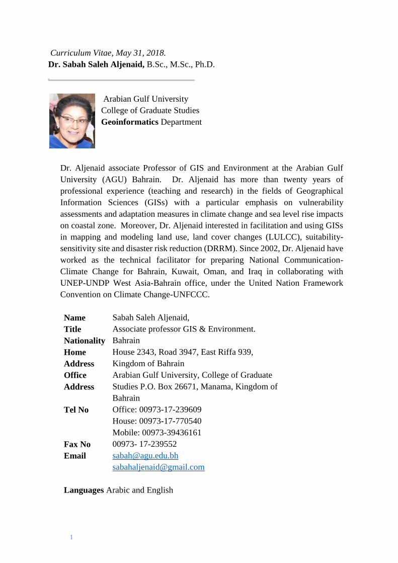
1
Curriculum Vitae, May 31, 2018.
Dr. Sabah Saleh Aljenaid, B.Sc., M.Sc., Ph.D.
Arabian Gulf University
College of Graduate Studies
Geoinformatics Department
Dr. Aljenaid associate Professor of GIS and Environment at the Arabian Gulf
University (AGU) Bahrain. Dr. Aljenaid has more than twenty years of
professional experience (teaching and research) in the fields of Geographical
Information Sciences (GISs) with a particular emphasis on vulnerability
assessments and adaptation measures in climate change and sea level rise impacts
on coastal zone. Moreover, Dr. Aljenaid interested in facilitation and using GISs
in mapping and modeling land use, land cover changes (LULCC), suitability-
sensitivity site and disaster risk reduction (DRRM). Since 2002, Dr. Aljenaid have
worked as the technical facilitator for preparing National Communication-
Climate Change for Bahrain, Kuwait, Oman, and Iraq in collaborating with
UNEP-UNDP West Asia-Bahrain office, under the United Nation Framework
Convention on Climate Change-UNFCCC.
Name Sabah Saleh Aljenaid,
Title Associate professor GIS & Environment.
Nationality Bahrain
Home
Address
House 2343, Road 3947, East Riffa 939,
Kingdom of Bahrain
Office
Address
Arabian Gulf University, College of Graduate
Studies P.O. Box 26671, Manama, Kingdom of
Bahrain
Tel No Office: 00973-17-239609
House: 00973-17-770540
Mobile: 00973-39436161
Fax No 00973- 17-239552
Email [email protected]
Languages Arabic and English
2
Education
• 2015: Fulbright Scholar Program. A program of the United States
Department of State Bureau of Educational and Cultural Affairs. Research
Visitor at the University of North Carolina at Wilmington 2015-2016.
Department of Geography and Geology. The Laboratory for Remote
Sensing (LRS). Wilmington, North Carolina, United States. Project
Title: Assessing the Carbon Sink: Captured and Stored Capacity of Coastal and
Marine Habitat in the Shallow Sea Area of The Kingdom of Bahrain Using
Survey, GIS and RS
• 2005: Ph.D. Environmental Studies/Technology, Institute of Graduate
Studies and Research, Alexandria University
• 1999: MSc. Geographical Information Systems (GIS), Leicester University,
UK.
• 1990: MSc. Desert Resources, Arabian Gulf University, Kingdom of
Bahrain.
• 1980: BSc. Geology/Economic, Kuwait University, Kuwait.
Employment History
• 1/8/2013-Tell Now: Associate Professor, Desert and Arid Zones Program,
College of Postgraduate Studies, Arabian Gulf University
• 1/8/2005-1/8/2013: Assistant Professor, Desert and Arid Zones Program,
College of Postgraduate Studies, Arabian Gulf University
• 1/9/1999--1/8/2005: Lecturer, Desert and Arid Zones Program, College of
Postgraduate Studies, Arabian Gulf University
• 1/4/1990 to 1/9/1999: Technician, Desert and Arid Zones Program, College
of Postgraduate Studies, Arabian Gulf University
• 28/10/1980 - 30/9/1988: Teacher, Ministry of Education
Lecturing and Teaching Experience 2005--- 2014
Courses
• Introduction to GIS
• Advance GIS and Geospatial Analysis
• Geostatistical Analysis
• GIS Applications and Problem Solving
• GIS Models and Modeling
• GIS Project
• GIS Seminar
• Field Research
• GIS/RS for Environmental Management
3
Professional Experience in Climate Change: 2006- April 2015
• 2016/2018: Member of the Third National Communication of Bahrain,
Committee- Climate Change report, Supreme Council for Environment,
Bahrain. (TNC-AGU Groups). Arabian Gulf University.
• 2016/2018: Coordinator of the Third National Communication of Bahrain,
Arabian Gulf University Groups. (TNC-AGU Groups). Arabian Gulf
University.
• 2016/2018: Technical Advisor for preparing ―The Vulnerability and
Adaptation Chapter in the Second National Communication of Kuwait.
(V&A): Collaborating with UN Environment Program, West Asia. The
Kingdom of Bahrain Office.
• Technical Advisor for preparing ―The Vulnerability and Adaptation
Chapter in the Second National Communication of Kuwait. (V&A):
Collaborating with UN Environment Program, West Asia. The Kingdom of
Bahrain Office.
• 2015: Member of Group of experts/preparing the document for: Lima
Adaptation Knowledge Initiative (LAKI). Prioritizing Adaptation Knowledge
Gaps in the Gulf Cooperation Council (GCC) Subregion. 15- 17 June 2015. Abu
Dhabi, United Arab Emirates.
• 2014: Assilah, Morocco 12-14, 2014: submitting a talk on: Socio-economic
and cultural heritage challenges and Constraints, the impact of climate
change in the Kingdom of Bahrain.
• 2014: Member of Group of experts: GEO SIDS: Global Environmental
Outlook Small Island Development States Outlook, 2014. UNEP. The
International Year of Small Island Developing States.
http://uneplive.org/media/docs/region/59/GEO_SIDS_final.pdf
• 2013: Member of the Vulnerability Assessment Working Group supports the
UN-LAS Regional Initiative for the Assessment of the Impact of Climate
Change on Water Resources and Socioeconomic Vulnerability in the Arab
Region (RICCAR).
http://www.escwa.un.org/RICCAR/ri.asp?ReferenceNum=RI
• RICCAR Vulnerability Assessment. First Meeting, Beirut, 29-30
January, 2013. ESCWA http://css.escwa.org.lb/sdpd/riccar/VA-WG-
Report.pdf
• RICCAR Vulnerability Assessment. Second Meeting, Beirut, 27-28 May
2013. ESCWA
http://css.escwa.org.lb/sdpd/riccar/VA-WGSept13.pdf
• Workshop on Applying the Climate Change Vulnerability Assessment
4
Methodology in the Arab Region. 11 to 13 May, 2014 , Beirut
http://www.escwa.un.org/information/meetingdetails.asp?referenceNum
=34 73E
• 2012: Technical Advisor for preparing ―The Vulnerability and Adaptation
Chapter‖ in the First National Communication of Sultanate of Oman.
(V&A): Collaborating with UNEP West Asia. The Kingdom of Bahrain
Office. http://unfccc.int/resource/docs/natc/omnnc1.pdf (published in
November 2012, UNFCC).
• 2011: Technical Advisor for preparing ―The Vulnerability and Adaptation
Chapter in the First National Communication of State of Kuwait. (V&A):
Collaborating with UNEP West Asia. The Kingdom of Bahrain Office.
http://unfccc.int/resource/docs/natc/kwtnc1.pdf (published in October 2013,
UNFCC).
• 2010: Technical Advisor for preparing ―The Vulnerability and Adaptation
Chapter in the First National Communication of Iraq. (V&A): Collaborating
with UNEP West Asia. The Kingdom of Bahrain Office.
http://unfccc.int/files/national_reports/nonannex_i_natcom/application/zip/ir
q-nc1-eng-12aug17.zip
• 2009: Member of West Asia Adaptation Network, UNEP-DEWA, 2009.
http://www.unep.org/rowa/KeyActivities/ClimateChange/tabid/101289/Def
ault. aspx
• 2008: Technical Facilitator for BSNC-CC: Bahrain Second National
Communication-Climate Change under UNFCCC, 2007/2008.
http://unfccc.int/resource/docs/natc/bhrnc2.pdf
• 2008: Team Leader of ―The Vulnerability and Adaptation Working Group
for BSNC-CC‖: Bahrain Second National Communication-Climate Change
under UNFCCC, 2007/2008.
• 2008: Team Leader for the ―Assessment of Coastal Zone Study, BSNC-
CC: Bahrain Second National Communication-Climate Change under
UNFCCC, 2007/2008.
• 2007: Helping in Preparing detailed Implementation Plan: Inception Report‖
for the Preparation of BSNC-CC: Bahrain Second National Communication-
Climate Change Project under the UNFCCC‖, 2007.
• 2007: Guiding and Helping in preparing ―BSNC-CC: Bahrain Second
National Communication-Climate Change Project under UNFCCC, 2007.
• 2006: Guiding and Helping in ―Stocktaking and Stakeholder Workshop‖ for
Bahrain First National Communication-Climate Change under UNFCCC,
2006.
• 2006: Helping in preparing detailed Curriculum development for the new
Postgraduate Diploma and Master Degrees Specialization/Program in
5
Geographical Information System (GIS) and Remote Sensing as part of the
"Desert & Arid Zones Sciences Program" Specialization -College of
Graduate Studies, Arabian Gulf University, 2006.
Scientific Publications (Reprints available on request)
• Assessing the spatial extent of seagrass in Bahrain using remote sensing and
survey data Sabah S. Aljenaid, Manaf AlKhuzaei, Ghadeer Khadem Redha,
Mohd Abido.
• Assessing the Loss of Mangrove Vegetation and Associated Carbon Stock in
Bahrain Using Remote Sensing and Geographic Information System. Sabah S.
Aljenaid, Eman Ghoneim, Ghadeer Khadem Redha, Mohd Abido.
• Integrating Remote Sensing and Field Survey to Map Shallow Water Benthic
Habitat for the Kingdom of Bahrain. Journal of Environmental Science and
Engineering B 6 doi:10.17265-2162/ 2017.04.002/5263. Sabah Aljenaid,
Eman Ghoneim, Mohammed Abido , Khalil AlWedhai , Ghadeer Khadim,
Saeed Mansoor, Wisam EL-Deen Mohd, and Nadir Abd Hameed.
• Assessment of land-use/land-cover change in Muharraq Island using multi-
temporal and multi-source geospatial data. Marjan Modara, Mohamed Ait
Belaid & Sabah AlJenaid. International Journal of Image and Data
Fusion, Volume 5, 2014 - Issue 3. Published Online: 04 Jun 2014.
http://www.tandfonline.com/doi/abs/10.1080/19479832.2014.904446?journalC
ode=tidf20
• Assessing and Analyzing the Driving Forces and Pressures of Land Use
/Land Cover Changes in the Kingdom of Bahrain Using GIS and DPSIR
Framework 1998-2012. (In Arabic). Sabah Aljenaid, Ghadeer Mod Redha,
and Nader Mousa.
• Assessment of Land Consumption Rate of the Main Island of the Kingdom of
Bahrain 1986-2012 using GIS and Remote Sensing. . (In Arabic). Sabah
Aljenaid, Nader Mousa, and Ghadeer Mod Redha.
• Vulnerability Assessment of the Coastal Area of the Kingdom of Bahrain
Isls to the Impacts of Climate Change Sea Level Rise. Sabah Aljenaid.
(In Arabic).
• Development of Coastal Vulnerability Index for The Kingdom of Bahrain.
Sabah Saleh Aljenaid. Journal of Earth Science and Engineering. USA.
Volume 2, Number 6, June 2012 (Serial Number 9).
• Sustainable Planning for Environmental Sensitive Area Using Multi
Criteria\Multi Objective Spatial Analysis: Case Study El-Dab'a, Egypt. Wisam
Mohammed and Sabah Saleh Aljenaid. Arab Gulf Journal of Scientific
Research. Arabian Gulf University. The Kingdom of Bahrain. 2012 issue 30
(23): 79-89.
6
• A Spatial Framework to Develop Land Use in an Environmentally-Sensitive
Area, Case Study: El Daba’a Region, Egypt. Part I: Ecological Value
Assessment Using GIS. Sabah Saleh Aljenaid and Wisam Mohammed. Arab
Gulf Journal of Scientific Research. Arabian Gulf University. The Kingdom
of Bahrain. Volume 26, Number 1/2 March/June 2008.
• Review of the Environmental Impact Assessment (EIA) of the North Town in
the Kingdom of Bahrain Using the Rapid Impact assessment Matrix (RIAM).
Waleed A. Alsaid, Sabah S. Aljenaid, and Waleed K Zubari. King Abdelaziz
University Journal: Meteorology, Environment, and Arid Land Agriculture
Sciences, vol. 23 (2): 227-250 (in Arabic).
• Assessment of Hafira Hazardous Industrial Landfill in the Kingdom of Bahrain
Using GIS and Basel Convention Standards. Sarah A Al-Bugmi, Sabah S Al-
Jenaid, Basil N Al-Yousfi, and Waleed K Zubari. Journal of the Gulf and
Arabian Peninsula Studies, vol. 38 (144), 2012: 227-251 (in Arabic). Spatial
and Temporal Trends in Groundwater Salinity in Bahrain. Zubari, W.K., Khater,
A.R., Al-Noaimi, M.A., and S.S. Al-Junaid. Arabian Journal for Science and
Engineering, June, 1997, vol. 22 (1C): 81-94.
• The Applicability of the WHO Drinking Water Guidelines to an arid
region. Zubari, W.K., Madani, I.M., Al-Junaid, S.S., and M. Al-
Noaimi. International Journal of Environmental Health Research, vol. 6 (4),
1996: 263-276.
• A Study of the Quality of Groundwater in Bahrain during the Period 1941 to
1992. Journal of Gulf and Arabian Peninsula Studies, vol. 78, 1995, pp. 99-
114, Zubari, W.K, Madany. I.M., Al-Junaid, S.S., and S. Al-Manaai (in
Arabic).
• Trends in the Quality of Groundwater in Bahrain with Respect to Salinity, 1941-
1992. Environment International, vol. 20, no. 6, 1994, pp. 739-746, Zubari,
W.K., Madany, I. M., Al-Junaid, S. S., and S. Al-Manaai.
Presentation Papers in Conferences and Seminars
• AAG, 2018: Association of American Geographic Annual Meeting: NEW
ORLEANS 2018: Assessing the spatial extent of seagrass in Bahrain using
remote sensing and survey data. 10 – 14 April 2018, New Orleans, USA.
• AAG, 2017: Association of American Geographic Annual Meeting: Boston
2017: Assessing the Loss of Mangrove Vegetation and Associated Carbon
Stock in Bahrain Using Remote Sensing and Geographic Information System.
5 -9 April 2017, Boston, USA.
7
• AAG, 2016: Association of American Geographic Annual Meeting: San
Francisco 2016: Integrating remote sensing and field survey to map Shallow
Water Benthic Habitat for the Kingdom of Bahrain. Sabah Saleh Aljenaid,
Eman Ghoneim,Ghadeer Mohd Redha Khadeem,Mohammad Sulaiman
Abido, Khalil AlWudaei, Wisam Mohd, Saeed Mansoor,Nadir Abdel Hameed,
March 29 - April 2, 2016. San Francisco, California, USA.
• KFAS, Kuwait, 18-21 December 2017: Our Seas, Theories, Data, and
Policies: The Impact of CC/SLR on the Western part of the Arabian
Gulf Coastal Area.
https://events.kfas.org.kw/Symposium/Programs
:تقبليةمستحديات التنمية رؤية : مؤتمر الدولي السابع، الكلية العلوم االجتماعية جامعة الكويتالكويت: •
24 -22مخاطر التغيرات المناخية وارتفاع سطح البحر على جزر مملكة البحرين.
• Regional Symposium on Climate Change, UAE, 13-15 March 2017. The
Abu Dhabi Global Environmental Data Initiative (AGEDI). Experience in
Climate Change Research AGU – Sabah Aljenaid.
https://vimeo.com/212899441
• Bahrain Third National Communication (TNC): First Workshop: 25
December 2016.
• Assessing the Vulnerability of School Buildings in Sur Town to Potential
Tsunami Damage, Hanan Y. AlHinai, Issa W. El-Hussain, Sabah S.
Aljenaid, Ali Elbatty. Reducing Tsunami Risk in the Western Indian
Ocean A Regional Conference 22-23 March 2015.
file:///C:/Users/sabah.AGU/Downloads/3-2-
Assessing_the_Vulnerability_of_School_Buildings_in_Sur_Town_to_Pote
ntial_Tsunami_Damage.pdf.
• Arab Climate Resilience Initiative Regional Forum. 3-5 November, 2010.
Skhirat-Rabat, Morocco. Mohammed VI International Conference Center.
UNDP Regional Bureau for Arab States (UNDP-RBAS). Arab Climate
Resilience Initiative
• Fifth Zayed Seminar on Climate Change: Impacts and Adaptation Policies in
the GCC. Bahrain, 19 May, 2010, S. Al-Jeneid. Arabian Gulf University,
Bahrain.
• The Potential Impact of Climate Change on GCC Countries. 2009. S.
AlJeneid. Engineering Congress on Alternative Energy Applications.
November 2nd –6th, 2009, KUWAIT.
• Ground water in GCC Countries, The Impact of Scarcity and Climate
Change. 2009. Amman, Jordan S. Al-Jeneid (Arabic).
• The Impact of Climate Change and Sea Level Rise on the Coastal of Bahrain
Islands. 2008. S. Al-Jeneid (Arabic).
8
• Designing a Spatial Database to Facilitate Road Maintenance Tasks.
International Federation of Surveyors (FIG) Working Week. 2011,
Marrakech, Morocco. Ali Nashwan, Mohd Belaid, and Sabah Aljenaid.
• The Potential Impact of Climate Change on GCC Countries. 2009. S.
AlJeneid. Engineering Congress on Alternative Energy Applications.
November 2nd –6th, 2009, Kuwait.
• Ground water in GCC Countries, The Impact of Scarcity and Climate
Change. 2009. Amman, Jordan S. Al-Jeneid (Arabic).
• The Impact of Climate Change and Sea Level Rise on the Coastal of Bahrain
Islands. 2008. S. Al-Jeneid (Arabic)
Participating in Preparing Reports
• Vulnerability Assessment Working Group Members. Arab Climate Change
Assessment Report, Main Report. Regional Initiative for the Assessment of
Climate Change Impacts on Water Resources and Socio-Economic
Vulnerability in the Arab Region. 2017. Aljenied, Sabah.
https://reliefweb.int/sites/reliefweb.int/files/resources/riccar_main_report_2017.
• Vulnerability Assessment and Adaptation Measures: Enabling activities for
preparation of Bahrain's Initial National Communication to the UNFCCC,
(2005).
http://unfccc.int/essential_background/library/items/3599.php?rec=j&priref=48
72 #beg
• Impact of Climate Change: Vulnerability Assessment. General commission
of the Protection of Marine Resources, environment & Wildlife, Kingdom
of Bahrain. Aljenied, Sabah and Mohammad S. Abido (2003).
• The Environment Outlook for the Arab Region. (Mohammad S. Abido and
Adel F. Abdel-Kader Scientific editors) (In Arabic) 436p.
http://www.unep.org/dewa/westasia/eoar
• 2010: Co-Author for Arab Coastal Zone in Environment Outlook for the
Arab region, 2010.
• Assessment of Coral reefs in the Marine area of the Kingdom of Bahrain.
Environment Authority, Kingdom of Bahrain. Abido, M.; e.t al. 2002.
• Global Environment Outlook 2000 Report (West Asia Sections), UNEP,
Nairobi Kenya. Abido, M. 1999.
• Environmental Data, Global GEO 2000-Technical Working Group. GRID,
Geneva. Abido, M. 1999.
• Environmental Data, Global GEO 3-Technical Working Group. GRID,
Geneva. Abido, M. 1999.
9
Scientific –Academic Committees
• Head of Geoinformatics Department, College of Postgraduate, Arabian
Gulf University, 2017, tell now.
• Member of Geoinformatics Department, College of Postgraduate,
Arabian Gulf University, 2017, tell now.
• Member of Graduate Studies College, Arabian Gulf University, 2016,
tell now
• Member of Academic Committee of Desert Science Program 2005-Tell
Now.
• Member of Academic Committee of Desert Science Program 2005-Tell
Now.
• Member of Academic Committee of Environmental Management
Program 2009-Tell Now.
• Member of Academic Committee of Integrated Water Resources
Management IWRM Program 2012-Tell Now.
• Member of College of Postgraduate Committee 2010/1011- 2011/1012.
• Member of Global Environmental Outlook Study team (GEO) at the
Arabian Gulf University (1996-2012).
• UNDP/GEF Climate Change Enabling Activity Project: The Kingdom of
Bahrain. Member of the Arabian Gulf University team to prepare
―Bahrain Vulnerability Assessment‖ in cooperation with the
Environmental Affairs, Ministry of Municipalities and Environment
(1999-2004).
Training Workshops
ير تغ –المنتسققققبة لليونيسققققكو التربية على التنمية المسققققتدامة البحرين البرنامج التدريبي لمنسقققققي مدار •
لخليج ون مع جامعة الجنة مدار البحرين المنتسققققققبة لليونيسققققققكو بو ارل التربية والتعلي بالتعا. المناخ(
.2016أكتوبر 7-5. مدرسة بحرينية حكومية وخاصة 70العربي بمشاركة
http://www.alwasatnews.com/ipad/pdf/5154/lst27.pdf
• Economic and Social Commission for Western Asia (ESCWA).
RICCAR Vulnerability Working Group. Second Meeting, Beirut, 27-28
May 2013.
• Economic and Social Commission for Western Asia (ESCWA)
Workshop on Applying the Climate Change Vulnerability Assessment
Methodology in the Arab Region Beirut, 11-13 May 2014.
• Vulnerability-Impact & Adaptation of Agriculture Sector in Jordan. 12-
14 April 2011. Arab Organization for Agriculture Development.
• Assessment of impacts, Vulnerability and Adaptation to climate change
in IRAQ. 4-6 July 2011.
10
• Vulnerability & Adaptation in Agriculture Sector: Sudan. 28-30
December 2010. Arab Organization for Agricultural Development
Participation in Projects and Studies
• 2010: Impact of Climate Change Vulnerability Assessment. (2010). In-
Second National Communication to UNFCCC. General Commission for the
Protection of Marine Resources, Environment & Wildlife. Kingdom of
Bahrain.
• 2010: Arab Environment Outlook (2010). Lead Author for Coastal Zone
Chapter. LAS /UNEP.
• 2004: Impact of Climate Change Vulnerability assessment. (2004). General
Commission for the Protection of Marine Resources, Environment &
Wildlife. Kingdom of Bahrain.
• 2002: Coral Reef Study - Bahrain, (2002). Environmental studies unit in the
Desert and Arid Zones Sciences Program, College of Graduate Studies,
Arabian Gulf University.
Participating in Conferences
• Eye on Earth Summit, December 12-15, 2011, Abu Dhabi, UAE. Organized
by Abu Dhabi Global Environmental Data Initiative (AGEDI), and the
Government of Abu Dhabi. http://www.eyeonearthsummit.org /
• UNDP Climate Resilience Initiative- Morocco (3-5 November)
UNDP/Regional Bureau for Arab States. Arab Climate Resilience Initiative.
Regional Forum Agenda. Mohammed VI International Conference Centre.
Skhirat-Rabat, Morocco – 3-5 November, 2010.
• Regional Consultation Meeting: Climate Change Impacts in the Arab Region:
Sea Level Rise, Coastal Erosion and their Impact on Economic and Human
Development, 20-21 September 2010. Cairo, Egypt.
• Fifth Zayed Seminar on ―Climate Change: Impacts and Adaptation Policies
in the GCC‖ 19-20 May, 2010. Presenting: Potential Impacts of CC/SLR on
GCC Countries Coastal Areas.
• Middle East Spatial Technology-MEST: 4th Conference. 10-12 December,
2007. Manama, Bahrain. Member Organizing Committee.
• Cairo: ISDR: 25-26 April 2012. Regional Workshop to Advance Disaster
Risk Reduction in the Arab region 2012. UNISDR Arab States
Participating in Workshops
11
• National Communications Support Program. V&A Workshop for Asia Pacific
Region 3-5 May 2011. Bangkok –Thailand. United Nations Development
Program. Global Environment Facility.
• Towards Sustainable Energy-Resources, Challenges, and Opportunities,
Collaboration between UNDP and AGU. UNDP and AGU. 6-7 October
2010.
• 5th Regional Training Course on ―Geographical Information System for
Disaster Risk Management (An Introductory Course), (GIS4DRM-5)‖ held
during the 16th - 27th August 2010 in Bangkok. Asian Disaster Preparedness
Center. Thailand.
• Training Workshop on Climate Change in Iraq, 4-8 July 2010, Climate
Change Adaptation & Mitigation in IQAR Amman, Jordan UNEP-UNDP.
• Workshop For TOT Linking Gender and Climate Change. Amman, Jordan. 9-
11 November 2009. Organizer: The Global Gender and Climate Alliance
(GGCA), and the International Union for Conservation of Nature (IUCN)
Ministry of Environment, Amman, Jordan.
• Assisting the State of Kuwait in Fulfillment of Reporting Obligation to the
United Nations Framework Convention to Climate Change (UNFCCC).
UNEP Regional Office for West Asia (2010).
• Workshop on Vulnerability and Adaptation Assessments for Asian Countries
21-23 July 2009. Kuala Lumpur, Malaysia. Under the auspices of the National
Communications Support Program (NCSP).
• Training Workshop on Climate Change For Iraq. 18-20 August 2008,
Amman, Jordan. UNEP (Trainer).
• Workshop on Second National Communications with emphasis on
Vulnerability and Adaptation Assessments for Asian Countries. 8-12
September 2008. Bangkok, Thailand. National Communications Support
Program (NCSP). (Trainee).
• West Asia Train the Trainers Workshop on The GEO Resource Book on
Integrated Environmental Assessment 11–13 June 2007, Manama, Kingdom
of Bahrain.
• MEST: Middle East Spatial Technology-MEST: 4th Conference. 10-12
December, 2007. Manama, Bahrain. Member Organizing Committee.
• MEST: Middle East Spatial Technology-MEST: 4th Conference. 10-12
December, 2007. Manama, Bahrain. Chair Technical Committee.
• CGE Hands-on Training Workshop on Vulnerability and Adaptation
Assessments for the Asia and Pacific Region. Jakarta, Indonesia, 20 to 24
March 2006. Framework Convention on Climate Change– Secretariat
Convention.
12
• The Joint Kingdom of Bahrain-Japan Symposium: Challenges on New
Horizon Towards Managing the Global Environment and Water Resources,
Bahrain, 18-20 January, 2004.
• Workshop on ―The Application of the Case Study Approach to Problem
Based Learning‖, 21-22 June, 2004, Arabian Gulf University, Bahrain.
• Training Workshop on Climate Change Impacts and Adaptation for
Coastal Zones —Abu Dhabi, United Arab Emirates, 8–12 May 2004.
(Trainee).
• Regional Workshop on Integrated Environmental Assessment and Reporting
(IEA&R), 6-9 January, 2003. Bahrain, UNEP/ AGU/ AGU.
• Workshop on Integrated Environmental Assessment (EIA) Methodology,
Bahrain, 9-11 December 2003, UNEP/ROWA.
• Regional Workshop on Integrated Environmental Assessment and Reporting.
Bahrain, 6-9 January, 2003. UNEP and AGU
• Workshop on Integrated Environmental Assessment Methodology. Manama,
Bahrain, 9-11 December, 2003, UNEP, AGU and CEDARE
• Global Environmental Outlook (GEO-1, 2 and 3) West Asia Regional
Consultation meetings, UNEP/ROWA (2001). UNEP, AGU and CEDARE.
• The First Middle East GIS Education Workshop, Center for GIS, Qatar, 16-
17 April 2000. Invited participant and representative of the Arabian Gulf
University.
• Integrated Environmental Assessment (IEA) and Alternative Environmental
Policy Scenarios for West Asia‖ Workshops,
UNEP/UNITAR/ACSAD/AGU, Arabian Gulf University, Bahrain, 18-23
November 2000.
• UNEP/UNITAR/AGU/ACSAD Regional Training Workshop on
Integrated Environmental Assessment and Alternative Environmental Policy
Scenarios for West Asia. Arabian Gulf University, Bahrain 18-23 November
2000.
• Data Handling, Processing, Management and Networking. Arabian Gulf
University, Bahrain, 18-23 September 2000.
• UNEP Training Workshop for ACSAD and AGU-GEO teams on ―Website
development and management and capacity building for processing and
distribution of electronic environmental data‖
• First Middle East GIS Conference, Bahrain Engineering Society, Bahrain, 19-
21 October, 1998. University representative; Chairman of ―GIS Application
in Natural Resources Management‖.
• Global Environmental Outlook (Regional
Consultation meetings, UNEP/ROWA (1998). UNEP, AGU and CEDARE
13
• Workshop on Introduction to Geographic Information System, Arabian Gulf
University, Bahrain, 20-23 April, 1996.
• Global Environmental Outlook (GEO-1, 2 and 3) West Asia Regional
Consultation meetings, UNEP/ROWA (1996). UNEP, AGU and CEDARE
• The Second Gulf Water Conference ―Water in the Gulf Region, Towards an
Integrated Management‖, Water Science & Technology Association
(Bahrain), Bahrain, 5-9 November, 1994.
• The First Gulf Water Conference ―Water and Development in the Gulf,
Challenges of the Nineties, Water Science & Technology Association
(WSTA), Bahrain, Dubai, 10-14 October, 1992.
Community Contributions & Volunteer Works
• GLOBE: National Specialist in GIS/Remote Sensing and Environment to
conduct training courses/yearly since 2000-NOW to Bahrain government
schools (35 Schools = 600 students with their supervisors) joined
―GLOBE‖ Programme: (GLOBE = Global Learning and Observations to
Benefit the Environment) since 2000/2012.
• GLOBE: The National Specialist for GLOBE Learning Program, Ministry
of Education, Kingdom of Bahrain to advise teachers, students and working
group in Environment and Climate Change. (GLOBE: a program
administered by the Ministry of Education/Bahrain, to Observe, Learn and
Benefit the environment), since 2000/2011.
• Chairperson of the Arbitration Award of His Highness Sheikh Khalifa bin
Salman Al Khalifa, Prime Minister for the municipal work, 2010, Ministry
of Municipalities Affairs and Agriculture, Kingdom of Bahrain.
• Chairperson of the Arbitration Award of His Highness Sheikh Khalifa bin
Salman Al Khalifa, Prime Minister for the municipal work, 2008, Ministry of
Municipalities Affairs and Agriculture, Kingdom of Bahrain.
• Produce maps needed for the preparation of "Guide of the shelf, marine and
coastal land reclamation and industrial shearing" in the Kingdom of Bahrain,
Ministry of Works, Kingdom of Bahrain. November, 2008.
• Follow-up, supervision and participation in training course: "The role of
women and youth in preserving the environment", 6-9 July 2008, the
Women's Union of Bahrain, Kingdom of Bahrain.
• Participation in the seminar for young people: a celebration of World Youth
Day, under the theme "Youth and climate change, it's time for change", which
was held during the period 11-13 August 2008, the organization of the
Secretariat of the Supreme Council for Women and General Authority for the
Protection of Marine Resources, Environment and Wildlife and the General
Organization for Youth and Sports.
14
• Chairperson of the Arbitration Award of His Highness Sheikh Khalifa bin
Salman Al Khalifa, Prime Minister for the municipal work, 2007, Ministry of
Municipalities Affairs and Agriculture, Kingdom of Bahrain.
Masters Co-Supervision
1. Abdukka Alshati: (September 2105). Analyzing the Spatial Distribution
Pattern of Fire Stations in the State of Kuwait and Selecting Optimal
Locations Using AHP and GIS. Sabah Saleh Aljenaid and Ahmed Ali Saleh.
2. Fawaz Abdullah Alenezi: (September 2105). Evaluation and Analysis of
Urban Open Spaces in the Capital Governorate in the State of Kuwait Using
Geographic Information Systems. Sabah Saleh Aljenaid and Mohammed
Sulaiman Abido.
3. Ismail Bin Hamad AlRewahi: (June, 2015). Assessing the Sites of Land
Allocated for Tourism Purpose in Nizwa State using Geographic Information.
Sabah Saleh Aljenaid and Yacoob AlBosaeedi.
4. Hana Abdel Malek AlObaid: (June, 2015).Building Web and Mobile GIS
Applications towards Facilitating Management of Sanitary Sewer System in
Jleeb Alsheyoukh Area in KuwaitAbdulla. Sabah Saleh Aljenaid and Hamdei
AlJameli.
5. Abdulla Gazi. (June, 2015): Analyzing and Assessing Refueling Gas Stations
Locations an Selection of Optimal new Sites using Geographical Information
System in Kuwait. Sabah Saleh Aljenaid and Anwar Shaikh Aldeen.
6. Abdel Aziz AlGhubaib (April, 2015): Mapping of Environmental Sensitivity
Index of Oil Spill for Kuwait’s Shorelines using Geographic Information
System.
7. Mashael AlMulhem (April, 2015): Analyzing the Causes of Asthma Attacks
among Intermediate Girl Students in the Province of AlAhssa Using Geographic
Information System. Sabah Saleh Aljenaid and Amr Darweesh.
8. Mohammed AlHazeem (March, 2015): Monitoring on Excesses of Southern
Region Chalets on Coasts of the State of Kuwait Using Geographic Information
System. Sabah Saleh Aljenaid and Hamdei AlJameli.
9. Hanan Yaqoob Adai Al Hinai. (December, 2013). Tsunami Risk Assessment
along the Coast of the Sultanate of Oman Using Geospatial Technologies. Issa
El-Hussain, Sabah Saleh Aljenaid and Ali Elbatty.
10. Fateema Redha Salman Hamad (December, 2012). Risk Assessment of
Campsites in Bahrain Oil Field and the Identification of Safe Camping Areas
Using Geographic Information Systems. Waleed Khalil Zubari, and Sabah
Saleh Aljenaid.
11. Hooreya Sayed Radhi Mohsen Alawi (December,
2012). Assessment of the Hazards of the spread of Service stations in the
15
Kingdom of Bahrain using geographic information systems. Ismaeel Moh’d Al
Madani, and Sabah Saleh Aljenaid.
12. Huda salman A. Aziz (2012). Environmental Risk Assessment of Fuel Stations
in Bahrain. Ebrahim A. Jalil, and Sabah Saleh Aljenaid.
13. Fawzeya Ali Abdul Wahab rajab (September, 2010). Mapping Risks Due to
Rising Sea-Level and Assessing Resilience and Preparedness in the Kingdom
of Bahrain. Mohamed Ait Belaid, Sabah Saleh aljenaid, and Anwar Shaik
Eldin
14. Buthaina Abdulla Hashem (2011). Calculating and Revising the
Environmental Vulnerability Index for the Kingdom of Bahrain-2010. Waleed
Khalil Zubari, Sabah Saleh Aljenaid.
15. Manal Adnan Hasani (April, 2011). Assessing and Analyzing Coastal and
Marine Area Using Environmental Indicators in the Kingdom of Bahrain.
Mohamed Ait Belaid, Sabah Saleh Aljenaid. Fatimah Madan Ali Fateel
(June, 2011). Assessment of the Potential Impacts of Sea Level Rise on the
Erosion of Some Coastal Islands of the Kingdom of Bahrain Usong Bruun Rule
and Geographic Information Systems. Amr A. El-Sammak, and Sabah Saleh
Aljenaied.
16. Fatemah S. F. Almasoud (May, 2011). Assessing the Driving Forces and
Pressures of Land Cover/Land Use Changes (LCLUC) in Kuwait, 1990-2008
Using GIS/RS. Mohamed F. Hamoda, Sabah Saleh Aljenaid, and Mamdouh
M. Abdeen.
17. Thekhra Saeed A. Akhwan (April, 2011). Assessment of the Vulnerability of
the Coastal Areas of the Kingdom of Bahrain to Climate Change and Sea Level
Rise and its Effects on Biodiversity in the Territorial Waters. Saeed A. Alkhuzai
and Sabah Saleh Aljenaied.
18. Mai Khalid Ahmed Al Merraikhi (January, 2011). Building A GIS to
Determine and Analyze Sustainable Development Density (SDD) in
The Kingdom of Bahrain, Using the Urban Carrying Capacity (UCC).
Mohamed Ait Belaid, Sabah Saleh aljenaid.
19. Nasreen Nasser A. Al Turaki. (January, 2011). Assessing CO2 Sinks
Capacity in the Kingdom of Bahrain:: A Comparative Analysis of Green Areas
1990---2008 Using GIS. Ahmed Ali Saleh and Sabah Saleh Aljenaid.
20. Marjan A. Rasool Habib Modara (April, 2010). 2010). Quantifying and
Assessing Carbon Quantity Resulting from LULCC in the Kingdom of Bahrain
1986– 2008. Ahmed Ali Saleh and Sabah Saleh Aljenaid.
21. Ali Nihad Hussein Nashwan (June, 2010). Designing a Spatial Database to
Facilitate Road Maintenance Tasks to Reduce Environmental Pollution.
Mohamed Alt Belaid, Sabah Saleh aljenaid.
16
22. Shaikha Mohamed Saleh Ghuloom (June, 2010). Assessment of the Potential
Impacts of Municipality Solid waste Management on Greenhouse Gases
Emission in the Kingdom of Bahrain ans Utilization of GIS in Selecting a New
Landfill Sites. Basil N. Al-Yousfi, Sabah Saleh Aljenaid.
23. Meshal M. G. Abdullah (June, 2010). Determination of Optimum Locations
for Municipal Solid Waste Landfills in the State of Kuwait Using Geographical
Information Systems (GIS). Waleed Khalil Zubari, Sabah saleh Aljenaid, and
Jassim M. Al Ali.
24. Ghadeer Mohammed Redha Abdulla (October, 2010). Quantifying and
Assessing Carbon Quantity Resulting from LULCC in the Kingdom of Bahrain
1986– 2008. Ahmed Ali Saleh and Sabah Saleh Aljenaid.
25. Mohammed Khamis saif Ali Al Mazaini (June, 2009). Integrated
Environmental Assessment of Mangrove Ecosystem in Muscat Governorate in
the Sultanate of Oman. Asma Ali Abahussain, and sabah Saleh Aljenaid.
26. Sarah Ayedh N. Albugami. (November, 2008). Assessment of Hafira
Hazardous Waste Landfill in Kingdom of Bahrain By Using GIS and Basel
Convention Standards. Walid K. Zubari, Sabah Saleh Aljenaid, and Basil N.
Al-Yousfi.
27. Waleed Alsaeed. (March, 2008). Review of the Environmental Impact
Assessment (EIA) of the North Town in the Kingdom of Bahrain Using the
Rapid Impact Assessment Matrix (RIAM). Waleed Khalil Zubari and Sabah
Saleh Aljenaid.
28. Eman Khalifa Mohammed (February, 2008). Development of A Meiofauna
GIS to Investigate Meiofauna Status in the Kuwait Beaches. Waleed Hamza,
and Sabah Saleh aljenaid.
29. Mohd Rashid Mohamed Al Hassani (October, 2007). GIS Based Indicators
of Pressure of Land Use Change in Al Fujairah Emirate Coastal Area During
the Period 1995-2006. Ibrahim Abdel Gelil, and Sabah saleh Aljenaid.
30. Yasser Noor Eldeen (September, 2006). Geographical Information
Management System For Bahrain Fisheries Resources ―Conservation and
Management Perspective‖. Saeed Abdulla Mohamed, Sabah Saleh Aljenaid,
and A.Jalil Mahmoud Zainal.
Copyright © 2022 FDOKUMEN