DISTRICT DISASTER MANAGEMENT PLAN 2019-20 | Manipur
111
DISTRICT DISASTER MANAGEMENT PLAN 2019-20 OFFICE OF THE DEPUTY COMMISSIONER/DISTRICT MAGISTRATE THOUBAL DISTRICT, MANIPUR
-
Upload
khangminh22 -
Category
Documents
-
view
0 -
download
0
Transcript of DISTRICT DISASTER MANAGEMENT PLAN 2019-20 | Manipur

DISTRICT DISASTER MANAGEMENT
PLAN
2019-20
OFFICE OF THE
DEPUTY COMMISSIONER/DISTRICT MAGISTRATE
THOUBAL DISTRICT, MANIPUR

ABBREVIATION PREFACE To be prepared by the District Magistrate FORWARD To be prepared by the Addl. District Magistrate
CONTENTS 1. Introduction 1-15 1.1. District Profile 1.2. Administrative Setup 1.3. Administrative Division 1.4. Location & Geography 1.5. Climate 1.6. Roads 1.7. Rivers & Lakes
1.8. Hills 1.9. Agriculture 1.10. Flora &Fauna 1.11. Fishing
1.12. Demographic Profile 1.13. Topography 1.14. Mineral Resources 1.15. Tourism 1.16. Land Holding Pattern 1.17. Livelihood Pattern 1.18. Infrastructure Pattern 2. Multi Hazard Disaster Management Plan 16-17 2.1. Why is it? 2.2. Objectives 2.3 Type of Disasters experienced in the District 2.4. Disaster Management Cycle 3. Hazard, Vulnerability , Capacity & risk Assessment 18-22 3.1. Vulnerability to Earthquake 3.2. Vulnerability to Floods 3.3. Vulnerability to Thunderstorm/Hailstorm 3.4. History of Past Disaster 3.5. Seasonal Hazard Analysis 3.6. Disaster Probability 3.7. Risk Assessment 3.8. Capability Analysis 3.9 Resource Inventory (As in annexure) 4. Institutional Arrangement for Disaster Management 23-39 4.1. Institutional Setup under DM Act, 2005 4.2. District Disaster Management Authority
4.3. DM organisation at District level 4.4. District Disaster Management Committee
4.5. Roles & Responsibilities 4.5.1. Reporting Chart 4.5.2. Roles & Responsibilities of ADM 4.5.3. Roles & Responsibilities of Emergency Officer 4.5.4. Roles & Responsibilities of Police

4.5.5. Roles & Responsibilities of Home guard/NSS/NCC/NYK 4.6. District Control Room and linkage with other control room at state & district level 4.6.1. District Control Room
4.6.2. Purpose of District Control Room 4.6.3. Preparatory action for District Control room 4.6.4. Staffing for District Control Room 4.6.5. Coordination structure at District Level 4.8. Control room at sub-division, Tehsil and Block level 5. Prevention & Mitigation Measures 40-45 5.1. Structural Mitigation Measures 5.2. Non-Structural Mitigation Measures 5.3. Sector-Wise vulnerability measures in Imphal East District 6. Preparedness Measures 46-55 6.1. Identification of Stakeholders involve in Disaster Management 6.1.1. Early warning 6.1.2. Search & Rescue 6.1.3. Evacuation
6.1.4. Damage & Loss Assessment 6.2. Training, Capacity Building & other Proactive Measures 6.3. India Disaster Resource Network(IDRN) 7. Response Measures 56-80 7.1. Short Term Plan 7.2. Long Term Plan 7.3. Role of District Administration/District Magistrate 7.4. Action Plan for ESF in the District 7.5. Action Plan for NGO, NSS and NYKs 7.5.1. Organised activities of NGOs, NSS, NYKs at different Stages of Disaster Management 7.6. Disaster Response and District Incident Command System 7.7. Incident Command System 8. Recovery & Reconstruction Measures 81-88 8.1. Strategies for restoring physical infrastructures and lifeline services 8.2. Sector Wise Damage and Loss Assessment 8.2.1. Power 8.2.2. Health 8.2.3. Social Sector 8.2.4. Water 8.2.5. Road & Transport 8.2.6. Communication 8.2.7. Food & Civil Supplies 8.2.8. Housing 8.2.9. Public Infrastructure 8.3. Long Term Recovery programme 8.4. Grievance Redressel System 9. Financial Arrangement for Implementation of DDMP 89-90
9.1 Source of Fund at National & State Level 9.2 Disaster Response & Mitigation Fund 9.3. Responsibilities of State Department & Agencies
10. Monitoring, Evaluation, Updation & Maintenance of DDMP 91-93 10.1. Preparation & Updation of Plan 10.2. Coordination with other agencies for implementation of DDMP

11.Operational Guidelines for Different Disasters 94-102 11.1. Earthquake 11.2. Floods 11.3. Fire Hazards 11.4. Landslides 11.5. Lightning & Thunderstorms ANNEXURES: Annexure 1: Earthquake Zonation Map of Imphal East District Annexure 2: Rainfall Data for Imphal East District * Annexure 3. Contact Details of the DEOC * Annexure 4: Department Wise Nodal Officer List* Annexure 5: Contact Details of the Block Control Room with nodal Officer* Annexure 6: List of Panchayats and Contact Details* Annexure 7: List of PHC/PHSC/CHC with Staff Strengths* Annexure8: Any other information relevant to DM Plan* Annexure 8: Resource Inventory * To be prepared by the District administration

ABBREVIATIONS
AAI Airport Authority of India
ATIs Administrative Training Institutes
BIS Bureau of Indian Standard
BPL Below Property Line
CBDM Community Based Disaster Management
CBOs Community Based Organisations
CDVO Chief District Veterinary Officer
CSCs Community Service Centres
DDMA District Disaster Management Authority
DDMP District Disaster Management Plan
DM Disaster Management
DM ACT, 2005 Disaster Management Act, 2005
EOC Emergency Operations Centre
GIS Geographic Information System
GOI Government of India
HPC High Powered Committee
HRD Human Resource Development
HR Human Resources
IT Information Technology
MIS Management Information System
NCC National Cadet Corps
NCDM National Committee on Disaster Management
NDMA National Disaster Management Authority
NDMRCs National Disaster Mitigation Resource Centers
NDRF National Disaster Response Force
NSS National Service Scheme
NYK Nehru Yuva Kendra
NGOs Non-Governmental Organisations
NBC Nuclear, Biological and Chemical
PRIs Panchayati Raj Institutions
SDMA State Disaster Management Authority

SEC State Executive Committee
SOPs Standard Operating Procedures
PWD Public Works Department
PHED Public Health Engineering Department
IFCD Irrigation & Flood Control
IRS Incident Response system
IRT Incident Response Team
QRT Quick Response Team
MARG Mutual Aid & Response Group
NYK Nehru Yuva Kendra
SOC Site Operation Centre
DCR District Control Room
DEOC District Emergency Operation centre
EO Emergency Officer
DIO District Information Officer
IEC Information, Education & Communication
1.1. District Profile
The district of Thoubal, which occupies the bigger portion of the eastern half of
Manipur Valley, takes the shape of an irregular and elongated triangle with its base
facing north. It is bounded on the north by Imphal East district, on the east by
Senapati and Chandel districts, on the south by Chandel district and on the west by
the districts of Imphal West and Thoubal. The district has an area of 514 sq.kms. as
supplied by the Surveyor General of India. Its average elevation is not very much
different from the rest of the Manipur Valley, which is about 790 metres on an
average above the mean sea level. Although the district is a part of the valley, the
area of the district is not entirely plain. Many rivers flow through the district and
many lakes dot its surface, some of which are closely inter-twined with many folk
tales and stories, of which mention may be made of the fishing and other episodes
of the love story of the legendary Khamba-Thoibi. In fact, all-important lakes of
Manipur, with the exception of Loktak, are in this district. The State of Manipur used
to supplement its meagre resources from the annual lease of the lakes in the past.
Although little is known about its ancient history, the district has, in recentpast,
seen many bloody and disgraceful battles. Through the district runs on an
international road that leads to Myanmar (Burma) via Moreh and Tamu and this road
is, in the days before the independence of India, the route of many military,
expeditions and counter-expeditions by the forces of Manipur and Burma and, later
on, by that of the British government. It is in this district, on the bank of Khongjom
river, that the last battle of the independence of Manipur was fought on 23rd April
1891 by a few and ill-equipped soldiers of Manipur against the might of the British
empire . It is not just an irony of fate that Major Paona Brajabashi and others meet
their last days in this battle. The battle symbolizes the honourable deed of an
extreme sacrifice for hismotherland, knowing fully well that the fight would mean sure
defeat.
Among the natural calamities that had occurred in the past, mention may be
made of the serious cholera epidemics of 1931, which took a heavy toll of the district
Chapter 1: Introduction

population. Although the epidemic was widely spread throughout the Manipur valley
it was felt heavier in the district. The district came into existence in May, 1983
through a notification of the Government of Manipur, (Secretariate:Revenue
Department Order No. 6/1/73-R(Pt.VII) dated May24,1983), (Manipur Extraordinary
Gazette No. 76 of the same date) under the Manipur Land Revenue and Land
Reforms Act, 1960. By the said notification, Thoubal sub-division of the erstwhile
Manipur Central district(now Imphal district) with all it s administrative units was
transferred to form a new district under the name of Thoubal with its headquarters at
Thoubal. Later, in November 1983 Thoubal was bifurcated into Thoubal and
Kakching sub-divisions. Kakching sub-division again comprises Kakching and
Waikhong Circles with their all existing villages (Manipur Gazette Extraordinary
No.343 dated November, 25,1983), the headquarters of Kakching sub-division being
at Kakching. Yet a new sub-division namely, Lilong sub-division came into existence
vide Govt. Gazette No. 104 dated 17.6.1997 this bringing tota lnumber of sub-
divisions to three. The district has two community development blocks one each at
Thoubal and Kakching sub-division. It has 9 main towns namely, Lilong Pt. in
Thoubal, Yairipok, Sikhong Sekmai, Wangjing, Heirok, Kakching, Kakching Khunou
and Sugnu and a part of Samurou whose major portion is in the Imphal West
District. Thoubal and Kakching are Municipal Councils.
1.2. Administrative Setup
The District Magistrate-cum-Deputy Commissioner (Collector) is the head of
the district. He is assisted in this work by other officers and staff as are appointed
from time to time. Maintenance of law and order, revenue administration, economic
development of the region are the basic duties of the District administration. The
district is divided into a 3 major units (Sub-divisions). Each unit is in the charge of a
Sub-Divisional Officer (SDO) who is concurrently a Sub-Divisional Magistrate. Till
1991 Census, The district had two Sub-Divisions namely Kakching Sub-Division and
Thoubal sub-divisions.By Manipur Gazettee No. 104 dated June 17,1997 another
sub-division namely Lilong sub-division was created out of Thoubal Sub-Division
making thus the total of Sub-Division to three.The district has smaller administrative
circles under charge of by Sub-Deputy collectors. The District has seven such
circles. Two Community Development Blocks function in the district having their

headquarters respectively at Thoubal and Kakching. Other district heads such as
Superintendent of Police. District Officer (Horticulture & Soil Conservation), Chief
Medical Officer, Zonal Education Officer, etc. alsohave their Offices located at
District Headquarters Thoubal.
The district is one of the four Valley Districts of Manipur and is situated in the
Central region of the State. Consequent upon enactment of the 73rd Constitution
Act, 1992 the Manipur Panchayat Raj Act, 1994 was enacted which became
effective from 24th April, 1994. This act was subsequently amended in 1996. The
act extends to Thoubal district as well. Under the act two tier Panchayat system
has been established namely, Gram Panchayat and Zilla Parishad.Poverty
alleviation and rural development programmes come under Panchayat.
1.3. Administrative Division
1.4. Location & Geography
The district occupies the bigger portion of the eastern half of Manipur valley. It
lies between 23.45’N and 24.45’ N latitude and 93.45’E and 94.15’E longitude. The
district is bounded by Imphal west and Imphal east districts on the North, by Ukhrul
and Chandel districts on the East, Chandel and Churachandpur districts on the south
and by Inphal west and Thoubal districts on the west. Although it is a part of Manipur

valley, the area of the district is not entirely plain as many rivers flow through the
district and many lakes and small hills dot its surface.
1.5. Climate
On the whole, the district has an equitable and pleasant climate. Rainfall is
relatively abundant and widespread. The rainy season starts in June with the onset
of the south-west monsoon and last upto September. Intermittent rains continue
even upto October along with the retreat of the monsoon. As in the rest of the State,
the district is also under the effect of the so-called ' Vagaries of the monsoon' with
the alternating droughts and floods. During the rainy season the rain water in the hills
quickly flow down to the valley and all the rivers and small streams rises to the full
brim, frequently flooding its embankments. As the lakes became full, the low lying
areas around them are easily amenable to flood. Drainage is slow and takes a long
time. The cold season last from December to February. During the winter months
light rainfall occurs under the influence of the north-east monsoon, March and
October are by far the most pleasant months in the year. April and May are not hot
season followed by occasional thunder storms. Of Late, some changes in the
climate calendar in the state are observed which some expert meteorologists
attribute the cause as mainly due to deforestation in the hills surrounding the valley.
The only centre which records authentic meteorological records in the district
is the Rice Research Centre, Wangbal. Rainfall recorded there in 1989 is
1306.80mm as against a mean annual rainfall of 1318.39mm during 1983-89. For
the sake of comparison with its neighboring Imphal district, the corresponding figures
recorded at the State Mechanized Farm at Lamphelpat ( Imphal ) are 1391.20mm
and 1243.50mm respectively. The summer months are never oppressive with the
average maximum temperature fluctuating between 32°C to 35°C during April-June,
the mercury seldom going beyond 37°C. In December-February with the start of the
cold winter months the average minimum temperature fall to 6°C to 4°C, the
temperature going below 0°C.

1.6. Roads
A very important road i.e. National Highway No. 39 runs through this district and
the same leads to Myanmar (Burma) via Moreh and Tammu. In the days before the
independence of India this road having a historical significance was used as the
main route of many military expeditions and counter expedition by the forces of
Manipur and Burma (Myanmar) j and later on by the British Government. This road
i.e. NH-39 is the main life line of the people in this district.
1.7. Rivers& lakes
Important rivers that flow through the district are the Imphal and the Thoubal.
The Thoubal river originates in the hill ranges of Ukhrul and is an important tributory
of the Imphal river. On its course, it passes through Yairipok and Thoubal before
joining the Imphal at Irong near Mayang Imphal. The Imphal river rises in the hills of
Senapati district and flows south. It forms the boundary demarcating line of Thoubal
district on its north and the west. During the dry seasons these rivers are lean and
thin but, during the rainy monsoon periods these rivers are very wild and frequent
floods occur causing widespread damage to the paddy fields, property and life.
These rivers were once good means of transport for valuable merchandise. Other
rivers in the district are the Wangjing, the Arong and the Sekmai. These rivers
originate in the hills of Ukhrul district. The Arong river flows through Khangabok and
falls into Kharung Pat. The Wangjing river flows west via Heirok and Wangjing before
joining the Loushi Pat. With the advent of cheap and faster means of road transport
these rivers no longer serve as routes of transportation of goods. Still they provide
good building materials in the shape of sand, pebbles and boulders and a means of
livelihood for a large number of people inhabiting along their courses.
The south-western portion of the district is a low-land forming a part of the
Loktak Lake region and this area has a number of shallow and rain fed lakes, the
important ones being Kharung, Ikop, Pumlen, Lousi and Ngangou. On the northern
portion there is Waithou lake form by the drainage waters sandwiched between
Waithou hill on the west and the villages and paddy fields on the east. Due to
constant siltation and reclamation of vast areas for agricultural purposes the lakes

are gradually shrinking in size and at present some of them are only in name. These
lakes drain into the Imphal river. They provided very good fishing ground for a variety
of fishes in the recent past.
1.8. Hills
The district is dotted by a few hillocks and hills of low heights. Some of them
are without, part of Khekman range, Mantak, Kwarok and Thongam Mondum-
Punam. Of these, Punam hill has an elevation of 3310 ft. above sea level.
Geologically, Khekman range belongs to the Brail Series and Simsang formation.
Good vegetation once covered these hills. But constant deforestation have made
them barren and unattractive. As the pressure on land increases with a rapid
increases in population, there has been a tendency in recent years to use the hills
sites for better productive plantation, specially pineapples.
1.9. Agriculture
Agriculture Is the most important source of livelihood for the people of the
district. More than 70 per cent of the total population of the district are directly or
indirectly depended on agricultural activities. The valley is fertile and the topography
of the district provides good opportunity for irrigation, natural as well as artificial. Rice
accounts for above 90% of the total land area under cultivation. Although the
average land holding is one of the lowest in India, yield per acre is comparatively
high. With the increasing use of fertilizers and the modern methods of cultivation,
there is a great scope of increasing the overall production.
In food grains, Thoubal is a surplus district producing above 75,000 tones of rice
in 1987-88 accounting for above 25% of the total rice production in Manipur. The
Kakching belt which provides more than 50%of the total rice exports of the district
may be rightly termed as the 'rice basket of Manipur'. The soil of the district is fertile
and with the help of irrigation facilities from the Imphal barrage, the Thoubal
Multipurpose Project, Sekmai barrage and other minor irrigation works, double
cropping is widely practiced in the district.

In some areas, even triple cropping is practiced - the first paddy crop starting late
February or early March, second paddy crop in July and early August and the third
crop of mustard seeds, pulses etc in November.
Other crops grown in the district are sugarcane, oilseeds, maize, potatoes,
pulses, chilies, vegetable etc. The district is the largest producer of sugarcane in
Manipur. Its cultivation is mainly confined to Thoubal, Wangjing, Kakching, Kakching
Khunou and Wabagai. Although maize is grown throughout the district, it is cultivated
as major cash crop around Serou, Pallel and Kakching belt. Oilseeds, mainly
mustard seeds, are found all over the district. Recently cultivation of sunflower has
also started. Vegetables such as cabbages, cauliflower, brinjal, different kinds of
peas, gourds, pumpkins etc are found in abundance.
Among the plantation crops, pineapples are the most important and are cultivated
in the slopes of low hills and hillocks. Langdum, Waithou and Poirou Tangkhul are
mainly important for these crops. Although tea plantation is yet to take its shape in
the district a blend of local variety of very good taste is grown in Pallel and Waikhong
area. Tobacco was once cultivated in the district widely. Another important plantation
crop is chilies.
1.10. Flora and Fauna
Various types of trees are found all over the district. But the more commonly
found varieties include Pipal trees. Kabulliua, ( Oravila robusta ), Khok ( Albizzia
Spp), Tera ( Salimalia Malabarica ), Sileima ( Eugenia pracox), Tairen ( Cedrela
loona ) etc. Bamboos and plantain trees are common everywhere. Various types of
fruit-bearing plants also thrive in the districts. Important varieties are pineapple, pear,
peach, Jack fruit, banana, mango, lemon, plum, guava, amla etc. The habit of the
local people to plant banyan trees along the road side and bamboos and fruit bearing
trees within their compounds give the rural areas a permanent green scenery.
Recently, the Government as also introduced plantation of quick growing trees under
the social forestry programme along the road side.
In spite of its rich vegetation, due to the absence of any forest worth the name
within the district wild animals are not found abundantly, Deer and Jungle fowl are

some of the varieties found at present occasionally along the slope of eastern hills
adjoining the district. But the lakes support a variety of wild birds such as partridge,
snipe, duck, geese, etc. particularly in winter months. These birds are mostly
migratory in character. Some of them are seen coming from far off Siberia. With the
gradual conversation of the lakes into agricultural lands these migratory birds are
seen in increasingly fewer members in recent times.

1.11. Fishing
Fishing provides an important occupation for a large number of people in the
district. The activity Is mainly conducted in the lakes and the enclosed low lands
besides small ponds within the precincts of the household. Waithou, Kharung and
Ikop are specially important for 'Ngaton', a variety of small fish noted for its taste.
This fish as also Ngaaroi, Pengba, Tharak, Ngahou, etc. ( all local names ) was
once caught in the lakes Of the district in good measures. But the large scale use of
pesticides for agricultural purposes and the reclamation of the habitat and the special
breeding grounds of these fishes are largely responsible for their gradual
disappearance from the lakes and their catch now-a-days is almost negligible. There
are 2 fish farms in public sector and 44 farms in private sector during 1987-88.
Production table fishes in that year amounted to 3.5 tones and fish fingerlings to 11.9
lakhs numbers.
1.12. Demographic Profile of Thoubal District (2011 census)
Actual Population 422,168
Male 210,845
Female 211,323
Rural Population 270,835
Urban Population 151,333
Population Growth 15.90%
No. of Villages 103
Area Sq. Km 514 sq.km.
Density/km2 821 persons
Sex Ratio (Per 1000) 1002
Average Literacy 74.5
Male Literacy 85.00
Female Literacy 64.1
Total Child Population (0-6 Age) 60,556
Male Population (0-6 Age) 31294
Female Population (0-6 Age) 29,262
Literates 269,304

Male Literates 152,617
Female Literates 116,687
Illiterates 152,864
Male Illiterates 58,228
Female Illiterates 94,636
SC Population 40,593
ST Population 1808
Total Workers 195,319
% Main Workers 31.6
% Marginal Workers 14.7
Child Proportion (0-6 Age) 13.19%
Boys Proportion (0-6 Age) 13.63%
Girls Proportion (0-6 Age) 12.74%
1.13. Topography
The soil of the district are clay soil, Loamy soil, Red soil, Peaty soil and sandy
soil thatmakes the district very fertilefor agricultural crops. The important Lakes in the
district arethe Ikkopat ,thepumlenpat,thelousipat, the kharungpat and the Waithou
pat. These lakesprovises a good fishing facility to the people and provide a means of
livelihood. The mainrivers that flow through the district are the Thoubalriver, The Iril
River, The Imphal Riverand the Sekmai River. The Thoubalriver originates from the
hill range of adjoiningUkhrul district over which the Thoubal Dam is constructed.The
district is dotted by a few hillocks and hills of low heights. Some of them arewithout,
part of Khekman range, Mantak, Kwarok and ThongamMondum-Punam.
1.14. Mineral Resources
The district is generally poor in mineral resources. Among the minerals found in
the district, brine spring are of some significance. This springs are found along the
foothills on the eastern part of the valley. Water from this springs are boiled and salt
is extracted by the method of evaporation.
Salt is manufacture in the form of beautiful cakes and they are consider to have a
good medicinal property. These salt cakes are used in ceremonial purposes also.
Important places where brine springs are found are Waikhong, Sikhong,
Chandrakhong, Ningel etc. The district has a number of places where red clay
suitable for pottery is found. These are mainly available on the eastern side of the
valley around Waikhong, Nongpok Sekmai, Thongjao, Chairel etc. Naturally these
areas are associated with pottery of very good types. Some qualities of low grade
iron ore is found at Kakching.
1.15. Tourism
Khongjom
It is situated above 10 kms. to the south of Thoubal, the district headquarters ( 32
kms from Imphal ). It is the place where last war of Manipur's independence was
fought between the Manipuri and the British soldiers. It has got a memorial erected
on a small hillock, Khongjom is well served by the National highway. An eight-
bedded Tourist home has been functioning there since 1988.
Sugnu
Situated 74 kms. from Imphal, the place is an important trading centre on the
south of the district. From it a Beautiful view of the Imphal river can be seen. It is on
the Imphal - Sugnu State highway.
Waithou
The place is important for its scenic beauty. There is an inspection bunglow on
the hill-side over looking the Waithou Lake. The place is noted for its tasteful
pineapples. An exotic and delicious variety of local fish known as 'Ngaton' used to be
available at this place abundantly till a few years back from now. It is on the National
highway about 3 kms. from the district headquarters.
Kakching
It is the sub-divisional headquarters of Kakching sub-division and is a famous
trading centre of a variety of vegetables, fishes and rice next to Thoubal, the biggest
town in the district. The place is easily approachable from the National highway and
is connected to the other State highways.
Thoubal

It is the district headquarter of Thoubal district and also the sub-divisional
headquarters of Thoubal sub-division. Situated at a distance of 22 kms. from Imphal,
the National highway No. 39 divides the town almost into halves from north to south
length-wise. The Thoubal river flows through the centre of the town from east to
west. It is the biggest town in the district and is one of the most important trading
centre of the district. The town has all the infrastructures of a fast developing urban
area.
Pallel
It is a place situated at the border of Thoubal and Chandel districts and is the
meeting place of plain areas of Thoubal and the hill areas of Chandel. Indo-Myanmar
road from Imphal to Moreh passes through it. With its hills and rivers the place has a
beautiful landscape. Typical agricultural Products and nice handicrafts of the hilly
people are regularly found in its daily market.
1.16. Land Holding Pattern
Sl.
No
Name of the GIP Big
farmer
Marginal
farmer
Small
farmer
Agricultural
labors
Landless Total
1 Atoukhong 214 63 1219 311 1807
2 Leishangthem 68 38 380 270 756
3 Khekman 20 600 400 1125 75 2220
4 Moijing 200 680 300 1180
5 Irong cheraba 20 300 200 347 714 1581
6 Maibam Uchiwa 50 300 200 800 98 1448
7 Wangkhem 285 500 1700 105 2590
8 Wangkhem 11 436 269 1600 260 2570
9 Leirongthel Ningthel 855 429 3233 1293 5810
10 Charangpat 1050 2100 1218 4368
11 Kangyambem 500 70 350 1000 1920
12 Khangabok Part I 35 260 125 1265 110 1795
13 Khangabok Part II 20 115 97 1120 105 1350
14 Khangabok Part III 550 210 1040 10 1905
15 Heirok Part I 5 361 30 830 113 1236
16 Heirok Part II 4 600 150 1500 150 2367
17 Heirok Part III 3 700 200 1400 401 2453
18 Sangaiyumpham 160 200 150 6200 150 711

Part I
19 Sangaiyumpham
Part II
250 450 500 1800 12 3150
20 Wangbal Kiram 4 650 12 1000 50 1678
21 Wangjing 7 300 40 870 370 1267
22 Samaram 57 93 290 370 1200 1180
23 Langathel 9 165 17 1200 55 2591
24 Sapam 410 811 330 1276
25 Takcham 128 203 335 200 996
26 Lourambam 6 375 950 1020 189 2548
27 Tentha 450 590 860 2089
28 Chairel 20 120 350 350 70 910
29 Wangoo 150 400 670 80 1300
30 Arong
Nongmaikhong
30 1000 500 530 40 2100
31 Waikhong 10 720 600 300 100 1730
32 Hiyanglam 5 800 500 395 1700
33 Hayen Hangoon 5 800 400 945 50 2200
34 Wabagai 2 98 250 863 376 1599
35 Serou 1000 100 300 100 1500
36 Mayeng Lamjao 11 962 200 350 20 1589
37 Pangantabi 1 14 7 916 938
38 Keirak 2 30 350 760 40 1182
39 Sekmaijin 20 790 550 789 20 2169
40 Pallel 15 580 510 630 30 1765
41 Irengband 3 620 480 710 50 1863
42 Langmeidong 1 170 120 834 198 1321
1.17. Livelihood Details
Sl.
No
Name of the GP Total
(HH)
Agri-
cultur
e
Agricul
-tural
labor
Other
labor
Fishi
ng
Petty
busines
s
Service
holder
Other
specify
1 Atoukhong 1807 1219 107 251
2 Leishangthem 750 380 35 163
3 Khekman 2220 1125 60 10 35

4 Moijing 1180 680 117
5 Irong cheraba 1581 347 57 321
6 Maibam Uchiwa 1448 800 118
7 Wangkhem 2590 1700 130 130 200
8 Wangkhem 2576 1600 60 595
9 Leirongthel
Ningthel
5810 3233 206
10 Charangpat 4368 1218 2100 2100
11 Kangyambem 1920 350 20 7 150
12 Khangabok Part I 1795 1265 130 425
13 Khangabok Part
II
1352 1120 55 150
14 Khangabok Part
III
1905 1040 50 80
15 Heirok Part I 1236 830 10 180
16 Heirok Part II 2367 1500 8 90
17 Heirok Part III 2453 1400 2 100
18 Sangaiyumpham
Part I
7111 6200 10 650
19 Sangaiyumpham
Part II
3150 1800 150 180
20 Wangbal Kiram 1675 1000 15 105 265
21 Wangjing 1267 870 30 200 150
22 Samaram 1180 370 17 100 260
23 Langathel 2591 1200 200 50 65
24 Sapam 1276 811 10 14 58
25 Takcham 996 335 95 16
26 Lourambam 2548 1020 50 105 38
27 Tentha 2089 860 100 132 60
28 Chairel 910 350 95 65
29 Wangoo 1300 670 5 60 80
30 Arong
Nongmaikhong
2100 530 55 100
31 Waikhong 1730 300 50 42 130
32 Hiyanglam 1700 395 30 90

33 Hayen Hangoon 2200 945 10 100
34 Wabagai 1599 863 20 95
35 Serou 1500 300 6 100 110
36 Mayeng Lamjao 1589 350 120 80
37 Pangantabi 938 916 130 130
38 Keirak 1182 760 40 70
39 Sekmaijin 2169 789 20 2 170
40 Pallel 1765 630 10 60
41 Irengband 1863 710 8 30
42 Langmeidong 1321 834 10 2 60
1.18. Infrastructures
Na
me
of
the
Dis
tric
t
Po
lice
sta
tio
n /
ou
t p
ost
Po
st o
ffic
es/
ou
t p
ost
Pu
cca
bu
ild
ing
s
CH
C
PH
C
Dis
pen
sary
Cy
clo
ne
shel
ters
Ed
uca
tio
na
l
inst
itu
tio
ns
Liv
e st
ock
cen
ter
Co
tta
ge
ind
ust
ries
Ind
ust
ries
God
ow
n
Su
b p
ost
off
ice
UP
ME
Hi
Gh
coll
ege
Th
ou
bal
Blo
ck
6
7
87
2
x
16
58
x
32
6
88
10
5
11
14
79
40
x
DIC
1

2.1.WHY IS IT ?
The purpose of preparing District Disaster Management Plan (DDMP) is –
a) To ascertain the status of existing resources and facilities available with the
various agencies involved in the management of disaster in the District.
b) Assess their adequacies and short falls if any in providing a multi- disaster
response.
c) Suggest institutional strengthening, technology support, up gradation of
information system and data management for improving the quality of administrative
responses to disaster at the district level and finally,
d) To evolve DDMP as an effective managerial tool.
2.2. OBJECTIVES
The objectives behind the preparation of the District Disaster Management Plan are:
To have effective disaster preparedness and effective emergency response
plan.
To provide relief and humanitarian assistance.
To enable faster recovery through comprehensive reconstruction and
rehabilitation.
To take up measures for effective prevention, mitigation and response for
disasters.
To assist the line departments, block administrator, communities in
developing compatible skills for disaster preparedness and management.
To create awareness among the people about hazard occurrence and
increasing their participation in preparedness, prevention, development, relief,
rehabilitation and reconstruction process.
Chapter-2: Multi Hazard Disaster Management Plan

2.3. Types of Disasters: Experienced in the District.
Natural Man made Disasters
* Flood * Fire
* Cyclone * Communal riot
* Drought * Road accident
* Hailstorm * Insurgency
* Earthquake * Chemical hazards
2.4. Disaster Management Cycle

********
District is prone to severe Earthquake and other Natural Hazards like Floods,
Cyclones, Hailstorm, Lightening, Fire and Manmade Disaster like Road Accident,
Ethnic Violence etc.
3.1. Vulnerability to Earthquake
Thoubal is one of the Districts of Manipur and is located in one of the most
hazardous regions of the world i.e, Zone-V. Historically, the district experienced the
effects of some of the major earthquakes occurred at some of the adjoining areas of
the state.Presently, records of the frequent smaller shocks are being monitored by
instruments installed at some centres, outside and within the state. The Recent
earthquake that hit the state on 4th January 2016 has caused extensive damages to
life and properties in the district.Hazards of earthquake cannot be taken easily.
3.2. Vulnerability to Floods
Major flood is not frequent in the district. However, flash floods are frequent
during the rainy season. Major floods may strike the state for every 6-10 years
according to the recorded figures found during the last 50 years and the district will
not be spared.The average annual rainfall of Manipur state is 1400mm, so the
hazard of flood cannot be taken easily.Preparedness, precaution and prevention
plans may be taken up quite in advance flood areas.
3.3. Thunderstorm & Hailstorm
Cases of thunderstorm with heavy hailstorms associated with high velocity
winds are occasionally found in some parts of the district causing widespread
damage of crops and other properties. Last year, crops worth lacs of rupees were
damaged due to heavy hailstorms in some parts of the district. Frequent lightning
Chapter- 3: Hazard, Vulnerability, Capacity and Risk Assessment

and thunder not only causes the damage of property but also stems the life of some
individuals.
3.4. Seasonal Hazard
Type of Hazards JAN-MAR APR-JUNE JULY-SEPT
OCT-DEC
H C A I H C A I H C A I H C A I
FLOOD
CYCLONE
DROUGHT
EARTHQUAKE
EPIDEMIC
H – Human, C - Crop, A - Animal, I - Infrastructure
3.5. Disaster Probability
Sl.No Type of
Disasters
Time of
Occurrence
Potential Impact
/Probable Damages
Vulnerable Areas
1 Flood April- August Crop, Human,
Animal,
Infrastructure loss
2 Cyclone April-September Crop, Human,
Animal,
Infrastructure loss
3 Drought Nov- January Crop loss
4 Fire February-May Human, Animal,
Infrastructure loss
5 Earthquake Any time Crop, Human,
Animal,
Infrastructure loss
6 Epidemics Anytime Human & Animal

loss
7 Lightening April -October Human, Animal,
Infrastructure loss
8 Other
(Please
Specify)
3.6. Risk assessment (Identify the vulnerable areas/blocks)
TYPE OF
HAZARD
POTENTIAL
IMPACT
VULNERABILITY VULNERABL
E AREAS
(BLOCK)
C
Y
C
L
O
N
E
Infrastructure, Communication network. Road
network ,Telephone
connections,Irrigation System,
Drinking Water Systems, Electrical
Installations etc.
Crop Agriculture/Horticulture crops
House Private dwelling Houses both
kutchha and pucca houses
Public property Community Halls, Market sheds etc.
Livestock Cows, buffalos, Goats, Sheep,
poultry
Social and
economic
Livelihood
Health &
Education
PHC,PHSC and Schools
Vulnerable
People
Handicapped, Pregnant Women, Old
aged, Children under the age of 5,
Sick & ailing etc.
TYPE OF
HAZARD
POTENTIAL
IMPACT
VULNERABILITY VULNERABLE
AREAS
(BLOCK)

F
L
O
O
D
Infrastructure Communication network. Road
network ,Telephone connections,
Irrigation System, Drinking Water
Systems, Electrical Installations etc.
Crop Agriculture/Horticulture crops
House Private dwelling Houses both
kutchha and pucca houses
Public Property Community Halls, Market sheds etc.
Livestock Cows, buffalos, Goats, Sheep,
poultry
Social &
Economic
Livelihood
Health &
Education
PHC,PHSC and Schools
Vulnerable
person
Handicapped, Pregnant Women,
Old aged, Children under the age of
5, Sick & ailing etc.
EARTHQUA
KE
Infrastructure Communication network. Road
network ,Telephone
connections,Irrigation System,
Drinking Water Systems, Electrical
Installations etc.
Public
Infrastructure
Police Station, Multipurpose Halls,
Governmemnt Buildings,
Government Qtrs. Etc.
Community
Assets
Market Shed, Community Hall,
Panchayat Ghar, Mahila Mandals,
Waiting Sheds
Dwelling
Houses
Private Dwelling Houses
Vulnerable
Persons
Handicapped, Pregnant Women,
Old aged, Children under the age of
5, Sick & ailing etc.

Health PHC, PHSC, CHC
VILLAGE
FIRE
Loss of property Loss of property & Life.
DROUGHT Loss of crop,
livelihood
Crop Loss, Drinking water scarcity
3.8. Capability Analysis
1. Warning system:- signal of earthquake and cyclones must be detected timely
and seismological observatories must be installed at convenient and safe
place.
2. Transport:- It is required to evacuate affected/ injured persons.
3. Machines:- Cranes, excavators, tractors etc. are required for recovery of
injured/ trapped persons and address and contract numbers of owners of the
machines must be kept ready.
4. Polices and paramilitary forces:- they are required for recovery of injured
persons. They must be trained and briefed properly.
5. Hospital:- The required doctors, nurses and ambulance must be kept ready
for first aids and treatment of injured persons’
6. Curriculum in text books:- A curriculum of disaster management must be
included in the syllabus of text books to make the students aware of disaster
management.
7. Role of media:-The district has police communication networks and AIR
service must be utilized to forecast warning and other necessary instructions
frequently to make the public aware of the calamity and pre-caution. However,
announcement through AIR as news items only must be avoided and warning
must be broadcasted frequently.
8. NGOs:- They must be involved for distribution of relief materials. Nehru Yuva
Kendra (NYK) may be tied up to organize training of youths.

**********
4.1. Institutional Setup under DM Act, 2005
4.2. District Disaster Management Committee (DDMC/DDMA)
In the pursuance of Government of Manipur regarding formation of District
Disaster Management Committee the said Committee for Thoubal District is hereby
formed/ constituted with the composition of the District level Officers. The members
of the Committee can be changed/ modified and new/ additional members co-opied
as per requirement of the committee.
Sl.No Member of General Body Designation Phone No.
1 Deputy Commissioner, Thoubal Chairperson
2 The Superintendent of Police,
Thoubal
Member Secretary
Chapter 4: Institutional Arrangement for Disaster Management

3 The Chief Medical Officer, Thoubal Member
4 The Jt. Director (Vety), Thoubal Member
5 The E.E. (PHED), Thoubal Member
6 The E.E. (Irrigation and Flood
Control), Thoubal
Member
7 The E.E. (PWD), Thoubal Member
8 The E.E. (Electricity), Thoubal Member
9 The District Agriculture Officer,
Thoubal
Member
10 The District Officer (Horti. & SC.),
Thoubal
Member
11 The District Fishery Officer,
Thoubal
Member
12 2(two) NGOs of the District (to be
identified by the Committee)
Member
Further, Block Disaster Management Authority,Gram Panchyat DM Authority,
the Village DM Authority, Municipality DMA, Nagar Panchyat /Small Town
Committee DMA, Ward/Village DMA Vide Government of Manipur,Secreteriat :
Relief and Disaster Management Department orders No. 12/2/99-RLF/II dated 29th
Nov.2006.
4.1. D.M. organizational structure at the district level
DISTRICT/THOUBAL DISTRICT
Activation of DEOC, DMC and QRT
SUB-DIVISION/BLOCK LEVEL
Activation of Control Rooms, information flow to the affected communities
GRAM PANCHAYAT / MUNICIPALITY / VILLAGE /NAGAR
PANCHAYAT / WARD LEVEL
Activation of identified task force for rescue, relief, first aid etc. as per the plan,
continuous information flow to sub-division level.

4.2. District Disaster Management Committee (Natural Calamity Committee)
The District Disaster Management and Natural Calamity Committee is the apex
planning body at the district level and will play a major role in preparedness and
mitigation.
A District Disaster Management/Natural Calamity Committee has to be formed in
the district to assist the Collector in
Reviewing the threat of disasters
Vulnerability of the district to different disasters
Evacuation process to reduce risk and emergency response
Considering suggestions for improvement of the response document
i.e. District Disaster Management Plan
Responsibility of the Committee
To educate the public on different flood and cyclone hazards and what
Protective steps should be taken
To make arrangements for emergency action
To effect evacuation from the Coastal Villages when necessary
Rescue and Rehabilitation
Post Flood and Cyclone action and review
The District Disaster Management Committee will meet at least once in six
months i.e. in the month of May and November before the Disaster season (Cyclone)
of Manipur coast under the chairmanship of the Deputy Commissioner to update the
plan. For this one month’s prior notice should be given to all concerned departments
before convening the meeting. Collector should review the work of DDMA/NCC
regularly.
The Deputy Commissioner should include in the agenda of the District
Coordination Meeting, the subject of up-dating of the district disaster management
plan by incorporating the changes in names of officers, of telephone numbers and
addresses of the officers concerned. The Deputy Commissioner should also take
review of changes in other indicators pertaining to the district like creation of
additional infrastructure, development shelf of projects, changes in inventories, etc.

and incorporate these changes while updating the Plan. The members should
substantiate/assist the Committee with all the updated information about their
concerned areas of operation from time to time.
4.3. ROLES & RESPONSIBILITIES
Roles & Responsibilities of the Deputy Commissioner
Roles:
The Deputy Commissioner will co-ordinate all disaster management efforts of
the district as the Chairman of Disaster Management Authority/Committee.
The Deputy Commissioner will coordinate the district level response with the
concerned line departments assisting him and a core group of officers
constituting the District Disaster Management Committee. The Disaster
Management/Natural Calamity Committee will consist of the Superintendent
of Police, Chief Medical Officer, Executive Engineer PWD, Executive
Engineer IFCD, District Supply Officer, ADC/SDO at District HQ.
The Deputy Commissioner may co-opt any other officers or specialists to
assist him/her in carrying out the activities of the Disaster
Management/Natural Calamity Committee.
Responsibilities of Deputy Commissioner
Preparation of the District Disaster Management Plan with the assistance of
ADM/SDO.
Setting up the District Control Room at District Police Head
QuartersEncouraging the formation of Mutual Aid and Response Groups
(MARGs) consisting of Sub-divisional Officer other local Authorities, Civil
Defence volunteers,Home Guards,NGOs.
Under the District Disaster Management Committee at the district level and
other agencies would be responsible for directing field agencies right from the
stage of warning to relief and rehabilitation.
At the disaster site, specific tasks will be given to the designated officers to
manage the disaster.

The Site Operations Centre (SOC), which will be supervised by the concerned
Sub-Deputy Collector to assist the DC.
A Site Operation Manager (SDC/BDO) who would be deployed by the
Collector will be the head of Site Operation Centre.
The Site Manager will coordinate the activities at various campsites and
affected areas.
The Site Operations Centre will report to the District Control Room directly
and from there the information will pass to the Collector.
The Deputy Commissioner will coordinate all the field responses. Field
Responses include setting up Transit Camps, Relief Camps and Cattle
Camps and will respond to the State Relief Commissioner and SDMA
accordingly.
4.3.1. Reporting Chart:
4.3.2. Roles & Responsibilities of ADM
Liaison with all the line depts. /officials of the dist. in conducting Disaster
Management/Natural Calamity Committee meeting to be conducted twice in a
year, tentatively in May and November.
Supervise the activity of Dist. Control Room and communicate the information
to the Deputy Commissioner,
Co-ordinate the programme during preparedness, disaster and natural
calamity, rescue operation, relief operation, resettlement and rehabilitation,
Monitor the programme during relief operation, rescue operation etc.
Evaluation of the operation process,
Chairman/ DDMA
District Emergency Operation Centre(DEOC)
Site Operation Centre (SOC),SDC/BDO

Report return and forward to dist. Collector for approval, sanction and onward
action.
4.3.3. Roles & Responsibilities of Emergency Officer (EO):
The Emergency officer/DSP(HQ)will be the in charge of the Dist. Control
Room. His roles and responsibilities will be to monitor, Co-ordinate and implement
the actions for disaster management. He should look after the safety and well
keeping of the infrastructure available at Dist. Control Room. He should look at the
facilities provided in D.C.R., which should always be in good working condition, and
the Control Room should be manned round the clock with its contact numbers widely
alerted/made known to everybody.
The responsibilities of the Emergency Officer is to:
Ensure that all warning and communication systems, instruments are in
working condition.
Receive information on disaster on a routine basis from the district
departments on the vulnerability of the various GPs and villages through
proper channel (Tehsil and Block).
He will receive reports on preparedness from the relevant district lever
departments and other departments, as per information details. These will be
forwarded to the Emergency Operations Centre, Special Relief Commissioner
and SDMA through Collector on fixed regular basis.
Update data bank and maintain an inventory of resources half yearly as per
the table given below heading Inventory of resources, materials and
equipment accessible to DCR.
Inform Dist. Collector, Special Relief Commissioner, Manipur and SDMA of
any changes including updating of data bank and Annexure/Formats.
Monitor preparedness measures, training activities including simulation
exercise undertaken by various departments.
Ensure proper dissemination of Dist. Disaster Management Plan at the district
level, local level and disaster prone areas.

Organise post-disaster evaluation and update Dist.Disaster Management Plan
accordingly.
Prepare reports and documents on district level disaster events and submit
the same to Dist. Collector, Special Relief Commissioner, Manipur and
SDMA. The document should include:
Source and cause of the disaster
Description of the response efforts
Recommendations for preventive and mitigation measures
Plans for upgrading emergency preparedness and response
plans.
4.3.4. Roles and Responsibilities of Police/Armed Force:
The Superintendent of Police in the district will get in touch with the Deputy
Commissioner for assistance in rescue, evacuation and emergency relief
measures under intimation to the State Relief Commissioner. As disaster and
natural calamities can occur at any point of time hence Army may be called up
on to assist the civil authorities in rendering rescue and relief operation.
The Superintendent of Police must work in close co-ordination with the
Deputy Commissioner on receipt of a warning or alert on an emergency
situation.
The Superintendent of Police must designate three senior officers of the
Deputy Commissioner for co-coordinating the activities of the police
Department in the District Control Room/District Emergency Operation
Centre.
The Senior officers deputed by the Superintendent of police for the District
Control Room will work in three shifts in the control Room.
During normal times, the police department under the Superintendent of
Police must assess the preparedness level and report the same as per format
to the District Control Room every six months.
They should have continued contact with the District Control Room over VHF
other available mode of communication such as cell phones during the crisis.
The Police Department under the Superintendent of Police must maintain a
list of disaster prone areas in the district, along with the details of nearest

police Stations and their contact phone numbers. In this regard, assistance
from Revenue, line departments and village level officers may be sought for.
The police Department under the Superintendent of police must organize
training programmes on handling of hazardous chemicals for Police Officers
in collaboration with Deputy Director of industrial Safety and health to facilitate
more effective handling of road accidents involving hazardous substances.
The Police Department under the Superintendent of Police must identify a
police Station in the city, which can be used as a public information centre for
disseminating information to the public.
Scope of Work Police/ Armed Force
1. To regulate vehicular traffics
2. Road cut off, repairing and Building of approach road.
3. Rescue operation / evacuation
4. Escort/convoy the relief material
5. Referring the dropping zone (Breach sites, Cut off and
marooned areas) do the air dropping
6. Relief and Rehabilitation operation
4.3.5. Roles and Responsibilities of Home Guards/NSS/NCC & Voluntary
Organisations:
They will circulate weather warnings among the people after getting such
messages from the SEOC.
Inform local medical staff about out break of epidemic.
Assist the Officials of different Departments for clearance of fallen trees and
debris etc. from the roads.
Inform the concerned department for damage of electric installations.
Help Veterinary staff for disposal of carcasses.
Act as guide to the rescue party/Army rescue party if deployed for rescue and
relief operations.
Assist the Relief Officers in distribution of relief materials.
Regularly listen to weather bulletin from All India Radio and disseminate the
same to the local people.
Assist the Sub-zone Officer in evacuating the people from low-lying areas.

4.4. District Control Room and Linkages with Other Control Room at State and
District Levels
4.4.1. DISTRICT CONTROL ROOM/DISTRICT EMERGENCY OPERATION
CENTRE (DCR/DEOC):
The District Control Room aims for an effective and holistic District Disaster
Management Plan with fail proof communication, accurate databases in order to
make optimal utilization of Men, Material and Resources to prevent the loss to lives
as well as minimize the loss of property ensuring fastest restoration of the situations.
4.4.2. PURPOSE OF DISTRICT CONTROL ROOM
The District Control Room is under control of the Deputy Commissioner, which
will be operational round the clock and is the nerve centre for the following activities.

To monitor Co-ordinate and Implement the actions/activities for effective
disaster responses as well as management of available resources.
In a disaster time the District Control Room will operate under the central
authority of the Deputy Commissioner, exercising emergency power to issue
directives to all departments to provide emergency response service.
DCR will co-ordinate with the State disaster response machinery like State
Relief & Disaster Management Commissioner, of Manipur State Disaster
Management Authority (SDMA) for appropriate support and smooth flow of
information.
The Control Room will be manned round the clock for emergency responses.
The District Control Room will be placed in the Emergency Section of the
District Collector.
The Control Room shall be in overall charge of the Collector. In the absence of
Collector, ADM (Emergency) , PD,DRDA, District Development Officer, Emergency
Officer or any other Officer on duty at that point of time shall remain in charge of
Control Room. The person in charge of the Control Room shall be personally
responsible for implementation of the Standard Operating Procedure (SOP). She or
he shall be responsible to take all decisions as outlined below and signed on behalf
of the Collector on all reports mentioned below.
4.4.3. Preparatory Actions for DCR:
Following preparatory steps will be taken up for keeping the Control Room functional
during emergency:
Shift one more phone line to Control Room.
Keep the Radio with new batteries ready, Generators sets to be
kept ready as standby.
Kerosene as well as petrol to be stocked for running the
generators.
Charge the VHF sets and testing to be done.
Keep two four wheelers ready for emergency operations.
Alert all field officers like SDOs,SDCs, BDOs ,MOs/ Telephone
Operators/Agriculture/ICDS/Irrigation/PHD/PWD/ Nagar

Panchyats & Imphal Municipality /GramPanchayats/MLAs/
MPs/Station Director, AIR/DIPR who will inform the Media.
4.4.4. Staffing for District Control Room:
The Control Room will act as the nerve centre office for the district to tackle
the emergency situations and the staffs will coordinate with the line departments for
timely response in Disaster Preparedness and Management at the District level. For
Normal time and Emergency situations an Emergency Officer and two Support staff
will be placed in the District Control Room. Apart from these permanent staff other
staff will be support at the time of need on a temporary basis.
4.5. CO-ORDINATION STRUCTURE AT DISTRICT LEVEL

4.6. ACTIVITY WISE FLOW OF INFORMATION
Scope of work for the District Control Room
Normal Time Activity
The normal time activities of the DCR under the guidance of the Deputy
Commissioner are to:
Ensure that all warning and communication systems, instructions are in
working condition.

Receive information on a routine and regular basis from the departments on
the vulnerability of the various Gram panchayats and Villages to disaster.
Woman, Children (Age group 0-15),Old Aged, Physically and Mentally
challenged people are the most vulnerable groups in a disaster. Hence,
specific and special arrangement for these people would be made.
Receive reports on preparedness from the relevant district level departments
and other departments. Based on these reports, the DCR will forward the
Preparedness Measures details on behalf of the Collector to the Revenue
Control Room, Relief & Disaster Management Commissioner, Revenue
Commissioner and SDMA.
Upgrade and update District level disaster mitigation action plan according to
changing scenarios in the district
Data bank updating and maintain an inventory of resources.
Update all information in the GIS/MIS.
Inform Emergency Operations Centre (EOC) under Relief Commissioner of
any changes including updating of data bank and annexure if any.
Monitor preparedness measures including simulation exercises undertaken by
various departments
Ensure proper dissemination of DDMP at the district level, local level and
disaster prone areas.
Identify appropriate NGOs/Civil society Organization, with their capacities who
can be mobilised during the time of disaster and can be helpful in community
level disaster preparedness.
Organise post-disaster evaluation and update DDMP accordingly
Prepare reports and documents on district level disaster events and submit
the same to EOC.

o During Emergency
• Weather tracking and early warning dissemination
• To collect and transmit information regarding matter relating to natural
calamity.
• Mapping of vulnerable areas
• Database on civil society organizations and their activities
• Database on volunteers
• Facilitate regular meetings of civil society organizations and issue updates
• Flow of information to central control room in Relief Commissioner’s office and
SDMA.
• District level extensive training of officials and NGOs in emergency response
• Men and material management in emergencies with proper inventorisation
Flood and whether warning system notices received from central flood
forecasting control room stations, or any such weather warning notices received from
Govt/ Board of Rev /IMD will immediately be transmitted to the control room of the
Sub-Deputy collectors by the control room stationed at district headquarters for
keeping the people of the areas alert.
The Sub-Deputy Collectors will transmit the weather warning and other
warning to the Village level officers and other officers who will take steps to alert the

people of their respective areas. Dist.Information Officer of this district will also alert
people of their respective jurisdiction through PA System, if situation so warrants.
WARNING DISSEMINATION PHASE:
COLLECTOR:
To collect
information on:
Activity Person
Responsible
Resources
required- to be
sourced from
Time frame and
remarks.
Weather warning
Regular
monitoring of
the activities
of
The District
Control
Room.
DCR,
DIO
Communication
equipment to be
procured much
before disaster
season.
48 hours prior to
any warning.
Rain forecast
Monitoring of
rain recording
at block HQ.
BDOs/Dist.
Agri
Officer/IFCD
Proper
functioning of rain
gauge.
Within 24 hours.
Monitoring of
weather sites
by staff
Person
Responsible
for District
Control
Room
Internet
connectivity at
District Control
Room
On daily basis
from the
occurrence of
event.
Water level in the
Dam & Release
of water from
Dam.
Standing
orders to EE,
Irrigation to
provide
details of
water level
EE, IFCD
THOUBAL .
Close
communication
with the EE,
Irrigation
On daily basis
from the
occurrence of
event.
Warning to
district authorities
in the
Inform
officials
positioned at
DIO,
Volunteers
& Rain
VHF, Internet,
VSAT
Phone,Cellphone
12 hours before
release of water
from the dam.

downstream side
of Dams
the
downstream
through DIO
&IFCD
Officials.
watcher of
IFCD
sJeeps with Loud
Speakers
CDMO:
Keep close
contact with the
Collector and the
Emergency
Officer.
Give latest
report on any
health hazard,
Epidemic or
death due to
natural causes
like heat wave,
lightening etc.
Doctors and
other
Paramedical
staff of the
district.
Telephone, Fax,
Computer, Internet.
Immedia
tely.
Ensure
Information
reached to the
health workers at
field level.
Keep a database
of all the contact
Telephone
numbers/other
means of
communication,
Doctors and
paramedical
staff of the
district.
Vehicles of health
department and a few
can also be
outsourced from
private. Operators.
Immedia
tely
upon
receipt
of
messag
e.
Collect
information on
health status on a
daily basis.
Activate and
constantly
monitor the
disease
surveillance
system.
Members of
the disease
Surveillance
Team,
Telephone, Fax,
Computer, Internet
,Cells
Daily.
Feed back to the
Collector.
Give a daily
feedback on the
action taken and
anticipated
Problems.
Doctors,
MOs, Media
Daily.

S.P.:
To collect
information on:
Activity Person
Responsibl
e
Resources
required- to be
sourced from
Time frame
and
remarks.
Alert the Police
force to be vigilant
and take hold of
the Law and order
situations.
Messages to all
P.S through VHF
and Telephones
OICs, VHF
Control,
Telephone
Operators
Proper
functioning of
the
equipments.
Immediately
upon receipt
of warning
To arrest and take
into custody the
Rumors mongrels.
Similar instruction
to all PS and
outposts
Staff of the
police
department
Immediately
upon receipt
of warning
Deployment of
force in the
calamity Area
Delegate forces to
the areas likely to
Face any disaster.
Staff of the police
department
-do-
Alert fire brigade
for action.
Contact the Fire
officer.
Staff of adjoining Fire
Stations.
-do-
Calm down
general public
through Welfare
Service &
Counseling.
Give proper
warning with
careful use of
Word to prevent
chaos among
public.
Women Officers & Lady
Staff.
Appropriate instruction to
people about facts & reality.
Disseminating warning of
any sort.
-do-
Emergency Officer:
Publicity of
warning received.
Through public
address system.
News bulletins
through DIO.
RTO, DIO,
Station Director
AIR
Jeeps with
loudspeakers

Inform Relief
Commissioner
and other district
authorities
Prior collection of
telephone&
contact numbers
of all persons with
disaster MgMaster
Traineer
Experience
Staff of
emergency cell.
Computer,
Stationery etc.
Normal
times
and
update
d at
regular
interval
s
Alert all other
depts. like PHD,
PWD etc,
Inform them about
the gravity of the
situation
Officials of all deptts.
4.7. CONTROL ROOM AT SUB-DIVISION, TEHSIL AND BLOCK LEVEL
Similar to the District Control room, at lower level control room are also
formed at Sub-division, Tehsil and Block levels which will be supervised by the Zone
Officer during emergency periods. The procedures lay down for these control rooms
are as follows:
I. Control Rooms are to be managed by a clerk/Revenue Supervisor
Kanungo/Extension officer and a peon.
II. Immediately after getting warning about flood/cyclone, one Gazette
Officer along with the above staff should be deployed in the control
room.
III. The Head of office will ensure proper working of the control room
telephones.
IV. A register will be maintained in the control room to record the
messages and warning received over telephones and action taken
thereon.
V. The Sub-ordinate Control Rooms will keep constant touch with the
District Control Room during and after occurrence of any calamity.
VI. In case any message of devastating nature is received, this should
immediately be passed on to Collector/Addl. Dist.
Magistrate/concerned Sub-Collector and necessary action to be taken
according to their instructions.

Over the years and especially after experiencing severe disasters in the
recent past, today there is a paradigm shift in the approach to disaster
management; from a culture of relief and rehabilitation to that of preparedness
and mitigation. Disaster management in the contemporary times focuses a lot on
preparedness and mitigating measures the idea being to reduce or lessen the
vulnerabilities and therefore the impact of any calamity. The more the disaster
preparedness, the lesser the vulnerabilities.In the district there shall be two types of
approaches in Disaster mitigation viz. structural mitigation and non‐structural
mitigation.
5.1. Structural Mitigation Measures
It is immensely important for the planning community to respond
towards disaster management positively. The Plan should clearly come out with
provisions prescribed in the amended legislations related to disaster management.
Urban disaster management is intimately connected to the wholesome process of
urban development and therefore needs a sincere incorporation in the development
planning itself.
The industrial relocation/location, unauthorized‐regularization issue,
slumming, over densification and continuous influx of population are some of the
open concerns and these besides being a planning challenge are a concern for
disaster management.
The district shall take steps for structural mitigation for disaster
management. The departments that are associated with development of residential
and commercial plots shall stick to the NOC norms. The Building Codes shall be
strictly enforced in the district. Only seismically oriented engineers, contractors and
masons shall be given certificates for multi storied constructions. Simultaneously
retrofitting will also be promoted with expert advice.
The two possible structural measures for disaster protection are
• Retrofitting of the existing buildings and
• Construction with Earthquake Resistant technology.
Chapter -5: Prevention & Mitigation Measures

Retrofitting
For an existing building, retrofitting or seismic strengthening is the only solutio
n to make it disaster resistant. In the district, all lifeline buildings such as
major hospitals, Schools, Colleges, District Administration offices and other vital inst
allations shall be retrofitted. For retrofitting, a panel of experts shall be approached fo
r assessing the structure and to suggest the type of retrofitting required.
Earthquake Resistant Construction
Promotion of Earthquake resistant construction mainly includes construction
safety, quality control and proper inspection. Previously there were no specific
guidelines on earthquake resistant constructions and seismic strengthening. Due
to this very fact, most of the buildings till 1990s were built without any safety
measures. But in the present scenario, there are building byelaws and guidelines to
construct earthquake resistant structures. Civil bodies like Municipal Corporation,
MUDA and PWD in the district shall try to enforce these laws.
In addition to these the following points have been found in the context:
Pockets with high rise buildings or ill‐designed high‐risk
areas exist without specific consideration of earthquake
resistance.
Similarly, unplanned settlements with sub standard structures
are also prone to heavy damage even in moderate shaking.
So far as housing is concerned, vulnerability analysis has never
been carried out and preliminary estimate of damages is not
available for strengthening of structures under normal
development improvement schemes.
All construction except load bearing buildings up to 3 storeys shall be carried
out under the supervision of the Construction engineer on Record or Construction
Management Agency on Record for various seismic zones. They shall be given a
certificate based on the norms on completion of the construction.

Illegal construction, encroachments, unapproved additions, alternations etc of
residential buildings and conversion of residential building to commercial purpose
etc shall be checked by the District Administration with strict measures. These
unauthorized activities may lead to disasters in that particular area.
5.2. Non‐Structural Mitigation Measures
The entire Meerut falls in earthquake Zone‐IV, which indicates it is at
high risk to earthquake. In addition to this fire is also a major concern for the district.
The non structural mitigation is basically framed in such a way that the whole
population of the district will be sensitized on disaster management and their
capacity shall be developed to cope up with hazardous situations.
Preparedness Methodology
In the disaster management cycle, preparedness shall be the first step,
instead of waiting for a disaster to occur and then manage it. This plan
contains a series of measures for preparedness in schools, colleges, hospitals
and communities. People of every part of the district will be guided to prepare
themselves or to prepare their own coping mechanism. In this regard,
the DDMA shall suggest the proper methodology for preparedness on regular basis
and the district shall plan various activities.
Awareness generation program
Disaster strikes everywhere and everyone irrespective of caste, creed or
gender. It doesn’t differentiate the rich from the poor. The district administration has
been trying to generate awareness at all levels in the district. A series of awareness
programmes has been organized to reach out to the local residents and general
public of the district and the programmes are continuing throughout the district.
Awareness /sensitization programmes have been conducted at schools, colleges,
communities etc. Basic information related to different kind of disasters is given in
the form of Information, Education and Communication (IEC) materials.
Different kinds of strategies are being evolved to address different audiences.

Special efforts are being made to address the most vulnerable groups during
disasters e.g.women, children, the disabled and the old. The district administration
intends to reach asmany people as possible and different methods are being
adopted to spread awareness i.e.
• Public meetings
• Distribution of reading materials/ pasting of posters
• Street plays
• Involvement of Electronic media
• Audio/video shows
• Banners and Public Hoardings
• Painting/ quiz competition especially in schools, rallies involving students
• Observing Disaster Management Week, Fortnight, Month etc. etc.
Training and Capacity Building
A number of training program shall be and are already being
organized for specialized groups like, district DMTs, sub division and community
level office bearers, school teachers and principals, architects, engineers,
doctors, masons, etc. The professionals from all departments and sections
shall be trained.
All the volunteer based organizations (VBOs) like Civil Defence, NYKS, NSS,
NCC etc in the district, which have thousands of volunteers working with them will
also be sensitized and given training on disaster management. Besides, RWAs and
NGOs in the district will also be given training on disaster management. All the
VBOs, RWAs and NGOs shall also be encouraged and supported to organize
awareness campaigns in their areas. These haven been identified as organizations
which can help percolate the idea deeper into the society.
5.3. Sector wise Vulnerability Reduction Measures in Thoubal District:
Type of
Sector Sub sector Mitigation measures
Responsible
Dept.
Time
Frame

Infrastructure
Development
IEC activities
Distribution of
leaflets, manuals,
meetings, trainings
DIO PWD, RD,
Block, District
Regular
Interval
Road Construction and
repairing
PWD, RD, Block,
District
Embankment Construction and
repairing
IFCD, PWD, RD,
Block, District
Bridges Construction and
repairing
IFCD, PWD, RD,
Block, District
Safe Shelters Construction Block, RD,
District
Communication Installation of VHF,
WLL
Police,
BSNL,NIC
During
Normal
Time Drinking water
and sanitation
Installation and
repairing of tube
wells and pipelines,
supply of bleaching
powder
PHED, Health
Power Installation of electric
lines and back up Electricity, PWD
Technology
dissemination
Demonstration of EQ
resistant houses
PWD, Block, RD,
District
Health/
Animal
Husbandry
IEC activities
Distribution of
leaflets, manuals,
meetings, trainings
Health, AH, RD,
Block, DIO,
District
During
Normal
Period
Vaccination
Vaccines to Children,
Pregnant women,
other needy persons,
cattle
Health, AH
During
Normal
Period
Training First aid Health
During
Normal
Period

*********
Livelihood
Sector
Awareness
Distribution of
leaflets, manuals,
meetings, trainings
RD, Block, DIO,
District
During
Normal
Period
Agriculture
Promotion of water
resistant variety
paddy, multi cropping
in hilly areas,
cropping of small
duration paddy and
vegetables
Agriculture, RD,
Block, District
During
Normal
Period
Fishery
Rising of pond
embankments,
Pisciculture
Block, District
During
Normal
Period
Allied activities
Horticulture
Promotion of high
yield variety of
oranges, betel
leaves, pine apples
Horticulture,
Block, District
During
Normal
Period
Insurance
IEC activities
Distribution of
leaflets, manuals,
meetings, trainings
RD, Block, DIO,
District
During
Normal
Period
Infrastructure Encourage people RD, Block, DIO,
District
During
Normal
Period
Livelihood Encourage people RD, Block, DIO,
District
During
Normal
Period
Life Encourage people RD, Block, DIO,
District
During
Normal
Period

6.1. Identification of Stakeholder involve in Disaster Management
6.1.1. Early warning
The early warning systems for different disasters should be in place so that the
concerned administrative machinery and the communities can initiate appropriate
actions to minimize loss of life and property. These should give an indication of the
level of magnitude of the mobilization required by the responders. The goal of any
warning system is to maximize the number of people who take appropriate and
timely action for the safety of life and property. All warning systems start with the
detection of the event and with their timely evacuation. Warning systems should
encompass three equally important elements viz. detection and warning,
dissemination of warning down to the community level and the subsequent quick
response. The State acknowledges the crucial importance of quick dissemination of
early warning of impending disasters and every possible measure will be taken to
utilize the lead-time provided for preparedness measures. As soon as the warning of
an impending calamity is received, the EOCs at the State, District and Block levels
will be on a state of alert. The Incident Commander will take charge of the EOC and
oversee the dissemination of warning to the community. The District Collector will
inform the District Disaster Management Committees who will alert the lock and
Village level DMCs and DMTs to disseminate the warning to the community. On the
basis of assessment of the severity of the disaster, the State Relief Commissioner
(Incident Commander) shall issue appropriate instructions on actions to be taken
including evacuation to the District Collector, who will then supervise evacuation. In
situations of emergency, the District Collector will use his own discretion on the
preparedness measures for facing the impending disaster. At the village level,
members of the VDMCs and DMTs or village level will coordinate the evacuation
procedures to the pre-designated relief centers, taking special care of the vulnerable
groups of women, children, old people etc. according to the plans laid down earlier.
Chapter -6. Preparedness Measures

The list of agencies competent for issuing warning or alert is given below:
Sl.No. Type of Disaster Agencies
1 Earthquakes IMD, MERI,
2 Floods Meteorology Department, Irrigation Department
3 Cyclones IMD
4 Epidemics Health/PHED
5 Road Accidents Police
6 Fire Fire & Emergency Services, Police
Any other information
may please be added.
6.1.2. Search & Rescue
It is the duty of the DDMA to provide specialized life saving assistance to
district and local authorities. In the event of a major disaster or emergency its
operational activities include locating, extricating and providing on site medical
treatment to victims trapped in collapsed structures. In the event of any disaster the
Home Guards along with the support of the Police dept. form teams to locate injured
and dead and try to rescue the ones in need. There are other bodies too that help
these departments in this work, like the PWD, Health dept, Fire dept and also the
people that voluntarily form teams to help the ones in need. Proper training for
search and rescue process needs to be undertaken so as to minimize the time taken
in rescuing someone. Also proper methodology and resources are needed to carry
out a search & rescue mission. The tactics used in the search & rescue process vary
accordingly with the type of disaster that we are dealing with. In case of flood, a boat
and trained swimmers are a must while in case of an earthquake sniffer dogs and
cutting tools with trained manpower is a binding requirement. The household register
that is maintained by the warden should be maintained for every village as it proves
to be of great help in case of a disaster like an earthquake. Because in case of the
aforementioned disaster people get trapped in the debris of buildings and houses
and it becomes difficult to estimate how many people are present in the debris. But if
a household register is maintained then the task becomes quite easy and effective to
find out almost correctly that how many people would be present in any

building/house at any given time. Thus the resources can be justifiably distributed
and more lives can be saved. This kind of process is highly recommended in this
particular district which lies in high earthquake prone region.
For flood it is recommended that the boats that are used should be light
weight and the motor should be of ‘luma’ type, so that it becomes easy for the rescue
team to lift the boat and carry it to the spot
6.1.3. Evacuation:
Evacuation is a risk management strategy, which may be used as a means of
mitigating the effects of an emergency or disaster on a community. It involves the
movement of people to a safer location. However, to be effective, it must be
correctly planned and executed. The process of evacuation is usually considered to
include the return of the affected community. Shelter provides for the temporary
respite to evacuees. It may be limited in facilities, but must provide protection from
the elements as well as accommodate the basic personal needs, which arise at an
individual level in an emergency. The plan must allocate responsibility for
management of each of the elements of shelter. Considering the wide range of
services, agencies and issues to be managed, it becomes essential for ‘shelter’ to be
managed within a structure, which facilitates the coordination of agencies and
services and support of emergency workers. The following factors may need
consideration:
i. Identification of appropriate shelter areas based on safety, availability of
facilities, capacity and number of victims.
ii. Approaches to the shelter location in light of disruption due to hazard
impact and traffic blockades.
iii. Temporary accommodation
iv. Provision of essential facilities like drinking water, food, clothing,
communication, medical, electrical and feeding arrangements, etc.
v. Security
vi. Financial and immediate assistance
vii. First-aid and counselling

Types of evacuation
For the purpose of planning, all evacuations may be considered to be one of
two generic types:
(a) Immediate evacuation, which allows little or no warning and limited
preparation time as in the case of earthquakes and air accident.
(b) Pre-warned evacuation resulting from an event that provides adequate
warning and does not unduly limit preparation time as in the case of flood and
cyclones.
Principles of Evacuation Planning
a. Establishment of a management structure for organization, implementation,
coordination and monitoring of the plan.
b. Determination of legal or other authority to evacuate.
c. Clear definition of rules and responsibilities.
d. Development of appropriate and flexible plans.
e. Effective warning and information system.
f. Promoting awareness and encouraging self-evacuation.
g. Assurance of movement capability.
h. Building confidence measures and seeking cooperation of the affected
community.
i. Availability of space for establishment of relief camps having requisite
capacity and facilities.
j. Priority in evacuation to be accorded to special need groups like women, old
and sick, handicapped and children.
k. For effective evacuation, organization and running of relief centers,
cooperation and involvement of all agencies viz. Community, volunteers,
NGOs, NCC / NSS, Home guards and civil defense, district and village bodies
be ensured.
l. Security arrangement and protection of lives and property.
m. Preparation and updating of resource inventories.

n. Appropriate welfare measures throughout all stages
o. Test exercise of prepared plans and recording of lessons learnt
p. Documentation.
Stages of Evacuation
There are five stages of evacuation as under:
i. Decision of authorities to evacuate victims
ii. Issue of warning and awareness
iii. Ensuring smooth movement of victims to designated relief camps
iv. Ensuring provision of all requisite facilities like security, safe-housing,
feeding, drinking-water, sanitation, medical and allied facilities
v. Safe return of personnel on return of normalcy.
Decision to Evacuate
Vulnerability analysis may indicate that for certain hazards and under certain
conditions, sheltering in place could well be the best protection. Available lead-time
may influence the decision to evacuate the public before the impact of emergency
(e.g. floods) and reducing the risk to lives and property. Decision would also be
dependent on factors like ready availability of suitable accommodation, climatic
condition, and severity of likely hazard and time of the day.
The Collector would be the authoritative body to issue directions for
evacuation. The OIC of DEOC would convey directions to Desk Officers of
concerned agencies, which are responsible to execute evacuation.
Basic consideration for Evacuation
The DCMG will define area to be evacuated as also the probable duration of
evacuation on the basis of meteorological observations and intimations by the
concerned forecasting agencies. It should also identify number of people for
evacuation, destination of evacuees, lead-time available, welfare requirements of
evacuees as also identify resources to meet the needs of victims, viz. manpower,
transport, supplies equipments, communications and security of the evacuated area.

The evacuating agency should set priorities for evacuation in terms of areas likely to
be affected and methodology to execute evacuation:
Delivery of warning
Transport arrangement
Control and timing of movement
Fulfill welfare needs including medical treatment
Registration of evacuees
All agencies involved in evacuation operation like Home guards, Police, PWD,
PHED, etc. will coordinate in field. They will remain in touch with the Desk officials in
the DEOC for issuing warning, information and advise the public.
Evacuation Warning
An evacuation warning must be structured to provide timely and effective
information. Factors, which may influence the quality and effectiveness of warning,
include time, distance, visual evidence, threat characteristic and sense of urgency
e.g. the more immediate the threat,the greater the resilience of people to accept and
appropriately react to the warning. The warning should be clear and target specific.
The warning statement issued to the community should be conveyed in a simple
language. The statement should mentioned:
The issuing authority, date and time of issue
An accurate description of likely hazard and what is expected
Possible impact on population, area to be in undated or affected due to
earthquake
Need to activate evacuation plan
Do’s and Don’ts to ensure appropriate response
Advise to the people about further warnings to be issued, if any
5.1.4. Damage & Loss Assessment
Immediately after the disaster there is an urgent need of damage assessment
in terms of loss of life, injury and loss of property. The objectives of damage
assessment are to mobilize resources for better rescue and relief, to have detailed

information of damage extent and severity of disaster and to develop strategies for
reconstruction and restoration facilities.
Damage is assessed with regard to building stock, standing crops, agricultural
area, livestock lost, forest cover decimated, vital installations etc. In damage
assessment of building stock, generally three types of flags are used; green, yellow
and red. The green colour is given to the buildings that are safe and require 2-3 days
to return to their originalfunction. Yellow flags depict the considerable damage to the
buildings and considered to be unsafe for living, as they require proper structural
repairs and careful investigation. The red flag is assigned to buildings that are
partially or completely collapsed. Immediately after a disaster event, damage
assessment will be conducted in 2 phases viz. Rapid Damage Assessment and
Detailed Damage Assessment.
6.2. Training, Capacity Building & Other Proactive Measures
Task Activity Responsibilities
Training 1. Training to civil defence personal in
various aspect of disaster management
2. Training to home Guards personal in
various aspect of disaster management
including search and rescue
Home Department, Civil
Defense, District Home
Guards
Training to NCC,NSS& NYK personal in
various aspect of disaster management
DDMA
Training to educational and training
institutions personal in various aspect of
disaster management
DDMA
Training to civil society, CBOs and
corporate entities in various aspect of
disaster management
DDMA
Training to fire and emergency service
personal in various aspect of disaster
management
DDMA, Fire Department
Training to police and traffic personal in DDMA, Home Department

various aspect of disaster management
Training to media in various aspect of
disaster management
DDMA,IT
Training to govt. officials in various
aspect of disaster management
DDMA
Training to engineers, architects,
structural engineers, builders and
masons in various aspect of disaster
management
DDMA
Awareness
IEC Advertisement, hording, booklets,
leaflets, banners, shake-table,
demonstration, folk dancing and music,
jokes, street play, exhibition, TV Spot,
radio spot, audio-visual and
documentary, school campaign, -
Planning and Design -Execution and
Dissemination
All Line Departments,
Education Departments,
DDMA, Other District
Authorities
NGO and Other stake Holder coordination
For arrangement of water supply, temporary sanitation facilities, search and
Rescue activity, Relief distribution can be sought with help of special agencies,
NGOs and CBOs.
Seasonal preparedness
Natural disasters make all of us acutely aware of our vulnerabilities to
disaster. Fortunately, catastrophes of a large magnitude are rare, but disaster can
strike in many ways. Large or small, natural or man-made, emergencies put
collections in danger. Hazards can often be mitigated or avoided altogether by a
comprehensive, emergency-preparedness plan. Such plans provide a means for
recognizing and responding effectively to emergencies. The goal is to hopefully
prevent damage or, at least, to limit the extent of the damage.

Identifying Risks
A prudent first step is to list geographic and climatic hazards and other risks
that could jeopardize the building and collections. These might include geographical
susceptibility to hurricanes, Hailstorm/thunderstorm, flash flooding, earthquakes, or
forest fires, and even the possibility of unusual hazards such as volcanic eruptions.
Consider man-made disasters such as power outages, sprinkler discharges, fuel or
water supply failures, chemical spills, arson, bomb threats, or other such problems.
Take note of the environmental risks that surround you. Chemical industries,
shipping routes for hazardous materials, and adjacent construction projects all
expose you to damage. Any event that is a real possibility should be covered under
your Emergency Preparedness Plan. Although there maybe a wide range of disaster
scenarios, the most common are water, fire, physical or chemical damage, or some
combination of these. The specific procedures of a disaster plan focus on the
prevention and mitigation of these types of damage.
Decreasing Risks
Once your hazards are specified, the disaster planner should devise a
program with concrete goals, identifiable resources, and a schedule of activities for
eliminating asmany risks as possible.An inventory will provide a basic list of
resources both man and machines, and this database will enable to assess the level
of preparedness for specific vulnerabilities.
Identifying Resources
An important step in writing your plan is to identify sources of assistance in a
disaster. Research these services thoroughly--it is an essential part of the planning
process. These can range from police, fire, and ambulance services to maintenance
workers, insurance adjustors, and utility companies. If possible, invite local service

providers to visit in order to become familiar with your site plan and collections in
advance of an emergency.
6.3. India Disaster Resource Network (IDRN)
IDRN, a web based information system, is a platform for managing the
inventory ofequipments, skilled human resources and critical supplies for emergency
response. The primary focus is to enable the decision makers to find answers on
availability of equipments and human resources required to combat any emergency
situation. This database will also enable them to assess the level of preparedness for
specific vulnerabilities. Total 226 technical items listed in the resource inventory. It is
a nationwide district level resource database. Each user of all districts of the state
has been given unique username and password through which they can perform
data entry, data updation on IDRN for resources available in their district. The
IDRN network has functionality of generating multiple query options based on the
specific equipment, skilled human resources and critical supplies with their location
and contact details.
*********

Response measures are those which are taken instantly prior to, and
following, a disaster aimed at limiting injuries, loss of life and damage to property and
the environment and rescuing those who are affected or likely to be affected by
disaster. Response process begins as soon as it becomes apparent that a
disastrous event is imminent and lasts until the disaster is declared to be over. Since
response is conducted during periods of high stress in a highly time-constrained
environment and with limited information and recourses (in majority of the cases), it
is by far, the most complex of four functions of disaster management. Response
includes not only those activities that directly address the immediate needs, such as
search and rescue, first aid and shelters, but also includes systems developed to
coordinate and support such efforts. For effective response, all the stakeholders
need to have a clear perception/vision about hazards, its consequences and actions
that need to be taken in the event of it. The Revenue Department of the State is the
Nodal Department for controlling, monitoring and directing measures for organizing
rescue, relief and rehabilitation. All other concerned line departments should extend
full cooperation in all matters pertaining to theresponse management of the disaster
whenever it occurs. The District EOC, ERCs and other control rooms at the District
level should be activated with full strength.
Disasters cause sudden disruption to the normal life of a society and cause
damages to property and lives to such an extent that normal social and economic
mechanisms available to the society all get disturbed. People and officials are both
caught unaware and in the circumstances lose their sense of initiative and direction.
Consequently, relief work is hampered and unnecessarily delayed.
Chapter 7: Response Measures

In such cases, the existence of a disaster preparedness plan can be
extremely useful. The distraught officials then have at their hand, a complete set of
instructions which they can follow and also issue directions to their subordinates and
the affected people. This has theeffect of not only speeding up the rescue and relief
operations, but also boosting the morale of victims.
The response plan is of two kinds:
1-Short-term Plan and
2-Long-term Plan.
7.1. Short-term Plan
Short-term plans are action based and aimed at restoring normalcy in the
shortest possible time. One of the foremost requirements of any plan would be to
define the area where it would beapplicable and the agencies that would be
responsible for its implementation and coordination. Once the boundaries are
defined, the following inputs would be required;
I. The amount of resource material required to be mobilized as relief may be
based on the statistics of the intensity and spread of various disasters in the
area in the past disaster records.
II. Certain areas are prone to disaster and each time relief is provided, a number
of short-comings come to light; these become lessons to serve as inputs for
future planning of relief and rescue exercises.
III. Short-term plans should be based on the declared vulnerability of the area to
particular types of disasters. Forecasts on future disasters should be usefully
interpreted in action plans on exercises which would be most required.
IV. Short-term plans should incorporate suggestions and capabilities of all
departments concerned of the district/state, non-government organizations
and community based organizations. Therefore plans may be prepared by
setting up committees at appropriate level to incorporate their inputs.

After Disaster:
Rescue Operations
After disaster immediately, the District Magistrate would act as the focal point
for control and co-ordination of all activities. His/her responsibilities have been
identified as follow:
Get in touch with the local Army/ Navy/ Air Force units for
assistance in rescue, evacuation and relief;
He/she will have the authority to requisition resources, materials
and equipment from all the Departments/Organizations of the
government and also from the private sector;
He/she will have the power to direct the industry to activate their
onsite and offsite disaster management plans;
He/she will set up ‘Site Operations Centre’(SOC) in the affected
area with desk arrangements;
He/she will authorize the establishment of transit and/or relief
camps, feeding centers and cattle camps;
He/she will send ‘Preliminary Information Report’and ‘Action
Taken Report’to the State Relief Commissioner and Divisional
Commissioner;
He/she will authorize immediate evacuation, whenever
necessary.
Traditionally, the concerned SDM office and local police station, both are the
main government agencies below the district level, which initiate trigger mechanism
for emergency operations in the event of major accidents / disasterthreats. In view of
limited availability of resources for disaster management, below the district level, the
DDMP has not proposed any administrative structure for co-ordinated operation
during emergency. In the event of less serious disaster threat/accident, the SDM
officeor police station would continue to initiate trigger mechanism and provide an
emergency response with the help of locally available resources. The DDMA on
receipt of information, from any of the two agencies, would take appropriate decision

to augment local resources and give appropriate instructions to the concerned
response agencies.
Relief Operations
After the rescue phase is over, the district administration shall provide
immediate relief assistance either in cash or in kind to the victims of the disaster. The
office of District Magistrate is responsible for providing relief tothe victims of either
natural or human-made disasters like earthquake, fire, flood, riots, terrorist attack etc
in the district.
Rehabilitation
In short term response rehabilitation is the final step. The incident command
system shall be deactivated as the rehabilitation phase is over. Thereafter, the
normal administration shall take up the remaining reconstruction works in the
disaster affected areas. These activitiesshall be performed by the working group for
relief and rehabilitation under the direction of the DDMA.
7.2. Long-term Plan
The situation may not always warrant long-term plans, but such plans should
have the abilityto build a culture of disaster mitigation and be aimed at reducing
vulnerability of the area. As such any long-term plan should incorporate policy
directives on preparedness as well as post disaster reconstruction and rehabilitation
phases (the later as a follow up of the short-termcontingency plans).
I. The foremost requirement for the preparation of a long-term plan is
establishing its need in an area. Need may be established on the basis of the
vulnerability of the area and the resource tradeoff between the cost of its
implementation and other competing needs for overall development. In this
context the long-term disaster mitigation plan or rehabilitation plan as part of
overall development plan becomes significant.
II. In case of rehabilitation plan, the level of damage that has taken place in the
community decides whether long-term intervention is required or not. The

strategies of the rehabilitation would depend considerably on the damage
assessment report.
III. A detailed survey of the community, which studies its needs and expectations
in detail and seeks out their traditions and customs which they would like to
preserve, has to be carried out. This would serve as an input in deciding an
intervention strategy that is acceptable to the community.
IV. The long-term plan should seek an objective of achieving overall development
and satisfying basic needs-shelter, economic and social of the community.
Reducing disaster vulnerability should be a means to achieve the objective
and not an end in itself.
V. Long-term plans are resource intensive; many of the interventions decided
therein should be based on resources available. In many cases, where the
need for rehabilitation through relocation is established the same may not be
implemented due to non-availability of land.
VI. Long-term plans may be implemented successfully only through partnerships
with NGOs and community participation. The involvement of these bodies
should be solicited at the outset itself while deciding the interventions
required.
7.3. Role of District Administration/ District Magistrate
The District Magistrate will be the focal point at the district level for directing,
supervising and monitoring relief measures for disasters and for the preparation of
district level plans. The District Magistrate will exercise coordinating and supervisory
powers over functionaries of all the departments at the district level. Duringactual
operations for disaster mitigation or relief, the powers of all Collectors/ DCs are
considerably enhanced, generally, by standing instructions or orders on the subject,
or by specific Governments order, if so required. Sometimes, the administrative
culture of the concerned state permits, although informally, the Collector/DC to
exercise higher powers in emergency situations and the decisions are later ratified
by the competent authority. The District Magistrate will maintain close liaison with the
state, central government authorities in the district, namely army, air force and
ministry of water resources etc, who supplement the effort of the district
administration in the rescue and the relief operations. The District Magistrate will also

coordinate all voluntary efforts by mobilizing the non-government organizations
capable of working in such situations.
Duties at the time of disaster
Maintenance of law and order; prevention of trespassing, looting, keeping
roads clear from sightseeing persons so that free movement of rescue
vehicles is assured, etc.
Evacuation of people
Recovery of dead bodies and their disposal
Medical care for the injured
Supply of food and water and restoration of water supply lines
Temporary shelters like tents, metal sheds
Restoring lines of communications and information
Restoring transport routes
Quick assessment of damage and demarcation of damaged areas according
to grade of damage
Cordoning off of severely damaged structures that are liable to collapse
during aftershocks
Temporary shoring of certain precariously standing buildings to avoid collapse
and damage to other adjoining buildings
Duties post-disaster
i. Particular attention is paid to women views in the assessment stage.
ii. Women’s actual responsibility in domestic (in terms of household subsistence,
health, and child care) and production and economic activity beyond the
subsistence level are taken into account in determining the consultation
process.
iii. Women representatives are included at all level of planning, decision-
making,implementation, and evaluation.
iv. The particular constraints faced by households maintained by women are
taken explicitly into account in designing and implementing relief programs.
v. Special attention is provided to unaccompanied women, lone parents and
widows.

vi. Issue of legal, sexual and physical protection are properly identified and
addressed.
7.4. Action Plan for ESF in the District
Name of the
Department
Response Activation Action to be taken
Police
Department
The Nodal Officer from
Police will activate the
Quick Response Teams.
The Quick Response
Teams will be deployed at
the onsite EOCs
As per the information from
IMTs, adequate officers
will be sent to site.
1. The saving of life in conjunction
with other emergency services
2. Co-ordination of the emergency
services and other organizations
3. Traffic and crowd control
4. The investigation of the incident
in conjunction with other
investigating bodies
whereapplicable.
5. The collation and dissemination
of causality information
6. Identification of victims
7. The restoration of normalcy at
the earliest opportunity
District Fire
Service, Imphal
est
The Nodal Officer of
District Fire Service,
Thoubal District will
activate the Quick
Response Teams
The Quick Response
Teams will be deployed at
the onsite EOCs
1. At the site, QRTs should contact
the local volunteers and local
people to gather information about
vulnerable areas so that search
and rescue operation can take
place through a proper channel in
heavily dense areas, large
buildings, community centers,
hotels, hospitals, public buildings

As per the information from
IMTs, adequate officers
may be sent to site.
and any other area having large
gathering.
2. Locate the damaged and
collapsed structures and rescue the
population buried and trapped in
rubble.
3. The injured people should be
taken out of damaged buildings etc
with utmost care.
4. Special care should be given to
women and children groups as they
are expected to be more affected
and helpless incase of any
emergency situation
5. Coordinate with the
transportation ESF if a large
number of medical professionals
need to be sent to the affected sites
and/or a large number of victims
need to be transported to health
facilities.
Civil Defence The Nodal Officer will
reach the EOC and
activate the Quick
Response Teams
The Quick Response
Teams will be deployed at
the onsite EOCs
As per the information from
1. Support and coordinate with the
Incident Command System for Law
& order, Search and rescue and
Medial response and Trauma
Counseling
2. Locate the damaged and
collapsed structures and rescue the
affected people,Special care to

IMTs, adequate officers
may be sent to site
women and children groups as they
are expected to be more affected
andhelpless incase of any
emergency situation.
3. Helping in First aid to the
affected people alongwith the
Medical team
Municipal
Council (MC)
The Nodal Officer of MC
will activate the Quick
Response Teams
The Quick Response
Teams will be deployed at
the onsite EOCs
As per the information from
IMTs, adequate officers
may be sent to site.
1. MC will bring debris of heavy
RCC structures and put dummies
beneath the debris. Thiswill
facilitate demonstration of search
and rescue operations. Soon after
search andrescue team leave the
site, MC will mobilize equipments
for debris clearance.
2. MC will assume main role in
equipment support for debris and
road clearance.
3. MC will transport the equipments
like JCB, concrete cutters required
as per the need
4. The Supporting Agencies Nodal
Officers will call for personnel to
immediately start debris clearance
operation to enable movement to
the affected site.
5. All supporting agencies will
inspect the road/rail network and
structures within the disaster site

and surrounding.
6. MC will also ensure proper
corpse disposal and post mortem
by coordinating with ESFon
medical response
7. The QRTs will report the
situation and the progress in
response activities to the respective
EOCs
8. Undertake construction of
temporary roads to serve as access
to temporary transit and relief
camps and medical facilities for
disaster victims
9. MC should ensure the provision
of medicine and other medical
facilities required at the disaster
site and the hospital heal centers
catering to disaster victims
10. MC will coordinate, direct and
integrate state level response to
provide equipment support, relief
camps establishment, sanitation
and health assistances
PWD The Nodal Officer of PWD
will activate the Quick
Response Teams
The Quick Response
Teams will be deployed at
1. PWD will bring debris of heavy
RCC structures and put dummies
beneath the debris. This will
facilitate demonstration of search
and rescue operations. Soon after

the onsite EOCs
As per the information from
IMTs, adequate officers
may be sent to site.
search and rescue team leave the
site, MC will mobilize equipments
for debris clearance.
2. PWD will assume main role in
equipment support for debris and
road clearance.
3. PWD will transport the
equipments like JCB, concrete
cutters required as per the need
4. The Supporting Agencies Nodal
Officers will call for personnel to
immediately start debris clearance
operation to enable movement to
the affected site.
5. All supporting agencies will
inspect the road/rail network and
structures within the disaster site
and surrounding.
6. PWD will also ensure proper
corpse disposal and post mortem
by coordinating with ESF on
medical response.
7. The QRTs will report the
situation and the progress in
response activities to the respective
EOCs.
8.Undertake construction of
temporary roads to serve as access

to temporary transit and relief
camps and medical facilities for
disaster victims.
9. PWD should ensure the
provision of medicineand other
medical facilities required at the
disaster site and the hospital heal
centers catering to disaster victims.
10. PWD will coordinate, direct and
integrate state level response to
provide equipment support, relief
camps establishment, and
sanitation and health assistances.
11. Undertake repair of all paved
and unpaved road surfaces
including edge metaling, patching
and nay failure of surface and keep
monitoring the condition.
PHED The Nodal Officer of PHED
will activate the Quick
Response Teams
The Quick Response
Teams will be deployed at
the onsite EOCs
As per the information from
IMTs, adequate officers
may be sent to site.
1. Quick assessment of water line
damage and contamination
2. Supply of water tankers to
disaster affected communities
3. Deploy response teams to repair
and restore water supply lines.
4. Quick assessment of water
contamination levels and taking
steps to restore clean drinking
water.
IFCD The Nodal Officer of 1. QRTs will coordinate with team
Irrigation and Flood
Control Department will
activate the Quick
Response Teams
The Quick Response
Teams will be deployed at
the onsite EOCs
As per the information from
IMTs, adequate officers
may be sent to site.
leader for water supply
2. QRTs will coordinate for
providing Temporary Shelters
3. QRTs will coordinate in
restoration of infrastructure
4. QRTs to report of situation and
progress of action to the EOC
FCS The Nodal Officer will
activate the Quick
Response Teams
The Quick Response
Teams will be deployed at
the onsite EOCs
As per the information from
IMTs, adequate officers
may be sent to site.
1. Coordinating with ESFs related
to transportation to ensure quality
supply of relief materials.
2. Continuing free kitchens for the
affected people
3. QRTs to report to site relief
camps
4. QRTs to manage the distribution
of food items to affected victims.
5. QRTs to report on progress of
action taken to EOC
Transport The Nodal Officer will
activate the Quick
Response Teams
The Quick Response
Teams will be deployed at
the onsite EOCs
1. QRTs will help in Evacuation
2. QRTs will assist the nodal office
in providing Temporary Shelters
3. Team leader communicates
situation to support agencies and
requests for detailed information on

As per the information from
IMTs, adequate officers
may be sent to site.
the status of transportation
infrastructure in the affected area.
Health Nodal officer will call nodal
officers of supporting
agencies
In coordination with the
transportation ESF, it will
ensure adequate number
of medical professionals
and assistants to reach the
sites with sufficient
medicines and required
materials.
Ensure setting up of
temporary information
centers at hospitals with
the help of ESF on help
lines and warning
dissemination.
1. To make ready all hospitals for
managing large number of
causalities and severely injured
victims.
2. Sufficient stock of required
medicines, vaccines, plasters,
drugs etc
3. Provide systemic approach to
patient care.
4. Maintain patient tracking system
to keep record of all patients
treated
5. Deploy mobile hospitals as
required
6. QRTs will report the situation
and the progress on action taken
by the team to the respective EOCs
7. QRTs will ensure timely
response to the needs of the
affected victims
8. To provide ambulance service
9. To help in ready all hospitals for
managing large number of
causalities and severely injured

victims.
10.To help in arranging sufficient
stock of required medicines,
vaccines, plasters, drugs etc
11. Deploy mobile hospitals as
required
12. QRTs will report the situation
and the progress on action taken
by the team to the respective EOCs
13. QRTs will ensure timely
response to the needs of the
affected victims
14. Helping in arranging additional
beds and additional bloods and
medicines for the casualties.
Telecom service
providers
The Nodal Officer will
reach at the EOC and
activate the Quick
Response Teams
The Quick Response
Teams will be deployed at
the site
As per the information from
IMTs, adequate officers
may be sent to site.
BSNL is primarily
responsible for restoration
1. Team Leader will dispatch
emergency repair teams equipped
with required tools, tents and food.
2. Communicate situation to other
support agencies i.e. private
telephone operators
3. Work out a plan of action for
private telecom companies and
convene a meeting to discuss and
finalize the modalities
4. Establish telephone facilities for
the public and information on this

of communication facilities
BSNL should ensure the
smooth flow of information
that can cater to the
outreach in a time-
sensitive manner at state
level in response efforts.
should be announced through
media.
5. Make available various types of
equipment/material and services if
required.
6. Inform district as well as state
authorities on action taken.
DIPR Setting up of a control
room to provide authentic
information to public
regarding impending
emergencies.
Daily press briefings at
fixed times at district level
to provide official version.
Media report & feedback to
field officials on a daily
basis from L1 onwards.
Keep the public informed
about the latest emergency
situation (area affected,
lives lost, etc).
Keep the public informed
about various post-disaster
assistances and recovery
programmes.
1. Creation of public awareness
regarding various types of disasters
through media campaigns.
2. Dissemination of information to
public and others concerned
regarding do’s and don’ts of various
disasters
3. Regular liaisoning with the
media.
RD&PR Train up the G.P. Members
and Support for timely and
1. Develop prevention/mitigation
strategies for risk reduction at

appropriate delivery of
warning to the community.
Clearance of blocked
drains and roads, including
tree removal in the
villages.
Construct alternative
temporary roads to restore
communication to the
villages.
PRls to be a part of the
damage survey and relief
distribution teams to
ensure
popularparticipation.
Operationalise emergency
relief centres and
emergency shelter.
Sanitation, drinking water
and medical aid
arrangements.
IEC activities for greater
awareness regarding the
role of trees and forests for
protection during
emergencies and also to
minimise environmental
impact which results owing
community level.
2.Training of elected
representatives on various aspects
of disaster management.
3. Public awareness on various
aspects of disaster management.
4. Organise mock drills.
5. Promote and support
community-based disaster
management plans.
6. Support strengthening response
mechanisms at the G.P. level (e.g.,
better communication, local
storage, search & rescue
equipments, etc.).
7. Clean drainage channels,
trimming of branches before
cyclone season.
8. Ensure alternative routes/means
of communication for movement of
relief materials and personnel to
marooned areas or areas likely to
be marooned.
9. Assist all the government
departments to plan and prioritise
prevention and preparedness
activities while ensuring active

to deforestation like
climate change, soil
erosion, etc.
Increasing involvement of
the community, NGOs and
CBOs in plantation,
protection and other forest
protection, rejuvenation
and restoration activities.
Plan for reducing the
incidence, and minimise
the impact of forest fire.
community participation.
FISHERY Ensure warning
dissemination to fishing
communities living in
vulnerable
pockets.
Responsible for mobilising
boats during emergencies
and for payment of wages
to boatmen hired during
emergencies.
Support in mobilisation and
additional deployment of
boats during emergencies.
Assess the losses of
fisheries and aquaculture
assets and the needs of
1. Registration of boats and
fishermen.
2. Building community awareness
on weather phenomena and
warning system especially on Do's
and Don'ts on receipt of weather
related warnings.
3. Assist in providing life saving
items like life jackets, hand radios,
etc.
4. Certifying the usability of all
boats and notifying their carrying
capacities.
5. Capacity building of traditional
fishermen and improvisation of
traditional boats which can be used
during emergencies.

persons andcommunities
affected by emergency. 6. Train up young fishermen in
search & rescue operation and hire
their services during emergency.
7..5. Action plan for NGOs, NSS & NYK:
Emerging trends in managing natural disasters have highlighted the role of
non-governmental organizations (NGOs) as one of the most effective alternative
means of achieving an efficient communications link between the disaster
management agencies and the effected community. In typical disaster situation,
theycan be of help in preparedness, relief and rescue, rehabilitation and
reconstruction and also in monitoring and feedback.
The role of NGOs is a potential key element in disaster management. The
NGOs operating at grassroots level can provide a suitable alternative as they have
an edge over governmental agencies for invoking community involvement. This is
chiefly because, the NGO sector has strong linkages with the community base and
can exhibit great flexibility in procedural matters vis-à-vis the government.
Based on the identified types of NGOs and their capabilities, organised action
of NGOs can be very useful in following activities in different stages of disaster
management.
7.5.1. Organized activities of NGOs/NSS/NYKS at different stages of Disaster
Management:

7.6. Disaster Response and District Incident Command System
The response to disasters in the district will be organized according to the
Incident command System as adapted to conditions in Manipur State. The argument
for the ICS is that its fundamental elements –unity of command, clarity of objectives
and efficient resource use are common to the effective response to any disaster.In
THOUBAL district, the multi-hazard response plan focused on sector specific action
plans unlike the department specific planning approach . The disaster response is
led by the District Emergency Operation Center (DEOC) under the command and
control of the District Collector/District Magistrate.
Incident Commander (DC)
Law & Order Section SP
Operation Section ADM
Planning Section DC
Logistic Section DTO
Safety Unit
FO
Finance Section ADM
Police Enquiries
Police/ Home Guard/ Volunteers
Warning Task Force
Water Supply
Search & Rescue
Food & Relief Supply
Assessment & Planning Unit i/c. Damage & Loss assessment
Resource Mobilisation and Requirement Unit
Transport
Facilities
Staff Support
Storage
Comm. Unit
HR
Acc. & Rec.
Procurremen
Damage Assessment
Outgoing Information
Public Opinion Feedbackk Press & Media
Monitoring & feedback

7.7. Incident Command System
The basic functional descriptions for key elements in the district Incident
command System are described below. Not all these functions need to be filled
(activated) in every disaster. But the ensemble of these functions represents all the
key tasks which need to be accomplished in a well planned manner and executed in
effective and cost efficient disaster response effort.
I. Incident Command:
Responsible for overall management of an incident based on clearly stated
mandate from higher authority and based on focused objectives responding to the
immediate impact of the incident.
The Incident command is led by an Incident Commander, who can be
assisted by a Dy. Incident Commander. In each incident will have as many as many
commanders and other staff as there are shifts in the incident operation. Shifts will
normally notexceed 12 hours at a time and should be standardized to 8 hours each
as soon aspossible after the start of the incident.
II. Command Staff Units
Public Works
Health & Sanitation
Power
Telecommunication
Technical Specialist Unit
Animal H. & Welfare
Demobilisation Unit
MIS Unit
Documentation Unit

Safety unit:
Responsible for ensuring the safe accomplishment of all activities undertaken
in response to the incident. This task is accomplished through developing incident
specific safety guidance documents, reviewing and advising on the safety of plans
and monitoring actual operations to ensure safety of personnel and survivors
Protocol and Liaison unit:
Responsible for all official visits as well as liaison between the incident
command and organizations providing personnel or material support being used to
manage the incident. The first point of contact for NGOs and others coming to the
disaster as wellas responsible for managing coordination meetings (some of which
may actually be held by taskforces or sections).
Public Information Unit:
Responsible for all media and public information tasks related to the incident.
To accomplish its task, the unit can have the following sub units:
I. Public inquiries: to handle non media requests for information
II. Outgoing public information: to handle public information dissemination
III. Public opinion feedback: to collect information from the public (incident
survivors and the non-affected)
IV. Media center: to provide a single point of contact for all media involved in the
incident.
V. Press release and media access: produce all releases and provide a single
point of contact to arrange media access to the incident.
VI. Monitoring and Feedback: to monitor media reports and provide feedback to
the incident management on coverage of the incident and to also take
corrective measures and issue contradictions if required.
III. Law and Order Section

Responsible for assuring the execution of all laws and maintenance of order
in the area affected by the incident. The law and order section incorporates law and
order taskforce which may be created to deal with a disaster.
Police functions: as determined by the normal mandate for and special duties
assigned to the police service
Home guard: as determined by the normal mandate for and special duties assigned
to the home guard
Volunteers: supporting police and home guards in non-enforcement tasks, such as
patrolling, monitoring and evacuations
IV. Operation Section
Responsible for assuring specific operations according to objectives and plans
to address the immediate impacts of the incident. Taskforces under the operation
section will deal with specific functional tasks, such as search and rescue, the
provision of water or shelter. The composition and size of these taskforces depends
on the nature of the incident.
The District administration of THOUBAL has identified 16 expected task
forces for key response operation functions that are described below. Additional
taskforces can be added under the operations section as needed by the
circumstances of a disaster. Each Taskforce is led by one organization and
supported by other organizations.
Emergency Operation
Task Force
Functions
Coordination &
Planning
Coordinate early warning, Response & Recovery
Operations
Administration &
protocol
Support Disaster Operations by efficiently completing the
paper work and other Administrative tasks needed to
ensure effective and timely relief assistance
Warning Collection and dissemination of warnings of potential

disasters
Law & Order Assure the execution of all laws and maintenance of
orderin the area affected by the incident.
Search & Rescue Provide human and material resources needed to support
local evacuation, search and rescue efforts.
Public Works Provide the personnel and resources needed to support
local efforts to reestablish normally operating infrastructure.
Water Assure the provision of sufficient potable water for human
and animal consumption (priority), and water for industrial
and agricultural uses as appropriate.
Food & Relief Supplies Assure the provision of basic food and other relief needs in
the affected communities.
Power Provide the resources to re-establish normal power
supplies and systems in affected communities.
Public Health &
Sanitation
Provide personnel and resources to address pressing
public health problems and re-establish normal health
caresystems.
Animal Health &
Welfare
Provision of health and other care to animals affected by a
disaster.
Shelter Provide materials and supplies to ensure temporary
shelterfor disaster-affected populations
Logistics Provide Air, water and Land transport for evacuation and
the storage and delivery of relief supplies in coordination
with other task forces and competent authorities.
Damage Assessment
Survey
Collect and analyse data on the impact of disaster,
developestimates of resource needs and relief plans, and
compilereports on the disaster as required for District and
State authorities and other parties as appropriate.
Telecommunications Coordinate and assure operation of all communication
systems (e.g.; Radio, TV, Telephones, and Wireless)
required to support early warning or post disaster
operations.
Media & Public Provide liaison with and assistance to print and

Information electronicmedia on early warning and post-disaster
reporting concerning the disaster.
V. Planning Section
Responsible for collecting and analyzing information and developing plans to
address the objectives set to address the incident. The overall work of the planning
section will include efforts undertaken by any planning and coordination taskforce
which is established as part of the response to a disaster. Units under the section
include:
1. Assessment and planning
2. Resources and Requirements
3. Management information system
4. Documentation
5. Demobilization and
6. Technical specialists
VI. Logistic section
Responsible for all task and functions related to provision of material and
other resources needed for operations and the physical and material support and
operation of the incident management team. This section includes transportation
taskforce established to support disaster operations. Logistics tasks are through the
following units:
1. Storage and supply
2. Facilities
3. Staff support
4. Communications
5. Transportation (include ground, air water):
VII. Finance and Administration
Responsible for managing all financial and administrative tasks related to
incident field operations. These tasks may, but would not usually include
disbursement of financial aid to those affected by an incident. The task of this section

are accomplished through following units: 1. Human resources; 2. procurement; and
3. accounting and records
********
Recovery is defined as decisions and actions taken after a disaster with a
view to restoring or improving life and assets of the stricken community, while
encouraging and facilitating necessary adjustments to reduce disaster risk. Recovery
and reconstruction (R&R) or comprehensive rehabilitation is the last step in cycle of
disaster management. In addition, this is the phase of new cycle, where the
opportunity to reconstruction and rehabilitation should be utilised for building a better
and more safe and resilient society.
8.1. Strategies for restoring physical infrastructure and lifeline services
Build Back Better:
Chapter 8: Recovery & Reconstruction Measures

This ensures greater resilience, preparedness; and minimum loss in an event
of future disaster.
Participatory Planning:
Infrastructure improvement measures need to be balanced with, or at least be
in line with, thesocial and cultural needs and preferences of beneficiaries
Coordination:
A plan of recovery will help better coordination between various development
agencies. Damage Assessment and Needs Assessment shall be the basis of
recovery planning. Various Sectors for recovery process may be:
Essential Services- Power, Water, Communication, Transport, Sanitation,
Health
Infrastructural: Housing, Public Building and Roads
Livelihood: Employment , Agriculture, Cottage Industry, Shops and
Establishments
Basic services such as power, water supply, sanitation, wastewater disposal
etc. should be restored in shortest possible time. Alternate arrangement of water
supply, temporary sanitation facilities can be sought with help of special
agencies.Special arrangements for provision of essential services should be
ensured. It can include creating temporary infrastructure for storage and distribution
of water supply, running tankers, power supply and sanitation facilities.
8.2. Sector Wise Damage and Loss assessment format
Following tables are to be filled after an event of disaster:
8.2.1. Power
Item/Services No. of
Unit
Damaged
No. of
affected
Village
Population
affected
Recovery
Measures
Implementing
Agency
Tentative
Duration
Budget

Feeder
Transformer
HT Lines
LT Lines
Poles
Conductors
*To be planned after initial damage assessment by department.
8.2.2. Health
PHC CHC Sub
Centre
Drug
Store
Recovery
Measures
Implementing
Agency
Duration Budget
No. of Building
Damage
No. of Health
Centre
inaccessible
Drugs and
Medicine for
Relief Camps
No. of
Ambulance
Equipment for
Storage
*To be planned after initial damage assessment by department.
8.2.3. Social Sector
People in need of immediate rehabilitation including psychosocial support (due to
disaster)
Village Men Women Children Total Recovery
Measures
Implementing
Agency
Duration Budget

8.2.4. Water
Type Village No. of
Unit
affected
Population
affected
Recovery
Measures
Implementing
Agency
Duration Budget
Well
Borewells
Community
Pond
Water Supply
Disrupted
Pipeline
Damage
Stand Post
Damaged
Contamination
Handpump
8.2.5. Road & Transport
Road
Damage
Location Severity KMs Recovery
Measures
Implementing
Agency
Duration Budget
Inter
Village
Road
State
Roads
National
Highway

8.2.6. Communication
Type Office /
Tower
Damaged
Village
affected
Recovery
Measures
Implementing
Agency
Duration Budget
Landline
Connectivity
Mobile
Connectivity
Wireless
Tower
Radio
Station
8.2.7. Food and Civil Supplies
Type No. of
Godown
damage
Type of
Grain
perished
Qnty. Of
Grain
perished
Qnty.
Of
grain
at Risk
Recovery
Measures
Implementing
Agency
Duration Budget
Civil
Supply
Others
8.2.8. Housing
Partial damage Fully Damage Programme/
Scheme
Recovery
Measures
Implementing
Agency
Duration Budget
Pucca Kutcha Pucca Kutcha
8.2.9. Public Infrastructure

Public
Buildings
No. of
Partial
damage
No. of
Fully
Damage
Programme/
Schemes
Recovery
Measures
Implementing
Agency
Duration Budget
Panchayat
Educational
Buildings
Anganwadi
Hospitals
Market Shed
Office
Buildings
Police Station
Community
Halls


8.3. Long Term Recovery Programme
Disaster recovery typically occurs in phases, with initial efforts dedicated to
helping those affected meet immediate needs for housing, food and water. As homes
and businesses are repaired, people return to work and communities continue with
cleanup and rebuilding efforts. Many government agencies, voluntary organizations,
and the private sector cooperate to provide assistance and support.
Some individuals, families and communities that are especially hard hit by a
disaster may need more time and specialized assistance to recover, and a more
formalized structure to support them. Specialized assistance may be needed to
address unique needs that are not satisfied by routine disaster assistance programs.
It may also be required for very complex restoration or rebuilding challenges.
Community recovery addresses these ongoing needs by taking a holistic, long-term
view of critical recovery needs, and coordinating the mobilization of resources at the,
and community levels.Oftentimes, committees, task forces or other means of
collaboration are formed with the goals of developing specific plans for Community
recovery, identifying and addressing unmet or specialized needs of individuals and
families, locating funding sources, and providing coordination of the many sources of
help that may be available to assist. Some collaborations focus on the community
level and rely on the expertise of community planning and economic development
professionals. Other collaborations focus on individual and family recovery and are

coordinated by social service and volunteer groups. All such efforts hope to lay the
groundwork for wise decisions about the appropriate use of resources and rebuilding
efforts.
8.4. Grievances Redressal System
Grievance redressal is important aspect in the context of providing need
based assistance to affected communities with transparency and accountability. It is
also ensures the protection of their rights and entitlements for disaster response
services.
No. Key person/ Establishment Contact No. Address
To Be filled by the District authority.
********

There is a paradigm shift in DM from the relief-centric approach to proactive
approach of prevention, mitigation, capacity building, preparedness, response,
evacuation, rescue, relief, rehabilitation and reconstruction. Efforts are made to
mainstream and integrate disaster risk reduction and emergency response in
development process, plans and programmes of the Government at all levels. This
would be done by involving all the stakeholders – Government organisations,
research and academic institutions, private sector, industries, civil society
organization and community. DDMA will ensure mainstreaming of disaster risk
reduction in the developmental agenda of all existing and new developmental
programmes and projects which shall incorporate disaster resilient specifications in
design and construction. Due weightage will be given to these factors while
allocating resources. Project which help in reducing the existing vulnerability of the
area would be given preference over projects which are likely to enhance it.
9.1 Source of Funds at national and State level
The Central Government by notification in Official Gazette constituted
National Disaster Response Fund to meet the expenses for emergency response,
relief & rehabilitation in accordance with the guidelines laid down by the Central
Government in consultation with the National Authority. (Section 46(I) of the DM Act,
2005.)
State Disaster Response fund is constituted under section 48(I)(a) of the
Disaster Management Act,2005 for meeting the expenditure for providing immediate
relief to the victims of cyclone, droughts, earthquakes, hailstorm, landslide,
avalanche, cloud burst, pest attack, cold wave etc.
9.2 - Disaster Response and Mitigation funds
District Disaster Response Funds and District Disaster Mitigation funds would
be created at the District Level as mandated under section 48 of the Act . The
Chapter 9:Financial Arrangement for Implementation of DDMP

disaster response funds at the district level would be used by the DDMA towards
meeting expenses for emergency response, relief, rehabilitation in accordance with
the guidelines and norms laid down by the Government of India and the State
Government.
9.3 - Responsibilities of the State Departments and Agencies
All State Government Departments, Boards, Corporations, PRIs and ULBS
will prepare their DM plans including the financial projections to support these plans.
The necessary financial allocations will be made as part of their annual budgetary
allocations, and ongoing programmes. They will also identify mitigation projects and
project them for funding in consultation with the SDMA/DDMA to the appropriate
funding agency. The guidelines issued by the NDMA vis a vis various disasters may
be consulted while preparing mitigation projects.

10.1. Preparation and updation of DDMP
The organizational structure suggested in DDMP will be based on following three
concepts:
1. Plans will work only in the case when present organizational structure is
responsible to its non-emergency duties i.e. if a job is done well everyday; it is
best done by that organization during emergency.
2. Crisis should be met at the lowest and most immediate level of government.
Plans call for local response supplemented if necessary, by the next higher
jurisdiction.
3. Voluntary response and involvement of the private sector should be sought
and emphasized. The emergency management partnership is important to all
phases of natural and man-made disasters.
District Disaster Management Plan of the district shall be a public document. The
DDMP is the sum and substance of all the Horizontal and Vertical disaster
management plans in the district. Horizontal plans include plans prepared by line
departments such as Police, Fire Service, MAHUD, I & FC deptt, civil Defence and
other line departments and the Vertical plans include Sub divisional plans,
Community plans, School plans, Hospital plans etc at the lower level and state
disaster management plan and National disaster management plan at the higher
level.
Preparation of the District Disaster Management Plan is the responsibility
of the District Disaster Management Committee of the district. The first
draft plan is to be discussed in the DDMA and later the Chairperson of the
DDMA shall rectify it.
The same procedure is to be followed in the updation of the plan
document. The District Disaster Management Plan is to be updated yearly
Chapter 10:Monitoring, Evaluation, Updation & Maintenance of DDMP

by the District Disaster Management Authority. In order to update the
document, all vertical and horizontal plans shall be collected and
incorporated to the District Disaster Management Plan (DDMP).
After each updation of the District Disaster Management Plan (DDMP), a
version number shall be given serially. Copy of the updated document
shall be circulated to each stakeholder of disaster management in the
district.
Regular Updation of District Disaster Management Plan (DDMP)
Every year as a part of pre monsoon DDMA will update plan in the month
ofMay-June and also revise in the month of October-November every year.Besides
the above procedure of updation of the DDMP, a regular data collection system shall
be set up at the district Emergency Operations Centre (EOC) and the data will be
verified and uploaded by the EOC in-charge under the supervision of Chairperson,
DDMA.
Post Disaster Evaluation Mechanism
Disasters are always unexpected. Each disaster causes huge loss of human
lives and property. And every disaster repeats after a particular interval. Also lessons
learnt from a particular disaster will help to plan for another potential hazard. The
DDMA Chairman shall make special arrangements to collect data on a particular
disaster irrespective of size and vulnerability. This post disaster evaluation
mechanism shall be set up with qualified professions, experts and researchers and
the collected data shall be thoroughly crosschecked and documented in the EOC for
further reference. This document shall be made with proper attention keeping in view
the relief and rehabilitation measures.
10.2. Co-ordination with other agencies for implementation of DDMP
The initial response to a disaster is usually provided by the emergency
services supported by local authority, but many agencies can become involved. The
emergency services have to maintain a state of readiness so that they can provide a

rapid response and alert local authorities and other services as soon as possible. All
organizations that need to respond quickly to a disaster should have arrangements
which can be activated at short notice. These arrangements should be clearly
established and promulgated.
Although involvement of different emergency services like Police, Fire Brigade
and Hospital services is inevitable, some other Public Utility Services, such as local
bodies, Railways, Air lines, etc., have to be involved also in most cases for dealing
with the situation effectively. All such agencies are very different organizations, with
different hierarchies and chains of command and responsibility, all taking different
languages with different areas of expertise and priorities. If rescue and recovery
work is to be effective, all these different agencies have to work together in a co-
ordinated way. All these agencies, therefore, have to be aware of each other’s areas
of responsibility and systems of working. Comprehensive discussion and agreement
among these agencies in the planning stage and communication of the decisions
down the chain of command to the lowest functionary of each agency and their
training is, therefore, of utmost importance so that they know as to who is
responsible for that and are aware of their roles and responsibility and can
appreciate the need for Multi-Service Involvement in such a situation.

11.1. Earthquake:
“Earthquakes usually give no warning at all.”
i) Before the earthquake:
1. Now is the time to formulate a safety plan for you and your family. If you wait
until the earth starts to shake, it may be too late. Consider the following
safety measures:
2. Always keep the following in a designated place: bottled drinking water, non-
perishable food, first-aid kit, torch-light and battery-operated radio with extra
batteries. Teach family members how to turn off electricity, gas, etc.
3. Identify places in the house that can provide cover during an earthquake.
4. It may be easier to make long distance calls during an earthquake. Identify an
out-of-town relative or friend as your family’s emergency contact. If the family
members get separated after the earthquake and are not able to contact each
other, they should contact the designated relative/friend. The address and
phone number of the contact person/relative should be with all the family
members.
5. Safeguard your house
6. Consider retrofitting your house with earthquake-safety measures \Reinforcing
the foundation and frame could make your house quake resistant. You may
consult a reputable contractor and follow building codes.
7. Kutchha buildings can also be retrofitted and strengthened.
During Earthquake:
Chapter 11:Operational Guidelines for Different Disaster

1. Earthquakes give no warning at all. Sometimes, a loud rumbling sound might
signal its arrival a few seconds ahead of time. Those few seconds could give
you a chance to move to a safer location. Here are some tips for keeping safe
during a quake.
2. Take cover. Go under a table or other sturdy furniture; kneel, sit, or stay close
to the floor. Hold on to furniture legs for balance. Be prepared to move if your
cover moves.
3. If no sturdy cover is nearby, kneel or sit close to the floor next to a structurally
sound interior wall. Place your hands on the floor for balance.
4. Do not stand in doorways. Violent motion could cause doors to slam and
cause serious injuries. You may also be hit be flying objects.
5. Move away from windows, mirrors, bookcases and other unsecured heavy
objects.
6. If you are in bed, stay there and cover yourself with pillows and blankets
7. Do not run outside if you are inside. Never use the lift.
8. If you are living in a kutcha house, the best thing to do is to move to an open
areawhere there are no trees, electric or telephone wires.
If outdoors:
1. Move into the open, away from buildings, streetlights, and utility wires. Once
in the open, stay there until the shaking stops.
2. If your home is badly damaged, you will haveto leave. Collect water, food,
medicine, other essential items and important documents before leaving.
3. Avoid places where there are loose electrical wires and do not touch metal
objects that are in touch with the loose wires.
4. Do not re-enter damaged buildings and stay away from badly damaged
structures.
If in a moving vehicle:
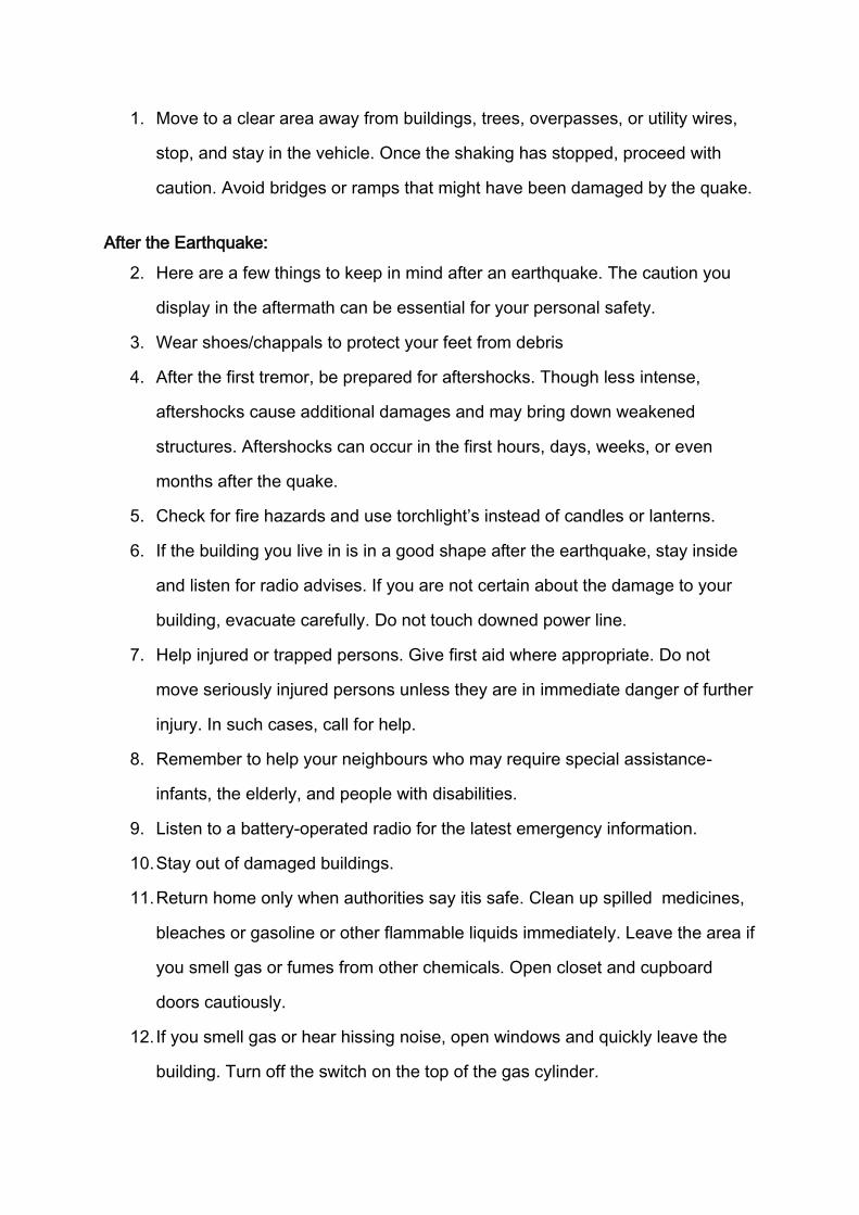
1. Move to a clear area away from buildings, trees, overpasses, or utility wires,
stop, and stay in the vehicle. Once the shaking has stopped, proceed with
caution. Avoid bridges or ramps that might have been damaged by the quake.
After the Earthquake:
2. Here are a few things to keep in mind after an earthquake. The caution you
display in the aftermath can be essential for your personal safety.
3. Wear shoes/chappals to protect your feet from debris
4. After the first tremor, be prepared for aftershocks. Though less intense,
aftershocks cause additional damages and may bring down weakened
structures. Aftershocks can occur in the first hours, days, weeks, or even
months after the quake.
5. Check for fire hazards and use torchlight’s instead of candles or lanterns.
6. If the building you live in is in a good shape after the earthquake, stay inside
and listen for radio advises. If you are not certain about the damage to your
building, evacuate carefully. Do not touch downed power line.
7. Help injured or trapped persons. Give first aid where appropriate. Do not
move seriously injured persons unless they are in immediate danger of further
injury. In such cases, call for help.
8. Remember to help your neighbours who may require special assistance-
infants, the elderly, and people with disabilities.
9. Listen to a battery-operated radio for the latest emergency information.
10. Stay out of damaged buildings.
11. Return home only when authorities say itis safe. Clean up spilled medicines,
bleaches or gasoline or other flammable liquids immediately. Leave the area if
you smell gas or fumes from other chemicals. Open closet and cupboard
doors cautiously.
12. If you smell gas or hear hissing noise, open windows and quickly leave the
building. Turn off the switch on the top of the gas cylinder.

13. Look for electrical system damages - if you see sparks, broken wires, or if you
smell burning of amber, turn off electricity at the main fuse box. If you have to
step in water to get to the fuse box, call an electrician first for advice.
14. Check for sewage and water lines damage. If you suspect sewage lines are
damaged, avoid using the toilets. If water pipes are damaged, avoid using
water from the tap.
15. Use the telephone only for emergency calls.
16. In case family members are separated from one another during an
earthquake (a real possibility during the day when adults are at work and
children are at school), develop a plan for reuniting after the disaster. Ask an
out of state / district relative or friend to serve as the “family contact”. Make
sure everyone in the family knows the name address, and phone number(s) of
the contact person (s).
11.2. Flood
Basic Safety Precaution to be taken:
1. Listen to radio/ TV for the latest weather bulletins and flood warnings.
Pass on the information to the others.
2. Make a family emergency kit which should include; a portable radio/
transistor, torch, spare batteries, a first aid box along with essential
medicines, ORS, dry food items, drinking water, matchboxes, candles and
other essential items.
3. Keep hurricane lamp, ropes, rubber tubes, umbrella and bamboo stick in
your house. These could be useful.
4. Keep your cash, jewellary, valuables, important documents etc. in a safe
place. If there is a flood, move along with family members and cattle to
safe areas like relief camps, evacuation centres, elevated grounds where
you can take shelter.
5. Turn off power and gas connections before leaving your house.

During floods:
1. Don’t enter into flood waters; it could be dangerous.
2. Don’t allow children to play in or near flood waters.
3. Stay away from sewerage line, gutters, drains, culverts etc.
4. Be careful of snakes; snakebites are common during floods.
5. Stay away from electric poles and fallen power-lines to avoid
electrocution.
6. Don’t use wet electrical appliances – get them checked before use.
7. Eat freshly cooked and dry food. Always keep your food covered.
8. Use boiled and filtered drinking water.
9. Keep all drains, gutters near your house clean.
10. Stagnation of water can breed vector/ water-borne diseases. In case of
sickness seek medical assistance.
11. Use bleaching powder and lime to disinfect the surroundings.
11.3. Fire Hazard
A) High-Rise Fires:
1. Calmly leave the apartment, closing the door behind you. Remember the
keys!
2. Pull the fire alarm near the closest exit, if available, or raise an alarm by
warningothers.
3. Leave the building by the stairs.
4. Never take the elevator during fire
If the exit is blocked by smoke or fire:
1. Leave the door closed but do not lock it.
2. To keep the smoke out, put a wet towel in the space at the bottom of the
door.

3. Call the emergency fire service number and tell them your apartment
number and let them know you are trapped by smoke and fire. It is
important that you listen and do what they tell you.
4. Stay calm and wait for someone to rescue you.
If there is a fire alarm in your building which goes off:
1. Before you open the door, feel the door by using the back of our hand. If
the door is hot or warm, do not open the door.
2. If the door is cool, open it just a little to check the hallway. If you see
smoke in the hallway, do not leave.
3. If there is no smoke in the hallway, leave and close the door. Go directly
to the stairs to leave. Never use the elevator.
If smoke is in your apartment:
1. Stay low to the floor under the smoke.
2. Call the Fire Emergency Number which should be pasted near your
telephone along with police and other emergency services and let them
know that you are trapped by smoke.
3. If you have a balcony and there is no fire below it, go out.
4. If there is fire below, go out to the window. DO NOT OPEN THE
WINDOW but staynear the window.
5. If there is no fire below, go to the window and open it. Stay near the open
window.
6. Hang a bed sheet, towel or blanket out of the window to let people know
that you are there and need help.
7. Be calm and wait for someone to rescue you.
11.4. Landslides
Do's

1. Prepare tour to hilly region according to information given by weather
department or news channel.
2. Move away from landslide path or downstream valleys quickly without wasting
time.
3. Keep drains clean,
4. Inspect drains for - litter, leaves, plastic bags, rubble etc.
5. Keep the weep holes open.
6. Grow more trees that can hold the soil through roots,
7. Identify areas of rock fall and subsidence of buildings, cracks that indicate
landslides and move to safer areas. Even muddy river waters indicate
landslides upstream.
8. Notice such signals and contact the nearest Tehsil or District Head Quarters.
9. Ensure that toe of slope is not cut, remains protected, don't uproot trees
unless re-vegetation is planned.
10. Listen for unusual sounds such as trees cracking or boulders knocking
together.
11. Stay alert, awake and active (3A's) during the impact or probability of impact.
12. Locate and go to shelters,
13. Try to stay with your family and companions.
14. Check for injured and trapped persons.
15. Mark path of tracking so that you can't be lost in middle of the forest.
16. Know how to give signs or how to communicate during emergency time to
flying helicopters and rescue team.
Don'ts
1. Try to avoid construction and staying in vulnerable areas.
2. Do not panic and loose energy by crying.
3. Do not touch or walk over loose material and electrical wiring or pole.
4. Do not built houses near steep slopes and near drainage path.

5. Do not drink contaminated water directly from rivers, springs, wells but rain
water if collected directly without is fine.
6. Do not move an injured person without rendering first aid unless the casualty
is in immediate danger.
11.5. Lightning and Thunderstorm:
Danger during thunderstorms
Lightning claims quite a few lives and injures many every year. Quite a large
number of injuries from the electric shock received while using fixed telephones
during thunderstorms.
Take these precautions during thunderstorms:
Take action now
1. Consult an electrician for advice on lightning conductors required for your
house.
If caught outdoors
If you hear thunder 10 seconds after a lightning flash, it is only about three
kilometres away. The shorter the time, the closer the lightning, so find shelter
urgently:
1. Seek shelter in a hardtop (metal-bodied) vehicle or solid building but avoid
small open structures or fabric tents.
2. Never take shelter under a small group of (or single) trees.
3. If far from any shelter, crouch (low, feet together), preferably in a hollow.
Remove metal objects from head / body. Do not lie down flat but avoid being
the highest object.

4. If your hair stands on end or you hear `buzzing’ from nearby rocks, fences,
etc, move immediately. At night, a blue glow may show if an object is about to
be struck.
5. Do not fly kites during thunderstorms.
6. Do not handle fishing rods, umbrellas or metal rods, etc.
7. Stay away from metal poles, fences, clotheslines etc.
8. Do not ride bicycles or travel on open vehicles.
9. If driving, slow down or park away from trees, power lines, stay inside metal-
bodied (hard top) vehicles or in a pucca building but do not touch any metal
sections.
10. If in water, leave the water immediately.
11. If on a boat, go ashore to a shelter as soon as possible.
12. Be sure the mast and stays of the boat are adequately secured.
If you are indoors
1. Before the storm arrives, disconnect external aerial and power leads to radios
and television sets. Disconnect computer modems and power leads.
2. Draw all curtains and keep clear of windows, electrical appliances, pipes and
other metal fixtures (e.g. do not use the bath, shower, hand basin or other
electric equipments)
3. Avoid the use of fixed telephones. In emergencies, make calls brief, (do not
touch any metal, brick or concrete) and do not stand bare foot on concrete or
tiled floors.
First Aid
1. Apply immediate heart massage and mouth-to-mouth resuscitation to lightning
victims until medical help arrives. (You won’t receive a shock from the victim).
Lightning facts and myths

1. When struck, people do not glow or fry to a crisp but the heart and breathing
are often affected.
2. Only about 30% of people struck actually die, and the incidence of long-term
disability is low, particularly when appropriate first aid is applied promptly.
3. If your clothes are wet, you are less likely to be seriously injured if struck, as
most of the charge will be conducted through the wet clothes rather than your
body.