District Census Handbook, Karimnagar, Part XII-A & B, Series-29
1231
CENSUS OF INDIA 2001 SERIES-29 ANDHRA PRADESH DISTRICT CENSUS HANDBOOK KARIMNAGAR DISTRICT PART-A&B· VILLAGE & TOWN DIRECTORY VILLAGE & TOWNWISE PRIMARY CENSUS ABSTRACT V.S. BHASKAR of the Indian Administrative SelVice DIRECTOR OF CENSUS OPERATIONS ANDHRAPRADESH
-
Upload
khangminh22 -
Category
Documents
-
view
2 -
download
0
Transcript of District Census Handbook, Karimnagar, Part XII-A & B, Series-29
CENSUS OF INDIA 2001
SERIES-29 ANDHRA PRADESH
DISTRICT CENSUS HANDBOOK
KARIMNAGAR DISTRICT
PART-A&B· VILLAGE & TOWN DIRECTORY
VILLAGE & TOWNWISE PRIMARY CENSUS ABSTRACT
V.S. BHASKAR of the Indian Administrative SelVice
DIRECTOR OF CENSUS OPERATIONS ANDHRAPRADESH

S I a G V Il V WVZI
.. o o N
E co 'I:
~ o ... • !!!
" .E '0 ~
t:
" E E .. ~ t!I
@
iii :c .E o f .. c .. t!I
~ ... ~ " I/)
~ ... o t: o 0; In
E :s CI. .. ;S
E ~ CI. .. E .. 'ii .E ... o ... ~ " I/)
t: o CI.
" " .. In ..
CD

.. C> C>
'" 1: '" '\
o"~~ ) 1- 00
".\~ +~
O z ",+ « - 0 t 0:: ....
= 1- 00 I() , .... _--------. ........... , U
N 00 U) ~ ~ '. ~ - 0 ~ ~ C ~ N
/ en f,.,
r-' ct ~ O:: ~ I() ~ ::: I .... ~
r'\ I '-'1 C ~ <C ~ ~ ~
0 ~
Z i C) ~ ~
Q;' ; \"-) I
~ I I } ~ <c ~ I() ~ ( I / = z ~ ::: ') ,_,
0 ~ I
~ :E ~ ~ \., '"' - ~ I()
'\ ,./
o:: ~ I
~ ~ (I)
.~
a. • 0
u .. ....... 'S .E
0 '0 'C co E
...l E ~ co
> z tS ~ - @
b ~
" '"' ti ...l 00.
~ ~ ~ is '"' ~ ~ ffi -< t-oo.
> »1;: ~ ~ ~ ~ -< ~ ~ ~ 0 z z z ~ ;:l ;:l ;l -< iii ~
,..
~ ~
u
.L')IlI.LSI(l (lVaVWVZIIII

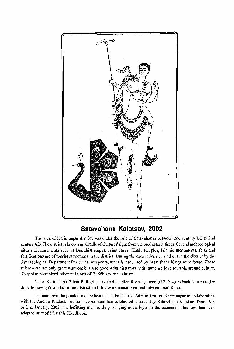
Satavahana Kalotsav, 2002 The area of Karimnagar district was under the rule of Satavahanas between 2nd century BC to 2nd
century AD. The district is known as 'Cradle of Cultures' right from the pre-historic times. Several archaeological
sites and monuments such as Buddhist stupas, Jaina caves, Hindu temples, Islamic monuments, forts and fortifications are of tourist attractions in the district. During the excavations carried out in the district by the Archaeological D~partment few coins, weaponry, utensils, etc., used by Satavahana Kings were found. These
rulers were not only great warriors but also good Administrators with immense love towards art and culture. They also patronized other religions of Buddhism and Jainism.
"The Karimnagar Silver Philigri", a typical handicraft work, invented 200 years back is even today done by few goldsmiths in the district and this workmanship earned international fame.
To memorize the greatness of Satavahanas, the District Administration, Karimnagar in collaboration with the Andhra Pradesh Tourism Department has celebrated a three day Satavahana Kalotsav from 19th to 21st January, 2002 in a befitting manner duly bringing out a logo on the occasion. This logo has been adopted as motif for this Handbook.

Contents
. 1. Foreword
2. Preface
3. Acknowledgements
4. District Highlights - 2001 Census
5. Important statistics in the District
6. Ranking of Mandals in the District
7. Statements 1-9 :
Statement 1: Name of the headquarters of District / MandaI, their rural-urban
status and distance from district headquarters, 2001 .
Statement 2: Name of the headquarters of District! MandaI Parishad their
rural-urban status and distance from district headquarters, 2001
Statement 3: Population of the district at each census from 1901 to 2001
Statement 4: Area, number of villages/towns and population in District
and Mandai, 2001
Page No.(s)
xiii - ivx
xv - xvi
xvii - xviii
XIX
xx - xxi
xxii - xxvi
xxvii -xxviii
... xxviii - xxix
xxx
... xxxi - xxxvi
Statement 5: MandaI Parishad-wise number of villages and rural population, 2001 ... xxxvii - xxxviii
Statement 6: Population of Urban Agglomerations / Towns, 2001 XXXVllI
Statement 7: Villages with population of 5,000 and above at Mandai Parishad
level as per 2001 census and amenities available ... xxxix - xliv
Statement 8: Statutory towns with population less than 5,000 as per 2001 census
and amenities available
Statement 9: Houseless and Institutional population of Mandals,
rural and urban, 2001
8. Introduction and Analysis
(i) About the District Census Handbook
(ii) History and Administrative Set-up of the District
(iii) Physical features of the District
(iv) Major social and cultural events, natural and administrative
developments and significant activities during the decade
(v) Brief description of places of religious, historical or archaeological importance
in villages and places of tourist interest in the towns of the district
(vi) Major chanlcteristics of the district, contribution of the district in the
form of any historical figures associated with the district
xlv
xlv-xlix
3 - 4
4 - 7
8- 15
16
17 - 20
21
(vii) Census concepts
(viii) Non-Census concepts
Analytical Note
(ix) 2001 Census findings - population and its distribution
( a) Distribution of population in rural-urban areas
(b) Size class and status of towns, Population growth, Density,
Sex Ratio, Work participation rate and Literacy rate
(c) Scheduled Castes and Scheduled Tribes of earlier Censuses
(x) Brief analysis of PCA data
(xi) Brief analysis of the Village Directory and Town Directory data
(xii) Brief analysis of the data on houses and household amenities, Houselisting
Operations, Census of India 200 I
(xiii) Scope of Village Directory and Town Directory - column heading-wise
explanation and coverage of data
Part A - Village and Town Directory
9. Section I - Village Directory
(a) Note explaining the abbreviations used in Village Directory
(b) List of Villages merged in towns and outgrowths at 2001 Census
(c) MandaI Parishad-wise presentation of Village Directory Data
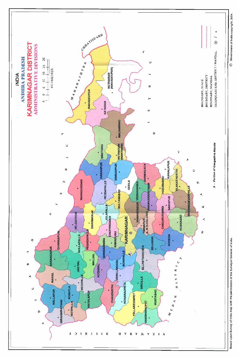
(i) Mandai Parishad Maps showing Manda! boundary
(ii) Alphabetical list of Villages along with location code 1991 and 2001
(iii) Presentation of Village Directory data in prescribed format
(d) Appendixes to Village Directory :
Appendix I: Abstarct of Educational, Medical and other Amenities in
villages - Mandai Parishad level
Appendix IA: Villages by number of Primary Schools
Appendix IB: Villages by Primary, Middle and Secondary Schools
Appendix IC: Villages with different sources of drinking water
facilities available
Appendix II: Villages with 5,000 and above population which do not
have one or more amenities
Appendix lIA : Census Towns which do not have one or more amenities
Appendix III: Land utilisation data in respect of Census Towns/
Non-Municipal Towns
Page No.(s)
22 - 30
30 - 34
35 - 39
40 - 112
113 - 128
129 - 153
154 - 160
163 - 165
166
169 - 545
546 - 561
562 - 563
563 - 564
564 - 565
566 - 570
570 - 571
571
Appendix IV: Mandai Parishad-wise list of inhabited villages where no
amenity other than drinking water facility is available
Appendix V: Summary showing number of villages not having
Scheduled Castes population
Appendix VI: Summary showing number of villages not having
Scheduled Tribes population
Appendix VIIA List of villages according to the proportion of the
Scheduled Castes to the total population by ranges
Appendix VIm List of villages according to the proportion of the
Scheduled Tribes to the total population by ranges
Appendix VIII Statement showing number of Girls Schools in the villages
Appendix IX List of Degree Colleges in Village I Town in the District
Appendix X List of Hospitals in Village / Town in the District
Appendix XI List of Banks in Village / Town in the District
Appendix XII List of Cinema Halls by Village I Town in the District
10. Section II - Town Directory
(a) Note explaining the abbreviations used in Town Directory
Town Directory Statements
(b) Statement I Status and Growth History
(c) Statement II Physical aspects and location of towns, 1999
(d) Statement III Municipal finance, 1998-99
(e) Statement IV Civic and other amenities, 1999
(f) Statement V Medical, Educational, Recreational and Cultural facilities, 1999
(g) Statement VI Trade, Commerce, Industry and Banking, 1999
(h) Statement VII Civic and other amenities in slums, 1999
(i) Appendix to Town Directory - Towns showing their outgrowths with population
Part B - Primary Census Abstract
11. (a) Brief note on Primary Census Abstract
(b) District Primary Census Abstract ( General )
( c) Appendix to District Primary Census Abstract i.e., Urban block-wise
figures of Total, Scheduled Castes and Scheduled Tribes popUlation
12. Primary Census Abstract for Scheduled Castes
13. Primary Census Abstract for Scheduled Tribes
14. Mandai Parishad-wise Village Primary Census Abstract
15. Urban Primary Census Abstract
Page No.(s)
571 - 573
573 - 575
575 - 576
577 - 596
597 - 614
615
616
617
618 - 622
623 - 624
627 - 630
632 - 633
634 - 635
636 - 637
638 - 639
640 - 641
642 - 643
644 - 649
650
653 - 655
656 - 691
692 - 715
716 - 745
746 - 781
782 - 1117
1118 - 1129

Annexures
Annexure I
Annexure II
Annexure III
Annexure IV
Annexure V
Annexure VI
Annexure VII
Page No.(s)
Fertility and Mortality, 1991 Census 1133 - 1134
Various measures of fertility and mean age at marraige,
1991 Census 1135
Percentage distribution of Migrants by place of birth!
place of last residence, 1991 Census and 2001 Census '" 1136 - 1144
Brief account of main religions in the District / MandaI as per
1991 Census and 2001 Census ... 1145 - 1159
Marital status of population as per 1991 Census
and 2001 Census ... 1160 - 1163
Age, Sex and Education in the district as per 1991 Census
and 2001 Census 1164 - 1165
Distribution of different Mother Tongues returned in 1991 Census
at District! MandaI level and the data at District level for
2001 Census ... 1166 - 1183
Foreword
The District Census Handbook (DCHB) published by Census Organisation since 1951 census, is one of the important publications in the context of planning and development at gross-root level. The publication,
which is brought out for each district, contains several demographic and socio-economic characteristics villagewise and town-wise of the district along with the status of availability of civic amenities, infrastructural
facilities, etc.
2. The scope of the DCHB was initially confined to a few Census Tables and Primary' Census
Abstract (PCA) of each village and town within the district. Thereafter, at successive censuses, its scope and coverage has been enlarged. The DCHB published at the 1961 census provided a descriptive account of the district, administrative statistics, census tables and a village and town directory including PCA. The 1971.census-DCHB series was in three parts: Part-A related to village and town directory, Part-B to village and town PCA and Part-C comprised analytical report, administrative statistics, district census tables and certain analytical tables based on PCA and amenity data in respect of villages. The 1981 census DCHB was in two parts: Part-A contained'village and town directory and Part-B the PCA of village and town including the SCs an~ STs PCA up to tahsil/ town levels. New features alongwith restructuring of the formats of village and town directory were added into it In Village Directory, all amenities except electricity were brought together and if any amenity was not available in the referent village, the distance in broad ranges from the nearest place having such an amenity, was given. Information on new items such as adult literacy centres, primary health sub-centres and community health workers in the village were provided so as to meet the requirements of some of the Revised Minimum Needs Programme. Information on approach to the village was provided for the first time in the Village Directory so as to give the details on number of inaccessible villages in each district. In the Town Directory, a statement (IV-A) on slums was introduced to provide the details on civic and other amenities in the notified slums of Class I and Class II towns.
3. The 1991 census DCHB, by and large, followed the pattern of presentation of 1981 census, except the format of PCA was restructured. Nine-fold industrial classification of main workers was given against the four-fold industrial classification presented in the 1981 census. In addition, sex-wise population in 0-6 age group was included in the PCA for the first time with a view to enable the data users to compile more realistic literacy rate as all children below 7 years of age had been treated as illiterate at the time of 1991 census. One of the important innovations in the 1991 census was the Community Development Block (CD block) level presentation of village directory and PCA data instead of the traditional tahsil/talukIPS level presentation.
It was expected that the presentation of village directory and PCA data at CD block level will help the planners in formulation of micro level development plans, CD block being lowest administrative unit.
4. The present series of 2001 census DCHBs have been made more informative and exhaustive in terms of coverage and content. The Village Directory has been enlarged in scope by including a number of other facilities like banking, recreational and cultural facilities, newspapers and magazines and 'most important commodity' manufactured in village. Income and expenditure of gram panchayat, wherever possible, has been provided. Apart from these, more details on distance( s) at which basic amenities are available (if not available in the village), are given. This includes educational facilities (namely primary and middle schools and college), medical facilities (viz. Allopathic Hospital, Maternity & Child Welfare Centre and Primary Health Centre), drinking water, post & telegraph (post office and phone), communication, bank, credit societies and recreational
(xiii)
facilities. In Town Directory, the statement on Slums has been modified and its coverage enlarged by including details on all slums instead of 'notified slums'. The infonnation is given in case of all statutory towns irrespective of their class, against only Class I and Class II towns in the 1981 and 1991 censuses. The basic amenities available in the villages and towns are analysed in depth with the help of a number of cross-classified inset tables and statements. Two other significant additions in the publication are inclusion of 'motif' highlighting significant characteristic of the district and analytical notes as annexures. The analytical notes on (i) fertility and mortality and (ii) various measures of fertility and mean age at marriage are prepared based on 1991 Census. Whereas, in the notes relating to (i) percentage distribution of migrants by place of birth/place of last residence, (ii) main religions, (iii) marital status of population, (iv) age, sex and education, and (v) distribution of spectrum of mother tongue, nature and extent of changes occurred in the district in its basic socio-demographic features during the decade 1991-2001 are analysed. The eight digits permanent location code (PLCN) to all the villages and towns have been assigned keeping in view the future needs.
5. The village and town level amenity data have been collected, compiled and computerized in prescribed record structure under the supervision of Shr!' V.S. Bhaskar, lAS., Director of Census Operations, Andhra Pradesh. Thereafter, efforts have been made to ensure comparability of the information with that of 1991 census data and the information brought out by the respective state governments in their annual reports and statistical handbooks for various years after 1991. The task of planning, designing and coordination of this publication was carried out by Shri RG. Mitra, Deputy Registrar General (C&T) and Dr. I.e. Agrawal, Senior Research Officer of Social Studies Division. Dr. R.P. Singh, Deputy Registrar General (Map) provided the technical guidance in the preparation of maps. Whereas, Shri Anil Kumar Arora, Deputy Director of Data Processing Division who worked under the overall supervision of Shri Himakar, Add!. Director (EDP) helped in preparation of record structure for computerization of village and town directory data and the programme for the generation of Village Directory and Town Directory statements including analytical inset tables. The draft DCHB manuscripts received from the Census Directorates have been scrutinized in the Social Studies . Division under the guidance of Shri S.L. Jain, Deputy Director and Shri R.K. Mehta, Assistant Director. I am thankful to all of them and others who have contributed to make this publication possible.
New Delhi Dated: 17.10.2006.
(xiv)
D.K.Sikri Registrar General &
Census Commissioner, India.

Preface
The District Census Handbook (DCHB) containing Primary Census Abstract and data on "amenities" for each village and town in the district. The intention of this publication is to place the data collected at the Census, alongwith the village and town level amenities data conected from the MandaI Revenue Officersl Municipal officials in this publication. The amenities data is validated by comparing with secondary data obtained from Heads of the Departments. For example, information on schools was compared with data available with Commissioner, School Education and information on post offices was compared with data obtained from the Chief Post Master General and so on. Validation of data in the above manner was by no means an easy exercise. Scores of officials had put in gruelling efforts for months together. The entire data and manuscripts were computerized. We are now reasonably confident of the correctness of the data but we will not make any utopian claims of cent per cent accuracy. There may be errors but we will be safe
in saying that they are minimal.
The District Census Handbook is divided into the following major components.
1. Introduction.
2. Brief history of the district.
3. Census and non-Census concepts.
4. A detailed write up on the physical features, major cultural and social events, major developments during the decade, places of religious and historic importance etc.
5. Primary Census Abstract (PCA) at the district level, mandaI/town level and village level.
6. Brief analysis of peA data.
7. Village Directory and Town Directory.
8. Brief analysis on Village Directory and Town Directories.
It will not be out of place to mention here that there is perhaps no other publication from any agency that encapsulates so much data on a district. The amenities data includes information on sectors such as Education, Health, Water and Electricity supply, Communication and Transport facilities etc. The idea of presenting amenities data juxtaposed to the Census data is not only unique but also tremendously useful for the data users.
The District Census Handbook is further enriched with a district map and mandaI maps depicting villages/towns with population size and also amenities such as Educational Institutions, Hospitals, Telegraph and Telephone facilities, Banks, Police Station etc.
Some improvement over earlier DCHB have been made to bring more completeness to the data presented in this volume.
1. The names of Colleges, Girls' High Schools, Hospitals run by Government and others have been given as an additional information. Similarly the names of Cinema Halls have been given.
2. Ranking of Mandals according to population is also given.
(xv)
3. More Appendices and Annexures to important statements are given to make the data more comprehensive.
In the previous Censuses, the manuscripts prepared by this department were supplied to Government of Andhra Pradesh who in turn brought out the publications at their cost. However due to the procedural rigmorale some delay was unavoidable in placing the DCHBs before the data users and planners.
This time, keeping in view the above difficulties, the printing and publication of District Census Handbooks has been taken up centrally under the arrangement of the office of the Registrar General and Census Commissioner, India, New Delhi. The processing of data and preparation of Camera Ready Copies electronically including fmalisation of write up was attended to in the office of the Director of Census Operations.
I am grateful to the Chief Secretaries, Principal Secretaries, Secretaries, District Collectors, Municipal Commissioners and other senior officials of the Government of Andhra Pradesh for their co-operation and assistance throughout the Census Operations and in the process of collection of the non-Censal data.
I am extremely grateful to Sri D.K.Sikri, lAS, Registrar General and Census Commissioner, India for
the help, guidance and constant support in fmalising this volume. My sincere thanks to Sri R.P. Singh, Deputy Registrar General (Map) and Dr.I.C. Agrawal, Assistant Registrar General (SS). Sri. S.L. Jain, Deputy Director for giving guidence, help and co-ordinating this project work and their colleagues in the office of the Registrar General, India.
I also take this opportunity to acknowledge the valuable contribution made for this publication by SriJ.K.Banthia, Ex-Registrar General, India.
Most of the work relating to DCHB has been carried out under the able guidance and direction of Sri VS.Bhaskar, lAS, Director of Census Operations, Andhra Pradesh, Hyderabad. I take this opportunity to acknowledge his valuable contribution made for this publication.
The credit for preparation of District Census Handbooks goes to a team of devoted officers and staff of this Directorate who have involved in this project. The names of individuals associated with this project are shown in "Acknowledgements". I am grateful to all Df them.
I hope that the data users will find this publication very useful.
Hyderabad Date: 9.5.07
(xvi)
D.HANUMANTHARAYA Deputy Director of Census Operations
Andhra Pradesh
Drafting
Sri RV.V. Durga Prasad
Sri G. Bapuji
Sri M. Hanuma Naik
Late Sri Shyam Deo
Sri V.L.P. Sastry
Sri B. Satyanarayana
Sri B. Anjaiah
Acknowledgements
Deputy Director
Deputy Director
Deputy Director
Research Officer
Assistant Director (T)
Assistant Director (DC)
Statistical Investigator Grade - I
Collection, Compilation, Comparison and Finalisation
Sri B. Anjaiah Statistical Investigator Grade - I
Sri GK. Yadagiri Statistical Investigator Grade - II
Smi. K. Subba Lakshmi
Sri N. V. Sastry
Sri P.S. Naidu
Sri Y. Gopalakrishna Murthy
Sri M. Ram Prasad
Kum. Arifa Sultana
Smt. 1. Madhubala
Smt. K Vijayalakshmamma
Sri B. Nadavaiah
Sri G .E. Rani
Sri G Venkateswara Rao
Sri L.S. Mitra
Smt. M Indira Bhavani
Smt. S. Anuradha
Smt. N. V Satyavathi Devi
Smt. T. Manorama
Brief write up for Motif
Sri Y. Gopalakrishna Murthy
(xvii)
Statistical Investigator Grade - II
Statistical Investigator Grade - III
Statistical Investigator Grade - III
Statistical Investigator Grade - III
Statistical Investigator Grade - III
Statistical Investigator Grade - III
Statistical Investigator Grade - III
Statistical Investigator Grade - III
Senior Compiler
Senior Compiler
Senior CompiJer
Senior Compiler
Senior Compiler
D.E.Operator Grade - B
Assistant Compiler
Assistant Compiler
Statistical Investigator Grade - III
Secondary data Collection
Sri C.V. Nataraj
Sri L.S. Mitra
Data Entry
Sri B. Surya Prakash Smt. S. Anuradha
Sri Ch. Sreenivasulu
Generation of Tables
Smt S. Anuradha
Sri N. Shivarama Krishna
Supervision of Camera Ready Copy Smt. V. Syamalamba
Perparation of Camera Ready Copy
Smt. S. Anuradha
Smt. V. Radha Smt. M. Vanaja
Junior Supervisor
Senior Compiler
Data Entry Operator Gr. 'B' Data Entry Operator Gr. 'B'
Data Entry Operator Gr. 'B'
Data Entry Operator Gr. 'B'
Data Entry Operator Gr. 'B'
Senior Supervisor
Data Entry Operator Gr. 'B' Data Entry Operator Gr. 'B' Data Entry Operator Gr. 'B'
Scrutiny of peA, Mandai Parish ad wise Villages and Urban Agglomeration Sri S.v. Rao Statistical Investigator Grade - I
Sri Y. Subrahmanyam Statistical Investigator Grade - II
Sri V. Ananthasayana Rao Statistical Investigator Grade - III
Smt N. Alivelumanga Sr. Compiler Smt. T. Bala Tripura Sundari Sr. Compiler
Sri D.V.D.S. Prasad Sr. Compiler Sri Ch. Ranga Chary Sr. Compiler
Sri A. Anjaneyulu Compiler
Sri G. Sailoo Compiler
Sri N. Shivarama Krishna Data Entry Operator Gr. 'B'
Supervision of Mapping work
Dr. (Kum) Aqueela Begum Senior Geographer
Sri P. John Samuel Cartographer
Scrutiny of Maps Sri MJ. Sadiq Senior Drawing Assistant
Smt. Daya Saxena Senior Draughtsman
Sri B. Raghuram Senior Draughtsman
Sri K. Devadas Senior Draughtsman
Sri D. Chiranjeevi Raju Senior Draughtsman
Preparation of Computerised Maps Sri G. Mariyanna Senior Draughtsman
Sri M.A. Quadeer Senior Draughtsman
Sri K.S.P. Reddy Senior Draughtsman
Sri T. Trinadh Draughtsman
Smt. R.R.S.N. Subba Lakshmi Draughtsman
Sri Gulam Mohiuddin Hassan Draughtsman
Sri P. Babji Draughtsman
(xviii)
District Highlights - 2001 Census
1. Karimnagar District stands 12th in terms of area size and ranks 12th in terms of population in the state.
2. Karimnagar district stands 11th rank in terms of urbanisation with a total Urban population 678,812.forming 19.4 percentage to the total district population.
3. The sex ratio of the district is 998 against 986 in 1991 Census showing upward trend ..
4. The density of the district is 295 against 257 in 1991 Census, showing increase over the decade.
S. Metpalle village, PLC No. 00317000 is most populated with a population of 41,224 and Ramanujapuram village, PLC No. 00345900 is the least populated with a population of 45 in the district.
6. Karimnagar mandai is most populated with a population of 289,375 and Mutharam (Mahadevpur) MandaI is the least populated with a population of23,327 in the district.
7. Ramagundam Municipality is most populated with a population of 236,600 and Koratla Municipality is the least p,ulated with a population of54,012 in the district.
8. Out of 100 workers 58.7 are engaged in Agriculture sector, 12.6 in. Household industry and 28.7 in other economic activities. Thus showing the predominance of Agriculture Sector.
9. Out of 100 Male workers in the district 52.9 are engaged in Agriculture sector.
10. Out of 100 Female workers in the district 65.9 are engaged in Agriculture sector.
11. There is a decrease in the proportion of main workers of the district in the decade (48.7 percent in 1991 to 41.8 percent in 2001).
12. There is a decrease in the proportion of Male main workers of the district in the decade ( 56.2 percent in 1991 to 49.7 percent in 2001).
13. There is a decrease in the proportion of Female main workers of the district in the decade ( 44.3 percent in 1991 to 33.9 percent in 2001)
14. The Karimnagar district is famous for Coal Milles and power generation.
15. Odela and Chigurumamidi Mandals have the lowest number of inhabited villages
( each 11) and the highest number of inhabited villages ( 37 ) are found in Mahadevpur MandaI.
16. Manakondur mandai has largest area 14479.04 hectares under irrigation, followed by Jagtial mandai with 12621.54 hectares in the district. The mandaI with lowest area 2116.29 hectares under irrigation is Mutharam (Manthani) MandaI.
17. Gandi Kamaram village bearing PLC N 0.00296000 has the largest area (5754 hectares) and Balijapur village bearing PLC No.00289800 has the smallest area ( 19 hectares) among the villages ofthe district.
18. Female work participation rate is 43.3 and that9fthe Males in the district is 54.8
(xix)
ImportantStatistics in the District
NUMBER OF VILLAGES
NUMBER OF TOWNS
POPULATION TOTAL
RURAL
URBAN
PERCENTAGE URBAN OF POPULATION
DECADALPOPULATION GROvrnH1991-2001
AREA ( in sq.km. )
DENSITY OF POPULATION (Persons per square kilometre) SEX RATIO ( Number of females per 1000 males)
Total
Inhabited
Uninhabited
Statutory Towns
Census Towns
Persons
Males
Females
Persons
Males
Females
Persons
Males
Females
Persons Males Females
(xx)
STATE
28,123
26,613
1,510
117
93
76,210,007
38,527,413
37,682,594
55,401,067
27,937;204
27,463,863
20,808,940
10,590,209
10,218,731
Number P~rcentage
20,808,940 273
9,701,999 14.6 4,802,832 142 4,899,167 14.9
275,045
277
978
DISTRICf
1,092
1,047
45
5
2
3,491,822
1,747,968
1,743,854
2,813,010
1,402,279
1,410,731
678,812
345,689
333,123
Number Percentage
678,812 19.4
454,336 15.0 218,177 143 236,159 15.7
11,823
295
998
SfATE DISTRICT
Number Percentage Number Percentage
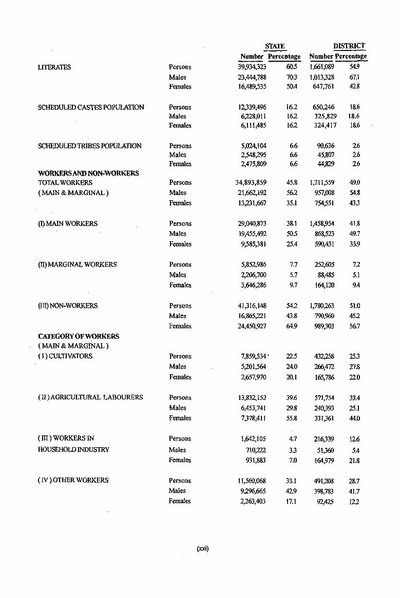
LITERATES Persons 39,934,323 60.5 1,661,089 54.9
Males 23,444,788 703 1,013,328 67.1 Females 16,489,535 50.4 647,761 42.8
SCHEDULED CASTES POPULATION Persons 12,339,496 16.2 650,246 18.6 Males 6,228,01l 162 325,829 18.6 Females 6,111,485 162 324,417 18.6
SCHEDULED TRIBES POPULATION Persons 5,024,104 6.6 90,636 2.6 Males 2,548,295· 6.6 45,807 2.6 Females 2,475,809 6.6 44,829 2.6
WORKERS AND NON-WORKERS TOTAL WORKERS Persons 34,893,859 45.8 1,711,559 49.0
(MAIN & MARGINAL) Males 21,662,192 562 957,008 54.8
Females 13,231,667 35.1 754,551 433
(l) MAIN WORKERS Persons 29,040,873 38.1 1,458,954 41.8
Males 19,455,492 50.5 868,523 49.7
Females 9,585,381 25.4 590,431 33.9
(ll) MARGINAL WORKERS Persons 5,852,986 7.7 252,605 72
Males 2,206,700 5.7 88,485 5.1
Females 3,646,286 9.7 164,120 9.4
(Ill) NON-WORKERS Persons 41,316,148 542 1,780,263 51.0
Males 16,865,221 43.8 790,960 452
Females 24,450,927 64.9 989,303 56.7
CATEGORY OF WORKERS (MAIN & MARGINAL) (I) CULTNATORS Persons 7,859,534' 22.5 432,258 253
Males 5,201,564 24.0 266,472 27.8
Females 2,657,970 20.1 165,786 220
(II)AGRICULTURAL LABOURERS Persons 13,832,152 39.6 571,754 33.4
Males 6,453,741 29.8 240,393 25.1 Females 7,378,4 II 55.8 331,361 44.0
(ill) WORKERS IN Persons 1,642,105 4.7 216,339 12.6
HOUSEHOW INDUSlRY Males 710,222 33 51,360 5.4 Females 931,883 7.0 164,979 21.8
(N) OTHER WORKERS Persons 11,560,068 33.1 491,208 28.7 Males 9,296,665 429 398,783 41.7 Females 2,263,403 17.1 92,425 122
(xxi)
Serial Name of mandai number
2
3
4
5
6
7
8
9
10
11
12
13
14
15
16
17
18
19
20
21
22
23
24
25
26
27
28
29
30
31
32
33
34
3S
36
37
38
39
40
41
42
2 Ibrahimpatnam
Mallapur
Raikal
Sarangapur
Dharmapuri
Velgatoor
Ramagundam
Kamanpur
Manthani
Kataram
Mahadevpur
Mutharam (Mahadevpur)
Malharrao
Mutharam (Manthani)
Srirampur
Peddapalle
Julapalle
Dharmaram
Gollapalle
Mallial
Jagtial
Medipalle
Koratla
Metpalle
Kathlapur
Chandurthi
Kodimial
Pegadapalle
Gangadhara
Ramadugu
Choppadandi
Sultanabad
Odela
Manakondur
Karimnagar
Boinpalle
Vemulawada
Konaraopeta
Yel1areddipet
Gambhiraopet
Mustabad
SirciIla
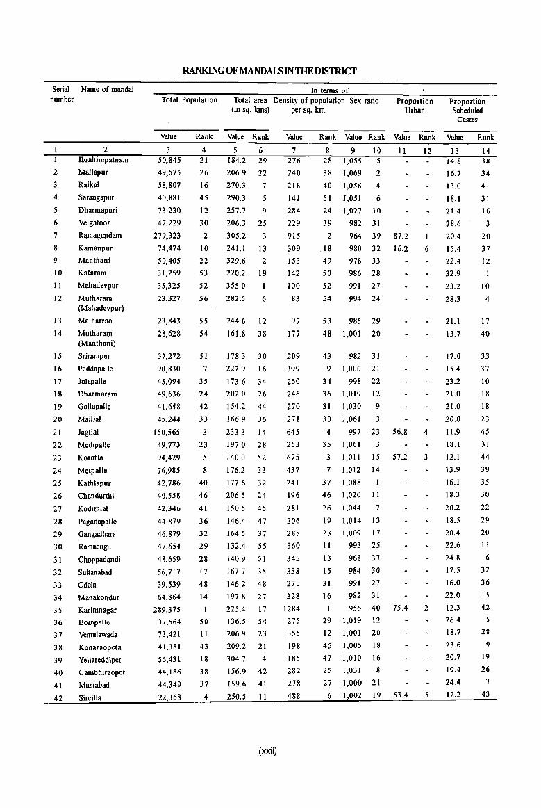
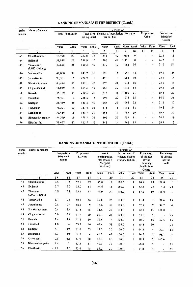
RANKING OFMANDALSIN THE DISTRICf
In terms of Total Population Total area Density of population Sex ratio
(in sq. kms) per sq. km. Proportion
Urban Proportion Scheduled
Castes
Value Rank Value Rank Value Rank Value Rank Value Rank Value Rank
3 50,845
49,575
58,807
40,881
73,230
47,229
279,323
74,474
50,405
31,259
35,325
23,327
23,843
28,628
37,272
90,830
45,094
49,636
41,648
45,244
150,565
49,773
94,429
76,985
42,786
40,558
42,346
44,879
46,879
47,654
48,659
56,717
39,539
64,864
289,375
37,564
73,421
41,381
56,431
44,186
44,349
122,368
4 21
26
16
45
12
30
2
10
22
53
52
56
55
S4
51
7
35
24
42
33
3
23
5
8
40
46
41
36
32
29
28
17
48
14
50
II
43
18
38
37
4
5 6 184.2 29
206.9 22
270.3 7
290.3 5
257.7 9
206.3 25
305.2 3
241.1 13
329.6 2
220.2 19
355.0 1
282.5 6
244.6 12
161.8 38
178.3 30
227.9 16
173.6 34
202.0 26
154.2 44
166.9 36
233.3 14
197.0 28
140.0 52
176.2 33
177.6 32
206.5 24
150.5 45
146.4 47
164.5 37
132.4 55
140.9 51
167.7 35
146.2 48
197.8 27
225.4 17
136.5 54
206.9 23
209.2 21
304.7 4
156.9 42
159.6 41
250.5 11
(xxii)
7 276
240
218
141
284
229
915
309
153
142
100
83
97
177
209
399
260
246
270
271
645
253
675
437
241
196
281
306
285
360
345
338
270
328
1284
275
355
198
185
282
278
488
8 9 10 11 28 1,055 5
38 1,069 2
40 1,056 4
51 1,051 6
24 1,027 10
39 982 31
2 964 39 87.2
.18 980 32 16.2
49 978 33
50 986 28
52 991 27
54 994 24
53 985 29
48 1,001 20
43 982 31
9 1,000 21
34 998 22
36 1,019 12
31 1,030 9
30 1,061 3
4 997 23 56.8
35 1,061 3
3 1,011 15 57.2
7 1,012 14
37 1,088
46 1,020 11
26 1,044 7
19 1,014 13
23 1,009 17
II 993 25
13 968 37
15 984 30
31 991 27
16 982 31
956 40 75.4
29 1,019 12
12 1,001 20
45 1,005 18
47 1,010 16
25 1,031 8
27 1,000 21
6 1,002 19 53.4
12
6
4
3
2
5
13 14.8
16.7
13.0
18.1
21.4
28.6
20.4
15.4
22.4
32.9
23.2
28.3
21.1
13.7
17.0
15.4
23.2
21.0
21.0
20.0
11.9
18.1
12.1
13.9
16.1
18.3
20.2
18.5
20.4
22.6
24.8
17.5
16.0
22.0
12.3
26.4
18.7
23.6
20.7
19.4
24.4
12.2
14 38
34
41
31
16
3
20
37
12
1
10
4
17
40
33
37
10
18
18
23
45
31
44
39
35
30
22
29
20
11
6
32
36
15
42
5
28
9
19
26
7
43
Serial Name of mandaI number
2
Ibrahimpatnam
2 Mallapur
3 Raikal
4 Sarangapur
5 Dharmapuri
6 Velgatoor
7 Ramagundam
8 Kamanpur
9 Manthani
10 Kataram
1 1 Mahadevpur
12 Mutharam (Mahadevpur)
13 Malharrao
14 Mutharam (Manthani)
I 5 Srirampur
I 6 Peddapalle
17 Julapalle
I 8 Dharmaram
19 Goliapalle
20 Mallial
21 Jagtial
22 Medipalle
23 Koratla
24 Metpalle
25 Kathlapur
26 Chandurthi
27 Kodimial
28 Pegadapalle
29 Gangadhara
30 Ramadugu
3 1 Choppadandi
32 Sultana bad
33 Odela
34 Manakondur
3 5 Karimnagar
36 Boinpalle
37 Vemulawada
38 Konaraopeta
39 Yellareddipet
40 Gambhiraopet
41 Mustabad
42 Sircilla
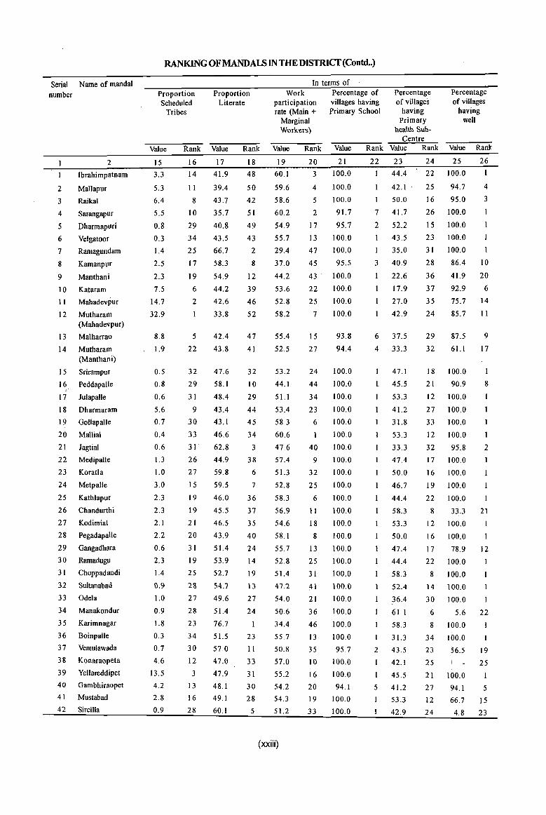
RANKING OFMANDALS IN THE DISTRICf(Contd .. )
Proportion Scheduled
Tribes
Proportion Literate
In terms of Work
participation rate (Main +
Marginal Workers)
Percentage of villages having Primary School
Percentage of villages
having Primary
health Sub-Centre
Percentage of villages
having well
Value Rank Value Rank Value Rank Value Rank Value Rank Value Rank
15
3.3
5.3
6.4
5.5
0.8
0.3
1.4
2.5
2.3
7.5
14.7
32.9
8.8
1.9
0.5
0.8
0.6
5.6
0.7
0.4
0.6
1.3
1.0
3.0
2.3
2.3
2.1
2.2
0.6
2.3
1.4
0.9
1.0
0.9
1.8
0.3
0.7
4.6
13.5
4.2
2.8
0.9
16 17
14 41.9
11 39.4
8 43.7
10 35.7
29 40.8
34 43.5
25 66.7
17 58.3
19 54.9
6 44.2
2 42.6
33.8
5 42.4
22 43.8
32 47.6
29 58.1
31 48.4
9 43.4
30 43.1
33 46.6
31 62.8
26
27
15
19
19
21
20
31
19
25
28
27
28
23
34
30
12
3
13
16
28
44.9
59.8
59.5
46.0
45.5
46.5
43.9
51.4
53.9
52.7
54.7
49.6
51.4
76.7
51.5
57.0
47.0
47.9
48.1
49.1
60.1
18
48
50
42
51
49
43
2
8
12
39
46
52
47
41
32
10
29
44
45
34
3
38
6
7
36
37
35
40
24
14
19
13
27
24
23
II
33
31
30
28
5
19
60.1
59.6
58.6
60.2
54.9
55.7
29.4
37.0
44.2
53.6
52.8
58.2
55.4
52.5
53.2
44.1
51.1
53.4
58.3
60.6
47.6
57.4
51.3
52.8
58.3
56.9
54.6
58.1
55.7
52.8
51.4
47.2
54.0
50.6
34.4
55.7
50.8
57.0
55.2
54.2
54.3
51.2
(xxiii)
20 21
3 100.0
4 100.0
5 100.0
2 91.7
17 95.7
13 100.0
47 100.0
45 95.5
43· 100.0
22 100.0
25 100.0
7 100.0
15 93.8
27 94.4
24 100.0
44 100.0
34 100.0
23 100.0
6 100.0
100.0
40 100.0
9
32
25
6
11
18
8
13
25
100.0
100.0
100.0
100.0
100.0
100.0
100.0
100.0
100.0
31 100.0
41 100.0
21 100.0
36 100.0
46 100.0
13 100.0
35 95.7
10 100.0
16 100.0
20 94.1
19 100.0
33 100.0
22 23
44.4
42.1
I 50.0
7 41.7
2 52.2
43.5
35.0
3 40.9
22.6
17.9
27.0
42.9
6 37.5
4 33.3
47.1
L 45.5
53.3
41.2
31.8
53.3
33.3
47.4
50.0
46.7
44.4
58.3
53.3
50.0
47.4
44.4
58.3
52.4
36.4
61.1
58.3
31.3
2 43.5
1 42.1
I 45.5
5 41.2
53.3
42.9
24 25 26
22 100.0
25 94.7 4
16 95.0 3
26 100.0
15 100.0
23 100.0
31 100.0 I
28 86.4 10
36 41.9 20
37 92.9 6
35 75.7 14
24 85.7 II
29 87.5 9
32 61.1 17
18 100.0
21 90.9 8
12 100.0
27 100.0
33 100.0 I
12 100.0 I
32 95.8 2
17 100.0
16 100.0
19 100.0
22 100.0
8 33.3 21
12 100.0
16 100.0
17 78.9 12
22 100.0
8 100.0
14 100.0
30 100.0 I
6 5.6 22
8 100.0
34 100.0 I
23 56.5 19
25 25
21 100.0
27 94.1 5
12 66.7 15
24 4.8 23
Serial Name of mandai number
2
3
4
5
6
7
8
9
10
II
12
13
14
15
16
17
18
19
20
21
22
23
24
25
26
27
28
29
30
31
32
33
34
35
36
37
38
39
40
41
42
2 Ibrahimpatnam
Mallapur
Raikal
Sarangapur
Dharmapuri
Velgatoor
Ramagundam
Kamanpur
Manthani
Kataram
Mahadevpur
Mutharam (Mahadevpur)
Malharrao
Mutharam (Manthani)
Srirampur
Peddapalle
Julapalle
Dharmaram
Gollapalle
Mallial
Jagtial
Medipalle
Koratla
Metpalle
Kathlapur
Chandurthi
Kodimial
Pegadapalle
Gangadhara
Ramadugu
Choppadandi
Sultanabad
Odela
Manakondur
Karimnagar
Boinpalle
Vemulawada
Konaraopeta
Yellareddipet
Gambhiraopet
Mustabad
Sircilla
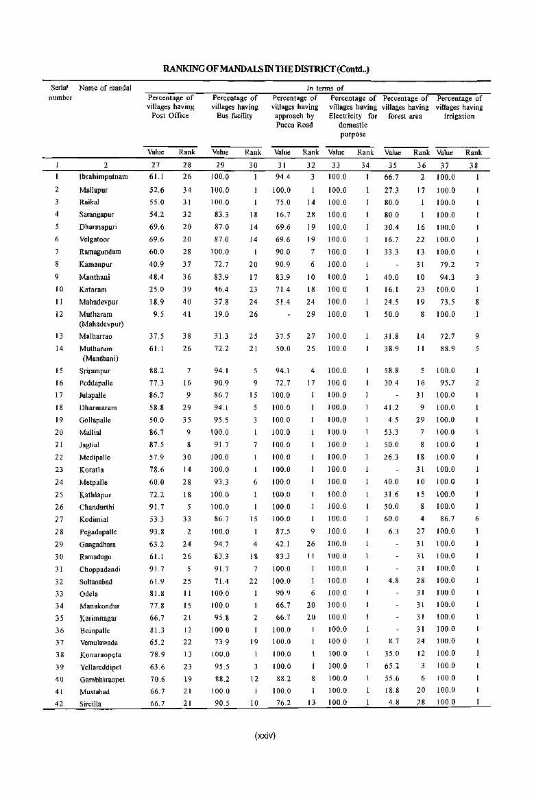
RANKlNG OF MANDALS IN THE DISTRICT (Contd .. )
Percentage of villages having
Post Office
Value
27
6l.l
52.6
55.0
54.2
69.6
69.6
60.0
40.9
48.4
25.0
18.9
9.5
37.5
61.1
88.2
77.3
86.7
58.8
50.0
86.7
87.5
57.9
78.6
60.0
72.2
91.7
53.3
93.8
63.2
61.1
91.7
61.9
81.8
77.8
66.7
81.3
65.2
78.9
63.6
70.6
66.7
66.7
Rank
28
26
34
31
32
20
20
28
37
36
39
40
41
38
26
7
16
9
29
35
9
8
30
14
28
18
5
33
2
24
26
5
25
II
15
21
12
22
13
23
19
21
21
Percentage of villages having
Bus facility
In terms of Percentage of villages having
approach by Pucca Road
Percentage of Percentage of villages having villages having Electricity for forest area
domestic purpose
Percentage of villages having
Irrigation
Value Rank Value Rank Value Rank Value Rank Value Rank
29
100.0
100.0
100.0
83.3
87.0
87.0
100.0
72.7
83.9
46.4
37.8
19.0
31.3
72.2
94.1
90.9
86.7
94.1
95.5
100.0
91.7
100.0
100.0
93.3
100.0
100.0
86.7
100.0
94.7
83.3
91.7
71.4
100.0
100.0
95.8
100.0
73.9
100.0
95.5
88.2
100.0
90.5
30
18
14
14
I
20
17
23
24
26
25
21
5
9
15
5
3
\
7
1
6
15
4
18
7
22
2
1
19
I
3
12
I
10
31
94.4
100.0
75.0
16.7
69.6
69.6
90.0
90.9
83.9
71.4
51.4
37.5
50.0
94.\
72.7
100.0
100.0
100.0
100.0
100.0
100.0
100.0
100.0
100.0
100.0
100.0
87.5
42.1
83.3
100.0
100.0
90.9
66.7
66.7
100.0
100.0
100.0
100.0
88.2
100.0
76.2
(xxiv)
32 33
3 100.0
100.0
14 100.0
28 100.0
19 100.0
19 100.0
7 100.0
6 100.0
10 100.0
18 100.0
24 100.0
29 100.0
27 100.0
25 100.0
4 100.0
17 100.0
100.0
100.0
100.0
100.0
100.0
100.0
100.0
100.0
100.0
100.0
100.0
9 100.0
26 100.0
11 100.0
100.0
I 100.0
6 100.0
20 100.0
20 100.0
100.0
100.0
100.0
100.0
8 100.0
I 100.0
13 100.0
34 35
66.7
27.3
80.0
80.0
30.4
16.7
33.3
40.0
16.1
24.5
50.0
31.8
38.9
58.8
30.4
41.2
4.5
53.3
50.0
26.3
40.0
31.6
50.0
60.0
6.3
4.8
8.7
35.0
65.2
55.6
18.8
4.8
36 31 38
2 100.0 I
17 100.0
100.0
100.0
16 100.0
22 100.0
13 100.0
31 79.2
10 94.3
23 100.0
19 73.5
8 100.0
14 72.7
II 88.9
5 100.0
16 95.7
31 100.0
9 100.0
29 100.0
7 100.0
8 100.0
18 100.0
31 100.0
10 100.0
15 100.0
8 100.0
4 86.7
27 100.0
31 100.0
3\ 100.0
31 100.0
28 100.0
31 100.0
31 100.0
31 100.0
31 100.0
24 100.0
12 100.0
3 100.0
6 100.0
20 100.0
28 100.0
I
7
3
I
8
9
5
2
6
Serial Name of mandai number
43
44
45
46
47
48
49
50
51
52
53
54
55
56
2
Ellanthakunta
8ejjanki
Timmapur (LMD Colony)
Veenavanka
Jammikunta
Shankarapatnam
Chigurumamidi
Koheda
Husnabad
Saidapur
Huzurabad
Kamalapur
8heemadevarpalle
Elkathurthi
Serial Name of mandaI number
2
43 Ellanthakunta
44 Bejjanki
45 Timmapur (LMD Colony)
46 Veenavanka
47 Jammikunta
48 Shankarapatnam
49 Chigurumamidi
50 Koheda
51 Husnabad
52 Saidapur
53 Huzurabad
S4 Kamalapur
55 Bheemadevarpalle
56 Elkathurthi
RANKING OFMANDAlS IN THE DISTRlCf (Contd..)
In terms of Total Population Total area Density of population Sex ratio
(in sq. kms) per sq. km. Proportion
Urban Proportion Scheduled
Castes
Value Rank Value Rank Value Rank Value Rank Value Rank Value Rank
3
48,990
51,838 .
49,625
47,080
93,501
43,472
41,019
45,160
75,401
38,450
71,201
59,466
54,379
39,657
4
27
20
25
31
6
39
44
34
9
49
13
15
19
47
5 6
232.0 15
251.9 10
160.3 40
143.7 50
222.9 18
147.1 46
154.3 43
210.5 20
258.6 8
145.8 49
137.6 53
161.7 39
178.2 31
115.7 56
7
211
206
310
328
420
296
266
215
292
264
518
368
305
343
8 9 . 10
42 1,030 9
44 1,031 8
17 992 26
16 997 23
8 984 30
21 973 36
32 975 34
41 1,000 21
22 974 35
33 998 22
5 982 31
10 985 29
20 982 31
14 966 38
II 12 13
22.3
24.2
21.0
1.9.5
22.2
22.0
20.3
19.3
16.0
21.1
19.8
19.5
20.7
29.3
14
13
8
18
25
14
15
21
27
36
17
24
25
19
2
RANKING OF MANDALS IN THE DISTRlCf(Contd .. )
Proportion Scheduled
Tribes
Proportion Literate
Work participation rate (Main +
Marginal Workers)
In terms of Percentage of villages having Primary School
Percentage of villages
having Primary
health Sub-Centre
Percentage of villages
having well
Value Rank Value Rank Value Rank Value Rank' Value Rank Value Rank
15
0.5
0.7
0.9
1.7
0.8
0.4
0.9
2.4
11.0
2.3
0.7
0.5
7.4
1.0
16
32
30
28
24
29
33
28
18
4
19
30
32
7
27
17
52.2
53.0
53.1
50.4
58.2
53.4.
52.7
52.6
53.2
51.0
62.3
53.0
52.5
53.4
18
22
18
17
26
9
15
19
20
16
25
4
18
21
15
19
55.8
54.6
49.9
52.8
48.6
51.6
52.7
55.6
49.4
52.7
45.7
52.3
49.9
52.2
(xxv)
20
12
18
37
25
39
30
26
14
38
26
42
28
37
29
21
100.0
100.0
100.0
100.0
100.0
100.0
100.0
100.0
100.0
100.0
100.0
100.0
100.0
100.0
22 23
1 40.9
43.5
57.1
71.4
57.9
52.9
63.6
50.0
45.8
64.3
66.7
68.8
60.0
53.8
24 25 26
28 100.0 I
23 4.3
10 100.0
9
78.6
94.7
13 100.0
24
13
4
5 25
16
20
62.5
4 57.1
3 91.7 2 100.0
7
II
16
25
18
7
25
25
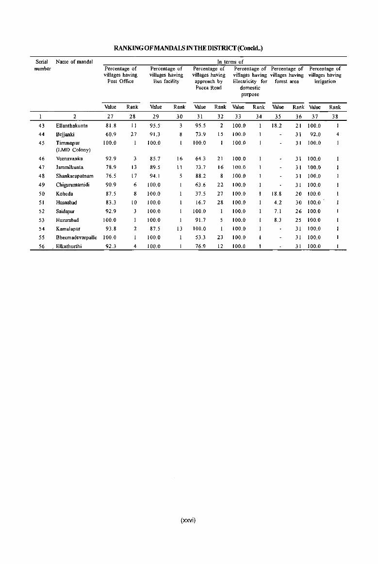
RANKING OF MANDALS IN THE DISTRICf(Concld .. )
Serial Name of mandai In terms of number Percentage of Percentage of Percentage of Percentage of Percentage of Percentage of
villages having villages having villages having villages having villages having villages having Post Office Bus facility approach by Electricity for forest area Irrigation
Pucca Road domestic purpose
Value Rank Value Rank Value Rank Value Rank Value Rank Value Rank
2 27 28 29 30 31 32 33 34 35 36 37 38
43 EUanthakunta 81.8 11 95.5 3 95.5 2 100.0 18.2 21 100.0
44 Bejjanki 60.9 27 91.3 8 73.9 15 100.0 31 92.0 4
45 Timmapur 100.0 100.0 100.0 100.0 31 100.0 I (LMD Colony)
46 Veenavanka 92.9 3 85.7 16 643 21 100.0 31 100.0
47 lammikunta 78.9 13 89.5 11 73.7 16 100.0 31 100.0
48 Shankarapatnam 76.5 17 94.1 5 88.2 8 .100.0 31 100.0
49 Chigurumamidi 90.9 6 100.0 63.6 22 100.0 3 I 100.0
50 Koheda 87.5 8 100.0 37.5 27 100.0 18.8 20 100.0
SI Husnabad 83.3 10 100.0 16.7 28 100.0 4.2 30 100.0
52 Saidapur 92.9 3 100.0 100.0 100.0 7. I 26 100.0
53 Huzurabad 100.0 100.0 1 91.7 5 100.0 8.3 2S 100.0
54 Kamalapur 93.8 2 87.5 13 100.0 I 100.0 31 100.0
55 Bheemadevarpalle 100.0 I 100.0 53.3 23 100.0 31 100.0
S6 , Elkathurthi 92.3 4 100.0 76.9 12 100.0 31 100.0
(xxvi)
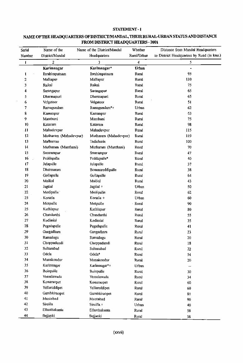
STATEMENT -1
NAME OF THE HEADQUARTERS OFDISTRICfIMANDAL, THElRRURAL-URBAN STATUS AND DISTANCE FROM DISTRICT HEADQUARTERS-2001
Serial Name of the Name of the District/MandaI Whether Distance from MandaI Headquarters
Number DistrictIMandal Headquarters RurallUrban to District Headquarters by Road (in kms.)
2 3 4 5 Karimnagar Karinmagar* Urban Ibrahimpatnam Ibrahimpatnam Rural 95
2 Mallapur Mallapur Rural 110
3 Raikal Raikal Rural 75 4 Sarangapur Sarangapur Rural 65 5 Dharmapuri Dharmapuri Rural 65 6 Velgatoor Velgatoor Rural 51 7 Ramagundam Ramagundam*+ Urban 62 8 Kamanpur Kamanpur Rural 53 9 Manthani Manthani Rural 75 10 Kataram Kataram Rural 98 .11 Mahadevpur Mahadevpur Rural 115 12 Mutharam (Mahadevpur) Mutharam (Mahadevpur) Rural .119 13 Malharrao Tadicherla Rural 100
14 Mu~haram (Manthani) Mutharam (Manthani) Rural 70 15 Sreerampur Sreerampur Rural 47 16 Peddapalle PeddapaUe>l< Rura! 40 17 lulapalle Julapalle Rural 37 18 Dhahnararn Bommareddipalle Rural 38 19 Gollapalle Gollapalle Rural 64 20 Mallial Mallia! Rural 43 21 Jagtial Jagtial + Urban 50 22 Medipalle Medipalle Rural 62 23 Koratla Koratla + Urban 60 24 Metpalle Metpalle . Rural 90 25 Kathlapur Kathlapur Rural 80 26 Chandurthi Chandurthi Rural SS 27 Kodimial Kodimial Rural 3S 28 Pegadapalle Pegadapalle Rural 41 29 Gangadhara Gangadhara Rural 23 30 Ramadugu Ramadugu Rural 20 31 Choppadandi Choppadandi Rural 18 32 Sultanabad Sultanabad Rural 22 33 Odela Odela* Rural 54 34 Manakondur Manakondur Rural 20 35 Karimnagar Karimnagar*+ Urban 36 Boinpalle Boinpalle Rural 30 37 Vemulawada Vemulawada Rural 34 38 Konaraopet Konaraopet Rural 60 39 Yellareddipet Yellareddipet Rural 60 40 Gambhiraopet Gambhiraopet Rural 81 41 Mustabad Mustabad Rural 90 42 Sircilla Sircilla + Urban 40 43 Ellanthakunta Ellanthakunta Rural 58 44 Bejjanki Bejjanki Rural 38
(xxvii)
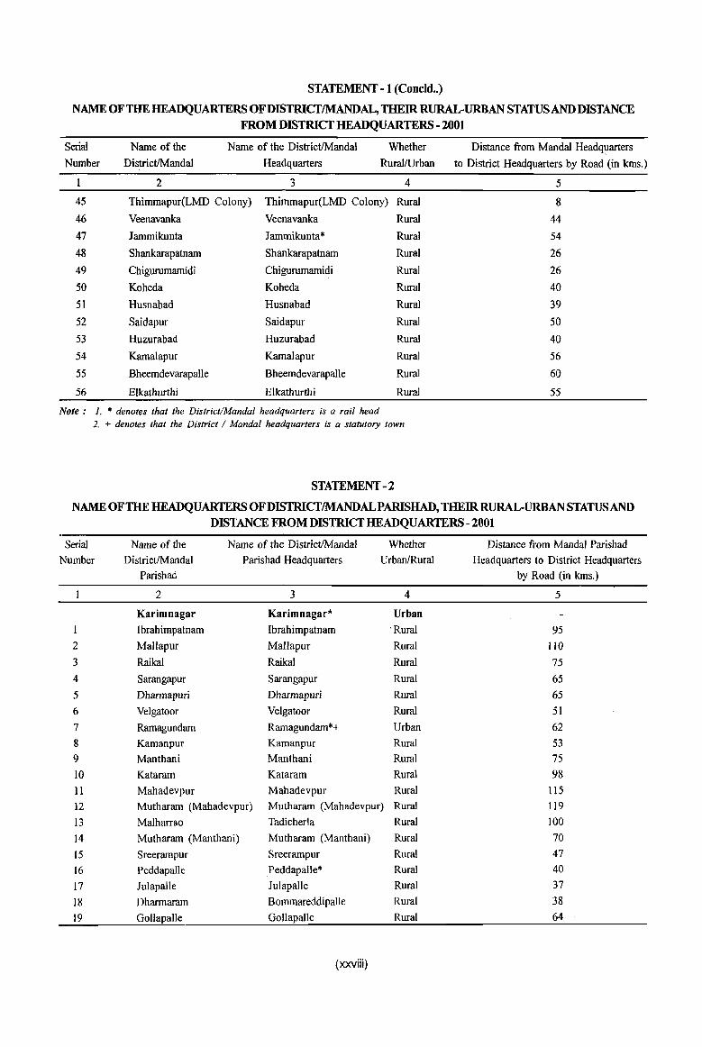
STATEMENT - 1 (Conc1d .. )
NAME OF THE HEADQUARTERS OFDISTRICTIMANDAL, THEIR RURAL-URBAN STATUS AND DISTANCE FROM DISTRICT HEADQUARTERS - 2001
Serial Name of the Name of the DistrictlMandal Whether Distance from Mandai Headquarters
Number DistrictIMandal Headquarters RurallUrban to District Headquarters by Road (in kms.)
2 3 4 5
45 Thimmapur(LMD Colony) Thimmapur(LMD Colony) Rural 8
46 Veenavanka Veenavanka Rural 44
47 lammikunta lammikunta* Rural 54
48 Shankarapatnam Shankarapatnam Rural 26
49 Chigurumamidi Chigurumamidi Rural 26
50 Koheda Koheda Rural 40
51 Husnabad Husnabad Rural 39
52 Saidapur Saidapur Rural 50
53 Huzurabad Huzurabad Rural 40 54 Kamalapur Kamalapur Rural 56
55 BheemdevarapaUe Bheemdevarapalle Rural 60
56 Elkathurthi Elkathurthi Rural 55
Note: 1. * denotes that the DistrictlMcmdal headquarters is a rail head 2. + denotes that the District I Mandai headquarters is a statutory town
STATEMENT - 2
NAME OF THE HEADQUARTERS OF DISTRICTIMANDALPARISHAD, THEIR RURAL-URBAN STATUS AND DISTANCE FROM DISTRICT HEADQUARTERS -2001
Serial Name of the Name of the DistrictIMandal Whether Distance from MandaI Parishad
Number DistrictlMandal Parish ad Headquarters UrbanfRural Headquarters to District Headquarters Parishad by Road (in kms.)
2 3 4 5
Karimnagar Karimnagar* Urban Ibrahimpatnam Ibrahimpatnam ' Rural 95
2 Mallapur Mallapur Rural lIO
3 Raikal Raikal Rural 75 4 Sarangapur Sarangapur Rural 65 5 Dharmapuri Dharmapuri Rural 65 6 Velgatoor Velgatoor Rural 51 7 Ramagundam Ramagundam*+ Urban 62 8 Kamanpur Kamanpur Rural 53 9 Manthani Manthani Rural 75 10 Kataram Kataram Rural 98 11 Mahadevpur Mahadevpur Rural 115
12 Mutharam (Mahadevpur) Mutharam (Mahadevpur) Rural 119 13 Malharrao Tadicherla Rural 100
14 Mutharam (Manthani) Mutharam (Manthani) Rural 70 15 Sreerampur Sreerampur Rural 47 16 Peddapalle Peddapalle* Rural 40
17 Julapalle Julapalle Rural 37
18 Dharmaram Bommareddipalle Rural 38
19 GoUapalle GoUapalle Rural 64
(xxviii)
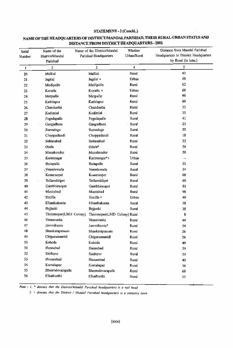
STATEMENT - 2 (Concld .. )
NAME OFTHE HEADQUARTERS OF DISTRICTIMANDALPARISHAD, THEIR RURAl.rURBAN ST4TUSAND DISTANCE FROM DISTRICT HEADQUARTERS -2001
Serial Name of the Name of the DistrictIMandal Whether Distance from MandaI Parishad
Number DistrictIMandal Parishad Headquarters UrbanlRural Headquarters to District Headquarters
Parishad by Road (in kms.)
2 3 4 5
20 Mallial Mallial Rural 43
21 JagtiaJ Jagtial + Urban 50
22 Medipalle Medipalle Rural 62
23 Koratla Koratla + Urban 60
24 Metpalle Metpalle Rural 90
25 Kathlapur Kathlapur Rural 80
26 Chandurthi Chandurthi Rural 55
27 Kodimial Kodimial Rural 35
28 Pegadapalle Pegadapalle Rural 41
29 Gangadhara Gangadhara Rural 23
30 Ramadugu Ramadugu Rural 20
31 Choppadandi Choppadandi Rural 18
32 Sultanabad Sultanabad Rural 22
33 Odela Odela* Rural 54
34 Manakondur Manakondur Rural 20
35 Karimnagar Karimnagar*+ Urban
36 Boinpalle Boinpalle Rural 30
37 :,yemuJawada Vemulawada Rural 34
38 Konaraopet Konaraopet Rural 60
39 Yellareddipet Yellareddipet Rural 60 40 . Gambhiraopet Gambhiraopet Rural 81 41 Mustabad Mustabad Rural 90 42 -·Sircilla Sircilla + Urban 40 43 Ellanthakunta Ellanthakunta Rural 58 44 Belianki Belianki Rural 38 45 Thimmapur(LMD Colony) Thimmapur(LMD Colony) Rural 8 46 Veenavanka Veenavanka Rural 44 47 Iammikunta Iammikunta* Rural 54 48 Shankarapatnam Shankarapatnam Rural 26 49 Chigurumamidi Chigurumamidi Rural 26 50 Koheda Koheda Rural 40 51 Husnabad Husnabad Rural 39 52 Saidapur Saidapur Rural 50 53 Huzurabad Huzurabad Rural 40 54 KamaJapur Kamalapur Rural 56 55 Bheemdevarapalle Bheemdevarapalle Rural 60 56 E1kathurthi Elkathurthi Rural 55
Note: 1. * denotes that the District/MandaI Parishad headquarters is a rail head
2. + denotes that the District / Mandal Parishad headquarters is a statutory town
(xxix)
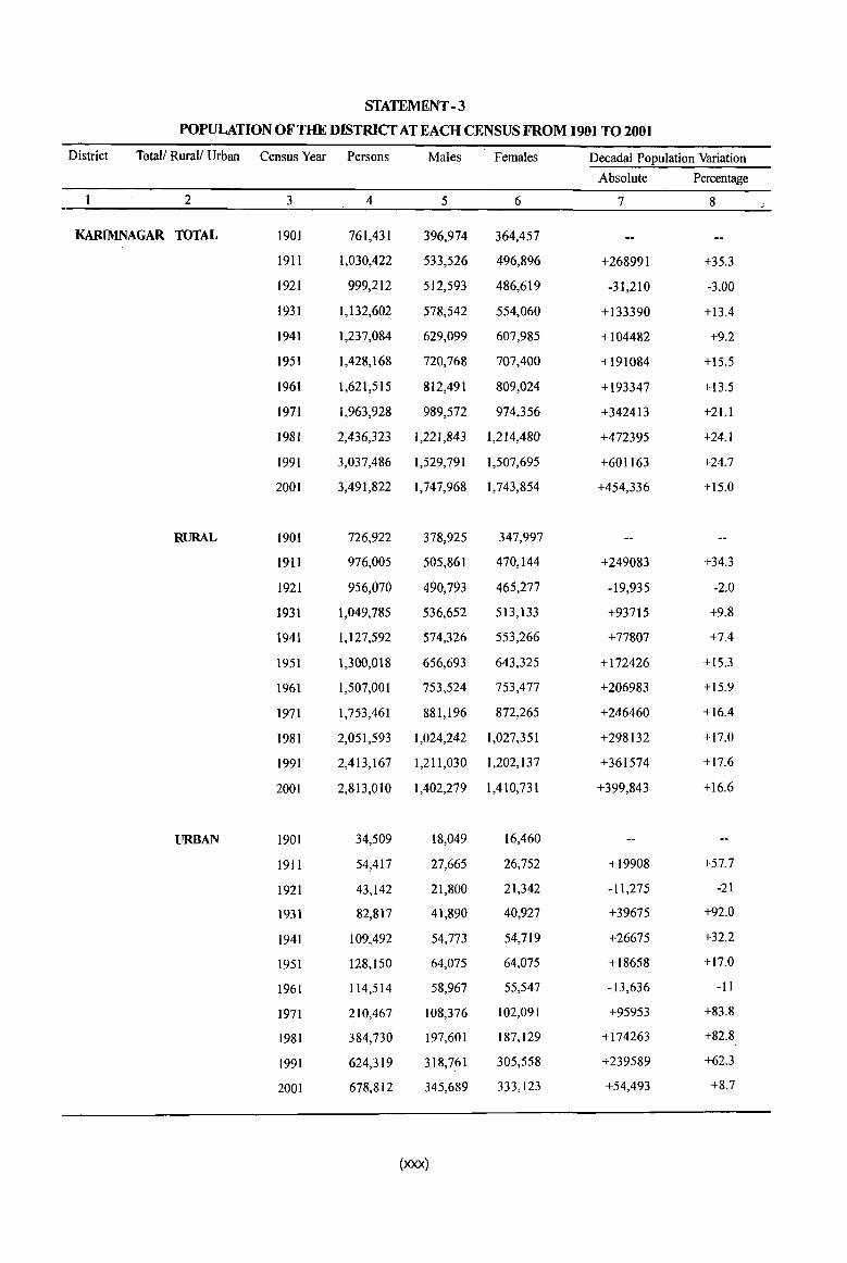
STATEMENT -3
POPULATION OF THE DISTRICT AT EACH CENSUS FROM 1901 TO 2001
District Total/ Rural/ Urban Census Year Persons Males Females Decadal Population Variation
Absolute Percentage
2 3 4 5 6 7 8
KARlMNAGAR TOTAL 1901 761,431 396,974 364,457
1911 1,030,422 533,526 496,896 +268991 +35.3
1921 999,212 512,593 486,619 -31,210 -3.00
1931 1,132,602 578,542 554,060 +133390 +13.4
1941 1,237,084 629,099 607,985 +104482 +9.2
1951 1,428,168 720,768 707,400 +191084 +15.5
1961 1,621,515 812,491 809,024 +193347 +13.5
1971 1,963,928 989,572 974,356 +342413 +21.1
1981 2,436,323 1,221,843 1,214,480 +472395 +24.1
1991 3,037,486 1,529,791 1,507,695 +601163 +24.7
2001 3,491,822 1,747,968 1,743,854 +454,336 +15.0
RURAL 1901 726,922 378,925 347,997
19I1 976,005 505,861 470,144 +249083 +34.3
1921 956,070 490,793 465,277 -19,935 -2.0
1931 1,049,785 536,652 513,133 +93715 +9.8
1941 1,127,592 574,326 553,266 +77807 +7.4
1951 1,300,018 656,693 643,325 +172426 +15.3
1961 1,507,001 753,524 753,477 +206983 +15.9
1971 1,753,461 881,196 872,265 +246460 +16.4
1981 2,051,593 1,024,242 1,027,351 +298132 +17.0
1991 2,413,167 1,211,030 1,202,137 +361574 +17.6
2001 2,813,010 1,402,279 1,410,731 +399,843 +16.6
URBAN 1901 34,509 18,049 16,460
1911 54,417 27,665 26,752 +19908 +57.7
1921 43,142 21,800 21,342 -11,275 -21
1931 82,817 41,890 40,927 +39675 +92.0
1941 109,492 54,773 54,719 +26675 +32.2
1951 128,150 64,075 64,075 +18658 +17.0
1961 114,514 58,967 55,547 -13,636 -11
1971 210,467 108,376 102,091 +95953 +83.8
1981 384,730 197,601 187,129 +174263 +82.8
1991 624,319 318,761 305,558 +239589 +62.3
2001 678,812 345,689 333,123 +54,493 +8.7
(xxx)
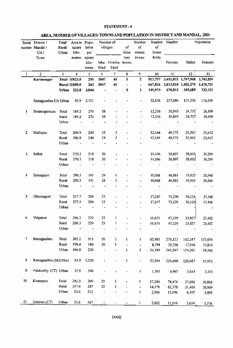
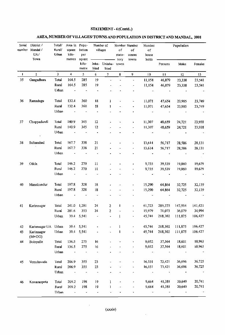
STATEMENT - 4
AREA, NUMBER OF VILLAGESI TOWNS AND POPULATION IN DISTRICT AND ~AL, 2001
Serial District! Total! Area in Popu- Number of Number Number Number Population
number MandaI! Rural! square lation villages of of of
UA! Urban kilo- per .
statu~ tensus house
Town metres square tory towns holds
kilo- Inha- Uninha- towns Persons Males Females
metre bited bited
2 3 4 5 6 7 8 9 10 II 12 ~ 13
Karimnagar Total 11823.0 295 1047 45 5 2 813,797 3,491,822 1,747,96 1,743,854
Rura11l600.0 243 1047 45 667,824 2,813,010 1,402,27~ 1,410,731
Urban 223.0 3,044 5 2 145,973 678,812 345,689 333,123
Ramagundam UA Urban 93.9 2,531 52,838 237,686 121,250 116,436
Ibrahimpatnam Total 184.2 276 18 12,236 50,845 24,737 I
26,108
Rural 184.2 276 18 12,236 50,845 24,
731 26,108
Urban
\
2 Mallapur Total 206.9 240 19 3 12,144 49,575 23,963\ 25,612
Rural 206.9 240 19 3 12,144 49,575 23,963 25,612
Urban
3 Raikal Total 270.3 218 20 14,106 58,807 28,6031
30,204
Rural 270.3 218 20 14,106 58,807 28,6031
30,204
Urban
4 Sarangapur Total 290.3 141 24 10,068 40,881 19,935! 20,946
Rural 290.3 141 24 10,068 40,881 19,935\ 20,946
Urban
5 Dharmapuri Total 257.7 284 23 17,247 73,230 36,124. 37,106
Rural 257.3 284 23 17,247 73,230 36, 1241 37,106
Urban -I
6 Velgatoor Total 206.3 229 23 11,671 47,229 23,827 23,402 Rural 206.3 229 23 II,671 47,229 23,827 23,402 Urban
7 Ramagundarn Total 305.2 915 20 62,983 279,323 142,247 137,076 Rural 198.4 180 20 8,794 35,756 17,946 17,810 Urban 106.8 228 54,189 243,567 124,301 19,266
8 Ramagundam (M)Urban 93.9 2,520 52,594 236,600 120,687 15,913
9 Palakurthy (CT) Urban 12.9 540 1,595 6,967 3,614 3,353
to Kamanpur Total 241.0 309 22 2 17,284 74,474 37,606 36,868 Rural 217.4 287 22 2 14,378 62,378 31,409 30,969 Urban 23.6 513 2,906 12,096 6,197 5,899
II Jallaram (CT) Urban 23.6 467 2,662 11,010 5,634 5,376
(xxxi)
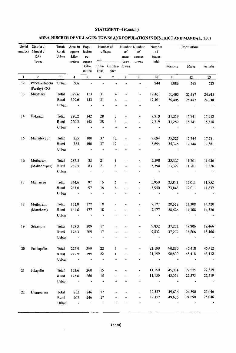
STATEMENT - 4 (Contd .. )
AREA, NUMBER OF VILLAGESI TOWNS AND POPULATION IN DISTIUCT AND MANDAL, 2001
Serial District I Total! Area in Popu- Number of Number Number Number Population number MandaI! Rural! square lation villages of of of
VAl Urban kilo- per statu- census house Town metres square tory towns holds
kilo- Inha- Vninha- towns Persons Males Females metre bited bited
2 3 4 5 6 7 8 9 10 II 12 13
12 Penchikalapeta Urban NA 244 1,086 563 523
(parthy) OG
I3 Manthani Total 329.6 153 31 4 12,401 50,405 25,487 24,918
Rural 329.6 153 31 4 12,401 50,405 25,487 24,918
Urban
14 Kataram Total 220.2 142 28 3 7,719 31,259 15,741 15,518
Rural 220.2 142 28 3 7,719 31,259 15,741 15,518
Urban
15 Mahadevpur Total 355 100 37 12 8,694 35,325 17,744 17,581
Rural 355 100 37 12 8,694 35,325 17,744 17,58\
Urban
16 Mutharam Total 282.5 83 21 5,598 23,327 11,701 11,626
(Mahadevpur) Rural 282.5 83 21 5,598 23,327 11,701 11,626
Urban
17 Malharrao Total 244.6 97 16 6 5,950 23,843 12,011 11,832
Rural 244.6 97 16 6 5,950 23,843 12,011 11,832
Urban
18 Mutharam Total 161.8 177 18 7,177 28,628 14,308 14,320
(Manthani) Rural 161.8 177 18 7,177 28,628 14,308 14,320
Urban
19 Srirampur Total 178.3 209 17 9,832 37,272 18,806 18,466
Rural 178.3 209 17 9,832 37,272 18,806 18,466
Urban
20 PeddapaUe Total 227.9 399 22 21,199 90,830 45,418 45,412
Rural 227.9 399 22 21,199 90,830 45,418 45,412
Urban
21 JulapaUe Total 173.6 260 15 n,150 45,094 22,575 22,519
Rural 173.6 260 15 11,150 45,094 22,575 22,519
Urban
22 Dharmaram Total 202 246 17 12,357 49,636 24,590 25,046
Rural 202 246 17 12,357 49,636 24,590 25,046
Urban
(xxxii)

STATEMENT - 4 (Contd .. )
AREA, NUMBER OFVILLAGESI TOWNS AND POPULATION IN DISTRICT AND MANDAL, 2001
Serial District I Totall Area in Popu- Number of Number Number Number Population
number Mandai I Rural! square lation villages of of of
UAI Urban kilo- per statu- census house
Town metres square tory towns holds
kilo- Inha- Uninha- towns Persons Males Females
metre bited bited
2 3 4 5 6 7 8 9 10 II 12 13
23 Gollapalle Total 154.2 270 22 9,996 41,648 20,514 21,134
Rural 154.2 270 22 9,996 41,648 20,514 21,134
Urban
24 Mallial Total 166.9 271 15 10,660 45,244 21,952 23,292
Rural 166.9 271 15 10,660 45,244 21,952 23,292
Urban
25 Jagtial Total 233.3 645 24 33,327 150,565 75,402 75,163
Rural 215.5 302 24 15,501 65,044 32,025 33,019
Urban 17.8 4,805 17,826 85,521 43,377 42,144
26 Jagtial (M) Urban 17.8 4,805 17,826 85,521 43,377 42,144
27 Medipalle Total 197.0 253 19 11,974 49,773 24,151 25,622
Rural 197.0 253 19 11,974 49,773 24,151 25,622
Urban
28 Koratla Total 140.0 675 14 20,442 94,429 46,958 47,471
Rural 117.2 345 14 9,432 40,417 19,685 20,732
Urban 22.8 2,369 11,010 54,012 27,273 26,739
29 Koratla (M) Urban 22.8 2,369 11,010 54,012 27,273 26,739
30 Metpalle Total 176.2 437 15 17,1 I3 76,985 38,270 38,715
Rural 176.2 437 15 17,1 I3 76,985 38,270 38,715
Urban
31 Kathlapur Total 177.6 241 18 10,045 42,786 20,491 22,295
Rural 177.6 241 18 10,045 42,786 20,491 22,295
Urban
32 Chandurthi Total 206.5 196 12 9,549 40,558 20,079 20,479
Rural 206.5 196 12 9,549 40,558 20,079 20,479
Urban
33 Kodimial Total 150.5 281 15 10,342 42,346 20,719 21,627
Rural 150.5 281 15 10,342 42,346 20,719 21,627
Urban
34 PegadapaUe Total 146.4 307 16 10,628 44,879 22,284 22,595
Rural 146.4 307 16 10,628 44,879 22,284 22,595
Urban
(xxxiii)
STATEMENT - 4 (Contd .. )
AREA, NUMBER OF VILLAGESI TOWNS AND POPULATION IN DISTRICT AND MANDAL, 2001
Serial District I Total! Area in Popu- Number of Number Number Number Population number MandaI I Rural! square lation villages of of of
UAI Urban kilo- per statu- census house Town metres square tory towns holds
kilo- Inha- Uninha- towns Persons Males Females metre bited bited
1 2 3 4 5 6 7 8 9 10 11 12 13
35 Gangadhara Total 164.5 285 19 11,154 46,879 23,338 23,541
Rural 164.5 285 19 11,154 46,879 23,338 23,541
Urban
36 Ramadugu Total 132.4 360 18 11,07I 47,654 23,905 23,749
Rural 132.4 360 18 1l,071 47,654 23,905 23,749
Urban
37 Choppadandi Total 140.9 345 12 11,307 48,659 24,721 23,938
Rural 140.9 345 12 11,307 48,659 24,721 23,938
Urban
38 Sultanabad Total 167.7 338 21 13,614 56,717 28,586 28,131
Rural 167.7 338 21 13,614 56,717 28,586 28,131
Urban
39 .Odela Total 146.2 270 II 9,735 39,539 19,860 19,679
Rural 146.2 270 II 9,735 39,539 19,860 19,679
Urban
40 Manakondur Total 197.8 328 18 15,290 64,864 32,725 32,139
Rural 197.8 328 18 15,290 64,864 32,725 32,139
Urban
41 Karimnagar Total 241.0 1,201 24 2 61,723 289,375 147,954 141,421
Rural 201.6 353 24 2 15,979 71,073 36,079 34,994
Urban 39.4 5,541 45,744 218,302 111,875 106,427
42 Karimnagar UA Urban 39.4 5,541 45,744 218,302 111,875 106,427
43 Karimnagar Urban 39.4 5,541 45,744 218,302 111,875 106,427
(M+OG)
44 Boinpalle Total 136.5 275 16 9,052 37,564 18,601 18,963
Rural 136.5 275 16 9,052 37,564 18,601 18,963
Urban
45 Vemulawada Total 206.9 355 23 16,551 73,421 36,696 36,725
Rural 206.9 355 23 16,551 73,421 36,696 36,725
Urban
46 Konaraopeta Total 209.2 198 19 9,664 41,381 20,640 20,741
Rural 209.2 198 19 9,664 41,381 20,640 20,741
Urban
(xxxiv)
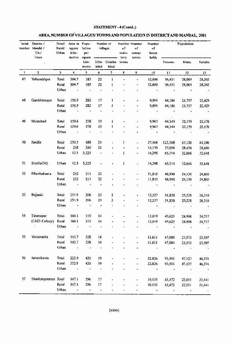
STATEMENT - 4 (Contd .. )
AREA, NUMBER OFVILLAGESITOWNS AND POPULATION IN DlSTRICf AND MANDAL, 2001
Serial District I Totall Area in Popu- Number of Number Number Number Population number Mandai I Rural! square lation villages of of of
UAI Urban kilo- per statu- census house Town metres square tory towns holds
kilo- lnha- Uninha- towns Persons Males Females metre bited bited
2 3 4 5 6 7 8 9 10 II 12 13
47 Yellareddipet Total 304.7 185 22 12,600 56,431 28,069 28,362
Rural 304.7 185 22 12,600 56,431 28,069 28,362
Urban
48 Gambhiraopet Total 156.9 282 17 9,891 44,186 21,757 22,429
Rural 156.9 282 17 9,891 44,186 21,757 22,429
Urban
49 Mustabad Total 159.6 278 15 9,907 44,349 22,179 22,170
Rural 159.6 278 15 9,907 44,349 22,179 22,170
Urban
50 Sircilla Total 250.5 488 21 27,468 122,368 61,120 61,248
Rural 238 240 21 13,170 57,054 28,454 28,600
Urban 12.5 5,225 14,298 65,314 32,666 32,648
51 Sircilla tM) Urban 12.5 5,225 14,298 65,314 32,666 32,648
52 Ellanthakunta Total 232 211 22 11,810 48,990 24,130 24,860
Rural 232 211 22 11,810 48,990 24,130 24,860
Urban
53 Bejjanki Total 251.9 206 23 2 12,527 51,838 25,528 26,310
Rural 251.9 206 23 2 12,527 51,838 25,528 26,310
Urban
54 Timmapur Total 160.3 310 14 12,019 49,625 24,908 24,717 (LMO Colony) Rural 160.3 310 14 12,019 49,625 24,908 24,717
Urban
55 Veenavanka Total 143.7 328 14 11,611 47,080 23,573 23,507
Rural 143.7 328 14 11,611 47,080 23,573 23,507 Urban
56 lammikunta Total 222.9 420 19 22,826 93,501 47,127 46,374 Rural 222.9 420 19 22,826 93,501 47,127 46,374 Urban
57 Shankarapatnam Total 147.1 296 17 10,135 43,472 22,031 21,441 Rural 147.1 296 17 10,135 43,472 22,031 21,441 Urban
(xxxv)
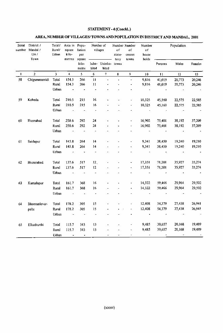
STATEMENT - 4 (Concld •• )
AREA, NUMBER OF VILLAGESI TOWNS AND POPULATION IN DISTRICT AND MANDAL, 2001
Serial District I Total! Area in Popu- Number of Number Number Number Population number Mandai / Rural/ square lation villages of of of
UAI Urban kilo- per statu- census house Town metres square tory towns holds
kilo- lnha- Uninha- towns Persons Males Females metre bited bited
2 3 4 5 6 7 8 9 10 11 12 13
58 Chigurumamidi Total 154.3 266 II 9,816 41,019 20,773 20,246 Rural 154.3 266 11 9,816 41,019 20,773 20,246
Urban
59 Koheda Total 210.5 215 16 10,325 45,160 22,575 22,585
Rural 210.5 215 16 10,325 45,160 22,575 22,585
Urban
60 Husnabad Total 258.6 292 24 16,902 75,401 38,192 37,209
Rural 258.6 292 24 16,902 75,401 38,192 37,209
Urban
61 Saidapur Total 145.8 264 14 9,341 38,450 19,240 19,210
Rural 145.8 264 14 9,341 38,450 19,240 19,210
Urban -
62 Huzurabad Total 137.6 517 12, 17,351 71,201 35,927 35,274
Rural 137.6 517 12 17,351 71,201 35,927 35,274
Urban
63 Kamalapur Total 161.7 368 16 14,322 59,466 29,964 29,502
Rural 161.7 368 16 14,322 59,466 29,964 29,502
Urban
64 Bheemadevar- Total 178.2 305 15 12,408 54,379 27,438 26,941
palle Rural 178.2 305 15 12,408 54,379 27,438 26,941
Urban
65 Elkathurthi Total 115.7 343 13 9,485 39,657 20,168 19,489
Rural 115.7 343 13 9,485 39,657 20,168 19,489
Urban
(xxxvi)
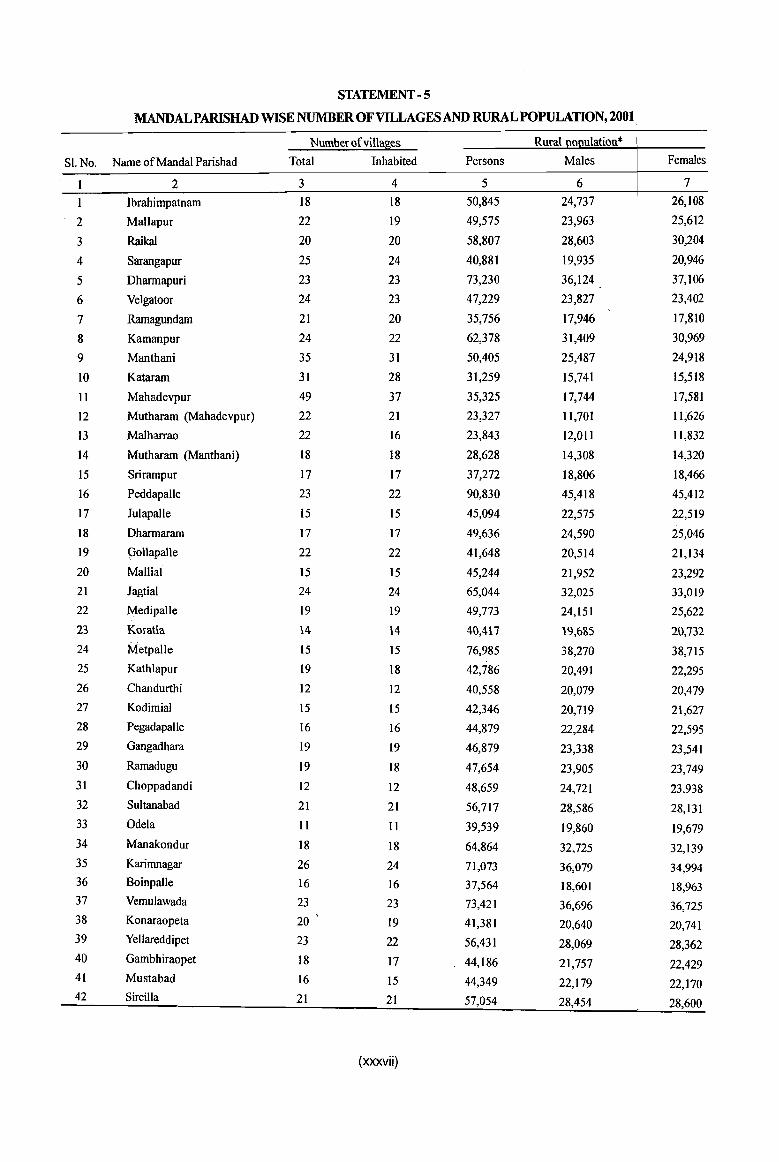
STATEMENT -5
MANDALPARISHAD WISE NUMBER OF VILLAGES AND RURAL POPULATION, 2001
Number of villag,es Rural 0 ulation*
Sl.No. Name of Mandai Parishad Total Inhabited Persons Males Females
2 3 4 5 6 7
Ibrahimpatnam 18 18 50,845 24,737 26,108
2 Mallapur 22 19 49,575 23,963 25,612
3 RaikaJ 20 20 58,807 28,603 30,204
4 Sarangapur 25 24 40,881 19,935 20,946
5 Dharmapuri 23 23 73,230 36,124 37,106
6 Velgatoor 24 23 47,229 23,827 23,402
7 Ramagundam 21 20 35,756 17,946 17,810
8 Kamanpur 24 22 62,378 31,409 30,969
9 Manthani 35 31 50,405 25,487 24,918
10 Kataram 31 28 31,259 15,741 15,518
II Mahadevpur 49 37 35,325 17,744 17,581
12 Mutharam (Mahadevpur) 22 21 23,327 11,701 11;626
13 Malharrao 22 16 23,843 12,011 11,832
14 Mutharam (Manthani) 18 18 28,628 14,308 14,320
15 Srirampur 17 17 37,272 18,806 18,466
16 Peddapalle 23 22 90,830 45,418 45,412
17 Julapalle 15 15 45,094 22,575 22,519
18 Dharmaram 17 17 49,636 24,590 25,046
19 Oollapalle 22 22 41,648 20,514 21,134
20 Mallial 15 15 45,244 21,952 23,292
21 Jagtial 24 24 65,044 32,025 33,019
22 Medipalle 19 19 49,773 24,151 25,622
23 Korat\a 14 14 40,417 19,6S5 20,732
24 Metpalle 15 15 76,985 38,270 38,715
25 Kathlapur 19 18 42,786 20,491 22,295
26 Chandurthi 12 12 40,558 20,079 20,479
27 Kodimial 15 15 42,346 20,719 21,627
28 Pegadapalle 16 16 44,879 22,284 22,595
29 Gangadhara 19 19 46,879 23,338 23,541
30 Ramadugu 19 18 47,654 23,905 23,749
31 Choppadandi 12 12 48,659 24,721 23,938 32 Sultanabad 21 21 56,717 28,586 28,131 33 Odela 11 II 39,539 19,860 19,679 34 Manakondur 18 18 64,864 32,725 32,139 35 Karimnagar 26 24 71,073 36,079 34,994 36 Boinpalle 16 16 37,564 18,601 18,963 37 Vemulawada 23 23 73,421 36,696 36,725 38 Konaraopeta 20 19 41,381 20,640 20,741 39 Yellareddipet 23 22 56,431 28,069 28,362 40 Gambhiraopet 18 17 44,186 21,757 22,429 41 Mustabad 16 15 44,349 22,179 22,170 42 Sircilla 21 21 57,054 28,454 28,600
(xxxvii)
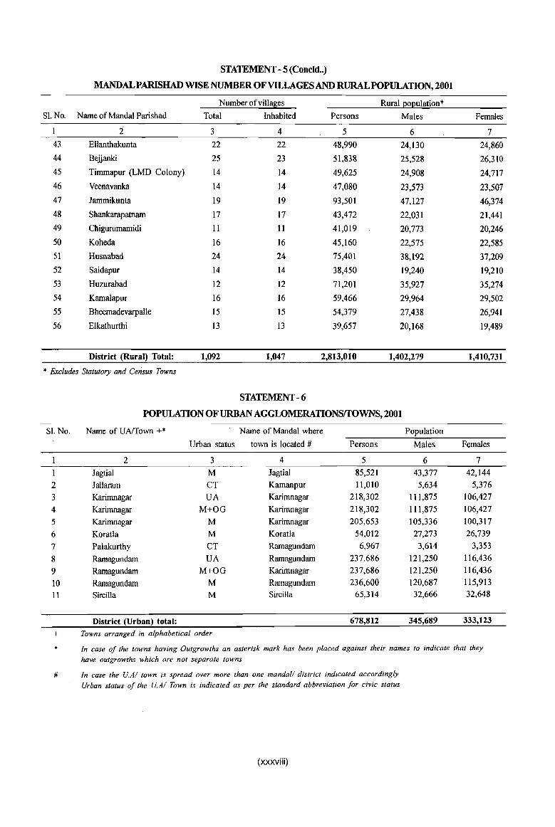
STATEMENT - 5 (Concld .• )
MANDALPARISHAD WISE NUMBER OF VILLAGES AND RURALPOPULATION, 2001
Number of villages Rural I!oI!ulation* Sl. No. Name of Mandai Parishad Total Inhabited Persons Males Females
:2 3 4 5 6 7 43 Ellanthakunta 22 22 48,990 24,130 24,860
44 Beiianki 25 23 51,838 25,528 26,310
45 Timmapur (LMD Colony) 14 14 49,625 24,908 24,717
46 Veenavanka 14 14 47,080 23,573 23,507
47 lammikunta 19 19 93,501 47,127 46,374
48 Shankarapatnam 17 17 43,472 22,031 21,441
49 Chigurumamidi II II 41,019 20,773 20,246
50 Koheda 16 16 45,160 22,575 22,585
51 Husnabad 24 24 75,401 38,192 37,209
52 Saidapur 14 14 38,450 19,240 19,210
53 Huzurabad 12 12 71,201 35,927 35,274
54 Kamalapur 16 16 59,466 29,964 29,502
55 Bheemadevarpalle 15 15 54,379 27,438 26,941
56 Elkathurthi 13 13 39,657 20,168 19,489
District (Rural) Total: 1,092 1,047 2,813,010 1,402,279 1,410,731
* Excludes Statutory and Census Towns
STATEMENT - 6
POPULATION OF URBAN AGGWMERATIONSrroWNs, 2001
SI. No. Name of UNfown +* Name of Mandai where Population
Urban status town is located # Persons Males Females
I 2 3 4 5 6 7
I lagtial M lagtial 85,521 43,377 42,144
2 lallaram CT Kamanpur 11,0lO 5,634 5,376
3 Karimoagar UA Karimnagar 218,302 111,875 106,427
4 Karimoagar M+OG Karimnagar 218,302 111,875 106,427
5 Karimnagar M Karimnagar 205,653 105,336 100,317
6 Koratla M Koratla 54,012 27,273 26,739
7 Palakurthy CT Ramagundam 6,967 3,614 3,353
8 Ramagundam UA Ramagundam 237.686 121,250 116,436
9 Ramagundam M+OG Karimnagar 237,686 121,250 116,436
10 Ramagundam M Ramagundam 236,600 120,687 115,913
11 Sircilla M Sircilla 65,314 32,666 32,648
District (Urban) total: 678,812 345,689 333,123
+ Towns arranged in alphabetical order
* In case of the towns having Outgrowths an asterisk mark has been placed against their names to indicate that they
have outgrowths which are not separate towns
# In case the U.AI town is spread over more than one mandaI! district indicated accordingly
Urban status of the U.AI Town is indicated as per the standard abbreviation for civic status
(xxxviii)

STATEMENT -7
YILl,AGES WITH POPULATION OF 5,000 AND ABOVE AT MANDALPARISHAD LEVELl AS PER 2001 CENSUS AND Al\ffiNITIESAVAlLABLE
Sl.No. Name of Name of village Location Population Whether Whether Amen ties available
Mandai code it is it is E ucational
Parishad number Mandai Mandai Senior College Head- Parishad Secondary
quarters Head- School
quarters
2 3 4 5 6 7 8 9
Ibrahimpatnam Ibrahimpatnam 00265800 8,628 Yes Yes
Bandalingapur 00266400 7,492 No No
2 Mallapur Mallapur 00267300 6,282 Yes Yes 1
3 Raikal Raikal 00270100 14,857 Yes Yes 1
Itkyal 00270200 5,433 No No
Allipur 00270600 8,192 No No
4 Dharmapuri Rajaram 00273800 8,902 No No
Dharmapuri 00274200 14,933 Yes Yes
5 Velgatoor Endapalle 00277600 5,257 No No
6 Rarnagundam Esalatakkallapalle 00279600 5,335 No No
7 Kamanpur Kannala 00280100 6,839 No No
Kamanpur 0028HOO 8,370 Yes Yes
Ratnapur 00282100 10,071 No No
8 Manthani Manthani 00285000 17,049 Yes Yes 2
9 Mahadevjmr Mahadevpur 00290900 8,416 Yes Yes
10 Malharrao Tadicherla 00297300 6,108 Yes Yes
II Srirampui . Srirampur 00301200 5,695 Yes Yes
12 Peddapalle ... Appannapet 00302100 6,042 No No
Raghavapur 00302500 5,743 No No
Peddapalle 00303000 36,221 Yes Yes 4 2
I3 Julapalle Ju1apalle 00304300 6,007 Yes Yes
Wadkapur 00304600 5,236 No No
Elgaid 00305100 5,644 No No
14 Dharmaram Bommareddipalle 00305900 8,749 No No
Myadaram , 00306000 6,992 No No
15 Mallial Mallial 00310300 11,684 Yes Yes
16 Jagtial Chelgal 00312500 5,037 No No
17 Medipalle Medipalle 00313800 5,813 Yes Yes
18 Koratla Ailapur 00315500 8,301 No No
19 Metpalle Metpalle 00317000 41,224 Yes Yes 2 Vempet 00317100 5,234 No No
Vellulla 00317300 6,033 No No
20 Chandurthi Rudrangi 00320200 8,990 No No
Chandurthi 00320400 5,041 Yes Yes 21 Kodimial Kodimial 00322100 10,752 Yes Yes
Pudur 00322600 5,878 No No
(xxxix)

STATEMENT -7
VILLAGES WITH POPULATION OF 5,000 AND ABOVE AT MANDALPARISHAD LEVEL
AS PER 2001 CENSUS AND AMENITIES AVAILABLE
SI.No. Name of NameofviI1age Amenities available
MandaI Medical Drinking Water Communication Banking Parishad Primary Primary Tap water Railway Commercial Co-operative
Health Health station Bank Bank Centre Sub-centre
2 3 10 11 12 13 14 15 Ibrahimpatnam Ibrahimpatnam Yes No
Bandalingapur Yes No
2 Mallapur Mallapur Yes No
3 RaikaI RaikaI Yes No
Itkyal Yes No
Allipur Yes No
4 Dharmapuri Rajaram No No
Dharmapuri Yes No
5 Velgatoor Endapalle Yes No
6 Ramagundam Esalatakkallapalle - No No
7 Kamanpur Kannala No No
Kamanpur Yes No
Ratnapur Yes No
8 Manthani Manthani 2 Yes No 3
9 Mahadevpur Mahadevpur Yes No
10 Malharrao Tadicherla Yes No
11 Srirampur Srirampur Yes No
12 Peddapalle Appannapet No No
Raghavapur Yes Yes
Peddapalle Yes Yes 5
13 Julapalle Julapalle Yes No
Wadkapur Yes No
Elgaid I Yes No
14 Dharmaram Bommareddipalle - 2 Yes No
Myadaram Yes No
15 Mallial Mallial Yes No
16 Jagtial Chelgal No No
17 Medipalle Medipalle Yes No
18 Koratla Ailapur Yes No I
19 Metpalle Metpalle Yes No 3
Vempet Yes No
Vellulla Yes No
20 Chandurthi Rudrangi Yes No
Chandurthi Yes No
21 Kodimial Kodimial Yes No
Pudur Yes No
(xl)
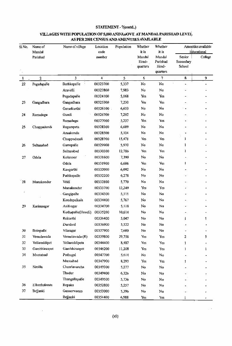
STATEMENT-7(contd .. )
VILLAGES WITH POPULATION OFS,OoOAmnlliOVE AT MANDALPARISHAD LEVE~ AS PER 2001 CENSUS AND AMENITIES AVAlLABLE
SI.No. Name of Name ofvillage Location Population Whether Whether Arne ities available
Mandai code it is it is
Parishad number Mandai Mandai College Head- Parishad
quarters Head-
quarters
1 2 3 4 5 6 7 8 9
22 Pegadapalle Bathkepalle 00323700 5,337 No No
Aravetli 00323800 7,983 No No
Pegadapalle 00324100 $,068 Yes Yes
23 Gangadhara Gangadhara 00325300 7,230 Yes Yes
Garsekurthi 00326100 6,653 No No
24 Rarnadugu Gundi 00326700 7,292 No No
Ramadugu 00327000 5,237 Yes Yes
25 Choppadandi Ragarnpeta 00328300 6,609 No No
Amakonda 00328500 5,104 No No
Choppadandi 00328700 15,471 Yes Yes
26 Sultanabad Garrepalle 00329900 5,970 No No
Sultanabad 00330300 12,786 Yes Yes
27 Odela Kolanoor 00331600 7,390 No No
Odela 00331900 6,606 Yes Yes
Kangarthi 00332000 6,092 No No
Pathkapalle 00332200 6,278 No No
28 Manakondur Veldi 00332800 5,770 No No
Manakondur 00333700 12,249 Yes Yes
- Gangipalle 00334300 5,111 No No
Kondapalkala 00334400 5,767 No No
29 Karimnagar Asifuagar 00334700 5,118 No No
Kothapalle(Haveli) 00335200 10,614 No No
Rekurthi 00336400 5,047 No No
Durshed 00336900 5,522 No No
30 BoinpaUe Vilasagar 00337900 7,680 No No
31 Vemulawada Vemulawada (R) 00339800 29,758 Yes Yes 2 3
32 Yellareddipet YeHareddipeta 00344400 8,487 Yes Yes
33 Gambhiraopet Gambhiraopet 00346200 11,208 Yes Yes
34 Mustabad PothugaI 00347700 5,614 No No
Mustabad 00347900 8,293 Yes Yes
35 SirciIla Cheerlavancha 00349300 5,277 No No
Thadur 00349400 6,326 No No
Thangallapalle 00349500 5,736 No No
36 Ellanthakunta Repaka 00352800 5,257 No No
37 Belianki Gannervaram 00353000 5,396 No No
Belianki 00354400 6,988 Yes Yes
(xli)

STATEMENT - 7(contd •. )
VILLAGES WITH POPULATION OF 5,000 AND ABOVE ATMANDALPARISHAD LEVEL AS PER 2001 CENSUS AND AMENITIES AVAILABLE
SI.No. Name of Name of village Amenities available
MandaI Medical Drinking Water Communication Banking
Parishad Primary Primary Tap water Railway Commercial Co-operative
Health Health station Bank Bank Centre Sub-centre
2 3 10 II 12 13 14 15
22 Pegadapalle Bathkepalle Yes No
Aravelli Yes No
Pegadapalle Yes No
23 Gangadhara Gangadhara 2 Yes No
Garsekurthi Yes No
24 Ramadugu Gundi 2 Yes No
Ramadugu Yes No
25 Choppadandi Ragampeta Yes No
Arnakonda Yes No I
Choppadandi 2 Yes No 2
26 Sultanabad Garrepalle Yes No
Sultanabad Yes No
27 Odela Kolanoor Yes Yes
Odela Yes Yes
Kangarthi Yes No
PathkapaUe Yes Yes
28 Manakondur Veldi No No
Manakondur Yes No
Gangipalle Yes No
Kondapalkala Yes No
29 Karimnagar Asifnagar Yes No
Kothapalle(Haveli) I Yes No 2
Rekurthi Yes No
Durshed Yes No
30 Boinpalle Vilasagar Yes No I
31 Vemulawada Vemulawada (R) 2 Yes No 2
32 Yellareddipet Yellareddipeta Yes No
33 Gambhiraopet Gambhiraopet 2 Yes No
34 Mustabad Pothugal Yes No
Mustabad Yes No
35 Sircilla Cheerlavancha Yes No
Thadur Yes No
Thangallapalle Yes No
36 Ellanthakunta Repaka Yes No
37 Bejjanki Gannervaram Yes No
Bejjanki Yes No
(xlii)

STATEMENT -7(concld .. )
VILLAGES WITH POPULATION OF 5,000 AND ABOVE AT MANDALPARISHAD LEVE4 AS PER 2001 CENSUS AND AMENITIES AVAILABLE
Sl.No. Name of NameofviUage Location Population Whether Whether Arne ities available
MandaI code it is it is E ucationaI
Parishad number Mandai Mandai College Head- Parishad
quarters Head-quarters
2 3 4 5 6 7 8 9
38 Timmapur Timmapur 00355600 7,292 Yes Yes (LMD Colony)
Alugunur 00355700 5,899 No No Nustulapur 00356000 7,411 No No
39 Veenavanka Veenavanka 00357900 7,179 Yes Yes
40 lammikunta VavilaIa 00358500 5,919 No No
Bijigirsharief 00358800 5,060 No No
lammikunta 00359100 27,335 Yes Yes 3
Dharmaram (P.B) 00359200 10,030 No No
Ellanthakunta 00359600 6,008 No No
41 Shankara- Kesavapatnam 00361400 5,995 Yes Yes patnam
Molangur 00361600 5,262 No No Metpalle 00361800 5,592 No No
42 .. Chigurumamidi Chigurumamidi 00362200 7,387 Yes Yes
Indurthi 00362600 7,437 No No
43 Koheda Sanigaram 00363000 5,242 No No
Baswapur 00363200 6,428 No No
Koheda 00364400 6,907 Yes Yes
44 Husnabad Husnabad 00364700 19,251 Yes Yes 2 45 Saidapur Akunur 00367900 5,521 No No
46 Huzurabad Chelpur 00368700 7,266 No No
Huzurabad 00368900 35,580 Yes Yes 5 2
47 Kamalapur Sanigaram 00370100 5,535 No No
Kamalapur 00370300 10,593 Yes Yes 2
Uppal 00370400 6,475 No No
Ambala 00370800 5,929 No No
48 Bheemadevar- Vangara 00371200 5,891 No No paUe
Mulkanoor 00371800 8,521 No No 49 Elkathurthi Damera 00373000 5,352 No No
Elkathurthi 00373100 5,605 Yes Yes
(xliii)

STATEMENT -7(concld •. )
VILLAGES WITH POPULATION OF 5,000 AND ABOVE ATMANDALPARISHAD LEVEL AS PER 2001 CENSUS AND AMENITIES AVAILABLE
SI.No. Name of Name ofvillage Amenities available
MandaI Medical Drinking Water Communication Banking
Parishad Primary Primary Tap water Railway Commercial Co-operative
Health Health station Bank Bank Centre Sub-centre
I 2 3 10 11 12 13 14 15 38 Timmapur Timmapur Yes No 1
(LMD Colony)
Alugunur Yes No
Nustulapur Yes No
39 Veenavanka Veenavanka Yes No
40 lammikunta Vavilala Yes No
Bijigirsharief 1 Yes Yes
lammikunta 1 2 Yes Yes 3
Dharmaram (P.B) Yes No
Ellanthakunta Yes No
41 Shankara- Kesavapatnam Yes No patnam
Molangur Yes No
Metpalle Yes No
42 Chigurumamidi Chigurumamidi Yes No
Indurthi Yes No
43 Koheda Sanigaram No No
Baswapur Yes No
Koheda Yes No
44 Husnabad tIusnabad Yes No 2
45 Saidapur Akunur Yes No
46 Huzurabad Chelpur Yes No
Huzurabad 2 Yes No 3
47 Kamalapur Sanigaram Yes No
Kamalapur Yes No
Uppal Yes Yes
Ambala Yes No
48 Bheemadevar- Vangara Yes No palle
Mulkanoor Yes No 49 Elkathurthi Damera Yes No
Elkathurthi Yes No
(xliv)
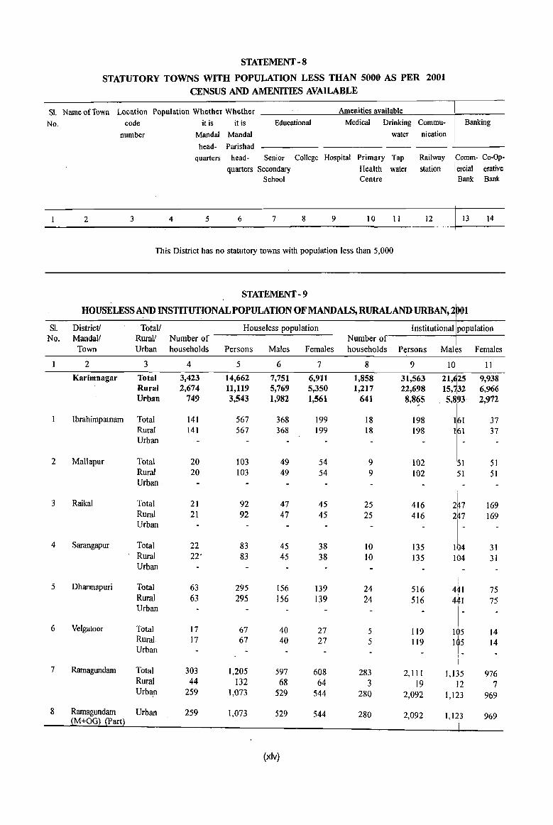
STATEMENT - 8
STATUTORY TOWNS WITH POPULATION LESS THAN 5000 AS PER 2001
CENSUS AND AMENITIES AVAILABLE
Sl. NameufTown Location Population Whether Whether Amenities available
No. code it is it is Educational Medical Drinking Commu- Banking
number Mandai Mandai water nication
head- Parishad
quarters head- Senior College Hospital Primary Tap Railway omm- Co-Op-
quarters Secondary Health water station ercial erative School Centre Bank . Bank
2 3 4 5 6 7 8 9 10 11 12 t 13 14
This District has no statutory towns with population less than 5,000
STATEMENT - 9
HOUSELESSAND INSTITUTIONAL POPULATION OFMANDALS, RURALAND URBAN, 2 01
Sl. District! Total/ Houseless population Institutional population No. Mandai! RuraV Number of Number of
Town Urban households Persons Males Females households Persons Females
2 3 4 5 6 7 8 9 11
Karimnagar Total 3,423 14,662 7,751 6,911 1,858 31,563 9,938 Rural 2,674 11,119 5,769 5,350 1,217 22,698 6,966 Urban 749 3,543 1,982 1,561 641 8,8~5 2,972
Ibrahimpatnam Total 141 567 368 199 18 198 37 Rural 141 567 368 199 18 198 37 Urban
2 Mallapur Total 20 103 49 54 9 102 51 51 Rural 20 103 49 54 9 102 ~1 51 Urban . I _
I I
3 Raikal Total 21 92 47 45 25 416 169 Rural 21 92 47 45 25 416 169 Urban
4 Sarangapur Total 22 83 45 38 10 135 31 Rural 22' 83 45 38 10 135 31 Urban
,
5 Dharmapuri Total 63 295 156 I
139 24 516 441 75 Rural 63 295 156 139 24 516 441 15 Urban 1-
6 Velgatoor Total 17 67 40 27 5 Il9 1~5 14 Rural 17 67 40 27 5 119 115 14 Urban !
I.
i
7 Ramagundam I
Total 303 1,205 597 608 283 2,111 I
I,Q5 976 Rural 44 132 68 64 3 19 12 7 Urban 259 1,073 529 544 280 2,092 1,123 969
8 Ramagundam Urban 259 1,073 iM+OG~ iPart}
529 544 280 2,092 1,123 969
(xlv)

STATEMENT - 9 (Contd •• )
HOUSELESSAND INSTITUTIONAL POPULATION OFMANDALS, RURALAND URBAN, 2001
Sl. District! Total/ Houseless population Institutional population
No. Mandal/ Rurall Number of Number of
Town Urban households Persons Males Females households Persons Males Females
I 2 3 4 5 6 7 8 9 IO II 9 Palakurthy (CT) Urban
10 Kamanpur Total 29 141 79 62 20 140 89 51 Rural 21 109 58 51 19 130 83 47 Urban 8 32 21 11 10 6 4
11 Ramagundam Urban 10 6 4 (M+OG) (Part)
12 lallaram (CT) Urban 8 32 21 II
13 Manthani Total 46 186 102 84 30 652 526 126 Rural 46 186 102 84 30 652 526 126 Urban
14 Kataram Total 23 67 32 35 3 18 • II 7 Rural 23 67 32 35 3 18 II 7 Urban
15 Mahadevpur Total 20 57 25 32 17 782 548 234 Rural 20 57 25 32 17 782 548 234 Urban
16 Mutharam Total II 40 20 20 30 226 140 86 (Mahadevpur) Rural 11 40 20 20 30 226 140 86
Urban
17 Malharrao Total 9 35 18 17 21 245 183 62 Rural 9 35 18 17 21 245 183 62 Urban
18 Mutharam Total 25 112 54 58 12 184 101 83 (Manthani) Rural 25 112 54 58 12 184 101 83
Urban
19 Srirampur Total 40 154 75 79 9 154 126 28 Rural 40 154 75 79 9 154 126 28 Urban
20 Peddapalle Total 84 332 165 167 39 454 145 309 Rural 84 332 165 167 39 454 145 309 Urban
21 Julapalle Total 10 25 13 12 5 96 41 55 Rural 10 25 13 12 5 96 41 55 Urban
22 Dharmaram Total 42 191 99 92 13 764 156 608 Rural 42 191 99 92 13 764 156 608 Urban
23 Gollapalle Total 13 56 29 27 14 120 82 38 Rural 13 56 29 27 14 120 82 38 Urban
(xlvi)
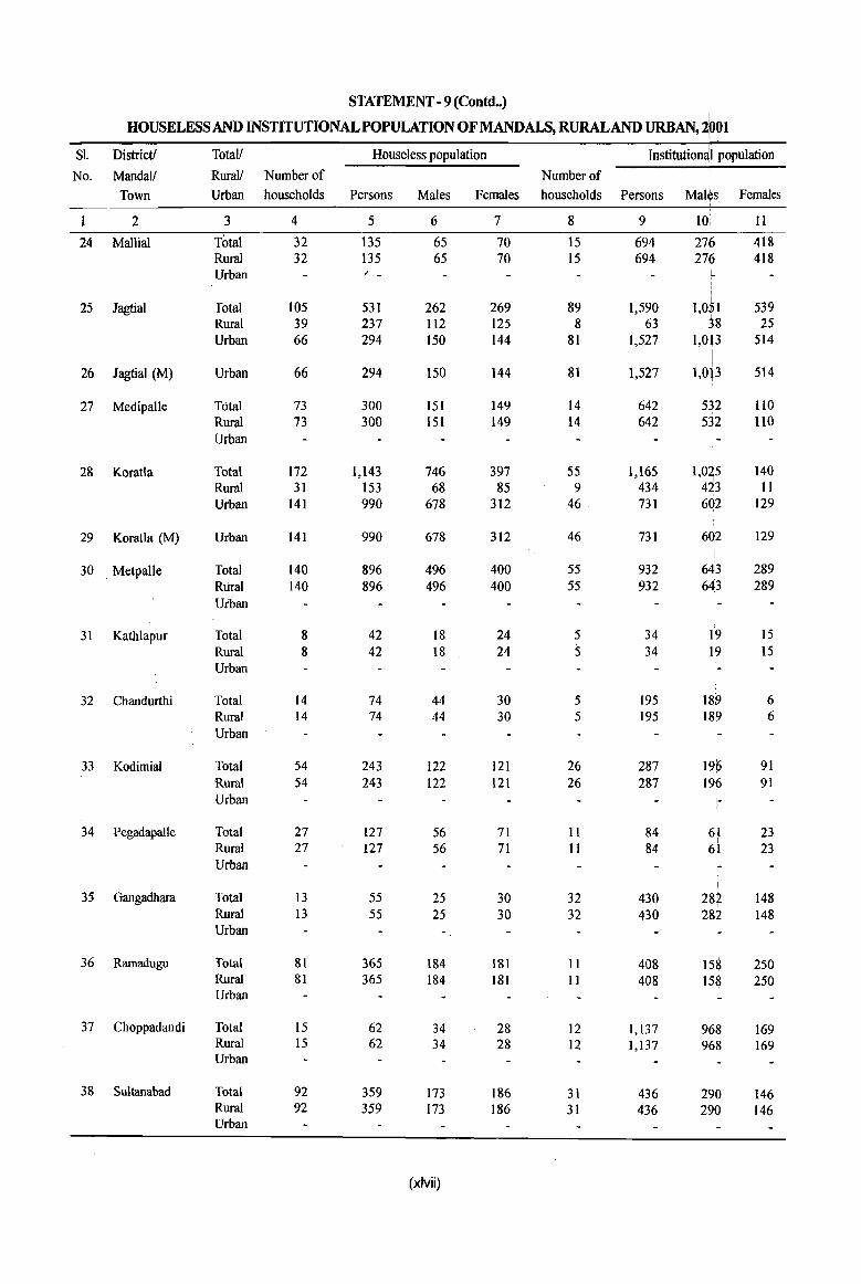
STATEMENT -9 (eoutd .• )
HOUSELESSAND INSTITUTIONAL POPULATION OF MANDALS, RURAL AND URBAN,2bol I.
Sl. District! Totall Houseless population Institution~l population
No. MandaI! Rurall Number of Number of I
Mal~s Town Urban households Persons Males Females households Persons Females
2 3 4 5 6 7 8 9 1O, II
24 Mallial Total 32 135 65 70 15 694 276 418 Rural 32 135 65 70 15 694 276 418 Urban / -
, , I
25 Jagtial Total 105 531 262 269 89 1,590 I,OSI 539 Rural 39 237 112 125 8 63 38 25 Urban 66 294 150 144 81 1,527 1,013 514
26 Jagtial (M) Urban 66 294 150 144 81 1,527 1,0b 514
27 MedipaUe Total 73 300 151 149 14 642 532 llO Rural 73 300 151 149 14 642 532 1I0 Urban
28 Koratla Total 172 1,143 746 397 55 1,165 1'~1~ 140 Rural 31 153 68 85 9 434 II Urban 141 990 678 312 46 731 602 129
29 Koratla (M) Urban 141 990 678 312 46 731 6d2 [
129 I I
30 Metpalle Total 140 896 496 400 55 932 643 289 Rural 140 896 496 400 55 932 643 289 Urban
31 Kathlapur Total 8 42 18 24 5 34 19 IS Rural 8 42 18 24 5 34 Ib 15 I Urban I
!-
32 Chandurthi Total 14 74 44 30 5 195 18~ 6 Rural 14 74 44 30 5 195 18~ 6 Urban !-
33 Kodimial Total 54 243 122 121 26 287 19(> 91 Rural 54 243 122 121 26 287 196 91 Urban f-
34 Pegadapalle Total 27 127 56 71 II 84 ~~ 23 Rural 27 127 56 71 11 84 23 Urban
35 Gangadhara Total 13 55 25 30 32 430 28:2 148 I
Rural 13 55 25 30 32 430 282 148 Urban
36 Ramadugu Total 81 365 184 181 11 408 15$ 250 Rural 81 365 184 181 II 408 158 250 Urban
37 Choppadandi Total 15 62 34 28 12 1,137 968 169 Rural 15 62 34 28 12 1,137 968 169 Urban
38 Sultanabad Total 92 359 173 186 31 436 290 146 Rural 92 359 173 186 31 436 290 146 Urban
(xlvii)
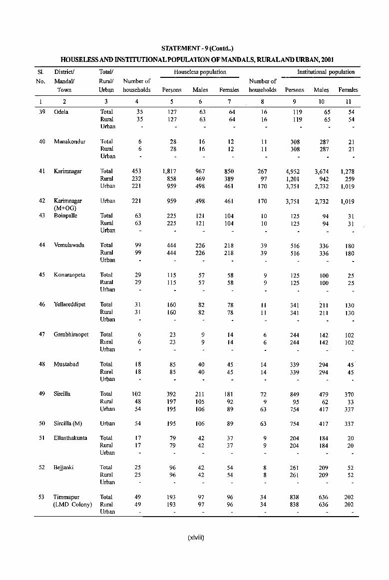
STATEMENT - 9 (Contd .. )
HOUSELESSAND INSTITUTIONAL POPULATION OFMANDALS, RURALAND URBAN, 2001
Sl. District! Total! Houseless population Institutional population
No. Mandai! Rural! Number of Number of Town Urbl!l1 households Persons Males Females households Persons Males Females
2 3 4 5 6 7 8 9 10 11
39 Odela Total 35 127 63 64 16 119 65 54 Rural 35 127 63 64 16 119 65 54 Urban
40 Manakondur Total 6 28 16 12 II 308 287 21 Rural 6 28 16 12 11 308 287 21 Urban
41 Karirnnagar Tota] 453 1,817 967 850 267 4,952 3,674 1,278 Rural 232 858 469 389 97 1,201 942 259 Urban 221 959 498 461 170 3,751 2,732 1,019
42 Karimnagar Urban 221 959 498 461 170 3,751 2,732 1,019 (M+OG)
43 BoinpaUe Total 63 225 121 104 10 125 94 31 Rural 63 225 121 104 10 125 94 31 Urban
44 Vemulawada Total 99 444 226 218 39 516 336 180 Rural 99 444 226 218 39 516 336 180 Urban
45 Konaraopeta Total 29 115 57 58 9 125 100 25 Rural 29 115 57 58 9 125 100 25 Urban
46 Yellareddipet Total 31 160 82 78 11 341 211 130 Rural 31 160 82 78 11 341 211 130 Urban
47 Gambhiraopet Total 6 23 9 14 6 244 142 102 Rural 6 23 9 14 6 244 142 102 Urban
48 Mustabad Total 18 85 40 45 14 339 294 45 Rural 18 85 40 45 14 339 294 45 Urban
49 Sircilla Total 102 392 211 181 72 849 479 370 Rural 48 197 105 92 9 95 62 33 Urban 54 195 106 89 63 754 417 337
50 Sircilla (M) Urban 54 195 106 89 63 754 417 337
51 Ellanthakunta Total 17 79 42 37 9 204 184 20 Rural 17 79 42 37 9 204 184 20 Urban
52 Beiianki Total 25 96 42 54 8 261 209 52 Rural 25 96 42 54 8 261 209 52 Urban
53 Timmapur Total 49 193 97 96 34 838 636 202 (LMD Colony) Rural 49 193 97 96 34 838 636 202
Urban
(xlviii)
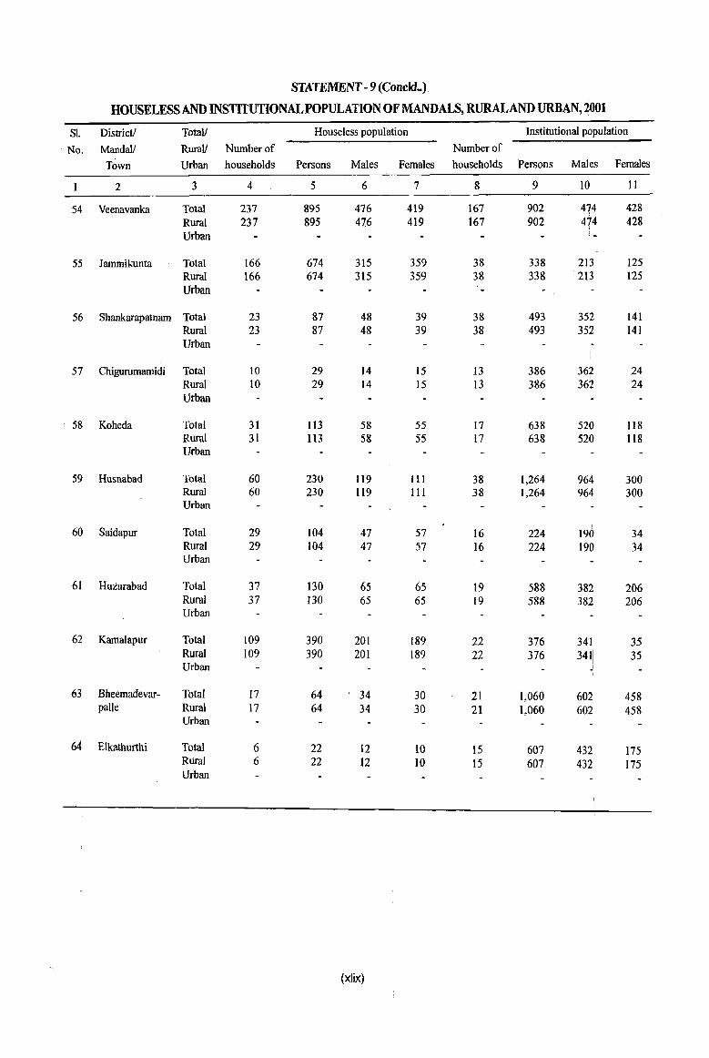
STATEMENT - 9 (Coneld .. ).
HOUSELESS AND INSTITUTIONAL POPULATION OF MANDALS, RURALAND URBAN, 2001
Sl. District' Total! Houseless population Institutional population
No. Mandall Rura1/ Number of Number of
Town Urban households Persons Males Females households Persons Males Females
2 3 4 5 6 7 8 9 10 It
54 Veenavanka Total 237 895 476 419 167 902 474 428 Rural 237 895 476 419 167 902 474 428 Urban
55 lammikunta Total 166 674 315 359 38 338 213 125 Rural 166 674 315 359 38 338 213 125 Urban
56 Shankarapatnam Total 23 87 48 39 38 493 352 141 Rural 23 87 48 39 38 493 352 141 Urban
57 Chigurumamidi Total 10 29 14 15 13 386 i
362 24 I
Rural 10 29 14 15 I3 386 362 24 Urban
58 Koheda Total 31 113 58 55 17 638 520 118 Rural 31 113 58 55 17 638 520 ll8 Urban
59 Husnabad Total 60 230 119 lIi 38 1,264 964 300 Rural 60 230 119 III 38 1,264 964 300 Urban
60 Saidapur Total 29 104 47 57 16 224 190 34 Rural 29 104 47 57 16 224 190 34 Ufban
61 Huturabad Total 37 130 65 65 19 588 382 206 Rural 37 130 65 65 19 588 382 206 urban
62 Kamalapur Total 109 390 201 189 22 376 341 35 Rural 109 390 201 189 22 376 341! 35 Urban I
J
63 Bheemadevar- Total 17 64 34 30 21 1,060 602 458 paUe Rural 17 64 34 30 21 1,060 602 458
Urban
64 Elkathurthi Total 6 22 12 10 15 607 432 175 Rural 6 22 12 10 15 607 432 175 Urban
(xlix)
INTRODUCTION AND ANALYSIS ,


INTRODUCTION AND ANALYSIS
(i) About the District Ceinsus Handbook
District manuals compiled and published prior to 1905 by the erstwhile cOl;nposite Madras Government contained not on\y particulars of items of more or less similar and permanent characteristics like history, religion and ethnpgraphy, but also a few statistical tables including t~ose r~lating to population which became obsolete :within!a few years of publication. Later, the Madras! Goveinment replaced the District Manuals by another publication viz., the District Gazetteer consisHng of two Volumes A and B. Volume-A contained descriptive and general tables which explains the text and Volume-B contained detailed statistics. It ",:,as decided that Volume B should be brought ~:)Ut peqodically after each decennial census so that tlley cdntain the latest statistics. Volume-A was published for some districts between 1905 and 1927 in !the C~mposite Ma~ras State. The publication of Volume-A was discontinued in 1927.
Volume-B was pUblished for all the districts of the Composite Madras State between 1906 and 1915. The publication of Volume-B was also stopped after 1931 Census.
Similarly the Gazetteer volumes were also brought for some of the districts :in the erstwhile Hyderabad State. The scheme of publication of revised District Gazetteers was re-started in the year 1958 by the State Governments. The State Editor, District Gazetteers, Government of Andhra Pradesh had published the Gazetteers of all the districts.
The District Census Handbook series was initiated during the 1951 Gensus.iThe idea of compiling the District Census Handbooks was pioneered by Sri R.A. Gopala Swamy, LC.S. the then Registrar General, India and! Ex-officio Census Commissioner of India, with a vi~w to preserve the census records prepared for are~s be19w the district level. He proposed that all jthe Diistrict Census Tables and Census Abstracts iprepared during the process of sorting and compil~tion, should be bound together in a single manuscript volume and named as the District
3
Ce~sus Handbook and suggested that the State Go"ernment should take up printing and publication at tl~eir own cost. Then onwards, the District Census Handbooks were published in each census with improved pattern with an aim to give the census and nontcensus data at micro level for the village and dist~ict as Ii whole to suit the requirements of various dep¥tments, scholars, research personnel, planners, ind~strialists, electoral authorities and other data users, also for efficient public administration by the state.
Pattern at 2001 Census :
1fhe present District Census Handbook of 200 I Cen~us, like the previous Census, is brought out for eacH. district comprising of two Parts. Part - A Village and :Town Directory with additional information on amehities viz., availability of commercial banks, recr~ation, credit societies etc., and land use particulars in the rural areas and Part- B Primary Census Ab~tract. At the out set an analytical note is given which depicts a general back ground on the district and finalytical results on the statements and tables incl~ded in the volume. The volume is also provided with 'I brief history of the district, pbysical aspects, census concepts, non-census concepts major char~cteristics with reference to economic resources and administrative set-up during the past decade with few !appendixes etc ..
Part A -Village and Town Directory :
~ection- I, i.e. Village Directory gives non-census data ion the amenities available in each village in respdct of educational, medical, drinking water, power supp1y, post and telegraph, telephone, approach to viIla~e, banks, credit societies, receipt of newspapers and fnagazines, recreation and cultural facilities, neardst town and its distance, distribution of land use
I .
area,. and name of the most important commodities manufactured.
If an amenity is not available in the referred village, the distance in broad ranges (kms.) from the

nearest place where the amenity is available is indicated. If the nearest place is situated in another state, name of that state is also given.
Section-II, i.e. Town Directory has been presented in seven Statements viz., StatementI Status and Growth History, Statement-TI Physical aspects and Location of towns, Statement-III Municipal Finance( receipts and expenditure, 1998-99), Statement-N Civic and other amenities, StatementV Medical, Educational, Recreational and Cultural facilities Statement-VI Trade, Commerce, Industry and Banking etc., and Statement-vn Civic and other amenities in Slums, and an appendix showing towns with out growth and their population. The reference period for the above statements is 1998-99 and the
DISTRICT CENSUS HANDBOOK :KARIMNAGAR
data is covered for all the statutory notified towns in the district.
The non-census data at Village/Town level is collected from concerned authorities viz., MandaI Revenue Officers, Municipal Commissioners etc., and scrutinized with meticulous care and validated with the data collected from various departments to provide valid information to the data users.
Part B-Primary Census Abstract :
This data can be stated as the essence of the handbook. The latest census details such as area, total households, population, scheduled castes and scheduled tribes population, literates, workers, etc. are presented in these Abstract.
(ii) History and Administrative Set-up of the District
Brief History of the District
Karimnagar district is one of the Telangana districts of the State. The Telangana region fmds mention in the Hewitt's references in his " Ruling Races of Pre- Historic Times " giving an indication that this part of South India was by no means unimportant in the ancient world. This district was under the rule of the Andhra, the Chalukya, the Yadava and the Kakatiya Dynasties successively. Vemulawada also called as" Lemulawada ", presently MandaI Headquarters ofVemulawada MandaI in the district, was the capital of a dynasty of Chalukyas called" CHALUKYAS OF VEMULAWADA "who ruled a considerable area as the feudatories of the Rashtrakutas. It became the headquarters of this branch of the Chalukyas at an early stage, probably under Arikesari. The next great ruler ofVcIT!1J!awada was Narasimha -II. According to a Vemulawada inscription he single handedly conquered the seven Malavas, a group of Kings on the hill in Kalapriya, it is not very clear as to who ruled over the territory. However, the rock inscription of Vemulawada and Parbhani plates indicate the name of Arikesari III as the last ruler of this dynasty. The Jain temple at Vemulawada is said to have been constructed by his
4
father Baddega.
The Chalukyan empire under the rule of Arikesari III 966 A.D., was a loose federation of a number of States, each of which was anxious to throw off the yoke of the other, and wanted to do so the earliest opportunity, and as a result the Chalukyan power began to decline from about A.D.1150. Therefore, Arikesari-III was supplanted by the Yadavas of Deogiri and Kakatiyas of Warangal. Thus Vemulawada lost its status as the capital city of the Chalukyan dynasty.
A greater part of the district was under the control of the Kakatiyas of Warangal during the 12th and 13th centuries. Sarkar Yeligandal originally known as Bhodeniapur, a village situated about 5 Kms North of Karimnagar , the present headquarters of the district, was the outpost of the Kakatiyas. General Kingham in his book "About Telangana" says that Yeligandal WIJ.S the capital of Telangana. But in fact it was a part and parcel of the Kakatiya kingdom. Legend has it that near about this area there was a very thick forest, in which a Muslim saint was residing. One day when a few jewellers with their bags of jewels were passing through this forest, the saint asked them as to what it was that they were carrying. Thinking
INTRODUCTION AND ANALYSIS
that he might be :the chjef of robbers, the jewellers
hide the fact aNd sai4 that all bags contained "Kandulu"(red gnuns). The saint was surprised to hear this false reply and therefore stated that all bags would cOntain "11'ella Kandulu" ( white-red grams). After reaching tb~ir des~ination, the jewellers, were astonished to see that their bags contained only "Tella Kandulu" instead of Jewels. They immediately approached, to the saint and begged for his pardon. The saint pardoned them saying " keep your jewels
, , carefully". When \they returned their destination they were glad to see !their bags contained jewels. Then onwards that place was' named as "Tella Kandulu" and in course oftiple it has transformed to Elagandal. This is supported; by an \inscription near Chintamani tank in which "Tella K~ndulu" is clearly written.
The summit Qf the Elgandal Fort must have been the strong hold of~he Kakatiyas at one time. Elgandal Fort was capturec} in 1195 AD., by Jaitugi a famous ruler of Yadava dyn:;tsty. He was anxious to rehabilitate victories elsewhere, and decided to launch an offence against the rising power of the Kakatiyas in Telangana. Jai;tugi felt that since they were the successors of t~e Chalukyans, all the former feudatories of the latter }¥ould at once automatically recognize his ov¢rlordship. Therefore, he suddenly launclioo a hurric~ne attack against Kakatiyas in 1195 AD., 'by capturing the Elgandal Fort. The reigning Kakatiya Monafich Ruora was killed in the course of the campaign, ~d Jaitugi succeeded in taking as prisoner Ganapatl who twas a nephew of the dead Kakatiya Monarch. C9nsequently, Elgandal Fort remained for about hundred years under the direct control of the Yadavas of Deogi,ri. It was again annexed to the Kakatiyas of Warangal by Raja Prataparudra ( 1295-1323).
At the beginning of the 14th century, constant attacks were mad:e by Malik Kafur, a general of Alauddin Khilji,: on Deogiri and WarallgaI and ultimately in 1309, the Yadavas of Deogiri, in 1310 the Kakatiyas of Warang~I became the faithful allies of the Sultan. A:(ter the, death of the Sultan and particularly durin~ the reign of Giyasuddin Tuglaq, Warangal including Eigandal Fort was captured finally in 1323 by Mohantined Bin Tuglaq. It is worthwhile to mention here hbw and when this fort came into the hands of the J3iahamani Kings. We know that at
5
the ,time of the rise of the Bahamani Kingdom,
Waf,angal was an independent Kingdom under the rule; of Kapaya Nayaka. He had friendly tenns with the IBahamani Kings. In course of time, however, hostilities arose between the two kingdoms and the exp~nsion of the Bahamani Kingdom eastwards was
I
regarded by the Warangal ruler to be an encroachment on bis own territory. Therefore, Warangal began to act in concert with Vijayanagar and in the reign of Ah~ed Shah Bahmani ( 1436·1445 AD), war cor$Ienced, which ultimately ended in the submission oft~e Warangal Kingdom including the Eigandal Fort. Theicapital of the Bahmani Kingdom during the period
I
of Alauddin Hasan Gangu Bahmani was Daulatabad,
whi~h was later on shifted to Gulbarga and finally Bid~ was made capital of the Bahmani Kingdom in the reign of Ahmed Shah Bahmani.
\
Qutub Shah's attack: Qutub-Ul-Mulk, the founder oft~e Qutub Shahi dynasty and Qoam-UI-Mulk who is also known as Qoam-Ul-Mulk Sagir, were the
I
subedars of Golconda and Rajahmundry respectively !
under Ahmed Shah Bahmani. On the breakup of Bah~ani Kingdom Qoam-Ul-Mulk, the subedar of Rajahmundry, attacked the forts of Elgandal and
I
Mul~gnoor in the absence of Qutub-Ul-Mulk and
pl~dered them completely. Qutub-UI·Mulk knowing the ~ostilities of Qoam-UI-Mulk wrote a letter of cooper;ation and friendship reminding him of their old friendly relations. No fruitful results came out from this i letter except war. Therefore, Qutub-UI-Mulk
mar~hed towards Elgandal in 1523 AD., and conquered the forts of Eigandal and Mulagnoor by
defe~ting Qoam-UI-Mulk who managed to escape
towards Berar. After a short period, Qoam-UI-Mulk I
withlthe help ofImad-Ul-Mulk, Shah of Berar, again led ~~ expedition against Qutub-Ul-Mulk in which he
was ~efeated by Qutub-Ul-Mulk at the Ramgir Fort. Thus these Forts passed into the hands of the Qutub Sha~is. In the reign of Sultan Quli Qutub Shah, the fouq'der 'oC'Hyde'rabad city, ElgandaJ 'and its depepdencies were given to his son-in-Iaw(Ain-UlMul~) as jagir. The Mosque in the Fort is said to have ' been constructed by the Qutub Shahis. Thus Elgahdal remained for about 175 years under the conttol of Qutub Shahis. The last ruler of this dynasty was ~bul Hassan Tana Shah. It was during the period of Abul Hassan Tana Shah that moghuls under
Aurangzeb, besieged the Golconda Fort and finally captured it in 1687. Consequently, Elgandal was also annexed to the Delhi empire. It is said that Emperor Aurangzeb used to visit Elgandal occasionally on a
. pilgrimage to the renowned Muslim Saints of the area and also constructed a Mosque and a tank. Both these monuments known as Alamgiri Masjid and'Bindraban tank are still found there which testify to the past glory of the district.
Elgandal under the Nizam: Elgandal remained under the Moghuls for about 39 years. Within this short period subedars appointed by the Moghals were ruling at Golconda. The last subedar of the Deccan and Golconda was Mubariz Khan, and it was during his reign that Moghul power came to decline. NizamUI-Mulk Asifjah-I, once the Governor of Deccan under Aurangzeb, taking advantage of the political disturbances in the country, came to the Deccan and declared war against Mubariz Khan at Shaker Khera in 1724 AD., in which Mubariz Khan was killed. Thus on the breakup of the Moghul Empire Elgandal came into the possession of the Asifjahi dynasty. Nawab Amin Khan was jagirdar of Elgandal. After his death his son Nawab Mukrab Khan became the hereditary successor of the jagir. He died in 1759 AD. His own brother after his death, claimed to be the hereditary successor of the jagir, by deceiving the widow of the late Nawab. The widow appealed in the court of Asifjah, as a result of which Asifjah himself marched towards Balconda when he defeated the brother of the deceased and returned the jagir to Fakir Munawar Khan, the son of the widow. In order to consolidate the administration ofElgandal, Nawab Mubaz-Ul-Mulk Zafarudowla Bahadur Mirza Ibrahim Khan Dhosa was appointed as subedar by the Nizam Nawab Salabat Jung. He constructed the present fort of Elgandal in 1754. The author of" Waqiath Zilla Karimnagar" states that he made certain improvement in the district by constructing tanks and forts and died in 1795 AD. He was buried in Ibrahim Bagh situated at Nirmal town of Adilabad district.
After his death, his son, Mirza Ehthesham Jung ruled over the territory and later turned rebellious against Mir Nizam Ali Khan, Asif Jah II. As a result, Mir Nizam Ali Khan declared war against Elgandal and defeated him. On the request of his mother, Ehthesham Jung was pardoned and appointed as subedar of Ellachipur. It was, however, during the
6
DISTRICT CENSUS HANDBOOK :KARIMNAGAR
period ofNawab Sikanderjah that Khan Bhadur Khan was appointed as Qiladar. It is said that in the reign of the late Nizam, Syed Karimuddin, who was Qiladar, founded a village near the fort at a distance of about 5 Kms and named it Karimnagar after him.
Amalgamation of Elgandal Fort into Civil Area: Prior to the amalgamation of Elgandal Fort into civil area, Nawab Munawar Khan, a Jagirdar, resident of Moghulpura, a locality in Hyderabad city, was the Qiladar. As the aforesaid Nawab had no son and as it was not possible for his wife,after his death, to manage the Jagir, an application was submitted to
Salarjung-I , the then Prime Minister of the Nizam, for the amalgamation of the Fort into civil area with compensation in the form of "Mansab". The application was [mally accepted by the Nizam and in return ofElgandal Fort and its dependencies a monthly compensation in the form of'Mansab' was issued to the family member of the Nawab for their life time. Thus Sarkar Elgandal, once capital of Chalukyas underwent several changes and finally became a district and was renamed as Karimnagar in 1905 in the dominion of the Nizam. At present it is one of the districts in Telangana Region of Andhra Pradesh State.
Administrative Set-up
(i) Region of the state where the District is located: This district is located in middle of WesternNorth side of the State and middle of Eastern-North side of Telangana Region ..
(ii) Total Number of Revenue Divisions and Mandals : The then existing 14 Taluqs were reorganised into 56 mandals in 1985. Corresponding to them, Mandai Parishads were also formed which are co-terminus with Revenue Mandals, except StatutOI}' Towns which do not fall in their jurisdiction. 56 Mandals organised into 5 Revenue Divisions as against 4 Divisions in 1991 Census. Sircilla Revenue Division has been formed during the decade 1991-2001 vide GO.M.S. No.713 dated 29-8-1996 after taking 9 Mandals from Jagtial Revenue Division. The distribution of 56 Mandals into 5 Revenue Divisions are shown here under :
Name of the
Revenue Division
l.Karimnagar
Name of Mandai
1. Karimnagar
2. Manakondur
INTRODUCTION ANI]) ANALYSIS
Name of the
Revenue Division .. l.Karimnagar
(Coneld.)
2. Jagtial
.. j
3. Sircilla
4. Peddapalle
Name of Mandai
3. Thimmapur
(LMD Colony)
4. Bejjanki
5. Gangadhara
6. Ramadugu
7. _ Choppadandi
8. Husnabad
9. Chigurumarnidi
10.! Koheda
11. Huzurabad
12. Jammikunta
13. Veenavanka
14. Kamalapur
15. Elkathurthi
16. Shankarapatnarn
Kesavapatnam)
17. Saidapur
18 .• Bheemadevarpalle
1. Jagtial
2. Raikal
3. Dharrnapuri
4. Sarangapur
5. Mallial
6. Kodimial
7. PegadapaUe
8. Gollapalle
9. Metpalle
10. Koratla
II. Medipalle
12. Ibrahimpatnam
13. Mallapur
14. i Kathalapur
l. • Sircilla 2. Ellanthakunta
3. Gambhiraopet
4. . Mustabad
5. Yellareddipet
6. Vemulawada
7. Boinpalle
8. Konaraopet
9. . Chandurthi
1. Peddapalle
2. . Srirampur .
3. Odela
4. Ramagundam
5. . Sultanabad
6. Velgatoor
7. Dharmaram 8. Julapalle
7
Name of the
Re",enue Division 5] Manthani
Name of Mandai
1. Manthani
2. Kamanpur
3. Mutharam( Mahadevpur )
4. MaIharrao
( Headquarters at Tadicherla)
5. Mahadevpur
6. Kataram
7. Mutharam ( Manthani )
(iii): Total Number of Villages and Towns I
! At 1991 Census, there were 11 03 villages. Of theq. 16 villages were included in towns. Of the remttining 1087 villages 1046 were inhabited and the remhining 41 were uninhabited. The total number of vill~ges at 1991 census was 1087.
At 2001 census, 3 villages viz; 1.Komanpalle (SaIiangapur mandaI) 2.Motinagar and 3.Maggidi (Dh~rmapuri MandaI) which were hamlets at 1991 cen~us have attained the status of Revenue villages at 2001 census and added to the total number of
I
villa~es.
~ Census towns viz. 1 )Kothapalle Haveli 2) Ma*hani 3)Metpalle 4)Peddapalle and 5) Vemulawada of 1991 census have been declassified at 2001 census. Kothapalle Haveli, Manthani, Metpalle,Peddapalle have became revenue villages. Simbltaneously Kuchirajpalle which was part of Man~hani town and Regunta which was part of Metpalle towns at 1991 census have also became· reve?ue villages at 2001 census.' Vemulawada town of 1991 census has been merged with Vemulawada (R) ~illage at 2001 census. Thus the number of villages added on account of these ch~lllges is 6.
i
Similarly, 2 revenue villages of 1991 census viz I.Palakurthy and 2 lallaram have attained the status of c~nsus towns and 2 revenue villages viz 1.Bojnmakal and 2)Seetharampuf have become out growipls fully to Karimnagar Municipality and hence all thfse 4 villages are deleted from the list of villages at 200] census.
I
lihus the number of villages at 200 I are 1092 of them 1047 are inhabited and 45 are uninhabited.
There were 10 towns in the district at 1991 census. 5 were statutory and remaining 5 were census town~.At 2001 Census, there are 7 towns of which 5 are statutory and the remaining 2 are census towns.
DISTRICT CENSUS HANDBOOK :K.AAIMNAGAR
(iii) Physical Features of the District
Location and Size :
Karimnagar district is located approximately between the latitudes 18°-0' and 19°-0' of North and longitudes 78°-30' and 18°- 31' East. This district is
surrounded by Adilabad district on North, Nizamabad district on North-West, Medak district on the West,
Warangal district on the South and on the East by
the Godavari River. The district is known with its Headquarters Karimnagar, which was named after Syed Karimuddin, who was a Qiladar during the reign
of the late Nizarn. It is connected by Road and Rail and about 169 kms.away from the State Headquarters, Hyderabad City. The district has 11,823
Sq.kms. with a population of3,491,822 as per 2001 Census. The density of population is 295 per Sq.kms. Among 23 districts in the State, Karimnagar ranks 12th in terms of area· and also 12th rank in terms of
population. This district has broad width than length. The length at Western part is more and it has come down drastically at East.
Physiography:
Physiographycally, this district is comprised of
plateaus with absolute height of below 690 metres. River Godavari and Manner and their tributes have
substantial plain characteristics. River Godavari forms
the Northern boundary of the district, while river Manner drains the southern parts of the district.
General slope tends towards east. The district is
mainly composed of Achaean genesisses. Rocks of upper carboniferous, lower Creataceous occur in the eastern areas ofthe district. The impact of geological structure on soil distribution can be viewed as soils of ustalfs, sub-order association charecterises the western half and ustalfs-ustrats the eastern section
of the district.
Drainage:
The rivers drain in Karimnagar district from West
8
to East. The chief river is Godavari and next comes
Manner River. The Godavari enters in the district in Ibrahimpatnam MandaI and covers the Mandals, Mallapur, Raikal, Sarangapur, Dharmapuri, Velgatoor, Ramagundam,Jallaram,Manthani,Mutharam (Mahadevpur) and Mahadevpur and enter into
Chattisgarh State. This river form as a north boundary for all these Mandals and seperate this distrct with
Adilabad district and Chattisgarh State. After entering into the district it flows towards north-east and take tum towards south-east at Dharmapuri MandaI. Again in Manthani Mandai it take tum towards north and in Mahadevpur Mandai it turns towards south-east. During its journey, the Godavari river take several
streams(Vagu) into its fold.
The Manner River starting from Gambhiraopet Mandai flows towards north-west through Yellareddipet, Sircilla, Ellanthakunta, Karimnagar, Manakondur, Sultanabad, Veenavanka, Odela,
Srirampur, Mutharam(Manthani) and Malharrao
Mandals and joins the Godavari river at Kataram MandaI. This river drains mostly in south part of the district.. A dam was constructed over Manner river
at Karimnagar itself. This district has several streams, which are tributaries to both the rivers.
Climate:
The climate of the district is generally A dry except during south-west monsoon lJ1T( period, which starts in June and ends in September. The hot season starts from March and ends in the first week of June. The raise in temperature starts from March and it will be hottest in the month of May. Generally Ramagundam Mandai in the district experiences highest temperature in the State. Once this place has recorded maximum temperature of 48.2° C in peak summer. The month-wise maximum and mInImUm temperature( 1999) recorded at Ramagundam is given in the following table:

INTRODUCTION AND ANALYSIS
Table(a)
Mont~-wise maximum and minimum temperature re~orded at Karimnagar for the Year-1999
Temp.Range (in °e) Jan • Feb Mar Apr May June, July Aug Sep Oet Nov Dec
Maximum '29.8 33.7 37.6 41.3 39.9 35.2: 32.6 31.1 30.9 32.1 31.2 29.1
Minimum ,12.9, 18.9 21.0 25.8 28.5 26.2\ 25.3' 24.5 24.3 22.9 17.2 13.4
Rain fall:
As already s~ated that hot weather period in the district is between Mar~h to May, followed by southwest monsoon period between June to September, north-east monsoon period between October to
south-west monsoon. The actual rain fall during this sea~on was 712rnrn. in the year 1999-2000, when 789bm. rain was received for the whole year. During 199:~-1999 the district annual rain fall was 1108mm., , . whi~e normal annual rain fall is 953mm. The season
December and winter period between January and wise rain fall for 1999-2000 is as follows: February. Most of rain fall is received during the
Table(b)
The season-wise rain fall (in.mms.) Ifor the year-1999-2000 I
South-West North-East Winter period H,ot period Total Nonnal
monsoon 'Ponsoon Jan - Feb I
M!¥,ch - May for the Year rain fall
June - September Octob~r - December
712mm 30mm 9mm !38mm 789mm 953mm
,Average Rainfall, Season-Wise and Mont~-wise for Five Years 1991-1996
SI.No. Year " South-West monsoon Qeriod North - East monsoon period . ~.':~. June July August September i Total October November December Total
'-,;", 2 3 4 5 6 7 8 9 10 II ~'J •.
Nonnal' 142.9 244.1 220.7 186.4 i 794.1 67.1 17.2 8.9 93.2 I 1991-1992 151.7 265.7 liSA 114.7 : 647.5 10.2 10.0 0.5 20.7 2 1992-1993 178.0 176.9 233.7 46.9 : 635.5 5904 31.5 NIL 90.9 3 .. ::'1993-1994 68.8 343.3 124.1 145.5 681.7 80.1 NIL 3.7 83.8 4 ,)994-1995 ~7.0 311.5 204.9 33.3 ,646.7 126.4 24.9 NIL 151.3 5 .. 1995-1996 125.0 238.0 173.9 122.0 658.9 37004 1.8 NIL 372.2
SLNo. Year Winter Qeriod I
Hot weather Qeriod Jar\.uary February Total March ' April May Total Total for the Year
2 3 4 5 Nonnal: 7.0 8.3 15.3
1991-I992 : Nil Nil Nil 2 1992-1993 !NiI Nil Nil 3 1993-1994 4.5 3.4 7.9 4 1994-1995 ' 105.7 2.1 107.8 5 1995-1996 , jNil 4.2 4.2
Source: Chief Planni1g Off'ic~r. Karimnagar district
The above table reveals that the district has received less rain fall during 1991-1992, while more rain fall was rece~ved during 1995-1996. Further it states that above t~e normal rain fall was during the years 1994-1995 ~nd 1995-1996
Soils:
The soil ofth~ district are three types viz; black clay loamy soil, re4 sandy loamy soil and alluvial soil.
6 12.8 Nil
15.3 Nil
20.6 0.8
9
7 8 9 10 17.4 21.3 51.5 954.1 2.7 4.3 7.0 675.2
13.2 16.1 44.6 771.0 13.2 2.1 15.3 788.7 804 49.8 78.8 984.6
19.8 1.7 22.3 1057.6
red ~andy loamy commonly known as "CHALKA" considered as main type in the district. Generally allu~ial type is found in the river valley.
Flor~ and Fauna :
The forests of the district fall under. tropical dry deciduous and tropical throne£" forest types consisting of mixed teak, bamboo an,d miscellaneous type of forest. The total·
forest area in the district comes to 2549.94 Sq.kms. forming 21.57% of the geographical area of the district. These forests are grouped into two divisions viz; Karimnagar East and Karimnagar West divisions. Azamnagar, Bhupalpalle, Chintakani and Mahadevpur ranges comes under the jurisdiction of Karimnagar East division, while West division consists of Jagtial, Raikal, Kodimial, Manthani and Sircilla ranges. The following tables show information on estimated area under teak and bamboo and forest revenues.
Table(c) Estimated area under teak and bamboo in forest
divisions
Division Area (in Hectares) as on 31st March 1998-1999
Teak Bamboo Others KarimnagarWest 76,950 500 18,748 Karimnagar East 56,675 360 1,461
Table(d) Product - wise Forest Revenue in the District 1998-99
Items East division(Rupees) West division(Rupees)
Timber Fuel
55,61,101 15,94,040
Beedi Leaves 1,74,47,832
Bamboo
Other Minor ( GC) 5,54,561 Miscellaneous 8,31,986
Total 2,43,95,480
4,67,900
8,000 36,96,284
57,66,224
Wild life in this district are normally not affected by the human being, as the areas where they stay are inaccessible. Some of the wild animals found in Karimnagar district are Tigers, Panthers, Indian Bisons, Sambar and Cheetahs. The Four horned Antelope, Neelagai or Blue bull, Indian Antelope, Indian Sloth-Brass, Hyenas and Wild Dogs etc., form other big game found in the district.
Besides above, the green pigeons, peacocks, peafowls, water ducks, snipes, red jungle fowls, king fishers, buIbuls, doves, crows, mynas, rioIes, parakeets, wood peekers and common pigeons etc.,are the avifauna seen in this district. In addition to these Mangoose, Rabbits, Porcupines, Bandicoots, foxes and jackals are also found in the district.
Cropping Pattern :
This district is one among the·· agriculturally developed Telangana districts.
10
DISTRICT CENSUS HANDBOOK :KARfMNAGAR
Paddy is the major crop grown in the district. The other major crops are maize, jowar, green gram, sesamum, groundnut, sugarcane, chillies, etc.
Table(e)
Land utilisation - 1999 -2000 Type of Utilisation Area in Hectares
1. Forest 250,410 2 .Barren and uncultivable 84,150 3. Land put to Non-agricultural use 80,129 4. Cultivable waste 19,234
5. Permanent pastures and other
grazing lands 54,852 6. Land under miscellaneous
tree crops and groves not included in net area sown.
7. Current follows
8. Other follow lands
9. Net area sown
10. Geographic area by village paper
7,131
246,916 51,007
394,670
1188,499
Source : Statistical Abstract of Andhra Pradesh - 2000
As already stated the paddy is main crop in the district followed by maize and jowar among cereals. Some crops are raised in both Kharif and Rabi seasons, while some in one season according to cropping season. The following table describes about area under principal crops and out tum yield for the year 1999-2000
SI.No.
2
3
4
5
6
7
8
9
10
11
12
13
14
15
16
17
18
Table(t)
Area under prinicipal crops-1999-2000 Name of Area Out tum
crop (in hectares) (in tonnes)
Paddy 232,535 724,121
Jowar 2,795 20 II
Bajra 754 441
Wheat 161 108
Maize 103,381 417,944
Bengal gram 455 300
Red gram 7,1l9 2,563
Green gram 35,735 18,825
Black gram 116 39
Horse gram 1,441 509
Cow gram 1,124 333
Other pulses 952 265
Groundnut 25,659 30,017
Caster 272 61
Sesamum 3,075 484
Safflower 1,205 613
Sun Flower 1,134 329
Other oil seeds 64 31,409
Yield per hectare
(in kgs)
3,114
720
585
670
4,043
660
360
527
334
353
1,170
223
158

INTRODUCTION AND ANALYSIS
Table(t) (Concld.)
Area u~der prinicipal crops-1999-2000
SI.No. Name or' :Area Out tum Yield per crop (in !hectares) (in tonnes) hectare
(in kgs)
19 Cotton 74,813 176,911 402
20 Tobacco 3,527 4,496 2,684
21 Onions 552 9,882
22 Chillies q,036 23,096
23 Garlic 139
24 Turmeric 13,264 83,961
Table(g) Area under diff~rent types of fruits and vegetables:
Sl. Name ofcrob Area in Out tum No. hectares in tonnes
1 Potatoes 12 80
2 Sweet Potatoes 103 712
3 Ginger 7
4 Coriander 86 29
5 Mangoes 6,269
6 Citrus fruits, oranges,
mosambies a,nd others 3,355
7 Guava 77
8 Papaya 3
9 Sapota 4
10 GoUrds 176
11 Bendi 395
12 Brinjal 458 13 Green 277
14 Cabbage andlKonolkal 23
15 Peas 1
16 Beans 148
17 Tomatoes I 1,669
Source: Statistical A:bstract of Andhra Pradesh, 2000
Agricultural Machineries/implements used in ,
Karimnagar distdct for ~he year 1993 are shown in the following table:
Table(h)
Agricutural implements , ,
SL Nam~: of
No. machinery/itnpJemel1t l. Ploughs
2. Diesel Engines .
3. Electric Pumps
4. Tractors
5. Sugarcane (J;rushers
Number 2,09,622 (Wooden)
8,186 ( Iron)
17,320
1,31,955
2,510
85 ( Power)
91 (bullocks)
11
Inigation :
, Sriramsagar Project a major irrigation
prdject, located in Nizamabad district, is also
setting this district.There are three medium irrigation prdjects viz; Manner, Shanigaram and Boggulavagu in ihe district . Besides 5,353 Tanks and 2.20 lakh
wells are also available in the district. Net area of 394,670 hectares was sown in the district as of 1999-
20~O. Of which 256,184 hectares were irrigated and 116~,963 hectares were irrigated more than once. Area irrigated by source is given below:
SI.:r)J'o.
I • 2:
3: 4 1
5
6 .
7
Thble(i)
Irrigation by source
Irrigated by source Area in hectares
Canals 64,477
Tanks 31,900
Tube Wells 5,142
Other Wells 1,51,923
Other Source 2,742
Area irrigated more than once 116,963
Gross area Irrigated 3,73,147
Different crops which are irrigated during the yeaIj 1999-2000 shows that paddy was raised in 23 d715 hectares, followed by maize in 57,296 hect!ares. The following table gives the detailed
'.
info~ation on area of crops irrigated during 1999-2000.
Table(j)
Crops under irrigation
SI.Nd, Name of crop Area in hectares
1 I Rice ( Paddy ) 2,31,715
2 Wheat 161
3 Jowar 751 4
, Bajra 754
5 Maize 57,296
6 Bengal gram 4 7 G·reen gram 37 8 Black gram 97
9 Horse gram 52
10 Other pulses 27 II Chillies 10,896 12 Turmeric 13,264 13 Ginger 7 14 Other condiment and spices 238 15 Sugarcane 3,133 16 Onions 552 17 Other food crops 10,026 18 Sesamum 2,522 19 Groundnut 17,196 20 Cotton 20,760
Table(j) (Coneld.)
Crops under irrigation
Sl.No Name of crop Area in hectares
21 22 23
24
Tobacco Other Oil Seeds Red gram
Other non-food crops
Animal Husbandry :
438 2,289
497
97
About 70% of the population in
Karimnagar district mainly depend on
agriculture. They mostly stay in rural areas.
Hence livestock plays an important role in rural
economy of the district. As per 1999 livestock Census,
Karimnagar district registered the following livestock.
Table(k)
Livestock and Poultry Population (proviSional)
Sl. No. Livestock Population
I Cattle 6,21,340 2 Buffaloes 4,62,222
3 Sheep 7,21,031
4 Goats 2,42,909 5 Pigs 63,001
6 Horses and Ponies 68 7 Dogs 68,837 8 Poultry 32,38,068
Tablel(l)
Veterinary institutions functioning in the district
SI.No. Division/ No.of Number of
2
3
4
5
Mandai Mandals veterinary institutions functioning
covered VPCS VHS VDS RLUS TOTAL
Karirnnagar 10 1
Huzurabad 8 2
PeddapaUe 15 3
JagtiaJ' 17 2
Metpalle 6
Total 56 1 9
VPCS: Veterinary Poly Clinics VHS : Veterinary Hospitals
VDS : Veterinary Dispensaries
RLUS: Rural Livestock Units
16 33 51
16 20 38
25 29 57
23 45 70
II 18 30
91 145 246
Artificial Insemination Programme :
To improve local undisruptive breed with exotic and Murrah breed to increase the milk production 198 institutions are provided with Artificial Insemination facilities. The division wise and category wise details are shown below :
12
DISTRICT CENSUS HANDBo6J( :KARIMI'ilA:GAR
Table(m)
Number of Artificial Insemination centers
SI.No. Division VPCS VHS VDS RLUS TOTAL
2
3 4
5
MandaI
Karimnagar
Huzurabad
Peddapalle
Jagtial
Metpalle
Total
l 16 32 50
2 16 16 34
3 14 17 34
2 19 35 56
10 13 24
9 75 113 198
Table(n)
Targets and achievements on Animal Husbandry
1998-1999
SI.No. Name of Item Target Achievement Percentage
I Cases treated 2,446,000 4,476,913 183% 2 Castrations 50,000 59,871 120%
3 Total vaccinations 4,274,000 4,394,525 103%
4 A.I done 36,000 36,048 100% 5 A.I calf births 8,000 8,638 108% 6 Area brought 14,000 16,224 116%
under Fodder
cultivation
Number of technical persons that were involved to under take live stock development services in the district is furnished hereunder:
Table(o)
Particulars of veterinary officers
Type Number
I. Deputy Director 3 2. Assistant Director 19 3. Veterinary Assistant Surgeon 101
4. Para Veterinary Staff 238
Transport :
The Grand Trunk Railway line from Chennai to New Delhi passes through the eastern part of the district at a length of 88 kms. broad guage with 11 Railway Stations. Several Passenger trains and number of fast moving prestigious trains passes through this line. Laying of new railway line connecting Peddapalle with Nizamabad has been commenced and completed upto Karimnagar Town. Passenger and goods trains are passing on this railway line.
As regards road transport, National Highway
INTRODUCTION AND ANALYSIS
No.16 passes through ihis district, covering 80 kIns.
length. Besides; this district has about 2,608 kIns. road under the siJpervision of the P. W.D ( R & B ) and 5,530 km~. road under Panchayat Raj Department. Thelnumber of different motor vehicles that are plying itt the district as on 31-3-2000 are shown below:
.. 'Thble(p)
Differe~t Types of Vebicles1999-2000
SL No. Name and' Category ofVehicl~ :
2
3 4
5
6 7 8 9
10 11
12 13 14 15
16
Stage Carnages:
(i)A.P. S.\~. T.C
(ii)Privat~
Goods Vehicles:
Heavy+ ~\1edium+ Three w~eelers
Tractors and Trailers
Contact (Carriages: (i)AlI India Tourist Bus (ii)Others Taxi Cabs: (i) 7 Seated (ii) 6 Seated (iii) 5 Sea~ed (iv)Auto ihree wheeler School BllS Motor Ctjrs Jeeps
T~9 whedlers Tractors omrii Buses Rigs Cranes Road Rollers Fire engin?s and tankeFs Others
Minerals:
On Roll On road
820 180 818 151
2,994 2,906
7,994 7,873
1 1 III III
151 137 2,379 2,354
3 3 4,868 4,723
69 69 1,719 1,719 1,419 1,419
1,09,033 1,05,845 523 523 477 477
38 38 3 3 1 1 6 6
6 6
The important minerals that occur in this district
are coal, iron oFe, limestone, soapstone and molybedemite.
Major Minerals
In Karimnagar pistrict coal is occurring in South Godavari area coveting Ramagundam, Godavarikhani, Jangaon, Narsimhulapalle, Sundilla, Jallaram, Mustial and Lingapoor vill4ges. The Singareni Colleries Co. Ltd. of the State Go:vemment undertaking obtain coal Mining Lease over an extent of 26.4 Sq.kms. and extracting the coal through the under ground mining
13
I I
and open casting methods. The annual production of coa~ is about 1,09,64,419 metric tonnes during the year
I
19~8-1999. The coal from this ,area is useful for many industries in South and North India for thermal power generation .
Minor Minerals
! The Karimnagar district rocks are plutonioigeneous rocks belonging to Arecheans group and mainly Deccan taps and at some places dolarite dokes and exp9sed as intrusions. The extensive granite deposits of ~arious colours are available in the form of the sma~l to huge hillock ridges and mounds. These hillocks consists mainly boulders resting on sheet rock. The rocks are medium to coarse grained display phorpaitic text¥re and the most of rocks are pink, grey and brown in cblour. This type of granites are available entire centtal portion of Karimnagar district. This type of colo~r granites are called in various commercial trades nam~s such as tan brown, mapple red, safari brown, royal red and regina pink. These granites are exported and local market demand is also there for decoration purpose.
The grey granites are used extensively for stone and metal industries called as blue metal in local terms and hsed for construction activities for laying roads and lining works of canals. There are about 42 stone cfUshers in this district which are utilising the above granite rock.
In conclusion as per the availability of minerals in this district, there is a vast scope for stone and metal industry where the industries are catering the metal for neighbouring districts for constructional and
I
forrn~tion of roads. At present tan brown variety of colour granite is exported and demand in local market to the tune of ten thousand cubic metres per annum I
as raw blocks. If industry of export oriented units are established we can earn lot of foreign exc4ange on the poliShed materiaL
Elect~icity :
As per the data available in the Village· Directory aU the villages in the district are electrified. The electricity is being supplied by the AP TRANS CO and Co-operative Ele.ctrie Supply Societies(CESS) in the district. This district has power station in Ramagundam 'Yith a capacity

of 62.5 M. W. as on 31-3-2000. The generation from this unit was 428.70 million K. W.H. Out of2.20 lakh agriculture wells 1.95 lakh wells have been energised so far in the district. The usage of power under different sectors is indicated below for the year 1998-1999 :
Table(q) Usage of power under different sectors
Number of services Power sold( in K.W.H.)
SLNo. Category APTRANSCO CESS APTRANSCO CESS 1 2 3 4 5 6
1 Domestic 422643 87006 30833487 36.12
2 Non-Domestic 27106 3911 3472086 3.59
3 Industrial 5523 4252 10772157 15.72
4 Cottage 1,403 79,102
Industries
5 Agriculture 190,898 43,460 19,211,930 240.78
6 Public Lighting 2,760 376 3,045,104 1.30
7 General Purpose2,048 463 428,394 0.44
8 HI 74 -- 789,794,000
Fisheries
This district endowed with good water ~ potential having 590 departmental tanks and .1 2 Major Reservoirs with 45006 hectares water spread area. The fishermen living in the district are mainly or partly depending on fishing. Fish production during the year 1999-2000 was 15,104 tonnes, and 13,850 tonnes during the year 1998-1999. At present one District Fishermen Co-operative Society, 461 Primary Fishermen Co-operative Societies and 3 Fisherwomen Co-operative Societies are existing in the district. Every year the above tanks are being leased out to the Fishermen Cooperative Societies on nominal rental as they belong to weaker section. The above societies stocking quick growing and quality fish seed in their tanks and practice extensive fish culture. The Fisheries Department is taking up the following activities regularly for the welfare of fishermen in the district.
1. Seed production and distribution
2. Lease of tanks
3. Licensing scheme in reservoirs
4. Organization of Fishermen and Fisherwomen Co-operative Societies
5. Group Accident Insurance Scheme
14
DISTRICT CENSUS HANDBOOK :KARIMNAGAR
6. Implementation of plan schemes
7. Other activities
Table(r) Fish Seed Production and Distribution
SI. Name of the Fish Extent of Nature of Farm No. Seed Farm Farm 1 2 3 4
Lower Manner Dam 16.00 Acres Production-cum rearing Farm
2 Kesavapatnam 60.00 Acres Production-cum rearing Farm
3 Upper Manner Dam 9.00 Acres Rearing Farm 4 Lower Manner Dam 8.19 Acres Rearing Farm
(FFDA) 5 Shanigaram 3.00 Acres Rearing Farm
6 Dharmapuri 2.13 Acres Rearing Farm
Welfare Schemes :
Housing Scheme:- 900 houses have been sanctioned with unit cost of Rs.1 7,5001-during the financial year 1998-1999 special Housing programme to fishermen in the district. So far 630 houses are completed and remaining are under progress.
Industries :
Provisional Small Scale Industries registration certificates are being issued by the District Industries CentreslIndustrial Promotion Officers to enable the entrepreneurs to obtain power connection, required licenses from various departments and loans from Financial Institutions. Besides, the traditional Small Scale Industries and servicing units, the other new units on Plastic Chemicals, Food Processing, Mechanical and Electronic Industries are also coming up in the district.
Permanent Small Scale Industrial Registration
Permanent Small Scale Industries Registration certificates are being issued in the District Industries Centre to the units which have gone into commercial production. This will help the unit holders to avail loan incentives.
Existing Large and Medium Scale Industries in Karimnagar District :
In Karimnagar district Six Large and Medium Scale Industries are working. The details are as follows.
INTRODUCTION ANb ANALYSIS
Table(s) Large and medium s~ale industries
I
Sl.No. Name and ;addressiofthe unit
2
3
4
5
6
Kesoram qements Ltd, BasanthnaJi;ar
NTPC,R~agundam
Premier Ex.plosives, Godavariid\ani
Ushodaya Enterprises Algunur (v)
Nizam Sugars, Mtithyampet (v)
Singareni Coli eries, Godavarikh,ani
Line activity
Cement
Power
Explosives
Daily Paper
Sugar
Coal
There are 7,538 Small Scale Industries working in the district (As on 31-3-1999). The break up of
Capit~ (Rs.in crores) Capacity I
143.68 9.00 Lakh TPA
2,121.97 2,100 MW
2.77 10,000 TPA
1.90 1,15,000 per day
21.94 2,500 MTI day
1,148.00 134 Lakh TPA
SSI units are given here under:
Table(t) I
Small Scale In"ustries Sl.No. Category No. of units
I AgroBaJ.ed 2,196
2 Chemica, Based III
3 Forest Based 611
4 Mineral Based 183
5 Handlo0¥ts & Textiles 1,065
6 EngineerIng Basep 1,417
7 Animal ~usbandry 97
8 Mi~cel1a~eous 1,858
General:
Main occupation in the district is agriculture. The district is rich in lmineral resources such as granite, coal and lime stone. A la~e number of rice mills were established due to tremendous increase in production of paddy. There is scope for the following Agro and other Industries to set up in the district:
1. Solvent eXtraction
2. Maize production
3. Cotton ginning & pressing
4. Textile bleaching
" Investment in lakhs of Rs. Employment
10,985 25,579
194 973
517 10;015
84 1,129
1,109 6,729
733 7,362
121 1,258
1,706 192,000
5. Cement hallow bricks
6. Fruit pulp and concentrate
V. Granite polishing
8. Binding wire/wire drawing
9. PVC / HOPE pipes
10. Cold storage
11. Bleaching powder
12. Ice creams
15
Employees
1,058
1,878
150
104
448
33,006
DISTRICT CENSUS HANIilBOOK :AARiMNAGAR
(iv) Major Social and Cultural events, natural and administrative developments and significant activities during
the decade.
During the decade 1991-2001 no significant social and cultural events have occurred in the district
except Godavari Pushkaralu which occur once in 12 years. Godavari pushkaralu were celeberated all along river side of Godavari in the district in the year 1991 with elaborate arrangements and lakhs of devotees taken holy dip in the holy river specially at Dharmapuri Manthani, Kaleswaram etc., places in the district. In respect of administrative developments one new revenue divison i.e. Sircilla has been carved out. Five Census Towns viz., Kothapalle Haveli, Manthani, Metpalle, Peddapalle and Vemulawada areas have been declassified and Palakurthy and Jallaram have been newly created as Census Towns. Further three hamlet Villages Komanpalle (PLCNo. 00271400), Mothinagar (PLCNo. 00271500) and Maggidi (PLCNo. 00273500) have attained the status of revenue villages in the district during the decade.
As regards significant activities, the prevention of Child Labour, Social Security Schemes, Janmabhoomi, Cheyutha and Spandana programmes are worth mentionable in the district during the decade.
In the year 1996 under the Chairmanship of the District Collector the 'Bala Karmika Vikasa Samithi' has been constituted. The main aims and objectives of the samithi are conducting surveys on Vulnerable child labourers in hazardous occupations, creating awareness among the public about the steps taken by the Government to eliminate child labour, implementing programmes like creating public awareness, running special schools, imparting nonformal education and generating income and employment opportunities etc.
The social security schemes such as payment of pensions to the aged, widows, landless agricultural workers and physically handicapped persons are implemented in the district.
16
During the decade, as in the other districts, a novel scheme called "Janmabhoomi" has been launched on the new year's day in 1997 by the Government of Andhra Pradesh. This adds new dimension particularly in rural development in the sense that people are involved in decision making and development process. The main activities taken up under this programme are aimed at achieving the basic needs of the people belonging to both rural and urban through "Sramadhanam" with the people's partcipation.
As in the other districts, in this district also, with the inspiration of Janmabhoomi programme, 'Spandana' another novel scheme totally envisaged by the district administration for the overall development of villages has been taken up with the aims of
I.Education for all
2.Family planning programmes
3.Usage of Bio-gas plants / Smokeless
chullas to prevent air pollution
4.Clean village concept
Yet another novel programme envisaged by the district administration for benefitting the physically handicapped in the district is called 'Cheyutha'. All the Government officials connected with the physically handicapped reference will sit under one roof and do the needful then and there. The benefits such as issue of physically handicapped certificate by the Medical Board, RTC passes, Railway passes, registration in Employment Exchanges, etc., were extended besides giving aids and appliances to the identified handicapped persons.
Further, a new railway line laid between Peddapalle and Karimnagar to facilitate the passengers of Karimnagar town for easy travel to Warangal, New Delhi etc., places.

INTRODUCTION AND ANALYSIS
(v). ~rief description of places of religious, historical or archaeological importance in Villages and places of tourist
interest in the towns of the district.
Places of Religi9us, Historical or Archaeological Imporfutnce :
Places of religious institutions (Temples), mutts and historical or archaeological importance in the district are presented in the following statement.
SLNo.
2
3
4
5
6
7
8
Name ofMandal
.2 i
Mahadeypur
Manthruii
Odela
PeddapaUe
Jammikunta
Kamalaptir
Huzurabatl
Bheemadevarpalle
Places of Religious, Historoical or Archaeological Importance
Name of Village/Town
3
1.Mahadevpur
2.Kaleswaram
Manthani
Odela
Uangaon
2.Peddampet
1. Ellanthakunta
2.Jammikunta
3.Bijigirsharif
I.Shanigaram
2.Ananthasagar
I.Bomapalle
2. Uppalapalle
3.Kandugal
4.Singapur
Kothakonda
17
Name of the Monument !Temples !Mutts
4
Pratapagiri fort (built by Raja Prataparudra ofWarangal in13th Century)
Sri Kaleswara Muktheswara Swamy Temple
I. Sileswara Siddeswara gudi
2. Sivuni gudi
3. Mahalakshmi gudi
4. Om Kareswara gudi
5. Ballerajanjaneya swamy gudi
6. Lakshminarayanaswamy gudi
7. Gauthameswara temple(Old temples of 13th & 16th
Centuries. This place is considered to be a holy spot
as sage Goutham performed his meditation here on
the bankofGodavari River)
8. Dattathreya Swamy Temple
9. Vinayaka Swamy Temple
Seeta Ramaswamy & Mallikarjuna Swamy Temple.
Sri Rama & Rajeswara Swamy Temple
Sculptures
Sree Seeta Rama Swamy temple
Old Hindu fort( Bijgir ) ( Said to have been built 700
years ago by the Kakatiya Rajas ofwarangal)
Pre-historic site
(Megalithic tombs)
l. Sri Jangam Mutt
2. Saraswathi Temple
I. Inscription(Belonging to the I3th& 14thCenturies)
2. Sculptures and Inscriptions( Ruined Kakatiya Temples built in 13th Century)
3. Sculpture
4. Pre-historic site ( Stone circles ( coins) )
Sri Veerabhadra Swamy Temple

SI.No.
1
9
10
11
12
13
14
15
16
17
Name of Mandai
2
Veenavanka
Shankarapatnam
]agtial
Dhramapuri
Vemulawada
Gangadhara
Be.iianki
Karimnagar
Sircilla
DISTRICT CENSUS HANDBOOK :KARIMNAGAR
Places of Religious, Historoical or Archaeological Importance (Coneld .. )
Name of ViII agel Town
3
Utoor
Molangur
1.Jagtial
2.Kishtampeta
Dharmapuri
Vemulawada
Elgandal
Be.iianki
Nagunur
Sircilla
Name of the Monument /Temples IMutts
4
Pre-historic site (Stone circle)
l.Molang Shah's Dargah
2.HiIl fort: Said to have been built 800 years ago by the
Kakatiya Kings.
3.Pre-historic site.
I.F ort and Mosque(built for ] afaruddoula in 1747
A.D. by French engineers in the Nirmal fortification style)
2.Sri Rajeswara Mut
Sri Laxminarasimha Swamy temple.
l.Inscriptions (Old Hindu temples 15th and 17th centuries) Sri Raja Rajeshwara Swamy and Vaddegeswara Swamy temples.
2. Dargah ofBhagwan
I.Mosque in Fort
2.HiIl Fort
3.Jami Masjid and Idgah
Temples & Sculptures
Laxminarasimha Swamy temple
Chalukyan temple (Siva temple) ( Old Kakatiya temples of 13th century refers to the reign of the Chalukyas)
I.Ananthagiri Fort ( Hindu Fort 12th & 14th century)
2. Venkateshwara Swamy temple.
Source: Chief Planning Officer, Karimnagar district.
List of tourist places in Karimnagar district
1. Sri Raja Rajeshwara Swamy Temple - Vemulawada Mandai
2. Laxminarasimha Swamy Temple - Nampalle(v), Vemulawada MandaI.
3. Anjaneya Swamy Devasthanam - Kondagattu(v), Mallial Mandai
4. Laxminarasimha Swamy Temple- Dharmapuri (village & Mandai)
5. Kaleshwara Muktheswara Swamy Temple-Kaleshwaram(v),Mahadevpur MandaI.
18
INTRODUCTION AND ANALYSIS
Places of Tourist Interest :
Bejjanki (Bejjanki Mandai): This village is situated at a Traces of lold fortifications, ruined walls and dilapidated bastions found here, support the inference that a fort enclosing a big city must have existed. The shrines of Lakshminarasimhaswamy, Venugopalasw$y aI\d Anjaneya are the important places ofworsh~p at the place. The important places of worship at tqe place. The 'annual celebrations of Lakshminarasimhaswamy, Andal Kalyanam and the car festival held for 12 days from Chaitra Suddha Saptami (March,.April) attract about 25,000 devotees from places outside the district also.
Dbarmapuri (Dbarmapuri Mandai): Dharmapuri is situated at a di~tance of about 48 Kms. from Jagtial town and 51 KItts. from Peddapalle railway station on the Kazipet;.Balharshah Section of the South Central Railway. Dharmapuri attained religious importance owing to the existence of the shrine dedicated to Narasimhaswamy, an incarnation of Lord Vishnu:, Siva with Dakshinamurthy, Vinayaka and Saptha :Mathrukas carved on a single slab of stone and Mahishasuramarhani, the sixty pillared temple, Mahalakshmi temple and Akkapalle Rajanna temple
I
are the qther temples of importance that heighten the sanctity ,of the p~ace to the Hindus. It is one of the places <of tourist interest in the State and the Kalyanotsavam of Lakshminarasimhaswamy celebrated during February-March attracts nearly a lakh of pilgrims.
Eigandal (Kariqmagar Mandai): It is situated on the banks of the ~anner river amidst palm groves at a distance of 10 ~(ms. from Karimnagar-Kamareddy road. This place is historically important because 5 important dynasties ruled over this place. The antiquities of the place worth mentioning are 1. a fort on a hill, 2. Brindaban tank on the outside of the eastern gateway of the fort by Zafar-ud-Doula in 1754 A.D. with minarets that oscillate when shaken and tombs of the Muslim saints like Syed Shah Munawar Quadri Sahed, Ali Moinuddin Saheb, Syed Master Shah Saheb, Doola Shah Saheb, Syed Maroof Saheb, Syed Talib Bismilla Saheb and Vali Hyder Saheb. On the 11th and 12th days of Moharram, an annual Urs of these saints is celebrated by the Muslims and Hindus alike with great reverence and
19
people from far off places participate in it. Besides, threre are temples of Neelakanthaswamy and Narasimhaswamy.
JagtiaJ Town (Jagtial Mandai): Jagtial· town is situated at a distance of 49 Kms. north west of Karimnagar. It is the headquarters of a ,revenue
. ivision and mandaI of the same name. This, town is a centre for hand loom industry which survived in spite of competition from mill-made cloth. A fort co~structed near this town in 1747 A.D. by the French engineers on the model of Nirmal fortification for Zafar-Ud-Doula, still exists, though in a ruined condition.
Kaleswaram (Mahadevpur Mandai): This village lies in thick forest surrounding at a distance ofl6Kms. form Mahadevpuram and 32 Kms. from Manthani at a picturesque spot where the river Godavari receives into its stream another small river called the pranahita.
r
The place is considered to be sacred not ~mly on account of the being a confluence but also due to the existence of many ancient temples. Amond these temples, the one dedicated to Muktheswaraswamy is the most important. Special significance is attached to this shrine owing to the existence of two Sivalingams on one Panivattam. The Sivalingam in this place is considered to be one of the three jyothirlingams of Lord Siva which constituted the three comers of Andhra Desha, the other two being at Srisailam in Kurnool and· in Draksharama in East Godavari districts. There is also a temple depicated to Brahma here, a rather uncommon feature. Mahasivaratri festival celebrated here for two days during 'Magha' attracts a very large number of devotees.
Kothakonda (Bbeemadevarpalle Mandai): This village is situated at a distance of 35 Kms. from Huzurabad. As it is surrounded on all sides by hills, the only means of conveyance to the village is by bullock-cart. On a hillock at the place, there are runs of big fort with huge gateways bearing beautiful architecture resembling that of the kakatiyas. Yhere are five ponds on the top of the spacious hill. Of these, two are reported to contain water even under severe drought conditions. The temple of Veerabhadraswamy at the foot of the hill is the place of honour of the deity for 10 days from ~ushya Bahula panchami attracts abour 50,000 pilgrims.
Mabadevpuram (Mabadevpur Mandai): An old fort popularly known as Pratapagiri, built by Pratapa Rudra ofWarangal is an item of historical interest in this village.
Manthani Town (Manthani Mandai): Manthani is sitiated pon the banks of the river Godavari. It is at a distance of about 68 Kms. from Karimnagar. This was an ancient centre of Vedic learning and even today there are many scholars well versed in the Vedas and Sastras. The largest of the many temples existing here is that of Saileswara. The inscriptions on a pillar in this temple refers to the Kakatiya King, Ganapatideva. The other temples of importance at the place are those dedicated to Lakshminarayana, Omkareshwara and Mahalakshmi.
Molangoor (Kesavapuram Mandai): This village lies at a distance of l3 Kms. from Huzurabad. A hill fort constructed by Orangiri Moggaraju exists at this place. The fort was constructed in such a way that it occupies the summit of a great isolated granite hill. On the way to the top of the hill an inscription inscribed on a boulder in Pali mentions that there are two ways to the hill, Malang Shah VaH Dargah is held in great esteem by the Hindus and Muslims alike.
Neerkulla (Sultanabad Mandai): Neerkulla IS
situated at a distance of 3 Kms. to the north of Sultanabad. The name of this village is said to be the corrup from of Nurugullu (Nuru=Hundred, gullu=temples) because of the existence of 100 temples in the past. The temple of Ranganayakaswamy on a big rock in the middle of the Manner river, attains a breadth of about one and a half Kms. here and presents a charming sight with tall palmyra trees along the banks. The Kalyanotsavam celebrated during March-April attracts a huge gathering.
Raikal (Raikal Mandai): The ancient temple of Keshavanathaswamy which was constructed by the
Source: District Census Handbook 1991
20
DISTRICT CENSUS HANDBOOK :KARIMNAGAR
Kakatiyas in the 11 th century A.D. is an important place of worship in the village. It contains beautiful SCUlpture resembling that of the Thousand Pillared temple at Hanumakonda (Warangal). An interest aspect of th is vi llage is that there is a Panchamukhalingam (idol of Siva with five faces) which is claimed to be one of the only two existing in India, the other being at Kasi. Besides the shrine of Panchamukhalingeswara Swamy, there is a temples of Bhimanna in whose honour an annual Jatara is celebrated for three days during JanuaryFebruary and is attended by about 5,000 devotees.
Ramagundam NAC (Ramagundam Mandai): Ramagundam is situated at a distance of about 75 Kms. north-east of Karimnagar on the bank of the Godavari and is the highly populated village in the mandaI. The power-house at the place is the biggest thermal power producing station in the state and supplies power to Hyderabad, Karimnagar, Warangal and also to the Mancherial Cement factory.
Vemulawada Town (Vemulawada Mandai): Vemulawada is situated at about 11 Kms. to the northeast of Sirs ilIa and 36 Kms. from Karimnagar on the Karimnagar-Kamareddy bus route. Buses ply regularly from Karimnagar, Kamareddy and Hyderabad. This place owes its importance to the sacred and famous temple of Sri Rajarajeswara, an incarnation of Lord Siva. There is a Koneru known as Dharmagundam, the waters of which have some curative properties. Thousands of polgrims form all parts of the state congregate here especially during Mahasivaratri and Kalyanotsavam of the deity. The income of the temple is said to exceed three to four lakhs of rupees every year. A great part of it is derived during the course of these festivals. The other Padmanabha Swamy, Bhimeswara Swamy, Kodanda Ramaswamy, Kasi Visweswara and Rajarajeshwari. Apart from these, there is a tomb of a muslim saint.
INTRODUCTION ANO ANALYSIS
( vi) Major characteristics of the district, contribution of the district in the form of any historical figures associated with
the district
Karimnagar district has derived its name from its headquarters toWn Karimnagar, which was named after Syed Karimuddin a Qilader who constructed this town.
Though the district has not produced major historical figures, it has few worth mentionable menof-letters. They are late Sri P.V.Narasimha Rao,
Dr.C.Narayan Reddy etc. Sri P.V.Narasimha Rao, who was involvd4 himself in the freedom struggle
against Razakars participated in several freedom movements launched by National leaders.
Sri.P.V.Nara~_itJlha Rao had worked as Minister of education fQri;m~ny years in Andhra Pradesh Govt. and later as~,tge Chief Minister of Andhra Pradesh duming 1971-72.
He had· also iworked at the centre in various capacities suqh :as Union Minister for Human Resources Development, Minister for Home, Minister for Defence, President of Congress party and later
the Prime Minister ofIndia during the period 1991 to 1996. He is a great academician and well versed· in many languages. He also translated the famous telugu novel "Veyi padagalu" into Hindi as "Sahasra phani"
21
and this brought him closer to Hindi belt. Another personality Dr.C.Narayan Reddy of this district is a reputed writer of modem period. He has worked as Chairman of Andhra Pradesh Official Languages Commission. He has also worked as Vice-Chahcellor of Kakatiya University. He has composed several poems and songs for Cinemas, etc. He is a well noted
personality among the public as"CINARE" ie.short form of his name. He has also won the Gnanapeeth award.
This district is famous for coal mines and generation of Thermal power at Rainagundam. The district is endowed much by natural scenary all along
the river Godavari, Pranahitha etc. Some of the religious places such as Kaleswaram which is surrounded by Siva Lingas at Vemulawada, etc.,
located in the district attracts several devotees every day throughout the year.
Telugu is the local language and spoken by
majority. Urdu language is also spoken by a sizeable Muslims living in many parts of the district. [Hindi
and Marathi are spoken especially at places which are adjacent to Maharashtra and Chhtisgarh States.
DISTRICT CENSUS HANDBOOK :KARIMIiAGAR
(vii) Census Concepts
Population census is a ireat national task, which we are called upon to undertake for every ten years. In India, the 1872 marked as the beginning of modem census taking, when it was conducted at different points of time in different parts of the country. From 1881 onwards a complete and synchronous census was held. The present Census is a land mark administrative event, as this has generated a historic bench mark data to shed light on the state of Nation's Society and other demographic, economic and sociocultural data which simultaneously makes transition from one century and millennium to the next. The 200 I Census was the 14th decennial Census of Indi,a and the 6th after independence.
The Census ofIndia was conducted in two phases namely, I) Houselisting Operations II) Population Enumeration. The first phase was conducted during April-June,2000 in different StateslUnion territories depending upon their local conditions. In Andhra Pradesh it was conducted from 11th May to 5th June 2000. The Houselisting Operations provide a base for the Population Enumeration, besides providing comprehensive database for assessing condition of human settlements, the housing deficit and future housing requirement for formulation of housing policies. This also provides a massive data on amenities available to the households which was much needed by various departments of the Central and State Governments and other Non-Governmental agencies, fOT planning and development in different sectors of the economy. Hence Houselisting Operation is a prerequisite for popUlation enumeration.
Unlike 1991 census, there are significant changes in Houselisting schedule for 200 I Census. The questions on condition of the census house, number of married couples living in the household and having independent room for sleeping, bathroom and kitchen within the house and using the means of entertainment and communication facility of radio, transistor, television, telephone and possessing of means of transport like bicycle, scooter/motor cycle, car/jeep/
22
van and availing of banking services by the household are added to the present houselist schedule.
The main population enumeration was conducted from 9th February to 28th February, 2001, followed by revisional round from 1st March, 2001 to 5th March, 2001, to update the data with reference to 00.00 hours of 1st March, 2001. The houseless popUlation was enumerated at midnight of 28th February 2001.
The household schedule and individual slip of 1991 census were replaced by household schedule of A3 size containing three parts to collect the information from each household at 2001 Census. In the present Census, the household schedule is designed in such a way to suit the requirement of capturing the data through scanners. At the 2001 Census, for the first time Image-based data capturing technology through scanners and computer network has been introduced with a view to provide error free data by avoiding keying in of data.
The household schedule broadly covered the individual particulars under four major headings 1) General and Socio cultural characteristics (Q.l to 15), 2) Characteristics of workers and non-workers 3) Migration characteristics (Q.21 to 22)and 4) Fertility particulars (Q.23). Part-I deals with location code particulars, Part-ll relates to Individual particulars with 23 questions, consisting of 1 to 39 columns, Part-III covers on cultivation/plantation particulars like land possessed, type of tenancy enjoyed by the household! household member. Some additional questions I) on disability, 2) Particulars relating to travel to the place of work a) distance from residence to place of work, b) mode of travel to the place of work, 3) household engaged in cultivatiOn/plantations are added in the present household schedule.
Marital status, mother tongue, religion and literacy status (for age 7 and above), migration, fertility particulars and the identification of SC/ST are repeated but the age at marriage is also ascertained for males at 2001 Census. For the people, who are attending educationai institutions, a separate code has
INTRODUCTION ANID ANALYSIS
been provided to record the Vocational institute, other institute and literacy centre in addition to school/ college. '
Criteria for enumeration of persons in a particular household :
a) All those who normally reside and are present in that household during the entire period of enumeration from' 9th Februru:y to 28th February, 200 I, b) also those who are known to be normally residing and had actually stayed during a part of the enumeration period (Feb.9th to 28th Feb.200l) in the household but are not present at the time of enumerator's visit, c) also those who were known to be normally residing and are not present at the time of enumerators visit but are expected to return before 28th Feburary, 2001 and d) Visitors who are present in thi household censused and are away from the place of their usual residence during the entire enumeration period. For the purpose of enumeration, such visitor will be treated as normal resident of the household in which they are actually found during the enumeration period provide4 that they have not been enumerated. e!sewhere. One of the essential features of populatioif~numeration in the second phase is each person enurtjerated and herlhis individual particulars are collected at a well defined point of time~
Location Code Number :
The procedure of assigning location code number in a zigzag manner starting from North-West comer and ending at South-East comer, is adopted for 2001 Census. The Andhra Pradesh state was assigned Location Code No.28 as against 02 in 1991 census. In a similar fashion, the location code numbers of the districts in Andhra Pradesh state have been changed and revised location code numbers were allotted in order of geographical contiguity, beginning from NorthWest point of the state and ending at the South-East point. Thus the Adilabad district has been assigned Location Code No. as 01 and Chittoor district Location Code No. 23 at 2001 Census. Accordingly, the location code numbers of mandals in each district have been changed for 2001 census.
An important change at 2001 census is allotment of permanent location code numbers to all the villages in the state. Since the whole data ie., Village and Town Directory information is also being computerized, the allotment of Permanent Location Code Numbers would facilitate the data users for easy access and retrieval the data of a particular village at micro level
23
by the click of a mouse. The Permanent Location Code Number (P.L.C. No.) is an eight digit number starting with 00000100 in a zig-zag fashion from North-West comer in the first Mandai of Adilabad district and run continuously for all the districts while ending South-East comer to the extent possible at last village in the last MandaI of Chittoor district. Since this State has 28,123 villages at 2001 census, last, village of last mandai in Chittoor district will have PLC No.02812300. A significant provision has beeh made to allot PLC Nos. to newly created villages ifflny in future. The last two digits of PLC No's are kept as '00' only to provide for additional villages. For example a new village has been created after PLC.No.01231400 it will be assigned PLC No. as 01231401. Further, it is indicated that there is a provision for a minimum of 99 villages adjoining to a particular village allotting Permanent Location, Code.
For urban areas also location code structUre has been changed in a minimum way. Earlier, for, towns in a district location code numbers were given roman letters in alphabetical order. This time, while as~igning roman numbers instead of going to alphabetic order, location code numbers were given from North-West part of the district ending at South-East of the district to the extent possible.
Therefore, the PLC numbers of the villages and location codes of urban areas have under gone change in Census of India, 200 I as compared to 1991. In case an urban area is spread over in two districts, the location code of urban areas in both the districts will be the same irrespective of Zigzag manner.
Building:
A 'Building' is generally a single structure on the ground. Sometimes it is . made up of more than component unit which are used or likely to be used as dwellings(residences) or establishments such as shops, business houses, offices, factories, workshops, worksheds, Schools, places of entertainment, places of worship, godowns, stores etc. It is also possible that building which have component units may be used for a combination of purPoses s~ch as sh~plcumresidence, workshop-cum-residence, office-~umresidence, etc ..
Usually a structure will have four walls ;;tnd a roof. But in some areas the very nature of construction of houses is such that there may not be any wall. Such is the case of conical structures Where
entrance is also provided but they may not have any walls. Therefore, such of the conical structures are also treated as separate buildings.
Permanent houses :
Houses, the walls and roof of which are made of permanent materials. The material of walls can be anyone from the following, namely, galvanized iron sheets or other metal sheets, asbestos sheets, burnt bricks, stones or concrete. Roof may be made of from anyone of the following materials, namely, tiles, slate, galvanized iron sheets, metal sheets, asbestos sheets, bricks, stones or concrete.
Semi-permanent houses :
Houses in which either the wall or the roof is made of permanent material and the other is made of temporary material.
Temporary houses :
Houses in which both walls and roof are made of materials, which have to be replaced frequently. Walls may be made frol1l anyone of the following temporary materials, namely, grass, thatch, bamboo, plastic, polythene, mud, unbumt bricks or wood. Roof may be made from anyone of the following temporary materials, namely, grass, thatch, bamboo, wood, mud, plastic or polythene.
Dwelling Room :
A room is treated as a dwelling room if it has walls with a doorway and a roof and should be wide and long enough for a person to sleep in, i.e. it should have a length of not less than 2 meters and a breadth of at least 1.5 meters and a height of 2 meters. A dwelling room would include living room, bedroom, dining room, drawing room, study room, servant's room and other habitable rooms. Kitchen, bathroom, latrine, store room, passageway and verandah which are not normally usable for living are not considered as dwelling rooms. A room, used for multipurpose such as sleeping, sitting, dining, storing, cooking, etc., is regarded as a dwelling room. In a situation where a census houses is used as a shop or offic;;;., etc., ana the household aiso stays in it then the room is not considered as a dwelling room. But if a garage or servant quarter is used by a servant and if she! he also lives in it as a separate household then this has been considered as a dwelling room available to the servant's household. Tent or conical shaped hut if used for living by any household is also considered as dwelling room.
24
DISTRICT CENSUS AANDSdoK :KARlMNAGAR
A dwelling room, which is shared by more than one household, has not been counted for any of them. If two households have a dwelling room each but in addition also share a common dwelling room, then the common room has not been counted for either of the households.
Census house
A 'census house' is a building or part of a building used or recognised as a separate unit because of having a separate main entrance from the road or common courtyard or staircase, etc. It may be occupied or vacant. It may be used for residential or non- residential purpose or both.
In certain peculiar situations, the manner in which buildings and census houses were identified for numbering in the field by the enumerators is described hereunder :'
Sometimes a series of different buildings are found along a street which are joined with one another by common walls on either side looking like a continuous structure.
These different units are practically independent of one another and are likely to have been built at different times and owned by different persons. In such cases, though the whole structure with all the adjoining units apparently appears to be one building, each portion was treated as a separate building and its constituent units as separate census houses.
On the other hand, one may come across cases, particularly in large cities of multi-storeyed ownership flats. In these cases while the structure looks like one building, different persons own the flats. In case of such multi-storeyed structures, having a number of flats owned by different persons, the entire structure was treated as one building and each flat as a separate census house.
If within a large enclosed area, there are separate buildings owned by different persons then each such building is treated as a separate building. There can be a situation where within an enclosed compound there are separate buildings owned by an undertaking or company or even government that are actually in occupation of different persons. For example, Indian Oil Corporation colony where the buildings are owned by the Corporation but these are in occupation of their employees. Each such building was treated as a separate building. But ifin anyone of these buildings there were flats in occupation of different households, each such flat was reckoned as a separate census house.
INTRODUCTION AND ANALYSIS
Sometimes it becomes difficult to apply the defmition of census house strictly in certain cases. For example, in an urban area, if a flat has five rooms, each room having direct entrance from the common staircase or courtyard. By definition) this has to be treated as five census houses. If all these five rooms are occupied by a single household it was not realistic to treat them as five census houses. In such a case,' singleness' of use of these rooms along with the main house should be considered and the entire flat was treated as one census house. On the other hand, if two' independent households occupy these five rooms, the first household living in 3 rooms and the second household occupying 2 rooms) then considering the use, the first three rooms together were treated as one census house and the remaining rooms as another census house. But if each room was occupied by an independentrhousehold, then each such room was treated as a separate census house.
In case of hostels, hotels, etc., even if the door of each room in which an inmate lives opens to a common verandah, staircase) courtyard or a common room, as it happens almost invariably, the entire hosteV Hotel building was treated as one census house. but if such hostels/ hotels have out- houses or other structures' Used for different purposes or the same purpose, then each such structure attached to the main hostellho~el was treated as a separate census house.
In some parts of the country, in rural areas, the pattern of habitation is such that a group of huts, located in a compound, whether enclosed or unenclosed, is occupied by one household. While the main residence may be located in one hut, other huts may be used for sleeping, as a kitchen, bath room, baithak, etc. Though each of the huts was a separate structure, they form a single housing unit and therefore, have to be treated collectively as one building and one census house. If some of the huts are used by one household and the others by a second household as residence, then the two groups of huts were treated as separate census houses. However, if there were also other huts in the compound used for other purposes and not as part of the household's residence such as, cattle shed, workshed, etc., these were treated as separate census houses.
On the other hand, in urban areas, where mOre than one structure within an enclosed or open compound (premises) belonging to the same person,
25
e.g., the main house, the servant's quarter, the garage, etc., only one building number was given for tliis group and each of the constituent a separate census house number.
Only cases where a structure with roof and pillars has come up was treated as a building.
Village:
The basic unit for rural areas is the revenue village which has definite surveyed boundaries. The revenue village may comprise of one or more hamlets but the entire village is treated as one unit for presentation of data. In un-surveyed areas, like villages within forest areas, each habitation area with locally recognized boundaries is treated as one village.
Rural - Urban area:
The data in tables on Houses, HouseholdAIpenities and Assets are presented separately for rural and urban areas. The unit of classification in this regard is 'town' for urban areas and 'village' for rural areas. In the Census of India 2001, the definition of urban area adopted is as follows:
(a) All places with a municipality, corporation, cantonment board or notified town area committee, etc.
(b) A place satisfYing the following three criteria simultaneously:
i) A minimum population of 5,000;
ii) At least 75 per cent of the male working popUlation engaged in non agric\.tltural pursuits; and
iii) A density of popUlation of at least 400 per sq. km. (1,000 per square mile).
For identification of places which would qualify
to be classified as 'urban' all villages, which, :as per the 1991 Census had a popUlation of4,000 and above, a popUlation density of 4;00 persons per sq. km. and
having at least 75 'per ce!!! c:f mal~~grk.W.~ R~P4Iation> engaged in non-agriculturat'activitY were consi~ered. To work out the proportion of male working pOP4latioil referred to above against b) (ii), the data relating to main workers were taken into account.
Apart from these, the outgrowths(OGs) of!cities and towns have also been treated as urban u~der
'Urban Agglomerations'. Examples of out-growths are railway colonies, university campuses, port areas, military camps, etc., that may have come up near a statutory town or city but within the revenue limits of a village or villages contiguous to the town or city. Each such individual area by itself may not satisfy the demographic criteria laid down at (b) above to qualify it to be treated as an independent urban unit but may deserve to be clubbed with the towns as a continuous urban spread. Thus, the town level data, wherever presented, also includes the data for outgrowths of such towns.
City :
Towns with population of 1,00,000 and above are called cities.
Urban Agglomeration
An Urban Agglomeration is a continuous urban spread constituting a town and its adjoining urban Out Growths (OGs) or two or more physically contiguous towns together and any adjoining urban outgrowths of such towns. In some cases railway colonies, university campuses, port areas, etc., may come up near a city or statutory town outside its statutory limits but within the revenue limits of a village or villages contiguous to the town or city. Each such individual area by itself may not satisfy the minimum population limit to qualify it to be treated as an independent urban unit but may deserve to be clubbed with the town as a continuous urban spread. For the purpose of delineation of Urban Agglomerations during Census of India 2001, following criteria are taken as prerequisites:
(a) The core town or at least one of the constituent towns of an urban agglomeration should necessarily be a statutory town; and
(b) The total population of all the constituents (i.e., towns and outgrowths) of an Urban Agglomeration should not be less than 20,000 (as per the 1991 Census).
With these two basic criteria having been met, the following are the possible different situations in which Urban Agglomerations would be constituted:
i) a city or town with one or more contiguous outgrowths;
ii) two or more adjoining towns with their outgrowths; and
26
DISTRICT CENSUS HANDBOOK :KARIMNAGAR
iii) a city and one or more adjoining towns with their outgrowths all of which form a continuous spread.
Household:
A 'household' is usually a group of persons who normally live together and take their meals from a common kitchen unless the exigencies of work prevent any of them from doing so. Persons in a household may be related or unrelated or a mix of both. However, if a group of unrelated persons live in a census house but do not take their meals from the common kitchen, then they are not constituent of a common household. Each such person was to be treated as a separate household. The important link in finding out whether it was a household or not was a common kitchen. There may be one member households, two member households or multi-member households.
Institutional household
A group of unrelated persons who live in an institution and take their meals from a common kitchen is called an Institutional Household. Examples of Institutional Households are boarding houses, messes, hostels, hotels, rescue homes, jails, ashrams, orphanages, etc. To make the definition more clearly perceptible to the enumerators at the Census 2001, it was specifically mentioned that this category or households would cover only those households where a group of unrelated persons live in an institution and share a common kitchen.
Houseless household :
Households who do not live in buildings or census
houses but live in the open on roadside, pavements, in hume pipes, under fly-overs and staircases, or in the open in places of worship, mandaps, railway platforms, etc., are treated as Houseless Households.
Scheduled Caste and Scheduled Tribe :
Article 341 of the Constitution provides that the President may, with respect to any State or Union territory, specify the castes, races or tribes or parts of or groups within castes, races or tribes which shall for the purposes of the Constitution be deemed to be Scheduled Castes in relation to that State or Union territory. Article 342 similarly provides for specification
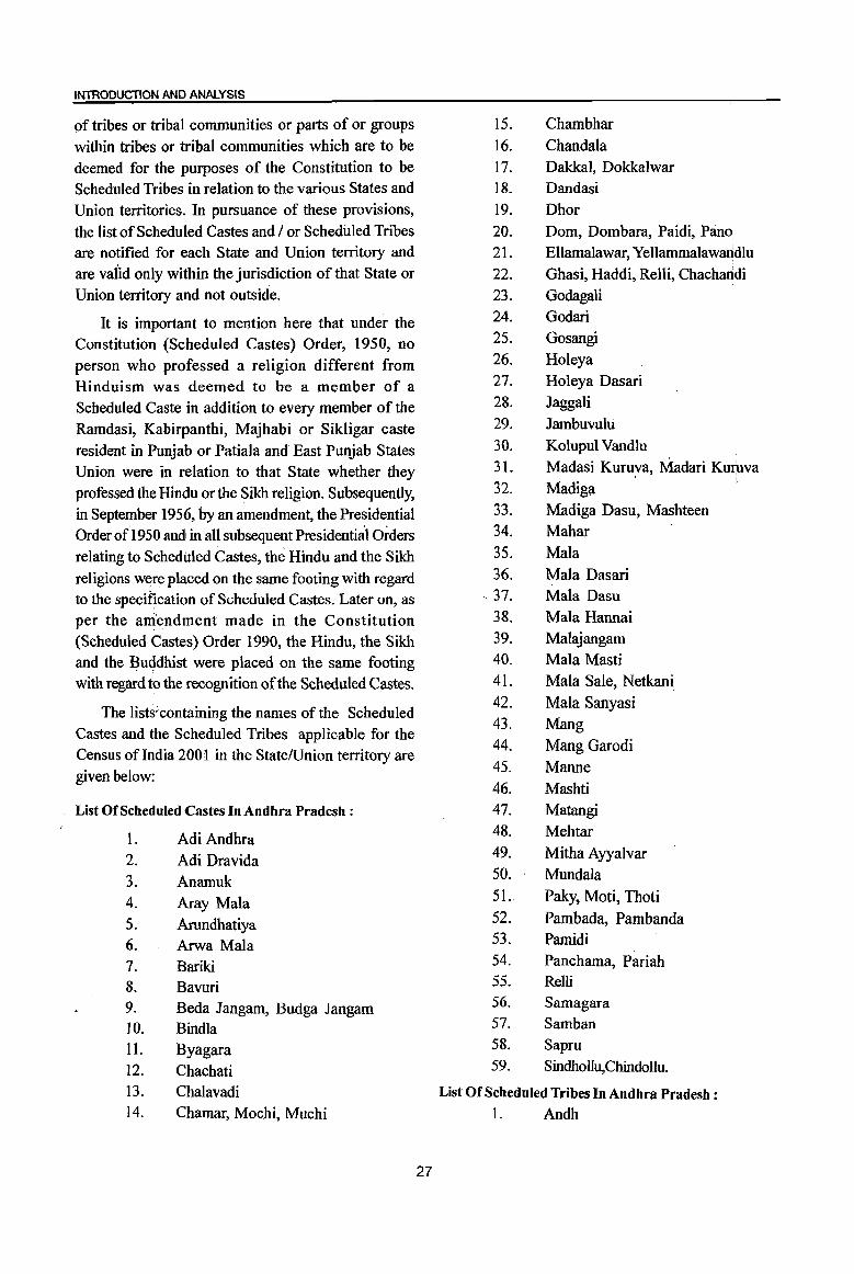
INTRODUCTION AND ANALYSIS
pf tribes or tribal communities or parts of or groups
within tribes or tribal communities which are to be deemed for the purposes of the Constitution to be Scheduled Tribes in relation to the various States and
Union territories. In pursuance of these provisions,
the list of Scheduled Castes and / or Scheduled Tribes are notified for each State and Union territory and
are valid only within the jurisdiction of that State or
Union territory and not outside.
It is important to mention here that under the Constitution (Scheduled Castes) Order, 1950, no
person who professed a religion different from
Hinduism was deemed to be a member of a Scheduled Caste in addition to every member of the
Ramdasi, Kabirpanthi, Majhabi or Sikligar caste
resident in Punjab or Patiala and East Purliab States Union were in relation to that State whether they
professed the Hindu or the Sikh religion. Subsequently,
in September 1956, by an amendment, the Presidential Order of1950 and in all subsequent Presidential Orders
relating to Scheduled Castes, the Hindu and the Sikh
religions were placed on the same footing with regard to the specification of Scheduled Castes. Later on, as per the ani't::ndment made in the Constitution (Scheduled Castes) Order 1990, the Hindu, the Sikh and the Buddhist were placed on the same footing
with regard to the recognition of the Scheduled Castes.
The lists:containing the names of the Scheduled
Castes and the Scheduled Tribes applicable for the
Census ofIndia 2001 in the State/Union territory are
given below:
List Of Scheduled Castes In Andhra Pradesh:
1. Adi Andhra
2. Adi Dravida 3. Anamuk 4. Aray Mala
5. Arundhatiya 6. Arwa Mala 7. Bariki 8. Bavuri 9. Beda Jangam, Budga Jangam 10. Bindla 11. Byagara 12. Chachati 13. Chalavadi 14. Chamar, Mochi, Muchi
27
15. Chambhar
16. Chandala
17. Dakkal, Dokkalwar
18. Dandasi
19. Dhor
20. Dom, Dombara, Paidi, Pano
21. Ellamalawar, Yellammalawandlu
22. Ghasi, Haddi, Relli, ChachaIidi
23. Godagali 24. Godari 25. Gosangi
26. Holeya 27. Holeya Dasari
28. Jaggali
29. Jambuvulti
30. Kolupul Vandlu 31. Madasi Kuruva, Madari KunlVa
32. Madiga
33. Madiga Dasu, Mashteen 34. Mahar
35. Mala
36. Mala Dasari - 37. Mala Dasu
38. Mala Hannai 39. Malajangam 40. Mala Masti 41. Mala Sale, Netkani
42. Mala Sanyasi 43. Mang 44. Mang Garodi 45. Manne 46. Mashti 47. Matangi 48. Mehtar
49. Mitha Ayyalvar 50. Mundala
51. Paky, Moti, Thoti 52. Pambada, Pambanda 53. Pamidi 54. Panchama, Pariah 55. Relli 56. Samagara 57. Samban 58. Sapru 59. Sindhollu,ChindolIu.
List Of Scheduled Thibes In Andhra Pradesh:
1. Andh
2. 3. 4. S. 6. 7. 8. 9. 10. 11. 12. 13. 14. 15. 16.
17.
18.
19. 20.
21. 22.
23. 24.
25.
26.
27. 28.
29.
30.
31. 32. 33.
Bagata Bhil Chenchu, Chenchwar Gadabas
Gond, Naikpod, Rajgond
Goudu(in the Agency tracts)* Hill Reddis Jatapus Kammara Kattunayakan
Kolam, Mannervarlu Konda Dhoras Konda Kapus Kondareddis
Kondhs, Kodi, Kodhu, Desaya
Kondhs, Dongria Kondhs, Kuttiya Kondhs, Tikiria Kondhs, Yenity Kondhs.
Kotia, Bentho Oriya, Bartika, Dhulia,
DuHa, Holva, Paiko,Putiya, Sanrona,
Sidhopaiko
Koya,Goud,Rajah,Rasha Koya,Lingadhari, Koya (ordinary), Kottu Koya, Bhine Koya, Rajkoya Kulia Malis
(excluding Adilabad, Hyderabad,
Karimnagar,Khammam,
Mahbubnagar,Medak,Nalgonda, Nizamabad and Warangal districts)
Manna Dhora
Mukha Dhora, Nooka Dhora
Nayaks(in theAgency tracts)* Pardhan
Porja, Parangiperja
Reddi Dhoras
Rona, Rena Savaras, Kapu Savaras, Maliya Savaras, Khutto Savaras Sugalis, Lambadis Thoti
(lnAdilabad, Hyderabad, Karimnagar, Khammam, Mahbubnagar, Medak,
Nalgonda, Nizamabad and Warangal
Districts) Valmiki(in the Agency tracts)*
Yenadis Yerukulas
Language and Mother tongue :
As per the census concept, each language is a
group of mother tongues. The census questionnaire
collects information on the mother tongue of each
person and mother tongue is defined as the language
spoken in childhood by the person's mother to the
person. If the mother died in infancy, the language
mainly spoken in the person's home in childhood will
be the mother tongue. In the case of infants and deaf
mutes, the language usually spoken by the mother is
considered as mother tongue. It is not necessary that
the language spoken as mother tongue should have
a script. The mother tongues returned by the
respondents in census are classified and grouped under
appropriate languages according to their linguistic
characteristics.
Literate:
A person aged 7 years and above who
can both read and write with understanding
in. any language is taken as literate. A person who
can only read but cannot write is not literate. It is
not necessary that to be considered as literate, a person
should have received any formal education or passed
any minimum educational standard. Literacy could also
have been achieved through adult literacy classes or
through any non-formal educational system. People
who are blind and can read in Braille are treated as
literates.
Literacy rate :
Literacy rate of the population is defined as the
percentage of literates in the age group seven years
and above. For different age groups the percentage
of literates in that age group gives the literacy rate.
Educational level :
The highest level of education a person has
completed.
Work:
Work IS defined as participation in any
economically productive activity with or without
compensation, wages or profit. Such participation may
be physical and/or mental in nature. Work involves
not only actual work but also includes effective
* The agency tracts is comprised of Srikakulam, Vizianagaram, Visakhapatnam, East-Godavari, West-Godavari and Khammam districts.
28
INTRODUCTION AND ANALYSIS
supervision and direction of work. It even includes part time help or unpaid work on farm, family enterprise or. in any other economic activity. All persons engaged in 'work' as defined above are workers. Persons who are engaged in cultivation or milk production even solely for domestic consumption are also treated as workers.
Reference period for determining a person as worker and non-worker is one year preceding the date of enumeration.
Main worker :
A person who has worked for major part of the reference period ( i.e. six months or more during the last one year preceding the date of enumeration) in any economically productive activity is termed as 'Main worker'.
Marginal worker :
A person who worked for less than six months of the reference period ( i.e. in the last one year preceding the date of eIlUmeration ) in any economic activity is termed as '~arginal worker' .
Non worker' :
A person who has not worked at all in any economically, productive activity during the reference period ( i.e.:,< last one year preceding the date of enumeration) is termed as 'Non worker'.
Cultivator :
For purposes ofthe Census a person is classified as cultivator if he or she is engaged in cultivation on l~d owned or held from government or held from private persons or institutions for payment in money, kind or share. Cultivation includes effective supervision or direction in cultivation.
A person who has given out her/his land to another person or persons or institution(s) for cultivation for money, kind or share of crop and who does not even supervise or direct cultivation in exchange ofland, is not treated as cultivator. Similarly, a person working on another person's land for wages in cash or kind or a combination of both (agricultural labourer) is not treated as cultivator.
Cultivation involves plOUghing, sowing, harvesting
29
and production of cereals and millet crops such as wheat, paddy, jowar, bajra, ragi, etc., and oth~r crops such as sugarcane, tobacco, ground-nuts, tapio'ca, etc., and pulses, raw jute and kindred fibre crop,' cotton, cinchona and other medicinal plants, fruit growing, vegetable growing or keeping orchards or gro~es, etc. Cultivation does not include the following plantation crops - tea, coffee, rubber, coconut and betel-nuts
(areca).
Agricultural labourer :
A person who works on another perso*'s land for wages in money or kind or share is regarded as an agricultural labourer. Shelhe . has no risk in the cultivation, but merely works on another person's land for wages. An agricultural labourer has no right of lease or contract on land on which shelhe works.
Household industry worker :
Household industry is defined as an industry conducted by the head of the household herselflhimself and or by the members of the household at home or within the village in rural areas and only within the precincts of the house where the household lives in urban areas. The larger proportion of wo*ers in household industry should consist ofmember~ of the household including the head. The industry shQuld not be run on the scale of a registered factory[ which would qualify or has to be registered under the Indian Factories Act and· should be engaged. in manufacturing, processing, servicing and repairs of goods.
It does not include professions such as a pleader, Doctor, Musician, Dancer, Waterman, Astrploger, Dhobi, Barber, etc. or merely trade or busines~, even if such professions, trade or services are run at home by members of the household.
Other worker:
A person who has been engaged in; some economic activity during the reference period ~>Ut not as a cultivator or agricultural labourer or in Hou~ehold Industry is termed as a 'Other Worker (Ow)'. The type of workers that come under this category df'OW' include all government servants, municipal emp(oyees, teachers, factory workers, plantation workers; those engaged in trade, commerce, business, tradsport, banking, mining, construction, political or social work,
priests, entertainment artists, etc. In effect, all those workers other than cultivators or agricultural labourers or household industry workers, are 'Other Workers'.
Work participation rate :
Percentage of workers (main + marginal) to total population.
Population density :
Population density is the number of persons
inhabited per square kilometre of the area.
Age:
Age is measured in terms of the completed
number of years.
Sex -ratio:
Number of females per 1000 males in a
population.
(viii) Non Census Concepts
Improved drinking water :
If the household had access to drinking water
supplied from a tap, hand pump, tube well or well
(protected or covered) situated within or outside the premises, it is considered as having access to improved
drinking water. It may be mentioned that such uniform
definition may not be valid across all states.
System of sewerage :
Generally, a sewerage system would mean a
network of mains and branches of underground
conduits for the conveyance of sewerage to the point
of disposal. Sewers that carry only household and industrial wastage are called separate sewers; those that carry storm water from roofs, streets and other
surfaces are known as storm water drains, while those carrying both sewage and storm water are called
combined sewers. However, in some towns which
are not provided with such underground sewerage system, it is served by open surface drain, box drain, sylk pattern drain, etc., in these towns.
Type of latrine and Method of disposal of night
soil :
There are three prevalent systems of disposal of human wastes, viz. (i) underground sewerage, (ii) sanitary water flush latrines with individual disposal systems, like septic tank, leaching cess pool and
30
collecting well, and (iii) dry type oflatrines with manual scavenging. The system of underground sewerage provides for the street sewerage with which are
connected the sanitary latrines constructed in the houses having water closets and fitted with flushing cistern (or hand flushing). Through this sewer the
faecal matter is transported without the need for scavenging. This system generally exists in cities and
big towns. Where the streets sewer does not exist these sanitary water flush latrines are connected to
a local septic tank with a sub-soil dispersion system or a leaching pit. Here the liquid wastes from the
water closet is disposed of locally in leaching pit, a septic tank with a soil dispersion system is constructed. This dispersion requires an optimum travel through
the pores of the soil which renders the harmful liquid bacterially innocuous by the slow process of filtration
through the soil traversed. Where the soil is
impermeable, collecting wells are constructed and the
sanitary water flush latrines are connected with them. These wells are cleaned at periodic intervals by a suitable device. The dry type of latrines are of service
type latrines from where human excreta is removed by scavengers from house to house, in most cases carrying it on their heads or shoulders or in baskets
with handle or wheel barrows. These are then collected in bullock carts or trucks or tractors and trolleys for being carried to the dumping grounds.

INTRODUCTION AND ANALYSIS
Fertility :
In demography, the word fertility is used in relation
to the actual production of children or occurrence of births specially live births;---Fertility is a measu:r;.e of
rate at which popuhltion adds to itself by births and
normally assessed by relating the number of births to a full or part of the population, such as number of
married women or number of women of child bearing
age. The definitions of the terminology used in
computing different fertility rates are mentioned below:
Crude birth rate(CBR) :
Ratio of the number of live births in a year to the mid year population, normally expressed per 1000 population.
Number of live births during
the year
CBR = ----------x 1000
Mid -year Population
Crude death rate(CDR) :
Ratio of the number of deaths in a year to the mid year population, normally expressed per 1000 population.
Number of deaths during the year CDR = x 1000
Mid- year Population Natural' growth rate :
Growth rate is obtained as the difference between crude birth rate and crude death rate in the absence of migration.
Age specific fertility rate (ASFR)
Number of live births in a year to female population in any specified age group normally expressed per 1000 women.
Number of live births in a
particular age-group
ASFR= ----------- x 1000 Mid-year female population of
the same age-group
Age specific marital fertility rate (ASMFR) :
Number of live births in a year to married female population in any specified age group normally expressed per 1000 married women.
31
Number of live births in a
particular age-group ASMFR= x 1000
Mid-year married femal~_p<:)pulation
of the same age-group
General fertility rate (GFR) :
Number of live births per 1000 women in the reproductive age-group (15-49) years in a given year.
Number of live births in
a year
GFR =----------x 1000 Mid~year female population
in the age-group (15-49)
years
General marital fertility rate (GMFR) :
Number of live births per 1000 married women in reproductive age-group (15-49) years in a given year.
Number of live births in a year
GMFR = x 1000
Mid-year married female population
in the age-group (15-49) years.
Total fertility rate (TFR) :
It is obtained as the total of the age specific
fertility rates (number of children born per woman of
the particular age) for the entire reproductive age
span. It provides the average number of children that
will be born to a woman under the fertility levels
indicated by the age specific fertility rates assuming
that there is no mortality of women till the completion
of reproductive period.
TFR
45-49
5 x L ASFR 15-19
1000
Total marital fertility rate (TMFR) :
Average number of children that would be born
to a married woman if she experiences the current
fertility pattern throughout her reproductive span
(15-49) years assuming that there is no mortality of
women till the completion of reproductive period.
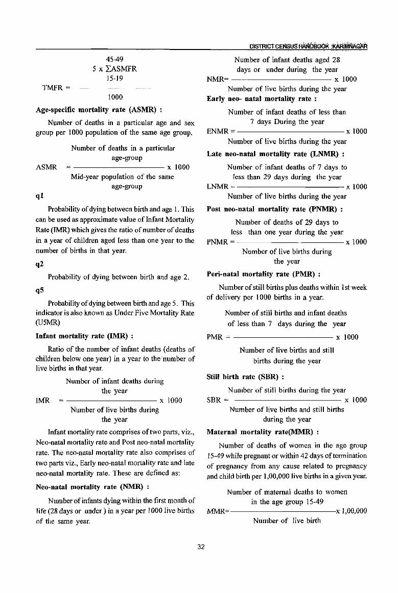
TMFR =
45-49 5 x LASMFR
15-19
1000
Age-specific mortality rate (ASMR) :
Number of deaths in a particular age and sex
Number- of infant deaths aged 28 days or under during the year
NMR= x 1000 Number of live births during the year
Early neo- natal mortality rate:
Number of infant deaths of less than 7 days During the year
group per 1000 population of the same age group. ENMR = ------------ x 1000
AS:MR
ql
Number of deaths in a particular age-group
-------------------x 1000 Mid-year population of the same
age-group
Probability of dying between birth and age 1. This
can be used as approximate value of Infant Mortality
Rate (IMR) which gives the ratio of number of deaths
in a year of children aged less than one year to the
number of births in that year.
q2
Probability of dying between birth and age 2.
q5
Probability of dying between birth and age 5. This indicator is also known as Under Five Mortality Rate (U5MR)
Infant mortality rate (IMR) :
Ratio of the number of infant deaths (deaths of children below one year) in a year to the number of live births in that year.
IMR
Number of infant deaths during the year
-------------------x 1000 Number of live births during
the year
Infant mortality rate comprises of two parts, viz.,
Neo-natal mortality rate and Post neo-natal mortality
rate. The neo-natal mortality rate also comprises of
two parts viz., Early neo-natal mortality rate and late
neo-natal mortality rate. These are defined as:
Neo-natal mortality rate (NMR) :
Number of infants dying within the first month of
life (28 days or under) in a year per 1000 live births
of the same year.
32
Number of live births during the year
Late neo-natal mortality rate (LNMR) :
Number of infant deaths of 7 days to less than 29 days during the year
LNMR= x 1000 Number of live births during the year
Post neo-natal mortality rate (PNMR) :
Number of deaths of 29 days to less than one year during the year
PNMR= x 1000 Number of live births during
the year
Peri-natal mortality rate (PMR) :
Number of still births plus deaths within 1 st week
of delivery per 1000 births in a year.
Number of still births and infant deaths
of less than 7 days during the year
PMR = ---------,--- x 1000
Number of live births and still
births during the year
Still birth rate (SBR) :
Number of still births during the year SBR = x 1000
Number of live births and still births during the year
Maternal mortality rate(MMR) :
Number of deaths of women in the age group
15-49 while pregnant or within 42 days of termination
of pregnancy from any cause related to pregnancy find child birth per 1,00,000 live births in a given year.
Number of maternal deaths to women in the age group 15-49
MJ\1R=----------.x 1,00,000 Number of live birth
INTRODUCTION AND ANALYSIS
Eligible couple (Couples per 1000 population):
Number of currently married females in the age group 15-44 years per 1000 persons of all ages.
Child woman ratio (0-4) :
1. Number of children in the age group 0-4 years per 1000 women in the age group 15-49 years.
Child woman ratio (5-9) :
2. Number of children in the age group 5-9 years per 1000 women in the age group 15-49 years.
Migration:
Migration is the third component of population change, the other two being mortality and fertility. A person is considered as a migrant by place of birth ifthe place in which he/she is enumerated during the census is' other than the place of his/her birth. Similarly a person is considered as a migrant by place of last residence if the place in which he/she is enumerated during the census is other than hislher place of immediate last residence outside the village or town and';not simply in another house or locality in the same village or town. Certain aspects concerning temporary movement/migration of people has been explained below as these are important components concerning migration;-
(i) Migration of persons in search of job is high in the coun.try. In many cases such migrants are only seasonal in nature. People migrate to other places for work in a particular season and come back again to their usual place of residence after three or four months. All such workers are treated as migrants. Similarly, if a person moved to any other place for attending short term vocational or educational course that lasted for only few months of a year, she/he too were considered as a migrant.
(ii) Where a person had merely gone out to another place or had been shifting from one place to another purely on tour, pilgrimage, visit to hospital for treatment or for temporary business purposes, such persons are not deemed to have had another residence different from the place where she/he or her/his family normally resides. She/he is not considered as migrant.
(iii) A woman temporarily moves into a hospital or to her parents or other relative's house for delivery
and if the hospital or the parents/relatives houses is in a place different from usual place of residence, the place where the hospital or parents/relative's house is the place of last residence of the child but not of the mother. A new response category 'Moved
after birth' was added in Census ofIndia 2001 in the . question on 'reasons for migration' to bring out
additional migration patterns. Natural calamities or
distress migration as a reason for migration for last residence migrants included in 1991 Census, is covered under category of 'Others'. The reason for migration has been determined as applicable at the time of migration and not in reference to any point of time
after that. For example, if a person had moved from,
the place of herlhis last residence for the purpose of education and subsequently at some point of time got employment there only, the reason for migration would be 'education' and not 'work/employment'.
33
Internal and International migration :
The migrational movements are of three types
(i) Migration within the state itself with its components
(a) Migration within the district of enumeration (intra district migration)
(b) Migration from one district of state to another district of state (inter district migration),
(ii) Migration from one state to another State of the country ( inter-state migration),
(iii) Migration from one country to another country. The first two streams together constitute internal migration, while the last type of movement is called international migration. The present name of
the country, state or district and not the name by which
they were known at the time of her/his birth or last residence were recorded.
Rural - Urban components of migration :
Rural or Urban status in respect of migrants have been determined as applicable at the time of migration and not with reference to any point of time after that. The flow of migrants consists of four streams viz. rural to rural, rural to urban, urban to rural and urban to urban.
Civic status of urban units :
Civic Status of a town/city is determined on the basis of Civic Administrative authority of the town e.g., Municipal Corporation I Corporation, Municipal Committeel Municipal council, Municipality etc.
Size class of UA I town:
Size~class ofUAlTown is based on the population size ofthe UAlCitylTown UAs.lTowns with 1,00,000 and above population are classified as Class I UAs. I towns. These Class I UAs. I towns are now further
sub classified in to seven sub classes namely MI to M7 depending on the population size of UAlCityl Town. These are M7(5,000,000 and above); M6(2,000,000 to 4,999,999); MS (1,OOO,OOO~ 1,999,999)
M4 (500,000-999,999); M3(300,000-499,999), M2 (200,000-299,999) & Ml (100,000-199,999). towns
with, 50,000 to 99,999 population are classified as
Class n towns, 20,000 to 49,999 population are Class III towns, population with 10,000-19,999 are Class IV towns, population with 5000 and 9999 are Class V towns and towns with less than 5000 population are Class VI towns.
Slum area:
The Slum Areas (Improvement and Clearance)
34
OISTRICTQENSUS AA~DB06K :KARtMN,o;~
Act, 1956 which was enacted by the Central Govt. defined slums as a) Areas where buildings are in any respect unfit for human habitation; or b) are by reasons of dilapidation, overcrowding,. fault arrangement and design of such buildings, narrowness or faulty arrangement of streets, lack of ventilation, light or sanitation facilities, or any combination of these factors, are detrimental to safety, health or morals.
Mega city:
The concept of 'Mega city' is a recent phenomenon in the Urban Sociology and is defined in term of metropolitan city in the form of large size, problem of management of civic amenities and capacity to absorb the relatively high growth of population. Indian Census in 1991 treated the population size of 5 million and above as the cut off point to identifY a place as the mega city. Whereas,
for the purpose of inclusion in Centrally Sponsored Scheme for Infrastructure Development in Mega cities the Ministry of Urban Affairs and employment, Department of Urban Development adopted the criteria of 4 million and above population as per 1991 C_ensus for Mega Cities. In 2001 Census, cities with
10 millions and above popUlation have been treated as Mega cities. .
INTRODUCTION AND ANALYSIS
Analytical Note (ix) 2001 Census findings - Population and its distribution
(a) Distribution of Population in Rural - Urban
areas:
According to 2001 Census the total population of
Karimnagar district stands at 3,491,822 persons with
1,747,968 males and 1,743,854 females. The district
stands at 12th rank as far as population is concerned
in the State. Out of the total population of the district
2,813,010 persons constituting 80.6% are residing in
rural areas and the remaining 678,812 persons
(19.4%) are residing in urban areas. The proportion
of urban to total population, regarded as an index of
urbanization ~~d it is 19.4% for Karimnagar district,
corresponding to state figure of 27.3%. Average
number of towns for 100 inhabited villages in the
district is less than 1% (0.67%).
Karimnagar district has 1,092 villages in 56
mandals of which 1,047 are inhabited villages. The
average number of inhabited villages per mandai is
19. Karimnagar mandai is the largest mandaI in terms
of population accounting 8.3% of the district
population. In terms of number of villages, Mahadevpur
mandaI leads with 37 villages. Odela and
Chigurumamidi mandals have least i.e. 11, inhabited
villages each. As regards population, Mutharam
(Mahadevpur) mandaI reported least popUlation i.e.
23,327 persons in the district.
The urban popUlation is distributed among 7 urban
units of which 5 are statutory towns. The average
size of an urban center in the district works out to
96,973 persons. Ramagundam Municipality has largest
population (236,600) whereas Palakurthy Census
Towns is the smallest town with a popUlation of 6,967
persons. There is no town in the district which has
less than 5,000 population.
35
(b) Size class and status of towns, population Growth, density and sex ratio, work participation rate and Literacy rate
Size class and status of Town:
During every Census the number of Census towns
and statutory towns changes due to addition of new
Census towns, declassification of old Census towns,
notifying of new Statutary towns, de-notifying of
old statutory towns etc. For the ,purpose of analysis
of varied demographic characteristics, urban areas have been divided into six classes by size of
population Of the 7 towns in the district, Karimnagar
and Ramagundam are categorized as class I towns
while Jagityal, Koratla and Sircilla are class II,
Jallaram Census Town is class IV and Palakurthy
Census Town is class V. There are no towns under
category III and VI.
Population Growth:
The population of the district was 3,037,486
persons as per 1991 Census and has gone upto
3,491,822 persons in 2001 adding 454,336 persons during the decade 1991-2001. The growth rate
revealed by the district(15%) is more than the state
growth of 14.6% during the decade. Karimnagar district ranks 10th in growth rate among 23 districts in the state.
Rural-Urban growth rates. show wide variations. The rural growth rate is recorded as 16.6% while urban growth rate is 8.7%. As regards growth rate
in rural population the district occupies 8th position, ,
when it speak about urban growth rate it occupies 12th place in the state ..
Density:
The overall density of popUlation in the district is 295 persons per sq.km and is above the state average

of 277. Among urban areas Karimnagar town recorded highest 5,541 persons per sq.km followed by 5,225 persons in Sircilla town. Least density i.e) 467 persons per sq.km. has been reported in Jallaram Census town.
Sex-Ratio:
Karimnagar district has possessed females per 1000males, while it was 986 in 1991 Census. It is higher than state average sex ratio of 978. The district occupied 4th rank in respect of sex ratio among 23 districts. Kathlapur mandai has the highest sex ratio of 1088. While Karimnagar mandai has lowest sex ratio of 956. Among urban units Sircilla town has reported highest sex ratio of 999 and Palakurthy Census Town reported lowest sex ratio of 928.
Work Partcipation Rate: rr.~, , '.
" . The work participation rate for total ---
workers is defined as percentage of total workers to total population. The total workers participation mte in Karimnagar district is 49.0%. Again percentage of main workers stands at 41.8%. The total workers participation rate separately for males and females in the rural areas are 56.5% and 49.4% respectively against corresponding figures for urban areas are 47.8% and 17.1 % respectively. Among the main workers as seen from the percentage of workers of 200 lover 1991, a decrease in the percentage is seen. The female workers participation has slightly corne down from 48.7% in 1991 Census to 43.3% at 2001 Census.
Literacy Rate:
While calculating effective literacy rate, children in 0-6 age group have been excluded. The district returned 1,661,089 literates forming 54.9% of the population of the district, excluding 0-6 age group. Separately for urban and rural areas the literacy rate workout to 73.9% and 50.2% respectively. Again within the urban areas male and female literacy rates worksout to 83.2% and 64.3%. For the rural population the male and female literacy rates works out to 63% and 37.6%.
(c)Scheduled Castes and Scheduled Tribes of earlier censuses :
To uplift social and economical status of Scheduled Castes and Scheduled Tribes, one of the
36
DISTRICTCENsusfiANiJOOOK :KAR~GAR
basic requirement of these population is the availability of data on age, sex, marital status, economy, education, fertility etc. In this regard these particulars are being collected in each census from 1951 onwards and provided to planners and administrators to takeup necessary steps to evolve suitable plans for the development of Scheduled Castes and Scheduled Tribes.
The President of India has notified some castes, races or tribes or parts of groups within castes, races or tribes as Scheduled Castes under Article 341 of the Constitution of India. Similarly, under Article 342 of the Indian Constitution, President of India has declared all such tribes or tribal communities or parts of groups within the tribes or tribal communities as Scheduled Tribes. The list of Scheduled Castes and Scheduled Tribes are notified for each State or Union Territory and are valid only within the jurisdiction of that State and Union'Territory. The list of Scheduled Castes and Scheduled Tribes is provided in this volume under the chapter on 'Census concepts'.
Scheduled Castes popUlation in the district as per 1991 Census:
As per 1991 census, there were 5,63,941 Scheduled Castes population comprising 2,85,054 males and 278,887 females. This works out to 18.6% to the total population of the district. Of the total population of Scheduled Castes, 86.9% were living in rural areas of the district.
The following statement reveals that Scheduled Castes population has recorded 22.8% growth rate during the decade 1981-91. It was 17.9% in rural areas which is less than the growth rate of total district. Growth rate in Urban areas was 68.4% which is abnormally more than the district and rural areas.
The sex ratio of Scheduled Castes population (978) was lower in comparison to that of the general popUlation in the district( 986). The sex ratio in rural area (979) of the district was equal to total district sex ratio among Scheduled Castes population. In urban areas it was 971. Literacy rate among Scheduled Castes was 24.9% which was lower than the district (37.2%). In urban areas their literacy rate was 47.2%. Proportion of main workers among Scheduled Castes was 54.9 percent and the Marginal workers was 1.6 percent. In rural areas workers popUlation was 58.3 percent and in urban areas their percentage was 32.
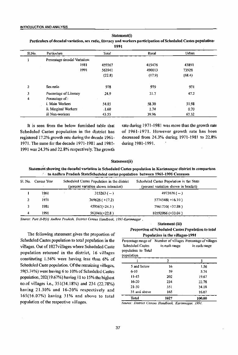
INTRODUCTION AND ANALYSIS
Statement(i) Particulars of decadal variation, sex ratio, literacy and workers participation of Scheduled Castes population-
1991
SI.No. Particulars
Percentage decadal Variation: 1981
1991
2 Sex ratio
3 Percentage of Literacy
4 Percentage of:
i. Main Workers
ii. Marginal Workers iii Non-workers
Total
459367
563941
(22.8)
978
24.9
54.85
-1.60 43.55
It is seen from the below furnished table that Scheduled Castes populati~n in the district has registered 17.2% growth rate during the decade 1961-1971. The same for the decade 1971-1981 and 1981-1991 was 24.3% and 22.8% respectively. The growth
Rural Urban
415476 43891
490013 73928
(17.9) (68.4)
979 971
21.7 47.2
58.30 31.98
1.74 0.70
39.96 67.32
rate during 1971-1981 was more than the growth rate of 1961-1971. However growth rate has been decreased from 24.3% during 1971-1981 to 22.8%
during 1981-1991.
Statement(ii)
Statemerit showing the decadal variation in Scheduled Castes population in Karimnagar district in comparison . to Andhra Pradesh StateScheduled castes population between 1961-1991 Censuses
SI. No. Census Year Scheduled Castes Population in the district Scheduled Castes Population in the State
(percent variation shown inbracket) (percent variation shown in bracket)
19M 315263 ( -- ) 4973616 (-- )
2 1971 369626 ( + 17.2) 5774548( + 16.10 )
3 1981 459367(+24.3 ) 7961730( +37.88)
4 1991 563941(+22.8 ) 10592066 (+33.04 )
Source: Part JI-B(ii) Andhra Pradesh, District Census Handbook, J99J-Karimnagar .
The following statement gives the proportion of
Scheduled Castes ,population to total population in the
villages. Out of 1027villages where Scheduled Caste population returned in the district, 16 villages
constituting 1.56% were having less than 6% of
Scheduled Caste population. Of the remaining villages, 59(5.74%) were having 6 to 10% of Scheduled Castes
population, 202( 19.67%) having 11 to 15% the highest
no.of villages i.e., 351 (34.18%) and 234 (22.78%)
having 21.30% and 16-20% respectively and 165(16.07%) having 31 % and above to total population of the respective villages.
37
Statement (iii)
Proportion of Scheduled Castes Population to total
Population in the villages-1991 Percentage range of Number of villages Percentage of villages Scheduled Castes in each range in each range
population to Total , population
5 and below 6-10
11-15
16-20
21-30
31 and above
Total
2 3
16 1.56 59 5.74
202 19.67
234 22.78
351 34.18 165 ' 16.07
1027 100.00 Source: District Census Handbook, Karimnagar, 1991,
The following statement shows the percentage of Scheduled Castes population to the total population of the towns in the district at 1991 census. Out of 6,24,319 Urban population,ScheduledCastes population of 73,928 constituted 11.8%. Ramagundam town has the highest percentage i.e.18.8% Scheduled Castes population to the total population of the town, followed by Kothapalle Haveli 15.8%. Sircilla and Koratla Municipalities were low as 5.8% and 6% respectively which were below the district average.
Statement (iv)
Percentage of Scheduled Castes Population in Towns-1991
Class & Name
of Town
II Jagtial
I Karimnagar III Koratla
Total Total Percentage of
Population Scheduled Castes Scheduled Castes Population to total
Population
67,591 4,854 7.18 1,48,583 12,995 8.75
40,080 2,390 5.96 V Kothapalle Haveli 9,685 1,529 15.79 IV Manthani 14,639 1,304 8.91 III Metpalle 31,712 3,223 10.16 III Peddapalle 28,289 2,421 8.56 I Ramagundam 2,14,384 40,207 18.75 II Sircilla 50,048 2,885 5.76 IV Vemulawada 19,308 2,120 10.98
All Towns 6,24,319 73,928 11.84 Source: District Census Handbook, Karimnagar, 1991.
Scheduled Tribes population in the district as
per 1991 Census
As per 1991 Census, there were 83,017 Scheduled Tribes population comprising 42,301 males
and 40,7]6 females. This works out 2.7% to the
total population of the district. Of the total population
of the Scheduled Tribes 92.6%were living in rural
areas of the district.
The following statement reveals that Scheduled Tribes population in the district has registered 37.1 %
growth rate during the decade 1981-91. The growth rate 33.2% has been recorded in the rural areas of the district. In urban areas it was 117.3%. The sex
ratio in the district was 962, while in rural areas it
was 963 and in urban areas 944. As regards the literacy rate among the tribes, it was 12.3% , while in rural areas it was 11.3%. However in urban areas it was higher 26.2% than rural areas as well as the
district total.
38
The population of main workers and marginal workers among tribals in the district was 54.59% and 1.35% respectively where as in rural areas of the district it was 56.21 % and 1.40% respectively. But in urban areas they were reported as 34.23% and 0.75% respectively.
Statement (v) Particulars of decadal variation, sex ratio, literacy and workers participation of Scheduled Tribes population-1991
SI.No Particulars Total Rural urban
Percentage decadal
variation:
1981 60567 57745 2822
1991 83017 76885 6132
37.1 33.2 117 . .3
2 Sex ratio 962 963 944
3 Percentage of Literacy 12.3 11.3 26.2
4 Percentage of:
i. Main Workers 54.59 56.21 34.23
ii. Marginal Workers 1.35 lAO 0.75
iii. Non-workers 44.06 42.39 65.02
It is seen from the following statement that the Scheduled Tribes popUlation growth rate was low during 1961-1971, when it is compared with 1971-81 and 1981-1991, while it had recorded abnormal increase i.e. 269% during the decade 1971-1981. This abnormal increase was due to inclusion of some of the tribes in the list of Scheduled Tribes during the decade. However, the variation between 1981-1991 was above the State variation.
Statement (vi)
Statement showing the decadal variation in Scheduled Tribes population in Karimnagar district in comparison to Andhra Pradesh State Scheduled Tribes Population between 1961-1991 Censuses
SI. No. Census Year
1961
2 1971
3 1981
4 1991
Seheduled Tribes Population
in the district (percent variation shown in bracket)
13116 ( -- )
16433 ( +25.29 )
60567 (+268.57 )
83017 (+37.07)
ScheduledTribes population
in the State( percent Variation shown in
bracket)
1324368 ( -- )
1657657 ( +25.17 )
3176001 ( +91.60)
4199481 (+32.23)
Source: Part lI-B(ii) Andhra Pradesh, District Census Handbook,
1991-Karimnagar.
INTRODUCTION AND ANALYSIS
The following statement shows the proportion of Scheduled Tribes population to total population in the villages. Out of 780 villages, where Scheduled Tribes were recorded, 595 villages forming 76.28% were having less than 6% Scheduled Tribes population. The proportion of Tribals was between 26 t050 percent in 41 villages (5.26%) and in 34 villages(4.36%) they were more than 51 percent.
'Statement (vii)
Proportion of Scheduled Tribes Population to total
Population in the villages-1991
Percentage range of Number of Percentage of Scheduled Tribes villages villages in each
population to Total in each range range
population
I 2 3
5 and below 595 76.28
6-15 82 10.51
16-25 28 3.59
26·35 16 2.05
36·50 25 3.21
51 and above 34 4.36
Total· 780 100.00
Source: Districl Census Handbook, Karimnagar, 1991
While going through the following table it is
39
observed that the urban Scheduled Tribes population constituted 0.98% to total urban population in the district. The proportion of Scheduled Tribes population was above the district average in Karirnnagar, Koratla, Ramagundam and Vemulawada towns, while it was below in remaining towns. However, proportion of Scheduled Tribes population in urban areas ranges between 0.17% in Jagtial and 1.31 % in Kciratla.
Statement (viii) Percentage of Scheduled Tribes Population
in Towns-1991
Class & Name Total Total Percentage of of Town Population Scheduled Scheduled tribes
Tribes to total
Population Population II Jagtial 67,591 118 0.17
Karimnagar 148,583 1,692 1.14
III Koratla 40,080 526 1.31
V Kothapalle Haveli 9,685 66 0.68
IV Manthani 14,639 79 0.54
III Metpalle 31,712 307 0.97
III Peddapalle 28,289 128 0.45
I Ramagundam 2,14,384 2,664 L24
IT Sircilla 50,048 359 0.72
IV Vemulawada 19,308 193 1.00
All Towns 6,24,319 6,132 0;98
Source: District Census Handbook, Karimnagar, 1991.
(x) Brief analysis of PC A data
TABLEt
DECADALCHANGE IN POPULATION OFMANDALS BY RESIDENCE, 1991-2001
SI. No.
MandaI
2
Ibrahimpatnam
2 Mallapur
3 Raikal
4 Sarangapur
5 Dhariuapuri
6 Velgatoor
7 Ramagundam
8 Kamanpur
9 Manthani
10 Kataram
1 I Mahadevpur
Total
3 44,205
45,305
52,780
39,218
64,252
41,435
252,893
59,527
44,270
29,424
31,241
12 Mutharam 20,115
(Mahadevpur)
13 Malharrao 19,924
14 Mutharam 26,19
(Manthani)
15 Srirampur
16 Peddapalle
17 lulapalle
18 Dharmaram
1 9 Gollapalle
20 Mallial
21 Jagtial
22 MedipalJe
23 Korat1a
24 MetpaJle
25 Kathlapur
26 Chandurthi
27 Kodimial
28 Pegadapalle
29 Gangadhara
30 Ramadugu
3 I Choppadandi
32 Sultanabad
33 Odela
34 Manakondur
35 Karimnagar
36 BoinpalJe
37 Vemulawada
38 Konaraopeta
34,077
74,278
42,316
41,927
36,307
41,372
123,419
43,486
76,212
61,765
39,646
37,722
39,380
40,377
42,433
42,772
42,102
47,585
35,()04
58,264
218,136
34,780
62,373
37,895
Population 1991
Rural
4
44,205
45,305
52,780
39,218
64,252
41,435
38,509
59,527
29,631
29,424
31,241
20,115
19,924
26,198
34,077
45,989
42,316
41,927
36,307
41,372
55,828
43,486
36,132
30,053
39,646
37,722
39,380
40,377
42,433
42,772
42,102
47,585
35,004
58,264
Urban
5
214,384
14,639
28,289
67,591
40,080
31,712
59,868 158,268
34,780
43,065 19,308
37,895
Total
6 50,845
49,575
58,807
40,881
73,230
47,229
279,323
74,474
50,405
31,259
35,325
2001
Rural
7
50,845
49,575
58,807
40,881
73,230
47,229
35,756
62,378
50,405
31,259
35,325
23,327 23,327
23,843 23,843
28,628 28,628
37,272
90,830
45,094
49,636
41,648
45,244
150,565
49,773
94,429
76,985
42,786
40,558
42,346
44,879
46,879
47,654
48,659
56,717
39,539 64,864
37,272
90,830
45,094
49,636
41,648
45,244
65,044
49,773
40,417
76,985
42,786
40,558
42,346
44,879
46,879
47,654
48,659
56,717
39,539 64,864
Urban
8
243,567
12,096
85,521
54,012
289,375
37,564
73,421
41,381
71,073 218,302
40
37,564
73,421
41,381
Percentage Decadal variation 1991-2001
Percentage Urban
Total
9 15.0
9.4
11.4
4.2
14.0
14.0
10.5
25.1
13.9
6.2
13.1
16.0
19.7
9.3
9.4
22.3
6.6
18.4
14.7
9.4
22.0
14.5
23.9
24.6
7.9
7.5
7.5
11.1
10.5
11.4
15.6
19.2
13.0
11.3
32.7
8.0
17.7
9.2
Rural
10
15.0
9.4
11.4
4.2
14.0
14.0
7.1
4.8
70.1
6.2
13.1
16.0
19.7
9.3
9.4
97.5
6.6
18.4
14.7
9.4
16.5
14.5
11.9
156.2
7.9
7.5
7.5
11.1
10.5
11.4
15.6
19.2
13.0
11.3
18.7
8.0
70.5
9.2
Population
Urban 1991 2001
II 12
13.6 84.8
-100 33.1
-100 38.1
13
87.2
16.2
26.5 54.8 56.8
34.8 52.6 57.2
-100 51.3
37.9 72.6 75.4
-100 31.0
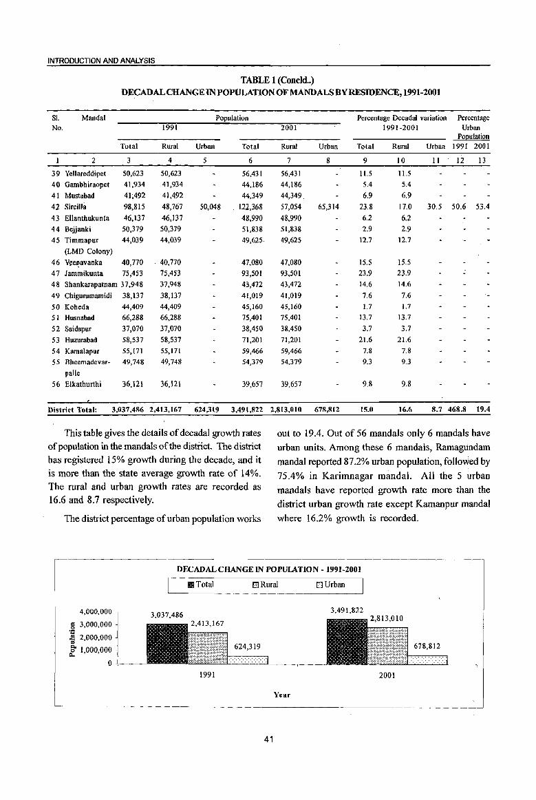
INTRODUCTION AND ANALYSIS
TABLE 1 (Coneld .. ) DECADALCHANGE IN POPULATION OFMANDALS BY RESIDENCE, 1991-2001
SI. MandaI Population Percentage Decadal variation Percentage
No. 1991 2001 1991-2001 Urban POQulation
Total Rural Urban Total Rural Urban Total Rural Urban 1991 2001
I 2 3 4 5 6 7 8 9 10 II 12 13
39 Yellareddipet 50,623 50,623 56,431 56,431 ll.5 11.5
40 Gambhiraopet 41,934 41,934 44,186 44,186 5.4 5.4
41 Mustabad 41;492 41,492 44,349 44,349. 6.9 6.9
42 Sircilla 98,815 48,767 50,048 122,368 57,054 65,314 23.8 17.0 30.5 50.6 53.4
43 Ellanthakunta 46,137 46,137 48,990 48,990 6.2 6.2
44 Bejjanki 50,379 SO,379 SI,838 51,838 2.9 2.9
45 Timmapur 44,039 44,039 49,625 49,625 12.7 12.7
(LMD Colony)
46 Vll-eJ:'avanka 40,770 40,770 47,080 47,080 IS.5 15.5
47 Jammikunta 75,453 75,453 93,501 93,501 23.9 23.9
48 Shankarapatnam 37,948 37,948 43,472 43,472 14.6 14.6
49 Chigurumamidi 38,137 38,137 41,019 41,019 7.6 7.6
50 Koheda 44,409 44,409 45,160 45,160 1.7 I.7
51 Husnabad 66,288 66,288 75,401 75,401 13.7 13.7
S2 Saidapur 37,070 37,070 38,450 38,450 3.7 3.7
53 Huzurabad 58,537 58,537 71,201 71,201 21.6 21.6
54 Kamalapur 55,171 55,171 . 59,466 59,466 7.8 7.8
55 Bheernadevar- 49,748 49,748 54,379 54,379 9.3 9.3
palle
56 Elkathurthi 36,121 36,121 39,657 39,657 9.8 9.8
District Total: 3,037,486 2,413,167 624,319 3,491,822 2,813,010 678,812 15.0 16.6 8.7 468.8 19.4
This table gives the details of decadal growth rates out to 19.4. Out of 56 mandals only 6 mandals have of population in the mandals of the district. The district urban units. Among these 6 mandals, Ramagundam has registered 15% growth during the decade, and it mandaI reported 87.2% urban population, follo~ed by is more than the state average growth rate of 14%. 75.4% in Karimnagar mandaI. All the 5 urban The rural and urban growth rates are recorded as mandals have reported growth rate more than the 16.6 and 8.7 respectively. district urban growth rate except Kamanpur mandai
The district percentage of urban popUlation works where 16.2% growth is recorded.
DECADALCHANGEIN POPUlATION -1991-2001
4,000,000
S 3,000,000 'l: -3 2,000,000 Q, ~ 1,000,000
O+--~
III Total
3,037,486
1991
DRural DUrban
3,491,822
624,319
2001
Year
41

SI. No.
District! Mandal Parishad
I 2
1 Ibrahimpatnam 2 Mallapur
3 Raikal
4 Sarangapur 5 Dharmapuri
6 Velgatoor
7 Ramagundam
8 Kamanpur
9 Manthani
10 Kataram II Mahadevpur 12 Mutharam
(Mahadevpur)
13 Malharrao 14 Mutharam
(Manthani)
15 Srirampur
16 Peddapalle
17 Julapalle 18 Dharmaram
19 Gollapalle 20 Mallia!
21 Jagtial
22 Medipalle
23 Koratla 24 Metpalle
25 Kathlapur
26 Chandurthi 27 Kodimial
28 Pegadapalle
29 Gangadhara
30 Ramadugu
31 Choppadandi 32 Sultanabad
33 Odela
34 Manakondur 35 Karimnagar 36 Boinpalle
37 Vemulawada 38 Konaraopeta
39 Yellareddipet
40 Gambhiraopet
41 Mustabad 42 Sircilla
DISTRICT CENSUSHANi::iBOoK :KARIMNAGAR'
TABLE 2
NUMBERAND PERCENTAGE OF INHABITED VILLAGES IN SPECIFIED POPULATION SIZE RANGES WITH THE RELATED POPULATION, 2001
Total No. of inha
bited villages
3 ]8
19
20
24 23
23
20
22
31
28 37
21
16
18
17
22
15
17
22
15
24
19
14
15
18
12
15
16
19
18
12 21
II 18 24
]6 23
19
22 17
15
21
Total Rural Population
Persons Males Females
4
50,845
49,575
58,807
40,881
73,230
47,229
35,756
62,378
50,405
31,259
35,325
23,327
23,843
5
24,737
23,963
28,603
19,935
36,124
23,827
17,946
31,409
25,487
]5,741
17,744
11,701
12,011
6
26,108
25,612
30,204
20,946 37,106
23,402
17,810
30,969
24,918
]5,518
17,581
1l,626
11,832
14,320
18,466
45,412
22,519
25,046 21,134
23,292
33,019 25,622
20,732
38,715
22,295
20,479
21,627
22,595 23,541
23,749
23,938 28,131
19,679
32,139
34,994
18,963
36,725
20,741
28,362
Number and
percentage of villages
7
1 (4.2)
1 (4.3)
1 (3.6)
6 (16.2)
5 (31.3)
2 (ILl)
1 (6.7)
I (5.6)
28,628 37,272
90,830
45,094
49,636
41,648
45,244
65,044
49,773
40,417
76,985
42,786
40,558
42,346
44,879
46,879
47,654
48,659
56,717
39,539
64,864
71,073 37,564
73,421
41,381
56,431
44,186
44,349
57,054
14,308
18,806
45,418
22,575 24,590
20,514
21,952
32,025
24,151
19,685
38,270
20,491
20,079
20,719
22,284
23,338
23,905
24,721 28,586 19,860
32,725 36,079
18,601
36,696
20,640 28,069
21,157
22,179 28,454
22,429 2 (11.8)
22,170
28,600
42
Population less than 200
Males Females
8
103 73
30
456
345
152
82
41
1I8
9
91
77
34
469
368
137
105
39
103
Number and
percentage
Population 200-499
of villages Males Females
10 I (5.6)
1 (5.3)
3 (12.5)
1 (4.3)
2 (8.7)
3 (13.6)
5 (16.1)
8 (28.6)
11 (29.7)
4 (19.0)
I (6.3)
2 (11.1)
I (6.7)
I (6.7)
2 (10.5)
I (5.6)
1 (8.3)
1 (4.8)
1 (4.2)
2 (8.7)
1 (4.5)
1 (5.9)
1 (6.7)
1 (4.8)
II 12
216 241 178 169
581 610
181 160
360 343
648. (l10
1022 1076
1481 1472
2009 1966
767 754 208 193
297 298
160
227
428
208 192 153
231
365
197
146
183
246
178
221
439
219
200
155
219
412
196
155 201
223

INTRODUCTION AND ANALYSIS
TABLE 2 NUMBERAND PERCENTAGE OF INHABITED VILLAGES IN SPECIFIED
POPULATION SIZE RANGES WITII THE RELATED POPULATION, 2001
51. District! No. MandaI
Parishad
1 2
1 Ibrahimpatnam
2 Mallapur
3 Raikal
4 Sarangapur 5 Dharmapuri
6 Velgatoor
7 Ramagundam
8 Kamanpur
9 Manthani
10 Kataram
It Mahadevpur
12 Mutharam
Number and
percentage of villages
13
3 (16.7)
2 (10.5)
4 (20.0)
4(16.7)
3 (l3.0)
7 (35.0)
4 (18.2)
12 (38.7)
7 (25.0)
9 (24.3)
(Mahadevpur) 8 (38.1)
13 Malharrao 2 (12.5)
14 Mutharam
(Mantbani)
15 Srirampur
16 Peddapalle
17 Julapal!e
18 Dharmaram
19 Gollapalle
20 Mallia!
21 Jagtial
22 Medipalle
23 Koratla
24 Metpalle
25 Kathlapur
26 Chandurthi
27 Kodimial
28 Pegadapalle
29 Gangadhara 30 Ramadugu
31 Choppadandi
32 Sultanabad
33 Odela
34 Manakondur
35 Karimnagar
36 Boinpalle
37 Vemulawada
38 Konaraopeta
39 Yellareddipet
40 Gambhiraopet
41 Mustabad
42 SirciUa
1 (5.6)
1 (5.9)
I (4.5)
2 (13.3)
2 (11.8)
3 (13.6)
1 (4.2)
3 (15.8)
4 (26.7)
I (5.6)
I (8.3)
2 (13.3)
2 (12.5)
I (5.3)
1 (5.6)
3 (14.3)
1 (5.6)
1 (4.2)
3 (18.8)
5 (21.7)
3 (15.8)
1 (4.5)
1 (5.9)
1 (6.7)
4 (19.0)
Population 500-999
Males
14
1,104
737
1,280
1,467
1,041
2,605
1,409
4,397
2,607
2,769
3,077
799
453
424
480
751
858
1,082
361
1,338
1,548
320
253
941
811
344
402
1,145
424
282
1,215
1,845
1,269
499
262
388
1,580
Females
15
1,191
793
1,354
1,570
1,030
2,644
1,384
4,435
2,590
2,707
3,l34
795
471
401
486
725
844
I,110
374
1,334
1,615
349
254
931
838
375
389
1,133
432
275
1,269
1,864
1,312
497
270
391
1,550
Number and
percentage of villages
16
2(11.1)
4 (21.1)
9 (45.0)
7 (29.2)
5 (21.7)
6 (26.1)
5 (25.0)
3 (13.6)
10 (32.3)
6 (21.4)
9 (24.3)
6 (28.6)
3 (18.8)
7 (38.9)
9 (52.9)
8 (36.4)
3 (20.0)
3 (17.6)
12 (54.5)
5 (33.3)
8 (33.3)
6 (31.6)
4 (28.6)
3 (20.0)
7 (38.9)
2 (16.7)
5 (33.3)
4 (25.0)
7 (36.8)
4 (22.2)
2 (16.7)
7 (33.3)
5 (45.5)
4 (22.2)
8 (33.3)
6 (37.5)
3 (13.0)
6 (31.6)
7 (31.8)
4 (23.5)
4 (26.7)
3 (14.3)
43
Population 1000-1999
Males
17
'1,524
2,841
6,981
4,886
3,422
4,266
3,935
2,202
6,695
3,618
6,485
3,912
2,021
4,806
6,533
6,807
2,138
2,154
8,403
4,132
5,875
4,362
3,028
2;164
4,983
1,782
3,248
2,980
5,1I5
3,060
1,687
5,183
4,168
3,079
5,785
4,426
2,399
4,236
4,935
2,871
2,786
2,488
Females
18
1,578
3,164
7,338
5,088 3,511
4,226
3,966
2,150
6,392
3,501
6,625
3,871
2,041
4,894
6,379
6,660
2,155
2,246
8,740
4,346
5,971
4,751
3,235
2,291
5,473
1,987
3,492
3,021
5,201
3,025
1,713
5,179
4,000 3,046
5,620
4,571
2,527
4,166
5,064
2,889
2,851
2,432
Number and
percentage of villages
19
10 (55.6)
11 (57.9)
4 (20.0)
9 (37.5)
14 (60.9)
11 (47.8)
7 (35.0)
9 (40.9)
3 (9.7)
6(21.4)
1 (2.7)
3 (14.3)
4 (25.0)
6 (33.3)
6 (35.3)
10 (45.5)
7 (46.7)
IO (58.8)
7 (31.8)
8 (53.3)
14 (58.3)
9 {47.4)
9 (64.3)
4 (26.7)
10 (55.6)
7 (58.3)
5 (33.3)
7 (43.8)
7 (36.8)
9 (50.0)
6 (50.0)
8 (38.1)
2 (18.2)
9 (50.0)
10 (41.7)
6 (37.5)
12 (52.2)
10 (52.6)
12 (54.5)
8 (47.1)
7 (46.7)
10 (47.6)
Population 2000-4999
Males
20
14,071
17,174
6,433
12,898
20,549
15,463
8,750
14,394
4,668
8,005
1,760
3,945
5,502
8,600
8,977
14,134
11,282
13,698
1l,029
II,94 I
.23,253
15,419
12,658
8,274
15,188
11,024
8,148
9,346
10,532
14,004
9,093
12,613
2,529.
14,635
16,380
9,106
17,117
15,135
18,225
12,847
11,770
15,579
Females
21
14,800
18,237
6,939
13,587 21,422
15,243
8,521
14,301
4,671
7,921
1,663
3,867
5,463
8,520
8,863
14,257
11,156
14,095
11,284
12,803
24,173
16,756
13,195
8,415
16,473
11,227
8,508
9,495
10,562
13,738
8,590
12,400
2,476
14,351
15,980
9,297
17,134
15,263
18,331
13,317
11,,872 15,617

DISTRICT CErliSUS HANDBOOK :KARIMNAGAR
TABLE 2
NUMBERAND PERCENTAGE OF INHABITED VILLAGES IN SPECIFIED POPULATION SIZE RANGES WITH THE RELATED POPULATION, 2001
Sl. District! Number Population Number Population No. MandaI and 5000-9999 and 10000 and above
Parishad percentage percentage of villages Males Females of villages Males Females
2 22 23 24 25 26 27
1 Ibrahimpatnam 2 (1Ll) 7,822 8,298
2 Mallapur 1 (5.3) 3,033 3,249
3Raikal 2 (10.0) 6,624 7,001 1 (5.0) 7,285 7572
4 Sarangapur
5 Dharmapuri 1 (4.3) 4,402 4,500 I (4.3) 7,497 7436
6 Velgatoor I (4.3) 2,697 2,560
7 Ramagundam 1 (5.0) 2,656 2,679
8 Kamanpur 2 (9.1) 7,655 7,554 1 (4.5) 5,101 4970
9 Manthani 1 (3.2) 8,705 8344
10 Kataram
11 Mahadevpur 1 (2.7) 4,265 4,151
12 Mutharam (Mahadevpur)
13 Malharrao 1 (6.3) 3,136 2,972
14 Mutharam (Manthani)
15 Srirampur 1 (5.9) 2,872 2,823
16 Peddapalle 2 (9.1) 5,891 5,894 1 (4.5) 18,106 18115
17 JulapalJe 3 (20.0) 8,404 8,483
18 Dharmaram 2 (11.8) 7,880 7,861
19 Gollapalle
20 Mallial 1 (6.7) 5,719 5965
21 Jagtial 1 (4.2) 2,536 2,501
22 Medipalle I (5.3) 3,032 2,781
23 Koratla 1 (7.1) 3,999 4,302
24 Metpalle 2 (13.3) 5,466 5,801 1 (6.7) 20,736 20488
25 Kathlapur
26 Chandurthi 2 (16.7) 7,020 7,011
27 Kodimial 1 (6.7) 2,938 2,940 1 (6.7) 5,217 5535
28 Pegadapalle 3 (18.8) 9,147 9,241
29 Gangadhara 2 (10.5) 6,919 6,964
30 Ramadugu 2 (ll.l) 6,190 6,339
31 Choppadandi 2 (16.7) 5,787 5,926 I (8.3) 7,962 7509
32 Sultanabad 1 (4,8) 2,994 2,976 1 (4.8) 6,498 6288
33 Odela 4 (36.4) 13,163 13,203
34 Manakondur 3 (16.7) 8,342 8,306 1 (5.6) 6,245 6004
35 Karimnagar 3 (12.5) 8,170 7,517 1 (4.2) 5,231 5383
36 Boinpalle 1 (6.3) 3,854 3,826
37 Vemulawada 1 (4.3) 14,970 14788
38 Konaraopeta
39 Yellareddipet 1 (4.5) 4,213 4,274
40 Gambhiraopet I (5.9) 5,513 5695
41 Mustabad 2 (13.3) 7,052 6,855
42 Sircilla 3 (14.3) 8,561 8,778
44

INTRODUCTION AND ANALYSIS
TABLE 2(Concld .. )
NUMBERAND PERCENTAGE OF INHABITED VILLAGES IN SPECIFIED POPULATION SIZE RANGES WITH THE RELATED POPULATION, 2001
SI. District! Total No. Total Rural Population Number Population less Number Population No. Mandai of inha- and than 200 and 200-499
Parishad bited percentage percentage villages Persons Males Females of villages Males Females of villages Males Females
I 2 3 4 5 6 7 8 9 10 II 12
43 Ellanthakunta 22 48,990 24,130 24,860
44 Belianki 23 51,838 25,528 26,310 2 (8.7) 355 351
45 Timmapur
(LMD Colony) 14 49,625 24,908 24,717
46 Veenavanka 14 47,080 23,573 23,507
47 Jammikunta 19 93,501 47,127 46,374
48 Shankarapatnam 17 43,472 22,031 21,441 2 (l1.8) 427 4]0
49 Chigurumamidi 11 41,019 20,773 20,246
50 Koheda 16 45,160 22,575 22,585
51 Husnabad 24 75,401 38,192 37,209
52 Saidapur 14 38,450 19,240 19,210
53 Huzurabad 12 71,201 35,927 35,274
54 KamaIapur 16 59,466 29,964 29,502 I (6.3) 101 99
55 Bheemadevarpalle 15 54,379 27,438 26,941
56 Elkathurthi 13 39,657 20,168 19,489
District
(Rural) Total: 1,047 2,813,010 1,402,279 1,410,731 20 ( 1.9) 1,400 1,423 61 (5.8) 11,567 11,570
TABLE 2 (Concld.)
NlJMBERAND PERCENTAGE OF INHABITED VILLAGES IN SPECIFIED POPULATION SIZE RANGES WITH THE RELATED POPULATION, 2001
S1. District! Number Population Number Population Number Population No. Mandai and 500-999 and 1000-1999 and 2000-4999
Parishad percentage percentage percentage of villages Males Females of villages Males Females of villages Males Females
I 2 13 14 15 16 17 18 19 20 21
43 Ellanthakunta 2 (9.1) 690 720 7 (31.8) 4,990 5,156 12 (54.5) 15,881 16,296
44 Beiianki 3 (13.0) 1,082 1,178 9(39.1) 6,685 6,924 7 (30.4) 11,165 n,714
45 Timmapur
(LMD Colony) I (7.1) 751 783 IO (71.4) 13,667 13,822 46 Veenavanka 1 (7.1) 315 323 I (7.1) 755 791 11 (78.6) 18,890 18,827 47 Jammikunta 5 (26.3) 3,168 3,117 9 (47.4) 16,536 16,328 48 Shankarapatnam I (5.9) 375 397 5 (29.4) 4,271 4,248 6 (35.3) 8,416 8,079 49 Chigurumamidi 2 (18.2) 1,568 1,610 7 (63.6) 11,735 11,282 50 Koheda 2 (12.5) 713 747 5 (31.3) 3,998 4,167 6 (37.5) 8,357 8,601 51 Husnabad I (4.2) 475 468 8 (33.3) 5,605 5,540 14 (58.3) 22,239 21,823
- 52 Saidapur 4 (28.6) 3,334 3,375 9 (64.3) 13,146 13,074 53 Huzurabad 2 (16.7) 1,794 1,810 8 (66.7) 12,453 12,298 54 Kamalapur 4 (25.0) 3,321 3,286 7 (43.8) 12,112 12,015 55 Bheemadevarpalle 3 (20.0) 2,452 2,357 10 (66.7) 17,761 17,397 56 E1kathurthi 3 (23.1) 2,257 2,130 8 (61.5) 12,363 11,950
District
(Rural) Total: 124 (11.8) 46,217 46,949 290 (27.7) 213,350 216,670 451 ( 43.1) 6~0,869 698,289
45
DISTRICT CENSUS HANDBoOK :AARIMAAGAR
TABLE 2 (Concld .. )
NUMBERAND PERCENTAGE OF INHABITED VILLAGES IN SPECIFIED POPULATION SIZE RANGES WITH THE RELATED POPULATION, 2001
Sl. District! Number Population Number Population No. Mandai and 5000-9999 and 10000 and above
Parishad percentage of villages Males
2 22 23
43 Ellanthakunta I (4.5) 2,569
44 Beiianki 2 (8.7) 6,241
45 Timmapur
(LMD Colony) 3 (21.4) 10,490
46 Veenavanka I (7.1) 3,613
47 Jammikunta 3 (15.8) 8,542
48 Shankarapatnam 3 (17.6) 8,542
49 Chigurumamidi 2 (18.2) 7,470
50 Koheda 3 (18.8) 9,507
51 Husnabad
52 Saidapur 1 (7.1) 2,760
53 Huzurabad 1 (8.3) 3,633
54 Kamalapur 3 (18.8) 9,043
55 Bheemadevarpalle 2 (13.3) 7,225
56 Elkathurthi 2 (15.4) 5,548
District
(Rural) Total: 82 ( 7.8) 261,903
Note: percentages in brackets
As per the above table this district has 1,047
inhabited villages. Out of 56 mandai parishads, the
highest number of 37 inhabited villages are in
Mahadevpur mandai parishad, followed by 31 villages
in Manthani mandai parishad, 28 villages in Kataram
mandai parishad. The least number i.e. 11 villages
are in Odeta and Chigurumamidi mandai parishads are existing. Of the total inhabited villages 20(1.9%)
villages, are having less than 200 popUlation; 61 (5.8%)
villages are having between 200-499 persons, the highest number of villages 451(43.1%) are in the
population range of 2000-4999. 19(1.8%) villages
have more than 10,000 population which are mostly mandaI parishad headquarters.
46
percentage Females of villages Males Females
24 25 26 27
2,688
6,143
10,112
3,566
8,445 2 (10.5) 18,881 18484
8,307
7,354
9,070
1 (4.2) 9,873 9378
2,761
3,633 1 (8.3) 18,047 17533
8,896 1 (6.3) 5,387 5206
7,187
5,409
261,137 19 ( 1.8) 176,973 174,693
Of the 56 mandaI parishads, 47 mandai parishads do not have the villages having less than 200, popUlation. More than 31.3% inhabited villages in Malharrao mandai parishad has less than 209 population. 29.7% of inhabited villages in Mahadevpur mandai parishad are having the population between 200-499 persons. Like wise 38.7 and 38.1 % inhabited villages of Manthani and Mutharam(Mahadevpur) mandaI parishads fall in population size range 500-999 persons 12 mandai parishads are not having villages with 5000 above and below 10,000 population. As already stated among the 19 villages where the popUlation has reported more than 10,000, one village each in 17 mandaI parishads and 2 in Jammikunta mandaI parishad.
INTRODUCTION AND ANALYSIS
TABLE 3
NEW TOWNS, DENOTIFIED,DECLASSIFIEDAND MERGED TOWNS IN 2001 CENSUS
(a) New (i) Statutory Town
(ii) Census Town
(b) Denotified (i) Statutory towns of 1991 Census denotified
and also did not satisfy the criteria to be
Name of Town
-Nil-
1 Palakurthy 2. Jallaram
treated as Census towns -Nil-
(ii) Statutory towns of 1991 Census denotified
but identified as Census towns based on
demographic and economic criteria -Nil-
(iii) Census towns of 1991 Census are notified as
statutory town in 2001 Census -Nil-
(c) Declassified 1. Kothapalle Haveli
2. Manthani 3. Metpalle
4. Peddapalle 5. Vemulawada
(d) Wholly merged with other town(s) -NiI-
Note: Declassified means the census towns of 1991 census which failed to satisfy the demographic and economic criteria .',
This table shows that out of 10 urban areas in demographic criteria in 2001 Census. Besides the 1991 ~Census, five census towns Kothapalle haveli, above changes, 2 new Census Towns have been Manthani, Metpalle, Peddapalle and Vemulawada declared for 2001 Census. They are Palakurthy and
attained rural status due to strict implementation of lallaram.
TABLE 4 DISTRIBUTION OF VILLAGES BY POPULATION DENSITY, 2001
Range of population Total number of
density (per square villages in each kilometer) population density
range
1 2
0-10 4
11-20 9 21-50 19
51-100 63
101-200 232 201-300 378 301-500 263
501 + 79 Not known
District Total; 1,047
Population Density (Rural) of the district:
As per the above table there are 4 villages with 655 population where density of population recorded below Ii persons per square kilometre.The average population size of these villages works out around 164 persons per village. The highest number of villages
Percentage of Population Percentage
distribution of population
villages in each population density
47
range
3 4 5
0.4 655
0.9 3,035 0.1
1.8 9,712 0.4
6.0 58,012 2.1 22.2 381,825 13.6 36.1 960,059 34.1
25.1 833,180 29.6 7.5 566,532 20.1
100.0 2,813,010 100.0
243
i.e. 378 forming 36.1 % with 9,60,059 persons are in 201-300 range of population density. Of total d~strict rural population, 20.1 % are living in 79 villages where density of population is more than 500 persons per Sq. km.
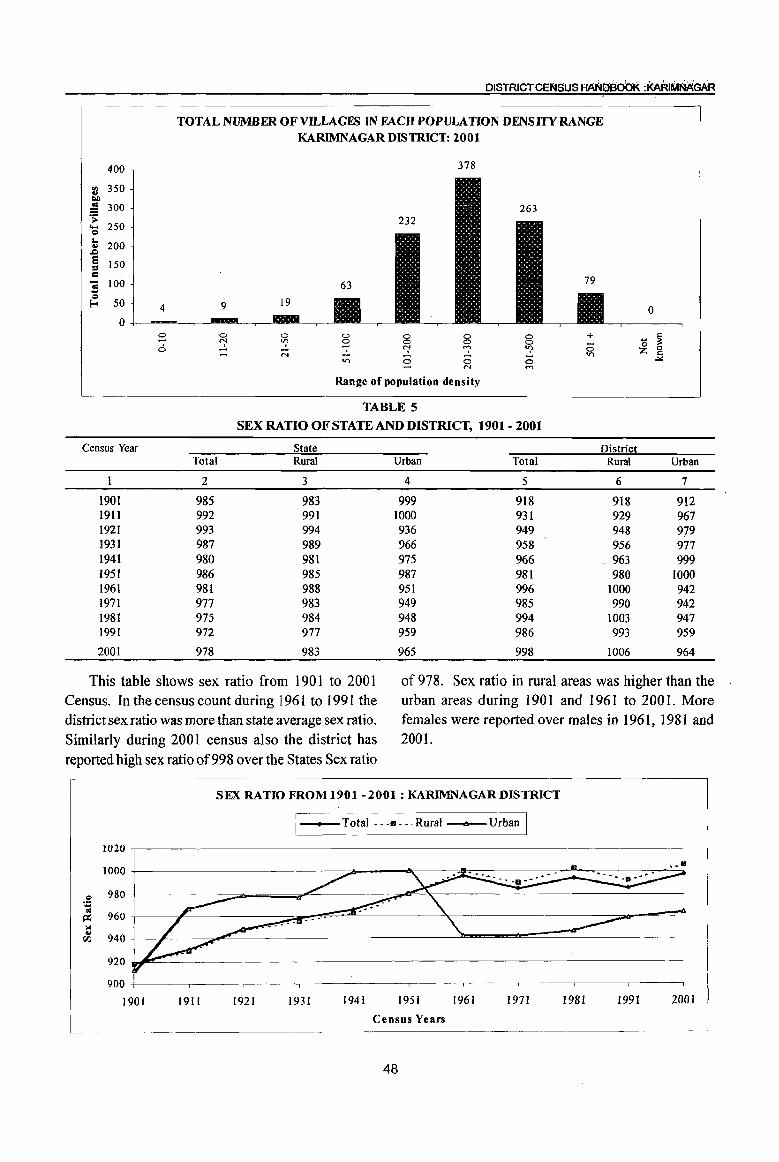
DISTRICTCEJltSUS HAt!40000K :~RIMMGAR
400
ell 350 .. ~
~ 300 .s: ... 250 Q
I.. 200 ..
,.Q
E 150 ::I = -; 100 ... 0
Eo- 50 4
0 0 -0
Census Year
1901 1911 1921 1931 1941 1951 1961 1971 1981 1991
2001
TOTALNUMBEROFVH..LAGES IN FACHPOPULATION DENSITY RANGE KARIMNAGAR DISTRICT: 2001
378.
0 ~
0 0 0 0 0 + v;> 0 0 0 0 ;:; ~ "? ~ N V)
V) 0 0 0 N '"
Range of population density
TABLE 5
SEX RATIO OF STATE AND DISTRICT, 1901 - 2001
State District Total Rural Urban Total Rural
2 3 4 5 6
985 983 999 918 918 992 991 1000 931 929 993 994 936 949 948 987 989 966 958 956 980 981 975 966 963 986 985 987 981 980 981 988 951 996 1000 977 983 949 985 990 975 984 948 994 1003 972 977 959 986 993
978 983 965 998 1006
0
~ '0 Z 0 s::
..>::
Urban
7
912 967 979 977 999
1000 942 942 947 959
964
This table shows sex ratio from 1901 to 2001 of978. Sex ratio in rural areas was higher than the Census. In the census count during 1961 to 1991 the urban areas during 1901 and 1961 to 2001. More district sex ratio was more than state average sex ratio. females were reported over males in 1961, 1981 and Similarly during 2001 census also the district has 2001.
reported high sex ratio of998 over the States Sex ratio
SEX RATIO FROM 1901 - 2001 ; KARIMNAGAR DISTRICT
I_Total ... III.··Rural __ Urban I 1020
1000
.! 980 CII
960 ~ ;.! ..
940 fZl
920
900
1901 191I 1921 1931 1941 1951 1961 1971 1981 1991 2001
Census Years
48

INTRODUCTION AND ANALYSIS
TABLE 6
SEX RATIO BY MANDALS, 2001
Serial number Name of Mandai Sex ratio Total Rural Urban
2 3 4 5 Ibrahimpatnarn 1,055 1,055
2 Mallapur 1,069 1,069
3 Raikal 1,056 1,056
4 Sarangapur 1,051 1,051
5 Dharmapuri 1,027 1,027
6 Velgatoor 982 982
7 Rarnagundarn 964 992 959
8 Kamanpur 980 986 952
9 Manthani 978 978
10 Katararn 986 986
11 Mahadevpur 991 991
12 Muthararn (Mahadevpur) 994 994
13 Malharrao 985 985
14 Mutharam (Manthani) 1,001 1,001
15 Srirampur 982 982
16 Peddapalle 1,000 1,000
17 Julapalle 998 998
18 Dharmararn 1,019 1,019
19 Gollapalle 1,030 1,030
20 Mallial 1,061 1,061
21 Jagtiai 997 1,031 972
22 Medipalle 1,06\ 1,061
23 Koratla 1,011 1,053 980 24 Metpalle 1,012 1,012
25 Kathlapur 1,088 1,088
26. Chandurthi 1,020 1,020
27 Kodimial 1,044 1,044
28 Pegadapalle 1,014 1,014 29 Gangadhara 1,009 1,009 30 Rarnadugu 993 993 31 Choppadandi 968 968 32 Sultanabad 984 984 33 Odela 99\ 991 34 Manakondur 982 982 35 Karimnagar 956 970 951 36 Boinpalle 1,019 1,019 37 Vemulawada 1,001 1,001 38 Konaraopeta 1,005 1,005 39 Yellareddipet 1,010 1,010 40 Gambhiraopet 1,031 1;031 41 Mustabad 1,000 1,000 42 Sircilla 1,002 1,005 999 43 Ellanthakunta 1,030 1,030 44 Bejjanki 1,031 1,031 45 Timmapur (LMD Colony) 992 992 46 Veenavanka 997 997
49

TABLE 6(Concld •. )
SEX RATIO BY MANDALS, 2001
Serial number
47 48 49 50 51
52
53 54 55 56
Name of MandaI
2 lammikunta
Shankarapatnam
Chigurumamidi
Koheda
Husnabad
Saidapur
Huzurabad
Kamalapur
Bheemadevarpalle
Elkathurthi
District Sex Ratio:
As per this table, during 2001 Census, there were 998 females per 1000 males in the district. Almost half of the mandals (26) in the district reported less sex ratio than the district. The least sex ratio 956 is seen in Karimnagar mandaI. More females than
TABLE 7
SEX RATIO BY MANDAL PARISHAD, 2001
Serial number Name of MandaI Parishad Sex ratio
1 2 3 1 Ibrahimpatnam 1,055 2 MalJapur 1,069 3 Raikal 1,056 4 Sarangapur 1,051 5 Dharmapuri 1,027 6 Velgatoor 982 7 Ramagundam 992 8 Kamanpur 986 9 Manthani 978 10 Kataram 986 11 Mahadevpur 991 12 Mutharam (Mahadevpur) 994 13 Malharrao 985 14 Mutharam (ManthaniJ 1,001 15 Srirampur 982 16 Peddapalle 1,000 17 lulapalle 998 18 Dharmaram 1,019 19 Gollapalle 1,030 20 Mallial 1,061 21 Jagtial 1,031 22 Medipalle 1,061 23 Koratla 1,053 24 Metpalle 1,012 25 Kathlapur 1,088 26 Chandurthi 1,020 27 Kodimial 1,044 28 Pegadapalle 1,014 29 Gangadhara 1,009
50
Sex ratio Total Rural Urban
3 4 5 984 984 973 973 975 975
1,000 1,000 974 974
998 998 982 982 985 985 982 982 966 966
998 1,006 964
males are reported in 25 mandals and equal number of females to males are reported in Koheda Peddapalle and Mustabad mandals. The highest number of females 1088 per 1000 males are in Kathlapur mandaI.
TABLE 7(Coneld .. )
SEX RATIO BY MANDAL PARISHAD, 2001
Serial number Name of MandaI Parishad Sex ratio
1 2 3 30 Ramadugu 993 31 Choppadandi 968 32 Sultanabad 984 33 Odela 991 34 Manakondur 982 35 Karimnagar 970 36 Boinpalle 1,019 37 Vemulawada 1,001 38 Konaraopeta 1,005 39 Yellareddipet 1,010 40 Gambhiraopet 1,031 41 Mustabad 1,000 42 Sircilla 1,005 43 Ellanthakunta 1,030 44 Bejjanki 1,031 45 Timmapur (Lmd Colony) 992 46 Veenavanka 997 47 lammikunta 984 48 Shankarapatnam 973 49 Chigurumamidi 975 50 Koheda 1,000 51 Husnabad 974 52 Saidapur 998 53 Huzurabad 982 54 Kamalapur 985 55 BheemadevarpaUe 982 56 Elkathurthi 966
District (Rural) Sex Ratio: 1,006
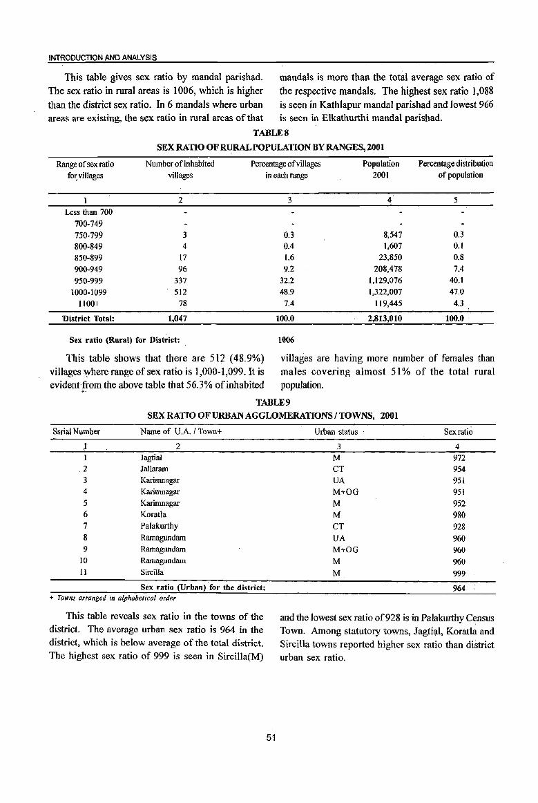
INTRODUCTION AND ANALYSIS
This table gives sex ratio by mandaI parishad. mandais is more than the total average sex ratio of
The sex ratio in rural areas is 1006, which is higher the respective mandals. The highest sex ratio 1,088 than the district sex ratio. In 6 mandals where urban is seen in Kathlapur mandai parishad and lowest 966 areas are existing, the sex ratio in rural areas of that is seen in Elkathurthi mandai parishad.
TABLES
SEX RATIO OF RURAL POPULATION BY RANGES, 2001
Range of sex ratio Number of inhabited Percentage of villages Population Percentage distribution fo~villages villages
2
Less than 700
700-749
750-799 3
800-849 4
850-899 17
900-949 96
950-999 337
1000-1099 512
1100+ 78
'District Total: 1,047
Sex ratio (Rural) for District: ,
This table shows that there are 512 (48.9%) villages where range of sex ratio is 1,000-1,099. It is evident-from the above table that 56.3% of inhabited
"-
in each range 2001 of population
3 4 5
0.3 8,547 0.3
0.4 1,607 0.1 1.6 23,850 0.8
9.2 208,478 7.4
32.2 1,129,076 40.1
48.9 1,322,007 47.0
7.4 119,445 4.3
100.0 2,813,010 100.0 '
1006
villages are having more number of females than males covering almost 51 % of the total rural popUlation.
TABLE 9
SEX RATIO OF URBAN AGGLOMERATIONS I TOWNS, 2001
Ssrial Number Name of U.A. / Town+
1 2 1 Jagtial
,2 Jallaram 3 Karimnagar 4 Karirnnagar 5 Karimnagar 6 Koratla 7 Palakurthy 8 Ramagundam 9 RamagUndam
10 Ramagundam II Sircilla
Sex ratio (Urban) for the district: + Towns arranged in alphabetical order
This table reveals sex ratio in the towns of the district. The average urban sex ratio is 964 in the district, which is below average of the total district. The highest sex ratio of 999 is seen in Sircilla(M)
51
Urban status Sexrati~
3 4 M 972 CT 954 VA 951
M+OG 951
M 952
M 980
CT 928 UA 960 M+OG 960 M 960
M 999
964
and the lowest sex ratio of 928 is in Palakurthy C~nsus Town. Among statutory toWns, Jagtil).l, Koratla and Sircilla towns reported higher sex ratio than district urban sex ratio.

OISTRICTCEri4SUSAANb'B~ :~~GAR
SEX RATIO OF URBAN AGGLOMERATIONS/TOWNS, KARIMNAGAR DISTRICT, 2001
1000 999
980 980 972
Q 960 : ..
~ 940 ~ 920 ..
rIJ 900
~ ,-.,
~ ~'""' ~ ,-.,
~ l,-., ~ ~ !-< 6 r::; (.)
'" 0 '-' 2- 13 0 * '" ta la ·1 [ * '" 1 ] a .i> ~ la ~ >. bOO ~ 1 ~~
0
la OIl .. .!::l ..... .! '" 0
~ rIJ :a ::.G .! ::.G bO ~ .....,
'" ta ! ~ ::.G ::.G Il.. ~
Name of Urban Agglomerationstrowns
TABLE 10 SEX RATIO OF POPULATION IN THE AGE GROUP 0-6 FOR MANDALS, 2001
Sl. Name of Mandai Total / RuraU Total population in 0-6 age group Sex ratio for No. Urban Persons Males Females 0-6 age group
2 3 4 5 6 7
Ibrahimpatnam Total 7,105 3,629 3,476 958 Rural 7,105 3,629 3,476 958 Urban
2 Mallapur Total 6,581 3,370 3,211 953 Rural 6,581 3,370 3,211 953 Urban
3 Raikal Total 7,843 3,906 3,937 1,008 Rural 7,843 3,906 3,937 1,008 Urban
4 Sarangapur Total 5,733 2,887 2,846 986 Rural 5,733 2,887 2,846 986 Urban
5 Dharmapuri Total 10,309 5,197 5,112 984 Rural 10,309 5,197 5,112 984 Urban
6 Velgatoor Total 6,714 3,449 3,265 947 Rural 6,714 3,449 3,265 947 Urban
7 Ramagundam Total 32,392 16,535 15,857 959 Rural 5,011 2,551 2,460 964 Urban 27,381 13,984 13,397 958
8 Kamanpur Total 10,095 5,210 4,885 938 Rural 8,620 4,427 4,193 947 Urban 1,475 783 692 884
9 Manthani Total 6,772 3,432 3,340 973 Rural 6,772 3,432 3,340 973
Urban
10 Kataram Total 4,550 2,342 2,208 943 Rural 4,550 2,342 2,208 943 Urban
r
52

INTRODUCTION AND ANALYSIS
TABLE 10 (Contd .. )
SEX RATIO OFPOPULATION IN THE AGE GROUP O..() FOR MANDALS, 2001
SI. Name of MandaI Total / Total population in 0-6 age group Sex ratio for , ,
No. Rural/ Persons Males Females 0-6 age group Urban
I 2 3 4 5 6 7
11 Mahadevpur Total 5,227 2,634 2,593 984 Rural 5,227 2,634 2,593 984 Urban
12 Mutharam (Mahadevpur) Total 3,952 1,982 1,970 994 Rural 3,952 1,982 1,970 994 Urban
13 Malharrao Total 3,580 1,832 1,748 954 Rural 3,580 1,832 1,748 954 Urban
14 Mutharam (Manthani) Total 3,985 1,967 2,018 1,026 Rural 3,985 1,967 2,018 1,026 Urban
15 Srirnmpur Total 5,266 2,722 2,544 935 Rural 5,266 2,722 2,544 935 Urban
16 Peddapalle Total 12,914 6,652 6,262 941 Rural 12,914 6,652 6,262 941 Urban
17 Julapalle Total 6,312 3,188 3,124 980 Rural 6,312 3,188 3,124 980 Urban
18 Dharmaram Total 7,101 3,612 3,489 966 Rural 7,101 3,612 3,489 966 Urban
19 Gollapalle Total 5,917 2,940 2,977 1,013 Rural 5,917 2,940 2,977 1,013 Urban
20 Mallial Total 5,999 3,048 2,951 968 Rural 5,999 3,048 2,951 968 Urban
21 lagtial Total 19,585 10,063 9,522 946 Rural 8,817 4,530 4,287 946 Urban 10,768 5,533 5,235 946
22 Medipalle Total 7,029 3,568 3,461 970 Rural 7,029 - 3,568 3,461 970 Urban
23 Koratla Total 12,948 6,447 6,501 1,008 Rural 5,220 2,517 2,703 1,074 Urban 7,728 3,930 3,798 966
24 Metpalle Total 10,429 5,341 5,088 953 Rural 10,429 5,341 5,088 953 Urban
" "~".
25 Kathlapur Total 5,943 2,946 2,997 1,017 Rural 5,943 2,946 2,997 1,017 Urban
53

· DISTRICT CENSUS HANDEJOOK :KA~I~GAR
TABLE 10 (Contd •. ) SEX RATIO OF POPULATION IN THE AGE GROUP 0-6 FOR MANDALS,2001
SI. Name of MandaI Total I Total population in 0-6 age group Sex ratio for No. Rural! Persons Males Females 0-6 age group
Urban
I 2 3 4 S 6 7
26 Chandurthi Total 5,313 2,679 2,634 983 Rural 5,313 2,679 2,634 983 Urban
27 Kodimial Total 5,825 2,961 2,864 967 Rural 5,825 2,961 2,864 967 Urban
28 Pegadapalle Total 6,010 3,068 2,942 959 Rural 6,010 3,068 2,942 959 Urban
29 Gangadhara Total 6,055 3,132 2,923 933 Rural 6,055 3,132 2,923 933 Urban
30 Ramadugu Total 6,236 3,187 3,049 957 Rural 6,236 3,187 3,049 957 Urban
31 Choppadandi Total 6,407 3,263 3,144 964 RW'aI 6,407 3,263 3,144 964 Urban
32 Sultanabad Total 8,023 4,152 3,871 932 Rural 8,023 4,152 .3,871 932 Urban
33 Odcla Total 5,335 2,727 2,608 956 Rural 5,335 2,727 2,608 956 Urban
34 Manakondur Total 8,860 4,516 4,344 962 Rural 8,860 4,516 4,344 962 Urban
35 Karimnagar Total 36,738 18,924 17,814 941 Rural 9,748 5,004 4,744 948 Urban 26,990 13,920 13,070 939
36 BoinpaJlc Total 4,770 2,398 2,372 989 Rural 4,770 2,398 2,372 989 Urban
37 Vemulawada Total 9,889 5,116 4,773 933 Rural 9,889 5,116 4,773 933 Urban
38 Konaraopeta Total 5,720 2,957 2,763 934 Rural 5,720 2,957 2,763 934 Urban
39 Yellareddipet Total 8,103 4,146 3,957 954 Rural 8,103 4,146 3,957 954 Urban
40 Garnbhiraopet Total 5,821 2,970 2,851 960 Rural 5,821 2,970 2,851 960 Urban
54

INTRODUCTION AND ANALYSIS
TABLE 10 (Contd .. ) SEXRAUOOFPOPULATIONINTHEAGEGROUP 0-6 FORMANDALS ,2001
SI. Name of Mandai Total I Total ~o~ulation in 0-6 !!,ge 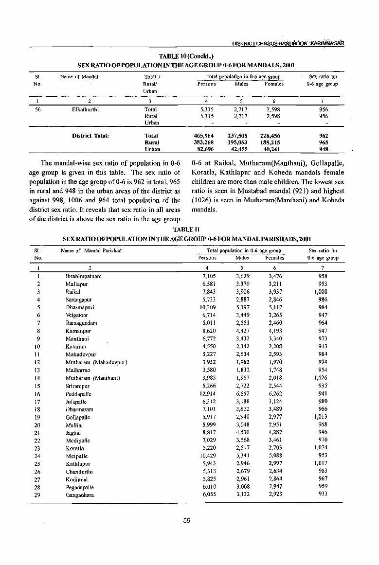
TABLE 10 (Concld .. )
SEX RATIO OF POPULATION IN THE AGE GROUP 0-6 FOR MANDAlS, 2001
SI. Name of Mandai Total! No. Rural!
Urban
2 3
56 Elkathurthi Total Rural Urban
District Total:· Total Rural Urban
The mandaI-wise sex ratio of population in 0-6 age group is given in this table. The sex ratio of population in the age group of 0-6 is 962 in total, 965 in rural and 948 in the urban areas of the district as against 998, 1006 and 964 total population of the
Total population in 0-6 age group Sex ratio for Persons Males Females 0-6 age group
4 5 6 7
5,315 2,717 2,598 956 5,315 2,717 2,598 956
465,964 237,508 228,456 962 383,268 195,053 188,215 965
82,696 42,455 40,241 . 948
0-6 at Raikal, Mutharam(Manthani), Gollapalle, Koratla, Kathlapur and Koheda mandals female children are more than male children. The lowest sex ratio is seen in Mustabad mandaI (921) and highest (1026) is seen in Mutharam(Manthani) and Koheda
district sex ratio. It reveals that sex ratio in all areas mandals. of the district is above the sex ratio in the age group
TABLE 11
SEX RATIO OF POPULATION IN THE AGE GROUP 0-6 FOR MANDALPARISHADS, 2001
SI. Name of Mandai Parishad Total population in 0-6 age group Sex ratio for No. Persons Males Females 0-6 age group
1 2 4 5 6 7
1 Ibrahimpatnam 7,105 3,629 3,476 958 2 Mallapur 6,581 3,370 3,211 953
3 Raikal 7,843 3,906 3,937 1,008 4 Sarangapur 5,733 2,887 2,846 986 5 Dharmapuri 10,309 5,197 5,112 984 6 Velgatoor 6,714 3,449 3,265 947
7 Ramagundam 5,011 2,551 2,460 964
8 Kamanpur 8,620 4,427 4,193 947
9 Manthani 6,772 3,432 3,340 973
10 Kataram 4,550 2,342 2,208 943
11 Mahadevpur 5,227 2,634 2,593 984
12 Mutharam (Mahadevpur) 3,952 1,982 1,970 994
13 Malharrao 3,580 1,832 1,748 954
14 Mutharam (Manthani) 3,985 1,967 2,018 1,026
15 Srirampur 5,266 2,722 2,544 935
16 Peddapalle 12,914 6,652 6,262 941
17 Julapalle 6,312 3,188 3,124 980
18 Dharmaram 7,101 3,612 3,489 966
19 Gollapalle 5,917 2,940 2,977 1,013
20 Mallial 5,999 3,048 2,951 968
21 Jagtial 8,817 4,530 4,287 946
22 Medipalle 7,029 3,568 3,461 970
23 Koratla 5,220 2,517 2,703 1,074
24 Metpalle 10,429 5,341 5,088 953
25 Kathlapur 5,943 2,946 2,997 1,017
26 Chandurthi 5,313 2,679 2,634 983
27 Kodimial 5,825 2,961 2,864 967
28 PegadapalJe 6,010 3,068 2,942 959
29 Gangadbara 6,055 3,132 2,923 933
56
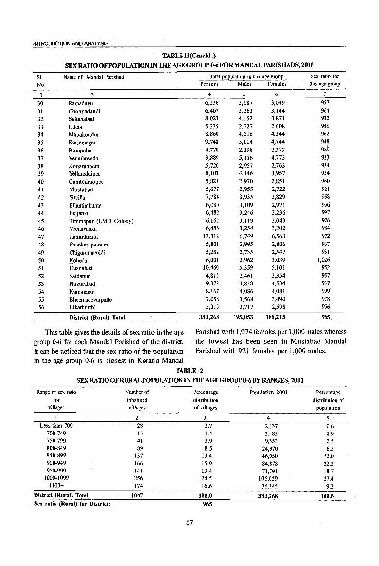
INTRODUCTION AND ANALYSIS
TABLE ll(Concld •. )
SEX RATIO OF POPULATION IN THE AGE GROUP 0-6 FOR MANDALPARISHADS, 2001
SI. Name of Mandal Parishad Total Eoeulation in 0-6 a~e groue Sex ratio for
No. Persons Males Females 0-6 age: group
1 2 4 5 6 7:
30 Ramadugu 6,236 3,187 3,049 957
31 Choppadandi 6,407 3,263 3,144 964
32 Sultanabad 8,023 4,152 3,871 932
33 Odeta 5,335 2,727 2,608 956
34 Manakondur 8,860 4,516 4,344 962
35 Karimnagar 9,748 5,004 4,744 948
36 Boinpalle 4,770 2,398 2,372 989
37 Vemulawada 9,889 5,116 4,773 933
38 Konaraopeta 5,720 2,957 2,763 934
39 YeUareddipet 8,103 4,146 3,957 954
40 Gambhiraopet 5,821 2,970 2,851 960
41 Mustabad 5,677 2,955 2,722 921
42 Sircilla 7,784 3,955 3,829 968
43 Ellanthakunta 6,080 3,109 2,971 956
44 Belianki 6,482 3,246 3,236 997
45 Timmapur (LMD Colony) 6,162 3,119 3,043 976
46 Veenavanka 6,456 3,254 3,202 984
47 Jarnmikunta 13,312 6,749 6,563 972
48 Shankarapatnarn 5,801 2,995 2,806 937
49 Chigurumarnidi 5,282 2,735 2,547 931
50 Koheda 6,00] ""':.
2,962 3,039 1,026
51 Husnabad 10,460 5,359 5,101 952
52 Saidapur 4,815 2,461 2,354 957
53 Huzurabad 9,372 4,838 4,534 937
54 Kamalapur 8,167 4,086 4,081 999
55 13heemadevarpalle 7,058 3,568 3,490 978!
56 Elkathurthi 5,315 2,717 2,598 956
District (Rural) Total: 383,268 195,053 188,215 965
This table gives the details of sex ratio in the age Parishad with 1,074 females per 1,000 males whereas
group 0-6 for each Mandai Parishad of the district. . the lowest has been seen in Mustabad MandaI
It can be noticed that the sex ratio of the population Parishad with 921 females per 1,000 males. in the age group 0-6 is highest in Koratla MandaI
TABLE 12
SEX RATIO OF RURAL POPULATION IN THE AGE GROUP 0-6 BY RANGES, 2001
Range of sex ratio Number of
for inhabited villages villages
2
Less than 700 28 700-749 15 750-799 41 800-849 89 S50-899 137 900-949 166 950-999 141
1000-1099 256 1100+ 174
District (Rural) ~}a) . 1047 Sex ratio (Rural) for District:
Percentage
distribution of villages
3 2.7 1.4 3.9 8.5
13.4 15.9 13.4 21.5 16.6
100.0
965
57
Population 2001
4
2,337 3,485 9,553
24,970 46,050 84,878 71,791
105,059 35,145
383,268
Percentage
distribution of population
5
0.6 0.9 2.5 6.5
12.0 22.2 18.7 27.4 9.2
100.0

DISTRICT CENSUS HArlJDB00~ :KARiMNAGAR
This table shows that in 41.1 % villages, female to total inhabited villages are in the range of sex ratio children in the age group 0-6 are either equal or more 950-999, in which the district average sex ratio (965) than the male children. 141 villages forming 13.4% has also fallen.
TABLE 13
SEX RATIO OF POPULATION IN THE AGE GROUP 0-6 OF URBAN AGGWMERATIONSrrOWNS, 2001
S1. Name of UAAffown+ Urban status Total population in 0-6 age group Sex ratio for
No. of town Persons Males Females 0-6 age group
2 3 4 5 6 7
1 Jagtial M 10,768 5,533 5,235 946
2 Jallaram CT 1,316 690 626 907
3 Karimnagar UA 26,990 13,920 13,070 939 4 Karimnagar M+OG 26,990 13,920 13,070 939 5 (i)Karimnagar * M 25,309 13,062 12,247 938
6 Koratla M 7,728 3,930 3,798 966
7 Palakurthy CT 907 477 430 901 8 Ramagundarn UA 26,633 13,600 13,033 958 9 Rarnagundam M+OG 26,633 13,600 13,033 958
10 (i)Rarnagundarn * M 26,474 13,507 12,967 960
11 SirciIla M 8,354 4,305 4,049 941
District(Urban) Total 82,696 42,455 40,241 948 + Towns a"anged in alphabetical order " The names of constituents of VA are given separately * In case of the towns having out growth an asterisk mark placed against their name to indicate that thay have out growths which are not
seprate towns.
The above table gives the details of sex ratio of
population in the age group 0-6 of Urban lowest sex ratio i.e., 901. The highest sex ratio of 966 is seen in Koratla(M) and the same is also higher
Agglomerations/Towns recorded in 2001 Census. It than the district urban sex ratio. is noticed that Palakurthy Census town reported
TABLE 14
NUMBERAND PERCENTAGE OF SCHEDULED CASfESAND SCHEDULED TRIBES POPULATION IN MANDALS,2001
SI.No. Name of Mandai Total! Total Total Total Percentage of Rural! Population Scheduled Scheduled Scheduled Castes Urban Castes Tribes popUlation to
population popUlation total population
2 3 4 5 6 7
Ibrahimpatnam Total 50,845 7,509 1,684 14.8 Rural 50,845 7,509 1,684 14.8 Urban
2 Mallapur Total 49,575 8,294 2,633 16.7 Ruml 49,575 8,294 2,633 16.7 Urban
3 Raikal Total 58,807 7,666 3,743 13 Rural 58,807 7,666 3,743 13 Urban
4 Sarangapur Total 40,881 7,400 2,240 18.1 Ruml 40,881 7,400 2,240 18.1 U!"~an
5 Dharmapuri Total 73,230 15,648 588 21.4
Ruml 73,230 15,648 588 21.4
Urban
58
Percentage of Scheduled Tribes
population to total population
8
3.3 3.3
5.3 5.3
6.4 6.4
5.5 5.5
0.8 0.8

INTRODUCTION AND ANALYSIS
TABLE 14 (Contd .• )
NUMBERANDPERCENTAGEOFSCHEDULEDCASTESAND SCHEDULEDTRIBESPOPULATIONINMANDALS,2001
SI.No. Name of Mandai Total! Total Total Total Percentage of Percentage of Rural/ Population Scheduled Scheduled Scheduled Castes Scheduled Tribes
Urban Castes Tribes population to population to population population total population total pqpulation .
1 2 3 4 5 6 7 8
6 Velgatoor Total 47,229 13,520 145 28.6 '0.3 Rural 47,229 13,520 145 28.6 0.3 Urban
7 Ramagundam Total 279,323 56,996 4,001 20.4 ' 1.4 Rural 35,756 8,841 474 24.7 1.3 Urban 243,567 48,155 3,527 19.8 1.4
8 Kamanpur Total 74,474 1l,457 1,851 15.4 2.5 Rural 62,378 9,641 1,423 15.5 2.3 Urban 12,096 1,816 428 15 3.5
9 Manthani Total 50,405 1l,279 1,149 22.4 2.3 Rural 50,405 11,279 1,149 22.4 2.3 Urban
to Kataram Total 31,259 10,278 2,360 32.9 7.5 Rural 31,259 10,278 2,360 32.9 7.5 Urban
II Mahadevpur Total 35,325 8,193 5,193 23.2 14~7 Rural 35,325 8,193 5,193 23.2 14.7 Urban
12 Mutharam (Mahadevpur) Total 23,327 6,606 7,681 28.3 32.'9 Rural 23,327 6,606 7,681 28.3 32.9 Urban
13 Malharrao Total 23,843 5,039 2,089 21.1 8.8 Rural 23,843 5,039 2,089 21.1 8.8 Urban
14 Mutharam (Manthani) Total 28,628 3,912 535 13.7 1.9 Rural 28,628 3,912 535 13.7 1.9 Urban
15 Srirampur Total 37,272 6,350 188 17 0.5 Rural 37,272 6,350 188 17 0.5 Urban
16 PeddapaUe Total 90,830 13,973 730 15.4 0.8 Rural 90,830 13,973 730 15.4 0.8 Urban
17 JulapaUe Total 45,094 10,446 283 23.2 0.6 Rural 45,094 10,446 283 23.2 0.6 Urban
....... ""~"'.:;."
18 Dharrnaram Total 49,636 10,432 2,755 21 5.6 Rural 49,636 10,432 2,755 21 5.6 Urban
59
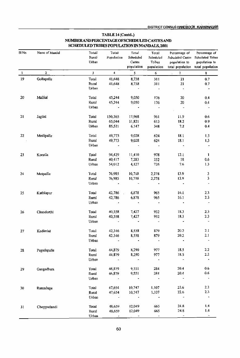
DISTRICTCEN5U5 HAN08od1t :KAAI~
TABLE 14 (Contd .. )
NUMBERANDPERCENTAGEOFSCHEDULEDCASTESAND SCHEDULED1RIBESPOPULATIONINMANDALS,2001
SI.No. Name of MandaI Total! Total Total Total Percentage of Percentage of Rural! Population Scheduled Scheduled Scheduled Castes Scheduled Tribes Urban Castes Tribes population to population to
population population total population total popUlation
2 3 4 5 6 7 8
19 GollapaUe Total 41,648 8,738 311 21 0.7 Rural 41,648 8,738 311 21 0.7 Urban
20 Mallial Total 45,244 9,050 176 20 0.4 Rural 45,244 9,050 176 20 0.4 Urban
21 Jagtial Total 150,565 17,968 961 11.9 0.6 Rural 65,044 II,821 613 18.2 0.9 Urban 85,521 6,147 348 7.2 0.4
22 MedipaUe Total 49,773 9,028 624 18.1 1.3 Rural 49,773 9,028 624 18.1 1.3 Urban
23 Koratla Total 94,429 11,410 978 12.1 1 Rural 40,417 7,283 252 18 0.6 Urban 54,012 4;127 726 7.6 1.3
24 Metpalle Total 76,985 10,718 2,278 13.9 3 Rural 76,985 10,718 2,278 13.9 3 Urban
25 Kathlapur Total 42,786 6,878 965 16.1 2.3 Rural 42,786 6,878 965 16.1 2.3 Urban
26 Chandurthi Total 40,558 7,427 932 18.3 2.3
Rural 40,558 7,427 932 18.3 2.3 Urban
27 Kodimial Total 42,346 8,538 879 20.2 2.1
Rural 42,346 8,538 879 20.2 2.1
Urban
28 Pegadapalle Total 44,879 8,290 977 18.5 2.2
Rural 44,879 8,290 977 18.5 2.2
Urban
29 Gangadhara Total 46,879 9,551 284 2004 0.6
Rural 46,879 9,551 284 2004 0.6
Urban
30 Ramadugu Total 47,654 10,747 1,107 22.6 2.3
Rural 47,654 10,747 1,107 22.6 2.3
Urban
31 Choppadandi Total 48,659 12,049 665 24.8 1.4
Rural 48,659 12,049 665 24.8 104
Urban
60
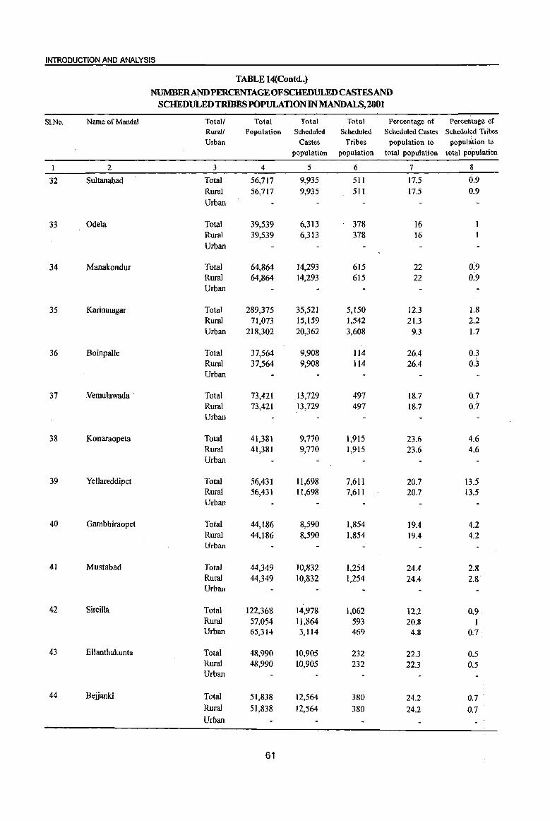
INTRODUCTION AND ANALYSIS
TABLE 14(Contd..)
NUMBERANDPERCENTAGEOFSCHEDULEDCASfESAND SCHEDUl,EDTRlBES POPULATION IN MANDALS,2001
SI.No. Name of MandaI Total! Total Total Total Percentage of Percentage of Rural! Population Scheduled Scheduled Scheduled Castes Scheduled Tribes Urban Castes Tribes population to population to
population population total population total population
I 2 3 4 5 6 7 8
32 Sultanabad Total 56,717 9,935 511 17.5 0.9
Rural 56,717 9,935 511 17.5 0.9
Urban
33 Odela Total 39,539 6,313 378 16 Rural 39,539 6,313 378 16 Urban
34 Manakondur Total 64,864 14,293 615 22 0.9 Rural 64,864 14,293 615 22 0:9 Urban
35 Karimnagar Total 289,375 35,521 5,150 12.3 1.8 Rural 71,073 15,159 1,542 21.3 2.2 Urban 218,302 20,362 3,608 9.3 1.7
36 Boinpalle Total 37,564 9,908 114 26.4 0.3 Rural 37,564 9,908 114 26.4 0.3 Urban
37 Vemulawada . Total 73,421 13,729 497 18.7 0.7 Rural 73,421 13,729 497 18.7 0.7 Urban
38 Konaraopeta Total 41,381 9,770 1,915 23.6 4.6 Rural 41,381 9,770 1,915 23.6 4.6 Urban
39 Yellareddipet Total 56,431 11,698 7,611 20.7 13.5 Rural 56,431 1l,698 7,611 20.7 U.s Urban
40 Gambhiraopet Total 44,186 8,590 1,854 19.4 4.2 Rural 44,186 8,590 1,854 19.4 4.2 Urban
41 Mustabad Total 44,349 10,832 1,254 24.4 2.8 Rural 44,349 10,832 1,254 24.4 2.8 Urban
42 Sircilla Total 122,368 14,978 1,062 12.2 0.9 Rural 57,054 11,864 593 20.8 I Urban 65,314 3,114 469 4.8 0.7
43 Ellanthakunta Total 48,990 10,905 232 22.3 0.5 Rural 48,990 10,905 232 22.3 0.5 Urban
44 Bejjanki Total 51,838 12,564 380 24.2 0.7 .
Rural 51,838 12,564 380 24.2 0.7 Urban
61
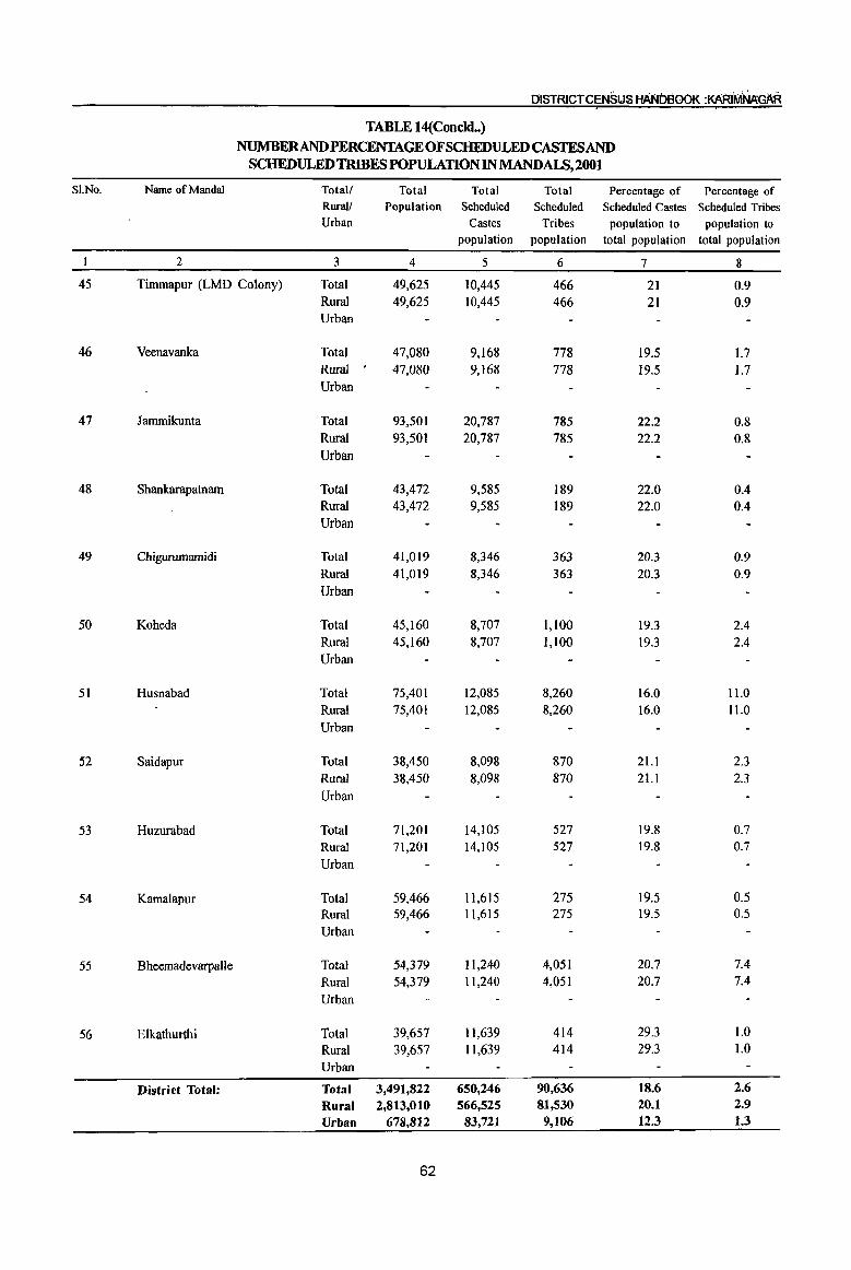
OISTRICTCENSIJS HANDBOOK :KARIMNAGAR
TABLE 14(Concld .• ) NUMBERANDPERCENTAGEOFSCHEDULEDCASfESAND
SCHEDULED TRIBES POPULATION IN MANDALS,2001
SI.No. Name of Mandai Total/ Total Total Total Percentage of Percentage of RuraV Population Scheduled Scheduled Scheduled Castes Scheduled Tribes Urban Castes Tribes population to population to
population population total population total population
2 3 4 5 6 7 8
45 Timmapur (LMD Colony) Total 49,625 10,445 466 21 0.9 Rural 49,625 10,445 466 21 0.9 Urban
46 Veenavanka Total 47,080 9,168 778 19.5 1.7 Rural . 47,080 9,168 778 19.5 1.7 Urban
47 Jammikunta Total 93,501 20,787 785 22.2 0.8 Rural 93,501 20,787 785 22.2 0.8
Urban
48 Shankarapatnam Total 43,472 9,585 189 22.0 0.4 Rural 43,472 9,585 189 22.0 0.4 Urban
49 Chigurumamidi Total 41,019 8,346 363 20.3 0.9
Rural 41,019 8,346 363 20.3 0.9
Urban
50 Koheda Total 45,160 8,707 1,100 19.3 2.4
Ruml 45,160 8,707 1,100 19.3 2.4
Urban
51 Husnabad Total 75,401 12,085 8,260 16.0 11.0
Rural 75,401 12,085 8,260 16.0 11.0
Urban
52 Saidapur Total 38,450 8,098 870 21.1 2.3
Rural 38,450 8,098 870 21.1 2.3
Urban
53 Huzurabad Total 71,201 14,105 527 19.8 0.7
Rural 71,201 14,105 527 19.8 0.7
Urban
54 Kamalapur Total 59,466 11,615 275 19.5 0.5
Rural 59,466 1l,615 275 19.5 0.5
Urban
55 Bheemadevarpalle Total 54,379 Il,240 4,051 20.7 7.4
Rural 54,379 11,240 4,051 20.7 7.4
Urban
56 Elkathurthi Total 39,657 11,639 414 29.3 1.0 Ruml 39,657 11,639 414 29.3 1.0 Urban
District Total: Total 3,491,822 650,246 90,636 18.6 2.6
Rural 2,813,010 566,525 81,530 20.1 2.9
Urban 678,812 83,721 9,106 12.3 1.3
62
INTRODUCTION AND ANALYSIS
This table shows the number and percentage of Schedule Castes and Schedule Tribes population in the mandals recorded during 200 I census. Out of district total population of34 ,91,822, the SCs and STs constituted 18.6 and 2.6 percent respectively. In rural areas of the district the SCs accounted 20.1 %
whereas in urban areas they are 12.3%. In respect of STs, they accounted 2.9% in rural and 1.3% in urban areas of the total population. Their percentage is more in rural areas than urban.
recorded with 32.9% followed by Elkathurthi mandaI with 29.3% and Velgatoor mandaI with 28.6%. The lowest percentage ofSCs recorded in Jagtial, Koratla and S ircilla mandals with 11.9, 12.1 and 12.1 respectively.
In Kataram mandaI the highest number of SCs
In Mutharam (Mahadevpur) mandaI the highest number of STs recorded with 32.9% of the total population followed by Mahadevpur with 14.7% and Yellareddipet mandaI with 13 .5%. The aowest percentage of STs recorded in the mandals of Velgatoor and Boinpalle with 0.3% each.
TOTAL, SC & STPOPULATION - KARIMNAGAR DISTRICT: 2001
10 Others 1tI Scheduled Castes ~ Scheduled Tribes I Scheduled Tribes, 90,636 ----~~~~~
Scheduled Castes, 650,246
Total Population of the District :3491822
... ' .... -.................... ~ ...... -.. · •• :::::.: •• :::.::::::qtiiet~;}~1.~~;?~:O::::::::::::··
.... ' .. , ..... _ ....... _ ......... _ ... - .. ,.,' :-:<-:«<-:<.»:.>:-:-~-:-:<-:.>:-:-:-: ..
............ ..... ....... _ ..
TABLE 15
NUMBER AND PERCENTAGE OF SCHEDULED CASTES AND SCHEDULED TRIBES POPULATION IN MANDAL PARISHADS, 2001
SI.No. Name of Mandai Parishad Total Population
Total Total Percentage of Percentage of Scheduled Scheduled Scheduled Castes Scheduled Tribes
Castes Tribes population to popUlation to popUlation population total popUlation total popUlation
I 2 3 4 5 6 7 I Ibrahimpatnam 50,845 7,509 1,684 14.8 3.3
2 Mallapur 49,575 8,294 2,633 16.7 5.3
3 Raikal 58,807 7,666 3,743 13.0 6.4 4 Sarangapur 40,881 7,400 2,240 18.1 5.5
5 Dharmapuri 73,230 15,648 588 21.4 0.8 6 Veigafoor 47,229 13,520 145 28.6 0.3 7 Ramagundam 35,756 8,841 474 24.7 1.3 8 Kamanpur 62,378 9,641 1,423 15.5 2.3 9 Manthani 50,405 11,279 1,149 22.4 2.3
10, Kataram 31,259 10,278 2,360 32.9 7.5 11 Mahadevpur 35,325 8,193 5,193 23.2 14.7 12 Mutharam (Mahadevpur) 23,327 6,606 7,681 28.3 32.9 13 Malharrao 23,843 5,039 ·· .. ···2;-1)8·9 21.1 8.8 14 Mutharam (Manthani) 28,628 3,912 535 13.7 1.9;
63

DISTRICT CENSUS HAt'JOSOOK :KAR1MAAtlAR
TABLE 15(Concld •• )
NUMBER AND PERCENTAGE OF SCHEDULED CASTES AND SCHEDULED TRIBES POPULATION IN MANDALPARISHADS, 2001
SLNo. Name of Mandal Parishad Total Total Total Percentage of Percentage of Population Scheduled Scheduled Scheduled Castes Scheduled Tribes
Castes Tribes population to population to population population total population total population
I 2 3 4 5 6 7 15 Srirampur 37,272 6,350 188 17.0 0.5 16 Peddapalle 90,830 13,973 730 15.4 0.8 17 Julapalle 45,094 10,446 283 23.2 0.6
18 Dh3l1l1aram 49,636 10,432 2,755 21.0 5.6
19 Gollapalle 41,648 8,738 311 21.0 0.7
20 Mallial 45,244 9,050 176 20.0 0.4
21 Jagtial 65,044 11,821 613 18.2 0.9
22 MedipaUe 49,773 9,028 624 18.1 1.3 23 Koratla 40,417 7,283 252 18.0 0.6
24 Metpalle 76,985 10,718 2,278 13.9 3.0
25 Kathlapur 42,786 6,878 965 16.1 2.3
26 Chandurthi 40,558 7,427 932 18.3 2.3
27 Kodimial 42,346 8,538 879 20.2 2.1
28 Pegadapalle 44,879 8,290 977 18.5 2.2
29 Gangadhara 46,879 9,551 284 20.4 0.6
30 Ramadugu 47,654 10,747 1,107 22.6 2.3
31 Choppadandi 48,659 12,049 665 24.8 1.4
32 Sultanabad 56,717 9,935 511 17.5 0.9
33 Odela 39,539 6,313 378 16.0 1.0
34 Manakondur 64,864 14,293 615 22.0 0.9
35 Karimnagar 71,073 15,159 1,542 21.3 2.2
36 Boinpalle 37,564 9,908 114 26.4 0.3
37 Vemulawada 73,421 13,729 497 18.7 0.7
38 Konaraopeta 41,381 9,770 1,915 23.6 4.6
39 Yellareddipet 56,431 11,698 7,611 20.7 13.5
40 Gambhiraopet 44,186 8,590 1,854 19.4 4.2
41 Mustabad 44,349 10,832 1,254 24.4 2.8
42 Sircilla 57,054 11,864 593 20.8 1.0
43 Ellanthakunta 48,990 10,905 232 22.3 0.5
44 Beiianki 51,838 12,564 380 24.2 0.7
45 Timmapur (LMD Colony) 49,625 10,445 466 21.0 0.9
46 Veenavanka 47,080 9,168 778 19.5 1.7
47 lammikunta 93,501 20,787 785 22.2 0.8
48 Shankarapatnam 43,472 9,585 189 22.0 0.4
49 Chigurumamidi 41,019 8,346 363 20.3 0.9
50 Koheda 45,160 8,707 1,100 19.3 2.4
51 Husnabad 75,401 12,085 8,260 16.0 11.0
52 Saidapur 38,450 8,098 870 21.1 2.3
53 Huzurabad 71,201 14,105 527 19.8 0.7
54 Kamalapur 59,466 11,615 275 19.5 0.5
55 BheemadevarpaJIe 54,379 11,240 4,051 20.7 7.4
56 Elkathurthi 39,657 11,639 414 29.3 1.0
District (Rural) Total: 2,813,010 566,525 81,530 20.1 2.9
64

INTRODUCTION AND ANALYSIS
The table reveals the percentage distribution of noticed in Mutharam(Mahadevpur) Mandai Parishad SC & ST population among the MandaI Parishads with 32.9% followed by Mahadevpur with 14.7% (CD Blocks). The highest percentage of SC which were higher than district average ST population has been noticed in Kataram MandaI population. The lowest SC population has been Parishad with 32.9% followed by Elkathurthi with recorded in Raikal Mandai Parishad with 13.7% while 29.3% which were higher than district average SC the lowest ST population in Boinpalle and Velgatoor population. Likewise, highest ST population has been MandaI Parishads with 0.3% each.
TABLE 16
PROPORTION OF SCHEDULED CASTES POPULATION TO TOTAL POPULATION IN VILLAGES, 2001
Percentage range of Number of Scheduled Castes Population villages
to total population
2
Nil 19
Less than 5 10
5-10 82
11-20 450
21-30 329
31-40 94
41-50 30
51-75 28
76 and above 5
District Total 1,047
The above table shows Proportion of SC .population to total population in villages. As per this table 450 villages are under 11-20 percentage range of Scheduled Castes population to total population accounted 43.0% to total Villages. In this range, SC
Percentage Scheduled Percentage Castes
Population
3 4 5
1.8
1.0 335 0.1
7.8 21,868 3.9
43.0 2,36,272 41.7
31.4 2,22,843 39.3
9.0 51,5ll 9.1
2.9 17,080 3.0
2.7 14,016 2.5
0.4 2,600 0.4
100.0 5,66,525 100.0
population existed 2,36,272 persons with 41. 7% ~o total rural population of the district. 329 villages are having 21-30% SC population. There are 19 villages without SC population and 5 villages are seen in the range of 76 and above.
TABLE 17
PROPORTION OF SCHEDULED TRIBES POPULATION TO TOTAL POPULATION IN Vll.LAGES, 2001
Percentage range of Number of Scheduled Tribes Population villages
to total population
2 Nil 309
Less than 5 541
5-10 75 H-20 48 21-30 16 31-40 16 41-50 16 51-75 13
76 and above 13 District Total 1,047
This table shows proportion of ST population to total Population in villages. As per this table, there are 309 villages without any ST population. The highest no.of villages i.e., 541 villages constituting
65
Percentage Scheduled Percentage Tribes
Population
3 4 5 29.5
51.7 19,601 24.0 7.2 11,975 14.7 4.6 16,701 20.5 1.5 5,901 7.2 I.5 8,659 10.6 1.5 9,966 12.2 L3 4,541 5.6 1.2 4,186 5.2
100.0 81,530 100.0
24% ST population are in the range of less than 5%. In the range of 51 and above 26 villages have returned 10.8% of ST population. C
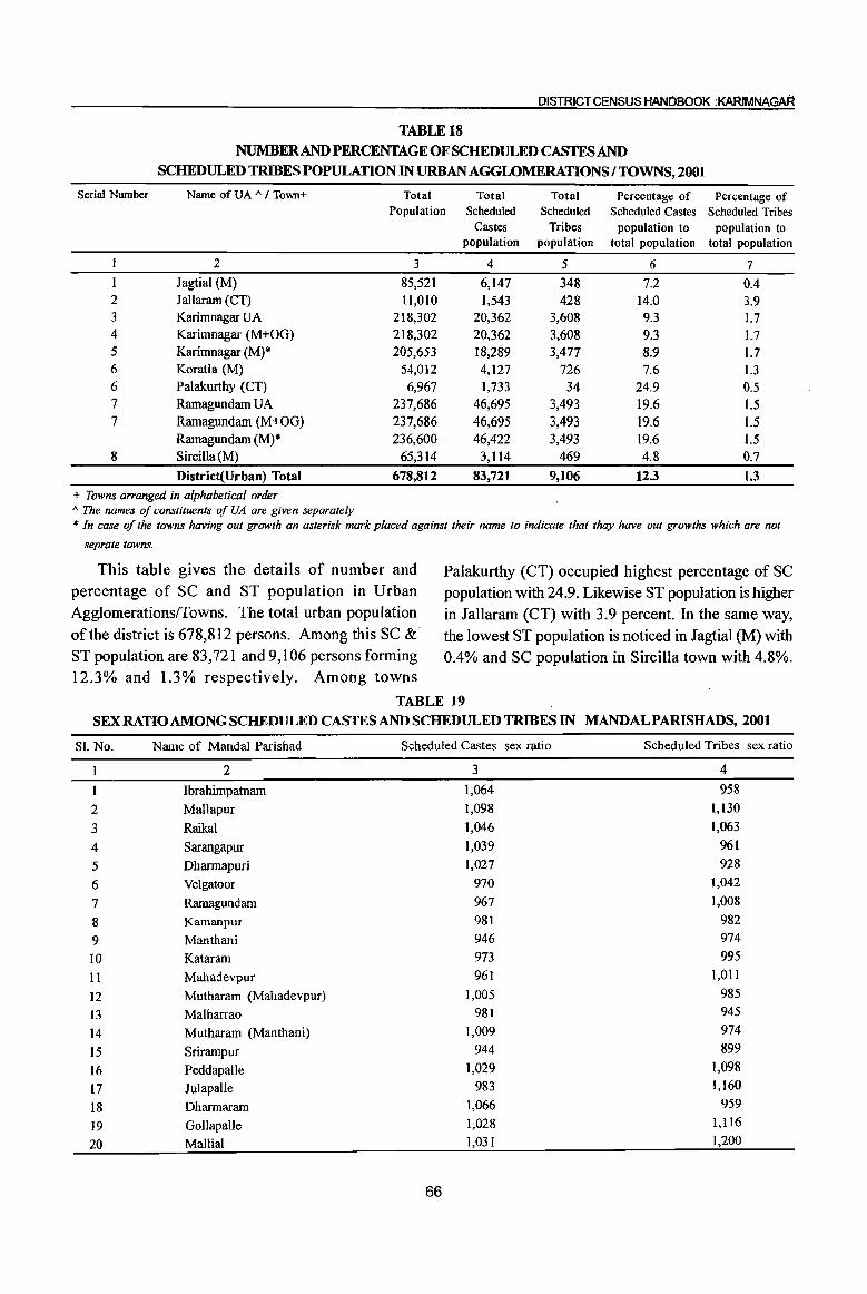
DISTRICT CENSUS HANDBOOk :KARlMNAGAR
TABLEt8
NUMBER AND PERCENTAGE OF SCHEDULED CASTES AND
SCHEDULED TRIBES POPULATION IN URBAN AGGWMERATIONS I TOWNS, 2001
Serial Number Name ofUA A / Town+ Total Total Total Percentage of Percentage of Population Scheduled Scheduled Scheduled Castes Scheduled Tribes
Castes Tribes population to population to population population total population total population
2 3 4 5 6 7
lagtial (M) 85,521 6,147 348 7.2 0.4 2 lallaram (CT) 11,010 1,543 428 14.0 3.9 3 Karimnagar VA 218,302 20,362 3,608 9.3 1.7 4 Karimnagar (M+OG) 218,302 20,362 3,608 9.3 1.7 5 Karimnagar (M)* 205,653 18,289 3,477 8.9 1.7 6 Koratla (M) 54,012 4,127 726 7.6 1.3 6 Palakurthy (CT) 6,967 1,733 34 24.9 0.5 7 Ramagundam UA 237,686 46,695 3,493 19.6 1.5 7 Ramagundam (M+OG) 237,686 46,695 3,493 19.6 1.5
Ramagundam (M)* 236,600 46,422 3,493 19.6 1.5 8 Sircilla(M) 65,314 3,1l4 469 4.8 0.7
District(Urban) Total 678,812 83,721 9,106 12.3 1.3
+ Towns arranged in alphabetical order A The names oj constituents oj VA are given separately * In case oj the towns having out growth an asterisk mark placed against their name to indicate that thay have out growths which are not
seprate towns.
This table gives the details of number and percentage of SC and ST population in Urban Agglomerations!fowns. The total urban population of the district is 678,812 persons. Among this SC & ST population are 83,721 and 9,106 persons forming 12.3% and 1.3% respectively. Among towns
Palakurthy (CT) occupied highest percentage of SC population with 24.9. Likewise ST population is higher in Jallaram (CT) with 3.9 percent. In the same way, the lowest ST population is noticed in Jagtial (M) with 0.4% and SC population in Sircilla town with 4.8%.
TABLE 19 SEX RATIO AMONG SCHEDULED CASTES AND SCHEDULED TRffiES IN MANDALPARISHADS, 2001
Sl. No.
2 3 4
5
6
7
8
9
IO
11 12
13
14
15
16
17
18
19
20
Name of Mandai Parishad
2
Ibrahimpatnam
Mallapur
Raikal Sarangapur
Dharmapuri
Velgatoor
Ramagundam
Kamanpur
Manthani
Kataram
Mahadevpur
Mutharam (Mahadevpur)
Malharrao
Mutharam (Manthani)
Srirampur
Peddapalle
Julapalle
Dharmaram
GollapaUe
Mallial
Scheduled Castes
3
1,064
1,098
1,046
1,039
1,027
970
967
981
946
973
961
1,005
981
1,009
944
1,029
983
1,066
1,028
1,031
66
sex ratio Scheduled Tribes sex ratio
4
958
1,130
1,063
961
928
1,042
1,008
982
974
995 1,011
985
945
974
899
1,098 1,160
959
1,116
1,200

fNTRODUCTION AND ANALYSIS
TABLE 19(Concld •• ) SEX RATIO AMONG SCHEDULEJi) CASTES AND SCHEDULED TRIBES IN MANDAL PARISHADS, 2001
Sl. No. Name of Mandai Parishad Scheduled Castes sex ratio Scheduled Tribes sex ratio
1 2
21 Jagtial
22 Medipalle
23 Koratla
24 Metpalle
25 Kathlapur
26 Chandurthi
27 Kodimial
28 PegadapalJe
29 Gangadhara
30 Ramadugu
31 Choppadandi
32 Sultanabad
33 Odela
34 Manakondur
35 Karimnagar
36 Boinpalle
37 Vemulawada
38 Konaraopeta
39 Yellareddipet
40 Gambhiraopet
41 Mustabad
42 Sircilla 43~ Ellanthakunta
44 Bejjanki
45 Timmapur (LMD Colony)
46 Veenavanka
47 Jammikunta 48' , . Shankarapatnam
.. 49 Chigururnarnidi
50 Koheda
51 Husnabad
52 Saidapur
53 Huzurabad 54 Kamalapur
55 Bheemadcvarpalle
56 Elkathurthi
District (Rural) Sex ratio
The sex ratio among the SCs and STs is given at Mandai Parishad level. The sex ratio of SC and ST in rural areas of Karimnagar district is 997 and 985 respectively while it is 998 in respect of total population. It shows that sex ratio among total, SC and ST population is almost in the same range except in few cases. The lowest sex ratio 921 and 679 among SCs, and STs are reported in Choppadandi MandaI Parishad. The highest sex ratio 1,098 among SCs is
67
3 1,030 1,003 1,035 1,052
1,104 1,023 1,030
998 971 988 921 965 991 974 991
1,013 997 985
1,018 1,036
984 995
1,016 1,046 1,018
993 968 989 926 950 937 964 994 971
1,003 946
997
4 1,037 1,013
924 979
1,019 838 993 978
1,029 973 679 907 938 971
1,034 1,036
861 980
1,024 1,033
987 957 933
1,021 918
1,010
1,082 835
1,051 1,033
927 847 996 910
957
1,020
985
in Mallapur Mandai Parishad and 1,160 among STs in Julapalle Mandai Parishad. Among SCs females are more than maJes in 25 MandaI Parishads. As regards, ST population is concerned females are more in 23 MandaI Parishads. In 29 MandaI Parishads sex ratio of SCs is lower than district average sex ratio (SC) Like-wise in 28 Mandal Parishads' sex ratio of STs is lower than district average sex ratio.
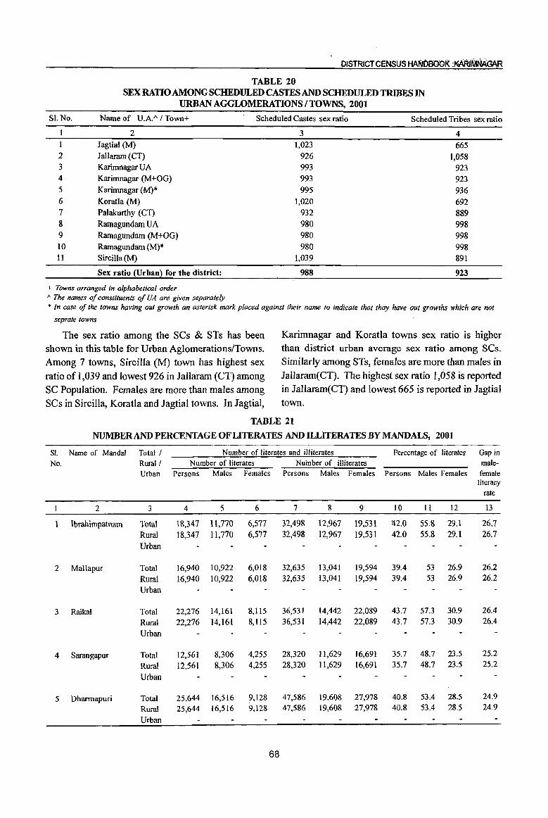
DISTRICT CENSUS HANDBOOK :MRIMAAGAR
TABLE 20 SEX RATIO AMONG SCHEDULED CASTES AND SCHEDULED TRIBES IN
URBAN AGGLOMERATIONS I TOWNS, 2001
SLNo. Name of U.A./\ / Town+ Scheduled Castes sex ratio Scheduled Tribes sex ratio
2 3 4 I Jagtial (M) 1,023 665 2 Jallaram (CT) 926 ],058 3 Karimnagar UA 993 923 4 Karimnagar (M+OG) 993 923 5 Karimnagar (M)* 995 936 6 Koratla (M) 1,020 692 7 Palakurthy (CT) 932 889 8 Ramagundam UA 980 998 9 Ramagundam (M+OG) 980 998 10 Ramagundam (M)* 980 998 11 Sircilla(M) 1,039 891
Sex ratio (Urban) for the district: 988 923
+ Towns arranged in alphabetical order 1\ The names of constituents of UA are given separately * In case of the towns having out growth an asterisk mark placed against their name to indicate that thay have out growths which are not
seprate towns
The sex ratio among the SCs & STs has been Karimnagar and Koratla towns sex ratio is higher shown in this table for Urban Aglomerations/Towns. than district urban average sex ratio among SCs. Among 7 towns, Sircilla (M) town has highest sex Similarly among STs, females are more than males in ratio of 1,039 and lowest 926 in Jallaram (CT) among Jallaram(CT). The highest sex ratio 1,058 is reported SC Population. Females are more than males among in Jallaram(CT) and lowest 665 is reported in Jagtial SCs in Sircilla, Koratla and Jagtial towns. In Jagtial, town.
TABLE 21
NUMBERAND PERCENTAGE OF LITERATES AND ILLITERATES BY MANDALS, 2001
81. Name of Mandai Total / No. Rural!
Urban
2 3
Ibrahimpatnam Total Rural
Urban
2 Mallapur Total
3 Raikal
4 Sarangapur
5 Dharmapuri
Rural Urban
Total
Rural
Urban
Total
Rural
Urban
Total Rural Urban
Number of literates and illiterates Number of literates Number of illiterates
Persons Males Females Persons Males Females
4 5 6 7 8 9
1&,347 11,770 6,577 32,498 12,967 19,531
18,347 11,770 6,577 32,498 12,967 19,531
16,940 10,922 6,018 32,635 13,041 19,594
16,940 10,922 6,018 32,635 13,041 19,594
22,276 14,161 8,Il5 36,531 14,442 22,089
22,276 14,161 8,115 36,531 14,442 22,089
12,561 8,306 4,255 28,320 11,629 16,691
12,561 8,306 4,255 28,320 11,629 16,691
25,644 16,516 ?,128 47,586 19,608 27,978
25,644 16,516 9,128 47,586 19,608 27,978
68
Percentage of literates
Persons Males Females
10 11 12
~2.0 55.8 29.1 42.0 55.8 29.1
39.4 53 26.9 39.4 53 26.9
43.7 57.3 30.9 43.7 57.3 30.9
35.7 48.7 23.5 35.7 48.7 23.5
40.8 53.4 28.5 40.8 53.4 28.5
Gap in male-female
literacy rate
13
26.7 26.7
26.2 26.2
26.4 26.4
25.2 25.2
24.9 24.9
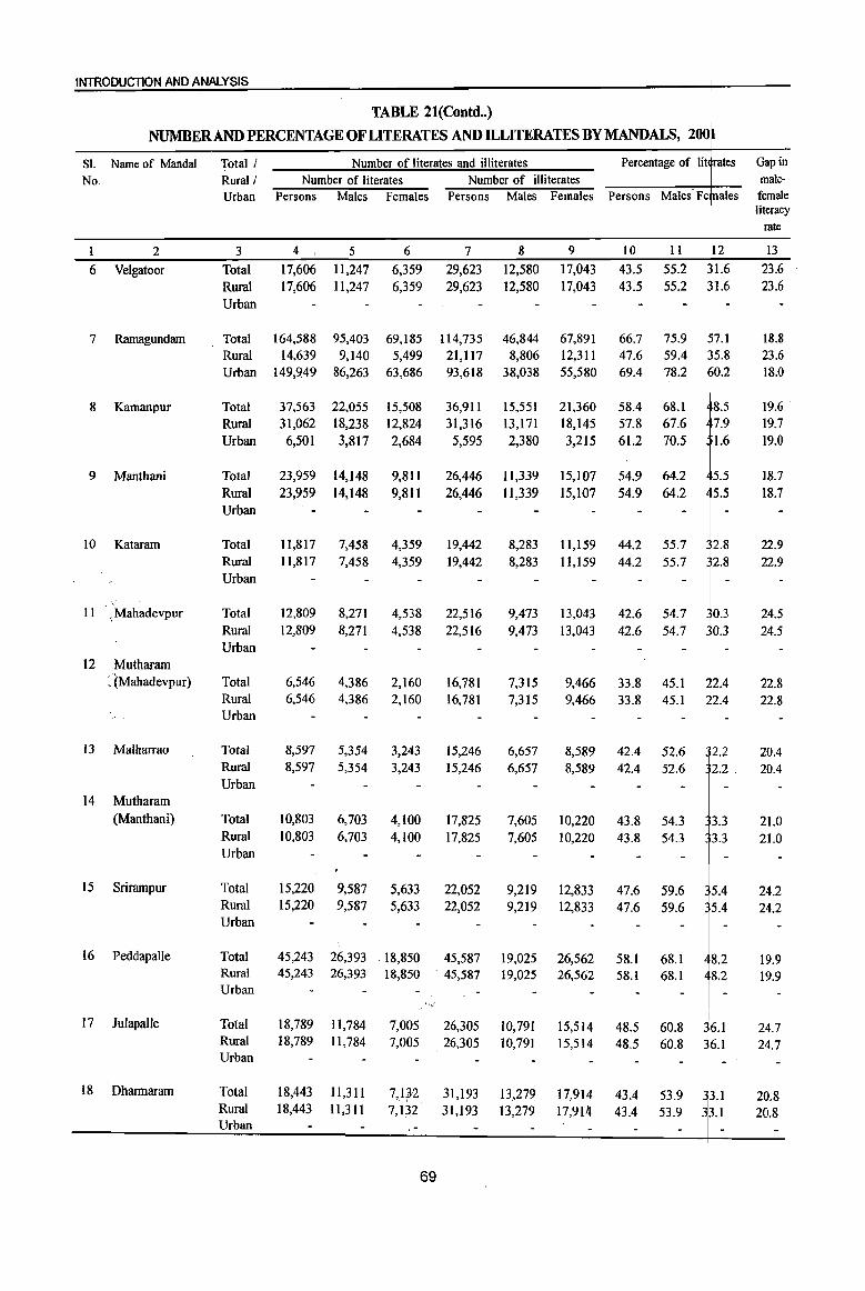
INTRODUCTION AND ANAlYSIS
TABLE 21(Contd •. )
NUMBER AND PERCENTAGE OF LITERATES AND ILLITERATES BYMANDALS, 200
SI. Name of Mandai Total I Number of literates and illiterates Percentage of lit rates Gap in
No. Rurall Number of literates Number of illiterates male-
Urban Persons Males Females Persons Males Females Persons Males-Fe ales female literacy
rate
I 2 3 4 5 6 _7 8 9 10 II 12 13
6 Velgatoor Total 17,606 1l,247 6,359 29;623 12,580 17,043 43.5 55.2 1.6 23.6
Ruml 17,606 11,247 6,359 29,623 12,580 17,043 43.5 55.2 1.6 23.6
Urban
7 Rarnagundam Total 164,588 95,403 69,185 114,735 46,844 67,891 66.7 75.9 57.1 18.8 Ruml 14,639 9,140 5,499 21,117 8,806 12,311 47.6 59.4 5.8 23.6 Urban 149,949 86,263 63,686 93,618 38,038 55,580 69.4 78.2 0.2 18.0
8 Kamanpur Total 37,563 22,055 15,508 36,911 15,551 21,360 58.4 68.1 8.5 19.6 Rural 31,062 18,238 12,824 31,316 13,171 18,145 57.8 67.6 7.9 19.7
Urban 6,501 3,817 2,684 5,595 2,380 3,215 61.2 70.5 1.6 19.0
9 Manthani Total 23,959 14,148 9,811 26,446 11,339 15,107 54.9 64.2 5.5 18.7 Rural 23,959 14,148 9,811 26,446 11,339 15,107 54.9 64.2 5.5 18.7 Urban
10 Kataram Total 11,817 7,458 4,359 19,442 8,283 11,159 44.2 55.7 2.8 22.9 Rural 11,817 7,458 4,359 19,442 8,283 11,159 44.2 55.7 2.8 22.9 Urban
11 ; Mahadevpur Total 12,809 8,271 4,538 22,516 9,473 13,043 42.6 54.7 0.3 24.5 Rural 12,809 8,271 4,538 22,516 9,473 13,043 42.6 54.7 0.3 24.5 Urban
12 Mutharam : (Mahadevpur) Total 6,546 4,386 2,160 16,781 7,315 9,466 33.8 45.1 2.4 22.8
Rural 6,546 4,386 2,160 16,781 7,315 9,466 33.8 45.1 2.4 22.8 Urban
I3 Malharrao Total 8,597 5,354 3,243 15,246 6,657 8,589 42.4 52.6 2.2 20.4 Rural 8,597 5,354 3,243 15,246 6,657 8,589 42.4 52.6 2.2. 20.4 Urban
14 Mutharam (Manthani) Total 10,803 6,703 4,100 17,825 7,605 10,220 43.8 54.3 3.3 21.0
Ruml 10,803 6,703 4,100 17,825 7,605 10,220 43.8 543 3.3 21.0 Urban
15 Srimmpur Total 15,220 9,587 5,633 22,052 9,219 12,833 47.6 59.6 5.4 24.2 Ruml 15,220 9,587 5,633 22,052 9,219 12,833 47.6 59.6 5.4 24.2 Urban
16 Peddapalle Total 45,243 26,393 . 18,850 45,587 19,025 26,562 58.1 68.1 8.2 19.9 Rural 45,243 26,393 18,850 . 45,587 19,025 26,562 58.1 68.1 8.2 19.9 Urban
""/
17 Julapalle Total 18,789 11,784 i
7,005 26,305 10,791 15,514 48.5 60.8 36.1 24.7 Ruml 18,789 1l,784 7,005 26,305 10,791 15,514 48.5 60.8 ~6.1 24.7 Urban I -I
I
18 Dharmaram Total 18,443 1l,311 7,Q2 31,193 13,279 17,914 43.4 53.9 ~3.1 20.8 Rural 18,443 1l,311 . 7,132 31,193 13,279 17,914 43.4 53.9 33.1 20.8 Urban
69

DISTRICT CENSUS HA~D800K :KA~iMNAGAR
TABLE 21(Contd .. )
NUMBERAND PERCENTAGE OF LITERATES AND ILLITERATES BY MANDALS, 2001
SI. Name of Mandai Total / Number of literates and illiterates Percentage of literates Gap in No. Rural! Number of literates Number of illiterates male-
Urban Persons Males Females Persons Males Females Persons Males Females female literacy
rate
1 2 3 4 5 6 7 8 9 10 11 12 13 19 Gollapalle Total 15,415 9,961 5,454 26,233 10,553 15,680 43.1 56.7 30.0 26.6
Rural 15,415 9,961 5,454 26,233 10,553 15,680 43.1 56.7 30.0 26.6 Urban
20 Mallial Total 18,287 11,222 7,065 26,957 10,730 16,227 46.6 59.4 34.7 24.6 Rural 18,287 11,222 7,065 26,957 10,730 16,227 46.6 59.4 34.7 24.6 Urban
21 Jagtial Total 82,195 49,168 33,027 68,370 26,234 42,136 62.8 75.3 50.3 24.9 Rural 26,789 17,081 9,708 38,255 14,944 23,311 47.6 62.1 33.8 28.3 Urban 55,406 32,087 23,319 30,115 11,290 18,825 74.1 84.8 63.2 21.6
22 Medipalle Total 19,201 12,034 7,167 30,572 12,117 18,455 44.9 58.5 32.3 26.1
Rural 19,201 12,034 7,167 30,572 12,1I7 18,455 44.9 58.5 32.3 26.1 Urban
23 Koratla Total 48,766 29,071 19,695 45,663 17,887 27,776 59.9 71.8 48.1 23.7
Rural 17,278 10,911 6,367 23,139 8,774 14,365 49.1 63.6 35.3 28.2
Urban 31,488 18,160 13,328 22,524 9,113 13,411 68.0 77.8 58.1 19.7
24 Metpalle Total 39,573 23,948 15,625 37,412 14,322 23,090 59.5 72.7 46.5 26.3
Rural 39,573 23,948 15,625 37,412 14,322 23,090 59.5 72.7 46.5 26.3
Urban
25 Kathlapur Total 16,936 10,661 6,275 25,850 9,830 16,020 46.0 60.8 32.5 28.3
Rural 16,936 10,661 6,275 25,850 9,830 16,020 46.0 60.8 32.5 28.3
Urban
26 Chandurthi Total 16,023 10,300 5,723 24,535 9,779 14,756 45.5 59.2 32.1 27.1
Rural 16,023 10,300 5,723 24,535 9,779 14,756 45.5 59.2 32.1 27.1
Urban
27 Kodimial Total 16,984 10,575 6,409 25,362 10,144 15,218 46.5 59.6 34.2 25.4
Rural 16,984 10,575 6,409 25,362 10,144 15,218 46.5 59.6 34.2 25.4
Urban
28 Pegadapalle Total 17,057 10,918 6,139 27,822 11,366 16,456 43.9 56.8 31.2 25.6
Rural 17,057 10,918 6,139 27,822 11,366 16,456 43.9 56.8 31.2 25.6
Urban
29 Gangadhara Total 21,000 13,234 7,766 25,879 10,104 15,775 51.4 65.5 37.7 27.8
Rural 21,000 13,234 7,766 25,879 10,104 15,775 51.4 65.5 37.7 27.8
Urban
30 Rarnadugu Total 22,323 13,933 8,390 25,331 9,972 15,359 53.9 67.3 40.5 26.7
Rural 22,323 13,933 8,390 25,331 9,972 15,359 53.9 67.3 40.5 26.7
Urban
70

INTRODUCTION AND ANALYSIS
TABLE 21(Contd •• )
NUMBER AND PERCENTAGE OF LITERATES AND ~LITERATES BYMANDALS, 20( 1
SL Name of Mandal Total! Number of literates and illiterates Percentage of Ii ~rates Gap in No. Rural! Number of literates Number of illiterates male-
Urban Persons Males Females Persons Males Females Persons Males F< males female I literacy
rate
I 2 3 4 5 6 7 8 9 10 II 12 13
31 Choppadandi Total 22,260 14,073 8,187 26,399 10,648 15,75.1 52.7 65.6 ~9.4 26.2 Rural 22,260 14,073 8,187 26,399 10,648 15,751 52.7 65.6 ~9.4 26.2 Urban
32 Sultanabad Total 26,613 16,255 10,358 30,104 12,331 17,773 54.7 66.5 ~2.7 23.8 Rural 26,613 16,255 10,358 30,104 12,331 17,773 54.7 66.5 ~2.7 23.8 Urban
33 Odela Total 16,973 10,625 6,348 22,566 9,235 13,331 49.6 62.0 ~7.2 24.8 Rural 16,973 10,625 6,348 22,566 9,235 13,331 49.6 62.0 ~7.2 24.8 Urban
34 Manakondur Total 28,794 17,977 10,817 36,070 14,748 21,322 51.4 63.7 ~8.9 24.8 Rural 28,794 17,977 10,817 36,070 14,748 21,322 51.4 63.7 ~8.9 24.8
. Urban
35 Karimnagar . Total 193,889 110,733 83,156 95,486 37,221 58,265 76.8 85.8 p7.3 18.6 Rural 36,213 22,495 13,718 34,860 13,584 21,276 59.1 72.4 . ~5.4 27.0 Urban 157,676 88,238 69,438 60,626 23,637 36,989 82.4 90.1 174.4 15.7
36 Boinpalle Total 16,882 10,604 6;278 20,682 7,997 12,685 51.5 65.4 117.8 27.6 Rural 16,882 10,604 6,278 20,682 7,997 12,685 51.5 65.4 7.8 27.6 Urban
37 Vemulawada Total 36,188 22,169 14,019 37,233 14,527 22,706 57.0 70.2 n9 26.3 Rural 36,188 22,169 14,019 37,233 14,527 22,706 57.0 70.2 3.9 26.3 Urban
38 Konaraopeta Total 16,756 10,969 5,787 24,625 9,671 14,954 47.0 62.0 2.2 29.8 Rural 16,756 10,969 5,787 24,625 9,671 14,954 47.0 62.0 2.2 29.8 Urban
39 Yellareddipet Total 23,129 14,985 8,144 33,302 13,084 20,218 47.9 62.6 3.4 29.3 Rural 23,129 14,985 8,144 33,302 13,084 20,218 47.9 62.6 3.4 29.3 Urban
40 Gambhiraopet Total 18,457 11,693 6,764 25,729 10,064 15,665 48.1 62.2 4.6 27.7 Rural 18,457 11,693 6,764 25,729 10,064 15,665 48.1 62.2 4.6 27.7 Urban
41 Mustabad Total 18,980 12,176 6,804 25,369 10,003 15,366 49.1 63.3 5.0 28.4 Rural 18,980 12,176 6,804 25,369 10,003 15,366 49.1 63.3 5.0 28.4 Urban
42 Sircilla Total 63,835 39,1l8 24,717 58,533 22,002 36,531 60.1 74.0 46.3 27.7 Rural 24,308 15,488 8,820 32,746 12,966 19,780 49.3 63.2 ~5.6 27.6 Urban 39,527 23,630 15,897 25,787 9,036 16,751 69.4 83.3 55.6 27.7 ,
I
43 Ellanthakunta Total 22,386 13,975 8,411 26,604 10,155 16,449 52.2 66.5 8.4 28.1 Rural 22,386 13,975 8,411 26,604 10,155 16,449 52.2 66.5 8.4 28.1 Urban
71
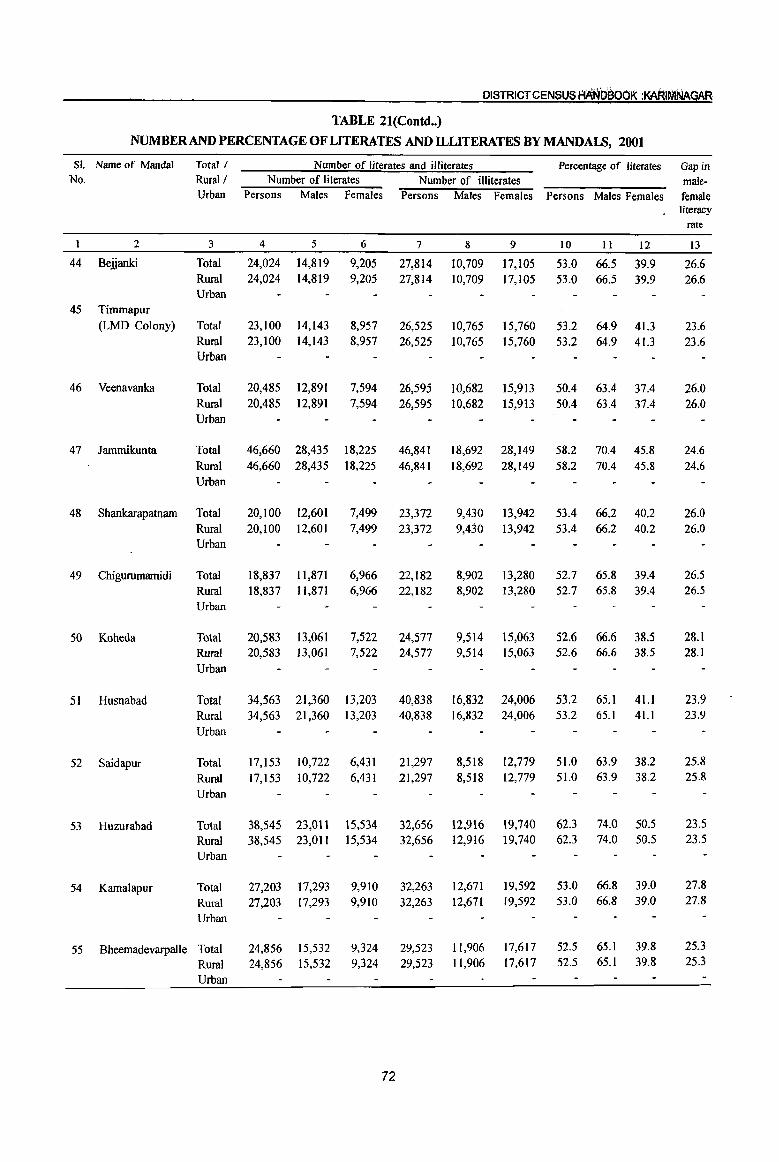
DISTRICT CENSUS flANDaOOK :KAkIMNAGAR
TABLE 21(Contd •• )
NUMBER AND PERCENTAGE OF LITERATES AND ll.LITERATES BY MANDAI.S, 2001
51. Name of Mandai Total I Number of literates and illiterates Percentage of literates Gap in No. Rural! Number of literates Number of illiterates male-
Urban Persons Males Females Persons Males Females Persons Males Females female literacy
rate
2 3 4 5 6 7 8 9 10 11 12 13
44 Beijanki Total 24,024 14,819 9,205 27,814 10,709 17,105 53.0 66.5 39.9 26.6 Rural 24,024 14,819 9,205 27,814 10,709 17,105 53.0 66.5 39.9 26.6 Urban
45 Timmapur (LMD Colony) Total 23,100 14,143 8,957 26,525 10,765 15,760 53.2 64.9 41.3 23.6
Rural 23,100 14,143 8,957 26,525 10,765 15,760 53.2 64.9 41.3 23.6 Urban
46 Veenavanka Total 20,485 12,891 7,594 26,595 10,682 15,913 5004 63.4 3704 26.0 Rural 20,485 12,891 7,594 26,595 10,682 15,913 50.4 63.4 37.4 26.0 Urban
47 Iammikunta Total 46,660 28,435 18,225 46,841 18,692 28,149 58.2 70.4 45.8 24.6 Rural 46,660 28,435 18,225 46,841 18,692 28,149 58.2 7004 45.8 24.6 Urban
48 Shankarapatnam Total 20,100 12,601 7,499 23,372 9,430 13,942 53.4 66.2 40.2 26.0 Rural 20,100 12,601 7,499 23,372 9,430 13,942 53.4 66.2 40.2 26.0 Urban
49 Chigurumamidi Total 18,837 11,871 6,966 22,182 8,902 13,280 52.7 65.8 39.4 26.5 Rural 18,837 11,871 6,966 22,182 8,902 13,280 52.7 65.8 39.4 26.5 Urban
50 Koheda Total 20,583 13,061 7,522 24,577 9,514 15,063 52.6 66.6 38.5 28.1 Rural 20,583 13,061 7,522 24,577 9,514 15,063 52.6 66.6 38.5 28.1 Urban
51 Husnabad Total 34,563 21,360 13,203 40,838 16,832 24,006 53.2 65.1 41.1 23.9 Rural 34,563 21,360 13,203 40,838 16,832 24,006 53.2 65.1 41.1 23.9
Urban
52 Saidapur Total 17,153 10,722 6,431 21,297 8,518 12,779 51.0 63.9 38.2 25.8
Rural 17,153 10,722 6,431 21,297 8,518 12,779 51.0 63.9 38.2 25.8
Urban
53 Huzurabad Total 38,545 23,011 15,534 32,656 12,916 19,740 62.3 74.0 50.5 23.5
Rural 38,545 23,011 15,534 32,656 12,916 19,740 62.3 74.0 50.5 23.5
Urban
54 Kamalapur Total 27,203 17,293 9,910 32,263 12,671 19,592 53.0 66.8 39.0 27.8
Rural 27,203 17,293 9,910 32,263 12,671 19,592 53.0 66.8 39.0 27.8
Urban
55 Bheemadevarpalle Total 24,856 15,532 9,324 29,523 11,906 17,617 52.5 65.1 39.8 25.3
Rural 24,856 15,532 9,324 29,523 11,906 17,617 52.5 65.1 39.8 25.3
Urban
72
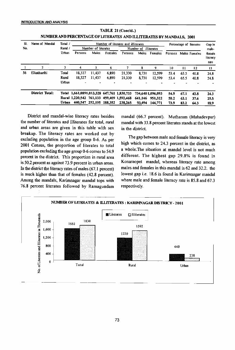
INTRODUCTION AND ANALYSIS
TABLE 21 (Coneld .• )
NUMBER AND PERCENTAGE OF LITERATES AND ILLITERATES BY MANDALS, 2001
Sl. Name of Mandai Total/ Number of literates and illiterates Percentage of literates Gap in No. Rural / Number of literates Number of illiterates male-
Urban Persons Males Females Persons Males Females Persons Males Females female literacy
rate
I 2 3 4 5 6 7 8 9 10 II 12 13 56 Elkathurthi Total 18,327 11,437 6,890 21,330 8,731 12,599 53.4 65.5 40.8 24.8
Rural 18,327 1l,437 6,890 21,330 8,731 12,599 53.4 65.5 40.8 24.8 Urban
District Total: Total 1,661,0891,013,328 647,761 1,830,733 734,6401,096,093 54.9 67.1 42.8 24.3 Rural 1,220,542 761,133 459,409 1,592,468 641,146 951,322 50.2 63.1 37.6 25.5 Urban 440,547 252,195 188,352 238,265 93,494 144,771 73.9 83.2 64.3 18.9
District and mandaI-wise literacy rates besides the number of literates and illiterates for total, rural and urban areas are given in this table with sex breakup. The literacy rates are worked out by excluding population in the age group 0-6. As per 200 I Census, the proportion of literates to total popUlation excluding the age group 0-6 comes to 54.9 percent in the district. This proportion in rural area is 50.2 percent as against 73.9 percent in urban areas. In the district the literacy rates of males (67.1 percent) is much higher than that of females (42.8 percent). Among the mandals, Karimnagar mandaI tops with 76.8 percent literates followed by Ramagundam
mandaI (66.7 percent). Mutharam (Mahadevpur) mandaI with 33.8 percent literates stands at the lowest in the district.
The gap between male and female literacy is very
high which comes to 24.3 percent in the district, as
a whole.The situation at mandaI level is not much different. The highest gap 29.8% is found in
Konaraopet mandaI, whereas literacy rate among
males and females in this mandaI is 62 and 32.2. the
lowest gap i.e. 18.6 is found in Karimnagar mandai where male and female literacy rate is 85.8 and 67.3 respectively.
NUMBER OF LlTERAllS & ll.LITFRAllS : KARlMNAGAR DISTRICT - 2001
~ • Literates 0 Illiterates !a
1830 '" 2,000 ::s 0
~ 1592 .9 1,600 '" B f! 1,200 .~ S 800 -0
!il 440
'" 400 ~ ... B :J 0 '- Total 0 Rural Urban 0 z
73
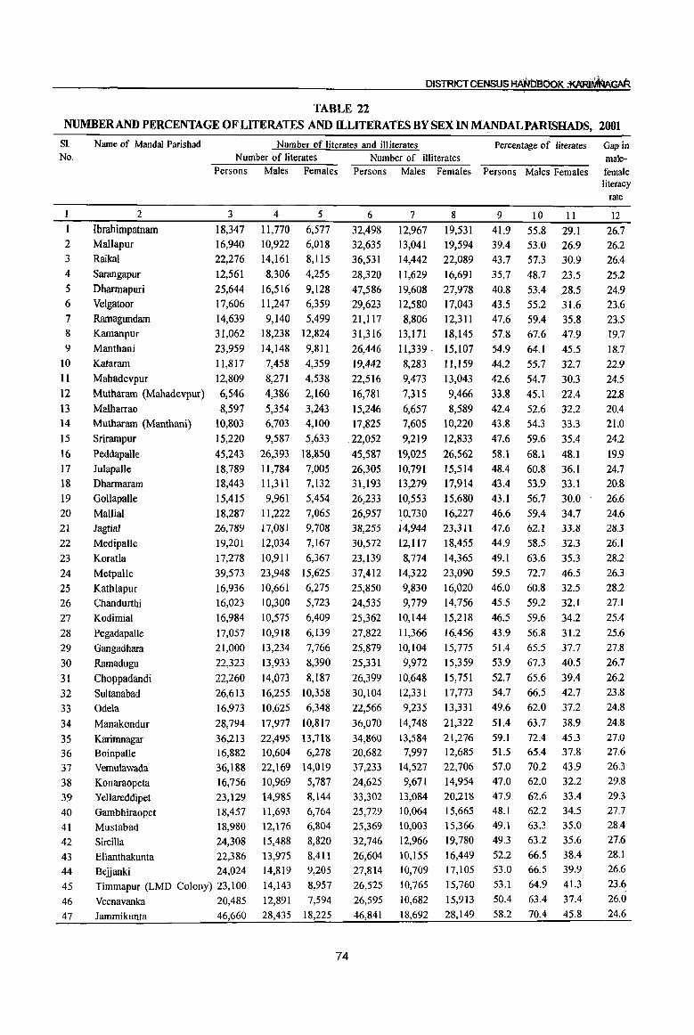
DISTRICT CENSUS HA'NOaoOK :AARJ'M'fI.u\GAR
TABLE 22 NUMBERAND PERCENTAGE OF LITERATES AND ll.-LITERATES BY SEX IN MANDALPARISHADS, 2001
SI. Name of Mandai Parishad Number of literates and illiterates Percentage of literates Gap in No. Number of literates Number of illiterates male-
Persons Males Females Persons Males Females Persons Males Females female
1 2
3
4
5
6 7
8
9 10
11 12
I3 14
15
16
17 18
19
20 21
22
23
24
25
26
27
28
29
30
31
32
33
34
35 36
37
38
39 40
41
42
43 44
45
46
47
2
Ibrahimpatnam Mal1apur
Raikal Sarangapur
Dharmapuri
Velgatoor
Ramagundam Kamanpur
Manthani
Kataram
Mahadevpur
Mutharam (Mahadevpur)
Malharrao
Mutharam (Manthani)
Srirarnpur
Peddapalle
Julapalle
Dharmaram
GollapaJIe
Mallial Jagtial
MedipaUe
Koratla
Metpalle
Kathlapur
Chandurthi
Kodimial
Pegadapalle
Gangadhara
Ramadugu
Choppadandi
Sultanabad
Odela
Manakondur
Karimnagar Boinpalle
Vemulawada
Konaraopeta
Yellareddipet
Gambhiraopet
Mustabad
Sircilla
Ellanthakunta
3
18,347 16,940
22,276
12,561
25,644
17,606
14,639
31,062
23,959
II,817
12,809
6,546
8,597
10,803
15,220
45,243
18,789 18,443
15,415
18,287 26,789
19,201
17,278
39,573
16,936 16,023
16,984
17,057
21,000
22,323
22,260
26,613
16,973
28,794
36,213 16,882
36,188
16,756 23,129
18,457
18,980
24,308
22,386
Beljanki 24,024
Timmapur (LMD Colony) 23,100
Veenavanka 20,485
Jammikunta 46,660
4 5
11,770 6,577 10,922 6,018
14,161 8,115
8,306 4,255
16,516 9,128 11,247 6,359
9,140 5,499
18,238 12,824
14,148 9,811
7,458 4,359
8,271 4,538
4,386 2,160
5,354 3,243 6,703 4,100
9,587 5,633
26,393 18,850
11,784 7,005 11,311 7,132
9,961 5,454
11,222 7,065
17,081 9,708
12,034 7,167
10,911 6,367
23,948 15,625
10,661 6,275
10,300 5,723
10,575 6,409
10,918 6,139
13,234 7,766
13,933 8,390
14,073 8,187
16,255 10,358
10,625 6,348
17,977 10,817
22,495 10,604
22,169
10,969 14,985
11,693
12,176
15,488
13,975
13,718 6,278
14,019
5,787 8,144
6,764
6,804
8,820
8,411 14,819 9,205
14,143 8,957
12,891 7,594
28,435 18,225
74
6
32,498 32,635
36,531
28,320
47,586
29,623
21,1l7
31,316
26,446
19,442
22,516
16,781
15,246
17,825
.22,052
45,587
26,305
31,193
26,233
26,957 38,255
30,572
23,139
37,412
25,850
24,535
25,362
27,822
25,879
25,331
26,399
30,104
22,566
36,070
34,860 20,682
37,233
24,625 33,302
25,729
25,369
32,746
26,604
7
12,967 13,041 14,442
11,629
19,608
12,580
8,806
13,171
11,339 .
8,283
9,473
7,315
6,657 7,605
9,219
19,025
10,791
13,279
10,553
~O,730
14,944
12,Il7
8,774
14,322
9,830
9,779 10,144
11,366
10,104
9,972
10,648
12,331
9,235
14,748
13,584
7,997
14,527
9,671 13,084
10,064 10,003
12,966
10,155 27,814 10,709
26,525 10,765
26,595 10,682
46,841 18,692
8
19,531 19,594
22,089
16,691
27,978
17,043
12,3Il
18,145
15,107
11,159
13,043
9,466
8,589 10,220
12,833
26,562
15,514
17,914
15,680
16,227 23,311
18,455
14,365
23,090
16,020
14,756
15,218
16,456
15,775
15,359
15,751
17,773
13,331
21,322
21,276 12,685 22,706
14,954 20,218
15,665
15,366 19,780
16,449
17,105
15,760
15,913
28,149
9
41.9 39.4 43.7
35.7
40.8
43.5
47.6
57.8
54.9
44.2
42.6
33.8
42.4 43.8
47.6
58.1
48.4
43.4
43.1
46.6 47.6
44.9
49.1
59.5 46.0
45.5
46.5
43.9
51.4
53.9
52.7 54.7
49.6
51.4
59.1 51.5
57.0 47.0 47.9
48.1
49.1
49.3
52.2 53.0
53.1
50.4
58.2
10
55.8 53.0
57.3
48.7
53.4
55.2
59.4
67.6
64.1
55.7
54.7
45.1
52.6 54.3
59.6
68.1
60.8
53.9
56.7
59.4 62.1
58.5
63.6
72.7
60.8
59.2
59.6
56.8
65.5
67.3
65.6
66.5
62.0
63.7
72.4 65.4
70.2
62.0
62.6 62.2
63.3
63.2
66.5 66.5
64.9
63.4
70.4
II
29.1 26.9 30.9
23.5
.28.5 31.6
35.8 47.9
45.5
32.7
30.3
22.4
32.2
33.3
35.4
48.1
36.1
33.1
30.0
34.7 33.8
32.3
35.3
46.5
32.5 32.1
34.2
31.2
37.7
40.5
39.4
42.7
37.2
38.9
45.3
37.8
43.9
32.2
33.4
34.5
35.0
35.6
38.4 39.9
41.3
37.4
45.8
literacy rate
12 26.7 26.2
26.4
252
24.9 23.6
23.5
19.7
18.7
22.9
24.5
22.8
20.4
21.0 24.2
19.9
24.7 20.8 26.6
24.6 28.3
26.1
28.2
26.3
28.2 27.1
25.4
25.6
27.8
26.7
26.2
23.8
24.8
24.8
27.0 27.6
26.3 29.8
29.3
27.7 28.4
27.6
28.1 26.6
23.6
26.0
24.6
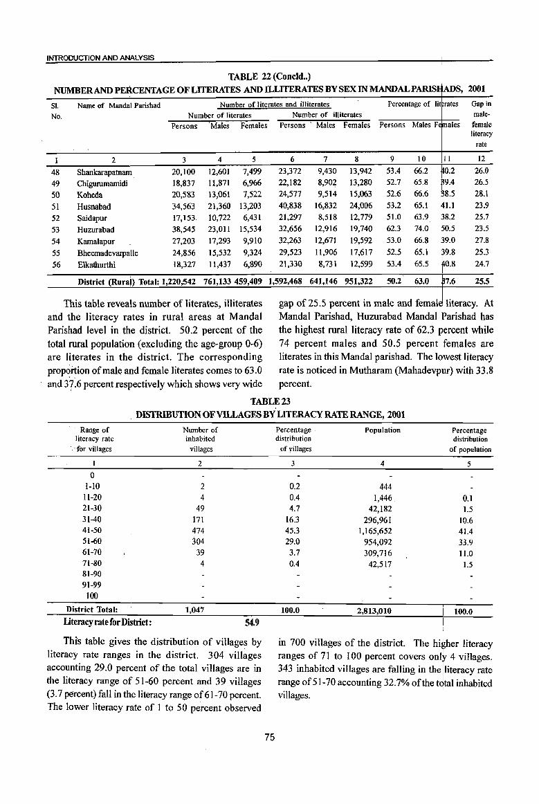
INTRODUCTION AND ANALYSIS
TABLE 22 (Concld •• )
NUMBER AND PERCENTAGE OF LITERATES AND ILLITERATES BY SEX IN MANDALPARIS S, 2001
SI. Name of Mandai Parishad Number of literates and illiterates Percentage of lit rates Gap in No. Number of literates Number of illiterates male-
Persons 'Males Females Persons . Males Females Persons Males Fe males female literacy
rate
1 2 3 4 5 6 7 8 9 10 11 12
48 Shankarapatnam 20,100 12,601 7,499 23,372 9,430 13,942 53.4 66.2 fO.2 26.0
49 Chigurumamidi 18,837 11,871 6,966 22,182 8,902 13,280 52.7 65.8 9.4 26.5
50 Koheda 20,583 13,061 7,522 24,577 9,514 15,063 52.6 66.6 8.5 28.1
51 Husnabad 34,563 21,360 13,203 40,838 16,832 24,006 53.2 65.1 l.l 23.9
52 Saidapur 17,153 10,722 6,431 21,297 8,518 12,779 51.0 63.9 8.2 25.7
53 Huzurabad 38,545 23,011 15,534 32,656 12,916 19,740 62.3 74.0 23.5
54 Kamalapur 27,203 17,293 9,910 32,263 12,671 19,592 53.0 66.8 27.8
55 Bheemadevarpalle 24,856 15,532 9,324 29,523 1l,906 17,617 52.5 65.1 25.3
56 Elkathurthi 18,327 11,437 6,890 21,330 8,731 12,599 53.4 65.5 24.7
District (Rurai) Total: 1,220,542 761,133 459,409 1,592,468 641,146 951,322 50.2 63.0 25.5
This table reveals number of literates, illiterates gap of 25.5 percent in male and femal and the literacy rates in rural areas at Mandai Mandai Parishad, Huzurabad Mandai arishad has Parishad level in the district. 50.2 percent of the the highest rural literacy rate of 62.3 ercent while total rural population (excluding the age-group 0-6) 74 percent males and 50.5 percent females are are literates in the district. The corresponding literates in this Mandai parishad. The 1 est literacy proportion of male and female literates comes to 63.0 rate is noticed in Mutharam (Mahadevp r) with 33.8 and 37-6 percent respectively which shows very wide percent.
TABLE 23
DISTRIBUTION OF VILLAGES BY LITERACY RATE RANGE, 2001
Range of literacy rate
. for villages
o l-lO
11-20 21-30 31-40 41-50 51-60 61-70 71-80 81-90 91-99
100
District Total: Literacy rate for District:
Number of inhabited
villages
2
2 4
49 171 474 304
39 4
1,047
54.9
This table gives the distribution of villages by literacy rate ranges in the district. 304 vill~ges accounting 29.0 percent of the total villages are in the literacy range of 51-60 percent and 39 villages (3.7 percent) fall in the literacy range of 61-70 percent. The lower literacy rate of 1 to 50 percent observed
75
Percentage Population Percentage distribution distribution
of yillages of popUlation
3 4 5
0.2 444 0.4 1,446. 0.1 4.7 42,182 1.5
16.3 296,961 10.6 45.3 1,165,652 41.4 29.0 954,092 33.9
3.7 309,716 11.0 0.4 42,517 1.5
100.0 2,813,010 100.0
in 700 villages of the district. The hi$her literacy ranges of 71 to 100 percent covers only 4 villages. 343 inhabited villages are falling in the lliteracy rate range of 51-70 accounting 32.7% of the total inhabited villages. \
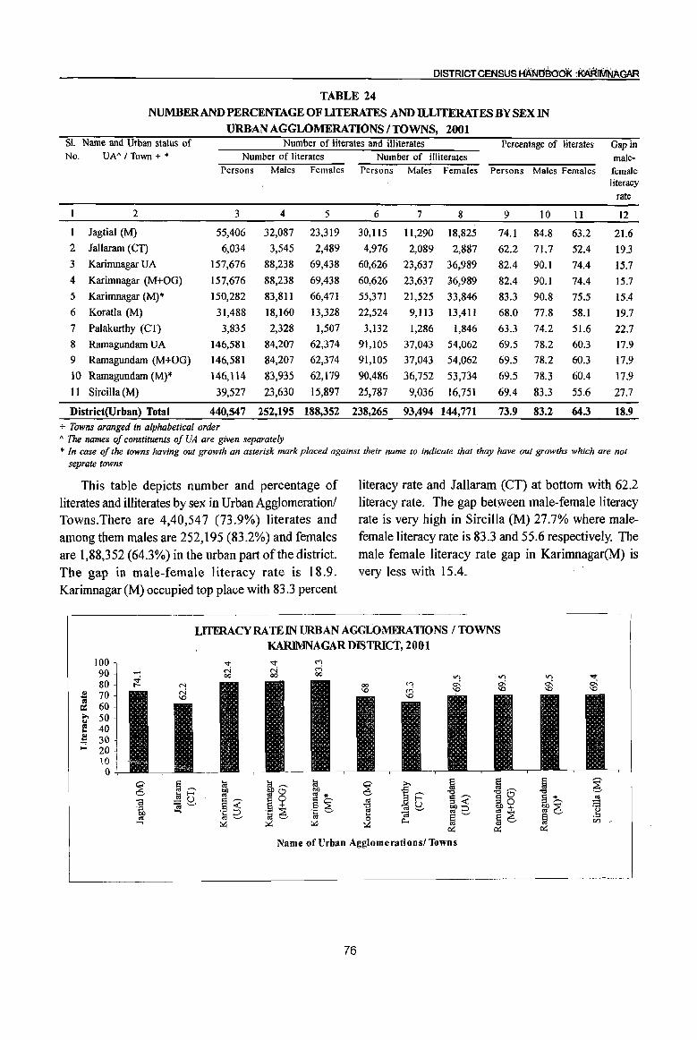
DISTRICT CENSUS HANbaoOf<. :~IMNAGAR
TABLE 24
NUMBER AND PERCENTAGE OF LITERATES AND ILLITERATES BY SEX IN
URB:AN AGGLOMERATIONS / TOWNS, 2001 SI. Name and Urban status of Number of literates and illiterates Percentage of literates Gap in No. UN'flown +" Number of literates Number of illiterates male-
Persons Males Females Persons Males Females Persons Males Females female literacy
rate
2 3 4 5 6 7 8 9 10 11 12
1 lagtial (M) 55,406 32,087 23,319 30,115 11,290 18,825 74.1 84.8 63.2 21.6 2 lallaram (CT) 6,034 3,545 2,489 4,976 2,089 2,887 62.2 71.7 52.4 19.3 3 Karimnagar UA 157,676 88,238 69,438 60,626 23,637 36,989 82.4 90.1 74.4 15.7 4 Karimnagar (M+OG) 157,676 88,238 69,438 60,626 23,637 :36,989 82.4 90.1 74.4 15.7
5 Karimnagar (M)* 150,282 83,811 66,471 55,371 21,525 33,846 83.3 90.8 75.5 15.4
6 Koratla (M) 31,488 18,160 13,328 22,524 9,113 13,411 68.0 77.8 58.1 19.7
7 Palakurthy (CI) 3,835 2,328 1,507 3,132 1,286 1,846 63.3 74.2 51.6 22.7
8 Ramagundam UA 146,581 84,207 62,374 91,105 37,043 54,062 69.5 78.2 60.3 17.9
9 Ramagundam (M+OG) 146,581 84,207 62,374 91,105 37,043 54,062 69.5 78.2 60.3 17.9
10 Ramagundam (M)* 146,1l4 83,935 62,179 90,486 36,752 53,734 69.5 78.3 60.4 17.9
II Sircilla (M) 39,527 23,630 15,897 25,787 9,036 16,751 69.4 83.3 55.6 27.7
District(Urban) Total 440,547 252,195 188,352 238,265 93,494 144,771 73.9 83.2 64.3 18.9
+ Towns aranged in alphabetical order A The names of constituents of VA are given separately + In case of the towns having out growth an asterisk mark placed against their name to indicate that thay have out growths which are not
seprate towns
This table depicts number and percentage of literates and illiterates by sex in Urban Agglomeration! Towns.There are 4,40,547 (73.9%) literates and among them males are 252,195 (83.2%) and females are 1,88,352 (64.3%) in the urban part ofthe district. The gap in male-female literacy rate is 18.9. Karimnagar (M) occupied top place with 83.3 percent
literacy rate and lallaram (CT) at bottom with 62.2 literacy rate. The gap between male-female literacy rate is very high in Sircilla (M) 27.7% where malefemale literacy rate is 83.3 and 55.6 respectively. The male female literacy rate gap in Karimnagar(M) is very less with 15.4.
LITERACY RATE IN URBAN AGGLOMERATIONS I TOWNS KARIMNAGAR DISTRICT, 2001
100 "<t "<t M
90 ('oj ('oj M 00 00 00
80 .! 70 III
60 a: ... 50 ... III 40 .. ..
30 .... ;:5 20
lO 0
~ §'""' la la,-. la ~
>. ~ §,-. ~ ~ bJ) ~o bJ) ..c: la E-< ,. ,. *
~~ -0 -0 0
'" =a~ ·1 ~ t:~ d,-. ,. S,-. 30 s~ ..!S
.~ 6 bl)< 'ib .~ 6 ~ ,.::J bl)+ ~6 ~ ...,
~6 ... t;j ~'-' ~ .!:: ,.
~ Il.. <Zl ...., ~ :>G ~
r::G r::G r::G
Name of Urban Agglomerationsl Towns
76
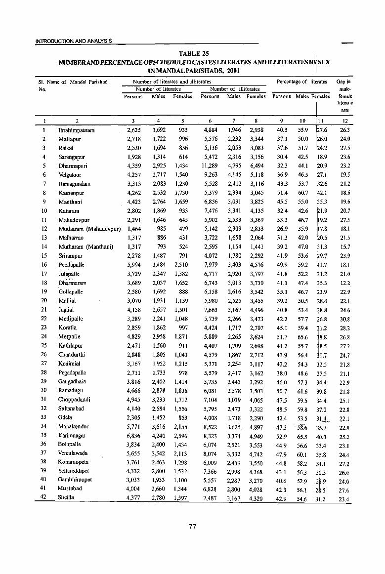
INTRODUCTION AND ANALYSIS
TABLE 25 NUMBERANDPERCENTAGE OF SCHEDULED CASTES LITERATES AND ILLITERATESB SEX
IN MANDALPARISHADS, 2001
81. Name of Mandai Parishad
No.
Number of literates and illiterates Percentage of lit rates Gap in
1
2
3 4
5 6
7
8
9
10
11
12
13
14
15
16
17
18
19
20
21
22
23
24
25
26
27
28
29
30
31
32
33
34
35
36
37
38
39
40
41
42
2
Ibrahimpatnam
Mallapur
Raikal
Sarangapur
Dhannapuri
Velgatoor
Ramagundam
Kamanpur
Manthani
Kataram
Mahadevpur
Mutharam (Mahadevpur)
Malharrao
Mutharam (Manthani)
Srirampur
Peddapalle "
JulapaUe
I)h~aram Gollapalle
Mallial
Jagti'al
Medh)alle
Koratla
Metpalle
Kathlapur
Chandurthi
KodimiaI
Pegadapalle
Gangadhara
Ramadugu
Choppadandi
Sultanabad
Odela
Manakondur
Karirrmagar Boinpalle
Vemulawada
Konaraopeta
Yellareddipet
Gambhiraopet
Mustabad
SirciIla
Number of literates Number of illiterates Persons Males Females Persons Males Females
3
2,625
2,718
2,530
1,928
4,359
4,257
3,313
4,262
4,423
2,802
2,291
1,464
1,317
1,317
2,278
5,994
3,729
3,689
2,580
3,070
4,158
3,289
2,859
4,829
2,471
2,848
3,167
2,711
3,816
4,666
4,945
4,140
2,305
5,771
6,836
3,834
5,655
3,761
4,332
3,033
4,004
4,377
4
1,692
1,722
1,694
1,314
2,925
2,717
2,083
2,532
2,764
1,869
1,646
985
886
793
1,487
3,484
2,347
2,037
1,692
1,931
2,657
2,241
1,862
2,958
1,560
1,805
1,952
1,733
2,402
2,828
3,233
2,584
1,452
3,616
4,240
2,400
3,542
2,463
2,800
1,933
2,660
2,780
5
933
996
836
614
1,434
1,540
1,230
1,730
1,659
933
645
479
431
524
791
2,510
1,382
1,652
888
1,139
1,501
1,048
997
1,871
911
1,043
1,215
978
1,414
1,838
1,712
1,556
853
2,155
2,596
1,434
2,1l3
1,298
1,532
1,100
1,344
1,597
77
6
4,884
5,576
5,136
5,472
II,289
9,263
5,528
5,379
6,856
7,476
5,902
5,142
3,722
2,595
4,072
7,979
6,717
6,743
6,158
5,980
7,663
5,739
4,424
5,889
4,407
4,579
5,371
5,579
5,735
6,081
7,104
5,795
4,008
8,522
8,323
6,074
8,074
6,009
7,366
5,557
6,828
7,487
7
1,946
2,232
2,053
2,316
4,795
4,145
2,412
2,334
3,031
3,341
2,533
2,309
1,658
1,154
1,780
3,403
2,920
3,013
2,616
2,525
3,167
2,266
1,717
2,265
1,709
1,867
2,254
2,417
2,443
2,578
3,039
8
2,938
3,344
3,083
3,156
6,494
5,118
3,116
3,045
3,825
4,135
3,369
2,833
2,064
1,441
2,292
4,576
3,797
3,730
3,542
3,455
4,496
3,473
2,707
3,624
2,698
2,712
3,117
3,162
3,292
3,503
4,065
2,473 3,322
1,718 2,290,
3,625.. 4,897
3,374 4,949
2,521 3,553
3,332 4,742
2,459
2,998
2,287
2,800
3,167
3,550
4,368
3,270
4,028
4,320
9
40.3
37.3
37.6
30.4
32.3
36.9
43.3
51.4
45.5
32.4
33.3
26.9
31.3
39.2
41.9
49.9
41.8
41.1
35.1
39.2
40.8
42.2
45.1
51.7
41.2
43.9
43.2
38.0
46.0
50.7
47.5
10
53.9
50.0
51.7
42.5
44.1
46.5
53.7
60.7
55.0
42.6
46.7
35.9
42.0
47.0
53.6
59.2
52.2
47.4
46.7
50.5
53.4
57.7
59.4
65.6
55.7
56.4
54.3
48.6
57.3
61.6
59.5
48.5 59.8
42.4 53.5
47.3 ~38.6
52.9 65.5
44.9 56.6
47.9 60.1
II
27.6
26.0
24.2
I~~:: ~7.1
2.6
2.1
5.3
1.9
1.7
1.2
5.3
3.9
8.4
8.8
6.8
1.2
8.8
8.5
1.7
~2.5
~7.5 34.4
9.8
44.8
43.1
40.6
42.3
42.9
58.2 3U 56.3 30.3
52.9 i.9 56.1 2.5
54.6 3.2
malefemale literacy
rate
12
26.3
24.0
27.5
23.6
23.2
19.5
21.2
18.6
19.6
20.7
27.5
18.1
21.5
15.7
23.9
18.1
21.0
12.2
22.9
22.1
24.6
30.8·
28.2
26.8
27.2
24.7
21.8
2I.l
22.9
21.8
25.1
22.8
22.1
22.9
25.2
23.1
24.4
27.2
26.0
24.0
27.6
23.4

DISTRICT CENSUS HANDBOOK :KARIMNAGAR
TABLE 25(Concld •• ) NUMBERAND PERCENTAGE OF SCHEDULED CASTES LITERATES AND ILLITERATES BY SEX
IN MANDALPARISHADS, 2001
SI. Name of Mandai Parishad Number of literates and illiterates Percentage of literates Gap in No. Number of literates Number of illiterates male-
Persons Males Females Persons Males Females Persons Males Females female literacy
rate
2 3 4 5 6 7 8 9 10 11 12
43 EJlanthakunta 4,341 2,688 1,653 6,564 2,722 3,842 45.8 57.8 34.3 23.5 44 Be.iianki 4,826 2,971 1,855 7,738 3,170 4,568 44.4 55.9 33.4 22.5 45 Timmapur (LMD Colony) 4,327 2,615 1,712 6,1l8 2,561 3,557 47.6 58.3 37.1 21.2
46 Veenavanka 3,526 2,223 1,303 5,642 2,378 3,264 44.8 56.1 33.4 22.7
47 Jammikunta 8,560 5,279 3,281 12,227 5,285 6,942 48.5 59.0 37.7 21.4 48 Shankarapatnam 3,906 2,396 1,510 5,679 2,424 3,255 47.5 57.9 37.0 20.9
49 Chigurumamidi 3,513 2,261 1,252 4,833 2,072 2,761 48.6 60.2 36.1 24.1
50 Koheda 3,624 2,391 1,233 5,083 2,073 3,010 47.5 60.7 33.4 27.3 51 Husnabad 5,211 3,269 1,942 6,874 2,969 3,905 49.7 60.1 38.4 21.7
52 Saidapur 3,214 2,048 1,166 4,884 2,076 2,808 45.8 57.3 33.8 23.5
53 Huzurabad 6,643 3,948 2,695 7,462 3,125 4,337 54.6 64.7 44.5 20.2
54 Kamalapur 4,559 2,901 1,658 7,056 2,992 4,064 45.8 57.0 34.1 22.9
55 Bheemadevarpalle 4,545 2,770 1,775 6,695 2,842 3,853 46.6 56.7 36.5 20.2
56 Elkathurthi 4,608 2,927 1,681 7,031 3,053 3,978 46.2 57.3 34.6 22.6
District (Rural) Total: 214,156 134,988 79,168 352,369 148,734 203,635 43.9 55.4 32.5 22.9
The above table indicates the data related to and Mutharam (Mahadevpur) at bottom with 26.9 number and percentage of Scheduled Castes literates literacy rate. The gap between male-female literacy and illiterates by sex in MandaI Parishads. There rates is very high in Medipalle MandaI Parishad with are 2,14,156 (43.9%) literates in the SCs and among 30.8%. Similarly Dharmaram Mandai parishad at them males 1,34,988 (55.4%) and females 79,168 bottom with 12.2 male-female literacy gap, but literacy (32.5%) in the Mandai parishads of the district. The rate among males and females is 47.4 and 35.3 in
gap in male-female literacy rate is 22.9. Huzurabad the Mandai Parishad which are disappointing figures. occupied top place with 54.6 percent literacy rate
CHART SHOWING NUMBFR OF RURAL SCHEDULED CASTES
LITERATES & ILLITERATES : KARlMNAGAR DISTRICf, 2001
1111 Persons D Males 0 Females I 352,369
'" 360,000 c 0
'" ... 310,000 IV c.. ... 260,000 0 ... <I> 210,000 ..c e
160,000 :: Z
110,000
60,000
10,000
78
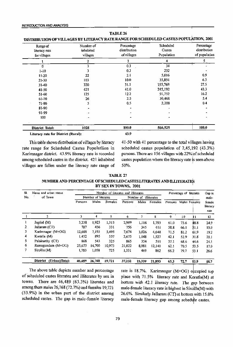
INTRODUCTION AND ANALYSIS
Range of Number of Percentage Scheduled Percentage
literacy rate inhabited distribution Castes distribution
for villages villages
1 2
0 3
l-lO 3
tl-20 22
21-30 103
31-40 320
41-50 421
51-60 125
61-70 26
71-80 5 81-90 91-99
100
District Total: 1028
Literacy rate for District (Rural):
This table shows distribution of villages by literacy rate range for Scheduled Castes Populatlion in Karimnagar district. 43.9% literacy rate is recorded among scheduled castes in the district. 421 inhabited villages are fallen under the literacy rate range of
of villages Population of population
3 4 5
0.3 34
0.3 232 2.1 5,016 0.9
10.0 35,854 6.3
31.1 155,769 27.5 41.0 245,192 43.3 12.2 91,752 16.2
2.5 30,468 5.4
0.5 2,208 0.4
100.0 566,525 100.0
43.9
41-50 with 41 percentage to the total Vilages having scheduled castes population of 2,45, 92 (43.3%) persons. There are 156 villages with 22% of scheduled castes population where the literacy rate s seen·above 50%.
TABLE 27
NUMBER AND PERCENTAGE OF SCHEDULED CASTES LITERATES AND ILLITERATE BY SEX IN TOWNS, 2001
Sl. Name and urban status Number of literates and illiterates Percentage of IitJrates Gap in
male· female literacy
No. of Town Number of literates
Persons Males Females
2 3 4 5
lagtial (M) 3,238 1,923 1,315 2 lallaram (CT) 787 456 331 3 Karimnagar (M+OG) 12,688 7,193 5,495 4 Koratla (M) 1,452 895 557 5 Palakurthy (CT) 868 543 325 6 Rarnagundam (M+OG) 25,673 14,700 10,973 7 Sircilla (M) 1,783 1,058 725
District (Urban)Total: 46,489 26,768 19,721
The above table depicts number and percentage of scheduled castes literates and illiterates by sex in towns. There are 46,489 (63.3%) literates and among them males 26,768 (72.7%) and females 19,721 (53.9%) in the urban part of the district among scheduled castes. The gap in male-female literacy
79
Number of illiterates Persons Males Females
6 7 8
2,909 1,116 1,793 756 345 411
7,674 3,026 4,648 2,675 1,148 1,527
865 354 511 21,022 8,881 12,141
1,331 469 862
37,232 15,339 21,893
Persons Males Fe
9 10
61.0 73.6 58.8 66.1 71.5 81.2 42.1 52.9 57.1 68.6 62.1 70.5 66.2 79.7
63.3 72.7
ales
8.8 ,1.I
fl.9 31.8
4.6 3.5
3.1
3.9
rate
12
24.9 15.0
19.2 21.l 24.1 17.0 26.6
18.7
rate is 18.7%. Karimnagar (M+OG) opcupied top place with 71.5% literacy rate and Koratla(M) at bottom with 42.1 literacy rate. The gap between male-female literacy rate is highest in Sircma(M) with 26.6%. Similarly lallaram (CT) at bottom I with 15.0% male-female literacy gap among schedJle castes.
I
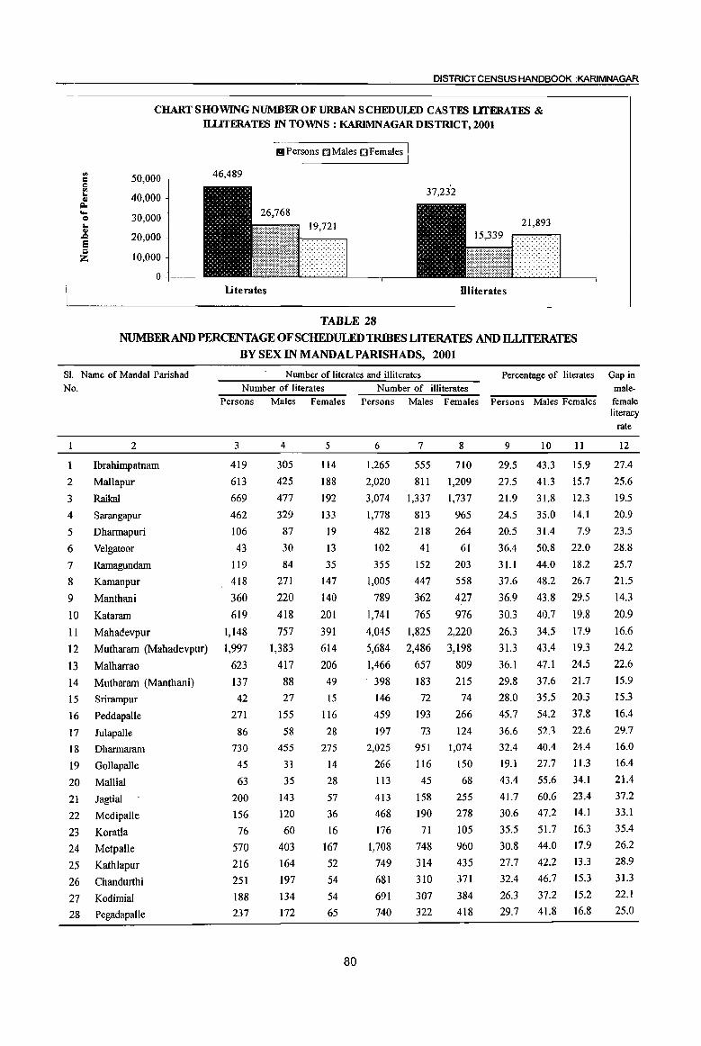
DISTRICT CENSUS HANDBOOK :KARIMNAGAR
CHART SHOWING NUMBER OF URBAN SCHEDULED CASTFS LlTERATFS & ll.LlTERATFS IN TOWNS: KARlMNAGARDISTRICT, 2001
'" c o r; 4.1 ~ .... o
"" Ql .Q
e ::l Z
50,000
40,000
30,000
20,000
10,000
o -t---
I I!!I Persons IDMales OFemales I 46,489
19,721
literates Dliterates
TABLE 28 NUMBERAND PERCENTAGE OF SCHEDULED TRIBES LITERATES AND ILLITERATES
BY SEX IN MANDALPARISHADS, 2001
SI. Name of Mandai Parish ad No.
2
Ibrahimpatnam
2 Mallapur
3 Raikal
4 Sarangapur
5 Dharmapuri
6 Velgatoor
7 Ramagundam
8 Kamanpur
9 Manthani
10 Kataram
II Mahadevpur
12 Mutharam (Mahadevpur)
13 Malharrao
14 Mutharam (Manthani)
15 Srirampur
16 Peddapalle
17 JulapaUe
18 Dharmaram
19 Gollapalle
20 Mallial
21 Jagtial
22 Medipalle
23 Koratla
24 Metpalle
25 Kathlapur
26 Chandurthi
27 Kodimial
28 Pegadapalle
Number of literates and illiterates Percentage of literates Gap in Number of literates Number of illiterates male-
Persons Males Females Persons Males Females Persons Males Females female
3
419
613
669
462
106
43
119
418
360
619 1,148
1,997
623
137 42
271
86
730
45
63
200
156
76
570
216
251
188
237
4
305
425
477
329
87
30
84
271
220
418
757
1,383
417
88
27
155 58
455
31
35
143
120
60
403
164
197
134
172
5
114
188
192
133
19
13
35
147
140
201
391
614
206
49
15
116
28
275
14
28
57
36 16
167
52
54
54
65
80
6
1,265
2,020
3,074
1,778
482
102
355
1,005
789 1,741
4,045
5,684
1,466
398
146
459
197
2,025
266
113
413
468
176
1,708
749
681
691 740
7
555
811
1,337
813
218
41
152
447
362
765
1,825
2,486
657 183
72
193
73
951
116
45
158
190 71
748
314
310
307 322
8
710
1,209
1,737
965
264
61
203
558
427
976
2,220
3,198
809
215
74
266
124 1,074
150
68
255
278
105
960
435
371
384
418
9
29.5
27.5
21.9
24.5
20.5
36.4
31.1
37.6
36.9
30.3
26.3
31.3
36.1
29.8
28.0
45.7
36.6
32.4
19.1
43.4
41.7
30.6
35.5
30.8
27.7 32.4
26.3
29.7
10
43.3
41.3
31.8
35.0
31.4
50.8
44.0
48.2
43.8
40.7
34.5
43.4
47.1
37.6
35.5
54.2
52.3
40.4
27.7
55.6
60.6
47.2
51.7 44.0
42.2
46.7
37.2
41.8
11
15.9
15.7
12.3
14.1
7.9
22.0
18.2
26.7
29.5
19.8 17.9
19.3
24.5
21.7
20.3
37.8
22.6
24.4
11.3
34.1
23.4
14.1
16.3
17.9
13.3
15.3
15.2
16.8
literacy rate
12
27.4
25.6
19.5
20.9
23.5
28.8
25.7
21.5
14.3
20.9
16.6
24.2
22.6
15.9
15.3
16.4
29.7
16.0
16.4
21.4
37.2
33.1
35.4
26.2
28.9
31.3
22.1
25.0
INTRODUCTION AND ANALYSIS
TABLE 28 (Concld .. ) NUMBER AND PERCENTAGE OF SCHEDULED TRIBES LITERATES AND ILLITERA~
BY SEX IN MANDALPARISHADS, 2001
Sl. Name of Mandai Parishad Number of literates and illiterates Percentage of literates Gap in No. Number of .literates Number of illiterates I male-
Persons Males Females Persons Males Females Persons Males Ferales female literacy
rate I
1 2 3 4 5 6 7 8 9 10 ill 12
29 Gangadhara 59 40 19 225 100 125 27.1 36.4 17.6 18.8
30 Rarnadugu 390 255 135 717 306 411 42.8 55.7 9.8 25.9
31 Choppadandi 313 263 50 352 133 219 55.8 74.3 4.2 50.l
32 Sultanabad 193 146 47 318 122 196 49.2 70.2 5.5 44.6
33 Odela 112 71 41 266 124 142 36.4 44.4 ' 7.7 16.7 I
34 Manakondur 147 94 53 468 218 250 31.3 40.0 f2.6 17.4 35 Karimnagar 635 397 238 907 361 546 49.0 61.5 6.6 24.9
i
36 Boinpalle 51 35 16 63 21 42 51.5 68.6 S3.3 35.3 37 Vemulawada 162 105 57 335 162 173 39.4 49.1 28.9 20.1
38 Konaraopeta 599 445 154 1,316 522 794 37.8 56.3 t9.3 37.0
39 Yellareddipet 1,726 1,281 445 5,885 2,480 3,405 28.1 422 4.4 27.8 40 Garnbhiraopet 442 286 156 1,412 626 786 29.4 38.3
1°6 17.7
41 Mustabad 196 143 53 1,058 488 570 19.4 28.5 0.4 18.1 42 SircilIa 181 127 54 412 176 236 38.1 51.0 r-9 27.1 43 Ellanthakunta 72 46 26 160 74 86 37.3 46.9 7.4 19.6 44 Belianki 129 76 53 251 112 139 41.0 48.4 h5 14.9
I 45 Timmapur (LMV Colony) 140 101 39 326 142 184 37.0 49.5 22.4 27.1 46 Veenavanka 120 90 30 658 297 361 18.9 28.0 1 9.6 18.5 47 lammikunta 210 136 74 575 241 334 33.1 43.2 3.2 20.0 48 Shankarapatnam 67 46 21 122 57 65 39.6 50.0 7.3 22.7 49 Chigurumarnidi 142 88 54 221 89 132 47.2 58.3 6.0 22.3 50 Koheda 328 203 125 772 338 434 36.3 44.3 8.0 16.3 51 Husnabad 2,288 1,586 702 5,972 2,701 3,271 33.9 45.1 1.7 23.5 52 Saidapur 339 245 94 531 226 305 45.9 61.3 7.7 33.5
I 53 Huzurabad 171 113 58 356 151 205 39.9 52.1 27.4 24.7 I 54 Karnalapur 102 71 31 173 73 100 45.7 61.2 29.0 32.2
55 Bheemadevarpalle 1,294 864 430 2,757 1,206 1,551 37.9 49.1 36.0 23.1 56 Elkathurthi 159 96 63 255 109 146 43.8 53.9 34.1 19.9
District (Rural) Total: 21,631 14,894 6,737 59,899 26,177 33,722 32.2 43.9 23.7
This table explains the number and percentage Choppadandi MandaI Parishad occupie top place of scheduled tribes literates and illiterates by sex in with 55.8 percent literacy rate and Veenavanka MandaI Parishads. There are 21,631 (32.2%) literates I
MandaI Parishad at bottom with 18.9% literacy rate and among them males 14,894 (43.9%) and females among scheduled tribes. The gap between male-6,737 (20.2%) in ,the MandaI Parishads of the district female literacy rate is highest in Choppadandi MandaI among scheduled tribes. The gap in male-female Parishad with 50.1 %. Similarly Manthani MandaI literacy rate is 23.7%. This shows the female literacy
I
Parishad reflects less male-female liteiflcy gap of rate is far lagging behind the male literacy rate. 14.3% among scheduled tribes.
81
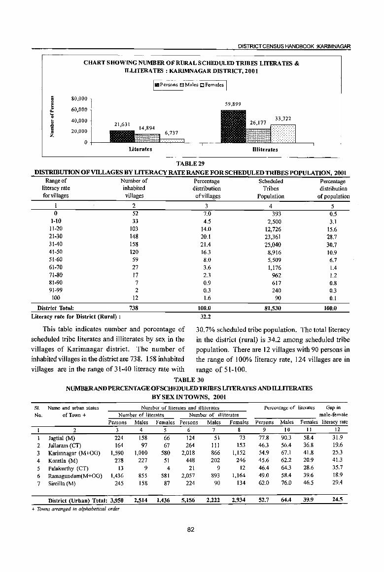
DISTRICT CENSUS HANDBOOK :KARIMNAGAR
., 1:1 c t;
'" Q. ... Q .. .. .c e 1:1 Z
CHART SHOWING NUMBER OF RURAL SCHEDULED TRffiES LITERATES & ILLITERA TES : KARIMNAGAR DIS TRICT, 2001
I III Persons 0 Males tJ Females I 80,000
59,899 60,000
40,000
20,000 6,737
0 literates Illiterates
TABLE 29
. DISTRIBUTION OF VILLAGES BY LITERACY RATE RANGE FOR SCHEDULED TRIBES POPULATION, 2001 Range of Number of Percentage Scheduled Percentage
literacy rate inhabited distribution Tribes distribution for villages villages ofvillages Population of population
2 3 4 5 0 52 7.0 393 0.5
1-10 33 4.5 2,500 3.1 11-20 103 14.0 12,726 15.6 21-30 148 20.1 23,361 28.7 31-40 158 21.4 25,040 30.7 41-50 120 16.3 8,916 10.9 51-60 59 8.0 5,509 6.7 61-70 27 3.6 1,176 1.4 71-80 17 2.3 962 1.2 81-90 7 0.9 617 0.8 91~99 2 0.3 240 0.3
tOO 12 1.6 90 0.1
District Total: 738 1(}0.0 81,530 100.0
Literacy rate for District (Rural) : 32.2
This table indicates number and percentage of 30.7% scheduled tribe population. The total literacy scheduled tribe literates and illiterates by sex in the in the district (rural) is 34.2 among scheduled tribe villages of Karimnagar district. The number of population. There are 12 villages with 90 persons in inhabited villages in the district are 738. 158 inhabited the range of 100% literacy rate, 124 villages are in villages are in the range of 31-40 literacy rate with range of 51-100.
SI.
No.
I
1 2 3 4 5 6 7
TABLE 30
NUMBERANDPERCENTAGEOFSCHEDULEDTRIBESLITERATES AND ILLITERATES BY SEX IN TOWNS, 2001
Name and urban status Number of literates and illiterates Percentage of literates
of Town + Number of literates Number of illiterates
Persons Males Females Persons Males Females Persons Males Females
2 3 4 5 6 7 8 9 10 II
Jagtial (M) 224 158 66 124 51 73 77.8 90.3 58.4 Jallaram (CT) 164 97 67 264 III 153 46.3 56.4 36.8
Karimnagar (M+OG) 1,590 1,010 580 2,018 866 1,152 54.9 67.1 41.8
Koratla (M) 278 227 51 448 202 246 45.6 62.2 20.9
Palakurthy (CT) 13 9 4 21 9 12 46.4 64.3 28.6
Ramagundam(M+OG) 1,436 855 581 2,057 893 1,164 49.0 58.4 39.6
Sircilla (M) 245 158 87 224 90 134 62.0 76.0 46.5
District (Urban) Total: 3,950 2,514 1,436 5,156 2,222 2,934 52.7 64.4 39.9
+ Towns arranged in alphabetical order
82
Gap in male-female literacy rate
12
31.9 19.6 25.3 41.3
35.7 18.9 29.4
24.5

INTRODUCTION AND ANALYSIS
The above table explains the number and percentage of scheduled tribes literates and illiterates by sex in towns. There are 3,950 (52.7%) literates and among them males 2,514(64.4%) and females 1,436(39.9%) in the towns of the district among scheduled tribes. The gap in male-female literacy is
24.5%. Jagtial(M) occupied top pia e with 77.8 percent literacy rate and Koratla at botto with 45.6% literacy rate among scheduled tribes. The gap between male-female literacy rate is hi est in Koratla (M) with41.3%. Ramagundam(M+OG has recorded less gap with 18.9%.
CHART SHOWING NUMBER OF URBAN SCHIIDULEDTRIBES LITERATES & ILLITERAllB IN TOWNS : KARIMNAGARDISTRICf,2001
1111 Persons Q Males 0 Females 1
a 6,000 5,156 0 5,000 r! 3,950 .. c.. 4,000 .... 0 ... 3,000 ..
,Q 1,436 e 2,000
= Z 1,000
0 literates Dliterates
TABLE 31
NUMBER AND PERCENTAGE OF MAIN WORKERS, MARGINALWORKERSANDNON-WOru\mRS BY SEX IN MANDALS, 2001
SI. Name of Mandai Persons! Total Main Workers Marginal Workers Total Workers I Non-workers No. Males! Population (Main and Marginal)
NuJber Percen-Females Number Percen- Number Percen- Number Percen-I
tage tage tage \ tage
2 3 4 5 6 7 8 9 10 1 t 12
Ibrahimpatnam Persons 50,845 28,878 56.8 1,665 3.3 30,543 60.1 39.9 Males 24,737 14,019 56.7 614 2.5 14,633 59.2 40.8 Females 26,108 14,859 56.9 1,051 4.0 15,910 60.9 39.1
2 Mallapur Persons 49,575 28,058 56.6 1,505 3.0 29,563 59.6 20,02 40.4 Males 23,963 13,684 57.1 426 1.8 14,110 58.9 9,8$3 41.1 Females 25,612 14,374 56.1 1,079 4.2 15,453 60.3 10,149 39.7
I
3 Raikal Persons 58,807 30,721 52.2 3,720 6.3 34,441 58.6 24,3~6 41.4 Males 28,603 14,969 52.3 1,635 5.7 16,604 58.0 11,9~9 42.0 Females 30,204 15,752 52.2 2,085 6.9 17,837 59.1
12~r 40.9
4 Sarangapur Persons 40,881 20,195 49.4 4,401 10.8 24,596 60.2 16,2 5 39.8 Males 19,935 10,389 52.1 1,582 7.9 11,971 60.1 7,94 39.9 Females 20,946 9,806 46.8 2,819 13.5 12,625 60.3 8,321 39.7
5 Dharmapuri Persons 73,230 35,425 48.4 4,779 6.5 40,204 54.9 33,02~ 45.1 Males 36,124 19,253 53.3 1,617 4.5 20,870 57.8 15,25~ 42.2 Females 37,106 16,172 43.6 3,162 8.5 19,334 52.1 17,772 47.9
6 Velgatoor . Persons 47,229 23,910 50.6 2,419 5.1 26,329 55.7 2Z:1
44.3 Males 23,827 12,914 54.2 947 4.0 13,861 58.2 41.8 Females 23,402 10,996 47.0 1,472 6.3 12,468 53.3 10,93 46.7
7 Rarnagundarn Persons 279,323 70,961 25.4 11,103 4.0 82,064 29.4 197,25 70.6 Males 142,247 61,163 43.0 6,367 4.5 67,530
. I 47.5 74,717 52.5
Females 137,076 9,798 7.1 4,736 3.5 14,534 10.6 122,542 89.4
83
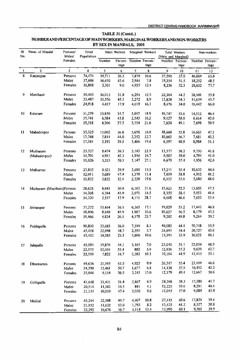
DISTRICT CENSUS HANDBOOK :KARIMNAGAR
TABLE 31 (Contd •. )
NUMBERAND PERCENTAGE OFMAlNWORKERS,MARGJNALWORKERSAND NON-WORKERS BY SEX IN MANDALS, 2001
SI. Name of Mandai Persons/ Total Main Workers Marginal Workers Total Workers Non-workers No. Males/ Population ~Main and Marsinal}
Females Number Percen- Number Percen- Number Percen- Number Percen-tage tage tage tage
1 2 3 4 5 6 7 8 9 10 11 12 8 Kamanpur Persons 74,474 19,711 26.5 7,879 10.6 27,590 37.0 46,884 63.0
Males 37,606 16,410 43.6 2,944 7.8 19,354 51.5 18,252 48.5 Females 36,868 3,301 9.0 4,935 13.4 8,236 22.3 28,632 77.7
9 Manthani Persons 50,405 16,013 31.8 6,291 12.5 22,304 44.2 28,101 55.8 Males 25,487 11,556 45.3 2,272 8.9 13,828 54.3 11,659 45.7 Females 24,918 4,457 17.9 4,019 16.1 8,476 34.0 16,442 66.0
10 Kataram Persons 31,259 10,850 34.7 5,897 18.9 16,747 53.6 14,512 46.4 Males 15,741 6,584 41.8 2,543 16.2 9,127 58.0 6,614 42.0 Females 15,518 4,266 27.5 3,354 21.6 7,620 49.1 7,898 50.9
II Mahadevpur Persons 35,325 13,002 36.8 5,658 16.0 18,660 52.8 16,665 47.2 Males 17,744 7,811 44.0 2,252 12.7 10,063 56.7 7,681 43.3 Females 17,581 5,191 29.5 3,406 19.4 8,597 48.9 8,984 51.1
12 Mutharam Persons 23,327 8,474 36.3 5,103 21.9 13,577 58.2 9,750 41.8 (Mahadevpur) Males 11,701 4,951 42.3 1,956 16.7 6,907 59.0 4,794 41.0
Females 11,626 3,523 30.3 3,147 27.1 6,670 57.4 4,956 42.6
13 Malharrao Persons 23,843 9,521 39.9 3,690 15.5 13,211 55.4 10,632 44.6 Males 12,011 5,689 47.4 1,310 11.4 7,059 58.8 4,952 41.2
Females 11,832 3,832 32.4 2,320 19.6 6,152 52.0 5,680 48.0
14 Mutharam (Manthani)Persons 28,628 8,841 30.9 6,182 21.6 15,023 52.5 13,605 47.5
Males 14,308 6,284 43.9 2,071 14.5 8,355 58.4 5,953 41.6
Females 14,320 2,557 17.9 4,111 28.7 6,668 46.6 7,652 53.4
15 Srirampur Persons 37,272 13,464 36.1 6,365 17.1 19,829 53.2 17,443 46.8
Males 18,806 8,640 45.9 1,987 10.6 10,627 56.5 8,179 43.5 Females 18,466 4,824 26.1 4,378 23.7 9,202 49.8 9,264 50.2
16 Peddapalle Persons 90,830 32,683 36.0 7,399 8.1 40,082 44.1 50,748 55.9
Males 45,418 22,098 48.7 2,593 5.7 24,691 54.4 20,727 45.6
Females 45,412 10,585 23.3 4,806 10.6 15,391 33.9 30,021 66.1
]7 Julapalle Persons 45,094 19,876 44.1 3,164 7.0 23,040 51.1 22,054 48.9
Males 22,575 12,054 53.4 882 3.9 12,936 57.3 9,639 42.7
Females 22,519 7,822 34.7 2,282 IOJ 10,104 44.9 12,415 55.1
18 Dharmaram Persons 49,636 21,595 43.5 4,922 9.9 26,517 53.4 23,1l9 46.6
Males 24,590 12,461 50.7 1,677 6.8 14,138 57.5 10,452 42.5
Females 25,046 9,134 36.5 3,245 13.0 12,379 49.4 12,667 50.6
19 Gollapalle Persons 41,648 21,401 51.4 2,867 6.9 24,268 58.3 17,380 41.7
Males 20,514 11,382 55.5 841 4.1 12,223 59.6 8,291 40.4
Females 21,134 10,019 47.4 2,026 9.6 12,045 57.0 9,089 43.0
20 Mallial Persons 45,244 22,508 49.7 4,907 10.8 27,415 60.6 17,829 39.4
Males 21,952 11,632 53.0 1,793 8.2 13,425 61.2 8,527 38.8
Females 23,292 10,876 46.7 3,114 13.4 13,990 60.1 9,302 39.9
84
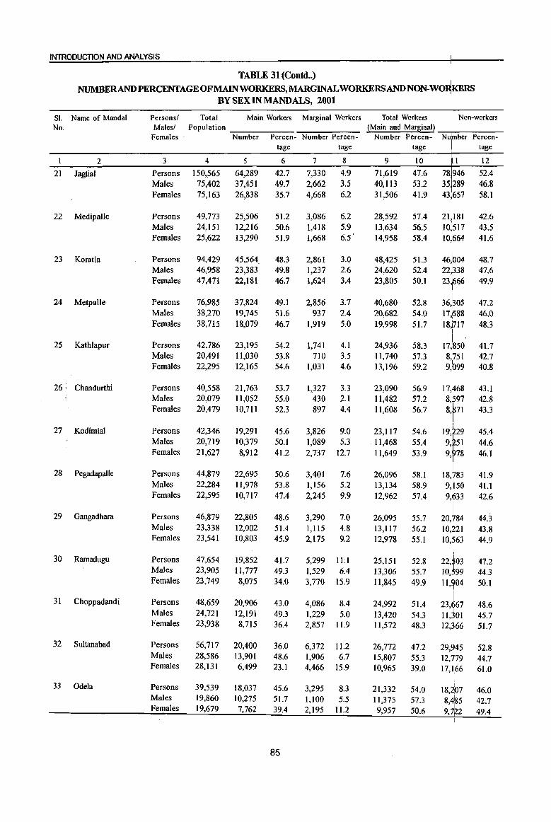
INTRODUCTION AND ANALYSIS
TABLE 31 (eoutd .. ) NUMBERANDPERCENTAGEOFMAINWORKERS,MARGINALWORKERSAND NON-WO~RS
BYSEXINMANDALS,2001
SI. Name of MandaI Persons/ Total Main Workers Marginal Workers Total Workers Non-workers No. Males! Population ~Main and Mar~inal)
Females· Number Percen- Number Percen- Number Percen- Nu ber Percen-tage tage tage tage
1 2 3 4 5 6 7 8 9 1.0 1 12
21 Jagtial Persons 150,565 64,289 42.7 7,330 4.9 71,619 47.6 78 946 52.4 Males 75,402 37,451 49.7 2,662 3.5 40,113 53.2 35 289 46.8 Females 75,163 26,838 35.7 4,668 6.2 31,506 41.9 43 657 58.1
22 Medipalle Persons 49,773 25,506 51.2 3,086 6.2 28,592 57.4 21J181 42.6 Males 24,151 12,216 50.6 1,418 5.9 13,634 56.5 10 517 43.5 Females 25,622 13,290 51.9 1,668 6.5' 14,958 58.4 10 664 41.6
23 Koratla Persons 94,429 45,564 48.3 2,861 3.0 48,425 51.3 48.7 Males 46,958 23,383 49.8 1,237 2.6 24,620 52.4 47.6 Females 47,471 22,181 46.7 1,624 3.4 23,805 50.1 49.9
24 Metpalle Persons 76,985 37,824 49.1 2,856 3.7 40,680 52.8 47.2 Males 38,270 19,745 51.6 937 2.4 20,682 54.0 46.0 Females 38,715 18,079 46.7 1,919 5.0 19,998 51.7 48.3
25 Kathlapur Persons 42,786 23,195 54.2 1,741 4.1 24,936 58.3 17, 50 41.7 Males 20,491 11,030 53.8 710 3.5 11,740 57.3 8, 51 42.7 Females 22,295 12,165 54.6 1,031 4.6 13,196 59.2 9, 99 40.8
26, Chandurthi Persons 40,558 21,763 53.7 1,327 3.3 23,090 56.9 17, 68 43.1 Males 20,079 11,052 55.0 430 2.1 11,482 57.2
8f7 42.8
Females 20,479 10,711 52.3 897 4.4 11,608 56.7 8, 71 43.3
I
27 Kodimial Persons 42,346 19,291 45.6 3,826 9.0 23,117 54.6 I::~;i 45.4 Males 20,719 10,379 50.1 1,089 5.3 11,468 55.4 44.6 Females 21,627 8,912 41.2 2,737 12.7 11,649 53.9 9, 78 46.1
28 Pegadapalle Persons 44,879 22,695 50.6 3,401 7.6 26,096 58.1 18, 83 41.9 Males 22,284 11,978 53.8 1,156 5.2 13,134 58.9 9, 50 41.1 Females 22,595 10,717 47.4 2,245 9.9 12,962 57.4 9, 33 42.6
29 Gangadhara Persons 46,879 22,805 48.6 3,290 7.0 26,095 55.7 20, 84 44,3 Males 23,338 12,002 51.4 1,1l5 4.8 13,117 56.2 10, 21 43.8 Females 23,541 10,803 45.9 2,175 9.2 12,978 55.1 10,563 44.9
I 30 Rarnadugu Persons 47,654 19,852 41.7 5,299 ILl 25,151 52.8 22, 03 47.2
Males 23,905 11,777 49.3 1,529 6.4 13,306 55.7 10, 99 44.3 Females 23,749 8,075 34.0 3,770 15.9 11,845 49.9 11, 04 50.1
31 Choppadandi Persons 48,659 20,906 43.0 4,086 8.4 24,992 51.4 23, 67 48.6 Males 24,721 12,191 49.3 1,229 5.0 13,420 54.3 11, 01 45.7 Females 23,938 8,715 36.4 2,857 11.9 1l,572 48.3 12, 166 51.7
32 Sultanabad Persons 56,717 20,400 36.0 6,372 1l.2 26,772 47.2 29,945 52.8 Males 28,586 13,901 48.6 1,906 6.7 15,807 55.3 12,779 44.7 Females 28,131 6,499 23.1 4,466 15.9 10,965 39.0 17,166 61.0
33 Ode1a Persons 39,539 18,037 45.6 3,295 8.3 21,332 54.0 18j07 46.0 Males 19,860 10,275 51.7 1,100 5.5 11,375 57.3 1
42.7 8,4~5 Females 19,679 7,762 39.4 2,195 11.2 9,957 50.6 9,*2 49.4
1
85
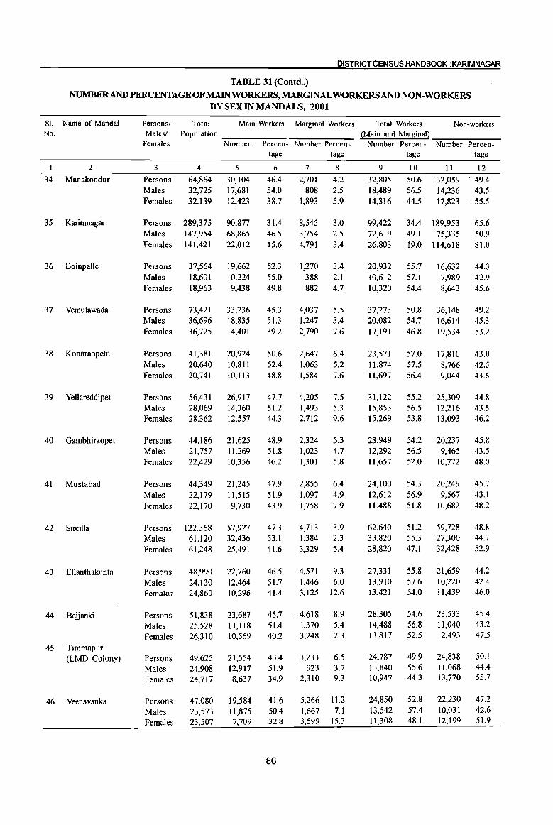
DISTRICT CENSUS HANDBOOK :KARIMNAGAR
TABLE 31 (Contd .. )
NUMBERANDPERCENTAGEOFMAINWORKERS,MARGINAL WORKERS AND NON-WORKERS BY SEX IN MANDALS, 2001
Sl. Name of Mandai No.
2
34 Manakondur
35 Karimnagar
36 Boinpalle
37 Vemulawada
38 Konaraopeta
39 Yellareddipet
40 Gambhiraopet
41 Mustabad
42 Sircilla
43 Ellanthakunta
44 Bejjanki
45 Timmapur (LMD Colony)
46 Veenavanka
Persons! Males! Females
3
Persons Males Females
Persons Males Females
Persons Males Females
Persons Males Females
Persons Males Females
Persons Males Females
Persons Males Females
Persons Males Females
Persons Males Females
Persons Males Females
Persons Males Females
Persons Males Females
Persons Males Females
Total Main Workers Marginal Workers Population ______ -,::-:--:-~ __
Number Percen- Number Percen-
4
64,864 32,725 32,139
289,375 147,954 141,421
37,564 18,601 18,963
73,421 36,696 36,725
41,381 20,640 20,741
56,431 28,069 28,362
44,186 21,757 22,429
44,349 22,179 22,170
122,368 61,120 61,248
48,990 24,130 24,860
51,838 25,528 26,310
49,625 24,908 24,717
47,080 23,573 23,507
5
30,104 17,681 12,423
90,877 68,865 22,012
19,662 10,224 9,438
33,236 18,835 14,401
20,924 10,811 10,113
26,917 14,360 12,557
21,625 1l,269 10,356
21,245 11,515 9,730
57,927 32,436 25,491
22,760 12,464 10,296
23,687 13,1l8 10,569
21,554 12,917 8,637
19,584 1l,875 7,709
tage tage
6
46.4 54.0 38.7
31.4 46.5 15.6
52.3 55.0 49.8
45.3 51.3 39.2
50.6 52.4 48.8
47.7 51.2 44.3
48.9 51.8 46.2
47.9 51.9 43.9
47.3 53.1 41.6
46.5 51.7 41.4
45.7 51.4 40.2
43.4 51.9 34.9
41.6 50.4 32.8
86
7
2,701 808
1,893
8,545 3,754 4,791
8
4.2 2.5 5.9
3.0 2.5 3.4
1,270 3.4 388 2.1 882 4.7
4,037 5.5 1,247 3.4 2,790 7.6
2,647 6.4 1,063 5.2 1,584 7.6
4,205 7.5 1,493 5.3 2,712 9.6
2,324 5.3 1,023 4.7 1,301 5.8
2,855 6.4 1,097 4.9 1,758 7.9
4,713 3.9 1,384 2.3 3,329 5.4
4,571 9.3 1,446 6.0 3,125 12.6
4,618 8.9 1,370 5.4 3,248 12.3
3,233 6.5 923 3.7
2,310 9.3
5,266 11.2 1,667 7.1 3,599 15.3
Total Workers Non-workers (Main and Marginal) __ --___ --
Number Percen- Number Percen-
9
32,805 18,489 14,316
99,422 72,619 26,803
20;932 10,612 10,320
37,273 20,082 17,191
23,571 11,874 11,697
31,122 15,853 15,269
23,949 12,292 11,657
24,100 12,612 11,488
62,640 33,820 28,820
27,331 13,910 13,421
28,305 14,488 13,817
24,787 13,840 10,947
24,850 13,542 11,308
tage tage
10
50.6 56.5 44.5
11
32,059 14,236 17,823
34.4 189,953 49.1 75,335 19.0 114,618
55.7 57.1 54.4
50.8 54.7 46.8
57.0 57.5 56.4
55.2 56.5 53.8
54.2 56.5 52.0
54.3 56.9 51.8
51.2 55.3 47.1
55.8 57.6 54.0
54.6 56.8 52.5
49.9 55.6 44.3
52.8 57.4 48.1
16,632 7,989 8,643
36,148 16,614 19,534
17,810 8,766 9,044
25,309 12,216 13,093
20,237 9,465
10,772
20,249 9,567
10,682
59,728 27,300 32,428
21,659 10,220 11,439
23,533 11,040 12,493
24,838 11,068 13,770
22,230 10,031 12,199
12 . 49.4
43.5 55.5
65.6 50.9 81.0
44.3 42.9 45.6
49.2 45.3 53.2
43.0 42.5 43.6
44.8 43.5 46.2
45.8 43.5 48.0
45.7 43.1 48.2
48.8 44.7 52.9
44.2 42.4 46.0
45.4 43.2 47.5
50.1 44.4 55.7
47.2 42.6 51.9
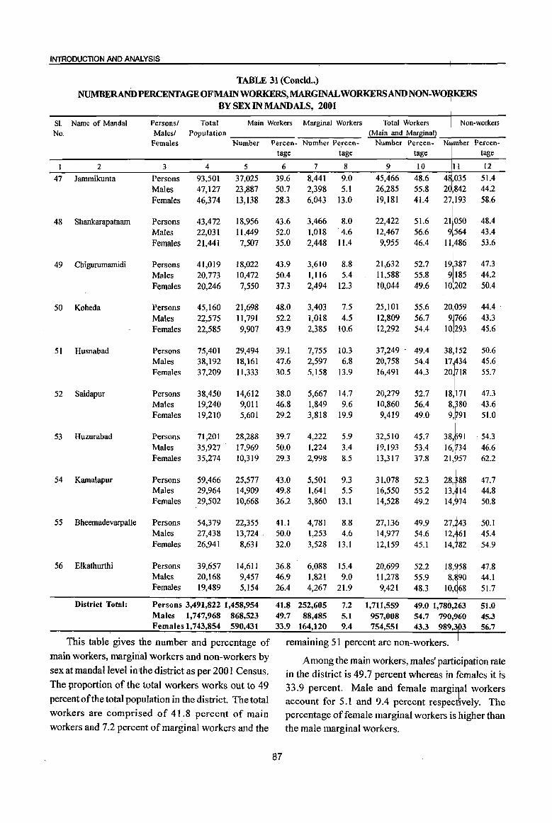
INTRODUCTION AND ANALYSIS
TABLE 31 (Concld .. )
NUMBERAND PERCENTAGE OF MAIN WORKERS, MARGINAL WORKERSANDNON-WO~RS BY SEX IN MANDALS, 2001
SI. Name of Mandai Persons! Total Main Workers Marginal Workers Total Workers Non-workers No. Malesl Population ~Main and Mar~inal~
Females Number Percen- Number Percen- Number Percen- N mber Percen-tage tage tage tage
I 2 3 4 5 6 7 8 9 10 II 12
47 larnmikunta Persons 93,501 37,025 39.6 8,441 9.0 45,466 48.6 4 ,035 51.4 Males 47,127 23,887 50.7 2,398 5.1 26,285 55.8 2 842 44.2
Females 46,374 13,138 28.3 6,043 13.0 19,181 41.4 27193 58.6
48 Shankarapatnarn Persons 43,472 18,956 43.6 3,466 8.0 22,422 51.6 21050 48.4 Males 22,031 11,449 52.0 1,018 4.6 12,467 56.6 9
1564 43.4
Females 21,441 7,507 35.0 2,448 11.4 9,955 46.4 11486 53.6
49 Chigurumarnidi Persons 41,019 18,022 43.9 3,610 8.8 21,632 52.7 19 387 47.3
Males 20,773 10,472 50.4 1,1l6 5.4 11,588 55.8 9185 44.2
Females 20,246 7,550 37.3 2,494 12.3 10,044 49.6 10 202 50.4
50 Koheda Persons 45,160 21,698 48.0 3,403 7.5 25,101 55.6 20 059 44.4 .
Males 22,575 11,791 52.2 1,018 4.5 12,809 56.7 9766 43.3 Females 22,585 9,907 43.9 2,385 10.6 12,292 54.4 10 293 45.6
51 Husnabad Persons 75,401 29,494 39.1 7,755 10.3 37,249 - 49.4
;~f 50.6
Males 38,192 18,161 47.6 2,597 6.8 20,758 54.4 45.6 Females 37,209 11,333 30.5 5,158 13.9 16,491 44.3 20,718 55.7
52 Saidapur Persons 38,450 14,612 38.0 5,667 14.7 20,279 52.7 IT: 47.3 Males 19,240 9,011 46.8 1,849 9.6 10,860 56.4 43.6 Females 19,210 5,601 29.2 3,818 19.9 9,419 49.0 9, 91 51.0
53 Huzurabad Persons 71,201 28,288 39.7 4,222 5.9 32,510 45.7 38, 91 . 54.3 Males 35,927 17,969 50.0 1,224 3.4 19,193 53.4 16,in4 46.6 Females 35,274 10,319 29.3 2,998 8.5 13,317 37.8
211" 62.2
54 Kamalapur Persons 59,466 25,577 43.0 5,501 9.3 31,078 52.3 28, 88 47.7 Males 29,964 14,909 49.8 1,641 5.5 16,550 55.2
~:1:: 44.8
Females 29,502 10,668 36.2 3,860 13.1 14,528 49.2 50.8
55 Bheemadevarpalle Persons 54,379 22,355 4I.l 4,781 8.8 27,136 49.9 50.1 Males 27,438 13,724 ' 50.0 1,253 4.6 14,977 54.6 12, 61 45.4 Females 26,941 8,631 32.0 3,528 13.1 12,159 45.1 14, 82 54.9
56 Elkathurthi Persons 39,657 14,611 36.8 6,088 !
15.4 20,699 52.2 18,~58 47.8 Males 20,168 9,457 46.9 1,821 9.0 11,278 55.9 8,890 44.1 Females 19,489 5,154 26.4 4,267 21.9 9,421 48.3 10, 68 51.7
District Total: Persons 3,491,822 1,458,954 41.8 252,605 7.2 1,711,559 49.0 1,780,263 51.0 Males 1,747,968 868,523 49.7 88,485 5.1 957,008 54.7 790,960 45.3 Females 1,743,854 590,431 33.9 164,120 9.4 754,551 43.3 989,3103 56.7
This table gives the number and percentage of remaining 51 percent are non-workers. I
main workers, marginal workers and non-workers by Among the main workers, males' participation rate sex at mandaI level in the district as per 200 I Census. in the district is 49.7 percent whereas in females it is The proportion of the total workers works out to 49 33.9 percent. Male and female margiI1al workers percent of the total population in the district. The total account for 5.1 and 9.4 percent respect~vely. The workers are comprised of 41.8 percent of main percentage of female marginal workers is higher than workers and 7.2 percent of marginal workers and the the male marginal workers.
87

DISTRICT CENSUS HANDBOOK :KARIMNAGAR
TABLE 32
NUMBERAND PERCENTAGEOFMAINWORKERS,MARGINALWORKERSANDNON-WORKERS BYSEXINMANDALPARISHADS, 2001
SI. Name of No. Mandai Parishad
2 Ibrahimpatnam
2 Mallapur
3 Raikal
4 Sarangapur
5 Dharmapuri
6 Velgatoor
7 Ramagundam
8 Kamanpur
9 Manthani
10 Kataram
1 I Mahadevpur
12 Mutharam (Mahadevpur)
13 Malharrao
14 Mutharam (Manthani)
Persons! Total Main Workers Marginal Workers Total Workers Non-workers Males! Population
Females
3 Persons Males Females
Persons Males Females
Persons Males Females
Persons Males Females
Persons Males Females
Persons Males Females
Persons Males Females
Persons Males Females
Persons Males Females
Persons Males Females
Persons Males Females
Persons Males Females
Persons Males Females
Persons Males Females
4
50,845 24,737 26,108
49,575 23,963 25,612
58,807 28,603 30,204
40,881 19,935 20,946
73,230 36,124 37,106
47,229 23,827 23,402
35,756 17,946 17,810
62,378 31,409 30,969
50,405 25,487 24,918
31,259 15,741 15,518
35,325 17,744 17,581
23,327
1 ' .. 701 11,626
23,843 12,011 11,832
28,628 14,308 14,320
~N~u-m-=b-e-r ---:P:::-e-rc-e-n- Number Percen-
5 28,878 14,019 14,859
28,058 13,684 14,374
30,721 14,969 15,752
20,195 10,389
9,806
35,425 19,253 16,172
23,910 12,914 10,996
13,427 9,126 4,301
16,265 13,654
2,611
16,013 11,556
4,457
10,850 6,584 4,266
13,002 7,811 5,191
8,474 4,951 3,523
9,521 5,689 3,832
8,841 6,284 2,557
tage tage
6 56.8 56.7 56.9
56.6 57.1 56.1
52.2 52.3 52.2
49.4 52.1 46.8
48.4 53.3 43.6
50.6 54.2
47
37.6 50.9 24.1
26.1 43.5
8.4
31.8 45.3 17.9
34.7 41.8 27.5
36.8 44.0 29.5
36.3 42.3 30.3
39.9 47.4 32.4
30.9 43.9 17.9
88
7 8 1,665 3.3 614 2.5
1,051 4.0
1,505 3.0 426 1.8
1,079 4.2
3,720 6.3 1,635 5.7 2,085 6.9
4,401 10.8 1,582 7.9 2,819 13.5
4,779 6.5 1,617 4.5 3,162 8.5
2,419 5.1 947 4.0
1,472 6.3
3,217 9.0 956 5.3
2,261 12.7
7,171 11.5 2,574 8.2 4,597 14.8
6,291 12.5 2,272 8.9 4,019 16.1
5,897 18.9 2,543 16.2 3,354 21.6
5,658 16.0 2,252 12.7 3,406 19.4
5,103 21.9 1,956 16.7 3,147 27.1
3,690 15.5 1,370 11.4 2,320 19.6
6,182 21.6 2,071 14.5 4,111 28.7
(Main and Marginal) ___ ------Number Percen- Number Percen-
tage tage
9 10
30,543 60.1 14,633 59.2 15,910 60.9
29,563 59.6 14,110 58.9 15,453 60.3
34,441 58.6 16,604 58.0 17,837 59.1
24,596 60.2 11,971 60.1 12,625 60.3
40,204 54.9 20,870 57.8 19,334 52.1
26,329 55.7 13,861 58.2 12,468 53.3
16,644 46.5 10,082 56.2
6,562 36.8
23,436 37.6 16,228 51.7
7,208 23.3
22,304 44.2 13,828 54.3
8,476 34.0
16,747 53.6 9,127 58.0 7,620 49.1
18,660 52.8 10,063 56.7
8,597 48.9
13,577 58.2 6,907 59.0 6,670 57.4
13,211 55.4 7,059 58.8 6,152 52.0
15,023 52.5 8,355 58.4 6,668 46.6
11 20,302 10,104 10,198
20,012 9,853
10,159
24,366 11,999 12,367
16,285 7,964 8,321
33,026 15,254 17,772
20,900 9,966
10,934
19,112 7,864
11,248
38,942 15,181 23,761
28,101 11,659 16,442
14,512 6,614 7,898
16,665 7,(i81 8,984
9,750 4,794 4,956
10,632 4,952 5,680
13,605 5,953 7,652
12
39.9 40.8 39.1
40.4 41.1 39.7
41.4 42.0 40.9
39.8 39.9 39.7
45.1 42.2 47.9
44.3 41.8 46.7
53.5 43.8 63.2
62.4 48.3 76.7
55.8 45.7 66.0
46.4 42.0 50.9
47.2 43.3 51.1
41.8 41.0 42.6
44.6 41.2 48.0
47.5 41.6 53.4
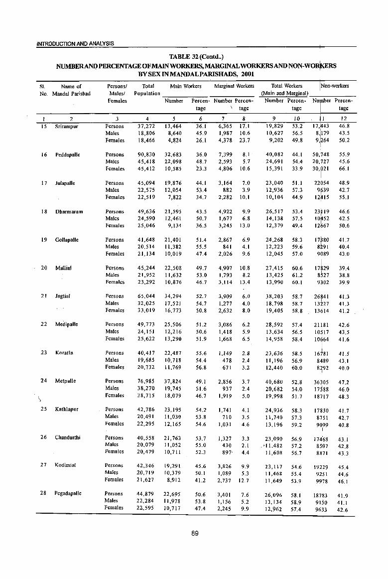
INTRODUCTION AND ANALYSIS
TABLE 32 (Contd •. ) I
NUMBERANQPERCENTAGEOFMAINWORKERS,MARGINALWORKERSANDNON-WO~RS
SI. Name of
No. Mandai Parishad
2 I 5 Srirampur
16 PeddapaUe
1 7 J ulapalle
18 Dharmaram
19 GolJapalJe
. 20 Mallial
21 Jagtial
22 MedipalJe
23 Koratla
24 Metpalle
25 Kathlapur
26 Chandurthi
27 Kodimial
28 PegadapaJle
Persons! Males!
Females
3 Persons Males Females
Persons Males Females
Persons Males Females
Persons Males Females
Persons Males Females
Persons Males Females
Persons Males Females
Persons Males Females
Persons Males Females
Persons Males Females
Persons Males Females
Persons Males Females
Persons Males Females
Persons Males Females
BY SEX IN MANDALPARISHADS, 2001
Total Main Workers Marginal Workers Population ~---,_---.,~ ______ _
Number Percen- Number Percen-
4 37,272 18,806 18,466
90,830 45,418 45,412
45,094 22,575 22,519
49,636 24,590 25,046
41,648 20,514 21,134
45,244 21,952 23,292
65,044 32,025 33,019
49,773 24,151 25,622
40,417 19,685 20,732
76,985 38,270 38,715
42,786 20,491 22,295
40,558 20,079 20,479
42,346 20,719 21,627
44,879 22,284 22,595
5 13,464
8,640 4,824
32,683 22,098 10,585
19,876 12,054
7,822
21,595 12,461
9,134
21,401 11,382 10,019
22,508 11,632 10,876
34,294 17,521 16,773
25,506 12,216 13,290
22,487 10,718 11,769
37,824 19,745 18,079
23,195 1l,030 12,165
21,763 11,052 10,711
19,291 10,379 8,912
22,695 11,978 10,717
tage \ tage
6 36.1 45.9 26.1
36.0 48.7 23.3
44.1 53.4 34.7
43.5 50.7 36.5
51.4 55.5 47.4
49.7 53.0 46.7
52.7 54.7 50.8
51.2 50.6 51.9
55.6 54.4 56.8
49.1 51.6 46.7
54.2 53.8 54.6
53.7 55.0 52.3
45.6 50.1 41.2
50.6 53.8 47.4
89
7 8 6,36517.1 1,987 10.6 4,378 23.7
7,399 8.1 2,593 5.7 4,806 10.6
3,164 7.0 882 3.9
2,282 10.1
4,922 9.9 1,677 6.8 3,245 13.0
2,867 6.9 841 4.1
2,026 9.6
4,907 10.8 1,793 8.2 3,114 13.4
3,909 6.0 1,277 4.0 2,632 8.0
3,086 6.2 1,418 5.9 1,668 6.5
1,149 2.8 478 2.4 671 3.2
2,856 3.7 937 2.4
1,919 5.0
1,741 4.1 710 3.5
1,031 4.6
1,327 3.3 430 2.1 897" 4.4
3,826 9.9 1,089 5.3 2,737 12.7
3,401 7.6 1,156 5.2 2,245 9.9
Total Workers Non-workers (Main and Marginal) _+-___ _
Number Percen- Nu ber Percen-tage tage
9 10 19,829 53.2 10,627 56.5
9,202 49.8
40,082 44.1 24,691 54.4 15,391 33.9
23,040 5Ll 12,936 57.3 10,104 44.9
26,517 53.4 14,138 57.5 12,379 49.4
24,268 58.3 12,223 59.6 12,045 57.0
27,415 60.6 13,425 61.2 13,990 60.1
38,203 58.7 18,79858.7 19,405 58.8
28,592 57.4 13,634 56.5 14,958 58.4
23,636 58.5 11,196 56.9 12,440 60.0
40,680 52.8 20,682 54.0 19,998 51.7
24,936 58.3 11,740 57.3 13,196 59.2
23,090 56.9 .'[1,482 57.2
11,608 56.7
23,117 54.6 11,468 55.4 11,649 53.9
26,096 58.1 13,134 58.9 12,962 57.4
11 17,443
8,1179 9,~64
50'l
rT48 20, 27 30, 21
22 54 9 39 12~15
23p9
10~52 12667
I ~II :~ 9 89
17 29 8!m 9302
26841 13227
~:16~~ 10 17 10 64
16781 8489 8292
36305 17588
I 18
1117
17 50 8 51 90,99
!
17468 8597 8871
19229 9251 99b8
I 18783 9150 9633
12 46.8 43.5 50.2
55.9 45.6 66.1
48.9 42.7 55.1
46.6 42.5 50.6
41.7 40.4 43.0
39.4 38.8 39.9
41.3 41.3 41.2
42.6 43.5 41.6
41.5 43.1 40.0
47.2 46.0 48.3
41.7 42.7 40.8
43.1 42.8 43.3
45.4 44.6 46.1
41.9 41.1 42.6
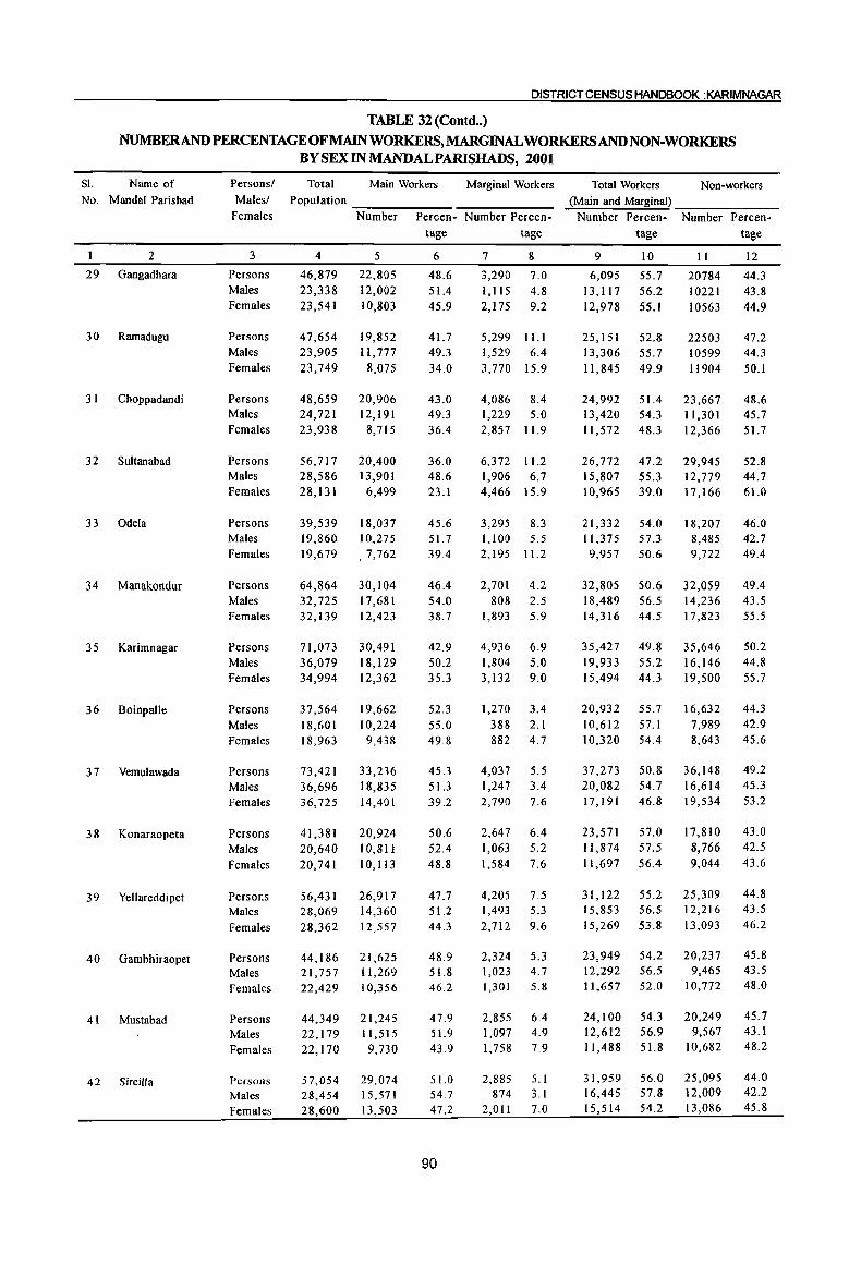
DISTRICT CENSUS HANDBOOK :KARIMNAGAR
TABLE 32 (Contd •• )
NUMBERANDPERCENTAGEOFMAINWORKERS,MARGINALWORKERSANDNON-WORKERS BY SEX IN MANDALPARISHADS, 2001
SI. Name of No. MandaI Parishad
2
29 Gangadhara
30 Ramadugu
3 I Choppadandi
32 Sultanabad
33 Odela
34 Manakondur
35 Karimnagar
36 Boinpalie
37 Vemulawada
38 Konaraopeta
39 Yellareddipet
40 Gambhiraopet
41 Mustabad
42 Sircilla
Persons/ Malesl
Females
3
Persons Males Females
Persons Males Females
Persons Males Females
Persons Males Females
Persons Males Females
Persons Males Females
Persons Males Females
Persons Males Females
Persons Males Females
Persons Males Females
Persons Males Females
Persons Males Females
Persons Males Females
Persons Males Females
Total Main Workers Marginal Workers Population __ -----_____ _
Number Percen- Number Percen·
4
46,879 23,338 23,541
47,654 23,905 23,749
48,659 24,721 23,938
56,717 28,586 28,131
39,539 19,860 19,619
64,864 32,725 32,139
71,073 36,079 34,994
31,564 18,601 18,963
13,421 36,696 36,125
41,381 20,640 20,741
56,431 28,069 28,362
44,186 21,757 22,429
44,349 22,119 22,170
57,054 28,454 28,600
5
22,805 12,002 10,803
19,852 11,777
8,015
20,906 12,191
8,115
20,400 13,901
6,499
18,037 10,215 .7,762
30,104 17,681 12,423
30,491 18,129 12,362
19,662 10,224
9,438
33,236 18,835 14,401
20,924 10,811 10,113
26,917 14,360 12,557
21,625 11,269 10,356
21,245 11,515
9,730
29,014 15,571 13,503
tage tage
6
48.6 51.4 45.9
41.7 49.3 34.0
43.0 49.3 36.4
36.0 48.6 23.1
45.6 51.1 39.4
46.4 54.0 38.7
42.9 50.2 35.3
52.3 55.0 49.8
45.3 51.3 39.2
50.6 52.4 48.8
47.7 51.2 44.3
48.9 51.8 46.2
47.9 51.9 43.9
51.0 54.7 47.2
90
7 8
3,290 7.0 1,115 4.8 2,175 9.2
5,299 11.1 1,529 6.4 3,770 15.9
4,086 8.4 1,229 5.0 2,857 11.9
6,372 11.2 1,906 6.7 4,466 15.9
3,295 8.3 1,100 5.5 2,195 11.2
2,701 4.2 808 2.5
1,893 5.9
4,936 6.9 1,804 5.0 3,132 9.0
1,210 3.4 388 2.1 882 4.7
4,037 5.5 1,247 3.4 2,790 1.6
2,647 6.4 1,063 5.2 1,584 7.6
4,205 1.5 1,493 5.3 2,712 9.6
2,324 5.3 1,023 4.7 1,301 5.8
2,855 6.4 1,097 4.9 1,758 7.9
2,885 5.1 874 3.1
2,011 7.0
Total Workers Non-workers (Main and Marginal) ______ _
Number Percentage
9 10
6,095 55.7 13,1l7 56.2 12,978 55.1
25,151 52.8 13,306 55.7 11,845 49.9
24,992 51.4 13,420 54.3 11,512 48.3
26,772 47.2 15,807 55.3 10,965 39.0
21,332 54.0 11,375 51.3 9,957 50.6
32,805 50.6 18,489 56.5 14,316 44.5
35,427 49.8 19,933 55.2 15,494 44.3
20,932 55.7 10,612 57.1 10,320 54.4
37,273 50.8 20,082 54.7 11,191 46.8
23,571 57.0 11,874 57.5 11,697 56.4
31,122 55.2 15,853 56.5 15,269 53.8
23,949 54.2 12,292 56.5 11,657 52.0
24,100 54.3 12,612 56.9 11,488 51.8
31,959 56.0 16,445 57.8 15,514 54.2
Number Percentage
II
20784 10221 10563
22503 10599 11904
23,667 11,301 12,366
29,945 12,779 17,166
18,207 8,485 9,722
32,059 14,236 11,823
35,646 16,146 19,500
16,632 1,989 8,643
36,148 16,614 19,534
17,810 8,766 9,044
25,309 12,216 13,093
20,231 9,465
10,772
20,249 9,567
10,682
25,095 12,009 13,086
12
44.3 43.8 44.9
47.2 44.3 50.1
48.6 45.7 51.7
52.8 44.7 61.0
46.0 42.7 49.4
49.4 43.5 55.5
50.2 44.8 55.7
44.3 42.9 45.6
49.2 45.3 53.2
43.0 42.5 43.6
44.8 43.5 46.2
45.8 43.5 48.0
45.7 43.1 48.2
44.0 42.2 45.8
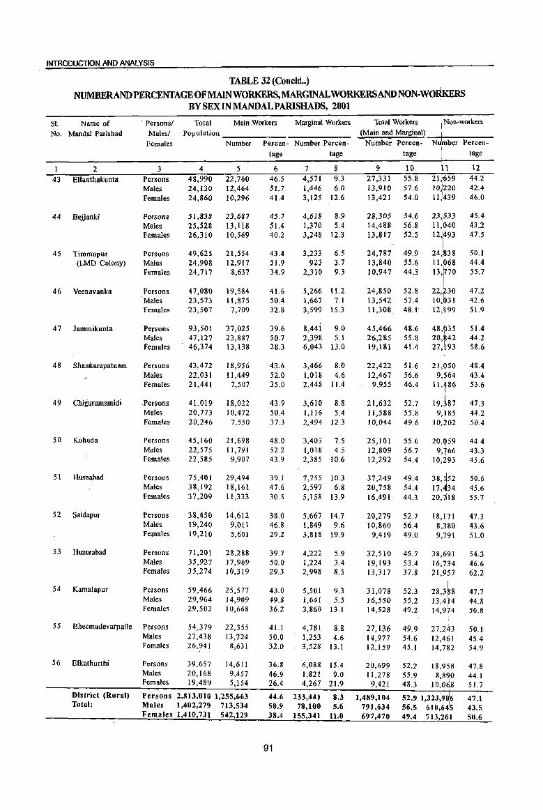
INTRODUCTION AND ANALYSIS
TABLE 32 (Concld •• ) 1
NUMBERANJj)PERCENTAGE OFMAlNWORKERS,MARGINALWORKERSAND NON-WORKERS BY SEX IN MANDALPARISHADS, 2001
I
SI. Name of Persons! Total Main ,Workers Marginal Workers Total Workers I Non-workers
No. Mandai Parishad Males! Population (Main and Marginal)
Females Number Percen~ Number Percen- Number Percen- Nu ber Percen-
tage tage tage tage
2 3 4 5 6 7 8 9 10 P 12
43 Ellanthakunta Persons 48,990 22,760 46.5 4,571 9.3 27,331 55.8 21)659 44.2 Males 24,130 12,464 51.7 1,446 6.0 13,910 57.6 10,1220 42.4 Females 24,860 10,296 41.4 3,125 12.6 13,421 54.0 11,1439 46.0
44 Bejjanld Persons 51,838 23,687 45.7 4,618 8.9 28,305 54.6 23,:533 45.4 Males 25,528 13,118 51.4 1,370 5.4 14,488 56.8 11,!040 43.2 Females 26,310 10,569 40.2 3,248 12.3 13,817 52.5
12f 47.5
4S Timmapur Persons 49,625 21,554 43.4 3,233 6.5 24,787 49.9 24, 38 50.1 (LMD Colony) Males 24,908 12,917 51.9 923 3.7 13,840 55.6 11, 68 44.4
Females 24,717 8,637 34.9 2,310 9.3 10,947 44.3 13, 70 55.7
46 Veenavanka Persons 47,080 19,584 41.6 5,266 11.2 24,850 52.8 22,230 47.2 Males 23,573 11,875 50.4 1,667 7.1 13,542 57.4 10,(>31 42.6 Females 23,507 7,709 32.8 3,599 15.3 11,308. 48.1 12,i 99 51.9
47 lammikunta Persons 93,501 37,025 39.6 8,441 9.0 45,466 48.6 48,935 51.4 Males 47,127 23,887 50.7 2,398 5.1 26,285 55.8 20,M2 44.2 Females 46,374 13,138 28.3 6,043 13.0 19,181 41.4 27, ~ 93 58.6
48 Shankarapatnam Persons 43,472 18,956 43.6 3,466 8.0 22,422 51.6
21'f'" 4S.4
Males 22,031 11,449 52.0 1,01S 4.6 12,467 56.6 9, 64 43.4 Females 21,441 7,507 35.0 2,448 11.4 9,955 46.4 11, 86 53.6
49 Chigurumamidi .Persons 41,019 18,022 43.9 3,610 8.8 21,632 52.7 19,387 47.3 Males 20,773 10,472 50.4 1,116 5.4 11,588 55.8
I 9,~85 44.2
Females 20,246 7,550 37.3 2,494 12.3 10,044 49.6 10,202 50.4
50 Koheda Persons 45,160 21,698 48.0 3,403 7.5 25,101 55.6 20,Q59 44.4 Males 22,575 11,791 52.2 1,018 4.5 12,809 56.7
'i:~:~ 43.3
Females 22,585 9,907 43.9 2,385 10.6 12,292 54.4 45.6
51 Husnabad Persons 75,40 I 29,494 39.1 7,755 10.3 37,249 49.4 38,152 50.6 Males 38,192 18,161 47.6 2,597 6.8 20,758 54.4 17, 34 45.6 Females 37,209 11,333 30.5 5,158 13.9 16,491 44.3 20,7\18 55.7
52 Saidapur Persons 38,450 14,612 38.0 5,667 14.7 20,279 52.7 18,li,71 47.3 Males 19,240 9,011 46.8 1,849 9.6 10,860 56.4 8,380 43.6 Females 19,210 5,601 29.2 3,818 19.9 9,419 49.0 9,791 51.0
53 Huzurabad Persons 71,201 28,288 39.7 4,222 5.9 32,510 45.7 38,6~1 54.3 Males 35,927 17,969 50.0 1,224 3.4 19,1 93 53.4 16,7134 46.6 Females 35,274 10,319 29.3 2,998 8.5 13,317 37.8 21,957 62.2
54 Kamalapur Persons 59,466 25,577 43.0 5,501 9.3 31,078 52.3 28,3f8 47.7 Males 29,964 14,909 49.8 1,641 5.5 16,550 55.2 13,4 4 44.8 Females 29,502 10,668 36.2 3,860 13.1 14,528 49.2 14,974 50.8
55 Bheemadevarpalle Persons 54,379 22,355 41.1 4,781 8.8 27,136 49.9 27,243 50.1 Males 27,438 13,724 50.0 1,253 4.6 14,977 54.6 12,461 45.4 Females 26,941 8,631 32.0 3,528 13.1 12,159 45.1 14,782 54.9
56 Elkathurthi Persons 39,657 14,611 36.8 6,088 15.4 20,699 52.2 18,958 47.8 Males 20,168 9,457 46.9 1,821 9.0 11,278 55.9 8,8!)0 44.1 Females 19,489 5,154 26.4 4,267 21.9 9,421 48.3 10,068 51.7
District (Rural) Persons 2,813,010 1,255,663 44.6 233,441 8.3 1,489,104 . I 47.1 52.9 1,323,90i6
Total: Males 1,402,279 713,534 50.9 78,100 5.6 791,634 56.5 610,64'5 43.5 Females 1,410,731 542,129 38.4 155,341 11.0 697,470 49.4 713,261 50.6
91

This table shows Mandai Parishad-wise number and percentage of main workers, marginal workers and non-workers for rural populatliori of the district. Of the 28, 13,0 1 0 total rural population of the district, 44.6 percent has been categorized as main workers and the marginal workers constitute 8.3 percent and the remaining 47.1 percent fall in the category of nonwokers. The sex-wise break up at the district level shows that 50.9 percent males and 38.4 percent females are in the category of main workers. Male and female marginal workers account for 5.6 and 11.0 percent respectively. The percentage of female
DISTRICT CENSUS HANDBOOK :KARIMNAGAR
marginal workers is higher than male marginal workers. Similar trend is visible at MandaI Parishads level.
The percentage of total rural workers of the district comes to 52.9. At the MandaI Parishad level Mallial has highest proportion of total workers forming 60.6 percent of the total population. It is closely followed by Sarangapur with 60.2 percent,
Ibrahimpatnam 60.1 percent, Mallapur with 59.6 percent. The lowest percentage of 37.6 percent is recorded in Kamanpur MandaI Parishad.
TABLE 33
NUMBERANDPERCENTAGEOFMAlNWORKERS,MARGINAL WORKERS AND NON-WORKERS BY SEX IN URBAN AGGLOMERATIONS I TOWNS, 2001
SI. Name and No. urban status of
UA" I Town+*
2
Jagtial (M)
2 lallaram (CT)
3 Karimnagar UA
Persons! Males!
Females
3
Persons
Males
Females
Persons
Males
Females
Persons
Males
Females
4 Karimnagar (M+OG) Persons
Males
Females
5 Karimnagar (M)*
6 Koratla (M)
7 Palakurthy (CT)
Persons
Males
Females
Persons
Males
Females
Persons
Males Females
8 Ramagundam (M+OG) Persons
Males
Females
Total Main Workers Marginal Workers
Population =--:-_-::-__ ~~-:--::-__ Number Percen- Number Percen-
4
85,521
43,377
42,144
11,010
5,634
5,376
218,302
111,875
106,427
218,302
111,875
106,427
205,653
105,336
100,317
54,012
27,273
26,739
6,967
3,614
3,353
237,686
121,250
116,436
5
29,995
19,930
10,065
3,013
2,471
542
60,386
50,736
9,650
60,386
50,736
9,650
55,937
47,467
8,470
23,077
12,665
10,412
1,722
1,495
227
56,245
50,827
5,418
tage tage
6
35.1 45.9
23.9
27.4
43.9
10.1
27.7
45.4
9.1
27.7
45.4
9.1
27.2
45.1
8.4
42.7
46.4
38.9
24.7
41.4
6.8
23.7
41.9
4.7
92
7
3,421
1,385
2,036
694
363
331
3,609
1,950
1,659
3,609
1,950
1,659
3,440
1,923
1,517
1,712
759
953
628
320
308
7,272
5,098 2,174
8
4.0 3.2
4.8
6.3
6.4
6.2
1.7
1.7
1.6
1.7
1.7
1.6
1.7
1.8
1.5
3.2
2.8
3.6
9.0 8.9
9.2
3. I 4.2
1.9
Total Workers (Main and Marginal)
Non-workers
Number Percen- ~N:-;-u-m-:b-e-r "";:P:-er-c-en---
tage tage
9
33,416 21,315
12,101
3,707
2,834
873
63,995
52,686
10 11
39.1 52,105 49.1 22,062
28.7 30,043
33.7 7,303
50.3 2,800
16.2 4,503
29.3 154,307
47.1 59,189
It,309 10.6 95,lt8
63,995 29.3 154,307
52,686 47.1 59,189
11,309 10.6 95,118
59,377
49,390
9,987
24,789
13,424
11,365
2,350 1,815
535
63,517
55,925 7,592
28.9 146,276
46.9 55,946
10.0 90,330
45.9 29,223
49.2 13,849
42.5 15,374
33.7 4,617 50.2 1,799
16.0 2,818
26.7 174,169
46.1 65,325 6.5 108,844
12
60.9
50.9
71.3
66.3
49.7
83.8
70.7
52.9
89.4
70.7
52.9
89.4
71.1
53.1
90.0
54.1
50.8
57.5
66.3 49.8
84.0
73.3
53.9
93.5

INTRODUCTION AND ANALYSIS
TABLE 33 (Concld •. )
NUMBER AND PERCENTAGE OFMAINWORKERS,MARGINALWORKERSAND NON-WORKERS BY SEX IN URBAN AGGLOMERATIONS fTOWNS, 2001
81. Name and Personsl Total Main Workers Marginal Workers Total Workers ·Non-workers
No. urban status of Males! Population (Main and Marginal) I
UA" I Town+* Females Number Percen- Number Percen- Number Percen- Nuinber Percen-tage tage tage I tage
I
I 2 3 4 5 6 7 8 9 10 P 12
9 Ramagundam (M)* Persons 236,600 . 55,812 23.6 7,258 3.1 63,070 26.7 173,~30 73.3
Males 120,687 50,542 41.9 5,091 4.2 55,633 46.1 65'1 54 53.9
Females 115,913 5,270 4.5 2,167 1.9 7,437 6.4 I08,(J76 93.6
10 Sircilla(M) Persons 65,314 28,853 44.2 1,828 2.8 30,681 47.0 34,633 53.0
Males 32,666 16,865 51.6 510 1.6 17,375 53.2 15,~91 46.8 • I
Females 32,648 11,988 36.7 1,318 4.0 13,306 40.8 19,~42 59.2
I
District (Urban) Persons 678,812 203,291 29.9 19,164 2.8 222,455 32.8 456i57 67.2 Total: Males 345,689 154,989 44.8 10,385 3.0 165,374 47.8 180 15 52.2
Females 333,123 48,302 14.5 8,779 2.6 57,081 17.1 276, 42 82.9 + Towns arranged in alph(lbetical order 1\ The names of constituents of UA are given separately * In case of the towns having out growth an asterisk mark placed against their name to indicate that thay have out growths which are not
separate towns.
This table gives J;lumber and percentage of main workers; marginal workers, and non-workers by sex in Urban AgglomaerationlTowns in the district of Karimnagar. Of the ~, 78,812 total urban population of the district, 29.9 percent has been categorized as main workers and 2.8 percent as marginal workers. The remaihing 67.2 percent fall in the category of non-workers. The sex-wise break up at the district level shows that 44.8 percent males and 14.5 percent
females are in the category of main wofkers. Male and female marginal workers account ifor 3.0 and
I
)
2.6 percent respectively.
The percentage of total urban wo~kers of the district comes to 32.8 percent. Sircilla(M) recorded highest proportion of total workers fonriing 47% of the total population. It is closely followed by Komtla (M) with 45.1 percent. The lowest percentage of 26.7 percent is recorded in Ramagundaf (M+OG).
Pm.CENTAGE OF MAIN, MARGINAL AND NON-WORKERS IN U.As./TOWNS IN
KARlMNAGARDISTRICf,2001
I!1lI Main Workers nn Marginal Workers ~ Non-\\Urkers
-; 90.0 82.9 c
80.0 'En .. r; 70.0 ~~ ~ .. 60.0 . ~ ~
50.0 ~ s!: .... Q Q2:; 40.0 "'"1:1 s; 30.0 c 20.0 "' ~ 10.0 "' CI.
0.0
Persons Males Females
93
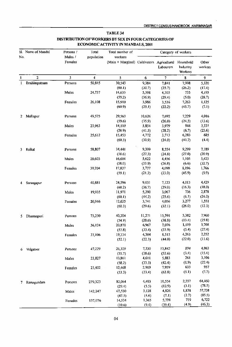
DISTRICT CENSUS HANDBOOK :KARIMNAGAR
TABLE 34
DISTRIBUTION OF WORKERS BY SEX IN FOUR CATEGORIES OF ECONOMIC ACTIVITY IN MANDALS, 2001
Sl. Name of Mandai Persons I Total Total number of Category of workers No. Males I population workers
Females (Main + Marginal) Cultivators Agricultural Household Other Labourers Industry workers
Workers
2 3 4 5 6 7 8 9
Ibrahimpatnam Persons 50,845 30,543 9,384 7,841 7,998 5,320 (60.1) (30.7) (25.7) (26.2) (17.4)
Males 24,737 14,633 5,398 4,305 735 4,195 (59.2) (36.9) (29.4) (5.0) (28.7)
Females 26,108 15,910 3,986 3,536 7,263 1,125 (60.9) (25.1) (22.2) (45.7) (7.1)
2 Mallapur Persons 49,575 29,563 10,626 7,692 7,229 4,016 (59.6) (35.9) (26.0) (24.5) (13.6)
Males 23,963 14,110 5,854 3.979 946 3,331 (58.9) (41.5) (28.2) (6.7) (23.6)
Females 25,612 15,453 4,772 3,713 6,283 685 (60.3) (30.9) (24.0) (40.7) (4.4)
3 Raikal Persons 58,807 34,441 9,399 8,554 9,299 7,189 (58.6) (27.3) (24.8) (27.0) (20.9)
Males 28,603 16,604 5,622 4,456 1,103 5,423 (58.0) (33.9) (26.8) (6.6) (32.7)
Females 30,204 17,837 3,777 4,098 8,196 1,766
(59.1 ) (21.2) (23.0) (45.9) (9.9)
4 Sarangapur Persons 40,881 24,596 9,031 7,123 4,013 4,429
(60.2) (36.7) (29.0) (16.3) (18.0)
Males 19,935 11,971 5,290 3,067 736 2,878
(60.1) (44.2) (25.6) (6.1) (24.0)
Females 20,946 12,625 3,741 4,056 3,277 1,551
(60.3) (29.6) (32.1) (26.0) (12.3)
5 Dharmapuri Persons 73,230 40,204 11,271 15,591 5,382 7,960
(54.9) (28.0) (38.8) ( 13.4) (19.8)
Males 36,124 20,870 6,967 7,076 1,119 5,708
(57.8) (33.4) (33.9) (5.4) (27.4)
Females 37,106 19,334 4,304 8,515 4,263 2,252
(52.1) (22.3) (44.0) (22.0) (11.6)
6 Velgatoor Persons 47,229 26,329 7,530 13,842 894 4,063
(55.7) (28.6) (52.6) (3.4) (15.4)
Males 23,827 13,861 4,611 5,883 261 3,106
(58.2) (33.3) (42.4) (1.9) (22.4)
Females 23,402 12,468 2,919 7,959 633 957
(53.3) (23.4) (63.8) (5.1) (7.7)
7 Ramagundam Persons 279,323 82,064 4,493 10,554 2,557 64,460
(29.4) (5.5) (12.9) (3.1) (78.5)
Males 142,247 67,530 3,128 4,826 1,838 57,738
(47.5) (4.6) (7.1) (2.7) (85.5)
Females 137,076 14,534 1,365 5,728 719 6,722
(10.6) (9.4) (39.4) (4.9) (46.3)
94
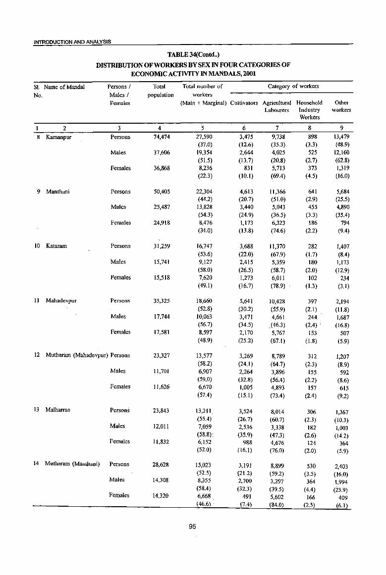
INTRODUCTION AND ANALYSIS
TABLE 34(Contd .. )
DISTRIBUTION OF WORKERS BY SEX IN FOUR CATEGORIES OF ECONOMIC ACTIVITY IN MANDALS, 2001
SI. Name of Mandai Persons / Total Total number of Category of worke~s
No. Males / population workers
Females (Main + Marginal) Cultivators Agricultural Household Other Labourers Industry workers
Workers
2 3 4 5 6 7 8 9
8 Kamanpur Persons 74,474 27,590 3,475 9,738 898 13,479 (37.0) (12.6) (35.3) (3.3) (48.9)
Males 37,606 19,354 2,644 4,025 525 12,160 (51.5) (13.7) (20.8) (2.7) (62.8)
Females 36,868 8,236 831 5,713 373 1,319 (22.3) (10.1) (69.4) (4.5) (16.0)
9 Manthani Persons 50,405 22,304 4,613 11,366 641 5,684 (44.2) (20.7) (51.0) (2.9) (25.5)
Males 25,487 13,828 3,440 5,043 455 4,890 (54.3) (24.9) (36.5) (3.3) (35.4)
Females 24,918 8,476 1,173 6,323 186 794 (34.0) (13.8) (74.6) (2.2) (9.4)
10 ,Kataram Persons .31,259 16,747 3,688 II,370 282 1,407 (53.6) (22.0) (67.9) (1.7) (8.4)
Males 15,741 9,127 2,415 5,359 180 1,173 (58.0) (26.5) (58.7) (2.0) (12.9)
Females 15,518 7,620 1,273 6,01 I 102 234 (49.1) (16.7) (78.9) (1.3) (3.1)
11 Mahadevpur Persons 35,325 18,660 5,641 10,428 397 2,194 (52.8) (30.2) (55.9) (2.1) (l1.8)
Males 17,744 , 10,063 3,471 4,661 244 1,687 (56.7) (34.5) ,(46.3) (2.4) (16.8)
Females 17,581 8,597 2,170 5,767 153 507 (48.9) (25.2) (67.1) (1.8) (5.9)
12 Mutharam (Mahadevpur) Persons 23,327 13,577 3,269 8,789 312 1,207 (58.2) (24.1) (64.7) (2.3) (8.9)
Males 11,701 6,907 2,264 3,896 155 592 (59.0) (32.8) (56.4) (2.2) (8.6)
Females 11,626 6,670 1,005 4,893 157 615 (57.4) (15.1) (73.4) (2.4) (9.2)
I3 Malharrao Persons 23,843 13,211 3,524 8,014 306 1,367 (55.4)' (26.7) (60.7) (2.3) (10.3)
Males 12,011 7,059: 2,536 3,338 182 1,003 (58.8) (35.9) (47.3) (2.6) (14.2)
Females 11,832 6,152 988 4,676 124 364 (52.0) (16.1) (76.0) (2.0) (5.9)
14 Mutharam (Manthani) Persons 28,628 15,023 3,191 8,899 530 2,403 (52.5) (21.2) (59.2) (3.5) (16.0)
Males 14,308 8,355 2,700 3,297 364 1,994 (58.4) (32.3) (39.5) (4.4) (23.9)
Females 14,320 6,668 491 5,602 166 409 (46.6) '. (7.4) (84.0) (2.5) (6.1)
95
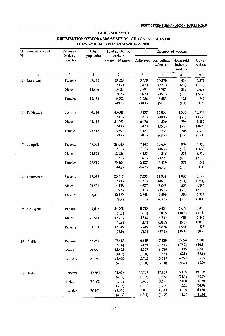
DISTRICT CENSUS HANDBOOK :KARfMNAGAR
TABLE 34 (Contd .. )
DISTRIBUTION OF WORKERS BY SEX IN FOUR CATEGORIES OF
ECONOMIC ACTIVITY IN MANDALS, 2001
Sl. Name of Mandai Persons I Total Total number of Category of workers No. Males I population workers
Females (Main + Marginal) Cultivators Agricultural Household Other Labourers Industry workers
Workers
2 3 4 5 6 7 8 9
15 Srirampur Persons 37,272 19,829 5,650 10,370 438 3,371 (53.2) (28.5) (52.3) (2.2) (17.0)
Males 18,806 10,627 3,894 3,787 317 2,629
(56.5) (36.6) (35.6) (3.0) (24.7) Females 18,466 9,202 1,756 6,583 121 742
(49.8) (19.1) (71.5) (1.3) (8.1)
16 Peddapalle Persons 90,830 40,082 9,197 16,065 1,306 13,514 (44.1) (22.9) (40.1) (3.3) (33.7)
Males 45,418 24,691 6,076 6,330 798 11,487
(54.4) (24.6) (25.6) (3.2) (46.5)
Females 45,412 15,391 3,121 9,735 508 2,027
(33.9) (20.3) (63.3) (3.3) (13.2)
17 JulapalJe Persons 45,094 23,040 7,142 10,634 909 4,355
(51.1 ) (31.0) (46.2) (3.9) (18.9)
Males 22,575 12,936 4,655 4,215 556 3,510
(57.3) (36.0) (32.6) (4.3) (27.1 )
Females 22,519 10,104 2,487 6,419 353 845
(44.9) (24.6) (63.5) (3.5) (8.4)
18 Dhannaram Persons 49,636 26,517 7,335 12,939 1,096 5,147
(53.4) (27.7) (48.8) (4.1) (19.4)
Males 24,590 14,138 4,687 5,049 506 3,896
(57.5) (33.2) (35.7) (3.6) (27.6)
Females 25,046 12,379 2,648 7,890 590 1,251
(49.4) (21.4) (63.7) (4.8) (10.1)
19 GollapalJe Persons 41,648 24,268 8,783 9,431 2,629 3,425
(58.3) (36.2) (38.9) (10.8) (14.1)
Males 20,514 12,223 5,338 3,755 688 2,442
(59.6) (43.7) (30.7) (5.6) (20.0)
Females 21,134 12,045 3,445 5,676 1,941 983
(57.0) (28.6) (47.1 ) (16.1 ) (8.2)
20 Mallial Persons 45,244 27,415 6,819 7,429 7,659 5,508
(60.6) (24.9) (27.1) (27.9) (20.1)
Males 21,952 13,425 4,027 3,680 1,175 4,543
(61.2) (30.0) (27.4) (8.8) (33.8)
Females 23,292 13,990 2,792 3,749 6,484 965
(60.1) (20.0) (26.8) (46.3) (6.9)
21 lagtial Persons 150,565 71,619 13,751 12,133 15,125 30,610
(47.6) (19.2) (16.9) (2l.l) (42.7)
Males 75,402 40,113 7,673 5,890 2,100 24,450
(53.2) (19.1) (14.7) (5.2) (61.0)
Females 75,163 31,506 6,078 6,243 13,025 6,160
(41.9) (19.3) (19.8) (41.3) (19.6)
96
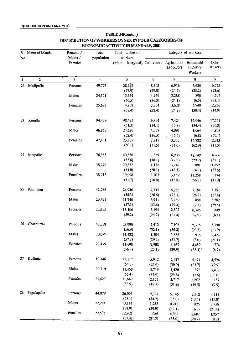
INTRODUCTION AND ANALYSIS
TABLE 34(Contd •• ) DISTRIBUTION OF WORKERS BY SEX IN FOUR CATEGORIES OF
ECONOMIC ACTIVITY IN MANDALS, 2001
SL Name of Mandai Persons / Total Total number of Category of workeis
No. Males J population workers I
Females (Main + Marginal) Cultivators Agricultural Househ6ld Other Labourers Industry wokers
Workers
2 3 4 5 • 6 7 8 9
22 Medipalle Persons 49,773 28,592 8,303 6,916 6,630 6,743
(57.4) (29.0) (24.2) (23.2) (23.6)
Males 24,151 13,634 4,949 3,288 890 4,507 (56.5) (36.3) (24.1) (6.5~ (33.1)
Females 25,622 14,958 3,354 3,628 5,74, 2,236
(58.4) (22.4) (24.3) (38.4~ (14.9)
23 Koratla Persons 94,429 48,425 6,804 7,424 16,646 17,551
(51.3) (14.1) (15.3) (34.4) (36.2) Males 46,958 24,620 4,057 4,091 1,664 14,808
(52.4) (16.5) (16.6) (6.8) (60.1) Females 47,471 23,805 2,747 3,333 14,982 2,743
(50.1) (11.5) (14.0) (62.9) (11.5)
24 Metpalle Persons 76,985 40,680 7,359 6,906 12,14~ 14,266 (52.8) (18.1) (17.0) (29.9 (35.1)
Males 38,270 20,682 4,152 3,747 891 ,
11,892 (54.0) (20.1) (18.1 ) (4.3) (57.5)
Females 38,715 19,998 3,207 3,159 11,258 2,374 (5l.?) (16.0) (15.8) (56.3) (11.9)
25 Kathlapur Persons 42,786 24,936 7,135 6,266 7,184 4,351 (58.3) (28.6) (25.1) (28.8) (17.4)
Males 20,491 11,740 3,941 3,439 858\ 3,502 (57.3) (33.6) (29.3) (1.3) (29.8)
Females 22,295 13,196 3,194 2,827 6,326' 849 (59.2~ (24.2) (21.4) (47.9) (6.4)
26 Chandurthi Persons 40,558 23,(}90 7,412 7,\05 5,375 3,198 (56.9) (32.1) (30.8) (23.3) (13.9)
Males 20,079 11,484 4,504 3,638 916 2,424 (57.2) (39.2) (31.7) (8.0) (21.1)
Females 20,479 II,608 2,908 3,467 4,459 774 (56.1) (25.1 ) (29.9) (38.4) I (6.7)
27 Kodimial Persons 42,346 23,117 5,912 7,137 5,474 " 4,594 (54.6) (25.6) (30.9) (23.7) (19.9)
Males 20,719 11,468 3,739 3,420 872 3,437 (55.4) (32.6) (29.8) (7.6) (30.0)
Females 21,627 11,649 2,173 3,717 4,602 1,157 (53.9) (18.7) (31.9) (39.5) (9.9)
28 Pegadapalle Persons 44,879 26,096 9,324 9,145 3,512 4,115 (58.1) (35.1) (35.0) (13.5) (15.8)
Males 22,284 13,134 5,238 4,213 825 2,858 (58.9) (39.9) (32.1) (6.3) (21.8)
Females 22,595 12,962 4,086 4,932 2,687 1,257 (57.4) i (3] .5) (38.0) (20.7) (9.7)
97

DISTRICT CENSUS HANDBOOK :KARIMNAGAR
TABLE 34 (Contd •• )
DISTRIBUTION OF WORKERS BY SEX IN FOUR CATEGORIES OF ECONOMIC ACfIVITY IN MANDALS,2001
Sl. Name of Mandai Persons I Total Total number of Category of workers No. Males I population workers
Females (Main + Marginal) Cultivators Agricultural Household Other Labourers Industry workers
Workers
I 2 3 4 5 6 7 8 9
29 Gangadhara Persons 46,879 26,095 7,733 8,724 4,928 4,710 (55.7) (29.6) (33.4) (18.9) (18.0)
Males 23,338 13,1l7 4,721 3,707 1,139 3,550 (56.2) (36.0) (28.3) (8.7) (27.1)
Females 23,541 12,978 3,012 5,017 3,789 1,160 (55.1 ) (23.2) (38.7) (29.2) (8.9)
30 Ramadugu Persons 47,654 25,151 6,215 10,586 2,579 5,771 (52.8) (24.7) (42.1) (10.3) (22.9)
Males 23,905 13,306 4,015 4,132 738 4,421 (55.7) (30.2) (31.1) (5.5) (33.2)
Females 23,749 11,845 2,200 6,454 1,841 1,350 (49.9) (18.6) (54.5) (I5.5) (11.4)
31 Choppadandi Persons 48,659 24,992 5,995 12,011 1,902 5,084 (51.4) (24.0) (48.1) (7.6) (20.3)
Males 24,721 13,420 3,704 4,782 762 4,172 (54.3) (27.6) (35.6) (5.7) (31.1)
Females 23,938 11,572 2,291 7,229 1,140 912 (48.3) (19.8) (62.5) (9.9) (7.9)
32 Sultanabad Persons 56,717 26,772 7,444 10,592 696 8,040
(47.2) (27.8) (39.6) (2.6) (30.0)
Males 28,586 15,807 5,074 3,716 489 6,528
(55.3) (32.1) (23.5) (3.1) (41.3)
Females 28,131 10,965 2,370 6,876 207 1,512
(39.0) (21.6) (62.7) (1.9) (13.8)
33 Odela Persons 39,539 21,332 7,312 9,792 709 3,519
(54.0) (34.3) (45.9) (3.3) (16.5)
Males 19,860 11,375 4,298 3,668 449 2,960
(57.3) (37.8) (32.2) (3.9) (26.0)
Females 19,679 9,957 3,014 6,124 260 559
(50.6) (30.3) (61.5) (2.6) (5.6)
34 Manakondur Persons 64,864 32,805 10,093 15,193 903 6,616
(50.6) (30.8) (46.3) (2.8) (20.2)
Males 32,725 18,489 6,455 5,884 672 5,478
(56.5) (34.9) (31.8) (3.6) (29.6)
Females 32,139 14,316 3,638 9,309 231 1,138
(44.5) (25.4) (65.0) (1.6) (7.9)
35 Karimnagar Persons 289,375 99,422 7,840 12,707 7,244 71,631
(34.4) (7.9) (12.8) (7.3) (72.0)
Males 147,954 72,619 4,863 4,775 2,935 60,046
(49.1) (6.7) (6.6) (4.0) (82.7)
Females 141,421 26,803 2,977 7,932 4,309 11,585
(19.0) (l U) (29.6) (16.1) (43.2)
98

INTRODUCTION AND ANALYSIS
TABLE 34 (Contd .. ) [
DISTRIBUTION OF WORKERS BY SEX IN FOUR CATEGORIES OF
ECONOMIC ACTIVITY IN MANDALS, 2001
S1. Name of Mandai Persons I Total Total number of Category of workets
No. Males I population workers Househbld Females (Main + Marginal) Cultivators Agricultural Other
Labourers Industb workers I
Workers i
I 2 3 4 5 6 7 8 9
36 Boinpalle Persons 37,564 20,932 6,955 7,613 3,318 3,046
(55:7) (33.2) (36.4) (15.9) (14.6)
Males 18,601 10,612 4,106 3,239 902 2,365 (57.1 ) (38.7) (30.5) (8.5) (22.3)
Females 18,963 10,320 2,849 4,374 2,4116 681 (54.4) (27.6) (42.4) (23,1) (6.6)
37 Vemulawada Persons 73,421 37,273 7,833 10,754 6,815 11,871
(50:8) (21.0) (28.9) (18·:n (31.8) Males 36,696 20,082 5,003 4,548 1,384 9,147
(54.7) (24.9) (22.6) (6.9) (45.5) Females 36,725 17,191 2,830 6,206 5,431 2,724
(46.8) (16.5) (36.1) (31.6) (15.8)
38 Konaraopeta Persons 41,381 23,571 8,342 7,880 4,08k 3,266 (57.0) (35.4) (33.4) (l7.3i
l) (13.9)
Males 20,640 11,874 5,000 3,675 741 ,2,458 (57.5) (42.1) (30.9) (6.1) (20.7)
Females 20,741 11,697 3,342 4,205 3,342 808 (56.4) (28.6) (35.9) (28.6) (6.9)
39 Yellareddipet Persons 56,431 31,122 10,434 9,040 4,812 6,836 (55.2) (33.5) (29.0) (15.5) (22.0)
Males 28,069 15,853 6,455 4,044 69~ 4,655 (56.5) (40.7) (25.5) (4A (29.4)
Females 28,362 15,269 3,979 4,996 4,113 2,181 (53.8) (26.1) (32.7) (26.9) (14.3)
I
40 Gambhiraopet Persons 44,186 23,949 7,865 5,580 4,770 5,734 (54.2) (32.8) (2~.3) (19.9) (23.9)
Males 21,757 12,292 5,020 2,896 579 3,797 (56.5) (40.8) (23.6) (4.7) (30.9)
Females 22,429 11,657 2,845 2,684 4,191 1,937 (52.0) (24.4) (23.0) (36.0) (16.6)
I
!
41 Mustabad Persons 44,349 24,100 7,041 7,435 5,035 4,589 (54.3) (29.2)
[
(30.9) (20.9) (19.0) Males 22,179 12,612 4,744 3,597 796 3,475
(56.9) (37.6) (28.5) (6.3) (27.6) Females 22,170 11,488 2,297 3,838 4,239 1,114
(51.8) (20.0) (33.4) (36.9) (9.7)
42 Sircilla Persons 122,368 62,640 9,767 9,183 22,315 21,375 (51.2~ (15.6) (14.7) (35.6) (34.1)
Males 61,120 33,820 6,062 3,924 6,761 17,073 (55.3) (17.9) (11.6) (20.0) (50.5)
Females 61,248 28,820 3,705 5,259 15,554 4,302 (47.1) (12.9) (18.2) (54.0) (14.9)
99
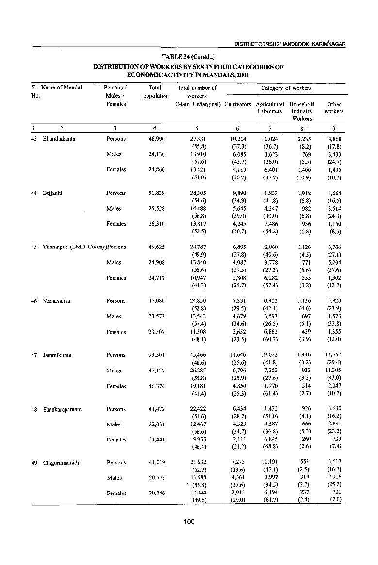
DISTRICT CENSUS HANDBOOK :KARIIVINAGAR
TABLE 34 (Contd .. )
DISTRIBUTION OF WORKERS BY SEX IN FOUR CATEGORIES OF ECONOMIC ACTIVITY IN MANDALS, 2001
SL Name of MandaI Persons / Total Total number of Category of workers No. Males I population workers
Females (Main + Marginal) Cultivators Agricultural Household Other Labourers Industry workers
Workers
2 3 4 5 6 7 8 9
43 Ellanthakunta Persons 48,990 27,331 10,204 10,024 2,235 4,868 (55.8) (37.3) (36.7) (8.2) (17.8)
Males 24,130 13,910 6,085 3,623 769 3,433 (57.6) (43.7) (26.0) (5.5) (24.7)
Females 24,860 13,421 4,119 6,401 1,466 1,435 (54.0) (30.7) (47.7) (10.9) (10.7)
44 Belianki Persons 51,838 28,305 9,890 11,833 1,918 4,664 (54.6) (34.9) (41.8) (6.8) (16.5)
Males 25,528 14,488 5,645 4,347 982 3,514 (56.8) (39.0) (30.0) (6.8) (24.3)
Females 26,310 13,817 4,245 7,486 936 1,150 (52.5) (30.7) (54.2) (6.8) (8.3)
45 Timmapur (LMD Colony)Persons 49,625 24,787 6,895 10,060 1,126 6,706 (49.9) (27.8) (40.6) (4.5) (27.1)
Males 24,908 13,840 4,087 3,778 771 5,204 (55.6) (29.5) (27.3) (5.6) (37.6)
Females 24,717 10,947 2,808 6,282 355 1,502 (44.3) (25.7) (57.4) (3.2) (13.7)
46 Veenavanka Persons 47,080 24,850 7,331 10,455 1,136 5,928 (52.8) (29.5) (42.1) (4.6) (23.9)
Males 23,573 13,542 4,679 3,593 697 4,573 (57.4) (34.6) (26.5) (5.1) (33.8)
Females 23,507 11,308 2,652 6,862 439 1,355 (48.1 ) (23.5) (60.7) (3.9) (12.0)
47 Jammikunta Persons 93,501 45,466 11,646 19,022 1,446 13,352
(48.6) (25.6) (41.8) (3.2) (29.4)
Males 47,127 26,285 6,796 7,252 932 11,305
(55.8) (25.9) (27.6) (3.5) (43.0)
Females 46,374 19,181 4,850 11,770 514 2,047
(41.4) (25.3) (61.4) (2.7) (10.7)
48 Shankarapatnam Persons 43,472 22,422 6,434 11,432 926 3,630 (51.6) (28.7) (5LO) (4.1) (16.2)
Males 22,031 12,467 4,323 4,587 666 2,891
(56.6) (34.7) (36.8) (5.3) (23.2)
Females 21,441 9,955 2,111 6,845 260 739
(46.4) (21.2) (68.8) (2.6) (7.4)
49 Chigurumamidi Persons 41,019 21,632 7,273 10,191 551 3,617
(52.7) (33.6) (47.1) (2.5) (16.7)
Males 20,773 11,588 4,361 3,997 314 2,916
. (55.8) (37.6) (34.5) (2.7) (25.2)
Females 20,246 10,044 2,912 6,194 237 701
(49.6) (29.0) (61.7) (2.4) (7.0)
100
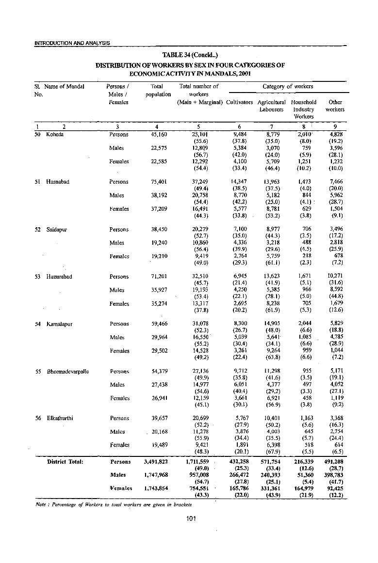
INTRODUCTION AND ANALYSIS
TABLE 34 (Concld .• )
DISTRIBUTION OF WORKERS BY SEX IN FOUR CATEGORIES OF ECONOMIC ACfIVITY IN MANDALS, 2001
SL Name of Mandai Persons I Total Total number of Category of workers
No. Males I population workers
Females (Main + Marginal) Cultivators Agricultural Household Other Labourers Industry workers
Workers
2 3 4 5 6 7 8 \ 9 50 Koheda Persons 45,160 25,101 9,484 8,779 2,010 ' 4,828
(55.6) (37.8) (35.0) (8.0) (19.2) Males 22,575 12,8Q9 5,384 3,070 759 3,596
(56·7) (42.0) (24.0) (5.9) (28.1) Females 22,585 12,292 4,100 5,709 1,251 1,232
(54.4) (33.4) (46.4) (10.2) (10.0)
51 Husnabad Persons 75,401 37,249 14,347 13,963 1,473 7,466 (49.4~ (38.5) (37.5) (4.0) (20.0)
Males 38,192 20,758 8,770 5,182 844 5,962 (54.4) (42.2) (25.0) (4.1) (28.7)
Females 37,209 16,491 5,577 8,781 629 . 1,504 (44.3) (33.8) (53.2) (3.8) (9.1)
52 Saidapur Persons 38,450 20,279 7,100 8,977 706 3,496 (52.7) (35.0) (44.3) (3.5) (17.2)
Males 19,240 10,860 4,336 3,218 488 2,818 (56.4) (39.9) (29.6) (4.5) (25.9)
Females 19,210 9,419 2,764 5,759 218 678 (49.0) (29.3) (61.I) (2.3) (7.2)
53 Huzurabad Persons 71,201 32,510 6,945 13,623 1,671 10,271 (45.7) (21.4) (41.9) (5.1) (31.6)
Males 35,927 19,193 4,250 5,385 966 8,592 (53.4) (22.1) (28.1) (5.0) (44.8)
Females 35,274 13,317 2,695 8,238 705 1,679 (37.8) (20.2) (61.9) (5.3) (12.6)
54 Kamalapur Persons 59,466 31,078 8,300 14,905 2,044 5,829 (52.3) (26.7) (48.0) (6.6) (18.8)
Males 29,964 16,550 5,039 5,641 1,085 4,785 (55.2) (30.4) (34.1) (6.6) (28.9)
Females 29,502 14,528 3,261 9,264 959 1,044 (49.2) . (22.4) (63.8) (6.6) (7.2)
55 Bheemadevarpalle Persons 54,379 27,136 9,712 ll,298 955 5,171 (49.9) (35.8) (41.6) (3.5) (19.1)
Males 27,438 14,977 6,051 4,377 497 4,052 (54.6) (40.4) (29.2) (3.3) (27.1 )
Females 26,941 12,159 3,661 6,921 458 1,119 (45.1) (30.1) (56.9) (3.8) (9.2)
56 E1kathurthi Persons 39,657 20,699 5,767 10,401 1,]63 3,368 (52.2) (27.9) (50.2) (5.6) (16.3)
Males 20,168 11,278 3,876 4,003 645 2,754 (55.9) (34.4) (35.5) (5.7) (24.4)
Females 19,489 9,421 1,891 6,398 518 614 (48.3) (20.1) (67.9) (5.5) (6.5)
District Total: !Persons 3,491,822 1,711,559 432,258 571,754 216,339 491,208 (49.0) (25.3) (33.4) (12.6) (28.7)
,Males 1,747,968 957,008 266,472 240,393 51,360 398,783 (54.7) (27.8) (25.1) (5.4) (41.7)
!Females 1,743,854 754,551 165,786 331,361 164,979 92,425 (43.3) (22.0) (43.9) (21.9) (12.2)
Note: Percentage of Workers to total wo.rkers are given in brackets
101
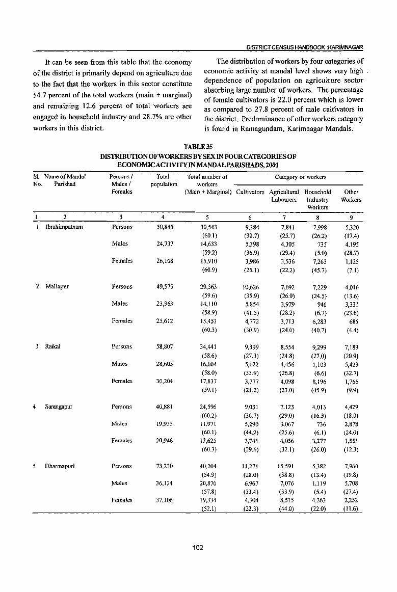
DISTRICT CENSUS HANDBOOK :KARIMNAGAR
It can be seen from this table that the economy The distribution of workers by four categories of
of the district is primarily depend on agriculture due economic activity at mandaI level shows very high
to the fact that the workers in this sector constitute dependence of population on agriculture sector
54.7 percent of the total workers (main + marginal) absorbing large number of workers. The percentage of female cultivators is 22.0 percent which is lower
and remaining 12.6 percent of total workers are as compared to 27.8 percent of male cultivators in engaged in household industry and 28.7% are other the district. Predominance of other workers category workers in this district. is found in Ramagundam, Karimnagar Mandals.
TABLE 35 DISTRIBUTION OF WORKERS BY SEX IN FOUR CATEGORIES OF
ECONOMIC ACTIVITY IN MANDALPARISHADS, 2001
Sl. Name of MandaI Persons / Total Total number of Category of workers No. Parishad Males I population workers
Females (Main + Marginal) Cultivators Agricultural Household Other Labourers Industry Workers
Workers
2 3 4 5 6 7 8 9
Ibrahimpatnam Persons 50,845 30,543 9,384 7,841 7,998 5,320 (60.1) (30.7) (25.7) (26.2) (17.4)
Males 24,737 14,633 5,398 4,305 735 4,195 (59.2) (36.9) (29.4) (5.0) (28.7)
Females 26,108 15,910 3,986 3,536 7,263 1,125 (60.9) (25.1) (22.2) (45.7) (7.1)
2 Mallapur Persons 49,575 29,563 10,626 7,692 7,229 4,016 (59.6) (35.9) (26.0) (24.5) (13.6)
Males 23,963 14,110 5,854 3,979 946 3,331 (58.9) (41.5) (28.2) (6.7) (23.6)
Females 25,612 15,453 4,772 3,713 6,283 685 (60.3) (30.9) (24.0) (40.7) (4.4)
3 Raikal Persons 58,807 34,441 9,399 8,554 9,299 7,189
(58.6) (27.3) (24.8) (27.0) (20.9) Males 28,603 16,604 5,622 4,456 1,103 5,423
(58.0) (33.9) (26.8) (6.6) (32.7) Females 30,204 17,837 3,777 4,098 8,196 1,766
(59.1 ) (21.2) (23.0) (45.9) (9.9)
4 Sarangapur Persons 40,881 24,596 9,031 7,123 4,013 4,429
(60.2) (36.7) (29.0) (16.3) (18.0) Males 19,935 11,971 5,290 3,067 736 2,878
(60. I) (44.2) (25.6) (6.1) (24.0) Females 20,946 12,625 3,741 4,056 3,277 1,551
(60.3) (29.6) (32.1) (26.0) (12.3)
5 Dharmapuri Persons 73,230 40,204 11,271 15,591 5,382 7,960
(54.9) (28.0) (38.8) (13.4) (19.8)
Males 36,124 20,870 6,967 7,076 1,1l9 5,708
(57.8) (33.4) (33.9) (5.4) (27.4)
Females 37,106 19,334 4,304 8,515 4,263 2,252
(52.1 ) (22.3) (44.0) (22.0) (11.6)
102
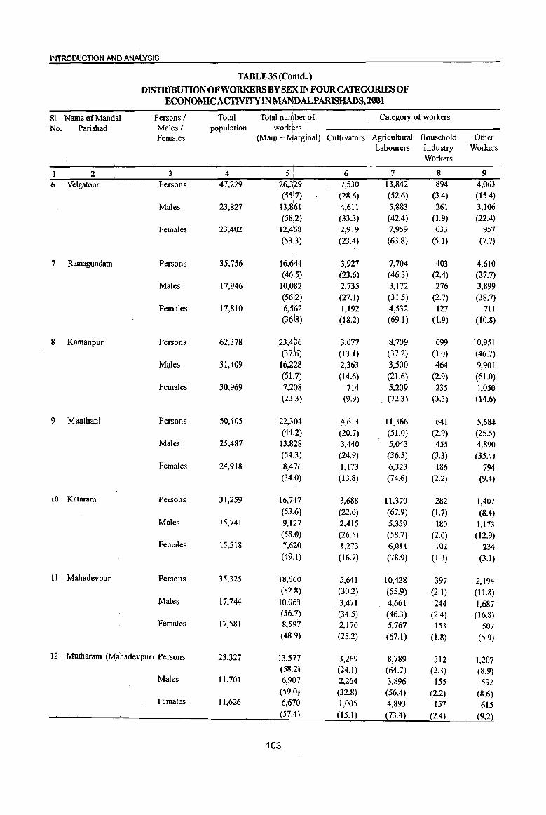
INTRODUCTION AND ANALYSIS
TABLE 35 (C~ntd •. ) :DISTRIBUTION OF WORKERS BYSEix IN FOUR CATEGORIES OF
ECONOMIC ACflVITY IN MANDALPARISHADS,2001
Sl. Name of Mandai Persons / Total Total nuniber of Category of workers
No. Parishad Males / population workers Females (Main + IViarginal) Cultivators Agricultural Household Other
Labourers Industry Workers Workers
I 2 3 4 51 , 6 7 8 9
6 Velgatoor Persons 47,229 26,3,29 7,530 13,842 894 4,063
(55:7) (28.6) (52.6) (3.4) (15.4)
Males 23,827 13,861 4,611 5,883 261 3,106 (5812) (33.3) (42.4) (1.9) (22.4)
Females 23,402 12,4'68 2,919 7,959 633 957 (5313) (23.4) (63.8) (5.1) (7.7)
7 Ramagundam Persons 35,756 16,6~4 3,927 7,704 403 4,610 (46i5) (23.6) (46.3) (2.4) (27.7)
Males 17,946 10,082 2,735 3,172 276 3,899 (5612) (27.1) (31.5) (2.7) (38.7)
I Females 17,810 6,562 , 1,192 4,532 127 711
(36J8) (18.2) (69.1) (1.9) (10.8)
8 Kamanpur Persons 62,378 23,4~6 3,077 8,709 699 10,951
(37.:6) (13.1) (37.2) (3.0) (46.7) Males 31,409 16,228 2,363 3,500 464 9,901
(51.1
7) (14.6) (21.6) (2.9) (61.0) Females 30,969 7,208 714 5,209 235 1,050
(23.3) (9.9) . (72.3) (3.3) (14.6)
9 Manthani Persons 50,405 22,304 4,613 11,366 641 5,684 (44.2) (20.7) (51.0) (2.9) (25.5)
Males 25,487 13,8~8 3,440 5,043 455 4,890 (54.3) (24.9) (36.5) (3.3) (35.4)
Females 24,918 8,476 1,173 6,323 186 794 (34.0) (13.8) (74.6) (2.2) (9.4)
10 Kataram Persons 31,259 16,747 3,688 11,370 282 1,407 (53.6) (22.0) (67.9) (1.7) (8.4)
Males 15,741 9,127 2,415 5,359 180 1,173 (58.0) (26.5) (58.7) (2.0) (12.9)
Females 15,518 7,620 1,273 6,0l1 102 234 (49.1) (16.7) (78.9) (1.3) (3.1)
II Mahadevpur Persons 35,325 18,660 5,641 10,428 397 2,194 (52.8) (30.2) (55.9) (2.1) (11.8)
Males 17,744 10,063 3,471 4,661 244 1,687 (56.7) (34.5) (46.3) (2.4) (16.8)
Females 17,581 8,597 2,170 5,767 153 507 (48.9) (25.2) (67.1) (1.8) (5.9)
12 Mutharam (M~hadevpur) Persons 23,327 13,577 3,269 8,789 312 1,207 (58.2) (24.1) (64.7) (2.3) (8.9)
Males 11,701 6,907 2,264 3,896 155 592 (59.0) (32.8) (56.4) (2.2) (8.6)
Females 11,626 6,670 1,005 4,893 157 615 (57.4) (15.1) (73.4) (2.4) (9.2)
103
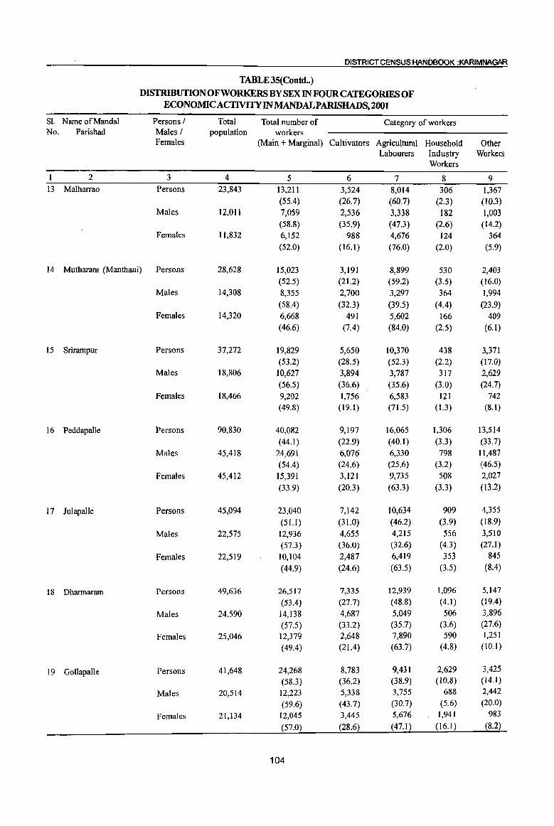
DISTRICT CENSUS HANDeO'OK :KARIMNAGAR
TABLE 35(Contd .. )
DISTRIBUTION OF WORKERS BY SEX IN FOUR CATEGORIES OF ECONOMICACTIVITYINMANDALPARISHADS,2001
Sl. Name of Mandai Persons I Total Total number of Category of workers No. Parishad Males I population workers
Females (Main + Marginal) Cultivators Agricultural Household Other Labourers Industry Workers
Workers
1 2 3 4 5 6 7 8 9 13 Malharrao Persons 23,843 13,211 3,524 8,014 306 1,367
(55.4) (26.7) (60.7) (2.3) (10.3) Males 12,01l 7,059 2,536 3,338 182 1,003
(58.8) (35.9) (47.3) (2.6) (14.2) Females 11,832 6,152 988 4,676 124 364
(52.0) (16.1 ) (76.0) (2.0) (5.9)
14 Mutharam (Manthani) Persons 28,628 15,023 3,191 8,899 530 2,403 (52.5) (21.2) (59.2) (3.5) (16.0)
Males 14,308 8,355 2,700 3,297 364 1,994
(58.4) (32.3) (39.5) (4.4) (23.9) Females 14,320 6,668 491 5,602 166 409
(46.6) (7.4) (84.0) (2.5) (6.1)
15 Srirampur Persons 37,272 19,829 5,650 10,370 438 3,371 (53.2) (28.5) (52.3) (2.2) (17.0)
Males 18,806 10,627 3,894 3,787 317 2,629
(56.5) (36.6) (35.6) (3.0) (24.7)
Females 18,466 9,202 1,756 6,583 121 742 (49.8) (19.1) (71.5) (1.3) (8.1)
16 Peddapalle Persons 90,830 40,082 9,197 16,065 1,306 13,514
(44.1 ) (22.9) (40.1 ) (3.3) (33.7)
Males 45,418 24,691 6,076 6,330 798 11,487 (54.4) , (24.6) (25.6) (3.2) (46.5)
Females 45,412 15,391 3,121 9,735 508 2,027
(33.9) (20.3) (63.3) (3.3) (13.2)
17 Julapalle Persons 45,094 23,040 7,142 10,634 909 4,355
(51.1 ) (31.0) (46.2) (3.9) (18.9)
Males 22,575 12,936 4,655 4,215 556 3,510
(57.3) (36.0) (32.6) (4.3) (27.1)
Females 22,519 10,104 2,487 6,419 353 845
(44.9) (24.6) (63.5) (3.5) (8.4)
18 Dharmaram Persons 49,636 26,517 7,335 12,939 1,096 5,147
(53.4) (27.7) (48.8) (4.1) (19.4)
Males 24,590 14,138 4,687 5,049 506 3,896
(57.5) (33.2) (35.7) (3.6) (27.6)
Females 25,046 12,379 2,648 7,890 590 1,251
(49.4) (21.4) (63.7) (4.8) (10.1)
19 Gollapalle Persons 41,648 24,268 8,783 9,431 2,629 3,425
(58.3) (36.2) (38.9) (to.8) (14.1)
Males 20,514 12,223 5,338 3,755 688 2,442
(59.6) (43.7) (30.7) (5.6) (20.0)
Females 21,134 12,045 3,445 5,676 1,941 983
(57.0) (28.6) (47.1) (16.1) (8.2)
104

INTRODUCTION mD ANALYSIS
TABLE 35 (C6P.td .. ) DISTRIBUTIONOFWORKERSBYSE~INFOURCATEGOR1ESOF
I
ECONOMIC ACTIVITY IN MANDALPARISHADS,2001 I
Sl Name ofMand~1 Persons I Total Total nUlt1ber of Category of workers
No. Parishad Males/ population workers Females (Main + M;arginal) Cultivators Agricultural Household Other
Labourers Industry Workers Workers
2 3 4 5 : 6 7 8 9
20 Mallial Persons 45,244 27,415 6,819 7,429 7,659 5,508
(60.6) (24.9) (27.1) (27.9) (20.1) I
Males 21,952 13,425 4,027 3,680 1,175 4,543 I
(61.:p (30.0) (27.4) (8.8) (33.8)
Females 23,292 . 13,999 2,792 3,749 6,484 965 (60.1) (20.0) (26.8) (46.3) (6.9)
21 Jagtial Persons 65,044 38,20~ 13,145 10,371 7,221 7,466 I
(58.7) (34.4) (27.1) (18.9) (19.5)
Males 32,025 18,798 7,251 4,871 1,168 5,508 (58.7) (38.6) (25.9) (6.2) (29.3)
Females 33,019 19,405 5,894 5,500 6,053 1,958 I
(58.8~ (30.4) (28.3) (31.2) (10.1)
22 Medipalle Persons 49,773 28,59~ 8,303 6,916 6,630 6,743 (57.4) (29.0) (24.2) (23.2) (23.6)
Males 24,151 13,634 4,949 3,288 890 4,507 (56.5) (36.3) (24.1) (6.5) (33.1)
Females 25,622 14,958 3,354 3,628 5,740 2,236 (58.4) (22.4) (24.3) (38.4) (14.9)
23 Koratla Persons 40,417 23,636 6,440 6,071 7,132 3,993 (58.5) (27.2) (25.7) (30.2) (16.9)
Males 19,685 11,196 3,794 3,268 725 3,409 (56.9)i (33.9) (29.2) (6.5) (30.4)
Females 20,732 12,440 2,646 2,803 6,407 584 (60.0) (21.3) (22.5) (51.5) (4.7)
24 Metpalle Persons 76,985 40,680·· 7,359 6,906 12,149 4,266 (52.8) (18.1) (17.0) (29.9) (35.1 )
Males 38,270 20,682 4,152 3,747 891 11,892 (54.0) (20.1 ) (18.1) (4.3) (57.5)
Females 38,715 19,998. 3,207 3,159 11,258 2,374 (51.7) i (16.0) (15.8) (56.3) (11.9)
25 Kathlapur Persons 42,786 24,936 7,135 6,266 7,184 4,351 (58.3) . (28.6) (25.1) (28.8) (17.4)
Males 20,491 11,740 • 3,941 3,439 858 3,502 (57.3) (33.6) (29.3) (7.3) (29.8)
Females 22,295 13,196 3,194 2,827 6,326 849 (59.2) (24.2) (21.4) (47.9) (6.4)
26 Chandurthi Persons 40,558 23,090 7,412 7,105 5,375 3,198 (56.9) (32.1) (30.8) (23.3) (13.9)
Males 20,079 11,482 4,504 3,638 916 2,424 (57.2) (39.2) (31.7) (8.0) (21.1)
Females 20,479 11,608 2,908 3,467 4,459 774 (56.7) (25.1) (29.9) (38.4) (6.7)
105

DISTRICT CENSUS HANDBOOK :KARIMNAGAR
TABLE 35(Contd .. ) DISTRIBUTION OF WORKERS BY SEX IN FOUR CATEGORIES OF
ECONOMICACTIVITYINMANDALPARISHADS,2001
Sl. Name of Mandai Persons / Total Total number of Category of workers No. Parishad Males I population workers
Females (Main + Marginal) Cultivators Agricultural Household Other Labourers Industry Workers
Workers
2 3 4 5 6 7 8 9 27 Kodimial Persons 42,346 23,117 5,912 7,137 5,474 4,594
(54.6) (25.6) (30.9) (23.7) (19.9) Males 20,719 11,468 3,739 3,420 872 3,437
(55.4) (32.6) (29.8) (7.6) (30.0) Females 21,627 11,649 2,173 3,717 4,602 1,157
(53.9) (18.7) (31.9) (39.5) (9.9)
28 Pegadapalle Persons 44,879 26,096 9,324 9,145 3,512 4,115 (58.1) (35.7) (35.0) (13.5) (15.8)
Males 22,284 13,134 5,238 4,213 825 2,858 (58.9) (39.9) (32.1) (6.3) (21.8)
Females 22,595 12,962 4,086 4,932 2,687 1,257
(57.4) (31.5) (38.0) (20.7) (9.7)
29 Gangadhara Persons 46,879 26,095 7,733 8,724 4,928 4,710 (55.7) (29.6) (33.4) (18.9) (18.0)
Males 23,338 13,117 4,721 3,707 1,139 3,550
(56.2) (36.0) (28.3) (8.7) (27.1)
Females 23,541 12,978 3,012 5,017 3,789 1,160
(55.1 ) (23.2) (38.7) (29.2) (8.9)
30 Ramadugu Persons 47,654 25,151 6,215 10,586 2,579 5,771
(52.8) (24.7) (42.1) (10.3) (22.9)
Males 23,905 13,306 4,015 4,132 738 4,421
(55.7) (30.2) (31.1 ) (5.5) (33.2)
Females 23,749 11,845 2,200 6,454 1,841 1,350
(49.9) (18.6) (54.5) (15.5) (11.4)
31 Choppadandi Persons 48,659 24,992 5,995 12,011 1,902 5,084
(51.4) (24.0) (48.1) (7.6) (20.3)
Males 24,721 13,420 3,704 4,782 762 4,172
(54.3) (27.6) (35.6) (5.7) (31.1)
Females 23,938 11,572 2,291 7,229 1,140 912
(48.3) (19.8) (62.5) (9.9) (7.9)
32 Sultanabad Persons 56,717 26,772 7,444 10,592 696 8,040
(47.2) (27.8) (39.6) (2.6) (30.0)
Ma)~s 28,586 15,807 5,074 3,716 489 6,528
(55.3) (32.1) (23.5) (3.1) (41.3)
Femaks 28,13) 10,965 2,370 6,876 207 1,512
(39.0) (21.6) (62.7) (1.9) (13.8)
33 Odela Persons 39,539 21,332 7,312 9,792 709 3,519
(54.0) (34.3) (45.9) (3.3) (16.5)
Males 19,860 11,375 4,298 3,668 449 2,960
(57.3) (37.8) (32.2) (3.9) (26.0)
Females 19,679 9,957 3,014 6,124 260 559
(50.6) (30.3) (61.5) (2.6) (5.6)
106
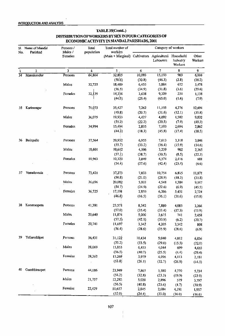
INTRODUCTION AND ANALYSIS
TABLE 35(Colfltd .. ) DISTRIBUTION OFWORKERSBYSE:KINFOURCATEGORIESOF
ECONOMIC ACTlVITY INMA$ALPARISHADS, 2001
SI. Name of Mandai Persons / Total Total nu~ber of Category of workers No. Parishad Males / population workers
Females .(Main + Marginal) Cultivators Agricultural Household Other Labourers Industry Workers
Workers
1 2 3 4 5 ii 6 7 8 9
34 Manakondur Persons 64,864 32,805 10,093 15,193 903 6,616
(50]6) (30.8) (46.3) (2.8) (20.2)
Males 32,725 18,4~9 6,455 5,884 672 5,478 (56.15) (34.9) (31.8) (3.6) (29.6)
Females
32'1" 14,3~6 3,638 9,309 231 1,138 (44':5) (25.4) (65.0) (\.6) (7.9)
35 Karimnagar Persons 71, 73 35,427 7,262 11,195 4,276 12,694 (49.8) (20.5) (31.6) (12.1) (35.8)
Males 36,079 19,933 4,427 4,092 1,582 9,832 (55.2) (22.2) (20.5) (7.9) (49.3)
Females 34,994 15,494 2,835 7,103 2,694 2,862 (44.3) (18.3) (45.8) (17.4) (18.5)
36 Boinpalle Persons 37,564 20,932 6,955 7,613 3,318 3,046 (55.7) (33.2) (36.4) (15.9) (14.6)
Males 18,601 10,612 4,106 3,239 902 2,365 (57.1) (38.7) (30.5) (8.5) (22.3)
i Females 18,963 10,320 2,849 4,374 2,416 681
(54.4) (27.6) (42.4) (23.4) (6.6)
37 Vemulawada Persons 73,421 37,27p 7,833 10,754 6,815 11,871 (50.~) (21.0) . (28.9) (18.3) (31.8)
Males 36,696 20,082 5,003 4,548 1,384 9,147 (54.7) (24.9) (22.6) (6.9) (45.5)
Females 36,725 17,19il 2,830 6,206 5,431 2,724 (46.8)
i (16.5) (36.1) (31.6) (15.8)
38 Konaraopeta Persons 41,381 23,571 8,342 7,880 4,083 3,266 (57.0) (35.4) (33.4) (17.3) (13.9)
Males 20,640 11,874 5,000 3,675 741 2,458 (S7.5~ (42.1) (30.9) (6.2) (20.7)
Females 20,741 11,697 3,342 4,205 3,342 808 (56.4) (28.6) (35.9) (28.6) (6.9)
39 Yellareddipet Persons 56,431 31,122 10,434 9,040 4,812 6,836 (55.2) (33.5) (29.0) (15.5) (22.0)
Males 28,069 15,853 6,455 4,044 699 4,655 (56.5) (40.7) (25.5) (4.4) (29.4)
Females 28,362 15,269 3,979 4,996 4,113 2,181 (53.8) (26.1) (32.7) (26.9) (14.3)
40 Gambhiraopet Persons 44,186 23,949 7,865 5,580 4,770 5,734 (54.2) (32.8) (23.3) (19.9) (23.9)
Males 21,757 12,292! 5,020 2,896 579 3,797 (56.5)' (40.8) (23.6) (4.7) (30.9)
Females 22,429 11,657 2,845 2,684 4,191 1,937 (52.0). (24.4) (23.0) (36.0) (16.6)
107
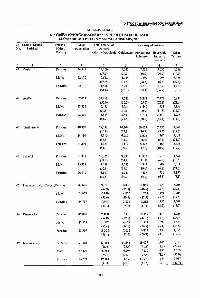
DISTRICT CENSUS HANDBoOK :KARIM'NAGAR
TABLE 35(Contd .. )
DISTRIBUTION OF WORKERs BY SEX IN FOUR CATEGORIES OF ECONOMICACTIVlTY IN MANDALPARISHADS, 2001
Sl. Name of Mandai Persons / Total Total number of Category of workers No. Parishad Males / population workers
Females (Main + Marginal) Cultivators Agricultural Household Other Labourers Industry Workers
Workers
I 2 3 4. 5 6 7 8 9 41 Mustabad Persons 44,349 24,100 7,041 7,435 5,035 4,589
(54.3) (29.2) (30.9) (20.9) (19.0)
Males 22,179 12,612 4,744 3,597 796 3,475
(56.9) (37.6) (28.5) (6.3) (27.6) Females 22,170 11,488 2,297 3,838 4,239 1,114
(51.8) (20.0) (33.4) (36.9) (9.7)
42 Sircilla Persons 57,054 31,959 9,581 8,213 7,273 6,892
(56.0) (30.0) (25.7) (22.8) (21.6)
Males 28,454 16,445 5,934 3,442 1,933 5,136
(57.8) (36.1) (20.9) (11.8) (31.2)
Females 28,600 15,514 3,647 4,771 5,340 1,756
(54.2) (23.5) (30.8) (34.4) (11.3)
43 Ellanthakunta Persons 48,990 27,331 10,204 10,024 2,235 4,868 (55.8) (37.3) (36.7) (8.2) (17.8)
Males 24,130 13,910 6,085 3,623 769 3,433
(57.6) (43.7) (26.0) (5.5) (24.7)
Females 24,860 13,421 4,119 6,401 1,466 1,435
(54.0) (30.7) (47.7) (10.9) (10.7)
44 Beiianki Persons 51,838 28,305 9,890 Il,833 1,918 4,664
(54.6) (34.9) (41.8) (6.8) (16.5)
Males 25,528 14,488 5,645 4,347 982 3,514
(56.8) (39.0) (30.0) (6.8) (24.3)
Females 26,310 13,817 4,245 7,486 936 1,150
(52.5) (30.7) (54.2) (6.8) (8.3)
45 Timmapur(LMD Colony)Persons 49,625 24,787 6,895 10,060 1,126 6,106
(49.9) (27.8) (40.6) (4.5) (27.1)
Males 24,908 13,840 4,087 3,778 771 5,204
(55.6) (29.5) (27.3) (5.6) (37.6)
Females 24,717 10,947 2,808 6,282 355 1,502
(44.3) (25.7) (57.4) (3.2) (13.7)
46 Veenavanka Persons 47,080 24,850 7,331 10,455 1,136 5,928
(52.8) (29.5) (42.1) (4.6) (23.9)
Males 23,573 13,542 4,679 3,593 697 4,573
(57.4) (34.6) (26.5) (5.1) (33.8)
Females 23,507 11,308 2,652 6,862 439 1,355
(48.1 ) (23.5) (60.7) (3.9) (12.0)
47 Jammikunta Persons 93,501 45,466 11,646 19,022 1,446 13,352
(48.6) (25.6) (41.8) (3.2) (29.4)
Males 47,127 26,285 6,796 7,252 932 11,305
(55.8) (25.9) (27.6) (3.5) (43.0)
Females 46,374 19,181 4,850 11,770 514 2,047
(41.4) (25.3) (61.4) (2.7) (10.7)
108

INTRODUCTION AfljD ANALYSIS
TABLE 35 (Cortd •• )
DISTRIBUTIONOFWORKERSBYSE~INFOURCATEGORIESOF ECONOMICACTMTY INMANDALPARlSHADS, 2001
I
Sl. Name of Mandai Persons I Total Total nun\.ber of Category of workers No. Parishad Males / population work~rs
Females (Main + Marginal) Cultivators Agricultural Household Other I
Labourers Industry Workers Workers
2 3 4 5 6 7 8 9
48 Shankarapatn~ Persons 43,472 22,422 6,434 11,432 926 3,630
(51.~) (28.7) (51.0) (4.1) (16.2)
Males 22,031 12,467 4,323 4,587 666 2,891 I
(56.6) (34.7) (36.8) (5.3) (23.2)
Females 21,441 9,955 2,111 6,845 260 739
(46.4) I
(21.2) (68.8) (2.6) (7.4)
49 Chigurumamidi Persons - 41,019 21,632 7,273 10,191 551 3,617
(52.7) (33.6) (47.1) (2.5) (16.7)
Males 20,773 11,58,8 4,361 3,997 314 2,916 (55.8) (37.6) (34.5) (2.7) (25.2)
Females 20,246 10,04;4- 2,912 6,194 237 701 (49.6) (29.0) (61.7) (2.4) (7.0)
50 Koheda Persons 45,160 25,101 9,484 8,779 2,010 4,828 (55.6) (37.8) (35.0) (8.0) (19.2)
Males 22,575 12,809 5,384 3,070 759 3,596
(56.7~ (42.0) (24.0) (5.9) (28.1) Females 22,585 12,29+ 4,100 5,709 1,251 1,232
(54.4~ (33.4) (46.4) (10.2) (10.0)
51 Husnabad Persons 75,401 37,24~ 14,347 13,963 1,473 7,466 (49.4) (38.5) (37.5) (4.0) (20.0)
Males 38,192 20,75~ 8,770 5,182 844 5,962 (54.4) (42.2) (25.0) (4.1) (28.7)
Females 37,209 16,4911 5,577 8,781 629 1,504 (44.3) (33.8) (53.2) (3.8) (9.1)
52 Saidapur Persons 38,450 20,279 7,100 8,977 706 3,496 (52.7) (35.0) (44.3) (3.5) (17.2)
Males 19,240 10,860: 4,336 3,218 488 2,818 (56.4)· (39.9) (29.6) (4.5) (25.9)
Females 19,210 9,419i 2,764 5,759 218 678 (49.0) , (29.3) (61.1) (2.3) (7.2)
53 Huzurabad Persons 71,201 32,510 i 6,945 13,623 1,671 10,271 (45.7) . (21.4) (41.9) (5.1) (31.6)
Males 35,927 19,193 4,250 5,385 966 8,592 . (53.4) (22.1 ) (28.1) (5.0) (44.8)
Females 35,274 13,317 2,695 8,238 705 1,679 (37.8) (20.2) (61.9) (5.3) (12.6)
54 Kamalapur Persons 59,466 31,078 8,300 14,905 2,044 5,829 (52.3) (26.7) (48.0) (6.6) (IB.8)
Males 29,964 16,550 5,039 5,641 1,085 4,785 (55.2) (30.4) (34.1) (6.6) (28.9)
Females 29,502 14,528 3,261 9,264 959 1,044 (49.2) (22.4) (63.8) (6.6) (7.2)
109

DISTRICT OENSUS AANDBOOK :KAR1MMGAR
TABLE 35 (Coneld .. )
DISTRIBUTION OF WORKERS BY SEX IN FOUR CATEGORIES OF ECONOMICACTIVITYINMANDALPARISHADS,2001
SJ. Name of Mandai Persons I Total Total number of Category of workers No. Parishad Males I population workers
Females (Main + Marginal) Cultivators Agricultural Household Other Labourers Industry Workers
Workers
2 3 4 5 6 7 8 9
55 Bheemadevarpalle Persons 54,379 27,136 9,712 I1,298 955 5,171 (49.9) (35.8) (41.6) (3.5) (19.1)
Males 27,438 14,977 6,051 4,377 497 4,052 (54.6) (40.4) (29.2) (3.3) (27.1)
Females 26,941 12,159 3,661 6,921 458 1,119
(45.1) (30.1) (56.9) (3.8) (9.2)
56 Elkathurthi Persons 39,657 20,699 5,767 10,401 1,163 3,368
(52.2) (27.9) (50.2) (5.6) (16.3)
Males 20,168 11,278 3,876 4,003 645 2,754
(55.9) (34.4) (35.5) (5.7) (24.4)
Females 19,489 9,421 1,891 6,398 518 614
(48.3) (20.1) (67.9) (5.5) (6.5)
District (Rural) Total: Persons 2,813,010 1,489,104 429,560 562,278 178,558 318,708
(52.9) (28.8) (37.8) (12.0) (21.4)
Males 1,402,279 791,634 264,549 235,207 41,685 250,193
(56.5) (33.4) (29.7) (5.3) (31.6)
Females 1,410,731 697,470 165,011 327,071 136,873 68,515
(49.4) (23.7) (46.9) (19.6) (9.8)
Note: Percentage of Workers to total workers are given in brackets
This table presents Mandai Parishad-wise despite the fact that it is not commercially viable. distribution of workers by sex in four categories of Household industries also could not make much econonmic activity. In the rural areas of the district progress in rural areas as reflected in the data and total workers constitute (Main + Marginal) 52.9 these household industries employ only 12.0 percent percent of total population. Among these workers,
workers ofthe total working force. Therefore surplus cultivators constitute 28.8 percent, 37.8 percent
working force has to depend on primary activities. agricultural labourers, 12.0 percent household industry workers and 21.4 percent other workers. The Among cultivators, the percentage of females (23.7
agricultural sector plays a major role in providing percent) is lesser than males (33.4 percent) in the
employment to the working force of rural population rural areas of the district.
110

INTRODUCTION ~D ANALYSIS
TABLE 36
DISTRIBUTION OF WORKERS BY SEX IN FOUR CATEGORIES OF
ECONOMIC ACTIVITY OF URBAN AGG~MERATIONS/TOWNS, 2001
81. Name and Persons J Total Total number of Category of workers No. urban status of Males I population workdrs
UN' / Town+ Females (Main + Marginal) Cultivators Agricultural Household Other Labourers Industry workers
Workers
1 2 3 4 5 6 7 8 9
1 Jagtial (M) Persons 85,521 33,416 606 1,762 7,904 23,144
(39.1) (1.8) (5.3) (23.7) (69.3)
Males 43,377 21,3115 422 1,019 932 18,942
(49.1) (2.0) (4.8) (4.4) (88.9)
Females 42,144 12,10,1 184 743 6,972 4,202
(28.7) (1.5) (6.1) (57.6) (34.7)
2 lallaram (CT) Persons 11,OlO 3,70'1 388 810 187 2,322 I
(10.5) (21.9) (5.0) (62.6) (33.7~
Males 5,634 2,834 271 429 60 2,074
(50.3~ (9.6) (15.1 ) (2.1) (73.2)
Females 5,376 873 117 381 127 248
(16.2) (13.4) (43.6) (14.5) (28.4)
I
3 Koratla (M) Persons 54,012 24,78~ 364 1,353 9,514 13,558
(45.9) (1.5) (5.5) (38.4) (54.7)
Males 27,273 13,424 263 823 939 11,399
(49.2) (2.0) (6.1) (7.0) (84.9)
Females 26,739 11,365 tol 530 8,575 2,159
(42.5) (0.9) (4.7) (75.5) (19.0)
4 Karimnagar UA Persons 218,302 63,995 578 1,512 2,968 58,937
(29.3) (0.9) (2.4) (4.6) (92.1)
Males 111,875 52,686 436 683 1,353 50,214
(47.1). (0.8) (1.3) (2.6) (95.3)
Females 106,427 II,309 142 829 1,615 8,723
(10.6) (1.3) (7.3) (14.3) (77.1)
5 Karimnagar (M-f!OG) Persons 218,302 63,995 578 1,512 2,968 58,937
(29.3) (0.9) (2.4) (4.6) (92.1)
Males 111,875 52,686 436 683 1,353 50,214
(47.1) (0.8) (1.3) (2.6) (95.3)
Females 106,427 11,309 142 829 1,615 8,723
(10.6) (1.3) (7.3) . (14.3) (77.1)
6 Karimnagar (M)* Persons 205,653 59,377 353 497 2,692 55,835
(28.9) (0.6) (d.8) (4.5) (94.0)
Males 105,336 49,390 279 290 1,274 47,547
(46.9) (0.6) (0.6) (2.6) (96.3)
Females 100,317 9,987 74 207 1,418 8,288
(10.0) (0.7) (2.1) (14.2) (83.0)
7 Palakurthy (CT) Persons 6,967 2,350 175 417 42 1,716 (33.7) (7.4) (17.7) (1.8) (73.0)
Males 3,614 1,815 113 185 17 1,500 (50.2) (6.2) (I 0.2) (0.9) (82.6)
Females 3,353 535 62 232 25 216 (16.0) (11.6) (43.4) (4.7) (40.4)
111

TABLE 36(Concld •. )
DISTRIBUTION OF WORKERS BY SEX IN FOUR CATEGORIES OF ECONOMIC ACTIVITY OF URBAN AGGLOMERATIONS/TOWNS, 2001
SI. Name and Persons / Total Total number of Category of workers
No. urban status of Males I population workers
UA" I Town+ Females (Main + Marginal) Cultivators Agricultural Household Other Labourers Industry workers
Workers
2 3 4 5 6 7 8 9
8 Ramagundam (M)* Persons 236,600 63,070 391 2,433 2,ll2 58,134
(26.7) (0.6) (3.9) (3.3) (92.2) Males 120,687 55,633 280 1,469 1,545 52,339
(46.1) (0.5) (2.6) (2.8) (94.l) Females 115,913 7,437 111 964 567 5,795
(6.4) (1.5) (13.0) (7.6) (77.9)
9 Ramagundam (M+OG) Persons 237,686 63,517 401 2,652 2,124 58,340 (26.7) (0.6) (4.2) (3.3) (91.8)
Males 121,250 55,925 290 1,565 1,546 52,524 (46.1 ) (0.5) (2.8) (2.8) (93.9)
Females 116,436 7,592 III 1,087 578 5,816 (6.5) (1.5) (14.3) (7.6) (76.6)
10 Sircilla (M) Persons 65,314 30,681 186 970 15,042 14,483 (47.0) (0.6) (3.2) (49.0) (47.2)
Males 32,666 17,375 128 482 4,828 11,937 (53.2) (0.7) (2.8) (27.8) (68.7)
Females 32,648 13,306 58 488 10,214 2,546 (40.8) (004) (3.7) (76.8) (19.1 )
District (Urban) Total: Persons 678,812 222,455 2,698 9,476 37,781 172,500 (32.8) (1.2) (4.3) (17.0) (77.5)
Males 345,689 165,374 1,923 5,186 9,675 148,590 (47.8) (1.2) (3.1) (5.9) (89.9)
Females 333,123 57,081 775 4,290 28,106 23,910 (17.1) (1.4) (7.5) (49.2) (41.9)
+ Towns arranged in alphabetical order A The names of constituents of VA are given separately * In case of the towns having out growth an asterisk mark placed against their name to indicate that they have out growths which are not
separate towns
The above table shows the distribution of workers- employment to the working force of urban population. by sex in four categories of economic activity of urban Household industries also could not make much agglomerations/towns. In the urban areas of the progress in urban areas as reflected in the data and district total workers form (main + marginal) 32.8 these househo ld industries employ only 17.0 percent percent of total population. Among these workers, workers of the total working force. Therefore surplus cultivators constitute 1.2 percent, 4.3 percent working force has to depend on other working agricultural labourers, 17.0 percent household industry activities. Among cultivators, the percentage of workers and 77.5 percent other workers in the district. females (1.4 percent) is higher than males (1.2 The other workers play a major role in providing percent) in the urban areas of the district.
112
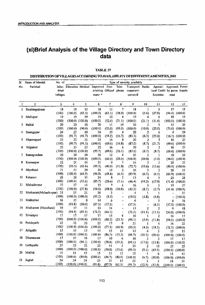
INTRODUCTION AND ANALYSIS
(xi)Brief Analysis of the Village Directory and Town Directory data
TABLE 31
DISTRIBlITIONOFVlLLAGESACCORDINGTOAVAILABILITYOFDIFFERENTAMENITIES,2001
SI. I
Name of Mandai No. of Type of amenity available
No. Parishad Inha- Education Medical Improved Po'st Tele- Transport Banks Agricul- Approach Power bited drinking Offi¢e# phone communi- tural Credit by pucca Supply
villages water * cations$ Societies road
1 2 3 4 5 6 7 8 9 10 11 12 13
I Ibrahimpatnam 18 18 15 18 11 7 18 1 5 17 18 (100) (100.0) (83.3) (100.0) (61.1) (38.9) (100.0) (5.6) (27.8) (94.4) (100.0)
2 Mallapur 19 19 19 19 10 4 19 4 6 19 19 (100) (100.0) (lOO.O) (l00.0) (52.6) (21.1) (l00.0) (21.1) (31.6) (100.0) (l00.0)
3 Raikal 20 20 18 20 11 19 20 2 5 15 20 (100) (100.0) (90.0) (100.0) (55.0) (95.0) (100.0) (l0.Q) (25.0) (75.0) (l00.0)
4 Sarangapur 24 22 10 24 13 4 20 2 6 4 24 (100) (91.7) (41.7) (100.0) (54.2) (16.7) (83.3) (8.3) (25.0) (16.7) (100.0)
5 D~annapuri 23 22 21 23 16 8 20 2 5 16 23 (l00) (95.7) (91.3) (100.0) (69.6) (34.8) (87.0) (8.7) (21.7) (69.6) (l00.0)
6 Velgatoor 23 23 23 22 16 6 20 . 2 2 16 23 (100) (100.0) (100.0) (95.7) (69.6) (26.1) (87.0) (8.7) (8.7) (69.6) (l00.0)
7 Ramagundam 20 20 20 20 12 4 20 2 1 18 20 (100) (100.0) (l00.0) (100.0) (60.0) (20.0) (l00.0) (10.0) (5.0) (90.0) (I 00.0)
8 Kamanpur 22 21 14 21 9 7 16 3 3 20 22 (100) (95.5) (63.6) (95.5) (40.9) (31.8) (72.7) (13.6) (13.6) (90.9) (100.0)
9 Manthani 31 31 20 30 15 2 26 2 2 26 31 (l00) (l00.0) (64.5) (96.8) (48.4) (6.5) (83.9) (6.5) (6.5) (83.9) (100.0)
10 Kataram 28 28 15 24 8 2 13 4 5 20 28 (IOO) (100.0) (53.6) (85.7) (28.6) (7.1) (46.4) (14.3) (17.9) (71.4) (100.0)
11 Mahadevpur 37 37 14 35 7 4 16 3 1 19 37 (l00) (100.0) (37.8) (94.6) (18.9) (10.8) (43.2) (8.1) (2.7) (51.4) (100.0)
12 Mutharam(Mahadevpur) 21 21 21 20 2 4 I I 21 (100) (100.0) (100.0) (95.2) (9.5) (19.0) (4.8) (4.8) - (100.0)
13 Malharrao 16 15 8 14 6 6 1 6 16 (100) (93.8) (50.0) (87.5) (37.5) (37.5) (6.3) (37.5) (100.0)
14 Mutharam (Manthani) 18 17 11 13 11 13 2 2 9 18 (100) (94.4) (61.1) (72.2) (61.1) (72.2) (1 U) (1 U) (50.0) (100.0)
IS Srirampur 17 17 17 17 15 4 16 1 2 16 17 (100) (100.0) (100.0) (100.0) (88.2) (23.5) (94.1) (5.9) (11.8) (94.1) (100.0)
16 Peddapalle 22 22 22 22 17 9 21 I 4 16 22 (100) (l00.0) (100.0) (100.0) (77.3) (40.9) (95.5) (4.5) (18.2) (72.7) (100.0)
17 Julapalle is 15 15 15 13 II 13 4 3 IS 15 (100) (100.0) (100.0) (l00.0) (86.7) (73.3) (86.7) (26.7) (20.0) (100.0) (100.0)
18 Dharmaram 17 17 16 17 10 6 16 3 2 17 17 (100) (100.0) (94.1) (100.0) (58.8) (35.3) (94.1 ) (17.6) (11.8) (100.0) (I 00.0)
19 GoUapalle 22 22 22 22 II 3 21 2 10 22 22 (100) (100.0) (100.0) (100.0) (50.0) (13.6) (95.5) (9.1) (45.5) (100.0) (100.0)
20 Mallial 15 15 12 15 13 12 15 1 6 15 15 (toO) (100.0) (80.0) (l00.0) (86.7) (80.0) (1.00.0) (6.7) (40.0) (100.0) (100.0)
21 Jagtial 24 24 24 23 21 15 22 3 3 24 24 (l00) (100.0) (100.0) (95.8) (87.5) (62.5) (91.7) (12.5) (12.5) (100.0) (100.0)
113

DISTRICTCENsuSHANDB~ :KARirit1~GAR
TABLE 37(contd .. )
DISTRIBUflON OFVlLLAGESACCORDINGTOAVAILABJLITY OF DIFFERENT AMENITIES, 2001
SI. Name of Mandai No. of Type of amenity available
No. Parishad Inha- Education Medical Improved Post Tele- Transport Banks Agricul- Approach Power bited drinking Office# phone communi- tural Credit by pucca Supply
villages water * cations$ Societies road
I 2 3 4 5 6 7 8 9 10 II 12 13 22 MedipaUe 19 19 16 19 11 5 19 1 5 19 19
(100) (100.0) (84.2) (100.0) (57.9) (26.3) (100.0) (5.3) (26.3) (100.0) (l00.0) 23 Koratla 14' 14 14 14 11 11 14 2 6 14 14
(100) (100.0) (100.0) (100.0) (78.6) (78.6) (100.0) (14.3) (42.9) (100.0) (100.0) 24 Metpalle IS 15 8 15 9 10 14 2 2 15 15
(100) (100.0) (53.3) (100.0) (60.0) (66.7) (93.3) (13.3) (13.3) (100.0) (100.0) 25 Kathlapur 18 18 18 18 13 6 18 2 4 18 18
(100) (l00.0) (100.0) (100.0) (72.2) (33.3) (100.0) (11.1) (22.2) (100.0) (100.0) 26 Chandurthi 12 12 12 12 II 4 12 I 2 12 12
(100) (100.0) (100.0) (100.0) (91.7) (33.3) (100.0) (8.3) (16.7) (100.0) (100.0) 27 Kodimial 15 15 12 15 8 8 13 2 3 15 15
(100) (IOO.O) (80.0) (100.0) (53.3) (53.3) (86.7) (13.3) (20.0) (100.0) (100.0) 28 Pegadapalle 16 16 16 16 15 8 16 I 3 14 16
(100) (100.0) (100.0) (100.0) (93.8) (50.0) (100.0) (6.3) (18.8) (87.5) (100.0) 29 Gangadhara 19 19 17 17 12 14 18 3 4 8 19
(100) (100.0) (89.5) (89.5) (63.2) (73.7) (94.7) (15.8) (21.1) (42.1) (100.0) 30 Ramadugu 18 18 16 18 11 15 15 2 5 15 18
(100) (IOO.O) (88.9) (100.0) (61.1) (83.3) (83.3) (ILl) (27.8) (83.3) (100.0) 31 Choppadandi 12 12 12 12 11 12 11 2 2 12 12
(100) (100.0) (100.0) (100.0) (91.7) (100.0) (91.7) (16.7) (16.7) (100.0) (100.0) 32 Sultanabad 21 21 20 21 13 17 15 3 5 21 21
(100) (l00.0) (95.2) (100.0) (61.9) (81.0) (71.4) (14.3) (23.8) (100.0) (100.0) 33 Odela 11 11 8 II 9 10 11 3 1 10 11
(100) (100.0) (72.7) (I 00.0) (81.8) (90.9) (100.0) (27.3) (9.1) (90.9) (100.0) 34 Manakondur 18 18 16 17 14 14 18 3 8 12 18
(100) (l00.0) (88.9) (94.4) (77.8) (77.8) (100.0) (16.7) (44.4) (66.7) (100.0) 35 Karimnagar 24 24 24 24 16 23 23 2 7 16 24
(100) (100.0) (100.0) (100.0) (66.7) (95.8) (95.8) (8.3) (29.2) (66.7) (100.0) 36 Boinpalle 16 16 14 16 13 14 16 3 6 16 16
(100) (100.0) (87.5) (100.0) (81.3) (87.5) (100.0) (18.8) (37.5) (100.0) (100.0)
37 Vemulawada 23 22 23 23 15 14 17 3 8 23 23 (100) (95.7) (100.0) (100.0) (65.2) (60.9) (73.9) (13.0) (34.8) (100.0) (l00.0)
38 Konaraopeta 19 19 10 19 15 3 19 3 4 19 19 (l00) (100.0) (52.6) (100.0) (78.9) (15.8) (100.0) (15.8) (21.1) (100.0) (100.0)
39 Yellareddipet 22 22 20 22 14 5 21 2 3 22 22
(100) (100.0) (90.9) (100.0) (63.6) (22.7) (95.5) (9.1) (13.6) (100.0) (100.0)
40 Gambhiraopet 17 16 14 17 12 5 15 2 2 15 17 (100) (94.1) (82.4) (100.0) (70.6) (29.4) (88.2) (11.8) (11.8) (88.2) (l00.0)
41 Mustabad 15 15 9 15 10 8 15 3 4 15 15 (100) (100.0) (60.0) (100.0) (66.7) (53.3) (100.0) (20.0) (26.7) (100.0) (100.0)
42 Sircilla 21 21 10 21 14 9 19 2 7 16 21
(100) (100.0) (47.6) (100.0) (66.7) (42.9) (90.5) (9.5) (33.3) (76.2) (100.0)
43 Ellanthakunta 22 22 20 22 18 12 21 2 6 21 22
(100) (100.0) (90.9) (100.0) (81.8) (54.5) (95.5) (9.1) (27.3) (95.5) (100.0)
44 Beiianki 23 23 16 23 14 18 22 3 3 17 23
(100) (100.0) (69.6) (100.0) (60.9) (78.3) (95.7) (13.0) (13.0) (73.9) (100.0)
45 Timmapur 14 14 14 14 14 13 14 2 5 14 14
(LMD Colony) (100) (100.0) (100.0) (100.0) (100.0) (92.9) (100.0) (14.3) (35.7) (100.0) (100.0)
46 Veenavanka 14 14 12 14 13 14 12 2 5 9 14
(100) (100.0) (85.7) (100.0) (92.9) (l00.0) (85.7) (14.3) (35.7) (64.3) (100.0)
47 lammikunta 19 19 18 19 15 9 17 3 12 14 19
(l00) (l00.0) (94.7) (100.0) (78.9) (47.4) (89.5) (15.8) (63.2) (73.7) (100.0)
114

INTRODUCTION AND ANALYSIS
TABLE 37(Concld .. )
DISTRIBUTION OFvaLAGESACCORDINGTOAVAlLABlL1TY OF DIFFERENT AMENITIES, 2001
Sl. Name of Man'dal No. of Type of amenity available
No. Parishad Inha- Education Medical Improved Post Tele- . Transport Banks Agricul- Approach Power bited drinking Office# phone communi- tural Credit by pucca Supply
1 2
48 Shankarapatham
49 Chigurumamidi
50 Koheda
51 Husnabad
52 Saidapur
53 Huzurabad
54 Kamalapur
55 Bheemadevarpalle . i
56 Elkathurilii
District Total:
villages
3
17 (100)
11 (l00)
16 (l00)
24 (100)
14 (l00)
12 (100)
16 (100)
15 (100)
13 (100)
1047 (100)
4 5
17 13 (100.0) (76.5)
II 11 (100.0) (100.0)
16 15 (100.0) (93.8)
24 23 (100.0) (95.8)
14 10 (100.0) (71.4)
12 9 (100.0) (75.0)
16 16 (100.0) (100.0)
15 9 (100.0) (60.0)
13 II (100.0) (84.6)
1039 863 (99.2) (82.4)
Note : Percentages are given in brackets.
water ,.
6
17 (100.0)
II (100.0)
15 (93.8)
24 (100.0)
14 (l00.0)
12 (100.0)
16 (100.0)
IS (100.0)
13 (100.0)
1025 (97.9)
7 8
I3 15 (76.5) (88.2)
1'0 5 (90.9) (45.5)
14 8 (87.5) (50.0)
20 I3 (83.3) (54.2)
13 14 (92.9) (l00.0)
12 9 (100.0) (75.0)
15 5 (93.8) (31.3)
15 15 (100.0) (100.0)
12 6 (92.3) (46.2)
702 498 (67.0) (47.6)
cations$
9
16 (94.1)
11 (100.0)
16 (10.0.0)
24 (100.0)
14 (100.0)
12 (100.0)
15 (93.8)
15 (100.0)
13 (100.0)
916 (87.5)
Societies road
10 II 12 13
2 4 15 17 (11.8) (23.5) (88.2) (100.0)
2 3 7 11 (18.2) (27.3) (63.6) (100.0)
1 4 6 16 (6.3) (25.0) (37.5) (100.0)
2 4 4 24 (8.3) (16.7) (16.7) (100.0)
2 5 14 14 (14.3) (35.7) (100.0) (100.0)
2 3 11 12 (16.7) (25.0) (91. 7) (100.0)
3 4 16 16 (18.8) (25.0) (100.0) (WO.O)
3 I 8 15 (20.0) (6.7) (53.3) (100.0)
2 2 10 13 (15.4) (15.4) (76.9) (100.0)
123 227 823 1047 (11.7) (21.7) (78.6) (100.0)
'" Based on the improVed drinking water source, drinking water supply has been classified as 'Improved I or otherwise. If the household ,has access to drinking water supplied from a tap or a hand pump ! tube well situated within or outside the premises it is considered as having access to 'Improved drinking water source'. However, the concept of improved drinking water is state specific and this is to be considered accordingly.
# Post office includes 'fost office, telegraph office and Post and telegraph office.
$ Transport communiqation includes bus service, rail facility and navigable watenMYs.
"'''Excludes Census Town and O.Gs.
This table deals with the Mandai Parishad-wise distribution of villages according to the availability of different amenities (like education, medical, improved drinking water, post office, telephone, transport, communications, agricultural credit societies, approach by pucca road and (power supply within the village. Out of 1,047 inhabIted villages in the district 1,039 villages or 99.2 percent have been provided with the education facilities ~f one type or the other. Similarly 863 villages in the district constituting 82.4 percent have medical facil~ities of one type or the other.
. Improved drinking water facility is available in 1,025 or 97.9 percent vi~lages. As regards, post office facility which includes facilities like telegraph office and post & telegraph office, 702 villages constituting
115
67.0 percent of villages have been provided with post office facility within the village. 498 or 47.6 percent villages have been provided with telephone facility, 916 or 87.5 percent with transport facility, 123 or 1l.7 percent villages with bank facility and 227 or 21.7 percent with agricultural credit societies. Similarly there are 823 or 78.6 percent villages which have been linked with the pucca road. Total 1,047 or 100.0 percent of villages have been provided with the electricity supply. Almost similar pattern of distribution of villages by availability of amenities in the villages at Mandai Patrishads. Around 50% of villages in Sarangapur, Katarm, Malhar Rao, Metpalle, Konaraopet, Sircilla Mandai Parishads and in Mahadevpur Mandai Parishad 62% villages do not possess any type of medical facility.

DISTRICT CENSUS AAtIIVBOOK :~IMNAGAR
TABLE 38 NUMBERANDPERCENTAGEOFRURALPOPULATIONSERVEDBYD~RENTAMENTInE~2001
SI. Name ofMandal Total population of - Type of amenity available No. Parishad inhabited Education Medical Improved drinking Post Office# Telephone
villages water * 2 3 4 5 6 7 8
Ibrahimpatnam 50,845 50,845 48,728 50,845 41,783 33,672
(100) (100.0) (95-8) (100.0) (82.2) (66.2)
2 Mallapur 49,575 49,575 49,575 49,575 37,006 16,891
(l00) (100.0) (100.0) (100.0) (74.6) (34.1)
3 Raikal 58,807 58,807 54,188 58,807 48,356 57,077
(l00) (100.0) (92.1) (100.0) (82.2) (97.1)
4 Sarangapur 40,881 40,366 24,422 40,881 28,779 8,426 (l00) (98.7) (59.7) (100.0) (70.4) (20.6)
5 Dharmapuri 73,230 72,889 72,739 73,230 65,621 38,624 (100) (99.5) (99.3) (100.0) (89.6) (52.7)
6 Velgatoor 47,229 47,229 47,229 45,917 42,277 18,047 (100) (100.0) (100.0) (97.2) (89.5) (38.2)
7 Ramagundam 35,756 35,756 35,756 35,756 27,721 13,08\ (100) (100.0) (100.0) (100.0) (77.5) (36.6)
8 Kamanpur 62,378 59,805 54,709 59,805 45,531 28,612 (IOO) (95.9) (87.7) (95.9) (73.0) (45.9)
9 Manthani 50,405 50,405 42,789 49,430 38,719 19,730 {laO} (100.0) (84.9) (98.1) (76.8) (39.1)
10 Kataram 31,259 31,259 22,375 28,180 18,058 5,833 (l00) (100.0) (71.6) (90.2) (57.8) (18.7)
II Mahadevpur 35,325 35,325 25,518 33,503 19,634 11,259 (100) (100.0) (72.2) (94.8) (55.6) (31.9)
12 Mutharam 23,327 23,327 23,327 22,818 5,748 (Mahadevpur) (100) (100.0) (100.0) (97.8) (24.6)
13 Malharrao 23,843 23,660 18,908 22,961 17,474 (l00) (99.2) (79.3) (96.3) (73.3)
14 Mutharam (Manthani) 28,628 28,478 21,153 23,000 24,234 (100) (99.5) (73.9) (80.3) (84.7)
15 Srirampur 37,272 37,272 37,272 37,272 35,237 12,797 (100) (l00.0) (100.0) (l~O.O) (94.5) (34.3)
16 Peddapallc 90,830 90,830 90,830 90,830 83,645 59,661 (l00) (100.0) (100.0) (100.0) (92.1) (65.7)
17 Julapalle 45,094 45,094 45,094 45,094 42,707 37,325 (100) (100.0) (100.0) (100.0) (94.7) (82.8)
18 Dharmaram 49,636 49,636 46,956 49,636 38,743 28,161 (100) (100.0) (94.6) (lOO.O) (78.1) (56.7)
19 GollapaUe 41,648 41,648 41,648 41,648 29,385 11,115 (100) (100.0) (100.0) (l00.0) (70.6) (26.7)
20 Mallial 45,244 45,244 41,394 45,244 43,237 41,200 (100) (100.0) (91.5) (100.0) (95.6) (9U)
21 Jagtial 65,044 65,044 65,044 63,856 61,378 44,948
(100) (l00.0) (100.0) (98.2) (94.4) (69.1)
22 Medipalle 49,773 49,773 46,132 49,773 39,549 17,302 (100) (100.0) (92.7) (100.0) (79.5) (34.8)
116
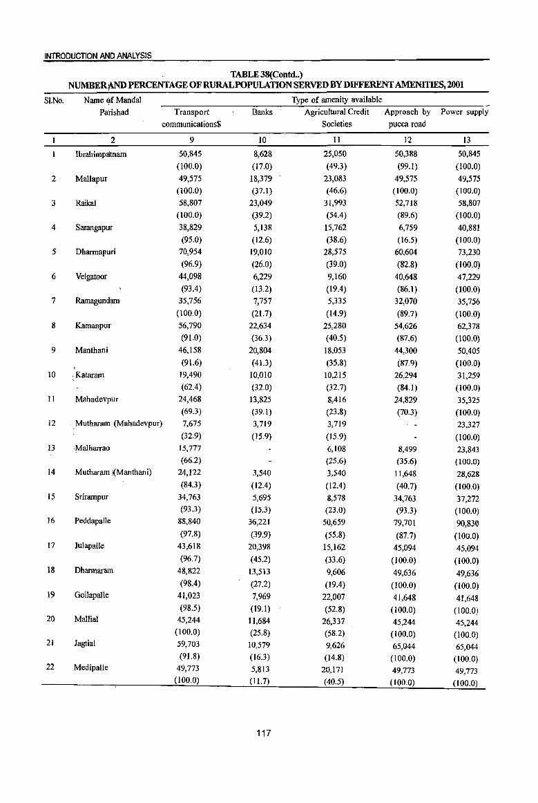
INTRODUCTION AND ANALYSIS
TABLE 38(Contd •• ) NUMBER¥\ND PERCENTAGE OFRURALPOPULATION SERVED BY DIFFERENT AMENITIES, 2001
SI.No. Name Of Mandai Type of amenity available
Parishad Transport Banks Agricultural Credit Approach by Power supply
communications$ SoCieties pucca road
2 9 10 11 12 13
Ibrahimpaplall1 50,845 8,628 25,050 50,388 50,845
(100.0) (17.0) (49.3) (99.1) (100.0)
2 Mallapur 49,575 18,379 23,083 49,575 49,575
(100.0) (37.1 ) (46.6) (100.0) (100.0)
3 Raikal 58,807 23,049 31,993 52,718 58,807
(100.0) (39.2) (54.4) (89.6) (100.0)
4 Sarangapur 38,829 5,138 15,762 6,759 40,881
(95.0) (12.6) (38.6) (16.5) (100.0)
5 Dharrnapuri 70,954 19,010 28,575 60,604 73,230
(96.9) (26.0) (39.0) (82.8) (100.0)
6 Velgatoor 44,098 6,229 9,160 40,648 47,229
(93.4) (13.2) (19.4) (86.1) (100.0)
7 Ramagundllm 35,756 7,757 5,335 32,070 35,756
(100.0) (21.7) (14.9) (89.7) (100.0)
8 Kamanpur 56,790 22,634 25,280 54,626 62,378 (91.0) (36.3) (40.5) (87.6) (l00.0)
9 Manthani 46,158 20,804 18,053 44,300 50,405
"; . (91.6) (41.3) (35.8) (87.9) (100.0)
10 . Kataram 19,490 10,010 10,215 26,294 31,259 (62.4) (32.0) (32.7) (84.1 ) (100.0)
11 Mahadevpur 24,468 13,825 8,416 24,829 35,325 (69.3) (39.1) (23.8) (70.3) (100.0)
12 Mutharam (Mahadevpur) 7,675 3,719 3,719 23,327 (32.9) (15.9) (15.9) (100.0)
13 ~Malharrao 15,777 6,108 8,499 23,843 (66.2) (25.6) (35.6) (100.0)
14 Mutharam !(Manthani) 24,122 3,540 3,540 11,648 28,628 (84.3) (12.4) (12.4) (40.7) (100.0)
15 Srirampur 34,763 5,695 8,578 34,763 37,272 (93.3) (15.3) (23.0) (93.3) (100.0)
16 Peddapalle 88,840 36,221 50,659 79,701 90,830 (97.8) (39.9) (55.8) (87.7) (100.0)
17 Julapalle 43,618 20,398 15,162 45,094 45,094 (96.7) (45.2) (33.6) (100.0) (100.0)
18 Dharmaram 48,822 13,513 9,606 49,636 49,636 (98.4) (27.2) (19.4) (100.0) (100.0)
19 Gollapalle 41,023 7,969 22,007 41,648 41,648 (98.5) (19.1) (52.8) (100.0) (100.0)
20 Mallial 45,244 11,684 26,337 45,244 45,244 (100.0) (25.8) (58.2) (100.0) (100.0)
21 Jagtial 59,703 10,579 9,626 65,044 65,044 (9l.8) (16.3) (14.8) (100.0) (100.0)
22 Medipalle 49,773 5,813 20,171 49,773 49,773 (100.0) (11.7) (40.5) (100.0) (100.0)
117
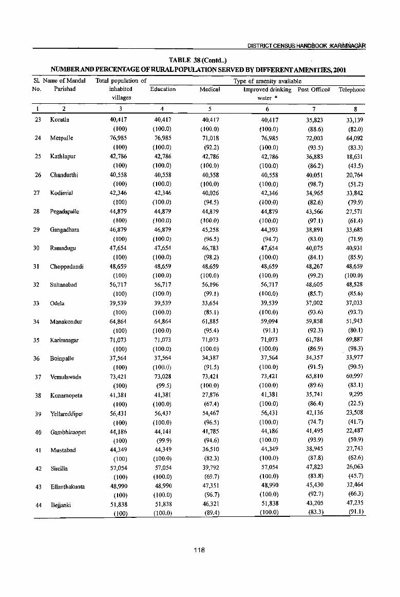
DISTRICT CENSUS HANDBOOK :KARIMNAGAR
TABLE 38 (Contd .. )
NUMBERAND PERCENTAGE OFRURALPOPULATION SERVED BY DIFFERENT AMENITIES, 2001
S1. Name of Mandai Total population of Type of amenity available No. Parishad inhabited Education Medical Improved drinking Post Office# Telephone
villages water * 2 3 4 5 6 7 8
23 KoratIa 40,417 40,417 40,417 40,417 35,823 33,139
(l00) (100.0) (100.0) (100.0) (88.6) (82.0)
24 Metpalle 76,985 76,985 71,018 76,985 72,003 64,092
(l00) (100.0) (92.2) (100.0) (93.5) (83.3)
25 Kathlapur 42,786 42,786 42,786 42,786 36,883 18,631
(l00) (100.0) (100.0) (100.0) (86.2) (43.5)
26 Chandurthi 40,558 40,558 40,558 40,558 40,051 20,764
(I 00) (100.0) (100.0) (l00.0) (98.7) (51.2)
27 Kodimial 42,346 42,346 40,026 42,346 34,965 33,842
(100) (100.0) (94.5) (100.0) (82.6) (79.9)
28 Pegadapalle 44,879 44,879 44,879 44,879 43,566 27,571
(100) (lOO.O) (100.0) (100.0) (97.1) (61.4)
29 Gangadhara 46,879 46,879 45,258 44,393 38,891 33,685
(100) (l00.0) (96.5) (94.7) (83.0) (71.9)
30 Ramadugu 47,654 47,654 46,783 47,654 40,075 40,931
(100) (100.0) (98.2) (100.0) (84.1) (85.9)
31 Choppadandi 48,659 48,659 48,659 48,659 48,267 48,659
(100) (100.0) (100.0) (100.0) (99.2) (100.0)
32 Sultanabad 56,717 56,717 56,196 56,717 48,605 48,528
(100) (100.0) (99.1) (l00.0) (85.7) (85.6)
33 Odela 39,539 39,539 33,654 39,539 37,002 37,033
(100) (100.0) (85.1) (100.0) (93.6) (93.7)
34 Manakondur 64,864 64,864 61,885 59,094 59,858 51,943
(100) (100.0) (95.4) (91.1) (92.3) (80.1)
35 Karimnagar 71,073 71,073 71,073 71,073 61,784 69,887
(100) (100.0) (100.0) (100.0) (86.9) (98.3)
36 Boinpalle 37,564 37,564 34,387 37,564 34,357 33,977
(100) (100.0) (91.5) (100.0) (91.5) (90.5)
37 Vemulawada 73,421 73,028 73,421 73,421 65,810 60,997
(100) (99.5) (100.0) (100.0) (89.6) (83.1 )
38 Konaraopeta 41,381 41,381 27,876 41,381 35,741 9,295
(l00) (100.0) (67.4) (l00.0) (86.4) (22.5)
39 Yellareddipet 56,431 56,431 54,467 56,431 42,136 23,508
(100) (100.0) (96.5) (100.0) (74.7) (41.7)
40 Gambhiraopet 44,186 44,141 41,785 44,186 41,495 22,487
(100) (99.9) (94.6) (100.0) (93.9) (50.9)
41 Mustabad 44,349 44,349 36,510 44,349 38,945 27,743
(100) (100.0) (82.3) (100.0) (87.8) (62.6)
42 Sircilla 57,054 57,054 39,792 57,054 47,823 26,063
(100) (100.0) (69.7) (l00.0) (83.8) (45.7)
43 Ellanthakunta 48,990 48,990 47,351 48,990 45,430 32,464
(100) (100.0) (96.7) (100.0) (92.7) (66.3)
44 Belianki 51,838 51,838 46,321 51,838 43,205 47,235
(100) (100.0) (89.4) (100.0) (83.3) (91.1)
118
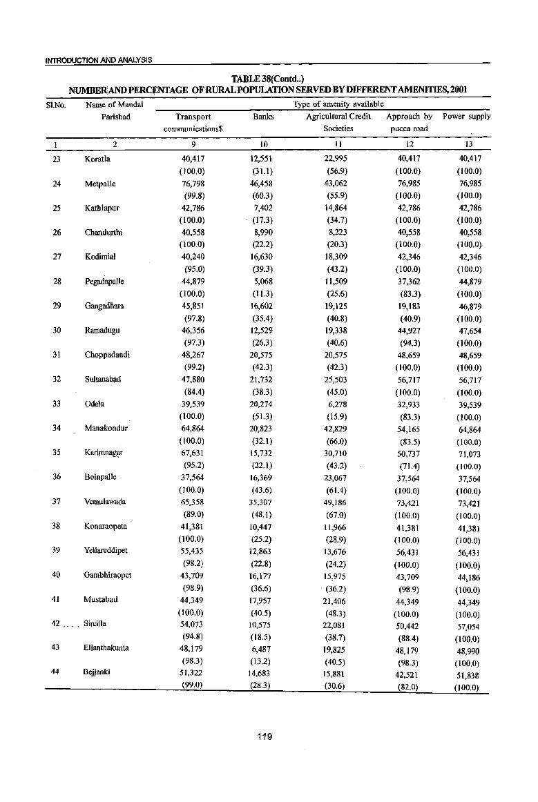
INTRODUCTION AND ANALYSIS
TABLE 38(Contd .. ) NUMBERAND PERCENTAGE OF RURAL POPULATION SERVED BY DIFFERENT AMENITIES, 2001
i
Sl.No. Name ,of Mandai Type of amenity available
Parishad Transport Banks Agricultural Credit Approach by Power supply
communications$ Societies pucca road
I 2 9 10 II 12 13
23 Koratla 40,417 12,551 22,995 40,417 40,417
(100.0) (31.1) (56.9) (100.0) (100.0)
24 MetpaIJe 76,798 46,458 43,062 76,985 76,985
(99.8) (60.3) (55.9) (100.0) (100.0)
25 Kathlapur 42,786 7,402 14,864 42,786 42,786
(l00.0) . (17.3) (34.7) (100.0) (100.0)
26 Chandurthi 40,558 8,990 8,223 40,558 40,558
(100.0) (22.2) (20.3) (100.0) (100.0)
27 Kodimial 40,240 16,630 18,309 42,346 42,346
(95.0) (39.3) (43.2) (100.0) (100.0)
28 Pegadapalle 44,879 5,068 I1,509 37,362 44,879
(100.0) (11.3) (25.6) (83.3) (lOO'(l)
29 Gangad~ara 45,851 16,602 19,125 19,183 46,879
(97.8) (35.4) (40.8) (40.9) (100.0)
30 Ramadugu 46,356 12,529 19,338 44,927 47,654
(97.3) (26.3) (40.6) (94.3) (100.0) 31 Choppadandi 48,267 20,575 20,575 48,659 48,659
(99.2) (42.3) (42.3) (100.0) (100.0)
32 Sultanabad 47,880 21,732 25,503 56,717 56,717
(84.4) (38.3) (45.0) (100.0) (100.0) 33 Odeta 39,539 20,274 6,278 32,933 39,539
(100.0) (51.3) (15.9) (83.3) (100.0) 34 Manakoridur 64,864 20,823 42,829 54,165 64,864
(100.0) (32.1 ) (66.0) (83.5) (100.0) 35 Karimnag~ 67,631 15,732 30,710 50,737 71,073
(95.2) (22.1) (43.2) (71.4) (100.0) 36 Boinpalle 37,564 16,369 23,067 37,564 37,564
(100.0) (43.6) (61.4) (100.0) (100.0) 37 Vemulawada 65,358 35,307 49,186 73,421 73,421
(89.0) (48.1) (67.0) (100.0) (100.0) 38 Konaraopeta 41,381 10,447 11,966 41,381 41,381
(100.0) (25.2) (28.9) (100.0) (100.0) 39 Yellareddipet 55,435 12,863 13,676 56,431 56,43]
(98.2) (22.8) (24.2) (100.0) (100.0) 40 'Gambhira()pet 43,709 16,177 15,975 43,709 44,186
(98.9) (36.6) (36.2) (98.9) (100.0) 41 Mustabad 44,349 17,957 21,406 44,349 44,349
(100.0) (40.5) (48.3) (100.0) (100.0) 42 .... SirciUa 54,073 10,575 22,081 50,442 57,054
(94.8) (18.5) (38.7) (88.4) (100.0) 43 Ellanthakunta 48,179 6,487 19,825 48,179 48,990
(98.3) (13.2) (40.5) (98.3) (100.0) 44 Belianki 51,322 14,683 15,881 42,521 51,838
(99.0) (28.3) (30.6) (82.0) (100.0)
119
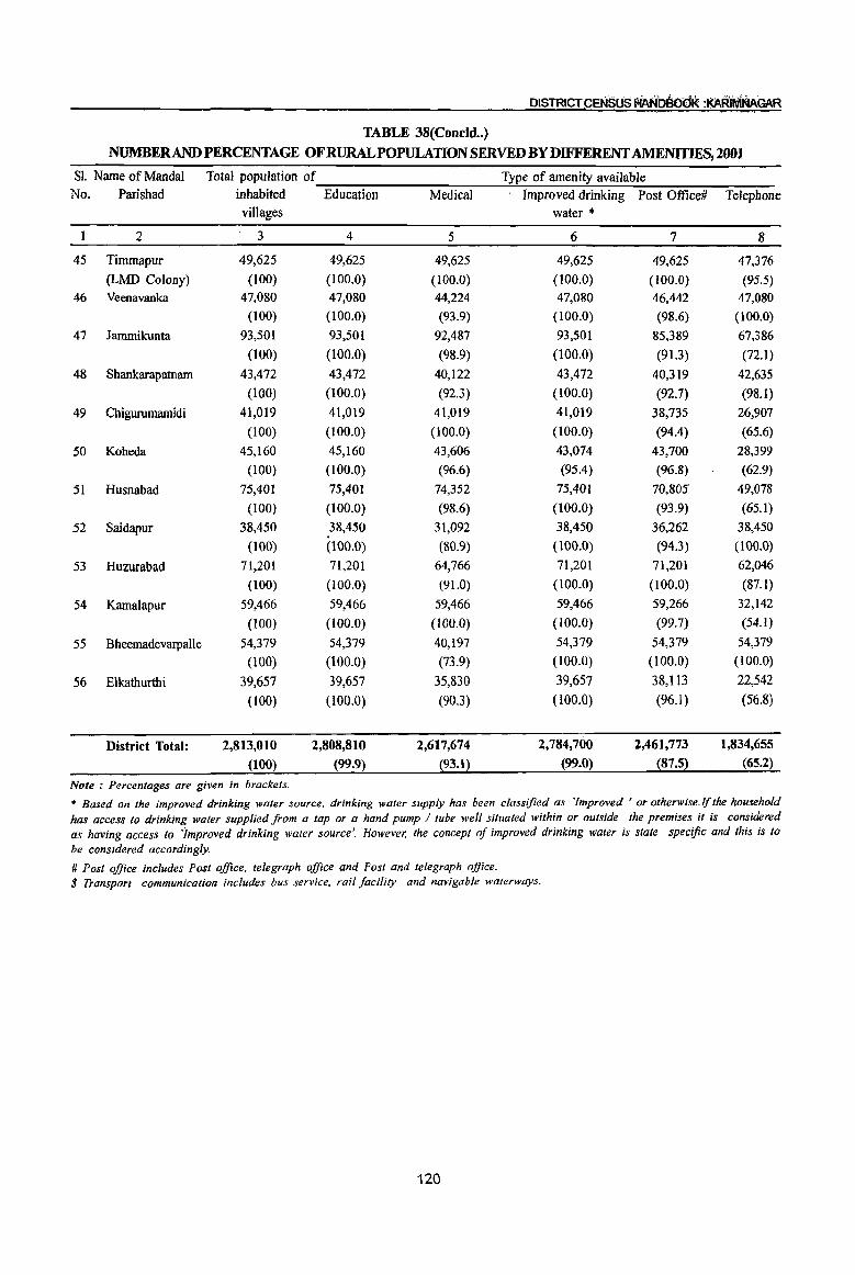
DISTRICT CENSUS fiAN~t)K :KARIMAAGAR
TABLE 38(Concld •• )
NUMBERANDPERCENTAGEOFRURALPOPULATIONSERVEDBYD~RENTAME~2001
SI. Name of Mandai Total population of Type of amenity available No. Parishad inhabited Education Medical Improved drinking Post Office# Telephone
villages water ,.
2 3 4 5 6 7 8
45 Timmapur 49,625 49,625 49,625 49,625 49,625 47,376
(LMD Colony) (100) {I 00.0) (100.0) (100.0) (100.0) (95.5)
46 Veenavanka 47,080 47,080 44,224 47,080 46,442 47,080
(100) (100.0) (93.9) (100.0) (98.6) (100.0)
47 Jammikunta 93,501 93,501 92,487 93,501 85,389 67,386
(lOO) (100.0) (98.9) (100.0) (91.3) (72.1)
48 Shankarapatnam 43,472 43,472 40,122 43,472 40,319 42,635
(100) (100.0) (92.3) (100.0) (92.7) (98.1)
49 Chigurumamidi 41,019 41,019 41,019 41,019 38,735 26,907
(100) (100.0) (100.0) (100.0) (94.4) (65.6)
50 Koheda 45,160 45,160 43,606 43,074 43,700 28,399
(100) (100.0) (96.6) (95.4) (96.8) (62.9)
51 Husnabad 75,401 75,401 74,352 75,401 70,805 49,078
(100) (100.0) (98.6) (100.0) (93.9) (65.1)
52 Saidapur 38,450 38,450 31,092 38,450 36,262 38,450
(100) (100.0) (80.9) (100.0) (94.3) (100.0)
53 Huzurabad 71,201 71,201 64,766 71,201 71,201 62,046
(100) (100.0) (91.0) (100.0) (100.0) (87.1)
54 Kamalapur 59,466 59,466 59,466 59,466 59,266 32,142
(l00) (100.0) (100.0) (100.0) (99.7) (54.1)
55 Bheemadevarpalle 54,379 54,379 40,197 54,379 54,379 54,379
(100) (IOO.O) (73.9) (100.0) (100.0) (100.0)
56 Elkathurthi 39,657 39,657 35,830 39,657 38,113 22,542
(l00) (100.0) (90J) (IOO.O) (96.1) (56.8)
District Total: 2,813,010 2,808,810 2,617,674 2,784,700 2,461,773 1,834,655
(100) (99.9) (93.1) (99.0) (87.5) (65.2)
Note: Percentages are given in brackets.
* Based on the improved drinking water source, drinking water supply has been classified as 'Improved' or otherwise·lfthe household has access to drinking water supplied from a tap or a hand pump / tube well situated within or outside the premises it is considered as having access to 'improved drinking water source'. However, the concept oj improved drinking water is state specific and this is to be considered accordingly.
# Post office includes Post office, telegraph office and Post and telegraph office. $ Transport communication includes bus service, rail facility and navigable walenyays.
120
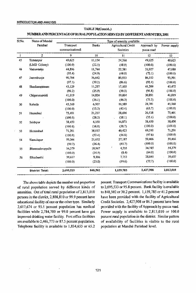
INTRODUCTION AND ANALYSIS
TABLE 38{Concld .. )
NUMBE~ANDPERCENTAGEOFRURALPOPULATIONSERVEDBYDIFFERENTAMENlTlES,2001
SI.No. Name 6fMandal Type of ameni!l: available Parishad Transport Banks Agricultural Credit Approach by Power supply
communications$ Societies puccaroad
,2 9 10 II 12 13
45 Timmapur 49,625 11,154 24,268 49,625 49,625
(LMD Colony) (100.0) (22.5) (48.9) (100.0) (100.0)
46 Veenavanka 44,896 11,744 22,581 33,927 47,080 (95.4) (24.9) (48.0) (72.1) (100.0)
47 Jammiku~ta 90,784 36,642 80,933 86,352 93,501
(97.1) (39.2) (86.6) (92.4) (100.0)
48 ShankaraPfltnam 43,129 11,257 17,105 41,209 43,472
(99.2) (25.9) (39.3) (94.8) (100.0)
49 Chigurumamidi 41,019 14,824 19,004 30,891 41,019
(100.0) (36.1) (46.3) (75.3) (100.0)
50 Koheda 45,160 6,907 19,589 28,781 45,160
(100.0) (15.3) (43.4) (63.7) (100.0)
51 Husnabad 75,401 21,237 28,696 26,438 75,401
(100.0) (28.2) (38.1) (35.1) (100.0)
52 Saidapur 38,450 6,150 14,873 38,450 38,450
(100.0) (16.0) (38.7) (l00.0) (100.0)
53 Huzurabad 71,201 38,037 40,423 69,510 71,201
(100.0) (53.4) (56.8) (97.6) (100.0)
54 Kamalapur 59,266 21,652 27,187 59,466 59,466
(99.7) (36.4) (45.7) (100.0) (l00.0)
55 BheemadevC)IPalle 54,379 18,967 4,555 34,785 54,379
(100.0) (34.9) (8.4) (64.0) (100.0)
56 Elkathurthi 39,657 9,106 7,753 28,841 39,657
(100.0) (23.0) (19.6) (72.7) (100.0)
District Total: 2,695,533 848,502 1,159,785 2,427,908 2,813,010
The above table depicts the number and proportion percent. Transport Communications facility is available
of rural population served by different kinds of to 2,695,533 or 95.8 percent. Bank facility is available
amenities. Out of total rural population of2,813,010 . to 848,502 or 30.2 percent. 1,159,785 or 41.2 percent
persons in the distrii;:t, 2,808,810 or 99.9 percent have have been provided with the facility of Agricultural
educational facility of one or the other type. Similarly Credit Societies. 2,427,908 or 86.3 percent have been
2,617,674 or 93.1 \percent population has medical provided with the facility of Approach by pucca road.
facilities while 2,784,700 or 99.0 percent have got Power supply is available to 2,813,010 or 100.0
improved drinking water facility. Post office facilities percent rural population in the district. Similar pattern
are available to 2,4611,773 or 87.5 percent population. of availability of facilities is visible to the rural Telephone facility is available to 1,834,655 or 65.2 population at Mandai Parishad level.
121

DISTRICT CENSUS HANi'JS(}Ol( :KARiMNAGAR
TABLE 39
D~~UTIONOFvnLAGESNOTHAvmGCERTMNAMENITmS
ARRANGED BY DISTANCE RANGES FROM THE PLACES WHERE THESE ARE AVAllABLE, 2001
Village not having the amenity of Distance range of place from the village where the amenity is available
Less than 5
1 1. Education :-
(a) Primary School (b) Middle School (c) Degree College
2. Medical:(a) Hospital (b) PHC
3. Post Office
4. Telephone
5. Bus Service
6. Banks (a) Commercial Bank (b) Cooperative Bank
7. Agricultural Credit Societies
kilometers
2
6 189 32
76 148
221
91
61
213 91
299
In this table it has been presented distribution of villages not having certain amenities within the village at district level. They have to go out of their village to avail these facilities. Such villages have been presented according to various distance ranges in this table. 8 villages do not have primary school in their villages and out of these villages, children of 6 villages have to travel less than 5 kms. and 2 villages above 10 kms. for schooling. Out of 1,047 inhabited villages as many as 379 are deprived of middle school and 1,035 of degree college facilities. Of these 189 avail the facility of middle school at a distrance of less than 5 kms., 79 at a distance 5-10 kms. and the remaining III at a distance of 10+ kms. In respect of degree college 32 avail this facility at a distance of less than 5 kms., 118 between 5 to 10 kms. and the remaining 885 villages at a distance of 10+ kms
Similarly there are 1,029 villages in the district which have been deprived of Hospital facility and 977 villages which are deprived of PHC facilities. Of these, 76 villages have to travel to avail this facility of Hospital within 5 kms. while in respect of 200 villages the inhabitants have to cover a distance of 5-1 0 kms. in order to avail this facility. Similarly
122
5-10 10+ Total
kilometers kilometers (Coimns 2-4)
3 4 5
2 8 79 III 379
118 885 1,035
200 753 1,029 320 509 977
57 67 345
147 311 549
12 64 137
359 357 929 260 663 1,014
261 260 820
overwhelming number i.e. 753 villages have this facility at a distance of 10+ kms. As regards PRC 148 villages avail this facility at a distance of less than 5 kms. 320 at a distance of 5-10 kms. and the remaining 509 have to travel at a distance of more than 10 kms. to avail this facility
Regarding Post Office, 345 villages do not have this facility in the village itself. Of these m.yority i.e. 221 have this facility at a distance of less than 5 kms., another 57 villages avail it at a distance of 5-10 kms. and the remaining 67 village habitants have to travel a distance of 10+ kms.
As regards Telephone, there are 549 villages in the district which are not having the telephone facility. Of these, 91 villages avail this facility at a distance of less than 5 kms. 147 at a distance of 5-10 kms. and remaining 311 have to traverse a distance of 10+ kms.
In respect of Bus services it is noticed that 137 villages do not have this facility. Among these villages 61 villages avail this facility at a distance ofless than 5 kms., 12 at a distance between 5-10 kms. and 64 at a distance of 10+ kms.
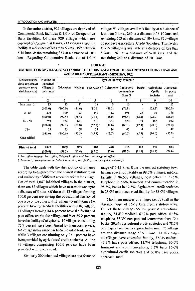
INTRODUCTION AND ANALYSIS
In the entire district, 929 villages are deprived of Commercial Bank facilities & 1,014 of Co-operative Bank facilities. Of these 929 villages which are deprived of Commercial Banks, 213 villages avail this facility at a distance of less than 5 kms., 359 between 5-10 kms. & the remaining 351 at a distance of 10+ kms. Regarding Co-operative Banks out of 1,014
villages 91 villages avail this facility at a distance of less than 5 kms., 260 at a distance of 5-10 kms. and remaining 663 at a distance of 10+ kms. 820 villages do not have Agricultural Credit Societies. This facility to 299 villages is available at a distance of less than 5 kms., 261 at a distance of 5-10 kms. and the remaining 260 at a distance of 10+ kms.
TABLE 40
DISTRIBUTIONiOFVILLAGESACCORDING 10 THE DlSTANCE FROM THE NEAREST STATUTORY 10WNAND AVAILABILITYOFDIFFERENT AMENITIFS, 2001
Distance range Number of Type of amenity available from the .nearest inhabited statutory town (in kilometers)
villages in each range
Education Medical Post Office # Telephone Transport communica
tions $
Banks Agricultural Approach Credit by pucca
Societies road
2 less than 5 13
(100.0)
5 -15 200
(100.0)
16 - 50 ·759
(ilOo.O)
51+ 75 (100.0)
Unspecified
District total 1047 (100.0)
3 13
(l00.0)
199
(99.5)
752
(99.1)
75 (100.0)
1039
(99.2)
4 11
(84.6)
173 (86.5)
621
(81.8)
58 (77.3)
863 (82.4)
5 11
(84.6)
147
(73.5)
510
(61.2)
34 (45.3)
702
(67.0)
6 9
(69.2)
1I2 (56.0)
363
(47.8)
14 (18.7)
498
(47.6)
7 10
(76.9)
191
(95.5)
670
(88.3)
45
(60.0)
916 (87.5)
8
25 (12.5)
94
(12.4)
4
(5.3)
123 (11.7)
9 3
(23.1)
56 (28.0)
156
(20.6)
12 (16.0)
227
(21.7)
10 13
(100.0)
176 (88.0)
592
(78.0)
42
(56.0)
823 (78.6)
# Post office includes Post office, Telegraph office and Post and telegraph office $ Transport _ ·communi<;ation includes bus service, rail facility and navigable waterways.
The table deals with the distribution of villages according to distance from the nearest statutory town
. and availability of different amenities within the village. Out of total 1,047 inhabited villages in the district, there are 13 villages which have nearest towns upto a distance of 5 kms. Of these all 13 villages forming 100.0 percent are having the educational facility of one type or the other and 11 villages constituting 84.6 percent, have the medical facilities within the village, 11 villages forming 84.6 percent have the facility of post office within the village and 9 or 69.2 percent have the facility of telephone. 10 villages constituting 76.9 percent have been linked by transport service. No village in this range has been provided bank facility, while 3 villages constituting only 23.1 percent have been provided by agricultural credit societies. All the 13 villages comprising 100.0 percent have been providyd with pucca road.
Similarly 200 inhabited villages are at a distance
123
range of 5-15 kms. from the nearest statutory town having education facility in 99.5% villages, medical facility in 86.5% villages, post office in 73.5%, telephone in 56%, transport and communication in 95.5%, banks in 12.5%, Agricultural credit societies in 28.0% and pucca road~facility for 88.0% villages.
Maximum number of villages i.e. 759 fall in the distance range of 16-50 kms. from statutory town. Out of these villages 99.1 % possess educational facility, 81.8% medical, 67.2% post office, 47.8% telephone, 88.3% transport and communications, 12.4 banks, 20.6% agricultural credit societies and 78.0% of villages have pucca approachable road. 75 villages are at a distance range of 51 + kms. In this range all villages have education facility, 77.3% medical, 45.3% have post office, 18.7% telephone, 60.0% transport and communications, 5.3% bank 16.0% agricultural credit societies and 56.0% have pucca approach road.
DiStRICT CENSUS HAt4D~00K :KARIMr4AGAR
TABLE 41 DISTRIBUTION OF VILLAGES ACCORDING TO POPULATION RANGE AND
AMENITIES AVAILABLE, 2001
Population Number of Type of amenity available
range inhabited villages in Education Medical Improved Post Telephone Transport Banks Agricul- Approach Power
each range drinking Office # communi- tural by pucca supply
water* cations $ Credit road Societies
1 2 3 4 5 6 7 8 9 10 II 12
1-499 81 74 31 76 1 9 32 1 2 44 81
(100.0) (91.4) (38.3)- (93.8) (1.2) (11.1) (39.5) (1.2) (2.5) (54.3) (100.0)
500-999 124 124 68 1I8 15 29 88 3 85 124
(100.0) (100.0) (54.8) (95.2) (12.1 ) (23.4) (71.0) (2.4) (68.5) (100.0)
1000-1999 290 290 235 284 161 114 257 5 22 215 290 (100.0) (100.0) (81.0) (97.9) (55.5) (39.3) (88.6) (1.7) (7.6) (74.1) (100.0)
2000-4,999 451 450 428 447 424 253 438 54 126 384 451
(100.0) (99.8) (94.9) (99.1) (94.0) (56.1) (97.1) (12.0) (27.9) (85.1) (100.0) 5000-9999 82 82 82 81 82 75 82 45 55 76 82
(100.0) (100.0) (100.0) (98.8) (100.0) (91.5) (100.0) (54.9) (67.1) (92.7) (l00.0) 10000 + 19 19 19 19 19 18 19 18 19 19 19
(100.0) (100.0) (100.0) (100.0) (100.0) (94.7) (100.0) (94.7) (100.0) (100.0) (100.0)
District total 1047 1039 863 1025 702 498 916 123 227 823 1047 (100.0) (99.2) (82.4) (97.9) (67.0) (47.6) (87.5) (11.7) (21.7) (78.6) (100.0)
# Post office includes Post office, Telegraph office and Post and telegraph office. $ Transport communication includes bus service, rail facility and navigable watenvays.
* Based on the improved drinking water source, drinking water supply has been classified as 'Improved ' or otherwise. If the household has access to drinking water supplied from a tap or a hand pump I tube well situated within or outside the premises it is considered as having access to 'Improved drinking water source'. However; the concept of improved drinking water is state specific and this is to be considered accordingly
This table deals with the distribution of villages by population ranges and amenities available therein. In Karimnagar district out of total 1,047 inhabited villages, 1,039 villages (99.2 percent) have education facility, 863 (82.4 percent) have medical facility, 1,025 (97.9 percent) have improved drinking water facility, 702 villages (67.0 percent) have post office facility
and 498 (47.6 percent) have telephone facility. 916 (87.5 percent) have been linked by bus service. 123 (1l.7 percent) have bank facility. 227 (21.7 percent) have been served with the agricultural credit societies. 823 (78.6 percent) have been linked with pucca road and all 1,047 villages (100.0 percent) possess electricity.
Sl. No.
2
3 4
5 6
7
8 9
TABLE 42 DISTRIBUTION OF VILLAGES ACCORDING TO LAND USE, 2001
Name of Mandai Number Total Percentage of Parishad of inhabited area cultivable area
villages (in hectares) to total area
2 3 4 5
Ibrahimpatnarn 18 18,421 68.2
Mallapur 19 18,804 73.2
Raikal 20 27,031 43.1
Sarangapur 24 28,753 45.2
Dharmapuri 23 25,774 50.5
Velgatoor 23 20,538 67.6 Ramagundam 20 19,147 73.7
Kamanpur 22 20,183 39.2
Manthani 31 31,268 52.9
124
Percentage of irrigated area to
total cultivable area
6
52
67.7
44.7
53.5
6I.I 66.3 27.7
36.8
39.5

INTRODUCTION AND ANALYSIS
TABLE 42 (Concld .. ) DISTRIBUTION OF VILLAGES ACCORDING TO LAND USE, 2001
Sl. Name of Mandai Number Total Percentage of Percentage of
No. Parishad of inhabited area cultivable area irrigated area to
villages (in hectares) to total area total cultivable area
2 3 4. 5 6
10 Kataram 28 21,602 62.8 47.2
1\ Mahadevpur 37 30,198 26.4 30.2 12 Mutharam (Mahadevpur) 21 27,915 31.7 80.0
13 Malh'arrao 16 18,652 64.2 23.7
14 Mutqaram (Manthani) 18 16,175 49.7 26.3
15 Sri(atnpur 17 17,828 55.5 31.5
16 Peddapalle 22 22,196 71.3 48.6
17 JulapaUe 15 17,357 75.4 69.1
18 Dha$aram 17 20,200 68.2 64.1
19 GoUapalle 22 15,418 75.8 57.7
20 Mallial 15 16,687 60.7 26.9
21 Jagtiai 24 21,553 68.7 85.2
22 Medipalle 19 19,699 67.6 34.6
23 Koratia 14 11,716 73.4 43.1 . 24 Metp~lle 15 17,621 68.2 32.5
25 Kathlapur 18 17,707 67.4 28.8
26 Chandurthi 12 20,652 52.9 34.0
27 Kodirriial 15 15,046 59.1 24.3
28 Pegadapalle 16 14,644 70.4 69.9
29 i Gangadhara 19 16,454 67.8 48.7
30 "Ramadugu 18 13,186 72.0 70.9
31 . 'ChoPPlldandi 12 14,092 78.2 53.5
32 Sultanabad 21 16,769 69.2 75.6
33 Odela II 14,619 52.2 92.2
34 Manakondur 18 19,777 82.1 - 89.1
35 . Xarimnf1gar 24 18,977 47.3 69.4
36 'Boinpalle 16 13,647 84.4 34.4
37 Vernula'wada 23 20,689 71.9 22.3
38 Konara9peta 19 20,861 56.9 23.7
39 Yellareddipet 22 30,312 32.0 33.9
40 Gambhiraopet 17 15,632 61.5 29.6
41 Mustabad 15 15,835 77.2 30.9
42 Sircilla 21 23,801 65.0 25.7
43 Ellanthakunta 22 23,199 28.5 40.9
44 Beiianki 23 23,816 73.6 32.7
45 Timmap'ur (LMD Colony) 14 16,033 57.8 70.4
46 Veenavanka 14 14,369 77.8 46.3
47 Jammiktinta 19 22,286 75.0 58.9
48 Shankarapatnam 17 14,710 66.9 73.0
49 Chigururnamidi II 15,430 62.5 59.5
50 Koheda 16 21,052 24.6 50.5
51 Husnabad 24 25,855 72.6 50.2 52 Saidapur 14 14,580 87.1 40.7 53 Huzurabad 12 13,755 76.1 71.2 54 Kamalapur 16 16,173 79.6 75.7 55 Bheemadevarpalle 15 17,819 65.8 50.5 56 Elkathurthi 13 11,565 79.6 73.4
District total: 1,047 1,078,078 60.8 50.0 Note: Cultivable area - :irrigated area + un irrigated area
125
This table presents MandaI Parishad-wise distribution of villages according to land use. It also gives details of total area and cultivable area in the inhabited villages of the district. Cultivated area includes irrigated as well as un irrigated area. Further the laborates that what is the extent of cultivable area under irrigation. There are total 1,047 inhabited villages in the district covering a total area of 10,78,078 hectares. Of this, 60.8 percent is cultivable and 50 percent of total cultivable area has got the irrigation
DISTRICT CENSUS HANDBOOK :KARiMillAGAR
facility. the area figures for the villages have been
collected from the revenue records maintained by the
State Government. The highest 87.1 % area of
Saidapur mandaI parishad is cultivable area, closely
followed by Boinpalle mandaI parishad (84.4%).
Koheda mandai parishad has least area with 24.6%
as cultivable land. 92.2% of cultivable area of Odela
mandaI parishad is irrigated, followed by Manakondur
with 89.1%.
TABLE 43
PER CAPITA RECEIPT AND EXPENDITURE IN STATUTORY TOWNS
SI. Class, name & urban Per caEita receiEt(Rs.OOl No. status of Town+ Total Through From all
taxes other sources
1 2 3 4 5
II Jagtial (M) 462 138 324 2 I Karimnagar (M) 118 2 117
3 II Koratla (M) IS3 127 26 4 I Ramagundam (M) 128 55 74 5 II SirciIla (M) 193 131 62
District Total 177 61 115
+ Towns arranged in Alphabetical order
The above table gives the per capita receipt and expenditure (in hundreds of rupees) for each statutory town in the district. The average per capita receipts for all towns of the district works out to Rs.l77 of which 61 are derived through local taxes and the remaining Rs. 115 received from all other sources. The average of total expenditue incurred per head is
Per caEita expenditure (Rs.OO) Total General Public health Public Public Other(s)
Admini- and conveni- works institu-nistration ences tions
6 7 8 9 10 11 258 99 65 82 12 390 23 62 84 5 2IS 103 14 47 25 17 110 38 12 30 30 Il2 19 59 17 16
221 37 43 53 2 87
Rs. 221. Out of this Rs.37 are spent on general administration, Rs.43 on public health and conveniences, Rs.53 on public works and Rs.87 is spent on other items. Among all the 5 towns the receipt 462 is the highest in Jagtial (M) and highest expenditure of 390 per head is in Karimnagar (M).
TABLE 44
SCHOOLS / COLLEGES PER 10,000 POPULATION IN STATUTORY TOWNS, 2001
S1. Name and urban status Type of educational institution No. of Town+ Primary Junior Secondary/ Secondary} Senior College -
Middle Matriculation Secondary
2 3 4 5 6 7
1 Jagtial (M) 3.2 3.3 2.1 0.6 0.4
2 Karimnagar (M) 5.9 5.6 3.6 0.9 0.5
3 Koratla (M) 6.9 5.9 2.4 0.4 0.2 4 Ramagundam (M) 4.1 4.1 2.5 0.4 0.1
5 Sircilla (M) 5.5 5.1 2.1 0.5 0.2
District Total 5 4.7 2.7 0.6 0.3
+ Towns arranged in Alphabetical order
126
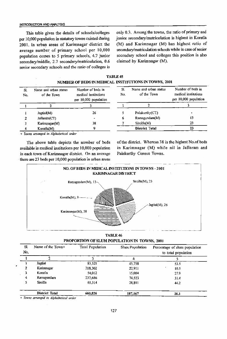
..
INTRODUCTION AND ANALYSIS
This table !gives the details of schools/colleges per 10,000 popu'lation in statutory towns existed during 2001. In urbat:t areas of Karimnagar district the average number of primary school per 10,000 population comes to 5 primary schools, 4.7 junior secondary/middle, 2.7 secondary/matriculation, 0.6 senior secondary schools and the ratio of colleges is
only 0.3. Among the towns, the ratio of primary and junior secondary/matriculation is highest in Koratla (M) and Karimnagar (M) has highest ratio of secondary/matriculation schools while in case of senior secondary school and colleges this position is also claimed by Karimnagar (M).
TABLE 45
NUMBER OF BEDS IN MEDICAL INSTITUTIONS IN TOWNS, 2001
SL Name arid urban status Number of beds in
No. of the Town medical institutions per 10,000 population
2 3
Jagtial(M) 26
2 Jallara'm( CT)
3 KarimJ;lagar(M) 38
4 Koratia(M) 9
+ Towns arranged in Alphabetical order
The above table depicts the number of beds available in medical institutions per 10,000 population in each town>ofKarimnagar district. On an average
. there are 23 beds per 10,000 population in urban areas
SJ. Name and urban status Number of beds in
No. of the Town medical institutions per 10,000 population
2 3
5 Palakurthy(CT)
6 Ramagundam(M) 13
7 SirciIla(M) 23
District Total 23
of the district. Whereas 38 is the highest No.ofbeds in Karimnagar (M) while nil in Jaltaram and Palakurthy Census Towns .
NO. OF BEDS IN MEDICAL INSTITUllONS IN TOWNS - 2001
KARIMNAGAR DJS1RICT
Ramagundam(M), 13 Sircilla(M), 23
TABLE 46
PROPORTION OF SLUM POPULATION 1N TOWNS, 2001
SL Name ofthe Town+ Total Population Slum Population Percentage of slum population No. to total population
4 3 4 5 Jagtial 85,521 45,758 53.5
2 Karimnagar 218,302 22,911 10.5 3 Koratla 54,012 15,084 27.9 4 Ramagundam 237,686 74,523 31.4 5 Sircilla 65,314 28,891 44.2
District Total 660,826 187,167 28.3 + Towns arranged in Alphabetical order
127
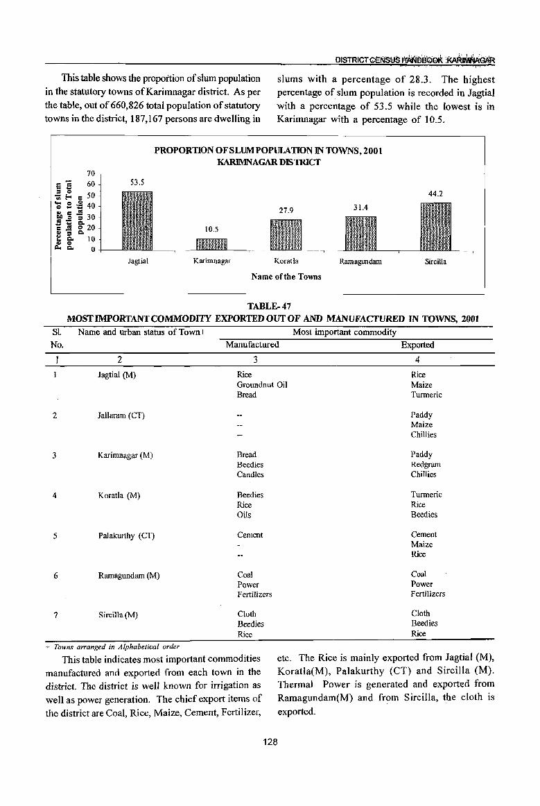
This table shows the proportion of slum population in the statutory towns of Karimnagar district. As per the table, out of 660,826 total population of statutory towns in the district, 187,167 persons are dwelling in
slums with a percentage of 28.3. The highest percentage of slum population is recorded in Jagtial with a percentage of 53.5 while the lowest is in Karimnagar with a percentage of 10.5.
PROPORTION OF SLUM POPULATION IN TOWNS, 200t KARIMNAGAR D1S1RICf
70
e '3 60
~ {:. c 50 'Q .s ~ 40 ~ c .!!! 30 CIS .!: ::I
C .i ~ 20 <I> = _ ~ Co 10 <I> 0
j:l.., Co 0
53.5
Jagtial Karimnagar Koratla Ramagwldam Sircilla
Name of the Towns
TABLE-47 MOST IMPORTANT COMMODITY EXPORTED OUT OF AND MANUFACTURED IN TOWNS, 2001
S1. Name and urban status of Town+
No.
2
Jagtial (M)
2 Jallaram (CT)
3 Karimnagar (M)
4 Koratla (M)
5 Palakurthy (CT)
6 Ramagundam (M)
7 Sircilla (M)
+ Towns arranged in Alphabetical order
Most important commodity Manufactured Exported
3 4
Rice Groundnut Oil Bread
Bread Beedies Candles
Beedies Rice Oils
Cement
Coal Power Fertilizers
Cloth Beedies Rice
Rice Maize Turmeric
Paddy Maize Chillies
Paddy Redgram Chillies
Turmeric Rice Beedies
Cement Maize Rice
Coal Power Fertilizers
Cloth Beedies Rice
This table indicates most important commodities manufactured and exported from each town in the district. The district is well known for irrigation as well as power generation. The chief export items of the district are Coal, Rice, Maize, Cement, Fertilizer,
etc. The Rice is mainly exported from Jagtial (M), Koratia(M), Palakurthy (CT) and Sircilla (M). Thermal Power is generated and exported from Ramagundam(M) and from Sircilla, the cloth is
exported.
128
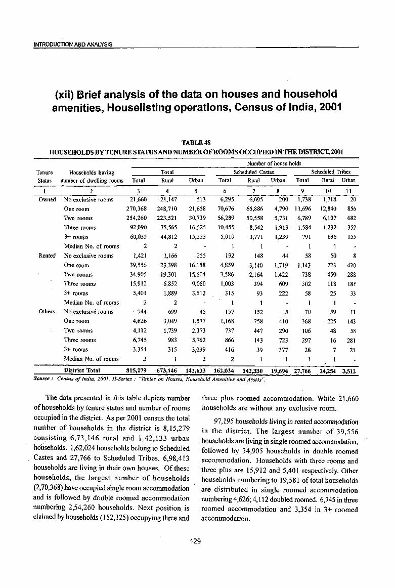
INTRODUCTION AI')ID ANALYSIS
(xii) Brief analysis of the data on houses and household amenities, Houselisting operations, Census of India, 2001
TABLE 48 HOUSEHOLDS BY TENURE STATUS AND NUMBER OF ROOMS OCCUPIED IN THE DISTRICT, 2001
Number of house holds
Tenure Households having Total Scheduled Castes Scheduled Tribes
Status number of dwelling rooms Total Rural Urban Total Rural Urban Total Rural Urban
2 3 4 5 6 7 8 9 10 II
Owned No exclusive rooms
One room
Two rooms
Three rooms
3+ rooms
21,660
270,368
254,260
92,090
60,035
2
21,147
248,710
223,521
75,565
44,812
2
513
21,658
30,739
16,525
15,223
6,295
70,676
56,289
10,455
5,010
I
6,095
65,886
50,558
8,542
3,771
1
200 1,738
4,790 13,696
5,731 6,789
1,913 1,584
1,239 791
1,718 20
12,840
6,107
1,232
856
682
352
636 155
Median. No. of rooms I 1
Rented No exclusive rooms
One room
Two rooms
Three rooms
3+ rooms
1,421
39,556
34,905
15,912
5,401
1,166
23,398
19,301
6,852
1,889
2
255
16,158
15,604
9,060
3,512
192
4,859
3,586
1,003
315
148
3,140
2,164
394
93
44 58
1,719 1,143
1,422 738
609 302
222 58
50 8
723 420
450 288
118 184
25 33
Median No. of rooms
Others No exclusive rooms
One room
Two rooms
Three rooms
3+ rooms
Median No. of rooms
2
. 744
4,626
4,112
6,745 .
3,354
3
699
3,049
1,739
983
315
45
1,577
2,373
5,762
3,039
2
157
1,168
737
866
416
2
152
758
447
143
39
5
410
290
723
377
70
368
106
297
28
59 11
225 143
48 58
16 281
7 21
District Total 815,279 673,146 142,133 162,024 142,330 19,694 27,766 24,254 3,512 Source: Census of India, 200], H-Series: "Tables on Houses, Household Amenities and Assets ".
The data presented in this table depicts number of households by tenure status and number of rooms occupied in the district. As per 2001 census the total
number of households in the district is 8,15,279 consisting 6,73,146 rural and 1,42,133 urban households. 1,62,024 households belong to Scheduled Castes and 27,766 to Scheduled Tribes. 6,98,413 households are living in their own houses. Of these households, the largest number of households
(2,70,368) have occupied single room accommodation and is followed by double roomed accommodation numbering 2,54,260 households. Next position is claimed by households (152,125) occupying three and
129
three plus roomed accommodation. While 21,660 households are without any exclusive room.
97,195 households living in rented accommodation in the district. The largest number of 39,556 households are living in single roomed accommodation, followed by 34,905 households in double roomed accommodation. Households with three rooms and three plus are 15,912 and 5,401 respectively. Other households numbering to 19,581 of total households are distributed in single roomed accommodation nuinbering 4,626; 4,112 doubled roomed. 6,745 in three roomed accommodation and 3,354 in 3+ roomed accommodation.
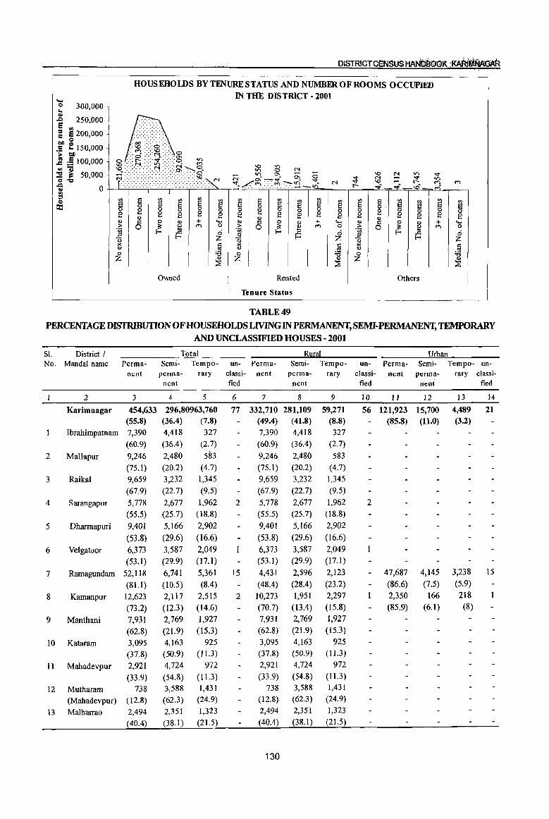
.... HOUSEHOIDS BY TENURE STATUS AND NUMBER OF ROOMS OCCUPIED
IN THE DISTRICT - 2001 !: 300,000 ~
..Q 250,000 e '" ~ 8200,000 !)Do
. 5 E 150,000 :. !)D
] :S 100,000 ",Gi ::s iI: 50,000 0'0
~ 0 '" ::l o
::c
.00 -:-: ........ .
N -~ .••••• i •• • •• ·g •••••• ·.~.0~~
O\\ned Rented Others
Tenure Status
TABLE 49 PERCENTAGE DISTRIBUTION OF HOUSEHOLDS UVING IN PERMANENT, SEMI-PERMANENT, TEMPORARY
AND UNCLASSIFIED HOUSES - 2001
SI. District I No. Mandai name Perma
nent
Total Semi- Tempo- un- Perm a-
perm a- rary classi- nent nent fled
2 3 4 5 6 7
2
3
4
5
6
7
8
9
10
11
12
Karimnagar 454,633 296,80963,760 (55.8) (36.4) (7.8)
Ibrahimpatnam 7,390 4,418 327
Mallapur
Raikal
Sarangapur
Dhannapuri
Velgatoor
Ramagundam
Kamanpur
Manthani
Kataram
Mahadevpur
Mutharam
(Mahadevpur)
(60.9) (36.4) (2.7)
9,246
(75.1)
9,659
(67.9)
5,778
(55.5)
9,401
(53.8)
6,373
(53.1)
52,118
(81.1)
12,623
(73.2)
7,931
(62.8)
3,095
(37.8)
2,921
(33.9)
sin (4.7)
1,345 (9.5)
1,962
(18.8)
2,902
(16.6)
2,049 (17.1)
5,361
(8.4)
2,515 (14.6)
1,927
(15.3) 925
(11.3)
13 Malharrao
738 (12.8)
2,494
(40.4)
2,480
(20.2)
3,232
(22.7)
2,677
(25.7)
5,166
(29.6)
3,587
(29.9)
6,741
(10.5)
2,117
(12.3)
2,769 (21.9) 4,163 (50.9) 4,724
(54.8)
3,588
(62.3)
2,351
(38.1)
972 (11.3)
1,431
(24.9)
1,323
(21.5)
77 332,710 (49.4) 7,390
(60.9)
9,246
(75.1)
9,659
(67.9)
2
15
2
5,778 (55.5)
9,401
(53.8)
6,373
(53.1)
4,431
(48.4)
10,273
(70.7)
7,931
(62.8)
3,095 (37.8)
2,921
(33.9)
738 (12.8)
2,494
(40.4)
130
Rural Semi- Tempo-
perma- rary nent
8
281,109 (41.8)
4,418
(36.4)
2,480
(20.2)
3,232 (22.7)
2,677
(25.7)
5,166
(29.6)
3,587 (29.9)
2,596
(28.4)
1,951
(13.4)
2,769
(21.9)
4,163
(50.9)
4,724
(54.8) 3,588
(62.3)
2,351
(38.1)
9
59,271 (8.8) 327
(2.7)
583 (4.7)
1,345
(9.5)
1,962 (18.8)
2,902
(16.6)
2,049
(17.1 )
2,123
(23.2)
2,297
(15.8)
1,927 (15.3)
925
(11.3)
972 (11.3) 1,431
(24.9) 1,323
(21.5)
Urban un- Perm a- Semi- Tempo- un-
c1assi- nent perma- rary classi-fled nent fled
10 11 12
56 121,923 15,700 (85.8) (11.0)
2
47,687
(86.6)
2,350
(85.9)
4,145 (7.5)
166 (6.1)
13
4,489 (3.2)
3,238 (5.9) 218
(8)
14
21
15

INTRODUCTION Af\lD ANALYSIS
TABLE 49 (Contd .• ) PERCENTAGE DISTRIBUTION OF HOUSEHOLDS UVING IN PERMANENT, SEMI-PERMANENT, TEMPORARY
AND UNCLASSIFIED HOUSES -2001
SI. District / Total Rural Urban
No. Mandai name Perm a- Semi- Tempo- un- Perma- Semi- Tempo- un- Perm a- Semi- Tempo- un-nent perm a- rary classi- nent perma- rary classi- nent perma- rary classi-
nent tied nent fled nent fled
1 2 3 4 5 6 7 8 9 10 II 12 13 14
14 Mutharam 4,389 ' 1,212 1,711 1 4,389 1,212 1,711 1 (Manthani) (60) (16.6) (23.4) (60) (16.6) (23.4)
15 Srirampur 4,890 2,566 2,520 4,890 2,566 2,520
(49) (25.7) (25.3) (49) (25.7) (25.3)
16 Peddapalle 12,207 5,363 3,488 5 12,207 5,363 3,488 5
(58) (25.5) '. (16.6) (58) (25.5) . (16.6)
17 JuJapaIle 5,918 3,478 1,899 5,918 3,478 1,899
(52.4) (30.8) (16.8) (52.4) (30.8) (16.8)
18 Dharmaram 6,863 3,394 2,318 6,863 3,394 2,318
(54.6) (27) (18.4) (54.6) (27) (18.4)
29 Gollapalle 5,122 3,781 1,053 5,122 3,781 1,053
(51.5) (38) (10.6) (51.5) (38) (10.6)
20 Mallia! 5,855 4,759 418 5,855 4,759 418 (53.1) (43.1) (3.8) (53.1) (43.1) . (3.8)
21 Jagtial 23,298 8,345 840 3 8,963 5,913 580 14,335 2,432 260 3 (71.7) (25.7) (2.6) (58) (38.3) (3.8) (84.2) (14.3) (1.5)
22 'Medipalle 7,920 3,670 558 7,920 3,670 558 . (65.2) (30.2) (4.6) (65.2) (30.2) (4.6)
-23 Koratla 14,000 4,856 440 5,799 3,180 321 8,201 1,676 119 (72.6) (25.2) (2.3) (62.4) (34.2) (3.5) (82) (16.8) (1.2)
24 Metpalle 12,845 3,537 437 12,845 3,537 437 (76.4) (21) (2.6) (76.4) (21) (2.6)
25 Kathlapur 5,862 4,123 165 5,862 4,123 165 (57.8) (40.6) (1.6) (57.8) (40.6) (1.6)
26 Chandurthi 2,882 6,817 116 2,882 6,817 116 (29.4) (69.5) (1.2) (29.4) (69.5) (1.2)
27 Kodimial 5,007 5,444 223 5,007 5,444 223 (46.9) , (51) (2.1) (46.9) (51) (2.1)
28 Pegadapalle 4,176 5,709 854 4,176 5,709 854 (38.9) (53.2) (8) (38.9) (53.2) (8)
29 Gangadhara 3,889 6,976 185 3,889 6,976 185 (35.2) (63.1) (1.7) (35.2) (63.1 ) (1.7)
30 Ramadugu 5,284 5,361 306 5,284 5,361 306 (48.3) (49) (2.8) (48.3) (49) (2.8)
31 Choppadandi 5,766 4,672 874 5,766 4,672 874 (51) (41.3) (7.7) (51) (41.3) (7.7)
32 Sultanabad 7,827 3,890 1,802 7,827 3,890 1,802 (57.9) (28.8) (13.3) (57.9) (28.8) (13.3)
33 OdeJa 5,185 2,938 1,812 5,185 2,938 1,812 (52.2) (29.6) (18.2) (52.2) (29.6) (18.2)
34 Manakondur 7,190 7,044 1,336 3 7,190 7,044 1,336 3 (46.2) (45.2) (8.6) (46.2) (45.2) (8.6)
35 Karimnagar 45,812 11,835 1,220 7 7,541 7,475 699 5 38,271 4,360 521 2 (77.8) (20.1) (2.1) (48) (47.6) (4.5) (88.7) (10.1) (1.2)
36 Boinpalle 3,147 6,047 81 3,147 6,047 81 (33.9) (65.2) (0.9) (33.9) (65.2) (0.9)
37 Vemulawada 8,149 7,949 256 2 8,149 7,949 256 2 (49.8) (48.6) (1.6) (49.8) (48.6) (1.6)
131
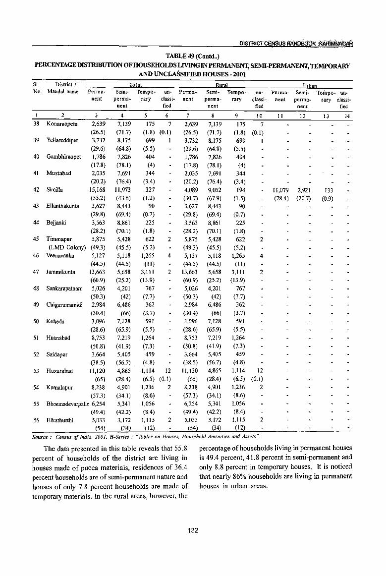
OlSTRICTCENSuS fIJIlN6st;6K :AARIMNAt;AR , -
TABLE 49 (Contd .. ) PERCENTAGE DISTRIBUTION OF HOUSEHOLDS LIVING IN PERMANENT, SEMI-PERMANENT, TEMPORARY
AND UNCLASSIFIED HOUSES - 2001
SI. District I Total Rural Urban No. MandaI name Perm a- Semi- Tempo- un- Perm a- Semi- Tempo- un- Perm a- Semi- Tempo- un-
nent perma- rary classi- nent perma- rary classi- nent perma- rary classi-nent tied nent tied nent tied
1 2 3 4 5 6 7 8 9 10 11 12 13 14 38 Konaraopeta 2,639 7,139 175 7 2,639 7,139 175 7
(26.5) (71.7) (1.8) (0.1) (26.5) (71.7) (1.8) (0.1) 39 Yellareddipet 3,732 8,175 699 1 3,732 8,175 699 1
(29.6) (64.8) (5.5) (29.6) (64.8) (5.5) 40 Gambhiraopet 1,786 7,826 404 1,786 7,826 404
(17.8) (78.1) (4) (17.8) (78.1) (4) 41 Mustabad 2,035 7,691 344 2,035 7,691 344
(20.2) (76.4) (3.4) (20.2) (76.4) (3.4) 42 Sircilla 15,168 11,973 327 4,089 9,052 194 II,079 2,921 133
(55.2) (43.6) (1.2) (30.7) (67.9) (1.5) (78.4) (20.7) (0.9) 43 Ellanthakunta 3,627 8,443 90 3,627 8,443 90
(29.8) (69.4) (0.7) (29.8) (69.4) (0.7)
44 Belianki 3,563 8,861 225 3,563 8,861 225 (28.2) (70.1) (1.8) (28.2) (70.1) (1.8)
45 Timmapur 5,875 5,428 622 2 5,875 5,428 622 2 (LMD Colony) (49.3) (45.5) (5.2) (49.3) (45.5) (5.2)
46 Veenavanka 5,127 5,118 1,265 4 5,127 5,1I8 1,265 4 (44.5) (44.5) (11) (44.5) (44.5) (11)
47 lammikunta 13,663 5,658 3,111 2 13,663 5,658 3,111 2 (60.9) (25.2) (13.9) (60.9) (25.2) (13.9)
48 Sankarapatnam 5,026 4,201 767 5,026 4,201 767
(50.3) (42) (7.7) (50.3) (42) (7.7)
49 Chigurumamidi 2,984 6,486 362 2,984 6,486 362
(30.4) (66) (3.7) (30.4) (66) (3.7)
50 Koheda 3,096 7,128 591 3,096 7,128 591
(28.6) (65.9) (5.5) (28.6) (65.9) (5.5)
51 Husnabad 8,753 7,219 1,264 8,753 7,219 1,264
(50.8) (41.9) (7.3) (50.8) (41.9) (7.3)
52 Saidapur 3,664 5,405 459 3,664 5,405 459
(38.5) (56.7) . (4.8) (38.5) (56.7) (4.8)
53 Huzurabad 11,120 4,865 1,114 12 11,120 4,865 1,114 12
(65) (28.4) (6.5) (0.1) (65) (28.4) (6.5) (0.1)
54 Kamalapur 8,238 4,901 1,236 2 8,238 4,901 1,236 2
(57.3) (34.1) (8.6) (57.3) (34.1) (8.6)
55 Bheemadevarpalle 6,254 5,341 1,056 6,254 5,341 1,056
(49.4) (42.2) (8.4) (49.4) (42.2) (8.4)
56 Elkathurthi 5,033 3,172 1,1l5 2 5,033 3,172 1,115 2
(54) (34) (12) (54) (34) (12)
Source: Census of india, 2001, H-Series .- "Tables on Houses, Household Amenities and Assets".
The data presented in this table reveals that 55.8 percentage of households living in permanent houses
percent of households of the district are living in is 49.4 percent, 41.8 percent in semi-pennanent and
houses made of pucca materials, residences of 36.4 only 8.8 percent in temporary houses. It is noticed
percent households are of semi-pennanent nature and that nearly 86% households are living in permanent
houses of only 7.8 percent households are made of houses in urban areas.
temporary materials. In the rural areas, however, the
132
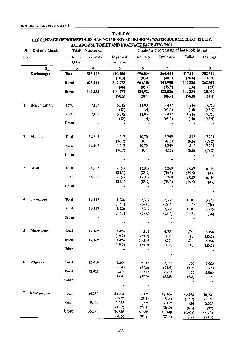
INTRODUCTION AI1ID ANALYSIS
TABLE-50 PERCENTAGE OF HOUSEHOLDS HAVING IMPROVED DRINKINGWATERSOURCE,ELECIRICITY,
BATHROOM, TOILET AND DRAINAGE FACILITY -2001 SL District I Mandai TotaU Number of Number and percentage of household having
No. - Rural! households Improved Electricity Bathroom Toilet Drainage Urban drinking water
2 3 4 5 6 7 8 9
Karimnagar Total 815,279 410,250 696,038 364,444 217,111 382,519 (50.3) (85.4) (44.7) (26.6) (46.9)
Rural 673,146 309,978 561,109 241,908 107,825 262,512 (46) (83.4) (35.9) (16) (39)
Urban 142,133 100,272 134,929 122,536 109,286 120,007 (70.5) (94.9) (86.2) (76.9) (84.4)
Ibrahimpatnam Total 12,135 6,312 11,039 7,412 1,216 7,750 (52) (91) (61.1) (10) (63.9)
Rural 12,135 6,312 11,039 7,412 1,216 7,750 (52) (91) (61.1) (10) (63.9)
Urban
2 MaUapur Total 12,309 4,512 10,700 5,249 817 7,291 (36.7) (86.9) (42.6) (6.6) (59.2)
Rural 12,309 4,512 10,700 5,249 817 7,291 (36.7) (86.9) (42.6) (6.6) (59.2)
Urban
3 Raikal Total 14,236 2,997 11,912 5,260 2,059 6,410 (21.1) (83.7) (36.9) (14.5) (45)
Rural 14,236 2,997 11,912 5,260 2,059 6,410 (21.1) (83.7) (36.9) (14.5) (45)
Urban
4 Sarangapur Total 10,419 1,280 7,249 2,333 1,103 3,755 (12.3) (69.6) (22.4) (10.6) (36)
Rural 10,419 1,280 7,249 2,333 1,103 3,755 (12.3) (69.6)
Urban (22.4) (10.6) (36)
5 Dharmapuri Total 17,469 3,474 14,100 4,550 1,745 6,198 (19.9) (80.7) (26) (10) (35.5)
Rural 17,469 3,474 14,100 4,550 1,745 6,198 (19.9) (80.7)
Urban (26) (I 0) (35.5)
6 Velgatoor Total 12,010 1,364 9,317 2,753 865 3,006 (11.4) (77.6) (22.9) (7.2) (25)
Rural 12,OlO 1,364 9,317 2,753 865 3,006 (l1A) (77.6) (22.9) (7.2) (25)
Urban
7 Ramagundam Total 64,235 40,264 57,375 48,406 40,262 48,923 (62.7) (89.3) (75.4) (62.7) (76.2)
Rural 9,150 1,388 6,779 2,457 626 2,928 (15.2) (74.1 ) (26.9) (6.8) (32)
Urban 55,085 38,876 50,596 45,949 39,636 45,995 (70.6) (91.9) (83.4) (72) (83.5)
133
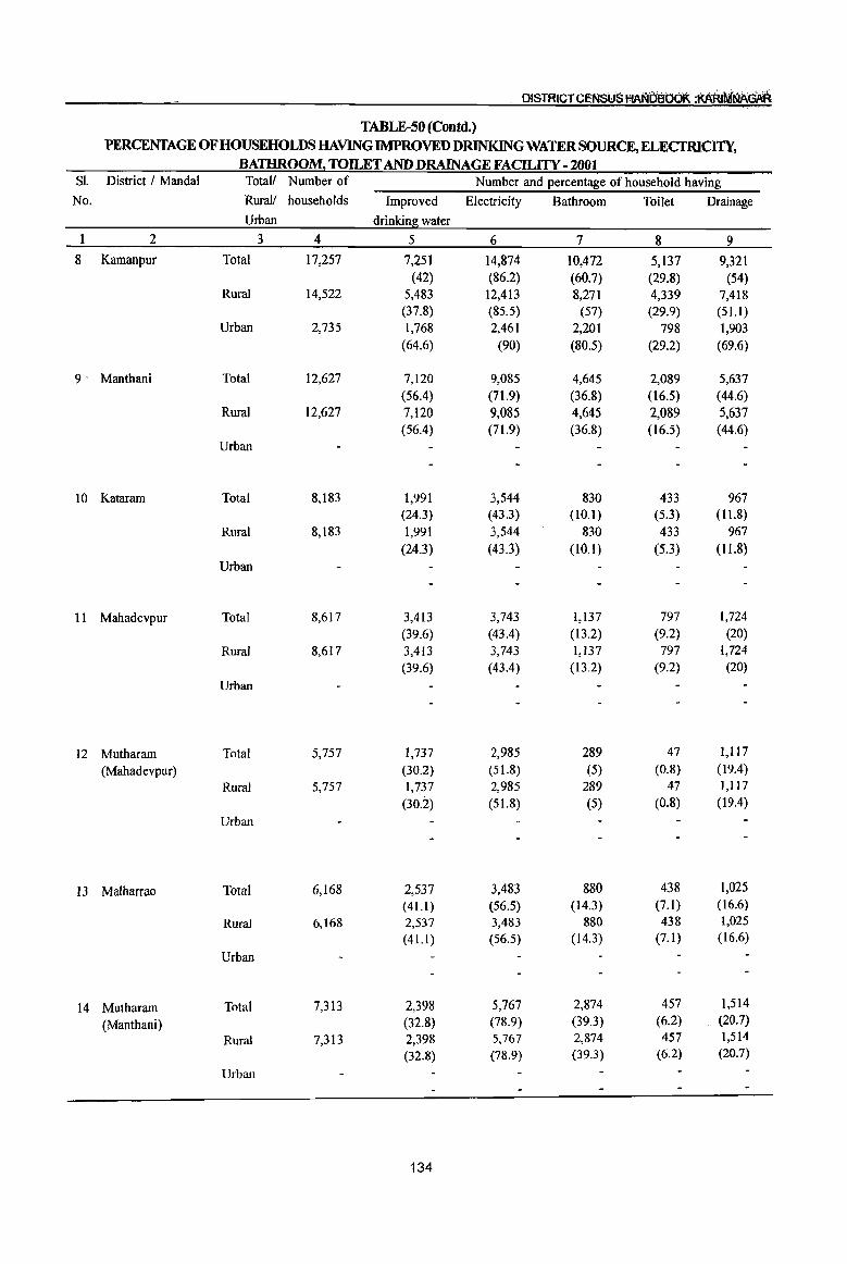
OISTRICTCENSYS t'fANtiBbOl< :AARrNiNA~
TABLE-50 (Contd.) PERCENTAGE OF HOUSEHOLDS HAVING IMPROVED DRlNKINGWATERSOURCE, ELECTRICITY,
BATHROOM~ TOILET AND DRAINAGE FACILITY - 2001 SI. District I MandaI Total! Number of Number and percentage of household having
No. Rurall households Improved Electricity Bathroom Toilet Drainage Urban drinking water
1 2 3 4 5 6 7 8 9
8 Kamanpur Total 17,257 7,251 14,874 10,472 5,137 9,321 (42) (86.2) (60.7) (29.8) (54)
Rural 14,522 5,483 12,413 8,271 4,339 7,418 (37.8) (85.5) (57) (29.9) (51.1)
Urban 2,735 1,768 2,461 2,201 798 1,903 (64.6) (90) (80.5) (29.2) (69.6)
9' Manthani Total 12,627 7,120 9,085 4,645 2,089 5,637 (56.4) (71.9) (36.8) (16.5) (44.6)
Rural 12,627 7,120 9,085 4,645 2,089 5,637 (56.4) (71.9) (36.8) (16.5) (44.6)
Urban
10 Kataram Total 8,183 1,991 3,544 830 433 967 (24.3) (43.3) (10.1) (5.3) (11.8)
Rural 8,183 1,991 3,544 830 433 967
(24.3) (43.3) (10.1) (5.3) (11.8)
Urban
II Mahadevpur Total 8,617 3,413 3,743 1,137 797 1,724
(39.6) (43.4) (13.2) (9.2) (20)
Rural 8,617 3,413 3,743 1,137 797 1,724 (39.6) (43.4) (13.2) (9.2) (20)
Urban
12 Mutharam Total 5,757 1,737 2,985 289 47 1,117
(Mahadevpur) (30.2) (51.8) (5) (0.8) (19.4)
Rural 5,757 1,737 2,985 289 47 1,117
(30.2) (51.8) (5) (0.8) (19.4)
Urban
13 Malharrao Total 6,168 2,537 3,483 880 438 1,025
(41.1) (56.5) (14.3) (7.1) (16.6)
Rural 6,168 2,537 3,483 880 438 1,025
(41.1) (56.5) (14.3) (7.1) (16.6)
Urban
14 Mutharam Total 7,313 2,398 5,767 2,874 457 1,514
(Manthani) (32.8) (78.9) (39.3) (6.2) (20.7)
Rural 7,313 2,398 5,767 2,874 457 1,514
(32.8) (78.9) (39.3) (6.2) (20.7)
Urban
134

INTRODUCTION AND ANALYSIS
TABLE-50 (Contd.)
PERCENTAGE OF HOUSEHOLDS HAVING IMPROVED DRINKINGWATERSOURCE,ELECTRICITY, BATHROOM, TOILET AND DRAINAGEFACILITY - 2001
SL District! Mandai Total! Number of Number and percentage of household having
No. Rural! households Improved Electricity Bathroom Toilet Drainage Urban drinking water
2 3 4 5 6 7 8 9
15 Srirampur Total 9,976 3,712 7,447 4,774 1,085 3,644 (37.2) (74.6) (47.9) (10.9) (36.5)
Rural 9,976 3,712 7,447 4,774 1,085 3,644 (37.2) (74.6) (47.9) (10.9) (36.5)
Urban ~
16 Peddapalle Total 21,063 5,249 17,942 10,318 5,732 10,717 (24.9) (85.2) (49) (27.2) (50.9)
Rural 21,063 5,249 17,942 10,318 5,732 10,717 (24.9) (85.2) (49) (27.2) (50.9)
Urban
17 Julapalle Total 11,295 3,219 8,618 3,907 1,432 3,550 (28.5) (76.3) . (34.6) (12.7) (3L4)
Rural 11,295 3,219 8,618 3,907 1,432 3,550 (28.5) (76.3) (34.6) (12.7) (31.4)
Urban
18 Dharmaram Total 12,575 1,729 9,296 3,361 1,364 4,479 (13.7) (73.9) (26.7) (10.8) (35.6)
Rural 12,575 1,729 9,296 3,361 1,364 4,479 (13.7) (73.9) (26.7) (10.8) (35.6)
Urban
19 Gollapalle Total 9,956 1,596 8,611 2,524 1,107 4,478 (16) (86.5) (25.4) (11.1) (45)
Rural 9,956 1,596 8,611 2,524 1,107 4,478 (16) (86.5) (25.4) (11.1 ) (45)
Urban
20 Mallial Total 11,032 5,334 9,767 3,774 1,605 4,596 (48.4) (88.5) (34.2) (14.5) (41.7)
Rural 1l,032 5,334 9,767 3,774 1,605 4,596 (48.4) (88.5) (34.2) (14.5) (41.7)
Urban
21 Jagtial Total 32,486 14,081 30,402 20,170 14,995 19,791 (43.3) (93.6) (62.1) (46.2) (60.9)
Rural 15,456 2,401 14,043 5,773 2,007 5,894 (15.5) (90.9) (37.4) (13) (38.1)
Urban 17,030 11,680 16,359 14,397 12,988 13,897 (68.6) (96.1) (84.5) (76.3) (81.6)
22 Medipalle Total 12,149 3,799 10,947 4,520 979 4,573 (31.3) (90.1) (37.2) (8.1) (37.6)
Rural 12,149 3,799 10,947 4,520 979 4,573 (31.3) (90.1 ) (37.2) (8.1) (37.6)
Urban
135
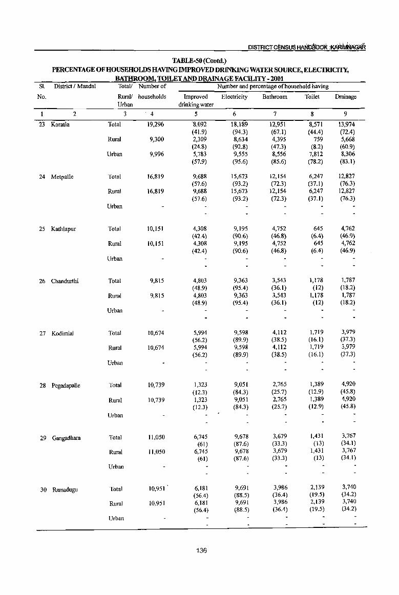
DISTRICT ceNSUS HANbirooK :KAruMNAGAR
TABLE-50 (Contd.) PERCENTAGE OF HOUSEHOWS HAVING IMPROVED DRINKING WATER SOURCE, ELECTRICITY,
BATHROOM. TOILET AND DRAINAGE FACILITY - 2001 Sl. District I MandaI Total! Number of Number and percentage of house hold having
No. Rural! households Improved Electricity Bathroom Toilet Drainage Urban drinking water
1 2 3 4 5 6 7 8 9
23 Koratla Total 19,296 '8,092 18,189 12,951 8,571 13,974 (41.9) (94.3) (67.1) (44.4) (72.4)
Rural 9,300 2,309 8,634 4,395 759 5,668 (24.8) (92.8) (47.3) (8.2) (60.9)
Urban 9,996 5,783 9,555 8,556 7,812 8,306 (57.9) (95.6) (85.6) (78.2) (83.1 )
24 Metpalle Total 16,819 9,688 15,673 12,154 6,247 12,827 (57.6) (93.2) (72.3) (37.1 ) (76.3)
Rura! 16,819 9,688 15,673 12,154 6,247 12,827 (57.6) (93.2) (72.3) (37.1) (76.3)
Urban
25 Kathlapur Total 10,151 4,308 9,195 4,752 645 4,762 (42.4) (90.6) (46.8) (6.4) (46.9)
Rural 10,151 4,308 9,195 4,752 645 4,762 (42.4) (90.6) (46.8) (6.4) (46.9)
Urban
26 Chandurthi Total 9,815 4,803 9,363 3,543 1,178 1,787 (48.9) (95.4) (36.1) (12) (18.2)
Rural 9,815 4,803 9,363 3,543 1,178 1,787 (48.9) (95.4) (36.1) (12) (18.2)
Urban
27 Kodimial Total 10,674 5,994 9,598 4,112 1,719 3,979 (56.2) (89.9) (38.5) (16.1 ) (37.3)
Rural 10,674 5,994 9,598 4,112 1,719 3,979 (56.2) (89.9) (38.5) (16.1) (37.3)
Urban
28 Pegadapalle Total 10,739 1,323 9,051 2,765 1,389 4,920
(12.3) (84.3) (25.7) (12.9) (45.8)
Rural 10,739 1,323 9,051 2,765 1,389 4,920 (12.3) (84.3) (25.7) (12.9) (45.8)
Urban
29 Gangadhara Total 11,050 6,745 9,678 3,679 1,431 3,767
(61) (87.6) (33.3) (13) (34.1)
Rural 11,050 6,745 9,678 3,679 1,431 3,767
(61) (87.6) (33.3) (13) (34.1)
Urban
30 Ramadugu Total 10,951 6,181 9,691 3,986 2,139 3,740
(56.4) (88.5) (36.4) (19.5) (34.2)
Rural 10,951 6,181 9,691 3,986 2,139 3,740
(56.4) (88.5) (36.4) (19.5) (34.2)
Urban
136

INTRODUCTION AND ANALYSIS
TABLE-50 (Contd.) PERCENTlAGE OF HOUSEHOLDS HAVING IMPROVED DRINKJNGWATERSOURCE,ELECfRIClTY,
BATHROOM. TOILET AND DRAINAGE FACILITY - 2001 81. District / Mandai Total/ Number of Number and percentage of household having
No. Rural! households Improved Electricity Bathroom Toilet Drainage Urban drinkin~ water
2 3 4 5 6 7 8 9
31 Choppadandi Total 1l,313 4,032 9,352 4,060 2,296 5,217 (35.6) (82.7) (35.9) (20.3) (46.l)
Rural 11,313 4,032 9,352 4,060 2,296 5,217 (35.6) (82.7) (35.9) (20.3) (46.1)
Urban
32 Sultanabad Total 13,520 4,028 11,438 7,161 2,442 4,276 (29.8) (84.6) (53) (18.1) (31.6)
Rural 13,520 4,028 11,438 7,161 2,442 4,276 (29.8) (84.6) (53) (18.1 ) (31.6)
Urban
33 Odela Total 9,935 3,000 8,240 3,099 1,217 3,216 (30.2) (82.9) (31.2) (12.2) (32.4)
Rural 9,935 3,000 8,240 3,099 1,217 3,216 (30.2) (82.9) (31.2) (12.2) (32.4)
Urban
34 Manakondur Total 15,573 6,638 12,938 5,296 2,440 4,763 (42.6) (83.1 ) (34) (15.7) (30.6)
Rural 15,573 6,638 12,938 5,296 2,440 4,763 (42.6) (83.1 ) (34) (15.7) (30.6)
Urban
35 Karimnagar Total 58,874 40,072 56,264 46,069 41,419 44,572 (68. I) (95.6) (78.3) (7004) (75.7)
Rural 15,720 8,021 14,193 6,793 2,864 6,583 -(51) (90.3) (43.2) (18.2) (41.9)
Urban 43,154 32,051 42,071 39,276 38,555 37,989 (74.3) (97.5) (91) (89.3) (88)
36 Boinpalle Total 9,275 6,063 8,723 3,524 2,054 3,843 (6504) (94) (38) (22. I) (41.4)
Rural 9,275 6,063 8,723 3,524 2,054 3,843 (65.4) (94)
Urban (38) (22.1) (41.4)
37 Vemulawada Total 16,356 11,463 15,704 8,757 5,369 8,956 (70.1) (96) (53.5) (32.8) (54.8)
Rural 16,356 11,463 15,704 8,757 5,369 8,956 (70.1) (96)
Urban (53.5) (32.8) (54.8)
38 Konaraopeta Total 9,960 Sr,773 9,315 2,725 1,506 3,745 (58) (93.5) (27.4) (15.1) (37.6)
Rural 9,960 5,773 9,315 2,725 1,506 3,745 (58)
Urban (93.5) (27.4) (15.1) (37.6)
137

DISTRICT CErilSU5 HAND~boK :AARlfiil~GAR
TABLE-50 (Contd.) PERCENTAGE OF HOUSEHOWS HAVING IMPROVED DlUNKINGWATERSOURCE, ELECTRICITY,
BATHROOM. TOILET AND DRAINAGE FACILITY - 2001 Sl. District I Mandai TotaV Number of Number and percentage of household having
No. Rural! households Improved Electricity Bathroom Toilet Drainage Urban drinking water
1 2 3 4 5 6 7 8 9
39 Yellareddipet Total 12,607 7,948 1I,491 3,656 1,800 6,254 (63) (91.1 ) (29) (14.3) (49.6)
Rural 12,607 7,948 11,491 3,656 1,800 6,254 (63) (9l.1) (29) (14.3) , (49.6)
Urban
40 Gambhiraopet Total 10,016 6,596 9,131 3,437 1,799 6,939 (65.9) (91.2) (34.3) (18) (69.3)
Rural 10,016 6,596 9,131 3,437 1,799 6,939 (65.9) (91.2) (34.3) (18) (69.3)
Urban
41 Mustabad Total 10,070 6,016 9,068 2,831 2,046 4,637 (59.7) (90) (28.1 ) (20.3) (46)
Rural 10,070 6,016 9,068 2,831 2,046 4,637 (59.7) (90) (28.1 ) (20.3) (46)
Urban
42 Sircilla Total 27,468 19,869 26,404 16,922 11,929 18,571 (72.3) (96.1 ) (61.6) (43.4) (67.6)
Rural 13,335 9,755 12,517 4,765 2,432 6,654 (73.2) (93.9) (35.7) (18.2) (49.9)
Urban 14,133 1O,1I4 13,887 12,157 9,497 11,917 (71.6) (98.3) (86) (67.2) (84.3)
43 Ellanthakunta Total 12,160 9,481 11,396 3,478 1,865 4,065 (78) (93.7) (28.6) (15.3) (33.4)
Rural 12,160 9,481 11,396 3,478 1,865 4,065
(78) (93.7) (28.6) (I5.3) (33.4)
Urban
44 Belianki Total 12,649 10,303 11,384 3,565 1,997 3,145
(81.5) (90) (28.2) (15.8) (24.9)
Rural 12,649 10,303 11,384 3,565 1,997 3,145
(81.5) (90) (28.2) (15.8) (24.9)
Urban
45 Timmapur (LMD Colony) Total II,927 7,912 10,176 4,282 2,676 3,617
(66.3) (85.3) (35.9) (22.4) (30.3)
Rural 11,927 7,912 10,176 4,282 2,676 3,617
(66.3) (85.3) (35.9) (22.4) (30.3)
Urban
46 Veenavanka Total 11,514 4,560 9,495 3,676 1,463 3,821
(39.6) (82.5) (31.9) (12.7) (33.2)
Rural 11,514 4,560 9,495 3,676 1,463 3,821
(39.6) (82.5) (31.9) (12.7) (33.2)
Urban
138
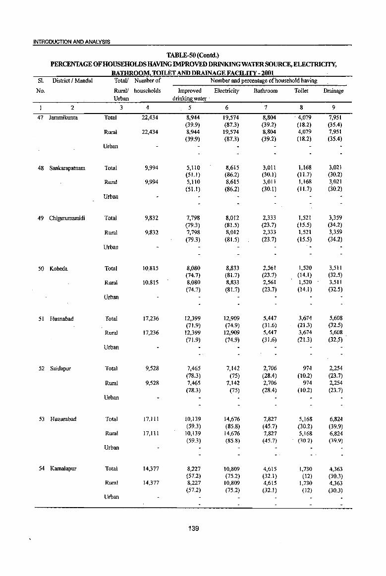
INTRODUCTION AND ANALYSIS
TABLE-50 (Contd.)
PERCENTAGE OF HOUSEHOLDS HAVING IMPROVED DRINKING WATER SOURCE, ELECfRICITY, BAnmOO~ TOILET AND DRAINAGE FACILITY - 2001
81. District I MandaI Total! Number of Number and percentage of household having
No. RuraJ) households Improved Electricity Bathroom Toilet Drainage Urban drinkin~ water .
2 3 4 5 6 7 8 9
47 lammikunta Total 22,434 8,944 19,574 8,804 4,079 7,951 (39.9) (87.3) (39.2) (18.2) (35.4)
Rural 22,434 8,944 19,574 8,804 4,079 7,951 (39.9) (87.3) (39.2) (18.2) (35.4)
Urban
48 Sankarapatnam Total 9,994 5,110 8,615 3,011 1,168 3,021 (51.1) (86.2) (30.1) (I 1.7) (30.2)
Rural 9,994 5,110 8,615 3,011 1,168 3,021 (51.1) (86.2) (30.1) (II. 7) (30.2)
Urban
49 Chigurumamidi Total 9,832 7,798 8,012 2,333 1,521 3,359 (79.3) (81.5) (23.7) (15.5) (34.2)
Rural 9,832 7,798 8,012 2,333 1,521 3,359 (79.3) (81.5) (23.7) (15.5) (3~.2)
Urban
50 Koheda Total 10,815 8,080 8,833 2,561 1,520 3,511 (74.7) (81.7) (23.7) (14.1 ) (32.5)
Rural 10,815 8,080 8,833 2,561 1,520 3,511 (74.7) (81.7) (23.7) (14.1) (32.5)
Urban
51 Husnabad Total 17,236 12,399 12,909 5,447 3,674 5,608 (71.9) (74.9) (31.6) (21.3) (32.5)
Rural 17,236 12,399 12,909 5,447 3,674 5,608 (71.9) (74.9) (31.6) (21.3) (32.5)
Urban
52 Saidapur Total 9,528 7,465 7,142 2,706 974 2,254 (78.3) (75) (28.4) (10.2) (23.7)
Rural 9,528 7,465 7,142 2,706 974 2,254 (78.3) (75) (28.4) (10.2) (23.7)
Urban
53 Huzurabad Total ] 7, III 10,139 14,676 7,827 5,168 6,824 (59.3) (85.8) (45.7) (30.2) (39.9)
Rural 17,111 10,139 14,676 7,827 5,168 6,824 (59.3) (85.8) (45.7) (30.2) (39.9)
Urban
54 Kamalapur Total 14,377 8,227 10,809 4,615 1,730 4,363 (57.2) (75.2) (32.1) (12) (30.3)
Rural 14,377 8,227 10,809 4,615 1,730 4,363 (57.2) (75.2) (32.1) (12) (30.3)
Urban
139

DISTRICTCEr\lStJS HA~baoQt :t<Ahi~~R
TABLE-50 (Concld.) PERCENTAGE OF HOUSEHOLDS HAVING IMPROVED DRINKING WATER SOURCE, ELECTRICITY,
BATHROOM! TOILET AND DRAINAGE FACll..ITY - 2001 81. District! MandaI Total! Number of Number and percentage of household having
No. Rural! households Improved Electricity Bathroom Toilet Drainage Urban drinking water
I 2 3 4 5 6 7 8 9
55 Bheemadevarpalle Total 12,65 I 10,001 8,697 3,576 2,187 3,619 (79.1) (68.7) (28.3) ( 17.3) (28.6)
Rural 12,651 10,001 8,697 3,576 2,187 3,619 (79.1) (68.7) (28.3) (17.3) (28.6)
Urban
56 Elkathurthi Total 9,322 5,830 7,611 2,646 1,689 2,150 (62.5) (81.6) (28.4) (18.1) (23.1)
Rural 9,322 5,830 7,611 2,646 1,689 2,150 (62.5) (81.6) (28.4) (l8.1) (23.1)
Urban
Source: Census of India, 2001, H-Series: "Tables on Houses. Household Amenities and Assets".
The above table indicates that 50.3 percent households in the district have been provided with improved drinking water supplied from a tap or a handpump/tube-well. 85.4 percent households have provision of electricity to their houses. The bathroom facility is available to only 44.7 percent households
within their premises. As regards rural areas, 35.9 percent households are having bathroom facility,
whereas this proportion in urban areas comes to 86.2 percent. 83.4 percent rural households have facility of electricity against 94.9 percent in urban areas. Toilet and drainage facilities in the district are available to 26.6 percent and 46.9 percent households respectively. Their percentage is higher in urban areas
as compared to rural areas. The trend of these amenities available to the households at mandai level is almost conform to the district pattern analysed. The poor condition is seen with improved drinking water facility in Kataram, Raikal, Sarangapur, Dhannapuri, Velgatoor, Dhannaram, GollapaUe and Pegadapalle
where below 25% households are availing. Very less number of households have electricity in Kataram (43.3%), Mahadevpur(43.4),Mutharam (Mahadevpur)
(51.8%) and Malharrao (56.5%). Very poor percentage is seen in all the amenities in Kataram, Mahadevpur, Mutharam (Mahadevpur) and Malharrao mandals when compared with other mandals of the district.
140
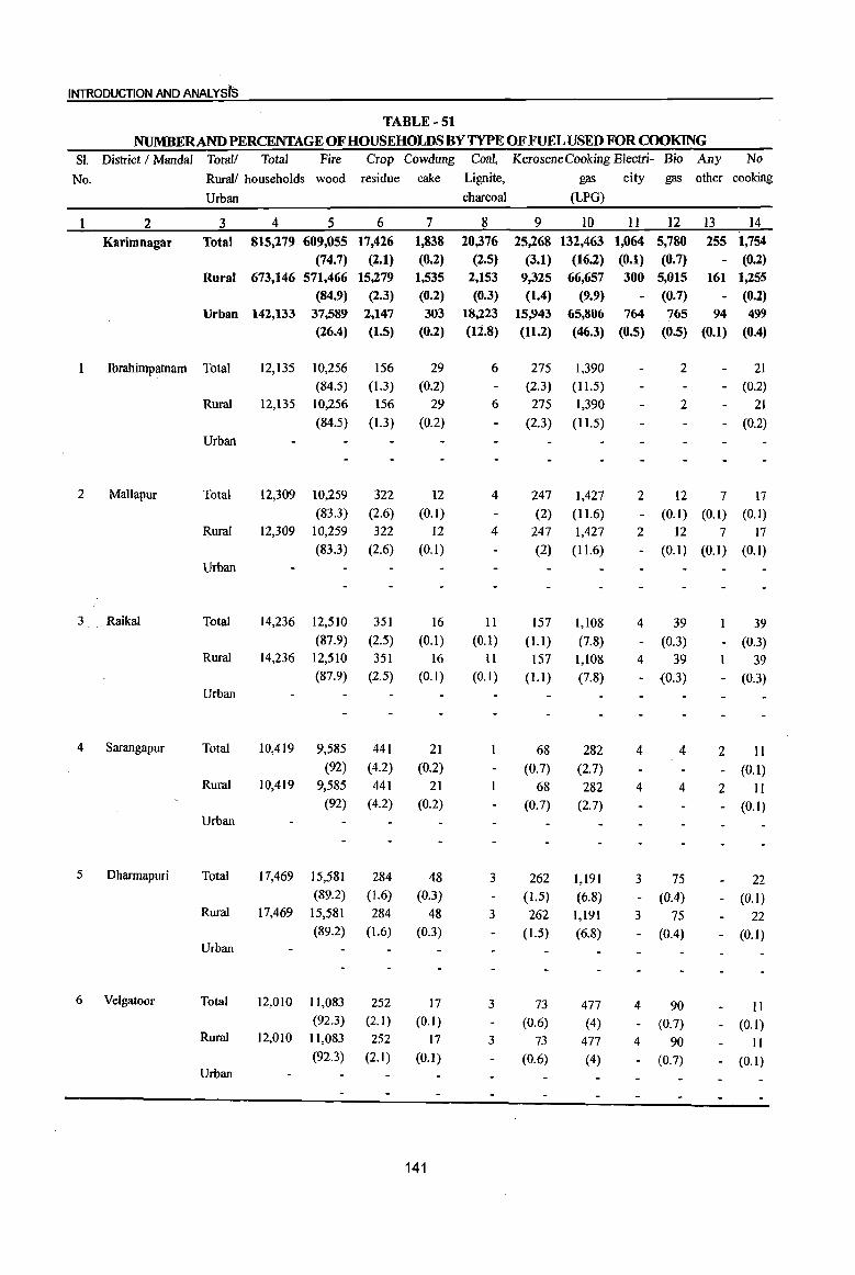
INTRODUCTION AND ANALYSts
TABLE-51
NUMBERAND PERCENTAGE OF HOUSEHOLDS BY TYPE OF FUEL USED FOR COOKING
SI. District I Mandal Totall Total Fire Crop Cowdung Coal, KeroseneCooking Electri- Bio Any No
No. Rural/ households wood residue cake Lignite, gas city gas other cooking
Urban charcoal (LPG)
2 3 4 5 6 7 8 9 10 11 12 13 14
Karimnagar Total 815,279 609,055 17,426 1,838 20,376 25,268 132,463 1,064 5,780 255 1,754
(74.7) (2.1) (0.2) (2.5) (3.1) (16.2) (0.1) (0.7) - (0.2) Rural 673,146 571,466 15,279 1,535 2,153 9,325 66,657 300 5,015 161 1,255
(84.9) (2.3) (0.2) (0.3) (1.4) (9.9) - (0.7) - (0.2) Urban 142,133 37,589 2,147 303 18,223 15,943 65,806 764 765 94 499
(26.4) (l.S) (0.2) (12.8) (11.2) (46.3) (O.S) (O.S) (0.1) (0.4)
1 Jbrahimpatnam Total 12,135 10,256 156 29 6 275 1,390 2 21
(84.5) (1.3) (0.2) (2.3) ( 11.5) - (0.2)
Rural 12,135 10,256 156 29 6 275 1,390 2 21
(84.5) (1.3) (0.2) (2.3) (11.5) - (0.2)
Urban
2 Mallapur Total 12,309 10,259 322 12 4 247 1,427 2 12 7 17 (83.3) (2.6) (0.1) (2) (11.6) - (0.1) (0.1) (0.1)
Rural 12,309 10,259 322 12 4 247 1,427 2 12 7 17
(83.3) (2.6) (0.1) (2) (11.6) - (0.1) (0.1) (0.1)
Urban
3 Raikal Total 14,236 12,510 351 16 II 157 1,108 4 39 39 (87.9) (2.5) (0.1) (0.1) (1.1) (7.8) - (0.3) - (0.3)
Rural 14,236 12,510 351 16 II 157 1,108 4 39 39 (87.9) (2.5) (0.1) (0.1) (l.l) (7.8) - (0.3) - (0.3)
Urban
4 Sarangapur Total 10,419 9,585 441 21 68 282 4 4 2 11 (92) (4.2) (0.2) (0.7) (2.7) (0.1)
Rural 10,419 9,585 441 21 68 282 4 4 2 11 (92) (4.2) (0.2) (0.7) (2.7) (0.1)
Urban
5 Dhannapuri Total 17,469 15,581 284 48 3 262 1,191 3 75 22 (89.2) (1.6) (0.3) (1.5) (6.8) - (004) (0.1)
Rural 17,469 15,581 284 48 3 262 1,191 3 75 22 (89.2) (1.6) (0.3) (1.5) (6.8) - (OA) (0.1)
Urban
6 Velgatoor Total 12,010 11,083 252 17 3 73 477 4 90 II (92.3) (2.1) (0.1) (0.6) (4) - (0.7) (0.1)
Rural 12,010 11,083 252 17 3 73 477 4 90 II (92.3) (2.1) (0.1) (0.6) (4) - (0.7) (0.1)
Urban
141

DISTRICTCENSUSHArIIOBOOK :KA~IMNAGAR
TABLE -51 (eontd.) NUMBERANDPERCENTAGEOFHOUSEHOLDSBYTYPEOFFUELUSEDFOROOO~G
Sl. District I Mandai Totall Total Fire Crop Cowdung Coal, Kerosene Cooking Electri- Bio Any No No. RuraI/ households wood residue cake Lignite, gas city gas other rooking
Urban charroal (LPG)
2 3 4 5 6 7 8 9 10 II 12 I3 14
7 Rarnagundarn Total 64,235 16,715 1,166 172 17,372 1,680 25,543 751 459 83 294 (26) (1.8) (0.3) (27) (2.6) (39.8) (1.2) (0.7) (0.1) (0.5)
Rural 9,150 7,857 193 26 119 144 645 4 135 I 26 (85.9) (2.1) (0.3) (1.3) (1.6) (7) - (1.5) - (0.3)
Urban 55,085 8,858 973 146 17,253 1,536 24,898 747 324 82 268 (16.1) (1.8) (0.3) (31.3) (2.8) (45.2) (1.4) (0.6) (0.1) (0.5)
8 Karnanpur Total 17,257 8,870 219 46 2,124 204 5,602 58 106 3 25
(51.4) (1.3) (0.3) (12.3) (1.2) (32.5) (0.3) (0.6) - (0.1)
Rural 14,522 8,038 163 25 1,420 189 4,514 57 89 3 24
(55.4) (1.1) (0.2) (9.8) (1.3) (31.1) (0.4) (0.6) - (0.2)
Urban 2,735 832 56 21 704 15 1,088 I 17 I (30.4) (2) (0.8) (25.7) (0.5) (39.8) . (0.6)
9 Manthani Total 12,627 9,384 282 11 169 115 2,571 60 34
(74.3) (2.2) (0.1) (1.3) (0.9) (2004) - (0.5) - (0.3)
Rural 12,627 9,384 282 II 169 115 2,571 60 34
(74.3) (2.2) (0.1) (1.3) (0.9) (2004) - (0.5) - (0.3)
Urban
10 Katararn Total 8,183 7,606 236 24 36 259 3 17
(92.9) (2.9) (0.3) (004) (3.2) - (0.2)
Rural 8,183 7,606 236 24 36 259 3 17
(92.9) (2.9) (0.3) (0.4) (3.2) - (0.2)
Urban
11 Mahadevpur Total 8,617 8,129 205 8 55 198 20
(94.3) (204) (0.1) (0.6) (2.3) - (0.2)
Rural 8,617 8,129 205 8 55 198 20
(94.3) (2.4) (0.1) (0.6) (2.3) - (0.2)
Urban
12 Mutharam (Mahadevpur) Total 5,757 5,501 152 15 8 27 53
(95.6) (2.6) (0.3) (0.1 ) (0.5) - (0.9)
Rural 5,757 5,501 152 15 8 27 53
(95.6) (2.6) (0.3) (0.1) (0.5) - (0.9)
Urban
13 Malharrao Total 6,168 5,714 93 6 25 320 3 2 4
(92.6) (1.5) (0.1) (004) (5.2) - (0.1)
Rural 6,168 5,714 93 6 25 320 3 2 4
(92.6) (1.5) (0.1) (0.4) (5.2) - (0.1)
Urban
142
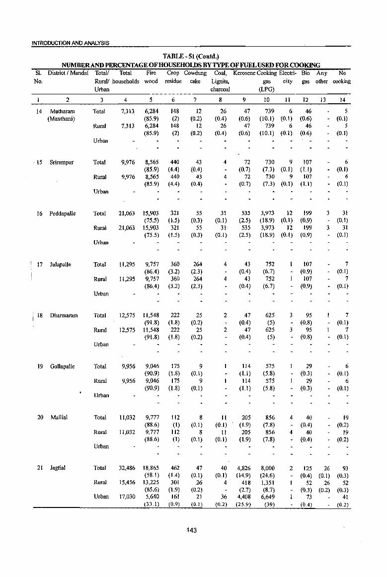
INTRODUCTION AND ANALYSIS
TABLE - 51 (Contd.)
NUMBERAND PERCENTAGE OF HOUSEHOLDS BY TYPE OF FUEL USED FOR COOKING. 81. District I Mandai Total/ Total Fire Crop Cowdung Coal, Kerosene Cooking Electri- Bio Any No
No. Rurall households wood residue cake Lignite, gas city gas other cooking Urban charcoal (LPG)
2 3 4 5 6 7 8 9 10 11 12 13 14
14 Mutharam Total 7,313 6,284 148 12 26 47 739 6 46 5 (Manthani) (85.9) (2) (0.2) (0.4) (0.6) (10.1) (0.1) (0.6) - (0.1)
Rural 7,313 6,284 148 12 26 47 739 6 46 5 (85.9) (2) (0.2) (0.4) (0.6) (10.1) (0.1) (0.6) - (0.1)
Urban
, 15 Srirampur Total 9,976 8,565 440 43 4 72 730 9 107 6 (85.9) (4.4) (0.4) (0.7) (7.3) (0.1) (Ll) - (0.1)
Rural 9,976 8,565 440 43 4 72 730 9 107 6 (85.9) (4.4) (004) (0.7) (7.3) (0.1) (Ll) - (0.1)
Urban
16 Peddapalle Total 2],063 15,903 321 55 31 535 3,973 12 199 3 31 (75.5) (1.5) (0.3) (0.1) (2.5) (18.9) (0.1) (0.9) - (0.1)
Rural 21,063 15,903 321 55 31 535 3,973 12 199 3 31 (75.5) (1.5) (0.3) (0.1) (2.5) (18.9) (0.1) (0.9) - (0.1)
Urban
17 JulapaUe Total 11,295 9,757 360 264 4 43 752 107 7 (86.4) (3.2) (2.3) (0.4) (6.7) - (0.9) - (0.1)
Rural 11,295 9,757 360 264 4 43 752 107 7 (86.4) (3.2) (2.3) (0.4) (6.7) - (0.9) - (0.1)
Urban
I 18 Dharmaram Total 12,575 11,548 222 25 2 47 625 3 95 7 I
(91.8) (1.8) (0.2) (004) (5) (0.8) (0.1) I - -i Rural 12,575 11,548 222 25 2 47 625 3 95 7
(91.8) (1.8) (0.2) (0.4) (5) - (0.8) - (0.1) Urban
19 Gollapalle Total 9,956 9,046 175 9 114 575 29 6 (90.9) (1.8) (0.1) (l.l) (5.8) - (0.3) - (OJ)
Rural 9,956 9,046 175 9 114 575 29 6 (90.9) (L8) (0.1) (Ll) (5.8) - (0.3) - (OJ)
Urban
20 Mallial Total 11,032 9,777 Il2 8 II 205 856 4 40 19 (88.6) (I) (0. I) (0.1) (1.9) (7.8) - (004) - (0.2)
Rural 11,032 9,777 112 8 I I 205 856 4 40 ]9 (88.6) (I) (0.1) (0.1) (1.9) (7.8) - (0.4) - (0.2)
Urban
21 Jagtial Total 32,486 18,865 462 47 40 4,826 8,000 2 125 26 93 (58.1) (IA) (0.1) (0.1) (14.9) (24.6) - (0.4) (0.1) (0.3)
Rural 15,456 13,225 301 26 4 418 1,351 52 26 52 (85.6) (1.9) (0.2) (2.7) (8.7) - (0.3) (0.2) (0.3)
Urban 17,030 5,640 161 21 36 4,408 6,649 73 4] (33.1) (0.9) (0.1) (0.2) (25.9) (39) - (0.4) - (0.2)
143
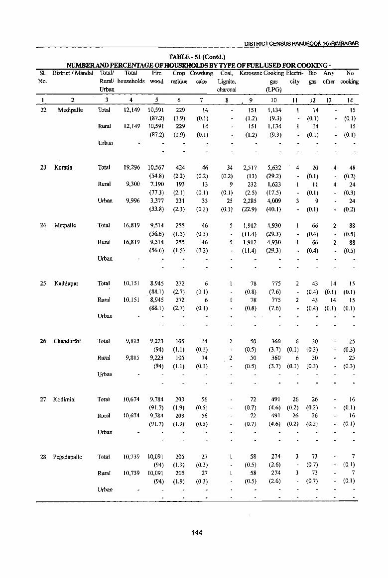
DISTRICT CENSUS HAND800K :KAF«lI1iNAGAR
TABLE - 51 (Contd.) NUMBERANDPERCENTAGEOFHOUSEHOLDSBYTYPEOFFUELUSEDFORCOOKlNG-
SI. District I Mandai Totall Total Fire Crop Cowdung Coal, Kerosene Cooking Electri- Bio Any No No. Rural! households wood residue cake Lignite, gas city gas other cooking
Urban charcoal (LPG)
2 3 4 5 6 7 8 9 10 II 12 I3 14
22 MedipaUe Total 12,149 10,591 229 14 lSI 1,134 14 15 (87.2) (1.9) (0.1 ) (1.2) (9.3) - (0.1) - (O.I)
Rural 12,149 10,591 229 14 151 1,134 14 15 (87.2) (1.9) (0.1) (1.2) (9.3) - (0.1) - (0.1)
Urban
23 Koratla Total 19,296 10,567 424 46 34 2,517 5,632 4 20 4 48 (54.8) (2.2) (0.2) (0.2) (13) (29.2) - (0.1) - (0.2)
Rural 9,300 7,190 193 13 9 232 1,623 II 4 24 (77.3) (2.1) (0.1) (O.l) (2.5) (17.5) - (0.1) - (0.3)
Urban 9,996 3,377 231 33 25 2,285 4,009 3 9 24 (33.8) (2.3) (0.3) (0.3) (22.9) (40.1) - (0.1) - (0.2)
24 Metpalle Total 16,819 9,514 255 46 5 1,912 4,930 66 2 88 (56.6) (1.5) (0.3) (1104) (29.3) - (004) - (0.5)
Rural 16,819 9,514 255 46 5 1,912 4,930 66 2 88 (56.6) (1.5) (0.3) (1104) (29.3) - (004) - (0.5)
Urban
25 Kathlapur Total 10,151 8,945 272 6 78 775 2 43 14 IS (88.1) (2.7) (0.1) (0.8) (7.6) - (004) (O.I) (0.1)
Rural 10,151 8,945 272 6 78 775 2 43 14 15 (88.1 ) (2.7) (0.1) (0.8) (7.6) - (0.4) (0.1) (0.1)
Urban
26 Chandurthi Total 9,815 9,223 105 14 2 50 360 6 30 25 (94) (Ll) (0.1) (0.5) (3.7) (0.1) (0.3) - (0.3)
Rural 9,815 9,223 105 14 2 50 360 6 30 25 (94) (Ll) (0.1) (0.5) (3.7) (0.1) (0.3) - (0.3)
Urban
27 Kodimial Total 10,674 9,784 203 56 72 491 26 26 16 (91. 7) (1.9) (0.5) (0.7) (4.6) (0.2) (0.2) - (0.1)
Rural 10,674 9,784 203 56 72 491 26 26 16
(91. 7) (1.9) (0.5) (0.7) (4.6) (0.2) (0.2) - (0.1)
Urban
28 Pegadapalle Total 10,739 10,091 205 27 58 274 3 73 7 (94) (1.9) (0.3) (0.5) (2.6) - (0.7) - (0.1)
Rural 10,739 10,091 205 27 58 274 3 73 7
(94) (1.9) (0.3) (0.5) (2.6) - (0.7) - (0.1)
Urban
144
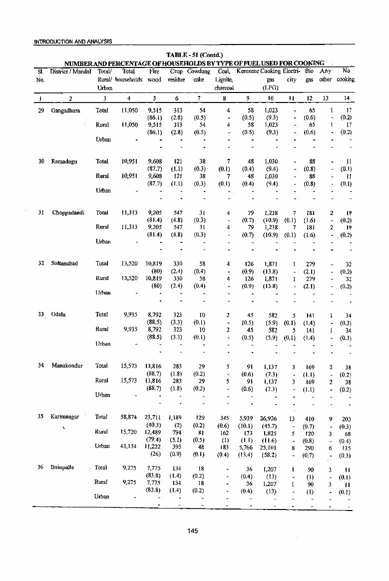
INTRODUCTION AND ANALYSIS
TABLE - 51 (eoutd.) NUMBERAND PERCENTAGE OF HOUSEHOLDS BY TYPE OF FUEL USED FORCOOKlNG
SI. District I MandaI Totall Total Fire Crop Cowdung Coal, Kerosene Cooking Electri- Bio Any No
No. Rural! households wood residue cake Lignite, gas city gas other cooking Urban charcoal (LPG)
2 3 4 5 6 7 8 9 10 11 12 13 14
29 Gangadhara Total 11,050 9,515 313 54 4 58 1,023 65 17 (86.1) (2.8) (0.5) (0.5) (9.3) - (0.6) - (0.2)
Rural 11,050 9,515 313 54 4 58 1,023 65 17 (86.1) (2.8) (0.5) (0.5) (9.3) - (0.6) - (0.2)
Urban
30 Ramadugu Total 10,951 9,608 121 38 7 48 1,030 88 II (87.7) (1.1) . (0.3)· (0.1) (0.4) (9.4) - (0.8) - (0.1)
Rural 10,951 9,608 121 38 7 48 1,030 88 Ii (87.7) (1.1) (0.3) (0.1) (004) (904) - (0.8) - (0.1)
Urban
31 Choppadandi Total 11,313 9,205 547 31 4 79 1,238 7 181 2 19 (81.4) (4.8) (0.3) (0.7) (10.9) (0.1) (1.6) - (0.2)
Rural 11,313 9,205 547 31 4 79 1,238 7 181 2 19 (81.4) (4.8) (0.3) (0.7) (10.9) (0.1) (1.6) - (0.2)
Urban
32 Sultanabad Total 13,520 10,819 330 58 4 126 1,871 279 32 (80) (2.4) (0.4) (0.9) (13.8) - (2.1) - (0.2)
Rural 13,520 10,819 330 58 4 126 1,871 279 32 (80) (204) (004) (0.9) (13.8) - (2.1) - (0.2)
Urban
33 Odela Tota! 9,935 8,792 323 10 2 45 582 5 141 34 (88.5) (3.3) (0.1) (0.5) (5.9) (0.1) (104) - (0.3)
Rural 9,935 8,792 323 10 2 45 582 5 141 34 (88.5) (3.3) (0.1) (0.5) (5.9) (0.1) (1.4) - (0.3)
Urban
34 Manakondur Tota! 15,573 13,816 283 29 5 91 1,137 3 169 2 38 (88.7) (1.8) (0.2) (0.6) (7.3) - (Ll) - (0.2)
Rural 15,573 13,816 283 29 5 91 1,137 3 169 2 38 (88.7) (1.8) (0.2) (0.6)
Urban (7.3) - (1.1) - (0.2)
35 Karimnagar Total 58,874 23,711 1,189 129 345 5,939 26,926 13 410 9 203 \
(40.3) (2) (0.2) (0.6) (10.1) (45.7) - (0.7) - (0.3) Rural 15,720 12,489 794 81 162 173 1,825 5 120 3 68
(79.4) (5.1) (0.5) (I) (Ll) (11.6) - (0.8) - (0.4) Urban 43,154 11,222 395 48 183 5,766 25,101 8 290 6 135
(26) (0~9) (0.1) (004) (13.4) (58.2) - (0.7) - (0.3)
36 Boinpalle Total 9,275 7,775 134 18 36 1,207 90 3 II (83.8) (1.4) (0.2) (0.4) (13) (1) - (0.1)
Rural 9,275 7,775 134 18 36 1,207 90 3 II (83.8) (1.4) (0.2) (0.4) (13) (1) - (0.1)
Urban
145

DISTRICT CENSUS HANDBOOK :KARININAGAR
TABLE - 51 (Contd.) NUMBERANDPERCENTAGEOFHOUSEHOLDSBYTYPEOFFUELUSEDFORCOO~G
S1. District I MandaI Totall Total Fire Crop Cowdung Coal, Kerosene Cooking Electri- Bio Any No No. Rural/ households wood residue cake Lignite, gas city gas other cooking
Urban charcoal (LPG)
2 3 4 5 6 7 8 9 10 11 12 13 14
37 Vemulawada Total 16,356 12,475 266 28 17 517 2,787 7 223 35 (76.3) (1.6) (0.2) (0.1) (3.2) (17) - (104) - (0.2)
Rural 16,356 12,475 266 28 17 517 2,787 7 223 35 (76.3) (1.6) (0.2) (0.1) (3.2) (17) - (1.4) - (0.2)
Urban
38 Konaraopeta Total 9,960 9,192 150 8 11 55 483 5 37 19 (92.3) (1.5) (0.1) (0.1) (0.6) (4.8) (0.1) (004) - (0.2)
Rural 9,960 9,192 150 8 II 55 483 5 37 19 (92.3) (1.5) (0.1) (0.1) (0.6) (4.8) (0.1) (0.4) - (0.2)
Urban
39 Yellareddipet Total 12,607 1l,306 292 10 5 97 806 3 74 2 12 (89.7) (2.3) (0.1) (0.8) (6.4) - (0.6) - (0.1)
Rural 12,607 11,306 292 10 5 97 806 3 74 2 12 (89.7) (2.3) (0.1) (0.8) (6.4) - (0.6) - (0.1)
Urban
40 Garnbhiraopet Total 10,016 9,204 315 6 8 55 392 2 24 10 (91.9) (3.1) (0.1) (0.1) (0.5) (3.9) - (0.2) - (0.1)
Rural 10,016 9,204 315 6 8 55 392 2 24 10 (91.9) (3.1) (0.1) (0.1) (0.5) (3.9) - (0.2) - (0.1)
Urban
41 Mustabad Total 10,070 9,260 168 6 4 72 465 85 9
(92) (I. 7) (0.1) (0.7) (4.6) - (0.8) - (0.1)
Rural 10,070 9,260 168 6 4 72 465 85 9
(92) (1.7) (0.1) (0.7) (4.6) - (0.8) - (0.1)
Urban
42 SirciJIa Total 27,468 19,396 459 42 24 2,028 5,270 9 189 7 44
(70.6) 0·7) (0.2) (0.1) (7.4) (19.2) - (0.7) - (0.2)
Rural 13,335 1l,736 128 8 2 95 1,209 5 137 14
(88) (I) (0.1) (0.7) (9.1) (1) - (0.1)
Urban 14,133 7,660 331 34 22 1,933 4,061 4 52 6 30
(54.2) (2.3) (0.2) (0.2) (13.7) (28.7) - (004) - (0.2)
43 Ellanthakunta Total 12,160 11,256 108 11 52 528 4 182 18
(92.6) (0.9) (0.1) (0.4) (4.3) - (1.5) - (0.1)
Rural 12,160 11,256 108 11 52 528 4 182 18
(92.6) (0.9) (0.1 ) (0.4) (4.3) - (1.5) - (0.1)
Urban
44 Bejjanki Total 12,649 11,535 142 26 85 622 209 2 26
(91.2) (1.1 ) (0.2) (0.7) (4.9) - (1.7) - (0.2)
Rural 12,649 11,535 142 26 85 622 209 2 26
(91.2) (Ll) (0.2) (0.7) (4.9) - (1.7) - (0.2)
Urban
146

INTRODUCTION AND ANALYSIS
TABLE - 51 (Contd.) NUMBERAND PERCENTAGE OF HOUSEHOLDS BY TYPE OF FUEL USED FOR COOKING
Sl. District I Mandai Total! Total Fire Crop Cowdung Coal, Kerosene Cooking Electri- Bio Any No No. Rural! households wood residue cake Lignite, gas city gas other cooking
Urban charcoal (LPG)
2 3 4 5 6 7 8 9 10 II 12 13 14
45 Timmapur Total 11,927 9,918 211 30 97 1,414 229 3 23 (LMD Colony) (83.2) (1.8) (0.3) (0.8) (11.9) - (1.9) - (0.2)
Rural 11,927 9,918 211 30 97 1,414 229 3 23 (83.2) (1.8) (0.3) (0.8) 01.9) - (1.9) - (0.2)
Urban
46 Veenavanka Total 11,514 10,113 599 56 6 36 477 3 200 4 20 (87.8) (5.2) (Q.5) (0.1) (0.3) (4.1) - (1.7) - (0.2)
Rural 11,514 10,113 599 56 6 36 477 3 200 4 20 (87.8) (5.2) (0.5) (0.1) (0.3) (4.1) - (1.7) - (0.2)
Urban .{,l
47 Jammikunta Total 22,434 18,046 520 27 15 649 2,930 4 196 23 24 (80.4) (2.3) (0.1) (0.1) (2.9) (13.1) - (0.9) (0.1) (0.1)
Rural 22,434 18,046 520 27 IS 649 2,930 4 196 23 24 (80A) (2.3) (O.I) (O.I) (2.9) (13.1 ) - (0.9) (0.1) (0.1)
Urban
48 Sankarapatnam Total 9,994 8,733 223 13 2 60 784 4 149 4 22 (87.4) (2.2) (0.1) (0.6) (7.8) - (L5) - (0.2)
Rural 9,994 8,733 223 13 2 60 784 4 149 4 22 (87.4) (2.2) (0.1) (0.6) (7.8) - (1.5) - (0.2)
Urban
49 Chigurumarnidi Total 9,832 8,437 296 7 42 959 73 17 (85.8) (3) (0.1) (OA) (9.8) - (0.7) - (0.2)
Rural 9,832 8,437 296 7 42 959 73 17 (85.8) (3) (0.1) (OA) ,(9.8) - (0.7) - (0.2)
Urban
50 Koheda Total 10,815 10,191 74 13 47 441 36 13 (94.2) (0.7) (0.1) (004) (4.1) - (0.3) - (0.1)
Rural 10,815 10,191 74 13 47 441 36 13 (94.2) (0.7) (0.1) (0.4) (4.1) - (0.3) - (0.1)
Urban
51 Husnabad Total 17,236 14,518 471 14 1 153 2,005 7 34 32 (84.2) (2.7) (0;1) (0.9) ( 11.6) - (0.2) - (0.2)
Rural 17,236 14,518 471 14 153 2,005 7 34 32 (84.2) (2.7) (0.1) (0.9) (11.6) - (0.2) - (0.2)
Urban
147
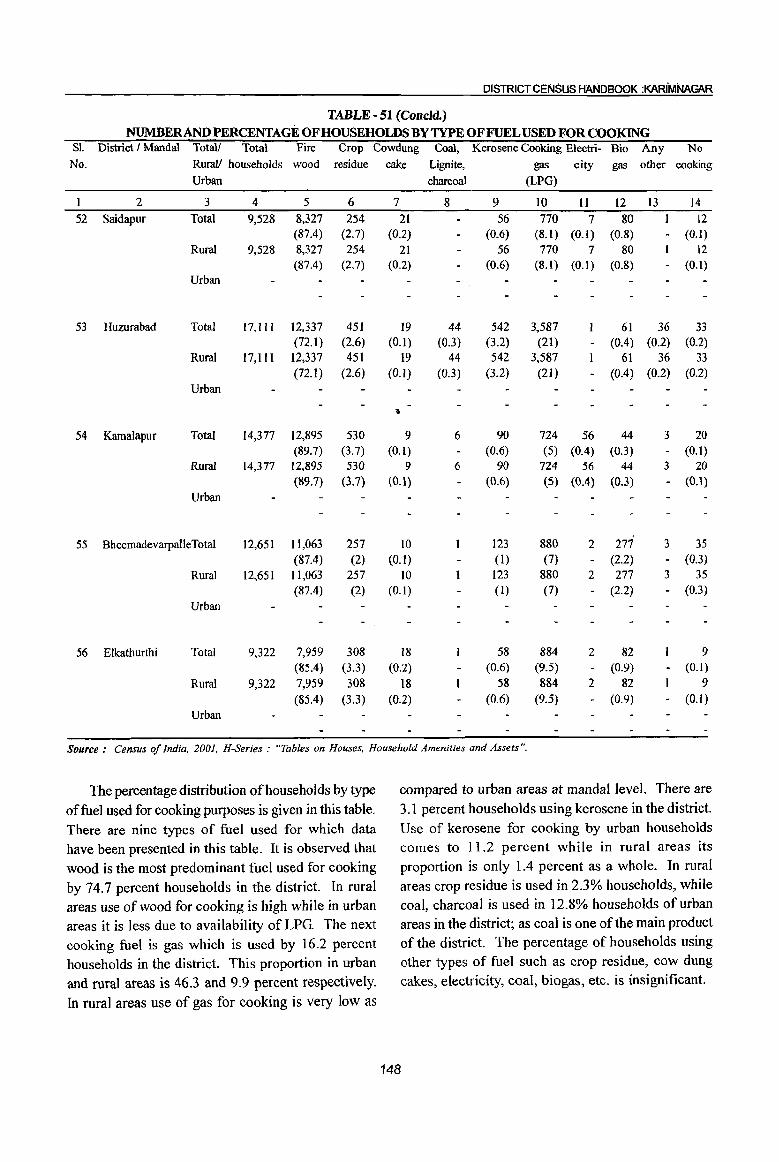
DISTRICT CENSUS HANDBOOK :KARIMNAGAR
TABLE - 51 (Concld.) NUMBERANDPERCENfAGEOFHOUSEHOLDS BY TYPE OF FUEL USED FOR COOKING
81. District I MandaI Totall Total Fire Crop Cowdung Coal, Kerosene Cooking Electri- Bio Any No No. Rural! households wood residue cake Lignite, gas city gas other cooking
Urban charcoal (LPG)
1 2 3 4 5 6 7 8 9 10 11 12 13 14
52 Saidapur Total 9,528 8,327 254 21 56 770 7 80 12 (87.4) (2.7) (0.2) (0.6) (8.1) (0.1) (0.8) - (0.1)
Rural 9,528 8,327 254 21 56 770 7 80 12 (87.4) (2.7) (0.2) (0.6) (8.1) (0.1) (0.8) - (0.1)
Urban
53 Huzurabad Total 17,111 12,337 451 19 44 542 3,587 61 36 33 (72.1) (2.6) (0.1) (0.3) (3.2) (21) - (0.4) (0.2) (0.2)
Rural 17,111 12,337 451 19 44 542 3,587 61 36 33 (72.1 ) (2.6) (0.1) (0.3) (3.2) (21) (004) (0.2) (0.2)
Urban
• 54 Kamalapur Total 14,377 12,895 530 9 6 90 724 56 44 3 20
(89.7) (3.7) (0.1) (0.6) (5) (0.4) (0.3) - (0.1) Rural 14,377 12,895 530 9 6 90 724 56 44 3 20
(89.7) (3.7) (0.1) (0.6) (5) (0.4) (0.3) - (0.1)
Urban
55 BheemadevarpalleTotal 12,651 11,063 257 10 123 880 2 277 3 35 (87.4) (2) (0. I) (1) (7) (2.2) - (OJ)
Rural 12,651 1l,063 257 10 123 880 2 277 3 35 (87.4) (2) (0.1) (I) (7) - (2.2) - (0.3)
Urban
56 Elkathurthi Total 9,322 7,959 308 18 58 884 2 82 9
(85.4) (3.3) (0.2) (0.6) (9.5) (0.9) - (0.1)
Rural 9,322 7,959 308 18 58 884 2 82 9
(8:5.4) (3.3) (0.2) (0.6) (9.5) (0.9) - (0.1)
Urban
Source: Census of India, 2001, H-Series : "Tables on Houses, Household A;"'enities and Assets ".
The percentage distribution of households by type compared to urban areas at mandaI level. There are
of fuel used for cooking purposes is given in this table. 3.1 percent households using kerosene in the district.
There are nine types of fuel used for which data Use of kerosene for cooking by urban households
have been presented in this table. It is observed that comes to 11.2 percent while in rural areas its
wood is the most predominant fuel used for cooking proportion is only 1.4 percent as a whole. In rural
by 74.7 percent households in the district. In rural areas crop residue is used in 2.3% households, while
areas use of wood for cooking is high while in urban coal, charcoal is used in 12.8% households of urban
areas it is less due to availability of LPG. The next areas in the district; as coal is one of the main product
cooking fuel is gas which is used by 16.2 percent of the district. The percentage of households using
households in the district. This proportion in urban other types of fuel such as crop residue, cow dung
and rural areas is 46.3 and 9.9 percent respectively. cakes, electricity, coal, biogas, etc. is insignificant.
In rural areas use of gas for cooking is very low as
148
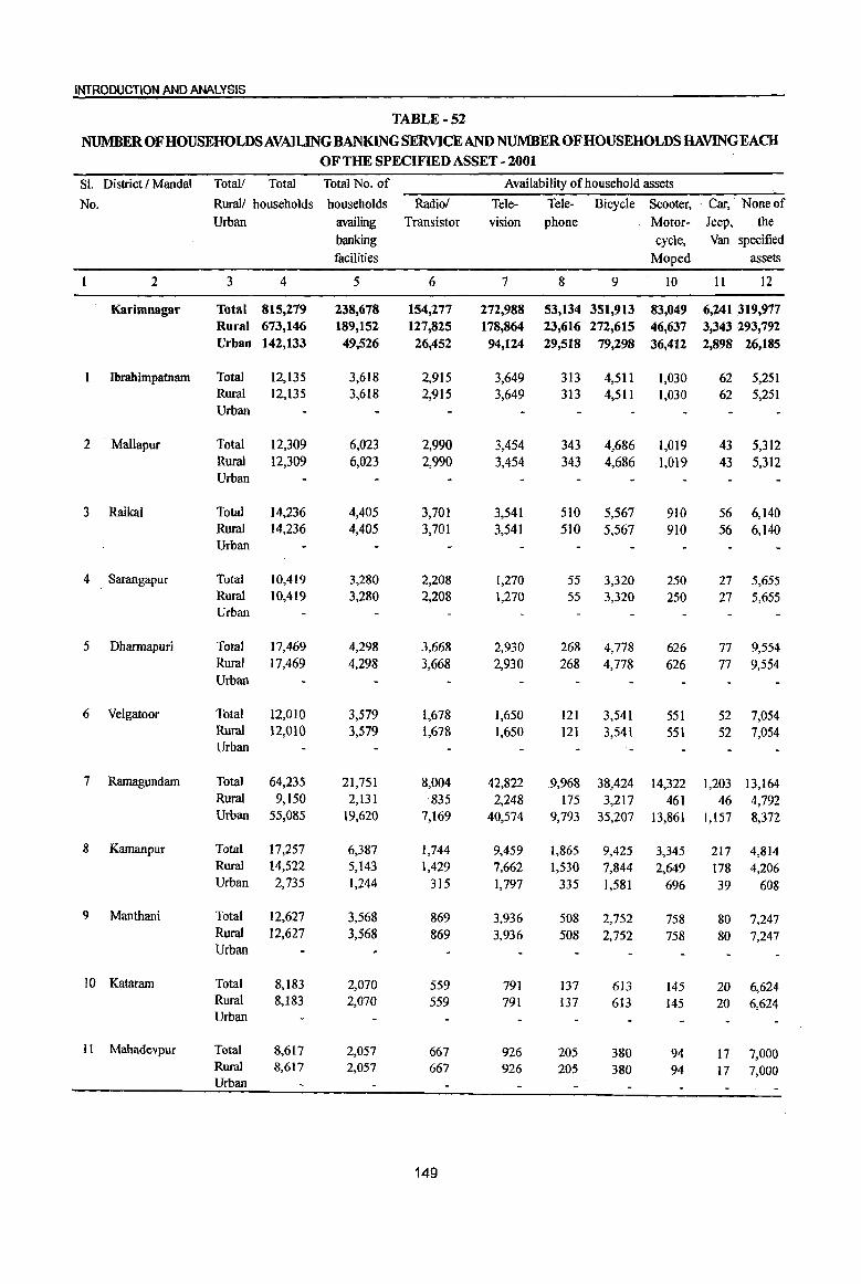
INTRODOCTION AND ANALYSIS
TABLE-52
NUMBER OF HOUSEHOLDS AVAILING BANKING SERVICE AND NUMBER OF HOUSEHOLDS HAVING EACH OF THE SPECIFIED ASSET - 2001
Sl. District I Mandai Total! Total Total No. of Availability of household assets
No. Rural! households households Radiol Tele- Tele- Bicycle Scooter, . Car, None of Urban availing Transistor vision phone Motor- Jeep, the
banking cycle, Van specified facilities Moped assets
2 3 4 5 6 7 8 9 10 II 12
Karimnagar Total 815,279 238,678 154,277 272,988 53,134 351,913 83,049 6,241 319,977 Rural 673,146 189,152 127,825 178,864 23,616 272,615 46,637 3,343 293,792 Urban 142,133 49,526 26,452 94,124 29,518 79,298 36,412 2,898 26,185
Ibrahimpatnam Total 12,135 3,618 2,915 3,649 313 4,511 1,030 62 5,251 Rural 12,135 3,618 2,915 3,649 313 4,511 1,030 62 5,251 Urban
2 . Mallapur Total 12,309 6,023 2,990 3,454 343 4,686 1,019 43 5,312 Rural 12,309 6,023 2,990 3,454 343 4,686 1,019 43 5,312 Urban
3 Raikal Total 14,236 4,405 3,701 3,541 510 5,567 910 56 6,140 Rural 14,236 4,405 3,701 3,541 510 5,567 910 56 6,140 Urban
4 Sarangapur Total 10,419 3,280 2,208 1,270 55 3,320 250 27 5,655 ..
Rural 10,419 3,280 2,208 1,270 55 3,320 250 27 5,655 Urban
5 Dhannapuri Total 17,469 4,298 3,668 2,930 268 4,778 626 77 9,554 Rural 17,469 4,298 3,668 2,930 268 4,778 626 77 9,554 Urban
6 Velgatoor Total 12,010 3,579 1,678 1,650 121 3,541 551 52 7,054 Rural 12,010 3,579 1,678 1,650 121 3,541 551 52 7,054 Urban
7 Ramagundam Total 64,235 21,751 8,004 42,822 9,968 38,424 14,322 1,203 13,164 Rural 9,150 2,131 -835 2,248 175 3,217 461 46 4,792 Urban 55,085 19,620 7,169 40,574 9,793 35,207 13,861 1,157 8,372
8 Kamanpur Total 17,257 6,387 1,744 9,459 1,865 9,425 3,345 217 4,814 Rural 14,522 5,143 1,429 7,662 1,530 7,844 2,649 178 4,206 Urban 2,735 1,244 315 1,797 335 1,581 696 39 608
9 Manthani Total 12,627 3,568 869 3,936 508 2,752 758 80 7,247 Rural 12,627 3,568 869 3,936 508 2,752 758 80 7,247 Urban
10 Kataram Total 8,183 2,070 559 791 137 613 145 20 6,624 Rural 8,183 2,070 559 791 137 6t3 145 20 6,624 Urban
11 Mahadevpur Total 8,617 2,057 667 926 205 380 94 17 ~,OOO Rural 8,617 2,057 667 926 205 380 94 17 7,000 Urban
149
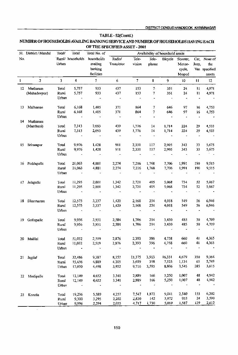
DISTRICT CENSUS HANDBOOK :KARIMNAGAR
TABLE - 52(Contd.)
NUMBER OF HOUSEHOLDS AVAILING BANKING SERVICE AND NUMBER OF HOUSEHOLDS HAVING EACH OF THE SPECIFIED ASSET - 2001
SI. District I MandaI Totall Total Total No. of Availability of household assets
No. . Rurall households households Radiol Tele- Tele- Bicycle -Scooter, Car, None of
Urban availing Transistor vision phone Motor- Jeep, the banking cycle, Van specified facilities Moped assets
2 3 4 5 6 7 8 9 10 II 12
12 Mutharam Total 5,757 933 437 153 7 351 24 II 4,971 (Mahadevpur) Rural 5,757 933 437 153 7 351 24 II 4,971
Urban
13 Malharrao Total 6,168 1,405 371 864 7 646 97 16 4,753 Rural 6,168 1,405 371 864 7 646 97 16 4,753 Urban
14 Mutharam (Manthani) Total 7,313 2,093 439 1,776 14 1,714 224 29 4,533
Rural 7,313 2,093 439 1,776 14 1,714 224 29 4,533 Urban
15 Srirarnpur Total 9,976 1,428 911 2,331 117 2,905 343 33 5,675 Rural 9,976 1,428 9Il 2,331 II7 2,905 343 33 5,675 Urban
16 Peddapalle Total 21,063 4,881 2,274 7,216 1,768 7,706 1,991 190 9,515 Rural 21,063 4,881 2,274 7,216 1,768 7,706 1,991 190 9,515 Urban
17 Julapalle Total 11,295 2,801 1,342 2,721 405 5,068 734 52 5,067 Rural 11,295 2,801 1,342 2,721 405 5,068 734 52 5,067
Urban
18 Dharmararn Total 12,575 3,337 1,420 2,168 254 4,018 549 56 6,946 Rural 12,575 3,337 1,420 2,168 254 4,018 549 56 6,946
Urban
19 Gollapalle Total 9,956 3,931 2,584 1,706 214 3,430 485 50 4,709 Rural 9,956 3,931 2,584 1,706 214 3,430 485 50 4,709
Urban
20 Mallial Total 11,032 2,519 2,876 2,393 396 4,758 660 41 4,365
Rural 1l,032 2,519 2,876 2,393 396 4,758 660 41 4,365
Urban
21 Jagtial Total 32,486 9,387 8,157 13,375 3,913 16,331 4,679 350 9,364
Rural 15,456 4,889 4,205 3,659 318 7,525 1,134 65 5,749
Urban 17,030 4,498 3,952 9,716 3,595 8,806 3,545 285 3,615
22 Medipalle Total 12,149 4,652 3,341 2,889 166 5,250 1,007 48 4,942
Rural 12,149 4,652 3,341 2,889 166 5,250 1,007 48 4,942
Urban
23 Koratla Total 19,296 5,589 4,257 7,547 1,872 9,041 2,540 153 6,202
Rural 9,300 3,295 2,202 2,830 142 3,972 953 24 3,590
Urban 9,996 2,294 2,055 4,717 1,730 5,069 1,587 129 2,612
150
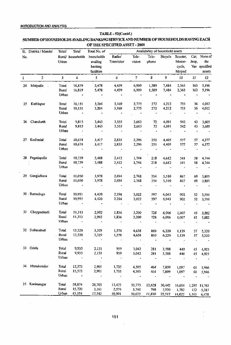
INTRODUCTION AND ANALYSIS
TABLE - 52(Contd.)
NUMBER OF HOUSEHOLDS AVAILING BANKING SERVICE AND NUMBER OF HOUSEHOLDS HAVING EACH OF TIlE SPECIFIED ASSET - 2001
SI. District I Mandai Total/ Total Total No. of Availability of household assets
No. Rural! households households Radio! Tele- Tele- Bicycle Scooter, Car, Noneof
Urban availing Transistor vision phone Motor- Jeep, the banking cycle, Van specified facilities Moped assets
2 3 4 5 6 7 8 9 10 11 12
24 Metpalle Total 16,819 5,478 4,439 6,909 1;589 7,484 2,363 163 5,196 Rural 16,819 5,478 4,439 6,909 1,589 7,484 2,363 163 5,196 Urban
25 Kathlapur Total 10,15] 3,204 3,169 2,775 272 4,212 733 36 4,012 Rural 10,151 3,204 3,169 2,775 272 4,212 733 36 4,012 Urban
26 Chandurth Total 9,815 3,443 3,533 2,663 72 4,091 542 43 3,605 Rural 9,815 3,443 3,533 2,663 72 4,091 542 43 3,605 Urban
27 Kodimial Total 10,674 3,417 2,835 2,296 251 4,405 577 57 . 4,377 Rural 10,674 3,417 2,835 2,296 251 4,405 577 57 4,377 Urban
28 Pegadapalle Total 10,739 3,488 2,412 1,744 218 4,612 541 58 4,744 Rural 10,739 3,488 2,412 1,744 218 4,612 541 58 4,744 Urban
29 Gangadhara Total 11,050 3,978 2,694 2,768 354 5,510 867 69 3,805 Rural 11,050 3,978 2,694 2,768 354 5,510 867 69 3,805 Urban
30 ,Ramadugu Total 10,951 4,420 2,294 3,022 597 6,043 902 52 3,510 Rural 10,951 4,420 2,294 3;022 597 6,043 902 52 3,510 Urban
31 Choppadandi Total 11,313 2,992 1,836 3,200 728 6,006 1,007 45 3,882 Rural 11,313 2,992 1,836 3,200 728 6,006 1,007 45 3,882 Urban
32 Sultanabad Total 13,520 3,329 1,570 4,638 869 6,220 1,139 57 5,320 Rural 13,520 3,329 1,570 4,638 869 6,220 1,139 57 5,320 Urban
33 Odela Total 9,935 2,151 959 3,042 281 3,588 440 45 4,925 Rural 9,935 2,151 959 3,042 281 3,588 440 45 4,925 Urban
34 Manakondur Total 15,573 2,901 1.735 4,505 464 7,809 1,097 61 5,966 Rural 15,573 2,901 1,735 4,505 464 7,809 1,097 61 5,966 Urban
35 Karimnagar Total 58,874 20,703 13,475 35,775 12,628 30,442 16,604 1,295 11,765 Rural 15,720 3,161 2,574 5,740 798 7,930 1,782 132 5,287 Urban 43,154 17,542 10,901 30,035 11,830 22,512 14,822 1,163 6,478
151
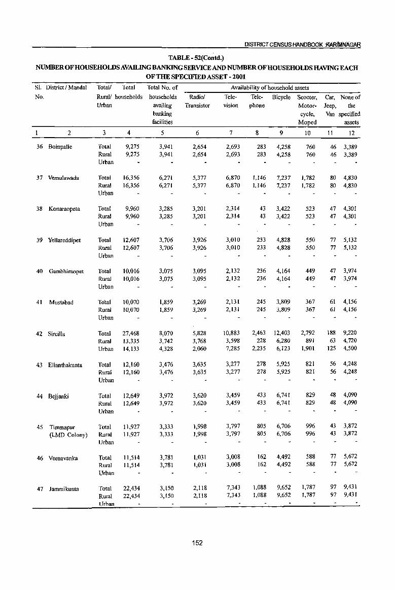
DISTRICT CENSUS HANOaOOf( :MRfMAAGAR
TABLE - 52(Contd.}
NUMBER OF HOUSEHOLDS AVAlLING BANKING SERVICE AND NUMBER OF HOUSEHOLDS HAVING EACH OF THE SPECIFffiD ASSET - 2001
Sl. District I Mandai Total! Total Total No. of Availability of household assets
No. Rurall households households Radio! Tele- Tele- Bicycle Scooter, Car, None of Urban availing Transistor vision phone Motor- Jeep, the
banking cycle, Van specified facilities Moped assets
2 3 4 5 6 7 8 9 10 11 12
36 Boinpalle Total 9,275 3,941 2,654 2,693 283 4,258 760 46 3,389 Rural 9,275 3,94] 2,654 2,693 283 4,258 760 46 3,389 Urban
37 Vemulawada Total 16,356 6,271 5,377 6,870 1,146 7,237 1,782 80 4,830 Rural 16,356 6,271 5,377 6,870 1,146 7,237 1,782 80 4,830 Urban
38 Konaraopeta Total 9,960 3,285 3,201 2,314 43 3,422 523 47 4,301 Rural 9,960 3,285 3,201 2,314 43 3,422 523 47 4,301 Urban
39 Yellareddipet Total 12,607 3,706 3,926 3,010 233 4,828 550 77 5,132 Rural 12,607 3,706 3,926 3,010 233 4,828 550 77 5,132 Urban
40 Gambhiraopet Total 10,0]6 3,075 3,095 2,132 236 4,164 449 47 3,974 Rural 10,016 3,075 3,095 2,132 236 4,164 449 47 3,974
Urban
41 Mustabad Total 10,070 1,859 3,269 2,131 245 3,809 367 61 4,156 Rural 10,070 1,859 3,269 2,131 245 3,809 367 61 4,156
Urban
42 Sircilla Total 27,468 8,070 5,828 10,883 2,463 12,403 2,792 188 9,220
Rural 13,335 3,742 3,768 3,598 228 6,280 891 63 4,720
Urban 14,133 4,328 2,060 7,285 2,235 6,123 1,901 125 4,500
43 Ellanthakunta Total 12,160 3,476 3,635 3,277 278 5,925 821 56 4,248
Rural 12,160 3,476 3,635 3,277 278 5,925 821 56 4,248
Urban
44 Bejjanki Total 12,649 3,972 3,620 3,459 433 6,741 829 48 4,090
Rural 12,649 3,972 3,620 3,459 433 6,741 829 48 4,090
Urban
45 Timmapur Total 11,927 3,333 1,998 3,797 805 6,706 996 43 3,872
(LMD Colony) Rural 11,927 3,333 1,998 3,797 805 6,706 996 43 3,872
Urban
46 Veenavanka Total 11,514 3,781 1,031 3,008 162 4,492 588 77 5,672
Rural 11,514 3,781 1,031 3,008 162 4,492 588 77 5,672
Urban
47 Jammikunta Total 22,434 3,150 2,1l8 7,343 1,088 9,652 1,787 97 9,431
Rural 22,434 3,150 2,118 7,343 1,088 9,652 1,787 97 9,431
Urban
152
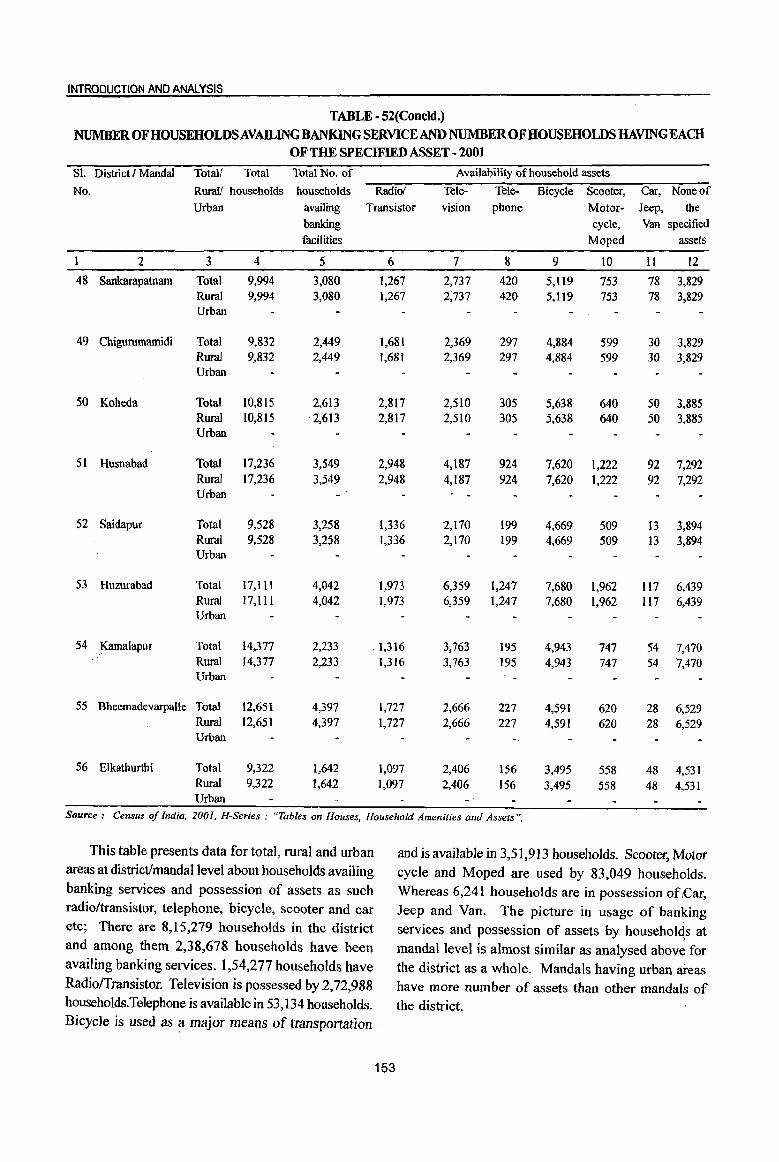
INTRODUCTION AND ANALYSIS
TABLE - 52(Concld.) NUMBER OFHOUSEHOLDSAVAILING BANKING SERVICE AND NUMBER OF HOUSEHOLDS HAVING EACH
OF THE SPECIFIED ASSET - 2001
Sl. District I MandaI Total! Total Total No. of Availability of household assets
No. Rural! households households Radio! Tele- Tele- Bicycle Scooter, Car, Noneof
Urban availing Transistor vision phone Motor- Jeep, the
banking cycle, Van specified
facilities Moped assets
2 3 4 5 6 7 8 9 10 11 12
48 Sankarapatnam Total 9,994 3,080 1,267 2,737 420 5,1l9 753 78 3,829 Rural 9,994 3,080 1,267 2,737 420 5,119 753 78 3,829 Urban
49 Chigurumamidi Total 9,832 2,449 1,681 2,369 297 4,884 599 30 3,829 Rural 9,832 2,449 1,681 2,369 297 4,884 599 30 3,829 Urban
50 Koheda Total 10,815 2,613 2,817 2,510 305 5,638 640 50 3,885 Rural 10,815 '2,613 2,817 2,510 305 5,638 640 50 3,885 Urban
51 Husnabad Total 17,236 3,549 2,948 4,187 924 7,620 1,222 92 7,292 Ruml 17,236 3,549 2,948 4,187 924 7,620 1,222 92 7,292 Urban
52 Saidapur Total 9,528 3,258 1,336 2,170 199 4,669 509 13 3,894 Ruml 9,528 3,258 1,336 2,170 199 4,669 509 13 3,894 Urban
53 Huzurabad Total I7,I11 4,042 1,973 6,359 1,247 7,680 1,962 Ii7 6,439 Rural 17,111 4,042 1,973 6,359 1,247 7,680 1,962 Il7 6,439 Urban
54 Kamalapur Total 14,377 2,233 . 1,316 3,763 195 4,943 747 54 7,470 Rural 14,377 2,233 1,316 3,763 195 4,943 747 54 7,470 Urban
55 Bheemadevarpalle Total 12,651 4,397 1,727 2,666 227 4,591 620 28 6,529 Rural 12,651 4,397 1,727 2,666 227 4,591 620 28 6,529 Urban
56 Elkathurthi Total 9,322 1,642 1,097 2,406 156 3,495 558 48 4,531 Rural 9,322 1,642 1,097 2,406 156 3,495 558 48 4,531 Urban
Source: CensUli of India, 2001, H-Series; "Table:s on Houses, Household Amenities and Assets".
This table presents data for total, rural and urban and is available in 3,51,913 households. Scooter, Motor areas at districtlmandallevel about households availing cycle and Moped are used by 83,049 households. banking services and possession of assets as such Whereas 6,241 households are in possession of ear, radio/transistor, telephone, bicycle, scooter and car Jeep and Van. The picture in usage of banking etc; There are 8,15,279 households in the district services and possession of assets by households at and among them 2,38,678 households have been
f
mandaI level is almost similar as analysed above for availing banking services. 1,54,277 households have the district as a whole. Mandals having urban areas RadiolTransistor. Television is possessed by 2,72,988 have more number of assets than other mandals of households. Telephone is available in 53,134 households. the district.
Bicycle is used as a major means of transportation
153
DISTRICT CENSUS HANOBOOK :KARIMNAGA~
(xiii) Scope of Village Directory and Town Directory - Column heading-wise explanation and coverage of data
The village directory and the town directory presented in the District Census Handbooks are
proved more useful. The formats of village directory and of seven statements on town directory are on the same pattern canvassed in 1991 census except for a few additional columns. These additional columns are introduced to throw more insight into the infrastructure of the villages and towns. All the amenities except recreational and cultural facilities, power supply and news papers/magazines are brought under one bracket, with corollary that in case any amenity is not available in the village, the distance of the nearest place where the facility is available is presented. Similar method is followed in respect of towns where educational and medical facilities are not available. The non-census data presented in the village and town directories relate to the year 1999. However, wherever the field agencies have indicated the later position, the information has been updated. Almost all the details in the statement have been indicated by codes. In respect of total popUlation and total number of households, the figures as returned during the recent census i.e. 2001 census have been presented. The scope of village directory and town directory statements with column heading-wise explanation and coverage of data are hereunder
presented.
Scope of Village Directory :
In the similar manner as was done in the past, the village directory has been prepared for all the villages in the state and these are presented mandalwise in the District Census Handbook. This statement contains village-wise area, population, amenities such as educational, medical, communications, drinking water facilities, etc., and also the land use pattern details. The villages are shown in order of their permanent location code numbers. An alphabetical list of villages with their permanent location code numbers and a mandai map has been presented in
154
the beginning of Village Directory of each mandaI. This facilitates the reader in locating the mandai in which a particular village lies. The village directory now contains 23 columns as against 18 columns in the 1991 handbook. To give more information under amenities column, banking facilities such as commercial and co-operative banks, agricultural, nonagricultural and other credit societies have been included in the present statement. Similarly, a new column 'number of recreational and cultural facilities' showing cinema/video halls, sports club and stadium! auditorium has been added. In addition to the above a column showing newspapers/magazines received and name of the most important commodity manufactured in the village have been incorporated. Besides the above, the Village Directory is having 12 appendices viz.
Appendix I
Appendix lA
Appendix IB
Appendix lC
Appendix II
Appendix IIA
Appendix III
Abstract of Educational, Medical and other amenities in the villages -MandaI Prishad level.
Villages by number of primary schools
Villages by primary, middle and secondary schools
Villages with different sources of drinking water facilities available
Villages with 5,000 and above popUlation which do not have one or more amenities
Census Towns which do not have o"ne or more amenities
Land utilization data in respect of census towns / non-municipal towns

INTRODUCTION AND ANALYSIS
Appendix IV
Appendix V
Appendix VI
Appendix vn A:.
Appendix vn B:
Appendix VIII :
Appendix IX:
Appendix X:
Appendix XI:
Appendix XII:
Mandai Parishad-wise list of inhabited villages where no amenity other than drinking water ' facility is available
Summary showing number of villages not having Scheduled castes population
Summary showing number of villages not having Scheduled tribes population
List of villages according to the proportion of the Scheduled Castes to the total population by ranges.
List of villages according to the proportion of the Scheduled Tribes to the total population by ranges.
Statement showing number of Girls schools in the. villages
List of Degree Colleges by Village / Town in the
District.
List of Hospitals by Village / Town in the District.
List of Banks by Village / Town in the
District.
List of Cinema Halls by Village / Town in the District.
It may be noted that the Appendix lA, lB, lC, IT, IT-A, VIII, IX, X, XI and XII have been included afresh in comparison to the District Census Hand Books of 1991 Census.
Columns 1 to 3 relate to the serial number, location code number, name and total area of the village. The area given under column 3 is as per the data collected from the state survey department during 1991 census
155
and presented even for 2001 census as the department clarified that there are no changes in the area figures. Column numbers 4 and 5 provide the total population and the total number of households in the village as per 2001 census. Columns 6 to 13 list out the basic amenities available in the village such as educational; medical; drinking water; post, telegraph and telephone; commer9ial and co-operative banks; agricultural, n~n-agricultural and other credit societies; recreation and cultural facilities and communications.
The columns 14 to 18 give the details of approach to the village, nearest town & distance, power supply, news paper/magazine circulation and most important commodity manufactured in the village.
The remaining columns 19 to 23 pertain to the land use pattern in the village. The extent or forest area has been given in column 19 while in columns 20 and 23 the extent of irrigated area together with different irrigational sources, the extent of culturable waste including gaucher and groves and the area not available for cultivation such as buildings, roads and railways or under water(rivers and.canals), ek, have been given. Here it is worth mentionable that the total area figures of Col. 19 to 23 may not tally with the total area of the village as shown in Col. 3 due to various reasons such as water ways, etc., which are not generally included in the land use statistics.
The land use pattern in the Village Directory conforms to the pattern of classification of land use as recommended by the Ministry of Agriculture, Government ofIndia. The Ministry of Agriculture has recommended the maintenance of records of land use pattern under five categories viz. forests, not available for cultivation, other uncultivated lands excluding fallow lands, fallow lands and net area sown.
The concepts of various types of land use given under each of the columns 19 to 23 as given in the Village Directory schedule are reproduced below:
1. Forests (CoI.19) :
These include all actually forested areas and the lands classified or administered as forests under any legal enactment dealing with forests whether State owned or private. If any portion of such land is not actually wooded but put to some agricultural use, that portion is included under the appropriate heading of cultivated or uncultivated land.
2. Cultivated area with break-up irrigated and un-irrigated (Col. 20 & 21):
This includes the land under the following three categories.
I) Net area sown
The net area sown represents the area sown to crops counting areas sown more than once in the same year, only once.
II) Other fallow lands :
This includes all lands which were taken up for cultivation but are temporarily out of cultivation for a period of not less than one year and not more than five years. The reasons for keeping such lands fallow may be either due to poverty of the cultivators or inadequate supply of water or malarial climate or silting of canals or rivers or un-remunerative nature of farming, etc.
llI) Current fallows
This class comprises cropped areas which are kept fallow during the current year. If any seedling area is not cropped again in the same year, it is also treated as current fallows.
3. CuIturable Waste (Col. 22):
This item includes the land under the following three categories.
i) Permanent pastures and other grazing lands:
These cover all grazing lands whether they are permanent pastures and meadows or not. Village common and grazing lands within forest areas are included under this head.
ii) Lands under miscellaneous tree crops and groves not included in the area sown:
Under this class is included all cultivable land which is not included under net area sown but is put to some agricultural use. Lands under casuarina trees, thatching grass, bamboo bushes and other groves for fuel, etc., which are not included under 'Orchards' are classed under this category.
iii) Culturable waste:
This includes lands available for cultivation but not taken up for cultivation or abandoned after a few
DISTRICT CENSUS HANDBOOK :KARIMNAGAR
years for one reason or other. Such lands may be either fallow or covered with shrubs and jungles, which are not put to any use. They may be assessed or not assessed and may lie in isolated blocks or within cultivated holdings. Land once cultivated but not cultivated for five years in succession is also included in this category.
4. Area not available for cultivation (Col.23) :
This includes the land under the following two categories.
i) Land put to non-agricultural uses :
All lands occupied by buildings, roads and railways or under waters .such as rivers and canals and other lands put to uses other than agricultural.
ii) Barren and uncultivable land:
This covers all barren and uncultivable land like mountains, etc., i.e. which cannot be brought under cultivation unless at a high cost. Whether such land is in isolated blocks or within cultivated holdings.
All the above particulars are based on the data received from the concerned departments like education, medical, postal, electricity, etc., and also mainly from the MandaI Revenue Officers concerned.
Item on communications has been shown separately to spell in terms of availability of the public transport system. This is meant to see whether the village is served by any mode of transport such as bus or rail or waterway. It is against this back-ground that the item on approach to village has been given separately. This refers to road, etc., leading to the village and is to indicate whether the village is approachable both. in fair and foul weather and whether it is inaccessible for all time or only some time in the year. Adult literacy class/centre under item on 'Education' and Primary health centre and Community health worker under item 'Medical' of Village Directory are included to indicate statistics on the Minimum Needs Programme of the Planning Commission.
156
Scope of Town Directory:
There are seven statements in the Town Directory, which include several particulars relating to the towns
INTRODUCTION AND ANALYSIS
arranged as per the alphabetical order of their names. These statements are almost similar to those adopted in 1991 census except for a few changes. During the 1991 there were six Town Directory statements besides providing a separate statement IV-A bringing out civic conditions of the notified slums in class I and IT towns. In the present volume the statement IV-A of the 1991 handbook has been termed as statement-VII and the data is presented in respect of all towns having statutory bodies including un-notified slums. The column 4 of statement IV-A of the 1991 book i.e. area of the slum has been deleted in the present book duly substituting the same by giving the information - whether the slum is notified or not with a view that the local authorities are not in a position to provide exact area figures for each slum area. Further in the present statement-VII another item i.e. approximate number of households living in the slum is incorporated. The captions of the statements are as follows:
Statement I: Status and growth history
Statement II: Physical Aspects and location of town, 1999
Statement III: Municipal Finance, 1998-99
Statement IV: Civic and other Amenities, 1999
Statement V: Medical, Educational, Recreational and Cultural Facilities, 1999
Statement VI: Trade, Commerce, Industry and Banking, 1999
Statement VII: Civic and other Amenities in slums, 1999
In addition to the above seven statements one appendix for the towns showing their outgrowth with population has also been presented.
The formats of Town Directory have been devised to suit the Minimum Needs Programme of the Planning Commission. To reflect this programme, the columns scheduled castes and scheduled tribes population in statement IV and Adult Literacy classes/ Centres in statement V are identical.
In case such of. the amenity as Fire Fighting Service in statement IV, the Educational or Medical facility in statement V is not available in the town ,
157
the name of the nearest place and its distance from the referent town has been given. This feature is followed since 1981 census as it is necessary to identify the areas that have no specific facility in the district.
The following seven places are treated as urban areas in Karimnagar District at the 200 l census.
1. Jagtial 5. Palakurthy
2. lallaram 6. Ramagundam
3. Karimnagar 7. Sircilla
4. Koratla
Karimnagar, Jagtial and Koratla towns are continuing as urban areas since 1901; SirciUa town since 1931 and Ramagundam since 1971. All these are statutory towns. Jallaram and Palakurthy attained urban status during 2001 Census and declared as Census towns.
Karimnagar and Ramagundam are categorized as class I town. Sircilla, Koratla and Jagtial are categorized as class II towns. Newly created Census towns lallaram and Palakurthy are fallingin Category IV and V respectively.
Statement I : Status and Growth History
This statement provides basic information on civic status, population with decadal growth rate from 1901 to 200 J, density for 2001 census and sex ratio from 1981 to 2001 censuses of each town besides presenting class of town, location code, name of the mandaI, area in sq.kms. and number of households including house less households returned in 2001 census.
The columns I and 2 relate to serial number and class, name and civic status of the town. The class of town has been determined basing on the size of population as given below.
Population Class
1,00,000 and above I
50,000 - 99,999 II
20,000 - 49,999 III
10,000 - 19,999 IV
5,000 - 9,999 V
Below 5,000 VI
The civic status of the town is indicated in brackets by abbreviated letters like 'M.Corp.' for Municipal Corporation and 'NP' for Nagar Panchayat. The location code number under column 3 for the towns has been framed to follow the method of allocation of location code to mandals in the district. This also facilitates easy location of the town in the map. After location code the Col. 4-7 indicate name of mandaI, name of mandai parishad, area of the town in sq. kms. and number of households including houseless households recorded in 2001 census. The population of the town with decadal growth rate from 1901 census to 2001 census is given in Col. 8-18. The column 19 shows the density of population and column 20 to 22 give the sex ratio recorded during 1981 to 2001 censuses. The sex ratio defined here is number of females per 1,000 males.
Statement II: Physical aspects and location of town, 1999.
This statement contains 13 columns and depicts physical aspects and location of town in the district.
Column numbers 1 and 2 relate to serial number, class and name of the town. The physical aspects such as rainfall in millimetres maximum and minimum temperature in centigrade have been shown in columns 3 to 5 by taking average for the last ten years i.e. from 1990 to 1999.J agtial town has recorded highest rain fall of 1,462 mm. among urban areas of Karimnagar district while lowest rain fall of 806 mm.
was recorded in Sircilla. Koratla has recorded highest
maximum temperature 45°C and minimum temperature l3°C among urban areas of Koratla,
Palakurthy and Ramagundam in the district. Ramagundam known as hottest place in the State has recorded maximum 44°C and minimum l3°C. The
coloumns 6 to 12 give the details of name and road distance in kms. from the referent town to State, district and mandai head quarters, nearest city with population of one lakh and more, nearest city with population of five lakh and more, railway station and bus service. The district headquarters Karimnagar is 178 kms. away from State Headquqrters Hyderabad. Sircilla is nearest town (140 kms.) to the State headquarters; while Ramagundam is at faraway place (250 kms). When the distance between district
headquarters and towns is compared Sircilla is nearer with 40 kms. and Koratla is at faraway place at 73
158
DISTRICT CENSUS HANDBOOK :KARIMNAGAR
kms. Among towns of Karimnagar District Ramagundam town is the nearest town to the town with one lakh and above population except Koratla town for which Nizamabad is the nearest town with one lakh above population.
The towns of Palakurthy and Ramagundam Railway Station is nearer to these towns within the distance of 4~12 kms. whereas in col. 12, the bus service is available in all the towns of Karimnagar district.
The last column i.e. column number 13 is meant for showing name of the navigable river/canal within the distance of 10 Kms. from the referent town. Godavari river is nearest navigable river to Ramagundam and Jallaram towns. Similarly Manner river is nearer to Sircilla and Karimnagar.
Statement III: Municipal Finance, 1998-99.
The details for inclusion in this statement were obtained from the respective statutory bodies. In this statement there are 16 columns. Column 1 and 2 relate to serial number, class, name and civic status of town. Columns 3 to 9 show the receipts of the local body under various sub-heads and columns IOta 16 give the details of expenditure incurred on general administration, public safety, public health and convenience, public works and institutions, etc. It is observed that income of Karimnagar Municipality is lesser than its expenditure during 1998-99 i.e. income was Rs.2.58 crores and expenditure was Rs. 8.51 crores. Most of its expenditurewas on public safety, which accounted as Rs. 4.35 crOTes, on public works Rs. 1.83 crares and on public health and convinence is Rs. 1.36 crores. Its income was Rs. 3.77 lakhs through taxes, Rs. 3.641akhs revenue from Municipal properties, Rs.58.86 lakhs. Government grant, Rs. 42.77 lakhs advance and Rs.I49.43 lakhs encashment of F.D.R.
Jagtial town has highest income i.e. Rs. 3.95 crores among urban areas of the district, while its expenditure was Rs. 2.21 crores.Next to Jagtial, Ramagundam Municipality has Rs. 3.04 crares income and Rs. 2.60 crares expenditure.
Statement IV : Civic and other Amenities, 1999.
The title itself reveals that, this statement deals with the facilities provided to the people in the urban
INTRODUCTION AND ANALYSIS
areas of the district.
This statement contains 20 columns. Column 1 &2 relate to serial number, class name and civic status of town respectively. Column 3 gives population of the town whereas the column numbers 4 and 5 give population of SC and ST as per 200 I census. The length of pucca and kutcha roads are recorded. separately for each town in column 6. The column 7 shows the details of sewerage system prevailing in the referent town. The number of latrines with different types is shown in columns 8 to II. Column 12 is provided separately to show method of disposal of night soil. The source of protected water supply and the system of storage with capacity are recorded under column 13 and 14. Column 15 shows the availability of fire fighting services. In case, if this service is not available in the town, the name of the nearest town along with distance where available to be mentioned under this column. The columns 16 to 20 relate to different types of electrical connection in number.
_,-._-
.:-:I\s regard paved roads Ramagundam has more Kutcha roads than Pucca roads i.e. out of 168 kms. paved,road 35 is pucca road and 133 is kutcha road. The.remaining towns possess majority of pucca roads. Se~~rage system of all towns is open surface drain. In J<,arimnagar and Sircilla towns box surface drain i~ j,p.-existence. Mostly water borne type of latrines are more in all towns. Method of disposal of night soil is sewerage lines and septic tank in all most all towns, but for Jagtial town it is wheel barrow method. Tap is common source of drinking water supply. Besides tap, in Palakurthy, tube well is also additional source of drinking water, while well is additional source in Sircilla. Mostly overhead tanks are being used to store the water. Fire fighting service stations are available at Jagtial, Karimnagar, Ramagundam and Sircilla. According to population size of towns all sorts of electric connections are available.
Statement V : Medical, Educational, Recreational and Cultural facilities, 1999:
In this statement the availability of medical, educational, recreational and cultural facilities are presented with reference to the population of 2001 Census. This statement is containing 20 columns, column 1,2 and 3 relates to serial number, class, name
159
and civic status of the town and population recorded during 2001 Census respectively. The column 4 and
5 shows about the availability of different hospitals, dispensaries, T.B.clinics, etc., together with bed streangth. Columns 6 to 15 relates to education facilities such as various schools/colleges at all levels including Medical, Engineering, Polytechnic, Technical Institutions and Adult literacy classes/centres. The column 16 is meant for Working women's hostel with number of seats. Adequate Medical facilities are available in all towns. Hospital facility is available in all statutory towns. T.B. centers are existing in Karimnagar and KoratIa. Ayurvedic , Homeopathic and Unani dispensaries are available at Karimnagar. Homeo and Ayurvedic dispensaries are available at Ramagundam one Unani dispensary each is available in Jallaram, Koratla and Sircilla.
Degree colleges are available in all statutory towns. The students of Jallaram and Palakurthy Census towns have to depend on Ramagundam and Peddapalle towns to have degree college education facility. One engineering college is available at Thimmapur near Karimnagar and one is at Sircilla. Polytechnic institutions are existing in Karimnagar and Sircilla. Shorthand, Typewriting Institutions and junior colleges are available in statutory towns whereas Secondary, Upper Primary Schools are existing in all towns. Karimnagar town is having hostel facility to working worrien. The number of recreational and cultural facilities such as Stadium, Cinemas, Auditoriums, Community halls, Public Libraries including reading rooms available in the towns is recorded in columns 17 to 20. There are four stadia in Ramagundam and one at Karimnagar. For entertainment, 33 Cinema halls are available in all statutory towns of the district. Auditoriums/ Community halls are available in all towns except in Jallaram and Koratla. Almost all towns are having the public libraries except Jallaram.
Statement VI : Trade, Commerce, Industry and Banking, 1999
This statement deals with economic activities in the urban areas with 11 columns. Column I and 2 are serial number, class name and civic status of the town. The columns 3 to 5 give the details of three most important commodities exported and the columns
6 to 8 show the three most important commodities manufactured. The commercial banks, number of agricultural credit societies and the number of nonagricultural credit societies are furnished in the columns 9 to It.
Fertilizer, Coal, Power, Beedies, Cement and Cloth are some of the important commodities manufactured and exported in some of towns of the district. The urban population of the district is served by 51 Banks, 8 Agricultural Credit Societies and 20 I Nonagricultural credit Societies.
Statement VII : Civic and other amenities in Slums, 1999
This statement give details of civic and other amenities provided in all slums whether notified or not. Keeping in view of slums problem in urban areas, during 1981 Census this statement was first introduced limiting the details to class I and class II towns. The same pattern was adopted during 1991 census also.
Though the magnitude of slum problem is greater in class I and class II towns, it is accepted that.they are associated with smaller towns also. Hence the information on slums has been presented in this statement in respect of all towns having statutory bodies.
The statement on slums contain 17 columns. The
DISTRICT CENSUS HANDBOOK :KARIMNAGAR
columns 1 to 4 show the serial number, class and name of town, name of the slum and whether the slum is notified or not respectively. Column 5 and 6 give the details of approximate number of households and population of the slum during 1999. The length of the paved road in the slum have been shown in kIns. under column 7. The columns 8 to 13 present system of sewerage, number of latrines both private and community and method of disposal of night soil. The column 14 is meant for showing number of tap points / public hydrants. The last 3 columns i.e columns 15 to 17 relate to number of electric connections under domestic, road lighting points and others.
There are 136 slums in 5 statutory towns with approximately 64,854 Households and 1,87,167 persons in the district. About 75,000 slum population is residing in Ramagundam town followed by Jagtial town with a slum population of about 46,000. Open surface drain system is existing in all the slums of the district. Majority of slum dwellers possess water borne latrines. Community latrines are also available in some of the slums. In slum areas also the same method of night soil disposal is adopted as in the respective towns i.e. septic tank, wheel barrows etc. In Koratla "Basket" is reported as method of disposal, but presently this system is abandoned. Sufficient number of drinking water points are provided. Street lights are also provided to slum dwellers.
160
PART A - VILLAGE AND TOWN DIRECTORY

PART A-VILlAGE AND TOWN DIRECTORY
Section I - Village Directory
(a) Note explaining the abbreviations used in Village Directory :
The "Village Directory" is one of the traditional
compilations ofthe Census. It gives the list of villages,
their location numbers, their area, population, number
of households, amenities such as educational, medical,
drinking water, post and telegraph, commercial and
co-operative banks, agricultural non-agricultural and
other credit societies, recreational and cultural
facilities, communication, approach to village, nearest
town with a distance, power supply availability of
<,_newspaper and n:tagazines, most important commodity
manufactured and land use of each village.
Village is a statutory recognized unit having a
definite boundary and separate land records. In case,
a complete village is treated as an outgrowth of urban
agglomeration, data on amenities for that village, have
not been given in the Village Directory but shown
along with the urban component. The villages which
are consider as a Census Town , the amenities data
are shown in the Town Directory. For those villages
which have partly merged in an outgrowth of U.A.,.
the amenities data are shown in the Village Directory
for that particular village.
The 'un-inhabited' villages ( villages with no
population) have been indicated as such after
furnishing details in columns 1 to 3 i.e., Serial number,
Name of village & location code number and area
of the village against column no. 4 to 18. The land
use data for such villages are shown in coL 19 to 23.
The Village Directory fonnat has 23 columns and
the details .given under each column are for the village are as follows:-
Columns 1: Serial Number
Self explanatory. All the villages within the CD
Block are presented serially in the ascending order
of their location code number.
163
Columns 2: Name and Location Code Number of village
The name and location code number of the village are shown against these columns . .This also includes the forest and uninhabited villages.
Column 3 : Area of the village
The area of the villages in hectares are given. Wherever the area figures was not furnished by the concerned department the column is left blank.
Column 4: Total population
The total population of the village as per 2001 Census is given against this column ..
Column 5: Number of households
The number of households as per 2001 Census is given in this column.
Amenities:
In column 6 to 23, availability in respect of different amenities such as education, medical, drinking water, post, telegraph, banks, credit societies, communication, power, approach road etc. in each village has been depicted with appropriate codes against the column concerned. Wherever the amenities are not available in the village, a dash (-) is shown in the column and next to it in brackets the distance in broad ranges viz.< 5 lans., 5-10 krns. and 10+ kms of the nearest place where the facility is available is given. Column wise details are given below
Column 6: Educational
Classes upto class V included in Primary School. This will include nursery school, kindergarten school. Pre-basic school, pre-primary school, junior basic school upto class V.
Classes from VI to VII are included in the middle school.
Classes from VIII TO X included in High secondary school. Classes XI and XII are included ill senior secondary school.

PARTA-VIUAGEAND TOWN DIRECTORY
In case of composite schools like middle school with primary school or secondary school with middle school, these are also included in the number of primary and middle schools, respectively.
Accordingly any of the following types of institutions if exists within the village is shown as per codes given below :
(i)
(ii)
(iii)
(iv)
(v)
(vi)
(vii)
(viii)
(ix)
(ii)
(iii)
(iv)
(v)
(vi)
(vii)
(viii)
(ix)
(x)
(xi)
Primary School
Middle School
Secondary School
Senior Secondary School
College
Industrial School
Training School
Adult literacy class/centre
Others (specify) e.g. Sanskrit
Pathshala, Senior basic school,
Navodaya Vidyalaya, Makhtab,
etc.
Allopathic Hospital
Ayurvedic Hospital
Unani Hospital
Homeopathic Hospital
Allopathic Dispensary
Ayurvedic Dispensary
Unani Dispensary
Homeopathic Dispensary
Maternity & Child Welfare
Maternity Home
Child Welfare Centre
Health Centre
Primary Health Centre
Primary Health Sub-Centre
Family Welfare Centre
T.B. Clinic
Nursing Home
P
M
S
PUC/JC
C
I
Tr
AC
0
H
HA
HU
H Hom
D
DA
DU
D Hom
MCW
MH
CWC
HC
PRe
PHS
FWC
TB
NR
164
(xii) Registered Private Medical RMP
Practitioner
(xiii) Subsidised Medical Practitioner SMP
(xiv) Community Health Worker CHW
(xv) Others 0
More than one institution of a type in the village
is indicated by the number within brackets against
the abbreviations, e.g. H(3), D(4), etc.
Column 8: Drinking Water
The type of the drinking water supply sources
available within the village are indicated by codes as
follows:
(i) Tap Water
(ii) Well Water
(iii) Tank Water
(iv) Tubewell Water
(v) Handpump
(vi) River Water
(vii) Canal
(viii) Lake
(ix) Spring
(x) Others
(xi) Summer Source
(i) Post Office
(ii) Telegraph Office
(iii) Post & Telegraph Office
(iv) Telephone Connection
T
W
TK
TW
HP
R
C
L
S
0
ss-
PO
TO
PTO
PH
Column 10: Commercial and Co-operative
Banks
If the village is served by any banking service,
commercial bank, co-operative bank etc. the same is indicated in codes mentioned below along with the
number of banks in brackets. If not available the
distance of nearest place where the facility exist is
given:
(i) Commercial Bank
(ii) Co-operative Bank
CM
CP
PART A-VILLAGE AND TOWN DIRECTORY
Column 11: Credit Societies
If the village enjoys the services of Credit Societies i.e. Agricultural Credit Societies, Non Agricul
tural Credit Society or Other Credit Societies, the same is indicated in codes mentioned below along
with the number of such societies in brackets. In case the facility is not available within the village the
distance of the nearest place where such facility exist
is given:
(i) Agricultural Credit Society ACS
(ii) Non- Agricultural Credit Society NCS
(iiI) Other Credit Society OCS
Column 12 : Recreational and cultural facilities
If facilities such as CinemaIVideo hall, Sports Club, Stadium/Auditorium is available in the village. The same is recorded in these columns. If not available the particulars of the nearest place with the fa
cility is recorded. The information is indicated in codes mentioned below along with the number of such fa
cilities in brackets:
(i) Cinema / Video Hall
(ii) Sports Club
(iii) Stadium / Auditorium
Column 13 : Communications .
CV
SP
ST
If the village is served by any mode of public /
private transport like Bus, Railway station or Navi
gable water 'Y'ays they are to be mentioned as follows:
(i)
(ii)
(iii)
Bus Service , Railway Station
Navigable Waterway
Column 14: Approach to village
BS
RS
NW
Approach to village refers to the state of road leading to village. The approach to the village is indicated in following codes:
(i) Paved Road PR
(ii) Mud road MR
(iii) Foot path FP
(iv) Navigable River
(v) Navigable Canal
(vi) Navigable waterways other than River, Canal
Column 15 : Nearest Town and distance
NR
NC
NW
The distance is given in kilometres in brackets
165
against the name. of the town nearest to the village.
Column 16 : Power supply
Availability of Power Supply in the village, what
ever may be the form of its use is given by using
following codes :
(i) Electricity for domestic use
(ii) Electricity for agricultural use
(iii) Electricity for other purposes
(iv) Electricity for all purposes
Column 17 : News Paper / Magazine
ED
EAG
EO
EA
If village receives any News PaperlMagazines
the same is noted in this column using following codes
(i) News Paper N
(ii) Magazine M
Column 18: Most important commodities manufactured
The name of three most important commodities manufactured in the village is recorded against this
column.
Column 19 to 23 : Land use i.c. area under diffetent types of land use
Land use data maintained by the State/ UT Govts. are furnished against these columns. The data concerning area under Forest, Irrigated land
(by source), Un-irrigated land, Culturable waste and
Area not available for cultivation in the village are
shown against these columns. The area figures are given in hectare(s) up to one decimal. Dash ,_, is
recorded wherever the information is not made avail
able by the concerned department. The codes used for different types of irrigation facilities available in
the village are indicated below:
0) Government Canal GC (ii) Private Canal PC
(iii) Well (without electricity) W
(iv) Well (with electricity) WE (v) Tubewell(without electricity) TW (vi) Tubewell(with electricity) TWE (vii) Tank TK (viii) River R (ix) Lake L (x) Waterfall WF (xi) Others 0 (xii) Total T
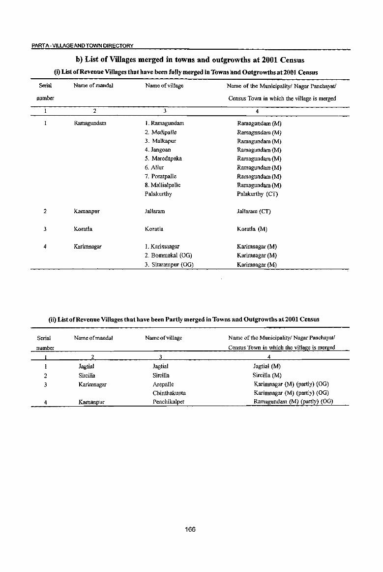
PART A- VILLAGE AND TOWN DIRECTORY
Serial
number
2
3
4
b) List of Villages merged in towns and outgrowths at 2001 Census
(i) List of Revenue Villages that have been fully merged in Towns and Outgrowths at 2001 Census
Name of mandaI
2
Ramagundam
Kamanpur
Koratla
Karimnagar
Name of village
3
1. Ramagundam
2. Medipalle
3. Malkapur
4. Jangoan
5. Maredapaka
6. Allur
7. Poratpalle
8. MalliaipaUe
Palakurthy
lallaram
Koratla
1. Karimnagar
2. Bommakal (OG)
3. Sitarampur (OG)
Name of the Municipality! Nagar Panchayatl
Census Town in which the village is merged
4
Ramagundam (M)
Ramagundam {M}
Ramagundam (M)
Ramagundam (M)
Ramagundam (M)
Ramagundam (M)
Ramagundam (M)
Ramagundam (M)
Palakurthy (CT)
lallaram (CT)
Koratla (M)
Karimnagar (M)
Karimnagar (M)
Karimnagar (M)
(ii) List of Revenue Villages that have been Partly merged in Towns and Outgrowths at 2001 Census
Serial Name of mandai Name of village Name of the Municipality/ Nagar Panchayatl
number Census Town in which the village is merged
I 2 3 4
1 Jagtial Jagtial Jagtial (M)
2 Sircilla Sircilla Sircilla (M)
3 Karimnagar Arepalle Karimnagar (M) (partly) (OG)
Chinthakunta Karimnagar (M) (partly) (OG)
4 Kamanpur Penchikalpet Ramagundam (M) (partly) (OG)
166
(c) MANDAL PARISHAD WISE PRESENTATION OF VILLAGE
DIRECTORY DATA
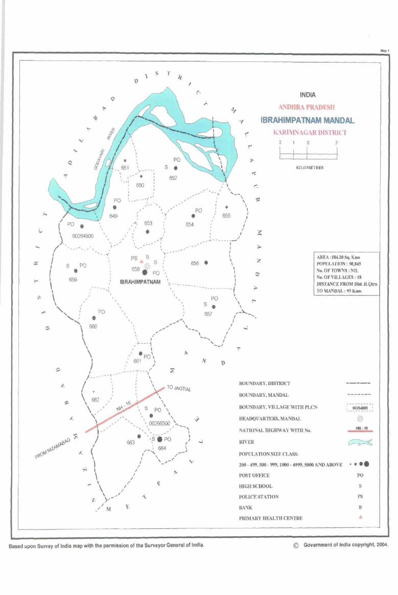
/ I po. \
\
I -' _---r
s T
s • 652
PO I
• I _
.,_" ' ...
649
, , , f ... ,
f J I I ,
653
•
I ' , I
Y
, f
,1' ,
PO
• 654
'--
I ,
J I I I •
655
..... --------,...- ..
.. , . I I I
I I
l I
} , 00264800 \,
~ ' _"'- __ ,-, r- " I
I ---~
INDIA
ANDHRA PRADESH
IBRAHIMPA TNAM MANOAL KARlMNAGAR DISTRICT
2 a 2
I I KIWMETRIS
I s PO • PS B ; - -- (
S' 656. \ 658 @ :, \
AREA :184.20Sq. Kms POPULATION: 511,845 No. OF TOWNS: NIL No. OF VILLAGES: 18
I
f I
\ 659
, , f .. ,
• PO ' I , I
IBRAHIMPATNAM \-_________ : , I -, '- -------------i
I .. DlST ANCE FROM DIn. H.Qtr" TO MANDAL ; 95 KIPs.
\ " \ " " : PO
, , , ,
""':., _/ " .. ", "
PO S •
657
\ 600 " ....... ., .. ,. \ ___ ,
\
' , __ • I
,J...---i "' ... _/ \ (I
\ " ·po\ I " 661 \ J / r/
I .... ----r--_'
I __ --r---- I I
-- # I "
/ '1 : \
I. :
\ 662 " \ , \ ,-'
'\'
TOJAGTlAl
, , ... -\."
I - ... I
I
BOUNDARY, DISTRICT
BOUNDARY, MANDAL
BOUNDARY, VILLAGE WITH PLCN
HEADQUARTERS, MANDAL
NATIONALmGHWAY WITH No.
RIVER
POPULATION SIZE CLASS:
200 - 499, 500 - 999, 1000 - 4999, 5000 AND ABOVE
POST OFFICE
mGBSCBOOL
POLICE STATION
BANK
PRIMARY HEALTH CENTRE
@
• ••• PO
S
PS
B ..
... pl
Based upon Survey of India map with the pennission of the Surveyor General of India. © Government of India copyright, 2004.
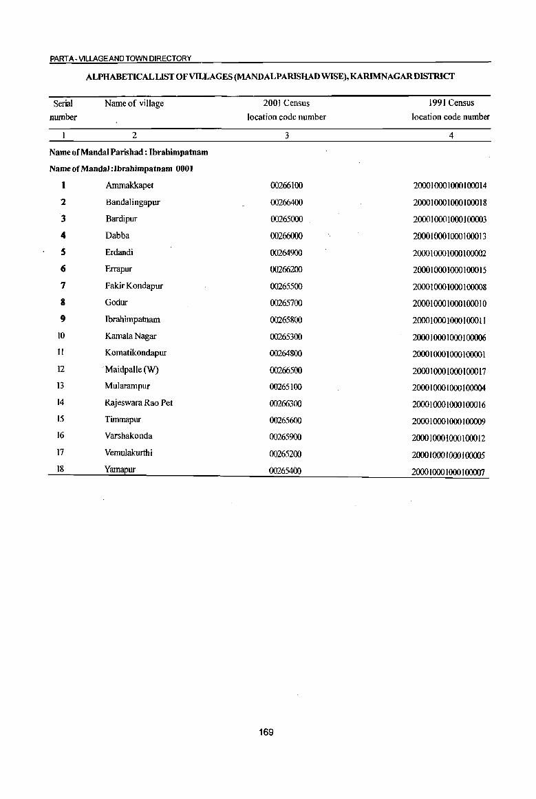
PART A - VILLAGE AND TOWN DIRECTORY
ALPHABETICAL LIST OF VILLAGES (MANDALPARISHAD WISE), KARIMNAGARDISTRICT
Serial Name of village 2001 Census 1991 Census
number location code number location code number
2 3 4
Name of Mandai Parishad : Ibrahimpatnam
Name of MandaI :lbrahimpatnam 0001
I Ammakkapet 00266100 20001000 1000 100014
2 Bandalingapur 00266400 2000 1 000 1000 1 ()()() 18
3 Bardipur 00265000 2000 1 000 1000100003
4 Dabba 00266000 2000 I 000 1000 100013
S Erdandi 00264900 2000 1 000 1 000 1 00002
6 Errapur 00266200 2000 I 000 1000 100015
7 Fakir Kondapur 00265500 2000 1 000 1000 1 00008
8 Godur 00265700 2000 1 000 1 000 100010
9 Ibrahimpatnam 00265800 2000 1 000 1 000 1 ()()() 11
10 Kamala Nagar 00265300 2000 1 000 I 000 1 00006
II Komatikondapur 00264800 2000 1 000 1 000 1 0000 1
12 . Maidpalle (W) 00266500 2000 1 000 1 000 100017
I3 Mularampur 00265100 2000 1 000 1 000 1 00004
14 Rajeswara Rao Pet 00266300 2000 I 000 1000 100016
15 Timmapur 00265600 2000 1 000 1 000 1 00009
16 Varshakonda 00265900 2000 1 000 1 000 100012
17 Vemulakurthi 00265200 2000 10001000 100005
18 Yamapur 00265400 2000 I 000 1000 1 00007
169
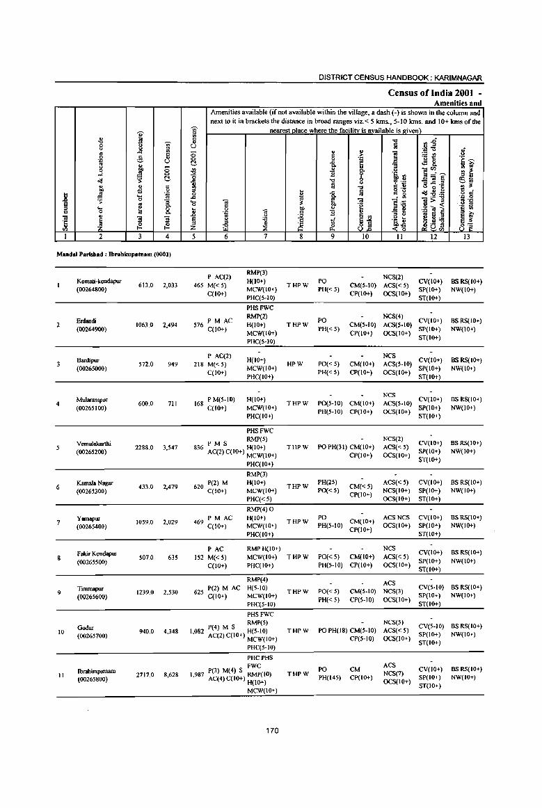
DISTRICT CENSUS HANDBOOK: KARIMNAGAR
Census of India 200t -Amenities and
Amenities available (if not available within the village, a dash (-) is shown in the column and next to it in brackets the distance in broad ranges viz.< 5 krns., 5-10 krns. and 10+ krns of the
-;;;- nearest place where the facilitv is available is lriven)
I '" '" !II
"0 'Ul Ii "0 ~1 0 () U ~ u ., ~ . ., u 3 c .CI 0 " v ] " c >- ~il 0 g .. 0 0 . ., 'E ~ '.c U C ..c f! <fl8. .,
II> Q, "3 ~ f <) OIl 0 .:g .. II>
e~~ 0 Q, u ..:I .!! 0
"0 11 'i' 's, '" o(l ~ C -= -c 0 , .~ ~] § !S1O () .. ., § ~ ~ -0 C " 6 0 '5 '" :s:
OIl -s 5 I fa o .- S ci } .!! .'" ..c C g o(l:2:a
~ ....
'" ..c Q,
]~ .., 0
0 :; ... .. ~ .. 1l>~ as '::: ~ g Q, 0 c 'e . us ... 8. t 0 0; "" ~ ,g .. ~ '§ .. " 0 .'" c !l " ;; 0 .. " .I:> ., U
~ jj gti;e ~ ~ ~ ~ ]I § () 't3 tf j~ 'C
~ '" ~ 8 u .9 s v iE & 8] <I) f-o Z 01:8<1) I 2 3 4 5 6 7 8 9 10 11 12 13
MandaI Parishad : Ibrabimpatnam (0001)
P A(2) RMP(3)
NCS(2) Komati-kondapur
613.0 2,033 465 M{< S) H{IO+)
THPW PO
CM(S-IO) ACS«S) CY{10+) BS RS{10+)
(00264800) qlO+)
MCW{IO+) PH« S) CP(1O+) OCS{IO+)
SP(IO+) NW(IO+) PHC(S-IO) ST(IO+)
PHSFWC
Erdandi 576 PM AC RMP(2)
PO NCS(4)
CY{10+) aSRS{IO+) 2 1063.0 2,494 H(IO+) THPW CM(5-10) ACS(5-JO)
(00264900) qlO+) MCW(IO+)
PH« 5) CP(lO+) OCS(IO+)
SP(IO+) NW(IO+)
PHC(5-Hl) ST{IO+)
Bardipur P AC(2)
H(IO+) NCS
CY(IO+) BSRS{IO+) S72.0 949 218 M«5) HPW PO« 5) CM(IO+) ACS(S-IO)
(00265000) C(IO+)
MCW(IO+) PH«S) CP(IO+) OCS(IO+)
SP(IO+) NW(IO+)
PHC(IO+) ST(IO+)
MuJarampur 168 P M(5-IO) H(IO+) NCS
CY(JO+) as RS{IO+) 4 600.0 711 THPW PO(S-IO) CM(JO+) ACS(S-IO)
(00265100) C(1o+) MCW(IO+) PH(S-IO) CP(IO+) OCS(IO+)
SP(IO+) NW(IO+) PHC(IO+) ST(IO+)
PHSFWC
VemuJakurthi PM S RMP(S) NCS(2) CV(lO+) BS RS(IO+)
S 2288.0 3,547 836 AC(2) C(IO+) H(IO+) THPW PO PH(31) CM(lo+) ACS« 5) (00265200)
MCW(IO+) CP(lO+) OCS(lO+) SP(JO+) NW(IO+)
PHC(IO+) ST(IO+)
RMP(3)
6 Kamala Nagar
433.0 2,479 620 P(2) M H(IO+) THPW
PH(2S) CM«5)
ACS«5) CV(JO+) as RS(IO+)
(00265300) C(IO+) MCW(IO+) PO« S) CP(lO+)
NCS(lO+) SP(IO+) NW(lO+)
PHC«S) OCS(lO+) ST(IO+)
RMP(4) 0
Yamapur 2,029 469
PMAC H(IO+) THPW
PO CM(IO+)
ACSNCS CV(IO+) as RS(lO+) 7
(00265400) 1059.0
C(IO+) MCW(IO+) PH(S-IO) OCS(IO+) SP(10+) NW(IO+)
PHC(IO+) CP(IO+)
ST(IO+)
Fakir Kondapur PAC RMPH(IO+) NCS
CV(IO+) BSRS(IO+) 8 507.0 635 152 M«5) MCW(lO+) THPW PO« 5) CM(to+) ACS«5)
(00265500) C(10+) PHC(IO+) PH(S·IO) CP(IO+) OCS(IO+)
SP(IO+) NW(IO+) ST(IO+)
RMP(4) ACS
9 Tinunapur
1239.0 2,530 625 P(2) M AC H(S-IO) THPW PO«S) CM(S·IO) NCS(3)
CY(S-IO) BS RS{IO+)
(00265600) C(IO+) MCW(IO+) PH« 5) CP(S.to) OCS(IO+)
SP(IO+) NW(IO+)
PHC(S-IO) ST(lO+)
PHSFWC
Godur RMP(5) NCS(5)
eV(S-IO) BS RS(IO+) 10 940.0 4.348 1,082 P(4) M S H(S-IO) THPW PO PH(18) CM(S-IO) ACS«5)
(00265700) AC(2) C(IO+) MCW(IO+) CP(S-IO) OCS(IO+) SP(IO+) NW(IO+)
PHC(S-IO) ST(lO+)
PHCPHS
P(3) M(4) S FWC 0 PO CM ACS
CV(IO+) BSRS(IO+) Ibrahimpatnam THPW NCS(7) J1 (00265800)
2717.0 8,628 1,987 AC(4)C(10+) RMP(1 ) PH(14S) CP(IO+) SP(IO+) NW(IO+) H(JO+) OCS(JO+)
ST(IO+) MCW(IO+)
170
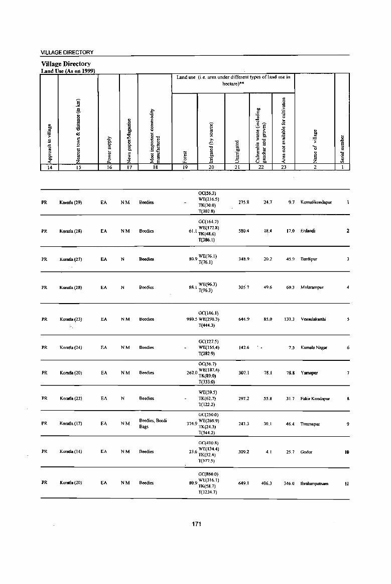
VILLAGE DIRECTORY
ViIla2;e Directory Land Use (As on 1999)
Land use (i.e. area under different types of land use in hectare)··
j g .~
e c co >-.S .~
I '8 "0 :; :::J u ..
I u ... " 1 'U c ~ ..9 ._ '" co :a ~ '-' .. .. .. u ;.- ::0 u
~ ~ i _ 0
on
~1l 5: ::J th .. S ~ .c ;., ~"O ~ ~ Jl
8: &.a e "0 ..!! lil ~
.s: § .... B " a OJ '-<>
.~ ~ "0 .0 la '0 0 c .. lii "'- III till ~-l3 c e ~ u ~
7ii OJ 'E .. " Ol "'- ~ ~ ~ e co
~ ·c :s :3 - ;:s ~ ~ :£ &. :£ & :::J .. u
U co en 14 15 16 17 18 19 20 21 22 23 2 1
GC(S6.3)
PR Kotatla (29) EA NM Beedies WE(216.5)
27S.S 24.7 9.7 Komatikondapur TK(30.0)
T(302.8)
GC(l64.7)
PR Kotatla (28) EA NM Beedies 61 I WE(172.8) · TK(48.6)
58004 18.4 17.0 Erdandi 2
T(386.I)
PR Koratla (27) EA N Bccdies 80.9 WE(76.1) T(76.l)
348.9 20.2 45.9 Bardipur 3
PR Koratla (28) EA N Beedies WE(96.3)
88.1 T(96.3) 305.7 49.6 60.3 Mularampur 4
GC(146.1)
PR Koratla (23) EA NM Beedies 980.5 WE(298.3) 644.9 85.0 133.3 Vcmulakurthi
:"'. T(444.3)
GC(127.5)
PR Koratla (24) EA NM Beedies WE(155.4) 142.6 7.5 Kamala Nagar 6 T(282.9)
GC(56.7)
PR Koratla (20) EA NM Beedies WE(187.4)
262.0 TK(89.0) 307.1 78.1 78.8 Yamapur 7
T(333.0)
WE(59.5) PR Koratla (22) EA N Beedies TK(62.7) 297.2 55.8 31.7 fakir Kondapur 8
T(122.2)
GC(250.0)
PR Koratla (17) EA NM Beedies, Beedi 3749 WE(269.9) 243.3 30.1 46.4 Timmapur 9 Bags · TK(24.3)
T(544.2)
GC(41O.8)
PR Koratia (14) EA NM Beedies 236 WE(134.4) · TK(32.4)
309.2 4.1 25.7 Godur 10
T(577.5)
GC(860.0)
PR Koratla (20) EA NM Beedies 80.9 WE(316.1) TK(S8.7)
649.1 406.3 346.0 Ibrahimpatnam 11
T(1234.7)
171
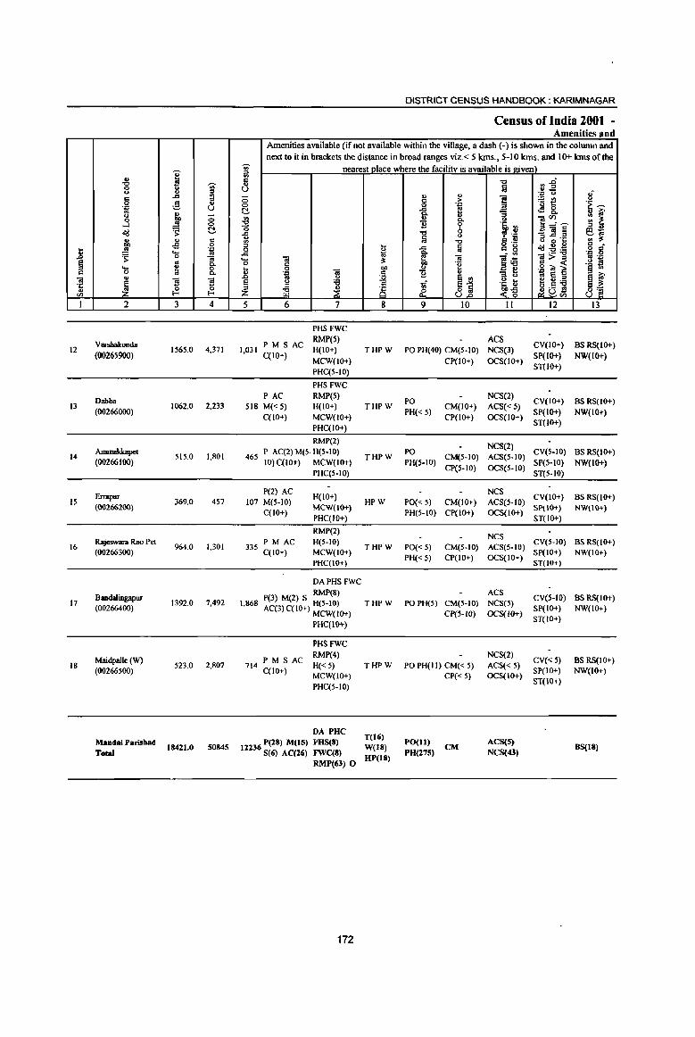
i "iii ·c ... '" 1
12
13
14
15
16
17
18
., "" 0 0 c 0
'.c .. 0 0
...l
~ ., 01)
~ 's: ..... 0 ., ~ 2
Varsbakonda
(00265900)
Dabba (00266000)
Ammakkapet
(00266100)
Enapur
(00266200)
Rajcswara Rao Pet (00266300)
Bandalingapur (00266400)
Maidpalle (W) (00266500)
MandalParishad
Total
I -;;;-u
" ::0 ..c .,
= .§, .. U
g, -0 .. 0
~ t!-
" c £ 0
'- .~ 0 :; .. Q.
~ 0 0.
'3 '3 ~ ~ 3 4
1565.0 4,371
1062,0 2,233
SIS.O 1,801
369,0 457
964.0 1,301
1392.0 7,492
S23.0 2,807
18421,0 50845
DISTRICT CENSUS HANDBOOK: KARIMNAGAR
Census of India 2001 -Amenities and
Amenities available (if not available within the village, a dash (-) is shown in the column and
next to it in brackets the distance in broad l"aDges viz,< 5 ktns., 5-10 ms. and 10+ krns of tile
~ nearest place where the facility is available is ltiven) c: ., U ;:; 0 t!-~ o -fi .. '" D 0 .c 1;:j ..... "iii ~ 0 c ... 0 DO
_g '.c "iii c: .. u ~ s 0 :a
::l :l
~ _K z ~ 5 6 7 8
PHS FWC
PM S AC RMP(5)
1,031 H(IO+) THPW C(lO+)
MCW(IO+)
PHC(S-IO)
PHSFWC
PAC RMP(S)
SIS M«S) H(IO+) THPW C(lO+) MCW(IO+)
PHC(IO+)
RMP(2)
46S P AC(2) M(S. H(S-IO) IO)C(IO+) MCW(IO+)
THPW
PHC(S-IO)
P(2) AC H(IO+)
107 M(S-IO) HPW C(IO+)
MCW(IO+}
PHC(IO+)
RMP(2)
335 PM AC H(5-1O}
THPW C(lO+} MCW(IO+}
PHC(IO+)
DAPHS FWC
RMP(8) 1,868 P(3) M(2) S H(S-IO) THPW
AC(3)C{10+) MCW(IO+)
PHC(IO+)
PHSFWC
714 PM S AC RMP(4)
H« S) THPW C(lO+)
MCW(IO+)
PHC(S-IO)
DA PUC P(28) M(15) PHS(8) T(16)
12236 S(6) AC(26) FWC(8) W(18) RMP(63) 0 UP(18)
172
., " c > 0 '.c
..c e! Q.
" .2 Q.
!! 6 "" :a u
"" -a !ij
ti "iii ·E <>
11 ~ ., 1if 81 &.
9 10
PO PH(40) CM(S-IO)
CP(IO+)
PO
PH« s) CM(IO+)
CP(IO+)
PO CM(S-IO)
PH(S·IO) CP(S-IO)
PO« S) CM(lO+) PH(S-IO} CP(lO+)
PO« 5) CM(S-IO}
PH«S) CP(IO+)
POPH(S) CM(S-IO)
CP(S-IO)
PO PH(JJ) CM« 5)
CP« 5)
PO(ll) CM PO(275)
"" !ij
] '" t)
'~'" " .~ co ., g "8 l~ "at .~ t <1i
11
ACS NCS(3)
OCS(IO+)
NCS(2)
ACS« 5) OCS(IO+)
NCS(2) ACS(S-IO)
OCS(S-IO)
NCS
ACS(S-IO) OCS(JO+)
NCS ACS(S-to)
OCS(IO+)
ACS NCS(S)
OCS(IO+)
NCS(2)
ACS«5) OCS(IO+)
ACS(S) NCS(4l)
~ :a. ." 0
;';:i! ~ 8. .. <I)
i! -'~ _"iiI~ ~ ~.§ ~:2:ii "iiI>::o
.5 '<a i ~ s fO:;;
l8~ 12
CV(lO+}
SP(IO+) ST(lO+)
CV(IO+)
SP(IO+) ST(IO+)
CV(S-IO)
SP(S·IO) ST(S-IO)
CV(IO+)
SP(IO+}
ST(IO+)
CV(S-tO} SP(IO+) ST(IO+)
CV(S-IO) SP(IO+)
ST(IO+)
CV« S) SP(lO+)
ST(IO+)
oJ u .~ ~
~ ~ [g ~ 6~ '" ~ c • .g Zl .. '., .~ 1i! ~ ~ 8'2
13
BS RS(10+)
NW(IO+)
BSRS(IO+)
NW(IO+)
BS RS(IO+)
NW(lO+)
BS RS(IO+) NW(IO+}
BS RS(IO+) NW(IO+)
BSRS(IO+) NW(IO+)
BSRS(IO+) NW(lO+)
8S(18)

1-' -~ ~GE DIRECTORY 'J'! .. : 1.lil~2e Directory iI.~'h'~ Use (As on 1999)
Land use (i.e. area under different types ofland use in hectare)·"
2 14 15 16 17 18 19 20 21 22 .. -~~--~~--~~~~~~--~~--~----~~~~------~----~--~~--------~~
23
KOralla (26)
r~ KOral1a (21)
: tit '. Koratla (IS)
MR Koratla (23)
PR Koratla (17)
Koratla (16)
PR Koratla (13)
PR(l7)
.¥R
EA
EA
EA
EA
EA
EA
EA
EA(lS)
NM
N
NM
N
NM
NM
NM
N(IS) M(ll)
Beedies
Beedies
Beedies
Beedies
Beedies
Beedies
GC(J95.9)
2200 WE(187.4) . TK(56.7)
T(439.9)
GC(19.8)
2675 WE(171.6) . TK(lO.2)
T(201.6)
WE(l61.J) TK(4.0)
T(165.1)
WE(S5.8) T(SS.S)
WE(160.3) S26.1 TK(60.7)
T(221.0)
W(500.0) 474.2 TK(226.S)
T(726.5)
WE(279.2) TK(lO.I) T(289.3)
GC(22S7.6) W(500)
3439.S WE(3027.85
)TK(713.S)
T(6529.2S)
173
610.6 112.5
390.5 53.2
289.6 6.4
146.0 29.6
162.0 0.3
186.0
143.9 41.9
6033.0 1016.1
182. 1 Varshakonda
149.2 Dabba
53.9 Ammakkapet
107.7 Errapur
54.6 Rajeswara Rao Pet
5.4 Bandalingapur
47.9 Maidpalle (W)
1402.S
12
13
14
15
16
17
18
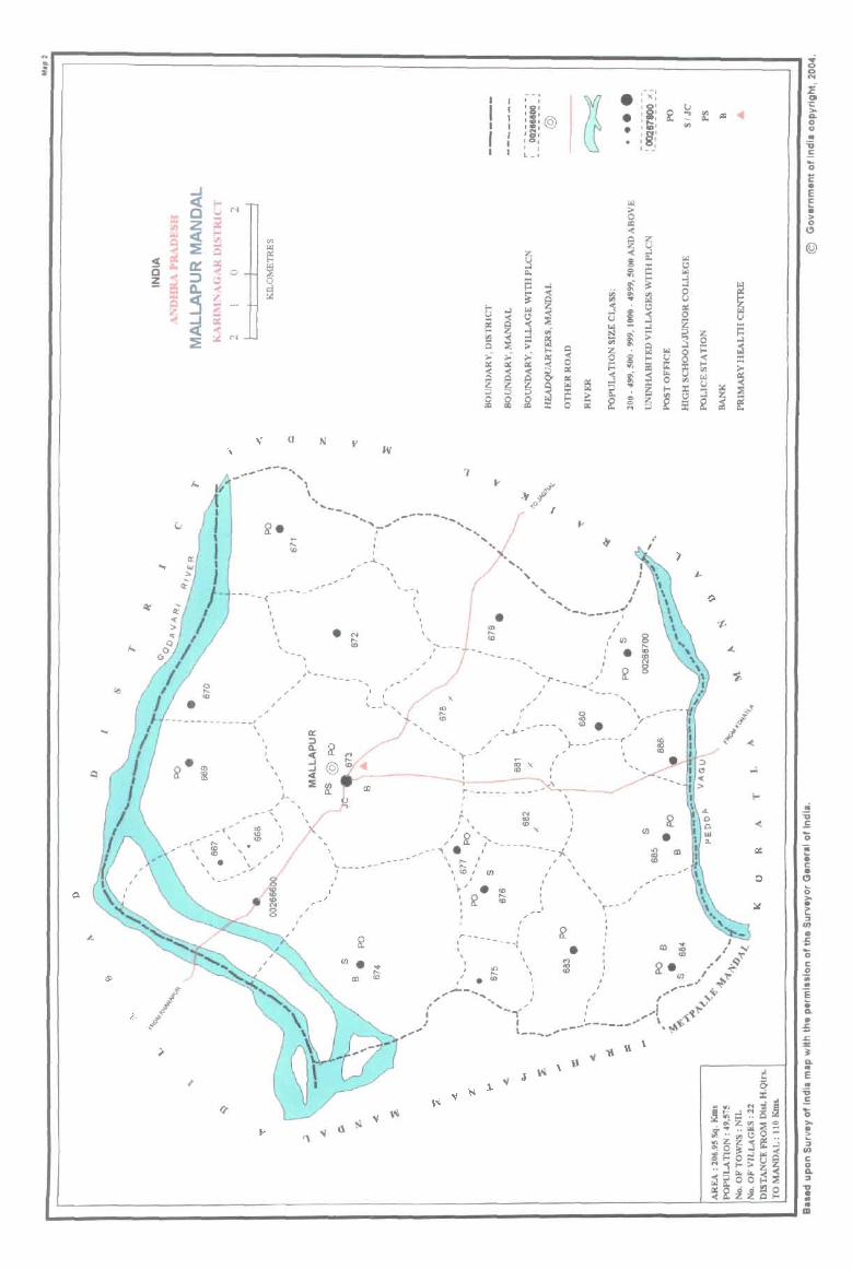
.. :i
-----<
, , , , ,
. ~ <D
... -- .. , , , I ,
, .... _- ...... _-- ......
- - .. (
. , , , , \
\
)- , ; ,
-~ , ,
, , '-
'-- '" x
--, e : x: u :§: ~ ~
• I ~ I rill . :; : , ts , .- -
I I " , ' , "-, I
'" ... '" • " -~ ' - ---- ~'
I
C/l
• ~ ..... r ... _ ......... ,,-
I ....... __ .......
, ; , ,.. 0 ',--_ : ~ . ;
I _' ___ , ___ ~
;-.~- '>---, "
,..------
;0 X <0
, I ,
I ,
N ' co ;, <0 x I
I '.... I
\
U) • , \
\ L ___ ... .
' ~ >---- - -----~ -- .... '. " : '. ' '... ,
" ~,' U) I "
, I
I I ,
~' . :e . 'r-~ '" .
; , , , I r- ...... ____ -...:
' \ . \ , 1
• ~
, ,
CD
I: o a.. '" 1 .. • III
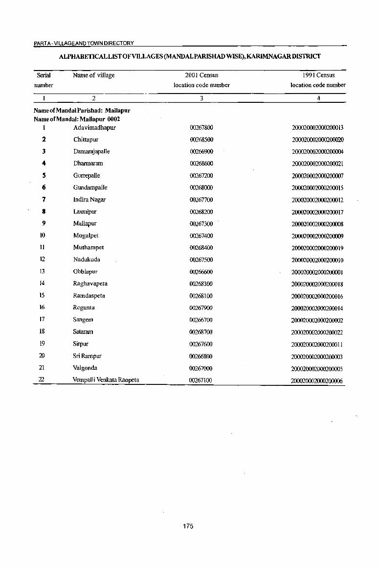
PART A -VILLAGE AND TOWN DIRECTORY
ALPHABETICAL LIST OF VILLAGES (MANDALPARISHAD WISE), KARIMNAGARDISTRICT
Serial Name of village
number
2
Name of MandaI Parishad: MaUapur
Name of MandaI: Mallapur 0002 1 Adavimadhapur
2 Chittapur
3 Damarajapalle
4 Dhannaram
S GorrepaUe
6 GundampaUe
7 Indira Nagar
8 Laxmipur
9 Mallapur
10 Mogalpet
11 Muthampet
12 Nadukuda
13 Obblapur
14 Raghavapeta
IS Ramdaspeta
16 Regunta
17 Sangem
18 Sataram
19 Sirpur
20 SriRampur
21 Valgonda
22 VempaUi Venkata Raopeta
2001 Census
location code number
3
00267800
00268500
00266900
00268600
00267200
00268000
00267700
00268200
00267300
00267400
00268400
00267500
00266600
00268300
00268100
00267900
00266700
00268700
00267600
00266800
00267000
00267100
175
1991 Census
location code number
4
2000200020002000 13
200020002000200020
2000200020002()()()()4
200020002000200021
200020002000200007
200020002000200015
2000200020002000 12
2000200020002000 17
200020002000200008
200020002000200009
2000200020002000 19
2000200020002000 1 0
20002000200020000 I
2000200020002000 18
2000200020002000 16
2000200020002000 14
200020002000200002
200020002000200022
2000200020002000 II
200020002000200003
200020002000200005
200020002000200006

DISTRICT CENSUS HANDBOOK: KARIMNAGAR
Census of India 2001 -Amenities and
Amenities available (if not available within the village, a dash (-) is shown in the column and next to it in brackets the distance in broad ranges viz.< 5 krns., 5-10 kms. and 10+ kms of the
-;;;- nearest place where the facility is available is lziven) ., I 1A c <t:J ~~ "0 -;;;- ., 0 u u Iii Q 4) ~ .:: Q .; C ,.<:I
C - .. !;! ] ~i! <> 0 5 0 e. u 0 .:: .~ >: ] j c -a G ::l
~8. :: ~ 8 ~ .. Q, u ~~~ "0 ] 6 '1iiJ .. ::l ..
~ ~ (2, ..d <t:J cp .~ _OI~ 1:9.10 u Iii u G -;.~ .. '" ~ ., c '" "0 = .. .£l 0 ::s 0'- c
1! !! .~ 0 Il -= Iii c g ~:2:a o " <0.. ..d ~ ~ - '" .:: 0 ~ 0 "3 "- 01 ~ ~'3 ~:>~
.. .:: § .. 0. 0 C '" Q .~ .s
<0.. ~ 0 .... 0
I tJ .... .:: -.. ~ C til
C 0 Q, ~ .:: ca ] u "3 !3 ::l ,..,
ca u .. 0 e '" .. e e ..
~ ~ 15 e <>
~ 1i ~1 ·a ~ 2! .,] §~ ·c
~ ::s iZ u.s ., Z ~ .z1i ~u '" ~'" u
I 2 3 4 5 6 7 8 9 10 II 12 13
Mandai Parishad : MalJapur (0002)
P(2) AC RMP(2)
Obblapur 1201.0 1,475 351 M(S-IO)
H(10+) THPW P0(5-10) CM«S)
ACS(S-IO) CV(IO+) as RS(lO+) (00266600)
C(10+) MCW(IO+)
PH(IO+) CP(IO+) NCS(IO+) SP(IO+) NW(IO+)
PHC(IO+) OCS(IO+) ST(IO+)
Sangem PAC RMPH(IO+)
BS RS(IO+) 2 292.0 593 154 M«S) MCW(IO+) HPW PO« 5) CM(5-10)
ACS« S) CV(IO+) (00266700)
C(IO+) PHC(IO+) PH(IO+) CP(IO+) NCS(IO+) SP(1O+) NW(IO+) OCS(IO+) ST(IO+)
SriRampur RMPH(IO+)
ACS« 5) CV(IO+) BS RS(tO+) 3 631.0 347 89 P(2) AC M« MCW(IO+) HPW PO« 5) CM(5-10)
(00266800) 5)C(10+) PHC{IO+) PH(IO+) CP(lO+) NCS(IO+) SP(IO+) NW(IO+)
OCS(tO+) ST(IO+)
PHSFWC
Danuuajapallc RMP{3)
PO ACS NCS CV(IO+) BS RS(IO+) 4 1122.0 3,ISO 722 P(2) M H(IO+) THPW CM«S)
(00266900) AC(2) C(IO+) MCW(IO+) PH« 5) CP(IO+)
OCS(IO+) SP(IO+) NW(IO+)
PHC« 5) ST(IO+)
RMP(2) NCS(3)
5 Valgonda
910.0 1,604 371 P M AC H(IO+)
THPW PO« 5) CM(S-IO) ACS«5) CV(IO+) BS RS(IO+)
(00267000) C(IO+) MCW(IO+) PH(5-1O) CP(IO+) OCS(tO+)
SP(IO+) NW(lO+) PHC(5-10) ST(IO+)
Vempalli Venkata DARMP(2)
NCS(3) P(2) M H(IO+) PO CV(IO+) as RS(IO+) 6 Raopeta 888.0 4,301 1,120 C(lO+) HPW CM(5-1O) ACS(5-10)
(00267100) MCW(IO+) PH(5-10)
CP(lO+) OCS(IO+) SP(IO+) NW(IO+)
PHC(5-10) ST(IO+)
Gorrepalle PAC RMPH(IO+)
ACS(S-IO) CV(IO+) BS RS(IO+) 7
(002672oo) 908.0 1,411 337 M(5-10) MCW(IO+) THPW P0(5-10} CM(5-1O)
NCS(tO+) SP(lO+) NW(tO+) C(lO+) PHC(S-IO) PH(5-10) CP(IO+)
OCS(IO+) ST(IO+)
P(4) M(2) PHCPHS
ACS Mallapur
2455.0 6,282 I S56 S(2) PUC FWC RMP(3) T HP W PO CM NCS(6)
CV(IO+) BS RS(I,O+) tI
(00267300) , H(IO+) PH(130) CP(IO+) SP(IO+) NW(lO+) AC(3)C(10+) MCW(IO+) OCS(IO+)
ST(IO+)
PHSFWC
P M S RMP(3) PO CM NCS
CV(IO+) BSRS(IO+) Mogalpet THPW ACS(5-10) 9
(00267400) 2446.0 3,451 832 AC(2)C(10+) H(IO+) PH(5-10) CP(IO+) SP(IO+) NW(JO+)
MCW(IO+) OCS(IO+)
PHC(IO+) ST(IO+)
P(2) AC RMP(2)
NCS Nadukuda
193.0 937 241 M«5) H(JO+)
THP PO« 5) CM« 5) ACS(5-10) CV(IO+) BS RS(IO+)
10 (00267500) MCW(IO+) SP(IO+) NW(IO+)
C(IO+) PHC(IO+)
PH(5-10) CP(IO+) OCS(IO+) ST(IO+)
176
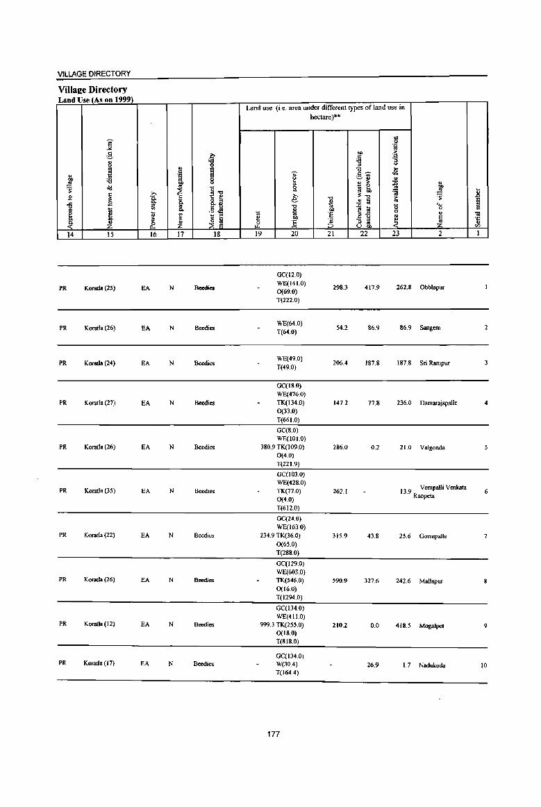
VILLAGE DIRECTORY
ViIla2e Directory Land Use (As on 1999)
Land use (i.e. area under different types of land use in hectare)··
= j 0 '.g
,g 00 > b c ·a
0> 'S '6 "5 u " <>
~ .,
! Q ...
c 0;- c:~ .a 11 .§ .- "" u ~ ., ... .!! :a 00 3 " > ~ " ~ .. g ~ ~ J' ~ ~ ~il ';j ]
~ » >, 01:-0 ~ .£ C. -0 >
B "" ~ 8.~ e- O> ..!! lii .. ~ ..CI
" "0 t;;
~~ 0 c...
l;l 0 c 1;; II>
"" .§ .:g ... 011 C e ~. Ii ~ - " ~ .. ·E '" " «I
Q. i!: ~ ~ 0()
_! - " ~ ~ '5 ~ ~ & ~ {1. ] " .. U t>O en
14 15 16 17 18 19 20 21 22 23 2 1
GC(I2.0)
PR Korada(25) EA N Bcedies WE(141.0)
298.3 417.9 262.8 Obblapur 0(69.0) T(2220)
PR Koratia (26) EA N Bcedies WE(64.0)
54.2 86.9 86.9 Sangem 2 T(64.0)
PR Korada (24) EA N Beedies WE(49.0)
206.4 187.8 187.8 Sri Rampur 3 T(49.0)
GC(IS.O}
WE(476.0)
PR Koratla (27) EA N Beedies TK(134.0) 147.2 77.8 236.0 Damarajapalle 4 0(33.0)
T(661.0)
GC(S.O) WE(101.0)
PR Koratla (26) EA N Beedies 3S0.9 TK(l090) 286.0 0.2 21.0 Valgonda 0(4.0)
T(22 1.9)
GC(103.0)
WE(428.0) 13.9 Vempalli Venkata PR Koratla (35) EA N Beedies TK(77.0) 262.1 6
0(4.0) Raopeta
T(6120)
GC(24.0)
WE(163.0) PR Koratla (22) EA N Beedies 234.9 TK(36.0) 315.9 43.S 25.6 Gorrepal1e 7
0(65.0)
T(288.0)
GC(129.0) WE(603.0)
PR Koratla (26) EA N Bcedies TK(546.0) 590.9 327.6 242.6 Mal1apur S 0(16.0)
T(1294.0)
GC(l34.0)
WE(411.0) PR Koratla (12) EA N Beedies 999.3 TK(255.0) 210.2 0.0 418.5 Mogalpel 9
0(18.0)
T(SIS.0)
GC(l34 0) PR Koratla (17) EA N Beedies W(30.4) 26.9 1.7 Nadukuda 10
T(l64.4)
177
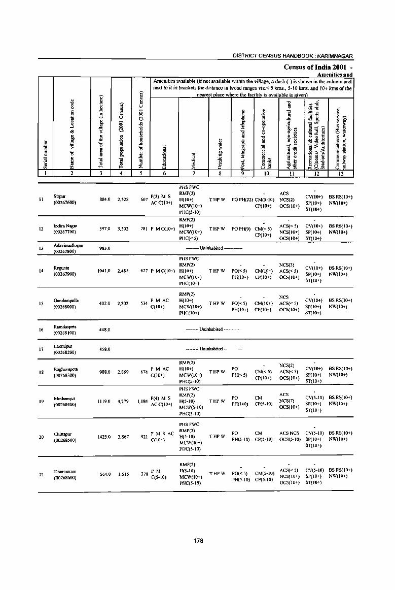
DISTRICT CENSUS HANDBOOK: KARIMNAGAR
Census of India 2001 -Amenities and
Amenities available (if not available within the village, a dash (-) is shown in the column and next to it in brackets the distance in broad ranges viz. < 5 kms., 5-1 Q kms. and 10+ kms of the
<ii' nearest place where the facilitv is available is !riven)
I iil .g 0: .", n1 <ii' ..,
<> il " u a .; c ,0: il - .. " ] . ., u
0 5 > ~t! <> 0 g .~ ~ . ., u 0 .~ co "
~ 'fi. "'a' ~8. :: ~ u E ;; .;g .,
1! "'. ~ 0 Q. u ....l 0 B 'j> '§' rl
~ ~ "5 ,S]§ ;:I ..
~ ..c ." 0 ~ . ..: e;; <> " " g ~ Iii -0
C ., g. 0 ·c '" "" 00 £ " ~ a
o ._ ~".9 c .. !! ..... . ., 0 -&. c 8 :9:a .~ § u .. ,0:
..0 ~ 0 g_ ... OJ S, OJ ].~ ]>~ ., . .,
§ g 0 c "" 'e .g s ... &. .. 0 1>0 u .~.., ~ 3 <II C 0 ... 'Q OJ c B '" :; t .. 6
OJ u ..0 11 u ~ S on ~ ~ 'J: ~
] ] ~ ~
'6 ti ~1 i~ eg:a
u 0 ~ ~ 8 .~ J!Us 8] '" I-~'"
I 2 3 4 5 6 7 8 9 10 11 12 13
PHSFWC
Sirpur 667 P(3) M S RMP(2) ACS
CV(IO+) BSRS(IO+) 11 884.0 2,528 H(IO+) THPW PO PH(22) CM(5-10) NCS(2)
(00267600) ACC(IO+) MCW(IO+) CP(IO+) OCS(IO+)
SP(IO+) NW(IO+)
PHC(S-IO) ST(IO+)
RMP{2)
12 Indira Nagar
397.0 3,302 781 P M C(lO+) H(IO+)
THPW POPH(9) CM«5) ACS« 5) CV(IO+) BS RS(10+)
(00267700) MCW(IO+) CP(IO+)
NCS(IO+) SP(IO+) NW(IO+)
PHC« 5) OCS(IO+) ST(IO+)
13 Adavimadhapur
983.0 --Uninhabited ---(00267800)
PHSFWC
Regunta RMP(2) NCS(3)
eV(lo+) BSRS(IO+) 14
(00267900) 1041.0 2,485 627 P M C(lO+) H(IO+) THPW PO«S) CM(lp+) ACS«5)
SP(IO+) NW(IO+) MCW(IO+) PH(IO+) CP(IO+) OCS(IO+)
ST(to+) PHC(IO+)
RMP(2) NCS
IS Gundampalle
402.0 2,202 S34PMAC H(IO+)
THPW PO« 5) CM(IO+) ACS« 5) eV(IO+) BS RS(10+)
(00268000) C{IO+) MCW(JO+) PH(IO+) CP(IO+) OCS(IO+)
SP(IO+) NW(IO+)
PHC(IO+) ST(IO+)
16 Ramdaspeta (00268100)
448.0 ---Uninhabited ---
17 Laxmipur
458.0 --Uninhabited -----(00268200)
RMP(2) NCS(2)
Ragbavapeta 674 PM AC H(IO+) PO eY(lo+) BSRS(IO+) 18 988.0 2,869 THPW CM«5) ACS«5)
(00268300) C(lO+) MCW(IO+) PH«5) CP(IO+) OCS(IO+)
SP(IO+) NW(IO+)
PHC(5-10) ST(IO+)
PHSFWC RMP(2)
PO CM ACS
eV(S-to) BSRS(lO+) 19
Muthampet 1119.0 4,779 1,184
P(4) M S H(5-10) THPW NCS(7)
(00268400) ACqIO+) MCW(S-lO)
PH(140) CP(5-IO) OCS(IO+)
SP(IO+) NW(IO+)
PHC(5-10) ST(IO+)
PHSFWe
Chittapur PM S AC RMP(3)
PO CM ACSNCS eY(S-IO) BSRS(IO+) 20 1425.0 3,867 921
C(10+) H(5-IO) THPW
PH(S-IO) CP(S-IO) OCS(5-IO) SP(lO+) NW(IO+) (00268500) MCW(IO+)
PHC(5-IO) 5T(10+)
RMP(2)
Dharmaram PM H(5-IO) THPW PO« 5) CM(5-10)
ACS« 5) eY(5-to) BS RS(IO+) 21 564.0 1.515 370 C(5-10) MCW(IO+) NCS(IO+) SP(IO+) NW(IO+) (00268600) PH(S-IO) CP(S-IO)
PHC(5-1O) OCS(lO+) ST(IO+)
178

VILLAGE DIRECTORY
Villae;e Directory Land Use (As on 1999)
Land use (i.e. area under different types of land use in hectare)··
i '" 0 '.c as
~ ~ "" >
~ 'J:
8 :g ::> B i
., to "U l-e
~ I "'~ t8 ~ .~ .- '" :a ~"
., .. 00 ... > ~ " ~ old ~ ~~ ~ - 0 "" :l to ';j oS .8 ~
;., e ~-o ~ B 0. -0 1; .9 c:>. " 8.a ~ ..!! fii § ... a go -0 e ~ "0 ....
~ .S ~ 0 e ti D- B OIl c E j t ~ - ::> '" ., 'E B"tl '"
., Ol
c:>. E!: ~ ~ ~ "" ~ - ::> j_ 1 ·c
~ ~ :l .£ :6 '" '" u (.) bO til
14 15 16 17 18 19 20 21 22 23 2 I
GC(S7.0)
PR Koratla (IS) EA N Beedics WE(314.0)
70.0 S.O Sirpur II TK(435.0) T(S06.0)
GC(300.0)
PR Koratla (18) EA N Beedies W(86.4) 2.6 8.0 Indira Nagar 12 T(386.4)
-- Uninhabited -------WE(4.0)
353.7 T(4.0) 560.6 64.7 Adavimadhapur 13
GC(53.0) WE(40S.0)
PR Koratla (16) EA N Beedies TK(88.0) 460.0 0.1 4.9 Rcgunta 14 0(30.0) T(576.0)
GC(18.0) WE(IIO.O)
PR Koratla (16) EA N Beedics TK(85.0) 141.4 11.6 Gundampalle 15 0(36.0) T(249.0)
WE(63.0) --Uninhabited --- 59.9 TK(40.0) 232.3 36.6 16.2 Ramdaspeta 16
T(103.0)
WE(1I7.0)
--Uninhabited --- 47.4 TK(36.0) 131.2 17.6 108.9 Laxmipur 17 T(IB.O)
GC(51.0)
PR Koratla (16) EA N Beedies WE(480.1)
14.5 90.2 90.2 Raghavapeta 18 TK(262.1) T(793.2)
GC(53.0)
PR Koratla (23) EA N Beedies, Sugar WE(236.0)
316.1 49.8 80.1 Muthampel 19 TK(384.0) T(673.0)
GC(49.0)
PR Koratla(IS) EA N Beedies WE(I99.0) TK(465.0)
536.3 11.7 164.1 Chittapur 20
T(713.0)
GC(36.0) WE(129.0)
PR Koratla(9) EA N Beedies TK(I02.0) 206.6 65.4 Dharmararn 21 0(25.0) T(29Z.0)
179

] ~ C
"1i1 '1:: .. <I.l
1
22
" "8 8 . .., B .s ~
" ~ ~ .... 0 .. ~ 2
SataJ8nI (00268700)
Mudal Parlahad
Total
j g j
..d fl ;§. u
~ ;; .s 0
'S ~
" § oS . .., '(S ..
"3 g Q.
8. S S {3. {3. 3 4
938.0 2,477
20693.0 49575
DISTRICT CENSUS HANDBOOK: KARIMNAGAR
Census of India 2001 -Amenities and
Amenities available (if not available within the village, a dash (-) is shown in the colwnn and
next to it in brackets the distance in broad ranges viz. < 5 lans., 5-10 lans. and 10+ lans of the 'Ui' nearest place where the facility is available is roven) :0
5 "0 ~~ u lil -::: Q .; ;; u " 1 ~t u c > 0 0 '.0 .~ ~ ~ ..c e ~8. ~ ~ Q.
-B ., " ]~~ ;g ~ 0. 0
'0 e 'i' 'lib <II
..c "0 0 ~ .~ _"1i1~ ~~ ~ lil 0 B ~·c "0 c u
! a o ._
~~:ij c •
_g -a c_ £ o c . .., 0
.... "1i1 ~ ~ "1i1 ]~ l'>~ 01 '.0 0 5 of! .2 f! ] "1i1
.. u .g ~] S <II . ., c 11 u "3 ti 01 S ~ f .. 0 ~ e <II
~ 0 :;:;
1 ~1 .~ t e":;:; ~ ~c3~ z ~ 8 .?~ 8~
5 6 7 8 9 10 II 12 13
PHSFWC
613 PM S AC RMP(2)
PO ACS
CV(JO+) BSRS(IO+) H(IO+) THPW CM(JO+) NCS(2)
C(IO+) PH(JO+) SP(lO+) NW(IO+) MCW(IO+) PHC(IO+)
DA PUC P(3l) M(IS) PU8(8)
12144 8(7) PUC FWC(8)
AC(19) RMP(39)
180
T(16) W(IS) UP(19)
CP(JO+)
PO(IO) PH(301) CM(4)
OCS(IO+)
ACS(6)
NCS(33)
ST(IO+)
BS(19)
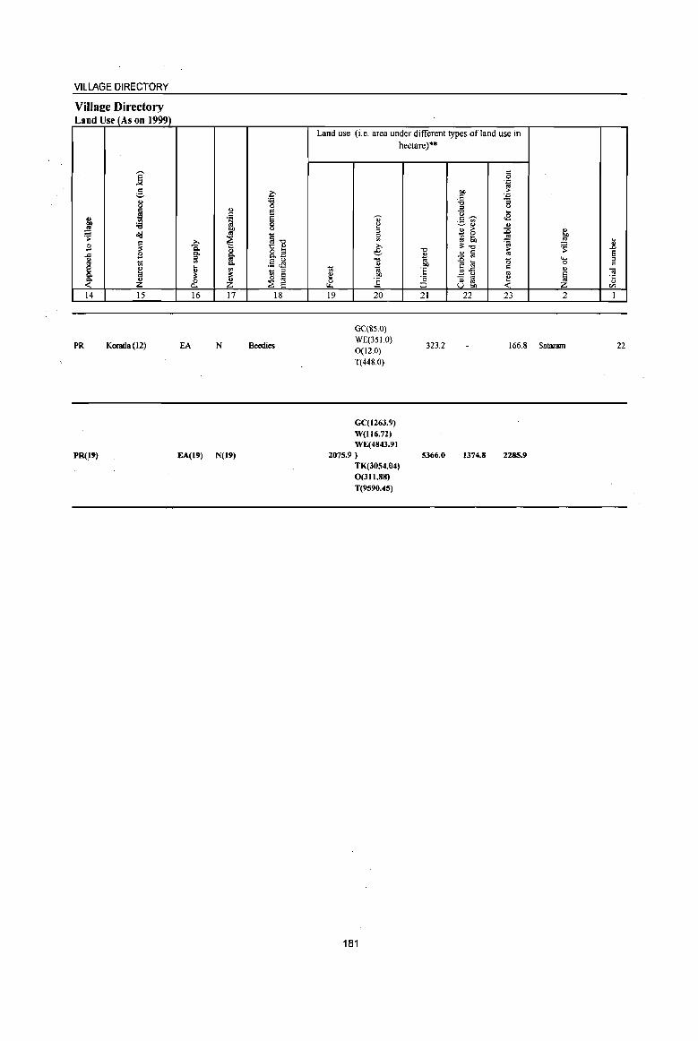
VILLAGE DIRECTORY
Villae:e Directory Land Use (As on 1999)
j 2- .c-8 '6 ., 0
~ c 0:
'" .~ 0: gp '6 0 01) (.) a o'IJ '" ~ §"O > -s: .e ~ t:: '" §. o ...
-fi .e Co c.Z fil . 5 J9 g <;; c.
~ ~ '" " ! " <;; ~ 0 '" & :;. ::; z e
14 15 16 17 18
PR Koratla (12) EA N Beedies
PR(19) EA(19) N(19)
Land use (i. e. area under different types ofland use in hectare)**
<;; ~ 0 ... 19
'" ~ 5l » e
"0
" ... OIl
] 20
GC{SS.O) WE(35 1.0) 0(12.0) T(448.0)
GC(1263.9) W(116.72) WE(4843.91
2075.9 ) TK(3054.04) 0(311.88) T(9590.45)
181
"0
" ~ OIl
'6 '2 ::l 21
323.2
5366.0
c 0 .~
Ol) >
~ ~ " " g~ ...
<2 ~r; " ~ ~ ::c " bO
~ os
'" ~ ..!!! 0:"0 ~ ~
> '" '" :;s (5 ..... e!] 0
<: '" Z '" '" ~ - " ~ " '" U Oll -< Z
22 23 2
166.8 Sataram
1374.8 2285.9
_g e " c
'" 'k
" OIl
1
22

_-_ ... _,.,.,,-
a a
m N
8
J' ... -""' ........ _,- r "-_- I
•
I
, I
r u
, I- ----
N • $
,< , I
/ I
R
' - -, ,
-~------------; ) I " II) I,
• :. $ I I
"
, /
-r - I
I
, ----- ......... J,.... ",."
c:o fll • ,
I \
~ Ul ';- __
• _.1. _____ .1.. __ , _
-<. - '
11 d v 1
I I I •
I : I I
.. : ~: @ ·1· , , ,-.
• ~ I:l • ;0 •
c: &. " i ., .. III
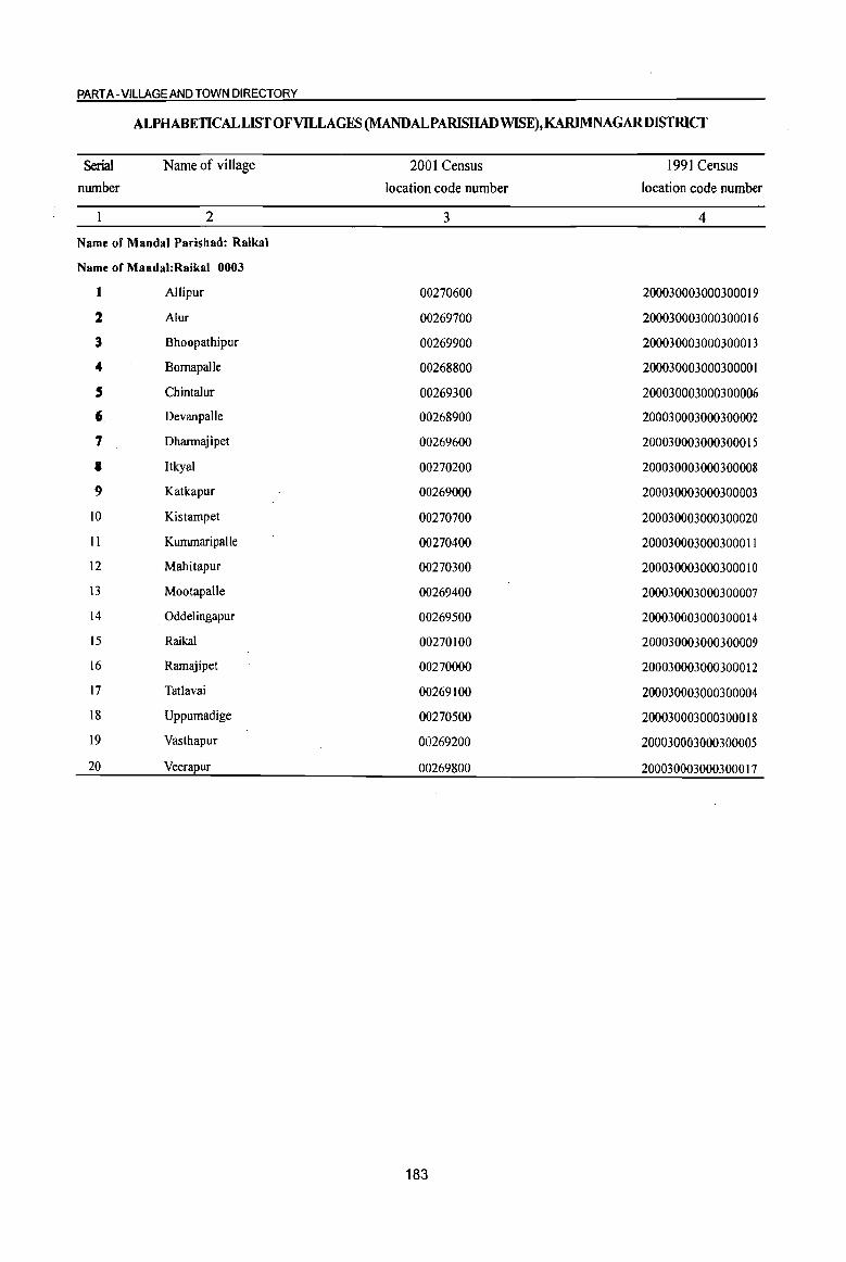
PART A -VILLAGE AND TOWN DIRECTORY
ALPHABETICAL LIST OF VILLAGES (MANDALPARlSHADWISE),KARlMNAGARDISTRICT
Serial Name of village 2001 Census 1991 CeTlSus
number location code number location code number
2 3 4
Name of MandaI Parishad: Raikal
Name of Mandal:Raikal 0003
1 Allipur 00270600 200030003000300019
2 Alur 00269700 200030003000300016
3 Bhoopathipur 00269900 200030003000300013
4 Bomapalle 00268800 200030003000300001 , Chintalur 00269300 200030003000300006
6 Devanpalle 00268900 200030003000300002
7 Dharmajipet 00269600 200030003000300015
a ItkyaJ 00270200 200030003000300008
9 Katkapur 00269000 200030003000300003
IO Kistampet 00270700 200030003000300020
II Kummaripalle 00270400 200030003000300011
12 Mahitapur 00270300 200030003000300010
13 Mootapalle 00269400 200030003000300007
14 Oddelingapur 00269500 200030003000300014
15 Raikal 00270100 200030003000300009
16 Ramajipet 00270000 200030003000300012
17 Tatlavai 00269100 200030003000300004
18 Uppumadige 00270500 200030003000300018
19 Vasthapur 00269200 200030003000300005
20 Veerapur 00269800 200030003000300017
183
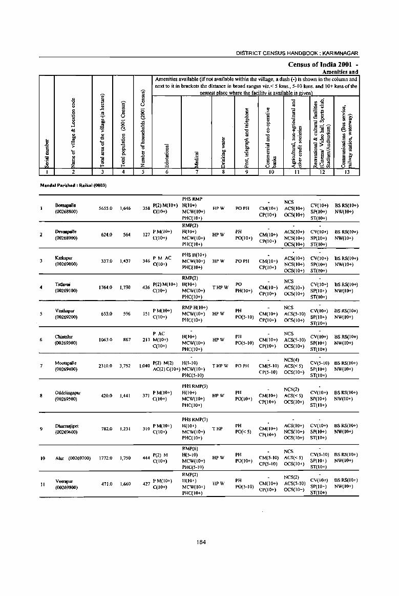
I " -g j <> .. " ..r:::
" 0 g u
] (.) ., <5 1f
~ 0
<II:! c:!. u ., <:
~ -:I 0
.8 ·D '0 .. 's: 1 ~ e ....
0 0-iii u
~ s s ·c 0 0 u
til l- I-
1 2 3 4
Mandai Parish.d : Raikal (0003)
Bomapalle 5655.0 1,646
«0268800)
2 OevanpaJle
624.0 S64 (00268900)
Katkapur 3 337.0 1.437
(00269000)
4 Tatlavai
1764.0 1,730 (00269100)
Vasthapur S 653.0 5%
(00269200)
Chintalur 6 1063.0 867
(00269300)
Mootapall. 7 2310.0 3,752
(00269400)
8 Oddelingapur
420.0 1,441 (00269500)
9 Dharmajipet
782.0 1,231 (0026%00)
10 Alur (00269700) 1772.0 1,750
Veenpur II 471.0 1,660
(00269800)
DISTRICT CENSUS HANDBOOK: KARIMNAGAR
Census of India 2001 -Amenities and
Amenities available (if not available within the village, a dash (-) is shown in the column and next to it in brackets the distance in broad ranges viz. < 5 lans., 5-10 lans. and 10+ kms of the
'iii' nearest place where the facilitv is available is stiven) :::l
:r:l -0 fl~ ., (.) ~ .:::= ... .; <5 '" " i ~~ <> c > 0 0 .! ·i~ c:!. .<:: oS &. Co
'" '" ~~~ ~ 0- u !tl ~ -a ] 0 lj, '"
-0 6 ~ "i -s]~ ~l 1 la <>
-0 u ·c :::l
o ._ ~2B g C 0 ~ -a. Iii " 8 :2'i;l ..c: ~ ~~
.~ .S! .... <iI li, -; ]>~ 0 g "e 42 S Il <iI
co ... - I:! .~] l § ..
·D C ] .. .0 .. ... ~ ~j
" <> jf ~ u :a a ~~ I!!~;.a :::l
~ 8 ~ut! Z iE a. ~tIl
5 6 7 8 9 10 II 12 13
PHSRMP NCS
358 P(2) M(lO+) H(IO+) HPW PO PH CM(IO+) ACS(IO+)
CV(IO+) BS RS(IO+) C(JO+) MCW(IO+)
CP(IO+) OCS(lO+) SP(IO+) NW(IO+)
PHC(IO+) ST(IO+)
RMP(2)
127 P M(JO+) H(IO+) HPW
PH CM(IO+)
ACS(IO+) CV(IO+) BS RS(IO+) C(IO+) MCW(lO+) POCIO+)
CP(IO+) NCS(IO+) SP(IO+) NW(lO+)
PHC(IO+) OCS(lO+) ST(1O+)
PM AC PHSH(lO+)
ACS(IO+) CV(10+) BS RS(IO+) 346 C(IO+) MCW(IO+) HPW PO PH CM(lO+)
PHC(IO+) CP(IO+) NCS(IO+) SP(1O+) NW(1O+) OCS(IO+) ST(IO+)
RMP(2) NCS
426 P(2) M(IO+) H(IO+) THPW
PO CM(JO+) ACS(IO+)
CV(IO+) BS RS(IO+) C(IO+) MCW(IO+) PH(lO+)
CP(IO+) OCS(IO+) SP(IO+) NW(IO+)
PHC(JO+) ST(IO+)
PM(IO+) RMP H(IO+)
PH NCS
CV(IO+) BSRS(IO+) 151 MCW(IO+) HPW CM(IO+) ACS(5-10)
C(IO+) PHC(IO+)
POCS-IO) CP(lO+) OCS(IO+)
SP(IO+) NW(IO+) ST(IO+)
PAC H{IO+) PH
NCS CV(IO+) BSRS{IO+)
213 M(IO+) HPW CM(IO+) ACS(5-1O) MCW(IO+) PO(5-10) SP(IO+) NW(IO+)
C(10+) PHC(IO+)
CP(lO+) OCS(IO+) ST(IO+)
P(2) M(2) H(5-10) NCS(4)
CV(5-10) BSRS(IO+) 1,040 AC(2) C(JO+) MCW(IO+) THPW PO PH CM(5-1O) ACS« 5)
CP(5-IO) OCS(IO+) SP(IO+) NW(JO+)
PHC(5-10) ST(IO+)
PHSRMP(3) NCS(2)
371 P M(JO+) H(IO+)
HPW PH
CM(JO+) ACS«5) CV(IO+) BS RS(lo+)
C(lO+) MCW(IO+) POCIO+) CP(IO+) OCS(IO+)
SP(lO+) NW(lO+) PHC(IO+) ST(lO+)
PHSRMP(3)
310 P M(IO+} H(10+) THP
PH CM(IO+)
ACS(IO+) CV(IO+} BSRS(IO+) C(lO+) MCW(JO+) PO« 5}
CP(IQ+) NCS(IO+) SP(IO+) NW(IO+)
PHC(IO+) OCS(IO+) ST(lO+)
RMP(6} NCS
444 P(2) M H(5-10) HPW
PH CM(5-10) ACS« 5)
CV(5-10) BSRS(IO+)
C(lO+) MCW(lO+) POCIO+) SP(IO+) NW(IO+)
PHC(5-IO) CP(5-10) OCS(IO+)
ST(IO+)
RMP(2) NCS(2)
427 P M(IO+) H(IO+) PH CV(IO+) BSRS(IO+) HPW CM(IO+) ACS(5-IO)
C(lO+) MCW(JO+} PO(S-IO) CP(IO+) OCS(IO+)
SP(IO+) NW(IO+)
PHC(IO+) ST(JO+)
184

VILLAGE DIRECTORY
VilIae:e Directory Land Use (As on 1999)
Land use (i.e. area under different types of land use in hectare)··
i c 0 .'"
~ ~ co ~ c 'J:!
I '8 :e "3
'" u u 8 '0 .. c eEl
j '~ 8 U c~ ._ ., '6 0 [:! ~ ., ..!! co 0
'" ., ;>
{l .,
<Id '" - 0 co ~ -a: ~ ~"O g :(l !;b
~ ~ .8 s ~ ,., ::s:"O ~ ., RE e "0
..!! tii ~ § ... £ C>. 0. ~ :6 ;1 '" .9 ~ "0
]~ '0 .... 1ii 0.
* 01) c 0 c
~ ~ Il ~ - '" t; :§ .. '" O! ~ ~ g 2! co - '" ~ ~ 'C
~ Z ~ Z ~ :E :5 '" '" ., U co '" 14 15 16 17 18 19 20 21 22 23 2 I
WE(60.7)
PR Koratla (36) EA N 4356.0 TK(9.3) 381.8 182.1 665.1 Bomapalle T(70.0)
Paddy, Maize, W(IOO.O)
PR Koratla (34) EA N 441.1 TK(31.1) 30.8 21.0 Devanpalle 2 Tunneric
T(IJI.I)
W(49.6)
PR Jagtial (33) EA N 127.4 TK(150.2) 9.S Katkapur 3
T(I99.8)
GC(Il3.4)
PR Jagtial (34) EA N 1265 2 WE(53.0) · TK(13.0)
235.2 57.9 26.3 Tatlavai
T(179.3)
GC(48.6) MR Koratla (32) EA N 407.7 WE(35.6) 109.7 19.4 32.0 Vastbapur
T(84.2)
GC(17.0)
MR Koratla (32) EA N 8474 WE(46.6) · TK(7.3)
81.8 26.9 36.2 Chintalur 6
T(70.8)
GC(318.2)
PR Koratla (24) EA N 4130 WE(73.3) · TK(109.3)
1159.1 100.4 136.8 Mootapalle 7
T(500.8)
Ge(107.3)
PR Koratla (28) EA N 174 WE(39.3) · TK(IO.9)
113.0 82.9 49.3 Oddelingapur 8
T(IS7.S)
PC(91.1)
MR Jagtial (30) EA N 131 2 WE(23.5) · TK(l3A)
86.3 224.2 212.5 Dhannajipet 9
T(127.9)
Ge(IS0.2)
PR Jagtial (20) EA N 10769 WE(36.4) · TK(28.3)
227.1 65.8 157.3 Alur 10
T(244.9)
PC(99.2)
MR Jagtial (23) EA N 97 2 WE(32 .• ) · TK(36.8)
137.2 35.5 32.7 Veerapur II
T(168.4)
185
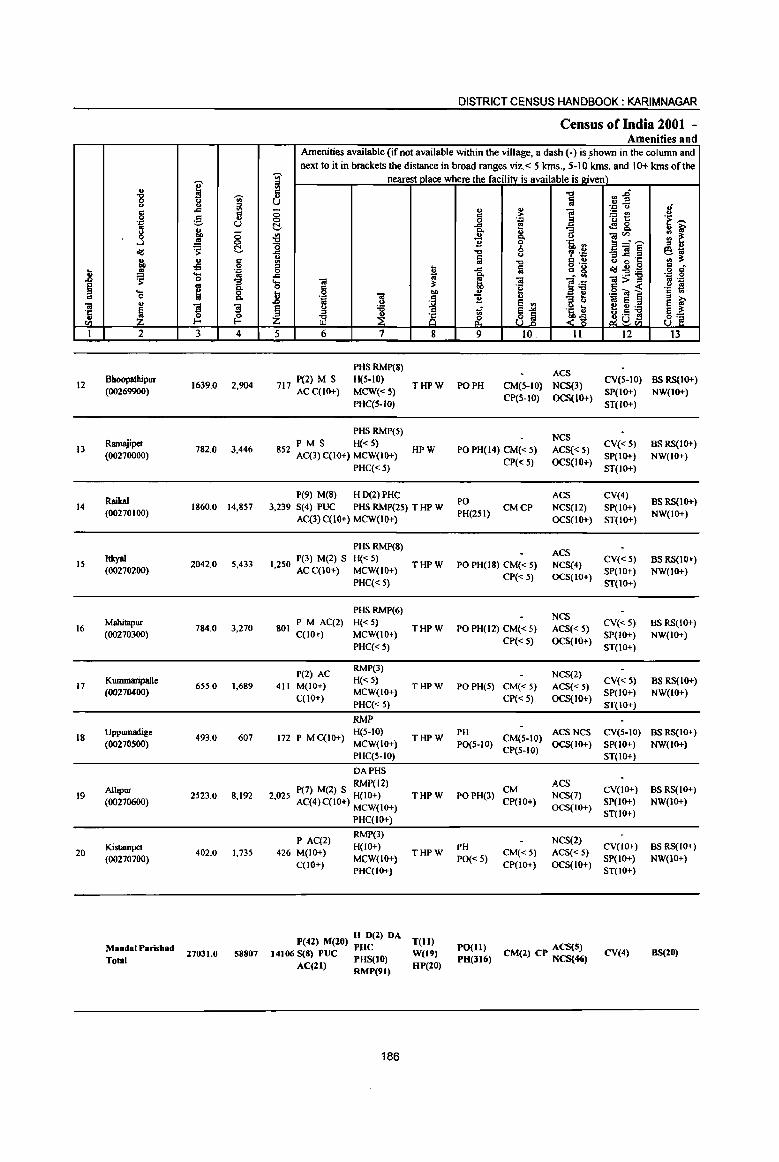
12
13
14
15
16
17
18
19
20
... o
2
Bhoopathipur (00269900)
Ramajipet (00270000)
RaikaI (00270100)
ItkyaI (00270200)
Mahitapur
(00270300)
KummaripaJle (00270400)
Uppumadige (00270500)
A1lipur (00270600)
Kistampet (00270700)
MandaJParisbad Total
3 4
1639.0 2,904
782.0 3,446
1860.0 14,857
2042.0 5,433
784.0 3,270
6SS.0 1,689
493.0 607
2523.0 8,192
402.0 1,735
27031.0 58807
DISTRICT CENSUS HANDBOOK: KARIMNAGAR
Census ofIndia 2001 -Amenities and
Amenities available (if not available within the village, a dash (-) is §hown in the col urnn and next to it in brackets the distance in broad ranges viz.< 5 krns., 5-10 krns. and 10+ krns of the
nearest place where the facility is available is j1;iven)
5 6
P(2) M S 717 ACC(IO+)
7
PHS RMP(8) H(5-10)
MCW«S) PHC(5-1O)
PHS RMP(S)
P M S H« 5) 852 Aq3) qIO+) MCW(IO+)
PHC«S)
P(9) M(8) H 0(2) PHC
8
THPW
HPW
3,239 S(4) PUC PHS RMP(25) T HP W AC(3)C(lO+) MCW(IO+)
1 250 P(3) M(2) S , ACC(IO+)
801 PM AC(2) C(10+)
P(2) AC 411 M(IO+)
C(10+)
PHS RMP(8)
H« S) MCW(IO+)
PHC« 5)
PHSRMP(6)
H«5) MCW(IO+) PHq<S)
RMP(3)
H« 5) MCW(IO+)
PHC«S)
RMP
172 P M C(IO+) H(S-IO) MCW(IO+)
2,025
PHC(5-10)
DAPHS
P(7) M(2) S RMP(12) H(IO+)
Aq4) C(IQ+) MCW(IO+)
PHC(I()1-)
P AC(2) 426 M(IO+)
C(lO+)
RMP(3) H(IO+)
MCW(IO+) PHC(IO+)
P(42) M(20) H 0(2) DA PHC
14106 S(8) PUC PHS(tO)
AC(ll) RMP(91)
186
THPW
THPW
THPW
THPW
THPW
THPW
T(ll) W(19)
HP(IO)
9 10. 11 12 13
PO PH
ACS CM(5-10) NCS(3) CV(5-10) BS RS(IQ+)
CP(S-lO) OCS(IQ+) SP(IO+) NW(lO+)
POPH(14) CM«5)
CP«S)
PO PH(25I}
CMCP
PO PH(IS) CM« 5)
CP«5)
PO PH(12) CM« 5)
CP« 5)
PO PH(S) CM« S)
CP« 5)
ST(IO+)
NCS ACS« 5) CV« 5)
OCS(lO+) SP(IO+) ST(IO+)
ACS CV(4) NCS(12) SP(IO+)
OCS(IO+) ST(JO+)
ACS NCS(4) CV« 5) OCS(IO+) SP(IO+)
ST(10+)
NCS ACS« 5) CV« 5) OCS(IO+) SP(IO+)
ST(lO+)
NCS(2) CV« 5)
ACS« S) SP(IO+) OCS(IO+) ST(IO+)
BSRS(IO+)
NW(lO+)
BSRS(IQ+)
NW(IO+)
BSRS(IO+) NW(IO+)
BSRS(IQ+)
NW(IO+)
BS RS(IQ+) NW(IO+)
PH ACS NCS CV(S-IO) BS RS(IO+) PO(S-IO) CM(5-10) OCS(IO+) SP(IO+) NW(IO+)
CP(S-IO) ST(IO+)
CM PO PH(3) CP(lO+)
ACS NCS(7) CV(IO+) BS RS(IO+)
SP(IO+) NW(IO+)
PH
PO« S) CM«5) CP(1()1-)
OCS(IO+) ST(IO+)
NCS(2) CV(IO+)
ACS« 5) SP(IO+) OCS(IO+) ST(IO+)
PO(Il) ACS(S) PH(J16) CM(2) CP NCS{4<i) CV(4)
BSRS(IO+) NW(IO+)
BS(20)
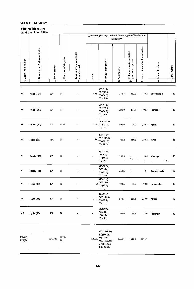
VILLAGE DIRECTORY
Villaee Directory Land Use (As on 1999)
" eo ~
~ B .c ~ 8 c:>. 0. « 14
PR
PR
PR
PR
PR
PR
PR
PR
MR
PR(IS) MR(5)
j 2-" " ~ '6 ~
~ B
~ Z 15
Koratla (24)
Koratla (19)
Koratla (16)
Jagtial (30)
Koratla (14)
Koratla (IS)
Jagtial (18)
Jagtial (II)
Jagtial (13)
~ c:>.
'" '" ~ ~ 0
p..
16
EA
EA
EA
EA
EA
EA
EA
EA
EA
EA(20)
" " .~
eo co
~ Ii co c:>.
'" ~ Z 17
N
N
NM
N
N
N
N
N
N
N(20) M
c-'6 0 S E 0 OJ
~-g 8.E .5 ~ - '" ~ lii ::E E
18
Land use (i.e. area under different types ofland use in
hectare)"
" ~ 5l >, e
"0
" '" 'E 1! OJ)
0 ] L.L.
19 20
OC(219.4)
4935 WE(48.6) · TK(50.6)
T(3IS.6)
0C(229.6) WE(25.5) TK(70.8) T(325.9)
WE(262.8) 349.4 TK(257.1)
T(519.8)
GC(I55.9) WE(II3.8)
167.2 TK(182.2)
T(45 1.8)
GC(285.4) W(76.1) TK(16.0) T(377.5)
GC(IS7.0) WE(36.4) TK(27.5) T(25 1.0)
OC(47.4)
462 WE(13.0) · TK(10.9)
T(71.2)
GC(574.9)
31) 7 WE(l4S.6) · TK(89.1)
T(812.5)
GCCI09.3) WE(24.3) TK(9.7) T(143.3)
GC(2593.45) PC(190.28)
105484 W(225.68) · WE(1073.S9)
TK(1I23.5S) T(S206.55)
187
"0
'" 'E OJ)
'E ;:
::J 21
355.5
240.0
600.0
767.2
350.5
363.6
129.6
87S.5
198.0
6444.7
" 0 .~
eo ~
'" "3 '6 '" <.>
U .... .s c~ ._ "'
~'" u '" > :g - 0 ~ 6h '&i ~"O >
.!! Iii '" ~ ~ 0 c ",.c '"
_ " - '" ~ '" os U 00 « 22 23
312.2 159.2
107.9 10S.3
20.0 370.8
380.0 275.8
56.0
40.4
73.0 173.0
260.3 259.9
43.7 17.0
1992.2 2839.2
" eo ~ I> :s .n
§ ..... 0 c " 0;
~ ·c " on
2 1
Bhoopathipur 12
Ramajipel I3
Raikal 14
Itkyal 15
Mahitapur 16
., .
Kummaripalle 17
Uppumadige 18
Allipur 19
Kistampel 20
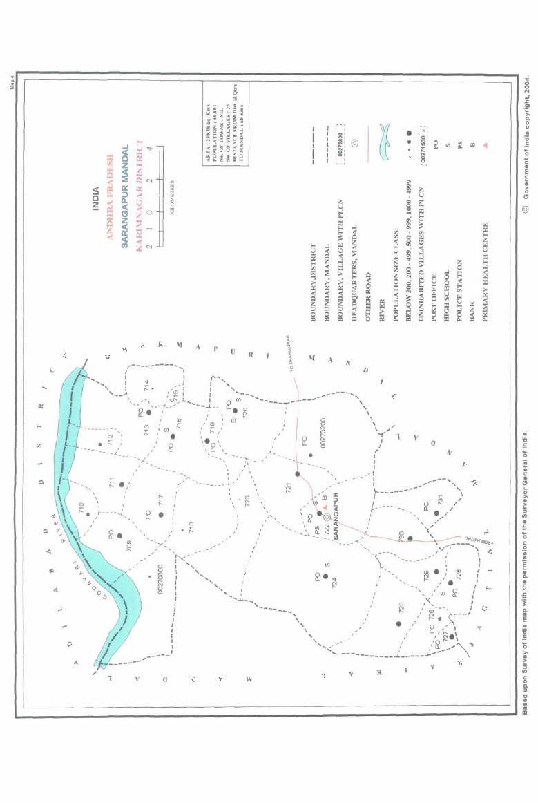
, N :
R M A p
- ... _------ ....... , v .R
~
\ o o ..
". 'r--... , ~ I, "
'Of ,- I ' __ ' ''_ ~. ..-~ 1 : ~ (J) -----i ' ,x,:,_ '---f--, • ~ '-- '.-'1-- "0-o. ' " w 11_ (£), en I
~ ';:::_ " I
" ,
M A ))
.. ---- ......... _- , --'" '\
" , .. \""(.... '1 ,
- -, •
: XI
to' lit) = • , ~ : ~ <il j:I. '.,., , .. , o :8: ,- -
. ~ / , ---------~------~:
(j)
• S!
' e , J '. 0, 1- __ \ a.. '... " ... .._--.,.. .. __ ...
" I,
I I • 1
-- ... _-- .... ,
;: .,'
, a , ~. ,I------C_,_
, I ,
---_ .. --'1 v
I , ....... -_ ~... I I
~-..... ...... ------ .. + ... , , _~ ----'.,
I "'" , - ,
• ,
\ \
, , --- \ . ~ , t---~~~~,~, , ~ ;/ " , , , , 0 i "
I
I >, '." N '_ .. , ,/ "-----~~-~-~-~---- , .. ,----.10 ...... - . ' _, 'f---'\-< , ,
--'"'-
--,--a
I 'co , ' (j) ~ • I ~ : . , ,' . '" ''''I' -" " o. '_', ,'(j) 0 :
' " . " ~ " " , ' " "" - '0 ' " · '. - ',---' ' ",: ~ . ~ . , : "~-" " . ' 0,', • ' -------, . " " . ' ' , . , ~ , , : \, " :~~-- .. \ : "", .:.-----~. ' ',------------ ,
I I I J
'1 v I
N !i a. ::I 'tJ • .. • CD
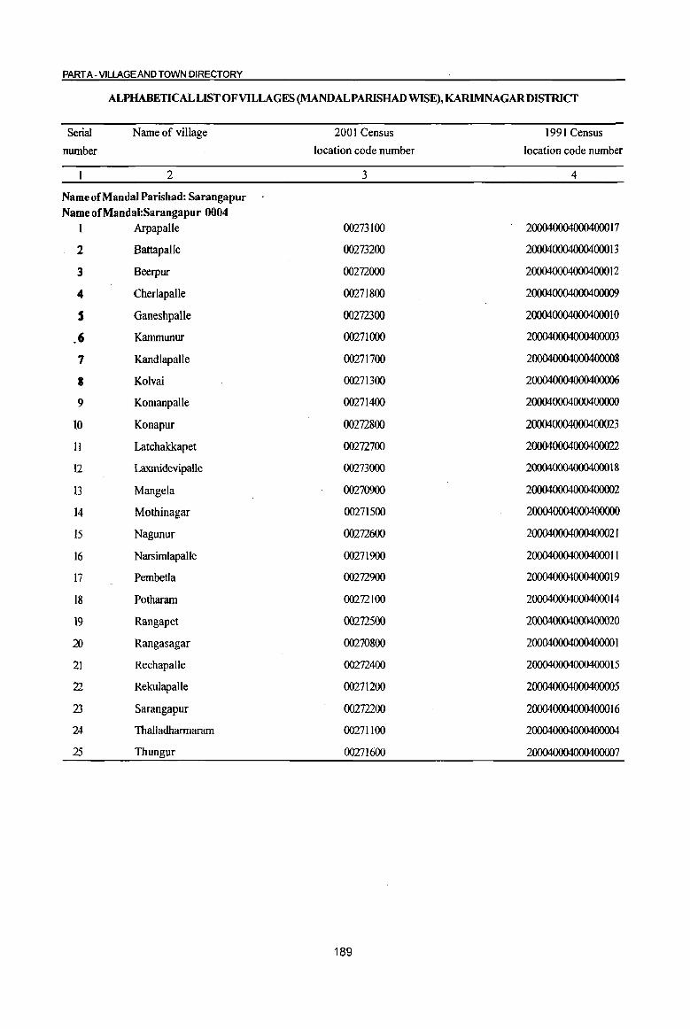
PART A - VILLAGE AND TOWN DIRECTORY
ALPHABETICAL LIST OF Vll-LAGES (MANDALPARISHAD WISE), KARlMNAGAR DISTRICT
Serial Name of village 2001 Census 1991 Census
number location code number location code number
2 3 4
Name of Mandai Parishad: Sarangapur Name ofMandal:Sarangapur 0004
I Arpapalle 00273100 200040004000400017
2 Battapalle 00273200 200040004000400013
3 Beerpur 00272000 2000400040004000 12
4 Cherlapalle 00271800 200040004000400009
S Ganeshpalle 00272300 2000400040004000 1 0
.6 Kammunur 00271000 20004000400040003
7 Kandlapalle 00271700 20004000400040008
8 Kolvai 00271300 200040004000400006
9 Komanpalle 00271400 2000400040004000
10 Konapur 00272800 200040004000400023
11 Latchakkapet 00272700 200040004000400022
12 Laxmidevipalle 00273000 2000400040004000 18
13 Mangela 00270900 200040004000400002
14 Mothinagar 00271500 200040004000400000
15 Nagunur 00272600 200040004000400021
16 Narsimlapalle 00271900 200040004000400011
17 Pembetla 00272900 200040004000400019
18 Potharam 00272100 2000400040004000 14
19 Rangapet ()()272S00 20004000400040000
~ Rangasagar 00270800 20004000400040000 I
21 Rechapalle 00272400 200040004000400015
22 Rekulapalle 00271200 200040004000400005
23 Sarangapur 00272200 200040004000400016
24 Thalladhannaram 00271100 200040004000400004
25 Thungur 00271600 200040004000400007
189
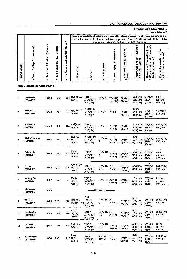
I ] ~ g c .s= 5 0 ,§. .'" U
~ j ;; 0
~ .s: r:!-
~ .. IS oS .8 '" .~
~ ~ ~
"3
~ Q,. .... 0 c 0 Q,.
u "iii
~. :s ~ ·c
u 0 <n ..... ..... 1 2 3 4
MudaJ r.riabad ; Sanneapur (0004)
Rangasagar 1838.0 410
(00270800)
Mangela 2 1029.0 1,563
(00270900)
3 Kamnumur
4590.0 575 (00271000)
ThaIladhannaram 4 874.0 1,191
(00271100)
RekuJapalle 5 378.0 861
(00271200)
Kolvai 6 1308.0 2,528
(00271300)
7 Komanpalle
254.0 321 (00271400)
8 Mothinagar
277.0 (00271.500)
9 Thungur
1441.0 3,691 (00271600)
10 Kandlapalle
714.0 1,184 (00271700)
Cherlapalle 1104.0 460 II
(00271800)
12 Narsimlapalle
354.0 2,288 (00271900)
DISTRICT CENSUS HANDBOOK: KARIMNAGAR
Census of India 2001 • Amenities and
Amenities available (if not available within the village, a dash ( -) is shown in the column and next to it in brackets the distance in broad ranges viz. < 5 kms., 5-10 kms. and 10+ kms of the
-;;;- nearest Dlace where the facility is available is given) " III
~~ c "Q
" ij U 8 " " .~ " ;; c > 1 ;.= U')
0 0 '';; '<> 1:: .~ '>: (;:!. -a fl eS&
" u
~~'" ~ ~ ~ Q,. " 11 0 '5, :l
od 't:l b "f',c _"iiI~ e~ ~ til " :> -= 'I:: '" it "Q c ..
" ... !a 0'- t.> g g 8 ,,: 0 ~
.c c g .:cI:E:a .s= Q. - <II 'i . .g ... 01 it ~ 01 ]~ ~;>~ .~ tl 0 c 'g
~ 0 co u ,g"M ] '.c 'iI c 'B "3 ~ .D 01 U ~ ~1 '" e 8 f § " :a 1 .~ ~ e U;a ::> 8 ~on 8] -~ i <?~ Z U.t:> ~<n U
5 6 7 8 9 10 11 12 13
105 P(2) M AC H(lO+) HPWR PO(S-IO) CM(10+)
ACS(IO+) CV(IO+) BS(S-IO) C(10+) MCW(JO+)
PH(S-IO) CP(IO+) NCS(IO+) SP{IO+) RS(IO+)
PHC(IO+) OCS(IO+) ST(IO+) NW(lO+)
415 P(2) M AC PHSH(IO+) NCS(3)
CV(lO+) BSRS(IO+) MCW(IO+) RPWC paPR CM(IO+) ACS(IO+)
C(10+) PHC(IO+) CP(10+) OCS(IO+)
SP(IO+) NW(IO+)
ST(IO+)
162 P M(5-10) H(lO+) HPWR PO« 5) CM(IO+)
ACS(5-10) CV(IO+) BSRS(IO+) C(IO+) MCW(IO+)
PH« 5) CP(5-IO) NCS(IO+) SP(IO+) NW(IO+)
PHC(IO+) OCS(IO+) ST(IO+)
P(2) AC PHSH(IO+) HPWTK
NCS CV(IO+) BS RS(IO+)
255 M(5-10) MCW(IO+) PO« 5) CM(IO+) ACS(5-10) C(IO+) PHC(IO+)
R PH(IO+) CP(S-IO) OCS(IO+)
SP(lo+) NW(IO+)
ST(IO+)
PAC H(IO+) HPWTK ACS(5-1O) CV(IO+) BS« 5)
218 M(5-10) PO« 5) CM{10+) C(lO+)
MCW(IO+) R PH{< 5) CP{IO+)
NCS(IO+) SP(IO+) RS(IO+) PHqIO+) OCS(IO+) ST(IO+) NW(IO+)
P{2) AC(2) H(IO+) HPWTK PO ACSNCS CV(JO+) BSRS(IO+)
614 M« 5) CM(lO+) C(lo+)
MCW(lO+) RC PH(lO+) CP{S-IO)
OCS(lO+) Sp(IO+) NW(lO+) PHC(IO+) ST(IO+)
71 P«5) H(IO+)
HPWR PO« 5) CM(10+) ACS(IO+) CV{IO+) BS(lo+)
M«5) MCW(IO+) PH{< 5) CP(IO+)
NCS(IO+) SP(IO+) RS(10+)
C(JO+) PHC(IO+) OCS{IO+) ST(lO+) NW(IO+)
--Uninhabited ---
PHS NCS
928 P(2) M S H(IO+) HPWTK PO
CM(IO+) ACS{< 5) CV(IO+) BS RS(IO+)
AC(2)C(10+) MCW(IO+) C PH{IO+) CP« 5) OCS(IO+)
SP(IO+) NW(IO+)
PHC{IO+) ST(IO+)
PAC H(IO+) HPWTK PO
NCS CV{IO+) BS RS(IO+)
286 M(IO+) CM(IO+) ACS(lO+)
C(10+) MCW(IO+) RC PH« 5)
CP(IO+) OCS(IO+) SP(IO+) NW(lO+)
PHC(lO+) ST(IO+)
134 P M(IO+) H(IO+) HPWTK PO« 5) CM{JO+)
ACS(lO+) CV(IO+) BS«5) C(lO+) MCW(IO+) RC NCS(IO+) SP(IO+) RS(lO+}
PHC(IO+) PH« 5) CP{lO+)
OCS(JO+) ST(IO+) NW(10+)
PAC H{IO+) THPW PO
NCS(3) CV{IO+) BSRS(IO+)
610 M«S) CM(IO+) ACS(IO+)
C(10+) MCW(IO+) TKRC PH(IO+)
CP« 5) OCS(IO+) SP(IO+) NW(lO+}
PHC(IO+) ST(IO+)
190
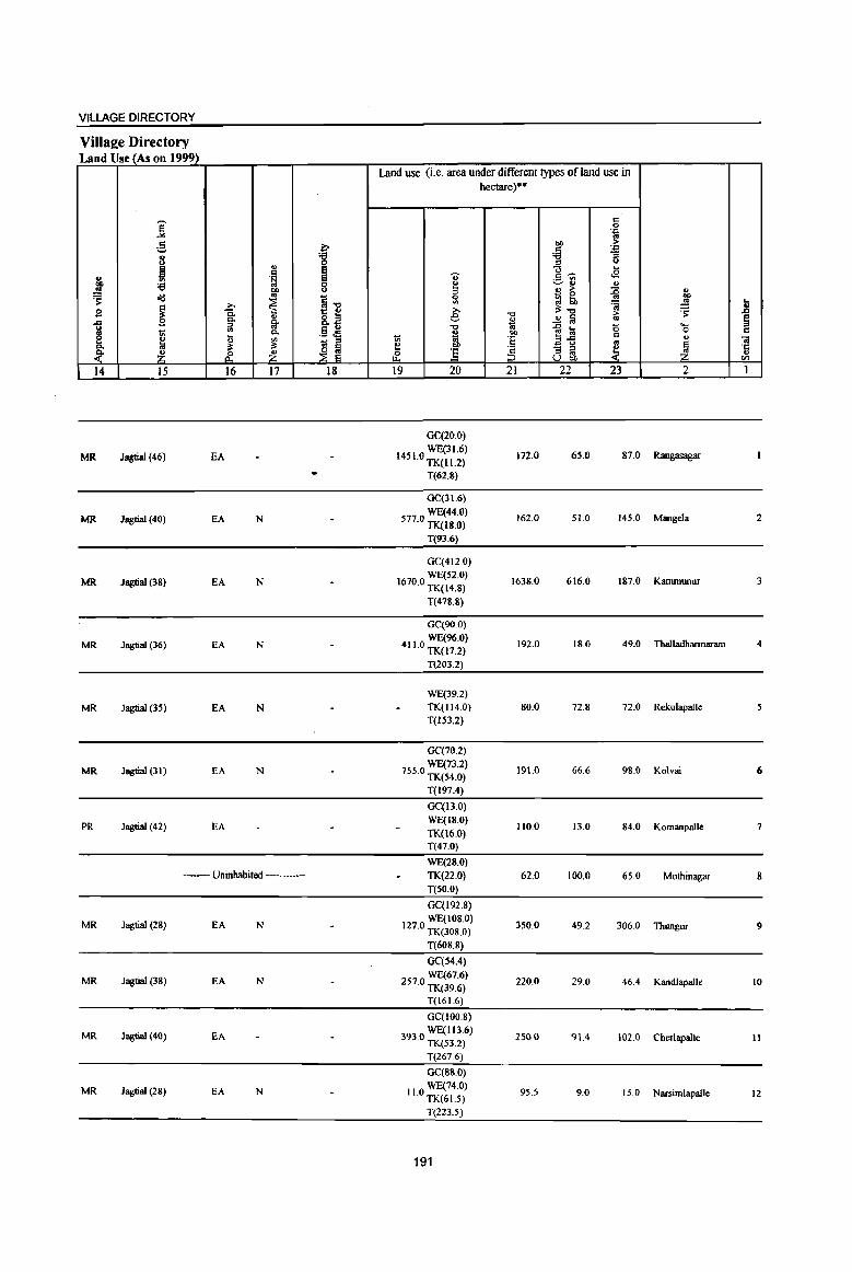
VILLAGE DIRECTORY
Villa2e Directory Land Use (As on 1999)
Land use (i.e. area under different types of land use in hectare)··
,-_ = ] 0 .'" .. :§, i
t>I) > ;ij .'"
8 ;;
~-u
j .,
~ ... = -;; .B .. .~ 3~ OIl :a 8 ~ " .!! ~ ~ ~ :E .,
~ old ~1l
0 .. .., >. ~ '" 'i .!! 1i .9 ~ C. ;>, 3:"0 ~ '" 8.a e "0 ..!l fij > § ii Co Co ... .. :> ..
.$ J! "0 10 ~ t:a (5 .... os rl '" 0. '" co 0 e e ~ Ul 1;; ~ 'E 2ii '" '" .. 1;j = .. 0. la ;!;
~ ~ e
~ - = ~ ~ 'r:: ~ Z ,f. Z ~ :§ = .. '" U 00 <Il
14 15 16 17 18 19 20 21 22 23 2 1
GC(20.0)
MR Jagtial (46) EA WE(31.6)
1451.0 TK(II.2) 172.0 65.0 81.0 Rangasagar
T(62.8)
GC(3l.6)
MR Jagtial (40) EA N WE(44.0)
577.0 TK(J8.0) 162.0 51.0 145.0 Mangela 2
T(93.6)
GC(412.0)
MR Jagtial (38) EA N WE(S2.0)
1670.0 TK(14.8) 1638.0 616.0 187.0 Kanununur 3
T(478.8)
GC(90.0)
MR Jagtial (36) EA N WE(96.0)
411.0 TK(17.2) 192.0 18.0 49.0 Thalladhannaram 4
T(203.2)
WE(39.2)
MR Jagtial (35) EA N TK.(l14.0) BO.O 72.B 72.0 Rekulapalle
T(153.2)
GC(70.2)
MR Jagtial (31) EA N WE(73.2)
755.0 TK.(54.0) 19l.0 66.6 98.0 Kolvai 6
T(197.4)
GC(IJ.O)
PR Jagtial (42) EA WE(18.0) 110.0 13.0 84.0 Komanpalle 7
TK.(J6.0) T(47.0)
WE(2B.0) _- Uninhabited ---- TK.(22.0) 62.0 100.0 65.0 Mothinagar 8
T(50.0)
GC(192.8)
MR Jagtial (28) EA N WE(to8.0)
127.0 TK(308.0) 350.0 49.2 306.0 Thungur 9
T(60S.S)
Ge(54.4)
MR Jagtial (38) EA N 2570 WE(67.6) · TK.(39.6)
220.0 29.0 46.4 KandlapaJle to
T(161.6)
GC(IOO.8)
MR Jagtial (40) EA 3930 WE(1l36) · TK(53.2)
250.0 91.4 102.0 Cherlapalle II
T(267.6)
Ge(SS.O)
MR JagtiaJ (28) EA N II 0 WE(74.0) · TK.(615)
95.5 9.0 15.0 Narsimlapalle 12
T(223.5)
191
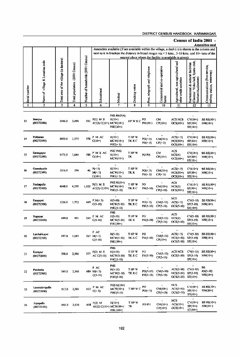
j' " "8 ~ (.)
<> J:l ., CI fl 0 ,g .... U B ., .3 _; 0
0
~ t:!-o(j ., ., 5 _;> .;; .. . .,
..8 ..... .. ~ 0
1 ~ .. ... ~ " 0
til ., ~
"5 ~ ·c ., 0
'" E- E-
1 2 3 4
13 Beerpur
1146.0 3,494 (00272000)
14 Podlaram
1059.0 (00272100)
1,575
Sarangapur IS 1171.0 1,644
(00272200)
16 Ganeshpalle
1316.0 194 (00272300)
Rechapalle 17
(00272400) 4048.0 4,S99
Rangapet 18
(00272500) 1336.0 1,772
19 Nagunur
499.0 991 (00272600)
Latchakkapet 20 197.0 1,045
(00272700)
Konapur 21 798.0 2,506
(00272800)
Pembella 22
(00272900) 541.0 2,160
Laxmidevipalle 23 917,0 2,583
(00273000)
Arpapalle 24
(00273100) 842.0 2,636
DISTRICT CENSUS HANDBOOK: KARIMNAGAR
Census of India 2001 -Amenities and
Amenities available (if not available within the village, a dash C-) is shown in the column and next to it in brackets the distance in broad ranges viz. < 5 kms., 5-10 kms. and 10+ kms of the
-;;;- nearest place where the facilitv is available is e;iven) ij! r:I -0 tl ~ .. u u a • ., <> oJ - "
., ] 0 " ;> ~~ 0
0 0 . .,
'! I M ..c G cf!8. ._, ]' '3
~ Q, (.) ]~~ .fl 9 .~ ., '0 il "0 0 , .~ _Oil~ ~~ a (.) is ~.~ 8 "0
r:I ., o .- r:! • t -a til r:I 8 o(j~~ o r:I
..c ii
l~ .., 0 ... Oil ~ S, Oil 1l:>-~ .. ..,
0 " "2 .~ ~ .. 0 00 ., .g O! ~ ...8 . ., til
1 1l ., '3 g .. u jj .. 8
§ ~ 8 <> '6 -:i j~ f C) ~ ::s
~ ~ ~ ~ 3 .5 11
8~ li:~tf.l 5 6 7 8 9 10 II 12 13
PHSRMP(4)
931 P(2) M S H(10+) PO CM ACSNCS CV(IO+) BSRS(IO+) AC(3) C(10+) MCW(IO+) HP W R C PH(IO+) CP(IO+) OCS(IO+) SP(IO+) NW(IO+)
PHC(IO+) ST(IO+)
PM AC H(lO+) THPW ACS« 5) CV(IO+) BS RS(IO+) 378 C(10+) MCW(IO+) TKRC
PO«S) CM(IO+) NCS(IO+) SP(lO+) NW(IO+)
PHC«S) PH«S) CP« 5)
OCS(JO+) ST(IO+)
380 PM S AC PHCPHS
THPW CM ACS
CV(IO+) BSRS(IO+) H(lO+) PO PH NCS(4)
C(IO+) MCW(IO+)
TK CP(IO+) OCS(JO+)
SP(IO+) NW(10+)
ST(IO+)
46 P«S) H(IO+) THPW
PO«5) CM(IO+) ACS«5) CV(IO+) BSRS(IO+)
M«5) MCW(IO+) TKR PH«5) CP« 5)
NCS(lO+) SP(IO+) NW(IO+) C(IO+) PHC« 5) OCS(IO+) ST(IO+)
P(3) M S PHS H(1O+) THPW PO ACS
CV(IO+) BS RS(lO+) 1,122 AC(2) C(IO+) MCW(IO+) TKRC PH(5-10)
CM(IO+) NCS(3) SP(IO+) NW(IO+)
PHC(S-IO) CP(S-IO) OCS(IO+) ST(IO+)
P M« S) H(5-1O) THPW NCS
CV(S-IO) BSRS(IO+) 449 C(5-10) MCW(S-IO) TKRC
PO« 5) CM(5-10) ACS« 5) SP(S-IO) NW(IO+)
PHC(5-10) PH(S-JO) CP(S-IO) OCS(5-1O)
ST(IO+)
PHS ACS
245 PM AC H(5-10) THPW PO
CM(5-10) NCS(2) CV(5-IO) BSRS(IO+)
C(5-10) MCW(S-IO) TKR PH(S-IO) CP(S-IO) OCS(S-IO)
SP(S-IO) NW(IO+)
PHC(10+) ST(IO+)
PAC H(S-IO) THPW PO ACS« 5) CV(5-10) BSRS(IO+)
267 M« 5) CM(5-10)
C(5-10) MCW(S-IO) TKRC PH(S·IO)
CP(IO+) NCS(S-IO) SP(5-10) NW(IO+)
PHC(lO+) OCS(5-10) ST(IO+)
PHS
P(2) M S H(S-IO) THPW PO CM(5-10)
ACSNCS CV(S-IO) BSRS(tO+) 577
ACC(5-10) MCW(5-IO) TKRC PH(5-10) CP(S-IO)
OCS(S-IO) SP(S-IO) NW(IO+)
PHC(S-IO) ST(IO+)
PAC PHS
BS
489 M« 5) H(5-IO) THPW
PO(S-IO) CM(S-IO) ACS(S-IO) CV(5-IO)
RS(S-IO) MCW(S-IO) TKRC NCS(S-IO) SP(S-IO)
C(5-10) PHC(5-10)
PH(5-10) CP(S-IO) OCS(5-10) ST(IO+)
NW(IO+)
PHS H(IO+) PH
NCS CV(lO+) BSRS(IO+) PM AC
623 MCW(IO+) T HP W C PO« 5) CM(IO+) ACS(S-IO) C« 5)
PHC(5-1O) CP(S-IO) OCS(5-10) SP(IO+) NW(IO+)
ST(IO+)
NCS CV(IO+) BS RS(IO+) P(2) M H(IO+) THPW
PO PH CM(lO+) ACS(IO+) 608 AC(2) C(1O+) MCW(IO+) TK SP(lO+) NW(IO+)
CP(IO+) OCS(IO+) PHC(IO+) ST(IO+)
192
VILLAGE DIRECTORY
ViIlaee Directory Land Use (As on 1999)
Land use (i.e. area under different types of land use in hectare)··
j § .J::
~ 0 "" S! c . .,
8 :g 'i3 :; ::s 0
N ., e g,_ .... c
'U ¢! &. <II .~ e ~~ 'i3 0 5 '" ~ e.o 0 .., >- :g ..,
cId os
~-o Sl _ 0 .. '> >. ~ :l tb ~ ~ ~ .8 ~ Q. >. i!:-o ~ .,
o ~ e -0 ..!:! !a i:; § .... 9 c..
~ II>
~ ::s c.. u -0 OJ .c !a 0 ..... VI .§ .:l 0 '" ~ ... c.. i
.., ~.g '" e " VI 1;;; ::s VI 'E .. II 01
c.. i!: i!: -~ ~
e :3 - ::s ~ ~ ·c ~ Z rf Z ~ ] ::s os " UaIJ CIl
14 15 16 17 18 19 20 21 22 23 2 I
GC(132.0)
MR Jagtial (28) EA N WE(118.4)
348.0 TK( 43.2) 200.0 63.4 241.0 Beetpur 13
T(293.6)
GC(90.4)
MR Jagtial (21) fA N WE(120.4)
345.0 TK(41.2) 114.0 148.0 200.0 Potharam 14
T(2S2.0)
GC(107.0)
MR Jagtial (16) EA NM WE(122.0)
464.0 TK(36.0) 230.0 68.0 144.0 Sacangapur 15
T(26S.0}
WE(64.8)
MR Jagtial (21) EA N 800.0 TK(60.0) 120.0 155.2 116.0 Ganeshpalle 16 T(124.8)
GC(3S0.4)
MR Jagtial (15) EA NM WE(2oo.0)
2021.0 TK(358.4) 533.2 222.0 363.0 Rechapalle 17
T(90S.S)
GC(52.4)
PR Jagtial (7) fA NM WE(76.0)
700.0 TK(43.2) 300.0 81.4 83.0 Rangapet 18
T(I71.6)
GC(75.6)
MR Jagtial (6) EA NM WE(84.4)
83.0 TK(44.8) 160.0 17.0 34.2 Nagunur 19
T(204.8)
GC(30.0)
MR Jagtial (7) EA NM WE(33.6)
75.0 13.2 28.0 Latchakkapel 20 TK(17.2) T(BO.B)
GC(258.0)
PR Jagtial (B) EA NM WE(I 14.0)
170.0 6.0 10.0 Konapur 21 TK(240.0)
T(612.0)
GC(162.0)
PR Jagtial (9) £A NM WE(189.6)
7.0 TK(30.0) 120.0 7.0 25.4 Pembetla 22
T(38 1.6)
GC(387.2) MR Jagtial (11) £A NM 66.0 WE(224.0) ISO.O 19.0 40.8 Laxmidevipalle 23
T(611.2)
GC(l42.4)
MR Jagtial (12) EA N WE(158.4)
79.0 TK(lO.O) 300.0 63.2 79.0 Arpapalle 24
T(3l0.S)
193
,...,
] N 'Ii>' " 4> ;l :s ..c
'" ,S u '': '-' U 8 " -! co ..J 0
oil! 'S ~
~ ~ <= 0
J! .!! '': ... t ~ 0
~ g ... c 0
ca .. '3 1 'I:; ! .. 0 Vl E- E-
I 2 3 4
Battapallc 25
(00213200) 999,0 610
Mud.lp.mhad 29030.0 40881 To""
';;)'
ill 5 u 8 0
c:!. ~ '0 .c 1;1 = 0 .c '0 II ~ ;z: 5
DISTRICT CENSUS HANDBOOK: KARIMNAGAR
Census of India 2001 -Amenities and
Amenities available (ifnot available within the village, a dash (-) is shown in the column and next to it in brackets the distance in broad ranges viz. < 5 kms" 5-10 kms, and 10+ kms of the
nearest place where the facility is available is_given) "0 :;~ fa .,
~ '': " 8 ] ~t! :s '': '~ ~
fr ~ of 8. ., i:i' :; Q. " ]:r~ ~ t 11 % 's, '"
"0 u , .~ :;]~ r;;~ la '"0 <= u " 'C ~
o '~ c!g~B ,g g ~
..c :a <= 8 :l:!:a Q. - ., <a ~ ~ ca ]:il ]>~ os '': to '2 ,!:l S 0 "" u ,g ... ] § ., '~ ] ~ 11 u :; ti B ~i '~ t; i ,I] 8 i:i' = 1ii E ~ til ~ 8 ~ ~~ 81 ~ U Vl
6 7 8 9 10 II 12 13
PAC NCS(3) H(I<H-) THPW PO CV(I<H-) as RS(I<H-)
155 M« 5) MCW(IO+) TKRC PH(5-10)
CM(IO+) ACS(S-IO) SP(IO+) NW(lO+)
C(I<H-) PHC(S-IO)
CP(S-IO) OCS(I<H-) ST(I<H-)
T(13)
PHC W(24)
10063 P(32) M(tt) PH5(10) TK(t8) PO(I3) CM(l)
ACS(6) 85(20)
5(5) AC(2S) RMP(4) HP(24) PH(4) NCS(27) R(t!) C(IS)
194
VILLAGE DIRECTORY
ViIlalZe Directory Land Use (As on 1999)
14
MR
PR(4) MR(20)
15
Jagtial (22)
16
EA
EA(24)
N
" c .~
{ c..
'" 1 17
N(21) M(S)
18
Land use (i.e. area under different types of land use in hectare)"
19 20 21 22 23 2
GC(75.2)
3650 WE(109.2) . TK(41.2) 90.0 68A 250.0 Battapalle
T(225.6)
GC(2935.4)
109300 WE(2360) • TK(1704.7)
T(7000.1)
195
6114.7 2112.8 2870.8
25

.. .. :i
""
a
~ 0 tI ..
I"-
~
(/)
, , I
~ \ , -J ,
• (:'j , "-
"
\ I
"-'" "-
--\ --, \ I
• \
(/)
-.........
&: . ~ (fJ
~
\
"
,
I --I
,
I I I
~ 0 ,..
I r'~,____ I
~-----~----! ~----~
I) d
~
~
, ,
"
, . I
v
• ~
~
I, I I
•
,
,
'" ;!
" ,
'<t 'Of "-
"'--~- .... ,
o • ;!:
(/)
~ II
I
\ , ,
I I
I I
-----: I " ,
I I ,
• I I ,
" ...... _-,
• ----,--" '--.. I
, ,
, , I , I -_ , ,
\ , , , ,
(f)
... -
'Of 0/)
"-,,--- . \
, ,. N , ~ , It) I
I \ I ,.... J I ' ... __ .J.. ... (, .. _ ...... _{
" , ,
'<
(J) 'Of "-
, , ,
, , '-'"I'
I I
<0 , ;! ,
1'. I '
I
•
, I
:B: , ,@ :§! I , '-'
(fJ . \
-, fr ~ I' , , I ,
\
\
I , t
I , , - -, I
'----( o· ) a. 0 ,/
~ I J
\ ... -\ c ,
" , 'I.
)
t \ '.
I<l C I<l .... .... 0 r,; I0Il 0
§ 0 0 a '" a !E
~ i= < ... '" J>I u ~ :s z ~ ~
I<l I0Il
~ U
~ .... ~ ::t: >-~
~
x o
'" i III 'l: >Q. o " • '0 .5 o C • E E ~ " @
PART A -VILLAGE AND TOWN DIRECTORY
ALPHABETICAL LIST OF VILLAGES (MANDALPARISHAD WISE), KARIMNAGAR DISTRICT
Serial
number
Name of village
2
Name of Mandai Parishad : Dharmapuri Name of Mandai :Dharmapuri 0005
1 Arepalle
2 Beersani
3 Buggaram
4 Chinnapur
5 Dhannapuri
6 Donoor
7 Donthapur
8 Gopulapur
9 Jaina
10 Kamalapur
11 Madnoor
12 Maggidi
l3 Nagaram
14 Nerella
15 Raipatnam
16 Rajaram
17 Sirikonda
18 Sirivanchakota
19 Stambampalle
20 Theegala Dharmaram
21 Thummenala
22 Timmapur
23 Velgonda
2001 Census
location code number
3
00273300
00275200
00274800
00274700
00274200
00273900
00273400
00275000
00273700
00274400
00275300
00273500
00274500
00274000
00275400
00273800
00275100
00274900
00275500
00273600
00274100
00274300
00274600
197
1991 Census
location code number
4
20005000500050000 I
20005000500050002 I
2000500050005000 15
2000500050005000 14
200050005000500009
200050005000500006
200050005000500002
2000500050005000 16
200050005000500004
200050005000500011
2000500050005000 18
200050005000500000
2000500050005000 12
200050005000500007
200050005000500019
200050005000500005
200050005000500022
200050005000500017
200050005000500020
200050005000500003
200050005000500008
2000500050005000 1 0
2000500050005000 13
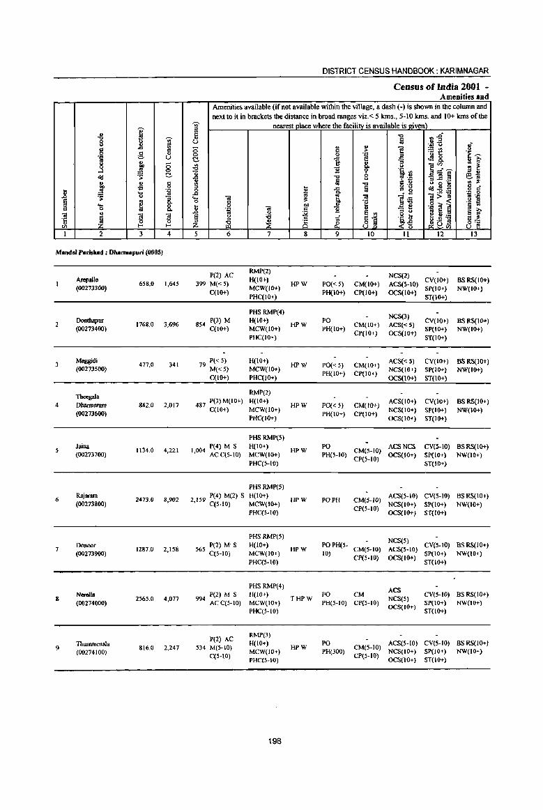
I -8 'i6 8 II ~ 8 c u -~ ;::. U
8 ., 0 Qfl
....l .!! 0
<II.! 'S ~
E v c -s 0
_g 'J:> .... '" ':: 0 "3 !i os
8: .... ~ c 0 u .. ~
'3 '3 ·c 0 0 u til r< r<
I 2 3 4
Mandai Parishad : Dharmapuri (0005)
Arepalle 658,0 1,645
(00273300)
2 Oonthapur
1768.0 3,696 (00273400)
3 Maggidi
477,0 341 (00273500)
Thcegala 4 Dharmaram 842.0 2,017
(00273600)
Jaina 1134.0 4,221
(00273700)
6 Rajaram
2473.0 8,902 (00273800)
7 Donoor
1287.0 2,158 (00273900)
8 NereUa
2565.0 4,077 (00274000)
Thummenala 9 816.0 2,247
(00274100)
DISTRICT CENSUS HANDBOOK: KARIM NAGAR
Census ofIndia 200t -Amenities aDd
Amenities available (if not available within the village, a dash (-) is shown in the column and next to it in brackets the distance in broad ranges viz,< 5 krns" 5-10 krns, and 10+ krns of the
'i6 nearest place where the facility is available is _given) a fi -0 nj u Iii .. u '''' u I{ 0 ~ > 1! ;.::~ 'E ---0 '~ ~ -a E ~8.
= ~ ., u "3 iii'" -a Q, u
"0 ~ ~ 'lib '" a--~ 6~ "i -a C? .~ _ft!§ 1ij -0
C ., ",..c 'C .. it 5 .... Iii g "g u g 0 6 c ta -a <I!!;g~
.J:I . ., '~ ,_g ... <i! it E, <i! ]~ 1>~ 0 c "e '~ ~ _g 0 0lJ " 'J: 'Oi ~ '''' ii! c B u - .. .. ()
~ e ., " u ~5:a ~ ~ § I..) :a 'ti ~1 '~ t; ~ i i§ ~D~ 8] z f1. <~
5 6 7 8 9 10 11 12 13
P(2) AC RMP(2)
NCS(2) 399 M«S)
H(lO+) HPW PO« S) CM(IO+) ACS(5-10)
CV(IO+) BSRS(IO+)
C(lO+) MCW(IO+)
PH(lO+) CP(IO+) OCS(lO+) SP(IO+} NW(IO+)
PHC(IO+) ST(JO+)
PHS RMP(4) NCS(3)
854 P(3) M H(IO+)
HPW PO
CM(IO+) ACS«S) CV(JO+) BS RS(JO+)
C(tO+) MCW(IO+) PH(IO+) CP(IO+) OCS(IO+)
SP(IO+) NW(JO+) PHC(IO+) ST(IO+)
79 P« S) H(IO+) HPW PO«S) CM(IO+)
ACS«5) CV(JO+) BSRS(IO+) M«5) MCW(IO+)
PH(IO+) CP(IO+) NCS(IO+) SP(IO+) NW(IO+)
C(tO+) PHC(IO+) OCS(IO+) ST(IO+)
RMP(2)
487 P(3) M(IO+) H(IO+) HPW PO{< 5) CM(IO+)
ACS(IO+) CV(IO+) BSRS(IO+) C(I{)+) MCW(IO+)
PH(lO+) CP(IO+) NCS(lO+) SP(IO+) NW(IO+)
PHC(IO+) OCS(IO+) ST(IO+)
PHS RMP(5)
P(4) M S H(lo+) HPW
PO CM(S-IO)
ACSNCS CV(S-IO) BSRS(IO+) 1,004 AC C(5-to) MCW(to+) PH(5-IO) OCS(lO+) SP(IO+) NW(IO+)
PHC(5-1O) ep(5-10)
ST(JO+)
PHSRMP(S)
2 159 P(4) M(2) S H(IO+) HPW PO PH CM(.5-10)
ACS(S-IO) CV(S-to) BSRS(IO+) , C(5-IO) MCW(IO+)
CP(S-IO) NCS(IO+) SP(IO+) NW(IO+)
PHC(5-IO) OCS(IO+) ST(IO+)
PHSRMP(5) NCS(5)
56S P(2) M' S H(IO+) HPW
POPH(S-CM(S-IO) ACS(5-1O)
CV(S-to) BSRS(IO+) C(5-10) MCW(IO+) 10)
CP(5-IO) OCS(IO+) SP(IO+) NW(lO+)
PHC(5-1O) ST(lo+)
PHSRMP(4) ACS
P(2) M S H(IO+) THPW
PO CM NCS(5)
eV(S-W) BS RS(IO+) 994 AC C(S-IO) MCW(IO+) PH(S-IO) CP(S-IO)
OCS(IO+) SP(IO+) NW(lO+)
PHC(5-IO) ST(IO+)
P(2) AC RMP(3) H(IO+) PO ACSC5-IO) CV(5-IO) BS RS(lO+)
S34 M(S-W) HPW CM(5-1O)
C(5-10) MCW(IO+) PH(300)
CP(S-IO) NCS(lO+) SP(JO+) NW(lO+)
PHC(5-IO) OCS(IO+) ST(lO+)
198
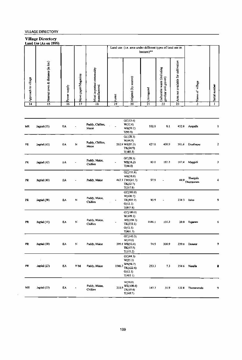
VILLAGE DIRECTORY
Village Directory Land Use (As on 199'D
Land use (i.e. area under different types ofland use in h~tare)"
]' '" 0 . .., :! ~
01) ~ ~
. .., 8 'is "3
0 '" ()
i .,
~ "0 ... '" '<;- ..9 ., .~ '" '" 01) 't) e -.::..rl ..
.!!! ~ u '"
., > ~ " ~ o'd ~-o g
_ 0
"" >. ~ ~ !;l, ~ ~ 1l E ~ 8: >. !l:-o g_ sJ e -0 .!! § '"
·s § ..c 2 ~ 0 iii '" .§ .M -0 os ~ li! "
..... 01 1;; C.
~ 00 0 '" [ ~ Ii ., Vi ·S .2-5 c ., Oil - :l '" l!: l!: ~ § e:: 01)
'2 - '" ~ ~ ·c . .'t .~ .if. 1! ~ :5 ,. '" .,
::;E e ;::J u OIl en 14 15 16 17 18 19 20 21 22 23 2 I
GC(I3.4)
MR Jagtial (55) EA Paddy, Chillies, W(32.4)
102.0 &.1 452.0 Arepalle Maize WE(50.2)
T(95.9)
GC(283)
Paddy, Chillies, W(44.9)
PR Jagtial (43) EA N 252.9 WE(87.3) 427.0 400.9 501.6 Donthapur 2 Maize
TK(24.9) T(l8S.S)
Paddy, Maize, GC(28.3)
PR Jagtial (42) EA Chillies
WE(16.2) 83.0 182.2 167.4 Maggidi 3 T(44.S)
GC(ISS.8)
WE(38.0) 44.0 Theegala PR Jagtial (40) EA Paddy, Maize 442.3 TWE(41.3) 97.9 4
TK(22.7) Dharmaram
T(257.8)
GC(3oo.0)
Paddy, Maize, W(l00.7)
PR Jaatial (38) EA N Chillies
TK(401.0) &5.9 234.3 Jaina 5 0(12.1) T(Sn.8)
GC(IS9.0)
W(109.3)
PR Jagtial (3S) EA N Paddy, Maize. WE(25S.2)
1546.1 105.2 20.0 Rajaram 6 Chillies TK(233.1)
0(12.1) T(S01.7)
GC(143.3) W(19.0)
PR ] agtial (38) EA N Paddy, Maize 399.4 WE(S3.4) 74.5 300.9 239.0 Donoor 7 TK(57.S) T(273.2)
GC(44.5)
W(25.1)
PR ]agtial (22) EA NM Paddy, Maize WE(98.7)
1546.7 TK(222.6) 253.3 7.3 354.6 Nc:rella I
0(12.1)
T(403.1)
W(30.0)
MR ]agtial (25) EA Paddy, Maize, 3339 WE(100.4) 147.7 51.9 132.8 ThummenaJa 9 Chillies . TK(l9.4)
T(l49.7)
199
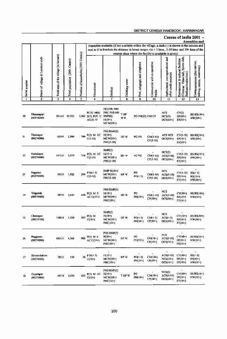
I '" '8 I u ., g ,.c
g 'p u ~ &h ;;
....l .!S 0
oIi:! 'S c ., .. c co o£l 0
1i .,
j ~ ... 0
~ ~ 1 ..... to 0
'" 01
~ ~ '3 ·c 0 u <I) I-<
1 2 3 4
Dbannapuri 10 2014.0 14,933
(00274200)
11 Tmunapur
629.0 2,980 (00274300)
12 Kamalapur
1472.0 3,079 (00274400)
Nagaram 13 363,0 1,022
(00274500)
14 Velgonda
987.0 2.613 (00274600)
IS Chinnapur
1184.0 1,330 (00274700)
16 Buggaram
1424.0 4,368 (00274800)
17 Sirivanchakota
785.0 150 (00274900)
Gopulapur 18 497.0 2,690
(0027SOOO)
DISTRICT CENSUS HANDBOOK: KARIMNAGAR
Census of India 2001 -Amenities and
Amenities available (if not available within the village, a dash (-) is shown in the column and next to it in brackets the distance in broad ranges viz. < 5 krns., 5-10 krns. and 10+ krns of the
""' nearest olace where the facilitv is available is given) '" ::l <II
~~ il -0
u :;J .; .. u -.::: u 0 ] ~t! u to ;>
.~ ""' 0 0 t~ C ,.c .:18. .. '" 0- u ::l <II ..
~ .,
0- u ]~~ '" ~ '0 11 l' 'a :l ::l ..
-0 0 _<G~ e10 ~ u , '.0
la -0 to '" B ~-g <II ~ g ... ,.c la g 'g dg.g43 .g 8" '" ..c j ~
• III .... <G <G lii ]>~ :1 'p 0 c 'E! ._ fl ... 0
f .!! .g ~] § '" u 'p <G B <>
_ t! .. S .D ., <>
~j ::l <>
~~ ~ C> :a ~ .~ b f:!<>:a ::l
~ <> .5 S
~ c£ ..c~ ~U<l)
5 6 7 8 9 10 11 12 13
D(2)DUMH
P(13) M(6) PHC PHS NH T HP ACS CV(2) BSRS(IO+)
3,362 S(5) PUC C RMP(8) WR PO PH(Il) CM CP NCS(5) SP(lO+) AC(3) 0 H(IO+) OCS(JO+) ST(IO+)
NW(JO+)
MCW(IO+)
PHSRMP(6)
709 P(2) M AC H(IO+) HPW PO PH CM(5-10)
ACS NCS CV(S-IO) BSRS(IO+) C(S-IO) MCW(JO+)
CP(5-1O) OCS(IO+) SP(IO+) NW(IO+)
PHC(S-IO) ST(IO+)
RMP(3) NCS(2)
754 P(2) M AC H(IO+) HPW PO PH CM(5-10) ACS(S-IO)
CV(S-lo) BSRS(IO+) C(5-10) MCW(IO+)
CP(S-IO) OCS(IO+) SP(IO+) NW(JO+)
PHC(S-lO) ST(lO+)
244 PM«S) RMP H(IO+)
PH NCS
CV(5-10) BS« 5) MCW(IO+) HPW CM(S-IO) ACS(5-JO) C(5-10)
PHC(5-10) PO« 5)
CP(5-1O) OCS(IO+) SP(IO+) RS(IO+) ST(IO+) NW(IO+)
PHSRMP(S) NCS
618 P(2) M S H(lO+) HPW
PO CM(S-IO) ACS(S-IO)
CV(lO+) BSRS(IO+) ACC(IO+) MCW(IO+) PH(IO+) SP(IO+) NW(JO+)
PHC(IO+) CP(IO+) OCS(IO+)
ST(IO+)
RMP(2) NCS
307 pel) M H(IO+) HPW PO« 5) CM«S) ACS«S)
·CV(IO+) BSRS(IO+) C(IO+) MCW(IO+)
PH(IO+) CP(IO+) OCS(IO+) SP(IO+) NW(IO+)
PHC(IO+) ST(lO+)
PHSRMP(7) NCS
988 peS) M S H(IO+) HPW
PO CM(IO+) ACS(S-IO)
CV(IO+) BSRS(IO+)
ACC(IO+) MCW(IO+) PH{IO+) CP(IO+) OCS(IO+)
SP(IO+) NW(IO+) PHC(IO+) ST(IO+)
38 PM«S) H(iO+) HPW PO« 5) CM(10+)
ACS(5-10) CV(IO+) BS« S) C(IO+) MCW(IO+)
PH(IO+) CP(IO+) NCS(IO+) SP(IO+) RS(IO+)
PHC(IO+) OCS(IO+) ST(IO+) NW(IO+)
PHS RMP(2) NCS(2)
P(2) M AC H(IO+) PO CV(IO+) BSRS(IO+) 60S THPW CM(IO+) ACS(S-IO)
C(lO+) MCW(IO+) PH(IO+) CP(IO+) OCS(lO+)
SP(lO+) NW(IO+)
PHC(IO+) ST(IO+)
200

VILLAGE DIRECTORY
Villae:e Directory Land Use (As on 1999)
Land use (i.e. area under different types ofland use in hectare)··
i '" 0 .'" '" g b toe> > " .'" ., 'g 'i3 :;
(,) ., -= (,)
~ ~ ... .. . ~ '" .5 ~ ~
ell 'i3 0 ~ ~" u ..!! 01) (,)
::l .. > :0 ~ ~ old .. ~1l 5l ~ 0 os
~ ~ ~ it; ~ ..!! ] g Q. g. 8.a € "Q > ~ .c S Q. B ..!! il '" ~ g 51 .!3 ~ "Q '" ~ li! 0 ..... "Iii Q. .. 01) c 0 Q e ~ t ~
_ ::l 1;; co :§ a.g '" " 'iI Q. i:!: ~ ~ e bO - '" ~ ~ ·c ~ ~ C£ ~ & ] :5 " to
U U on en 14 15 16 17 18 19 20 21 22 23 2 I
W(28.3)
PR Jagtial (30) EA NM Paddy, Maize, WE(144.9)
439.9 405.4 720.3 Dharmapuri 10 Chillies TK(275.2)
T(448.4)
GC(350.0)
PR Jagtial (35) EA N Paddy, Maix<:, W(75.1)
53.9 0.1 Tmunapur II Chillies TK(150.0)
T(575.1)
GC(392.6)
Paddy, Maize, W(38.S)
MR Jagtial (35) EA WE(IOO.O) 206.4 487.8 Kamalapur 12 Chillies
TK(246.9) T(777.8)
GC(8.1)
Paddy, Maize, W(28.3)
MR Jagtial (35) EA Chillies
WE(23.5) 51.0 223.8 Nagaram 13
TK(28.3)
T(88.2)
GC(184.1)
W(25.1)
PR Jagtial (23) EA N Paddy, Maix<: WE(41.3)
214.1 IS 1.4 286.1 Velgonda 14 TK(83.0)
0(2.0) T(335.S)
GC(37.6) W(14.2)
PR Jagtial (18) EA N Paddy, Maix<: WE(44.5)
29.5 291.1 734.7 Chillnapur IS TK(24.3) 0(8.1) T(128.7)
GC(327.4) W(78.9)
PR Jagtial (18) EA N Paddy. Maize WE(38.5) 97.5 16.2 740.1 Buggaram 16 TK(125.5) T(570.2)
GC(50.6)
W(65.6)
MR Jagtial (23) EA Paddy. Maize WE(33.6) 252.0 19.9 343.1 Sirivancbakota 17
TK(20.2) T(170.0)
GC(708) W(43.7)
PR Jagtial (21) EA N Paddy, Maize WE(78.9) 91.9 44.7 126.5 Gopulapur 18 TK(40.5)
T(233.9)
201
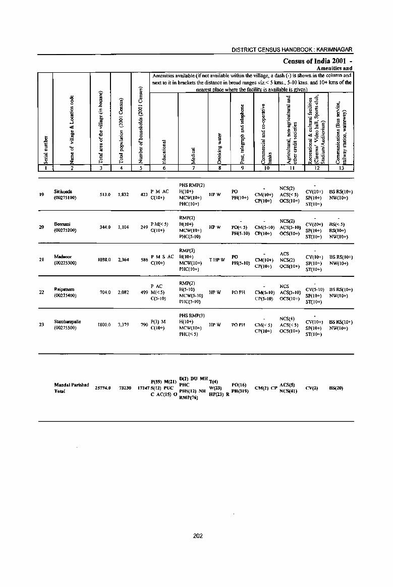
II § c 01 . a:: " en I
19
20
21
22
23
., "8 ... 8 ·iI j old ., co .. ~ ... 0
'" ~ 2
Sirikonda (00275100)
Bcersani (00275200)
Madnoor
(00275300)
Raipatnam (00275400)
Stambampalle (00275500)
MandalParisbad Total
i ~
..,. ~ J::
;§, il u ~ ;:;
..!!! 0
~ C-.. c i3 0
.J:! ..... .!! Q .. .. g-~ Co
"3 ~ ~ 3 4
513.0 1.832
344.0 1,104
1038.0 2.364
704.0 2.082
1800.0 3,379
25774.0 73230
DISTRICT CENSUS HANDBOOK: KARIMNAGAR
Census of India 2001 -Amenities and
Amenities available (if not available within the village, a dash (-) is shown in the column and next to it in brackets the distance in broad ranges viz. < 5 kms., 5-10 kms. and 10+ kms of the
~
nearest place where the facilitv is available is given) ., .. ., 8
'" 8 g C- .s;;:
Co
~ '" 1l o ..., il a l!I .. 0 OJ ..r:::
J:: ~ ~ ..... '" :s: o c
! .~ 01) ... .. c 1l <> ~ ~
'i3 .. -;;;" ~ ~ 8 ~
5 6 7 8 9
PHSRMP(2)
423 PM AC H(IO+) HPW
PO C(lO+) MCW(IO+) PH(IO+)
PHC(IO+)
RMP(2)
249 P M{<5} H(IO+) HPW PO«S)
C(IO+) MCW{IO+) PH(S-IO)
PHC(S-IO)
RMP(3)
586PMSAC H(IO+) THPW
PO C(lO+) MCW(lO+) PH(5-10)
PHC(IO+)
PAC RMP(2)
499 M«5) H(5-IO)
HPW PO PH C(5-IO)
MCW(S-IO) PHC(5-10)
PHSRMP(3)
790 P(3) M H(IO+) HPW PO PH
C(lO+) MCW(IO+)
PHC« 5)
D(2) DU MH P(59) M(ll) PHC T(4) PO(16)
17247 S(12) PUC PHS(12) NH Well) PH(319) C AC(15) 0 RMP(76) HP(l3} R
202
..., :a ., ] > . .c
i :; <>
9 .6, ., 0 ~ .ij u '0
a g .g " <II -a ]~ ·8
u "3 b e '" .~ U ~1 .?~
10 II
NCS(2)
CM(IO+) ACS«S) CP(IO+) OCS(IO+)
NCS(2)
CM(5-10) ACS(5-IO) CP(IO+) OCS(IO+)
ACS CM(IO+) NCS(2)
CP(IO+) OCS(IO+)
NCS CM(5-IO) ACS(5-IO) CP(S-IO) OCS(IO+)
NCS(4)
CM«5) ACS«5) CP(IO+) OCS(IO+)
ACS(5) CM(2) CP NCS(4l)
~i .J:! ...
~~ tf! 8-]~..._ _OI§ 8 ~·6 oId:2:a ]:>~ ._g <a ] ~ ~:a ~DS ~ en 12
CY(IO+) SP(IO+)
ST(IO+)
CY(IO+)
SP(IO+) ST(IO+)
CY{IO+)
SP(IO+) ST(IO+)
CY(S-IO) SP(IO+)
ST(IO+)
CY(IO+) SP(IO+)
ST(lO+)
CV(2)
.I <> .~ ;;:
~ ~ e~ ., :s: c •
.,8 ~ .. ..c
.~ 1* ~ ~ 8]
13
BSRS(IO+) NW(IO+)
BS« 5) RS(IO+) NW(IO+)
BSRS(IO+)
NW(IO+)
BSRS(IO+) NW(IO+)
BS RS{lO+) NW(lO+)
BS(20)
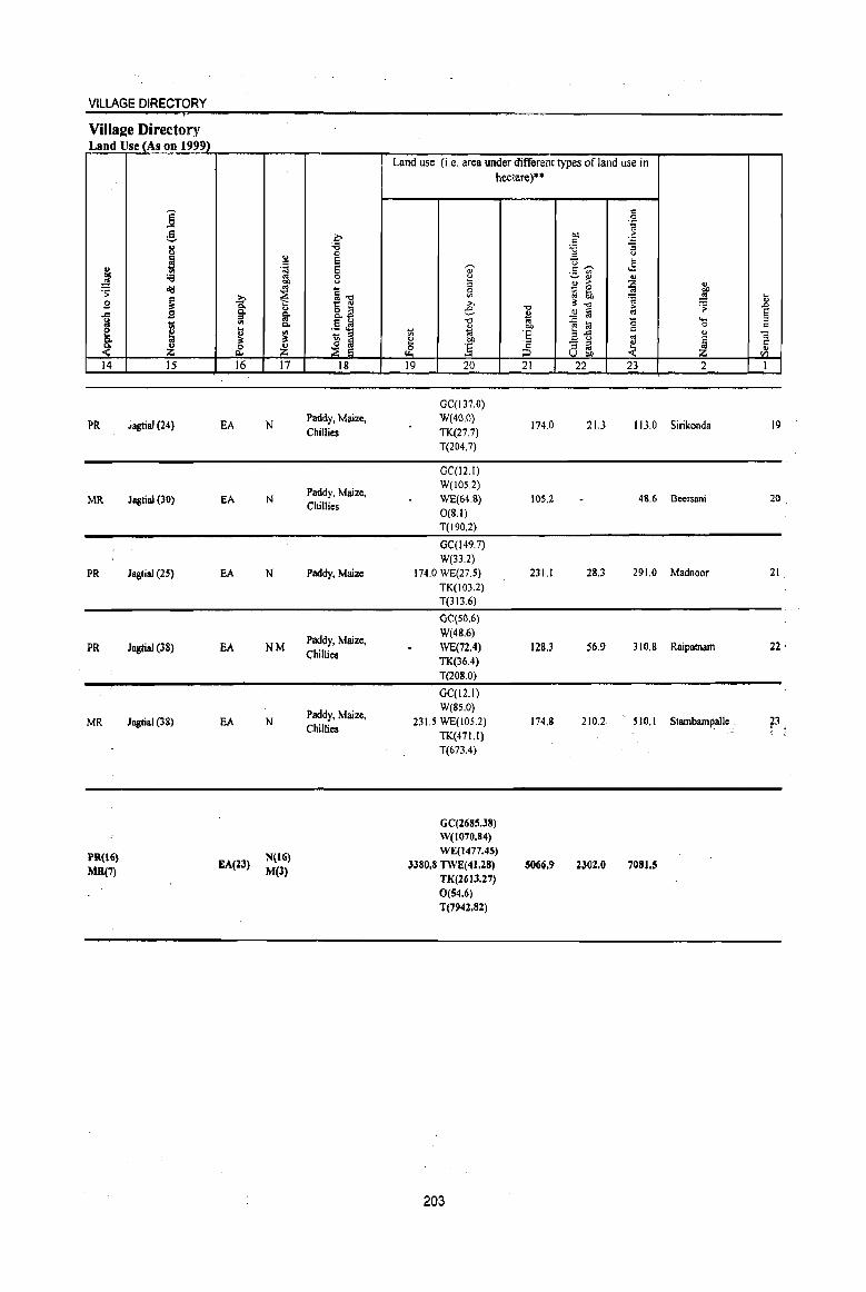
VILLAGE DIRECTORY
Villa2e Directory Land Use (As on 1999)
" .. .,!g
~ 9 .c
l .'t 14
PR
MR
PR
PR
MR
PR(16}
MR(7)
j c '=' 8 ~ 'i3 ~
~ g
I Z IS
.iagtial (24)
Jagtilll (30)
Jagtial (25)
JagtiaJ (38)
Jagtial (38)
~
f .. ~ ~ 16
EA
EA
EA
EA
EA
EA(ll)
" c .~ .. ~ ., Ii' Co
~ ~ 17
N
N
N
NM
N
N(16)
M(3)
0 'i3 c E E c u
~il o 2 Q..
u ,5 .e - '" ~ ~ 18
Paddy. Maize. Chillies
Paddy. Maize. Chillies
Paddy. Maize
Paddy. Maize. Chillies
Paddy. Maize. Chillies
Land use (i.e. area under different types of land use in hectare)··
"" " (.J
~ 0 V>
e .",
" tl 10 !! "" :g ~ 19 20
GC(137,0) W(40.0) TK(27.7) T(204,7)
GC(12.1) W(IO~.2)
WE(64,S) 0(8.1) T(190.2)
GC(149.7) W(33.2)
174,0 WE(27.S) TK(I03.2) T(313.6)
GC(50.6} W(48,6) WE(72,4) TK(36.4) T(20S.0)
OC(12,1) W(8S,0)
231.S WE(IOS.2) TK(471.l) T{673.4)
GC(268S.38) W(1070.84) WE(1477.45)
3380.8 TWE(41.18) TK(26JJ.27) 0(54.6) T(7942.82)
203
-0
" 1ii .. '6 '0 ~ 21
174.0
105,2
231.1
128,)
174.8
5066.9
c c
"'" :~ c '0 "3
" u U ... c,..., .;: v~ ., " ;> :0 _ 0
~ blJ oj
~ ~ .", ;>
~ ~ '" ~ ~ 15 '" 2'8 '" - " ~ (3 ~
22 23
21.3 113.0
48,6
28.3 291.0
56,9 310,8
210,2 510,1
1302.0 7081.5
g, .,!g ] ~
~ ... c '" " .. ~ 'r:;
" V1
2 I
Sirikonda 19
Beersani 20
Madnoor 21
Raipatnam 22·
Stambarnpalle . 73 , ,

:x: en ;lJ 0
~ « a n. ~ «
IX: :c 0
~
...
('.I
<l f-i;.,. ;: C
~ f-
'" ..... ~ 0
~ a:: 0 \.!) 0 ~
~ ". ~
(!)
~ ...J W >
• 'Ie
I I
, '---1-_-
I I
, I
I
I I
I I
I I
H u
~ is ~
~
~ =
i I I I I I I I I I
~ ;:g
I i
, ,
--j ,
r ,
'g, :~! ' r 'f'oo. , 'N, :8: ' r ' , 1_- _
Z u s: = ~ ~
" =s t:l :> ~ ~ <
~ !Xl
• , , A.. __ _
r
, ,~
@
I e ~ g c::l
ii
- - -I • : l(:
~ , , : §:
~ .' , : 10: . :~: • ! 8:
l __ _
~ 0 !Xl <
Z
~ (.)
s: <:> := <:> ~ ~ H 0\ ~ i:: 0-
'" .;; ~ Iol ~ "-'
" < ...l g ..( >-U e ...l ~ .... t:l ~ i ;;. "-' c. c::l
tl " ~ s J;ol S <:> H
E <:> ... ~ 0
H OIl = ~ < 0\
~ 0 0-
z ~ ~
~ ... H 0
~ on ...
g ~ H
~ ~ ~ ....
~"'q.\l11 D)"Jv".~
I ~ I
\ -----~ ,/\.,-.,...------- : /, ,
, , ~.
, , ,
I
. '. I , I ,
I
, . ---- .... _""
I I I \ I
, ~
", --I ..... __ _ _ _
~ .... ----- - --~ co
rn·~ , , , , , . rn
, , . ..... ~-- .. ----
I , / ,
I
/
I ,
f \
\ \
.'
\ \ I I ,
--<.
I .'
fI.l ff =
~ !j
Z ~
~ 0
...l
~ 0 0 t; >-0 ~ f.>r<
~ "-' u
~ := ....
" ..... ~ s
", rn \ , "--" • f:: \ ,',' ----{ ~ . ~ , ' \, ~ ~ -, ,:
'., 2 ' . ... -.. / '- c , ~ , , '----\, ~
\', a i .... ~-~~--_;--------~_-_-__ -_--_ -_;~ -_ -- ,;~) ~ .-~& ;:, /~ __________ ~ ~
r- ____ --
'7
< , -_, ID _-- ',"
... ,2 'IDm : \
--"-. : • I' ' . " I ~ ' ... -.; ---- ------.>~ 2 ! 't
' , , I '. ~ ... z _/ '. J • • a • ,._ I
" ... < --- -----',-' '. / -._ '. ---:;.------<, 2 ~ --___ ,
/ I
" . '" ----, '---: \, \-'" ID " ~ : '-,-----, " ___ 1 I : • I :~_ ' '-- -",
"' .. _---_ .. v
d v '1 o
~ 0 N ,..;-.c Cl ";:
~ 0 (,)
III
'6 .: '0 -C
CII E c .. GI > 0
(!)
@

PART A -VILLAGE AND TOWN DIRECTORY
ALPHABETICAL LIST OF VILLAGES (MANDALPARISHAD WISE), KARIMNAGAR DISTRICT
Serial Name of village
number
2
Name of MandaI Parishad : Velgatoor Name of Mandai : Veigatoor0006
1 Ambaripeta
2 Cheggaon
3 Endapalle
4 Godiselapet
S Gullakota
6 Jagdevpeta
7 Kapparaopeta
8 Kishanraopeta
9 Kondapur
10 Kothapet
11 Maredupalle
I2 Mukktraopet
13 Munjampalle
14 Muthunur
15 Padkal
16 Paidipalle
17 Pathagudur
18 Ramnoor
19 Sakapuram
~ Sanabanda
21 SankenapaUe
22 Suraram
23 Undeda
24 Velgatoor
2001 Census
location code number
3
00276600
00276900
00277(:JX)
00277300
00276500
00275(:JX)
00275800
00276200
00276400
00277500
00277900
00275900
00277100
00276000
00277400
00276800
00277700
00276100
00276300
00277200
00276700
00277800
00277000
00275700
205
1991 Census
location code number
4
2000600060006000 11
200060006000600014
20006000600060001
200060006000600018
200060006000600010
200060006000600001
20006000600060003
20006000600060007
200060006000600009
20006000600060000
20006000600060004
200060006000600004
200060006000600016
20006000600060005
200060006000600019
2000600060006000 13
20006000600060002
2000600060006000
200060006000600008
200060006000600017
200060006000600012
200060006000600023
2000600060006000 15
2000600060006000

I 1 ~
~ ... g g '" ] u '" ... ;; !'l 0
~ ~ <II!
: '" c: -£l 0
!i .'" ~
._ .. 0 :;
§ .. 0-._ ~ 0
'" 0 0-"iI "
~ ]I ]I 'i 0 0 f- f-en
1 2 3 4
Mandai Parishad! Velgatoor{OOO6)
Jagdevpeta 9&4.0 2,235
(OO27S600)
2 VeIgaIoor
2473.0 3,903 (00275700)
3 Kapparaopeta
1186.0 2.501 (OO2758OO)
4 Muldctnwpel
94.0 (00275900)
Muthunur 5 9S2.0 1,862
(00276000)
Ramnoor 6 862.0 1,014
(00276100)
Kishanraopeta 792.0 1,945 7
(00276200)
8 Salcapuram
183.0 1,195 (00276300)
Kondapur 1119.0 2,OSO 9
(00276400)
Gullakota 10 1871.0 4.919
(00276500)
Ambaripcta II 717.0 2,101
(00276600)
DISTRICT CENSUS HANDBOOK: KARIMNAGAR
Census of India 2001 -Amenities and
Amenities available (if not available within the village, a dash (-) is shown in the column and next to it in brackets the distance in broad ranges viz. < 5 kms" 5-10 kms, and 10+ kms of the
'0' nearest Dlace where the facility is available is triven) .. '" c ""t:I ~~ " u !i! ,,-;; ., '" ]
'::: (.)
c :>- ~~ u 0 0 '': '~ ;;: ~ .c E <fl8. 0- :; {j ]
.. ]~~ ;l ~ 0- Q
~ '5, '" "0 ... "0 1 .~ _"'§ e~ u a u e~ 'I:: ., !$ ., "0 c: " 5 0'-
<II!~~ .g § ~ .c iii c: g ... ~ - '" ._ .. ..
]~ 01> .. B '::I
0 € ;!; 'e ,~~ ] '§ ~ .8 ] co ..
'''' c: "2 '" (;j 8 .. ~ § ., :I 0 § ~ § u :a
& .~ t e ~:.a 81 ~ ~ 81 U,S s
Z 5 <~ ~u ~<Il 5 6 7 8 9 10 11 12 13
5&3 PM AC RMPH{IO+) NCS(3)
CV(S-IO) BS RS(IO+) MCW(lO+) HPW PO PH CM(5-10) ACS(5-10)
C(lO+) PHC(IO+) CP(IO+) OCS{IO+)
SP(IO+) NW(IO+) ST(lO+)
peS) M(3) PHCPHS
ACS CV 963 S(3) AC(3)
RMP(4) HPW PO PH
CM NCS(3) SP(IO+)
as RS(IO+)
H(IO+) CP(IO+) NW(IO+) C(IO+)
MCW(lO+) OCS(IO+) ST(IO+)
P(3) AC PHSRMP
NCS(3) 607 M(5-IO)
H(IO+) HPW PO PH CM(5-IO) ACS(5-10)
CV(S-IO) BS RS(10+)
C(lO+) MCW(1O+)
CP(IO+) OCS(IO+) SP(IO+) NW(IO+}
PHC(5-10) ST(IO+)
-- Uninhabited ---
473 PM AC RMP H(lO+)
PO NCS
CV(IO+) BSRS(IO+) MCW(IO+) HPW CM(lO+) ACS(IO+)
C(lO+) PHC(IO+)
PH(IO+) CP(IO+) OCS(IO+)
SP(IO+) NW(IO+)
ST(IO+)
268 P M(lO+) RMPH(lO+)
ACS(IO+) CV(lO+) BSRS(IO+) MCW(10+) HI'W PO(5-10) CM(IO+)
C(lO+) PHC(IO+) PH(IO+) CP(IO+)
NCS(IO+) SP(IO+) NW(IO+)
OCS(IO+) ST(IO+)
PHSRMP NCS
476 P M C(IO+) H(IO+)
HPW PO
CM(5-1O) ACS(S-IO) eV(S-IO) BS RS(IO+)
MCW(IO+) PH(5-IO) SP(IO+) NW(IO+)
PHC(S-IO) CP(IO+) OCS(IO+)
ST(lO+)
PAC RMPH(IO+) PO ACS(5-10) CV(5-10) BS RS(IO+)
272 M(S-IO) MCW(lO+) HPW CM(5-IO)
((10+) PHC(S-IO) PH(5-10)
CP(IO+) NCS(IO+) SP(IO+) NW(IO+)
OCS(IO+) ST(IO+)
RMP(2) NCS(2) 4&4 P M(S- (0) H(lO+)
HPW PO PH CM(5-10) ACS(S-IO) CV(.5-IO) BS RS(IO+)
C(IO+) MCW(lO+) SP(IO+) NW(IO+)
PHC(5-10) CP(IO+) OCS(IO+)
ST(IO+)
PHSRMP(2) NCS(2)
P(2) M S H(IO+) HPW
PO CM(5-10) ACS(S-IO)
CV(S-IO) BS RS(IO+) 1,141
AC(5) C(lo+) MCW(IO+) PH(IO+) Sp(IO+) NW(IO+) CP(lO+) OCS(IO+)
PHqS-IO) ST(IO+)
PAC PHe PHS NCS eV(S-IO) BS« 5)
M(5-10) RMP H(IO+) HPW PO PH CM(S-IO) ACS(S-IO) 463 SP(IO+) RS(IO+) C(lO+) MCW(IO+) CP(S-IO) OCS(IO+)
ST(IO+) NW(IO+)
206

VILLAGE DIRECTORY
Village Directory Land Use (As on 1999)
Land use (i.e. area under different types of land use in hectare)·"
j c 0 .;:; ..
g ~ eo ";>
~ .'" 8 'i3 ] 0 ::I
~ '" ~ '0 ... c:: ~ .£ '" '[:i c::--"
._ <II
co :a 0 " ~ .. ., to co " !3 ~ ~ ~ 3. ~ ai:!
~ ~-g lil l(j to >. 'ia .. .8 s ~ IS. >. -c ~-o
~ ~ ..c B C- o. 8.E e. '" .. tij § "
::I os .§~ -0 .. :c -0 .... .. t;;
., c. ~
co e la 0 c e ~ t ~ - ::I ~ 'E 2-5 c ..,
7iI 0. ~ ~ ~
co os
~ 'c :; 16 ~ .c:
~ Z_ &. Z J: :§ '" :::> u co en 14 15 16 17 18 19 20 21 22 23 2 t
WE(148.0)
PR Karimnagar (32) EA NM TK(640.0) 148.0 48.0 Jagdevpeta T(788.0)
WE(142.0)
PR Karimnagar (35) EA NM TK(l16.0)
1222.7 953.0 11.3 Velgatoor 2 0(28.0)
T(2S6.0)
GC(122.0)
WE(274.0)
PR Karimnagar (4 5) EA N TK.(tI4.0} 154.0 98.0 394.0 Kapparaopeta 3 0(60.0)
T(S40.0)
GC(24.0)
--UniJJhabited --- WE(1O.0) I 40.0 4.0 16.0 Mukktraopet 4
T(34.0)
GC(tIO.O)
PR Ramagundam (20) EA N WE(212.0)
118.0 264.0 240.0 Muthunur 5 TK.(8.0)
T(330.0)
GC(20.0)
PR Ramagundam (18) EA N WE(159.0)
76.0 8.0 597.0 Ramnoor 6 TK(2.0)
T(181.0)
GC(76.0)
WE(240.0)
PR Ramagundam (25) EA N 109.0 TK(48.0) 181.0 40.0 90.0 Kishanraopeta 7 0(8.0)
T(372.0)
PR Karimnagar (40) EA N WE(IIB.O)
52.0 2.0 11.0 5akapuram B T(lIS.0)
WE(146.0)
PR Karimnagar (43) EA NM TK(304.0) 3S0.0 168.0 121.0 Kondapur 9 T(4S0.0}
WE(688.0) PR Karimnagar (50) EA N 405.0 TK(8.0) 500.0 113.0 157.0 Gullakota 10
T(696.0)
GC(16.0) WE(2740)
PR Karimnagar (43) EA N TK(80.0) 187.0 104.0 42.0 Ambaripeta II 0{14.0)
T(384.0)
207
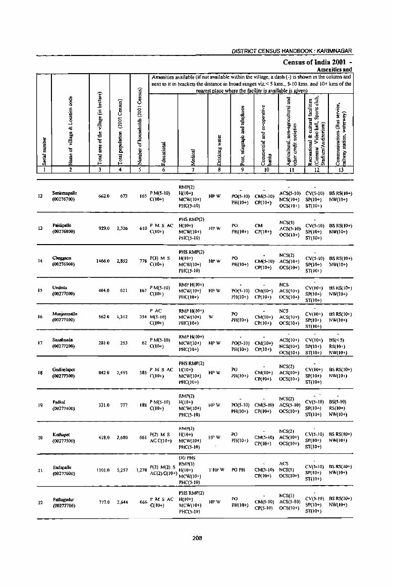
-g I 'Vi' g <> ;! ..Cl §
~ " ., ·N U
~ 0 0 ,_J 0
olj 1 C!-
~ ., a 'fl
.8 .:c
~ 'g '" -a ~ ~ 8: ... " 0
iil " ~ ~ "3 ·c .. 0
til E-o
I 2 3 4
12 Sankenapalle
662.0 673 (00276700)
13 Paidipalle
929.0 2,326 (00276800)
14 Chc:ggaon
1466.0 2,852 (00276900)
Undeda IS 404.0 621
(00277000)
MWljampalle 16 562.0 1,312
(00277100)
Sanabanda 17 281.0 253
(00277200)
18 GOOiselapet
842.0 2,495 (00277300)
19 Padkal
331.0 777 (00277400)
Kothapet 20 418.0 2,680
(00277500)
21 Endapalle
1101.0 5,2S7 (OO277WO)
Patbagudur 22 777.0 2,644
(00277700)
DISTRICT CENSUS HANDBOOK: KARIMNAGAR
Census of India 2001 -Amenities and
Amenities available (if not available within the village, a dash (.) is shown in the column and next to it in brackets the distance in broad ranges viz. < 5 lcms., 5-10 lcms. and 10+ lcms of tile
'Vi' nearest place where the facility is available is given) ~ .., ",.D 41
U ~ .,.2 - u ~ .::: <> 3 ] il~ 0 g .~ ~ 0 . .:1
~ ..Cl [ t!!8. ~f 0. :;
.fj i <> ]~--0 .~ :l '0 "0 8 -a]~ ~~ 1 f .:: a .., '" " <> ·c
= ! a o ._
~g£ 8 c:f 0 1 " g :-5!'6 .c . ., .;:: 0
'S 01 ~ 01 ]] ~>~ ~ .:c d "e ._ s
] 0 "" u .:::"OJ ] § '" • .0 .. Q ~ " '" 0
~ Aj = ... ~ ~ :a ~ ~ ~ <> :a tf .~ b
.~ 8. ~ g <~ ., .- !l 8] ,;:~."
5 6 7 8 9 10 II 12 13
RMP(2)
165 P M(S-IO) H(IO+) HPW P0(5-1O) CM(5-IO)
ACS(S-tO) CV(S-IO) BS RS(IO+) C(IO+) MCW(IO+)
PH(lO+) CP(IO+) NCS(IO+) SP(lO+) NW(IO+)
PHC(S-lO) OCS(IO+) ST(lO+)
PHSRMP(2} NCS(S)
610 PM S AC H(IO+) HPW
PO CM ACS(5-10)
CV(S-IO} BSRS(IO+} C(IO+) MCW(IO+) PH(10+} CP(IO+)
OCS(10+) SP(lO+) NW(IO+)
PHC(S-W) ST(IO+)
PHSRMP(2) NCS(2)
778 P(3) M S H(IO+) HPW
PO CM(5-10) ACS(IO+)
CV(5-10) BSRS(IO+) C(lO+) MCW(IO+) PH(IO+)
CP(IO+) OCS(IO+) SP(tO+) NW(IO+)
PHC(5-W) ST(IO+)
167 P M(S-IO) RMPH(IO+) NCS
CV(IO+) BSRS(IO+) MCW(IO+) HPW P0(5-10) CM(IO+) ACS(IO+)
C(lO+) PHC(IO+) PH(IO+) CP(IO+) OCS(IO+)
SP(lO+) NW(lo+) ST(IO+)
PAC RMPH(IO+) PO
NCS CV(lO+) BSRS(IO+)
354 M(5-10) MCW(IO+) W CM(IO+) ACS(IO+) C(10+) PHC(IO+)
PH(IO+) CP(lO+) OCS(IO+)
SP(IO+) NW(IO+) ST(lO+)
62 P M(5-10) RMPH(IO+)
ACS(IO+) CV(JO+) BS« 5) MCW(lO+) HPW P0(5-1O) CM(IO+)
C(IO+) PHC(IO+) PH(IO+) CP(IO+)
NCS(lO+) SP(IO+) RS(IO+) OCS(IO+) ST(IO+) NW(IO+)
PHSRMP(2) NCS(2)
585 PM S AC H(IO+) HPW
PO CM(IO+) ACS(IO+)
CV(IO+) BSRS(IO+)
C(10+) MCW(IO+) PH(IO+) CP(IO+) OCS(lO+)
SP(IO+) NW(IO+)
PHC(IO+) ST(IO+)
RMP(2) NCS(2)
188 P M(S-IO) H(IO+) HPW PO(S-lO) CM(5-10) ACS(S-IO)
CV(S-IO) BS(5-10)
C(lO+) MCW(IO+) PH(IO+) CP(IO+) OCS(lO+)
SP(IO+) RS(IO+)
PHC(S.IO) ST(IO+) NW(lO+)
RMP(2) NCS(2)
P(2) M S H(IO+) PO CV(S-IO) BSRS(IO+) 661 HPW CM(S.IO) ACS(IO+)
ACC(IO+) MCW(IO+) PH(IO+) CP(lO+) OCS(IO+)
SP(IO+) NW(IO+)
PHC(5-10) ST(IO+)
DUPHS
P(2) M(2) S RMP(3) ACS CV(S-IO) BSRS(IO+)
THPW PO PH CM(5-10) NCS(S) 1,278 AC(2 C(l(}+) H(IO+) SP(IO+) NW(IO+) ) MCW(IO+) CP(lO+) OCS(IO+)
ST(10+) PHC(5-10)
PHSRMP(2) NCS(3)
666PMSAC H(lO+) PO CV(S-IO) BS RS(10+) HPW CM(5-10) ACS(5-10)
C(10+) MCW(IO+) PH(IO+) CP(S·IO) OCS(IO+)
SP(IO+) NW(IO+)
PHC(S-IO) ST(IO+)
208

VILLAGE DIRECTORY
Villae:e Directory Land Use (As on 1999)
Land use (i.e. area under different types of land use in hectare)··
i c 0
5 ~ "" .~
c .= III 'g '6 ~ <> ., " <>
B ~ u ~
" ·S 'U' c ~ .E <II .~ en
"" '6 8 ~ ~ ., .,
.!! Oll " " :>- ::0 ...
0Cl oj - 0 00 ~ ~1i
0 ~ 6h oj
1 ~ en
~ ..s ... B ~ ....
." ~"O 's: 11 ..c £ §. 8.2 e <II .£ lii oj a 1;; '-(.)
.§ .M "0 ..c til (5 0 c oj ;; Q.
~ 00
~-tl c k ~ 11 ~ - " ~ 'e oj
.. 'iii ~ ~ ~
Oll
~ ·c ] 8 - " ~ ~ ~ &. ~ ~
::> oj ., U bO Vi
14 15 16 17 18 19 20 21 22 23 2 I
GC(128.0)
MR KarimDagar (45) EA N WE(284.0)
180.0 9.0 57.0 Sankenapalle 12 0(4.0)
T(416.0)
GC(1480)
PR Ramagundam (30) EA NM WE(232.0)
296.0 76.0 137.0 Paidipalle I3 TK(40.0)
T(420.0)
WE(240.0)
PR Ramagundam (25) EA N SI 0 TK(481.0) . 0(4.0) 225.0 148.0 317.0 Cheggaon 14
T(nS.O}
Paddy, Maize, WE(98.0)
MR Ramagwtdam (23) EA N TK(62.0) 62.0 22.0 160.0 Undeda 15 Groundnut
T(l60.0)
GC(14.0)
MR Ramagundam (25) EA N WE(242.0) 84.0 132.0 90.0 Munjampalle 16
T(256.0)
WE(64.0)
MR Ramagundam (30) EA TK(64.0) 110.0 32.0 12.0 Sanabanda 17
T{12S.0)
GC(60.0)
MR Ramagundam (30) EA WE(284.0)
126.0 88.0 240.0 Godiselapet 18 TK(44.0)
T(3880)
GC(30.0) WE(87.0)
MR Karimnagar (46) EA TK(21.0) 117.0 27.0 30.0 Padkal 19 0(19.0)
T(157.0)
GC(IOS.O)
WE(ISO.O) PR Karimnagar (44) EA TK(21.0) 49.0 18.0 43.0 Kothapet 20
0(32.0)
T(3080)
GC(l44.0) PR Karimnagar (41) EA NM WE(724.0) 217.0 16.0 Endapalle 21
T(8680)
GC(31O.0)
PR Karimnagar (43) EA N W(200.0) TK(197.8)
7.0 22.2 40.0 Pathagudur 22
T(707.8)
209
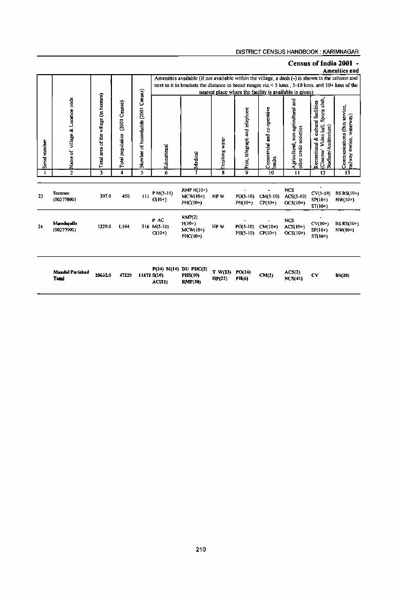
.8 ~ Cl
01 ·c .. "" I
23
24
., -g
<>
8 .:;l co g
...l <Ill ., OIl
.!!! ~ .... 0 .. ~ 2
Suraram (00277800)
MJIedupalle (00277900)
MandaI Parishad T ....
i -;;;-::s
..c '" '" g .. U
J ;; <:>
~ ~
~ 8 ':;l ... .!!! 0 .. ~ ~
'3 '3 a a l- I-
3 4
397.0 450
1229.0 1,164
20632.0 47229
-;;;-iii ij u ;; 0 ~
~ ..c CI
'" g ..c ... a ] ~ Z 5
III
DISTRICT CENSUS HANDBOOK: KARIMNAGAR
Census of India 2001 -Amenities and
Amenities available (if not available within the village, a dash (-) is shown in the column and next to it in brackets the distance in broad ranges viz. < 5 kIDs., 5-10 kIDs. and 10+ kIDs of the
nearest nlace where the facili!Y_ is available is _givel!)_ "0 ",.0 iii .. ,E
. ., y .; ., ., ] ;gt! u c >
0 '! .~~ ..c <fl 8. ]' "3 ~i
., ]~~ Q, u
~ 'i' .~ ~ "0 a _Ol~ e .. u , "D § B ~·c !II 1$ "0 8 .!! .... a <Ill~~
c c ., ..c c g 0 .. ~ . ., .:;l a
'"iil Ol ]~ ~>..i! B .::: "
~ 'g .- fI 0 ta "" v .g -:.. ~ § ., .::: c 1l :; a oj e a ~ .. u
~ e ., u :a 'iii 81 .5, u e U;a a~ " ~ .S a ~ ~ t§ & <~ 8] t2 ~"" 6 7 8 9 10 11 12 13
P M(S-tO) RMPH(10+) NCS
eveS-to) BS RS(lO+) MCW(IO+) HPW P0(5-1O) CM(5-10) ACS(5-10)
C(lO+) PHC(IO+) PH(JO+) CP(IO+) OCS(IO+)
SP(IO+) NW(IO+)
ST{10+)
PAC RMP(2)
NCS 316 M(5-10)
H(IO+) HPW P0(5-IO) CM(IO+) ACS(IO+)
CV(lO+) BS RS(IO+) MCW(IO+) SP(IO+) NW(IO+)
C(lO+) PHC(IO+)
PH(5-10)
P(34) M(14) DU PHe(2) T W(23) PO(16) 11671 S(10) PHS(10) "P(22) PH(6)
AC(21) RMP(38)
210
CP(lO+)
CM(2)
OCS(IO+)
ACS(2) NCS(41)
ST(lo+)
CV 8S(20)
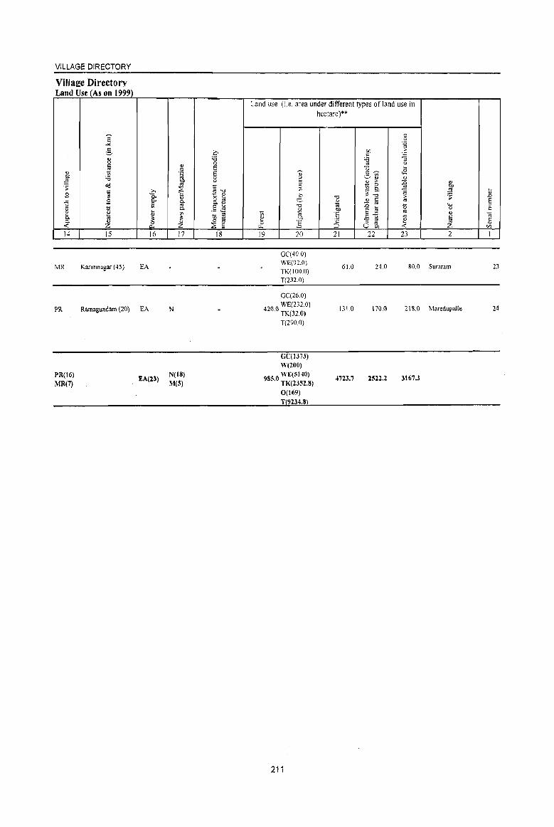
VILLAGE DIRECTORY
Village Directory Land Use (As on 1999)
14 15
MR Karimnagar (45)
16
EA
PR Ramagundam (20) EA
PR(16)
MR(7) EA(l3)
17
N
N(IS) M(S)
18
Land use (i,e. area under different types of land use in hectare)**
19 20
GC'(40,O) WE(n.O) TK(IOO 0) T(232.0)
GC(26.0)
42() 0 WE(232,0) . TK(320)
T(290.0)
Ge(m3) W(200)
5 WE(;;140) !>8 •. 0 TK(2352.8)
0(169)
T 9234.8
211
21
61.0
131.0
4723.7
22 23 2
24.0 80.0 Suraram
170.0 21 &.0 Maredupalte
2522.2 3167.3
23
24
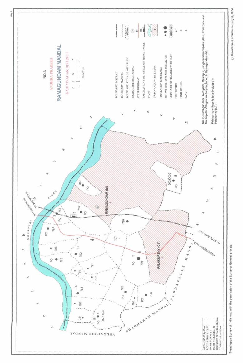
i
~ 0
~ ~ ~ ~
~ ~ « ~ C ~ ~ Z
::)
~ ~ ..,..
:!:
~
'0
... \,
i. \.~ ~\
'b '?-'t--,6_, ~ ~
" :>- • « 0 ~ ~ 0 Cl
-- '-
• <0
< co
--,
l ! ; @ a , , , , '- -
..... c..-~ ~ N ~ >.l
'" c. Q :l: ...,
I-:a ~ «
~ ~ ~ I- >.l '" u ~ \.? {j 0
~ iii! :r j >-~ t;; ~ ..; ..., ei « '7 S :;
~ - ~ , :.: :.: :.: ~
I>: I>: I>: 52 N « @ « :c ~ @ 0'
"" ~ ~ ... ;;, ;;, « :i i i6 :c t;;
, ,
, - -- -- -- ';-
, . - - '-; , ,
. ~ -7 , , ,
, , ,
, ,
'IVONVI\I 1I001.V!)'I3A
, ,
'" ~
, ,
• ,
-~ , ' r , ,
~~B • ;-,(1 ,.' 1 ~1 0 '" III • ,., o. I=:;·
• I _I L~I
,., \.? ;;, « \.? ~
§ « o "" ;;. III 16 c. Z « i5 0
Q ~ ~ 0 ~ .;; z ., l- e)
., g "" '" ::s \.?
E .J ~ .:s u :r '" :t ... ::J ... ...:l
~ ~ ;:;: "" !il Q ...:l Z « z .. 0 ::1 g .. ..,
0 Iii u ~ >- eo:
~ s: e « « t ~
u ~ eo: ~ 0 ., .. !;; :c :.:
~ ~ ~ ()
~ !5 I' ~ ~ Ii!
(f
-g '" .. i f 0 a. ~ ;( rl
i :I -a ..... ~:E .~
:ltE -. <:-0 °c ~:I ",ll -,E ..::. &.C "'-~~ .!: f-g -0
eu .. -0 =c :::0 a- u -~ .!: "2,:;
:::e'; .a-- Ii ~
EOl !! .... .. -0", "'to 2'--'-:1= =t 2'5 >-EJ! ~~ :1 1:1: -"_ 15 :1:1 .... .. = ... ~i ~~
..; 0 0 N
~ '" ·c >-D. 0 0 .. 'ii .!: '0 11 • E <: 0; > 0 0
@
.. 'ii .!: '0 ~ • c .. o (; ,... • > :; fI)
• 5 '0 c: o .. .. ! .. ... .. 5 .<: 1< :J: D. .. E .. 'ii .!: a >-
~ :I
fI)
C o CL :I .., • .. .. III
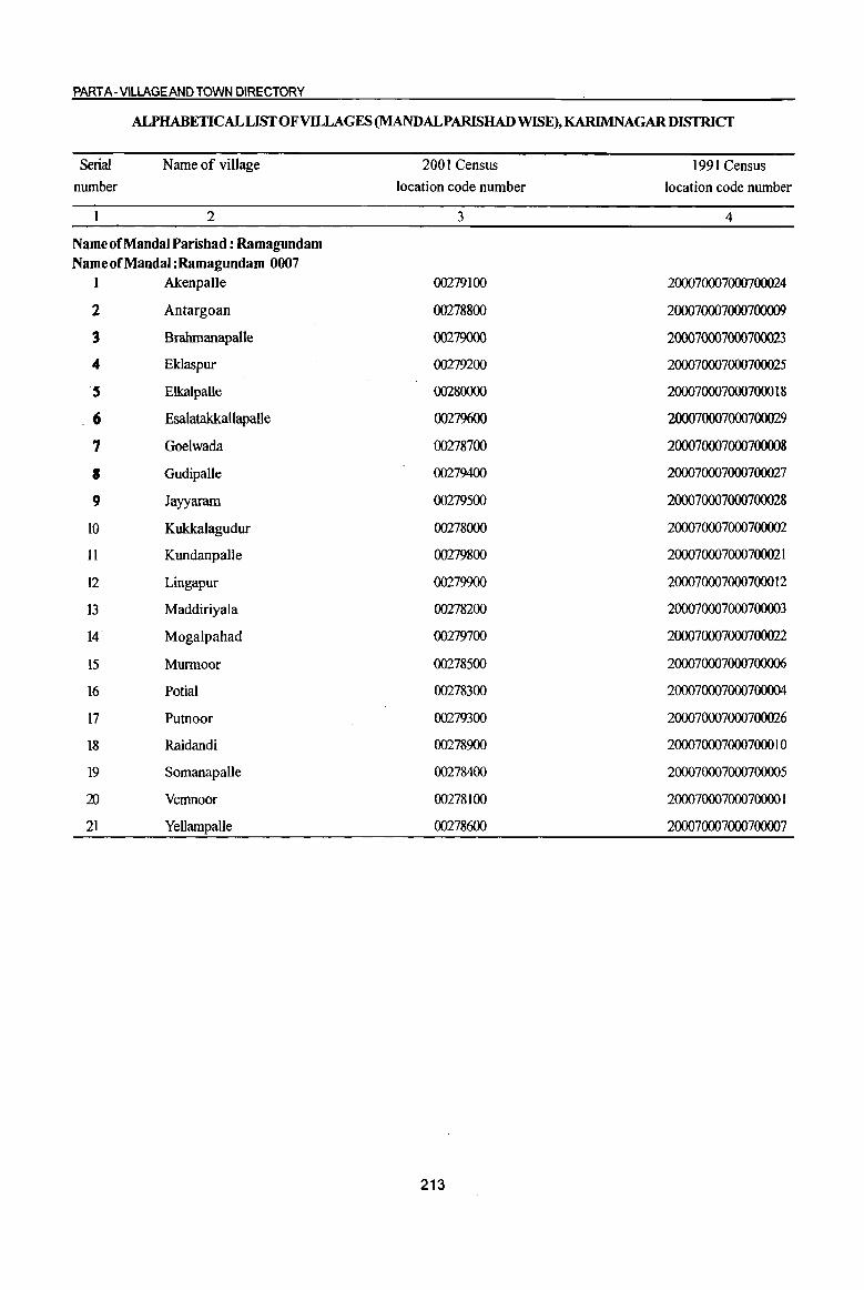
PART A- VilLAGE AND TOWN DIRECTORY
ALPHABETICAL LIST OF VILLAGES (MANDALPARISHAD WISE), KARIMNAGARDISTRICf
Serial
number
Name of village
2
Name of Mandai Parishad : Ramagundam Name of Mandai :Ramagundam 0007
1 Akenpalle
2 Antargoan
3 Brahmanapalle
.. Eklaspur
5 Elkalpalle
.6 Esalatakkallapalle
7 Goelwada
8 Gudipalle
9 Jayyaram
10 KukkaJagudur
II Kundanpalle
12 Lingapur
13 Maddiriyala
14 Mogalpahad
15 Munnoor
16 Potial
17 Putnoor
18 Raidandi
19 Somanapalle
al Vemnoor
21 Yellampalle
2001 Census
location code number
3
00279100
00278800
00279000
00279200
00280000
00279600
00278700
00279400
00279500
00278000
00279800
00279900
00278200
00279700
00278500
00278300
00279300
00278900
00278400
00278100
00278600
213
1991 Census
location code number
4
200070007000700024
200070007000700009
200070007000700023
200070007000700025
200070007000700018
200070007000700029
200070007000700008
200070007000700027
200070007000700028
200070007000700002
200070007000700021
200070007000700012
200070007000700003
200070007000700022
200070007000700006
200070007000700004
200070007000700026
200070007000700010
200070007000700005
20007000700070000 I
200070007000700007

.-.. " i "8 'OJ
'" .~
...c a ~ " u
~ l;l, -<:> os 0
~ cIg ~ ., ., 8 co of!
.8 .!l . ., .... ~ 'S 0
~ '" 8: .... ; c 0 .... "iii
~ '3 '3 'ij 0 0
<I> ~ ~
I 2 3 4
~Ddal PariJbad : Ramagund.am (0007)
Kukkal.agudur 1244.0 2,422
(00278000)
Vc:mnoor 2 620.0 725
(00278100)
3 Maddiriyala
695.0 767 (00278200)
Potial 4 1267.0 2,027
(00278300)
Sol113l1llpa1le 223.0 7S0
(002784oo)
6 Murmoor
IIS9.0 2,123 (00278500)
7 Yellampalle
824.0 916 (00278600)
Goelwada 1596.0 2,158 8
(00278700)
9 Antargoan
418.0 1,286 (00278800)
Raidandi 10 1787.0 2,967
(00278900)
Bralunanapalle II 613.0 1,783
(00279000)
DISTRICT CENSUS HANDBOOK: KARIMNAGAR
Census of India 2001 -Amenities and
Amenities available (if not available within the village. a dash (-) is shown in the colwnn and next to it in brackets the distance in broad ranges viz. < 5 krns., 5-10 krns. and 10+ kms of the
-;;;- nearest_Qlace where the facilitY is available is given) ::s '" c -0 ~~ .,
lii u • ., <> I{ 0 " ... ! ~~ c >
.~ '>: 0 0 . ., ~ ]: f ~ 8.
8.. '" ., os
~. ..,
~~'"' ., ~ £ ~ '~'" '0 ::s "
i -0 ~ .~ _"iii§ ~~ ;j <> a ..c 'c ~ c " ::s ... o ._
c1g~g c _
0 ~ i t: g :E:a o c
..c
l~ . ., 0
.... "iii 3: "iii ]>~ '" 'p 0 c ·e .~ !! ... 0
"iii co " .S "ii 6 § .,
" 'D C 'B .... "'3 ti .n .. u ~ e <;i e '" e ~ § <> :;; ~ ~j 'a\:; !:! ~ 'i3
~ ~ is ~ab3 e~ Z ~ ..(~ 8' 5 6 7 8 9 10 Il 12 13
HCPHS
P(l) M S RMP(4) 0 HPTWW PO CM NCS(4)
CV(IO+) BS RS(IO+) 653 AC(3) C(lO+) H(5-10) OCS(2)
TKC PH(IO+) CP(lO+) SP(lO+) NW(IO+) MCW(IO+) ACS(IO+)
ST(lO+) PHC(5-10)
PAC RMP(2) 0
NCS H(5-10) HP TW W PO(~ 5) CV(IO+) BS RS(IO+)
184 M(5-1O) CM«5) ACS(lO+) C(IO+)
MCW(IO+) TK R C PH(IO+) CP(IO+) OCS(lO+) SP(lo+) NW(IO+)
PHC(5-10) ST(lO+)
RMP(2) 0 NCS
236 PM«5) H(10+) HP TW W PO(; S) CM(10+) ACS(lO+) CV(IO+) BS RS(IO+)
C(lO+) MCW(IO+) TKRC PH(10+) CP(IO+) OCS(IO+) SP(lO+) NW(IO+)
PHC(lo+) ST(lO+)
PHSFWC
521 P(2) M RMP(2)
HPTWW PO ACS(lO+) CV(IO+) BS RS(IO+) H(10+) CM(IO+)
C(IO+) MCW(IO+)
TKC PH(IO+) CP(IO+)
NCS(IO+) SP(10+) NW(IO+)
PHC(lO+) OCS(IO+) ST(IO+)
P(2) AC FWCRMP(2)
186 M(5-1O) OH(IO+) HPTW W PO(~-IO) CM(IO+)
ACS(IO+) CY(IO+) BS RS(10+)
C(10+} MCW(IO+) TKRC PH(10+) CP(IO+)
NCS(IO+) Sp(IO+) NW(IO+)
PHC(lO+) OCS(10+) ST(IO+)
PHS RMP(2) NCS(2)
502 P(2) M AC OH(1O+) HPTWW PO CM(IO+) ACS(lO+)
CV(IO+) BS RS(IO+) qIO+) MCW(IO+) TKC PH(IO+)
CP(iO+) OCS(lO+) 5P(10+) NW(IO+)
PHC(IO+) ST(IO+)
PAC RMPO
NCS(2)
193 M(5-10) H(IO+) HPTWW PO(;-IO) CM(IO+) ACS(IO+)
CY(IO+) BS RS(IO+)
C(lO+) MCW(IO+) TKRC PH(IO+) CP(IO+) OCS(IO+)
SP(IO+) NW(IO+)
PHC(IO+) ST(IO+)
RMP{J) 0 NCS
516 PM AC H(IO+) HPTWW PO CM(IO+) ACS(IO+)
CV(IO+) BS RS(IO+)
C(lO+) MCW(IO+) TKRC PH(IO+) SP(IO+) NW(lO+)
PHC(lO+) CP(JO+) OCS(IO+)
ST(IO+)
DMCWPHS NCS(2) BS
287 P(2) M S RMP(3) 0 HPTWW PO
CM(S-IO) ACS(IO+) CY(IO+)
RS(S-IO) ACC(IO+) H(S-IO) TKRC PH(5-1O)
CP(IO+) OCS(IO+} SP(IO+)
NW(5-1O) PHC(IO+) ST(IO+)
739 P(2) M(2) RMP(3) 0 H(5 W NCS(4)
CY(IO+) B5RS 10) MCW(S- ~P TW PO PH CM(5·10) ACS(IO+)
Sp(IO+) NW(lO+) C(IO+) 10) PHC(IO+) K CP(IO+) OCS(IO+} ST(IO+)
RMP(2} 0 NCS BS
449 prJ) M AC H(5-10) THPTW PO CM(IO+) ACS(IO+)
CY(IO+) RS(5-IO)
MCW(S-IO) WTKC PH(5-1O) SP(IO+) C(lO+) CP(IO+) OCS(IO+) NW(IO+)
PHC(IO+) ST(JO+)
214

VILLAGE DIRECTORY
ViIlae;e Directory Land Use (As on 1999)
Land use (i e. area under different types of land use in hectare)··
i " 0 '!!l to
g b "" ;>
:® '!!l
8 '8 ;;
'" <>
~ u
~ <>~ .. ~ '~ I :.§.:J .s
:a '" '" 01> <> .. ;> :g ~ ~ ~ 1"3 0 ~ ~ ~
~ j '" 'a .!! .8 9 € ..., 3:..., ;> ~ g )3 §. 8.~ ! ~ iii ., § "0 .....
1;; .,
c:>. .§ .:l " "lil t:a <5 0 c e j ...
<II .. 'S a-3 " '" .. - :> f! .. O! c:>. it i!:
~ m tlIl
~ ~ ~ :§ ~ - :> '" '5 If rf '" ., < U OJ) rJ)
14 15 16 17 18 19 20 21 22 23 2 I
GC(322.4)
PR Ramagundam (19) EA NM WE(64.0)
210.2 TK(6S,9} 578,0 0.6 Kukkalagudur
T(45S.2)
GC(24.3)
PR Ranlagundanl (20) fA NM W(67.6)
400.1 64.2 20.0 Vemnoor 2 TK(43.7)
T(I35.7)
OC(44.6)
PR Ramagundanl (14) EA NM WE(35.2) 468.7 85.1 61.5 Maddiriyala 3 T(79.8)
OC(256.4)
PR Rarnagundanl (14) EA NM WE(75.3)
671.0 20.0 220.0 Potial TK(24.3)
T(356.0)
GC(76.1)
PR R~dam(13) EA NM WE(39.7)
59.7 11.0 Somanapalle ' .. TK(36.S)
T(IS2.3)
GC(143.8)
PR Ramagundanl (II) EA NM WE(19.0) 897.6 33.2 6H Mwmoor 6 T(l62.8)
OC(27.1)
PR Ramagundam (13) EA NM WE(47.8)
523.8 45.4 158.9 YcllampaJlc 7 TK(21.1)
T(96.0)
GC(SO.6)
PR Ramagundam (8) EA NM WE(SI.S)
933.7 224.4 259.0 Goelwada 8 TK(46.6) T(l79.0)
GC(16.2)
PR Ramagundam (7) EA NM WE(46.2)
241.0 34.4 66.1 Antargoan 9 TJ«14.2) T{76.S)
WE(64.1)
PR Ramagundam (6) EA NM TK(95.6) 1199.3 296.5 13J.6 Raidandi 10 T(1597)
OC{28.4)
PR Ramagundam (12) EA NM WE(34.4)
105.7 TK(129.6) 104.9 210.0 Brahmanapallc 11
T(192.4)
215
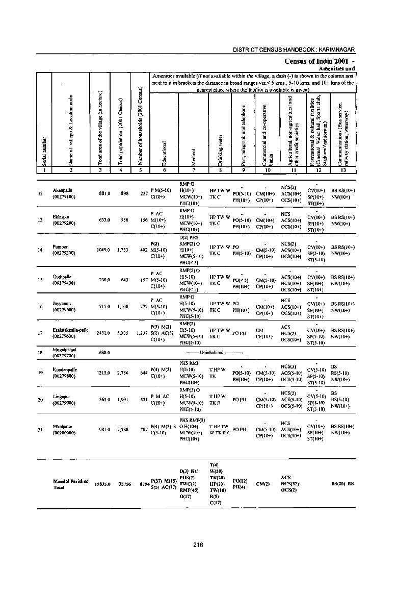
1l ~ c 'ii 't: OJ
en I
12
13
14
15
16
17
18
19
20
21
'" g 15
':1 g ..J a<! ., co .!! ~ eo. 0 .. ~ 2
Alcenpalle (00279100)
Eklaspur (00279200)
PumOOT
(00279300)
Gudipalle (00279400)
Jayyaram (00279500)
Esalatakklllla·palle
(00279600)
MogaJpahad (00279700)
KwuJanpaile
(00279800)
Lingapur (00279900)
Elkalpalle (00280000)
MandaIP".-dhad Total
~ u -;;;-.. ill .d
g fi U
'" .; <; 0
~ C II> 8 -B '_z:l eo. .. 0
I .. ~ ~ s
0 E-< E-< 3 4
881.0 898
633.0 550
1049,0 1,733
230,0 643
71S,0 1,108
2432.0 5,335
688.0
1215,0 2,786
565,0 1,991
981.0 2,788
19835,0 35756
DISTRICT CENSUS HANDBOOK: KARIMNAGAR
Census of India 2001 -Amenities and
Amenities available (if not available within the village, a dash (-) is shown in the colwnn and next to it in brackets the distance in broad ranges viz. < 5 krns" 5-10 krns, and 10+ lans of the
'§' nearest~ace where the facility is available is given) '" 5 u 8 '" c
<;> C -g_ {j u
"0 1i ~
"<;l
; gj ... 0 ~
.d .d
~ ~ ;a 11: d
.8 0 co .!! 'B 'ii c ~ <)
~ £ ;a 1i ~ ~ t§ ~
5 6 7 8 9
RMPO
227 P M(5·10) H(IO+) HPTWW PO(;.IO) C(1O+) MCW(IO+)
TKC PH(IO+) PHqIO+)
PAC RMPO
156 M(lO+) H(IO+) HPTWW PO(;-IO)
C(lO+) MCW(lO+) TKC PH(IO+) PHC{IO+)
D(2)PHS
P(2) RMP(2)O HPTWW PO
402 M(S-IO) H(IO+)
C(lO+) MCW(S-IO) TKC PH(S-IO)
PHC« 5)
PAC RMP(2) 0
157 M(S-IO) H(5-10) HP TW W PO(~ 5)
C(lO+) MCW(IO+)
TKC PH(lO+) PHC«5)
PAC RMPO
272 M(5-10) H(5-10) HPTWW PO
C(IO+) MCW(S-IO) TKC PH(lO+)
PHC(5.1O)
P(3) M(2) RMP(S)
1,237 S(2) AC(3} H(S·IO) HPTWW POPH
C(lO+) MeW(S-IO) TKC PHqS-IO)
--Uninhabited ---
PHSRMP
644 P(4) M(2) "(5-10) C(IO+) MCW(S-IO)
PHC(IO+)
RMP(3) 0 PM AC H(S-IO)
S31 C(IO+) MCW(5-W)
PHC{S-lO)
PHS RMP(3)
702 P(4) M(2) S 0 H(IO+) C(5-10) MCW(IO+)
PHC(IO+)
D(3) He PUS(7)
8794 P(J7) M(lS) FWC(2) S(5) AC(l7) RMP(45)
0(17)
216
T"PW TK
PO(S-10) PH(IO+)
THPW PO PH
TKR
THPTW POPH WTKRC
T(4)
W(lO) TK(20)
HP(20)
TW(18) R(8)
C(I')
PO(Il) PU(4)
., '~ 8-~ <)
." !a "ii .~
~ '" 81
10
CM(IO+)
CP(IO+)
CM(IO+)
CP(lO+)
CM(S-IO)
CP(IO+)
CM(S-IO)
CP(lO+}
CM(IO+)
CP(IO+)
CM
CP(lO+)
CM(S-IO)
CP(IO+)
CM(S-IO)
CP(IO+)
CM(5-10) CP(lO+)
CM(2)
"<;l
a
i <)
'6i, ~ ~ .,p I'l u o ,-C g
~~ "3 ~ 'Ii tl z~ II
NCS(2)
ACS(IO+)
OCS(lO+)
NCS ACS(IO+)
OCS(IO+)
NCS(Z) ACS(IO+)
OCS(lO+)
ACS(1o+)
NCS(lO+)
OCS(IO+)
NCS ACS(lO+)
OCS(lO+)
ACS
NCS(2)
OCS(IO+)
NCS(3) ACS(S-IO)
OCS(S-IO)
NCS(2)
ACS(S-IO)
OCS(S-IO)
NCS
ACS(IO+)
OCS(IO+)
ACS
NCS(32)
OCS(Z)
.,.D u..: '.c <>
~~ .:I&. ]~" _'ii~ " .c 'C Q ~ .s o'!I::l;a 1I;'>~ .~ 01] e ~;a ~O£l
12
CV(IO+)
Sp(IO+)
ST(IO+)
CV(IO+)
SP(IO+)
ST(IO+)
CV(If)+)
SP(S-IO)
ST(S-IO)
CV(IO+)
Sp(IO+)
ST(IO+)
CV(IO+)
SP(IO+)
ST(W+)
CV(lO+)
SP(S-IO)
ST(S-IO)
CV(S-IO)
SP(S-IO)
ST(5-10)
CV(S-IO)
SP(5-IO)
ST(5-10)
CV(IO+)
SP(IO+)
ST(lO+)
Ii <)
't...., II> ~ ::: ~ " ., e:;; '" il: c _ o c
'_z:l 0 .. '.c '~ ~ ~ ~ 8~
13
as RS(IO+)
NW(IO+)
BSRS(IO+)
NW(IO+)
BSRS(IO+) NW(IO+)
BSRS(IO+) NW(IO+)
as RS(IO+)
NW(IO+)
BS RS(IO+)
NW(lO+)
B5 RS(S-lO)
NW(IO+)
BS
RS(5-10)
NW(lO+)
as RS(IO+)
NW(lO+)
BS(20) RS
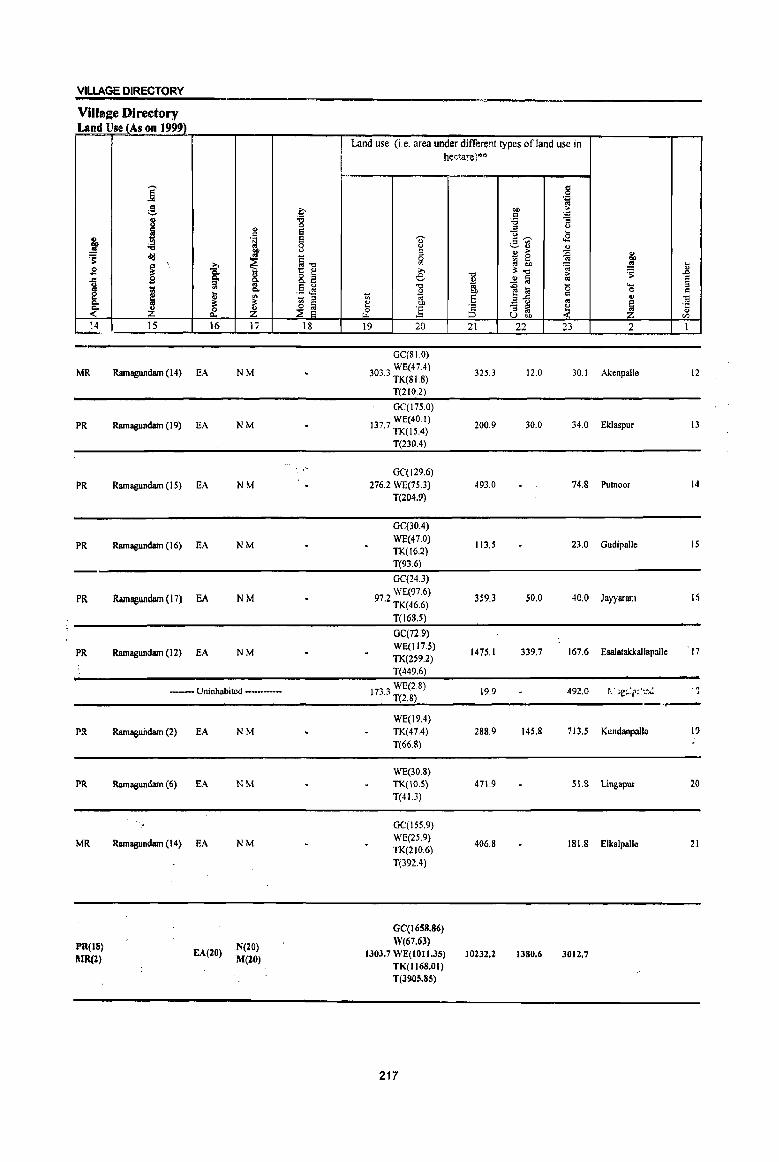
VILlAGE DIRECTORY
Villa2e Directory Land Use (As on 1999)
j :§, 8 ~ " =
j .~ :.a ~ old ..
t ~ ,
1 £ ~ ..e £
1 ll! <II 0.
~ j '" ~ ~ ~ :Z '4
~. 1S 16 17
MR Ramagundam (14) fA NM
PR Ramagundam (19) fA NM
PR Ramagundam (15) EA NM
PR Ramagundam (16) EA NM
PR RamagwlIlam (17) EA NM
PR Ramagundam (12) fA NM
_.- Uninhabited ••• _.-••••
Plt
PR
MR
PR(lS) I\lR(l)
Ramaguildam (2)
Ramagundam (6)
Ramagundam (14)
EA
EA
EA
EA(20)
NM
NM
NM
N(lO) M(20)
I
::-'g e; e; 0 (,)
~.", ~B E :.l '': 't:l ~ ~
18
Land use (i.e. area under different types of land use in he(\a:ejM
"C'""'
'0' g ::I 0 Vl
>-e .",
~ '" " OJ) ... ]; t2
19 20
GC(SIO)
303 3 WE(47.4) . TK(81.8)
T(210.2)
GC(l75.0) WE(40.1)
137.7 TK(15.4)
T(230.4)
GC(129.6) 276.2 WE(75J)
T(204.9)
GC(30.4) WE(47.0) TK(16.2) T(93.6)
OC(24.3)
97 2 WE(97.6) , TK(46.6)
T(l6S.5)
GC(72.9) WE(117.5) TK(2~9,2)
1(449.6)
173 3 WE(2.8) . T(2.S)
WE(l9.4) TK(47.4) 1(66.8)
WE(30.8) TK(IO.S) 1(413)
GC(155.9) WE(2S.9) 1K(210.6) T(392.4)
GC(1658.86) W(67.63)
1303.7 WE(IOII.35) TK(1l68.01) T(3905.85)
217
.",
~ Ol)
'E ~ 21
325.3
200.9
493.0
113.5
359.3
1475.1
19.9
288.9
471.9
406.8
10232.2
,~ Ill) " = ~ 'i3
]~ (,) ...
<8 v~ " £ ~ :g gj 5h ~ ~"" " ..!! § '" ~ :a 0 ilg =
" J ::I '" u OJ)
22 23
12.0 30.1
30.0 34.0
74.8
23.0
50.0 40,0
339.7 167.6
492.0
145.8 713.5
51.8
181.8
1380.6 3012.7
j ... 'S " ~
§ <-.. 0 = ., .. ~
.t:;
" en
2 1
Akenpalle 12
Eklaspur 13
Pulnoor 14
Gudipalle IS
Jayyaran I~
Esalatakkallapallc 17
~. ~ je~~i':·~~:'~ . , -.,..-
KlIndanp:dlc I~
Lillgapur 20
Elkalpalle 21
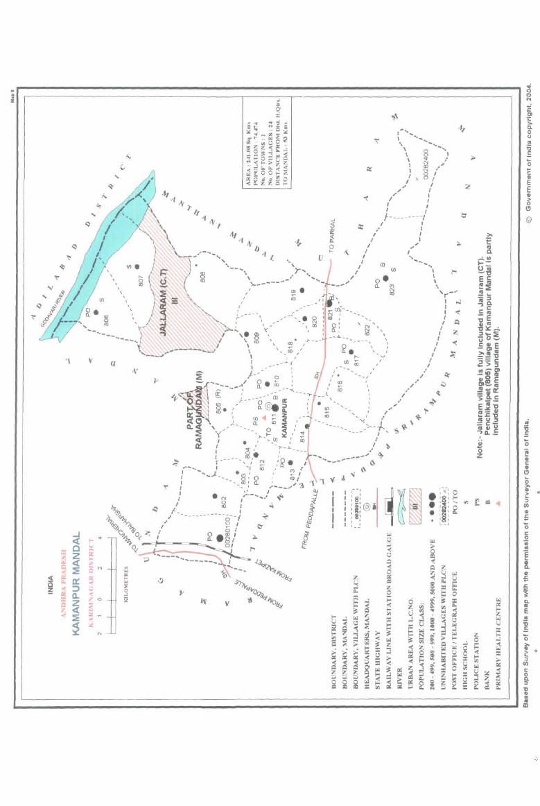
'1 v
t .... ' ' .... , -.. '( -.. " ~., \ 8 , " v I \ N " I <Xl .' , N , ~
0 I )( o I I I ..
I " I .. I ~ I
I I I ' -}-----, -- .'
u
~
I I
;
I J ,
I
I ..
/ I
I
V J
.. I
' ...... (' , ,'r-f,
J I ~
,/ ~ -, ,-"-' \.\'-.. - {\
'1 '1 V !!J I
I ! g I
If! I
I
- -, I ' , , 'S' ~ : Ii: @i , 'iii, l : S: , , I t __
" ,. I
I
.. .. I I I
""-" , , , ", _-r
I '"' : ~ } A
" :z; I I
I I
(
I
; ,
l I ..-
.... o C III E E III
~ Cl
@
II
oS :E ;: Q. II E II
~

PART A - VILLAGE AND TOWN DIRECTORY
ALPHABETICAL LIST OF VILLAGES (MANDALPARISHAD WISE), KARlMNAGARDISTRlCf
Serial Name of village 2001 Census 1991 Census
nwnber location code number location code number
2 3 4
Name of MandaI Parishad : Kamanpur NameofMandal:Kamanpur 0008
1 Begumpet 00282300 200080008000800024
2 Gundaram 00281400 2000800080008000 14
3 Jallipalle 00280900 200080008000800005
4 Julapalle 00281000 200080008000800006
S Kalwacherla 00281700 2000800080008000 18
6 Kamanpur 00281100 2000800080008000 15
7 Kannala 00280100 2000800080008000 11
8 Lankakesaram 00281600 200080008000800017
9 Lingala 00280400 200080008000800008
10 MedipaJle 00282200 200080008000800023
11 Mulkalapalle 00281800 200080008000800019
12 Mustial 00280700 200080008000800002
13 Nagaram 00280300 200080008000800009
14 Nagepalle 00281900 200080008000800020
15 Pannur 00282000 200080008000800021
16 Penchikalpet (Rural) 00280500 200080008000800007
17 Perapalle 00281300 2000800080008000 13
18 Rajapur 00281500 2000800080008000 16
19 Ranapur 00280200 2000800080008000 1 0
20 Ratnapur 00282100 200080008000800022
21 Rompikunta 00281200 2000800080008000 12
22 Sundilla 00280600 20008000800080000 1
23 Vpparlakesaram 00280800 200080008000800004
24 Velgalpahad 00282400 200080008000800025
219
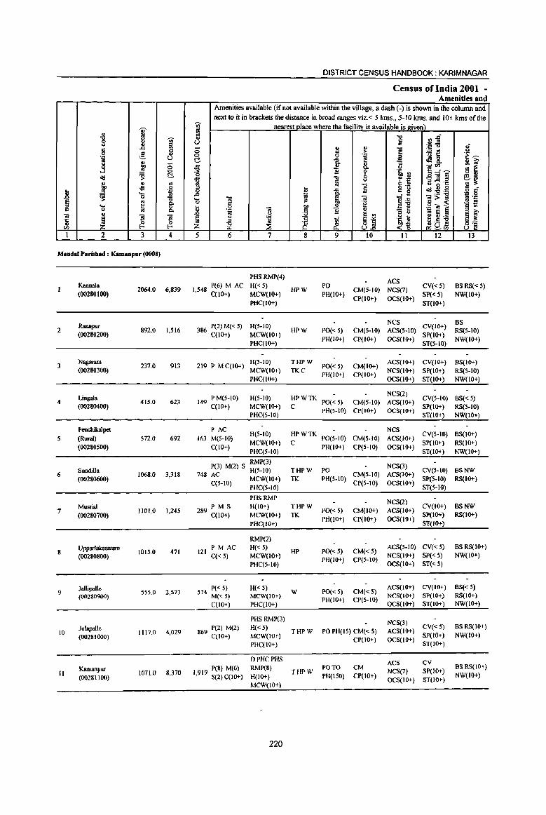
~ .g 'iii' C) li '" ~ '" 8 c 8 ]
;:::, ., 0 J 0
<Id 's: c:!,
1;1, '" C -5 0
~ '" ~ ~ .... 0
1 ~ ~ .... c 0 .. u
~ '3 '3 ·c
u 0 0 t/) I-< I-< 1 2 3 4
MandaI Parisbad : Kamanpur (0008)
KaonaJa 2064.0 6,839
(00280100)
Ranapur 2 892.0 1,516
(00280200)
3 Nagaram
237.0 913 (00280300)
Lingala 4 415.0 623
(00280400)
Pcochikalpet
5 (Rural) 572.0 692
(00280500)
Sundilla 6
(00280600) 1068.0 3,318
Mustial 7 1101.0 1,245
(OOZ80700)
8 Upparlalcesaram
1015.0 471 (00280800)
9 Jallipal1e
555.0 2,573 (00280900)
Julapalle 1117.0 4,029 10
(00281000)
Kamanpur II 1071.0 8,370
(00281100)
DISTRICT CENSUS HANDBOOK: KARIMNAGAR
Census ofindia 2001 -Amenities and
Amenities available (if not available within the village, a dash ( -) is shown in the column and next to it in brackets the distance in broad ranges viz. < 5 krns., 5-10 krns. and 10+ lans of the
'iii' nearest_mace where the facility is available is given) = '" c -0 ",.ri u U Iii .~ .fi :3 0 u " ] B .:: ~i! 'E~ 0 'E c:!, -a ~8. ~ ~ u :;
~ ., a. (J ~~~ ~ ~ 11 ~ .ti, ~
~ "Q ~ .~
_"il§ ~f Iii () '" ~·c -0 <> ~ = t Iii
o .-<Id:g~
c _ 0 i .. 8 o c ~ to - .. '.c 0 ..... .. ~ ..
]~ 1>~ ., 'n 0 c 'g .~ :l _g 0 .. "" " '.c .. e § .. .:::
~ 11 '3 b .. <> S II> '" S = ~ ~ § " 'S <i ~1
u .. eu'S 8] ~ ]>~ Z ~ &
~ .S !l Q!U..,
5 6 7 8 9 10 11 12 13
PHSRMP(4) ACS
I 548 P(6) M AC H«S) HPW
PO CM(S-IO) NCS(7)
CY« S) BS RS« S) , C(lO+) MCW(1O+) PH(lO+)
CP(IO+) OCS(IO+) SP« 5) NW(lO+)
PHC(IO+) ST(IO+)
386 P(2) M« S) H(S-IO) NCS
CV(IO+) BS
HPW PO« S) CM(S-IO) ACS(5-IO) RS(5-10) C(IO+) MCW(lO+)
PH(lo+) CP(IO+) OCS(lo+) SP(IO+)
NW(IO+) PHC(IO+) ST(5-IO)
219 P M C(IO+) H(5-10) THPW
PO« S) CM(IO+) ACS(IO+) CV(IO+) BS(IO+)
MCW(IO+) TKC PH(IO+) CP(IO+)
NCS(IO+) SP(IO+} RS(5-1O) PHC(IO+) OCS(IO+) ST(IO+) NW(IO+)
149 P M(S-IO) H(5-10) HPWTK NCS(2)
CV(5-10) BS«5) PO« 5) CM(S-IO) ACS(IO+)
C(10+) MCW(IO+) C PH(5-10) CP(1O+) OCS(IO+)
SP(IO+) RS(5-10) PHC(5-10) ST(IO+) NW(IO+)
PAC H(5-10) HPWTK
NCS CY(S-IO) BS(IO+)
163 M(5-1O) P0(5-1O) CM(S-IO) ACS(lO+)
C(IO+) MCW(IO+) C
PH(lO+) CP(S-IO) OCS(lO+) SP(IO+) RS(IO+)
PHC(5-10) Si(IO+) NW(IO+)
RMP(3) NCS(3) P(3) M(Z) S H(5-10) THPW PO CV(5-IO) BSNW
748 AC MCW(lO+) TK PH(S-IO)
CM(S-IO) ACS(IO+) SP(5-1O) RS(IO+)
C(5-10) PHC(S-IO) CP(5-10) OCS(IO+) ST(5-1O)
PHSRMP NCS(Z)
P M S H(IO+) THPW CV(IO+) BSNW 289 C(10+) PO« 5) CM(IO+) ACS(IO+)
MCW(IO+) TK PH(IO+) CP(IO+) OCS(lO+)
Sp(IO+) RS(10+)
PHC(IO+) ST(IO+)
RMP(2)
121 PM AC H«S)
HP PO« 5) CM«5) ACS(5-10) CY«5) BSRS(IO+)
C«5) MCW(lO+) PH(IO+) CP(5-10)
NCS(IO+) SP« S) NW(IO+)
PHC(S-IO) OCS(IO+) ST« 5)
574 P« 5) H« 5) W PO« 5) CM«5)
ACS(lO+) CV(IO+) BS« 5)
M«5) MCW(IO+) PH(IO+) CP(5-10)
NCS(IO+) Sp(IO+) RS(IO+)
C(10+) PHC(IO+) OCS(lO+) ST(lO+) NW(IO+)
PHSRMP(3) NCS(3)
869 P(2) M(2) H« 5) THPW PO PH(IS) CM« 5) ACS(IO+)
CV«5) BSRS(IO+)
C(lO+) MCW(lO+) SP(IO+} NW(IO+)
PHC(IO+) CP(lO+) OCS(lO+)
ST(IO+}
o PHC PHS ACS CV
P(8) M(6) RMP(8) THPW
PO TO CM NCS(7) SP(!O+)
BSRS(IO+)
1,919 S(2) C(lO+) H(lO+) PH(150) CP(10+) NW(IO+) OCS(IO+) ST(IO+)
MCW(IO+)
220

VILLAGE DIRECTORY
Land Use (As on 1999) Land use (Le. area under different types of land use in
hectare)"
j '" 0 .-= ~ ~ "" ~
c .-= " :g :a -; u
" '" u
~ S u ... u . ~ Ei -- c -- J:!
" .- '" OIl :.a 8 ~ ~" .,
.!! .. " > {j u 's: <Ii!! ..
~13 0 - 0 J ~ ., ;j tb
~ ...
~ »
!l:"t:I u
.9 15. » "'" > 's: .&J
..c .9 C- o. 8.E e u .!! l;j <II ~ U ::l .. .§ ~ 13 ... .0 la "5 .... ..
l .,
0. OIl 0 c 2 ~ C/l 1;$ ::; ;;; OJ 'E e!.::: c .. .. E! u .. 0. !l: ~
~ ~ e ...
:3 - ::l ~ l ·c ~ &. ~ & ] ::l .. " U on rI)
14 15 16 17 18 19 20 21 22 23 2 1
MR Ramagundam(13) EA SIO.O 1139.5 414.5 Kannala
PR Ramagundam (10) EA N TK{59.5)
245.4 364.0 223.1 Ranapur 2 T(S9.S)
GC(SO.6)
MR Ramagundam (II) EA N WE(28.3)
97.4 30.4 2.0 Nagaram 3 TK(283) T(107.2)
GC(101.2)
PR Ramagundam (10) EA N WE(40.5)
197.3 45.9 5.9 LingaJa TK(24.3) T(165.9)
GC{12.1)
PR Ramagundam (12) EA N W{O.5)
200.0 54.3 262 5 Penchikalpet 5 WE(42.5) . (Rural)
T(5S.I)
TK(40.0) PR Ramagundam (20) EA R(80.0) 454.0 494.0 Sundilla 6
T{I20.0)
WE(IO.O) PR Ramagundam (21) EA TK{12$.5) 476.8 488.8 Mustial 7
T{135.5)
WE(40.0) PR Ramagundam (16) EA TK(16.0) 479.5 479.$ Upparlakesaram 8
T(56.0)
PR Raroagundam (20) EA 277.$ 277.5 Jallipalle 9
WE(160.0) PR Ramagundam (18) EA NM TK(70.0) 443.5 443.5 Julapallc 10
T(230.0)
WE(320.0) PR Ramagundam (30) EA NM TK(85.0) 546.8 29.6 89.6 Kamanpur II
T(40S.0)
221

i .g 'iii' '" '" ..c In
8 ~ g .'" 8 .,
"0 ~ ...l ~
0
old ~ II II CI OIl -s 0
.8 .!!! 'J:'
~ 'Ci oS
1 ~ ~ ._ CI 0 .. .. 1§ "3 .c:
~ ~ ~ u III
I 2 3 4
12 Rompikunta
533.0 2,562 (00281200)
13 Pcrapalle
353.0 1,591 (00281300)
14 Gundaram
966.0 2,054 (00281400)
Rajapur 15 465.0 565
(00281500)
Lankakesaram 16 487.0 446
(00281600)
17 Kalwacberla
1237.0 4,S58 (00281700)
Mulkalapalle 18 360.0 341
(00281800)
Nagepallc 19
(00281900) 888.0 2,242
20 Pannur
211.0 3,166 (00282000)
Ratnapur 21
(00282100) 258.0 10,071
22 Medipallc
445.0 (00282200)
DISTRICT CENSUS HANDBOOK: KARIMNAGAR
Census of India 2001 -Amenities and
Amenities available (if not available within the village, a dash (-) is shown in the column and next to it in brackets the distance in broad ranges viz. < 5 kms., 5-10 kms. and 10+ kms of the
1 nearest place where the facility is available is tziven) "0 ~~ u la .... Q Ii
0 .. ., ] .::: > ~t! <>
0 i .... 'E ~
~ e .a 8. ~~ .. :;
]~'"' ~ '" () g 9 '6, '" 1 -0 0 ~ .~ _OI!§ ~~ Iii <>
is ~'a -0 I::l ..
is o .- S r::f t; ..c :a I::l g ~~:a ..c iii I l~ '.c 0 ... 01 :1; .. .. >::1 ~ 'J:'
0 CI '0 § « '§ ;! _g 0
11 OIl II 'J:' ~] "J::
~ - .. '" " os E ~ f ~
~ 'i3 13 Ul
.~ II I:! U :e ~ ~ g 'iii ~j_ ~D5 8~ z ~ <"~ ~1Il
5 6 7 8 9 10 11 12 13
PHS NCS(2)
629 P(3) M(2) H(S·IO) THPTW PO CM(S·IO) ACS(5.IO)
CV(S-IO) BS RS(lo+) C(IO+) MeW(S-IO) WTKC PH(IO+)
CP(S-IO) OCS(JO+) SP(IO+) NW(JO+)
PHC(5-10) ST(IO+)
PHS NCS(2) BS
413 P M C(lO+) H(S·IO) HPTWW PO
CM(IO+) ACS(IO+) CV(IO+)
RS(S-IO) MCW(IO+) TKC PH(IO+)
CP(JO+) OCS(IO+) SP(lo+)
NW(JO+) PHC(IO+) ST(IO+)
RMP(2)
464 P M C(IO+) H«5)
HPW PH(5)
CM«5) ACS(lO+) CV« 5) BS~I()+)
MCW(IO+) PO«5) CP(IO+)
NCS(IO+) Sp(IO+) NW(IO+) PHC(IO+) OCS(IO+) ST(IO+)
129 PM(IO+) H«5) NCS
CV«5) BSRS(IO+) HPW PO« S) CM«5) ACS(IO+)
C(IO+) MCW(IO+) PH(IO+) CP(IO+) OCS(IO+)
SP(IO+) NW(IO+) PHC(lO+) ST(IO+)
97 PM«S) H(S-IO) NCS
CV(S-IO) BS« 5) HP PO« 5) CM(S.JO) ACS(IO+)
C(IO+) MCW(IO+) PH« 5) CP(JO+) OCS(IO+)
SP(5-10) RS(IO+) PHC(5-10) ST(5-10) NW(IO+)
P(12) M(II) PHSRMP(7)
NCS(3) 1,064 S(6) AC(2)
H(5-10) THPW PO PH(20) CM(5-10) ACS(IO+)
CV(S-IO) BSRS(IO+)
C(lO+) MCW(IO+)
CP(lO+) OCS(IO+) SP(lo+) NW(IO+)
PHC(IO+) ST(lO+)
PM(IO+) H«5) NCS(2)
CV«5) BS«5) 75 HPW PO(IO+) CM«5) ACS(IO+)
C(lO+) MCW(IO+) PH(W+) CP(IO+) OCS(IO+)
SP(lO+) RS(IO+) PHC(IO+) ST(IO+) NW(IO+)
RMP(2) 0(2) NeS
H(5-10) PH CV(IO+) BS RS(IO+) 517 P M C(10+)
MCW(IO+) HP TW W PO(S-lO) CM«5) ACS«5) SP(IO+) NW(IO+)
PHC(5-10) CP(IO+) OCS(IO+)
ST(IO+}
P AC(2) RMP(3)
NCS
775 M«5) H«5)
HPW PH(5)
CM«5) ACS«S) CV(S-IO) BSRS(IO+)
MCW(S-IO) PO«5) SP(IO+) NW(IO+) C(S·IO)
PHC(5-IO) CP(IO+) OCS(IO+)
ST(IO+)
PHSRMP(3) ACS
225 P(l} M(2} S 0(3) H{IO+) THP
PO eM NCS(2)
CV(:5-IO) BS RS(lO+) , 4 C(IO+) MCW(IO+) PH(IO+) CP(lO+) SP(1O+) NW(IO+)
PHC(IO+) OCS(IO+)
ST(IO+)
----- Uninhabited ----
222
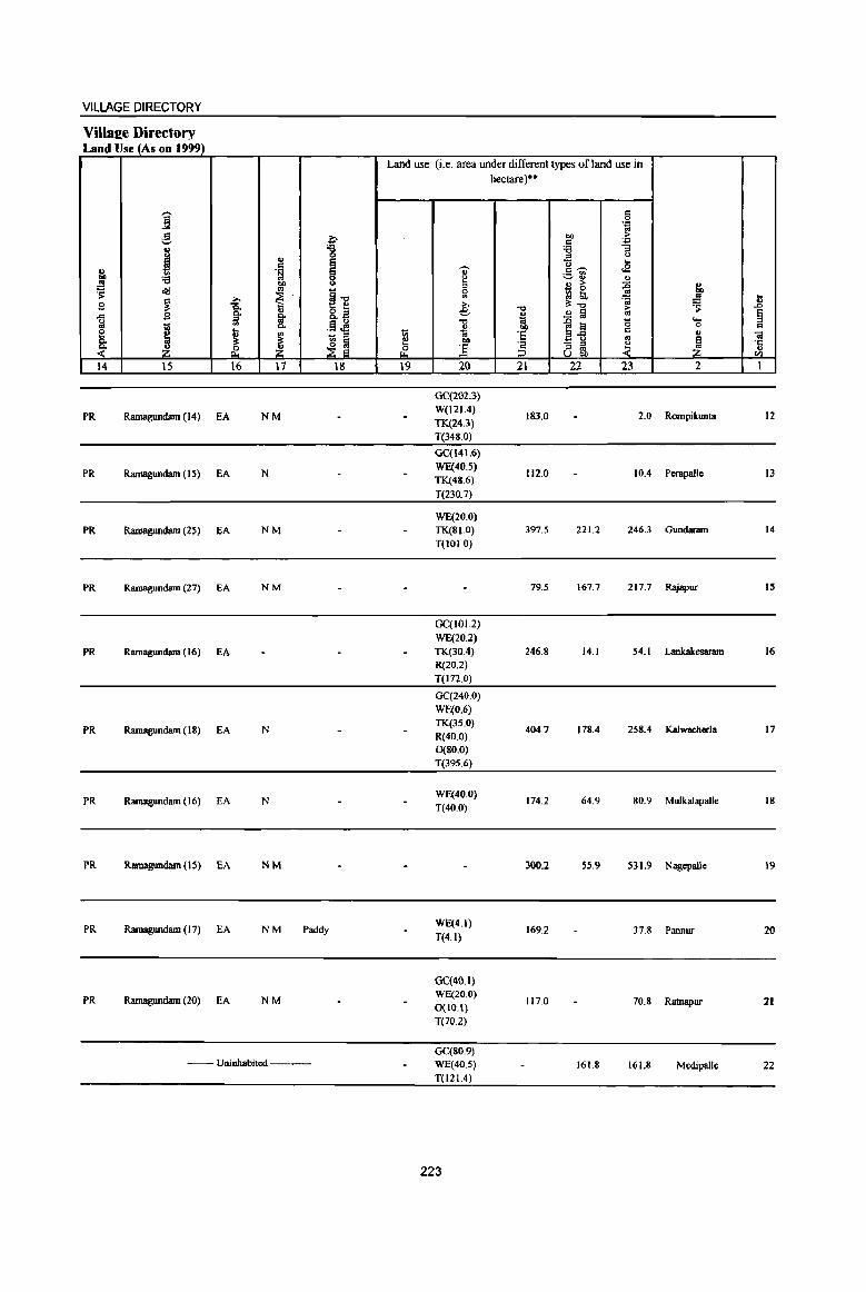
VILLAGE DIRECTORY
Villaee Directory Land Use (As on 1999)
Land use (i.e. area under different types of land use in hectare)··
,-. c ] 0
',:l
.$ ?;- co ~ ._, c: '':
I '& '6 "3 .. :> Q
~ U ... c ~ <E u .~ " c~ .. '6 g Q -=-:1 " .!! co 3 " > :0 l ~ cI<J ..
~1l Sl - 0 ., >. ~
13 !;b ';j t S ~ -a ,., .., Ot-o ,.. .s: .c -'" .9 0. 0. 8.~ e
~ .!! Iii ., § 1;1 :> '" .§~
.., ]~ '0 ....
tii '" 0. ~ co 0 c e I u '" - .. ~ :5
c " ..
0. Ot Ot ~ ~ ~ 00 ..
~ ·c - :> ~ ~ ~ ~ & ] :3 '" '" .. U "" til
14 15 16 17 IS 19 20 21 22 23 2 I
GC(202.3)
PR Ramagundam (14) EA NM W(121.4}
183.0 2.0 Rompikunm 12 TK(24.3) T(348.0)
GC(141.6)
PR Ramagundam (IS) EA N WE(40.S)
112.0 10.4 Perapa1le 13 TK(48.6}
T(230.7)
WE(20.0)
PR RamlIgund8rn (lS) EA NM TK(81.0} 397.5 221.2 246.3 Gundaram 14
T(lOI.O)
PR Ramagundam (27) EA NM 79.S 167.7 217.7 Rajapur IS
GC(IOI.2)
WE(20.2)
PR Ramagundam (16) EA TK(30.4} 246.S 14.1 54.1 Lankakesaram 16
R(20.2}
T(I72.0)
GC(240.0)
WE(O.6)
PR Ramagundam (IS) EA N TK(3S.0)
404.7 178.4 258.4 Kalwacherla 17 R(40.0) 0(80.0)
T(395.6)
PR Ramagundam (16) EA N WE(40.0)
T(40.0) 174.2 64.9 80.9 Mulkalapalle 18
PR Ramagundam (15) EA NM 300.2 55.9 531.9 Nagepalle 19
PR Ramagundam (17) EA NM Paddy WE(4.1)
169.2 37.8 Pannor 20 T(4.1)
GC(40.l)
PR Ramagundam (20) EA NM WE(20.0)
0(10.1) 117.0 70.8 Ratnapur 21
T(70.2)
GC(SO.9) -- Uninhabited --- WE(40.5) 161.8 )(iL8 MedipalJe 22
T(121.4)
223

.8 ~ Cl
til 'I: .. '" I
23
24
" "8 g
~ </d ~
~ .... ., .. ~ 2
Begwnpct (00282300)
V clgaJpabad (00282400)
MalldalParishad Total
I j .c I'j .§, (,)
~ ;; .. 0
~ ~
.B d 0
'''' .... III ., 1 til
~ ~ "3 I-< ~ 3 4
4318,0 4,193
1115,0
21743,0 62378
DISTRICT CENSUS HANDBOOK: KARIMNAGAR
Census of India 2001 -Amenities and
Amenities available (if not available within the village, a dash (-) is shown in the column and next to it in brackets the distance in broad ranges viz. < S kms" 5-10 kms, and 10+ kms of the
'Uj' nearest Dlace where the facilitv is available is !riven) ill d .. u .. ~ g is '., ~ "3- G {j f "2 "0
1 "'" :a u
"'" .. 1 Iii 0 " .c 1;; ... "iii :so 7a
0 d '~
J 0
f ..
-= 7iI "E ., §
.. <J ~ .. <> :e "Ii Cl
81 Z ~ ~ ~ 5 6 7 8 9 10
DPUS
976 P(2) M S RMP(4)
CM H(IO+) HPWTK PO PH(12) CP(S-I() C(S-IO) MCW(JO+) PHC(S-lO)
-- Uninhabited ---
D(2.) PRC
14378 P(S2) M(33) PRS(9) 5(12) AC(8) RMP(42)
0(5)
224
T(8)
W(19) TK(8) HP(ll)
TW(3) C(S)
PO(9) TO PH(108) CM(3)
"5 ] g 'Ii '" , .~ d .,
:n;l " <II
]~ _ 2! e <J
'~ t <~ II
NCS(4) ACS(IO+) OCS(JO+)
AC8(J) NCS(4S)
In.g ., -'J: U ;: en °u t: ~8.
]~~ _7il~ a"6°§ </d~~ 7a>;> C < ,g Oil] iHi :e <> ,9 is ~(,)'"
12
CY(IO+) SP(IO+) ST(IO+)
cv
ti U
'i~ ;I ~ S1d '" :so .g ~ B '., '§ ~ I§ ~ 8~
13
as RS(IO+) NW(IO+)
B8(16) NW(l)

VILLAGE DIRECTORY
Village Directory Land Use (As on 1999)
j g
i '" <= ., .~
J ;e "" ~ old ..
~ ~ ~ g Q,
" ..r:: Q, 1r g " ~
III Q, e ... ~ " Q, :l:
~ Z . i. Z 14 15 16 17
PR Ramagundam (26) EA N
--Uninhabited -••• --.--
PR(lO) MR(2) NW(2)
EA(ll) N(16) M(8)
~ 0 E e 0 u
§'" t:: ~ &'2
.§ ~ 1;; ::I
~ g 18
Land use (i.e. area under different types of land use in
'" ::! 0 ~
19
'OJ ~ 0
'" >, e 'tl
~ ."
] 20
GC(I01.2) WE(~O.S)
TK(68.8) T(210.4)
GC(I071.2) W(11J.89) WE(867.55) 1K(736.57) R(140.23) 0(90.11) 1(3027.56)
225
hectare)"
'0
" tii ." 'E '2 ~
21
1016.0
4996.8
<= 0 .~
"" ;>
c '.;:l
'6 :;
-= () ... 0 <E c~
:.::-~ u u ;> :g ~ ~ ~ ;i: '0
~ .!l !ii
1~ "0 I: .. - " ~ " .. U ."
22 23
1054.3 2037,3
557.0 557.0
6270.3 7447.3
" ." os l 1 ~ ~ = u ..
~ .£: ., til
2 1
Begumpet 23
Velgalpahad 24
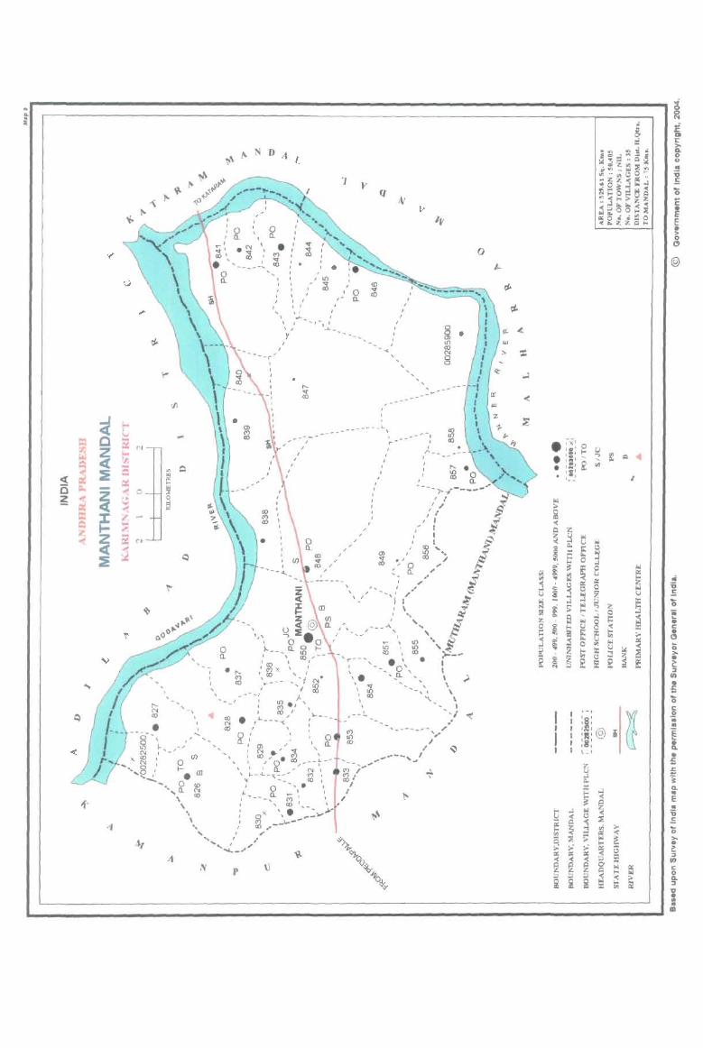
.. II.
i
~ 0 ~
== IZ ~
~ ~
~ ~
....
~ c ~ ~ -~ J: ... Z « ~
v
"..
Eo< V 5: N Eo<
'" ... = CI:: ~ 0 .. 'wi ~ ~ .... "'" s ~
~
'"
~
~
r.fl
...
~
~
'"
, , "- , -, N co
• , .
N
, ,
p
, , "
, ,10
~
... \ \.:.~ I
I
1
, , 'A ,- a.
\./ ..... I .... ,_:__ .......
Y
, , , , ---- .... - , , I
_!. - - --
I ,
, , I
f]
, -"
I ,
, r
, I
, , , ,
o
---, ~ I
I
, ,,- -
--_ -r~·-----'I I~ , ,I
" I , , I
~ i!= (!J
Z (J) < @o. (.) 2:.
~ "~,:> I ,,' --,;:" J I \
"' ... ....... __ ...... , '1; ' .. ' ...., 0 I
• ~ a t-)..--- 10
f \ co, .... , CD •
, (I") x , I
\ co ... '" J 11--- .... ./
---I ~.
T"" I ~ '-, ~ ~ • co >-__
\ • I · 0' I
-',a. ' \ \ \
\ I '-, ~
<
e ~Xl 0 ,.,' (-0 u 1{! • : ! ~
.., "I . ,
" ..
~ :i: , '- -'" ;. ~ '(
C Z ~ ~ Iol
[oj (.)
~ f ()
~ ::l ~
0 >4
~ t ~ 0
.; OJ ., (.) ., ... row ~ 'ii j () ~ '" = ~ j z u u !j
5 '0 I:J o.l [oj i; Z .. ! ;> (-0 0 ... fl! ~ o.l !:: ~ • z tl 8 ~ :t: c: 0 ~ ~ • 6 e a >- 0
'" « '" iii li 0 .,
u -< >4 ~ ~ :.:
~ >. ~ (-0 :r:: ::3
~ • ~ ~ '" C.'I ~ ~ ~ 0 s: !il ;, to
It)
• :: '0 c:
~ 0 I I
J .. , . , • I I I '@ i E .. I I 'I: ' • I :8: Q. I I l_ , • ~ 5 ~ ...l 'i 0..
!l. :r: ...l .. ~ -< E
~ .. b ...l .. '6 -< c ~ .: ii! Q j ~ >- ...
~ " (-0 '(
"" ~ ;;: '" ~ .. .. t! >- >" >" ~ () ::J a: iii ~ $ 0 -< '(
~ @ ~ 0'
'" el I:
~ (-0 0
0.. ::> ::> ::> ~ ~ ::J ~ ~ ~
lJ • .. • m
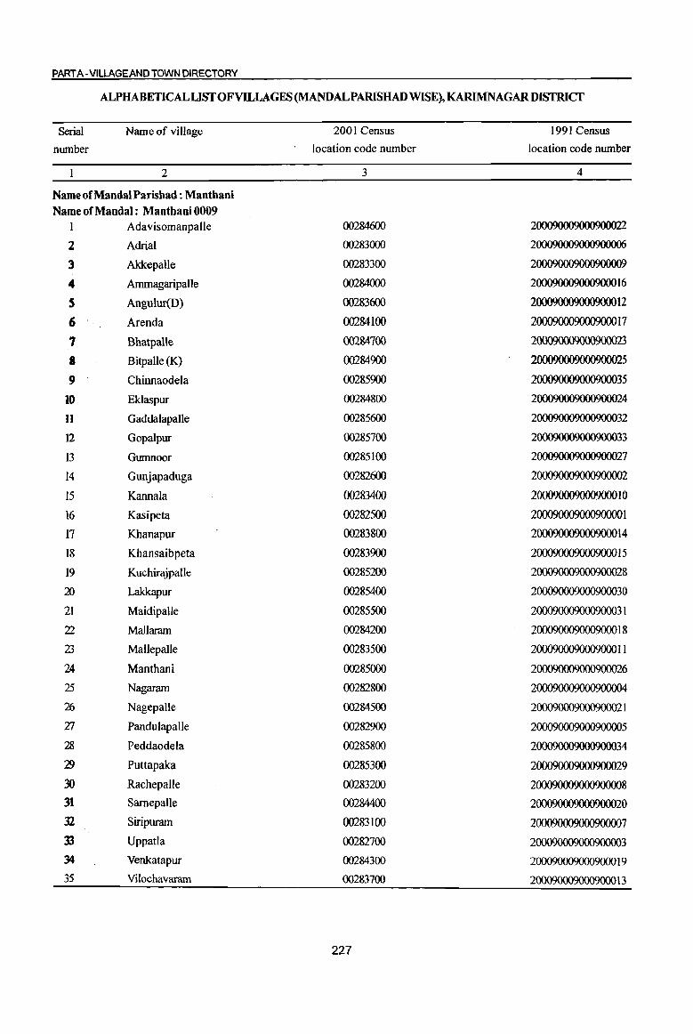
PART A-VILLAGE AND TOWN DIRECTORY
ALPHABETICAL LIST OF VILLAGES (MANDALPARISHAD WISE), KARIMNAGARDISTRICT
Serial Name of village 2001 Census 1991 Census
number location code number location code number
2 3 4
Name ofMandal Parishad : Manthani Name of Mandai : Manthani 0009
1 Adavisomanpalle 00284600 2000900090009000
2 Adrial 00283000 2000900090009000
3 Akkepalle 00283300 2000900090009000
4 Ammagaripalle 00284000 2000900090009000 16
S Angulur(D) 00283600 200090009000900012
6 Arenda 00284100 200090009000900017
'I Bhatpalle 00284700 2000900090009000
8 Bitpalle (K) 00284900 2000900090009000
9 Chinnaodela 00285900 200090009000900035
10 Eklaspur 00284800 20009000900090004
11 GaddalapaUe 00285600 200090009000900032
12 Gopalpur 00285700 200090009000900033
13 Gumnoor 00285100 20009000900090007
14 Gunjapaduga 00282600 2000900090009000
15 Kannala 00283400 200090009000900010
16 Kasipeta 00282500 20009000900090001
17 Khanapur 00283800 200090009000900014
18 Khansaibpeta 00283900 200090009000900015
19 Kuchirajpalle 00285200 20009000900090008
:;n Lakkapur 00285400 200090009000900030
21 Maidipalle 00285500 200090009000900031
22 Mallaram 00284200 200090009000900018
23 Mallepalle 00283500 2000900090009000 II
24 Manthani 00285000 20009000900090006
25 Nagaram 00282800 2000900090009000
26 Nagepalle 00284500 2000900090009000 1
Zl Pandulapalle 00282900 20009000900090005
28 Peddaodela 00285800 200090009000900034
')9 Puttapaka 00285300 20009000900090009
30 Rachepalle 00283200 20009000900090008
31 Samepalle 00284400 20009000900090000
32 Siripuram 00283100 20009000900090007
33 Uppada 00282700 20009000900090003
34 Venkatapur 00284300 2000900090009000 19
35 Vilochavaram 00283700 200090009000900013
227

i "8 ~ u = g ... .,
g <= " ] U
~ ;; ~
0
~ ~
f ., C
oS 0
_g '.:;l
~ ~ i ~ .. .... ~ c 0
to u
! "5 !l ·c 0 ~ u <I> f-<
1 2 3 4
Mandai Parisbad : Manthaoi (0009)
Kasipeta 348.0
(00282500)
Gunjapaduga 2 1529.0 3.755
(00282600)
3 Uppatla
714.0 1,160 (00282700)
Nagaram 4 1080.0 1,642
(00282800)
5 Pandulapalle
308.0 849 (00282900)
6 Adria!
592.0 (00283000)
Siripuram 7 653.0 2,903
(00283100)
RJicbepalJe 8 390.0 884
(00283200)
9 Akkepalle
279.0 1,286 (00283300)
KaMala 562 10
(00283400) 456.0
MaJlepalle II 282.0 564
(00283500)
12 Angulur(D)
149.0 (00283600)
Yilochavaram 13
(00283700) 736.0 975
DISTRICT CENSUS HANDBOOK: KARIMNAGAR
Census of India 2001 -Amenities and
Amenities available (if not available within the village, a dash (-) is shown in the column and next to it in brackets the distance in broad ranges viz. < 5 kms., 5-10 kms. and 10+ kms of the
'Zi' nearest place where the facilitv is available is lriven) = ., 5 -0 Ul.g u lil ·8 u 8 "
..,
i 'Et! g § ... .~~ '.:;l
c:!. ... e cf! 8. 0..
.l!J ~ " ~~~ ~ ~ Q. (J
"0 0 '5, .,
1 -0 0 ~ :~ "3]~ e ...
lil ..
OJ ;l; -0 t.l o·§ g ... ... lil c g J<!~;fl a d " .<l ~
0.. • UI 'll 0 .... to th to ]~
Oil;;.. = ~ . ., 0 c 'H g ...: .- f! u 0 -a Oil " ._ <a ] § .,
'.;:j
~ 1i ., - a Sl '" .. e ., = <> g~:e e ~
§ u :e ..r
~l <> t; e ;l; =
~ is '" }~ ~u~ 8! ;Z r£ Z 5 6 7 8 9 10 11 12 13
--Uninhabited ---
RMP(2) NCS
P(4) M(3) S H(IO+) THPW PO CM CV(IO+) BS RS(IO+) 874 AC(3) C(1O+) MCW(IO+) ACS(IO+)
TK PH(IO+) CP(IO+} OCS(IO+)
SP(IO+) NW(IO+) PHC(IO+) ST(lO+)
264 P(3) M(IO+) H(IO+) THP PO(IO+) CM(IO+)
ACS(IO+} CV(IO+} BS RS(IO+} C(lO+} MCW(IO+}
PH(IO+) CP(IO+) NCS(IO+} Sp(lO+) NW(lO+)
PHC(IO+) OCS(IO+) ST(IO+)
P(3) AC(3} PHS H(IO+} PO
NCS(4} CV(5-1O) BSRS(IO+)
441 M(lO+) MCW(IO+) THP CM(5-10) ACS(lo+) C(10+) PHC«5)
PH(IO+) CP(IO+) OCS(IO+)
SP(IO+) NW(IO+)
ST(IO+)
220 P M(S-IO) H(IO+) THP PO« 5) CM(5-10)
ACS(S-IO) CV(S-IO} BSRS(IO+) C(5-10) MCW(IO+)
PH(lO+) CP(5-10) NCS(IO+) SP(IO+) NW(IO+)
PHC(IO+) OCS(IO+) ST(JO+)
--- Uninhabited -------
P(4) M PHS H(IO+)
PO NCS(2)
CV(IO+) BS RS(IO+) 711 MCW(IO+) THPW CM« 5) ACS(IO+)
C(1O+) PHC(IO+)
PH(lO+) CP(IO+) OCS(IO+)
SP(lO+) NW(lO+)
ST(JO+)
200 P(2)M(JO+) RMPH(IO+) NCS
CV(JO+) BS(JO+) MCW(IO+) THP PO(I 0+) CM(IO+) ACS(IO+)
C(10+) PHC(IO+) PH(lO+) CP(IO+) OCS(IO+)
SP(IO+) RS(10+)
ST(lO+) NW(IO+)
P(2) AC(2) RMP(2)
324 M(IO+) H(IO+) THPW
PO(IO+) CM(IO+} ACS(IO+) CV(IO+) BS« 5)
C(lO+) MCW(IO+) TKC
PH(IO+) CP(IO+) NCS(IO+) SP(IO+) RS(IO+)
PHC(IO+) OCS(lO+) ST(lO+} NW(IO+)
149 P(2) M AC H(5-10) THP
PO CM(5-1O)
ACS(5-10) eV(S-IO) BSRS(IO+)
C(5-10) MCW(IO+) PH(IO+) NCS(IO+) SP(JO+) NW(IO+)
PHC(IO+) CP(.5-IO)
OCS(IO+) ST(IO+)
PAC H(IO+)
NCS(2) CV«5) 5S RS(IO+)
127 M« 5) THP PO« 5) CM(<: 5) ACS(lo+)
C« 5) MCW(IO+)
PH(IO+) CP(IO+) OCS(IO+) SP(JO+) NW(IO+)
PHC(IO+) ST(IO+)
-- uninhabited -~-
250 P M(IO+) RMPH(lO+)
PO ACS(IO+) CY(IO+) BS RS(IO+) MCW(lO+) W
PH(IO+) CM(lO+)
NCS(IO+) SP(IO+) NW(lO+) C(lO+) PHC(5-10) CP(IO+)
OCS(IO+) ST(IO+)
228
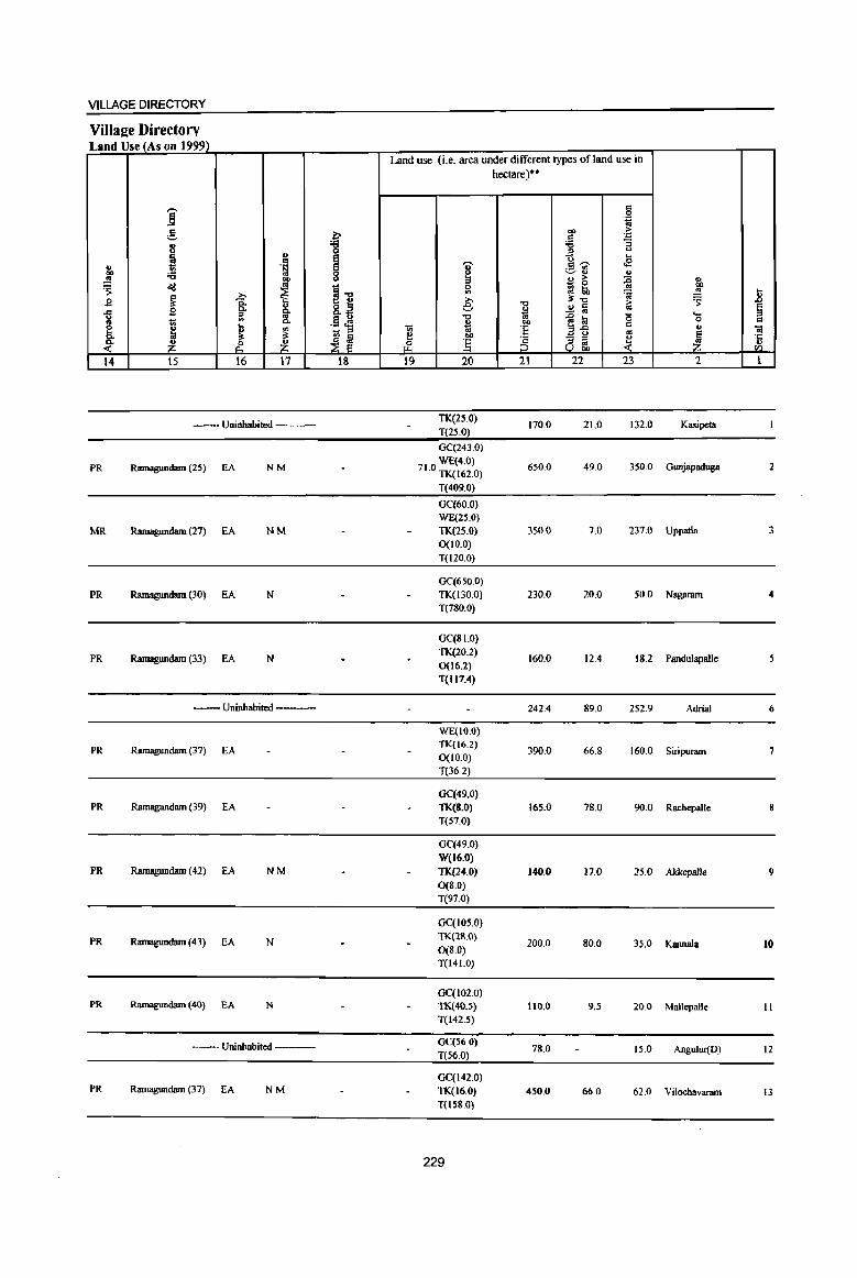
VILLAGE DIRECTORY
Villae:e Directory Land Use (As on 1999)
Land use (i.e. area under different types of land use in
hectare)"
i s .~
g l:- eo >
t~ . .., .. ~ :;
u 0
~ ..
I ...
" . ~ 'U cE .., ;a ~ .:;.,~ " ~ co " > ~ " 'S ~ ~ i-o 0 il ~ 00
i WI ~ ~ .8 .E! ~ sJ e -0 il'-o > :s: " ..!:! a 0) e ..c g g- o
iil -0 til
~~ (5 .... " ~ 1;; Co .§ J4 " bO 0 =
~ ...
VI 1;; til 'E = " Ol ~ ~ ~ " e bO '" I ~ ~J § - " ~ ·c
~ ~. _Z_ &' § 8 ~ v II)
14 15 16 17 18 19 20 21 22 23 2 1
--- Uninhabited ----TK(2.s.0)
170.0 21.0 132.0 Kasipeta T(25.0)
GC(243.0)
PR Ramagundam (25) EA NM WE(4.0) 71.0 TK(162.0) 650.0 49.0 350.0 Gunjapaduga 2
T(409.0)
GC(60.0) WE(2S.0)
MR Ramagundam (27) EA NM TK(25.0) 350.0 7.0 237.0 Uppatla 3 0(10.0)
T(120.0)
GC(650.0)
PR Ramagundam (30) EA N TK(I30.0) 230.0 20.0 50.0 Nagaram 4 T(780.0)
GC(8i.O)
PR Ramagundam (33) EA N TK(20.2)
160.0 12.4 18.2 Pandulapalle 0(16.2)
T(ltH)
--Uninhabited --- 242.4 89.0 252.9 Adria! 6
WE(IO.O)
PR Ramagundam (37) EA TK(16.2) 390.0 66.8 160.0 Smpuram 7
0(10.0) T(36.2)
GC(49.0) PR Ramagundam (39) EA TK(8.0) 165.0 78.0 90.0 Rachepalle
T(57.0)
GC(49.0)
W(16.0) PR Ramagundam (42) EA NM TK{24.0) 140.0 17.0 25.0 Akkepalle 9
0(8.0) T(97.0)
GC(1050)
PR Ramagundam (43) EA N TK(28.0)
200.0 80.0 35.0 Kannala 10 0(8.0) T(141.0)
GC(102.0) PR Ramagundam (40) EA N TK(40.5) 110.0 9.S 20.0 Mallepalle 11
T(142.5)
-- Uninhabited ---GC(56.0)
78.0 15.0 Angulur(D) 12 T(56.0)
GC(142.0) PR Ramagundam (37) EA NM TK(16.0) 450.0 66.0 62.0 Vilochavaram 13
T(IS80)
229
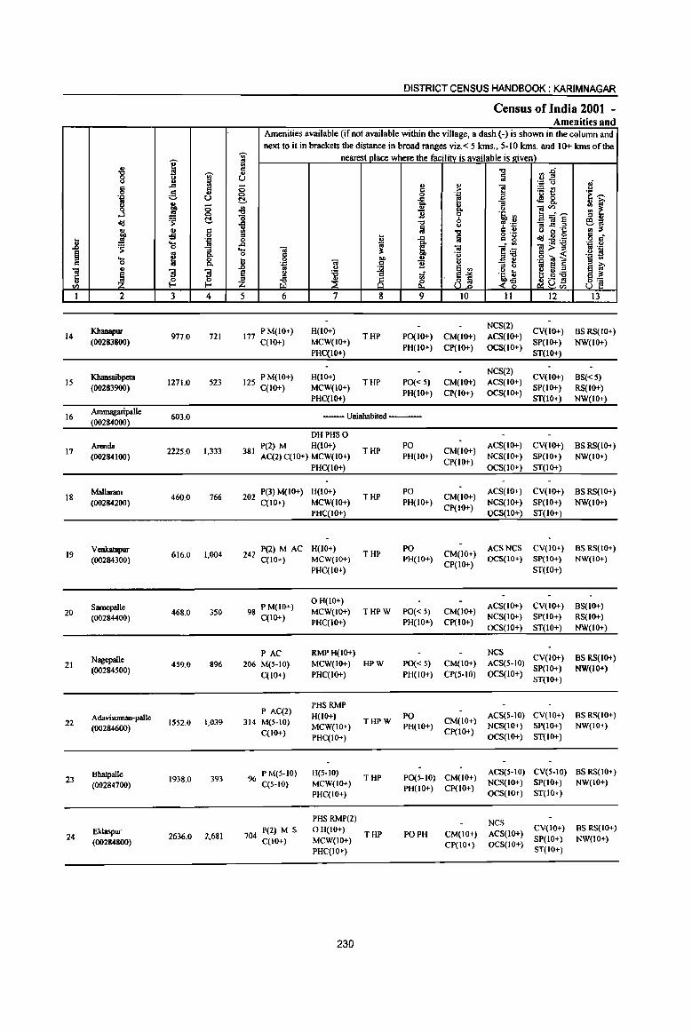
DISTRICT CENSUS HANDBOOK: KARIM NAGAR
Census of India 200i -Amenities and
Amenities available (if not available within the village, a dash (-) is shown in the column and next to it in brackets the distance in broad ranges viz. < 5 Ians., 5-10 Ians. and 10+ Ians of the
'"" nearest Dlace where the faeilitv is available is I!iven) .. i iil ."
'"" ~ ." r;.g
8 t.l U a Jl = .:> <; oi
5 .,
;:; ., .., ] ~t ~ Ii c > <>
~ u 0 0 '! 'E '"' ~ ..c: ~ &. u Q, "3 : f J 0 ~
u ..,
]~~ '" u 0 B 0 's, .,
~ ~ -0 b = .. <Ill ..c: ." , .~ -:;]§ ~~ u Iii
(..) .. .. C !II ." C .. u ~ 's co -5 0 = o .- c ~ ..c: f.i .. g o cf .8 .!!! .:> 0 .., <IIl:sa:a
~ ..... os ..c:
~ a . ., .~ .g 0 -:; ... til til ]~ til> = ~ g Q, 0 c .~ .. « .2 S ..... 8. .8 0 til
.. u .g""Ot § § .. .. 0 . .."
~ "B u :; ti til .. .. u a VI ~~"6 ~ f
~ "3 "3 ~ <.> "6 1i ~1 j~ .c: 0 0 ~ ~ ;§ ~a~ u g: 8] til !-< !-< Z
I 2 3 4 5 6 7 8 9 10 11 12 13
Khanapur 177 P M(IO+) H(lO+) NCS(2)
CV(IO+) BSRS(IO+) 14 977.0 721 THP PO(IO+) CM(IO+) ACS(IO+)
(00283800) C(IO+) MCW(IO+) PH(IO+) Cp(IO+) OCS(IO+)
SP(IO+) NW(IO+) PHC(IO+) ST(IO+)
Khansaibpeta 125 PM(IO+) H(IO+) NCS(2)
CV(IO+) BS« 5) IS 1271.0 523 THP PO« 5) CM(IO+) ACS(IO+)
(00283900) C(10+) MCW(1O+) PH(lO+) CP(IO+) OCS(IO+)
SP(IO+) RS(IO+) PHC(IO+) ST(IO+) NW(IO+)
16 Ammagaripalle (00284000)
603.0 -- Uninhabited ---
DHPHSO
17 Arenda
2225.0 1,333 381 P(2) M H(IO+)
THP PO
CM(IO+) ACS(IO+) CV(IO+) BSRS(IO+)
(00284100) AC(2)C(10+) MCW(IO+) PH(lO+) CP(IO+)
NCS(IO+) SP(IO+) NW(IO+)
PHC(IO+) OCS(IO+) ST(IO+)
18 MaIIaram
460.0 766 202 P(3) M(IO+) H(IO+) THP
PO CM(IO+)
ACS(LO+) CV(10+) BSRS(IO+)
(00284200) C(10+) MCW(LO+) PH(IO+) CP(IO+)
NCS(1O+) SP(IO+) NW(IO+) PHC(IO+) OCS(IO+) ST(IO+)
19 Yenkatapur
616.0 242 P(2) M AC H(IO+) THP
PO CM(lO+)
ACSNCS CV(IO+) BS RS(IO+)
(00284300) 1,004
C(IO+) MCW(IO+) PH(IO+) OCS(IO+) SP(IO+) NW(IO+)
PHC(IO+) CP(IO+)
ST(IO+)
Samepalle 98 PM(IO+) OH(IO+)
ACS(IO+) CY(IO+) BS(IO+) 20 468.0 350 MCW(IO+) THPW PO«5) CM(IO+)
(00284400) C(IO+) PHC(IO+) PH(IO+) CP(IO+)
NCS(IO+) SP(IO+) RS(IO+) OCS(IO+) ST(IO+) NW(IO+)
PAC RMPH(IO+) NCS CV(IO+) BS RS(IO+)
21 Nagepalle
459.0 896 206 M(5-10) MCW(IO+) HPW PO« 5) CM(IO+) ACS(5-1O) (00284500)
C(10+) PHC(IO+) PH(IO+) CP(S·IO) OCS(IO+) SP(IO+) NW(IO+) ST(IO+)
P AC(2) PHSRMP
Adavisoman-paIle H(IO+) PO ACS(5-LO) CY(IO+) BSRS(IO+) 22 1552.0 1,039 314 M(5-10) THPW CM(IO+)
(00284600) C(IO+)
MCW(IO+) PH(IO+) CP(IO+)
NCS(IO+) SP(IO+) NW(IO+)
PHC(IO+) OCS(IO+) ST(IO+)
23 8halpalle
1938.0 393 96 P M(5-10) H(5-10)
THP P0(5-10) CM(IO+) ACS(5-IO) CY(S-IO) BS RS(lO+)
(00284700) C(5-10) MCW(IO+) PH(IO+) Cp(IO+)
NCS(IO+) SP(IO+) NW(IO+)
PHC(IO+) OCS(LO+) ST(IO+)
PHSRMP(2) Nes Eklaspur
2,681 704 P(Z) M S OH(IO+)
THP PO PH CM(IO+) ACS(IO+) CV(10+) BSRS(LO+)
24 2636.0 (00284800) C(lO+) MCW(lO+) Cp(IO+) OCS(IO+)
SP(IO+) NW(IO+)
PHC(IO+) ST(IO+)
230

VILLAGE DIRECTORY
Villa!e Directory und Use (As on 19?9)
Land use (i.e. area under different types of land use in hectare)··
j " Q '.0
'" .9 ~ w > '-' C '.0
j '8 :a ;;
" u
OJ
I "0 .. c ~ ..E " '!;j ,,~
" ._ ..,
01) :a ~ '-' OJ ..
..! "" ., :>-~ f 'S ~ ...
~1l ~ ~~ >- ~ :; jj B ~ I e ~ E!:-o >
.t: 8- 8.~ .!! Iii '" § u .. "Q ~ :. '0 '-.. :;; 0- .5 ~ " 00 0 c e ~
... .., :;; 'r: ".c " ., 'i! ., - " ~ E ., '" ~ 0. E!: E!:
~ ~ "" 8 - " ~ ·c
~ :£ & Z & ] " '" " u "" CI.l
14 15 16 17 18 19 20 21 22 23 2 I
TW(30.0)
PR Ramagwulam (40) EA NM 513.0 TK(49.0) 160.0 102.0 123.0 Khanapur 14
T(79.0)
TW(2.0)
PR Ramagundam (43) fA N 776.0 TK(32.0) 220.0 39.0 202.0 Khansaibpda IS
T(34.0)
--Uninhabited--- 379.0 50.0 28.0 145.0 Anunagaripalle 16
GC(9O.0)
PR Rarnagundam (45) EA N WE(20.0)
794.0 TK(115.0) 270.0 410.0 526.0 Arenda 17
T(22S.0)
W(48.6)
PR Ramagwldam (47) EA N WE(81.0)
85.0 23.4 182.0 Mallaram 18 TK(40.0) T(169.6)
W(20.0)
WE(SS.O)
MR Ramagundam (49) EA N TWE(16.2)
270.0 22.S 132.0 venkatapur 19 TK(SLO) 0(19.0)
T(191.2)
W(6.0)
PR Ramagundam(SI) EA WE(IS.O) 300.0 4S.0 35.0 Sarnepalle 20
TK(61.0)
T(SS.O)
WE(2.0)
TWE(6.0) PR Ramagundam (49) EA TK(32.0) 290.0 61.0 64.0 Nagepalle 21
0(4.0) T(44.0)
WE(2.0)
PR Ramagundam (5 I) EA TK(SI.O) 1096.0 R(S.O) O(S.O) 220.0 85.0 52.0 Adavisomanpalle 22
T(99.0)
W(IO.I)
TK(JO.O) PR Ramagundam (45) EA 1509.0 R(JO.O) 265.0 25.9 47.0 Bhatpalle 23
0(21.0) T(91.1)
GC(24.0)
MR Ramagundam (40) EA NM 14760 WE(50.6) . TK(146.0)
SOO.O ;14,4 115.0 Eklaspw- 24
T(220.6)
231
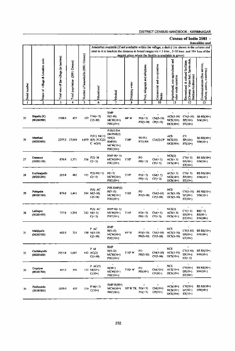
25
26
27
28
29
30
31
32
33
34
2
Bitpallc (K) (00284900)
Mantbaoi (00285000)
Gwnnoor (0028SI00)
KuchirajpaIle (00285200)
Puttapaka (00285300)
Lakkapur (00285400)
Maidipalle (00285500)
<nddaIapaIle (00285600)
Gopalpur (00285700)
PeddaoOOla (00285800)
J 4
1760.0 437
2297.0 17,049
870.0 1,371
215.0 483
879.0 1,441
777.0 1,204
603.0 724
2953.0 1,607
447.0 591
1059.0 435
DISTRICT CENSUS HANDBOOK: KARIMNAGAR
Census ofIndia 2001 -Amenities and
Amenities available (if not available within the village, a dash (-) is shown in the column and next to it in brackets the distance in broad ranges viz.< 5 kms., 5-10 kms. and 10+ kms ofthe
nearest place where the facility is available is Riven)
5 6
107 PM«S) C(S-IO)
7
RMP H(S-IO)
MCW(IO+)
PHC(IO+)
HD(S)DA
P(2I) M(II) DH PHS(2) NH(2)
4,059 S(5) PUC(2) RMP(4)
C AC(4) MCW(IO+)
PHC(IO+)
RMP H(<: S}
8
HPW
THP
316 P(3) M C« S}
MCW(IO+) THP
PHC(IO+)
125 P(2} M« 5) H(<: 5) T HP C« 5) MCW(IO+}
P(4) AC 314 M(S-IO)
C(S-IO}
P(3} AC
312 M« 5)
C« 5)
P AC 158 M(S-IO)
C(5-10)
PM
413 AC(2) C(5-10)
P AC(3) 151 M(IO+)
C(lO+)
PHC(IO+)
PHSRMP(2} H(S-IO}
MCW(lO+)
PHC(IO+)
RMP H(<: 5)
THP
MCW(IO+) THP PHC(IO+)
RMP H(5-10) MCW(IO+}
PHC(IO+)
RMP H(S-IO)
MCW(IO+) PHC{IO+)
H(10+) MCW(lO+} PHC(IO+)
HPW
THPW
THPW
9 10 11 12 13
PO« 5} CM(S-to) ACS(S-IO) CV(S-IO) BS RS(10+)
PH(S-IO) CP(S-IO) NCS(IO+) SP(IO+) NW(IO+) OCS(IO+) ST(IO+}
PO TO
no PH
PO PH«S}
PO(<: 5}
PH« 5)
ACS CV
CM(J) CP NCS(lS) SP(lO+)
CM«5) CP(<: 5)
CM«5) CP« 5}
OCS(IO+) ST(IO+)
NCS(2) ACS« 5) CV« 5) OCS(IO+} SP(IO+)
ST(IO+)
ACS« 5) CV« 5}
NCS(IO+} SP(lO+}
OCS(IO+) ST(IO+)
BSRS(IO+) NW(IO+}
BS RS(IO+) NW(IO+)
BS RS(IO+}
NW(IO+)
PO CM(S-IO) ~~~(S-IO) CV(5-10) BS RS(IO+) PH(S-JO) SP(IO+) NW(IO+)
PO«5) PH«S)
CP(5-10) OCS(S-IO) ST(IO+)
CM« 5) CP« 5)
NCS(2) ACS« 5) CV« 5) OCS(IO+) SP(JO+)
ST(IO+}
BS« S) RS{IO+} NW(IO+)
NCS PO(S-IO) CM(5-IO) ACS(S-IO) CV(S-IO) BS RS(IO+}
PH(S-IO) CP(S-IO) OCS(S-IO) SP(IO+} NW(IO+) ST(IO+)
PO CM(5-IO) ~~~(5-IO) CV(5-10) BS RS(IO+) PH(S-IO) ep(S-IO) OCS(IO+) SP(lO+) NW(lO+)
ST« 5)
PO NCS CV(IO+) BS RS(IO+) PH(IO+) CM(IO+) ACS(IO+) SP(tO+) NW(IO+)
CP(IO+) OCS(JO+) ST(IO+)
116 PM«5) C(lO+}
RMPH(IO+) MCW(lO+)
PHC(JO+)
HP W TK PO« 5) PH«5)
CM(IO+) CP(IO+)
ACS(IO+) CV(IO+) BS RS(IO+)
NCS(IO+) SP(IO+) NW(IO+) OCS(IO+) ST(IO+)
232
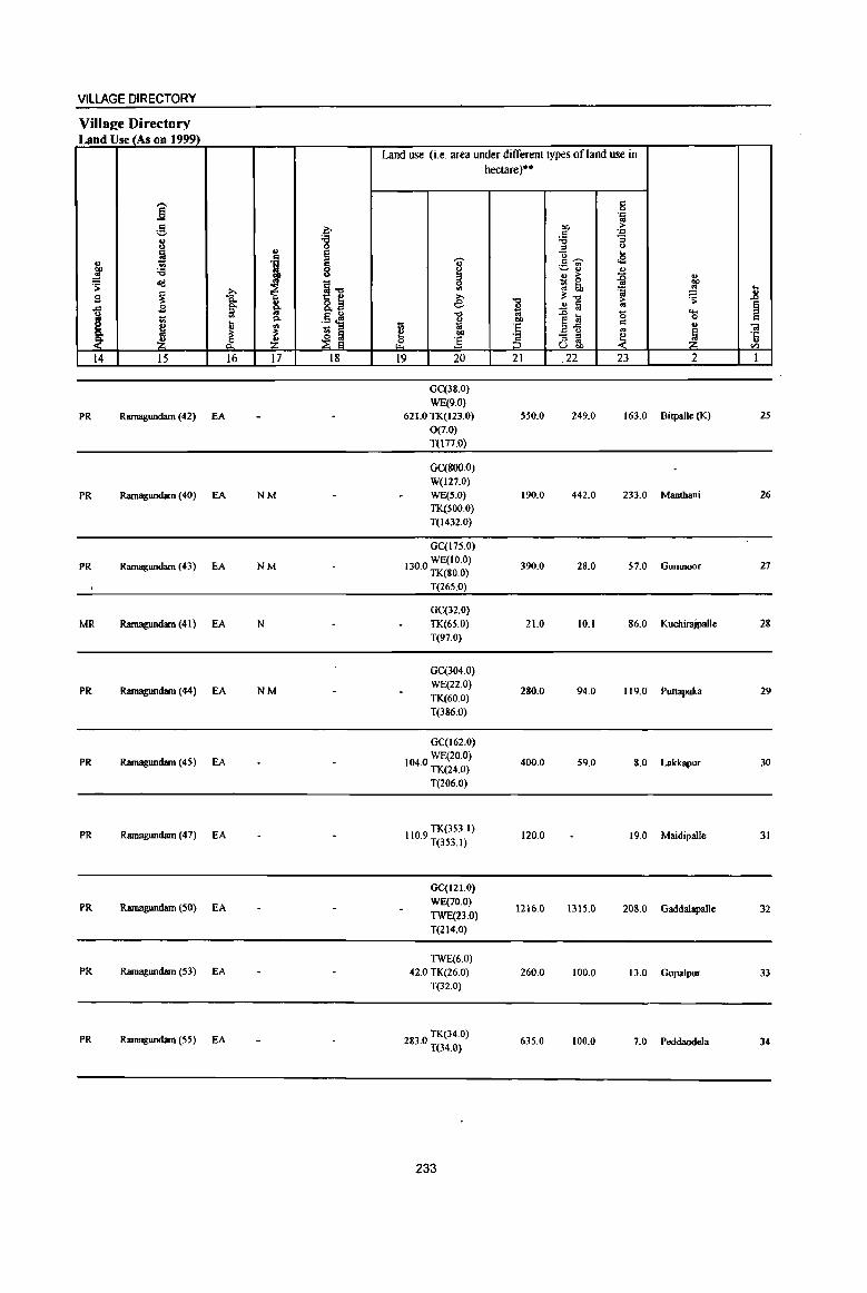
VILLAGE DIRECTORY
Villa£e Directory Land Use (As on 1999)
Land use (Le. area under different types of land use in hectare)··
.-. c ] 0 .::: .. g ~
01) > c .:::
i '8 ~ "3 " 0
" I "0 .. ., 'i I c ~ .e ., ~~ ]' :a .,
{ ., > :g " ~ ~ ~'g ~ ~
.., 'a .. ..
~ i e ;l:-o ~ ..
S -0 > .0
,<;; B a~ * ..!l ~ ., § ill ....
I 1;; '" Jl ~ ] .0 !iI 0 0 c ... 00
~'5 c ~
., '" t; :§ ., ., 01
;l: ;I: ~ ~ e E - " ~ ~ '5 ~ g ~ rf :3 " .. u OIl en
14 15 16 17 18 19 20 21 .22 23 2 1
GC(38.0)
WE(9.0)
PR Ramagundarn (42) EA 621.0 TK(I23.0) 550.0 249.0 163.0 Bitpalle (K) 25
0{1.0) T(lnO)
GC(800.0)
W(127.0)
PR Ramagundarn (40) EA NM WE(S.O) 190.0 442.0 233.0 Manthani 26
TK(500.0) T(1432.0)
GC(l75.0)
PR Rarnagundarn (43) EA NM WE(IO.O)
130.0 TK(80.0) 390.0 28.0 57.0 Gumnoor 21
T(265.0)
GC(32.0)
MR Ramagundarn (41 ) EA N TK(65.0) 21.0 10.1 86.0 Kuchirnjpalle 28 T(97.0)
GC(304.0)
PR Ramagundam (44) EA NM WE(22.0)
280.0 94.0 119.0 Puttapaka 29 TK(60.0)
T(386.0)
GC(162.0)
PR Ramagundam (45) EA WE(20.0) 104.0 TK(24.0) 400.0 59.0 8.0 Lakkapur 30
T(206.0)
PR Ramagundam (47) EA TK(353.1)
110.9 T(353.1) 120.0 19.0 Maidipalle 31
GC(12)'0)
PR Rlunagundam (50) EA WE(70.0)
TWE(23.0) 1216.0 1315.0 208.0 Gaddalapalle 32
T(214.0)
TWE(60) PR Ramagundarn (53) EA 42.0 TK(26.0) 260.0 100.0 13.0 Gopalpur 33
T(32.0)
PR Ramagundarn (55) EA 2830 TK(34.0) . T(34.0)
635.0 100.0 7.0 Peddaodela 34
233
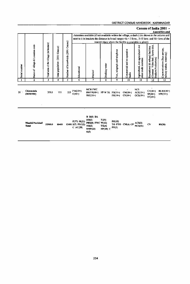
.. -g u
= 0 '.., cd g ...:l dIj ., bO ... os
.8 ~ ~ .... Q 0
u ;a
~ 'C ., CIl
I 2
3S' CbinnaodcJa (00285900)
MJmdal P.risb.d T ....
~ ~ j3
.c 6 ;§, u u
J ;::; 0
~ C!-., Q -s 0 '.0 ..... ..
0
1 ~ '3 ~ ~ t-<
3 4
379,0 777
32960.0 50405
'Ui' ::0 '" d .. u _
0 0 t!. -l9 0 il '" ::0 0
..c .... 0
.8 § Z
5
DISTRICT CENSUS HANDBOOK: KARIMNAGAR
Census ofindia 2001 -Amenities and
Amenities available (if not available within the village, a dash (-) is shown in the column and next to it in brackets the distance in broad ranges viz,< 5 kms" 5-10 kms, and 10+ kms of the
nearest place where the facility is available is given)
"" "'~ :a .~ .fi .; .. 1: ] at! 0 = 0 '.0 .f8. '~ ~ .c e Q.
f -= ~ ~ .,
0 ]~~ 11 'i ~ "" , '.Q _'iI§ e-.; !a "
c ., B ~·c '" ~ o ,-<1d ug ,~ § ~ .c :ii c g :9:a Q.
1~ <i! ~ <i! ]>~ os '= d ~ 'g '~ ~ .~ "" .. ,g OJ l <i!
~ 11 :; 13 os e ~ ~ u e .. 0 :a ;; ~1 j~ ~U:a ::s
~ 8 j3 ,9 19 ~ a: 8~ o;::UCll
6 7 8 9 10 II 12 13
225 PM(IO+) C(IO+)
MCWFWC NCS RMPH(IO+) HPWTK PO{IO+) CM(IO+) ACS(IO+) CV(IO+) 8S&5(10+) PHC(IO+) PH(IO+) CP(IO+) OCS(IO+) SP(JO+) NW(IO+)
H D(5) PA
P(77) M(ll) PH(l) T(25) PO(IS) 11401 S(7) PUC(2) PHS(8) FWC W(13) TO PTO
NII(2) TK(4) C AC(28) RMP(23) HP(30) C PH(2)
0(3)
234
CM(4) CP ACS(2) NCS(41)
ST(IO+)
CV 8S(26)
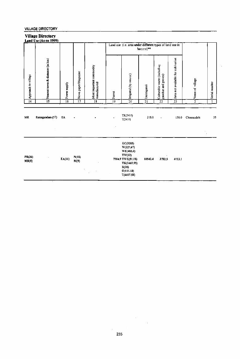
VILLAGE DIRECTORY
Villa2e Directory Land Use (As on 199~
j ;§, 8
! " OJ)
~
~ o)j
~ -a .9 .9 g.
I tl '" ~, ~ Z ~
14 15 16
MR Ramagundam (57) EA
PR(26)
MR(S) EA(31)
" .: '~
~ ... ., §-0.
~ ~ 17
N(18) M(9)
~ s § U
~'" '[~ ,$ J! ~ = ~J
18
Land use (i.e, area under different types of land use in hecta~e)$$
'ill
~ ~
19
~
" 8 ::l
Sl e '" ~ OJ)
:E 20
TK(34,O) T(34,O)
GC(3283) W(227.67) WE(40J.6) TW(3l)
7904.9 TWE(S1.I8) TK(2460,95) R(38) 0(111.18) T(6607.58)
235
'" " .. OJ)
'S 'S ;:;, 21
215,0
10542.4
c: 0 .~
OJ) ·5 ~ "5 ;::s (,)
;:; ... .s ,,~
~rl " " :> :0 " ~ ~ '" ~ ~'" 'a ~ >
..!:! ~ '" ~ t;! '0 '-0 .: " E-g '" ~ ~ 8 ~
22 23 2
130,0 Chinnaodela
3782.5 4113.1
l;
~ .: .. 'c: " <Il
I
35

D E INDIA
,,-"', ,, __ ~- I
------~------'--~, / .. - ;--__ .,1
, J I I I I \
ANDHRA PRADESH
KATARAM MANDAL KARfMNAGAR DISTRICT
_ ... ,----
, 862 _ . \
\ , ... - -_ '" ,
------~ )\
, I
1\ / ,
./ , , / \
I
I ,
, ,
..... ,"-, ~ ...
: I \ I I . \
, 863 I • I
, ' I , " " ....
2 o
KILOMETRES
\ . , ',' -..... _""'-- ... _ , 865' -------- .. ----\ I , , ',- -- -- -- - ,;'
I ~ J " , J \, 864 I / 866
'"
2
I , , J __ J-------------------~I ' -~- .. _\ ~ " I \ ,
S PO : 868 " PO _----,> \/ 875 • 9'-,· ~ 869· \ ,
867 --------r--..:::. ___ --
, , , I , ~/'"
I
871
• /
\--------- ... , \
I I •
,
, \
, , I
I "
I , , L __ _
, , , 'roo, ,
, , , " ,," : , ',.1' I
/ 87~,I',I' J
s
~"/KATARAM B ,'SB PO '- • S: 881
" . 882 @ )._. \_:0 PS L- __ •
873 I -",,_ ... J ,
-"'I I \
" 0 883
\ ' , ' " I
, I
, , I ,
877
888 • " I 872' : , \ ~
.... , \ " .... , .. 884 .PO " "--1;"-'"
BOUNDARY,DISTRICT
BOUNDARY, MANDAL
BOUNDARY, VlLLAGE WITH PLCN
HEADQUARTERS, MANDAL
OTliERROAD
RIVER
POPULATION SIZE CLASS:
200 - 499, 590·999,1000.4999
UNINHABITED VILLAGES WITH PLCN
POST OFFICE I TELECIUPH OFFICE
HIGH SCHOOL
POLICE ST A nON
BANK
PRIMARY HEALTH CENTRE
"', ' I .. _ II" .... ------~,
, , . , 889
@
••• ~ oo2anoci ;: -- ... ----- -
POlIO
s
PS
B
--, ''''Ii> I \
po' .... 887
885 • ,,1 \.' \
o
$
;;.
~
I I \ \ / . / \----_ ....
'--/. \ J I
,il· I 6
I 1
, I '{ I I I :
I J
,. -,---,.
I
/ ( ~"<' / . ~
I i ~
: ~ __ --_ t !I. --- \\ ~. ~
r-. 14' :.-. W GAL DISTRICT ..
FROMPARKAl
" .. 1
I ,. ,
" \
, , ,
.... ,
, , ,
. >- ... , ,
" I \ ,
00289000
'( I I J
I
I
,I'
I
.. \ \ \ "
,
, }---I
"
,.----
AREA : 220.17 Sq. Kms POPULATION: 31,259 No. OF TOWNS: NIL No. OF VILLAGI.S: JI DISTANCI. FROM DlsllLQtn.
TO MANDAL : 9ll1Um.
Map I'
BI$ed upon Survey of Indil mlp wiCh the permission of the Surveyor General of India. © aov.m~ of India CCIp'I'right, 2004
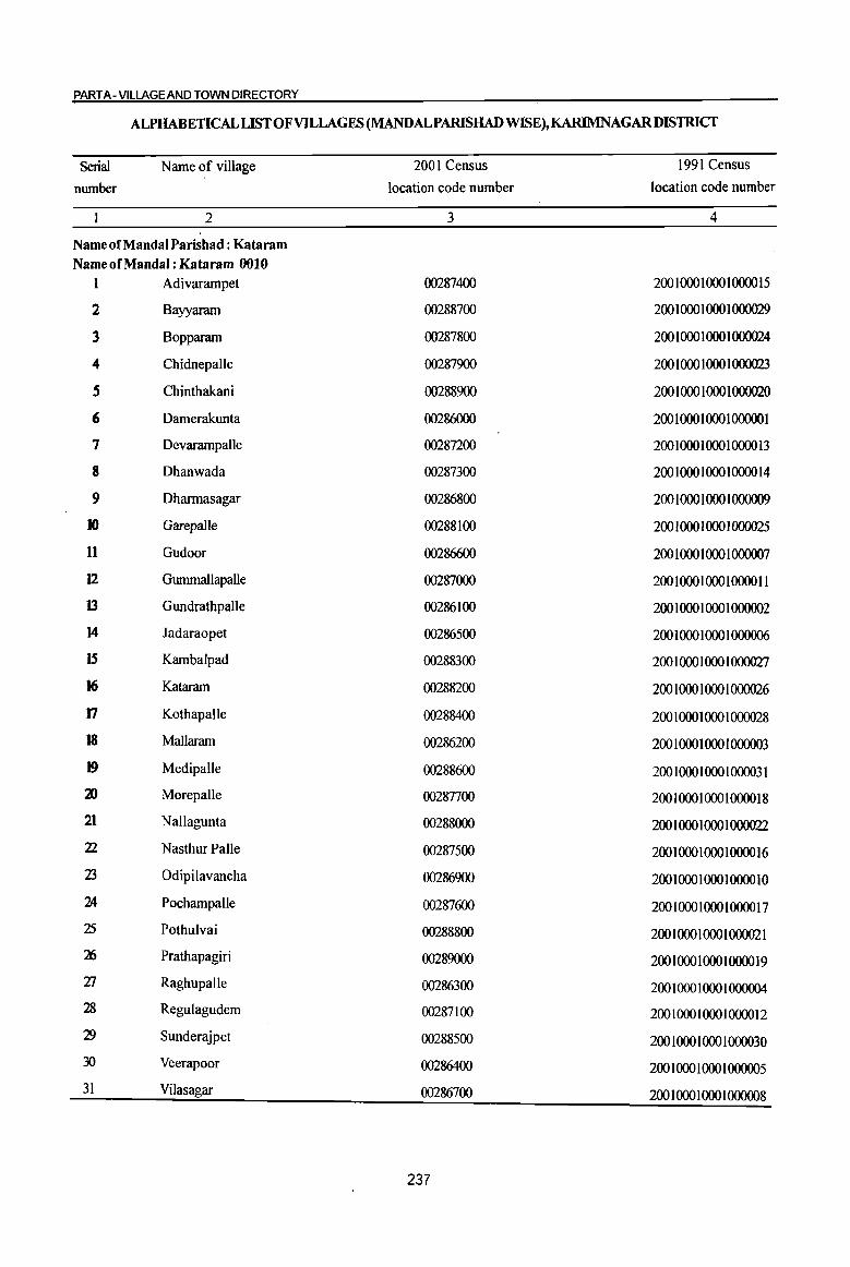
PART A- VILLAGE AND TOWN DIRECTORY
ALPHABETICAL LIST OF VILLAGES (MANDALPARISHADWISE),KARIMNAGAR DISTRICT
Serial Name of village 2001 Census 1991 Census
number location code number location code number
2 3 4
Name of MandaI Parishad : Kataram Name of MandaI : Kataram 0010
I Adivarampet 00287400 200100010001000015
2 Bayyaram 00288700 200 1 000 1 000 1 000029
3 Bopparam 00287800 200 1 000 1 000 1 000024
4 Chidnepalle 00287900 200 1 000 1 000 1 000023
S Chintbakani 00288900 200 I 000 I 000 I 000020
6 Damerakunta 00286000 200 1 000 1 000 1 000001
7 Devarampalle 00287200 200 1000 1 000 1 0000 13
8 Dhanwada 00287300 200 1000 100010000 14
9 Dharmasagar 00286800 200 1 000 1 000 1 000009
10 Garepalle 00288100 200 10001000 1000025
11 Gudoor 00286600 200 I 000 I 000 1 000007
12 Gmnmallapalle 00287000 200100010001000011
13 GundrathpaUe 00286100 200 1 000 1 000 1 000002
14 Jadaraopet 00286500 200 1 000 1 000 I 000006
IS Kambalpad 00288300 200 1000 1 000 1 000027
16 Kataram 00288200 200 1 000 1 000 1 000026
17 Kothapalle 00288400 200 1 000 1 000 1 000028
18 Mallaram 00286200 200 1 000 1 000 1 000003
19 Medipalle 00288600 200 10001000 1 000031
~ Morepalle 00287700 200 I 000 1 000 1 0000 18
21 Nallagunta 00288000 200 1 000 1 000 1 000022
22 Nasthur Palle 00287500 200 1 000 10001 ()()()() 16
23 Odipilavancha 00286900 200 1 000 1 000 1 0000 10
24 Pochampalle 00287600 200 1 000 1 000 1 ()()()() 17
25 Pothulvai 00288800 200 1000 1 000 1 000021
16 Pratbapagiri 00289000 200 1 000 1 000 1 0000 19 27 Raghupalle 00286300 200 1 000 1 000 1 000004 28 Regulagudem 00287100 200 1 000 1 000 1 0000 12
29 Sunderajpet 00288500 200100010001000030 30 Veerapoor 00286400 200 1 000 1 000 1 000005 31 Vilas agar 00286700 200 1 000 1 000 1 000008
237
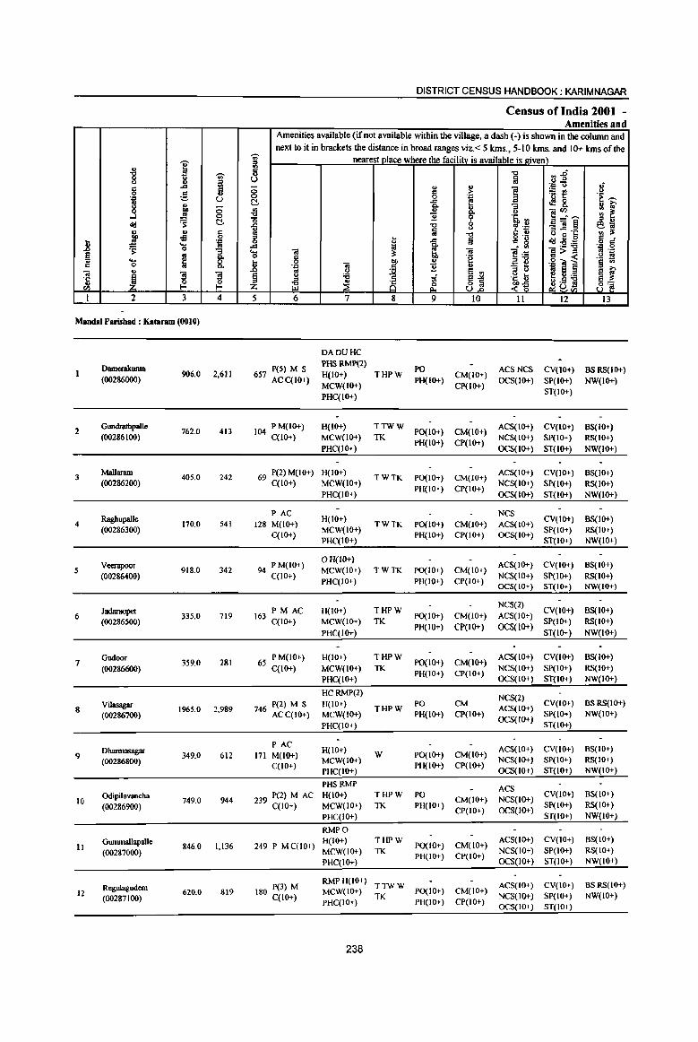
"8 I -;;;-u ~ ::l c ..c ..
C 0 ~ .. ] u .. ;; 00
£1 0 c:!-<Ii:! .:; c l;I. Jl 0
] ..!!! .... .:=
~ Q '" ~ ~
"3 Q. .... 0 c 0 Q.
'" .. ] ] ~ ·c
OJ 0 0 en I-< I-<
1 2 3 4
Maudal Parishad : Kataram (0010)
Dmuerakunta 906.0 2,611
(00286000)
2 Gundrathpal1e
762.0 413 (00286100)
3 Mallaram
405.0 242 (00286200)
Raghupalle 4 170.0 541
(00286300)
Veerapoor 5 918.0 342
(00286400)
Jadaraopet 6
(00286500) 335.0 719
Gudoor 359.0 281 7
(00286600)
Vilasagar 2,989 8 (00286700)
1965.0
9 Dbarmasagar (00286800)
349.0 612
Odipilavancha 10
(00286900) 749.0 944
Gummallapalle 11
(00287000) 846.0 1,136
Regulagudem 12 620.0 819
(00287100)
DISTRICT CENSUS HANDBOOK: KARIMNAGAR
Census ofIndia 2001 -Amenities and
Amenities available (ifnot available within the village, a dash (-) is shown in the column and next to it in brackets the distance in broad ranges viz. < 5 kms., 5-10 kms. and 10+ kms of the
-;;;- nearest Dlace where the facility is available is roven) ~ "0 ~j U fa ;; u .,
] 'J:> U .;
C > ~t! u 0 0 ·c .~ ~ ~ ..c b <f&. Q. "3 1A i'U' {j u Q. u ]~~ '" ~ 11 9 '5, '" o " u .c "0 0 tp .~ _'"s eo; u ii
u B ~·c ., :J; <II "d C u " .. .c fa g '8 ~~~
c .; 0 .. 0 ..c 0; a • VI .:= 0 .... '" :J; '" e·-=: 1>~ fl .:= 0 C "e a1l '§ ~ ... 0
i u .g iii l .8 .:= '" "2 .. "3 tl 1ii 8 oj U e '" e i'U' § u ;a 81 .~ t eU;a e~
~ ~ ~ g .s s 8] Z -<~ ~8<1) 5 6 7 8 9 10 11 12 13
DADUHC
657 P(5) M S PHS RMP(2)
PO ACSNCS CV(IO+) BSRS(IO+) H(IOT) THPW CM(IOT)
ACC(IO+) MCW(IO+)
PH(IO+) CP(IO+)
OCS(IO+) SP(IO+) NW(IO+)
PHC(IO+) ST(IO+)
104 PM(IO+) H(lOT) TTWW PO(I 0+) CM(IO+)
ACS(IOT) CV(IO+) BS(IO+) C(lO+) MCW(IOT) TK
PH(IOT) CP(IO+) NCS(IOT) SP(IO+) RS(1O+)
PHC(lO+) OCS(IO+) ST(IO+) NW(lO+)
69 P(2) M(lOT) H(lOT) TWTK PO(IO+) CM(IOT)
ACS(IOT) CV(IOT) BS(IOT) C(lOT) MCW(IO+)
PH(IOT) CP(IO+) NCS(lO+) SP(IO+) RS(IOT)
PHC(IO+) OCS(IO+) ST(IO+) NW(IO+)
PAC H(lOT)
NCS CV(IO+) BS(IO+)
128 M(lOT) TWTK PO(IO+) CM(IO+) ACS(IO+)
C(IOT) MCW(IO+)
PH(IO+) CP(IO+) OCS(IOT) SP(IOT) RS(IO+)
PHC(IO+) ST(lO+) NW(IO+)
94 PM(IO+) o H(lO+)
ACS(IO+) CV(IO+) BS(lO+) MCW(lO+) TWTK PO(IO+) CM(IO+)
C(lO+) PHC(lO+) PH(IO+) CP(lO+)
NCS(lO+) SP(IO+) RS(IO+) OCS(IO+) ST(JO+) NW(JO+)
PM AC H(IOT) THPW NCS(2)
CV(IOT) BS(IO+) 163 PO(IO+) CM(IO+) ACS(IO+)
C(lO+) MCW(IO+) TK PH(IO+) CP(1OT) OCS(lO+)
SP(IO+) RS(IO+)
PHC(IO+) ST(IO+) NW(IO+)
65 P M(IO+) H(IO+) THPW po(IO+) CM(IOT)
ACS(IO+) CV(lO+) BS(IO+)
C(lO+) MCW(IO+) TK NCS(IO+) SP(IO+) RS(IO+)
PHC(IO+) PH(IO+) CP(IO+)
OCS(IO+) ST(IO+) NW(IO+)
HCRMP(2) NCS(2)
P(2) M S H(IO+) THPW
PO CM ACS(IO+)
CV(JO+) as RS(IO+) 746 ACC(IO+) MCW(IO+) PH(IOT) CP(IO+) SP(IO+) NW(IO+)
PHC(IO+) OCS(IO+)
ST(IOT)
PAC H(lOT) ACS(IO+) CV(lO+) BS(IO+)
171 M(IO+) W PO(JOT) CM(IO+)
C(lOT) MCW(IOT)
PH(IO+) CP(IO+) NCS(IO+) Sp(IO+) RS(IO+)
PHC(IO+) OCS(IO+) ST(IO+) NW(IO+)
PHSRMP ACS
239 P(2} M AC H(lO+) THPW PO CM(IO+) NCS(lO+)
CV(IO+) BS(IOT)
MCW{lO+) TK PH(IOT) SP(IO+) RS(IO+) C(lO+) CP(IO+) OCS(IO+)
PHC(IO+) ST(IO+) NW(IO+)
RMPO
249 P M C(10+) H(IO+) THPW
PO(IO+) CM(lO+) ACS(lOT) CV(IO+) BS(IO+)
MCW(lO+) TK NCS(IO+) SP(IO+) RS(IOT) PH(IO+) CP(JO+)
PHC(lO+) OCS(IO+) ST(IO+) NW(IO+)
180 P(3) M RMPH(IO+)
TTWW ACS(IO+) CV(IOT) BSRS(IO+) MCW(IOT)
TK PO(IO+) CM(IO+)
NCS(lO+) SP(IO+) NW(IO+) C(lO+) PHC(IO+) PH(IO+) CP(IO+)
OCS(JO+) ST(JO+)
238
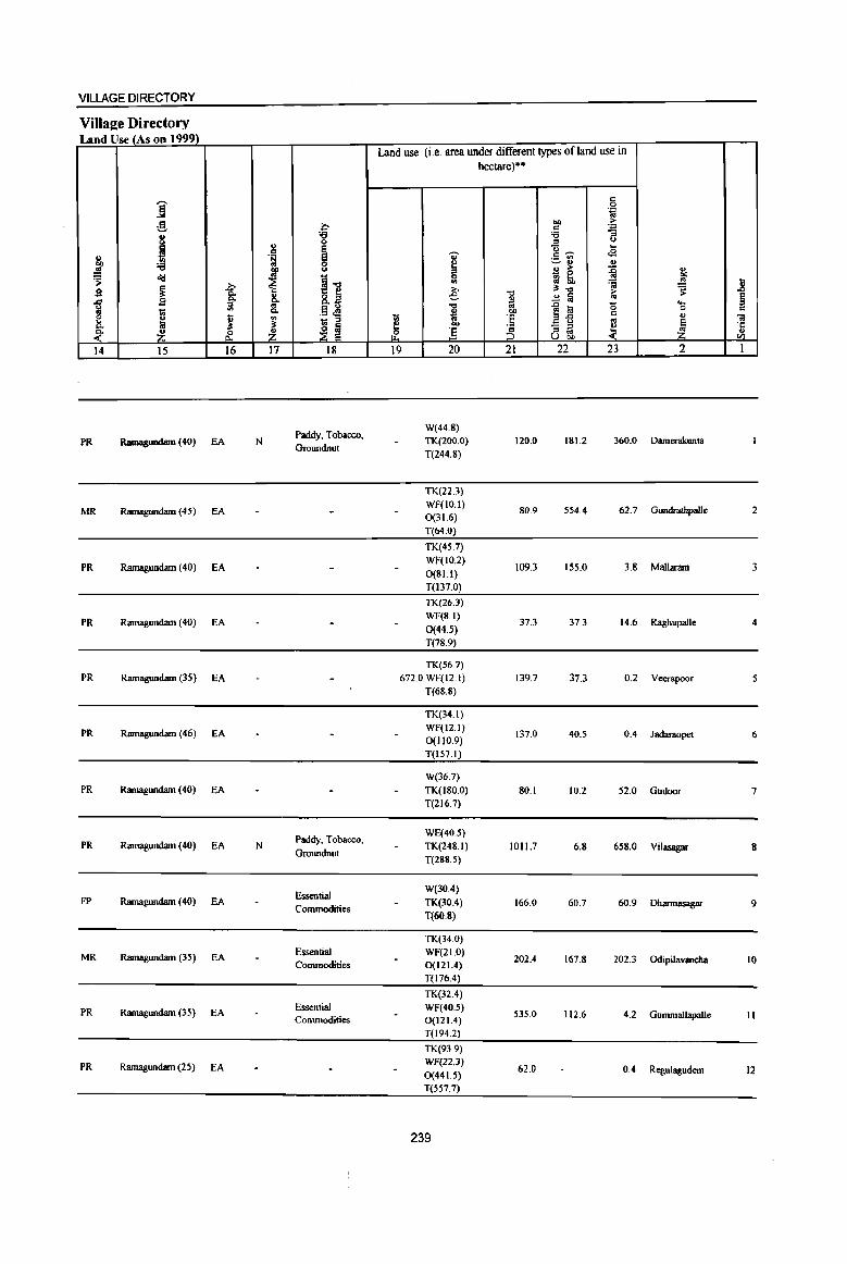
VILLAGE DIRECTORY
Village Directory Land Use (As on 1999).
Land use (i.e. area under different types ofland use in hectare)··
j '" 0 . ., g t.Il S!
0 '" . .,
8 'g ;a B " ~
t,)
~ g- ... '" Ci' .s
~ .~ ._ <II
:a 0 ~ ~ u .,
.!! ~ u u ;> ~ .,
~ ~ t.Il ~ <Id
~ ~1l Sl :; .!! l 2 ~ -a: ;., "t:I
~"t:I ;> ~ ., 8.2 e. ..!! ~ ~ § 1 g "" ~ ~ ... iil "t:I .0 a (5 1;; "" .~ ~ ~ t.Il 0 c
~.g '" ., E fa ~ VI ;; :§ ~ iii
"" !$
~ ~ f ... - ;::l ~ ~ 'f
<" Z &. Z 12 ] :5_ " ~ U t.Il til
14 15 16 17 18 19 20 21 22 23 2 1
Paddy. Tobacco. W(44.S)
PR Ramagundam (40) EA N TK(200.0) 120.0 181.2 360.0 Damerakunta GTOlUldnut
T(244.8)
TK(22.3)
MR Ramagundam (45) EA WF(IO.I)
SO.9 554.4 62.7 Gundratbpalle 2 0(31.6)
T(64.0)
TK(45.7)
PR Ramagundam (40) EA WF(IO.2)
109.3 155.0 3.S Mallaram 3 0(81.1)
T(I37.0)
TK(26.J)
PR Ramagundam (40) EA WF(S.I)
37.3 37.3 14.6 Raghupal1e 4 0(44.5) T(78.9)
TK(56.7)
PR Ramagundam (35) EA 672.0 WF(l2.1) 139.7 37.3 0.2 Veerapoor
T(68.S)
TK(34.1)
PR RamaglUldam (46) EA WF(12.1)
0(110.9) 137.0 40.5 0.4 Jadaraopet 6
T(157.1)
W(36.7)
PR Ramagundam (40) EA TK(ISO.O) 80.1 10.2 52.0 Gudoor 7 T(216.7)
Paddy. Tobacco. WE(40.5)
PR Ramagundam (40) EA N TK(248.1) 1011.7 6.S 658.0 Vilasagar 8 Groundnut
T(288.5)
Essential W(30A)
FP RamagWldam (40) EA TK(10.4) 166.0 60.7 60.9 Dharmasagar 9 Commodities
T(60.8)
TK(34.0)
MR Ramagundam (35) EA Essential WF(21.0) 202.4 167.S Odipilavancha
Commodities 0(121.4) 202.3 10
T(116.4)
TK{32.4)
PR Ramagundam (35) EA Essential WF(40.5) Commodities 0(121.4)
535.0 112.6 4.2 Gummallapalle II
T(l94.2)
TK(939)
PR Ramagundam (25) EA WF(22.3) 62.0 0.4 Regulagudem 12 0(441.5)
T(557.7)
239
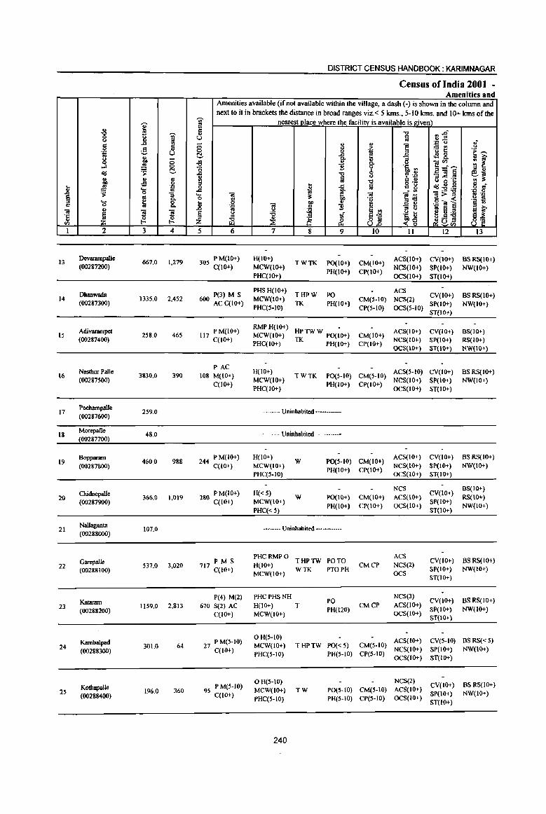
i ~ ~
~ '"' -'" iil
§ ., ;§, .,
.::; U
~ ., ... ;;:; ~ 0
o<J .s: ~
~ ., s -s
.8 ~ .... '.c .. .s: 0 :; § as 0-
'0 fij 8. ., .. "il
~ '3 '3 ·5
til ~ ~ I 2 3 4
13 Devanunpalle
667.0 1,279 (00287200)
Dhanwada 14 133S.0 2,452
(00287300)
Adivarampet 15 258.0 46S
(00287400)
NastburPalle 16 3830.0 390
(00287500)
17 Poehampalle
259.0 (00287600)
18 Morepalle
48.0 (00287700)
19 Bopparam
460.0 988 (00287800)
20 Chidnepalle
366.0 1,019 (00287900)
21 Nallagunta
107.0 (00288000)
GarepalJe 3,020 22 537.0
{00288 (00)
Katanun 23 1159.0 2,813
(00288200)
Kambalpad 24
(00288300) 301.0 64
25 Kothapalle
196.0 360 (00288400)
DISTRICT CENSUS HANDBOOK: KARIM NAGAR
Census of India 2001 -Amenities and
Amenities available (if not available within the village, a dash (-) is shown in the column and next to it in brackets the distance in broad ranges viz. < 5 kms., 5-10 lans. and 10+ kms of the
~
nearest.Jl]ace where the facility is available is given) "' " "' Ii "t:l n1' u iij ;;:; ::l
., ~
'.c ... .; :> ~~
... 0 j .~ 't ~ ~ 4!8. Ii) :; ;: f 49 Co u ]~~ '0 ~ % 'Ii <II ;I " -= -0 '1 .~ _"il§ 610 ..
~ <.)
G ~'I: <II ~ ;'l 'tl ., .. o ._
d 0 t 1 la ., g o<J~,ij .~ g--= 10
l~ ..... "il 1 "il:>::s ~ . ., 0 § ~ .g <a 1 .~ ;! ..
"il ... " J! . .,
~ "2
~j "3 !l os 6 ~ f .. u
~ u '6 tf .~ t; eu] " () .S ~ .~ rf <-g ~°tll 8'a
5 6 7 8 9 10 II 12 13
30S PM(lO+) H{lO+) TWTK PO(IO+) CM(IO+)
ACS(lO+) CV(lO+) BS RS(IO+) C{lO+) MCW(IO+)
PH(IO+) CP(IO+) NCS(IO+) SP(tO+) NW(IO+)
PHC(tO+) OCS{10+) ST(IO+)
P(3) M S PHSH(IO+)
THPW PO ACS
CV(lO+) BSRS(IO+) MCW(lO+) CM(5-10) NCS(2) 600 AC C(10+) PHC(S-IO)
TK PH(IO+) CP(S-to) OCS(5-10)
SP(IO+) NW(IO+) ST(lO+)
117 PM(IO+) RMP H(IO+)
HP TW W PO(;O+) ACS(IO+) CV(lO+) BS(IO+) MCW(IO+) CM(lO+)
C(lO+) PHC(IO+) TK PH(lO+) CP(IO+)
NCS(IO+) SP(IO+) RS(IO+) OCS(IO+) ST(IO+) NW(IO+)
PAC H(IO+) ACS(5-IO) CV(IO+) BSRS(IO+)
108 M(IO+) TWTK PO(S-IO) CM(5-10) MCW(IO+) NCS(IO+) SP(IO+) NW(IO+)
C(IO+) PHC(IO+)
PH(IO+) CP(IO+) OCS(lO+) ST(IO+)
--Uninhabited ----
~~ Uninhabited ~--
244 PM(IO+) H(lO+) W PO(HO) CM(IO+)
ACS(lO+) CV(IO+) BSRS(IO+)
C(IO+) MCW(IO+) PH(IO+) CP(IO+)
NCS(IO+) SP(IO+) NW(lO+) PHC(5-1O) OCS(IO+) ST(IO+)
280 PM(IO+) H« S) NCS
CV(JO+) BS(IO+)
W PO(IO+} CM(lO+) ACS(lO+) RS(lO+) C(IO+) MCW(JO+)
PH(IO+) CP(IO+) OCS(IO+) SP(IO+)
NW(IO+) PHC« 5) ST(IO+)
-- Uninhabited ---
PHC RMP 0 THPTW PO TO
ACS CV(lO+) BSRS(IO+) PMS
H(IO+) CMCP NCS{2) 717 C{IO+) WTK PTOPH SP(IO+) NW(lO+) MCW(IO+) OCs
ST(IO+)
P(4) M(2) PHCPHSNH PO
NCS(3) CV(IO+) BSRS(IO+)
670 S(2) AC H(IO+) T CMCP ACS(lO+) PH(120) SP(IO+) NW(IO+)
C(10+) MCW(to+) OCS(IO+) ST(IO+)
P M(S-to) OH(S-IO)
ACS(IO+) CV(S-tO) BS RS« S) 27 C(lO+)
MCW(LO+) THPTW PO«5) CM(S-IO) NCS(IO+) SP(IO+) NW{10+)
PHC(5-tO) PH(5-10) CP(S-tO) OCS(IO+) ST(IO+)
P M(S-IO) o H(S-IO) NCS(2)
CV(IO+) BS RS(IO+)
95 C(tO+) MCW(tO+) TW PO(S-fO) CM(S-IO) ACS(IO+) SP(IO+) NW(tO+)
PHC(5-10) PH(S-IO) CP(S-IO) OCS(IO+) ST(IO+)
240
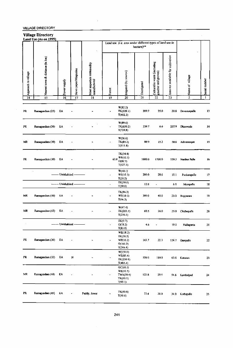
VILLAGE DIRECTORY
VilIae;e Directory Land Use (As on 1999)
Land use (i.e. area under different types of land use in hectare)··
c ]: 0
''':
g b OIl ~ C ''':
J :s ;e "3 =' <> .,
I y ...
'" " 2.~ <8 g, ;e .~
0 ., ~ f 3 ~ ~ ~ u
~ <Iil i1l ~ ..
';j ..!!l ... B ~
..Q >. "''''' :s: ~ It g. 8.~ e .",
2 a > Ei B ~ '" il ;! .", {l li! (5 .... =' .. til Co .13 t!! u "" C 0 c
e ~ <;;; <;j 'E ail ., .. ~ ~ - =' '" ~ .. Co
~ ~ e .. ~ - =' ~ '6
~ ~ ~ ~ .2 :5 =' '" u OIl til
14 15 16 17 18 19 20 21 22 23 2 1
W(S2.2) PR Ramagundam (25) EA TK(320.1) 209.7 35.0 20.0 Devarampallc 13
T(402.3)
W(89.6)
PR Ramagundam (30) EA TK(6S0.2) 330.7 6.6 257.9 Dhanwada 14 T(739.8)
W(26.6) MR Ramagundam (30) EA TK(85.2) 80.9 15.2 50.0 AdiV8f1llllJld IS
T(1l1.8)
TK(34.4)
PR Ramagundam (30) EA 63.0 WF(12.1) 0(80.9)
1600.0 1700.0 339.5 Nastbur PaJle 16
T(127.5)
W(lO.I) --Uninhabited --- WF(IO.I) 200.0 28.6 10.1 Pochampalle 17
T(20.2)
--- Uninhahited ----TK(30.0) T(30.0)
12.0 6.0 Morepalle 18
TK(86.2) MR Ramagundam (to) EA WF(to.l) 300.0 40.0 23.0 Bopparam 19
T(96.3)
W(47.4) MR Ramagundam (43) EA TK(203.1) 60.5 30.0 25.0 Chidnepalle 20
T(250.5)
TK(9.7) --Uninhabited ---- 0(73.2) 4.6 19.5 Nallagunta 21
T(83.0)
WE(IS.2) TK(50.2)
PR Ramagundam (36) EA WF(l6.2) 143.7 22.3 124.7 Garepalle 22 0(161.9) T(246.4)
W(150.0)
PR Ramagundam (32) EA N WE(85.4) TK(2S0.0)
500.0 110.0 63.6 Kataram 23
T(485.4)
GC(IO.I) WE(42.5)
MR Ramagundam (40) EA TWE(30.4) 123.8 29.5 54.6 Kambalpa<l 24 TK(IO.I) T(93.1)
PR Ramagundam (45) fA Paddy, Jowar TK(SO.6)
73.4 3S.0 34.0 Kothapalle 25 T(50.6)
241
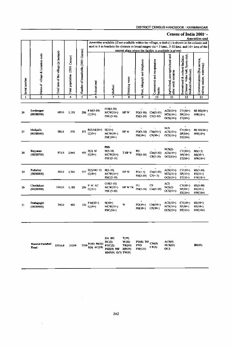
... .8 a " c
01 'e rI)
I
26
27
28
29
30
31
.. "8 <> ., 0
''': to
.3 <Id " CD lIS
~ .... 0
" ~ 2
Sundenjpet (00288500)
Medipalle (00288600)
Bayyaram (00288700)
Potbulvai (00288800)
Chinthakani (00288900)
Prathapagiri (00289000)
MandalParisbad Total
i ,....., <> ;g ., .c '" 5 g U ., CD ;:; ~ 0 .s: ~
" ., -s Q
''': ... i 0
e ]I ]I ~
Q
1-
3 4
683.0 1,131
S86.0 574
871.0 2,041
S81.0 1,366
1042.0 1,188
346.0 460
22016_0 31259
DISTRICT CENSUS HANDBOOK: KARIMNAGAR
Census of India 2001" -Amenities and
Amenities available (if not available within the village, a dash (-) is shown in the column and next to it in brackets the distance in broad ranges viz. < 5 Ions., 5-10 Ions. and 10+ Ions of the
-;;;- nearest place where the facility is available is given) iii 5 u ;:; 0 N ._, .a "0 .c
~ Il 0 .c til .. ... ~ 0 6 .8 .. CD .'" c
to U ~ § u '6
'" ~ ~ E Z 5 6 7 8
286 P M(S-IO) OH(5-10) MCW(IO+) HPW
C(IO+) PHC(S-IO)
IS3 P(2) M(IO+) H(IO+) HPW
C(lO+) MCW(IO+) PHC(IO+)
PHS
493 P(2) M H(S-IO) C(lO+) MCW(IO+)
THPW
PHC(S-IO)
337 P(2) M« S) H(S-IO) HPW
C(10+) MCW(IO+) PHC(S-IO)
PM AC o H(S-IO)
286 C(IO+) MCW(IO+) HPWTK PHC(S-IO)
136 PM(IO+) H(IO+) W
C(lO+) MCW(lO+) PHC(IO+)
DA DU T(19) HC(2) W(26)
7719 P(45) M(12.) PHC(2) TK(15) S(6) AC(lO) PHS(5) NH HP(15)
RMP(9) 0(7) TW(5)
242
" II) ., ;> Q '12 .c c. i 8-
~ "0 § "0 .c: ; ~ ..
.~ ., ]!
si .-~ 9 10
PO(S-IO) CM(S-IO) PH(S-IO) CP(S-IO)
PO(S-IO) CM(IO+) PH(IO+) CP(IO+)
PO PH(S-IO)
CM(S-IO)
CP(5-10)
PO« S) CM(S-IO)
PH(S-IO) CP« S)
PO CP PH(S-IO) CM(5-10)
PO(I 0+) CM(IO+) PH(IO+) CP(IO+)
PO(8) TO CM(3)
PTO CP 3) PH{J21) (
"0
lii
I " .~ :; tp ''::: ., ., g 'g
li "'3 b .~ u ~~ II
ACS(IO+) NCS(IO+) OCS(IO+)
NCS ACS(IO+) OCS(IO+)
NCS(2) ACS(IO+) OCS(IO+)
ACS(IO+) NCS(lO+) OCS(IO+)
ACS NCS(2) OCS(lO+)
ACS(IO+) NCS(IO+) OCS(IO+)
ACS(5) NCS(21) OCS
nf ''': u
~~ .:!& ] ~-~ _OI~ e ~'''; o(j~~ 1>~ 'J:'" l '" Ei e u '6 ~DS ~rI)
12
CV(IO+) SP(IO+) ST(IO+)
CV(IO+) Sp(IO+) ST(IO+)
CV(IO+)
SP(IO+) ST(IO+)
CV(IO+) SP(IO+) ST(IO+)
CV(IO+) SP(IO+) ST(IO+)
CV(IO+) SP(IO+)
ST(lO+)
.; <> 't ,....., 3l ~ ;g ~ e'Oi <II ~ .g g '" ''':
.~ ~ a ~ ~~
13
as RS(IO+)
NW(IO+)
BS RS(IO+) NW(IO+)
8S« 5) RS(IO+) NW(IO+)
8S(S-10)
RS(IO+) NW(tO+)
8S(5-IO) RS(IO+) NW(IO+)
8S(10+) RS(lO+) NW(IO+)
BS(I3)

VILLAGE DIRECTORY
Village Directory Land Use (As on 1999)
'" bll .i1! ~ B ..c: ~ 0
'§: <: 14
PR
PR
PR
PR
PR
MR
PR(ZO) MR(7)
FP
]' g '" " ~ 'i3 o'(:l
~ B 1;;
~ ~ 15
Ramagundam (43)
Ramagundam (50)
Ramagundam (49)
Ramagundam (40)
Ramagundam (47)
Ramagundam (50)
0 '6 0
" E c ·S E
0 OIl ()
~ i §"O t ~
" 8..a 51 §' Q. .5 ~
~ ; - = ~ Iii 0 ~ Q. ::E s 16 17 18
EA N Paddy. Jowar
EA Paddy. Jowar
EA N Paddy. Jowar
EA N Paddy, Jowar
EA Paddy. Jowar
EA
U(Z8) N(6)
Land use (i e. area under different types of land use in hectare)··
" u ... " 5l '"' e
"0 OJ
'in " ~ 00 0 ] "-19 20
WE(30A) TWE(50,6)
214,5 TK(31.6) WF(I I 1.3)
T(2238)
WE(l5,4)
TWE(26.3)
279.2 TK(21.4) WF(70,0)
T(133.1)
GC(33,2) WE(15.5)
TK(21.0)
WF(72.I) 0(37,6)
T(179.4)
W(65.5)
TK(250.2) T(315.7)
TK(59.1) 0(543.9)
T(603,0)
W(16,2)
WE(S.I)
50,6 TK(60,7)
WF(lOJ) T(95,1)
GC(43.29)
W(599.58) WE(2SS.86)
1179.J TWE(I07.23) TK(3217.44)
WF(448.S3)
0(1849.96) T(6531.89)
243
c 0
"g O/l ;> c ·c '6 -a -= " ()
.... <E c~ ._ '"
~'" " " ;> ~ _ 0
~ I;;, .; "0 ~"O ;>
" " c ~
'OJ - " ~ t;! '5 O/l C E .a"i3 ~
'c - ::l OJ
::l " ~ :;J u O/l
21 22 23
72,0 38,0 134,7
36.4 137,2
633,7 57.9
197.4 30.0 38.0
53.4 192,8 192,8
66,0 66,0 68.2
7379.6 3745.9 3076.0
... O/l
.i1! ~ ~ ..0
S '- = 0 0: ... OJ
£ ·c " r/l
2 1
Sunderajpet 26
Medipalle 27
Bayyaram 28
Pothulvai 29
Chinthakani 30
Praihapagiri 31

<t is z
([
-,.......... .I , -/
v
"" 0> • <0 :
o • .
'1
==
"'-1
""(
" I
'-- ___ ..1 ......... . " /-, ,
1 0.
I , I I
G
I() ,
M " 0>,
,
, ,
\ o \
8\ 0> ,
, M \ I : g-: I l-, .. I g I \ ""'.. , " --I
'. \ , , ,
l- - ---"""'~--- .. -....... -... - \~X \
\'. ~~..,
--
M N 0>
, , , , , N , N ,
, (J) , • ,
I / / "__',' --I ~ (" 00 ,,'" "
,,'/',. m:,... 'i - , ,. m '.
," '(1,-- J... .. ________ ... .\
--:._---~ I I I
.... _--- ....
.'
I ~
g N -.<:
'" ~ Q. o U co '6 .: '0 E ~ I: ;0 > o
C)
©
oi 'ij E '0 ; c: .. C)
g_ .. i! '" (I) ., = .,._ o c: o ii OJ
~ Q. to
= = "i Q. .. E .. '6 E '0 ,.. .. ~
'" II)
c o Q.
'" i: OJ II m
PART A- VILLAGE AND TOWN DIRECTORY
ALPHABETICAL LIST ()FVILLAGES (MANDALPARlSHADWlSE), KARIMNAGAR DISTRICT
Serial Name of village 2001 Census 1991 Census
number location code number location code number
1 2 3 4
Name of Mandai Parishad : Mahadevpur Name of MandaI :Mahadevpur 0011
1 Arnbatpalle 00292100 200110011001100031
2 Annaram 00289200 200110011001100002
3 Balijapur 00289800 200110011001100008
4 Beersagar 00290400 200110011001100014
5 Beglur 00291300 200110011001100023
6 Bheemanpalle 00292700 200110011001100048
7 Boipaimeia 00293100 200110011001100038
I Bommapur 00291100 200110011001100021
9 Brahmanpalle 00291000 200110011001100020
10 Burgugudem 00293400 200110011001100041
II Chindrapalle 00289300 200110011001100003
12 Dammur 00293300 200110011001100040
13 Edapalle 00290600 200110011001100018
14 Elkeswararn 00291200 200110011001100022 15 Garkepalle 00292400 200110011001100034
16 Ka1eswararn 00290100 200110011001100011
17 Kamanpalle 00292800 200110011001100047 18 Kancherlapalle 00290800 200110011001100016 19 Kannepalle 00290200 200110011001100012 20 Kishtapur 00293700 200110011001100046 21 Kishtaraopet 00291800 200110011001100028 22 Kothapet 00290700 200110011001100017 23 Kudurpalle 00290500 200110011001100015 24 Kuntlarn 00289700 200110011001100007 25 Laxmipur 00291500 200110011001100025 26 Lenkalagadda 00292300 200110011001100033 27 Mahadevpur 00290900 200110011001100019 28 Majeedpalle 00290000 200110011001100010 29 Medigadda 00292000 200110011001100030 30 Medigadda 00293200 200110011001100039 31 Metpalle 00290300 200110011001100013 32 Moded 00292600 200110011001100049 33 Muddulapalle 00289500 200110011001100005 34 Muknur 00293800 200110011001100044 3S Muktipalle 00291400 200110011001100024 36 Nagepalle 00289400 200110011001100004
245
Serial
number
1
37
38
39
40
41
42
43
44
45
46
47
48
49
DISTRICT CENSUS HANDBOOK :KARIMNAGAR
ALPHABETICALLISfOFYaLAGES (MANDALPARISHAD WISE),KARIMNAGAR DISTRICT (CONCLD.)
Name of village 2001 Census 1991 Census
location code number location code number
2 3 4 Neelampalle 00293500 200110011001100042
Palgula 00289600 200110011001100006
Palmela 00292900 200110011001100036
Pankena 00292500 200110011001100035
Peddampet 00292200 200110011001100032
Puskupalle 00289900 200110011001100009
Rapallekota 00291600 200110011001100026
Sarvaipet 00293000 200110011001100037
Suraram 00291900 200110011001100029
Tallagadda 00289100 200110011001100001
Timmatigudem 00293900 200110011001100045
Venchepalle 00293600 200110011001100043
YeokepaUe 00291700 200110011001100027
246

PART A - VILLAGE AND TOWN DIRECTORY
Village Directory data follows
247
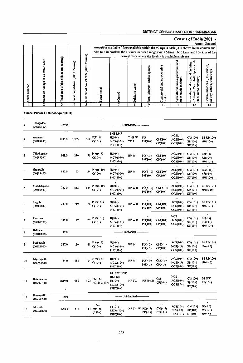
I " "8 U ~ 0 ., c ..c: a 0 g .,
'J: U to u j ~ ;;
0
~ ~ ~ u ., § co -B
.8 ..!!l .... .'" 'S 0
to
§ oS :; Q, .... ~ 0
01 0 Q, .. " '3 ~
'3 'Ii 0 0 en f- f-
1 2 3 4
Mandai Parisbad : Mabadevpur (0011)
TalJagadda 329.0
(00289100)
Annaram 2 1850.0 1,363
(00289200)
3 Cbindrapalle
168.0 280 (00289300)
4 Nagepalle
132.0 173 (00289400)
Muddulapalle 222.0 542
(00289500)
6 Palgula
239.0 719 (0028%00)
Kuntlam 7
(00289700) 357.0 127
8 Balijapur
19.0 (00289800)
9 Puskupalle
507.0 159 (00289900)
10 Majeedpalle
54.0 454 (00290000)
Kaleswaram 11 2849.0 1,986
(00290100)
12 Kannepalle
30.0 (00290200)
Metpalle 13 658.0 477
(00290300)
DISTRICT CENSUS HANDBOOK: KARIMNAGAR
Census of India 2001 -Amenities and
Amenities available (if not available within the village, a dash (-) is shown in the column and next to it in brackets the distance in broad ranges viz. < S kms., 5-10 kms. and 10+ kms of the
i nearest place where the facility is available is given)
iil "0 rJ ~A u Iii ;; " ~ ]
.", u oJ c ]~ u
a 0 'J: 'E ~ ~ ..c: ~ <f! &. flo "3 u &i' il Jl
Q, u ]~~ :: ~ 9 'a ., 0 '" u
1 "0 0 , .~ _OI~ ~j fa <> G ~·c "0 01 U
J a g 0g ~~~ '" 0 ..c o = ..Cl
~ . '" .'" 0 ..... 01 01 ]~ ~>~ :1 '-1'
0 '" .~ ._ :l
.8 0 co u .g~ ] !l ., '::l "iii C Jl OJ - ... oS u
~ e ., '" u .. e ~ ~ ~ <> Oil .~ u e ~;.a '" ~ ~1 iE ~ ;§ JlO!! 8] Z ~1i ~Vl
5 6 7 8 9 10 II 12 IJ
-- Uninhabited ---
PHSRMP NCS(2)
368 P(2) M H(IO+) THPW PO CY(IO+) BS RS(IO+) CM(lO+) ACS(IO+)
C(IO+) MCW(lO+) TKR PH(lO+) CP(IO+) OCS(IO+)
SP(IO+) NW(IO+) PHC(IO+) ST(IO+)
71 P M«5) H(IO+)
HPW PO«5) CM(IO+) ACS(IO+) CY(IO+) BS« 5)
C(IO+) MCW(IO+) PH(lO+) CP(IO+)
NCS(IO+) SP(IO+) RS(IO+) PHC(IO+) OCS(IO+) ST(IO+) NW(IO+)
34 PM(5-10) H(IO+) HPW PO(5-IO) CM(IO+)
ACS(IO+) CY(IO+) BS(5-10) C(IO+) MCW(lO+)
PH(IO+) CP(IO+) NCS(IO+) SP(IO+) RS(IO+)
PHC(IO+) OCS(IO+) ST(IO+) NW(IO+)
124 P M(5-lO) H(IO+) HPWR PO(S-IO) CM(5-10)
ACS(IO+) CY(IO+) BS RS(IO+) C(lO+) MCW(IO+)
PH(IO+) CP(IO+) NCS(IO+) SP(1O+) NW(5-IO)
PHC(IO+) OCS(IO+) ST(IO+)
178 P M(IO+) H(IO+) HPWR PO(IO+) CM(IO+)
ACS(IO+) CY(IO+) BS RS(IO+)
C(JO+) MCW(lO+) PH(IO+) CP(IO+)
NCS(IO+) SP(IO+) NW(IO+) PHC(IO+) OCS(IO+) ST(IO+)
29 P M(IO+) H(IO+) NCS
CY(IO+) BS« S) C(IO+) MCW(IO+)
HPWR po(IO+) CM(IO+) ACS(IO+) SP(IO+) RS(IO+)
PHC(IO+) PH(IO+) CP(IO+) OCS(IO+)
ST(IO+) NW(IO+)
--- Uninhabited -----
41 P M«5) H(IO+)
HPW PO«5) CM«5) ACS(IO+) CY(IO+) BS RS(IO+)
C(IO+) MCW(IO+) PH«5) CP(IO+)
NCS«5) SP(IO+) NW«5)
PHC(IO+) OCS(IO+) ST(IO+)
114 PM«5) H(lO+)
HPW PO«5) CM« 5) ACS(IO+) CY(IO+) BS RS(IO+)
C(IO+) MCW(IO+) PH« 5) Cp« 5)
NCS«5) SP(IO+) NW«5)
PHC{IO+) OCS(IO+) ST(IO+)
DUCWCPHS
P(2) M RMP(2) CM NCS
CY(IO+) BSNW ACS(lO+) 492 AC(2) C(IO+) H(IO+) HPTW POPH(2)
CP(IO+) SP(lo+) RS(lo+) MCW(lO+) OCS(IO+)
PHC(IO+) ST(lO+)
----- Uninhabited ------
PAC H(IO+) ACS(IO+) CY(IO+) BS« 5)
III M«5) HP TW W PO« 5) CM« 5) MCW(IO+) NCS« 5) SP(IO+) RS(IO+)
C(IO+) PH« 5) CP(IO+) PHC(IO+) OCS(lO+) ST(IO+) NW«5)
248

VILLAGE DIRECTORY
Villae;e Directory Land Use (As on 1999)
Land use (i.e. area under different types ofland use in hectare)··
j c 0 . ., ..
g ~ 01) > ;§
. ., j '"8 ;;
.E <>
" S .. ·a I
<> .B I- H .5 q;-
'" ~ ., ~ 'i3 01) ., > g,
== lid ~ ~"O 0 ~ ~ .s: .. :a ~ t
~ >. ~"O ~ £l a. 8.~ e "0 r. .c go 8- u .!! :a § 1 ..
.§ ~ "0 10 ]~ "0 .....
1ll .. Cl. .. 01) c 0 c e j I; '"
_ :::l 1ll 10 ·E III ., ..
Cl. ~ ~ ~ ~ e 01)
§ - :::l ~ ~ . .:
<- ~ z ~ ] :::l '" .,
UOI) Ul
14 15 16 17 18 19 20 21 22 23 2 I
TWE(8.0)
--Uninhabited ---- TK(24.0) 22.0 185.0 90.0 Tallagadda
T(32.0)
TWE(20.0) PR Ramagundam (37) EA N Rice 1071.0 TK(93.0) 92.0 361.0 213.0 Annaram 2
T(I13.0)
MR Ramagundam (40) EA Rice TWE(IO.O)
23.0 92.0 43.0 Chindrapalle 3 T(IO.O)
MR Ramagundam (42) EA TWE(4.0)
21.0 88.0 19.0 Nagepalle 4 T(4.0)
PR Ramagundam (40) EA TWE(13.0) T(13.0)
26.0 99.0 84.0 Muddulapalle 5
PR Ramagundam (42) EA TWE(5.0) T(5.0)
29.0 133.0 72.0 Palgula 6
MR Ramagundam (45) EA TWE(4.0)
T(40) 35.0 206.0 112.0 Kuntlam 7
--Uninhabited --- 15.0 0.6 3.4 Balijapur 8
TWE(4.0) PR Ramagundam (50) EA TK(20.0) 287.0 129.0 67.0 Puskupalle 9
T(24.0)
MR Ramagundam (52) EA TK(2.0) 16.0 25.0 11.0 Majeedpalle 10
T(2.0)
TWE(106.0) PR Ramagundam (47) EA N TK(16.0) 24.0 408.0 2295.0 Kaleswuam II
T(l22.0)
--Uninhabited _._- TK(17.0) 9.0 3.3 0.8 Kannepalle 12 T(17.0)
TWE(89.0) MR Ramagundam (50) EA N TK(5.0) 25.0 315.0 224.0 Metpalle 13
T(94.0)
249

" i "'" ~
8 !:! '" .c a c:
0 a u 'J:! u '" u <.> (5 0 ~
....l ~ 0 c ~ .s: " ... '" 01) oS 0 .. ~ 'J:!
..8 ..... '" ~ 0 g_ ~ .. ... ~ 8. c: 0
"iii u
~ "3 "3 't ~ 0
<i) I-
1 2 3 4
14 Beersagar
1093.0 111 (00290400)
KudUJpalle 15 294.0 651
(00290500)
Edapalle 16 1102.0 621
(00290600)
17 Kotbapet
969.0 (002907OO)
IS Kancherlapalle
1082.0 (00290800)
19 Mah.adevpur
1179.0 8,416 (00290900)
Brahmanpalle 396.0 1,069 20
(00291000)
Bommapur 1,453 21 (00291100)
681.0
Elkc:swaram 22 683.0 593
(00291200)
Beglur 23
(00291300) 764.0 1,893
24 Muktipalle
343.0 (00291400)
25 Laxmipur
629.0 {0029 I 500)
Rapallekota 26
(00291600) 535.0 676
DISTRICT CENSUS HANDBOOK: KARIMNAGAR
Census of India 2001 -Amenities and
Amenities available (if not available within the village, a dash (-) is shown in the column and next to it in brackets the distance in broad ranges viz.< 5 krns., 5-10 krns. and 10+ krns of the
Iii" nearest olace where the facility is available is given) fi '" :l~ u fa ;; ., " ~
'J:! () ,; c: > ~t! u
0 0 'J:! 'E ~ C .c f .:l 8-0.. ~ ~ t :::J {j
., 0 ]~~ '" ~ "2 ·ti :l "0 ::I u
...c -c f ";J _"iil§ 6-:;;
u lij is ~·c '" '" '" -c '" u ::I o ._
<I:! u 0 '" 0 I ...c Iii '" g :2:6 o c ...c
~ • <II 'J:! 0 ..... "iii "iI ]:6 ~>~ .. OJ:!
0 '" °0 .~ f)l !l 0 OIl u !l oS ~ oil "<iI ] .:: "iii c: "2 ..0 .. ()
~ ~j .~ t .. e ~ ~ § () :a ;f f u;a
:::J
~ i§ o .9 S Z ~ ~ <'"§ ~u 8'§ ~ <i)
5 6 7 8 9 10 11 12 13
36 P M(5-IO) H(IO+) HP TW W PO(5-IO) CM(5-IO)
ACS(IO+) CV(IO+) BS(5-10) C(IO+) MCW(IO+)
PH(5-10) CP(IO+) NCS(5-1O) Sp(IO+) RS(10+)
PHC(IO+) OCS(IO+) ST(IO+) NW(IO+)
P M(5-1O) - H(5- NeS
CV«5) BS RS(IO+) 155 10) MCW(S- T HP TW P0(5-10) CM«5) ACS«S)
C(lO+) 10) PHC(IO+) W R PH(5-l0) CP(IO+) OCS(IO+) SP{JO+) NW(IO+) ST(IO+)
PAC H(IO+) ACS«S) CV«S) BSRS(IO+)
153 M«5) HPW PO« 5) CM«5) C(10+)
MCW{IO+) PH« 5) CP(IO+)
NCS(lo+) SP(lo+) NW(IO+) PHC(IO+) OCS(IO+) ST(IO+)
--Uninhabited ---
--Uninhabited ---
P(7) M(5) HPHS
ACS CV 1,884 S(2) PUC
RMP(3) THPTW PO TO CM NCS(4) SP(IO+)
BS RS(10+)
AC C(10+) MCW(IO+) WTKR PTOPH CP(IO+)
OCS(IO+) ST(lO+) NW(JO+)
PHC(IO+)
THPTW NCS
CV«S) BS« 5) 279 P(3) M« 5) H{<5) PO« 5) CM{<S) ACS(IO+)
C(IO+) MCW(IO+) WTK SP(IO+) RS(IO+)
PHC(IO+) PH« 5) CP(IO+) OCS(IO+)
ST(IO+) NW(IO+)
PHSRMP(2)
381 P(2) M H«5) HPWTK PO
CM«S) ACS(IO+) CV«S) BSRS(IO+)
AC(2) C(IO+) MCW(IO+) R PH« 5) NCS(IO+) SP(IO+) NW(IO+)
PHqIO+) CP{IO+)
OCS{IO+) ST(IO+)
PHSRMP
P M«5) H{5-10) HPTWW PH CM« 5)
ACS«S) CV« 5} BS RS(IO+) 158
C« 5) MCW(IO+) TK PO« 5) CP(IO+)
NCS« 5) SP(IO+) NW{IO+)
PHC{IO+) OCS(IO+) ST(IO+)
PAC RMP(3)
489 M« 5) H(5-10) THPTW
PO« 5) CM(5-10) ACS(5-10) CV(5-JO) BS«S)
MCW(IO+) WTK NCS«5) SP(IO+) RS(IO+) C(IO+)
PHC(IO+) PH«5) CP(IO+)
OCS{IO+) ST(IO+) NW(lO+)
-- Uninhabited --------
--Uninhabited ---
P M« 5) H(IO+) HPWTK PO« 5) CM(JO+)
ACS(IO+) CV(IO+) BS«5) 183 NCS(IO+) SP(IO+) RS(IO+) C(lO+) MCW(IO+)
PH« 5) CP(IO+) PHC(IO+) OCS(IO+) ST(IO+) NW(10+)
250
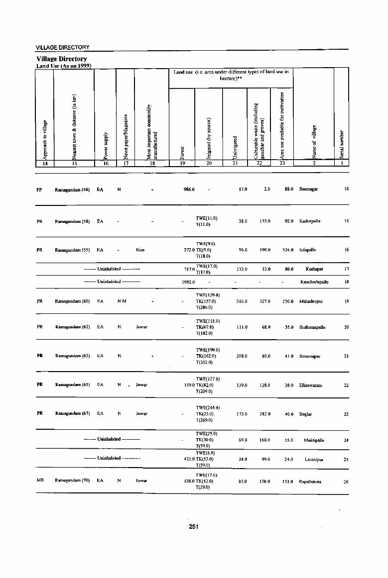
VILLAGE DIRECTORY
Villae:e Diredory Land Use (As on 1999)
Land use (i.e. area under different types of land use in hectare)"
'" j 0 ',c .,
2- "" > ~ '" 'J: ., :a :;
u 0 ::l u
~ .,
! <3 .... .~ ~ c~ ,£ ., '"
._ OIl
"" :a ~ ~ ... ...
.!! co '" > {i ., .. _ 0
co ~ ~
~ ~~ Sl ~ tb :a ..!!! t ~
,., ,., iI:.., ~ .0 S -a .., > " 8.a e ~ a '" g ..c g 0- 0- ~ '-::l .. .., .0 l'i! (5 u '" .13 .!l 0 .. .. t; 0-
~ DO
~-5 '" " e ~ ~ UI _ :s ti 'E ., 1
O! 0- il:
~ ~ ~ ..,
~ - :s ~ '':
~ ~ ~ ;z ~ ] ::l to ... U co en
14 15 16 17 18 19 20 21 22 23 2 I
FP RamagWldam (48) EA N 986.0 17.0 2.0 88.0 Beersagar 14
PR Ramagundam (50) EA TWE(II.O) T(II.O)
38.0 153.0 92.0 Kudurpalle 15
TWE(9.0)
PR RamagWldam (55) EA Rice 272.0 TK(9.0) 96.0 190.0 526.0 Edapalle 16
T(18.0)
--Uninhabited --- 7170 TWE(17.0) . T(17.0)
132.0 23.0 80.0 Kothapet 17
--Uninhabited ----- 1082.0 Kancherlapalle 18
TWE(129.0)
PR RamagWldam (60) EA NM TK(lS7.0) 316.0 327.0 250.0 Mahadevpur 19 T(286.0)
TWE(IIS.O) PR RamagWldam (62) EA N lowar TK(67.0) 111.0 68.0 35.0 Bralunanpalle 20
T(182.0)
TWE(190.0) PR Ramagundam (63) EA N TK(162.0) 208.0 80.0 41.0 Bommapur 21
T(352.0)
TWE(127.0) PR RamagWldam (65) EA N . lowar 159.0 TK(82.0) 139.0 138.0 38.0 Elkeswaram 22
T(209.0)
TWE(244.0) PR Ramagundam (67) fA N Jowar TK(25.0) 173.0 282.0 40.0 Beg1ur 23
t(269.0)
TWE(29.0) --Uninhabited --- TK(30.0) 69.0 160.0 55.0 Muktipalle 24
T(59.0}
TWE(6.0) --Uninhabited --- 421.0 TK(53.0) 24.0 99.0 24.0 Laxmipur 2S
T(59.0)
TWE(17.0} MR Ramagundam (70) fA N Jowar 138.0 TK(12.0) 85.0 150.0 133.0 Rapallekota 26
T(29.0)
251
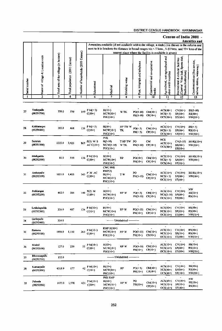
DISTRICT CENSUS HANDBOOK: KARIM NAGAR
Census ofIndia 2001 -Amenities and
Amenities available (if not available within the village, a dash (-) is shown in the column and next to it in brackets the distance in broad ranges viz. < 5 krns., 5-10 krns. and 10+ kms of the
r>. nearest place where the facili!Y._is available is_gjvell}_ .,
'V' ~ .g ~ ~
II ..., rl~ I.) u la I.) .,
.'" u If .: .a ., (; ., .,
] ~~ i3 .: >-a g <:> 0 .'" 'E ~ .'" u ~ -a e <l!8, .. ~ "3 II iU' g ;; ., .,
]~~ ~ Q. I.)
¥l ~ ....l .!! <:> 1l 'i' '§' '" ~ t!- o
o(j 1 ] 0
~·i ~Ol~ ~~ <> a "6'g ., ., .: -0 bI) -£l 0 :> g 'g 0
j .!! .'" 0 :; -a Ia .td1!;s o c ... Of -"I j ].~ .= 0
~ 0 "3 ... 0; a 0; 0;>= !l .'" ~ ..
8: 0 .: 'e c « '§ il ..... ~ ... 0 Ol
bI) ., .g ~e Cl 0 ., . '" j 1l " - ..
O! " .D '" I.)
]j ::s I.) '" s = E iU'
~ '5 ~ 9 0 '6 ti .~ b .,.,]
~~ ·c ~ " ~
ti .5 II Z ~ ~ <~ tlUVl '" u I 2 3 4 5 6 7 8 9 to 11 12 13
27 Ycukcpalle
779.0 579 149 PM«5) H(W+) WTK PO(S-IO) CM(IO+)
ACS(IO+) CY(IO+) BS(5-IO) (00291700) C(IO+) MCW(IO+)
PH(5-lO) CP(IO+) NCS(<: 5) SP(IO+) RS(IO+)
PHC(IO+) OCS(IO+} ST(IO+) NW(IO+)
28 Kishtaraopet
183.0 468 126 P M« 5) H(IO+) HP TW W PO(~ S) CM(IO+) ACS(IO+) CY(IO+) BS(<: 5)
(002918(0) C(10+) MCW(IQ+) TK PH«S) CP(IO+)
NCS(<: S) SP(IO+) RS(IO+) PHC(IO+) OCS(IO+) ST(IO+) NW(lO+)
PHS NCS
29 SW1Il1Ul1
1222.0 3,423 P(3) M S H{5-10) THPTW PO CM
ACS(IO+) CY(S-IO) BS RS(IO+)
(00291900) 869 AC C(IO+) MCW(S-IO) WTK PH(5-10) CP(IO+) OCS(IO+)
Sp(IO+) NW(IO+) PHC(IO+) ST(lO+}
30 Medigadda
&1.0 510 136 PM(10+) H(IO+) HP PO(IO+) CM(lO+)
ACS(IO+) CY(lO+) BS RS(IO+) (00292000) C(1O+) MCW(IO+)
PH(IO+) CP(IO+) NCS(<: 5) SP(IO+) NW(IO+)
PHC(IO+) OCS(IO+) ST(IO+)
CWCPHS
Ambatpalle PM AC RMP(2)
PO ACS(IO+) CV(IO+) BS RS(IO+) 31 1021.0 1,41S 343 C(10+) H(IO+) TW CM(IO+)
(00292100) MCW(IO+)
PH(S-IO) CP(IO+)
NCS(<:5) SP(IO+) NW(IO+)
PHC(IO+) OCS(IO+) ST(IO+)
NW 32
Peddampet 462J) 585
P(2) M H(lO+) HPW PO«S} CM(IO+)
ACS(IO+) CV(lO+) BS(IO+)
(00292200) 140 C(lO+) MCW(IO+) PH(5-10) CP(IO+)
NCS(S-IO) SP(IO+) RS(IO+)
PHC(IO+) OCS(IO+) ST(IO+)
33 Lenkalagadda
336_0 487 P M(10+) H(IO+)
HPW PO(S·lO) CM(IO+) ACS(IO+) CV(lO+) B5(IO+)
(00292300) 134 C(10+) MCW(lO+) PH(IO+) CP(IO+)
NCS(IO+) SP(IO+) RS(IO+)
PHC(IO+) OCS(IO+) ST(IO+) NW(IO+)
34 Garkepalle
334.0 --- Uninhabited .----(00292400)
Psnkena P M(IO+) RMPH(lO+)
ACS(IO,;-) CV(IO+) BS(IO+) 3S 1930.0 1,110 263
C(lO+) MCW(IO+) HPW PO(S-IO) CM(IO+)
NCS(IO+) SP(IO+) RS(IO+) (00292500) PHC(IO+) PH(IO+) CP(IO+)
OCS(lO+) ST(IO+) NW(IO+)
Moded 127.0 239
P M(lO+) H(IO+) HPW PO(5-1O) CM(IO+)
ACS(IO,;-) CV(IO+) BS(IO+) 36 55 C(lO+) MCW(IO+) NCS(IO+) SP(IO+) RS(IO+) (00292600) PH(IO+) CP(IO+)
PHC(IO+) OCS(IO+) ST(IO+) NW(IO+)
37 Bheemanpalle
153.0 ._- Uninhabited -----(00292700)
Kamanpalle P M(IO+) H(IO+) HP PO« 5) CM(IO+)
ACS(lO+) CV(lO+) 8S(10+) 38 4518.0 177 42 C(IO+) MCW(IO+) NCS(IO+) SP(IO+) RS(JO+) (00292800) PH(IO+) CP{IO+)
PHC{IO+) OCS(IO+) ST(IO+) NW(IO+}
PHS RMP NW
Palmela P M(lO+) H(IO+) HPW
PO CM(IO+)
ACS(lO+) CV(IO+) BS(IO+) 39 1475.0 1,578 421
MCW(IO+) PH(IO+) NCS(IO+) SP(IO+) (00292900) C(lO+) CP(IO+) RS(IO+) PHC(IO+) OCS(lO+) ST{IO+)
252

VILLAGE DIRECTORY
Villa2e Directory Land Use (As on 1999)
Land use (i.e. area under different types ofland use in hectare)··
j c 0 .'"
.9 l;> bO ~ '""
c:; .'" 8 '8 '<3 :;
... ]~ ....
~ i ... ., . § ..,. ¢l ..,
'<3 .... ~~ .!! ,!! 00 3 o ;> '" .rd .. ~ ~ .0 au
~ ~~ 0 '" ~ '" 'a '" u
~ .?;> :>. "'.., ~ B §: .., ;> .0
.<: B 8- liE e ~ .!! !a '" ~ u '" .§ ~
.., 1~ "
.... .,
i '" Co i1 .., 0 c
e .... :;; 'E c 0 -a ., ~ - :I Q. " i1 I:! 00 ..
~ ·c § - :I ~ ~ ~ z ~ :5 :I .. " Uoo en 14 IS 16 17 18 19 20 21 22 23 2 I
TWE{4.Q)
MR Rarnagundam (72) EA N Jowar 328.0 TK(26.Q) 242.0 119.Q 60.0 Yenkcpallc 27. T(30.0)
PR Ramagundam (74) EA Jowar TK(20.0}
73.0 79.0 10.0 Kishtaraopet 28 T(20.0}
TWE{19S.0)
PR Ramagundam (64) EA N Jowar 290.0 TK(30.0) 116.0 308.0 282.0 Suratanl 29
T(22S.0}
MR Ramagundam (67) EA N Jowar WE(23.0)
26.0 32.0 Medigadda 30 T(23.0)
TWE(236.0)
MR Ramagundam (70) EA N Jowar 4IS.0TK(S.0) 97.0 218.0 47.0 Ambatpalle 31 T(244.0)
MR Rarnagundam (73) EA Jowar TWE(64.0)
42.0 249.0 107.0 Peddampet 32 T(64.0)
MR Ramagundam (77) EA Jowar TWE{7.0) T(7.0)
282.0 31.0 16.0 Lenkalagadda 33
--Uninhabited --- 263.0 41.0 30.0 Garkepalle 34
MR Ramagundam (80) EA Jowar 14000 TWE(14.0) . T(14.0)
22.0 217.0 277.0 Pankena 3'
MR Ramagundam (85) EA Jowar 17.0 78.0 31.0 Moded 36
--Uninhabited ---- 6.0 87.0 60.0 Bheemanpalle 37
MR Rarnagundam (90) EA Jowar 1800.0 2400.0 318.0 Kamanpalle 38
MR Ramagundam (83) EA Jowar. Rice 822.0 294.0 359.0 Palmela 39
253

I U -g ,., ... '" .c "' c c 0 .9 u .J:: ._, u .. u
.3 till ;:; .!! '" .td ~ C
u u c ! o£l 0
.8 .~ ... ~ ~ 0
~ .. 8: ... u
c 0 la " 01
~ s 1 ·c
u 0
'" I-< I-<
I 2 3 4
Sarvaipet 40 413.0 1,243
(00293000)
41 Boipalmclil
123.0 (00293100)
42 Medigadda
391.0 (00293200)
43 Danunw-
334.0 250 (00293300)
Bwgugudem 44
(00293-400) 99.0 275
NeelampalJe 45 223.0 300
(00293500) •
46 V~chcpalle
133.0 264 (00293600)
47 Kishtapur
899.0 (00293700)
Muknur 48
(00293800) 2928.0 481
49 Tinunatigudem Ino 178 (00293900)
MaodalParuhad 35499.0 35315
Total
DISTRICT CENSUS HANDBOOK: KARIMNAGAR
Census ofIndia 2001 -Amenities and
Amenities available (if not available within the village, a dash (-) is shown in the column and next to it in brackets the distance in broad ranges viz. < 5 krns., 5-10 krns. and 10+ kms of the
-;;;- nearest I1lare where the facilitY_is available is IZiven) '" III C -c n~ " al u . ., ... 8 u II)
] 0 c ... ~t! .~~ '" 0 .~ t!- .c ~8. Q. ., :;
~ i Q. u ]~~ gj ~ ~
.Iii. III
.c -c , .~ _01~ Ill;; £ ii -c c ., G -; 's ';'~
'" I:l .c al g '8 <Id:2~ ~ d' 0 .c ;; Q.
]~ .j:l 0
..... 01 ~ S. 01 ]>~ ~ .J:: 0 c .~ .~ 19 .. 0 co u -_"iiI ] § '" u . ., 01 c B .,
"3 li - 8 ~ f .£> .. ... ~ 8 III e"'t3 § ... :a of ~1 .~ t '" is ~ .5 !I til ~ & <~ 8] Z p;:~",
5 6 7 8 9 10 II 12 13
285 P M(IO+) PHS H(IO+)
ACS(lO+) CY(lO+) 8S(10+) MCW(IO+) W PO« 5) CM(IO+)
C(IO+) PHC(IO+) PH(IO+) CP(IO+)
NCS(IO+) SP(IO+) RS(IO+) OCS(IO+) ST(IO+) NW(IO+)
-- Uninhabited ---
--- Uninhabited -----
64 P M(IO+) H(IO+) HPR PO(IO+) CM(IO+)
ACS(lO+) CY(IO+) 8S(10+) C(IO+) MCW(IO+)
PH(IO+) CP(IO+) NCS(IO+) SP(IO+) kS(IO+)
PHC{IO+) OCS(IO+) ST(IO+) NW(IO+)
PAC H(lO+) ACS(IO+) CV(IO+) 8S(10+)
68 M(5-10) MCW(IO+)
THPR PO(IO+) CM(IO+) NCS(IO+) SP(IO+) RS(10+)
C(10+) PHC(IO+)
PH(JO+) CP(IO+) OCS(IO+) ST(IO+) NW(IO+)
70 P(2) M(JO+) PHS H(IO+)
ACS(IO+) CY(IO+) BS(IO+) MCW(IO+) THPR PO(IO+) CM(IO+)
C(IO+) PHC(IO+) PH(JO+) CP(IO+)
NCS(IO+) SP(IO+) RS(IO+) OCS(IO+) ST(IO+) NW(IO+)
69 P M(IO+) PHCH(IO+) THPR
PH CM(IO+)
ACS(IO+) CY(lO+) BS(IO+) C(lO+) MCW(IO+) PO(IO+)
CP(lO+) NCS(IO+) SP(IO+) RS(IO+) OCS(IO+) ST(IO+) NW(IO+)
--Uninhabited ---
P(3) AC(2) PHC H(IO+) ACS(IO+) CY(IO+) BS(IO+)
130 M« 5) MCW(IO+)
THPR PO(IO+) CM(lO+) NCS(IO+) SP(IO+) RS(IO+)
C(10+) PH(IO+) CP(IO+) OCS(IO+) ST(lO+) NW(lO+)
50 P M(IO+) H(IO+) THPR PO(IO+) CM(IO+)
ACS(IO+) CY(lO+) BS(IO+)
C(IO+) MCW(IO+) PH(IO+) CP(IO+)
NCS(lO+) SP(IO+) RS(IO+)
PHC(IO+) OCS(IO+) ST(IO+) NW(IO+)
H DU T(ll)
P(54) M(ll) CWC(2) W(28)
POe?) TO TK(lO) ACS BS(14)
8694 S(3) PUC PHQ2) PTO CM(3) CV HP(3") NCS(H) NW(3)
AC(13) PHS(10) TW(10)
PH(S) RMP(16)
R(IJ)
254

VILLAGE DIRECTORY
Vma2e Directory Land Use (As on 1999)
~ g 0
" '6
~ 0
" e c ~ .~ e
:a 0 .$ on <J
<II.l '" ~ ~ ~13 ~ i .9 " 8.~ ~ ~ g-~ til p. .5 <!l e ~ ~ ~ til :::s
Q,
~ ~ ~ ~ ~ ~ 14 15 16 17 18
MR Ramasundam (85) EA Jowar, Rice
PR
MR
PR
PR
PR
PR
PR(f9) MR(17) FP NW(J)
--Uninhabited --------
-••••• - Uninhabited •••• -_ ••••
Ramagundam (90) EA ]owar
Ramagundam (92) EA
Ramagundam (94) EA
Ramagundam (96) EA
_._._ Uninhabited •• _ •• _ •••
Ramagundam (98)
Ramagundam (100)
EA
EA
EA(J7) N{14} M
Land use (Le. area under different types of land use in
" l::! " :;: ;>., e '0
i t; I;! ~ ] 19 20
TWE(2.0) T(2.0)
TWE(I.O) T(1.0)
TWE(IO) T(1.0)
TWE(14.0) T(14.0)
TWE(II.O} T(lI.O)
WE(23)
7179 () TWE(1706) , TK(858}
T(2587)
255
hectare)··
"" o m "" 'E ';: ::> 21
51.0
30.0
319.0
42.0
25.0
38.0
28.0
47.0
310
6451.0
0: 0 .~
Ol) :> c . ." '6 "'3
:::s u <l ~
<8 c ~ ._ '" '-' " " " :> ~ _ 0
~ 6h ~ ~ '0 ..!! ~
:>
'" "§ lo '0 0:
a-B '" - :::s ~ (5 ~ 22 23
202.0 157.0
63.0 30.0
62.0 10.0
181.0 111.0
44.0 29.0
117.0 67.0
72.0 33.0
400.0 499.0
)037.0 1830.0
81.0 48.0
10096.8 9079.2
" Ol)
.$ ... " ~ .D E
<,-. ;;I 0 C
" ;a
~ '1:
" til
2 1
Sarvaipet 40
Boipalmela 41
Medigadda 42
Damrnur 43
Burgugudem 44
Neelampallc 45
Venchepalle ~6 "
Kishtapur 47
Muknur 48
Timmatigudem 49
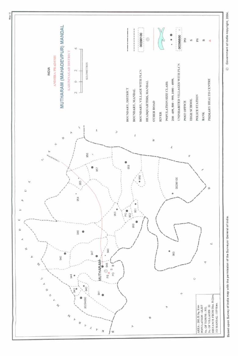
~I J. I
-~-\ .. ,-I
I ___ , ___ ..........
I ",
' '-------' , " ------, : §, --I : \ ' . : ,
:' -< "ill j ", "l --- \ • Ii ': «~ \ :, 8 " i-""'-- " .< ~ \ " ~8 I) P \ r-', ",
' '/ /-, ~, " 'i "', ' " , --, ,-"" "', '_ '-
" " y ~ .. , I ,_ /
-'. '< .' I ~-~-:5l '_", ,,:: /
" , • ',- . " • " I I \ , , _ \
\ I '" '0 N' , ( \ r' · "., ~-----I', ----\ "" ,-- • I I '\ r-- -.. .. , ---------~~~;.------------- ,-----< " • i \' ..... \' ..... \, I ( ',: / '\ .......... I ' " , , ' <0 • J }..- --. I I
" -- --.: / I ) " ""'0 , ' : • ;,---- I. / ----, " • , I
' " , ': / _.., ""------: '.. , I _--
/ 10·: ---- -I' ---L ... -,\ l ,.-_"" I ': ___ __ •• __
" . --- • I ~ '\ ,', - - :I: @ 0 ,
- - .... (J) (l_ , -\:-- - ,-',::>. / "'.. 'i. "- __ ':f:.. ________
1 '" \----- , .. \, , ',"'-----" eN ~ \ "'. ',~, " \~ " ",: ~ . \ ., I. I r- • § I
~ ~ , / "', 8 ' ___ /"
'" " .., .. -.. ----.. I
..... _ .... ., ",. i$- I
". .J. I
.... " J W
;! o N
i E c • ~
<:I
@
£ "i Q.
" E .. 'ij .5
>-~ ~ UJ C g_ ::J
"0 .. OJ)
" m

PART A - VILLAGE AND TOWN DIRECTORY
ALPHABETICAL LIST OF VILLAGES (MANDALPARISHAD WISE), KARIMNAGAR DISTRICT
Serial Name of village 2001 Census 1991 Census number location code number location code number
2 3 4
Name of Mandai Parishad : Mutharam (Mahadevpur)
Name of Mandai : Mutharam (Mahadevpur) 0012
1 Borlagudem 00295200 200120012001200016
2 Gaddalapalle 00295600 200120012001200014
3 Gandikamaram 00296000 200120012001200022
4 Jeelapalle 00294500 200120012001200009
S Kankunoor 00295700 200120012001200013
6 Korlakunta 00294300 200120012001200002
7 Madharam 00294400 200120012001200001
8 Mulugupalle 00294000 200120012001200004
9 Mutharam (Mahadevpur) 00294800 200120012001200006
10 Nallagunta (Meenajipeta) 00295000 200120012001200018
11 Nimmagudem 00294600 200120012001200010
12 Pegdapalle 00295300 200120012001200017
13 Polaram 00294100 200120012001200005
14 Reddipalle 00295800 200120012001200015
15 Regula Gudem 00295100 200120012001200019
16 Singampalle 00295500 200120012001200012
17 Singaram 00296100 200120012001200021 18 Stambhampalle (p.K.) 00295900 200120012001200020
19 Stambhampalle (PP) 00294200 200120012001200003 :l) Vajnepalle 00294900 200120012001200007 21 Yamanpalle 00294700 200120012001200008 22 Yetnaram 00295400 200120012001200011
257
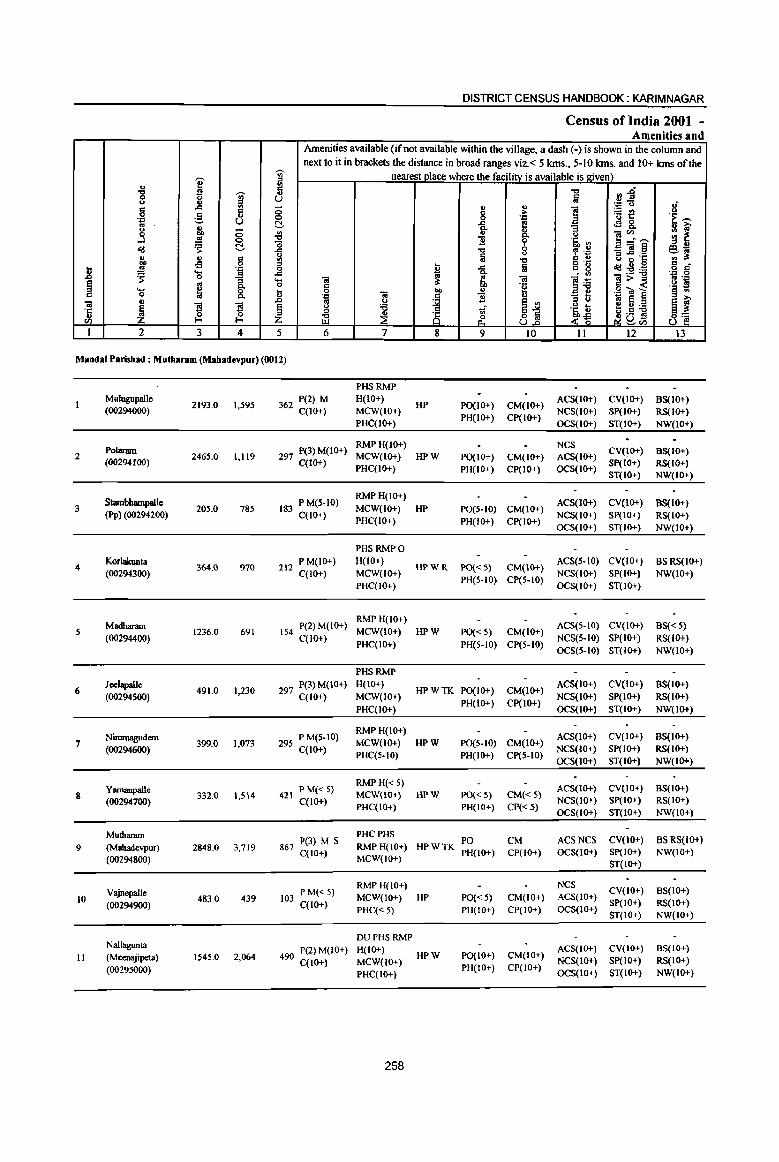
~ <II
I ::I ., <II
" ." ';;j' ... 0 u u ., iil g .::::
5 -0 .-= ,§, U 0 C!-:1 .,
co 8 ~ 0 ...l '" 0
~ ~ "0 <Ii:! ..c
" ., ., " <II eo -s 0 ::I
]1 .!!! .-= 0 .... '" .::::
~ 0 "3 .... ~ g 0. 0 .... 8. t " 0
"iii ., .0
~ 79 79 e ·c ., 0 0 ::I
til f-< f-< Z I 2 3 4 5
DISTRICT CENSUS HANDBOOK: KARIM NAGAR
Census ofIndia 2001 -Amenities and
Amenities available (ifnot available within the village, a dash (-) is shown in the column and next to it in brackets the distance in broad ranges viz.< 5 kms., 5-10 kms. and 10+ kms of the
nearest vlace where the facility is available is given) .", :l~ Iij .-= u 1{ .. ., ] ~!! 8 > .::: ·E -.:::: e! <l9 8. e- "3 u 1:;' .,
]~- ~ ~ 0- y
'£ ~ .s. '" .", , .~ _"iil~ elii a u ::I..cI .t:: .. :s: .", " ., o .- Col g g " ~ .:::: !a "_ ~ <Ii:!:-g:a 0 a Co '.,c 0
"iii a "iii ]i "iii> ::I .. .=
§ :s:
.~ " « .~ ~
J .. .g~]
.~ ] 1i ~ <II
::I u j!] E! 1:;' y :a ]:~ a :s: ::I 81 ;g ~ ~ 8~ ~ (I)
6 7 8 9 10 11 12 13
Mandai Parishad : Mutharam (Mahadevpur) (0012)
PHSRMP MuJugupallc
2193.0 1,595 362 P(2) M H(10+) HP po(1O+) CM(IO+)
ACS(IO+) CV(IO+) 8S(10+) (00294000) C(lO+) MCW(lO+)
PH(IO+) CP(IO+) NCS(10+) SP(IO+) RS(IO+)
PHC(IO+) OCS(IO+) ST(IO+) NW(IO+)
PoIaram 297 P(3) M(IO+) RMPH(IO+) NCS
CV(IO+) BS(IO+) 2 2465.0 1,119 MCW(IO+) HPW PO(I 0+) CM(10+) ACS(IO+)
(00294100) C(IO+) PHC(IO+) PH(IO+) CP(IO+) OCS(IO+)
SP(IO+) RS(IO+) ST(IO+) NW(IO+)
Stambhampallc 183 P M(S-IO) RMPH(IO+)
ACS(IO+) CV(IO+) 8S(10+) 3 205.0 785 MCW(IO+) HP PO(S-IO) CM(IO+) (PP) (00294200) C(IO+)
PHC(IO+) PH(IO+) CP(IO+) NCS(IO+) SP(lO+) RS(IO+) OCS(IO+) ST(lo+) NW(IO+)
PHSRMPO
4 Korlakunta
364.0 970 212 P M(IO+) H(IO+) HPWR PO«5} CM(IO+}
ACS(5-IO) CV(lo+) BS RS(IO+) (00294300) C(IO+) MCW(IO+) NCS{IO+) SP(IO+) NW(IO+)
PHC(IO+) PH(5-10) CP(5-IO)
OCS(lO+) ST(IO+)
Madharam 154 P(2) M(IO+) RMPH(!O+)
ACS(5-10) CV(IO+) BS« 5) 5
(00294400) 1236.0 691
C(10+) MCW(IO+) HPW PO« 5) CM(IO+)
NCS(5-IO) SP(IO+) RS(IO+) PHC(10+) PH(S-10) CP(S-IO)
OCS(5-10) ST(IO+) NW(10+)
PHSRMP
6 JcclapaIJe
491.0 1,230 297 P(3) M(IO+) H(IO+) HPWTK PO(IO+) CM(IO+)
ACS(IO+) CV(IO+) 9S(10+)
(00294500) C(10+) MCW(IO+) PH(IO+) CP(IO+)
NCS(lO+) SP(IO+) RS(lO+)
PHC(IO+) OCS(IO+) ST(IO+) NW(IO+)
Nimrnagudem P M(5-10) RMPH(lO+)
ACS(IO+) CV(IO+) BS(IO+) 7 399.0 1,073 295 MCW(lO+) HPW P0(5-10) CM(IO+)
(00294600) C(IO+) PHC(5-10) PH(IO+) CP(5-10)
NCS(IO+) SP(IO+) RS(IO+)
OCS(IO+) ST(lO+) NW(IO+)
Yamanpalle P M« 5) RMPH«S)
ACS(lo+) CV(IO+) 8S(l0+) S 332.0 1,514 421 MCW(IO+} HPW PO« 5) CM«5}
(00294700) C(1O+) PHC(IO+) PH(IO+) CP« 5)
NCS(IO+) SP(lO+) RS(IO+) OCS(IO+) ST(JO+) NW(IO+)
Mutharam P(3) M S
PHCPHS PO CM ACSNCS CV(IO+) BSRS{lo+)
9 (Mahadevpur ) 2848.0 3,719 867 C(lO+)
RMP H(lO+) HPWTK PH(lO+) CP(lO+) OCS(IO+) Sp(IO+) NW(IO+)
(00294800) MCW(IO+) ST(IO+)
RMPH(JO+) NCS CV(IO+) BS(IO+) VajnepalJe
483.0 439 103 PM«S)
MCW(IO+) HP PO« 5) CM(IO+) ACS(IO+) 10 (00294900) C(lO+) SP(IO+) RS(IO+)
PHC« 5) PH(JO+) CP(IO+) OCS(lo+) ST(IO+} NW(IO+)
DUPHS RMP Nallagunta P(2) M(lO+) H(IO+) ACS(IO+) CV(IO+) BS(IO+)
11 (Mcenajipeta) 1545.0 2,064 490 MCW(lO+)
HPW PO(IO+) CM(IO+) NCS(IO+) SP(IO+) RS(IO+)
(00295000) C(IO+)
PH(IO+) CP(IO+) PHC(IO+) OCS(IO+) ST(IO+) NW(IO+)
258
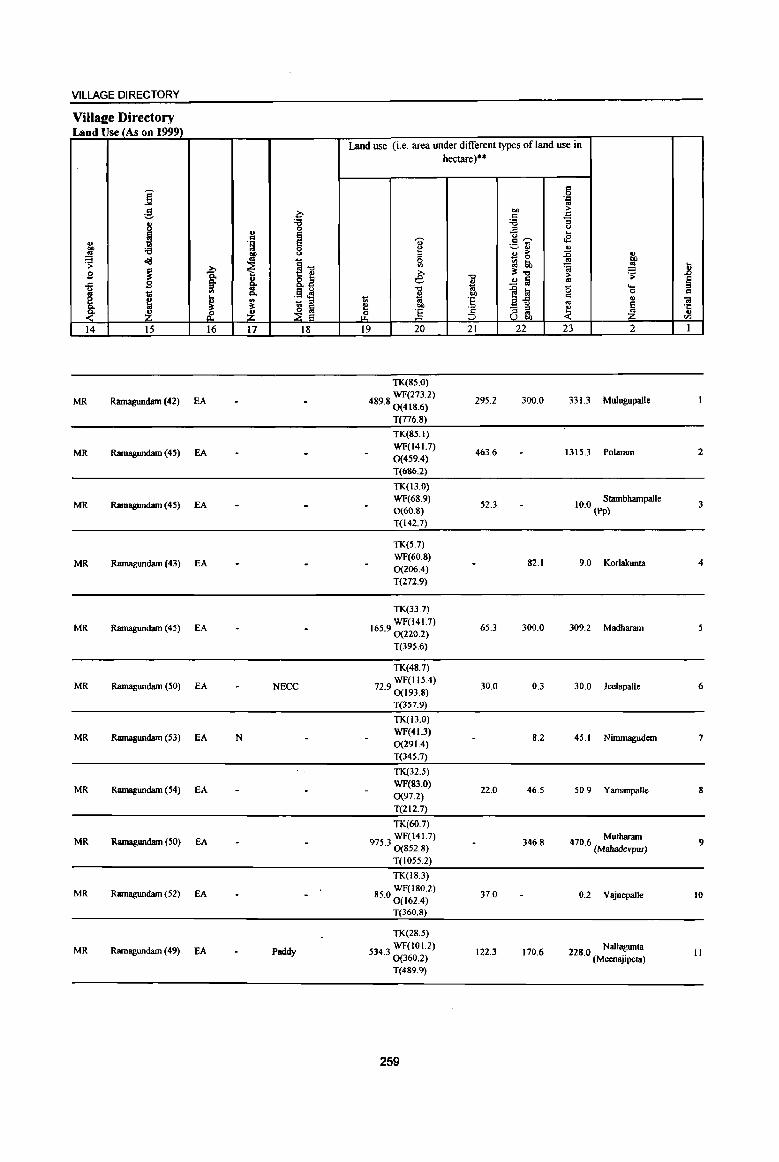
VILLAGE DIRECTORY
Villaee Directory Land Use (As on 1999)
Land use (i.e. area under different types of land use in hectare)"
j co 0 .;:::
'" ,g c- oo > :g 'J::
i "g :; =' 0
u
~ U .. ., 'U' CO""" oB u 'f! ~~ "" '6 8 ~
... .!! ~
., > :0 ., ~ ~ ~1l
0 _ 0
.!! ClO
~ II) ::! tb !! 1i
~ >. >. ~..,
.,. ~ .9 -a .., >
..c Q, §. 8.z e " ~ ~ «l ~ " 1 ~ .0 l<! 15 ... u '" .~ ~ 0 co .. 1;l 0- oo
~ ~ ~ ;; 'E ~-5 c ., .. ~ '" ~ ~ ~ ~ OIl .;::: - :::I ~
·c ~ ~ &. 2! & ] =' '" OJ
;:J U .., <IJ
14 15 16 17 18 19 20 21 22 23 2 I
TK(85.0)
MR Ramagundmn (42) EA WF(273.2)
489.80(418.6) 295.2 300.0 331.3 Mulugupalle
T(776.S)
TK(85.1)
MR Ramagundam (45) EA WF(141.7)
463.6 1315.3 Polaram 2 0(459.4) T(686.2)
TK(13.0)
MR Ramagundam (45) EA WF(68.9) 52.3 10 0 Slmnbhampalle 3
0(60.8) . (PP)
T(142.7)
TK(5.7)
MR Rmnagundam (43) EA WF(60.8) 0(206.4)
82.1 9.0 Korlalrunta 4
T(272.9)
TK(33.7)
MR Rmnagundam (45) EA WF(141.7)
165.90(220.2) 65.3 300.0 309.2 Madharam
T(395.6)
TK(48.7)
MR Ramagundam (50) EA NECC WF(115.4)
72.90(193.8) 30.0 0.3 30.0 Jeelapalle 6
T(357.9)
TK(13.0)
MR Ramagundam (53) fA N WF(41.3)
8.2 45.1 Ninunagudem 7 0(291.4)
T(345.7)
TK(32.5)
MR Ramagundam (54) EA WF(83.0)
0(97.2) 22.0 46.5 50.9 Yarnanpalle 8
T(212.7)
TK(60.7)
MR Ramagundam (50) EA 9753 WF(141.7) . 0(852.8)
346.S 470.6 Mutbaram (Mahadevpur)
9
T(1055.2)
TK(IS.3)
MR Ramagundam (52) EA WF(ISO.2) 85.0 0 (162.4) 37.0 0.2 Vajnepalle 10
T(360.8)
TK(28.5)
MR Rarnagundam (49) fA Paddy 5343 WF(101.2) 122.3 170.6 228 0 Nallagunta II . 0(360.2) . (Meenajipeta) T(489.9)
259
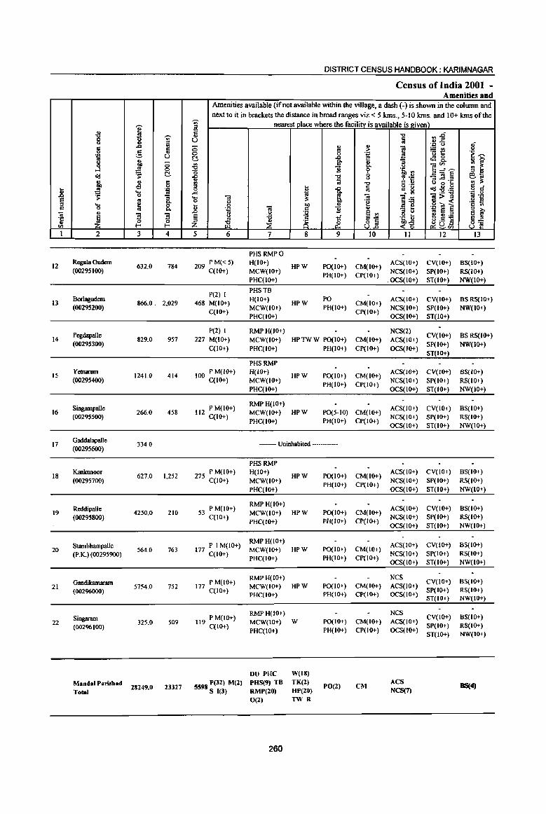
1! ~ C
'il 'Ii <Il
1
12
13
14
15
16
17
18
19
20
21
22
] 15
'f;'!
.3
.td
j ~ ..... 0
'" ~ 2
Regula Gudem (00295100)
BorIagodem (00295200)
Pegdapalle (00295300)
Yecnaram (00295400)
Singampalle (00295500)
Gaddalapalle (00295600)
KanJamoor (00295700)
Reddipalle (00295800)
Stambhampalle (PK) (00295900)
GandiJcamanun (00296000)
Singaram (00296100)
Mandai Paruhad Total
~ -;;;-g '" .... '" e ~
., u ., -.., <=> .!! 0
~ ~ II) 8 -s ',c '0 .!!
'" ~ C-
8. g g 0 0 f- f-
3 4
632.0 784
866.0. 2.029
829.0 957
1241.0 414
266.0 458
334.0
627.0 1,252
4250.0 210
564.0 763
5754.0 752
325.0 509
28249.0 23327
DISTRICT CENSUS HANDBOOK; KARIMNAGAR
Census of India 2001 -Amenities and
Amenities available (if not available within the village, a dash (-) is shown in the colwnn and next to it in brackets the distance in broad ranges viz. < 5 kms., 5-10 krns. and 10+ krns of the
-;;;- nearest place where the facility is available is given) iil 5 u ;:; .,
c 0 0 ~ .g, '" II)
"t:J "$ "0 .... -c:l u fii '" '" .. 0
~ ....
.d ~ ..... "OJ il: o '" .. 0 00 II)
] .~ .. <=I B u ~ ~ <.> 'i3 1 '" ~ 8 ;g
5 6 7 8 9
PHS RMPO
209 PM«5) H(IO+) HPW PO(IO+)
C(lO+) MCW(IO+) PH(lO+)
PHC(IO+)
P(2) I PHSTB
468 M(IO+) H(IO+)
HPW PO
C(lO+) MCW(IO+) PH(IO+) PHC(IO+)
P(2) 1 RMPH(IO+) 227 M(IO+) MCW(IO+) HPTWW po(IO+)
C(lO+) PHC(IO+) PH(IO+)
PHSRMP
100 P M(lO+) H(IO+) HPW PO(IO+)
C(10+) MCW(IO+) PH(IO+)
PHC(IO+)
112 P M(IO+) RMPH(IO+) MCW(IO+) HPW PO(5-1O)
C(IO+) PHC(IO+) PH(IO+)
--- Uninhabited -----
PHSRMP
275 P M(IO+) H(IO+) C(IO+) MCW(IO+)
PHC(IO-t)
P M(IO+) RMPH(IO+)
53 MCW(IO+) C(lO+)
PHC(IO+)
177 P I M(IO+) RMPH(IO+) MCW(IO+)
C(lO+) PHC(IO+)
RMPH(JO+) 177 P M(IO+) MCW(IO+)
C(10+) PHC(lO+)
119 P M(lO+) RMPH(lO+) MCW(IO+)
C(IO+) PHC(IO+)
DU PHC
5598 P(32) M(2) PHS(9) TB S 1(3) RMP(20)
0(2)
260
HPW
HPW
HPW
HPW
W
W(18) TK(2) HP(20)
TWR
PO(IO+) PH(IO+)
PO(I 0+) PH(IO+)
PO(IO+) PH(IO+)
PO(IO+) PH(lO+)
po(IO+)
PH(IO+)
rO(2)
!;! 'E u C-l' 0 t>
"'d
!a Ol "e u 6
8j 10
CM(IO+) ep(lo+)
CM(IO+) CP(lO+)
CM(IO+)
CP(IO+)
CM(IO+) CP(IO+)
CM(IO+) CP(IO+)
CM(IO+) CP(IO+)
CM(IO+) CP(IO+)
CM(IO+) CP(IO+)
CM(IO+) CP(IO+)
CM(IO+) CP(IO+)
CM
-c:l
fii
] :> t>
'5, <II , .~ C U 0'-
'" g - <II
]~ "3 t3 .~ D ..z~
11
ACS(IO+)
NCS(IO+) .OCS(IO+)
ACS(IO+) NCS(IO+) OCS(IO+)
NCS(2)
ACS(IO+)
OCS(IO+)
ACS(IO+) NCS(IO+)
OCS(IO+)
ACS(IO+) NCS(IO+) OCS(IO+)
ACS(IO+)
NCS(IO+) OCS(IO+)
ACS(IO+) NCS(IO+) OCS(IO+)
ACS(IO+) NCS(IO+)
OCS(IO+)
NCS ACS(IO+) OCS(IO+)
NCS ACS(IO+) OCS(IO+)
ACS NCS(7)
:l :E"' ',c u
~t! t!!8.. ]~~ _"OJ§ '" .d .c 00
0 .td1!:ij Ol>",
.g <a 1 «I S e t) ;.a ~0f!
~CIl
12
eV(IO+) SP(IO+) ST(IO+)
eV(IO+) SP(IO+) ST(IO+)
CV(IO+) SP(IO+)
ST(IO+)
CV(JO+) SP(IO+) ST(IO+)
CV(IO+) SP(IO+) ST(IO+)
eV(lo+) SP(IO+)
ST(IO+)
CV(IO+)
SP(IO+) ST(IO+)
CV(lO+) SP(IO+) ST(IO+)
CV(IO+) SP(lO+) ST(lO+)
CV(JO-t) SP(IO+) ST(IO+)
8 .~ ---~ ~ ., ~ '" u e?"Cii '" :s: e o cf . ., 0 ., ',c .2 f! '" III :> >.
~ ~ 8~
13
BS(lO+) RS(IO+) NW(IO+)
BSRS(IO+) NW(IO+)
BS RS(IO+) NW(IO+)
BS(IO+) RS(IO+) NW(IO+)
BS(IO+) RS(IO+) NW(IO+)
BS(IO+) RS(IO+)
NW(IO+)
BS(IO+) RS(IO+) NW(IO+)
BS(IO+} RS(IO+)
NW(IO+)
BS(IO+) RS(IO+) NW(IO+)
BS(IO+) RS(IO+) NW(IO+)
BS(4)
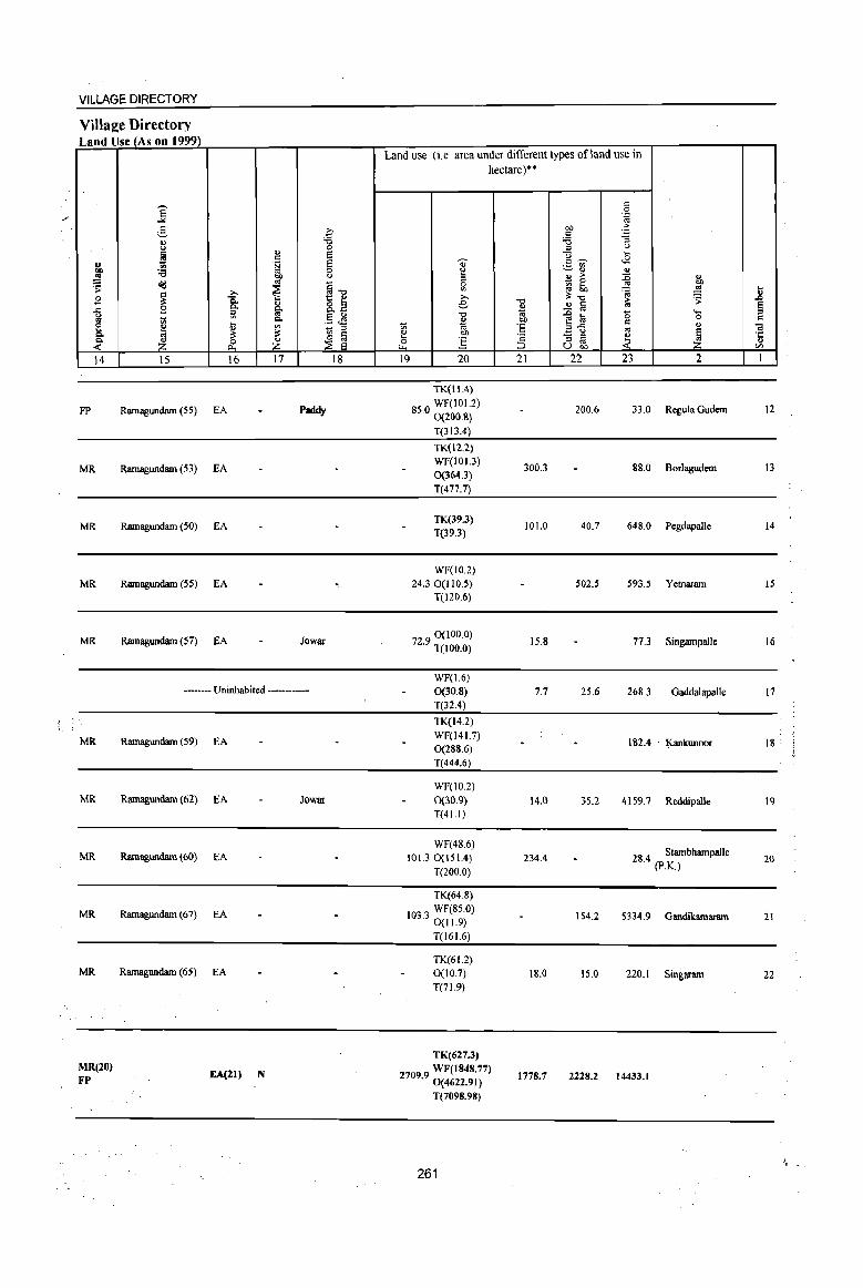
MR(20) FP EA(21) N
TK(627.3)
27099 WF(1848.77) . 0(4622.91)
T(7098.98)
261
1778.7 2228.2 14433.1
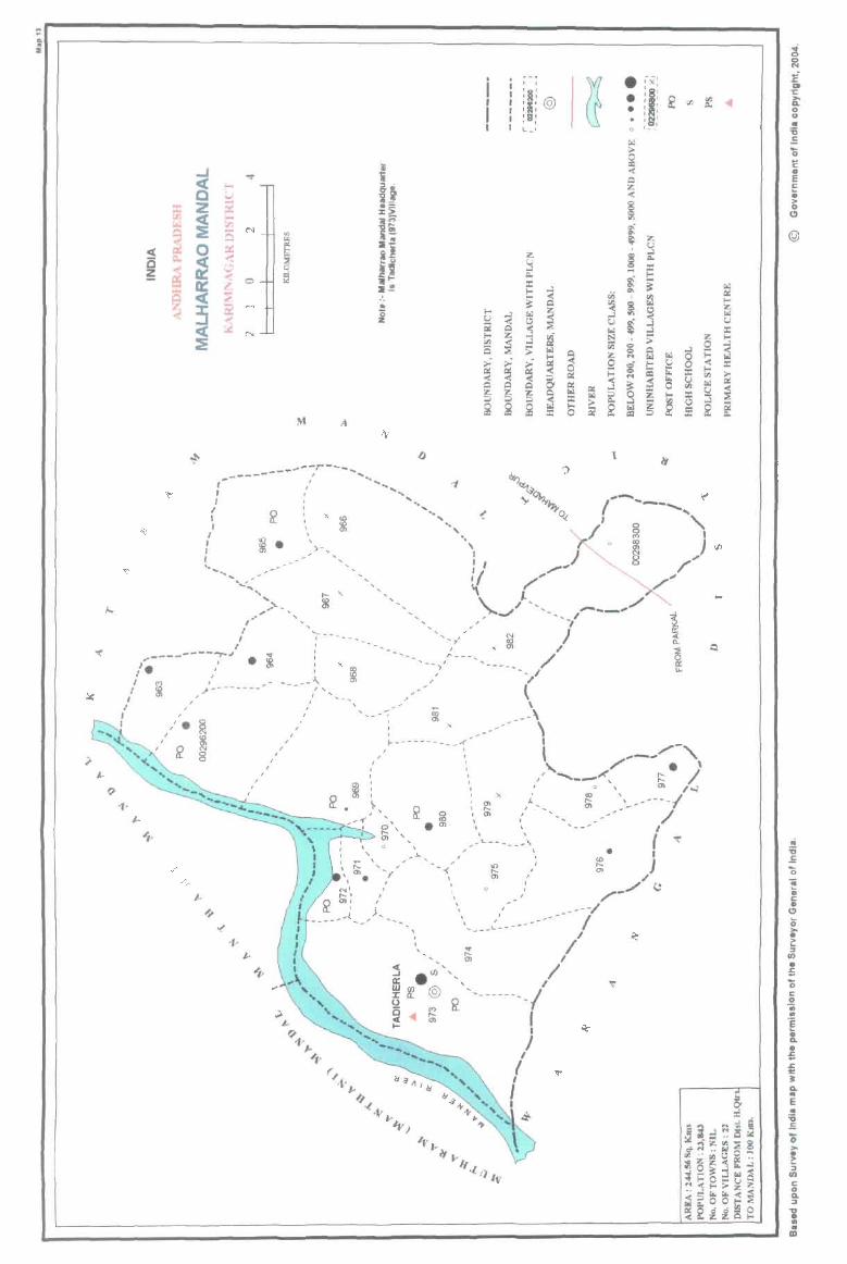
Ii i ..J '<I"
ii < ~~
0 >.J
I~
..... :z ~
~
rI' i i-<
.. row :!l
:Ii ~ 0
~u ~ 0::
~! ~
c(
'-' .. _ a
:I-I ~ ~ Q: z
~
....
~ i ,.,. 0: ~
~
I I , I \
\
• . I I
I , , I I
I , I
f-o ....l u « ga Q .. Z
~ .. Q
~ S « Q Q
!i !i £ £
, , \ L _ ... -_ --
~ -;
:I: @ , , 'S' , , '- -'
z u oJ
'" :c f-o
~ r.l D
j > ~ Q
!i £
, I
~ ~ ~ IZl
~ §
~ :r:
• --, U ' '' ,
'I' · : : &; · ' , • :s: '--
IZl :> g « Q Z ..: § .., t z 0-.. U
oJ
~ '" :: f-o
t ~ '" ri; , ~ ~ ~ C!)
....l
~ j U ...l ~ ;;: .; fi'i Q <:> IZl III z ...
~ ~ 0 g t:: r.. ~ =:I r.. ... :2 0
~
~ ....l ... ~ :>i ~ 0 z
~ !i1 r.l
oJ
~ :> a: !il b QI
1
.. III t>.
~ i-' Z 101 u ::
Z
~ 0
~ t: « :: t;; :c ~ u r.l
~ III r:: :c
oJ
~ c a: ==
1: ... 1:
"" ... 0 0 .. ~ .5 ~ C .. E c ~ > 0 Cl
@
-o
~ .. c ..
CI ~
o >-
~ ~ rn • ~
c o 'iii .. E t .. ~ ~
" ... .. E .. ~ .:.
>-l:: :; (I)
c o ... ~
-= .. m

PART A -VilLAGE AND TOWN DIRECTORY
ALPHABETICAL LIST OF VILLAGES (MANDALPARISHAD WISE), KARIMNAGAR DISTRICT
Serial Name of village 2001 Census 1991 Census
number location code number location code number
2 3 4
Name of Mandai Parishad: Malharrao Name of Mandai : Malharrao 0013
1 AnkanpaUe 00298100 200130013001300020
2 Ansanpalle 00297700 200130013001300016
3 ChigurupaUe 00296600 200130013001300006
4 Chinna Thoondla 00297100 200130013001300010
5 Domala Madaram 00296700 200130013001300004
6 Dubbagattu 00296900 200130013001300008
7 Dubbapeta 00297000 200 1300 1300 1300009
8 Gandharla 00297900 200130013001300018
9 Kapuram 00297400 200130013001300013
10 Kondampet 00296300 200130013001300001
11 Korlakunta 00298200 200130013001300021
12 Mallampalle 00298300 200130013001300022
13 Mallaram 00297200 200130013001300011
14 Mothkupalle 00296800 200130013001300007
15 Nacharam 00297600 200130013001300015
16 Pedda Thoondla 00298000 200130013001300019
17 Rudraram 00296500 200130013001300005
18 Shatrajpalle 00297500 200130013001300014
19 Tadicherla 00297300 200130013001300012
20 Tadwai 00297800 200130013001300017
21 Vallamkunta 00296200 200130013001300002
22 Yediapalle 00296400 200130013001300003
263

DISTRICT CENSUS HANDBOOK: KARIMNAGAR
Census of India 2001 -Amenities and
Amenities available (if not available within the village, a dash (-) is shown in the column and
next to it in brackets the distance in broad ranges viz.< 5 kms., 5-10 kms. and 10+ kms of the .... neareslj)jace where the facilin'is available is_gi_venl
I :>
'" '8 " -a fj~ ~ .,
U III U la u ., iil ., '': u Ii ..d 0 " ] ::.: en g " " ;> .~ ~ 3 " 0 0 .~ ·0 t:
'il u t!- ..c 4!8. u >,
j .,
0 0- "3 ]~~
'" os "" ~ " 0- u III ~ ~ "" 11 'i' .~ '" t!- o :> .,
~ .;; M -a 0 , .~ _"il§ ~j la
<.:I :> ..c .1: ~
., C "0 C u .;l 0 :> 0'- o S B " ] .!! . .., 0 tl -" la = g ~:s!:a o C .... -3 ..d ~ ~ ]~
',0 0 ~ 0 .... "iI .. l>~
os . ..,
~ ~ 8: 0 " '" .~ .~ ! .... u 0
Cl "" ., .g til ~ 0 .~ " 11 .,
19 .. J> u ~ E '" os e
~~ ..
~ Zl Zl § u :a iif ~1
., U :a '1: :> t; .S :I u ~ ~ z iil ~ _K & ~~ ~u<ll <Il
1 1 3 4 5 6 7 8 9 10 11 11 13
Mandai Parishad : Malharrao (0013)
P(2) AC(2) PHSRMP(3)
NCS CY Vallarnkunta
1052.0 2,373 656 M(lO+) H(W+)
HPTW PO
CM« 5) ACS(IO+) SP(IO+) BS RS(JO+)
(00296200) C(IO+)
MCW(IO+) PH(IO+) CP« 5) OCS(IO+) ST(lO+)
NW(IO+) PHC(IO+)
Kondampet 366 P(3) M(lO+) H(IO+) THPW NCS(4)
CV(IO+) BS RS(JO+) 2 871.Q 1,437 PO(I 0+) CM(IO+) ACS(IO+)
(002%300) C(10+) MCW(lO+) TK PH(IO+) CP(IO+) OCS(IO+)
SP(IO+) NW(lO+) PHC(IO+) ST(IO+)
Yedlapalle 334 P(2) M(IO+) H(IO+) NCS(2)
CY(IO+) 8S(10+) 3 761.0 1,341 THPW PO(I 0+) CM(IO+) ACS(IO+)
(00296400) C(lO+) MCW(IO+) PH(IO+) CP(IO+) OCS(JO+)
SP(IO+) RS(IO+) PHC(IO+) ST(IO+) NW(IO+)
P(2) AC(3) PHSRMP(3)
NCS 4
RlUIraram 1125.0 3,188 798 M(IO+)
H(IO+) THPW
PO CM(IO+) ACS(IO+)
CV(IO+) BS RS(IO+) (002%500)
C(IO+) MCW(IO+) PH(IO+)
CP(IO+) OCS(IO+) Sp(IO+) NW(IO+)
PHC(IO+) ST(IO+)
Chigwupalle 42.0 -- Uninhabited -----
(00296600)
6 Domala Madaram
1746.0 -- Uninhabited ---(00296700)
7 Mothkupalle
786.0 -- Uninhabited ---(002%800)
PAC DH RMP(2)
BS« 5) 8
Dubbagauu 2318.0 401 98 M« 5)
H(IO+) THPTW PO CM(IO+)
ACS(IO+) CV(IO+) RS(IO+)
(002%900) C(IO+)
MCW(IO+) WTKR PH(IO+) CP(lO+)
NCS(IO+) SP(IO+) NW(lO+)
PHC(IO+) OCS(lO+) ST(IO+)
9 Dubbapeta
299.0 183 47 P(IO+) H(IO+) THPW PO« 5) CM(lO+)
ACS(IO+) CV(JO+) BS(IO+) (00297000) M(IO+) MCW(IO+)
PH(lO+) CP(IO+) NCS(IO+) SP(IO+) RS(IO+)
C(IO+) PHC(5-10) OCS(IO+) ST(IO+) NW(lO+)
Chinna Thoondla 195 P M(IO+) H(IO+) NCS
CV(IO+) BS(IO+) 10 1253.0 770 WR PO(IO+) CM(IO+) ACS(IO+)
(00297100) C(lO+) MCW(IO+) PH(IO+) CP(lO+) OCS(IO+)
SP(IO+) RS(IO+)
PHC« 5) ST(IO+) NW(IO+)
DUPHS
Mallaram 588 PM AC(2) RMP(2)
TTWW PO ACS(lO+) ST(2)
BS RS(IO+) II 523.0 2,270 H(lO+)
TKR PH(lO+) CM(IO+)
NCS(IO+) CV(lO+)
NW(IO+) (00297200) C(IO+) MCW(lO+) CP(lO+) SP(IO+)
PHC« 5) OCS(IO+)
PHC PHS ACS CV(IO+) BS RS(IO+) Tadicherla
6,108 1478 P(6) M(2) S H(1O+) THPW PO
CM(IO+) NCS(4) 12 2692.0 PH(IO+) SP(IO+) NW(IO+) (00297300) , C(lO+) MCW(IO+) CP(lO+) OCS(lO+)
ST(IO+)
264

VILLAGE DIRECTORY
Vi1la~e Directory Land Use (As on 1999)
Land use (i.e. area under different types of land use in hectare)··
j .. 0 .'" ..
g ~ co > .. . ..,
I '8 :.a "3 .E
.., ., ; ~
.§ I " ,£ ~
.. ~ fIJ
._ VI
:.a ~ ., ., .!! 1:>1) " > ~ " ~ t
_ 0
~ ~ ~1l VI ~~ 'a ... ~
» ;>, ~ .8 .9 0. ." ~ .9 Q. o a e
~ ~ ~ 5 g ::s 0. .. ."
1~ 0 ... j
VI Q. .§ <f! ., ." .. 0 0:
e ~ '" 1;1 ::s -;;; 1a ·E '" .. ;a
t i!: ~ ~ !! 01)
;§ - ::s ., ~ ·c
~ ~ & ] :> '" .< u u 1:>1) <Il
14 15 16 17 18 19 20 21 22 23 2 I
GC(202.3)
W(l.3)
PR Ramagundam (22) EA N TW(132.5) 340.4 251.2 Vallamkunta TK(124.3)
T(460.4)
GC(40.5) WE(20.2)
MR RJIInagundam (20) EA NM TWE(4.0) 358.3 80.0 246.6 Kondampet 2
TK(121.4) T(186.1)
TK(86.7)
MR . Ramagundam (23) EA 60.00(534.3) 70.0 10.0 Yedlapalle 3 T(62l.0)
PR Ramagundam (25) EA TK(95.1)
976.9 53.1 Rudrnram 4 T(95.1)
--- Uninhabited --- 42.0 Chigurupalle
--Uninhabited --- 1746.0 DomaIa Madaram 6
--Uninhabited ----- 786.0 Motbkupalle 7
PR Ramagundam (25) EA TK(60.2) 8.0 T(60.2) 2003.8 0.1 246.0 Dubbagattu 8
TK(50.3) MR Ramagundam (30) EA 19.0 R(24.4) 19.0 134.1 52.3 Dubbapeta 9
T(74.6)
TK(24.3) MR Rmnagundam (32) EA 24.0 R(20.2) 777.1 58.0 349.4 Chinna Tboondla 10
T(44.6)
PIt Ramagundam (33) EA NM R(20.0) T(20.0)
462.7 15.3 25.1 Mallaram 11
MR Rmnagundam (35) EA NM 40.0 TK(l45. 7) T(14S.7)
657.1 402.0 1447.1 Tadicherla 12
265

.8 ~ d
OJ 'C .. til
1
13
14
15
16
17
18
19
20
21
22
-g u
" 0 ':: as g o-l a'd u tlO .!!! ~ .... 0 ., ~ 2
Kapuram (00297400)
SbatrajpaJle (OO297500)
Nacharam (00297600)
Ansanpalle
(00297700)
Tadwai (00297800)
Gandharla (00297900)
Pedda Thoondla (00298000)
Ankanpalle
(OO298100}
KorIa1runta (00298200)
Mallampalle (00298300)
Mand.1 Parisbad Total
I 'Ui' ] iil fl :§, ()
~ <; .!! <:> ~ C
'" C .:; 0 .... '.c 0 ..
1 g ]I ]I 0 ~ l-
3 4
1333,0 117
940.0 112
1320,0 824
622.0 1,284
138.0 ISO
1276.0
1076.0 3,134
1562.0
394.0
2329.0 151
24458,0 23843
DISTRICT CENSUS HANDBOOK; KARIMNAGAR
Census of India 2001 -Amenities and
Amenities available (if not available within the village, a dash (-) is shown in the column and next to it in brackets the distance in broad ranges viz. < 5 kms" 5-10 lons, and 10+ tans of the
'Ui'
'" '" is ()
<; <:> C!,
'" -0 "0 ..c .. III ::s 0 ..c ... OJ 0 c:
.8 0 ''a
~ ! 5 6
36 P M(IO+) C(IO+)
29 P M(IO+) C(10+)
198 P M(lO+) C(10+)
2% PM(IO+) C(lO+)
44 P M(lO+) C(IO+)
752 P(3) M(IO+) C(lO+)
35 P M(IO+) C(10+)
59 0 P(27) M(J) 5 S AC(S)
nearest olace where the facilitv is available is lrivenl
., c 0 .c 0.. ., 1! .., Iii
Ii .c 'iii ~ iI: ." .,
'ii ~ 'i ()
'6 ~ ~ ~
7 8 9
H(IO+) HPWTK PO(IO+)
MCW(IO+) PH(IO+)
PHC(IO+)
H(IO+} W PO(IO+)
MCW(IO+) PH(IO+)
PHqlO+)
H(IO+) HPW PO(IO+)
MCW(lO+} PH(IO+)
PHC(S-IO)
PHSH(IO+) MCW(IO+) HPW PO(lO+)
PHC(IO+) PH(IO+)
HCH(IO+) MCW(IO+) HPW PO(IO+)
PHC(IO+) PH(lO+)
--Uninhabited ----
PHSRMP H(IO+) PO
THP MCW(lO+) PH(lO+)
PHC(IO+)
--Uninhabited -----
--Uninhabited ---
H(IO+) HPW
MCW(IO+) PHC(IO+)
T(a)
DU DH W(14)
MCW HC TK(4) PHC PHS(6) HP(IJ) RMP(tl) T\V(J)
R(J)
266
PO(I 0+) PH(IO+)
PO(6)
~ .~ .. 0..
;1; ()
-0
Iii 'ii .~ .,
~i 10
CM(IO+) CP(IO+)
CM(IO+) CP(IO+)
CM(IO+) CP(IO+)
CM(IO+) CP(IO+)
CM(IO+) CP(lO+)
CM(IO+)
CP(\o+)
CM(lO+) CP(IO+)
-.::I !a
~ "3 ()
'a '" ~ .~ " u g'g .f .;; .a"g - .... ;:I <> () ....
~j 1I
NeS ACS(IO+) OCS(IO+)
NCS ACS(lO+) OCS(IO+)
NCS ACS(IO+) OCS(IO+)
NCS(3) ACS(IO+) OCS(IO+)
ACS(IO+) NCS(IO+) OCS(IO+)
NeS(3) ACS(IO+)
OCS(\O+)
ACS(IO+) NCS(IO+) OCS{IO+)
ACS NCS(22)
fj.g ':: u 8 ~~ '~ ~ .:28, ~ [ ]~~ !l _'ii~ r;-~ B ~ 'C </d",g 9 d' :E:a ~>~
'i,~ ,25
,g", § §i III
11 6 ~ f .... u] ~,E 8] .P:; () fI)
12 13
CV(lO+) BS(IO+) SP(lo+} RS(IO+) ST(IO+) NW(IO+)
CV(IO+) BS(IO+) SP(IO+) RS(IO+) ST(IO+) NW(IO+)
CV(lO+) BS(IO+) SP(IO+) RS(lO+) ST(IO+) NW(IO+)
CV(lO+) BS(IO+) SP(IO+) RS(IO+) ST(IO+) NW(IO+)
CV(10+) B5(IO+) SP(IO+) RS(IO+) ST(IO+) NW(IO+)
CV(IO+) BS«5) SP(lO+) RS(lO+) ST(IO+) NW(IO+)
CV(lO+) BS(IO+) SP(lO+) RS(IO+) ST(IO+) NW(JO+)
CV ST(l) BS(S)
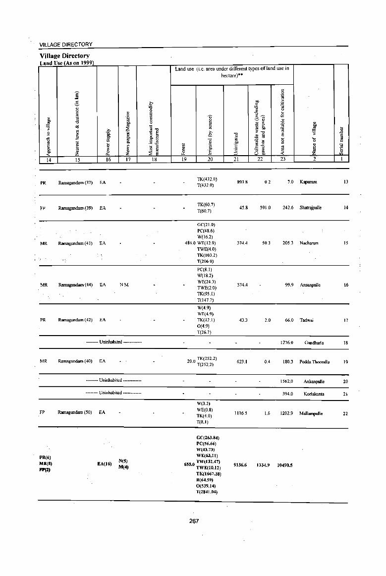
VILLAGE DIRECTORY
Village Directory Land Use (As on 1999)
Land use (i.e. area under different types ofland use in
hectare)··
c
]' 0 .~
g .c- OJ) .~ OJ "8 ~ :; u 0 .g '-'
~ <1> e ... c e ""
c ~ <E <1> .t:i .~ '" "" "8 0 ~
~ <1> " .!! OJ) " ., ,.. :0 " ~ Cd co
~"O 0 ~ ~ '" bJ)
i ~ '" ~ ~ il B ~ 1:: e ,..,
'0 ~'O to ~ ~
" 8. t e <1> ..2 § § ..c go '0 "' -e a 0 ""' ~ 1;; Q. .5 <E " OJ) c 0 C
~ ~ 1 1;; "' :§ .a-fi " .. ~ - = '" ~ ~ ~ e OJ) - = ~ .;:::
~ ~ .~ 0 :.5 c = co " ..... ::> u OJ) < en
14 15 16 17 18 19 20 21 22 23 2 1
PR Ramagundam (37) EA TK(432.0) T(432.0)
893.8 0.2 7.0 Kapuram 13
FP Ramagundam (39) EA TK(60.7)
T(60.7) 45.8 591.0 242.6 ShatrajpalJe 14
GC(21.0) PC(48.6) W(l6.2)
MR Ramagundam (41) EA 484.0 WE(12.9) 374.4 50.3 205.3 Nacharam 15 TWE(4.0) TK(103.2) T(206.0)
PC(8.1) W(IS.2)
MR Ramagundam (44) EA NM WE(24.3)
374.4 99.9 Ansanpalle 16 TWE(2.0) TK(95.1) T(l47.7)
W(4.9) WE(4.9)
PR Ramagundam (42) EA TK(12.1) 43.3 2.0 66.0 Tadwai 17 0(4.9) T(26.7)
------ Uninhabited ------------ 1276.0 Gandharla 18
MR Ramagundam (40) EA 20.0 TK(2S2.2) T(2S2.2)
623.1 0.4 ISO.3 Pedda Thoondla 19
-------- Uninhabited ------------ 1562.0 Ankanpalle 20
----- Uninhabited --------- 394.0 Korlakunta 21
W(3.2)
FP Ramagundam (50) EA WE(O.S)
1116.5 1.6 1202.9 Mallarnpalle 22 TK(4.0) T(S.I)
GC(26J.84) PC(56_66) W(43.73)
PR(6) WE(63.11)
·MR(8) EA(16) N(5) 655.0 TW(I32.47) 9136.6 M(4) 1334.9 10490.5
FP(:Z) TWE(lO.12) TK(1667.J8) R(64.59) 0(539.14) T(2841.04)
267
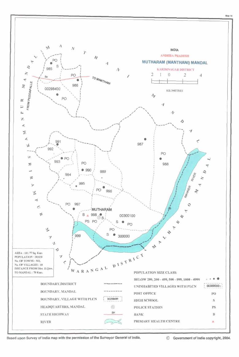
'. \ ,..--, \ "",-' I
INDIA
-\NDBIIA PRAD~ '/ PO' I. "
I S \ .. , MUTHARAM (MANTHANI) MANDAL
'(
~ ~ ;j
~ Q W
~ 4.
~ ~ .... I=-
Z .(
'$
: 985 .------' KARIMNAGAR DISTRICT I
I SH
, " I I
, \ . " 2
L 1 0
I I 2
I \ 00298400
, , , , ,
986 / I , KILOMETRES ..... ... .....
" • PO
I , , , , '{
"'--_ I ..... , , .......
\ " /,,, "" . \ ~ , ~ I " '_.L.. __ ... ,"',
... .. \ , , \ \ ".--< po.---_.. ....... , \. _.... I ,'''
,_..... ..---- ,I / --~J ,,' " -' J ,
&. : '-'-- / . ; : '991 -,...., I I
oJ. ,,"'-,. , .. -----.,.,: 987 \ ,-_.. 992 - , , ... I ,
t ,A ' , \ ---'"I "-----~ '_...,.J PO'
, " ~ rJ)... ,,- .PO ' \ ... , " 993 " \
.... <"I I PO
I \ .... J
"', 994 I • l-, ,
, .990 , I 989
"------',, ,/" ~- ... -
, ,
, I
I
• 988
4
I
o..J
"I(
~
~
" 995 I
I : • y • ~
\
" '-------,' PO 996 , "
't---·- __ _ I ... - ... '
\ I
~
....... _ I
-..... PO 997 -' "'" • __ - - - .'MUlHAR,AM
, " '~ ~
..... , 8 998.,' @S' "
00300100 ~
PS PO "''''''',,~ • PO
7
1-~-------------o~
AREA: 161.77 Sq. Kms
POPULATION: 28.628
No. OF TOWNS: NIL ND. OF VILLAGES: 18 DIST AltiCE FROM DI.t IiQIr!.
TO MANDAL : 70 Km5.
BOUNDARY,DISTRICT
BOUNDARY, MANDAL
BOUNDARY, VILLAGE WITH PLCN
HEADQUARTERS, MANDAL
STATEIDGHWAY
RIVER
PO
S • 300000
--"-------. : 00298400 , ---- ______ 1
@
SH
~ ~
~ V
~
POPULATION SIZE CLASS:
BEWW 200,200 - 499, 500 - 999, 1000 - 4999
UNINHABITED VILLAGES WITH PLCN
POST OFFICE
HIGHSCHOOL
POLICE STATION
BANK
PRIMARY HEALTH CENTRE
o •••
~ -OO300000x-: 1 ______ --- ..
PO
S
PS
B
Based upon Survey of India map with the permission ofthe Surveyor Genera' offndia. © Government of India copyright, 2004.
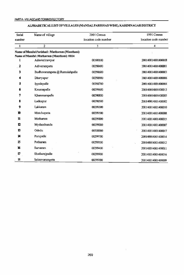
PART A -VILLAGE AND TOWN DIRECTORY
ALPHABETICAL LIST OFVllLAGES (MANDALPARISHAD WISE), KARIMNAGARDISTRICT
Serial Name of village 2001 Census 1991 Census
number location code number location code number
2 3 4
Name of Mandai Parishad : Mutharam (Manthani) Name of Mandai :Mutharam (Manthani) 0014
1 Adavisrirampur 00300100 200 1400 1400 14000 18
2 Adivarampeta 00298400 200140014001400001
3 Budhavarampeta @ Ramaiahpalle 00298600 200 1400 1400 1400003
.. Dharyapur 00298900 200 1400 1400 1400006
5 IppalapaUe 00298700 200 1400 1400 1400004
6 Kesanapalle 00299600 200 1400 1400 14000 13
7 Khammampalle 00298800 200 1400 1400 1400005
8 Ladnapur 00298500 200 1400 1400 1400002
9 Lakkaram 00299300 200 1400 1400 14000 10
10 Matchupeta 00299100 200 1400 1400 1400008
11 Mutharam 00299800 200 1400 1400 14000 15
12 Mydambanda 00299000 200140014001400007
13 Odedu 003()()()()() 200140014001400017
14 Parupalle 00299700 200 1400 1400 14000 14
IS Potharam 00299500 200140014001400012
16 Sarvaram 00299400 200140014001400011
17 Shatharajpalle 00299900 200140014001400016
18 Sukravarampeta 00299200 200140014001400009
269

I u ." 'Vi' 0 u u " § ..Q <II
~ " " '.z:l u co j .3 0
0
~ C-<ill u u c ... .:; 0
] .!! ... . .., ~
oj 0 :;
S .. Co ... ~ 8. C 0
01 u S S
~ ·c ~ 0 u
I-< rIl
I 2 3 4
Mudal Parishad : Mutharam (Manthani) (0014)
Adivarampeta 763.0 2,477
(00298400)
2 Ladnapur
514.0 1,151 (00298500)
Budhavararnpeta
3 @ Ramaiahpalle 486.0 1,570
(00298600)
Ippalapalle 4 1042.0 1,359
(002987oo)
5 Khammampalle
4300.0 3,141 (00298800)
6 Dharyapur
791.0 273 {00298900}
Mydambanda 1031.0 1,485 7
(00299000)
8 Matchupeta
774.0 1,227 (00299100)
Sukravarampeta 9
(00299200) 63.0 150
Lakkaram 10 479.0 1,620
(00299300)
Sarvaram II
(00299400) 181.0 322
Potharam 12
(00299500) 224.0 924
DISTRICT CENSUS HANDBOOK: KARIMNAGAR
Census of India 2001 -Amenities and
Amenities available (if not available within the village, a dash (-) is shown in .the column and neld to it in brackets the distance in broad ranges viz. < 5 krns., 5-10 kms. and 10+ kms of the
~ ., nearest Dlace where the facility is available is lriven) iil
" ." ~~ " u iii Ii 0 " " ] '.z:l C)
" ;,. ~t: Ii 0 0 '.z:l .~ ~ C- -= e c!9&, u ~ Co "S ~ " 8- u
]~~ :: ~ "§ ~ '5, ., o " " ..Q ." ~ .~ _01 e1i1 " li1
C) ;:l -= .c ., ~ !l ." C " .... lii
o ._ u 3 .s " '" 0 .9 -= " g ~:"5!'i3 0 -= Co
~~ '.z:l 0 .... 01 ~ ~ 01 ~>~ oj '.z:l
0 " ·e .~ lS t 0 bIl " .~ li! e § <II
'.z:l 01 ,;: 1! " "3 t; -= oj C)
~ ~~ ~ ~ .S ~ f ~ 0 'i3 tf <> ....
" ~ .~ 'E, " ~a] :z ~ &. <"~ 8~ Cl u-= P::~rIl
5 6 7 8 9 10 II 12 13
P(2) AC RMPH(IO+) PO
NCS(5) CV(IO+) BS RS(IO+) 625 M(lO+) MCW(IO+) HPW CM(lO+) ACS(IO+)
C(IO+) PHC(IO+) PH(IO+)
CP(IO+) OCS(IO+) SP(IO+) NW(IO+) ST(IO+)
PHSRMP(2) NCS(3)
304 P(3) M(2) S H(10+) HPW
PO CM(IO+) ACS(IO+)
CV(lO+) BSRS(IO+) C(IO+) MCW(IO+) PH(IO+)
CP(IO+) OCS(IO+) SP(IO+) NW(IO+)
PHC(IO+) ST(IO+)
PHSRMP NCS(2)
371 P(2) MAC H(IO+)
HP PO
CM(lO+) ACS(IO+) CV(IO+) BS(IO+)
C(IO+) MCW(IO+) PH(IO+) CP(IO+) OCS{IO+)
SP(lO+) RS(lO+) PHC(lO+) ST(IO+) NW(IO+)
P(2) AC RMP H(IO+) NCS(2) CV(IO+) BS(IO+)
355 M(IO+) MCW(IO+) W PO(IO+) CM{IO+) ACS{lO+) C(lO+) PHC(lO+) PH(lO+) CP(IO+) OCS(IO+)
SP(lO+} RS(IO+}
ST(IO+) NW(IO+)
PHSRMP(2) NCS(2)
824 P(3) M AC H(IO+) T
PO CM{IO+) ACS{IO+)
CV{IO+) BS RS(lO+) C(10+) MCW(IO+) PH(IO+)
CP(lO+) OCS(lO+) SP(IO+) NW(IO+)
PHC(IO+) ST(lO+)
76 P M(IO+) H(IO+) HPW PO« 5) CM(IO+)
ACS(IO+) CV(IO+) BSRS(IO+)
C(IO+) MCW(lO+) PH{lO+) CP(IO+)
NCS{IO+) SP(IO+) NW(lO+)
PHC(lO+) OCS(IO+) ST(lO+)
362 P(2) M{lO+) H(lO+) THPW
PO CM(IO+)
ACS{IO+) CV{IO+) BSRS(IO+)
C(IO+) MCW(JO+) PH(lO+) NCS(IO+) SP(IO+) NW(IO+)
PHC« 5) CP(IO+)
OCS(10+) ST(IO+)
PAC PHSRMP
290 M{IO+) H(IO+)
T PO« 5) CM(IO+) ACS{IO+) CV(IO+) BSRS(lO+)
C(10+) MCW(IO+)
PH(IO+) CP(IO+) NCS(IO+) SP{IO+) NW(IO+)
PHC(IO+) OCS{IO+) ST(lO+)
32 P(IO+) H(IO+) HP PO« 5) CM(IO+)
ACS(IO+) CV(IO+) BS(IO+)
M(IO+) MCW(10+) NCS(IO+) SP(lO+) RS(lO+)
C(lO+) PHC{IO+) PH(IO+) CP(IO+)
OCS(lO+) ST(lO+) NW(IO+)
393 P(2) M AC H(IO+) PO NCS(2)
CV{IO+) BSRS(IO+)
MCW(IO+) T
PH(lO+) CM(10+) ACS(IO+)
SP(IO+) NW(IO+) C(IO+) CP(IO+) OCS(IO+)
PHC(IO+) ST(IO+)
RMP H(10+) NCS CV(IO+) BSRS(IO+) 86 PM(IO+) MCW(IO+) W PO{< 5) CM(IO+) ACS(IO+) SP(JO+) NW(IO+) C(IO+)
PHC(IO+) PH{IO+) CP(JO+) OCS(IO+) ST(IO+)
RMP(2) NCS PM AC H(IO+)
T PO« 5) CM(IO+) ACS{IO+) CV(lO+) BS RS(lO+)
243 C(IO+) MCW(IO+) SP(IO+) NW{IO+) PH(IO+) CP(IO+) OCS(IO+)
PHC{IO+) ST(IO+)
270
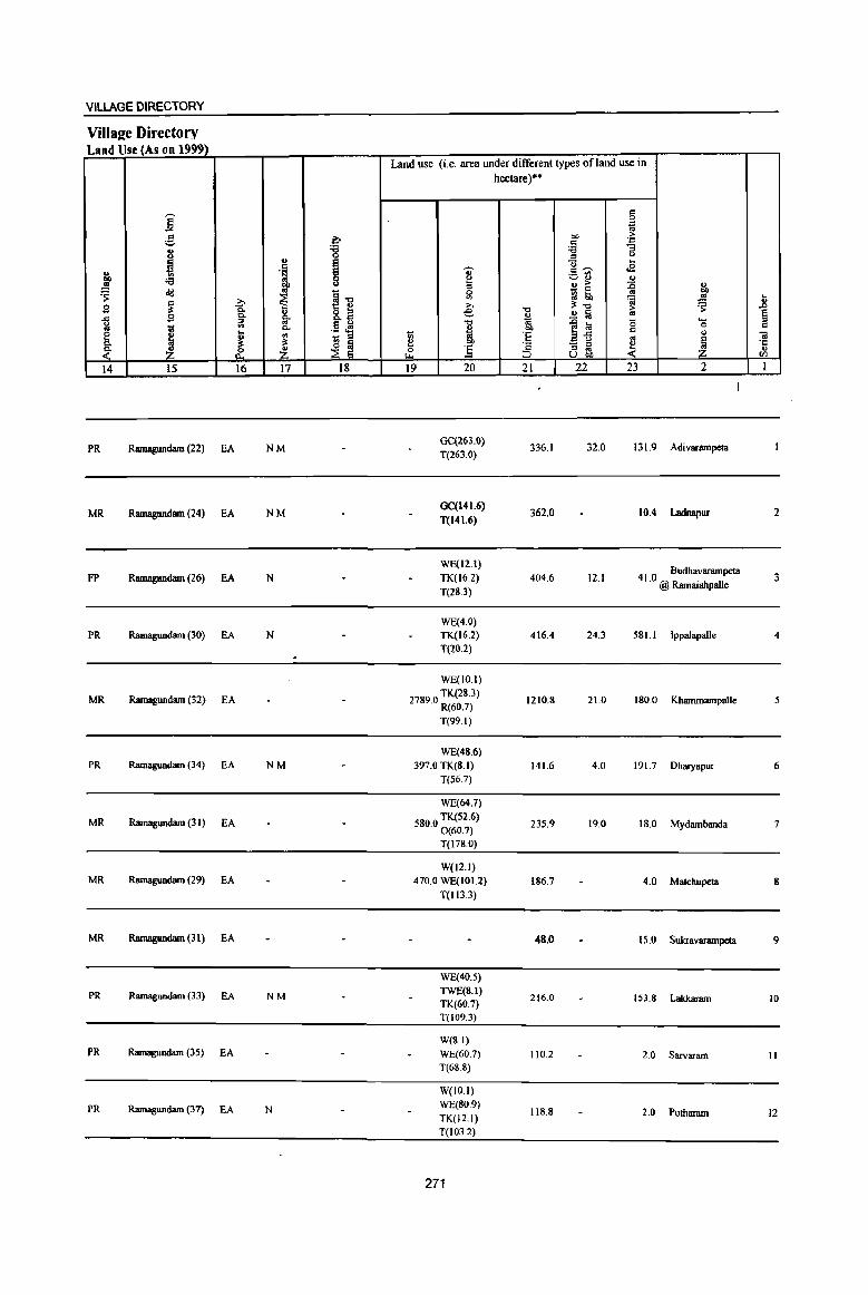
VILLAGE DIRECTORY
Villal!e Directory Land Use (As on 1999)
Land use (i.e. area under different types of land use in hectare)··
c j .~
~ l;- 01) > ,:: . .,
i '8 :a :; ::l Q ., e <l ...
.~ ~ ~ c....., .2 g, ... vn OJ :a ~ .!! OIl ::l OJ > :E "
~ _ 0
~ ~ .til ~1l ~ l(j 6b '" U >, ';i ~ 2 ~ c.. e "0
;1:-0 > ..0
" 8.2 ~ ~ '" ~ B 0- go ~ ._ ~ ~ .§ ~ 'tl .Q la 15 0 c 1il ... p..
~ "" f!.<: c " e ~ " ~
_ ::l OJ 'E B 0 '" l
.. 0- ;I: t~ :!! 00
]_ - :> -~ 'c
<- ~ ~ z 0 ] ::l '" ... ~ u OIl fI)
14 15 16 17 18 19 20 21 22 23 2 1
PR Ramagundam (22) EA NM GC(263.Q)
336.1 32.0 131.9 Adi vanllllpeta T(263.0)
MR Ramagundam (24) EA NM GC(141.6)
T(141.6) 362.0 10.4 Ladnapur 2
WE(12.1) 4 1 0 Budhavarampeta fP Ramagundam (26) EA N TK(16.2) 404.6 12.1 3
T(28.3) . @ Ramaiahpal1e
WE(4.0) PR Ramagundam (30) EA N TK(16.2) 416.4 24.3 581.1 Ippalapalle 4
T(20.2)
WE(1O.1)
MR Ramagundam (32) EA 27890 TK.(28.3) . R(60.7)
1210.8 21.0 ISO.O Kbanunampalle 5
T(99.I)
WE(48.6) PR Ramagundam (34) EA NM 397.0 TK(8.1) 141.6 4.0 191.7 Dharyapur 6
T(56.7)
WE(64.7)
MR Ramagundam (31) EA 5800 TK.(S2.6) . 0(60.7)
235.9 19.0 18.0 Mydambanda 7
T(l78.0)
W(IZ.I) MR Ramagundam (29) EA 470.0 WE(101.2) 186.7 4.0 Matchupeta 8
T(113.3)
MR Ramagundam (31) EA 48.0 15.0 Sukravanunpeta 9
WE(40.5)
PR Ramagundam (33) EA NM TWE(S.I)
216.0 153.8 Lakkaram 10 TK(60.7) T(I09.3)
W(8.1) PR Ramagundam (35) EA WE(60.7) 110.2 2.0 Sarvaram 11
T(6l!.l!)
W(IO.I)
PR Ramagundam (37) EA N WE(80.9) 118.8 2.0 Pomaram 12 TK(12.1)
T(103.2)
271

.8 § c
01 ·c C> <I)
I
13
14
15
16
17
18
.. "8 § '::1 g oJ cId
} ~ ..... 0
" ~ 2
Kcsanapalle
(00299600)
Parupallc (00299700)
Mutharam (00299800)
Shatharajpalle (00299900)
Odedu
(00300000)
Adavisrirampur (00300100)
MandaI Parisbad Total
i ,., j " '" .: g U .. co (; os 0
~ t!-.. 6 oS .... ... 0 .!!
6. i 0 c. "3 "3 ~ ~ 3 4
297.0 2,014
1205.0 1.288
653.0 3,401
1031.0 139
667.0 2,520
1674.0 3,567
16175.0 28628
DISTRICT CENSUS HANDBOOK: KARIMNAGAR
Census of India 2001 -Amenities and
Amenities available (if not available within the village. a dash (-) is shown in the column and next to it in brackets the distance in broad ranges viz. < 5 kms .• 5-10 kms. and 10+ kms of the
~
nearest Dlace where the facilitv is available is roven) ;; II>
5 U
0 0 t!-~ o .cI
~ 0 .... .... 01 0 c .. 0
...8 -g ] § u :a
~ z ~ 5 6 7
PM AC PHS H(IO+)
470 C(IO+) MCW(IO+)
PHqIO+)
PAC H(IO+)
342 M(IO+)
C(10+) MCW(IO+)
PHC«5)
DPHCPHS P(2) M S RMP(3)
875 AC(2) C(JO+) H(IO+)
MCW(IO+)
38 P M(IO+) H(lO+) C(lO+) MCW(lO+)
PHqIO+)
641 P(2) M S H(IO+)
AC C(lO+) MCW(IO+) PHC(IO+)
DADH
850 PM S AC RMP(4) H(IO+)
qlO+) MCW(IO+) PHC(IO+)
D DA DH
pelS) M(lO) MCW PHC 71778(4) Aql3) PHS(6)
RMP(l8)
272
.. ~ ~
I 8
THPW
W
THPW TK
R
W
THPW
TK
T(a) W(lI) TK(2)
HP(9) R
.. ..
.: .. 0 '::1 .c f c.
OJ ., c.
]i 9 "'" 0
a Q
."
1 ~ :! 2 ..
]1 " S <II
'Ii _81 ~ 9 10
PO PH(10+)
CM(IO+)
CP(IO+)
PO CM(lO+)
PH(IO+) CP(1O+)
PO CM PH(IO+) CP(IO+)
CP PO(IO+) PH(IO+)
CM(IO+)
PO CM(IO+)
PH(IO+) CP(IO+)
PO CM{IO+)
PH(IO+) CP(IO+)
PO(lI) CM CP
-0 la
] :; u .~ '" «I .!:! . -8 .!! c g . '" ]:a :; ~
~~ II
NCS(2) ACS(IO+)
OCS(IO+)
NCS(3)
ACS(IO+)
OCS(IO+)
ACS NCS(2) OCS(IO+)
ACS NCS(IO+)
OCS(IO+)
ACS(IO+)
NCS(IO+) OCS(lO+)
NCS(S) ACS(IO+)
OCS(IO+)
ACS(2)
NC8(lO)
~~ . ." U
~{! ~8. ]~~ _OI§ " .c .c u B 0 cId:s!;i3 l>~ ,g iii] ~ ~:a g .9 S paU<I)
12
CV(IO+)
SP(1O+)
ST(IO+)
CV(IO+) SP(IO+) ST(IO+)
CV(IO+) Sp(IO+)
ST(IO+)
CV(IO+) SP(lO+)
ST(IO+)
CV(IO+)
SP(IO+) ST(IO+)
CV(IO+)
SP(IO+) ST(IO+)
.. -u
.~ ~ :; ~ " C> e~ .. ~ .: . o '" '::1 0 os 'D
.~ t1 ~ f 8]
13
BS RS(IO+)
NW(IO+)
BS« 5) RS(10+)
NW(IO+)
BS RS(IO+) NW(IO+)
BS(IO+)
RS(IO+)
NW(IO+)
BS RS(IO+)
NW(IO+)
BS RS(IO+)
NW(IO+)
BS(IJ)
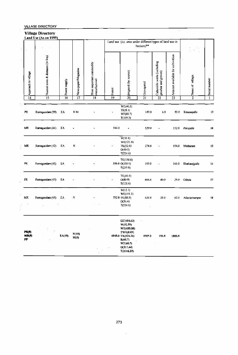
VILLAGE DIRECTORY
Village Directory Land Use (As on 1999)
j ~ .9
1 ~ 14
PR
MR
MR
PR
PR
MR
PR(9) MII(i) FP
j g " <>
~ 'i3 "'d
~ ,9
~ ~ 15
Ramagundam (39)
Ramagundam (4 I)
RamagWldam (43)
Ramagundam (45)
Ramagundam (47)
Ramagundam (45)
;.,
1 '" ~ ~ 0
P..
16
EA
EA
EA
EA
EA
EA
EA(18)
" .~ OJ) os
I 0. <I>
~
~ 17
NM
N
N
N(10) M(S)
c 'B 0 e e 0 t)
ij"Cl
5 ~ 0. t)
5J!! - " ~ g 18
Land use (i.e. area under different types of land use in
" e '" 0 <I>
;., e "Cl
" ~ 1;1 OJ)
0 :§ '" 19 20
WE(40.5) TK(S.I) WF(60.7) T(109.3)
544.0
W(IO.1) WE(121.4)
TK(52.6) 0(40.5) T{224.6)
TK(ISO.O) 516.00(105.0)
T(255.0)
TK(40.S) O(SO.9)
T(121.4)
W(l2.1) WE(l01.2)
752.0 TK(80.9)
0(30.4) T(224.6)
GC(404.63) W(52.S9)
WE(685.88) TWE(8.09)
6048.0 TK(S26.26) R(60.7) WF(60.7) 0(317.44)
T(2116.29)
273
hectare)··
" 0 .~
OJ) ?: " -3 'B .E (J
~
g~ .B ._ '" ~" " " > :g ~ ~ ~ ~"Cl "Cl >
" ~ 1ii ., 1;1
1~ '0 OJ) ·s " ., 'c - '" ~ '" '" :::J U OJ)
21 22 23
149.8 6.0 32.0
529.0 132.0
274.4 154.0
100.0 160.0
466.6 40.0 39.0
620.4 35.0 42.0
5927.2 193.5 1889.9
" OJ)
.!S ...
i ~ .... 0 " " .. ~ ·c
" '" 2 1
Kesanapalle 13
Pampalle 14
Muthanun IS
Shatharajpalle 16
Odedu 17
Adavisrinunpur 18

.' " ,.' . '
/
J.. ... I .....
.' ... _---,
'!" ..
." -Q " ~/
f '!" I
J I I I , I I I I , I I I
I I
I
, , I
I I
, \ ,
\
I I ... _ ......
- 8
,
I
,
I ,
,
, I
.. I
I , \, I
...... _/
• , I \
\
\ ,
, \ , /"
"-,. .. -_ ......... -I" I I
• en
, I ,
\ \
,
!")
(;
I I I ,
_ en
~ 8 I
/ /
_( \
\
, , \
\ ,
;-...... I • 'I
I
,
, !i.' I , I
,
-, - , \
0 , ,
/ I
,
I I
, r
~ -o
, , , I ,
,
I \ \
.Jo-I".-",_",_ ...
, , , , , -, co
, ~'
(; , \ !i.' - , I .' _L _
/ , .. , \ / \ I
\ I
i I , ,
'!" (; , '" -- ..
0 ; ,----
\ .. ----. -- ~ I
fi: ,.' , ,
\ \ ,
\ , , -en
\ \
co 0 0
I I I , r ,
I I I I
\ _,I ~-----
\", .. ,,'" ....
Q Q .. _----,..,
" :t rI I
I 0 D
_,.J
~
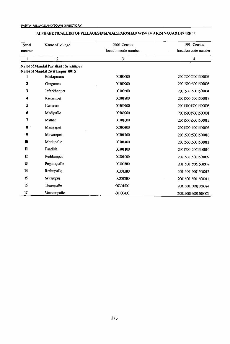
PART A - VilLAGE AND TOWN DIRECTORY
ALPHABETICAL LIST OF VILLAGES (MANDALPARISHADWISE),KARIMNAGARDISTRICT
Serial
number
Name of village
2
Name of Mandai Parishad : Srirampur Name of Mandai :Srirampur 0015
I Edulapuram
2 Gangaram
3 Jafarkhanpet
4 Kistampet
S Kunaram
6 Madipalle
7 Mallial
8 Mangapet
9 Mirzampet
10 Motlapalle
11 Pandilla
12 Peddampet
13 Pegadapalle
14 Rathupalle
15 Srirampur
16 Tharupalle
17 Vennampalle
2001 Census location code number
3
00300600
00300900
00300500
00301800
00300700
00300200
00301600
00300300
00301700
00301400
00301100
00301000
00300800
00301300
00301200
00301500
00300400
275
1991 Census location code number
4
200150015001500005
200150015001500008
200150015001500004
200150015001500017
200150015001500006
200150015001500001
200150015001500015
200150015001500002
200150015001500016
200150015001500013
200150015001500010
200150015001500009
200150015001500007
200150015001500012
200150015001500011
200150015001500014
200150015001500003
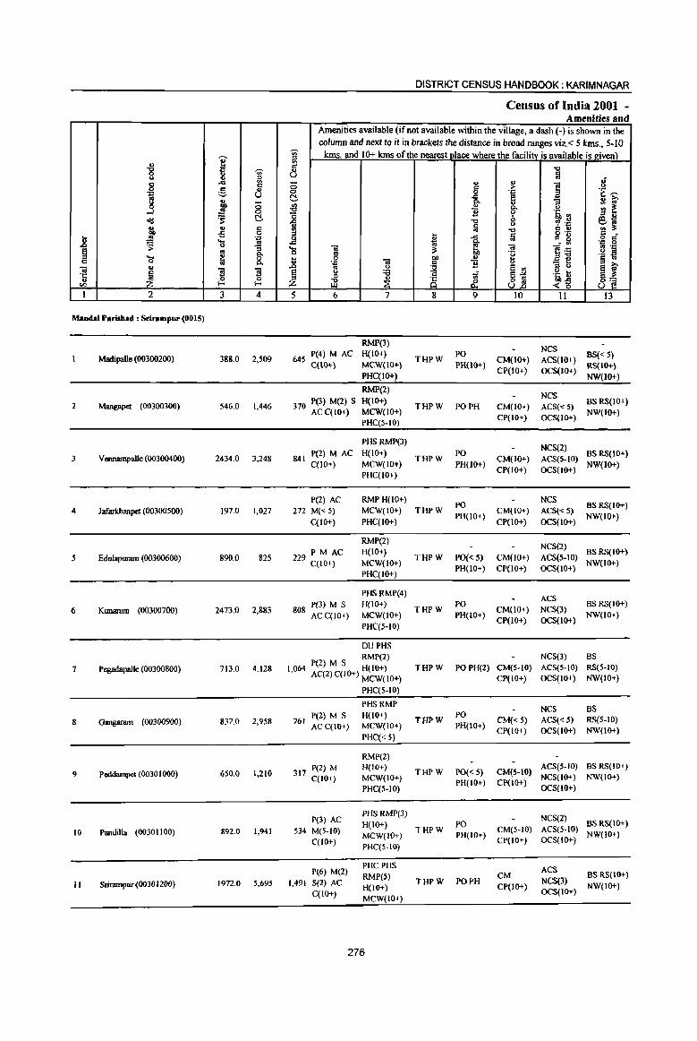
DISTRICT CENSUS HANDBOOK: KARIMNAGAR
Census of India 2001 -Amenities and
Amenities available (if not available within the village, a dash (-) is shown in the column and next to it in brackets the distance in broad ranges viz. < 5 kms., 5-10
I '" kms. and 10+ kms of the nearest I lace where the facilitv is available is given) ~ v c:
'8 -.;- v "C .. 3 ::l U ~ IS
... '" 0 u ., ]
.; g c c ;> u .. <:> 0 .~ 't '"' '::1 U t!- ..c e g ~ C>. "3 ., 1U'
8 {j ., ., :: ~ C>. u
....l .!!! B 'i' 'Ii <II ~ t!- o ::> .,
old 1 "C 0 ~ .~ e~ u .. ., c: ;j "C 6 .!! en 3: ~ ..s 0 ::> ... a c: •
.8 .... . ~ 0 u ... c: 8 o c:
'5: 0 .. ... ~ ~ l~
.~ 0
~ os 8. ... 01 3: ca II .~ 0 " °e '§ ~ 't; ~ 8. ~
0 bO " C .~ ca
~ B u
_ f .. .. "3 "3 '" u jj ::> u a ~ ~
u :a 'ii ],~ '1: " '" ~ 0 " ;:s ~ If 8'2 "" f- Z U I 2 3 4 5 6 7 8 9 10 11 13
MandaI Perishad : Sriralbpur (0015)
RMP(3) NCS
Madipa1le (00300200) 388.0 2,509 645 P(4) M AC H(IO+)
THPW PO
CM(IO+) ACS(IO+) BS« S)
C(10+) MCW(IO+) PH(IO+} CP(IO+) OCS(IO+)
RS(IO+) PHC(IO+) NW(Io+)
RMP(2) NCS
2 Mangapet (00300300) 546.0 1,446 370 P(3) M(2) S H(IO+) THPW PO PH CM(IO+) ACS«S)
BS RS(IO+) AC C(IO+) MCW(lO+)
CP(IO+) OCS(1O+) NW(IO+}
PHC(S-IO)
PHSRMP(3) NCS(2)
3 Vennampalle (00300400) 2434.0 3,248 841 P(2) M AC H(IO+)
THPW PO
CM(IO+) ACS(S-IO) BS RS(IO+)
C(lO+) MCW(IO+) PH(lO+) CP(lO+) OCS(10+)
NW(10+) PHC(IO+)
P(2) AC RMPH(IO+) PO
NCS BS RS(IO+)
4 Jafarldtanpet (00300500) 197.0 1,027 272 M« 5) MCW(IO+) THPW CM(lO+) ACS«5) C(lO+) PHC(IO+)
PH(IO+) CP(IO+) OCS(lO+)
NW(IO+)
RMP(2) NCS(2)
5 Edulapuram (00300600) 890.0 825 229 PM AC H(IO+) THPW PO{<5) CM(JO+) ACS(5-1O)
BSRS(IO+) C(IO+) MCW(lO+)
PH(IO+) CP(IO+) OCS(IO+) NW(IO+)
PHC(IO+)
PHSRMP(4) ACS
6 Kunaram (00300700) 2473.0 2,883 808 P(3) M S H(lO+) THPW
PO CM(lO+) NCS(3)
BSRS(IO+)
AC C(10+) MCW(IO+) PH(IO+) CP{IO+) OCS(IO+)
NW(lO+)
PHC(5-10)
DUPHS RMP(2) NCS(3) BS
7 PegadapaJle (00300800) 713.0 4.128 1064 P(2) M S H(IO+) THPW POPH(2) CM(S-IO) ACS(S-IO) RS(5-10) • AC(2) C(IO+) MCW(IO+) CP(IO+) OCS(IO+) NW(IO+)
PHC(S-IO)
PHSRMP NCS BS
837.0 2,958 P(Z) M S H(IO+)
T'HPW PO
CM«5) ACS«5) RS(S-IO) 8 Gangaram (00300900) 761 ACC(IO+) MCW(IO+) PH(lO+)
PHC« 5) CP(IO+) OCS(IO+) NW(IO+)
RMP(2)
9 Peddarnpet (0030 I 000) 650.0 1.210 317 P(2) M H(IO+) THPW PO{< 5) CM(5-1O)
ACS(S-IO) BS RS(lo+)
C(IO+) MCW(IO+) NCS(IO+) NW(IO+)
PHC(5-10) PH(IO+) CP(IO+)
OCS(IO+)
P(3) AC PHSRMP(3) NCS(2) H(IO+) PO BS RS(IO+)
10 Pandilla (00301100) 892.0 1,941 534 M(S-IO) MCW(IO+) THPW
PH(IO+) CM(5-10) ACS(5-10)
NW(IO+) C(lO+)
PHC(5-IO) CP(IO+) OCS(IO+)
P(6) M(2) PHCPHS ACS RMP(5) eM BS RS(IO+)
II Srirampur (0030 12(0) 1972.0 5,695 1,491 S(2) AC H(10+)
THPW PO PH CP(IO+)
NCS(3) NW(IO+)
C(IO+) MCW(IO+)
OCS(lO+)
276

VILLAGE DIRECTORY
Villaee Directory Land Use (As on 1999)
Land use (i.e. area under different types of land use in hectare)··
j c 0 '.c .,
g ~ .., .~ c
8 ] ;;:; "3
'" ::J <>
~ S u ... c ~ ~ .~ S c,... 11 ., ._ '"
;;:; 0 ~ _01) ..,
..!! co " ~~ :E 11 ~ d!! ..
~1l 5l .,
;>, ~ '1a ..!! t .9 ~ 0. ,..,
"d "''''' > ~ .<:> ..c g a. g. 8.2 e ., .!! ;j ., § <> ~ .§ J1 "CJ ii "§ ~ (5 .... e 1;; a. ., .., c 0 c
~ ~ ~ - ":I Vi ~ 'E 2-8 ., " OJ
Q, :s: ~ ~ e ;g "'3 ~ ~ ~ 'r:: < Z ~ Z ~ ] ., u .,. Vl
14 15 16 17 18 19 20 21 22 23 2 I
Paddy, Maize, GC(20S.2)
MR Karimnagar (34) EA 46.5 TK(71.3) 18.0 47.0 Madipalle Cotton
T(276.5)
Paddy, Maize, WE(22.0)
PR Karimnagar (54) EA N TK(S6.0) 418.0 21.0 29.0 Mangapet 2 Cotton
T(78.0)
GC(40.0)
PR Karimnagar (50) EA N Paddy, Maize, WE(27.0)
1025.0 880.0 294.0 Vennampalle 3 Cotton TK(168.0)
T(235.0)
PR Karimnagar (55) EA N Paddy, Maize, TK(56.0)
109.0 15.0 17.0 Jafarlduutpet 4 Cotton T(56.0)
PR KarimnagaI (62) EA N Paddy, Maize, 1240 TK(56.0) 120.0 40.0 550.0 Edulapurarn Cotton . T(56.0)
Paddy, Maize, WE(47.0)
PR Karimnagar (50) EA N 890.0 TK(220.0) 933.0 260.0 123.0 Kunaram 6 Cotton
T(261.0}
Paddy, Maize, WE(120.0)
PR Karimnagar (42) EA NM TK(172.0) 299.0 108.0 14.0 Pegadapalle 7 Cotton
T(292.0)
Paddy, Maize, WE(7S.0)
PR Karimnagar (45) EA NM TK(8.0) 220.0 40.0 491.0 Gangaram 8 Cotton
T(86.0)
Paddy, Maize, WE(48.0)
PR Karimrurgar (45) EA Cotton
72.0 TK(8.0) 306.0 16.0 200.0 Peddampet 9 T(56.0)
Paddy, Maize, WE(62.0)
PR Karimnagar (51) EA N 42.0 TK(24.0) 649.0 58.0 57.0 Pandilla 10 Cotton
T(86.0)
Paddy, Maize, WE(IOO.O)
PR Karimnagar (47) EA NM 213.0 TK(114.0) 1064.0 198.0 283.0 Srirampnr II Cotton T(214.0)
277
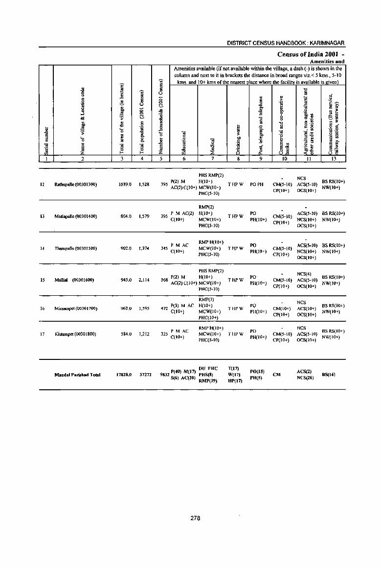
I i ..., '" §
..c ., c:I g .. . ., u
8 " E 0 ..l 0
~ '" ~ ...... ., ., " 00 -B 0 ....
~ . ."
.8 ..... '" 0 "3 ~ '" Q, ... ~ 8. " 0
" "iI
~ "3 "3 '5
(/) ~ ~ 1 1 3 4
12 Radtupallc (00301300) 1639.0 1,528
13 Motlapalle (00301400) 804.0 1,579
14 Tharupalle (00301500) 902.0 1,374
IS MalIial (00301600) 94S.0 2,114
16 MiIzampet (00301700) 962.0 1,595
17 Kistarnpet (00301800) 584.0 1,212
Mandai Parish.d Total 17828.0 37272
DISTRICT CENSUS HANDBOOK: KARIM NAGAR
Census ofIndia 200t -Amenities and
Amenities available (if not available within the village, a dash (-) is shown in the column and next to it in brackets the distance in broad ranges viz.< 5 kms., 5-10
~
kms. and 10+ kms of the nearest_I lace where the facility is available is givel!)_ '" ill c:I '" u 0 0 ~ .;g 15 -= ~ " 0
..c ..... 01 0 " 6 0 <a 'J:: ..c '" u
~ u '6 '" z iil ~
5 6 7
PHS RMP(2)
395 P(2) M H(IO+) AC(2) C(lO+) MCW(10+)
PHC(S-IO)
RMP(2)
395 PM AC(2) H(IO+) C(IO+) . MCW(lO+)
PHC(S-IO)
PM AC RMPH(IO+)
345 MCW(lO+) C(IO+)
PHC(5-10)
PHS RMP(2) P(2) M H(IO+)
568 AC(2)C(IQ+) MCW(IQ+)
PHC(S-IO)
RMP(3)
472 P(3) M AC H(IO+) C(IO+) MCW(IO+)
PHqIO+)
325 PM AC RMPH(IO+) MCW(lO+)
C(lO+) PHC(S-IO)
DU PHC 9832 P(40) M(17) PHS(8)
S(6) AC(20) RMP(39)
278
t; 0; :I:
j 8
THPW
THPW
THPW
THPW
THPW
THPW
T(I7)
W(17)
HP(l7)
" " 0 ..c Q,
'" "B "t:l a ..c a .. B t;-
&. 9
PO PH
PO
PH(IO+)
PO PH(IO+)
PO PH(lO+)
PO PH(IO+)
PO PH(IO+)
PO(I 5) PH(S)
., > .."
i 0
.:. u
-.::I
fa <a ·2
II>
E '"
~1 10
CM(5-10) CP(IO+)
CM(5-10) CP(IO+)
CM(5-1O) CP(IO+)
CM(S-IO)
CP(IO+)
CM(IO+)
CP(IO+)
CM(5-10) CP(IO+)
CM
'" a ~ "3 <> 'Q '" ~ .~ " .. g '8 ]~ - ... '" u
~i II
NCS ACS(S-IO) OCS(IO+)
ACS(5-1O) NCS(IO+) OCS(IO+)
ACS(5-IO) NCS(IO+) OCS(IO+)
NCS(4) ACS(S-IO) OCS(IO+)
NCS ACS(IO+)
OCS(lO+)
NeS ACS(5-IO) OCS(IO+)
ACS(2) NCS(26)
.; <>
'i ~ '" ~ '" u eo; '" :I: " .~ g '" 'J:: .~ ~ ~ ~ 8~
J3
BS RS(IO+) NW(IO+)
BS RS(IO+)
NW(IO+)
BS RS(IO+) NW(IO+)
BS RS(IO+) NW(IO+)
BS RS(lo+) NW(IO+)
BS RS(IO+) NW(IO+)
BS(lli)

VILLAGE DIRECTORY
Villaee Directory Land Use (As on 1999)
M. ~
~ B .c g e 0.
~ 14
PR
PR
PR
PR
PR
PR
PR(16) MR
j !-" i
"6 o<!
~ 1;;
* Z 15
Karimnagar (55)
Karimnagar (53)
Karimnagar (53)
Karimnagar (54)
Karimnagar (58)
Karimnagar (55)
» 8: '" '" .. ., ~ 0
0..
16
EA
EA
EA
EA
EA
EA
EA(17)
" '" .~ OIl
'" ~ ., g-0-
~ :! 17
N
N
N
N
N
N(14) M(3)
~ 0
S E 0 (J
~"'" ~ ~ O-~
.5 .s - :I
~ ~ 18
Paddy, Maize, Cotton
Paddy, Maize, Cotton
Paddy, Maize. Cotton
Paddy, Maize, Cotton
Paddy, Maize. Cotton
Paddy, Maize. Colton
Land use (i.e. area under different types of land use in hectare)··
'" 0 .~
01) .i; c "6 "3
'" <.> "0 ... .., c~ .s ._ ..
~ ~ 0> '" '" ., > :g '" ~ 0 .w 0 ~ 6h .. ~
... '" »
-0 ~"'" ~ ~ .,
6 ..!! fa § O>
"'" ... e :a (5 ._
0> OIl 0 '" 1;; 10 'E .a"tl '" '" ~ ~ ~ 1 OIl ·S 3 g '!: 0 ] '" LI.. ::J U OIl til
19 20 21 22 23 2 I
WE(66.0)
3300 TK(120.0) . 0(328.0) 249.0 139.0 407.0 Ratbupalle 12
T(SI4.0)
WE(59.0) TK(6.0)
127.0 20.0 292.0 Motlapalle 13 0(300.0) T(365.0)
WE(76.0) 60.0 TK(86.0) 310.0 11.0 359.0 Tharupalle 14
T(162.0)
WE(166.0) 66.0 TK(84.0) 103.0 6.0 520.0 Mallia! IS
T(250.0}
WE(72.0) 700.0 94.0 96.0 Mirzampet 16
T(nO}
28.0 WE(46.0) T(46.0}
148.0 46.0 316.0 Kistampet 17
6780.0 1970.0 4095.0
279

I J ,
'" ---_.<,
I I
~
D A L
q
1-"'--I I ,
I
I '--, ,-~r--- _________________ _
---'I " --r-I
I I I
r---,- __ I ,
/ I
I I
I
I ,
J .~ \"r'
........ , ~- , - - .... -, ,
.,. N ''''\ , g a \'
~ . U): / / , ,
, ,
, I , ~
I
:. I
/
,
, , ,
-§ , '"
I
8 ,
~ ., /
I I
/ "-,
•
, (/) 0 I I
t" . , w
/ "', "-- -~ Yom ~ : •
;' R ~ , @ ~ "L " •
I I
!. • 0 w S " ___ _ ' § " . g 8._ , .,~ '-- -, , -C, R __ ---,,_ { • "- '0 •• , '-----" : "',' .. }' : -------~,' '>" , ' 0, --I 0"
_-: ~ •• ~,' I ~ \ ~g • 0 ... - .. , (/) I
-< \ d. 'y" ", ..r- .. , I V o , " __ -, v
' , '" . " .. .. .... _-1 A ... " , -" , ... " '0' £ ", • V • ~ '-, V • ..... ----, I 'il '1 '1
"-'1 .. !!-l "f w: I '1 V u
\I' B (J ,
, , I
/ / 2 I ,
I . ", , <'l 0
I
1-, , , --,
..... ", ---l ~- ,
I I , , ,
I , I
, I -'4 , ,
I
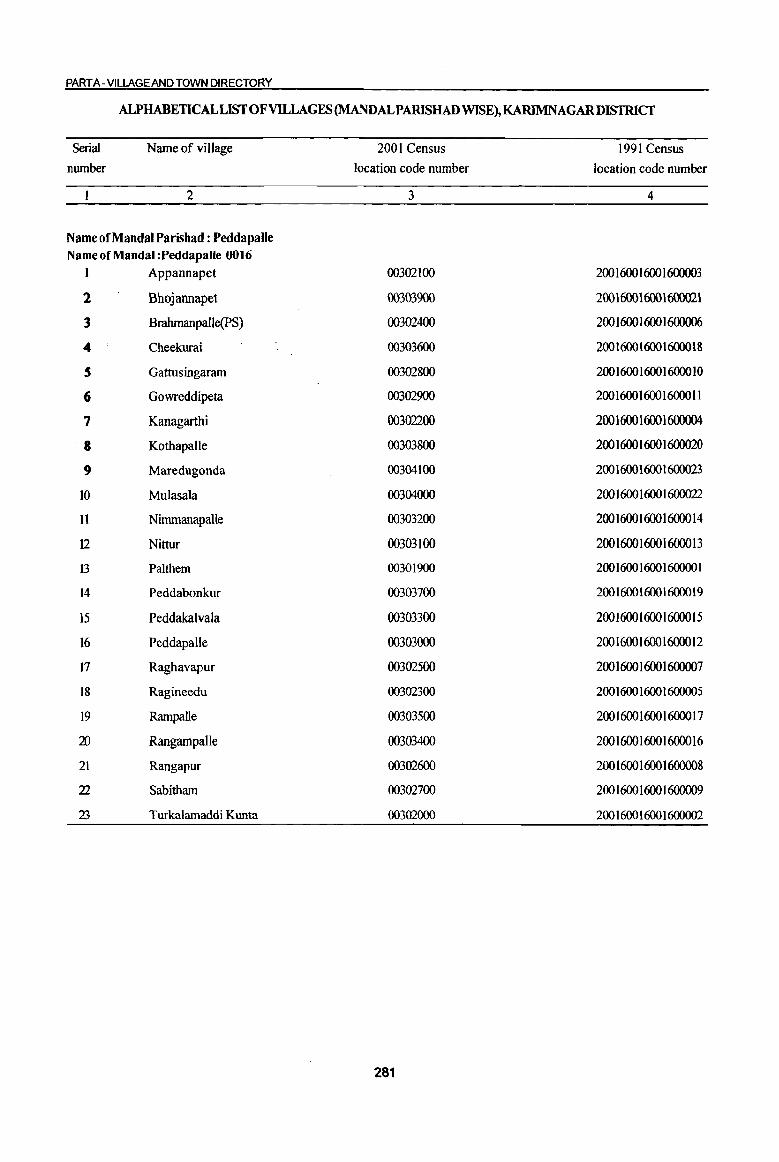
PART A- VILLAGE AND TOWN DIRECTORY
ALPHABETICAL LIST OF VILLAGES (MANDALPARISHAD WISE), KARIMNAGARDISTRICT
Serial
nwnber
Name of village
2
Name of Mandai Parishad : Peddapalle Name of Mandai :Peddapalle 0016
I Appannapet
2 Bhojannapet
3 Brahmanpalle(PS)
4 Cheekurai
S Gattusingaram
(; Gowreddipeta
7 Kanagarthi
•• Kothapalle
9 Maredugonda
IO Mulasala
11 Nimmanapalle
I2 Nittur
13 Palthem
14 Peddabonkur
15 Peddakalvala
16 Peddapalle
17 Raghavapur
18 Ragineedu
19 Rampalle
20 RangampaUe
21 Rangapur
22 Sabitham
23 Turkalamaddi Kunta
2001 Census
location code number
3
00302100
00303900
00302400
00303600
00302800
00302900
00302200
00303800
00304100
00304000
00303200
00303100
00301900
00303700
00303300
00303000
00302500
00302300
00303500
00303400
003U2600
00302700
00302000
281
1991 Census
location code number
4
200 1600 1600 1600003
200 1600 1600 1600021
200 16001600 1600006
200 1600 1600 16000 18
200 1600 1600 16000 1 0
200160016001600011
200 1600 1600 1600004
200 1600 1600 1600020
200 1600 1600 1600023
200 1600 1600 1600022
200 1600 1600 16000 14
200 1600 1600 16000 13
200 1600 1600 160000 1
200 1600 1600 16000 19
200 1600 1600 16000 15
200 1600 1600 16000 12
200 1600 1600 1600007
200 1600 16001600005
200 1600 1600 16000 17
200 1600 1600 16000 16
200 1600 1600 1600008
200 1600 1600 1600009
200 1600 1600 1600002
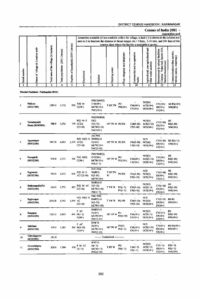
I ., "0 ., 8 J! " 6
.. g d
'" .,c U g ~ 0 ..J ~
0
~ C!.
~ .,
8 oS .8 .!! . .: ...
'" 'S 0 :l ~ ~ "" .... 8. 0
'01 .,
1 ~ S ·c 0 ..
<Il f- f-
I 2 3 4
Mandai Parisbad : PecldapalJe (00 1 el)
Palthem 1285.0 3,712
(00301900)
Turb1amaddi 1 988.0 3,210
KlDlta (00302000)
Appannapel 3 1847.0 6,041
(00302100)
Kanagarthi 4 574.0 2,153
(00302200)
Ragineedu 5 914.0 2.653
(00302300)
6 BralunaDpalle(Ps)
614.0 1,773 (00302400)
7 Raghavapur
2111.0 5.743 (00302500)
Rangapur 8 1325.0 2,035
(00302600)
9 Sabitham
379.0 1,283 (00302700)
10 Gattusingaram
591.0 (00302800)
Gowreddipeta It 858.0 1.990
(00302900)
DISTRICT CENSUS HANDBOOK: KARIMNAGAR
Census of India 2001 -Amenities and
Amenities available (if not available within the village, a dash (.) is shown in the colwnn and next to it in brackets the distance in broad ranges viz. < 5 krns., 5-10 krns. and 10+ krns of the ., nearest place where the facility is available is given) ::0 .. ",.g d ~ .. fa u u_
',:j to) .; ;:; ., ...
] =5t! u d ;>
.~ '""' <:> 0 ·f ~ -& .flR ~ S ~ 8- G ]~""' ]i .5, I'l :8 -0 0 _0iI~ e~
g ~ u cp . .0
8"6·§ VI :s: "0 d .. ::::I Il ~ ~.~ d • 0 ..c ~ ~.~ ~ 6 ..c 10 ~ .- "'" .... Oil ~ f:a ~>~ '" ·a 0 c ~ -!:! i'l u 0 01) ., .. .E e .,g Os ~ l3 .. ·c ~ d ]i '" ,&> " ~ 8 '"
::0 U e~'i3 ~ ~ § <> '6 1 ~1 -~ u " ~ i§ ~a~ 8~ LB -<~ ;Z;
5 6 7 8 9 10 11 12 13
PHSRMP(2) NCS(6)
930 P(4) M OH(lO+) THPlW
PO CM(IO+) ACS(IO+)
CV(IO+) BS RS(JO+) C(JO+) MCW(IO+) PH(IO+)
CP(W+) OCS(IO+) SP(IO+) NW(IO+)
PHC(IO+) ST(IO+)
PHSRMP(4) pel) M S 0(2) NCS(S)
CV(5·W) BS
719 AC(2) H(S.IO) HPTWW PO PH CM(S·10) ACS(S-IO) RS(S·IO) C(5-W) MCW(S·JO) CP(S-IO) OCS(IO+)
SP(IO+) NW(IO+)
PHC(IO+) ST(IO+)
DAPHS P(2) M(2) S RMP(6)O ACS
CV(S-IO) BS RS«5) 1,519 AC(2) H(W+) HPTWW PO PH CM(5-1O) NCS(6)
C(5-JO) MCW(lO';') CP(S-IO) OCS{lO+) SP(IO+) NW(IO+)
PHC(S.IO) ST(IO+)
PHSRMP(2) NCS(2) BS
526 P(4) M(2) OH(IO+) PO CV(IO+) HPTWW PH(IO+) CM(IO+) ACS(5-IO) RS(5-IO)
C(10+) MCW(tO+) CP(IO+) OCS(IO+)
SP(IO+) NW(IO+)
PHC« 5) ST(lO+)
PHCPHS ACS BS
P(2) M S RMP(3) THPTW CV(S-IO) 636 AC C(5-1 0) PO PH CM(S-IO) NeS(3) RS(S-JO)
H(5-IO) W SP(IO+) MCW(tO+)
CP(5-10) OCS(IO+) ST(IO+)
NW(tO+)
RMP(4) 0 NCS(2) BS
423 P(2) M AC H(5-IO) TTWW PO« 5) CM(5-JO) ACS«S)
CV(S-IO) RS(S-JO)
C(S-IO) MCW(S-lO) PH« 5) CP(5.10) OCS(IO+)
SP(IO+) NW(IO+)
PHC« 5) ST(IO+)
pm M(2) S PHCPHS
ACS 1,454 AC
RMP(2) 0 TTWW PO PH CM(5-10) NCS(9)
CV(S-IO) BSRS
C(S-IO) H(5-IO)
CP(S-IO) OCS(IO+) SP(IO+) NW(IO+)
MCW(S-IO) 5T(1O+)
PAC RMP(2) 0
NCS(3) BS H(IO+) PO CV(JO+)
49l M«5) HPTWW PH(S-IO) CM(lO+) ACS« 5) RS(5-10) C(10+)
MCW(IO+) CP(IO+) OCS(lO+)
SP(lo+) NW(IO+)
PHC(5-10) ST(10+)
PAC RMPO
NCS
304 M(5-10} H(IO+) HPTWW PH(2) CM(IO+) ACS(S-IO)
CV(JO+) BS RS(IO+)
C(1O+) MCW(IO+) PO« 5)
CP(IO+) OCS(IO+) SP(IO+) NW(IO+)
PHC(S-IO) ST(lO+)
--Uninhabited ---
RMPO NCS(4)
438 PM AC H« 5) PO CV« 5) BS« 5) THPW CM«5) AC5« 5)
C«5) MCW«S) PH«S) CP« S) OCS(IO+)
SP(10+) RS«S)
PHCCS-10) ST(IO+) NW(IO+)
282
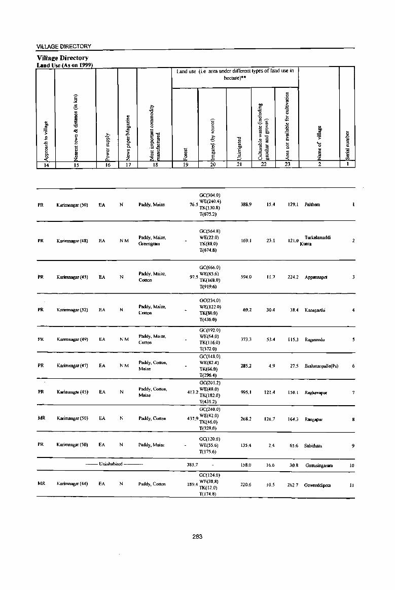
VILlAGE DIRECTORY
ViUaee Directory Land Use (As on 1999)
Land use (i.e. area under different types of land use in hectare)"
.. ~
0 .'" g OIl !1!
~ .. .'" 'g 'i3 :; .. ::s <> u
'" ~ -0 .... i .. '0 e~ .e .. .~ .,
~ 0 ~ 'i3 00 <> " ;> :is ~
~ .. I] 0 ~ ~ ..
~ ~ '" 'a III .8 ~ >. » ~"tI ~ _g Q. "tI ;>
8. e ..!! f,j '" ~ .c B 0- B Co. :> .. .13 ~ -,:! . .,
]~ 0 u '" 0 .. e 1 0-
~ OIl ..
t; Vi 'E " «I ~ - ::;j ., 1 8: ~ ~ ~ ~ OIl '= - :> ~
·c /? ~ (1 ] :> os u
;{ ;:J U 00 '" 14 15 16 17 18 19 20 21 22 23 2 I
GC(304.0)
PR Karimnagar (SO) EA N Paddy, Maize WE(240.4)
76.5 TK(130.8) 388.9 15.4 129.1 Palthcm
T(67S.2)
GC(564.8)
PR Karimnagar (48) EA NM Paddy, Maize, WE(220)
169.1 23.1 12 1.0 T urkaIamaddi 2 Greengram TK(88.0) Kunta
T(674.8)
GC(666.0)
PR Karimnagar (45) EA N Paddy, Maize, WE(85.6)
594.0 11.7 224.2 Appannapet 3 Cotton 97.5 TK(l6S.0)
T(919.6)
GC(234.0)
PR Karimnagar (52) EA N Paddy, Maize, WE(122.0)
69.2 30.4 38.4 Kanagarthi 4 Cotton TK(SO.O)
T(436.0)
GC(192.0)
PR Karimnagar (49) EA NM Paddy, Maize, WE(64.0)
373.3 53.4 115.3 Ragineedu 5 Cotton TK(I16.0)
T(372.0)
GC(148.0)
PR Karimnagar (47) EA NM Paddy, Cotton, WE(82.4)
285.2 4.9 27.5 Brahmanpalle(Ps) 6 Maize TK(66.0)
T(296.4)
GC(201.2)
PR Karimnagar (45) EA N Paddy, Cotton, WE(48.0)
995.1 121.4 ISO.I Raghavapur 7 Maize 413.2 TK(182.0)
T(431.2)
GC(240.0)
MR Karirnnagar (50) EA N Paddy, Cotton 4379 WE(42.0) . TK(46.0) 268.2 126.7 164.3 Rangapur 8
T(328.0)
GC(120.0) PR Karimnagar (50) EA N Paddy, Mane WE(55.6) 135.4 2.4 65.6 Sabitharn 9
T(175.6)
-_ Uninhabited --- 385.7 158.0 16.6 30.8 Gattusinganun 10
GC(l24.0)
MR Karimnagar (44) EA N Paddy, Cotton 1894 WE(38.8) 220.6 10..5 262.7 Gowreddipeta II . TK(12.0)
T(174.8)
283
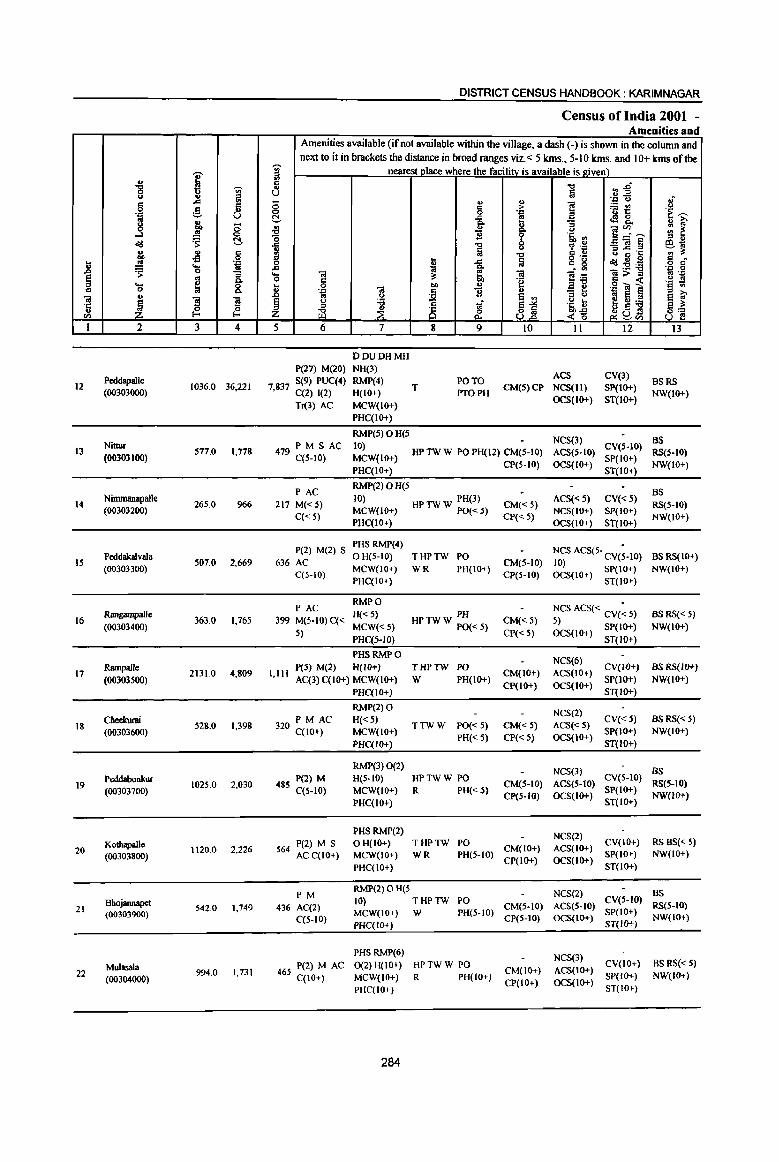
I u "'8 VI <.> .. '" '" ..c !II c 8 0 g 'J:' 01
8 '" 0 "" ..J .!l <:> ~ t:!-.t.!I
u .. c co oS 0
] .!l 'iiI .... ~ 0 ]. § g .... &. C 0
O! u ]I ~ ~ 'r:; 0 u I-< <I')
I 2 3 4
12 Peddapalle
1036.0 36,22[ (00303000)
Nittur 13 577.0 1,778
(00303100)
14 Nimmaoapallc
265.0 966 (00303200)
15 Peddaka1vala
507.0 2,669 (00303300)
16 RalIgampalle
363.0 1,765 (00303400)
17 Rampalle
2131.0 4,809 (00303500)
Cheelrurai 18 528.0 1,398
(00303600)
Peddabonkur 1025.0 2,030 19
(00303700)
Kothapalle 2,226 20 (00303800)
1120.0
Bhojann.apet 21 542.0 1,749
(00303900)
Mulasala 22 994.0 1,731
(00304000)
DISTRICT CENSUS HANDBOOK: KARIMNAGAR
Census of India 2001 -Amenities and
Amenities available (if not available within the village, a dash (-) is shown in the column and next to it in brackets the distance in broad ranges viz.< 5 kms., 5-10 kms. and 10+ kms of the
~ nearest place where the facilitv is available is given) ., c
.." :; ~ .. ., U §
'J:: <.> .; ;; ., u
] '" > ;.:: IfII <J 0 0 'J:' 'u 1: .~ ~ ~ ..c
! t!28._ ., ~ & :; ~ <> )::--- ::; ~ 'B '5, ., '0 '" .. .c
~ ~ .~ _Ol§ ~1ij ~ u '" .c '1;; '" ~ .." :::I t lii
o .- u ~ £ c 0 ..c '" g .t.!I~:e o c· .c 1ij "" . '" 'J:: 0 ... Ol ~ Ol
]~ Ol;>= .. '-1:)
0 c ~ 'e .g~ i .~ ~ ] 0 Ol
OIl U
.~
~ B u "3 ti 0 e VI fti:e ~i ~ <.> i ;i
~1 .~ Il '" is ~a:l ~ :t ~ <~ <3 .~ ~<Il
5 6 7 8 9 10 II 12 I3
DDUDHMH P(27) M(20) NH(3)
ACS CV(3) 7837 S(9) PUC(4) RMP{4)
T PO TO
CM(5)CP NCS(II) SP(IO+) BSRS
, C(2) [(2) H(lO+) PTOPH OCS(lO+) ST(IO+)
NW(lO+) Tl(3) AC MCW(lO+)
PHC(IO+)
RMP(5)OH(S NeS(3) BS
479 PM S AC 10) CV(S-lO) HPTWW POPH(12) CM(S-[O) ACS(S-lO) RS(S-IO)
C(S-IO) MCW{IO+) CP(S-IO) OCS(lO+)
51'(10+) NW(lO+)
PHC(IO+) ST(IO+)
PAC RMP{2)OH(5
BS 217 M« 5)
10) HPTWW PH(3) CM« 5) AC5« 5) CV«5)
RS(S-lO)
C« 5) MCW([O+} PO«.5)
CP« 5) NCS(IO+) SP(lO+}
NW(lO+) PHC(IO+) OC5(10+) ST(IO+)
P(2) M(2) S PHS RMP(4)
NCS ACS(5- CV(;-IO) 636 AC
o H(5-10) THPTW PO CM(5-10)
BS RS(IO+)
MCW(IO+) WR PH(IO+) 10)
NW(IO+) C(S-IO) CP(S-IO) OCS(IO+) SP(IO+)
PHC(IO+) ST(IO+)
PAC RMPO
NCS ACS« CV(: 5) 399 M(5-10) C« H«.5) PH
CM« 5) BSRS«5)
MCW«5) HP TW W PO« 5) 5) SP(IO+) NW(IO+) 5)
PHC(5-1O) CP« 5) OCS{IO+) ST(IO+)
PHSRMPO NCS(6)
1,111 peS) M(2) H(lO+) THPTW PO
CM(IO+) ACS(lO+) CV(IO+) as RS(IO+)
AC(3) C(lO+) MCW(lo+) W PH(IO+) CP(IO+) OCS(lO+)
SP(IO+) NW(10+)
PHC(IO+) ST(IO+)
RMP(2) 0 NCS(2)
PM AC H«5) CV«5) as RS« 5) 320 C(1o+) TTWW PO« 5) CM« 5) ACS«5)
MCW(lO+) PH« 5) CP« 5) OCS(IO+)
SP(IO+) NW([O+)
l>HC(IO+) ST(IO+)
RMP(3) 0(2) NCS(3) BS
48S P(2) M H(5-10) HPTWW PO CM(5-10) ACS(5-10)
CV(S-IO) RS(S-IO)
C(5-10) MCW(10+) R PH« 5} SP(IO+)
PHC(IO+) CP(5-1O) OCS(IO+)
ST(IO+) NW(IO+)
PHS RMP(2) NCS(2)
P(2) M S OH(IO+) THPTW PO CM(IO+) ACS(IO+)
CV(IO+) RSBS«S) 564 AC C(IO+) MCW(IO+) WR PH(S-IO) SP(IO+) NW(lO+)
PHC{IO+) CP(IO+) OCS(IO+)
ST(1O+)
PM RMP(2)OH(5 NCS(2) BS 10) THPTW PO
CM(S-IO) ACS(5-10) eV(S-IO)
RS(5-10) 436 AC(2) MCW(IO+) W PH(5-[0) SP(IO+)
C(S-IO) CP(S-tO) OCS(IO+) NW(IO+) PHC([O+) ST(lO+)
PHS RMP(6) NCS(3)
465 P(2) MAC 0(2) H(IO+) HPTWW PO CM(IO+) ACS(IO+)
CV(IO+) BS RS« 5)
MCW(IO+) R PH(IO+) SP([O+) NW(IO+) C(IO+) CP(IO+) OCS(IO+) PHC(IO+) ST(IO+)
284
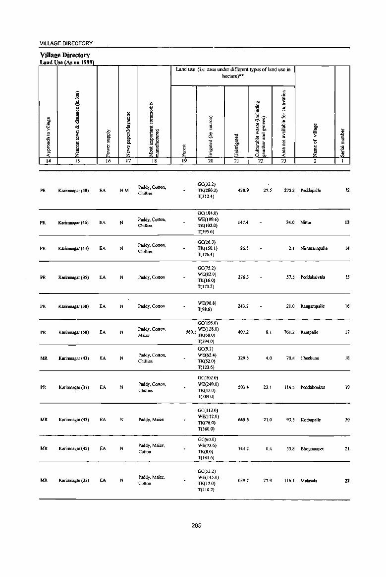
VILLAGE DIRECTORY
VilIaee Directory Land Use (As on 1999)
Land use (i.e. area under different types ofland use in hectare)·"
j c 0
'.c to g a co >
.8 '.c
8 :g 'tl :; ., ;;l <.>
!I 8 0 ... c .B " .~ e u c ~ ., ._ til
~ :a 0 ~ ~'" .,
bI) CJ '" '" :c .. ~
- 0 ~ ~
~~ 0 :Q t;, .. ""
~ € II> 'a s .8 .s >. :t-o ~
~ 8.a e -0 ;..
-5 B ~ ~ .!! :a .. § 13 1d 'tl
1~ b '-
~ 1;5 "" ..... ~ co ., 0 .,
~ ~ '" - ::;l
1;5 'E '" -.a ~ iI:
~ ~ ~ co to
~ ~ - ;;l ~ .~
~ &. Z ~ ] 8 gj, <Il
14 15 16 17 18 19 20 21 22 23 2 I
Paddy. CQtton, GC(32.2)
PR Karimnagar (40) EA NM Chillies
TK(280.2) 420.9 27.S 275.2 Peddapalle 12 T(312.4)
GC(IS4.0)
PR K.arimwIgar (46) EA N Paddy. Cotton, WE(I09.6)
147.4 34.0 Nittur 13 Chillies TK(I02.0)
T(395.6)
Paddy, Cotlon, GC(26.3)
PR Karimnagar (44) EA N Chillies
TK(J50.l) 865 2.1 Nimmanapalle 14 T(176.4)
GC(75.2)
PR Karimnagar (35) EA N Paddy. Colton WE(S2.0)
276.3 57.5 PeddakalvaJa IS TK(16.0) T(I73.2)
PR Karimnagar (38) EA N Paddy. Cation WE(98.8)
243.2 21.0 Rangampalle 16 1(98.8)
GC(198.0)
PR Karimnagar (SO) EA N Paddy. Cotton, 5605 WE(128.0) 407.2 8.1 761.2 Rarnpalle 17 Maize . TK(68.0)
T(394.0)
GC(9.2)
MR Karimnagar (43) EA N Paddy, Colton, WE(62.4)
329.5 4.0 70.8 Cheekw'ai 18 Chillies TK(52.0)
T(123.6)
GC(102.0)
PR K3limnagar (37) EA N Paddy, Cotton, WE(240.0)
503.4 23.1 114.5 PeddabonlruI 19 Chillies TK(42.0)
T(3840)
GC(I12.0)
MR Karimnagar (43) EA N Paddy. Maize WE{I 72.0)
6455 21.0 93.5 Kothapalle 20 TK(76.0) T(360.0)
GC(60.0)
MR Karimnagar (45) EA N Paddy. Maize, WE(73.6)
344.2 0.4 55.8 Bhojannapet 21 Cotton TK(8.0)
T(l41.6)
GC(S3.2)
MR Karimnagar (35) EA N Paddy, Maize, WE(145.0)
639.7 27.9 116.1 Mulasaia 22 Cotton TK(l2.0) T(21O.2)
285

I .., '8 'Vi' ..,
~ c ..,.
<:> ,5 '~ -- u ..
8 .f ..J ~ ~ ~
!;l, .. c .,s 0
.8 ., '.0
~ ....
'" 0 :; ~ '" Co .... ~ 8. c 0
u iii
~ ~ s '1': u !-< ~ (I)
1 2 3 4
Maredugooda 23
(00304100) 2213.0 2,894
MandalParishad 22787.0 90830
ToW
~
'" ::I III .. ., u 0 0 t!. ~ "0 .c
~ ..,. ..... 0
t or>
~ Z 5
DISTRICT CENSUS HANDBOOK: KARIMNAGAR
Census of India 2001 -Amenities and
Amenities available (if not available within the village, a dash (-) is shown in the column and next to it in brackets the distance in broad ranges viz. < 5 klns" 5-10 klns, and 10+ klns of the
nearest place where the facility is available is gi_ven)_
"" ",.6 a .. .E ., ., ':;: " oj
g :> i ~~ C)
'~ '~ ~
~ <fl8. u 1;' g, ]~~ ::: ~ ]l
(,)
'i' 'lib '" ::I ..
"" <:> % .~ _Ol~ 61;; (,) a "" g ~ ·S
'" " lil o ,_ ...
!l .g_ = 8 ~1l:il Q c
~ ]~ '.0 0
'il a 'il Ol>::s r3 '::: = 'g = -< '§ ! 0
1 .. .g -., ~ '::: 'il ]l '"3 C '" e ~
(,) e '" j{ :e ri ~1 '~ t f~:e ~ ~u!S ~ &. .z'§ __ (I)
6 7 8 9 10 II 12 13
RMP(S) 0 NCS(4)
750 P(4) M AC H(IO+) PO CV(IO+) BS RS(IO+) C(lO+) MCW(IO+) HPTW W PH(IO+) CM(IO+) ACS(IO+)
SP(IO+) NW(lO+) PHC(IO+)
CP(IO+) OCS(IO+) ST(IO+)
D DA DU P(71) M(42) DO MCW T(U) 8(16) MH PHC(2) W(20) PO(I7)
ACS(4) 8S(20) 21199 PUC(4) C(l) PHS(lO) UP(18) TO PTO CM(S) CP NCS(79) eV(3)
[0 Tr(3) NB(3) 1W(20) PH(23) RS(3)
AC(24) RMP(64) R(4) 0(23)
286
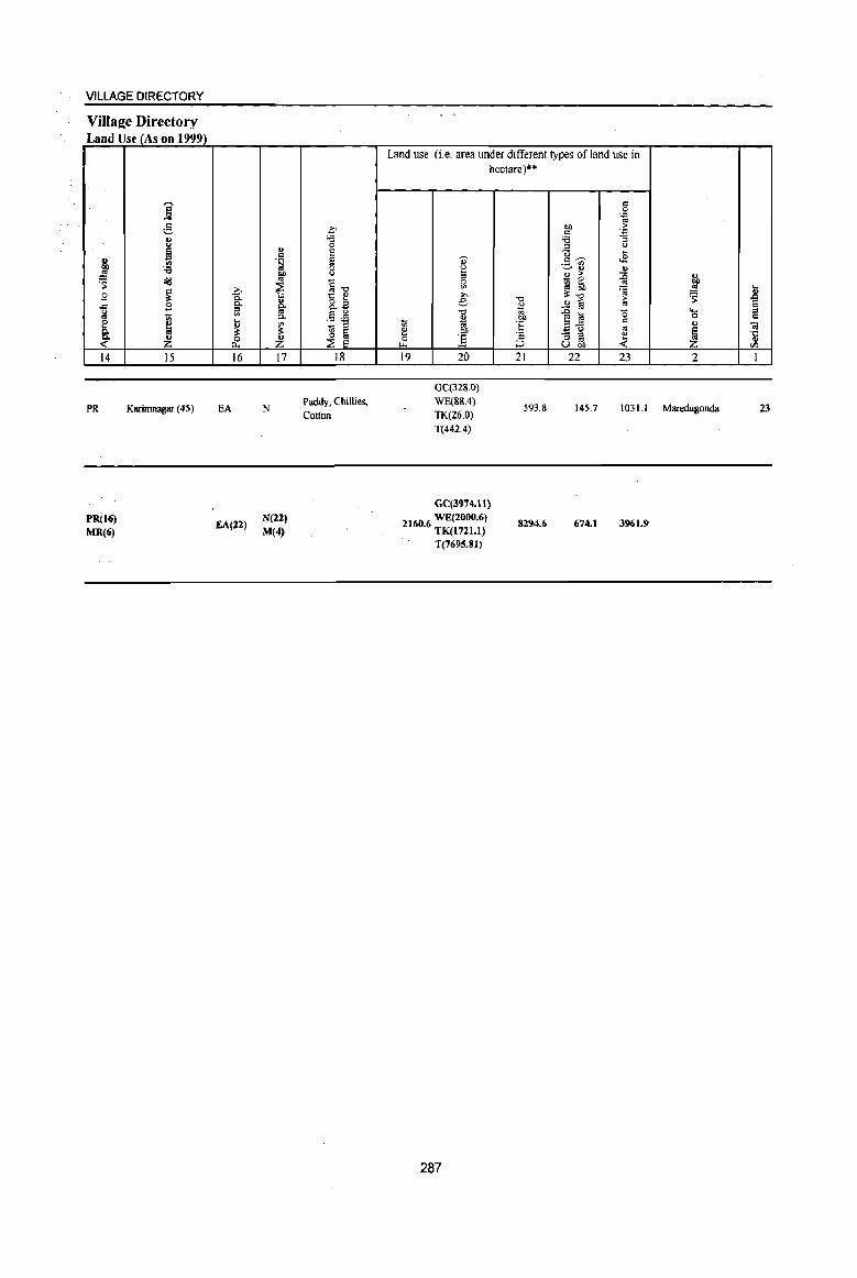
VILLAGE DIRECTORY
Village Directory Land Use (As on 1999)
14
PR
PR(16) MR(6)
15
Karimnagar (45)
16
EA
EA(22)
17
N
N(U) M(4)
18
Paddy, Chillies, Cotton
Land use (i.e. area under different types of land use in hectare)··
19 20 21 22 23 2
OC(328.0) WE(88.4)
TK(26.0) T(442.4)
593.8 145.7 103 LI Maredugonda
GC(3974.tl)
2160 6 WE(2000.6) . TK(I721.1)
T{7695.SI)
287
8294.6 674.1 3961.9
23
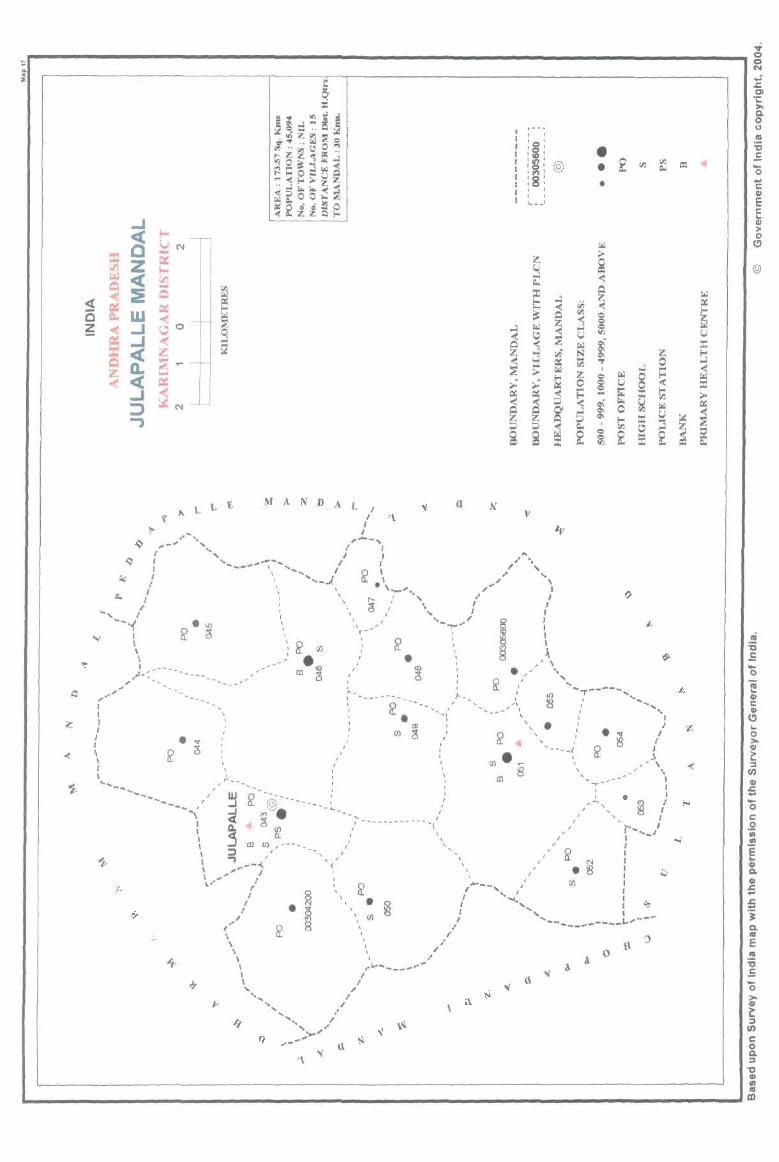
I
L :E ;.. L (l N MANDAL/ '\
I
I ft
"--'1 .' '. f I , , . ,-, " , , "
" '-", --- '0 , ", ( ',,----.. '- '-"--.1. !l. . ',._.... .1' /
q i "'"
• • •
! '.: \ *,' ',,-~j i \ ' " , , " \" ~ '" . . " : ~ , " , ---{ ~ ~ : & w : • : . ' ",
\ " . .: ! ~. '-~-----"'-" ' ,- m a : ;'." ~ , \ - , , , , ~< '"" ,- :',,' '" , ", -- , , -' '. ~ . -'-'; ", • • ~ !
/' -'" '. w:!' ~ '.,_,,( ~ •• \ i w • _ .. ._'; , . ~ , ' • • , m ,
: 0 ~ , _~, • • ! ' . '. , . ~, I J "- :': . r--,_j '.. ... ---...... ~ i? --@.""'-'<_"""""_"".<! -'---, a ", , ~ ,
:, j m ~,~----"" .. / ' \ :,' : is j \ 'l _-<'~ , .... __ '. : : • ' , ', '0 "-<., , __ ' " '. < '" - ___ L'-\,...! ~§ ", . § ) .. _------I • 0 , (/) , ,
t,' 0 ..., •
\!l. , A \ \~ .. \ ~~-----\ I
' J I ,
" f ..... , .....
.. I ..
" 1.\ « ~
{\ \
o
...... " ... , ..... .,/ ..... Q .. -
z
-o C GI E c; .. GI > o
(!)
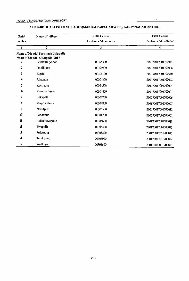
PART A -VILLAGE AND TOWN DIRECTORY
ALPHABETICALLISTOFVllLAGES(MANDALPARISHAD WISE), KARlMNAGARDISTRICf
Serial
number
Name of village
2
Name of Mandai Parishad: Julapalle Name of Mandai :JulapaUe 0017
1 Burhanmiyapet
2 Doolikatta
3 Elgaid
4 JulapaUe
S Kachapur
6 Kummarikunta
7 Lokapeta
8 Muppirithota
9 Narsapur
10 Peddapur
11 Raikaldevapalle
12 SivapaUe
13 Sultanpur
14 Telukunta
15 Wadkapur
2001 Census
location code number
3
00305300
00304900
00305100
00304300
00304500
00304400
00304700
00304800
00305500
00304200
00305600
00305400
00305200
00305000
00304600
289
1991 Census
location code number
4
200170017001700014
200170017001700008
200170017001700010
200170017001700002
200170017001700004
200170017001700003
200170017001700006
200170017001700007
200 1700 1700 17000 12
200170017001700001
200 1700 1700 17000 11
200170017001700013
200170017001700015
200 1700 1700 1700009
200170017001700005
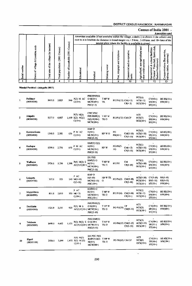
DISTRICT CENSUS HANDBOOK: KARIMNAGAR
Census ofindia 2001 -Amenities and
Amenities available (ifoot available within the village, a dash (-) is shown in the column and next to it in brackets the distance in broad ranges viz,< 5 krns., 5-10 kms. and 10+ kms of the
'Ui' nearest place where the facility is available is !riven)
I " ., '" '" .., ~~
.., ~
., 8 3 ;; u ij
1{ c ..c Ul - ., ~ ~
'::: (.J
c 0 '" ~t! 0 g ., '~ '"' '::I U 0 0 .:::
8 C!- ..c G ~8. ~ i;' ~ Co :; 0 .;g .2 c. <> ]~~ '" ~ o-l .!l! 0 B Z 'e, '" ~ C!- '0 " ., <Id ..c "C '? .~ _ 01 § e,-.; ., ., '"
., a (.J g ~ '': ., i$ '" .., c " E ..s 0 :0 Ii Iii o .~
<Id~~ d
J! ..... .::: 0 ..c '" g o C ~ 0 ~ ..c 1ij S; li
'::1 0
1 .... -a -a iO;> " ... .,
9 .. 0 '" ~ .~ g -( .!:! !9 .... ~ 0 .. .,
§ '" c 0 c. .8 .::: iO '" "£ " :; ts .:::~~ 01
., '3 '3 '" '" ~ E ., os 8 E i;'
~ § '" '6 1 Sl '5, ~ e g ~ ~~ '5 " 0 0 ill :E 8 '" -~ !9
<I) f- f- Z <~ ~~tIl U I 2 3 4 5 6 7 8 9 10 II 12 13
Mandai Parisbad : JuJapalk (0017)
PHSRMP(6) NCS(4)
Peddapur 1633,0 3,823 946 P(2) M AC o H(IO+) THPW
PO PH(I3) CM{< 5) ACS« 5) CV(lO+) BSRS(IO+)
(00304200) C(lO+) MCW(lo+) TK CP« 5) OCS(IO+)
SP(IO+) NW(IO+)
PHC« 5) ST(IO+)
P(7) M(3) CWCPHC
ACS 2
Julapalle 1117.0 6,007 1,450 S(2) AC(2)
PHSRMP(3) THPW PO PH(1Z) CM CP NCS(7)
CV(IO+) BS RS(IO+) (00304300) 0(2) H(IO+) TKO SP(IO+) NW(IO+)
C(lO+) MCW(IO+)
OCS(IO+) ST(IO+)
RMPO NCS(3)
Kummarikunta PM AC H(IO+) PO CV(IO+) BS RS(IO+) 3 1348.0 2,581 636 C(lO+) HPWO CM(5.10) ACS(5-IO)
(00304400) MCW(IO+) PH(IO+) CP(S-IO) OCS(IO+)
SP(lO+) NW(IO+)
PHC(5-10) ST(IO+)
RMP(2) 0(2) NCS(2)
Kachapur PM AC H(IO+) POPH(5- CV(IO+) BS RS(IO+) 4
(00304500) 1399,0 2,756 670 C(lO+) MCW{IO+)
HPW 10)
CM«5) ACS(S-IO) SP(IO+) NW(IO+)
PHC(S-IO) CP(5-10) OCS(IO+)
ST(IO+)
DUPHS
Wadkapur RMP(3) 0
THPW CM NCS(2)
CV(IO+) BS RS(IO+) S 2126.0 S,236 1,298 P(4) M(2) S H(lO+) PO PH ACS(S-IO)
(00304600) AC(3) C(lO+) MCW(IO+) TKO CP(5-IO) OCS(IO+)
SP(IO+) NW(IO+)
PHC(5-10) ST(IO+)
PAC RMPO
Lokapeta 337.0 523 140 M{5·10)
H(5·10) HPWTK POPH(2) CM{S-IO)
ACS(S-IO) CV(S-to) BS(5-10) 6
(00304700) MCW(S·IO) 0 NCS(IO+) SP(5-10) RS(5-10) C(5-l0)
PHC(IO+) CP(S-IO)
OCS(IO+) ST(IO+) NW(10+)
PAC RMP(4) 0
NCS(S) Muppirithota H(IO+) THPW CV(IO+} BS RS(IO+)
7 831.0 2,010 503 M«5) POPH(4) CM(5-10) ACS« 5) (00304800)
C(lO+) MCW(IO+) TKO
CP(IO+) OCS(IO+) SP(IO+) NW(IO+)
PHC(IO+) ST(lO+)
PHSRMP(3) ACS
Doolikatta P(3) M S 0 H(IO+) THPW CP NCS(3)
CV(IO+) BS RS(IO+) 8
(00304900) 1525.0 3,511 930 AC(2) C(IO+) MCW(IO+) TKO PO PH(25) CM{S-IO) SP(IO+) NW(IO+)
PHC(5-IO) OCS(IO+)
ST(IO+)
PHSRMP(J) NCS(2) Telulamta P(3) M(2) S OH(IO+) THPW
PO PH(IS) CM{S-to) ACS(5-10) CV(IO+) BS RS(to+)
9 1698.0 4,602 1,121 AC(3) C(IO+) MCW(IO+) TKO SP{IO+) NW(lO+) (00305000) CP(5-10) OCS(IO+)
PHC(5-1O) ST(IO+)
P(5) M(3) DAPHC PHS ACS
Elgaid RMP(3) 0(2) THPW CV(lo+) BS RS(lO+) 10 2008.0 5,644 1,432 S(2) AC(2)
H(IO+) TKO PO PH{6S) eM CP NCS(9)
SP(IO+) NW(IO+) (00305100) C(lO+) OCS(IO+) MCW(IO+) ST(IO+)
290
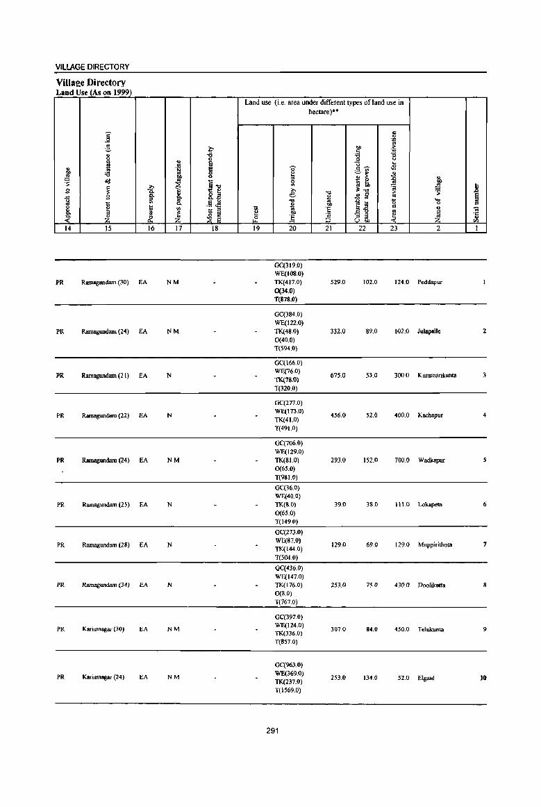
VILlAGE DIRECTORY
VilIae:e Directory Land Use_{_As on 199~)
Land use (i.e. area under different types ofland use in hectare)·'
]' c 0 .~
;§, ~ "" > c . .,
" '0 '0 "3 0 .. 0 '" 0
~ e u .. c;; ~ <2 " .~ § c;;---" ._ '" co '0 ~ ~ .. " ~ .. = ~ ~ ~ " ~ ~
~ ~~ 0 :a l;b
tID
~ ;;..., '" ~ ~ Jl .9 I
;;..., 3:-.:> ~ gJ e ." ..!! lil 1; ~ ..c .9 ~ ~ g .§ .M "'" .0 la 0 ... ., c.
~ "" 0 c;;
~ ~ ~ <II 1;; 'E ~g c;;
" 'til - '" '" ;;: ~ ~ e 00 '2 " ~ ·c
~ Z & Z ~ ] '" cd <: " ::> u "" til
14 15 16 17 18 19 20 21 22 23 2 1
GC(319.0) WE(IOS.0)
PR Ramagundam (30) EA NM TK(417.0) 529.0 102.0 124.0 Peddapur 0(34.0) T(878.0)
GC(384.0) WE(122.0)
PR Ramagumlam (24) EA NM TK(48,O) 332.0 89.0 lQ2.0 JIIl4palle 2 0(40.0) T(594.0)
GC(166.0)
PR Ramagundam (21) EA N WE(76.0)
675.0 53.0 300.0 Kununarilrunta 3 TK(18.0)
1(320.0)
GC(277.0)
PR Ramagundam (22) EA N WE(113.0)
456.0 52.0 400.0 Kachapur 4 TK(41.0)
T(491.0)
OC(706.0) WE(129.0)
PR Ramagundam (24) EA NM TK(81.0) 293.0 152.0 700.0 Wadkapur 5 0(65.0)
T(98 1.0)
GC(36.0) WE(40.0)
PR RamaglDtdam (25) EA N TK(8.0) 39.0 38.0 111.0 Lokapeta 6 0(65.0) T(l49.0)
GC(27J.O)
PR Ramagundam (28) EA N WE(87.0)
129.0 69.0 129.0 Muppirithota 7 TK(I44.0)
T(5040)
GC(436.0) WE(147.0)
PR Ramagundam (34) EA N TK(l76.0) 253.0 75.0 430.0 Doolikatta 8 0(8.0)
T(767.0)
GC(397.0)
PR Karinmagar (30) EA NM WE(124.0)
307.0 84.0 450.0 Telukunta 9 TI«336.0)
T(857.0)
GC(963.0)
PR Karimnagar (24) EA NM WE(369.0) TK(237.0)
253.0 134.0 52.0 Elgaid 10
T(1569.0)
291
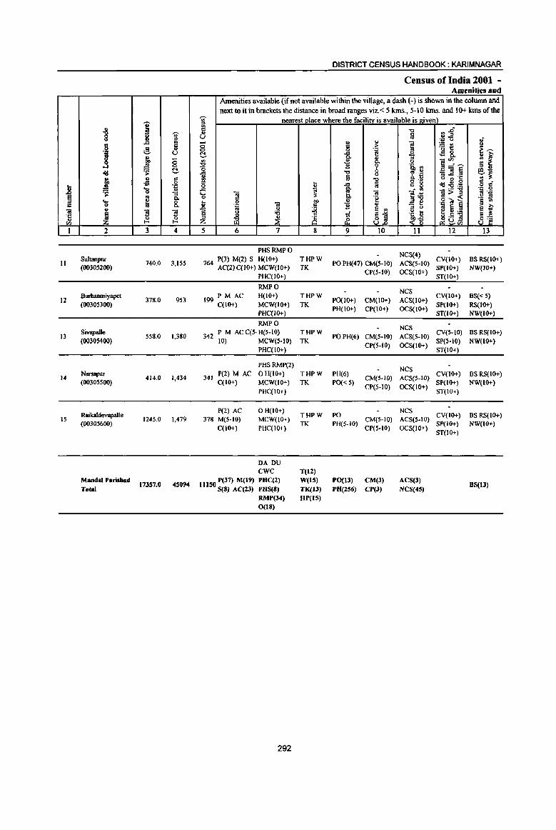
I i -;;;-=
j .c ., ;!
c u u
j <5 0
<Ill 'S c j " c
oS 0
1l 'J: .... -3 'S 0
~ ~ Q. ...
0 8. c:: " "iii
~ "5 "5 ·c ~ 0 .,
I/) l-
I 2 3 4
11 Sultanpur
740.0 3,155 (OOJO.s2(0)
Bwbanmiyapet 12
(OOJOS3(0) 378.0 953
13 Sivapalle
558.0 1,380 (0030~OO)
14 Narsapur
414.0 1,434 (00305500)
Raikaldevapalle 15 1245.0 1,479
(00305600)
MandaI Parisbad 173S7.Q 4S094
Total
DISTRICT CENSUS HANDBOOK: KARIMNAGAR
Census of India 2001 -Amenities and
Amenities available (if not available within the village, a dash (-) is shown in the column and next to it in brackets the distance in broad ranges viz. < 5 kms., 5-10 krns. and 10+ krns of the
~ nearest place where the facility is available is given) 0:: "" rJj u a u .J:: U .; - u ..
] 'Bt! 0 0 c >
.~ >; 0 0 .J::
C ..c ~ ~8. 0- ... '3 ]:'c~
.. os ~ ..!! 0- U ., ~ "0 B 'i' .iii, ., = "
"" 0 ~ O£ _"iI ~ ~~ .c 0 u ~ a ~.t: ., -0 :::I 0·- <Ill ... 0 c:: 0 i .c a c g :g~ o C
..c g- o .. . ., 0
.... "iii "iI ]:6 ]>~ .~ -E 0 c:: to "e "" " .g'iil] § to t 0 "iI ~ 11 "
_ e . ., :::I 0 oj e e i;' .0 .. U e .. e u 'i3 "Ii ~1 .5, t e u :.a e ~ = iZ ~ ;§ <> .5 .l9 8] z .£ <~ ~ul/)
5 6 7 8 9 10 11 12 13
PHS RMP 0 NCS(4)
764 P(3) M(2) S H(IO+) THPW PO PH(47) CM(S·IO) ACS(S-IO)
CV(IO+) BS RS(IO+) AC(2) C(lO+) MCW(IO+) TK
CP(5·10) OCS(lO+) SP(IO+) NW(IO+)
PHC(IO+) ST(IO+)
RMPO NCS
PM AC H(IO+) THPW CV(IO+) BS« 5) 199 C(IO+) MCW(IO+) TK
PO(IO+) CM(IO+) ACS(IO+) SP(IO+) RS{10+)
PHC(IO+) PH(IO+) CP(IO+) OCS(IO+)
ST(IO+) NW(W+)
RMPO NCS
342 P M AC C{5- H(S·IO) THPW POPH(6) CM(S·IO) ACS(5-10)
CV(S·IO) BS RS(IO+) 10) MeW(S-IO) TK
CP(S-IO) OCS(IO+) SP(HO) NW(IO+)
PHC(IO+) ST(IO+)
PHSRMP(2) NCS
341 P(2) M AC OH(IO+) THPW PH(6)
CM(S·IO) ACS(S·IO) CV(IO+) BS RS(IO+)
C(IO+) MCW(lO+) TK PO« 5) SP(IO+) NW(IO+) PHC(IO+)
CP(5.10) OCS(IO+) ST(IO+)
P(2) AC OH(IO+) THPW PO
NCS CV(IO+) BS RS(IO+)
378 M(5·10) MCW(lO+) CM(S·IO) ACS(S·IO) C(10+) PHC(IO+)
TK PH(5·1O) CP(5·IO) OCS(IO+)
SP(IO+) NW(IO+) ST(IO+)
DA DU ewc T(ll)
11150 P(37) M(19) PUC(2) WetS) PO(I3) CM(J) ACS(J) BS(IJ)
8(8) AC(2J) PHS(8) TK(JJ) PU(2S6) CP(J) NCS(45) RMP(J4) DP(IS) 0(18)
292

VILLAGE DIRECTORY
ViIla2e Directory Land Use (As on 1999)
Land use (i.e. area under different types of land use in hectare)""
i c 0
"ia " c OJ) i:: ;:.
" "3 ., 'g :a ., ::l " ~
., ~ g- ... c .E .,
.~ § .., OIl :a e ~~ " .. OJ) " " ;. ~ ~
::l ., otd
~ ~"d 0 a 0 .& ~ t
fIl ~: ~ ... E g_~
;., "'" > ~ .8
.c S ~ e ., ..!! § '" §
I §~ "d ~
1~ '0 .... ~ '" r:>. ., 00 0 c
il <II ... ::l -.; 10 ·S " " .. '" ~ ~ ~ ~ ~ 00 'a ~ ::l
~ .~ ·c ~ ~ r£ ~ (> ] ::l .. " "" ~ u 0[) '" l4 15 16 17 18 19 20 21 22 23 2 I
GC(336.0)
PR Karimnagar (18) EA NM WE(150.0)
121.0 76.0 47.0 Sultanpur II TK(10.0) T(496.0)
GC(115.0)
PR Karimnagar (20) EA N WE(65.0)
100.0 46.0 48.0 Burhanmiyapet 12 TK(4.0)
T(lS4.0)
GC(266.0)
PR Karimnagar (20) EA N WE(80.0)
85.0 50.0 69.0 Sivapalle 13 TK(S.O)
T(354.0)
GC(106.0)
PR Karimnagar (22) EA N WE(71.0)
91.0 28.0 50.0 Narsapur 14 TK(68.0) T(245.0)
GC(340.0)
PR Karimnagar (29) EA N WE(132.0)
385.0 95.0 115.0 Raikaldevapalle 15 TK(178.0)
T(6SD.O)
GC(S120)
N(IS) WE(1873)
. Pl(15) EA(tS) M(6)
TK(t834) 4048.0 1143.0 3117.0 0(212) T(9039)
293
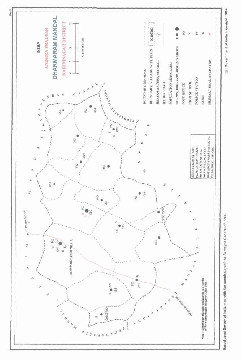
= ... :i
o
,- -i 1 , ,
; :8: • I (W') ~
' .... '@ 1 '~' I :8: 1 I , I , , , l __ J
• • 2 •
==
'It g N
J &. DI ;: :>. a. 8 II
:s .s '0 .. c: II E c ... CIJ > o
C)
@
" ~ c:
'0 ~ II C CD
C)
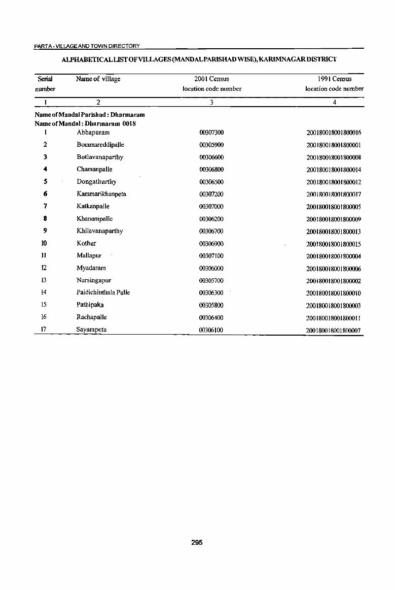
PART A - VILLAGE AND TOWN DIRECTORY
ALPHABETICAL LIST OF VILLAGES (MANDALPARISHAD WISE), KARlMNAGARDISTRICT
Serial Name of village 2001 Census 1991 Census
number location code number location code number
2 3 4
Name of Mandai Parish ad : Dharmaram Name of Mandai : Dharmaram 0018
1 Abbapuram 00307300 200180018001800016
2 Bommareddipalle 00305900 200180018001800001
3 Botlavanaparthy 00306600 200180018001800008
4 ChamanpaUe 00306800 200180018001800014
S Dongathurthy 00306500 200180018001800012
6 Kammarikhanpeta 00307200 200 1800 I 800 I 800017
7 Katkanpalle 00307000 200180018001800005
8 Khanampalle 00306200 200180018001800009
9 Khilavanaparthy 00306700 200180018001800013
10 Kothur 00306900 200180018001800015
II Mallapur 00307100 200 1800 1800 1800004
12 Myadaram 00306000 200180018001800006
I3 Narsingapur 00305700 200180018001800002
14 Paidichinthala Palle 00306300 200180018001800010
15 Pathipaka 00305800 20018001 SOOI S00003
16 Rachapalle 00306400 200180018001800011
17 Sayampeta 00306100 200180018001800007
295

I " "8 ..,. fA ....
8 c:I .S .,
] ._, u u OIl ;;
.!!! 0
c!d ~ ~ ., u 8 ~ .£l ... ',c .8 ~
.... .. 0 :; § .. Q.
'- ~ 0
'" 0 Q.
iii " ~
"3 '3 '5 0 ~ til I-'
I 2 3 4
Mandai Parisbad ! DhlIrmaram (OOIS)
Narsingapur 695.0 1,742
(00305700)
2 Pathipalca
1687.0 2,614 (00305800)
3 Bommareddipalle
3463,0 8,749 (00305900)
4 Myadaram
1819.0 6,992 (00306000)
Sayampeta S
(00306100) 751.0 814
6 Kbanampalle
794.0 1,047 (00306200)
Paidichinthala 7
Palle (00306300) 471.0 888
Rachapalle 8 390.0 2,680
(00306400)
Oongathurtby 9 856,0 3,022
(00306500)
Botlavanaparthy 10 1092.0 3,035
(00306600)
Khilavanaparthy 1652.0 2,229 11
(00306700)
DISTRICT CENSUS HANDBOOK: KARIMNAGAR
Census of India 2001 -Amenities and
Amenities available (if not available within the village, a dash (-) is shown in the column and next to it in brackets the distance in broad ranges viz. < 5 kms" 5-10 kms, and 10+ kms of the
'Wi' nearest place where the facilitv is available i~ givenl ::;l ... 5 "Q (l~ () lil ',c u 8 §
., " ] :: > ~l! 0 '/:l 't '""' !::!- -a ~ tS& ., ~ "3 ~
... c. <> ~:;~ ;; ~ "0 11 '( '5, '" .... "'Q 0 6 '£ _Ol§ e ... () g lil "Q :J .... 'C !II ;l:
5 I lii o ,_
u 2 B § ",' .... '" 8 c!d:g:a .... ~
, ., ':C 0 .... Ol Ii! ]~ ]>~ co .:c
0 C 'g .~ f! ... 0 Ol
OIl ., .g 'iii § § '" u .:c :: 11 " "3 t> .b .. u
~ e ., ~~:a ~f ~ 0 :a ~~ ~1
.~ u ~ ~ 8 () .5 !!
p.. <t~ ~~tIl 5 6 7 8 9 10 II 12 13
PAC RMP(2)
NCS(2) 469 M(5-10)
H(10+) THPW PO« 5)
CM ACS«5)
CV(J()+) BS RS(IO+)
C(lO+) MCW(IO+) TK
PH(lO+) CP{IO+)
OCS(lO+) SP(IO+) NW(IO+)
PHC(IO+) ST{IO+)
PHS RMP(2) ACS
694 P(2) M S H(IO+) THPW PO PH CM« 5) NCS(5)
CV(IO+) BS RS(1O+) ACC(IO+) MCW(IO+) Sp{JO+) NW(IO+)
PHC{lO+) CP(lO+) OCS(lO+)
ST{IO+)
P(9) M(5) HDHPHS(2)
NCS(6) CV 2,083 S(2) AC
RMP(8) THPW PO PH
eM ACS(5-10) SP{IO+)
BSRS(IO+}
C(lO+) MCW(IO+) CP(IO+)
OCS(lO+) 8T(IO+) NW(IO+)
PHC(5-10)
PHCPHS ACS
I 772 P(6) M(2) S RMP(4} THPW PO PH CM{5-10) NCS(7)
CV(5-IO) BS RS(IO+) , C(lO+) H(10+) TK
CP(10+) OCS(IO+) SP(IO+) NW(IO+)
MCW(IO+) ST(IO+)
2:>3 P M«5) RMPH«5) NCS(2)
CV{5-1O) BS{<5) C(IO+)
MCW(IO+) HPW PO«5) CM(5-IO) ACS« 5) Sp{IO+) RS{IO+)
PHC« 5) PH«5) CP(IO+) OCS(IO+) ST(IO+) NW(IO+)
RMP NCS
282 P(2) M« 5) H(5-1O) THPW PO{< 5) CM{IO+) ACS(5-10)
CV(IO+) BS RS{IO+) C(IO+) MCW(IO+)
PH(5-10) CP(IO+} OCS(lO+} SP(IO+) NW(IO+)
PHC(5-10) ST(IO+)
225 P(2) M« 5) RMPH(IO+) NCS(2)
CV(lO+) BS RS(IO+)
C(IO+) MCW(IO+) HPWTK PO« 5) CM(IO+) ACS(IO+)
SP(lO+) NW(IO+) PHC(5-10) PH(IO+) CP(10+) OCS(IO+)
ST(IO+)
720 P(4) M H(10+) PO NCS(3)
CV(IO+) BS RS(IO+) HPWTK CM(IO+) ACS(lQ+)
C(lO+) MCW(IO+) PH(IO+) CP(IO+) OC5(10+)
SP(IO+) NW(lO+)
PHC(IO+) ST(IO+)
PHS RMP(3) NCS(3)
P(2) M S H(5-10) PO CM CV(5-IO) BS RS(JO+) 741 HPW ACS(IO+)
C{IO+) MCW(IO+) PH(IO+) CP{10+) OCS{IO+)
SP(lO+) NW(IO+)
PHC(5-IO) ST{IO+)
RMP(3) NCS(4)
P(4) M AC H(5-1O) PO CV(lO+) as RS(1O+) 755 THPW CM(IO+) ACS{5-10)
C(IO+) MCW(IO+) PH(5-10) CP(IO+) OCS(IO+)
SP(lO+) NW(lO+)
PHC(5-10) ST(IO+)
PHS RMP H(5 NCS(2)
56l P M« 5) 10)
HPWTK PO{< 5) CM(IO+) ACS(5-10) CV(5-IO) BSRS{lO+)
MCW{IO+) SP(lO+) NW(IO+) C(lO+) PH(lO+) CP(IO+) OCS(IO+)
PHe(5-10) ST(lO+)
296

VILLAGE DIRECTORY
ViIlaee Directory Land Use (As on 1999)
Land use (i.e. area under different types of land use in hectare)··
j § '<.;i
]_ ~ .. > c: .&
8 '8 'i3 -a = Q
~ ~ e; u u .s
j .~ 8 =~
"" ~ -.::..tl " "" Q ., > i ~ <Ii!! ~ - 0 ~ ~~
0
~~ ~ >. '" ~ .!!! ~ g 1 e -0 ~ 'S .0
.c 2 8- &2 ~ .!! !ij ~ u '" .§ JS -0
~ 2 0 .... .. 1;; 0.
~ ..
" 0 c
~ ~ t ., til :I 0; 'E 1l .. ., OJ
it :>: ~ ~ e ..,
'2 - = ~ ~ ·c ~ ~ ~ ~ & ]. = .. II> ::> u .. <Il
14 15 16 17 18 19 20 21 22 23 2 1
GC(74.0)
PR Karimnagar (33) EA NM WE(156.0)
337.0 2.0 44.0 Narsingapur TW(82.0) T(312.0)
Gq24.0)
PR Karimoagar (31) EA NM WE(144.0)
433.0 TK(I78.0) 276.0 100.0 532.0 Pathipaka 2
T(346.0)
GC(500.0)
PR Karimnagar (38) EA NM 920 0 WE(306.0) . TK(176.0)
414.0 401.0 746.0 Bommareddipalle 3
T(982.0)
GC(360.0)
PR Rantagundam (27) EA NM WE(432.0)
455.0 100.0 Myadaram 4 TK(472.0} T(l264.0)
GC(I82.0)
PR Ramagundam (22) EA N WE(190.0) TK(100.0)
164.0 115.0 Sayampeta 5
T(472.0)
GC(112.0)
PR Rantagundam (18) EA N 970 WE(21O.0) . TK(70.0) 219.0 8.0 78.0 Khanampalle 6
T(392.0)
WE(!36.0) 51 0 PaidichinthaJa PR Ramagundam (17) EA N TK(1I4.0) 146.0 24.0 7
T(250.0) . Palle
GC(93.0)
PR RamagWidam (17) fA NM WE(40.2)
200.2 6.0 30.0 Rachapalle 8 TK(20.6) T(153.8)
GC(260.0)
PR RantagWidam (21 ) fA NM WE(100.0) TK(206.0)
230.0 4.0 56.0 Dongathurthy 9
T(566.0)
GC(2060)
PR Rarnagundam (21 ) EA NM 165.0 WE(190.0) TK(98.0)
265.0 168.0 Bodavanaparthy 10
T(494.0)
GC(240.0)
PR Ramagundam (24) fA NM 446.0 WE(I 2 1.0) TK(40.0)
425.0 9.0 371.0 Khilavanaparthy II
T(401.0)
297
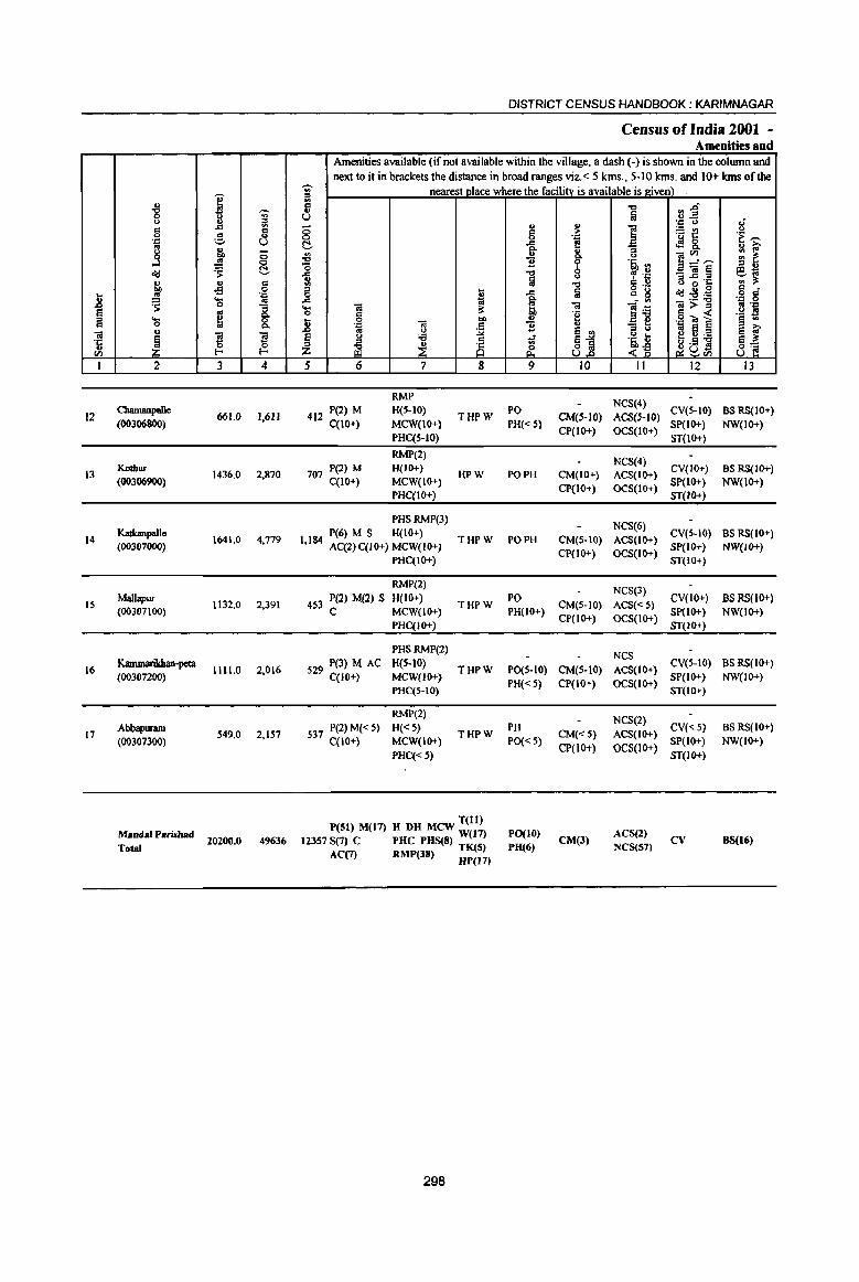
.8 ~ iii 't <Il
I
12
13
14
IS
16
17
.g u
'" 0 '.z:: .. j <I>J u
! ~ .... 0 u
~ 2
CIuunanpaIle (00306800)
KodJur
(00306900)
Ka1bnpallc
(00307000)
Malbpur (00307100)
Kammarikhan-peta (00307200)
Abbapuram (00307300)
Mandsl Parishad Total
I -;;-~ ::! ... <II
g a .. co 0 ~ <;>
'S: C .. '" of! 0 '.z:: .... .. 0 "3 .. Q.
~ 8. s s 0 ~ f-<
3 4
661.0 1,611
1436,0 2,870
1641.0 4,779
1132,0 2,391
1111.0 2,016
549,0 2,157
20200.0 49636
DISTRICT CENSUS HANDBOOK: KARIMNAGAR
Census of India 2001 -Amenities and
Amenities available (if not available within the village, a dash (-) is shown in the column and next to it in brackets the distance in broad ranges viz,< 5 kms" 5-10 kms, and 10+ kms oflbe
-;;- nearest place where the facility is available is given) ill 13 u ;:; 0 C ~ '0 ... :il ::I ... 0 ., ... ;; ... iii 0 g ~
.8 f '.c iii .. u
~ u ;;;
~ ~ 5 6 7 8
RMP
412 P(2) M H(S-10) THPW
C(1O+) MCW(1O+)
PHC(S-IO)
RMP(2)
707 P(2) M H(IO+) HPW
C(1O+) MCW(IO+)
PHC(IO+)
PHSRMP(3)
P(6) M S H(IO+) 1,184 AC(2)C(10+) MCW{IO+)
THPW
PHC(IO+)
RMP(2)
453 P(2) M(2) S H(IO+) C MCW(IO+)
THPW
PHC(IO+)
PHSRMP(2)
S29 P(3) MAC H(5-10) THPW co 0+) MCW(lO+}
PHC(5-IO)
RMP(2)
537 P(2) M« 5) H«5) THPW
C{10+} MCW(IO+)
PHC«5)
T(ll) P(51) M(17) H DH MCW W(l7)
12357 S(7) C PHC PHS(8) TK(S) AC(7) RMP(38) HP(I7)
298
u
'" 0 ... Q. u ] .., Iii
..c go !;!, u ] .r & 9
PO
PH«S)
PO PH
PO PH
PO PH(10+)
PO(S-IO)
PH« 5)
PH
PO« 5)
PO(IO) PH(6)
!o? '.z:: e U Q.
b u
"0 Iii -= 'g
~j 10
CM(S-IO) CP(IO+)
CM(IO+)
CP(IO+)
CM(S-IO)
CP(lO+)
CM(5-IO)
CP(lO+)
CM(5-IO)
CP(IO+)
CM«S)
CP(lOT)
CM(3)
.., fe
] ;:I u os. <II
~ .~ § ,~
'" g
~~ :i b '~ t <-g
11
NCS(4)
ACS(S-JO) OCS(IO+)
NCS(4) ACS(IO+)
OCS(IO+)
NCS(6)
ACS(IO+)
OCS(1o+)
NCS(3)
ACS«5) OCS(IO+)
NCS
ACS(IO+)
OCS(IO+)
NCS(2)
ACS(IO+)
OCS(lo+)
ACS(2) NCS(S7)
fI).g ., -'.c u :.: VOl
'is J:: <l9 8. ]~.~ _iii~ g ~ 'J:
<I>J u B :9;;; ]>~ ,13 OJ ~ ~~'N u .5 ~U<ll
12
CV(S-IO)
SP(IO+)
ST(1O+)
CV(IO+) SP(lO+) ST(JO+)
CV(S-IO) SP{IO+)
ST(IO+)
CV(IO+) SP(lo+)
ST{IO+)
CV(S-IO)
SP(IO+)
ST(IO+)
CV(<::5)
SP(IO+)
ST{IO+)
cv
1£ 'E ~ ~ [ ES.;; '" ;!; CI • o r::
'.c 0 B '.z:: ,_ s 13 '"
~ i 8]
13
BS RS(IO+)
NW(IO+)
BS RS(10+) NW(lO+)
BS RS(IO+)
NW{IO+)
BSRS(JO+)
NW(JO+)
BS RS(IO+) NW(IO+)
BS RS(IO+) NW(lO+)
BS(16)
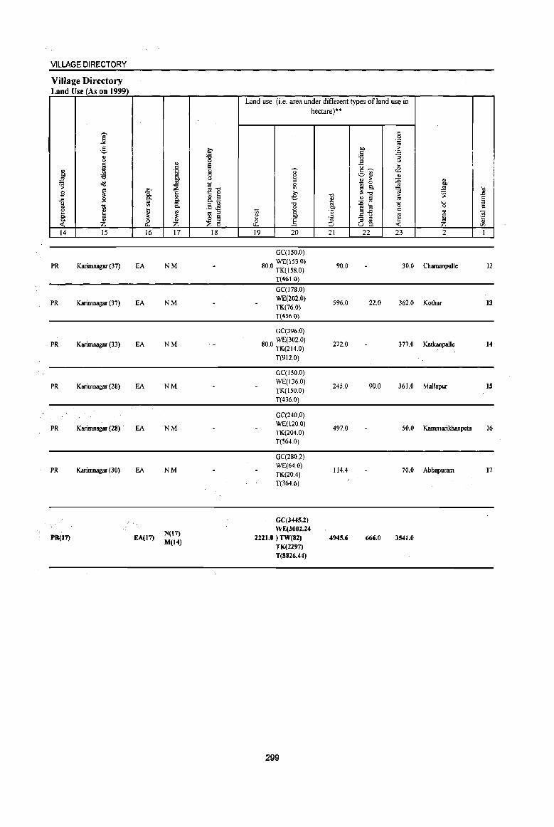
VILLAGE DIRECTORY
ViIlaee Directory Land Use (As on 1999)
j 2-" t>
~ g, :a !51 ~ o<J
~ .9 .c
(,,) ., "iil e ~ 8: ~ <: 14 15
PR Karimnagar (37)
PR Karirnnagar (37)
PR Karimnagar (33)
PR Karimnagar (28)
PR Karimnagar (28)
PR Karimnagar (30)
PR(I7)
-a Q, :::s '" ... " ~ 0 0-
16
fA
fA
EA
EA
EA
EA
EA(I7)
" " '~
~
~ " ~ Q,
'" ~ ~ 17
NM
NM
NM
NM
NM
NM
N(17) M(14)
~
~ e E 0 (,,)
§-o '§ ~ ~g ,_ "" .. :l ~ &i ~ e
18
Land use (i,e, area under different types of land use in
" ~ :l 0 <II
» e "0
~ ., " OIl Ci :.5 u. 19 20
GC(150,0)
800 WE(153,0) , TK(l58,0)
T(46 1.0)
GC(178,0) WE(202,O) TK(76,0) T(4S6,0)
GC(396,0)
80 ° WE(302,0) , TK(214,0)
T(912,O)
GC(150,0) WE(136,O) TK(150,O) T(436,0)
GC(240,0) WE(12Q,O) TK(204,O) T(564 ,0)
GC(280,2) WE(64.0) TK(204) T(364,6)
GC(J445.2) WE(3002.24
2221.0 ) TW(82) TK(2297) T(8826.44)
299
hectare)**
" 0 '.c '" OIl >
" ~ :a '"
<.)
'0 ... t2 1:'-"
-=..[G " " > :g _ 0
gj 6h ~ -0 ~-o
" ~ @ '" 1'ii .g Ii! "0 OIl 'E afJ = .. 'S - :l ~ :::s '" :J U "" <: 21 22 23
90,0 30,0
596,0 22,0 362,0
272,0 377.0
245,0 90,0 361.0
497,0 50.0
114.4 70.0
4945.6 666.0 3541.0
" OIl !51 ... ~ .8
e '- :::s 0 = " ~
~ 'I:
" VJ
2 I
Chamanpallc 12
Kothur 13
Katkanpalle 14
Mallapur IS
Kammarikhanpeta 16
Abbapuram 17
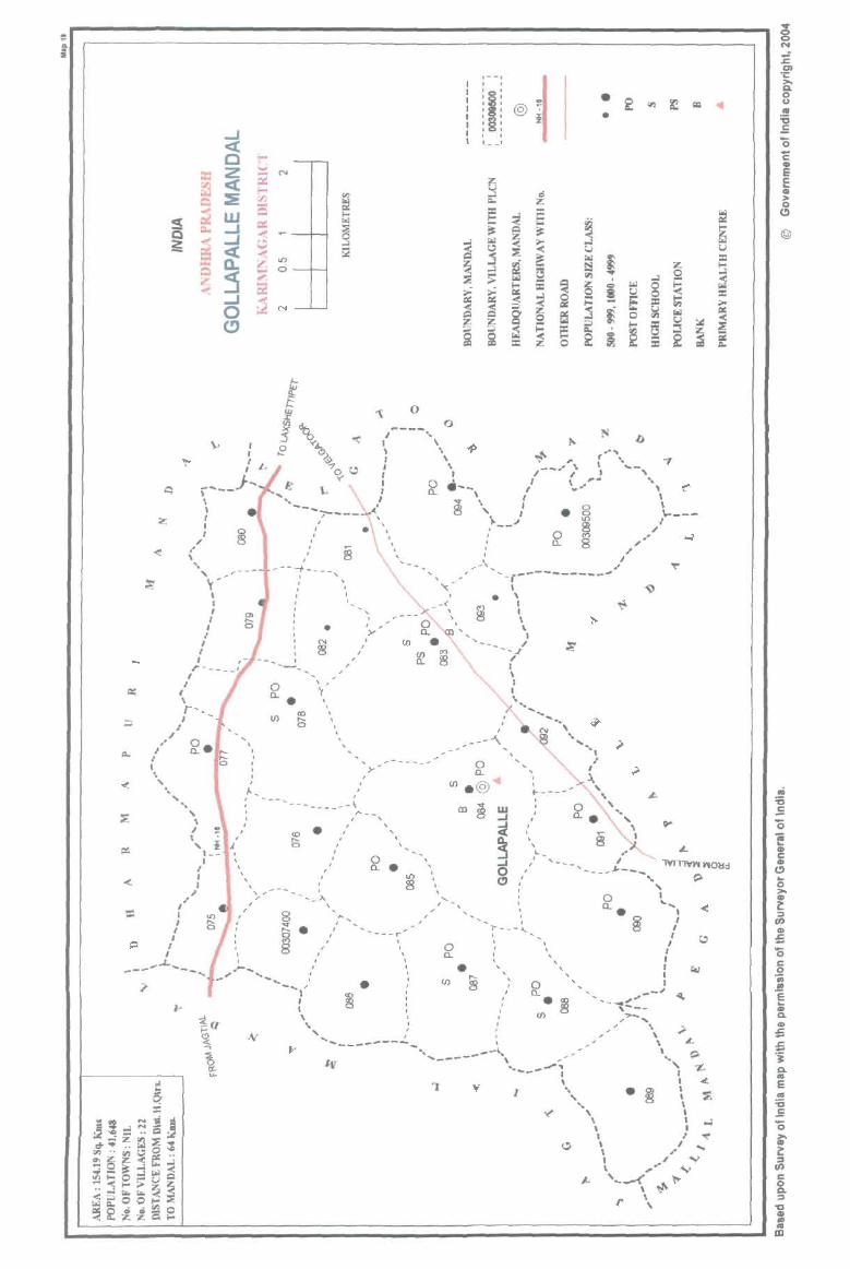
= .. i
lD
c::i-r-
'--I , , :~: lSi :§: , , , , , , l __ 1
• •
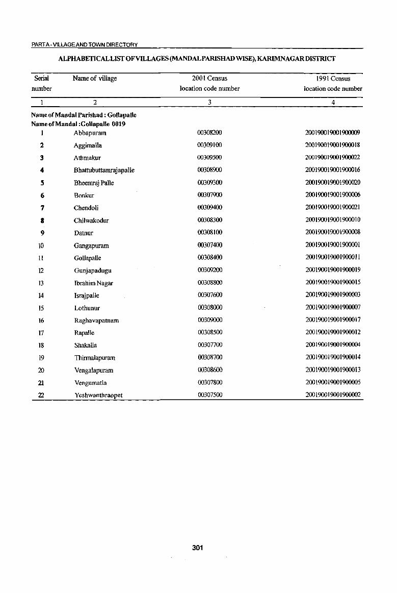
PART A - VILLAGE AND TOWN DIRECTORY
ALPHABETICAL LIST OF VILLAGES (MANDALPARISHADWISE),KARIMNAGARDISTRICf
Serial
number
Name of village
2
Name of Mandai Parishad : Gollapalle Name of Mandai :Gollapalle 0019
I Abbapuram
2 Aggimalla
3 Athmakur
4 Bhattubuttamrajapalle
S Bheemraj Palle
6 Bonkur
7 Chendoli
a Chilwakodur
9 Datnur
10 Gangapuram
II Gollapalle
12 Gunjapadugu
13 Ibrahim Nagar
14 Israjpalle
15 Lothunur
16 Raghavapatnam
17 Rapalle
18 Shakalla
19 Thinnalapuram
20 Vengalapuram
21 Vengumatla
22 Yeshwanthraopet
2001 Census
location code number
3
00308200
00309100
00309500
00308900
00309300
00307900
00309400
00308300
00308100
00307400
00308400
00309200
00308800
00307600
00308000
00309000
00308500
00307700
00308700
00308600
00307800
00307500
301
1991 Census
location code number
4
200 1900 1900 1900009
200 1900 1900 19000 18
200 1900 1900 1900022
200 1900 1900 1900016
200190019001900020
200 1900 1900 1900006
200 1900 1900 I 900021
200 1900 I 900 19000 IO
200 1900 1900 1900008
200 1900 1900 190000 1
200190019001900011
200190019001900019
200 1900 1900 19000 15
200 1900 1900 1900003
200 1900 1900 1900007
200 1900 1900 19000 17
200 1900 1900 19000 12
200 19001900 1900004
200 1900 1900 19000 14
200 1900 1900 19000 13
200 1900 1900 1900005
200 1900 1900 1900002

I .. "8 'Ui' u .. a '"
.., '" 0 c ..
'J;: '=' C) os g j ;;
...l 0
~ :os: !::!.
~ ., C -s 0
II ~ 'J;:
~ os
1 § .. .... ~ 8. '" 0
til " ~
!l !l ·c 0 0
" CI) l- I-
I 2 3 4
Mandai Parishad : Gollapalle (0019)
Gangapwam 420.0 1,035
(00301400)
2 Yeshwanthralrpet
449.0 1,317 (00307500)
3 Israjpalle
462.0 1,427 (00307600)
Shakalla 4 544.0 1,661
(00307700)
Vengurnatla 959.0 2,591
(OO3071l00)
6 Bonkur
465.0 1,154 (00307900)
Lodtuour 7
(00308000) 642.0 I,S74
8 Datnur
611.0 919 (00303100)
DISTRICT CENSUS HANDBOOK: KARIM NAGAR
Census ofIndia 2001 ~ Amenities and
Amenities available (if not available within the village, a dash (-) is shown in the column and next to it in brackets the distance in broad ranges viz. < 5 klns., 5-10 klns. and 10+ klns of the
--;;- nearest Dlace where the facility is available is Riven) " <Il
'" -c ~.g " fa u .~ u "
., oj ;; = :>- f! ~t! u 0 0 'p .2 .! f ~ -a E! <f!8. :; <Il " " ~~~ Q. <> -c 11 9 'i l'l "0 " " ~ -c 8 _OI~ @,..a a ' 'J;: ::I .Q 'c '" !I: <Il -0 c:: ..
<J ~ S '" ~ 1a g 0g d 0 " ..c: cIIJ:S:a o '" ..c 1<1 Q, - '" .~ 0 .... 01 ~ <C ]~
01>::0 os . ., 0 g !I: °2 § « .~ s II ~
co " .::> ~ ~ § '" .::: = 11 " - ... '" ~ ~j
::I " .. 8 § f e " 'f3 1 'i t ~C1;.a .. ;E ~ 8 <> .9 S 8~ ~UCll Z <~
5 6 7 8 9 10 11 12 13
RMP(2) ACS
265 P MC(IO+) H(5-IO)
HP W RC PO«S) CM(5-1O) NCS(IO+) CV(5-10) BS RS(lO+)
MCW(IO+) SP(IO+) NW(IO+) PHC(S-IO)
PH(lO+) CP(IO+) OCS(IO+) ST(lO+)
RMP(2) ACS
325 P MqlO+) H(5-10) HPWTK
PO«5) CM(5-1O) NCS(IO+) CV(5-10) BS RS(IO+)
MCW(5-IO) RC PH(IO+) CP(5-IO) OCS(IO+)
SP(IO+) NW(lO+) PHC(S-IO) ST(IO+)
PAC RMP(3)
NCS(2) 355 M(5-1O)
H(5-10) THP W R PO(~ 5) CM(5-1O) ACS«5) CV(S-IO) BS RS{IO+)
qIO+) MCW(IO+)
C PH(IO+) CP« 5) OCS(IO+) SP(IO+) NW(IO+)
PHQ5-10) ST{IO+)
PHS ACS CV
H(5-10) HPWTK PO BS RS(lO+) 391 P M C(iO+) CM(S-IO) NCS(3) SP(IO+)
MCW(IO+) RC PH{S-IO) CP(IO+) OCS(IO+) ST(IO+)
NW(IO+) PHqS-10)
PHS RMP(4)
603PMSAC H(S-IO) HPWTK PO CM(5-10)
ACSNCS CV(5-1O) BS RS(iO+) C(10+) MCW(IO+) RC PH(S-lO)
CP(lo+) OCS(lO+) SP(IO+) NW(lO+)
PHC(S-IO) ST(IO+)
PAC RMP(2)
ACS 277 M(S-IO)
H(5-1O) HPWTK PO« 5) CM(S-IO) NCS(IO+)
CV(S-IO) BSRS(IO+)
C(IO+) MCW(IO+) RC
PH(5-IO) CP(lO+) OCS(IO+) Sp(IO+) NW(IO+)
PHq5-[O) ST(IO+)
PAC RMP(3)
NCS(2) H{S-IO) THPW CV(5-1O) BSRS(IO+)
419 M(S-IO) MCW(IO+) TKRC
PO« 5) CM(S-IO) ACS(5-10) SP{IO+) NW(IO+)
C(lO+) PHC(IO+)
PH(IO+) CP(S-W) OCS(IO+) ST(IO+)
PAC RMP(3)
237 M« 5) H(S·IO) HPWTK
PO« 5) CM(5-IO) ACS{< 5) CV{S-IO) BSRS(IO+)
MCW(IO+) RC NCS(IO+) SP(IO+) NW(IO+) C(lO+)
PHC(S-IO) PH(S-lO) Cp{IO+)
OCS(\O+) ST(IO+)
302

VILLAGE DIRECTORY
Village Directory Land Use (As on 1999)
Land use (i.e. area under different types of land use in hectare)·'
j c 0 . ., to
.!3 C OJ) > '-' c . ., 8 ] '<3 "3
'" ::l u
i I "is ~ c U <£ t !;] c ~ ._ '"
:a ~ ~QJ " .!! OJ) '" > :0 ~ ~ ~ - 0 'S ~]
0 ::J tb .. .0
<II =a .!! ... 9 ~ >. ~"" 'S
u g; "'0 > .0
.<:I 9 8- 8.2 e ~ ..!l Iii .. §
~ ill .. e ~ "'0 -g l;! '0 ..... -;;; 0. u "" c 0 c
e u t <II '': ~ t; 1;; 'E 2'5 .. .. ~ it it
~ ~ e co '" ~ ~ E - ::l I ·c &. Z & ] ::> .. u
U OJ) en
14 15 16 17 18 19 20 21 22 23 2 1
GC(42.0) PC(20.1)
WE(72.0) PR Jagtial (18) EA 11«30.0) 56.4 37.4 35.3 Gangapuram
R(20.1) 0(106.7) T(290.9)
GC(16.0) WE(12.0)
PR Jagtial (18) EA N TK(82.0)
81.5 51.3 71.8 Yeshwantbraopet 2 R(1.6) 0(132.8) T(244.4)
GC(116.0)
WE(36.0) PR Jagtial (19) EA N R(13.2) 132.1 13.3 103.3 Israjpalle 3
0(48.0) T(213.2)
GC(31.2)
WE(ILl)
PR Jagtial (22) EA N TK(80.0)
13Ll 116.9 93.8 Shakalla R(3.3) 0(76.7) T(202.3)
GC(83.0) WE(21.6)
PR JagtiaI (22) EA N TK(42.8)
507.6 107.2 85.3 Vengumatla 5 R(S.I) 0(103.3)
T(258.8)
GC(37.1) WE(48.0)
PR Jagtial (27) EA N R(24 I) 217.5 25.9 39.0 Bonkur 6 0(73.6) T(182.7)
GC(41.6) WE(76.1)
PR Jagtial (28) EA TK(16.0) N
R(36.1)
I 219.7 114.7 7U Lothunur '1
0(66.3) T(236.1)
GC(56.0) WE(41.6)
PR Jagtial (24) EA N TK(14.0) R(9.2)
188.4 46.9 120.0 Datnur I
0(1260) T(246.8)
303
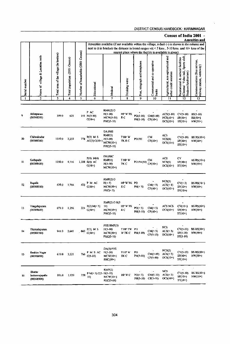
,-.
1 i -;;-::I
g ..c 3 ,g 'g t) g
i 0 ..J c
C-0'1:1 .. .. 5 01) -5 ... .. 'l:! .8 ~
... 1 0
~ ~ ... c= 0
til u
l ] 'c J ., !-< {Z
~
I 2 3 4
9 Abbapuram
399.0 625 (00308200)
Cbilwalcodur 10 1319,0 3,253
(00308300)
Gollapalle II 1350.0 4,716
(00308400)
Rapalle 12
(00308500) 639.0 1,766
13 Vengalapurmn
671.0 1,356 (00J086oo)
Thinnalapuram 14
(ooJ087oo) 941.0 2,641
Ibrahim Nagar 15
(00308800) 619.0 3,221
Bhattu-
16 buuamrajapaIle 881.0 1,020
(00308900)
DISTRICT CENSUS HANDBOOK: KARIM NAGAR
Census of India 2001 -Amenities and
Amenities available (if not available within the village, a dash (-) is shown in the oolumn and next to it in brackets the distance in broad ranges viz. < 5 kms., 5-10 kms. and 10+ kms of the
;- nearest place where the facility is available is given) 5 .", ~~ U [ij
'.c u 8 8 .. !;! i =-5t! c= 'f ---0 '.c
C- ..c
J <!! 8.. ~ i;-]' {j Q .. <I)
'" ~ B 's, '" _a"":'-' -0 ;::l ..
1 .." CP4~ - .. ~ e'l;j [ij
0 "..c 'J:: '" il: "Q '" ., <> ~ 0 o ._
c= • 0 t; ..c Iii c= g <I!I:'5!~ o c=
..c 'I;j ~ l~ 'J:) 0 ... .. il: .. .. >= .. '::I
0 § "e § -<: .~ ~ .8
01) ., '.c ';a § '::1 til
~ 11 .. _ e oj '-' E! '"
::I Q oj e ~ ~ § <> '6 .~ U ~ 0:.a '" <;;;f 81 J!D£l z il'l ~ 8 ~ <~ 8'2
5 6 7 8 9 10 11 12 13
PAC RMP(2) 0
145 M(S-IO) H(5-10) HPWTK
PO(S-IO) CM(S-IO) ACS(S·IO) CV(S·IO) BS(S-IO)
C(IO+) MeW(S-IO) Rc
PH(S-IO) CP(IO+) NCS(IQ+) SP(IQ+) RS(IQ+)
PHC(5-10) OCS(IO+) ST(IQ+) NW(IO+)
DAPHS
P(3) M S RMP(3) THPW CM ACS
CV(S-IO) as RS(IO+) PO PH NCS(4) 718 AC(3) C{lO+) H(S-IO) TKRC CP(IO+) SP(IO+) NW(IO+)
MCW(IO+) OCS(IO+) PHC(5-IO)
ST(IQ+)
P(4) M(4) DHPHC
ACS CV RMP(4) THPW CM BS RS(IO+)
1,108 S(4) AC PO PH(SO) CP(IO+) NCS(S) SP(IO+) C(1o+)
H(S-IO) TKC OCS(IO+) ST(10+)
NW(lO+)
MCW(IO+)
RMP(2) 0 NCS(3)
PM AC H« 5) HPWTK PO CV«S) BS RS(IO+) 422 C(lO+) MCW(IO+) RC PH« 5)
CM«5) ACS«5) SP{IO+) NW{IO+)
PHC« 5) CP(lO+) OCS(IO+)
ST(10+)
RMP(2)OH(5
324 P(2) M« S) 10) HPWTK PO« 5) CM« 5)
ACS NCS CV(IO+) BS RS(IO+}
C{IO+) MCW(IO+) RC PH(5-1O) CP(IO+)
OCS(IO+) $P(IO+) NW(lO+)
PHC{S-IO) ST(IO+)
PHSRMP(3) NCS
660 P(3) M S H(S·IO) THPTW PO CV(5-10) BS RS(IO+) . C(lO+) MCW(JO+) WTKC PH(5-1O)
CM«5) ACS«5) SP(S-IO) NW(IO+)
PHC(S-IO) CP(S-IO) OCS(IO+)
ST(S-IO)
DA(S) PHS NCS(2)
766 PM S AC H(5-IO) THPW PO CV(5-IO) BS RS(lo+)
C{S-IO) MCW(lO+) TKC PH(S-IO) CM(5-10) ACS«S)
SP(10+) NW(1O+)
PHC(lO+) CP(S.IO) OCS(IO+)
ST(IO+)
RMP(2) NCS
258 P M« 5)C(5- H(5-10) CV(5-10) BS RS(IO-l-) HPWC PO« 5} CM(5-10) ACS«5)
SP(IO+) NW(IO+) 10) MCW(IO+) PH(5-IO) CP(S·IO) OCS(IO+)
PHC(S-IO) ST(IO+)
304
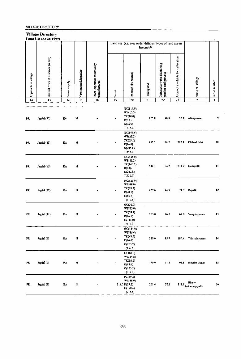
VILLAGE DIRECTORY
ViIIS2e Directory Land Use (As on 1999)
Land use (i.e. area under different types of land use in hectare)"
...... c ] 0 .::>
OJ
~ ~ bO ;>
'" .::>
8 'g '6 "3 ::s <.J
~ .. E 'Q .E ., .§ e .,. .S 'i6
00 '6 0 ~ ~ .. " .!!! OIl u
~ ~ ~ g, 'S old os
~"d 0
~ ~ '" ~ .!!! ... B ~ 0- 8.~
;>, -0
1:1:..., i:i 'S .8
B 0. ... e '" .2 ~ ~ .c: " ~ ~ ... :;;! 1il '" .13 <!!
'"0
l~ <; 0- .. 00 0 c e j
... '" to OJ 'e co ., .. _ ::s
'" 01 Co ~ ~
~ ~ ~ 00
~ - " ~ ~ '1:: ~ & ~ &' :5 ::s .. .,
Uw en
14 15 16 17 18 19 20 21 22 23 2 I
GC(1I6.0)
WE(IO.O)
PR Jagtial (30) EA N TK(W.O)
125.8 40.0 55.2 Abbapuram 9 R(6.0)
0(36.0)
T(l78.0)
GC(14S.6)
WE(27.2)
PR Jagtial (25) EA N TK(63.2)
455.2 96.7 222.1 Chilwakodur 10 R(24.0)
0(285.0) T(54S.0)
GC(128.0)
WE(11.2)
PR Jagrial (16) EA N TK(140.0)
504.1 104.2 211.1 Gollapalle II &(S.O)
0(242.8)
T(530.0)
GC(126.0) WE(48.0)
PR Jagtial (17) EA N TK(38.0)
229.6 14.9 74.9 Rapalle 12 R(20.1)
0(87.5)
T(319.6)
GC(20.0)
WE(6S.0)
PR Jagtial (II) EA N TK(68.0)
203.0 86.3 61.0 Vengalapurarn 13 R(16.0)
0(144.0)
T(313.0)
GC(124.0)
WE(46.4)
PR Jagtial (9) EA N TK(48.0)
219.0 95.9 186.4 Thinnalapuram 14 R(16.0)
0(205.2)
T(439.6)
GC(KO.O)
WE(54.8)
PR Jagtial (9) EA N TK(36.0)
170.0 41.3 94.8 Ibrahim Nagar 15 R(IS.O)
0(123.2)
T(312.0)
PC(29.2)
WE(4S.0) Bhattu-
PR Jagtial (9) EA N 214.5 R(29.2) 261.4 78.1 112.1 buttamrajapaIle 16 0(108.4)
T(214.8)
305

jl ~ c -;; ·5 <Il
1
17
18
19
20
21
22
~ g 'iii () 0 ..J ~ u
"" co
~ '-0 ... ~ 2
Raghavapatnam (00309000)
AggimaUa (00309100)
Gunjapadugu (00309200)
Bheenuaj Palle (00309300)
Chendoli
(00309400)
Athmakur (00309500)
MaodalParishad Total
i il ~ .... g il u ~ 0 ~ 0
~ .s: ., g of! ."lil .... 0 "3 co g.
~ 8. ~ s
0 t-< t-<
3 4
1049.0 3,146
407.0 1,861
26M 1,188
221.0 648
856.0 1,778
1248.0 2,745
15418.0 41648
DISTRICT CENSUS HANDBOOK: KARIMNAGAR
Census ofIndia 2001 -Amenities and
Amenities available (if not available within the village, a dash (.) is shown in the column and next to it in brackets the distance in broad ranges viz. < 5 kms., 5-10 lans. and 10+ lans of the
-<ii' nearest pJace where the facilitv is available is given)
~ u -0 0 c. ~ ii <II g
~ .so .... -;; ~ 0 c t 0 -;; "" .~
~ .D .. u
~ <> :a ;:l
~ E iil Z 5 6 7 8
PHSRMP(6)
66 P(2) M H« S) ? AC(3)C(10+) MCW(IO+)
THPW TKC
PHC«5)
DA(5)RMP
431 P M« 5) H« S) HPWTK C(1O+) MCW(IO+) RC
PHC«S)
PAC DRMP
266 M« 5) H«5) HPWTK
C(IO+) MCW(IO+) RC PH.C«S)
RMP(2) 0
158 P M« 5) H(IO+) HPWTK C(IO+) MCW(IO+) C
PHC(IO+)
PHS RMP(3) P(2) M H(5-10) HPWTK
459 AC(2) C(IO+) MCW(IO+) RC PHC(5-10)
RMP(5) 0
682 P(3) M H(IO+) HPWTK AC(2) C(IO+) MCW(IO+) C
PHC(IO+)
T(1) J) DA(H) W(2l)
~(3~\ M(1") DH :""CW TK(19)
9996 S(8) 'AC(20) ~~(::S(7) ~22)
O(S) R(1S)
C(22)
306
" ~ c 0 .J:
.so e g. u &. 1i 0
0 "tl t> fa "d
-a. 1il G. -;;
"E i .. ~ <II tf 8~ r£
9 10
PO PH(18) eM« 5)
PO PH(S-IO)
PO«~)
PH«S)
PO« 5) PH(S·IO)
PO PH(5-1O)
PO PH(IO+)
?O(H) PH(69)
CP(IO+)
CM«5) CP(IO+)
CM« 5) CP(IO+)
CM(5-10)
CP«5)
CM(5-1O) CP(IO+)
CM(5-IO) CP(IO+)
CM(2)
"'" lij
i .~ :l Z o£ o .-':~ ]:g "3 t;
'6, t _<" ~
11
ACS NeS(3) OCS(IO+)
NCS(2) ACS«5) OCS(IO+)
NCS ACS(<;5) OCS(IO+)
NCS ACS« 5) OCS(IO+)
ACS NCS(3) OCS(IO+)
NCS ACS« S) OCS(IO+)
ACS(lO) NCS(l6)
fIJ .go. ... -.~ u
'§~ .:l 8. ]~~ - .. ~ 6 ~ -c ~~~ l>~ .~ til l ~ ~ :a ~a5l
12
ev« 5) SP(IO+) ST(IO+)
CV« 5) SP(IO+) ST(IO+)
CV«5) SP(IO+) ST(IO+)
CV(5-10) SP(IO+) ST(lO+)
CV{S-IO) SP(IO+) ST(IO+)
CV(S-IO) SP(IO+) ST(IO+)
eV(2)
Ii ·c~ ., ~ :: ~ " " eli OJ ~ c _ o c .~ 0 ... ~ .~ t!
~ ~ ~~.
13
55 R.S(10+} NW(IO+)
BS RS(IO+) NW(JO+)
BS RS(IO+) NW(lO+)
BSRS(IO+) NW(IO+)
BSRS(IO+) NW(IO+)
BS RS(lO+) NW(IO+)
BS(21)
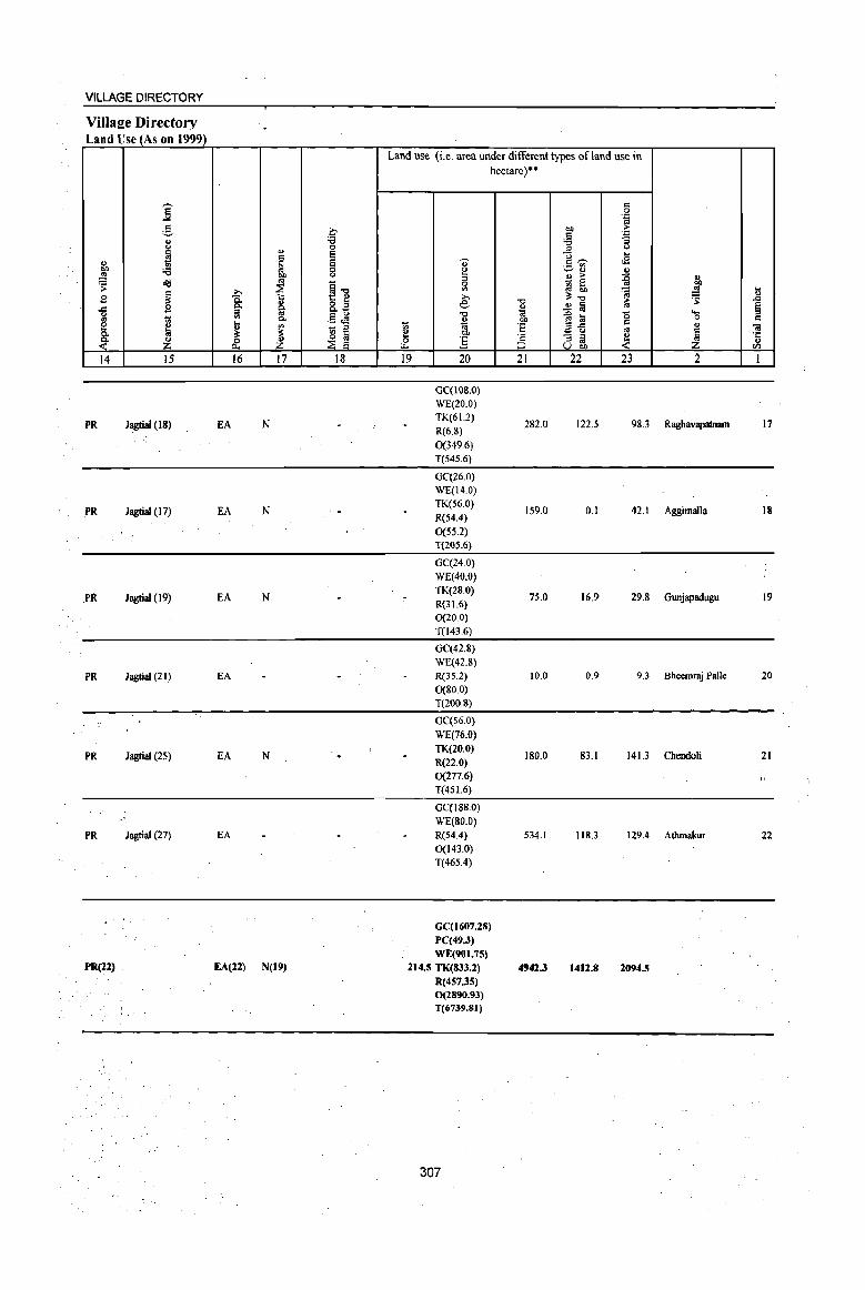
VILLAGE DIRECTORY
Village Directory Land Use (As on 19991
]' 5 a " '6 t)
d> 0
B = e ~ .~ e '" '6 0 ~ "" t)
~ ~ " ~-g .::- i .s ~ Co o Z -= c.
~ ::I Co t)
t; '" "'- .5.:l .... e ~ ~ '" _ ::s
0- £ ~ ~ -~ ~ cf 14 IS 16 l7 18
PR Jagtial (18) EA N
.PR Jagtial (17) EA N
.PR Jagtial (19) EA N
PR Jagtial (21) EA
PR Jagtial (25) EA N
PR Jagtial (27) EA
PR(22) EA(22) N(19)
Land use (i.e. area under different types of land use in hectare)·'
1;;
~ 0
"--19
" <! ::I 0
'" >, e "Cl
~ 01)
:5 20
GC(lQ8.0) WE(20.0) TK(61.2) R(6.8)
0(349.6) T(545.6)
GC(26.0) WE(14.0) TK(56.0) R(54.4)
0(55.2) T(20S.6)
GC(24.0)
WE(40.0) TK(28.0) R(31.6) 0(20.0) T(143.6)
GC(42.8) WE(42.8) R(3S.2) 0(80.0) T(200.S)
GC(56.0}
WE(76.0) TK(20.0) R(22.0) 0(277.6) T(45 1.6)
GCCI88.0) WE(SO.O) R(54.4) 0(143.0) T(465.4)
GCCI607.28) PC(49.J)
WE(901.75) 214.5 TK(833.2)
R(4S7.3S) 0(2890.93) T(6739.81)
307
"Cl
" 'a! 01)
'5 ·s ~
21
282.0
159.0
75.0
10.0
180.0
534.1
4942.3
= 0
'ia 01) .:: = "a '6
.E! <)
<) ... =~ .s ~~ OJ
OJ ;. :g ~ 0 :t!' ~ ..!l § ~
~ til 0 = efj " ;3 m, ~ 22 23
122.5 98.3
0.1 42.1
16.9 29.S
0.9 9.3
83.1 141.3
118.3 129.4
1412.8 2094.5
" : .... ~ " ~ '-0 = d> .. £ ·c
" CIl
2 1
Raghavapatnam 17
Aggimalla 18
Gunjapadugu 19
Bheemraj Patle 20
Chendoli 21
..
Athmakur 22
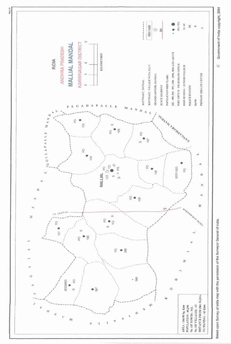
a .. ... ;
N t-
~ (.J
ii: :x: t-(I)
Z en UJ
25 C c:( ~ S :t a::
<:[ 0.. 0
<I. ~ ~ ~ Z ::J :J: :;: Q <I. ~ ~ ~ :Ii
..1.
..1. .. " Q •• '"
" I ----"'( '---- ...... _---- -
I I I I \
.... -.... ", I , ,
\ ~r
I I I
1',p..1.- t T o Jp..G _____ "\
_.;'" , \ ,----- " " " ~ .-I I J I J .-
"-----
•
-_ , '.
I I
I
"
, .I
I I
, I ,
,
II)
",
" "
..... ,
I , "
I
t---, " , -,
-- ........
, , - ... _<--
, r __ _
, , , , , , \'
- - -._ ..... ..:"'1 ....
.~
, , , ,
'1.
"
II)
'. , , \ , , ,
I ,
"
"
r .... ----,
"--, I, , I' , I ,§, • :_!@ • I_I
I '§' I' , , , I I
~ z ~ >--
~ ~ g
, , 1 __ --
~
~ ::c .... ~ ... .., « o..l o..l ;; :.: a:: « Q
~ ~
.' " i I I I
--t , , I I I I I I I \
-''I. , .. \
o..l
2S Z
~ ~ ... ~ ;§
~ f;!
\ \ \ I I I ,
I
-I .. , .. r ..... I
.. I .. . _-'"
,
~ ... >- £:l
~ '" ;.: 0 !:2 ;:: ::c ~ ... ....
« ~ I;j
li CI "C
~ 0 0 • !;
~ IX! U
!:: «I
-~ '" • ~ -0
C ~ E ~
... (!)
> g « 0
@ ... ~
Dl « 8 .., ~ t ~
~ 0
! ::c 0
"" u ;.: ~ IX .. 0 u ~ Z ::c "" .... o..l c; ~ o..l
... 2 :i
",- ... ~ ~ ...
:= '" § « ~ U Ii.;
~ ~ ~ 1'01
~ ~
~ ~ .... ... is ~ z
f ~ ca ~ E2
o

PART A - VILLAGE AND TOWN DIRECTORY
ALPHABETICAL LIST OF VILLAGES (MANDALPARISHAD WISE), KARlMNAGAR DISTRICT
Serial number
Name of village
2
Name of Mandai Parishad : Mallial Name of Mandai :Mallial 0020
1 Balwanthapur
2 Gorregundam
3 Maddutla
4 Mallial
S Manala
6 Muthyampeta
7 MyadampaUe
8 Nookapalle
9 Obulapur
10 Potharam
11 Rajaram
12 Rampur
13 Sarvapur
14 Thakkallapalle
15 Thatipalle
2001 Census location code number
3
00311000
00309800
00309900
00310300
00310400
00310900
00310500
00310200
00309700
00310000
00310100
00309600
00310800
00310600
00310700
309
1991 Census
location code number
4
2002800280028000 15
200280028002800003
200280028002800004
200280028002800008
200280028002800009
2002800280028000 14
200280028002800010
200280028002800007
200280028002800002
200280028002800005
200280028002800006
20028002800280000 1
2002800280028000 13
2002800280028000 II
200280028002800012
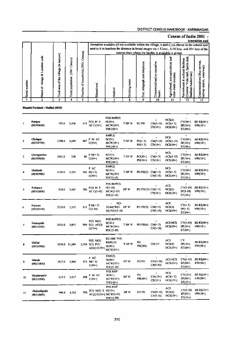
,...., " u ~ "8 ,.....,
; u Jl g ~ g 'J:! U g .. "" 0
....l ..! 0
o<l ~ t::!-
~ ..; = 0
.8 .. ... 'J:'
~ to 0 "3 § ~ c. '5 0 = C.
Ol u
~ ~ '3 '5 ~ en I-'
1 2 3 4
Maudal Parisbad : MaDial (0020)
2
3
4
5
6
7
8
9
10
II
Rampur (00309600)
Obulapur (00309700)
Gorregundam (00309800)
Madduda (00309900)
Potharam (003100Q0)
Rajaram (00310100)
Noolcapalle (00310200)
Mallia! (00310300)
Manala (00310400)
Myadampalle (00310500)
Thakkallapalle
(00310600)
709.0 2,198
1248.0 1,669
1061.0 338
1150.0 2,333
818.0 3,063
2129.0 1,51S
1432.0 3,953
1954.0 11,684
1017.0 1,860
627.0 2,037
996.0 4,262
DISTRICT CENSUS HANDBOOK: KARIMNAGAR
Census of India 200t -Amenities and
Amenities available (if not available within the village, a dash (-) is shown in the column and
next to it in brackets the distance in broad ranges viz. < 5 kms., 5-10 kms. and 10+ kms of the ]' nearest place where the facility is available is given) d ., u <5 0 t::!-Ul
~ il '" " Q
..c .... OJ Q c I- 0 01 'p
J:) ~
§ u
j Z 5 6
P{2) M S 514 AC C(10+)
PM AC 407 C(IO+)
86 PM«5) C(lO+)
PAC 566 M«5)
C(IO+)
P(2) M S 786 AC C(S-IO)
O! t.> '0 ~ 7
PHSRMP(3) H{JO+) MCW(IO+) PHC(IO+)
RMP(3) H(IO+) MCW(IO+) PHC(IO+)
H(IO+) MCW(IO+) PHC(IO+)
RMP(2) H(lO+) MCW(IO+) PHC(5-10)
PHS RMP(3) H(S-IO) MCW(S-IO) PHC(5-10)
H(S-
., '" 0
..c c.
i "'0
~ l-
I ~ "" '" c 1]
:.::2
£§ ~ 8 9
THPW POPH
THP W PO« S)
PH« 5)
"0 ~~ i 'J:' ., Ii " ] 'ij~ > .~ '"' 'J:' e ..e8, "3 u i;> u
]~,....., :: ~ Q. " ~ 't1. .,. " .. ~ .~ _O!~ e ... u "..c .c .,. ;t
"0 g g '8 u ~ 0 '" . o<l:-g;ij .g g
l~ 01 1>~ Ip:: 'g '§ ! ,,8 (;j ~ - .... e Ul ::> " ~ e ~ ~ 31 '~ t !:! '" 'i3
~D~ 8] <~ 10 11 12 13
NCS(2) CV(lO+) BS RS(IO+) CM(5-10) ACS« 5) SP(IO+) NW(IO+) CP(lo+) OCS(IO+) ST(lo+)
NCS CM(S-IO) ACS(5-10) CV(IO+) BS RS(IO+) CP(IO+) OCS(IO+) SP(IO+) NW(IO+)
ST(IO+)
NCS THPW PO(JO+) CM«5)
PH(IO+) CP(IO+)
ACS(5-10) CV(IO+) BS RS(JO+) OCS(lO+) SP(IO+) NW(IO+)
ST(lo+)
THPW
HPW
NCS POPH(2) CM«5) ACS«5) CV(IO+) BSRS(IO+)
CP(S-IO) OCS(IO+) SP(IO+) NW(JO+)
PO PH(12) CM« 5) CP(IO+)
ST(IO+)
ACS NCS(2) CV(S-IO) BS RS(10+)
OCS(IO+) SP(S-IO) NW(IO+) ST(IO+)
ACS 411 PM«5)
C(5-10) 10) MCW(S- HP W 10) PHC(S-IO)
PO PH(S) CM« 5) NCS(3) CV« 5) BS RS(IO+) SP« 5) NW(IO+)
CP(S-IO) OCS(IO+) ST(lO+)
P(2) M(2) 980 S(2) AC(2)
C(IO+)
PHSRMP(3) H(IO+) MCW(IO+) PHC(S-IO)
DU PHCPHS peg) M(3) RMP(IO)
2,569 S(2) PUC H(IO+)
AC(2) C(lO+) MCW(IO+)
PAC 473 M« 5)
C(lO+)
PM AC 488 C{IO+)
RMP(2) H(IO+) MCW(IO+) PHC(S-IO)
PHSRMP H(IO+) MCW(IO+) PHC(IO+)
PHSRMP P(3) M(2) S H(lO+)
998 AC(2)C(10+) MCW(S-IO)
PHC(S-IO)
310
THPW
THPW
HPW
HPW
HPW
POPH(6) CM«S) ACSNCS CV(S-IO) BSRS(IO+) CP(5-10) OCS(IO+) SP(IO+) NW(IO+)
PO PH(200)
PO PH
ST(IO+)
ACS CV CMCP NCS(9) SP(IO+)
OCS(IO+) ST(lO+)
BS RS(IO+) NW(IO+)
ACS NCS CV(S-IO) BS RS(IO+) CM(5-10) OCS(IO+) SP(lO+) NW(IO+) CP(5-10) ST(lO+)
NCS PO CM(lO+) ACS« 5) CV(IO+) BS RS(lO+) PH(IO+) CP(IO) OCS(IO+) SP(lO+) NW(IO+)
+ ST(lO+)
PO PH ACS CV(S 10) BS RS(IO+)
CM(S-IO) NCS(2) -CP(S-IO) OCS(IO+) SP(lO+) NW(IO+)
ST(IO+)
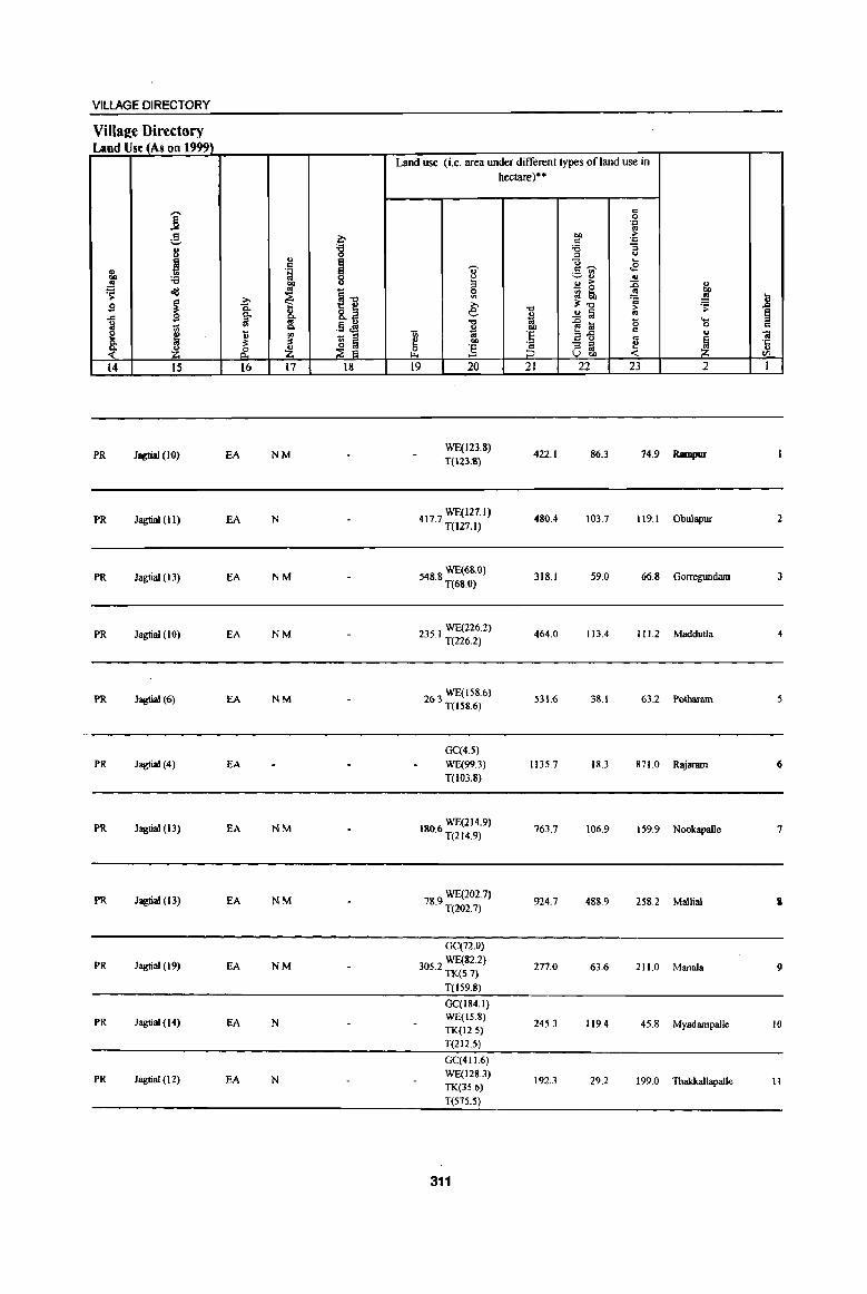
VILLAGE DIRECTORY
Villa2e Directory Land Use (As on 1999)
Land use (i.e. area under different types of land use in hectare)··
j '" 0 .~ .,
~ ~ 01) ... ~
.~ ., '8 :; " '" u
~ '" ~ "i3 .... = ~ 11 .t:j 0- o:~ ._ til
'9 0 u -- ., .. .!!
~ u 3 .. ... :E
~ oll _ 0
~ ~] 0 ~ iii.
., .8 z. '" 'a
Sl ~ g; » "d ~-c ;,- .;; .c &. 8.~ e i .!! Iii .,
~ iil .. -c ..0 a a ..... g
! Q, .13 <!!! ... 0 '" E ~ til 1;; OJ 'f;; e!,c c .. 01 !l: ~ '" ., 01) a u oS
~ ·c Q,
~J .. :3 - '" ~ ~ z; &. Z &. :§ '" '" u
VOl) til
14 15 16 17 18 19 20 21 22 23 2 I
PR Jagtial (10) EA NM WE(123.8)
422.1 86.3 74.9 Rampur T(123.1I)
PR Jagtial (II) EA N 4177 WE(127.l) · T(l27.I}
480.4 103.7 119.1 Obulapur 2
PR Jagtial (13) EA NM WE(68.0)
548.8 T(68.0) 318.1 59.0 66.8 Gorregundam 3
PR Jagtial (10) EA NM WE(226.2)
235. I T(226.2) 464.0 IJ3,4 I I 1.2 Maddutla 4
PR Jagtial (6) EA NM WE(158.6)
26.3 T(I'8.6) 531.6 38.1 63.2 Potbaram
GC(4.') PR Jagtial (4) EA WE(99.3) 113'.7 18.3 871.0 Rajaram 6
T(I03.8}
PR Jagtial (13) EA NM 1806 WE(214.9) · T(214.9)
763.7 106.9 1,9.9 Nookapalle 7
PR Jagtia! (13) EA NM 78 9 WE(ZOZ.7) · T(202.7)
924.7 488.9 258.2 Mallia! I
GC(72.0}
PR Jagtial (19) EA NM 3052 WE(82.2} · TK(5.7)
277.0 63.6 211.0 ManaJa 9
T(159.8)
GC(184.1}
PR Jagtial (14) EA N WE(15.8) TK(12.5)
245.3 1I9A 45.8 MyadampaJlc 10
T(212.')
GC(41L6)
PR Jagtial (12) EA N WE(128.3) TK(35.6)
192.3 29.2 199.0 Thakkallapalle II
T(,7'.5)
311

... .8 § c: 01 '5 '" 1
12
13
14
15
" -c 0 (.l
c: 0 .~
.... 0
....:I <l1! ...
I>Il .. ~ ..... 0 u
~ 2
Thatipalle
(00310700)
Sarvapur (00310800)
Muthyampeta (00310900)
Balwanthapur (00311000)
Mandai Parisbad Total
I -u;-" :0 -= '" ~ .5 "" u ~ (5
.!! <:>
's: c u g
oS ':: .... .. 0
1 .. ~ Co
s s ~ ~ 3 4
1085.0 3,003
653,0 1,437
%6.0 3,895
842.0 1,997
11.687.0 4S244
DISTRICT CENSUS HANDBOOK: KARIMNAGAR
Census of India 2001 -Amenities and
Amenities available (if not available within the village, a dash (-) is shown in the column and next to it in brackets the distance in broad ranges viz. < 5 kms., 5-10 kms. and 10+ kms of the
-u;- nearest vlace where the facilitv is available is 2iven) :0 III
~ u
8 t!--e '0
1 0 .c ... O! 0 c t 0
.~ O! .l:l .. .... § u '6 := z ~ ~ 5 6 7
PHS RMP(2) 686 P(2) M(2) S H(IO+)
C(IO+) MCW(lO+)
PHC«S)
RMP(2)
310 P(2) M« 5) H(IO+) C(IO+) MCW(IO+)
PHC«5)
PHS RMP(4)
943 P(3) M AC H(IO+) C(lO+) MCW(lO+)
PHC«5)
443 P(2) M AC H(IO+) C(IO+) MCW(IO+)
PHC(5-IO)
P(ll) M(IS) DU PHC 10660 S(8) PUC PHS(8)
AC(14) RMP(36)
312
... ~
~ co
~ 8
THPW
THPW
THPW
THPW
T(IO) W(IS) HP(IS)
., u c ... 0 '~ .c Co
..!:l 9-~ -c 0
lil ....
-c lil .c
Co
~ 01 '2 ..!!
~ ... 8 <II
tf ~j ~ 9 10
POPH(7) CM«5) CP«S)
PO PH CM«5) CP«5)
PO PH(45) CM« 5) CP« 5)
POPH(3) CM(5-IO) CP(S-IO)
P0(13) eM CP PH(284)
-c lil
~ a 'a ., ~ -ti o ._ c: g . '" ]~ "3 ts
-~~ 11
NCS(2) ACS«S) OCS(IO+)
NCS ACS« 5) OCS(10+)
NCS(3) ACS«5) OCS(lO+)
NeS ACS(5-IO) OCS(IO+)
ACS(6) NCS(31)
~1 "'-':: u
~t! <f!&, ]:;,_ _'OI§ :0.<:1 .c CJ g g cQ!:g'6 01>:0
.g ~ i .. 8 !! "'6 u .9 S ~U<n
12
CV« 5) SP(IO+) ST(IO+)
CV«5) Sp(IO+) ST(IO+)
CV« 5) SP(IO+) ST(IO+)
CV(S-IO) SP(IO+) ST(IO+)
CV
:1" .~ ~ ;g ~ eo; .. iI=
.g § :1 '.g
.~ ~
11 13
BS RS(IO+) NW(IO+)
BSRS(IO+) NW(IO+)
BSRS(IO+) NW(IO+)
BS RS(IO+) NW(IO+)
8S(IS)

VILLAGE DIRECTORY
Villaee Directory Land Use (As on 1999)
,-..
] g
i " ~ :a ~ cl1l E ~ 11 B ~ tl
" ... rs: ~ < 14 15
PR Jagtial (16)
PR Jagtial (17)
PR Jagtial (14)
PR Jagtial (IS)
PR(15)
2;-
rs: ~ il ~ ~
16
EA
EA
EA
EA
EA(15)
., .. .~ .., ~ ~ Q,
'" ~ ~ 17
NM
N
NM
N
N(14) M(9)
~ 'g e e 0 y
~"O 1:: ~
8.£ .5..s tl " ~ a e
18
Land use (i.e. area under different types of land use in
~ ~ " Sl
e "0
" 1;; 0; ~ btl 0 ] \oW
19 20
GC(9.7) WE(167.5) T(177.3)
WE(91.9) T(91.9)
3182 WE(17S.9) . T(178.9)
WE(106.0) T(106.0)
GC(681.88) WE(I991.14
2110.8 ) TK(53.81)
T(2726.83)
313
hectare)*·
"0
* O(j
'E ~ 21
505.9
427.&
227.3
490.5
7406.2
.. 0 .~
ell
" ~ 'ii ::> <J
t> .... <E ,,~
~~ " " ;. :0 ~ ~ <II
l ~"O ..!! a <II
~ til '0 E"l3 ..
<II - " -~ " " u .., 22 23
70.5 331.1
73.0 60.4
147.4 94.3
60.4 185.1
'578.0 2851.1
" ~ .8
§ ... 0 .. " 01
1 ·c u
<Il
2 1
Tbatipa1le 12
Sarvapur 13
Muthyampeta 14
BalW311thapur 15

il-:I!
~ '--I
I , ,
I :~! @ I ' .. , I ,~,
I :1: I , , I ~-.
" • Eo< ..... • &: • <I.! 8; jQ
\ I
- ~ _____ J aJ ' __ ..-_ N,
~ ."-: IJ) :
I .'
'- I "'-"_'-~- ....
' " \
\
" , J
~ . <0 " " 0 IfJ ~ I '.1- "
" I • I --'---T' .. ' I . ,. '. I
, , .. ,
, J ' I " ,
, I + \_---<, , ...... .. I
", _ ... ------,
'I
i e E
l

PART A- VILLAGE AND TOWN DIRECTORY
ALPHABETICAL LIST OF VILLAGES (MANDALPARISHAD WISE), KARIMNAGARDISTRICf
Serial Name of village 2001 Census 1991 Census
number location code number location code number
2 3 4
Name of Mandai Parishad : Jagtial Name of MandaI :Jagtial 0021
1 Anantharam 00312000 2002000200020000 I 0
2 Anthargaon 00312800 200200020002000018
3 Chelgal 00312500 2002000200020000 15
4 Dharmaram 00313400 200200020002000024
S Dharur 00312900 2002000200020000 19
6 Eldurthi 00313100 200200020002000021
7 Gullapeta 00311500 200200020002000005
8 Habsipur 00311700 200200020002000007
9 Jabithapur 00313300 200200020002000023
10 Jagtial (Rural) 00312300 2002000200020000 13
11 Kalleda 00311900 200200020002000009
J2 Kandlapalle 00312400 200200020002000014
13 Kannapur 00311100 20020002000200000 1
14 Lakshmipuram 00312100 2002000200020000 II
15 Morapalle 00312600 2002000200020000 16
16 Mothe (Rural) 00313200 200200020002000022
17 Narsingapur 00313000 200200020002000020
18 Polasa 00311400 200200020002000004
19 Porandla 00311200 200200020002000002
~ Somanpalle 00311800 200200020002000008
21 Tatipalle 00312700 2002000200020000 17
22 Thakkallapalle 00311600 200200020002000006
23 Thimmapur 00312200 2002000200020000 12
24 Thippannapet 00311300 200200020002000003
315
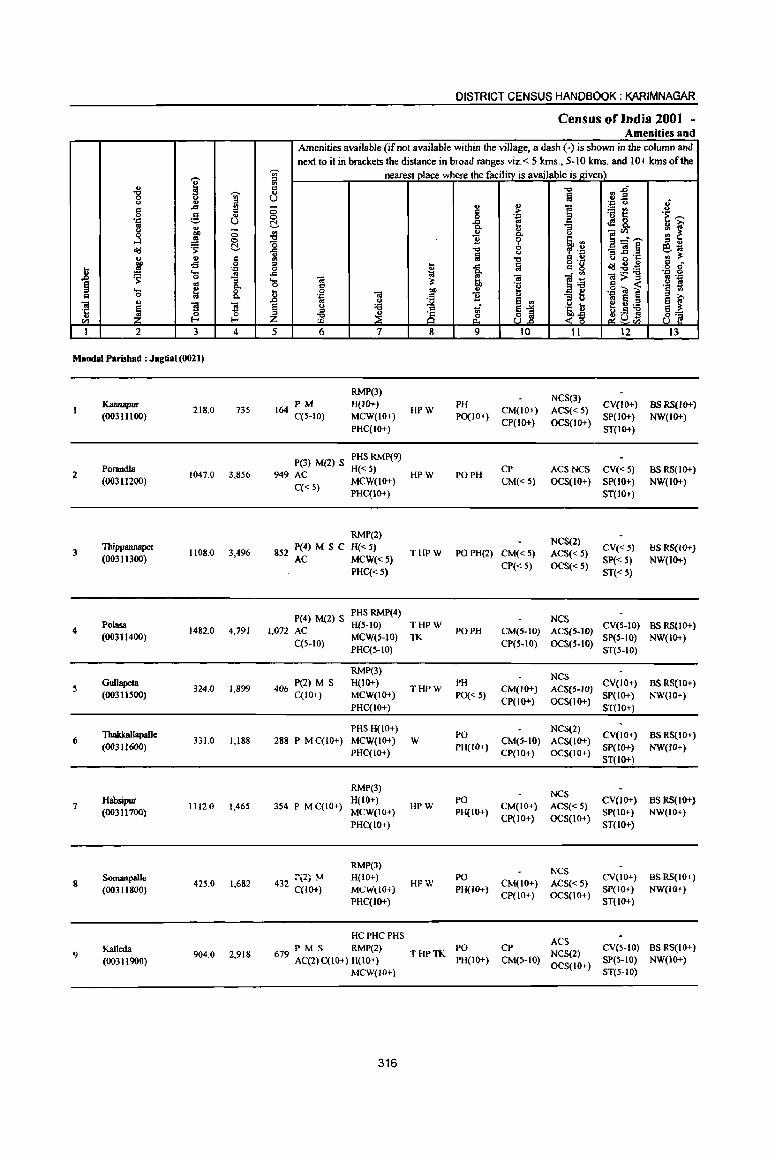
,-..
" i '"8 -;;;-<> u ~ '"
A
'" 0 e d '.c OS <> .. ;; j 01)
.!'! -=> old ~ t!-.. .. '" :' .g 0
.8 .:=
~ .... .; 0
~ OS P-.... ~ 0
'" 0 "" u '"iii
~ ~ '3 ·c ~ ..
ell
I 2 3 4
Mandai Parishad : Jagtial (0021)
Kannapur (00311l00)
218.0 735
2 Porandla
1047.0 3,856 (00311200)
3 Thippannapet
1108.0 3,496 (00311300)
4 Polasa
1482.0 4,791 (00311400)
5 Gullapeta
324.0 1,899 (00311500)
ThakkallapaUe 6
(00311600) 331.0 1,188
7 Habsipur
1112.0 1,465 (00311700)
8 Somanpalle
425.0 1,682 (00311800)
Kalleda 2,918 9
(00311900) 904.0
DISTRICT CENSUS HANDBOOK: KARIMNAGAR
Census of India 2001 ~ Amenities and
Amenities available (if not available within the village, a dash (-) is shown in the column and next to it in brackets the distance in broad ranges viz. < 5 kms., 5-10 kIDs. and 10+ kIDs of the
~ nearest pJace where the facilitY is available is given) '"
a1~ ij ~ a U .:= <.) 8 ;:; ., ., ~
:.::: en
'" ;> '<3 t: 'i~ 0 0 .:=
~ -a e ~8. "3 ... ]~'"" ~ ] "" <.) ., ~
0 .~ :l :l " '0 ~ 0 _'iil~ e~ il <.) , . .0
'" § .., = ., 8 ~'15 ., iii'
'" ... -" ~ g 'g oId~::a 6 cf 0 ... -" ~ ~ . '" .:= 0 .... 'iii '"iii ~::a ];>~ ~ 'E O .: .~ '!l '" ] 0 01) ... ·il ~] .~ 1j ~ 'B .. _ e
01 E 8 iU' 8 '" :::s u
§ u 'i3 Vi ~1 'a ~ ~~~ 8] ~ ~ 8 ~Dtl z &. <,-g 5 6 7 8 9 10 11 12 13
RMP(3) NeS(3)
PM H(IO+) PH CV(IO+) as RS(lO+) 164 C(5-10) MCW(IO+)
HPW PO(I 0+)
CM(IO+) ACS«5) SP(IO+) NW(IO+)
PHC(IO+) CP(IO+) OCS(IO+)
ST(IO+)
P(3) M(2) S PHSRMP(9)
949 AC H«5)
HPW PO PH CP ACS NCS CV«5) BSRS(IO+)
C« 5) MCW(IO+) CM«5) OCS(lO+) SP(IO+) NW(IO+) PHC(IO+) ST(IO+)
RMP(2) NCS(2)
852 P(4) M S C H{< 5) THPW POPH(2) CM«5) ACS«5)
CV«5) BS RS(lO+) AC MCW«5)
CP« 5) OCS« 5) Sp« S) NW(IO+)
PHC«S) ST«S)
P(4) M(2) S PHS RMP(4)
NCS 1,072 AC
H(5-10) THPW PO PH CM(5-JD) ACS(5-1O)
CV(S-IO) BS RS(lO+)
C(5-10) MCW(S-IO) TK
CP(S-IO) OCS(5-IO) SP(S-IO) NW(IO+)
PHC(5-IO) ST(5-10)
RMP(3) NCS
406 P(2) M S H(IO+) THPW
PH CM(lO+) ACS(5-1O)
CV(IO+) BS RS(IO+) C(IO+) MCW(IO+) PO« 5)
CP(IO+) OCS(IO+) SP(IO+) NW(IO+)
PHC(IO+) ST(IO+)
PHS H(lO+) PO
NCS(2) CV(IO+) BS RS(IO+)
288 P M C(10+) MCW(IO+) W PH(IO+)
CM(5-IO) ACS(lO+) SP(lo+) NW(IO+)
PHC(IO+) CP(IO+) OCS(IO+) ST{IO+)
RMP(3) NCS
354 P MC(IO+) H(IO+)
HPW PO
CM(IO+) ACS«5) CV(lO+) BS RS(JO+)
MCW(IO+) PH(IO+) CP(IO+) OCS(IO+)
SP(IO+) NW(IO+)
PHC(IO+) ST{IO+)
RMP(3) NCS
432 ::\2; ~ H(IO+) HPW
PO CM(IO+) ACS« 5)
CV(lO+) BS RS(IO+)
C(IO+) MCW'(iO+j PH(IO+) CP(IO+) OCS(IO+)
Sp(IO+) NW(IO+)
PHC(IO+) ST(IO+)
HC PHC PHS ACS
PM S RMP(2) THPTK
PO CP NCS(2)
CV(5-10) BS RS(IO+) 679 AC(2) C(10+) H(10+) PH(IO+) CM(5-IO) SP(s-tO) NW(IO+)
MCW(JO+) OCS(IO+)
ST(S-IO)
316
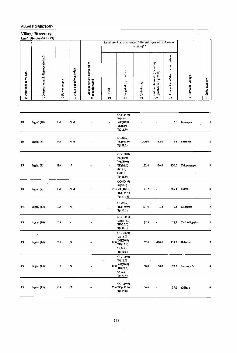
VILLAGE DIRECTORY
VilIaee Directory Land Use (As on 1999)
Land use (i.e. area under different types of land use in hectare)'·
j c 0 . ."
g ~ co ~ c .=
8 'g ~ ;; ., " u
~ ~ <i .. Cl ., ..s " .§ c ~ ._ III
"" '<3 8 ~ ~'" '" ~ co ., > :is .,
<to '" ~-g 0 ~ ~ .. CI)
-a ~ <II 'i ..!!! .... S ~ >. ~-o 'S ..8 ... ail e -0
~ ~ > § ~ B c. §' ~ ..
'" .§ ~ -0 ..0 a (5 ....
j '" c. ~ co 0 c
[ .. -:;; 'E f!..c c ., 01 ~ ~ - " E u '" ~ ~ e "" ~ :5 § - ;;> ~ ·c
~ ~ ~ ~ ;;> .. u
U ... en
14 15 16 17 18 19 20 21 22 23 2 1
GC(164.0) W(4.0)
PR Jagtial (10) EA NM WE(40.0) 2.0 Kannapur TK(S.O)
T(216.0)
GC(SS.2)
PR Jagtial (5) EA NM TK(600.0) 300.0 52.0 6.S POT3Jldla 2 T(688.2)
GC(160.0) PC(18.0) WE(60.0)
PR Jagtial (3) EA N TK(92.0) 122.0 130.0 420.0 Thippannapet 3 R(IS.O) 0(88.0) T(436.0)
GC(404.4) W(60.6)
PR Jagtial (7) EA NM 109.3 WE(482.0) 21.2 280.1 Polasa 4 TK(124.4) T(1071.4)
GC(23.2)
PR Jagtial (12) EA N TK(170.0) 121.6 8.8 0.4 Gullapeta T(193.2)
GC(IOO.I)
PR Jagtial (10) EA WE(1l6.0) 18.9 76.1 Thakkallapalle 6
TK(20.0) T(236.1)
OC(126.0)
W(12.0)
PR Jagtial (14) EA N 160 WE(20.0) . TK(12.S)
52.0 400.0 453.2 Habsipur 7
0(20.0)
T(I90.8)
OC(IOo.o) W(12.0)
PR Jagtial (14) EA N WE(20.0)
12.0 TK(28.8) 60.0 90.0 90.2 Somanpalle 8
0(12.0) T(I72.8)
GC(159.0) PR Jagtial (15) EA N 157.4 TK(450.0) 100.0 37.6 Kalleda 9
T(609.0)
317
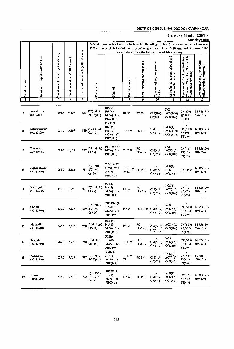
., i "0 -;;;-0 ~ <..> Fil .. ,.d .. 0 .s '" .::: ._, U l1 u 0 ~ 8 ....l
o<:! 'S! c.. '" .. § "" of!
.8 .!! . .= .... .. =s: 0 "3
~ ~ 8: ._ .. 0 .. = ~ "3 ~ ·c ~ u I-< '" 1 2 3 4
10 Anantharam
913.0 2,347 (00312000)
LakslunipW1llll II 929.0 3,805
(00312100)
Thimmapur 12 629.0 1,115
(00312200)
13 Jagtia1 (Rural)
1963.0 3,180 (00312300)
14 Kandlapalle
715.0 1,591 (00312400)
15 Cbelgal
1150.0 5,037 (00312S00)
16 Morapalle
865.0 2,852 (00312600)
Tatipallc 17 1287.0 2,976
(00312700)
18 Andlargaon
1223.0 2,926 (00312800)
Dharur 19
(00312900) 518.0 2,513
DISTRICT CENSUS HANDBOOK: KARIMNAGAR
Census ofIndia 2001 -Amenities and
Amenities available (if not available within the village, a dash (-) is shown in the column and next to it in brackets the distance in broad ranges viz. < 5 lans., 5-10 lans. and 10+ lans of the
-;;;- nearest place where the facility is available is given) a "'" ~~ u u ~
.'" <.> .; g .. .,
i =5t! ..,
§ ;> .'" .~ >: e!- .g, e 4!8. 8- :: ~ ~ .. 0 ]~,_,
'0 11 9 .L1, '" ::s .. -= "0 0 f .~ _'"§ e-:;; u !ij tJ a -; .§ '" ;!: '" -c .. ., = u !a
o ._ .. c 0 -= .. g o<:!~~ 0 -= ~ ~ . '" . .= 0 .... O! = f!~ =>= .. .J:: 0 c "t~ .. « .~ t! u 0 = bD .!! _g ~ .g -= ] .'" .. ., .c 5 0 ~
:l e '" l~ .. e ~ ~ ~ ;:a 1i ~1 e"';:a = ~ ! u .s s 8~ Z "'" &. <~ ~u U.l ~'"
5 6 7 8 9 10 11 12 13
RMP(4) NCS
612 P(3) M S H(IO+) HPW PO PH CM(lO+) ACS(S-IO)
CV(IO+) BS RS(IO+) ACC(IO+) MCW(1O+)
Cp(IO+) OCS(IO+) SP(IO+) NW(IO+)
PHC(IO+) ST(IO+)
DAPHS
PM S AC RMP(s)
CM NCS(4)
CV(S-IO) BS RS(IO+) 889 C(5-10) H(S-IO) THPW PO PH ACS(S-IO)
MeW(S-IO) CP(S-IO)
OCS(S-IO) SP(lO+) NW(IO+)
PHC(IO+) ST(JO+)
279 P(2) M AC RMPH«S)
PO NCS
CV«S) BS RS(IO+) MCW(IO+) THPW CM«5) ACS«s) C« 5) PHC(lO+)
PH«5) CP« 5) OCS(IO+)
SP« 5) NW(IO+)
ST«s)
P(9) M(8) DMCWMH
NCS(2) 751 S(2) AC
CWCFWC THPTW PO PH CM«5) OCS CV SPST
BSRS(IO+)
C(10+) H«S) WTK
CP« 5) ACS«s) NW(tO+)
PHC«5)
RMP(2) NCS(2)
391 P(3) M AC H« 5)
HPW PO
CM«s) ACS«5) CV«5) BS RS(IO+)
C« 5) MCW(IO+) PH« 5) CP« 5) OCS(IO+)
SP« 5) NW(IO+)
PHC(IO+) ST« 5)
P(4) M(2) PHSRMP(8)
NCS 1,170 S(2) AC
H(S-IO) HPW PO PH(33) CM(S-IO) ACS«S)
CV(5-10) BSRS(IO+)
C(5-10) MCW(IO+)
CP(S-IO) OCS(lO+) Spes-to) NW(JO+)
PHC(IO+) ST(IO+)
RMP(4)
PM S AC H(s-IO) PO ACSNCS CV(S-IO) BS RS(IO+) 730 C(s-IO) HPW CM(S-IO)
MCW(IO+) PH(S-IO) CP(S-IO)
OCS(lO+) SP(s-IO) NW(lO+) PHC(IO+) ST(IO+)
RMP(4) NCS
PM AC H(s-to) PO CV(S-IO) BS RS(IO+) 758 C(5-tO) THPW CM(S-IO) ACS«5)
MCW(5-10) PH(s-IO) CP(S-IO) OCS(IO+)
SpeS-to) NW(IO+)
PHC(IO+) ST(IO+)
RMP(3) NCS(6)
717 P(3) M S H«5) THPW PO PH CM«5) ACS«S)
CV« 5) as RS(IO+)
ACC«5) MCW«5) TK CP« 5) OCS«5)
SP« 5) NW(IO+)
PHC(IO+) ST(IO+)
P(3) M(3) PHS RMP
NCS(4) H«5) CV« 5) BS RS(IO+)
578 S(3) AC MCW«5)
HPW PO PH CM«5) ACS«S) SP« 5) NW(IO+)
C« 5) PHC« 5)
CP« 5) OCS«5) ST« 5)
318
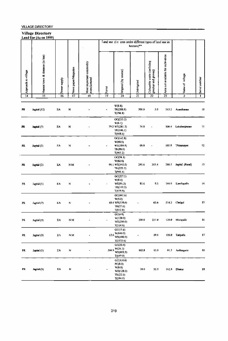
VILLAGE DIRECTORY
Land Use (As on 1999) Land use (i.e. area under different types of land use in
hectare)"
j c 0 ''-'" c b t>I) :>
'=' c . ." 8 :a :a :;
0 '" u
~ ..,
E g,", ....
" ·S 8 ~ r2 ., t>I) :a 0
~ '=-rl ., '" t>I) u B is ~ ~ ..
<Ig
~ j] 0 CIO
~ >. VI ~ lib
~ '" ... B 8: e -c
3;..., ~ ~ ..c:: 9 ~ 8.2 41 ..!! a '" § ~ '" a; ....
'" .5 J9 -c .0 la '0 1;; Q. ., ""
c .. ~ ~
D III
- ::I ti 'iii E ~-:s c ., ..
~ ~ ~ ~ e t>I) '" ~ .2" ] 'c - ::I ~ 'J:
& & ::I '" ..
;:J Ubi) til
14 15 16 17 18 19 20 21 22 23 2 1
W(8.S)
PR Jagtial (12) EA N TK(288.0) 300.0 3.0 313.2 Ananthanun 10 T(296.8}
GC(23S.2}
W(6.1)
PR Jagtial (7) EA N 79.2 WE(281.2) 74.8 106.4 LakshmipWllltl II TK(I46.I) T(668.6}
GC(142.8)
W(48.0)
PR Jagtial (3) EA N WE(1B4.4) 60.0 105.8 Thimmapur 12
TK(SS.O) T(463.2)
GC(94.1)
W(B2.0)
PR Jagtial (2) EA NM 94.1 WE(S42.0} 241.6 305.4 380.5 Jagtial (Rural) 13
TK(223.3)
T(94 1.4)
GC(227.2} W(8.0}
PR Jagtial (5) EA N WE(95.3) 81.6 95 144.0 Kandlapalle 14
TK(149.3) T(479.9)
GC(441.6)
W(4.0}
PR Jagtial (7) EA N 60.4 WE(339.6) 62.6 214.2 Chelgal 15
TK(27.6) T(SI2.S)
GC(4.0)
PR Jagtial (9) EA NM W(l20.0)
200.0 221.0 120.0 Morapalle 16 WE(2oo.0)
T(324.0)
Ge(IS.6)
PR Jagtial (9) EA NM W(640.0)
12.0 WE(4BO.0) 19.4 120.0 Tatipalle 17
T{l135.6}
GC(20.4)
PR Jagtial (5) fA N 304 9 W(26.1) . WE(602.5)
162.8 IS.O 91.3 Anthargaon IS
T(649.0)
Ge(1I8.0)
PC(8.0)
PR JagtiaJ (5) EA N W(B.O)
20.0 51.2 162.8 Dharur 19 WE(l28.0)
TK(22.0)
T(284.0)
319

_g
~ "iii 'c .. fI'l
J
20
21
22
23
24
i u g 'i g
....:I <I!!
rr ~ ... 0 <>
~ 2
NarsiJIsaptu (00313000)
Eldurtbi (00313100)
Molhe (Rural)
(00313200)
Jabithapur (OO3l3300)
Dharmaram (00313400)
MandalParishad T ....
I -;;;-iil ..c:I d g u u
u <3 ...
~ 0
'S D .. c -s 0 'C .... ..
0 "5
~ p,
8. S S 0 0 l- I-
3 4
1299,0 4,282
704,0 1,874
946,0 4,309
1163.0 3,175
298.0 1,032
21553.0 65044
DISlRlCT CENSUS HANDBOOK: KARIMNAGAR
Census of India 2001 -Amenities and
Amenities available (if not available within the village, a dash (.) is shown in the column and next to it in brackets the distance in broad ranges viz.< 5 kms., 5-10 kms, and 10+ kms of the
-;;;-- nearest olace where the facilitv is available is given) ;;l c " U -0
0 Q!.
~ 0
..e ~ 6 6 .... .. .... "iii ~ 0 c t 0 "iii
01)
'J:l
~ J:> .. ~
~ Q
~ 8 ~ 5 6 7 8
P(3) M S RMP(4)
1,019 AC(2) H« 5) THPW
MCW«5) TK C«5)
PHC(IO+)
RMP(5)
434 P(2) M AC H« 5) HPW
C«5) MCW« 5)
PHC« 5)
P(3) PHSRMP
977 M(2) S(2) H«5) THPW
AC MCW(IO+) TK C«5) PHC(IO+)
RMP(3)
725 PM S AC H(5-10) THPW C(S-IO) MCW(5-tO) TK
PHC(IO+)
P(2) AC DU RMP(2)
H(5-10) 275 M« 5) HPW
C(5-IO) MCW(S-IO)
PHC(5-10)
D DA DU T(Il) P(60) M(36) MH ewc W(23)
15501 S(20) C HC PHC TK(7) AC(21) PHS(8) FWC HP(23)
RMP(76) TW
320
" c 0 -a " ] "0
Iii .c Co a u ]
l 9
PO PH
PO PH
PO
PH« 5)
PO PH
PH
PO«5)
PO(21)
PH(48)
." a .. > 1 ':::
i (,)
'i' "Ii ~ 0 Q cp ''=
-0 c:: u lij ~n~ - ., "iii e~ 'g ~ e :::s Q E '" "~ 6 131 <~ UJ:>
10 II
NCS(2)
CM«5) ACS«5) CP« 5) OCS«5)
NCS(3) CM«5) ACS« 5)
CP« 5) OCS«5)
NCS(3)
CM«5) ACS« 5) CP«5) OCS(IO+)
NCS(2) CM(S-IO) ACS(5-10) CP(5-10) OCS(S-IO)
NCS CM(S-IO) ACS{5-10) CP(S-IO) OCS(5-10)
ACS(3)
CM CP(2) NCS(48)
ocs
~~ 'J:> U
.: "" 'u 1:: <l'! &. ]~~ _"iil§ is -6 'S <ld~~ ~>~ .g"t;! ] .. E e u '6 ~a.;j
12
CV« 5) SP« 5) ST(IO+)
CV«5)
SP« S) ST(IO+)
CV«5)
SP« 5)
ST« S)
CV(S-IO) SP{S-IO)
ST(S-tO)
eves-to} SP(S-IO)
ST(5-IO)
CV ST SP
.; u '~ ~ u i;'
~ t ~~ § ....
'J:: 0 fl "J:l
'§ tl ~L~ 8'2
13
.BS RS(lO+)
NW(IO+)
BS RS(IO+)
NW(IO+)
BS«5) RS(IO+)
NW(IO+)
BS RS(IO+) NW(IO+)
BS(S-IO}
RS(tO+) NW(IO+)
BS(22)

VILLAGE DIRECTORY
Villa~e Directory Land Use (As on 1999)
j .g,
I j :a ~ <Ii!
~ B .c .s
1;1 1;1 g_
~ ~ 14 15
PR Jagtial (5)
PR Jagtial (4)
PR Jagtiai (2)
PR Jagtial (7)
PR Jagtial (7)
PR(14)
1 I:; ~
.t: 16
EA
EA
EA
EA
EA
EA(14)
" c .~
01)
~ §. 0. ., ~
Z 17
N
N
N
N
N
N(ll) M(6)
II :a 0 e S 0
" ~] 0." .5 ~ - " ~ ~ 18
Land use (i.e. area under different types of land use in hectare)"
,., ~ 5l » e "0
'" t: 'iii ~ OJ)
0 :.5 ~
19 20
Ge(20S.0) WE(252.0)
3296 TWE(30.0) . TK(24.0)
0(220.0) T(734.0)
Ge(J36.0) W(240.0)
93.2 TK(31.2) 0(60.0) T(467.2)
GC(24 1.0) W(S2.0) WE(298.0) TK(56.0) T(647.0)
GC(284.0) W(32.0)
98.0 WE(334.0) TK(56.6) T(706.6)
Ge(112.0) W(8.0) WE(76.0) TK(2.0) T(198.0)
GC(3604.81 ) PC(Z6) W(1371.58)
13661 WE(4551) • TWE(JO)
TK(2620.15) R(18) 0(400) T(12621.54)
321
-0
~ bl)
E '2 ::J 21
90.4
136.0
24.0
2186.9
c 0 .~
01) > c ~ :a ..2 C.>
u ~ c~ ._ '" ~ " 0)
" > :g _ 0
gj 50 'a ~-.:l > .2 iii '" ]~ 0 c
co - " ~ " oS U 00
22 23
25.0 120.0
100.0 43.6
115.0 184.0
14.4 208.0
60.0 16.0
1681.3 3696.2
.. 00
.!:l ] 'S e '- " 0 c
'" '" ~ ·c " oil
2 I
Narsingapur 20
Eldurthi 21
Mothe (Rural) 22
Jabithapur 23
Dhannaram 24
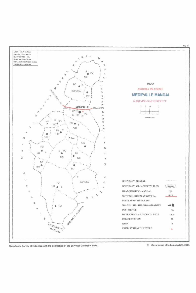
POPULATION: .',713
No. Of TOWNS: NIL
M .. OF VD.LAGU : It
OJSTANCE fROM DIlL II.QIn,
y.. to. L
" ~ ... ~ ..... - __ '" ... _~ "f
TO MANDAL : Q: b ... ~ / \ -t.
I I
.." ............. 1 S PO I = • • 1;1>
~ 1 ' ~ ,"" ... ,_ 136 f f:ot
~ , ,~--I '/
~ / po. S '>- __ ,'
~ I " I 1>9t,.. / 00313500:'.:
~ , '...... " 137: '- " .." )-___ I,'
" "1Q,/ ---------/ >-~ ~ I t"'
~ iNlt:~ MEDIPALLE+-- TO JAGTIAL
C /~----..{ PO © . .. \ ;( *' ..... ~ " B 138 PS \ :>-,."' '... I JC \.
1" " ,:z .' 141: S PO _, ... =
---...... , .: 140. _--\ po. S ", \ ... ...... \--- .. ~ - ... ---...... \ 139 " \ J,' poS" ,~t'"
/ . : 143 • J"'" '\, J -_
{ 142," , '"- "',1' \ I .. ) ..... ,_·144 I ,.;l
.... ~,J.. __ ..!.. .. ' -, I '-_ ... / __ • • I -~_~ 145 ..,
PO " • I' "," \
..
" ~
~
'-'-Z \
\ , , I • s ' S PO " ..' .", 149 I • : PO I
'r,_ : 148 ', . --/
-(
, ; 146 , I ' , ,.. I I PO l'"__ , I
,1 150· ,/ ,,' . --J ''''.,/ ---'\ 147 _------f ...........
, \. ,I I
\ \.,' . ; I \ , PO 00315300' I 151 " '. : • S " I I /"" \ ,,,_ ......... -... -----J '.... ... M' \.>
.... '-,I ~
\' ~ I I '".~-"" I " • 152 J I .. :?' \ ,/ ~ \, ... ' ~~
-; ...... ~V ~ \ /' ~T
--~ ,~ C ---.. ' 4,-0
~llJ(~" Jlfl)-t1..
'"' .r:
.."
Based upon Survey of India map with the permission of the Surveyor General of India.
INDIA
ANDHRA PRADESH
MEDIPAlLE MANDAL KARIMNI\GAR DISTRICT
2 o 2
I
BOUNDARY, MANDAL
BOUNDARY, VILLAGE WITH PLCN r------, ,_~~ .. I
HEADQUARTERS, MANDAL @
NATIONAL HIGHWAY WITH N ... "'.1. POPULATION SIZE CLASS:
500- 999,1000 - 4999,5000 AND ABOVE ••• POSTOmCE PQ
HIGH SCHOOL I JUNIOR COLLEGE S/JC
POLICE STATION PS
RANK B
PRIMARY HEALTH CENTRE
Mop 22
© Government of India copyright, 2004.
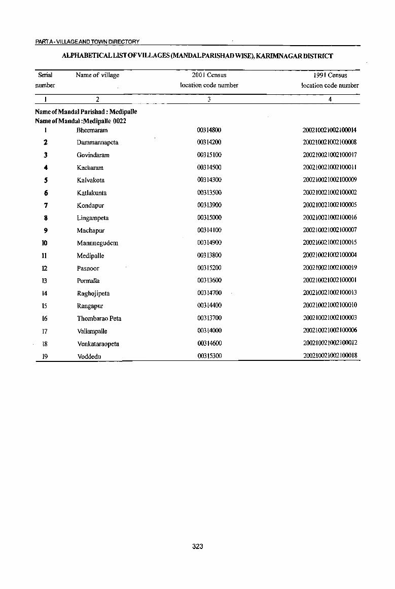
PART A- VIUAGEAND TOWN DIRECTORY
ALPHABETICALLISfOFVILLAGES (MANDALPARISHAD WISE), KARIMNAGAR DISTRICT
Serial Name of village 2001 Census 1991 Census
number location code number location code number
2 3 4
Name of Mandai Parishad : Medipalle Name of Mandai :Medipalle 0022
1 Bheemaram 00314800 200210021002100014
2 Dammannapeta 00314200 200210021002100008
3 Govindaram 00315100 200210021002100017
4 Kacharam 00314500 200210021002100011
5 Kalvakota 00314300 200210021002100009
6 Katlakunta 00313500 200210021002100002
7 Kondapur 00313900 200210021002100005
8 Lingampeta 00315000 200210021002100016
9 Machapur 00314100 200210021002100007
10 Mannnegudem 00314900 200210021002100015
11 Medipalle 00313800 200210021002100004
12 Pasnoor 00315200 200210021002100019
13 Pormalla 00313600 20021002100210000 1
14 Raghojipeta 00314700 200210021002100013
15 Rangapur 00314400 200210021002100010
16 Thombarao Peta 00313700 200210021002100003
17 Vallampalle 00314000 200210021002100006
18 Venkataraopeta 00314600 200210021002100012
19 Voddedu 00315300 200210021002100018
323

I ., -0 -;;;-0 '" '" " ~ co .d 0 g ] U ..
~ 0 0
.td ~ t!, u .s 6 toO)
.8 ~ '.c '0 ..
~ :; ~ ~
Q, .... 8. .. 0 .. <iI
~ 19 19 ·il 0 0
CIl f-< f-<
1 2 3 4
Mandai 'ambad : Medipalle (0022)
KatlakuufB 1219.0 4,253
(00313500)
2 Pormalla
1603.0 4,846 (00313600)
3 Thombarao • Peta
328.0 1,297 (00313700)
4 MedipaJle
1848.0 5,813 (00313800)
Kondapur 5 1327.0 4,378
(00313900)
6 Vallampalle
603.0 2,444 (00314000)
7 Machapur
333.0 9()0 (00314100)
8 Dammannapeta
295.0 1,438 (00314200)
9 Kalvakota
1025.0 2,113 (00314300)
DISTRICT CENSUS HANDBOOK: KARIMNAGAR
Census of India 2001 -Amenities and
Amenities available (if not available within the village, a dash (-) is shown in the column and next to it in brackets the distance in broad ranges viz. < 5 kms., 5-10 kms. and 10+ kms of the
-0;- nearest Dlace where the facility is available is given) 51 6 -0 ~~ ~ U ... ., '.z:: '" 8 0 6 > I :.: U)
0 '.z:: 'Q 1:: .~ ...._ ~ -a f .:g 8.
~ f 8-~
., '" ]~" 1! ~ 'Q :l
.d -0 u 1 '.0 -:;]§ 6~ u ~
'" " In -0 .. '" <> o·!: 6
o ._
~:2~ c .
~ .<: ij .. <.) o .. -= a _::1il '.z:: 0 ... <iI <iI ]>~ to '.z:: 0 .. " of:! ~.a .~ ~ ... 0 01) ..!! .2 iii § 1l '.z:: <iI .. 2 ... "3 ; 1G 8 E ~ <II 0
~ E '" ~ '" 'i3 §~ .~ ~ e ., 'i3 8 :s: :>
~ 8 J! <> .S .'9 [3 <~ 8~ Z U.o ~BCIl
5 6 7 8 9 10 11 12 13
PHSRMP(8) NCS(2)
P(4) M S 0(2) H(1O+) CV(IO+) BS RS(IO+) 1,142 AC C(IO+) THPW PO PH(40) CM(5-l0) ACS(5-l0)
MCW(IO+) SP(IO+) NW(IO+) PHq5-10)
CP(IO+) OCS(IO+) ST(IO+)
PHSRMP(3) P(2) M S 0(2)H(10+)
THPW PO
CM(IO+) ACSNCS CV(S-IO) BS RS(IO+)
1,173 AC C(5-JO) MCW(JO+) PH«5) OCS(IO+) SP(JO+) NW(JO+) PHC(IO+)
CP(5-10) ST(IO+)
RMP(2)0{2)
313 PM AC H(IO+) THPW
PH(4) CM(5-IO)
ACS(S-IO) CV(IO+) BS RS(lO+) C(lO+) MCW(1O+) PO« 5)
CP(JO+) NCS(IO+) SP(IO+) NW(IO+)
PHC(S-IO) OCS(IO+) ST(JO+)
P(3) M(2) PHC PHS
ACS 1,249 S(2) PUC C
RMP(S) 0(2) THPW PO PH(24) ~~IO+) NCS(2)
CV(IO+) BS RS(tO+)
AC H(IO+)
OCS(IO+) SP(IO+) NW(IO+)
MCW(IO+) ST(IO+)
0(3) PHS
P(4) M S RMP(4) 0(2) THPTW NCS(4)
CV(IO+) BS RS(IO+) 1,030 AC(2) C(IO+) H(IO+) PO PH(60) CM« 5) ACS«S) W SP(IO+) NW(IO+)
MCW(IO+) CP(IO+) OCS(lO+) PHq<5)
ST(IO+)
RMP(6)
581 P M S H(IO+)
THPW PO
CM(S-IO) ACS NCS CV(tO+) BS RS(tO+)
C(IO+) MCW(IO+) PH« 5) CP(lO+)
OCS(IO+) SP(IO+) NW(lO+) PHC(S-IO) ST(IO+)
PAC RMP
210 M(5-10) H(S-IO)
HPW PO{< 5) CM(5-IO) ACS«5) CV(S·IO) BS RS(IO+)
C(5-10) MCW(5-IO)
PH(5-10) CP(5-10) NCS(IO+) Spes-to) NW(IO+)
PHC(S-IO) OCS(IO+) ST(IO+)
RMP0(2) NCS(2)
331 P M C(IO+) H(lO+)
HPW PO« 5) CM(IO+) ACS«5) CV(IO+) BS RS(IO+)
MCW(IO+} PH(IO+) CP(IO+) OCS(IO+)
SP(lO+) NW(lO+) PHqIO+) ST(IO+)
PHS RMP(2)
482 PM S AC 0(2) H(IO+) HPW
PO CM(S-IO)
ACS(IO+) CV(IO+) BS RS(IO+) C(IO+) MCW(IO+) PH(5-1O)
CP(lO+) NCS(IO+) SP(IO+) NW(IO+)
PHC(S·IO) OCS(lO+) ST(IO+)
324
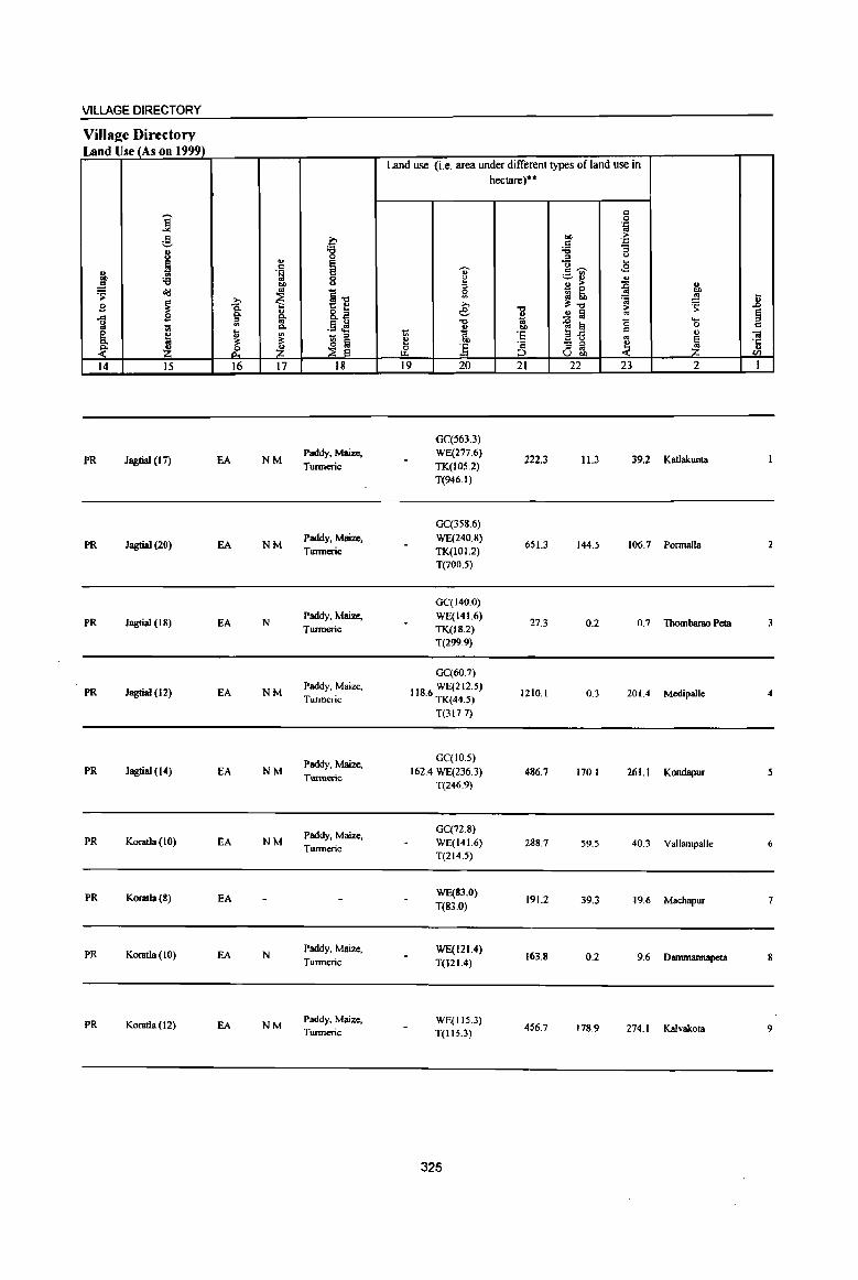
VILLAGE DIRECTORY
Village Directory Land Use (As on 1999)
j ~ 8 ~ g, :a .!!
~ ~
~ B ..c <> .. 1ii ~ ~ ~ 14 15
PR Jagtial (17)
PR Jagtial (20)
PR Jagtial (18)
PR JagtiaJ (12)
PR Jagtial (14)
PR Koratla (10)
PR Koratla(8)
PR KOl1llla(lO)
PR Koratla (12)
" .~ bI)
'" ~ »
1 " ~ In Q,
Ii; ~ J. Z
16 17
EA NM
EA NM
EA N
EA NM
EA NM
EA NM
EA
EA N
EA NM
~ :g
I ~." 8.~
.§ .M - '" ~ ~ 18
Paddy, Maize,
Tunneric
Paddy, Maize, Tmmeric
Paddy, Maize,
Twmeric
Paddy, Maize,
Turmeric
Paddy, Maize,
Tumteric
Paddy, Maize, Turmeric
Paddy, Maize,
Tunneric
Paddy, Maize, Twmeric
Land use (i.e. area under different types of land use in
., l:: :I g » e ."
i 1;; e & ] 19 20
GC{563.3) WE(277.6} TK(IOS.2) T(946.1)
GC{358.6) WE(240.8) TK(IOI.2) T(700.5)
GC(J40.0) WE(141.6) TK(IS.2) T(299.9)
GC(60.7)
118.6 WE(212.S) TK(44.5) T(317.7)
GC(JO.S) 162.4 WE(236.3)
T(246.9)
GC(72.8)
WE(141.6) T(214.5)
WE(83.0) T(83.0)
WE(121.4) T(121.4)
WE(115.3) T(115.3)
325
hectare)""
.., " 1ii CI)
·s .= ;:J
21
222.3
651.3
27.3
1210.1
486.7
288.7
191.2
163.8
456.7
" 0 . .z:: bI) ~ c . .z::
;;; :; :I <>
"0 .2 c ~ ._ III
~ " " " > ~ " - 0 bO ~ lib ~ .!! ~." 'S >
..!! ~ '" '-
]~ 0 0
" " '" 1 - '" ~ '" ., U bO
22 23 2
11.3 39.2 Kllllakunta
144.5 106.7 Ponnalla
0.2 0.7 Thombarao Pets
0.3 201.4 Medipalle
170.1 261.1 KondsjJur
59.5 40.3 VallampaIle
39.3 19.6 Machapur
0.2 9.6 Dammannapera
178.9 274.1 Kalvakota
.8 § .,
Oil ·c u rn I
2
3
4
5
6
7
8
9
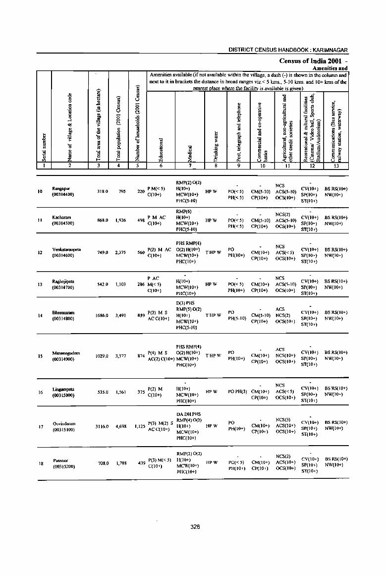
.-. u ~ "8 'Ul u .. os
.c '" c c 0 g .. .'" U ..
f g -0 ...l 0
t! &!l u ., Cl 01) of! 0 .. ~ '.j:l
1l ... os ~ 0 :;
~ ~ c.. ... 8, = 0
"iI .. ~ s '5 ~ ." {:!
1 2 3 4
10 Raogapur
318.0 795 (00314400)
Kacharam 11
(00314500) 868.0 1,926
12 Venkataraopeta
749.0 2,375 (00314600)
Raghojipeta 13 542.0 1,103
(00314700)
Bheemaram 1686.0 3,491 14
(00314800)
Mannnegudem 15
(00314900) 1029.0 3,577
Lingampeta 535.0 1,561 16
(00315000)
Govindaram 17 3116.0 4,698
(00315100)
Pasnoor 18 708.0 1,788
(00315200)
DISTRICT CENSUS HANDBOOK: KARIMNAGAR
Census of India 2001 -Amenities and
Amenities available (if not available within the village, a dash (-) is shown in the column and next to it in brackets the distance in broad ranges viz. < 5 kms., 5-10 kms. and 10+ kms of the
';;;' nearest place where the facility is available is eiven) os ., = ." ",.i5 u u fa .. .E!
.'" <> If ;; .. .. ] c > ~t! 0 0 '::1 'E ~
!::! .c e! <l! &. c..
= ~ ~ u .. ::>
]~~ c.. u 11 0 '5j, l'l "0 0
::> OJ
1 "0
" tp "= _"il~ ~g Ia ." = .. a ~ ·c o ._ &!l .. B c
~ .c fa = g o .: .c OJ c.. - '" :2:a .'" 0
'0 "iI ti "iI ]~ -a>::; os "::I
§ :s:
.~ = « .!:! s .8 «I j
... .g OJ ~ § til .:= 11 :; 0 ., u e .., os e ~ ~ ~ " :a .~ ~ :e 0:a ::> ;s S~ ~G~ Z ci3 ~ p.. «~ 8] 5 6 7 8 9 10 II 12 13
RMP(2) 0(2) NCS
220 P M«5) H(IO+) HPW PO« 5} CM(S-IO) ACS(S-IO}
CV(IO+) BS RS(IO+) C(IO+} MCW(IO+)
PH« 5) CP(lO+) OCS(IO+) Sp(IO+) NW(IO+)
PHqS-lO) ST(JO+)
RMP(6) NCS(2)
PM AC H(IO+) CV(IO+) BS RS(IO+) 498
C(10+) MCW(IO+} HPW PO« 5) CM(5-10) ACS(5-1O)
SP(IO+) NW(IO+) PHC(S-IO)
PH« 5) CP(IO+) OCS(IO+) ST(JO+)
PHS RMP(4) NCS
560 P(2) M AC 0(2)H(10+) THPW
PO CM(IO+} ACS« 5)
CV(IO+) BS RS(IO+) C(10+) MCW(IO+) PH(IO+)
CP(IO+) OCS(IO+) SP(IO+) NW(IO+)
PHC(IO+) ST(IO+)
PAC H(IO+)
NCS CV(IO+) as RS(10+)
286 M«5) HPW PO« 5) CM(IO+) ACS(5-10)
C(10+) MCW(IO+)
PH(IO+) CP(IO+} OCS(IO+} SP(IO+) NW(lO+)
PHC(IO+) ST(IO+)
0(3) PHS
P(3) M S RMP(5)0{2)
PO ACS
CV(lo+) BS RS(IO+) H(IO+) THPW CM(5-10) NCS(2) 859 ACC(IO+) PH(S-IO) SP(IO+) NW(lO+) MCW(IO+) CP(IO+) OCS(IO+)
PHC(S-IO) ST(IO+}
PHSRMP(4) ACS
P(4) M S 0(2) H(IO+} THPW
PO CM(IO+) NCS(IO+)
CV(IO+) BS RS(IO+} 874
AC(2) C(IO+) MCW(IO+) PH(IO+) SP(IO+) NW(IO+)
PHC(IO+) CP(IO+) OCS(IO+)
ST(IO+)
NCS CV(IO+) BS RS(IO+) 375 P(2) M H(IO+)
HPW POPH(3) CM(IO+) ACS« 5) C(IO+) MCW(IO+) SP(IO+) NW(IO+)
PHC(IO+) CP(IO+) OCS(IO+)
ST(IO+)
DA DH PHS
I 12 P(3) M(2) S RMP(4) 0(2)
PO NCS(3}
CV(IO+) BS RS(IO+) HPW CM(IO+) ACS(IO+)
, 5 ACC(IO+) H(IO+)
PH(IO+) SP(JO+) NW(JO+) MCW(iO+) CP(JO+) OCS(IO+)
PHC(IO+) ST(IO+)
RMP(2) 0(2) NCS(2)
439 P(3) M« 5) H(lo+) HPW PO«S} CM(IO+) ACS(IO+)
CV(JO+) BS RS(IO+)
MCW(IO+) SP(IO+) NW(IO+) C(lO+) PH(IO+) CP(IO+) OCS(IO+) PHC(IO+) ST(IO+)
326

VILLAGE DIRECTORY
Villaee Directory Land Use_ (As on 1999)
i g 8 ;
~ '<l ~ ~ "d
~ ..0 B 8: ... B ~ 1;;
;;: e '" ~ ~ 0-
~ & 14 15 16
PR KoratIa (18) EA
PR Jagtial (15) EA
PR Jagtial (18) EA
PR Jagtial (20) EA
PR Jagtial (20) EA
PR Koratla (17) EA
PR Koratla (20) EA
PR Koratla (32) EA
PR Jagtial (33) EA
.. . ~ Oll
~ ~ "-~ :£ 17
N
N
N
N
NM
NM
N
N
N
a '8 E E 0 <.>
~15 8.B
.13 .M - " ~ ~
18
Paddy, Maize,
Turmeric
Paddy, Maize,
Turmeric
Paddy, Maize, Turmeric
Paddy, Maize,
Turmeric
Paddy, Maize, Turmeric
Paddy, Maize,
Turmeric
Paddy, Maize,
Tmmeric
Paddy, Maize,
Turmeric
Paddy, Maize, Turmeric
Land use (i.e. area under different types ofland use in
U' ~ 0
'" >-e "tI .,
t; .. ~ bO
rf :§ 19 20
WE(95.0) TK(4.9)
T(99.9)
TWE(119.4) TK(22.3) T(141.6)
WE(123.4)
TK(4.0) T(127.S)
WE(87.0) TK(B.I)
T(95.1)
WE(1&4.9) TK(42.5) T(227.4)
WE(lS4.2) TK(20.2)
T(174.4)
WE(147.7)
T(147.7)
WE(30S.5) 1262.8 T(30S.5)
WE(125.0) 470.2 TK(9.3)
T(134.3)
327
hectare)··
"tI ., .. OIl
'E ~ 21
152.2
665.1
429.8
279.2
1102.6
825.8
290.9
851.4
13.5
t:: 0 .:;: co
"" > c . .,
'<l :;
" <.> "0 .. c~ .s ~~ .. " > ~ ~
::E ., ~ co co
:t"tl 'lQ ~ ~ .!! a
1~ <; .....
0 t::
'" co - " " ~ " ., -< U bI)
22 23 2
30.9 35.0 Rangapur
36.6 24.6 Kacharam
191.7 Venkataraopeta
21.4 146.3 Raghojipeta
98.8 257.2 Bheemaram
14.3 14.5 Mannnegudem
32.4 64. I Lingampela
625.2 71.2 Govindaram
80.2 9.9 Pasnoor
.. .8 ~ t::
O! .t:: OJ
Ul
I
10
II
12
B
14
15
16
17
II

.8 ~ " Ol 'r: ., til
1
19
i g
'::1
j d!! ~ ..s ~ .... 0 ., ~ 2
Voddedu (00315300)
Mandai Parisbad Tolal
I 'UI ;0 .... .,
~ d u bO 0 ..s 0
"s: c ., 6 .:; 'J:> ... 01 0 "3 g 8:
1 ']I E- ~ 3 4
1567.0 977
19699.0 49173
DISTRICT CENSUS HANDBOOK; KARIMNAGAR
Census of India 2001 -Amenities and
Amenities available (if not available within the village, a dash (-) is shown in the column and next to it in brackets the distance in broad ranges viz. < 5 kms., 5-10 kms. and 10+ kms of the
'UI nearest Dlace where the facility is available is !riven) 1il
rl~ il "Cl
U ~ '::! u .; 0
., ~ f :.= Col) <.>
0 g '::: .a ';:; t:! 'E ~
~ -a. [ 4!& u ia' g ~
., ~:.~ : ~
'0 'E b .s, "' ;;s .. .... -0 <.> , .~ =]~ eo; .,
~ t: u u o·r: "' :s: .. "Cl 5 !! ij
o ,- <Ill ., 0 c .r: " g :2~ o .: .... 5: • <IJ .~ ,g ... 'ii! ; "iii 1!:ij ~;>~ 0 .: "2 '~ ~ t 0 «I bI) i II e ,g "iii S
'J: Q U .&> .. ..
~ ~j " <.> '" IS :> E ~ § <.> '5 1if '~ U ~.s ~ ;0
z iZ ~ 8 ~ <~ ~u- 8~ ~tIl
5 6 7 8 9 10 11 12 13
227 P M(S-lO) H(10+) HPW PO(5-10) CM(IO+)
ACS(S-10) CV(lO+) BSRS(IO+) C(10+) MCW(IO+) NCS(IO+) SP(IO+) NW(IO+)
PHC(IO+)
D(6) DA DR P(39) M(16) MCW PRC T(9)
11974 S(10) PVC PHS(9) W(19) C AC(IS) RMP(S9) HP(19)
0(16) TW
328
PH(lO+)
PO(ll) PH(lll)
CP(IO+)
eM
OCS(lO+)
ACS(S) NCS(l.5)
ST(IO+)
BS(19)
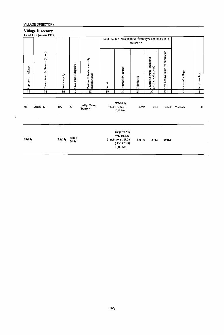
VILLAGE DIRECTORY
Village Directory Land Use (As on 1999)
] g 0)
'" fa " 1;; btJ :a ..!:! ~ ~
B ~ ..c B ~ I ~ 0. 0.
~ ..(
14 15
PR Jagtial (22)
PR(19)
16
EA
EA(19)
17
N
N(18) M(S)
18
Paddy, Maize, Tumeric
Land use (i.e. area under different types of land use in hectare)**
19 20 21 22 23 2
WE(93.0) 753.0 TK(22.0)
T(IIS.O) 399.0 28.0 272.0 Voddedu
GC(1205.95) WE(2885.93)
2766.9 TWE(1I9.38 ) TK(402.34) T(4613.6)
329
8707.6 1572.0 2038.9
19
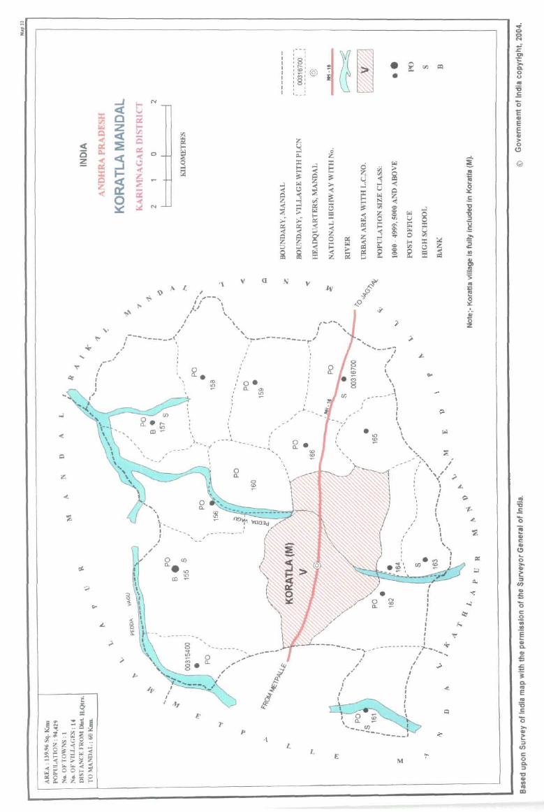
a
" " '--" /, \
.- - i
: 8: :~: @ :~: '8, I I I I 1- _.
v
(I \ " ...... I., I .. 1\/ I .. ,.
I .. --------r " "7'"-- " ---------~. I , I I .' ,
, , , , I
'---
.. ,. I
]'
, , , ,
o. Q._ ~
,
... -----.--' ,.
......
//
, , ,
L
I
L
I I ,
I I
.' ,.
• •
..... ~ "---1
,.
, I ,
. 1() <D
I
" I , \
\ , _.\ ,
I I I I \ \ \ \
\. :::;l '~, J'
... -' /''', I
, "" "-
, , ,
' \;.,-
, /
I I I t I I I I ,
I I , .. ",
I I
,'l---~__ I
J I I I J , J I I , : *' --------~..,....-, ... ,
I I t
I , I I I I I I I
I
@
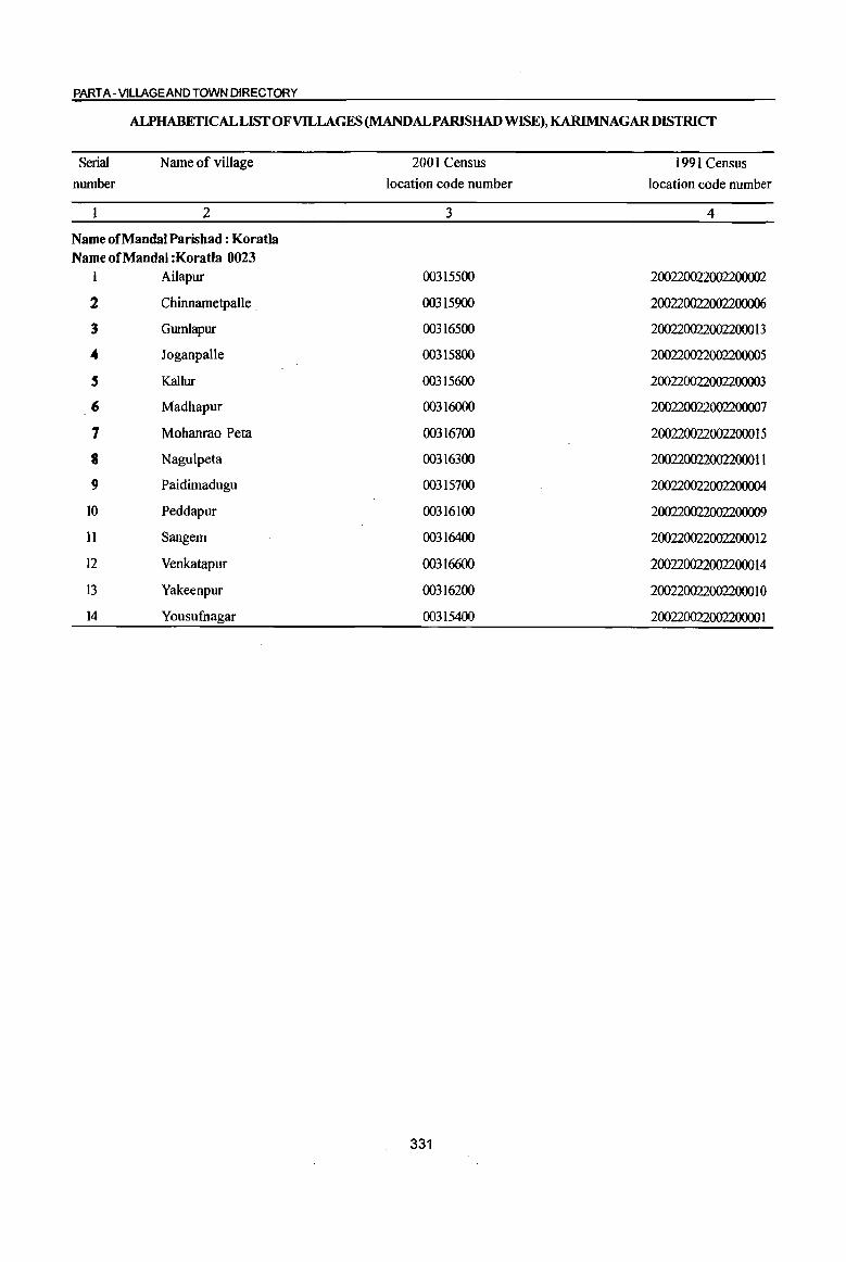
PART A -VILLAGE AND TOWN DIRECTORY
ALPHABETICAL LIST OF VILLAGES (MANDALPARISHAD WISE), KARIMNAGAR DISTRICf
Serial
number
Name of village
2
Name of Mandai Parishad : Koratla Name of Mandai :KoratIa 0023
1 Ailapur
2 Chinnametpalle
3 Gumlapur
.. Joganpalle
S Kallur
(; Madhapur
7 Mohanrao Peta
8 Nagulpeta
9 Paidimadugu
10 Peddapur
11 Sangem
12 Venkatapur
I3 Yakeenpur
14 Yousufuagar
2001 Census
location code number
3
00315500
00315900
00316500
00315800
00315600
00316000
00316700
00316300
00315700
00316100
00316400
00316600
00316200
00315400
331
1991 Census
location code number
4
200220022002200002
200220022002200006
2002200220022000 13
200220022002200005
200220022002200003
200220022002200007
2002200220022000 I 5
2002200220022000 II
200220022002200004
200220022002200009
200220022002200012
2002200220022000 I 4
2002200220022000 1 0
20022002200220000 1
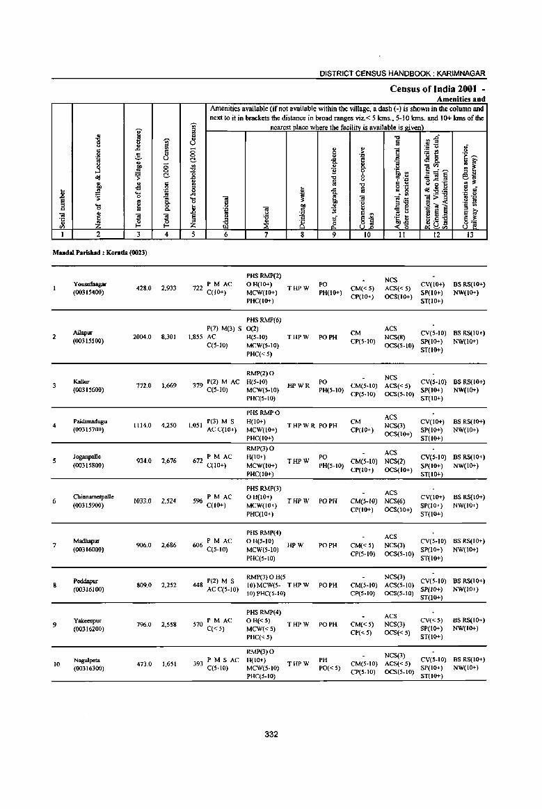
I .{l -;;-Q u ., :::I c .c a Q g .. .'" u fi .. Q "" <5
....l co <:> ~ cId C .. .. !is "" .;l
.8 .!! .'" .... .. ~ 0
1 § e .... C <> C.
01 .,
'1: ~ '3 ~
" Q
ell r- r-I 2 3 4
Mandai Parisbad : Konda (0023)
Y ousufnagar 428.0 2,933
(003IS400)
AiJapur 2 2004.0 8,301
(00315500)
3 KaIIur
772.0 1,669 (003IS600)
4 Paidimadugu
1114.0 4,250 (00315700)
5 Joganpalle
934.0 2,676 (00315800)
ChinrulmetpaJIe 6 1033.0 2,524
(00315900)
Madhapur 7
(00316000) 906.0 2,686
Peddapur 8 809.0 2,252
(00316100)
9 Yakcenpur
796.0 2,558 (00316200)
Nagulpeta 10 473.0 1,651
(00316300)
DISTRICT CENSUS HANDBOOK: KARIMNAGAR
Census of India 2001 -Amenities and
Amenities available (if not available within the village, a dash (-) is shown in the column and next to it in brackets the distance in broad ranges viz.< 5 kms., 5-10 kms. and 10+ kms of the ,...._
'" nearest place where the facility is available is.ltiven) ii! c ..., rlf .,
U fa .'" c.> If <5 "
., ] ~t! c >
<:> Q .'" .~ s:; C ..c e .:l 8. go '" :; :: ~ ~ c. c.> ]~~ 11 ~ '6i, '" "0 :::I " .c ..., , .~ _OI§ ~~ .,
1ii <.) e '6 .§ '" ..., g .~
:::I C <> ~ .c fa c g c1d~:5 Q .,;
.c ~ ]~
.'" <> ... "iI :t 01 1>~ B .'" <> g 'e ._ B
.8 "" " ·15 <a ] § Ul
.~ 01 c ] '" - ... 0
~ e '" :::I c.> to Ei § ~ £ ~
:.a u; ~1
.~ il j8] 8~ ~ 8 &. ~-g ~eIl
5 6 7 8 9 10 11 12 13
PHS RMP(2) NCS
722 PM AC OH(IO+) THPW
PO CM« 5) ACS«5)
CV(IO+) BS RS(IO+) C(IO+) MCW(lo+) PH(IO+)
CP(lO+) OCS(IO+) SP(IO+) NW(IO+)
PHC(lo+) ST(IO+)
PHSRMP(6} P(7) M(3) S 0(2)
CM ACS
CV(5-10) BS RS(IO+) 1,855 AC H(5-10) THPW PO PH NCS(8)
C(5-10) MCW(S-IO) CP(5-IO)
OCS(S-IO) SP(lo+) NW(IO+)
PHC«S) ST(IO+)
RMP(2) 0 NCS
379 P(2) M AC H(S-IO) HPWR
PO CM(S-lO) ACS«5)
CV(S-IO) BS RS(IO+) C(5-IO) MCW(S-IO) PH(S-IO)
CP(S-IO) OCS(S-IO) SP(IO+) NW(lO+)
PHC{S-IO) ST(IO+)
PHSRMPO ACS
1,051 P(3) M S H(IO+)
THPWR PO PH CM
NCS(3) CV(IO+) BS RS(IO+)
ACC(IO+) MCW(IO+) CP(IO+) OCS(IO+)
SP(IO+) NW(IO+) PHC(IO+) ST(IO+)
RMP(3) 0 ACS
672 PM AC H(IO+) THPW
PO CM(S-IO) NCS(2)
CV(S-IO) BS RS(10+) C(10+) MCW(IO+) PH(5-10)
CP(JO+) OCS(JO+) SP(JO+) NW(IO+)
PHC(IO+) ST(IO+)
PHS RMP(3) ACS
PM AC OH(IO+) CV(IO+) BS RS(IO+) 596 C(JO+) THPW PO PH CM(5-10) NCS(6)
MCW(IO+) CP(IO+) OCS(IO+}
SP(IO+) NW(IO+) PHC(IO+) ST(IO+)
PHS RMP(4) ACS
PM AC o H(5-10) CV(S-IO) BS RS(IO+) 606 C(S-IO) MCW(S-IO)
HPW PO PH CM«5) NCS(3) SP(IO+) NW(IO+)
PHC(5-10) CP(5-1O) OCS(5-10)
ST(IO+)
448 P(2) M S RMP(3)OH(S NCS(3)
CV(S-IO) BS RS(IO+) 10) MCW(5- THPW PO PH CM{5-10) ACS(5-IO)
AC C(5-IO) 10) PHC(5-10) CP(S-IO) OCS(S-IO)
SP(IO+) NW(IO+) ST(IO+)
PHS RMP(4) ACS
570 PM AC a H«5) THPW PO PH CM« 5) NCS(3)
CV«5) as RS(IO+)
C«5) MCW«S) CP«S) OCS{<5)
SP(IO+) NW(IO+)
PHC«S) ST(IO+)
RMP(3) a NCS(3)
PM SAC H(lO+) PH CV(5-10) BS RS(IO+) 393 THPW CM(S-IO) ACS«5)
C(5-10) MCW(S-IO} PO« 5) CP(S-IO) OCS(5-10)
SP(IO+) NW(IO+)
PHC(S-IO} ST(IO+)
332
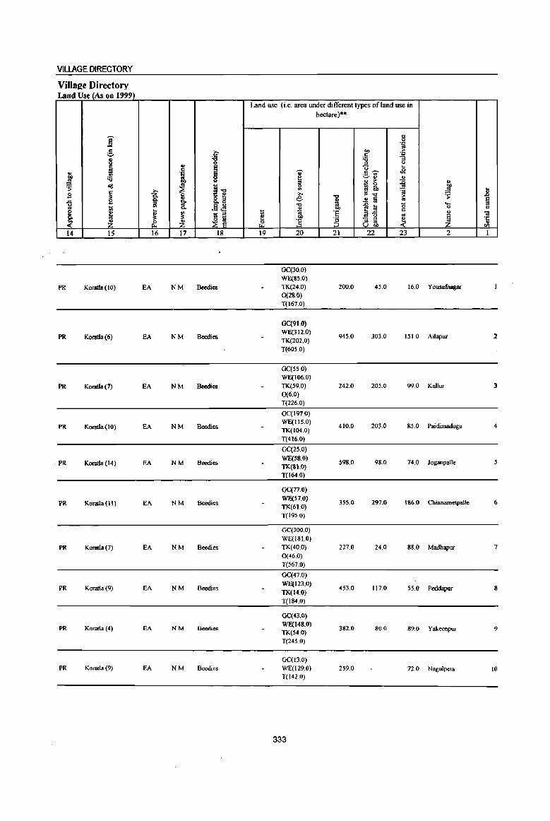
VILLAGE DIRECTORY
ViIlaee Directory Land Use (As on 1999)
Land use (i.e. area under different types ofland use in hectare)··
i c 0 .'"
g a co ~ s:: 'J::
8 'g 'il "3 .. :::> <>
i ! "0 ....
j l v c ~ .a ._ OIl
'il ~ ~ ., ., .. > ~
., ~ old ~ ~.,;
0 ~~ "" ~ j
., =a .!!! .. s 8.~ e: -0
;!:.., > ~ .8 ., .!! Iii .. § .., £ ~ * u
.~~ ..,
""'] ~ ..... .. 1;; Q.
~ co 0 c
e ~ ... ., ~ 'e ~ u
C ., u ., .. 'iI
Q. at at ~ ~
., ] ~ & :3 - ::> ~
·c ~ Z & Z a~ " ell
14 15 16 17 18 19 20 21 22 23 2 I
Ge(30.0) WE(3S.0)
PR KomtJa(IO) EA NM Beedies TK(24.0) 200.0 45.0 16.0 Yousufuagar 0(28.0) T(167.0)
GC(91.0)
PR KoratIa(6) EA NM Beedies WE(312.0)
945.0 303.0 151.0 Ailapur 2 TK(202.0) T(60S.0)
Ge(SS.O) WE(106.0)
PR Komtla(7) EA NM Beedies TK(59.0) 242.0 20S.0 99.0 Kallur 3 0(6.0) T(226.0)
GC(197.0)
PR Komtla(IO) EA NM Beedies WE(IIS.O) TK(104.0)
410.0 203.0 85.0 Paidimadugu 4
T(416.0)
GC(25.0)
PR KomtJa(14) EA NM Beedies WE(SS.O)
S98.0 98.0 74.0 Joganpalle TK(Sl.O) T(I64.0)
GC(77.0)
PR Koratla {II ) EA NM Beedies WE(57.0) TK(61.0)
355.0 297.0 \36.0 Chinnametpalle 6
T(195.0)
GC(300.0) WE(18LO)
PR Koratla (7) EA NM Beedies TK(40.0) 227.0 24.0 88.0 Madhapur 7 0(46.0)
T(S67.0)
GC(47.0)
PR Koratla (9) EA NM Beedies WE(123.0)
453.0 117.0 55.0 Peddapur 8 11«14.0) T(I84.0)
GC(43.0)
PR Komtla(4) EA NM Beedies WE(148.0)
382.0 80.0 89.0 Yakeenpur 9 TK(54.0) T(245.0)
GC(I3.0) PR Komtla (9) EA NM Beedies WE(129.0) 259.0 72.0 Nagulpeta 10
T(142.0)
333
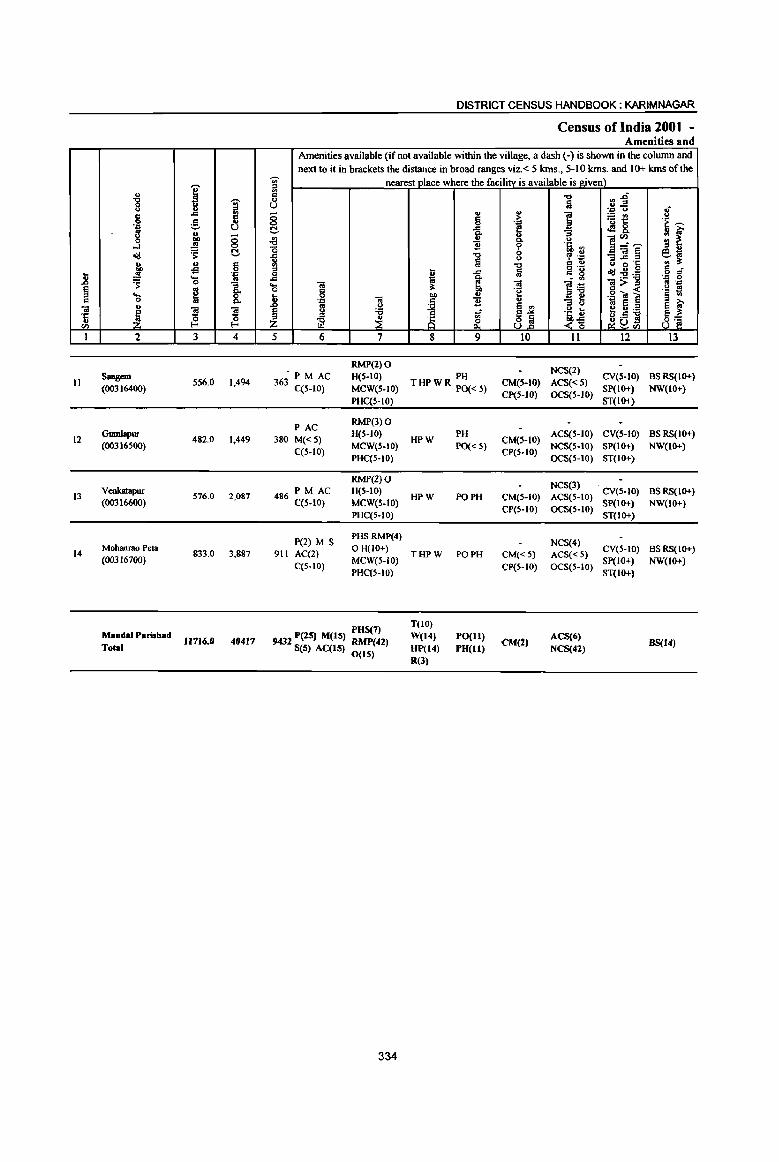
J! § c:
<a ·c ... CIl
I
II
12
13
14
" "8 g
',c
g .J o<j
a .!1l ~ .... 0
" ~ 2
Saogem (00316400)
GumJaput (00316500)
vcokataput (00316600)
Mobanrao pef3 (00316700)
MandalParishad Total
,.-...
i I ., ..= g U u
0 00)
.!1l 0
~ C!-.. c: of! 0
'ia ... 0 "3
~ 8: :l :l ~ 0
I-<
3 4
556.0 1,494
482.0 1,449
576.0 2,087
833.0 3,887
11716.0 40417
DISTRICT CENSUS HANDBOOK: KARIMNAGAR
Census ofIndia 2001 -Amenities and
Amenities available (if not available within the village, a dash (-) is shown in the column and nextto it in brackets the distance in broad ranges viz.< 5 kms., 5-10 kms. and 10+ kms of the
:g nearest place where the facilitv is available is given) a " u
8 C!-.{g -0 ] 5
..<::: ... <a 0 6 .8 <a .:::
to U
~ <> :a ~ ~
5 6 7
RMP(2) 0 • PM AC H(S-IO)
363 C(S-IO) MeW(S-IO)
PHC(S-lO)
PAC RMP(3) 0
380 M«S) H(S-IO)
C(S-IO) MCW(S-IO) PHC(S-IO)
RMP(Z) 0 PM AC H(S-IO)
486 C(S-IO) MCW(S-IO) PHC(S-IO)
P(2) M S PHSRMP(4)
911 AC(2) OH(IO+)
C(S-IO) MCW(S-iO) PHC(S-IO)
POS(7) 9432 pelS) M(15) RMP(42)
8(5) AC(lS) 0(15)
334
'" §
~ 11 -0 §
t ..<:::
~ ~ bI) .. c: 11 ~ ..: ;§ ~ 8 9
PH THPWR PO«S)
HPW
HPW
THPW
T(lO)
W(14}
HP(14) R(J)
PH
PO« 5)
PO PH
PO PH
rO(II)
PO(II)
., > ',c e .. Q. '( 0 u .., a
<a -~ u S .,
~] 10
CM(S-IO) CP(S-IO)
CM(5-IO) CP(5-10)
CM(S-IO)
CP(S-IO)
CM« 5)
CP(S-IO)
CM(2)
.., Iii
] ] '11 ij cp ".= c: .,
~'~
]~ -; t3
j~ 11
NCS(2)
ACS«5) OCS{S-IO)
ACS(S-IO)
NCS(S-IO) OCS(S-IO)
NCS(3) ACS(S-IO)
OCS(S-IO)
NCS(4) ACS« 5) OCS(S-IO)
ACS(6) NCS(42)
:J~ ',c u ~t! .:!8, ]~,.-... _<a§j e~ '''; .:d:!i,ij <a>:o c: -< ,g till ~ Ii:a ~a.;J
12
CV(S-IO)
SP(IO+)
ST(lo+)
CV(S-IO)
SP(IO+) ST(lO+)
CV(S-IO) SP(IO+) ST(IO+)
CV(S-IO) SP(IO+) ST(IO+)
:f .~ ,.-...
~ r 610 ... ~ c: _ o '" .'" 0 .. '."
.~ ~ ~ ~ 8~
13
BSRS(IO+)
NW(IO+)
BSRS(IO+)
NW(IO+)
BSRS(IO+) NW(IO+)
BS RS(IO+) NW(lo+}
88(14)
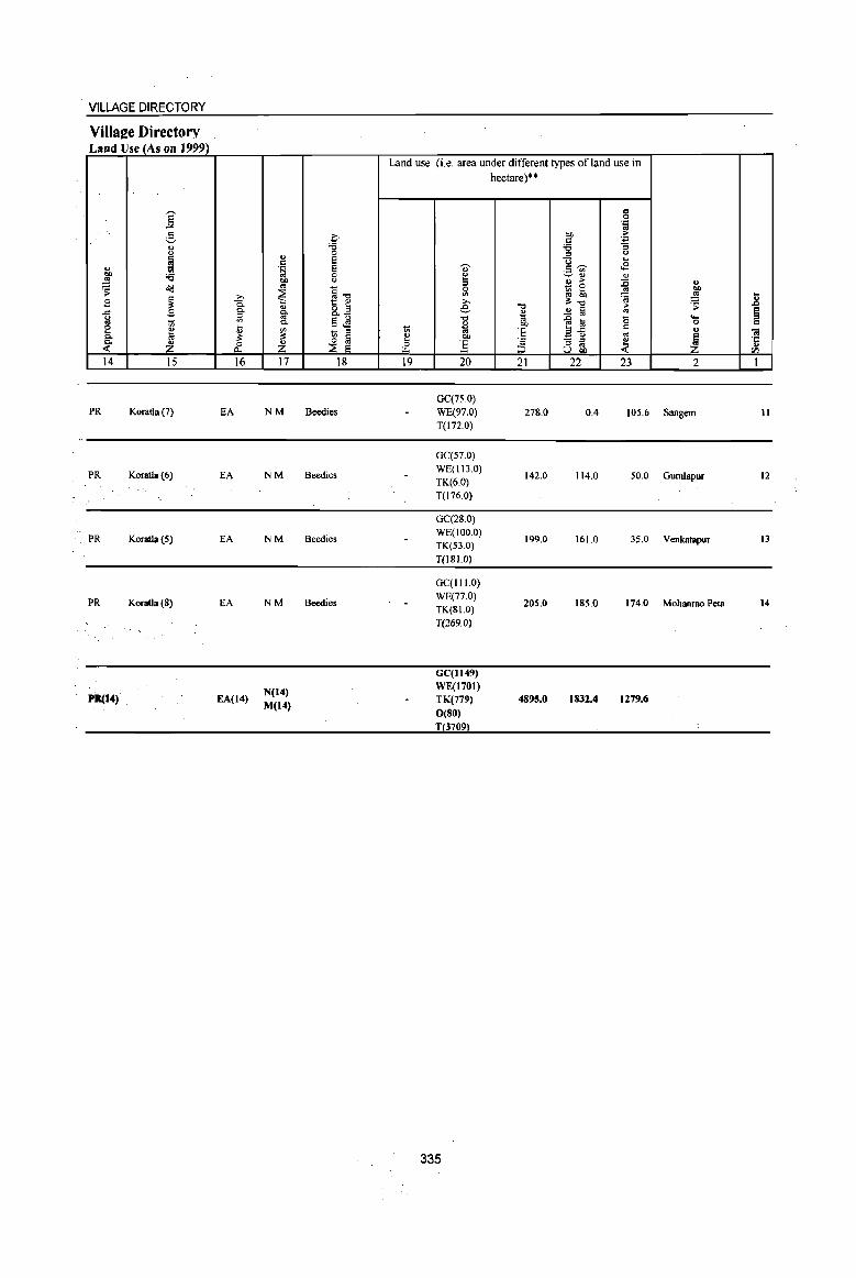
VILLAGE DIRECTORY
VilIae:e Directory Land Use (As (In 1999)
Land use (i.e. area under different types of land use in hectare)··
]: 8 .~
3 c 00 ·E c '" '8 '6 :; <.>
'" ..2 <.>
~ e ... c .,. g~ <8 '" .~ E .~ '" 00 :a 0 e ~'" '" ~ 00 " ::l ., > ~ " ~ ~ eo
~"O 0 t; 0 00
~ ~ '" ~~ ~ ~ .8 B ~ 1:: '" ;>, c. " R~ e "0 ..!l § ~
.;;: § ... .s c. ft ~ g iil "0 "§ a 0 ....
M c. 5.,s '" eo 0 c e il '" ti ~ 'E .=-5
c u ;a 1;; " oS c. :t " ~ ~ ~ eo ·s - '" ~ ~ '6 ~ Z ~ Z 0 ] a ~ u.. ::J til
14 15 16 17 18 19 20 21 22 23 2 1
GC(7S.0) PR Koratla (7) EA NM Beedies WE(97.0) 278.0 0.4 105.6 Sangem 11
T(lnO)
GC(S7.0)
PR Koratla(6) EA NM Beedies WE(II3.0)
142.0 114.0 50.0 GumJapur 12 TK(6.0) T(176.0)
GC(28.0)
PR Koratla(S) EA NM Beedies WE(IOO.O)
199.0 161.0 35.0 Venkatapur 13 TK(53.0) T(lSI.O)
GC(1I1.0)
PR Koratla(S) EA NM Beedies WE(77.0)
205.0 IS5.0 174.0 Mohanrao Peta 14 TK(SI.O) T(269.0)
GC(1I49)
N(14) WE(1701)
P1t(14) EA(14) M(14)
TK(779) 4895.0 1832.4 1279.6
0(80)
T 3709
335
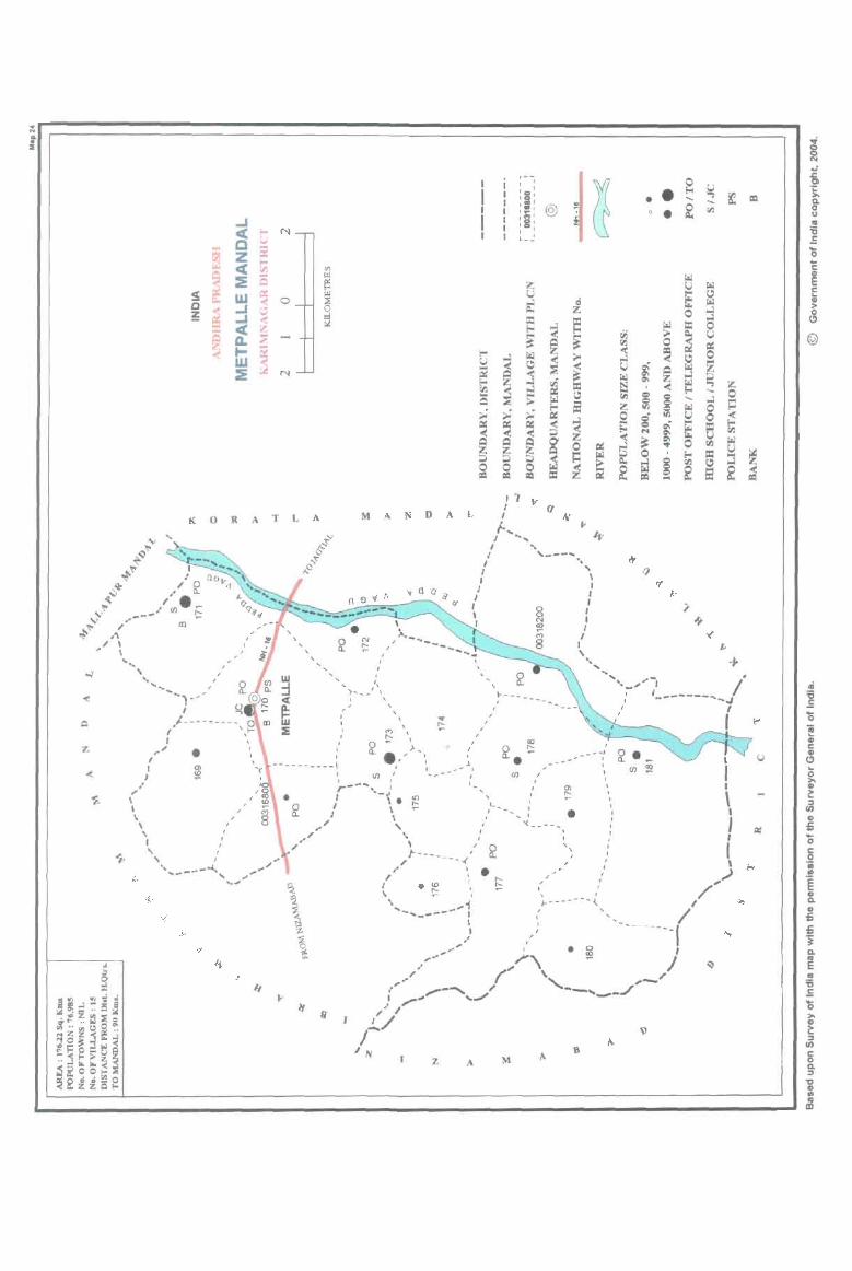
K 0 R A
" I .... J
" .. \ I ~ ,
I I ,
, I ,
...... ) .. .. ,. .1
, ,/--- - ----- 0 , \~
"'." •
I
,
/ , ,
T L
,
A
, ,
M A N D A
\
,"--.. / ----
, " .'
, I
...,. ......... /\ ~ , , \
I
z
I i I ,
~ ~ I I I '
I I :§: ~
I I I~I @ • • ~
I ,'"
-... ~
I ,g'
o • ~ I I
I '
CIJ
L_~
L J 1 .. I (f
1-... / ... , , " I ,---.. 1 " J ' , ' I I
I I , I I I I
I I
I , -,~
\ , , ",
A
I
I
M
.. , ,--"" ... -, ,: ,-------... /
, -..I , I
..... ./ I
=

PART A -VILLAGE AND TOWN DIRECTORY
ALPHABETICALLISfOFVlLLAGES(MANDALPARISHAD WISE), KARIMNAGARDISTRICf
Serial Name of village
number
2
Name of MandaI Parishad : Metpalle
Name of MandaI :Metpalle 0024 1 Athmakur
2 Choulamaddi
3 Jaggasagar
4 Kondrikarla
5 Masaipeta
6 Metlachittapur
7 Metpalle
8 Ramchandrampeta
9 Ramlachakkapeta
IO Rangarao Peta
11 Regunta
12 Vellulla
13 Vempet
14 Venkatraopet
15 Vittampeta
2001 Census
location code number
3
00318100
00317200
00317800
00318200
00317400
00317700
00317000
00317500
00317900
00318000
00316900
00317300
00317100
00316800
00317600
337
1991 Census
location code number
4
200230023002300014
200230023002300006
2002300230023000 11
2002300230023000 15
200230023002300007
200230023002300010
200230023002300003
200230023002300008
200230023002300012
2002300230023000 13
20023002300230000 1
200230023002300005
200230023002300002
200230023002300004
200230023002300009
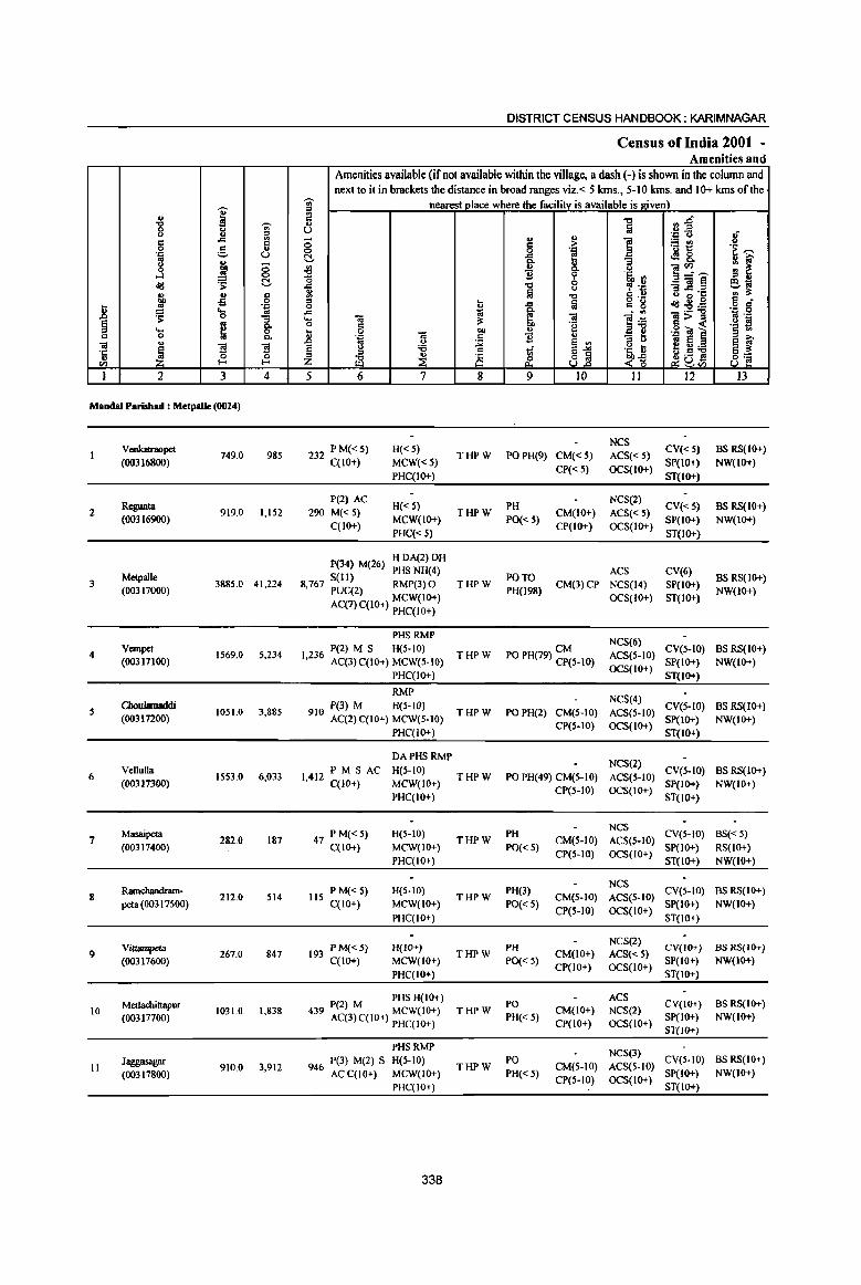
I .g 'Ui' u () .8 a § c g " . .c U '" .. g
~ ;;
..l 0
~ ~ t!,
" .. " OIl oS 0
] !! '.g .... '" ~ 0 :; § ~ 0-... 0 c 0 0-.. "
~ '3 '3 'C
u t: 0 <fl I-
I 2 3 4
Mandai Parishad : MetpaUe (0024)
V cnkatraopet 749.0 985
(OO316800)
Rcgunta 2 919.0 1.152
(OO316900)
Melpalle 3 3885.0 41,224
(00317000)
4 Vcmpet
IS69,O 5,234 (00317100)
5 Cboulamaddi
1051.0 3,885 (00317200)
Vellulla 6 1553.0 6,033
(00317300)
Masaipeta 7
(00317400) 282.0 187
Ramchandram-8 212.0 514
peta (00317500)
Vittampeta 9 267.0 847
(00317600)
10 Metlachittapur
1031.0 1,838 (00317700)
Jaggasagar II 910.0 3,912
(00317800)
DISTRICT CENSUS HANDBOOK: KARIMNAGAR
Census of India 2001 -Amenities and
Amenities available (if not available within the village, a dash (-) is shown in the column and next to it in brackets the distance in broad ranges viz. < 5 krns., 5-10 krns. and 10+ krns of the
'Ui' nearest place where the facility is available is J!;iven) '" a -0 n~ ...
lii u ... ... .J: U If ;; c :> 1 ~t! 0 0 '.g '~ '"' t!, i i .:18.
~ ! ~ U ~~~ '0 'i' '5, ., ,<;I -0 0 , .~ "3] ~ ~J (J
~ lii ." e u Co) o·C
'" u ta o ,_
JduB .g 8' 0 .c c g :'5!:a .c 1;j ~ . .,
-.; e:ij 1>~ '" .-.... .. ;s: '~ ~ 0 C 'e .. 0 bIl ~ E !! 'J: "iii ] ... .~ 11 c B " 8 i' .0 ~ e ., '" () g_~'g E y 'i3 ti e--= ~~ '" e_
'" -0 _i is ~ 81 ~uv.; 8 'a Z UJ
5 6 7 8 9 10 II 12 13
232 PM«S) H«5) NCS
CV«S) BSRS(lO+) THPW POPH(9) CM«5) ACS«5)
C(lO+) MCW«5} CP« 5) OCS(IO+)
SP(IO+) NW(IO+}
PHC(IO+) ST{IO+)
P(2) AC H{< S) PH
NCS(2) CV«5) BS RS(IO+)
290 M« 5) THPW CM(IO+) ACS«S) C(IO+)
MCW(IO+) PO« 5) CP(IO+) OCS(IO+)
SP(IO+) NW(JO+)
PHC«5) ST{lO+)
P(34) M(26) H DA(2) DH
S(II) PHS NH(4)
PO TO ACS CV(6)
BSRS(IO+) 8,767 PUC(2) RMP(3) 0 THPW CM(3)CP NCS(14) SP(IO+)
AC(7)C(10+) MCW(IO+) PH(198)
OCS(IO+) ST(IO+) NW(IO+)
PHC(IO+)
PHS RMP NCS(6)
P(2) M S H(5-10) THPW PO PH(79) ~~S-IO) ACS(S-IO)
CV(5-1O) BS RS(JO+) 1,236 AC(3) C(IO+) MCW(S-IO)
OCS(IO+) SP(IO+) NW(IO+)
PHC(IO+) ST(IO+)
RMP NCS(4)
9 0 P(3) M H(S-IQ) THPW PO PH(2) CM(S-IO) ACS(5-1O)
CV(S-IO} BS RS(IO+) I AC(2)C(10+) MCW(5-IO) SP(IO+) NW(IO+)
PHC(IO+) CP(5-10) OCS(IO+)
ST(IO+)
DAPHSRMP NCS(2)
PM S AC H(5-10) CV(S-IO) BS RS(IO+) 1,412 C(10+) THPW PO PH(49) CM(S-IO) ACS(S-IO)
MCW(lO+) CP(S-IO) OCS(IO+)
SP(lO+) NW(IO+)
PHC(IO+) ST(IO+)
47 PM«5) H(5-1O) PH NCS
CV(5-1O) BS« 5) C(IO+) MCW(10+)
THPW PO« 5)
CM(S-IO) ACS(S-IO) SP(10+) RS(IO+)
PHC(IO+) CP(5-1O) OCS(IO+)
ST(10+) NW(IO+)
lIS PM«5) H(5-10) PH(3) NeS
CV(S-IO) BS RS(IO+) THPW CM(5-IO) ACS(5-IO)
C(IO+) MCW(IO+) PO« S) CP(5-IO) OCS{IO+)
SP(IO+) NW(IO+)
PHC(IO+) ST(IO+)
193 PM«S) H(IO+) PH NCS(2)
CV(IO+) BS RS(10+) THPW CM(IO+) ACS« 5)
C(IO+) MCW(IO+) PO« 5) CP(IO+) OCS(IO+)
SP(IO+) NW(IO+)
PHC(IO+) ST(IO+)
PHS H(IO+) PO
ACS CV(IO+) BS RS(IO+) 439 P(2) M MCW(IO+) THPW CM{lO+) NCS(2)
AC(3) C{lO+) PHC(IO+) PH« 5) CP(IO+) OCS{lO+)
Sp(IO+) NW(IO+)
ST(IO+)
PHSRMP NCS(3)
946 P(3) M(2) S H(S-IO) PO CV(S-IO) BS RS(IO+) THPW CM(S-IO) ACS(S-IO)
AC C(IO+) MCW(lO+) PH« 5) CP(S-IO) OCS(IO+)
Sp(IO+) NW(IO+)
PHC(IO+) ST(IO+)
338
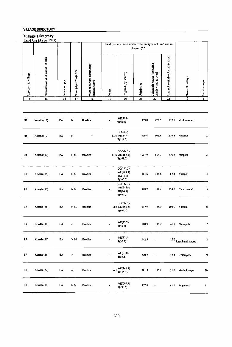
VILLAGE DIRECTORY
Villa2e Directory Land Use (As on 1999)
Land use (i.e. area under different types ofland use in hectare)··
j c 0 . .,
.9 ~ OIl ~ ._, c: . ., .. '8 'i3 ;;
I E <> .. e .... .~ ~
t> t2 g c~
~ ., ;.::..:l 'i3 ~
., .!! l
u .. > :0 .. ~
_ 0
~ ~ ~-c £ ~ to .. ~
» >, ~"t:I 'oj ::: .8 .g ]: ~ 8.~ e "0 2a > ·S
§ ..c .s ., .. ~ i'l .9 ~ "0 '" .CJ a <5 '0 1;; t:I. .. ""
c e " II "' 1;; t;; 'E ~{i c II "01
_ ::l
'" t:I.
.~ ~ ;!; .Il f eo ~
- ::l
~ ~ ·c -< ~ _i_ & Jj ::l os ..
U OIl (/J
14 15 16 17 18 II} 20 21 22 23 2 I
PR Koratla (12) EA N Beedies WE(70.0)
339.0 222.5 117.5 VenkatnIopet T(70.0)
GC(49.6)
PR Koratla (10) EA N 62.8 WE(64.4) 426.4 105.4 210.5 Regunta 2
T(114.0)
GC(394.2)
PR Kontla{IO) EA NM &edies 63.5 WE(167.5) 1107.9 853.0 1298.8 Metpalle 3 T(S6 I. 7)
GC(277.2)
PR Koratla (IS) EA NM Beedies WE(204.4)
TK(78.9) 804.6 136.8 67.1 Vempet 4
T(560.5)
GC(182.1)
PR Koratla (10) EA NM Bcedies WE(246.9)
368.2 34.4 154.6 Choulamaddi 5 TK(64.7)
T(493.7)
GC(332.7)
PR Koratla (IS) EA NM Bcedies 2.8 WE(361.8) 617.9 34.9 202.9 Vellulia 6
T(694.4)
PR Koratla (16) EA Beedies WE(43.7)
T(43.7) 160.9 35.7 41.7 Masaipeta 7
PR Koratla (16) EA NM Beedies WE(S7.5)
142.5 12.0 Ramchandrampeta g
T(S7.5)
PR Koratla (21) EA N Beedies WE(53.8)
200.7 12.4 Vittampeta 9 T(S3.8)
PR Koratla (22) EA N Beedies WE(14S.3)
6.1 T(l4S.3) 781.5 46.6 51.6 Metlachittapur 10
PR Koratla {I 8) EA NM Beedies WE(290.6)
557.8 61.7 Jaggasagar II T(290.6)
339

.. ~ ~ '" -a '0 u
CIl
I
12
13
14
15
u -g u a 0 'p
g ...l old u OIl
..!!! 's: .... 0 u
~ 2
Ramlachakkapeta (00317900)
Rangarao Pcta (00318000)
Atbmakur (00318100)
Kondrikarla (003182oo)
MandalParishad Total
I ~ ..a a g u () ., ;; OIl
..!!! 0
's: (:!,
u a -s 0 'p .... ..
0 "3
~ c. 8.
]I ]I ~ 0 .... 3 4
728.0 1,465
998.0 817
2261.0 4,861
1206.0 4,031
17621.0 7698S
DISTRICT CENSUS HANDBOOK: KARIMNAGAR
Census of India 200t -Amenities and
Amenities available (if not available within the village, a dash (-) is shown in the column and next to it in brackets the distance in broad ranges viz_ < 5 kms., 5-10 kIDs. and 10+ kms of the
'Ui' nearest place where the facility is available is e:iven) " ., a .", ~~ .,
~ C) 1{ ., ., 'p <> ;; 6 ;. ] 'B~ 0 ... 'e ,.-.,
(:!, .g, e <1!18. 1l i;' ., " u "3
]~'"' '" ~ ~ u
.", ~ 's, '" " " 0 .", ~ .~ _Ol~ 6-;; ..a <> u a ".t:: -c:: '" ~ ., "0 g .!! " 0 0 a " u 1 fa = g oId~:e o " 0 ..a til jj 'B .~ .... 'Ol :s: liI -a:>::>
0 6 -g 5 < '§ t! ] -a "" ] 'p Ii ~ 'p "
AJ ::l " iL~ .. " ~ ~ ~ :a
~ u :a 1i .~ ~ ;Z ~a~ ~ 8 ~ ~~ 8]
5 6 7 8 9 10 11 12 13
P(2) AC H(S-IO)
NCS(2) CV(S-IO) BS RS(Ifr+)
334 M«5) THPW PO« 5) CM(5-10) ACS(S-IO) C(lfr+)
MCW(IO+) PH« S) CP(S-IO) OCS(Ifr+)
SP(Ifr+) NW(IO+) PHC(IO+) ST(IO+)
180 P(2) M« S) H(IO+) NCS(2)
CV(IO+) BS RS(Ifr+) THPW PO« S) CM(Ifr+) ACS«S)
C(1fr+) MCW(Ifr+) PH(5-IO) CP(IO+) OCS(Ifr+)
SP(IO+) NW(IO+) PHC(IO+) ST(Ifr+)
PHSRMP NCS(5)
P(4) M S H(IO+) PO CV(Ifr+) BS RS(IO+) 1,136 AC(3) C(1fr+) MCW(IO+) THPW
PH(5-IO) CM(lO+) ACS(IO+)
SP(IO+) NW(IO+) PHC(IO+)
CP(10+) OCS(IO+) ST(IO+)
876 P(3) M(2) PHS H(IO+) NCS(4)
CV(lO+) BS RS(Ifr+) MCW(IO+) THPW PO PH(2) CM(IO+) ACS(IO+)
AC C(IO+) PHC(IO+) Cp(Ifr+) OCS(IO+)
Sp(Ifr+) NW(Ifr+) ST(Ifr+)
P(62) M(lS) 0 DA(l) DO MCW T(IS)
17113 S(IS) PHS(7) W(IS) PUC(2) NH(4) HP(15) AC(23) RMP(8) 0
PO(9) TO ACS(2) PH(J45) CM(4) CP NCS(SI) CV(6) 8S(14)
340

VILLAGE DIRECTORY
Village Directory Land Use (As on 1999).
'""" ] !, .,
<.>
~ g, '6 ..s
~ oa ,9 ~ .c .B
[ -:;; III
~ ~ 14 15
PR Koratla (19)
PR Koratla (26)
PR Koratla (22)
PR Koratla (15)
PR(IS)
?->
I tl il: &. 16
EA
EA
EA
EA
EA{I!!)
u c .~
"' ~ " ~ Q.
'" il: ~ 17
NM
NM
N
N(ll) M(S)
c '6 0 S S 0 C)
§"Q t:: ~
8.€ .!Ls - " :8 a ~ e
18
Beedies
Beedies
Beedies
Beedies
Land use (i.e. area under different types ofland use in hectare)"
,-.,
~ '" e
"d ., 1;; OJ ~ OIl
:5 u.. 19 20
WE(269.5)
T(269.5)
WE(58.3) T(58.3)
8665 WE(285.3) · T(28S.3)
27 I WE(210.8) · T(210.g)
GC(12JS.71)
10289 WE(2529.61} • ) TK(143.6S)
T(3909.0S)
341
-0 u t;! 01)
·E ·s :::;, 21
399.5
591.2
781.1
825.4
8104.7
c 0 .~
01) ~ C .=
'6 :;
-t C) ...
<2 C'""' u~ " " ~ :0 ~ ~ '" ~ il:"Q ~ 1ii '" ~ :a '0 a-fi c
'" - " ~ am, 22 23
59.0
18.3 330.3
147.4 180.8
34.4 108.3
1669.3 2909.1
" :: ..8 ~ § ._
0 C iLl O!
~ ·c u rn
2 1
Ramlachakkapeta 12
Rangarao Peta 13
AthmakUI 14
Kondrikarla IS
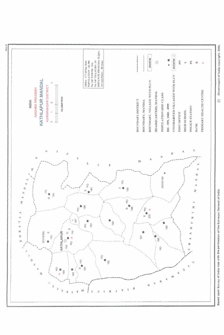
L p
==
• ;; .5 os i c • " ~ • ~ ::I II)
• 5 OS c o iii ., ! • Q.
• 5 ~ "i Q.
E • ;; .E OS ... • c: ::I II)
1 ::I 'til • :I CD

PART A - VILLAGE AND TOWN DIRECTORY
ALPHABETICALLISTOFVILLAGES (MANDALPARISHAD WISE), KARIMNAGARDISTRICf
Serial
number
Name of village
2
Name of MandaI Parishad: Kathlapur Name of MandaI : Kathlapur 0025
1 Ambaripet
2 Bhushanrao Peta
3 Bommena
.. Chinthakunta
S Dulur
6 Dumpeta
7 Gambhirpur
I Jppapalle
9 Kalikota
10 Kathlapur
11 Naga Mallappakunta
12 Ootpalle
13 Peggerla
14 Posanipeta
15 Potharam
16 Sirkonda
17 Thakkallapalle
18 Thandriyal
19 Thurthi
2001 Census
location code number
3
00320000
00319100
00318500
00319200
00318600
00319300
00319500
00319700
00319900
00318800
00318700
00319000
00318900
00319400
00319800
00318300
00318400
00319600
00320100
343
1991 Census
location code number
4
200240024002400018
200240024002400003
200240024002400008
200240024002400011
200240024002400009
200240024002400010
200240024002400013
200240024002400015
200240024002400017
200240024002400004
200240024002400005
200240024002400002
200240024002400001
2002400240024000 12
2002400240024000 16
200240024002400006
200240024002400007
200240024002400014
2002400240024000 19
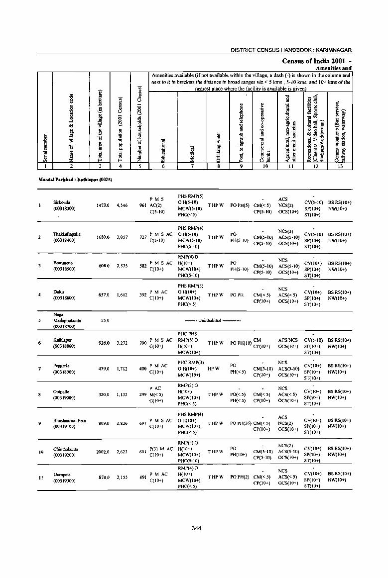
I '" "8 "Ui' '" ij!
c .c c 0 ~ " ·a U .. g ~ 0
....:I ::l 0
"" .:; c:!,
" ., § co -s
] ~ . .,
'8 '" 'S :i ~ ~
p, .... 0 C Q 0. Iii '"
~ "3 ~ ·c .. 0
ell ...... ......
1 2 3 4
Mandai Parishad : Kathlapur (0025)
SiIkonda 1473.0 4,546
(00318300)
2 Thakkallapalle
1680.0 3,057 (00318400)
3 Bommena
608.0 2,575 (00318500)
4 Dulur
657.0 1,612 (00318600)
Naga 5 Mallappalrunta 55.0
(00318700)
6 KathJapur
926.0 3,272 (00318800)
Peggerla 7 439.0 1,712
(00318900)
8 Ootpalle
320.0 1,132 (00319000)
9 Bhushanrao- Peta
809.0 2,826 (00319100)
Chintha1runta 10 2002.0 2,623
(00319200)
Dumpeta 874.0 2,155 II
(00319300)
DISTRICT CENSUS HANDBOOK: KARIM NAGAR
Census of India 2001 -Amenities and
Amenities available (if not available within the village, a dash (-) is shown in the column and next to it in brackets the distance in broad ranges viz. < 5 kms., 5-10 kms. and 10+ kms of the
'" nearest place where the facility is available is given) ::> U) = -0 ;~ " u Iii .= u- 8 8 "
.., ] 'rit! § >
.~ .~ ~ c:!, .c C!!&.
i u " ] ~-j ~ ~ .;g Po <> (5 b .§' '" ., -0 'P .~ -"' e~ '" €l ~·c " :a c '" '" :. '" "0 ::>
~ Iii o .-"":s!;~
c _ 0 ..c c g
l~ ..c ~ . '" .... 01 ~ iii ]:a 1>~ 0 c ·2 ._ l!!
I; 0
I .., ·g""l § III
.J:! Iii 11 ..,
:i ~ e ~ .D os <> e '" ~fi:a § " :a li 8~ .5, t e~ ::> '" .:/ S
~ ~ &. .(-g 8~ Z ~~eIl 5 6 7 8 9 10 11 12 13
PMS PHS RMP(5)
ACS 961 AC(2)
OH(5-IO) THPW PO PH(S) CM«5) NCS(2)
CV(S-IO) BSRS(IO+)
C(5-10) MCW(S-IO)
CP(5-10) OCS(IO+) SP(lo+) NW(IO+)
PHC«5) ST(IO+}
PHSRMP(4) NCS(3)
727 PM S AC OH(5-IO) THPW
PO CM(HO) ACS(5-10)
CV(S-IO) BS RS(IO+) C(5-10) MCW(5-10) PH(S-IO)
CP{5-1O) OCS(IO+) SP(IO+) NW(IO+)
PHC(S-IO) ST(IO+)
RMP(4) 0 NCS
582 PM S AC H(IO+} THPW
PO CM(5-10) ACS(S-tO)
CV(10+) BS RS(1O+) C(IO+) MCW(IO+) PH(S-IO)
CP{5-1O) OCS(lO+) SP(IO+) NW(lO+)
PHC(S-IO) ST(IO+)
PHSRMP(3) NCS
392 PM AC o H(IO+) THPW PO PH CM«S) ACS« 5)
CV(lO+) BS RS(IO+) C(IO+) MCW(IO+)
CP(IO+) OCS(IO+) SP(IO+) NW(lO+)
PHC«5) ST(IO+)
--Uninhabited ---
PHCPHS
790 PM S AC RMP(5) 0 THPW PO PH(IO) ~~IO+) ACSNCS eV(S-IO) BSRS(IO+)
C(IO+) H(IO+) OCS(IO+) SP(IO+) NW(IO+) MCW(lO+) ST(IO+)
400 PM AC PHC RMP(3)
PO NCS
CV(IO+) BSRS(IO+) OH(IO+) HPW CM(5-10) ACS(5-10)
C(IO+) MCW(IO+)
PH« 5) CP(IO+) OCS(IO+)
SP(lO+) NW(IO+) ST(IO+)
PAC RMP(2) 0
NCS 299 M«5)
H(IO+) THPW PO« 5) CM«5) ACS«5)
CV(lO+) BSRS(IO+)
C(IO+) MCW(IO+)
PH« 5) CP(IO+) OCS(IO+) SP{IO+) NW(IO+)
PHC« 5) ST(lO+)
PHS RMP(4) ACS
697 PM S AC o H(IO+) THPW PO PH(36) CM« 5) NCS(2)
CY(IO+) BS RS(IO+) C(IO+) MCW(IO+)
CP(IO+) OCS(IO+) SP(IO+) NW(lO+)
PHC« 5) ST(10+)
RMP(4) 0 NCS(2)
P(3) M AC H(IO+) PO CY(IO+) BS RS{10+) 601 THPW CM(S-IO) ACS(5-10)
C(lO+) MCW(IO+) PH(IO+) CP(5-1O) OCS(IO+)
SP(lO+) NW(IO+) PHC(S-IO) ST(IO+)
RMP(4}0 NCS
491 PM AC H(IO+)
THPW PO PH(2) CM«5) ACS«5) CV(IO+) BS RS(IO+)
C(IO+) MCW(IO+) SP(IO+) NW(lo+)
PHC« 5) Cp(IO+) OCS(IO+)
ST(lo+)
344

VILLAGE DIRECTORY
Villae;e Directory Land Use (As on 1999)
j g ~ ., :a '" ., 0
~ ~ ~ . ~ :a ~ toO
~
~ ~i1 .s: ~ B ~
~ B '"' ~ o ~
~ '"'u ~ .... Q, .5 of!
~ .. ... ;;; - = ~ il: ~ ~ ~ &. ~
14 15 16 17 18
PR KoratIa(8) EA N Beedies
PR KoratIa(IO) EA N Beedies
PR Koratla (15) EA N Beedies
PR KoratIa (12) EA N Beedies
--Uninhabited--
PR Kontia(IO) EA NM
PR KoratIa (15) EA N Beedies
PR KoratIa (13) EA N Beedies
PR KoratIa (12) EA N Beedies
PR Koratla (15) EA N Beedies
PR Koratla (12) EA N Beedies
Land use (i.e. area under different types ofland use in
~ e .2 19
u ~ 0 ., e: .."
~ "" :s
20
WE(221.0) T(22 1.0)
WE(2IS.5) T(218.S)
WE(159.9) T(159.9)
WE(186.2) T(186.2)
WE(4.0)
T(4.0)
WE(303.5) T(303.S)
WE(163.9)
T(163.9)
WE(123.4)
T(123.4)
29 9 WE(238.8) . T(238.8)
8025 WE(143.7) . T(143.7)
WE(167.9)
T(167.9)
345
hectare)··
.." ., 10 "" 'E ;§ 21
938.1
1206.0
403.5
358.2
39.3
557.7
137.5
170.4
471.5
596.9
549.6
c 0 . ."
bO ~
:a . ." '3
= u u .. c~ ..s ~:J ., ., >
~ ... _ 0
bO ~ 6h :a ~ il:.." > 'S ..2 § '" .0 ::. 0 '-
~'fi c 0 .. ... "3 ~ ~ ~ u""
22 23 2
115.3 198.7 Sirl<onda
163.1 92.4 Thakkallapalle
13.4 31.3 Bommena
64.8 48.0 Dulur
3.2 8.5 Naga Mallappakunta
49.8 15.0 Kathlapur
68.0 69.6 Peggerla
26.2 OotpaIle
4.5 64.4 Bhushanrao Peta
214.5 244.5 Chinthakunta
31.2 125.3 Dumpeta
.. ..8 § c Oi ·c u
'" I
2
3
5
6
7
8
9
10
II
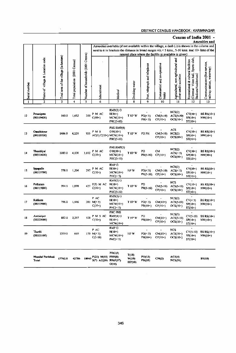
I u -g ~ <> .,
" .d
" 0 g u .J:: u .. g : 0 -l 0
~ ~ t!-u ~ C .., 0
j .!! .~ .... ~ 0 :;
~ ~ '" .... 0 c 0 a. u <il
1 "El "El ·c 0 0 u ~ ~ <Il
I 2 3 4
Posanipeta 12 540.0 1,452
(00319400)
13 Gambhirpur
1486.0 4,220 (00319500)
14 Thandriyal
1083.0 4,130 (00319600)
Jppapaile 15 778.0 1,204
(00319700)
16 Potharam
994.0 1,898 (00319800)
17 KUikota
796.0 1,446 (00319900)
18 Ambaripet
883.0 2,257 (00320000)
19 Thurthi
1359.0 669 (00320100)
MandaI Parishad 17762.0 42786
Total
DISTRICT CENSUS HANDBOOK: KARIMNAGAR
Census of India 2001 -Amenities and
Amenities available (if not available within the village, a dash (-) is shown in the column and
next to it in brackets the distance in broad ranges viz. < 5 krns., 5-10 kms. and 10+ kms of the "Vi' nearest Dlace where the facilitv is available is given) '" '"
n~ ii "t:I
u !a .; ., ~
'';:: CJ
0 ] ~t! <> c .~ ~ 0 0 .J::
t!- .c I.'! <l28. 3! ~ '" :;
~ .. &. u ]~i gj ~ ] 'i' 'i.2 .d "t:I 0 _<il eo; ., a 0
~ u 5 ~·c <II :l: '" "t:I
'" ~ a o ._
~ .. 0 '" -0 .c c: g :s!:ti o " .r: '" • III .:;: 0
.... OJ '" (¢
~:ti ~>~ fi . .::;: 0 c :l: to ·e ._ s ~ 0 .., ., .g"OJ ] § '" ·D ~ C 11 ., g ~ «I E El ~ .0 .. <> ~ !j ~ <> :a 7i .~ 6 2! ., :a
~] ~ ~ 8 ~a~ z &. ~~ 5 6 7 8 9 10 II 12 13
RMP(2)0 NCS(2)
PM AC H{IO+) CV(IO+) BS RS(lO+) 355 C{lO+) THPW PO« 5) CM(5-IO) ACS(5-IO)
MCW(lO+) PH« 5) CP(IO+) OCS(IO+)
SP(IO+) NW(IO+)
PHC(S-IO) ST(lO+)
PHS RMP(4) ACS
935 PMS o H(lO+)
THPW PO PH CM(S-IO) NCS(2) CV(JO+) BS RS(IO+)
AC(2) C(IO+) MCW(IO+) CP(IO+) OCS{IO+)
SP(IO+) NW(IO+) PHC(S-lO) ST(IO+)
PHSRMP(3) NCS(2)
1,012 PM AC OH(IO+)
THPW PO CM
ACS{< 5) CV(IO+) BS RS(to+)
C(lO+) MCW(IO+) PH{5-10) CP(IO+) OCS{IO+)
SP(IO+) NW(IO+) PHC(S-IO) ST(lO+)
RMPO NCS(2)
PM AC H{lO+) CV(IO+) BSRS(IO+) 297 C{10+) HPW PO« 5) CM(5-IO) ACS«5)
MCW(IO+) PH(5-10} CP(IO+) OCS(IO+)
SP{lO+) NW(IO+) PHC« S) ST(IO+)
RMP(2)0 NCS
427 P(2) M AC H(IO+)
THPW PO
CM(S-IO) ACS(S-IO) CV(IO+) BSRS(IO+)
C(IO+) MCW(IO+) PH(5-10) CP(IO+) OCS(IO+)
SP(10+) NW(IO+) PHC(5-10) ST(IO+)
PAC RMP(2) 0
NCS(3)
381 M«5) H(lO+)
THPW PO« 5) CM(IO+) ACS(S-IO) CV« 5) BS RS(10+)
C(IO+) MCW(IO+)
PH(IO+) CP(IO+) OCS(IO+) SP(lO+) NW(lO+)
PHC«5) ST(IO+)
PHCPHS NCS(3)
528 PM S AC RMP(4) 0 THPW
PO CM(IO+) ACS(S-IO)
CV(5-10) BS RS(IO+) C(IO+) H(IO+) PH(IO+) Sp(IO+) NW(IO+)
MCW(lO+) CP(IO+) OCS(IO+)
ST(IO+)
PAC RMPO
NCS
170 M«5) H(lO+)
HPW PO« 5) CM(IO+) ACS(IO+) CV(5-10) BS RS(IO+)
C(5-1O) MCW(IO+)
PH(lO+) CP(IO+) OCS(IO+) SP(IO+) NW(IO+)
PHC«5) ST(lO+)
PHC(J) T(lS)
10045 P(21) M(15) PHS(8) W(18)
PO(I3) CM(2)
ACS(4) 8S(18)
S(7) AC(20) RMP(S7) DP(18)
PD(SS) NCS(31) 0(18)
346
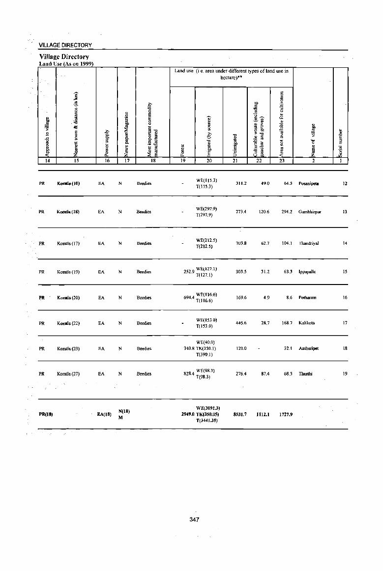
VILLAGE DIRECTORY
Village Directory Land Use (As on 1999)
--] g 8 ~ ~ .'8 oS
~ .td
~ 1 B -" g 'iii ~ u il
~ ~ ~ J:l.
14 15 16
PR Koratla (10) EA
PR Koratla (18) EA
PR Koratla (17) EA
PR Koratla (19) EA
PR Koratla (20) EA
PR Koratla (22) EA
PR Koratla (23) EA
PR Koratla (27) EA
PR(18) . EA(18)
., d .~
"" '" ~ ., §-c..
~ ~ 17
N
N
N
N
N
N
N
N
N(18)
M
c-~ a E E a " §"O 1: i2 &..2 .5 ~ - " ~ ~
18
Beedies
Beedies
Beedies
Beedies
Beedies
Beedies
Beedies
Beedies
Land use (i.e. area under different types of land use in
., ~ a Vl >, e
"0
~ 1;1 i2 Ol)
0 ] u.. 19 20
WE(IlS.3) T(115,J)
WE(297.9) T(297.9)
WE(212.S) T(212.S)
252.9 WE(127.1) T(127.1)
6944 W£(116.6) . T(116.6)
WE(153.0) T(153.0)
WE(40.0) 340.8 TK(3S0.1)
T(390.I)
828.4 WE(98.3) T(98.3)
WE(3091.3) 2949.0 TK(350.05)
T(3441.3S)
347
hectare)**
"0
~ Ol)
'E 'c ::J 21
311.2
773.4
703.8
303.5
169.6
445.6
120.0
276.4
8531.7
§ .~
Ol) j ~ " <l ..
.;: c---:.:..~ ., " > ~ - a gj @, 'ia ~"O
.S! § ~ "§ a '0 .2~ " '" "'3 " ~ U gJ,
22 23
49.0 64.5
120.6 294.2
62.7 104.1
31.2 63.3
4.9 8.6
28.7 168.7
32.1
87.4 68.5
1112.1 1727.9
., ~ ... ~ ..8
§ ..... a " ., OJ
1 ·c u
<I'l
2 I
Posanipela 12
Garnbhirpur 13
Thandriyal 14
Ippapa1le IS
Pothararn 16
Kalikota 17
Arnbaripet 18
Thurtbi 19

I
: VE
1I1VL <4 .),
I " I ,
I , t " , ' .. .. \
I ~, _,
' " : -----------, ' "80., ' 'I" ~ .' : \ J ~ • " I '-.,------ '., 8 / ' , ~: , 1-- ------ ------., ~ . i . ~ :, /
I - __ ,_ 10 , "
/ ~ r---.'"" " ,'''V\
lJ
I f '---- ----': ii' (' , ___ ' i I Ii I • r-- ,,_ .. , ,
' :J " ~ , "'-__ ---' a 00.. :~ r '--'( 2 • 'ii',
- , 4 '. , ~ ':I:.~ " ('oj I .... '0 N , Ii' .. <'oo ", ; ~ \ @ ~ ---- .. -- --,-- -------- ------- .... --t-.. -'---< i O~ ,__ , , , • +-- : ._ , ~ ------- , '" - I"
' 'f? ,"_, ' , , -'-., ' "., ' ° ., ' 0.. 0') ,,-, " ~,' 0 I ' .~ , ~ .. ,
/oo , ',,_, : ." " 'n."" '( , .,' 0. ;'... . i I " 1il " I , r
I " t--' _____ ____ -<-
I '_ I I
I , I ,
I I () 0
I ..., ~
,'. ~
" , , " 'r
I
,
I ' " " ..
" " , .. , " , " , " y
" I I ..
I .. CD 0 8 I 0.. I \ \ U) \ .... "', ) "\ ,
I I I
.... I \ .t. , , ____ ..
\~ "\: -J.. " J;;) I '\ \
~ <I '\ " <P \ I
",. \: (:) , \ '
~ \' J. I
tI>- I L \ 1.
" I I
I I
I ~ I I
._, ",. \,' i 1- l' 'f. $ ~ fl
I.)
\ \ \ \
f,.,
'-I
~
0
,. ~
TO KONARAOPET
,.
+
· ~ • •
, --. I . ,
I ' 0' I I : ~: I I I'I"'"'I@ I '§' 0 I I I ,
I I ' , , , I , , I I L __
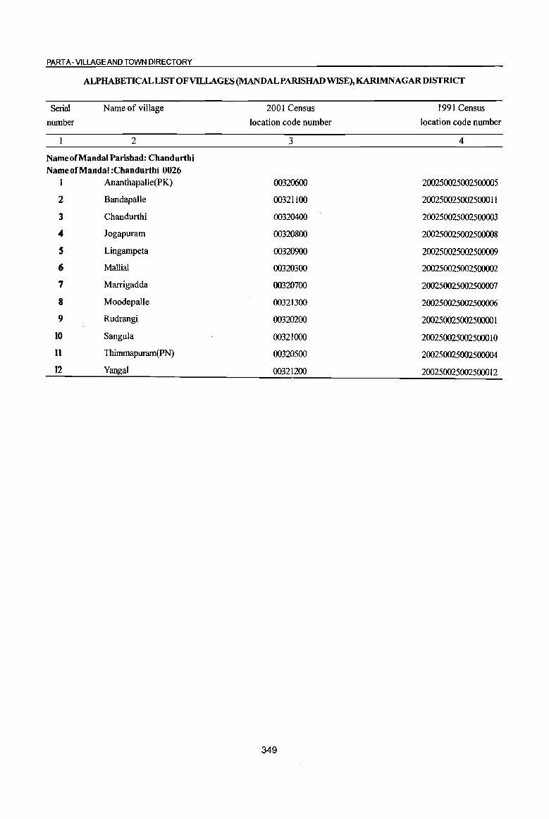
PART A -VILLAGE AND TOWN DIRECTORY
ALPHABETICAL LIST OF VILLAGES (MANDALPARISHAD WISE), KARIMNAGARDISTRICT
Serial
number
Name of village
2
Name of Mandai Parishad: Chandurthi Name of Mandai :Chandurthi 0026
1 Ananthapalle(PK)
2 8andapalle
3 Chandurthi
4 Jogapuram
S Lingampeta
(; Mallial
7 Marrigadda
8 Moodepalle
9 Rudrangi
10 Sangula
11 Thimmapuram(pN)
12 Yangal
2001 Census
location code number
3
00320600
00321100
00320400
00320800
00320900
00320300
00320700
00321300
00320200
00321000
00320500
00321200
349
1991 Census
location code number
4
200250025002500005
2002500250025000 I I
200250025002500003
200250025002500008
200250025002500009
200250025002500002
200250025002500007
200250025002500006
200250025002500001
200250025002500010
200250025002500004
200250025002500012
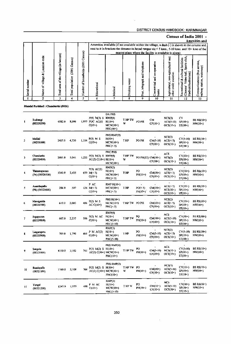
DISTRICT CENSUS HANDBOOK: KARIMNAGAR
Census of India 2001 -Amenities and
Amenities available (if not available within the village, a dash (-) is shown in the column and
next to it in brackets the distance in broad ranges viz. < 5 kms., 5-10 kms. and 10+ kms of the -;;;- nearest place where the facility is available is ltiven) ,.... @
'8 E (;) Ii -c> :J~ g U Iii <.> ::s '_P <.> ,; .. -= '" 0 " ~ ~ il ~t <> 0 .§_ ..
.~ ~ 0 0 '_P '_P U c:!- -= f! tS &. oS " ~ g ~ - ~ ]" ... '" 'i!'" :: ~ g Z <.>
...J ~ c:!- o .!:! 'Iii '" ll_:"'" '" " ~ -= '" ~ .~ =]~ e:-o; ... a " (I) 3: ~ u 9 III '" U 0 ·c oS '" ~ -= Iii gOg
~~~ C _
1! oS .~ 0 o 0::
~ ....
~ -= ~ Q, - ., .;: 0
0 .... 'i! ~ 'i!
~~ 'ii>", oS .~
~ ~ Co 0 c 'e c -< 'iH! ..... &. ... Q
'ii CI)
., .901 § c 0 ... 'J::: c '2 ., 0; S ::s ..,
'ii ., .0 .. <> ~ ~i
::s <J S ..
~ '3 '3 s " 'Ci 1;; '5, t ~ 0 :a s 1.l' .~
~ ~ ::s ::s
~ 8 ~a~ 8] til z ~ ~ U.o -<~ ~'" I 2 3 4 5 6 7 8 9 10 II 12 13
Mandai Parishad : Chandurthi (0026)
DAPHS
Rudrangi P(4) M(3) S RMP(4)
THPTW CM NCS(3) CV
BS RS(IO+) 4082.0 8,990 1,977 PUC AC(6) H(lo+) PO PH ACS(5-1O) SP(IO+)
(00320200) C(lO+) MCW(IO+)
W CP(JO+) OCS(IO+) ST(IO+)
NW(IO+}
PHC(IO+)
PHSRMP(9) NCS(3)
2 Mallia)
2407.0 4,730 1,114 P(3) M S H(IO+)
THP PO PH CM(5-10) ACS« 5) CV(5-10) BS RS(IO+)
(00320300) C(IO+) MCW(IO+) CP(IO+) OCS(IO+)
SP(IO+) NW(IO+)
PHC«5) ST(IO+)
PHCPHS ACS
3 Chandurthi
2801.0 5,041 P(5) M(3) S RMP(4) THPTW
PO PH(22) CM(IO+) NCS(2) CV(IO+) BS RS(IO+)
(00320400) 1,222 AC(2) C(IO+) H(IO+) W CP(JO+) OCS(IO+)
SP(IO+) NW(lO+) MCW(IO+) ST(IO+)
P(3) AC(2) RMP(2)
NCS(2)
4 Tbimmapw:am
1340.0 2,435 659 M« 5) H(lO+)
THP PO
CM(IO+) ACS« 5) CV(IQ+) 5S RS(IO+)
(Pn) (003205OO) C(lO+)
MCW(IO+) PH(IO+) CP(IO+) OCS(IO+)
SP(IO+) NW{IO+)
PHC«5) ST{IO+)
Ananthapalle PAC RMPH(IO+)
ACS« 5) CV(IO+) BS RS(IO+) 5 286.0 507 126 M« 5} MCW(lO+) THP PO« 5} CM(IO+)
(Pk) (00320600) C(IO+) PHC« 5) PH(IO+) CP(IO+)
NCS(IO+) SP(IO+) NW(1O+) OCS(IO+) ST(IO+)
Manigadda P(2) M S PHS H(IO+) NCS(2)
CV(lO+) BS RS(IO+) 6 610.0 2,003 486 AC C(10+) MCW(IO+) THPTW POPH CM(lO+) ACS« 5)
(00320100) PHC«5) CP(IO+) OCS(IO+)
SP(IO+) NW(IO+)
ST(IO+)
RMP(4) NCS
Jogapuram 607.0 2,237
506 P(2) M AC H(10+) THPTW
PO CM(IO+) ACS(5-1O)
CV(lO+) BS RS(10+) 7
(00320800) C(lO+) MCW(IO+) PH(JO+) SP(IO+) NW{1O+)
PHC(5-10) CP(IO+) OCS(IO+)
ST(IO+)
RMP(3} NCS(2)
Lingampeta PM AC(2) H(10+) PO CV(S-IO) BS RS{IO+) .8 703.0 1,790 461 THP CM(5-1O) ACS« 5)
(00320900) C(10+) MCW(IO+) PH(JO+) CP{IO+) OCS(IO+)
SP(JO+) NW(IO+)
PHC(5-10) ST(IO+)
PHSRMP(4) ACS
Sangula 4150.0 3,182 761
P(3) M(2) S H(lO+) THPTW
PO CM.(5-IO) NCS(IO+)
CV(5-IO) BS RS(lO+) 9
(00321000) AC(2) C(lO+) MCW(IO+) PH(IO+) SP(IO+) NW(1O+)
PHC(IO+) CP(IO+) OCS(IO+)
ST(IO+)
PHSRMP(5) NCS(3) Bandapalle P(2) M(2) S H(IO+) THPTW PO CV(IO+) BS RS(IO+)
10 (00321100)
1160.0 3,108 766 AC(2) C(IO+) MCW(IO+) W PH(IO+) CM(IO+) ACS(5-1O)
SP(IO+) NW(IO+)
PHC(IO+) CP(IO+) OCS(lO+)
ST(IO+)
RMP(2) NCS
YangaI PM AC H(10+) THPW
PO CM(IO+) ACS(5-1O) CV(IO+) 5S RS(IO+)
11 1243.0 1,979 498 C(lO+) MCW(IO+) PH(lO+) SP(lO+) NW(lO+) (00321200) CP(IO+) OCS(IO+) PHC(5-1O) ST(IO+)
350
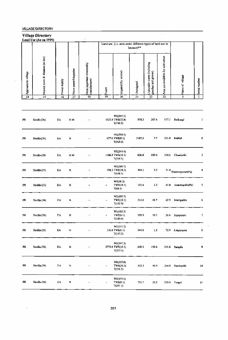
VILLAGE DIRECTORY
Villa2e Directory Land Use (As on 1999)
Land use (i.e. area under different types of land use in hectare)··
j c 0 'n ..
g 0 .., > ;fj 'n
8 '8 ;:; ::I <>
~ '" e "0 ~ = .B " '!;j e U' c~
0() :a 0 ~ ~~ '" .!':l 0() u ::I ... > :0 " 'S <IIj ..
~il 0 ~ ~ .. 0()
.!:' ~ '" ~ '" t 9 ~ 0. » -0 3'-0 > ~ .J:J .t:I B §' ~ ail e
~ ~ a .. ~ u ... .§ ~ "0 e a (5 '0 = '" ~ c. i 0()
K ti '" 1;; 'E 2fl c
" til 1;; ::I ., l;i 3' 3'
~m ~
] '2 - ::I ~ ~ 'J:
~ z 0 z ~ ~ '" .. " 0... U 00 [/)
14 15 16 17 18 19 20 21 22 23 2 1
WE(643.'s)
PR Sircilla(36) EA NM 1523.0 TWE(72.8) 978.2 287.4 577.1 Rudrangi T(716.3)
WE(354.5)
PR Sircilla (30) EA N 677.6 TWE(8.1) 1107.3 7.7 251.8 Mallial 2 T(362.6)
WE(344.4)
PR Sircilla (28) EA NM 1106.0 TWE(IO.I) 826.8 189.0 324.6 Chandurthi 3 T(354.5)
WE(389.7)
PR Sircilla (25) EA N 29&.3 TWE(2&J) 569.1 3.2 51.4 ThimmapU1llffi(Pn) 4 T(4IS.I)
WE(.58.3)
PR SircilJa (22) EA N TWE(IO.I) 1.55.4 1.2 61.0 Ananthapalle(Pk) 5 T(68.4)
WE(183.7)
PR Sircilla (24) EA N TWE(IO.I) 311.6 41.7 62.9 Marrigadda 6 T(193.9)
WE(183J)
PR Sircilla (28) EA N TWE(6.1) 350.9 10.1 56.6 Jogapuram 7 T(189.4)
WE(141.2)
PR Sircilla (32) EA N 136.8 TWE(6.1) 344.8 1.2 72.9 Lingampeta S T(147.3)
WE(347.3)
PR SirciJla(3&) EA N 2771.0 TWE(IO.I) ~8.3 Ijl}.6 B\.6 Sanp,uta 9 T(357.4)
WE(325.0) PR Sircilla (30) EA N TWE(26.3) 552.3 40.5 216.0 Bandapalle 10
T(35J.3)
WE(193.0) PR Sircilla (24) EA N TWE(S.I) 735.7 35.2 270.9 Yangal II
T(201.l)
351
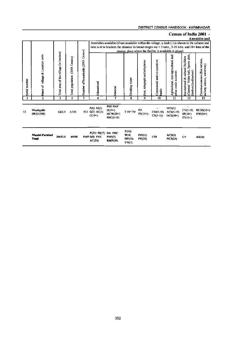
i .g '"" <.> g =
" .c <II
" 0 ~ .. '.0 U «I
" j toO <5 ..!! 0
<Id ~ C ... " Ii 00 .;; .. «I '::1
l! ~ ...
1 0
§ ~ '-r:: 0 .. 01 !l !l ·c ~ u 0 {!. til f-<
I 2 3 4
12 Moodepalle
1263.0 4,556 (00321300)
MandaI Parisbad 20652.0 40558
Toal
a c:l u
U -0 0 C
1 .c ... 0
..8 ~ Z 5
973
DISTRICT CENSUS HANDBOOK: KARIMNAGAR
Census of India 2001 -Amenities and
Amenities available (if not available within the village, a dash (-) is shown in the column and next to it in brackets the distance in broad ranges viz. < 5 kms., 5-10 kms. and 10+ kms of the
nearest place where the facilityis available is given) -0 ~~ fa '.0 u .; .. u ] ~~ 0 c >
.~ ~ 0 .~ -= .:28, 0. 8- '3 ., «I .. y ]~~ ;g ~ 1l b .~ .,
-0 , .~ _'"§ e~ ~
0 i3 ~.§ ., ~ -0 c .. o·_ " ~ .c Iii " g <Id:E:a o c
~ ~ li '.0 0
01 '" 01>= os ._
~ .~ ~ " 'il 5 -< 0 "" u '.0 ~ ]' '.0 01
i 1l .,
:::l U .. S ~ ;-os C) S ., <.> 'i3 .~ ~ t .~ 'i3 ~ ~ ~j ~ <1l c::l ulS 8'§ ~tIl
6 7 g 9 10 II 12 13
P(4) M(2) PHSRMP
NCS(S) S(2) AC(3)
H(IO+) THPTW
PO CM(S-IO) ACS(5-IO)
CV(5-IO) BS RS(IO+)
C(IO+) MCW(IO+) PH(IO+)
CP(S-IO) OCS(IO+) SP(IO+) NW(IO+)
PHC(S-IO) ST(IO+)
P(JI) M(17) DA PHC T(12)
9549 S(8) PUC PHS(7) W(4) PO(lI)
CM ACS(2)
CV BS(12) HP(12) PH(25) NCS(24)
AC(2J) RMP(39) TW(7)
352

VILLAGE DIRECTORY
Village Directory Land Use (As on 1999)
--. ..6 5 dJ
" ~ " ~ 'i3
~ ~
.9 ~ .c u '" 'iii 8 ~ Q.,
~ ~ 14 15
PR Sircilla (20)
PR(12)
;:.., Q. "'-i5l .... dJ ::: ce 16
EA
EA(12)
... c .~
"" .. ~ ... "'-os "'-'" ~ ~ 17
N
N(12) M(2)
c 'g Ei
~ g-o t: ~ g,~
.§ tS 'iii "
~ ~ 18
Land use (i.e. area under different types of land use in hectare)"
<> ~ ;::J c '" e
"'" " 1;; 1;; ~ bO c :§ "-19 20
WE(311.2) TWE(40.5) T(351.7)
WE(3475.19) 6514.8 TWE(236.75)
T(37 11.94)
353
-0 ~ '" bI)
·E ·c ~
21
623.6
7203.9
c c .~
"" .f: C '6 "3 " " 'U ....
<8 c---~~ ... ... :> :0 _ 0
os
~: 'a >
..!l l:J os
..0 a <> E-5 ::: co
"3 ;::J
~ '" u bl)
22 23
44.5 243.2
801.4 2420.0
... "" ~ .... ~ ~
Ei ..... = 0 ::: ... <a
1 ·c dJ
'" 2 1
Moodepalle 12
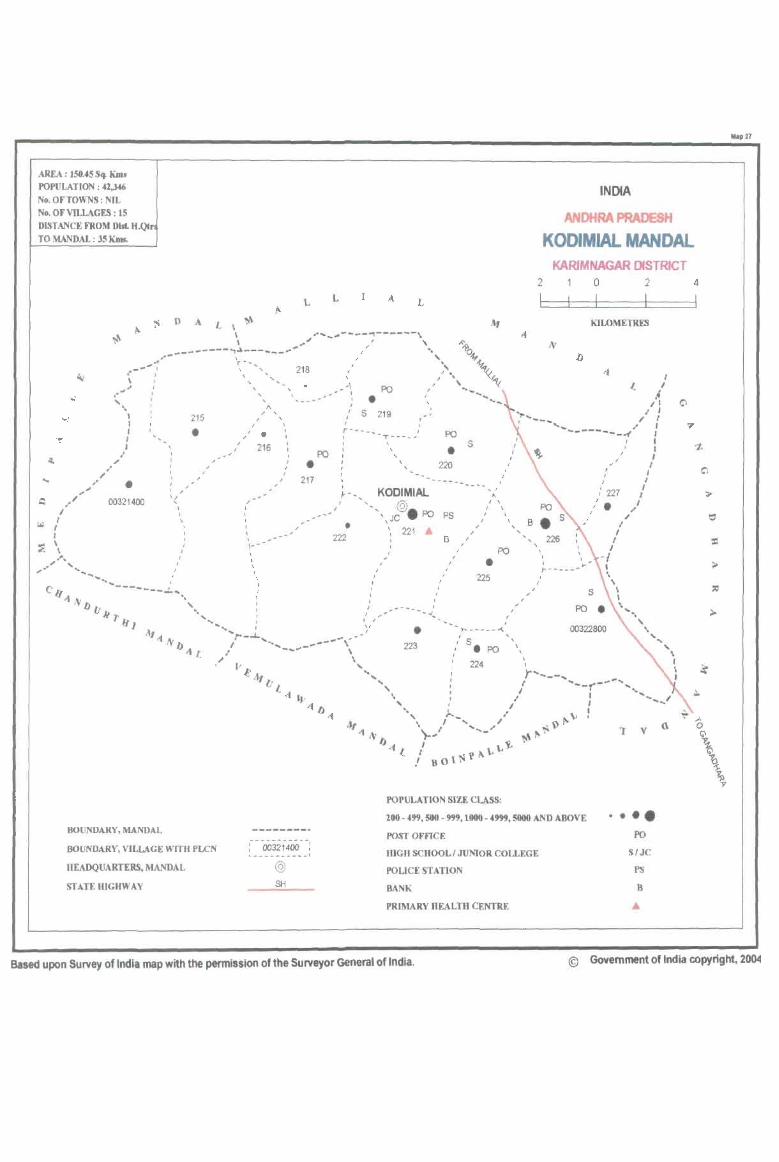
AREA : 150.4554 Kau POPULATION: 42,3<46 No. OF TOWNS: NIL No. OF VILLAGES: 15 DISTANCE FROM D1st. H.QCr TO MANDAL : 3S K.ms.
INDIA
ANDHRA PRADESH
KODIMIAL MANDAL KARIMNAGAR DISTRICT
2 o 2 4
.... " "-"," .. .... _
L A L
!'I D A L \ ~ ~ \ "-~----~------\ \ __ '" ~I ,
.,._--------.,\~---- ... - .. .,. I •• , .- .... -': \- ...... , ' I, \ -... 218 ,,_ • J ' , ,
-I , . .,-' PO
.....
"-"
I I I I I
'( , J
I ,
-------.!.. .... '.
215
• J I
, , , J\ , , ,
I I • ,
216
• 217
J I I I I J , , , 1- -
, \ ,
PO
• i 5
I r--- __ I
219
T-"'-_'"
I I
, , , -'
PO
• 220
, ----_ ~ - _ KOOIMIAL , -'- @
" JC • PO PS , • 222
, J
, " I /
~'
221 A
/
, --..J ..
I ,
B
I ,
s
, /
J
- I
" I , I , , ,
I I
PO
• 225
, 1"'''''''''',,''' --<.
)
, ,
J
KILOMETRES
I I
,4 ,I
I I I I ........ / ,
--------.-( I
Be , , ,
J , , ,
226
I
I
,
I /
(227 J •
I I
I I
I -{ I \ ,
\ I
,.
I I ,
I I
I I
I I
\'., , 00322800 \
" ... • 223 , S. PO '\
\
"\
BOUNDARY, MANDAL
BOUNDARY, VILLAGE WITH PLCN
HEADQUARTERS,MANDAL
STATE HIGHWAY
:---00321400--: .. _--- ______ 1
@ SH
224
POPULATION SIZE CLASS:
200 - 499, 500 - 999, 1004) - 4999, SOOO AND ABOVE
POST OFFICE
HIGH SCHOOL! JUNIOR COLLEGE
I'OLICESTAT]ON
BANK
PRIMARY HEALTH CENTRE
'I v
.•• e PO
S/JC
PS
B
A
f \ I
" o Q
>
\ \ \
Map 27
Based upon Survey of India map with the permission of the Surveyor General of India. © Govemment of India copyright, 20()41
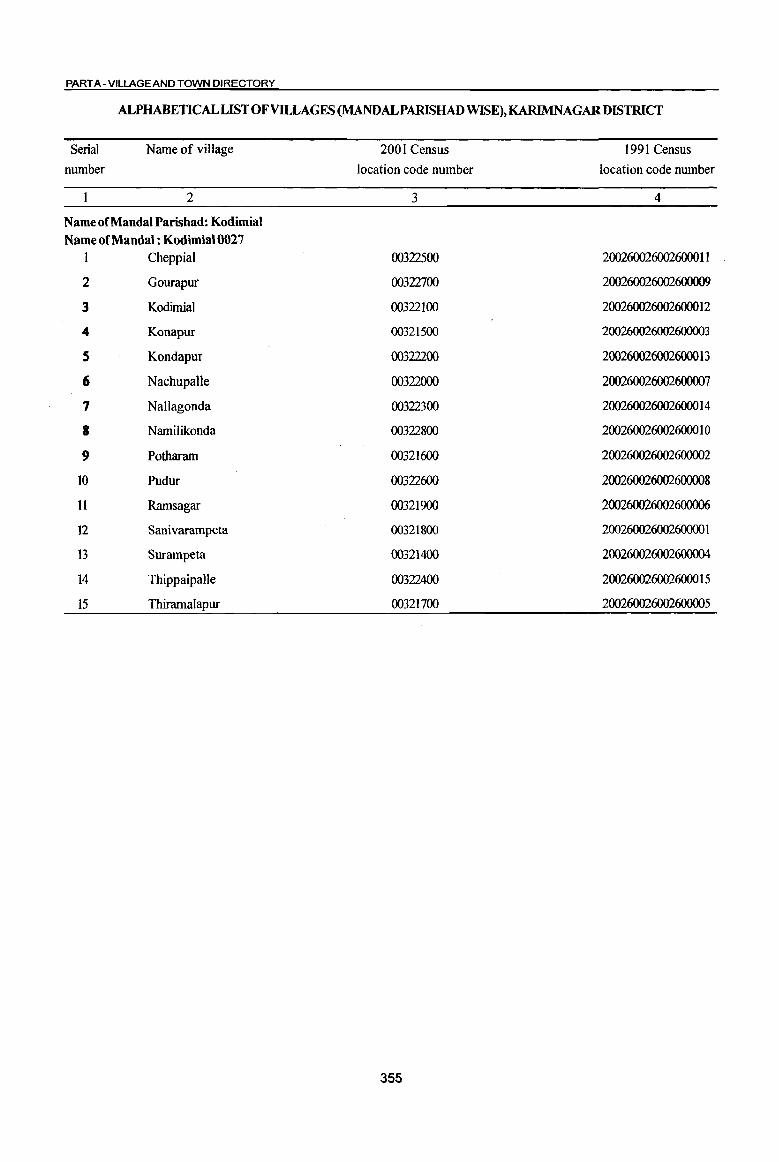
PART A - VILLAGE AND TOWN DIRECTORY
ALPHABETICAL LIST OF VILLAGES (MANDALPARISHAD WISE), KARIMNAGAR DISTRICT
Serial
number
Name of village
2
Name of Mandai Parishad: Kodimial
Name of Mandai : Kodimial0027
1 Cheppial
2 Gourapur
3 Kodimial
4 Konapur
5 Kondapur
6 Nachupalle
7 NaUagonda
8 Namilikonda
9 Potharam
10 Pudur
11 Ramsagar
12 Sanivarampeta
13 Surampeta
14 Thippaipalle
15 Thiramalapur
2001 Census
location code number
3
00322500
00322700
00322100
00321500
00322200
00322000
00322300
00322800
00321600
00322600
00321900
00321800
00321400
00322400
00321700
355
1991 Census
location code number
4
2002600260026000 II
200260026002600009
200260026002600012
200260026002600003
200260026002600013
200260026002600007
200260026002600014
200260026002600010
200260026002600002
200260026002600008
200260026002600006
20026002600260000 I
200260026002600004
200260026002600015
200260026002600005
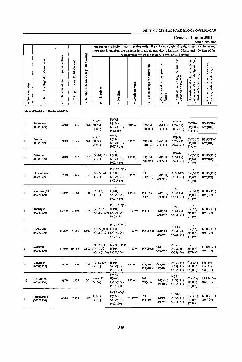
j ., "8 <> 'U;' u '" ~ .c .,
Ii 0 ,g_ .'" U os ~ u
0 8 ...J ~ ~ ~
rr " .,
.£l 0
J .'" ~
.... _g 0
~ os ::l 0-... ~ 8. ., 0 .,
"OJ
1 fl ~ ·t 0 til I-< I-<
1 1 3 4
Mudal p • .uhad : KodiJllial (0017)
Surampelll 1429.0 1,306
(00321400)
2 Konapur 710.0 1,1%
(00321500)
Podlatam 3 818.0 922
(00321600)
4 TbiIamalapur
782.0 1,679 (00321700)
Sanivarampeta 5 220.0 448
(00321800)
6 Ramsagar
1225.0 3,089 (00321900)
Nachupalle 7
(00322000) 1508.0 4,246
KodimiaJ 8
{00322 100) 1580.0 10,752
9 Kondapur
917.0 950 (00322200)
Nallagonda 10 987.0 1,403
(00322300)
Tbippaipalle II 668.0 2,003
(00322400)
DISTRICT CENSUS HANDBOOK: KARIMNAGAR
Census of India 2001 -Amenities and
Amenities available (if not available within the village, a dash (-) is shown in the column and next to it in brackets the distance in broad ranges viz.< 5 Ions., 5-10 lans. and 10+ kms of the
j nearest place where the facility is available is 2iven) ~ "" ~~ u a
.'" <> .; ., !: g ., ] ~E u 0 .:: .~ ~
~ .c G 4!8. ., iO' e- "'3 ]~,.._ ~ ~ ~ 0- (J
'0 ] ~ .~ <Il
"" '? .~ _"OJ!:j e~ 1i a u ~ ~·c '" :l: !II -0 ., " '"
o .- ~ ., 0 .g g 0 U ..c ii c g :2:ij .c ~ ~ _ <Il
.... OJ Oi ]] "iI;>:::l .. .'" 0 3: ·e .g ~ 1 (J os
C .g 1;;
1i 0 bIl " .'" "OJ
~ ] " '" <> .. El S iO' os (J ~ 01
~ Q 'Q .~ U ~6,):s
~i ill ~ ~ 81 g .= 5 0.- -<~ _Ji: ~ (IJ
5 6 7 8 9 10 11 12 13
PAC RMi'(3)
NCS(2) 326 M« 5)
H(IO+) TWW PO« 5) CM(IO+) ACS« 5)
CV(IO+) BSRS(IO+)
C(lO+) MCW(IO+)
PH(IO+) CP(IO+) OCS(IO+) SP(IO+) NW(IO+)
PHC(IO+) ST(IO+)
PAC RMP(2)
NeS(3) 295 M«5)
H(IO+) HPW PO« 5) CM(5-10) ACS« 5)
CV(5-IQ) BS RS(IO+)
C(10+) MCW(IO+)
PH(5-10) CP(IO+) OCS(IO+) SP(IO+) NW(IO+)
PHC(5-1O) ST(IO+)
204 P(2) M« 5) H(IO+) NCS(4)
CV(5-IO) BSRS{IO+) HPW PO« 5) CM(S-IO) ACS« 5)
C(IO+) MCW(IO+) PH(IO+) CP(IO+) OCS(lO+)
SP(IO+) NW(IO+) PHC(S-IOj ST(IO+)
PHS RMP(3)
441 P(2) M AC H(IO+)
HPW PO
CM(S-IO) ACSNCS CV(5-IO) BS RS(IO+)
C(lO+) MCW(IO+) PH(5-1O) OCS(IO+) SP(IO+) NW(IO+) PHC(S-10)
CP(IO+) ST(lO+)
P M«5) H(IO+) NCS
CV(5-10) BS RS(IO+) 115 HPW PO« 5) CM(5-1O) ACS{< 5)
C{IO+) MCW(IO+) PH(5-1O) CP(IO+) OCS{IO+)
SP(IO+) NW(IO+) PHC(5-10) ST(lO+)
PHS RMP(5) NCS
734 P(3) M S H(IO+)
THPW PO PH CM«5) ACS« 5) CV«5) BS RS(IO+)
AC(2) C(10+) MCW(lO+) SP(IO+) NW(IO+) PHC« 5)
CP(IO+) OCS(IO+) ST(IO+)
PHS RMP(3) NCS(2)
P(3) M(2) S H(IO+) CV« 5) BS RS(IO+) 1,060
AC(2) C(lO+) MCW(lO+) THPW PO PH(48) CM« 5) ACS«5)
SP(IO+) NW(IO+)
PHC« 5) CP(IO+) OCS(IO+)
ST(lO+)
peS) M(5) DAPHCPHS CM
ACS CV BS RS(IO+)
2,602 S(4) PUC H(IO+) THPW POPH(2) CP(lO+)
NCS(lO) SP(IO+) NW(IO+)
AC(2) C(IO+) MCW(IO+) OCS(lO+) ST(IO+)
228 P(2) M( 10+) H(lO+) HPW PO(lO+) CM(IO+)
ACS(IO+) CV(lO+) BS(IO+) C(lO+) MCW(lO+)
PH(IO+) CP(IO+) NCS(IO+) SP(IO+) RS(IO+)
PHC(IO+) OCS(IO+) ST(IO+) NW(IO+)
RMP(2) NCS
PM«5) H(lO+) PH CV(IO+) BS RS(lO+) 351 HPW CM(5-10) ACS(lO+)
C(lO+) MCW(IO+) PO« 5) CP(IO+) OCS(IO+)
SP(IO+) NW(IO+)
PHC(IO+) ST(IO+)
PHS RMP(3) NCS(2)
P M S H(IO+) PO CV(IO+) BS RS(lO+) 527 C(IO+) THPW CM(IO+) ACS(IO+)
MCW{IO+) PH(lO+) CP(IO+) OCS(IO+)
SP(IO+) NW(IO+)
PHC(IO+) ST(IO+)
356
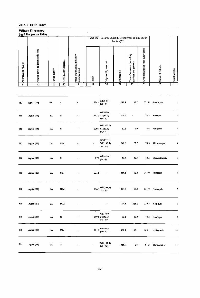
VILLAGE DIRECTORY
ViIlal!e Directory Land Use (As on 1999)
i ,g ~ ., 'i3
~ 0 ., I c ., ., 'f!
~ 'i3 bI>
'S cId Ol
~1l ~ ~ ~ g ... 8.2 -= 2 0. Q. U :s '" .5 J§ .. 1;; '" C-
E
.~ ....
'" ... _ :s Q. " " ~ ~ .(' ~ ~ 14 15 16 17 18
PR Jagtial (35) EA N
PR Jagtial (34) EA N
PR Jagtial (34) EA N
PR Jagtial (33) EA NM
PR Jagtial (35) EA N
PR Jagtial (23) EA NM
PR Jagtial (21) EA NM
PR Jagtial (27) EA NM
PR Jagtial (28) EA N
PR Jagtial (36) EA NM
PR Jagtial (34) EA N
Land use (i.e. area under different types of land use in
~ ... ~ ~ >. e -0 Ol
"' .,
e b()
0 ] iJ..
19 20
7264 WE(64.7) . T(M.7)
WE(80.0) 443.5 TK( 11.0)
T(91.0)
WE(300.2)
330.1 TK(83.5) T(3E3.7)
GC(297.5)
WE(140.4) T(437.9)
WE(42.9) 57.5 T(42.9)
223.5
WE(I48.5) 136.5 T(148.5)
WE(75.0)
699.0 TK(42.9) T(II7.9)
WE(95.5) 101.2 T(95.5)
WE(II7.0) T(1I7.0)
357
hectare)··
-0
* Ol>
'E ;3 21
247.4
151.2
87.5
240.Q
53.4
656.5
824.3
994.4
32.0
492.2
486.9
'" 0 .~
Oll > c .:::
"6 -= " u
]-;;- .... .s ~ ., ... ~ > :E " 0 Ol bI> gj a 'a ~ "-0 'S > ~ a os
"E :<l " .....
'" 0
a'll II ., ! "'5 ~ " ~ I.) OJ>
22 23 2
58.7 331.8 Swampeta
24.3 Konapur
5.0 8.8 Potharam
25.2 78.9 Thiramalapur
22.7 43.5 Sanivarampeta
102.1 243.0 Ramsagar
166.8 231. 9 Nachupalle
246.0 339.7 Kodirnial
48.7 19.4 Kondapur
189.1 109.1 Nallagonda
2.9 61.3 Thippaipalle
.... ... .LJ
g c ..
'J:: ... Vl
I
2
3
4
6
7
8
9
10
II
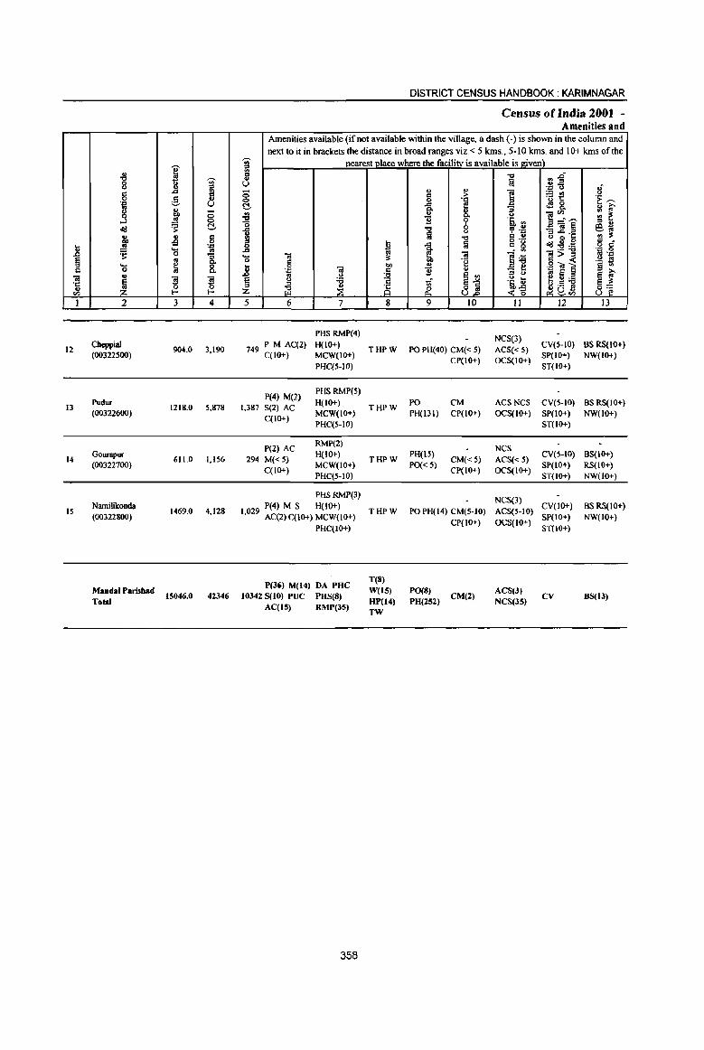
.8 g c til ·c u til
I
12
13
14
15
" '0 0 <> g .... .. .3 "<:! ., 00 .!! ~ .... 0 ., ~ 2
Cheppial (003225OO)
Pudur (00322600)
Gourapur (00322700)
Namilikonda (00322800)
MandalParishad Total
I -;;;-" ~ ..cI
g ., U
t'o <5 ~ <:> .s: C!-
.s d 0 .... .... ..
0 :;
~ "" 8. "IS ~ 0 E- E-
3 4
904.0 3,190
1218.0 5,87&
611.0 1,156
1469.0 4,128
15046.0 42346
DISTRICT CENSUS HANDBOOK: KARIMNAGAR
Census of India 200t -Amenities and
Amenities available (if not available within the village, a dash (-) is shown in the column and next to it in brackets the distance in broad ranges viz. < 5 kms., 5-10 kms. and 10+ kms of the
~ nearest.PJace where the facility is available is giyell} c .. u 0 <:> C!-~ "0 -5 ., :s _g ... ;a 0 c j 0
'.1:: til .. u § u ;a
" ~ Z ;il 5 6 7
PHS RMP(4)
749 PM AC(2) H(lO+) C(IO+) MCW(IO+)
PHC(S-IO)
P(4) M(2) PHSRMP(S)
1,387 S(2) AC H(IO+)
C(IO+) MCW(IO+) PHC(5-10)
P(2) AC RMP(2)
294 M« 5) H{IO+)
C(IO+) MCW(IO+) PHC(5-JO)
PHSRMP(3)
9 P(4) M S H{lo+) 1,02 AC(2)C(10+) MCW(IO+)
PHC(IO+)
P(36) M(14) DA puc 10342 S(IO) PUC PUS(S)
AC(IS) RMP(lS)
358
!i ~ 00
. ~ 8
THPW
THPW
THJ>W
THPW
T(8) W(tS) HP(14) TW
" " d > 0 ....
..cI e "" '" 8-11 'i' ." 0
a u ." a ..cI
~ .. "e " 11 .. e '" ~1 ~
9 10
PO PH(40) CM« S) CP(IO+)
PO CM PH(131) CP(IO+)
PH{lS) CM«S)
PO«5) Cp(IO+)
PO PH(14) CM(S-IO)
CP{IO+)
P0(8) PH(252) CM(2)
"Q
!a ] a .~ '" ~ .~ CI u ~n~ . '" ]~ - ... '" v <> ... .~~ <0 II
NCS(3)
ACS« 5) OCS(IO+)
ACSNCS OCS{1O+)
NCS
ACS« 5) OCS(IO+)
NCS(3)
ACS(S·IO)
OCS(IO+)
ACS(3) NCS(3S)
~~ .... <>
~{! <!! 8-]~~ _<a~ e ~"s "<:!:2:a ~>~ .~ ~] ~ g ~ ~u~
12
CV{S-IO) SP{IO+)
ST(IO+)
CV(5-10) SP(IO+) ST(IO+)
CV{S-IO) SP(10+) ST(JO+)
CV{IO+) SP{IO+) ST(IO+)
CV
Ii 'E ~ " i;' ~ ~ :s '" ~~ c _ o C
.... 0 '" .::1 .~ s s '" e ~ ~~ u I3
BSRS(IO+) NW(IO+)
BS RS{IO+) NW(1O+)
BS{IO+) RS(IO+) NW(IO+)
os RS{IO+) NW{IO+)
BS(13)

VILLAGE DIRECTORY
Village Directory Land Use (As on 1999)
14 15
PR Jagtial (30)
PR Jagtial (20)
PR Jagtial (22)
PR Jagtial (24)
PR(lS)
16
EA
EA
EA
EA
EA(lS)
17
N
NM
N
NM
N(IS) M(7)
18
Land use (i.e. area under different types ofland use in hectare)· *
19 20 21 22 23 2
WE(214.S)
T(214.5) 631.3 47.4 10.8 Cheppial
WE(l48.9) T(148.9)
324 WE(IOt.2) . T(lOI.2)
WE(201.5)
T(201.5)
GC(297.5)
WE(1730.J4 2750.0 ) TK(137.44)
T(2165.28)
359
723.3
367.9
744.2
6732.5
111.3 234.5 Pudur
35.2 74.3 Gourapur
193.1 330.1 Namilikonda
1254.0 2141.3
12
13
14
15
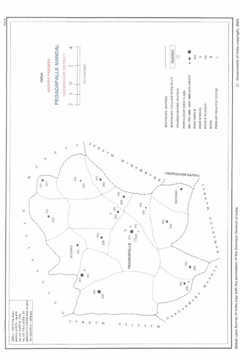
. .. .. 2
('1-
, , , , ' 0 1 , 0 1 , (1) 1
' ~ I@ ' .., ' :8: , , , 1 l __ ,
•
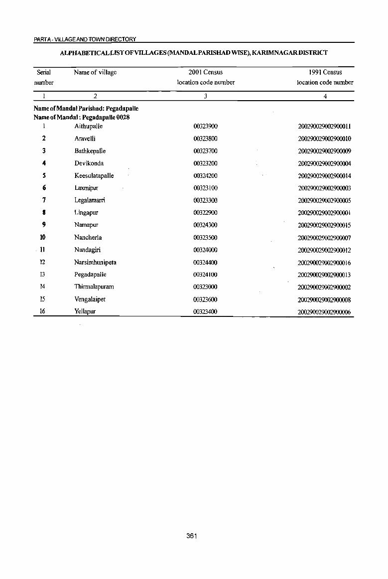
PART A - VILLAGE AND TOWN DIRECTORY
ALPHABETICALLISTOFVlLLAGES(MANDALPARISHADWISE),KARIMNAGARDISTRICT
Serial Name of village 2001 Census 1991 Census
number location code number location code number
2 3 4
Name of MandaI Parishad: Pegadapalle Name of Mandai: Pegadapalle 0028
1 Aithupalle 00323900 2002900290029000 II
2 Aravelli 00323800 2002900290029000 1 0
3 Bathkepalle 00323700 200290029002900009
4 Devikonda 00323200 200290029002900004
S Keesulatapalle 00324200 200290029002900014
6 Laxmipur 00323100 200290029002900003
7 Legalamarri 00323300 200290029002900005
I Lingapur 00322900 200290029002900001
9 Namapur 00324300 200290029002900015
10 Nancherla 00323500 200290029002900007
.11 Nandagiri 00324000 2002900290029000 12
12 Narsimhunipeta 00324400 2002900290029000 16
13 Pegadapalle 00324100 2002900290029000 13
14 Thirmalapuram 00323000 200290029002900002
15 Vengalaipet 00323600 200290029002900008
16 Yellapur 00323400 200290029002900006
361
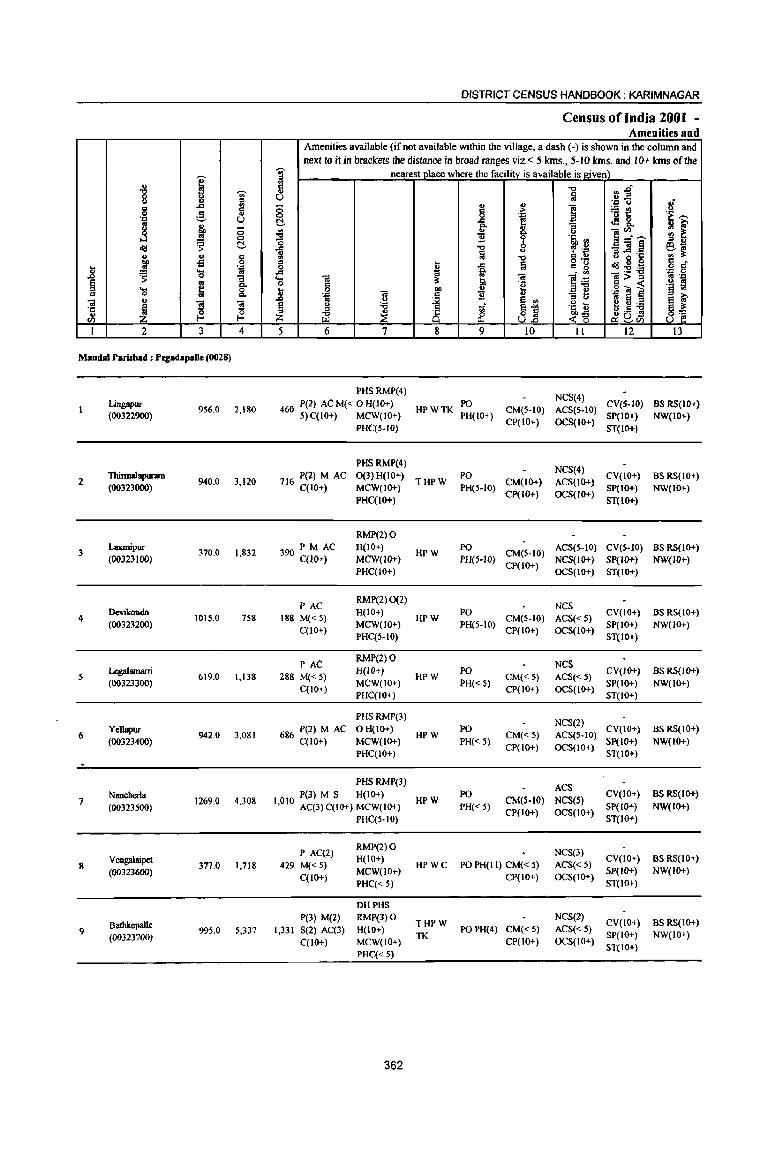
I .. 15 'Vi'
" il ., ..c ., 0 ~ " . ., U to
~ j 0 to 0
dd ~ C!-
" .. S ]' i3 u 'J:> ... '" J> ~ 0 -; § .. Q.
~ ~ 8. c:: iii .. ·c ~
'3 ~ "
0 (/) f-< f-<
I 2 3 4
Modal rarisbad : PegadapaJIe (0028)
Lingapur 956.0 2,180
(00322900)
2 Thinnalapuram
940.0 3,120 (00323000)
3 Laxmipur
370.0 1,832 (00323100)
4 Devikonda
1015.0 758 (00323200)
:; Lq;alamarri 619.0 1,138
(00323300)
6 Yel1apur
942.0 3,081 (00323400)
Nancherla 4,308 7 1269.0
(00323500)
8 Vengalaipet
377.0 1,718 (00323600)
Bathkepalle 9
(00323700) 995.0 5,331
DISTRICT CENSUS HANDBOOK: KARIMNAGAR
Census of India 2001 -Amenities and
Amenities available (if not available within the village, a dash (-) is shown in the column and
next to it in brackets the disumce in broad ranges viz. < 5 kms., 5-10 lans. and 10+ lans of the 'Vi' nearest place where the facility is available is given) iil il "'" ...&0 U :a . .8 -t Ii 8
... ... 1 ~t 8 ;> . ., .~ ""
C!- .c f of! fr ~ ~
'" ! u ]:r~ ~ ~ ~ ] .tj, III
A "'" ~ -£ _iil~ !9-!l ~ {ij
0 " ..c .c: '" ;!: -0
" ~ o .- 080 Cl 0 ~
.c a c: g dd:2:a o d' A ~ - '" 'B .g ... iii iii ]] iiI>::I 0 c: ~ iii> .~ .~ ~ i '§ ~ .8 0 "" ...
'.g OJ
~ 'B '" <.J
to E ~ ;-u e II!
§ g '6 tf ~~ .~ t e 8 ~ Lil ~ rf ~ .- 8] Z U.o ~-g !i~(/)
5 6 7 8 9 10 II 12 13
PHS RMP(4) NCS(4)
460 P(2) AC M« 0 H(JO+) HPWTK PO
CM{5-10) ACS(5-10) CV(5-10) BS RS(lo+)
5)C(10+) MCW(lO+) PH(lO+) CP(IO+) OCS(IO+)
SP(lO+) NW(IO+) PHC(S-IO) ST(IO+)
PHSRMP(4) NCS(4)
716 P(2) M AC 0(3) H(IO+) THPW
PO CM(lo+) ACS(Io+)
CY{IO+) BS RS(IO+) C(IO+) MCW(IO+) PH(5-10)
Cp(IO+) OCS(IO+) SP(lO+) NW(IO+)
PHC(IO+) ST(IO+)
RMP(2)0 PM AC H(IO+)
HPW PO
CM(S-IO) ACS(S-IO) CY(S-IO) BS RS(IO+)
390 C(10+) MCW(IO+) PH(5-IO) CP(IO+)
NCS(IO+) SP(lo+) NW{lO+) PHC(IO+) OCS(IO+) ST(IO+)
PAC RMP(2) 0(2)
NCS 188 M« 5)
H(IO+) HPW
PO CM(5-10) ACS«5)
CY(lO+) BS RS(IO+)
C(10+) MCW(IO+) PH(5-10)
CP(lO+) OCS(IO+) SP(IO+) NW(IO+)
PHC(5-10) ST(IO+)
PAC RMP(2) 0
NCS 288 M« 5)
H{IO+) HPW
PO CM«S) ACS«5)
CV{IO+) BS RS(IO+) MCW(IO+) PH« 5) SP(IO+) NW(IO+)
C(10+) PHC(IO+)
CP{IO+) OCS{IO+) ST(IO+)
PHS RMP(3) NCS(2)
686 P(2) M AC o H(IO+) HPW
PO CM«5) ACS(S·IO)
CY(IO+) BS RS(IO+) C(lO+) MCW(IO+) PH« 5)
CP(IO+) OCS{IO+) Sp(IO+) NW(IO+)
PHCCIO+) ST(IO+)
PHSRMP(3) ACS
P(3) M S H(IO+) HPW
PO CM(S-lO) NCS(S)
CY(IO+) as RS(lo+) 1,010 AC(3) C(IO+} MCW(IO+) PH« 5} SP(IO+) NW(IO+)
CP(IO+) OCS(IO+) PHC(5-10) ST(lO+)
P AC(2) RMP(2) 0
NCS(3)
429 M« 5) H(IO+)
HPWC PO PH(II) CM« 5) ACS«5) CY(IO+) as RS(IO+)
C(10+) MCW(lO+)
CP(lO+) OCS(IO+) SP(IO+) NW(IO+)
PHC« 5) ST(lO+)
DHPHS P(3) M(2) RMP(3) 0
THPW NCS(2)
CY(IO+) BS RS(IO+) 1,331 S(2) AC(3) H(IO+)
TK PO PH(4) CM«5) ACS« 5)
Sp(IO+) NW(IO+) C(10+) MCW(IO+) CP(IO+) OCS(IO+)
PHC« 5) ST(IO+)
362
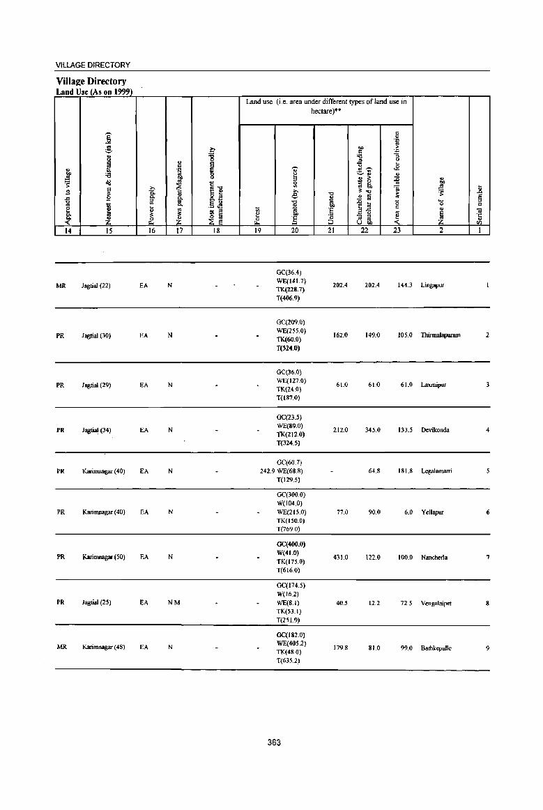
VILLAGE DIRECTORY
Villal!e Directory Land Use (As on 1999)
Land use (i.e. area under different types of land use in hectare)··
i c 0
'.e '" g b co ,.
c 'J:)
8 '8 ;a :; u '" 0
~ I '0 ... .. . § ,-._ c ~ <B .. ._ ., j' ;a ~
~ .. .. ~
.. ,. ::c ., ~ ~ ... 0 ...
~ ill 5: ~ to '" .. -a: la Ii .s ~ e '0 ~"" ,. ~ .0
'" ., 8.E .. ~ ~ '" § .to .s '" ~ i '-
~ ., .13 ~ '0
1~ 0 0 1;; c..
~ c
e j ... ., Vi 'E c ... ta .,
;; ;::J
'" ~ ~ ... ... '" ~ ~ ~ ... 'c - ;::J ~ ·c
k ~ z ~ ] ;::J ., U ;:J Ubi) <Il
14 15 16 17 18 19 20 21 22 23 2 1
GC{36.4}
MR Jagtial (22) EA N WE(141.7)
202,4 202.4 144.3 Lingapur TK(228.7)
T(406.9)
GC(209.0}
PR Jagtial (30) EA N WE(255.0)
162.0 149.0 105.0 Thirma1apWll1D 2 TK(60.0)
T(524.0)
GC{36.0)
PR Jagtial (29) EA N WE(127.0)
61.0 61.0 61.0 Laxmipur 3 TK{24.0) T(187.0)
GC(Z3.5)
PR Jagtial (34) EA N WE(89.0)
212.0 345.0 133.5 Devikonda 4 TK(ZI2.0)
T(324.5)
GC(607}
PR Karimnagar (40) EA N 242.9 WE(68.8) 64.8 181.8 Legalamarri 5
T(129.5)
GC(300.0)
W(104.0)
PR Karimnagar (40) EA N WE(215.0) 77.0 90.0 6.0 YeUapur 6 TK(l50.0)
T(769.0)
GC(400.0)
PR Karimnagar (50) EA N W(41.0)
431.1) 122.0 100.0 N8IIcherla 7 TK(175.0)
T(616.0)
GC(174.5)
W(l6.2) PR Jagtial (25) EA NM WE(8.1) 40.5 12.2 72.5 Vengalaipet 8
TK(53.1)
T(25L9)
OC(182.0)
MR Karimnagar (48) EA N WE(40S.2)
179.8 81.0 99.0 8athkepalle 9 TK(48.0)
T(635.2)
363
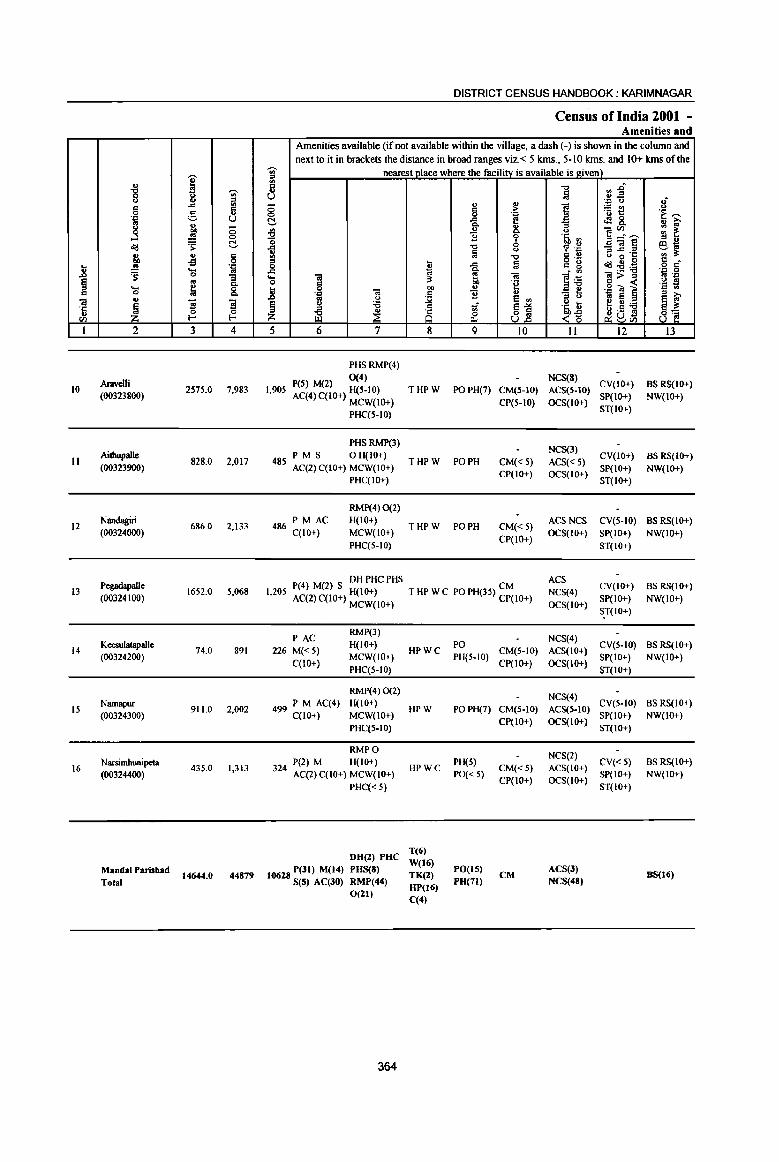
.. .8 § " ..
'1: u
(/)
I
10
II
12
13
14
IS
16
i " 0 .,c
g ...l <><l '" btl .!! ~ ... 0 u
~ 2
Aravelli (00323800)
Aithupalle (00323900)
Nandagiri (00324000)
Pegadapalle (00324100)
Keesulatapalle (00324200)
Namapur (00324300)
Narsirnhtmipeta (00324400)
Mandalhrisbad Total
I ~ .. :::I
..d '" " 5 '" u .,
.H ;:; 0
~ t!.
'" " -s 0 ',c .... '" 0 "3 oj Q.
~ 0 Q.
"3 S 0 ~ I-
3 4
2575,0 7,983
828.0 2,017
686.0 2,133
1652.0 5,068
74.0 891
911.0 2,002
435.0 1,313
t4644,O 44879
DISTRICT CENSUS HANDBOOK: KARIMNAGAR
Census ofindia 2001 -Amenities and
Amenities available (if not available within the village, a dash (-) is shown in the column and next to it in brackets the distance in broad ranges viz.< 5 kIDs., 5·10 krns. and 10+ kms of the
'Ui' nearest Dlace where the facilitv is available is given) ~ ij U ;:; .,
~ c 0 0 'E t!. ..d
Q.
'" ~ U Q. ] 0
'0 0 ..d -0 ~ !a
<)
'Q ::I ~
0 '" ..d a ..d 0; Q. ... .. a .. 0 "
is: .~ .. 0 .. bl) u
.8 ',c
j ] ., oj <) S ell
~ " '6 1;; ~1 ~ ~ &. 5 6 7 8 9 10
PHSRMP(4)
peS) M(2) 0(4) 1,905 AC(4) C(IO+) H(5-10) THPW PO PH(7) CM(5-IO)
MCW(IO+) CP(S-IO) PHC(5-10}
PHSRMP(3)
485 P M S OH(IO+)
THPW PO PH CM« 5) AC(2) C(IO+) MCW(IO+)
CP(IO+) PHqIO+)
RMP(4) 0(2)
486 PM AC H(IO+) THPW PO PH CM«5)
C(IO+) MCW(IO+) CP(IO+)
PHC(5-10)
DHPHCPHS 1205 P(4) M(2) S H(IO+) T HP W C PO PH(35) CM • AC(2) C(IO+) MCW(IO+) CP(IO+)
PAC RMP(3)
226 M« 5) H(IO+) MCW(IO+)
C(IO+) PHC(5-1O)
RMP(4) 0(2)
499 PM Aq4) H(IO+) qlO+) MCW(lO+)
PHqS·IO)
RMPO
324 P(2) M H(IO+) AC(2) C(IO+) MCW(IO+)
PHC« 5)
DH(Z) PUC
t06Z8 P(3t) M(t4) PUS(8) S(5) AC(JO) RMP(44)
O(Z)
364
HPWC
HPW
HPWC
T(6) W(16) TK(Z) HP()6}
C(4)
PO PH(5-10)
PO PH(7)
PH(S) PO« 5)
POetS) PH(7t)
CM(5-IO) CP(lO+)
CM(S-IO) CP(IO+)
CM« 5) CP(IO+)
CM
-0
:a ~ '3 <)
'5, OJ
'}1 .~ c ., o .-" g • Vl
~~ :; 0 .~ t; <?~ II
NCS(8) ACS(5-10) OCS(IO+)
NCS(3)
ACS«5) OCS(IO+)
ACSNCS OCS(IO+)
ACS NCS(4) OCS(IO+)
NCS(4) ACS(IO+) OCS(IO+)
NCS(4) ACS(S·IO) OCS(IO+)
NCS(2) ACS(IO+) OCS(IO+)
ACS(3) NCS(48)
~~ ',= <J
~t! ~8.
]~~ - .. ~ i:l~'1: <><l"g
:'S!'6 ]>~ ,2 (ij l .., S !! ~ '6 ~O:l '-' (/)
12
CV(IO+) SP(IO+) ST(IO+)
CY(IO+) SP(IO+) ST(IO+)
CY(5-IO) SP(IO+) ST(IO+)
CY(IO+) SP(lO+)
~T(lO+)
CY(5-IO) SP(IO+) ST(IO+)
CY(5-10) SP(lO+) ST(IO+)
CY«5) SP(IO+) ST(IO+)
Ii 'E ~ '" >.
~ ~ eo; '" is: Q • o c .:;;: 0 .. ',c .l:! :I " '" ::I >.
!L~ 8'2
13
BS RS(IO+) NW(IO+)
BS RS(IO+) NW(IO+)
BS RS(IO+) NW(IO+)
BS RS(lO+) NW(IO+)
BS RS(IO+) NW(IO+)
BS RS(IO+) NW(IO+)
BS RS(IO+) NW(IO+)
BS(t6)
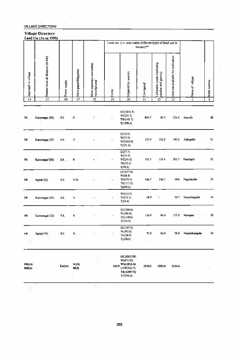
VILLAGE DIRECTORY
Village Directory Land Use (As on 1999)
.. gj'
~ B ..c:: g e 0. Q,
« 14
PR
PR
PR
PR
PR
PR
PR
PR(14)
MR(2)
i g .. <J
~ ;;; ~
~ B u;
~ __Z
15
Karimnagar (46)
Karinmagar (32)
KariJnl!agaf'(3S)
Jagtial (22)
Karimnagar (30)
Karimnagar (32)
Jagtial (30)
... ]: ~ i;
~ p..
16
EA
EA
EA
EA
EA
EA
EA
EA(16)
.. C .~
"" ~ g. Q,
"' ~ Z 17
N
N
N
NM
N
N
N
N(16)
M(2)
.0 '8 e e 0 0
~] 8..2 §~
'" ~ ~ ~ E
18
Land use (i.e. area under different types of land use in hectare)··
'0' ~ :I :;: ... e
-0
~ u; ~ btl 0 :g ~
19 20
GC(I032.4)
WE(24.3) TW(141.7)
T(1I98.4)
OC(6.0) W(23.0)
WE(362.0)
T(39 1.0)
OC(7.7)
W(IO.S)
WE(36.0) TK(4S.3)
T(99.6)
0C(637.8)
W(68.8)
WE(78.9)
TK(l13.S)
T(899.0)
WE(12.3) TK(12.1)
T(24.4)
OC(300.0) W(106.0) TK(lIO.O)
T(516.0)
OC(107.0)
W(103.0) TK(28.0)
T(238.0)
GC(3512.99) W(472.53)
242 9 WE(1823.36 • ) TW(141.7)
TK(1259.72) T(721().3)
365
"t:I
i '6 ·s ;::J
21
809.7
155.0
105.3
416.7
38.9
136.0
73.0
3100.2
c 0 .~
"" > c .:: '6 '3 '" <J
<l .... c:~ <8 ._ tfl
~'" .. .. > ~ - 0 l(l Sb
~ ~"t:I 2 Iii -§ til '0 ","", c: _ <J
'" '3 '" ~ U gj, 22 23
40.5 526.4
102.0 180.0
119.4 361.7
316.7 19.6
10.7
84.0 175.0
66.0 58.0
1856.0 2234.6
<>
"" ~ .8 ~ e ..... '" 0 " '" <a § .c:: Z
.. </l
2 1
Aravelli 10
Aithupalle 11
Nandagiri 12
Pegadapalle 13
Keesulatapalle 14
Namapur IS
Narsimhunipeta 16

z
, I
,[l..L l\f AND ~'¥ ,-v " PEG<lf) '¥ ",..... ,~,( <4 P 4
"(( , .. --~" , (I., ~ ," \ ~ ~~
, PO \ '~~-1 "\ .: ... "-\ +~
v '", " I \ "1 ~ I , 246 f J ..... " <; .' " 4_ ~,.
~ I , ). ... .. ..... , ,. I~, ,/ ~ .. , ", __ ,-<', ... ~... " 250 .... ,f
I /;' I ) I. / ~ " I I ~ ........ J. .. ,1 ,
B S I .... -« / , .' ... -- I l
I ' I, PO I " , 249:" I
~ ;003~500 I.' _------t \ • 251 : ~ .... " ,_~ 248 ,~' _~ ' .... _____ .. /
... l PO :247 . " -----,' / ~ ~ \ J...__ , I ,
\, '\. I , " '\. { \ '%\'255 1 I I .= ~ '( / 1\ I
o ~ \,' po. " : \ G"~ \/ 254 " PO \ C'l r \ _,I . J
". \ ----@-TO:252/ 'r------ PO 0. I •
\--8 ...... ---... I PS 253 S --r--,./ , • • GANGADHARA B I I /I \ ... __ ... _-', ... J
" 256 Pql: , - I I ,' y -----I I
I J' ~ ~ I '. " ?So \ 259 .....
.... a
J , , , , " \ \
':'. S \ po,.
t, 257
,/ 'l _--_ I
I
>
INDIA
ANDHRA PR;\])ESH
GANGADHARA MANDAL
2
KARIMNAGAR DISTRICT
0.5 1 2
I I KILOMETRES
AREA: 164.53 Sq. Kms POPULATION: 46,87'1 No. OF TOWNS: NIL No.OFVILLAGES: 19 DISTANCE FROM DIlL H.Qtrs. TO MANDAL : ZJ KIlls.
~ y '-
, , \
\
\
I
\ \ ,
" , ... , 261 -r "--, ~
.... ,\
o
, ' I
""'\ /PO S f y-----, I • : >
/
~ "" .. _ ... - ~\ I
\ PO \ 260 " , • \ I
III" \ I ~
, 262 " " I \ r- ... /--- ..... _ """ .... """-\-_ ....... ..-' "'. I ,-_ ..
I \ .. , ,~
~"' " /~ ''', ..
: . S \ 00326300 .. '. , " ,.-..,,,,,-'
""/ . <?- ,/
" I
BOUNDARY, MANDAL
BOUNDARY, VILLAGE WITH PLCN
HEADQUARTERS, MANl)AL
STATE IllGHWAY
OTHER ROAD
POPULATION SIZE CLASS:
200- 499, 5()0 - 999, 1000 - 4999, 5000 AND ABOVE
POST omCE I TELEGRAPH OFFICE
IllGHSCHOOL
POLICE STATION
BANK
PRIMARY HEALTH CENTRE
-------- .. _, : 00326300 I __________ f
@
• ••• PO/TO
S
PS
B ...
Based upon Survey of India map with the pennission of the Surveyor General of India, © Government of India copyright, 2004.
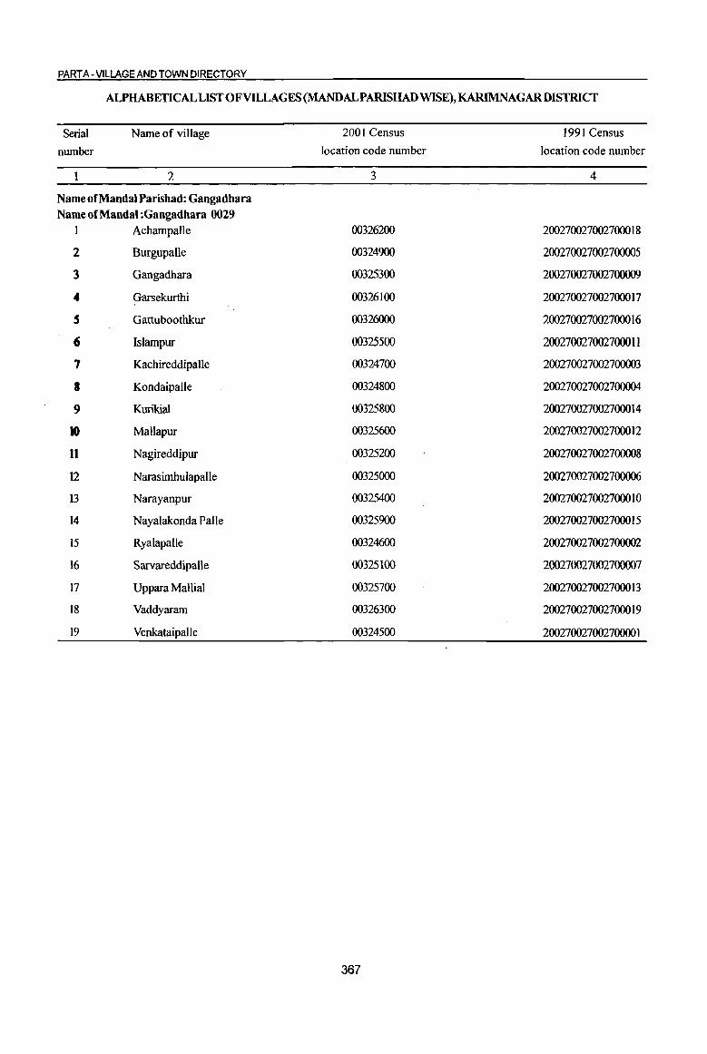
PART A -VilLAGE AND TOWN DIRECTORY
ALPHABETICAL LIST OF VILLAGES (MANDALPARISHAD WISE), KARIMNAGARDISTRICT
Serial
number
Name of village
2
Name of Mandai Parisbad: Gangadbara Name of Mandai :Gangadbara 0029
1 Achampalle
2 Burgupalle
3 Gangadhara
4 Garsekurthi
S Gattuboothkur
6 Islampur
7 Kachireddipalle
8 Kondaipalle
9 Kurikial
10 Mallapur
11 Nagireddipur
12 Narasimhulapalle
13 Narayanpur
14 Nayalakonda Palle
15 Ryalapalle
16 Sarvareddipalle
17 Uppara Mallial
18 Vaddyaram
19 Venkataipalle
2001 Census
location code number
3
00326200
00324900
00325300
00326100
00326000
00325500
00324700
00324800
00325800
00325600
00325200
00325000
00325400
00325900
00324600
00325100
00325700
00326300
00324500
367
1991 Census
location code number
4
200270027002700018
200270027002700005
200270027002700009
200270027002700017
200270027002700016
200270027002700011
200270027002700003
200270027002700004
200270027002700014
200270027002700012
200270027002700008
200270027002700006
200270027002700010
200270027002700015
200270027002700002
200270027002700007
200270027002700013
200270027002700019
200270027002700001

I " "'" 'OJ' 0 (J ;jl §
.Q
" ,g u ... U ., .. g gp <5 ..J
~ 0
~ ~ .. .a " OIl .~ 1l .. ~
._ 0 -s § ~ ~ ....
.: 0 0-U O!
~ '3 '3 '13 0 0
<n f- f-
1 2 3 4
Mandai Pambad : Gangadbar8 (0029)
V c:nkataipaIle 511.0 1,278
(00324500)
Ryalapalle 2 91S.0 2,021
(00324600)
3 Kachireddipalle
621.0 1,IS6 (00324700)
4 Kondaipalle
404.0 1,028 (00324800)
S Burgupa1le
1034.0 2,719 (00324900)
Narasimbulapalle 6
(00325000) 633.0 719
Sarvareddipalle 7 574.0 1,747
(00325100)
Nagireddipur 8 S&6.0 1,671
(00325200)
9 Gangadbara
1679.0 7,230 (00325300)
Narayanpur 10
(00325400) 753.0 2,215
lslampur 177.0 465 II
(00325500)
DISTRICT CENSUS HANDBOOK: KARIM NAGAR
Census of India 2001 -Amenities and
Amenities available (if not available within the village, a dash (-) is shown in the column and next to it in brackets the distance in broad ranges viz.< 5 klns., 5-10 klns. and 10+ kms of the
'OJ' nearest olace where the facility is available is Il:iven) iil " -0 lS~ u
fa u u u '<;l (J of
<5 " ,.
I ;:::t! 0
0 0 ... .~ >; ~ .c E ~ 8. go ~ & <J ]~~ :: ~ <5 11 9 .~ .,
" u
"'" 0 , .~ _Ci!§ ~~ .r::: <> u ~ 5 ~"6 '" i!: VI "'" C U
" t Iii o ._
.: . 0 .Q " g ~~~ .~ .g .c ~ 0- . '" ... Ol 9: a Ol ]~
.. >::1 0 .: 'u c .( ._ 13 t 0 be U t - ~ .g <a ~ .: .,
.::; Ci! ~ 11 " ,.,
.&> ., <> jj ::I 0 .. S e os s 0 '6 tf .~ U ~ .. '6 ~~ ::I ::I
~ 8 II .5 13 Z i2 tf .(-g ~ 8<n u 5 6 7 8 9 10 II 12 13
RMP(3) 0(2) NCS
306 P M C{lO+) H(IO+)
THPW PO PHeW) CM« 5) ACS(IO+) CV(IO+) BS RS(IQ+)
MCW(IO+) CP(IO+) OC5(10+)
SP(IO+) NW(lo+) PHC(IO+) ST(IO+)
476 P(3) M(2) RMPH(IO+)
PO NCS
CV(IO+) as RS(IO+) MCW(lO+) W CM(5-1O) ACS(IO+)
C(IO+) PHC(lo+)
PH(5-10) CP(10+) OCS(IO+)
SP(IO+) NW(IO+) ST(IO+)
301 P M«5) H(IO+)
HPW PH
CM(IO+) ACS(S-IO) CV(10+) BS RS(IO+)
C(lO+) MCW(lO+) PO(I 0+) NCS(IO+) Sp(IO+) NW(IO+) PHC(IO+)
CP(lO+) OCS(IO+) ST(1O+)
PAC RMP(2) 0(2)
241 M«S) H(IO+)
TW PO« S) CM«S) ACS«5) CV(lO+) BS« 5)
C(10+) MCW(IO+)
PH« 5) CP« S) NCS(IO+) SP(IO+) RS(IO+)
PHC« 5) OCS(IO+) ST(IO+) NW(IO+)
PHSRMP(2) NCS
635 P(4) M(2) S o H(IO+)
THPW PH(18) CM
ACS(S-IO) CV(IO+) BS RS(IO+)
AC C(lO+) MCW(lO+) PO(I 0+) CP(S·IO) 5P(IO+) NW(lO+) PHC(S-IO)
OCS(IO+) ST(IO+)
PAC RMPH(IO+) PH ACS(IO+) CV(S-IO) BSRS(IO+)
195 M«S) MCW(IO+) HPW P0(5-IO)
CM(S-IO) NCS(IO+) SP(IO+) NW(lO+)
C(lO+) PHC(IO+) CP(lO+) OCS(IO+) ST(IO+)
P(2) AC(3) PHS H(IO+) NCS CV« 5) BS RS(IO+)
419 M« 5) MCW(lO+) HPW PO PH CM«5) ACS«5) C(lO+) PHC(IO+) CP(IO+) OCS(IO+)
SP(IO+) N W(1 0+)
ST(IO+)
409 P(2) M AC RMPH{IO+) NCS
CV(IO+) BSRS(IO+) MCW(lO+) THPW PO PH(l3) CM(5-10) ACS(5-10)
C(10+) PHC(5-10) CP(S-IO) OCS(lO+)
SP(IO+) NW(IO+) ST(lO+)
peS) M(2) HDHPHC
ACS 1,595 S(2) AC(3)
PHS(Z) THPW
PO CMCP NCS(6}
CV(IO+) BS RS(IO+)
C(IO+) RMP(3) PH(140)
OCS(lo+) SP(IO+) NW(IO+)
MCW(IO+) ST(IO+)
PHS RMP(2) P(3) M H(IO+)
THPW PO PH(l4) CM(5-10) ACSNCS CV(IO+) BS RS(lo+)
572 AC(2)C(10+) MCW(lO+) OCS(IO+) SP(IO+) NW(IO+)
PHC(5-10) CP(S-IO)
ST(IO+)
120 P M(5-IO) H(lO+) W P0(5-1O) CM(S-IO)
ACS{S-IO) CV(IO+) BS RS(IO+)
C(lO+) MCW(IO+) NCS(IO+) SP(IO+) NW(IO+)
PHC(5-1O) PH(S·IO) ep(5-10)
OCS(lO+) ST(IO+)
368
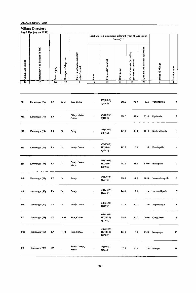
VILLAGE DIRECTORY
ViUa2e Directory Land Use (As on 1999)
Land use (i.e. area under different types of land use in hectare)··
j c 0 . ." ..
g ~ 00 ;> C . ."
8 ~ :;3 "3
'" <.>
N .§ ~ -u ... ~ 'ti' c~ .E tn ;.::..~ :;3 0 ~
., ~ f
u ~ E; :0 ~ ~ &g
~1l 0 gj lib ..
~ >. <II 'a ~ ..8 .5l 8: e '0
~.., ~ .9 g. 8.E .. ~ Iii ~ ..c
'" to ""' ~ '" ~§ ~ "" .D lU 0 1ii p. ~ 00 0
e j II 1ii 'e ~-£ c .. ~ - '" .. Ol
"" ;I: ~ ~ !! 00 'a -; ~ ~ ~ ·c ~ &. ~ (; ] .. ::;J
U "" en 14 15 16 17 18 19 20 21 22 23 2 I
PR Karinlnagar (26) EA NM Rice, Colton WE(168.0)
240.0 90.0 13.0 Venkataipalle T(168.0)
MR Karimnagar (35) EA Paddy, Maize, WE(1l0.0)
290.0 142.0 373.0 Ryalapalle 2 Couon 1(110.0)
MR Karimnagar (24) EA N Paddy WE(179.0)
125.0 136.0 181.0 Kachireddipalle 3 1(179.0)
WE(l76.0)
PR Karimnagar (27) EA N Paddy, Cotton TK(48.0) 165.0 10.0 5.0 Kondaipalle 4
1(224.0)
Paddy, Cotton, WE(29Q.O)
PR Karimnagar (28) EA N Maize
TK(SO.O) 403.0 181.0 110.0 Burgupalle S 1(340.0)
MR Karimnagar (32) EA N Paddy WE(207.0)
210.0 111.0 105.() Narasimhulapalle 6 T(207.0)
MR Karimnagar (30) EA N Paddy WE(273.0)
240.0 9.0 52.0 Sarvareddipalle 7 1(273.0)
MR Karinmagar (30) EA N Paddy, Cotton WE(269.0)
272.0 30.0 15.0 Nagireddipur 8 1(269.0)
WE(6S0.0)
PR Karirnnagar (23) EA NM Rice, Cotton TK(120.0) 556.0 144.0 209.0 Gangadhara 9 1(770.0)
WE(330.0) MR Karimnagar (30) EA NM Rice, Cotton 1K(148.0) 143.0 8.0 124.0 Narayanpur 10
T(478.0}
PR Karimnagar (26) EA Paddy, Cotton, WE(80.0) 72.0 13.0 12.0 Islampur II Maize T(8oo)
369
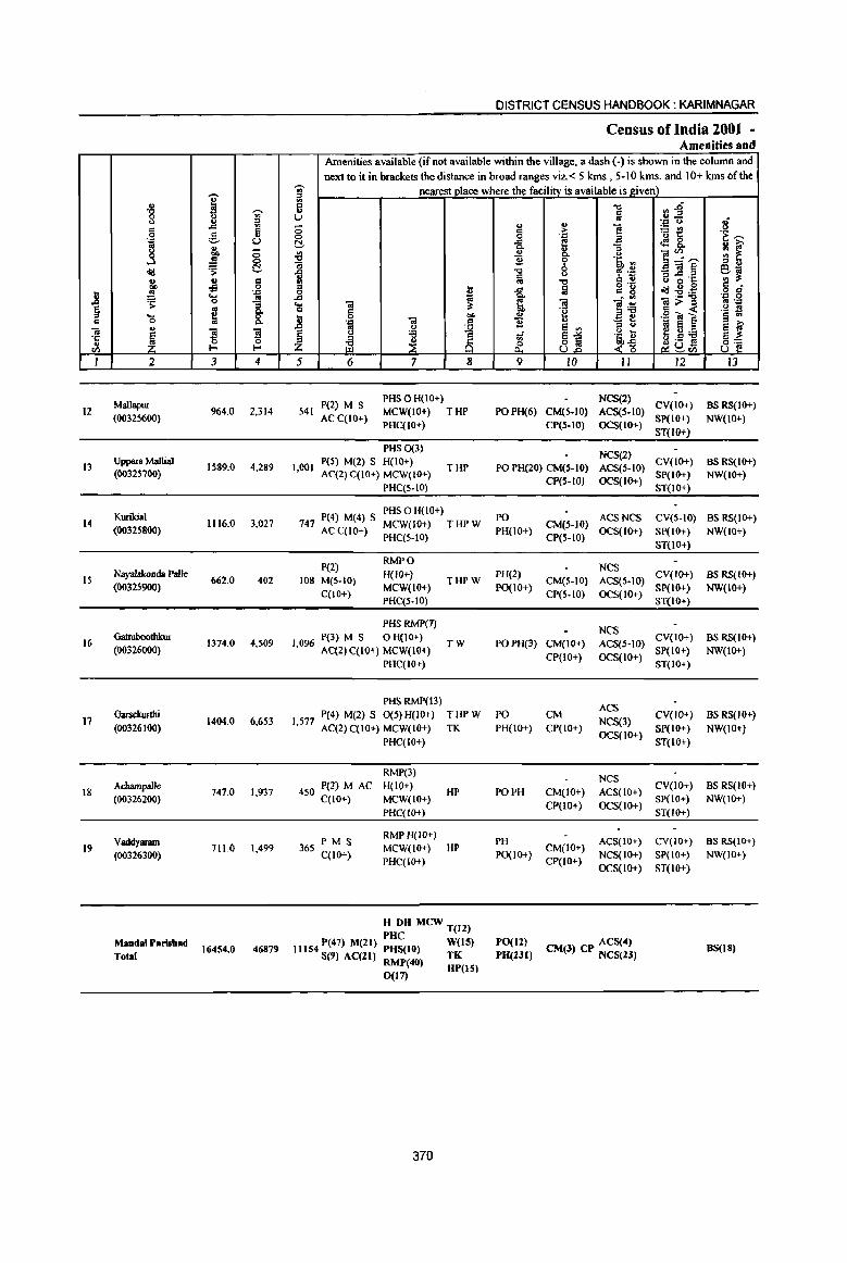
12
13
14
IS
16
17
18
19
2
Mallapur (00325600)
Uppara Mallial (00325700)
Kurikial (00325800)
Nayalakonda Palle (00325900)
Gattuboothlrur (00326000)
Oarsekurtlti (00326100)
Achampalle (00326200)
VaddyallllD (00326300)
Mandai P.risbad Total
3 4
964.0 2,314
1589.0 4,289
1116.0 3,027
662.0 402
1374.0 4,509
1404.0 6,653
747.0 1,937
711.0 1,499
16454.0 46879
DISTRICT CENSUS HANDBOOK: KARIMNAGAR
Census of India 2001 -Amenities and
Amenities available (if not available within the village, a dash (-) is shown in the column and next to it in brackets the distance in broad ranges viz. < 5 kms., 5-10 kms. and 10+ kms of the
nearest place where the facility is available is given)
5 6 7 8
PHSOH(IO+) 541 P(2) M S
AC C(lO+) MCW(IO+) THP
1,001
PHC(IO+)
PHS 0(3) peS) M(2) S H(lO+) AC(2) C(IO+) MCW(IO+)
PHC(5-10)
THP
PHS 0 H(IO+) 747 P(4) M(4) S MCW(IO+) T HP W
AC C(IO+) PHq5-10)
P(2) 108 M(5-10)
C(IO+)
RMPO H(JO+) MCW(IO+) PHq5-10)
PHSRMP(7)
THPW
I 096 P(3) M S 0 H(IO+) T W , AC(2) C(10+} MCW(lO+)
PHqtO+)
PHS RMP(13)
9 10 11 12 13
NCS(2) PO PH(6) CM(5-10)
CP(S-IO)
ACS(5-10) CV(IO+) OCS(IO+) SP(IO+)
ST(IO+)
BS RS{IO+) NW(IO+)
NCS(2) PO PH(20) CM(S-IO) ACS(5-10) CV(IO+) BS RS(IO+)
CP(S-IO) OCS(IO+) gP(IO+) NW(lO+)
PO PH(lO+)
PH(2) PO(lO+)
ST(IO+)
ACS NCS CV(5-lO) BS RS(IO+) CM(5-10) OCS(IO+) SP(IO+) NW(lO+) CP(S-IO) ST(IO+)
Nes CM(S-IO) ACS(5-10) CV(IO+) BS RS(IO+)
SP(IO+) NW(lO+) CP(S-to) OCS(IO+) ST(IO+)
Nes PO PH(3) CM(lO+)
CP(tO+)
ACS(S-IO) CV(IO+) BS RS{IO+) OCS(tO+) SP(IO+) NW(IO+)
ST(IO+)
I 577 P(4) M(2) S 0(5) H(IO+) T HP W PO CM , AC(2)C(10+) MCW(IO+) TK PH(IO+) CP(IO+)
ACS NCS(3) CV(IO+) as RS(lO+)
SP(IO+) NW(IO+)
450 P(2) M AC qIO+)
365 PM S C(IO+)
PHC(IO+)
RMP(3) H(IO+) MCW(JO+) PHC(IO+)
RMPH(lO+)
HP
MCW(IO+) HP PHqIO+)
H DH MCW T(l2)
11154 P(47) M(lt) ::~tO) W(tS) S(9) AC(ZI) RMP(40) TK
0(17) HP(IS)
370
PO PH CM(to+) CP(lO+)
PH PO{IO+) CM(IO+)
CP(IO+)
OCS(lO+) ST(IO+)
NCS ACS(IO+) CV(lO+) BS RS(IO+) OCS(IO+) SP(IO+) NW(IO+)
ST(lO+)
ACS(IO+) CV(IO+) BS RS(IO+)
NCS(IO+) SP(IO+) NW(IO+)
OCS(IO+) ST(IO+)
PO(ll) ACS(4) PH(Zlt) CM(l) CP NCS(2l) BS(18)
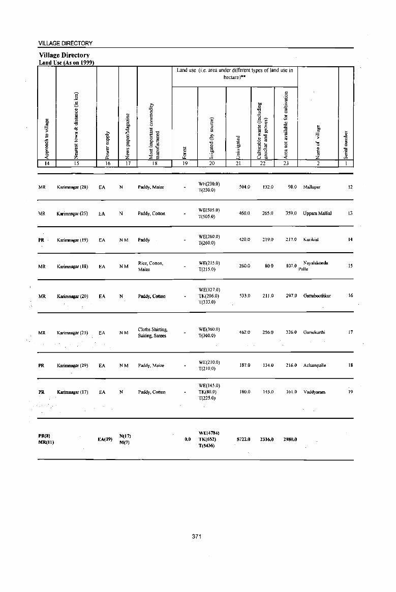
VILLAGE DIRECTORY
Villa2;e Directory Land Use (As on 1999)
... OIl l'! ~ s ..c :;l
~ ~ 14
MR
MR
PR
MR
MR
MR
PR
PR
PReS) MR(ll)
]' g " <.l
~ til
'i3 o'<!
~ $a t:l ~ ~ 15
Karimnagar (28)
Karimnagar (25)
Karimnagar (19)
Karimnagar (18)
Karimnagar (20)
Karirnnagar (25)
Karirnnagar (29)
Karimnagar (17)
~ 8: ::! til
!l :l: & 16
EA
EA
EA
EA
EA
EA
EA
EA
EA(19)
'" c § OIl .. ~ " §' Co til
~
~ 17
N
N
NM
NM
N
NM
NM
N
N(17)
M(7)
.c '8 E E a " ~il 8.z .5 .M - '" ~ ~
18
Paddy. Maize
Paddy. Cotton
Paddy
Rice, Cotton,
Maize
Paddy, Cotton
Cloths Shirting,
Suiting, Sarees
Paddy, Maize
Paddy, Cotton
Land use (i.e. area under different types of land use in
1;;
" 5 "-19
0.0
., e '" a til
>. e "" ~ OIl
] 20
WE(230.0) T(230.0)
WE(SOS.O)
T(50S.0)
WE(260.0)
T(260.0)
WE(215.0)
T(2IS.0)
WE(127.0)
TK(206.0) T(333.0)
WE(360.0)
T(300.0)
WE(210.0)
T(21O.0)
WE(145.0)
TK(80.0) T(22S.0)
WE(4784)
TK(652)
T(S436)
371
hectare)··
il 1<i OJ)
'E
'" ::> 21
504.0
460.0
420.0
260.0
533.0
462.0
187.0
180.0
5722.0
c a .~
OIl :> c . .,
'i3 :; ::! <.l U ... c~ ~ ._ til
~" " " :> :E ... _ a
l'! OIl c:a Sb l'! :l: ""
'0; ~ ..!l § 1;; ... {l @ 0 0
2-E c '" .. ~ - ::! ~ '" '" u OIl
22 23 2
132.0 98.0 Mallapur
265.0 359.0 Uppara MaJlia!
219.0 217.0 Kurikial
80.0 107 0 N ayalakonda . Palle
211.0 297.0 Gattuboothkur
256.0 326.0 Garsekurthi
134.0 216.0 Achampalle
145.0 161.0 Vaddyaram
2316.0 2980.0
.8 E :I c
O! ·c " <Il
1
12
13
14
15
16
17
18
19
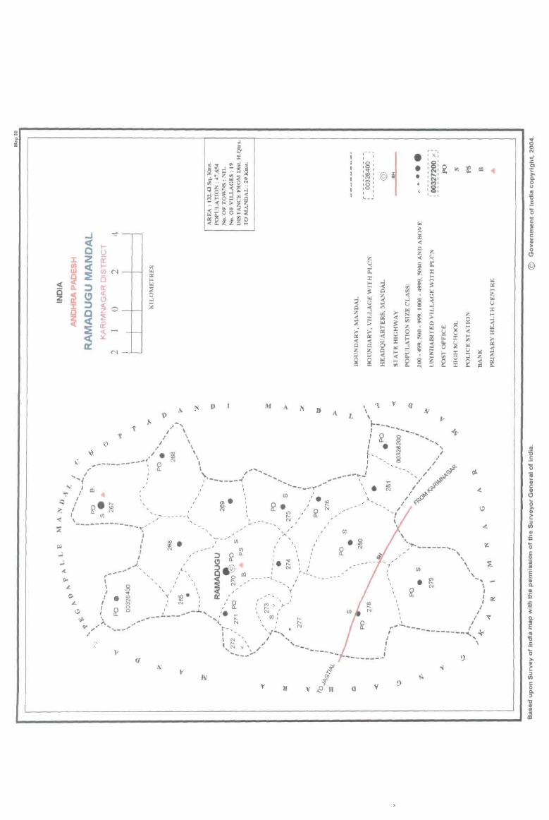
0 .. ... ~ .. ~
. ::Il
:t WI.... 0\ ~ .;
~~. ~::i5~ '" f1i~~
.i~.;;~O~ ~~ij~~ ~r::O=Iol~ -« ... >~ •. ..l '" '" «-< ~~OO ... :e «~:tlSe
..J -.:t
~ I-()
Z ir J:
~ II) c( I-W (j) N ~ ~ 0 l-
t.l oC( ~ cr
~ E:i (!) « ~ C> ..l i:
12 i ::l ~ 0 a ~ c( ir ~ ~ ~
N
D M A N D
o
c
/
([
v
.--" •
, , , j '0, • ,~ I
I '", , '(\I ,
• 'M, 1 :8: • 1 ' , l. _ _
Z; U ..J Q"
:r: I-
~ [oJ
~ " Q :3 z ..l
~ s:
~ ~ ~ z ~ :=-~ g
r --, • ' X,
: ~ : ~ g; • IO'l = :t ' ,.." @ • CD
: ~ : :8: '- -,
r.l
6 = « A i1!: i1!:
U ..: ~ 0
~ ::c ... ~ t ~ ..J ..: <ii I-... [oJ Z
e ~ a r.l ~ ..J
~ « u U ..J X !::l ..l
;z; I-~ ~ ~ ;; ~ ;;; 0 [oJ ~ go. Q 8 ;:: [oJ z [oj t.l ..: II: ~ II: 0 0 ... 8 a ~ I-
~ ..:
~ ~ r.. :c til :=- :2 Ii> ~ r.. u r.l 0 '" ~ " r.l ..1 '" ::! :.:
~ '< :=- ... z l- X ..l Z Q"
~ ~ 0
~ ~ Ii! I-< 2 g :2 Q" til ...
v q
, 'II~"""------'" , .. .. ,
rIJ .. .. \ m .. , ..... " . :;; \
'- ~ : ~ \ , \ I
I I , I ~
" J ~"-- -----------.f.. .ar , , I , ,
I I --------
a
.; 0 0 N
:E g)
't: >-8-... " '5 .E '0 C ~ c i ". 0 Cl
@

PART A -VILLAGE AND TOWN DIRECTORY
ALPHABETICAL LIST OF VILLAGES (MANDALPARISHAD WISE), KARIMNAGAR DISTRICT
Serial Name of village 2001 Census 1991 Census
number location code number location code number
2 3 4
Name of Mandai Parishad: Ramadugu Name of Mandai :Ramadugu 0030
1 Chippakurthi 00326600 200370037003700003
2 Dathojipet 00326900 200370037003700006
3 Deshrajpalle 00328000 200370037003700017
.. Fakeerpet 003mOO 200370037003700009
5 Gopalraopet 00327300 200370037003700010
6 Gundi 00326700 200370037003700004
7 Kistapur 00327700 200370037003700014
8 Kokkerakunta 00328100 200370037003700018
9 Koratpalle 00327400 200370037003700011
10 Lakshmipur 00326800 200370037003700005
II Mothe 00327600 200370037003700013
12 Ramadugu 00327000 200370037003700007
13 Rudraram 00327500 200370037003700012
14 Shanagar 00327100 200370037003700008
15 Sriramulapalle 00326500 200370037003700002
16 Thirmalapur 00326400 200370037003700001
17 Vannaram 00328200 200370037003700019
18 Vedira 00327800 200370037003700015
19 Velichal 00327900 200370037003700016
373
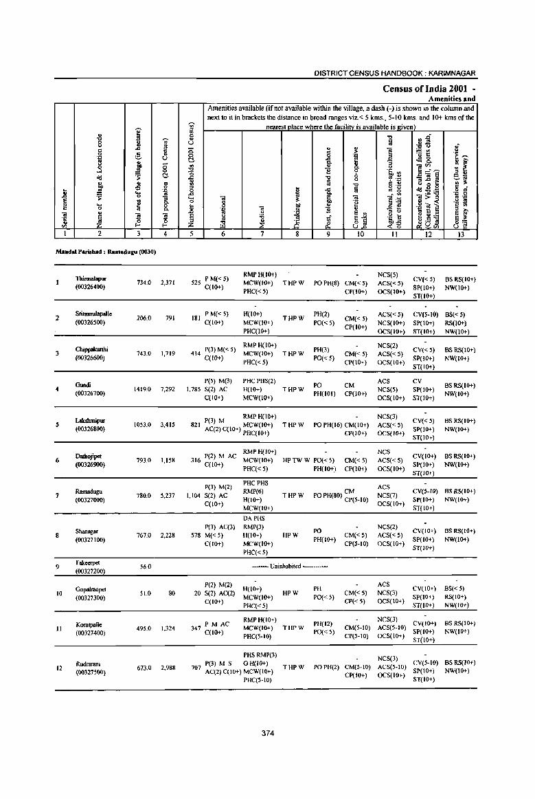
i .s ~
0 .8 i <> c 0 :! ·c L> co
j <> <5 0 ....l 0
<Id 'S c ~
., 8' -£l
j! oS '::1 .... oS 'S 0 :; ~ ~ 0.. .... 0 = 0 0.. "iil '"
~ ~ s '1:; 0 '" l- I-CIl
I 2 3 4
Mandai Parishad : Ramadugu (0030)
Thinnalapur 734.0 2,371
(00326400)
2 Sriramulapalle
206.0 791 (00326500)
Chippalrurthi 3 743.0 1,719
(00326600)
Gundi 4 1419.0 7,292
(00326700)
Lakslunipur s IQ53.0 3,415 (00326800)
Dadtojipet 6 793.0 1,158
(00326900)
Ramadugu 7
(00327000) 780,0 5,237
Shanagar 8 767.0 2,228
(00327100)
9 Fakeeq>et
56.0 (00327200)
10 Gopalraopet
51.0 80 (00327300)
Koratpalle 11 495.0 1,324
(00327400)
Rudraram 12 673,0 2,988
{003275OO)
DISTRICT CENSUS HANDBOOK: KARIMNAGAR
Census ofIndia 2001 -Amenities and
Amenities available (if not available within the village, a dash (-) is shown in the column and next to it in brackets the distance in broad ranges viz.< 5 kms., 5-10 kms. and 10+ kms of the
';;;' nearest place where the facility is available is given) iil ., "0 Vl.§ '" U ij .,8 (3 .; ... ...
8 ., :> 1 ;.:: tn " 0 ·c '" 1:: .~ ~
C ..c: ! c:! 8.. !r ~ ~ ~ ]~~ " B 'i' .@, ~ .c "0 0 ~ "'::: :;]§ eiii
" ~ a "0 e '" " o·c II) !l: 5 ... Iii g 'g Jd u g '" .
'" ..c: ::!:a .g 8 .d ... 6; . '" .... ta !l: ta ]~
ta>= fl '., 0 C 'e s -« '§ ~ ... 0 -a CD '" '., O! ] ., .~
~ B '" ..0 u e '" '" " .. e e ~ @ 0 :a 'Ii ~1
.~ a; e":a e l: '" ~ ~ 3 ,5 .!l Z ili & -«-g liU", 8~ 5 6 7 8 9 10 II 12 13
525 P M« 5) RMPH(lO+) NCS(5)
CV« 5) BS RS(IO+) MCW(IO+) THPW PO PH(8) CM« 5) ACS«5)
C(IO+) PHC«5) CP(IO+) OCS(IO+)
SP(IO+) NW(IO+) ST(IO+)
181 P M« 5} H(lO+}
THPW PH(2)
CM« 5) ACS«S) CV(S-IO) BS« S}
C(lO+) MCW(lO+) PO« 5) NCS(IO+) SP(IO+) RS(lO+) PHC(IO+)
CP(IO+) OCS(IO+) ST(IO+) NW(IO+)
414 P(3)M«5) RMPH(IO+)
PH(3) NCS(2)
ev« 5) BS RS(IO+) MCW(IO+) THPW CM«5) ACS«S)
C(lO+) PHC«5)
PO« 5) CP(IO+) OCS(IO+)
SP(IO+) NW(IO+)
ST(IO+)
P(5) M(3) PHCPHS(2) PO CM
ACS CV BS RS(10+)
1,785 S(2) AC H(IO+) THPW NCS(S) SP(IO+) C(lO+} MCW(IO+)
PH(IOI) CP(IO+) OCS(IO+) ST(IO+)
NW(IO+)
P(3) M RMPH(IO+) NCS(3)
CV«5) BSRS(IO+) 821 THPW PO PH(16) CM(IO+) ACS«5) AC(2) C(IO+) MCW(IO+) SP(IO+) NW(IO+)
PHC(IO+) CP(IO+) OCS(lO+) ST(IO+)
316 P(2) M AC RMP H(I(}+) NCS
CV(IO+) BS RS(IO+) MCW(IO+) HP TW W PO« 5) CM«5) ACS«5)
C(IO+) PHC« 5) PH(lO+) CP(IO+) OCS(IO+)
SP(IO+) NW(IO+)
ST(IO+)
P(3) M(2) PHCPHS
ACS RMP(6) CM CV(5-IO) BS RS(IO+)
1,104 S(2) AC H(IO+)
THPW PO PH(80) CP(S-IO) NCS(7) SP(lO+) NW(IO+)
C(IO+) MCW(lO+)
OCS(IO+) ST(IO+)
DAPHS
P(3) AC(3) RMP(3) PO
NCS(2) CV(IO+) BS RS(IO+)
578 M« 5) H(lO+) HPW CM«5) ACS« 5) C(lO+) MCW(IO+)
PH(IO+) CP(5-10) OCS(IO+)
SP(IO+) NW(IO+)
PHC«5) ST(IO+)
---- Uninhabited ----
P(2) M(2) PH
ACS CV(IO+) BS« 5)
20 S(2) AC(2) H(IO+)
HPW CM«5) NCS(3)
C(10+) MCW(IO+) PO«5)
CP«5) OCS(IO+) SP(lO+) RS(IO+)
PHC«5) ST(IO+) NW(lO+)
PM AC RMPH(lO+)
PH(12) NCS(3)
CV(IO+) BS RS(IO+) 347 C(lO+) MCW(IO+) THPW CM(5-10) ACS(5-10)
PHC(5-10) PO« 5)
CP(5-10) OCS(IO+) SP(IO+) NW(IO+) ST(IO+)
PHSRMP(3) NCS(3)
P(3) M S 0 H(IO+) eV(5-10) BS RS(IO+) 707 AC(2) C(IO+) MCW(IO+)
THPW PO PH(2) CM(5-10) ACS(S-IO) SP(IO+) NW(IO+)
CP(IO+) OCS(IO+) PHC(5-10) ST(IO+)
374
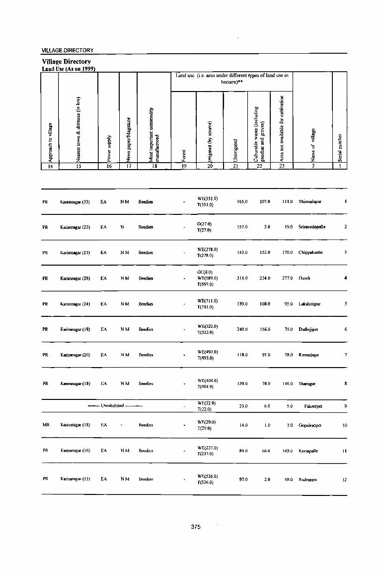
VILLAGE DIRECTORY
Villal?e Directory Land Use (As on 199~
Land use (i. e. area under di fferent types of land use in hectare)**
j " 0 .Z' .. ,.§, b 00
,. t: .Z'
3 :a :.a :; 0 " "
~ " ; "0 ... " 'ij .. t:~ ..s 00 :.e ~
~rl " .!! ~ ~ ~ ~ " ~ ~ ~ll lil :(i ~
00
~ oS ... ~ ~ il:",
... " B IS:
.., "0 > ~ .D
.CI B Q, 8..B e i .2 § .. ~ u " '" .13 ~ "0 .0 !a 0 ... '" 0 d .. 1;; Q, ~ ~'fi d e
~ t '" ~ " 1;; .. 'E .. " "iii
Q, il: ;l:
~ ~ e co _E. - '" ~ ~ ·c
~ ~ Z & ] ::l .. " U"" til
14 15 16 17 18 19 20 21 22 23 2 I
PR Karimnagar (33) EA NM Becdics WE(351.0)
165.0 107.0 111.0 Thinnalapur T(3SI.0)
PR Karimnagar (22) EA N Beedies 0(27.0)
T(27.0) 157.0 3.0 19.0 Sriramulapalle 2
PR Karimnagar (23) EA NM Beedies WE(278.0) T(278.0)
143.0 152.0 170.0 Chippakwthi 3
GC(S.O) PR Karinmagar (28) EA NM Beedics WE(589.0) 311.0 234.0 277.0 Gundi
T(597.0)
PR Karinmagar (24) EA NM Beedics WE(711.0)
139.0 108.0 95.0 LaIcshmipur 5 T(711.0)
PR Karimnagar (18) EA NM Beedies WE(322.0)
240.0 156.0 75.0 Dathojipet 6 T(322.0)
PR Karimnagar (20) EA NM Beedies WE(493.0)
118.0 91.0 78.0 Rarnadugu 7 T(493.0)
PR Karimnagar (18) EA NM Beedies WE(404.0)
139.0 78.0 146.0 Shanagar 8 T(404.0)
--- Uninhabited ----------WE(22.0)
T(22.0) 23.0 6.0 5.0 Fakeerpet 9
MR Karimnagar (18) EA Beedies WE(29.0)
T(29.0) 14.0 1.0 7.0 Gopalraopet 10.
PR Karimnagar (16) EA NM Beedies WE(237.0) T(237.0)
89.0 66.0 103.0 Koratpalle 11
PR Karimnagar (15) EA NM Beedies WE(526.0) T(S26.0)
97.0 2.0 48.0 Rudraram 12
375
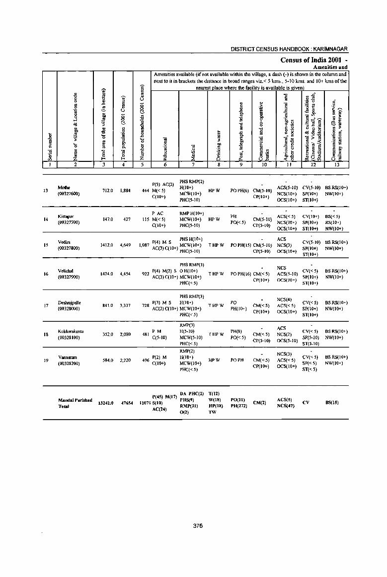
" ., u S "Q ';;;' 8 0 ., ::s d ..d
., 5 0 :.§, 'J::! U to .,
.3 E g Od 'S ~
" II C
~ -fl 0
jl ...
~ 'E ~ § os a. .... ~ 0 C 0 a.
" 01
~ ~ ~ ·c u til i-'
I 2 3 4
13 Mollie
712.0 1,884 (00327600)
Kistapur 14 147.0 427
(00327700)
Vedira IS
(00327800) 1412.0 4,649
16 Velichal
1424.0 4,454 (00327900)
DeshrajpaJle 17 841.0 3,337
(00328000)
18 Kokkeralumta
352.0 2,080 (00328Joo)
19 Vannaram
S84.0 2,220 (003282oo)
Mandai Parishad
ToW 13242_0 47654
DISTRICT CENSUS HANDBOOK; KARIMNAGAR
Census of India 2001 -Amenities and
Amenities available (if not available within the village, a dash (-) is shown in the column and next to it in brackets the distance in broad ranges viz. < 5 kms., 5-10 kms. and 10+ Ians of the
" nearest place where the facility is available is Riven) i -0 11 j"' f;i u u ... t.> .;
;; " ] ~~ t.> d > 0 Q ~ .~ ~ c. -&. e 4! R 13 ., .. ~ " 8. ]~'"" ., ~ 11 0 's, ~ 0 b ::s " ~
-0 u <!' .::: _OI§ 60; f;i "0 r:: u il -; '1: ., ;l:
::s .. fa o ._
Od~~ 6 ci 0 ~ 1 d g .c . ., ... 0 .... .. 3 .. ]05 iO>= <II .;;;
0 c 'g c « .~ s 11 0 ". " .2 ~] § U>
'D 01 c 11 _ i!!
0; 8 .D .. u ~ e '" '" 0 a ~
§ " :.a of ~j ]:~ e u :.a
g~ ;::I
~ 8 ~a~ z iil & U 5 6 7 8 9 10 11 12 13
P(3) AC(2) PHSRMP(2)
444 M« 5) H(lO+)
HPW POPH(6) CM(5·10) ACS(S·IO) CV(S·IO) BSRS(IO+)
C(IO+) MCW(IO+)
CP(lO+) NCS(lO+) SP(IO+) NW(IO+)
PHC(5·1O} OCS{lO+} ST{lO+)
PAC RMPH(IO+) PH ACS«5) CV(IO+) BS« 5)
liS M« S) MCW(IO+) HPW CM(S·10) C(lO+) PHC(5·10)
PO«S) CP(S·IO)
NCS(IO+) SP(IO+) RS(IO+)
OCS(to+) ST(IO+} NW(lo+)
P(4) M S PHS H(IO+) ACS CV(S·IO) BS RS(tO+)
1,087 AC(3) C(IO+) MCW(JO+) THPW POPH(lS) CM(S·lO) NCS(3) SP(IO+) NW(IO+)
PHC(5-IO) CP(S-IO) OCS(lO+) ST(IO+)
PHSRMP(3) NCS
9 P(4) M(2) S 0 H(IO+) THPW PO PH(16) CM« S) ACS(5-10)
CV« 5) BS RS(IO+) 22 AC(3)C(10+) MCW(lO+} SP(IO+) NW(lO+)
PHC« 5) CP(IO+) OCS(JO+)
ST(IO+)
PHS RMP(3) NCS(4)
P(3) M S H(IO+) PO CY«.5) BSRS(IO+} 728 AC(2)C(10+) MCW(IO+)
THPW CM«5) ACS«5) PH(lO+)
CP(IO+) OCS(lO+) SP(IO+) NW(lO+)
PHC« 5} ST(IO+)
RMP(3) ACS
481 PM H(5.1O)
THPW PH(8)
CM«5) NCS(2} CV«5) BS RS(lO+)
({S·IO) MCW(S-IO} PO«S} CP(S·IO) OCS(5-10)
SP(5·IO} NW(lO+}
PHC« S) ST(5-IO)
RMP(2) NCS(3)
P(2) M H(lO+) HPW PO PH CM«.5) ACS«5)
CV« 5) BS RS(IO+) 496 C(IO+} MCW(IO+)
CP(IO+) OCS(IO+) SP«5) NW(IO+)
PHC«5) ST(<:5)
P(45) M(I7) DA PHC(2} T(12)
11071 8(10) PHS(9) W(IS) PO(II) eM(2)
AC8(5) CY 8S(15)
AC(24) RMP(Jl) HP(18) PH(272) NCS(47)
0(2) TW
376

VILLAGE DIRECTORY
Village Directory Land Use (As on 199~
~ ~ ~ E .c ()
'" ~ ~ 14
PR
MR
PR
PR
PRo
PR
MR
PR(IS)
MR(3)
-. ] " :.::,
11 ~ '6 cI!!
~ tl ~ ~ 15
Karimnagar (14)
Karimnagar (15)
Karimnagar (13)
Karimnagar (12)
Karimnagar (10)
Karinmagar (8)
Karimnagar (10)
>, Ci. g. '" .... " ~ ~ 16
EA
EA
EA
EA
EA
EA
EA
EA(18)
.., <: .~ co OJ
~ 1i '" p,
~ -~ 17
N
NM
NM
NM
N
NM
N
N(t7)
M(13)
.0 '8 E E 0 0
§-o t:: e 8.§
.§ ~ " is §
::E E 18
Beedies
Beedies Making
Beedies Making
Beedies Making
Beedies Making
Beedies Making
Beedies Making
Land use (i.e. area under different types of land use in
tl e 0
"" 19
'OJ' 8 " ~ >, e ~ .., 1<i co ''§ 20
WE(377.0) T(377.0)
WE(99.0) T(99.0)
WE(732.0) T(732.0)
WE(536.0) T(536.0)
WE(52 1.0) T(52 1.0)
GC(64.0) T(64.0)
0C(316.0) WE(113.0) T(429.0)
GC(388)
00 WE(6340) . 0(27)
T(6755)
377
hectare)··
"0
~ co E '2 ~
21
154.0
22.0
269.0
206.0
182.0
267.0
48.0
2783.0
§ ... co
~ " '6 " ()
Q .... <2 <:~
.~ '" ~" ..!l " > ~ _ 0
gj ~ ~ ~"O ~ ..!l §
~ til g afi '" "3 ~ ~ U co
22 23
61.0 120.0
4.0 22.0
189.0 222.0
333.0 349.0
55.0 83.0
1.0 20.0
32.0 75.0
1679.0 2025.0
" ,; 11 ~ E ..... :: 0 <:
" iii
~ ·c .., Vl
2 I
Mothe 13
Kistapur 14
Vedira 15
Velichal 16
Deshrajpalle 17
Kokkerakunta 18
Vannararn 19
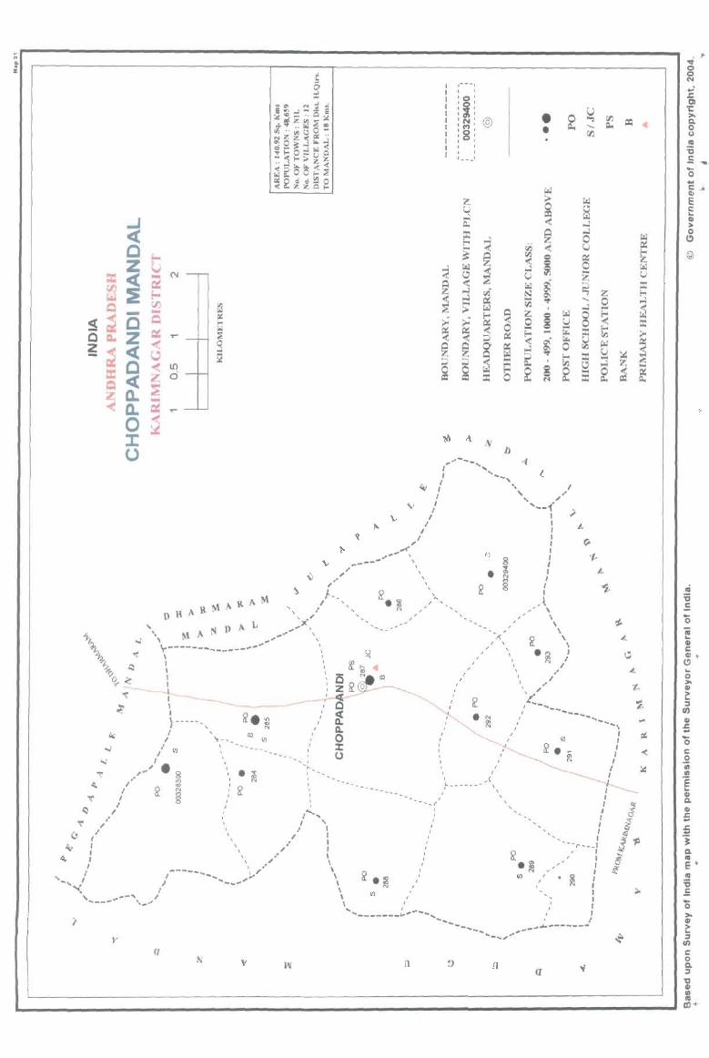
I .-- ... , I ' , I 10
1
I :g: I 1(1.' I : ~: @ I :8: I I I I ' , I ' I
1- __ '
.... -" --... , , ..
I
• •
~ " '-, I ',' v'" ~/
\;,' '--1' ,,/ I ).
I I
~I : ~~ I
V ~ .. ' '- rn I <> .. "~_-- '- 8: ').... '- o'i I
• B A ... A • A" " /"" 2. .', ' i , ' .. " N ,,", J.
~ , ,.. ~...., ---,' --, '
\-------- .. -" , -,; , \
'.~. A 1'1 D A. L .... ~, ", _/' , ,,/ '\
't: \ ___ ---~- " 1<' \ Q q \ ,~ /\ 2 " '<-" ' ' ~, " " .~)
I " C ~ CIl " I "1; - ...t___ 10 " \ " ~ \ --_ " ~ , , " 'o,-' , _____ , Q " ~ L_"
j ______ " l? ~ / ~ " " "-"'--", I 't-_ co rn " Il. " • ~,' ---.... -
I' (/) \ .......... ------ ..... __ :' ~ " " .... \ I. .. __ : (.) :,' rn : ,~.. 8' _ ,,!( • r '
I'· f"') ',' • ~ ~,_, :,' g: I
,/ ~ ~ " l? ... ------------ " :' , ': : --_', i --------\
/ " ," '''-j', : .. '., , : " 1 , \ I I ' '-- I
I ,I I " I \.' I ' "
) " .', " ": " ----- " /" ' '"-,,,-, '''" I I '_.. ' , \ " ~' I '< " ___ -/ '2..: • ~ _/ :
, ____ .. --'. I \ N,' rn ,,'. ~ : ,_-' \ rn " , , I
' ..... _______ i---- ':: ... ' I ...... I J __ ' I
~~... ,~-~~.------'-.. ,""
(]
v n a <l
ai :c .: ... o ~ GI C ~, ... o >GI
~ ::s
U)
GI J:. .. ... o c: .2 III ",
E ... GI C. GI J:. .. ;; j C. III
e' III :c .: ... o :i:: ::s I/)
c o Q, ::s 'tI GI III III a;)-t-

PART A -VILLAGE AND TOWN DIRECTORY
ALPHABETICAL LIST OF VILLAGES (MANDALPARISHAD WISE), KARIMNAGARDISTRICT
Serial
number
Name of village
2
Name of Mandai Parishad: Choppadandi Name of Mandai : Choppadandi 0031
I Arnakonda
2 Bhupalapatnam
3 Chakunta
4 Chityalpalle
5 Choppadandi
6 Gwulapur
7 Katnepalle
8 Kolimikunta
9 Konerupalle
10 Ragampeta
11 Rukmapur
12 Vedurughattu
2001 Census
location code number
3
00328500
00328600
00329300
00328400
00328700
00328800
00328900
00329200
00329000
00328300
00329100
00329400
379
1991 Census
location code number
4
200300030003000003
200300030003000004
2003000300030000 II
200300030003000002
200300030003000005
200300030003000006
200300030003000001
2003000300030000 10
200300030003000008
200300030003000001
200300030003000009
200300030003000012
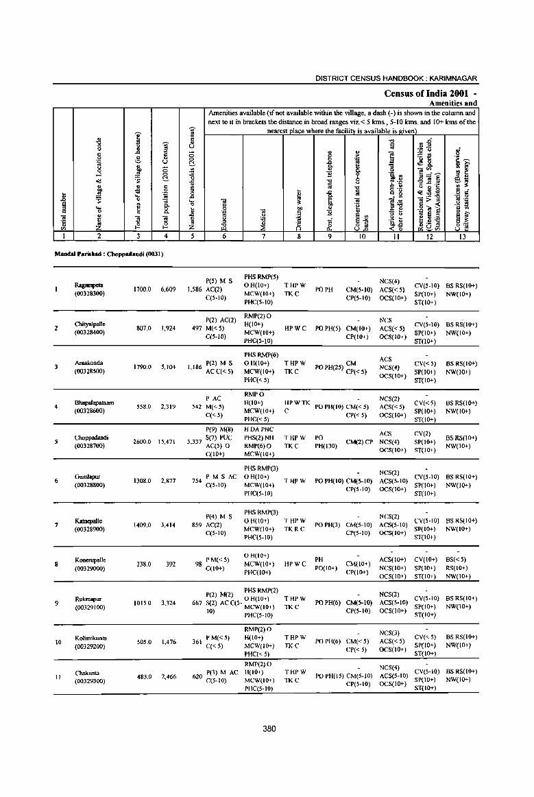
I " "8 -;;;-l:l ::l
c ..c ., c
0 ~ .. 'p u ..
} j 0 0
~ 'S t!-u .. c co oS .9
.8 ..!!! .... 1;l ~ 0 ""3
~ .. 8: ... ~ c 0
OJ ., ~
1l "3 '5 ~ 0 til l-<
I 2 3 4
Maodal Parisbad : Cboppadandi (0031)
Ragampeta 1700.0 6,609
(00328300)
2 Cbityalpalle
807.0 1,924 (00328400)
Arnakonda 3 1790.0 5,104
(00328500)
4 Bbupalapatruun
558.0 2,319 (00328600)
5 Choppadandi
2600.0 15,471 (00328700)
6 GwnIapur
1308.0 2,877 (00328800)
7 Katnepalle
1409.0 3,414 (00328900)
Konerupalle 8 23S.0 392
(00329000)
Rukrnapur 9
(00329100) 1015.0 3,324
Kolimikunta 10 505.0 1,476
(00329200)
Chakunta 2,466 II 483.0
(00329300)
DISTRICT CENSUS HANDBOOK: KARIMNAGAR
Census of India 2001 -Amenities and
Amenities available (if not available within the village, a dash (-) is shown in the column and next to it in brackets the distance in broad ranges viz. < 5 Ians., 5-10 Ians. and 10+ Icms of the
-;;;- nearest]llace where the facility is available is given) '" ., C 't:l 0.g " til U .~ u 8' 0 .. ..
] ;::t! c: > 0 0 .'" .~ ~ t!- ..c e of&. !! ~ Co -a .,
]~~ ~ .,
Co C> ., ~ -0 "B 'i' '!1 :l ::l .,
"0 0 _Oi~ @.1;; ..c '"' 6~ ~ iii "0 g ~"5 '" :I: ::l ~ ~n~ c =-0 ~
..c iii o<l1!:a 0 ..c ,
li .~ 0 .... OJ OJ Oi>::l .'"
0 c: :I: 'e § « ._ :l ... 0 00 " 'p ~] c .. " .p Ol
j "B .. ::l ;>, ..c '" <> e "' ;::J " .. S e '" § " 'i3 i ~1 .~ ~ e 0 :.a ~~ ~ ~ ~a3l Z <~ u
5 6 7 8 9 10 II 12 13
peS) M S PHSRMP(5)
NCS(4) 1,586 AC(2)
OH(lo+) THPW PO PH CM(5-IO) ACS« 5)
CV(S-IO) BS RS(IO+)
C(5-10) MCW(IO+) TKC
CP(5-10) OCS(IO+) SP(IO+) NW(IO+)
PHC(5-10) ST(IO+)
P(2) AC(2) RMP(2) 0
NCS 497 M«5)
H(IO+) HPWC PO PH(5) CM(lO+) ACS« 5)
CV(S-IO) BSRS(IO+)
C(5-10) MCW(IO+)
CP(lO+) OCS(lO+) SP(lO+) NW(IO+)
PHC(5-10) ST(lO+)
PHSRMP(6) ACS
1 186 P(2) M S o H(IO+) THPW CM CV«5) BS RS(IO+) PO PH(25) CP« 5) NCS(4)
, ACC«S) MCW(IO+) TKC OCS(IO+)
SP(IO+) NW(lO+) PHC« 5) ST(IO+)
PAC RMPO
NCS(2) 542 M«5)
H(IO+) HPWTK PO PH(IO) CM« 5) ACS« 5)
CV«5) BSRS(IO+) MCW(10+) C SP(lO+) NW(lO+)
C«S) PHC«5)
CP«5) OCS(IO+) ST(IO+)
P(9) M(8) HDAPHC ACS CV(2)
3 337 5(7) PUC PH5(2) NH THPW PO CM(2)CP NCS(4) SP(IO+)
BS RS{lO+) , AC(5) 0 RMP(6)0 TKC PH(130)
OCS(IO+) ST(IO+) NW(lO+)
C(lO+) MCW(10+)
PHSRMP(3) NCS(2)
754 PM S AC OH(IO+) THPW PO PH(IO) CM(5-1O) ACS(S-IO)
CV(S-IO) BS RS(IO+) C(S-IO) MCW(IO+) SP(IO+) NW(lO+)
PHC(5-10) CP(5-1O) OCS(IO+)
ST(IO+)
P(4) M S PHS RMP(3)
NCS(2) 859 AC(2)
OH(IO+) THPW PO PH(3) CM(5-1O) ACS(5-1O)
CV(5-10) BS RS(IO+)
C(5-10) MCW(lO+) TKRC
CP(5-10) 0CS(1O+) SP(IO+) NW(IO+)
PHC(S-JO) ST(IO+)
98 PM«S) OH(IO+)
PH ACS(lO+) CV{IO+) BS« 5) MCW(IO+) HPWC CM(IO+)
C(IO+) PHC(IO+)
PO(IO+) CP(IO+)
NCS(lO+) SP(IO+) RS(IO+)
OCS(IO+) ST(IO+) NW(IO+)
PHSRMP(2) NCS(2) P(2) M(2) 0 H(lO+) THPW CV(5-10) BS RS(IO+)
667 S(2) AC C(5- MCW(IO+) TKC PO PH(6) CM(5-10) ACS(5-1O)
SP(IO+) NW(IO+) 10) PHC(5-1O)
CP(S-IO) OCS(IO+) ST(IO+)
RMP(2)0 NCS(3)
PM«5) H(IO+) THPW CV«5) BSRS(IO+) 361 PO PH(6) CM«5) ACS« 5)
C{< 5) MCW(lO+) TKC CP«5) OCS(IO+)
SP(IO+) NW(JO+)
PHC« 5) ST(IO+)
RMP(2)0 NCS(4)
620 P(3) M AC H(10+) THPW PO PH(lS) CM(5-1O) ACS(5-10)
CV(5-IO) BSRS(IO+)
MCW(lO+) TKC SP(IO+) NW(IO+) C(5-10) CP(S-IO) OCS(IO+)
PHC(5-IO) ST(IO+)
380
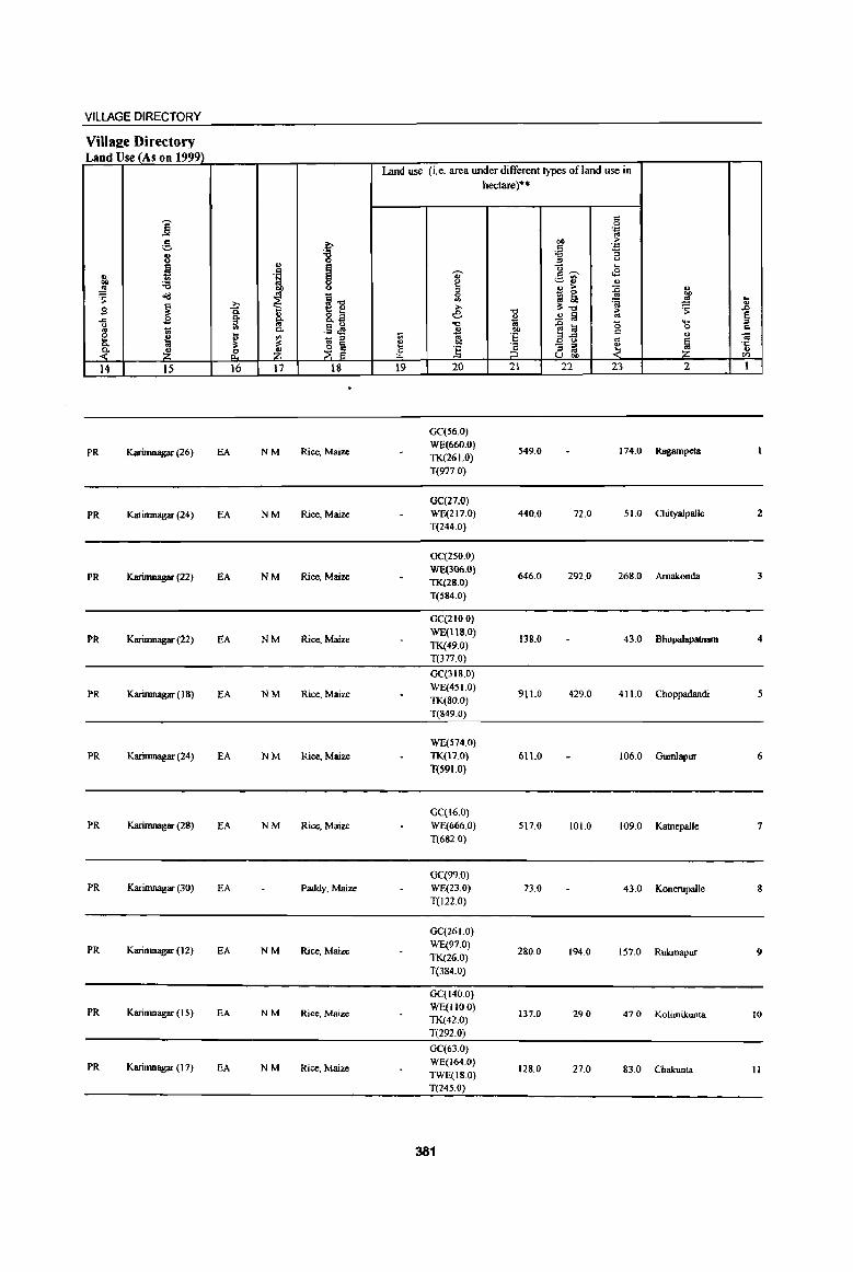
VILLAGE DIRECTORY
Villa2e Directory Land Use_{_As on 1999)
Land use (i.e. area under different types of land use in hectare)··
j " 0 'j;;j oS
g b bO ;. .Ei 'j;;j
8 '8 .", :; ::l "
~ .,
I -0 .... ., . ~ v ,,~ <E
"" 'B ~ ~r; .,
..!!! co ., > :0 u
~ "'d oS
!il 0 'gj ~ '" "" ~ '" 'a
oS .. ~
.?;- lI:.", ~ .,
B » "0 > .r> 0. &.a e .!:! § ~ ..c .s ~ 1il' " oS
"0 1;;
1~ <; .... u U) .13 ~ 0 c .. t; 0. " "" " e
~ ~ </> - :::> t; 1;; 'E oS
u 'i! c. lI:
~ ~ e bIl
~ - :I ~ ! ·c ~ ~ ~ ~ ] ::l oS '" U ""
til
14 15 16 17 18 19 20 21 22 23 2 1
GC(56.0)
PR Karimnagar (26) EA NM Rice, Maize WE(660.0)
549.0 174.0 Ragampeta TK(261.0) T(977.0)
OC(27.0)
PR Karimnagar (24) EA NM Rice, Maize WE(217.0) 440.0 72.0 51.0 Chityalpalle 2
T(244.0)
GC(250.0)
PR Karimnagar (22) EA NM Rice, Maize WE(306.0)
646.0 292.0 268.0 Amakonda 3 TK(28.0) T(584.0)
GC(210.0)
Pk Karimnagar (22) EA NM Rice, Maize WE(lltl,O)
138.0 43.0 Bhupalapatnam 4 TK(49.0) T(377.0)
GC(318.0)
PR Karimnagar ( 18) EA NM Rice. Maize WE(45 1.0)
911.0 429.0 4110 Choppadandi 5 TK(80.0) T(849.0)
WE(574.0) PR Karimnagar (24) EA NM Rice, Maize TK(17.0) 611.0 106.0 Gumlapur 6
T(S91.0)
GC(16.0) PR Karimnagar (28) EA NM Rice, Maize WE(666.0) 517.0 101.0 109.0 Katnepalle 7
T(682.0)
GC(99.0) PR Karimnagar (30) EA Paddy, Maize WE(23.0) 73.0 43.0 Konerupalle 8
T(122.0)
GC(26 1.0)
PR Karimnagar (12) EA NM Rice, Maize WE(97.0)
280.0 194.0 157.0 Rukmapur 9 TK(26.0) T(384.0)
GC(140.0)
PR Karimnagar (IS) EA NM Rice. Maize WE(lIOO)
137.0 29.0 47.0 Kolimikunta 10 TK(42.0) T(292.0)
GC(63.0)
PR Karimnagar (17) EA NM Rice, Maize WE(164.0)
TWE(18.0) 128.0 27.0 830 Chakunta II
T(24S.0)
381
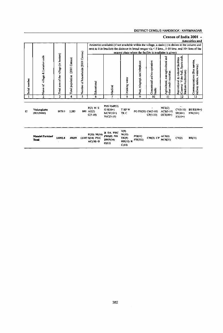
12
2
Vedwugbattu (00329400)
Mandai Parishad
To'"
3 4
1679.0 3,283
14092.0 48659
DISTRICT CENSUS HANDBOOK: KARIMNAGAR
Census of India 2001 -Amenities and
Amenities available (if not available within the village, a dash (-) is shown in the colwnn and next to it in brackets the distance in broad ranges viz.. < 5 krns., 5-10 krns. and 10+ kms of the
nearest place where the facilitv is available is given)
5 6 7 8 9 10 11 12
PHSRMP(2} NCS(3) pel) M S
800 AC(2) C(5-10}
o H(l()+) T HP W MCW(l()+} TK C
PHCiS-IO)
PO PH(20} CM(5-1O)
CP(5·1O}
ACS(5-IO} eV(S-lO) OCS(lO+} SP(IO+)
ST(lO+)
H DA PHC P(33) M(16) PHS(S) NH
11307 S(14) PUC RMP(34) AC(18) 0 0(11)
382
T(9)
W(12) PO(ll) TK(9} 3 HP(11) R PH(2 2)
C(ll)
CM(3) CP ACS(Z) NCS(31)
CV(2)
13
BS RS(l()+)
NW(lO+)
BS(ll)
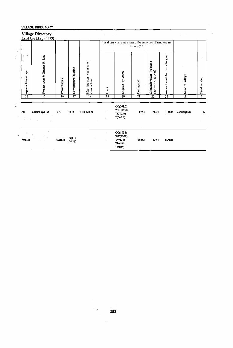
VILLAGE DIRECTORY
Villa2e Directory Land Use (As on 1999)
j c
.~
8 ~ j '8
'S ell!
~ .s -= ~ 1);
E- " la ~ ~ 14 15
PR Karimnagar (26)
PR(12)
;.,
1 ~ d: 16
EA
EA(12)
" .~ Oil
" ~ " g-c. ~ Z 17
NM
N(ll) M(lt)
0 '6 0 e e 0 <J
§~ t: " 8.~ !Ls - '" ~ ~
18
Rice, Maize
Land use (i.e. area under different types of land use in
1;; E 0
LL.
19
" ~ '" 0
'" ;., e "0
" 0; OIl
] 20
GC(298.0) WE(I72.0) TK(72.0) T(542.0)
GC(1738) WE(3558)
TWE(IS) TK(57S) T(S889)
383
hectare)"·
"0 o 1;; Oil ·s 'c ::> 21
696.0
5126.0
c 0
""E Oil ;;. c .= '6 ;;
'" <> Q ~
c ~ <E ._ '" ~" " " > :0 _ 0 .. rJ bh ~ !l:~ ~ § iU ~ ~ 0 ",..c
c _ u .. "3 ~ ~ U OJ)
22 23
283.0 158.0
1427.0 1650.0
" OJ)
~ ] .;; e ..... '" 0 c " .. ~ ·c
" CIl
2 I
Vedwughattu 12

::: a.
i
~ N
0 )-
%
~ U
fI) it w l-e :E fI) '"
~ ~
~ i5 ~
a. ~ 0 ~
~ ::E
~ ~ ~ S
% SO!
e z z Z :E < :! it
;2 ..I ;:) N
en
, "
, , -,
-(. ,
(/) Il.
~ . N g
D E
,
0 a._ 0 ;;; , - • ,
, ,
, I
I ,
,
, I I \ \
, \
\ ,
, , ,
I
I t. , '
'" I /
,.--"'" : " . I '
I 8, : . ~ ", J '" \ l ~ 8 ' I ... ' f _,.,.,
t"'''' I \ \ \
L
, , , , , ,
(/)
• o Il.
, ,
, , , , , , A , ,
I ,
A
('I . ;;;
~ • 0 0 I")
. ,'" --, I' ,
~ , : ~ ~ " , ,I .. ,© I : ~ : 0 I, , I' , I' , I
, , L __ I
Z (.) ...l
'" :J: ~ I--
~ oii
Q III
~ fool ~
j c j
(.)
z ft :>' ~ ~
...l ;;: « r;;
fool
~ ;.: ~
~ :z.
c.: ..: c:l 0
~ ;:l s: § Q CI ~ ~ ~
fool c.:
~ ~ fool ;:l
~ ~ .. ~ ~ III
§. ~ ,,/ /
, \
r / ------< •
• • •
fool
~ I'Q « Q
~ .. g '" t .. , ~ ~
~.
'" , 0;> .. If)
t , g ...
.,f 0 0 ...
~ ~.
(,J r; ,it
~ =:I ... ~ 0 .. ~ .5 .... 0
C ~ E
fool • > U fool
E c 0
III (!)
0 ...l ...l
:t 0 @ c.. u ~ c.:
" Q fool
~ ...l ill Z
~ § 8 (.) ..:
t;; = ... .. (.) .,
0 III IOl
'"' :I: ~ ):II til C!I Z
a: 5! ~ ~
.! "0 .5
:a: '5
l;;l ~ • c: •
Q C) ... 0 :.,
;z; • ~ :I
0 I/)
• is ~ ....
0 c:
< ~ til
;z; ! • Q.
< • 5 ~ :E
!: Q.
" E .. :g .E. '5 "" • ~ :I III
Ii Q. :I "0 : .. III

PARTA - VILLAGE AND TOWN DIRECTORY
ALPHABETICAL LIST OFVlLLAGFS (MANDALPARISHAD WISE), KARIMNAGAR DISTRICf
Serial Name of village 2001 Census 1991 Census
number location code number location code number
2 3 4
Name of Mandai Parisbad: Sultanabad Name of MandaI : Sultana bad 0032
1 Bhoopathipuram 00329600 200310031003100002
2 Chinnabonkur 00330700 200310031003100013
3 Chinnakalvala 00330500 200310031003100011
.. Dubbapet 00329700 200310031003100003
S Garrepalle 00329900 200310031003100005
6 Gattepalle 00331100 200310031003100017
7 Gollapalle 00329800 200310031003100004
8 Ithrajpalle 00329500 200310031003100001
9 Kadambapur 00331200 200310031003100018
10 Kanukula 00331500 200310031003100021
11 Katnepalle 00330100 200310031003100007
12 Kodurupaka 00330400 200310031003100010
13 Mancharami 00331400 200310031003100020
14 Miyapur 00330800 200310031003100014
IS Neerukulla 00330000 200310031003100006
16 Poosala 00330200 200310031003100008
17 Rebbaldevipalle 00330600 200310031003100012
II Regadimaddikunta 00330900 200310031003100015
19 Suddala 00331000 200310031003100016
a) Sultanabad 00330300 200310031003100009
21 Thogarrai 00331300 200310031003100019
385
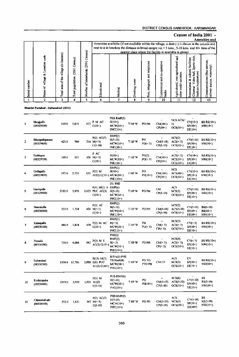
I " 8 'Vi' .. " .l:I VI g c c .., .~ ;:;, U rl g, j 0 <II <=> ~ ~ C!-.. .. c co -s 0
1l ..!! 'n ~ "0
"* § .. 8: .... ~ c 0
= .. ! 5 5 ·c ., ~ 0
'" I-
1 2 3 4
MandaI Parisbad : Sultanabad (0032)
2
3
4
5
6
7
8
9
lQ
II
hhrajpalle (00329500)
Bhoopathipurnm (00329600)
Dubbapet (00329700)
Gollapalle (00329800)
Garrepalle (00329900)
Neeru1rnIIa (00330000)
KatnepaIIc (00330100)
PoosaIa (00330200)
Sultanabad
(00330300)
Kodwupaka (00330400)
Chinnakalvala (00330500)
419.0 1,671
425.0 900
168.0 521
597.0 2,733
2102.0 5,970
535.0 1,734
606.0 1,828
739.0 4,088
1550.0 12,786
1549.0 3,950
552.0 1,431
DISTRICT CENSUS HANDBOOK: KARIMNAGAR
Census of India 2001 -Amenities and
Amenities available (if not available within the village, a dash (-) is shown in the column and
next to it in brackets the distance in broad ranges viz.< 5 kms., 5-10 krns. and 10+ kms of the 'Vi' nearest place where the facility is available is e.iven} " '" c ., U
0 0
C!-.a '0
1 0 .c .... '" 0 c .8 0
"&I <II
§ u
'" ti3 Z 5 6
PM AC 417 C(lO+)
P(2) AC(7)
214 M« 5) C(5-10)
PAC 126 M«5)
qIO+)
«l U :e ~ 7
PHSRMP(3) H(lO+) MCW(IO+) PHC(lO+)
RMP(2) H(5-10)
MCW(IO+) PHC(IO+)
H(IO+)
MCW(IO+) PHC(IO+)
RMP(2)
631 P(J) M H(lO+) AC(2)C(10+) MCW(IO+)
PHC(Io+)
P(4} M(2) S 1,423 PUC AC(3)
C(IO+)
P(3) AC
430 M« 5) C(lO+)
DUPHS RMP(6) H(S-IO) MCW(IO+) PHC(IO+)
RMP(2) H(S-IO) MCW(IO+) PHC(IO+)
RMP(2)
470 P(2) M AC H« 5) C(lO+) MCW(lO+)
PHC(IO+)
PHS(2) RMP(2)
942 P(J) M S H« 5) AC(2) C(IO+) MCW(IO+)
PHC(IO+)
P(13) M(7) H DA(S) PHS TBRMP(8)
2,888 S(6) PUC MCW(IO+)
AC(2) C(IO+) PHC(IO+)
P(5) M 1,032 AC(2)
C(5-10)
P(2) AC(3)
347 M« 5) C(5-1O)
PHS RMP(6) H(5-10) MCW(IO+) PHC(IO+)
PHSRMP(2) H(S-IO) MCW(IO+) PHC(IO+)
386
~ 1;; ~ OIl C
~ 8 8
THPW
THPW
THPW
THPW
THPW
THPW
THPW
THPW
THPW
THPW
THPW
., c 0
.<: 0. .. ~ "t:l §
.<:
~ ., ~
M 9
PO PH
PH
PO« 5)
PH(2)
PO« 5)
PO PH(IO+)
PO PH
PO PH
PH
PO« 5)
PO PH
PO TO PTOPH
PO PH(IO+)
PO PH
~ .",
e & '? 0 <> .., fa
'" "8 ., e '" ~]
10
CM(IO+) CP(IO+)
.., :; :Eo. § "&I Q
'E ~i! ~ ~8.
<.> ]~~ 'i :J _OI§ ~ .~ e ~"s o ._ c 15 ~~:a
]~ =>" 8 « ._ Oil ~ _ .... co e " <.>
.~ ~ ~.S ] ...:-g ~S'" 11 12
NCS ACS« CV(~O+) S) OCS(IO+) SP(IO+)
ST(lO+)
8 .~ ~ .. 1;-
~ t ~~ ., 3: c 0 .: .:: 0 <II ._
.~ E 3 .,
~f 13
BSRS(lo+) NW(lO+)
NCS(2) CM(5-IO) ACS« 5) CV(5-10) BS RS(IO+)
CP(S-IO) OCS(IO+) SP(IO+) NW(lO+) ST(IO+)
CM(IO+) ACS« 5) CV(IO+) BS RS(IO+) CP(IO+) NCS(IO+) SP(IO+) NW(IO+)
OCS(IO+) ST(IO+)
CM(IO+) CP(lO+)
CM CP(S-IO)
NCS ACS(IO+) CV(lO+) BS RS(IO+)
SP(IO+) NW(IO+} OCS(lO+) ST(IO+)
ACS NCS(3) CV(S-IO) BS RS(IO+)
SP(IO+) NW(IO+) OCS(IO+) ST(IO+)
NCS(2) CM(5-IO) ACS(S.IO} CV(5-10) BS(5-1O)
SP(IO+) RS(IO+) CP(5-10) OCS(lO+) ST(IO+) NW(lO+)
CM« 5) CP«5)
CM«S)
CP« 5)
CMCP
NeS(3) ACS« S) CV« S) OCS(IO+) SP(IO+)
ST{lO+)
NCS(4) CV« 5)
ACS« 5) SP(IO+) OCS(IO+) ST{lO+)
ACS CV NCS(5) SP(IO+) OCS(IO+) ST(IO+)
BS RS(IO+) NW(lo+)
BSRS(IO+) NW(lO+)
BS RS{lO+) NW(IO+)
NCS(6} BS CM(S-lO) ACS(S-IO) CV(S-IO) RS(5-10) CP(5-1O) OCS(IO+) SP{lO+) NW(IO+)
ST(IO+)
ACS BS CM(S-IO) NCS(3) CV(HO) RS(S-IO) CP(S-IO) OCS(IO+) SP(IO+) NW(lO+)
ST(IO+)
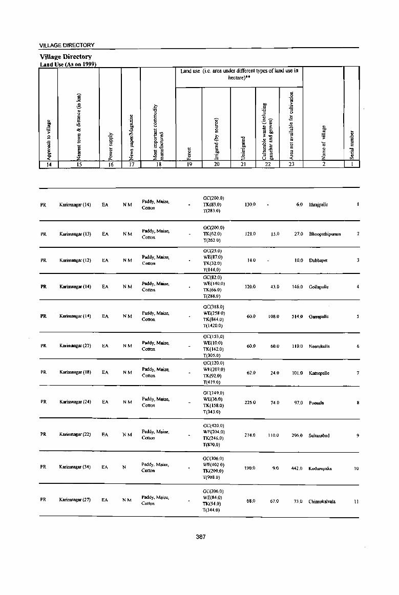
VILLAGE DIRECTORY
Village Directory Land Use (As on 1999)
Land use (i.e. area under different types ofland use in hectare)··
i '" 0 .", .,
g I:JIJ > 0 c ~ ., '6 '6
" 0 :::J " ~ " E "0 ... '" E ., "'~
.g " .~ .- ., Ill) '6 0 ~ ~'" " ~
OJ) <.> ., > :g " - 0 "" old .. I] 0
~ !ill ~ '" ~ ~ ] B ~ ~ »
-0 :l'-o > ~ 0. " e
~ .!! lil .. ~ -fi 0- .... i5l .. c." "<l .0 a 0 .§ ~ 0 '" ., 1;; ... 0-~ "" ~{i '" ., I: ~ " ~
_ :::J
~ ·e ., 1
01 :l' ~ ~ "" ·c 0..
] :3 - ::s ~ ~ Z &. Z & :::J ., U Uoc> '" 14 15 16 17 18 19 20 21 22 23 2 1
Paddy, Maize. GC(200.0)
PR ICarimnagar (14) EA NM TK(83.0) 130.0 6.0 Jthr3jpalle Cotton
T(283.0)
Paddy, Maize, GC(200.0)
PR Karimnagar (13) EA NM TK(62.0) 121.0 IS.O 27.0 Bhoopathipuram Cotton
T(262.0)
GC(25.0)
PR Karimnagar (12) EA NM Paddy, Maize, WE(87.0)
14.0 10.0 Dubbapet 3 Cotton TK(32.0)
T(l44.0)
GC(82.0)
PR Karimnagar ( 14) EA NM Paddy, Maize, WE(140.0)
120.0 43.0 146.0 Gollapalle 4 Cotton TK(66.0)
T(288.0)
GC(3JS.o)
PR Karimnagar ( 14) EA NM Paddy, Maize, WE(258 0)
60.0 108.0 514.0 Garrepallc Cotton TK(S44.0)
T(1420.0)
GC(I53.0)
PR Karimnagar (27) EA NM Paddy. Maize, WE(1O.0)
60.0 60.0 110.0 Neerukulla 6 Cotton TK(142.0)
T(305.0)
GC(120.0)
PR Karimnagar (18) EA NM Paddy. Maize, WE(207.0)
62.0 24.0 101.0 KatnepaJle 7 Cotton TK(92.0)
T(419.0)
GC(149.0)
PR Karimnagar (24) EA NM Paddy. Maize, WE(36.0)
225.0 74.0 97.0 Poosala S Cotton TK(158.0)
T(343.0)
GC(420.0)
PR Karimnagar (22) EA NM Paddy, Maize, WE(204.0)
274.0 110.0 296.0 Sultanabad 9 Cotton TK(246.0)
T(870.0)
GC(306.0)
PR Karimtlagar (34) EA N Paddy, Maize, WE(402.0)
190.0 9.0 442.0 Kodwupaka 10 Cotton TK(200.0}
T(9OS.0}
GC(206.0)
PR Karimnagar (27) EA NM Paddy, Maize, WE(84.0)
68.0 67.0 73.0 Chinnakalvala II Cotton TK(S4.0) T(344.0)
387

.... .B § '" 01 'C u til
I
12
13
14
15
16
17
18
19
20
21
., "8 CI Q
' .. g ..:l ~ ., co
.!! 'S '-0 .. ~ 2
Rebbaldcvipalle
(00330600)
Otinnabonkur (003307oo)
Miyapur
(00330800)
Regadi-maddikunta (00330900)
Suddala
(00331000)
Gattepalle (00331100)
Kadambapur
(00331200)
Thogarrai (00331300)
Mancharami
(00331400)
Kanukula (00331500)
Mandai P.rishad Total
i ';;;' u u ~ ..CI c ~ .. u .. ]l § 'S ~ .. 8 oS 'l:! ....
'" 0 :;
~ '" 0 0.
S ~ 0 r- r-3 4
2S0,O 308
314,0 857
575.0 1,291
1092,0 4,538
915,0 2,340
914.0 2,091
995.0 1,198
834,0 2,297
436.0 1,209
1202,0 2.976
16769.0 56717
DISTRICT CENSUS HANDBOOK: KARIMNAGAR
Census of India 2001 -Amenities and
Amenities available (ifnot available within the village, a dash (-) is shown in the column and next to it in brackets the distance in broad ranges viz. < 5 kms" 5-10 kms, and 10+ kms of the
~ nearestplace where the facility is available is J!iven) '" ., <l "0 ~~ ., u fa 'Q U u-- u u
~ :.= C"Il U 0 '"
,. 0 ..8 '~ '0 t:: '~ ~ ~ cf! 8- u i;' 0. :;
~ i 0. U ]~~ :: ~ 'i' '~ '" '" ... ..c "0 0 c:s .~ _Ol~ E9,~ .. fa U
B ~ '6 ., :J .. "0 <l .,
'" !i ..CI !a g 'g c1IJ~~ 8 d 0 ..<:I
~ ~~ 'J:' 0 .... 03 3: 03 <iI>:::s .. 'Q
0 .: 'e '" -< ,~ :s .8 0 <iI CD i ,,8 ~] § .,
'to '" .,
'3 0 .. e JI ~ U
~ e ., § 'i3 <i ~1 '~ II e 4):.a
'" ~ _K ~a~ z ~ ~ ~j_ ~~-5 6 7 8 9 IO II 12 I3
PAC RMP(2)
74 M(S-IO} H(IO+)
THPW PO(S-IO) CM(IO+} ACS« 5) CV(IO+} BS« 5)
C(lO+) MCW(IO+)
PH(IO+) CP(IO+) NCS(lo+} SP(IO+) RS(IO+)
PHC(IO+) OCS{IO+) ST(IO+) NW(lO+)
PAC RMP(2)
NCS 207 M(5-10)
H(5-10) THPW
PH CM(5-10) ACS«S)
CV(S-IO) BS RS(IO+}
C(IO+) MCW(IO+) P0(5-1O)
CP(5-10) OCS(IO+) SP(IO+) NW(lO+}
PHC(IO+) ST(lO+)
P(2) AC RMP(3)
NCS(2)
307 M(IO+) H(IO+)
THPW PH
CM(IO+) ACS(5-10) CV(IO+) BS RS(IO+)
C(lO+) MCW(IO+) P0(5-IO)
CP(IO+) OCS{JO+) SP(lO+) NW(lO+)
PHC(IO+) ST(IO+)
PHSRMP(4) NCS(3)
P(4) M(2) S H(S-IO) CV(S-IO) BS RS«5) 1,122 AC(2)C(10+) MCW(IO+)
THPW PO PH CM(S-IO) ACS«5) SP(IO+) NW(lO+)
PHC« 5) CP(5-10) OCS(10+)
ST{IO+)
PHSRMP(2) ACS
520 PM AC(2) H(5-10) THPW PO PH CM(S-IO) NCS(4)
CV(5-10) BS RS(IO+)
C(lO+) MCW(IO+) CP(5-10) OCS(lO+)
SP(IO+) NW(IO+)
PHC(S-IO) ST(IO+)
PHSRMP(4) NCS(2)
487 PM S AC H« 5) THPW PO PH CM«5) ACS«5)
CV« 5) BS«5)
C(10+) MCW(IO+) Cp« S) OCS(lO+)
SP(IO+) RS(IO+)
PHC(IO+) ST(lO+} NW(IO+)
PAC RMP(2)
NCS
285 M«5) H«5)
THPW PO«5) CM« 5) ACS«5) CV« S) BS« S)
C(IO+) MCW(IO+)
PH« 5) CP« 5) OCS(lO+) SP(IO+) RS(IO+)
PHC(IO+) ST{IO+) NW(lO+)
PHSRMP(3) NCS(3)
607 P(3} M(2) S H(5-10) THPW PO PH CM«S) ACS« 5)
CV(S-IO) BS«5)
ACqIO+) MCW(IO+) SP(IO+) RS(IO+)
PHC(IO+) CP(S-IO) OCS(IO+)
ST(IO+) NW(10+)
PAC RMP(3)
NCS(2)
31J M«5) H(IO+)
THPW PH(2)
CM{< 5) ACS{< 5) CV(JO+) BS« S)
MCW(IO+) PO« 5) SP(lO+) RS(IO+) C(lO+) CP(IO+) OCS(IO+)
PHC(IO+) ST{IO+) NW(IO+)
PHSRMP(4) ACS
772 P(4) M(2) H(5-10) PO PH
CM NCS(2)
CV(IO+) BS RS(IO+)
MCW(IO+) THPW
CP(S-IO) SP{If}+) NW{JO+} ACqIO+) OCS(IO+)
PHC(IO+) ST(IO+)
P(58) M(22) H DA(S) DU T(21)
13614 S{II) pus(n) TB W(ll) PUC(2) RMP(64) HP(21) AC(37)
PO(13) TO PTO CM(l) CP ACS(5) PH(l9) NCS(SO)
cv 8S(IS)
388
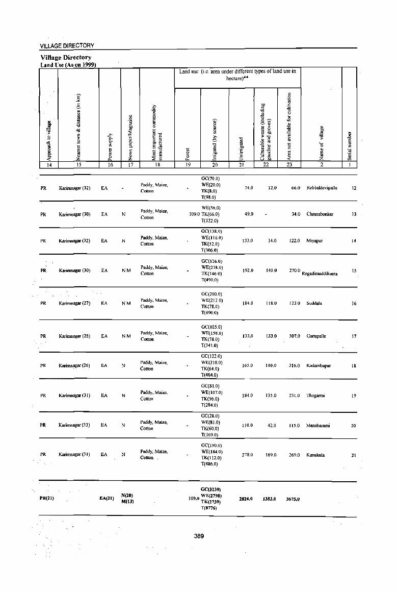
389
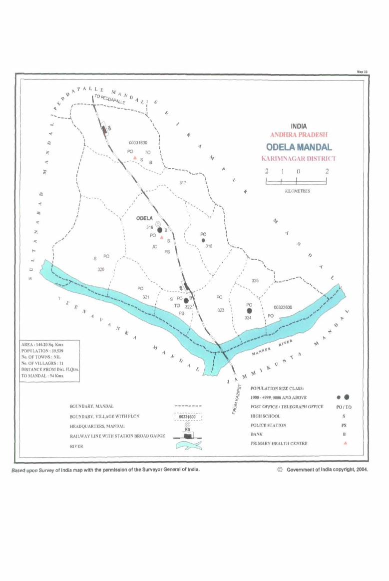
, "
\ \ I
t·, I '
I , I ,
I , I , \ \ 1--. ___ . ,
I , I ,
I
00331600
PO
I
, I
TO
S B
I I I I I I \ \
:-------, I ' ___ ,
, , 317
, -,
\ I \ I \ , "
, I I,
,.., \ \ I ,
INDIA ANDHRA PRADESH
OOELA MANDAL KARIMNAGAR DlSTRICf
2 o 2
KILOMETRES
, , I I , \
.. " ,,~
" I
.'
s PO
320 I
I I ,
I I ~
I \
I ,
PO
AREA: 146.10 Sq. Km. I'()PULATlON,39,539 No. OF TOWNS: NIL No. OF VILLAGES: 11 DISTANCE FROM m.l H.Qtn.
TO MANDAL : 54 Km •.
BOUNDARY, MANVAL
BOUNDARY, VILLAGE WITH PLeN
HEADQUARTERS, MANDAL
JC
, " I
I
RAILWAY LINE WITH ST ATlON BROAD GAUGE
RIVER
, I
, I
PO
• 318 , I , ,
\ , I I
"
I I '..I , I
PO
323
Base<1 upon Survey of India map with the permission of the Surveyor General of India.
I I , \ ,
....... - ... I \
I ....
I , , , \
I I
1-_ I •
I
\ I \ , , I
/ -- .. ", , \.
I ...... I
325
, \ I
.. '( '"
PO " • 324
POPULA nON SlZE CLASS:
1000 - 4999, SOOO AND ABOVE
POST OFFICE I TELEGRAPH OFFICE
WGHSCHOOL
POLICE STA nON
BANK
PRIMARY HEALTH CENTRE
•• POITO
S
I'S
B
© Government of India copyright, 2004.
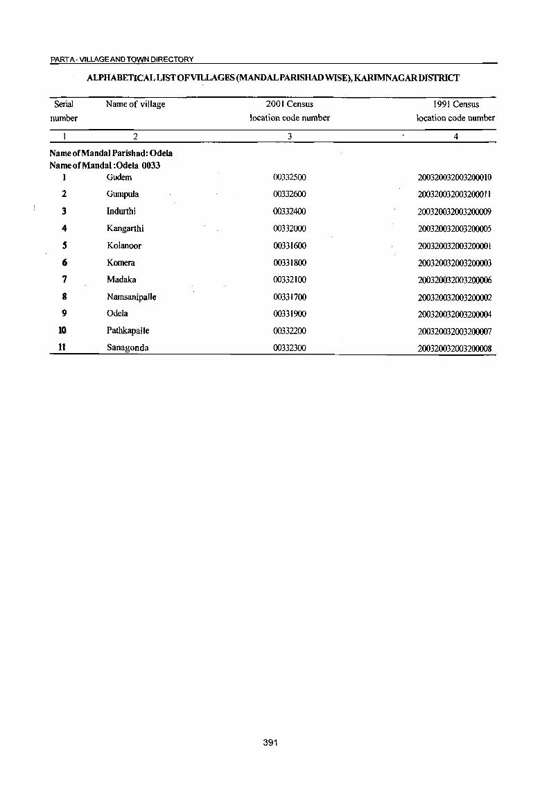
PART A- VILLAGE AND TOWN DIRECTORY
ALPHABETICALLISTOFVllLAGES (MANDALPARISHAD WISE), KARIMNAGARDISTRICT
Serial
number Name of village
2
Name of MandaI Parishad: Odela Name of MandaI :Odela 0033
1 Gudem
2 Gumpula
3 Indurthi
4 Kangarthi
5 Kolanoor
6 Komera
7 Madaka
8 NamsanipaUe
9 Odela
l~ Pathkapalle
11 Sanagonda
2001 Census location code number
3
00332500
00332600
00332400
00332000
00331600
00331800
00332100
00331700
00331900
00332200
00332300
391
1991 Census location code number
4
200320032003200010
200320032003200011
200320032003200009
200320032003200005
200320032003200001
200320032003200003
200320032003200006
200320032003200002
200320032003200004
200320032003200007
200320032003200008

DISTRICT CENSUS HANDBOOK: KARIMNAGAR
Census of India 2001 -Amenities and
Amenities available (if not available within the village, a dash (-) is shown in the column and next to it in brackets the distance in broad ranges viz. < 5 kms., 5-10 lcms. and 10+ lcms of the
-;;;- nearest place where the facility_is available is given)
I iil u ii ..,
:;~ .., -;;;-0 u a <> .. iil '.::I u oJ 0 ..c 0 '" '" i il 0 ... ~~ u 0 ~ 0 0 '.::I .~~ '.::I U c:!- ..c I! .l!8. 8 j c..
0 ~ ... t u ~~~ gj ~ ...l 0 ~ '5, '" 's: c:!- o e:\,~ ~ 1 ..., , .~ _<iig Iii u
6 ~'s U) ~ I) 4> C ..., = " 00 of! 0 :::l B Iii 0'-
o _ .. .!! -= 0 ..c .. g ~:2~ o c ,8 ~
..... '" ..c
~ li '.::1 0 0 g_ .... OJ ~ OJ l>~ OJ .-
~ ~ 0 c "e .~ ~ .... 0 II 0 on ..
'.c Ii! ] c 0 c.. '.c <ii c 1i '" "iI I> "3 os u :g E ., :I <> t1~"6 E ~
~ "3 ~
(.) 'i3 "Iii-
~1 'it, t ~] ·c ~ ~
::s ~ [5 ~O!l .,
Z _ili_ 0 <~ til tl. ~CIl
I 2 3 4 5 6 7 8 9 10 II 12 13
Mandai Parisbad : Odela (0033)
KoIauoor P(5) M(2) PHCRMP(6)
TTWW PO TO
eM NCS(5)
CY(IO+) 3075.0 7,390 1,798 S(2) AC(4) H(IO+) PTO ACS(IO+)
aSRS (00331600)
C(10+) MCW(IO+) TKR
PH(35) CP(JO+)
OCS(IO+) Sp(10+) NW(IO+) ST(IO+)
Namsanipalle P(3) AC
H« 5) PH(22) NCS(2)
CY(IO+) as RS« 5) 2 .557.0 1,528 393 M«5) THPW CM«5) ACS(IO+) (00331700)
C(IO+) MCW(JO+) PO« 5)
CP(JO+) OCS(IO+) SP(IO+) NW(IO+)
PHC« 5) ST(IO+)
Komera 617 P(4) M RMPH(IO+)
PO NCS
CY(IO+) as RS« 5) 3
(00331800) 763.0 2,S06
C(lO+) MCW(IO+) HPW
PH(IO+) CM(S-IO) ACS(IO+)
SP(IO+) NW(JO+) PHC« 5) CP(S-IO) OCS(JO+)
ST(IO+)
Odela P(5) M(3) S HDAPHC
THPW NCS(7)
eV(S-IO) aSRS 4
(00331900) 2082.0 6,606 1,643 PUC AC PHS RMP(3) TK PO PH(8) CM CP ACS(IO+)
SP(IO+) NW(IO+) C(lO+) MCW(IO+) OCS(IO+)
ST(lO+)
P(7) M(3) PHS RMP(8)
NCS(4) as RS(5-Kangarthi H(IO+) THPW CV(IO+)
S 2214.0 6,092 1,501 S(2) AC(2) PO PH(52) CM(5-10) ACS(5-10) 10) (00332000)
C(lO+) MCW(lO+) TKR
CP(5-IO) OCS(IO+) SP(IO+)
NW(IO+) PHC(IO+) ST(IO+)
PHS RMP(2) NCS(2)
Madaka 466 PM AC H(IO+) THPW CY(IO+) BS RS« S) 6
(00332100) 842.0 1,859
C(IO+) MCW(IO+) TKR POPH(3) CM«S} ACS(lO+)
SP(IO+) NW«5)
PHC« 5) CP« 5) OCS(IO+)
ST(IO+)
DAPHS RMP(6)
THPW PO TO ACS CV
aSRS PathkapalJe peS) M(4) S H(IO+) PTO CMCP NCS(S) SP(IO+) 7 1839.0 6,278 1,522 TKR NW(IO+) (00332200) AC(2) C(IO+) MCW(IO+) PH(60) OCS(IO+) ST(IO+)
PHC« S)
Sanagonda P(3) AC(2)
H(lO+) THPW NCS(3)
CY« 5) BS RS« 5) 8 938_0 2,499 615 M(S-IO) POPH(6) CM«5) ACS«5)
(00332300) C(IO+)
MCW(IO+) TKR CP« 5) OCS(IO+)
SP(IO+) NW(lO+)
PHC(5-10) ST(IO+)
P(2) M AC H(IO+) THPW NCS(4)
CY(5-IO) as RS(S-
Indurthi POPH(4) CM(S-IO) ACS(S-IO) 10) 9 693_0 1,858 443 C(IO+) MCW(lO+) TKR SP(IO+) (00332400) CP(S-IO) OCS(IO+) NW{lO+)
PHC(lO+) ST(IO+)
PAC RMP(2)
NCS Gudern H(IO+) HPWTK PH(4)
CM(lO+) ACS(IO+) CV(IO+) BS RS(lO+)
10 547.0 1,009 251 M«5) MCW(IO+) R PO« 5) SP(IO+) NW(IO+) (00332500) C(lO+) CP(lO+) OCS(IO+) PHC(IO+) ST(IO+)
392
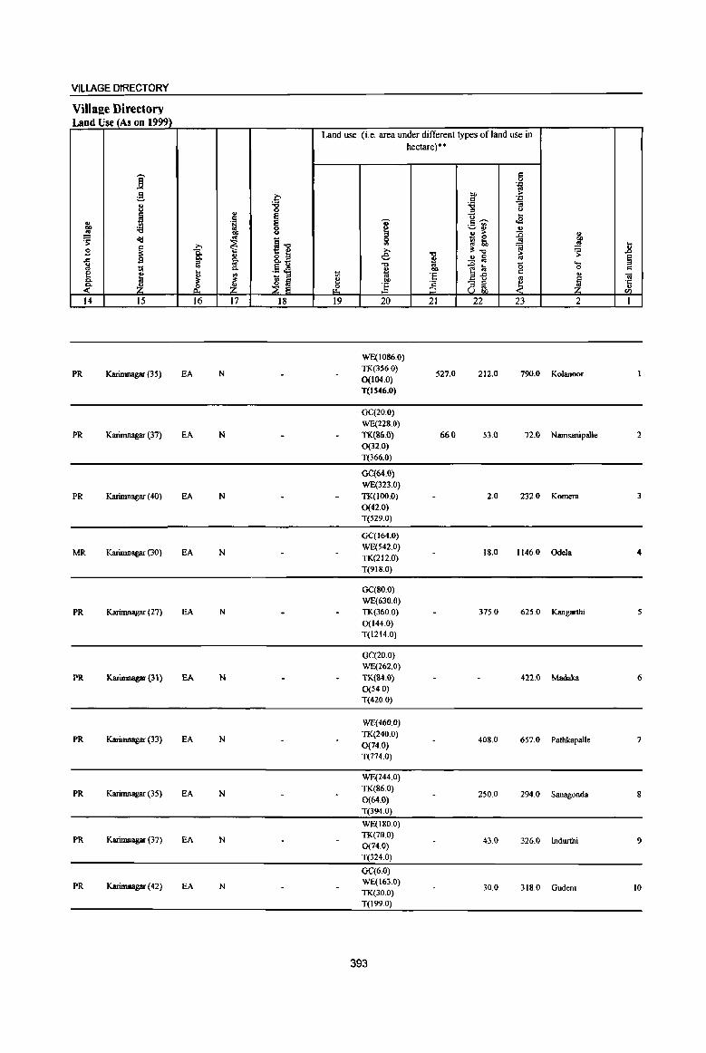
VILLAGE DIRECTORY
Villa2e Directory Land Use (As on 1999)
Land use (i.e. area under different types of land use in hectare)··
i c: 0
'J:: .. ;§, 0 bO >
.S '.0
8 :g "'" "3
" ::0 <>
H ~ u ...
II> . ~ I c: ~ oS ._ '"
"" :a ~ .. ., .. OIl <> ., > ~ ..
~ 4d ~ - 0
>. ill 51 ~ to ~ ~ jl B ~ 15. >. 'C !l:"Q » l'
-5 B p. ~ &.~ e ~ ..!! fa .. § a "t:l ~ l;i (5 .... .. i
p. ,s oS ~ bO 0 C e ....
~ ~ 'E .2-£ c
" IV ., - ::0 '" .. c. ;s:: ~! ~ bb
§ "3 ~ ~ I ·c ~ Z & Z ~ ] .,
U bO II)
14 15 16 17 18 19 20 21 22 23 2 1
WE(1086.0)
PR Karimnagar (35) EA N TK(356,0)
527.0 212.0 790.0 Kolanoor 0(104.0) T(IS46.0)
GC(20.0) WE{228.0)
PR Karimnagar (37) EA N TK(86.0) 66.0 53.0 72.0 Namsampalle 2 0(32.0) T(366.0)
GC(64.0} WE(323.0)
PR Karimnagar (40) EA N TK(IOO.O) 2.0 232.0 Komera 3 0(42.0) T(529.0)
GC(I64,O)
MR Karimnagar (30) EA N WE(542.0)
18.0 1146.0 Odela 4 TK(212.0) T(9IS.0)
GC(80.0) WE(630.0)
PR Karimnagar (27) EA N TK(360.0) 375.0 625.0 Kangarthi 5 0(144.0) T(1214.0)
GC(20.0) WE(262.0)
PR Karimnagar (31) EA N TK(84.0) 422.0 Madaka 6 0(54.0) T(420.0)
WE(460.0)
PR Karimnagar (33) EA N TK(240.0)
408.0 657.0 Pathkapalle 7 0(74.0) T(774.0)
WE(244.0)
PR Karirnnagar (35) EA N TK(86.0) 0(64.0)
250.0 294.0 Sanagonda 8
T(394 0)
WE(l80.0)
PR Karirnnagar (37) EA N TK(70.0) 0(74.0)
43.0 326.0 Indwthi 9
T(324.0)
GC(6.0)
PR Karimnagar (42) EA N WE(163.0) TK(30.0)
30.0 318.0 Gudem 10
T(l99.0)
393

DISTRICT CENSUS HANDBOOK: KARIM NAGAR
Census of India 2001 -Amenities and
Amenities available (if not available within the village, a dash (-) is shown in the column and next to it in brackets the distance in broad ranges viz. < 5 kms., 5-10 kms. and 10+ kms of the
-;;;- nearest place where the facilitv is available is given)
i :::l
U a -0 ~ :E~ -0 'iii" .,
0 U ~ <.> .. .. . .., 0 .; ..c tn
8 ., .,
] ~t! 0 8 B c > :! 0 '.c 'E ~ '.c U ~ ..c e <!!8. III ~ .. c.
.3 ~ 0 .. '" ]~~ ~ .. 0. 0 VI ~ .. 11 ~ 'a '" ~
0 '0 .. ., ~ ~ ..c -0 <) 'P .~ _iil~ ~~ u ., § ~ ~ -0 C u B ~.~
o "- c co -s '" a ..c ~ c g ~:9:ij o d" ... ..!! '.c 0 .., .... .. ..c iii ~ ]~ '.c 0
or> 'S 0 "3 .... iii ~ .. «1>= B "<=2
§ i 0. 0 c "E c -< ._ s .... 8. jl 0 CI)
., .g <a a § ., c 0 '.c iii c 11 .., ;; ~
" .. <)
~ e ., '" e .. e ~ iii
~ S S § <) 'f3 ~- 8J .~ ~ e~~ e~ 'c 0 0 ~ ~ 8 ~ab1 8' .. ., z <~ tI) l- I-
I 2 3 4 5 6 7 8 9 10 11 12 13
Gwnpula 4&6 P(2) M AC RMPH(lO+)
HPTW W PO PH(41) CM(-IO+) NCS(2)
CV(IO+) BS RS(lO+) 11 1069.0 1,914 MCW(IO+) ACS{IO+)
(00332600) C(1O+) PHC(IO+) TKR CP(IO+) OCS(IO+)
SP(IO+) NW(IO+) ST(IO+)
T(8)
P(41) M(16) H BA(2) W(II) P0(9) Mandai Parishad
14619.0 39539 9735 S(6) PUC PHC(2) TK(9) TO(2) CM(J) ACS CV
BS(II) Total PHS(4} HP(10) PTO(2) CP(2) NCS(J6) RS(J)
AC(16) RMP(29) TW(2) PH(235) R(S)
394

VILLAGE DIRECTORY
VilIa2e Directory Land Use (As on 1999)
Land use (i.e. area under different types of land use in hectare)··
j c 0 .~
g ~ OIl .~ c -3 8 '6 '6 ., 0 " t>
~ e "0 ... c ..s u .~ e " c~
~ :a 0
~ ~~ ...
i t> " > ~ " ~ f.l"d
~ 0 0
~! OJ)
~ 1 '" ~ ..!!! ... oS 1:: ~ >, ~
., e "d > ..0
.<: S 8...; " ..!l Ie ., e ~ .5 ~ "d ~ e l;; 0
._ ;:j 1;; ... c.. .,
c 0 c e . ; ~ '" 1;; ;:j 1;; .. 'e ;:j-C ~ " 'OJ ~ ~
... t>
~ c..
~ ~ OIl ·s - '" ~
·c ~ ~ & ~ ] " '" ...
t.I.. ::> u OIl '" 14 IS 16 17 18 19 20 21 22 23 2 I
WE(191.0)
PR Karimnagar (45) EA N TK(60.0) 0(96.0)
60.0 662.0 Gumpula 11
T(347.0)
GC(354)
PJt(IO) WE(4309)
EA(ll) N(ll) 0.0 TK(1684) 593.0 1451.0 5544.0 MIl
0(684) T(7031)
395
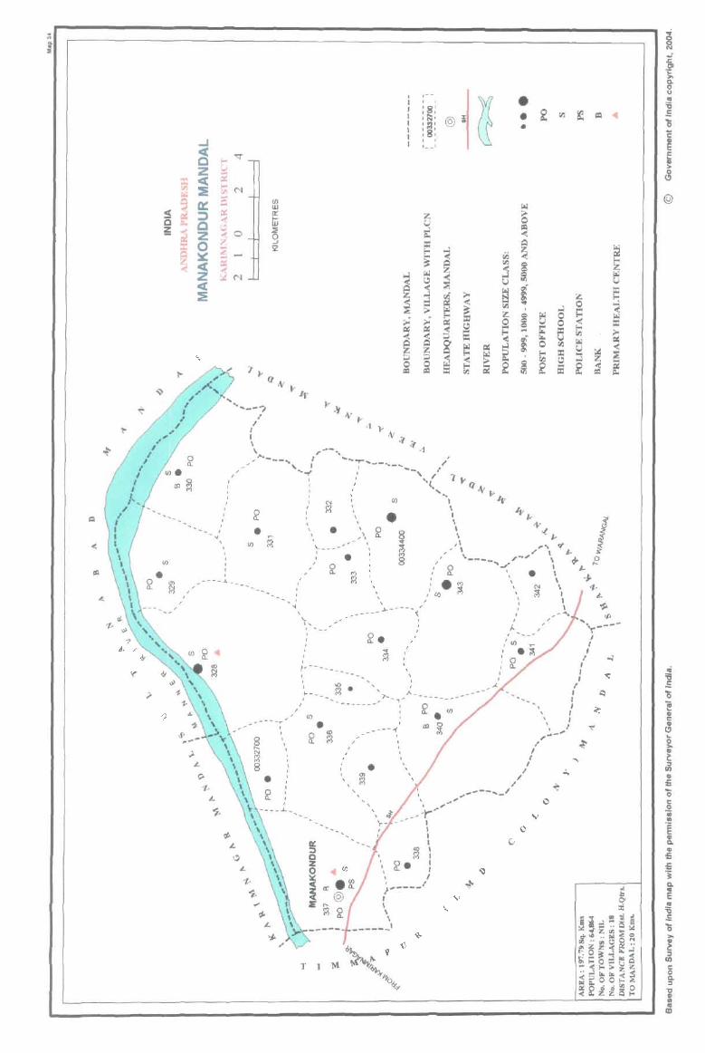
'-_ ___
CI)
, I
I
-" ,
,
C/) w a:
~ 2
. - -, :0: ,0, ,1:;, , :J' :8: , , 1 __ 1
• • •
' ......... _-?
.. ,
.I
I
I ~_. " \ ; • I '~---, : '-T'--,--__ ,,',. q ~ - '-.,. <"-' " ~ ,
I • CI) ~
I I • , ,
\.. ----1
1
I , •
, , \
" !r , . , ,
CI)
• i §
" IV,.. J \ 1t'.( ~ , j..:!S \ ... , ~ j.. ~ ,\ ;' I .J.. f:?
' , ;-" \ '7 ~
... ---.J..~ __ "'-'_ 1
I , ,
I' •• ----'....... • I +-.. 0 .. , ""
: Q. '. N \ $. ; .~ '- ~ I, ~ ... ,'. : --~ .
L
_ , '~
.. --,.
• !r
, , , ,
, \.. I, ,
I ........
" --,' " " ..... .,.----~-- < ',,,,' /
, , , , ... -- ... _------, , , , ~--_-
I 1 '-- .. _---
1 , , , , , , I
,) ... -..," }----------
, ---'( -- ,
' __
T I
,
I I
\ , ~ , ,
• , ,
, .. , ~
\ " --I""'I I I I
~ 1 I 1(. , I
;;---- I
, I \ \ I -----_
.I
" .,. .. ~--,-,/
I I I ,
, I " , .
I I
J I
I I . ". ;--
o
I , I I
,
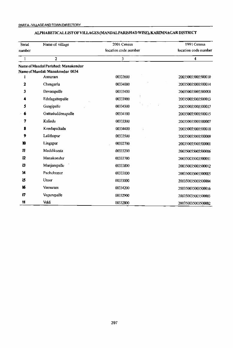
PART A-VIUAGEAND TOWN DIRECTORY
ALPHABETICAL LIST OF VILLAGES (MANDALPARISHAD WISE), KARIMNAGARDISTRICT
Serial Name of village 2001 Census 1991 Census
number location code number location code number
2 3 4
Nameof~andaIPar~had:~anakondur
Nameof~andal: ~anakondur 0034 1 Annaram 00333600 200350035003500010
2 Chengerla 00334000 200350035003500014
3 Devampalle 00333400 200350035003500008
.. Edulagattepalle 00333900 200350035003500013
5 Gangipalle 00334300 200350035003500017
6 Gattududdenapalle 00334100 200350035003500015
·7 Kalledu 00333300 200350035003500007
8 Kondapalkala 00334400 200350035003500018
9 Lalithapur 00333500 200350035003500009
to Lingapur 00332700 200350035003500001
U Maddikunta 00333200 200350035003500006
12 Manakondur 00333700 200350035003500011
Il Munjampalle 00333800 200350035003500012
14 Pachchunur 00333100 200350035003500005
15 Utoor 00333000 200350035003500004
16 Vannaram 00334200 200350035003500016
J7 Vegurupalle 00332900 200350035003500003
18 Veldi 00332800 200350035003500002
397

j ., "0 ,.... 0 U <II <> '" ::s § ..c <II
~ ~ 'J:j U ...
'" g co ;:; ....I .. 0
dIJ ~ ~ ., .. = OIl oS 0
] .. .::
~ ... ., 0 :; § ~ c.. .... 8. c: 0
OJ u
~ 1! S '1:: 0 0 " en !-o !-o
1 2 3 4
Mandai Parisbad : Manakondur (0034)
Lingapur 575.0 1,975
(00332700)
2 Ve1di
1572.0 5,770 (00332800)
Vegwupalle 3 851.0 2,123
(00332900)
4 Utoor
1745.0 3,688 (00333000)
5 PachchWlUC
1176.0 3,839 (00333100)
6 Maddikwtta
579.0 1,331 (00333200)
7 Kalledu
648.0 2,232 (00333300)
8 Devampalle
838.0 2,137 (00333400)
Lalithapur 9 242.0 856
(00333500)
Annaram 10
(00333600) 1684.0 4,680
DISTRICT CENSUS HANDBOOK: KARIMNAGAR
Census oflndia 2001 -Amenities and
Amenities available (if not available within the village, a dash (-) is shown in the column and next to it in brackets the distance in broad ranges viz. < 5 kms., 5-10 krns. and 10+ krns of the
-;;;- nearest place where the facility is available is civen) iil c "Q ;~ '" U :a
'l:j U :f ;:; " 1: 1 ~~ = 'fi ~ 0 0 'l:j
~ -a e .:l8.
~ ., 8- <> ]~~ gj ~ ] 'i' '5, "'
..c "0 0 ('tS .~ - .. ~ e-~ :a u 8 .!! ::s ..c .c
<II ~ .",
t ..c 1a = g u ~ g = . 0<1:2'6 o = ..c j c.. . "' .:: 0 .... .. ~ ..
e~ 1>~ .. .:: 0 c "E .~ ;, 1l 0 .. OIl ..!l E ... 'l:j"Ol ~ 'i = ~ " u
~ e <II ;:J <> .. l3 ~ ~ ~ <> :a tf §1 .~ t) f 1I):.a
8~ ::s :! is ~O.;J iil. 0 <~ Z Il.. U.<:>
5 6 7 8 9 10 II 12 I3
PHS RMP(2) NCS(3}
475 P M AC(3) H(IO+) T POPH(3) CM(S-IO) ACS«5)
CV(S-IO) BS RS(IO+)
C(lO+) MCW(lO+) CP(IO+) OCS(IO+)
SP(JO+) NW(IO+) PHC(5-10) ST(IO+)
PHCPHS ACS
peS) M(2) S FWC RMP(7) PO CM(IO+) NCS(5)
CV(IO+) BS RS(IO+) 1.376 AC(2)C(10+) H(IO+) W PH« S)
CP(IO+) OCS(IO+) SP(IO+) NW(IO+)
MCW(lO+) ST(IO+)
564 P(3} M S H(IO+} PO NCS(2)
CV(IO+) BS RS(IO+) T CM(S-IO) ACS« 5)
ACC(lO+) MCW(IO+) PH(S-Hl) CP(JO+) OCS(IO+)
SP(lO+) NW(IO+)
PHC«S) ST(IO+)
PHS RMP(4) ACS
885 P(2) M S H(IO+)
T PO PH CM
NCS(5) eV(IO+) BSRS(IO+)
AC(4)C(IO+) MCW(lO+) CP(IO+) OCS(IO+)
SP(IO+) NW(IO+) PHC(IO+) ST(IO+)
PHSRMP(5) NCS(5)
P(4) M S H(IO+) T
PO CM« ~) ACS(S-IO)
CV(IO+) BS RS(IO+) 884 AC C(lO+) MCW(lO+) PH(IO+)
CP(IO+) OCS(IO+) SP(IO+) NW(IO+)
PHC« 5) ST(IO+)
PAC RMP(2)
NCS
343 M«5) H(IO+)
T PH(12)
CM(S-IO) ACS«5) CV(lO+) BSRS(IO+)
MCW(IO+) PO« 5) SP(1O+) NW(IO+) C(lO+)
PHC(IO+) CP(IO+) OCS(IO+)
ST(IO+)
RMP(4) NCS(5)
502 P(2) M H(IO+)
T POPH(4) CM(S-IO) ACS«5) CV(IO+) BSRS(IO+)
AC(2) C(lO+) MCW(IO+) CP(IO+) OCS(IO+)
SP(JO+) NW(IO+)
PHC(IO+) ST(IO+)
PHS RMP(3) ACS
525 P(2) M AC H(IO+) T POPH(7) CM(lO+) NCS(3)
CV(lO+) BS RS(IO+)
C(lO+) MCW(IO+) CP(JO+) OCS(IO+)
SP(IO+) NW(IO+)
PHC(5-1O) ST(IO+)
PAC PH
NCS eV(S-IO) BSRS(IO+) H(IO+)
HP CM(5-IO) ACS(5-1O) 194 M«5) MCW(IO+) PO« S) SP(IO+) NW(IO+)
C(IO+) CP(IO+) OCS(IO+) PHC(IO+) ST(IO+)
PHS RMP(3) NCS(S)
P(2) M S H(10+) T POPH(S) CM(S·IO) ACS(5-1O)
CV(S-IO) BS RS(IO+)
1,120 AC(3) C(IO+) MCW(IO+) SP(IO+) NW(IO+) CP(IO+) OCS(IO+)
PHC(IO+) ST(IO+)
398
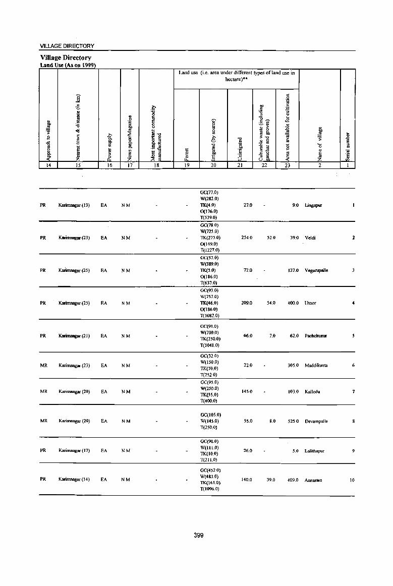
VILLAGE DIRECTORY
ViIlaee Directory Land Use (As on 1999)
Land use (i.e. area under different types ofland use in hectare)"
j " 0 'i
;§, ~ 00 > ~
;e
I :g " ., " u 6 g.-. .... c ... <B " ·S e
"" 'i3 0 S ~r:
t ..!!! co u " > " ~ oI!l ~ ~] 0
_ 0 bI)
j <II gj lib ..!!! ....
$ ~ » i!:.", ~ .8 e .", 1:; .... B ~ 8. .., ~ .2 a § u '" .~ ~
"0
~1! 0 "-co
j c.. ~
.. 0 '" ~ t '" 1;; '6 0;:
" 01 ::t ::t ~ l 2! .. .., u co
~ ~ Z :5 :§ - " ~ '5 .~ ~ " ., u OIl <I)
14 15 16 17 18 19 20 21 22 23 2 1
GC(77.0)
W(282.0)
PR Karimnagar (13) EA NM TK(4.0) 27.0 9.0 Lingapur 0(176.0) T(539.0)
GC(78.0) W(725.0)
PR Karimnagar (23) EA NM TK(275.0) 254.0 52.0 39.0 Veldi 2 0(149.0) T(1227.0)
GC(57.0)
W(389.0)
PR Karimnagar (25) EA NM TK(S.O) 77.0 137.0 Vegwupalle 3 0(186.0) T(637.0)
GC(93.0) W(7S7.0)
PR Karimnagar (25) EA NM TK(46.0) 209.0 54.0 400.0 Uloor 4 0(186.0)
T(1082.0)
GC(91.0)
PR Karimnagar (21) EA NM W(700.0)
66.0 7.0 62.0 Pachchunur 5 TK(250.0)
T(I 04 1.0)
GC(32.0)
MR Karimnagar (23) EA NM W(ISo.o)
22.0 305.0 Maddikunta 6 TK(70.0)
T(252.0)
GC(9S.0)
MR Karimnagar (20) EA NM W(2S0.0)
145.0 103.0 Kalledu 7 TK(SS.O) T(400.0)
GC(IOS.O) MR Karimnagar (20) EA NM W(14S.0) 55.0 8.0 525.0 Devampalle 8
T(2S0.0)
GC(9Q.O)
PR Karimnagar (17) EA NM W(1I1.0) 26.0 5.0 Lalithapur 9
TK(IO.0) T(211.0)
GC(4S2.0)
PR Karimnagar (14) EA NM W(483.0) TK{161.O)
140.0 39.0 409.0 Annaram 10
T(I096.0)
399
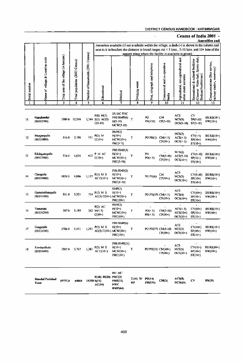
u ..c § co
01 ·c u til
I
II
12
13
14
15
16
17
18
., "Cl 0 u el 0
',c .. C) 0
....l "1j ., ... ~ .s: ._ 0 ., ~ 2
Manakondur (00333700)
MWljampalle (00333S00)
EdulagattepaIle (00333900)
Chengerla (00334000)
Gattududdenapalle (00334100)
Vannaram (00334200)
Gangipalle (00334300)
Kondapalkala (00334400)
MandalParishad Total
I ~
'" :s ..c '" ~ ;§, () ., -... C> :§ C> .s: !::!.-., c -B 0
'::l .... .. 0 "3 ... 8: ~
Zl Zl 0 0
I-< I-<
3 4
1989,0 t2,249
616.0 2,180
534.0 1,624
1839.0 4,886
851.0 3,221
367.0 1,189
1784.0 5,111
1887.0 5,767
19777.0 64864
DISTRICT CENSUS HANDBOOK: KARIM NAGAR
Census oflndia 2001 -Amenities and
Amenities available (if not available within the village, a dash (-) is shown in the column and next to it in brackets the distance in broad ranges viz.< 5 kms., 5-10 kms. and 10+ kms of the
-ui' nearest Dlace where the facilitv is available is lriven) ~ C ., U
8 !::!.-'" "0 '0
1 0 ..c 'S til
" u 0 .~ til
"" u
~ '6 ::I
z i2 ~ 5 6 7
peS) M(5) DUHCPHC
2,744 S(2) AC(S) PHSRMP(6) H(5-10)
C(5-10) MCW(5-1O)
RMP(2)
551 P(2) M H(IO+) C{lO+) MCW(lO+)
PHC« 5)
PHSRMP(3)
412 PM AC H(IO+) C(IO+) MCW(IO+)
PHC(S-IO)
PHS RMP(2)
1,137 peS) M S H(IO+) ACC(IO+) MCW(tO+)
PHC(5-IQ)
RMP(2)
734 P(2) M S H(IO+) AC(3) C(IO+) MCW(IO+)
PHC(IO+)
P(2) AC RMP(2)
262 M« 5) H(IO+)
MCW(IO+)
1,201
1,381
C(lO+) PHC(IO+)
PHS RMP(6) P(2) M S H(IO+) AC(3) C(IO+) MCW(IO+)
PHC(IO-+-)
PHS RMP(II) P(3) M S H(lO+)
AC C(IO+) MCW(IO+)
PHC(IO+)
f)V He
P(48) M(20) PHC(2) 15290 S(11) PHS(I1)
AC(34) FWC RMP(64)
400
., ., " ;> 0 '::l
..c e Co
'" ., Co
'Ii 0
"Cl b Iii
C) .., ~ Iii .c
Co
iJ a 01 '11 bI)
.,
j '$ u
Aj ri &:
8 9 10
T PO CM PH(150) CP(5-10)
T PO PH(3) CM«5) CP(IO+)
T PH
CM(S-IO) PO« 5)
CP(IO+)
T PO PH(6) CM CP(IO+)
T PO PH(19) CM« 5) CP(IO+)
T PO« S) CM(S-IO)
PH« 5) CP(IO+)
T PO PH(37) CM(S-to) CP(IO+)
T PO PH(21) CM(IO+) CP(IO+)
T(16) W PO(14) CM(l) HP PH(270)
"Cl !ij
] :;
c.>
'Eb '" ~ .~ Q Q) o ._ c_ ~
]~ - ... .[ t <~ II
ACS NCS(9) OCS(5-1O)
NCS(3)
ACS« S) OCS« 5)
NCS(2) ACS{S-IO) OCS(IO+)
ACS NCS(3) OCS(IO+)
ACS NCS(4) OCS(IO+)
ACS« 5)
NCS(IO+) OCS(IO+)
ACS NCS(2)
OCS(IO+)
ACS NCS(5) OCS(IO+)
ACS(S) NCS(63)
",.0 .. .E '::l u
=t! .s 8. ]~~ _OI~ U ..c 'c "1jZg
:-s!:a l>~ '::l "iii] .. e ~ ., :a .9 !!I ~()tIl
12
CV SP(S-IO) ST(5-10)
CV«S) SP(IO+)
ST(IO+)
eves-tO) SP(IO+) ST(IO+)
CV(S-tO) Sp(IO+) ST(lO+)
CV(lO+) SP(IO+) ST(lo+)
CV(lO+)
SP(IO+) ST(IO+)
CV(IO+)
SP(1O+) ST(IO+)
CV(IO+)
SP(IO+)
ST(10+)
cv
.,-C)
'E ~ ., ~ :: ~ :I ., e .. ., :s: § .:
'J: 0 .. '::I
.~ ~
~ ~ 8~
13
BS RS(IO+) NW(lO+)
BSRS(IO+) NW(IO+)
BSRS(IO+) NW(IO+)
BSRS(IO+) NW(IO+)
BSRS(IO+) NW(IO+)
BS RS(IO+)
NW(IO+)
BS RS(IO+) NW(IO+)
BSRS(IO+) NW(IO+)
8S(18)
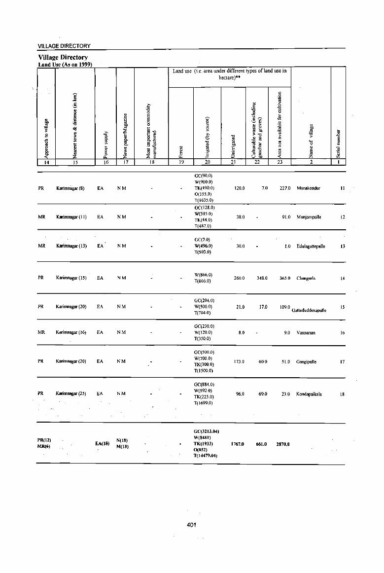
PR(I2) MR(Ci)
EA(18) N(IS) M(lS)
GC(32 13.04) W(848I} TK(l9J3) 0(S52) T(I4479.04)
401
1767.0 661.0 2870.0
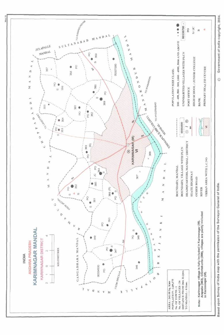
,\f,\l.-l1-
~ •• ..mtJ- \ ,. ~.~ \ ..
" ----,~-, "r---- .. ~ \ '
"( \ ,.... I
\ ~. ~ ~ :--------- \ , .....
. ~ , ,
\ R •• "'" _/ • ,-\ (/) ~ ': , ~ ,<, ,/ I/) • I / " , 0>
I " ___ / l'l 1--•. _- , , I. ~. I "
I I() . " ,' . N ' _, ' I() -'( 0 CD
'l< I '" "f " il.: ~ '" \, 4. ~\ .. ---__ ~ .. " , , _\ ,
0/'(.. T • ~ ,). _____ ., ~ ~ I / .t. ~ t- __ ___ /
Qoo ~ ,'~. ~
I
~ /
,. ;'
' .... - ... _- ... /
' ... I _ ~"f • ~
..l \ , , ,
f ,
« I ~ \
;z; \ ,. " -------- ........ ~- (/)
« ). / ::; If -_L" ~.~
" I .r « \ '----- "
i:I: \ " "" .. «, .,,.- \ ~ I ~ / \
~ ~ £!i8~" ": -< I •. , l;j \
'" I ~ , "" ~ : / or ~ __ / " : ---~---_I 6 .... -_ IE '1 ~
_- 3. '1 '1 VaN V w
•
C III E c ~ > o (!)
III
-= '0 c o .. III .~
II a. GO
-= .r:. ~
'i Q. IV E IV
=6 .5 '0
c o Q. ::I
" GO III IV III
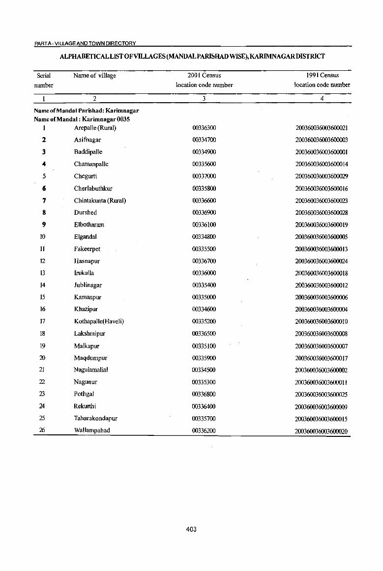
PART A - VILLAGE AND TOWN DIRECTORY
ALPHABETICAL LIST OF VILLAGES (MANDALPAlIDJHAD WISE), KARIMNAGARDISTRICf
Serial Name of village 2001 Census 1991 Census
number location code number location code number
2 3 4
Name of MandaI Parishad: Karimnagar Name of MandaI : Karimnagar 0035
1 Arepalle (Rural) 00336300 200360036003600021
2 Asifnagar 00334700 200360036003600003
3 Baddipalle 00334900 200360036003600001
4 Chamanpalle 00335600 200360036003600014
5 Chegurti 00337000 200360036003600029
6 Cherlabuthkur 00335800 200360036003600016
7 Chintakunta (Rural) 00336600 200360036003600023
8 Durshed 00336900 200360036003600028
9 Elbotharam 00336100 200360036003600019
10 Elgandal 00334800 200360036003600005
11 Fakeerpet 00335500 200360036003600013
12 Hasnapur 00336700 200360036003600024
13 Irukulla 00336000 200360036003600018
14 Jublinagar 00335400 200360036003600012
15 Kamanpur 00335000 200360036003600006
16 Khazipur 00334600 200360036003600004
17 Kothapalle(Haveli) 00335200 200360036003600010
18 Lakshmipur 00336500 200360036003600008
19 Malkapur 00335100 200360036003600007
20 Maqdumpur 00335900 200360036003600017
21 Nagulamalial 00334500 200360036003600002
22 Nagunur 00335300 200360036003600011
23 Pothgal 00336800 200360036003600025
24 Rekurthi 00336400 200360036003600009
25 Taharakondapur 00335700 200360036003600015
2fj Wallampahad 00336200 200360036003600020
403
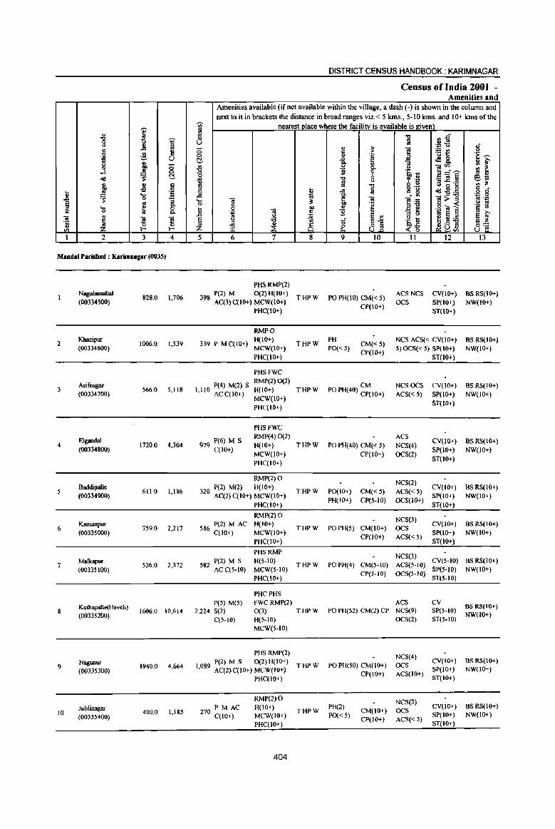
I " "8 "Vi' " ::J
" ... '" '" 0 ;§. .,
''= U .. : u 8 j ~ ~ ctd
4) 4) c co -s 0 .. ~
. ., .2! .... ..
.~ 0 :; § .. Cl. ... ~ 0
" 0 P-
" iii
~ ] ] 'ij 0 0
en I-< I-<
1 2 3 4
Mandai Parisbad : KarimlUlgar (0035)
Nagulamalial 828.0 1,706
(00334500)
2 Kbazipur
1006.0 1,539 (00334600)
Asifuagar 3 S66.0 S,118
(00334700)
Elgandal 4 1720.0 4,304
(00334800)
5 Baddipalle
611.0 1,186 (00334900)
6 Karnanpur
7S9.0 2,217 (00335000)
7 Malkapur
536.0 2,372 (00335100)
8 Kothapalle(Haveli)
1606.0 10,614 (00335200)
Nagunur 1940.0 4,664 9 (00335300)
JubJinagar 10 400.0 1,185
(00335400)
DISTRICT CENSUS HANDBOOK: KARIMNAGAR
Census of India 2001 -Amenities and
Amenities available (if not available within the village, a dash (-) is shown in the column and next to it in brackets the distance in broad ranges viz.< 5 kms., 5-10 kms. and 10+ kms oCthe
"Vi' nearest place where the facility is available is l!;iven) ill '" ." ~~ u
ii U . ., u .; <5 "
.., ] ~t!
u
" ,.
0 0 . ., .~~ ~ ..<:
~ <f!8. Cl. "3
~ ..2 <.> ]~-- '" ~ !! ~ .~ :; ::J "
~ "0 tJ f ',0
_'ia§ e1il ~ "1J = C>
:::s .c .c ., '" :::s 0'- U IS g .g § 0 u i § = g ctd:5!:a .c 1ii . .. .... 'ia ~ 'ia ]~ 1>~ oj '::! 0 " "e .~ t1 u 0 -;a co '" .::! 'ii!] ...
~ 11 " "3 5 01 8 El ~ .J:l .. c) El ., § tJ 'i3
~ 81 ~~ ~"'i3 !§~ ~ ~ 8 .S !9 Z Ii! 8rn U 5 6 7 8 9 10 II 12 13
PHSRMP(2) P(2) M 0(2) H(IO+)
THPW PO PH(IO) CM« S) ACS NCS CV(IO+) as RS(IO+)
398 AC(3)C(10+) MCW(IO+) OCS SP(IO+) NW(IO+} PHC(IO+)
CP(lO+) ST(lO+)
RMPO
339 P M C(lO+) H(IO+}
THPW PH
CM«5) NCS ACS« CV(IO+) BSRS(IO+)
MCW(IO+) PO« 5) CP(lO+}
5) OCS« 5) SP(lO+) NW(JO+) PHC(lO+) ST(lo+)
PHSFWC
I 110 P(4) M(2) S RMP(2) 0(2)
CM NCSOCS CV(IO+} BS RS(JO+} H(IO+} THPW PO PH(40} CP(IO+} , ACqIO+} MCW(lO+)
ACS« 5) SP(JO+) NW(IO+)
PHqIO+) ST(JO+)
PHSFWC
979 P(6} M S RMP(4) 0(2) ACS
CV(IO+) BS RS(IO+) H(IO+) THPW PO PH(40) CM« S) NCS(4)
C(lO+) MCW(IO+) CP(IO+) OCS(2)
SP(JO+) NW(JO+)
PHC(IO+) ST(IO+)
RMP(2) 0 NCS(2)
P(2) M(2) H(JO+) THPW PO(JO+) CM« 5) ACS« 5)
CV(IO+) BS RS(lo+} 320 AC(2)C(10+) MCW(lO+)
PH(lO+) CP(5-1O) OCS(IO+) SP(10+) NW(IO+)
PHC(lO+) ST(JO+)
RMP(2) 0 NCS(3)
546 P(2) M AC H(lO+) THPW POPH(5) CM(IO+) OCS
CV(IO+) as RS(IO+) C(IO+) MCW(lO+)
CP(lO+) ACS«5) SP(10+) NW(IO+)
PHC(IO+} ST(1O+)
PHSRMP NCS(3)
P(2) M S H(S-IO) THPW PO PH(4) CM(5-to) ACS(S-IO)
CV(S-to) as RS(IO+) 582 AC C(5.10} MCW(5-JO)
CP(5-10) OCS(5-JO) SP(5-10) NW(IO+)
PHC(IO+) ST(5-IO)
PHCPHS P(5) M(S) FWCRMP(2) ACS cv
BS RS(lO+) 2,224 S(2) 0(3) THPW PO PH(52) CM(2) CP NCS(9) SP(5-10)
C(S.IO) H(S-IO) OCS(2) ST(S-IO) NW(IO+)
MCW(S·tO)
PHSRMP(2) NCS(4)
P(2) M S 0(2)H(10+) THPW PO PH(50) CM(lO+) OCS
CV(IO+) aSRS(IO+) 1,089 AC(2)C(10+) MCW(lO+) SP(JO+) NW(JO+)
PHC(IO+) CP(IO+} ACS(IO+)
ST(IO+)
RMP(2) 0 NCS(3) PM AC H(IO+) THPW
PH(2) CM(10+) OCS
CV(tO+) BS RS(IO+) 270 C(JO+) MCW(IO+) PO« 5) SP(tO+) NW(IO+)
CP(IO+) ACS«5) PHC(IO+) ST(10+)
404

VILLAGE DIRECTORY
ViIla2e Directory Land Use (As on 1999) .
Land use (i.e. area under different types ofland use in hectare)··
i d 0 .'"
§, ?;> 01) ~ c .'"
j '6 '6 "'3 0 ::> 0
" e '0 ....
" . ~ S '0' =~ <S ... ;,::;.rJ ... :a 0 0 " ~ ~ <> ~ u ;> ~ " old
_ 0
]' ~ ~il 0
~~ >. ~ '" '&i t ~ ~ 15. >.
~ ;> ~ .D
" &B e 2 ~ ~ ..c:: Q, Q, ~ ..
0 a .. .5 ~ ~ .g :a "0 "" ... 'in Po " .., 0 c: ... c: e j " ~ - ::>
1;; .. 'E a"U " <i .. J Q, ~ ~ ~ e 00
:3 - ::> ~ 'J::
~ ~ :£ 0 :5 ::> '" .>l (,) ... 14 15 16 17 18 19 20 21 22 23 2 I
Rice, Poullly WE(110.0)
PR Karimnagar (16) EA NM Fonns, Cement 141.6 4.1 512.3 Nagulamalial Pipes
T(170.0)
WE(85.0)
MR Karimnagar (16) EA N Rice Mill TK(18.2) 46.5 856.3 Khazipur 2
T(103.2)
Rice MilL WE(344.0)
P.R Karimnagar (16) EA NM Poultty fonns, TK(42.5) 85.0 4.9 89.6 Asifuagar 3 Sawmill T(386.S)
Rice Mill, WE(SO.6)
Concret MR Karimnagar (20) EA NM
Machine, TK(SO.6) 68.4 773.9 776.5 Eigandal 4
Sawmill T(IOL2)
WE(72.0) PR Karimnagar (16) EA NM TK(8.1) 12.1 258.9 259.8 Baddipalle 5
T(80.1)
WE(87.4) PR Karimnagar (13) EA NM TK(14.2) 490.5 1.2 165.7 Kamanpur 6
T(101.6)
GC(IO.I)
MR Karimnagar (7) EA NM WE(83.0)
34.4 200.0 202.4 Malkapur 7 TK(6.1} T(99.I)
Bricks, Pipes, GC(101.2) PR Karimnagar (8) EA NM
Cement WE(182.1) 165.9 610.3 546.5 Kothapalle(Haveli) 8 T(283.3)
GC(896.8)
MR Karimnagar (10) EA NM Rice Mill. WE(445.2)
215.2 Cement Pipes' TK(l92.6) 95.0 95.0 Nagunur 9
T(I534.6)
GC(20.2) PR Karimnagar (II) EA N WE(85.0) 27.9 4.0 262.8 Jublinagar 10
T(105.2)
405
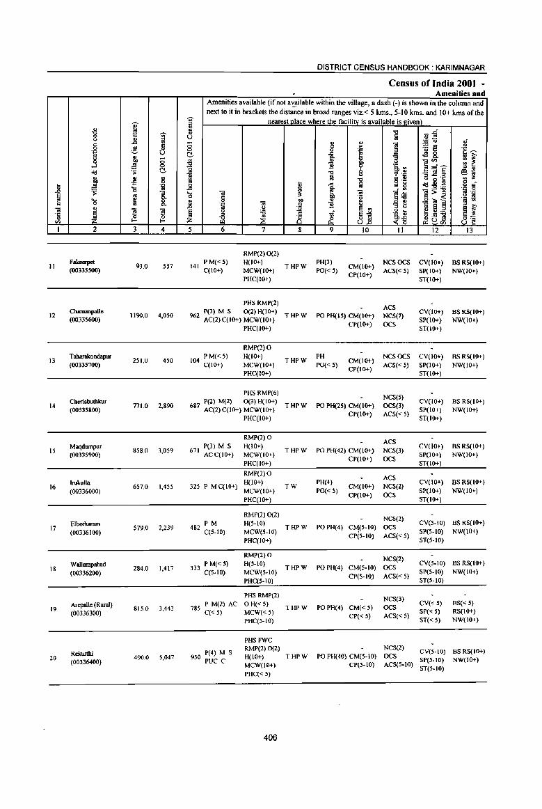
DISTRICT CENSUS HANDBOOK: KARIMNAGAR
Census of India 2001 -. Amenities and
Amenities available (if not a~ilable within the village, a dash (-) is shown in the column and next to it in brackets the distance in broad ranges viz. < 5 kms., 5-10 kms. and 10+ kms of the
I ~ nearest place where the facility is available is e:iven)
'" " "C ~~ -g ~ .. a u !iii u .= u II " .c ti c: .. .,
] ~E! 0 .S c > 'i ~ 0 0 'J: .= '-' U c:!- .c [ .!!8. oj .. go "3 g OIl 0 il u ]~~ .. e: ...J !'l 0 B ~ .~ ., ~ c:!- o '" .. ~ ii "C '? .~ _ca~ E9.t;;
~ u i'.l ~·c "' :t ~ .s 8 "C c ..
C o .~ ~:'5l~ = ... _!g .= 0 ~ ..c ii c g o .:
" ~ ....
1 .c
~ l~ 'J:: 0
.0 0 .... ca ca Oi>c B .= ~ oj 0 c iI' 4e .~ «J 1 .- 19 .... fa ... .S! OJ
co .. § ., c 0 ~ ~ 'B .. 1U e OJ .. .. 1U u
~j '" u
~I ~ ~ ~ u '6 ~~
e U:a ·c ~ iE ~ is ~ ~Dg ..
<I) '-' til
1 2 3 4 5 6 7 8 9 10 II 12 13
RMP(2) 0(2)
11 Fakecrpct
93.0 557 141 P M«5) H(IO+)
THPW PH(3)
CM(IO+) NCSOCS CV(lO+) BSRS(IO+)
(00335500) C(IO+) MCW(IO+) PO«5) CP(IO+)
ACS«5) SP(lO+) NW(IO+) PHC(IO+) ST(IO+)
PHS RMP(2) ACS
12 CbamanpaIle
1190.0 4,050 P(3) M S 0(2) H(IO+)
THPW PO PH(IS) CM(IO+) NCS(7) CV(IO+) BSRS(IO+)
(00335600) %2 AC(2) C(IO+) MCW(IO+) SP(IO+) NW(IO+) PHC(IO+)
CP(IO+) OCS ST(IO+)
RMP(2) 0
13 T aharalcondapur
251.0 450 104 PM«5) H(IO+) THPW
PH CM(IO+)
NCSOCS CV(IO+) BSRS(IO+) (00335700) C(IO+) MCW(IO+) PO« 5)
CP(IO+) ACS« 5) SP(IO+) NW(IO+)
PHC(IO+) ST(IO+)
PHSRMP(6) NCS(S)
Cherlabutbkur P(2) M(2) 0(3) H(IO+) CV(IO+) BS RS(IO+) 14 771.0 2,890 687 AC(2) C(IO+) MCW(IO+) THPW PO PH(2S) CM(IO+) OCS(3)
(00335800) CP(IO+) ACS« 5)
SP(IO+) NW(IO+) PHC(IO+) ST(lO+)
RMP(2) 0 ACS
15 Maqdumpur
858.0 3.059 671 P(3) M S H(IO+)
THPW PO PH(42) CM(IO+) NCS(3) CV(lo+) BS RS(IO+)
(00335900) ACC(IO+) MCW(IO+) CP(IO+) OCS
SP(IO+) NW(IO+)
PHC(IO+) ST(IO+)
RMP(2)0 ACS
16 IrukuIla
657.0 1,455 325 P M C(IO+) H(IO+)
TW PH(4)
CM(IO+) NCS(2) CV(IO+) BS RS(JO+)
(00336000) MCW(lO+) PO« 5) SP(IO+) NW(IO+)
PHC(IO+) CP(IO+) OCS
ST(IO+)
RMP(2) 0(2) NCS(2)
Elbotharam PM H(.5-IO) CV(S-IO) BS RS(IO+) 17 579.0 2,239 482 C(5-1O) THPW POPH(4) C~(5-10) OCS
(00336100) MCW(S-IO) SP(5-10) NW(lO+)
PHC(IO+) CP(5-1O) ACS«5)
ST(5-10)
RMP(2) 0 NCS(2)
Wallampahad 284.0 1.417
PM«S) H(S-IO) THPW PO PH(4) CM(5-10) OCS
CV(S-IO) BS RS(IO+) 18
(00336200) 333 C(S-IO) MCW(S-IO) SP(5-to) NW(IO+)
PHC(5-10) CP(5-to) ACS« 5)
ST(S-IO)
PHSRMP(2) NCS(3)
Arepalle (Rwal) 785 P M(2) AC o H« 5) CV« S) BS« S) 19 815.0 3,442 THPW PO PH(4) CM«5) OCS
(00336300) C« 5) MCW«5) CP« 5) ACS« 5)
SP« 5) RS(IO+)
PHC(5-10) ST« 5) NW(IO+)
PHSFWC
P(4) M S RMP(2) 0(2) NCS(2)
CV(5-10) BS RS(JO+) Rc:kuI1hi H(IO+) THPW PO PH(40) CM(5-10) OCS 20 490.0 5,047 950 PUC C SP(5-to) NW(IO+) (00336400) MCW(IO+) CP(5-10) ACS(5·10)
PHC« 5) ST(S-IO)
406
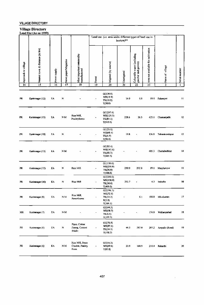
VILLAGE DIRECTORY
Villaee Directory Land Use (As on 1999)
Land use (i.e. area under different types of land use in hectare)··
i = 0 . ., g .c OIl ~
1~ . .,
8 '6 :;
'" 0 tJ
1!l I ... c v ..s ., '" .~ ~~ ]' ;;:; ~ ..
t>O ., > ~ ~ ~ <1d '" ~1l
0 ~~ » ~ '" i 01 t B ~ 0. » :l:"" ~ ~ .. 8.13 e "" > .c B 0. 0. II) ..!! 1a to
'" co 10 .... <> <II .~~ "" ]~ '0 .,
1 0. ... OIl 0 C
~ ...
~ ~ 1<i E = " .. '" '" '" ~ ~ ~ OIl
.;§ - :::I ~ ~ .,;:
~ ~ ~ (]. ] " '" '" V bO '" 14 15 16 17 18 19 20 21 22 23 2 1
OC(30.0)
PR Karifnna8ar ( 12) EA N WE(IB.O)
16.0 1.0 IS.O Fakeerpet II TK(IO.0) T(S8.0)
OC(297.4)
PR Karimnagar (13) EA NM Rice Mill, WE(129.5)
228.6 26.3 423.1 Chamanpalle 12 Pouillyfonns TK(85.1)
T(SI2.0)
GC(21.0)
PR Karimnagar (18) EA N WE(6S.4)
19.8 136.8 Tabarakondapur 13 TK(4.9)
T(94.4)
OC(83.4)
PR Karifnna8ar ( 13) EA NM WE(141.6)
485.3 Cherlabuthkur 14 TK(60.7) T(285.7)
GC(130.0)
PR Karimnagar (12) EA N Rice Mill WE(250.0) TK(26.0)
230.9 202.0 19.1 Maqdumpur 15
T(406.0)
GC(200.0)
PR Karimnagar (10) EA N Rice Mill WE(lSO.O)
252.7 4.3 lrukulla 16 TK(50.0) T(400.0)
GC(296.3)
Rice Mill, WE(52.6)
PR Karimnagar (8) EA NM Powerlooms
TK(33.2) 6.1 188.8 Elbothararn 17
R(2.0) T(384.1)
GC(44.5)
MR Karimnagar (7) EA NM WE(SH.?)
174.8 Wallampabad 18 TK(6.1)
T(I09.3)
Pipes, Cotton GC(?6.9)
PR Karimnagar (4) EA N Zining, Cement WE(9?1)
44.5 287.0 285.2 ArepaIle (Rural) 19 Bricks
TK(24.3)
T(198.3)
Rice Mill, Stone GC(16.2) PR Karimnagar (6) EA NM Crusher, Pouilly WE(69.6) 23.9 168.9 211.4 Rekurthi 20
Form T(8S.8)
407
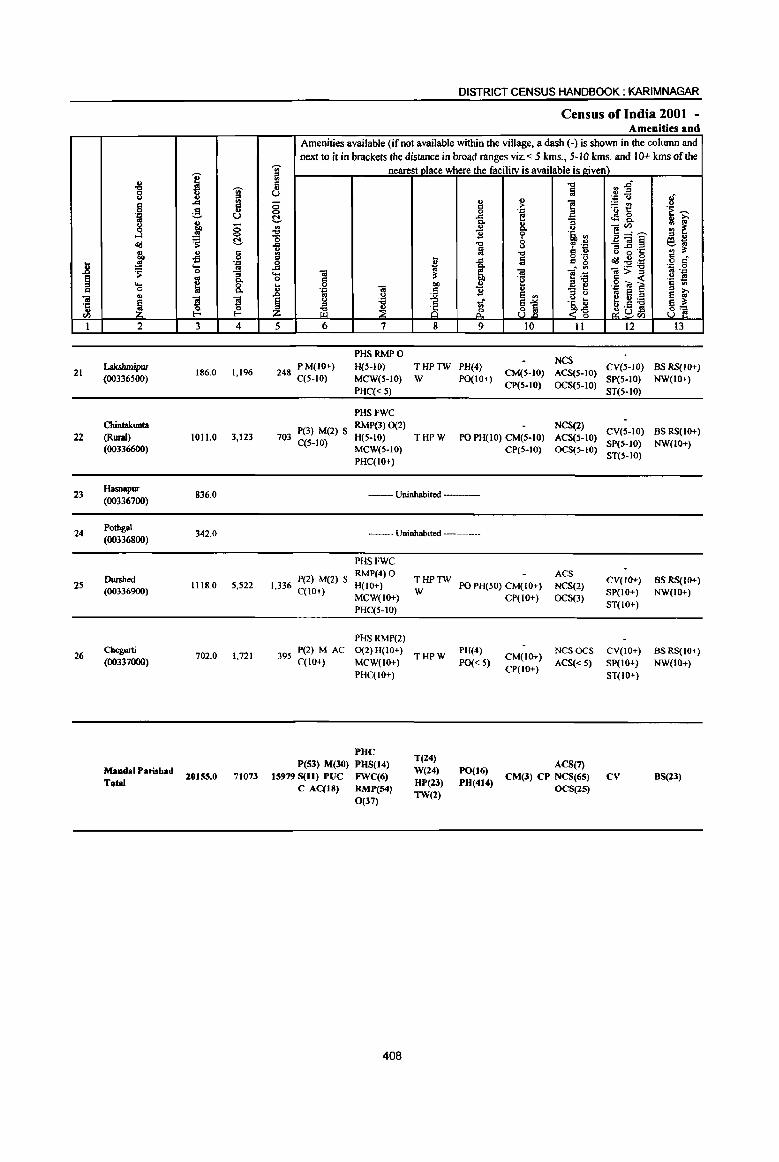
l ~ 0:
iii ·c ., til
1
21
22
23
24
25
26
.. "0 0 ., g
] d<l Q) OIl ~ ~ ... 0 Q)
~ 2
Lak.sltmipw (00336S00)
Chintakunta (Rmal) (00336600)
Hasnapur (00336700)
Potbgal (00336800)
Dwshed (00336900)
Chegurti (00337000)
MandalParishad Total
I '(ij' u ., ~ .... 5 e u
tl, 8 ~ !::!.
oS c 0 .., ... 01
0 :; 01 Co
~ 0 Co
~ l'! 0
l- I-<
3 4
186.0 1,196
1011.0 3,123
836.0
342.0
1118.0 5,522
702.0 1,721
20155.0 71073
DISTRICT CENSUS HANDBOOK: KARIMNAGAR
Census of India 2001 -Amenities and
Amenities available (if not available within the village, a dash (-) is shown in the colwnn and next to it in brackets the distance in broad ranges viz. < 5 kms., 5-10 kms. and 10+ kms of the
~ nearest nlace where the facilitv is available is eiven) ., <l "0 .,
Ii3 U
" .,
0 <l > i <:> 0 .'" t!- ..d E Co
~ " & u ]" l' .~ ~ "0 0 .... u ':' "'::
Q) m "0 C Q) .. ~n~ '" ....
1 lii _g " 10 - '" ~ "- iii :s: ]:a 0 C
t 0 OIl " .'" iii .5 B " - ~ .0 '" U e '" l~ § tJ 'B
A ..r ~1 '" iil .,
Z ~ &. <,-g 5 6 7 8 9 10 11
PHSRMPO NCS P M(lO+} H(5-1O} THPTW PH(4}
248 C(S-IO) CM(S-IO) ACS(S-IO) MCW(S-IO} W PO(IO+)
CP(5-1O) OCS(S-IO) PHC« S)
PHSFWC
P(3} M(2) S RMP(3) 0(2) NCS(2)
703 C(S-IO)
H(S-IO} THPW PO PH(IO} CM(S-lO) ACS(S-lO) MCW(S-IO) CP(S-IO) OCS(S-IO) PHC(IO+)
--Uninhabited ----
--- Uninhabited ------
PHSFWC
I 336 pel) M(2) S RMP(4) 0 H(IO+) • C(IO+) MCW(IO+) PHC(5-10)
PHSRMP(2)
395 P(2) MAC 0(2)H(10+) C(lO+) MCW(IO+)
PHC(IO+)
PHC P(53) M(30) PHS(14)
15979 S(1I) PUC JiWC(6)
C AC(JS) RMP(54)
0(37)
408
THPTW W
THPW
T(24) W(24) HP(l3) TW(2)
ACS PO PH(50) CM(IO+} NCS(2)
CP(IO+) OCS(3}
PH(4) CM(IO+)
NCSOCS
PO« 5) ACS« 5) CP(IO+)
PO(16) ACS(7) PH(414) CM(3) CP NCS(65)
OCS(15)
:t~ '': u
'Ei! tJ!8. iii'" .a_"~ _Ol§ e ~.~ d<l~~ iii>", c <:
._g ~] 01 e e u 'B
~n~ 12
CY(.5-IO} SP(S-IO)
ST(S-lO}
CY(S-IO)
SP(S-IO) ST(S-lO)
CY(IO+) SP(IO+)
ST(IO+}
CY(IO+)
SP(IO+)
ST(IO+)
CY
8 .~ ~ ., 01
~ ~ e~ ., :s: .:: . .~ § 01 .-.~ ]i § '"
~ f 8~
13
BSRS{IO+} NW(IO+)
BSRS(IO+) NW(IO+}
as RS(IO+) NW(IO+)
BSRS(IO+)
NW(IO+)
BS(23)
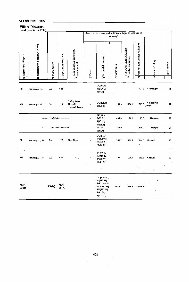
VILLAGE DIRECTORY
Villaee Directory Land Use (As on 1999)
j e C 8 '6
0
! " 8 " j .~ 8 oa 0
OIl 0
~ . <Ill .. §"(j ~ B i .g:
t:: ~ ~ ~ ..c: 8."
l ~ I>. §~ .., ~ ~ - " l;I
~ ~ ~ :£ ~ :£ 14 15 16 17 18
MR Karimnagar (6) EA NM
Poulnyfonns, MR Karimnagar (6) EA NM Ricemill,
Livestock Fonns
•••••• - Uninhabited ••••••••••••
PR
MR
PR(16) MR(S)
•••• _- Uninhabited •• __ ._.
Karimnagar (10) EA
Karimnagar (14) EA
EA(24)
NM
NM
N(24) M(17)
Rice, Pipes
Land use (i.e. area under different types ofland use in
Vi e 0 u.. 19
hectare)··
'<i' B " 0
'" :>. e '" '" !;j OIl
] 20
GC(44.S) WE(20.2) T(64.7)
GC(125.5) T(12S.5)
TK(56.3) R(79.3)
T(13S.6)
WE(S.I) TK(2.4) T(IO.5)
GC(29.1) WE(J59.9) TK(66.8)
T(255.8)
GC(66.S) W(210.4) TWE(7.3) T(284.5)
GC(2489.92) W(210.43) WE(2827.81 ) TWE(7.28) TK(7S7.92) R(81.34) T(6374.7)
409
"(j " (;j OIl
'E .;: ::> 21
161.9
498.8
227.0
383.2
97.1
3472.1
c 0 .= oj
btl ;;..
,g .= -= " " c; .... <2 c--"
;:..~ " ., :>- :E :;:, ~ ~ ..
'8 ~ E!;", iO '';
..!l !;j
1~ '0 .... "
0
'" '" - ::I ~ ~ :; '" u OIl
22 23 2
121.3 Lakshmipur
404.7 3 19 0 Chintakunta . (Rural)
IS4.1 17.0 Hasnapur
104.0 Potbgal
334.5 144.5 DW'Shed
104.9 21S.6 Chegurti
3671.9 6635.2
.... 11 ~ " OJ ·c '" r/)
1
21
22
23
24
25
26
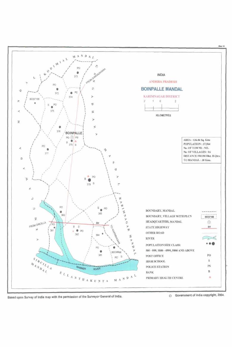
M"ND"L "" \-...... ,. + \. ,." ------,-
\)\ / PO ./ '" ..L"- / • ./ ,...y..-P v I -...' I ;J;..&" \- .' .... .1 373 I ~~
\ " , I-...,<Y"'
Y PO " " ,<,?-U" Z I \ I
I . ' ,------1 r---A" 372,' • PO 1\
I oo~;". y:-~~ ~ '" ! \, '., 375 / \
" \ I I " I I I
\\'.'i./ " " ,'';...--1-- / ~ ' . ' -, I .. I I I
I \ I 376 / BOIN 'lALLE', I .. I In
,/ " ,/ po@ , ps 1 / '-,' B· , I PO '- I 378 S l, " '/ .. -I· -....... , +
I 377 ,4 --- \ { , ~ , '
, I \
\ ' , I ' , I ' I ' I I , I' , I PO \ 1 ___ "':"'''' B • "
.... """, I
"'.1" "'f" 379 S '\ I k--_
/f \ _- \
I I
, \ 1-\ ?'
\ 11 I ...
383
"
I ~ , '1.
., .. ",- ., ~ __ ~~ ____ ~!SH~~~~" ~
8 S r--- - - , A
" 0 , '\ .PO ,
.'., \ 'P 382
, , 384 '" ~ " ~ , , '. , , ?' I
, " ')l '"J. , PO - •• --.,-- . " 'd
I ... , • \ ... " , , 00338600 " ,
I \ 'C" I 385 , \ S \
I PO I
Based upon Survey of India map with the permission of the Surveyor General of India.
INDIA
ANDHRA PRADESH
Mop 3.
BOINPALLE MANDAL KARIMNAGAR DISTRICT 2 a 2
KILOMETRES
AREA : 136.46 Sq. Kms
POPULATION: 37,564 No. OF TOWNS : NIL No. OF VILLAGES: 16 D1sr ANCE FROM DIIt H.Qtr •.
TO MANDAL : 30 KIlls.
BOUNDARY, MANDAL
BOUNDARY, VILLAGE WITB PLCN
HEADQUARTERS, MANDAL
STATEIDGHWAY
@ SH
OTHER ROAD
RIVER
POPULATION SIZE CLASS:
500 - 999.1000 - 4999. 5000 AND ABOVE
POSTOWICE
mGHSCHOOL
POLICE STATION
BANK
PRIMARY HEALTH CENTRE
~ ••• PO
S
PS
B
© Government of India copyright, 2004.
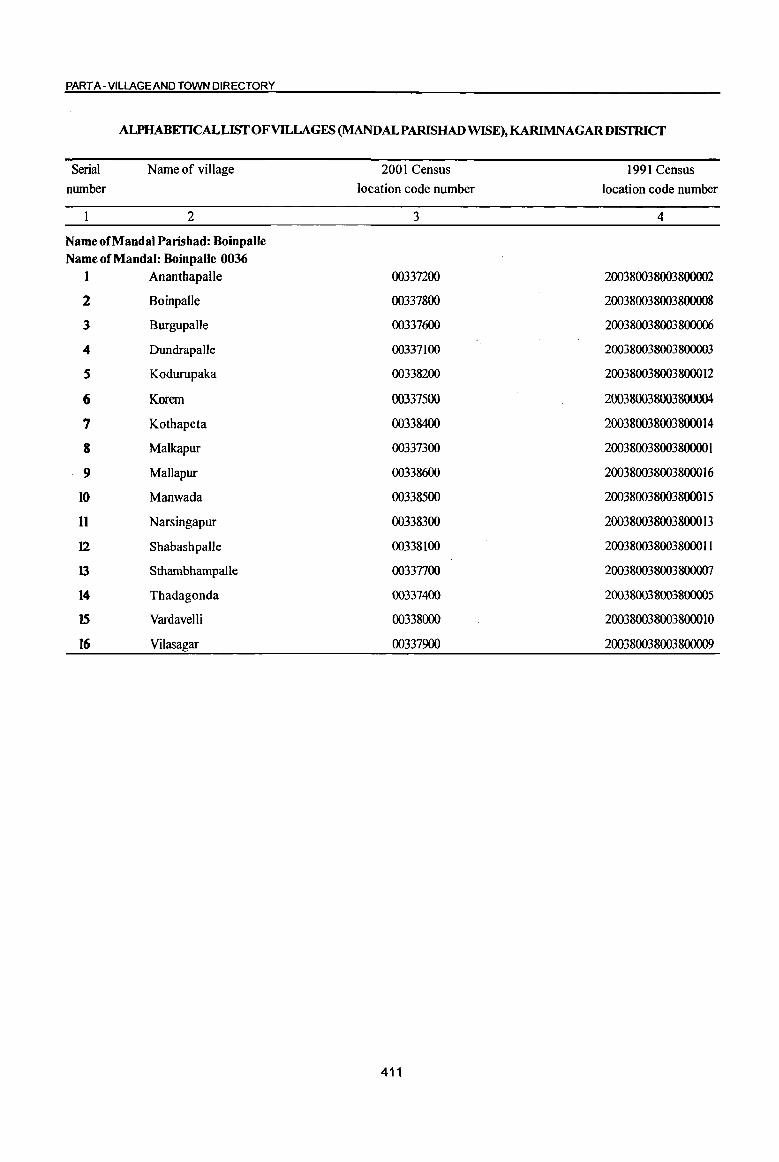
PART A - VILLAGE AND TOWN DIRECTORY
ALPHABETICALLISTOFV1LLAGES (MANDALPARISHAD WISE), KARIMNAGAR DISTRICT
Serial
nwnber
Name of village
2
Name of Mandai Parishad: BoinpalJe
Name of Mandai: BoinpalJe 0036
1 Ananthapalle
2 Boinpalle
3 Burgupalle
4 DundrapaUe
S Kodurupaka
6 Korem
7 Kothapeta
8 Malkapur
9 Mallapur
10 Manwada
II Narsingapur
12 Shabashpalle
13 StbambhampaUe
14 Thadagonda
15 Vardavelli
16 Vilasagar
2001 Census
location code number
3
00337200
00337800
00337600
00337100
00338200
00337500
00338400
00337300
00338600
00338500
00338300
00338100
00337700
00337400
00338000
00337900
411
1991 Census
location code number
4
200380038003800002
200380038003800008
200380038003800006
200380038003800003
200380038003800012
200380038003800004
200380038003800014
200380038003800001
200380038003800016
200380038003800015
200380038003800013
200380038003800011
200380038003800007
200380038003800005
200380038003800010
200380038003800009

j i j g 1:1 ..co
5 0 '" ] ;;:::. U lill ;:; ~ 0
.td ~ ..... ._,
~ " 8 -B .8
... .... ttl .;;: 0
1 § g .... 0:1 0
"iii u ]I ]I .c;
~ u ~ ~ Vl
I 2 3 4
MandaI Parisbad : Boinpane (0036)
DundrapaIIc (00337100)
271.0 971
Anantllapalle 2 551.0 1,721
(00337200)
Malkapur 3 643.0 1,450
(003373OO)
4 Thadagonda
8{)9.{) 2,074 (00337400)
Korem 5 752.0 2,137
(00337500)
Burgupalle 6 456.0 1,325
(00337600)
Stluunbharnpalle 7 1063,0 2,482
(00337700)
Boinpalle 8 985.0 4,008
(00337800)
9 Vilasagar
3067.0 7,680 (00337900)
10 Vardavelli
1011.0 1,774 (00338000)
Shabashpalle II 254.0 602
(00338100)
DISTRICT CENSUS HANDBOOK: KARIMNAGAR
Census of India 2001 -Amenities and
Amenities available (if not available within the village, a dash (-) is shown in the colwnn and next to it in brack.ets the distance in broad ranges viz. < 5 kIDs., 5-10 kIDs. and 10+ kIDs of the
-;;;- nearest place where lhe facility is available is given) iii d "t:I ",Ji <I u !a .~ .fi .; ., ., ;:; g ;> ~
;.:: 9) <> 0 . .:: ·u 1:: ·G '>: C ..co f <:38. c:>. '" -= ;: ~ .:g -§ 0.. u ~~'""' '0
0 .Q '" '" (>
"t:I (, , .~ _"iil§ e~ ,.d
~ a u ~ ~.J: ., i:!: "t:I
d ., ... g .g ~ u.9 d 0
~ -'" a ::!:.a o Q
,.d
~ . '" . .c 0 .... "iii ~ "iii ]~
"iiI:>::l ttl .lj
0 t: "e g « .2 :l
.8 <> "iii "" ..2 .~ 01 ] " '" ... j 2 <I - ... -:;; a ::l >,
ttl <> a .. ::l " e ~ § <.> '6 .~ ~ "";;:; ::l 'iii ~l ti .S s ~~ z i13 ~ & <~ ~u ~'" 5 6 7 8 9 10 II 12 13
PAC RMP H(IO+) PH(12)
NCS(2) CV(IO+) BS RS(IO+)
233 M(lO+) MCW(IQ+) THPW PO«5)
CM(IO+) ACS« 5) SP(lQ+) NW{IO+)
C(lO+) PHC(IO+) CP{tO+) OCS(IO+) ST(IQ+)
P(2) AC H(IO+)
NCS(3) CV{lO+) BSRS(IO+)
416 M(JO+) HPW PO Nt CM(lO+) ACS« S) C(10+)
MCW{IQ+) CP(IO+) OCS(IO+)
SP(IQ+) NW(IO+) PHC(IO+) ST(lO+)
347 P M{IO+} H(IO+) PO NCS(2)
CV{IO+} BS RS(IO+} HPW CM(IO+) ACS(IO+}
C(lO+) MCW(lO+) PH(IO+) CP(IO+) OCS(IO+}
5P(10+) NW(IO+} PHC(IO+) ST(IO+)
RMP(2} NCS
506 PM AC H(IO+) THPW POPH(8) CM«5) ACS«5)
CV(tO+} as RS(IO+) C(IO+) MCW(IO+)
CP(lO+) OCS(IO+) SP(IO+) NW(IQ+)
PHC«S) ST(IO+)
PHSRMP ACS
470 PM S AC H(tO+} PO CV(IO+) BS RS(IO+} THPW CM«5) NCS(3)
C(lO+) MCW(lQ+) PH(IO+) CP(tO+) OCS(IO+)
SP(IQ+) NW(IO+) PHC« S) ST(IQ+)
322 P M(IO+) RMP H(IO+)
PH NCS
CV(IO+) BS RS(IO+) MCW(JO+) HPW CM«5) ACS{< 5)
C(IO+) PHC« 5)
PO« 5) CP(IO+) OCS(IO+)
SP(IQ+) NW(IO+) ST(tO+)
P(3) M RMP H(IO+} NCS(2) CV(IO+) BS RS(IO+)
589 AC(2) C(IO+) MCW(lO+) THPW PO PH CM« 5) ACS«5) PHC« S) CP(5-1O) OCS(IO+)
SP(IO+) NW(IO+}
ST(to+}
DUMHHC
PHCFWC ACS CV(IO+) BS RS(tO+) 962 P(4) M(2) S RMP(2) THPW POPH
CM NCS(8)
C(lO+) H(IO+) CP(IQ+) OCS(IO+)
SP(IO+) NW(IQ+)
MCW(IQ+) 8T(IO+)
HC PHC PHS ACS
1 899 P(5) M(3) S FWC RMP(2) T HP W PO PH eM
NCS(3) CV(JO+) BS RS(lO+)
, AC(4) C(IQ+} H(IQ+) CP(IQ+) OCS{IO+)
SP(IO+) NW(IQ+)
MCW{tO+) ST(IO+)
MH PHS RMP NCS
448 P M(lO+) H(IO+) THPW POPH(8) CM«S) ACS{<5}
CV(IO+) BS RS(lO+)
C{lO+) MCW(IQ+) CP(IO+) OCS(IO+)
SP(IO+) NW(lO+)
PHC«5) ST(lO+}
136 P M(3) RMP H(IO+)
THPW NCS(2)
CV(IO+) BS RS(IO+) MCW(IO+) PO PH CM«S) ACS«5)
C(lO+) PHC«5)
TK CP(IO+) OCS(IO+)
SP(IO+) NW(IO+)
ST(IO+}
412
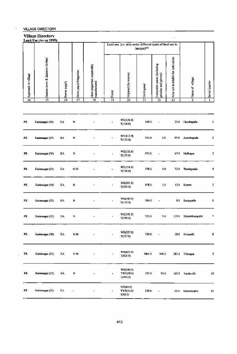
VILLAGE OIRECTORY
ViIlaee Directory Land Use (As on 19991
Land use (i.e. area under different types ofland use in hectare)··
i c .~ ';;j
,.§, ~ QI) ;. c .'"
1.l '8 :a :;
" ::> u
~ ~ '0 ... " . ~ .,. c~ <2 ._ III ... :.;; 0 ~ ~" " ..!!!
f u " ;. ~ " ~ o'Il ~"E
0
_ 0
OIl
j III ~ ~ ~ ..!!! ...
£ ~ ~ :s:"O ~ " -0 ;. ..0
" 8.2 .£ § E ... B Q. £ os ~ '" .§ .M "0 '" .D lil 15 ... ::>
1;; Q. " QI) 0 ·c g
~ ii III 1;; .. 'E ~fl c ., -a - ::> '" Q. :s: :s: ~ ~ " OIl
.~ _f E_ - ::> ~ 'E :( Z &._ ~ ] ::> '" U 00 <f)
14 15 16 17 18 19 20 21 22 23 2 I
PR Karimnagar (40) EA N WE(128.0)
108.0 35.0 Dundrapalle T(128.0)
PR Karimnagar (30) EA N WE(Il3.0)
343.0 2.0 95.0 Ananthapalle 2 T(Il3.0)
PR Karimnagar (30) EA N WE(12S.0)
451.0 67.0 Malkapur 3 T(125.0)
PR Karimnagar (25) EA NM WE(154.0)
578.0 5.0 72.0 Thadagonda 4 T(l54.0)
PR Karimnagar (34) EA N WE(26 1.0)
478.0 1.0 12.0 Korem 5 T(261.0)
PR Karimnagar (32) EA N WE(142.0)
306.0 8.0 Burgupalle 6 T(142.0)
PR Karimnasar (32) EA N WE(192.0)
723.0 9.0 139.0 Sthambharnpalle 7 T(l92.0)
PR Karimnagar (30) EA NM WE(227.0)
720.0 38.0 Boinpalle 8 T(227.0)
PR Karimnagar (25) EA NM WE(821.0)
1864.0 100.0 282.0 Vilasagar 9 T(82 1.0)
WE(346.0) PR Karimnagar (25) EA N TWE(58.0) 355.0 91.0 160.0 Vardavelli 10
T(404.0)
WE(69.0) PR Karimnagar (24) EA TWE(13.0) 150.0 22.0 Shabashpalle II
T(82.0)
413
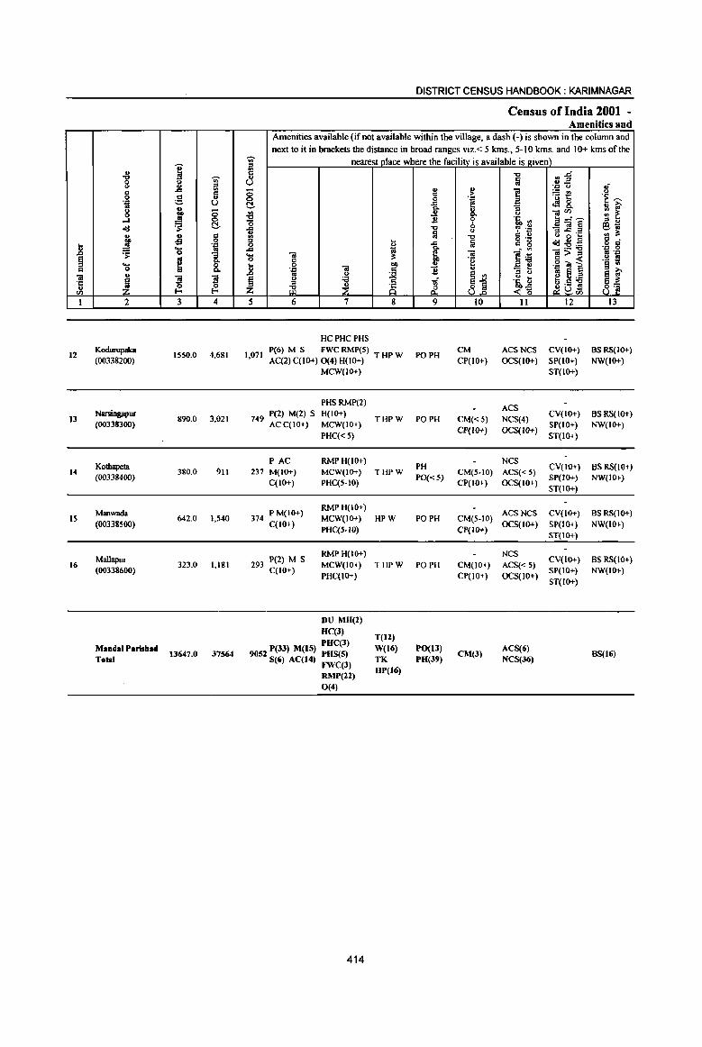
I 1 'Ui' ~
" ....
'" 0 Cl OJ .'" ~ U os 8 u <;;
~ ...I 0
~ C!.
~ v g
oS .8 ~
~ '0
1 § ~ ... " 0
01 " ~ s ~ ·c
~ " tI) t-<
I 2 3 4
12 Kodurupaka
15S0.0 4,681 (00338200)
13 Nmingapur
890.0 3,021 (00338300)
Ko!hapeta 14 380.0 911
(00338400)
Manwada 15
(00338500) 642.0 1,540
Mallapur 16 323.0 1,181
(00338600)
MandalParisbad 13647.0 37564
Tolal
DISTRICT CENSUS HANDBOOK: KARIMNAGAR
Census of India 2001 -Amenities and
Amenities available (if not available within the village, a dash (-) is shown in the column and next to it in brackets the distance in broad ranges viz. < 5 kms., 5-10 kms. and 10+ kms of the
'Ui' nearest place where the facility is available is l1:iven) = (II
'" -g
::~ OJ ~ U
.'" Q oJ
8 " ~ ~ "fi~ <> 6 .~ .~ ~
C!. .g_ <l!8. " ~ "3 u OlCll ::: ~ ~ ..!.l 0. <>
"0 ~ b .ti, rl E_"~ = " .... -g ~ .~ _«i§ e~
31 Iii <.> B"2 ·c .. :>: -a " " o .-"':E~ .~ g = ~
1 a " g 0 ., "" ~ 1~ ... 01 ";; l>~ f! . .0 0 " ·2 .- s .8 0
I u .g"iil ] § .. . .,
~ 11 " "3 t e '" '" s e ~ os .~ t e~:a § 0 'il -r;,"
~1 ~ ~ ~u~ e~
z & <~ 8~ 5 6 7 8 9 10 11 12 13
HCPHCPHS
1,071 P(6) M S FWC RMP(5)
PO PH CM ACSNCS CV(IO+) BSRS(IO+)
AC(2) C(IO+) 0(4) H(IO+) T HP W CP(lO+) OCS(IO+) SP(IO+) NW(l(}-!.) MCW{IO+) ST(IO+)
PHSRMP(2) ACS
749 P(2) M(2) S H(IO+) THPW PO PH CM«5) NCS(4)
CV(IO+) BSRS(IO+) ACC(IO+} MCW(IO+)
Cp(IO+) OCS(IO+) SP(IO+) NW(IO+)
PHC«S) ST(1(}-!.}
PAC RMP H(IO+) PH
NCS CV(lO+) BS RS(lO+} 237 M(IO+) MCW{IO+) THPW CM(5-IO) ACS« 5)
C(lO+) PHC(S-IO) PO«5)
CP(IO+) OCS(IO+) SP(JO+) NW(IO+) ST(IO+}
374 P M(IO+) RMPH(IO+)
ACSNCS CV(IO+) BS RS(IO+) C{IO+)
MCW(IO+) HPW PO PH CM(5-IO) OCS(IO+} SP(IO+) NW(IO+)
PHC(S-lO) CP(lO+) ST{IO+)
P(2) M S RMPH(IO+) NCS
CV(IO+) BS RS(lO+) 293 MCW(IO+) THPW PO PH CM(IO+) ACS«5)
C(lO+) PHC(IO+) CP(IO+) OCS(IO+)
SP(IO+) NW(IO+) ST(IO+)
DU MH(2) HC(l)
T(Il) PHC(3)
9052 P(33) M(15) PHS(5) W(16) PO(13) eM(3)
ACS(6) BS(16)
S(6) AC(14) FWC(3) TK PH(39) NCS(36)
RMP(12) HP(16)
0(4)
414
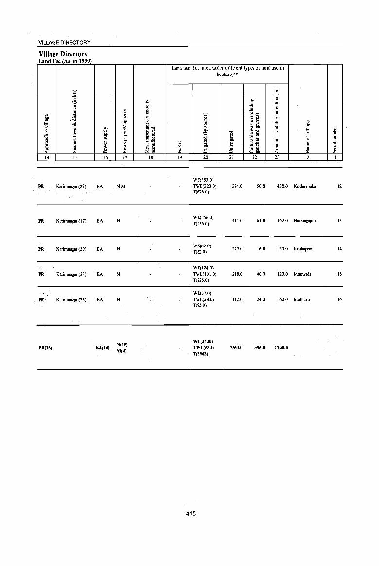
VILLAGE DIRECTORY
Villae:e Directory Land Use (As on 1999)
j g
j ~ .:a !! ~ 0)$
~ B ,c ~
1;1 tl e ~ 0.
~ Z 14 15
Karimnagar (22)
PR Karimnagar (17)
PR Karimnagar (20)
PR Karimnagar (23)
PR Karimnagar (26)
PR(Ui)
>. Q. 0. iil ~
~ 0..
16
EA
EA
EA
EA
EA
EA(16)
" " .~
i:P
t 0.
'" ~ ~ 17
NM
N
N
N
N
N(15)
M(4)
c :.a 0 E E 0 u
§"" 5~ c..., .5 <is - '" ~ ~
18
Land use (i.e. area under different types ofland use in
tl ~ 0
tJ..
19
,., ~ 0
'" e "" ~ OJ)
:5 20
WE(353.0)
TWE(323.0) T(676.0)
WE(256.0)
T(256.0)
WE(62.0)
T(62.0)
WE(I24.0)
TWE(LOl.O) T(225.Q)
WE(S7.0)
TWE(38.0)
T(95.0)
WE(3430) TWE(533) T(3%3)
415
hectare)··
"" ~ OJ)
E '2 ::l 21
394.0
411.0
279.0
248.0
142.0
7550.0
" 0 .'" '" OJ) >
" ~ '6 ::J ...
c:; .... o:~ <E ._ '" "'" " " .. > ~ " - 0 ~ ~ 50 1a ~"" i; 'S! ..!l § "§ ~ <> ....
" 0
aii " '" ~ - :::I ~ ::J '" U OJ)
22 23 2
50.0 430.0 Kodurupaka
61.0 162.0 Narsingapur
6.0 33.0 Kothapeta
46.0 123.0 Manwada
24.Q 62.0 Mallapur
395.0 1740.0
.... 1! E '" 0:
Oi ·c " til
1
12
13
14
15
16
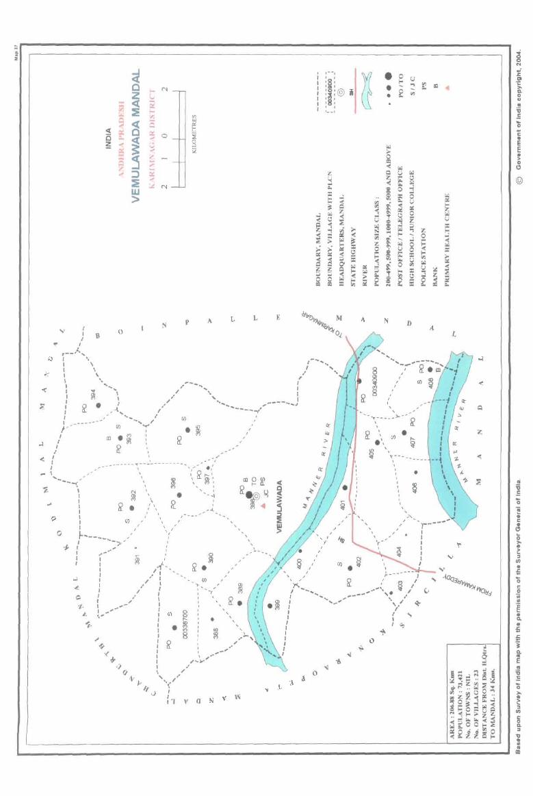
... " a. i
o
\ 1 I 1 1 I I 1
~ Z
"" <C F;J :E ~ ~ ~ tt 0
~ ~ ~
~ ~ ~ ::) ~ W >
f-< N i.I ~ I-; "l .... Q
$ 0 cj ~ z; .... ~ .....
~ N
Vl
~ ~
9 i;l
p
, _/
I ~ ... J ... ----_ ... _-'"\_ .. _-----_ ..... - ..... ,..-'; . .'
\ , ~,....,
('oj
~ ~ •
(/)
\ ~ \ ~: , , I , ' \
I I
I
, I
~
, , ' ,
I I
• I _ - I
0
!?l ~ •
(/) -,., ,
I - , '/ , ,
, ,
L
,
,
, ,
, ,
, I
, ,
,
(J)
III ~. , ,
• , , ,
a
L
, I
E
,- -.
~ • 0 I r U
'8' ... ... III
''''' • =-l @ i • ~ III , , I , , , 1 __ 1
A N D
, "\ ........... ----
, , .-~
, I
(/) I ,
, ,
, , I I I
, I
, ,", , ,
•
I , , , ~,' ,"' ...... , .,. ....... ,,,,. .~ I '.... ,---J '"........... to" ~. ~ I '. ~~ I I I ,
( ~/~ I ,
I I
o
III
L
z
-<
c • E c ~ ". o C)
@
" '6 .E ... o ~ • c • Cl ... o >• ~ ;,
tIJ
• ;; '0 c o
OJ III
g • Q.
• = = "i iE .. '6 .E '0 "" • t:: '" III
a D. :I 1I .. II
" III
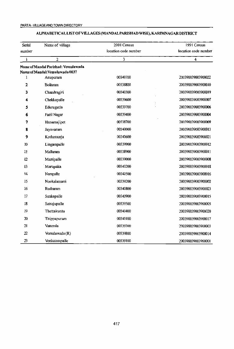
PART A- VlLLAGEAND TOWN DIRECTORY
ALPHABETICAL LIST OF VILLAGES (MANDALPARISHAD WISE),KARIMNAGARDISTRICT
Serial Name of village 2001 Census 1991 Census
number location code number location code number
1 2 3 4
Name of Mandai Parishad: Vemulawada Name of Mandai: Vemulawada 0037
1 Anupuram 00340700 200390039003900022
2 Bollaram 00338800 200390039003900010
3 Cbandragiri 00340300 200390039003900019
4 ChekkapaUe 00339600 200390039003900007
S Edurugatla 00339700 200390039003900006
6 FaziiNagar 00339400 200390039003900004
7 Hanumajipet 00338700 200390039003900009
8 Jayavaram 00340000 200390039003900013
9 Kodumunja 00340600 200390039003900021
10 Lingampalle 00339900 200390039003900012
11 Mallaram 00338900 200390039003900011
12 Marripalle 00339000 200390039003900008
13 Marupaka 00340200 200390039003900018
14 NampaJle 00340500 200390039003900016
15 Nookalamarri 00339200 200390039003900002
16 Rudraram 00340800 200390039003900023
17 SankepalJe 00340900 200390039003900015
18 Satrajupalle 00339500 200390039003900005
19 Thettakunta 00340400 200390039003900020
20 Thippapuram 00340100 200390039003900017
21 Vatternla 00339300 200390039003900003
22 Vemulawada (R) 00339800 200390039003900014
23 Venkatampalle 00339100 20039003900390000 I
417

I 0
is 'Ui" <) " iil 8
.:: g ;§_
] U II> co 8 ~ 0
&ll '> C!-u " IS ~ il
.8 'ta ~ ':;: "3 ~ ..
8: .... ~ 1:1 0
ftl ., ~
'3 '3 ·c u 0 0 til I-< I-<
1 2 3 4
MandaI Parishad: Vtmulawada (0037)
Hanwnajipet 650.0 2,389
(003387oo)
Bollanun 2 328.0 656
(00338800)
Mallamm 3 624.0 1,914
(00338900)
4 Marripalle
3133.0 4,400 (00339000)
Venkatampalle 161.0 384
(00339100)
6 Nookalamarri
1753.0 3,859 (00339200)
7 Vattemla
1003.0 2,799 (00339300)
Fazil Nagar 8 732.0 2,072
(00339400)
9 Satrajupalle
1198.0 3.532 (00339500)
ChdIkapalle 10 620.0 1,640
(00339600)
II &lurugatla (00339700)
254.0 868
DISTRICT CENSUS HANDBOOK: KARIM NAGAR
Census of India 2001 -Amenities and
Amenities available (if not available within the village, a dash (-) is shown in the column and next to it in brackets the distance in broad ranges viz. < 5 kms., 5-10 kms. and 1 ()+ kms of the
-;;;- nearest 1llace where the facilitv is available is_given) iil fl "" ",,0-U l;j 0..2
'.c ... ,; - .. ~ ~ ~e <> 0 6 .~ ~ 0 .::: C!- .g_ i <l'!8. "3
~ " c> ftltll ~ ~ 1! ~ '~ ., E":~
.:: "" , .~ _ftl~ e~ :! !i3 ." ::: " 8 ~ '1: ., ;c: =
o ._
&ll~~ ::: -0 t; ..c iii ::: g o '" .::
~ Q. - ., .::: 0
~ ia ~ ia ],:a 1>~ .. "D
15 Ii .~ Z! t "" i .12 "iii ~ .~ ] i " - e OJ 8 .D e <II = <> e ~ § <> 11 'iii s""'" .~ t ~ I):os 8 ~ =' ~D:l Z ~ -~ ~ 82 <~ 8] ~tIl
5 6 7 g 9 10 11 12 13
RMP(4) NCS(4)
PM S AC H(S-10) CV(5-IO) BS RS(IO+) 547 C(S-IO) THP PO PH CM{S-IO) ACS«5) MCW(S-IO) SP(IO+) NW(IO+)
PHC(S-IO) CP(S-IO) OCS(5-10)
ST(IO+)
PAC RMPH(IO+) NCS(3) 162 M«S) MCW(lO+) THP PO« 5) CM(IO+) ACS« 5)
CV(IO+} BS« S}
C(IO+) PHC(IO+) PH« 5) CP(IO+) OCS(IO+) SP(IO+) RS(IO+) ST(IO+) NW(IO+)
PHSRMP ACS(2)
448 P(2) M AC H(5-IO) CV(S-IO) as RS(IO+) THPW POPH(7) CM(5-1O) NCS(3)
C(IO+) MCW(S-IO) CP(S-IO) OCS(S-IO)
SP(IO+) NW(IO+) PHC(S-IO) ST(JO+)
PHSRMP(lO) NCS(3)
995 P(5) M(2) S H(S-IO)
THPW PO PH CM(5-10) ACS«5) CV(S-IO) as RS(IO+)
AC(3) C(IO+) MCW(S-IO) CP(5-10) OCS(S-IO)
SP(IO+) NW(IO+) PHC(S-IO) ST(IO+)
RMP
92 PM«S) H(S·IO) THPW PO«5) CM(IO+)
ACS« 5) CV(IO+) BS RS(IO+) C(lQ+) MCW(S-IO)
PH(lO+) CP(IO+) NCS(IO+) SP(IO+) NW(IO+)
PHC(S-IO) OCS(IO+) ST(IO+)
PHS RMP(6) ACS
P(2) M(Z) S H(S-IO) THPW
PO CM(5-10) NCS(S)
CV(5-IO) BS RS(IO+) 858 AC(2)C(10+) MCW{S-IO) PH(S-IO)
CP(5-IO) OCS(S-IO) Sp(IO+) NW(IO+}
PHC(tO+) ST(IO+)
PHSRMP(5} ACS
661 PM S AC H(5-10)
THPW PO PH(4) CM
NCS(4) CV(5-tO) BS RS(IO+)
C(IO+) MCW(S-IO) CP(5-10) OCS(5-10)
SP(IO+) NW(IO+) PHC(S-IO) ST(IO+)
RMP(4) NCS(2)
455 P(Z) M AC H(IO+) PO CV(IO+) BSRS(IO+) THPW CM«5) ACS(IO+)
C(IO+) MCW(IO+) PH« 5) CP(IO+) OCS(IO+)
SP{IO+) NW(IO+)
PHC(IO+) ST(IO+)
PHSRMP(5) ACS
P(4) M S H«S) THPW PO PH(20) CM« 5) NCS(3) CV«S) aSRS(IO+)
839 ACC(IO+) MCW«S) CP« 5) OCS« 5)
Sp{IO+) NW(IO+)
PHC« 5) ST(IO+)
RMP(5) NCS{J)
PM AC H(S-IO) PO CV(5-l0) BS RS(IO+) 376 C(lO+) THPW CM(5-10) ACS« 5)
MCW(S-W) PH(S-IO) ep(5-10) OCS(S-IO)
SP(IO+) NW(JO+)
PHC(S-IO) ST(IO+)
RMPH«S) pO NCS CV«5) as RS(IO+)
224 P M«5)
MCW«5) THP eM« 5) ACS« 5) C(S-IO}
PHC« 5) PH« 5)
CP« 5) OCS« 5) SP(IO+) NW(IO+) ST(lO+)
418
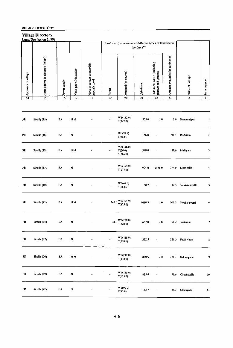
VILLAGE DIRECTORY
Villaee Directory Land Use (As on 1999)
Land use (i.e. area under different types of land use in hectare)··
i c 0 .~
g ~ co ,. ~
'D
i :a '3 0 ::s " .. e u ... ., . ~ e I .5 ';;;' .a
co :e 0 ~ ., .. ~ ~ <> ., >
~ .,
~ d/J ~"E 0
.. 0 co
~ '" ~ !;o ~ ~ 1l 9 i ~ e -0 :'-0 ,. ~ .Cl C. ~ 8.2 ~ ..2 ~ '" § a '" ~ ~ li! '0 ... " .5 ~ 0 '" .. liS Q. co c e j ~ ~ .. ::s .,
:§ E~ ..,
1iI Q.
~ ~ e "" - :l ~ ~ '1::
~ _& ~ & ] :5 ::s '" .., u OIl til
14 15 16 17 18 19 20 21 22 23 2 1
PR Sircilla (15) EA NM WE(142.0}
505.0 1.0 2.0 Hanumajipet T(142.0)
PR Sircilla (IS) EA N WE(90.0)
156.S 1!L2 Bollaram 2 T(90.0)
WE(166.0)
PR Sircilla (23) EA NM 0(20.0) 349.0 89.0 Mallaram 3 T(186.0)
PR Sircilla ( 17) EA N WE(171.0}
994.0 1588.0 374.0 Marripalle 4 T(177.0)
PR Sircilla (10) EA N WE(68.0}
1(68.0) 80.7 12.3 Venkatampalle S
PR Sircilla (12) EA NM 2430 WE(17S.0} . T(175.0)
1030.7 1.0 303.3 Nookalamarri 6
PR Sircilla (15) EA N 51 0 WE(228.0} . T(228.0)
667.8 2.0 54.2 Vattemla 7
PR Sircilla ( 17) fA N WE(118.0)
T(1I8.0) 332.5 281.5 Fazil Nagar 8
PR Sircilla (20) fA NM WE(212.0)
T(212.0) 800.9 4.0 181.1 SaJrajupalle 9
PR Sircilla ( 19) lOA N WE(llS.O)
425.4 79.6 Cbekkapalle 10 T(II5.0)
PR Sircilla (22) EA N WE(900) 122.7 41.3 Edurugatla 11 T(90.0)
419
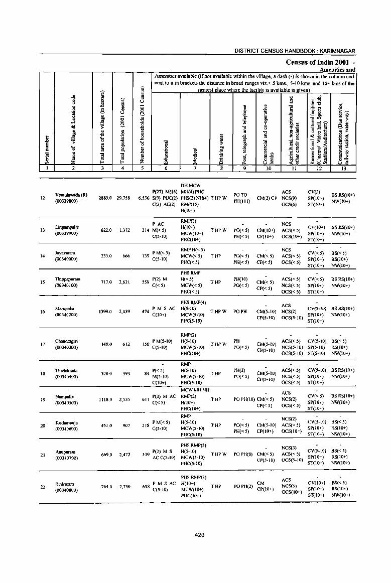
I .g 'tii' () iil ... 8 .8 " .. 'g .._, u ., .....
.! 0 ...l 0
cfd ~ c g, .. " "fl 0
.8 .. '.::1
~ .... '" 0
I ~ .. .... ~ g Q
-a u
~ ~ ~ ·c .. I--Vl
1 2 3 4
Vemulawada (R) 12
(00339800) 2889.0 29,758
I3 Lingampalle
622.0 1,372 (00339900)
Jayavaram 14 235.0 666
(00340000)
15 Thippapuram
717.0 2,621 (00340100)
16 Marupaka
1399.0 2,039 (00340200)
17 Chandragiri
140.0 612 (00340300)
18 Thettalrunta
370.0 393 (00340400)
19 Nampalle
1118.0 2,535 (00340500)
20 Kodumunja (00340600)
451.0 907
Anupuram 669.0 2,472 21
(00340700)
Rudraram 22
(00340800) 764.0 2,750
DISTRICT CENSUS HANDBOOK: KARIMNAGAR
Census of India 200t -Amenities and
Amenities available (if not available within the village, a dash (-) is shown in the column and next to it in brackets the distance in broad ranges viz.< 5 kms .• 5-10 kms. and 10+ kms of the
~ nearestQlace where the facility is available is I!;iven) ::l
'" 5 "0 .,.ri U Iii .. .2 .'" (.) oJ 0
., ... ~
., > :.:: rI) u 0 0 .=
'" 1: .~ >: C -= e ~&. Q,
8- 8 ]~~ '" ..
~ ..!! gJ ~ 2 'i' '5, '"
il "0 0 , .~ -a]§ E!1t;; tii '" .. :l= '" "" = .. '" 0 ·c ::l ~ -= Iii g 'g ~~~
., -0 !l ·il 8 -= t ]~ .... -a -a 01>::1 5 "J:! 0 g " "g g « '§ ;l ~ ] ""
., .",";;j~ '.r: c 11 - .. .0 .. :j 6 '"
::I t> oS e ~ ~ § C> :;:; of ~1 "~ ~ e U ;a 8] ~ ~ 8 ~ab1 Z £ ~~
5 6 7 8 9 10 11 12 13
DHMCW P(27) M(16) MH(4)PHC
PO TO ACS eV(3)
BSRS(IO+) 6,536 S(9) PUC(2) PHS(2) NH(4) T HP W
PH(lll) CM(2)CP NCS(9) SP(IO+)
NW(IO+) C(3) AC(2) RMP(I.5) OCS(6) ST(IO+)
H(IO+)
PAC RMP(3)
NCS 314 M«5)
H(IO+) THPW POC< 5) CM(IO+) ACS(<5)
CV(IO+) as RS(lO+)
C(S-IO) MCW(IO+)
PH«.5) CP(IO+) OCS(lO+) SP(IO+) NW(lO+)
PHC(IO+) ST(IO+)
P M«5) RMP H«5) NCS
CV« 5) BS« 5) 139 C(5-10) MCW«5) THP PO« 5) CM«5) ACS«5)
PHC{< 5) PH« 5} CP« 5) OCS« 5) SP(IO+) RS(IO+) ST(IO+) NW(IO+)
pHSkMp
559 P(2) M H«5) THP
PH(IO) CM«S}
ACS« 5) CV« 5) BS RS(IO+) C« S) MCW«.5) PO«.5)
CP« 5) NCS«S) SP(IO+) NW(IO+)
PHC« 5) OCS« 5) ST(IO+)
PHS RMP(4) ACS
474 PM S AC H(5-1O)
THPW PO PH CM(5-IO} NCS(2) CV(S-IO) BS RS(JO+)
C(IO+) MCW(S-to) SP(IO+) NW(lO+) PHc{S-IO)
CP(5-10) OCS(5-10) ST(IO+)
RMP(2)
150 P M(5-IO} H(5-10) THPW
PH CM(.5-W)
ACS« 5) CV(5-10) BS« S} C(5-10) MCW(S-IO) PO«S)
CP(S-IO) NCS(S-IO) SP(5-10) RS(IO+)
PHC(lO+) OCS(S-IO) ST(S-IO) NW(tO+)
RMP
P«S} H(S-IO) THP
PH(2) CM(S-tO)
ACS« 5) CV(S-to) BS RS(IO+) 84 M(S-IO) MCW(S-IO) PO« S)
CP(5-IO) NCS« 5) SP(lo+) NW{lO+}
C(IO+) PHC(5-10) OCS«5) ST(IO+)
MCWMHNH ACS
611 P(3) M AC RMP(2)
THP PO PH(lO} CM« 5) NCS(2) CV« 5) BS RS(lO+)
C«S) H(IO+) CP« S) OCS{< 5)
SP{lo+) NW(IO+} PHC(IO+} ST(IO+)
RMP NCS(2)
P M« 5) H(5-10) THP PO« S} CM(5-1O) ACS« 5)
CV(S-IO) BS« 5) 218 C(5-IO) MCW(5-10)
PH« S) CP(IO+} OCS(IO+) SP(IO+) RS(IO+)
PHC(S-lO) ST(lO+) NW(lO+)
PHS RMP(3} NCS(3} P(2} M S H(S-IO)
THPW PO PH(8) CM«5} ACS« S) CV(S-IO) BS« 5)
539 AC C(S-IO) MCW(5-10) SP(IO+) RS(IO+}
PHC(S-IO) CP(5-1O} OC5(5-10)
ST(IO+) NW(IO+)
PHS RMP(3} ACS
PM SAC H(lO+) THP PO PH(2)
CM NCS(S)
CV(IO+) as«5) 638 C(5-1O) MCW(IO+) Cp(IO+) SP(lO+) RS(IO+}
OCS(lo+) PHC(IO+) ST(IO+} NW(lO+}
420
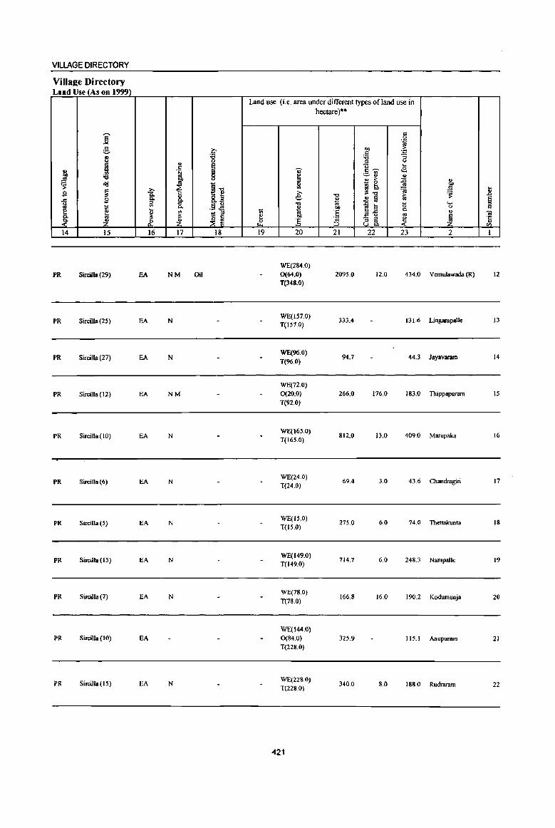
VILLAGE DIRECTORY
Villaee Directory Land Use (As on 1999)
Land use (i.e. area under different types of land use in hectare)··
i " 0 .= ., g ~
bQ > c .= .. '8 'i3 "3
~ " .E (.)
I ..
.~ U <J .E u c,....., .. ~U ~ ;e ~ II>
co .. > :c ~ ~ <l1l '" !] 0 ~ 0 ..!l!
~ '" ~ tb .!9 11 g ~ .0 e: "'" 'iij
~ C. -0 >
"'" .9 c. &. ~ ..!! 1ii ., § ~ iil '" .51 ~ "0 ""'a 0 ....
~ c. B bQ 0 C e ., tl ., 1;; ::I ~ .. :§ ~-u '" .,
01 c. ~ " ~ e co '" ~ ~[ - :> -~ ·c
~ & Z ~ ] :5 llg:, t) Ci"l
14 15 16 17 18 19 20 21 22 23 2 I
WE(284.0)
fR SirciIla (29) EA NM Oil 0(64.0) 2095.0 12.0 434.0 Vemulawada (R) 12
T(348.0)
PR SirciUa (2S) EA N WE(IS7.0)
333.4 131.6 Lingampldle 13 T(IS7.0)
fR Sircilla (27) EA N WE(96.0)
94.7 44.3 Jayavarun 14 T(96.0)
WE(72.0)
PR SirciIla (12) EA NM 0(20.0) 266.0 176.0 183.0 Thippapuram IS
T(92.0)
PR SirciIIa (10) EA N WE(16S.0)
812.0 13.0 409.0 Marupaka 16 T(16S.0)
PR Sircilla (6) EA N WE(24.0)
69.4 3.0 43.6 Chandragiri 17 T(24.0)
PR Sircilla (5) EA N WE(IS.O)
275.0 6.0 74.0 Thettakunta 18 T(I5.0)
PR Sircilla (15) EA N WE(149.0)
714.7 6.0 248.3 NampaIle 19 T(149.0)
PR Sircilla (7) EA N WE(78 0)
166.8 16.0 190.2 Kodumunja 20 T(78.0)
W£(I44.0)
PR Sircilla (10) EA 0(84.0) 325.9 IIS.I Anupuram 21 T{228.0)
PR Sircilla (15) EA N WE(228.0)
T{228.0) 340.0 8.0 188.0 Rudraram 22
421
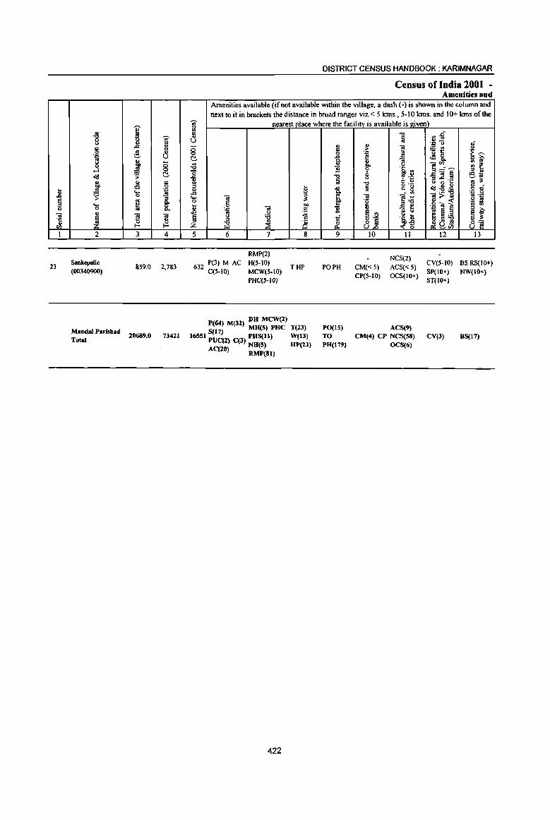
.8 § C
1il ·c u en I
23
., -c 0 Q .. 0 .l'I .. g
....l o"i:! ., "" ..5 ~ .... 0 u
! 2
Sankcpalle (00340900)
Maudal Parishad Total
j ';;'
~ ::s ..c: ..
1:1
~ ., U
'" 1 <5 <:>
~ N ......
'" .. oS 0
.~
~ -3 ~ 0.
8.
~ ~ 3 4
859.0 2,183
20689.0 73411
DISTRICT CENSUS HANDBOOK: KARIMNAGAR
Census of India 2001 -Amenities and
Amenities available (if not available within the village, a dash (-) is shown in the column and next to it in brackets the distance in broad ranges viz. < 5 krns., 5-10 Ians. and 10+ Ians of the
';;' nearest place where the facility is available is given) 1il .. ., U <5 0 C ~ a .... ., <II ::l _g ~
10 ..... -; 3! 0 C
~ 0 ..
. .0 1il
~ '" (.)
§ <> 'i3
ili ~ is z 5 6 7 8
632 P(3) M AC C(S-IO)
RMP(2) H(S-lO)
MCW(S-IO)
PHC('-IO)
THP
DH MCW(2) P(64) M(32) MU(5) PUC T(23) 5(11)
16551 PUC(2) C(3) PHS(ll) W(13) AC(20) NH(S) HP(l3)
RMP(81)
422
., 1:1 0 .... 0. .,
11 -0 fa
..c:
~ u
'B
1 9
PO PH
PO(IS)
TO PH(179)
rl~ -c fa .~ u ., ] ~t! ;-
.~ t.!!& " a 0. ] ~-~ ~ .5, <II
=]~ u tp 4~ 1:1 ., <J 0·': -0 ~.~ o"i:!~~ a
til ]~ ];;>~ 4a ·~l ] u e ~ !j ·Eb ~ 2! c:a ~as .('] ~ en
10 11 12
CM« 5) CP(S-IO)
NCS(2) ACS« 5) eV(5-IO)
OCS(IO+) SP(IO+)
ACS(9) CM(4) CP NCS(S8)
OCS(6)
ST(JO+)
eV(3)
,; u ·E ~ ~ ~ '" ~ .. .. ~~ .. o c· . .0 0 ~ .~ .~ s .. <II
~ ~ 8~
13
BS RS(IO+)
NW(JO+)
BS(17)
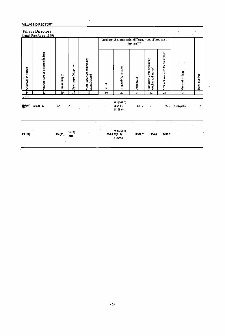
VILLAGE DIRECTORY
Village Directory Land Use (As on 1999)
14 15
IJ?': Sircilla (22)
PR(21)
16
EA
EA(23)
17
N
N(22)
M(6)
18
Land use (i.e. area under different types ofland use in hectare)"
19 20 21 22 23 2
WE(103.0) 0(25.0) T(l28.0)
603.2 127.9 Sankepalle
WE(3096) 294.0 0(213)
T(3309)
423
11561.7 1836.0 3688.3
23
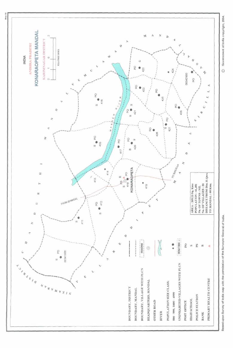
" ~ .. i
_. < N
C .... Z ;..
:= < C2 ~ :e t'" r..l VJ Q
~ ....
«" Q
S c:. a: ~ W of Q
i D. \.'l ~
~ ~ l:
~ :? .... ~ :i a:
~ ~
~ / "', ,.
I I
/ .-
\, r I I I I I I I I I
J ,
,.,----~ ... --('"
I I \ \ \
'\ \
\ ,
.. , ,,_-...
_-
" _-'"
.~ '" en
.~ If)
, ,-..... ..
\ \
, ,
( ......... \ '---, I
\ 'I I "t \ " t-__ , I
I • _ _ I
I --.-________ I I I __ y<.. I
" I '. , I " ,/ fZ j;( / ' • .'
• 0 I ~ " • I I ,,,<," en 8 .-,/
~ '\, /' u
r '-... "
.,. ....... ----.. - I « ....... - ~ ~tq ''\. q )' (i
"JtrY;{lN
.' I
~
A N D
." r_ _~'" I ~-... __ \",.,. ~"'...,- ... ( ~ ..
C/)
N .. III
en
, ,
,
, , , I
"\
....... I
" I , ... -~ I ........
I "
~.' .\. • or,' § '"
I : N ~ I --, ..... ----- I Eo ,:
-. '-f \
!r • ~ " v,
I
I \ I I \
\ \
I
, ,
, /
I I I , r
~. \,/ "" 1
"
.... ' N f .;" .. , i"-<~·\ , \ ~ \ \
I , I : • 1-_____ '- __ _
1,00 ~ " S>. I" I
----r----"',
... - , "',
o N
ID ..
, CD, I
-"', ~ \ : \ , I '- ,
, I " I ,
, I I , I I ',~ I
....... _1 ......... .,.,"
I "...L _- ...... _ .....
~
I ~ I
I
I ,
"',..- ... _ ... _ ,"-, -----,-" \ , \
' \
•
~ i , ... -, , , I :1: I , , @ I , , I :g: I I
, , L __
\ \ I
. .-
• •
, x, ' ~ ' r; ' ,
~ '" , , : ~ : :8: L_ ,
~ s: ~ i
IIi1

PART A -VILtAGEAND TOWN DIRECTORY
ALPHABETICAL LIST OF VILLAGES (MANDALPARISHAD WISE), KARIMNAGAR DISTRICf
Serial Name of village
number
2
Name of Mandai Parishad: Konaraopeta Name of Mandai : Konaraopeta 0038
I Bausaipeta
2 Dhannaram
3 Kanagarthi
4 Kolanur
5 Konaraopet
6 Kondapuram (PR)
7 Lachchapeta
• MaJkapet
9 Mamidipalle
10 Marrimadla
11 Marthanpet
12 Nagaram
13 Nimmapalle
14 Nizamabad
15 Palle (Makta)
16 Ramannapet
17 Sivangalapalle
18 Suddala
19 Vattimalla
20 Venkatraopeta
2001 Census
location code number
3
00341500
00342700
00342100
00342900
00341800
00341400
00341300
00342600
00341600
00341000
00342800
00342500
00341200
00342000
00342200
00342400
00341900
00342300
00341100
00341700
425
1991 Census
location code number
4
200400040004000006
2004000400040000 18
2004000400040000 12
200400040004000020
200400040004000009
20040004000400005
200400040004000004
2004000400040000 17
200400040004000007
2004000400040000 1
2004000400040000 19
2004000400040000 16
20040004000400003
2004000400040000 II
2004000400040000 13
2004000400040000 15
200400040004000010
2004000400040000 14
200400040004000002
200400040004000008
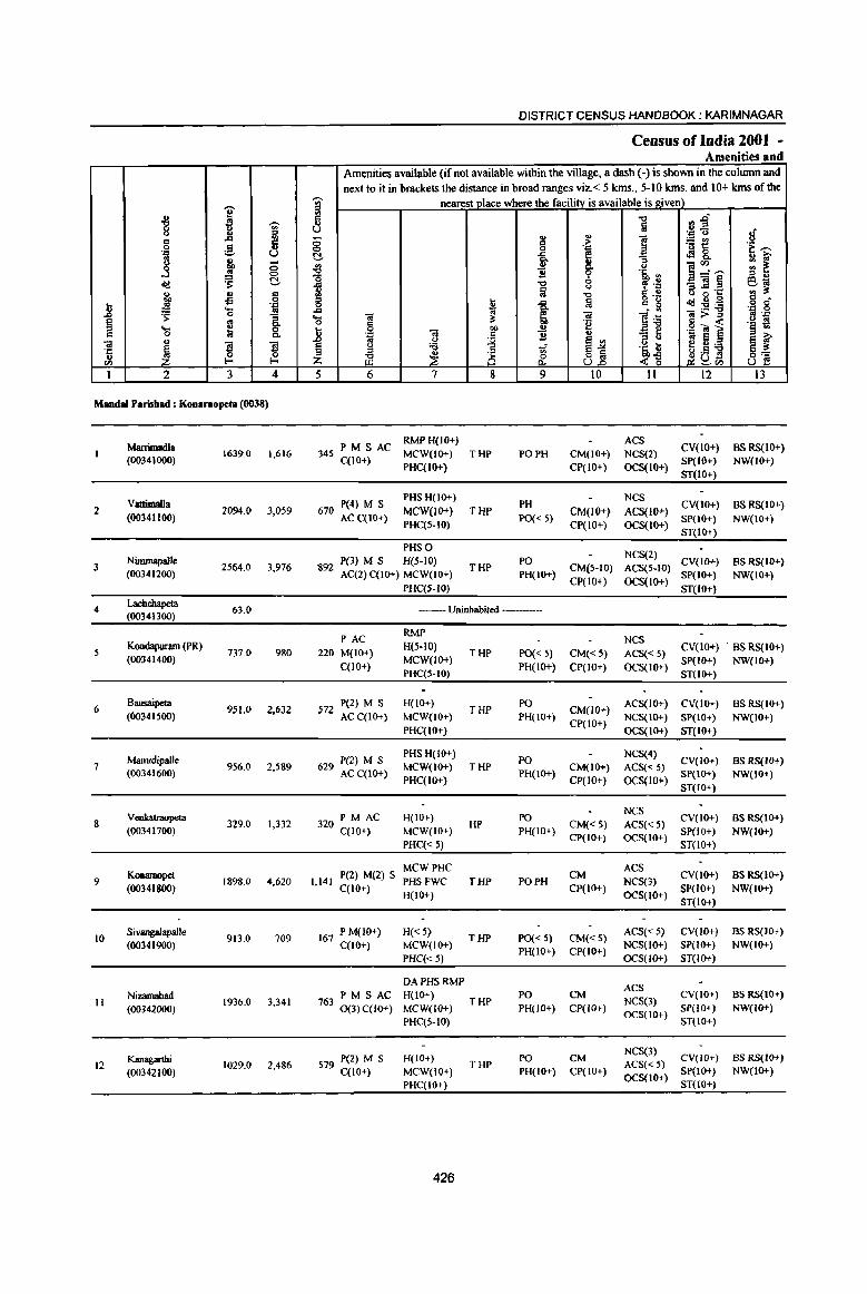
i " "8 .8 'UI' iil
<= ,§, ti 0
'J:! u
~ .. ;; ! 0
eli:! 'S: !::!. u .£l .. .. 0
.8 .!! .= .... -3 'S 0
§ :l C-.... 0 Q 0 iii C-
u <iI
~ 5 5 ·c
II 0 0 til !-< !-<
1 2 3 4
Mandai Parishad : Kon.nopeta (0038)
Marrimadla 1639.0 1,616
(00341000)
Vattimalla 2 2094.0 3,059
(00341100)
3 Nimmapalle
2564,0 3,976 (00341200)
4 Lachchapeta
63,0 (00341300)
5 Kondapmam (PR)
737.0 980 (00341400)
6 Bausaipeta
951.Q 2,632 (00341500)
Mamidipaile 7 956.0 2,589
(00341600)
Veokatrnopeta 8 329,0 1,332
(00341700)
Konaraopet 9 1898.0 4,620
(00341800)
10 Sivangalapalle
913,0 709 (00341900)
Nizamabad II
(00342000) 1936,0 3,341
Kanagarthi 12 1029,0 2,486
(00342100)
DISTRICT CENSUS HANDBOOK: KARIMNAGAR
Census of India 2001 -Amenities and
Amenities available (if nQt available within the village, a dash (-) is shown in the column and next to it in brackets the distance in broad ranges viz.< 5 kms" 5-10 kms, and 10+ kms of the
'UI' nearest place where the facility is available is given) ::s
~ -0 .,.0 !ij u.E!
tf '" '" J '= ()
8 .. > ;;:~ 'f ~ 0 '= oS&, !::!. .c G ., iO' ~ ~~.~ :: ~ {l 1l
Q.
'0 ~ '5, ., ::s .,
1 -0 cp .~ _<il§ S1ii ~
() 8"6 'g ., if -0 Q "
6 11 !ij g •. ~ ... 1 eIi:!:E:a o c
.c (;j .= 0 .... OJ i!: <iI ]~ ~>~ '" 'J:j o c 'e .~ ~ .8 0 OIl
., .g Os ] '::I "3 ~ 1l ., -= ~ ~ ~ ... ~j ~5] § u 'B iif '~ t; ::s 8 o .5 8] Jl ~ &. <~ f}.u Z ~tIl
5 6 7 8 9 10 11 12 13
PM S AC RMPH(IO+) ACS
CV(IO+) BS RS(IO+) 345 MCW(lO+) THP PO PH CM(IO+) NCS(2)
C(lO+) PHC(IO+) CP(IO+) OCS(IO+)
Sp(IO+) NW(lO+)
ST(lo+)
670 P(4) M S PHS H(IO+)
PH NCS
CV(IO+) BS RS(IO+) MCW(lO+} THP CM(IO+} ACS(lo+)
AC C(lO+) PHC(5-10)
PO« 5) CP(lO+) OCS(IO+)
SP(IO+) NW(IO+)
ST(IO+)
PHS 0 NCS(2)
892 P(3) M S H(5-10)
THP PO
CM(5-10) ACS(5·1O) CV(IG+) BSRS(IO+)
AC(2) C(10+) MCW(IO+) PH(IO+) CP(IO+) OCS(lO+)
SP(IO+) NW(IO+) PHC(S-IO) ST(IO+}
--Uninhabited ---
PAC RMP
NCS 220 M(IO+)
H(5-10) THP PO« 5) CM«5) ACS« 5)
CV(IO+) BS RS(10+)
C(10+) MCW(JO+)
PH(IO+) CP(IO+) OCS(IO+) SP(lO+) NW(IO+)
PHC(5-10) ST(IO+)
572 P(2) M S H(IO+) THP
PO CM(lO+}
ACS(lO+) CV(IO+) BS RS(IO+) ACC(lO+) MCW(lO+) PH(IO+)
CP(IO+) NCS(IO+) SP(lO+) NW(IO+)
PHC(lO+) OCS(IO+) ST(IO+)
629 P(2) M S PHS H(10+)
PO NCS(4)
CV(lo+) BS RS(JO+) MCW(IO+) THP CM(IO+) ACS« 5)
AC C(IO+) PHC(IO+}
PH(IO+) CP(IO+) OCS(IO+)
SP(IO+) NW(IO+)
ST(IO+)
320 PM AC H(IO+) PO NCS
CV(IO+) BS RS(IO+) HP CM«S) ACS« 5)
C(lO+) MCW(lO+) PH(IO+) CP(tO+) OCS(to+)
Sp(IO+) NW(lO+)
PHC« 5) ST(IO+)
P(2) M(2) S MCWPHC
CM ACS
CV(lO+) BS RS(IO+) 1,141 PHSFWC THP PO PH NCS(3)
C(lO+) H(IO+)
Cp(lO+) OCS(lO+)
SP(IO+) NW(IO+) ST(IO+)
167 P M(IO+) H«5) THP PO« 5) CM«S)
ACS« 5) CV(JO+) BS RS(lO+)
C(lO+) MCW(IO+) PH(IO+) CP(IO+)
NCS(lo+) SP(IO+) NW(lO+)
PHC«5) OCS(IO+) ST(IO+)
DAPHSRMP ACS
PM S AC H(IO+) THP
PO CM NCS(3)
CV(IO+) BS RS(lO+) 7630(3)C(10+) MCW(J()+) PH(IO+) Cp(IO+) SP(lO+) NW(IO+)
PHC(5-IO) OCS(IO+)
ST(IO+)
579 P(2) M S H(IO+) PO CM NCS(3)
CV(tO+) BS RS(IO+) THP ACS« 5)
C(10+) MCW(IO+) PH(IO+) CP(IO+) OCS(IO+)
SP(IO+) NW(IO+)
PHC(IO+) ST(lO+)
426
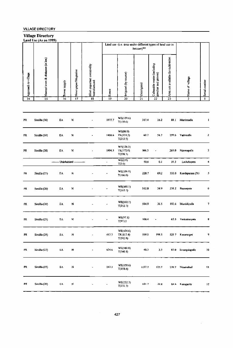
VILlAGE DIRECTORY
ViIlaee Directory Land Use (As on 1999)
Land use (i.e. area under different types of land use in hectare)"
j d 0 .:;::
;3. ~ "" ~ d
.:;::
8 '6 '6 "3
" 0 '" '" ~ ~ u ... .. '" . ~ Q)' .9 -;;- .s
"" :a 0 ~
~ ., " !:l ~ 0 ., > ~ ~ 'S <I!I
~1l £ - 0 » I :l !;b
~ .. ] j e :s:.", == 2 ]: -.j ~ '$
-5 .s o .s ~ .!l [ij ~ 1il '" 0. ... -.j
1~ a ....
lIS 1;; Q. .5.!! .. "" 0 d e M u ., ti ~ 'E c ., - '" '" .. 0.
'" '" ~ ~ e bI)
~ - '" .. ~. ~- '6 ~ Z ~ Z .2 ] '" II:! Ubi) <Il
14 15 16 17 18 19 20 21 22 23 2 1
PR SirciJla (38) EA N 1077.7 WE(139.6}
317.4 16.2 88.1 Marrimadla T(139.6)
WE(80.9)
PR Sircilla (30) EA N 1466.6 TK(131.5) 60.7 54.7 299.6 VattimaJla 2
T(112.5)
WE(J26.3)
PR Sircilia (28) EA N 1494.5 TK(I72.0) 506.3 265.0 Nimmapalle 3 T(29S.3)
-- Uninhabited ---WE(2.0}
50.6 T(2.0)
0.1 10.3 Lacbchapeta 4
PR Sircilla (27) EA N WE(106.0)
228.7 69.2 333.0 Kondapuram (Pr) 5 T(106.0)
PR SirciJla (28) EA N WE(16S.I)
512.8 34.9 238.2 Bausaipeta 6 T(165.1)
PR SirciJla (20) EA N WE(212.1)
514.9 36.5 192.6 Mamidipalle 7 T(212.1)
PR Sircilla (23) EA N WE(97.1}
168.4 63.5 Venkatraopeta 8 T(97.1)
WE(124.6)
PR Sircilla (20) EA N 413.3 TK(1I7.4) S 18.5 198.5 525.7 Konarnopet 9 T(2420)
PR Sircilla (23) EA N 634.6 WE(140.8}
48.3 2.3 87.0 Sivangalapalle 10 T(140 8)
PR Sircilla (15) EA N 243.3 WE(158.6)
1\37.7 125.7 270.7 Nizamabad Il T(ISS.6)
PR Sircilla(20) EA N WE(232.3}
691.7 20.4 84.6 KBnagarthi 12 T(232.3)
427
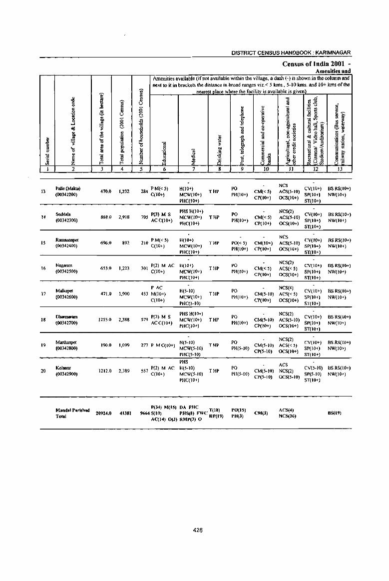
1l ~
01 '5 ell
I
13
14
15
16
17
18
19
20
] c 0
] cId ... :If ~ ... 0 u
~ 2
Palle (Makta)
(OO342200)
Suddala (003423oo)
Ramannapet (00342400)
Nagaram (00342500)
MaJkapet (00342600)
Dbarmaram (00342700)
Marthanpet (00342800)
Kolanur (00342900)
MandaI Parisbad Total
I j il -! U .,
OIl :; .!! 0
'S C!-... s is Oil ... 0 ;; .. ~ 8: S ~ 0 f- f-
3 4
470.0 1,232
868.0 2,918
6%.0 892
653.0 1,223
471.0 1,900
1255.0 2,388
190,0 1,099
1212.0 2,389
20924.0 41381
DISTRICT CENSUS HANDBOOK: KARIMNAGAR
Census of India 2001 -Amenities and
Amenities available (if not available within the village, a dash (-) is shown in the column and next to it in brackets the distance in broad ranges viz,< 5 kms,. 5-10 kms, and 10+ kms of the
'U;' nearest place where the facilitv is available is given) iil c: ... u ;:; <=> C!-~ '0 il VI
'" t 0
"'" 1;; ... iii 0 ~
u 8 .. .. . ., ~ § .. u
t) 'i3 z ~ ~ i§ 5 6 7 8
284 PM« 5) H(1O+) THP
C(lO+) MCW(IO+) PHC(IO+}
7 P(3) M S PHS H(IO+) MCW(IO+) THP 05 ACqIO+} PHC(IO+)
210 PM«5) H(IO+) THP
C(IO+) MCW(IO+) PHC(IO+)
P(2) M AC H(IO+) 301 THP
C(lO+) MCW(IO+) PHC(IO+)
PAC H(5-10)
453 M(lO+} THP C(lO+)
MCW(IO+) PHC(S-IO)
579 P(3) M S PHS H(lO+) MCW(JO+) THP
ACC(IO+) PHC{IO+)
H(S·to) 277 P M C(IO+)
MCW(S-IO) THP
PHC(5-10)
PHS
557 P(2) MAC H(5-10) THP
C(1O+) MCW(S-to) PHC(IO+)
P(34) M(lS) DA PHC T(18) 9664 S(10) PUS(8) FWC HP(19)
AC(I4} 0(3) RMP(J) 0
428
.., §
"'" Co
" 1l "'t:l
a "'" ~ lib
..!! .2 '!if rf 9
PO PH(JO+)
PO PH(lo+)
PO« 5) PH(IO+)
PO
PH(IO+)
PO PH(IO+}
PO
PH(IO+)
PO PH(5-10)
PO PH(S-IO)
PO(I5) PH(3)
u ;>
'~ 0.. 'i' 0 u
"tl a 01 'e u
jj )0
CM«S) CP(lO+)
CM«5) CP(IO+)
CM(lo+) Cp(IO+)
CM«S) CP(IO+)
CM(5-IO)
CP(IO+)
CM(5-JO) CP{IO+)
CM(5-10) CP(S-IO)
CM(S-IO) CP(5-10)
CM(3)
" 16 ] ;; u '§, '" , .~ c: ., o ._ c: g . '" ] .~
"3~ .~ U .c'-g
11
NCS ACS(5-10)
OCS(IO+)
NCS(2) ACS(5-IO) OCS(IO+)
NCS ACS(5-10) OCS(IO+)
NCS(2) ACS{<5) OCS(10+)
NCS(4)
ACS«5) OCS(IO+)
NCS(2) ACS(S·JO) OCS{IO+)
NCS(2) ACS« 5) OCS(IO+)
ACS NCS(2) OCS(5-10)
ACS(4) NCS(36)
U3.g .~ C3
iit! .f!8. ]~~ - .. ~ B ~ 'c::
<1<:1 u 0 ;g~
~>~ '., ., ] .. e eu'i3
J!6Jl 12
CV(IO+) SP(IO+)
ST(IO+)
CV(IO+) SP(IO+) ST(IO+)
CV(IO+) SP(IO+) ST(IO+)
CV(IO+)
Sp(IO+) ST(IO+)
CV(IO+) SP(IO+)
ST(IO+)
CV(JO+) SP(10+) ST(IO+)
CV(JO+) SP(10+) ST(lO+)
CV(S-IO) SP(S-IO) ST(IO+)
8 '~ ~ ; ~ e;-~ c o c
.::: 0
r~ e ~ e ~ 8'2
13
BS RS(IO+) NW(IO+)
BSRS(IO+) NW(IO+}
BSRS(JO+) NW(IO+)
BS RS(IO+) NW{lo+)
BS RS(IO+) NW(JO+)
BSRS(IO+) NW(IO+)
BS RS(IO+) NW(10+)
BS RS(lo+) NW(IO+)
8S(19)
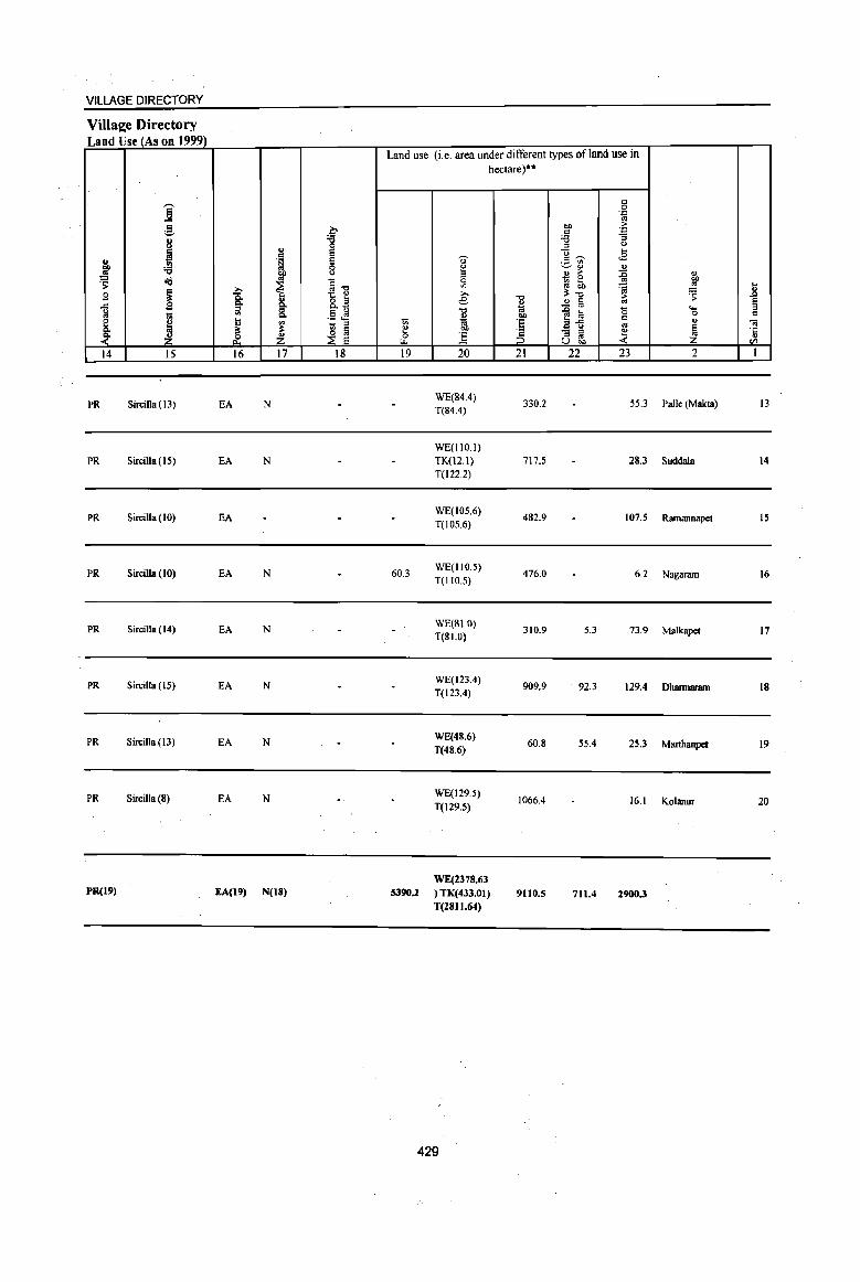
PR(l9) EA(l9) N(lS) WE(2378.63
5390.2 ) TK( 433.01) T(281l.64)
429
9110.5 711.4 2900.3
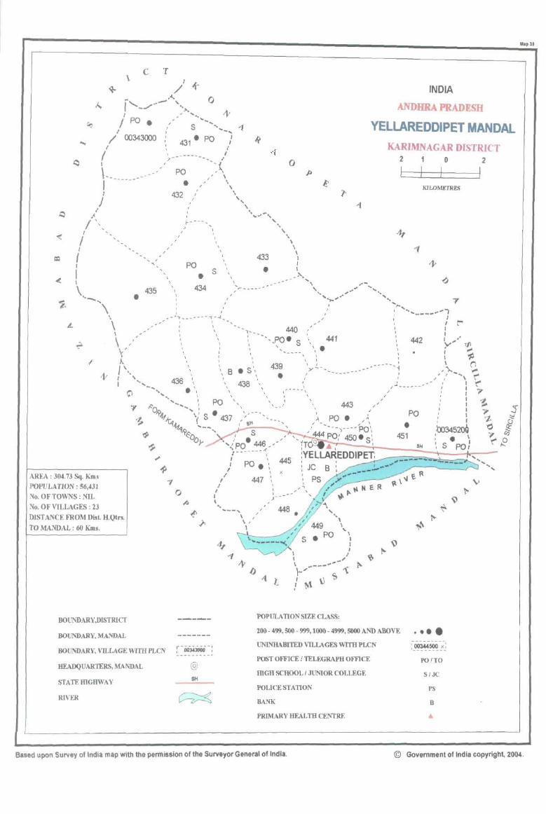
c T
/1 + \
- ..... I ,-........ ~- ' .. ,._ 1 ' ... <lr I po. ,'~ ........ ",
I : S ...... _ .. <'{
o
/ 00343000 : . \ , I
I , >- o
)-------------I
/
I
.. . ~ j\
/ I
( I
I I
\ '_,
"
, I ... ,
435 • \
,
,
I I
, \ ,
PO
• 432
,
, J
I ,
1-----, J '
J "
J
\
, I
PO
• 434
, ,
S
\ ,
I I
, , ,
\
433
• .... ~~----,-.
I ,
,'--;'.-----~-~,~
'.
\ \ , , ,
I , , , , \ I \ ,
440 ---,PO. S , , 441
'. .
AREA: 304.73 Sq. Kms POPULATION: 56,431 ~o. OF TOWNS: NIL
\' , '" '., 439
• 1\. \, '. B • S"-\ ,
: ' .. , 436 '. '. 438' -.... . '. \ \
""'.... \ \ ~ '..... PO', "', /
O"'{f 11-. "'\(: s • 437 \. --. ""fA.. " St' ''71?, '--.. j_.;~---
--,
7 o
~~b,_ ,I. S446 ,I' r '<PO _' r-------;
: PO.' 445 , \ x
" 447 " I ' I : t )--
~o. OF VILLAGES: 23 DISTANCE FROM Disl H.Qtrs. TO MANDAL : 60 KIDs.
.. ... _-,
\ , \ I
,>'------------
\ , \ I
A
443
PO •
"\ , ",
\
" \ I I I
I J I _'" \ .,.---.,.'" \-... 1 , \) ~ !~
BOUNDARY,DISTRICf ----- POPULATION sIZE CLASS:
INDIA
ANDHRA PRADESH
YELLAREDDIPET MANDAL KARIMNAGAR DISTRICT
J
I , I , I I
I I ,
2
L 1 o I I KIWMRTRES
442
/""'---,--'
PO
2
I
..... ... ...
BOUNDARY, MANDAL 200 - 499, 500 - 999.1000 - 4999. 5000 AND ABOVE •••• -------
r~~~~! UNINHABITED VD..LAGES WITH PLCN :_~~-;J
BOUNDARY, VILLAGE WITH PLCN POST omCE /TELEGRAPH OFFlCE PO ITO
HEADQUARTERS, MANDAL @ mGR SCHOOL / JUNIOR COLLEGE S/JC
STATEIDGHWAY SH
POLICE STATION PS
RIVER ~ BANK B
PRIMARY HEALm CENTRE
MapU
Based upon Survey of India map with the permission of the Surveyor General of India. © Government of India copyright, 2004.

PART A - VILLAGE AND TOWN DIRECTORY
ALPHABETICAL LIST OF VILLAGES (MANDALPARISHAD WISE), KARIMNAGARDISTRICT
Serial
nwnber
Name of village
2
Name of MandaI Parishad:: Yellareddipet
Name of MandaI: Yellareddipet 0039 I Adivipadira
2 Akkapalle
3 Almaspur
4 Bandalingampalle
S Boppapuram
6 Dumala
7 Grujanpalle
• Gollapalle
9 Gundaram (PR)
10 Kancherla
11 Korutlapet
12 Maddimalla
13 Narayanapur
14 Padira
15 Pothareddipalle
16 Rajannapet
17 Sarvaipalle
18 Singaram
19 Timmapuram
:J) Vanapalle
21 Veemapalle
22 Venkatapuram
23 Yellareddipeta
2001 Census
location code number
3
00343200
00344100
00344000
00344900
00344600
00344300
00343100
00343800
00343600
00343300
00344700
00343500
00345000
00345100
00344200
00343900
00344500
00344800
00343700
00343000
00343400
00345200
00344400
431
1991 Census
location code number
4
200410041004100003
200410041004100012
200410041004100011
200410041004100022
200410041004100018
200410041004100017
200410041004100002
200410041004100009
200410041004100007
200410041004100004
200410041004100019
200410041004100006
200410041004100016
200410041004100015
200410041004100013
200410041004100010
200410041004100020
200410041004100021
200410041004100008
200410041004100001
200410041004100005
200410041004100014
200410041004100023

1 "8 <ii' <.J g " .1:1 III
g g a ] u
~ ;:; ..!! 0
dO!! 'S C-
" .s g ~ ] "J:l
~ '0 ~ ~ e '0
0.
" 8. " .. ~
13 ~ '1: ~ .. I-< en
1 2 3 4
Mandai Parisbad : Yellareddipet (0039)
Vauapa1le 112S.0 1,430
(00343000)
2 (JaJjanpalle
750.0 2,282 (00343100)
Adivipadira 3 3090.0 1,232
(00343200)
Kancherla 4 2243.0 2,354
(00343300)
5 Veemapalle
1501.0 3,366 (00343400)
Maddima11a 6 1639.0 1,457
(00343500)
7 Gundanm (Pr)
1697.0 1,265 (00343600)
8 Timmapunun
1340.0 3,087 (00343700)
9 GQlIapaile
1665.0 4,376 (00343800)
Rajannapet 10 813.0 1,883
(00343900)
Almaspur II 1549.0 2,102
(00344000)
DISTRICT CENSUS HANDBOOK: KARIMNAGAR
Census of India 2001 -Amenitits and
Amenities available (if not available within the village, a dash (-) is shown in the colwnn and next to it in brackets the distarK;e in broad ranges viz. < 5 kms., 5-10 kms. and 10+ kms of the
<ii' nearest olace where the facility is available is given) ~ c -0 ~~ " Iii U • ., <.J :f - OJ ..
i ~ t! 0 c > .~~ <:> 0 'J::
C!- od e <f!8. 0. " ~~~ .:g ~ 0. u ¥l ~ '( .~ .. o
-0 0 f~ _ 01 §
~~ ..c 1;1 ~
u G g'§ -0 C ..
" u :a g 'g '" <i 0 ..c dO!!~43 0 .c t<i ~
... .'" 0 .... 01 ;l: O! ]~ ]>~ l:l 'J::
0 °e '§ ;j .. g 01) " .gOll .. .", ;; ~ B .. ~ t
S f .0 os () e ~5:a § u :a 1 sj .~ U " ~ E ~Da 8] Z jg ..'?~ 8' ~U)
5 6 7 8 9 10 II 12 13
P(2) AC RMP(2)
300 M«5) H(IO+)
HPW PO
CM(lO+) ACS«S) CV(IO+) BSRS(IO+)
C(10+) MCW(IO+) PH(IO+)
CP(10+) NCS(IO+} SP(IO+) NW(lO+)
PHC(IO+) OCS(IO+) ST(IO+)
PHS RMP(3)
517 P(2) M S H(IO+) HPW
PO CM(lO+)
ACS« S} CV(IO+} BSRS(IO+) ACC(IO+) MCW(lO+) PH(IO+)
CP(IO+) NCS(IO+) SP(IO+) NW(IO+)
PHC(IO+) OCS(IO+) ST(IO+)
RMPH(IO+) PO
NCS CV(IO+) BSRS(IO+)
283 P M C(10+) MCW(IO+) HPW CM(lO+) ACS(5-10) PHC(IO+)
PH(IO+) CP(IO+) OCS(IO+)
SP(IO+) NW(lO+)
ST(10+)
P(3) AC RMPH(IO+) ACS(IO+) CV(JO+) BS RS(W+)
519 M«S) MCW(lO+) HPW PO« 5) CM(IO+} C(IO+) PHC{IO+) PH(W"') CP(W+)
NCS(IO+) SP(10+) NW(IO+) OCS(IO+) ST(IO+)
PHS RMP(4) NCS(2)
736 P(2) M S OH(IO+) THPW PO CM(IO+) ACS(IO+)
CV(IO"') BS RS(IO+)
ACC(IO+) MCW(10+) TK PH{IO+) CP(IO+) OCS(IO+)
SP(JO+) NW(IO+) PHC(IO+) ST(IO+)
P(2) AC RMPH(IO+) ACS(IO+) CV(IO+) BS RS(lO+)
280 M«S) MCW(JO+) HPW PO« 5) CM(IO+)
C(1O+) PHC(IO+) PH(IO"') CP(10+) NCS(IO+) SP(IO+) NW(IO+)
OCS(IO+) ST(IO+)
RMPO NCS
282 P M« 5) H(IO"') THPW PO{<S) CM(S·lO) ACS«5)
CV(S-IO) BS RS(IO+)
C(IO+) MCW(S-IO) PH(5-IO) CP(5-10) OCS(IO+)
SP(IO+) NW(IO+)
PHC(S·JO) ST(lO+)
PHS RMP(3) ACS
674 P(2) M S OH(IO+) THPW
PO CM«S) NCS(S)
CV(S-IO) BS RS(10+)
C(lO+) MCW(S-IO) PH« S) CP(5-10) OCS(lO+)
SP(IO+) NW(IO+)
PHC(5·10) ST(IO+)
PHS RMP(7) NCS(Z)
98S P(3) M(2) S H(IO+) THPW PH(18) CM ACS« 5)
CV«5) BSRS(IO+)
C(10"') MCW(IO+) TK PO« S) CP« 5) OCS(IO+)
SP(IO+) NW(IO+)
PHC«S) ST(IO+)
414 PM AC RMPH(lO+) NCS ACS(S- CV(~-IO) BS RS(IO ... ) MCW(S-IO) HPWTK PO« S} CM« S) (0)
C(IO+) PHC(S-IO) PH« 5) CP(5-1O) OCS(IO+) SP(lO+) NW(lO+)
ST(IO+)
PHS RMP(2) ACS
PM S AC o H(lO+) THPW
PO CM(5-10) NCS(3)
CV(S-IO) BS RS(IO+) 441
C(IO+) MCW(S-IO) PH(5-10) CP(S-IO) OCS(IO+)
SP(lO+) NW(IO+)
PHC(5-10) ST(IO+)
432
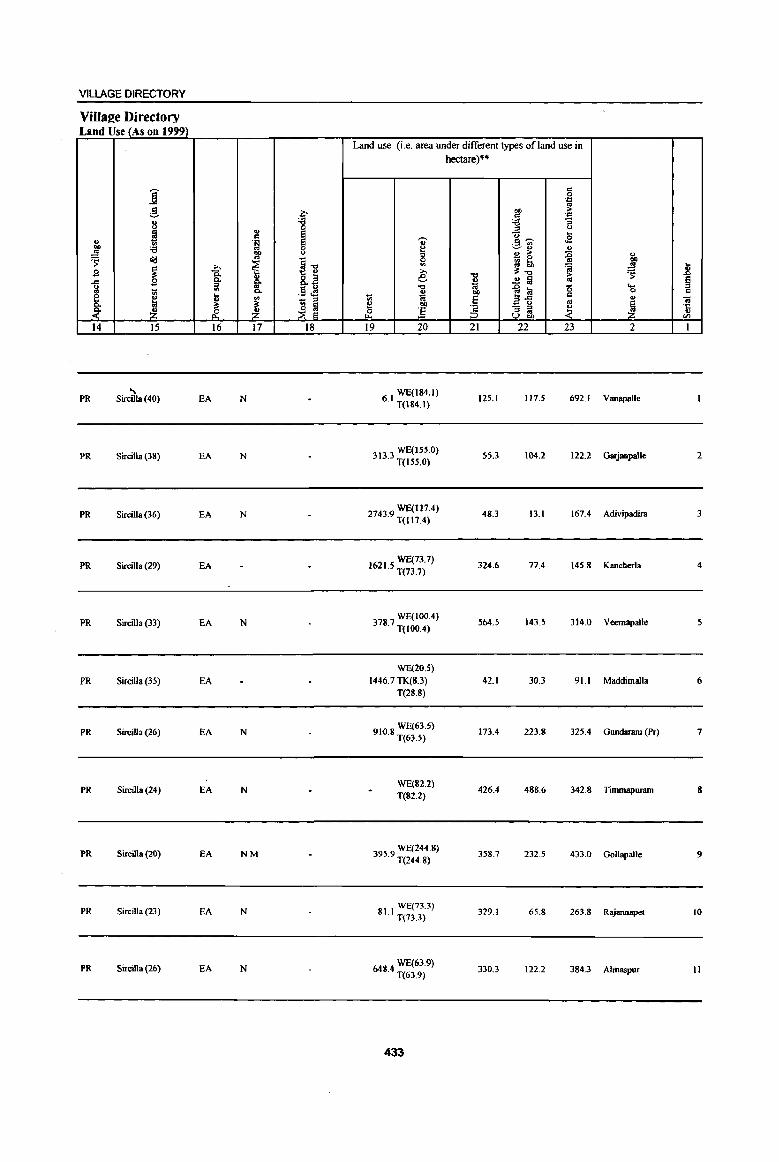
VILLAGE DIRECTORY
ViIIS2e Directory Land Use (As on 1999)
Land use (i.e. area under different types of land use in hectare)"
j c 0 .z:
g ~ OIl ~ .$ .:::
8 :g .", '3 ., ::I (J
~ ~ <:; ~ co 'V' .2 " .~ "'~ Of) :a 8 ~
~:l ., ~ Ill) ., > =§ ., ~ ci8
~ ~-o 5l ~ 0 bO .... ~~ 'ii .!! ] .s ~ c. 8.~ e "" ;; ~ .co 0. z: ~ ..!! Iii !l
~ ;;;J '0
]~ 15 .... 'iil '" .!It!! ., 00 0 " ~
~
'" 1;1 ~ 'e '" ., iil II -;;; ;;;J '" 0- ~ ~
~J e ;§ - :> 1. ~ '5
~ ~ R. ~ ~ ] ;;;J .. U OIl VJ
14 15 16 17 18 19 20 21 22 23 2 I
" 6 1 WE(184.1) PR Sircilla (40) EA N · T(184.1)
125.1 1175 692.1 Vanapalle
PR Sircilla (38) EA N WE(lSS.O)
313.3 T(155.0) 55.3 104.2 122.2 Garjanpalle 2
PR Sircilla(36) EA N 27439 WE(117.4) · T(II7.4)
48.3 13.1 167.4 Adivipadira 3
PR Sircilla (29) EA WE(73.7)
1621.5 T(73.7) 324.6 77.4 145.8 Kancherla 4
PR Sircilla (33) EA N 3787 WE(IOO.4) · T(IOO.4)
564.5 143.5 314.0 Veernapalle
WE(20.S)
PR Sircilla (35) EA 1446.7 TK(8.3) 42.1 30.3 91.1 Maddimalla 6 T(28.8)
PR Sircilla(26) EA N WE(63.S)
910.8 T(63.5) 173.4 223.8 325.4 Gundaram (Pr) 7
PR Sircilla (24) EA N WE(82.2)
426.4 488.6 342.8 Tunmapuram 8 T(82.2)
PR Sircilla (20) EA NM 3959 WE(244.8) · T(244.8)
358.7 232.5 433.0 Gollapalle 9
PR Sircilla (23) EA N 81 I WE(73.3) · T(13.3)
329.1 65.8 263.8 Rajannapel 10
PR Sircilla(26) EA N 648 4 WE(63.9) · T(63.9)
330.3 122.2 384.3 A1maspur J1
433
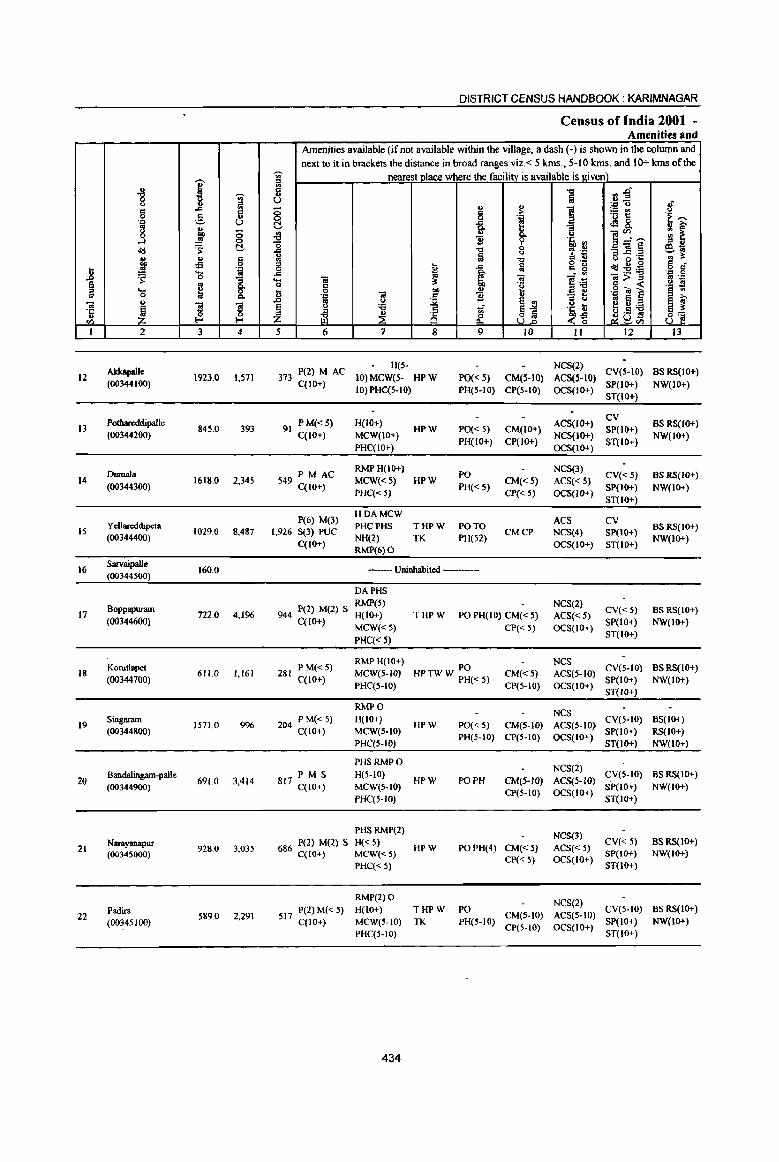
I "8 'Ui' (,) .. ::I
g .... ij ;§, 'll U
'" .. g bO (5 ~ .s <:>
01:1 's: t!. .. .. § CI) -s .8 .2! .~
'c; ~ "S
~ g C-... &. 0 t) 01 S S -I: 1 .. ~ 0
<I'> !-<
1 2 3 4
AkkapaIIe 12 1923.0 1,571
(00344100)
Pothareddipal1e 13 845.0 393
(00344200)
Dumala 14 1618.0 2,345
(00344300)
YeUarcddipeta IS 1029.0 8,487
(00344400)
16 SarvaipalJe
160.0 (00344SOO)
Boppapuram 17 722.0 4,1%
(00344600)
Korutlapet 18 611.0 1,161
(00344700)
19 Singaram
1571.0 996 (00344800)
Bandalingam-paJle 20
(00344900) 691.0 3,414
21 N_yarlapur
928.0 3,035 (00345000)
Padira 22
(00345100) 589.0 2,291
DISTRICT CENSUS HANDBOOK: KARIMNAGAR
Census of India 2001 -Amenities and
Amenities available (if not available within the village, a dash (-) is shown in the column and next to it in brackets the distance in broad ranges viz.< 5 kms., 5-10 kms. and 10+ kms of the
'Ui' nearest place where the facility is available is given) iii
tf) -EI~ c .., ., Iii u u_ ., "
',c u 8 ] !ij~ 8 c > 'i '>: 0 '.j:l
t:!, i i <:l 8. "'3 -8 u ]~'""' gj ~ -0 '? .~ '" .... .., 0 , .~ "'3]~ e'lO ., la 0
U> '" VI "0 = ... '" 0 ·c 5 o .-
0I:I:9~ .g § I .... Iii c g .... ~ l~ .... = = =>::: '" ._
o g '0 g <: .~ ~ Ii = CI) .£ ij ',c "iii ] .z:;
~ ~ :; t ..0 l! '" ~j '" e ~ ~ § ::a uf }~ I:! t):a
:::l ~ .5 !!l Z ~ ~ i§ {{. 8_j _,:;a U <I'>
5 6 7 8 9 JO II 12 lJ
373 P(2) M AC A(5- NCS(2)
CV(5-10) BS RS{IO+) 10) MCW(5- HPW PO« 5) CM(S-10) ACS(S-10)
C(IO+) 10) PHC(5-IO) PH(5-10) CP(5-10) OCS(tO+)
SP(IO+) NW(IO+) ST(JO+)
P M« 5) H(IO+) ACS(IO+} CV
BS RS(IO+) 91 HPW PO« 5) CM(JO+) SP(JO+)
C(10+) MCW(IO+) PH(IO+) CP(IO+)
NCS(IO+) ST(IO+)
NW(JO+) PHC(IO+) OCS(10+)
549 PM AC RMP H(lO+)
PO NCS(3)
CV{< 5) BS RS(IO+) MCW«5) HPW CM«5) ACS« 5)
C(10+) PHC« 5)
PH« S) CP« 5) OCS(IO+)
SP(IO+) NW(IO+) ST(JO+)
P(6) M(3) HDAMCW
ACS PHCPHS THPW PO TO
CV BSRS(IO+)
1,926 S(3) PUC CMCP NCS(4) SP(IO+) C{IO+)
NH(2) TK PH(S2) OCS(IO+) ST(IO+)
NW(IO+) RMP(6) 0
--Uninhabited -----
DAPHS RMP(5) NCS(2)
944 P(2) M(2) S H{IO+) THPW PO PH(IO) CM« S) ACS« S) CV« 5) BS RS(IO+)
C(lO+) MCW« S) CP« 5) OCS(IO+) SP(IO+) NW{IO+)
PHC« 5) ST{IO+)
P M«5) RMPH(IO+)
PO NCS
CV{5-10) BSRS(IO+) 281 MCW(S-IO) HPTWW PH«5) CM«5) ACS{5-1O)
C(10+) PHC(S-IO) CP(5-IO) OCS(JO+)
SP(IO+) NW(IO+) ST(lo+}
RMPO NCS
204 P M« S) H(IO+) HPW PO« 5) CM(5-1O) ACS(S-IO)
CV(S-IO) BS(IO+) C(IO+) MCW(S-IO)
PH(5-10) CP(S-IO) OCS(JO+) SP(IO+) RS(IO+)
PHC(S-IO) ST(lO+) NW(IO+)
PHSRMPO NCS(2)
P M S H(5-IO) CV(5-10) BSRS(IO+) 817 qIO+) MCW(S-IO)
HPW PO PH CM(S-JO) ACS{S-JO) SP(JO+) NW(IO+)
PHC(5-1O) CP(S-IO) OCS(IO+)
ST(IO+}
PHSRMP(2) NCS(3)
686 P(2) M(2) S H« 5) HPW PO PH(4) CM«S) ACS« 5)
CV« 5) BSRS(IO+) C(l()+) MCW«5)
CP« 5) OCS(IO+) SP(IO+) NW(lO+)
PHC« 5) ST(lO+)
RMP(2) 0 NCS(2)
517 P(2)M« S) H(IO+) THPW PO CV(S-IO) BSRS(IO+)
C(1O+) MCW(S-IO) TK PH(S-IO) CM(5-10) ACS(S-IO)
SP(IO+) NW(IO+)
PHC(5-1O) CP(5-IO) OCS(IO+)
ST(IO+)
434
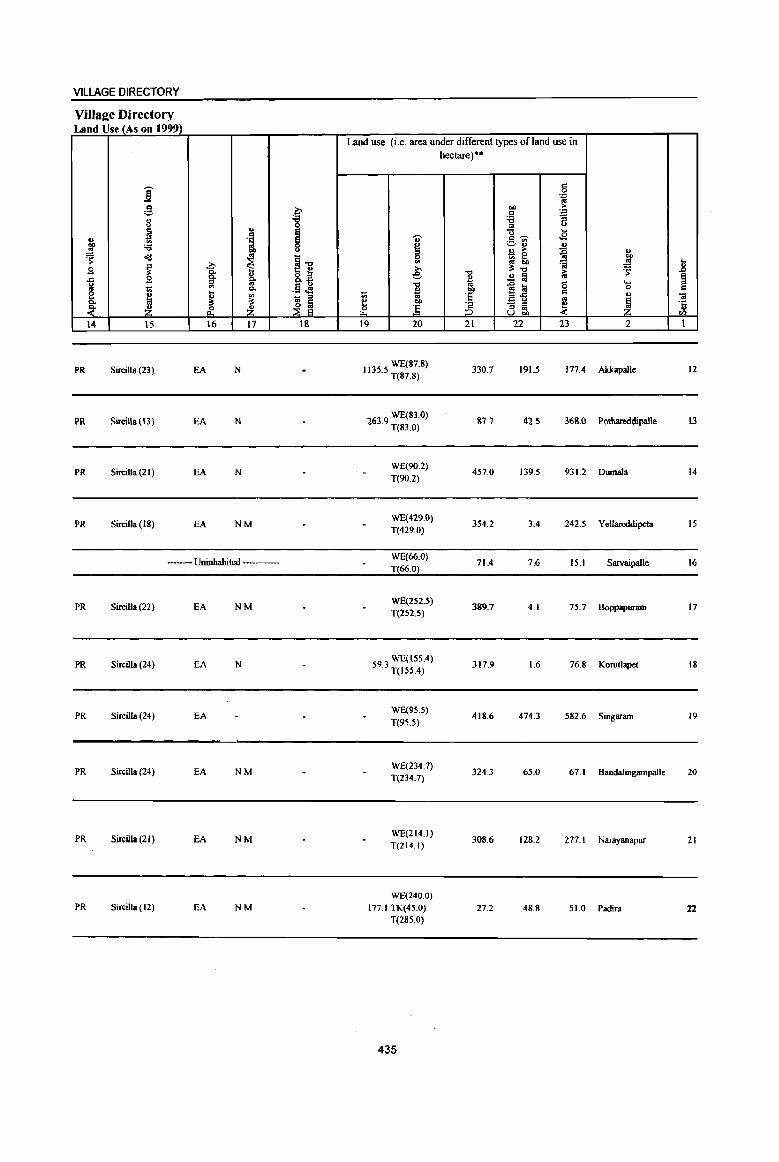
VILLAGE DIRECTORY
Village Directory Land Use (As on 1999)
j ;§. ~ ., :e " 0
~ ..
~ .. 1 eo 'i3 ~ Q
~ 0<$ ~ l-g >. S ~ 0.
" 8.£ ..a 2 0. g-g '" -§ ~ ~
.. 0.. 2 ~ .. -" 0- ~
~ ~ ~ ~ &. ~ 14 IS 16 17 18
PR Sircilla (23) EA N
PR Sircilla (13) EA N
PR Sireilla (21) EA N
PR SirciJla (18) EA NM
--Uninhabited ------
PR Sircilla (22) EA NM
PR Sireilla (24) EA N
PR Sircilla (24) EA
PR Sireilla (24) EA NM
PR Sire ilia (21) EA NM
PR Sireilla (12) EA NM
Land use (i.e. area under different types of land use in
u ~ .., >. e "" .,
1;; 10 ~ :§ ~ 19 20
WE(87.8) 1135.5 T(87.8}
WE(83.0) 263.9 T(83.0}
WE(90.2)
T(90.2)
WE(429.0}
T(429.0)
WE(66.0) T(66.0)
WE(2S2's) T(252.5)
59.3 WE(IS5.4} T(ISS.4)
WE(9S.5)
T(95.5)
WE(234.7) T(234.7)
WE(214.1) T(214.1)
WE(240.0)
177.1 TK(4S.0)
T(285.0)
435
hectare)··
"'" o 10 eo
'E ~ 21
330.7
87.7
457.0
354.2
71.4
389.7
317.9
418.6
324.3
308.6
27.2
5 . .., "" ~ = . .., :a '3
'" u
u ... =~ <2 v~
~ U > ., ~! .& ';j
~ ..2 a iU
~~ 0 .....
0 = ., ~ - '" ~ ::J .. .;: u ..
22 23 2
19U 177.4 Akkapalle
42.5 368.0 Pothareddipalle
139.5 931.2 Dumala
3.4 242.5 Yellareddipeta
7.6 15.1 Sarvaipalle
4.1 75.7 Boppapuram
1.6 76.8 Korutlapet
474.3 582.6 Singaram
65.0 67.1 Bandalingampalle
128.2 277.1 Narayanapur
48.8 51.0 Padira
.... ..8 g c
OJ -Ii '" t
12
\3
14
15
16
17
18
19
20
21
22
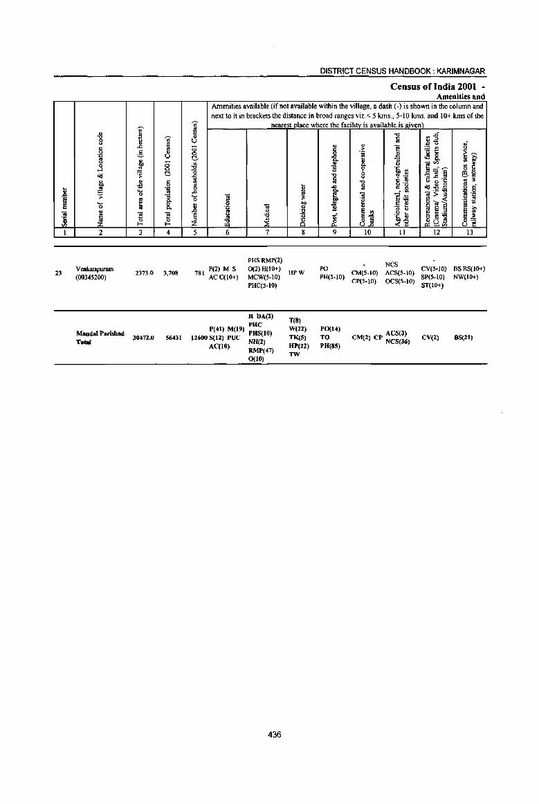
i ~ g 'U> :::l
" ..c '" c " 0 u . ., :.:::- U .. ~ <.) "0 0
....l .. 0
cid ~ t:!. ... .,
" co oS 0
.8 .!!! '., .... ..!! ~ 0
~ to [ ... ~ 8. 0 .. ft!
~ '3 '3 'C .. ~ ~ '" I 2 3 4
Vmkatapuram 23 2373.0 3,708
(00345200)
MandalParishad Total
30472.0 56431
~
'" ~
U <5 <=> t:!.
~ ..c ., '" :::l 0 .c .... 0 ... l! ~ z 5
781
DISTRICT CENSUS HANDBOOK: KARIMNAGAR
Census of India 2001 -Amenities and
Amenities available (if not available within the village, a dash (-) is shown in the column and next to it in brackets the distance in broad ranges viz. <: 5 kms., 5-10 kms. and 10+ kms of the
nearest_l1_lace where the facility_is available is given) "Cl ~1 Ii . ., U ,;
'" " ~ ~t! <.> c ,. .~ ~ 0 'J:
-& [ of! 8. .. 0 ~~~ III ~ 11 'i' .J1 <II " U
"Cl 0 ~ .~ _ft!§ 61;; " Ii "Cl C ., 6 ~·c .. l!:
t a g 'g 1ld~~ " . ..c o c 'Iii ~ li
.j ,g ft! ~ ... <l>" 8 "e " ~ .~ ! co ., .g ~] .l:l ft! " 11 u
l3 " ~ e " <.) .. 8
~~ :e .J
~i .~ t e U:e ~ 8 ~ ~a!3 ~ ~~ ~<Il
6 7 8 9 10 11 12 13
PHSRMP(2) NCS
P(2) M S 0(2)H{JO+) PO CV{5-10) BSRS{lO+) HPW CM(S-IO) ACS(S-IO)
ACC{lO+) MCW(5-IO) PH(S-IO) CP(5-10) OCS(S-lO)
SP(S-IO) NW(I(}+) PHC(S-IO) ST(IO+)
H DA(2) T(8)
PHC W(22) PO(14) P(41) M(19) PHS(IO) ACS(J)
12600 S(12) PUC NH(2) TK(S) TO CM(I) CP NCS(J6) CV(l) BS(21)
ACCtO) RMP(47) HP(U) PU(SS)
0(10) TW
436
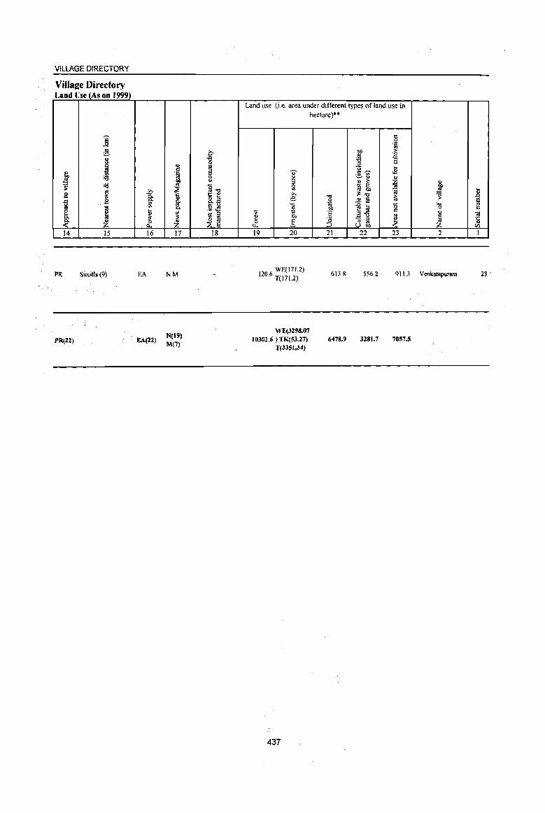
VILLAGE DIRECTORY
Villaee Directory Land Use (As on 1999)
j ;S 8 ~ " QO '5 ~
'S ~
~ B
1 B 'iil ~ c.
it ~ 14 15
PR Sircilla (9)
PR(22)
i ~
~ & 16
EA
EA(22)
:l .~ 00 .. ~ 8-os c. '" ii' ~ 17
NM
N(t') M(7)
b '6 0 e e 0 <.>
§..., ;: " 8.~ .5 <!l .... :::l
~ ~ 18
Land use (i.e. area under different types ofland use in
'OJ' ~ = 0
'" ;>, e "0 E ti g[,
~ 0 ] Ll.
19 20
WE(171.2) 120.6 T(I7I.2)
WE{3298.07 10302.6) TK{53.27)
T(33SI.34)
437
hectare)"
."
~ OJ)
E '2 8 21
613.8
6478.9
c 0 .~
QO ;> C ~ '5 :::l <> "0 ... c,.-.. .;: ._ '" ~II)
~ II) ;>
j 1@ ~ ~ ii'." ~ ~ ..2 fa e ~ '0 ....
0 c " a.g os
8~ ~ ~ 22 23 2
556.2 911.3 Venkatapuram
3281.7 7057.5
.B e :::l c -a '1: .. tI)
I
23
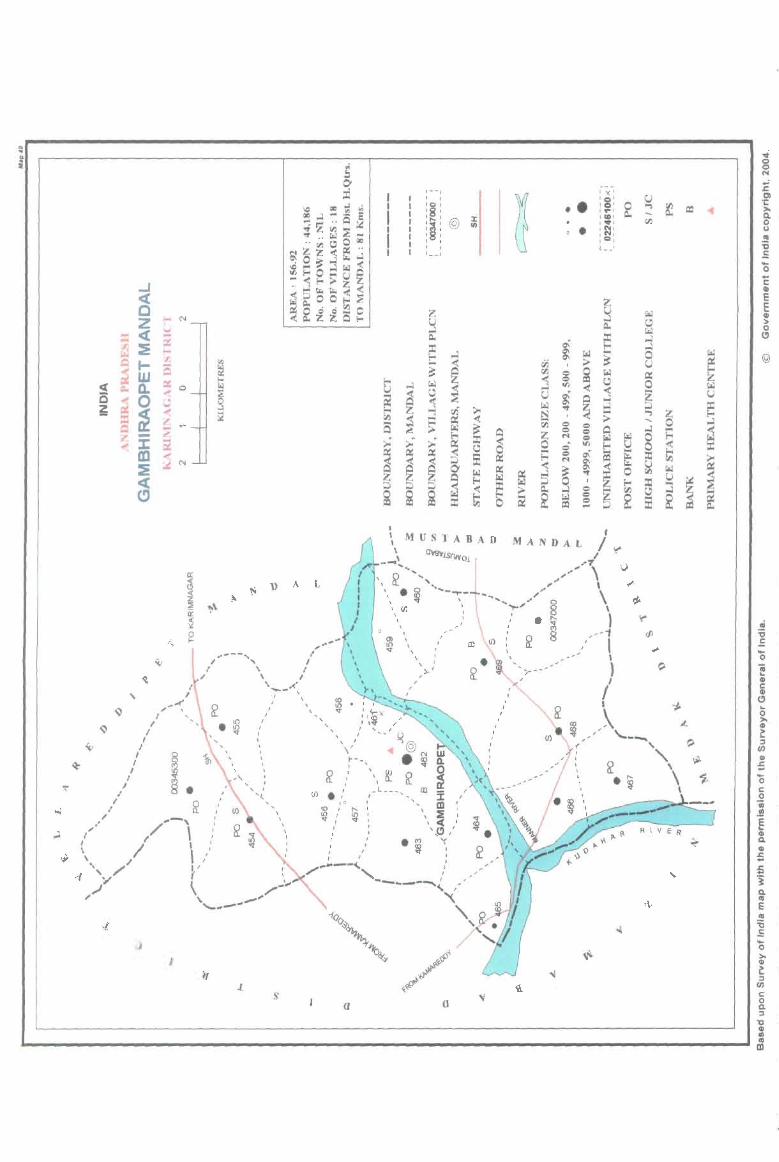
o .. .. a
... ~
~
.. , .' ;
I I \ ,
'\
« , y
/'" ..[
A L
o <\ I- ,
~ "---"', /
/ \ / t , I
/ \.< .' ....... - \.
I '\
, .. ~ ~ ,/ '\ I to I
" • 'Ii :' I I
J I I 0 I
/ i. ': I
I ~ : , I ... --, :
/ \ : , ,,'
I I "
I \
, , , , \'
, I I I
,
,- -I , I
:8: :§"':@ili I I I , I I
1- _I
W Q. o
co ~ , J: , m
" :::!:c( I ,
',C> ," .'" '( ~
"'--, /.." , ... ------~, /
}'
\. _' .-
/'
'\ '\,
"-.,----
1.
(J
•• . o •
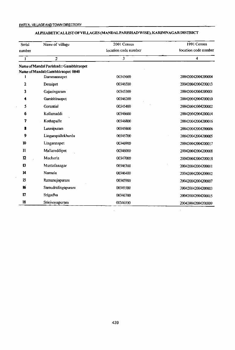
PART A -VILLAGE AND TOWN DIRECTORY
ALPHABETICAL LIST OF VILLAGES (MANDALPARISHAD WISE), KARIMNAGARDISTRICT
Serial Name of village 2001 Census 1991 Census
number location code number location code number
2 3 4
Name of Mandai Parishad:: Gambhiraopet Name ofMandal:Gambhiraopet 0040
1 Dammannapet 00345600 200420042004200004
2 Desaipet 00346500 200420042004200013
3 Gajasingaram 00345300 200420042004200001
4 Gambhiraopet 00346200 200420042004200010
5 Gorantial 00345400 200420042004200002
6 Kollamaddi 00346600 200420042004200014
7 Kothapalle 00346800 2004200420042000 I 6
8 Laxmipuram 00345800 200420042004200006
9 Lingampallekburdu 00345700 200420042004200005
10 Lingannapet 00346900 200420042004200017
11 Mallareddipet 00346000 200420042004200008
12 Mucherla 00347000 2004200420042000 I 8
13 Mustafanagar 00346300 200420042004200011
14 Nannala 00346400 200420042004200012
15 Ramanujapuram 00345900 200420042004200007
16 Samudralingapuram 00345500 200420042004200003
17 Srigadha 00346700 200420042004200015
18 Srinivasapuram 00346100 200420042004200009
439
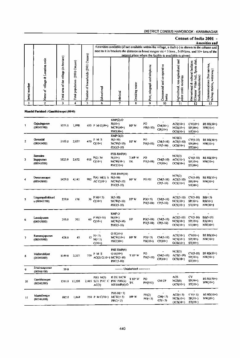
DISTRICT CENSUS HANDBOOK: KARIMNAGAR
Census of India 2001 -Amenities and
Amenities available (ifnot available within the village, a dash (-) is shown in the column and next to it in brackets the distance in broad ranges viz.< 5 kms., 5-10 kms. and 10+ kms of the .,.
nearest place where the facilitv is available is given) ]' iii ., co -0 rJl-§ -g .,. ., u u Iii u " iii ·~o :i -= - ., .,
'2 g '" &i <:> co > ~t! 0 0 .:; 'E ~ ] ;:::, u t!- ..<: ~ E! <l!!8, u 0 c. ., "3 .. ~ 00 .l!J
., c. '" ]~~ ;;: ~ .!! <:> ']l b ·~.2 ~ t!- o ::> ., <1:1 ..c: -0 ;;~~ 6., ... la u C: li <II it j
., C <II -0 o ~.~ .;; 0 ::> t Iii g g c
.8 .= 0 -'" <I:I:s!'l3 o c;r .... '" ..c: ~ ~ - '" .= 0
~ 0 :3 .... 01 01 ]~ 01>= oj ':;
~ oj 0- 0 5 -g .~ ca ~ .2 !9
'Q ~ 8, ~ 'a 00 ., § .,
'.c c ']l "3 C 'a
., ]I ~
.D 13 t.)
~ e '" :l ~L:i! a ~ .t:
~ § " 'il 1if a"'" .~ b g.9 ] ~i .. ~ !- :z ~ ~ 8 ~ 8~ <~ CI) O1U rn
1 2 J 4 5 6 7 8 9 10 11 12 IJ
MandaI Parishad : Gambbiraopet (0040)
RMP(2) 0 GajasiJlsaram
1571.0 1,898 455 P M C(IO+) H(10+)
HPW PO
CM(IO+) ACS(IO+) CV(IO+) BS RS(IO+)
(0034S3OO) MCW(IO+) PHIS-tO) CP(lO+)
NCS(IO+) SP(IO+) NW(IO+) PHC(tO+) OCS(lO+) ST(lO+)
RMP0(3) NCS(2)
2 Gorantial
1103.0 2,057 470 PM S H(5-10) HPW
PO CM(S·IO) ACS(S-IO)
CV(5-10) BS RS(IO+) (0034S4OO) qIO+) MCW(S-tO) PH(S-IO)
CP(S-IO) . OCS(IO+) SP(lO+) NW(IO+)
PHC(5-IO) ST(IO+)
Samudra-PHS RMP(4)
NeS(3) 3 lingapllIal11 1123.0 2,632 616 P(2) M H(lO+) THPW PO
CM(5-10) ACS(IO+) CV(S-IO) BSRS(IO+)
C(lO+) MCW(IO+) TK PH(S-IO) SP(IO+) NW(IO+) (00345500)
PHC(IO+) CP(lo+) OCS(IO+)
ST(IO+)
PHS RMP(lO) NCS(2)
4 Dammannapet
1429.0 4,141 902 P(4) M(2) S H(5-10)
HPW PO PH CM(5-10) ACS(5-10) CV(5-10) BS RS(IO+)
(00345600) AC C(lO+) MCW(S-IO) CP(5-IO) OCS(IO+)
SP(IO+) NW(IO+) PHC(5-10) ST(IO+)
~ LingampallekhUJd
239.0 176 36 PM« 5) H(5-1O) HPW PO« 5) CM(S-IO)
ACS(5-10) CV(5-10) BS« 5) u (00345700) C(lO+) MCW(5-10)
PH(5-10) CP(5-10) NCS(IO+) SP(IO+) RS(IO+)
PHC(5-IO) OCS(IO+) ST(IO+) NW(lO+)
RMPO
6 Laxmipuram
310.0 301 65 PM(S-IO) H(IO+)
HP P0(5-IO) CM(5-1O) ACS(5-IO) CV(5-10) BS(5-10)
(00345800) C(10+) MeW(S-IO) PH(5-10) CP(S-IO)
NCS(IO+) SP(IO+) RS(10+)
PHC(5-1O) OCS(IO+) ST(IO+) NW(IO+)
Ramanujapunun 13 P« 5) o H(J{)+)
ACS(IO+) CV(lo+) BS RS(lO+) 7 428.0 45 MCW(IO+) HPW PO« 5) CM(5-10)
(00345900) M«5) PHC(IO+) PH(IO+) CP(Io+)
NCS(IO+) SP(IO+) NW(IO+)
C(IO+) OCS(lO+) ST(IO+)
PHS RMP(4) NCS(3)
Mallareddipet PM S OH(IO+) PO CV(S-IO) BS RS(IO+) 8 1149.0 3.337 779 AC(2)C(l0+) MCW(S-IO)
THPW PH(S-IO)
CM(5-10) ACS(S-IO) SP(IO+) NW(I<l+) (00346000) CP(lO+) OCS(IO+)
PHC(5-10) ST(IO+)
9 Srinivasapuram
S9.0 ----- Uninhabited -----(00346100)
P(6) M(S) HDUMCW ACS CV BS RS(JO+) Gambbiraopet THPW PO
10 1311.0 11,208 2,465 S(3) PUC C PHC PHS(2) TK PH(102) CMCP NCS(S) SP(IO+)
NW(IO+) (00346200) AC(3) NHRMJ>(6)O OCS(IO+) ST(IO+)
Mustafanagar PHS H« 5)
PH(2) ACS« 5) CV« S) BS RS(IO+) II 882.0 1.068 250 P MC{H)+) MCW«5) HPW CM«5)
(00346300) PHC«5) PO« 5)
CP« 5) NCS(IO+) SP(IO+) NW(lO+)
OCS(IO+) ST(IO+)
440
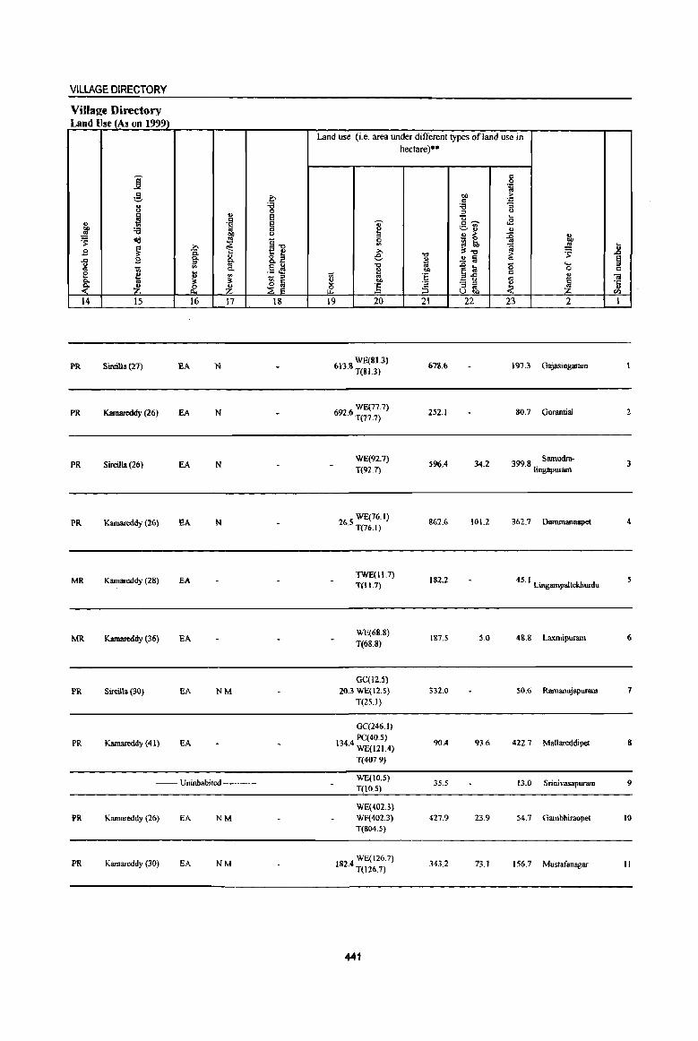
VILLAGE DIRECTORY
Villa2e Directory Land Use (As on 1999)
j g 0 u ~ u
~ .. E ., .~ e
]' :a 0 tlO U
~ <Id .. ~1l -a ~ £ ~
~ " o ~ ..c 2 0. u os 0.
0 os t; 0. .5 cf! e j ~ ~ - :::J 0.
~ ~ ~ _& ~ 14 15 16 17 IS
PR Sircilla (27) EA N
PR Kamareddy (26) EA N
PR Sircilla (26) EA N
PR Kamareddy (26) EA N
MR Kamareddy (28) EA
MR Kamareddy (36) EA
PR S~illa(30) EA NM
PR Kamareddy (41) EA
-- Uninhabited ---
PR Kamareddy (26) EA NM
PR Karnareddy (30) EA NM
Land use (i.e. area under different types of land use in
U' ~ ~
€ "0 ~ :;; os
~ ... & ] 19 20
WE(BI.3) 6B.S T(81.3)
WEJ...77.1) 692.6 T(77.7)
WE(92.7)
T(92.7)
WE(76.1) 26.5 T{76.1)
TWE(11.7) T(11.7)
WE(6B.8)
T(68.8)
GC(12.S)
20.3 WE(12.S)
T(25.1}
GC(246.l)
PC(40.5) 134.4 WE(121.4)
T(407.9)
WE(IO.S) T(10.5)
WE(402.3} WF(402.3) T(S()4.5)
WE(126.7) 182.4 T(126.7)
441
hectare)··
."
~ 01)
'E 'a ;:, 21
6111.6
252.1
596.4
&62.6
182.2
187.5
332.0
90.4
35.5
427.9
343.2
c 0
'J:: os tlO > c 'J: :a :;
:::J U
'0 '-c~ .E ._ ., ~'" u " ;>- ~ l;\, - 0
~~ ~ ..!S ~
~ a ~ .&> Ii! 0 "-
0
~"l3 c: u '" "3 ;a ~ 1 u ...
22 23 2
\91.3 Gajasingaram
80.7 Oonmtiai
34.2 399.8 . Samudra-Itngapuram
101.2 362.7 Oarnmannapd
45.1 Lingampallekhurdu
5.0 48.8 Laxmipuram
50.6 Ramanujapuram
93.6 422.7 Mallareddipet
13.0 Srini vasapuram
23.9 54.i GambhiraoJ>el
73.1 156.7 Mustafanagar
.8 ~ c:
01 '1: .. (J)
I
2
3
4
6
7
8
9
10
II
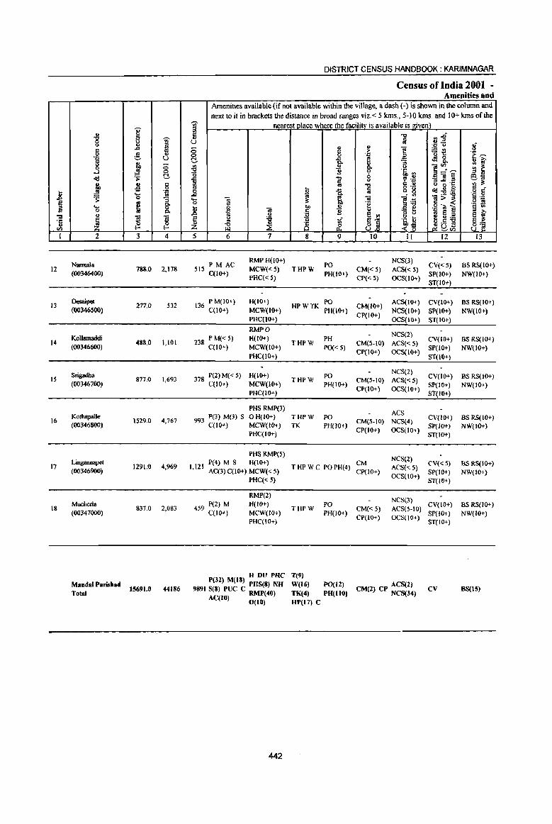
I> or> § = <iI ·c ., rn 1
12
13
14
15
16
17
18
u
"8 u c: 0
'J::
'" g ..J oid U
~ .... 0 ., ~ 2
Nannala (00346400)
DeslUp« (OO346S00)
KoUamaddi (00346600)
Srigadba (00346700)
Kotbapalle (00346800)
Lingannapet (00346900)
Mucherla (00347000)
Maudal Parishad Total
~ -;;-tJ ., " .CI ..., c: g .,
U
~ 8 ~ e ., Cl -s .0
'J:: '0 '" 8. co
~ 0
'" 5 5 .0 ~ !-<
3 4
788_0 2,178
277.0 532
488_0 1,101
877.0 1,693
1529_0 4,767
1291.0 4,969
837.0 2,083
15691.0 44186
DISTRICT CENSUS HANDBOOK: KARIMNAGAR
Census of India 2001 -Amenities and
Amenities available (if not available within the village, a dash (-) is shown in the column and next to it in brackets the distance in broad ranges viz. < 5 kms., 5-) 0 kms. and 10+ kms of the - nearest p_lace where the facili!Y_is available is__givel\l_ '" :s
'" '" OJ U
0 0 C
~ 1
0 ..: .... 01 0 c
i .0 -.::: ~ e :a " Z ;E ~
5 6 7
515 PM AC RMP H(lO+)
MCW«5) C(1O+)
PHC« 5)
136 P M( 10+) H(IO+)
C(1O+) MCW{IO+) PHc(lo+)
RMPO
238 P 1'.1« 5) H(IO+) C(10+} MCW(IO+)
PHC(IO+)
378 P(2) M« 5) H(IO+} C(IO+} MCW(I()+)
PHqIO+)
PHS RMP(3)
993 P(3) M(3) S o H(lO+) C(lO+) MCW(lO+}
PHC(IO+)
PHS RMP(5) 1 P(4) M S H(IO+)
1,12 AC(3) C(lO+) MCW« 5)
PHC« 5)
RMP(2)
459 P(2) 1'.1 H(IO+) C(lO+) MCW(IO+}
PHC(IO+)
"DU PRC P(32) M(18) PHS(S) NO
9891 S(8) PUC C RMP(40)
AC(IO} 0(10)
442
., t:: 0
.::: C>. ., ~ .., !ij
!l .::: Co
~ ~ "" ..!! e !! ~ tf
_E_ ~ 8 9
PO THPW
PH(lO+)
HPWlK PO
PH(Io+)
THPW PH
PO« 5}
PO THPW
PH(IO+)
THPW PO
TK PH(IO+)
THPWC POPH(4)
THPW PO PH(IO+)
T(9)
W(16) PO(12) TK(4) PH(ltO) HP(17) C
" ij u e :>
-J:; i! e
K. " 0
Z -s, '" c:' -~ Q
-0 Cl ., o .-
~ c g • II>
01 ]~ .~ .. - ... e .. .~ ~ 81 ~] U.c 10 II
NCS(3)
CM«5) ACS«5) CP« 5) OCS(1O+)
CM(lO+) ACS(IO+)
CP(HJ+) NCS(IO+) OCS(IO+)
NCS(2) CM(5-10) ACS«5) CP(IO+) OCS(IO+)
NCS(2) CM(5-IO) ACS«5) CP(IO+) OCS(IO+)
ACS CM(5-10) NCS(4) CP(IO+) OCS(IO+)
NCS(2} CM
ACS« 5) CP(IO+)
OCS(JO+)
NCS(3}
CM« 5) ACS(5-10) CP(lO+) OCS(IO+)
CM(l) CP ACS(2) NCS(34)
411 .~ <J
~t: 4!& ]~-_ 01 § g g-!§ oid::a;;3 ~:>~ .g ~] .. S ~ u :.a _~ a !l ~rn
12
CV« 5) SP(lO+) ST(IO+)
CV(lO+) SP(IO+) ST(IO+)
CV(IO+} SP(IO+)
ST(10+)
CV(IO+)
SP(lO+) ST(IO+)
CV(lO+) Sp(lO+) ST(IO+)
CV«5) SP(IO+) ST(lO+)
CV(IO+) Sp(IO+) ST(IO+)
CV
.; <> .~ ~ '" .. '" ~ ::l 4J
6~ II> ~ s:: • .~ .§ .\:! 5 § '" ~j 8]
13
BS RS(IO+) NW(IO+)
BS RS(IO+) NW(IO+)
BS RS(IO+) NW(lO+)
BS RS(lO+) NW(I()+)
BS RS(IO+) NW(lO+)
BS RS(10+) NW(IO+)
BS RS(IO+)
NW(IO+)
8S(15)

VILLAGE DIRECTORY
Villae;e Directory Land Use (As on 1999)
., : ~ .S! -g 0
! 14
PR
PR
PR
PR
PR
PR
PR.
PReiS) MR(1)
]' e 8 ~ '6 ~
~ t;
~ Z 15
Kamareddy (32)
Kamareddy (29)
Kamareddy (25)
Kamareddy (27)
Kamareddy (37)
Kamareddy (36)
Kamareddy (37)
~ §: ;:l
'" ~ ~ & 16
EA
EA
EA
EA
EA
EA
EA
EA(l7)
., 50 .~
"" <II
~ g. Q, III ~
Z 17
N
N
N
NM
N
N(ll) M(4)
c-'g e e 0 u
'§." 1:: .,
&.~ .5 ~ ii: ::I
~ ~ 18
Land use (I. e. area under different types of land use in
.. ~ ;:l 0 en >, e ." 2 tl g'" e
0 :§ U.
19 20
GC(l82.1) WE(20.2) T(202.3)
GC(ISA) T(15.4)
GC(82.6)
WE(25.5) T(10S.I)
2395 WE(74.1) . T(74.1)
GC(l6J.9) 87.2 WE(93.5)
T(255.4)
GC(l45.2) 254.6 WE(200.4)
T(345.6)
355 I WE(70.8) . T(70.8)
GC(84S.71)
PC(40.46) WE(ISS4.48
2606.5 ) TWE(1I.74) WF(40Z.Z6)
T(28S4.6S)
443
hectare)'"
"" ~ "" 'E '= ;:J
21
478.9
118.2
246.0
155.3
997.1
535.7
286.7
6806.2
c
.~ Ol)
~ ~ ;:l <>
1:l ... c ~ .E ._ '" ~ .,
" " > ... 0 ::c ~~ ..!:!
.~
~ § .. .g ~ 1:$
c ... .0 B g ..
~ ;:l .. U 01)
22 23
68.8 38.0
143.5
8.3 125.6
47.1 361.0
189.3
155.1
85.5 38.9
540.6 2883.1
j _g .;;: § ....
Q C ., 01
~ '1:: 11>
<Il
2 I
Nannala 12
Desaipet 13
Kollamaddi 14
Srigadha IS
Kothapalle 16
Lingannapel 17
Mucherla 18
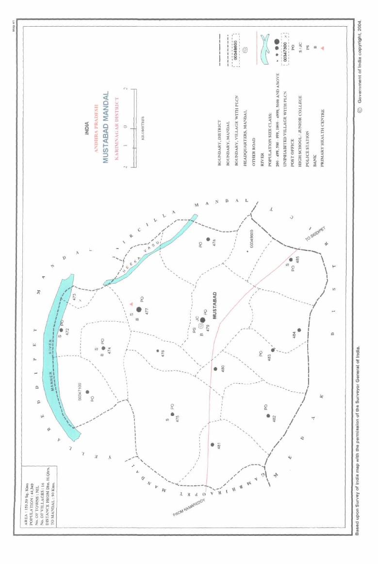
; .. i
~
't'
~
Q
1\ ~
....... _. ..
. -------'J,.
L
I I
I
, \
, , ,
N
,,-/'
.. I
" ' ,_.-" G \) I ,.. t-
.' -lo
, . 1---,
" "\ , , ,
, \
\
.CD ,__ ...
"' ,,---
. , , ........... ' , ,
\ , I , ... _ .. ---- ... __ , , I
, , . !---'"\
" \ "," \ .. \ ,.' I
'" I "",'- I ~'" I
I I I , I I \
, , , ,
i101@ .. , , , I , , 1 __ J
N D A L I A /
.-\
" "-/ "
J.
--------{ 8 " • 18 " . ." : ... "
~ ~ § / "'_
.... ,
I
, I
, ,
, I ,
.... < -, . ~ ..
, , , , 't
, I
I , \
, ,
I I ,
, I
'"r ... _ I
, , -- ... ---~,...-
_, ,
, , 't ,
f _L,
_ - , I ,
/ , , " , ,
, \
. ~
~
iii '6
= '5 ~ I> r: G>
" ~ • e: :s II)
I> 5 '0 c: 0
'i § I> Q.
£ fi j Q.
~ • '6 .E '0 >-I>
i=. ::r II)
c: 0 0-:::I ~ I> III <II III
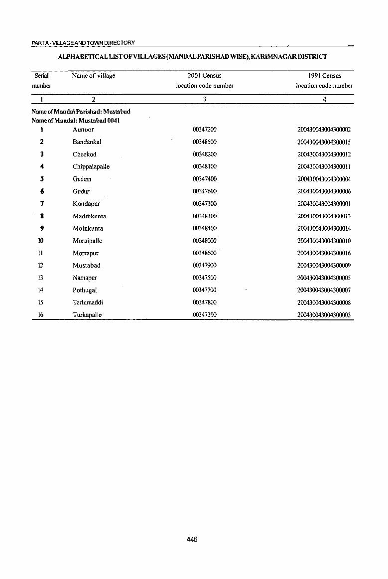
PART A -VILLAGE AND TOWN DIRECTORY
ALPHABETICAL LIST OF VILLAGES (MANDALPARISHAD WISE), KARIMNAGARDISTRICT
Serial
number
Name of village
2
NameofMandalParishad: Mustabad
Name of Mandai: Mustabad 0041
1 Aunoor
2 Bandankal
3 Cheekod
4 Chippaiapalle
5 Gudem
6 Gudur
7 Kondapur
a Maddikunta
9 Moinkunta
10 Moraipalle
II Morrapur
12 Mustabad
13 Namapur
14 Pothugal
15 Terlumaddi
16 Turkapalle
2001 Census
location code number
3
00347200
00348500
00348200
00348100
00347400
00347600
00347100
00348300
00348400
00348000
00348600
00347900
00347500
00347700
00347800
00347300
445
1991 Census
location code number
4
200430043004300002
200430043004300015
200430043004300012
200430043004300011
200430043004300004
200430043004300006
200430043004300001
200430043004300013
2004300430043000 14
2004300430043000 10
2004300430043000 16
200430043004300009
200430043004300005
200430043004300007
200430043004300008
200430043004300003

2 3
T u -o o ~ c o ·c
" 1 fl ~ 4
MandaI Parishad : Mustabad (0041)
2
3
4
5
6
7
8
9
10
II
12
Kondapur (00347)00)
Aunoor (00347200)
Twicapallc (00347300)
G1Idem (00347400)
Namapur (00347500)
Gudur (00347600)
Pothugal (00347700)
Terlwnaddi (00347800)
Mustabad (00347900)
Moraipalle
(00348000)
Chippalapalle (00348100)
Cheekod (003411200)
545.0 2,638
894.0 4,262
126.0
1098.0 4,050
2517.0 3,758
337.0 779
1838.0 5,614
1078.0 2,435
1687.0 8,293
514.0 1,418
933.0 1,405
1108.0 3,050
DISTRICT CENSUS HANDBOOK: KARIMNAGAR
Census of India 2001 -Amenities and
Amenities available (if not available within the village, a dash C-) is shown in the column and next to it in brackets the distance in broad ranges viz. < 5 kms., 5-10 kms. and 10+ kms of the
nearest place where the facility is available is given)
5 6 7 8
P(2) M RMPH(IO+) 603 AC(2)C(10+) MCW(IO+) THPW
PHC(IO+)
921 P(3) M S C(lO+)
PHS H(lO+) MCW(IO+) PHC(IO+)
THPW
9 10 II 12 13
PO CM(S-IO) ACS(S-IO) CV(IO+) as RS(IO+) PH(5-10) CP(IO+) NCS(IO+) SP(IO+) NW(IO+}
OCS(lO+) ST(IO+)
PO PH(S-IO} CM(5-IO)
CP(IO+)
NCS ACS(5-10) CV(IO+) OCS(IO+) SP(IO+)
ST(IO+)
BS RS(IO+) NW(IO+}
--Uninhabited ---
948 PM S AC C(lO+)
PHSRMP H(lO+) MCW(lO+) PHC(IO+)
PHSH{IO+)
THPW
829 P(2) M S C(lO+}
MCW(IO+) THPW
210 PM(5-1O) C(10+)
PHC(5-10)
H(IO+) MCW(IO+) PHC(S.lO)
peS) M(2) PHC PHS [,299 S(2) AC(2) H(IO+)
C(10+) MCW(IO+)
P(3) AC(2) H( 1 0+) 538 M(IO+) MCW(IO+)
C(lO+) PHC(IO+)
THP
THPW
THPW
POPH(2) CM CP(S-IO)
ACS NCS(3) ev(s-IO) as RS(IO+) OCS(IO+) SP(IO+) NW(IO+)
ST{IO+)
NCS PO PH(17) CM(5-IO) ACS(S-IO} CV(5-IO) BS RS(IO+)
CP(S-IO) OCS(S-IO) SP(IO+) NW{lO+) ST(IO+)
PH(2) PO« 5)
NCS(2) CM(5-1O) ACS(5-IO) CV(S-IO) BS RS(IO+) CP(S-IO) OCS(IO+) SP(1O+) NW(lO+)
PO PH CM CP(S-IO)
PO PH(2) CM(IO+) CP{lO+)
ST(IO+)
ACS NCS(3) CV(5-10) BS RS(IO+) OCS(IO+) SP(IO+) NW(IO+)
ST(IO+)
NCS(2) eV(5 10) BS RS(IO+) ACS(IO+) -
Sp(IO+) NW(IO+) OCS([O+) ST(lO+)
P(8) M(7) DA DH PHS
I 790 S(3) PUC NH(4) H(IO+) T HP W PO PH(65) CM CP , MCW(lO+)
ACS CY NCS(S) SP(lO+)
BS RS(IO+) NW(lO+)
AC(3) C(IO+) PHC(5-1O)
PAC 308 M(S·lO)
C(IO+)
PAC 308 M(S-IO)
C([O+)
H(lO+} MCW(lO+) PHC(5-10)
H(IO+) MCW(IO+) PHC(IO+)
THP
THPW
PHS H(IO+) 685 P M AC(2) MCW(IO+) T HP W
C(lO+) PHC(IO+)
446
OCS(IO+) ST(IO+)
NCS PO(S-IO) CM(S.IO) ACS(5-10) CV(S-fO) as RS(fO+)
PH(S-IO) CP(S-IO) OC:S(5-10) SP(IO+) NW(IO+) ST(IO+)
NCS(2) PO(5-10) CM(5-10) ACS(5-IO) CV(lO+) as RS(IO+) PH(IO) CP(5-10) OCS(IO+) SP(IO+) NW(IO+)
+ ST(IO+)
PO CM(5-IO) ~~~g~IO) CV(5-IO} as RS(lO+) PH(5-10) CP(S-IO) OCS(S 10) SP(IO+) NW(IO+)
- ST(IO+)
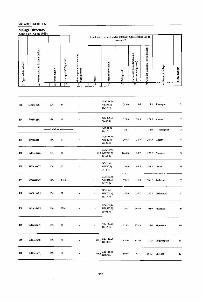
VILLAGE DIRECTORY
Villaee Directory Land Use (As on 1999)
Land use (i.e. area under different types ofland use in hectare)··
c j 0 .'"
'" g eo .. C c .'" 'i3 :a -= 8 0 ::> <>
~ '" E U ._
c E ,., c~ <8
'" .!;j .- .,
~ 'i3 0 ~ ~'" '" ~ <.> .. ;> :0 " _ 0
eo <Ill ~ ~1l ~ ;j to ~ .!!l ...
~ ... ;;., ~"O
.0; 'S ~ 2 15. ." ..
'" aB e .2 a os § ..a B c. ft i '-::0 "0 .0 a 0 ~ 1;; '" c. .§ ~ ~ ~~ c
0 c
~ "' 1;; 'E .. "iii J - '" os 1 c. ~ ~ ~ e OIl
:3 - '" ~ ·c
~ & Z & :s '" .. u U co en
14 15 16 17 18 19 20 21 22 23 2 I
GC(194.3)
PR SirciUa (2S) EA N WE(91.1} 248.9 6.6 4.3 Kondapur T(285.3)
PR Sircilla (16) EA N WE(40S.9)
T(40S.9) 277.9 38.5 171.7 Aunoor 2
-- Uninhabited ---WE(41.3)
52.7 32.0 Twkapalle 3 T(41.3)
GC(305.5)
PR Sir\;illa(18) fA N WE{80.9) 307.3 34.4 369.9 Gudern 4 T(386.5)
GC(263.9) PR Siddipet (26) EA N 91.1 WE(299.S) 1661.8 30.7 170.2 Narnapur S
T(563.3)
GC(52.6) PR Siddipet (27) EA N WE(20.2) 154.9 40.5 68.8 Gudur 6
T(n.8)
GC(121.4) PR Siddipet (28) EA NM WE(248.9) 906.4 55.0 506.3 Pothugal 7
T(370.3)
GC(I3.4) PR Siddipet (2S) EA N WE(206.4) 570.6 37.2 250.4 T erlurnaddi 8
T(219.7)
GC(121.4) PR Siddipet (23) EA NM WE(372.3) 730.8 367.9 94.6 Mustabad 9
T(493.7)
PR Siddipet (35) EA N WE(137.6)
215.3 133.5 27.6 Mofllipalle 10 T(137.6)
PR Siddipel (40) EA N 3115 WE(J40.0) . T(140.0)
314.0 152.9 14.5 Chippalapalle II
PR Siddipet (35) EA N 108 I WE(187.0) 580.9 43.7 188.3 Cheekod 12 . T(187.0)
447
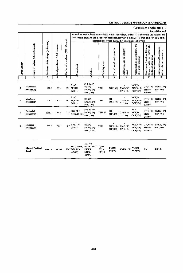
U or> § 0::
"i! ·c ., <Il
1
13
14
15
16
u
8 § .= 8 ...l o(j ., OIl :! 'S .... 0 ., ~ 2
Maddikunta
(00348300)
Moinkuolll (00348400)
Bandankal
(00348500)
Morrapur
(00348600)
MandalParishad
TOIaI
I 'Ui' u ~ ..c c ~
., U .,
OIl 0 :! 0
'S ~ ., c -B 0
.~ .... 0 "3 '" 0.
~ 8.
] !l 0 !-
3 4
870.0 1,396
774.0 1.418
1269.0 3,449
373.0 384
15961.0 44349
DISTRICT CENSUS HANDBOOK: KARIM NAGAR
Census of India 2001 -Amenities and
Amenities available (if not available within the village, a dash (-) is shown in the column and next to it in brackets the distance in broad ranges viz. < 5 kms., 5-10 kms. and 10+ kms of the
~ nearest place where the facilitv is available is given) til
5 U
0 0 t!, {l '0 il '" .. 0 t ..c 10 .... 01 0 c: ~
Jl 0 01
OIl '.c 0:: .. u J2 § <.> :.a " 8 z LB ~
5 6 7 8
PAC PHS RMP
325 M(IO+) H(IO+)
THP C(IO+)
MCW(IO+) PHC(IO+)
PAC H(lO+)
303 M(5-1O) THP C(IO+)
MCW(IO+) PHC(IO+)
P(2) M S PHS H(lO+) THPW 753 AC(3) C(IO+) MCW(IO+)
PHC(IO+)
87 P M(5-IO) H(IO+) THP
C(IO+) MCW(IO+)
PHC(5-to)
DA DH P(33) M(lS) MCW PUC T(lS)
99078(9) PUC PHS(8) W(IO) AC(19) NH(4) HP(IS)
RMP(J)
448
., 0:: 0 ..c fr "B .., 2
..c 0.
~ ., ~
~ 9
POPH(6)
PH PO(S-IO)
PO
PH(IO+)
PO(S-IO)
PH(IO+)
PO(IO) PH(96)
.., fa .,
i :> '.c f! 8.. ()
9 '5, II> 0 ~ .~ u .., 8 .~ 2 c: g
- " "i!
~~ 'e .,
si :> <.>
.~ t <~
10 Il
NCS(2)
CM(5-10) ACS(5-10)
CP(S-IO) OCS(IO+)
NCS(2)
CM(IO+) ACS(5-10)
Cp(IO+) OCS(IO+)
ACS
CM(IO+) NCS(3)
Cp(IO+) 0cs(10+)
CM(S-IO) ACS(S-IO)
CP(5-10) NCS(IO+)
OCS(JO+)
ACS(4) CM(3) CP NC8(29)
~~ .~ 0 ;.:: go)
'u 1:: to! 8. ]~~ _7il~ .. ..c .c U il B Od:2:.a l>~ .9.., ] til 8 2:!4.):.a u.s .. ~u-'-' <Il
12
CV(S-IO)
SP(IO+)
ST(IO+)
CV(S-IO) SP(IO+) ST(IO+)
CV(5-IO)
SP(IO+) ST(IO+)
CV(S-LO)
SP(tO+)
ST(IO+)
CV
.; <.> 'E ~ ., iO' :: ~ .. U eo; .. ;!: c o C
'.c 0 '" .-.~ ~ §i 8'2
13
BS RS(IO+)
NW(IO+)
BSRS(IO+) NW(lo+)
BSRS(lo+)
NW(IO+)
BS RS(IO+)
NW(tO+)
B8(1S)
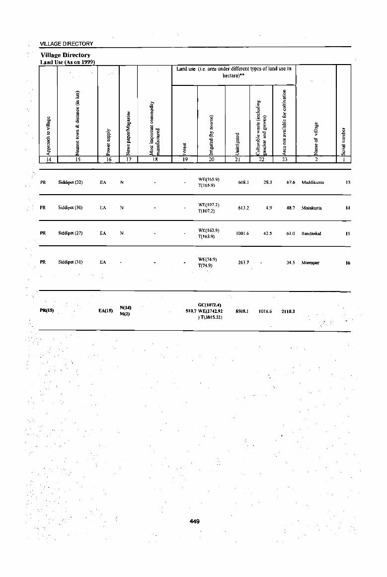
VILLAGE DIRECTORY
Villaee Directory Land Use (As on 1999)
:[ g II>
" ~ 11> 0lJ 'B ~
's: ~
~ B .<: B <> '" 1li §. M ~ ~ 14 15
PR Siddipet (32)
PR Siddipet (30)
PR Siddipet (27)
PR Siddipet (31)
PR(IS)
>, 0. Q,
1il .... ~ & 16
EA
EA
EA
EA
EA(l5)
II> c .~
CD to
~ ~ Q,
~ ~ 17
N
N
N
N(14) M(Z)
.? '8 e e 0 <.>
~~ &a .§ J§ 1li '" ~ ~
18
Land use (i.e. area under different types of land use in
., ~
'" 0
'" >, e ."
<:;: i ., -~ ] 19 20
WE(16S.c)} T(165.9)
WE(107.2)
T(107.2)
WE(J63.9) T(16J.9)
WE(74.9} T(74.9)
GC(107Z.4) 510.7 WE(Z742.92
} T(3815.31}
449
hectare)"
-0
~ "" ·S § 21
608.1
613.2
1001.6
263.7
8508.1
'" 0 .~
"" c ·a 'B :; :> " "0 .... c ~ ..s .- '" ~'" ", 11> > ~ - 0 ~ 6lJ ~ ~-o >
..!! ~ to
.D ~ is f! .... '" .s ~ '" ~ '" '" u OJ)
22 23
28.3 67.6
4.9 48.7
42.5 61.0
34.5
1016.6 2110.3
..
",
"" !'! .. 'S B e .... '" 0 c II) 01
1 ·c " II)
2 1
Maddikunta 13
Moinkunta 14
Bandankal 15
Morrapur 16

N . .. i
\ \ ~
.. " ..
~ c z
L
~ ~ r
_, ! Z cr :t ::5 _, U IX (ij
...r
C .... ~ .....
'" (".l .... Q
~ ,. ,J .,f 0 ~ -""" - ...... :t ~
.2 N
v
, \ " a:. , I r I '. ,
" ' ..... -, , ' .... "
'. "r"'-" ... ......... I
I ----, I 0> I
" • co I '<t I
I 0 I I Q_ I
I I
I / I ,
I I
I I
I I I I I I
'" ~ 0
~
~.
I I
, I
, 8 I"<Xl
" 8·
In
'f-. I ....... ~ ____ ~ I
o , / .. -------_ + \, :' --_.:..--- .... _,
lV<INVl't! .Llcll(l<I'allV113A
"
... _---- ...... -._,'
I , ,
, , , ...... .. .. - I , , ,
-,
I , , ,
,
, , I
, ,
!)
. ' , , ,
'f ,
I
I I
-- , , , -
l"-0> ..
~ •
.. as
~ ;; ~ Q
~ 0 11:1
,
,- -.
~ • , ,
'8' :I:@i)i • ~ III III , , • !
, , , , . , L __ , .! ~ .. iii .f
~ 0 ~ ~ -g t::l U ~ .5
5 '" ...:l I 1:: ;., ca
S ~. foI II.
~ 0
~ 1:1:: ,!!!
i Q ;z; .. ~ II
~ U ,
I foI ...l ...:l ¢ '" " u ~ U j ==
filii .. ::: ~ i ~ 1-0 t3 0; 1-0
...:l ; ~ ~ -;; ~
<t; ...:l ... 1-0
~ ~ , foI 0 Iol III ;;
~ ~ u 0 ::c :!. ~ ... ~ e = ;.-
~ ;;l =: < t u 1:1:: Q
~ foI c.: ~ ... 0 III
~ 'u
~ Ii: ... 1-0 § ~ ... r.l ... -< ~ ~ 0 III
~ iii 0 ;; ~ = ~ :a III = ;.;, .... ;., ,
~
11
.... -"'"r- .. "~_,,,. I i
I ~
.~
, ---.---~
C'I • ~ ~
, I
, \ I
8 I"o
§
I , I , \ \ \ \ \ \
\ \
\ , 101
------\ I ~ 8 '\ I Ill. .~..---_ I U f( U') \
~ .. " (J) • '-_\.-"-'
'1 I ~ ,,- -_.'
m
, ,
, ~
I en , I I ~
I I
--- .. _--_ , I I ) ~
I
/ ,
I I
I ~
, ( ~ ". ... ----- .. -- .. _ ,'--.... __ .l--; ___ ~__ . ./~\ ~
'( , , ,
-- ........ '.,
"")-- I
~. / I , ... -.-'
... ---""
/ -_".. ," , ,,--' "
'" "
..;' 0 (;) N .; .c 01 'I:
~ 8 IV
15 .= ... 0 ... s::: ~..., s::: .. II
~ (!)
@
iii 15 .= ... 0
e ." II c ell (!) ... 0
'" GI ?; :::I (/)
GI .c .. ... 0 s::: .2 III
" E ... ~ ! ... £ 'i Q. IV E III 15 S ..... 0
'" ell i:: :I (/)
s::: 0 Q. :::I
~ " IV III

PART A - VILLAGE AND TOWN DIRECTORY
ALPHABETICALLISTOFVllLAGES(MANDALPARlSHAD WISE), KARIMNAGARDISTRICf
Serial
number
Name of village
2
Name of Mandai Parishad: Sircilla Name of Mandai: Sircilla 0042
1 Badnepalle
2 Baswapur
3' Bonala
4 Cheerlavancha
5 Chintalthana
(; Gandilachachapet
7 Jillella
8 Kasbekatkur
9 Mandepalle
lO Mushtipalle
11 Narsimhulapalle
12 Nerella
13 Oblapur(PK)
14 Peddur
15 Ramchandrapur
16 SarampaUe
17 Sardapur
18 Sircilla (Rural)
19 Thadur
a) Thangallapalle
21 Venugopalpur
2QOI Census
location code number
3
00350300
00350400
00348900
00349300
00349200
00350000
00350100
00349800
00349600
00349000
00350700
00350500
00349700
00348800
00350600
00350200
00348700
00349100
00349400
00349500
00349900
451
1991 Census
location code number
4
2004400440044000 16
2004400440044000 17
20044004400440003
20044004400440007
200440044004400006
200440044004400013
20044004400440000
2004400440044000 11
2004400440044000 1 0
200440044004400004
2004400440044000 18
2004400440044000 19
2004400440044000 14
200440044004400002
200440044004400021
2004400440044000 15
200440044004400001
20044004400440005
200440044004400008
200440044004400009
200440044004400012

I .. "8 ,.,
~ " 6 -"l
., :§
.. li '::0 g ~ 0 ... .!! <:>
~ 'S t!-
~ v f5 ... .!!! ~ '~ 11 .....
=s: 0 -; § '" 0-
'0 ~ 8. c O! u
~ ! '3 'ij 0 en !-<
1 2 3 4
Mandai Parisb.d : Sircilla (0042)
Sardapur 451,0 742
(00348100)
2 Peddur
973.0 2,721 (00348800)
Bonala 3 [002,0 2,279
(00348900)
Musblipalle 4 257.0 3,218
(00349000)
Sircilia (Rural) 5 2536.0 4,223
(00349100)
Chintaltluma 6 1281.0 2,079
(00349200)
Cheer[avancha 1
(00349300) 1961.0 5,277
8 Thadur
3068.0 6,326 (00349400)
Thangal[apalle 9 864.0 S,736
(00349500)
Mandepal[e to 967.0 2,823 (00349600)
OblapUI(Pk) 11
(00349700) 1571.0 3,567
Kasbelrntkur [2 (00349800)
941.0 1,131
DISTRICT CENSUS HANDBOOK: KARIMNAGAR
Census of India 200t -Amenities and
Amenities available (if not available within the village, a dash (-) is shown in the column and next to it in brackets the distance in broad ranges viz,< 5 kms., 5-10 kms, and 10+ kms of the ,.,
nearest place where the facility is available is given) 1jl .. "" ~j li Iii
'., Q 8 § .. !! e ~t! 6 '~~ 'J::
~ N -g_ e .:! 8. '-' ., .. 8. ]~~ :9 1! 'f lj, '" '" .. o '" 0 1 .~ _"ii!@ e~ .Q <J
~ lij ." .. " a g '6 u> !$ 5 t; .Q ~ g "g ~1!:a ,g § ... ~ Co
l~ .... O! tb <;l ]>~ .. 'Ll 0 C
!$ '2 ,2 !l ] 0
"3 OIl ] ,£ = ~ § .,
'::0 .. OJ "3 t - e '" ~ e Ul e U :a a f § <> '6 1if s .... .~ lJ ~ ~ 8 8] ~a!l g~ Z & ~~ '-' ell U
5 6 7 8 9 10 11 12 13
PM{<5) H(5-10) PH(2) NCS
CV{S-IO) BS RS(lO+) THP CM(S-10) ACS«5) 168 C(S-IO) MCW(S-IO) PO{< 5) SP(S-IO) NW(IO+)
PHC(1O+) CP(5-10) OCS(5-IO)
ST(lO+)
PHSFWCO
576 P(3) M AC H(JO+) HIP POPH(2) CM(S-IO)
ACSNCS CV«5) BSRS(IO+) C(IO+) MCW(IO+) OCS(5-10) SP(lO+) NW(IO+)
PHC(IO+) CP(S-IO)
ST(IO+)
P(3) AC M« PHS 0 NCS(3) CV«5) BS«S) 524 5) H« 5) TAP PO PH CM«5) ACS«5)
C(5-[0) MCW«5) CP« 5) OCS« 5) SP(<:» RS(IO+)
PHC(IO+) ST(IO+) NW(lo+)
P(3) M H«5)
NCS CV«5) 8SRS(10+)
171 AC(2) THP PO{< 5) CM« 5) ACS«5) C(5-10)
MCW«S) PH« 5) CP«5) OCS«5)
SP« 5) NW(IO+) PHC(5-10) ST([O+)
P(Z) M S H ACS CV«5)
988 AC(4) MCW«5) TAP PO PH CM« 5) NCS(50) BS RS(IO+)
C(5-10) PHC(5-10) CP«5) OCS« 5) SP« 5) NW(IO+) ST([O+)
540 PM AC H(IO+) PO NCS(2)
CV(IO+) BS RS(IO+) THP CM{<5) ACS(5-10)
C(10+) MCW(IO+) PH(IO+) CP(IO+) OCS(IO+)
SP(IO+) NW(lO+) PHC«5) S1(10+)
P(3) M S PHC PHS 0 PO NCS(2)
CV(IO+) BS RS(IO+) [,340 AC(2) C(lO+) H(IO+) THP
PH(lO+) CM«S) ACS([O+)
SP(IO+) NW([O+) MCW(IO+) CP(IO+) OCS(IO+)
5T(10+)
PHS NCS(5)
P(6) M(J) S H(S-IV) THP
PO CM«S) ACS« 5)
eV(S-IO) BSRS(lO+) 1,413 AC(3)C(10+) MCW(S-IO) PH(IO+)
CP(S-IO) OCS(IO+) SP(5-JO) NW(IO+)
PHC« 5) ST(lO+)
P(4) M(2) S PHC PHS 0 CM
ACS CV«5) BS RS(IO+)
1,345 J AC(4) H«5) THPW PO PH(25) CPt < 5) NCS(S) C(1O+) MCW«5) OCS« 5)
SP(IO+) NW(IO+) 5T(10+)
628 P(2) M(2) S H(IO+) ACS
CV(IO+) BS RS(IO+) THP POPH(2) CM«5) NCS(2)
AC C(IO+) MCW(IO+) CP(IO+) OCS([01-)
SP([O+) NW(IO+)
PHC«5) ST(IO+)
P(3) M PHS 0 H(lO+) PO NCS(2}
CV(IO+) BS RS(IO+) THP CM(S-[O) ACS«S) 839 AC(3)C(IO+) MCW(IO+) PH(5-10) SP(IO+) NW(1O+)
PHC(5-IO) CP(IO+) OCS(IO+) ST(IO+)
277 P M(S-[O) H(IO+) THP
PO CM(lO+)
ACSNCS CV(IO+) BS RS(IO+)
C(lO+) MCW(IO+) PH(S-IO) OCS(IO+) SP(IO+) NW(IO+)
PHC(lO+) CP(IO+)
5T(10+)
452
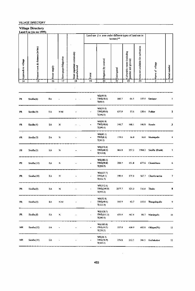
VILLAGE DIRECTORY
Village Directory Land Use (As on 1999)
Land use (i.e. area under different types ofJand use in hectare)'"
i co 0 .~
:! p "" ;.. c:: '.c:;
8 'g ~ :; ::s " ~ '" E " ... c::
l ~ g, ·S ~ c::~
:a ~~ '" ~ eo B ~ :0 ., <1!1 '" ~-g g '" : '> ~ ~ gj th ';i II ~ ~ '" :1:.., ::::
~ '" 8.~ e "<) ..!! ~
;.. ·s § .<:l ~ '" " '" ~ '" i i .0 la 0 "" 1ii "" .9 c!l 0 c e ~ ~
t;; '6 E ... c:: ., Oil rt
_ ::s a <> '" ~ ~-
~ bIl J c. ] 'c - ::s
~ ·c
~ ~ ~ Z _&' '" '" .,
;:, u "" V)
14 15 16 17 18 19 20 21 22 23 2 I
WE(49.8)
PR SirciUa (6) EA TWE(IS.6) 160.7 64.5 157.5 Sardapur T(68.4)
WE(SI.O)
PR Sircilla (5) EA NM TWE(89.0) 637.0 57.6 138.4 PeddlU 1 T(I40.0)
WE(9 I. 9)
PR Sircilla (4) EA N TWE(48.6) 546.7 168.1 146.8 Bonata 3 T(140.4)
WE(42.1)
PR SirciUa (3) EA N TWE(S.I) 174.0 16.8 16.0 Mushtipalle 4 T(SO.2)
WE(272.4)
PR Sircilla (3) EA N TWE(40.5) 461.8 257.2 1504.2 Sircilla (Rural) T(312.8)
WE(180.I)
PR Sircilla (12) EA N TWE(70.8) 200.7 151.S 677.6 Chintalthana 6
T(2SO.9)
WE(627.7)
PR Sircilla (18) EA N TWE(4J) 590.4 171.1 567.7 Cheerlavancha 7 T(63 1.7)
WE(312.4)
PR Sircilla(5) EA N TWE(240.8) 1877.7 121.0 516.0 Thadur 8 T(553.2)
WE(72.S)
PR Sircilla (5) EA NM TWE(48.6) 545.9 43.7 153.0 Thangallapalle 9 T(121.4)
WE(128.7) PR SirciIla (8) EA N 1WE(111.3) 475.9 162.4 88.7 Mandepalle 10
T(240.0)
WE(185.8) MR Sircilla (12) EA TWE(44.5) 537.8 400.9 402.0 Oblapur(Pk) II
T(230J)
WE(2&.3) MR Sircilla(15) EA TWE(76.9) 276.& 212.5 346.5 Kasbekatkur 12
T(lOS.2)
453

.8 § '" -;; ·c .. til
I
13
14
15
16
17
18
19
20
21
" "8 8 'p oS g ..J o!i:! U
"" ~ ~ ..... 0 v
~ 2
Venugopalpur (00349900)
GandiIacbachape (00350000)
lillella
(00350 1 OO}
Sarampalle (00350200)
Badnepalle
(00350300)
Basw3pur
(00350400)
Nerella (00350500)
Ram~ur (00350600)
Narsimbulapalle (00350700)
Mandai Parishad Total
I -;;;-" ... <II
~ ;§_ ~ 8 .s ~ t:!. U g -5 '::1 ....
-3 0
e Q.
8-1! 1! ~ ~ 3 4
204.0 469
289.0 743
2421.0 4,839
1271.0 1,998
1194.0 2,414
876.0 1,791
949.0 3,033
291.0 943
434.0 702
23801.0 57054
DISTRICT CENSUS HANDBOOK: KARIMNAGAR
Census ofindia 2001 • Amenities and
Amenities available (if not available within the village, a dash (-) is shown in the oolwnn and next to it in brackets the distance in broad ranges viz. < 5 kms., 5-10 kms. and 10+ kms of the
~ nearest place where the facility is available is given) ii! 5 U
g '" '" 0
t:!. ..r:l Q.
.:g i '0 ..., 1 a ;;I ... ..c 0 .8 ... ~ .... Oi ~ 0 C
t 0 ]
.. ...!! .::
~ :l .c til
~ u :a 1i " 8 ~ :2 If
5 6 7 8 9
PAC H(IO+)
118 M(S-IO) THP PO« S) C(IO+)
MCW(IO+) PR(S-IO)
PHC(IO+)
PAC H(IO+)
183 M(IO+) THP PO{< S) C(IO+)
MCW(IO+) PH(IO+)
PHC(lO+)
P(4) M S PHS H(IO+) 1,047 AC(4) C(IO+ MCW(IO+)
) PHC« 5) THP POPH(6)
pel) AC H{IO+)
439 M« 5) MCW(IO+)
THP PO PH C(1O+)
PHC« 5)
P(4) M H(S-IO) THP PO{IO+)
526 AC(2) C(lO+) MCW(S.IO) PH(IO+)
PHC(5-10)
P(2) M PHS 0 H(IO+) PO 399 AC(2) C(10+ MCW(IO+) THP
PH(S-IO) ) PHC(IO+)
P(2) M S PHC PHS 0 PO THP 677 AC(2) C(IO+) H(lo+) PH(1O+)
MCW(JO+)
PAC H(IO+)
20S M« 5) MCW(IO+)
THP po{< 5)
C(10+) PHC(5-10)
PH« 5)
PAC PH
167 M(5-10) H(IO+)
THP
C(10+) MCW(IO+) PO{<5)
PHC(5-10)
peSO) M(17) H PHC(3) T(21) W PO(14) 13170 S(7) 1 PHS(,}) FWC OP(ll) PH(41)
AC(37) 0(7)
454
u
" .:= ~ Q.
9 0 u ..., a :§ e u
~ <II
81 10
CM(IO+) CP(IO+)
CM(IO+) CP(IO+)
CM CP(IO+)
CM(5-10) CP(IO+)
CM(S-IO) CP(5-IO)
CM(5-10) CP(5-10)
CM(IO+) Cp(IO+)
CM(IO+) CP(IO+)
CM(IO+)
CP(IO+)
eM(l)
-0 :a ] "3 u '5, <II
cp .~ c .. o .-c g . ., ]i ~ 0 '5, I;; <~ II
ACS«S)
NCS(IO+) OCS(IO+)
ACS«S) NCS(lO+)
OCS(IO+)
NCS(3)
ACS«5) OCS(IO+)
NCS(2)
ACS«5) OCS(IO+)
ACS NCS(2)
OCS(5-10)
NCS ACS«5) ocS(5-IO)
ACS NCS(2) OCS(IO+)
ACS« 5) NCS(lO+) OCS(lO+)
NCS ACS(5-IO)
OCS(lO+)
ACS(7) NCS(86)
."Ji
.. ,E .~ " '5~ 4!&. ~tIl.'""' E~~ il ~ .~ o"IJ1!:a 0i>:::J
.g ~ 1 oS e f4.l:.a g.5.lS p::UtI)
12
CV(IO+)
SP(IO+) ST(IO+)
CV(lo+) Sp(IO+)
ST(IO+)
CV(IO+)
SP(lO+) ST(IO+)
CV(IO+)
SP(IO+) ST(lO+)
CV(S-JO)
SP(S-IO)
ST(lO+)
CV(5-IO)
SP(S·IO) ST(lO+)
CV(IO+) SP(IO+) ST(lO+)
CV(IO+)
SP(IO+) ST(IO+)
CV(IO+) SP(IO+)
ST(IO+)
8 '&~ '" E " u eO; <II ~ c o c-'ij 0
f~ ~l 8'@
13
BS RS(IO+)
NW(IO+)
BS RS(IO+) NW(IO+)
BSRS(IO+)
NW{IO+)
BSRS{IO+)
NW{lO+)
BSRS(IO+)
NW(IO+)
BSRS(IO+) NW(IO+)
BS RS(IO+) NW(IO+)
as RS(IO+)
NW(lO+)
BS« 5) RS(IO+)
NW(IO+)
85(19)
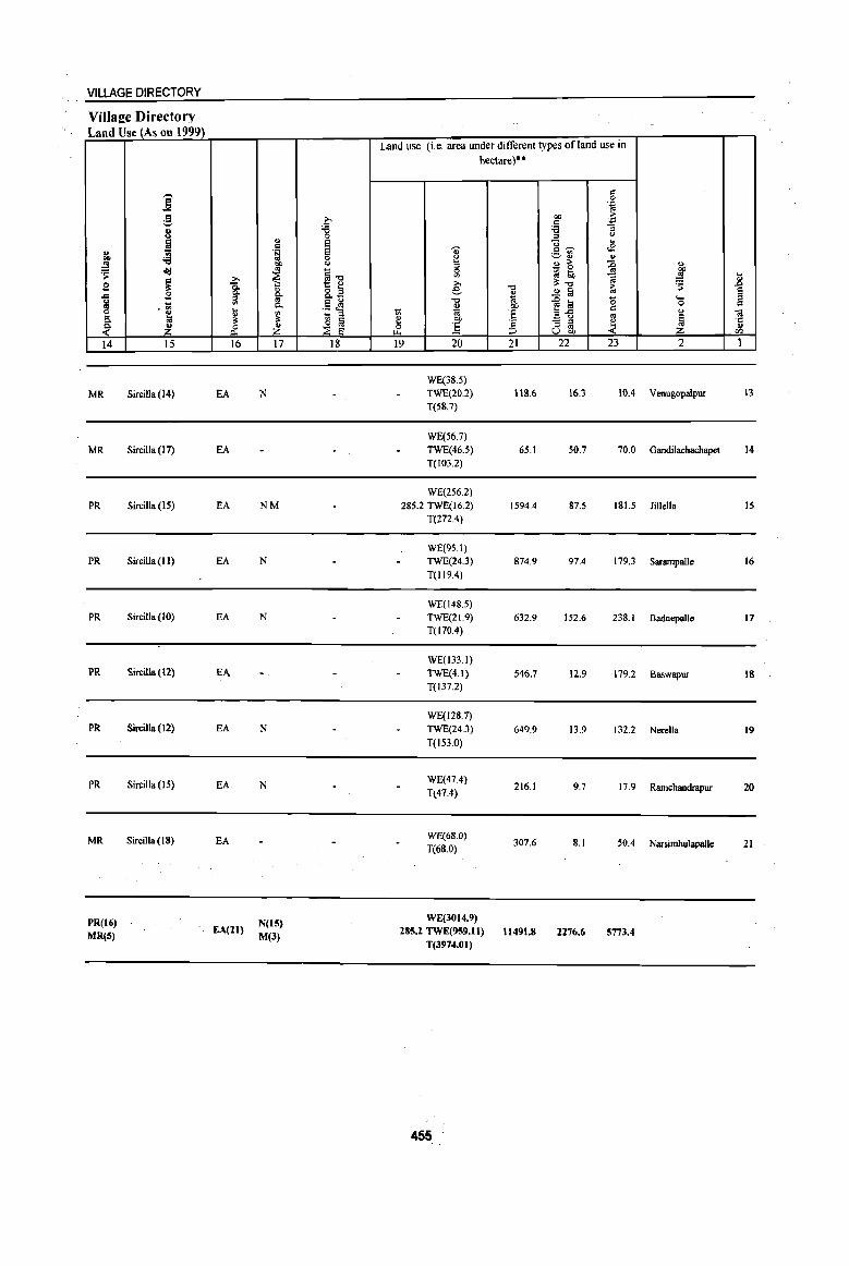
VILLAGE DIRECTORY
Village Directory Land Use (As on 1999)
u .. .!9 ~ 2 .c ~ ~ ~ 14
MR
MR
PR
PR
PR
PR
PR
PR
MR
PR(16)
MR(S)
--] :.§, .. ! '6 ol!J
~ 2 -.<Il
~ ~ 15
Sircilla (14)
SircilJa (17)
Sircilla (15)
Sircilla (11)
SircilJa(10)
Sircilla (12)
Sircilla (12)
Sircilla (15)
Sircilla (IS)
'" 1 6l t;
& 16
EA
EA
EA
EA
EA
EA
EA
EA
EA
EA(21)
" " .~
1?J'
~ g. "" ~ ~ 17
N
NM
N
N
N
N
N(IS)
M(3)
c-'6 0 e 1§ <>
§"'O 5 ~ ""u .5 <l!! '§ '" ~ ::E e
18
Land use (Le. area under different types ofland use in hectare)··
., e :I 0
'" e: "" ...
~ ~ 00
0 ] ~
19 20
WE(38.5)
TWE(20.2)
T(58.7)
WE(56.7)
TWEC46.5)
T(103.2)
WE(256.2)
285.2 TWE(16.2)
T(272.4)
WE(95.1)
TWEC24.3)
T(l19.4)
WE(148.5)
TWE(21.9)
T(170.4)
WECI33.1)
TWE(4.1) T(l37.2)
WE(128.7)
TWE(24.3)
T(l53.0)
WE(47.4)
T(47.4)
WE(68.0)
T(68.0)
WE{3014.9) 285.2 TWE(959.11)
T(3974.01)
455
"'0
" ~ I)J)
:§ " ;::> 21
118.6
65.1
1594.4
874.9
632.9
546.7
649.9
216.1
307.6
11491.8
.~ ~
oo ~ c '6 :I <)
]~ ... ..s
~ ...
~ ., > _ 0
(q I;b
""" ..!l a iO
]~ '0 " .. - " ~ ;:I .. u OIl
22 23
16.3 lOA
50.7 70.0
87.5 IS1.5
97.4 179.3
152.6 238.1
12.9 179.2
13.9 132.2
9.7 17.9
8.1 .50.4
2276.6 5773.4
" 00 .!9
i ~ .... 0
" 'a
1 ." II> </>
2 1
Venugopalpur 13
Gandilachachapet 14
li11ella 15
Sarampalle 16
8adnepalle 17
Baswapur 18
Nerella 19
Ramchandrapur 20
Narsimhulapalle 21
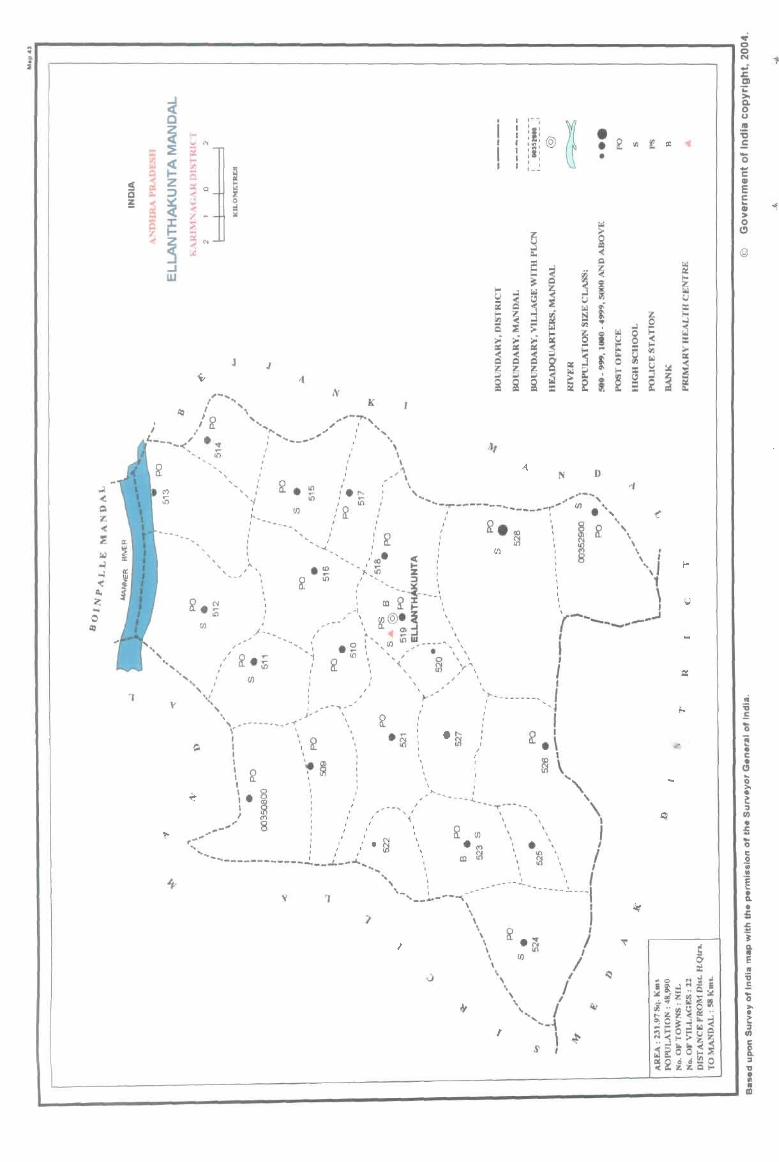
"
1 y
'"
fIl
'" "
, ,
" i 0
~
J J
, I
-I , ~-,
fIl
, , , , , ,
" ." I ~
" &: U')
K
, I I I
I I
, \ \
........ \
I , I I
I , '-.<. ,,' ~
, , ,
I I
I
I I
, ,
, " ,
/"",.."
, , , I
I
./- -,
fIl
.'" iii
, I - ' , ,
'i
, ,'roe ... ~ r;; , I
.. , )','---~--' \,_------ __ ,-r' " I '
,
I ' I " ~ I \
\, ~ '~~ \. 8
..... ~
\ ,
, ,
.. ,
I , , , ,
,_----) i i ,"'"'" '" ,I ;,
.... _ .. - ! ----------- ' .' ,'. ~ , ,
-. __ .t._ .......
, I ,- -
I I , ,
~ I ,I'
I I ,~, •
I I :~: @
I ,I' • ~ I I
, , • t _~
§ ~ =- ~
E ~ Q
.. ~ Q
.. ~
c..> ~ n ~ ~ ~ ..
~ ~ ~
! t:i ~ ;;. ~
., .. iii c..> ~ S
>.. ~' <
~ ~ .. i QQQ;;;' .... e ~~~~"jt 0
iii::~~ ~
~ ~
N D
... _..,..-----" ------_ .. _,.. ... "" ...... -', ,(/).
"
!(. - • " , &i I ~ ", : (/) \
!/J ~
~ ..l 0 ~ 0 :: "" ~
., iii c..>
~ ::l :: ~
, \ ' , I
\1 1
, ' r-.. I ...... _ ...... __ .--,...J
, , \ , , ,
y" , \
.~ I ,
, , - -- ...
,
, I I , ,
I , I
... ""' ...........
\ \
, i I
, I '~
I ~ . \ ,
\
•
~ \
, , ,
\
...
" , \ I
J I .... ,
1 "-.,. ~ --------~'-
__ .... -----r.,- .. , I -----1
\ \
\ \ \
\ \ \ \ ,
t
~ .~
(/) 10
\
, I J
/ """-{
\ ,
} ~
..; Q
~ .; -t ~ CI i: >-Q. 0 (J
IV :0
III E -0 .., C Ql
E c ... Ql -1 ::-0 (!)
@
~ ~ c..>
== l-..l -< ~ >-iii
i ~
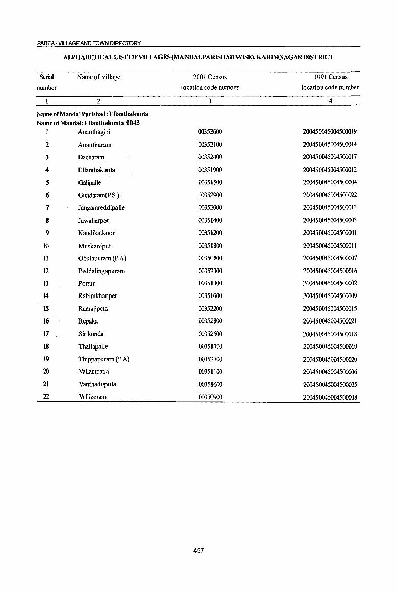
PART A -VILLAGE AND TOWN DIRECTORY
ALPHABETICAL LIST OF VILLAGES (MANDALPARISHAD WISE), KARIMNAGARDISTRICT
Serial Name of village 2001 Census 1991 Census
munber location code number location code number
2 3 4
Name of MandaI Parishad: EUanthakunta Name of MandaI: Ellanthakunta 0043
1 Ananthagiri 00352600 2004500450045000 19
2 Anantharam 00352100 2004500450045000 14
3 Dacharam 00352400 2004500450045000 17
4 Ellanthakunta 00351900 2004500450045000 12
S GalipaUe 00351500 200450045004500004
6 Gundaram(p.S.) 00352900 200450045004500022
7 Jangamreddipalle 00352000 2004500450045000 13
8 Jawaharpet 00351400 200450045OO4j()OOQ3
9 Kandikatkoor 00351200 20045004500450000 1
10 Muskanipet 00351800 200450045004500011
II Obulapuram (P.A) 00350800 200450045004500007
12 Peddalingapuram 00352300 200450045004500016
13 Pottur 00351300 200450045004500002
J4 Rahimkhanpet 00351000 200450045004500009
15 Ramajipeta 00352200 2004500450045000 15
16 Repaka 00352800 200450045004500021
17 Sirikonda 00352500 2004500450045000 18
18 Thallapalle 00351700 200450045004500010
19 Thippapuram (P.A) 00352700 200450045004500020
:;n Vallampada 00351100 200450045004500006
21 Vanthadupula 00351600 200450045004500005
22 Veljipuram 00350900 200450045004500008
457

DISTRICT CENSUS HANDBOOK: KARIMNAGAR
Census of India 2001 -Amenities and
Amenities available (if not available within the village, a dash ( -) is shown in the column and next to it in brackets the distance in broad ranges viz. < 5 kms., 5-10 kms. and 10+ kms of the
~ i nearest place where the facility is available is given)
" 0:
"'" ~~ -g -;;;- " u g ::I U fa .'" u 8 0: ..c ;; (5 " !;?
~ ~€ 0 E- .. " .~ '""' 0 0 '! . ., u ~ ..c .:l 8. " " ~ u ., 8
Q, ., :: ~ j ~ -lB " c. <.> ]~~ ~ '0 B g 'E. '" '" " ol:I C. ..c "'" ll' .~ - .. ~ e::.;;
" a u ::I ..c 'c ~ ~ u .. c:: "' "'" c '" co -s 0 ::I
! ..c a g "S u ~ g t .!ll '-
. ., 0 o'd:g=a o c:: ~ " ..c
~ ~~ .'" 0 J:l 0 "3 '- .. .. .. > :I lp:l
~ ~ c:>- o " 'g .g ~ i 'gj ~ .... 8. t 0 co " 0 !o . ., "iii i B ~ n "iii "
.r. " u e to e ~f ~ "5 ~ § u =a 1 3) 'a t
~ I);a 'il '" 0 ;g ~ 8 ~as 8';i en I-< l-< Z <~ ~rJl
1 2 3 4 5 6 7 8 9 10 II 12 13
MandaI Parishad : Ellaothakunta (0043)
RMP(2) Obulapuram (p.A)
1572.0 2,085 501 P(2) M H{IO+) THPTW PO
CM(IO+) ACSNCS CV(lO+) as RS{IO+)
(00350800) C(10+) MCW{IO+) W PH(IO+) CP(IQ+)
OCS(JO+) SP(lO+) NW(JO+) PHC(IO+) ST(IO+)
RMP(3) NCS(3)
2 Veljipuram
1051.0 1,534 384 P(2) M AC H(S-IO) THPTW PO CM(5-10) ACS«S)
eV(5-10) BS RS(IO+) (003S0900) C(lO+) MCW(IO+) W PH(IO+)
CP(IO+) OCS(IO+) Sp(IO+) NW(IO+)
PHC(5-1O) ST(IO+)
RMP
Rahimkhanpet P(2) MAC H{5-IO) THPTW PO NCS(4)
CV{< 5) BS RS{IO+) 3 571.0 1,658 402 CM«S) ACS«5) (00351000) C(IO+) MCW(lO+) W PH(IO+) SP(IO+) NW(IO+)
PHC« 5) CP(IO+} OCS(IO+)
ST(IO+)
PHSRMP(3} NCS
4 Vall_palla
870.0 2,747 678 P(3) M S H(S-IO) THPTW
PO PH CM(S-IO) ACS« 5) CY(S-JO) BSRS(IO+)
(00351100) AC(2) C(lO+) MCW(lO+} W SP(IO+) NW(IO+} PHC{5-IQ)
CP(IO+) OCS(IO+) ST(JO+)
PHS RMP(5) NCS(3) Kandikatkoor PIS) M S H(IO+) THPTW PO CY(IO+) BS RS{IO+)
5 1681.0 3,423 845 CM(IO+) ACS«5) (00351200) AC C(lO+) MCW(IO+) W PH(IO+) CP(IO+) OCS(IO+)
Sp(IO+) NW(IO+)
PHC(IO+) ST(IO+)
RMP(2) ACS(2)
6 Pottur
1274.0 3,092 707 P(2) M H(lO+) THPTW PO PH CM(IO+) NCS(5)
CV(IO+) BS RS(IO+) (OO35l300) C(lO+) MCW(JO+) W
CP(IO+) OCS(IO+) SP(IO+} NW{\O+}
PHC(lO+) ST(IO+)
PAC PHS RMP(3)
NeS
7 JawahaJpet
564.0 1,132 296 M« 5) H(S-IO) THPTW
PO PH CM(5-10) ACS«5) eY{S-IO) BS RS(lO+)
(00351400) C(lO+)
MCW(IO+) W CP(IO+) OCS(lO+)
SP(IO+) NW(IO+)
PHC(5-10) ST(IO+)
PHSRMP ACS
8 Galipalle
1395.0 2,904 723 P(2) M(2) S H{5-1O) THPTW
PO PH CM(5-10) NCS(3) CV(5-10) BS RS(IO+)
{00351 SOO) AC(2} C(10+) MCW{IO+} W CP(lO+} OCS(IO+)
SP(IO+} NW(IO+)
PHC(S-IO) ST(IO+)
RMP(2)
Y BJlthadupuia 1192.0 2,438 515
1'(3) M H«S) THPTW PO PH CM«S)
ACS« 5) CV« 5) BS RS(lO+) 9
(00351600) C{IO+) MCW(IO+) W NCS(IO+) SP(IO+) NW(IO+)
PHC« 5) CP(IO+)
OCS(IO+) ST(lO+)
P(2) AC(2) RMP(2)
NCS(3) Thallapalle H«5) THPTW CV« 5) BS RS(IO+)
10 833.0 1,724 441 M«S) PO PH CM«5) ACS{< 5) (00351700) C(lO+)
MCW{IO+) W CP(IO+) OCs{IO+) SP(IO+) NW(IO+}
PHC«5) ST(IO+)
RMP(2) NCS(2)
Muslcanipet 825.0 1,948 41S
P(2) M« 5) H(<5) THPTW PO PH CM«5) ACS« 5}
CV« S} BS RS(IO+) II
(00351800) C(IO+) MCW(lO+) W SP(IO+} NW(IO+)
PHC« 5) CP(IO+) OCS(IO+)
ST(IO+}
458
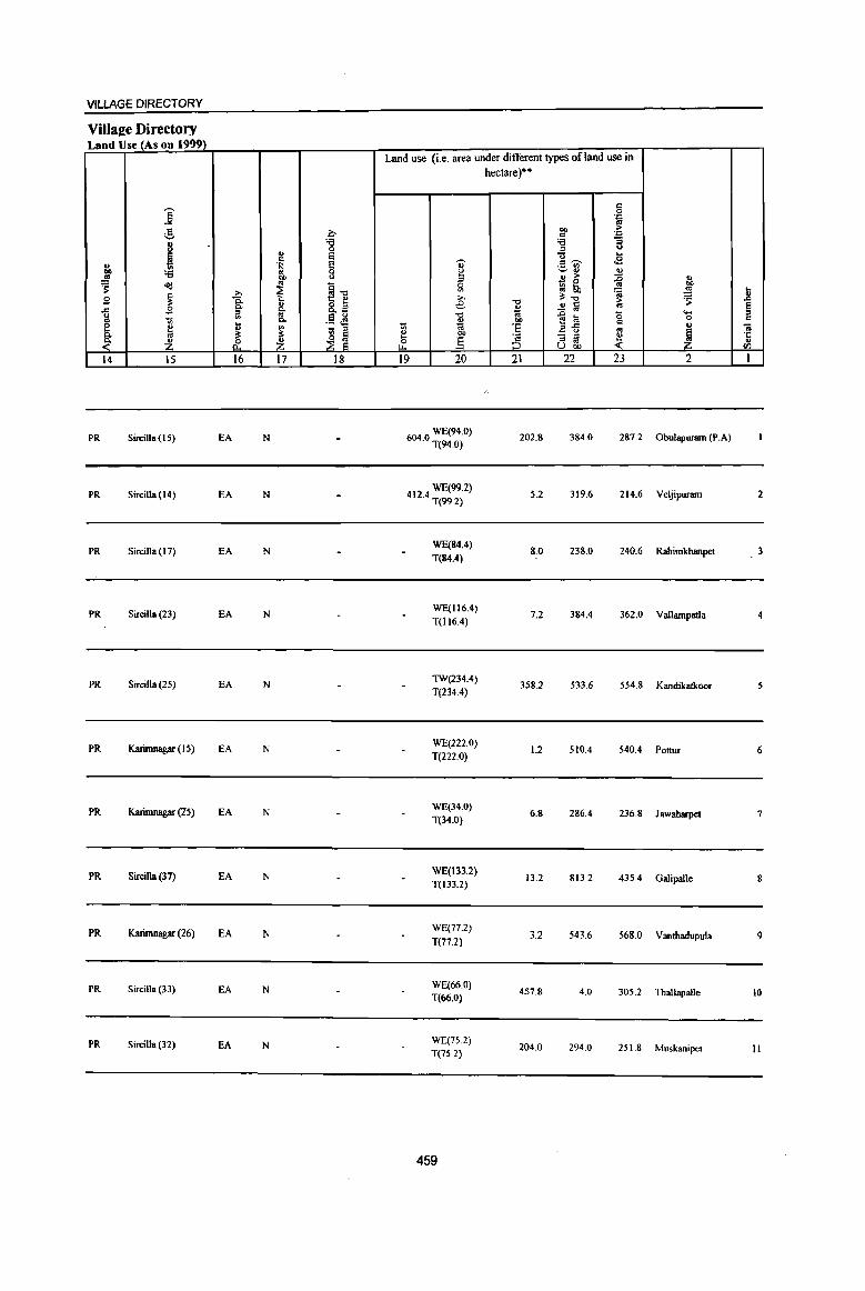
VILLAGE DIRECTORY
Villaee Directory Land Use (As on 1999)
Land use (i.e. area under different types ofland use in hectare)··
c j 0 ·c
;§, co ~ ~ " ·c
8 t :a ;; .fi u
~ .. a ... " e ~ c ~ .E .. .~ ., ._ '"
u ~ :a 0 0 ~ u co u !3 .. > ;0 ..
~ os - 0 '" CI) <td t ~1l ~ gj tb ~ .!!! .8 ~ >,
>, 0;-0 ~ B is. -0 > B a 8- az e
~ .!! a '" S ..c .... :;I g .. .§ ~ -0 .g a 15 0 " -:;; Q,
~ 00
" §. ... ~ ~ 'E ... ,C ., til ~ - " B u '" 1 ~
;t l~
co
~ '3 16 j_ '1:
~ & Z &' :.5 " u co fIl
14 15 16 17 18 19 20 21 22 23 2 1
PR Sircilla(IS) EA N 6040 WE(94.0) . T(94.0)
202.8 384.0 287.2 Obulapurarn (P.A)
PR Sircilla(14) EA N WE(99.2)
412.4 T(99.2) 5.2 319.6 214.6 Veljipuram 2
PR Sircilla (17) EA N WE(84.4)
8.0 238.0 240.6 Rahimkhanpet 3 T(84.4)
PR SirciUa (23) EA N WE(116.4)
7.2 384.4 362.0 Vallarnpatla 4 T(116.4)
PR SirciUa (25) EA N TW(234.4)
T(234.4) 358.2 533.6 554.8 Kandikadcoor 5
PR Karimnagar (15) EA N WE(222.0)
T(222.0) 1.2 510.4 540.4 Pottur 6
PR Karimnagar (25) EA N WE(34.0)
T(34.0) 6.8 286.4 236.8 Jawabarpet 7
PR SirciUa (37) EA N WE(133.2)
13.2 813.2 435.4 Galipalle T(133.2)
PR Karimnagar (26) EA N WE(77.2)
3.2 543.6 568.0 Vanthadupula 9 T(772)
PR SirciUa(33) EA N WE(66.0) 457.8 4.0 305.2 Thallapalle 10 T(66.0)
PR Sircilla (32) EA N WE(75.2) 204.0 294.0 251.8 Muskanipet 11 T(75.2}
459
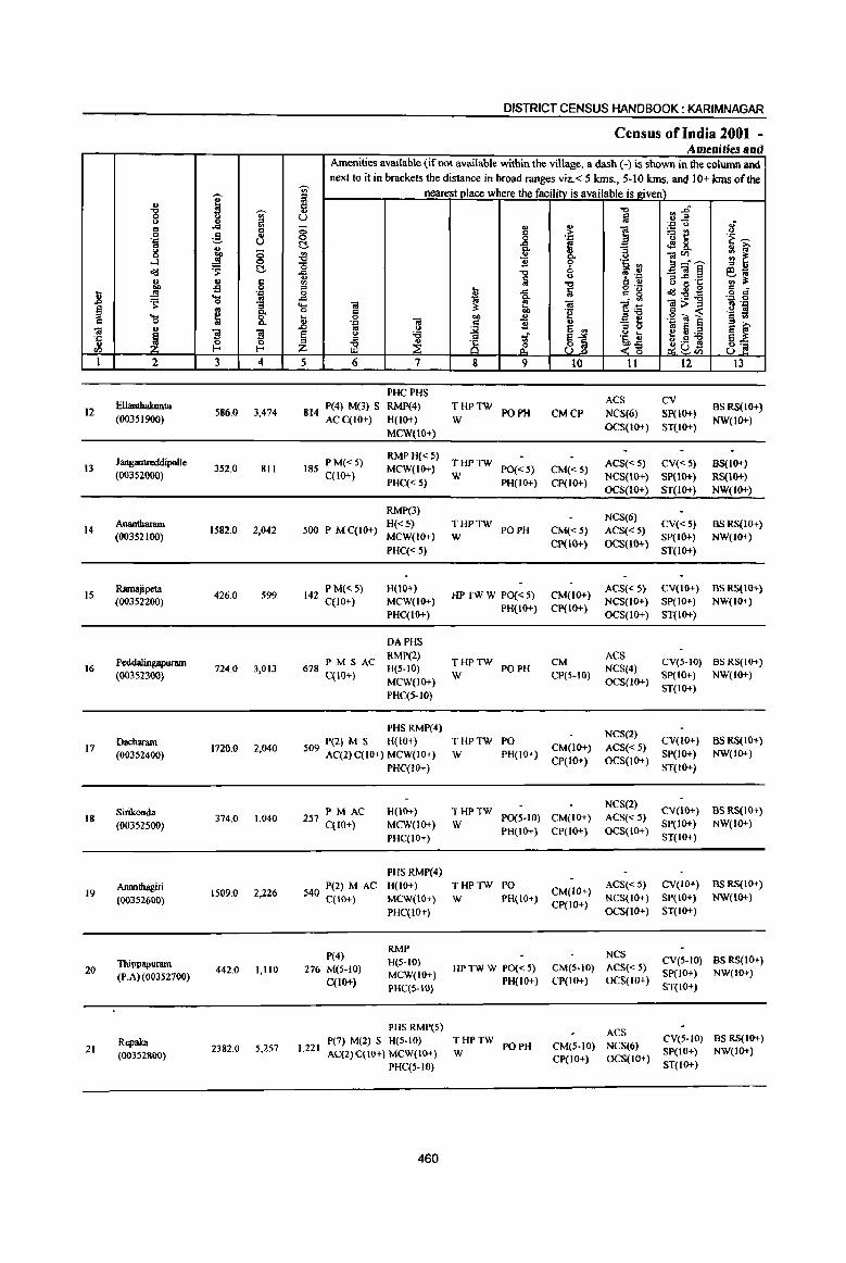
I " "8 ~
'" 0
~ '" .<:l
0 ~ 0z:j u .. j <> 0 0
...:I 0
~ 's: c:!-
" tl Cl .., -f! 0
j! .. 0z:j
~ .... to 0
i ~ ~ ... 0
;a u };
~ }; .t:
u ~ 0 <I.) E-<
I 2 3 4
12 Ellantbakunta
586.0 3,474 (00351900)
Jangamreddipalle 13 352.0 811
(00352000)
14 AnanIharam
1582.0 2,042 (00352100)
IS Ramajipeta
426.0 599 (00352200)
Peddalingapuram 16
(003S2300} 724.0 3,013
Dacharam 172000 2.040 17
(00352400)
Sirikonda 18
(00352500) 374.0 1,040
Ananthagiri 19
(00352600) 1509.0 2,226
Thippapuram 20 442.0 1,110
(PoAl (00352700)
Repaka 21 2382.0 50257
(00352800)
DISTRICT CENSUS HANDBOOK: KARIMNAGAR
Census of India 2001 -Amenities and
Amenities available (if not available within the village, a dash (-) is shown in the column and next to it in brackets the distance in broad ranges viz.< 5 lans., 5-10 kms. and 10+ kms of the
~ U) nearest place where the facility is available is Riven) iil Cl -0 .. .0 '" u ;j u..e .z:j <> 8' - .. ~ ] ~t: 0 c
0 0 0.c .;: ~ c:!- fr I 4!8. "3 ~ ! -a ]~~ 0
"0 "2 0Sj, '" ..c -0 , .~ _Ol~ eo; '" Ii <> B -; 01: ., iii: .,
." Cl tl ;:J .. ..c ~ g 'g ~~~
c C _g ~
0 Q. . .. .'" 0
"- OJ ;l: G. OJ ];fj <a:> ::> B 0;::: 0 c 'e g « ._ :I U 0 -;a
.., '" ._ <t] § '" 0.tJ c "2 " :; ~ 10 E .0 '" 0
~ e § ~ ~ 0 :a ~. ~j 05, U f U;.a ::> ~ .S S ~ .~ 8 .'l~ 8:; ~U<l)
5 6 7 8 9 10 II 12 13
PHCPHS ACS CV
814 P(4) M(3) S RMP(4) THPTW
PO PH CMCP NCS(6) SP(IO+) BS RS(IO+)
ACC(IO+) H(IO+) W NW(IO+) MCW(IO+)
OCS(IO+) ST(IO+)
PM« 5) RMPH«5)
THPTW ACS(<5) CV«S) BS(IO+) 185 MCW(IO+) PO«5) CM«S) C(IO+)
PHC«5) W
PH(lO+) CP(IO+) NCS(IO+) SP(IO+) RS(IO+)
OCS(IO+) ST(IO+) NW(IO+)
RMP(3) NCS(6)
500 PMC(IO+) H«5) THPTW
PO PH CM«5) ACS« 5) CV«5) BSRS{IO+)
MCW(IO+) W CP(lO+) OCS(lO+)
SP(IO+) NW(IO+)
PHC«5) ST(IO+)
142 PM«5) H(lO+) HPTWW PO«5) CM(IO+)
ACS« 5) CV(lO+) BS RS(lO+)
C(lO+) MCW(IO+) PH(IO+) CP(IO+)
NCS(IO+) SP(IO+) NW(IO+)
PHC(IO+) OCS(IO+) ST(IO+)
OAPHS
PM S AC RMP(2)
THPTW CM ACS
CV(5-IO) BS RS(IO+) 678 C(1O+) H(S-IO)
W PO PH
ep(S-IO) NCS(4)
SP(IO+) NW(IO+) MCW(lO+) OCS(IO+)
PHC(5-IO) ST(IO+)
PHS RMP(4) NCS(2)
P(2) M S H(IO+) THPTW PO CM(IO+) ACS«5)
CV(IO+) BS RS(IO+) 509 AC(2) C(IO+) MCW(IO+) W PH(IO+) SP(IO+) NW(lO+)
PHC(!()+) CP(IO+) OCS(IO+)
ST(IO+)
PM AC H(10+) THPTW NCS(2)
CV(lO+) BS RS(IO+) 257 C(lO+) MCW(IO+) W
P0(5-10) CM(IO+) ACS«5) SP(IO+) NW(IO+)
PHC(IO+) PH(IO+) CP(IO+) OCS(IO+)
ST(IO+)
PHS RMP(4)
540 P(2) MAC H(IO+) THPTW PO CM(IO+)
ACS«5) CV(IO+) BS RS(IO+)
C(1O+) MCW(IO+) W PH(IO+) NCS(IO+) SP(lO+) NW(IO+)
PHC(IO+) CP(to+)
OCS(IO+) ST(IO+)
P(4) RMP
NCS H(5-10) CV(S-IO) as RS(IO+)
276 M(S-IO) MCW(IO+)
HPTWW PO«5) CM(5-IO) ACS«5) SP(lO+) NW(IO+)
C(IO+) PH(lO+) CP(lO+) OCS(IO+) PHC(5-IO) ST(IO+)
PHS RMP(5) ACS
P(7) M(l) S H{S-IO) THPTW PO PH CM{S-IO) NCS(6)
CV{S-to) BSRS(IO+) 10221
AC(2)C(lO+) MCW(lO+) W SP(IO+) NW(IO+) CP(IO+) OCS(JO+)
PHC(5.1O) ST(IO+}
460
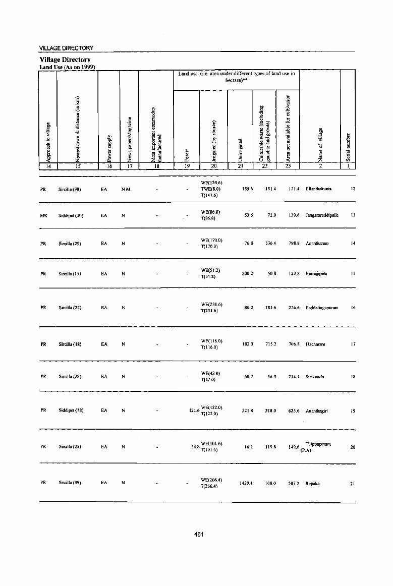
VILLAGE DIRECTORY
Villa2e Directory Land Use (As on 1999J.
j g ~
8 '8 B ..
i 'fi j '" '6 "" 01 ~ o'd ~1l -a ~ g ~ ., 8.il ..c S 0. Co
ii! co
J :;; Co § 1;1 ~
.... 1
., - " ~ il: ~ ~ &. Z
14 J5 16 17 J8
PR SirciJIa(30) EA NM
MR Siddipet (30) EA N
PR Sircilla (29) EA N
PR Sircilla(IS) EA N
PR Sircilla (22) EA N
PR Sircilla (18) EA N
PR Sircilla (28) EA N
PR Siddipet (IS) EA N
PR Sircilla (25) EA N
PR Sircilla (39) EA N
Land use (i.e. area under different types ofland use in
~ .. ~ ¢ OIl
>. e ."
~ 7ii :2 ... ~ ] 19 20
WE(139.6) TWE(S.O)
T(147.6)
WE(86.8) T(86.8)
WE(170.0) T(170.0)
WE(SI.2)
T(SI.2)
WE(23 1.6) T(23L6)
WE(116.0)
T(116.0)
WE(42.0) T(42.0)
1216 WE(122.0) . T(m.O)
WE(IOI.6) 54.8 T(lOI.6)
WE(266.4) T(266.4)
461
hectare)··
~ ... 'E ;§ 21
155.6
53.6
76.8
200.2
80.2
182.0
60.7
321.S
16.2
1420.4
"" c '6
:;:J
u c ~ ._ ., ~ .. ., > _ 0
~~ ..!! a 1~ - ::s :;:J '" U bI)
22
151.4
72.0
536.4
50.8
185.6
715.2
56.9
318.0
119.8
IOS.0
S '.g ;> 'p
] ... .E .. :0 .. ~ eo .~ ~
~ Cd
g ..... 0 .,
oj
~ ~ 23 2
131.4 Ellanthakunta
139.6 Jangamreddipalle
79S.8 Anantharam
123.8 Ramajipeta
226.6 PeddalingapW"lllll
706.8 Dacharam
214.4 Sirikonda
625.6 Ananthagiri
1496 Thippapurnm . (P~A)
587.2 Repaka
.8 ~ .. ·c ., ell
1
12
13
14
15
16
17
18
19
20
21

i .. "8
.., ;;;s
.to <II
6 c ,§ ..
'::J t.) to
~ 8 ;; ....l 0
o'd ~ t!-t, .. c
'fl 0
.8 ..!! 'P 'S '" 'S :;
§ '" '" ... ~ 0 c a '" .. ., ~ g '3 .= a u l- I-rI)
t 2 3 4
22 Gundaram(p,S,)
1274,0 2,693 (00352900)
MandalParisbad TOfJII
23199.0 48990
'U)' ;: Ii t.)
;; 0 t:!-
~ .c <U
'" ::I 0 .c ... 0
.8 § Z 5
661
DISTRICT CENSUS HANDBOOK: KARIMNAGAR
Census of India 2001 -Amenities llnd
Amenities available (if not available within the village, a dash (-) is shown in the column and next to it in brackets the distance in broad ranges viz, < 5 krns" 5-10 kms, and 10+ kms of the
nearest place where the facility is available is l!:iven) -a ~~ lii 'D U 8 <U
., ] 1l~ c >
0 '::J '~ ~ .c f ~ 8- .. :;-'" ;; .!l ..
~~--- ~ ~ '" u B 6 '~ rl .",
U '1 '.r: _Ol§ 6~
fa 6 ~ '!': '" ~ .", c .. ... !;j o'_ ~ ., 0 a c" ., ..c c g :E:a .. G; . ., 'J:: 0 .. 1 1!~ ]>.<
'" ,_ c:: ~ '~ ~ 0 .. ""
., 2 <U '~] ~ 'D " B :; 0 ~J '" u
~ e VI u '6 ~ ~1 '~ t ~u:a
::l
~ 8 g .s !!! ;g <~ Ii! 8", 8'2 6 7 8 9 to 11 12 13
RMP(3) NCS(3)
PM S AC H«S) THPTW PO PH CM(IO+) ACS«S)
CV« 5) BS RS(IO+) C(IO+) MCW(JO+) W
CP(IO+) OCS(JO+) SP(IO+) NW(lO+)
PHC{<5) ST(IO+)
T(20) DA PHC
11810 P(Sl) M(20) PUS(9) Well) PO(18) CM(2) CP ACS(7) cv BS(21) S(ll) AC(19) RMP(53) HP(22) PU(12) NCS(5()
TW(22)
462
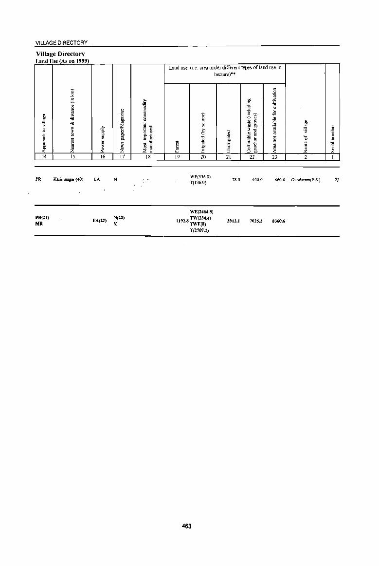
VILLAGE DIRECTORY
Villaee Directory Land Use (As on 1999)
14
PR
PR(21)
MR
15
Karirnnagar (40)
16
EA
EA(22)
17
N
N(22)
M
18
Land use (i.e area under different types ofland use in hectare)"
19 20 21 22 23 2
WE(136.0) T(136.0)
78.0 400.0 660.0 Gundaram(P.S.)
WE(2464.8)
1t92 8 TW(234.4) • TWE(8)
T(2707.2)
463
3'113.1 7025.3 8360.6
12
I .'
, \
N X
'" '"
\ \
\ , \ _, I I()
/ . ~
,
, , I ,
~ l_ :6 .,' ,
I
I
I I
a C/) g
. ~ ~
I .---
(} <t
<\
v w
, , o ~, 0:. . .. ,
I() ,
\ \
I I
I I
I I
... "'1 , , '8' , , :,.,:@ I
I '''' , I ',., , I :8: I , , I , , I 1.. __
o
.- - i , x,
_ :0: u • ' 0 ,
III ~
I N . ~ .., c. , "" • ' 10 , ell , "', . :8:
l __ ~
PARTA- V1LLAGEAND TOWN DIRECTORY
ALPHABETICAL LIST OFVlLLAGES (MANDALPARISHAD WISE), KARIMNAGAR DISTRICf
Serial Name of village 2001 Census 1991 Census
number location code number location code number
2 3 4
Name of MandaI Parishad: Bejjanki Name of Mandai: Bejjanki 0044
1 Bejjanki 00354400 2004600460046000 18
2 Cheelapur 00354600 200460046004600024
3 Cherlapur 00353300 2004600460046000
4 Dacharam 00355200 2004600460046000 19
S Devakkapalle 00355400 2004600460046000 14
6 Gagillapur 00355100 20046004600460000
7 Gannervaram 00353000 200460046004600001
8 Gopalpur 00353400 20046004600460005
9 Guggilla 00355000 20046004600460001
10 Gunkulkondapur 00354200 2004600460046000 13
11 Jangapalle 00354100 2004600460046000 12
12 Kallepalle 00354500 2004600460046000 17
13 Khasimpet 00353800 200460046004600009
14 Madhapur 00353700 20046004600460008
IS Muthannapet 00354900 2004600460046000
16 Mylaram 00353600 200460046004600007
17 Panthulu Kondapur 00353200 200460046004600003
18 Parvella 00353900 2004600460046000 1 0
19 Potharam 00354800 2004600460046000
20 Regulapalle 00354700 200460046004600025
21 Sangam 00353500 2004600460046000
22 Thotapalle 00355300 2004600460046000 15
23 Vadlur-Begumpet 00354000 200460046004600011
24 Veerapur 00354300 2004600460046000 16
25 Yaswada 00353100 200460046004600002
465
"' I -g -.;-<> II ~ l!l .9 'iii .._, u .. ~ 0
~ 0
cIIJ C
~ .. 9 -= .8 ~ 'J:! .... os ~ 0 g_ § .. .... ~ 8. C 0
"' 01
! '3 '3 ·c 0 ~ ., IZl ... 1 2 3 4
MaDdaI Parisbad : BejjaDIU (0044)
Gaunervaram 2265.0 5,396
(00353000)
Yaswada 2 1168.0 231
(00353100)
3 Panthulu Kondapur
467.0 (0()353200)
4 Chedapur
904.0 (00353300)
5 Gopaipur
318.0 516 (0()35340()
Sangam 6 1852.0 1.870
(0()353500)
7 Mylararn
903.0 1.786 (00353600)
Madhapur 8 881.0 1,290
(00353700)
Khasimpet 9
(00353800) 478.0 1.324
Parvella 10 538.0 1.368
(00353900)
II Vadlur-Bcgwnpet
1838.0 4,264 (00354000)
12 Jangapaile
853.0 2.938 (00354100)
DISTRICT CENSUS HANDBOOK: KARIMNAGAR
Census of India 2001 -Amenities and
Amenities available (if not available within the village, a dash (-) is shown in the column and next to it in brackets the distance in broad ranges viz.< 5 kms., 5-10 kms. and 10+ kms of the
-.;- nearest place where the facilitv is available is I!.iven) a "to ::~ " u !a 'J:! U .; 0 '" ~ ] ~l!
.., c .~ .--'" 0 .~
t!- ..c .!8.. ~ f Q. "E
'" '" ]:~ .a 9" U
'0 1! '5, ~ ..c "to 0 , ''::: _01~ ~~ ~ l';j u
G 2'~ "to c "' ::l ... fa o ,_ c
r:! 0 u 1 c g cIIJ:9:e 0
..c ... - '" 'J:! 0 .... OJ OJ ]~
Ol;>::s ., '.J:l 0 c ~ "2 J!l ~ 1 .~ ~ u a bO "' . ., Ol c 1! " :; t - S
::l >. .r> co <>
~ S <Il i'!"':e S ~ § <> :e of 81 '5, u ::l
~ is ~a~ El]_ z iil ~ _<15 o· U
5 6 7 8 9 10 11 12 13
DAPHS
P(4) M S RMP(2) NCS(4) CV(IO+) BSRS(lO+)
1.325 AC(3) qIO+) H(IO+) THP PO PH CM(IO+) ACS(IO+)
MCW(IO+) CP(IO+) OCS(lO+) SP(IO+) NW«S)
PHC(IO+) ST(IO+)
63 P M« 5) H(!(}+) PH ACS(IO+) CV(IO+) NW
THP CM(IO+) BS« 5) C(lO+) MCW(IO+) PO{<S) NCS(lO+) SP(IO+)
PHqIO+) CP(IO+)
OCS(lO+) ST(lO+) RS(IO+)
--Uninhabited ----
--Uninhabited ---
118 PM«5) H(IO+) THP PO« 5) CM(IO+)
ACS(S-to) CV(IO+) BS«S) C(lO+) MCW(IO+)
PH«5) CP(IO+) NCS(IO+) SP(IO+) RS(IO+)
PHqIO+) OCS(IO+) ST(IO+) NW(5-10)
PAC RMP H(IO+) PH ACS(S-IO) CV(lO+) BSRS(IO+)
486 M«5) MCW(IO+) THPW CM(IO+) C{IO+) PHC(IO+)
1'0« 5) CP(IO+)
NCS(IO+) SP(IO+) NW(5.IO)
OCS(IO+) ST(lo+)
RMP(2) NCS
433 P(2) MAC H(IO+) THP PO PH CM(IO+) ACS(S-IO)
CV(IO+) BS RS(IO+) C(IO+) MCW(lO+)
CP(IO+) OCS(IO+) 8P(10+) NW«S)
PHqIO+) ST(IO+)
336 P M« 5) RMPH(lo+) NCS(2)
CV(IO+) BS RS(IO+) MCW(IO+) THP PO« 5) CM(IO+) ACS(S-IO)
C(lO+) PHqIO+) PH« 5) CP(IO+) OCS(IO+)
SP(IO+) NW(5-10)
ST(IO+)
PHSRMP NCS(2)
PM AC H(lO+) PH CV(IO+) BS RS(lO+) 326 C(IO+) MCW(IO+)
THP 1'0« 5)
CM(5-10) ACS(5-1O) SP(IO+) NW(5·10)
PHC(IO+) CP(IO+) OCS(IO+)
ST(IO+)
PAC H(lO+) PO
NCS(4) CV(IO+) BS RS(IO+)
341 M«5) THP CM(IO+) ACS(S-IO) C(IO+)
MCW(IO+) PH« 5) CP(IO+) OCS(IO+)
SP(IO+) NW(IO+)
PHC(IO+) ST(IO+)
PHSRMP(3) ACS
P(4) M S H(IO+) THP PO PH CM(5-IO) NCS(4)
CV(5-10) BS RS{IO+) 1,054 AC(2) C(IO+) MCW(IO+)
CP(S-IO) OCS(IO+) SP(IO+) NW(IO+)
PHqS-IO) ST(IO+)
PHS RMP(2) NCS(3)
628 P(2) M S H(IO+) THP POPH CM(5·10) ACS(S-IO)
CV(IO;.) BS RS(IO+)
AC C(IO+) MCW(lO+) CP(IO+) OCS(IO+)
SP(IO+) NW(IO+)
PHC(IO+) ST(IO+)
466

VILLAGE DIRECTORY
Villa2e Directory Land Use (As on 1999)
14 15
PR Karirrmagar (42)
PR Karimnagar (45)
16 17
EA NM
EA
--Uninhabited ---
--Uninhabited ---
MR Karimnagar (34) EA
PI( Karimnagar (34) EA N
PR Karimnagar (40) EA NM
PR Karimnagar (35) EA NM
PR Karimnagar (40) EA NM
MR Karimnagar (44) EA N
PR Karimnagar (32) EA NM
PR Karimnagar (28) EA NM
18
Land use (i.e. area under different types ofland use in hectare)··
19 20 21 22 23
WE(S09.0) TWE(72.0) 1053.0 95.0 236.0
T(SSI.O)
WE(30.0)
TWE(2.0) 64.0 1072.0
T(32.0)
2
Gannervaram
Yaswada
467.0 Panthulu Kondapur
904.0 Cherlapur
WE(79.0) TWE(2.0) 43.0 1.0 193.0 Gopalpur
T(SI.O)
WE(114.0)
TWE(2.0) 372.0 12.0 1292.0 Sangam T(176.0)
WE(20S.0)
TWE(2.0) 539.0 29.0 125.0 Mylararn T(210.0)
WE(221.0) TWE(II.O) 361.0 51.0 231.0 Madhapur T(232.0)
WE(2S9.0)
TWE(3.0) 156.0 12.0 48.0 Khasimpet T(262.0)
WE(22S.0) TWE(3.0) 189.0 18.0 103.0 Parvella T(228.0)
WE(509.0) TWE(IO.O) 1042.0 38.0 239.0 Vadha-Begwnpet T(519.0)
WE(257.0) TWE(6.0) 457.0 16.0 57.0 Jangapalle T(263.0)
467
2
3
4
5
6
7
8
9
10
II
12
I .g -;;-8 8
..cl 1il g c g .,
] (.)
j § ~ C!-o'd .., " c
~ -s 0
.8 .1i .... ~ 0
1 § g .... c: 0
ca " J "iI "B ·5 "0 ~ '" E-
1 2 3 4
Gunkulkondapur 13 1614.0 4,629
(00354200)
14 Vecrapur
225.0 790 (00354300)
Bejjanki 15 2539.0 6,988
(00354400)
16 Kallepalle
1730.0 3,538 (00354500)
Oteelapur 17 529.0 1,323
(00354600)
Regulapalle 18 841.0 1,847
(00354700)
19 Potharam
356.0 475 (00354800)
20 Muthannapet
706.0 1,183 (00354900)
Guggilla 21 847.0 2,077
(00355000)
GagiUapur 656.0 1,618 22
(00355 lOG}
Dacharam 1057.0 2,367 23
(00355200)
DISTRICT CENSUS HANDBOOK: KARIMNAGAR
Census of India 2001 -Amenities and
Amenities available (if not available within the village, a dash (-) is shown in the column and next to it in brackets the distance in broad ranges viz. < 5 kms., 5-10 kms. and 10+ kms of the
-;;- nearest place where the facility is available is given) ;l C "0 :; j" ..,
(.) ~ - ., ~ ~
.J:' 0 ..,-0 '" '5t! 0 0 0 . ." .~ __._ C ..cl ~ ~ 8.. ., i;>
i ;; ~ g- o ~ :-__._ i t o 6 ·Ii '" ..c ~ , .~ _"il§ eiii ~ ~
u e..c 'C '" ~ -c c " ~n~ old il .9 c
_g u ..c: ii o c·
~ ~ :"S!'l3 .J:' 0 .... ca ca 1-i ca>::> .~ ':M 0 c .j:! ., <
t; 0 ca ... ., .g ~ l § '" .J:> c 'B ... .&> .. u
~ jj ::> ., '" e e ~
§ Q 'l3 1 ~~ ~~~ g~ ~ ~ 8 ~as Z __ OIl u 5 6 7 8 9 10 11 12 13
MH PHS NH
I 116 P(6) M(2) S RMP(2) 0
CM ACS
CV(IO+) BS RS(IO+) H(IO+) THP PO PH NCS(4)
, ACC(IO+) MCW(IO+)
CP(lO+) OCS(IO+)
SP(IO+) NW(IO+)
PHC(IO+) ST(IO+)
195 PM« 5) H(IO+) THP
PH CM«5)
ACS(5-IO) CV(IO+} BSRS(IO+) C(lO+) MCW(IO+) PO« 5)
CP(IO+) NCS(IO+) SP(IO+) NW(IO+)
PHC« 5) OCS(lO+) ST(IO+)
MHPHCPHS P(7) M(2) FWCNH(2) ACS CV
BS RS(IO+) 1,605 S(2) PUC RMP(4) THP PO PH CMCP NCS(6) SP(lO+)
AC(3) C(lO+) H(1O+) OCS(IO+) ST(1O+) NW(IO+)
MCW(JO+)
PHS RMP(2) NCS(4)
848 P(3) M AC H(10+) THP PO PH CM«S) ACS« 5)
CV« 5) BSRS(IO+) C(IO+) MCW(IO+)
CP« 5) OCS(IO+) SP(IO+) NW(JO+)
PHC« 5) ST(IO+)
RMP(2) NCS(3)
PM AC H(IO+) CV« S) BSRS(IO+) 308 C(1O+) THP PO PH CM« 5) ACS« 5)
MCW(IO+) CP« 5) OCS(IO+)
SP(1O+) NW(IO+}
PHC«S} ST(IO+)
48{) PM AC PHS H(IO+) NCS(2)
CV(5-tO) BSRS(IO+) MCW(IO+) THP PO PH CM(S-W) ACS(5-1O)
C(lO+) PHC(5-10) CP(5-1O) OCS(tO+)
SP(IO+) NW(IO+) ST(IO+)
119 PM«5) H(IO+) HP PO« 5) CM«5)
ACS«5) CV«5) BSRS(IO+)
C(lO+) MCW(IO+) PH« 5) CP« 5)
NCS(IO+) SP(IO+) NW(IO+)
PHC« S) OCS(IO+) ST(IO+)
P(3) AC PH
NCS CV«5) BS RS(IO+)
275 M« 5) H(IO+)
THP CM«5) ACS«5)
C(lO+) MCW(lO+) PO« 5)
CP«S) OCS(tO+) SP(IO+) NW(IO+)
PHC« 5) ST(IO+)
533 P(2) M AC RMPH(IO+) NCS(2)
CV(S-IO) BS RS(IO+) MCW(IO+) THP PO PH CM(5-IO) ACS(5-1O)
C(IO+) PHC(S-IO) CP(S-IO) OCS(JO+)
SP(IO+) NW(IO+) ST(IO+)
RMP(2) NCS(3)
364 PM S H(IO+) THP POPH CM(5-10) ACS(S-IO)
CV(5-IO) BSRS(IO+)
C(lO+) MCW(IO+) SP(IO+) NW(tO+)
PHC(5-IO) CP(S-IO) OCS(IO+)
ST(IO+)
PHSRMP(2) NCS
570 P(3) M S H(IO+) THP PO PH CM« 5) ACS«5)
CV«S) BS RS(10+)
C(IO+) MCW(tO+) SP(IO+) NW(IO+)
PHC« 5) CP« 5) OCS(IO+)
ST(IO+)
468
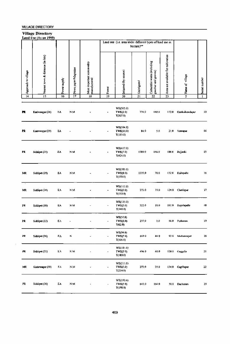
VILLAGE DIRECTORY
Villa~e Directory Land Use (As on 1999)
Land use (i.e. area under different types of land use in hectare)··
j c 0 .::;: «I ,g a 00 >
c .::;:
8 i :a -; ., ::> <.>
~ E u ... c <B u .~ E 0- c,...., ._ <II
]I ::a 0
~ ~" .,
OJ) ., ., > :0 ., 's= ~ co
~il - 0 .. OJ)
~ » ~ <II ::J !;b 'fa ~ I:; g 8: e ""
3:-0 > 's= .J:> ., 8.E ~ ~ § ..c B 0-
* ..
u ;! '" .5 ~ -0
]~ '5 ... .. Wi 0. ., 00 0 = ~ ~ ~ ~ - ::> Wi ;; 'E = .. "iil «I
~ ~ e OJ)
~ - ::> ~ ~ '0 ~ ~ & ~ &' :5 ::> '"
., u OJ) '" 14 15 16 17 18 19 20 21 22 23 2 1
WE(505.0)
I'R Karimnagar (26) EA NM TWE(2.0) 774.0 160.0 173.0 Gunkulkondapur 13 T(S07.0)
WE(104.0)
PR Karimnagar (29) EA TWE(II.O) 84.0 5.0 21.0 Veempur 14 T(IIS.0)
WE(417.0) PR Siddlpet (2S) EA NM TWE(7.0) 1789.0 146.0 180.0 Bejjanki IS
T(424.0)
WE(18S.0)
MR Siddipet (29) EA NM TWE(S.O) 1335.0 70.0 132.0 Kallepalle 16 T(193.0)
WE(I I 1.0)
MR Siddipet (24) EA NM TWE(2.0) 273.0 19.0 124.Q Cbeelapur 17 T(Il3.0)
WE(135.0)
PR Siddipet (18) EA NM TWE(5.0) 522.0 18.0 161.0 RegulapaJle 18 T(140.0)
WE(S7.0)
PR Siddipet (22) EA TWE(S.O) 237.0 1.0 56.0 Polharam 19
T(62.0)
WE(94.0) PR Siddipet (26) EA N TWE(7.0) 469.0 44.0 92.0 Muthannapet 20
T(101.0)
WE(I 8 1.0) PR Siddipet (25) EA NM TWE(2.0) 496.0 40.0 128.0 Guggilla 21
T(I83.0)
WE(211.0) MR Karimnagar (30) EA NM TWE(3.0) 273.0 35.0 134.0 Gagillapur 22
T(214.0)
WE(193.0) PR Siddipet (30) EA NM TWE(S.O) 645.0 164.0 50.0 Dachanun 23
T(198.0)
469

1l § " .. "I: .. Vl
1
24
2S
.. "8
<>
6 '., 8
....)
<Ill ., co
..!! ~ "" 0 u
1 2
Thotapalle (00355300)
Devakkapa1le (00355400)
Mandai Parisbad Tatal
I -;;;-... :0 .<: VI
,g 13 U
~ ;:; l'l <:> ~ C!-., § oS 'J:l ._ .. 0 "3 g 8: ] ] 0 0 (- I-<
3 4
1348,0 3,066
274.0 954
15187.0 51838
-;;;-;l Ii u -<:> <:> C!-~
i ,g '0 t
A
~ Z 5
DISTRICT CENSUS HANDBOOK: KARIMNAGAR
Census of India 2001 -Amenities and
Amenities available (if not available within the village, a dash (-) is shown in the column and next to it in brackets the distance in broad ranges viz. < 5 kms., 5-10 kms" and 10+ kms of the
nearest place where the facil!!Y_is available isgivenl
"" ~~ til "., <> .; '" ...
] ~t: u
" > .~ ~ 0 .::
.<: e <fl 8-c. "3 ., 8- <> ~~'" ~ G 1a '? "i", "Cl 0 , .~ - .. ~ e!.iI !ij <>
6 g"5 VI 11: "0 c:: .. t lij
o ,_ c::
.<: c:: g o<l:'2~ o .: 1;j ~ 1~
'., 0 .. ~ 3 .. >:0 oj '.j:j
c:: ~
c:: « "~ ~ 0 -;a OIl .. ,g <a ~ ";l
1 11 :; b 1U 8 .. <) e a ~ <> '3 1i ~j "~ t f u ~
~ ~as ~'i i ~ <~ ~Vl
6 7 8 9 10 II 12 13
PHCPHS NCS(2)
760 P(3) M S FWC RMP(2) T HP PO PH CM
ACS(5-10) CV(IO+) BSRS(IO+)
ACqIO+) H(IO+) CP(IO+) SP(IO+) MCW(IO+)
PAC H(IO+)
244 M« 5) C(lO+)
MCW(IO+)
PHC«S)
DA MU(l)
P(St) M{t6) PUC(I) 11517 S(9) PUC PUS(10)
AC(21) FWC(I) NH(3) RMP(19) 0
470
THP PO« 5) PH« 5)
T(Zl) W PO{I4) UP(Z3) PU(!8)
OCS(IO+)
ACS«5} CM«5) CP(tO+)
NCS(tO+) OCS(IO+)
CM(3) CP ACS(J) NCS(48)
ST(lO+)
CV(IO+) SP(IO+) ST(1O+)
CV
NW(lO+)
BSRS(IO+) NW(IO+)
8S(21) NW

VILLAGE DIRECTORY
Village Directory Land Use (As on 1999)
~ oS ~ B ..c 16 §. ~ 14
PR
MR
PR(17) MR(6) NW
j :3 '" <.>
~ 'i3 o"d
~ ~
'" .. ~ 15
Karimnagar (28)
Karimnagar (26)
~ Po Po :I
'" t
" 0 p.
16
EA
EA
EA(Z3)
<1.l c .~ OJ)
" ~ " Po co 0.
'" ~ Z 17
NM
N
N(19) M(IS)
i:' 'i3 0 E E 0 <.>
§"O t: " 8.,3 §~ t;; :I
Iii 0 :::E E
18
Land use (i.e. area under different types of land use in
'" ~ .,.. 19
~
" 2 ::I a '" ,., e "0
%l OJ)
] 20
WE(426.0) TWE(28.0) T(454.0)
WE(lISO) TWE(16.0) T(134.0)
WE(5508) TWE(214) T(5722)
471
hectare)··
"0
" "l;!
"" E :§ 21
518.0
98.0
11795.0
c a .~
"" ·E cg ;; ::I u
U .... <E c~
~~ <1.l
'" ;> :0 _ 0
oS gj !;h .0;
" "0 ;>
" § " :c '0 r: ~ c 2"5 " - ::I ~ ::I CIl u OIl
22 23
156.0 220.0
22.0 20.0
121M 6458.0
'" "" ~ !;; ~ .r>
§ ._ a c " Ol ~ ·c
'" Z (/)
2 I
Thotapalle 24
Devakkapalle 25
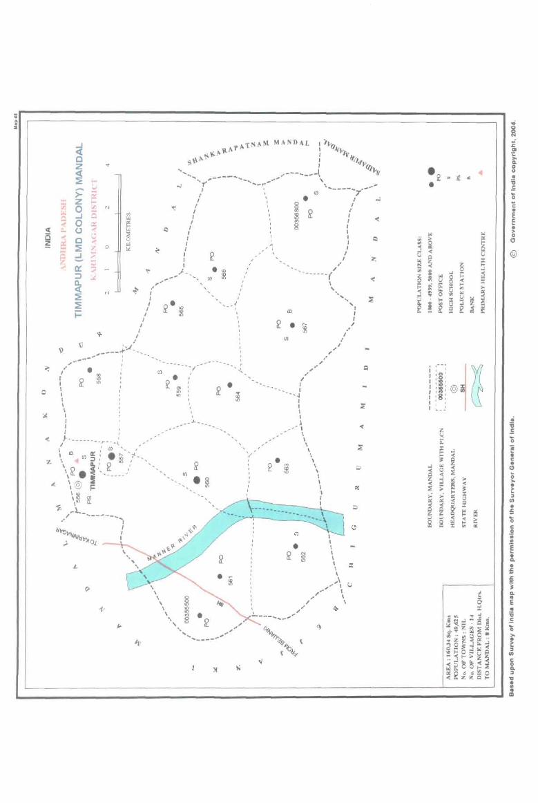
. .. .. ;
~ ~
o
:.. ; C
~ ... ~ . "'"' <
" I , I I I I I \ I I I
~ c z « ~ - ..;
> ;: z .... 0 rJJ .... N
...J C 0 0::: 0 ... c ..; ... ~ '7 ...J
..... .. o
- .... Il: ~ :::J
~ ~
N
~ i=
\l '-..(' _.,-----; ... -... _ ..... "-,--•
~
I ,
~"-------r--_{ , I I t/) '... ,.
\ III (fJ a::: . :;:; ''f"
(J)
--"f-
~. 1Il '"
, ,
~
• (/)
- - _..1- ••••
z \ ~: ~ It\,' ". \1r. i ',,-----/ ", .t \@ 1=
\ :g \10 ~
'$ \ ,~-.- ... ------"
~ I
L
I I I
, ,
)I
~ , , , , .... ,- ... ~
, , , "
, ,
~
CIl
• (/)
... ~
" , .. .. ,
.... , - :
, , , ',/
~ •
"--1 I I I I .I __ - I
\ \ \ \ \ \
~ \
(/)
• ~
\ I I , I I
"
\ , '. ......
" I I
I ,
I I I I
".
\ , \ \
, I I I
I
= ,\ u --,,, \ , , ,.. \
,," ~ , .. ----.... -,
'" 8 ~
:c III 1: >-Il. 0 ·0 0
" "' IQ .. .. .. '6 • E ... 0 .. c • E c .. •
~
WI > I>l 0
~ ;;.
~ 0 0 j OIl
@ « u u ~ ~ ~ ~ ..l g ... 1= ~ :z: ~
I>l
~ 0 v « == != ~ fi: I-<
! '" r.. '" ~ '" I>l ... 0 ..,
I:! I-< :: ~ ! '" t.l ..l
f f s: f ~
. :--~
@ ' ~ I I ,0' I 's: I '10, ,~,
I :8: I I ' , , , I Coo
,; :0 z E
~ ... 0 '" ii ~ ..l ..
< • !i c ~ • ..l <ol « 0
~ t.l ~ (; < ..l i > >-..l
~ • ;;: ~ ;.:-~
.. ::J II: (,) (/) II: ~ s: • «
~ ~ 0-~ ei s:. 0 .. ... ;J
~ « ; 0 ~ ~ .. c '" 0 .. .. E .. • Il.
• s:. .. ; j
f Q. .. 0 E :t ..
WI VI ~ ~ • 'ii eC't..J"'-~ E ~ ... _ .. 0 ~ ... "'Z~:::; 0 i"''' 0 QO >-.. ..,,, .. • ... z z « ~..l
~ 28~:lrol« ::I 'Of-oO-uQ (/) -«f-o>z~ c .• ..l "" Iit,-< 0 -<~OO .... Q.
~~~~S~ ::I "U • .. .. III
PART A· VILLAGE AND TOWN DIRECTORY
ALPHABETICAL LIST OF VILLAGES (MANDALPARISHAD WISE), KARlMNAGAR DISTRICT
Serial Name of village 2001 Census 1991 Census
number location code number location code number
2 3 4
Name of MandaI Parishad: Timmapur (LMD Colony) Name of Mandal:Timmapur (LMD Colony) 0045
1 Alugunur 00355700 20047004700470000 I
2 KothapaUe (P.N) 00356300 200470047004700009
3 Mallapur 00356500 200470047004700011
4 Mannenpalle 00355900 200470047004700004 , Mogilipalem 00356800 200470047004700014
6 Nallagonda 00356400 2004700470047000 10
7 Nedunur 00356100 200470047004700007
8 Nustulapur 00356000 200470047004700005
9 Parlapalle 00356700 200470047004700013
10 Polampalle 00356600 200470047004700012
11 Porandla 00355800 200470047004700003
12 Renikunta 00356200 200470047004700008
13 Thimmapur 00355600 200470047004700002
14 Vachunur 00355500 200470047004700006
473
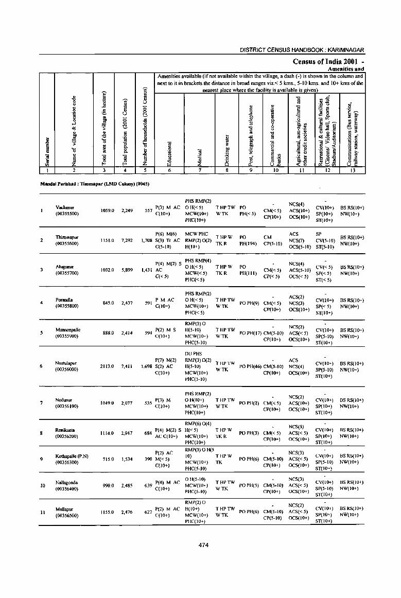
'Ui' ..... i;l ., ~ Ii "8 g 'Ui' U " a c ..c:I ;; 0 c u 0 . .., ~ u C ..
~ g ;; ~ ..J .. 0
~ '0 <Ill c
~ tb ~ c 0 '" 1l ,!! .~ _g ...
~ 0 "[ 'S § ~ ..... 8. 1l C 0 ., "i!
£ s s § ·5 ~ 0 fIl f-< ;z; I 2 3 4 5
DISTRICT CENSUS HANDBOOK; KARIMNAGAR
Census of India 2001 -Amenities and
Amenities available (if not available within the village, a dash (-) is shown in the column and next to it in brackets the distance in broad ranges viz.< 5 kms., 5-10 kms. and 10+ kms of the
nearest place where the facili!Y_ is available is given) "0 cn.g m "'_ ..,
~ . ..,
" 8 C ] 1j{! 0 • .z:: -e '""' .t: ~ ~ 8. ~ ~ 0.
'" ., 0. " E"'.~ ~ ~ 1i 6 ·Ii ." .s~§ "0 'P .~ 610
lij " B o·g ., :s: "0 § .~
I Iii c •
.t: C g <IIl~=i3 o c 0. . ., .::1 0
(ij ~ "iii ]~
"iii>", .. ..., c .~ .g -.u 1 .g s 0 .. .!! 13 ." . .., "iii c ~ '" .. <>
~ e '"
::0 " .. e e ~ " :a OJ ~l
.~ t ~ U:a e :s: '" ~ob'l ~ ~ & <'5 8~ 0 6 7 8 9 10 II 12 13
Mandai Parisbad : Timmapur (LMD Colony) (0045)
PHS RMP(2) NCS(4)
VachwlIIr 557 P(3) M AC OH«5) THPTW PO CV(tO+) BS RS(IO+) (00355500)
1059.0 2,249 C(lO+) MCW(IO+) WTK PH«5)
CM«5) ACS(IO+) SP(tO+) NW(IO+)
PHC(IO+) CP(lO+) OCS(tO+)
ST(lO+)
Thimmapur P(6) M(6) MCWPHC
THPW PO CM ACS SP
BSRS(lO+) 2 1151.0 7,292 1,708 S(3) Tr AC RMP(2) 0(2) NCS(7) CV(5-IO)
(00355600) C(5-10) H(IO+)
TKR PH(I94) CP(5-10) OCS(5-10) ST(5-10)
NW(lO+)
P(4) M(2) S PHS RMP(4)
NCS(4) 3
AJugunur 1032.0 5,899 1,431 AC
OH«5) THPW PO CM«5) ACS(5-10)
CV«5) BS RS(IO+) (00355700)
C« 5) MCW«5) TKR PH(IIl)
CP« 5) OCS«5) SP« 5) NW(lO+)
PHC« 5) ST« 5)
PHS RMP(2) ACS(2)
4 Porandla
845.0 2,437 591 PM AC OH«5) THPTW
PO PH(9) CM«5) NCS(3) CV(IO+) BS RS(1O+)
(00355800) C(lO+) MCW(IO+) WTK CP(tO+) OCS(IO+)
SP« 5) NW(IO+)
PHC« 5) ST(IO+)
RMP(3) 0 NCS(2)
5 Mannenpalle
888.0 2,414 594 P(2) M S H(5-10) THPTW PO PH(17) CM(5-1O) ACS« 5)
CV(IO+) BS RS(1O+) (00355900) C(lO+) MCW(IO+) WTK
CP(IO+) OCS(IO+) SP(5-10) NW(lO+)
PHC(S-IO) ST(IO+)
DUPHS
NustuJapur P(7) M(Z) RMP(3)0(Z)
THPTW ACS
CV(IO+) BS RS(IO+) 6 2113.0 7,411 1,698 S(2) AC H(5-IO) PO PH(46) CM(S-IO) NCS(4)
(00356000) C(IO+) MCW(lO+)
WTK CP(tO+) OCS(IO+)
SpeS-tO) NW(lO+)
PHC(5-10) ST(IO+)
PHSRMP(2) NCS(2)
7 Nedunur
1049.0 2,077 535 P(3) M OH(IO+) THPTW PO PH(2) CM« 5) ACS(IO+)
CV(IO+) BS RS(IO+) (00356100) C(10+) MCW(IO+) WTK SP(IO+) NW(lO+)
PHC(lO+) CP(IO+) OCS(IO+)
ST(lO+)
RMP(6) 0(4) NCS(5)
8 ReniIamIa
1114.0 2,947 684 P(4) M(2) S H«5) THPW PO PH(3) CM«5) ACS« 5)
CV(IO+) BS RS(lO+)
(00356200) AC C(1O+) MCW(IO+) TKR CP(IO+) OCS(IO+)
SP(IO+) NW(lO+)
PHC(lO+) ST(IO+)
P(2) AC RMP(3)OH(S
NCS(3)
9 Kothapalle (P.N)
715.0 1,534 390 M« 5) 10) THPW
PO PH(6) CM(5-IO) ACS« 5) CV(IO+) BS RS(lO+)
(00356300) C(10+)
MCW(IO+) TK CP(IO+) OCS(IO+)
SP(S-IO) NW(IO+)
PHC(5-10) ST(lO+)
Nallagonda 639 P(4) M AC o H(5-IO)
THPTW NCS(3)
CV(lO+) BS RS(IO+) 10 99<J.O 2,485 MCW(lO+) PO PH(5) CM(5-1O) ACS«5)
(00356400) C(IO+) PHC(5-1O)
WTK CP(lO+) OCS(IO+)
SP(5-IO) NW(IO+)
ST(lO+)
RMP(2) 0 NCS(2)
Mallapur 627 P(Z) M AC H(10+) THPTW CV(IO+) BS RS(IO+) 11 1155.0 2,476 PO PH(6) CM(5-10) ACS« 5)
(00356500) C(10+) MCW(IO+) WTK CP(S-IO) OCS(lO+)
SP(lO+) NW(lO+)
PHC(JO+) ST(lO+)
474

VILLAGE DIRECTORY
Villae;e Directory Land Use (As on 1999)_
Land use (i.e. area under different types ofland use in hectare)··
j c 0 .'" '" g ~
01) > c .'"
8 'g '6 -= :::s <J
~ .,
= ]-;;;- .... ., .~ = ., <E
"" :a 0 ~ '-' ., .,
.!! OJ) <.> u > ~ u
~ "d '" ~-o 0
_ 0 OJ)
~ '" :a Q ~ .!! ... ~
>. >. ~-o ~ ~ g ii 8.~ -0 > g Co
~ e
~ ..!! a .. = g a "0 ~ iii 0 ._ :::s
t;; Co .!l ~ ~ OJ) 0 c
e J ....
~ :§ a-B c ., O! .,
~ 1;; :::s ..
~ Co ~ ~ ~ OIl - :::s ~ '5
. ..(" .£ ~ ] :5 :::s .. U OIl '" 14 15 16 17 18 19 20 21 22 23 2 I
WE(20S.0)
PR Karimnagar (33) EA N TWE(1.0) 185.0 284.0 381.0 VachWlUf T(209.0)
GC(79.0)
PR Karimnagar (8) EA NM WE(S24.0) 223.0 142.0 183.0 Thinunapur 2
T(603.0)
Boiled Rice, GC(310.0)
PR Karimnagar (4) EA NM Eggs WE(286.0) 60.0 153.0 223.0 A1ugunur 3 T(S96.0)
WE(459.0)
PR Karimnagar(lI) EA NM TWE(40) 170.0 85.0 127.0 Porandla 4 T(463.0)
WE(311.0)
PR Karinmagar ( 15) EA N TWE(5.0) 166.0 257.0 149,0 Mannenpalle 5 T(316.0)
WE(647.0)
PR Karimnagar (16) EA NM Plastic Pipes 0(38.0) 451.0 529.0 448.0 Nustulapur 6 T(685,0)
WE(216.0) PR Karimnagar (28) EA N TWE(5,0) 206.0 259.0 363,0 NedWiur 7
T(22 1.0)
WE(369,1)
PR Karimnagar (22) EA N TWE(1I1.0)
107.2 139.7 259,0 Renikunla 8 0(128,0)
T(608,1)
PR Karimnagar (16) EA NM WE(302,0)
125,0 162,0 126,0 Kothapalle (p.N) 9 T(302.0)
PR Karimnagar (17) EA N WE(306.0) T(306,0)
164,0 336,0 IS4,0 Nallagonda 10
PR Karinmagar (20) EA N WE(379,O)
T(379.0) 214.5 284.5 277.0 Mallapur II
475
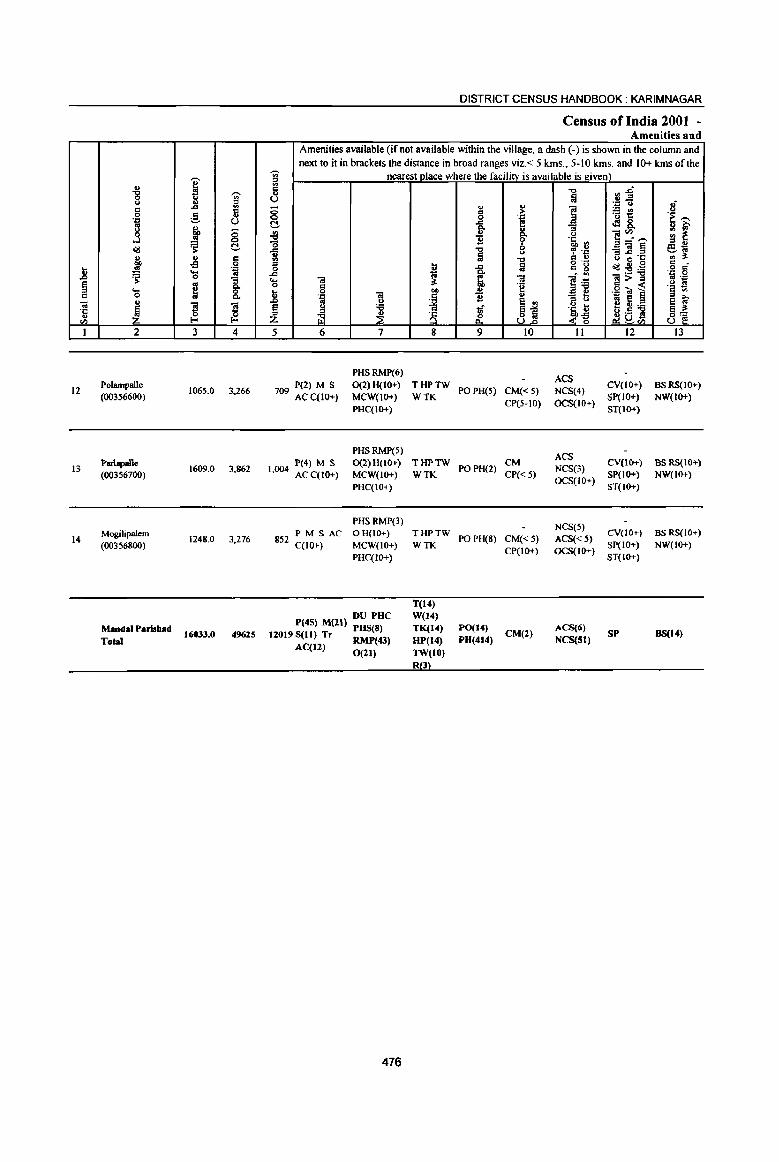
'"' -g ~ ]: ., u OJ c ... 0 g fj 'lj U g f 8 ...J <ill C OJ ., C co .,g 0
] .!l Oil ~ '::;
"3 § m
Q, .... 0 0= 0 Q, .. 7iI
~ ~ ~ °C u 0
<Il I-< I-<
1 2 3 4
12 Polampalle
1065.0 3,266 (00356600)
13 1>arbpalle
1609.0 3,862 (00356700)
14 Mogilipalem
1248,0 3.276 (00356800)
MandalParisbad Total
164133.0 49625
DISTRICT CENSUS HANDBOOK: KARIMNAGAR
Census of India 2001 -Amenities and
Amenities available (ifnot available within the village, a dash (-) is shown in the column and next to it in brackets the distance in broad ranges viz.< 5 kms., 5-10 krns, and 10+ kms of the
~ neafel>t vlace where the facility is available is given) c -c:> rl~ .,
:a u "': () oJ - .. u
1 ;.:: rn <> 0 6 > o_ 1: 'i ~ 0 0.0::
C!. ... [ .M8. ~
go u e!~,"", ., ~ '0 1! ~ li '" E]§ '" '" ..c ..., ~ .~ 61;; .. a ... B 0 'C ., il' .,
"'" I'l '" .. b ... iii g "g <iIl~~ '" -0 ,~ 6 ..c 1;; a - '" "" <a 3- 7iI
~] 7iI> .. .. 0."
0 0= "g ,g ';a i o~ ~ 1i 0 "" OJ
'lj Ol ~ 1! .. e e 2 .. u E :> u
§ y :a 1if ~j ott il f!C);.a §] ~ ~ 8 10!! £ ~~ Z ~<Il U 5 6 7 8 9 10 II 12 13
PHSRMP(6) ACS
P(2) M S 0(2) H(IO+) THPTW POPH(5) CM«S) NCS(4)
CV(IO+) BSRS(JO+) 709 AC C(lO+) MCW(IO+) WTK
CP(5-IO) OCS(IO+) SP(IO+) NW(IO+)
PHC(IO+) ST(lO+)
PHSRMP(5) ACS
1>(4) M S 0(2)H(10+) THPTW POPH(2)
CM NCS(3)
CV(lO+) BS RS(10+) 1,004 AC C(IO+) MCW(IO+) WTK CP« 5)
OCS(IO+) SP(IO+) NW(IO+)
1>HC(IO+) ST(IO+)
PHSRMP(3) NCS(S)
852 PM S AC o H(IO+) THPTW PO PH(8) CM« 5) ACS«5)
CV(IO+) BS RS(JO+) C(IO+) MCW(IO+) WTK
CP(IO+) OCS(IO+) SP(IO+) NW(IO+)
PHC(IO+) ST(IO+)
T(14) DU PUC W(14)
P(45) M(ll) PUS(S) TK(14) PO(14) CM(2)
ACS(6) SP BS(14) 12019 Sell) Tr RMP(43) HP(14) PU(414) NCS(5l) Aq12) 0(21) TW(lO)
R3
476
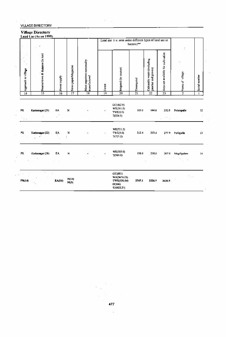
VILLAGE DIRECTORY
Villa2e Directory Land Use (As on 1999)
j c
;;::,
8 ~ .,
eo :a ..!! 'S ~
~ g .., a! 1;;
5. " ~ ~ 14 15
.PR Karimnagar (23)
PR KarimnJ,p (22)
PR Karimnagar (28)
PR(14)
>-. ]: ~
~ ~ 16
EA
EA
EA
EA(14)
'" c .~ OJ)
'" ~ ~ c..
~ z 17
N
N
N
N(14) M(S)
~ '6 0 E E 0 <>
§-o t: e 8.tl 5..::1 - = ~ ~
18
Land use (i.e. area under different types of land use in
~ I.L.
19
hectare)··
'Q) ~ = 0
'" >. e--0
" 'oil eo ] 20
GC(l62.0) WE(36 1.0) TWE(I.O) T(524.0)
WE(721.2) TWE(4.0) T(725.2)
WE(S8S.0) T(585.0)
GC(S51) WE(5674.23) TWE(131.04) 0(166) 1'(6522.27)
477
-0 o .. eo ·s 'c ::> 21
165.0
312.4
198.0
2747.1
g ''; ..
eo > c '';
'6 ;; = <> ]~ ...
<E ._ '" ~'" '" o > :g " 1ll ~ "" ~ .!S ~-o ,. ~ ~ § '" ~ ~ "0 .....
0
il'5 c
" .. - = ~ ~ = co U ""
22 23 2
144.0 232.0 Polampalle
293.4 277.9 Parlapalle
258.0 207.0 Mogilipalem
3326.7 3436.9
.. jl
E = 01 ·c ... tJl
1
12
13
14

.. .. .. ;
o
~
"('
~
Io it: l-I/)
B
N
~ 0
~ z :E
~
~
N
't
V
0 a.
, ,
• I() t"-I()
--,
, , \
I I
, , I
\
, ,
0.
(/)
v
~ , ~ z \ Ill. m ~
'- @ iO ffi , U) W ',a. >
"-, " , ,
- , '" I
«> " .. , iO· I 1-_ _ ..... ------- ..... ( ...
I I
I
, / " I
'I I , <f
t"I()
, ,
, I ,
I I
I I I (/)
. ~ , ,
I I
,----\ 1 I
I \ , \-----------------------~ \ I
\ I " ~ . ~ , \ I , I
~-- - ----------------\ I ,
' . ' .
III
U)
• N
~ iO
, , I
I I
\ " ~ ;' .. -.... " I
' •• ~,------- j • ~ " -...." - ... - -...... ,
, I
: U).§ • " \ (/) '. I \ ~ ~8 I
; _.;----..... _--... }. 1_- ,_- •• _____ .. _...... '\
-~~---~~ , \
11 (J III o v
I I
4 t-j I
:~: I I I , I I I
, , :IQ:@ ,."
'8' , ,
, \
\
~ ; ~ :
'-,- __ , 8 : , ....... , , , , " '- --I , \
I
, , ,
I
I ,
\ .,.. I ,
I ... ,
I ....
......... ,
I /
,"~\
" \. / '.
I I , o
a.. ~ ", ... "
I I I
\ ,. .. --........... \ - ' ... J
-<
;g o N .. 1:. 01 1: >CI. o U III
~ ..5 '0 C CD E c :. > o
CJ
iii
~ '0 ~ CD C CD
CJ ... o >CD i! ::I If)
CD 5 '0 c o Ii .! E ... CD CI. CD S s °i CI. III E .! "D .E '0 >CD ~ ::I If)
C o CI. ::I
"D CD
'" III III

PART A -VILLAGEAND TOWN DIRECTORY
ALPHABETICAL LIST OF VILLAGES (MANDALPARISHAD WISE), KARlMNAGAR DISTRICT
Serial
number
Name of village
2
Nameof~andaIPa~had:Veenavanka
Name of~andal: Veenavanka 0046 1 Bethgal
2 Bonthupalle
3 BrahmanpaUe
4 Challoor
S Elbak
6 Ghanmukla
7 Kanparthi
8 Kondapaka
9 Korkal(Jangampalle)
10 MamidalapaUe
11 Pothireddipalle
J2 Reddipalle
I3 Valbapur
14 Veenavanka
2001 Census
location code number
3
00358100
oo357loo
00357800
00357200
00357000
00357300
00358000
00357500
00357400
00356900
00357600
00357700
00358200
00357900
479
1991 Census
location code number
4
200340034003400014
200340034003400004
200340034003400010
20034003400340000 1
200340034003400003
200340034003400005
2003400340034000 13
200340034003400007
200340034003400006
200340034003400002
200340034003400008
200340034003400009
2003400340034000 12
200340034003400011

I u ""0 "";;)' 0 ~ t.> a ..c: CI C 0 " .. '., v U .. j u ;; bI)
.!5 <:>
Od ~ ~ ., .s CI til) 0 .. .. . .c:
~ ~ .... co 0 "3
~ ..
"" .... ~ 0 0 "" ... .. ~
] ] ·Ii ~ 0 Vl E-
1 2 3 4
Mandai rarisbad: Veenavanka (0046)
Manridalapalle 577.0 3,370
(00356900)
Eibak 2 1439.0 4,676
(00357000)
Bootbupalle 3 498.0 2,218
(00357100)
Cballoor 4
(00357200) 1695.0 4,565
5 Gbanmukla
1282.0 4,075 (00357300)
KorkaI 6 (Jangampalle) 1536.0 4,732
(00357400)
7 Kondapaka
1320.0 3,890 (00357500)
8 Pothireddipalle
87S.0 2,215 (00357600)
9 Reddipalle
917.0 2,320 (00357700)
BraIunanpalle 10
(00357800) 318.0 638
Vcenavanka 11 1285.0 7,179
(00357900)
12 Kanparthi (00358000)
923.0 1.546
DISTRICT CENSUS HANDBOOK: KARIM NAGAR
Census of India 2001 -Amenities and
Amenities available (if not available within the village, a dash (-) is shown in the column and next to it in brackets the distance in broad ranges viz. < 5 kms., 5-10 kms. and 10+ kms of the
"";;)' nearest place where the facility is available is given) :> "' CI ""0 &j u u a '::1 <> ,j ;; .. ~ ] § ~~ <> 0 .~ .~ ~ ~ ..c ,J!! 8.
"" ::s ; ~ .a .. "" <> ~:;~ '0 ] 6 '5, '"
..c 'tl ~ .~ _'il~ E:\.1O 1;1 fa
u G-g '6 ., " -0 CI .. :>
~ § o ,_
CI • 0 ..c: CI g Od:g:a o c
..c "" . ., .;: 0 .... OJ " G. 'iI ]:a 1>~ rl ·c 0 CI .~
._ s il 0
! .,
'.c:"' ~ § ., . ~ OJ ~ .. _ e
u jj ::s <> e 5 '" e ~ ~ ~ 1 $~ ~] ~ 8 .9 S
ei1 U Cll 5 6 7 8 9 10 11 12 13
P(4) M S PHS H(IO+) NCS(2) CV«S) BSRS(IO+)
799 AC(2)C(10+) MCW(IO+) THPW PO PH(lS) CM« 5) OCS PHC(IO+) CP(IO+) ACS(5-10)
SP(lO+) NW(10+) ST(IO+)
P(4) M PHS H(IO+) NCS(6) CV(IO+) BSRS(IO+)
1,152 AC(2)C(JO+) MCW(IO+) HPTWW POPH CM«S) ACS«5) CP(IO+) OCS(IO+)
SP(JO+) NW(JO+) PHC(IO+)
ST(IO+)
P(2) AC H(5-10)
NCS(2) CV(IO+) BSRS(IO+)
539 M«S) HPW PO PH CM(5-IO) ACS(5-10) C(IO+)
MCW(IO+) CP(5-10) OCS(5-10)
SP(IO+) NW(lO+) PHC(5-IO) ST(IO+)
PHS ACS CV
peS) M S H(5-IO) CM BS RS(IO+) 1,057 AC(3)C(10+) MCW(5-IO) THP PO PH(IO) CP(IO+) NeS(3) SP(lO+)
NW(IO+) PHC(S-IO)
OCS(S-IO) ST(IO+)
PHS NCS(4)
peS) M S H(5-IO) THPW POPH(4) CM(S-JO) ACS(S-IO}
CV{IO-r) BSRS(IO+) 1,057 AC(3)C(10+) MCW(IO+)
CP(IO+) OCS(5-10} SP(IO+) NW(IO+)
PHC(S-IO) ST(IO+)
PHS ACS
P(4) M(2) H(5-IO) THPW POPH(4) CM«5) NCS(5)
CV« 5) BSRS(lO+) 1,169 AC(3)C(10+) MCW(IO+) SP(IO+) NW(IO+)
PHC(5-IO) CP(IO+} OCS
ST(lO+)
PHS ACS
P(3) M H(5-10) THPW POPH(4) CM(5-IO) NCS(4)
CV(IO+) BSRS(IO+) 1,027 AC(3)C(IO+) MCW(JO+)
CP(IO+) OCS{lO+) Sp(JO+) NW(IO+)
PHC(S-IO) ST(IO+)
DARMP ACS
541 P(2) M AC H(S-IO)
HPW POPH(2) CM(5-IO) NCS(S-IO) CV(IO+) BSRS(IO-r)
C(lO+) MCW(IO+) CP(IO+) OCS(5-10)
SP(IO+) NW(IO+)
PHC(S-IO) ST(IO+)
PHSH«5) OCS CV(5-tO) BSRS(IO-r)
605 P(2) M MCW(lO+) HPTWW POPH(4) CM«5) ACS« 5) AC(3)C(IO+) PHC('" 5) CP(lo+) NCS(" 5)
SP(IO+) NW(IO+) ST(IO-r)
PM«S) H« S) HPW PH
CM«S) ACS« 5) CV(IO+) BS«5)
162 C(IO+) MCW(lO+) PO« 5) NCS« 5) SP(JO+) RS(IO+)
PHC('" 5) CP« 5)
OCS« 5) ST(IO+) NW(IO+)
HDADH CM
ACS CV(IO+) BSRS(IO+j
I 784 P(7) M(4) S PHC NCS(5) THPW POPH(24) Cp(IO+) SP(JO+) NW(IO+) , AC(6)C(10+) MCW(IO+) OCS(3) ST(IO+)
PAC PHSH« 5) NCS ACS« CV(IO-r) BS«5) 407 M«S) MCW(IO+) HPTW POPH(4) CM«S)
5) OCS« 5) SP(IO+) RS(10+) C(lO+) PHC« 5) CP(1o+)
ST(IO+) NW(IO+)
480

VILLAGE DIRECTORY
VilIaee Directory Land Use (As on 1999)
Land use (i.e. area under different types of land use in hectare)··
j c 0 .= ..
g ~ OIl > C ~ 8 '8 'i3 ., ::I U
~ ~ Q ... & . ~ 0' c~ .s
'i3 0 u v~ ., .!! "" u :; ., > :E " ~ .;:!
~ ~1l ill ~ ~ '" "" ~ :; .!! ... ~ " E e "0
;1:-0 > ~ .ll .c g 0. g. 8.a ~ .!! a '" ~ u i;l .§ .M -0 {l !a '0 ... '" lii 0.
~ "" 0 c e ~ ~ <n 1;; :::I lii 'E 2-5 c " 01
0. ;I: f .. ~ ~ ~ ~ - ::I ~
'J: ~ Z & Z & :5 :::I to U VOl) III
14 IS 16 17 18 19 20 21 22 23 2 I
GC(121.4)
PR Karimnagar (33) EA NM Cloth WE(99.6)
93.1 127.5 70.7 Mamidalapalle TK(64.8)
T(285.7)
GC(15S.0)
MR Karimnagar (38) EA N WE(2S9.0) 416.8 274.3 257.0 Elbak 2
TK(76.9)
T(490.9)
GC(21.0)
MR Karimnagar (48) EA N WE(126.7) 292.6 3.1 30.4 Bonthupalle 3
TK(24.3)
T(I72.0)
GC(193.9)
PR Karimnagar (35) EA NM WE(156.2) 785.9 62.1 347.2 Chatloor 4
TK(149.7)
T(499.8)
GC(70.8)
MR Karimnagar (46) EA NM Bricks, Cloth WE(378.0)
231.1 261.7 279.7 Gharunukla TK(60.7)
T(509.5)
WE(268.3)
PR Karimnagar (38) EA NM Cloth TK(40.5) 872.7 19.4 335.1 Korlcal(Jangampallc) 6
T(308.8)
GC(80.9)
PR Karinmagar (45) EA NM WE{286.1) 614.3 57.1 200.6 Kondapaka 7
TK(80.9)
T(448.0)
GC(40.5)
PR Karimnagar (46) EA N WE(234.7) 429.5 17.4 122.6 Pothireddipalle 8
TK(30.4)
T(305.S)
GC(30A)
PR Karimnagar (3S) EA NM Cloth WE(253.3)
395.8 38.5 IIS.2 Reddipalle 9 TK(80.9)
T(364.6)
WE(155.8)
MR Karimnagar (44) EA N TK(20.2) 84.2 17.0 40.8 Brahmanpalle 10 T(176.0)
GC{16J.9)
PR Karimnagar (44) EA NM OiL Cloth, WE(333.9) 565.3 23.1 109.8 Veenavanka II
Bricks TK(91.1)
T(586.8)
GC(80.9)
MR Karimnagar (49) EA N WE(94.7)
TK(60.7) 431.8 115.4 139.4 Kanparthi 12
T(236.3)
481

.8 ~ c:
Ol os:: u
(/)
I
13
14
C1
"8 <> 8 .~
<> 0 ~
~
" bI)
.!! 'S ... 0 u
~ 2
Bcthgal
(00358100)
Valbapur (00358200)
MandalPambad Total
j H 'Ui'
~ ,CI 5 .51 ._, U .. <5 ~ <:>
~ N ._, .,
~ ..s "fa ... 0 "[ '" u
&. lil ]I ]I 0 ~ I-<
J 4
923.0 2,859
781.0 2,797
14369.0 47080
DISTRICT CENSUS HANDBOOK: KARIMNAGAR
Census of India 2001 -Amenities and
Amenities available (if not available within the village, a dash (-) is shown in the colwnn and next to it in brackets the distance in broad ranges viz. < 5 lans., 5-10 lans. and 10+ Ions of the
]' nearest olace where the facilitv is available is 2iven) g
U ., ;; c:: <:> 0 t!, .c
Co ., .a 'B '0 ii -0
~ .. ;::I ~
0 OJ ..Q ,CI iii ~ ... OJ it 0 c:
! 0 .,. u 'D Ol
~ 'B .. 0 g <> '6 ~ ;::I
J'l :! [5 Z 5 6 7 8 9
PHS H(IO+) 669 PM AC(2)
C(lO+) MCW(IO+) HP TW W PO PH(3) PHC(IO+)
PHS PM AC H(S-IO)
643 C(S-IO) THP MCW(IO+) PHC(S-IO)
H DA(l) DH T(7)
11611 P(42) M('S) MCW PHC Well) 8(4) AC(31) PHS(IO) UP(14)
RMP 1W(4)
482
PO PH(4)
PO(13) PH(84)
" > 'D e
f <>
-0 i or -e OJ 8 ..
~l 10
CM(IO+) CP(IO+)
CM(S-IO) CP(S-IO)
CM(2)
-0 !;j
l "a <II tp .~ c:: u O"~
c: 8 . '" ]i - ... ;::I <>
.~ 6 <-§
11
NCS{3}
ACS(IO+) OCS{IO+)
NCS(3) ACS«5) OCS(S-IO)
ACS(5}
NCS(38) OCS(6)
r:~ .~ <>
~!! <f!&. ]~~ - .. ~ ;::I ..Q'c <> g g ~:og'6 01 > ;::I
§ -< "D iii ] e Ii] <> .S ~u(/)
12
CV(lO+) Sp(IO+) ST(IO+)
eY(S-IO) SP(IO+) ST{IO+)
CV
.; u .~ ~
" >. ; ~ eo; '" it CI .~ § rl '';: "- !!! § .,
8 ~ 51 o· u lJ
BS RS(IO+) NW(IO+)
BS RS(S-IO) NW(IO+)
8S(12)

VILLAGE DIRECTORY
Villa2e Directory Land Use (As on 1999)
~ '" ~ .9 ..c:
l ~ 14
PR
PR
PR(9)
MR(5)
j g " (.)
~ ~ ~ ~
~ I :£ 15
Karinmagar (50)
Karinmagar (49)
;., -a c. :s '" .... '" ~ 0
0...
16
EA
EA
EA(14)
" c .~
f §. c.
~ :£ 17
N
NM
N(14)
M(S)
c ~ 0 E
= 0 (.)
§"tj
1:: '" 8.~
.5 ~ _ ::s
~ ~ 18
Cloth
Cloth, Bricks
Land use (i.e. area under different types of land use in
-:;;
~ "" 19
hectare)··
0)
~ e "Cl
" .. OIl
] 20
GC(80.9)
WE(224.6) TK(68.8)
T(374.4)
GC(l 0 1.2) WE(275.6)
TK(40.5) T(417.2)
GC(lIJ8.79) WE(3146.48
) TK(890.29) T(5175.56)
483
"tj ... t;l OIl ·E ·s ::J 21
480.8
304.7
5998.6
" 0 .~
OIl E " ~ :; ::s (.)
"U ... <E ",..... .- '" ~.,
'" '" > :g - 0 ~ 6b i ~"tj ;> ..!l !'ij .,
]~ "0 " '" 8 ~ ~
22 23
17.4 50.5
39.3 19.8
1073.1 2121.7
" OIl .!!! .8 ~ e '- ::s 0 " " .. ~ ·c
'" CIl
2 1
Bethgal 13
Valbapur 14

:0 .. :;
, , I I
I I I
I I I
I I
...J ... ~ \.,;
JJ Ii! z !'-o [/.)
~ rr
S !;IiI a N ~ ~ = ~ g ~
0 .; ~
0
~ z ~ 0 ~ ::J '7 ~ ... ,._
~ ~ Ii! ~ :E ... « ;.( '" ..,
.... ...l U ~ ex Q z .... ~
II}
Q
~ ~ < Q
z z ::> ;0
i i
1 V ~ N V (1
1 s 1
'- ... _ ......... _ .. (fJ , , , ~ , ... ,
:g ,
" I ~ -< eN
(fJ '" , It) ,
\
,- -
I~ ~ ,
:.' ., @ 's, :1-,:, , '
1 __ 1
z 9 .... ~ .... OIl
:c .... z ~ U
r.l ...l
g Po :c
...l ~ rii t-<
rJl ~ ~ < Q ...l r.l ~ ~ U I:!!
~ r.l N j cc ~ ~ ...l
r.l Z ;;
~ ~
0 ~ ...l f:: ~ >-~ <
~ ,..l 0 " Cli ~
Q r.l r.l z Q
-< :z: ~ ~ ~
;0
!il .... i 0
H y .tl
u • &: ::: • OIl
r.l
S ...l ...l
~ 0 U ~
~ 0
~ Q Z < ,
8 :5 <:> r.l .... U ~ t;; :c 0- !o. U 0- 0 II} ....
:c , .... I:!! 0 II}
g ~ :c ...
g; I%l
~ .... Z {oj U :t:
Z .... ...l i2 ..: .... r.l
~ :x: t-<
~ II}
r.l
~ ~ )II ::3 z
ii! ~ ~ ""
.. ii E ... o
~ • r: • C) .... o ~ ~ " 1/1
• ~ '0 r: o ·iii .. ~ &. • ~ ~ ~
" D. .. E .. ii
= >-
~ ::J
1/1 r: o D.
" ! .. III

PART A -VILLAGE AND TOWN DIRECTORY
ALPHABETICAL LIST OF VILLAGES (MANDALPARISHAD WISE), KARIMNAGARDISTRICf
Serial Name of village 2001 Census 1991 Census
number location code number location code number
2 3 4
Name of Mandai Parishad: Jammikunta Name ofMandal:Jammikunta 0047
1 Bijigirsharief 00358800 200330033003300007
2 Bujunoor 00359900 200330033003300005
3 Chinnakomatipalle 00359700 200330033003300013
4 Dharmaram(p.B) 00359200 200330033003300011
5 Ellanthakunta 00359600 200330033003300012
6 Jammikunta 00359100 200330033003300010
7 Kanagarthi 00359400 200330033003300018
8 Korepalle 00358900 200330033003300008
9 Madipalle 00359300 200330033003300019
10 MalliaI 00359500 200330033003300017
11 PatharIapaIle 00360100 200330033003300016
12 Rachapalle 00358700 200330033003300006
13 Saidabad 00359000 200330033003300009
14 Sirsedu 00360000 200330033003300015
15 Tekurthi 00359800 200330033003300014
16 Thangula 00358400 200330033003300002
17 Vanthadupula 00358600 200330033003300004
18 Vavilala 00358500 200330033003300003
19 Vilasagar 00358300 200330033003300001
485
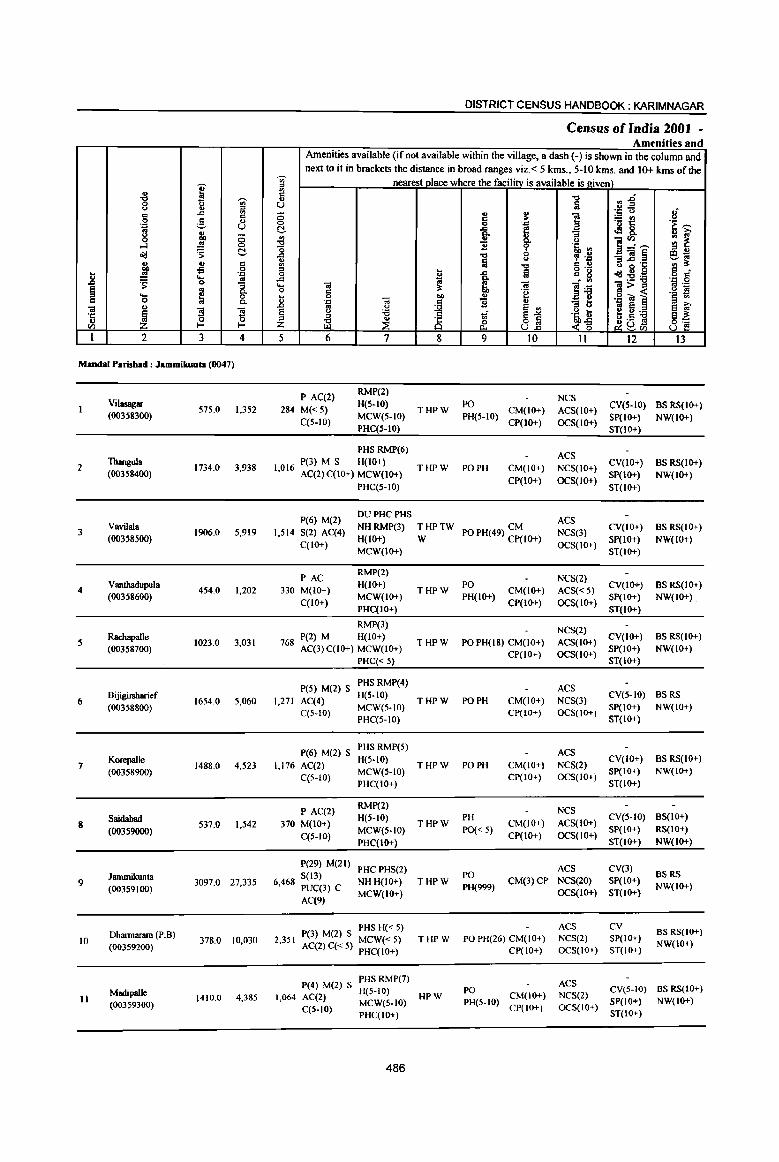
DISTRICT CENSUS HANDBOOK: KARIMNAGAR
Census of India 2001 -Amenities and
Amenities available (if not available within the village, a dash (-) is shown in the column and next to it in brackets the distance in broad ranges viz. < 5 kms., 5-10 kms. and 10+ kms of the
Ii) nearest place where the facility is available is givel!l
I " ., '" .: "0 ~~ "0 Ii) " 0 ~ U ;j <> :::s 8 "'" '" 0 .. ~ ]
.:: <> '" ,§.
.: c ::.= en 0 ., <:> 0 . ., '6 t:: 'G ~ .:: U C "'" e .:18. '" r.:, e- "3 <) 0 ~ 8- ]~~
'" oj 0 0 '" ~ ...l .!! <:> "0 11 9 .~ .,
" u o'd ~ C ..c "0 0 , .~ _ «i ~ eo; " ;j <.>
" ..c 'J:: '" ~ r.:, ., c ., "0 .: .,
-:9 0 " ... til 0'- t.) g .9 c
] .!! '''' 0 ~ "'" .: g o'd:2:a o C ..... oj ..c
~ . '" .:: 0 ~ 0 "3 ..... OJ ;l: OJ
]~ ]>~ oj .::
~ oj "- 0 .: 'e '~ ~ ... ~ 0 ... 0 OJ
.. ., .g Ie ] c 0 "-., '., d 1l " :; ti
OJ ., ..c co 0
~ E~ co e E iO'
~ ~ ~ e u 'i3 1 § .~ 8 1~] ~~ 'J:: " 0 ~ " ~ ~ 8 u I- Z <~ Vl U..c ~Vl
I 2 3 4 5 6 7 8 9 10 Il 12 13
MandaI Parisbad: Jammilwnla (0047)
P AC(2) RMP(2)
NCS Vilasagar 575.0 1,352 284 M« 5)
H(S-IO) THPW
PO CM(IO+) ACS(IO+)
CV(S-IO) BS RS(IO+) (00358300)
C(5-10) MCW(5-to) PH(S-IO)
CP(IO+) OCS(IO+) SP(IO+) NW(IO+)
PHC(5-IO) ST(IO+)
PHS RMP(6) ACS
2 Thangula
1734.0 3,938 P(3) M S H(IO+)
THPW PO PH CM(IO+) NCS(IO+) CV(IO+) BS RS(IO+)
(00358400) 1,016 AC(2) C(10+) MCW(IO+) CP(IO+) OCS(lO+)
SP(IO+) NW(lO+) PHC(5-IO) ST(IO+)
P(6) M(l) DU PHC PHS
ACS Vavilala NHRMP(3) THPTW CM CV(IO+) BSRS(IO+)
3 (00358500)
1906.0 5,919 I,SI4 S(2) AC(4) H(IO+) W PO PH(49) CP(IO+) NCS(3)
SP(IO+) NW(IO+) C(1O+)
MCW(IO+) OCS(IO+)
ST(IO+)
PAC RMP(2)
NCS(2) 4
Vanthadupula 454.0 1,202 330 M(IO+)
H(IO+) THPW
PO CM(IO+) ACS«5)
CV(IO+) BS RS(IO+) (00358600)
C(IO+) MCW(IO+) PH(IO+)
CP(IO+) OCS(IO+) SP(IO+) NW(IO+)
PHC(IO+) ST(IO+)
RMPm NCS(2)
5 Rachapalle
1023.0 3,031 P(2) M H(IO+)
THPW PO PH(l8) CM(IO+) ACS(IO+) CV(IO+) BS RS(IO+)
(00358700) 768 AC(3)C(10+) MCW(lO+) CP(IO+) OCS(IO+)
SP(IO+) NW(IO+) PHC« 5) ST(IO+)
P(5) M(2) S PHS RMP(4)
ACS Bijigirsharief H(5-10) CV(S-IO) BSRS
6 16S4.0 5,060 1,271 AC(4) THPW PO PH CM(IO+) NCS(3) (003S88OO)
C(S-10) MCW(5-to)
CP(IO+) OCS(IO+) SP(IO+) NW(IO+)
PHC(5-IO) ST(IO+)
P(6) M(2) S PHS RMP(5)
ACS Korepalle
1488.0 4,523 1,176 AC(2) H(S·IO)
THPW PO PH CM(IO+) NCS(2) CV(IO+) BS RS(IO+)
7 MCW(5-IO) SP(IO+) NW(IO+) (00358900) C(5-10) CP(IO+) OCS(lO+) PHC(IO+) ST(IO+)
P AC(2) RMP(2)
NCS Saidabad 370 M(IO+)
H(5-10) THPW
PH CM(IO+) ACS(IO+)
CV(S-IO) BS(IO+) 8 537.0 1,542
MCW(5-10} PO« 5) SP(IO+) RS(IO+) (00359000) C(5-10) CP(IO+) OCS(lO+) PHC(IO+) ST(IO+) NW(IO+}
P(29) M(21) PHCPHS(2) ACS CV(3)
Jammilrunta S(13) PO BSRS 9 3097,0 27,335 6,468 PUC(3) C NHH(IO+) THPW
PH(999) CM(3)CP NCS(20) SP(IO+)
NW(lO+) (00359100) MCW(IO+) OCS(IO+) ST(lO+) AC(9)
PHS H« 5) ACS CV BS RS(lo+)
10 Dbartrulflllll (P.B)
378.0 10,030 2,351 P(3) M(2) S MCW« 5) THPW PO PH(26) CM(IO+) NCS(2) SP(IO+) NW(lO+) (00359200) AC(2) q< 5) PHC(lO+) CP(lO+) OCS(IO+) ST(IO+)
P(4) M(2) S PHSRMP(7) ACS
Madipalle H(5-IO) PO CV(5-10) BS RS(IO+) II 1410.0 4,385 1,064 AC(2) HPW
PH(S-IO) CM(lO+) NCS(2)
SP(lO+) NW(lO+) (00359300) C(5-10) MeW(S-IO) CP(!O+) OCS(IO+) PHC(IO+) ST(IO+)
486
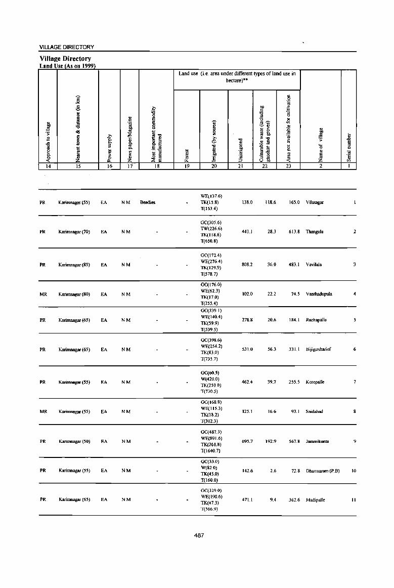
VILLAGE DIRECTORY
Villaee Directory Land Use (As on 1999)
Land use (i.e. area under different types of land use in hectare)··
j '" 0 .'" .. .8 C 00 ;;. ._,
'" .'" 8 :g '6 ;; ., " 0 a i "0 ...
u . ~ I ",-- <8
~ '6 ~~ OJ 00 OJ ;;. ::0 .,
~ .sg '" ~"O _ 0
to 00
1 ~ gj tI. ~ ~ U
2 ~ 8.~ e il ~'<:I ;;. ..
-= ~ ~ fa to ~ g "0 ia .. !a (5 .... til Q, .§ .:! '" t>Il 0 d e .. t ~ - "
lil ;; 'e ~g '" u .. Q,
~ ~ JJ 12 "" ~ ~ ~ '5 .(' Z & ] " to p; VOl) <I)
14 15 16 17 18 19 20 21 22 23 2 I
WE(J37.6)
PR Karimnagar (55) EA NM Beedies TK(15.S) 138.0 118.6 165.0 Vilasagar T(153.4)
GC(30S.6)
PR Karimnagar (70) EA NM TW(226.6)
441.1 28.3 613.8 Thangula 2 TK(II8.6)
T(650.8)
GC(172.4)
PR Karimnagar (85) EA NM WE(276.4)
808.2 36.0 483.1 Vavilala 3 TK(129.9)
T(S78.7)
GC(176.0)
MR Karimnagar (80) EA NM WE(62.3)
102.0 22.2 74.5 Vantbadupula 4 TK(l7.0)
T(2SH)
GC(339.1)
PR Karimnagar (65) EA NM WE(140.4)
278.8 20.6 184.1 Rachapalle 5 TK(59.9) T(539.5)
GC(398.6)
PR Karirnnagar (65) EA NM WE(254.2)
TK(83.0) 531.0 56.3 331.1 Bijigirsharief 6
T(735.7)
GC(60.5)
PR Karimnagar (55) EA NM W(420.0)
TK(250.0) 462.4 39.7 255.5 Korepalle 7
T(730.5)
GC(168.8)
MR Karimnagar (55) EA NM WE(l15.3)
125.1 16.6 93.1 Saidabad 8 TK(18.2)
T(302.3)
GC(487.3)
PR Karirnnagar (50) EA NM WE(89l.6)
695.7 192.9 567.8 Jammikunta 9 TK(261.8)
T(I640.7)
GC(33.0)
PR Karirnnagar (55) EA NM W(1I2.0)
TK(4S.0) 142.6 2.6 72.8 Dhannaram (P.B) 10
T(I60.0)
GC(329.0)
PR Karirnnagar (65) EA NM WE(l90.6)
TK(47.3) 471.1 9.4 362.6 Madipalle II
T(566.9)
487
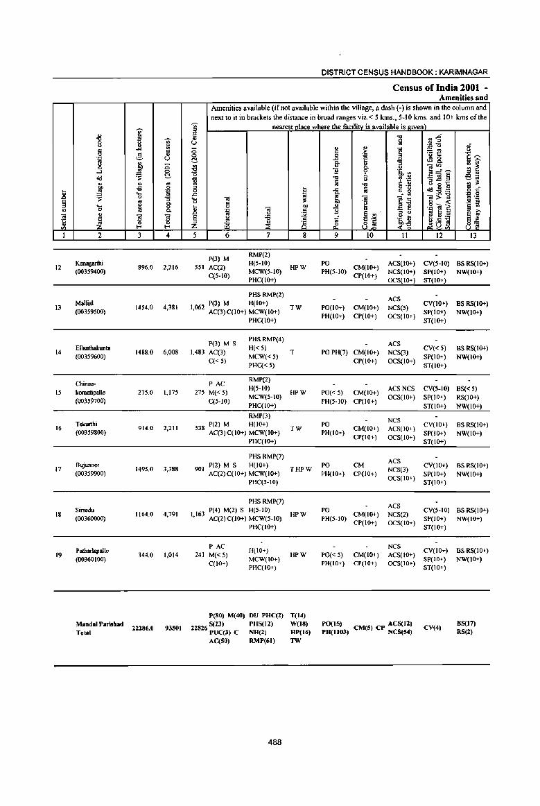
.. .8 !i " "iii 't '" I
12
I3
14
IS
16
17
18
19
u
'8 c c
'.0
8 ...J ~ ., btl .l! ~ ._ 0 u
~ 2
Kanagarthi (00359400)
Mallia! (00359500)
E1lanthakunta (00359600)
Chinna-komatipalle (00359700)
Tdrurthi (00359800)
Bujunoor
(00359900)
Sin;edu
(00360000)
PatharJapalJe
(00360100)
Mandai Parishad Total
I 'Ui'
~ .<0
;§, (.)
~ -0 .l! 0
~ ~ u c .g C
'J:: ... '" 0 :; '" Q.
~ 8. ]1 ~ ~ .... 3 4
896.0 2,216
1454.0 4,381
1488.0 6,008
275.0 1,175
914.0 2,211
1495.0 3,388
1164.0 4,791
344.0 1,014
22Z86.0 93501
DISTRICT CENSUS HANDBOOK: KARIM NAGAR
Census ofIndia 2001 -Amenities and
Amenities available (if not available within the village, a dash (-) is shown in the (;olumn and next to it in brackets the distance in broad ranges viz.< 5 kms., 5-10 kms. and 10+ kms of the
'Ui' nearest olace where the facilitv is available is I(iven) 51 c ... (.)
0 0 t!-~ "0
~ c ,.c ._ <i! C " .. 0
'" .::: <i! .b .. u
§ u :a ~ ~ z
5 6 7
P(3) M RMP(2)
551 AC(2) H(5-IO)
C(S-IO) MCW(5-IO)
PHC(IO+)
PHSRMP(2)
P(3) M H(IO+) 1,062 AC(3)C(10+) MCW(IO+)
PHC(IO+)
P(3) M S PHSRMP(4)
1,483 AC(3) H«5) MCW«5)
C« 5) PHC« 5)
PAC RMP(2)
275 M«5) H(5-10)
C(5-10) MCW(S-IO)
PHC(JO+)
RMP(3) P(2) M H(lO+)
538 AC(3)C(10+) MCW(IO+)
PHC(IO+)
PHSRMP(7)
901 P(2) M S H(IO+)
AC(2)C(IO+) MCW(IO+) PHC(S-IO)
PHS RMP(7) P(4} M(2) S H(5-IO)
1,163 AC(2)C(10+} MCW(S-to)
PHC(IO+)
PAC H(IO+}
241 M«5) C(IO+)
MCW(IO+) PHC(IO+)
peSO) M(40) DU PUC(2)
22826 S(Z3) PHS(Il) PUC(3) C NU(2) AC(SG) RMP(61)
488
~ !l: 00
" ~ 8 8
HPW
TW
T
HPW
TW
THPW
HPW
HPW
T(14)
W(18) UP(16)
1W
"t:I ~~ Iii '.0 U
'" .,
] ~t! c ;.. c 1 .g_ <l'!8. '3 u u Oil'll 1i 'i' '6, ~ il-=--"t:I c _<i!§
<> 1 "D Iii "t:I 6 .~ ",.:;:I 'c .r: ;a c g (,) g B
<id:s!:a Q. • <II
~ -;;; ]:a ]>~ "e u ·il <II ] 1i u '3 ~ e '" '" e 'iii ~] '5, t eV:a
~a~ ~ ~~ 9 10 11 12
PO CM(IO+)
ACS(IO+) CV(S-IO) PH(5-1O)
CP(IO+) NCS(lO+) SP(IO+) OCS(IO+) ST(IO+)
ACS CV(lO+)
PO(IO+) CM(IO+) NCS(S)
PH(IO+) CP(IO+) OCS(IO+) SP(IO+)
ST(IO+)
ACS PO PH(7) CM(IO+) NCS(3)
CV«5) SP(IO+)
CP(IO+) OCS(IO+) ST(JO+)
PO« 5) CM(IO+) ACSNCS CV(S-IO)
PH(5-1O) CP(IO+) OCS(IO+) SP(IO+)
ST(IO+)
NCS PO CV(IO+)
CM(IO+) ACS(lO+) PH(IO+)
CP(IO+) OCS(lO+) SP(lO+)
ST(IO+)
ACS PO CM
NCS(3) eV(IO+)
PH(IO+) CP(IO+) SP(1O+) OCS(IO+)
ST(lO+)
ACS PO eveS-to)
CM(IO+) NCS(2) PH(5-1O)
CP(IO+) OCS(IO+) SP(IO+)
ST(IO+)
NCS CV(IO+)
PO« 5) CM(IO+) AC5(IO+) PH(IO+) CP(IO+) OCS(to+)
SP(IO+) ST(IO+)
PO(IS) CM(5) CP ACS(12) PU(1I03) NCS(S4)
CV(4)
8 .~~ a ~ e~ ;a ~_ c c .~ .2
.~ ~ e f s~ 8' 13
BS RS(IO+) NW(IO+)
BS RS(IO+) NW(JO+)
BSRS(IO+)
NW(IO+)
B5«5) RS(IO+)
NW(IO+)
BSRS(IO+) NW(IO+)
BSRS(IO+) NW(IO+)
BS RS(IO+) NW(IO+)
BS RS(10+)
NW(IO+)
8S(17) RS(2)

PR(14) MR(5)
EA(19) N(19) M(19)
GC(4S42.73) W(502) WE(3Z06.82 )
TW(226.63) TK(IlS6)
T{9834.18)
489
6873.4 1054.1 4524.3

\ 1 1 I 1
o
D A
• i
(J
I r -- ~
J : c: I Ie. I I ('II 1 '~' I I C")I
I : 8: : : : 1 ~ __ :
.... , L ..... ,,_
oJ I , I 1 1 __ 1
, I ....... __ - .... , ) ~-----, ,
.' \ / \
~ \ '" I ,/ I
I I \ I I "'-, \ I
\ .... ----- ~ I ~- I ~'_I , \, I \ I \ ,
\ \ \ \ .
(J)
• 8 co 10
I I ,
• • •
..."-' ..... , I ....
t--------,-.,.., \ \
cry
~ 8 1 " I I I \ I I ,
I , I
~ . \ ,
.~ r--10
I
~. f- __
, , , ,
I ,
\ \ , )- --
I I 1 ~ .... ,
\-----, , "
" ',- T I I I I
\ \
~ • r--!is I
I
• " I
1 I I I , ...... __ .} .. - ... -- ___ __ ...J.. _____ ...
I , I
/l _____________ ••
' ... : -~-~-J: • ~ ... , \ &: ~
L ,
~ '"-''''' I
",. \ I
\ ,
~ • 0
10
I
'-- I .... ..!.
I
, ,
Lt- ... - .... _ ~-___ _.j,,----.. " -~ \
I)
, \ \ \
Q '--
, ...
\ \
I ,...
, , \ ,
\
_- .. _
• ('oj
10
:IE 011(
o (J) Z t-- 0.. <c..
III •
© ~ (IJ
\ , o q- w CL (D ~
... \
, ~,
---.o. ... ----, ,~'
'''''I'' I .,.--- ... _ ,-
I I I I
I I I ,
I I
I , I I I
-------'-r~
I I
, I
I
I 1 I I I I I 1 I \ I , I I I
,---1 ,
• I
I I I I I I I
... , I
r \
\ • 1 1 1
I I ~ I ;,.------..L .... __ _
o I , ; , --..-, M'*" ,.,-......... ~ ... --, ,--
I ",,,,'" .w
., o o N
E CI 't: ~ 8 l1li :0 .5 -o ... I:
~ E CII > o CI

PART A -VILLAGE AND TOWN DIRECTORY
ALPHABETICAL LIST OF VILLAGES (MANDALPARISHADWISE),KARIMNAGARDISTRICT
Serial Name of village 2001 Census 1991 Census
number location code number location code number
2 3 4
Name of Mandai Parishad: Shankarapatnam
Name of Mandai: Shankarapatnam 0048 I Ambalpur 00361200 2004800480048000 16
2 Amudalapalle 00361700 200480048004800012
3 Arkandla 00360300 200480048004800002
4 Dhannaram 00360800 200480048004800007
5 Gaddapaka 00360400 200480048004800003
6 Kachapur . 00360600 200480048004800005
7 Kalavala 00360500 200480048004800004
8 Kannapur 00360900 200480048004800008
9 Kareempet 00361300 200480048004800017
10 Kesavapatnam 00361400 2004800480048000 15
11 Kothaghat 00361500 200480048004800014
12 Metpalle 00361800 200480048004800013
13 Molangur 00361600 2004800480048000 II
14 Mutharam 00361000 200480048004800009
15 Rajapur 00360700 200480048004800006
16 Thadikal 00361100 2004800480048000 10
17 YeradpalJe 00360200 200480048004800001
491
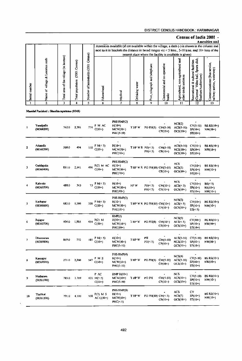
I '" .", .., 0 u <.> '" " d ..c <II
c 0 3 '" .::: U .,
~ 8 <:) ..J ~ 0
~ C u '" .: 00 -£l 0 .. .!! .... . .:
..8 to ~ 0 :;
~ .. Q. .... ~ 0 c 0 Q.
<a u
~ ] ] ·c 0 0
'" E-< E-< til
1 2 3 4
Marulal P.ri.thad : Shaukarapatnam (0048)
YmIdpaIle 762.0 2,381
(00360200)
2 Arkandla
560.0 494 (00360300)
3 Gaddapaka
811.0 2,141 (00360400)
Kalavala 4 488.0 343
(00360500)
5 Kachapur
683.0 1,580 (00360600)
6 Rajapur
404.0 1,885 (00360700)
7 Dharmaram
869.0 772 (00360800)
Kannapur 8 271.0 2,300
(00360900)
9 Mutharam
785.0 1,769 (00361000)
10 Thadikal
791.0 4,110 (00361100)
DISTRICT CENSUS HANDBOOK: KARIMNAGAR
Census of India 2001 ~ Amenities and
Amenities available (if not available within the village, a dash (-) is shown in the column and next to it in brackets the distance in broad ranges viz. < 5 kms., 5-10 kms. and 10+ kms of the
~ nearest place where the facility is available is given) III
II .., rs~ 1iI U 'l'l t> of
<:) '" !! 1 ~t! t> d
'" 0 1 'i >: t!, ..c ,sg, ]' .;;J u ]~--- gj ~ "0 B b 'a '"
.t:: .", ~ .~ _ "il § eo; '" ; t) 1'1 .c ·c ::J ~. III .", g.~
'" .... ..c !a c g ~g.9 o c 0 .. Q. "O;a .~ .g .c '" . '" <a ._ .... .. ~ ~ 0; ]:6 =>~ 0 C -e '§ ~ .. 0 0; "" '" _ e .g G! ~ '" .'" c ] " ::s u .. 8 E3 ~ .D '" U
~ E <II
§ () ;a tf ~1 .~ ~ e g ~
~ u 8 ~v!! 8'§ Z }; 0 c'("§ U 0- ~tIl
5 6 7 8 9 10 II 12 13
PHSRMP(2) NCS(2)
PM AC H(IO+) CY(S-IO) BSRS(IO+) 574 C(IO+) THPW POPH(S) CM(S-IO) ACS(S-IO)
MCW(IO+) CP(10+) OCS(IO+)
SP(IO+) NW(IO+) PHC(5-1O) ST(IO+)
110 P M« 5) H(10+) THPWR PO«5) CM(S-IO)
ACS(S-IO) CY(lO+) BS RS(IO+) C(10+) MCW(IO+)
PH«S) CP(IO+) NCS(lO+) SP(lO+) NW(IO+)
PHC(IO+) OCS(IO+) ST(IO+>
PHSRMP(2) ACS
494 P(2) M AC H(IO+) THPWR POPH(IO) CM(S·IO) NCS(3)
CV(IO+) BS RS(IO+) C(IO+) MCW(lO+)
CP(IO+) OCS(IO+) SP(lO+) NW(IO+)
PHC(IO+) ST(IO+)
73 PM«5) H(lO+) NCS
CV(JO+) BS« 5) HPW PO« 5) CM(IO+) ACS«5)
C(IO+) MCW(lO+) PH«5) CP(IO+) OCS(IO+)
SP(lO+) RS(IO+) PHC(IO+) ST(IO+) NW(IO+)
PHSRMP(2) NCS(3)
358 P M« 5) H(IO+) THPWR POPH(IO) CM(lO+) ACS« 5)
CV(IO+) BS RS(IO+) C(IO+) MCW(lO+)
CP(IO+) OCS(IO+) SP(IO+) NW(IO+)
PHC(IO+) ST« 5)
RMP(2) NCS(S}
454 P(2) M H(IO+) THPW POPH(8) CM(JO+) ACS« 5)
CV(IO+) BS RS(IO+) C(IO+) MCW(IO+)
CP(IO+) OCS(IO+) SP(lO+) NW(IO+)
PHC(IO+) ST(10+)
185 P M« 5) H(IO+)
THPW PH
CM(S-IO) ACS(S-IO) CV(S-IO) BS RS(IO+)
C(lO+) MCW(lO+) PO« S) CP(IO+)
NCS(IO+) SP(IO+) NW(IO+) PHC(S-IO) OCS(IO+) ST(IO+)
PHSRMP(4) NCS(4)
P M S H(IO+) CV(S-IO) BS RS(IO+) 547 C(lO+) THPW POPH(5) CM(S-)O) ACS(S-)O)
MCW(10+) CP(lO+) OCS(JO+)
SP(JO+) NW(IO+) PHC(S-IO) ST(1O+)
PAC RMPH(IO+) NCS CV(S-IQ) BS RS(IO+)
421 M«5) MCW(JO+) THPW PO PH CM(S-lO) ACS(IO+)
C(lO+} PHC(5-1O) CP(IO+) OCS(IO+) SP(IO+) NW(IO+) ST(lO+)
PHSRMP(8) ACS CV
938 P(3) M S H(IO+) THPW POPH(IO) CM«S) NCS(7) SP(JO+)
BS RS(IO+)
ACC(IO+) MCW(IO+) CP(lO+) OCS(IO+) ST(IO+)
NW(IO+)
PHC« 5)
492
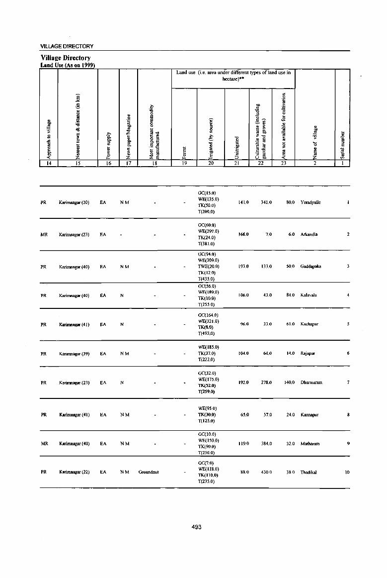
VILLAGE DIRECTORY
Villa2e Directory Land Use (As on 1999)
Land use (i.e. area under different types ofland use in hectare)"
]; " 0 .::: '" g c- OIl >
~ .:::
8 :a :;
" 0 :> ()
H " e '0 .. ~ .B
~ .~ e ... c:~ .- '" :a 0 ~ ~ ... ...
~ :: .., .. > =£ " ~ o(j ~]
0 - 0 OIl
~ >-. ~ '" ~ to 'a ~ 1l s 8: &. 8.~ e '0
:3:-0 i:i ~ ..c B ~ ..!! ~ ~ .., iil '" -0 {l 10 g .... .. 1;; p.. .~ .g B OIl 0 c
:: " tl '" ti .. 'f: iiii .. O! 0. 1 :3: ~
~ ~ !:! 00 '0 "'3 ~ ~ ~ ·c ~ ~ ~ tf !i ~
.. U 00 til
14 15 16 17 18 19 20 21 22 23 2 I
GC(ts.O)
PR KarinuIagar (20) EA NM WE(135.0)
141.0 341.0 80.0 Yeradpalle TK(50.0)
T(200.0)
GC(60.0}
MR Karinu1agar (23) EA WE(297.0)
166.0 7.0 6.0 Arkandla 2 TK(24.0) T(381.0)
GC(94.0) WE(309.0)
PR Karimnagar (40) EA NM TWE(20.0) 193.0 133.0 50.0 Gaddapaka TK(12.0)
T(435.0)
GC(56.0)
PR KarinuIagar (40) EA N WE(189.0)
TK(IO.O) 106.0 43.0 84.0 KaIavaIa 4
T(255.0)
GC(I64.0)
PR Karinmagar (4 I ) fA N WE(321.0)
96.0 33.0 61.0 Kachapur TK(8.0) T(493.0)
WE(185.0)
PR Karinmagar (39) EA NM TK(37.0} 104.0 64.0 14.0 Rajapur 6
T(222.0)
GC(32.0)
PR Karinmagar (23) EA N WE(175.0) TK(S2.0}
192.0 278.0 140.0 Dhannaram 7
T(259.0)
WE(9.5.0)
PR Karimnagar (4 I) EA NM TK(30.0) 65.0 57.0 24.0 Kannapur 8 T{125.0)
GC{tO.O)
MR Karimnagar (40) EA NM WE(150.0)
119.0 384.0 32.0 Mutharam 9 TK(90.0)
T(250.0)
GC(7.0)
PR Karimnagar (22) EA NM Groundnut WE(II8.0) TK(IIO.O)
88.0 430.0 38.0 Thadikal 10
T{235.0)
493
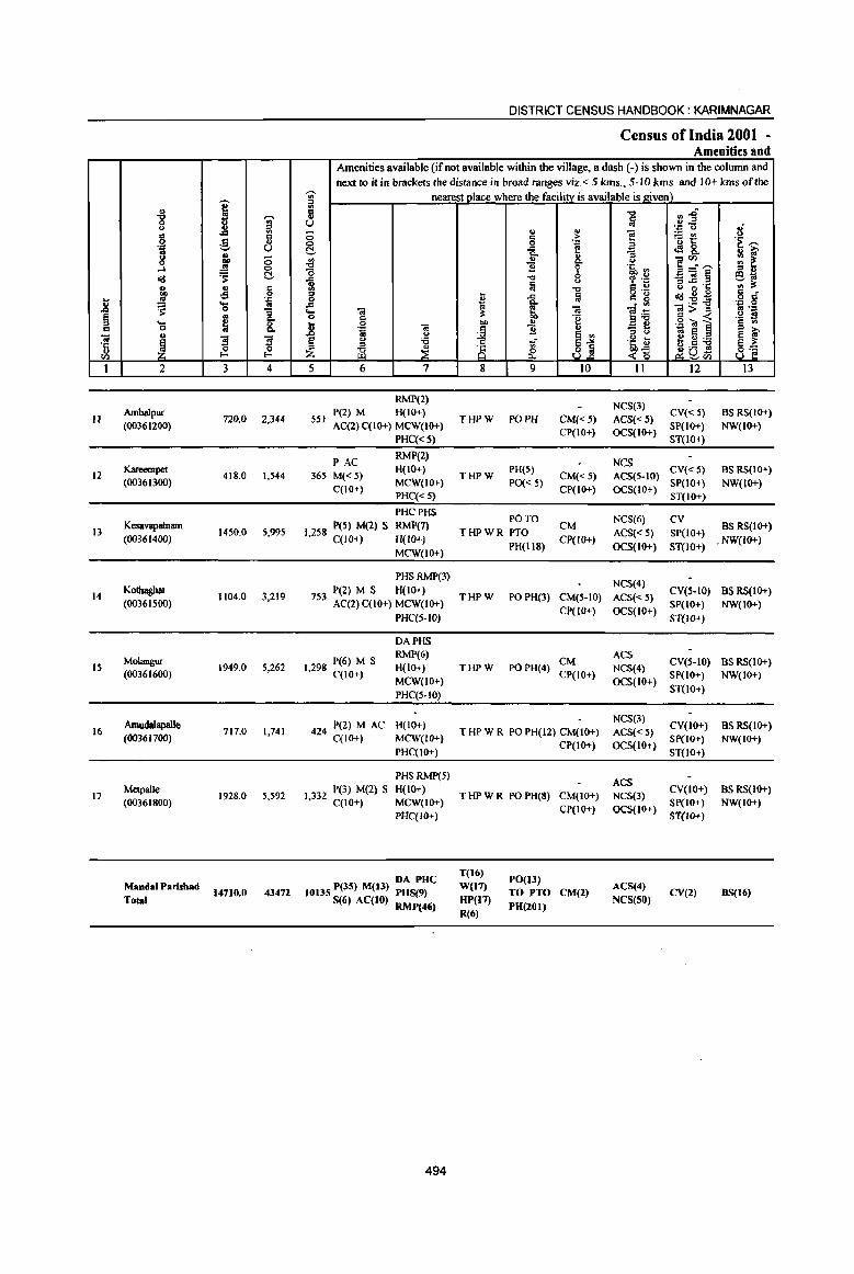
.8 ~ c
Cil 'C:: ., <Il
1
II
12
13
14
15
16
17
., "B <)
g 'Q
8 ...l 0(1 ., ~ ~ .... a u
1 2
Ambalpur (00361200)
Kareempet (00361300)
Kesavapamam (00361400)
KQthagbat
(00361500)
MQlangur (00361600)
Amuda1apalle (00361700)
Melpalle (00361800)
MandaI Parishad Total
I -;;-;l
g c ... U
~ ;:; .!! 0
'S t!-
.s g ''::: ... <II 0 ;; co
8: ~ !I ~ a l- I-
3 4
720.0 2,344
418.0 1,544
1450.0 5,995
1104.0 3,219
1949.0 5,262
717.0 1,741
1928.0 5,592
14710.0 43472
DISTRICT CENSUS HANDBOOK: KARIMNAGAR
Census of India 2001 -Amenities and
Amenities available (if not available within the village, a dash (-) is shown in the column and next to it in brackets the distance in broad ranges viz. < 5 krns., 5-10 kms. and 10+ kms of the
~ nearest place where the facility is available is given) '" ;l ii u -0
0 t!-
~ 1 .c ... ..
0 c
.8 0 ';l ..
u
~ <> :a ::0
til ~ 5 6 7
RMP(2) P(2) M H(IO+)
S51 AC(2) C{IO+) MCW(IO+)
PHC«5)
PAC RMP(2)
365 M{< 5) H(IO+)
C{IO+) MCW{IO+) PHC{<5)
PHCPHS
I 258 peS) M(2) S RMP(7) , C(lO+) H(lO+)
MCW{IO+)
PHSRMP(3)
7 P(2) M S H(10+) 53 AC(2) C(IO+) MCW(IO+)
PHC(S·IO)
DAPHS
1298 P(6) M S RMP(6) H(lo+)
, C{IO+) MCW(IO+) PHC(5-1O)
424 P(2) M AC H(IO+) C(IO+) MCW(IO+}
PHC(lO+)
PHSRMP(5)
I 332 P(3) M(l) S H(IO+) , C(lO+) MCW(IO+)
PHC(IO+)
DA PUC IOJ3S P(3S) M(t3) PHS(9)
5(6) AC(tO) RMP(46)
494
.. ... a >
'P
1 E " Q.
1l 6 -0
Iii <)
"C ~ ..c la " 10 Q.
~ ~ Cil 'g
f 1l
~j ..;
& 8 9 10
THPW PO PH CM«5) CP(IO+)
THPW PH(5)
CM{<5) PO« 5)
CP(IO+)
PO TO THPWR PTa CM
PH(118) Cp(IO+)
THPW PO PH(3) CM{5-10)
CP(lO+)
CM THPW POPH(4)
CP(IO+)
THPWR POPH(12)CM(10+) CP(IO+)
T HP W R PO PH(8) CM{IO+)
T(16) W(17) HP(17)
R(6)
CP(IQ+)
PO{I3) TO PTO CM(2) PH(201)
-c::I
~ f! ~ <)
'5, ~ '? OJ: C ., g 'g . '" ]~ - ... ::0 U
.~ d> <~
11
NCS(3)
ACS« 5) OCS(IO+)
NCS ACS{5-10) OCS{IO+)
NCS(6)
ACS«5) OCS{IO+)
NCS(4)
ACS«5) OCS(10+)
ACS NCS(4) OCS(IO+)
NCS(3)
ACS«5) OCS(IO+)
ACS NCS(3) OCS(IO+)
ACS(4) NCS(SO)
:J :aft ''::: 0
~~ o!! 8. ]::~ _Cil§ ::o..c .s:: u 2 0 dIl:-g;fj ~>~ .2 'Oll 10 e e U:.a l_a!!
'-' <Il
12
CV«5) SP(IO+) ST(lo+)
CV{<5) SP{lO+) ST(IO+)
CV
SP{IO+)
ST{lO+)
eY(5·IO) SP(IO+)
ST{lo+)
CV(5-10) SP(IO+)
ST(lO+)
CV(IO+) SP(IO+) ST(10+)
CY(IO+) SP{1O+) ST(lO+)
CV(2)
Ii .~~
~ iii' ~ ~ ';;~ c o d'
'Q 0 ""p
.~ t! ~ ~ 8_,!
13
BSRS(W+) NW(IO+)
BS RS(IO+) NW(IO+)
BS RS(IO+)
. NW(IO+)
as RS{10+) NW(IO+)
as RS(IO+) NW(IO+)
BS RS(IO+) NW(IO+)
BS RS(IO+) NW{IO+)
BS{16)
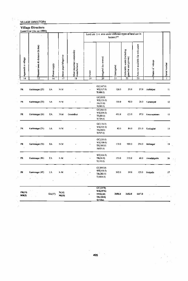
VILLAGE DIRECTORY
Villaj!e Directory Land Use (As on 1999)
Land use (Le. area under different types of land use in hectare)"
j c
.51 OJ
.: 0 OIl ;.
:::::- c :a u 'i5 'i5
I 0 '" u
u E U ... c
S .. c,..... <8 " 'S v~ OIl 'i5 0 ~ <>
..!l! f u B ;. :0 '" " 0
~ <Id ~"O 0 ~ tn ~ "" V> ~ _sg ... .~ '" '" ~"O 5 .8 £ 0. "
1:: e e "0 ~ ta
;. e ..c g Po ~ 8.3 ~
~
~ " .5 ~ "0 .n liI 0 '0 '" t;l '" Po " OIl C
e ~ ... t; OJ E !;!..c c <> .. ~ ~ - " E ~ ~
Co
~ ~ e OIl '2 e ~ ·c _k :£ ~ :£ 0 :.5 '" ,. <>
t.t.. ~ U OIl <: Z <Il
14 15 16 17 18 19 20 21 22 23 2 I
0C(167.0)
PR Karil1Ulagar (25) EA NM WE(317,0) 126.0 53,0 57.0 Ambalpur II T(484.0)
GC(IO.O)
PR KariI1Ulagar (30) EA NM WE(135.0)
100.0 92.0 26.0 Kareempet ]2 TK(55,0)
T(200.0)
0C(364.0)
PR KariI1Ulagar (26) EA NM Groundnut W£(295.0)
491.0 123.0 97.0 Kesavapatnam 13 TK(80.0) T(739,0)
GC(134.0)
PR KariI1Ulagar (31 ) EA NM WE(525.0)
82.0 84,0 231.0 KOlhagbat 1.t TK(48,0)
T(707.0)
GC(220.0)
PR KariI1Ulagar (30) EA NM WE(300.0)
130,0 900.0 294,0 Mo1angur IS TK(IOS.0) T(625,0)
WE(l14.Q)
PR Karil1Ulagar (46) EA NM TK(16.0) 155,0 372.0 60,0 Amudalapalle 16 T(130.0)
GC(845.0)
PR Karil1Ulagar (45) EA NM WE(316.0)
302.0 59,0 123.0 Metpalle 17 TK(283.0) T(1444,0)
CC(2I'8)
PR(15) N(16) WE(3976)
MR(Z) EA(17)
M(13) TWE(20) 2656.0 3453.0 1417.0
TK(1010) 7184
495
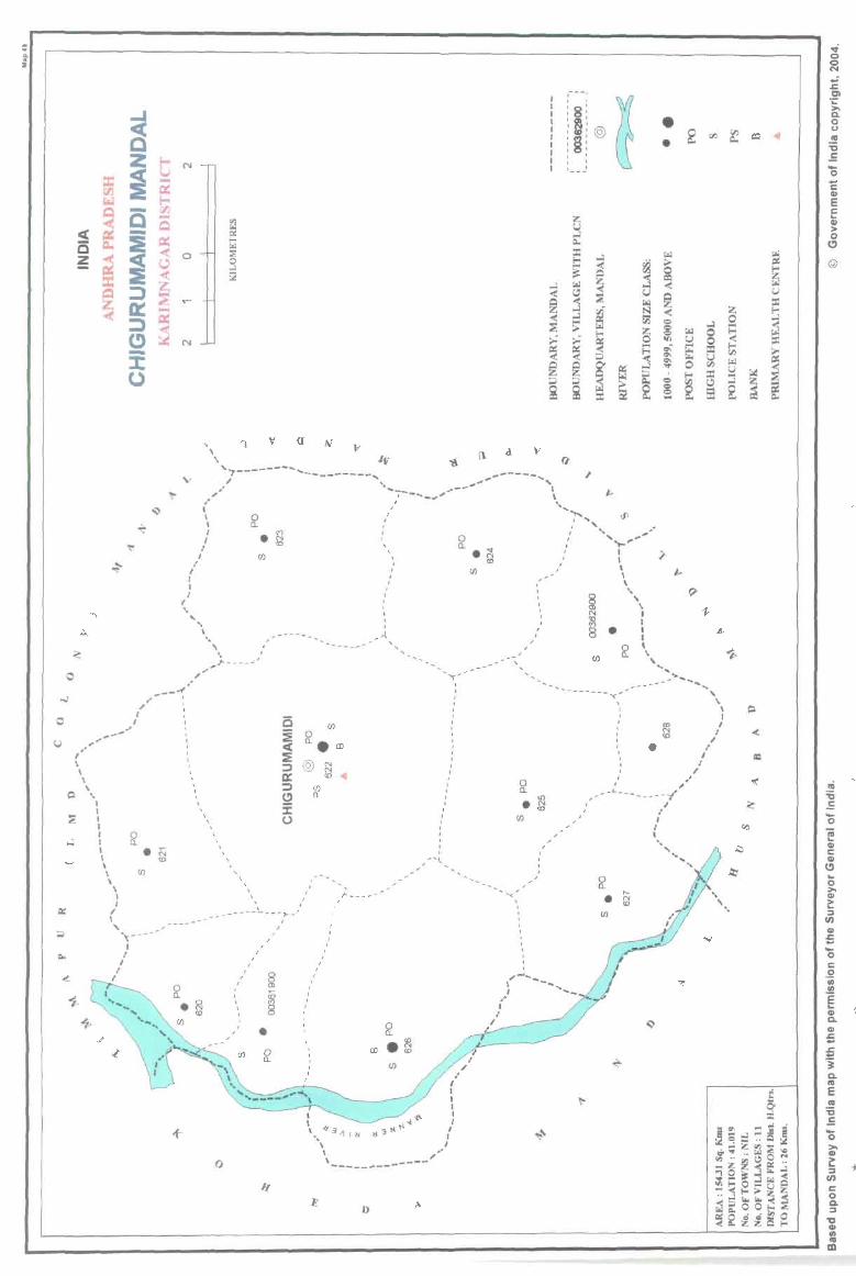
o
u --.. " ,.
" \ \ ,
P \, I I I I I I I \ \ \
\ I I
I I ,
..
v
(
, I I I
' . ...
, " , \ I I I
I
\ ",
.' 0 a.
• (f)
,~- --_
-.-( -- , .' , , , I , ,
(f)
_, ,
. , , , , , , , , , , , , , , , , , , ,
v (J
'" N tD
----- ........
i5 :E c( :E ;:) a:: ;:)
!2 :J: (.)
(f)
0 a. ern @
, , I
(f) a.
N N tD
1->---,
I I
, ,
, A
, , , I ,
-'-
o a_.g Ul
--~-, , ,
--'~ __ ,....,.._I , ,
-/
/
/ I
I I
8 I , (J) 0 , ~ , a.
a , 8 • ~ ,
, ~
,
e~
I • , , I
, III ,
0 , a.
Ul
o
... .'111111
\ ,,' \ ----\_--------
D
"
cI.
- , , ,
, I
---I ~ , , , , , 8' \~:© :§: , , , , : : I~- -
• (f)
• •
............ -------""C ...
I
, I
, ,;-'._-- ....
\ ... __ I
• I " -:---------/
o a. ,_ . ~ (I)
I
.'
.. I
I I
~
.(
= ~
~
"-l
~
t:t::
..j o o N
~ 01 ;:: » a. o o ~ "'C .E '0 C <II E c La> > o
(!)
@
.,j 'ij
-= '0 e QI c: QI
(!) ... 0 >. CII c: :> II)
<II .c. ... ... 0 c: 0 -;; .!!! E L-<II a. <II ~ ..
-4
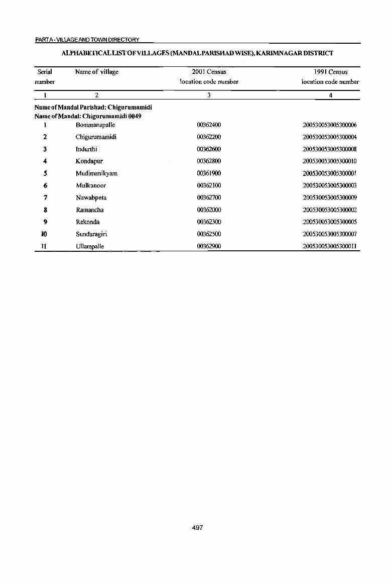
PART A -VILLAGE AND TOWN DIRECTORY
ALPHABETICAL LIST OF VILLAGES (MANDALPARISHAD WISE), KARIMNAGARDISTRICT
Serial Name of village number
2
Name of MandaI Parishad: Chigurumamidi Name of MandaI: Chigurumamidi 0049
1 Bommanapalle
2 Chigurumamidi
3 Indurthi
4 Kondapur
S Mudimanikyam
6 Mulkanoor
7 Nawabpeta
8 Ramancha
9 Rekonda
10 Sundaragiri
It Ullampalle
2001 Census location code number
3
00362400
00362200
00362600
00362800
00361900
00362100
00362700
00362000
00362300
00362500
00362900
497
1991 Census location code number
4
200530053005300006
200530053005300004
200530053005300008
200530053005300010
200530053005300001
200530053005300003
200530053005300009
200530053005300002
200530053005300005
200530053005300007
200530053005300011
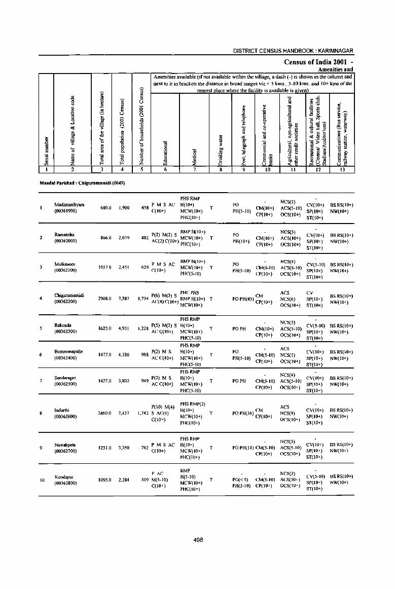
]' ., "8 ~
0 <II Q ., " C .t:/ <II
g ~ 0 . ." U '" '" g ... ;:;
....:I .. 0
~ t!-o<l
" u = OIl oS 0
.8 ~ '.c 'Cl '" ~ '3
~ '" 0.. .... ~ 0 c 0 0. ., ;a
~ 1!l 1!l 'c ., ~ 0
CI) l-
I 2 3 4
MaDdaI Parisbad : Cbigurumamidi (0049)
Mudimanikyam
(00361900) 689.0 1,900
Ramancha 2 866.0 2,019
(00362000)
Mulkanoor 3 IOS7.0 2,451
(00362100)
Cbigw-umamidi 4
(00362200) 2908.0 7,387
5 Rekonda
1623.0 4,931 (00362300)
6 Bommanapalle
1477.0 4,180 (00362400)
7 Sundaragiri
1427.0 3,802 (00362500)
Indurthi 8 2460.0 7,437
(00362600)
9 Nawabpeta
1231.0 3,350 (00362700)
Kondapur 1095.0 2,284 10
(00362800)
DISTRICT CENSUS HANDBOOK: KARIMNAGAR
Census of India 2001 -Amenities and
Amenities available (if not available within the village, a dash (-) is shown in the column and next to it in brackets the distance in broad ranges viz. < 5 kms., 5- JO kms. and 10+ kms of the
~
nearest place where the facillli' is available is_gi_ve1!l ~ <II
~~ C "t:I ., e u
~f .~ Q
;:; .., ~ E iEe c .~ ~ 0 0 '.Q
~ t!- ]: ~ <f!8, ., >.
" :: ~ .a 0. Q ]~~ ~ 6 '5, <II " U o - .. ~ eo; ..c: .." tp .~ :,: § () "..c: .c
'" i$ .." = .. u 8 s " .. 0'- c 0
~ ..c fii c g o<l:2:a o d'
..c 0. . '" .~ 0 .... l t1 <a ]~ 1>~ '" 'J::
0 ;s: 'e .!:! !! .. 1 " .g O! ] c '" ., .'" Oil 11 " " >. .J:J ~
()
11 " '" co E ~ ~ ~ il "t;; 'a I>
e 4J ;a ::s o .:1 S ii3 ~ ~ ~-§ ~uCl) 8~
5 6 7 8 9 10 11 12 I3
PHSRMP NCS(2)
458 PM S AC H(lO+) PO CY(IO+) BS RS(JO+) C(JO+) MCW(IO+)
T PH(5.JO)
CM(JO+) ACS(5.10) SP(JO+) NW(IO+)
PHC(IO+) CP(lO+) OCS(10+)
ST(IO+)
P(2) M(2) S RMP H(JO+) PO NeS(3)
CV(IO+) BS RS(IO+) 482 AC(2) C(IO+) MCW(10+) T CM(JO+) ACS(JO+)
PHC(IO+) PH(IO+)
CP(IO+) OCS(IO+) SP(JO+) NW(IO+)
ST(JO+)
629 PM S AC RMPH(IO+)
PO NCS(4)
CV(S-IO) BSRS(JO+) MCW(1O+) T CM(S-IO) ACS(S-IO) C(lO+) PHC(S.IO)
PH(S-lO) CP(IO+) OCS(IO+)
SP(IO+) NW(IO+)
ST(IO+)
P(6) M(3) S PHC PHS CM ACS CV
BSRS(IO+) 1,794 AC(4) C(10+) RMP H(10+) T PO PH(45) CP(IO+) NCS(6) SP(IO+) NW(IO+)
MCW(IO+) OCS(IO+) ST(IO+)
PHSRMP NCS(S)
I 228 peS) M(2) s H(IO+) T PO PH CM(IO+) ACS(S·IO)
CY(S-IO) BS RS(IO+) , ACqIO+) MCW(lO+)
CP(IO+) OCS(IO+) SP(IO+) NW(IO+)
PHC(5-IO) ST(IO+)
PHSRMP ACS
968 P(2) M S H(lO+) T
PO CM(5-IO) NCS(5)
CY(IO+) BSRS(IO+) ACqlO+) MCW(IO+) PH(S·IO)
CP(lO+) OCS(IO+) SP(IO+) NW(IO+)
PHC(S-IO) ST(IO+)
PHSRMP NCS(4)
949 P(2) M S H(IO+) T PO PH CM(5-10) ACS(S-IO)
CV(IO+) BS RS(lO+) ACqIO+) MCW(IO+)
ep(IO+) OCS(IO+) SP(JO+) NW(IQ+)
PHC(S·IO) ST(IO+)
P(JO) M(4) PHSRMP(2)
ACS H(IO+) CM CV(IO+) BS RS(IO+)
1,742 S Aq4) T PO PH(36) CP(IO+) NCS(9)
C(IO+) MCW(IO+)
OCS(IO+) SP(lO+) NW(IO+)
PHC(IO+) ST(IO+)
PHSRMP NeS(3)
762 PM SAC H(IO+)
T PO PH(14) CM(5-tO) ACS(5-IO) CV(IO+) BS RS(IO+)
C(lO+) MCW(lO+) CP(IO+) OCS(IO+)
SP(IO+) NW(IO+)
PHC(IO+) ST(JO+)
PAC RMP
NCS(3)
S09 M(5-IO) H(S-IO)
T PO« 5) CM(5-IO) ACS(lO+) eV(S-IO) BSRS(IO+)
MCW(lO+) SP(IO+) NW(IO+) C(IO+)
PHC(IO+) PH(S·IO) CP(IO+) OCS(IO+)
ST(JO+)
498

VILLAGE DIRECTORY
ViIlaee Directory Land Use (As 00 1999)
i g 0 ., ~ 0
~ ... 6
~ .~ 6 :a 8 1:1' ~ ~ ~"E ~ oS ~ € ., 8.il
~ B "'" Q.
'" ~
'" ~ .5 ~ g_ t ~ 1il '" ~
~ ~ ~ ~ & ~ 14 15 16 17 18
MR Karimnagar (26) EA N
MR Karimnagar (26) EA N
PR Karimnagar (2 I ) EA N Colton, Maize. ilioundnut
PR Karimnagar (26) EA NM
MR Karirnnagar (3 I) EA N
PR Karimnagar (34) EA N
PR Karinmagar (31) EA N
PR Karimnagar (31 ) EA N
PR Karirnnagar (36) EA N
PR Karirnnagar (36) EA N
Land use (i.e. area under different types of land use in
~
!! & 19
., ~ £ e '0 £ ., t>O
] 20
WE(386.0) T(386.0)
WE(430.0) T(430.0)
WE(407.0) T(407.0)
WE(902.0) T(902.0)
WE(S22.0) T(S22.0)
WE(604.0) TK(14.0) T(618.0)
WE(473.0)
T(473.0)
WE(897.0) TK(26.0) T(923.0)
WE(659.0)
T(659.0)
WE(259.0)
T(259.0)
499
hectare)·"
'0 ... :;; t>O 'E ';:; ::J
21
132.0
112.0
309.0
905.0
378.0
478.0
340.0
427.0
502.0
172.0
<: 0 .:::
"" ~
<: ~ :a '" 0
g.- ... ._ '" <B ._. .. '" ., > :E ., _ 0
t>O ~ 6h '" ~ '" ~'O > ~ ~ ia '" .... ~ l:a <5 c
C ail '" .,
- '" .~ ~ '" '" U 00
22 23 2
53.0 118.0 Mudimanikyam
184.0 140.0 Ramancha
301.0 40.0 Mulkanoor
642.0 459.0 Chigunnnamidi
404.0 319.0 Rekonda
311.0 70.0 BonunanapaJle
312.0 302.0 Sundaragiri
688.0 422.0 Indurthi
0.0 70.0 Nawabpeta
400.0 264.0 Kondapur
tl .0
~ Q
01 ''';
" CIl
I
2
3
4
6
7
8
9
10
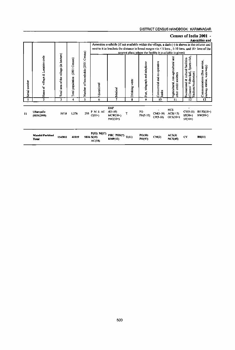
i " -g ~
-;;-u Sl 8
..cI .. :! '" .'" u
8 ~ -0 ...l 0
01:1 ~ t!.
" .. :5 co -s .. .. '''' .8 ~ ._ co 0 :l
~ ~ g-.... C 0 P,
" OJ
~ 1 fl '6 0 <I) I-< I-<
1 2 3 4
11 Ullampalle
597,0 1,278 (00362900)
Mandai Parishad 15430.0 41019
Total
a i:l u ;:; 0 t!. ~ -0 ..c: ., '" ::I 0 .c .... o
li § Z 5
295
DISTRICT CENSUS HANDBOOK: KARIMNAGAR
Census of India 2001 -Amenities and
Amenities available (if not available within the village, a dash (-) is shown in the column and next to it in brackets the distance in broad ranges viz, < 5 kms" 5-10 kms, and 10+ kmS of the
nearest place where the facility is available is givell) ~ :J~ lil
" ',::1 " Ii " > i 'Et! .. '''' 'e ""' 0
..CI ~ ~ 8. : f i p, () ]~,-, ~ '~ ~ :I .,
~ Q , .;: _Ol~ ~~ lil 5 g'~ -g '" ...
~ a o ,_
c • ..c: c g 01:I:'S!:a .~ S ~ . "'
til ~ Ol ]~ 2>~ .. '''' c 'e .!!1 S
0 "" " .g ~] § <II
'''' Ol .. '! .,
'3 t ~ ~ os " ~ e .. g.~ ] u :a tf ~1 u ...
::I '5, '" iil ~ is & <~ ~u<l) 8~ 6 7 8 9 10 II 12 13
RMP NCS
PM S AC H(5-10) T
PO CM(5-10) ACS«S)
eveS-tO) BS RS(tO+) C(lO+) MCW(IO+) PH(S-IO)
CP(S-tO) OCS(IO+) Sp(IO+) NW(IO+)
PHC(IO+) ST(IO+)
P(32) M(t7) PO(I0) ACS(3) 9816 S(10) PUC PHS(7) T(ll) CM(l) CV BS(1l)
AC(18) RMP(12) P8(97) NCS(4S)
500
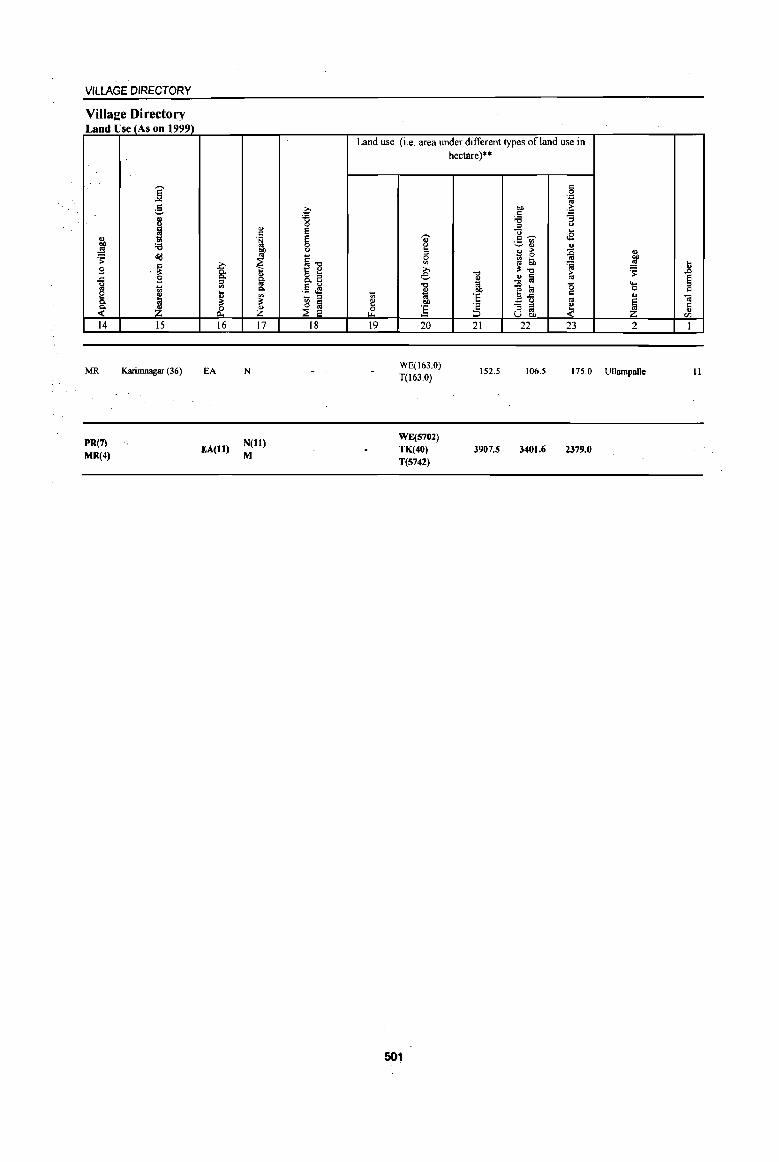
VILLAGE DIRECTORY
Villa2e Directory Land Use (As on 1999)
14
MR
PR(7)
MR(4)
15
Karimnagar (36)
16
EA
EA(ll)
17
N
N(H) M
18
Land use (i.e. area under different types ofland use in hectare)"
19 20 21 22 23 2
WE(l63.0) T(l63.0)
152.5 106.5 175,0 Ullampalle
WE(570l) TK(40) T(S742)
501
3907.5 3401.6 2379.0
11
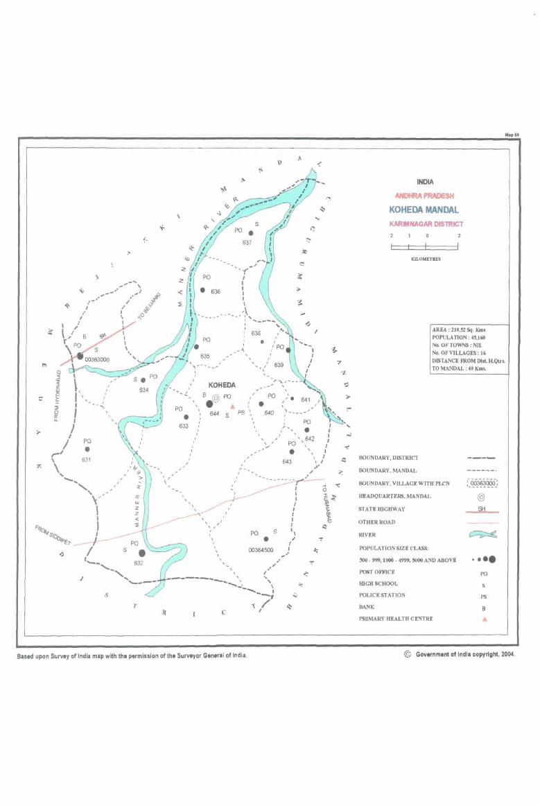
\
\, ' I ' ...... / I --" I
I I
/ PO
• ,..../ \
\. 631
-....., "I" '-, /
Y , I ) I __,___
/ (_
s
-........ ~'-.. '-----
\
. I
PO
• 633
, , , , , I ,
, , / ,
\ , _
KOHEDA
B @ PO • 644 S
,
, , , , , I , , ,
, ,
I PO I
, • PS
, 640 , , , , , ,
/ , I
" --I I
I r-_ ,
PO S
• 00364500
Based upon Survey of India map with the permission of the Surveyor Gen,ral of India.
,
A <
I
, ; .. _---'" ,
PO , r _ • , , ,
PO ' , 642 , •
643
, , , I ,
I , I
" / ( I
,.'
, ,
INDIA
ANDHRA PRADESH
KOHEDA MANDAL KARIMNAGAR DlSlRlCT
mOMETRES
Ibplt
AREA : 210.5% Sq. KIlls
POPULATION: 4!.160 No. OF TOWNS: NIL No. OF VILLAGES: 16 DISTANCE FROM Dill H.Qtrs. TO MANDAL : 40 KIDs.
BOUNDARY. DISTRICT
BOUNDARY. MANDAL
BOUNDARY. VILLAGE WITH PLCN
Hl!ADQUARTI!RS, MANDAL
STATEHICHWAY
OTHER ROAD
RIVER
POPULATION SIZE CLASS:
~- 999.1000 - 4999, 5000 AND ABOVE
POST OFFICE
IDGHSCHOOL
POLICE ST AnON
BANK
PRIMARY HEALTH CENTRE
@
SH
• ••• PO
s
PS
B
© Government of Indll copyright. 2004.
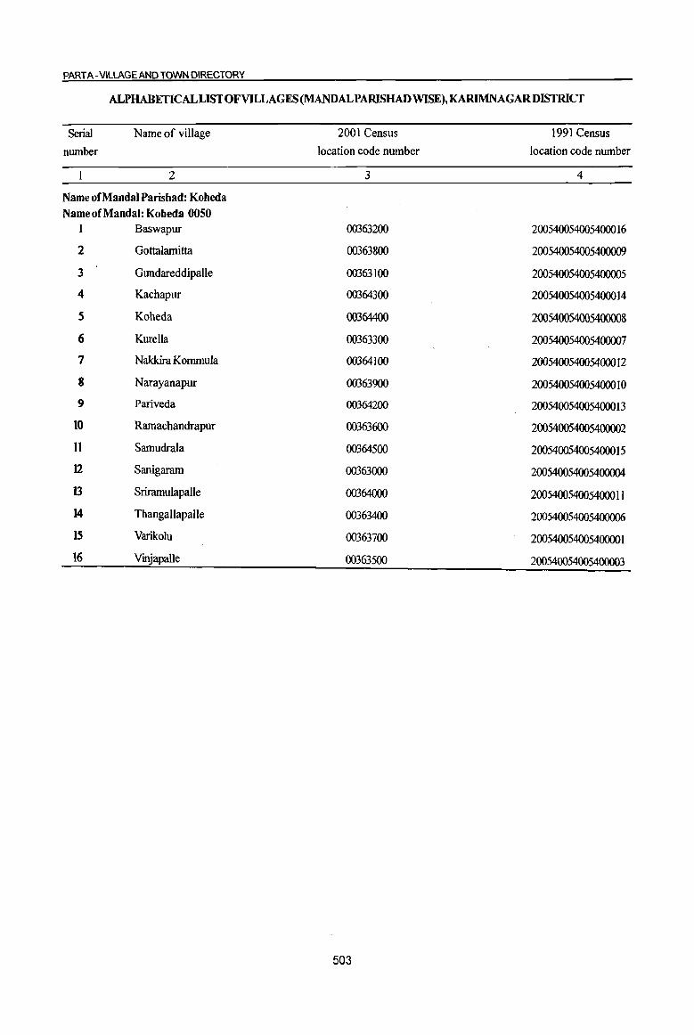
PART A -VilLAGE AND TOWN DIRECTORY
ALPHABETICALLISTOFVILLAGES(MANDALPARISHADWISE),KARlMNAGARDISfRICT
Serial Name of village 2001 Census 1991 Census
number location code number location code number
2 3 4
Name of Mandai Parishad: Koheda Name of Mandai: Koheda 0050
1 Baswapur 00363200 2005400540054000 16
2 Gottalamitta 00363800 200540054005400009
3 Gundareddipalle 00363100 200540054005400005
4 Kachapur 00364300 2005400540054000 14
5 Koheda 00364400 200540054005400008
6 Kurella 00363300 200540054005400007
7 Nakkira Kommula 00364100 2005400540054000 12
8 Narayanapur 00363900 2005400540054000] 0
9 Pariveda 00364200 2005400540054000 13
10 Ramachandrapur 00363600 200540054005400002
II Samudrala 00364500 200540054005400015
12 Sanigaram 00363000 200540054005400004
13 Srirarnulapalle 00364000 20054005400540001 I
14 Thangallapalle 00363400 200540054005400006
IS Varikolu 00363700 20054005400540000 1
16 Vinjapalle 00363500 200540054005400003
503

I ., "'0 <ii' 0 u 0 .,
~ C .Q
0 g .::: .. a 8 C -1 ~ 0
~ 'S: t!. ., .. c co -£! 0
] ~ ':::
~ ...
1 0
§ g ... = 0
til .,
~ '3 ~ ·c
~ ~ 1 2 3 4
Mandai Par&bad : Kobeda (0050)
Sanigaram 1722,0 5,242
(00363000)
2 Gundareddipalle
1591.0 1,927 (00363100)
3 Baswapur
3683,0 6,428 (00363200)
4 KurcUa
1080.0 2,353 (00363300)
S Thanga1lapalle
1421.0 3,006 (00363400)
6 Vinjapalle
1000.0 2,595 (00363500)
Ramachandrapur 887,0 1,614 7
(00363600)
Varikolu 8 1080.0 2,086
(00363700)
Gottalamitta 9 381.0 670
(00363800)
NaraY8llapur 10
(00363900) 591.0 1,595
Sriramulapalle II 399.0 1,554
(00364000)
DISTRICT CENSUS HANDBOOK: KARIMNAGAR
Census of India 2001 -Amenities and
Amenities available (if not available within the village, a dash (-) is shown in the column and next to it in brackets the distance in broad ranges viz.< 5 kms., 5-10 kms. and 10+ kms of the
<ii' nearest place where the facility is available is_given} £ '" "'0 ~~ ., u Ii '::: u :{ - .. ..,
] ~t! 0 c > .~~ 0 0 ':::
(:!, j [ .l!! 8. ~ ~ ~ is ]~~ <5 1l 6 .s, til
.c "'0 ~ .~ -~~ 6 2 .. Ii <> G ~"§ til ~ '" -0 C u
" o .- '" ... .c Ii c 8 ~~:il o c 0 u .c ... ~ li
.::: 0 .... .. ~ .. >" ., ':1 0 c ~
.~ c < .~ S .. 0 co .. .g ~ l § til
II "i til
~ B u 6 " <> ., 6
~f ~ <> 'a :i ~j "a t eu] " ~ 8 u.s Z ~ ~ ..(~ ~u ._, <I)
5 6 7 8 9 10 II 12 13
PHS RMP(5) ACS
I 117 P(2) M(2) S H(IO+) PO CV(IO+) BS RS(lO+) HPTWW PH(IO+) CM(IO+) NCS(3)
, ACC(IO+) MCW(IO+) CP(IO+) OCS(lO+)
SP(IO+) NW(IO+)
PHC(IO+) ST(lO+)
RMPO NCS(3)
482 P M C(lO+) H(IO+) THPTW PO
CM(IO+) ACS(IO+) CV(IO+) BS RS(lO+)
MCW(IO+) W PH(5-1O) CP(10+) OCS(IO+)
SP(IO+) NW(IO+)
PHC(IO+) ST(IO+)
PHSRMP NCS(6)
1,461 P(9) M(2) S 0(5) H(IO+)
TTWW POPH(2) CM(lO+) ACS(IO+) CV(IO+) BS RS(IO+)
AC(4)C(10+) MCW(IO+) CP(10+) OCS(IO+)
SP(IO+) NW(IO+)
PHC(IO+) ST(IO+)
PAC RMPO
NCS 540 M« 5}
H(IO+) THP POPH(?) CM(lO+) ACS«5)
CV«5) BSRS(lO+)
C(10+) MCW(IO+)
CP«5) OCS(IO+) SP(IO+) NW(IO+}
PHC«5) ST(IO+)
PHS RMP NCS(3)
732 P M S 0(3)H(10+)
THP POPH(5) CM(IO+) ACS« 5) CV«S) BS RS(IO+)
AC(2) C(IO+) MCW(lO+) CP« 5) OCS{IO+)
SP(IO+) NW(IO+)
PHC«5) ST(IO+)
PHS RMP ACS
P(2) M 0(2) H(IO+) HPW PO PH(20) CM(lO+) NCS(3)
CV(S-IO) BS RS(IO+) 619 AC(2)C(to+) MCW(IO+)
CP(5-to) OCS{to+) SP(IO+) NW(IO+)
PHC(S·IO) ST(IO+)
PHSRMP NCS
412 P M AC(2) 0(2) H(IO+) HPW
PO CM(IO+) ACS« 5)
eV(5-IO) BS RS(JO+)
C(IO+) MCW(lO+) PH(5-IO) SP(IO+) NW(IO+)
PHC(5-10) CP(IO+) OCS(IO+)
ST(10+)
RMPO NCS(2)
490 PM S AC H(IO+) PO CV(IO+) BS RS(IO+) W CM(IO+) ACS(IO+}
C(10+) MCW(lO+) PH(IO+) CP(IO+) OCS(IO+)
SP(IO+) NW(IO+)
PHC(IO+) ST(10+)
PAC OH{lO+) PH(J) ACS(5-1O) CV(5-1O) BS RS(IO+)
166 M« 5} MCW(IO+} HPW CM(IO+) PO« 5) NeS(S-IO} SP(IO+) NW(IO+)
C(IO+) PHC(5-10) CP(5-10) OCS(5-10) ST(IO+)
RMP0(2) NCS(3)
404 P(2) M AC H(IO+)
HP PO PH(5) CM(IO+} ACS(5-IO} CV(5-IO) BS RS(IO+)
C(IO+) MCW(lO+) SP(IO+) NW(IO+)
PHC(5-1O) CP(S·IO) OCS(5-10)
ST(IO+}
NCS CV«5) BSRS(IO+) PM AC H(IO+)
THPW PO
CM(IO+) ACS«5) 365 MCW(lO+} PH« 5) SP(IO+) NW(IO+) C(IO+)
CP« 5) OCS«5) PHC« 5) ST(IO+)
504
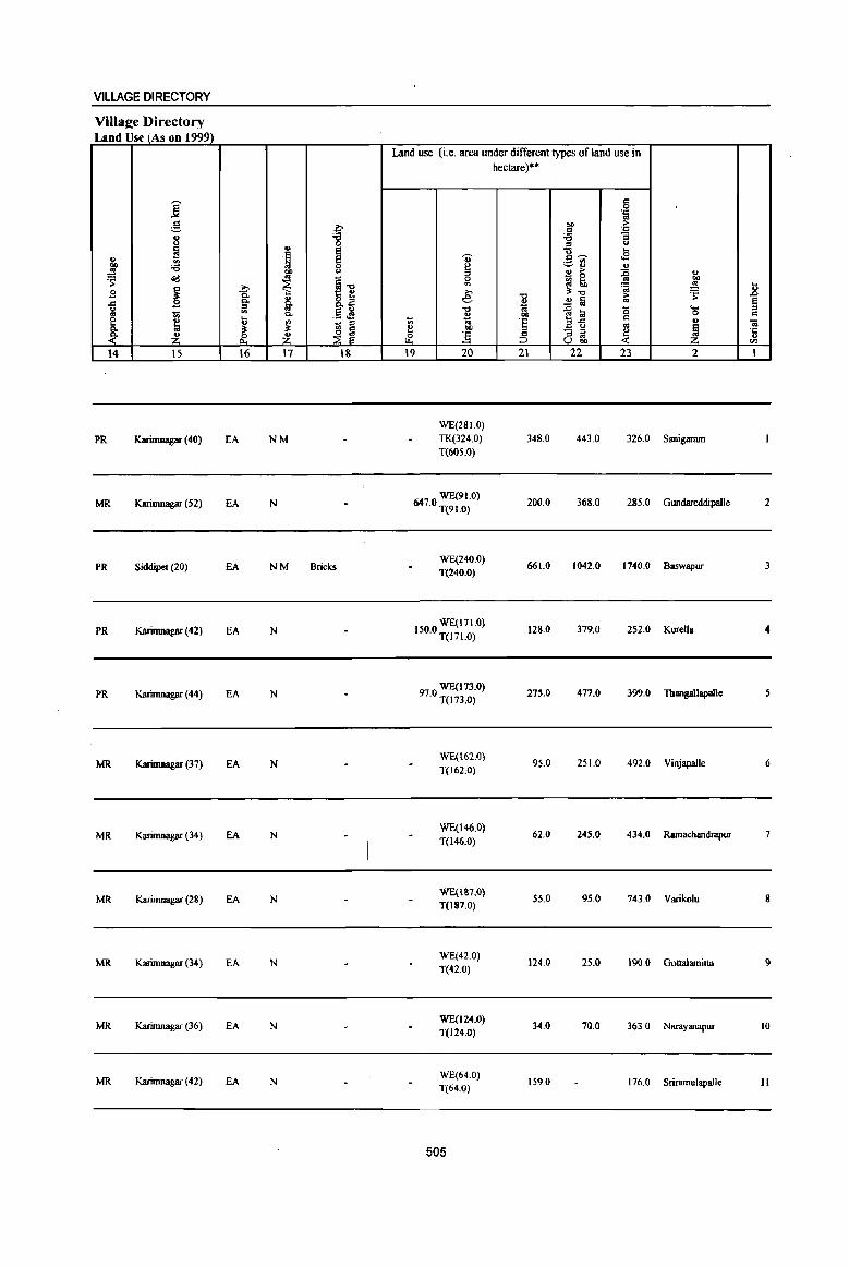
VILLAGE DIRECTORY
VilIaee Directory Land Use (As on 1999)
j g
f j u
I .. . ~ ., ~ ;a
00
'S ~ co
~1l ~ » § E 0.
§. ail ..c Q.
" U <II .5 ~ .. 1ii c. e ~ ~ it "' '" c. ~ ~ ~ ~ ~ ~
14 IS 16 17 18
PR Karimnagar (40) EA NM
MR Karimnagar (52) EA N
PR Siddipet (20) EA NM Bricks
PR Karimnagar (42) EA N
PR Karimnagar (44) EA N
MR Karimnagar (37) EA N
MR Karimnagar (34) EA N
MR KariIllIl3gllf (28) EA N
MR Karimnagar (34) EA N
MR Karimnagar (36) EA N
MR Karimnagar (42) EA N
Land use (Le. area under different types of land use in
u <> :l 0
'" » e -0
~ t; i!! bO
Ii' ] 19 20
WE(28 1.0) TK(324.0) T(6OS.0)
WE(91.0) 647.0 T(91.0)
WE(240.0) T(240.0)
WE(171.0} 150.0 1(171.0)
WE(l7J.0) 97.0 1(173.0)
WE(162.0) T(162.0)
WE(l46.0) T(146.0)
WE(187.0) T(l87.0)
WE(42.0) T(42.0)
WE(124.0) T(124.0)
WE(64.0) T(64.0)
505
hectare)·"
-0
~ .. 'e § 21
348.0
200.0
661.0
128.0
275.0
95.0
62.0
55.0
124.0
34.0
159.0
<=I 0 . .., '" 00 >
<=I . ..,
'tl "3 " u "0 ... c:~ cE -.:-rl " ., > :c ., ~ ~ '" 00
~ .!!! 0:-0 'S ~ !a ~ .... ]~
(5 0 c: ., '" ~ "'3 ~ ~ U 00
22 23 2
443.0 326.0 Sanigaram
368.0 285.0 Gundareddipalle
1042.0 1740.0 Baswapur
379.0 252.0 Kurella
477.0 399.0 Thangallapalle
251.0 492.0 VinjapaJle
245.0 434.0 Ramachandrapur
95.0 743.0 Varikolu
25.0 190.0 Gonalamitta
70.0 363.0 Narayanapur
176.0 Sriramulapalle
... 2 a
<=I
«I ·c " CIJ
I
2
3
4
5
6
7
8
9
to
11
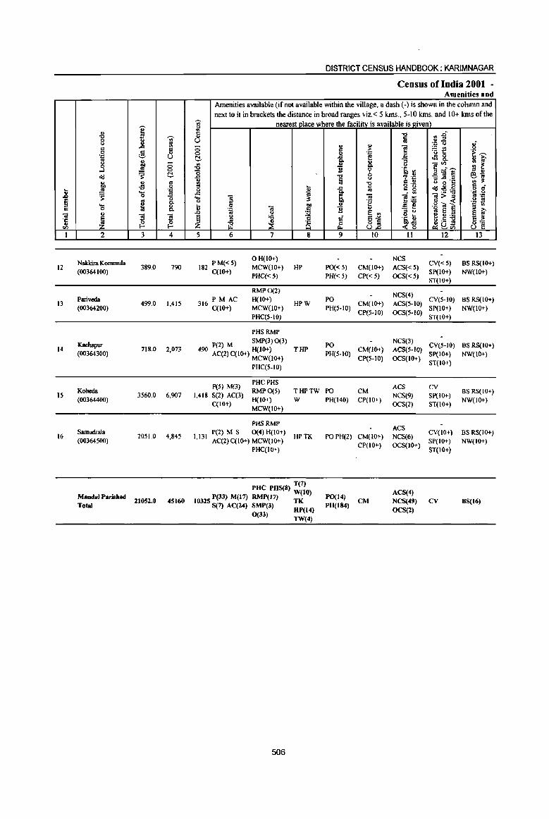
I ., 'Q 'Ui' 0 u " ill c ... c 0 g ..
':0 U '" ., g CD c:
...l .!!l 0
~ 's: t!, ., '" C
"" -£! 0 ... ., ':::l
.8 ~ .... .. 0 "3
~ ~ 0. ._ 8-0 .,
GI
~ ~ ! '5 <I) I-'
I 2 3 4
Naklcira Kommula 12 389.0 790
(00364100)
Pariveda I3 499.0 1,415
(00364200)
Kachapur 14
(00364300) 718.0 2,073
15 Koheda
3560.0 6,907 (00364400)
16 Samudrllla
2051.0 4,845 (00364500)
MandalParisbad 11052.0 45160
Total
DISTRICT CENSUS HANDBOOK: KARIMNAGAR
Census of India 2001 -Amenities and
Amenities available (if not available within the village, a dash (-) is shown in the column and next to it in brackets the distance in broad ranges viz.< 5 kms., 5-10 kms. and 10+ kms of the
'Ui' nearest place where the facility is available is ~iven) iii I) "'" fj :2" Iij u .. ., ':0 <J Ii c: c > i ~t! 0 0 ':::l .~~ ~ j; f! t!&.
& .a <> ]~'"' '" ~ '0 !l 6 '@, Ul ::s .,
-= .., <> , .~ _""iil¥!j eo;
~ fa ::s..c "C .. :s: '0 C .,
<.) g g 6 B ..c fa 8 °2 ~ d' ~:g'<l -= a ii .'" 0 .... "lil ~ Ol "lil>:; .. '::l 0 "e c: « u '" c: '§ 1;; t; 0 CD u E ., .g OJ ]
.~ "lil c ] ... - ... .&:l u
~ e ., ::s tJ @~'<l e ~ ~
<> il 1 SJ ·t t; e :s: ::s ;§ ~uS i\3 ~ ~~ ~<I) t31 5 6 7 8 9 10 11 12 13
182 P M« 5) OH(IO+) NCS
CV« 5) BSRS(IO+) MCW(lO+) HP PO« 5) CM(IO-f.) ACS« 5)
C(IO+) PHC«S) PH« 5) CP« S) OCS«S)
SP(IO+) NW(IO+) ST(IO+)
RMP0(2) NCS(4)
PM AC H(IO+) PO CV(5-10) BS RS(IO+) 316 C{lO+) HPW CM(IO+) ACS(5-10)
MCW(JO+) PH(5·10) CP(S·IO) OCS(5·IO}
SP(IO+) NW(lO+) PHC(5-10) ST(IO+)
PHSRMP
P(2) M SMP(3) 0(3) PO NeS(3)
CV(S-IO) BS RS(IO+) 490 AC(2)C(IO+) H(IO+) THP
PH(5-1O) CM(IO+) ACS{5-1O)
SP(IO+) NW(IO+) MCW(lO+) CP(5-10) OCS(IO+)
ST(IO+) PHC(5-10)
peS} M(3) PHC PHS
ACS CV 1,418 S(2) AC(3)
RMP0(5) THPTW PO CM NCS(9) SP(IO+)
BS RS(IO+)
C(lO+) H(IO+) W PH(140) CP(IO+)
OCS(2) ST(IO+) NW(IO+)
MCW(JO+)
PHSRMP ACS
1,131 P(2) M S 0(4) H(IO+)
HPTK POPH(2) CM(IOi") NCS(6) CV(IO+) BS RS(IO+)
AC(2) C(IO+) MCW(lO+) SP(IO+) NW(IO+) PHC(IO+)
CP(IO+) OCS(IO+) ST(IO+)
T(7) puc PUS(8) W(lO)
PO(14) ACS(4)
10325 P(33) M(l7) RMP(17) TK CM NCS(49) CV BS(16) S(7) AC(24) SMP(3) HP(14) PH(I84)
OCS(l) 0(33) TW(4)
506
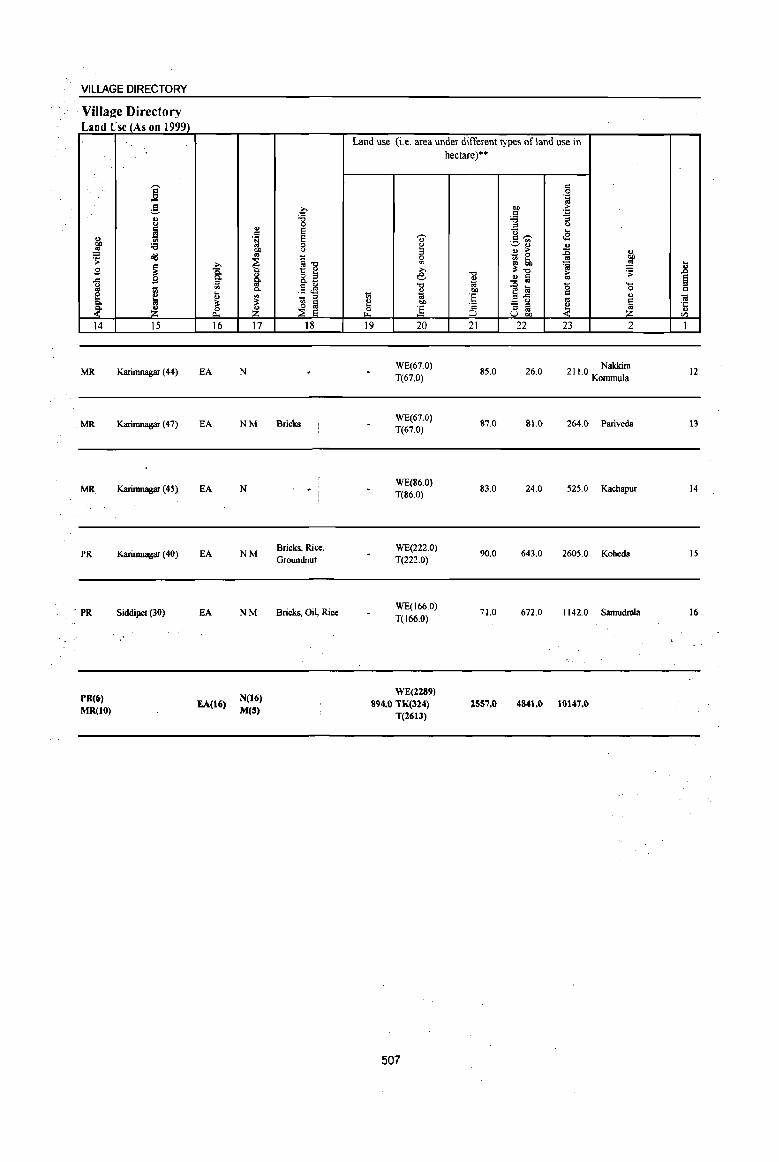
VILLAGE DIRECTORY
Village Directory Land Use (As on 1999)
j ~ B J!! ~ e C>.
~ 14
MR
MR
MR
PR
. PR
PR(6) MR(tO)
]' ~ ., " ~ :e
cId
~ 1;;
~ ~ 15
Karimnagar (44)
Karimnagar (47)
Karimnagar (45)
Karimnagar (40)
Siddipel (30)
~ Q.
1Jl .... ., ~ ~ 16
EA
EA
EA
EA
EA
EA(16)
c-'B ., 0 E c
.~ E 0 : " ~'" ~ t ~ i 8.0) .5 .s
~ 1;; '"
~i z 17 18
N
NM Bricks
N
NM
NM
N(16) M(S)
Bricks, Rice, Groundnut
Bricks, Oil, Rice
Land use (i.e. area under different types of land use in
l;i
~ ""' 19
'i)' g
" ~ ,., e-'" " 1ii "" ] 20
WE(67.0) T(67.0)
WE(67.0) T(67.0)
WE(86.0) T(86.0)
WE(222.0) T(222.0)
WE(166.0)
T(166.0)
WE(2289) 894.0 TK(324)
T(2613)
507
hectare)··
"0 O> ;a 00
E '2 ::> 21
85.0
87.0
83.0
90.0
71.0
2557.0
c 0 .~
"" > c .= :e :;
'" (.)
tl .... <£ c~ ._ III
'-' ., ., ., ;.- :;; ., - 0 '" 00 ~ 50 ~ ~ ;1:", > ~ .!! § '" 1~ '0 ....
c 0
'" .,
- '" ~ ~ ::::> '" u "" 22 23 2
26.0 211.0 Nakkira Komrnula
81.0 264.0 Pariveda
24.0 525.0 Kachapur
643.0 2605.0 Koheda
672.0 1142.0 Samudrala
4841.0 11)147.0
_g § c ;a ·c ., en I
12
13
14
IS
16
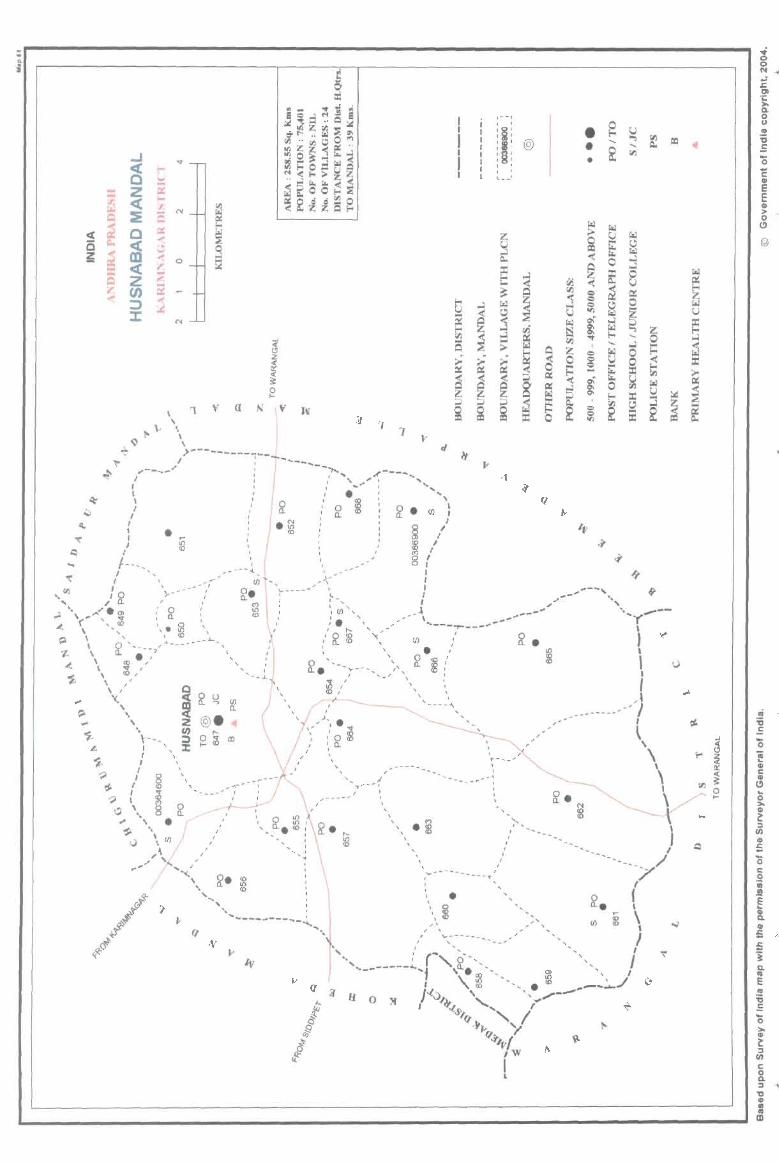
g 0 ~
..J
C§ ::r:: z ~ <
:E , C g; al ~ <
Q Z ~ tJ) ...
::> J:
!--I",i .... cr:: !--if). .... Q cr:: .... ..!i .... .,-;::: E2 ~
\ ,
..,.
N
!-" \ '1
..J
~ z ~ « ?:
2 V a N v W
3 7 1
~ \>---------i--~_~ _____ ..,.._ ;r----, ... ~ , , " " ' , , , " , " ~.. , I .- I I ~ ,----- 0 ~ : £ . 0 1 :, £" §! ' . ~ . ,
/ 000'l , " '.', , ' ~ " , , ! ---: ~- ,
1-- 1
• ~ u (IJ P!l
I i , , ...,
t:l. :§:
"
I , @ • ~ (IJ
I I ' j: , '§' • I I : , I , I : I , , I , l __
"'--, 1---" 0 _ , " : _~~--' -'( 0 ,--- ", J _ ~ , \' . . : "0 ", _,-- ' _______ __ (I) :~, ~ I ,: . t--','--.... J ' , '0, ., 0 '" -<' .. :" " " £ • " . ,'
... " ,- , --
.. '-" '-y
~ '(- " ~ ',. ~ -'.." ,:1 \ 2 ~ I
" , "----, 0 . '''' __ ",,", __ ......... _,,1',\, ~ \ 0 '-.---", , 0.. . , . , '" 1- \ co, ' __ -,- I/) J . , ~ " ,. , '----, ~ \ " ~ ~ ~ ~ " ,
'< ~ @. " ,<':~ \ UlO~1Il " ~a. \---, 5!" " .,_
I , , ~ I \
~ / .. ---- ........ -..... ----~
, , , , ,.- .... _ I ,
-,
I
J , , I
I ,t ----/ I ~\
? " § \-----,'T 1> : ~ a ? , 8 a. ~ .. ", .
,,:. '\ (f)
, , J
\ : £. ' ---1 \ ~ , , ., ~ a ~\<-.----' \\". ~ ,,/)"___ " ___ ",, ____ "') '",~~ .:. ~ ", ;' V \ "
''''j( I .. ...' ,." "<.,~. ~ " ' ..
'.\ ___ ... _ I
..... _---- .............
" I \ ,
" -----------. : :, £. '\ \ " . , ~ ", ~ (/), ~ ,", ,
' " " I " ''-----------,' , I ' " ,
J '" , I : (-, ~ "-, l1l ',./" ,.
, CD __ ...... ", ------..... f \ ~ • _ .. ... _ CD "._
' , '." J..(0~ '-... I , ..($>1,.. '/
V -t"" '/ ({~~f
'W I
'" (/ 3
"-If ~
f;i
'" ~ ,f
o
L
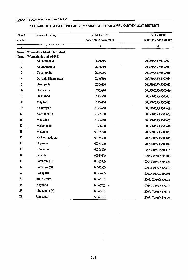
PART A - VILLAGE AND TOWN DIRECTORY
ALPHABETICALLISTOFVILLAGES(MANDALPARISHADWISE),KARIMNAGARDISTRICT
Serial Name of village 2001 Census 1991 Census
number location code number location code number
1 2 3 4
Name of Mandai Parishad: Husnabad Name of Mandai: Husnabad 0051
1 Akkannapeta 00366500 200550055005500021
2 Anthakkapeta 00366600 200550055005500017
3 Choutapalle 00366700 200550055005500018
4 Dongala Dharmaram 00366300 200550055005500014
S Gandipalle 00366200 200550055005500022
6 Gouravelli 00365800 200550055005500016
7 Husnabad 00364700 200550055005500004
8 Jangaon 00366400 200550055005500012
9 Kesavapur 00366800 200550055005500019
10 Kuchanpalle 00365500 200550055005500003
11 Madudha 00364800 200550055005500005
12 Mallampalle 00366900 200550055005500020
13 Mirzapur 00365200 200550055005500009
14 Mohammadapur 00364900 200550055005500006
15 Nagararn 00365000 200550055005500007
16 Nandararn 00366000 200550055005500015
17 Pandilla 00365600 200550055005500002
18 Pothararn (1) 00365900 200550055005500024
19 Potharam (S) 00365300 200550055005500010 Xl Potlapalle 00364600 200550055005500001 21 Ramavaram 00366100 200550055005500023
22 Regonda 00365700 200550055005500013 23 Thotapalle (S) 00365400 200550055005500011 24 Ummapur 00365100 200550055005500008
509
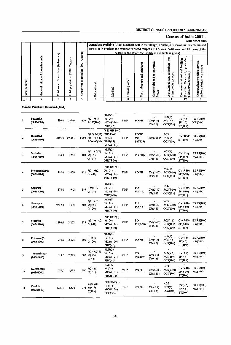
"" "8 M ';)' <) u ., ::l
..c '" !5 .S c " 'S::: u
8 '-' ., 1 0
..J 0
id '$' C-., ., 5 ... i3 .. ~ 'Q
II 's: ...
'" 0 "3 § '" c.. ... ; 8. c 0 .. ., ~
]I ]I '5 ~ 0
'" I-
I 2 3 4
Maudal Parisbad: Husnabad (0051)
PotIapalle 899.0 2,649
(00364600)
HlISIIIIbad 2 2491.0 19,2SI
(00364700)
3 Madudha
S14.0 1,253 (00364800)
4 Mohammadapur
367.0 2,009 (00364900)
Nagaram 174.0 943
(00365000)
6 Ummapur
2247.0 1,332 (00365100)
7 Mirzapur
1280.0 3,202 (00365200)
8 Potharam (S)
719.0 2,42S (00365300)
Thotapalle (S) 9 813.0 2,213
(00365400)
KuchanpalJe 1,693 10
(00365500) 780.0
Pandilla II 1230.0 3,430
(00365600)
DISTRICT CENSUS HANDBOOK: KARIMNAGAR
Census of India 2001 -Amenities and
Amenities available (if not available within the village, a dash (-) is shown in the column and next to it in brackets the distance in broad ranges viz.< 5 klns., 5-10 klns. and 10+ krns of the
~ ., nearest place where the facilitv is available is lriven) .. '" c
1 ~~ " U of
0 ., '" 1
'Q " c :> ~t! " 0 0 'E 'E~
C- ..c ~ 8. .. ~ 0. '" ..!:! '" '" ]~~ :: ~ 0. " "0 B ~ '6, ., -0 '" ... ...c ." ~ .~ "3]~ B~ .,
Iii " ., ~ ~ "0 c '" o 0'1: o ._
c 0 ~ ...c a c 15 id:E~ o c·
...c ~ li
.'" 0 ... OJ ~ OJ OJ> .. 13 .s::: 0 c .~ .~ -.a i ._ ill .. 0 ... u § .... " ... .. c B '" ..c .. u
~ e ., ::I " ~ Ii 'f3 E! .. ~ " 'f3
~:i .~ ~ e ~
~ ~ _! ;;; ~a:l Z £ <~
'-' '" 8~ 5 6 7 8 9 10 11 12 13
RMP(S) NCS(6)
620 P(2) M S H{IO+) THP PO PH CM«5) ACS«5)
CV{< S} BSRS{IO+) AC C(lO+) MCW(IO+)
CP{< 5) OCS(lo+) SP« S) NW(IO+)
PHC«S} ST(IO+)
HDMHPHC P(l2) M(ll} PHSFWC PO TO ACS
CV(3)SP BSRS(IO+) 4,050 S(5) PUC(2) NH(3) THP PTO CM(2)CP NCS(9)
AC(4) C(lO+) RMP{IS) PH(459) OCS(IO+) ST(IO+} NW{lo+)
MCW(IO+)
P(2) AC(2} RMP(2)
NCS(4) 300 M« 5)
H{IO+) THP POPH(2) CM(S-IO) ACS{S-IO)
CV(IO+) BS RS(IO+) MCW(W+) SP(IO+) NW(IO+)
C{IO+) PHC{5-10)
CP(S-IO) OCS(IO+) ST(lO+}
PHSRMP(3) NCS(3)
472 P(2) M{2} H(IO+) THP PO PH CM{5-10) ACS(S-IO)
CY{S-IO) BSRS{IO+)
C(S-IO) MCW(IO+) CP(S-IO) OCS(IO+)
SP(S-IO) NW{IO+) PHC{5-10) ST(lO+}
RMP(3} NCS
219 PM(5-10) H{IO+) THP
PO CM(S-IO) ACS(S-IO)
CY(5-10) BS RS(lO+)
C(lO+) MCW(IO+) PH«5) CP(S"IO) OCS(IO+}
SP(5-IO} NW(IO+)
PI-IC(S-IO) ST(IO+)
pel) AC RMP(3)
Nes
289 M« 5) H{lo+)
THP PH
CM(5-IO) ACS(5-10) eY(S-IO) BS RS(IO+)
C{IO+) MCW(IO+) PO« 5)
CP(S-to) OCS(IO+) SP(5-IO) NW{IO+)
PHC{S-IO) ST(IO+)
PHS RMP(3)
678 P(3) M AC H(IO+) THP
PO CM(S-IO)
ACS«S) CY(S-IO) BS RS(IO+)
C(S-IO) MCW(IO+) PH(5-10) CP(S-to)
NCS(IO+) SP(S-IO) NW(IO+)
PHC(5-10) OCS(IO+) ST(IO+)
RMP(3) NCS(3)
601 PMS H(IO+)
THP PO PH CM«S) ACS«S) CY«5) BS RS(IO+)
C(lO+) MCW(IO+) CP« 5) OCS(IO+)
SP« 5) NW(IO+)
PHC« 5) ST(IO+)
P(2) AC(2) RMP(3)
H(lo+) PO ACS« S) CY«5) BS RS{IO+) 508 M« 5) THP CM«5)
C« 5) MCW(IO+) PH(IO+)
CP« S) NCS(IO+) SP« 5) NW(IO+)
PHC« 5) OCS(IO+) ST(IO+)
RMPO NCS 390 P(3) M H(IO+)
THP PO PH CM(5-10) ACS(5-10) CV(5-10) BS RS(IO+)
C(lO+) MCW(IO+) SP(5-IO) NW(IO+)
PHC(5-10) CP(S-IO) OCS(IO+)
ST(IO+)
P(3) AC PHS RMP(4) ACS H(IO+) CV« 5) BS RS(IO+)
776 M«5) MCW(IO+)
THP PO PH CM«5) NCS(3) SP« 5) NW(lo+)
C(lO+) CP(-< 5) OCS(IO+) PHC« 5) ST(IO+)
510

VILLAGE DIRECTORY
ViIlae:e Directory Land Use. (As on 1999)
Land use (i.e. area under different types of land use in
hectare)··
j <= 0
.&)
,; ~ "" ~ c:: ·c
8 '8 :;; "3 :::l "
~ .. e u ... c:: ~ .s .. .~ 8 ., .9 0;;-
co :;; 8 ~ ~ u .. ..!! ... ::l ., > :0 j <Iij t - 0 ~ ~"E
0 ~ tI, '" ;>, '" ~ t B ~ 1
;>, -0
>:-0 > .s: .<:J
..c: B 8.g e ~ ~ fa .. g
u .. -0 .0 l:3 0 .... '" .§ ~ 0 = ..
j 0-
~ co !!!..c: <=
~ Il '" _ :::l
1;; E .a u '" .. 'Ol >: ~ j[ ~ eo '2 - = ~ ~ ·c
~ & Z 0 :§ :::l '" .,
"" :J U 00 ,;/l
14 15 16 17 18 19 20 21 22 23 2 I
Paddy, Maize, WE(272.0)
MR Karimnagar (25) EA N TK(95.6) 519.8 2.0 9.6 Potlapalle Cotton
T(367.6)
Paddy, Maize, WE(t040.0)
PR Karimnagar (26) EA NM TK(228.0) 519.6 389.6 313.8 Husoabad 2 Tomato
T(1268.0)
Paddy, Maize, WE(152.0)
MR Karimnagar (28) EA N Groundnut
TK(52.0) 261.2 3.2 45.6 Madudha 3 T(204.0)
WE(148.0)
MR Karimnagar (28) EA N Paddy, Maize TK(48.0) 133.6 1.0 36.4 Mohammadapur 4 T(J96.0)
WE(64.0)
MR Karimnagar (28) EA Paddy, Maize TK(10_4) 86.8 4.0 8.8 Nagaram 5
T(74.4)
WE(180.0)
PR Karinmagar (26) EA N Paddy, Maize TK(129.2) 318.8 490.2 1128.8 Ununapw- 6 T(309.2)
Paddy, Maize, WE(340.0)
MR Karimnagar (26) EA M TK(72.8) 404.9 44.8 417.5 MiIzapur 7 Tomato
T(412.8)
Paddy, Maize, WE(248.0)
PR Karimnagar (26) EA N TK(90.0) 336.4 15.6 29.0 Potharam (S) 8 Groundnut
T(338.0)
WE(l76.0) MR Karimnagar (26) EA N Maize, Paddy TK(113.6) 373.2 66.8 83.4 Thotapalle (S) 9
T(289.6)
WE(220.0) MR Karinmagar (26) EA N Paddy, Maize TK(IOI.2) 242.8 145.2 70.8 Kuchanpalle 10
T(32 1.2)
Cotton, Paddy, WE(368.0)
PR Karimnagar (28) EA N TK(142.0) 603.6 100.0 16.4 Pandilla II Maize T(51O.0)
511
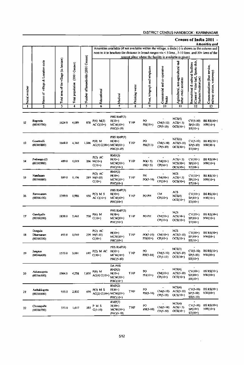
~ " ."
I 8 g 8
..d
~ .~ u
.3 " g 1lr ~ old t!-., .. §
~ oS .8 ':;l
~ 'S ~ § g c.. .... 8. c: 0 ., .. ~
}! }! '':
" 0 0
III E-< E-<
I 2 3 4
12 Regonda
1624.0 4,089 (00365700)
Gouravelli 13
(00365800) 1668.0 4,360
14 Polharam (1)
489.0 1,019 (00365900)
15 Nandaram
589.0 1,196 (00366000)
16 Ramavanun
1399.0 1,986 (00366100)
17 Gandipalle
1830.0 3,46S (00366200)
Doogala
18 Dharmaram 495.0 1,049
(00366300)
Jangaoo 19 IS73.0 3,001
(00366400)
Akkannapeta 20 1904.0 4,238
(003665000)
Anthakkapeta 21 95S.0 2,832
(00366600)
Choutapalle 22 373.0 1,617
(00366700)
DISTRICT CENSUS HANDBOOK: KARIM NAGAR
Census of India 2001 -Amenities ilnd
Amenities available (if not available within the village, a dash (-) is shown in the column and next to it in brackets the distance in broad ranges viz. < 5 kms., 5-10 Ions. and 10+ Ions of the
'iii' nearest place where the facilitv is available is.J!,iven) = a ." ",1 .. Ia u .. - oJ ., .= <> ;; " ] ;.; U') u 6 ;. 'u 1:: .~ ~ 0 .~
t!- ..d ~8. c.. :; ~ " ~ ] ~''""' on ~ <> "0 "2 '~'" ; ., 1 ." 8 , -~ -]§ ~~ m ." .. '" a 0 .~ = li ~
g "0 ... 0 .c .td~:ii o c
..d .. a . ~ ',e: 0
'S «I ~ ~~ «1;>= :1 .=
c: ~ .g ~ 1 '§ ~ .8 0
Ol I ..!!
':;l 2 .,
os u
~j '" u e5'6 ~ ~ § u '6 -:i ~~ iE u .S s 8~ ~ £ ~u Z '-' III
5 6 7 8 9 10 II 12 13
PHSRMP(3) NCS(4)
878 P(4) M(2) H(lO+) THP
PO CM(S-IO) ACS« 5)
CV(S-IO) BS RS(lO+) ACC(IO+) MCW(IO+) PH(10+)
CP(S-IO) OCS(IO+) SP(S·IO) NW(lO+)
PHC(5-10) ST(lO+)
PHS RMP(S) NCS(6}
1 P(4) M H(10+) PO CV(5-IO) BSRS(IO+) ,006 AC(4)C(10+) MCW(IO+)
THP PH(211)
CM(5-IO) ACS(5-to) SP(S-IO) NW(IO+)
PHC(5-10) CP(5-10) OCS(IO+)
ST(IO+)
P(2) AC RMP(3)
206 M(IO+) H(IO+)
THP PO« 5) CM(10+) ACS« 5) CV(IO+) BSRS(IO+)
C(lO+) MCW(IO+)
PH« 5) CP(IO+) NCS(IO+) SP(IO+) NW(IO+)
PHC(IO+) OCS(IO+) ST(IO+)
P(2) AC RMP(2)
NCS 289 M(S-IO)
H(IO+) THP
PH CM(IO+) ACS«S)
CV(IO+) BS RS(IO+)
C(lO+) MCW(IO+) PO(S-IO)
CP(1O+) OCS(IO+) SP(IO+) NW(IO+)
PHC(IO+) ST(lO+)
pHS RMP(5) ACS
456 P(2) M S H(lO+) THP PO PH
CM NCS(4}
CV(IO+) BSRS(IO+) ACC(IO+) MCW(IO+) CP(IO+)
OCS(IO+) SP(IO+) NW(IO+)
PHC(IO+) ST(IO+)
PHSRMP(2) NCS
738 P(6) M H(IO+) THP PO PH CM(JO+) ACS(IO+)
CV(10+) BSRS(IO+) C(1O+) MCW(IO+)
CP(IO+) OCS(IO+) SP(IO+) NW(IO+)
PHC(IO+) ST(IO+)
P(2) AC H(lO+)
NCS CV(IO+) BSRS(IO+)
239 M(S-IO) THP PO(S-W) CM(IO+) ACS(S-IO)
C(lO+) MCW(IO+)
PH(IO+) CP(IO+) OCS{IO+) SP(IO+) NW(IO+)
PHC(IO+) ST(lo+)
PHSRMP(4) NCS(3)
697 P(2) M AC H(IO+) PO CV{5-IO) BS RS(lO+) THP CM(S-IO) ACS(5-JO)
C(lO+) MCW(JO+) PH(5-10) CP(S-IO) OCS(1O+)
SP(5-10) NW(IO+)
PHC{S-IO) ST(IO+)
DAPHS
P(8) M RMP(2) PO NCS(4)
CV(lO+) BS RS{IO+) 1,030 AC(4) C(IO+) H{IO+) THP CM(IO+) ACS(S-JO)
PH(10+) CP(IO+) OCS(lO+)
SP(IO+) NW(lO+) MCW(IO+)
ST(IO+) PHC(IO+)
RMP(2) NCS(4)
P(3) M S H(lO+) PO CV(5-10) BSRS(IO+)
696 AC(2)C(10+) MCW(IO+) THP
PH(5o-IO) CM(S-IO) ACS(S-IO)
SP(5-10) NW(IO+) CP(5-10) OCS(lO+)
PHC(10+) ST(S-IO)
RMP(3) NCS(4) P M S H(IO+)
THP PO
CM(S-IO) ACS« 5) CV(5-IO) BSRS(IO+)
385 C(5-JQ) MCW(IO+) PH(S-IO) SP(IO+) NW(10+) CP(5-10) OCS(IO+)
PHC(5.10) ST(lo+)
512
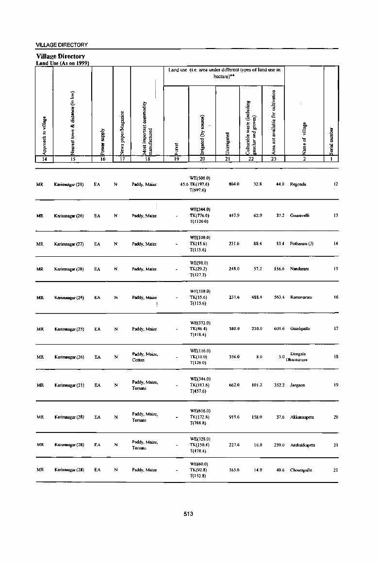
VILLAGE DIRECTORY
Villaee Directory Land Use (As on 1999)
Land use (i.e. area under different types ofland use in hectare)··
I j c: 0 OJ:: ..
.9 ~ eo ;> ._. .9 .J::
j :g "tI "3 <> :::l <.>
~ c; .. j ·S .-, e ~ .E;
VI V ._ VI
:e 8 ~ ~., .,
~ ., ;>
~ .,
~ cl1! ~1i
0 ~ ~ Ill)
~ i ~ VI ..!l! .. £ >. ~"tI ~ .8 u 8.2 e "tI
..!! lil > § ~ .9 fij- <> as
;! .5 oM "tI .. ..c a 15 ...
1l "" ~ OIl 0 .. e u '" iii ·8 ~~ .. u
~ - ;:l '" 0;
Cl. .~ ~
~ ~ ., OIl
~ ~ z .. ] § :; ~ ~
·c .;:: .,
rl. u eo C/J
14 15 16 17 18 19 20 21 22 23 2 1
WE(500.0)
MR Karimnagar (21) EA N Paddy, Maize 45.6 TK(197.6) 804.0 32.8 44.0 Regonda 12 T(697.6)
WE(344.0)
MR Karimnagar (26) EA N Paddy, Maize TK(776.0) 447.9 62.9 37.2 Gouravelli 13 T(1120.0)
WE(100.0)
MR Karimnagar (27) EA N Paddy, Maize TK(15.6) 231.6 88.4 53.4 Potharam (Jl 14
T(IIS.6)
WE(98.0)
MR Karimnagar (28) EA N Paddy, Maize TK(29.2) 248.0 57.2 156.6 Nandaram 15
T(127.2)
WE(100.0)
MR Karimuagar (24) EA N Paddy. Maize TK(15.6) 231.6 488.4 563.4 Ramavararn \6
T(115.6)
WE(372.0)
MR Karimnagar (25) EA N Paddy. Maize TK(46.4) 580.0 230.0 601.6 Gandipalle 17
T(418.4)
Paddy, Maize. WE(1I60)
50 Dongala MR Karimnagar (26) EA N TK(IO.0) 356.0 8.0 18
Cotton T(126.0)
. Dharmaram
Paddy. Maize, WE(344.0)
MR Karimnagar (21) EA N Tomato
TK(1l3.6) 662.0 101.2 352.2 Jangaon 19
T(457.6)
Paddy, Maize, WE(616.0)
MR Karirnnagar (28) EA N TK(I72.8) 919.6 158.0 37.6 Akkannapeta 20 Tomato
T(788.8)
Paddy, Maiu, WE(328.0)
MR Karinmagar (28) EA N TK(ISO.4) 227.6 10.0 239.0 Anthakkapeta 21 Tomato
T(478.4)
WE(60.0) MR Karinmagar (28) EA N Paddy, Maiu TK(92.8) 165.6 14.0 40.6 Choutapalle 22
T(152.8)
513
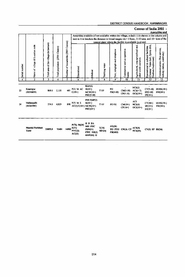
1! § c
01 .~
en 1
23
24
u
"'" 0 u c 0 .:: .. u 0
..J ~
" 00 ..!S ~ ... 0
" ~ 2
Kcsavapur (0036<;800)
Mallampalle (00366900)
MandaI Parisbad Total
--i --., .. ~ ..c
g ., <5 E <:)
~ ~ ... d -B 0
'.Q .... ..!S 0
~ ~ ~ ] f-' ~ 3 4
868.0 2,120
514.0 4,029
25855.0 75401
DISTRICT CENSUS HANDBOOK: KARIMNAGAR
Census of India 2001 -Amenities and
Amenities available (if nol available within the village, a dash (-) is shown in the column and next to it in brackets the distance in broad ranges viz.< 5 kms., 5-10 kms. and 10+ kms of the
-;;;- nearest place where the facility is available is given) '" ~ 8 ~
:E 0
..c .. '" 8 ..c .. '0 c
.8 0 .z; Oi .. " ~
u :a ::I
~ ~ 5 6 7
RMP(4)
481 P(2) M AC H(IO+) C(JO+) MCW(JO+)
PHC(5-10)
PHSRMP(2) peS) M S H(10+)
898 AC(3)C(10+) MCW(IO+)
PHC(lO+)
P(76) M(28) H D DA S(1l) MH PHC
16902 PUC(l) PHS(II) FWe NH(3)
AC(32) RMP(82) 0
514
u t;j ::t 00 0
~ _!
8
THP
THP
T(14) HP(14)
"'" la ., II>
i C ;. 0 .::
1 e 8.. ... b .~ '"
"t:l , .~ u ~ "t:l C "
..c lii :inl ~ . '" .. ].l::: "e B"t:l ., "B u "3 tl
jj_ 1ii .~ b ~ <~ 9 10 II
NCS(2) PO
CM(S·IO) ACS«S) PH{S·JO)
CP(S-IO) OCS(IO+)
ACS PO PH CM(lO+) NCS(4)
CP(lO+) OCS(lO+)
PO(20) ACS(4) TO PTO CM(3) CP NCS(69) PH(68Z)
.,..0
.. .E! .:: .... .; = In ...
.;;; 1:: '! f .f!&. ]~--~§ e10 ~ ~-r: '" ::t ~~~ 5 = '= 0 ]>~ <II .z;
'lH! .g ., ] 01 E ~ f ...... :a Ii .5 ~
.~ U en it'! 12 J3
CY(S·lO) BSRS(IO+)
SP(S-IO) NW(IO+) ST(IO+)
CY(IO+) BS RS(IO+) SP(JO+) NW{JO+) ST(lO+)
CV(3) SP BS(24)
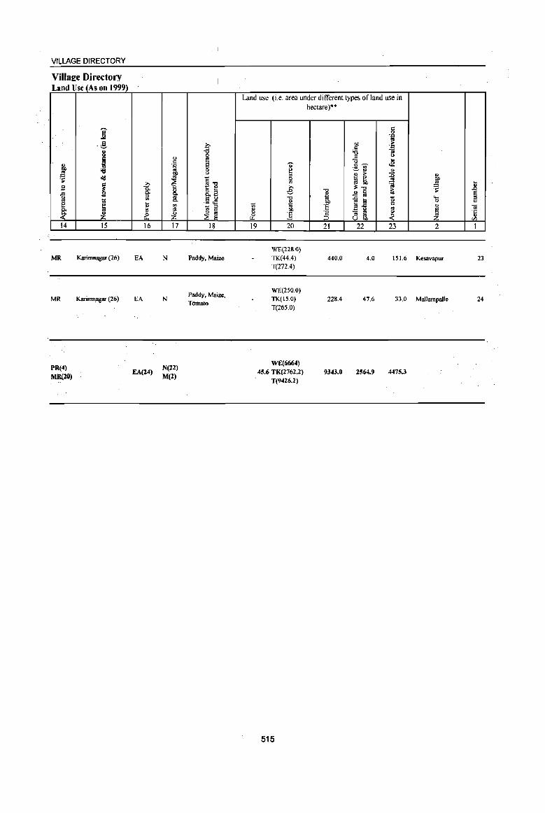
VILLAGE DIRECTORY
VilIaEe Directory Land Use (As on 1999)
~ ~ .8
~ §. ~ 14
MR
MR
PR(4)
MR(lO)
j .g
j '6 ol1J
~ £2 1;$
~ ~ 15
Karimnagar (26)
Karimnagar (26)
>,
1 ... " ~ & 16
EA
EA
EA(24)
.., ·S ~
~ ~ c.
~ ~ 17
N
N
N(22) M(l)
~ :g e e c (J
11 .5 ~ - = ~ ~
18
Paddy, Maize
Paddy, Maize, Tomato
Land use (i.e. area under different types ofland use in
1;$
~ ""' 19
... ~ = fil € "0 u 1;j OIl
] 20
WE(221!.<)}
TK(44.4)
T(272.4)
WE(250.0) TK(IS.O)
T(265.0)
WE(6664) 45.6 TK(2762.2)
T(9426.2)
515
hectare)"
"'" " 10 OIl
'E
'" ::> 21
440.0
228.4
9343.0
5 '+l
OIl ~ ;§ '+l ;;; = ~
<:i ... c ~ .8 ._ "' ~ u
~ u > _ 0
«j 5b 'S ~"'" 1:; .2 §
]~ '0 c co - = ~ = .. u OJ)
22 23
4.0 151.6
47.6 33.0
2564.9 4475.3
j .. ~ ..8
§ ""' 0 C
" .. ~ 'j;;
" CIl
2 I
Kesavapur 23
Mallampaile 24

N D A L
I 1- --:
: :1: I' '@ f : : 0
: :!2 ~ , : 2S: r , , 1 l.. __ ,
I , I ,
I I
J.. ..
I
,-- ..... ""'" ,'-- " , .... -... 'T""-- Q ' ......
:----- .... -- ...... - I , 31 "_, I , • M ......
i ----"';' \ ~ § \
" ,':, ,--' I 0 -', I r 0.. , : I
I .... ,' '1- ______________________ \ ~ ~ " , I I , : , ' -' , I
',' " \I) m " I, , I
" '. N \ : 1'--' " 0 18 \ ' ---I \I) " a. '.. 1------ , , I
" ,'".: ~.. !", ,,',,',""" '-\'. -... "., :c " :,' \ " ---.,; ~. : ...,: "', . ------_. '.: . , , - . , . , , ' '" " " , ' '. , , ' , " .... _--:---... -----<-/ \ I ............
J , •••• ______ • ___ \. ~ \ ' ro : '. \,/ ". .;; ~ , , , '. "
/ • N ,: _ ro _ i.. : " : ~ ~ " :; ': . : : " ! \ g ® ~ :', ~ • ", __ ----'. ,/ '_"'. /',: !! R', " ,'-- ,_-_____ _ ." ---- ----' '," v. : ______________ , ____ ' , __ , :
II \ , ~,' I
' ", , ' '- r \ R • 't ---------- -- -- ____ 'oo : : ~:,' , ' :oo __ ' • : '; ' . , 0" , ' ""'" " ~,' < : : . '-- "----. ,:.: " , ': , ' : ,,' __ ". , i /---------- ... '.... I '§: , , ' \oo: , ~ ~8· R, , : ___ _ ' ' . .... I--I " ~ ~ l---, __ ' , -, .' I I '_, , I : __ ...
\ " __ -- '. .. -----, '--- .------ ,
.t> I
\ ---------~--------- t_~ .... --I ,
I
=
o o N
i Cl ~
fl: 8 '" :s .E -o
~ E GI
~ ©
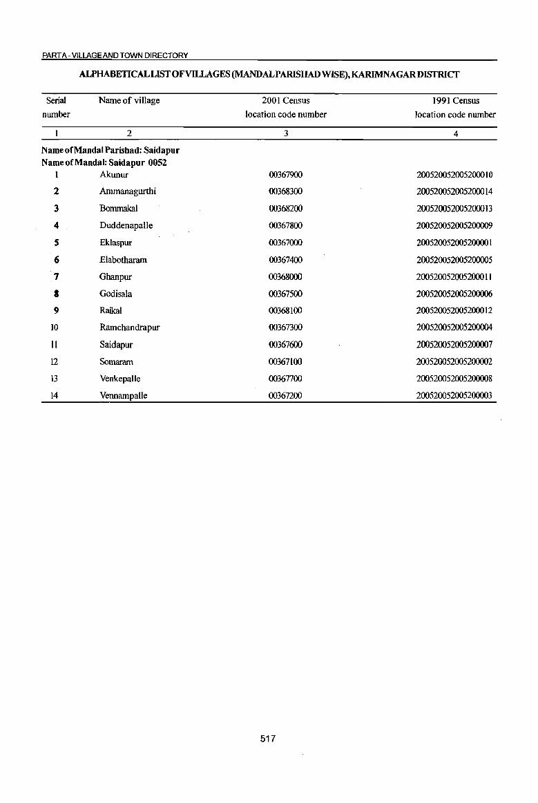
PART A - VILLAGE AND TOWN DIRECTORY
ALPHABETICAL LIST OF VILLAGES (MANDALPARISHAD WISE), KARIMNAGARDISTRICT
Serial number
Name of village
2
Name of Mandai Parishad: Saidapur Name of Mandai: Saidapur 0052
1 Akunur
2 Ammanagurthi
3 Bommakal
4 DuddenapaUe
5 Eklaspur
6 Elabotharam
7 Ghanpur
8 Godisala
9 Raikal
10 Ramchandrapur
II Saidapur
12 Somaram
13 Venkepalle
14 Vennampalle
2001 Census location code number
3
00367900
00368300
00368200
00367800
00367000
00367400
00368000
00367500
00368100
00367300
00367600
00367100
00367700
00367200
517
1991 Census location code number
4
200520052005200010
200520052005200014
200520052005200013
200520052005200009
200520052005200001
200520052005200005
200520052005200011
200520052005200006
200520052005200012
200520052005200004
200520052005200007
200520052005200002
200520052005200008
200520052005200003

DISTRICT CENSUS HANDBOOK: KARIMNAGAR
Census oflndia 2001 -Amenities and
Amenities available (if not available within the village, a dash (-) is shown in the column and next to it in brackets the distance in broad ranges viz. < 5 kms., 5-10 kms. and 10+ krns of the
-;;;- nearest place where the facility is available is given)
I 1;1 ., " "0 rl~ "8 'Ui' u
iii u () ~ ., ., .'" u ,; g ..c
il 0 " ;> ] ifie <>
~ 0 0 'p
'!~ 'p U t!, .g, ~ r:!8. co u "3 g - .!! .,
~~---... <:> ~ C>- u
....l co <:> B 'i' '§' .!! ~ C!- '0 = .., ~ -= "Cl 0 _las ~~ ., lii u .= ;:; B ~'I:: ., ., g '" "Cl ... -s 5 u iii
o ._
~:E~ c .
.8 co ." -= c g o " ~
... co .c (d ~ . '" .'" 0 0 "3 ... 'if ~ ] ]~ la>= os ',c
~ to C>- o c e '" « .~ t! ... ~ 0 u 0 'if bO .!! .g ., ] r: 0 0. .~ .: B
., - .. ., .0 0 ~ e '" '" <>
oj e 8 l;-la 1 1l ~ e u "0 1 g1 .~ u f3 .6 "0 e ~ '5 '" ~ 0 '" ill ~ 8 ~U.l'3 8] <Il I-< :z U..c «~ ~<Il
I 2 3 4 5 6 7 8 9 10 II 12 13
Mudal Parisbad : Saidapur (0052)
Eklaspur PM AC(3) H(S·IO) NCS(3}
CV(S.IO) BS RS(IO+) 1231.0 1,864 471 HPTW PO PH CM(S·IO) ACS(S·IO) (00367000) C(1O+) MCW(IO+)
CP(S-IO) OCS(IO+) SP(IO+) NW(to+)
PHC(S-IO) ST(IO+)
Somaram P(3} AC(3) PHSH(IO+) NCS(2)
CV«S) aSRS(IO+) 2 750.0 1,539 387 M« 5) MCW(IO+) HPTW PO PH CM« 5) ACS« 5) (00367100) C(JO+) PHC«5) CP« 5) OCS(IO+)
5P(l0+) NW(IO+)
ST(IO+)
Vennampalle P(4) M S PHSH(IO+) ACS
CV(S-IO) as RS(IO+) 3 1115.0 3,631 863 AC(3) MCW(IO+) HPTW PO PH CM(5-10) NCS(4} (00367200) C(S-IO} PHC(5-IO) CP{S-IO) OCS(S-IO)
5.11(5-10) NW(IO+) ST(lO+)
Ramchandrapur PAC
H(5-10) NCS
CV(S-IO) BSRS(IO+) 4 233.0 1,348 291 M«S) HPTW PO PH CM(S-IO) ACS« 5) (00367300) MCW(IO+) SP(S-IO) NW(IO+) C(5-10}
PHC{S-IO) CP(5-10) OCS(IO+)
ST(IO+)
Elabotharam 597 P(3) M AC PHS H«5) ACS
CV« 5) as RS(IO+) 5 796.0 2,341 MCW(IO+) HPTW PO PH CM« 5) NCS(2)
(00367400) C« 5) PHC(5-10) CP« 5) OCS«S)
SP« 5) NW(lO+) ST(10+)
P(6) M S PHS
NeS(3) 6
Godisala 1806.0 4,S67 1,138 AC(3)
H(5-IO) HPTWW POPH(4) CM«5) ACS« 5)
CV(5-10) aSRS(IO+) (00367500)
C(5-IO) MCW(lO+)
CP(S-IO) OCS(5-10) SP(S-IO) NW(JO+)
PHC(5-IO) ST(IO+)
Saidapur DA PHC PHS ACS CV
as RS(IO+) 7 915.0 3,533 812 P(3) M H(IO+) THPW PO PH(18) CM CP NCS(7) SP(lO+)
(00367600) AC(4) C(IO+) MCW(IO+) OCS(IO+) ST(IO+) NW(lo+)
Venkepalle P(2) M(2) S H(lO+) PH(6) NCS
CV«5) aSRS(IO+) 8 582.0 2,188 517 THP CM«5) ACS« 5)
(00367700) AC(4) C(IO+) MCW(IO+) PO« 5) CP(IO+) OCS(IO+)
SP(lO+) NW(IO+) PHC«5) ST(lO+)
Duddenapalle P M S PHS H(IO+) ACS CV«S) as RS(tO+)
9 (00367800)
952.0 2,751 687 AC(3)C(IO+) MCW(IO+) THPW PO PH(3) CM«5) NCS(3) Sp(IO+) NW(IO+)
PHC«5) CP«5) OCS(IO+) ST(lO+)
Akunur PHS H(IO+) NCS(6)
eV(S-IO) aSRS(IO+) 10 2538.0 5,521 1,343 peS) M(2) S MCW(IO+) THPW PO PH(2) CM(S-lO) ACS(S-IO)
SP(IO+) NW(lo+) (00367900) AC(3) C(IO+) PHC(5-IO) CP(5-10) OCS(IO+) ST(IO+)
Ghanpur 489 PM AC(2) H(lO+) NCS(3)
CV«5) as RS(IO+) II 636.0 1,958 HPTWW POPH CM« S) ACS« 5)
(00368000) C(lO+) MCW(lO+) CP« 5) OCS(IO+)
SP(IO+) NW(JO+)
PHC«5) ST(IO+)
Raikal 560 P(3) M AC PHSH(IO+) NCS(4)
CV(S-IO) BS RS(IO+) 12 1439.0 2,454 MCW(IO+) HPTW W PO PH CM«5) ACS« 5)
SP(IO+) NW(IO+) (00368100) C(lO+) PHC(.5-10) CP(S-IO) OCS(IO+)
ST(IO+)
518
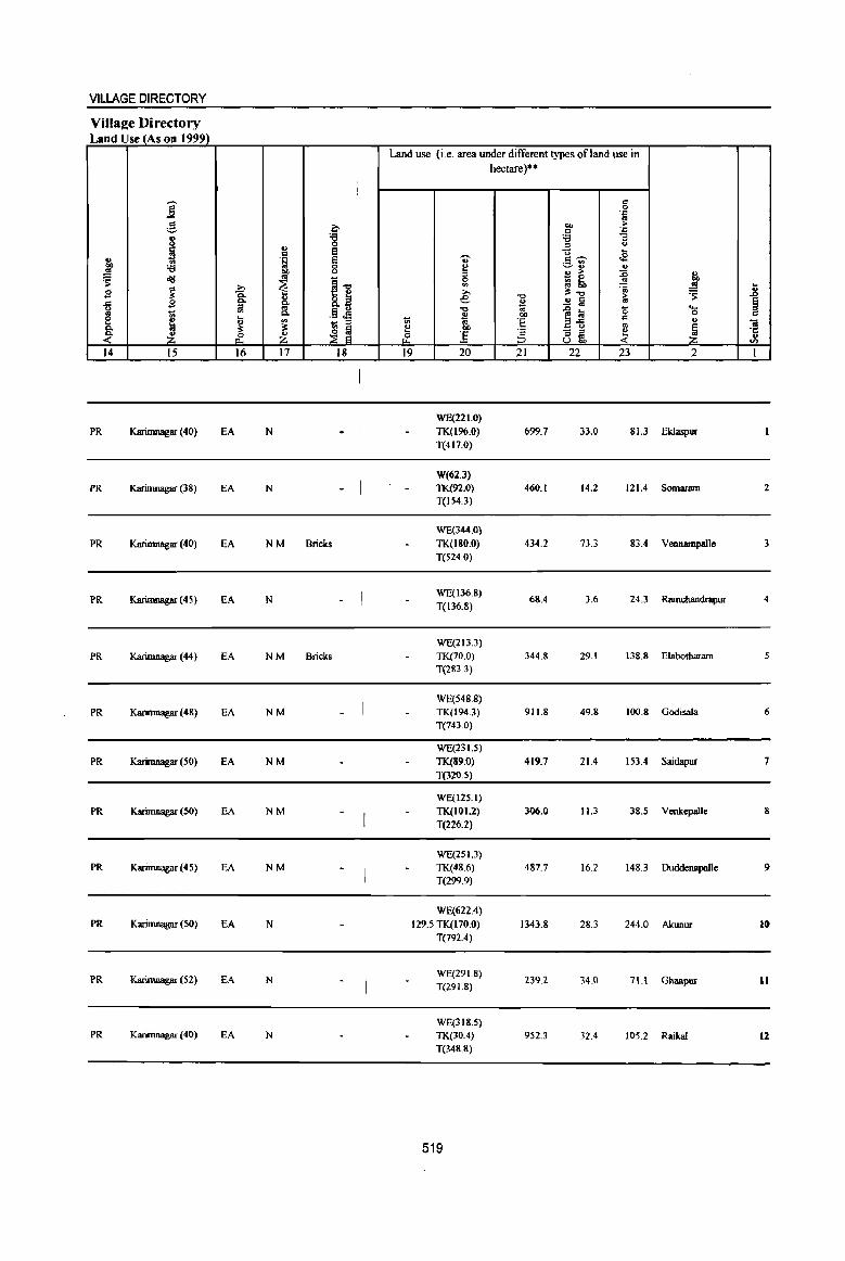
VILLAGE DIRECTORY
Village Directory Land Use (As on 1999)
Land use (i.e. area under different types of land use in hectare)··
!
j c 0
'.0 os
;§. b OIl > c '.0
j '8 'i3 "3 ., ;) u e u .. Q
~ J:l ., ·S s ., Q ~ OIl 'i3 0 ~
~:l ., .. OIl U '" > :0 !?o ~ ol$ .. ~1!
0 - 0 oj
~ ~ ~ '" ~ Q ~ .!! .8 g >- ~.", ~ ... ail e -0 > ~ s ~ 0. ~ .!! lii .. § .. 6 g .",
~~ '0 .... e 1;; 0. ~ OIl 0 Q
~ ._ .....
1;; '" ~ <I> - ;)
'8 '" " C 0. :s: ~
~ a ~ OIl '2 - ::J ~ ~ ·c <- & Z ~ :.s ::J .. u ::::> u"" "" 14 15 16 17 18 19 20 21 22 23 2 I
WE(221.0)
PR Karirnnagar (40) EA N TK(196.0) 699.7 33.0 81.3 EkJaspur T(417.0)
W(62.3)
PR Karimnagar (38) EA N TK(92.0) 460.1 14.2 121.4 Somaram 2 T(IS4.3)
WE(344.0)
PR Karimnagar (40) EA NM Bricks TK(180.0) 434.2 73.3 83.4 Vennarnpalle 3 T(524.0)
PR KariIllll1lg3l' (45) EA N WE(136.8)
68.4 3.6 24.3 Rarnchandrapur 4 T(136.8)
WE(2I3.3)
PR Karimnagar (44) EA NM Bricks TK(70.0) 344.8 29.1 138.8 Elabotharam T(283.3)
WE(S48.8)
PR Karimnagar (48) EA NM TK(I94.3) 911.8 49.8 100.8 GodisaJa 6 T(743.0)
WE(231.5)
PR Karirnnagar (50) EA NM TK(89.0) 419.7 21.4 153.4 Saidapur T{l20.S)
WE(125.1)
PR Karimnagar (50) EA NM TK(lOI.2) 306.0 11.3 38.5 Venkepalle 8
T(2Z6.2)
WE(2SI.3) PR Karimnagar (45) EA NM TK(48.6) 487.7 16.2 148.3 DuddenapaIle 9
T(299_9)
WE(622.4) PR Karimnagar (50) EA N 129.5 TK(170.0) 1343.8 28.3 244.0 Akunur 10
T(792A)
PR Karimnagar (S2) EA N WE(291.8)
239.2 34.0 71.1 Ghanpllf 11 T(29 1.8)
WE(3IS.S) PR Karirnnagar (40) EA N TK(JO.4) 952.3 32.4 105.2 RaikaI 12
T(348.8)
519
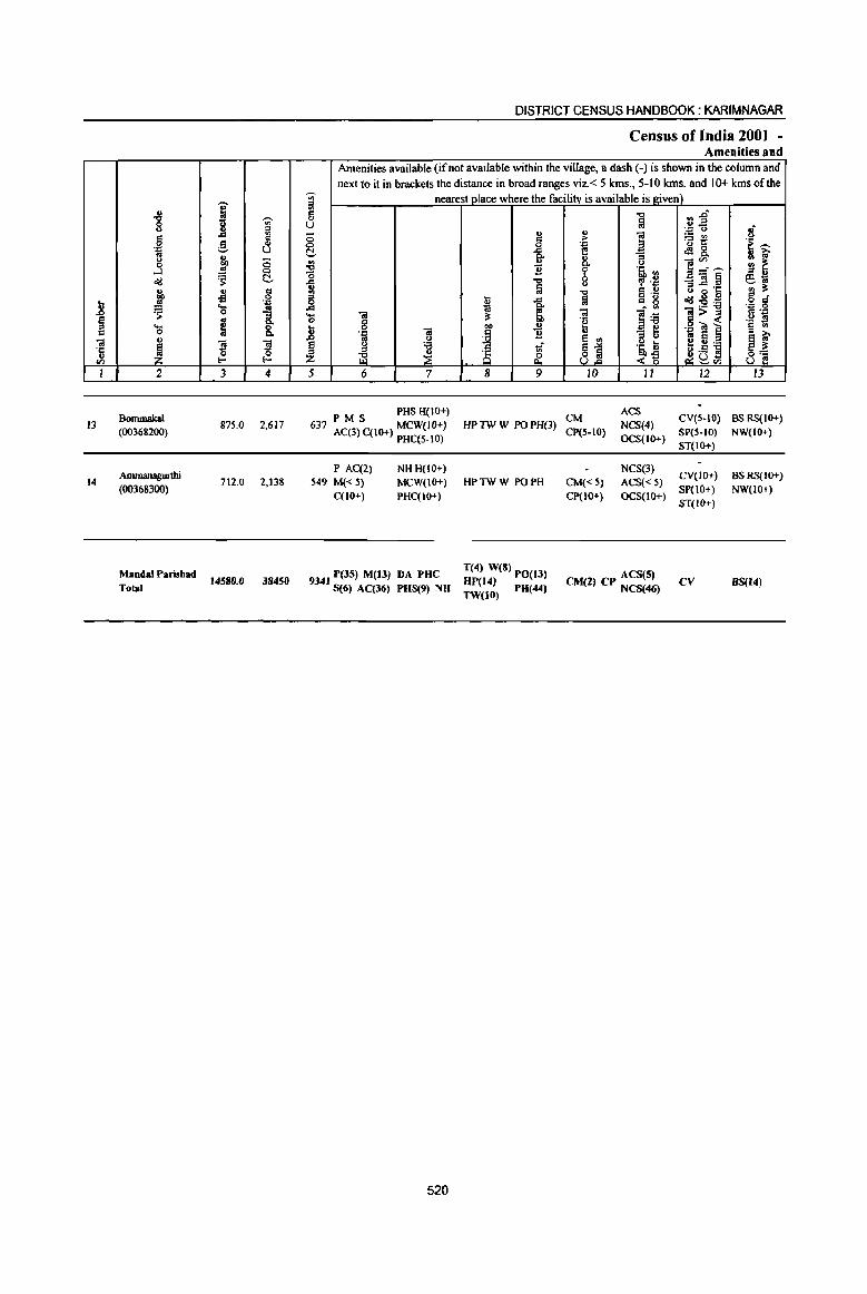
l § c -; ·c ., V1
I
13
14
" -g u
g .~
u 0
....I o'IJ " ...
..'!! ~ .... 0
'" ~ 2
Bommakal (00368200)
AnIlnanaguIthi (00368300)
MandalParisbad
Total
i ,-...
'" " ..c 3 g " 0 ~ 0
'S t!-.. g il '.a .... .. 0 "3 g 8: 1! 1! 0 ~ E-<
3 4
875.0 2,617
712.0 2,138
14580.0 38450
-;n iil c ... u 0 0 t!-
~ ..c
~ ..c '(;
}
~ 5
DISTRICT CENSUS HANDBOOK: KARIMNAGAR
Census of India 2001 -Amenities and
Amenities available (if not available within the village, a dash (-) is shown in the column and next to it in brackets the distance in broad ranges viz. < 5 kms., 5-10 kms. and 10+ kms of the
nearest place where the facility is available is Riven) -c r: :s~ !a .;
" .. . ." <>
] :.= en () c ,.. 'u t: 'i~ 0 . ."
..c ~ .:28. fr '" a ] :.~ '" ~ "8 0-
b 's, '" '" .. -c u , .~ _iQ§ fS,~ !a '" ., ·c ., :I: -c c .,
u 8 B til fa
o ._ c _ ..c = g o'IJ:Eoa o =
~ G: l~ .'" 0
iQ i$ :3 ]>~ 5 '::1 g 1>1) i e .g ~] 'g ~
'::1 O! ~
.. "3 ~ .. S ~ ~ B u 8 '" .~ t e '" .-'"
'S ;§ 1 S:i ~D~ ;B ~ <~ 8] 6 7 8 9 10 II 12 13
ACS P M S PHS H(IO+) CM CV(5-IQ) BS RS(IO+) 637 AC(3) C(IO+) MCW(IO+) HP TW W PO PH(3) NCS{4)
CP(S-IO) OCS(IO+)
SP(S-IO) NW(IO+) PHC(5-JO)
P AC(2) NH H(IO+) 549 M« 5) MCW(lO+) HPTWW POPH
C(IO+) PHC(IO+)
9341 P(35) M(ll) DA PHC T(4) W(8) PO(13) 5(6) AC(36) PUS(9) NU HP(14) PU(44)
TW(lO)
520
NCS(3)
CM«5) ACS« 5) Cp(IO+) OCS(IO+)
ACS(S) CM(2) CP NCS(46)
ST(IO+)
CV(JO+) BSRS(IO+)
SP(lO+) NW(IO+)
ST(IO+)
CV BS{I")
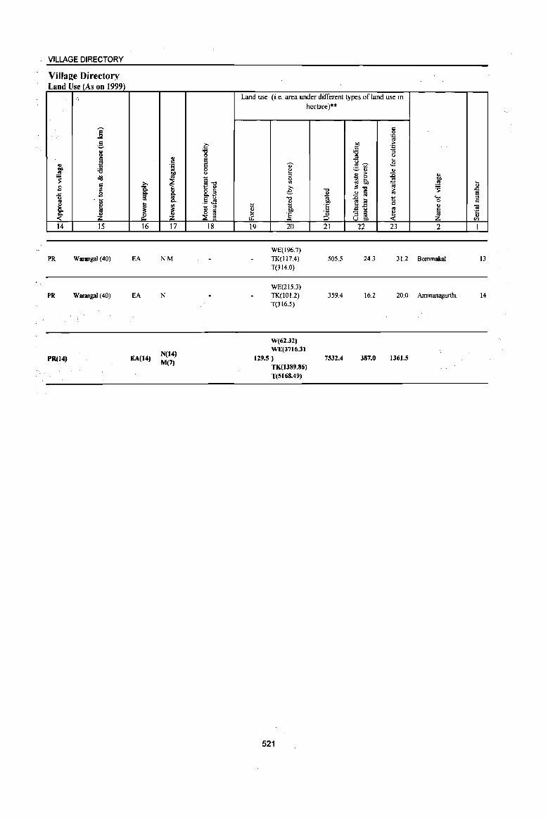
VILLAGE DIRECTORY
Village Directory Land Use (As on 1999)
;
i g
I .. ~ :e ~ old
~ s ..c: g .1;!
~ J ~ 14 15
PR Warangal (40)
PR Warangal (40)
PR(14)
i; '" ., ~ & 16
EA
EA
EA(14)
1:! .~ 01)
'" ~ l '" :s ~ 17
NM
N
N(14) M(7)
~ 'e 0 e e 0 ()
~11 8..a .§ ~ _ ;;l
~ ~ 18
Land use (i.e. area under different types ofland use in hectare)··
" ~ ;;l 0
'" ;.., e -0
" t> i ~ 0 :5 t.I..
19 20
WE(196.7) TK(117.4)
T(314.0)
WE(2IS.3) TK(I01.2) T{316.S)
W(62.J2) WE(3716.31
U9.S) TK(1J89.86) T(SI68.49)
521
-0 ~ os OJ)
E ·c => 21
505.5
359.4
7532.4
c 0 .~
01) :> c .'" 'e :;
'" (J
g- .... <E
~~ .. 0> :> :E ~ 0 ~ ~ '" ~ :;I:~
.2 ~ :> '"
~ t;a '0 il-5 c:: ., - '" e ::I ., U on «
22 23
24.3 31.2
16.2 20.0
387.0 1361.5
" 01)
~ 11 5 e .... '" 0 c
" iil
~ ·c II)
'" 2 1
Bommakal 13
Ammanagurthi 14
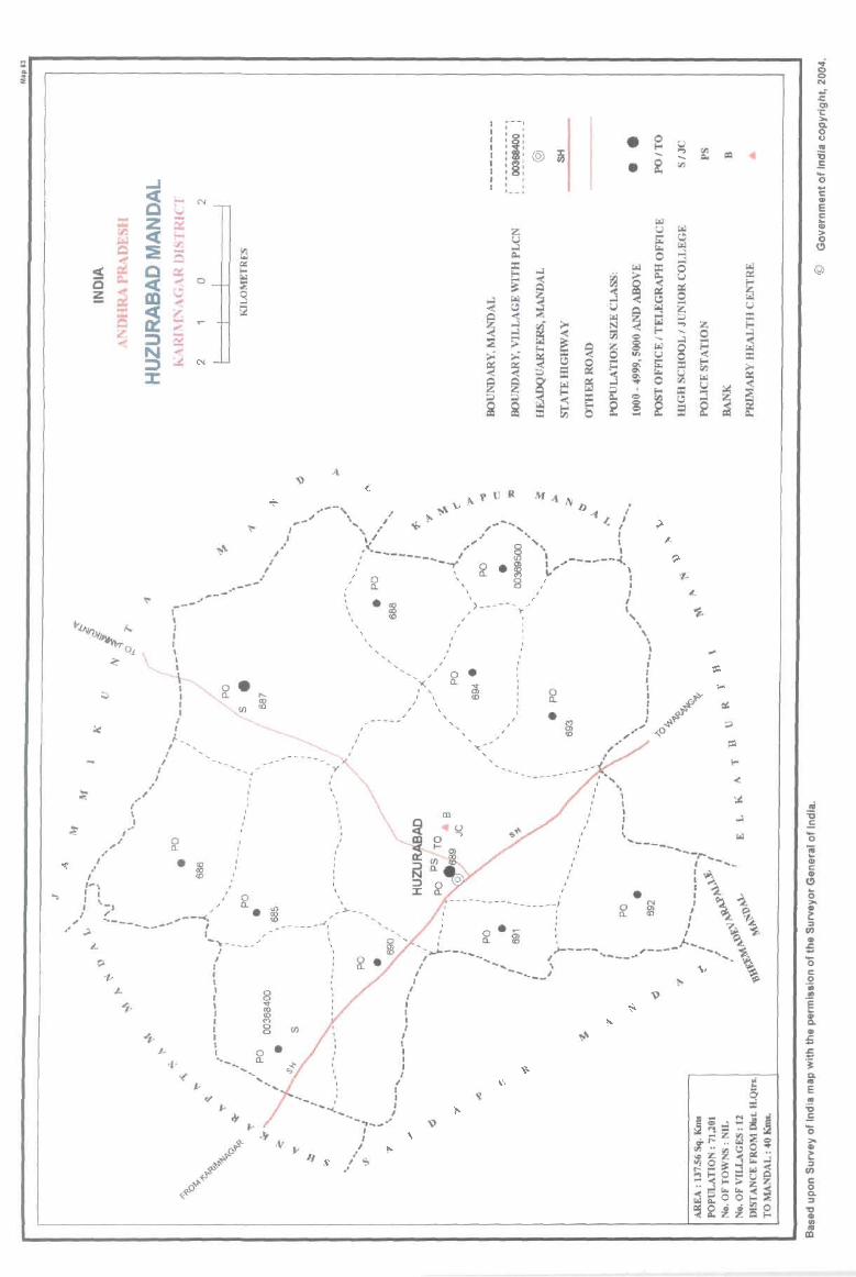
g e N -~ Z ~ f-o ~ <t <I:l
:E -Q 0
~ Q 0:: :$
~ .,.. 0 0
~ ~ .... ~ ~ -is "" -;z :::l 0:: < ~ ~ l:
, ,
• ~ . , , , , \ , , , , ,
, /
0 / a. ,'" , , , . 9 • .... I ~ IS I (f)
} ~,' , , J.. _, ______ '
(/ ", -, -;---- (~,: ~ ~ m Q
' ~m " ~a. 9 N
/' ". ~ , ~ ~ I <D, .. , ' 0 ~, , a.
' I ,/. ~ I \-s __ ..... I" ~...,
,,' ... ------- I /'
... ~ - - .... -... I
I I I , , I I I I I
\ 0 • I Q_ ............
(f)
"r ->- ........... --"", . , , , , I
I I
I I I I I I ,
I I I I I
I I I , '-......... ~ I
'... . -., ... -I I
I
/ oe. . '
I I , , I I I , I
.... <:
~ ~ ;.; ~ @ OJ
i
• (3; <D
.. --, , ,
'i' , , ' , ' , ' tr , , , , , , ' , 1_- ..
Z U .... Q.,
::r:: !-<
~ ~ j .... s= ;.;
~ i
, , ,
0 • !-<
~ @
• ~ U
IS 0
~ $ ~ ..:I
i !! ~ j -< r..l u @ .... ~
)!
<: ~ g ;.. til e ..... -<
8 r..l z ~ ~ 0 on U !-o
~ IS .... ~ S $ p::
'"' 0 ..,.
~ ~ ffi ~ tl 0 !-<
~ 8 2 -< 2 1;; ...
&; CIl = .... lIoo CIl
~ I;!I ~ .... ....
~ 0 p:: U
~ r:.:; 8 u ~ i:: z .... 0
i .... .... g ~ !-< >-{I.)
~ ~ u
~ CIl u G ::i
2 ~ Q., !il
~ Q ... ~ Ol 1: ::.. Q. 0 0 ... '6 .5 ... 0 ... C ... E C :u > 0
(!)
@
~ GI C ...
Cl .. o >-~ :::I II) ... ;; '0 c o ·iii .. E ~ ClIO
£ .J:.
j Q. ... E .. ~ '0 >GI
c: :::I II)
c 8. :::I
a: .. '" CD
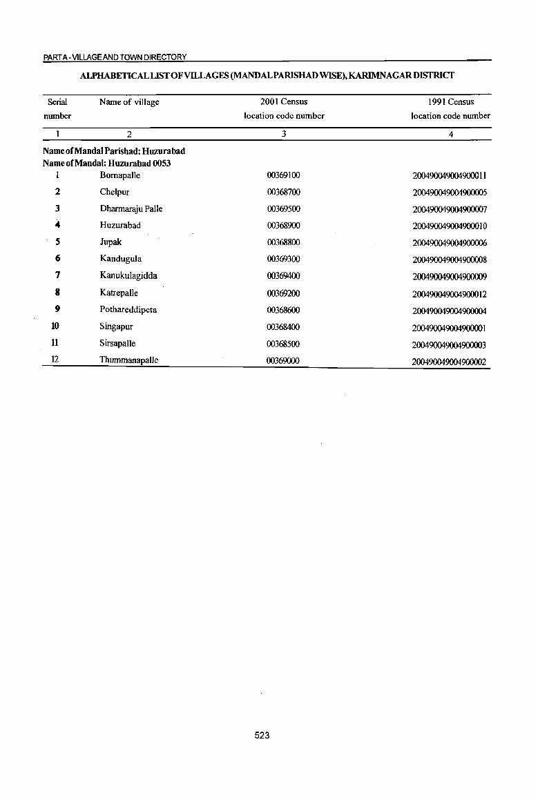
PART A-VILLAGE AND TOWN DIRECTORY
ALPHABETICAL LIST OF VILLAGES (MANDALPARISHAD WISE), KARlMNAGAR DISTRICf
Serial
nwnber
Name of village
2
Name of MandaI Parishad: Huzurabad Name of Mandai: Huzurabad 0053
1 Bomapalle
2 Chelpur
3 Dharmaraju PaIle
4 Huzurabad
5 Jupak
6 KanduguJa
7 Kanukulagidda
8 Katrepalle
9 Pothareddipeta
10 Singapur
11 Sirsapalle
]2 Thummanapalle
2001 Census
location code number
3
00369100
00368700
00369500
00368900
00368800
00369300
00369400
00369200
00368600
00368400
00368500
00369000
523
1991 Census
location code number
4
200490049004900011
200490049004900005
200490049004900007
200490049004900010
200490049004900006
200490049004900008
200490049004900009
200490049004900012
200490049004900004
200490049004900001
200490049004900003
200490049004900002

I " -0 -;;;-0 3 () ~ .., € ;!
c " 'z:j u
8 !il. ;; ....:I .. 0 == ~ 4d '!>
" " C bO i3 0
.8 .!! 'z:j .... .. ~ 0 "3
~ to C. ._ ~ 8. 0
"01 " '5 '5 ~ '6 ~ 0
<Il E-
1 2 3 4
MMadal Pambad: Huurabad (0053)
Singapur 897.0 2,457
(00368400)
2 Sirsapa1Ie
1057.0 3,002 (00368500)
Pothareddipeta 1083.0 3,581
(00368600)
4 Cbelpur
2499.0 7,266 (00368700)
Jupak 586.0 2,012 5
(00368800)
Huzurabad 6 3229.0 35,580
(00368900)
Thummanapalte 7 858.0 2,831
(00369000)
8 Bomapalle
844.0 4,621 (00369100)
Kalrepalle 9
(00369200) 488.0 1,913
IO Kandugula
1354.0 4,240 (00369300)
II KJlnulrulagidda 580_0 2,007 (00369400)
DISTRICT CENSUS HANDBOOK: KARIMNAGAR
Census of India 2001 -Amenities and
Amenities available (if not available within the village, a dash (-) is shown in the column and next to it in brackets the distance in broad ranges viz.< 5 kms., 5-10 kms. and 10+ kms of the
-;;;- nearest place where the facility is available is given) = ., '" "'0 ~ :a" " u fa 'z:j t.J :{ ;; " " ] c > ~t! 0 0 '! .~ ~ ~ ..c tfl&. 0- Il! iU' ,.g " 8- '" ] :.~ (j
~ ~ 11 % 'Q '" "0 .c -0 , .~ _"OI§
~~ Il! fi u is ~ ·c -0 C "
'" B a o .~ 4d " 0
c 0 .a c g :E;ij .~ g ..c a - ., ._ iil
to 01 ]~ "01;>= to 'Q
0 c :t 'e g « .~ ~ t 0 .. " 'Q <lI S 'J: B c 11 " "3 t; ..c .. ~ § ., .. Iii = Iii f § <> '6 .~ D f";;;
;2 :E ~ 81 u .5 !! 6'2 Z Q ..(~ ~U<ll 8' 5 6 7 8 9 10 II 12 13
PHS NCS(4)
618 P(3) M S C H(5-10) THPTW PO PH(8)
CM ACS«S)
CV(S-ID) B5 RS(IO+) AC MCW(IO+) WTKC CP(S-IO)
OCS(S-IO) SP(S-IO) NW(IO+)
PHC(lO+) ST(S-IO)
PHS BS
730 P(2) M AC H(5-10) THPTW PO CM(5-10)
ACS(S-IO) CV(5-10) RS(S-IO)
C(S-IO) MCW(IO+) WTK PH(5-10) NCS(S-IO) SP(S-IO) PHC(lO+)
CP(S-IO) OCS(5-IO) ST(S-IO)
NW(IO+)
P(4) M PHS(2)
NCS(2) BS 919 AC(2)
H(5-IO) THPTW PO PH(2) CM(5-IO) ACS(S-IO)
CV(S-IO) RS(5-IO)
MCW(IO+) WTKC SP(5-1O) C(S-IO)
PHC(IO+) CP(5-1O) OCS(5-10)
ST(S-IO) NW(IO+)
P(IO) M(2) PHS
NCS(3) BS 1,887 S(2) AC(6)
H(5-1O) THPW PO PH(7) CM(5-1O) ACS(S-IO)
CV(S-IO) RS(S-IO)
C(5-10) MCW(IO+)
CP(5-10) OCS(S-IO) SP(5-10)
NW(IO+) PHC(IO+) ST(5-1O)
PHS
537 P(3) M AC H(S-IO) THPTW PO PH CM(HO)
ACSNCS CV(S-tO) BS RS(tO+)
C(5-tO) MCW(lO+) W OCS(S-IO) SP(5-tO) NW(IO+)
PHC(JO+) CP(5-1O)
ST(S-IO)
HDAMH(9)
P(31) M(27) CWC HC PO TO ACS
8 309 S(20) pHC PHS(2) THPW CV(4)SP BSRS(IO+) PTO CM(3)CP NCS(25)
, PUC(5) C(2) NH(6) TKC PH(I96) OCS(IO+)
ST NW(JO+) 1(3) AC(7) RMP(20)0
MCW(IO+)
pel) M H«5) THPW ACS NCS« CV« 5) BS RS(tO+)
738 AC(3) PO PH CM«5) C{< 5)
MCW(IO+) TKC CP« 5)
5) OCS« 5) SP« 5) NW(tO+)
PHC(IO+) ST« 5)
P(3) M DA H« 5) NCS CV«5) BSRS(lO+)
1,113 AC(3) MCW(IO+) T HP W C PO PH(12) CM« 5) ACS« 5)
C« 5) PHC(IO+) CP« 5) OCS«5) SP« 5) NW(IO+)
ST« 5)
P M AC C(5· H(5-IO) THPTW PO NCS(3)
CV(5-10) BS RS(IO+) CM(5-10) ACS(S-IO) 453
10) MCW(IO+) W pH(S-IO) SP(S-IO) NW(IO+) CP(S-IO) OCS(S-IO)
PHC(JO+) ST(5-10)
P(3) M PHS NCS(S) H(5-10) THPTW PO CV(S-JO) BS RS« 5)
1,130 AC(2) CM(5-JO) ACS(S-IO)
C(S-IO) MCW(IO+) WTKC PH(5-10)
CP(5-10) OCS(S-IO) SP(5-IO) NW(IO+)
PHC{< S) ST(S-IO)
PHS H(tO+) NCS(3) CV(IO+) BS RS(IO+)
486 P(3) M MCW(IO+) THPW PO PH CM(IO+) ACS(5-10) NW(IO+) AC(2)C(10+) PHC(IO+) CP(IO+) OCS(IO+)
SP(IO+) ST(lO+)
524
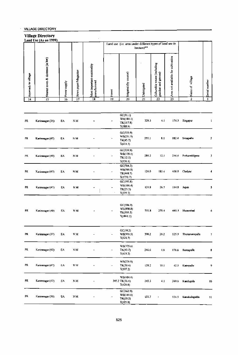
VILlAGE DIRECTORY
Villa2e Directory Land Use (As on 1999)
Land use (i.e. area under different types of land use in hectare)··
-- " 0
B .::: to
g ~ .., > "
. .c
i '8 '€l "5 = <) .., e u ~
l e ., ,,~ ,£ .. ._ II>
:: '6 8 ~ ~ .. " " > {j u
~ ~ _ 0 ..,
oi:! ~1l 0 ::l t, '" ~ ~ ...
~ >. >, 3:"0 ~ II a is. .., 8.il e "0 ..!! ;j ~ § .d go g- u
"0 .. ~ :a "0 <.... g
~ '" "" .13 JS ~ co 0 c
e ~ '" 1;; ·E B"ll c
" Oi - = '" ~ ~ ~ ~ " co ."
~ ;§ - :;:J ~ ·c
~ Z ~ Z ;S :;:J '" " U.., <Il
14 15 16 17 18 19 20 21 22 23 2 I
GC(91.l)
PR Karimnagar (35) EA NM WE(180.1)
329.5 4.1 174.5 Singapur TK(1I7.8)
T(388.9)
GC(333.9)
PR Karimnagar (47) EA NM WE(231,9)
255.1 8.1 182.4 Sirsapallc 2 TK(4S.7) T(611.5)
OC(339.9)
PR Karimnagar (49) EA NM WE(178.1)
284.2 12.1 256.6 Pothareddipeta 3 TK(l2.1)
T(530.1)
GC{704.2)
PR Karimnagar (47) EA NM WE(5S6.8)
124.0 185.4 458.0 Chelpur 4 TK(440.7)
T(l731.7)
GC(193.S)
PR Karimnagar (47) EA NM WE(IOO.4)
124.8 26.7 114.8 Jupak 5 TK(25.5) T(319.7)
GC(596.9)
PR Karimnagar (40) EA NM WE(898.8) 711.8 270.4 445.5 Huzmabad 6
11«305.5) T(ISOI.3)
OC(18.2)
PR Karimnagar (37) EA NM WE(303.5) 390.2 20.2 12S.9 Thummanapalle
T(32 1.7)
WE(375.6) PR Karimnagar (42) EA NM TK(43.7) 246.6 1.6 176.6 Bomapalle 8
T(419.3)
WE(276.8) PR Karimnagar (47) EA NM TK(30.4) 128.2 10.1 42.5 Katrepalle 9
T(307.2)
WE(484.4) PR Karimnagar (47) EA NM 345.2 TK(36.4) 243.3 4.1 240.6 Kandugula 10
T(520.8)
GC(l63.9)
PR Karimnagar (SO) EA NM WE(141.6) 122.7 131.5 Kanukulagidda II TK(20.2)
T(32S.8)
525

... 1l § =
"i! °5 C'-l
I
12
.s 0 u = 0
'J: .. g ~
cid ., OIl .. ~ ...... 0 .. ~ 2
DltannaIl!iu Palle (00369500)
MandalParishad Tollll
]' ,..._ u "' Jl :::0
"' 5 ~ u ., ~ 0
<:>
'S C:!-., c oS 0 OJ: .... .. 0 ]. to
~ 8. "5 "5 ~ ~ 3 4
28000 1,691
13755.0 71201
'U;' :::0 .. ., e 8 ~ .;g (5
il '" :::0 0 ..c .... 0 ... 1l
~ 5
DISTRICT CENSUS HANDBOOK: KARIM NAGAR
Census or India 2001 -Amenities and
Amenities available (if not available within the village, a dash (-) is shown in the column and next to it in brackets the distance in broad ranges viz.< 5 kms., 5-10 kms. and 10+ kms of the
nearest place where the facility is available is Riven) "0 ~~ Ia OJ: U 8 ., ., ~ '5t! d >
0 'oW .~ ~
! ~ .fl8. ., ~ ] '" ]~~ ;;: i!:
.!l '( '9, '" :::0 .,
"0 0 , .~ _"<ag ~; a u ~ ~·c "0 5 .~ d tl 1 a =. ~ cid:9~ o '" OJ 'J: 0
«I ""
"<a ~~ ]>~ <II OJ:
IS o~ .~ ~
i .. og "aI]
.~ «I 1i ., 1i !J e ~ <)
~j ~ 5 'i3 (.) 'i3 ri 09, n e i:l= :0 ~ oS .IS ;;:l ~ &. ~~ ~~</.) 8]_ 6 7 8 9 10 11 12 13
NCS(2) P(2) AC(2) H(IO+) T HP TW PO PH 431 M(IO+) MCW(IO+) TKC
C(IO+) PHC« S}
CM«5) CP«S)
ACS(,< 5) CV(IO+) BS RS« 5) OCS(IO+) SP(IO+) NW(IO+)
U DA(l) T(ll) P(67) M(3S) MH(9) ewc W(lI) 5(23) HC PUC TK(7)
17351 PUC(5) C(3) PHS(IO) HP(12) 10 AC(3!) NH(6) TW(7)
RMP(20) 0 C(7)
526
PO(I2) TO no CM(4) CP AC5(3)
NCS(49) PH(129)
ST(IO+)
CV(4) ST 85(12) SP
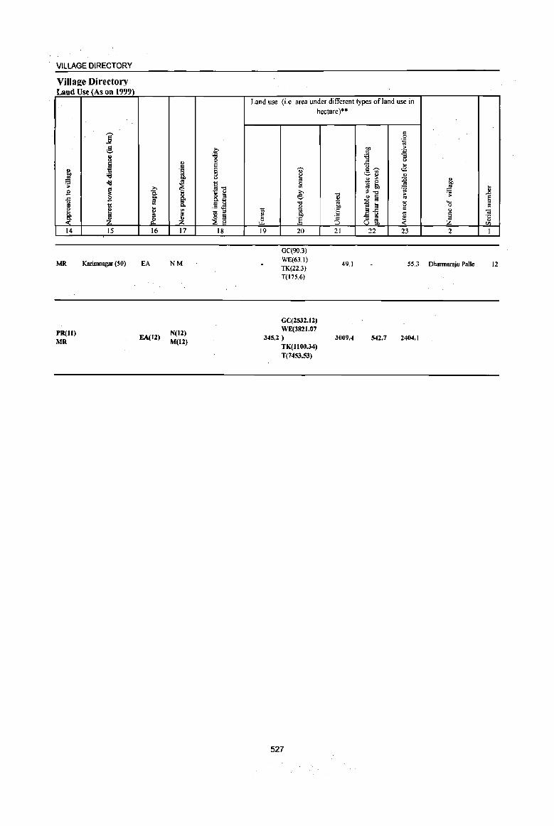
VILLAGE DIRECTORY
Village Directory Land Use (As on 1999)
} .s: B .c
~ c. ~ 14
MR
PR(ll) MR
i d
;::, u
I '6 old ~ B t!
H Z 15
Karimnagar (50)
~ Q,
1i! ~ il= &. 16
EA
EA(12)
II) c .~
OIl
'" ~ g. c. '" il= ~ 17
NM
N(12)
M(12)
C '6 0 e E 0
" §-o
!~ E Q
. .:; ~
~ ~. 18
Land use (i.e. area under different types ofland use in hectare)"
1;; e 0
L>...
19
"" e ::I 0
'" >. .c ._ "Q ... Oi OIl
] 20
GC(90.3) WE(63.l)
TK(22.3) T(17S.6)
GC(253Z.I2) WE(382I.07
345.2 )
TK(l 1 00.34) T(7453.S3)
527
-0 u OJ OIl
E ·2 :::0 21
49.1
3009.4
c 0
OIl .~
<: . .,
'6 "3 ::I " ~ ...
<E <:~
~~ " 0> > :c <I)
~ ~ '" OIl
=a _,g il=-o
~ ~ 2 § -g a '0 ....
0
a-5 c " '" ~ - ::I ~ ::I ..
U OIl
22 23 2
55.3 Dhannaraju Palle
542.7 2404.1
... ..8 § = ..
·c " til
I
12
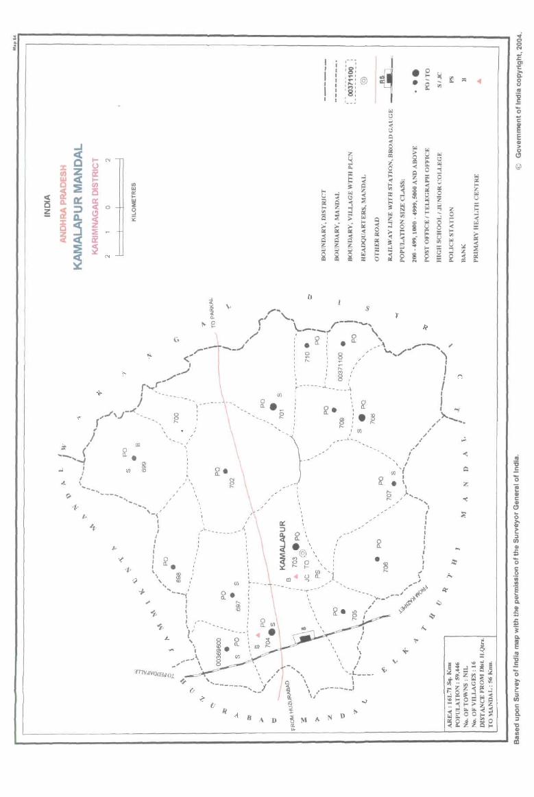
: .. . ::E
~ ~
~ Q :z: Z (t)
W c( 0 :IE ~ a. 0::
~ :;:)
~ :z: 0
~
!
l- N
u a: I-rn is a: < a
~ z := a: ~
'"
Vl w II:: ... ~ g X
r'" <""
J
.. / ... /
r~r I '- - -_
J ; _.-(
,,'" \J '--- S r '\ ,-, , I \
, /
I
ir / ID -, ,
~~ ( ~ . '''''"'I
..l : (/)
I \ ~--~ ~ ---...... ,"
-..__ I
~... , '-~ /
,
, , , ,
~ . I I
I I
I I
... IL ...... ____ .......... ~J
I I
I 0 I a.. ' , ' , ~<D,' , ,
... I
"'---/ I I I I , 1- ..........
\ I
, , ,
, I
UJ o a. . ~
g
" , , ,
lJ
It: , :::> 0'
~ a. " . '.
ti =a 1-0 .., IS ~ 2i Z ;;)
i
@ '. ;; :3 0 '
~ 2'.
~ ~ 2i ~ i
I
, I ,
, ~---,
~ I'- t- t
~ ~ 'j, ID
- ... ----r ... -"'"
, , :8: ' ... , ' ... , '"" 'M' :8: , 1* _ '*
2:
::I p., :: !::: 3t r.l C
:l ::: ;;. -;: " 2i ~ i
, , , , !r . ,
~ • 0 ... @ • ~
fol
" ~ « " Q -< 0 r.l r.l ClIi ;>
S:! ell ~ ~ -< f: ~
0 ..l i:
== ~ ~ ti -< Do
i ~ ~ j :: " ~
u :l ~ ~
~ ~ r.l
r.l fil .. '" r.l
~ ~ Q z: <= r.l « 0 ~ U
-< ~ >-
~ E: ;;,
~ ~ r.
~ Ill: 0 ~ r.l ..l ..
t; :.I ,
~ p.,
r.l 1-0 ~ ~ ~ :: 0 ...
s
,._ ,l, a ,._ , -.... ... \ ,
I , / I I I I
~ I I I
• I I
~ I ; \ ..
"",- rJ>>;' , --" '(!. 1-----'" .".~
./ ;; ~ I
r ... --_ .... J. I I
I I
, \ I
_~l,. -,," \
'ilI1V dYQ(Iifd 0.1
~
BAD
, \ , , , , " f .. ,I ~
" '-L ___ _ " I
\ I \ ,-----__ 1
\/
..; <:> <:> N .; s:: 01 1: >-frl c.
~ 0 - III U rI.> III :0 .5 '0 .. c: r E ell > 0
r.l (!!
" ~ @ ...l 0 ~ U
~ " 0 r.l z u i; :I:
Z S - 0 ...l 5 « 0 r.l 0 :: :: '" >-rI.> u .=: rI.> r.l
~ ~ t:o: :.I
~ C ~ !E ~
z <C
~
... ~
f..,
~
~
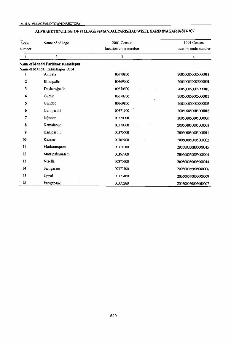
PART A -VILLAGE AND TOWN DIRECTORY
ALPHABETICAL LIST OF VILLAGES (MANDALPARlSHAD WISE), KARIMNAGARDISTRlCf
Serial
number
Name of village
2
Name of Mandai Parishad: Kamalapur Name of Mandai: Kamalapur 0054
I Ambala
2 BhirnpaUe
3 Desharajpalle
4 Gudur
S Gunded
6 Guniparthi
7 Jujnoor
8 Kamalapur
9 Kaniparthi
10 Kannur
11 Madannapeta
12 Marripalligudem
13 Nerella
14 Sanigaram
15 Uppal
16 Vangapalle
2001 Census
location code number
3
00370800
00369600
00370500
00370700
00369800
00371100
00370000
00370300
00370600
00369700
00371000
00369900
00370900
00370100
00370400
00370200
529
1991 Census
location code number
4
2005000500050000 13
20050005000500000 I
200500050005000010
200500050005000012
200500050005000003
200500050005000016
200500050005000005
200500050005000008
200500050005000011
200500050005000002
2005000500050000 15
200500050005000004
200500050005000014
200500050005000006
200SOOO5000S000009
200500050005000007
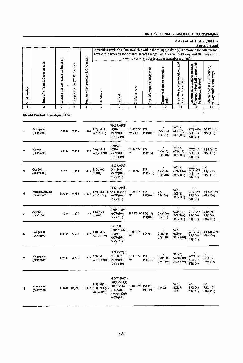
j -8 ~ 0 ~ <> i;l c .c c 0 ~
.., . ." C) g ~ 8 ...l
~ 0 N
~ ._,
j U d .;; 0 ... . ." .8 ~ 'S '" "3 ~ g Q. ..... 0 d 0 Q.
-a u
~ ~ ~ ·c u
'" !-< !-<
1 2 3 4
Mandai P.risbad : Kamalapur (0054)
13himpalle 618.0 2,979
(00369600)
2 Kannur
941.0 2,971 (00369700)
GlIIldcd 3 (00369800)
717.0 1,954
Marripalligudem 4
(00369900) 1452.0 4,584
Jujnoor 5 492.0 200
(00370000)
Sanigaram 6
(00370100) 1433.0 5,535
V8IIgapalle 7
(00370200) 1821.0 4,728
K3malapur 8 1316.0 10,593
(00370300)
DISTRICT CENSUS HANDBOOK: KARIMNAGAR
Census of India 2001 -Amenities and
Amenities available (if not available within the village, a dash (-) is shown in the column and next to it in brackets the distance in broad ranges viz. < 5 kIDs., 5-10 kIDs. and 10+ kIns of the
~
nearest olace where the facility is available is given) :fl .. d
] ~~ .. C) • ." <> 8 - "
..,
i ~i:! 0 IS > 0 . ." .~~ ~ -a e <fl8. ~ " 8- 0 ~:~ .. ~ "0 "2 ~ 'li ., :0 u
-(ij~ e. .. -= ." , .~ .. § <> 6 ~"§ ., 3:: .. "'" S .!~ :0 ~ a '" -0 -a j! ~~::a o d
.c ~
.~ ~g '- ta ~ -a ]>~ 0 C "e .~ ~ t 0 011 u .g ~ ~ . ., ] ~ "2 u :; ~ '" e e ~ or> to e ..
.~ t 2! .. ::a § <> 'tl .J
~1 a 3:: :0
~ 25 '" ~ .5 S 8~ z iil & ~~ C2C)",
5 6 7 8 9 10 11 12 13
PHS RMP(2) NCS(3)
764 P(Z) M S H(IO+) THPTW PO
CM(lO+) ACS« 5} CV(5-10) BS RS«S)
ACC(IO+) MCW(IO+) WTKC PH(lo+) CP(IO+) OCS(IO+)
SP(IO+) NW(IO+) PHC(5-10) ST(IO+}
RMP(3) NCS(2)
757 P(4) M S H(IO+} THPTW PO
CM«5) ACS«5) CV(5-10} as RS«5}
AC(2) C(lO+) MCW(IO+) W PH« 5) CP(5-IO) OCS(Hl+)
SP(IO+) NW(lo+)
PHC(S-IO) ST(IO+)
PHS RMP(2) NCS(2) as
PM AC OH(IO+) PO CV(IO+) 456 C(IO+) MCW(IO+)
THPW PH(5-10)
CM(5-10) ACS(5-10) SP(lo+)
RS(5-10)
PHC(IO+) CP(S-IO) OCS(IO+)
ST(IO+) NW(IO+)
PHS RMP(3) ACS
P(4) M(3) S 0(2) H(IO+) THPTW PO CM CV(IO+) BS RS(JO+) 1,174
ACC(IO+) MCW(IO+) W PH(10+) CP(IO+) NCS(4)
SP(IO+) NW(IO+)
PHC(lO+) OCS(lO+)
ST{lO+)
49 PM«S) RMPH(IO+)
ACS« 5) CV(lO+) BS« 5) MCW(IO+) HP TW W PO« 5) CM(IO+)
C(lO+) PHqIO+) PH(IO+) CP(IO+)
NCS(IO+) SP(IO+) RS(IO+)
OCS(IO+) ST(IO+) NW(IO+)
DHPHS
P(6) M S RMP(5) 0(2)
THPTW ACS
eV(5-IO) BS RS(IO+) 1,339 AC C(5-10) H(IO+)
W PO PH CM(S-IO) NCS(6)
SP(IO+) NW(lO+) MCW(IO+) CP(S.tO) OCS(S·IO)
PHqIO+) ST(IO+)
PHS RMP(3} NCS(2) as
P(3) M o H(lO+) THPTW PO CV(S-IO) 1,237
AC(3)C(10+) MCW(IO+) W PH(5-10) CM(5-IO) ACS(5-10)
SP(IO+) RS(5-10)
PHC(5-1O) CP(S-IO) OCS(5-10)
ST(lO+) NW(lO+)
H 0(5) DA(S)
peS) M(5) DH(2)MH(4)
ACS CV as HC(5)PHC THPTW PO TO
2,417 S(3) PUC(2) CMCP NCS(7) SP(IO+) RS(5-1O) PHS NH(3) W PTOPH
AC C(lO+) RMP(5) 0(6)
OCS ST(lO+) NW(IO+)
MCW(IO+)
530

VILLAGE DIRECTORY
VilIaee Directory Land Use (As on 1999)
Land use (Le. area under different types of land use in hectare)··
i '" 0 'J::
'" g ~ t>I) > '"
'J::
3 :g :a "3 ::s 0
N .,
! ]-;;- ... '" ~ .s
~ '" .~ " :a ~ '--' ., u
'" f .. ;.-
~ g, ~ o'd ill 5l ~ S. 'S .. _g 9 ~ t >. :1:-.:; ~ u 8.il e -0
..!! l;j ie ~ ..c 9 Co ~ U .. .$ ~ .", .0 liI 0 ..... '" "In Co " eo
~il '" 0 '" e ~ t ~ ;; ::s -:;; ;;; 'E OJ ., <a
Q, ;!: ~ ~ ~ bI)
~ ;; ::l
~ ~ ·c ~ ~ ~ ~ .2 ] oj " U eo <I)
14 15 16 17 18 19 20 21 22 23 2 I
GC(298.0) WE(148.0)
PR Warnngal (26) EA NM lWE(IO.0) 96.0 32.0 8.0 BhimpalJe TK(26.0) T(482.0)
GC(236.0) WE(215.0)
PR Warangal (26) EA NM TWE(9.0) 83.0 81.0 81.0 Kannur 2 TK(236.0)
T(696.0)
GC(179.0)
PR Wanmgal (24) EA NM WE(187.0) 191.0 22.0 30.0 Gunded 3
TK(IOS.O) T(474.0)
GC(446.0)
WE(249.0)
PR Wanmgal(21) EA NM TWE(23.0) IS8.0 95.0 268.0 Marripalligudem 4 TK(213.0) T(93 1.0)
W(l7.0)
PR Wanmgal (19) EA NM TK(108.0) 254.0 19.0 94.0 Jujnoor S T(125.0)
GC(238.0)
WE(347.0) PR Warangal (16) fA NM TWE(10.0) 352.0 173.0 163.0 Sanigaram 6
TK(ISO.O) T(745.0)
GC(IS8.0)
W(392.0) PR Warangal (24) EA NM TWE(1O.0) 625.0 158.0 272.0 Vangapalle 7
TK(206.0) T(766.0)
GC(238.0)
WE(32S.0) PR Warnngal (22) EA NM TWE(13.0) 174.0 162.0 77.0 Kamalapur S
TK(327.0) T(903.0)
531

.8 ~ c "a .~
O'J
I
9
10
11
12
13
14
15
16
.. "8
Q
g 'l:! ~ 0
...l d1,j
~ ..!!! ~ .... 0
'" ~ 2
Uppal (00370400)
Desharajpalle (00370500)
Kaniparthi
(00370600)
Gudur (00370700)
Ambala (00370800)
Naella
(00370900)
MiIdannapaa (00371000)
Guniparthi {0037 1100)
MandalParisbad Tollli
.... J ~ a a 5 .. 0 QO .. 0
~ C!-
.s g 'iiI 'S ]. ..
~ 0
"" s ~ (3. E-
3 4
1799.0 6,475
575.0 1,572
1284.0 3,136
1150.0 3,610
1190.0 S,929
670.0 1,730
338.0 2,119
377.0 1,351
16173.0 59466
DISTRICT CENSUS HANDBOOK; KARIMNAGAR
Census of India 2001 -Amenities and
Amenities available (if not available within the village, a dash (-) is shown in the column and next to it in brackets the distance in broad ranges viz.< 5 kms., 5-10 kms. and 10+ kms of the
~ nearest place where the facility is available is given) ~ 0;: ..,
rl~ '" U ~ '" '"
. ., Q
0 0;: ... ~ ~t 0 0 . ., C!- -= e 4!8.. ir ., B ~~~ ~ Q.
'B ~ .~ ., o -= .., c:s .~ _"a~ .,
~ a -; .~ '" .., 0;: .. ::I
~ 1 l;j g °8 ctd:9~ 0 -= 1~ .... ca ca ca>:::l
0 0;: ~ .~ c -< .8 0
] I .. .g "'] . ., 'B .. "3 !>
t'3 § '" ~il~ £ ::I '6
~ 81 ~~ ~Db1 ;g ~ 5 6 7 8 9 10 II 12
P(4) M(2) HDAMHHC
ACS 1,425 S(2) AC(2)
PHCPHS THPTW PO PH
CM NCS(4)
CV(S-IO)
C(lO+) RMP(3) 0 W CP(S-10)
OCS(1O+) SP(IO+)
MCW(IO+) ST(IO+)
RMP(2)
362 P(2) M AC H(10+) PO NCS ACS« CV« 5) C(lO+) MCW(IO+) HP TW W PH« 5) CM« 5)
5) OCS« 5) SP« 5) CP« 5)
PHC« 5)
PHS RMP(2)
758 P(4) M(2) H(IO+) THPTW
AC(2) C(IO+) MCW(IO+) W
PHC« 5)
PHS RMP(2)
872 P(2) M S H{IO+) THPTW
AC C(lO+) MCW(IO+) W
PHC« 5)
PHS RMP(4)
P(4) M S H(IO+) THPTW 1,404 AC(2) C(1O+) MCW(IO+) W
PHC(5-1O)
437 P M«5) RMPH(IO+)
THPTW
C(IO+) MCW(IO+)
W PHC(5-10)
PHS RMP{Z)
H(IO+) THPTW 530 P M C(10+)
MCW(lO+} W
PHC(S-IO)
P M«5) RMPH(IO+)
THPTW 341 MCW{IO+)
C{IO+) PHC(S-IO)
W
H(2) D(5) DA(6) DU{l) T(14)
P(48) M(2t) MH(S) HC(6) W(16)
S(I1) PHq2) TK 14322 PUC(2) PHS(H) HP(16)
AC(18) NU(l} TW(IS} RMP(41) c
0(13)
532
ST« 5)
NCS(2) PO
CM«5) ACS« 5) CV«5)
PH« 5) CP« 5) aeS(<:5)
SP« 5)
ST« 5)
NCS(J)
PO PH CM« S) ACS« 5) CV{< 5)
SP(IO+) Cp« 5) OCS« 5)
ST(lO+)
NCS(3) CV(5-10)
PO PH CM(5-10) ACS(S-IO) Sp(IO+)
CP(S-IQ) OCS(S-IQ) ST(IO+)
PO NCS(2)
CV(5-10)
PH«S) CM(5-1O) ACS(S-IO)
Sp(IO+) CP(S-IO) aeS(S-IO)
ST(lO+)
NCS(3) PO CV(S-IO)
CM(S-IO) ACS«5) PH« 5}
CP(S-IO) OCS(S-IO) SP(lO+}
ST(IO+)
PO NCS
CV(5-lO) CM(5-10) ACS«5)
PH«5) CP(S-IO) OCS(S-IO)
SP(IO+)
ST(IO+)
PO(IS) ACS(4)
TO PTO CM(3) CP NCS(45) CV
PH(S) OCS
Ii 'E~ It 1;-., ~ ::I B e .. '" iI: g a
. ., 0 .. 'J::
.~ ~ e: f 9'[ ~.
13
BSRS
NW(1O+)
BS«S) RS(5-10)
NW(IO+)
BS RS(IO+)
NW(IO+)
BS
RS(5-10)
NW(IO+)
BS RS(IO+)
NW(IO+)
BS RS{IO+)
NW{IO+)
BS RS(IO+) NW(lO+}
BS RS(lO+)
NW(IO+)
BS(14) RS
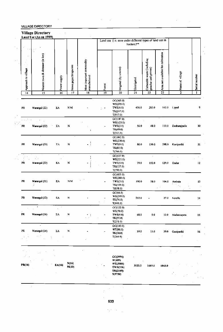
VILLAGE DIRECTORY
Villa2e Directory Land Use (As on 1999)
j e 8 ~ '" OIl :a '" ~ og
~ B
~ 1il ~ ~ ~ Z 14 15
PR Warangal (22)
PR Warangal (22)
PR Warangal (20)
PR Warangal (22)
PR Warangal (21)
PR Warangal (22)
PR Warangal (24)
PR Warangal (24)
PR(16)
;., c.. p,
iii
~ ~ 16
EA
EA
EA
EA
EA
EA
EA
EA
EA(16)
'" 0: ·S "" ~ " p, os p,
~ Z 17
NM
N
N
N
NM
N
N
N
N(16)
M(IO)
b ;g S g C)
i-o 1:: ...
8.~ .§ ~
~ ~ 18
- I I • I
Land use (i.e. area under different types ofland use in
1il l:! & 19
..,. ~
'" ~ ;., e "0
~ 01)
] 20
GC(369.0)
WE(295.0)
TWE(6.0)
TK(247.0)
T(917.0)
GC(187.0)
WE(123.0}
TWE(2.0)
TK(49.0)
T(36 1.0)
GC(442.0)
WE(230.0)
TWE(9.0)
TK(85.0)
T(766.0)
GC(437.0)
WE(221.0)
TWE(S.O)
TK(127.0)
T(790.0)
GC(435.0)
WE(289.0)
TWE(S.O)
TK(109.0)
T(838.0)
GC(66.0)
WE(299.0)
TK(76.0)
T(441.0)
GC(I22.0)
WE(70.0)
TWE(4.0)
TK(55.0)
T(251.0)
GC(140.0)
WE(86.0)
TK(38.0)
T(264.0)
GC(399I) W(409) WE(3084) TWE(I06) TK(ZI60) T(97SO)
533
hectare)··
-0
" 1;; OIl 'E 'c ::J 21
456.0
56.0
80.0
79.0
190.0
202.0
68.0
59.0
3123.0
§ .~
"" 0: ~ :.a '"
<.)
u ... .B o:~
~~ ., ., .. ~
_ 0
~ 50 ~ ~-o ;>
..2 1a '" ..c til '0 ~.g 0:
~ - '" '" '" Ubi)
22 23
283.0 143.0
48.0 110.0
150.0 28g.0
152.0 129.0
58.0 104.0
27.0
9.0 10.0
15.0 39.0
1457.0 1843.0
., "" ~ ... ~ _g
s ..... '" 0 0: ... O!
~ '': .. til
2 1
Uppal 9
Desharajpalle 10
Kaniparthi II
Gudur 12
Ambala 13
Nerella 14
Madannapeta IS
Guniparthi 16
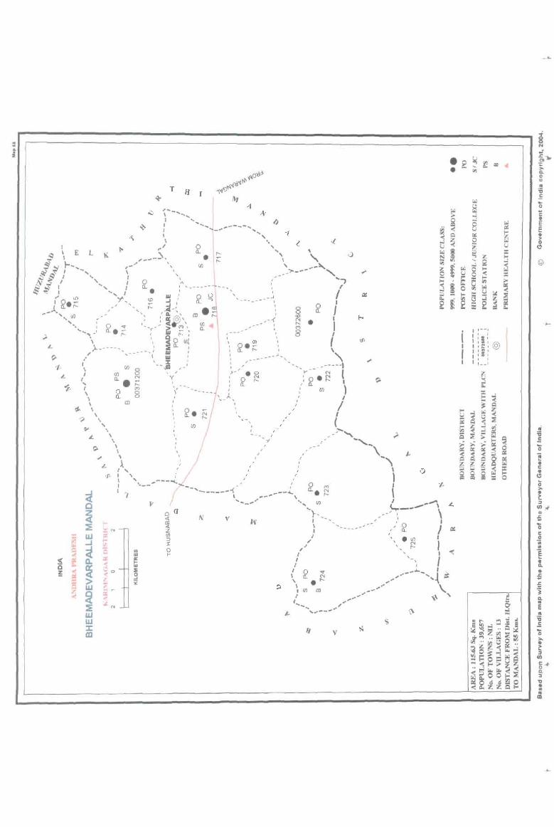
-,- ~ rrr--:::::::::::::::::::::::::::-:::::::-:::-:::::::-:::-:::::-:::::::::::::::-:-:::::-:::::::----------------------fl -============================= T
I' I 1--'
" , \ I: I
, I :~: @ r :::: I t : __ : I
©

PART A - VILLAGE AND TOWN DIRECTORY
ALPHABETICAL LIST OF VILLAGES (MANDALPARISHAD WISE), KARIMNAGAR DISTRICf
Serial
number
Name of village
2
Name of MandaI Parishad: Bheemadevarpalle Name of MandaI: Bheemadevarpalle 0055
I Bheemadevarpalle
2 Erraballe
3 GatJanarsingapur
4 Kannaram
5 Katkur
6 Koppur
7 Kothakonda
8 Kothapalle
9 MaIlaram
10 Manikyapur
11 Mulkanoor
12 Mustafapur
13 Mutharam (P.K)
14 Ratnagiri
15 Vangara
2001 Census
location code number
3
00371300
00312600
00312100
00312500
00312400
00371600
00312200
00371700
00372300
00371500
00371800
00312000
00371900
00371400
00371200
535
1991 Census
location code number
4
200560056005600005
200560056005600011
200560056005600006
2005600560056000 15
2005600560056000 14
200560056005600004
200560056005600012
200560056005600010
200560056005600013
200560056005600003
200560056005600009
200560056005600007
200560056005600008
200560056005600002
20056005600560000 I

I -l:l ~
8 ., '" ..c '" '" c
0 ..§, ., '.0 C)
'" " u ;:; 0 OD ....l ..!.'! 0
~ ~ ~ u " C
E -5 0
] .;;;: ..... ..
~ 0 -= ~ ~ 8: ..... " 0
"iil " ~
'3 '3 '1:
" 0 0 til I-< I-<
1 2 3 4
Mandai Parisbad : BbMmadevarpaUe (0055)
Vangara 2439.0 5,891
(00371200)
2 Bheemadevar-palle
544.0 2,393 (00371300)
Ratnagiri 580.0 1,749
(00371400)
Manikyapur 4 658.0 3,043
(00371500)
Koppur 5 695.0 2,979
(00371600)
Kothapalle 6 1513.0 3,883
(00371700)
Mulkanoor 7 1663.0 8,521
(00371800)
Mutbaram (P .K) 8 517.0 1,149
(00371900)
Mustafapur 9 1068.0 2,511
(00372000)
OatIanarsinsapur 10 1728.0 4,562
(00372100)
Kothakonda 1540.0 4,433 II
(00372200)
Mallaram 12
(00372300) 709.0 3,960
DISTRICT CENSUS HANDBOOK: KARIMNAGAR
Census of India 2001 -Amenities and
Amenities available (if not available within the village, a dash (-) is shown in the colwnn and next to it in brackets the distance in broad ranges viz.< 5 kms., 5-10 kIDs. and 10+ kIDs of the
';;>' nearest place where the facility is available is given) ;! c
"" flj " C) fa .::: u .; ;:; ., '" 1 '" > i5t! u 0 0 'J:: .~ ..... ~ ..c E <!!8. Q. U S
8- ]~"'"' :; i: ~ .,
0
"0 11 g lb '" '" " "" , -.,8 _til~ e-:; ii ;j u 5 ~.§ ., :l: ., "" '" u :> g •. ~ '" 0 £ ..c 1J ~~~ .g g ..c Q,
'- 0; ; ~ til lfi ~>~ .. 'J:: 0 c "E .~ !! .. 0 co .£ .g iii e § .,
..8 .~ til
~ ~
... _ e u
~j :> u .. E ::I
~~ § u ;;;; ~- .~ t e";;;; ::I
~G5 ~ ~ Z .z1i ~tIl
5 6 7 8 9 10 II 12 13
P(8) M S HPHCPHS CM
NCS(S) CV(S-IO) BSRS(IO+) 1,330 AC(3) 0 THP PO PH(16) CP(5-1O) ACS(IO+)
C(lO+) MCW(IO+)
OCS(lo+) SP(lO+) NW(lO+) ST(lO+)
PHSRMP NCS(6}
547 P(3) M S H(IO+) THP POPH(9) CM«5) ACS(10+)
CV(S-IO) BSRS(IO+) C(lO+) MCW(IO+)
CP« 5} OCS(1O+) SP(IO+) NW(IO+)
PHC(S-IO) ST(IO+)
398 P(2) M AC H(IO+) NeS(S)
eV(S-IO) BS RS(IO+) THP PO PH CM(5-1O) ACS(lO+)
C(lO+) MCW(IO+) CP(5-1O) OCS(IO+)
SP(IO+) NW(lO+) PHC(S-IO) ST(IO+)
P(4) M S PHS H(IO+) NCS(4) CV(IO+) BSRS(IO+)
667 AC(3) C(IO+) MCW(IO+) THP PO PH CM(IO+) ACS(lo+) PHC(S-IO) CP(IO+) OCS(IO+)
SP(IO+) NW(IO+) ST(lO+)
713 P(2) M AC H(IO+) NCS(2)
ev(s-to) BS RS(IO+) THP POPH(3) CM(5-10) ACS(IO+)
C(IO+) MCW(IO+) CP(5-1O) OCS(to+)
SP(IO+) NW(IO+) PHC(5-1O) ST(to+)
870 P(2) M S H(IO+) NCS(4)
eV(5-IO) BS RS(lo+) THP PO PH CM{S-W) ACS(lO+)
AC C(10+) MCW(IO+) CP(5-10) OCS(lO+)
SP(IO+) NW(IO+) PHC(5-10) ST(IO+)
DHPHCPHS P(6) M(3) NH(3) NCS(6) CV
BSRS(IO+) 1,781 S(3) PUC RMP(4) THP PO TO PH CM CP ACS(JO+) SP(lO+)
AC C(IO+) H(IO+) OCS(IO+) ST(lO+) NW(IO+)
MCW(IO+)
P(2) AC H(IO+) ACS(IO+) CV{5-1O) BS RS(lO+)
256 M(5-10) THP POPH(3) CM(5-10) C(lO+)
MCW(IO+) CP(5-IO)
NCS(lO+) SP(IO+) NW(JO+)
PHC(S-IO) OCS(JO+) ST(IO+)
607 P(2) M H(IO+) NCS(2)
CV(5-10) BS RS(IO+) THP PO PH CM(5-10) ACS(IO+)
C(IO+) MCW(IO+) ep(5-JO) OCS(JO+)
SP(IO+) NW(IO+)
PHC(S-IO) ST(IO+)
P(4) M S PHS H(1O+) NCS(4)
CV(S-IO) BSRS(IO+) 1,051 MCW(IO+) THP POPH(6) CM(S-IO) ACS(IO+)
C(IO+) PHC(5-10) CP(S-IO) OCS(IO+)
SP(IO+) NW(IO+) ST(IO+)
PHS H(IO+) NCS(4) CV BSRS(IO+)
1,005 P(5) M S
MCW(IO+) THP PO PH(12) CM(5-10) ACS(IO+) SP(IO+) ACC(lO+) NW(IO+)
PHC(S-IO) CP(5-IO) OCS(IO+) ST{IO+)
P(3) M S PHS H(IO+) NCS(4)
CV(IO+) BSRS(IO+) 894 MCW(IO+) THP PO PH CM(S-to) ACS{S-lO)
SP{IO+) NW(IO+) AC C(JO+) PHC(IO+) CP(S-IO) OCS(S-IO)
ST(lO+)
536
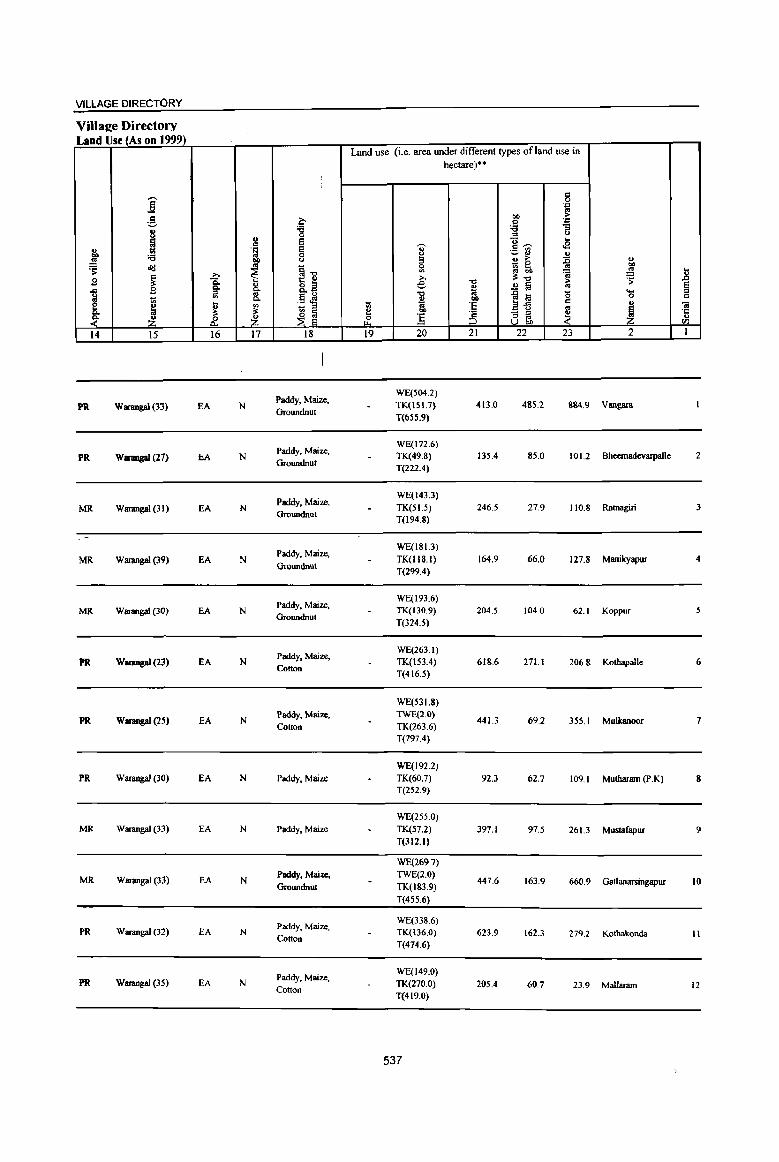
VILLAGE DIRECTORY
ViIlal!e Directory Land Use (As on 1999)
Land use (i.e. area under different types ofland use in hectare)··
I Q
j 0 ·c os
~ 00 ... c :ij
.:: .. 'g ;; <> ::s u
~ .,
E ]-;;- .. c U <2 .~ E ~ '6 0 !3 ~ .. u
!! ~ u ~ ~ :0 u
'S o'd ~~ 0 .. bO
~ '" ~ !! ...
.s ~ .a: >. "0 ~"tl 'S ..8 Co u o .s e 0> ..!l !a os ~ .c iil g- ""0 "0 1;j .c ~ 0 ...
~ .8 ~ 0 Q
~ "" ~ co ~i3 Q .. e ~ '" ~ '" 7n 'E os
~ "iI
~ ;s:
~ g e bO
:3 - :;;l
~ ·c
Z .£ Z & :5 '" '" u U OIl CI'l
14 15 16 17 18 19 20 21 22 23 2 I
Paddy, Maize, WE(504.2)
PRo Wanmgal (3~} EA N TK(151.7) 413.0 485.2 884.9 Vangara Groundnut
T(655.9)
Paddy, Maize, WE(172.6)
PRo WanmgaI (27) EA N TK(49.8) 135.4 8S.0 101.2 Bheemadev8lpalle 2 Groundnut
T(222.4)
Paddy, Maize, WE(143.3)
MR Warangal (31) EA N TK(SI.S) 246.5 27.9 IIO.S Ratnagiri 3 Groundnut
T(194.8)
Paddy, Maize, WE(ISL3)
MR Warangal (39) EA N TK(ll8.l) 164.9 66.0 127.8 Manikyapur 4 Groundnut
T(299.4)
Paddy. Maize. WE(193.6)
MR Warangal (30) EA N TK(1J0.9) 204.5 104.0 62.1 Koppur Groundnut
T(324.S)
Paddy. Maize, WE(263.1}
PR. WarangaI (2~) EA N TK(lS3.4) 618.6 271.1 206.8 Kothapalle 6 Cotton
T(416.5)
WE(53 1.8)
PRo WarangaJ (25) EA N Paddy. Maize, TWE(2.0)
441.3 69.2 355.1 Mulkanoor 7 Cotton TK(263.6)
T(797.4)
WE(192.2)
PR Warangal (30) EA N Paddy, Maize TK(60.7) 92.3 62.7 109.1 Muthararn (P.K) 8 T(252.9}
WE(255.0) MR Warangal (33) EA N Paddy. Maize TK(S7.2) 397.1 97.5 261.3 Mustafapur 9
T(312.I)
WE(269.7)
MR Warangal (33) EA N Paddy. Maize, TWE(2.0)
447.6 163.9 660.9 Gatlanarsingapur 10 Groundnut TK(183.9)
T(455.6)
Paddy, Maize. WE(3386)
PR Warangal (32) EA N TK(136.0) 623.9 162.3 279.2 Kothakonda 11 Cotton
T(474.6)
Paddy, Maize, WE(149.0)
PR. Warangal (35) EA N TK(270.0} 205.4 60.7 23.9 Mallaram 12 Cotton T(419.0)
537
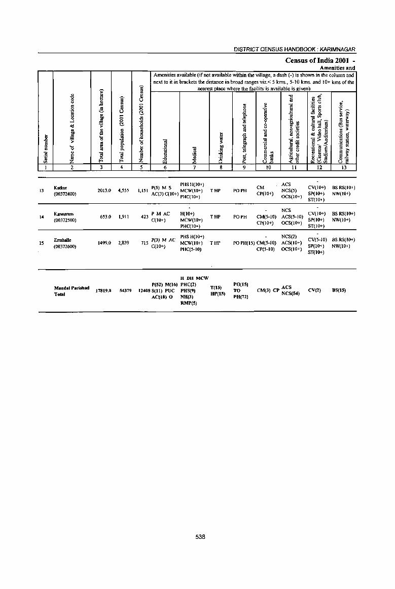
.8 § c 'iii ·c ., til
I
13
14
15
u
"'" 0 u c: 0 'p os u 0
...l «l .. ~ ~ .... 0 u
~ 2
KatIcur (00372400)
I<annaram (00372500)
ErrabaIJe (00372600)
Manda! Parishad
Total
i ~
~ .. ,<;l
~ .9 .._,
~ :; 0
~ ~ ., .. oS 0
'J:! .... ., 0 -a ~ 8: '3 '3 ~ ~ 3 4
2013.0 4,555
653.0 1,911
1499.0 2,839
17819.0 54179
DISTRICT CENSUS HANDBOOK: KARIMNAGAR
Census of India 2001 -Amenities and
Amenities available (if not available within the village, a dash (-) is shown in the column and next to it in brackets the distance in broad ranges viz. < 5 kms., 5-10 kms. and 10+ kms of the
';i;' nearest place where the facility is available is I(iven) 6l c: '" u g t!-
~ il III
8 ..c .... 01 0 8 i; Ol .~ ..c C>
~ u :a tB ~
5 6 7
PHSH(IO+) 1,151 peS} M S MCW(IO+)
AC(3) C(lO+) PHC(IO+)
423 PM AC H{IO+} C(lO+) MCW(IO+)
PHC(IO+)
P(3) M AC PHS H{IO+)
715 MCW(IO+} C{IO+}
PHC(S-IO)
H DH MCW P(52) M(t6) PHC(2)
12408 S(11) PUC PHS(9) AC(lS) 0 NH(l)
RMP(5)
538
I 01)
~ 8 8
THP
THP
THP
1'(15) UP(t5)
"'" &i u .. ,. ] § . ..,
-a e B 8. ., 11 ~ '5, III
"'" f .~ lij u
." c: ., o ._
..c Iii c 8 ~ ~i 01
'e i u "'3 0 6 <II
'Ii 81 .~ ~ &. ~~ 9 10 II
CM ACS
PO PH NCS(S) CP(IO+)
OCS(IO+)
NCS PO PH CM(5-IO) ACS(S-IO)
CP(IO+) OCS(IO+)
NCS(2) PO PH(15) CM{5-10) ACS(IO+}
PO(t5) TO PH(72)
CP(S-tO) OCS(!O+)
ACS CM(l) CP NCS(54)
~ :a~ . .., '" 1lt: <!! 8. ]~~ _Ol§ 6 ~·c dl! u 0
:s!~ ]>~ .g til ] ~ ~:a ~a~
12
CV(IO+) SP(IO+) ST(IO+}
CV(IO+) Sp(IO+) ST(IO+)
CV(5-IO) SP{IO+) ST(IO+)
CV(2)
i .~ ~ ... >. III .,
III ~ '" '" et<i III :so c o C ..., 0 oj • ..,
.~ ! j~
13
BS RS(IO+) NW(lO+)
BS RS{IO+} NW(IO+}
BS RS(IO+} NW(!O+)
BS(t5)

VILLAGE DIRECTORY
Villae;e Directory Land Use (As on 1999)
j ~ B ..c ~
~ ~ 14
PR
MR
MR
PR(8) MR(7)
j ;§, 8 ~ '6 <1d
~ B t;;
.~ -~
15
Warangal (40)
Warangal (45)
Warangal (35)
0 '6 0
'" e c .~ § "" <>
'" §." ~ ~ 1: " 8: '" 8.~ ~ ~ e ~ "'" b ._ '" ., 1;; " ~ ~
~ ~ ~ ~ 16 17 18
EA N Paddy, Maize, Cotton
EA Paddy, M!Iize
EA N Paddy
EA(15) N(14)
Land use (i.e. area under different types of land use in
1;; !! 0
t"-<
19
hectare)··
" ~ ::l 0
'" ;>, e '" " 1i! btl
:.s 20
WE(31O.8)
TWE(6.5) TK(173.3)
T(490.5)
WE(162.6)
TK(28.0)
T(I90.6)
WE(353.1)
TWE(3.2)
TK(60.4)
T(416.7)
WE(4020.83 ) TWE(lJ.75)
TK(1888.48) T(5923.06)
539
"0
~ .., 'E '2 ::J
21
1051.9
286.0
475.5
5803.9
c 0 .~ .., ;>
;g . ." :;
~ (.J
.... c~ <S ~~ " '" ;> :E _ 0 .. gj lib
~ ~'" ;> .!! § '" ] to -0 c
1:i '" :; ;l e U "" «
22 23
233.1 237.4
69.0 107.3
13U 475.3
2089.2 4002.9
" "" ~ ] ~
~ ""' 0 c
" 'iii j '':
'" til
2 I
Katkur 13
Kannaram 14
Erraballe 15

I I I--j
~~ I
, , I I : 8: I I ,I'-,
I : ~: © r • I I (/) ~ III III
I I : 8: • ~ ~
I ' , I I ' , 1 __ ~
~ ~ 0 ~
~ ~
z ~
~ !j ... 0
a 1= ~ E 8 ~ g: o ~ III '" '<t f&l
i , t; ~
u
~ g ::i = ~ s &: "" III
A D E v A R p A L L

PARTA-VIUAGE AND TOWN DIRECTORY
ALPHABETICALLISTOFVD..,LAGES(MANDALPARISHAD WISE),KARIMNAGARDISTRICf
~ Serial Name of village 2001 Census 1991 Census
number location code number ·location cod& numbe~
2 3 4
Name of MandaI Parishad: Elkathurthi Name of MandaI: Elkatburthi 0056
1 Baopet 00373700 2005100510051000Il
2 Damera 00373000 200510051005100004
3 Dandepalle 00373600 200510051005100010
4 Elkathurthi 00373100 200510051005100005
5 Gopalpur 00372900 200510051005100003
6 Jeelgul 00372800 200510051005100002
7 Keshwapur 00373900 200510051005100013
8 Kothulnaduma 00373400 200510051005100008
9 Penchakalpeta 00372700 200510051005100001
10 . Suraram 00373200 200510051005100006
II Thimmapur 00373800 200510051005100012
12 Vallabhapur 00373300 200510051005100007
13 Veeranarayanapur . 00373500 200510051005100009
541

*
I .. "0 ";;;' Q u ., a § ."I
~ g ''::; u os g ~ -0 ...J <II 0
~ C!-<Id g, JI §
Jl ~ .... '';::
~ .!2 0 '" ~ '" §: ~ ~ =
'"iii .. ~
"$ "3 'li ~ ~ en ] 2 3 4
Mandai Parubad ! Ellalthurthi (0056)
Penchakalpera 521.0 2)09
(00311700)
Jeelgul 2
(00372800) 1270,0 3,336
Gopalpur 3
(00312900) 10110,0 3,501
Damera 4 815.0 5,352
(00313000)
Elkathurthi 5
(00373100) 1588.0 5,605
Sunuam 6
(00373200) IllS,O 3,355
Vallabhapur 7 350,0 1,718
(00373300)
8 Kothulnaduma
346.0 1,544 (00373400)
9 Veera-narayanapur
45.5.0 1,125 (00373500)
Dandepalle 10 1226,0 3,243
(00373600)
DISTRICT CENSUS HANDBOOK: KARIMNAGAR
Census ofIndia 2001 -Amenities and
Amenities available (if not available within the village, a dash (-) is shown in the column and next to it in brackets the distance in broad ranges viz. < 5 kms., S-IO kms. and 10+ kms of the
";;;' nearest place where the facility is available is riven) '" 5 "d fjj U fa ''::; t) ,;
0 ., ..
1 ~E <> = ;> 0 0 '! .~ --('!, "& 4!& ., i? 3J
<> '" ]~-- ::: 1:. Q. ., ]1 b .~ ~ o :J "
ij "0 <> ~ ''::: -];§ ~J <II ~ "'" 6 .~ '" ·c 6 t -a 'lij = 8 °2s = •
o<t""':a o = ... (;!
li til ,_ -= 0 .... .. i!= ~ ·01 =>~ to 'J:!
0 d 0g ,50! is t 0 'iii
t>D ,g~l 13 '" ';:I
~ ]1
1 .. <> jj :::l (,) '" a ~! ., :a ~ '5, b e"]
~ ., ,6
z ~ ~ <~ ~u ~'" (..) ~
5 6 1 S 9 10 11 12 13
PM H(5·IO) NCS(3)
CV(5.10) BSRS(IO+) 528 C(S-IO) THP POPH(2) CM(5·10) ACS(S·IO)
MCW(S-IO) SP(IO+) NW(IO+) PHC(5-IO)
CP(HO) OCS(lO+) ST(10+)
P(4) M S PHS H(IO+) NCS(2) CV{S-IO) as RS(IO+)
860 AC(2)C(10+) MCW(IO+) THP PO PH CM(IO+) ACS(5-10) SP(IO+) NW(IO+)
PHC(IO+) CP{HJ+) OCS(IO+) ST(lO-I-}
PMS PHCPHS
CM NCS(4)
CV(S-IO) BSRS(IO+) 758 C(IO-l-) H(IO+) THP POPH(8)
CP(IO+) ACS(S·IO)
SP(IO+) NW(lO+) MCW(IO+) OCS(IO+)
ST(IO+}
PHS H(10+) NCS(4) CV«5) BS RS(lO+) 1 197 P(2) M(2) S MCW(IO+) THP POPH(9) CM«5) ACS«5)
, AC(2) C(IO+) PHC« 5) CP(IO+) OCS(IO+) SP(IO+) NW(IO+)
ST(lO+)
P(7) M(3) S PHC PHS CM ACS CV as
1,352 AC(2) C(IO+) RMP H(IO+) THP PO PH(2S) CP(IO+) NCS(2) SP(IO+) RS(5-1O)
MCW(IO+) OCS(IO+) ST(lO+) NW(IO+)
P(Z) M S PHS H(IO+) PO NCS(3}
CV(S-IO) as RS{!O+) 834 AC(2) C(IO+) MCW(IO+} THP
PH(S-IO) CM(5-IO} ACS(5-JO)
SP(IO+} NW{IO+) PHC(S-IO) CP(IO+) OCS(IO+)
ST(lO-l-)
391 P{2} M S H{S-IO) PO NCS(2)
CV(5-1O) BS RS(IO+} THP CM«5) ACS«5)
C(lO-l-) MCW(5-IO) PH« 5) CP(S·to) OCS(to+)
SP« 5) NW(IO+)
PHC« S} ST(IO+}
P(Z} AC RMP
NCS
369 M« 5) H(5-10)
THP PO« 5) CM(S·!O) ACS(5-1O) eV(5-10) BS RS(IO+)
C(5-IO) MCW(5-10)
PH« 5) CP(S-IO) OCS(IO+) SP(lO+} NW{IO+)
PHC(S-!O) ST(lO+)
324 P(2) M RMP H(IO+)
PO NeS
CV(5-1O) BS RS(IO+) MCW(lO+} THP CM(5-10) ACS(S-IO)
C(IO+) PHC(5-10)
PH(5-10) CP(IO+) OCS(IO+)
SP(lo+) NW(lO+)
ST{lO-l-)
114 PM S AC PHSH(IO+)
PO NCS(3)
eves-tO) BS RS(IO+) MCW(IO+) THP CM(5-1O) ACS(5-IO)
C(JO+) PHC{5-10)
PH{S-IO) CP(lO+) OCS(lO+)
SP{lO+} NW(IO+)
ST{lO-l-)
542

VILLAGE DIRECTORY
VilIa2e Directory Land UsejAs on 1999)
j g ~
j :.a 0 ., a .. .~ ~ gf :a 01) ..
~ <Id ~ j-c .9 ~ ~
Co .. o~ 1 .9 g Co' .. ca. ..
-:;; ca. .§ 'E [ ~
!; ~ l!: ~a ~ ~ ~ ~
14 15 16 17 18
MR Warangal (24) EA N Beedies
PR Warangal (22) EA N Beedies
PR Warangal (19) EA N Beedies
MR Warangal (17) EA N Beedies
PR Warangal (15) EA N Beedies
MR Warangal (21) EA N Beroies
PR Warangal (20) EA N Beedies
PR Wamngal (19) EA N Beedies
PR Warangal (22) EA N Beedies
PR Warangal (20) EA N Beedies
Land use (i.e. area under different types ofland use in
1ii ~ ~ 19
I e: ~ iii 01)
!i 20
WE(133.6) TK(36.S) T(l70.4)
WE(368.7) TWE(7.7)
TK(223.4) T(599.8)
WE(363.0)
TWE(13.0)
TK{219.3)
T(595.3)
WE(1l0.0)
TK(90.0) T(200.0)
GC(137.6)
WE(2IS.7) TWE(16.6)
TK(30S.5) T(675.4)
GC(285.7) WE(352.9) TWE(S.9) TK(111.6) T(SI9.1)
WE(l38.0) TK(55.4) T(193.4)
WE(43.3)
TK(43.7) T(S7.0)
GC(205.2) WE(68.4) TWE(11.3)
TK(12.1)
T(Z97.0)
GC(45S:9) ~253.7)
TWl3{,16.6) TK(ZI8.5) T(947,S)
",t,.' ,~< '...-,
543
hectare)'·
i 01)
:~ ;5 21
273.9
382.4
165.1
500.0
594.3
85.8
93.3
175.6
3.5
84.5
~ '.0 ..
01) ;..
:§ '.0
e :::I Q ... e~
.E; ., 2 ~ ~ ]: ~~ '!! ~ ..!! lij «I .... ~~
'0 '"
0 .. .. - " _1 1 6J\ 22 23 2
49.8 27.0 Penchakalpeta
11'.2.1 105.8 Jeelgul
155.8 163.8 Gopalpur
43.3 71.7 Damera
100.8 217.:5 ElkatllUrthi
107.2 102.8 Suraram
8.5 54.8 Vallabhapur
34.4 49.0 Kothulnadwna
1'..1 106.0 Veeranarayanapur
85.0 I08F Dandepalle
tl
1 ~ .. rJl
1
2
3
4
5
6
7
8
9
10
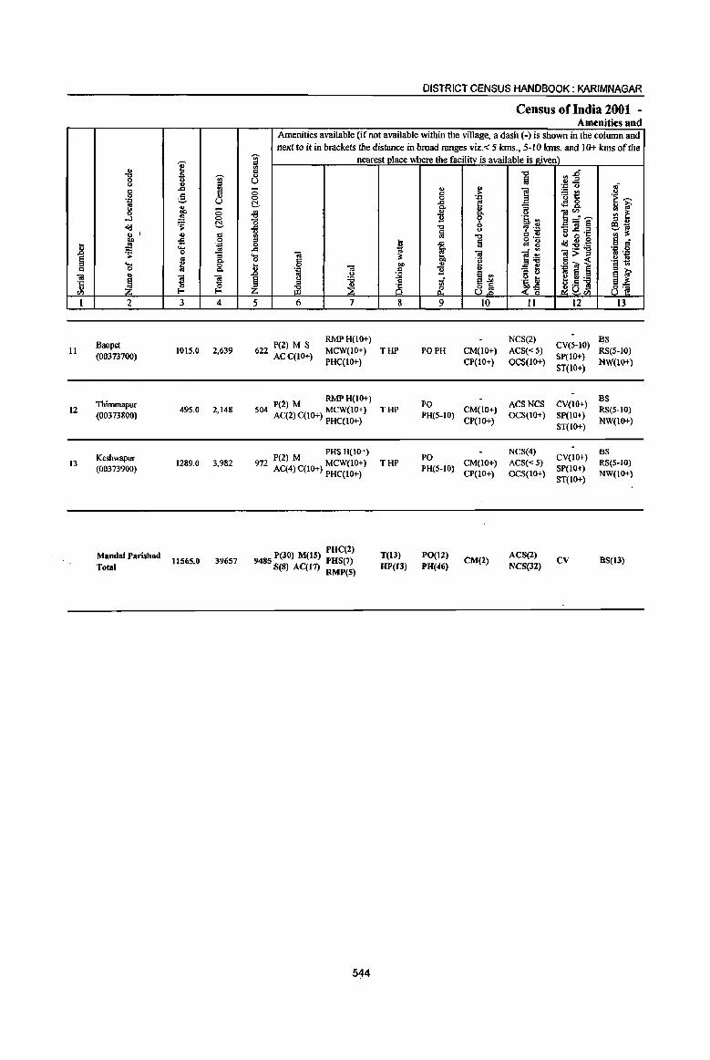
11
12
13
2
Baopet (00373700)
Thimmapur (00373800)
Keshwapur (00373900)
Mandai Parishad Total
3 4
101S.0 2,639
495.0 2,148
1289.{I 3,982
11565.0 39657
DISTRICT CENSUS HANDBOOK: KARIMNAGAR
Census of India 2001 -Amenities and
Amenities available (if not available within the village, a dash (-) is shown in the column and next to it in brackets the distance in broad ranges viz.< 5 kms., 5-10 krns. and 10+ krns of the
nearest Dlace where the facilityis available is given)
5 6 7 8
RMPH(IO+) P(2) M S
622 ACC(tO+) MCW(IO+) T HP PHC(tO+)
P(2) M RMP H(IO+)
504 AC(2)C(10+) ~i;~~;) THP
P(2) M PHS H(IO+) 972 AC(4)C(10+) MCW(IO+) THP
PHC(IO+)
PUC(2) 9485 P(30) M(15) PUS(7)
S(8) AC(11) RMP(S)
5~4
T(13) HP(U)
9
PO PH
10
CM(IO+) CP(IO+)
II 12
NCS(2) CY(HO) ACS« S) SP(IO+) OCS(lO+) ST(10+)
I3
5S RS(S-IO) NW(1o+)
:~(S-IO) CM(lO+) ~~(~;:) ~~(~~O:» ~(5-10) CP(IO+) NW(lO+)
ST(IO+)
PO NCS(4) CY(IO) as CM(lO+) ACS«5) + RS(5-IO)
PH(5-10) CP(IO+) OCS(IO+) SP(IO+) NW(IO+) ST(IO+)
FO(ll) PH(46)
CM(2) ACS(2) NCS(32)
CV BS(13)
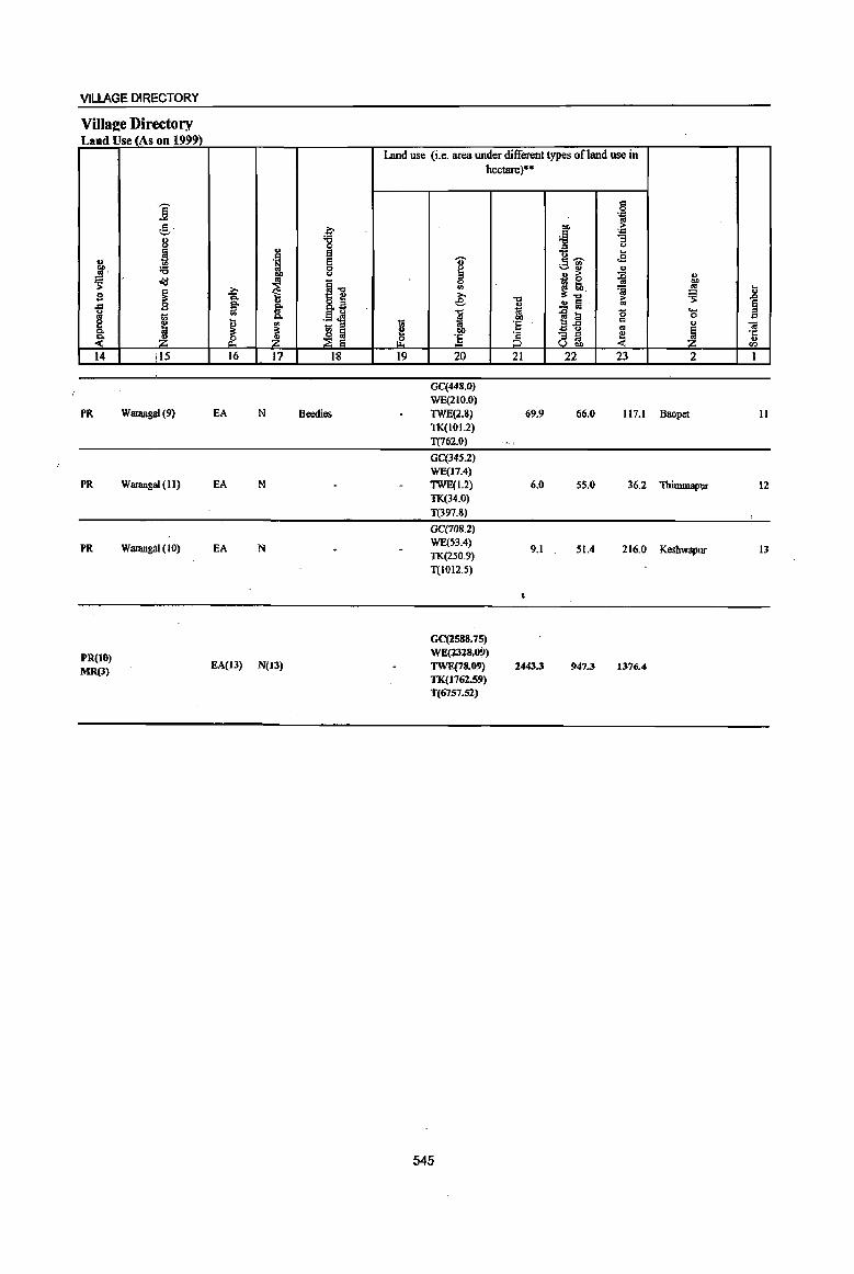
VILLAGE DIRECTORY
Villaee Directory Land Use (As on 1999)
t.l 11l'. ~ g
~ ~ ~ 14
PR
PR
PR
PR(10) MR(3)
'~
] :§,. 8 ~ :a Jd
~ t;;
~ ~
i IS
Warangal (9)
Wanmgal (II)
Warangal (10)
~ :a 0
'" e . ~ 8
0 co <>
~ I] b g; II)
~ iil .§J Co
~ ell 10 ::I ~
~~ ~ ~ 16 17 18
EA N Beedies
EA N
EA N
EA(13) N(13)
Land use (i.e. area under different types ofland use in
u; l! ~ 19
hectare)·'"
.. ~ 0
'" ~ "1:1
* co ] 20
GC{448.0) WE(210.0) TWE(2.8) TK(I01.2) T(762.0)
GC(34S.Z) WE(17.4) TWE(1.2) TK(34.0)
T(397.8)
GC(708.2) WE(53.4)
TK(250.9) T(I012.5)
GC(2588.75) WE(1318.09) TWE(78..09)
TK(1762.59) T(6757.S2)
545
"1:1 ., i :§ :§ 21
69.9
0.0
9.1
2443.3
c 0 . ..,
~ ~ ~
. .., "3 = u
0 .. aj'
.g
.2 <> > ~ I! 16 ~ ~ fa
..ala g ~-5 .. - '" ~ 0gj, 22 23
66.0 117.1
55.0 36.2
51.4 216.0
947.3 1376.4
u
"" ~ .. u .s;: .0
~ .... 0 ., <a
1 ·c ... <Zl
2 I
Baopet II
Thimmapllf 12
Keshwapur 13

Serial Name of
DISTRICT CENSUS HANDBOOK :KARIMNAGAR
APPENDIX I - VILLAGE DIRECfORY
ABSTRACfOFEDUCATIONAL, MEDICALANDOTHERAMENlTIES
IN VILLAGES - MANDAL PARISHAD LEVEL
Total Total Educational institutions
number Mandai Parishad number of population Primary school Middle school Matriculationl
Secondary school
2
3
4
5
6
7
8
9
10
II
12
13
2
Ibrahimpatnam
Mallapur
Raikal
Sarangapur
Dhannapuri
Velgatoor
Ramagundam
Kamanpur
Manthani
Kataram
Mahadevpur
Mutharam
(Mahadevpur)
Malharrao
14 Mutharam
15
16
17
18
19
20
21
22
23
24
25
26
27
28
29
30
3]
(Manthani)
Srirampur
Peddapalle
Julapalle
Dhannaram
Gollapalle
Mallial
Jagtial
Medipalle
Koratla
Metpalle
Kathlapur
Chandurthi
Kodimial
Pegadapalle
Gangadhara
Ramadugu
Choppadandi
inhabited of
villages
3
18
19
20
24
23
23
20
22
31
28
37
21
16
18
17
22
15
17
22
15
24
19
14
15
18
12
15
16
19
18
12
Mandai Parishad
4
50,845
49,575
58,807
40,881
73,230
47,229
35,756
62,378
50,405
31,259
35,325
23,327
23,843
28,628
37,272
90,830
45,094
49,636
41,648
45,244
65,044
49,773
40,417
76,985
42,786
40,558
42,346
44,879
46,879
47,654
48,659
Villages Institutions Villages Institutions Villages Institutions
5 6 7 8 9 10
18
19
20
22
22
23
20
21
31
28
37
21
15
17
17
22
15
17
22
15
24
19
14
15
18
12
15
16
19
18
12
546
28
32
42
32
59
34
37
52
77
45
54
32
27
28
40
71
37
51
34
32
60
39
25
62
21
31
36
31
47
45
33
11
14
10
11
15
II
II
14
9
II
7
2
2
9
15
18
12
11
12
10
23
14
13
8
15
10
8
11
13
12
8
15
15
20
II
21
14
15
33
21
12
11
2
3
10
17
42
19
17
15
15
36
16
15
35
15
17
]4
14
21
17
16
6
6
5
5
8
8
,4
6
3
5
2
4
5
8
6
6
5
6
15
9
5
5
7
7
6
4
8
7
7
6
7
8
5
12
10
5
12
7
6
3
4
6
16
8
7
8
8
20
10
5
15
7
8
10
5
9
10
]4
PART A· VILLAGE AND TOWN DIRECTORY
APPENDIX I - VILLAGE DIRECfORY (Conuq
ABSTRACfOFEDUCATIONAL, MEDICALAND OTHER AMENITIES
IN VILLAGES- MANDAL PARISHAD LEVEL
Educational institutions Name of Serial
Higher Secondary! College. Adult literacy Others No Mandal Parishad number
PUC! Intermediate! (graduate and above) classes! centres educational Junior college facilities
VIllages Institutions Villages Institutions VIllages Institutions VIllages Institutions
II 12 13 14 15 16 17 18 19 2
16 26 Ibrahimpatnam
15 19 Mallapur 2
II 21 Raikal 3
19 25 2 Sarangapur 4
13 15 Dharmapuri 5
14 21 Velgatoor 6
13 17 Ramagundam 7
6 8 Kamanpur 8
2 15 28 Manthani 9
10 10 Kataram 10
to 13 Mahadevpur II
3 3 Mutharam
(Mahadevpur) 12
4 8 Malharrao 13
12 13 Mutharam
(Manthani) 14
16 20 Srirampur' 15
'I 4 2 19 24 5 Peddapalle 16
15 23 Juiapalle 17
6 7 Dharmaram 18
14 20 Gollapalle 19 11 14 Mallial 20
19 21 Jagtial 21
13 15 Medipalle 22 14 15 Koratla 23
2 to 23 Metpalle 24 18 20 Kathlapur 25 II 23 Chandurthi 26 to 15 Kodimial 27 16 30 Pegadapalle 28 13 ' 21 Gangadhara 29 13 24 Ramadugu 30 10 18 Choppadandi 31
547

DISTRICT CENSUS HANDBOOK :KARIMNAGAR
APPENDIX I - VILLAGE DlREcrORY (Contd .. )
ABSTRAcrOFEDUCATIONAL, MEDICALAND OTHERAMENITIES
IN VILLAGES- MANDAL PARISHAD LEVEL
Serial Name of Medical institutions number MandaI Parishad Hospital Dispensary Primary Health Centre/ Primary Health
Health Centre Sub-Centre
Villages Institutions Villages Institutions Villages Institutions Villages Institutions
2 20 21 22 23 24 25 26 27
Ibrahimpatnam 8 8
2 Mallapur 8 8
3 Raikal 2 3 10 10
4 Sarangapur to 10
5 Dharmapuri 3 I I 12 12
6 Velgatoor 2 2 10 10
7 Ramagundam 2 3 7 7
8 Kamanpur 2 2 9 9
9 Manthani 2 8 7 8
10 Kataram 2 4 4 5 5
II Mahadevpur 2 2 10 10
12 Mutharam
(Mahadevpur) 9 9
13 Malharrao 2 2 2 2 6 6
14 Mutharam
(Manthani) 2 3 6 6
15 Srirampur 8 8
16 Peddapalle 2 4 2 2 10 10
17 JulapalJe 2 2 2 2 8 8
18 Dharmaram 7 8
19 Gollapalle 5 13 7 7
20 Mallial 8 8
21 Jagtiai 3 3 2 8 8
22 Medipalle 3 8 9 9
23 Koratla 7 7
24 Metpalle 2 4 7 7
25 Kathlapur 3 3 8 8
26 Chandurthi 7 7
27 Kodimial 8 8
28 Pegadapalle 2 2 8 8
29 Gangadhara 9 10
30 Ramadugu 2 2 8 9
31 Choppadandi 7 8
548

PARTA-VIUAGEAND TOWN DIRECTORY
APPENDIX I-VILLAGE pIRECfORY (Contd •• ) ABSTRACfOFEDUCATIONAL,MEDICALAND OTHER AMENITIES
IN VHLAGES- MANDA;L PARISHAD LEVEL
Medical institutions Maternity and Child Family Community Health Others No Name of Serial
Welfare Centre! Welfare Centre Workers Medical Mandai Parishad number Maternity Homel facilities
Child Welfare Centre Villages Institutions Villages Institutions Villages Numbers VillagesInstitutions
28 29 30 31 32 33 34 35 36 2
8 8 15 64 3 Ibrahimpatnam
8 8 19 39 MaUapur 2
17 91 2 Raikal 3
1 4 14 Sarangapur 4
1 21 77 2 Dharmapuri 5
23 38 Velgatoor 6
2 2 20 62 Ramagundam 7
12 47 8 Kamanpur 8
18 28 II Manthani 9
13 17 13 Kataram 10
2 2 9 16 23 Mahadevpur II
21 23 Mutharam
(Mahadevpur) 12
5 11 8 Malharrao 13
10 18 7 Mutharam
(Manthani) 14
17 39 Srirampur 15
22 90 PeddapaUe 16
15 52 JuJapalle I7
16 38 Dharmaram 18
20 60 GolJapalle 19
12 36 3 Mallial 20
3 1 22 76 Jagtial 21
16 85 3 Medipalle 22
14 57 Koratla 23
6 13 7 Metpalle 24
18 75 Kathlapur 25
II 39 Chandurthi 26
II 35 3 Kodimial 27
15 65 Pegadapalle 28
16 57 2 Gangadhara 29
14 33 2 Ramadugu 30
12 47 Choppadandi 31
549

DISTRICT CENSUS HANDBOOK :KARIMNAGAR
APPENDIX I - VILLAGE DIRECTORY (Contd •. )
ABSTRACfOFEDUCATIONAL,MEDICALAND OTHERAMENITIES IN VILLAGES - MANDAL PARISHAD LEVEL
Serial Name of Drinking water source number MandaI Parishad Tap Wen Tank Tubewell River Fountain Canal Others More than No drinking
one source water facilities
2 37 38 39 40 41 42 43 44 45 46
1 Ibrahimpatnam 16 18 18 18
2 MaUapur 16 18 19 19
3 Raikal 11 19 20 20
4 Sarangapur 13 24 18 19 15 24 24
5 Dharrnapuri 4 23 23 23
6 Velgatoor 23 22 22
7 Rarnagundam 4 20 20 18 8 17 20 20
8 Kamanpur 8 19 8 3 5 21 19
9 Manthani 25 13 4 30 30
10 Katararn 19 26 15 5 15 23
11 Mahadevpur 12 28 10 10 13 34 34
12 Mutharam
(Mahadevpur) 18 2 1 20 17
13 Malharrao 8 14 4 3 3 13 15
14 Mutharam
(Manthani) 8 11 2 9 7
15 Srirampur 17 17 17 17
16 Peddapalle 11 20 20 4 18 21
17 JulapaUe 12 15 13 15 15
18 Dharrnararn 11 17 5 17 17
19 Gollapalle 7 22 19 15 22 22 22
20 Mallial 10 15 15 15
21 Jagtial 12 23 7 23 23
22 Medipalle 9 19 19 19
23 Koratla to 14 3 14 14
24 Metpalle 15 15 15 15
25 Kathlapur 15 18 18 18
26 Chandurthi 12 4 7 12 12
27 Kodimial 8 15 14 15
28 Pegadapal\e 6 16 2 4 16 16
29 Gangadhara 12 15 15 15
30 Ramadugu 12 18 18 18
31 Choppadandi 9 12 9 11 12 12
550

PART A~ VlLLAGEAND TOWN DIRECTORY
APPENDIX I ~ VllLAGE DIRECfORY (Contd .. )
ABSTRACI'OFEDUCATIONAL,MEDICALANDOTHERAMENITIES
IN VILLAGES- MANDAL PARISHAD LEVEL
Post, Tele~aEh and Tele~hone TransEort and Communications Name of Serial Post Telegraph Post Post Telegraph Post, Phone Bus Railway Navigable MandaI Parishad number
Office Office and Office Office Telegraph service Station waterway
Telegraph and and Office and Office Phone Phone Phone
47 48 49 50 51 52 53 54 55 56 2
II 6 7 18 Ibrahimpatnam
10 4 4 19 Mallapur 2
11 to 19 20 Raikal 3
13 3 4 20 Sarangapur 4
16 7 8 20 Dharmapuri 5
16 6 6 20 Velgatoor 6
12 4 4 20 Ramagundam 7
9 4 7 16 2 Kamanpur 8
IS 2 I 2 26 Manthani 9
7 2 13 Kataram 10
7 I 2 4 14 3 Mahadevpur II
2 4 Mutharam
(Mahadevpur) 12
6 5 Malharrao 13
II 13 Mutharam
(Manthani) 14
15 4 4 16 Srirampur 15
17 6 9 20 3 Peddapalle 16
13 to II I3 Julapalle 17
10 4 5 16 Dharmaram 18
11 3 3 21 Gollapalle 19
13 12 12 15 Mallial 20
21 12 15 22 Jagtial 21 II 4 5 19 Medipalle 22
11 8 II 14 KoratIa 23
9 6 10 14 Metpalle 24 13 6 6 18 Kathlapur 25 II 4 4 12 Chandurthi 26 8 6 8 13 Kodimial 27 15 7 8 16 Pegadapalle 28
I
12 9 14 18 Gangadhara '29 II 9 15 15 Ramadugu 30 II II 12 II Choppadandi 31
551

DISTRICT CENSUS HANDBOOK :KARIMNAGAR
APPENDIX I - VILLAGE DIRECTORY (Contd .. ) ABSTRACf OF EDUCATIONAL, MEDICAL AND OTHERAMENITIES
IN VILLAGES - MANDAL PARISHAD LEVEL
Serial Name of Banks Power supply Credit Societies
number Mandai Parishad Villages Number of Available Not Villages Number of Villages Number of Villages Number of
2
3
4
5
6
7
8
9
10
11
2
Ibrahimpatoam
Mallapur
Raikal
Sarangapur
Dharmapuri
Velgatoor
Ramagundam
Kamanpur
Manthani
Kataram
Mahadevpur
12 Mutharam
(Mahadevpur)
13 Malharrao
14 Mutharam
15
16
17
18
19
20
21
22
23
24
25
26
27
28
29
30
31
(Manthani)
Srirampur
Peddapalle
Julapalle
Dharmaram
GollapaJIe
Mallial
Jagtial
Medipalle
Koratla
Metpalle
Kathlapur
Chandurthi
Kodimial
Pegadapalle
Gangadhara
Ramadugu
Choppadandi
57
4
2
2
2
2
2
3
2
4
3
2
4
3
2
3
2
2
2
2
3
2
2
Commercial Available Agricultural 000- Other
and Co
operative
banks
58
4
3
2
3
2
2
3
5
6
3
2
6
6
3
2
2
3
2
5
2
2
4
2
4
59 18
19
20
24
23
23
20
22
31
28
37
21
16
18
17
22
15
17
22
15
24
19
14
15
18
12
15
16
19
18
12
60
552
61
5
6
5
6
5
2
3
2
5
2
2
4
3
2
10
6
3
5
6
2
4
2
3
3
4
5
2
credit
societies
62
5
6
5
6
5
2
3
2
5
2
2
4
3
2
JO
6
3
5
6
2
4
2
3
3
4
5
2
63
17
13
17
15
18
19
17
18
18
12
7
6
11
12
14
21
14
17
17
15
24
14
I3
15
18
10
14
15
14
15
II
Agricultural
credit
societies
64 43
33
46
27
41
41
32
45
41
21
II
7
22
30
26
79
45
57
36
31
48
25
42
51
31
24
35
48
23
47
31
65
credit
societies
66
2

PART A-VILLAGE AND TOWN DIRECTORY
APPENDIX I-VILLAGE DIRECfORY (Contcq ABS1RACT OF EDUCATIONAL, MEDICALAND OTHER AMENITIES
IN VILLAGES - MANDAL PARISHAD LEVEL
Recreational facilib: Newspaper / Magazine
Cinemel Sports club Stadium! News paper Magazine News paper Name of Serial
Video hall Auditorium! and Mandai Parishad number Community Magazine
hall
67 68 69 70 71 72 2 18 13 13 Ibrahimpatnam
19 Mallapur 2
4 20 Raikal 3
21 8 8 Sarangapur 4
2 16 3 3 Dharmapuri 5
18 5 5 Velgatoor 6
20 20 20 Ramagundam 7
16 8 8 Kamanpur 8
18 9 9 Manthani 9
6 Kataram 10
.- 14 Mahadevpur 11
Mutharam
(Mahadevpur) 12
2 5 4 4 Malharrao 13
10 5 5 Mutharam
(Manthani) 14
14 3 3 Srirampur 15
3 22 4 4 PeddapaUe 16
15 6 6 Julapalle 17
17 14 14 Dhannaram 18
2 19 Gollapalle 19
14 9 9 Mallial 20
23 6 6 Jagtial 21
18 8 8 Medipalle 22
14 14 14 Koratla 23 6 I3 8 8 Metpalle 24
18 Kathlapur 25
12 2 2 Chandurthi 26 15 7 7 Kodimial 27 16 2 2 Pegadapa11~ '28
17 7 7 Gangadhara 29
17 I3 13 Ramadugu 30 2 II II 11 ChoppadaJ:ldi 31
553
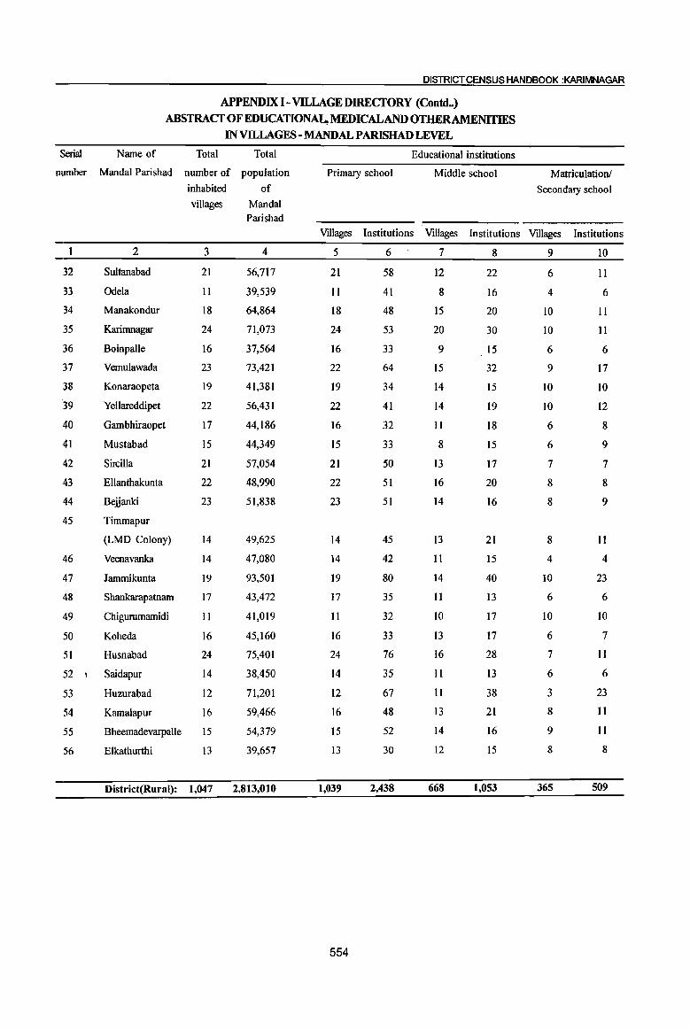
DISTRICT CENSUS HANDBOOK :KARIMNAGAR
Serial Name of
APPENDIX I - VILLAGE DIRECTORY (Contc:l_) ABSTRACT OF EDUCATIONAL, MEDICALAND OTIlERAMENITIES
IN VllLAGES - MANDAL PARISHAD LEVEL
Total Total Educational institutions
number Mandai Parishad number of population Primary school Middle school inhabited of
villages Mandai Parishad
Matriculation!
Secondary school
Villages Institutions Villages Institutions Villages Institutions
32
33
34
35
36
37
38
39
40
41
42
43
44
2
Sultanabad
Odela
Manakondur
Karirnnagar
Boinpalle
Vemulawada
Konaraopeta
Yellareddipet
Gambhiraopet
Mustabad
Sircilla
Ellanthakunta
Beiianki
45 Timmapur
(LMD Colony)
3
21
1 I
18
24
16
23
19
22
17
15
21
22
23
14
46 Veenavanka 14
47 Jammikunta 19
48 Shankarapatnam 17
49 Chigurumamidi 11
50 Koheda 16
51 Husnabad 24
52 I Saidapur 14
53 Huzurabad 12
54 Kamalapur 16
55 Bheemadevarpalle 15
56 Elkathurthi 13
4
56,717
39,539
64,864
71,073
37,564
73,421
41,381
56,431
44,186
44,349
57,054
48,990
51,838
49,625
47,080
93,501
43,472
41,019
45,160
75,401
38,450
71,201
59,466
54,379
39,657
District(Rural): 1,047 2,813,010
5
21
11
18
24
16
22
19
22
16
15
21
22
23
14
14
19
17
II
16
24
14
12
16
15
13
1,039
554
6
58
41
48
53
33
64
34
41
32
33
50
51
51
45
42
80
35
32
33
76
35
67
48
52
30
2,438
7
12
8
15
20
9
15
14
14
II
8
13
16
14
13
II
14
II
10
13
16
II
II
13
14
12
668
8
22
16
20
30
15
32
15
19
18
15
17
20
16
21
15
40
13
17
17
28
13
38
21
16
15
1,053
9
6
4
10
10
6
9
10
10
6
6
7
8
8
8
4
10
6
10
6
7
6
3
8
9
8
365
10
II
6
II
II
6
17
10
12
8
9
7
8
9
11
4
23
6
10
7
II
6
23
11
II
8
509

PART A-VILLAGEAND TOWN DIRECTORY
APPENDIX I - VILLAGE DIRECTORY (Contd_)
ABSTRACT OF MEDUCATIONAL, MEDICALAND OTIlERAMENITIES INvnLAGES-MANDAL PARISHAD LEVEL
Educational institutions Name of Serial
Higher Secondary/ College Adult literacy Others No Mandai Parishad number
PUC/Intermediatel (graduate and above) classesl centres educational
Junior college facilities
Villages Institutions Villages Institutions Villages Institutions Villages Institutions
II 12 13 14 15 16 17 18 19 2
2 2 21 37 Sultanabad 32
10 16 Odela 33
17 34 Manakondur 34
1 I 12 18 Karimnagar 35
9 14 Boinpalle 36
2 3 16 20 Vemulawada 37
13 14 3 Konaraopeta 38
10 10 Yellareddipet 39
5 10 Gambhiraopet 40
11 19 Mustabad 41
19 37 SirciIla 42
14 19 Ellanthakunta 43
16 21 Beiianki 44
12 12 Timmapur
(LMD Colony) 45
13 31 Veenavanka 46
3 19 50 Jammikunta 47
8 IO Shankarapatnam 48
11 18 Chigurumamidi 49
14 24 Koheda 50
2 18 32 Husnabad , 51
14 36 Saidapur 52
5 2 3 12 31 3 Huzurabad 53
2 12 18 Kamalapur 54
12 18 BheemadevarpaIIe 55
9 17 Elkathurthi 56
26 40 12 16 713 1,123 11 19 8 District(Rutal):
555
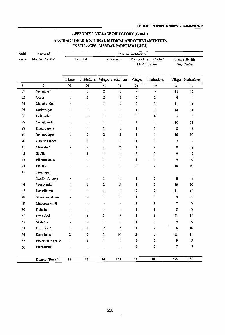
DISTRICT CENSUS HANDBOOK :KARIMNAGAR
APPENDIX 1- Vll..LAGE DJRECTORY (Conuq
ABS1RACT OF EDUCATIONAL, MEDICALAND OTHERAMENITIES IN VILLAGES - MANDAL PARISHAD LEVEL
Serial Name of Medical institutions number Mandal Parishad Hospital
Villages Institutions
2 20 21 32 Sultanabad
33 Odela
34 Manakondur
35 Karimnagar
36 Boinpalle
37 Vemulawada
38 Konaraopeta
39 Yellareddipet
40 Gambhiraopet
41 Mustabad
42 Sircilla
43 Ellanthakunta
44 Be.ijanki
45 Timmapur
(LMD Colony)
46 Veenavanka
47 lammikunta
48 Shankarapatnam
49 Chigurumamidi
50 Koheda
51 Husnabad
52 Saidapur
53 Huzurabad
54 Kamalapur 2 2
55 Bheemadevarpalle
56 Elkathurthi
District(Rural): 18 18
Dispensary
Villages Institutions
22 23 2 6
2 2
2 2
2
2 3
2 2
2 2
3 14
74 120
556
Primary Health Centre/
Health Centre
Villages Institutions
24 25
2 2
2 3
3 6
3 3
2 2
2 2
2
2 8
2 2
2 2
74 86
Primary Health
Sub-Centre
Villages Institutions
26 27 11 12
4 4
II 11
14 14
5 5
10 11
8 8
10 10
7 8
8 8
9 9
9 9
10 10
8 8
10 10
11 12
9 9
7 7
8 8
II II
9 9
8 10
11 11
9 9
7 7
475 486
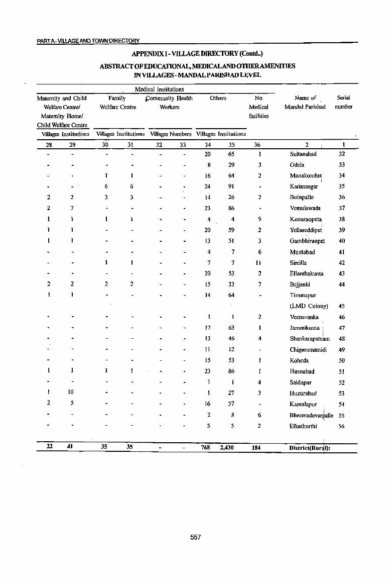
PART A-VILLAGE AND TOWN DIRECTORY
APPENDIX] - VILLAGE DIRECTORY (Contd_)
ABSTRACT OF EDUCATIONAL, MEDICAL AND OmERAMENITIES IN VILLAGES - MANDALPARISHAD LEVEL
Medical institutions
Maternity and Child Family S:;ommunity Health Others No Name of Serial
Welfare Centre! Welfare Centre Workers Medical MandaI Parishad number
Maternity Homel facilities
Child Welfare Centre
VIllages Institutions Villages Institutions Villages Numbers Villages Institutions
28 29 30 31 32 33 34 35 36 2 1
20 65 I Sultanabad 32
8 29 3 Odela 33
16 64 2 Manakonduli 34
6 6 24 91 Karimnagar 35
2 2 3 3 14 26 2 Boinpalle 36
2 7' 23 86 Vemulawada \ 37
1 4 4 9 i
Konaraopeta' 38
20 59 2 Yellareddipet 39
13 51 3 Gambhiraopet 40
4 7 6 Mustabad 41
7 7 II Sircilla 42
20 53 2 Ellanthakunta 43
2 2 2 2 15 33 7 Bejjanki 44
14 64 Timrnapur I
(LMD Colorly) 45
2 Veenavanka 46
17 63 Jammikunta I 47
13 46 4 Shankarapatnb I
48
II 12 Chigurumamidi 49
15 53 Koheda 50
23 86 Husnabad 51
4 Saidapur 52 10 27 3 Huzurabad 53
2 5 16 57 KamaJapur 54 \
2 8 6 BheemadevarpaUe 55 I
5 5 2 Elkathurthi 56
22 41 35 35 768 2,430 184 District(Rur~I):
557
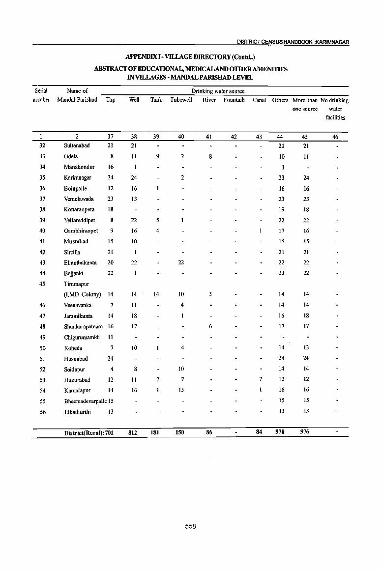
DISTRICT CENSUS HANDBOOK :KARIMNAGAR
APPENDIX I-VILLAGE DIREcroRY (ContdH)
ABSTRACfOFEDUCATIONAL,MEDICALANDOTHERAMENITIF$ IN VILLAGES - MANDAL PARISHAD LEVEL
Serial Name of Drinking water source number MandaI Parishad Tap Well Tank Tubewell River Fountaiti Canal Others More than No drinking
one source water
facilities
2 37 38 39 40 41 42 43 44 45 46 32 Sultanabad 21 21 21 21
33 Odela 8 II 9 2 8 10 II
34 Manakondur 16 I
35 Karimnagar 24 24 2 23 24
36 Boinpalle 12 16 16 16
37 Vemulawada 23 13 23 23
38 Konaraopeta 18 19 18
39 Yellareddipet 8 22 5 22 22
40 Gambhiraopet 9 16 4 17 16
41 Mustabad 15 10 15 15
42 Sircilla 21 21 21
43 Ellanthakunta 20 22 22 22 22
44 Belianki 22 23 22
45 Timmapur
(LMD Colony) 14 14 14 10 3 14 14
46 Veenavanka 7 II 4 14 14
47 lammikunta 14 18 16 18
48 Shankarapatnam 16 17 6 17 17
49 Chigurumamidi II
50 Koheda 7 10 4 14 13
51 Husnabad 24 24 24
52 Saidapur 4 8 10 14 14
53 Huzurabad 12 II 7 7 7 12 12
54 Kamalapur 14 16 15 16 16
55 Bheemadevarpalle 15 15 15
56 Elkathurthi 13 13 13
District(Rural): 701 812 181 150 86 84 970 976
558

PART A-VILLAGE AND TOWN DIRECTORY
APPENDIX I - VllLAGE DIRECfORY (Contd.)
ABSTRACf OF EDUCATIONAL, MEDICALAND OTHER AMENITIES IN VILLAGES - MANDAL PARISHAD LEVEL
. Post, Telegraph and Telephone Transport and Communications Name of Serial
Post Telegraph Post Post Telegraph Post, Phone Bus Railway Navigable Mandai Parishad number
Office Office and Office Office Telegraph service Station waterway
Telegraph and and Office and
Office Phone Phone Phone
47 48 49 50 51 52 53 54 55 56 2
13 11 17 IS Sultanabad 32
9 2 2 8 2 2 10 II 3 Odela 33
14 II 14 18 Manakondur 34
16 16 23 23 Karimnagar 35
13 11 14 16 Boinpalle 36
15 II 14 17 Vemulawada 37
15 2 3 19 Konaraopeta 38
14 4 5 21 Yellareddipet 39
12 3 5 15 Gambhiraopet 40
to 6 8 IS Mustabad 41
14 6 8 19 Sircilla 42
18 12 12 21 Ellanthakunta 43
14 13 18 21 Bejjanki 44
14 13 13 14 Timmapur 45
(LMD Colony)
13 13 14 12 Veenavanka 46
15 8 9 17 2 Jammikunta 47
13 13 15 16 Shankarap~tnam 48
10 5 5 11 Chigurumattudi 49
14 7 8 16 Koheda 50 .I
20 II 13 24 Husnabad 51
13 13 14 14 Saidapur 52
12 9 9 12 Huzurabad 53
15 5 5 14 Kamalapur 54
15 15 15 15 Bheemade~arpalle 55
12 6 6 13 I
Elkathurthi 56
I 701 16 11 402 16 11 496 910 10 6 Djstrict(R~ral)
I
559

DISTRICT CENSUS HANDBOOK :KARIMNAGAR
APPENDIX I - VILLAGE DIRECTORY (Conuq
ABSTRACf OF EDUCATIONAL, MEmCALANDOTHERAMENITIES IN VILLAGES - MANDAL PARISHAD LEVEL
Serial Name of Banks Power supply Credit Societies number Mandal Parishad Villages Number of Available Not Vtllages Number of Villages Number of Villages Number of
Commercial Available Agricultural nOD- Other and Co- credit Agricultural credit operative societies credit societies
banks societies
1 2 57 58 59 60 61 62 63 64 65 66
32 Sultanabad 3 4 21 5 5 19 50
33 Odela 3 5 11 11 36
34 Manakondur 3 3 18 8 8 17 63
35 Karimnagar 2 4 24 7 7 24 65 19 25
36 Boinpalle 3 3 16 6 6 16 36
37 Vemulawada 3 5 23 8 9 19 58 6
38 Konaraopeta 3 3 19 4 4 17 36
39 Yellareddipet 2 3 22 3 3 17 36
40 Gambhiraopet 2 3 17 2 2 11 34
41 Mustabad 3 4 15 4 4 13 29
42 Sircilla 2 2 21 7 7 18 86
43 Ellanthakunta 2 3 22 6 7 18 56
44 Belianki 3 4 23 3 3 17 48
45 Timmapur
(LMD Colony) 2 2 14 5 6 14 51
46 Veenavanka 2 2 14 5 5 11 38 4 6
47 Jammikunta 3 6 19 12 12 17 54
48 Shankarapatnam 2 2 17 4 4 15 50
49 Chigurumamidi 2 2 11 3 3 11 45
50 Koheda 16 4 4 15 49 2
51 Husnabad 2 4 24 4 4 21 69
52 Saidapur 2 3 14 5 5 14 46
53 Huzurabad 2 5 12 3 3 10 49
54 Kamalapur 3 4 16 4 4 15 45
55 Bheemadevarpalle 3 4 15 14 54
56 Elkathurthi 2 2 13 2 2 13 32
District(Rural): 123 167 1,047 227 230 848 2,334 29 44
560

PART A-VILLAGEAND TOWN DIRECTORY
APPENDIX I - VILLAGE DIRECfORY (Coneld •• )
ABSTRACfOFEDUCATlONAL,MEDICALAND OTHER AMENITIES
IN VILLAGES - MANDAL PARISHAD LEVEL
Recreational facili!l: NewsEaEer / Magazine
Cineme/ Sports club Stadium! News paper Magazine News paper Name of Serial
Video hall Auditorium! and MandaI Paris~ad number
Community Magazine
hall
67 68 69 70 71 72 2 1
1 20 13 13 Sultanabad 32
1 11 Odela 33
18 18 18 Manakondur 34 !
24 17 17 Karimnagar 35 I
15 4 4 Boinpalle 36
3 22 6 6 Vemulawada 37
18 Konaraopeta 38
2 19 7 7 Yellareddipet 39
12 4 4 Gambhiraopet 40
14 2 2 Mustabad 41
15 3 3 Sircilla 42
22 Ellanthakudta 43 I
19 15 15 Belianki 44
14 5 5 Timmapur
(LMD Colony) 45
14 8 8 Veenavanka 46
4 19 19 . 19 lammikunta 47 I
2 16 13 13 Shankarapatnam 48
11 Ch· I·d· 49 Igurum3If11 I
16 5 5 Koheda 50
3 22 2 Husnabad 51
14 7 7 Saidapur 52
4 12 12 12 Huzurabad 53
16 10 10 Kamalapur • 54
2 14 Bheemadev~alle 55
13 Elkathurthi 56
I
65 4 4 887 364 363 District(R~ral):
561
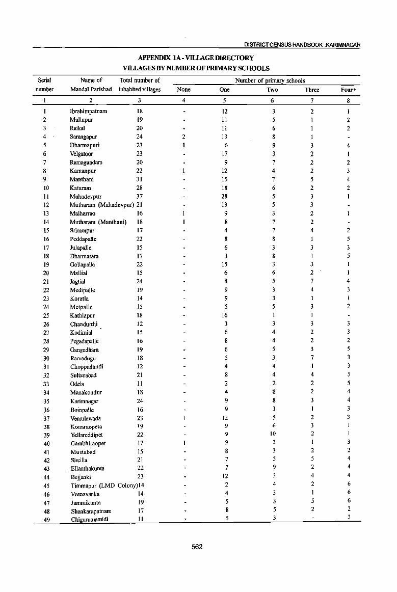
DISTRICT CENSUS HANDBOOK :KARIMNAGAR
APPENDIX lA - VllLAGE DIRECfORY
VILLAGES BY NUMBER OF PRIMARY SCHOOLS
Serial Name of Total number of Number of primacy schools number MandaI Parishad inhabited villages None One Two Three Four+
2 3 4 5 6 7 8
Ibrahimpatnam 18 12 3 2 I 2 Mallapur 19 11 5 1 2 3 Raikal 20 II 6 2 4 Sarangapur 24 2 I3 8 1 5 Dharmapuri 23 1 6 9 3 4 6 Velgatoor 23 17 3 2 I 7 Ramagundam 20 9 7 2 2 8 Kamanpur 22 12 4 2 3 9 Manthani 31 15 7 5 4 10 Kataram 28 18 6 2 2 11 Mahadevpur 37 28 5 3 12 Muthararn (Mahadevpur) 21 13 5 3 13 Malharrao 16 9 3 2
14 Mutharam (Manthani) 18 8 7 2 15 Srirarnpur 17 4 7 4 2 16 Peddapalle 22 8 8 1 5
17 Julapalle 15 6 3 3 3
18 Dharmaram 17 3 8 5 19 Gollapalle 22 15 3 3 I
20 Mallial 15 6 6 2 I
21 Jagtial 24 8 5 7 4
22 Medipalle 19 9 3 4 3
23 Koratla 14 9 3 I I
24 Metpalle 15 5 5 3 2
25 Kathlapur 18 16
26 Chandurthi 12 3 3 3 3
27 Kodimial 15 6 4 2 3
28 PegadapaIle 16 8 4 2 2
29 Gangadhara 19 6 5 3 5
30 Ramadugu 18 5 3 7 3
31 Choppadandi 12 4 4 3
32 Sultanabad 21 8 4 4 5
33 Odela 11 2 2 2 5
34 Manakondur 18 4 8 2 4
35 Karimnagar 24 9 8 3 4
36 Boinpalle 16 9 3 3
37 Vernulawada 23 12 5 2 3
38 Konaraopeta 19 9 6 3
39 Yellareddipet 22 9 10 2 I
40 Garnbhiraopet 17 9 3 I 3
41 Mustabad 15 8 3 2 2
42 Sircilla 21 7 5 5 4
43 Ellanthakunta 22 7 9 2 4
44 Belianki 23 12 3 4 4
45 Timmapur (LMD Colony)14 2 4 2 6
46 Veenavanka 14 4 3 1 6
47 Jarnmikunta 19 5 3 5 6
48 Shankarapatnarn 17 8 5 2 2
49 Chigurumarnidi II 5 3 3
562

PART A-VilLAGE AND TOWN DIRECTORY
APPENDIX lA- VILLAGEDIRECfORY(Concld..)
VILLAGES BY NUMBER OF PRIMARY SCHOOLS
Serial Name of Total number of Number of primary schools
number Mandai Parishad inhabited villages None One Two Three Four+
2 3 4 5 6 7 8
50 Koheda 16 9 5 2 51 Husnabad 24 3 11 4 6 52 Saidapur 14 6 1 4 3 53 Huzurabad 12 3 5 3 54 Kamalapur 16 5 3 I 7 55 Bheemadevarpalle IS I 5 3 6 56 Elkathurthi 13 3 8 2
District Total: 1,047 8 460 276 139 164
APPENDIX IB- VILLAGE DIREcroRY
VILLAGES BY PRIMARY, MIDDLE AND SECONDARY SCHOOLS
Serial Name of Total Type of educational institutions available I
number Mandal Parishad number of No School Atleast one Atleast one Atleast one inhabited primary primary middle
villages school and school and school and
no middle one middle One secondary
school school school
2 3 4 5 6 7 1 Ibrnhimpatnam 18 7 11 6 2 MaRIapur 19 5 14 6 3 RaiIGll 20 to to 5 4 Sarangapur 24 2 11 II 5 5 Dhannapuri 23 1 7 15 8 6 Velgatoor 23 12 11 8 7 Ramagundam 20 9 11 4 8 Kamanpur 22 7 14 6 9 Manthani 31 22 9 3 10 Kataram 28 17 II 5 II Mahadevpur 37 30 7 2 12 Mutharam (Mahadevpur) 21 19 2 1 13 Malharrao 16 °13 2 14 Mutharam (Manthani) 18 8 9 4 15 Srirampur 17 2 15 5 16 Peddapalle 22 4 18 8 17 Julapalle 15 3 12 6 18 Dhal1l1aram 17 6 II 6 19 Gollapalle 22 IO 12 5 20 Mallial 15 5 to 6 21 Jagtial 24 23 15 22 Med\ipaUe 19 5 14 9 23 Koratla 14 I 13 5 24 Metpalle 15 7 8 5 25 Kathlapur 18 3 15 7 26 Chandurthi 12 2 10 7 27 Kodimial 15 7 8 6 28 Pega.dapalle 16 5 11 4 29 Gangadhara 19 6 13 8
563
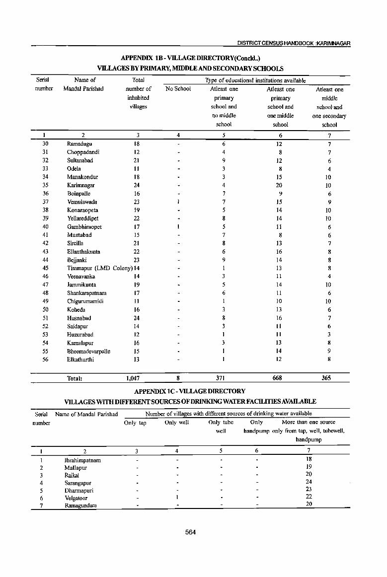
DISTRICT CENSUS HANDBOOK :KARIMNAGAR
APPENDIX 1B - VILLAGE DIRECTORY(Concld .. )
VILLAGES BY PRIMARY, MIDDLE AND SECONDARY SCHOOLS
Serial Name of Total Type of educational institutions available number Mandai Parishad number of NoSehool Atleast one Atleast one Atleast one
inhabited primary primary middle villages school and school and school and
no middle one middle one secondary school school school
2 3 4 5 6 7 30 Rarnadugu 18 6 12 7 31 Choppadandi 12 4 8 7 32 Sultanabad 21 9 12 6 33 Odela 11 3 8 4 34 Manakondur 18 3 15 10 35 Karimnagar 24 4 20 10 36 Boinpalle 16 7 9 6 37 Vemulawada 23 7 15 9 38 Konaraopeta 19 5 14 10 39 YeUareddipet 22 8 14 lO 40 Gambhiraopet 17 5 11 6 41 Mustabad 15 7 8 6 42 Sircilla 21 8 I3 7 43 Ellanthakunta 22 6 16 8 44 Belianki 23 9 14 8 45 Timmapur (LMD Colony) 14 I3 8 46 Veenavanka 14 3 11 4 47 Jammikunta 19 5 14 10 48 Shankarapatnam 17 6 11 6 49 Chigurumamidi 11 I 10 10
50 Koheda 16 3 I3 6 51 Husnabad 24 8 16 7 52 Saidapur 14 3 II 6 53 Huzurabad 12 11 3 54 Kamalapur 16 3 I3 8
55 Bheemadevarpalle 15 14 9 56 E1kathurthi I3 12 8
Total: 1,047 8 371 668 365
APPENDIX lC- VILLAGEDIRECIORY
VILLAGES WITH DIFFERENT SOURCES OF DRINKING WATER FACILITIES AV.AILABLE
Serial Name of Mandai Parishad Number ofviIlages with different sources of drinking water available
number Only tap Only well Only tube Only More than one source
well handpump only from tap, well, tubewell,
handpump
2 3 4 5 6 7
1 Ibrahimpatnam 18 2 Mallapur 19 3 Raikal 20 4 Sarangapur 24 5 Dharmapuri 23 6 Velgatoor 22 7 Rarnagundam 20
564
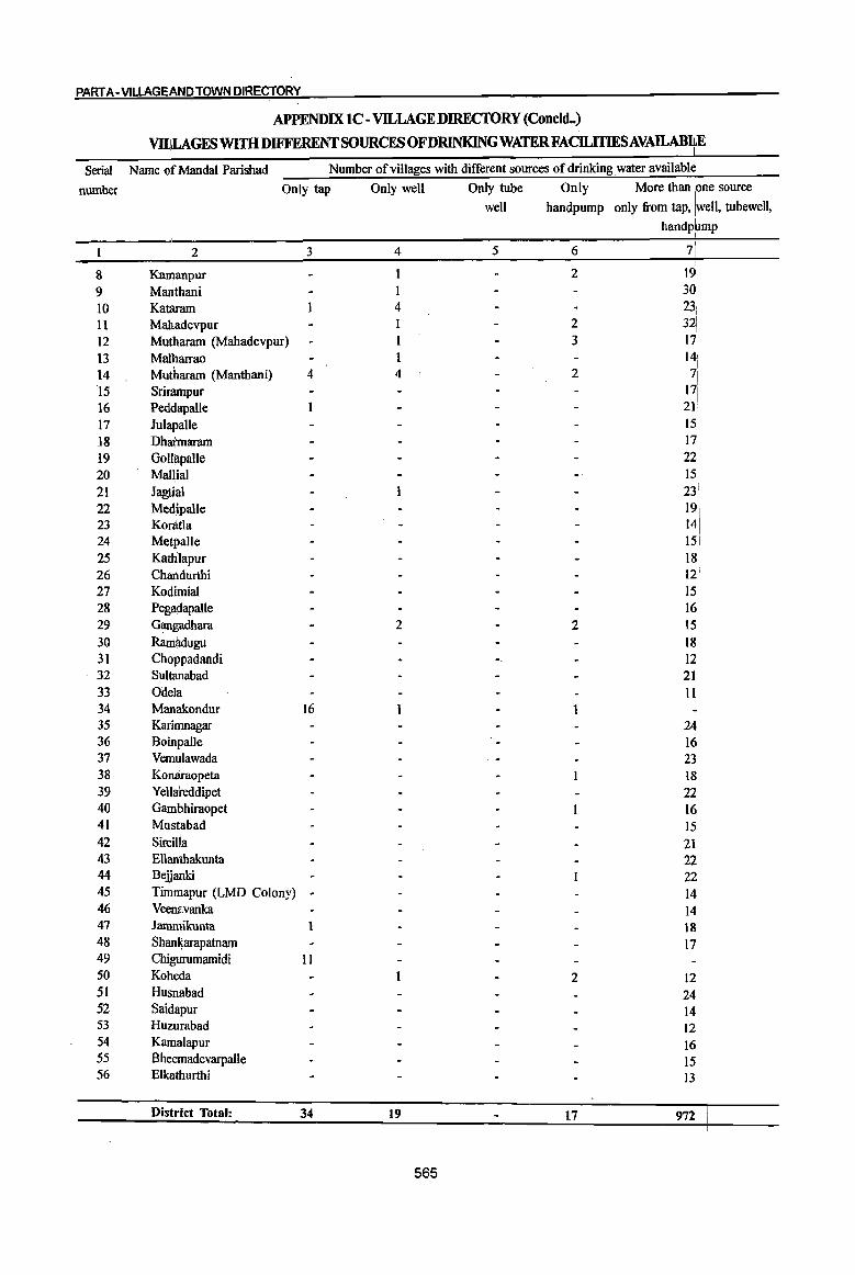
PART A -VlLLAGEAND TOWN DIRECTORY
APPENDIX IC -VILLAGE DIRECTORY (ConcldH)
vmLAGESWI1HDIFFERENTSOURCESOFDRINKINGWATERFACILlTIESAVAllABIf
Serial Name of MandaI Parishad Number of villages with different sources of drinking water availablJ
number Only tap Only well Only tube Only More than lone source
well handpump only from tap, [well, tubewell,
handp~mp
I 2 3 4 5 6 7':
8 Ka~anpur 1 2 19 9 Manthani I 30 10 Kataram 4 23: 11 Mahadevpur 2 321
12 Mutharam (Mahadevpur) 3 171 13 Malharrao 141
!
14 Mutharam (Mantbani) 4 4 2 I~i 15 Srirampur
16 Peddapalle 1 21 17 Julapalle 15!
18 Dhatmaram 17 19 GollapaUe 22 20 MaHiai 15 21 Jagtial 23: 22 Medlpalle 19\ 23 Koratla 14, 24 Metpalle 151 25 Katlilapur 18 26 Chartdurthi 121 27 KOdlmial 15 28 Pegadapalle 16 29 Gangadhara 2 2 15 30 Rami;ldugu 18 31 Choppadandi 12 32 Sultanabad 21 33 Odela II 34 Manakondur 16 1 1 35 Karimnagar 24 36 Boinpalle 16 37 Vemulawada 23 38 Konaraopeta 18 39 Yellateddipet 22 40 Gam~hiraopet 16 41 Mustabad 15 42 SircilKa 21 43 Ellanthakunta 22 44 Bejjanki 22 45 Timmapur (LMD Colony) ~ 14 46 Veenavanka 14 47 Jamniikunta 1 18 48 Shani(arapatnam 17 49 Chigurumamidi II 50 Koheda 2 12 51 Husnabad 24 52 Saidapur 14 53 Huzurabad 12 54 Kamalapur 16 55 Bheemadevarpalle 15 56 Elkathurthi 13
District Total: 34 19 17 972
565
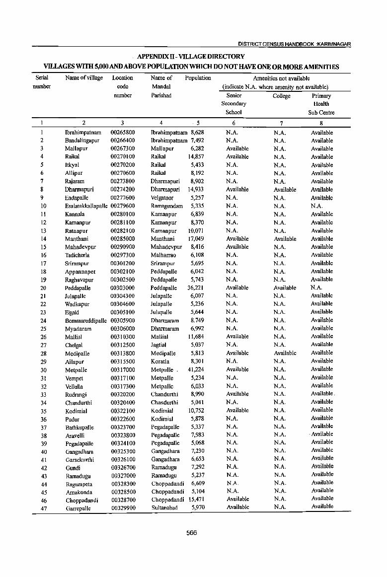
DISTRICT CENSUS HANDBOOK :KARIMNAGAR
APPENDIXll - vnLAGE DIRECfORY
VILLAGES WITH 5,000 AND ABOVE POPULATION WHICH DO NOT HAVE ONE OR MORE AMENITIES
Serial Name of village Location Name of Population Amenities not available nll.llllber code Mandai (indicate N.A. where amenity not available)
number Parishad Senior College Primary Secondary Health
School Sub Centre
2 3 4 ·5 6 7 8 Ibrahimpatnam 00265800 Ibrahimpatnam 8,628 N.A. N.A. Available
2 Bandalingapur 00266400 Ibrahimpatnam 7,492 N.A. N.A. Available 3 MaIlapur 00267300 Mallapur 6,282 Available N.A. Available 4 RaikaI 00270100 Raikal 14,857 Available N.A. Available 5 Itkyal 00270200 Raikal 5,433 N.A. N.A. Available 6 Allipur 00270600 Raikal 8,192 N.A. N.A. Available 7 Rajaram 00273800 Dharmapuri 8,902 N.A. N.A. Available 8 Dhannapuri 00274200 Dharmapuri 14,933 Available Available Available 9 EndapaIle 00277600 Velgatoor 5,257 N.A. N.A. Available 10 Esalatakkallapalle 00279600 Ramagundam 5,335 N.A. N.A. N.A. II KannaIa 00280100 Kamanpur 6,839 N.A. N.A. Available 12 Kamanpur 00281100 Kamanpur 8,370 N.A. N.A. Available 13 Ratnapur 00282100 Kamanpur 10,071 N.A. N.A. Available 14 Manthani 00285000 Manthani 17,049 Available Available Available 15 Mahadevpur 00290900 Mahadevpur 8,416 Available N.A. Available 16 Tadicherla 00297300 Malharrao 6,108 N.A. N.A. Available 17 Srirampur 00301200 Srirampur 5,695 N.A. N.A. Available 18 Appannapet 00302100 Peddapalle 6,042 N.A. N.A. Available
19 Raghavapur 00302500 Peddapalle 5,743 N.A. N.A. Available
20 PeddapaUe 00303000 Peddapalle 36,221 Available Available N.A.
21 Julapalle 00304300 Julapalle 6,007 N.A. N.A. Available
22 Wadkapur 00304600 Julapalle 5,236 N.A. N.A. Available
23 Elgaid 00305100 Julapalle 5,644 N.A. N.A. Available
24 Bommareddipalle 00305900 Dharmaram 8,749 N.A. N.A. Available
25 Myadaram 00306000 Dharmaram 6,992 N.A. N.A. Available
26 Mallial 00310300 Mallial 1l,684 Available N.A. Available
27 Chelgal 00312500 Jagtial 5,037 N.A. N.A. Available
28 MedipaUe 00313800 Medipalle 5,813 Available Available Available
29 Ailapur 00315500 Koratla 8,301 N.A. N.A. Available
30 Metpalle 00317000 Metpalle _ 41,224 Available N.A. Available
31 Vempet 00317100 Metpalle 5,234 N.A. N.A. Available
32 Vellulla 00317300 Metpalle 6,033 N.A. N.A. Available
33 Rudrangi 00320200 Chandurthi 8,990 Available N.A. Available.
34 Chandurthi 00320400 Chandurthi 5,041 N.A. N.A. Available
35 Kodimial 00322100 Kodimial 10,752 Available N.A. Available
36 Pudur 00322600 Kodimial 5,878 N.A. N.A. Available
37 Balhkepalle 00323700 Pegadapalle 5,337 N.A. N.A. Available
38 Aravelli 00323800 Pegadapalle 7,983 N.A. N.A. ,Available
39 Pegadapalle 00324100 Pegadapalle 5,068 N.A. N.A. Available
40 Gangadhara 00325300 Gangadhara 7,230 N.A. N.A. Available
41 Garsekurthi 00326100 Gangadhara 6,653 N.A. N.A. Available
42 Gundi 00326700 Ramadugu 7,292 N.A. N.A. Available
43 Ramadugu 00327000 Ramadugu 5,237 N.A. N.A. Available
44 Ragampeta 00328300 Choppadandi 6,609 N.A. N.A. Available
45 Arnakonda 00328500 Choppadandi 5,104 N.A. N.A. Available
46 Choppadandi 00328700 Choppadandi 15,471 Available N.A. Available
47 GarrepaUe 00329900 Sultanabad 5,970 Available N.A. Available
566
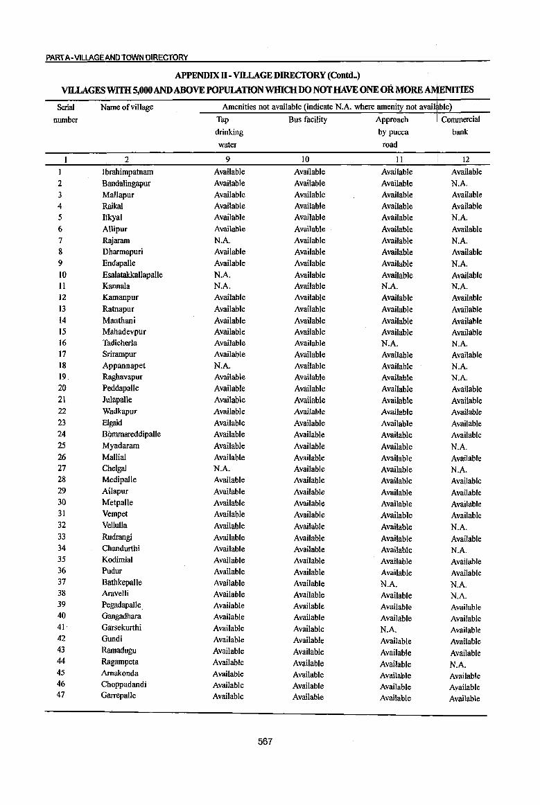
PARTA-VILLAGE AND TOWN DIRECTORY
APPENDIX n -VllLAGE DIREcroRY (Connl-)
VILLAGES WITH 5,000 AND ABOVE POPULATIONWIllCHDO NOT HAVE ONE OR MORE AMENITIES I
Serial Name of village Amenities not available (indicate N.A. where amenity not avail~ble) number Tap Bus facility Approach I Commercial
I
drinking by pucca bank
water road
2 9 10 II 12
Ibrahimpatnam Available Available Available Available 2 Bandalingapur Available Available Available N.A. 3 Mallapur Available Available Available Available 4 Raikal Available Available Available Available 5 Itkyal Available Available Available N.A. 6 Allipur Available Available Available Available 7 Rajararn NA Available Available N.A. 8 Dharmapuri Available Available Available Available 9 Endapalle Available Available Available N.A. 10 Esalatakkallapalle N.A. Available Available Available II Kannala N.A. Available N.A. N.A. 12 Kamanpur Available Available Available Available 13 Ratnapur Available Available Available Available 14 Manthani Available Available Available Available 15 Mahadevpur Available Available Available Available 16 Tadicherla Available Available N.A. N.A. 17 Srirarnpur Available Available Available Available 18 Appannapet N.A. Available Available N.A. 19. Raghavapur Available Available Available N.A. 20 PeddapaUe Available Available Available Available 21 JulapaUe Available Available Available Available 22 Wadkapur Available Available Available Available 23 Elgaid Available Available Available Available 24 Bommareddipalle Available Available Available Available 25 Myadaram Available Available Available N.A. 26 Mallial Available Available Available Available 27 Chelgal N.A. Available Available N.A. 28 Medipalle Available Available Available Available 29 Ailapur Available Available Available Available 30 Metpalle Available Available Available Available 31 Vempet Available Available Available Available 32 VeIluUa Available Available Available N.A. 33 Rudrangi Available Available Available Available 34 Chandurthi Available Available Available N.A. 35 Kodimial Available Available Available Available 36 Pudur Available Available Available Available 37 Batbkepalle Available Available N.A. N.A. 38 Aravelli Available Available Available N.A. 39 Pegadapalle. Available Available Available Available 40 Gangadhara Available Available Available Available 41 Garsekurthi Available Available N.A. Available 42 Gundi Available Available Available Available 43 Ramadugu Available Available Available Available 44 Ragampeta Available Available Available N.A. 45 Arnakonda Available Available Available Available 46 Choppadandi Available Available Available Available 47 Garrepalle Available Available Available Available
567
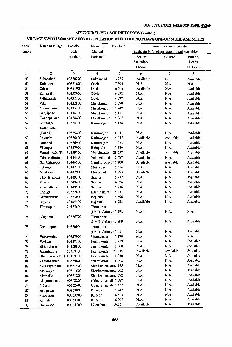
DISTRICT CENSUS HANDBOOK :KARIMNAGAR
APPENDIX II - VILLAGE DIRECfORY (Conttq
VILLAGES WITH 5,000 AND ABOVE POPULATION WIllCU 00 NOT HAVE ONE OR MORE AMENITIES
Serial Name ofvillage Location Name of Population Amenities not available
number code MandaI ~indicate N.A. where ameni~ not availabJe~
number Parishad Senior College Primary Secondary Health
School Sub Centre
1 2 3 4 5 6 7 8
48 Sultanabad 00330300 Sultana bad 12,786 Available N.A. Available 49 Kolanoor 00331600 Odela 7,390 N.A. N.A. N.A. 50 Odela 00331900 Odela 6,606 Available N.A. Available 51 Kangarthi 00332000 Odela 6,092 N.A. N.A. Available
52 Pathkapalle 00332200 Odela 6,278 N.A. N.A. Available
53 Veldi 00332800 Manakondur 5,770 N.A. N.A. Available 54 Manakondur 00333700 Manakondur 12,249 N.A. N.A. Available
55 GangipaUe 00334300 Manakondur 5,lIl N.A. N.A. Available
56 Kondapalkala 00334400 Manakondur 5,767 NA N.A. Available 57 Asifuagar 00334700 Karimnagar 5,118 N.A. N.A. Available
58 Kothapalle
(Haveli) 00335200 Karimnagar 10,614 N.A. N.A. Available
59 Rekurthi 00336400 Karimnagar 5,047 Available Available Available
60 Ourshed 00336900 Karimnagar 5,522 N.A. N.A. Available
61 Vilasagar 00337900 Boinpalle 7,680 N.A. N.A. Available
62 Vemulawada (R) 00339800 Vemulawada 29,758 Available Available Available
63 Yellareddipeta 00344400 Yellareddipet 8,487 Available N.A. Available
64 Gambhiraopet 00346200 Gambhiraopet 11,208 Available Available Available
65 PothugaJ 00347700 Mustabad 5,614 NA N.A. Available
66 Mustabad 00347900 Mustabad 8,293 Available N.A. Available
67 Cheerlavancha 00349300 Sircilla 5,277 N.A. N.A. Available
68 Thadur 00349400 Sircilla 6,326 N.A. N.A. Available
69 Thangallapalle 00349500 Sircilla 5,736 N.A. N.A. Available
70 Repaka 00352800 Ellanthakunta 5,257 NA N.A. Available
71 Gannervaram 00353000 Beiianki 5,396 N.A. N.A. Available
72 Beiianki 00354400 Beiianki 6,988 Available N.A. Available
73 Timmapur 00355600 Timmapur
(LMO Colony) 7,292 N.A. N.A. N.A.
74 Alugunur 00355700 Timmapur
(LMO Colony) 5,899 N.A. N.A. Available
75 Nustulapur 00356000 Timmapur
(LMO Colony) 7,4II NA N.A. Available
76 Veenavanka 00357900 Veenavanka 7,179 N.A. N.A. N.A.
77 VavilaIa 00358500 lammikunta 5,919 N.A. N.A. Available
78 Bijigirsharief 00358800 lammikunta 5,060 NA N.A. Available
79 Iammikunta 00359100 lammikunta 27,335 Available Available Available
80 Oharmaram (P.B) 00359200 lammikunta 10,030 N.A. N.A. Available
81 Ellanthakunta 00359600 lammikunta 6,008 N.A. N.A. Available
82 Kesavapatnam 00361400 Shankarapatnam5,995 N.A. N.A. Available
83 Molangur 00361600 Shankarapatnam 5,262 N.A. N.A. Available
84 Metpalle 00361800 Shankarapatnam 5,592 N.A. N.A. Available
85 Chigurumamidi 00362200 Chigurumamidi 7,387 NA N.A. Available
86 Indurthi 00362600 Chigurumamidi 7,437 NA N.A. Available
87 Sanigaram 00363000 Koheda 5,242 N.A. N.A. Available
88 Baswapur 00363200 Koheda 6,428 N.A. N.A. Available
89 Koheda 00364400 Koheda 6,907 N.A. N.A. Available
90 Husnabad 00364700 Husnabad 19,251 Available N.A. Available
568
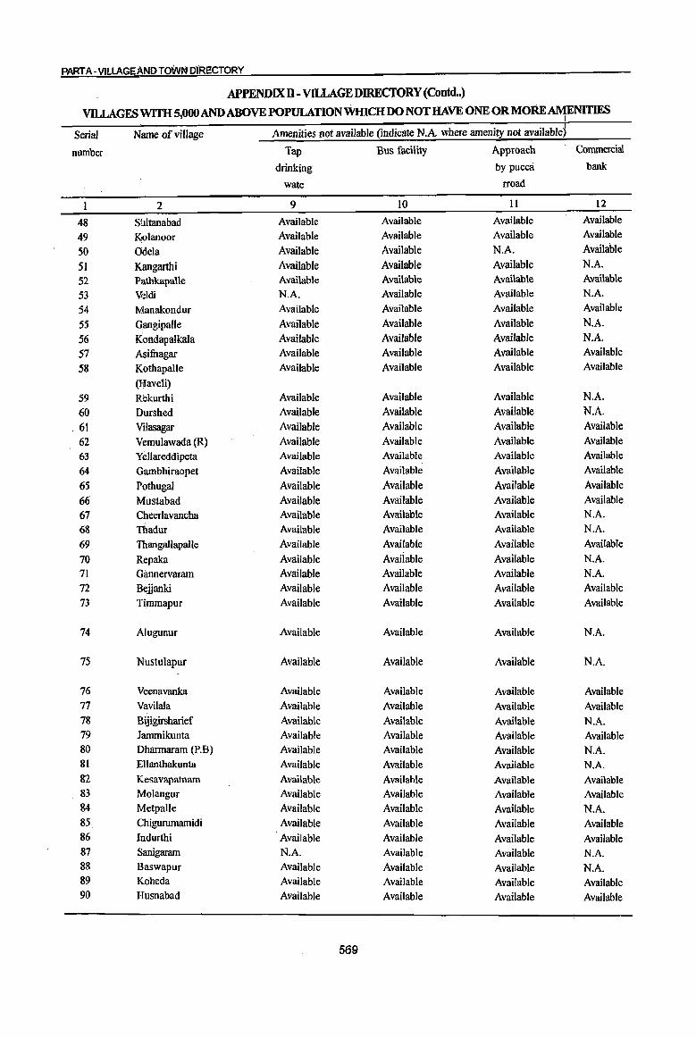
PART A- VILLAGE AND TOWN DIRECTORY
APPENDIXll - VlLLAGE DIRECfORY (Contd .. )
VllLAGES WITH 5,000 AND ABOVE POPULATIONWIllCHDO NOT HAVE ONE ORMORE~NITIES
Serial Name of village Amenities not available (indicate N.A where amenity not available)
number Tap Bus facility Approach Commercial
drinking by pucca bank
wate rroad
1 2 9 10 11 12
48 SiIltanabad Available Available Available Available
49 Kcolanoor Available Available Available Available
50 Odela Available Available NA Available
51 J<:angarthi Available Available Available N.A.
52 Pathkapalle Available Available Available Available
53 Veldi N.A. Available Available N.A.
54 Manakondur Available Available Available Available
55 Qangipalle Available Available Available N.A.
56 Kondapalkala Available Available Available N.A.
57 ASifuagar Available Available Available Available
58 Kothapalle Available Available Available Available
(Haveli) 59 Rekurthi Available Available Available N.A.
60 Durshed Available Available Available N.A.
, 61 Vilasagar Available Available Available Available
62 Vemulawada (R) Available Available Available Available
63 YeJlareddipeta Available Available Available Availabie
64 Gambhiraopet Available Available Available Available
65 Pothugal Available Available Available Available
66 Mustabad Available Available Available Available
67 Cheerlavancha Available Available Available N.A.
68 Thadur Available Available Available N.A.
69 ThangaUapaile Available Available Available Available
70 Repaka Available Available Available N.A. 71 Gi.u1nervaram Available Available Available N.A. 72 B<ijjanki Available Available Available Available 73 Timmapur Available Available Available Available
74 Alugunur Available Available Available N.A.
75 Nustulapur Available Available Available N.A.
76 Veenavanka Available Available Available Available 77 Vavilala Available Available Available Available 78 B~iigirsharief Available Available Available N.A. 79 Jai:nmikunta Available Available Available Available 80 Dharmaram (P.B) Available Available Available N.A. 81 Ellanthakunta Available Available Available N.A. 82 Kesavapatnam Available Available Available Available 83 Mblangur Available Available Available Available 84 Metpalle Available Available Available N.A. 85 Chigurumamidi Available Available Available Available 86 Indurthi Available Available Available Available 87 Sanigaram N.A. Available Available N.A. 88 Baswapur Available Available Available N.A. 89 Kdheda Available Available Available Available 90 Husnabad Available Available Available Available
569

DISTRICT CENSUS HANDBOOK :KARIMNAGAR
APPENDIX n -VILLAGE DIRECTORY (Contd •• ) VILLAGES WITH 5,000 AND ABOVE POPULATIONWlllCH DO NOT HAVE ONE OR MORE AMENITIES
Serial Name of village Location Name of Population Amenities not available number code Mandal (indicate N.A. where amenity not available)
number Parishad Senior College Primary Secondary Health
School Sub Centre
2 3 4 5 6 7 8 91 Akunur 00367900 Saidapur 5,521 N.A. N.A. Available 92 Chelpur 00368700 Huzurabad 7,266 N.A N.A. Available 93 Huzurabad 00368900 Huzurabad 35,580 Available Available Available 94 Sanigaram 00370100 Kamalapur 5,535 N.A N.A. Available 95 Kamalapur 00370300 Kamalapur 10,593 Available N.A Available 96 Uppal 00370400 Kamalapur 6,475 N.A N.A. Available 97 Ambala 00370800 Kamalapur 5,929 N.A N.A. Available 98 Vangara 00371200 Bheemadevarpalle5,891 N.A N.A. Available 99 Mulkanoor 00371800 Bheemadevarpalle8,521 Available N.A Available 100 Damera 00373000 Elkathurthi 5,352 N.A N.A. Available 101 Elkathurthi 00373100 Elkathurthi 5,605 N.A N.A. Available
APPENDIX II - VILLAGE DIRECfORY (Concld •• )
VILLAGES WITH 5,000 AND ABOVE POPULATIONWlllCHDO NOT HAVE ONE OR MORE AMENITIES
Serial Name of village Amenities not available (indicate N.A. where amenity not available)
number Tap Bus facility Approach Commercial drinking by pucca bank
water road
2 9 10 II 12
91 Akunur Available Available Available N.A. 92 Chelpur Available Available Available N.A 93 Huzurabad Available Available Available Available 94 Sanigaram Available Available Available N.A. 95 Kamalapur Available Available Available Available 96 Uppal Available Available Available Available
97 Ambala . Available Available Available N.A .
98 Vangara Available Available Available Available
99 Mulkanoor Available Available Available Available
100 Damera Available Available N.A. N.A.
101 Elkathurthi Available Available Available Available
APPENDIX llA -CENSUS TOWNS
CENSUS TOWNS WInCH DO NOT HAVE ONE OR MORE AMENITIES
Serial Name of census town Location Name of Population Amenities not available
number code Mandai (indicate N.A. where amenity amenity not available)
number Parishad Senior College Health Secondary School Centre
2 3 4 5 6 7 8
1 Palakurthy 40302000 Ramagundam 6,967 N.A N.A N.A
2 Jallaram 40303000 Kamanpur 11,010 N.A N.A N.A.
570

PART A-VILLAGE AND TOWN DIRECTORY
APPENDIX llA - CENSUS TOWNS (Concld •. )
CENSUS TOWNS wmCHDO NOT HAVE ONE OR MORE AMENITIES
Serial
number
1 2
Name of census town
2
Palakurthy Jallaram
Amenities not available (indicate N.A. where amenity not ayailable)
Tap Bus facility Approach I Banks
drinking water by pucca road
9 10 11 I 12
Available Available Available I Available Available Available Available Available
APPENDIX m-VllLAGEDIRECTORY
LAm> UTnJSATION DATAIN RESPECT OF CENSUS TOWNSINON-MUNIClPALTOwNS SI. Name of Census Town
No. and Mandai Parishad Total area
within brackets
2 3
Palakurthy (Ramagundam) 1,293
2 Jallaram (Kamanpur) 2,363
Land use (i.e. area under different types of land use in hectare)
Forest Irrigated Un-irrigated Coltorable I Area not
by source waste (including available
4
70.82
5
T: 68.79
(GC- 28.69) (TK- 28.00)
(W-12.10 )
T: 78.00
(TWE) 78.00
6
327.78
22.00
gaucbar &
groves)
7
348.02
for culti
vation
8
477.59
APPENDIX IV - VILLAGE DIREcroRY
MANDALPARlSHAD-WISELISTOFINHABITEDVlLLAGESWHERENOAMENITYOTHERTHANIDRINKING WATER FACILITY ISAVAILABLE
SI.No. Name of MandaI Parishad Location code number Name of the village
1 2 3 I
4 1 Ibrahimpatnam
NJI 2 MaUapur 1
Nil 3 Raikal
Nil 4 Sarangapur I
Nil 5 Dharmapuri
Ni 6 Velgatoor
Ni 7 Rarnagundam
Ni 8 Kamanpur
NJ 9 Manthani I
10 Kataram Nil
Ni) II Mahadevpur
Nil 12 Mutharam (Mahadevpur)
Nil
571
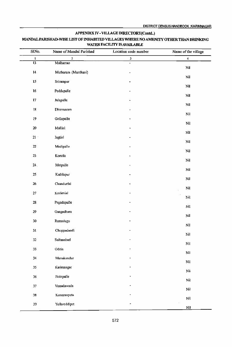
DISTRICT CENSUS HANDBOOK :KARIMNAGAR
APPENDIX IV - VILLAGE DIRECfORY(Contd •. )
MANDALPARISHAD-WISE LIST OF INHABITED VILLAGES WHERE NO AMENITY OTHER THAN DRINKING WATER FACILITY ISAVAILABLE
SI.No. Name of MandaI Parishad Location code number Name of the village
I 2 3 4 13 Malharrao
Nil 14 Mutharam (Manthani)
Nil 15 Srirampur
Nil 16 Peddapalle
Nil 17 Julapalle
Nil 18 Dharmaram
Nil 19 Gollapalle
Nil 20 Mallial
Nil 21 Jagtial
Nil 22 MedipaJle
Nil 23 Koratla
Nil 24 Metpalle
Nil 25 Kathlapur
Nil 26 Chandurthi
Nil 27 Kodimial
Nil
28 Pegadapalle Nil
29 Gangadhara Nil
30 Ramadugu Nil
31 Choppadandi Nil
32 Sultanabad Nil
33 Odela Nil
34 Manakondur Nil
35 Karimnagar Nil
36 Boinpalle Nil
37 Vemulawada Nil
38 Konaraopeta Nil
39 Yellareddipet Nil
572
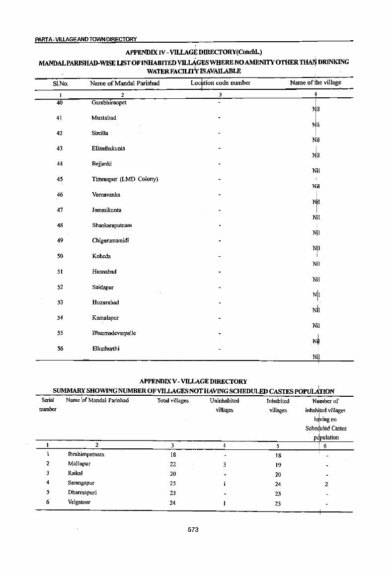
PART A- VILLAGE AND TOWN DIRECTORY
APPENDIXN - VlLLAGEDIRECfORY(CoiJcld..)
MANDALPAlUSHAD-WISE UST OF INHABITED VILI1GESWHERE NO AMENITY OTHER ~DRINKlNG WATERFAC1Ll1Y AVAILABLE
SI.No. Name of MandaI Parishad Loc tion code nwnber Name of~e village
I 2 3
40 Gambhiraopet
41 Mustabad
42 Sircilla
43 Ellanthakunta
44 Bejjanki
45 Timmapur (LMD Colony)
46 Veenavanka
47 lammikunta
48 Shankarapatnam
49 Chigurumamidi
50 Koheda
51 Husnabad
52 Saidapur NI
53 Huzurabad N,i
54 Kamalapur
55 Bheemadevarpalle
56 Elkathurthi
APPENDIXV - VILLAGE DIRECTORY
SUMMARY SHOWING NUMBER OF VILLAGES NOT HAVlNG SCHEDULED CASTES POPmATION , ,
Serial Name 'of Mandai Parishad Total villages Uninhabited Inhabited N1mberof number villages villages inhabited villages
t no
S~he uJed ~astes p pulatIOn
2 3 4 5 6 1 Ibrahimpatnam 18 18 2 MaUapur 22 3 19 3 Raikal 20 20 4 Sarangapur 25 24 2 5 Dharmapuri 23 23 6 Velgatoor 24 23
573
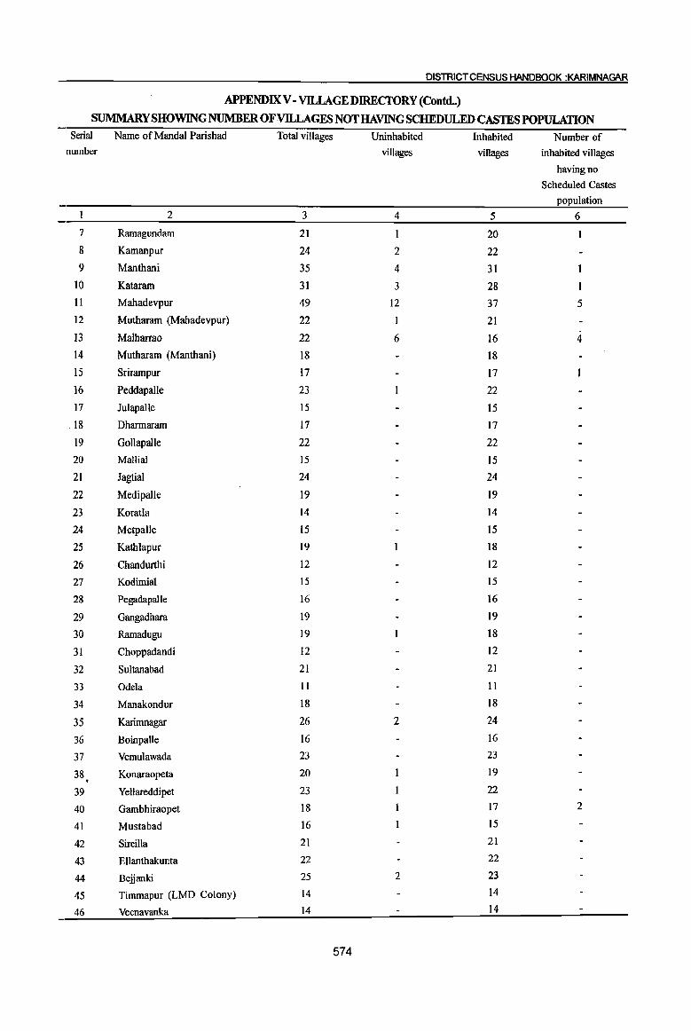
DISTRICT CENSUS HANDBOOK :KARIMNAGAR
APPENDIX V - VILLAGE DIRECfORY (Contd..)
SUMMARY SHOWING NUMBER OF VILLAGES NOT HAVING SCHEDULED CASTES POPULATION Serial Name of Mandai Parishad Total villages Uninhabited Inhabited Number of
number villages villages inhabited villages
having no
Scheduled Castes population
2 3 4 5 6
7 Ramagundam 21 1 20
8 Kamanpur 24 2 22 9 Manthani 35 4 31
10 Kataram 31 3 28 11 Mahadevpur 49 12 37 5 12 Mutharam (Mahadevpur) 22 1 21
13 Malharrao 22 6 16 4 14 Mutharam (Manthani) 18 18
15 Srirampur 17 17
16 Peddapalle 23 22
17 JulapaUe 15 15
. 18 Dharmaram 17 17
19 GoliapaIJe 22 22
20 Mallial 15 15
21 Jagtial 24 24
22 MedipaIle 19 19
23 Koratla 14 14
24 Metpalle 15 15
25 Kathlapur 19 18
26 Chandurthi 12 12
27 Kodimial 15 15
28 Pegadapalle 16 16
29 Gangadhara 19 19
30 Ramadugu 19 18
31 Choppadandi 12 12
32 Sultanabad 21 21
33 Odela 11 11
34 Manakondur 18 18
35 Karimnagar 26 2 24
36 Boinpalle 16 16
37 Vemulawada 23 23
38 Konaraopeta 20 19 . 39 Yellareddipet 23 22
40 Gambhiraopet 18 17 2
41 Mustabad 16 15
42 Sircilla 21 21
43 Ellanthakunta 22 22
44 Bejjanki 25 2 23
45 Timmapur (LMD Colony) 14 14
46 Veenavanka 14 14
574
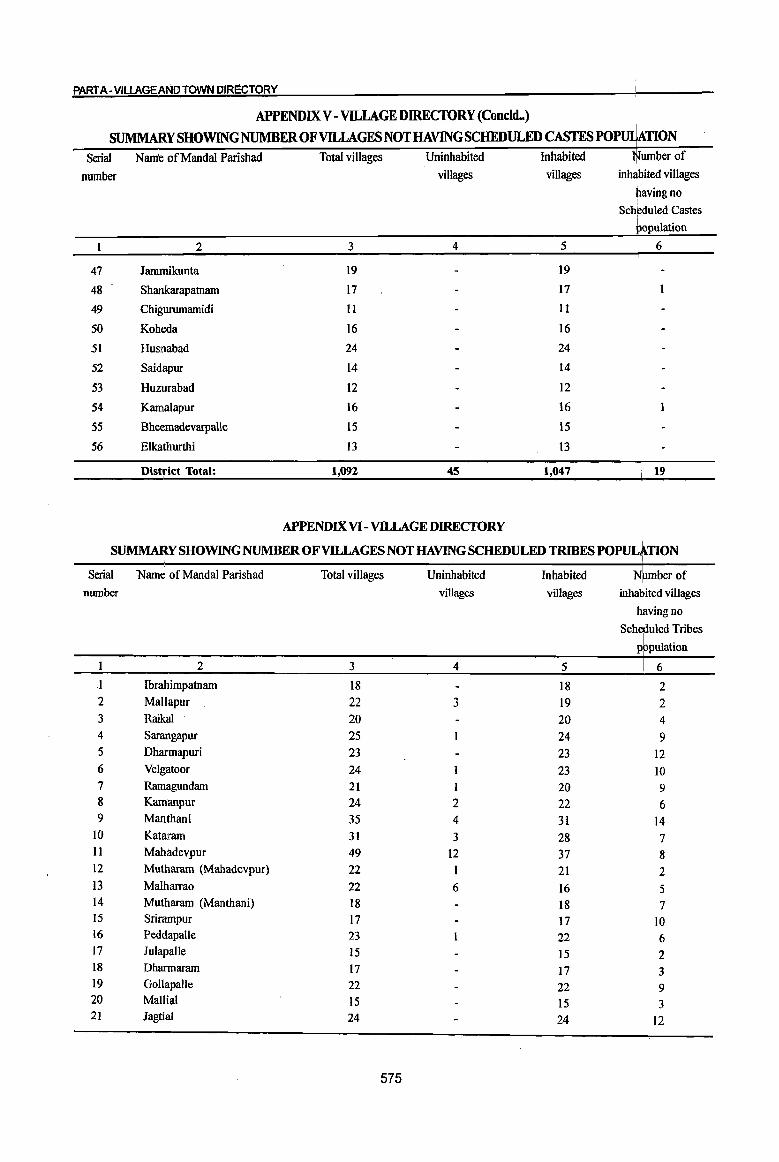
PART A-VILLAGEANDTOWN DIRECTORY
APPENDIX V - VILLAGE DIRECfORY (Concld..)
SUMMARY SHOWING NUMBEROFVILLAGESNOTHAVINGSCHEDULEDCASTESPOP~TION .
2 3 4 5 6
47 lammikunta 19 19
48 Shankarapatnarn 17 17
49 Chigurumamidi II 11
50 Koheda 16 16
51 Husnabad 24 24
52 Saidapur 14 14
53 Huzurabad 12 12
54 Kamalapur 16 16
55 Bheemadevarpa!le 15 15
56 Elkathurthi 13 13
District Total: 1,092 45 1,047 19
APPENDIX VI - VllLAGE DIRECTORY
SUMMAItYSHOWINGNUMBER OF VILLAGES NOT HAVING SCHEDULED TRIBES POPULATION
Serial Name of Manda! Parishad Total villages Uninhabited Inhabited N mberof number villages villages inhJited villages
h~vjngno SCherUled Tribes
population
1 2 3 4 5 6
I Ibrahimpatnarn 18 18 2 2 MaUapur 22 3 19 2 3 Raikal 20 20 4 4 Sarangapur 25 24 9 5 Dharmapuri 23 23 12 6 Velgatoor 24 23 10 7 Ramagundam 21 I 20 9 8 Kamanpur 24 2 22 6 9 Manthani 35 4 31 14
IO Kataram 31 3 28 7 11 Mahadevpur 49 12 37 8 12 Mutharam (Mahadevpur) 22 I 21 2 13 Malharrao 22 6 16 5 14 Muthararn (Manthani) 18 18 7 15 Srirarnpur 17 17 10 16 Peddapalle 23 22 6 17 luiapalle 15 15 2 18 Dharmararn 17 17 3 19 Gollapalle 22 22 9 20 Mallia! 15 15 3 21 lagtial 24 24 12
I
575

DISTRICT CENSUS HANDBOOK :KARIMNAGAR
APPENDIX VI ~ vnLAGE DIRECfORY(Concld.)
~YSHO~GNUMBEROFVILLAGESNOTHAVffiGSCHEDULED~ESPOPULATION
Serial Name of Mandai Parishad number
22 Medipalle 23 Koratla 24 Metpalle 25 Kathlapur 26 Chandurthi 27 Kodimial 28 Pegadapalle 29 Gangadhara 30 Ramadugu 31 Choppadandi 32 Sultanabad 33 Odela 34 Manakondur 35 Karimnagar 36 Boinpalle 37 Vemulawada 38 Konaraopeta 39 Yellareddipet 40 Gambhiraopet 41 Mustabad 42 Sircilla 43 Ellanthakunta 44 Bejjanki 45 Tirnrnapur (LMD Colony) 46 Veenavanka 47 larnrnikunta 48 Shankarapatnam 49 Chigurumarnidi 50 Koheda 51 Husnabad
52 Saidapur 53 Huzurabad 54 KamaJapur
55 BheernadevarpaUe 56 Elkathurthi
District Total:
Total villages
19 14 15 19 12 l5 16 19 19 12 21 II 18 26 16 23 20 23 18 16 21 22 25 14 14 19 17 II 16 24 14 12 16 15 13
1,092
576
Uninhabited
villages
2
2
45
Inhabited
villages
19 14 15 18 12 15 16 19 18 12 21 II 18 24 16 23 19 22 17 15 21 22 23 14 14 19 17 II 16 24 14 12 16 15 13
1,047
Number of inhabited villages
having no Scheduled Tribes
4 5 3 4 3 5 4 8 8 3
II
2 to 8 9
15 8 6 6 6 4 6 3
3 9
2 2 6
309
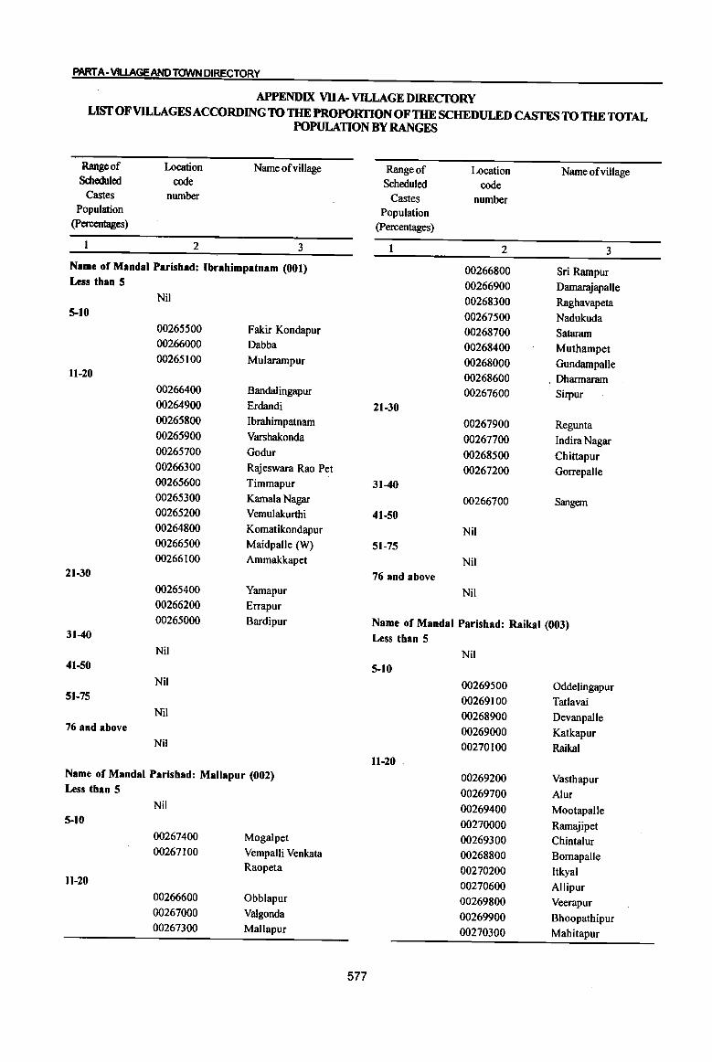
PART A· VlUAGEAND TOWN DIRECTORY
APPENDIX VDA· VILLAGE DIRECIORY LIST OF VILLAGES ACCORDING TO THE PROPORTION OF THE SCHEDULED CASTES TO THE TOTAL
POPULATION BY RANGES
Range of Location Name of village Range of Location Name ofvillage Scheduled code Scheduled code
Castes number Castes number Population Population
(percentages) (Percentages)
I 2 3 2 3 Name of MandaI Parishad: Ibrahimpatnam (001) 00266800 Sri Rampur Less than 5 00266900 Damarajapalle
Nil 00268300 Raghavapeta 5-10 00267500 Nadukuda
00265500 Fakir Kondapur 00268700 Sataram 00266000 Dabba 00268400 Muthampet 00265100 Mularampur 00268000 Gundampalle
11-20 00268600 . Dharmaram 00266400 8andalingapur 00267600 Sirpur 00264900 Erdandi 21-30 00265800 Ibrahimpatnam 00267900 Regunta 00265900 Varshakonda 00267700 Indira Nagar 00265700 Godur 00268500 Chittapur 00266300 Rajeswara Rao Pet 00267200 Gorrepalle 00265600 Timmapur 31-40 00265300 Kamala Nagar 00266700 Sangem 00265200 Vemulakurthi 41-50 00264800 Komatikondapur Nil 00266500 Maidpalle (W) 51-75 00266100 Ammakkapet Nil
21-30 76 and above 00265400 Yamapur Nil 00266200 Errapur 00265000 Bardipur Name of MandaI Parishad: Raikal (003)
31-40 Less than 5 Nil Nil
41-50 5-10 Nil 00269500 Oddelingapur
51-75 00269100 Tatlavai Nil 00268900 Devanpalle
76 and above 00269000 Katkapur Nil 00270100 Raikal
11-20 . Name of MandaI Parishad: Mallapur (002) 00269200 Vasthapur Less than 5 00269700 Alur
Nil 00269400 Mootapalle 5-10 00270000 Ramajipet
00267400 Mogalpet 00269300 Chintalur 00267100 Vempalli Venkata 00268800 Bornapalle
Raopeta 00270200 Itkyal 11-20 00270600 Allipur
00266600 Obblapur 00269800 Veerapur 00267000 Valgonda 00269900 Bhoopathipur 00267300 Mallapur 00270300 Mahitapur
577
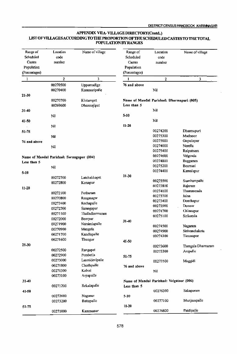
DISTRICT CENSUS HANDBOOK :KARIMNAGAR
APPENDIX VUA-VILLAGEDIRECfORY(Contd.) LIST OF VILLAGES ACCORDING TO THE PROPORTION OF THE SCHEDULED CASTES TO THE TOTAL
POPULATION BY RANGES
Range of Location Name of village Range of Location Name of village Scheduled code Scheduled code
Castes number Castes number Population Population
(percentages) (Percentages)
1 2 3 1 2 3
00270500 Uppumadige 76 and above 00270400 Kurnmaripalle Nil
21l-30 00270700 Kistampet Name of Mandai Parisbad: Dbarmapuri (005) 00269600 Dharmajipet Less than 5
31l-40 Nil
Nil 5-10 41l-50 Nil
Nil 11-20
511-75 00274200 Dharmapuri
Nil 00275300 Madnoor
7ci and above 00275000 Gopulapur
Nil 00274000 Nerella 00275400 Raipatnam
Name of Mandai Parisbad: Sarangapur (004) 00274600 Velgonda
Less than 5 00274800 Buggaram
Nil 00275200 Beersani
5··10 00274400 Kamalapur
00272700 Latchakkapet 21-30
00272800 Konapur 002,75500 StambampaIle
111-20 00273800 Rajaram
00272100 Potharam 00274100 ThumrnenaIa
00270800 Rangasagar 00273700 Jaina
00272400 Rechapalle 00273400 Donthapur 00273900 Donoor
00272200 Sarangapur 00274700 Chinnapur
00271100 Thalladharmaram 00275100 Sirikonda
00272000 Beerpur 31-40
00271900 Narsimlapalle 00274500 Nagaram 00270900 Mangela 00274900 S irivanchakota 00271700 Kandlapalle 00274300 Timmapur 0027]600 Thungur 41-50
21-30 00273600 Theegala Dharmaram 00272500 Rangapet 00273300 Arepalle 00272900 Pembetla 51-75 00273000 LaxmidevipaIle 00273500 Maggidi 00271800 Cherlapalle 76 and above 00271300 Kolvai Nil 00273100 Arpapalle
31-40 Name of Mandai Parishad: Velgatoor (006) 00271200 RekulapaIle Less than 5
41-50 00276300 Sakapuram
00272600 Nagunur 5-10 00273200 Battapalle 00277100 MunjampaJle
51-75 11-20 00271000 Kammunur 00276800 Paidipalle
578
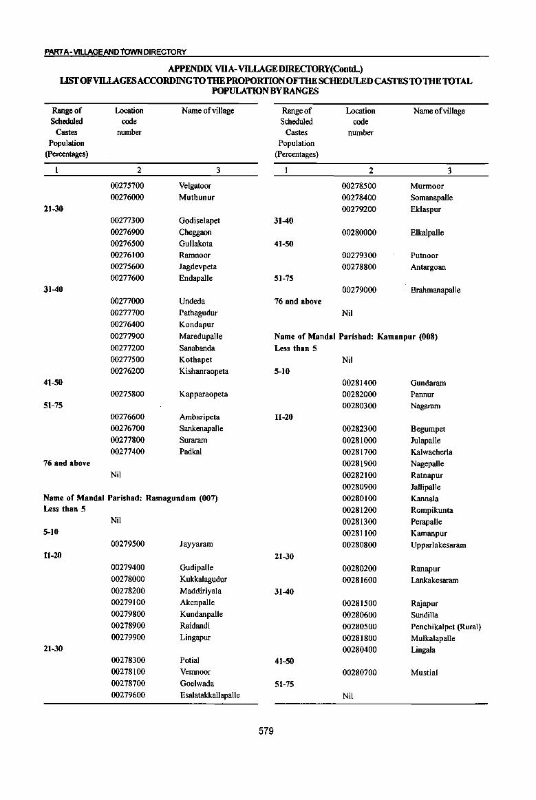
PARrA-VlUAGEANOTOWN DIRECTORY
APPENDIX VDA-VILLAGEDIRECfORY(Contd..) LlSfOFVILLAGFSACCORDINGTOTHE PROPORTION OFTHE SCHEDULED CASfES TO THE TOTAL
POPULATION BYRANGFS
Range of Location Name of village Range of Location Name ofvillage Scheduled code Scheduled code
Castes number Castes number Population Population
(percentages) (Percentages)
2 3 2 3
00275700 Velgatoor 00278500 Murmoor 00276000 Muthunur 00278400 Somanapalle
21-30 00279200 Eklaspur 00277300 Godiselapet 31-40
00276900 Cheggaon 00280000 Elkalpalle 00276500 Gullakota 41-50 00276100 Ramnoor 00279300 Putnoor 00275600 Jagdevpeta 00278800 Antargoan 00277600 Endapalle 51-75
31-40 00279000 Brahmanapalle 00277000 Undeda 76 and above 00277700 Pathagudur Nil
00276400 Kondapur
00277900 Maredupalle Name of MandaI Parishad: Kamanpur (008)
00277200 Sanabanda Less than 5 00277500 Kothapet Nil 00276200 Kishanraopeta 5-10
41-50 00281400 Gundaram 00275800 Kapparaopeta 00282000 Pannur
51-75 00280300 Nagaram 00276600 Ambaripeta H-20 00276700 Sankenapalle 00282300 Begumpet 00277800 Suraram 00281000 Julapalle 00277400 Padkal 00281700 Kalwacherla
76 and above 00281900 Nagepalle Nil 00282100 Ratnapur
00280900 Jallipalle Name of Mandai Parishad: Ramagundam (007) 00280100 Kannala Less than 5 00281200 Rompikunta
Nil 00281300 Perapalle 5-10 00281100 Kamanpur
00279500 Jayyaram 00280800 Upparlakesaram 11-20 21-30
00279400 Gudipalle 00280200 Ranapur 00278000 Kukkalagudur 00281600 Lankakesaram 00278200 Maddiriyala 31-40 00279100 Akenpalle 00281500 Rajapur 00279800 Kundanpalle 00280600 Sundilla 00278900 Raidandi 00280500 Penchikalpet (Rural) 00279900 Lingapur 00281800 Mulkalapalle
21-30 00280400 Lingala 00278300 Potial 41-50 00278100 Vemnoor 00280700 Mustial 00278700 Goelwada 51-75 00279600 Esalatakkallapalle Nil
579
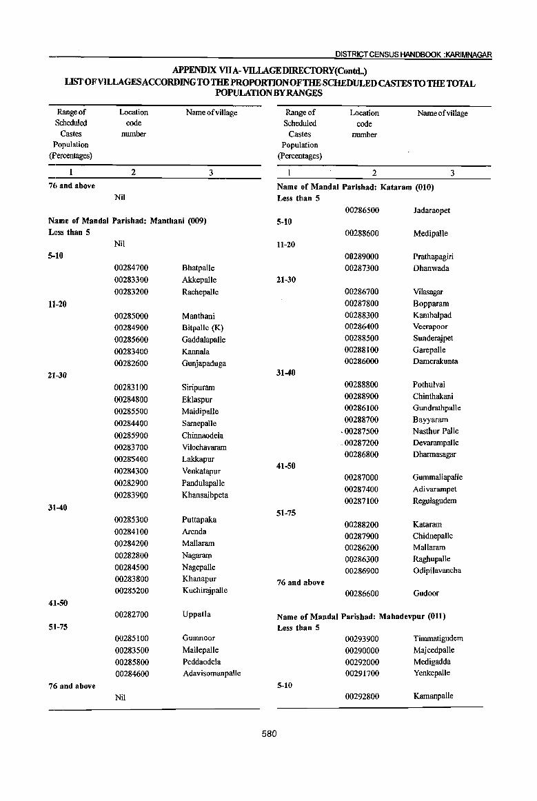
DISTRICT CENSUS HANDBOOK :KARIMNAGAR
APPENDIX VllA-VILLAGE DIRECfORY(Contd..) LffiT OFVllLAGESACCORDING TO THE PROPORTIONOFTHE SCHEDULED CASTES TO THE TOTAL
POPULATION BY RANGES
Range of Location Name ofvillage Range of Location Name ofvillage Scheduled code Scheduled code
Castes number Castes number Population Population
(percentages) (percentages)
2 3 2 3
7ti and above Name of Mandai Parishad: Kataram (010) Nil Less than 5
00286500 Jadaraopet Name of Mandai Parishad: Manthani (009) 5-10 Lt~SS than 5 00288600 Medipalle
Nil 11-20
5-10 00289000 Prathapagiri
00284700 Bhatpalle 00287300 Dhanwada
00283300 Akkepalle 21-30
00283200 Rachepalle 00286700 Vilasagar
11-20 00287800 Bopparam
00285000 Manthani 00288300 Kambalpad
00284900 Bitpalle (K) 00286400 Veerapoor
00285600 Gaddalapalle 00288500 Sunderajpet
00283400 Kannala 00288100 Garepalle
00282600 Gunjapaduga 00286000 Damerakunta
21-30 31-40
00283100 Siripuram 00288800 Pothulvai
00284800 Eklaspur 00288900 Chinthakani
00285500 Maidipalle 00286100 Gundrathpalle
00284400 Sarnepalle 00288700 Bayyaram
00285900 Chinnaodela ,00287500 Nasthur Palle
00283700 Vilochavaram .00287200 Devarampalle
0028'5400 Lakkapur 00286800 Dharmasagar
41-50 00284300 Venkatapur
00287000 Gummallapalle 00282900 Pandulapalle
00287400 Adivarampet 00283900 Khansaibpeta
00287100 Regulagudem 31l-40
51-75 00285300 Puttapaka
00288200 Kataram 00284100 Arenda
00287900 Chidnepalle 00284200 Mallaram 00286200 Mallaram 00282800 Nagaram 00286300 Raghupalle 00284500 Nagepalle 00286900 Odipilavancha 00283800 Khanapur 76 and above 00285200 Kuchirajpalle 00286600 Gudoor
41-50
00282700 Uppatla Name of Mandai Parishad: Mahadevpur (011) 51-75 Less than 5
00285100 Gumnoor 00293900 Timmatigudem
00283500 Mallepalle 00290000 Majeedpalle
00285800 Peddaodela 00292000 Medigadda
00284600 AdavisomanpaUe 00291700 Yenkepalle
7,6 and above 5-10
Nil 00292800 Kamanpalle
580

PART A .. VlLLAGEAND TOl/r,lNOIRECTORY
. APPENDIX VDA-VILLA~EDIREcroRY(Contd..) • If • I
LISTOFVH..LAGESACCORDINGTO 11IE PROPORTION OF THE SCHEDULED CASTES TO THE TOTAL , ". ,1 I
PQPULATIO~BYRANGES
Range of Location Name of village Rangeof. Location Name ~fVillage Scheduled code Scheduled code
Castes number Castes number
Population Population
(percentages) (Percentages)
2 3 2 31
00293400 Burgugudem 00294300 Korlakhnta
00293300 Dainmur 00295800 ~dt 00290900 Mahadevpur 21-30
00291600 Rapallekota 00295300 Pegdapl Ie U-20 00294500 Jeelapalle
00291300 Beglur 002940()() MUlu1paue 00292100 Ambatpalle 31-40 00290300 Metpalle 00295900 Stambhampalle (p.K.) 00289700 Kuntlam 00294600 Nimmakudem 00292300 Lenkalagadda 00294400 Madhatam
21-30 00294800 Muthllliam 00292200 Peddampet (Maha~eVpur) 00293800 Muknur 00294100 , Polaram 00291100 Bommapur
I 41-50
00293500 NeeIampalle 00295400 Yetnar," 00291900 Suraram 51-75
. 00290100 Kaleswaram 00294700 Yamanpalle 00289600 Palgula 00294900 Vajnep~le
31-40 76 and above 00289200 Annaram 00294200 Stamb~ampalle (PP) 00291000 Brahmanpalle
00291200 Elkeswaram Name of Mandai Parishad: Malharrao (013) 00289400 Nagepalle I
Less than 5 41-50 . Nil
00292900 Paltnela 5-10 00292500 Pankena
00298000 I
51-75 Pedda 1boondla
11-20 00293000 Sarvaipet i
00298300 Mallampalle 00290500 Kudurpalle
00296900 Dubba~attu 00289500 Muddulapalle
00297700 Ansanp~lIe 76 and above
00290600 Edapalle 00297600 NacharJrn
Rudradm 00289300 ChlndrapaUe
00296500
00297300 Tadiche~la Name of Mandai Parishad: Mutharam(Mahadevpur) (012)
00296300 KondaJpet
Less than 5 21-30
00296000 Gandikamaram 00297200 Mallaram
5-10 31-40
00295000 Nallagunta 00296400 YedlapaJle I
(Meenajipeta) 00297100 Chinna Ifhoondla
00295100 Regula Gudem 41-50
00295200 Borlagudem 00296200 VaIlamId.nta I
11-20 51-75
00295500 SingampaIle Nil
00296100 Singaram 76 and above
00295700 Kankunoor Nil
581

DISTRICT CENSUS HANDBOOK :KARIMNAGAR
APPENDIX VllA-VILLAGE DIRECTORY LIST OF VILLAGES ACCORDING TO THE PROPORTION OF THE SCHEDULED CASTES TO THE TOTAL
POPULATION BY RANGES
Range of Location Name ofvillage Range of Location Name ofviJIage Scheduled code Scheduled code
Castes number Castes number Population Population
(percentages) (Percentages)
2 3 2 3
Name of Mandai Parishad: Mutharam (Manthani) (014) 00301700 Mirzampet Less tban 5 21-30
Nil 00300400 Vennampalle 5-10 00300700 Kunaram
00299400 Sarvaram 00301300 Rathupalle 00299100 Matchupeta 00301800 Kistampet 00298500 Ladnapur 00301100 Pandilla 00299600 Kesanapalle 00300600 Edulapuram
11-20 00301600 Mallial 00299200 Sukravarampeta 00301400 MotJapalle 00300100 Adavisrirampur 00301500 Tharupalle
00300000 Odedu 31-40
00299300 Lakkararn Nil
00299800 Mutharam 41-50
00298800 Kharnmampalle Nil
00299500 Potharam 51-75 00298900 Dharyapur Nil
00299900 Shatharajpalle 76 and above
00299000 Mydambanda Nil
00298700 IppaJapalIe
00298600 Budhavarampeta @ Name of Mandai Parishad: Peddapalle (016) Ramaiahpalle Less than 5
21-30 Nil 00298400 Adivarampeta 5-10
311-40 00303600 Cheekurai
00299700 Parupalle 11-20
41-50 00303000 Peddapalle
Nil 00303500 Rampalle
51-75 00302600 Rangapur
Nil 00303400 RangampalJe
76 and above 00304100 Maredugonda
Nil 00302700 Sabitham
00302400 Brahmanpalle(Ps)
Name of MandaI Parishad: Srirampur (015) 00302500 Raghavapur
Less than 5 00302000 Turkalamaddi Kunta
Nil 00302100 Appannapet
5··10 00303900 Bhojannapet
Nil 00302900 Gowreddipeta
11-20 00302200 Kanagarthi
00300900 Gangararn 21-30
00300500 Jafarkhanpet 00303700 Peddabonkur
00300800 Pegadapalle 00302300 Ragineedu
00300200 Madipalle 00303800 Kothapalle
00300300 Mangapet 00303100 Nittur
00301200 Srirampur 00303300 Peddakalvala
582
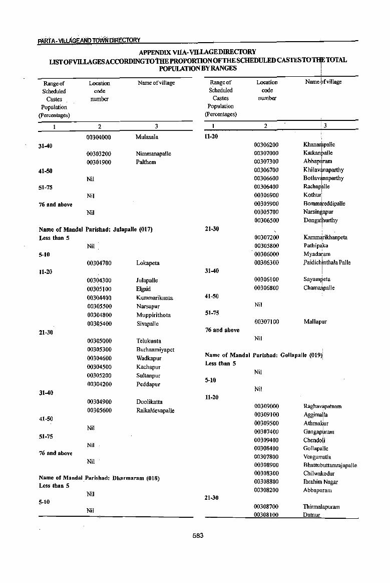
PARt A-VILLAGE AND TO\iIIN [jIRECiORY ~ I
APPENDIX VllA-VDLAGEDIRECfORY I
L~OFvnLAGESACCORDINGTOtHEPROPORTIONOFTHESCHEDULEDC~TOTHETOTAL POPULATION BY RANGES !
Range of Scheduled
Castes Population
(percentages)
31-40
41-50
51-75
76 and above
Location code
number
2
00304000
00303200 00301900
Nil
Nil
Nil
Name ofvillage
3
Mulasala
Nimmanapalle
Palthem
Name of Mandai Parishad: Julapalle (017) Less than 5
5-10
11-20
21-30
31-40
41-50
51-75
76 and above
Nil
00304700
00304300 00305100 00304400 00305500 00304800 003Q5400
00305000 00305300 00304600 00304500 00305200 00304200
00304900 00305600
Nil
Nil
Nil
Lokapeta
Julapalle
Elgaid
Kummariklluta
Narsapur
Muppirithota
Sivapalle
Telukunta
Burhanmiyapet
Wadkapur
Kachapur
Sultanpur
Peddapur
Doolikatta
Raikaldevapalle
Name of Mandai Parishad: Dharmaram (018) Less than 5
Nil 5-10
Nil
583
Range of Scheduled
Castes Population
(percentages)
11-20
21-30
31-40
41-50
51-75
76 and l,lbove
Location code
number
2
00306200 00307000 00307300 00306700 00306600 00306400 00306900 00305900 00305700 00306500
00307200 00305800 00306000 00306300
00306100 00306800
Nil
00307100
Nil
i Name ~fvillage
I
Kbanrunpalle
Katkan~alle I Abbapuram
KhilavLtaparthy I Botlavanaparthy
Rachap~le Kothur!
Bomm¥eddipalle Narsingapur
Donga¥urthy I
Kamm¥ikhanpeta Pathipaka
Myadaram I
Paidichinthala Palle . I I
SayamReta
Chamru1paUe
Mallapur
, Name of Mandai Parishad: Gollapalle (019)'
Less than 5 '
Nil 5-10
11-20
21-30
Nil
00309000 00309100 00309500 00307400 00309400 00308400 00307800 00308900 00308300 00308800 00308200
00308700 00308100
Raghavapatnam
Aggimalla Athma~ur
I Gangap\lram I
Chendoli Gollapalle
Vengumatla
Bhattubuttamrajapalle
Chilwakodur
Ibrahim Nagar
Abbaputam
Thirmalapuram
Datnur .
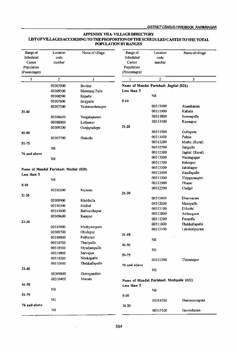
DISTRICT CENSUS HANDBOOK :KARIMNAGAR
APPENDIX VllA-VllLAGE DIREcroRY LIST OF VILLAGES ACCORDING TO THE PROPORTION OF THE SCHEDULED CASTES TO THE TOTAL
POPULATION BY RANGES
Range of Location Name ofvillage Range of Location Name ofvillage Scheduled code Scheduled code
Castes number Castes number Population Population
(percentages) (Percentages)
2 3 2 3
00307900 Bonkur Name of Mandai Parisbad: Jagtial (021)
00309300 Bheemraj Palle Less than 5
00308500 Rapalle Nil
00307600 Israjpalle 5-10
00307500 Yeshwanthraopet 00312000 Anantharam
31-40 00311900 KaIleda
00308600 Vengalapuram 00311800 Somanpalle
00308000 Lothunur 00311100 Kannapur
00309200 Gunjapadugu 11-20
4ft-50 00311500 Gullapeta
00307700 Shakalla 00311400 Polasa
511-75 00313200 Mothe (Rural)
Nil 00312700 Tatipalle
76 and above 00312300 Jagtial (Rural)
Nil 00313000 Narsingapur
00311700 Habsipur
Name of Mandai Parishad: Mallial (020) 00313300 Jabithapur
Less than 5 00312400 KandlapaUe
Nil 00311300 Thippannapet
5-10 00312900 Dharur
00310100 Rajaram 00312500 Chelgal
1]-20 21-30
00309900 Maddutla 00313400 Dhannaram
00310300 Mallial 00312600 Morapalle
00311000 Balwanthapur 00313100 Eldurthi
00312800 Anthargaon 00309600 Rampur
00311200 Porandla 21-30
00311600 Thakkallapalle 00310900 Muthyampeta
00312100 Lakshmipuram 00309700 Obulapur
31-40 00310000 Potharam
Nil 00310700 Thatipalle
41-50 00310500 Myadampalle
Nil 00310800 Sarvapur
51-75 00310200 Nookapalle 00312200 Thimmapur 00310600 Thakkallapalle 76 and above
31-40 Nil 00309800 Gorregundam
00310400 Manala Name of Mandai Parishad: Medipalle (022) 41-50 Less than 5
Nil Nil 51-75 5-10
Nil 00314200 Dammannapeta 76 and above 11-20
Nil 00315100 Govindaram
584
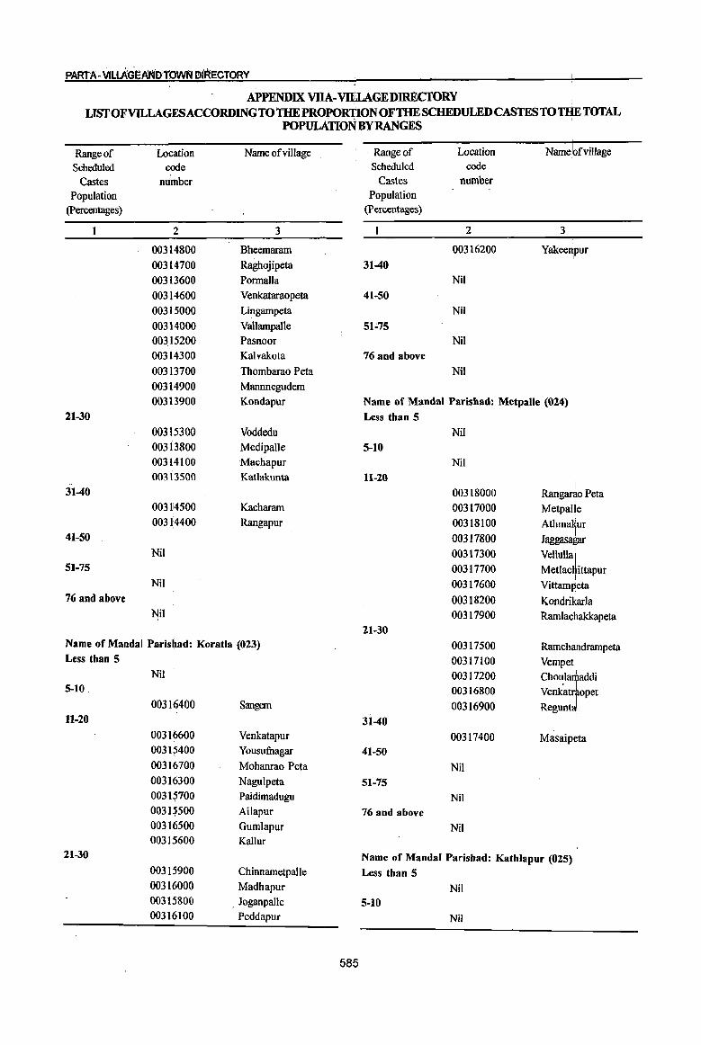
PAltrA -Vllt.AGEAf~iDrOWFJ DIRECTORY
APPENDIX VIlA-VlELAGEDIIU«;roRY I
. LIST OFVILLAGESACCORDING TO THE PROPORTION OF THE SCHEDULED CASTES TO THE TOTAL POPULATION BY RANGES I
Range of Location Name ofvillage Range of Location Name!bfvillage Scheduled code Scheduled code
Castes nUmber Castes number Population Population
(percentages) (Percentages)
2 3 2 3
00314800 Bheemaram 00316200 I Yakee~pur
00314700 RagJtojipeta 31-40 00313600 Pormalla Nil 00314600 Venkataraopeta 41-50 00315000 Lingampeta Nil 00314000 Vallampalle 51-75 00315200 Pasnoor Nil 00314300 Kalvakota 76 and above 00313700 Thombarao Peta Nil 00314900 Mannnegudem 00313900 Kondapur Name of Mandai Parisbad: Metpalle (024)
21-30 Less than 5 00315300 Voddedu Nil 00313800 Medipalle 5-10 00314100 Macbapur Nil 00313500 Katlakunta 11-20 .. ! 31-40 00318000 Rangarao Peta 0031!4500 Kacharam 00317000 MetpaJ!e 00314400 Rangapur 00318100 Athmakur
41-50 00317800 Jaggasa~ar Nil 00317300 vellUllaJ
51-75 00317700 Metlac ! ittapur Nil 00317600 Vittampeta
76 and above 00318200 Kondrikarla Nil 00317900 Ramlachakkapeta
21-30 Name of MandaI Paris~ad: Koratla (023) 00317500 Ramchandrampeta Less than 5 00317100 Vempet·
Nil 00317200 Choularitaddi 5-10 00316800
. I Venkatraopet
00316400 Sangem 00316900 ReguntJ 11-20 31-40
00316600 Venkatapur 00317400 Masaipeta 00315400 Yousufuagar 41-50 00316700 Mohanmo Peta Nil 00316300 Nagulpeta 51-75 00315700 Paidimadugu Nil 00315500 Ailapur 76 and above 00316500 Gumlapur Nil 00315600 Kallur
21-30 Name of MandaI Parishad: Kathlapur (025) 00315900 Chinnametpalle Less than 5 00316000 Madhapur Nil 00315800 _ Joganpaile 5-10 00316100 Peddapur Nil
585

DISTRICT CENSUS HANDBOOK :KARIMNAGAR
APPENDIX VllA-VILLAGE DIRECfORY LIST OF VILLAGES ACCORDING TO THE PROPORTION OF THE SCHEDULED CASTES TO THE TOTAL
POPULATION BY RANGES
Range of Location Name ofviJIage Range of Location Name of village Scheduled code Scheduled code
Castes number Castes number Population Population
(percentages) (Percentages)
2 3 2 3
11-20 00321300 Moodepalle 00319200 Chinthakunta 00320400 Chandurthi 00319400 Posanipeta 00320900 Lingampeta
00318300 Sirkonda 31-40
00319700 Ippapalle Nil
00318500 Bommena 41-50
00318800 Kathlapur Nil
00319600 Thandriyal 51-75
00319800 Potharam Nil
00320000 Ambaripet 76 and above
00320100 Thurthi Nil
00319500 Gambhirpur
00318900 Peggerla Name of MandaI Parishad: Kodimial (027)
00319900 Kalikota Less than 5
00318400 Thakkallapalle Nil
00319000 Ootpalle 5-10
2n-30 Nil
00319300 Dumpeta 11-20
pothar~ 00319100 Bhushanrao Peta 00321600
00318600 Dulur 00321400 Surampeta
3]1-40 00322600 Pudur I 00322300 Nallagbnda Nil 'I 00322500 Cheppial
41-50 00321500 Kona~ur Nil 00322400 Thipptipalle
51-75 21-30
I I
Nil I
00322200 Kondapur 76 and above ' 1
00322000 Nachupalle Nil
00321900 Ramsagar
00321700 Thi~alapur Name of MandaI Parishad: Chandurthi (026) 00322100 Kodirriial Less than 5 I
00322800 Namillkonda Nil 00322700 Goura{>ur
5·10 31-40 00320600 Ananthapalle(PK)
00321800 Sanivarampeta 11-20
41-50 00320800 Jogapuram
Nil 00320200 Rudrangi
51-75 00320700 Marrigadda Nil 00321000 Sangtiia 76 and above 00321200 Yangal Nil
21-30 00320500 Thimmapuram(PN) Name of MandaI Parishad: Pegadapalle (028) 00321100 Bandapalle Less than 5 00320300 Mallial Nil
586

fiART A-VILLAGEAND towN DIRECtdlW
APPENDIX VlIA-VILLAGE DIRECfORY LISTOFVll..LAGESACCORDINGTOTHE PROPORTION OF THE SCBEDULED CASTES TO 'QIE TOTAL
POPULATION BYRANGES I
Range of Location Name of village Range of Location Namd ofvi11age I
Scheduled code Scheduled code
Castes number Castes number,
Population Population
(percentages) (Percentages)
2 3 2 3
5-10 00325000 Narasimhulapalle
Nil 00325400 I Narfyanpur
11-20 00324600 Ryalapalle
00324000 Nandagiri 00326200 Achampalle
00323000 Thinnalapuram 00325300 Gankadhara
00323600 Vengalaipet 00325100 S~areddipalle 00323700 Bathkepalle 31-40 00323100 Laxmipur 00325500 Islampur
00323800 Aravelli 00326300 Vaddyaram
00324200 Keesulatapalle 41~50
00323500 Nancherla Nil
00323900 Aithupalle 51-75
00323400 Yellapur Nil
21-30 76 and above
00324100 Pegadapalle Nil
00324400 Narsimhunipeta
00372900 Lingapur Name of Mandai Parishad: Ramadugu (030)
00324300 Namapur LeSs than 5
00323300 Legalamarri Nil
31-40 5-10
00323200 Devikonda Nil 41-50 11-20
I
Nil 00326900 Dathpjipet I
51-75 00327000 Ramadugu Nil 00326400 Thi~alapur
76 and above 00328200 Vannaram Nil 00328100 Kokkerakunta
00327100 Shanagar <Name of Mandai Parishad: Gangadhara (029) 21-30 Less than 5 00327600 Mottle
00325900 Nayalakonda Palle 00327500 I Rudraram 5-10 00328000 Deshtajpalle
Nil 00327900 Velichal 11-20 00326700 Gund,
00326100 Garsekurthi 00327700 Kistapur 00325700 Uppara Mallial 00327800 Vedira I
00324900 Burgupalle 00326600 Chippakurthi 00324700 Kachireddipalle 31-40 00324500 Venkataipalle 00326800 Laksqmipur 00324800 Kondaipalle 00327300 Gopalraopet 00325200 Nagireddipur 00327400 Koratpalle 00325800 Kurikial 41-50 00325600 Mallapur 00326500 Sri~ulapalle
21-30 51-75 003260eO Gattuboothkur Nil
587
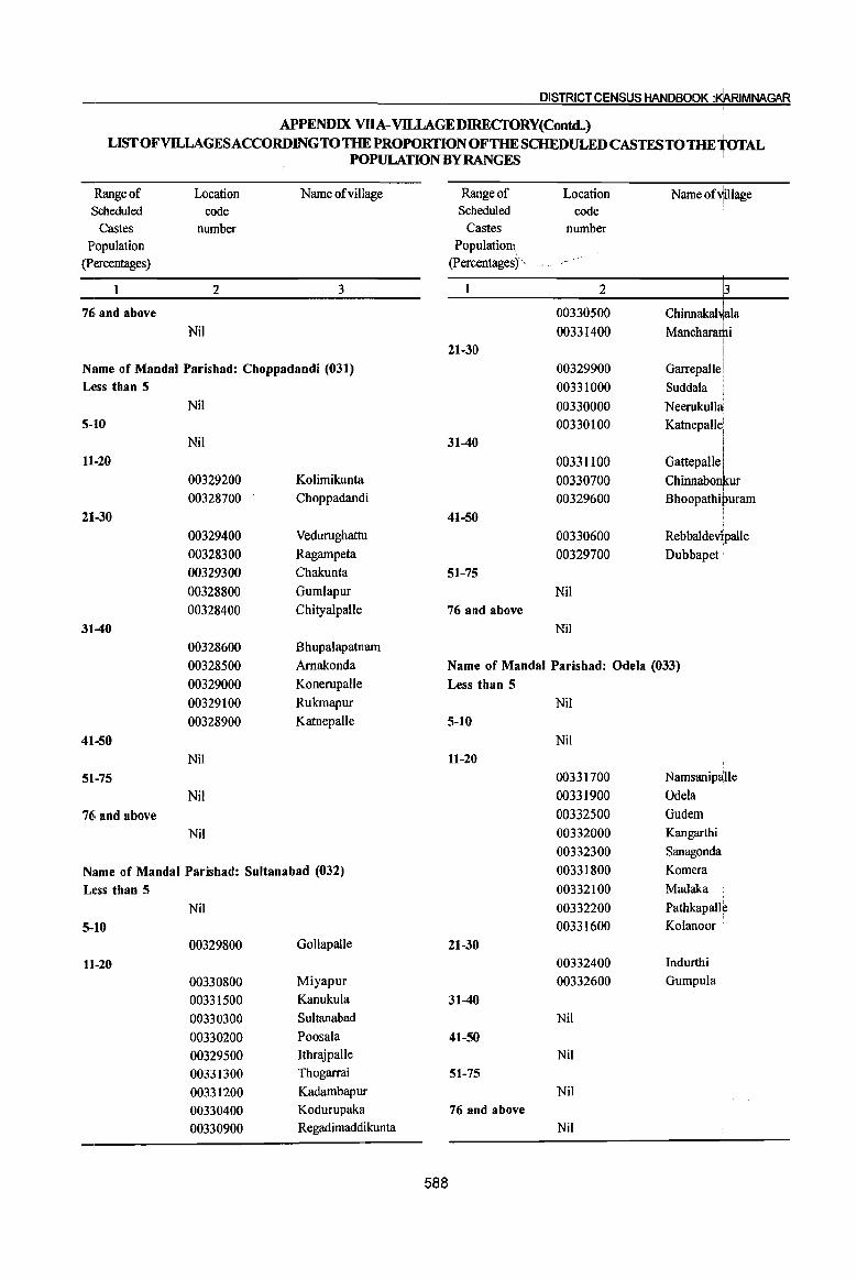
DISTRlCTCENSUS HANDBOOK :$RIMNAGAR
APPENDIX VllA-VILLAGE DIRECfORY(Contd..)
UST OFVlLLAGESACCORDINGTO THE PROPORTION OF THE SCHEDULED CASTESTOTHEioTAL . POPULATION BY RANGES
Range of Location Name ofvillage Range of Location Name of~iIIage Scheduled code Scheduled code i
Castes number Castes number Population Populatio~\
(percentages) (percentages)"
2 3 2 3
76, and above 00330500 Chinnakal~ala Nil 00331400 Mancharathi
I 21-30 !
Name of Mandai Parishad: Choppadandi (031) 00329900 Garrepalle! Less than 5 00331000 SuddaIa
Nil 00330000 Neerukulla 5-10 00330100 Katnepall~
Nil 31-40 i 11-20 00331100 GattepaUe I
00329200 Kolimikunta 00330700 Chinnabonfrur 00328700 Choppadandi 00329600 Bhoopathilmram
21-30 41-50 I
00329400 Vedurughattu 00330600 Rebbaldevlpalle
00328300 Ragampeta 00329700 Dubbapet·
00329300 Chakunta 51-75
00328800 Gumlapur Nil
00328400 Chityalpalle 76 and above
31-40 Nil
00328600 Bhupalapatnam
00328500 Arnakonda Name of Mandai Parishad: Odela (033)
00329000 KonerupaUe Less than 5
00329100 Rukmapur Nil
00328900 Katnepalle 5-10
41-50 Nil
Nil 11-20
51-75 00331700 Namsanip~lle Nil 00331900 Odela
76 and above 00332500 Gudem
Nil 00332000 Kangarthi
00332300 Sanagonda
Name of MandaI Parishad: Sultanabad (032) 00331800 Komera
Less than 5 00332100 Madaka
Nil 00332200 Pathkapallf
5-10 00331600 Kolanoor .
00329800 Gollapalle 21-30
11-20 00332400 Indurthi
00330800 Miyapur 00332600 Gumpula
00331500 Kanukula 31-40
00330300 Sultanabad Nil
00330200 Poosala 41-50
00329500 Ithraj paUe Nil
00331300 Thogarrai 51-75
00331200 Kadambapur Nil
00330400 Kodurupaka 76 and above
00330900 Regadimaddikunta Nil
588
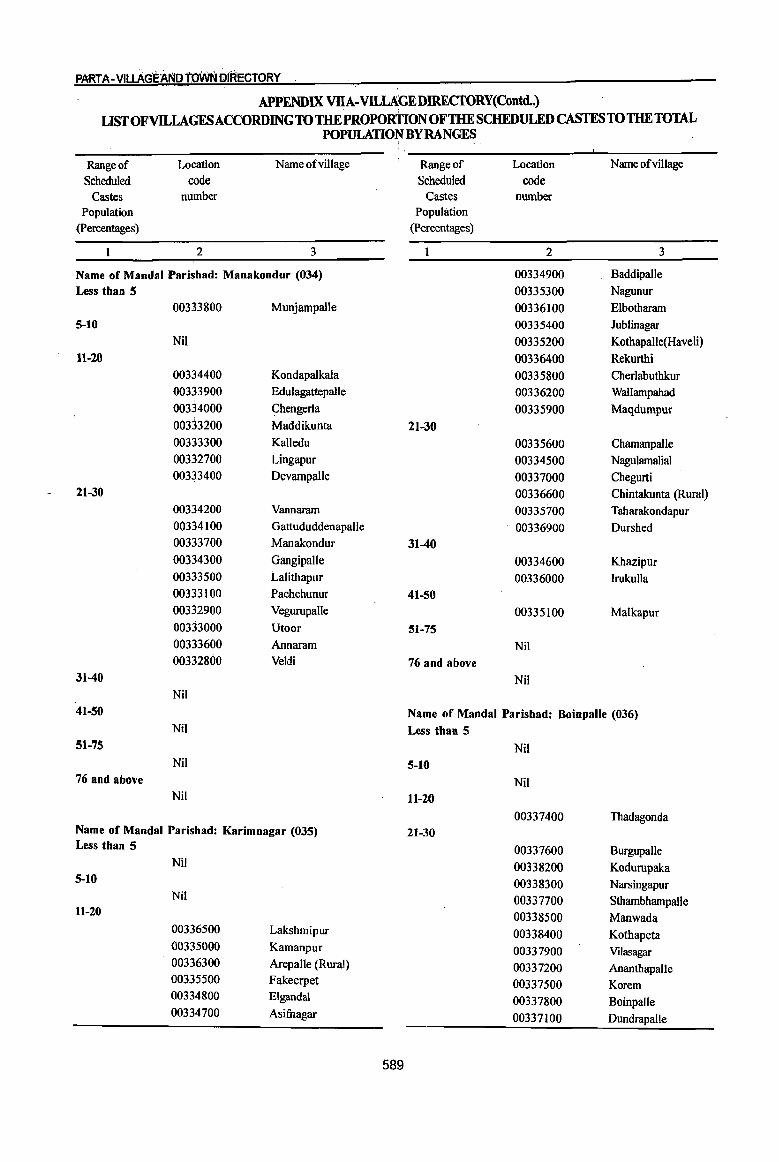
PART A- VllLAG'E}\N[) toWN Ot'RECTORY
APPENDIX VIIA-VILIAGEDJREcroRY(Contd..) usrOFVlLLAGESACCORDINGTO THE PROPORnON OF THE SCHEDULED CASTES TO THE TOTAL
POPULATION BY RANGES I
Range of Location Name ofvillage Range of Location Name ofvillage
Scheduled code Scheduled code
Castes number Castes number Population Population
(percentages) (percentages)
2 3 1 2 3
Name of Mandai Parishad: Manakondur (034) 00334900 Baddipalle
Less than 5 00335300 Nagunur
00333800 Munjampalle 00336100 Elbotharam 5-10 00335400 Jublinagar
Nil 00335200 Kothapalle(Haveli) 11-20 00336400 Rekurthi
00334400 Kondapalkala 00335800 Cherlabuthkur 00333900 Edulagattepalle 00336200 WaIlampahad 00334000 Chengerla 00335900 Maqdumpur 00333200 Maddikunta 21-30 00333300 Kalledu 00335600 Chamanpalle 00332700 Lingapur 00334500 Nagulamalial 00333400 Devampalle 00337000 Chegurti
21-30 00336600 Chintakunta (Rural) 00334200 Vannaram 00335700 Taharakondapur 00334100 Gattududdenapalle 00336900 Durshed 00333700 Manakondur 31-40 00334300 Gangipalle 00334600 Khazipur 00333500 Lalithapur 00336000 Irukulla 00333100 Pachchunur 41-'50 00332900 Vegurupalle 00335100 Malkapur 00333000 Utoor 51-75 00333600 Annaram Nil 00332800 Veldi 76 and above
31-40 Nil Nil
41-50 Name of Mandai Parishad: Boinpalle (036) Nil Less than 5
51-75 Nil Nil 5-10
76 and above Nil Nil 11-20
00337400 Thadagonda Name of Mandai Parishad: Karimnagar (035) 21-30 Less than 5 00337600 Burgupalle
Nil 00338200 Kodurupaka 5-10 00338300 Narsingapur
Nil 00337700 Sthambhampalle 11-20 00338500 Manwada
00336500 Lakshmipur 00338400 Kothapeta 00335000 Kamanpur 00337900 Vilasagar 00336300 Arepalle (Rural) 00337200 Ananthapalle 00335500 Fakeerpet 00337500 Korem 00334800 Eigandal 00337800 Boinpalle 00334700 Asifuagar 00337100 DundrapaUe
589

DISTRICT CENSUS HANDBOOK :tf.RIMNAGAR
APPENDIX VllA- VILLAGEDIRECfORY(Contd..) I
LIST OFVILLAGESACCORDINGTO THE PROPORTIONOFTHE SCHEDULED CASTES TO THE TOTAL POPULATION BY RANGES I
Range of Location Name ofvillage Range of Location Name of image Scheduled code Scheduled code
Castes number Castes number Population Population
(percentages) (Percentages)
2 3 2 3
3E-40 • ! Name of Mandai Parashad: Konaraopeta (038)!
00338600 Mallapur Less than 5 00337300 Malkapur Nil
4ll-56 5-10 00338100 Shabashpalle Nil 00338000 Vardavelli 11-20
5][-75 00342200 Palle (MF-ta) Nil 00341100 V&ttimalill
76 and above 00341800 Konarao~et Nil 00341900 Sivangal~palle
00341400 KondapJram (PR) Name of Mandai Parishad: Vemulawada (037) 0034]700 Venkatra~peta Less than 5 21-30
Nil 00342600 Malkap~t
5-10 . ,
00342700 Dhannar!"n 00340400 Thettakunta
00342000 Nizamab~d 00340600 Kodumunja
00342800 Marthan~et 111-20
00341200 Nimmapalle 00339800 Vemulawada CR)
00341600 Mamidipalle 00340500 Nampalle
00342300 Suddala 00339400 Fazil Nagar
00341500 Bausaip~ta 00340700 Anupuram
00342100 Kanagarthi 00339700 Edurugatla 00339600 Chekkapalle
00342900 Kolanur
00338700 Hanumajipet 31-40
00339300 Vattemla 00342400 Ramannapet
21-30 00342500 Nagaram
00340000 Jayavaram 41-50
00340800 Rudraram 00341000 Marrimadla
00339900 Lingampalle 51-75
00340200 Marupaka Nil
00338800 Bollaram 76 and above
00339100 Venkatampalle Nil
00339200 Nookalamarri 00339000 Marripalle Name of MandaI Parishad: Yellareddipet (039)
00340100 Thippapuram Less than 5
00340900 Sankepalle Nil
31-40 5-10
00338900 Mallaram 00344200 . Pothareddipalle
00339500 Satrajupalle 00343300 Kancherla
41-50 11-20
Nil 00343600 Gundaram CPR)
51-75 00344600 Boppapuram
00340300 Chandragiri 00343200 Adivipadira
76 and above 00345000 Narayanapur
Nil 00345100 Padira
590
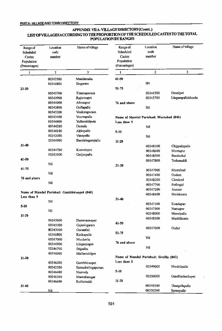
PART A-VlLtAGEAND fOwN DIRECTORY
APPENDIX VllA-VlLLAGEDIRECfORY(Contd..) LISTOFvn.LAGESACCORDINGTOTHE PROPORTIONOFTHE SCHEDULED CASTES TO THE TOTAL
POPULATION BY RANGES
Range of Location Name ofvillage Range of Location Name ofvillage
Scheduled code Scheduled code
Castes number Castes number
Population Population
(percentages) (Percentages)
2 J 2 3
00343500 Maddimalla 41-50
00344800 Singaram Nil
21-30 51-75
00343700 Timmapurarn 00346500 Desaipet
00343900 Rajannapet 00345700 Lingarnpallekburdu
00344000 Almaspur 76 and above
00343800 Gollapalle Nil 00345200 Venkatapurarn
00343400 Veemapalle Name of Mandai Parishad: Mustabad (041) 00344400 Yellareddipeta Less than 5 00344300 Dumala Nil 00344100 Akkapalle 5-10 00343000 Vanapalle Nil 00344900 Bandalingarnpalle 11~20
31-40 00348100 Chippalapalle 00344700 Korutlapet 00348600 Morrapur 00343100 Garjanpalle 00348500 Bandankal
41-50 00347800 Terlumaddi Nil 21-30
51-75 00347900 Mustabad Nil 00347400 Gudem
76 and. above 00348200 Cheekod Nil 00347700 Pothugal
00347200 Aunoor Name of Mandai Parishad: Gambhiraopet (040) Less than 5
00348400 Moirikunta
Nil 31-40
5-10 00347100 Kondapur
Nil 00347500 Narnapur
11-20 00348000 Moraipalle
00345600 Darnmannapet 00348300 Maddikunta
00345300 Gajasingararn 41-50
00345400 Gorantial 00347600 Gudur
00346800 KothapalJe 51':75
00347000 Mucherla Nil
00346900 Lingannapet 76 and above
00346700 Srigadha Nil
00346000 Mallareddipet 21-30 Name of Mandai Parishad: Sircilla (042)
00346200 Gambhiraopet Less than 5
00345500 Samudralingapurarn 00349000 Mushtipalle
00346400 Narmala 5-10
00346300 Mustafanagar 00350000 Gandilachachapet
00346600 Kollamaddi 11-20
31-40 00349500 Thangallapalle
Nil 00350200 Sarampalle ,
591
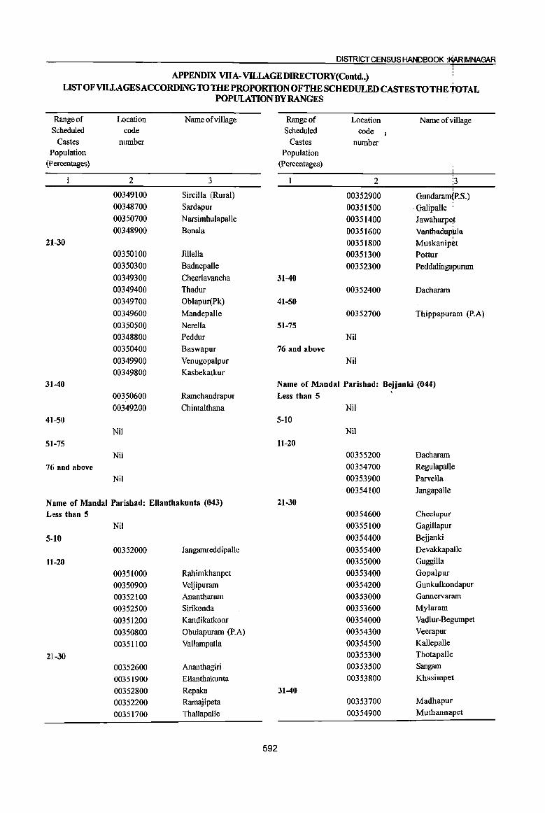
DISTRICT CENSUS HANDBOOK :!fSIMNAGAR
APPENDIX VllA- VILLAGEDIRECfORY(Contd •• ) LIST OF VILLAGES ACCORDING TO THE PROPORTION OF THE SCHEDULED CASTES TO THE TOTAL
POPULATION BY RANGES
Range of Location Name ofvillage Range of Location Name of viii age Scheduled code Scheduled code 1
Castes number Castes number Population Population
(percentages) (Percentages)
2 3 2 :3 00349100 Sircilla (Rural) 00352900 Gundaram(P.S.) 00348700 Sardapur 00351500 -Galipalle 00350700 Narsimhulapalle 00351400 Jawaharpe~
00348900 Bonala 00351600 Vanthadup~la
21-30 00351800 Muskanipet 00350100 Jillella 00351300 Pottur 00350300 Badnepalle 00352300 Peddalingapuram
00349300 Cheerlavancha 31-40 00349400 Thadur 00352400 Dacharam i
I
00349700 Oblapur(Pk) 41-50 i
00349600 Mandepalle 00352700 Thippapur~m (P.A)
00350500 Nerella 51-75 00348800 Peddur Nil
00350400 Baswapur 76 and above
00349900 Venugopalpur Nil
00349800 Kasbekatkur
3140 Name of Mandai Parishad: Bejjanki (044)
00350600 Ramchandrapur Less than 5
00349200 Chintalthana Nil
4]-50 5-10 Nil Nil
5]-75 11-20 Nil 00355200 Dacharam
76 and above 00354700 Regulapalle
Nil 00353900 Parvella
00354100 JangapaUe.
Name of Mandai Parishad: Ellanthakunta (043) 21-30 Less than 5 00354600 Cheelapur:
Nil 00355100 Gagillapur!
5-]0 00354400 Beiianki
00352000 Jangarnreddipalle 00355400 Devakkapalle
11-20 00355000 Guggilla
00351000 Rahimkhanpet 00353400 Gopalpur
00350900 Veljipuram 00354200 Gunkulkondapur
00352100 Anantharam 00353000 Gannervaram
00352500 Sirikonda 00353600 Mylaram
00351200 Kandikatkoor 00354000 Vadlur-Begumpet
00350800 Obulapuram (P.A) 00354300 Veerapur
00351100 Vallampatla 00354500 Kallepalle
ZU-30 00355300 Thotapalle
00352600 Ananthagiri 00353500 Sangam
00351900 Ellanthakunta 00353800 Khasimpet
00352800 Repaka 3140 00352200 Ramajipeta 00353700 Madhapur
00351700 Thallapallc 00354900 Muthannapet
592

PA~i A-VlLLAGEANb tOVVN DIRECTORY
APPENDIX VllA-Vll.,LAGEDIREcroRY(Contd..)
LISTOFVll.,LAGESACCORDINGTOTHEPROPORTIONOFTHE SCHEDULED CASTES TO mE TOTAL . POPULATION BY RANGES I
Range of LoQl,tion Name of village Range of Location NameofviUage
Scheduled co4e Scheduled code Castes number Castes number
Population Population (percentages) (percentages)
2 3 2 I 3 ,
41-50 00356900 Mamidafapalle
00353100 Yaswada 00357300 Ghanmukla
51-75 00357900 Veenavanka
00354800 Potharam 00357500 Kondapaka 76 and above 21-30
Nil 00358200 Valbapur
00357600 Pothireddipalle Name of Mandai Paris~ad:Timmapur (LMD Colony)(045) 00358100 Bethgal Less than 5 00357700 Reddip~le
Nil 00357100 Bonthupalle 5-10 31-40
Nil 00358000 Kanparthi 11-20 00357800 Brahmanpalle
00355600 Thimmapur 41-50 00356500 Mallapur Nil 00356600 Polampalle 51-75 00356800 Mogilipalem Nil 00356700 Parlapalle 76 and above 00355700 Alugunur Nil
21-30
00356200 Renikunta Name of Mandai Parishad: Jammikunta (047) 0035~800 Porandla Less than 5 00356000 Nustulapur Nil 00355500 Vachunur 5-10 0035(i300 Kothapalle (P.N) 00358700 Rachapalle
31-40 11-~0
00355900 Mannenpalle 00359700 Chinnakomatipalle 00356100 Nedunur 00359300 Madipalle 00356400 Nallagonda 00359200 Dharmrufam (p.B)
41-50 00358500 Vavilala I
Nil 00359100 lammikunta 51-75 21-30
Nil 00358400 Thangula 76 and above 00358300 Vilasagar
Nil 00359000 Saidabad 00360000 Sirsedu
Name of Mandai Parishad: Veenavanka (046) 00359500 Mallial Less than 5 00358600 Vanthadupula
Nil 00359900 Bujunoor 5-10 00358900 KorepaJle
Nil 00359600 Ellanthakunta 11-20 31-40
00357400 Korkal(Jangampalle) 00359400 Kanagarthi 00357200 Challoor 00359800 Tekurthi 00357000 Elbak 00358800 Bijigirsharief
593

DISTRICT CENSUS HANDBOOK :AARIMNAGAR
APPENDIX VllA-VJLLAGE I)IRECfORY(Contd..) LlST OF VJLLAGES ACCORDING TO THE PROPORTIONOFTHE SCHEDULED CASTES TO 'fIlE TOTAL
POPULATION BY RANGES
Range of Location Name ofvillage Range of Location Name o~village Scheduled code Scheduled code
Castes number Castes number Population Population
(Percentages) (percentages)
2 3 2 3
4~1-50 00362600 Indurthi :
Nil 00361900 Mudimanikyam
51-75 21-30 00360100 Patharlapalle 00362900 Ullampalle
76 and above 00362200 Chigurunfunidi Nil 00362100 Mulkanoor
00362700 Nawabp~ta Name of Mandai Parishad: Shankarapatnam (048) 00362000 Ramancha Less than 5 00362400 Bommanapalle
Nil 31-40 S-IO Nil
Nil 41-50 111-20 Nil
00360300 Arkandla 51-75 00361300 Kareempet Nil 00361200 Ambalpur 76 and above 00361100 Thadikal Nil 00361600 Molangur
21-30 Name of MandaI Parishad: Koheda (050) 00360200 Yeradpalle Less than 5 00361800 Metpalle Nil 00361500 Kothaghat 5-10 00361400 Kesavapatnam Nil 00360700 Rajapur
11-20 00361700 Amudalapalle 00363900 Narayan&pur 00361000 Mutharam
00364500 Samudral~ :U-40 00363100 Gundare4dipalle
00360400 Gaddapaka 00364300 Kachaput
00360600 Kachapur 00364000 Sriramula~alle
41-50 00364100 Nakkira Kommula Nil 00363300 Kurella
!51-75 00363400 Thangalhwalle
00360500 Kalavala 00363700 Varikolu.
'76 and above 00364400 Koheda
00360800 Dharmaram 21-30
Name of MandaI Parishad: Chigurumamidi (049) 00364200 Pariveda
00363000 Sanigararn Less than 5
Nil 00363200 Baswapur
5-10 00363500 Vinjapalle
Nil 31-40
11-20 00363600 Ramachandrapur
00362800 Kondapur 41-50
00362500 Sundaragiri Nil
00362300 Rekonda 51-75 00363800 Gottalamitta
594
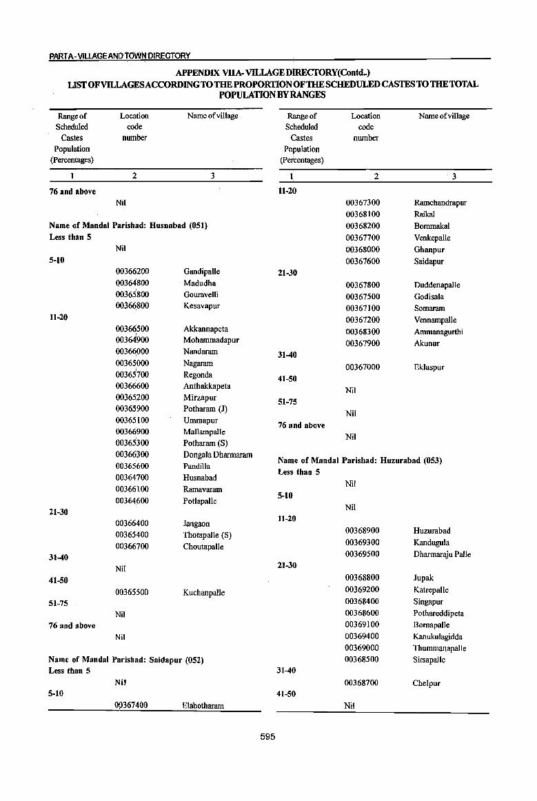
PARTA-VltLAGEANbtdVVNDIRECTORY
APPENDIX VIlA- VILLAGE DlREctORY(Contd.) LIST OF VILLAGES ACCORDING TO THE PROPORTION OF THE SCHEDULED CASTES TO THE TOTAL
POPULATION BY RANGES
Range of Loca:tion Name of village Range of Location Name ofviUage Scheduled code Scheduled code
Castes nurrtber Castes number Population Population
(Percentages) (percentages)
2 3 1 2 ·3
76 and above 11-20
Nil ·00367300 Ramchandrapur
00368100 Raikal
Name of MandaI Parish.d: Husnabad (051) 00368200 BommakaI Less than 5 00367700 Venkepalle
Nil 00368000 Ghanpur 5-10 00367600 Saidapur
00366200 Gandipalle 21-30 00364800 . Madudha 00367800 Duddenapalle 00365800 Gouravelli 00367500 Godisala 00366800 Kesavapur 00367100 Somaram
11-20 00367200 VennampaIle 00366500 Akkannapeta 00368300 Ammanagurthi 00364900 Mohammadapur 00367900 Akunur 00366000 Nandaram 31-40 00365000 Nagaram 00367000 Eklaspur 00365700 Regonda 41-50 00366600 Anthakkapeta Nil 00365,200 Mirzapur 51-75 00365900 Potharam (J)
Nil 00365100 Ummapur
76 and above 00366900 MallampaIle
Nil 00365300 Potharam (S)
00366300 Dongala Dharmaram Name of Mandai Parishad: Huzurabad (053)
00365600 Pandilla
00364700 Husnabad Less than 5
00366100 Ramavaram Nil
0036460() Potlapalle 5-10
21-30 Nil
00366400 Jangaon 11-20
00365400 ThotapaIle (S) 00368900 Huzurabad
00366700 Choutapalle 00369300 Kandugula
31-40 00369500 Dharmaraju PaIle
Nil 21-30
41-50 00368800 Jupak
00365500 KuchanpaIle 00369200 KatrepaIle
51-75 00368400 Singapur
Nil 00368600 Pothareddipeta
76 and above 00369100 Bomapalle
Nil 00369400 Kanukulagidda
00369000 Thummanapalle
Name of Mandai Parishad: Saidapur (052) 00368500 SirsapaIle Less than 5 31-40
Nil 00368700 Chelpur 5-10 41-50
0\)367400 Elabotharam Nil
595
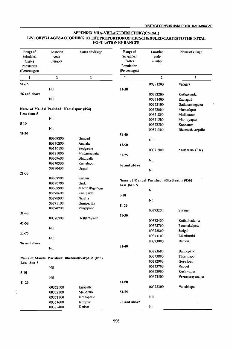
DISTRICT CENSUS HANDBOOK :KARIMNAGAR
APPENDIX VDA- VILLAGE DIREcroRY(Concld .• ) LIST OF VILLAGES ACCORDING TO THE PROPORTION OF THE SCHEDULED CASTES TO THE TOTAL
POPULATION BY RANGES
Range of Location Name ofvillage Range of Location Name ofvillage Scheduled code Scheduled code
Castes number Castes number
Population Population
(Percentages) (Percentages)
2 3 2 3
Sl-75 00371200 Vangara Nil 21-30
76 and above 00372200 Kothakonda Nil 00371400 Ratnagiri
00372100 GatIanarsingapur Name of Mandai Parishad: Kamalapur (054) 00372000 Mustafapur Less than 5 00371800 Mulkanoor
Nil 00371500 Manikyapur S·lO 00372500 Kannaram
Nil 00371300 BheemadevarpaUe 111-20 31-40
00369800 Gunded Nil 00370800 Ambala 41-50 00370100 Sanigaram 00371900 Mutharam (P.K) 00371000 Madannapeta 51-75 00369600 Bhimpalle Nil 00370300 Kamalapur 76 and above 00370400 Uppal Nil
21-30 00369700 Kannur
Name of Mandai Parishad: Elkathurthi (056) 00370700 Gudur Less than 5 00369900 Marripalligudem
Nil 00370600 Kaniparthi 5-10 00370900 Nerella
Nil 00371100 Guniparthi 11·20 00370200 VangapaUe
00373200 Suraram :U-40 21-30
00370500 Desharajpalle 00373400 Kothulnaduma
41-50 00372700 Penchakalpeta
Nil 00372800 Jeelgul
51-75 00373100 Elkathurthi
Nil
76 and above 00373000 Damera
Nil 31-40 00373600 Dandepalle
Name of Mandai Parishad: Bheemadevarpalle (055) 00373800 Thimmapur
lLess than 5 00372900 Gopalpur
Nil 00373700 Baopet
5-10 00373900 Keshwapur
Nil 00373500 Veeranarayanapur
11-20 41·50 00372600 Erraballe 00373300 Vallabhapur
00372300 Mallaram 51·75 00371700 Kothapalle Nil
00371600 Koppur 76 and above
00372400 Katkur Nil
596
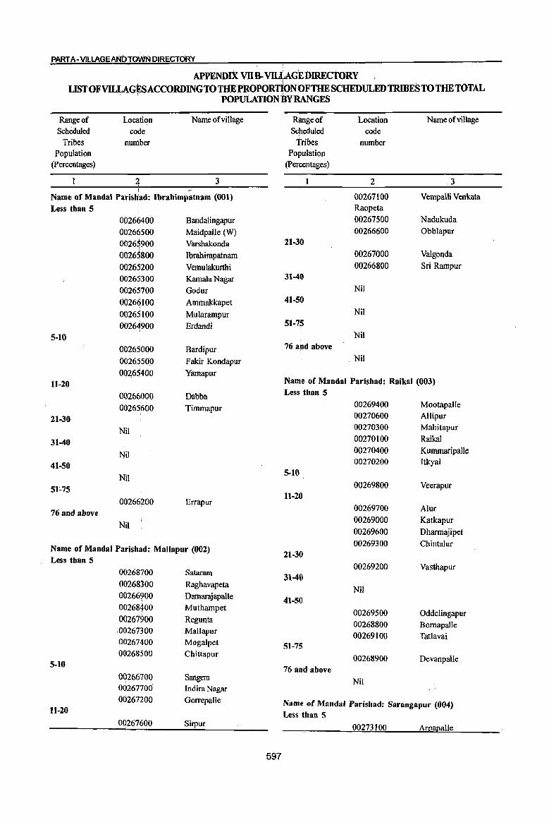
PART A-V1LLAGEANtntiWJII DIRECTORY
APPENDIX vns. vru;.AGEDIRECTORY LIST OF VILLAGES ACCORDING TO THE PROPORTION OF THE SCHEDULED TRIBES TO THE TOTAL
. . POPULATION BYRANGES
Range of LoCl!-tion Name of village Range of Location Name ofvillage
Scheduled colie Scheduled code Tribes nuniber Tribes number
Population Population (percentages) (percentages)
~ 3 2 .3 -
Name of Mandai Parisbad: Ibrahimpatnam (001) 00267100 Vempalli Venkata
Less than 5 Raopeta
00266400 Bandalingapur 00267500 Nadukuda
00266500 Maidpalle (W) 00266600 Obblapur
0026$900 Varshakonda 21-30
0026$800 Ibrahimpatnam 00267000 Valgonda
00265200 Vemulakurthi 00266800 Sri Rampur
00265300 Kamala Nagar 31-40
00265700 Godur Nil
00266100 Ammakkapet 41-50
00265100 Mularampur Nil
00264900 Erdandi 51-75
5-10 Nil
00265000 Bardipur 76 a!lld above
00265500 Fakir Kondapur Nil
00465400 Yamapur 11-20 Name of Mandai Parishad: Raikal (003)
00266000 Dabba Less than 5·
00265600 Timmapur 00269400 Mootapalle
21-30 00270600 Allipur
Nil 00270300 Mahitapur
31-40 00270100 Raikal
Nil 00270400 Kummaripalle
41-50 00270200 Itkyal
Nil 5-10
51~75 00269800 Veerapur
00266200 Errapur 11-20
76 and above 00269700 Alur
Nil 00269000 Katkapur
00269600 Dharmajipet
Name of Mandai Parish~d: Mallapur (002) 00269300 Chintalur
Less than 5 21-30
00268700 Sataram 00269200 Vasthapur
31-40 00268300 Raghavapeta
Nil 00266?00 Damarajapalle 41-50 00268400 Muthampet 00269500 Oddelingapur 00267900 Regunta .00267300 Mallapur
00268800 Bornapalle 00269100 Tatlavai
00267400 Mogalpet 51-75 OG268500 Chittapur 00268900 Devanpalle
5-10 76 and above 00266700 Sangem Nil I
00267700 Indira Nagar 00267200 Gorrepalle Name of Mandai Parishad: Sarangapur (004)
11-20 Less than 5 00267600 Sirpur 00273100 Arpapalle
597
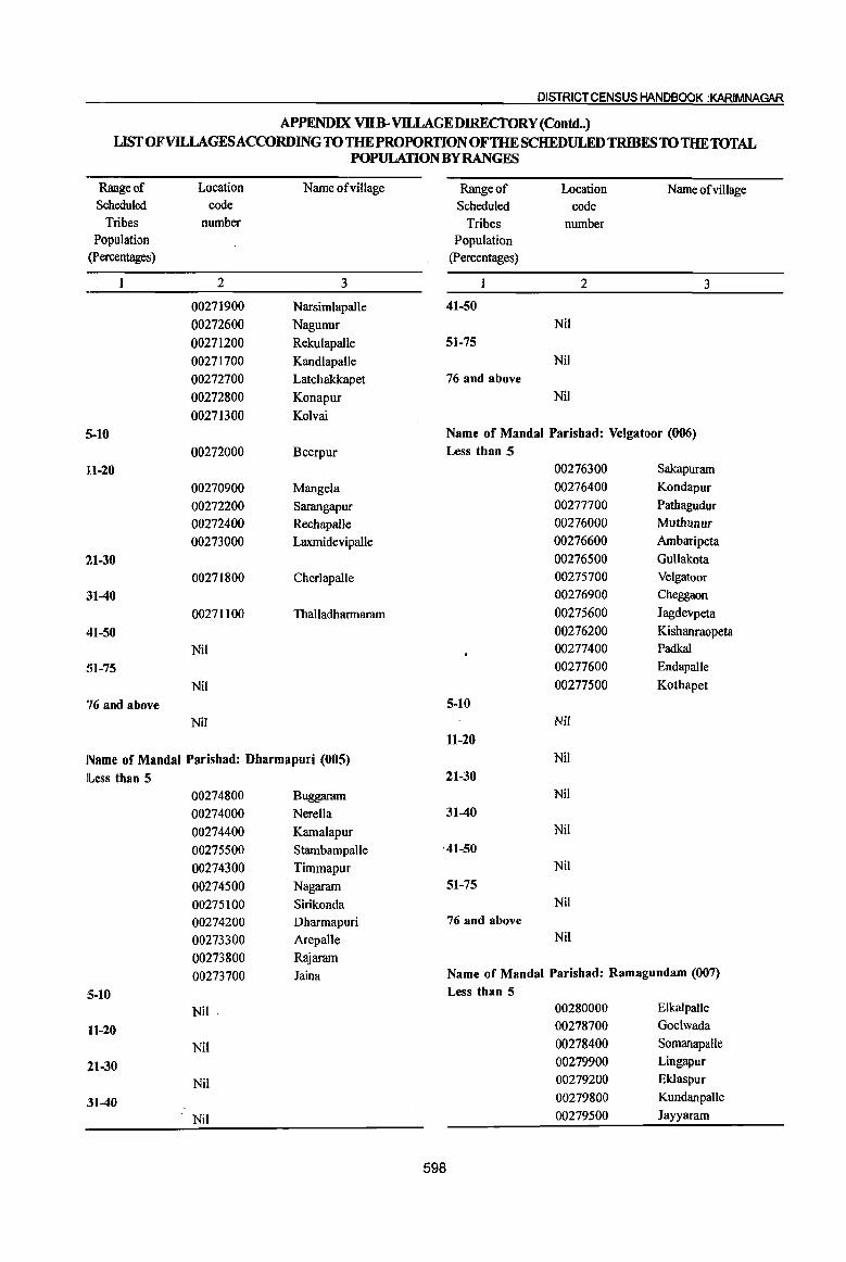
DISTRICT CENSUS HANDBOOK :KARIMNAGAR
APPENDIX Vlln-VILLAGEDIRECfORY (Contd .. ) LIST OF VILLAGES ACCORDING TO THE PROPORTIONOFTHE SCHEDULED TRIBES 10 THE10TAL
POPULATION BY RANGES
Range of Location Name ofvillage Range of Location Name of village Scheduled code Scheduled code
Tribes number Tribes number Population Population
(Percentages) (percentages)
2 3 2 3
00271900 Narsimlapalle 41-50 00272600 Nagunur Nil
00271200 Rekulapalle 51-75 00271700 Kandlapalle Nil
00272700 Latchakkapet 76 and above
00272800 Konapur Nil
00271300 Kolvai
~;-10 Name of MandaI Parishad: Velgatoor (006) 00272000 Beerpur Less than 5
111-20 00276300 Sakapuram
00270900 Mangela 00276400 Kondapur
00272200 Sarangapur 00277700 Pathagudur
00272400 Rechapalle 00276000 Muthunur
00273000 Laxmidevipalle 00276600 Ambatipeta
21-30 00276500 GuUakota
00271800 CherJapalJe 00275700 Velgatoor
~H-40 00276900 Cheggaon
00271100 Thalladharmaram 00275600 Jagdevpeta
41-50 00276200 Kishanraopeta
Nil 00277400 Padkal
SI-75 00277600 Endapalle
Nil 00277500 Kothapet
'16 and above 5-10 Nil Nil
11-20 Name of Mandai Parishad: Dharmapuri (005) Nil
lLess than 5 21-30 00274800 Buggaram Nil
00274000 Nerella 31-40 00274400 Kamalapur Nil
00275500 Stambampalle '41-50 00274300 Timmapur Nil
00274500 Nagaram 51-75 00275100 Sirikonda Nil
00274200 Dharmapuri 76 and above
00273300 Arepalle Nil
00273800 Rajaram
00273700 Jaina Name of Mandai Parishad: Ramagundam (007)
5-10 Less than 5
Nil ' 00280000 ElkaJpalle
11-20 00278700 Goelwada
Nil 00278400 Somanapalle
21-30 00279900 Lingapur
Nil 00279200 Eklaspur
:31-40 00279800 KundanpaUe
. Nil 00279500 Jayyaram
598
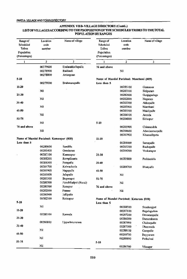
PART A-VILLAGE AND TOWN DIRECTORY
APPENDIX VlIB- VlILAGEDIRECfORY (Contd .• ) LISTOFVILLAG~ACCORDINGTOTHEPROPORTIONOF'lHESCHEDULEDTRIBESTOTHETOTAL
POPULATION BY RANGES
Range of Location Name ofvillage Rlmgeof Location Name of village Scheduled co!le Scheduled code
Tribes nult!ber Tribes number Population Population
(percentages) (percentages)
2 3 2 3
00279600 Esalatakkallapalle 76 and above 0027~900 Raidandi Nil 00278800 Antargoan
5-10 Na~e of Mandai Parishad: Manthani (009) <;)0279000 Brahmanapalle Less than 5
11-20 00285100 GUrimoor Nil 00283100 Siripuram
21-30 00282600 Ounjapaduga Nil 00282800 Nagaram
31-40 00283300 Akkepalle Nil 00285000 Manthani
41-50 00285500 Maidipalle Nil 00284100 Arenda
51-75 00284800 Eklaspur Nil 5-10
76 and above 00285900 Chinnaodela Nil 00284600 Adavisomanpalle
00283900 Khansaibpeta Name of Mandai Parishad: Kamanpur (008) 11-20 Less than 5 00284400 SarnepaUe
00280600 Sundilla 00283200 Rachepalle 00281400 Gundaram 00284300 Venkatapur 002SHOO Karnanpur 21-30 00281200 Rompikunta 00285800 Peddaodela 00281:300 Perapalle 31-40 00281700 Kalwacherla 00284700 Bhatpalle 00281900 NagepaUe 41-50 00281000 Julapalle Nil 00282300 Begumpet 51-75 00280500 Penchikalpet (Rural) Nil 00280200 Ranapur 76 and above 00282000 Pannur Nil 00280900 Jallipalle 00282100 Ratnapur Name of Mandai Parishad: Kataram (010)
5-10 Less than 5 Nil 00288500 Sunderajpet
11-20 00287100 Regulagudem 00280'100 Kannala 00287200 Devarampalle
21-30 00286000 Damerakunta 00280800 Upparlakesaram 00287900 Chidnepalle
31-40 00287300 Dhanwada Nil 00288100 GarepalJe
41-50 00288700 Bayyaram Nil 00288800 Pothulvai
51-75 5-10 Nil 00286700 Vilasagar I
599
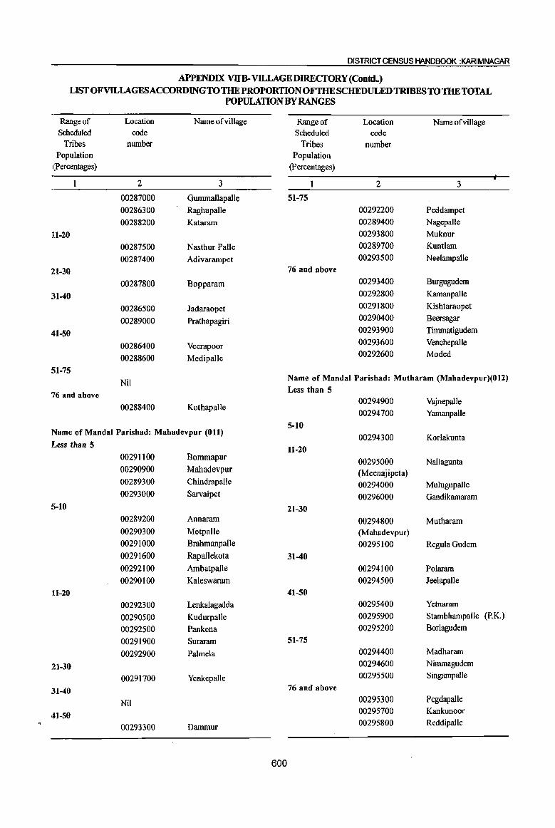
DISTRICT CENSUS HANDBOOK :J(ARIMNAGAR
APPENDIX VllB-VlLLAGEDIRECfORY (ContdH) LISTOFVlLLAGESACCORDlNGTOTHEPROPORTIONOFTHESCHEDULEDTRIBESTOTHE TOTAL
POPULATION BY RANGES
Range of Location Name ofvillage Range of Location Narneofvillage Scheduled code Scheduled code
Tribes number Tribes number Population Population
(percentages) (percentages)
2 3 2 3
00287000 Gummallapalle 51-75
00286300 Raghupalle 00292200 Peddarnpet
00288200 Kataram 00289400 Nagepalle
111-20 00293800 Muknur
00287500 Nasthur Palle 00289700 Kuntlam
00287400 Adivarampet 00293500 Neelampalle
21-30 76 and above
00287800 Bopparam 00293400 Burgugudem
~11-40 00292800 KamanpaUe
00286500 Jadaraopet 00291800 Kishtaraopet
00289000 Prathapagiri 00290400 Beersagar
41-50 00293900 Timmatigudem
00286400 Veerapoor 00293600 Venchepalle
00288600 Medipalle 00292600 Moded
51-75
Nil Name of Mandai Parishad: Mutharam (Mahadevpur)(012)
76 and above Less than 5
00294900 Vajnepalle 00288400 Kothapalle
00294700 Yarnanpalle
5-10 Name of Mandai Parishad: Mahadevpur (011)
00294300 Korlakunta lLess than 5 11-20
00291100 Bommapur 00295000 Nallagunta
00290900 Mahadevpur (Meenajipeta) 00289300 Chindrapalle 00294000 Mulugupalle 00293000 Sarvaipet 00296000 Gandikamaram
S-10 21-30 00289200 Annaram 00294800 Mutharam 00290300 Metpalle (Mahadevpur) 00291000 Brahmanpalle 00295100 Regula Gudem
00291600 Rapallekota 31-40
00292100 Ambatpalle 00294100 Polaram
00290100 Kaleswaram 00294500 Jeelapalle
11-20 41-50
00292300 Lenkalagadda 00295400 Yetnararn
00290500 Kudurpalie 00295900 StambhampaJle (P.K.)
00292500 Pankena 00295200 Borlagudem
00291900 Suraram 51-75
00292900 Palmela 00294400 Madhararn
21-30 00294600 Nimmagudem
00291700 Yenkepalle 00295500 Singampalle
:H-40 76 and above
Nil 00295300 Pegdapalle
41-50 00295700 Kankunoor
00293300 Dammur 00295800 Reddipalle
600
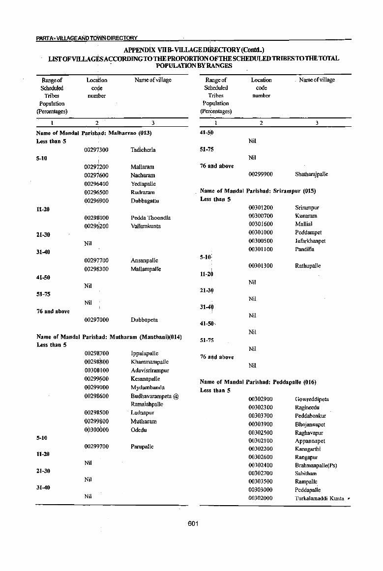
PARrA" V1UAGEANOTdWNOIRECTORY
APPENDix VllB-VILLAGE DnmcroRY (Contd .• ) LISfOFVD.LAGESACCORDINGTO THE PROPORTION OFTHE SCHEDULED TRIBES TO THE TOTAL
POPULATION BY RANGES
Range of Scheduled
Tribes Population
(percentages)
1
Location
co~e number
2
Name ofvillage
3
Name of Mandai Parish~d: Malharrao (013)
Less tban 5 00297300 Tadlcherla
5-10
00297200 Mallaram
00297600 Nacharam
00296400 Yedlapalle
00296500 Rudraram
00296900 Dubbagattu
11-20 00298000 Pedda Thoondla
00296200 Vallamkunta
21-30
Nil
31-40
00297700 Ansanpalle
00298300 Mallampalle
41-50
Nil 51-75
Nil
76 and above
00297000 Dubbapeta
Name of Mandai Parish~d: Mutbaram (Manthani)(014) Less than 5
00298700 Jppalapalle
00298800 Khammampalle
00300,100 Adavisrirampur
00299600 Kesanapalle
00299000 Mydambanda i
00298600 Budhavarampeta @ Ramaiahpalle
00298500 Ladnapur I
0029980(i) Mutharam
00300000 Odedu 5-10
00299700 Parupalle 11-20
Nil 21-30
Nil
31-40
Nil
601
Range of Scheduled
Tribes Population
(Percentages)
1
41-5P
51-75
76 and above
Location code
number
2
Nil
Nil
00299900
Name of viII age
3
Shatharajpalle
Name of Mandai Parishad: Srirampur (015)
Less than 5
00301200 Srirampur
00300700 Kunaram
00301600 Mallial
00301000 Peddampet
00300500 Iafarkhanpet
00301100 Pandilla 5-10:
00301300 Rathupalle I
11-20
Nil 21-30
Nil
31-4Q Nil
41-50,
Nil 51-75
Nil
76 and above
Nil
Name of Mandai Parishad: Peddapalle (016)
Less than 5
00302900 Gowreddipeta
00302300 Ragineedu
00303700 Peddabonkur
00303900 Bhojannapet
00302500 Raghavapur 00302100 Appannapet 00302200 Kanagarthi
00302600 Rangapur 00302400 Brahmanpalle(Ps) 00302700 Sabitham
00303500 Rampalle_ 00303000 Peddapalle 00302000 Turkalamaddi Kunta '#
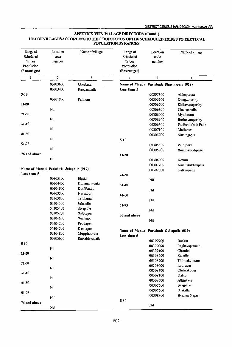
DISTRICT CENSUS HANDBOOK :KARIMNAGAR
APPENDIX VllB- VILLAGE DIRECTORY (Contd .. ) LIST OFVllLAGESACCORDINGTO THE PROPORTION OF THE SCHEDULED TRIBES TO THE TOTAL
POPULATION BY RANGES
Range of Scheduled
Tribes Population
(percentages)
S .. 10
11 .. 20
21-30
:n-40
41 .. 50
SI .. 75
76 and above
Location code
number
2
00303600 00303400
00301900
Nil
Nil
Nil
Nil
Nil
Nil
Name of village
3
Cheekurai
Rangampalle
Palthem
Name of Mandai Parishad: Julapalle (017) JLess than 5
00305100 Elgaid 00304400 Kummarikunta
00304900 Doolikatta 00305500 Narsapur
00305000 Telukunta
00304300 Julapalie
00305400 Sivapalle 00305200 Sultanpur
00304600 Wadkapur
00304200 Peddapur
00304500 Kachapur
00304800 Muppirithota
00305600 Raikaldevapalle
5-10 Nil
, 11-20 Nil
21-30 Nil
31-40 Nil
41-50 Nil
51-75 Nil
76 and above Nil
602
Range of Location Name of viii age Scheduled code
Tribes number Population
(percentages)
2 3
Name of Mandai Parishad: Dharmaram (018) Less than 5
00307300 Abbapuram 00306500 Dongathurthy
00306700 Khilavanaparthy
00306800 Chamanpalle 00306000 Myadaram 00306600 Botlavanaparthy
00306300 Paidicbinthala Palle
00307100 Mallapur
00305700 Narsingapur
5-10 00305800 Pathipaka
00305900 Bommareddipalle 11 .. 20
00306900 Kotbur
00307200 Kammarikhanpeta
00307000 Katkanpalle
21-30 Nil
31-40 Nil
41-50 Nil
51-75 Nil
76 and above
Nil
Name of Mandai Parishad: Gollapalle (019) Less than 5
00307900 Bonkur
00309000 Raghavapatnam 00309400 Chendoli 00308500 Rapalle
00308700 Thirmalapuram
00308000 Lothunur
00308300 Chilwakodur
00308100 Datnur
00309500 Atbmakur
00307600 Israjpalle
00307700 Shakalla
00308800 Ibrahim Nagar
5-10 Nil
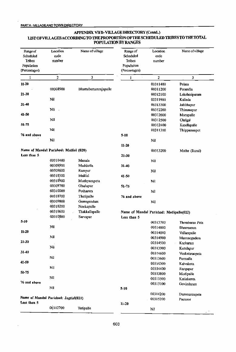
PART A-V1LLAGEAND toWN DIRECTORY
APPENl>IX VlIB-VILLAGEDIRECfORY (Contd •• )
LffiT OFVILLAGESACCORDINGTOTHE PROPORTION OFTHE SCHEDULED TmmES TO THETOTAL POPULATION BY RANGES
Range of Location Name ofvillage Range of Location Name ofvillage
Scheduled code Scheduled code Tribes number Tribes number
Population Population (percentages) (percentages)
2 3 2 3
1l.;20 003 II 400 Polasa 00308900 Bhattubuttamrajapalle 003 II 200 Porandla
21-30 00312100 Lakshmipuram Nil 003 II 900 Kalleda
31-40 00313300 Jabithapur Nil 00312200 Thimmapur
41-50 00312600 Morapalle Nil 00312500 Chelgal
51-75 00312400 Kandlapalle Nil 00311300 Thippannapet
76 and above 5-10 Nil Nil
11-20 Name of Mandai Parishl1d: Mallial (020) 00313200 Mothe (Rural) Less than 5 21-30
0031O40() Manala Nil 00309900 Maddutla 31-40 00309600 Rampur Nil 00310.300 Mallial 41-50 00310~00 . Muthyampeta Nil 00309700 Obulapur 51-75 00310000 Potharam Nil 00310700 Thatipalle 76 and above 00309800 Gorregundarn Nil 01'310200 Nookapalle
00310600 Thakkallapalle Name of MandaI Parishad: MedipalJe(022) 00310~00 Sarvapur Less than 5
5-10 00313700 Thombarao Peta Nil 00314800 Bheemaram
11-20 00314000 Vallampalle Nil 00314900 Mannnegudem
21-30 00314500 Kacharam Nil 00313900 Kondapur
31-40 00314600 Venkataraopeta Nil 00313600 Pormalla
41-50 00314300 Kalvakota Nil 00314400 Rangapur
51-75 00313800 Medipalle Nil 00313500 Katlakunta
76 and above 00315100 Govindaram Nil 5-10
00314200 Dammannapeta Name of Mandai Parishad: Jagtial(021) 00315200 Pasnoor Less tban 5 11-20
Oq312700 Tatipalle Nil
603
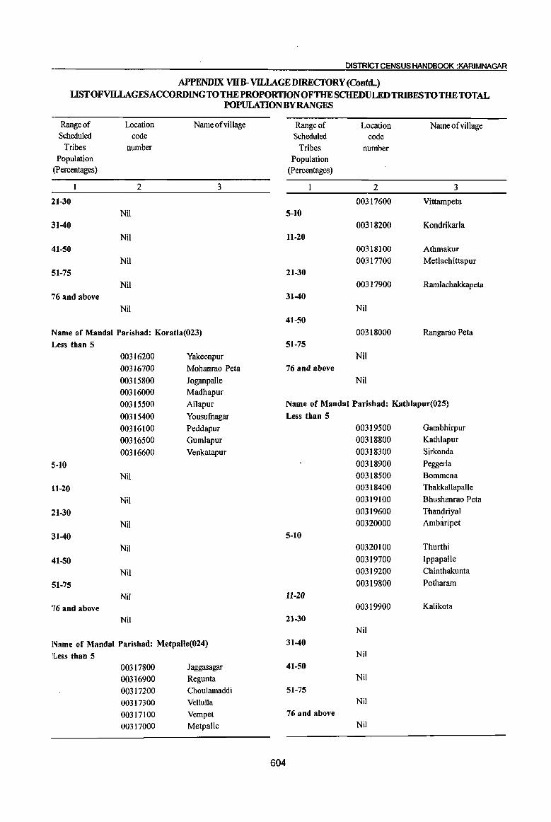
DISTRICT CENSUS HANDBOOK :KARIMNAGAR
APPENDIX VllB- VH..LAGE DIRECTORY (Conuq LISTOFVlLLAGESACCORDINGTOTHEPROPORTIONOFTHESCHEDULEDTRIBESTOTHETOTAL
POPULATION BY RANGES
Range of Location Name of village Range of Location Name of viII age Scheduled code Scheduled code
Tribes number Tribes number Population Population
(percentages) (Percentages)
2 3 2 3
2:1-30 00317600 Vittampeta
Nil 5-10
~il-40 00318200 Kondrikarla
Nil 11-20
411-50 00318100 Athmakur
Nil 00317700 Metlachittapur
51-75 21-30
Nil 00317900 Ramlachakkapeta
76 and above 31-40
Nil Nil
41-50
Name of Mandai Parishad: Koratla(023) 00318000 Rangarao Peta
Less than 5 51-75
00316200 Yakeenpur Nil
00316700 Mohanrao Peta 76 and above
00315800 Joganpalle Nil 00316000 Madhapur
00315500 Ailapur Name of MandaI Parishad: Kathlapur(025)
00315400 Yousufnagar Less than 5
00316100 Peddapur 00319500 Gambhirpur
00316500 Gumlapur 00318800 Kathlapur
00316600 Venkatapur 00318300 Sirkonda
S-JO 00318900 Peggerla
Nil 00318500 Sommena
H-20 00318400 Thakkallapalle
Nil 00319100 Shushanrao Peta
21-30 00319600 Tnandriyal
Nil 00320000 Ambaripet
31-40 5-10
Nil 00320100 Thurthi
41-50 00319700 Ippapalle
Nil 00319200 Chinthakunta
SI-75 00319800 Potharam
Nil 11-20
76 and above 00319900 Kalikota
Nil 21-30 Nil
Name of MandaI Parishad: Metpalle(024) 31-40
ILess than 5 Nil
00317800 Jaggasagar 41-50
00316900 Regunta Nil
00317200 Choulamaddi 51-75
00317300 Vellulla Nil
00317100 Vempet 76 and above
00317000 Metpalle Nil
604
PARTA-VlLLAGEANo TOwN OIRECTORY
APPENDIX VlIB-VILLAGE DIREctORY (Contd_) LIST OFVIUAGESACCORDINGTO THE PROPORTIONOFTHE SCHEDULED TRIBES TO THE TOTAL
POPULATION BYRANGES
,Rangeof Scheduled
Tribes Population
(percentages)
Lodtion cotle,
number
2
Name of village
3
Name of Mandai Parisbad: Cbandurthi(026)
Less tban 5 00321300 Moodepalle
0032(}500 Thimlnlipuram(Pn)
00320800 Jogapuram
00321100 Bandapalle 00320300' Mallial
00320400 Chandurthi
IJ0321200 Yangal
00320200 Rudrangi
5-10 Nil
11-20
0032~000 Sangula
21-30
Nil
31-40 Nil
41-50
Nil
51-75 Nil
76 and above
Nil
Name of Mandai Farishad: Kodimial(027) Less than 5
00321900 Ramsagar 00322100 Kodimial 00322400 Thippaipalle 00322800 Namilikonda
00321700 Thiramalapur 00322500 Cheppial
00322600 Pudur (l0321500 Konapur
00322000 Nachupalle' 5-10
Nil 11-20
Nil 21-30
Nil
31-40
l'l'il 41-50
00321400 Surampeta I !
605
Rimgeof Soheduled
Tribes Population
(Percentages)
51-75
76 and above
Location code
number
2
Nil
Nil
Name of village
3
Natlle of Mandai Parishad: PegadapaUe(028)
Less than 5
00323500 Nancherla
00323100 Laxmipur 00322900 Lingapur
00323900 Aithupalle 00324000 Nandagiri
00323700 BathkepaUe 00324300 Namapur
00323600 Vengalaipet
00323000 Thirmalapuram
00323800 Aravelli 5-10
00324100 Pegadapalle
00323400 Yellapur 11-20
Nil
21-30
Nil
31-40
Nil 41-50
Nil
51-75 Nil
76 and above
Nil
Na~e of Mandai Parishad: Gangadhara(029)
Less than 5
00326000 Gattuboothkur 00325700 Uppara Mallial 00326300 Vaddyaram 00326100 Garsekurthi 00326200 Achampalle 00325400 Narayanpur 00325100 Sarvareddipalle 00324900 BurgupaUe 00325600 Mallapur 00325300 Gangadhara 00325800 Kurikial

DISTRICT CENSUS HANDBOOK :KARIMNAGAR
APPENDIX VllB- VILLAGEDIRECfORY (Contd_) LIST OF Vll.LAGES ACCORDING TO THE PROPORTION OF THE SCHEDULED TRIBES TO THE TOTAL
POPULATION BYRANGES
Range of Scheduled
Location code
Tribes number Population
(Percentages)
2
5;-10
Nil
U-20
Nil
21-30
Nil
~11-40
Nil
41-50
Nil
51-75
Nil
76 and above
Nil
Name ofvillage
3
Name of Mandai Parisbad: Ramadugu(030)
]L.ess than 5
00326400 Thirmalapur
00326600 Chippakurthi
00328000 OesbrajpaUe
00327500 Rudraram
00326700 Gundi
00327000 Ramadugu
00327600 Mothe
!;-10
00327400 Koratpalle
11-20 00328100 Kokkerakunta
21-30
00328200 Vannaram
31-40
Nil
41-50
Nil
51-75 Nil
76 and above
Nil
Name of Mandai Parishad: Choppadandi(031)
Less than 5 00328600 00329400 00329200 00328700
Bhupalapatnam
Vedurughattu
Kolimikunta Choppadandi
Range of Scheduled
Tribes Population
(percentages)
5-10
11-20
21-30
31-40
41-50
51-75
76 and above
Location code
number
2
00328300 00328500 00328900 00328800 00329100
Nil
Nil
Nil
Nil
Nil
Nil
Nil
Name ofvillage
3
Ragampeta Arnakonda Katnepalle
Gumlapur
RUkmapur
Name of Mandai Parishad: Sultanabad(032) Less than 5
00330100 Katnepalle
00331400 Mancharami 00329900 Garrepalle 00331300 Thogarrai
00330600 Rebbaldevipalle
00330000 Neerukulla
00330900 Regadimaddikunta
00330300 Sultanabad
00330400 Kodurupaka
00330200 Poosala
5-10 Nil
11-20 Nil
21-30 Nil
31-40 Nil
41-50 Nil
51-75 Nil
76 and above
Nil
606
PARrA -V1LLAGEAAl)r~ DIRI!CTORY
APPENDIX VllB-VILLAGEDJ1mcrORY (Contd..) LISTOFVILLAGEsACCORDINGTOTHEPROPORTIONPFTHESCHEDULEDTRIBESTOTHE TOTAL
POPULATION BY RANGES .
Range of Scheduled
Tribes Population
(percentages)
Location code
nU1l).ber
2
Name of village
3
Name of Mandai ~arishad: Odela(033)
Less than 5 00332200 Pathkapalle 00332000 Kangarthi
0033f300 Sanagonda
0033~60() Kolanoor 00332500 Gudem 00332600 Gumpula
00332400 Indurthi
5-10 00332100 Madaka
11-20
00331700 Namsanipalle 21-30
Nil
31-40 Nil
41-50 Nil
51-75 Nil
76 and above Nil
Name of Mandai Paris~ad: Manakondur(034)
Less than 5
00333000 Utoor e0334000 Chengeria ~0332800 Veldi e0334400 Kondapalkala (i)0333600 Annaram 00333100 Pachchunur 00333700 Manakondur
5-10
00332700 Lingapur 11-20
Nil 21-30
Nil
31-40
Nil 41-50
Nil
51-75
Nil 76 and above
llJiI
607
Range of Scheduled
Tribes Population
(percentages)
Location code
number
2
Name of village
3
Name of Mandai Parishad: Karimnagar(035)
Less than 5 00334800 Elgandal
00335200 Kothapalle(Haveli)
00335300 Nagunur
00335800 Cherlabutbkur 00336000 lrukulla
00335000 Kamanpur
00336300 Arepalle (Rural)
00335600 Chamanpalle 00336500 Lakshmipur 00335100 Malkapur 00336900 Durshed
00335900 Maqdumpur 00336600 Chintakunta (Rural) 00335400 Jublinagar
5-10
00337000 Chegurti 11-20
00336400 Rekurthi
21-30 Nil
31-40
Nil
41-50
Nil
51-75
Nil
76 and above
Nil
Name of Mandai Parishad: Boinpalle(036)
Less than 5
00337800 Boinpalle 00337600 Burgupalle
00338200 Kodurupaka 00337400 Thadagonda 00337900 Vilasagar 00338600 Mallapur 00338400 Kothapeta
5-10
Nil 11-20
Nil 21-30
Nil

DISTRICT CENSUS HANDBOOK :KARIMNAGAR
APPENDIX VllB-VlLLAGEDIREcroRY (Contd •. ) LIST OF VILLAGES ACCORDING TO THE PROPORTION OF THE SCHEDULED TRIBES TO THE TOTAL
POPULATION BY RANGES
Range of Location Name of village Range of Location Name of village' Scheduled code Scheduled code
Tribes number Tribes number Population Population
(percentages) (percentages)
2 3 2 3
211-40 11-20
Nil 00341500 Bausaipeta
41-50 21-30
Nil Nil
51-75 31-40
Nil 00341100 Vattimalla
76 and above 41-50
Nil Nil 51-75
Name of MandaI Parishad: Vemulawada(037) Nil
ILess than 5 76 and above
00339800 Vemulawada (R) Nil
00338900 Mallaram
00339000 Marripalle Name of MandaI Parishad: Yellareddipet(039)
00340500 Nampalle Less than 5
00339600 Chekkapalle 00345100 Padira
00340400 Thettakunta 00345000 Narayanapur
!5-10 00344600 Boppapuram
00340000 Jayavaram 00344400 Yellareddipeta
00339200 Nookalamarri 5-10
11-20 00344000 Almaspur
Nil 00343800 Gollapalle
:n-30 11-20
Nil 00343700 Timmapurarn
:U-40 21-30
Nil 00343900 Rajannapet
41-50 00344100 Akkapalle
Nil 31-40
:51-75 00343000 Vanapalle
Nil 00343300 Kancherla
76 and above 00343200 Adivipadira
Nil 41-50
00343600 Gundaram (PR)
Name of Mandai Parishad: Konaraopeta(038) 00343400 Veernapalle
Less than 5 00343500 Maddimalla
00342500 Nagaram 51-75
00342300 Suddala 00343100 Garjanpalle
00342000 Nizamabad 76 and above
00341800 Konaraopet Nil
00342700 Dharmaram
00341600 Mamidipalle Name of Mandai Parishad: Gambhiraopet (040)
00342100 Kanagarthi Less than 5
5-10 00346200 Gambhiraopet
00341400 Kondapuram (PR) 00346400 Narmala
00341200 Nimrnapalle 00345300 Gajasingaram
608
PARr A;. Vii:.tAG~~NI)'TOWNDIRECTORY
APPENDIX VIIB-VlLLAGEDIRECfORY (ConuL) LIST OFVILtAGESACCORDINGTO THE PROPORTION OFTHE SCHEDULED TRIBES TO THE TOTAL
~ II
POPULATlONBYRANGES If
Range of Location Name ofvillage II
Range of Location Name of village Scheduled C<)de Scheduled code
Tribes number Tribes number Population PQpulation
(percentages) (percentages)
2 3 2 3
P0346600 Kollamaddi 00349400 Thadur P0346800 Kothapalle 00350100 liIlella 1)0346900 Lingannapet 00349600 Mandepalle 00346300 Mustafanagar 00349300 Cheerlavancha
5-10 00349800 Kasbekatkur 00345500 Samudralingapuram 00349200 Chintalthana
11-20 00349500 Thangallapalle 00347000 Mucherla 00350400 Baswapur 0034~600 Dammannapet 00350200 Sarampalle
21-30 00350500 Nerella Nil 00350000 Gandilachachapet
31-40 00349900 Venugopalpur Nil 00349100 Sircilla (Rural)
41-50 00348800 Peddur Nil 00348900 Bonala
51-75 00349700 Oblapur(PK) Nil
5-10 76 and above
Nil 00345800 Laxmipuram
11-20
Name of Mandai Parishad: Mustabad(041) Nil
21-30 Less than 5
Nil 00348300 Maddikunta 00347200 Aunoor
31-40
e0347900 Mustabad Nil
(i)0347400 Gudem 41-50
@0348200 Cheekod Nil ,
51-75 ()0347700 Pothugal 00347500 Namapur Nil
5-10 76 and above
Nil Nil
11-20 Nil Nallle of Mandai Parishad: Ellanthakunta(043)
21-30 Less than 5
00347800 Terlumaddi 00352300 PeddaIingapuram 31-40 00351800 Muskanipet
Nil 00352800 Repaka 41-50 00352500 Sirikonda
llliJ 00352600 Ananthagiri 51-75 00351300 Pottur
00348600 Morrapur 00351500 Galipalle 76 and above 00351200 Kandikatkoor
~il 00350900 . Veljipuram 00351600 Vanthadupula
Name of Mandai P~rishad: Sircilla(042) 00352100 Anantharam Less than 5 00352200 Ramajipeta
d0349000 Mushtipalle 00352900 GundaramfP.S.) I
609
DISTRICT CENSUS HANDBOOK :KARIMNAGAR
APPENDIX VllB-VllLAGE DIRECfORY (Contd..) LISTOFVILLAGESACCORDINGTO THE PROPORTION OF THE SCHEDULED TRIBES TO THE TOTAL
POPULATION BY RANGES
Range of
Scheduled Tribes
Population (Percentages)
5-10
11-20
21-30
:H-40
41-50
:51-75
76 and above
Location code
number
2
00351900 00352400 00351700
Nil
Nil
Nil
Nil
Nil
Nil
Nil
Name of village
3
Ellanthakunta
Dacharam
ThallapaUe
Name of Mandai Parishad: Bejjanki(044)
Less than 5 00353000 Gannervaram
00353500 Sangam
00354100 Jangapalle
00353800 Khasimpet
00354700 Regulapalle
00354300 Veerapur 00355200 Dacharam
00353900 Parvella
00354200 Gunkulkondapur
00354900 Muthannapet
00355000 Guggilla
00353600 Mylaram
00353700 Madhapur
00354000 Vadlur-Begumpet
00354400 Beljanki
00354500 Kallepalle
00355300 Thotapalle
00355400 Devakkapalle 00354600 Cheelapur
00355100 Gagillapur
5-10 Nil
11-20 Nil
21-30
Nil
610
Range of Scheduled
Location
code Tribes number
Population (Percentages)
2
31-40
Nil 41-50
Nil 51-75
Nil 76 and above
Nil
Name ofvillage
3
Name of Mandai Parishad:Timmapur (LMDColony)(04S) Less than 5
00355600 Thimmapur
00356500 Mallapur 00356400 Nallagonda
00356300 Kothapalle (P.N)
00356800 Mogilipalem 00355900 Mannenpalle
00356200 Renikunta
00355500 Vachunur 00356700 ParlapaIle 00356000 Nustulapur
00356100 Nedunur
00355800 Porandla
00355700 Alugunur
5-10 Nil
11-20
Nil
21-30
Nil
31-40 Nil
41-50 Nil
51-75 Nil
76 and above Nil
Name of Mandai Parishad: Veenavanka(046)
Less than 5 00356900 Mamidalapalle
00358200 Valbapur
00358100 BethgaJ
00357300 Ghanmukla
00357200 Challoor

PARTA· VlLLAGt:AfiiotOWNDIRECTORY
APPENDIX VUB- VILLAGEDI;REcroRY (Contd..)
LIST OFVlLLAGES1\CCORDING TO THE PROPORTION OFTHE SCHEDULED TRIBES TO THE TOTAL I POPULATION BY RANGES
Range of Scheduled
Tribes Population
(Percentages)
5-10
11·20
21-30
31-40
41-50
51-75
76 and above
'Location code
number
2
~0357900
00357400
00357800
00358000 I
00357700
00357500
00357600 I
Q0357000
00357100
Nil
Nil
l'rJil
~i1
~il
l'iIil
Name of village
3
Veenavanka
Korkal(Jangampalle)
Brahmanpalle
Kanparthi
Reddipalle
Kondapaka
Pothireddipalle
Elbak
Bonthupalle
Name of Mandai Parisb'ad: Jammikunta(047)
Less than 5
dl0358800 Bijigirsharief
01
°359000 Saidabad 0,0359400 Kanagarthi
0:0359800 Tekurthi
Ob358500 Vavilala
Ob359100 Jammikunta 00359700 Chinnakomatipalle
00360000 Sirsedu
09359600 Ellanthakunta
OP360100 Patharlapalle
Op359500 Mallial 09358900 Korepalle 0035870G RachapaUe
00358300 Vilasagar I
0?359300 Madipalle 01)359200 Dharmaram (P.B)
5-10
Nil 11-20
I
Nil I ,
611
Range of Location Name of village Scheduled code
Tribes number Population
(percentages)
2 3
21-30
Nil
31-40
Nil
41-50
Nil 51-75
Nil
76 and above
Nil
Name of Mandai Parisbad: Sbankarapatnam(048)
Less than 5
00361600 Molangur 00361100 Thadikal
00360200 Yeradpalle
00361700 Amudalapalle
00361800 Metpalle '
00361400 Kesavapatnam
00360300 Arkandla
00360400 Gaddapaka
5-10
Nil
11-20
Nil
21-30
Nil
31-40
Nil
41-50
Nil
51-75
Nil
76 aDd above
Nil
Name of Mandai Parishad: Cbigurumamidi (049) Less than 5
00362400 Bommanapalle 00362300 Rekonda 00362500 Sundaragiri 00362700 Nawabpeta 00362200 Chigurumamidi 00362600 Indurthi 00362800 Kondapur

DISTRICT CENSUS HANDBOOK :KARIMNAGAR
APPENDIX VllB-VJLLAGEDIRECfORY (Contd •. ) LISTOFVlLLAGESACCORDINGTOTIIEPROPORTION OFTIIE SCHEDULED TRIBES TO TBETOTAL
POPULATION BYRANGES
Range of Location NameofviUage Range of Location Name ofvillage Scheduled code Scheduled code
Tribes number Tribes number Population Population
(Percentages) (Percentages)
2 3 2 3
00362100 Mulkanoor 76 and above
00362900 Ullampalle Nil
00362000 Ramancha 00361900 Mudimanikyarn Name of MandaI Parishad: Husnabad(051)
5-10 Less than 5
Nil 00365300 Potharam (S)
H-20 00364900 Moharnmadapur Nil 00365500 Kuchanpalle
21-30 00366600 Anthakkapeta Nil 00366800 Kesavapur
:U-40 00366400 Jangaon Nil 00365000 Nagaram
'U-50 00364800 Madudha Nil 00365600 Pandilla
51-75 00364600 Potlapalle Nil 00366700 Choutapalle
76 and above 00365900 Potharam (J) Nil 00365400 Thotapalle (S)
00364700 Husnabad Name of MandaI Parishad: Koheda(050) 00366100 Ramavaram Less than 5 5-10
00363500 Vinjapalle Nil 00363700 Varikolu H-20 00363100 Gundareddipalle 00365800 Gouravelli 00364300 Kachapur 00365700 Regonda 00363800 Gottalarnitta 00366900 Mallarnpalle 00363900 Narayanapur 21-30
00364500 Samudrala Nil
00363000 Sanigaram 31-40
00364200 Pariveda 00366200 Gandipalle
00363600 Rarnachandrapur 00366500 Akkannapeta
00363400 ThangaUapaile 00366300 Dongala Dharmararn
00364400 Koheda 41-50
00364000 Sriramulapalle 00365100 Ummapur
5-10 00366000 Nandararn
00363300 Kurella 00365200 Mirzapur
00363200 Baswapur 51-75
11-20 Nil
Nil 76 and above
21-30 Nil
Nil 31-40 Name of MandaI Parishad: Saidapur(052)
Nil Less than 5
41-50 00367500 Godisala
Nil 00367600 Saidapur
51-75 00368200 Bomrnakal
Nil 00367400 Elabothararn
612
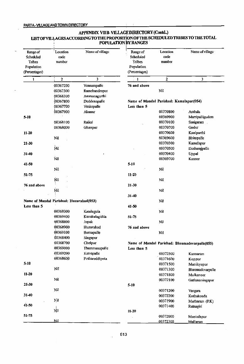
PART A-V1LtAGEAND TdWN DIRECTORY
APPENDIX VllB-VILLAGEDIREcrORY (ConuL) USTOFVILlAGESACCORDINGTOTHEPROPORTIONOFTHE SCHEDULED TRIBES TO THE TOtAL
, POPULATION BY RANGES
Range of Scheduled
Tribes Population
(percentages)
1
5-10
H-20
21-30
31-40
.41-50
51-75
76 and above
. Location
code number
2
~0367200 I .
00367300 90368300 90367800 003677@0 003679GO
00368100 00368000
Nil
l~il
Nil
Nil
'Nil I
l-Jil
Name of village
3
Vennampalle
Ramchandrapur Ammanagurthi
Duddenapalle
Venkepalle
Akunur
Raikal
Ghanpur
Name of Mandai P~rishad: Huzurabad(053)
Less than 5
Q0369300 Kandugula 00369400 Kanukulagidda
I
Q0368800 Jupak
00368900 Huzurabad I . .
Q0369 I 00 Bornapalle 00368400 Singapur
I
00368700 Chelpur
~~~~:~~~ Thummanapalle Katrepalle
I
Q0368600 Pothareddipeta 5-10
Nil
11-20
~Iil 21-30
Nil 31-40
Nil 41-50
I
Nil 51-75
Nil ,
613
Range of Scheduled
Tribes Population
(Percentages)
76 and above
Location code
number
2
Nit
Name ofvillage
3
Name of Mandai Parishad: Kamalapur(OS4)
Less than 5 00370800 Ambala 00369900 Marripalligudem
00370100 Sanigaram
00370700 Gudur
00370600 Kaniparthi
00369600 Bhimpalle
00370300 Kamalapur 00370500 Desharajpalle
00370400 Uppal 00369700 Kannur
5-10
Nil
ll-20 Nil
21-30
Nil
31-40
Nil
41-50
Nil
51-75 Nil
76 and above
Nil
Name of Mandai Parishad: Bheemadevarpalle(055)
Less than 5
00372500 Kannaram 00371600 Koppur
00371500 Manikyapur
00371300 Bheemadevarpalle 00371800 Mulkanoor 00372100 Gatlanarsingapur
5-10
00371200 Vangara 00372200 Kothakonda 00371900 Mutharam (P.K) 00371400 Ratnagiri
11-20
00372000 Mustafapur 00372300 Mallaram

DISTRICT CENSUS HANDBOOK :KARIMNAGAR
APPENDIX VIIB- VILLAGE DIRECTORY (Concld .• ) LIST OF VILLAGES ACCORDING TO THE PROPORTION OFTHE SCHEDULED TRIBES TO THE TOTAL
POPULATION BYRANGES
Range of Location Name of village Scheduled code
Tribes number Population
(percentages)
2 3
00372600 Erraballe 2:1-30
00372400 Katkur 31-40
Nil 411-50
Nil SI-75
Nil 76 and above
Nil
Name of Mandai Parishad: Elkathurthi(056) ]l,ess than 5
00373200 Suraram 00373500 Veeranarayanapur 00373300 Vallabhapur 00372900 Gopalpur 00373]00 Elkathurthi 00373000 Damera
Range of Scheduled
Tribes Population
(percentages)
5-10
11-20
21-30
31-40
41-50
51-75
76 and above
614
Location code
number
2
00373800 00373700 00372700 00372800 00373400 00373600
Nil
Nil
Nil
Nil
Nil
Nil
Nil
Name ofviIlage
3
Thimmapur Baopet Penchakalpeta Jeelgul
Kothulnaduma DandepaUe
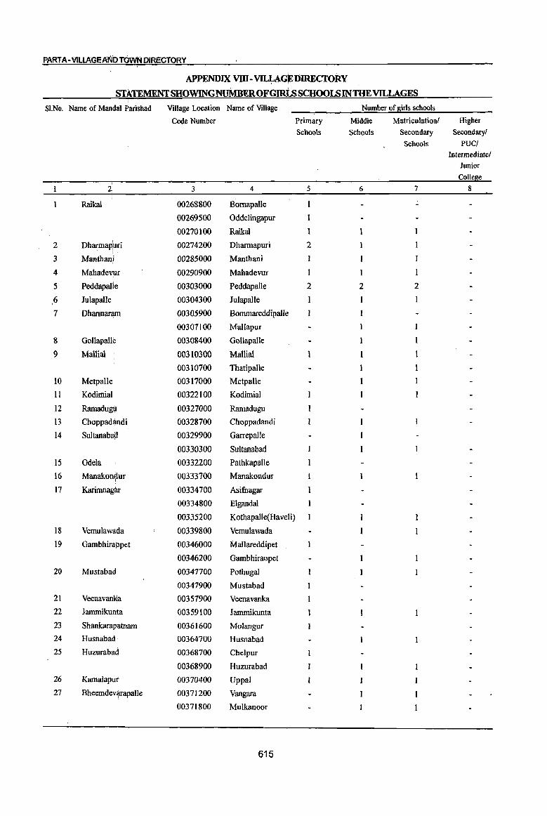
PART A-VlLlAGEAt'ilO TOwN DIRECTORY
APPENDIX VID-~GEDIRECI'ORY
STATEMENT SHOWINGNUMBEROFGIRLs SCHOOLS IN THE VILLAGES
SI.No. Name of MandaI Parishad Village Location Name of Village Number of sirls schools
Code Number Primary Middle Matriculation! Higher Schools Schools Secondary Secondary!
Schools PUC! Intermediate!
Junior Colle e
2 3 4 5 6 7 8
Raikal 00268800 Bomapalle I
00269500 Oddelingapur 1
00270100 Raikal
2 Dharmap:uri 00274200 Dharmapuri 2
3 Manthan! 00285000 Manthani
4 Mahadev!ur 00290900 Mahadevur
5 Peddapalle 00303000 Peddapalle 2 2 2
6 Julapalle 00304300 Julapalle
7 Dhannantm 00305900 Bommareddipalle
00307100 Mallapur I
8 Gollapall~ 00308400 Gollapatle I
9 Mallia} 00310300 Mallia} 1
00310700 Thatipalle
to Metpalle 00317000 Metpalle
11 Kodimial 00322100 Kodimial
12 Ramadu~ 00327000 Ramadugu
13 Choppadj\_ndi 00328700 Choppadandi
14 Sultanaba!i 00329900 Garrepalle
00330300 Sultanabad
15 Odela 00332200 Pathkapalle
16 Manakon~ur 00333700 Manakondur 1
17 Karinmag~ 00334700 Asifnagar 1
00334800 Elgandal
00335200 Kothapalle(Haveli)
18 Vemulaw~da 00339800 Vemulawada
19 Gambhirappet 00346000 11a1lareddipet
00346200 Gambhiraopet
20 Mustabad. 00347700 Pothugal
00347900 Mustabad
21 Veenavank\a 00357900 Veenavanka
22 Iammikunta 00359100 Jammikunta 1
23 Shankaraplltnam 00361600 Molangur
24 Husnabad 00364700 Husnabad
25 Huzuraba4 00368700 Chelpur
00368900 Huzurabad
26 KamalapUl' 00370400 Uppal
27 Bheemdev'/fapalJe 00371200 Vangara
00371800 Mulkanoor
615

DISTRICT CENSUS HANDBOOK :KARIMNAGAR
APPENDIX IX-VILLAGEDJREcroRY
USTOFDEGREECOLLEGESBYVILLAGE/TOWNINlHEDISTRICf
SI.No. Name of Mandai Parishad Village (Town Name of Village/ Name of the Degree College
Location Town
Code Number
2 3 4 5
Dhannapuri 00274200 Dhannapuri S.L.N.S.A.Kalasala
2 Ramagundam 40301000 Godavarikhani of 1. Government Degree College
Ramagundam(M) 2. Shiva Krishna College, FCr, Road, Addaguntapalle
3. Goutamisai Degree College
3 Manthani 00285000 Manthani Government Degree College
4 Peddapalle 00303000 Peddapalle 1. Government Degree College
2. Sri Rama Oriental(Eve) College(Un-aided)
5 Jagtial 40304000 Jagtial (M) 1. Government Degree College,S.K.N:R.
2. Government Degree College(Women)
3. Ramakrishna Degree College
6 Koratla 40305000 Koratla (M) Government Degree College
7 Karimnagar 40306000 Karimnagar (M) 1. Government Degree College
2. Government Degree College(Women)
3. Jayasree College
4. Santhosh CoUege(S.E.S)
5. Vivekananda College, Jagtial Road
6. S.R.M.Coilege, Mankammathota
7. Sri Chaitanya College, opp:Petrol Pump
8. KlMS Degree College, Beside: R&B Guest house
9. Alphones Degree College(Womcn)
8 Vemulawada 00339800 Vemulawada (R) 1. SRRS, Oriental Kalasala
2. Sri Arunodaya College
3. Jawaharlal Nehru College
9 Yellareddipet 00345200 Venkatapurarn Government Degree College
10 Jarnmikunta 00359100 Jammikunta Government Degree College
II Huzurabad 00368900 Huzurabad l.Government Degree College
2. Satavahana degree college
616

PARTA· VILLAGEA~DTOWN DIRECTORY !
APPENDIXX -VILLAGE.DIRECfORY . 1
I LIST OF HOSPITALS BY VILLAGE I TOWN INTHEDISTRICf
SI.No. Name of Mabdal Pari~had I
Village frown Name of Villa~el Name of the Hospital
Location Town
Code Number v
~ 3 4 5
1 Jagtial 40304000 Jagtial (M) 1. Area Hospital
2. C.S.I. Hospital
3. Shanker Hospital
2 Koratla 40305000 Koratla (M) 1. Sai Hospital
2. Sri Ram Hospital
3 Sultanabad 00330300 Sultanabad C.S.I.Hospital
4 KarimnagaJ: 40306000 Karimnagar (M) 1. District Hospital
2. C.S.I. Hospital
3. Aravind Hospital
4. latheen Hospital
5. Krishna Eye Hospital
6. Mamta Vanee Eye Hospital
7. Medwin General Hospital
8. Sudha Hospital
9. Sushurutha Cancer Hospital
10. Venkateswara Hospital
II. Laxminarayana Memorial Hospital
12. Church of South India Hospital
5 Sircilla 40307000 Sircilla (M) Area Hospital
6 Husnabad 00364700 Husnabad Sri Laxmi Memorial Deepika Hospital
7 Kamanpur 00281100 Kamanpur Gandhi Hospital
8 Odela 00331900 Odela Dr.V.N.Sharma Memorial Hospital
9 Raikal 00270100 Raikal Bethamy Hospital
to Timmapur. 00355600 Timmapur Project Hospital(LMD Colony)
(LMD Col~ny)
11 Choppadan~i 00328700 Choppadandi Ragmpet Venkateswara Hospital
12 lammikunt~ 00359100 lammikunta Dr. Narasimhareddy Hospital
13 Ramagundcrin 40301000 Ramagundam (M) Government Hospital
617
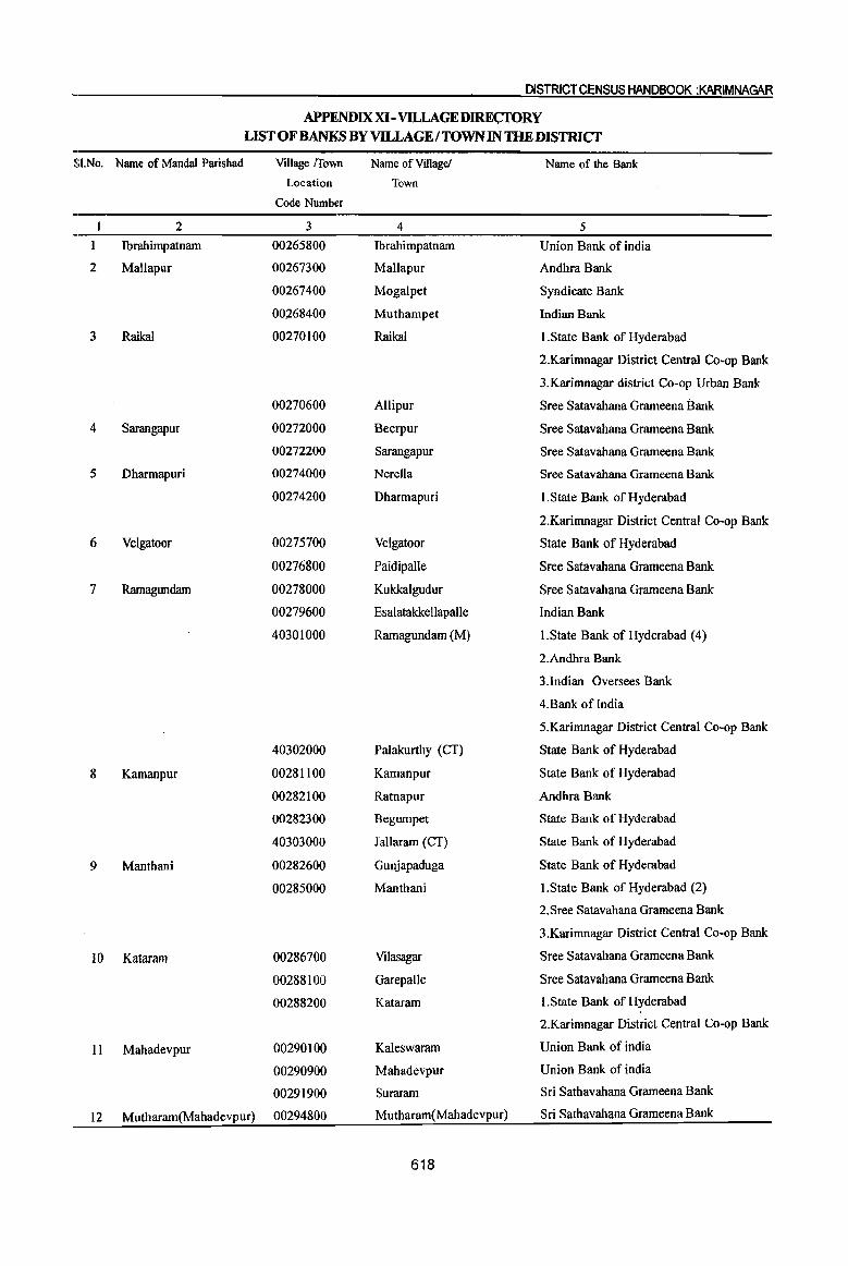
DISTRICT CENSUS HANDBOOK :KARIMNAGAR
APPENDIX XI-VILLAGEDIRECfQRY LIST OF BANKS BY VILLAGE I TOWN IN THEDISTRICf
SI.No. Name of MandaI Parishad Village !Town Name of Village! Name of the Bank
Location Town
Code Number
1 2 3 4 5
1 Ibrahimpatnam 00265800 Ibrahimpatnam Union Bank of india
2 MaUapur 00267300 Mallapur Andhra Bank
00267400 Mogalpet Syndicate Bank
00268400 Muthampet Indian Bank
3 Raikal 00270100 Raikal l.State Bank of Hyderabad
2.Karimnagar District Central Co-op Bank
3.Karimnagar district Co-op Urban Bank
00270600 Allipur Sree Satavahana Grameena Bank
4 Sarangapur 00272000 Beerpur Sree Satavahana Grameena Bank
00272200 Sarangapur Sree Satavahana Grameena Bank
5 Dharmapuri 00274000 Nerella Sree Satavahana Grameena Bank
00274200 Dharmapuri I.State Bank of Hyderabad
2.Karimnagar District Central Co-op Bank
6 Velgatoor 00275700 Velgatoor State Bank of Hyderabad
00276800 Paidipalle Sree Satavahana Grameena Bank
7 Ramagundam 00278000 Kukkalgudur Sree Satavahana Grameena Bank
00279600 Esalatakkellapalle Indian Bank
40301000 Ramagundam (M) l.State Bank of Hyderabad (4)
2.Andhra Bank
3.Indian Oversees Bank
4.Bank of India
5.Karimnagar District Central Co-op Bank
40302000 Palakurthy (CT) State Bank of Hyderabad
8 Kamanpur 00281100 Kamanpur State Bank of Hyderabad
00282100 Ratnapur Andhra Bank
00282300 Begumpet State Bank of Hyderabad
40303000 J allaram (CT) State Bank of Hyderabad
9 Manthani 00282600 Gunjapaduga State Bank of Hyderabad
00285000 Manthani l.State Bank of Hyderabad (2)
2.Sree Satavahana Grameena Bank
3.Karimnagar District Central Co-op Bank
10 Kataram 00286700 Vilasagar Sree Satavahana Grameena Bank
00288100 Garepalle Sree Satavahana Grameena Bank
00288200 Kataram I.State Bank of Hyderabad
2.Karimnagar District Central Co-op Bank
II Mahadevpur 00290100 Kaleswaram Union Bank of india
00290900 Mahadevpur Union Bank of india
00291900 Suraram Sri Sathavahana Grameena Bank
12 Mutharam(Mahadevpur) 00294800 Mutharam(Mahadevpur) Sri Sathavahana Grameena Bank
618
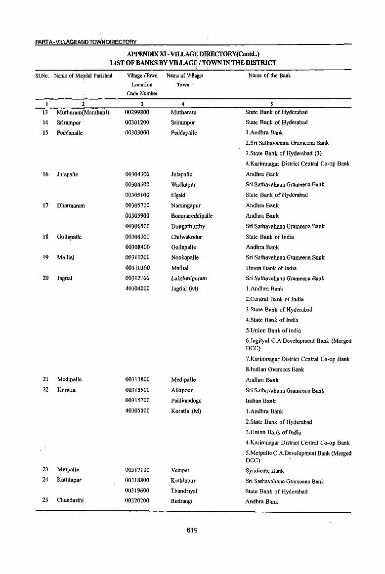
PART A-VILLAGEAfI.IOTOWN OIRECTORY
APPENDIX XI - VD.LAGE D$ECrORY(Contd •• ) I • .
LIST OF BANKS BY VILLAGF; I TOWN IN THE DISTRICT
SI.No. I •
Name of MandaI Parishad I
Village {fown Name of Village! Name of the Bank
Location Town
Code Number ,
I I + 3 4 5
13 Mutharam~Manthani) 00299800 Mutharam State Bank of Hyderabad
14 Srirampur 00301200 Srirampur State Bank of Hyderabad
15 Peddapalle 00303000 PeddapalJe 1.Andhra Bank
2.Sri Sathavahana Grameena Bank
3.State Bank of Hyderabad (3)
4.Karimnagar District Central Co-op Bank
16 Juiapalle 00304300 Julapalle Andhra Bank
00304600 Wadkapur Sri Sathavahana Grameena Bank
00305100 Elgaid State Bank of Hyderabad
17 Dharmaram 00305700 Narsingapur Andhra Bank
00305900 Bommareddipalle Andhra Bank
'00306500 Dongathurthy Sri Sathavahana Grameena Bank
18 Gollapa!le 00308300 Chilwakodur State Bank of India
00308400 GollapaUe Andhra Bank
19 Mallia! 00310200 Nookapalle Sri Sathavahana Grameena Bank
00310300 Mallia] Union Bank of india
20 Jagtial 00312100 Lakshmipuram Sri Sathavahana Grameena Bank
40304000 Jagtiai (M) I.Andhra Bank
2.Central Bank of India
3.State Bank of Hyderabad
4.State Bank of India
5.Union Bank of india
6,Jagityal C.A.Development Bank (Mergea DCC)
7.Karimnagar District Central Co-op Bank
8.lndian Oversees Bank
21 Medipalle 00313800 Medipalle Andhra Bank
22 Koratla 00315500 Ailapoor Sri Sathavahana Grameena Bank
00315700 Paidimadugu Indian Bank
40305000 Koratla (M) I.Andhra Bank
2.State Bank of Hyderabad
3.Union Bank of India
4.Karimnagar District Central Co-op Bank
5.Metpalle C.A.Deve)opment Bank (Merged DCC)
23 Metpalle 00317100 Vempet Syndicate Bank
24 Kathlapur 00318800 Kathlapur Sri Sathavahana Grameena Bank
00319600 Thandriyal State Bank of Hyderabad
25 Chandurthi 00320200 Rudrangi Andhra Bank
619
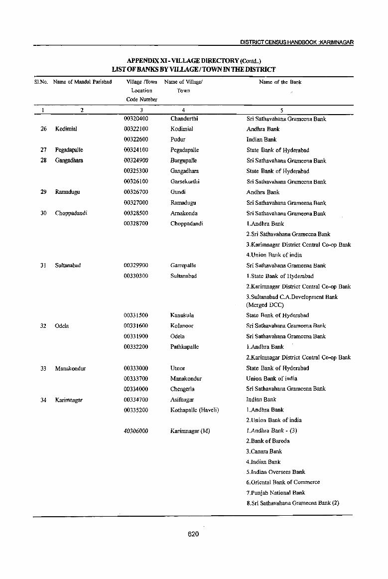
DISTRICT CENSUS HANDBOOK :KARIMNAGAR
APPENDIX XI- VILLAGEDIREcroRY (Contd .. )
LIST OF BANKS BY VILLAGE I TOWN IN THE DISTRICf
SI.No. Name of MandaI Parishad Village {fown Name of Village! Name of the Bank
Location Town
Code Number
2 3 4 5 00320400 Chandurthi Sri Sathavahana Grameena Bank
26 Kodimial 00322100 Kodimial Andhra Bank
00322600 PUdUT Indian Bank
27 Pegadapalle 00324100 Pegadapalle State Bank of Hyderabad
28 Gangadhara 00324900 Burgupalle Sri Sathavahana Grameena Bank
00325300 Gangadhara State Bank of Hyderabad
00326100 Garsekurthi Sri Sathavahana Grameena Bank
29 Ramadugu 00326700 Gundi Andhra Bank
00327000 Ramadugu Sri Sathavahana Grameena Bank
30 Choppadandi 00328500 Amakonda Sri Sathavahana Grameena Bank
00328700 Choppadandi I.Andhra Bank
2.Sri Sathavahana Grameena Bank
3.Karimnagar District Central Co-op Bank
4.Union Bank of india
31 Sultanabad 00329900 Garrepalle Sri Sathavahana Grameena Bank
00330300 Sultanabad I.State Bank of Hyderabad
2.Karimnagar District Central Co-op Bank
3.Sultanabad C.A.Development Bank (Merged DCC)
00331500 Kanukula State Bank of Hyderabad
32 Odela 00331600 Kolanoor Sri Sathavahana Grameena Bank
00331900 Odela Sri Sathavahana Grameena Bank
00332200 Pathkapalle I.Andhra Bank
2.Karimnagar District Central Co-op Bank
33 Manakondur 00333000 Utoor State Bank of Hyderabad
00333700 ManakonduT Union Bank of india
00334000 Chengerla Sri Sathavahana Grameena Bank
34 Karimnagar 00334700 Asifnagar Indian Bank
00335200 Kothapalle (Haveli) I.Andhra Bank
2.Union Bank of india
40306000 Karimnagar (M) l.Andhra Bank - (3)
2.Bank of Baroda
3.Canara Bank
4.Indian Bank
5.Indian Oversees Bank
6.0riental Bank of Commerce
7.Punjab National Bank
8.Sri Sathavahana Grameena Bank (2)
620
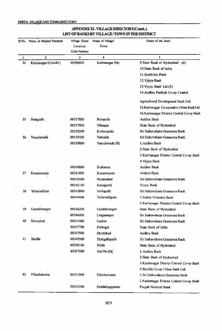
PART A-VILLAGE MD TOWN DIRECTORY
APPENDIXXI-VII..l4GEDIREcroRY(Contd..) LIST OF BANKS BY VILLAGE/TQWN IN THE DISTRICT
,
Name of ViUaie/ Name of the Bank SI.No. Name of Mru;tdal Parishad Village /fown
Location Town
Code Number I
2; 3 4 5 I
34 Karimnagair (Coneld.) 40306000 Karimnagar (M) 9.State Bank of Hyderabad - (6)
10.State Bank ofIndia
lI.Syndicate Bank
12.Vijaya Bank
13.Vysya Bank Ltd-(2)
14.Andhra Pradesh Co-op Central
Agricultural Development Bank Ltd.
15.Karimnagar Co-operative Urban Bank Ltd
16.Karimnagar District Central Co-op Bank
35 Boinpalle . 00337800 Boinpalle Andhra Bank
00337900 Vilasagar State Bank of Hyderabad
00338200 Kodurupaka Sri Sathavahana Grameena Bank
36 Vemulawad~ 00339300 Vattemla Sri Sathavahana Grameena Bank
00339800 Vemulawada (R) I.Andhra Bank
2.State Bank of Hyderabad
3.Karimnagar District Central Co-op Bank
4. Vijaya Bank
00340800 Rudraram Andhra Bank
37 Konaraope~a . 00341800 Konaraopeta Andhra Bank
00342000 Nizamabad Sri Sathavahana Grameena Bank
00342100 Kanagarthi Vysya Bank
38 Yellareddip~t 00343800 Gollapalle Sri Sathavahana Grameena Bank
00344400 Yellareddipeta l.Indian Oversees Bank
2.Karhnnagar District Central Co-op Bank
39 Gambhiraoj~et 00346200 Gambhiraopet State Bank of Hyderabad
00346900 Lingannapet Sri Sathavahana Grameena Bank
40 Mustabad 00347400 Gudem Sri Sathavahana Grameena Bank
00347700 Pothugal State Bank of India
00347900 Mustabad Andhra Bank
41 Sircilla 00349500 Thangallapalle Sri Sathavahana Grameena Bank
00350100 lillela State Bank of Hyderabad
40307000 Sircilla (M) I.Andhra Bank
2.State Bank of Hyderabad
3.Karimnagar District Central Co-op Bank
4.Sircilla Co-op Urban bank Ltd.
42 Ellanthakun1a 00351900 Ellanthakunta I. Sri Sathavahana Grameena Bank
2.Karimnagar District Central Co-op Bank
00352300 PeddaIingapuram Punjab National Bank
621
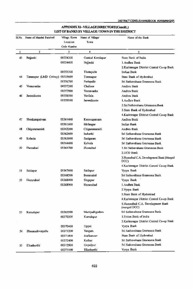
DISTRICT CENSUS HANDBOOK jKARIMNAGAR
APPENDIX XI- VILLAGEJ).lRECfORY{Concld..) LIST OF BANKS BY VILLAGE I TOWN IN THE DISTRICT
SI.No. Name of MandaI Parishad Village (fown Name of Villagel Name of the Bank
Location Town
Code Number
2 3 4 5
43 Beiianki 00354200 Gunkul Kondapur State Bank of India
00354400 Beiianki I.Andhra Bank
2.Karimnagar District Central Co-op Bank
00355300 Thotapalle Indian Bank
44 Timmapur (LMD Colony) 00355600 Timmapur State Bank of Hyderabad
00356700 Parlapalle Sri Sathavahana Grameena Bank
45 Veenavanka 00357200 Challoor Andhra Bank
00357900 Veenavanka Andhra Bank
46 Jammikunta 00358500 Vavilala Andhra Bank
00359100 Jammikunta l.Andhra Bank
2.Sri Sathavahana Grameena Bank
3.State Bank of Hyderabad
4.Karimnagar District Central Co-op Bank
47 Shankarapatnam 00361400 Kesavapatnam Andhra Bank
00361600 Molangur Indian Bank
48 Chigurumamidi 00362200 Chigurumamidi Andhra Bank
00362600 lndurthi Sri Sathavahana Grameena Bank
49 Koheda 00363000 Sanigararn Sri Sathavahana Grameena Bank
00364400 Koheda Sri Sathavahana Grameena Bank
50 Husnabad 00364700 Husnabad I.Sri Sathavahana Grameena Bank
2.UCO Bank
3.Husnabad CA Development Bank (Merged DCC)
4.Karimnagar District Central Co-op Bank
51 Saidapur 00367600 Saidapur Vysya Bank
00368200 Bommakal Sri Sathavahana Grameena Bank
52 Huzurabad 00368400 Singapur Vysya Bank
00368900 Huzurabad I.Andhra Bank
2. Vysya Bank
3.State Bank of Hyderabad
4.Karimnagar District Central Co-op Bank
5.Huzurabad c.A. Development Bank (merged DCC)
53 Kamalapur 00369900 Marripalligudem Sri Sathavahana Grameena Bank
00370300 Kamalapur I.Union Bank of india
2.Karimnagar District Central Co-op Bank
00370400 Uppal Vysya Bank
54 Bheemadevarpalle 00371200 Vangara Sri Sathavahana Grameena Bank
00371800 Mulkanoor State Bank of Hyderabad
00372400 Katkur Sri Sathavahana Grameena Bank
55 E1kathurthi 00372900 Gopalpur Sri Sathavahana Grameena Bank
00373100 Elkathurthi Vysya Bank
622
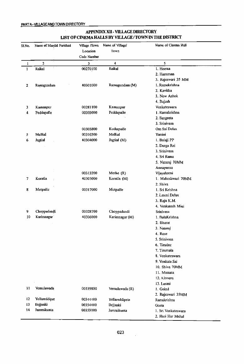
PART A· V1LLAGEAN[~ TOWN DIRECTORY
APPENDIX XU - VILLAGE DIRECfORY LIST OF CINEMA HALI.S BY VILLAGE I TOWN IN THE DISTRICT
S1.No. Name of Marldal Parisbad Village fIown Name of Village! Name of Cinema Hall I
Location Town
Code Number
1 2 3 4 5
1 Raikal 00270100 Raikal 1. Heema
2. Hanuman
3. Rajeswari 35 MM
2 Ramagundruh 40301000 Ramagundam (M) l. Ramakrishna
2. Kavitha
3. New Ashok
4. Rajesh
3 Kamanpur 00281100 Kamanpur Venkateswara
4 Peddapalle 00303000 Peddapalle I. Ramakrishna
2. Sangeeta
3. Srinivasa
00303800 KothapalJe OmSaiDelux
5 Mallial 00310300 Mallial Yamini
6 Jagtial 40304000 Jagtial (M) I. Balaji PP
2. Durga Rai
3. Srinivasa
4. Sri Rama
5. Nataraj 70MM
Annapurna
00313200 Mothe (R) VIjayalaxmi
7 Koratla 40305000 Koratla (M) 1. Maheshwari 70MM
2. Shiva
8 Metpalle 00317000 Metpalle I. Sri Krishna
2. Laxmi Delux
3. Raja K.M.
4. Venkatesh Mini
9 Choppadan~i 00328700 Choppadandi Srinivasa
IO Karimnagar 40306000 Karimnagar (M) I. BalaKrishna
2. Bharat
3. Nataraj
4. Rose
5. Srinivasa
6. Tiradaz
7. Tirumala
8. Venkateswara
9. Venkata Sai
10. Shiva 70MM
II. Mamata
12. Kinnera
13.Laxmi II Vemulawada 00339800 Vemulawada (R) I. Gokul
2. Rajeswari 35MM 12 Yellareddipet 00344400 Yellareddipeta Ramakrishna 13 Beijanki 00354400 Beijanki Geeta 14 Jammikunta 00359100 Jammikunta 1. Sri Venkateswara
2. Had Har Mahal
623
DISTRICT CENSUS HANDBOOK :KARIMNAGAR
APPENDIXXll - VILLAGE DIREcroRY(Concld .• ) LIST OF CINEMA HALLS BY VILLAGE fTOWN IN THE DISTRICT
SI.No. Name of Mandai Parishad
2
15 Husnabad
16 Huzurabad
17 Kamalapur 18 Mustabad
19 Sircilla
Village {[own Name of Village!
Location Town
Code Number
3
00364700
00366400
00368500
00368900
00370300
00347900
40307000
4
Husnabad
Jangaon
SirsapalJe
Huzurabad
Kamalapur Mustabad
Sircilla (M)
624
Name of Cinema Hall
5
3. Sri Ratna
4. Sri Venkateswara
5. Annapurna Sri Venkateswara
Urvasi
Natraj
I. Annapurna
2. Madhusudana
3. Natraja
4. Sambasiva
Sarathi
Srinivasa
1. Sri Laxmi K.M.
2. Natraj
3. Virnal Delux
4. Rajeswari 35MM
5. Hanurnan

SECTION II - TOWN DIRECTORY


PART A-VILLAGE AND TOWN DIRECTORY
Section II -Town Directory
Note explainin!g the abbreviations used in the town directory
Town Directory statements (I to VII)
Statement 1 : Status and Growth History . I
Column (2) : (:lass, name and civic status of I ~own :
,
Class has be6n introduced to facilitate analysis of town directory ~ata at the state and all India levels .. It is presented according to 2001 Census Population of the town as follows :
Population Class
100,000 and I above I i '
50,000 - 99,~99 II i
20,000 - 49,~99 III
10,000 - 19,999 IV
5,000 - 9,991) V
Below 5,000 VI
Town with a ~opulation of one hundred thousand ( 1,00,000 )and ~bove is treated as a city.
The civic st~tus of :the towns is indicated within bracket against t~e name of the toWn. The following abbreviations are used to denote civic status of town.
(I) Municipal Corporation M. Corp.
(II) Municipal Committee MC
(III) Municipal Council MCI
(IV) City Municipal Council CMC
(V) TOW~l Municipal Council TMC
(VI) Mun~cipal Board MB
(VII) Munipipality M (VIII) Cant6nment Board/Cantonment CB
(IX) Notified Area NA
(X) Notified Town NT
(Xn Notified Area Committee!
Notified Area Council I
NAC
(XII) Notified Town Area NTA
(XIII) Industrial Notified Area
(XIV) Industrial Township
(XV) Township
(XVI) Town Panchayat
(XVII) Nagar Panchayat
(XVIII) Town Committee/
Town Area Committee
(XIX) Small Town Committee
(XX) Estate Office
(XXI) Gram Panchayat
(XXII) Census Town
Others columns need no comments.
INA
ITS
TS
TP
NP
TC
ST
EO
GP
CT
Statement n _. Physical Aspects and Location of towns, 1999
Column 3 to 5 : Physical Aspects
In these columns the Rainfall and Maximum &
Millimum Temperature of the town is recorded.
Column 6, 7 and 8 :
Name of the State headquarters, District headquarters and Sub-Divisional headquarters with distance from the referent town in kilometres, is to be recorded respectively. If the names mentioned in these columns are the same as the referent town itself, the distance is recorded as (0) zero.
Column 9& 10 :
Name of the nearest city with one iakh and more and five lakhs and more population are recorded.
Column 11, 12 and 13 :
If referent town enjoys the facility of railway station, bus route facility or navigable river/canal. Its name is to be mentioned. If not available, then the
627

facility exists is to be mentioned.
Statement ill : Municipal Finance, 1998 - 99
Item-wise amount of receipt and expenditure in thousand rupees, relating to municipal finance of the town for the year 1998-99 is to be recorded.
Statement IV: Civic and Other amenities, 1999
(Column (1 to 5) : Self explanatory.
Column (6) : Road length (in kms.)
Information about kutch a / pucca road is to be recorded separately for the roads within the limits of the referent town.
(i)
(ii)
Pucca Road
Kutcha Road
Column (7): System of Sewerage
PR
KR
Generally, by sewerage system is implied the network of mains and branches of underground conduits for the conveyance of sewerage to the point of disposal. Sewers that carry only household and industrial wastes are called separate sewers, those that carry storm water from roofs, streets and other surface are known as storm water drains, while those carrying both sewage and storm water are called combined sewers.
The codes used for different types of drainage system are as follows :
(i) Sewer S
(ii) Open Surface Drains OSD
(iii) Box Surface Drains BSD
(iv) Sylk Drains SD
(v) Cesspool method CP
(vi) Pit System Pt
(vii) Others 0
Column 8 to 11 : Number of latrines
Number of various types of latrines both Public and Private are given in these columns.
Column 12 : Method of disposal of night soil
The various prevalent method of disposal of night soil are given below with codes :
Head Loads
Basket
HL
B
628
DISTRICT CENSUS HANDBOOK :KARIMNAGAR
Wheel Barrows WB
Septic Tank ST
Pit System Pt
Sewerage S Others 0
Column 13 and 14 : Water supply
Source and capacity of storage system. The following codes are used in these columns:
Column 13:
(i)
(ii)
(iii)
Tap water
Tube-well water
Tank Water
(iv) Well water
Column 14:
(v) Over Head Tank
(vi) Service Reservoir
(vii) River Infiltration Gallery
(viii) Bore Well Pumping System
(ix) Pressure Tank
T TW
TK
W
OHT
SR
RIG BWP
PT
The information on major source of water supply are given in column 13 and the storage capacity against each in kilo-litres (in bracket) are presented in column 14.
Column 15 : Fire Fighting Service
In case the fire fighting service is available in the referent town 'yes' is recorded. If the facility is not available within the town. The name of the nearest place having this facility with its distance from the referent town has been recorded.
Column 16 to 20: Electrification (Number of connections)
Different types of electric connections have been shown in these columns, i.e. Domestic, Industrial, Commercial, Road lighting (points) & other~~
Statement V : Medical, Educational, Recrea-tional and Cultural Facilities, 1999
Column 1 to 3 : Self explanatory.
Column 4 & 5 :
The data covers all such medical institutions
PART A-VILLAGEAN'o TOWN DIRECTORY
run by or aided py Government/Semi Government}
Local bodies ana Charitable institutions or Social I '
agencies like the Missionaries. Where the family planning centres' are attached to hospitals or maternity and child welfare centres or Primary Health Centres, may be treated as independent units and counted separate~y using following codes :
(i) Hospital H
(ii) Disp~nsary D
(iiI) Health Centre HC
(iv) Family Welfare Centre FWC
(v) T.B. pinic TB
(vi) Nurs~ng Home NH
(vii) Others 0
In case of more than one institutions of any type,
it is indicated ~ithin brackets the number of such institution (8) e.g. D(3), NH(8), etc. The ins~itutions have further been Idistinguished by providing additional codes within the, bracket as given below :
,Ayurvedic
Unani
Homoeopath1c
Column 6 to 9 :
A
U
Hom
". ·The codes used for these columns are as follows:
(i) Arts :only A
(ii) Science only S
(iii) Comtnerce only C
(iv) Arts i& Science only AS
(v) ,Arts 1& Commerce only AC
(vi) Combined for all ASC
categories-Arts, Science !
and Commerce
(vii) Law L
(viii) Univ~rsity U
(ix) Others 0
Column 10: Recognized shorthand, typewriting and vocational training institutes
"Recognised" should mean recognised by some statutory authotity, like educatiqn department,
629
commerce department, labour department etc. of the Government or semi Government or autonomous
bodies, public sector undertakings etc.
The following codes are used :
(i) , Vocational Training Institute VT
(ii) Shorthand SH
(iii) Typewriting Type
(iv) Shorthand & Typewriting SH Type
(v) Others 0
The vocational institutions like -Applied ArtJPainting College, Pharmacy College, B. Ed. College, Teacher's Training Institute, Music'! Dance School, Nursing School etc. are covered under 'Others'.
Column 11 to 14:
Higher SecondarylIntermediate!Senior Secondary/
PUC!Junior College level, SecondarylMatriculation, Middle Schools! Junior Secondary and Primary
Schools.
School up to class V are treated as Primary or elementary schools. These include Nursery schools, Kindergarten schools, Pre-Primary schools, Junior Basic schools upto class V and Primary schools upto class IV.
Schools upto VII are considered as Middle school
or Junior Secondary.
Schools upto class X are considered as Matriculati<;>n or Secondary schools.
Schools upto XI or XII classes are considered as Higher Secondary I Intermediate I Pre University / Junior College etc. This would cover 10+2 classes
whether held in schools or college.
If there are composite schools like middle schools with primary classes or Secondary schools with Middle
classes, these are also included in the number of
Primary and Middle schools, respectively. For example, if in a town, there are two Primary Schools and one Middle school with Primary classes, the number of Primary schools in the town is given as
three and that of Middle schools as one though there are only three educational institutions.
If there are more institutions of a type in the town, the number is indicated within bracket along with the abbreviation, e.g. P(4), M(3).
Column 15 : Adult literacy classes/centres
This column has been introduced keeping in view the Minimum Needs Programme of the Planning Commission. There are number of Adult Education Centres which are included in these columns.
If an educational facility is not available in the town, the name of the nearest place and its distance in kilometres from the town where the facility is available is mentioned.
Column 16 : Working Women's hostels with number of seats
The number of working women's hostel if available in the referent town is mentioned with number of seats. If the facility is not available in the town the name of nearest place with distance where the facility is available is recorded.
Column 17 to 19: Recreational and Cultural Facilities
Stadium, Cinema, Auditorium/DramaiCommunity Hall are covered under recreational & cultural facilities. The particulars of permanent recreational facilities are considered for these columns.
Column 20 : Public Libraries, Reading Rooms
Number of public libraries and reading rooms available in the referent town are recorded in codes as follows:
630
DISTRICT CENSUS HANDBOOK :KARIMNAGAR
(i) Public Library
(ii) Reading Room
PL
RR
Statement VI: Trade, Commerce, Industry and Banking, 1999
Column 3 to 8 :
Name of three most important commodities exported and names of three most important commodi
ties manufactured in the town are recorded.
Column 9 : Number of Banks
Number of Banks available in the referent town both Commercial and Co-operative banks are recorded
against this column.
Column 10 & 11 :
Number of Agricultural Credit Societies and Non
Agricultural Credit Societies
The total number of Agricultural Credit Societies and Non Agricultural Credit Societies in the referent
town are recorded against these columns.
Statement VII: Civic and other Amenities in Slums, 1999
This is the statement on civic and other amenities in all slums whether notified or not and for all towns
having statutory bodies, like municipality, Municipal Corporation, Town area committee etc.

c_ I
TOWN DIRECTORY STATEMENTS
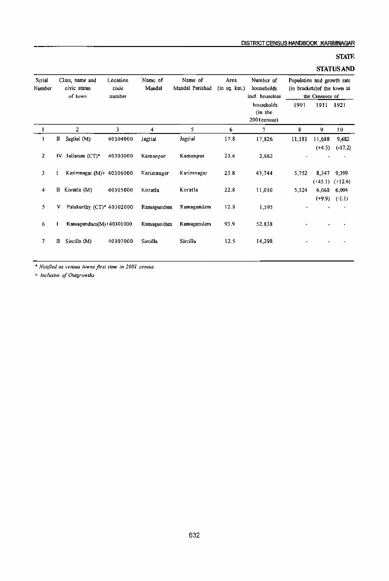
DISTRICT CENSUS HANDBOOK :KARIMNAGAR
STATE
STATUS AND
Serial Class, name and Location Name of Name of Area Number of Population and growth rate
Number civic status code MandaI MandaI Parishad (in sq. km.) households (in brackets )of the town at of town number incl. houseless the Censuses of
households [901 1911 1921 (in the
2001 census)
2 3 4 5 6 7 8 9 10
II Jagtial (M) 40304000 Jagtial Jagtial 17.8 17,826 11,181 11,688 9,682
(+4.5) (-17.2)
2 IV lallaram (CT)* 40303000 Kamanpur Kamanpur 23.6 2,662
3 Karimnagar (M)+ 40306000 Karimnagar Karimnagar 23.8 45,744 5,752 8,347 9,399
(+45.1) (+12.6)
4 II Koratla (M) 40305000 Koratla Koratla 22.8 11,010 5,524 6,068 6,004
(+9.9) (-1.1)
5 V Palakurthy (CT)* 40302000 Ramagundam Ramagundam 12.9 1,595
6 Ramagundam(M)+4030 1 000 Rarnagundarn Ramagundam 93.9 52,838
7 II Sircilla (M) 40307000 Sircilla Sircilla 12.5 14,298
• Notified as census towns first time in 2001 census
+ Inclusive of Outgrowths
632
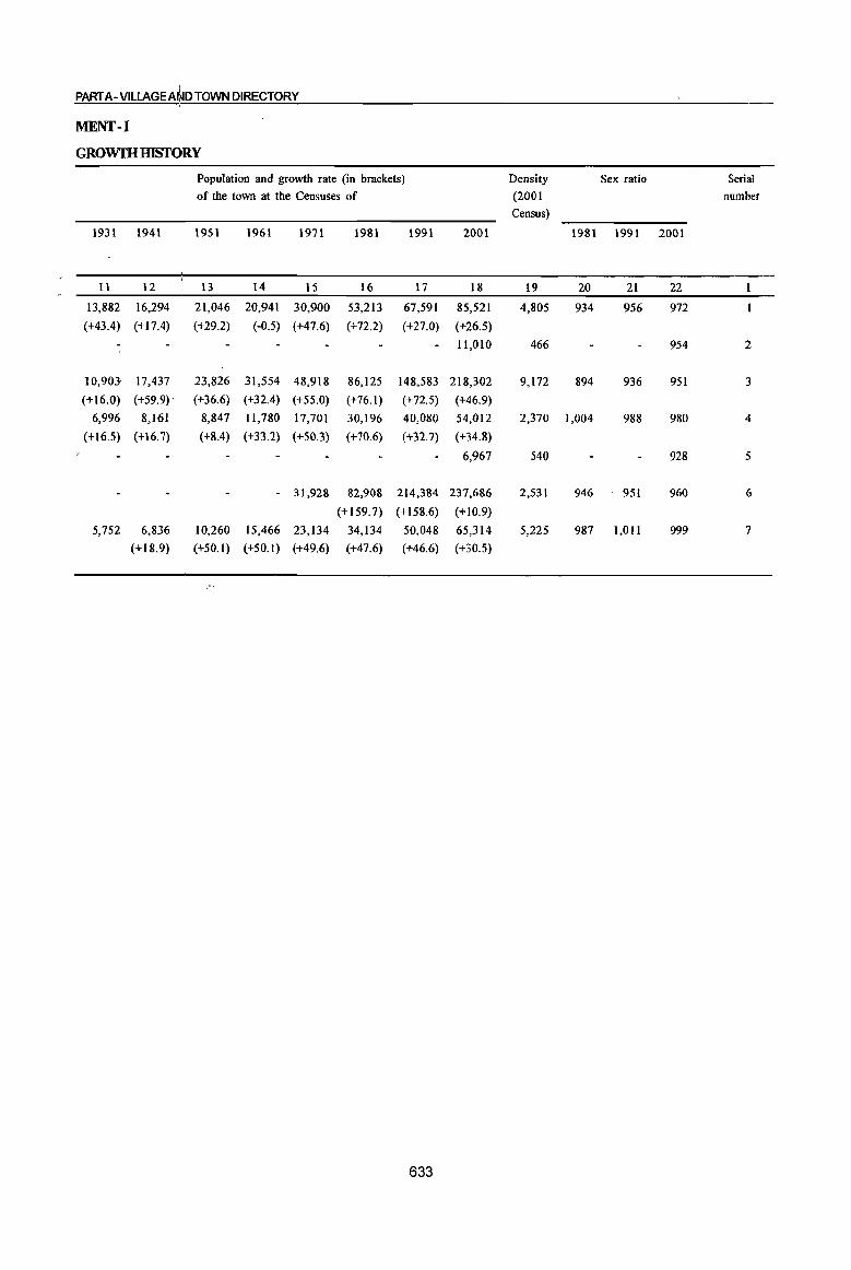
PART A-VILLAGEA~D TOWN DIRECTORY
MENT-I
GROwrnIDSfORY
Population and growth rate (in brackets)
of the town at the Censuses of
1931 1941 1951 1961 1971 1981 1991
11 12 13 14 15 16 17
13,882 16,294 21,046 20,941 30,900 53,213 67,591
(+43.4) (+17.4) (+29.2) (-0.5) (+47.6) (+72.2) (+27.0)
10,903 17,437 23,826 31,554 48,918 86,125 148,583
(+16.0) (+59.9) , (+36.6) (+32.4) (+55.0) (+76.1) (+72.5)
6,996 8,161 8,847 II,780 17,701 30,196 40,080
(+16.5) (+16.7) (+8.4) (+33.2) (+50.3) (+70.6) (+32.7)
- 31,928 82,908 214,384
(+159.7) (+158.6)
5,752 6,836 10,260 15,466 23,134 34,134 50,048
(+18.9) (+50.1) (+50.1) (+49.6) (+47.6) (+46.6)
633
2001
18
85,521
(+26.5)
11,010
218,302
(+46.9)
54,012
(+34.8)
6,967
237,686
(+10.9)
65,314
(+30.5)
Density
(2001
Census)
19
4,805
466
9,172
2,370
540
2,531
5,225
Sex ratio
1981 1991 2001
20 21 22
934 956 972
954
894 936 951
1,004 988 980
928
946 951 960
987 1,011 999
Serial
number
2
3
4
5
6
7
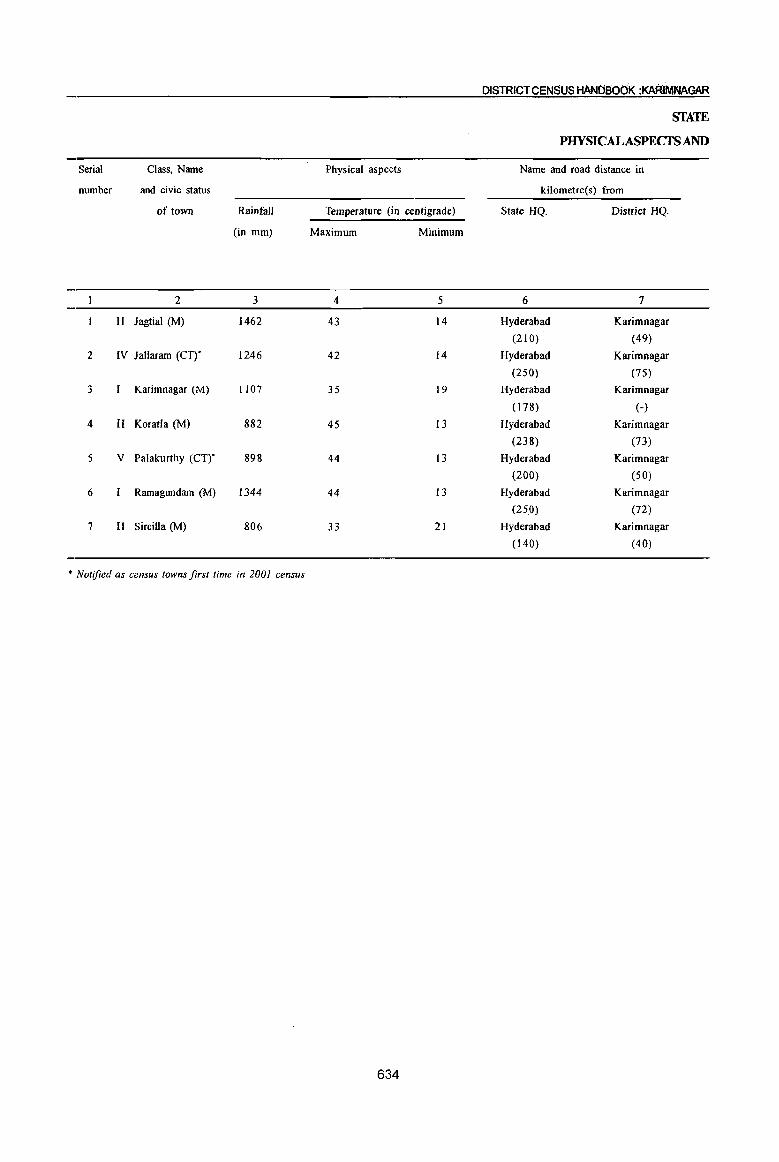
Serial Class, Name
number and civic status
of town Rainfall
(in mm)
2 3
II Jagtial (M) 1462
2 IV Jallaram (Crr 1246
3 Karimnagar (M) 1107
4 II Koratla (M) 882
5 V Palakurthy (Crr 898
6 Ramagundam (M) 1344
7 II Sircilla (M) 806
• Notified as census towns first time in 2001 census
Physical aspects
Temperature (in centigrade)
Maximum Minimum
4 5
43 14
42 14
35 19
45 13
44 13
44 13
33 21
634
DISTRICT CENSUS HANDBOdK :KARIMNAGAR
STATE
PHYSICALASPECfSAND
Name and road distance in
kilometre(s) from
State HQ. District HQ.
6 7
Hyderabad Karimnagar
(210) (49)
Hyderabad Karimnagar
(250) (75)
Hyderabad Karimnagar
(178) (-)
Hyderabad Karimnagar
(238) (73)
Hyderabad Karimnagar
(200) (50)
Hyderabad Karimnagar
(250) (72)
Hyderabad Karimnagar
(140) (40)

PART A-VilLAGE AND TOWN DIRECTORY
MENT-ll
LOCATION OF'EOWNS, 1999
Name and road distance in
kilometre(s) from
Sub division! Mandai Nearest city with Nearest city with Railway station Bus service Navigable river! Serial
population of one population of five canal (if within number
lakh and more lakh and more ten kilometres)
8 9 10 11 12 13
Jagtial Karimnagar Warangal PeddapaUe Jagtial
(-) (49) (100) (64) (- )
Kamanpur Ramagundam Warangal Ramagundam Jallaram Godavari (R) 2
(2) . (14) (145) (14) (- ) (5)
Karimnagar Karimnagar War an gal Peddapalle Karimnagar Manner River 3
(-) (-) (70) (30) (- ) (5 )
Koratla Nizamabad Warangal Nizamabad Koratla 4
(-) (70) (143) (70) (- )
Ramagundam Ramagundam Warangal Raghavapur Palakurthy 5
(10) (10) (136) (4) (- )
Ramagundam Ramagundam Warangal Ramagundam Ramagundam Godavari (R) 6
(-) (-) (128) (12) (- ) (6)
Sircilla Karimnagar Warangal Kamareddy Sircilla Manner (R) 7 (-) (40) (115) (60) (- ) (3)
635

Serial
number
2
3
4
5
6
7
II
Class, name
and civic status
of town
2
lagtial (M)
IV lallaram (Crr Karimnagar (M)
II Koratla (M)
V Palakurthy (Crr
Ramagundam (M)
II Sircilla (M)
• Notified as census towns first time in 2001 census
Receipt
through taxes,
etc.
3
11,824
100
377
6,872
74
12,956
8,537
636
DISTRICT CENSUS HANDBOOK :KARIMNAGAR
Receipt (in Rs. '000)
Revenue derived
from municipal
properties and
power apart from
taxation
4
6,367
364
1,021
255
Government
grant
5
10,849
5,886
617
298
7,818
3,798
SCATE
MUNIOPAL
Loan
6
7,100

PART A - VILlAGEAND TOWN DIRECTORY
MENT-ID
FINANCE, 1998-99
Receipt (in Rs. '000)
Advance Other Total General
Expenditure (in Rs. '000)
Public Public Public Public Others Total Serial
sources receipt administration safety health and works institutions (specify) expenditure number
(specify) conveniences
7 8 9 10 11 12 13 14 15 16
3,362 39,502 8,485 93 5,575 6,978 946 22,077
100 100 100 2
4,277 14,943 25,847 4,993 43,5! 1 13,562 18,314 1,189 3,498 85,067 3
794 8,283 738 784 2,542 1,345 153 5,562 4
371 264 30 6 18 5 323 5
2,162 6,413 30,370 8,937 6,755 2,743 7,130 451 26,016 6
12,590 1,273 686 3,851 1,098 62 346 7,316 7
637
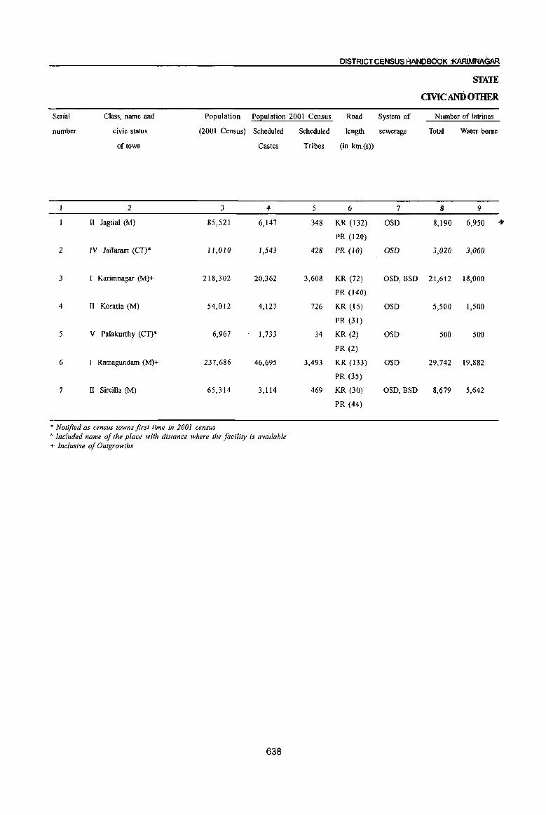
Serial Class, name and Population Population 200 I Census
number civic status (2001 Census) Scheduled Scheduled
of town Castes Tribes
2 3 4 5
II Jagtial (M) 85,521 6,147 348
2 IV Jal/aram (CT)* 11,010 1,543 428
3 I Karimnagar (M)+ 218,302 20,362 3,608
4 II Koratla (M) 54,012 4,127 726
5 V Palakurthy (CT)* 6,967 1,733 34
6 Ramagundam (M)+ 237,686 46,695 3,493
7 II Sircilla (M) 65,314 3,114 469
• Notified as census towns first time in 2001 census A Included name of the place with distance where the facility is available + Inclusive of Outgrowths
638
DISTRICT CENSUS HANDBOOK :f<ARtMNAGAR
Road System of
length sewerage
(in km.(s»
6 7
KR (132) OSD
PR (120)
PR (10) OSD
KR (72) OSD,BSD
PR (140)
KR (15) OSD
PR (31)
KR (2) OSD
PR (2)
KR (133) OSD
PR (35)
KR (30) OSD,BSD
PR (44)
STATE
CMCANDOTHER
Number of latrines
Total Water borne
8 9
8,190 6,950 '. 3,020 3,000
21,612 18,000
5,500 1,500
500 500
29,742 19,882
8,679 5,642
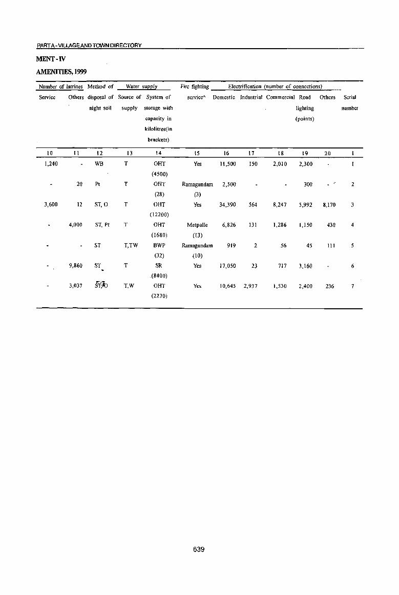
PART A - VILLAGE AND TOWN DIRECTORY
MENT-IV
AMENITIES,1999
Number of latrines Method of Water sueel! Fire fighting Electrification !number of connections2
Service Others disposal of Source of System of service" Domestic Industrial Commercial Road Others Serial
night soil supply storage with lighting number
capacity in (points)
kilolitres(in
brackets)
10 11 12 13 14 15 16 11 18 19 20
1,240 WB T OHT Yes 11,500 150 2,010 2,300
(4500)
20 Pt T OHT Ramagundam 2,500 300 2
(28) (3)
3,600 12 ST,O T OHT Yes 34,390 564 8,247 5,992 8,170 3
(12200)
4,000 ST, Pt T OHT Metpalle 6,826 131 1,286 1,150 430 4
(1680) (13)
ST T,TW BWP Ramagundam 919 2 56 45 III 5
(32) (10)
9,860 ST T SR Yes 17,050 23 717 3,160 6
.(8400)
3,037 §¥,lo T,W OHT Yes 10,645 2,937 1,530 2,400 236 7
(2270)
639
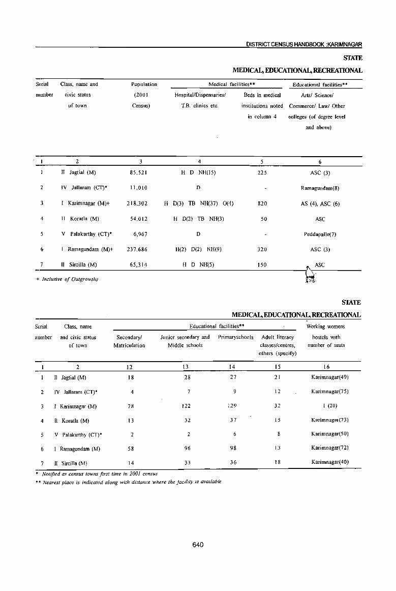
Serial
number
2
3
4
5
6
7
Class, name and
civic status
of town
2
II Jagtial (M)
IV lallaram (CT)*
I Karimnagar (M)+
II Koratla (M)
V Palakurthy (CT)*
Ramagundam (M)+
II S ircilla (M)
+ Inclusive of Outgrowths
S(~rial Class, name
number and civic status
of town
2
II Jagtial (M)
2 IV lallaram (CT)*
3 I Karimnagar (M)
4 II KoratIa (M)
5 V Palakurthy (CT)*
6 I Ramagundam (M)
7 II Sircilla (M)
Population
(2001
Census)
3
85,521
ll,OlO
218,302
54,012
6,967
237,686
65,314
Secondary!
Matriculation
12
18
4
78
13
2
58
14
* Notified as census towns first time in 2001 census
H
DISTRICT CENSUS HANDBOOK :KARIMNAGAR
STATE
MEDICAL, EDUCATIONAL, RECREATIONAL
Medical facilities** Educational facilities**
Hospital/Dispensaries!
TB. clinics etc.
4
H D NH(15)
D
0(3) T8 NH(37) 0(4)
H D(2) TB NH(3)
D
H(2) D(2) NH(9)
H D NH(5)
Beds in medical Arts! Science!
institutions noted Commerce! Law! Other
in column 4
5
225
820
50
320
150
colleges (of degree level
and above)
6
ASC (3)
Ramagundam(8)
AS (4), ASC (6)
ASC
Peddapalle(7)
ASC (3)
ASC
STATE
MEDICAL, EDUCATIONAL, RECREATIONAL
Educational facilities** Working womens
Junior secondary and Primaryschools Adult literacy hostels with
Middle schools classes!centres, number of seats
others (specify)
13 14 15 16
28 27 21 Karimnagar(49)
7 9 12 Karimnagar(75)
122 129 32 I (20)
32 37 15 Karimnagar(73)
2 6 8 Karimnagar(50)
96 98 13 Karimnagar(72)
33 36 18 Karimnagar(40)
** Nearest place is indicated along with distance where the facility is available
640
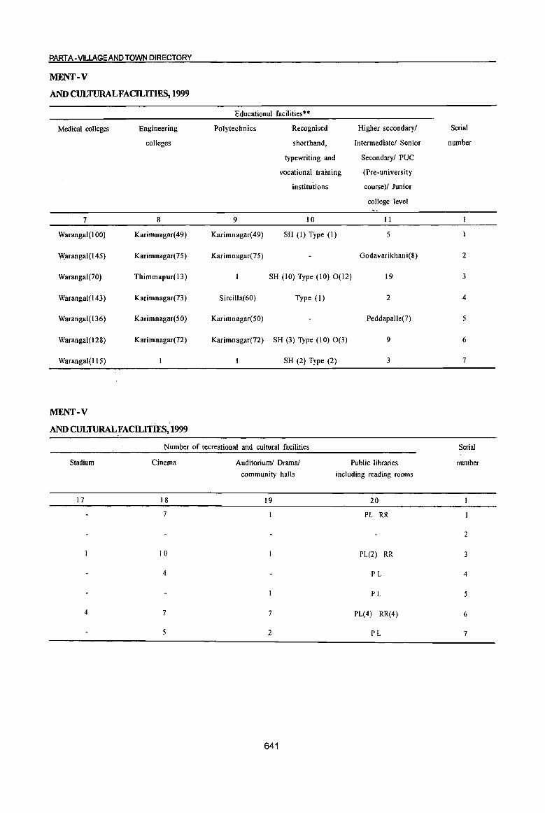
PART A- VILtAGEAND TOWN DIRECTORY
MENT-V
AND CULTURAL FACILITIES, 1999
Educational facilities*·
Medical colleges Engineering Polytechnics Recognised Higher secondary/
colleges shorthand, Intermediate! Senior
typewriting and Secondary! PUC
vocational training (Pre-university
institutions course)/ Junior
college level
7 8 9 10 II
Warangal(IOO) Karimnagar(49) Karimnagar(49) SH (I) Type (I) 5
Warangal(145) Karimnagar(75) Karimnagar(75) Godavarikhani(8}
Warangal(70) Thimmapur( 13) SH (10) Type (10) 0(12) 19
Warangal(I43) Karimnagar(73 ) Sircilla(60) Type (I) 2
Warangal(136) Karimnagar(50) Karimnagar(50) Peddapalle(7)
Warangal(128) Karimnagar(72) Karimnagar(72 ) SH (3) Type (10) 0(3) 9
Warangal(l 1 5) SH (2) Type (2) 3
MENT-V
AND CULTURALFACILITmS, 1999
Number of recreational and cultural facilities
Stadium Cinema
17 18
7
10
4
4 7
5
Auditorium! Drama!
community halls
19
7
2
641
Public libraries
including reading rooms
20
PL RR
PL(2) RR
PL
PL
PL(4) RR(4)
PL
Serial
number
2
3
4
5
6
7
Serial
number
2
3
4
5
6
7
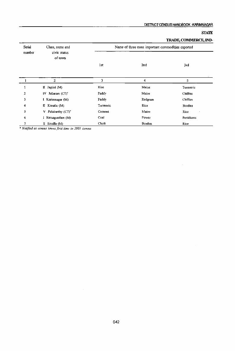
Serial
number
2
3
4
5
6
7
II
Class, name and civic status
of town
2
Jagtial (M)
IV Jallaram (CT),
I Karirnnagar (M)
II Koratla (M)
V Palakurthy (CT),
I Ramagundam (M)
II Sircilla (M)
* Notified as census towns first time in 2001 census
1st
3
Rice
Paddy
Paddy
Turmeric
Cement
Coal
Cloth
DISTRICT CENSUS HANbBOOK :KARIMNAGAR
STATE
TRADE, COMMERCE, IND-
Name of three most important commodities exported
2nd 3rd
4 5
Maize Turmeric
Maize Chillies
Redgrarn Chillies
Rice Beedies
Maize Rice
Power Fertilizers
Beedies Rice
642
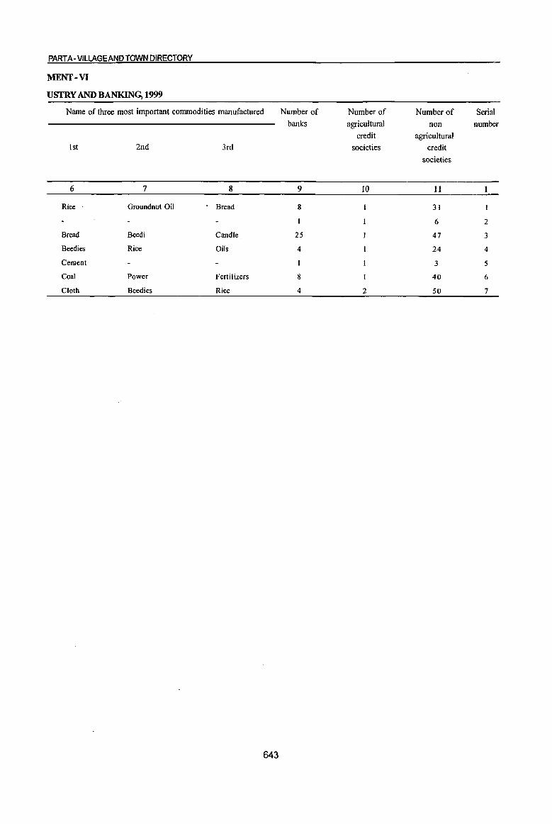
PART A -VILLAGE AND TOWN DIRECTORY
MENT-VI
USTRY AND BANKING, 1999
Name of three most important commodities manufactured Number of Number of Number of Serial
banks agricultural non number
credit agricultural
1st 2nd 3rd societies credit
societies
6 7 8 9 IO II
Rice Groundnut Oil Bread 8 31
6 2
Bread Beedi Candle 25 47 3
Beedies Rice Oils 4 24 4
Cement 3 5
Coal Power Fertilizers 8 40 6
Cloth Beedies Rice 4 2 50 7
643
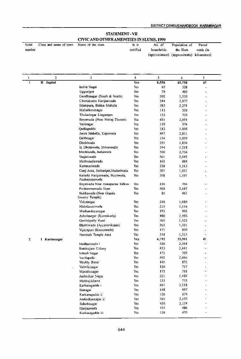
Serial
number
2
Class and name of town
2 II Jagtial
I Karimnagar
DISTRICT CENSUS HANDeOOK :KARIMNAGAR
STATEMENT - VB
CIVIC AND OTHER AMENITIES IN SLUMS, 1999 Name of the slum
3
Indira Nagar
Upparipet
Gandhinagar (South & North)
Chintakunta Harijanwada
{slampura, Bukka Mahalia
Mahathmanagar
Thulasingar Lingampet
Boyawada (Near Natraj Theatre)
Vaninagar
Quillagadda
Janda MahalIa, Kapuwada
Galibnagar
Dhobiwada
SI Dhobiwada, Shivaveedhi
Mochiwada, ludaiwada
Vanjariwada
Mothemalawada
Kammariwada
Gunj Area, Sutharipet,Madariwada
Kalachi Harijanwada, Beeriwada, Pochammawada Boyawada Near Annapurna Talkies
Pochammawada Slum
Bukkawada (Near Gopala Swamy Temple)
Vidyanagar
Mahalaxmiwada
Markandeyanagar
Ashoknagar (Kuntakatta)
Govindpally Road
Bhattiwada (Ayyavarikunta)
Vijayapuri (Kurmawada)
Beeraiah Temple Area
Medhariwada i
Buttirajam Colony
Subash Nagar
Vavilapalle
Weekly Bazar
Valmikinagar
Marathinagar
Ambedkar Nagar
Mothojikhana
Karkanagadda i
Sainagar
Karkanagadda ii
Ambedkarnagar ii
Sahethnagar
Harijanwada Karkanagadda iii
644
Is it
notified
4 Yes
Yes
Yes
Yes
Yes
Yes
Yes
Yes
Yes
Yes
Yes
Yes
Yes
Yes
Yes
Yes
Yes
Yes
Yes
Yes
Yes
Yes
Yes
Yes
Yes
Yes
Yes
Yes
Yes
Yes
Yes
Yes Yes
Yes
Yes
Yes Yes
Yes
Yes
Yes
Yes
Yes
Yes Yes
Yes
Yes
Yes Yes
Yes
No. of
households
Population of
the Slum
(approximate) (approximate)
5 6 8,558 45,758
67 328 79 403
302 1,530 544 2,977 382 2,271 113 550 153 733 451 2,051 119 574 183 1,005 447 2,811 154 1,059 351 1,834 244 1,218 500 2,736 561 2,945 165 884 228 1,513 307 1,931 308 1,591
136 766 568 2,687 85 461
240 1,089 215 1,116 193 993 480 2,596 305 1,522 263 1,321 171 950 244 1,313
4,192 22,911 526 2,368 453 2,441 171 769 492 2,066 145 875 120 717 173 718 221 1,482 133 713 641 3,318 148 697 126 674 365 2,150 450 2,124 135 686 129 670
Paved
roads (in
kilometres)
7 67
41
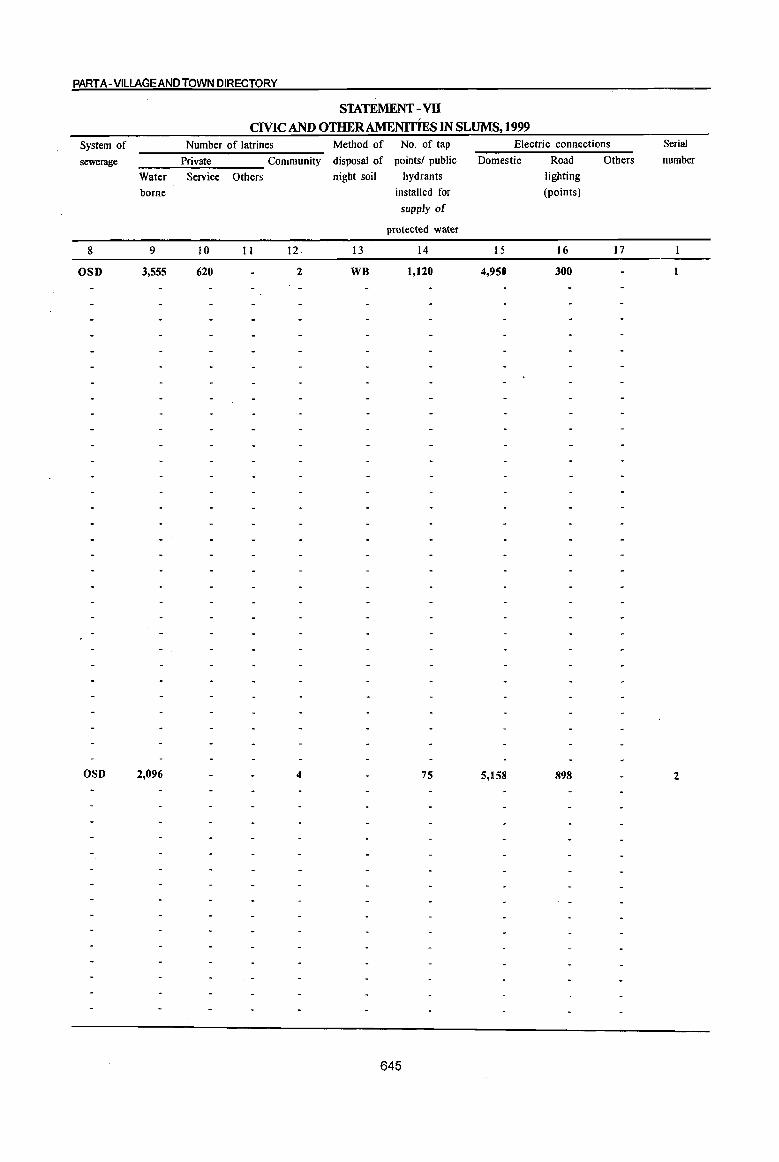
PART A- VILLAGE AND TOWN DIRECTORY
STATEMENT -vn CMC AND OTHER AMENITIES IN SLUMS, 1999
System of
sewerage
8
OSD
OSD
Water
borne
9
3,555
2,096
Number of latrines
Private Community
Service Others
10 11 12.
620 2
4
Method of No. of tap
disposal of points/ public
night soil
13
WB
hydrants
installed for
supply of
protected water
14
1,120
75
645
Electric connections
Domestic Road Others
lighting
(points)
15 16 17
4,950 300
5,158 898
Serial
number
2
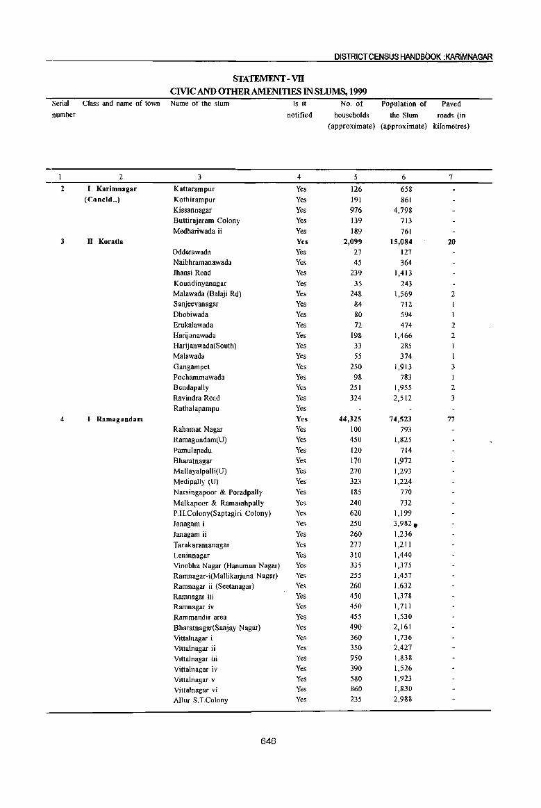
Serial
number
1
2
3
4
DISTRICT CENSUS HANDBOOK :KA~IMNAGAR
STATEMENT - VII CIVIC AND OTHER AMENITIES IN SLUMS, 1999
Class and name of town Name of the slum
2 3
Karimnagar Kattarampur (Concld .• ) Kothirampur
Kissannagar Buttirajaram Colony Medhariwada ii
II Koratla Odderawada Naibhramanawada Jhansi Road Koundinyanagar Malawada (Balaji Rd) Sanjeevanagar Dhobiwada Erukalawada Harijanawada Harijanwada(South) Malawada Gangampet Pochammawada Bendapally Ravindra Road Rathalapampu
I Ramagundam Rahamat Nagar Ramagundam(U)
Pamulapadu Bharatnagar Mallayalpalli(U) Medipally (U) Narsingapoor & Poradpally
Malkapoor & Ramaiahpally P.H.Colony(Saptagiri Colony) Janagam i Janagam ii Tarakaramanagar Leninnagar Vinobha Nagar (Hanuman Nagar) Ramnagar-i(Mallikarjuna Nagar) Ramnagar ii (Seetanagar) Ramnagar iii Ramnagar iv Rammandir area Bharatnagar(Sanjay Nagar) Vittalnagar i Vittalnagar ii Vittalnagar iii Vittalnagar iv Vittalnagar v Vittalnagar vi Allur S.T.Colony
646
Is it
notified
4
Yes Yes Yes Yes Yes Yes Yes Yes Yes Yes Yes Yes Yes Yes Yes Yes Yes Yes Yes Yes Yes Yes Yes Yes Yes Yes Yes Yes Yes Yes Yes Yes Yes Yes Yes Yes Yes Yes Yes Yes Yes Yes Yes Yes Yes Yes Yes Yes Yes Yes
No. of Population of Paved
households the Slum roads (in
(approximate) (approximate) kilometres)
5 6 7
126 658 191 861 976 4,798 139 713 189 761
2,099 15,084 20 27 127 45 364
239 1,413 35 243
248 1,569 2 84 712 80 594 72 474 2
198 1,466 2 33 285 1 55 374 I
250 1,913 3 98 783
251 1,955 2 324 2,512 3
44,325 74,523 77 100 793 450 1,825 120 714 170 1,972 270 1,293 323 1,224 185 770 240 732 620 1,199 250 3,982. 260 1,236 277 1,211 310 1,440 335 1,375 255 1,457 260 1,632 450 1,378 450 1,711 455 1,530 490 2,161 360 1,736 350 2,427 950 1,838 390 1,526 580 1,923 860 1,830 235 2,988
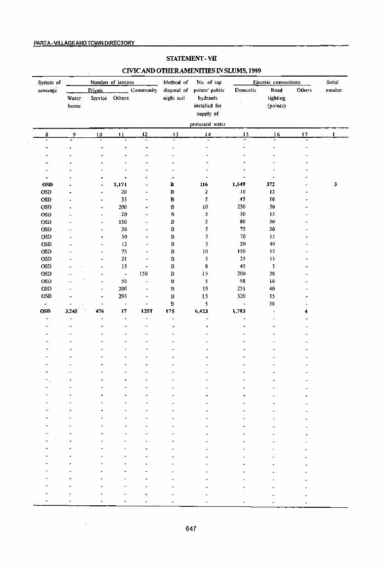
PART A-VILLAGE AND TOWN DIRECTORY
STATEMENT -vn CMCAND OTHERAMENlTIES IN SLUMS, 1999
System of Number of latrines Method of No. of tap Electric connections
sewerage Private Community disposal of points! public Domestic Road athers
Water Service Others night soil hydrants lighting
borne installed for (points)
supply of
protected water
8 9 10 II 12 13 14 IS 16 17
OSD 1,17l B 116 1,649 372
aso 20 B 2 10 12 OSO 35 B 5 45 10 OSO 200 B 10 230 50 aso 20 B 5 30 15 OSO ISO B 3 80 50 OSO 30 B 5 75 30 aSD 50 B 5 70 15 OSD 12 B 3 20 40 aSD 75 B 10 150 15 OSO 21 B 5 25 15 aso 15 B 8 45 5 OSO 150 B 15 200 20 aso 50 B 5 98 10
aSD 200 B 15 251 40 OSD 293 B IS 320 15
B 5 30 OSD 3,245 476 17 12ST 175 6,423 1,703 4
647
Serial
number
3

DISTRICT CENSUS HAND800K :KARIMNAGAR STATEMENT -VB
CIVIC AND OTHER AMENITIES IN SLUMS, 1999 Serial Class and name of town Name of the slum
number
2 3
4 I Ramagundam Veerlapally
(Concld •• ) Laxmipoor
Elklapally(Gate)
Chaitanypuri Colony
Parusharamnagar
Jawahamagar
Tilaknagar
L.B.Nagar I
L.B.Nagar Ii
Tirumulanagar
Kakatiyanagar
Chandrasekarnagar
Sanjaygandhinagar
Ashoknagar
Kasturibhanagar
Vidyanagar
Indiranagar
Kasipally
Addaguntapally
Vijaynagar
5 II Sircilla Shanthinagar
Sanjeevaiahnagar
Sainagar
Subhashnagar
Ambedkar Nagar
Padmanagar
B.Y.Nagar
Patha Kumamariwada
Ambika Nagar Thukkaropally .
Venkampet(Mysarnmastreet)
Dhobhigally
Vidya Nagar
Venkateshwara Temple Area
Virnal Theatre Road
Shiva Nagar
Ashok Nagar Sundaraiahnagar
Nehru Nagar
Anantha Nagar
Pragathi Nagar
648
Is it
notified
4
Yes
Yes
Yes
Yes
Yes
Yes
Yes
Yes
Yes
Yes
Yes
Yes
Yes
Yes
Yes
Yes
Yes
Yes
Yes
Yes
Yes
Yes
Yes
Yes
Yes
Yes
Yes
Yes
Yes
Yes
Yes
Yes
Yes
Yes
Yes
Yes
Yes
Yes Yes
Yes
Yes
Yes
No. of Population of Paved
households the Slum roads (in
(approximate) (approximate) kilometers)
5 6 7
320 1,831 334 877 185 1,905 125 1,354 960 1,355 850 1,120 536 778
900 1,926 688 1,426 600 1,670 570 3,409 285 2,923 200 1,157 650 1,012 250 785 335 2,422 ISO 1,356 170 875 380 1,795 420 594
5,680 28,891 14 376 1,881 106 • 528 106 529 169 843 289 1,447 504 2,968 1
1,112 5,609 2 222 1, III 204 1,022 124 618 136 681 331 1,654 166 832 1 113 564 2 141 705 179 893 105 526 319 1,593
457 2,283 183 916 338 1,688

PART A- VILLAGEAND TOWN DIRECTORY STATEMENT - VB
CMCAND OTHER AMENITIES IN SLUMS, 1999 System Qf Number Qf latrines Method of No. of tap Electric connections Serial
sewerage Private Community disposal of pointsl public Domestic Road Others number
Water Service Others night soil hydrants lighting
borne installed for (points)
supply of
protected water
8 9 10 11 12 '13 14 15 16 17
OSD, BSD 2,791 1,539 13 ST,O 212 3,654 430 105 5 OSD,BSD 150 226. ST,O 5 170 65 6 OSO,BSO 50 56 ST,O 6 100 75 6 OSO,BSO 4S 60 ST,O 8 9S 4S II OSD,BSO 69 100 ST,O 12 162 25 7 OSD,BSO 165 124 ST,O 7 124 20 3 OSO,BSO 300 92 ST,O 15 200 25 4 OSO,BSO 600 120 2 ST,O 28 800 60 22 OSO,BSO 60 40 ST,O 4 220 II 2 OSO,BSO 65 39 ST,O 9 201 10 3 O~m,BSO 30 94 ST,O 4 124 6 OSD,BSO 29 25 ST,O 10 131 15 5 OSO,BSO 206 50 ST,O 5 119 16 OSO,BSO 59 61 ST,O. 4 161 17 5 OSD,BSD 80 33 ST,O 12 113 15 OSO,BSO 65 76 ST,O 5 140 12 -OSO,BSO 90 89 ST,O 4 172 20 7 OSO,BSO 65 40 ST,O 12 101 21 4 OSO,BSO 79 72 2 ST,O 26 92 45 8 OSO,BSD 269 45 ST,O II 121 25 7 OSO,BSO 140 43 ST,O 12 182 23 2 OSD,BSD 175 54 ST,O 13 126 20 2
649

Serial
number
2
DISTRICT CENSUS HANOBOOR :KARIMNAGAR
APPENDIXTOTOWNDIRECfORY TOWNS SHOWING THEm OUTGROWfHS WITH POPULATION
Name of the town
with location code
2
Karimnagar
40306000
Ramagundam •
40301000
Population of
core town
3
205,653
236,600
650
Name of Outgrowth Population of Outgrowth
4 5
1. Bommakal (OG) 7,266
2. Seetarampur (OG) 1,605
3. Arepalle (partly OG) 2,105
4. Chintakunta (Partly OG) 1,673
1. Penchikalpet ( partly OG ) 1,086
PART B - PRIMARY CENSUS ABSTRACT


PARTB - PRIMARY CENSUS ABSTRACT
Brief note on Primary Census Abstract
'"J'11e first census of the third millennium and twenty 1. first century the Census of India; 200 1 was the
14th continuous and uninterrupted Indian census since 1872. Thus, 2001 Census will provide data on population and its characteristics marking transition from one century and millennium to another.
The gigantic operation of Population Enumeration (considered by many to be the single largest and complex peace time administrative exercise in the world) was made possible due to the door to door universal canvassing of the Household Schedule by about 2 million enumerators and supervisors covering 593 districts, 5,463 sub-districts, 5,161 towns and 638,588 villages. The comprehensive Household Schedule which replaced the individual slip had three parts and two sides A and B. Part I contained the Location Particulars~ Part II related to the Individual Particulars and Part III contained questions for Household engaged in CultivationIPlantation The part II of the Household Schedule had 39 columns and 23 questions all of which were universally canvassed and no sampling was resorted to during enumeration.
Data Processing
A quantum leap was made in the technology front while processing the Census 2001 data both for Houselisting and Population Enumeration. The Census schedules for both the phases were scanned through high speed scanners in fifteen data centers across the country and hand-written data from the schedules were converted into digitized form through Intelligent Character Reading (ICR) software for creation of ASCII records for further processing. The designing and formatting of the Household Schedule had to be done very carefully using specialized software so as to ensure uniformity, which was an essential prerequisite for scanning. The selection of appropriate state-of-art technology in data processing has made it possible to produce all the Houselisting as well as Population Enumeration tables on full count basis for the first time in the history of Census. For Census 2001, about 202 million schedules consisting of about 1,028 million records were scanned and processed
653
within a span of only 10 months starting October, 2002.
Task Force on Quality Assurance
After the data is processed, it is expedient on the part of the data producing agency to satisfy itself about its quality before putting the same in public domain. This has to be done mainly through the process of internal consistency, comparison with similar data in the past and also through validation with likewise data if available, from external sources. Quite often the local knowledge and perception has to be brought into play to understand both the existing and the new emerging trends of population distribution and characteristics. The other very important· aspect of the data quality is to ensure complete coverage of all geographical areas especially for the population enumeration phase where the data is disseminated right up to the village level in the rural areas and the ward level in the urban areas. Thus ensuring the complete coverage and correct geographical linkage of each enumeration block was one of the major planks ofthe quality control, specially for small area population statistics.
A very comprehensive check and edit mechanism was put in place to objectively examine the. preliminary Census 2001 Population Enumeration results and finally clear them for use. The responsibility of the final clearance of data was with the Task Force on Quality Assurance (TFQA), headed by the Registrar General and Census Commissioner, India. The other members of the TFQA were the Heads and senior officers of the Census Division, Data Processing Division, Map Division, Demography Division and Social Studies Division. The Directors of Census Operations were co-opted as members whenever the TFQA discussed the data for their StateslUnion territories. The Directors and their senior officers were required to make detailed presentations of data for their own state both in respect to the quality and the coverage and only after the full possible cleared. .
There has been a major departure in Census 2001 Drom the past in respect of the procedure followed f,or finalization of the Scheduled Castes and the Scheduled Tribes population. In the earlier censuses, the total Scheduled Castes and Scheduled Tribes popUlations were finalized at the time of the manual compilation of the Primary Census Abstracts (PC A) at the Regional Tabulation Offices which were specially set up for this purpose. The individual Scheduled Castes and the Scheduled Tribes population for each state was finalized much later based on manual coding done by the coders. In 200 I Census, €:ach individual Scheduled Caste and the Scheduled Tribe have been coded directly on the computers by the Data Entry Operators through a process known as Computer Assisted Coding (CAC) and taken up along with the processing of PCA data. The CAC process involves pulling down, from the relevant dictionary of the Scheduled Castes and the Scheduled Tribes, on the computer screen and coding from the dictionary by referring to the image of the specific individual entry in the Household Schedule appearing on the screen. The CAC of the response on Religion wherever required, was also undertaken along with llhe processing of PC A. This is because the Scheduled Castes status had to be determined in relation to the religion of the individuaL Two Special Task Forces, one on Religion and the other on Scheduled Castes/ Scheduled Tribes were constituted for scrutiny and appropriate classification of these responses.
The main task of the Special Task Force on Religion was to appropriately merge or group the new responses encountered and code it into the appropriate religious community based on available literature and local knowledge. The Special Task Force on Scheduled Castes and Scheduled Tribes examined the different Scheduled Castes and Scheduled Tribes entries encoun-tered and classified these into appropriate category of the Scheduled Castes or the Scheduled Tribes principally based on the Presidential Notification and the available literature. Thus a very systematic and scientific mechanism was operationalised to firm up the individual religion and the individual Scheduled Castes/Tribes returns. The Scheduled Castes and the Scheduled Tribes population in 2001 Census, is thus being finalized by aggregating the population data for individual Scheduled Castes and the Scheduled Tribes at appropriate geographical levels.
DISlRICTCENSUS HANDBOOK: KARIMNAGAR
The entire work relating to the data validation and scrutiny was completed by all the StateslUnion Territories under the overall supervision and monitoring of the Census Division of the Office of the Registrar General, India with active cooperation and support of the Social Studies Division, Data Processing Division, Data Dissemination Division and Map Division.
Primary Census Abstract
The Primary Census Abstract which is yet another important publication of 2001 census gives basic information on Area, Total Households, Total population, Scheduled Castes, Scheduled Tribes population, Population in the age group 0-6, Literates, Main workers and Marginal workers classified by the four broad industrial categories, namely, (i) Cultivators, (ii) Agricultural labourers, (iii) Household Industry Workers, and (iv) Other workers and also Non-workers. The characteristics of the Total Population includes Scheduled Castes, Scheduled Tribes, Institu-tional and Houseless population and are presented by sex and rural-urban residence. This data is presented at different levels, namely, India, StateslUnion territories, Districts and Cities, Urban Agglomerations (population 1,00,000 and above) in three different tables. In addition, the Appendix of said publication provides Houseless and Institutional Households and their population by residence and sex for 2001 for India, State and Union territory.
654
Apart from the India and StatelUnion Territory volumes for Primary Census Abstract, the District Census Handbook contains District Primary Census Abstract, Appendix to District Primary Census Abstract, Primary Census Abstract for Scheduled Castes, Primary Census Abstract for Scheduled Tribes, Village Primary Census Abstract and Urban Primary Census Abstract of the concerned district in the state.
It was for the first time at the 1981 Census that the Primary Census Abstract (PC A) was brought out for the Scheduled Castes and the Scheduled Tribes separately on the pattern of General Primary Census Abstract. This practice was continued in 1991 also. In the 1961 and 1971 Censuses, such data were made available in Table C-VIII-Social and Cultural table and to some extent in the series 'Special Tables for Scheduled Castes/Scheduled Tribes'.
PART B -PRIMARY CENSUS ABSTRACT
The fonnat of Primary Census Abstract has been restructured slightly in the 2001 Census as compared to that of 1991 Census. The nine-fold industrial classification of main workers given in the Primary Census Abstract of 1991 Census has been discontinued and its place, four-fold industrial classification of both 'main workers' and 'marginal workers' are included. In 1981 census only main workers were presented into four categories. One of the novel features of the primary census abstract of 1991 census was the presentation of
Name of the Primary Census Abstract
I.District Primary Census Abstract
2.Primary Census Abstract for Scheduled Castes
3.Primary Census Abstract for Scheduled Tribes
4. Village Primary Census Abstract
5. Urban Primary Census Abstract
The PCA Data for villages was presented MandaI Parishad wise for the first time in 1991 Census. This practice is continued in 200 I Census also. The data for each Mandai Parishad is presented both for rural and urban areas separately. All the villages within the MandaI Parishad constitute the rural portion and the Census Towns and Outgrowths are shown under the urban portion of the MandaI Parishad. In case a MandaI Parishad is spread over two or more districts, than portion which falls within the district is presented, the data pertaining to remaining portion of the Mandai Parishad is presented in the concerned District Census Handbook. The data in the Urban Primary Census Abstract for each town as well as for town with outgrowths in the district are presented. The data for all the wards and the outgrowths of the town( s) are also presented separately below the concerned town(s).
The District Primary Census Abstract is presented in 59 columns. The Primary Census Abstract for Scheduled Castes and Primary Census Abstract for Scheduled Tribes are presented in 52 columns. The Village Primary Census Abstract and Urban Primary Census Abstract are presented in 58 columns.
The concepts and definitions used in the column heading are explained under the sub heading 'Census Concepts' in the Analytical Note. The term 'Total Population' includes the Scheduled Castes the , Scheduled Tribes, the Institutional and the Houseless
655
data of the population of age group 0-6 is continued in 2001 Census also. This will help the data users in better analysis and understanding of this literacy data.
Level of presentation in District Census Handbooks:
The Primary Census Abstract data in different peAs are presented at different levels. The level of presentation of Primary Census Abstracts are as under:
Level of presentation
DistrictlMandal ParishadlUAlCity/Town
District/MandaI ParishadITown
District/MandaI ParishadiTown
MandaI ParishadIVillage wise
Town/Ward level
popUlations. The explanation regarding area figures presented at various level in the Primary Census Abstracts are as follows:
Area Figures
The area figures supplied by local revenue authorities of the district in resp~ct of mandals, Police Stations and by the local bodies in respect of towns are given in square kilometres. The area figures of the villages supplied in acres have been converted and shown in hectares. The area figures of the MandaI Parishad is the total of the village areas coming under each MandaI Parishad. The area figures for the district are the same as adopted by the Surveyor General of India to maintain uniformity at the national level. The total area figures of all the MandalslMandal Parishad within the district may not tally with area figures of the district because former represents land use area only. Similarly, the total of all the villages area may not tally with the entire rural of MandaI. The difference may be due to t}1e-fact that while the area covered by hiH~"forests and rivers etc, h.ave been.accounted in the level the same may not be covered under the area of the villages. Apart from this it may also differ due to varying methods of computation adopted at different levels.
An appendix to District Primary Census Abstract has also been furnished showing urban enumeration block-wise particulars on Total Population, the Scheduled Castes Population and the Scheduled Tribes Population for each town.

Location District I code Mandai Parishad /
nwnber U.A.I City I ToWll
2
03 Karimnagar
0001 Ibrahimpatnam
0002 MaIJapur
(1003 Raikal
0004 Sarangapur
ooos Dharmapuri
0006 Velgatoor
0007 Ramagundam
40302000 Palakurthy (CT)
0008 Kamanpur
4030 I 000 Penchikalpeta
(Part) (OG) - Ward No.23
40303000 lallaram (CT)
0009 Manthani
0010 Katararn
DISTRICT CENSUS HANDBOOK: KARIMNAGAR
Area of Total Population Totall TownlWard (including institutional and RuraI/ in Square Number of houseless population)
----------~~----~---Urban Kilometre households Persons Males Females
3 4
Total 11823.0
Rural 11600.0
Urban 223.0
Total
Rural
Urban
Total
Rural
Urban
Total
Rural
Urban
Total
Rural
Urban
Total
Rural
Urban
Total
Rural
Urban
Total
Rural
Urban
Urban
Total
Rural
Urban
Urban
Urban
Total
Rural
Urban
Total
Rural
Urban
184.2
184.2
206.9
206.9
270.3
270.3
290.3
290.3
257.7
257.7
206.3
206.3
211.3
198.4
12.9
12.9
241.0
217.4
23.6
N.A
23.6
329.6
329.6
220.2
220.2
5
813,797
667,824
145,973
12,236
12,236
12,144
12,144
14,106
14,106
10,068
10,068
17,247
17,247
11,671
11,671
10,389
8,794
1,595
1,595
17,284
14,378
2,906
244
2,662
12,401
12,401
7,719
7,719
6 7 8
3,491,822 1,747,968 1,743,854
2,813,010 . 1,402,279 1,410,731
678,812 345,689 333,123
50,845
50,845
49,575
49,575
58,807
58,807
40,881
40,881
73,230
73,230
47,229
47,229
42,723
35,756
6,967
6,967
74,474
62,378
12,096
1,086
11,0 I 0
656
50,405
50,405
31,259
31,259
24,737
24,737
23,963
23,963
28,603
28,603
19,935
19,935
36,124
36,124
23,827
23,827
21,560
17,946
3,614
3,614
37,606
31,409
6,197
563
5,634
25,487
25,487
15,741
15,741
26,108
26,108
25,612
25,612
30,204
30,204
20,946
20,946
37,106
37,106
23,402
23,402
21,163
17,810
3,353
3,353
36,868
30,969
5,899
523
5,376
24,918
24,918
15,518
15,518
DISfRICfPRIMARY
PopUlation in the age group 0-6
Persons Males Females
9 10
465,964 237,508
383,268 195,053
82,696 42,455
7,105
7,105
6,581
6,581
7,843
7,843
5,733
5,733
10,309
10,309
6,714
6,714
5,918
5,011
907
907
10,095
8,620
1,475
159
1,316
6,772
6,772
4,550
4,550
3,629
3,629
3,370
3,370
3,906
3,906
2,887
2,887
5,197
5,197
3,449
3,449
3,028
2,551
477
477
5,210
4,427
783
93
690
3,432
3,432
2,342
2,342
II
228,456
188,215
40,241
3,476
3,476
3,211
3,211
3,937
3,937
2,846
2,846
5,112
5,lI2
3,265
3,265
2,890
2,460
430
430
4,885
4,193
692
66
626
3,340
3,340
2,208
2,208

PARTB- PRIMARYCENSUSABSlRACT
CENSUSABSTRAdr
Scheduled Castes population Scheduled Tribes population
Persons
Ii
650,246 .
566,525 83,721
7,509
7,509
8,294
8,294
7,666
7,666
7,400
7,400
15,648
15,648
13,520 13,520
10,574
8,841 1,733
1,733
11,457 9,641
1,816
273
1,543
11,279 11,279
10,278
10,278
Males
13
325,829
. 283,722 42,1'07
3,638
3,638
3,954
3,954
3,747
3,747
3,63()
3,630
7,720
7,720
6,862
6,862
5,392
4,495
89'7
5,798 4,866
932
131
801
5,795 5,795
5,210
5,210
Females Persons
14 15
324,417
282,803
41,614
3,871
3,871
4,340
4,340
3,919
3,919
3,770
3,770
7,928
·7,928
6,658 6,658
5,182
4,346 836
836
5,659 4,775
884
142
742
5,484 5,484
5,068
5,068
90,636
81,530 9,106
1,684
1,684
2,633
2,633
3,743
3,743
2,240
2,240
588
588
145
145
508
474
34
34
1,851 1,423
428
428
1,149 1,149
2,360
2,360
Males
16
45,807
41,071
4,736
860
860
1,236
1,236
1,814
1,814
1,142
1,142
305
305
71 71
254
236
18
18
926
718 208
208
582 582
1,183
1,183
Females 17
44,829
40,459
4,370
824
824
1,397
1,397
1,929
1,929
1,098
1,098
283
283
74 74
254
238
16
16
925
705 220
220
567 567
1,177
1,177
657
Literates
Persons Males Females
18 19 20
1,661,089 1,013,328 647,761
1,220,542 761,133 459,409
440,547 252,195 188,352
18,347 11,710
18,347 11,770
16,940
16,940
10,922
10,922
22,276 14,161
22,276 14,161
12,561
12,561
25,644
25,644
8,306
8,306
16,516
16,516
17,606 11,247
17,606 11,247
18,474 11,468
14,639 9,140 3,835 2,328
3,835 2,328
37,563 22,055
31,062 18,238 6,501 3,817
467 272
6,034 3,545
23,959 14,148 23,959 14,148
11,817
11,817
7,458
7,458
6,577
6,577
6,018
6,018
8,115
8,115
4,255
4,255
9,128
9,128
6,359
6,359
7,006
5,499
1,507
1,507
15,508
12,824 2,684
195
2,489
9,811
9,811
4,359
4,359
Total! RuraI/
District I Mandai Parishad I
Urban V.A.I City I Town
3 2
Total
Rural Urban
Karimnagar
Total Ibrahimpatnam Rural Urban
Total MaUapur
Rural Urban
Total Raikal Rural
Urban
Total Sarangapur Rural Urban
Total Dharmapuri
Rural Urban
Total Velgatoor Rural Urban
Total Ramagundam Rural Urban
Urban Palakurthy (CT)
Total Kamanp'uf c
Rural Urban
Urban Penchikalpeta' ! ,
(Part) (OG) - Ward No,23 i " } t
S
Urban Jallaram'.'(Cf>
r Total Manthal}i r"
Rural
Urban
Total Kataram
Rural
Urban
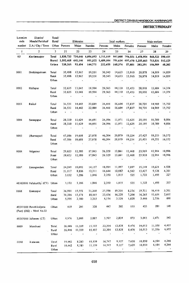
DISTRICT CENSUS HANDBOOK: KARIMNAGAR
DISTRICfPRIMARY
Location District! Total! code Mandai Parishadl Rurall Illiterates Total workers Main workers
number U.A.I City I Town Urban Persons Males Females Persons Males Females Persons Males Females
2 3 21 22 23 24 25 26 27 28 29
03 Karimnagar Total 1,830,733 734,640 1,096,093 1,711,559 957,008 754,551 1,458,954 868,523 590,431
Rural 1,592,468 641,146 951,322 1,489,104 791,634 697,470 1,255,663 713,534 542,129
Urban 238,265 93,494 144,771 222,455 165,374 57,081 203,291 154,989 48,302
0001 Ibrahimpatnam Total
0002 Mallapur
0003 Raikal
0004 Sarangapur
0005 Dharmapuri
0006 Velgatoor
0007 Ramagundam
Rural
Urban
Total
Rural
Urban
Total
Rural
Urban
Total
Rural
Urban
Total
Rural
Urban
Total
Rural
Urban
Total
Rural
Urban
4·0302000 Palakurthy (CT) Urban
0008 Kamanpur Total
Rural
Urban
40301000 Penchikalpeta Urban
(Part) (OG) - Ward No.23
40303000 Jallaram (CT) Urban
()009 Manthani
()010 Kataram
Total
Rural
Urban
Total
Rural
Urban
32,498 12,967
32,498 12,967
32,635 13,041
32,635 13,041
36,531
36,531
14,442
14,442
28,320 11,629
28,320 11,629
47,586 19,608
47,586 19,608
29,623 12,580
29,623 12,580
24,249
21,117
3,132
3,132
36,911
31,316
10,092
8,806
1,286
1,286
15,551
13,171
5,595 2,380
619 291
4,976 2,089
26,446
26,446
19,442
19,442
11,339
11,339
8,283
8,283
19,531
19,531
19,594
19,594
22,089
22,089
16,691
16,691
27,978
27,978
17,043
17,043
14,157
12,311
1,846
1,846
21,360
18,145
3,215
328
2,887
15,107
15,107
11,159 11,159
658
30,543 30,543
14,633 15,910
14,633 15,910 28,878
28,878
14,019 14,859
14,019 14,859
29,563 14, II 0 15,453 28,058 13,684 14,374
29,563 14,110 15,453 28,058 13,684 14,374
34,441
34,441
16,604
16,604
17,837
17,837
30,721
30,721
14,969
14,969
15,752
15,752
24,596 11,971 12,625 20,195 10,389 9,806
24,596 11,971 12,625 20,195 10,389 9,806
40,204 20,870 19,334 35,425 19,253 16,172 40,204 20,870 19,334 35,425 19,253 16,172
26,329 13,861 12,468 23,910 12,914 10,996
26,329 13,861 12,468 23,910 12,914 10,996
18,994
16,644
2,350
2,350
27,590
23,436
4,154
447
3,707
22,304
22,304
16,747 16,747
11,897
10,082
1,815
1,815
19,354
16,228
7,097
6,562
535
535
8,236
7,208 3,126 1,028
292
2,834
13,828
13,828
9,127 9,127
155
873
8,476
8,476
7,620 7,620
15,149
13,427
1,722
1,722
19,711
16,265
3,446
433
3,013
16,013
16,013
IQ,850
10,850
10,621
9,126
1,495
1,495
16,410
13,654 2,756
285
2,471
11,556
11,556
6,584 6,584
4,528
4,301
227
227
3,301
2,611 690
148
542
4,457
4,457
4,266 4,266

PARTB- PRIMARY CI=NSUSABSTRACT
CENSUS ABSTRACT
Industrial category of main workers Total! Location
Cultivators Agricultural Labourers Household industry workers Other workers RuraV Code
Persons Males F~males Persons Males Females Persons Males Females Persons Males Females Urban Number
30 31 32 33 34 35 36 37 38 39 40 41 3
416,830 261,346 1!15,484 399,143 185,829 213,314 191,394 47,365 144,029 451,587 373,983 77,604 Total 03
414,318 259,51i 1!;4,807 392,714 182,019 210,695 157,372 38,360 119,012 291,259 233,644 57,615 Rural
2,512 1,835 677 6,429 3,810 2,619 34,022 9,005 25,017 160,328 140,339 19,989 Urban
9,285 5,354 3,931 7,108 3,955 3,153 7,406 9,285 5,354· 3,931 7,108 3,955 3,153 7,406
10,348 5,812 4,536 6,929 3,728 3,201 6,892 10,348 5,812 4,536 6,929 3,728 3,201 6,892
9,217 5,500 3,717
9,217 5,500 3,717
8,756
8,756
5,172
5,172
Il,056 6,879 11,056 6,879
3,584
3,584
4,177 4,177
6,662 6,662
4,518
4,518
12,447 12,447
3,571
3,571
2,090
2,090
6,012
6,012
3,091 3,091
2,428
2,428
6,435
6,435
7,368 4,561 2,807 12,188 5,320 6,868
7,368 4,561· 2,807 12,188 5,320 6,868
3,799 2,794 3,637 2,683
162 III
162 111
3,154 2,502
2,768 2,230
386 272
10 10
376 262
4,264 3,293 4,264 3,293
1,005
954
51
51
5,267
5,023
244
244
652 3,294
538 2,768
114 526
211
114 315
2,538
2,390 148
148
2,729
2,633
96
96
1,940 1,354
1,629 1,139 311 215
94 117
217 98
971 971
5,991 3,292 2,699 5,991 3,292 2,699
3,457 2,326 1,131 5,921 3,031 2,890
3,457 2,326 1,131 5,921 3,031 2,890
8,378
8,378
3,270
3,270
4,669 4,669
777 777
382
348
34
34
676
485
191
12
179
534
534
l87
187
659
687 6,719 5,079 4,023 1,056 Total 0001 687
908 908
979
979
574 574
1,052
1,052
235 235
270
256
14
14
432
375
57
56
411 411
139
139
6,719 5,079 4,023 1,056 Rural
- Urban
5,984 3,889 3,236 653 Total 653 Rural
- Urban
5,984 3,889 3,236
7,399
7,399
2,696
2,696
3,617 3,617
6,464
6,464
3,651
3,651
7,253 7,253
4,919 1,545 Total
4,919 1,545 Rural
- Urban
2,553 1,098 Total
2,553 1,098 Rural
- Urban
5,310 1,943 Total 5,310 1,943 Rural
- Urban
542 3,577 2,798 779 Total
779 Rural
- Urban
542 3,577 2,798
112 5,701
92 4,419
5,019
3,797
20 1,282 1,222
682 Total
622 Rural
60 Urban
0002
0003
0004
0005
0006
0007
20 1,282 1,222 60 Urban 40302000
244 12,587 11,536 1,051 Total 0008 110 10,244 9,420
134 2,343 2, I 16
11 200 180
123 2,143 1,936
123 5,224 4,560
123 5,224 4,560
48 1,285 1,088
48 1,285 1,088
824 Rural 227 Urban
20 Urban 40301000
207 Urban 40303000
664 Total 664 Rural
Urban
197 Total
197 Rural
Urban
0009
0010
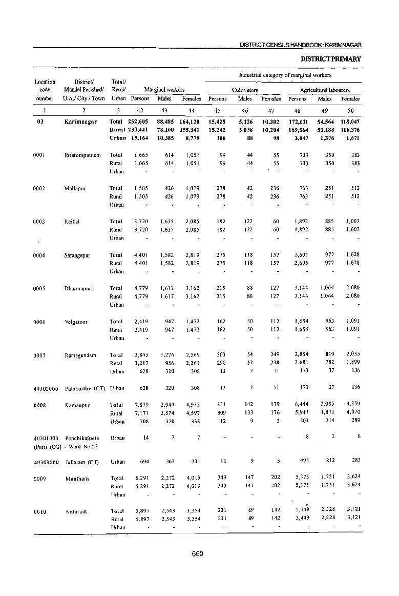
Location code
number
District! Total/ Mandai Parishadl Rural! Marginal workers
U.A.I City I Town Urban Persons Males Females
2 3 42 43 44
DISTRICT CENSUS HANDBOOK: KARIMNAGAR
DISfRICfPRIMARY
Industrial category of marginal workers
Cultivators AgriculturallabQurers
Persons Males Females Persons Males Females
45 46 47 48 49 50
03 Karimnagar Total 252,605 88,485 164,120 15,428 5,126 10,302 172,611 54,564 118,047 Rural 233,441
Urban 19,164
0001 Ibrahimpatnam Total 1,665
1,665
0002 Mallapur
0003 Raikal
0004 Sarangapur
0005 Dharmapuri
0006 Velgatoor
0007 Ramagundam
Rural
Urban
Total
Rural
Urban
Total
Rural
Urban
Total
Rural
Urban
Total
Rural
Urban
Total
Rural
Urban
Total
Rural
Urban
1,505
1,505
3,720
3,720
4,401
4,401
4,779
4,779
2,419
2,419
3,845 3,217
628
40302000 Palakurthy (CT) Urban 628
0008 Kamanpur
40301000 Penchikalpeta
(Part) (OG) - Ward No.23
40303000 lallaram (CT)
0009 Manthani
0010 Kataram
Total
Rural
Urban
Urban
Urban
Total
Rural
Urban
Total
7,879
7,171
708
14
694
6,291 6,291
5,897 Rural 5,897
Urban
78,100 155,341
10,385 8,779
614
614
426
426
1,635
1,635
1,582
1,582
1,617
1,617
947
947
1,276
956 320
320
2,944
2,574
370
7
363
2,272
2,272
2,543
2,543
1,051 1,051
1,079
1,079
2,085
2,085
2,819
2,819
3,162
3,162
1,472
1,472
2,569
2,261
308
308
4,935
4,597
338
7
331
4,019 4,019
3,354
3,354
660
15,242
186
99 99
278 278
182
182
275 275
215 215
162
162
303
290
I3
13
321 309
12
12
349
349
231
231
5,038
88
44
44
42
42
122
122
118
118
88
88
50
50
54
52
2
2
142 133
9
9
147
147
89
89
10,204
98
55 55
236
236
60
60
157
157
127 127
112 112
249
238 11
II
179 176
3
3
202
202
142 142
169,564 53,188 116,376
3,047 1,376 1,671
733
733
763
763
1,892
1,892
2,605
2,605
3,144
3,144
1,654
1,654
2,854 2,681
173
173
6,444
5,941
503
8
495
5,375
5,375
,. 5,449
5,449
350 350
251
251
885 885
977 977
1,064
1,064
383 383
512
512
1,007
1,007
1,628 1,628
2,080 2,080
563 1,091
563. 1,091
819 2,035
782 1,899
37 136
37
2,085
1,871
214
2
212
1,751 1,751
2,328
2,328
136
4,359
4,070
289
6
283
3,624 3,624
3,121
3,121
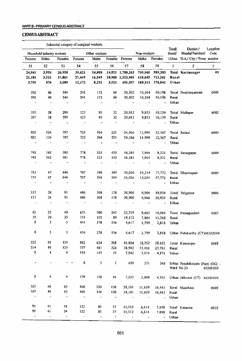
PARTS-PRIMARY C.ENSUSABSTRACT
CENSUSABSTRACf
Industrial category of marginal workers Totall District / Location
Household industry workers Other workers Non-workers RuraIJ Mandai Parishadl Code
Persons Males Females Persons Males Females Persons Males Females Urban U.A.f City I Town number
51
24,945
21,186
3,759
592
592
337
337
921
921
743
743
713
713
117 117
63
S5 8
8
222
214
8
8
107
107
95 95
52
3,995
3,325
670
48 48
38
38
124
124
162
162
67 67
26
26
23
20
3
3
93 89
4
4
44
44
41
41
53
20,950
17,861
3,089
544 544
299
299
-,
797
797
581
581
646
646
91
91
40 35
5
5
129 125
4
4
63
63
54 54
54
39,621
27,449
12,172
241
241
127
127
72S 725
778
778
707
707
486
486
625 191
434
434
892
707 185
6
179
460 460
122 122
55
24,800
16,549
56 57 58 59
14,821 1,780,263 790,960 989,303
10,900 1,323,906 610,645 713,261
3 2
Total Karimnagar
Rural
03
8,251 3,921 456,357 180,315 276,042 Urban
172
172
95
95
504
504
325
325
398
398
308 308
380
102
278
278
624
481
143
5
138
330
330
85
85
69
69
32
32
221
221
453
453
309
309
178
178
245
89 156
156
268
20,302 10,104 10,198 Total Ibrahirnpatnarn
20,302 10,104 10,198 Rural
20,012
20,012
24,366
24,366
16,285 16,285
9,853
9,853
11,999
11,999
7,964
7,964
Urban
10,159 Total Mallapur
10,159 Rural
- Urban
12,367
12,367
8,321
8,321
Total Raikal
Rural
Urban
Total Sarangapur
Rural
Urban
33,026 15,254 17,772 Total Dharrnapuri
33,026 15,254 17,772 Rural
20,900
20,900
23,729
19,112
4,617
9,966
9,966
9,663 7,864
10,934
10,934
Urban
Total Velgatoor
Rural
Urban
14,066 Total Ramagundam
11,248 Rural
1,799. 2,818 Urban
0001
0002
0003
0004
0005
0006
0007
4,617 1, 799 2,818 Urban Palakurthy (CT)40302000
46,884 18,252 28,632 Total Karnanpur 0008 226 38,942 15,181 23,761 Rural
42 7,942 3,071 4,871 Urban
41
130
130
37 37
661
639 271 368 Urban Penchikalpeta (Part) (OG) -Ward No.23 40301000
7,303 2,800 4,503 Urban lallaram (CT) 40303000
28, 101 11,659 16,442 Total Manthani 0009 28,101 11,659 16,442 Rural
14,512
14,512 6,614
6,614
7,898
7,898
Urban
Total Kataram
Rural
Urban
0010

Location code
munber
0011
0012
0013
0014
0015
0016
0017
0018
0019
0020
0021
0022
0023
District I Mandai Parishad I
U.A.I City I Town
2
Mahadevpur
Mutharam
(Mahadevpur)
Malharrao
Mutharam
(Manthani)
Srirampur
Peddapalle
Ju1apalle
Dharmaram
Gollapalle
Mallia!
Jagtial
Medipalle
Koratla
Totall Rural!
Urban
3
Total
Rural
Urban
Total
Rural
Urban
Total Rural
Urban
Total
Rural
Urban
Total
Rural
Urban
Total
Rural
Urban
Total
Rural
Urban
Total Rural
Urban
Total
Rural
Urban
Total
Rural Urban
Total
Rural
Urban
Total
Rural
Urban
Total
Rural Urban
DISTRICT CENSUS HANDBOOK: KARIMNAGAR
Area of Total Population TownlWard (including institutional and
in Square Number of houseless population) ----------~~--~----
Kilometre households
4 5
355.0
355.0
282.5
282.5
244.6
244.6
161.8
161.8
178.3
178.3
227.9
227.9
173.6
173.6
202.0
202.0
154.2
154.2
166.9
166.9
215.5
215.5
197.0
197.0
117.2
117.2
8,694
8,694
5,598
5,598
5,950
5,950
7,177
7,177
9,832
9,832
21,199
21,199
11,150
11,150
12,357
12,357
9,996
9,996
10,660
10,660
15,501
15,501
11,974
11,974
9,432
9,432
Persons
6
35,325
35,325
23,327
23,327
23,843 23,843
28,628
28,628
37,272
37,272
90,830
90,830
662
45,094
45,094
49,636 49,636
41,648
41,648
45,244
45,244
65,044
65,044
49,773 49,773
40,417
40,417
Males
7
17,744
17,744
11,701
11,701
12,011 12,011
14,308
14,308
18,806
18,806
45,418
45,418
22,575
22,575
24,590
24,590
20,514
20,514
21,952
21,952
32,025
32,025
24,151
24,151
19,685
19,685
Females
8
17,581
17,581
11,626
11,626
11,832
11,832
14,320
14,320
18,466
18,466
45,412
45,412
22,519
22,519
25,046
25,046
21,134
21,134
23,292 23,292
33,019
33,019
25,622
25,622
20,732
20,732
DISfRICfPRIMARY
Population in the age group 0-6
Persons Males Females
9
5,227
5,227
3,952
3,952
3,580 3,580
3,985
3,985
5,266
5,266
12,914
12,914
6,312
6,312
7,101
7,101
5,917
5,917
5,999 5,999
8,817
8,817
7,029
7,029
5,220
5,220
10 11
2,634 .2,593
2,634 2,593
1,982
1,982
1,832
1,832
1,967
1,967
2,722
2,722
1,970
1,970
1,748
1,748
2,018
2,018
2,544
2,544
6,652 6,262
6,652 6;262
3,188 3,124
3,188 3,124
3,612 3,489
3,612 3,489
2,940
2,940
2,977
2,977
3,048 2,951
3,048 2,951
4,530 4,287
4,530 4,287
3,568
3,568 ,-
3,461
3,461
2,517 2,703
2,517 2,703
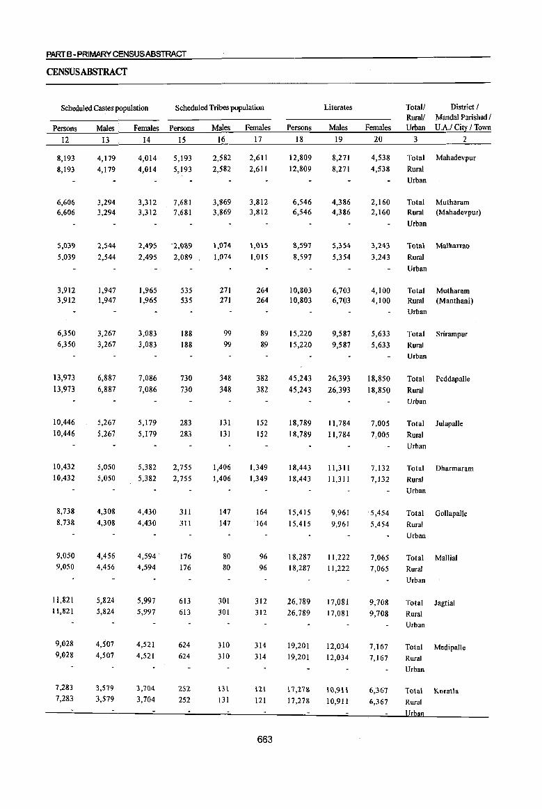
PART B -PRIMARYCENSUSABSTRACT
CENSUSABSTRACT
Scheduled Castes population Scheduled Tribes population Literates Totall District I Rural! Mandai Parishad I
Persons Males . Females Persons Males Females Persons . Males Females Urban U.A.I Cit~ I Town
12 13 14 15 16 17 18 19 20 3 2
8,193 4,179 4,014 5,193 2,582 2,611 12,809 8,271 4,538 Total Mahadevpur
8,193 4,179 4,014 5,193 2,582 2,611 12,809 8,271 4,538 Rural Urban
6,606 3,294 3,312 7,681 3,869 3,812 6,546 4,386 2,160 Total Mutharam 6,606 3,294 3,312 7,681 3,869 3,812 6,546 4,386 2,160 Rural (Mahadevpur)
Urban
5,039 2,544 2,495 ·2,OS9 1,074 1,015 8,597 5,354 3,243 Total Malharrao
5,039 2,544 2,495 2,089 1,074 1,015 8,597 5,354 3,243 Rural
Urban
3,912 1,947 1,965 535 271 264 10,803 6,703 4,100 Total Mutharam 3,912 1,947 1,965 535 271 264 10,803 6,703 4,100 Rural (Manthani)
Urban
6,350 3,267 3,083 188 99 89 15,220 9,587 5,633 Total Srirampur 6,350 3,267 3,083 188 99 89 15,220 9,587 5,633 Rural
Urban
13,973 6,887 7,086 730 348 382 45,243 26,393 18,850 Total Peddapalle 13,973 6,887 7,086 730 348 382 45,243 26,393 18,850 Rural
Urban
10,446 5,267 5,179 283 131 152 18,789 11,784 7,005 Total JulapaUe 10,446 5,267 5,179 283 131 152 18,789 11,784 7,005 Rural
Urban
10,432 5,050 5,382 2,755 1,406 1,349 18,443 11,311 7,132 Total Dharmaram 10,432 5,050 5,382 2,755 ],406 1,349 ]8,443 ] 1,311 7,132 Rural
Urban
8,738 4,308 4,430 311 147 164 15,415 9,961 5,454 Total GolJapalle 8,738 4,308 4,430 311 147 164 15,415 9,961 5,454 Rural
Urban
9,050 4,456 4,594· 176 80 96 18,287 11,222 7,065 Total Mallial 9,050 4,456 4,594 176 80 96 18,287 11,222 7,065 Rural
Urban
11,821 5,824 5,997 613 301 312 26,789 17,081 9,708 Total Jagtial 11,821 5,824 5,997 613 ]01 312 26,789 17,081 9,708 Rural
Urban
9,028 4,507 4,521 624 310 314 19,201 12,034 7,167 Total Medipalle 9,028 4,507 4,521 624 310 314 19,201 12,034 7,167 Rural
Urban
7,283 3,579 3,704 252 131 121 17,27& H),9l\ 6,367 Total Koratla 7,283 3,579 3,704 252 131 121 17,278 10,911 6,367 Rural
663

Location DistricU Total! code Mandal Parishadl RuraL' Illiterates
nmnber U.A.I City / Town Urban Persons Males Females
0011
0012
0013
0014
0015
0016
0017
0018
0019
0020
0021
0022
0023
2
Mahadevpur
Mutharam
(Mahadevpur)
Malharrao
Mutharam
(Manthani)
Srirampur
Peddapalle
Julapalle
Dharmaram
Gollapalle
Mallia!
Jagtial
Medipalle
Koratla
3
Total Rural Urban
Total
Rural
Urban
Total
Rural
Urban
Total
Rural
Urban
Total
Rural Urban
Total
Rural
Urban
Total
Rural
Urban
Total
Rural
Urban
Total
Rural
Urban
Total
Rural
Urban
Total
Rural
Urban
Total
Rural
Urban
Total
Rural
Urban
21
22,516 22,516
16,781
16,781
15,246
15,246
17,825
17,825
22,052
22,052
22 23
9,473 13,043
9,473 13,043
7,315 7,315
6,657 6,657
7,605
7,605
9,219
9,219
9,466
9,466
8,589 8,589
10,220
10,220
12,833
12,833
45,587 19,025 26,562 45,587 19,025 26,562
26,305 10,791 15,514 26,305 10,791 15,514
31,193 13,279 17,914 31,193 13,279 17,914
26,233
26,233
10,553
10,553
15,680
15,680
26,957 10,730 16,227
26,957 10,730 16,227
38,255 38,255
30,572 30,572
23,139 23,139
14,944 14,944
12,117 12,117
8,774
23,311 23,311
18,455 18,455
14,365
8,774 14,365
664
DISTRICT CENSUS HANDBOOK: KARIMNAGAR
DISfRICfPRIMARY
Total workers Main workers
Persons Males Females Persons Males Females
24
18,660
18,660
13,577
13,577
13,211 13,211
15,023
15,023
19,829
19,829
25 26
10,063 8,597 10,063 8,597
6,907 6,670
6,907 6,670
7,059 7,059
8,355
8,355
10,627
10,627
6,152 6,152
6,668
6,668
9,202
9,202
27
13,002
13,002
8,474
8,474
9,521 9,521
8,841
8,841
13,464
13,464
28
7,811 7,811
29
5,191 5,191
4,951 3,523 4,951 3,523
5,689 5,689
6,284
6,284
8,640
8,640
3,832 3,832
2,557
2,557
4,824
4,824
40,082 24,691 15,391 32,683 22,098 10,585 40,082
23,040 23,040
26,517
26,517
24,268
24,268
27,415 27,415
38,203 38,203
28,592
28,592
23,636 23,636
24,691 15,391
12,936 10,104 12,936 10,104
32,683 22,098 10,585
19,876 12,054 7,822 19,876 12,054 7,822
14,138 12,379 21,595 12,461 9,134
14,138 12,379 21,595 12,461 9,134
12,223
12,223
12,045 12,045
21,401 21,401
ll,382
11,382
10,019
10,019
13,425 13,990 . 22,508 11,632 10,876
13,425 13,990 22,508 11,632 10,876
18,798 18,798
19,405 19,405
13,634 14,958 13,634 14,958
11,196 12,440
34,294 34,294
25,506 25,506
22,487
17,521 17,521
16,773 16,773
12,216 13,290 12,216 13,290
10,718 11,769
11,196 12,440 22,487 10,718 11,769
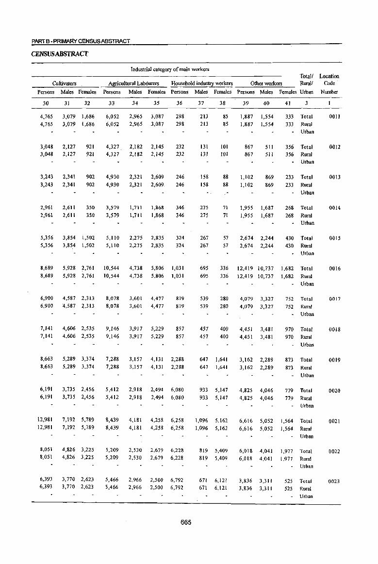
PART B -PRIMAf{y qENSWSABSTRACT
CENSUS ABSTRACT
Industrial category of main workers Total! Location
Cultivators Agricultural Labourers Household industry workers Other workers Rural! Code
Persons Males Females Persons Males Females Persons Males Females Persons Males Females Urban Number
30
4,765 4,765
3,048 3,048
31 32
3,079 11,686 3,079 iJ,686
2,127 2,127
921 921
3,243 2,341 902 902 3,243 2,341
2,961 2,961
2,611 2,611
350 350
5,356 3,854 1,502 5,356 3,854 1,502
33
6,052 6,052
4,327. 4,327
34 35
2,965 3,087 2,965 3,087
2,182 2,182
2,145 2,145
4,930 2,321 2,609
4,930 2,321 2,609
3,579 3,579
1,711
1,711
1,868
1,868
5,110 2,275 2,835 5,110 2,275 2,835
36
298 298
232 232
246
246
346 346
324 324
8,689 5,928 2,761 10,544 4,738 5,806 1,031 8,689 5,928 .1:,761 10,544 4,738 5,806 1,031
6,900 6,900
7,141 7,141
4,587 2,313 4,587 2,313
4,606 2,535 4,606 2,535
8,663 5,289 3,374 8,663 5,289 3,374
6,191 6,191
3,735 2,456 3,735 2,456
12,981 7,192 5,789 12,981 7,192 5,789
8,051 8,051
6,393 6,393
4,826 3,225 4,826 3,225
3,770 2,623 3,770 2,623
8,078 8,078
9,146 9,146
3,601 3,601
4,477 4,477
3,917 5,229 3,917 5,229
819 819
857
857
7,288 3,157 4,131 2,288 7,288 3,157 4,131 2,288
5,412
5,412 2,918
2,918
2,494
2,494 6,080
6,080
8,439 4,181 4,258 6,258 8,439 4,181 4,258 6,258
5,209 5,209
5,466 5,466
2,530 2,530
2,966 2,966
2,679 2,679
2,500 2,500
6,228 6,228
6,792 6,792
665
37
213 213
131 131
158
158
275 275
267 267
38
85 85
101 101
88
88
71
71
57 57
39 40
1,887 1,554 1.887 1,554
867 867
1,102 1,102
1,955
1,955
511 511
869 869
1,687 1,687
2,674 2,244 2,674 2,244
41 3
333 Total 333 Rural
- Urban
356 Total 356 Rural
- Urban
233 Total 233 Rural
- Urban
268 Total
268 Rural • Urban
430 Total 430 Rural
- Urban
695
695 336 12,419 10,737 1,682 Total
336 12,419 10,737 1,682 Rural
539 539
457 457
280 280
400 400
647 1,641 647 1,641
933
933 5,147
5,147
1,096 5,162 1,096 5,162
819 5,409 819 5,409
671 671
6,121 6,121
4,079
4,079
3,327 3,327
4,451 3,481 4,451 3,481
3,162 2,289 3,162 2,289
4,825 4,046
4,825 4,046
- Urban
752 Total
752 Rural
- Urban
970 Total 970 Rural
- Urban
873 Total
873 Rural
Urban
779 Total
779 Rural Urban
6,616 5,052 1,564 Total 6,616 5,052 1,564 Rural
- Urban
6,018 4,041 6,018 4,041
3,836 3,311 3,836 3,311
1,977 Total
1,977 Rural
Urban
525 Total 525 Rural
Urban
0011
0012
0013
0014
0015
0016
0017
0018
0019
0020
0021
0022
0023

Location code
number
0011
0012
0013
0014
0015
0016
0017
0018
0019
0020
0021
0022
0023
DISTRICT CENSUS HANDBOOK: KARIMNAGAR
DISfRICfPRIMARY
Industrial category of marginal workers District! Totall
Mandai Parishadl Rural! Marginal workers Cultivators Agricultural labourers
U.A.I City I Town Urban Persons Males Females Persons Males Females
2
Mabadevpur
Mutbaram
(Mahadevpur)
Malbarrao
Mutbaram
(Mantbani)
Srirampur
Peddapalle
Julapalle
Dbarmaram
Gollapalle
Mallial
Jagtial
Medipalle
Koratla
3 42 43
Total
Rural
Urban
5,658 2,252
5,658 2,252
Total
Rural
Urban
Total
Rural
Urban
Total
Rural
Urban
Total
5,103
5,103
3,690
3,690
6,182
6,182
6,365
Rural 6,365
Urban
Total
Rural
Urban
Total
Rural
Urban
Total
Rural
Urban
Total
Rural
Urban
Total
7,399
7,399
3,164
3,164
4,922
4,922
2,867
2,867
4,907
Rural 4,907
Urban
Total
Rural
Urban
Total
Rural
Urban
Total Rural
Urban
3,909
3,909
3,086
3,086
1,149 1,149
1,956
1,956
1,370
1,370
2,071
2,071
1,987
1,987
2,593
2,593
882
882
1,677
1,677
841
841
1,793
1,793
1,277
1,277
1,418
1,418
478
478
44
3,406
3,406
3,147
3,147
2,320
2,320
4,111
4, III
4,378
4,378
4,806
4,806
2,282
2,282
3,245
3,245
2,026
2,026
3,114
3,114
2,632
2,632
1,668
1,668
671
671
666
45
876
876
221
221
281
281
230
230
294
294
508
508
242
242
194
194
120
120
628
628
164
164
252 252
47
47
46
392
392
137 137
195
195
89
89
40
40
148
148
68 68
81
81
49
49
292
292
59
59
123
123
24
24
47
484
484
84
84
86 86
141
141
254
254
360
360
174
174
113
113
71
71
336
336
105
105
129
129
23
23
Persons Males Females
48
4,376
4,376
4,462
4,462
3,084
3,084
5,320
5,320
5,260
5,260
5,521
5,521
2,556
2,556
3,793
3,793
2,143
2,143
2,017
2,017
1,932
1,932
1,707
1,707
605
605
49
1,696
1,696
1,714
1,714
1,017
1,017
1,586
1,586
1,512
1,512
1,592
1,592
614
614
1,132
1,132
598
598
762
762
690
690
758
758
302
302
50
2,680
2,680
2,748
2,748
2,067
2,067
3,734
3,734
3,748
3,748
3,929
3,929
1,942
1,942
2,661
2,661
1,545
1,545
1,255
1,255
1,242
1,242
949
949
303
303
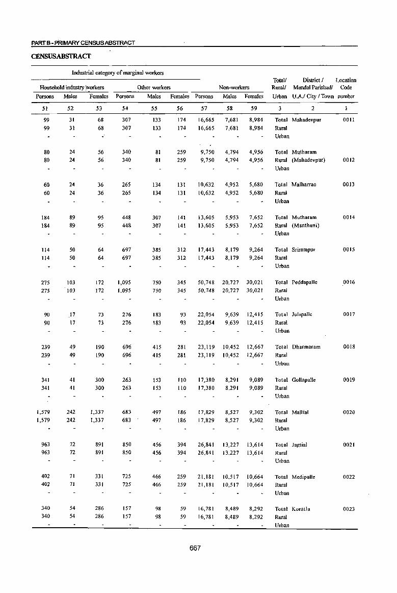
pARlB- PRIMARY CI=NSUSABSTRACT
CENSUSABSTRA(T
Industrial category of marginal workers
Household industry ~orkers
Persons Males Females
51
99 99
80 80
60
60
184
184
114 114
275
275
90
90
239
239
341 341
1,579
1,579
963 963
402 402
340
340
52
31
31
24 24
24
24
89
89
50 50
103
103
.l7
17
49
49
41
41
242
242
72
72
71 71
54
54
53
68
68
56 56
36
36
95
95
64 64
172
172
73
73
190
190
300 300
1,337
1,337
891 891
331 331
286
286
Other workers Non-workers
Persons Males Females Persons Males Females
54
307
307
340 340
265
265
448
448
697
697
1,095
1,095
276
276
696
696
263 263
683
683
850 850
725 725
157
157
55
133
133
81 81
134 134
307
307
385 385
750 750
183
183
415
415
153 153
497 497
456 456
466 466
98
98
56
174
174
259 259
131
131
141
141
312 312
345
345
93
93
281
281
110 110
186
186
394 394
259 259
59
59
57
16,665
16,665
58
7,681
7,681
59
8,984
8,984
9,750 4,794 4,956 9,750 4,794 4,956
10,632 4,952 5,680
10,632 4,952 5,680
13,605
13,605
17,443
17,443
5,953
5,953
7,652
7,652
8,179 9,264 8,179 9,264
50,748 20,727 30,021 50,748 20,727 30,021
22,054
22,054
9,639
9,639
12,415
12,415
23,119 10,452 12,667
23,119 10,452 12,667
17,380 17,380
17,829
17,829
8,291 8,291
8,527
8,527
9,089 9,089
9,302
9,302
26,841 13,227 13,614 26,841 13,227 13,614
21,181 10,517 10,664 21,181 10,517 10,664
16,781
16,781
667
8,489
8,489
8,292
8,292
Total/ District f Location Rural/ Mandai Parishadl Code
Urban U.A.f City fTown munber
3 2
Total Mahadevpur
Rural
Urban
Total Mutharam
Rural (Mahadevpur)
Urban
Total Malharrao
Rural
Urban
Total Mutharam
Rural (Manthani)
.Urban
Total Srirampur
Rural
Urban
Total Peddapalle
Rural
Urban
Total Julapalle
Rural
Urban
Total Dharmaram
Rural
Urban
Total Gollapalle
Rural
Urban
Total Mallial
Rural
Urban
Total Jagtial
Rural
Urban
Total Medipalle
Rural
Urban
Total Koratla
Rural
Urban
0011
0012
0013
0014
0015
0016
0017
0018
0019
0020
0021
0022
0023
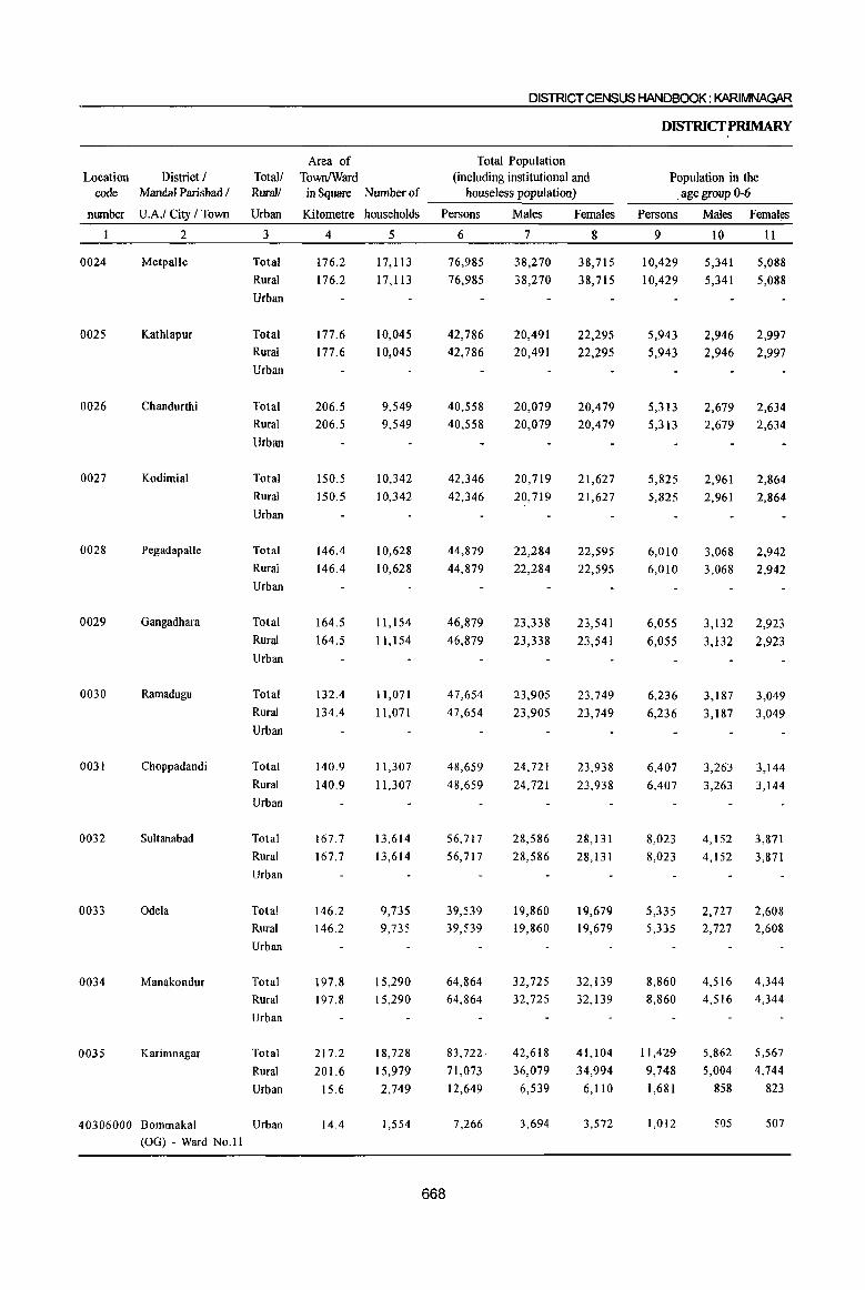
DISTRICT CENSUS HANDBOOK: KARIMNAGAR
DISfRICfPRlMARY
Area of Total Population Location District / Total! TownfWard (including institutional and Population in the
code Mandal Parishad / RuralJ in Square Nurnberof houseless population) . age group 0-6
number U.A.I City I Town Urban Kilometre households Persons Males Females Persons Males Females
2 3 4 5 6 7 8 9 10 11
10024 Metpalle Total 176.2 17,113 76,985 38,270 38,715 10,429 5,341 5,088
Rural 176.2 17,113 76,985 38,270 38,715 10,429 5,341 5,088
Urban
.0025 Kathlapur Total 177.6 10,045 42,786 20,491 22,295 5,943 2,946 2,997 Rural 177.6 10,045 42,786 20,491 22,295 5,943 2,946 2,997
Urban
0026 Chandurthi Total 206.5 9,549 40,558 20,079 20,479 5,313 2,679 2,634 Rural 206.5 9,549 40,558 20,079 20,479 5,313 2,679 2,634
Urban
0027 Kodimial Total 150.5 10,342 42,346 20,719 21,627 5,825 2,961 2,864 Rural 150.5 10,342 42,346 20,719 21,627 5,825 2,961 2,864
Urban
0028 Pegadapalle Total 146.4 10,628 44,879 22,284 22,595 6,010 3,068 2,942 Rural 146.4 10,628 44,879 22,284 22,595 6,010 3,068 2,942 Urban
0029 Gangadhara Total 164.5 11,154 46,879 23,338 23,541 6,055 3,132 2,923 Rural 164.5 11,154 46,879 23,338 23,541 6,055 3,132 2,923 Urban
0030 Ramadugu Total 132.4 11,071 47,654 23,905 23,749 6,236 3,187 3,049 Rural 134.4 1l,071 47,654 23,905 23,749 6,236 3,187 3,049 Urban
0031 Choppadandi Total 140.9 11,307 48,659 24,721 23,938 6,407 3,263 3,144 Rural 140.9 11,307 48,659 24,721 23,938 6,407 3,263 3,144
Urban
0032 Sultanabad Total 167.7 13,614 56,717 28,586 28,131 8,023 4,152 3,871
Rural 167.7 13,614 56,717 28,586 28,131 8,023 4,152 3,871
Urban
0033 Odela Total 146.2 9,735 39,539 19,860 19,679 5,335 2,727 2,608 Rural 146.2 9,735 39,539 19,860 19,679 5,335 2,727 2,608
Urban
0034 Manakondur Total 197.8 15,290 64,864 32,725 32,139 8,860 4,516 4,344
Rural 197.8 15,290 64,864 32,725 32,139 8,860 4,516 4,344
Urban
0035 Karimnagar Total 217.2 18,728 83,722 42,618 41,104 11,429 5,862 5,567
Rural 201.6 15,979 71,073 36,079 34,994 9,748 5,004 4,744
Urban 15.6 2,749 12,649 6,539 6,110 1,681 858 823
40306000 Bommakal Urban 14.4 1,554 7,266 3,694 3,572 1,012 505 507
(OG) - Ward NO.ll
668

PARTB • PRIMARY QENSUSABStRACT
cENSUSABSTRACf
Scheduled Castes population Scheduled Tribes population Literates Totall District I RuraV Mandai Parishad I
Persons Males Females Persons Males Females Persons Males Females Urban UAI Ci!}: I Town
12 13 14 15 16 17 18 19 20 3 2
10,718 5,223 5,495 2,278 1,151 1,127 39,573 23,948 15,625 Total Metpalle
10,718 5,223 5,495 2,278 1,151 1,127 39,573 23,948 15,625 Rural
Urban
6,878 3,269 3,609 965 478 487 16,936 10,661 6,275 Total Kathlapur
6,878 3,269 3,609 965 478 487 16,936 10,661 6,275 Rural Urban
7,427 3,672 3,755 932 507 425 16,023 10,300 5,723 Total Chandurthi
7,427 3,672 3,755 932 507 425 16,023 10,300 5,723 Rural
Urban
8,538 4,206 4,332 879 441 438 16,984 10,575 6,409 Total Kodimial
8,538 4,206 4,332 879 441 438 16,984 10,575 6,409 Rural
Urban
8,290 4,150 4,140 977 494 483 17,057 10,918 6,139 Total Pegadapallc 8,290 4,150 4,140 977 494 483 17,057 10,918 6,139 Rural
Urban
9,551 .4,845 4,706 284 140 144 21,000 13,234 7,766 Total Gangadhara 9,551 4,845 4,706 284 140 144 21,000 13,234 7,766 Rural
Urban
10,747 5,406 5,341 1,107 561 546 22,323 13,933 8,390 Total Ramadugu 10,747 5,406 5,341 1,107 561 546 22,323 13,933 8,390 Rural
Urban
12,049 6,272 5,777 665 396 269 22,260 14,073 8,187 TOlal Choppadandi 12,049 6,272 5,777 665 396 269 22,260 14,073 8,187 Rural
Urban
9,935 5,057 4,878 511 268 243 26,613 16,255 10,358 Total Sultanabad 9,935 5,057 4,878 511 268 243 26,613 16,255 10,358 Rural
Urban
6,313 3,170 3,143 378 195 183 16,973 10,625 6,348 Total Odela 6,313 3,170 3,143 378 195 183 16,973 10,625 6,348 Rural
Urban
14,293 7,241 7,052 615 312 303 28,794 17,977 10,817 Total Manakondur 14,293 7,241 7,052 615 312 303 28,794 17,977 10,817 Rural
Urban
17,232 8,664 8,568 1,673 838 835 43,607 26,922 16,685 Total Karimnagar 15,159 7,614 7,545 1,542 758 784 36,213 22,495 13,718 Rural 2,073 1,050 1,023 131 80 51 7,394 4,427 2,967 Urban
1,324 668 656 50 32 18 3,853 2,266 1,587 Urban Bommakal
(OG)-Ward No.ll
669

Location code
number
0024
0025
0026
0027
0028
0029
0030
0031
0032
0033
0034
0035
District! Total! Mandal Parishadl Rural/ Illiterates
U.AJ City J Town Urban Persons Males
2
Metpalle
Kathlapur
Chandurthi
Kodimial
Pegadapalle
Gangadhara
Ramadugu
Choppadandi
Sultanabad
Odela
Manakondur
Karimnagar
3
Total
Rural
Urban
21
37,412
37,412
Total 25,850 Rural 25,850
Urban
Total
Rural
Urban
Total
Rural
Urban
24,535
24,535
25,362
25,362
Total 27,822
Rural 27,822
Urban
22
14,322
14,322
9,830
9,830
9,779
9,779
10,144
10,144
11,366
11,366
Total 25,879 10, I 04
Rural 25,879 10,104
Urban
Total 25,331 Rural 25,331
Urban
Total
Rural
Urban
Total
Rural
Urban
26,399
26,399
30,104
30,104
Total 22,566 Rural 22,566
Urban
9,972
9,972
10,648
10,648
12,331
12,331
9,235 9,235
Total 36,070 14,748
Rural 36,070 14,748
Urban
Total
Rural
Urban
40,115
34,860
5,255
15,696
13,584
2,112
40306000 Bommakal Urban 3,413 1,428
(OG) - Ward No.11
DISTRICT CENSUS HANDBOOK: KARIMNAGAR
DISfRICfPRIMARY
Total workers Main wolkers
Females Persons Males Females Persons Males Females
23
23,090
23,090
24
40,680
40,680
16,020 24,936
16,020 24,936
14,756
14,756
15,218
15,218
16,456
16,456
15,775
23,090
23,090
23,117
23,117
26,096
26,096
26,095
15,775 26,095
15,359 25,151
15,359 25,151
15,751
15,751
17,773
17,773
13,331 13,331
24,992
24,992
26,772
26,772
21,332 21,332
21,322 32,805
21,322 32,805
24,419
21,276
3,143
1,985
670
40,045
35,427
4,618
2,823
25
20,682
20,682
26
19,998
19,998
27
37,824
37,824
28
19,745
19,745
29
18,079
18,079
11,740 13,196 23,195 11,030 12,165 11,740 13,196 23,195 11,030 12,165
11,482
11,482
11,468
11,468
13,134
13,134
11,608
11,608
11,649
11,649
12,962
12,962
21,763
21,763
19,291
19,291
22,695
22,695
11,052
11,052
10,379
10,379
10,711
10,711
8,912
8,912
11,978 10,717
11 ,978 10,717
13,117 12,978 22,805 12,002 10,803
13,117 12,978 22,805 12,002 10,803
13,306 11,845 19,852 11,777 8,075
13,306 11,845 19,852 11,777 8,075
13,420
13,420
15,807
15,807
11,375 11,375
11,572
11,572
10,965
10,965
20,906
20,906
20,400
20,400
12,191
12,191
13,901
13,901
8,715
8,715
6,499
6,499
9,957 18,037 10,275 7,762 9,957 18,037 10,275 7,762
18,489 14,316 30,104 17,681 12,423
18,489 14,316 30,104 17,681 12,423
23,229
19,933
3,296
1,980
16,816
15,494
1,322
843
34,940
30,491
4,449
2,705
21,398
18,129
3,269
1,966
13,542 12,362
1,180
739
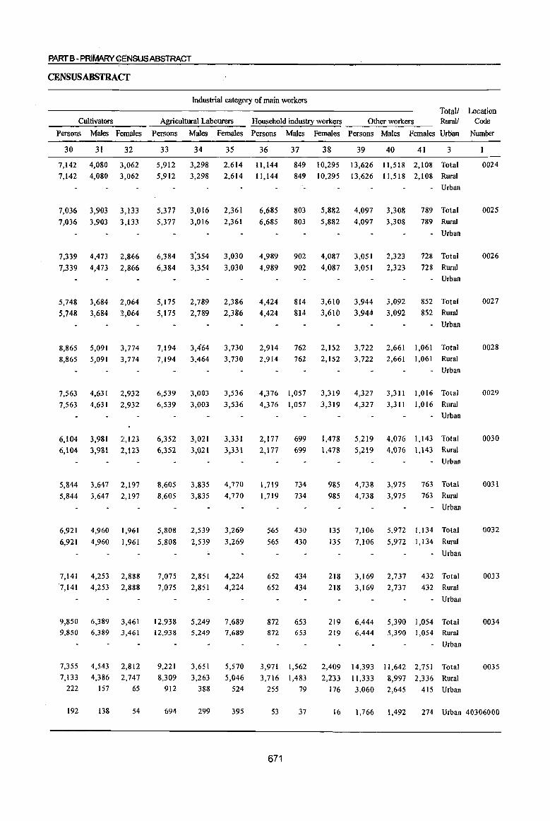
PARTB -PRIMARY GE:NSUSABSTRACT
CENSUSABSTRACf
Industrial category of main workers
Totall Location Cultivators Agricultural Labourers Household industry workers Other workers Rural! Code
Persons Males Females Persons Males Females Persons Males Females Persons Males Females Urban Nmnber
30 31 32 33 34 35 36 37 38 39 40 41 3
7,142 4,080 3,062 5,912 3,298 2,614 11,144 849 10,295 13,626 11,518 2,108 Total 849 10,295 13,626 11,518 2,108 Rural
- Urban 7,142 4,080 3,062 5,912 3,298 2,614 11,144
7,036 3,903 3,133
7,036 3,903 3,133
7,339
7,339
5,748
5,748
8,865
4,473
4,473
3,684
3,684
5,091
2,866
2,866
2,064
2,064
3,774
8,865 5,091 3,774
7,563 4,631 2,932
7,563 4,631 2,932
6,104 3,981 2,123
6,104 3,981 2,123
5,844 3,647 2,197
5,844 3,647 2,197
6,921
6,921
4,960
4,960
1,961
1,961
7,141 4,253 2,888 7,141 4,253 2,888
5,377 3,016 2,361
5,377 3,016 2,361
6,384
6,384
5,175
5,175
7,194
2,789
2,789
3,464
3,030
3,030
2,386
2,386
3,730
7,194 3,464 3,730
6,539 3,003
6,539 3,003
6,352
6,352
3,021
3,021
3,536
3,536
3,331
3,331
8,605 3,835 4,770
8,605 3,835 4,770
5,808
5,808
2,539
2,539
3,269
3,269
7,075 2,851 4,224
7,075 2,851 4,224
9,850 6,389 3,461 12,938 5,249 7,689 9,850 6,389 3,461 12,938 5,249 7,689
7,355 7,133
222
4,543
4,386 157
2,812
2,747
65
9,221
8,309 912
3,651
3,263 388
5,570
5,046 524
6,685 6,685
803 5,882 4,097 3,308 789 Total
803 5,882 4,097 3,308 789 Rural
4,989
4,989
4,424
4,424
902
902
814
814
762
4,087
4,087
3,610
3,610
2,152
3,051
3,051
3,944
3,944
3,722
2,323
2,323
3,092
3,092
2,661
- Urban
728 Total
728 Rural
- Urban
852 Total
852 Rural
Urban
1,061 Total 2,914
2,914 762 2,152 3,722 2,661 1,061 Rural
4,376 1,057
4,376 1,057
2,117
2,177
1,719
1,719
565
565
699
699
734
734
430
430
652 434
652 434
872 872
653 653
3,971 1,562
3,716 1,483
255 79
- Urban
3,319 4,327 ],311 1,016 Total
3,319 4,327 3,311 1,016 Rural
1,478
1,478
5,219
5,219
- Urban
4,076 1,143 Total
4,076 1,143 Rural
- Urban
985 4,738 3,975 763 Total
985 4,738 3,975 763 Rural
135
135
7,106
7,106
- Urban
5,972 1,134 Total
5,972 1,134 Rural
- Urban
218 3,169 2,737 432 Total
432 Rural
- Urban
218 3,169 2,737
219 6,444 5,390 1,054 Total 219 6,444 5,390 1,054 Rural
2,409
2,233
176
- Urban
14,393 11,642 2,751 Total
11,333 8,997 2,336 Rural
3,060 2,645 415 Urban
0024
0025
0026
0027
0028
0029
0030
0031
0032
0033
0034
0035
192 138 54 694 299 395 53 37 16 1,766 1,492 274 Urban 40306000
671
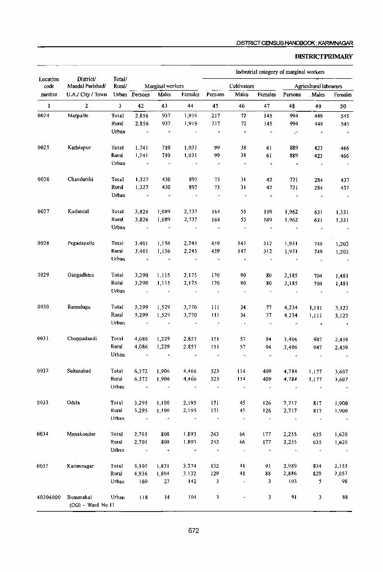
location code
munber
0024
0025
0026
0027
0028
0029
0030
0031
0032
0033
0034
0035
DISlRICTCENSUS HANDBOOK: KARIMNAGAR
DISTRICfPRIMARY
Industrial category of marginal workers
District! Total! Mandai Parishadl Rural! Marginal workers Cultivators Agricultural labourers
U.A.I City I Town Urban Persons Males Females Persons Males Females
2
Metpalle
Kathlapur
Chandurthi
Kodimial
Pegadapalle
Gangadhara
Ramadugu
Choppadandi
Sultanabad
Odela
Manakondur
Karimnagar
3
Total
Rural
Urban
Total
Rural
Urban
Total
Rural
Urban
Total
Rural
Urban
Total
Rural
Urban
Total
Rural
Urban
Total
Rural
Urban
Total
Rural
Urban
Total
Rural
Urban
Total
Rural
Urban
Total
42
2,856
2,856
1,741
1,741
1,327
1,327
3,826
3,826
3,401
3,401
3,290
43
937
937
710
710
430
430
1,089
1,089
1,156
1,156
1, liS
3,290 1,115
5,299 1,529
5,299 1,529
4,086
4,086
6,372
6,372
1,229
1,229
1,906
1,906
3,295 1,100
3,295 1,100
2,701
Rural 2,701
808 808
Urban
Total
Rural
Urban
5,105
4,936
169
1,831 1,804
27
44
1,919
1,919
1,031
1,031
897 897
2,737
2,737
2,245
2,245
2,175
2,175
3,770
3,770
2,857 2,857
4,466
4,466
2,195
2,195
1,893
1,893
3,274
3,132
142
45
217
217
99 99
73
73
164
164
459
459
170
170
III
III
151
151
523 523
171
171
243
243
132
129
3
46
72
72
38
38
31
31
55
55
147
147
90
90
34
34
57
57
114
114
45
45
66
66
41
41
47
145
145
61
61
42
42
109
109
312
312
80
80
77 77
94
94
409
409
126
126
177
177
91 88
3
Persons Males Females
48
994
994
889
889
721
721
1,962
1,962
1,951
1,951
2,185
2,185
4,234
4,234
3,406
3,406
4,784
4,784
2,717
2,717
2,255
2,255
2,989
2,886
103
49
449 449
423
423
284
284
631
631
749
749
704
704
1,111
1, III
947
947
1,177
1,177
817
817
635
635
834
829
5
50
545
545
466
466
437
437
1,331
1,331
1,202
1,202
1,481
1,481
3,123
3,123
2,459 2,459
3,607 3,607
1,900
1,900
1,620
1,620
2,155
2,057
98
40306000 Bommakal Urban 118 14 104 3 3 91 3 88
(OG) - Ward No.I1
672
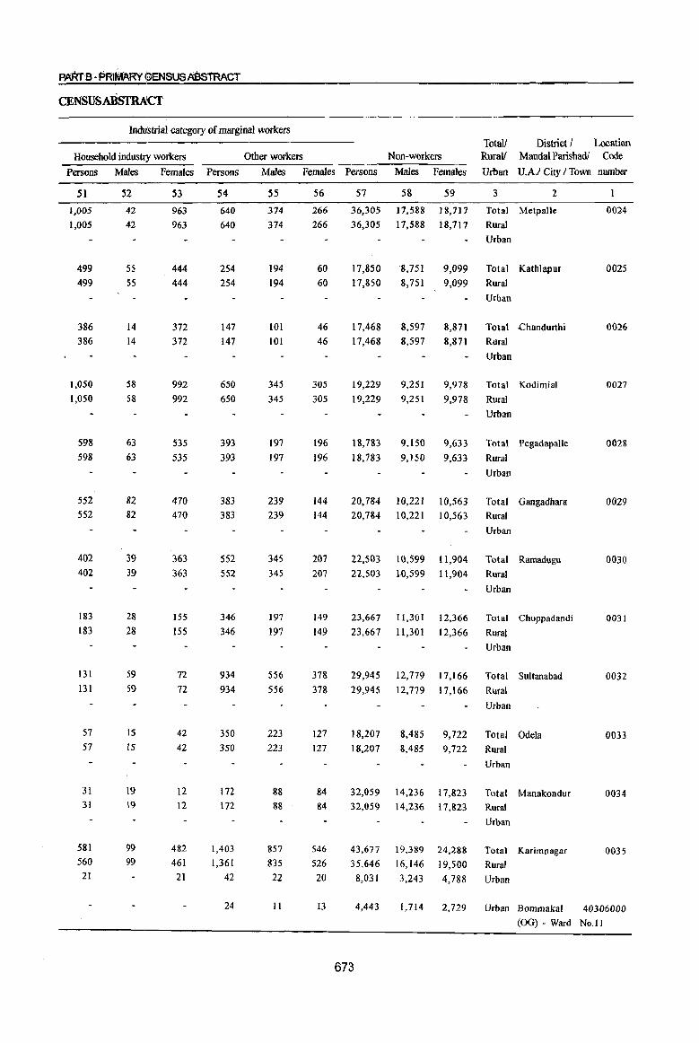
PARrS·PRIMARY OENSUSA8sTRACT
CENSUSABsrRA:Cf
Industrial category of marginal workers Total! District I Location
Household industry workers Other workers Non-workers Rurall MandaI Parishadl Code
Persons Males Females Persons Males Females Persons Males Females Urban U.A.I City / Town number
51
1,005 1,005
499 499
386
386
1,050
1,050
598 598
552 552
402
402
183 183
131
131
57 57
31 31
581 560 21
52
42 42
55
S5
14
14
58
58
63
63
82
82
39
39
28
28
59
59
IS
IS
19 \9
99 99
53
963 963
444
444
372
372
992 992
535
535
470 470
363
363
155 155
72
72
42 42
12
12
482 461
21
54
640 640
254
254
147
147
650 650
393 393
383 383
552
552
346 346
934
934
350
350
172 172
1,403 1,361
42
24
55
374
374
194 194
101
101
345
345
197
197
239 239
345
345
197 197
556
556
223
223
88 88
857
835
22
II
56
266 266
60
60
46
46
305
305
196
196
144
144
207 207
149
149
378 378
127
127
84
84
546
526
20
13
57
36,305
36,305
17,850
17,850
17,468
17,468
19,229
19,229
18,783
18,783
58 59 3 2
17,588 ] 8,717 Total MetpalJe
17,588 18,717· Rural
Urban
8,751 9,099 Total Kathlapur
8,751 9,099 Rural
Urban
8,597 8,871 Total .chandurthi
8,597 8,871 Rural
9,251 9,251
9,978 9,978
Urban
Total Kodimial
Rural
Urban
9,150 9,633 Total Pegadapalle
9,150 9,633 Rural
Urban
20,784 10,221 10,563 Total Gangadhara
20,784 10,221 10,563 Rural
Urban
22,503 10,599 11,904 Total Ramadugu
22,503 W,599 11,904 Rural
23,667
23,667
11,301
11,301
12,366
12,366
Urban
Total Choppadandi
Rural
Urban
29,945 12,779 17,166 Total Sultanabad
29,945 12,779 17,166 Rural
18,207
18,207
Urban
8,485 9,722 Total Odela
8,485 9,722 Rural
Urban
32,059 14,236 17,823 Total Manakondur
32,059 14,236 17,823 Rural
43,677 35,646
8,031
4,443
19,389
16,146
3,243
24,288
19,500
4,788
Urban
Total Karimnagar
Rural
Urban
1,714 2,729 Urban Bommakal
0024
0025
0026
0027
0028
0029
0030
0031
0032
0033
0034
0035
40306000 (OG) - Ward No.I1
673
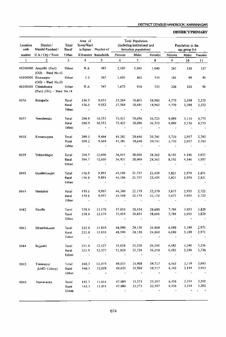
DISTRICT CENSUS HANDBOOK: KARIMNAGAR
Area of Total Population Location District I Totall TownlWard (including institutional and
code Mandai Parishad / Rural! in Square Number of houseless population) ----------~~--~----
number U.A.I City I Town Urban
2 3
40306000 Arepalle (Part) Urban
(00) - Ward No.12
40306000 Sitarampur Urban
(00) - Ward No.13 40306000 Chintakunta Urban
0036
0037
0038
0039
0040
0041
0042
0043
0044
0045
0046
(Part) (00) - Ward No.14
Boinpalle
Vemulawada
Konaraopeta
Yellareddipet
Gambhiraopet
Mustabad
Sircilla
Ellanthakunta
Bejjanki
Timmapur (LMD Colony)
Veenavanka
Total Rural
Urban
Total Rural Urban
Total Rural Urban
Total
Rural Urban
Total Rural Urban
Total Rural Urban
Total
Rural Urban
Total Rural Urban
Total
Rural Urban
Total Rural Urban
Total Rural Urban
Kilometre households
4 5
N.A
1.2
N.A
136.5 136.5
206.9
206.9
209.2 209.2
304.7
304.7
156.9 156.9
159.6 159.6
238.0
238.0
232.0 232.0
251.9 251.9
160.3 160.3
143.7 143.7
483
365
347
9,052 9,052
16,551 16,551
9,664 9,664
12,600 12,600
9,891 9,891
9,907 9,907
13,170
13,170
11,810 11,810
12,527 12,527
12,019 12,019
11,611 11,611
Persons
6
2,105
1,605
1,673
37,564 37,564
73,421
73,421
41,381 41,381
56,431
56,431
44,186 44,186
44,349 44,349
57,054 57,054
48,990 48,990
51,838
51,lB8
49,625 49,625
47,080 47,080
674
Males
7
1,065
862
918
18,601 18,601
36,696
36,696
20,640 20,640
28,069 28,069
21,757 21,757
22,179 22,179
28,454 28,454
24,130 24,130
25,528
25,528
24,908 24,908
23,573 23,573
Females
8
1,040
743
755
18,963 18,963
36,725
36,725
20,741 20,741
28,362 28,362
22,429 22,429
22,170 22,170
28,600 28,600
24,860 24,860
26,310
26,310
24,717 24,717
23,507 23,507
DISfRICfPRlMARY
Population in the age group 0-6
Persons
9
267
182
220
4,770 4,770
9,889
9,889
5,720 5,720
8,103
8,103
5,821 5,821
5,677 5,677
7,784 7,784
6,080 6,080
6,482
6,482
6,162 6,162
6,456
.6,456
Males Females
10 II
130 137'
99 83
124 96
2,398 2,372 2,398 2,372
5,116 4,773
5,116 4,773
2,957 2,763 2,957 2,763
4,146 3,957
4,146 3,957
2,970 2,851 2,970 2,851
2,955 2,722 2,955 2,722
3,955 3,829
3,955 3,829
3,109 2,971 3,109 2,971
3,246
3,246
3,236
3,236
3,119 3,043 3,119 3,043
3,254 3,254
3,202 3,202
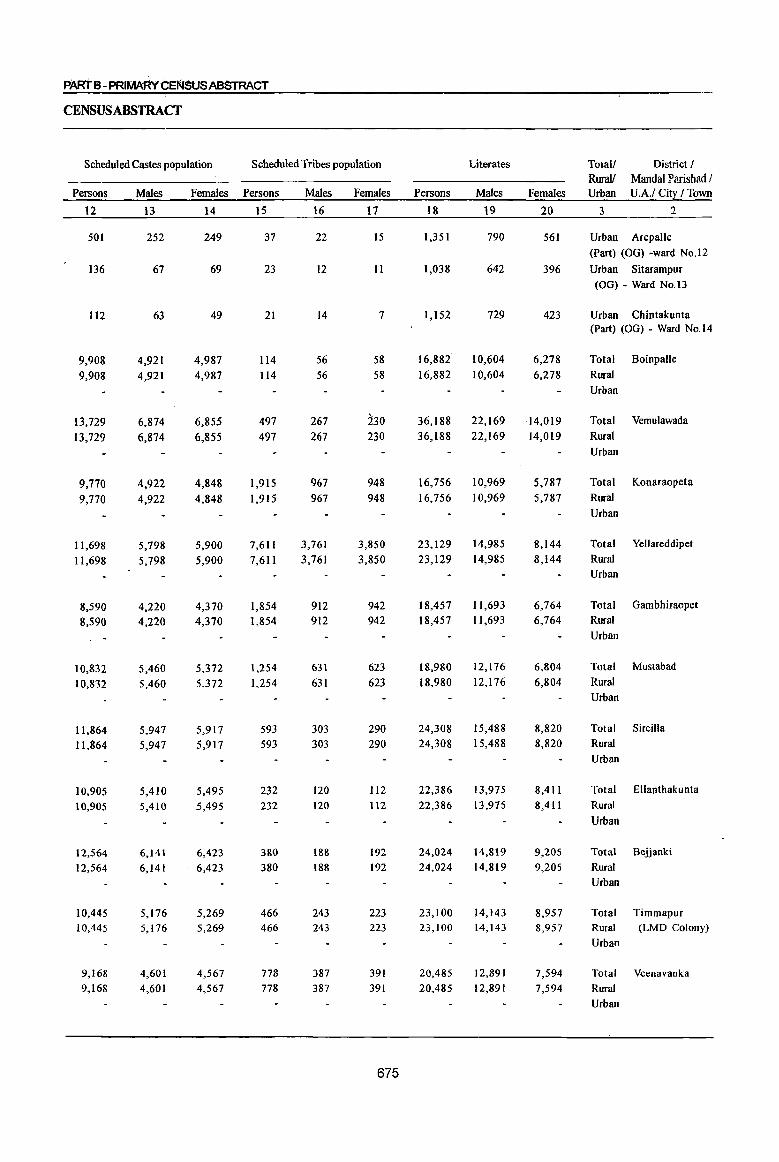
PART B - PRIMARv(~Er4SUSA8STRACT
CENSUS ABSTRACT
Scheduled Castes population Scheduled Tribes population Literates Total! District! RuraY MandaI Parishad I
Persons Males Females Persons Males Females Persons Males Females Urban U.A.I Citl / lbwn
12 13 14 15 16 17 18 19 20 3 2
501 252 249 37 22 15 1,351 790 561 Urban Arepalle (Part) (00) -ward No.l2
136 67 69 23 12 11 1,038 642 396 Urban Sitarampur (00) - Ward No.13
112 63 49 21 14 7 1,152 729 423 Urban Chintakunta (Part) (00) - Ward No.14
9,908 4,921 4,987 114 56 58 16,882 10,604 6,278 Total Boinpalle
9,908 4,921 4,987 114 56 58 16,882 10,604 6,278 Rural Urban
13,729 6,874 6,855 497 267 230 36,188 22,169 14,019 Total Vemulawada
13,729 6,874 6,855 497 267 230 36,188 22,169 14,019 Rural Urban
9,770 4,922 4,848 1,915 967 948 16,756 10,969 5,787 Total Konaraopeta
9,770 4,922 4,848 1,915 967 948 16,756 10,969 5,787 Rural
Urban
11,698 5,798 5,900 7,611 3,761 3,850 23,129 14,985 8,144 Total Yellareddipet
11,698 5,798 5,900 7,611 3,761 3,850 23,129 14,985 8,144 Rural Urban
8,590 4,220 4,370 1,854 912 942 18,457 1l,693 6,764 Total Oambhiraopet
8,590 4,220 4,370 1,854 912 942 18,457 11,693 6,764 Rural Urban
10,832 5,460 5,372 1,254 631 623 18,980 12,176 6,804 Total Mustabad
10,832 5,460 5,372 1.254 631 623 18,980 12,176 6,804 Rural Urban
11,864 5,947 5,917 593 303 290 24,308 15,488 8,820 Total Sircilla
11,864 5,947 5,917 593 303 290 24,308 15,488 8,820 Rural Urban
10,905 5,410 5,495 232 120 112 22,386 13,975 8,411 Total Ellanthakunta
10,905 5,410 5,495 232 120 1I2 22,386 13,975 8,411 Rural
Urban
12,564 6,141 6,423 380 188 192 24,024 14,819 9,205 Total Bejjanki
12,564 6,141 6,423 380 188 192 24,024 14,819 9,205 Rural Urban
10,445 5,176 5,269 466 243 223 23,100 14,143 8,957 Total Timmapur 10,445 5,176 5,269 466 243 223 23,100 14,143 8,957 Rural (LMD Colony)
Urban
9,168 4,601 4,567 778 387 391 20,485 12,891 7,594 Total Veenavallka 9,168 4,601 4,567 778 387 391 20,485 12,891 7,594 Rural
Urban
675
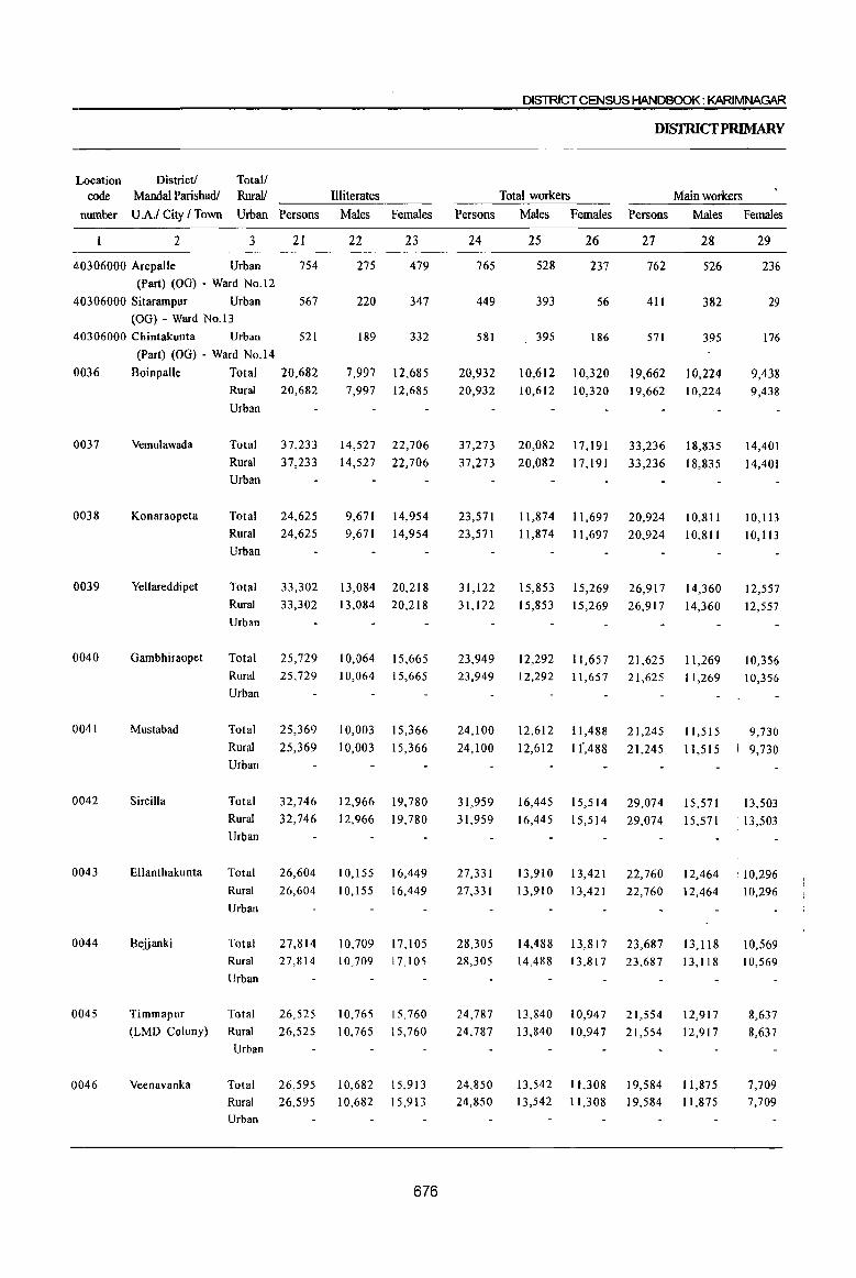
District! Total! Mandal Parishadl Rural! Illiterates
lLocation code
nmnber U AI City I Town Urban Persons Males Females
2 3 21 22 23
40306000 Arepalle Urban 754 275 479
(Part) (OG) - Ward No.12
40306000 Sitarampur Urban 567 220 347 (OG) - Ward No.13
40306000 Chintakunta Urban 521 189 332
(Part) (OG) - Ward No.14
0036 Boinpalle Total 20,682 7,997 12,685
0037
0038
0039
0040
0041
0042
0043
0044
0045
0046
Vemulawada
Konaraopeta
Yellareddipet
Gambhiraopet
Mustabad
Sircilla
Ellanthakunta
Bejjanki
Timmapur
(LMD Colony)
Veenavanka
Rural
Urban
Total
Rural
Urban
Total
Rural
Urban
Total
Rural
Urban
Total Rural
Urban
Total
Rural
Urban
Total
Rural
Urban
Total
Rural
Urban
Total
20,682
37,233
37,233
24,625
24,625
7,997 12,685
14,527
14,527
22,706
22,706
9,671 14,954
9,671 14,954
33,302 13,084 20,218
33,302 13,084 20,218
25,729 10,064 15,665
25,729 10,064 15,665
25,369
25,369
32,746
32,746
10,003
10,003
15,366
15,366
12,966 19,780
12,966 19,780
26,604 10,155 16,449
26,604 10,155 16,449
27,814 10,709 17.105 Rural 27,814 10,70917,105
Urban
Total
Rural
Urban
Total
Rural Urban
26,525
26,525
26,595
26,595
10,765
10,765
10,682
10,682
15,760
15,760
15,913
15,913
676
DISTRICT CENSUS HANDBOOK: KARIMNAGAR
DISfruCfPRlMARY
Total workers Main workers
Persons Males Females Persons Males Females
24
765
449
581
20,932
20,932
37,273
37,273
23,571
23,571
31,122
31,122
23,949
23,949
24,100
24, I 00
31,959
31,959
27,331
27,331
28,305 28,305
24,787
24,787
24,850
24,850
25 26 27 28
528 237 762 526
393 56 411 382
395 186 571 395
10,612 10,320 19,662 10,224
10,612 10,320 19,662 10,224
20,082
20,082
17,191
17,191
33,236
33,236
18,835
18,835
11,874 11,697 20,924 10,811
11,874 11,697 20,924 10,811
15,85315,269 26,917 14,360
15,85315,269 26,917 14,360
12,292 11,657 21,625 11,269
12,292 11,657 21,625 11,269
12,612
12,612
1l,488
1 f,488
16,445 15,514
16,445 15,514
21,245
21,245
29,074
29,074
11,515
11.515
15,571
15,571
29
236
29
176
9,438
9,438
14,401
14,401
10,113
10,113
12,557
12,557
10,356
10,356
9,730
9,730
13,503
13,503
13,910 13,421 22,760 12,464 .10,296
13,910 13,421 22,760 12,464
14,488 13,817 23,687 13,118
14,488 13,817 23,687 13,118
13,840
13,840
13,542
13,542
10,947
10,947
1l,308
11,308
21,554
21,554
19,584
19,584
12,917
12,917
11,875
11,875
10,296
10,569 10,569
8,637
8,637
7,709
7,709
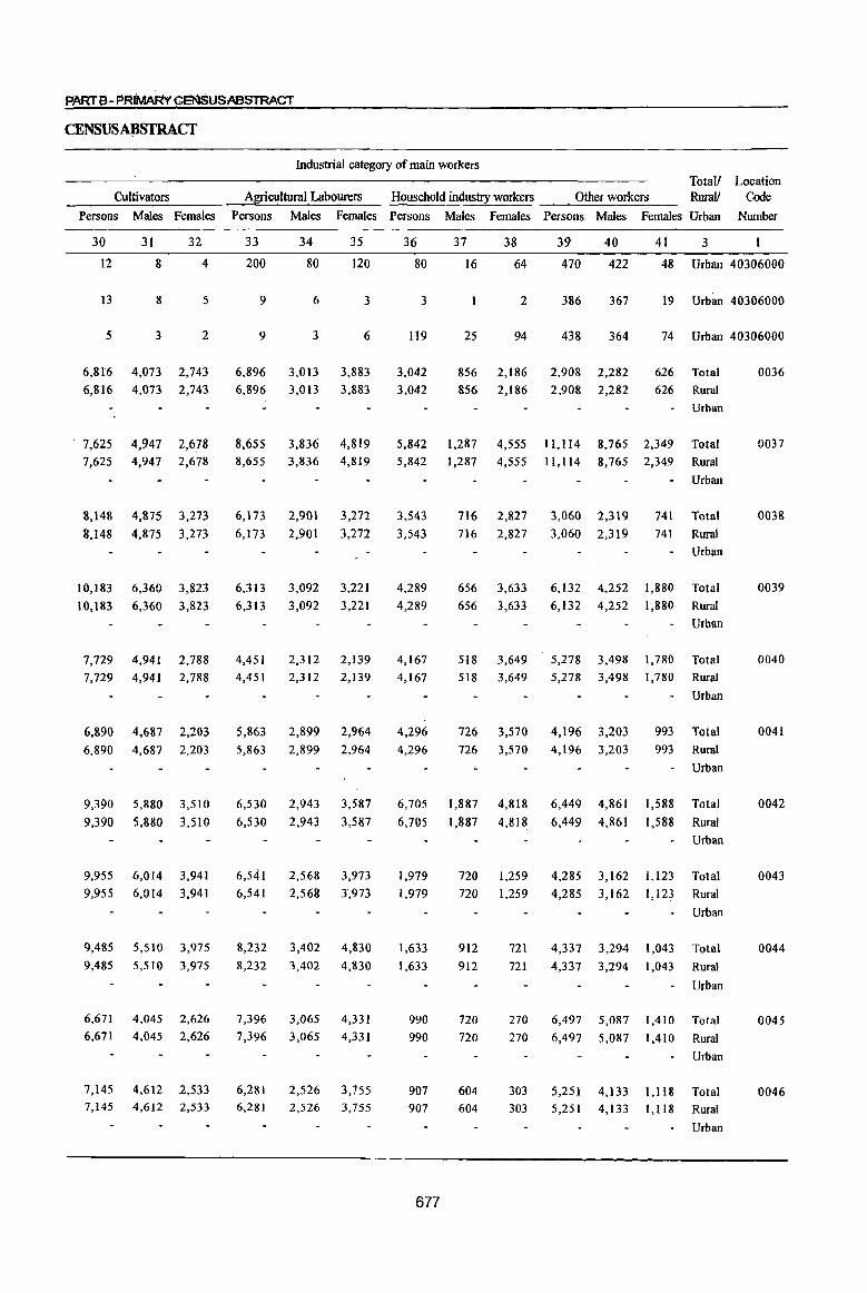
PARTS· PRIMARvCENSUSABSTRACT
CENSUSAJJSTRACf
Cultivators
Persons Males Females
30 31 32
12 8 4
13 8 5
5 3 2
6,816 4,073 2,743
6,816 4,073 2,743
. 7,625 4,947 2,678
7,625 4,947 2,678
8,148 4,875 3,273
8,148 4,875 3,273
10,183
10,183
7,729
6,360 3,823
6,360 3,823
4,941 2,788 7,729 4,941 2,788
6,890 4,687 2,203
6,890 4,687 2,203
9,390
9,390
9,955
9,955
5,880
5,880
6,014
6,014
3,510
3,510
3,941
3,941
9,485 5,510 3,975
9,485 5,510 3,975
6,671 6,671
4,045 2,626 4,045 2,626
7,145 4,612 2,533 7,145 4,612 2,533
Industrial category of main workers Total!
Agricultural Labourers Household industry workers Other workers Rural! Location
Code
Persons Males Females Persons Males Females Persons Males Females Urban Number
33 34 35
200 80 120
9 6 3
9 3 6
6,896 3,013 3,883
6,896 3,013 3,883
8,655 3,836 4,819 8,655 3,836 4,819
6,173
6,173
6,313
6,313
4,451
2,901
2,901
3,092
3,092
2,312
3,272
3,272
3,221
3,221
2,139
4,451 2,312 2,139
5,863 2,899 2,964
5,863 2,899 2,964
6,530
6,530
6,541
6,541
2,943
2,943
2,568
2,568
3,587
3,587
3,973
3,973
8,232 3,402 4,830
8,232 3,402 4,830
7,396
7,396 3,065
3,065
4,331
4,331
6,281 2,526 3,755 6,281 2,526 3,755
36
80
3
119
3,042
3,042
37 38
16 64
2
25 94
856 2,186
856 2,186
39 40
470 422
386 367
438 364
2,908 2,282
2,908 2,282
41 3
48 Urban 40306000
19 Urban 40306000
74 Urban 40306000
626 Total
626 Rural
Urban
0036
5,842 1,287 4,55511,1148,7652,349 Total 0037
5,842 1,287 4,555 1l,1l4 8,765 2,349 Rural
3,543
3,543
4,289
4,289
4,167
4,167
4,296 4,296
6,705
6,705
1,979
1,979
1,633
1,633
990
990
907 907
677
716 2,827
716 2,827
656
656
518
3,633
3,633
3,649
3,060 2,319
3,060 2,319
6,132 4,252
6,132 4,252
5,278 3,498
Urban
741 Total
741 Rural
1,880
1,880
1,780
Urban
Total
Rural
Urban
Total 518 3,649 5,278 3,498 1,780 Rural
Urban
726 3,570 4,196 3,203 993 Total
726 3,570 4,196 3,203 993 Rural
1,887
1,887
720
720
912
912
720
720
604 604
4,818
4,818
1,259
1,259
6,449 4,861
6,449 4,861
4,285
4,285
3,162
3,162
1,588
1,588
1,123
1,123
Urban
Total
Rural
Urban
Total
Rural
Urban
721 4,337 3,294 1,043 Total
721 4,337 3,294 1,043 Rural
270
270
6,497
6,497
5,087
5,087
1,410
1,410
Urban
Total
Rural
Urban
303 5,251 4,133 1,118 Total 303 5,251 4,133 1,118 Rural
Urban
0038
0039
0040
0041
0042
0043
0044
0045
0046
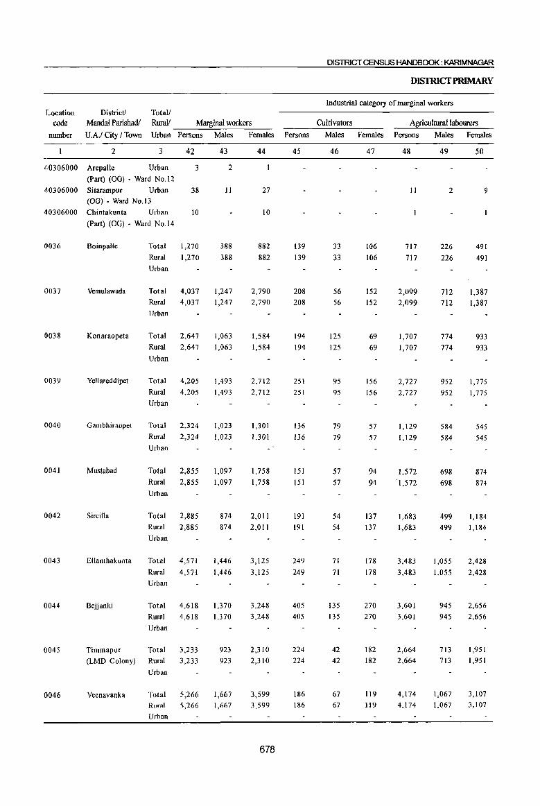
District! Total! Location
code
number
Mandai Parishadl Rural! Marginal workers U.A.I City I Town Urban Persons Males Females
2 3 42
40306000 Arepalle Urban 3
(Part) (OG) • Ward No.12
40306000 Sitarampur Urban 38
(OG) - Ward No.13
40306000 Chintakunta Urban 10
0036
0037
0038
0039
0040
0041
0042
0043
0044
0045
0046
(Part) (OG) - Ward No.14
BoinpaUe
Vemulawada
Konaraopeta
Yellareddipet
Gambhiraopet
Mustabad
Sircilla
Ellanthakunta
Bejjanki
Total
Rural
Urban
Total
Rural
Urban
1,270
1,270
4,037
4,037
Total 2,647
Rural 2,647
Urban
Total 4,205
Rural
Urban
Total
Rural
Urban
4,205
2,324
2,324
Total 2,855
Rural
Urban
2,855
Total 2,885
Rural
Urban
2,885
Total 4,571
Rural 4,571
Urban
Total 4,618
Rural 4,618
, Urban
Timmapur Total 3,233
(LMD Colony) Rural 3,233
Urban
Veenavanka Total 5,266
Rural
Urban
5,266
43
2
11
388
388
1,247
1,247
1,063
1,063
1,493
1,493
1,023
1,023
1,097
1,097
874
874
1,446
1,446
1,370
1,370
923
923
1,667
1,667
44
27
10
882 882
2,790
2,790
1,584
1,584
2,712
2,712
1,301
1,301
1,758
1,758
2,011
2,011
3,125
3,125
3,248
3,248
2,310
2,310
3,599
3,599
678
DISTRICT CENSUS HANDBOOK: KARIMNAGAR
DISfRICfPRlMARY
Industrial category of marginal workers
Cultivators Agricultural labourers Persons Males Females Persons Males Females
45
139
139
208
208
194
194
251
251
136
136
151 151
191 191
249
249
405
405
224
224
186
186
46
33
33
56
56
125
125
95
95
79
79
57
57
54
54
71
71
135 135
42
42
67
67
47
106
106
152
152
69
69
156
156
57
57
94
94
137
137
178
178
270
270
182
182
119
119
48
11
717
717
2,099
2,099
1,707
1,707
2,727
2,727
1,129
1,129
1,572 '1,572
1,683
1,683
3,483
3,483
3,601
3,601
2,664
2,664
4,174
4,174
49
2
226
226
712
712
774
774
952
952
584
584
698
698
499
499
1,055
1,055
945
945
713
713
1,067
1,067
50
9
491
491
1,387
1,387
933
933
1,775
1,775
545
545
874
874
1,184
1,184
2,428
2,428
2,656
2,656
1,951
1,951
3,107
3,107

PARtB~PRt~CENSUSABsiRACT
CENSUSABSTRACf
Industrial category of marginal workers
Totall District I Location Household industry workers Other workers Non-workers Rurall Mandal Parishadl Code
Persons Males Females Persons Males Females Persons Males Females Urban U.A.I City I Town number
51 52 53 54 55 56 57 58 59 3 2
2 2 1,340 537 803 Urban Arepalle 40306000
(Part) (OG) - Ward No.12
14 14 13 9 4 1,156 469 687 Urban Sitarampur 40306000
(OG) - Ward No.13
6 6 3 3 1,092 523 569 Urban Chintakunta 40306000
(Part) (OG) - Ward No.l4
276 46 230 138 83 55 16,632 7,989 8,643 Total Boinpalle 0036
276 46 230 138 83 55 16,632 7,989 8,643 Rural
Urban
973 97 876 757 382 375 36,148 16,614 19,534 Total Vemulawada 0037
973 97 876 757 382 375 36,148 16,614 19,534 Rural
Urban
540 25 515 206 139 67 17,810 8,766 9,044 Total Konaraopeta 0038
540 25 515 206 139 67 17,810 8,766 9,044 Rural
Urban
523 43 480 704 403 301 25,309 12,216 13,093 Total Yellareddipet 0039
523 43 480 704 403 301 25,309 12,216 13,093 Rural
Urban
603 61 542 456 299 157 20,237 9,465 10,772 Total Gambhiraopet 0040
603 61 542 456 299 157 20,237 9,465 10,772 Rural
Urban
739 70 669 393 272 121 20,249 9,567 10,682 Total Mustabad 0041
739 70 669 393 272 121 20,249 9,567 10,682 Rural
Urban
568 46 522 443 275 168 25,095 12,009 13,086 Total SirciIla 0042
568 46 522 443 275 168 25,095 12,009 13,086 Rural
Urban
256 49 207 583 271 312 21,659 10,220 11,439 Total Ellanthakunta 0043
256 49 207 583 271 312 21,659 10,220 11,439 Rural
Urban
285 70 215 327 220 107 23,533 11,040 12,493 Total Bejjanki 0044
285 70 215 327 220 107 23,533 11,040 12,493 Rural
Urban
136 51 85 209 117 92 24,838 11,068 13,770 Total Timmapur 0045
136 51 85 209 117 92 24,838 11,068 13,770 Rural (LMD Colony)
Urban
229 93 136 677 440 237 22,230 10,031 12,199 Total Veenavanka 0046
229 93 136 677 440 237 22,230 10,031 12,199 Rural
Urban
679
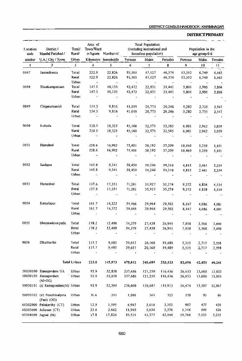
DISTRICT CENSUS HANDBOOK: KARIMNAGAR
Area of Total Population Location
code District I
Mandal Parishad I Totall TownlWard (including institutional and Rural! in Square Number of houseless population) -----------------------
nUlllber U.A.I City I Town Urban Kilometre households Persons Males Females
0047
0048
0049
0050
0051
0052
0053
0054
0055
0056
2
lammikunta
Shankarapatnam
Chigurumamidi
Koheda
Husnabad
Saidapur
Huzurabad
Kamalapur
3
Total
Rural
Urban
Total
Rural
Urban
Total
Rural Urban
Total
Rural
Urban
Total
Rural
Urban
Total
Rural
Urban
Total
Rural
Urban
Total
Rural
Urban
Bheemadevarpalle Total
Elkathurthi
Rural
Urban
Total
Rural
Urban
Total Urban
50050000 Ramagundam UA Urban
50050100 Ramagundam Urban
(M+OG)
50050101 (i) Ramagundam(M) Urban
50050 I 02 (ii) Penchikalpeta Urhan
(Part) (OG)
40302000 Palakurthy (CT) Urban
40303000 lallaram (CT) Urban
40304000 Jagtial (M) Urban
4
222.9 222.9
147.1
147.1
154.3
154.3
210.5
210.5
258.6
258.6
145.8
145.8
137.6
137.6
161.7
16L7
178.2
178.2
115.7 115.7
223.0
93.9 93.9
93.9
N.A
12.9
23.6
17.8
5
22,826
22,826
10,135
10,135
9,816
9,816
10,325
10,325
16,902
16,902
9,341
9,341
17,351
17,351
14,322
14,322
12,408
12,408
9,485
9,485
145,973
52,838 52,838
52,594
244
1,595
2,662
17,826
6
93,501
93,501
43,472
43,472
41,019
41,019
45,160
45,160
75,401
75,401
38,450
38,450
71,201 71,201
59,466
59,466
54,379
54,379
39,657
39,657
7
47,127
47,127
22,031
22,031
20,773
20,773
22,575
22,575
38,192
38,192
19,240
19,240
35,927
35,927
29,964
29,964
27,438 27,438
20,168
20,168
8
46,374
46,374
21,441
21,441
20,246
20,246
22,585
22,585
37,209
37,209
19,210
19,210
35,274
35,274
29,502
29,502
26,941
26,941
19,489
19,489
678,812 345,689 333,123
237,686 237,686
236,600
680
1,086
6,967
11,010
85,521
121,250 116,436 121,250 116,436
120,687 115,913
563
3,614
5,634
43,377
523
3,353
5,376
42,144
DISfRICfPRIMARY
Population in the age group 0-6
Persons
9
13,312
13,312
5,801
5,801
5,282
5,282
6,001
6,001
10,460
10,460
4,815
4,815
9,372
9,372
8,167 8,167
7,058
7,058
5,315
5,315
Males Females
10 11
6,749 6,563
6,749 6,563
2,995
2,995
2,735
2,735
2,962
2,962
2,806
2,806
2,547
2,547
3,039
3,039
5,359 5,101
5,359 5,101
2,461 2,354
2,461 2,354
4,838 4,534
4,838 4,534
4,086 4,081 4,086 4,081
3,568 3,490 3,568 3,490
2,717
2,717 2,598
2,598
82,696 42,455 40,241
26,633 13,600 13,033 26,633 13,600 13,033
26,474 13,507 12,967
159
907
1,316
10,768
93 66
477 430
690 626
5,533 5,235
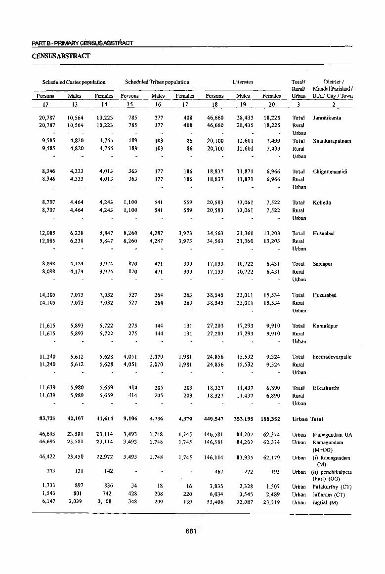
PARTB-PRI~~$USABs"tAACT
CENSUSABSTRACf
Scheduled Castes population Scheduled Tribes population
Persons
12
20,787 20,787
9,585
9,585
8,346 8,346
8,707
8,707
12,085 12,085
8,098
8,098
14,105 14,105
11,615 11,615
11,240 11,240
11,639 11,639
83,721
46,695 46,695
46,422
273
1,733
1,543 6,147
Males
I3
10,564 10,564
4,820
4,820
4,333 4,333
4,464
4,464
6,238 6,238
4,124
4,124
7,073 7,073
5,893 5,893
5,612 5,612
5,980 5,980
42,107
23,581 23,581
23,450
131
897 801
3,039
Females
14
10,223 10,223
4,765
4,765
4,013
4,013
Persons
15
785 785
189
189
363 363
4,243 1,100
4,243 1,100
5,847 8,260 5,847 8,260
3,974
3,974
7,032 7,032
5,722 5,722
5,628
5,628
5,659 5,659
870
870
527 527
275 275
4,051
4,051
414 414
41,614 9,106
23,114 3,493 23,114 3,493
22,972 3,493
142
836
742 3,108
34
428 348
Males Females
16 17
377 377
103
103
177 177
541
541
4,287 4,287
471
471
264 264
144 144
2,070
2,070
205
205
4,736
1,748 1,748
1,748
18 208 209
408 408
86 86
186
186
559
559
3,973
3,973
399
399
263 263
131 131
1,981
1,981
209 209
4,370
1,745 1,745
1,745
16
220 139
681
Persons
18
46,660 46,660
20,100
20,100
18,837
18,837
20,583
20,583
34,563 34,563
I7,IS3
17,1 S3
38,545 38,545
27,203 27,203
24,856
24,856
18,327 18,327
Literates
Males
19
28,435 28,435
12,601 12,601
11,871 11,871
Females
20
18,225 18,225
7,499
7,499
6,966 6,966
13~061 7,522
13,061 7,522
21,360 13,203 21,360 13,203
10,722
10,722
23,011 23,011
17,293 17,293
15,532
15,532
11,437 11,437
6,431
6,431
15,534 15,534
9,910 9,910
9,324
9,324
6,890 6,890
440,547 252,195 188,352
146,581 146,581
146,114
467
3,835
6,034 55,406
84,207 62,374 84,207 62,374
83,935 62,179
272 195
2,328 1,507
3,545 2,489 32,087 23,319
Total! Rural! Urban
3
District I MandalParishadl U.A.I City I Town
2
Total Jammikunta
Rural
Urban
Total Shankarapatnam
Rural
Urban
Total Chigurumamidi
Rural
Urban
Total Koheda
Rural
Urban
Total Husnabad
Rural
Urban
Total Saidapur
Rural
Urban
Total Huzurabad
Rural
Urban
Total Kamalapur
Rural
Urban
Total heemadevarpalle
Rural
Urban
Tota:l Elkathurthi
Rural Urban
Urban Total
Urban Ramagundam UA
Urban Ramagundam
(M+OG)
Urban (i) Ramagundam (M)
Urban (ii) penchikalpeta (Part) (OG)
Urban Palakurthy (Cl)
Urban Jallaram (CT)
Urban Jagtial (M)
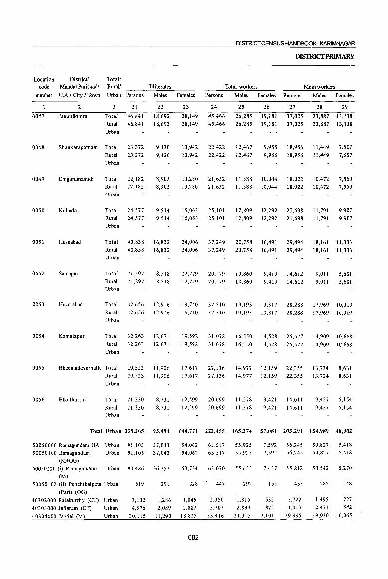
Location code
number
0047
0048
0049
0050
0051
0052
0053
0054
0055
0056
District] Total! MandaI Parishad/' Rural! Illiterates
U.A.I City I Town Urban Persons Males
2 3 21 22
lammikunta Total 46,841 18,692 Rural 46,841 18,692
Urban
Shankarapatnam Total 23,372 9,430 9,430
Chigurumamidi
Koheda
Husnabad
Saidapur
Huzurabad
Kamalapur
Rural 23,372
Urban
Total 22,IS2 Rural 22,182
Urban
Total 24,577 Rural 24,577
Urban
Total Rural Urban
Total
40,838 40,838
21,297 Rural 21,297 Urban
S,902 8,902
9,514 9,514
16,832
16,832
8,518 8,518
Total 32,656 12,916 Rural 32,656 12,916
Urban
Total 32,263 12,671
Rural 32,263 12,671 Urban
Bheemadevarpalle Total 29,523 11,906
Elkathurthi
Rural 29,523 11,906
Urban
Total 21,330
Rural Urban
21,330
8,731
8,731
DISTRICT CENSUS HANDBOOK: KARIMNAGAR
DISfRICfPRIMARY
Total workers Main workers
Females Persons Males Females Persons Males Females
23 24 25 26 27 28 29
28,149 45,466 26,285 19,181 37,025 23,887 13,138 28,149 45,466 26,285 19,181 37,025 23,887 13,138
13,942 22,422 13,942 22,422
13,280 21,632 13,280 21,632
15,063 15,063
24,006
24,006
12,779
25,101 25,101
37,249
37,249
20,279 12,779 20,279
19,740 32,510 19,740 32,510
19,592 31,078
19,592 31,078
17,617 27,136 17,617 27,136
12,599 20,699
12,599 20,699
12,467 12,467
9,955 18,956 11,449 7,507 9,955 18,956 11,449 7,507
11,588 10,044 18,022 10,472 7,550 11,588 10,044 18,022 10,472 7,550
12,S09 12,292 21,698 1l,791 9,907 12,809 12,292 21,698 11,791 9,907
20,758 20,758
10,860 10,860
16,491 16,491
9,419
29,494
29,494
14,612 9,419 14,612
18,161 IS,161
9,011 9,011
11,333
11,333
5,601
5,601
19,193 13,317 28,288 17,969 10,319
19,193 13,317 28,288 17,969 10,319
16,550 14,528 25,577 14,909 10,668
16,550 14,528 25,577 14,909 10,668
14,977 12,159 22,355 13,724 8,631 14,977 12,159 22,355 13,724 8,631
11,278
11,278
9,421 14,611
9,421 14,611
9,457 5,154
9,457 5,154
Total Urban 238,265 93,494 144,771 222,455 165,374 57,081 203,291 154,989 48,302
50050000 Ramagundam UA Urban 50050100 Ramagundam Urban
(M+OG)
50050101 (i) Ramagundam Urban (M)
50050 I 02 (ii) Penchikalpeta Urban
(Part) (OG)
40302000 Palakurthy (CT) Urban
40303000 lallaram (CT)
40304000 lagtial (M)
Urban
Urban
91,105 91,105
90,486
619
3,132 4,976
30,115
37,043 37,043
36,752
291
1,286
2,089
11,290
54,062 54,062
53,734
328
1,846
2,887
18,825
682
63,517 63,517
63,070
447
2,350
3,707
33,416
55,925 55,925
55,633
292
1,815
2,834
21,315
7,592 7,592
7,437
155
535 873
12,101
56,245 56,245
55,812
433
1,722
3,013
29,995
50,827 50,827
50,542
285
1,495 2,471
19,930
5,418 5,418
5,270
148
227 542
10,065

CENSUSABSTRA,cr
Industrial category of main workers
Total! Location Cultivators Agricultural Labourers Household industry workers Other workers Rural! Code
Persons Males Females Persons Males Females Persons Males Females Persons Males Females Urban Number
30 31 32 33 34 35 36 37 38 39 40 41 3
10,921 6,689 4,232 12,430 5,533 6,897 1,189 873
873
316 12,485 10,792 1,693 Total 0047 10,921 6,689 4,232 12,430 5,533 6,897 1,189
6,331 4,289 2,042 6,331 4,289 2,042
6,950 4,293 2,657 6,950 4,293 2,657
8,451 3,820 4,631 8,451 3,820 4,631
7,193 3,105 4,088 7,193 3,105 4,088
737 737
481 481
581 581
286 286
316 12,485 10,792 1,693 Rural
156 156
195 195
3,437 2,759 3,437 2,759
3,398 2,788 3,398 2,788
- Urban
678 Total
678 Rural - Urban
610 Total
610 Rural
- Urban
0048
0049
9,173 5,319 3,854 6,635 2,542 4,093 1,724 1,724
703 1,021 4,166 3,227 939 Total
939 Ruml - Urban
0050
9,173 5,319 3,854 6,635 2,542 4,093 703 1,021 4,166 3,227
13,591 13,591
8,569 5,022 8,569 5,022
6,585 4,209 2,376 6,585 4,209 2,376
6,765 4,203 2,562
6,765 4,203 2,562
8,045 8,045
3,383 4,662 3,383 4,662
4,340 1,794 2,546 4,340 1,794 2,546
10,299
10,299
4,671 4,671
5,628 5,628
7,878 4,951 2,927 10,509 4,467 6,042
7,878 4,951 2,927 10,509 4,467 6,042
9,294 5,975 3,319 7,593 3,494 4,099
9,294 5,975 3,319 7,593 3,494 4,099
5,569 3,837 1,732 5,085 2,491 2,594
5,569 3,837 1,732 5,085 2,491 2,594
1,168 1,168
581 581
1,516 1,516
739 739
427 427
905 905
1,863 1,036
1,863 1,036
837 . 837
905 905
472 472
599 599
429 429
154 154
6Il
6Il
827 827
365 365
306 306
6,690 6,690
5,470 1,220 Total 5,470 1,220 Rural
- Urban
3,106 2,581 3,106 2,581
525 Total 525 Rural
- Urban
9,708 9,708
8,190 1,518 Total
8,190 1,518 Rural
- Urban
5,327 4,455
5,327 4,455
4,631 3,783 4,631 3,783
3,052 2,530 3,052 2,530
872 Total
872 Rural
- Urban
848 Total 848 Rural
- Urban
522 Total 522 Rural
- Urban
0051
0052
0053
0054
0055
0056
2,512 1,835 677 6,429 3,810 2,619 34,022 9,005 25,017 160,328 140,339 19,989 Urban Total
343 343
333
10
162
376 570
258 258
248
10
III
262 407
85 85
85
51 114 163
1,351 1,351
1,140
211
244
315 1,318
850 850
756
94
148 217
813
501 1,687 1,278 501 1,687 1,278
384 1,675 1,277
117
96 98
505
12
34 179
6,760
683
14 56
842
409 52,864 48,441 4,423 Urban 50050000 409 52,864 48,441 4,423 Urban 50050100
398 52,664 48,261 4,403 Urban 50050101
II
20 123
5,918
200 180 20 Urban 50050102
1,282 1,222 60 Urban 40302000 2,143 1,936 207 Urban 40303000
21,347 17,868 3,479 Urban 40304000
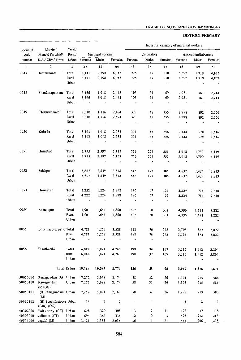
District! Location code
number
MandaI Parishadl Total! RuralJ Marginal workers
U.A.I City / Town Urban Persons Males
0047
0048
0049
0050
005!
0052
0053
0054
0055
0056
2
Jammikunta
3
Total
Rural
Urban
Shankarapatnam Total Rural
Urban
Chigurumamidi Total
Koheda
Husnabad
Saidapur
Rural Urban
Total
Rural
Urban
Total
Rural Urban
Total
42
8,441 8,441
3,466 3,466
3,610 3,610
3,403
3,403
7,755 7,755
5,667 Rural 5,667
Huzurabad
Kamalapur
Urban
Total
Rural
Urban
Total Rural
Urban
Bheemadevarpalle Total
4,222
4,222
5,501 5,501
4,781 Rural 4,781
Elkathurthi
Urban
Total
Rural Urban
6,088
6,088
43
2,398
2,398
1,018 1,018
1,116
1,116
1,018
1,018
2,597
2,597
1,849
1,849
1,224
1,224
1,641 1,641
1,253 1,253
1,821
1,821
Total Urban 19,164 10,385
50050000 Ramagundam UA Urban 7,272 50050100 Ramagundam Urban 7,272
(M+OG)
50050101 (i) Ramagundam Urban 7,258 (M)
50050102 (ii) Penchikalpeta Urban 14 (Part) (OG)
40302000 Palakurthy (CT) Urban 628
40303000 Jallaram (CT) Urban 694
40304000 Iagtial (M) Urban 3,421
5,098
5,098
5,091
7
320
363
1,385
Females
44
6,043
6,043
2,448 2,448
2,494 2,494
2,385
2,385
5,158 5,158
3,818
3,818
2,998
2,998
3,860 3,860
3,528 3,528
4,267
4,267
8,779
2,174 2,174
2,167
7
308
331
2,036
684
DISTRICT CENSUS HANDBOOK: KARIMNAGAR
DISfRICfPRIMARY
Industrial category of marginal workers
Cultivators AgricultUIaI labourers
Persons Males Females Persons Males Females
45
ns 725
103 103
323
323
311
311
756 756
515
515
180
180
422 422
418 418
198
198
186
58 58
58
13
12
36
46
107
107
34 34
68
68
65
65
201
201
127
127
47
47
88 88
76 76
39
39
88
32 32
32
2 9
15
47
618
618
69 69
255
255
246
246
555
555
388
388
133
133
334 334
342
342
159
159
98
26 26
26
II
3
21
48
6,592
6,592
2,981 2,981
2,998
2,998
2,144
2,144
5,918 5,918
4,637
4,637
3,324
3,324
4,396 4,396
3,705
3,705
5,316
5,316
3,047
1,301 1,301
1,293
8
173 495
444
49
1,719
1,719
767 767
892
892
528
528
1,799 1,799
1,424
1,424
714
714
1,174 1,174
883
883
1,512
1,512
1,376
715 715
713
2
37 212
206
50
4,873
4,873
2,214
2,214
2,106
2,106
1,616
1,616
4,119
4,119
3,213
3,213
2,610
2,610
3,222
3,222
2,822
2,822
3,804
3,804
1,671
586 586
580
6
136 283
238

PARTS ~ PRiMAAYCf:NSUSABSTRACT
CENSUSABSTRACf
Industrial category of marginal workers Totall District J Location
Household industry workers Other workers Non-workers Persons Males Females Persons Males Females Persons Males Females
Rural! Mandai ParishadJ Code
Urban U.A.I City I Town number
51
257 257
189 189
70
70
286
286
305
305
125
125
155
155
181 181
118 118
258
258
3,759
437 437
437
8 8
1,144
52
59 59
85 85
28
28
56
S6
105
105
61
61
61
61
49 49
25 25
46
46
670
268 268
268
3 4
90
53
198
198
104 104
42
42
230
230
200
200
64
64
94
94
132 132
93 93
212
212
3,089
169
169
169
5
4
1,054
54
867
867
193 193
219
219
662
662
776
776
390
390
563
563
502
502
540
540
316
316
12,172
5,476
5,476
5,470
6
434
179
1,797
55 513
513
132 132
128
128
369
369
492
492
237
237
402
402
330 330
269 269
224
224
8,251
4,083
4,083
4,078
5
278 138
1,074
56 354
354
61
61
91
91
293
293
284
284
153
153
161 161
172
172
271 271
92
92
3,921
1,393
1,393
1,392
156
41
723
57 58 59 3 2
48,035 20,842 27,193 Total Jammikunta 0047 48,035 20,842 27,193 Rural
21,050 21,050
19,387
19,387
20,059
20,059
38,152
38,152
18,171
18,171
38,691
38,691
28,388
Urban
9,564 11,486 Total Shankarapatnam 9,564 11,486 Rural
Urban
9,185 10,202 Total Chigurumamidi
9,185 10,202 Rural
9,766
9,766
17,434
17,434
10,293
10,293
20,718
20,718
Urban
Total Koheda
Rural
Urban
Total Husnabad
Rural
Urban
8,380 9,791 Total Saidapur
8,380 9,791 Rural
16,734
16,734
13,414
21,957
21,957
14,974
Urban
Total Huzurabad
Rural
Urban
Total Kamalapur
0048
0049
0050
0051
0052
0053
0054 28,388 13,414 14,974 Rural
Urban
27,243 12,461 14,782 Total Bheemadevarpalle 0055 27,243 12,461 14,782 Rural
18,958
18,958
456,357
174,169
174,169
173,530
639
4,617
7,303
52,105
685
8,890
8,890
10,068
10,068
180,315 276,042
65,325 108,844
65,325 108,844
65,054 108,476
Urban
Total Elkathurthi
Rural
Urban
Urban Total
0056
Urban Ramagundam UA50050000
Urban Ramagundam
(M+OG) 50050100
Urban (i) Ramagundam
(~) 50050101 271 368 Urban (ii) Penchikalpeta
1,799 2,818
2,800 4,503
22,062 30,043
(Part) (OG) 50050102
Urban Palakurthy (CT)40302000
Urban Jallaram (CT) 40303000
Urban Jagtial (M) 40304000
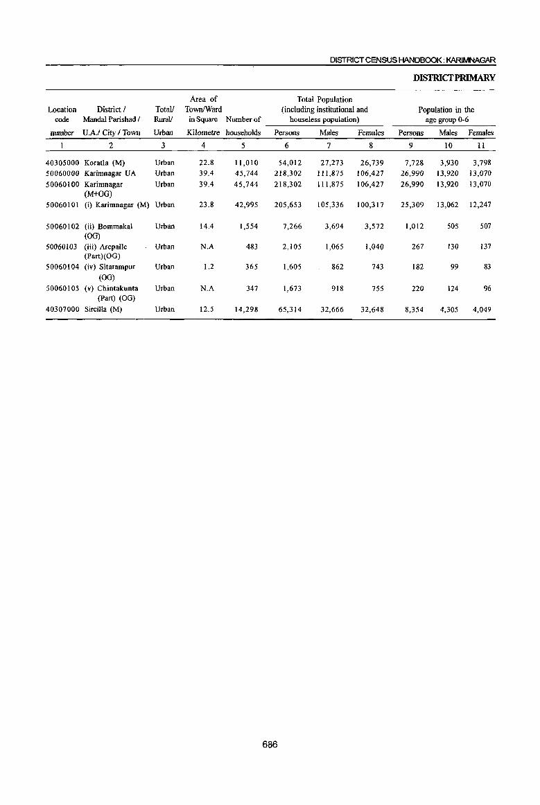
DISTRICT CENSUS HANDBOOK: KARIMNAGAR
DISIRICfPRIMARY
Area of Total Population Location District I Totall TownlWard (including institutional and Population in the
code Mandal Parishad I RuralI in Square Number of houseless population) age group 0-6
number U.A.I City I Town Urban Kilometre households Persons Males Females Persons Males Females
2 3 4 5 6 7 8 9 10 11
40305000 Koratla (M) Urban 22.8 11,010 54,012 27,273 26,739 7,728 3,930 3,798
50060000 Karimnagar UA Urban 39.4 45,744 218,302 111,875 106,427 26,990 13,920 13,070
50060100 Karimnagar Urban 39.4 45,744 218,302 111,875 106,427 26,990 13,920 13,070 (M+OG)
50060101 (i) Karimnagar (M) Urban 23.8 42,995 205,653 105,336 100,317 25,309 13,062 12,247
50060102 (ii) Bommakal Urban 14.4 1,554 7,266 3,694 3,572 1,012 505 507 (OG)
50060103 (iii) Arepalle Urban N.A 483 2,105 1,065 1,040 267 130 137 (Part)(OO)
50060104 (iv) Sitarampur Urban 1.2 365 1,605 862 743 182 99 83
(00) 50060105 (v) Chintakunta Urban N.A 347 1,673 918 755 220 124 96
(Part) (00)
40307000 Sircilla (M) Urban 12.5 14,298 65,314 32,666 32,648 8,354 4,305 4,049
686

CENSUSABSTRACf
Scheduled Castes population Scheduled Tribes population Literates Totall District J ~ MandaI Parishad I
Persons Males Females Persons Males Females Persons Males Females Urban U.A.I Citl: I Town
12 13 14 15 16 17 18 19 20 3 2
4,127 2,043 2,084 726 429 297 31,488 18,160 13,328 Urban Koratla (M) 20,362 10,219 10,143 3,608 1,876 1,732 157,676 88,238 69,438 Urban Karimnagar UA 20,362 10,219 10,143 3,608 1,876 1,732 157,676 88,238 69,438 Urban Karimnagar
(M+OG) 18,289 9,169 9,120 3,477 1,796 1,681 150,282 83,811 66,471 Urban (i)Karimnagar (M)
1,324 668 656 50 32 18 3,853 2,266 1,587 Urban (ii) Bommakal (OG)
501 252 249 37 22 15 1,351 790 561 Urban (iii) Arepalle (Part) (OG)
136 67 69 23 12 1I 1,038 642 396 Urban (iv) Sitarampur (OG)
112 63 49 21 14 7 1,152 729 423 ' Urban (v) Chintakunta (Part) (OG)
3,114 1,527 1,587 469 248 221 39,527 23,630 15,897 Urban Sircilla (M)
687
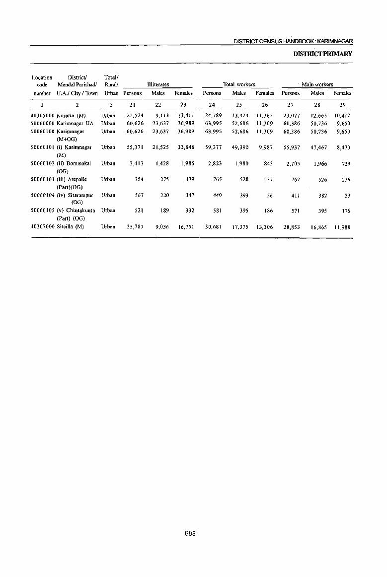
DISTRICT CENSUS HANDBOOK: KARIMNAGAR
DISrRICfPRIMARY
Location District! Total/ code Mandai Parishadl Rural! Illiterates Total workers Main workers
number U.A.I City I Town Urban Persons Males Females Persons Males Females Persons Males Females
2 3 21 22 23 24 25 26 27 28 29
40305000 Koratla (M) Urban 22,524 9,113 13,411 24,789 13,424 11,365 23,077 12,665 10,412
50060000 Karimnagar UA Urban 60,626 23,637 36,989 63,995 52,686 11,309 60,386 50,736 9,650
50060100 Karimnagar Urban 60,626 23,637 36,989 63,995 52,686 11,309 60,386 50,736 9,650 (M+OO)
50060 I 0 I (i) Karimnagar Urban 55,371 21,525 33,846 59,377 49,390 9,987 55,937 47,467 8,470 (M)
50060 I 02 (ii) Bommakal Urban 3,4l3 1,428 1,985 2,823 1,980 843 2,705 1,966 739 (00)
50060 I 03 (iii) Arepalle Urban 754 275 479 765 528 237 762 526 236 (Part)(OO)
50060104 (iv) Sitarampur Urban 567 220 347 449 393 56 411 382 29 (00)
50060 I 05 (v) Chintakunta Urban 521 189 332 581 395 186 571 395 176 (Part) (00)
40307000 Sircilla (M) Urban 25,787 9,036 16,751 30,681 17,375 13,306 28,853 16,865 11,988
688
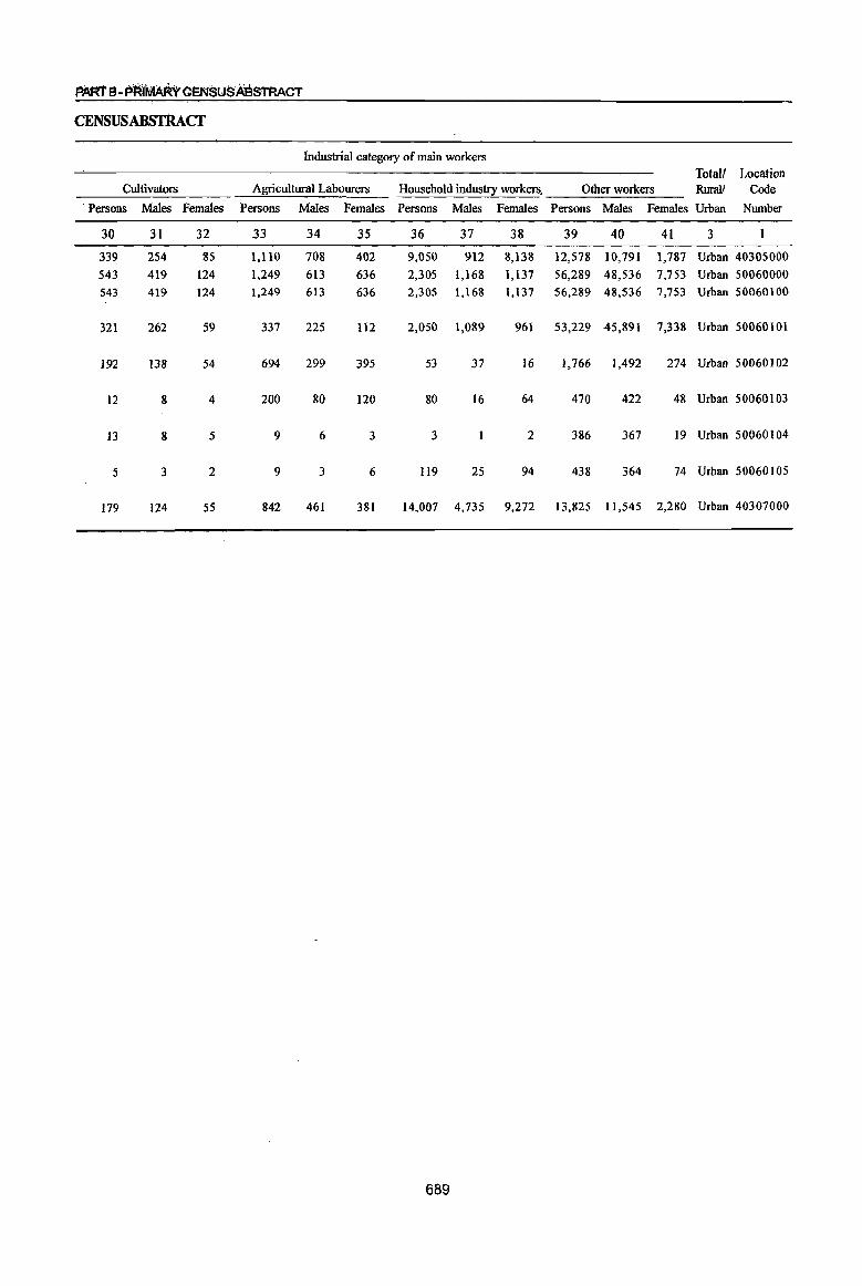
PARTB-PRf~GtNSU$A'BSTRACT
CENSUSABSTRAcr
Industrial category of main workers Total! Location
Cultivators Agricultural Labourers Household industry workers, Other workers RuraIJ Code . Persons Males Females Persons Males Females Persons Males Females Persons Males Females Urban Number
30 3l 32 33 34 35 36 37 38 39 40 4l 3
339 254 85 1,110 708 402 9,050 912 8,138 12,578 10,791 1,787 Urban 40305000
543 419 124 1,249 613 636 2,305 1,168 1,137 56,289 48,536 7,753 Urban 50060000
543 419 124 1,249 613 636 2,305 1,168 1,137 56,289 48,536 7,753 Urban 50060100
321 262 59 337 225 112 2,050 1,089 961 53,229 45,891 7,338 Urban 50060101
192 138 54 694 299 395 53 37 16 1,766 1,492 274 Urban 50060102
12 8 4 200 80 120 80 16 64 470 422 48 Urban 50060103
13 8 5 9 6 3 3 2 386 367 19 Urban 50060104
5 3 2 9 3 6 119 25 94 438 364 74 Urban 50060105
179 124 55 842 461 381 14,007 4,735 9,272 13,825 11,545 2,280 Urban 40307000
689
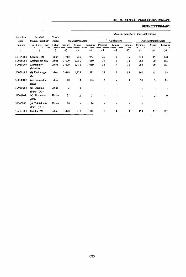
DIS1RICTCENSUS HANDBOOK: KARIMNAGAR
DISfRICfPRIMARY
Industrial category of marginal workers Location District! Total!
code Mandai Parishadl Rural! Marginal workers Cultivators Agricultural labourers
number U.A.I City I Town Urban Persons Males Females Persons Males Females Persons Males Females
2 3 42 43 44 45 46 47 48 49 50
40305000 Koratla (M) Urban 1,712 759 953 25 9 16 243 115 128 50060000 Karimnagar U A Urban 3,609 1,950 1,659 3S 17 18 263 70 193 50060100 Karimnagar Urban 3,609 1,950 1,659 35 17 18 263 70 193
(M+OG)
50060101 (i) Karimnagar Urban 3,440 1,923 1,517 32 17 15 160 65 95 (M)
50060102 (ii) Bommakal Urban 118 14 104 3 3 91 3 88 (OG)
50060103 (iii) Arepalle Urban 3 2 (Part) (OG)
50060104 (iv) Sitarampur Urban 38 11 27 11 2 9 (00)
50060105 (v) Chintakunta Urban 10 10 (Part) (OG)
40307000 Sircilla (M) Urban 1,828 510 1,318 7 4 3 128 21 ·107
690
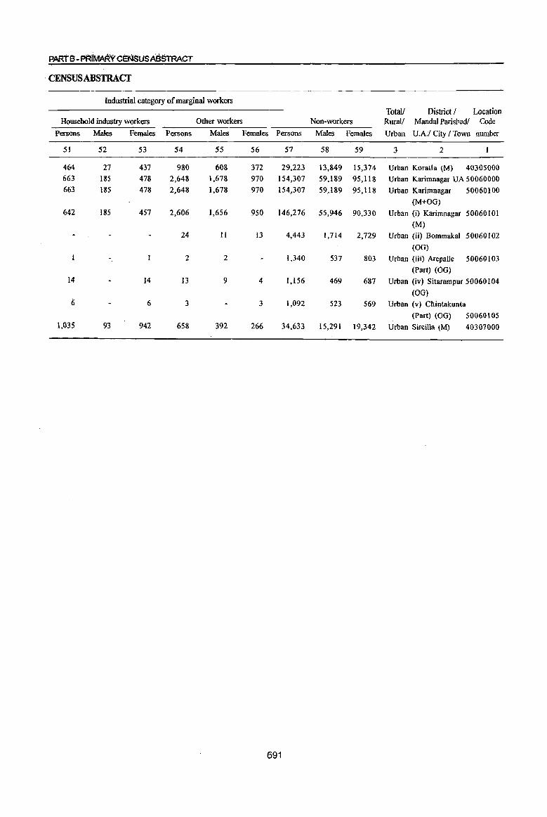
PARTS-PEt(Mi'\RYCEf{lSUSABSTRACT
·CENSUSABSTRACf
Industrial category of marginal workers
TotaU District / Location Household industry workers Other workers Non-workers RuraV Mandai Parishadl Code
Persons Males Females Persons Males Females Persons Males Females Urban U.A.I City I Town number
51 52 53 54 55 56 57 58 59 3 2
464 27 437 980 608 372 29,223 13,849 15,374 Urban Koratla (M) 40305000 663 185 478 2,648 1,678 970 154,307 59,189 95,118 Urban Karimnagar UA 50060000 663 185 478 2,648 1,678 970 154,307 59,189 95,118 Urban Karimnagar 50060100
(M+OO) 642 185 457 2,606 1,656 950 146,276 55,946 90,330 Urban (i) Karimnagar 50060101
(M) 24 II 13 4,443 1,714 2,729 Urban (ii) Bommakal 50060102
(00)
2 2 1,340 537 803 Urban (iii) Arepalle 50060103
(Part) (OG) 14 14 13 9 4 1,156 469 687 Urban (iv) Sitarampur 50060104
(OG) 6 6 3 3 1,092 523 569 Urban (v) Chintakunta
(Part) (00) 50060105 1,035 93 942 658 392 266 34,633 15,291 19,342 Urban Sircilla (M) 40307000
691

DISTRICT CENSUS HANDBOOK: KARIMNAGAR
APPENDIX TO DISTRICfPRIMARY CENSUS ABSTRACT
TOTAL, SCHEDULED CASTESAND SCHEDULED TRIBES POPULATION - URBANBWCKWISE
Location Name of Town Name of Ward Boundaries of Total Scheduled Castes Scheduled Tribes
code urban block! Population Population Population number E.B.number
2 3 4 5 6 7 40301000 Ramagundam (M+OG) (Part) Ward No.1 EB No.1 635 57 11 40301000 Ramagundam (M+OG) (Part) Ward No.1 EB No.2 692 83 39 40301000 Ramagundam (M+OG) (Part) Ward No.1 EB No.3 579 73 409
40301000 Ramagundam (M+OG) (Part) Ward No.1 EB No.4 577 17
40301000 Ramagundam (M+OG) (Part) Ward No. I EB No.5 557 45 4
40301000 Ramagundam (M+OG) (Part) Ward No.1 EB No.6 646 28 40301000 Ramagundam (M+OG) (Part) Ward No. I EB No.7 608 58
40301000 Ramagundam (M+OG) (Part) Ward No. I EB No.8 579 61 8
40301000 Ramagundam (M+OG) (Part) Ward No.1 EB No.9 691 113 14
40301000 Ramagundam (M+OG) (Part) Ward No. I EB No. 10 561 16
40301000 Ramagundam (M+OG) (Part) Ward No.1 EB No. II 617 75
40301000 Ramagundam (M+OG) (Part) Ward No.1 EB No. 12 534 17 40301000 Ramagundam (M+OG) (Part) Ward No. I EB No. 13 476 24 5 40301000 Ramagundam (M+OG) (Part) Ward No.2 EB No. 14 542 21
40301000 Ramagundam (M+OG) (Part) Ward No.2 EB No. 15 588 157 8
40301000 Ramagundam (M+OG) (Part) Ward No.2 EB No. 16 549 49 40301000 Ramagundam (M+OG) (Part) Ward No.2 EB No. 17 490
40301000 Ramagundam (M+OG) (Part) Ward No.2 EB No. 18 525 307
40301000 Ramagundam (M+OG) (Part) Ward No.2 EB No. 19 534 173 48
40301000 Ramagundam (M+OG) (Part) Ward NO.3 EB No. 20 613 228 24
40301000 Ramagundam (M+OG) (Part) Ward NO.3 EB No. 21 673 156
40301000 Ramagundam (M+OG) (Part) Ward NO.3 EB No. 22 414 98
40301000 . Ramagundam (M+OG) (Part) Ward No.3 EB No. 23 343 80 40301000 Ramagundam (M+OG) (Part) Ward No.3 EB No. 24 551 136 13 40301000 Ramagundam (M+OG) (Part) Ward NO.3 EB No. 25 465 133
40301000 Ramagundam (M+OG) (Part) Ward No.3 EB No. 26 351 105 14 40301000 Ramagundam (M+OG) (Part) Ward No.3 EB No. 27 625 10 40301000 Ramagundam (M+OG) (Part) Ward NO.3 EE No. 28 620
40301000 Ramagundam (M+OG) (Part) Ward No.3 EB No. 29 571 76
40301000 Ramagundam (M+OG) (Part) Ward No.3 EB No. 30 597 9
40301000 Ramagundam (M+OG) (Part) Ward NO.3 EB No. 31 439 88
40301000 Ramagundam (M+OG) (Part) Ward No.4 EB No. 32 604 49 44
40301000 Ramagundam (M+OG) (Part) Ward NO.4 EB No. 33 445 14 116
40301000 Ramagundam (M+OG) (Part) Ward NO.4 EB No. 34 452 139 40
40301000 Ramagundam (M+OG) (Part) Ward No.4 EB No. 35 380 254 ';"
20
40301000 Ramagundam (M+OG) (Part) Ward No.4 EB No. 36 557 55
40301000 Ramagundam (M+OG) (Part) Ward NO.4 EB No. 37 503 274 106
40301000 Ramagundam (M+OG) (Part) Ward No.4 EB No. 38 755 58
40301000 Ramagundam (M+OG) (Part) Ward No.4 EB No. 39 781 120 4
40301000 Ramagundam (M+OG) (Part) Ward No.4 EB No. 40 473 3 41
40301000 Ramagundam (M+OG) (Part) Ward No.4 EB No. 41 452 245
40301000 Ramagundam (M+OG) (Part) Ward No.4 EB No. 42 347 7
40301000 Ramagundam (M+OG) (Part) Ward No.4 EB No. 43 537 99 2
40301000 Ramagundam (M+OG) (Part) Ward No.4 EB No. 44 396 144
40301000 Ramagundam (M+OG) (Part) Ward NO.4 EB No. 45 689 400
40301000 Ramagundam (M+OG) (Part) Ward No.4 EB No. 46 728 188 II
40301000 Ramagundam (M+OG) (Part) Ward No.4 EB No. 47 380 86
692

PART B-PRiMARY CENS'USAB$tRACT
APPENDIX TO DIStrucrP y CENSUS ABSTRACf
TOTAL, SCHEDULED CASTES AND SCHEDUL D 1RIBES POPULATION -URBAN BWCKWISE
Location Name of Town Total Scheduled Castes Scheduled Tribes code urban block! Population Population Population
number E.B.number
1 2 3 4 5 6 7 40301000 Ramagundam (M+OG) (Part) Ward No.4 EB No. 48 381 51 58
40301000 Ramagundam (M+OG) (Part) Ward No.4 EB No. 49 688 85 5
40301000 Ramagundam (M+OG) (Part) Ward NO.4 EB No. 50 491 158 28
40301000 Ramagundam (M+OG) (Part) Ward No.4 EB No. 51 520 90 2 40301000 Ramagundam (M+OG) (Part) Ward No.5 EB No. 52 390 135 35
40301000 Ramagundarn (M+OG) (Part) Ward No.5 EB No. 53 653 29 10
40301000 Ramagundam (M+OG) (Part) Ward No. 5 EB No. 54 517 65 3
40301000 Ramagundam (M+OG) (Part) Ward No.5 EB No. 55 286
40301000 Ramagundarn (M+OG) (Part) Ward No.5 EB No. 56 624 80
40301000 Ramagundam (M+OG) (Part) Ward No. 5 EB No. 57 564 131 19
40301000 Ramagundam (M+OG) (Part) Ward No.5 EB No. 58 501 21 3
40301000 Ramagundam (M+OG) (Part) Ward No.5 EB No. 59 670 73 30
40301000 Rarnagundarn (M+OG) (Part) Ward No.5 EB No. 60 544 76 20
40301000 Ramagundam (M+OG) (Part) Ward No. 5 EB No. 61 516 167 11
40301000 Ramagundam (M+OG) (Part) Ward No.5 EB No. 62 755 48 14
40301000 Rarnagundarn (M+OG) (Part) Ward No. 5 EB No. 63 422
.40301000 Ramagundam (M+OG) (Part) Ward No.5 EB No. 64 805 392 6
40301000 Ramagundam (M+OG) (Part) Ward No.6 EB No. 65 463 71 3
40301000 Ramagundam (M+OG) (part) Ward No.6 EB No. 66 503 67 7 40301000 Ramagundam (M+OG) (Part) Ward No.6 EB No. 67 460 120 4
40301000 Rarnagundam (M+OG) (Part) Ward No.6 EB No. 68 542 35
40301000 Rarnagundam (M+OG) (Part) Ward No. 6 EB No. 69 522 43
40301000 Rarnagundarn (M+OG) (Part) Ward No.6 EBNo.70 496 24
40301000 Ramagundam (M+OG) (Part) Ward No. 6 EB No. 71 531 33 4
40301000 Ramagundam (M+OG) (Part) Ward No.6 EB No. 72 469 49 4
40301000 Ramagundam (M+OG) (Part) Ward No.6 EB No. 73 541 95 6
40301000 Ramagundarn (M+OG) (Part) Ward No.6 EB No. 74 587 85 5
40301000 Rarnagundarn (M+OG) (Part) Ward No.6 EB No. 75 580 76 14
40301000 Ramagundam (M+OG) (Part) Ward No.6 EB No. 76 505 60
40301000 Ramagundarn (M+OG) (Part) Ward No. 6 EB No. 77 532 81
40301000 Ramagundam (M+OG) (Part) Ward NO.6 EB No. 78 515 68
40301000 Ramagundam (M+OG) (Part) Ward No.6 EB No. 79 619 152
40301000 Ramagundam (M+OG) (Part) Ward No. 6 EB No. 80 621 92 9
40301000 Ramagundam (M+OG) (Part) Ward No.6 EB No. 81 610 108 12 40301000 Ramagundarn (M+OG) (Part) Ward No.6 EB No. 82 754 81 2 40301000 Rarnagundam (M+OG) (Part) Ward No.6 EB No. 83 630 32 40301000 Rarnagundarn (M+OG) (Part) Ward No.6 EB No. 84 603 50 40301000 Ramagundam {M+OG} (Part) Ward No. 6 EB No. 85 499 47 3 40301000 Ramagundam (M+OG) (Part) . Ward No.6 f:B No. 86 569 170 13 40301000 Ramagundarn (M+OG) (Part) Ward No.7 EB No. 87 508 57 2 40301000 Rarnagundam (M+OG) (Part) Ward No. 7 EB No. 88 576 89 40301000 Rarnagundarn (M+OG) (Part) Ward No.7 EB No. 89 499 58 40301000 Rarnagundarn (M+OG) (Part) Ward NO.7 EB No. 90 564 146 5 40301000 Ramagundam (M+OG) (Part) Ward No.7 EB No. 91 585 131 9 40301000 Ramagundam (M+OG) (Part) Ward No.7 EB No. 92 760 398 46 40301000 Rarnagundarn (M+OG) (Part) Ward No.7 EB No. 93 575 573 40301000 Rarnagundam (M+OG) (Part) Ward No.7 EB No. 94 425 57
693
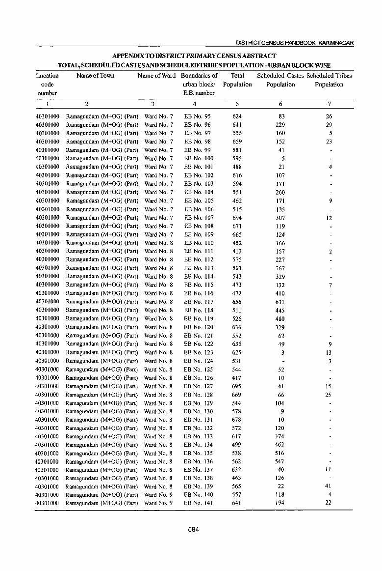
DISTRICT CENSUS HANDBOOK: KARIMNAGAR
APPENDIX TO DISTRICfPRlMARY CENSUSABSTRACf
TOTAL, SCHEDULED CASTES AND SCHEDULED TRIBES POPULATION - URBAN BWCKWISE
Location Name of Town Name of Ward Boundaries of Total Scheduled Castes Scheduled Tribes
code urban block! Population Population Population nwnber E.B.nwnber
2 3 4 5 6 7
40301000 Ramagundam (M+OG) (Part) Ward No.7 EB No. 95 624 83 26
40301000 Rarnagundiun (M+OG) (Part) Ward No.7 EB No. 96 641 229 29
40301000 Ramagundam (M+OG) (Part) Ward No.7 EB No. 97 555 160 5
40301000 Ramagundam (M+OG) (Part) Ward No.7 EB No. 98 659 152 23 40301000 Ramagundam (M+OG) (Part) Ward No.7 EB No. 99 581 41
40301000 Rarnagundam (M+OG) (Part) Ward No.7 EB No. 100 595 5 40301000 Rarnagundam (M+OG) (Part) Ward No.7 EB No. 101 488 21 4 40301000 Ramagundarn (M+OG) (Part) Ward No.7 EB No. 102 616 107 40301000 Ramagundam (M+OG) (Part) Ward No.7 EB No. 103 594 171
40301000 Rarnagundam (M+OG) (Part) Ward No.7 EB No. 104 551 260
40301000 Rarnagundam (M+OG) (Part) Ward No.7 EB No. 105 462 I7l 9
40301000 Ramagundarn (M+OG) (Part) Ward No.7 EB No. 106 515 135 40301000 Rarnagundam (M+OG) (Part) Ward No.7 EB No. 107 694 307 12 40301000 Rarnagundarn (M+OG) (Part) Ward No.7 EB No. 108 671 119 40301000 Rarnagundarn (M+OG) (Part) Ward No.7 EB No. 109 665 124 40301000 Rarnagundarn (M+OG) (Part) Ward No.8 EB No. 110 452 166 40301000 Rarnagundarn (M+OG) (Part) Ward No.8 EB No. III 413 157 2 40301000 Rarnagundarn (M+OG) (Part) Ward No.8 EB No. 112 575 227 40301000 Rarnagundarn (M+OG) (Part) Ward No.8 EB No. 113 503 367 40301000 Rarnagundarn (M+OG) (Part) Ward No.8 EB No. 114 543 329 40301000 Rarnagundam (M+OG) (Part) Ward No.8 EB No. 115 473 132 7 40301000 Rarnagundarn (M+OG) (Part) Ward No.8 EB No. 116 472 410 40301000 Rarnagundarn (M+OG) (Part) Ward No.8 EB No. 117 656 631 40301000 Rarnagundarn (M+OG) (Part) Ward No.8 EB No. 118 511 445 40301000 Rarnagundarn (M+OG) (Part) Ward No.8 EB No. 119 526 480 40301000 Rarnagundarn (M+OG) (Part) Ward No.8 EB No. 120 636 329 40301000 Rarnagundarn (M+OG) (Part) Ward No.8 EB No. 121 552 62 40301000 Rarnagundarn (M+OG) (Part) Ward No.8 EB No. 122 635 49 9 40301000 Rarnagundarn (M+OG) (Part) Ward No.8 EB No. 123 625 3 13 40301000 Rarnagundarn (M+OG) (Part) Ward No.8 EB No. 124 531 3 40301000 Rarnagundarn (M+OG) (Part) Ward No.8 EB No. 125 544 52 40301000 Rarnagundarn (M+OG) (Part) Ward No.8 EB No. 126 417 10 40301000 Rarnagundarn (M+OG) (Part) Ward No.8 EB No. 127 695 41 15
40301000 Rarnagundarn (M+OG) (Part) Ward No.8 EB No. 128 669 66 25 40301000 Rarnagundarn (M+OG) (Part) Ward No.8 EB No. 129 544 104 40301000 Rarnagundarn (M+OG) (Part) Ward No.8 EB No. 130 578 9 40301000 Rarnagundarn (M+OG) (Part) Ward No.8 EBNo.131 678 10
40301000 Rarnagundarn (M+OG) (Part) Ward No.8 EB No. 132 572 120
40301000 Rarnagundarn (M+OG) (Part) Ward No.8 EB No. 133 617 374
40301000 Rarnagundarn (M+OG) (Part) Ward No.8 EB No. 134 499 462
40301000 Rarnagundam (M+OG) (Part) Ward No.8 EB No. 135 538 516
40301000 Rarnagundam (M+OG) (Part) Ward No.8 EB No. 136 562 547
40301000 Rarnagundarn (M+OG) (Part) Ward No.8 EB No. 137 632 40 II
40301000 Rarnagundarn (M+OG) (Pan) Ward No.8 EB No. 138 463 126
40301000 Rarnagundarn (M+OG) (Part) Ward No.8 EB No. 139 565 22 41
40301000 Rarnagundarn (M+OG) (Part) Ward No.9 EB No. 140 557 118 4
40301000 Rarnagundarn (M+OG) (Part) Ward No.9 EB No. 141 641 194 22
694

PARtB-PR~y6ENSUSABSTRACT
APPENDIX TO DISTRICf PRIMARY CENSUSABsTRACf TOTAL, SCHEDULED CASTES AND SCHEDULED TRIBES POPULATION - URBAN BWCKWISE
Location Name of Town Name of Ward Boundaries of Total Scheduled Castes Scheduled Tribes code urban block! Population Population Population
number E.B .. number
1 2 3 4 5 6 7
40301000 Ramagundam (M+OG) (Part) Ward No.9 EB No. 142 . 592 102 7
40301000 Ramagundam (M+OG) (Part) Ward No. 9 EB No. 143 549 167 33
40301000 Ramagundam (M+OG) (Part) Ward No.9 EB No. 144 528 43
40301000 Ramagundam (M+OG) (Part) Ward No.9 EB No. 145 440 6 4
40301000 Ramagundam (M+OG) (Part) Ward No. 9 EB No. 146 531 151
40301000 Ramagundam (M+OG) (Part) Ward No.9 EB No. 147 623 120
40301000 Ramagundam (M+OG) (Part) Ward No.9 EB No. 148 604 81 9
40301000 Ramagundam (M+OG) (Part) Ward No.9 EB No. 149 586 35 44
40301000 Ramagundam (M+OG) (Part) Ward No.9 EB No. 150 560 38
40301000 Ramagundam (M+OG) (Part) Ward No. 9 EB No. 151 421 38 3
40301000 Ramagundam (M+OG) (Part) Ward No. 9 EB No. 152 481 21
40301000 Ramagundam (M+OG) (Part) Ward No.9 EB No. 153 589 96 66
40301000 Ramagundam (M+OG) (Part) Ward No.9 EB No. 154 464 38 II
40301000 Ramagundam (M+OG) (Part) Ward No. 9 EB No. 155 472
40301000 Ramagundam (M+OG) (Part) Ward No.9 EB No. 156 558 134
40301000 Ramagundam (M+OG) (part) Ward No.9 EB No. 157 488 38
40301000 Ramagundam (M+OG) (Part) Ward No.9 EB No. 158 497
40301000 Ramagundam (M+OG) (Part) Ward No. 9 EB No. 159 532 39
40301000 Ramagundam (M+OG) (Part) Ward No. 9 EB No. 160 593 5
40301000 Ramagundam (M+OG) (Part) Ward No.9 EB No. 161 593 153
40301000 Ramagundam (M+OG) (Part) Ward No. 9 EB No. 162 669 26 4
40301000 Ramagundam (M+OG) (Part) Ward No.9 EB No. 163 565 17
40301000 Ramagundam (M+OG) (Part) Ward No.9 EB No. 164 553 158
40301000 Ramagundam (M+OG) (Part) Ward No.9 EB No. 165 542 196 9
40301000 Ramagundam (M+OG) (Part) Ward No. 10 EBNo.166 441 225 11
40301000 Ramagundam (M+OG) (Part) Ward No. 10 EB No. 167 484 87
40301000 Ramagundam (M+OG) (Part) Ward No. 10 EB No. 168 493
40301000 Ramagundam (M+OG) (Part) Ward No. 10 EB No. 169 564 89
40301000 Ramagundam (M+OG) (Part) Ward No. 10 EB No. 170 447 128 5
40301000 Ramagundam (M+OG) (Part) Ward No. 10 EB No. 171 457 138 6
40301000 Ramagundam (M+OG) (Part) Ward No. 10 EB No. 172 372 5
40301000 Ramagundam (M+OG) (Part) Ward No. 11 EB No. 173 486 50
40301000 Ramagundam (M+OG) (Part) Ward No. 11 EB No. 174 677 332
40301000 Ramagundam (M+OG) (Part) Ward No. 11 EB No. 175 528 204
40301000 Ramagundam (M+OG) (Part) Ward No. II EB No. 176 502 20 II
40301000 Ramagundam (M+OG) (Part) Ward No. 11 EB No. 177 440 52 6
40301000 Ramagundam (M+OG) (Part) Ward No. II EB No. 178 383 43 4
40301000 Ramagundam (M+OG) (Part) Ward No. II EB No. 179 640 7 40301000 Ramagundam (M+OG) (Part) Ward No. II EB No. 180 473 82 7
40301000 Ramagundam (M+OG) (Part) Ward No. II EB No. 181 498 132
40301000 Ramagundam (M+OG) (Part) Ward No. II EB No. 182 499 28
40301000 Ramagundam (M+OG) (Part) Ward No. 11 EB No. 183 483 82 21
40301000 Ramagundam (M+OG) (Part) Ward No. 11 EB No. 184 382 49 12
40301000 Ramagundam (M+OG) (Part) Ward No. II EB No. 185 429 14 277
40301000 Ramagundam (M+OG) (Part) Ward No. II EB No. 186 402 38 181 40301000 Ramagundam (M+OG) (Part) Ward No. 11 EB No. 187 459 93 40301000 Ramagundam (M+OG) (Part) Ward No. 11 EB No. 188 425 6 8
695

DISTRICT CENSUS HANDBOOK: KARIMNAGAR
APPENDIX TO DISTRICT PRIMARY CENSUS ABSTRACT TOTAL, SCHEDULED CASTES AND SCHEDULED TRIBES POPULATION - URBAN BWCKWISE
Location Name of Town Name of Ward Boundaries of Total Scheduled Castes Scheduled Tribes code urban block! Population Population Population
number E.B.number
2 3 4 5 6 7
40301000 Ramagundam (M+OG) (Part) Ward No. 11 EB No. 189 425 77 40301000 Ramagundam (M+OG) (Part) Ward No. 11 EB No. 190 494 24 5 40301000 Ramagundam (M+OG) (Part) Ward No. 11 EB No. 191 501 83 40301000 Ramagundam (M+OG) (Part) Ward No. II EB No. 192 467 44 4 40301000 Ramagundam (M+OG) (Part) Ward No. II EB No. 193 426 59 8 410301000 Ramagundam (M+OG) (Part) Ward No. II EB No. 194 762 130 40301000 Ramagundarn (M+OG) (Part) Ward No. 11 EB No. 195 469 36 40301000 Ramagundam (M+OG) (Part) Ward No. 11 EB No. 196 440 54 5 40301000 Ramagundarn (M+OG) (Part) Ward No. 11 EB No. 197 489 59 40301000 Ramagundam (M+OG) (Part) Ward No. 11 EB No. 198 438 29 40301000 Ramagundarn (M+OG) (Part) Ward No. 11 EB No. 199 523 30 6 40301000 Ramagundam (M+OG) (Part) Ward No. II EB No. 200 512 40301000 Ramagundam (M+OG) (Part) Ward No. II EB No. 201 498 48 40301000 Ramagundam (M+OG) (Part) Ward No. II EB No. 202 570 44 40301000 Ramagundam (M+OG) (Part) Ward No. II EB No. 203 559 Jl 40301000 Ramagundam (M+OG) (Part) Ward No. II EB No. 204 529 20 40301000 Ramagundarn (M+OG) (Part) Ward No. 11 EB No. 205 593 48 40301000 Ramagundarn (M+OG) (Part) Ward No. 11 EB No. 206 605 19 40301000 Ramagundarn (M+OG) (Part) Ward No. II EB No. 207 620 69 40301000 Ramagundam (M+OG) (Part) Ward No. 11 EB No. 208 484 79 40301000 Ramagundam (M+OG) (Part) Ward No. II EB No. 209 646 127 40301000 Ramagundam (M+OG) (Part) Ward No. II EB No. 210 629 70 5 40301000 Ramagundam (M+OG) (Part) Ward No. II EB No. 21 I 341 41 10 40301000 Ramagundam (M+OG) (Part) Ward No. II EB No. 212 530 86 30 40301000 Ramagundam (M+OG) (Part) Ward No. 11 EB No. 213 686 78 40301000 Ramagundam (M+OG) (Part) Ward No. 11 EB No. 214 616 135 18 40301000 Ramagundam (M+OG) (Part) Ward No. II EB No. 215 599 126 17 40301000 Ramagundam (M+OG) (Part) Ward No. II EB No. 216 653 68 4 40301000 Ramagundam (M+OG) (Part) Ward No. II EB No. 217 461 27 4 40301000 Rarnagundam (M+OG) (Part) Ward No. II EB No. 218 350 62 19 40301000 Ramagundam (M+OG) (Part) Ward No. 12 EB No. 219 422 116 40301000 Ramagundam (M+OG) (Part) Ward No. 12 EB No. 220 540 132 4 40301000 Ramagundam (M+OG) (Part) Ward No. 12 EB No. 221 442 96 5 40301000 Ramagundam (M+OG) (Part) Ward No. 12 EB No. 222 417 75 7 40301000 Ramagundam (M+OG) (Part) Ward No. 12 EB No. 223 522 113 5 40301000 Ramagundam (M+OG) (Part) Ward No. 12 EB No. 224 517 86 12 40301000 Ramagundam (M+OG) (Part) Ward No. 12 EB No. 225 41l 78 14 40301000 Ramagundam (M+OG) (Part) Ward No. 12 EB No. 226 516 94 12 403(}IOOO Ramagundam (M+OG) (Part) Ward No. 12 EB No. 227 458 84 40301000 Ramagundam (M+OG) (Part) Ward No. 12 EB No. 228 400 22 3 40301000 Ramagundam (M+OG) (Part) Ward No. 12 EB No. 229 653 40301000 Ramagundam (M+OG) (Part) Ward No. 12 EB No. 230 772 297 3 40301000 Ramagundarn (M+OG) (Part) Ward No. 12 EB No. 231 685 6 40301000 Ramagundam (M+OG) (Part) Ward No. 12 EB No. 232 405 47 II 40301000 Ramagundain (M+OG) (Part) Ward No. 13 EB No. 233 401 12 40301000 Ramagundam (M+OG) (Part) Ward No. 13 EB No. 234 615 109 40301000 Ramagundam (M+OG) (Part) Ward No. 13 EB No. 235 559 115
696
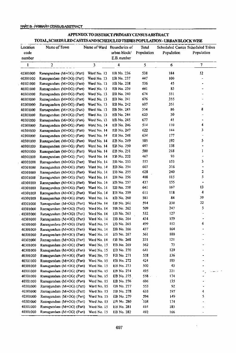
PARrB-PR~YcENSUSABSTRACT
APPENDIX TO DISTRICfPRIMARY CENSUS ABStRAcr TOTAL, SCHEDULED CASTES AND SCHEDULED TRIBES POPULATION - URBAN BLOCK WISE
Location Name of Town Name of Ward Boundaries of Total Scheduled Castes Scheduled Tribes
code urban block! Population Population Population
number E.B.number
2 3 4 5 6 7
40301000 Ramagundam (M+OG) (Part) Ward No. 13 EB No. 236 538 184 12 40301000 Ramagundam (M+OG) (Part) Ward No. 13 EB No. 237 447 100
. 40301000 Ramagundam (M+OG) (Part) Ward No. 13 EB No. 238 536 45
40301000 Ramagundlllll (M+OG) (Part) Ward No. 13 EB No. 239 661 83
40301000 Ramagundam (M+OG) (Part) Ward No. 13 EB No. 240 674 331
40301000 Ramagundam (M+OG) (Part) Ward No. 13 EB No. 241 676 355
40301000 Ramagundam (M+OG) (Part) Ward No. 13 EB No. 242 607 351
40301000 Ramagundam (M+OG) (Part) Ward No. 13 EB No. 243 554 86 8
40301000 Ramagundam (M+OG) (Part) Ward No. I3 EB No. 244 620 50
40301000 Ramagundam (M+OG) (Part) Ward No. 13 EB No. 245 677 41
40301000 Ramagundam (M+OG) (Part) Ward No. 14 EB No. 246 514 JIO 4
40301000 Ramagundam (M+OG) (Part) Ward No. 14 EB No. 247 622 144 3
40301000 Ramagundam (M+OG) (Part) Ward No. 14 EB No. 248 634 177
40301000 Ramagundam (M+OG) (Part) Ward No. 14 EB No. 249 585 192 5
40301000 Ramagundam (M+OG) (Part) Ward No. 14 EB No. 250 497 138
40301000 Ramagundam (M+OG) (Part) Ward No. 14 EB No. 251 580 218
40301000 Ramagundam (M+OG) (Part) Ward No. 14 EB No. 252 467 93
40301000 Ramagundam (M+OG) (Part) Ward No. 14 EB No. 253 557 153 3
40301000 Ramagundam (M+OG) (Part) Ward No. 14 EB No. 254 607 316
40301000 Ramagundam (M+OG) (Part) Ward No. 14 EB No. 255 628 240 2
40301000 Ramagundam (M+OG) (Part) Ward No. 14 EB No. 256 408 1I5 5
40301000 Ramagundam (M+OG) (Part) Ward No. 14 EB No. 257 437 155
40301000 Ramagundam (M+OG) (Part) Ward No. 14 EB No. 258 641 167 13
40301000 Ramagundam (M+OG) (Part) Ward No. 14 EB No. 259 611 118 4
40301000 Ramagundam (M+OG) (Part) Ward No. 14 EB No. 260 581 84 39
40301000 Ramagundam (M+OG) (Part) Ward No. 14 ERNo.261 594 238 22
40301000 Ramagundam (M+OG) (Part) Ward No. 14 EB No. 262 509 247 5
40301000 Ramagundam (M+OG) (Part) Ward No. 14 EB No. 263 532 127
40301000 Ramagundam (M+OG) (Part) Ward No. 14 EB No. 264 434 159
40301000 Ramagundam (M+OG) (Part) Ward No. 14 BB No. 265 499 112 6
40301000 Ramagundam (M+OG) (Part) Ward No. 14 EB No. 266 437 164
40301000 Ramagundam (M+OG) (Part) Ward No. 14 EB No. 267 561 180
4030lO00 Ramagundam (M+OG) (Part) Ward No. 14 BB No. 268 321 121
40301000 Ramagundam (M+OG) (Part) Ward No. IS BB No. 269 562 73
40301000 Ramagundam (M+OG) (Part) Ward No. 15 EB No. 270 641 129
40301000 Ramagundam (M+OG) (Part) Ward No. 15 EB No. 271 558 136 40301000 Ramagundam (M+OG) (Part) Ward No. 15 BB No. 272 424 105
40301000 Ramagundam (M+OG) (Part) Ward No. 15 BB No. 273 500 43
40301000 Ramagundam (M+OG) (Part) Ward No. 15 EB No. 274 495 221 ~~-,~.-,-'" .,'
40301000 Ramagundam (M+OG) (Part) Ward No. IS EB No. 275 558 . 174
40301000 Ramagundam (M+OG) (Part) Ward No. 15 EB No. 276 606 135 40301000 Ramagundam (M+OG) (Part) Ward No. 15 EB No. 277 553 92
40301000 Ramagundam (M+OG) (Part) Ward No. 15 EB No. 278 633 197 4
4030lQOO Ramagundam (M+OG) (Part) Ward No. 15 EB No. 279 594 149 5
40301000 Rarnagundam (M+OG) (Part) Ward No. 15 EB No. 280 "558 174
40301000 Ramagundam (M+OG) (Part) Ward No. 15 EB No. 281 444 183
40301000 Ramagundam (M+OG) (Part) Ward No. 15 EB No. 282 492 166
697

DISTRICT CENSUS HANDBOOK: KARIMNAGAR
APPENDIX TO DISTRICfPRIMARY CENSUSABSTRACf TOTAL,SCHEDULED CASTES AND SCHEDULED TRJBES POPULATION -URBAN BLOCK WISE
Location Name of Town Name of Ward Boundaries of Total Scheduled Castes Scheduled· Tribes
code urban block! Population Population Population
number E.B.number
2 3 4 5 6 7
40301000 Ramagundam (M+OG) (Part) Ward No. 15 EB No. 283 569 343 40301000 Ramagundam (M+OG) (Part) Ward No. 15 EB No. 284 527 4 40301000 Ramagundam (M+OG) (Part) Ward No. 15 EB No. 285 606 73 40301000 Ramagundam (M+OG) (Part) Ward No. 15 EB No. 286 538 72 4 40301000 Ramagundam (M+OG) (Part) Ward No. 15 EB No. 287 543 64 40301000 Ramagundam (M+OG) (Part) Ward No. 15 EB No. 288 541 37 40301000 Ramagundam (M+OG) (Part) Ward No. IS EB No. 289 591 40 3 40301000 Ramagundam (M+OG) (Part) Ward No. 15 EB No. 290 732 113 40301000 Ramagundam (M+OG) (Part) Ward No. 16 EB No. 291 715 147 20 4030]000 Ramagundam (M+OG) (Part) Ward No. 16 EB No. 292 67] 42 40301000 Ramagundarn (M+OG) (Part) Ward No. 16 EB No. 293 515 III 40301000 Ramagundarn (M+OG) (Part) Ward No. 16 EB No. 294 702 126 40301000 Rarnagundarn (M+OG) (Part) Ward No. 16 EB No. 295 642 50 40301000 Ramagundarn (M+OG) (Part) Ward No. 16 EB No. 296 709 26 26 40301000 Ramagundam (M+OG) (Part) Ward No. 16 EB No. 297 657 5 8 40301000 Rarnagundam (M+OG) (Part) Ward No. 16 EB No. 298 723 31 40301000 Ramagundam (M+OG) (Part) Ward No. 16 EB No. 299 518 201 40301000 Ramagundam (M+OG) (Part) Ward No. 16 EB No. 300 488 22 40301000 Ramagundam (M+OG) (Part) Ward No. 16 EB No. 301 508 152 40301000 Ramagundam (M+OG) (Part) Ward No. 16 EB No. 302 682 40 14 40301000 Ramagundam (M+OG) (Part) Ward No. 16 EB No. 303 511 47 40301000 Ramagundam (M+OG) (Part) Ward No. 16 EB No. 304 373 109 4 40301000 Ramagundam (M+OG) (Part) Ward No. 16 EB No. 305 456 87 5 40301000 Ramagundam (M+OG) (Part) Ward No. 16 EB No. 306 660 35 40301000 Ramagundam (M+OG) (Part) Ward No. 16 EB No. 307 683 141 7 40301000 Ramagundam (M+OG) (Part) Ward No. 16 EB No. 308 536 8 40301000 Ramagundam (M+OG) (Part) Ward No. 16 EB No. 309 458 6 40301000 Ramagundam (M+OG) (Part) Ward No. 16 EB No. 310 597 60 4 40301000 Ramagundam (M+OG) (Part) Ward No. 16 EB No. 311 637 18 40301000 Ramagundam (M+OG) (Part) Ward No. 16 EB No. 312 612 II 40301000 Ramagundam (M+OG) (Part) Ward No. 16 EB No. 313 462
40301000 Ramagundam (M+OG) (part) Ward No. 16 EB No. 3]4 520 90 40301000 Ramagundam (M+OG) (Part) Ward No. 16 EB No. 315 528 77 40301000 Ramagundam (M+OG) (Part) Ward No. 17 EB No. 316 588 88 40301000 Ramagundam (M+OG) (Part) Ward No. 17 EB No. 317 514 82 13 40301000 Ramagundarn (M+OG) (Part) Ward No. 17 EB No. 318 528 142 32 40301000 Ramagundarn (M+OG) (Part) Ward No. 17 EB No. 319 455 123 1 40301000 Ramagundam (M+OG) (Part) Ward No. 17 EB No. 320 566 76 32 40301000 Ramagundarn (M+OG) (Part) . Ward No. 17 EB No. 321 539 87 I 40301000 Ramagundam (M+OG) (Part) Ward No. 17 EB No. 322 505 30 40301000 Ramagundam (M+OG) (Part) Ward No. 17 EB No. 323 732 43
40301000 Ramagundam (M+OG) (Part) Ward No. 17 EB No. 324 697 75
40301000 Ramagundam (M+OG) (Part) Ward No. 17 EB No. 325 565 77 4
40301000 Ramagundam (M+OG) (Part) Ward No. 17 EB No. 326 596 127
40301000 Ramagundam (M+OG) (Part) Ward No. 17 EB No. 327 666 153
40301000 Ramagundam (M+OG) (Part) Ward No. 17 EB No. 328 576 6
698
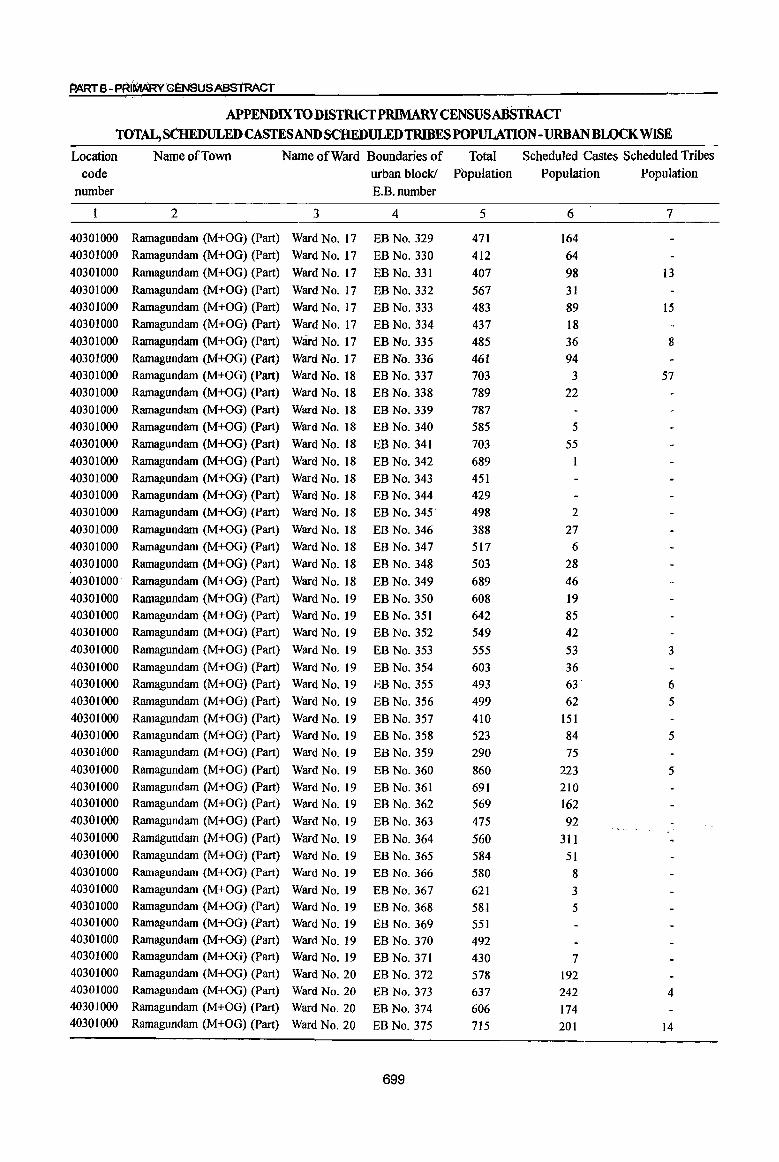
PARTe -P~I'MARv G~NSUSABSl'RACT
APPENDIX TO DISTRICf PRIMARY CENSUSABSTRACf TOTAL, SCHEDULED CASTES AND SCHEDULEDTRIBESPOPULATION-URBAN BLOCK WISE
Location Name of Town Name of Ward Boundaries of Total Scheduled Castes Scheduled Tribes code urban block! Population Population Population
number E.B.number
1 2 3 4 5 6 7
40301000 Ramagundam (M+OG) (Part) Ward No. 17 EB No. 329 471 164 40301000 Ramagundam (M+OG) (Part) Ward No. 17 EB No. 330 412 64 40301000 Ramagundam (M+OG) (Part) Ward No. 17 EB No. 331 407 98 13 40301000 Ramagundam (M+OG) (Part) Ward No. 17 EB No. 332 567 31 40301000 Ramagundam (M+OG) (Part) Ward No. 17 EB No. 333 483 89 15 4()301000 Ramagundam (M+OG) (Part) Ward No. 17 EB No. 334 437 18 40301000 Ramagundam (M+OG) (Part) Ward No. 17 EB No. 335 485 36 8 40301000 Ramagundam (M+OG) (Part) Ward No. 17 EB No. 336 461 94 40301000 Ramagundam (M+OG) (Part) Ward No. 18 EB No. 337 703 3 57 40301000 Ramagundam (M+OG) (Part) Ward No. 18 EB No. 338 789 22 40301000 Ramagundam (M+OG) (Part) Ward No. 18 EB No. 339 787 40301000 Ramagundam (M+OG) (Part) Ward No. 18 EB No. 340 585 5 40301000 Ramagundam (M+OG) (Part) Ward No. 18 EB No. 341 703 55 40301000 Ramagundam (M+OG) (Part) Ward No. 18 EB No. 342 689 40301000 Ramagundam (M+OG) (Part) Ward No. 18 EB No. 343 451 40301000 Ramagundam (M+OG) (Part) Ward No. 18 EB No. 344 429 40301000 Ramagundam (M+OG) (Part) Ward No. 18 EB No. 345· 498 2 40301000 Ramagundam (M+OG) (Part) Ward No. 18 EB No. 346 388 27 40301000 Ramagundam (M+OG) (Part) Ward No. 18 EB No. 347 517 6 40301000 Ramagundam (M+OG) (Part) Ward No. 18 EB No. 348 503 28 40301000· Ramagundam (M+OG) (Part) Ward No. 18 EB No. 349 689 46 40301000 Ramagundam (M+OG) (Part) Ward No. 19 EB No. 350 608 19 40301000 Ramagundam (M+OG) (Part) Ward No. 19 EB No. 351 642 85 40301000 Ramagundam (M+OG) (Part) Ward No. 19 EB No. 352 549 42 40301000 Ramagundam (M+OG) (Part) Ward No. 19 EB No. 353 555 53 3 40301000 Ramagundam (M+OG) (Part) Ward No. 19 EB No. 354 603 36 40301000 Ramagundam (M+OG) (Part) Ward No. 19 EB No. 355 493 63 6 40301000 Ramagundam (M+OG) (Part) Ward No. 19 EB No. 356 499 62 5 40301000 Ramagundam (M+OG) (Part) Ward No. 19 EB No. 357 410 151 40301000 Ramagundam (M+OG) (Part) Ward No. 19 EB No. 358 523 84 5 40301000 Ramagundam (M+OG) (Part) Ward No. 19 EB No. 359 290 75 40301000 Ramagundam (M+OG) (Part) Ward No. 19 EB No. 360 860 223 5 40301000 Ramagundam (M+OG) (Part) Ward No. 19 EB No. 361 691 210 40301000 Ramagundam (M+OG) (Part) Ward No. 19 EB No. 362 569 162 40301000 Ramagundam (M+OG) (Part) Ward No. 19 EB No. 363 475 92 40301000 Ramagundam (M+OG) (Part) Ward No. 19 EB No. 364 560 311 40301000 Ramagundam (M+OG) (Part) Ward No. 19 EB No. 365 584 51 40301000 Ramagundam (M+OG) (Part) Ward No. 19 EB No. 366 580 8 40301000 Ramagundam (M+OG) (Part) Ward No. 19 EB No. 367 621 3 40301000 Ramagundam (M+OG) (Part) Ward No. 19 EB No. 368 581 5 40301000 Ramagundam (M+OG) (Part) Ward No. 19 EB No. 369 551 40301000 Ramagundam (M+OG) (Part) Ward No. 19 EB No. 370 492 40301000 Ramagundam (M+OG) (Part) Ward No. 19 EB No. 371 430 7 40301000 Ramagundam (M+OG) (Part) Ward No. 20 EB No. 372 578 192 40301000 Ramagundam (M+OG) (Part) Ward No. 20 EB No. 373 637 242 4 40301000 Ramagundam (M+OG) (Part) Ward No. 20 EB No. 374 606 174 40301000 Ramagundam (M+OG) (Part) Ward No. 20 EB No. 375 715 201 14
699

DISTRICT CENSUS HANDBOOK: KARIMNAGAR
APPENDIX TO DISTRICf PRIMARY CENSUS ABSTRACT TOTAL, SCHEDULED CASTES AND SCHEDULED TRIBES POPULATION -URBAN BLOCK WISE
Location Name of Town Name of Ward Boundaries of Total Scheduled Castes Scheduled Tribes code urban block! Population Population Population
number E.B.number
2 3 4 5 6 7 40301000 Ramagundam (M+OG) (Part) Ward No. 20 EB No. 376 605 227
40301000 Ramagundam (M+OG) (Part) Ward No. 20 EB No. 377 686 178
40301000 Ramagundam (M+OG) (Part) Ward No. 20 EB No. 378 676 254
40301000 Ramagundam (M+OG) (Part) Ward No. 20 EB No. 379 780 460 8
40301000 Ramagundam (M+OG) (Part) Ward No. 20 EB No. 380 599 137 40301000 Ramagundam (M+OG) (Part) Ward No. 20 EB No. 381 634 238
40301000 Ramagundam (M+OG) (Part) Ward No. 20 EB No. 382 650 421 40301000 Ramagundarn (M+OG) (part) Ward No. 20 EB No. 383 656 496
40301000 Ramagundam (M+OG) (Part) Ward No. 20 EB No. 384 728 324 40301000 Ramagundam (M+OG) (Part) Ward No. 20 EB No. 385 455 37 40301000 Ramagundam (M+OG) (Part) Ward No. 20 EB No. 386 498 175 40301000 Ramagundam (M+OG) (Part) Ward No. 20 EB No. 387 543 119 40301000 Ramagundam (M+OG) (Part) Ward No. 20 EB No. 388 409 117 6 40301000 Ramagundam (M+OG) (Part) Ward No. 20 EB No. 389 456 97 40301000 Rarnagundarn (M+OG) (Part) Ward No. 20 EB No. 390 552 99 40301000 Rarnagundarn (M+OG) (Part) Ward No. 20 EB No. 391 574 91 40301000 Ramagundarn (M+OG) (Part) Ward No. 20 EB No. 392 587 87 5 40301000 Ramagundarn (M+OG) (Part) Ward No. 21 EB No. 393 670 20 21 40301000 Ramagundam (M+OG) (Part) Ward No. 21 EB No. 394 530 145 40301000 Ramagundam (M+OG) (Part) Ward No. 21 EB No. 395 604 59 40301000 Ramagundam (M+OG) (Part) Ward No. 21 EB No. 396 490 11 40301000 Ramagundam (M+OG) (Part) Ward No. 21 EB No. 397 569 9 40301000 Ramagundam (M+OG) (Part) Ward No. 21 EB No. 398 302 32 9 40301000 Ramagundam (M+OG) (Part) Ward No. 21 EB No. 399 655 219 II 40301000 Ramagundam (M+OG) (Part) Ward No. 21 EB No. 400 426 187 40301000 Ramagundam (M+OG) (Part) Ward No. 21 EB No. 401 581 78 3 40301000 Ramagundam (M+OG) (Part) Ward No. 21 EB No. 428 898 149 40301000 Ramagundam (M+OG) (Part) Ward No. 21 EB No. 429 739 52 5 40301000 Ramagundam (M+OG) (Part) Ward No. 21 EB No. 430 579 138 4 40301000 Rarnagundam (M+OG) (Part) Ward No. 22 EB No. 402 627 219 11 40301000 Ramagundam (M+OG) (Part) Ward No. 22 EB No. 403 403 163 40301000 Ramagundam (M+OG) (Part) Ward No. 22 EB No. 404 596 423
40301000 Ramagundam (M+OG) (Part) Ward No. 22 EB No. 405 409 235 27
40301000 Ramagundam (M+OG) (Part) Ward No. 22 EB No. 406 634 10 40301000 Ramagundam (M+OG) (Part) Ward No. 22 EB No. 407 511 234 40301000 Ramagundam (M+OG) (Part) Ward No. 22 EB No. 408 464 88 12 40301000 Ramagundam (M+OG) (Part) Ward No. 22 EB No. 409 275
40301000 Ramagundam (M+OG) (Part) Ward No. 22 EB No. 410 557 52 9 40301000 Ramagundam (M+OG) (Part) Ward No. 22 EB No. 411 386 77
40301000 Ramagundam (M+OG) (Part) Ward No. 22 EB No. 412 431 45 3
40301000 Ramagundam (M+OG) (Part) Ward No. 22 EB No. 413 428 70 8
40301000 Ramagundam (M+OG) (Part) Ward No. 22 EB No. 414 450 61 15
40301000 Ramagundam (M+OG) (Part) Ward No. 22 EB No. 415 522 67
40301000 Ramagundam (M+OG) (Part) Ward No. 22 EB No. 416 534 62
40301000 Ramagundam (M+OG) (Part) Ward No. 22 EB No. 417 400 12
40301000 Ramagundam (M+OG) (Part) Ward No. 22 EB No. 418 566 22 40301000 Ramagundam (M+OG) (Part) Ward No. 22 EB No. 419 449 17
700
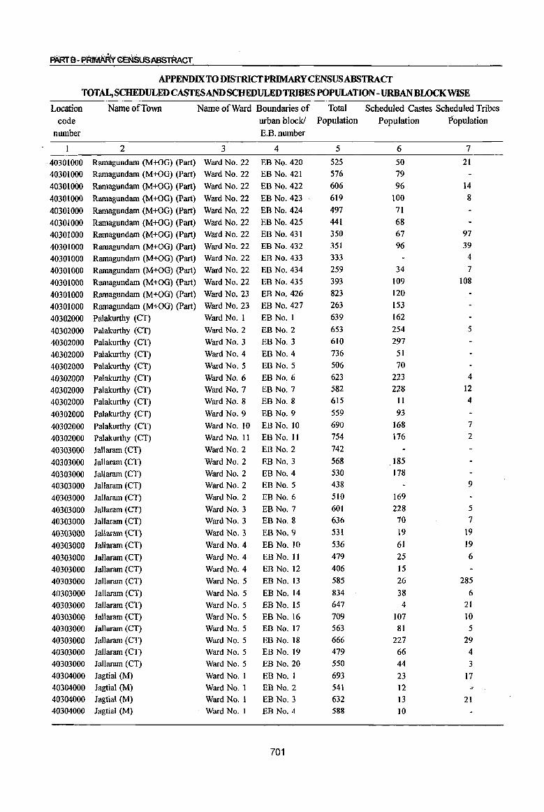
PAR1B-~f~~~US~TAACT
APPENDIX TO DISTRICfPRIMARY CENSUSABSTRACf
TOTAL, SCHEDULED CASTESAND SCHEDULED TRIBES POPULATION-URBAN BLOCK WISE
Location Name of Town Name of Ward Boundaries of Total Scheduled Castes Scheduled Tribes
code urban block! Population Population Population
nwnber E.B.nwnber
2 3 4 5 6 7
40301000 Ramagundam (M+OG) (Part) Ward No. 22 EB No. 420 525 50 21
40301000 Ramagundam (M+OG) (Part) Ward No. 22 EB No. 421 576 79
40301000 Ramagundam (M+OG) (Part) Ward No. 22 EB No. 422 606 96 14
40301000 Ramagundam (M+OG) (Part) Ward No. 22 EB No. 423 619 100 8
40301000 Ramagundam (M+OG) (Part) Ward No. 22 EB No. 424 497 71
40301000 Ramagundam (M+OG) (Part) Ward No. 22 EB No. 425 441 68
40301000 Ramagundam (M+OG) (Part) Ward No. 22 EB No. 431 350 67 97
40301000 Ramagundam (M+OG) (Part) Ward No. 22 EB No. 432 351 96 39
40301000 Ramagundam (M+OG) (Part) Ward No. 22 EB No. 433 333 4
40301000 Ramagundam (M+OG) (Part) Ward No. 22 EB No. 434 259 34 7
40301000 Ramagundam (M+OG) (Part) Ward No. 22 EB No. 435 393 109 108
40301000 Ramagundam (M+OG) (Part) Ward No. 23 EB No. 426 823 120
40301000 Ramagundam (M+OG) (part) Ward No. 23 EB No. 427 263 153
40302000 Palakurthy (CT) Ward No. I EB No. I 639 162
40302000 Palakurthy (CT) Ward No.2 EB No.2 653 254 5
40302000 Palakurthy (CT) Ward No.3 EB No.3 610 297
40302000 Palakurthy (CT) Ward No.4 EB No.4 736 51
40302000 Pa1akurthy (CT) Ward No.5 EB No.5 506 70
40302000 Palakurthy (CT) Ward NO.6 EB No.6 623 223 4
40302000 ' Palakurthy (CT) Ward No.7 EB No.7 582 228 12
40302000 Palakurthy (CT) Ward No.8 EB No.8 615 11 4
40302000 Palakurthy (CT) Ward No.9 EB No.9 559 93
40302000 Palakurthy (CT) Ward No. to EB No. 10 690 168 7
40302000 Palakurthy (CT) Ward No. 11 EB No. II 754 176 2
40303000 Jallaram (CT) Ward No.2 EB No.2 742
40303000 Jallaram (CT) Ward No.2 EB NO.3 568 185
40303000 Jallaram (CT) Ward No.2 EB No.4 530 178
40303000 lallaram (CT) Ward No.2 EB NO.5 438 9
40303000 lallaram (CT) Ward No.2 EB No.6 510 169
40303000 lallaram (CT) Ward No.3 EB No.7 601 228 5
40303000 Jallaram (CT) Ward No.3 EB No.8 636 70 7
40303000 JaUaram (CT) Ward No.3 EB NO.9 531 19 19
40303000 Jallaram (CT) Ward No.4 EB No. to 536 61 19
40303000 lallaram (CT) Ward No.4 EB No. II 479 25 6
40303000 Jallaram (CT) Ward No.4 EB No. 12 406 15
40303000 JaUaram (CT) Ward No.5 EB No. 13 585 26 285
40303000 Jallaram (CT) Ward No.5 EB No. 14 834 38 6
40303000 Jallaram (CT) Ward No.5 EB No. 15 647 4 21
40303000 Jallaram (CT) Ward No.5 EB No. 16 709 107 10
40303000 Jallaram (CT) Ward No.5 EB No. 17 563 81 5
40303000 Jallaram (CT) Ward No.5 EB No. 18 666 227 29
40303000 Jallaram (CT) Ward No.5 EB No. 19 479 66 4 40303000 Jallaram (CT) Ward No.5 EB No. 20 550 44 3
40304000 Jagtial (M) Ward No. I EBNo. I 693 23 17
40304000 Jagtial (M) Ward No.1 EB No.2 541 12 ;:0-
40304000 Jagtiai (M) Ward No. I EB No.3 632 13 21 40304000 Jagtial (M) Ward No. I EB No.4 588 10
701
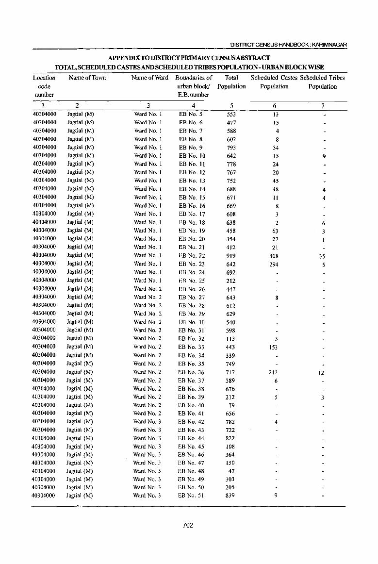
DISTRICT CENSUS HANDBOOK: KARIMNAGAR
APPENDIX TO DISTRICT PRIMARY CENSUSABSTRACf TOTAL, SCHEDULED CASTES AND SCHEDULED TRIBES POPULATION -URBAN BWCKWISE
Location Name of Town Name of Ward Boundaries of Total Scheduled Castes Scheduled Tribes code urban block! Population Population Population
number E.B.number
2 3 4 5 6 7 -40304000 Jagtial (M) Ward No. I EB No.5 553 I3 40304000 Jagtial (M) Ward No. I EB No.6 477 15 40304000 Jagtial (M) Ward No. I EB No.7 588 4 40304000 Jagtial (M) Ward No. I EB No.8 602 8 40304000 Jagtial (M) Ward No.1 EB No.9 793 34 40304000 Jagtiai (M) Ward No. i EB No. 10 642 15 9 40304000 Jagtiai (M) Ward No. i EB No. 11 778 24 40304000 Jagtial (M) Ward No.1 EB No. 12 767 20 40304000 Jagtial (M) Ward No. I EB No. 13 752 45 40304000 Jagtial (M) Ward No. 1 EB No. 14 688 48 4 40304000 Jagtiai (M) Ward No. I EB No. 15 671 II 4 40304000 Jagtial (M) Ward No. I EB No. 16 669 8 40304000 Jagtial (M) Ward No. I EB No. 17 608 3 40304000 Jagtial (M) Ward No. I EB No. 18 638 2 6 40304000 Jagtial (M) Ward No. I EB No. 19 458 63 3 40304000 lagtial (M) Ward No. I EB No. 20 354 27 40304000 Jagtial (M) Ward No. I EB No. 21 412 21 40304000 Jagtiai (M) Ward No. I EB No. 22 919 308 35 40304000 Jagtiai (M) Ward No.1 EB No. 23 642 294 5 40304000 Jagtial (M) Ward No. I EB No. 24 692 40304000 Jagtial (M) Ward No. I EB No. 25 212 40304000 Jagtial (M) Ward No.2 EB No. 26 447 40304000 Jagtial (M) Ward No.2 EB No. 27 643 8 40304000 lagtial (M) Ward No.2 EB No. 28 612 40304000 Jagtial (M) Ward No.2 EB No. 29 629 40304000 Jagtial (M) Ward No.2 EB No. 30 540 40304000 Jagtial (M) Ward No.2 EB No. 31 598 40304000 Jagtial (M) Ward No.2 EB No. 32 113 5 40304000 Jagtial (M) Ward No.2 EB No. 33 443 153 40304000 Jagtial (M) Ward No.2 EB No. 34 339 40304000 Jagtial (M) Ward No.2 EB No. 35 749 40304000 Jagtial (M) Ward No.2 EB No. 36 717 212 12 40304000 Jagtial (M) Ward No.2 EB No. 37 389 6 40304000 Jagtial (M) Ward No.2 EB No. 38 676 40304000 Jagtial (M) Ward No.2 EB No. 39 212 5 3 40304000 Jagtial (M) Ward No.2 EB No. 40 79 40304000 Jagtial (M) Ward No.2 EB No. 41 656 40304000 Jagtial (M) Ward No.3 EB No. 42 782 4 40304000 Jagtial (M) Ward No.3 EB No. 43 722 40304000 Jagtial (M) Ward No.3 EB No. 44 822
40304000 Jagtiai (M) Ward No.3 EB No. 45 J08 40304000 Jagtial (M) Ward No.3 EB No. 46 364 40304000 Jagtial (M) Ward No.3 EB No. 47 150
40304000 Jagtiai (M) Ward No.3 EB No. 48 47
40304000 Jagtial (M) Ward No.3 EB No. 49 303 40304000 Jagtiai (M) Ward No.3 EB No. 50 205 40304000 Jagtial (M) Ward No.3 EB No. 51 839 9
702

PART 8 - PRIMARY CENSUSABSlRACT
APPENDIX TODISTRICf PRIMARYCENSUSABSTRACf TOTAL, SCHEDULED CASTES AND SCHEDULED TRIBES POPULATION-URBAN BLOCK WISE
Location Name of Town Name of Ward Boundaries of Total Scheduled Castes. Scheduled Tribes code urban block! Population Population Population
number E.B.number
1 2 3 4 5 6 7
40304000 Jagtial (M) Ward No.3 EB No. 52 693 40304000 lagtial (M) Ward No.3 EB No. 53 782 10
40304000 Iagtial (M) Ward No.3 EB No. 54 660 321
40304000 Iagtial (M) Ward No.3 EB No. 55 571 481
40304000 Jagtial (M) Ward No.3 EB No. 56 403 177
40304000 Iagtial (M) Ward No.3 EB No. 57 211 14
40304000 Jagtial (M) Ward No.3 EB No. 58 248 27
40304000 lagtial (M) Ward No.3 EB No. 59 220 4 40304000 Jagtial (M) Ward No.3 EB No. 60 450 40304000 lagtiaJ (M) Ward No.3 EB No. 61 276 40304000 Iagtiai (M) Ward No.3 EB No. 62 237 5 40304000 lagtial (M) Ward No.3 EB No. 63 307 40304000 Jagtial (M) Ward No.4 EB No. 64 752 39 40304000 Jagtial (M) Ward No.4 EB No. 65 808 18 40304000 Jagtial (M) Ward No.4 EB No. 66 588 40304000 Jagtial (M) Ward No.4 EB No. 67 422 4 3 40304000 Jagtial (M) Ward No.4 EB No. 68 166 8 40304000 Jagtial (M) Ward No.4 EB No. 69 653 51 40304000 JagtiaI (M) Ward No.4 EB No. 70 655 198 12 40304000 Jagtial (M) Ward NO.4 EB No. 71 696 25 40304000 Jagtial (M) Ward No.4 EB No. 72 764 14 40304000 Jagtial (M) Ward No.4 EB No. 73 759 3 40304000 Jagtial (M) Ward No.4 EB No. 74 845 40304000 JagtiaJ (M) Ward No.4 EB No. 75 671 2 4 40304000 JagtiaI (M) Ward No.4 EB No. 76 604 40304000 Jagtial (M) Ward No.4 EB No. 77 584 238 IO 40304000 Jagtial (M) Ward No.4 EB No. 78 95 8 40304000 Jagtial (M) Ward No.4 EB No. 79 682 614 40304000 Jagtial (M) Ward No.4 EB No. 80 289 121 5 40304000 Jagtial (M) Ward No.4 EB No. 81· 243 42 40304000 Jagtial (M) Ward No.4 EB No. 82 495 40304000 Jagtial (M) Ward No.4 EB No. 83 222 40304000 Jagtial (M) Ward No.4 EB No. 84 662 498 40304000 Jagtial (M) Ward No.4 EB No. 85· 678 1 40304000 Jagtial (M) Ward No.4 EB No. 86 605 40304000 JagtiaJ (M) Ward No.4 EB No. 87 656 40304000 Jagtial (M) Ward No.4 EB No. 88 772 14 40304000 Jagtial (M) Ward No.5 EB No. 89 335 82 6 40304000 JagtiaI (M) Ward No.5 EB No. 90 405 40304000 JagtiaI (M) Ward No.5 EB No. 91 566 40304000 Jagtial (M) Ward No.5 EB No. 92 254 186 40304000 Jagtial (M) Ward No.5 EB No. 93 789 394 40304000 Jagtial (M) Ward No.5 EB No. 94 468 40304000 Jagtial (M) Ward No.5 EB No. 95 198 40304000 JagtiaI (M) Ward No.5 EB No. 96 853 40304000 lagtial (M) Ward No.5 EB No. 97 388 40304000 JagtiaI (M) Ward No.5 EB No. 98 258
703
DISTRICT CENSUS HANDBOOK: KARIMNAGAR
APPENDIX TO DISTRICfPRIMARYCENSUSABSTRACf TOTAL, SCHEDULED CASTESAND SCHEDULED TRIBES POPULATION - URBAN BWCKWISE
Location Name of Town Name of Ward Boundaries of Total Scheduled Castes Scheduled Tribes code urban block! Population Population Population
number E.B.number
2 3 4 5 6 7
40304000 Jagtial (M) Ward No.5 EB No. 99 566 40304000 Jagtial (M) 'Ward No.5 EB No. 100 462
40304000 Jagtial (M) Ward No.5 EB No. 101 239
40304000 Jagtial (M) Ward No.5 BB No. 102 531
40304000 Jagtial (M) Ward No.5 BB No. 103 727 40304000 Jagtial (M) Ward No.5 EB No. 104 687
40304000 Jagtial (M) Ward No.5 BB No. 105 412
40304000 Jagtial (M) Ward No.5 EB No. 106 345
40304000 Jagtial (M) Ward No.5 BB No. 107 469
40304000 Jagtial (M) Ward No.5 BB No. 108 42
40304000 Jagtial (M) Ward No.5 EB No. 109 215
40304000 Jagtial (M) Ward No.5 BB No. 110 790
40304000 Jagtial (M) Ward No.5 EB No. III 614
40304000 Jagtial (M) Ward No.5 EB No. 112 577
40304000 Jagtial (M) Ward No.5 BB No. 113 738 40304000 Jagtial (M) Ward No.5 BB No. 114 633
4.0304000 Jagtial (M) Ward No.6 EB No. 115 480
40304000 Jagtial (M) Ward No.6 EB No. 116 393 17
40304000 Jagtial (M) Ward No.6 EB No. II7 672 306 6
40304000 Jagtial (M) Ward No.6 EB No. 118 200
40304000 Jagtial (M) Ward No.6 EB No. 119 444 14 6 40304000 Jagtial (M) Ward No.6 EB No. 120 462 IO 40304000 Jagtial (M) Ward No.6 EB No. 121 337 9 3
40304000 Jagtial (M) Ward No.6 EB No. 122 424 42
40304000 Jagtial (M) Ward No.6 EB No. 123 757
40304000 Jagtial (M) Ward No.6 EB No. 124 523
40304000 lagtial (M) Ward No.6 EB No. 125 644 6
40304000 Jagtial (M) Ward No.6 EB No. 126 460 3
40304000 Jagtial (M) Ward NO.6 EB No. 127 116 2
40304000 Jagtial (M) Ward No.6 BB No. 128 783 7
40304000 Jagtial (M) Ward No.6 EB No. 129 796 8 6
40304000 Jagtial (M) Ward No.6 EB No. 130 265
40304000 Jagtial (M) Ward No.6 EB No. 131 258
40304000 lagtial (M) Ward No.6 EB No. 132 64
40304000 Jagtial (M) Ward No.6 EB No. 133 265 2
40304000 Jagtial (M) Ward No, 6 EB No. 134 478
40304000 Jagtial (M) Ward No.6 EB No. 135 139
40304000 Jagtial (M) Ward No.6 EB No. 136 87
40304000 Jagtial (M) Ward No.6 EB No. 137 267 21
40304000 JagtiaJ (M) Ward NO.6 EB No. 138 146
40304000 Jagtial (M) Ward NO.6 EB No. 139 599
40304000 Jagtial (M) Ward No.7 EB No. 140 159 42
40304000 JagtiaJ (M) Ward No.7 EB No. 141 66 4
40304000 Jagtial (M) Ward No.7 EB No. 142 686 53
40304000 Jagtial (M) Ward NO.7 EB No. 143 650 2
40304000 Jagtial (M) Ward No.7 EB No. 144 862 16 4
40304000 Jagtial (M) Ward No.7 EB No. 145 500 31
704
PARTB- PRIMARY CENSUS ABSTRACT
APPENDIX TO DISTRICrPRIMARY CENSUS ABSTRACT
TOTAL, SCHEDULED CASTESAND SCHEDULED TRIBES POPULATION- URBANBWCKWISE
Location Name of Town Name of Ward Boundaries of Total Scheduled Castes Scheduled Tribes code urban block! Population Population Population
number E.B.number
1 2 3 4 5 6 7 40304000 Jagtial (M) Ward No.7 EB No. 146 279 13
40304000 Jagtial (M) Ward No.7 EB No. 147 665 12
40304000 Jagtial (M) Ward No.7 EB No. 148 526 18 67
40304000 Jagtial (M) Ward No.7 EB No. 149 383 8
40304000 Jagtial (M) Ward No.7 EB No. 150 661 17 4
40304000 Jagtial (M) Ward No.7 EB No. 151 668 9 6
40304000 Jagtial (M) Ward No.7 EB No. 152 681 9
40304000 Jagtial (M) Ward No.7 EB No. 153 764 23
40304000 Jagtial (M) Ward No.7 EB No. 154 296
40304000 Jagtial (M) Ward No.7 EB No. 155 341 5 2
40304000 JagtiaI (M) Ward No.7 EB No. 156 702 132 II
40304000 Jagtial (M) W&d No.7 EB No. 157 355 11
40304000 Jagtial (M) Ward No.7 EB No. 158 158
40304000 Jagtial (M) Ward No. 7 EB No. 159 605 28
40304000 Jagtial (M) Ward No.7 EB No. 160 164
40304000 JagtiaJ (M) Ward NO.7 EB No. 161 91
40304000 Jagtial (M) Ward No.7 EB No. 162 161 17
40304000 Jagtial (M) Ward NO.7 EB No. 163 547 33 3
40304000 Jagtial (M) Ward No.7 EB No. 164 735 35 14
40304000 Jagtial (M) Ward No.7 EB No. 165 618
40304000 Jagtial (M) Ward No.7 EB No. 166 729 23
40304000 Jagtial (M) Ward No.7 EB No. 167 746 10
40304000 Jagtial (M) Ward No.8 EB No. 168 375 27 37
40304000 Jagtial (M) Ward No.8 EB No. 169 712 94 6
40304000 Jagtial (M) Ward No.8 EB No. 170 502 4
40304000 Jagtial (M) W&d No.8 EB No. 171 537 12
40305000 Koratla (M) Ward No.1 EB No.1 773 25 2
40305000 Koratla (M) Ward No. I EB No.2 1,029 6
40305000 Koratla (M) Ward No.1 EB No.3 728 8
40305000 Koratla(M) Ward No: 1 EB No.4 772
40305000 Koratla (M) Ward No.1 EB No.5 727 10
40305000 Koratla (M) Ward No.1 EB No.6 628 10
40305000 Koratla (M) Ward No.1 EB No.7 800
40305000 Koratla (M) Ward No.1 EB No.8 908 5
40305000 Koratla (M) Ward No.1 EB No.9 928 74 109
40305000 Koratla (M) Ward No.1 EB No. 10 777 9 13
40305000 Koratla (M) Ward No.1 EB No. 11 639 9
40305000 Koratla (M) Ward No. I EB No. 12 809 6 -40305000 Koratla (M) Ward No. I EB No. 13 626
40305000 Koralla (M) Ward No.1 EB No. 14 882 12
40305000 Koratla (M) Ward No. I EB No. 15 668 59
40305000 Koratla (M) Ward No.1 EB No. 16 755 17
40305000 Koratla (M) Ward No. I EB No. 17 740 18
40305000 Koratla (M) Ward No. I EB No. 18 845 3
40305000 Koratla (M) Ward No.1 EBNo.19 907 71
40305000 Koratla (M) Ward No. I EB No. 20 966 62 345
40305000 Koratla (M) Ward No. I EB No. 21 883 92 27
705
DISTRICT CENSUS HANDBOOK: KARIMNAGAR
APPENDIX TO DISTRICfPRlMARY CENSUS ABSTRACT TOT~SCHEDULEDCASTESANDSCHEDULEDTmWESPOPULATION-URBANBLOCK~E
Location Name of Town Name of Ward Boundaries of Total Scheduled Castes Scheduled Tribes
code urban block! Population Population Population
number E.B.number
1 2 3 4 5 6 7
40305000 Koratla (M) Ward No. I EB No. 22 885 28 7
40305000 Koratla (M) Ward No.2 EB No. 23 834 26
40305000 Koratla (M) Ward No.2 EB No. 24 736 9 5 40305000 Koratla (M) Ward No.2 EB No. 25 713 2 40305000 Koratla (M) Ward No.2 EB No. 26 782 19 9 40305000 Koratla (M) Ward No.2 EB No. 27 762 II 40305000 Koratla (M) Ward No.2 EB No. 28 723 40305000 Koratla (M) Ward No.2 EB No. 29 750 II 40305000 Koratla (M) Ward No.3 EB No. 30 814 17 40305000 Koratla (M) Ward No.3 EB No. 31 777 40305000 KoratIa (M) Ward NO.3 EB No. 32 764 40305000 Koratla (M) Ward NO.3 EB No. 33 777 23 5 40305000 Koratla (M) Ward No.3 EB No. 34 783 14 40305000 Koratla (M) Ward No.3 EB No. 35 110 31 40305000 Koratla (M) Ward NO.4 EB No. 36 698 22 10 40305000 Koratla (M) Ward NO.4 EB No. 37 900 20 40305000 Koratla (M) Ward NO.4 EB No. 38 820 2 26 40305000 KoratIa (M) Ward NO.4 EB No. 39 1,067 204 3 40305000 Koratla (M) Ward NO.4 EB No. 40 607 113 40305000 Koratla (M) Ward No.4 EB No. 41 828 751 40305000 Koratla (M) Ward No.4 EB No. 42 774 559 120 40305000 Koratla (M) Ward No.4 EB No. 43 600 73 40305000 Koratla (M) Ward No.4 EB No. 44 748 40305000 Koratla (M) Ward No.4 EB No. 45 685 40305000 Koratla (M) Ward No.4 EB No. 46 730 5 40305000 Koratla (M) Ward No.4 EB No. 47 751 40305000 Koratla (M) Ward NO.4 EB No. 48 887 5 40305000 Koratla (M) Ward No.4 EB No. 49 795 40305000 Koratla (M) Ward No.4 EB No. 50 732 19 3 40305000 Koratla (M) Ward No.4 EB No. 51 718 40305000 Koratla (M) Ward No.5 EB No. 52 438 40305000 Koratla (M) Ward No.5 EB No. 53 328
40305000 Koratla (M) Ward NO.5 EB No. 54 816 40305000 Koratla (M) Ward No.5 EB No. 55 772 40305000 Koratla (M) Ward No.5 EB No. 56 747
40305000 Koratla (M) Ward No.5 EB No. 57 794 40305000 Koratla (M) Ward NO.5 EB No. 58 825 82 40305000 Koratla (M) Ward No.5 EB No. 59 695 259 40305000 Koratla (M) Ward No.5 EB No. 60 719 376
40305000 ,Koratla (M) Warcj No.5 EB No. 61 739 362 40305000 Koratla (M) Ward No.5 EB No. 62 842 40305000 Koratia (M) Ward No.5 EB No. 63 762 219 40305000 Koratia (M) Ward No.5 EB No. 64 747 366
40305000 Koratla (M) Ward No.5 EB No. 66 590
40305000 Koratla (M) Ward No.6 EB No. 67 797
40305000 Koratla (M) Ward No.6 EB No. 68 842
40305000 Koratla (M) Ward No.6 EB No. 69 761
706
PART B- PRIMARY CENSUS ABSTRACT
APPENDIX TO DISTRICfPRIMARY CENSUS ABSTRACT
TOTAL, SCHEDULED CASTESAND SCHEDULED TRIBES POPULATION - URBAN BWCKWISE
Loca;tion Name of Town Name of Ward Boundaries of Total Scheduled Castes Scheduled Tribes code urban block! Population Population Population
number E.B.number
1 2 3 4 5 6 7
40305000 Koratla (M) Ward No.6 EB No. 70 638 4
40305000 Koratla (M) Ward No.6 EB No. 71 494
40305000 Koratla (M) Ward No.6 EB No. 72 . 562
40305000 Koratla (M) Ward No.6 EB No. 73 327 9 40305000 Koratla (M) Ward No.6 EB No. 74 336 15 14
40305000 Koratla (M) Ward No.6 EB No. 75 101 3 40306000 Karimnagar (M+OG) , Ward No.1 EB No.1 649 8 40306000 Karimnagar (M+OG) Ward No.1 EB No.2 699 12
40306000 Karimnagar (M+OG) Ward No.1 EB No.3 325 40306000 Karimnagar (M+OG) Ward No.1 EB No.4 740
40306000 Karimnagar (M+OG) Ward No.1 EB No.5 739
40306000 Karimnagar (M+OG) Ward No.1 EB No.6 431
40306000 Karimnagar (M+OG) Ward No.1 EB No.7 607 40306000 Karimnagar (M+OG) Ward No.1 EB No.8 501 40306000 Karimnagar (M+OG) Ward No. 1 EB No.9 722
40306000 Karimnagar (M+OG) Ward No.1 EB No. 10 716 8 40306000 Karimnagar (M+OG) Ward No.1 EB No.1 I 689 21 40306000 Karimnagar (M+OG) Ward No. I EB No. 12 637 40306000 Karimnagar (M+OG) Ward No. I EB No. 13 504 23 40306000 Karimnagar (M+OG) Ward No. I EB No. 14 609 40306000 Karimnagar (M+OG) Ward No. I EB No. 15 783 40306000 Karimnagar (M+OG) Ward No. I EB No. 16 988 40306000 Karimnagar (M+OG) Ward No. I EB No. 17 486 II 40306000 Karimnagar (M+OG) Ward No. I EB No. 18 653 40306000 Karimnagar (M+OG) Ward No.2 EB No. 19 386 40306000 Karimnagar (M+OG) Ward No.2 EB No. 20 768 2 40306000 Karimnagar (M+OG) Ward No.2 EB No. 21 515 40306000 Karimnagar (M+OG) Ward No.2 EB No. 22 653 25 40306000 Karimnagar (M+OG) Ward No.2 EB No. 23 602 40306000 Karimnagar (M+OG) Ward No.2 EB No. 24 680 4 40306000 Karimnagar (M+OG) Ward No.2 EB No. 25 579 40306000 Karimnagar (M+OG) Ward No.2 EB No. 26 643 18 8 40306000 Karimnagar (M+OG) Ward No.2 EB No. 27 581 58 40 40306000 Karimnagar (M+OG) Ward No.2 EB No. 28 627 86 53 40306000 Karimnagar (M+OG) Ward No.2 EB No. 29 723 91 40306000 Karimnagar (M+OG) Ward No.2 EB No. 30 589 7 40306000 Karimnagar (M+OG) Ward No.2 EB No. 31 681 40306000 Karimnagar (M+OG) Ward No.2 EB No. 32 848 40306000 Karimnagar (M+OG) Ward No.2 EB No. 33 904 40306000 Karimnagar (M+OG) Ward No.2 EB No. 34 797 40306000 Karimnagar (M+OG) Ward No.2 EB No. 35 702 22 8 40306000 Karimnagar (M+OG) Ward No.2 EB No. 36 903 40306000 Karimnagar (M+OG) Ward No.2 EB No. 37 653 14 40306000 Karimnagar (M+OG) Ward No.2 EB No. 38 868 17 5 40306000 Karimnagar (M+OG) Ward No.2 EB No. 39 762 14 40306000 Karimnagar (M+OG) Ward No.2 EB No. 40 744 17 40306000 Karimnagar (M+OG) Ward No.2 EB No. 41 857 51 8
707
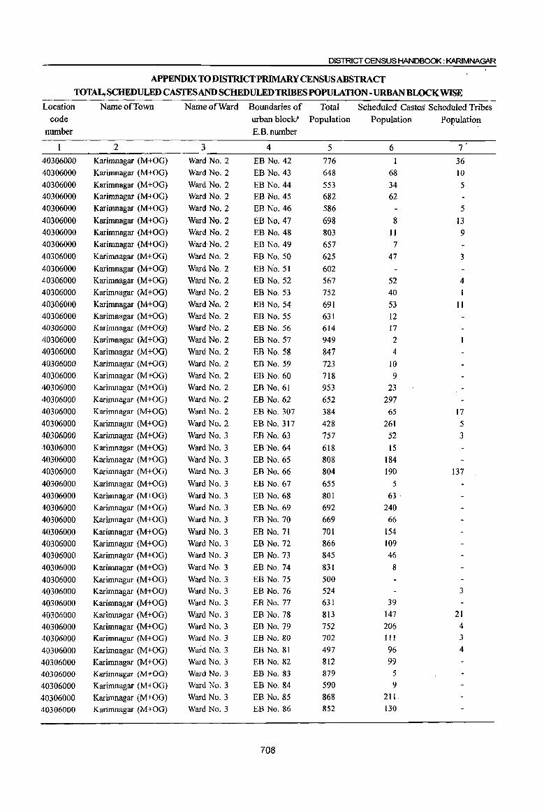
DISTRICT CENSUS HANDBOOK: KARIMNAGAR
APPENDIX TO DISTRICT PRIMARY CENSUS ABSTRACT TOTAL, SCHEDULED CASTES AND SCHEDULED TRIBES POPULATION -URBAN BLOCK WISE
Location Name of Town Name of Ward Boundaries of Total Scheduled Castes Scheduled Tribes
code urban block! Population Population Population
number E.B.number
2 3 4 5 6 7 40306000 Karimnagar (M+OG) Ward No.2 EB No. 42 776 36
40306000 Karimnagar (M+OG) Ward No.2 EB No. 43 648 68 10
40306000 Karimnagar (M+OG) Ward No.2 EB No. 44 553 34 5 40306000 Karimnagar (M+OG) Ward No.2 EB No. 45 682 62
40306000 Karimnagar (M+OG) Ward No.2 EB No. 46 586 5
40306000 Karimnagar (M+OG) Ward No.2 EB No. 47 698 8 13 40306000 Karimnagar (M+OG) Ward No.2 EB No. 48 803 I1 9 40306000 Karimnagar (M+OG) Ward No.2 EB No. 49 657 7
40306000 Karimnagar (M+OG) Ward No.2 EB No. 50 625 47 3
40306000 Karimnagar (M+OG) Ward No.2 EB No. 51 602
410306000 Karimnagar (M+OG) Ward No.2 EB No. 52 567 52 4 410306000 Karimnagar (M+OG) Ward No.2 EB No. 53 752 40 1
410306000 Karimnagar (M+OG) Ward No.2 EB No. 54 691 53 11 40306000 Karimnagar (M+OG) Ward No.2 EB No. 55 631 12 40306000 Karimnagar (M+OG) Ward No.2 EB No. 56 614 17
40306000 Karimnagar (M+OG) Ward No.2 EB No. 57 949 2
40306000 Karimnagar (M+OG) Ward No.2 EB No. 58 847 4
40306000 Karimnagar (M+OG) Ward No.2 EB No. 59 723 10
40306000 Karimnagar (M+OG) Ward No.2 EB No. 60 718 9 40306000 Karimnagar (M+OG) Ward No.2 EB No. 61 953 23
40306000 Karimnagar (M+OG) Ward No.2 EB No. 62 652 297
40306000 Karimnagar (M+OG) Ward No.2 EB No. 307 384 65 17
40306000 Karimnagar (M+OG) Ward No.2 EB No. 317 428 261 5
40306000 Karimnagar (M+OG) Ward No.3 EB No. 63 757 52 3
40306000 Karimnagar (M+OG) Ward No.3 EB No. 64 618 15
40306000 Karimnagar (M+OG) Ward No.3 EB No. 65 808 184
40306000 Karimnagar (M+OG) Ward No.3 EB No. 66 804 190 137
40306000 Karimnagar (M+OG) Ward No.3 EB No. 67 655 5 40306000 Karimnagar (M+OG) Ward No.3 EB No. 68 801 63,
40306000 Karimnagar (M+OG) Ward No.3 EB No. 69 692 240
40306000 Karimnagar (M+OG) Ward No.3 EB No. 70 669 66
40306000 Karimnagar (M+OG) Ward No.3 EB No. 71 701 154
40306000 Karimnagar (M+OG) Ward No.3 EB No. 72 866 109
40306000 Karimnagar (M+OG) Ward No.3 EB No. 73 845 46
40306000 Karimnagar (M+OG) Ward No.3 EB No. 74 831 8
40306000 Karimnagar (M+OG) Ward No.3 EB No. 75 500
40306000 Karimnagar (M+OG) Ward No.3 EB No. 76 524 3
40306000 Karimnagar (M+OG) Ward No.3 EB No. 77 631 39
40306000 Kfuimnagar 0\1+0G) Ward No.3 EB No. 78 813 147 21
40306000 Karimnagar (M+OG) Ward No.3 EB No. 79 752 206 4
40306000 Karimnagar (M+OG) Ward No.3 EB No. 80 702 III 3
40306000 Karimnagar (M+OG) Ward No.3 EB No. 81 497 96 4
40306000 Karimnagar (M+OG) Ward No.3 EB No. 82 812 99
40306000 Karimnagar (M+OG) Ward No.3 EB No. 83 879 5
40306000 Karimnagar (M+OG) Ward No.3 EB No. 84 590 9
40306000 Karimnagar (M+OG) Ward No.3 EB No. 85 868 21 I.
40306000 Karimnagar (M+OG) Ward No.3 EB No. 86 852 130
708
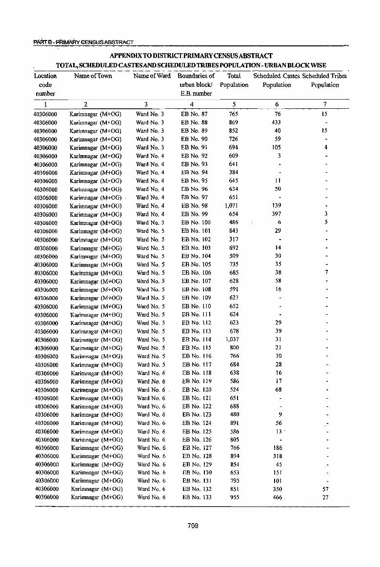
PARrB-~GENSUSABSTRACT
APPENDIX TO DISTRICfPRIMARY CENSUSABSTRACf TOTAL, SCHEl>ULED CASTES AND SCHEDULED TRIBES POPULATION - URBAN BWCKWlSE
Locati(lU Name of Town Name of Ward Boundaries of Total Scheduled Castes Scheduled Tribes code. urban block! Population Population Population
number E.B.number
1 2 3 4 5 6 7
40306000 Karimnagar (M+OG) Ward No.3 EB No. 87 765 76 15
40306000 Karimnagar (M+OG) Ward No.3 EB No. 88 869 433
40306000 Karimnagar (M+OG) Ward No.3 EBNo.89 852 40 15
40306000 Karimnagar (M+OG) Ward No.3 EB No. 90 726 59
40306000 Karimnagar (M+OG) Ward No.3 EB No. 91 694 lOS 4
40306000 Karimnagar (M+OG) Ward No.4 EB No. 92 609 3
40306000 Karimnagar (M+OG) Ward No.4 EB No. 93 641
40306000 Karimnagar (M+OG) Ward No.4 EB No. 94 384
40306000 Karimnagar (M+OG) Ward No.4 EB No. 95 645 II
40306000 Karimnagar (M+OG) Ward No.4 EB No. 96 634 50
40306000 Karimnagar (M+OG) Ward No. 4 EB No. 97 651
40306000 Karimnagar (M+OG) Ward No.4 EB No. 98 1,071 139
40306000 Karimnagar (M+OG) Ward No.4 EB No. 99 654 397 3
40306000 Karimnagar (M+OG) Ward No.5 EB No. 100 486 6 5
40306000 Karimnagar (M+OG) Ward No.5 EB No. 101 843 29
40306000 Karimnagar (M+OG) Ward No.5 EB No. 102 317
40306000 Karimnagar (M+OG) Ward No.5 EB No. 103 692 14
40306000 . Karimnagar (M+OG) Ward No.5 EB No. 104 509 30
40306000 Karimnagar (M+OG) Ward No.5 EB No. 105 735 35
40306000 Karimnagar (M+OG) Ward No.5 EB No. 106 685 38 7
40306000 Karimnaglp" (M+OG) Ward No.5 EB No. 107 628 58
40306000 Karimnagar (M+OG) Ward No.5 EB No. 108 591 16
40306000 Karimnagar (M+OG) Ward No.5 EB No. 109 627
40306000 Karimnagar (M+OG) Ward No.5 EB No. 110 652
40306000 Karimnagar (M+OG) Ward No. 5 EB No. III 624
40306000 Karimnagar (M+OG) Ward No.5 EB No. 112 623 29
40306000 Karimnagar (M+OG) Ward No.5 EB No. 113 678 39
40306000 Karimnagar (M+OG) Ward No.5 EB No. 114 1,037 31
40306000 Karimnagar (M+OG) Ward No.5 EB No. 115 800 21
40306000 Karimnagar (M+OG) Ward No.5 EB No. 116 766 30
40306000 Karimnagar (M+OG) Ward No.5 EB No. 117 684 28
40306000 Karimnagar (M+OG) Ward No.6 EB No.1 18 638 16
40306000 Karimnagar (M+OG) Ward No. 6 EB No. 119 586 17
40306000 Karimnagar (M+OG) Ward No.6 EB No. 120 524 68
·40306000 Karimnagar (M+OG) Ward No.6 EB No. 121 651
40306000 Karimnagar (M+OG) Ward No.6 EB No. 122 688
40306000 Karimnagar (M+OG) Ward No.6 EB No. 123 480 9
40306000 Karimnagar (M+OG) Ward No.6 EB No. 124 891 56
40306000 Karimnagar (M+OG) Ward No.6 EB No. 125 586 I3 ..
40306000 Karimnagar (M+OG) Ward No.6 EB No. 126 805
40306000 Karimnagar (M+OG) Ward No.6 EB No. 127 766 186 40306000 Karimnagar (M+OG) Ward No.6 EB No. 128 894 318
40306000 Karimnagar (M+OG) Ward No.6 EB No. 129 854 45 40306000 Karimnagar (M+OG) Ward No.6 EB No. 130 653 151
40306000 Karimnagar (M+OG) Ward No.6 EB No. 131 795 101 40306000 Karimnagar (M+OG) Ward No.6 EB No. 132 851 350 57 40306000 Karimnagar (M+OG) Ward No.6 EB No. 133 955 466 27
709
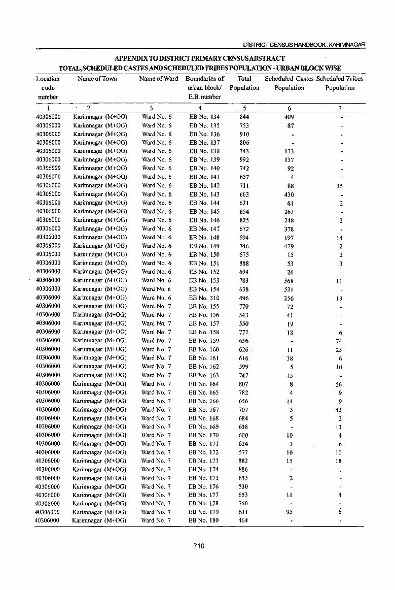
DISTRICT CENSUS HANDBOOK: KARIMNAGAR
APPENDIX TO DISTRICT PRIMARY CENSUS ABSTRACf TOTAL, SCHEDULED CASTES AND SCHEDULED TRIBES POPULATION -URBANBWCKWISE
-. Location Name of Town Name of Ward Boundaries of Total Scheduled Castes Scheduled Tribes
code urban block! Population Population Population
number E.B.number
1 2 3 4 5 6 7 40306000 Karimnagar (M+OG) Ward No.6 EB No. 134 844 409
40306000 Karimnagar (M+OG) Ward No.6 EB No. 135 753 87 40306000 Karimnagar (M+OG) Ward No.6 EB No. 136 910
40306000 Karimnagar (M+OG) Ward No.6 EB No. 137 806 40306000 Karimnagar (M+OG) Ward No.6 EB No. 138 743 133 40306000 Karimnagar (M+OG) Ward No.6 EB No. 139 992 137 40306000 Karimnagar (M+OG) Ward No.6 EB No. 140 742 92 40306000 Karimnagar (M+OG) Ward No.6 EB No. 141 657 4 40306000 Karimnagar (M+OG) Ward No.6 EB No. 142 711 88 35 40306000 Karimnagar (M+OG) Ward No.6 EB No. 143 663 430 40306000 Karimnagar (M+OG) Ward No.6 EB No. 144 621 61 2 40306000 Karimnagar (M+OG) Ward No.6 EB No. 145 654 263 40306000 Karimnagar (M+OG) Ward No.6 EB No. 146 825 248 2 40306000 Karimnagar (M+OG) Ward No.6 EB No. 147 672 378 40306000 Karimnagar (M+OG) Ward No.6 EB No. 148 694 197 14 40306000 Karimnagar (M+OG) Ward No.6 EB No. 149 746 479 2 40306000 Karimnagar (M+OG) Ward No.6 EB No. 150 675 15 2 40306000 Karimnagar (M+OG) Ward No.6 EB No. 151 888 53 3 40306000 Karimnagar (M+OG) Ward No.6 EB No. 152 694 26 40306000 Karimnagar (M+OG) Ward No.6 EB No. 153 783 368 II 40306000 Karimnagar (M+OG) Ward No.6 EB No. 154 638 531 40306000 Karimnagar (M+OG) Ward No.6 EB No. 310 496 256 13 40306000 Karimnagar (M+OG) Ward No.7 EB No. 155 770 72 40306000 Karimnagar (M+OG) Ward No.7 EB No. 156 543 41 40306000 Karimnagar (M+OG) Ward No.7 EB No. 157 550 19 40306000 Karimnagar (M+OG) Ward No.7 EB No. 158 772 18 6 40306000 Karimnagar (M+OG) Ward No.7 EB No. 159 656 74 40306000 Karimnagar (M+OG) Ward No.7 EB No. 160 626 11 25 40306000 Karimnagar (M+OG) Ward No.7 EB No. 161 616 38 6 40306000 Karimnagar (M+OG) Ward No.7 EB No. 162 599 5 to 40306000 Karimnagar (M+OG) Ward No.7 EB No. 163 747 15 40306000 Karimnagar (M+OG) Ward No.7 EB No. 164 807 8 56 40306000 Karimnagar (M+OG) Ward No.7 EB No. 165 782 4 9 40306000 Karimnagar (M+OG) Ward No.7 EB No. 166 656 14 9 40306000 Karimnagar (M+OG) Ward No.7 EB No. 167 707 5 43 40306000 Karimnagar (M+OG) Ward No.7 EB No. 168 684 5 2 40306000 Karimnagar (M+OG) Ward No.7 EB No. 169 638 13 40306000 Karimnagar (M+OG) Ward No.7 EB No. 170 600 10 4 40306000 Karimnagar (M+OG) Ward No.7 EB No. 171 624 3 6 40306000 Karimnagar (M+OG) Ward No.7 EB No. 172 577 10 10 40306000 Karimnagar (M+OG) Ward No.7 EB No. 173 882 15 18 40306000 Karimnagar (M+OG) Ward NO.7 EB No. 174 886 I
40306000 Karimnagar (M+OG) Ward NO.7 EBNo.175 655 2
40306000 Karimnagar (M+OG) Ward NO.7 EBNo.I76 530 40306000 Karimnagar (M+OG) Ward No.7 EB No. 177 653 11 4
40306000 Karimnagar (M+OG) Ward NO.7 EB No. 178 760
40306000 Karimnagar (M+OG) Ward No.7 EB No. 179 631 95 6 40306000 Karimnagar (M+OG) Ward No.7 EB No. 180 464
710
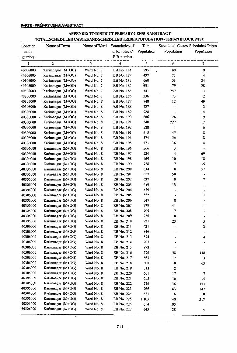
PART B- PR.(MARY CENSUSABSTBACT
APPENDIX TO DISTRlCfPRIMARY CENSUSABSTRACf
TOTAL, SCHEDULED CASTES AND SCHEDULED TRIBES POPULATION - URBAN BWCKWISE
Location Name of Town Name of Ward Boundaries of Total Scheduled Castes Scheduled Tribes
code urban block! Population Population Population
number E.B.number
2 3 4 5 6 7
40306000 Karimnagar (M+OG) Ward No.7 EB No. 181 595 80 9
40306000 Karimnagar (M+OG) Ward No.7 EB No. 182 497 71 4
40306000 Karimnagar (M+OG) Ward No.7 EB No. 183 660 53 34
40306000 Karimnagar (M+OG) Ward No.7 EB No. 184 631 179 28
40306000 Karltnnagar (M+OG) Ward No.7 EB No. 185 541 257 3 40306000 Karimnagar (M+OG) Ward No.7 EB No. 186 536 73 2
40306000 Karimnagar (M+OG) Ward No. 8 EBNo.187 748 12 49
40306000 Karimnagar (M+OG) Ward No.8 EB No. 188 727 2
40306000 Karimnagar (M+OG) Ward No.8 EB No. 189 928 14
40306000 Karimnagar (M+OG) Ward No.8 EB No. 190 686 124 19
40306000 Karimnagar (M+OG) Ward No.8 EB No. 191 540 222 17
40306000 Karimnagar (M+OG) Ward No.8 EB No. 192 528 1 6
40306000 Karimnagar (M+OG) Ward No.8 EB No. 193 615 45 8
40306000 Karimnagar (M+OG) Ward No.8 EB No. 194 574 56 8
40306000 Karimnagar (M+OG) Ward No.8 EB No. 195 571 36 4
40306000 Karimnagar (M+OG) Ward No.8 EB No. 196 566 3
40306000 Karimnagar (M+OG) Ward No.8 EB No. 197 534 4 69
40306000 Karimnagar (M+OG) Ward No.8 EBNo.198 469 10 18
40306000 .. Karimnagar (M+OG) Ward No.8 EB No. 199 758 7 15
.40306000 Karimnagar (M+OG) Ward No.8 EB No. 200 834 8 57
40306000 Karimnagar (M+OG) Ward No.8 EB No. 201 657 50
40306000 Karimnagar (M+OG) Ward No.8 EB No. 202 637 10 7
40306000 Karimnagar (M+OG) Ward No.8 EB No. 203 619 13
40306000 Karimnagar (M+OG) Ward No.8 EB No. 204 579
40306000 .Karimnagar (M+OG) Ward No.8 EBNo.205 522
40306000 Karimnagar (M+OG) Ward No.8 EB No. 206 547 8
40306000 Karimnagar (M+OG) Ward No.8 EB No. 207 779 41 40306000 Karimnagar (M+OG) Ward NO.8 EB No. 208 799 7
40306000 Karimnagar (M+OG) Ward No.8 EB No. 209 730 8
40306000 Karimnagar (M+OG) Ward No.8 EB No. 210 721 23 5 40306000 Karimnagar (M+OG) Ward NO.8 EB No. 211 621 2 40306000 Karimnagar (M+OG) Ward No.8 EB No. 212 846 40306000 Karimnagar (M+OG) Ward No.8 EB No. 213 574 4 40306000 Karimnagar (M+OG) Ward No.8 EB No. 214 707 40306000 Karimnagar (M+OG) Ward No.8 EB No. 215 872 40306000 Karimnagar (M+OG) Ward No.8 EB No. 216 576 58 1I8 40306000 Karimnagar (M+OG) Ward No.8 EB No. 217 563 17 3 40306000 Karimnagar . (M+OG) Ward No.8 EB. No. 218 808 8 63 40306000 Karimnagar (M+OG) Ward No.8 EB No. 219 513 2 40306000 Karimnagar (M+OG) Ward No.8 EB No. 220 661 17 7 40306000 Karimnagar (M+OG) Ward No.8 EB No. 221 655 16 14 40306000 Karimnagar (M+OG) Ward No.8 EB No. 222 776 36 153 40306000 Karimnagar (M+OG) Ward No.8 EB No. 223 766 183 147 40306000 Karimnagar (M+OG) Ward No.8 EB No. 224 671 6 18 40306000 Karimnagar (M+OG) Ward No.8 EB No. 225 1,103 140 217 40306000 Karimnagar (M+OG) Ward No.8 EB No. 226 614 105 40306000 Karimnagar (M+OG) Ward No.8 EB No. 227 645 28 15
711
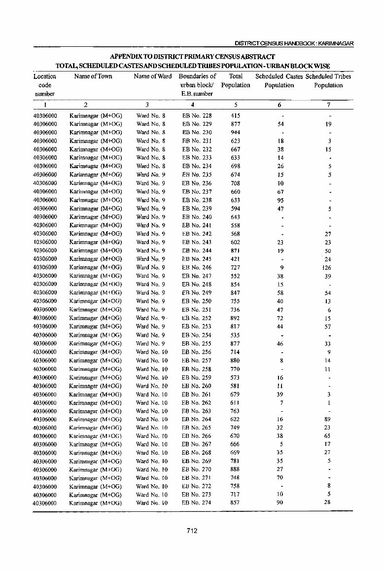
DISTRICT CENSUS HANDBOOK: KARIMNAGAR
APPENDIX TO DISTRICfPRlMARY CENSUSABSTRACf
TOTAL, SCHEDULED CASTESAND SCHEDULED TRIBES POPULATION - URBAN BWCKWISE
Location NameofTmvn Name of Ward Boundaries of Total Scheduled Castes Scheduled Tribes
code urban block! Population Population Population
number E.B.number
2 3 4 5 6 7
40306000 Karimnagar (M+OG) Ward No.8 EB No. 228 415
40306000 Karimnagar (M+OG) Ward No.8 EB No. 229 877 54 19
40306000 Karimnagar (M+OG) Ward No.8 EB No. 230 944
40306000 Karimnagar (M+OG) Ward No.8 EB No. 231 623 18 3
40306000 Karimnagar (M+OG) Ward No.8 EB No. 232 667 38 15
40306000 Karimnagar (M+OG) Ward No.8 EB No. 233 633 14
4·0306000 Karimnagar (M+OG) Ward No.8 EB No. 234 698 26 5
40306000 Karimnagar {M+OG} Ward No.9 EB No. 235 674 15 5 40306000 Karimnagar (M+OG) Ward No.9 EB No. 236 708 10 40306000 Karimnagar (M+OG) Ward No.9 EB No. 237 660 67 40306000 Karimnagar (M+OG) Ward No.9 BB No. 238 633 95 40306000 Karimnagar (M+OG) Ward No.9 EB No. 239 594 47 5 40306000 Karimnagar (M+OG) Ward No.9 EB No. 240 643 40306000 Karimnagar (M+OG) Ward No.9 EB No. 241 558 40306000 Karimnagar (M+OG) Ward No.9 EB No. 242 568 27 40306000 Karimnagar (M+OG) Ward No.9 EB No. 243 602 23 23 40306000 Karimnagar (M+OG) Ward No.9 EB No. 244 871 19 50 40306000 Karimnagar (M+OG) Ward No.9 EB No. 245 421 24 40306000 Karimnagar (M+OG) Ward No. 9 EB No. 246 727 9 126 40~06000 Karimnagar (M+OG) Ward No.9 EB No. 247 552 38 39 40306000 Karimnagar (M+OG) Ward No.9 BB No. 248 854 15 40306000 Karimnagar (M+OG) Ward No.9 EB No. 249 847 58 54 40306000 Karimnagar (M+OG) Ward No.9 EB No. 250 755 40 13 40306000 Karimnagar (M+OG) Ward No.9 EB No. 251 736 47 6 40306000 Karimnagar (M+OG) Ward No.9' EB No. 252 892 72 15 40306000 Karimnagar (M+OG) Ward No.9 EB No. 253 817 44 57
40306000 Karimnagar (M+OG) Ward No.9 EB No. 254 535
40306000 Karimnagar (M+OG) Ward No.9 EB No. 255 877 46 33 40306000 Karimnagar (M+OG) Ward No. 10 EB No. 256 714 9
40306000 Karimnagar (M+OG) Ward No. 10 EB No. 257 880 8 14
40306000 Karimnagar (M+OG) Ward No. 10 EB No. 258 770 11
40306000 Karimnagar (M+OG) Ward No. 10 EB No. 259 573 16
40306000 Karimnagar (M+OG) Ward No. lO EB No. 260 581 II
40306000 Karimnagar (M+OG) Ward No. 10 EB No. 261 679 39 3
40306000 Karimnagar (M+OG) Ward No. 10 EB No. 262 611 7
40306000 Karimnagar (M+OG) Ward No. 10 EB No. 263 763
40306000 Karimnagar (M+OG) Ward No. 10 EB No. 264 622 16 89
40306000 Karimnagar (M+OG) Ward No. 10 EB No. 265 749 32 23
40306000 Karimnagar (M+OG) Ward No. 10 EB No. 266 670 38 65
40306000 Karimnagar (M+OG) Ward No. 10 EB No. 267 666 5 17
40306000 Karimnagar (M+OG) Ward No. 10 EB No. 268 669 35 27
40306000 Karimnagar (M+OG) Ward No. 10 EB No. 269 781 35 5
40306000 Karimnagar (M+OG) Ward No. 10 EB No. 270 888 27
40306000 Karimnagar (M+OG) Ward No. 10 EB No. 271 748 70
40306000 Karimnagar (M+OG) Ward No. 10 EB No. 272 758 8
40306000 Karimnagar (M+OG) Ward No. 10 EB No. 273 717 10 5
40306000 Karimnagar (M+OG) Ward No. 10 EB No. 274 857 90 28
712
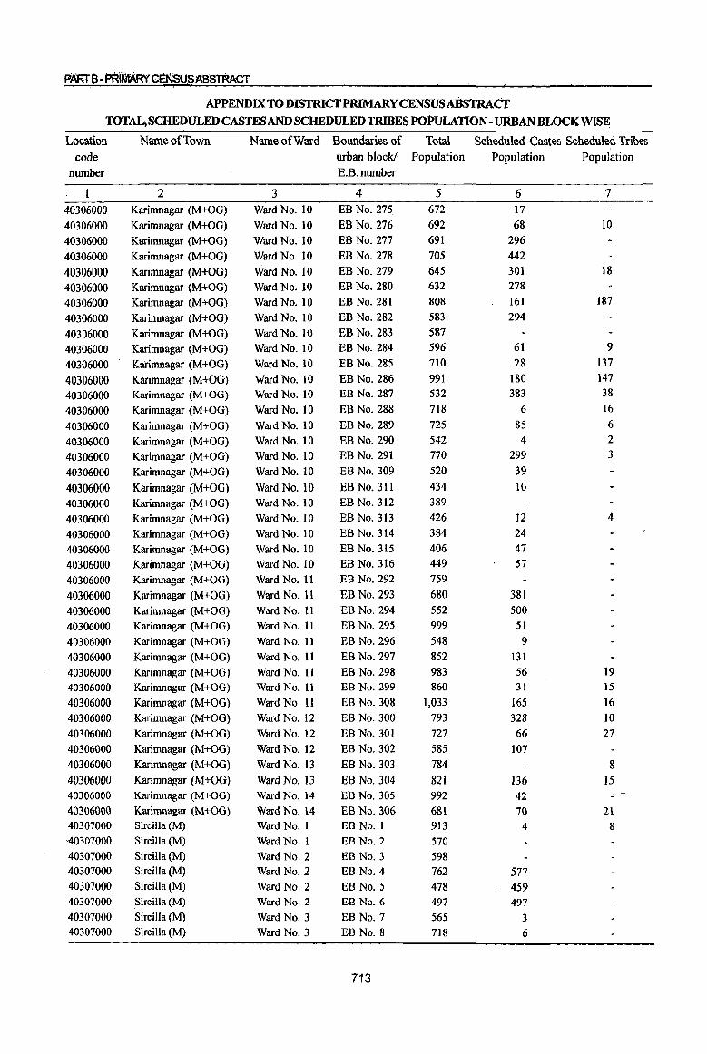
P'ARrB-PR~GENSUSABSTRACT
APPENDIX TO DISTRICf PRIMARY CENSUS ABSTRACl' TOTAL; SCHEDULED CASTES AND SCHEDULED TRIBES POPuLATION -URBAN BLOCK WISE
Location Name of Town Name of Ward Boundaries of Total Scheduled Castes Scheduled Tribes code urban block! Population Population Population
number E.B.number
2 3 4 5 6 7
40306000 Karimnagar (M+OG) Ward No. 10 EB No. 275 672 17
40306000 Karimnagar (M+OG) Ward No. 10 EBNo.276 692 68 10
40306000 Karimnagar (M+OG) Ward No. 10 EB No. 277 691 296
40306000 Karimnagar (M+OG) Ward No. 10 EB No. 278 705 442
40306000 Karimnagar (M+OG) Ward No. 10 EB No. 279 645 301 18
40306000 Karimnagar (M+OG) Ward No. 10 EB No. 280 632 278
40306000 Karimnagar (M+OG) Ward No. 10 EB No. 281 808 161 187
40306000 Karimnagar (M+OG) Ward No. 10 EB No. 282 583 294
40306000 Karimnagar (M+OG) Ward No. 10 EB No. 283 587
40306000 Karimnagar (M+OG) Ward No. 10 EB No. 284 596 61 9
40306000 Karimnagar (M+OG) Ward No. 10 EB No. 285 710 28 137
40306000 Karimnagar (M+OG) Ward No. 10 EB No. 286 991 180 147
40306000 Karimnagar (M+OG) Ward No. 10 EB No. 287 532 383 38
40306000 Karimnagar (M+OG) Ward No. 10 EB No. 288 718 6 16
40306000 Karimnagar (M+OG) Ward No. 10 EB No. 289 725 85 6
40306000 Karimnagar (M+OG) Ward No. 10 EB No. 290 542 4 2
40306000 Karimnagar (M+OG) Ward No. IO EB No. 291 770 299 3
40306000 Karimnagar (M+OG) Ward No. 10 EB No. 309 520 39
40306000 Karimnagar (M+OG) Ward No. 10 EB No. 311 434 10
40306000 Karimnagar (M+OG) Ward No. 10 EB No. 312 389
40306000 Karimnagar (M+OG) Ward No. to EB No. 313 426 12 4
40306000 Karimnagar (M+OG) Ward No. 10 EB No. 314 384 24
40306000 Karimnagar (M+OG) Ward No. 10 EB No. 315 406 47
40306000 Karimnagar (M+OG) Ward No. 10 EB No. 316 449 57
40306000 Karimnagar (M+OG) Ward No. II EB No. 292 759
40306000 Karimnagar (M+OG) Ward No. 11 EB No. 293 680 381
40306000 Karimnagar (M+OG) Ward No. 11 EB No. 294 552 500
40306000 Karimnagar (M+OG) Ward No. 11 EB No. 295 999 51
40306000 Karimnagar (M+OG) Ward No. II EB No. 296 548 9
40306000 Karimnagar (M+OG) Ward No. 11 EB No. 297 852 131
40306000 Karimnagar (M+OG) Ward No. II EB No. 298 983 56 19
40306000 Karimnagar (M+OG) Ward No. II EB No. 299 860 31 15
40306000 Karimnagar (M+OG) Ward No. 11 EB No. 308 1,033 165 16
40306000 Karimnagar (M+OG) Ward No. 12 EB No. 300 793 328 10 40306000 Karimnagar (M+OG) Ward No. 12 EB No. 301 727 66 27
40306000 Karimnagar (M+OG) Ward No. 12 EB No. 302 585 107
40306000 Karimnagar (M+OG) Ward No. 13 EB No. 303 784 8 40306000 Karimnagar (M+OG) Ward No. 13 EB No. 304 821 136 J5
40306000 Karimnagar (M+OG) Ward No. 14 EB No. 305 992 42 ~
40306000 Karimnagar (M+OG) Ward No. 14 EB No. 306 681 70 2\
40307000 Sircilla (M) Ward No. I EB No. I 913 4 8 -40307000 Sircilla (M) Ward No.1 EB No.2 570
40307000 Sircilla (M) Ward No.2 EB No.3 598 40307000 Sircilla (M) Ward No.2 EB No.4 762 577 40307000 Sircilla (M) Ward No.2 EB No.5 478 459 40307000 Sircilla (M) Ward No.2 EB No.6 497 497 40307000 SirciJIa (M) Ward No.3 EB No.7 565 3 40307000 Sircilla (M) Ward No.3 EB No.8 718 6
713
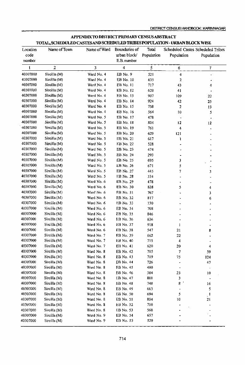
DISTRICT CENSUS HANDBOOK: KARIMNAGAR
APPENDlXTODISTRICfPRlMARY CENSUSABSTRACf
TOTAL,SCHEDULEDCASTESANDSCHEDULEDTRIBESPOPULATION-URBANBWCKWISE
Location Name of Town Name of Ward Boundaries of Total Scheduled Castes Scheduled Tribes code urban block! Population Population Population
number E.B.number
2 3 4 5 6 7
40307000 Sircilla (M) Ward No.4 EB No.9 521 4 410307000 Sircilla (M) Ward No.4 EB No. 10 635 2 40307000 Sircilla (M) Ward No.4 EB No. 11 717 43 4 40307000 Sircilla (M) Ward No.4 EB No. 12 620 41 40307000 Sircilla (M) Ward No.4 EB No. 13 907 109 22 40307000 Sircilla (M) Ward No.4 EB No. 14 924 42 25 40307000 Sircilla (M) Ward No.4 EB No. 15 758 2 13 40307000 Sircilla (M) Ward No.4 EB No. 16 564 10 5 40307000 Sircilla (M) Ward No.5 EB No. 17 478 410307000 Sircilla (M) Ward No.5 EB No. 18 804 12 12 40307000 Sircilla (M) Ward No.5 EB No. 19 761 4 40307000 Sircilla (M) Ward No.5 EB No. 20 629 121 40307000 Sircilla (M) Ward NO.5 EB No. 21 617 1 40307000 Sircilla (M) Ward No.5 EB No. 22 528 40307000 Sircilla (M) Ward No.5 EB No. 23 474 40307000 Sircilla (M) Ward NO.5 EB No. 24 293 40307000 Sircilla (M) Ward No.5 EB No. 25 695 3 40307000 Sircilla (M) Ward NO.5 EB No. 26 671 5 40307000 Sircilla (M) Ward No.5 EB No. 27 445 7 3 40307000 SircilJa (M) Ward NO.5 EB No. 28 334 40307000 Sircilla (M) Ward No.6 EB No. 29 478 40307000 Sircilla (M) Ward No.6 EB No. 30 828 5 4 40307000 Sircilla (M) Ward No.6 EB No. 31 767 3 40307000 SircilJa (M) Ward No.6 EB No. 32 817 6 40307000 Sircilla (M) Ward No.6 EB No. 33 730 40307000 Sircilla (M) Ward No.6 EB No. 34 708 40307000 Sircilla (M) Ward No.6 EB No. 35 846 40307000 Sircilla (M) Ward No.6 EB No. 36 636 40307000 Sircilla (M) Ward No.6 EB No. 37 918 40307000 Sircilla (M) Ward No.6 EB No. 38 547 21 8 40307000 Sircilla (M) Ward No.7 EB No. 39 662 22 40307000 Sircilla (M) Ward No.7 EB No. 40 715 4 40307000 Sircilla (M) Ward No.7 EB No. 41 620 20 4 40307000 Sircilla (M) Ward No.8 EB No. 42 715 7 59 40307000 Sircilla (M) Ward No.8 EB No. 43 719 75 124 40307000 SirciIla (M) Ward No.8 EB No. 44 726 47 40307000 Sircilla (M) Ward No.8 EB No. 45 480
40307000 Sircilla (M) Ward No.8 EB No. 46 384 23 10 40307000 Sircilla (M) Ward No.8 EB No. 47 801 3 40307000 Sircilla (M) Ward No.8 EB No. 48 748 8 16 40307000 Sircilla (M) Ward NO.8 EB No. 49 663 5 40307000 Sircilla (M) Ward No.8 EB No. 50 694 5 40307000 Sircilla (M) Ward No.8 EB No. 51 804 10 21 40307000 Sircilla (M) Ward No.8 EB No. 52 710
40307000 Sircilla (M) Ward No.8 EB No. 53 560 40307000 SircilJa (M) Ward No.9 EB No. 54 657
40307000 Sircilla (M) Ward No.9 EB No. 55 520
714

PARTe-~.GEN$l;JS~T
APPENDIX TO mSl'RICfPRlMARY CENSUS ABSTRACT TOTAL, SCHEDULED CASTES AND SCHEDVLED TRIBES POPULATION - URBAN BLOCK WISE
'Location Narne of Town Name of Ward Boundaries of Total Scheduled Castes Scheduled Tribes
code urban block! Population Population PopuIatjoo
: number RRnumber
2 3 4 5 6 7
4Q3070aO Sircilla (M) Ward No. 9 EB No. 56 S32 5
4fJ307(J(JO Sircilla (M) Ward No.9 EB No. 57 729
40307000 Sircil\a (M) Ward No. 9 EB No. 58 723 4
40307000 Sircill.a (M) Ward No.9 EB No. 59 817 2
40307000 Sircilla (M} Ward No.9 EB No. 6() 664
40307000 Sircilla (M) Ward No. 9 EB No. 61 644
40301000 Sircilla (M) Ward No.9 EB No. 62 597 40J07000 SirciUa(M) Ward No.9 EBNo.63 723 40307000 SireiHa(M) Ward No.9 EB No. 64 709 2
40307000 SirdlJa(M) Ward No.9 BBNo.65 625
40307000 Sire ills. (M) Ward No.9 EBNo.66 603 9
40307000 Sircilla"{M) Ward No.. 9 EB No. 67 815
40301()OO Sircilla!(M} Ward No.9 EB No. 68 628 40307000 Sireilla (M) Ward No.9 EB No. 69 695 623
40307000 Sircilla (M) Ward No.9 EB No. 70 560 8 4
40307000 Sireilla {M) Ward No. 10 EB No. 71 534 5
40J070oo Sircilla (M) Ward No·. 10 EBNo. n 114 19
40307000 SirciIJa eM) Ward No. ro EB No. 73 765
40307000 Sitcitla (M) Ward No. 11 EB No. 74 576 148 6
40307000 Sircilla (rM) Ward No. Il EB No. 75 676 13 401070QO Sircilla (M) Ward No. Ii E.B N'a. 76 624 40307000 SirciHa(M) Ward No. 11 EB No. 77 754 40307000 Sirdl1a(M} Ward No. 11 EB N(J. 78 804 4030700[) SirciHa(M) Ward No. 12 EB No. 79 597 18 6 40307000 SirciUa(M) Ward No. 12 EB No. 80 489 40307000 Sircilla (M) - Ward No. 12 EB No. 81 495 II 6 40307000 Sircilla (M) Ward No. 12 EB No. 82 795 9 403()7000 Sircil1a (M) Ward No. 12 EB No. 83 545 S 3 40301000 Sircilla W) Ward No. 12 EB No. 84 668 4 4031}700Q Sircilla (M) Ward No. 12 EB No. 85 576 7 403()7000 Sircilla (Nfl Ward No. 12 EB No. 86 534 4-0307000 SircilJa (~) Ward No. 12 EBNo.87 662 4-0307000 SircjIJa (M) \l,i1lJ'd No. 12 ED No. 88 107 4Q3{}7000 3ilcilla (M) Ward No. 12 EB No. 89 563 7 40307000 Sircilla (M~ Ward No. 12 EB No. 90 489 13 40307000 3ircilla (M) Ward No. 12 EB'No.91 628 40307000 SireilJa (M) Ward No. 12 EB NQ. 92 696 4 40307000 Sircilla (M) Ward No. 12 EB No. 93 638 to 40307000 Sirdlla (M) Ward No. 12 EB No. 94- 649 13 403(] 7000 SiJdl.la eM) Warc! No. 12 EB No.!,)5 611 5 403(J7000 Sircilla (M) Warc! No. 12 EB No. % 581 Ml307(100 SirciUll-{M) Ward No. 12 EB No. 9i 432 3 403()7000 Sircilla {M) Ward No. 12 EB No. 98 783 14 40307000 Sircilla(M) War(] N(I. [1 EB N(].99 1u8 40307{100 Sire ilia (M) Ward No. 12 EB No. 100 478 8 40307000 Sircilla (M) Ward No. 12 EB No. tOt 5t4 33
715
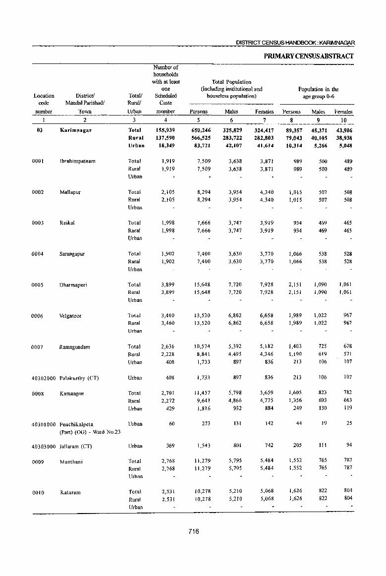
DISTRICT CENSUS HANDBOOK: KARIMNAGAR
P~YCENSUSABSTRACT
Number of households
with at least Total Population one (including institutional and Population in the
Location District! Totall Scheduled houseless population) age group 0-6 code Mandai ParishadJ Rural! Caste
number Town Urban member Persons Males Females Persons Males Females
2 3 4 5 6 7 8 9 10
03 Karimnagar Total 155,939 650,246 325,829 324,417 89,357 45,371 43,986 Rural 137,590 566,525 283,722 282,803 79,043 40,105 38,938 Urban 18,349 83,721 42,107 41,614 10,314 5,266 5,048
0001 Ibrahimpatnam Total 1,919 7,509 3,638 3,871 989 500 489 Rural 1,919 7,509 3,638 3,871 989 500 489 Urban
0002 Mallapur Total 2,105 8,294 3,954 4,340 1,015 507 508 Rural 2,105 8,294 3,954 4,340 1,015 507 508 Urban
0003 Raikal Total 1,998 7,666 3,747 3,919 934 469 465
Rural 1,998 7,666 3,747 3,919 934 469 465
Urban
0004 Sarangapur Total 1,902 7,400 3,630 3,770 1,066 538 528
Rural 1,902 7,400 3,630 3,770 1,066 538 528
Urban
0005 Dharmapuri Total 3,899 15,648 7,720 7,928 2,15l 1,090 1,061
Rural 3,899 15,648 7,720 7,928 2,151 1,090 1,061
Urban
0006 Velgatoor Total 3,460 13,520 6,862 6,658 1,989 1,022 967
Rural 3,460 13,520 6,862 6,658 1,989 1,022 967
Urban
0007 Ramagundam Total 2,636 10,574 5,392 5,182 1,403 725 678
Rural 2,228 8,841 4,495 4,346 1,190 619 571
Urban 408 1,733 897 836 213 106 107
40302000 Palakurthy (CT) Urban 408 1,733 897 836 213 106 107
0008 Kamanpur Total 2,701 11,457 5,798 5,659 1,605 823 782
Rural 2,272 9,641 4,866 4,775 1,356 693 663
Urban 429 1,816 932 884 249 130 119
40301000 Penchikalpeta Urban 60 273 131 142 44 19 25
(Part) (OG) - Ward No.23
40303000 Jallaram (CT) Urban 369 1,543 801 742 205 111 94
0009 Manthani Total 2,768 11,279 5,795 5,484 1,552 765 787
Rural 2,768 11,279 5,795 5,484 1,552 765 787
Urban
0010 Kataram Total 2,531 10,278 5,210 5,068 1,626 822 804
Rural 2,531 10,278 5,210 5,068 1,626 822 804
Urban
716
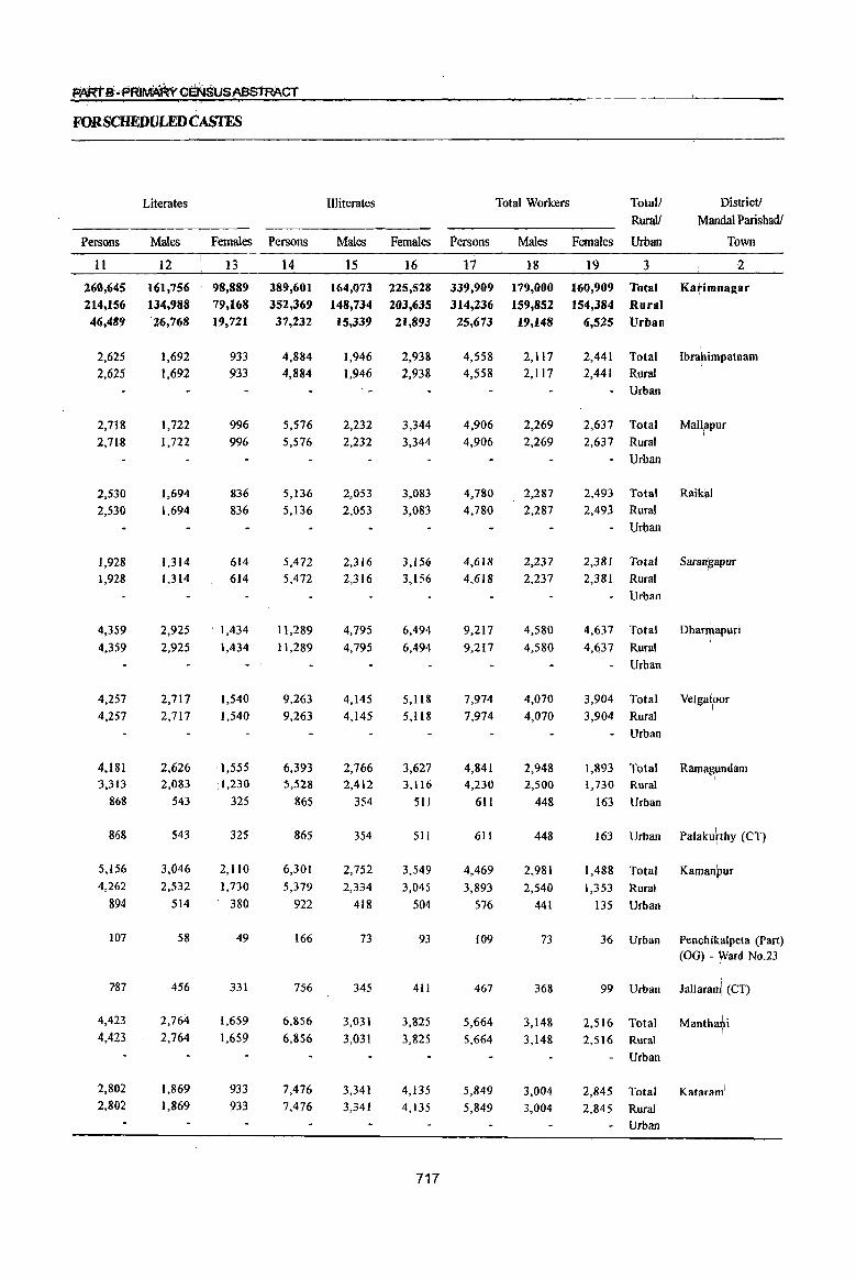
FORSCHEDULEDCASTFS
Persons
II
260,645 214,156 46,489
2,625
2,625
2,718
2,718
2,530
2,530
1,928 1,928
4,359
4,359
4,257
4,257
4,181 3,313
868
868
5,156
4,262
894
107
787
4,423
4,423
2,802
2,802
Literates
Males
12
161,756 134,988
Females
13
98,889 79,168
26,768 19,721
1,692
1,692
1,722
1,722
1,694
1,694
1,314 1,314
2,925
2,925
2,717 2,717
2,626 2,083
543
543
3,046
2,532
514
58
456
2,764
2.764
1,869
1,869
933
933
996
996
836
836
614 614
1,434
1.434
1,540
1,540
1,555 1,230
325
325
2,110
1,730
380
49
331
1,659
1,659
933
933
Persons
14
389,601 352,369 37,232
4,884
4,884
5,576
5,576
5,136
5,136
5,472
5,472
11,289
11,289
9,263
9,263
6,393 5,528
865
865
6,301
5,379
922
166
756
6,856
6,856
7,476
7,476
Illiterates
Males
15
164,073 148,734
Females
16
225,528
203,635 15,339 21,893
1,946
1,946 "_
2,232
2,232
2,053
2,053
2,316 2,316
4,795
4,795
4,145
4,145
2,766 2,412
354
354
2,752
2,334
418
73
345
3,031
3,031
3,341
3,341
2,938
2,938
3,344
3,344
3,083
3,083
3,156
3,156
6,494
6,494
5,118
5,118
3,627 3,116
51!
511
3,549
3,045
504
93
411
3,825
3,825
4,135
4,135
717
Persons
17
339,909 314,236 25,673
4,558
4,558
4,906
4,906
4,780
4,780
4,618
4,618
9,217
9;217
7,974
7,974
4,841 4,230
6II
611
4,469
3,893
576
109
467
5,664
5,664
5,849
5,849
Total Workers
Males
18
179,000 159,852 19,148
2,117
2,1l7
2,269
2,269
2,287
2,287
2,237
2,237
4,580
4,580
4,070
4,070
2,948 2,500
448
448
2,981
2,540
441
73
368
3,148
3,148
3,004
3,004
Total! Rural!
Females Urban
19 3
160,909 Total 154,384 Rural
6,525 Urban
2,441
2,441
Total
Rural
- Urban
DistricV
Mandai Parishadl
Town
2
Ka~imDagar
Ibrahimpatnam I
2,637 Total Mall:apur
2,637 Rural _ Urban
I
2,493 Total Raik~1 2,493 Rural
• Urban
2,381 Total Saradgapur
2,381 Rural
- Urban
4,637 Total
4,637 Rural
Urban
3,904 Total
3,904 Rural
• Urban
1,893 1,730
163
163
1,488
1,353
135
Total Rural
Urban
Urban
Total
Rural
Urban
36 Urban
99 Urban
DharrtJapuri I
Velga~oor I
Palaku~thy (CT)
KamanfJUr
Penchi~alpeta (Part) (OG) - ~ard No.23
1
Jallarami (CT)
2,516 Total Mantha?i 2,516 Rural
Urban
2,845 Total Kataram\
2,845 Rural
Urban

District! Totall Rurall
Main workers Location code
number Mandai Parishadl
Town Urban Persons Males Females Persons
2 3 20 21 22
03 Karimnagar Total 272,361 152,670 119,691
Rural 250,562 135,694 114,868 Urban 21,799 16,976 4,823
0001 Ibrahimpatnam
0002 Mallapur
0003 Raikal
0004 Sarangapur
0005 Dharrnapuri
0006 Velgatoor
0007 Ramagundam
Total
Rural
Urban
Total
Rural
Urban
Total
Rural
Urban
Total
Rural
Urban
Total
Rural
Urban
Total
Rural
Urban
Total
Rural
Urban
40302000 Palakurthy (CT) Urban
0008 Kamanpur Total
Rural
Urban
40301000 Penchikalpeta Urban
(Part) (OG) - Ward No.23
40303000 Jallaram (CT)
0009 Manthani
00]0 Kataram
Urban
Total
Rural
Urban
Total
Rural Urban
4,245
4,245
4,659
4,659
4,208
4,208
3,648
3,648
8,076
8,076
7,119
7,119
3,705
3,263
442
442
2,567
2,163
404
102
302
3,606
3,606
3,290
3,290
1,969
1,969
2,192
2,192
2,008
2,008
1,869
1,869
4,142 4,142
3,718
3,718
2,538
2,159
379
379
2,223
1,880
343
69
274
2,357
2,357
1,853
1,853
2,276
2,276
2,467
2,467
2,200
2,200
1,779
1,779
3,934
3,934
3,401
3,401
1,167
1,104
63
63
344
283
61
33
28
1,249
1,249
1,437
1,437
718
23
50,457 50,250
207
732
732
1,005
1,005
746
746
1,452
1,452
1,694
1,694
1,123
1,123
475
426
49
49
300
280
20
3
17
540
540
424
424
DISTRICT CENSUS HANDBOOK: KARIMNAGAR
PRIMARY CENSUSABSTRACf
Industrial category
Cultivators Agricultural labourers
Males Females Persons Males Females
24
32,902
32,750
152
452
452
630
630
434
434
849
849
1,049
1,049
762
762
372
336
36
36
274
257
17
3
14
449
449
297
297
25
17,555
17,500
55
280
280
3'75
375
312
312
603 603
645 645
361
361
103
90
13
13
26
23
3
3
91
91
127
127
26 27
154,862 76,266
152,699 75,055
2,163 1,211
2,124
2,124
2,281
2,281
1,945
1,945
1,268
1,268
5,047 5,047
5,554
5,554
2,008
1,923
85
85
751
653
98
50
48
2,450
2,450
2,710
2,710
1,160
1,160
1,207
1,207
1,056
1,056
642
642
2,512
2,512
2,610
2,610
1,074
1,027
47
47
525
467
58
22
36
1,368
1,368
1,429
1,429
28
78,596
77,644 952
964
964
1,074
1,074
889
889
626
626
2,535
2,535
2,944
2,944
934
896
38
38
226
186
40
28
12
1,082
1,082
1,281
1,281
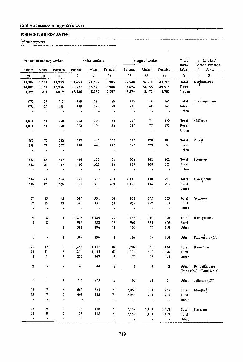
~B • PRIMARY CEl<lSUSABS'tAACT
FORSCHEDULEDCASTES
of main workers
Household Industry workers Other workers
Persons Males Females Persons Males Females
29
15,389
14,096 1,293
970 970
1,011
1,011
799
799
512
512
614 614
57 57
9
8
20 16 4
2
2
13 13
18
18
30
1,634
1,360 274
27
27
51 51
77 77
55 55
64 64
15 15
8
8
12
11
1
7
7
9
9
31
13,755
12,736 1,019
943 943
960 960
722
722
457 457
550 550
42 42
8 5
3
2
6 6
9
9
32
51,653 33,517 18,136
419
419
362 362
718 718
416 416
721
721
385 385
1,213
906 307
307
1,496 1,214
282
47
235
603 603
138 138
33
41,868
26,529 15,339
330 330
304 304
441 441
323 323
517 517
331
331
1,084 788 296
296
1,412 1,145
267
44
223
533 533
118
118
34
9,785 6,988 2,797
89 89
58
58
277
277
93 93
204 204
54 54
129
118 11
II
84
69 15
3
12
70 70
20 20
Marginal workers
Persons
35
67,548
63,674 3,874
719
313 313
247
247
572
572
970 970
1,141 1,141
855 855
1,136 967 169
169
1,902 1,730
172
7
165
2,058
2,058
2,559
2,559
Males
36
26,330 24,158 2,172
148 148
77 77
279 279
368 368
438 438
352 352
410 341
69
69
758 660
98
4
94
791 791
1,151
1,151
Females
37
41,218
39,516 1,702
165 165
170 170
293 293
602 602
703 703
503 503
726
626 100
100
1,144 1,070
74
3
71
1,267
1,267
1,408
1,408
Total! RuraIJ Urban
3
Total Rural Urban
Total
Rural Urban
Total
Rural
Urban
I District I MandalParishadl
Town
2
Ka~imnagar
I Ibra?impatnam
Mallapur I
Total Raik~1 Rural
Urban
Total Saran~apur Rural
Urban
Total
Rural
Urban
Dhar~apuri
Total Velgatror
Rural Urban
Total Ramagpndam
Rural
Urban
Urban Palakuhhy (CT) I
Total Kamanbur I
Rural
Urban
Urban PenchiMalpeta (Part) (OG) - W~~d No.23
Urban Jallaram\ (CT)
Total
Rural
Urban
Total Katarami I
Rural
Urban
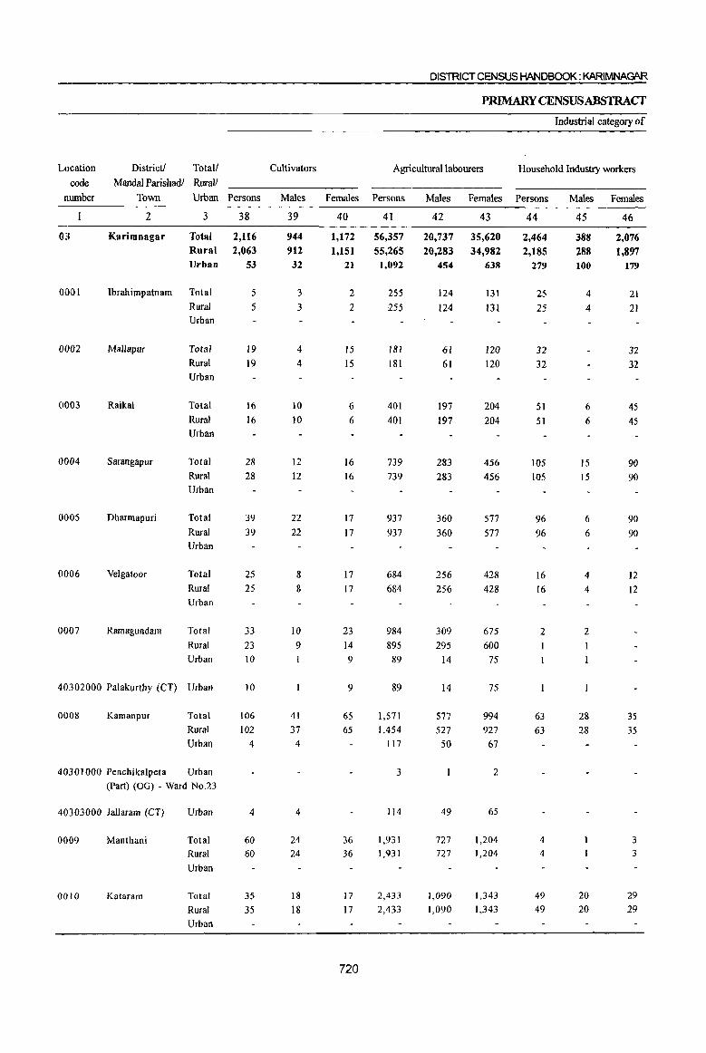
DISTRICT CENSUS HANDBOOK: KARIMNAGAR
PRIMARY CENSUS ABSTRACT
Industrial category of
Location District! Total/ Cultivators Agricultural labourers Household Industry workers
code Mandai Parishadl Rural! number Town Urban Persons Males Females Persons Males Females Persons Males Females
2 3 38 39 40 41 42 43 44 45 46
03 Karimnagar Total 2,116 944 1,172 56,357 20,737 35,620 2,464 388 2,076 Rural 2,063 912 1,151 55,265 20,283 34,982 2,185 288 1,897 Urban 53 32 21 1,092 454 638 279 100 179
0001 Ibrahimpatnam Total 5 3 2 255 124 131 25 4 21 Rural 5 3 2 255 124 131 25 4 21 Urban
0002 Mallapur Total 19 4 15 181 61 120 32 32 Rural 19 4 15 181 61 120 32 32 Urban
(1003 Raikal Total 16 10 6 401 197 204 51 6 45 Rural 16 10 6 401 197 204 51 6 45 Urban
0004 Sarangapur Total 28 12 16 739 283 456 105 15 90 Rural 28 12 16 739 283 456 105 15 90 Urban
0005 Dharmapuri Total 39 22 17 937 360 577 96 6 90
Rural 39 22 17 937 360 577 96 6 90 Urban
0006 Velgatoor Total 25 8 17 684 256 428 16 4 12 Rural 25 8 17 684 256 428 [6 4 [2
Urban
0007 Ramagundam Total 33 10 23 984 309 675 2 2
Rural 23 9 14 895 295 600
Urban 10 9 89 14 75
40302000 Palakurthy (CT) Urban 10 9 89 14 75
0008 Kamanpur Total 106 41 65 1,571 577 994 63 28 35
Rural 102 37 65 1,454 527 927 63 28 35
Urban 4 4 117 50 67
40301000 Penchikalpeta Urban 3 2
(Part) (OG) - Ward No.23
40303000 lallaram (CT) Urban 4 4 114 49 65
0009 Manthani Total 60 24 36 1,931 727 1,204 4 3
Rural 60 24 36 1,931 727 1,204 4 3
Urban
0010 Kataram Total 35 18 17 2,433 1,090 1,343 49 20 29
Rural 35 18 17 2,433 1,090 1,343 49 20 29 Urban
720
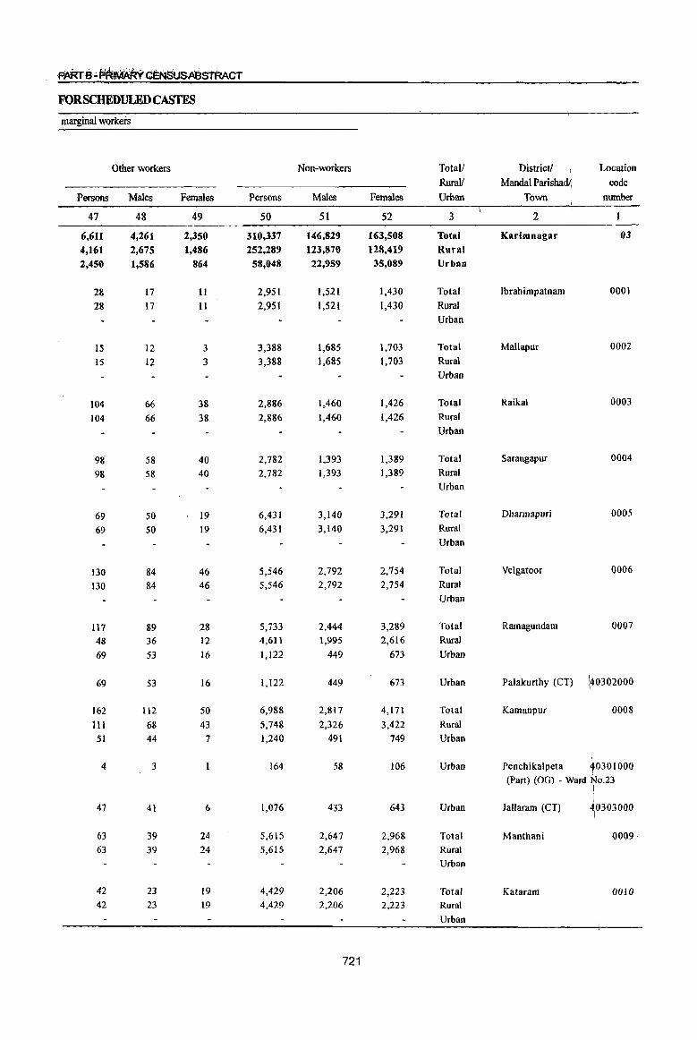
FORSCHEDULEDCASTES
marginal workers
Other workers Non-workers TotalJ District! J Location
Rural! MandaI Parisha I code
Persons Males Females Persons Males Females Urban Town number
47 48 49 50 51 52 3 2
6,611 4,261 2,356 316,337 146,829 163,508 Total Karimnagar 03
4,161 2,675 1,486 252,289 123,876 128,419 Rural
2,450 1,586 864 58,048 22,959 35,089 Urban
28 17 11 2,951 1,521 1,430 Total Ibrahimpatnam 0001
28 17 II 2,951 1,521 1,430 Rural
Urban
15 12 3 3,388 1,685 1,703 Total Mallapur 0002
15 12 3 3,388 1,685 1,703 Rural
Urban
104 66 38 2,886 1,460 1,426 Total Raikal 0003
104 66 38 2,886 1,460 1,426 Rural
Urban
98 58 40 2,782 1,393 1,389 Total Sarangapur 0004
98 58 40 2,782 1,393 1,389 Rural
Urban
69 50 19 6,431 3,140 ~,291 Total Dbarmapuri 0005
69 50 19 6,431 3,140 3,291 Rural
Urban
130 84 46 5,546 2,792 2,754 Total Velgatoor 0006
130 84 46 5,546 2,792 2,754 Rural
Urban
117 89 28 5,733 2,444 3,289 Total Ramagundam 0007
48 36 12 4,611 1,995 2,616 Rural
69 53 16 1,122 449 673 Urban
69 53 16 1,122 449 673 Urban Palakurthy (CT) \40302000
162 112 50 6,988 2,817 4,171 Total Kamanpur 0008
III 68 43 5,748 2,326 3,422 Rural
51 44 7 1,240 491 749 Urban
4 3 164 58 106 Urban Penchikalpeta 40301000 I
(Part) (OG) - Ward No.23
47 1,076
. I 41 6 433 643 Urban lallaram (CT) ~0303000
63 39 24 5,615 2,647 2,968 Total Manthani 0009·
63 39 24 5,615 2,647 2,968 Rural
Urban
42 23 19 4,429 2,206 2,223 Total Kataram 0010 42 23 19 4,429 2,206 2,223 Rural
Urban
721

DISTRICT CENSUS HANDBOOK: KARIMNAGAR
PRIMARY CENSUSABSTRACf
Number of households
with at least Total Population Qne (including institutional and Population in the
Location District! Total! Scheduled houseless population) age group 0-6 rode Mandai Parishadl Rural! Caste
number Town Urban member Persons Males Females Persons Males Females
2 3 4 5 6 7 8 9 10
0011 Mahadevpur Total 2,016 8,193 4,179 4,014 1,315 654 661 Rural 2,016 8,193 4,179 4,014 1,315 654 661 Urban
0012 Mutharam Total 1,643 6,606 3,294 3,312 1,172 553 619 (Mahadevpur) Rural 1,643 6,606 3,294 3,312 1,172 553 619
Urban
0013 Malharrao Total 1,304 5,039 2,544 2,495 830 435 395 Rural 1,304 5,039 2,544 2,495 830 435 395 Urban
0014 Mutharam Total 1,030 3,912 1,947 1,965 549 259 290 (Manthani) Rural 1,030 3,912 1,947 1,965 549 259 290
Urban
0015 Srirampur Total 1,704 6,350 3,267 3,083 914 492 422 Rural 1,704 6,350 3,267 3,083 914 492 422 Urban
0016 Peddapalle Total 3,431 13,973 6,887 7,086 ),966 998 968 Rural 3,431 13,973 6,887 7,086 1,966 998 968 Urban
0017 lulapalle Total 2,664 10,446 5,267 5,179 1,531 775 756 Rural 2,664 10,446 5,267 5,179 1,531 775 756 Urban
0018 Dharmaram Total 2,657 10,432 5,050 5,382 1,449 753 696 Rural 2,657 10,432 5,050 5,382 -1,449 753 696 Urban
0019 Gollapalle Total 2,222 8,738 4,308 4,430 1,393 686 707 Rural 2,222 8,738 4,308 4,430 1,393 686 707 Urban
0020 Mallial Total 2,221 9,050 4,456 4,594 1,225 636 589 Rural 2,221 9,050 4,456 4,594 1,225 636 589 Urban
0021 Jagtial Total 2,885 11,821 5,824 5,997 1,631 849 782 Rural 2,885 11,821 5,824 5,997 1,631 849 782 Urban
0022 Medipalle Total 2,226 9,028 4,507 4,521 1,237 620 617 Rural 2,226 9,028 4,507 4,521 1,237 620 617 Urban
0023 Koratla Total 1,689 7,283 3,579 3,704 946 442 504
Rural 1,689 7,283 3,579 3,704 946 442 5{)4 Urban
722
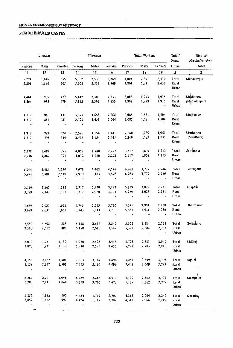
~B-PRIMARYCENSUSABsTRACT
FPRSCIIEDULEDCASfES
Literates Illiterates Total Workers Total! District!
RuraI/ \Mandal Parishadl
Persons Males Females Persons Males Females Persons Males Females Urban To'Ml
II 12 13 14 15 16 17 18 19 3 2
2,291 1,646 645 5,902 2,533 3,369 4,801 2,371 2,430 Total Mlhadevpur I
2,291 1,646 645 5,902 2,533 3,369 4,801 2,371 2,430 Rural Urban
1,464 985 479 5,142 2,309 2,833 3,888 1,973 1,915 Total ~;~;~:~pur) 1,464 985 479 5,142 2,309 2,833 3,888 1,973 1,915 Rural Urban
1,317 886 431 3,722 1,658 2,064 3,085 1,581 1,504 Total Ma\harrao
1,317 886 431 3,722 1,658 2,064 3,085 1,581 1,504 Rural Urban
1,317 793 524 2,595 1,154 1,441, 2,240 1,189 1,051 Total Mu~haram 1,317 793 524 2,595 1,154 1,441 2,240 1,189 1,051 Rural (Mpnthani)
Urban
I
2,278 1,487 791 4,072 1,780 2,292 3,517 1,804 1,713 Total Srir4mpur
2,278 1,487 791 4,072 1,780 2,292 3,517 1,804 1,713 Rural Urban
5,994 3,484 2,510 7,979 3,403 4,576 6,763 3,777 2,986 Total Pedd~palle
5,994 3,484 \2,510 7,979 3,403 4,576 6,763 3,777 2,986 Rural Urban
3,729 2,347 i,382 6,717 2,920 3,797 5,759 3,028 2,731 Total Julap~lIe 3,729 2,347 1,382 6,717 2,920 3,797 5,759 3,028 2,731 Rural
Urban
3,689 2,037 1,652 6,743 3,013 3,730 5,681 2,931 2,750 Total Dhanraram
3,689 2,037 1,652 6,743 3,013 3,730 5,681 2,931 2,750 Rural Urban
2,580 1,692 888 6,158 2,616 3,542 5,322 2,584 2,738 Total GollaJalle I
2,580 1,692 888 6,158 2,616 3,542 5,322 2,584 2,738 Rural Urban
3,070 1,931 1,139 5,980 2,525 3,455 5,723 2,783 2,940 Total Mallial I
3,070 1,931 1,139 5,980 2,525 3,455 5,723 2,783 2,940 Rural Urban
I
4,158 2,657 1,501 7,663 3,167 4,496 7,442 3,649 3,793 Total Jagtial 4,158 2,657 1,501 7,663 3,167 4,496 7,442 3,649 3,793 Rural
Urban
3,289 2,241 1,048 5,739 2,266 3,473 5,139 2,362 2,777 Total Medipalle 3,289 2,241 1,048 5,739 2,266 3,473 5,139 2,362 2,777 Rural
I
Urban
2,859 1,862 997 4,424 1,717 2,707 4,313 2,064 2,249 Total Koratla\ 2,859 1,862 997 4,424 1,717 2,707 4,313 2,()64 2,249 Rural
Urban
723
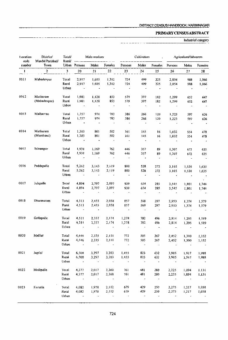
DISTRICT CENSUS HANDBOOK: KARIMNAGAR
PRIMARYCENSUSABSTRAC'f
Industrial category
Location District! Total! Main workers Cultivators Agriculturallaoourers code Mandai Parishadl RuraJ/
number Town Urban Persons Males Females Persons Males Females Persons Males Females
2 3 20 21 22 23 24 25 26 27 28
0011 Mahadevpur Total 2,917 1,605 1,312 724 499 225 2,054 988 1,066 Rural 2,917 1,605 1,312 724 499 225 2,054 988 1,066 Urban
0012 Mutharam Total 1,981 1,128 853 579 397 182 1,299 652 647 (Mahadevpur) Rural 1,981 1,128 853 579 397 182 1,299 652 647
Urban
0013 Malharrao Total 1,757 974 783 386 266 120 1,223 597 626 Rural 1,757 974 783 386 266 120 1,223 597 626 Urban
0014 Mutharam Total 1,303 801 502 161 145 16 1,032 554 478 (Manthani) Rural 1,303 801 502 161 145 16 1,032 554 478
Urban
0015 Srirampur Total 1,931 1,169 762 446 357 89 1,307 672 635 Rural 1,931 1,169 762 446 357 89 1,307 672 635 Urban
0016 Peddapalle Total 5,262 3,143 2,119 800 528 272 3,165 1,530 1,635 Rural 5,262 3,143 2,119 800 528 272 3,165 1,530 1,635 Urban
0017 Julapalle Total 4,894 2,797 2,097 939 654 285 3,545 1,801 1,744 Rural 4,894 2,797 2,097 939 654 285 3,545 1,801 1,744 Urban
0018 Dharmaram Total 4,513 2,455 2,058 857 560 297 2,953 1,374 1,579 Rural 4,513 2,455 2,058 857 560 297 2,953 1,374 1,579 Urban
0019 Gollapalle Total 4,511 2,337 2,174 1,278 782 496 2,814 1,295 1,519 Rural 4,511 2,337 2,174 1,278 782 496 2,814 1,295 1,519 Urban
0020 Mallial Total 4,446 2,335 2,111 772 505 267 2,452 1,300 1,152 Rural 4,446 2,335 2,111 772 505 267 2,452 1,300 1,152 Urban
0021 Jagtial Total 6,500 3,297 3,203 1,455 823 632 3,905 1,917 1,988 Rural 6,500 3,297 3,203 1,455 823 632 3,905 1,9] 7 1,988 Urban
0022 Medipalle Total 4,377 2,017 2,360 761 481 280 2,225 1,094 1,131 Rural 4,377 2,017 2,360 761 481 280 2,225 1,094 1,131 Urban
0023 Koratla Total 4,082 1,970 2,112 679 429 250 2,275 1,217 1,058 Rural 4,082 1,970 2,112 679 429 250 2,275 1,217 1,058 Urban
724

FORSCHEDULEDCASTEs
· of main workers
Household Industry workel1l Other workel1l
Persons Males Females Persons Males Females
29
8 8
38 38
26 26
10 10
77 77
20 20
46 46
149 149
626
626
499 499
719 719
812 812
30
4
4
23
23
13 13
6 6
59 59
10 10
24 24
26 26
23
23
36 36
33
33
37 37
31
4
4
15 15
13 13
4 4
18 18
10 10
22 22
123 123
603 603
463 463
686 686
775
775
32
131
131
65
65
122
122
109
109
168 168
1,220 1,220
390 390
657 657
270 270
596 596
641 641
672 672
316
316
33
114 114
56 56
98 98
IO! 101
134 134
1,026 1,026
332 332
497 497
234 234
507 507
521 521
409 409
287 287
34
17
17
9 9
24 24
8 8
34 34
194 194
58 58
160 160
36 36
89 89
120 120
263
263
29 29
Marginal workel1l
Persons
3S
1,884 1,884
1,907 1,907
1,328 1,328
937
937
1,586 1,586
1,501 1,501
725
865 865
1,168 1,168
811 811
1,277 1,277
942 942
762 762
231 231
Males
36
766 766
845 845
607 607
388 388
635
635
634 634
231 231
476 476
247 247
448 448
352 352
345 345
94 94
Females
37
1,118 1,118
1,062 1,062
721 721
549 549
951 951
867 867
634 634
692 692
564 564
829 829
590 590
417 417
137 137
Totall RuralJ Urban
3
Total
Rural Urban
Total Rural Urban
Total Rural Urban
Total Rural Urban
Total Rural Urban
Total Rural Urban
Total Rural Urban
Total Rural Urban
Total Rural Urban
Total Rural Urban
Total RUral Urban
Total
Rural Urban
District / Ntandal Parishad /
\ Town
2
Mutharam (MbhadevpuT)
I
I Malharrao
I
Muiharam \ h . (Mant ant) \
Srirfmpur
Peddapalle I
JulaJalle I
Dhartnaram i
Golla~alle I
MalliJI I
Jagtial\
Medipdlle I
Total KoratlJ Rural Urban
I
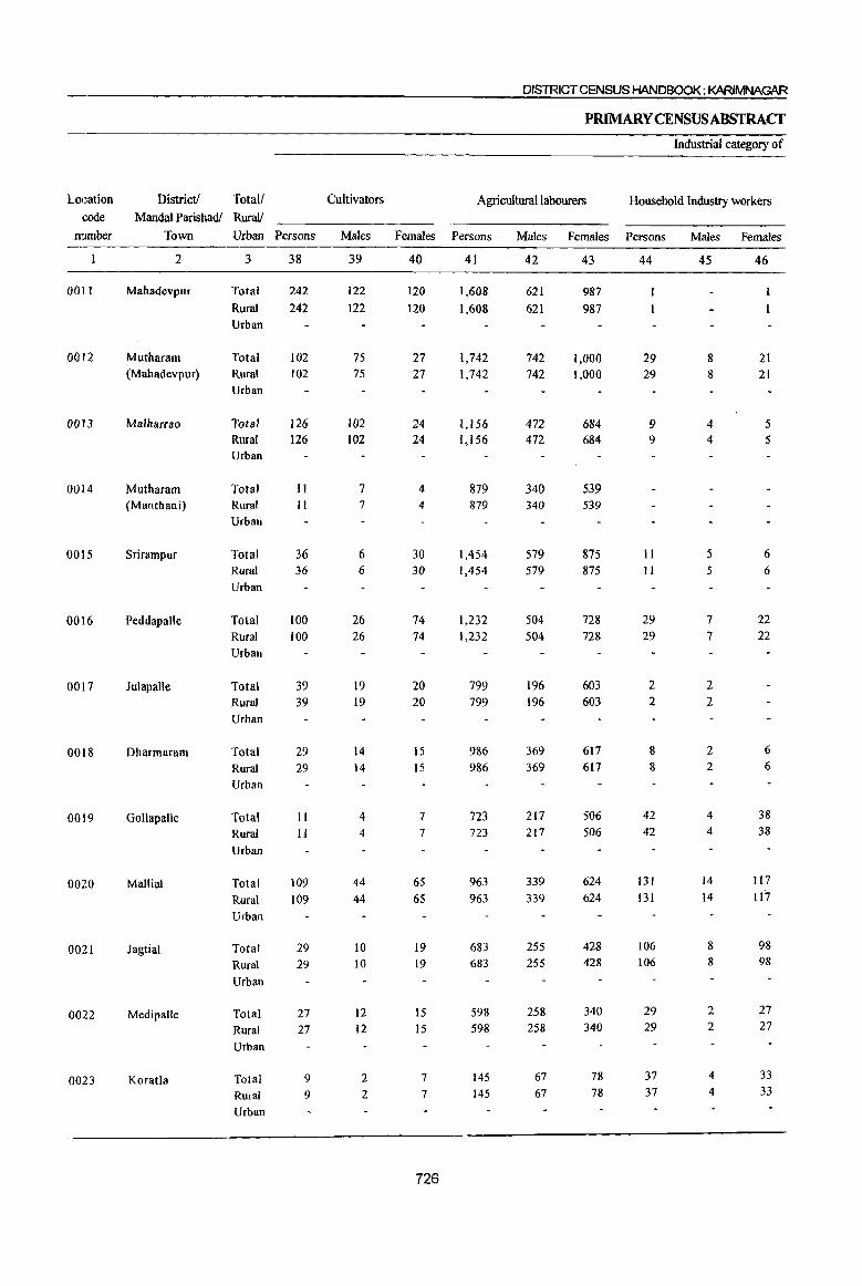
LOI~ation
code
nwnber
001l
0012
0013
0014
0015
0016
0017
0018
0019
0020
0021
0022
0023
District! Total! ~andalParishadf ~alf
Town Urban Persons
2
Mahadevpur
Mutharam (Mahadevpur)
Malharrao
Mutharam (Manthani)
Srirampur
Peddapalle
Juiapalle
Dharmaram
Gollapalle
Mallial
Jagtial
Medipalle
Koratla
3
Total
Rural Urban
Total Rural Urban
Total Rural Urban
Total Rural Urban
Total Rural Urban
Total Rural Urban
Total Rural Urban
Total Rural Urban
Total Rural Urban
Total Rural Urban
Total Rural Urban
Total Rural Urban
Total Rural Urban
38
242 242
102 102
126 126
11 II
36 36
100 100
39 39
29 29
11 II
109 109
29 29
27 27
9 9
Cultivators
~a1es
39
122 122
75 75
102 102
7 7
6 6
26 26
19 19
14 14
4 4
44 44
10 10
12 12
2 2
DISTRICT CENSUS HANDBOOK: KARIMNAGAR
PRIMARYCENSUSABSTRACf
Industrial category of
Agricultural labourers Household Industry workers
Females Persons
40
120 120
27 27
24 24
4 4
30 30
74 74
20 20
15
IS
7 7
65
65
19 19
IS
15
7 7
726
41
1,608 1,608
1,742 1,742
1,156 1,156
879 879
1,454 1,454
1,232 1,232
799 799
986 986
723 723
963
963
683 683
598 598
145
145
Males Females Persons
42
621 621
742 742
472 472
340 340
579 579
504 504
196 196
369 369
217 217
339
339
255 255
258 258
67 67
43
987 987
1,000 1,000
684 684
539 539
875 875
728 728
603 603
617 617
506 506
624 624
428 428
340 340
78 78
44
29 29
9 9
II II
29 29
2 2
8 8
42 42
131 131
106 106
29 29
37 37
Males Females
45
8 8
4 4
5 5
7 7
2 2
2 2
4 4
14
14
8 8
2 2
4
4
46
21 21
5 5
6 6
22 22
6 6
38 38
117
117
98 98
27 27
33
33

PARTB ~ PRlMAR'f Cr=NSusAB$TRACT
FORSCHEDULEDCASTES
marginal workers
Other workers Non-workers Total! District! Location
RuraV Mandai ParishatV code
Persons Males Females Persons Males Females Urban Town number
47 48 49 50 51 52 3 2
33 23 10 3,392 1,808 1,584 Total Mahadevpur 001l
33 23 10 3,392 1,808 1,584 Rural Urban
34 20 14 2,718 1,321 1,397 Total Mutharam (Mah~devpur) 0012
34 20 14 2,718 1,321 1,397 Rural Urban
37 29 8 1,954 963 991 Total Malharrao 0013 37 29 g 1,954 963 991 Rural
Urban
47 41 6 1,672 758 914 Total Mutharam (Manlhani) 0014 47 41 6 1,672 7511 914 Rural
Urban
85 45 40 2,833 1,463 [,370 Total Srirampur 0015 85 45 40 2,833 1,463 1,370 Rural
Urban
140 97 43 7,210 3,110 4,100 Total Peddapalle 0016 140 97 43 7,210 3,llO 4,100 Rural
Urban
25 14 II 4,687 2,239 2,448 Total Julapalle 0017 25 14 II 4,687 2,239 2,448 Rural
Urban
145 91 54 4,751 2,119 2,632 Total Dharmaram 0018 145 91 54 4,751 2,119 2,632 Rural
Urban
! 35 22 13 3,416 1,724 1,692 Total GoJlapalle 0019 35 22 13 3,416 1,724 1,692 Rural
Urban
74 51 23 3,327 1,673 1,654 Total Mallial 0020 74 51 23 3,327 1,673 1,654 Rural
Urban
124 79 45 4,379 2,175 2,204 Total Jagtial 002l 124 79 45 4,379 2,175 2,204 Rural
Urban
108 73 35 3,889 2,145 1,744 Total Medipalle 0022 108 73 35 3,889 2,145 1,744 Rural
Urban
40 21 19 2,97Q 1,515 1,455 Total Koratla 0023 40 21 19 2,970 1,515 1,455 Rural
Urban
727
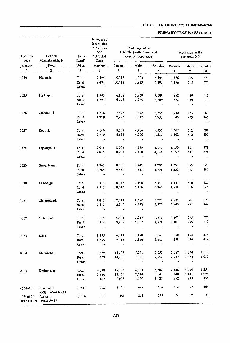
DISTRICT CENSUS HANDBOOK: KARIMNAGAR
PRIMARY CENSUS ABSTRACf
Number of households
with at least Total Population one (including institutional and Population in the
Location District/ Total/ Scheduled houseless population) age group 0-6 eode MandaI Parishadl Rural! Caste
munber Town Urban member Persons Males Females Persons Males Females
2 3 4 5 6 7 8 9 10
0024 Metpalle Total 2,494 10,718 5,223 5,495 1,386 715 671
Rural 2,494 10,718 5,223 5,495 1.386 715 671 Urban
0025 Kathlapur Total 1,705 6,878 3,269 3,609 882 469 413 Rural 1,705 6,878 3,269 3,609 882 469 413 Urban
0026 Chandurthi Total 1,728 7,427 3,672 3,755 940 473 467 Rural 1,728 7,427 3,672 3,755 940 473 467 Urban
0027 Kodimial Total 2,140 8,538 4,206 4,332 1,202 612 590
Rural 2,140 8,538 4,206 4,332 1,202 612 590 Urban
0028 Pegadapalle Total 2,015 8,290 4,150 4,140 1,159 581 578
Rural 2,015 8,290 4,150 4,140 1,159 581 578
Urban
0029 Gangadhara Total 2,265 9,551 4,845 4,706 1,252 655 597
Rural 2,265 9,551 4,845 4,706 1,252 655 597
Urban
0030 Ramadugu Total 2,553 10,747 5,406 5,341 1,541 816 725
Rural 2,553 10,747 5,406 5,341 1,541 816 725
Urban
0031 Choppadandi Total 2,813 12,049 6,272 5,777 1,640 841 799
Rural 2,813 12,049 6,272 5,777 1,640 841 799
Urban
0032 Sultanabad Total 2,514 9,935 5,057 4,878 1,407 735 672
Rural 2,514 9,935 5,057 4,878 1,407 735 672
Urban
0033 Odela Total 1,555 6,313 3,170 3,143 878 454 424
Rural 1,555 6,313 3,170 3,143 878 454 424
Urban
0034 Manakondur Total 3,329 14,293 7,241 7,052 2,087 1,074 1,013
Rural 3,329 14,293 7,241 7,052 2,087 1,074 1,013
Urban
0035 Karimnagar Total 4,038 17,232 8,664 8,568 2,538 1,284 1,254
Rural 3,556 15,159 7,614 7,545 2,240 1,141 1,099
Urban 482 2,073 1,050 1,023 298 143 155
40306000 Bommakal Urban 302 1,324 668 656 196 92 104
(OG) - Ward No, II 40306000 Arepalle Urban 120 501 252 249 66 32 34
(Part) (OG) - Ward No.12
728

, FORSCHEDULEDCASTES
Literates Illiterates Total Workers Total! District!
Rural! MandaI Parishadl I
Persons Males Females Persons Males Females Persons Males Females Urban I
Town
11 12 13 14 15 16 17 18 19 3 I 2
4,829 2,958 1,871 5,889 2,265 3,624 6,261 2,988 3,273 Total Met~alle 4,829 2,958 1,871 5,889 2,265 3,624 6,261 2,988 3,273 Rural
Urban
2,47) 1,560 911 4,407 1,709 2,698 4,136 1,883 2,253 Total KatHlapur I
2,471 1,560 9Il 4,407 1,709 2,698 4,136 1,883 2,253 Rural
Urban
2,848 1,805 1,043 4,579 1,867 2,712 4,377 2,126 2,251 Total ChaJ1durthi 2,848 1,805 1,043 4,579 1,867 2,712 4,377 2,126 2,251 Rural
Urban
3,167 1,952 1,215 5,371 2,254 3,117 4,840 2,401 2,439 Total Kodj~ial 3,167 1,952 1,215 5,371 2,254 3,117 4,840 2,401 2,439 Rural
Urban
2,711 1,733 978 5,579 2,417 3,162 4,895 2,452 2,443 Total I
Pcgad~palle
2,711 1,733 978 5,579 2,417 3,162 4,895 2,452 2,443 Rural Urban
3,816 2,402 1,414 5,735 2,443 3,292 5,477 2,743 2,734 Total Gangatlhara
3,816 2,402 1,414 5,735 2,443 3,292 5,477 2,743 2,734 Rural Urban
4,666 2,828 1,838 6,081 2,578 3,503 5,666 2,872 2,794 Total Ramadhgu
4,666 2,828 1,838 6,081 2,578 3,503 5,666 2,872 2,794 Rural I
Urban
4,945 3,233 1,712 7,104 3,039 4,065 6,464 3,238 3,226 Total Chopp~dandi 4,945 3,233 1,712 7,104 3,039 4,065 6,464 3,238 3,226 Rural
Urban
4,140 2,584 1,556 5,795 2,473 3,322 4,971 2,716 2,255 Total SUltana~ad 4,140 2,584 1,556 5,795 2,473 3,322 4,97] 2,716 2,255 Rural
Urban
2,305 1,452 853 4,008 1,718 2,290 3,424 1,761 1,663 Total Odela 2,305 1,452 853 4,008 1,718 2,290 3,424 1,761 1,663 Rural
Urban
5,771 3,616 2,155 8,522 3,625 4,897 7,480 3,967 3,513 Total Manako1dur 5,771 3,616 2,155 8,522 3,625 4,897 7,480 3,967 3,513 Rural
Urban
7,754 4,789 2,965 9,478 3,875 5,603 8,910 4,807 4,103 Total Karimnatar 6,836 4,240 2,596 8,323 3,374 4,949 7,965 4,233 3,732
I
Rural 918 549 369 1,155 501 654 945 574 371 Urban
514 310 204 810 358 452 610 371 239 Urban Bommak I (OG) -W d No.ll
255 149 106 246 103 143 243 137 106 Urban ArepalJe (Part) (OG) - Ward No. 12
729

DISTRICT CENSUS HANDBOOK: KARIMNAGAR
P~YCENSUSABSTRACT
IndusUial category
Location DisUictl Total! Main workers Cultivators Agricultural labourers code Manda! Parishadl Rural!
nwnber Town Urban Persons Males Females Persons Males Females Persons Males Females
2 3 20 21 22 23 24 25 26 27 28
00.24 Metpalle Total 5,477 2,696 2,781 736 438 298 2,237 1,204 1,033 Rural 5,477 2,696 2,781 736 438 298 2,237 1,204 1,033 Urban
0025 Kathlapur Total 3,641 1,688 1,953 563 353 210 1,984 1,048 936 Rural 3,641 1,688 1,953 563 353 210 1,984 1,048 936 Urban
0026 Chandurthi Total 4,014 1,983 2,031 934 555 379 2,362 1,214 1,148 Rural 4,014 1,983 2,031 934 555 379 2,362 1,214 1,148 Urban
0027 Kodimial Total 3,858 2,084 1,774 788 527 261 2,217 1,136 1,081 Rural 3,858 2,084 1,774 788 527 261 2,217 1,136 1,081 Urban
0028 PegadapalJe Total 4,281 2,239 2,042 828 507 321 2,834 1,394 1,440 Rural 4,281 2,239 2,042 828 507 321 2,834 1,394 1,440 Urban
0029 Gangadhara Total 4,425 2,329 2,096 805 516 289 2,936 1,468 1,468 Rural 4,425 2,329 2,096 805 516 289 2,936 1,468 1,468 Urban
0030 Ramadugu Total 4,102 2,394 1,708 758 547 211 2,562 1,254 1,308 Rural 4,102 2,394 1,708 758 547 211 2,562 1,254 1,308 Urban
0031 Choppadandi Total 4,901 2,680 2,221 884 585 299 3,527 1,681 1,846 Rural 4,901 2,680 2,221 884 585 299 3,527 1,681 1,846 Urban
0032 Sultanabad Total 3,461 2,212 1,249 694 543 151 1,992 1,008 984 Rural 3,461 2,212 1,249 694 543 151 1,992 1,008 984 Urban
0033 Odela Total 2,757 1,495 1,262 500 301 199 2,034 1,015 1,019 Rural 2,757 1,495 1,262 500 301 199 2,034 1,015 1,019 Urban
0034 Manakondur Total 6,992 3,771 3,221 1,140 789 351 4,829 2,111 2,718 Rural 6,992 3,771 3,221 1,140 789 351 4,829 2,111 2,718
Urban
0035 Karimnagar Total 7,571 4,243 3,328 849 539 310 4,494 1,908 2,586 Rural 6,641 3,673 2,968 833 528 305 3,932 1,632 2,300
Urban 930 570 360 16 II 5 562 276 286
40306000 Bommakal Urban 602 370 232 9 6 3 393 206 187
(OG) - Ward No.ll 40306000 Arepalle (Part) Urban 243 137 106 3 2 165 69 96
(OG) - Ward No,12
730
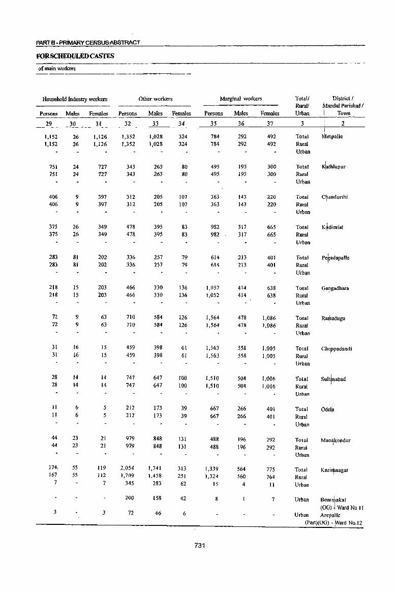
PAR'rS-PRiMARY CENSUSAB$TAACT
FOR~ULEDC~
of main workers
Household Industry workers Qther workers Marginal workers TotaJl District / Rural! anOOI Parishad I
Persons Males F~males Persons Males Females Persons Males Females Urban Town
29 30 31 32 33 34 35 36 37 3 2
1,152 26 1,126 1,352 1,028 324 784 292 492 Total +etpalJe 1,152 26 1,126 1,352 1,028 324 784 292 492 Rural
Urban
751 24 727 343 263 80 495 195 300 Total ~athlapur 751 24 727 343 263 80 495 195 300 Rural
Urban
406 9 397 312 205 107 363 143 220 Total Chandurthi I
406 9 397 312 205 107 363 143 220 Rural Urban
375 26 349 478 395 83 982 317 665 Total K~dimial 375 26 349 478 395 83 982 317 665 Rural
Urban
28.3 81 202 3.36 257 79 614 213 401 Total Pe~adapalle 283 81 202 336 257 79 614 213 401 Rural
I
Urban
218 15 203 466 330 136 1,052 414 638 Total Gahgadhara 218 203
I 15 466 330 136 1,052 414 638 Rural
Urban
72 9 63 710 584 126 1,564 478 1,086 Total Ra~adugu 72 9 63 710 584 126 1,564 478 1,086 RUral
Urban
31 16 15 459 398 61 1,563 558 1,005 Total Ch9Ppadandi 31 16 15 459 398 61 1,563 558 1,005 Rural
Urban
28 14 14 747 647 100 1,510 504 1,006 Total SUltrabad 28 14 14 747 647 100 1,510 504 1,006 Rural
Urban
II 6 5 212 173 39 667 266 401 Total Odel~ 11 6 5 212 173 39 667 266 401 Rural
Urban
44 23 21 979 848 131 488 196 292 Total Man~kondur 44 23 21 979 848 131 488 196 292 Rural
Urban
174. 55 119 2,054 1,741 313 1,339 564 775 Total Karj~nagar 167 55 112 1,709 1,458 251 1,324 560 764 Rural
7 7 345 283 62 IS 4 II Urban
200 158 42 8 7 Urban Bom1akal
3 3 72 66 6 (00) ! Ward No.l1
Urban Arepalle (Part)(OG) - Ward No.12
731

Location District! Total! code MandaI Parishadl Rural!
number Town Urban Persons
2
0024 Metpalle
0025 Kathlapur
0026 Chandurthi
0027 Kodimial
0028 Pegadapalle
0029 Gangadhara
0030 Ramadugu
0031 Choppadandi
0032 Sultanabad
0033 Odela
0034 Manakondur
0035 Karimnagar
3
Total Rural
Urban
Total Rural
Urban
Total Rural
Urban
Total Rural Urban
Total Rural Urban
Total Rural Urban
Total
Rural Urban
Total
Rural Urban
Total Rural Urban
Total
Rural Urban
Total
Rural
Urban
Total Rural Urban
40306000 Bommakal Urban (OG) - Ward No.l1
40306000 Arepalle Urban (Part) (00) - Ward No.12
38
16 16
12
12
II II
22 22
13 13
23 23
19 19
34 34
44 44
10 IO
18
18
II 11
Cultivators·
Males
39
14 14
3
3
5 5
9
9
7 7
14
14
5 5
18 18
18 18
3
3
9
9
6
6
DISTRICT CENSUS HANDBOOK : KARIMNAGAR
PRIMARY CEN8USABSTRACf
Industrial category of
Agricultural labourers Household Industry workers
Females Persons
40
2 2
9 9
6 6
13
13
6 6
9
9
14 14
16 16
26 26
7
7
9
9
5
5
732
41
449 449
370 370
237 237
789 789
512 S12
866 866
1,472
1,472
1,481
1,481
1,344
1,344
584 584
452 452
1,015
1,005 10
8
Males Females Persons
42
212 212
162 162
114 114
271 271
178 178
334
334
432 432
509 509
405 405
223 223
174 174
361 360
1
43
237 237
208 208
123 123
518 518
334
334
532 532
1,040
1,040
972
972
939 939
361
361
278 278
654 645
9
7
44
223 223
72 72
81 81
114 114
40
40
91 91
22
22
14 14
10
10
7
7
43 42
Males Females
45
5 5
2 2
4
4
4
4
9
9
2 2
4
4
3 3
23 23
46
218 218
70 70
81 81
110 1I0
36
36
82 82
20 20
10 10
7 7
6 6
20 19 1

FORSCHEDULEDCASfES
marginal workers
Other workers Non-workers Total! District! Location
Rural! Mandai Parisha«t code
Persons Males Females Persons Males Females Urban Town nmnber
47 48 49 50 51 52 3 2
96 61 35 4,457 2,235 2,222 Total Metpalle 0024 96 61 35 4,457 2,235 2,222 Rural
Urban
41 28 13 2,742 1,386 1,356 Total Kathlapur 0025
41 28 13 2,742 1,386 1,356 Rural
Urban
34 24 10 3,050 1,546 1,504 Total Chandurthi 0026
34 24 10 3,050 1,546 1,504 Rural Urban
57 33 24 3,698 1,805 1,893 Total Kodimial 0027
57 33 24 3,698 1,805 1,893 Rural
Urban
49 24 25 3,395 1,698 1,697 Total PegadapaUe 0028
49 24 25 3,395 1,698 1,697 Rural Urban
72 57 15 4,074 2,102 1,972 Total Gangadhara 0029
72 57 15 4,074 2,102 1,972 Rural Urban
51 39 12 5,081 2,534 2,547 Total Ramadugu 0030
51 39 12 5,081 2,534 2,547 Rural Urban
34 27 7 5,585 .3,034 2,551 Total Choppadandi 0031
34 27 7 5,585 3,034 2,551 Rural Urban
112 78 34 4,964 2,341 2,623 Total Sultanabad 0032
1I2 78 34 4,964 2,341 2,623 Rural Urban
66 39 27 2,889 1,409 1,480 Total Odela 0033
66 39 27 2,889 1,409 1,480 Rural Urban
18 13 5 6,813 3,274 3,539 Total Manakondur 0034
18 13 5 6,813 3,274 3,539 Rural Urban
270 174 96 8,322 3,857 4,465 Total Karimnagar 0035 266 171 95 7,194 3,381 3,813 Rural
4 3 1,128 476 652 Urban
714 297 417 Urban Bommakal 40306000 (OG) - Ward No.II
258 115 143 Urban Arepalle 40306000 (Part) (OG) - Ward No.l2
733
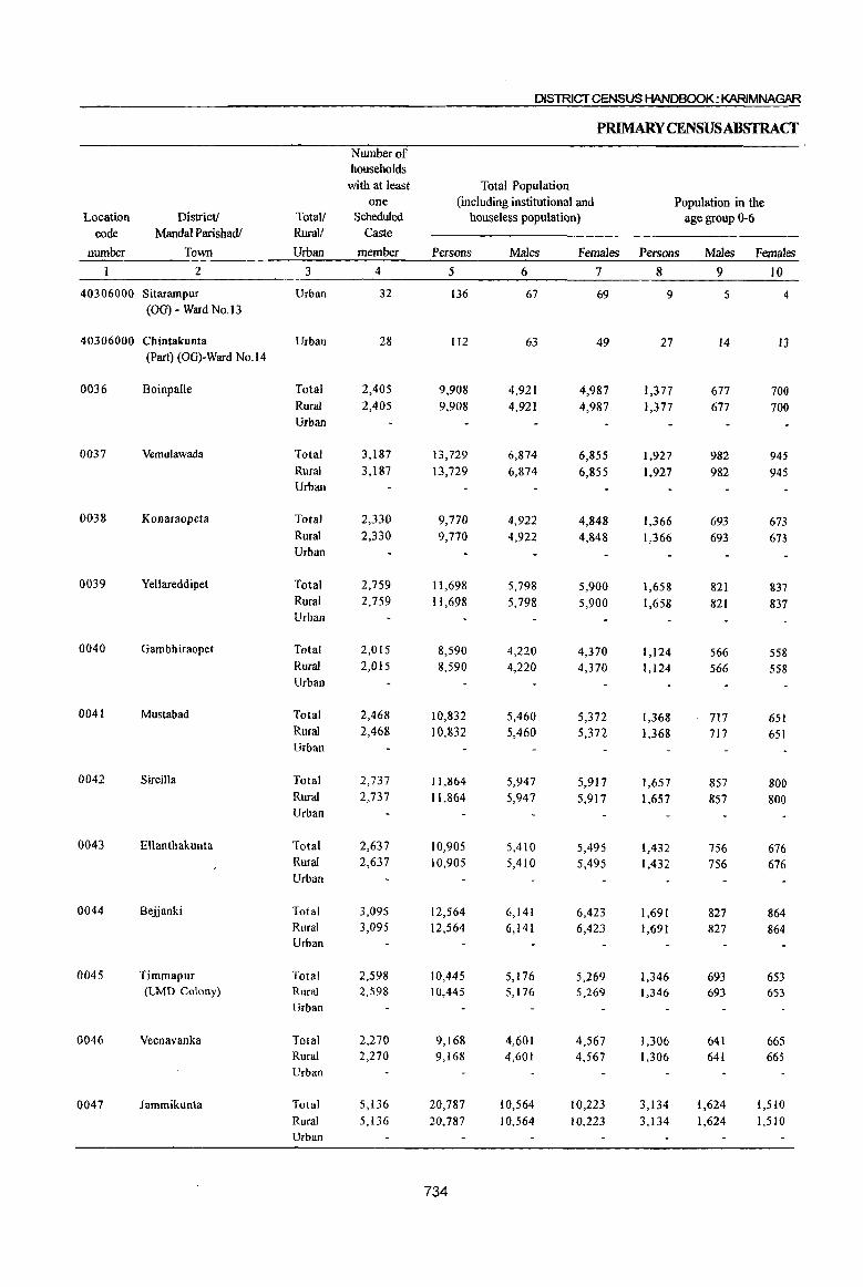
DISTRICT CENSUS HANDBOOK: KARlMNAGAR
PRlMARYCENSUSABSTRACf Number of households
with at least Total Population one (including institutional and Population in the
Location District! Total! Scheduled houseless populati()n) age group 0-6 code Mandai Parishadf Ruralf Caste
number Town Urban member Persons Males Females Persons Males Females
Z 3 4 5 6 7 8 9 10
40306000 Sitarampur Urban 32 136 67 69 9 5 4 (00) - Ward No.13
40306000 Chintakunta Urban 28 lIZ 63 49 27 14 13 (Part) (OG)-Ward No.14
0036 Boinpalle Total 2,405 9,908 4,921 4,987 1,377 677 700 Rural 2,405 9,908 4,921 4,987 1,377 677 700 Urban
0037 Vemulawada Total 3,187 13,729 6,874 6,855 1,927 982 945 Rural 3,187 13,729 6,874 6,855 1,927 982 945 Urban
0038 Konaraopeta Total 2,330 9,770 4,922 4,848 1,366 693 673 Rural 2,330 9,770 4,922 4,848 1,366 693 673 Urban
0039 Yellareddipet Total 2,759 11,698 5,798 5,900 1,658 821 837 Rural 2,759 11,698 5,798 5,900 1,658 821 837 Urban
0040 Gambhiraopet Total 2,015 8,590 4,220 4,370 1,124 566 558 Rural 2,015 8,590 4,220 4,370 1,124 566 558 Urban
0041 Mustabad Total 2,468 10,832 5,460 5,372 1,368 717 651 Rural 2,468 10,832 5,460 5,372 1,368 717 651 Urban
0042 Sircilla Total 2,737 11,864 5,947 5,917 1,657 857 800 Rural 2,737 11,864 5,947 5,917 1,657 857 800 Urban
0043 Ellanthakunta Total 2,637 10,905 5,410 5,495 1,432 756 676 Rural 2,637 10,905 5,410 5,495 1,432 756 676 Urban
0044 Bejjanki Total 3,095 12,564 6,141 6,423 1,691 827 864 Rural 3,095 12,564 6,141 6,423 1,691 827 864 Urban
0045 Timmapur Total 2,598 10,445 5,176 5,269 1,346 693 653 (LMD Colony) Rural 2,598 10,445 5,176 5,269 1,346 693 653
Urban
0046 Veenavanka Total 2,270 9,168 4,601 4,567 1,306 641 665 Rural 2,270 9,168 4,601 4,567 1,306 641 665 Urban
Q047 Jammikunta Total 5,136 20,787 10,564 10,223 3,134 1,624 1,510 Rural 5,136 20,787 10,564 10,223 3,134 1,624 1,510 Urban
734
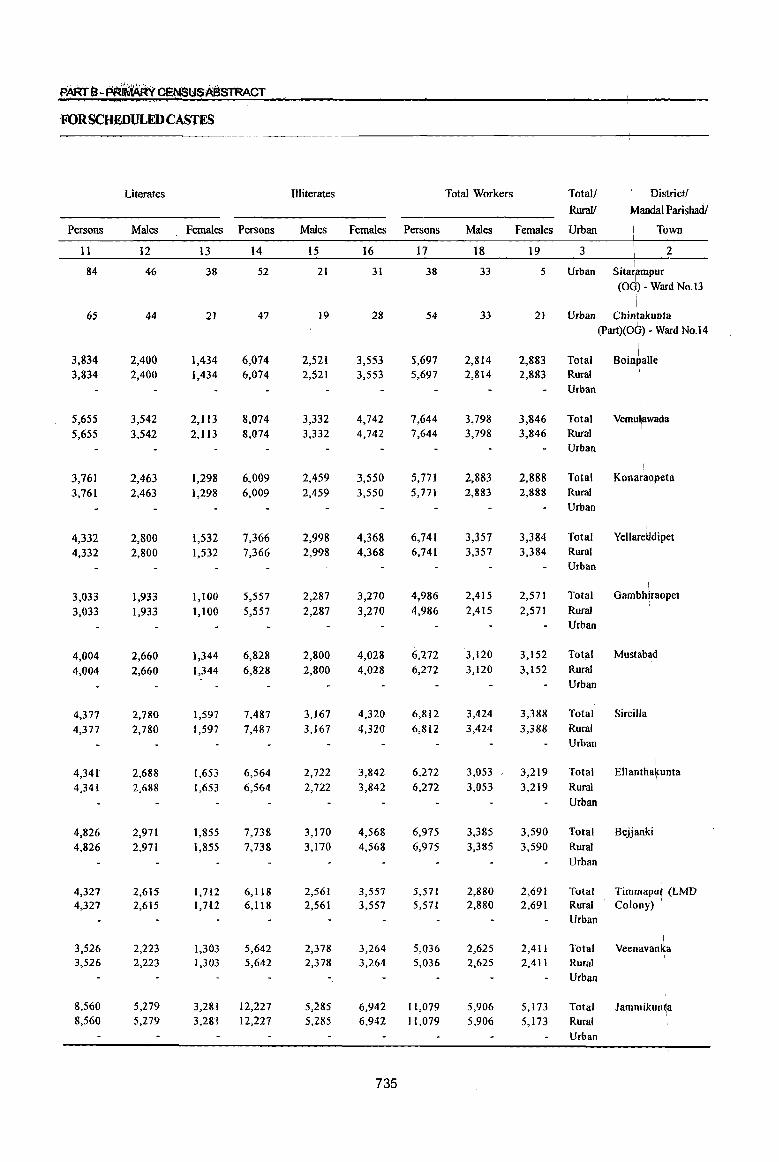
FORSCHEDULEDCASTES
Literates Illiterates Total Workers Totall .. District/
RuraY Landal Parishad/
Persons Males Females Persons Males Females Persons Males Females Urban Town
11 12 13 14 15 16 17 18 19 3 2 I
84 46 38 52 21 31 38 33 5 Urban Sita~mpur (0 ) - Ward No. 13
\
65 44 21 47 19 28 S4 33 21 Urblm Chintakunta (Part)(OG) - Ward No.l4
3,834 2,400 1,434 6,074 2,521 3,553 5,697 2,814 2,883 Total BOin~alle 3,834 2,400 1,434 6,074 2,521 3,553 5,697 2,814 2,883 Rural I
Urban
5,655 3,542 2,113 8,074 3,332 4,742 7,644 3,798 3,846 Total Vemulawada I
5,655 3,542 2,113 8,074 3,332 4,742 7,644 3,798 3,846 Rural Urban
! 3,76] 2,463 ],298 6,009 2,459 3,550 5,771 2,883 2,888 Total Konaraopeta
3,761 2,463 1,298 6,009 2,459 3,550 5,771 2,883 2,888 Rural Urban
4,332 2,800 1,532 7,366 2,998 4,368 6,741 3,357 3,384 Total Yellare~dipet 4,332 2,800 1,532 7,366 2,998 4,368 6,741 3,357 3,384 Rural
Urban , I
3,033 1,933 1,100 5,557 2,287 3,270 4,986 2,415 2,571 Total Gambhlraopet
3,033 1,933 1,100 5,557 2,287 3,270 4,986 2,415 2,571 Rural Urban
4,004 2,660 1,344 6,828 2,800 4,028 6,272 3,120 3,152 Total Mustabad
4,004 2,660 1,344 6,828 2,800 4,028 6,272 3,120 3,152 Rural Urban
4,377 2,780 1,597 7,487 3,167 4,320 6,812 3,424 3,388 Total Sircilla
4,377 2,780 1,597 7,487 3,167 4,320 6,812 3,424 3,388 Rural Urban
4,341 2,688 1,653 6,564 2,722 3,842 6,272 3,053 3,219 Total \
Ellantha~unta
4,341 2,688 1,653 6,564 2,722 3,842 6,272 3,053 3,219 Rural Urban
4,826 2,971 1,855 7,738 3,170 4,568 6,975 3,385 3,590 Total Beljanki 4,826 2,971 1,855 7,738 3,170 4,568 6,975 3,385 3,590 Rural
Urban
4,327 2,615 1,7,12 6,118 2,561 3,557 5,571 2,880 2,691 Total Timmaput (LMD 4,327 2,615 1,7U 6,118 2,561 3,557 5,S71 2,880 2,691 Rural Colony) ,
Urban
3,526 2,223 1,303 5,642 2,378 3,264 5,036 2,625 2,411 Total \
Veenavan~a 3,526 2,223 1,303 5,642 2,378 3,264 5,036 2,625 2,411 Rural
Urban
8,560 5,279 3,281 12,227 5,285 6,942 11,079 5,906 5,173 Total JammikUn~a 8,560 5,279 3,281 12,227 5,285 6,942 11,079 5,906 5,173 Rural
Urban
735
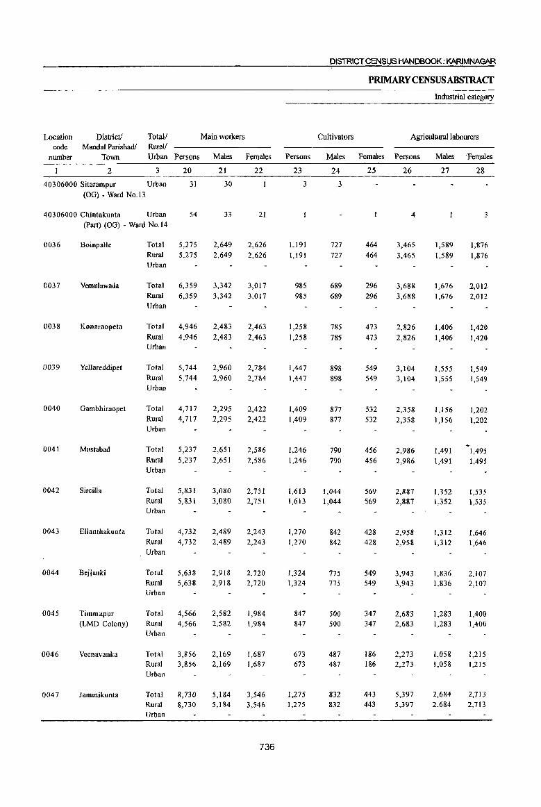
DISTRICT CENSUS HANDBOOK: KARIMNAGAR
PRIMARYCENSUSABSTRACf
Industrial category
Location District! Totall Main workers Cultivators Agricultural labourers code Mandai Parishadl Rural!
number Town Urban Persons Males Females Persons Males Females Persons Males 'Females
2 3 20 21 22 23 24 25 26 27 28
40306000 Sitarampur Urban 31 30 3 3 (OG) - Ward No.13
40306000 Chintakunta Urban 54 33 21 4 3 (Part) (OG) - Ward No.14
0036 Boinpalle Total 5,275 2,649 2,626 1,191 727 464 3,465 1,589 1,876 Rural 5,275 2,649 2,626 1,191 727 464 3,465 1,589 1,876 Urban
0037 Vemulawada Total 6,359 3,342 3,017 985 689 296 3,688 1,676 2,012 Rural 6,359 3,342 3,017 985 689 296 3,688 1,676 2,012 Urban
0038 Konaraopeta Total 4,946 2,483 2,463 1,258 785 473 2,826 1,406 1,420 Rural 4,946 2,483 2,463 1,258 785 473 2,826 1,406 1,420 Urban
19039 Yellareddipet Total 5,744 2,960 2,784 1,447 898 549 3,104 1,555 1,549 Rural 5,744 2,960 2,784 1,447 898 549 3,104 1,555 1,549 Urban
0040 Gambhiraopet Total 4,717 2,295 2,422 1,409 877 532 2,358 1,156 1,202 Rural 4,717 2,295 2,422 1,409 877 532 2,358 1,156 1,202 Urban
0041 Mustabad Total 5,237 2,651 2,586 1,246 790 456 2,986 1,491 1,495 Rural 5,237 2,651 2,586 1,246 790 456 2,986 1,491 1,495 Urban
0042 Sircilla Total 5,831 3,080 2,751 1,613 1,044 569 2,887 1,352 1,535 Rural 5,831 3,080 2,751 1,613 1,044 569 2,887 1,352 1,535 Urban
0043 Ellanthakunta Total 4,732 2,489 2,243 1,270 842 428 2,958 1,312 1,646 Rural 4,732 2,489 2,243 1,270 842 428 2,958 1,312 1,646 Urban
0044 Bejjanki Total 5,638 2,918 2,720 1,324 775 549 3,943 1,836 2,107 Rural 5,638 2,918 2,720 1,324 775 549 3,943 1,836 2,107 Urban
0045 Timmapur Total 4,566 2,582 1,984 847 500 347 2,683 1,283 1,400 (LMD Colony) Rural 4,566 2,582 1,984 847 500 347 2,683 1,283 1,400
Urban
0046 Veenavanka Total 3,856 2,169 1,687 673 487 186 2,273 1,058 1,215 Rural 3,856 2,169 1,687 673 487 186 2,273 1,058 1,215 Urban
0047 Jammikunta Total 8,730 5,184 3,546 1,275 832 443 5,397 2,684 2,713 Rural 8,730 5,184 3,546 1,275 832 443 5,397 2,684 2,713 Urban
736
PARt B" taRIMAftf CENslJSABSTRACT
of main workers
Household Industry workers Other workers Marginal workers Total! District /
Rural! Mandai Parishad /
Persons Males Females Persons Males Females Persons Males Females Urban Town
29 30 31 32 33 34 '35 36 37 3 2
28 27 7 3 4 Urban Sitarampur (OG) - Ward No.13
4 4 45 32 13 Urban Cbintakunta (Part) (OG) • Ward NO.14
225 28 197 394 305 89 422 165 257 Total BOlnpa\le
225 28 197 394 305 89 422 165 257 Rural Urban
436 25 411 1,250 952 298 1,285 456 829 Total Vemulawada
436 25 411 1,250 952 298 1,285 456 829 Rural Urban
504 27 477 358 265 93 825 400 425 Total Konaraopeta
504 27 477 358 265 93 825 400 425 Rural Urban
525 34 491 668 473 195 997 397 600 Total Yeliareddipet
525 34 491 668 473 195 997 397 600 Rural Urban
452 35 417 498 227 271 269 120 149 Total Gambhiraopet 452 35 417 498 227 271 269 120 149 Rural
Urban
453 29 424 552 341 211 1,035 469 566 Total Mustabad 453 29 424 552 341 211 1,035 469 566 Rural
Urban
448 34 414 883 650 233 981 344 637 Total SirciJla 448 34 414 883 650 233 981 344 637 Rural
Urban
60 12 48 444 323 121 1,540 564 976 Total Ellanthakunta 60 12 48 444 323 121 1,540 564 976 Rural
Urban
26 12 14 345 295 50 1,337 467 870 Total Bejjartki 26 12 14 345 295 50 1,337 467 870 Rural
I I
Urban
32 14 18 1,004 785 219 1,005 298 707 Total Timm~pur I
32 14 18 1,004 785 219 1,005 298 707 Rural (LMOColony) Urban \
74 40 34 836 584 252 1,180 456 724 Total Veenavanka 74 40 34 836 584 252 1,180 456 724 Rural I
Urban
74 43 31 1,984 1,625 359 2,349 722 1,627 Total JammiRunta 74 43 31 1,984 1,625 359 2,349 722 1,627 Rural
Urban
737
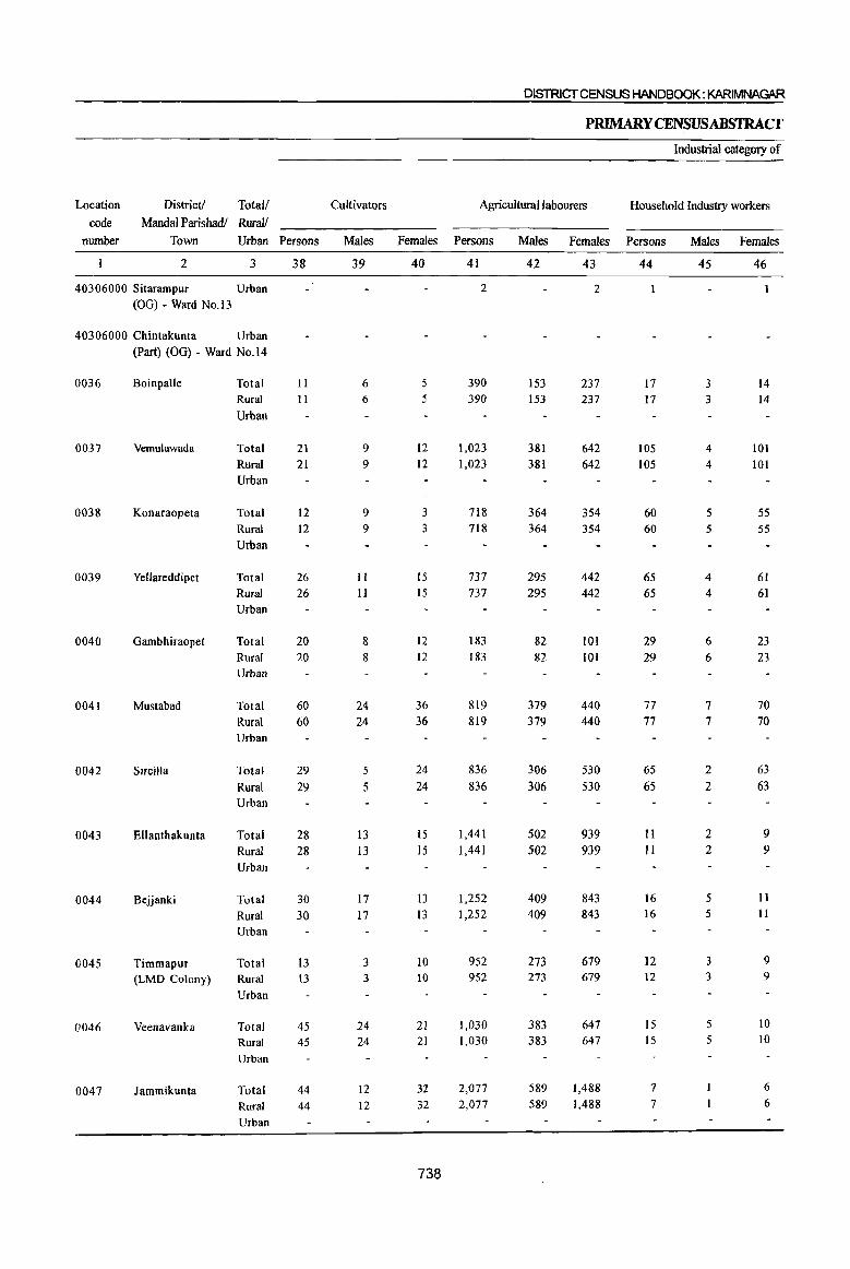
District! Total!
Mandai Parishad/ RuraI/ Location
code
number Town Urban Persons
2 3
40306000 Sitarampur Urban
(OG) • Ward No. 13
40306000 Chintakunta Urban
0036
0037
0038
0039
0040
0041
0042
0043
0044
0045
0046
0047
(Part) (OG) - Ward No.14
Boinpalle
Vemulawada
Konaraopeta
Yellareddipet
Gambhiraopet
Mustabad
Sircilla
Ellanthakunta
Bejjanki
Timmapur (LMD Colony)
Veenavanka
Jammikunta
Total
Rural
Urban
Total
Rural
Urban
Total
Rural
Urban
Total
Rural Urban
Total
Rural Urban
Total
Rural Urban
Total
Rural Urban
Total
Rural
Urban
Total
Rural Urban
Total Rural
Urban
Total Rural
Urban
Total Rural
Urban
38
II
II
21
21
12 12
26 26
20 20
60 60
29 29
28 28
30 30
13 \3
45 45
44 44
Cultivators
Males
39
6 6
9 9
9 9
II 11
8 8
24 24
5
5
13 13
17 17
3 3
24 24
12 12
DISTRICT CENSUS HANDBOOK: KARIMNAGAR
PRIMARY CENSUSABSTRACf
Industrial category of
Agricultural labourers Household Industry workers
Females Persons
40
5 5
12
12
3 3
15 15
12 12
36 36
24 24
15 15
13 13
10 10
21 21
32 32
738
41
2
390 390
1,023 1,023
718 718
737
737
183 183
819 819
836 836
1,441 1,441
1,252 1,252
952 952
1,030 1,030
2,077 2,077
Males Females Persons
42
153 153
381 381
364 364
295 295
82 82
379 379
306 306
502 502
409 409
273 273
383 383
589 589
43
2
237 237
642 642
354 354
442 442
101 101
440 440
530 530
939 939
843 843
679 679
647 647
1,488 1,488
44
17 17
105 105
60 60
65 65
29 29
77
77
65 65
11 II
16 16
12 12
15 15
7
7
Males Females
45
3 3
4 4
5 5
4
4
6
6
7 7
2
2
2 2
5 5
3 3
5 5
46
14 14
101 101
55 55
61
61
23 23
70 70
63 63
9 9
II II
9 9
10 10
6
6
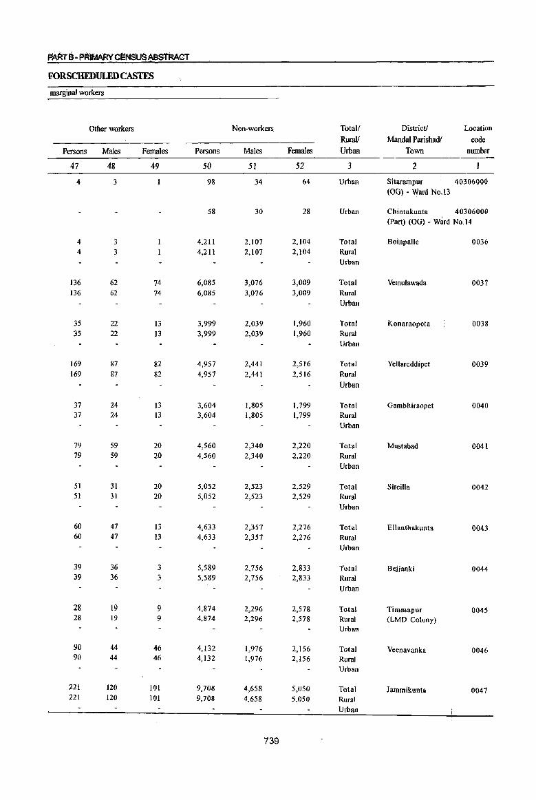
PARTe-PR)MAR'fC~f,lSUSAB~CT
FORSCHEDULEDCASTES
marginal workers
Other workers Non-workers. Total/ District! Location
Rural! Mandal Parishadl code
Persons Males Females Persons Males Females Urban Town number
47 48 49 50 51 52 3 2
4 3 98 34 64 Urban Sitarampur 40306000 (OG) - Ward No. 13
58 30 28 Urban Chintakunta 40306000 (Part) (OG) - Ward No.14
4 3 4,211 2,107 2,104 Total Boinpalle 0036 4 3 4,211 2,107 2,104 Rural
Urban
136 62 74 6,085 3,076 3,009 Total Vemulawada 0037 136 62 74 6,085 3,076 3,009 Rural
Urban
35 22 13 3,999 2,039 1,960 Total Konaraopeta 0038 35 22 13 3,999 2,039 1,960 Rural
Urban
169 87 82 4,957 2,441 2,516 Total Yellareddipet 0039 169 87 82 4,957 2,441 2,516 Rural
Urban
37 24 13 3,604 1,805 1.799 Total Gambhiraopet 0040 37 24 13 3,604 1,805 1,799 Rural
Urban
79 59 20 4,560 2,340 2,220 Total Mustabad 0041 79 59 20 4,560 2,340 2,220 Rural
Urban
51 31 20 5,052 2,523 2,529 Total Sircilla 0042 51 31 20 5,052 2,523 2,529 Rural
Urban
60 47 13 4,633 2,357 2,276 Total Ellanthakunta 0043 60 47 13 4,633 2,357 2,276 Rural
Urban
39 36 3 5,589 2,156 2,833 Total Bejjanki 0044 39 36 3 5,589 2,156 2,833 Rural
Urban
28 19 9 4,874 2,296 2,578 Total Timmapur 0045 28 19 9 4,874 2,296 2,578 Rural (LMD Colony)
Urban
90 44 46 4,132 1,976 2,156 Total Veenavanka 0046 90 44 46 4,132 1,976 2,156 Rural
Urban
221 120 101 9,708 4,658 5,050 Total Jammikunta 0047 221 120 101 9,708 4,658 5,050 Rural
Urban
739
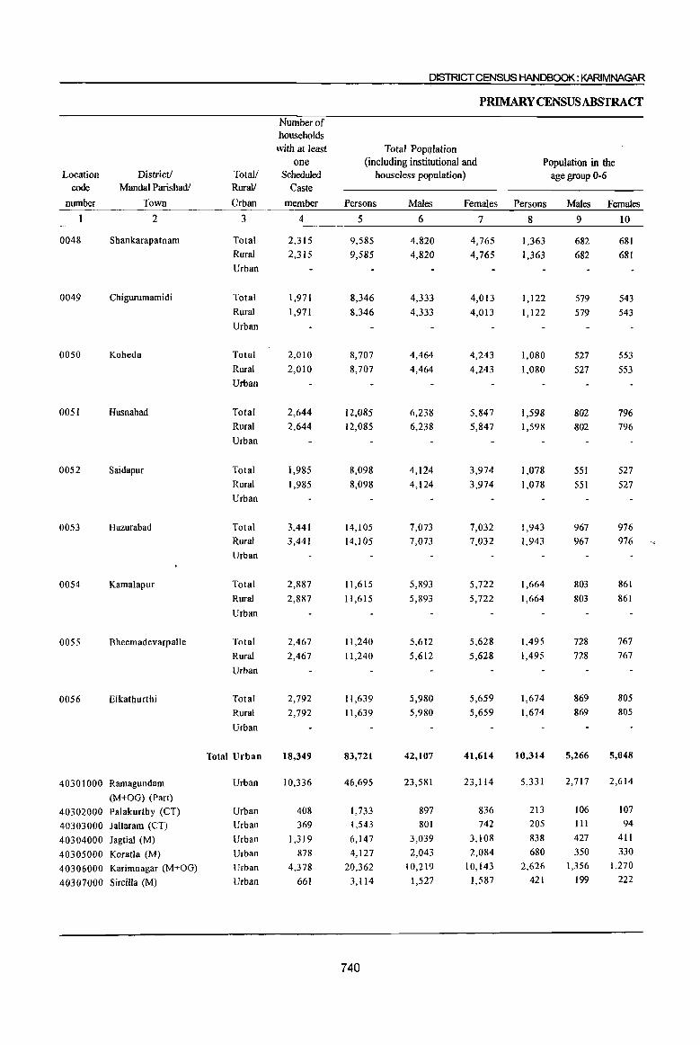
DISTRICT CENSUS HANDBOOK: KARIMNAGAR
PRIMARY CENSUSABSTRACf
Number of households
with at least Total Population one (including institutional and Population in the
Location District! Total/ Scheduled houseless population) age group 0-6 code MandaI Parishadl Rura1/ Caste
munber Town Urban member Persons Males Females Persons Males Females
2 3 4 5 6 7 8 9 10
0048 Shankarapatnam Total 2,315 9,585 4,820 4,765 1,363 682 681 Rural 2,315 9,585 4,820 4,765 1,363 682 681 Urban
0049 Chigurumamidi Total 1,971 8,346 4,333 4,013 1,122 579 543 Rural 1,971 8,346 4,333 4,013 1,122 579 543 Urban
0050 Koheda Total 2,010 8,707 4,464 4,243 1,080 527 553 Rural 2,010 8,707 4,464 4,243 1,080 527 553 Urban
005! Husnabad Total 2,644 12,085 6,238 5,847 1,598 802 796 Rural 2,644 12,085 6,238 5,847 1,598 802 796
Urban
0052 Saidapur Total 1,985 8,098 4,124 3,974 1,078 551 527
Rural 1,985 8,098 4,124 3,974 1,078 551 527 Urban
0053 Huzurabad Total 3,441 14,105 7,073 7,032 1,943 967 976 Rural 3,441 14,105 7,073 7,032 1,943 967 976
Urban
0054 Kamalapur Total 2,887 11,615 5,893 5,722 1,664 803 861
Rural 2,887 11,615 5,893 5,722 1,664 803 861
Urban
0055 Bheemadevarpalle Total 2,467 11,240 5,612 5,628 1,495 728 767
Rural 2,467 11,240 5,612 5,628 1,495 728 767
Urban
0056 Elkathurthi Total 2,792 11,639 5,980 5,659 1,674 869 805
Rural 2,792 11,639 5,980 5,659 1,674 869 805
Urban
Total Urban 18,349 83,721 42,107 41,614 10,314 5,266 5,048
40301000 Ramagundam Urban 10,336 46,695 23,581 23,114 5,331 2,717 2,614
(M+OG) (Part)
40302000 Palakurthy (CT) Urban 408 1,733 897 836 213 106 107
40303000 Jallaram (CT) Urban 369 1,543 801 742 205 III 94
40304000 Jagtial (M) Urban 1,319 6,147 3,039 3,108 838 427 411
40305000 Koratla (M) Urban 878 4,127 2,043 2,084 680 350 330
40306000 Karimnagar (M+OG) Urban 4,378 20,362 10,219 10,143 2,626 1,356 1,270
40307000 Sircilla (M) Urban 661 3,114 1,527 1,587 421 199 222
740
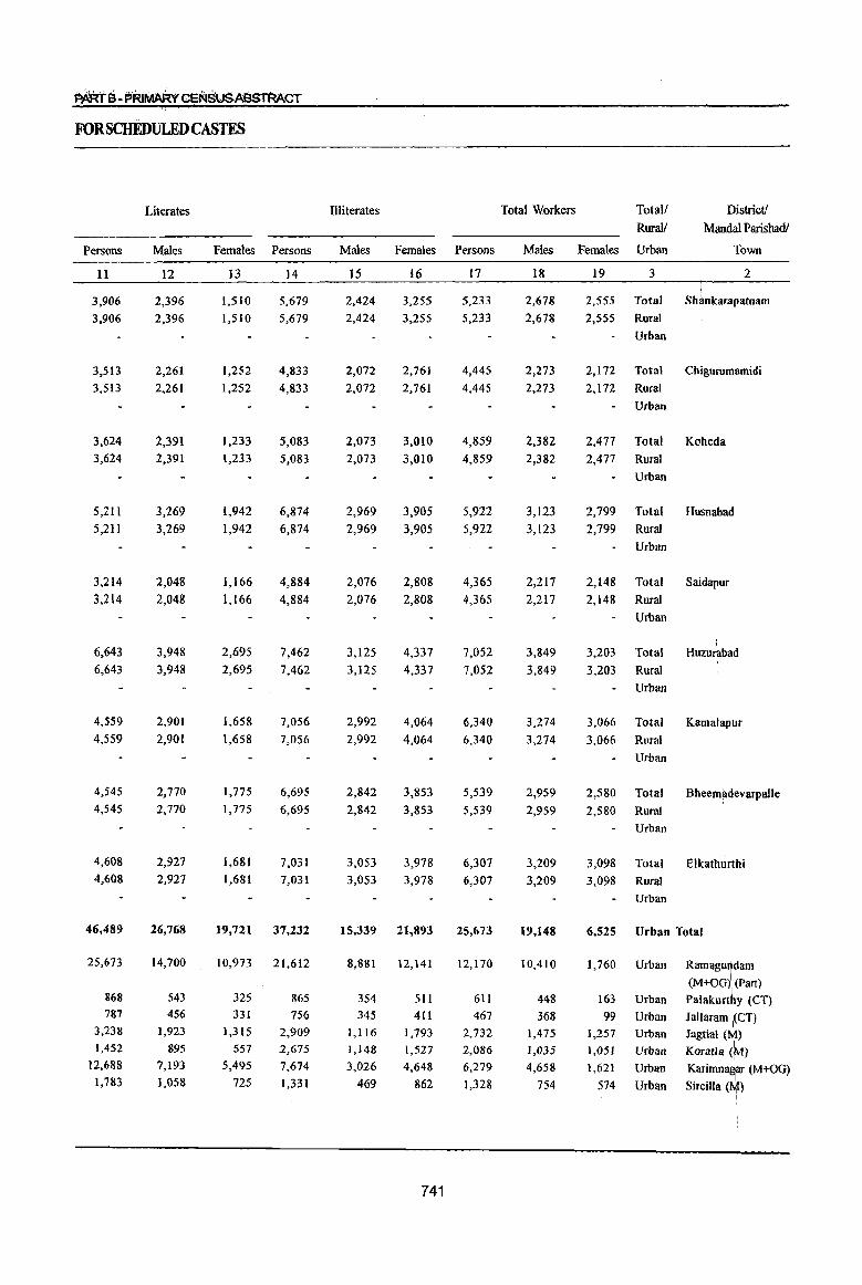
FORSCHEDULEDCASTEs
Literates Illiterates Total Workers Totall District!
Rurall Mandai Parishadl
Persons Males Females Persons Males Females Persons Males Females Urban Town
11 12 13 14 15 16 17 18 19 3 2
3,906 2,396 1,510 5,679 2,424 3,255 5,233 2,678 2,555 Total SMnkarapatnam
3,906 2,396 1,510 5,679 2,424 3,255 5,233 2,678 2,555 Rural
Urban
3,513 2,261 1,252 4,833 2,072 2,761 4,445 2,273 2,172 Total Chigurumamidi
3,513 2,261 1,252 4,833 2,072 2,761 4,445 2,273 2,172 Rural
Urban
3,624 2,391 1,233 5,083 2,073 3,010 4,859 2,382 2,477 Total Koheda
3,624 2,391 1,233 5,083 2,073 3,010 4,859 2,382 2,477 Rural
Urban
5,211 3,269 1,942 6,874 2,969 3,905 5,922 3,123 2,799 Total Husnabad
5,211 3,269 1,942 6,874 2,969 3,905 5,922 3,123 2,799 Rural
Urban
3,214 2,048 1,166 4,884 2,076 2,808 4,365 2,217 2,148 Total Saidapur
3,214 2,048 1,166 4,884 2,076 2,808 4,365 2,217 2,148 Rural
Urban
: 6,643 3,948 2,695 7,462 3,125 4,337 7,052 3,849 3,203 Total Huzurabad
6,643 3,948 2,695 7,462 3,125 4,337 7,052 3,849 3,203 Rural
Urban
4,559 2,901 1,658 7,056 2,992 4,064 6,340 3,274 3,066 Total Kamalapur 4,559 2,901 1,658 7,056 2,992 4,064 6,340 3,274 3,066 Rural
Urban
4,545 2,770 1,775 6,695 2,842 3,853 5,539 2,959 2,580 Total Bheem~devarpalle 4,545 2,770 1,775 6,695 2,842 3,853 5,539 2,959 2,580 Rural
Urban
4,608 2,927 1,681 7,031 3,053 3,978 6,307 3,209 3,098 Total Elkathurthi 4,608 2,927 1,681 7,031 3,053 3,978 6,307 3,209 3,098 Rural
Urban
46,489 26,768 19,721 37,232 15,339 21,893 25,673 19,148 6,525 Urban Total
25,673 14,700 10,973 21,612 8,881 12,141 12,170 10,410 1,760 Urban Ramagu1dam (M+OG} (part)
868 543 325 865 354 511 611 448 163 Urban Palakurt~y (CT) 787 456 331 756 345 411 467 368 99
I Urban Jallaram ~CT)
3,238 1,923 1,315 2,909 1,116 1,793 2,732 1,475 1,257 Urban Jagtial ( ) 1,452 895 557 2,675 1,148 1,527 2,086 1,035 1,051 Urban Km''''l) 12,688 7,193 5,495 7,674 3,026 4,648 6,279 4,658 1,621 Urban Karimn aT (M+OG) 1,783 1,058 725 1,331 469 862 1,328 754 574 Urban S ircilla ( I)
741
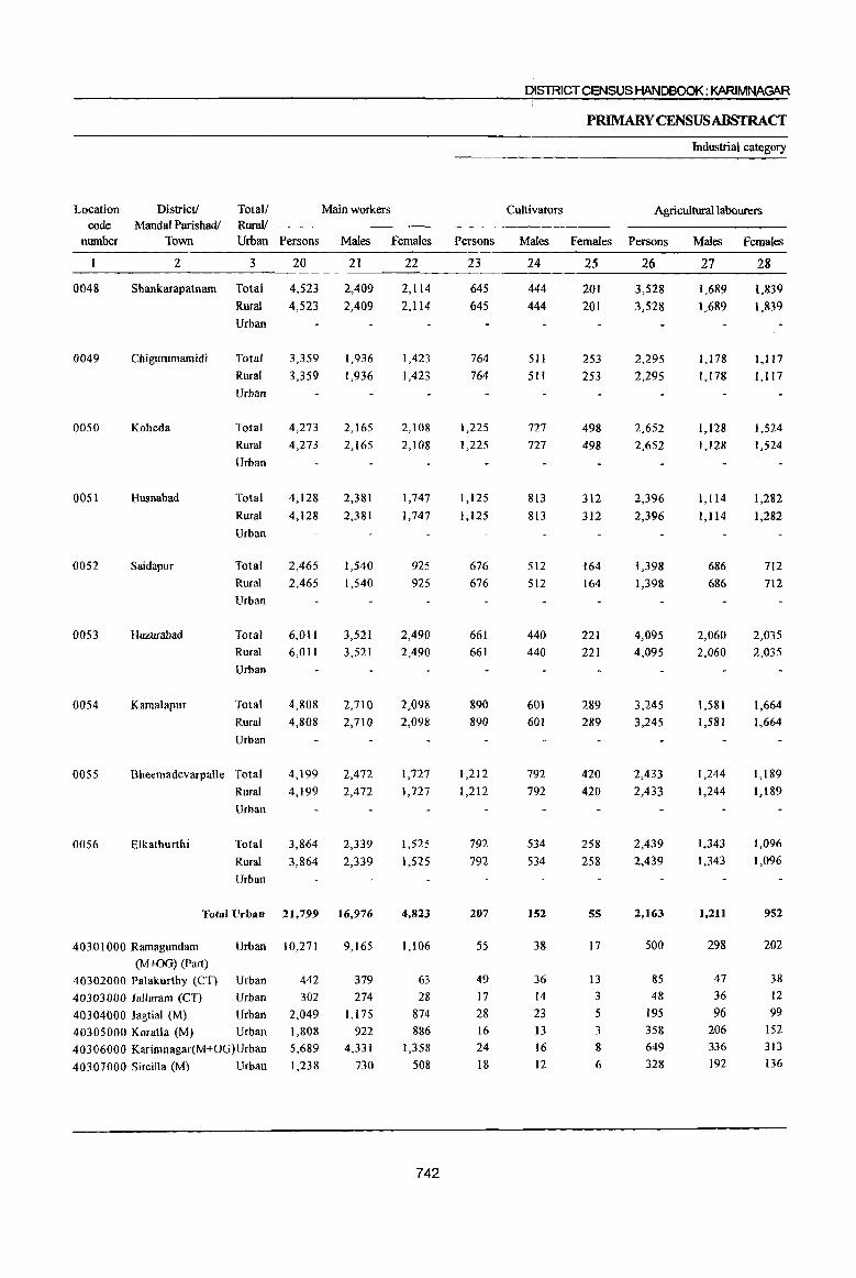
District! Total/ RuraV
Main workers Location code
number Mandai Parishadl
Town Urban Persons Males Females Persons
0048
0049
0050
0051
0052
0053
0054
0055
0056
2 3 20
Shankarapatnam Total 4,523
4,523
Chigurumamidi
Koheda
Husnabad
Saidapur
Huzurabad
KamalapuT
Rural Urban
Total
Rural
Urban
Total
Rural
Urban
3,359
3,359
4,273
4,273
Total 4,128
Rural 4,128
Urban
Total 2,465
Rural 2,465
Urban
Total
Rural
Urban
Total
Rural
Urban
6,011
6,01 I
4,808
4,808
Bheemadevarpalle Total
Rural
Urban
4,199
4,199
Elkathurthi Total
Rural
Urban
3,864 3,864
21
2,409
2,409
1,936
1,936
2,165
2,165
2,381
2,381
1,540
1,540
3,521
3,521
2,710
2,710
2,472
2,472
2,339
2,339
Total Urban 21,799 16,976
40301000 Ramagundam Urban 10,271
(M+OG) (Part)
40302000 Palakurthy (CT) Urban
40303000 lallaram (CT) Urban
40304000 Jagtial (M) Urban
40305000 Koratla (M) Urban
40306000 Karimnagar(M+OG)Urban
40307000 Sircilla (M) Urban
442
302
2,049 1,808 5,689
1,238
9,165
379
274 1,175
922
4,331
730
22
2,114
2,1l4
1,423
1,423
2,108
2,108
1,747
1,747
925
925
2,490
2,490
2,098
2,098
1,727
1,727
1,525
1,525
4,823
1,106
63
28
874
886
1,358
508
742
23
645
645
764
764
1,225
1,225
1,125
1,125
676
676
661
661
890 890
1,212
1,212
792
792
207
55
49
17
28
16 24
18
OISTRICTCENSUS HANDBOOK: KARlMNAGAR
PRIMARY CENSUSABSTRACT
Industrial category
Cultivators Agricultural labourers
Males Females Persons Males Females
24
444
444
511
511
727
727
813
813
512
512
440
440
601
601
792
792
534
534
152
38
36
14
23 13
16
12
25
201 201
253
253
498
498
312
312
164
164
221 221
289 289
420
420
258
258
55
17
I3
3
5 3
8
6
26
3,528
3,528
2,295
2,295
2,652
2,652
2,396
2,396
1,398
1,398
4,095
4,095
3,245
3,245
2,433
2,433
2,439
2,439
2,163
500
85
48 195
358
649
328
27
1,689
1,689
1,178
1,178
1,128
1,128
1,114
1,114
686 686
2,060
2,060
1,581
1,581
1,244
1,244
1,343
1,343
l,211
298
47
36
96 206
336
192
28
1,839
1,839
1,117
1,117
1,524
1,524
1,282
1,282
712
712
2,035
2,035
1,664
1,664
1,189
1,189
1,096 1,096
952
202
38
12
99
152
313
136
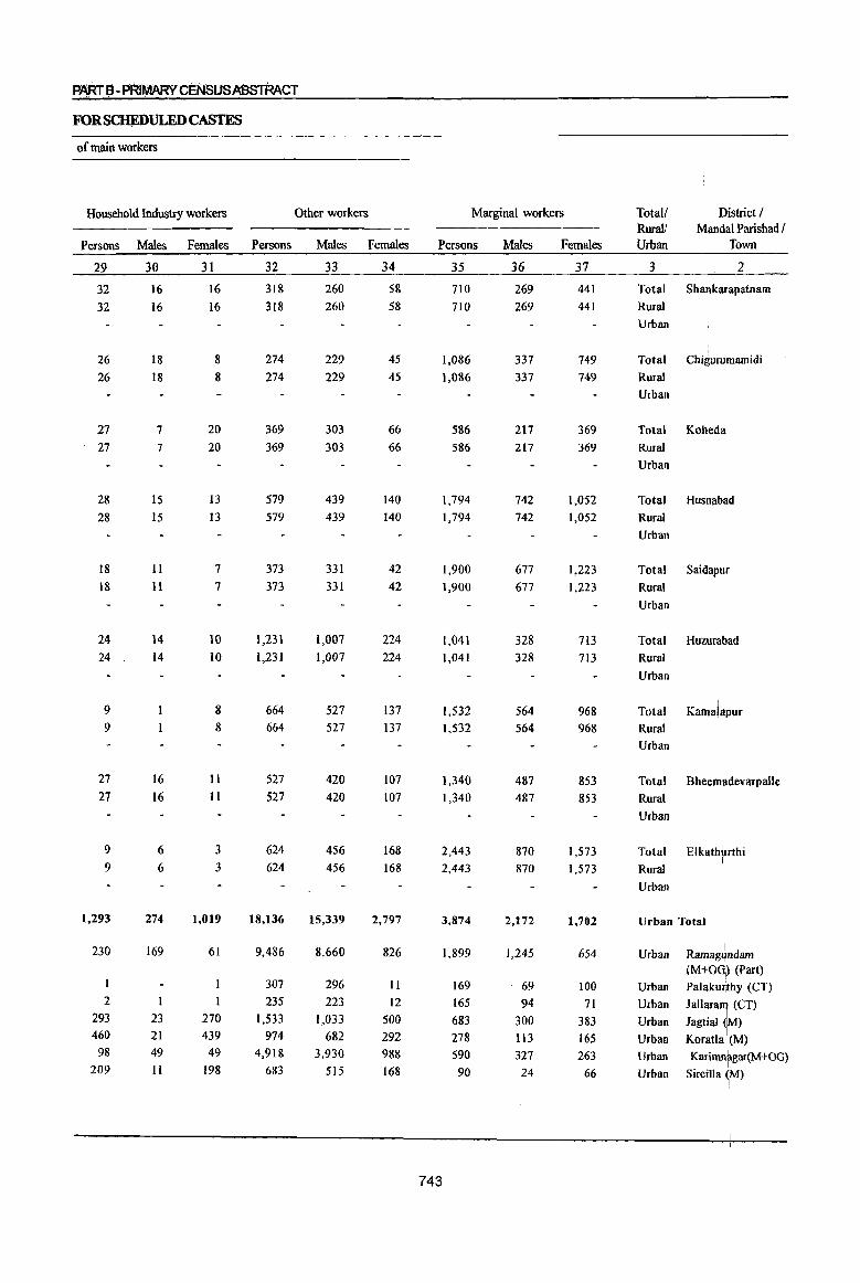
PARr a -p~1Ii1ARY CENSUSASSTRACT
FOR SCHEDULED CASTES
of main workers
Household Industry workers Other workers
Persons Males Females Persons Males Females
29 30 31 32 33 34
32
32
26 26
27 27
28
28
18 18
24 24
9 9
27 27
9
9
1,293
230
2
293 460 98
209
16 16
18 18
7
7
IS
15
II
11
14 14
16 16
6 6
274
169
I
23 21 49
II
16 16
8
8
20 20
13
13
7
7
10 10
8 8
11
II
3
3
1,019
61
I
270 439 49
198
31g 318
274 274
369 369
579 579
373 373
1,231 1,231
664 664
527 527
624 624
18,136
9,486
307 235
1,533
974 4,918
683
260 260
229 229
303 303
439 439
331
331
1,007 1,007
527 527
420 420
456 456
15,339
8,660
296 223
1,033 682
3,930
515
58
58
45 45
66 66
140 140
42 42
224 224
137 137
107 107
168 168
2,797
826
II
12
500 292 988
168
Marginal workers
Persons
35
710 710
1,086 1,086
586 586
1,794 1,794
1,900
1,900
1,041
1,041
1,532
1,532
1,340
1,340
2,443 2,443
3,874
743
1,899
169 165 683 278 590 90
Males
36
269 269
337 337
217
217
742 742
677 677
328 328
564 564
487
487
870 870
2,172
1,245
69 94
300
113 327
24
Females
37
441 441
749 749
369 369
1,052 1,052
1,223 1,223
713 713
968 968
853 853
1,573 1,573
1,702
654
100 71
383 165 263
66
Total! Rural! Urban
3
District / Mandai Parishad I
Town
2
Total Shankarapatnam
Rural
Urban
Total Chi!:lurumamidi
Rural
Urban
Total Koheda
Rural
Urban
Total Husnabad
Rural
Urban
Total Saidapur
Rural
Urban
Total Huzurabad
Rural
Urban
Total Kamalapur
Rural
Urban
Total Bheemadevarpalle
Rural
Urban
,
Total Elkathhrthi I
Rural
Urban
Urban Total
Urban
Urban
Urban
Urban
Urban
Urban
Urban
Ramag4ndam (M+Oo') (Part) Palaku~thy (CT)
Jallara~ (CT)
Jagtial fjM)
Koratla i(M)
Karimnrgar(M+OG}
Sircilla ~M)
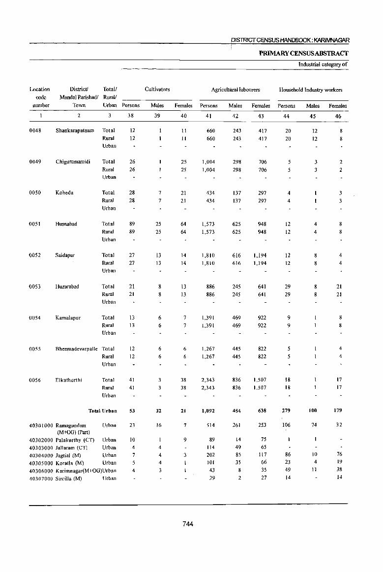
District! Total!
Mandai Parishadl Rural! Location
code munber Town Urban Persons
0048
0049
0050
0051
0052
0053
0054
0055
0056
2 3
Shankarapatnam Total
Rural
Urban
Chigummamidi Total
Rural
Urban
Koheda
Husnabad
Saidapur
Huzurabad
Kamalapur
Total
Rural
Urban
Total
Rural
Urban
Total
Rural
Urban
Total
Rural
Urban
Total
Rural
Urban
Bheemadevarpalle Total
Rural
Urban
Elkathurthi Total
Rural
Urban
Total Urban
40301000 Ramagundam Urban (M+OG) (Part)
40302000 Palakurthy (CT) Urban
40303000 lallaram (CT) Urban
40304000 Jagtial (M) Urban
40305000 Koratla (M) Urban
40306000 Karimnagar(M+OG)Urban
40307000 Sircilla (M) Urban
38
12 12
26 26
28 28
89 89
27 27
21 21
13 13
12 12
41 41
53
23
10 4
7
5 4
Cultivators
Males
39
7
7
25 25
13 13
8 8
6 6
6
6
3
3
32
16
4
4
4
3
DISTRICT CENSUS HANDBOOK: KARIMNAGAR
P~YCENSUSABSTRACT
Industrial category of
Agricult\IDlllabourers Household Industry workers
Females Persons
40
II
II
25 25
21 21
64 64
14 14
13
13
7 7
6
6
38 38
21
7
9
3
744
41
660 660
1,004 1,004
434 434
1,573 1,573
1,810 1,810
886 886
1,391 1,391
1,267 1,267
2,343
2,343
1,092
514
89 IJ4
202 101 43
29
Males Females Persons
42
243 243
298 298
137 137
625 625
616 616
245 245
469 469
445
445
836 836
454
261
14 49 85 35
8
2
43
417
417
706 706
297 297
948 948
1,194 1,194
641 641
922 922
822 822
1,507 1,507
638
253
75 65
II7 66 35 27
44
20 20
5
5
4
4
12 12
12 12
29 29
9 9
5
5
18 18
279
106
86 23 49 14
Males Females
45
12 12
3
3
4
4
8 8
8 8
100
74
10 4
II
46
8
8
2 2
3
3
8
8
4 4
21 21
8
8
4
4
17 17
179
32
76 19
38 14
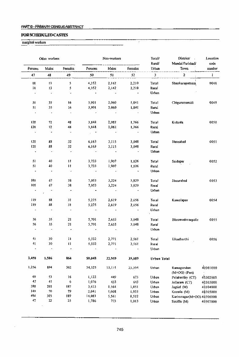
PAATe"PR'iMARY C~NSUSAe5TRACT
FORSCHEDULEDCASTES
marginal workers
Other workers Non-workers Totall Districtl \
Location I
Rural! Mandai Parishadl code Persons Males Females Persons Males Females Urban Town
I number
47 48 49 50 51 52 3 2 I
Ul 13 5 4,352 2,142 2,210 Total Shankarapatnam, 0048
18 13 5 4,352 2,142 2,210 Rural Urban
51 35 16 3,901 2,060 1,841 Total Chigurumamidi 0049
51 35 16 3,901 2,060 1,841 Rural Urban
120 72 48 3,848 2,082 1,766 Total Koheda 0050 120 72 48 3,848 2,082 1,766 Rural
Urban
120 88 32 6,163 3,lt5 3,048 Total Husnabad 0051 120 88 32 6,163 3,115 3,048 Rural
Urban
51 40 11 3,733 1,907 1,826 Total Saidapur 0052 51 40 II 3,733 1,907 1,826 Rural
Urban
105 67 38 7,053 3,224 3,829 Total Huzurabad 0053 105 67 38 7,053 3,224 3,829 Rural
Urban
119 88 31 5,275 2,619 2,656 Total Kamalapur 0054 119 88 31 5,275 2,619 2,656 Rural
Urban
56 35 21 5,701 2,653 3,048 Total Bheemadevarpalle 0055 56 35 21 5,701 2,653 3,048 Rural
Urban
41 30 11 5,332 2,771 2,561 Total Elkathurthi 0056 41 30 11 5,332 2,771 2,561 Rural
Urban
2,450 1,586 864 58;0411 22,959 35,089 Urban Total I
1,256 894 362 34,525 13,171 2.1,354 Urban Ramagundam ~O301000 (M+OG) (Part)
46302000 69 53 16 1,122 449 673 Urban Palakurthy (CT) 47 41 6 1,076 433 643 Urban Jallaram (CT) 4(>303000
I
388 201 187 3,415 1,564 1,851 Urban Jagtial (M) 40304000 149 70 79 2,041 1,008 1,033 Urban Koratla (M) 4~305000 494 305 189 14,083 5,561 8,522 Urban Karimnagar(M+OG) 4 .306000
47 22 25 1,786 773 1,013 Urban Sircilla (M) 4(h07000
745
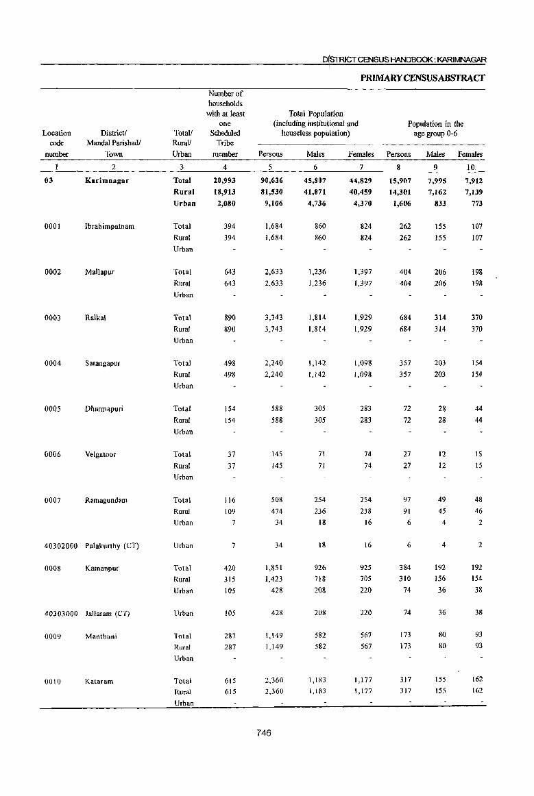
D!STRlCTCENSUS HANDBOOK: KARIMNAGAR I
PRIMARY CENSUS ABSTRACT
Number of households
with at least Total Population one (including institutional and Population in the
Location Districtl Totall Scheduled houseless population) age group 0-6 code Mandai Parishadl Rura1/ Tribe
number Town Urban member Persons Males Females Persons Males Females
2 3 4 5 6 7 8 9 10
03 Karimnagar Total 20,993 90,636 45,807 44,829 15,907 7,995 7,912 Rural 18,913 81,530 41,071 40,459 14,301 7,162 7,139 Urban 2,080 9,106 4,736 4,370 1,606 833 773
000] Ibrabimpatnam Total 394 1,684 860 824 262 ISS 107 Rural 394 1,684 860 824 262 155 107 Urban
0002 Mallapur Total 643 2,633 1,236 1,397 404 206 198 Rural 643 2,633 1,236 1,397 404 206 198 Urban
0003 Raikal Total 890 3,743 1,814 1,929 684 314 370
Rural 890 3,743 1,814 1,929 684 314 370
Urban
0004 Sarangapur Total 498 2,240 1,142 1,098 357 203 154
Rural 498 2,240 1,142 1,098 357 203 154
Urban
0005 Dharmapuri Total 154 588 305 283 72 28 44
Rural 154 588 305 283 72 28 44
Urban
0006 Velgatoor Total 37 145 71 74 27 12 15
Rural 37 145 71 74 27 12 15 Urban
0007 Ramagundam Total 116 508 254 254 97 49 48
Rural 109 474 236 238 91 45 46
Urban 7 34 18 16 6 4 2
40302000 Palakurtby (CT) Urban 7 34 18 16 6 4 2
0008 Kamanpur Total 420 1,851 926 925 384 192 192
Rural 315 1,423 718 705 310 156 154
Urban 105 428 208 220 74 36 38
40303000 lallaram (CT) Urban 105 428 208 220 74 36 38
0009 Manthani Total 287 1,149 582 567 173 80 93
Rural 287 1,149 582 567 173 80 93
Urban
0010 Kataram Total 615 2,360 1,183 1,177 317 155 162
Rural 615 2,360 1,183 1,177 317 155 162
Urban
746
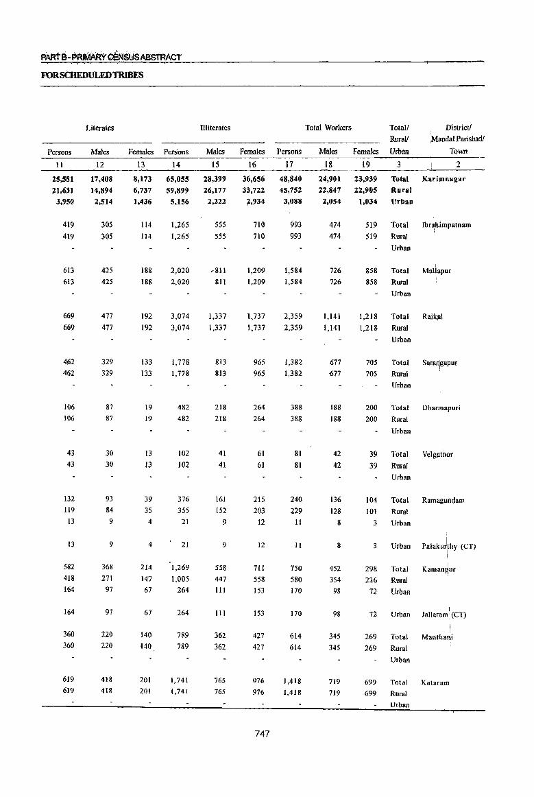
PARtS-PRIMARY C~SUSABSTRACT
FORSCHEDULEDTRIBES
Persons
11
25,581
21,631
3,950
419
419
613
613
669 669
4.62
462
106
106
43
43
132
119
13
13
582 418 J64
164
360 360
619
619
Literates
Males
12
17,408
14,894
2,514
305 305
425
425
477 477
329 329
87
87
30 30
93 84 9
9
368
271 97
97
220
220
418
418
Illiterates
Females Persons Males
13 14 15
8,173 65,055 28,399
6,737 59,899 26,177
1,436 5,156 2,222
114
114
188
188
192 192
133
133
19
19
13
13
39
35 4
4
214
147 67
67
140 140
201
201
1,265
1,265
2,020
2,020
3,074
3,074
1,778 1,778
482
482
102
102
376 355
21
21
1,269 1,005
264
264
789
789
1,741 1,741
555
555
,811
811
1,337 1,337
813 813
218
218
41 41
161
152 9
9
558
447
III
111
362 362
765
765
Females Persons
16 17
36,656 48,840
33,722 45,752
7,934 3,088
710
710
1,209
1,209
1,737
1,737
965 965
264
264
61
61
215
203
12
12
711 558
153
153
427
427
976
976
747
993
993
1,584 1,584
2,359 2,359
1,382 1,382
388
388
81
81
240
229
11
11
750
580 170
170
614 614
1,418
1,418
Total Workers
Males
18
24,901
Total!
Rural!
Females Urban
19 3
23,939 Total
. District! 'l,Mandal Parishad!
Town
2
Karimnagar
22,847 22,905 Rural
2,054 1,034 Urban
474
474
726
726
1,141
1,141
677
677
188
188
42
42
136
128 g
8
452
354
98
98
345
345
719
7J9
519 Total
519 Rural
858
858
Urban
Total
Rural
Urban
Ibr~himpatnam i
I Mallapur
\
1,218 Total Raiklll
1,218 Rural
Urban
705 Total sararilgapur
705 Rural
Urban
200 Total Dharmapuri
200 Rural
Urban
39 Total Velgat~or 39 Rural
104
101
3
3
298
226
72
72
269
269
Urban
Total
Rural
Urban
Urban
Total
Rural
Urban
Urban
Total
Rural
Urban
Ramagl.mdam
palaku)\thY (CT)
I Kaman~ur
Jallaram \ (CT)
i Manthan,i
699 Total Kataram
699 Rural
Urban
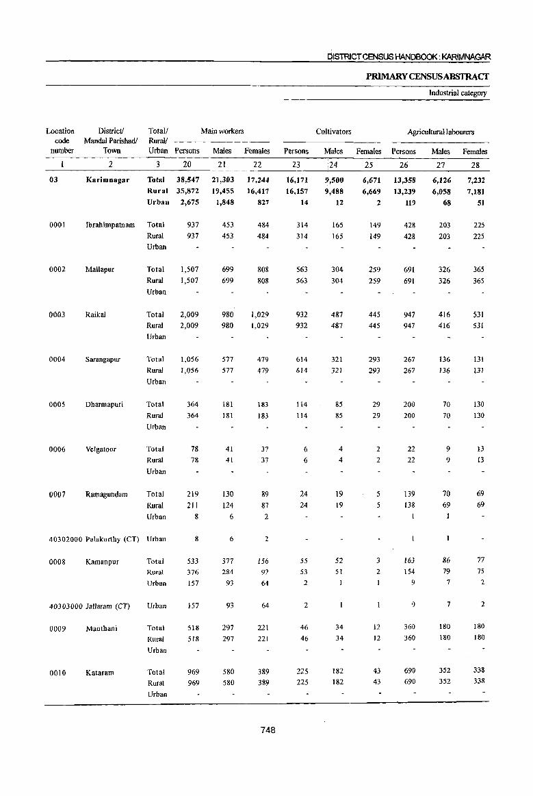
Location code
number
District! Mandai Parishadl
Town
Total/ Rural! Urban Persons
Main workers
Males Females
2 3 20 21 22
03
0001
0002
0003
0004
0005
0006
0007
Karimnagar Total 38,547 21,303
Rural 35,872 19,455
Urban 2,675 1,848
Ibrahimpatnam Total 937 453 Rural 937 453 Urban
MaUapur Total 1,507 699
Raikal
Sarangapur
Dharmapuri
Velgatoor
Ramagundam
Rural
Urban
Total
Rural
Urban
Total
Rural
Urban
Total
Rural
Urban
Total
Rural
Urban
Total
Rural
Urban
1,507
2,009 2,009
1,056 1,056
364
364
78 78
219 211
8
699
980 980
577 577
181
181
41 41
130
124 6
40302000 Palakurthy (CT) Urban 8 6
0008 Kamanpur
40303000 lallaram (CT)
0009 Manthani
0010 Kataram
Total
Rural
Urban
Urban
Total
Rural
Urban
Total Rural
Urban
533 376 157
157
518 518
969 969
377 284
93
93
297 297
580 580
17,244
16,417
827
484
484
808 808
1,029 1,029
479 479
183 183
37 37
89 87 2
2
156 92
64
64
221 221
389 389
748
Persons
23
16,171
16,157
14
314 314
563 563
932 932
614 614
114 114
6
6
24 24
55 53
2
2
46
46
225
225
DISTRICT CENSUS HANDBOOK: KARIMNAGAR
Cultivators
Males
;24
9,500 9,488
12
165 165
304 304
487 487
321 321
85
85
4
4
19 19
52 51
34 34
182
182
PRIMARY CENSUSABSTRACf
Females
25
6,671
6,669
2
149 149
259 259
445
445
293 293
29
29
2
2
5
5
3
2
12
12
43 43
Industrial category
Agricultural labourers
Persons
26
13,358
13,239
119
428
428
691 691
947 947
267 267
200 200
22 22
139
138
163 154
9
9
360
360
690 690
Males Females
27 28
6,126
6,058
68
203 203
326 326
416 416
136 136
70 70
9
9
70 69
86 79
7
7
180
180
352
352
7,232
7,181
51
225
225
365
365
531 531
131
131
130 130
13
I3
69 69
77 7S
2
2
180
180
338 338

PAfuS-~iMAAYCENSllSA6Sl'RACT
FORSCHEDULEJ)1'R$ES
of main workers
Household Industry workers Other workers Marginal workers Totall District I Rural! *andal Parishad I
Persons Males Females Persons Males Females Persons Males Females Urban Town
29 30 31 32 33 34 35 36 37 3 2
2,018 749 1,269 7,000 4,928 2,072 10,293 3,598 6,695 Total Karimnagar
1,774 645 1,129 4,702 3,264 1,438 9,880 3,392 6,488 Rural
244 104 140 2,298 1,664 634 413 206 207 Urban
89 7 82 106 78 28 56 21 35 Total Ibrahimpatnam
89 7 82 106 78 28 56 21 35 Rural
Urban
176 7 169 77 62 15 77 27 50 Total Mall~pur I
176 7 169 77 62 15 77 27 50 Rural
Urban
39 7 32 91 70 21 350 161 189 Total Raik~1
39 7 32 91 70 21 350 161 189 Rural
Urban
50 26 24 125 94 31 326 100 226 Total Sarangapur
50 26 24 125 94 31 I
326 100 226 Rural
Urban
10 10 40 26 14 24 7 17 Total Dhar~apuri 10 10 40 26 14 24 7 17 Rural
Urban
18 8 10 32 20 12 3 2 Total Velgatqor 18 8 10 32 20 12 3 2 Rural
Urban
4 2 2 52 39 I3 21 6 15 Total RamagJndam 4 2 2 45 34 11 18 4 14 Rural
7 5 2 3 2 1 Urban
7 5 2 3 2 Urban Palakurthy (CT)
16 6 10 299 233 66 217 75 142 Total KamanPrr 14 6 8 155 148 7 204 70 134 Rural 2 2 144 85 59 13 5 8 Urban
2 2 144 85 59 13 5 8 Urban Jallaram \(CT)
13 5 8 99 78 21 96 48 48 Total Manthani 13 5 8 99 78 21 96 48 48 Rural
Urban
53 45 8 449 139 310 Total Kataram 53 45 8 449 139 310 Rural
Urban
749

DISTRICT CENSUS HANDBOOK: KARIMNAGt>.R
PRIMARY CENSUS ABSTRAcr
Industrial category of
Location District! Totall Cultivators Agricultural labourers Household Industry workers
code Mandai Parishadl Rural!
number Town Urban Persons Males Females Persons Males Females Persons Males Females
2 3 38 39 40 41 42 43 44 45 46
03 Karimnagar Total 745 328 417 7,767 2,558 5,209 555 154 401 Rural 745 328 417 7,725 2,537 5,188 527 149 378
Urban 42 21 21 28 5 23
0001 Ibrahimpatnam Total 3 2 36 16 20 17 3 14 Rural 3 2 36 16 20 17 3 14 Urban
0002 Mallapur Total 7 2 5 58 24 34 10 10
Rural 7 2 5 58 24 34 10 10
Urban
0003 Raikal Total 11 3 8 189 90 99 53 18 3S Rural II 3 8 189 90 99 53 18 35
Urban
0004 Sarangapur Total 12 5 7 169 68 tOI 84 20 64 Rural 12 5 7 169 68 101 84 20 64 Urban
0005 Dharmapuri Total 2 10 4 6 3 3
Rural 2 10 4 6 3 3
Urban
0006 Velgatoor Total 3 2
Rural 3 2
Urban
0007 Ramagundam Total 17 3 14 2
Rural 16 3 13 2
Urban
40302000 Palakurthy (CT) Urban
0008 Kamanpur Total 2 185 57 128 6 3 3 Rural 2 178 55 123 6 3 3
Urban 7 2 5
40303000 Jallaram (CT) Urban 7 2 5
0009 Manthani Total 2 2 85 43 42 4 2 2
Rural 2 2 85 43 42 4 2 2
Urban
0010 Kataram Total 12 5 7 420 122 298 9 5 4
Rural 12 5 7 420 122 298 9 5 4
Urban
750

PART8-PRIMAm' CENSUS ABSTRACT
FORSCHEDULEDTRIBES
marginal workers
Other workers Non-workers Totall District! I
Location
Rural! MandaI Parishad( code
Persons Males Females Persons Males Females Urban Town number
47 48 49 50 51 52 3 2
1,226 558 668 41,796 20,906 20,890 Total Karimnagar 63
883 378 505 35,778 18,224 17,554 Rural
343 180 163 6,018 2,682 3,336 Urban
691 386 305 Total Ibrahimpatnam 0001 691 386 305 Rural
Urban
2 1,049 510 539 Total Mallapur 0002 2 1,049 510 539 Rural
Urban
97 50 47 1,384 673 711 Total Raikal 0003 97 50 47 1,384 673 711 Rural
Urban
61 7 54 858 465 ]9] Total Sarangapur 0004 61 7 54 858 465 393 Rural
Urban
9 2 7 200 II7 83 Total Dharmapuri 0005 9 2 7 200 117 83 Rural
Urban
64 29 35 Total Velgatoor 0006 64 29 35 Rural
Urban
2 2 268 118 150 Total RamaguQdam 0007 245 108 137 Rural
2 2 23 10 I3 Urban
2 2 23 10 13 Urban Palakurthy (CT) \40302000
24 14 10 1,101 474 627 Total Kamanpur 0008 18 11 7 843 364 479 Rural
6 3 3 258 110 148 Urban
6 3 3 258 110 148 Urban Jallaram (CT) 4030]000
5 ] 2 535 237 298 Total Manthani 0009 5 3 2 535 237 298 Rural
Urban
8 7 942 464 478 Total Kataram 0010 8 7 942 464 478 Rural
Urban
751
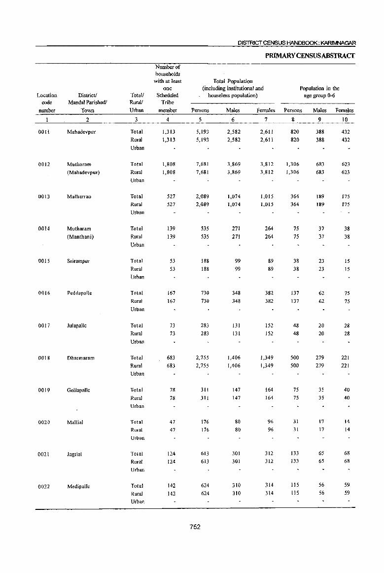
DISTRICT CENSUS HANDBOOK: KARIMNAGAR
PRIMARY CENSUS ABSTRACf
Number of households
with at least Total Population one (including institutional and Population in the
Location District! Total! Scheduled houseless population) age group 0-6 code Mandai Parishadl Rural! Tribe
number Town Urban member Persons Males Females Persons Males Females
2 3 4 5 6 7 8 9 10
0011 Mahadevpur Total 1,313 5,193 2,582 2,611 820 388 432 Rural 1,313 5,193 2,582 2,611 820 388 432 Urban
0012 Mutharam Total 1,808 7,681 3,869 3,812 1,306 683 623 (Mahadevpur) Rural 1,808 7,681 3,869 3,812 1,306 683 623
Urban
0013 Malharrao Total 527 2,089 1,074 1,015 364 189 175 Rural 527 2,089 1,074 1,015 364 189 175 Urban
0014 Mutharam Total 139 535 271 264 75 37 38 (Manthani) Rural 139 535 271 264 75 37 38
Urban
0015 Srirampur Total 53 188 99 89 38 23 15 Rural 53 188 99 89 38 23 15 Urban
0016 Peddapalle Total 167 730 348 382 137 62 75 Rural 167 730 348 382 137 62 75 Urban
0017 Julapalle Total 73 283 131 152 48 20 28 Rural 73 283 131 152 48 20 28 Urban
00J8 Dharmaram Total 683 2,755 1,406 1,349 500 279 221 Rural 683 2,755 1,406 1,349 500 279 221 Urban
0019 Gollapalle Total 78 311 147 164 75 35 40
Rural 78 311 147 164 75 35 40
Urban
0020 Mallial Total 47 176 80 96 31 17 14
Rural 47 176 80 96 31 17 14
Urban
0021 Jagtial Total 124 613 301 312 133 65 68
Rural 124 613 30) 312 133 65 68
Urban
0022 Medipalle Total 142 624 310 314 115 56 59
Rural 142 624 310 314 115 56 59
Urban
752

pARr a-p~iMARYcEI"JSUSAl3SiRACT
FORSCIW>ULiIDTRIBES
Literates Illiterates Total Workers Totall District!
Rural! I
andal Parishadl
Persons Males Females Persons Males Females Persons Males Females Urban Town
II 12 13 14 15 16 17 18 19 3 2
l.I48 757 391 4,045 1,825 2,220 3,003 1,521 1,482 Total M~hadevpur 1,148 757 391 4,045 1,825 2,220 3,003 1,521 1,482 Rural
Urban
. 1,997 1,383 614 5,684 2,486 3,198 4,581 2,282 2,299 Total MJtharam .1,997 1,383 614 5,684 2,486 3,198 4,581 2,282 2,299 Rural (M~adeVPUr)
Urban
623 417 206 1,466 657 809 1,099 554 545 Total Majharrao
623 417 206 1,466 657 809 1,099 554 545 Rural
Urban
137 88 49 398 183 215 345 179 166 Total Mutharam 137 88 49 398 183 215 345 179 166 Rural (MJnthani)
\
Urban
42 27 15 146 72 74 98 44 54 Total Srir,mpur
42 27 IS 146 72 74 98 44 54 Rural
Urban
271 155 116 459 193 266 307 174 133 Total Peddapalle \
271 155 116 459 193 266 307 174 133 Rural
Urban
I
86 58 28 197 73 ]24 157 71 86 Total Julap\alle
86 58 28 197 73 124 157 71 86 Rural
Urban
730 455 275 2,025 951 1,074 1,440 707 733 Total Dharlnaram \
730 455 275 2,025 951 1,074 1,440 707 733 Rural
Urban
45 31 14 266 116 .ISO 163 84 79 Total Gollafalle 45 31 14 266 1I6 150 163 84 79 Rural
Urban
63 35 28 113 45 68 97 47 50 Total Malli~1 63 35 28 1\3 45 68 97 47 50 Rural
Urban
200 143 57 413 158 255 325 154 171 Total Jagtial 200 143 57 413 158 255 325 154 171 Rural
Urban
156 120 36 468 190 278 343 149 194 Total Medipalle 156 120 36 468 190 278 343 149 194 Rural
Urban
753
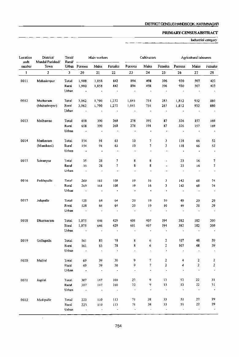
Location code
number
0011
0012
0013
0014
0015
0016
0017
0018
0019
0020
0021
0022
District! Mandai Parishadl
Town
2
Mahadevpur
Mutharam
(Mahadevpur)
Malharrao
Mutharam
(Manthani)
Srirampur
Peddapalle
Julapalle
Dharmaram
Gollapalle
Mallial
Jagtial
Medipallc
Totall Rural!
Main workers
Urban Persons Males Females Persons
3
Total
Rural
Urban
20
1,900 1,900
Total 3,062
Rural 3,062
Urban
Total 658
Rural 658
Urban
Total
Rural
Urban
Total
Rural
Urban
Total
Rural
Urban
Total
Rural
Urban
Total
Rural
Urban
Total
Rural
Urban
Total
Rural
Urban
Total
Rural
Urban
Total
Rural
Urban
154 154
35 35
269
269
128
128
1,075
1,075
161 161
69 69
307 307
223
223
21
1,058
1,058
1,790 1,790
390
390
91 91
28 28
161
161
64
64
646 646
83
83
39 39
147 147
110
110
22
842 842
1,272
1,272
268
268
63 63
7
7
108
108
64
64
429 429
78
78
30
30
160 160
113 113
754
23
894 894
1,041 1,041
278 278
10 IO
8
8
19 19
20 20
601 601
8
8
9
9
22
22
71 71
DISTRICT CENSUS HANDBOOK: KARIMNAGAR
PRIMARY CENSUS ABSTRACf
Industrial category
Cultivators Agricultural labourers
Males Females Persons Males Females
24
498
498
754 754
191
191
7
7
8
8
16 16
10 10
407 407
6
6
7
7
9
9
38 38
25
396 396
287 287
87 87
3
3
3
3
10 10
194 194
2
2
2
2
I3
13
33
33
26
930
930
1,812 1,812
326
326
118 118
23
23
142 142
49 49
382 382
107 107
4
4
53
53
51 51
27
507 507
932 932
157 157
66
66
16 16
68
68
20 20
182 182
48
48
2
2
22 22
22
22
28
423
423
880 880
169 169
52 52
7
7
74 74
29
29
200 200
59 59
2
2
31
31
29
29
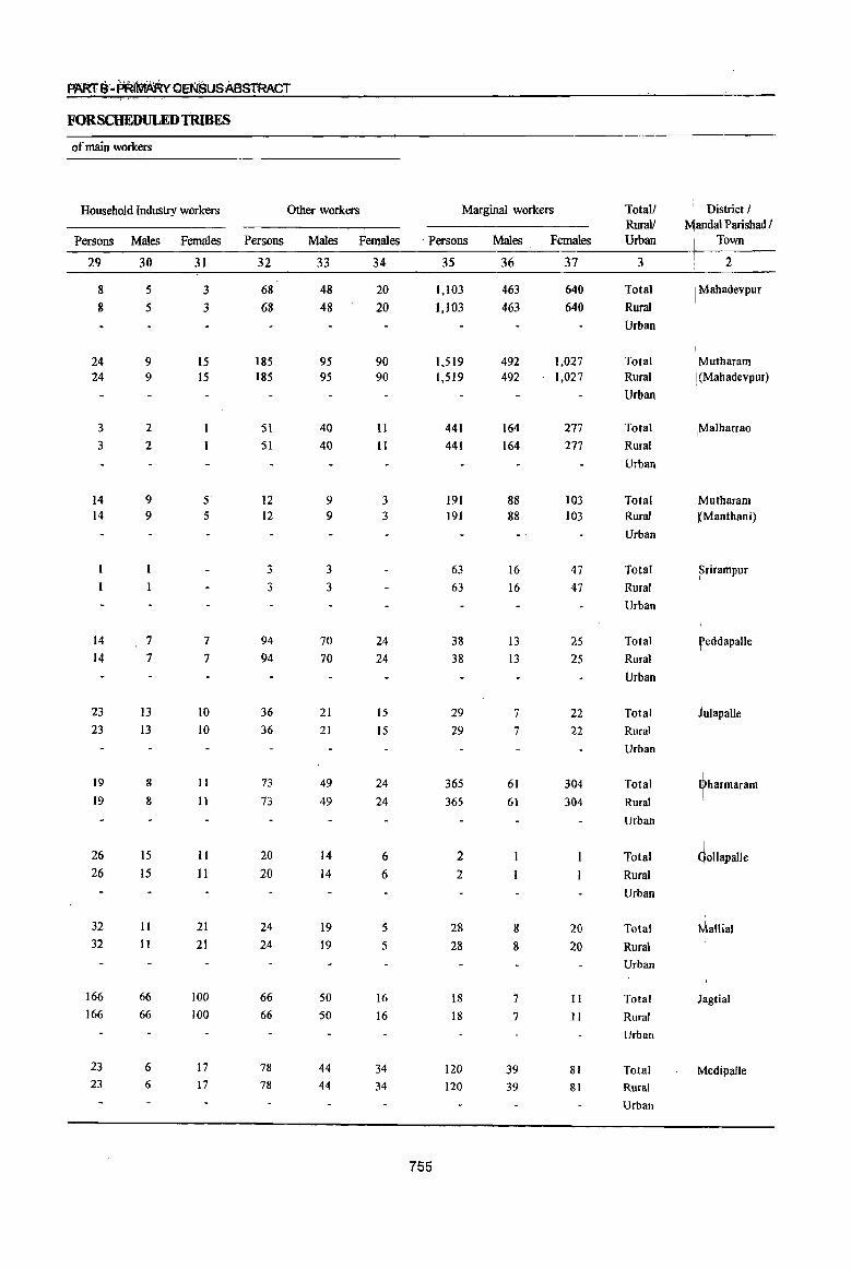
FORSCHEDULEDTlUBES
of main workers
Household Industry workers Other workers Marginal workers Totall \ District I RuraV Jandal Parisbad I
Persons Males Females Persons Males Females . Persons Males Females Urban I Town
29 30 31 32 33 34 35 36 37 3 2
8 5 3 68 48 20 1,103 463 640 Total I Mabadevpur
8 5 3 68 48 20 1,103 463 640 Rural
Urban
24 9 15 185 95 90 1.519 492 1,027 Total ~Mutharam
24 9 15 185 95 90 1,519 492 1,027 Rural I. (Mahadevpur)
Urban
3 2 51 40 11 441 164 277 Total iMa1harrao
3 2 51 40 11 441 164 277 Rural
Urban
I I
14 9 5 12 9 3 191 88 103 Total ~utharam 14 9 5 12 9 3 191 88 103 Rural I Manthani)
Urban
3 3 63 16 47 Total ~rirampur
3 3 63 16 47 Rural
Urban
14 7 7 94 70 24 38 13 25 Total teddapalle
14 7 7 94 70 24 38 13 25 Rural
Urban
23 13 10 36 21 15 29 7 22 Total Julapalle
23 13 10 36 21 15 29 7 22 Rural
Urban
19 8 II 73 49 24 365 I
61 304 Total ~harmaram 19 8 11 73 49 24 365 61 304 Rural
Urban
26 15 II 20 14 6 2 Total dollapalle
26 15 II 20 14 6 2 Rural
Urban
32 II 21 24 19 5 28 8 20 Total ~allial 32 11 21 24 19 .5 28 8 20 Rural
Urban
166 66 100 66 50 16 18 7 II Total Jagtial 166 66 100 66 50 16 18 7 11 Rural
Urban
23 6 17 78 44 34 120 39 81 Total Medipalle 23 6 17 78 44 34 120 39 81 Rural
Urban
755
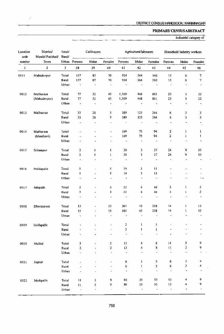
DISTRICT CENSUS HANDBOOK: KARIMNAGAR
P~YCENSUSABSTRACT
Industrial category of
Location Districtl Total/ Cultivators Agricultural labourers Household Industry workers
code Mandal Parishadl Rural!
number Town Urban Persons Males Females Persons Males Females Persons Males Females
2 3 38 39 40 41 42 43 44 45 46
0011 Mahadevpur Total 157 87 70 924 364 560 13 6 7 Rural 157 87 70 924 364 560 13 6 7 Urban
0012 Mutharam Total 77 32 45 1,309 448 861 23 22 (Mahadevpur) Rural 77 32 45 1,309 448 861 23 22
Urban
0013 Malharrao Total 33 28 5 389 125 264 6 3 3 Rural 33 28 5 389 125 264 6 3 3
Urban
0014 Mutharam Total 169 75 94 2 (Manthani) Rural 169 75 94 2
Urban
0015 Srirampur Total 2 30 3 27 24 9 15 Rural 2 30 3 27 24 9 15 Urban
0016 Peddapalle Total 5 5 14 3 11
Rural 5 5 14 3 11
Urban
0017 Julapalle Total 3 3 22 6 16 3 2
Rural 3 3 22 6 16 3 2
Urban
0018 Dharmaram Total 15 15 301 43 258 14 13
Rural 15 IS 301 43 258 14 13
Urban
0019 GollapaUe Total 2
Rural 2
Urban
0020 Mallial Total 2 2 12 4 8 II 2 9
Rural 2 2 12 4 8 II 2 9
Urban
0021 Jagtial Total 6 5 6 2 4
Rural 6 5 6 2 4
Urban
0022 Medipalle Total 11 2 9 80 25 55 13 4 9
Rural II 2 9 80 25 55 13 4 9
Urban
756

PAlus-f)~~Y CENSUS ABSTRACT
FOR SCHEDULED TRIBES
marginal workers
Other workers Non-workers Total! District! . Location
Rural! Mandai PariShadl! code
Persons Males Females Persons Males Females Urban Town number
47 48 49 50 51 52 3 2
9 6 3 2,190 1,061 1,129 Total Mahadevpur 0011
9 6 3 2,190 1,061 1,.129 Rural
Urban
110 11 99 3,100 1,587 1,513 Total Mutharam 0012
110 11 99 3,100 1,587 1,513 Rural (Mahadevpur)
Urban
13 8 5 990 520 470 Total Malharrao 0013
13 8 5 990 520 470 Rural
Urban
20 12 8 190 92 98 Total Mutharam 0014 20 12 8 190 92 98 Rural (Manthani)
Urban
7 3 4 90 55 35 Total Srirampur 0015 7 3 4 90 55 35 Rural
Urban
19 10 9 423 174 249 Total PeddapaUe 0016 19 10 9 423 174 249 Rural
Urban
126 60 66 Total Julapalle 0017 126 60 66 Rural
Urban
35 17 18 1,315 699 616 Total Dharmaram 0018 35 17 18 1,315 699 616 Rural
Urban
148 63 85 Total GoUapalle 0019 148 63 85 Rural
Urban
3 2 79 33 46 Total Mallial 0020 3 2 79 33 46 Rural
Urban
6 4 2 288 147 141 Total Jagtial 0021 6 4 2 288 147 141 Rural
Urban
16 8 8 281 161 120 Total Medipalle 0022 16 8 8 281 161 120 Rural
Urban
757
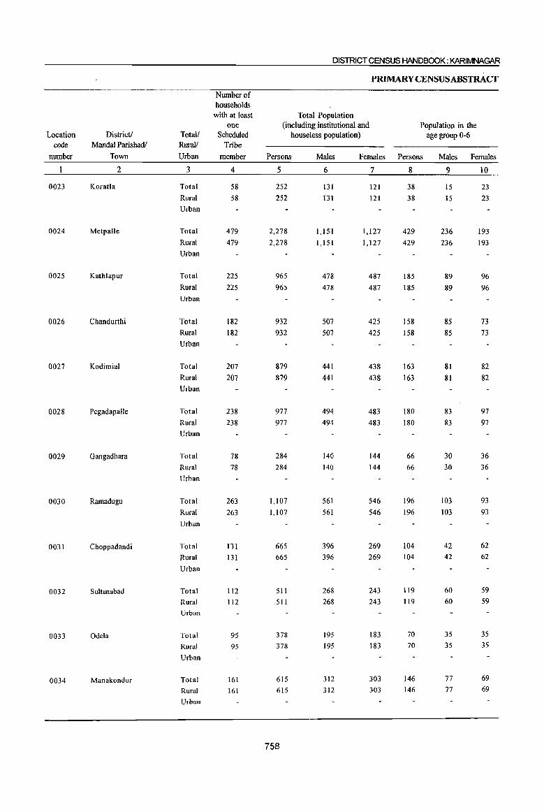
DISTRICT CENSUS HANDBOOK; KARIMNAGAR
PRIMARYCENSUSABSTRACf
Number of households
with at least Total Population one (including institutional and Population in the
Location District! Total! Scheduled houseless population) age group 0-6 code MandaI Parishadl Rural! Tribe
number Town Urban member Persons Males Females Persons Males Females
2 3 4 5 6 7 8 9 10
0023 Koratla Total 58 252 131 121 38 15 23 Rural 58 252 131 121 38 15 23 Urban
0024 Metpalle Total 479 2,278 1,151 1,127 429 236 193 Rural 479 2,278 1,151 1,127 429 236 193 Urban
0025 Kathlapur Total 225 965 478 487 185 89 96 Rural 225 965 478 487 185 89 96 Urban
0026 Chandurthi Total 182 932 507 425 158 85 73 Rural 182 932 507 425 158 85 73 Urban
0027 Kodimial Total 207 879 441 438 163 81 82 Rural 207 879 441 438 163 81 82 Urban
0028 Pegadapalle Total 238 977 494 483 180 83 97 Rural 238 977 494 483 180 83 97 Urban
0029 Gangadhara Total 78 284 140 144 66 30 36 Rural 78 284 140 144 66 30 36 Urban
0030 Ramadugu Total 263 1,107 561 546 196 103 93 Rural 263 1,107 561 546 196 103 93 Urban
0031 Choppadandi Total 131 665 396 269 104 42 62
Rural 131 665 396 269 104 42 62
Urban
0032 Sultanabad Total 112 511 268 243 119 60 59
Rural 112 511 268 243 119 60 59 Urban
0033 Odela Total 95 378 195 183 70 35 35
Rural 95 378 195 183 70 35 3S
Urban
0034 Manakondur Total 161 615 312 303 146 77 69
Rural 161 615 312 303 146 77 69
Urban
758
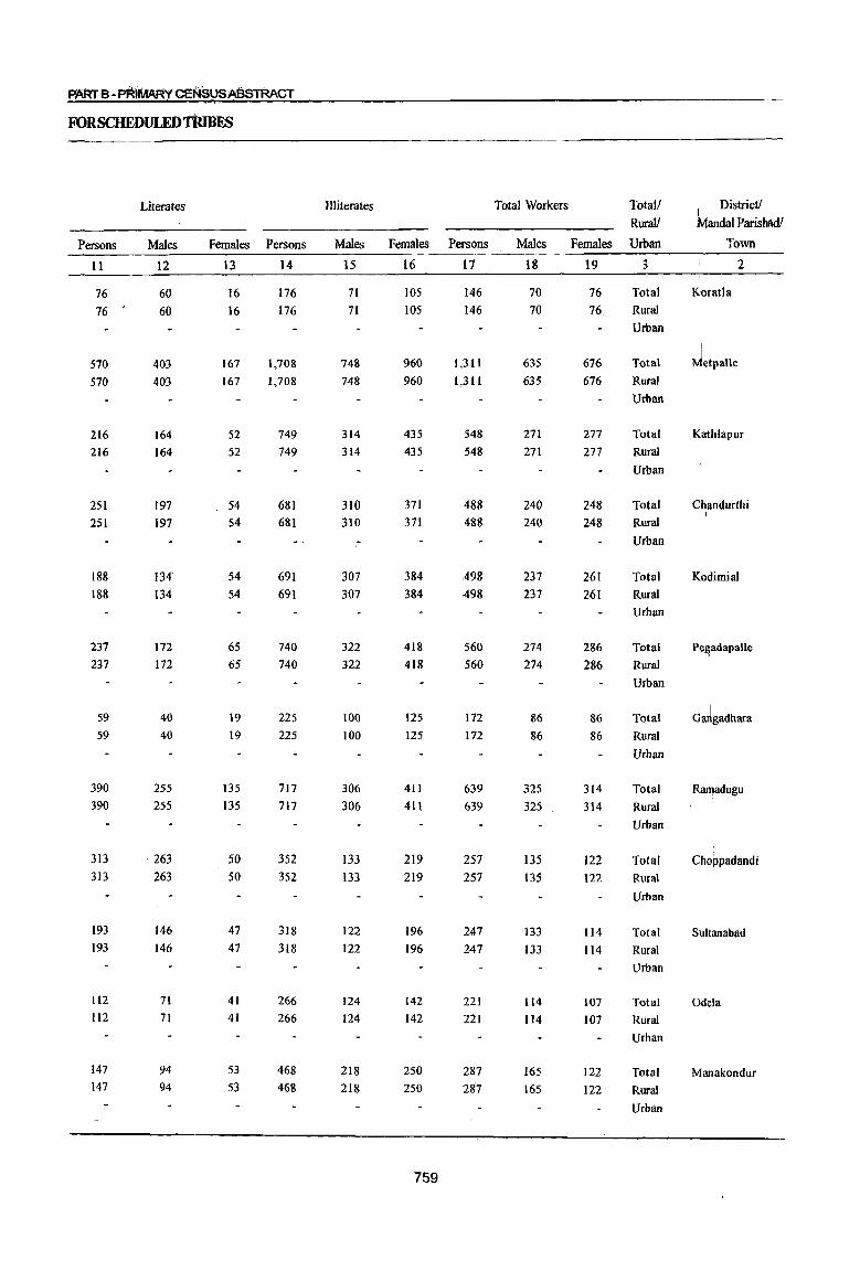
FORSCHEDULEDTRmES
Literates Illiterates Total Workers Total/ District! Rural! MandaI Parishadl
Persons Males Females PersOnS Males Females Rersons Males Females Urban Town
11 12 13 14 15 16 17 18 19 3 2 ,
76 60 16 176 71 105 146 70 76 Total Koratla
76 60 16 176 7l 105 146 70 76 Rural Urban
I
570 403 167 1,708 748 960 1,311 635 676 Total ~etPalie 570 403 167 1,708 748 960 1,311 635 676 Rural
Urban
216 164 52 749 314 435 548 271 277 Total K~thlapur
216 164 52 749 314 435 548 271 277 Rural
Urban
251 197 54 681 310 371 488 240 248 Total Chandurthi I
251 197 54 681 310 371 488 240 248 Rural
Urban
188 134' 54 691 307 384 ,498 237 261 Total Kodirnial 188 134 54 691 307 384 A98 237 261 Rural
Urban
237 172 65 740 322 418 560 274 286 Total Pe~adapalle
237 172 65 740 322 418 560 274 286 Rural
Urban
I 59 40 19 225 100 125 172 86 86 Total Gm1gadhara 59 40 19 225 100 125 172 86 86 Rural
Urban
390 255 135 717 306 411 639 325 314 Total Ramadugu 390 255 135 717 306 411 639 325 314 Rural
Urban
313 263 50 352 133 219 257 135 122 Total Cho~padandi 313 263 50 352 133 219 257 135 122 Rural I
Urban
193 146 47 318 122 196 247 133 114 Total Sultanabad 193 146 47 318 122 196 247 133 114 Rural
Urban
1I2 71 41 266 124 142 221 114 107 Total Odela 1I2 71 41 266 124 142 221 114 107 Rural
Urban
147 94 53 468 218 250 287 165 122 Total Manakondur 147 94 53 468 218 250 28'7 165 122 Rural
Urban
759

Location code
number
0023
0024
0025
0026
0027
0028
0029
0030
0031
0032
0033
0034
District! MandaI Parishadl
Town
2
KoratJa
Metpalle
Kathlapur
Chandurthi
Kodimial
PegadapaUe
Gangadhara
Ramadugu
Choppadandi
Sultanabad
Odela
Manakondur
Totall Rural!
Main workers
Urban Persons Males Females Persons
3
Total
Rural
Urban
Total Rural
Urban
Total Rural
Urban
Total
Rural Urban
Total Rural
Urban
Total Rural
Urban
Total Rural Urban
Total
Rural
Urban
Total Rural
Urban
Total
Rural Urban
Total Rural
Urban
Total Rural Urban
20
126
126
1,211 1,211
516 516
458 458
465
465
462 462
161 161
495
495
222
222
159
159
206
206
268 268
21
61
61
607 607
253 253
228
228
224 224
248 248
83 83
251
251
127
127
103
103
III
III
159 159
22
65
65
604 604
263
263
230
230
241 241
214 214
78
78
244
244
95
95
56
56
95 95
109
109
760
23
3
3
486 486
309 309
272
272
293
293
293 293
5
5
198
198
48
48
12
12
52 52
24 24
DISTRICT CENSUS HANDBOOK: KARIMNAGAR
PRIMARY CENSUS ABSTRACf
Industrial category
Cultivators Agricultural labourers
Males Females Persons Males Females
24
226 226
154 154
137
137
142 142
162 162
3
3
102
102
27 27
9
9
46 46
14 14
25
2 2
260 260
155 155
135
135
lSI
lSI
131 131
2
2
96
96
21 21
3
3
6
6
10
10
26
35 35
386 386
150
150
138
138
31 31
87 87
35 35
189
189
69
69
43 43
134 134
141 141
27
20 20
163
163
66 66
69 69
11
II
41 41
18 18
87
87
34 34
18
18
48 48
65 65
28
15 15
223 223
84 84
69 69
20 20
46 46
17 17
102
102
35
35
25 25
86 86
76 76
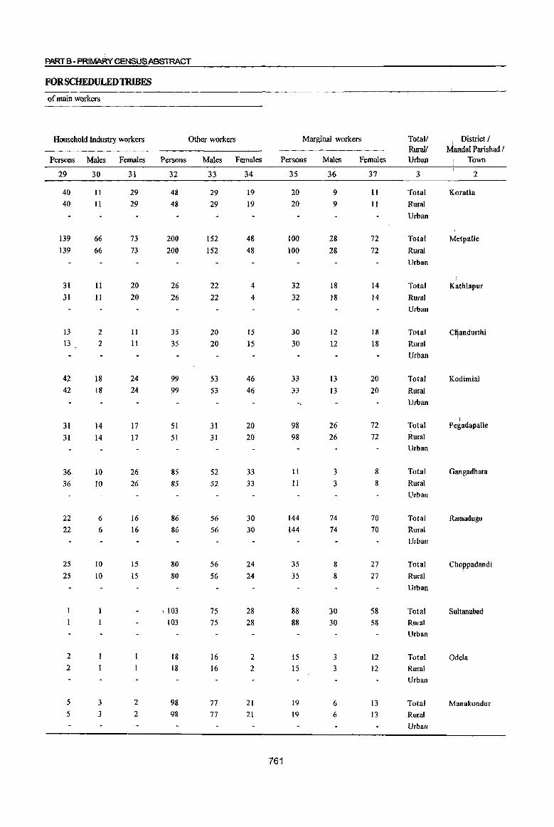
pARTS-PRIMARY CEN$USABSTRACT
FOR SCHEDULED TRIBES
of main workers
Household Industry workers Other workers Marginal workers Totall I
District / Rural! MandaI Parishad I
Persons Males Females Persons Males Females Persons Males Females Urban I
Town
29 30 31 32 33 34 35 36 37 3 2
40 II 29 48 29 19 20 9 11 Total K;oratla
40 11 29 48 29 19 20 9 11 Rural
Urban
139 66 73 200 152 48 100 28 72 Total ~etPalie 139 66 73 200 152 48 100 28 72 Rural
Urban
31 II 20 26 22 4 32 18 14 Total Kathlapur 3] II 20 26 22 4 32 18 14 Rural
Urban
13 2 II 35 20 15 30 12 18 Total c~andurthi 13 2 II 35 20 15 30 12 18 Rural
Urban
42 18 24 99 53 46 33 13 20 Total Kodirnial 42 18 24 99 53 46 33 13 20 Rural
Urban
I 31 14 17 51 31 20 98 26 72 Total Pegadapalle
31 14 17 51 31 20 98 26 72 Rural Urban
36 10 26 85 52 33 II 3 8 Total Gangadhara
36 10 26 85 52 33 II 3 8 Rural Urban
22 6 16 86 56 30 144 74 70 Total Rarnadugu 22 6 16 86 56 30 144 74 70 Rural
Urban
25 10 15 80 56 24 35 8 27 Total Choppadandi 25 10 15 80 56 24 35 8 27 Rural
Urban
\ 103 75 28 88 30 58 Total Sultanabad 103 75 28 88 30 58 Rural
Urban
2 18 16 2 15 3 12 Total Odela 2 18 16 2 15 3 12 Rural
Urban
5 3 2 98 77 21 19 6 13 Total Manakondur 5 3 2 98 77 21 19 6 13 Rural
Urban
761
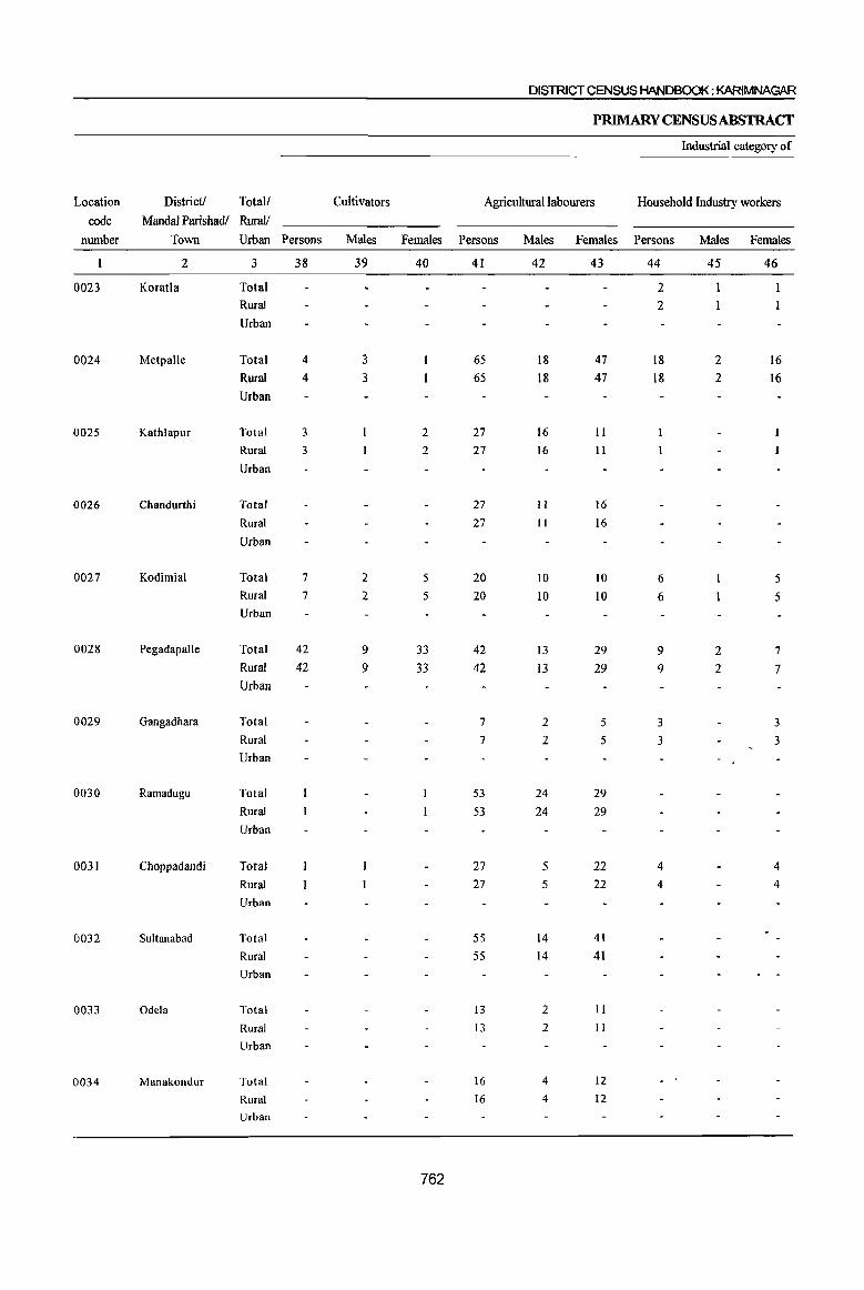
DISTRICT CENSUS HANDBOOK: KARIMNAGIIR
PRIMARY CENSUS ABSTRACf
Industrial category of
Location District! Total! Cultivators Agricultural labourers Household Industry workers
code Mandai Parishadl Rural! number Town Urban Persons Males Females Persons Males Females Persons Males Females
2 3 38 39 40 41 42 43 44 45 46
0023 Koratla Total 2 Rural 2 Urban
0024 Metpalle Total 4 3 65 18 47 18 2 16 Rural 4 3 65 18 47 18 2 16 Urban
0025 Kathlapur Total 3 2 27 16 II
Rural 3 2 27 16 II
Urban
0026 Chandurthi Total 27 II 16 Rural 27 II 16
Urban
0027 Kodimial Total 7 2 5 20 10 10 6 5 Rural 7 2 5 20 10 10 6 5 Urban
0028 Pegadapa\le Total 42 9 33 42 13 29 9 2 7 Rural 42 9 33 42 13 29 9 2 7 Urban
0029 Gangadhara Total 7 2 5 3 3 Rural 7 2 5 3 3 Urban
0030 Ramadugu Total 53 24 29 Rural 53 24 29 Urban
0031 Choppadandi Total 27 5 22 4 4 Rural 27 5 22 4 4 Urban
0032 Sultanabad Total 55 14 41 Rural 55 14 41 Urban
0033 Odela Total 13 2 II
Rural 13 2 11
Urban
0034 Manakondur Total 16 4 12
Rural 16 4 12 Urban
762
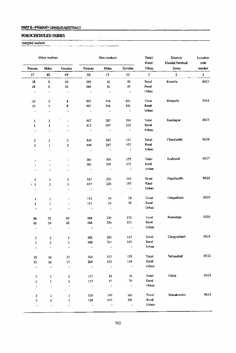
PARtS-PRIMARY ~SUSABSTRACT
FORSCHEDULEDTRlBES
marginal workers
Other workers Non-workers Totall Districll Location
Rural! Mandai Parishadl code
Persons Males Females Persons Males F~males Urban Town number
~7 48 49 50 51 52 3 2
18 8 10 106 61 45 Total Koratla 0023
18 8 I() 106 61 ,45 Rural
Urban
.13 5' 8 967 516 451 Total Metpalle 0024
13 5 8 967 516 451 Rural
Urban
417 207 210 Total Kathlapur 0025
417 207 210 Rural
Urban
3 2 444 267 In Total Chandurtbi 0026
3 1 444 267 177 Rural
Urban
381 204 177 Total Kodimial 0027
3&l 204 177 Rural
Urban
5 2 3 417 220 197 Total Pegadapalle 0028
, 5 2 3 417 220 197 Rural
Urban
ll2 54 58 Total Gangadhara 0029
112 54 58 Rural
Urban
90 50 40 468 236 232 Total Ramadugu 0030
90 50 40 468 236 232 Rural
Urban
3 2 408 261 147 Total Choppadandi 0031
3 2 408 261 147 Rural
Urban
33 16 17 264 135 129 Total Sultanabad 0032
33 16 17 264 135 l29 Rural Urban
2 157 81 76 Total Odela 0033
2 157 81 76 Rural
Urban
3 2 328 147 181 Total Manakondur 0034
3 2 328 ]47 181 Rural
Urban
763
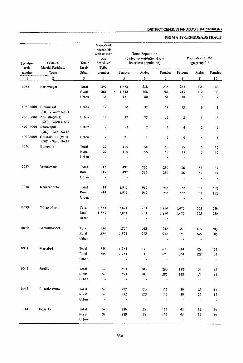
DISTRICT CENSUS HANDBOOK: KARIMNAGAR
P~YCENSUSABSTRAcr
Number of households with at least Total Population
one (including institutional and Population in the
Location District! Total/ Scheduled houseless population) age group 0-6
code Mandai Parishadl Rural! Tribe
number Town Urban member Persons Males Females Persons Males Females
2 3 4 5 6 7 8 9 10
0035 Karimnagar Total 397 1,673 838 835 273 131 142 Rural 361 1,542 758 784 245 112 133
Urban 36 131 80 51 28 19 9
40306000 Bommakal Urban 12 50 32 18 12 9 3 (OG) - Ward No.11
40306000 Arepalle(Part ) Urban 10 37 22 15 8 5 3 (OG) - Ward No.12
40306000 Sitarampur Urban 7 23 12 11 4 2 2 (OG) - Ward No.13
40306000 Cbintakunta (Part) Urban 7 21 14 7 4 3 (00) - Ward No.14
0036 Boinpalle Total 27 114 56 58 15 5 10 Rural 27 114 56 58 15 5 10 Urban
0037 Vemulawada Total 118 497 267 230 86 53 33 Rural 1I8 497 267 230 86 53 33 Urban
0038 Konaraopeta Total 414 1,915 967 948 329 177 152 Rural 414 1,915 967 948 329 177 152 Urban
0039 Ycllareddipet Total 1,563 7,611 3,761 3,850 1,475 725 750 Rural 1,563 7,611 3,761 3,850 1,475 725 750 Urban
0040 Gam bh iraopet Total 394 1,854 912 942 350 165 185 Rural 394 1,854 912 942 350 165 185 Urban
0041 Mustabad Total 255 1,254 631 623 244 129 115 Rural 255 1,254 631 623 244 129 115 Urban
0042 Sircilla Total 147 593 303 290 118 54 64 Rural 147 593 303 290 118 54 64 Urban
0043 Ellanthakunta Total 57 232 120 112 39 22 17 Rural 57 232 120 112 39 22 17
Urban
0044 Bejjanki Total 102 380 188 192 65 31 34 Rural 102 380 188 192 65 31 . 34
Urban
764
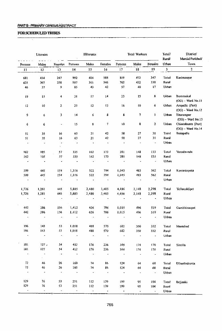
PARTB-P~IMARv ~StJSA8STRACT
FORSCHEDULEDTRmES
Persons
11
681
635 46
19
12
9
6
51 51
162
162
599 599
1,726
1,726
442
442
196
196
181
181
72
72
129
129
Literates
Mal~
12
434
397
37
15
to
6
6
35 35
105 105
445
445
1,281
1,281
286
286
143
143
127 I
127
46
46
76
76
Females Persons
13 14
247 992
238 907
9
4
2
3
16
16
57 57
154
154
445
445
156 156
53 53
S4
54
26 26
53
53
85
31
25
14
15
63
63
335
335
1,316
1,316
5,885
5,885
1,412
1,412
1,058
1,058
412
412
160 160
251 251
Illiterates
Males
15
404
361 43
17
12
6
8
21
21
162 162
522 522
2,480
2,480
626 626
488
488
176
176
74 74
112
112
Females P!,!fsons
16 ' 17
588 819
546 762 42
14
13
8
7
42
42
173
173
794 794
3,405
3,405
786 786
570
570
236
236
86
86
139 139
765
57
23
16
8
10
58
58
281
281
1,045
1,045
1,015
1,015
682
682
34~
344
124 124
199 199
Total Workers
Males
18
472
432 40
15
IO
7
8
27
27
148
148
483 483
2,148
2,148
496 496
350
350
174
174
64
64
95 9S
Total!
Rural!
District!
MandaI Parishadl
Females Urban Town
19 3 2
347 Total Karimnagar
330 Rural
17
8
6
2
31
31
133
133
562 562
2,298
2,298
519 519
332
332
170 170
60
60
104
104
Urban
Urban Bommakal
(OG) - Ward No.1 I
Urban ArepaUe (Part)
(OG) - Ward No.l2
Urban Sitarampur
(OG) - Ward No.13
Urban Chintakunta (Part)
(OG) - Ward No.14
Total Boinpalle
Rural
Urban
Total Vemulawada
Rural
Urban
Total Konaraopeta
Rural
Urban
Total Yellareddipet
Rural
Urban
Total Gambhiraopet
Rural
Urban
Total Mustabad
Rural
Urban
Total Sircilla
Rural
Urban
Total Ellanthakunta
Rural
Urban
Total Bejjanki
Rural
Urban
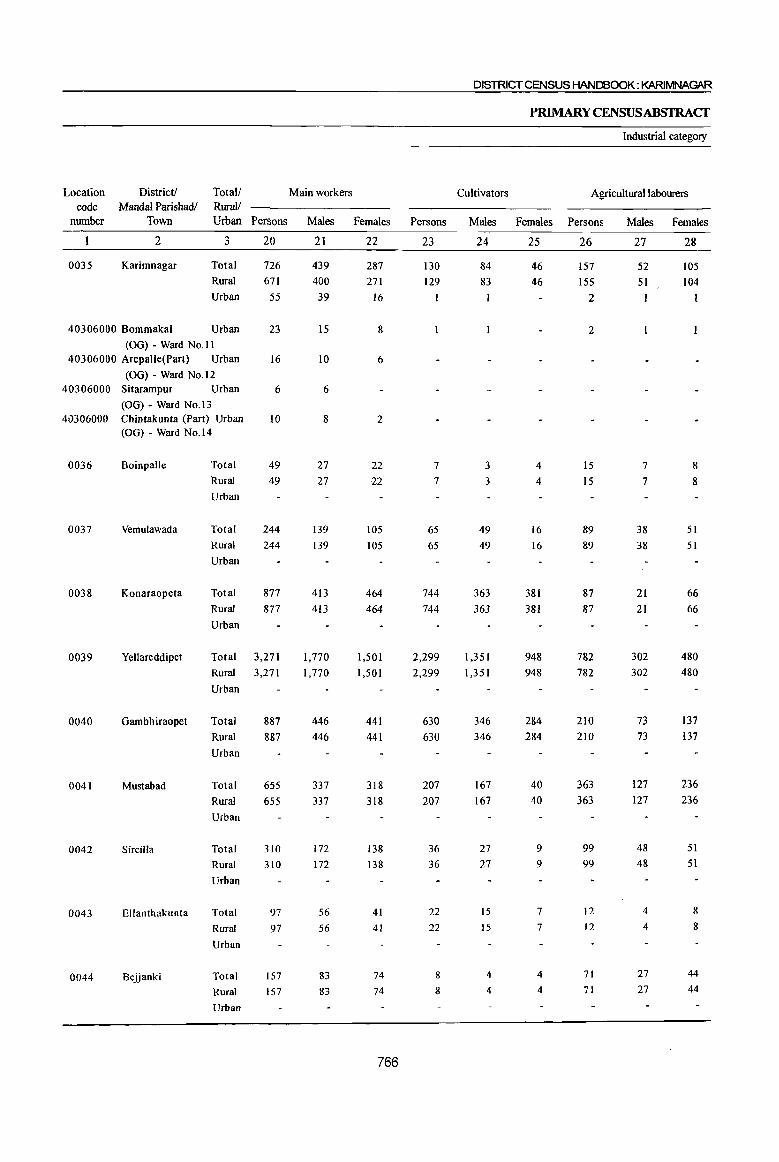
DISTRICT CENSUS HANDBOOK: KARlMNAGAR
PRIMARY CENSUSABSTRACf
Industrial category
Location District! Total! Main workers Cultivators Agricultural labourers code Mandal Parishadl RuraV
number Town Urban Persons Males Females Persons Males Females Persons Males Females
2 3 20 21 22 23 24 25 26 27 28
0035 Karimnagar Total 726 439 287 130 84 46 157 52 lOS Rural 671 400 271 129 83 46 155 51 104
Urban 55 39 16 1 2 1 I
40306000 Bommaka1 Urban 23 15 8 2 (00) - Ward No.11
40306000 Arepalle(Part) Urban 16 10 6
(00) - Ward No.l2 40306000 Sitarampur Urban 6 6
(00) - Ward No.13 40306000 Chintakunta (Part) Urban 10 8 2
(00) - Ward No.14
0036 Boinpalle Total 49 27 22 7 3 4 IS 7 8
Rural 49 27 22 7 3 4 15 7 8
Urban
0037 Vemulawada Total 244 139 105 65 49 16 89 38 51
Rural 244 139 105 65 49 16 89 38 51
Urban
0038 Konaraopeta Total 877 413 464 744 363 381 87 21 66
Rural 877 413 464 744 363 381 87 21 66
Urban
0039 Yellareddipet Total 3,271 1,770 1,501 2,299 1,351 948 782 302 480
Rural 3,271 1,770 1,501 2,299 1,351 948 782 302 480
Urban
0040 Gambhiraopet Total 887 446 441 630 346 284 210 73 137
Rural 887 446 441 630 346 284 210 73 137
Urban
0041 Mustabad Total 655 337 318 207 167 40 363 127 236
Rural 655 337 318 207 167 40 363 127 236
Urban
0042 Sircilla Total 310 172 138 36 27 9 99 48 51
Rural 310 172 138 36 27 9 99 48 51
Urban
0043 Ellanthakunta Total 97 56 41 22 15 7 12 4 8
Rural 97 56 41 22 15 7 12 4 8
Urban
0044 Bejjanki Total 157 83 74 8 4 4 71 27 44
Rural 157 83 74 8 4 4 71 27 44
Urban
766
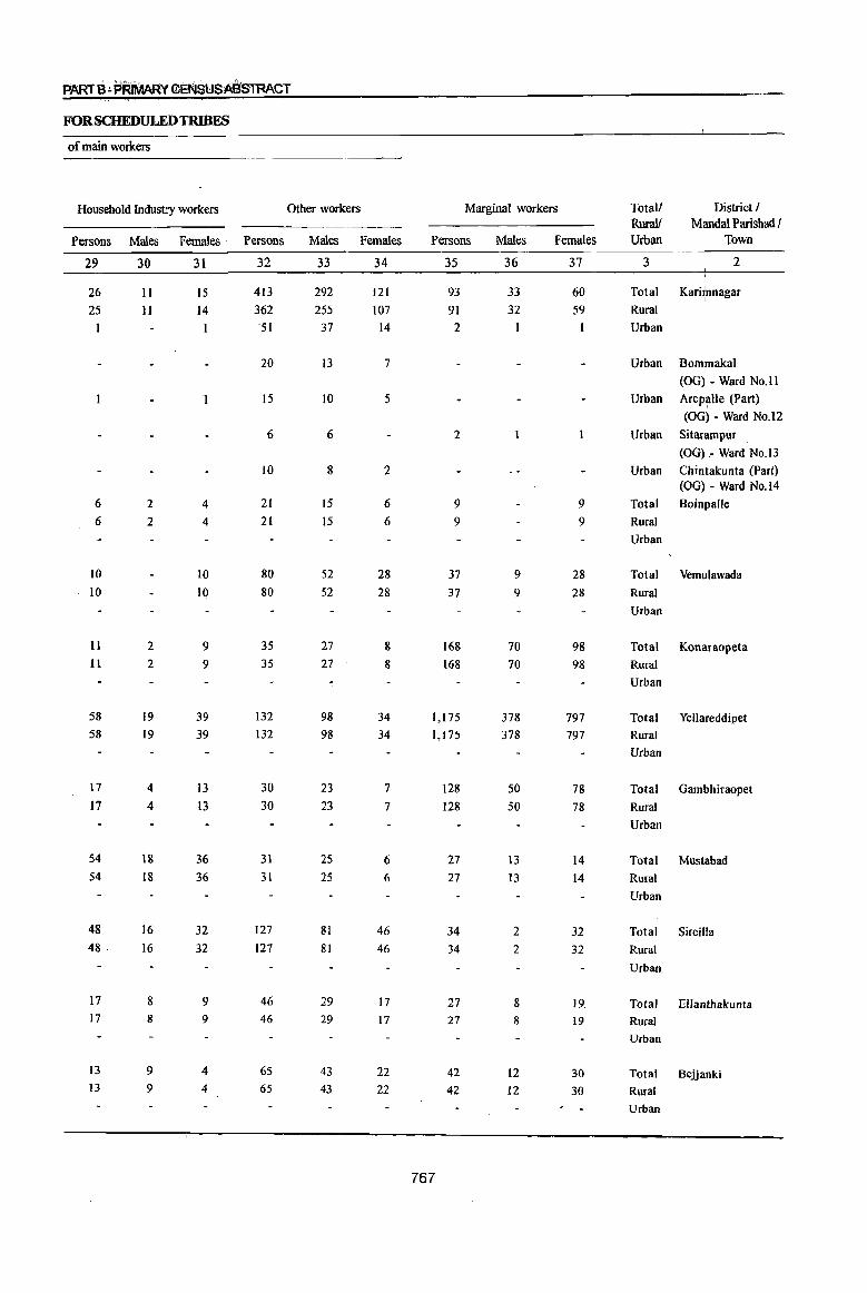
P.AR1 B ~ PRiMARY €a\lSUSASSTRACT
FORSCHEDULEDTRIBES
of main workers
Household Industry workers Other workers Marginal workers Total/ District/ Ruralf Mandai Parishad I
Persons Males Females . Persons Males Females Persons Males Females Urban Town
29 30 31 32 33 34 35 36 37 3 2
26 11 15 413 292 121 93 33 60 Total Kari?tnagar
25 Il 14 362 255 107 91 32 59 Rural -51 37 14 2 Urban
20 13 7 Urban Bommakal
(OG) - Ward No.1l
15 10 5 Urban Arep~lIe (Part)
(OG) - Ward No.l2
6 6 2 Urban Sitarampur
(OG) - Ward No.13
10 8 2 Urban Chintakunta (Part) (OG) - Ward No.14
6 2 4 21 15 6 9 9 Total Boinpalle
6 2 4 21 15 6 9 9 Rural
Urban
IO 10 80 52 28 37 9 28 Total Vemulawada
10 10 80 52 28 37 9 28 Rural
Urban
11 2 9 35 27 8 168 70 98 Total Konaraopeta II 2 9 35 27 8 168 70 98 Rural
Urban
58 19 39 132 98 34 1,175 378 797 Total Yellareddipet 58 19 39 132 98 34 1,175 378 797 Rural
Urban
17 4 13 30 23 7 128 50 78 Total Gambhiraopet 17 4 13 30 23 7 128 50 78 Rural
Urban
54 18 36 31 25 6 27 13 14 Total Mustabad 54 18 36 31 25 6 27 13 14 Rural
Urban
48 16 32 127 81 46 34 2 32 Total Sircilla 48 16 32 127 81 46 34 2 32 Rural
Urban
17 8 9 46 29 17 27 8 19. Total Ellanthakunta 17 8 9 46 29 17 27 8 19 Rural
Urban
13 9 4 65 43 22 42 12 30 Total Bejjanki 13 9 4 65 43 22 42 12 30 Rural
Urban
767
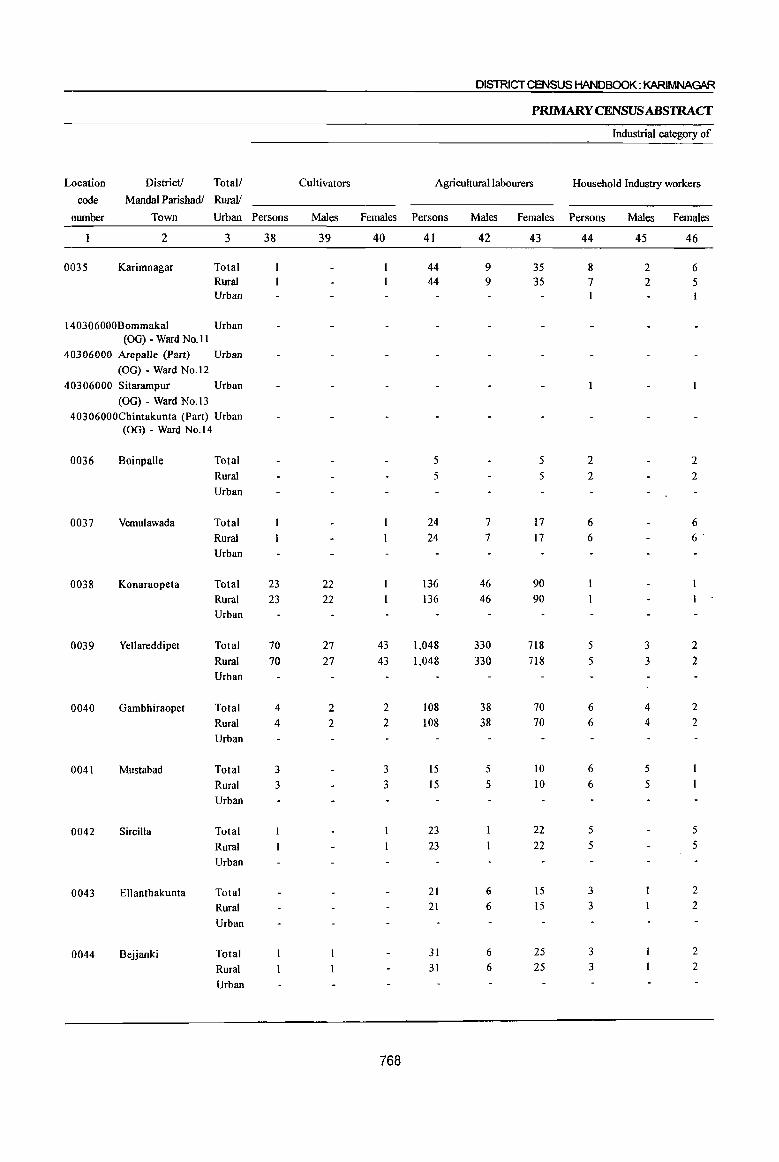
DISlRICTCENSUS HANDBOOK: KARIMNAGAR
PRIMARY CENSUS ABSlRACf
Industrial category of
Location District! Total/ eu lti vators Agricultural labourers Household Industry workers
code Mandai Parishadl RuraIJ
number Town Urban Persons Males Females Persons Males Females Persons Males Females
2 3 38 39 40 41 42 43 44 45 46
0035 Karimnagar Total 44 9 35 8 2 6 Rural 44 9 35 7 2 5 Urban
140306000Bommakal Urban (OG) - Ward No. II
40306000 Arepal1e (Part) Urban
(OG) - Ward No.12
40306000 Sitarampur Urban
(00) - Ward NO.13 40306000Chintakunta (Part) Urban
(OG) - Ward No.14
0036 Boinpalle Total 5 5 2 2
Rural 5 5 2 2
Urban
0037 Vemulawada Total 24 7 17 6 6
Rural 24 7 17 6 6·
Urban
0038 Konaraopeta Total 23 22 136 46 90
Rural 23 22 136 46 90
Urban
0039 Yellareddipet Total 70 27 43 1,048 330 718 5 3 2
Rural 70 27 43 1,048 330 718 5 3 2
Urban
0040 Oambhiraopet Total 4 2 2 108 38 70 6 4 2
Rural 4 2 2 108 38 70 6 4 2
Urban
0041 Mustabad Total 3 3 15 5 10 6 5
Rural 3 3 15 5 10 6 5
Urban
0042 Sircilla Total 23 22 5 5
Rural 23 22 5 5
Urban
0043 Ellanthakunta Total 21 6 15 3 2
Rural 21 6 15 3 2
Urban
0044 Bejjanki Total 31 6 25 3 2
Rural 31 6 25 3 2
Urban
768

PART B-,pFiIMARY dNSUSABSTRACT
FORSCHEDULEDTRlBES
marginal workers
Other workers Non-workers Total! District! Location
RuraV MandaI Parishad/ code
Persons Males Females Persons Males Females Urban Town number
47 48 49 50 51 52 3 2
40 22 18 854 366 488 Total Karimnagar 0035
39 21 18 780 326 454 Rural
74 40 34 Urban
27 17 10 Urban Bommaka 40306000
(OG) - Ward NO.ll
21 12 9 Urban Arepalle (Part) 40306000
(OG) - Ward No.12
15 5 10 Urban Sitarampur 40306000
(OG) - Ward No.13
II 6 5 Urban Chintakunta (Part) 40306000
(OG) - Ward No.14
2 2 56 29 27 Total Boinpalle 0036
2 2 56 29 27 Rural
Urban
6 2 4 216 119 97 Total Vemulawada 0037
6 2 4 216 119 97 Rural
Urban
8 2 6 870 484 386 Total Konaraopeta 0038
8 2 6 870 484 386 Rural
Urban
52 18 34 3,165 1,613 1,552 Total Yellareddipet 0039
52 18 34 3,165 1,613 1,552 Rural
Urban
10 6 4 839 416 423 Total Gambhiraopet 0040
10 6 4 839 416 423 Rural
Urban
3 3 572 281 291 Total Mustabad 0041
3 3 572 281 291 Rural
Urban
5 4 249 129 120 Total Sircilla 0042
5 4 249 129 120 Rural
Urban
3 2 108 56 52 Total ElJanthakunta 0043
3. 2 108 56 52 Rural
Urban
7 4 3 181 93 88 Total Bejjanki 0044
7 4 3 181 93 88 Rural
Urban
769

DISTRICT CENSUS HANDBOOK: KARIMNAGtIR
P~YCENSUSABSTRACT
Number of households with at least Total Population
one (including institutional and Population in the Location District! Total! Scheduled houseless population) age group 0-6
code Mandai Parishadl Rural! Tribe
humber Town Urban member Persons Males Females Persons Males Females
2 3 4 5 6 7 8 9 10
0045 Timmapur Total 130 466 243 223 88 39 49
(LMD Colony) Rural 130 466 243 223 88 39 49
Urban
()046 Veenavanka Total 208 778 387 391 143 66 77 Rural 208 778 387 391 143 66 77 Urban
0047 Jammikunta Total 195 785 377 408 151 62 89 Rural 195 785 377 408 151 62 89 Urban
0048 Shankarapatnam Total 45 189 103 86 20 II 9 Rural 45 189 103 86 20 11 9 Urban
0049 Chigurumamidi Total 83 363 177 186 62 26 36 Rural 83 363 177 186 62 26 36 Urban
0050 Koheda Total 261 1,100 541 559 196 83 113 Rural 261 1,100 541 559 196 83 113 Urban
0051 Husnabad Total 1,802 8,260 4,287 3,973 1,509 774 735 Rural 1,802 8,260 4,287 3,973 1,509 774 735 Urban
0052 Saidapur Total 191 870 471 399 131 71 60 Rural 191 870 471 399 131 71 60 Urban
0053 Huzurabad Total 139 527 264 263 98 47 51 Rural 139 527 264 263 98 47 51 Urban
0054 Kamalapur Total 63 275 144 131 52 28 24 Rural 63 275 144 131 52 28 24
Urban
0055 Bheemadevarpalle Total 935 4,051 2,070 1,981 641 311 330 Rural 935 4,051 2,070 1,981 641 311 330
Urban
0056 Elkathurthi Total 98 414 205 209 51 27 24
Rural 98 414 205 209 51 27 24
Urban
770
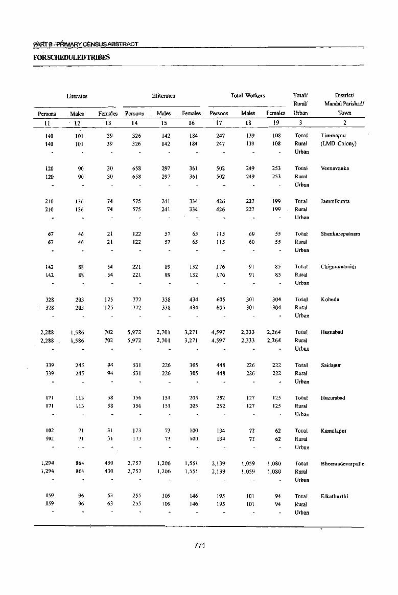
PARt S.:P'RIMARY CENSUS ABSTRACT
FORSCHEDULED'fRIBES
Literates Illiterates Total Workers Totall District!
Rurnl/ Mandai ParishadJ
Persons Males Females Persons Males Females Persons Males Females Urban Town ,
11 12 13 14 15 16 17 18 19 3 2
140 101 39 326 142 184 247 139 108 Total Timmapur
140 101 39 326 142 184 247 139 108 Rural (LMD Colony)
Urban
120 90 30 658 297 361 502 249 253 Total Veenavanka
120 90 30 658 297 361 502 249 253 Rural
Urban
210 136 74 575 241 334 426 227 199 Total lammikunta
210 136 74 575 241 334 426 227 199 Rural
Urban
67 46 21 122 57 65 115 60 55 Total Shankarapatnam
67 46 21 122 57 65 115 60 55 Rural
Urban
142 88 54 221 89 132 ;176 91 85 Total Chigurumamidi
142 811 S4 221 89 132 ,176 91 85 Rural
Urban
328 203 125 772 338 434 (i05 301 304 Total Koheda , 328 203 125 772 338 434 605 301 304 Rural
Urban
2,288 1,586 702 5,972 2,701 3,271 4,597 2,333 2,264 Total Husnabad
2,288 1,586 702 5,972 2,701 3,271 4,597 2,333 2,264 Rural
Urban
339 245 94 531 226 305 448 226 222 Total Saidapur
339 245 94 531 226 305 448 226 222 Rural
Urban
171 113 58 356 151 205 252 127 125 Total Huzurabad
171 113 58 356 151 205 252 127 125 Rural
Urban
102 71 31 173 73 100 134 72 62 Total Kamalapur 102 71 31 173 73 100 B4 72 62 Rural
Urban
1,294 864 430 2,757 1,206 1,551 2,139 1,059 1,080 Total Bheemadevarpalle 1,294 864 430 2,757 1,206 1,551 2,139 1,059 1,080 Rural
Urban
159 96 63 255 109 146 195 lOl 94 Total Elkathurthi .159 96 63 255 109 146 195 101 94 Rural
Urban
771
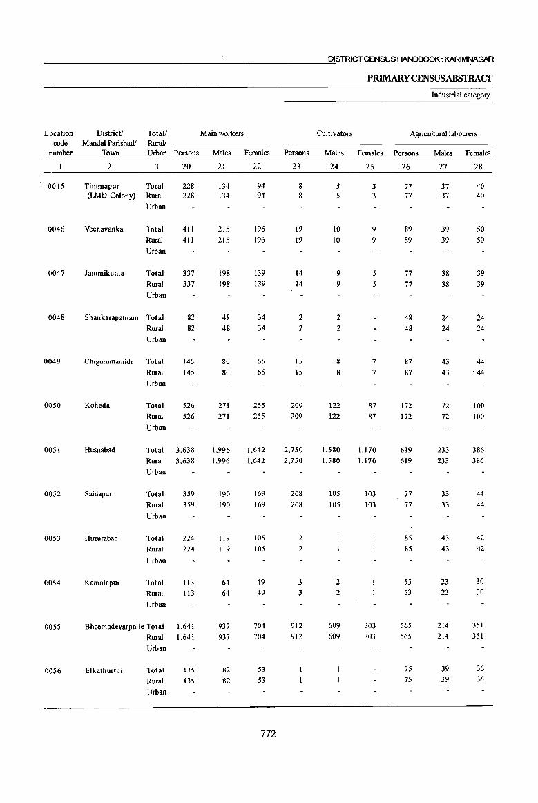
DISTRICT CENSUS HANDBOOK: KARIMNAGAR
PRIMARYCENSUSABSTRACf
lndusbial category
Location District! Totall Main workers Cultivators Agricultural labourers code Mandai Parishadl RuralJ
number Town Urban Persons Males Females Persons Males Females Persons Males Females
2 3 20 21 22 23 24 25 26 27 28
0045 Timmapur Total 228 134 94 8 5 3 77 37 40 (LMD Colony) Rural 228 134 94 8 5 3 77 37 40
Urban
0046 Veenavanka Total 411 215 196 19 10 9 89 39 50 Rural 411 215 196 19 10 9 89 39 50 Urban
0047 Jammikunta Total 337 198 139 14 9 5 77 38 39 Rural 337 198 139 14 9 5 77 38 39 Urban
0048 Shankarapatnam Total 82 48 34 2 2 48 24 24 Rural 82 48 34 2 2 48 24 24 Urban
0049 Chigurumamidi Total 145 80 65 IS 8 7 87 43 44 Rural 145 80 65 15 8 7 87 43 . 44
Urban
0050 Koheda Total 526 271 255 209 122 87 172 72 100 Rural 526 271 255 209 122 87 172 72 100 Urban
0051 Husnabad Total 3,638 1,996 1,642 2,750 1,580 1,170 619 233 386 Rural 3,638 1,996 1,642 2,750 1,580 1,170 619 233 386 Urban
0052 Saidapur Total 359 190 169 208 105 103 77 33 44 Rural 359 190 169 208 105 103 77 33 44
Urban
0053 Huzurabad Total 224 119 105 2 85 43 42 Rural 224 119 105 2 85 43 42
Urban
0054 Kamalapur Total 113 64 49 3 2 53 23 30
Rural 113 64 49 3 2 53 23 30
Urban
0055 Bheemadevarpalle Total 1,641 937 704 912 609 303 565 214 351
Rural 1,641 937 704 912 609 303 565 214 351
Urban
0056 Elkathurthi Total 135 82 53 75 39 36
Rural 135 82 53 75 39 36
Urban
772
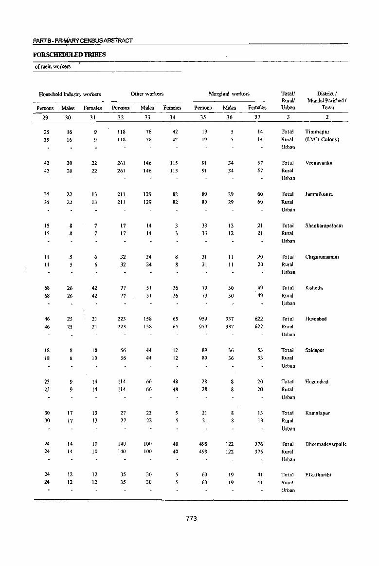
PARTB- PRIMARY CENSUS ABSTRACT
FORSCHEDULEDTRIBES
of main workers
Household Industry workers
Persons Males Females Persons
29 30 31 32
25 16 9 118 25 16 9 118
42
42
35 35
15 15
11 11
68 68
46 46
18 18
23 23
30 30
24 24
24 24
20 20
22 22
8 8
5
5
26 26
2S 2S
8
8
9 9
17
17
14 14
12 12
22
22
13 13
7 7
6
6
42
42
21 21
10
10
14 14
13
13
10
10
12 12
261 261
211 211
17 17
32
32
77
77
223
223
56
S6
114
114
27 27
140 140
35 35
Other workers
Males Females
33 34
76 42 76 42
146 146
129
129
14 14
24
24
51
51
158 158
44
44
66 66
22 22
100
100
30
30
115 1I5
82 82
3
3
8 8
26 26
65
65
12 12
48 48
5
5
40 40
5 5
Marginal workers
Persons
773
35
19
19
91
91
89 89
33 33
31
31
79 79
959
959
89 89
28 28
21 21
498 498
60 60
Males
36
5
5
34
34
29 29
12 12
II
II
30
30
337 337
36
36
8
8
8
8
122
122
19
19
Females
37
14 14
57 57
60
60
21
21
20 20
49 49
622 622
53 53
20 20
13
13
376 376
41
41
Total! Rural!
District ! Mandai Parishad I
Urban Town
3 2
Total Timmapur
Rural (LMD Colony)
Urban
Total
Rural
Urban
Total
Rural
Urban
Total
Rural
Urban
Veenavanka
lammikunta
Shankarapatnam
Total Chigurumamidi
Rural
Urban
Total Koheda
Rural
Urban
Total
Rural
Urban
Total
Rural
Urban
Total
Rural
Urban
Total
Rural
Urban
Total
Rural
Urban
Total
Rural
Urban
Husnabad
Saidapur
Huzurabad
Kamalapur
Bheemadevarpalle
Elkathurthi
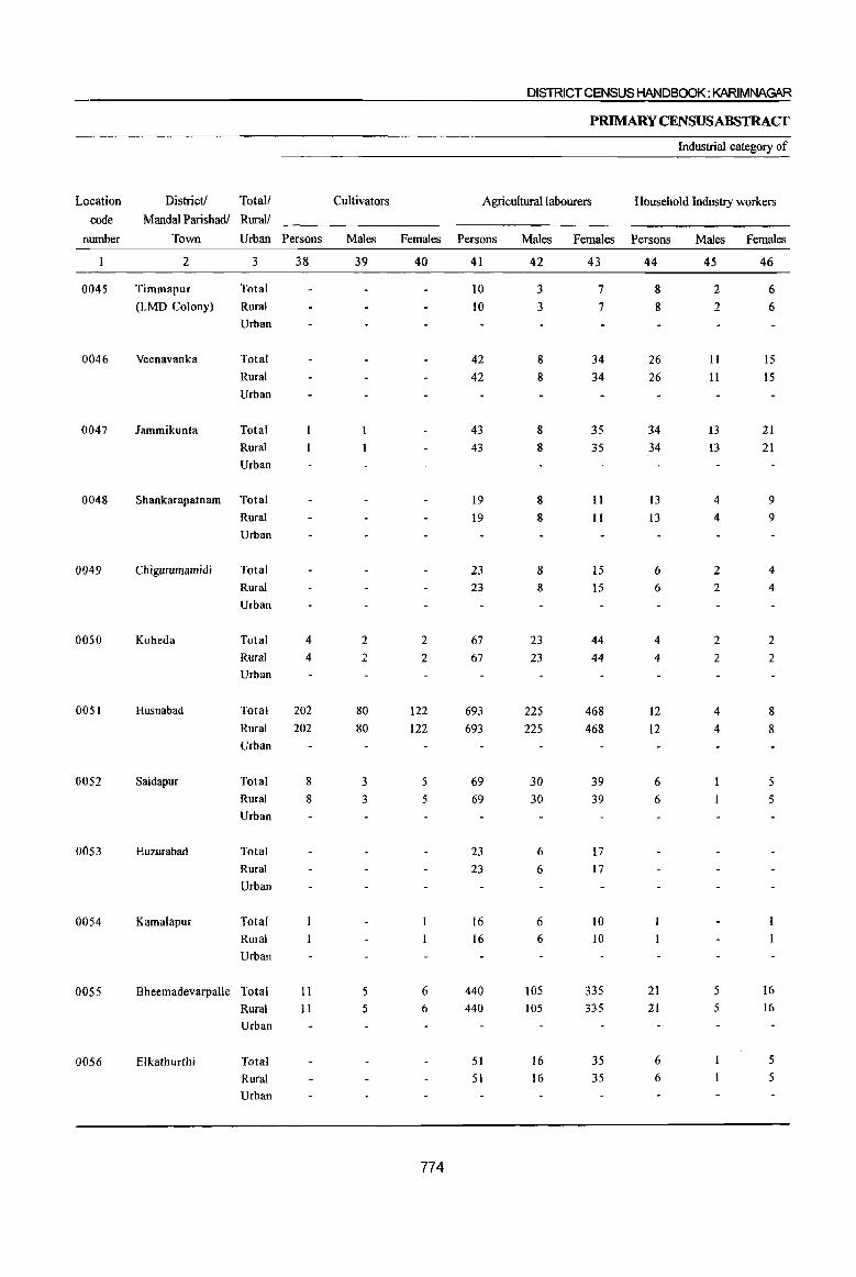
DISTRICT CENSUS HANDBOOK: KARIMNAGAR
PRIMARY CENSUS ABSTRACT
Industrial category of
Location District! Total! Cultivators Agricultural labourers Household Industry workers
code Mandai Parishadl Rural!
number Town Urban Persons Males Females Persons Males Females Persons Males Females
2 3 38 39 40 41 42 43 44 45 46
0045 Timmapur Total 10 3 7 8 2 6
(LMD Colony) Rural 10 3 7 8 2 6
Urban
0046 Veenavanka Total 42 8 34 26 11 15 Rural 42 8 34 26 II IS
Urban
0047 Jammikunta Total 43 8 35 34 13 21 Rural 43 8 35 34 13 21 Urban
0048 Shankarapatnam Total 19 8 11 13 4 9 Rural 19 8 II 13 4 9 Urban
0049 Chigurumamidi Total 23 8 15 6 2 4 Rural 23 8 15 6 2 4
Urban
0050 Koheda Total 4 2 2 67 23 44 4 2 2 Rural 4 2 2 67 23 44 4 2 2 Urban
0051 Husnabad Total 202 80 122 693 225 468 12 4 8 Rural 202 80 122 693 225 468 12 4 8 Urban
0052 Saidapur Total 8 3 5 69 30 39 6 5
Rural 8 3 5 69 30 39 6 5
Urban
0053 Huzurabad Total 23 6 17 Rural 23 6 17 Urban
0054 Kamalapur Total 16 6 10 Rural 16 6 10 Urban
0055 Bheemadevarpalle Total II 5 6 440 105 335 21 5 16
Rural II 5 6 440 lOS 335 21 5 16 Urban
0056 Elkathurthi Total 51 16 35 6 5
Rural 51 16 35 6 5 Urban
774
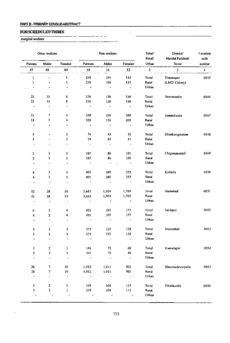
PMTl3-PRltIMRY CENSUS ABSTRACT
FORSCHEDULEDTRIBES
marginal workers
Other wprkers Non-workers Total! District! Location
Rural! MandaI Parishadl code
Persons Males Females Persons Males Fymales Urban Town number
47 48 49 50 51 52 3 2
219 104 115 Total Timmapur 0045 219 }04 115 Rural (LMD Colony)
Urban
23 15 8 276 138 138 Total Veenavanka 0046 23 15 8 276 138 138 Rural
Urban
II 7 4 359 150 209 Total lammikunta 0047 11 7 4 359 150 209 Rural
Urban
74 43 31 Total Shankarapatnam 0048 74 43 31 Rural
Urban
2 187 86 101 Total Chigurumamidi 0049 2 187 86 101 Rural
Urban
4 3 495 240 255 Total Koheda 0050
4 3 495 240 255 Rural
Urban
52 28 24 3,663 1,954 1,709 Total Husnabad 0051
52 28 24 3,663 1,954 1,709 Rural
Urban
6 2 4 422 245 177 Total Saidapur 0052
6 2 4 422 245 177 Rural
Urban
5 2 3 275 137 138 Total Huzurabad 0053
5 2 3 275 137 138 Rural
Urban
3 2 141 72 69 Total Kamalapur 0054 3 2 141 72 69 Rural
Urban
26 7 19 1,912 1,0 II 901 Total Bheemadevarpalle 0055 26 7 19 1,912 1,011 901 Rural
Urban
3 2 219 104 1I5 Total Elkathurthi 0056 3 2 219 104 115 Rural
Urban
775
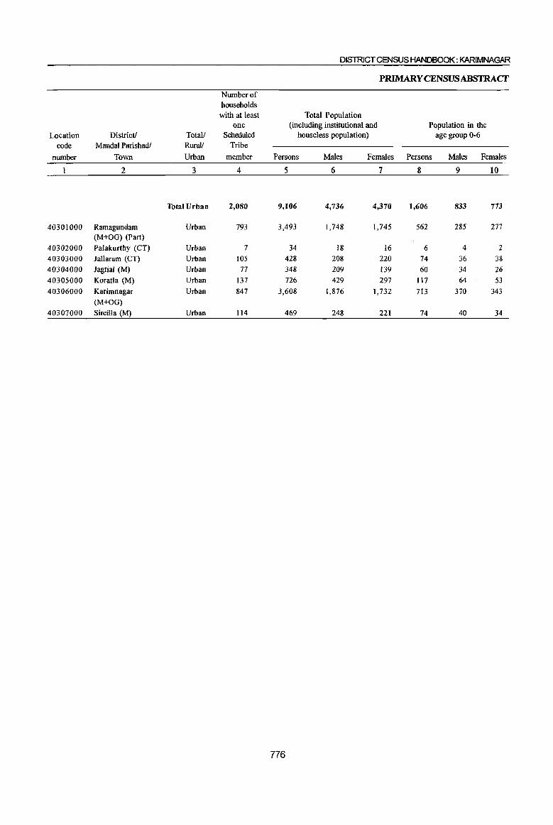
Number of households with at least
one Location District! Total! Scheduled
code MandaI Parishadl Rural! Tribe
number Town Urban member
2 3 4
Total Urban 2,080
40301000 Ramagundam Urban 793 (M+OG) (Part)
40302000 Palakurthy (CT) Urban 7
40303000 lallaram (CT) Urban 105
40304000 Jagtial (M) Urban 77
40305000 Koratla (M) Urban 137
40306000 Karimnagar Urban 847
(M+OG)
40307000 Sircilla (M) Urban 114 -
DISTRICT CENSUS HANDBOOK: KARIMNAGAR
PRlMARYCENSUSABSTRAcr
Total Population (including institutional and
houseless population) Population in the
age group 0-6
Persons Males Females Persons Males Females
5 6 7 8 9 10
9,106 4,736 4,370 1,606 833 773
3,493 1,748 1,745 562 285 277
34 18 16 6 4 2
428 208 220 74 36 38 348 209 139 60 34 26 726 429 297 117 64 53
3,608 1,876 1,732 713 370 343
469 248 221 74 40 34
776
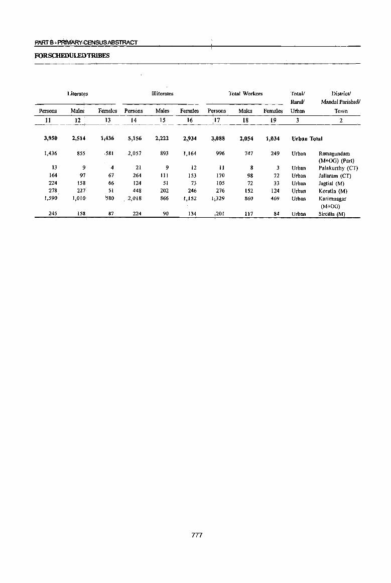
FORSCHEDULEDTR}BES
Literat~s Illiterates Total Workers Total/ District!
RuraV MandaI Parishadl
Persons Males. Females Persons Males Females Persons Males Females Urban Town
11 12 13 14 15 16 17 18 19 3 2
3,950 2,514 1;436 5,156 2,222 2,934 3,088 2,054 1,034 Urban Total
1,436 855 581 2,057 893 1,164 996 747 249 Urban Ramagundam (M+OG) (Part)
13 9 4 21 9 12 II 8 3 Urban Palakurthy (CT) 164 97 67 264 111 153 170 98 72 Urban Iallaram (CT) 224 158 66 124 51 73 105 72 33 Urban Jagtial (M) 278 2Ii 51 448 202 246 276 152 124 Urban Koratla (M)
1,590 1,010 i580 . 2,018 866 1,152 1;329 860 469 Urban Karimnagar (M+OG)
245 158 87 224 90 134 j201 117 84 Urban Sircilla (M)
777

DISTRICT CENSUS HANDBOOK: KARIMNAGAR
PRlMARYCENSUSABSTRACf
Industrial category
Location District! Total! Main workers Cultivators Agricultural labourers code Mandai Parishadl Rural!
number Town Urban Persons Males Females Persons Males Females Persons Males Females
2 3 20 21 22 23 24 25 26 27 28
Total Urban 2,675 1,848 827 14 12 2 119 68 51
40301000 Ramagundam Urban 734 605 129 7 7 32 22 10 (M+OG) (Part)
40302000 Palakurthy (CT) Urban 8 6 2 I I
40303000 Jallaram (CT) Urban 157 93 64 2 9 7 2 40304000 Jagtial (M) Urban 87 68 19 I 1 40305000 Koratla (M) Urban 257 134 123 29 11 18 40306000 Karimnagar Urban 1,251 830 421 3 2 33 20 J3
(M+OG)
40307000 Sircilla (M) Urban lSI Il2 69 14 7 7
778
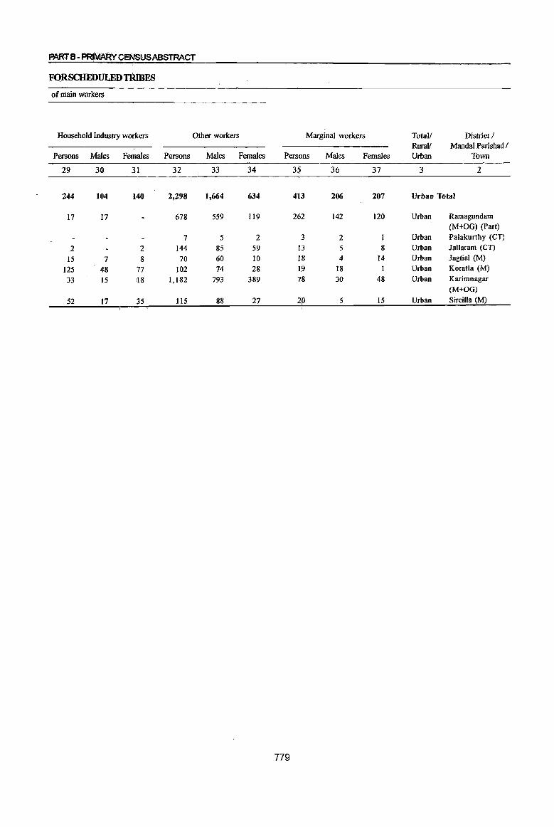
PARTB-P~YceNSUSABSTRACT
FQRSCHEDULEDTRlBES
of main workers
Household Industty workers Other workers Marginal workers Total/ District / Rural! MandalParishadl
Persons Males Females Persons Males Females Pers.ons Males Females Urban Town
29 30 31 32 33 34 35 36 37 3 2
244 104 140 2,298 1,664 634 413 206 207 Urban Total
17 17 678 559 119 262 142 120 Urban Ramagundam (M+OG) (Part)
7 5 2 3 2 Urban Palakurthy (CT)
2 2 144 85 59 I3 5 8 Urban Jallaram (CT)
15 7 8 70 60 10 18 4 14 Urban Jagtial (M)
125 48 77 102 74 28 19 18 I Urban Koratla (M)
33 15 :18 1,182 793 389 78 30 48 Urban Karimnagar (M+OG)
52 17 35 115 88 27 20 5 15 Urban S ircilla (M)
779
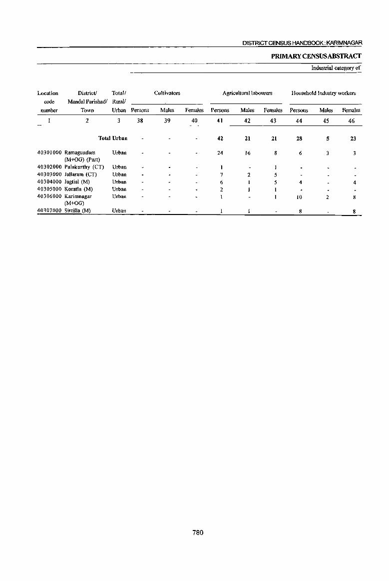
Location District! Total!
code MandaI Parishadl Rural!
number Town Urban
2 3
Total Urban
40301000 Ramagundam Urban (M+OG) (Part)
40302000 Palakurthy (CT) Urban 40303000 Jallaram (CT) Urban 40304000 Jagtial (M) Urban 40305000 Koratla (M) Urban 40306000 Karimnagar
(M+OG) 40307000 Sircilla (M)
Urban
Urban
Cultivators
Persons Males
38 39
DISTRICT CENSUS HANDBOOK: KARIMNAGAR
PRIMARY CENSUS ABSTRACf
Industrial category of
Agricultural labourers Household Industry workers
Females Persons
40 41
780
42
24
7 6 2
Males Females Persons
42 43 44
21
16
2
21
8
I
5 5
28
6
4
10
8
Males Females
45 46
5 23
3 3
4
2 8
8
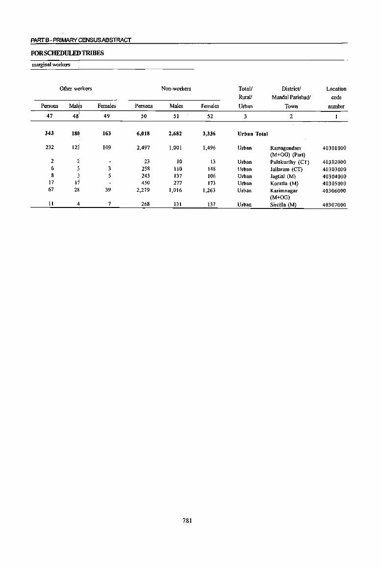
PART B - PRIMARY CENSUS ABSTRACT
FORSCHEDULEDTRIBES
marginal workers
Other workers Non-workers Total/ District! Location
Rural/ MandaI Parishadl code I
Persons Mal~,s Females Persons I
Males Females Urban Town number I
47 48 49 50 51 52 3 2
343 180 163 6.018 2.682 3.336 Urban Total
232 123 109 2,497 1,001 1,496 Urban Ramagundam 40301000 (M+OG) (Part)
2 1. 23 10 13 Urban Palakurthy (CT) 40302000 6 3, 3 258 1I0 148 Urban Jallaram (CT) 40303000 8 3 5 243 137 106 Urban Jagtial (M) 40304000
17 I7 450 277 173 Urban Koratla (M) 40305000 67 28 39 2,279 1,016 1,263 Urban Karimnagar 40306000
(M+OG) II 4 7 268 131 137 Urban S ircilla (M) 40307000
781
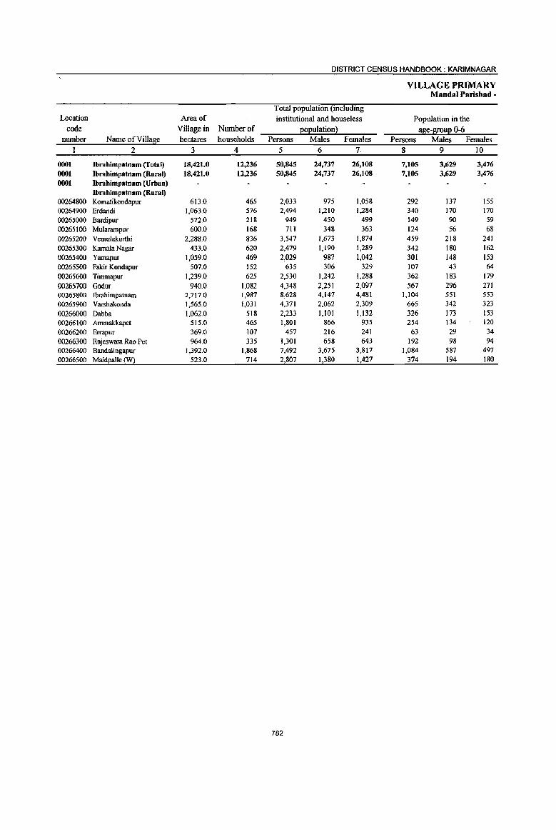
DISTRICT CENSUS HANDBOOK: KARIMNAGAR
VILLAGE PRIMARY Mandai Parisbad -
Total population (including Location Area of institutional and houseless Population in the
code Village in Number of ~oQulationl age-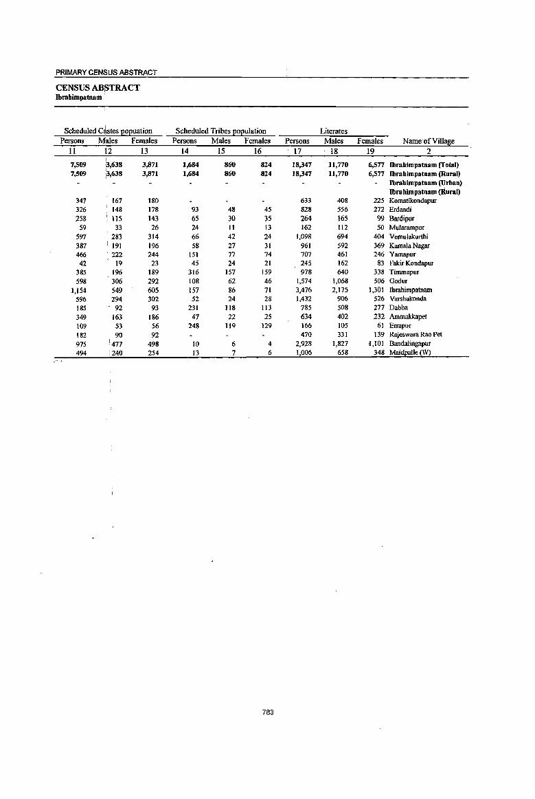
PRIMARY CEN~US ABSTRACT
CENSUS ABSTRACT Ibrahimpamam
Scheduled Castes EOEuation Scheduled Tribes EOEulation Literates Persons Males Females Persons Males Females Persons Males Females Name·ofVillage
11 Il2 13 14 15 16 17 . 1& 19 2
7,509 13,638 3,871 1,684 860 S24 18,347 11,770 6,577 Ibrahimpatnllm (Total) 7,509 :3,638 3,871 1,684 860 S24 18,347 11,770 6,577 Ibrahimpatnllm (Rural)
Ibrahimpatnam (Urban) Ibrahimpatnam (Rural)
347 167 180 633 408 225 Komatikondapur 326 148 178 93 48 45 828 556 272 Erdandi 258 : 115 143 65 30 35 264 165 99 Bardipur
59 33 26 24 11 13 162 112 50 Mularampur 597 283 314 66 42 24 1,098 694 404 Vemulakurthi 387 191 196 58 27 31 961 592 369 Kamala Nagar 466 : 222 244 151 77 74 707 461 246 Yamapur 42 19 23 45 24 21 245 162 83 Fakir Kondapur
385 196 189 316 157 159 978 640 338 Timmapur 598 306 292 108 62 46 1,574 1,068 506 Godur
1,154 : 549 605 157 86 71 3,476 2,175 1,301 Ibrahimpatnam 596 294 302 52 24 28 1,432 906 526 Varshakonda 185 92 93 231 118 113 785 508 277 Dabba 349 '163 186 47 22 25 634 402 232 Ammakkapet 109 53 56 248 119 129 166 105 61 Errapur 182 90 92 470 331 139 Rajeswara Roo Pet 975 477 498 10 6 4 2,928 1,827 1,101 Bandalingapur 494 :240 254 13 7 6 1,006 658 348 Maidpalle (W)
783

DISTRICT CENSUS HANDBOOK: KARIMNAGAR
VILLAGE PRIMARY Mandai Parishad -
Location
code illiterates Total workers Main workers
number Name ofViU!!fie Persons Males Females Persons Males Females Persons Males Females
I 2 20 21 22 23 24 25 26 27 28
0001 Ibrabimpatnam (Total) 32,498 12,967 19,531 30,543 14,633 15,910 28.878 14,019 14,859 0001 Ibrabimpatnam (Rural) 32,498 12,967 19,531 30,543 14,633 15,910 28,878 14,019 14,859 0001 Ibrabimpatnam (Urban)
Ibrabimpatnam (Rural) 00264800 Komatikondapur 1,400 567 833 1,179 585 594 712 415 297 00264900 Erdandi 1,666 654 1,012 1,551 743 808 1,527 732 795 00265000 Bardipur 685 285 400 574 263 311 569 261 308 00265100 Mularampur 549 236 313 422 209 213 422 209 213 00265200 Vemulakurthi 2,449 979 1,470 2,205 1,050 1,155 2,068 988 1,080 00265300 Kamala Nagar 1,518 598 920 1,451 680 771 1,388 653 735 00265400 Yamapur 1,322 526 796 1,281 616 665 1,254 611 643 00265500 Fakir Kondapur 390 1~4 246 402 196 206 386 190 196 00265600 Timmapur 1,552 602 950 1,497 724 773 1,452 697 755 00265700 Godur 2,774 1,183 1,591 2,774 1,467 1,307 2,663 1,428 1,235 00265800 Ibrahimpatnam 5,152 1,972 3,180 5,126 2,419 2,707 4,977 2,337 2,640 00265900 Varshakonda 2,939 1,156 1,783 2,621 1,207 1,414 2,215 1,105 1,110 00266000 Dabba 1,448 593 855 1,361 636 725 1,351 633 718 00266100 Ammakkapet 1,167 464 703 1,083 491 592 1,020 470 550 00266200 Errapur 291 III 180 236 110 126 201 98 !O3 00266300 Rajeswara Rao Pet 831 327 504 783 380 403 764 368 396 00266400 Bandalingapur 4,564 1,848 2,716 4,332 2,061 2,271 4,257 2,035 2,222 00266500 MaidEalle (W) 1,801 722 1,079 1,665 796 869 1,652 789 863
784

PRIMARY CEN~US ABSTRACT I
CENSUS ABSTRACT Ibrahimpatna~
. Industrial cate~0!I ofmain workers Household industry
Cultivato!'S AgriculturaI labourers workers Other workers Persons Males IFemales Persons Males Females Persons Males Females Persons Males Females Name ofVilla~e
29 30 31 32 33 34 35 36 37 38 39 40 2
9,285 i
5,354 i 3,931 7,108 3,955 3,153 7,406 687 6,719 5,079 4;'023 1,056 Ibrahimpatnam (fotal) 9,285 5,354 3.931 7,W8 3,955 3,153 7,466 687 6,719 5,679 4,()23 1,056 Ibrahimpatoam (Rural)
Ibrahimpatnam (Urban) Ibrahimpatoam (Rural)
302 219 83 120 84 36 207 31 176 83 81 2 Komatikondapur 634 391 243 331 181 150 361 18 343 201 142 59 Erdandi 258 156 102 69 30 39 175 19 156 67 56 11 Bardipur 223 133 ; 90 45 24 21 78 4 74 76 48 28 Mularampur 899 551 348 421 212 209 488 29 459 260 196 64 Vemulakurthi 515 315 200 182 109 73 499 79 420 192 150 42 Kamala Nagar
432 212 220 414 200 214 182 9 173 226 190 36 Yamapur
178 96 82 87 52 35 76 14 62 45 28 17 Fakir Kondapur 303 163 140 555 334 221 389 30 359 205 170 35 Timmapur
915 501 414 442 227 215 428 26 402 878 674 204 Godur
1,203 661 542 1,537 789 748 1,263 143 1,120 974 744 230 Ibrahimpatnam
797 462 335 535 289 246 475 20 455 408 334 74 Varshakonda
578 314 264 296 168 128 347 42 305 130 109 21 Dabba
302 179 123 270 148 122 279'" 25 254 169 118 51 Aromakkapet
158 81 77 17 7 10 12 12 14 10 4 Errapur
256 165 91 148 112 36 306 39 267 54 52 2 Rajeswara Rao Pet
932 552 380 1,186 735 451 1,350 90 1,260 789 658 131 Bandalingapur
400 203 197 453 254 199 491 69 .422 308 263 45 MaidpaUe r?:2
785

DISTRICT CENSUS HANDBOOK: KARIMNAGAR
VILLAGE PRIMARY Mandai Parisbad -
Industrial cate~o!! Location
code ~ar~U1alvvorkers Cultivators Agriculturailabourers number Name ofVillal!!e Persons ~ales Females Persons ~ales Females Persons ~es Females
1 2 41 42 43 44 45 46 47 48 49
0001 Ibrahimpatnam (Total) 1,665 614 1,051 99 44 55 733 350 383 0001 Ibrabimpatnam (Rural) 1,665 614 1,051 99 44 5S 733 350 383 0001 Ibrabimpatnam (Urban)
Ibrabimpatnam (Rural) 00264800 Komatikondapur 467 170 297 5 3 2 231 125 106 00264900 Erdandi 24 II 13 3 3 15 8 7 00265000 Bardipur 5 2 3 3 2 00265100 Mularampur 00265200 Vemulakurthi 137 62 75 8 5 3 95 54 41 00265300 Kamala Nagar 63 27 36 2 2 41 18 23 00265400 Yamapur 27 5 22 16 4 12 4 I 3 00265500 Fakir Kondapur 16 6 10 I 9 2 7 00265600 Timmapur 45 27 18 2 2 27 17 10 00265700 Godur 111 39 72 I 1 62 25 37 00265800 Ibrahimpatnam 149 82 67 5 3 2 54 26 28 00265900 Varshakonda 406 102 304 33 13 20 84 35 49 00266000 Dabba 10 3 7 1 1 5 5 00266100 Ammakkapet 63 21 42 9 4 5 41 14 27 00266200 Errapur 35 12 23 3 2 30 10 20 00266300 Rajeswara Rao Pet 19 12 7 II 7 4 00266400 Bandalingapur 75 26 49 7 4 3 13 5 8 00266500 Maidpalle (yI) 13 7 6 3 3 8 2 6
786
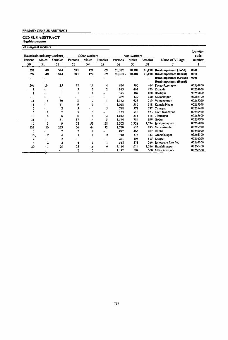
PRIMARY CENSUS ABSTRACT
CENSUS A~STRACT Ibrahimpatna~
of marginal wQrkers Location
Household industry workers Other workers ~on-workers code Persons MaKes Females Persons Males Females Persons . Males Females Name ofVil1a~e number
50 5il 52 53 54 55 56 57 58 2 1
592 148 544 241 172 69 20,302 10,104 10,198 Ibrahimpatnam (Total) 0001 592 48 ·544 241 172 69 20,302 10,104 10,198 Ibrahimpatnam,(Rural) 0001
:- Ibrahimpatnam (Urban) 0001 Ibrahimpatnam (Rural)
209 '24 185 22 18 4 854 390 464 Komatikondapur 00264800 5 3 2 943 467 476 Erdandi 00264900 I I 375 187 188 Bardipur 00265000
289 139 150 Mu1arampur 00265100 31 30 3 2 1,342 623 719 Vemulakurthi 00265200 11 II 9 9 1,028 510 518 Kamala Nagar 00265300 2 2 5 5 748 371 377 Yamapur 00265400 3 2 3 3 233 110 123 Fakir Kondapur 00265500
10 4 6 6 4 2 1,033 518 515 Timmapur 00265600 31 31 17 14 3 1,574 784 790 Godur 00265700
12 3 9 78 50 28 3,502 1,728 1,774 Ibrahimpatnam 00265800 233
110 223 56 44 12 1,750 855 895 Varsh3konda 00265900
2 2 2 2 872 465 407 Dabba 00266000
10 ·2 8 3 I 2 718 375 343 Amrilakkapet 00266100
2 2 221 106 ll5 Errapur 00266200
4 2 2 4 3 1 518 278 240 Rajeswara Rao Pet 00266300
30 1 29 25 16 9 3,160 1,614 1.546 Bandalingapur 00266400 2 2 1,142 584 558 Maidpalle (W) 00266500
787
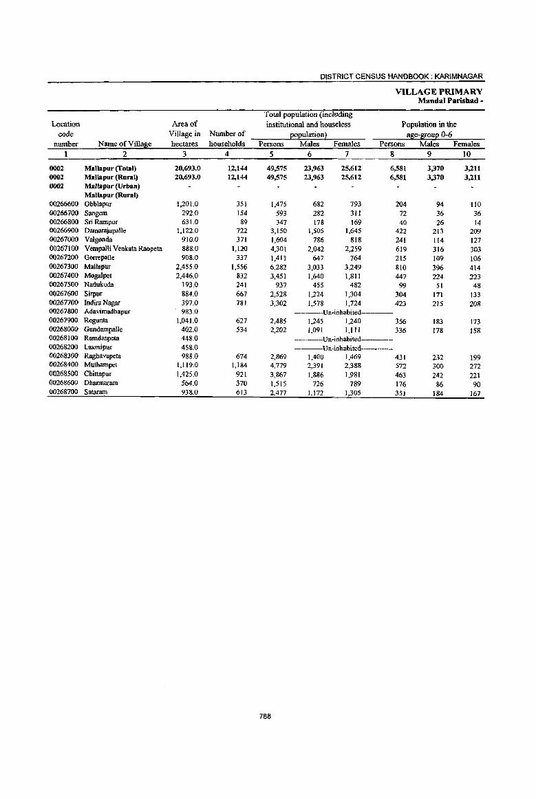
DISTRICT CENSUS HANDBOOK: KARIMNAGAR
VILLAGE PRIMARY Mandai Parishad -
Total population (including Location Area of institutional and houseless Population in the
code Village in Number of eo(!ulation} alle-
PRIMARY ceNsus ABSTRACT
CENSUS ABSTRACT Mallapur
Scheduled qastes l!ol!uation Scheduled Tribes l!oEulation Literates Persons Males 'Females Persons Males Females Persons Males Females Name ofVilla~e
11 i12 13 14 15 16 17 18 19 2
8,294 13,954 4,340 2,633 1,236 1,397 16,940 10,922 6,018 MaUapur (Total) 8,294 1,3,954 4,340 2,633. 1,236 1,397 16,940 10,922 6,018 Mallapur (Rural)
Mallapur (Urban) Mallapur (Rural)
153 67 86 290 133 157 394 280 114 Obblapur 237 119 118 43 15 28 216 128 88 Sangem
57 33 24 88 42 46 147 105 42 Sri Rampur 539 253 286 17 7 10 1,043 656 387 Damarajapalle 185 97 88 341 164 177 567 405 162 Valgonda 409 185 224 503 230 273 1,127 740 387 Vempalli Venkata Raopeta 374 175 199 111 48 63 295 184 111 Gorrepalle 754 373 381 178 79 99 2,350 1,513 837 Mallapur 229 104 125 107 S4 S3 1,068 700 368 Mogalpet 168 69 99 168 85 83 325 206 119 Nadukuda 487 239 248 255 121 134 761 486 275 Sirpur
707 350 357 250 113 137 1,099 712 387 Indira Nagar Un-inhabited----- AdavimadhapuT
517 252 265 46 26 20 782 516 266 Regunta
418 199 219 652 427 225 GundampalJe ----Un-inhabited---- Ramdaspeta
----Un-inhabited----- Laxmipur
506 228 278 14 7 7 809 532 277 Raghavapeta 903 434 469 49 22 27 2,334 1,487 847 Muthampet
895 430 465 172 89 83 1,649 1,010 639 Chittapur
291 147 144 606 386 220 Dharrnaram 465 : 200 265 116 449 267 Sataram
789
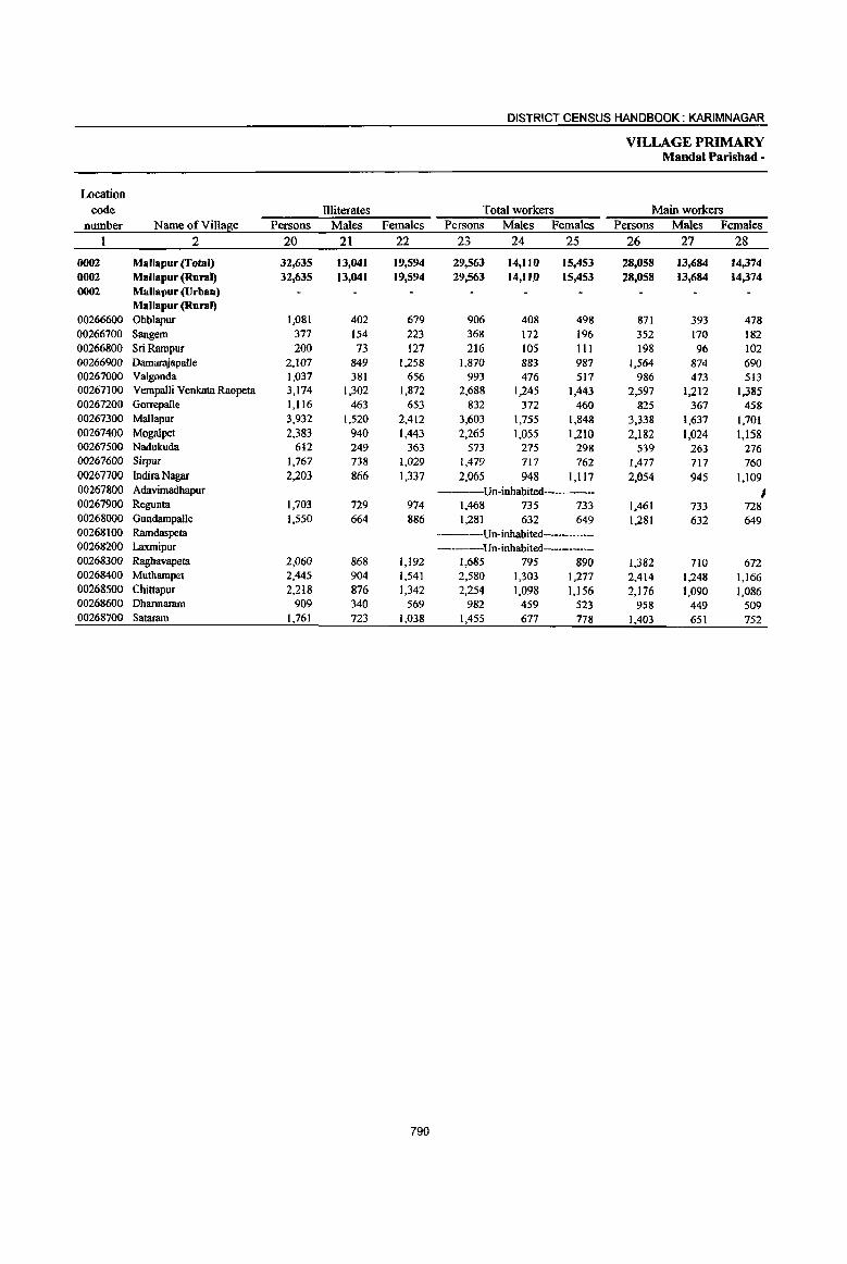
DISTRICT CENSUS HANDBOOK: KARIMNAGAR
VILLAGE PRIMARY Mandai Parishad -
Location .code Illiterates Total workers Main workers
nwnber NameofVillal,lie Persons Males Females Persons Males Females Persons Males Females
2 20 21 22 23 24 25 26 27 28
0002 Mallapur (Total) 32,635 13,041 19,594 29,563 14,110 15,453 28,058 13,684 14,374 0002 Mallapur (Rural) 32,635 13,041 19,594 29,563 14,nO 15,453 28,058 13,684 14,374 0002 MalJapur (Urban)
Mallapur (Rural) 00266600 Obblapur 1,081 402 679 906 408 498 871 393 478 00266700 Sangem 377 154 223 368 172 196 352 170 182 00266800 Sri Rampur 200 73 127 216 105 III 198 96 102 00266900 Damarajapalle 2,107 849 1,258 1,870 883 987 1,564 874 690 00267000 Valgonda 1,037 381 656 993 476 517 986 473 513 00267100 Vempalli Venkata Raopeta 3,174 1,302 1,872 2,688 1,245 1,443 2,597 1,212 1,385 00267200 Gorrepalle 1,116 463 653 832 372 460 825 367 458 00267300 Mallapur 3,932 1,520 2,412 3,603 1,755 1,848 3,338 1,637 1,701 00267400 Mogalpet 2,383 940 1,443 2,265 1,055 1,210 2,182 1,024 1,158 00267500 Nadukuda 612 249 363 573 275 298 539 263 276 00267600 Sirpur 1,767 738 1,029 1,479 717 762 1,477 717 760 00267700 Indira Nagar 2,203 866 1,337 2,065 948 1,117 2,054 945 1,109 00267800 Adavimadhapur ---Un-inhabited----- I 00267900 Regunta 1,703 729 974 1,468 735 733 1,461 733 728 00268000 Gundampalle 1,550 664 886 1,281 632 649 1,281 632 649 00268100 Ramdaspeta -------Un-inhabited-----00268200 Laxmipur ----Un-inhabited-----00268300 Raghavapeta 2,060 868 1,192 1,685 795 890 1,382 710 672 00268400 Muthampet 2,445 904 1,541 2,580 1,303 1,277 2,414 1,248 1,166 00268500 Chittapur 2,218 876 1,342 2,254 1,098 1,156 2,176 1,090 1,086 00268600 Dharmaram 909 340 569 982 459 523 958 449 509 00268700 Sataram 1,761 723 1,038 1,455 677 778 1,403 651 752
790
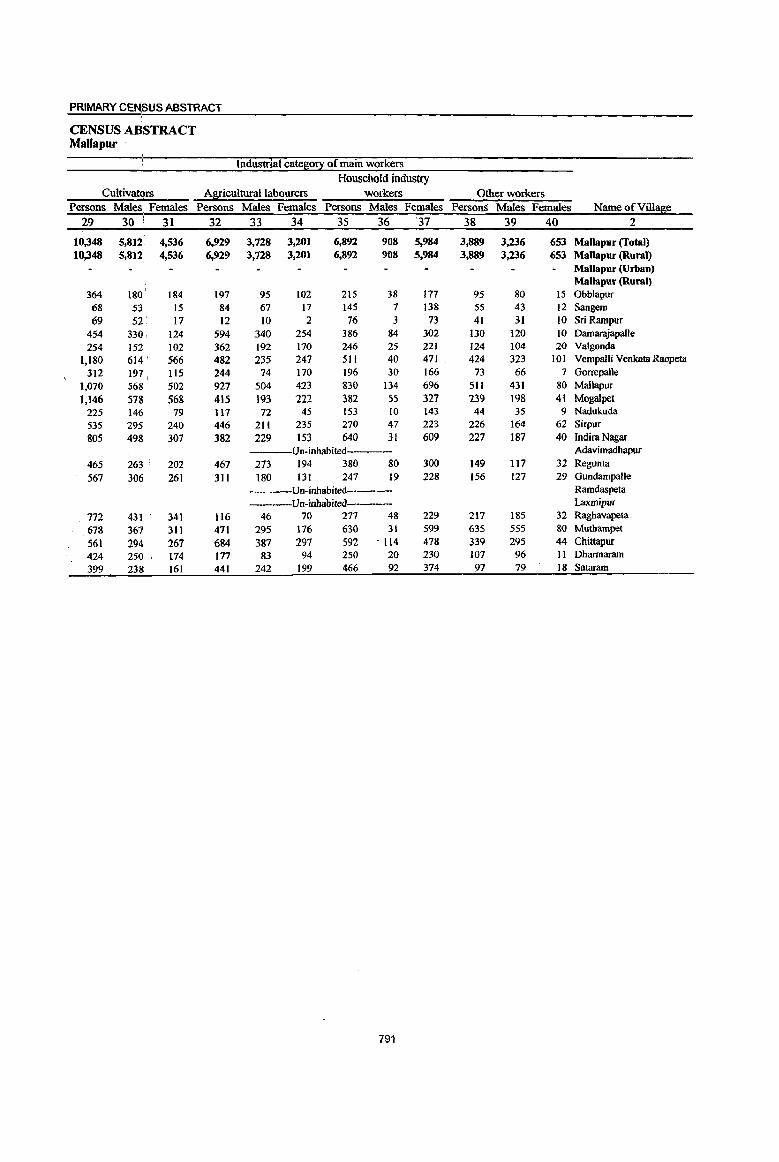
PRIMARY CENSUS ABSTRACT
CENSUS A~STRACT Mallapur
Industrial catel!i0!l: of main workers Household industry
CultivatQrs Afliculturallabourers workers Other workers Persons Males Females Persons Males Females Persons Males Females PersonS Males Females Name ofVill~e
29 30 , 31 32 33 34 35 36 37 38 39 40 2 ,
10,348 5,812 4,536 6,929 3,728 3,201 6,892 908 5,984 3,889 3,236 653 Mallapur (Total) 10,348 5,812 4,536 6,929 3,728 3,201 6,892 908 5,984 3,889 3,236 653 Mallapur (Rural)
Mallapur (Urban) Mallapur (Rural)
364 180 184 197 95 102 215 38 177 95 80 15 Obblapur 68 53 15 84 67 17 145 7 138 55 43 12 Sangem 69 52 17 12 10 2 76 3 73 41 31 10 Sri Rampur
454 330 124 594 340 254 386 84 302 130 120 IO Damarajapalle 254 152 102 362 192 170 246 25 221 124 104 20 Valgonda
1,180 614 566 482 235 247 511 40 471 424 323 101 Vempalli Venkata Raopeta 312 197, lIS 244 74 170 196 30 166 73 66 7 Gorrepalle
1,070 568 502 927 504 423 830 134 696 Sl1 431 80 MallapuT
1,146 578 568 415 193 222 382 55 327 239 198 41 Mogalpet 225 146 79 117 72 45 153 10 143 44 35 9 Nadukuda 535 295 240 446 211 235 270 47 223 226 164 62 Sirpur
805 498 307 382 229 153 640 31 609 227 187 40 Indira Nagar Un-inhabited--- Adavimadhapur
465 263 ' 202 467 273 194 380 80 300 149 117 32 Regunta
567 306 261 311 180 131 247 19 228 156 127 29 Gundampalle -----Un-inhabited---- Ramdaspeta
Un-inhabited Laxmipur
772 431 341 116 46 70 277 48 229 217 185 32 Raghavapeta
678 367 311 471 295 176 630 31 599 635 555 80 Muthampet
561 294 267 684 387 297 592 - 114 478 339 295 44 Chittapur
424 250 174 177 83 94 250 20 230 107 96 II Dharmaram
399 238 161 441 242 199 466 92 374 97 79 18 Sataram
791
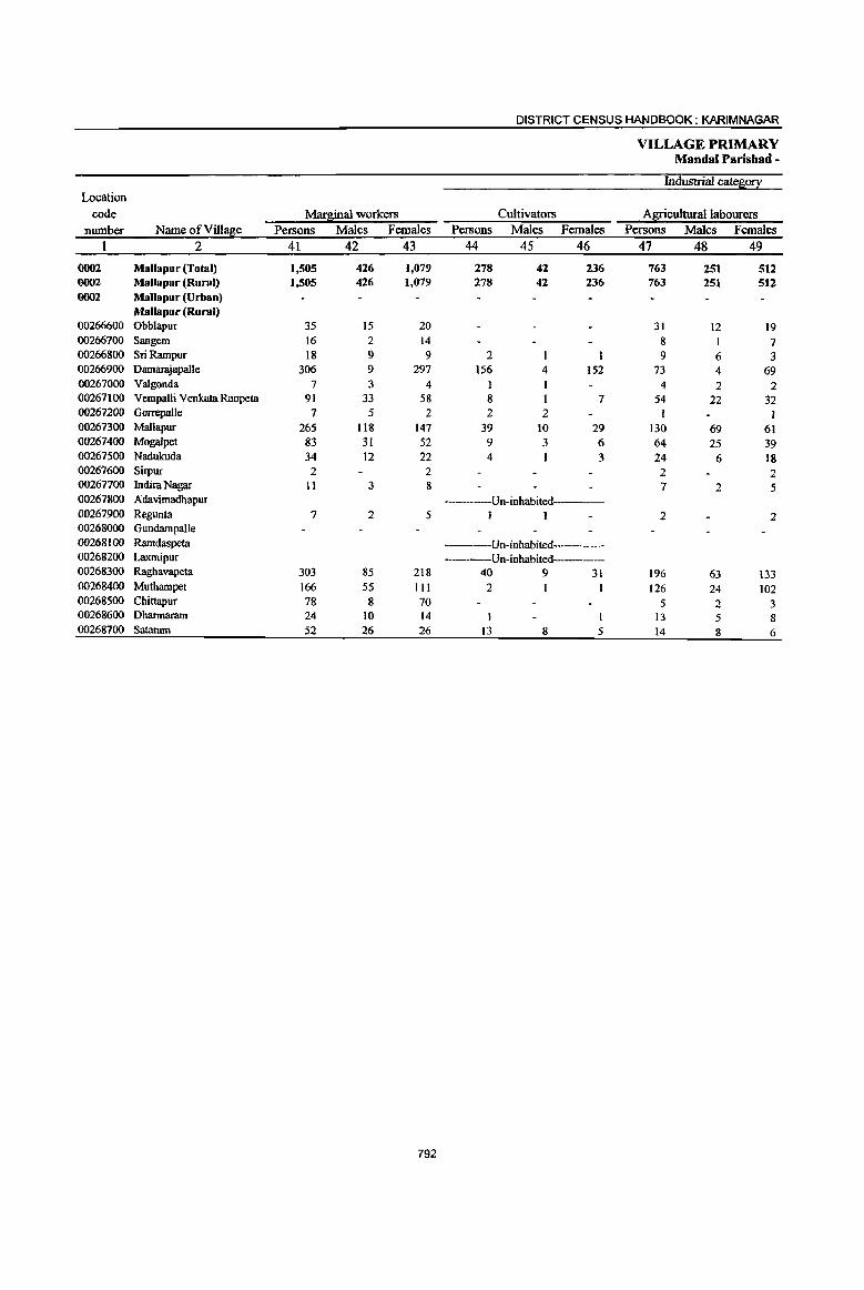
DISTRICT CENSUS HANDBOOK: KARIMNAGAR
VILLAGE PRIMARY MandaI Parishad -
Industrial cateso!I Location
code Mar~inal workers Cultivators Agricultural labourers number Name of Village Persons Males Females Persons Males Females Persons Males Females
1 2 41 42 43 44 45 46 47 48 49
0002 MaUapur (Total) 1,505 426 1,079 278 42 236 763 251 512 0002 Mallapur (Rural) 1,505 426 1,079 278 42 236 763 251 512 0002 Mallapur (Urban)
Mallapur (Rural) 00266600 Obblapur 35 15 20 31 12 19 00266700 Sangem 16 2 14 8 I 7 00266800 Sri Rampur 18 9 9 2 I 9 6 3 00266900 Damarajapalle 306 9 297 156 4 152 73 4 69 00267000 Valgonda 7 3 4 I 4 2 2 00267100 Vempalli Venkata Raopeta 91 33 58 8 7 54 22 32 00267200 Gorrepalle 7 5 2 2 2 1 00267300 Mallapur 265 118 147 39 10 29 130 69 61 00267400 Mogalpet 83 31 52 9 3 6 64 25 39 00267500 Nadukuda 34 12 22 4 3 24 6 18 00267600 Sirpur 2 2 2 2 00267700 Indira Nagar 11 3 8 7 2 5 00267800 Adavimadhapur ----Un-inhabited-----00267900 Regunta 7 2 5 1 1 2 2 00268000 GundampaUe 00268100 Ramdaspeta ----Un-inhabited-----00268200 Laxmipur -----Un-inhabited--------00268300 Raghavapeta 303 85 218 40 9 31 196 63 133 00268400 Muthampet 166 55 III 2 I 126 24 102 00268500 Chittapur 78 8 70 5 2 3 00268600 Dharmaram 24 10 14 J3 5 8 00268700 Sataram 52 26 26 13 8 5 14 8 6
792

PRIMARY CENSIjS ABSTRACT 1
CENSUS ABSTRACT MalJapur
of mar Sinal worl;.ers Location
Household indw\!!l: workers Other workers Non-workers code PerSons Males Females Persons Males Females Persons Males Females Name ofVill~e number
50 51 • 52 53 54 55 56 57 58 2
337 d8 I
299 127 95 32 20,012 9,853 10,159 Mallapur (Total) 0002 337 ~8 299 127 95 32 20,012 9,853 10,159 Mallapur (Rural) 0002
Mallapur (Urban) 0002 Mallapur (Rural)
4 3 569 274 295 Obblapur 00266600 4 4 4 3 225 110 115 Sangem 00266700 3 3 4 2 2 131 73 58 Sri Rampur 00266800
72 71 5 5 1,280 622 658 DamanYapalle 00266900 2 2 611 310 301 Valgonda 00267000
15 14 14 9 5 1,613 797 816 Vempalli Venkata Raopeta 00267100 3 a 1 I 579 275 304 Gorrepalle 00267200
82 i6 56 14 13 2,679 1,278 1,401 Mallapur 00267300 , 7 7 3 3 1,186 585 601 Mogalpet 00267400
6 5 364 180 184 Nadukuda 00267500 1,049 507 542 Sirpur 00267600
2 2 2 1,237 630 607 Indira Nagar 00267700 ----Un-inhabited---- Adavimadhapur 00267800
3 3 I I 1,017 510 507 Regunta 00267900 921 459 462 Gundampalle 00268000
------Un-inhabited---- Ramdaspeta 00268100 Un-inhabited---- Laxmipur 00268200
48 48 19 13 6 1,184 605 579 Raghavapeta 00268300 3 3 35 30 5 2,199 1,088 1,11 J Muthampet 00268400
68 jl 67 5 5 1,613 788 825 Chittapur 00268500 7 13 4 3 2 533 267 266 Dharmaram 00268600
18 ~. 14 7 6 1,022 495 527 Sataram 00268700
793
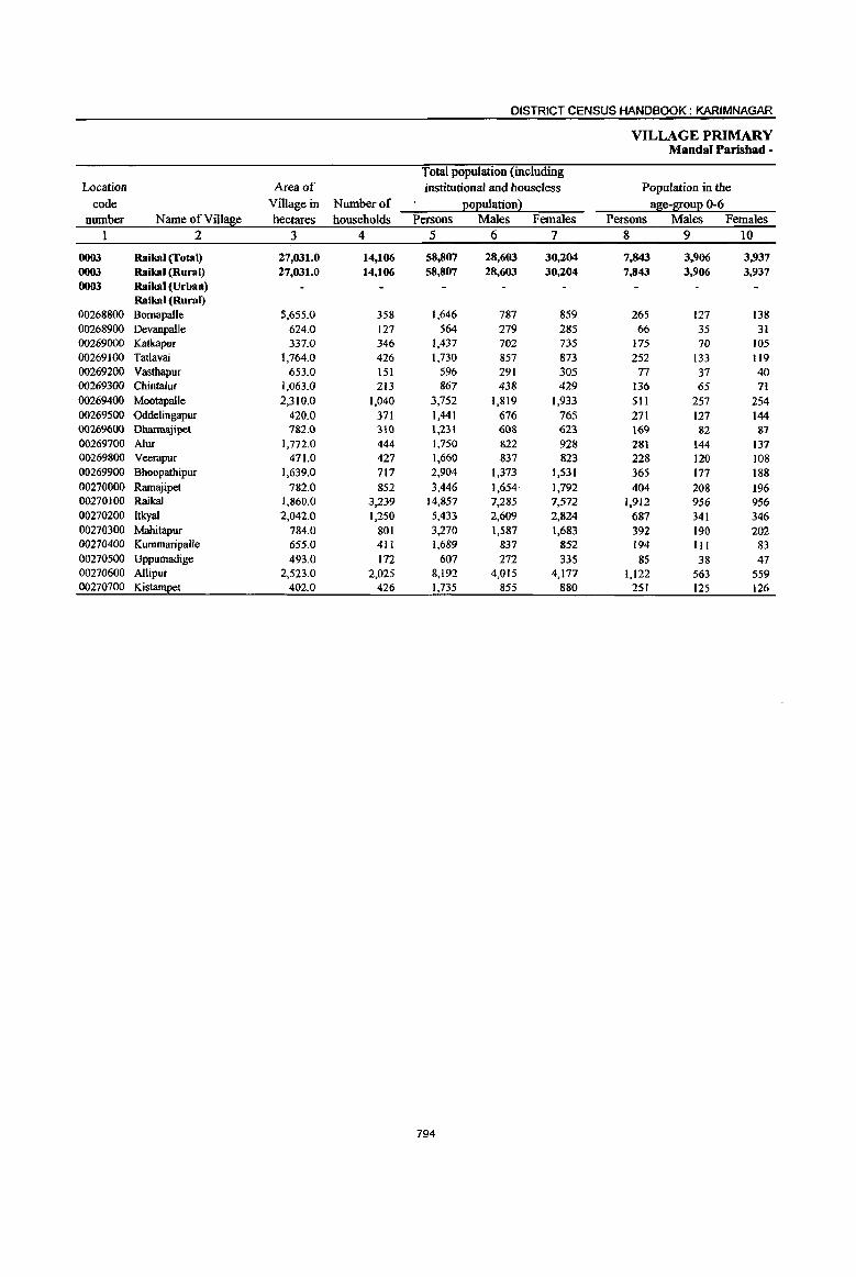
DISTRICT CENSUS HANDBOOK: KARIMNAGAR
VILLAGE PRIMARY Mandai Parisbad -
Total population (including Location Area of institutional and bouseless Population in the
code Village in Number of 12°l2ulation 2 ase-8!0ul2 0-6 number Name ofVill~e hectares households Persons Males Females Persons Males Females
I 2 3 4 5 6 7 8 9 10
0003 Raikal (Total) 27,031.0 14,106 58,807 28,603 30,204 7,843 3,906 3,937 0003 Raikal (Rural) 27,031.0 14,106 58,807 28,603 30,204 7,843 3,906 3,937 0003 Raikal (Urban)
Raikal (Rural) 00268800 Bornapalle 5,655.0 358 1,646 787 859 265 127 138 00268900 Devanpalle 624.0 127 564 279 285 66 35 31 00269000 Katkapur 337.0 346 1,437 702 735 175 70 105 00269100 Tatlavai 1,764.0 426 1,730 857 873 252 133 119 00169200 Vastbapur 653.0 151 596 291 305 77 37 40 00269300 Chintalur 1,063.0 213 867 438 429 136 65 71 00269400 Mootapalle 2,310.0 1,040 3,752 1,819 1,933 511 257 254 00269500 Oddelingapur 420.0 371 1,441 676 765 271 117 144 00269600 DharmaJipet 782.0 310 1,231 608 623 169 82 87 00269700 Alur 1,772.0 444 1,750 822 928 281 144 137 00269800 Veerapur 471.0 427 1,660 837 823 228 120 108 00269900 Bhoopathipur 1,639.0 717 2,904 1,373 1,531 365 177 188 00270000 Ramajipet 782.0 852 3,446 1,654 1,792 404 208 196 00270100 Raikal 1,860,0 3,239 14,857 7,285 7,572 1,912 956 956 00270200 Itkyal 2,042.0 1,250 5,433 2,609 2,824 687 341 346 00270300 Mahitapur 784.0 801 3,270 1,587 1,683 392 190 202 00270400 Kummaripalle 655.0 411 1,689 837 852 194 III 83 00270500 Uppumadige 493.0 172 607 272 335 85 38 47 00270600 Allipur 2,523.0 2,025 8,192 4,015 4,177 1,122 563 559 00270700 KistamEet 402.0 426 1,735 855 880 251 125 126
794
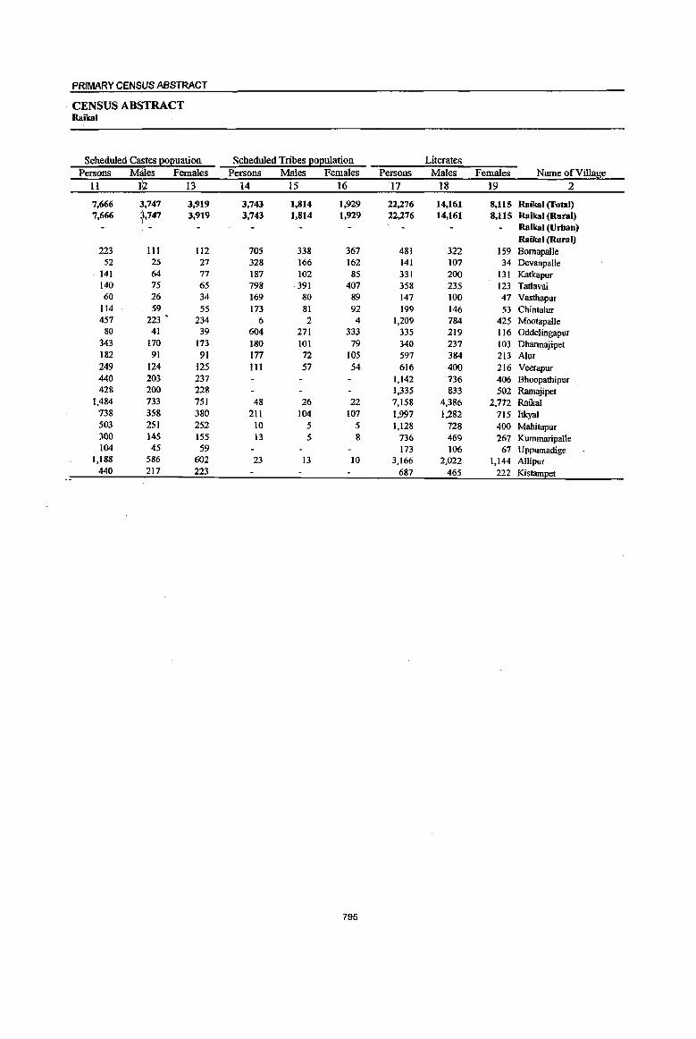
PRIMARY CENS,US ABSTRACT
CENSUS ABSiTRACT Raikal
Scheduled Castes e0l!uation Scheduled Tribes e0l!ulation Literates Persons Mates Females Persons Males Females Persons Males Females Name of Village
II 1:2 13 14 15 16 17 18 19 2
7,666 3.1,747 3,919 3,743 1,814 1,929 22,276 14,161 8,lIS Raikal (Total) 7,666 b47 3,919 3,743 1,814 1,929 22,276 14,161 8,115 Raikal (Rural)
I Raikal (Urban) Raikal (Rural)
223 111 112 705 338 367 481 322 159 Bornapal1e 52 25 27 328 166 162 141 107 34 Devanpal1e
- 141 64 77 187 102 85 331 200 131 Katkapur 140 75 65 798 391 407 358 235 123 Tatlavai 60 26 34 169 80 89 147 100 47 Vasthapur
114 59 55 173 81 92 199 146 53 Chintalur 457 223 • 234 6 2 4 1,209 784 425 Mootapalle
80 41 39 604 271 333 335 219 116 Oddelingapur 343 170 173 180 101 79 340 237 103 Dharmajipet 182 , 91 91 177 72 105 597 384 213 Alur 249 ; 124 125 III 57 54 616 400 216 Veerapur 440 203 237 1,142 736 406 Bhoopathipur 428 200 228 1,335 833 502 Ramajipet
1,484 733 751 48 26 22 7,158 4,386 2,772 Raikal 738 358 380 211 104 107 1,997 1,282 715 Itkyal 503 251 252 10 5 5 1,128 728 400 Mahitapur 300 145 155 13 5 8 736 469 267 Kummaripalle 104 45 59 173 106 67 Uppumadige
1,188 586 602 23 13 10 3,166 2,022 1,144 Allipur 440 217 223 687 465 222 Kistampet
795
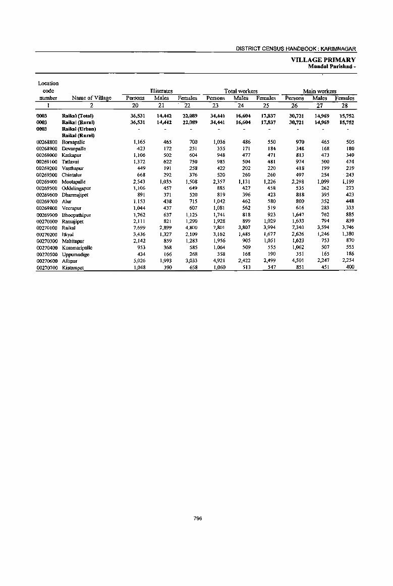
DISTRICT CENSUS HANDBOOK: KARIMNAGAR
VILLAGE PRIMARY Mandai Parishad -
Location
code Illiterates Total workers Main workers number Name of Village Persons Males Females Persons Males Females Persons Males Females
2 20 21 22 23 24 25 26 27 28
0003 Raikal (Total) 36,531 14,442 22,089 34,441 16,604 17,837 30,721 14,969 15,752 0003 Raikal (Rural) 36,531 14,442 22,089 34,441 16,604 17,837 30,721 14,969 15,752 0003 Raikal (Urban)
Raikal (Rural) 00268800 Bomapalle 1,165 465 700 1,036 486 550 970 465 505 00268900 Devanpalle 423 172 251 355 171 184 348 168 180 00269000 Katkapur 1,106 502 604 948 477 471 813 473 340 00269100 Tatlavai 1,372 622 750 985 504 481 974 500 474 00269200 Vasthapur 449 191 258 422 202 220 418 199 219 00269300 ChintaJur 668 292 376 520 260 260 497 254 243
00269400 Mootapalle 2,543 1,035 1,508 2,357 1,131 1,226 2,298 1,099 1,I99 00269500 Oddelingapur 1,106 457 649 885 427 458 535 262 273
00269600 Dharmajipet 891 371 520 819 396 423 818 395 423 00269700 Alur 1,153 438 715 1,042 462 580 800 352 448
00269800 Veerapur 1,044 437 607 1,081 562 519 616 283 333
00269900 Bhoopathipur 1,762 637 1,125 1,741 818 923 1,647 762 885
00270000 Rarnajipet 2,111 821 1,290 1,928 899 1,029 1,633 794 839
00270100 Raikal 7,699 2,899 4,800 7,801 3,807 3,994 7,340 3,594 3,746
00270200 1tkyal 3,436 1,327 2,109 3,162 1,485 1,677 2,626 1,246 1,380
00210300 Mahitapur 2,142 859 1,283 1,956 905 1,051 1,623 753 870
00270400 Kurnrnaripalle 953 368 585 1,064 509 555 1,062 507 555
00270500 Uppumadige 434 166 268 358 168 190 351 165 186
00270600 A1lipur 5,026 1,993 3,033 4,921 2,422 2,499 4,501 2,247 2,254
00210700 Kistampet 1,048 390 658 1,060 513 547 851 451 400
796

PRIMARY CENS\JS ABSTRACT
CENSUS AB~TRACT Raikal
Industrial cate~o!! of main workers Household industry
Cultivators Agricultural labourers workers Other workers Persons Males Females Persons Males Females Persons Males Females Persons Males Females Name ofViUage
29 30 31 32 33 34 35 36 37 38 39 40 2
9.217 5,500 3,717 6,662 3,571 3,091 8,378 979 7,399 6,464 4,919 1,545 Raikal (Total) 9.217 5,500 3,717 6,662 3,571 3,091 8,378 979 7,399 6,464 4,919 1,545 Raikal (Rural)
Raikal (Urban) Raikal (Rural)
173 97 76 557 246 311 108 8 100 132 114 18 Bomapalle . 161 86 75 141 61 80 17 7 10 29 14 15 DevanpaUe 300 202 98 385 201 184 40 4 36 88 66 22 Katkapur 475 291 184 26·1 124 137 170 32 138 68 53 15 Tatlavai 227 135 92 28 10 18 82 3 79 81 51 30 Vasthapur
38 Z3 15 311 168 143 69 4 65 79 59 20 Chintalur 799 450 349 556 265 291 523 42 481 420 342 78 Mootapalle 297 161 136 8 5 3 135 17 118 95 79 16 Odde1ingapur 492 264 228 219 90 129 89 24 65 18 17 1 Dhanmyipet 386 226 160 lIS 40 75 215 17 198 84 69 15 Alur 254 197 57 25 6 19 283 33 250 54 47 7 VeerapuT 421 257 164 363 209 154 644 114 530 219 182 37 Bhoopathipur 443 296 147 397 221 176 512 63 449 281 214 67 Ramajipet 904 560 344 1,019 640 379 2,281 251 2,030 3,136 2,143 993 Raikal 755 419 336 636 384 252 746 27 719 489 416 73 Itkyal 714 389 325 219 113 106 455 54 401 235 197 38 Mahitapur 393 233 160 203 118 85 295 7 288 171 149 22 Kummaripalle . 54 36 18 155 78 77 III 26 85 31 25 6 Uppumadige
. 1,719 1,027 692 874 476 398 1,289 192 1,097 619 552 67 Allipur 212 151 61 190 116 74 314 54 260 135 130 5 Kistampet
797

DISTRICT CENSUS HANDBOOK: KARIMNAGAR
VILLAGE PRIMARY MandaI Parishad -
Industrial categ0!l: Location
code Mar~inal workers Cultivators Agricultural labourers number Name ofVil1a~e Persons Males Females Persons Males Females Persons Males' Females
I 2 41 42 43 44 4S 46 47 48 49
0003 Raikal (Total) 3,720 1,635 2,085 182 122 60 1,892 885 1,007 0003 Raikal (Rural) 3,720 1,635 2,085 182 122 60 1,892 885 1,007 0003 RaikaJ (Urban)
Raikal (Rural) 00268800 Bomapalle 66 21 45 2 2 40 14 26 00268900 Devanpalle 7 3 4 3 2 4 2 2 00269000 Katkapur 135 4 131 4 2 2 9 9 00269100 Tatlavai II 4 7 3 1 2 7 3 4 00269200 Vasthapur 4 3 I 4 3 I 00269300 Chintalur 23 6 17 3 2 00269400 Mootapalle 59 32 27 20 16 4 20 10 10 00269500 Oddelingapur 350 165 185 7 2 5 338 161 177 00269600 Dhannajipet 1 1 00269700 Alur 242 110 132 14 6 8 169 92 77 00269800 Veerapur 465 279 186 3 3 72 53 19 00269900 Bhoopathipur 94 56 38 4 3 I 81 44 37 00270000 Ramajipet 295 105 190 9 3 6 38 26 12 00270100 Raikal 461 213 248 15 II 4 181 115 66 00270200 Itkyal 536 239 297 55 53 2 263 123 140 00270300 Mahitapur 333 152 181 5 3 2 273 117 156 00270400 Kummaripalle 2 2 00270500 Uppumadige 7 3 4 2 00270600 Allipur 420 175 245 26 16 10 268 83 185 00270700 Kistampet 209 62 147 10 3 7 120 36 84
798

PRIMARY CENSUS ABSTRACT
CENSUS AB$TRACT Raikal
of marl;linal wor,kers Location
Household industry workers Other workers Non-workers code Persons Males Females Persons Males Females Persons Males Females Name of ViIla8e number
50 5I; 52 53 54 55 56 57 58 2 I
921 1~4 797 725 504 221 24,366 11,999 12,367 Raikal (Total) 0003 921 12..4 797 725 504 221 24,366 11,999 12,367 Raikal (Rural) 0003
Raikal (Urban) 0003 Raikal (Rural)
15 3 12 9 4 5 610 301 309 Bomapalle 00268800 209 108 101 Devanpalle 00268900
119 118 3 2 489 225 264 Katkapur 00269000 1 745 353 392 TatIavai 00269100
174 89 85 Vastbapur 00269200 16 2 14 4 2 2 347 178 169 Chintalur 00269300 7 7 12 6 6 1,395 688 707 MootapaJle 00269400 3 3 2 2 556 249 307 Oddelingapur 00269500
412 212 200 Dharrnajipet 00269600 36 3 33 23 9 14 708 360 348 AIm 00269700 65 35 30 325 191 134 579 275 304 Veerapur 00269800
1 ·1 8 8 1,163 555 608 Bhoopathipur 00269900 175 13 162 73 63 10 1,518 755 763 Ramajipet 00270000 168 14 154 97 73 24 7,056 3,478 3,578 Raikal 00270100
I
175 27 ~4& 43 36 7 2,271 1,124 1,147 ItkyaI 00270200 19 i I 18 36 31 5 1,314 682 632 Mahitapur 00270300
I 1 625 328 297 Kummaripalle 00270400 3 3 2 2 249 104 145 Uppumadige 00270500
55 12 43 71 64 7 3,271 1,593 1,678 Allipur 00270600 64 )z 52 15 11 4 675 342 333 Kistam~t 00270700
799

DISTRICT CENSUS HANDBOOK: KARIM NAGAR
VILLAGE PRIMARY Mandai Parishad -
Total population (including Location Area of institutional and houseless Population in the
code Village in Number of QOQulation 1 age-S!0uQ 0-6 number Name ofVilla8e hectares households Persons Males Females Persons Males Females
1 2 3 4 5 6 7 8 9 10
0004 Sarangapur (Total) 29,030.0 10,068 40,881 19,935 20,946 5,733 2,887 2,846
0004 Sarangapur (Rural) 29,030.0 10,068 40,881 19,935 20,946 5,733 2,887 2,846 0004 Sarangapur (Urban)
Sarangapur (Rural) 00270800 Rangasagar 1,838.0 105 410 194 216 61 32 29 00270900 Mangela 1,029.0 415 1,563 760 803 224 112 112 00271000 Kammunur 4,590.0 162 575 285 290 82 42 40 00271100 Thalladharmaram 874.0 255 1,191 579 612 159 76 83 00271200 Relculapalle 378.0 218 861 400 461 1I8 45 73 00271300 Kolvai 1,054.0 614 2,528 1,246 1,282 389 190 199 00271400 Komanpalle 254.0 71 321 172 149 40 25 15 00271500 Mothinagar 277.0 -------Un-inhabited------00271600 Thungur 1,441.0 928 3,691 1,765 1,926 524 266 258 00271700 Kandlapalle 714.0 286 1,184 575 609 177 75 102 00271800 Cherlapalle 1,104.0 134 460 215 245 60 32 28 00271900 Narsimlapalle 354.0 610 2,288 1,094 1,194 277 152 125 00272000 8eerpur 1,146.0 931 3,494 1,771 1,723 477 250 227 00272100 Potharam 1,059.0 378 1,575 753 822 247 132 115 00272200 Sarangapur l,17l.0 380 1,644 850 794 201 104 97 00272300 Ganeshpalle 1,316.0 46 194 103 91 36 20 16 00272400 Rechapalle 4,048.0 1,122 4,599 2,197 2,402 674 329 345 00272500 Rangapet 1,336.0 449 1,772 860 912 235 123 112 00272600 Nagunur 499.0 245 991 481 510 117 52 65 00272700 Latchakkapet 197.0 267 1,045 509 536 144 59 85 00272800 Konapur 798.0 577 2,506 1,201 1,305 361 196 165 00272900 Pembetla 541.0 489 2,160 1,074 1,086 328 164 164 00273000 Laxmidevipalle 917.0 623 2,583 1,272 1,311 394 214 180 00273100 Arpapalle 842.0 608 2,636 1,278 1,358 323 156 167 00273200 Battapalle 999.0 155 610 301 309 85 41 44
800

PRIMARY CENSUS ABSTRACT
CENSUS ABSTRACT Sarangapur
Scheduled Ca$tes 2o~uation Scheduled Tribes EOEulation Literates Persons M;Ues Females Persons Males Females Persons Males Females Name of Village
II 112 13 14 15 16 17 18 19 2
7,400 3,630 3,770 2,240 1,142 1,098 12,561 8,306 4,255 Sarangapur (Total) 7,400 3,630 3,770 2,240 1,142 1,098 12,561 8,306 4,255 Sarangapur (Rural)
Sarangapur (Urban) Sarangapur (Rural)
47 26 21 no 67 43 Rangasagar 242 125 117 177 82 95 464 318 146 Mangela 314 160 154 118 80 38 Kammunur 152 71 81 435 225 2tO 378 246 132 Thalladharmaram 281 125 156 6 3 3 226 154 72 RekulapaUe
: 599 301 298 107 50 57 733 513 220 Kolvai
119 91 28 Komanpalle ----Un-inhabited----- . Mothinagar
719 345 374 1.017 686 331 Thungur 192 99 93 11 5 6 290 200 90 KandlapaJlc 104 52 52 101 56 45 121 82 39 Cherlapalle 310 156 154 2 1 I 868 540 328 Narsimlapalle 457 229 228 280 142 138 1,016 675 341 8eerpur 177 80 97 506 320 186 Pothararn 196 110 86 189 113 76 598 399 199 SarangapuT
4 3 I Ganeshpalle 538 ,254 284 549 276 273 1,294 860 434 RecbapaUe 364 [176 188 513 342 171 Rangapet 421 :199 222 4 3 313 204 109 Nagunur
67 37 30 10 5 5 420 279 141 Latchakkapet
234 '113 121 27 12 15 860 547 313 Konapur
453 223 230 613 403 210 Pembetla 575 285 290 341 169 172 820 534 286 Laxmidevipalle
669 327 342 I I 953 634 319 Arpapalle 289 .137 152 207 129 78 8attapalle
801
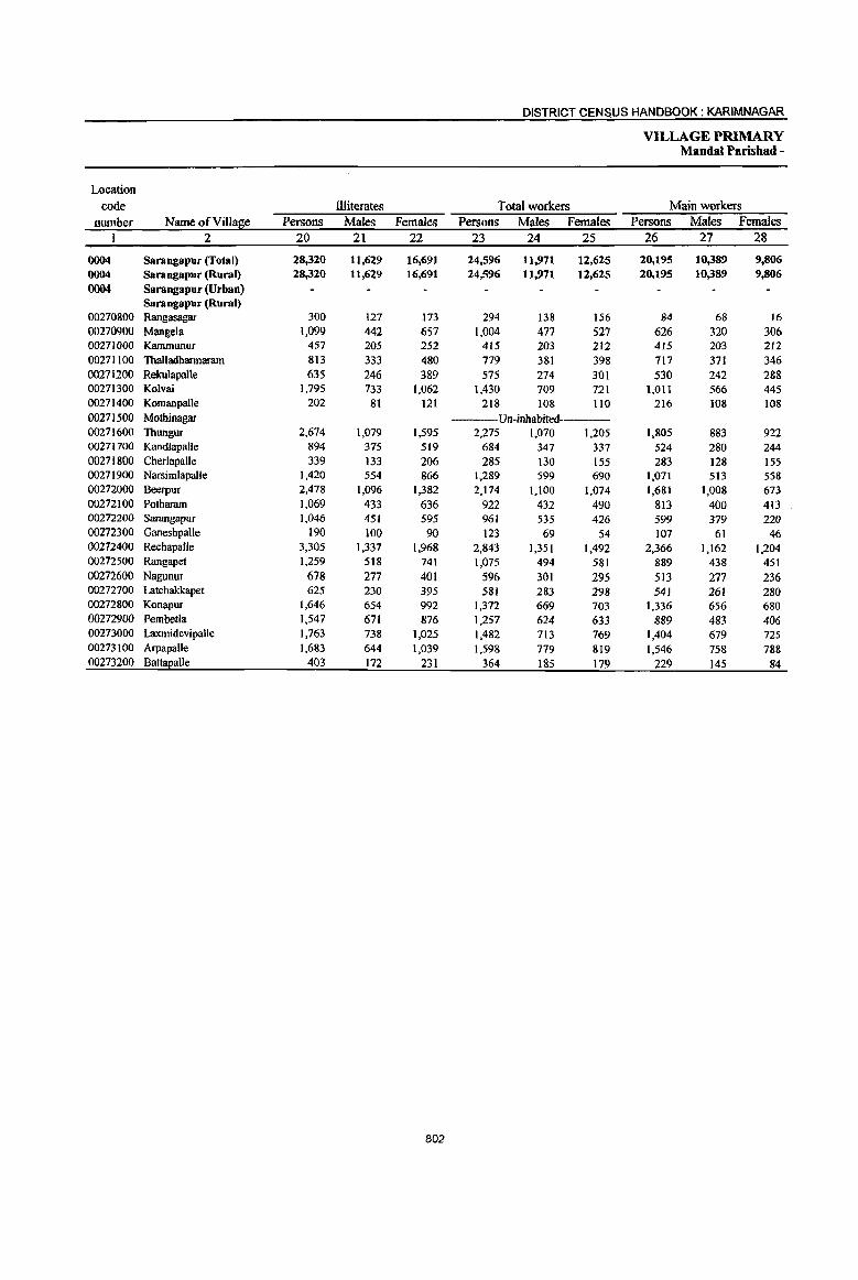
DISTRICT CENSUS HANDBOOK: KARIMNAGAR
VILLAGE PRIMARY Mandai Parishad -
Location
code Illiterates Total workers Main workers
number Name ofVilla~e Persons Males Females Persons Males Females Persons Males Females I 2 20 21 22 23 24 25 26 27 28
0004 Sarangapur (Total) 28,320 11,629 16,691 24,596 11,971 12,625 20,195 10,389 9,806 0004 Sarangapur (Rural) 28,320 11,629 16,691 24,596 11,971 12.625 20.195 10,389 9,806 0004 Sarangapur(Urban)
Sarangapur (Rural) 00270800 Rangasagar 300 127 173 294 138 156 84 68 16 00270900 Mangela 1,099 442 657 1,004 477 527 626 320 306 00271000 Kammunur 457 205 252 415 203 212 415 203 212 00271100 Thalladharmaram 813 333 480 779 381 398 717 371 346 00271200 Rekulapalle 635 246 389 575 274 301 530 242 288 00271300 Kolvai 1,795 733 1,062 1,430 709 721 1,011 566 445 00271400 Komanpalle 202 81 121 218 108 110 216 108 108 00271500 Mothinagar Un-inhabited-----00271600 Thungur 2,674 1,079 1,595 2).75 1,070 1,205 1,805 883 922 00271700 Kandlapalle 894 375 519 684 347 337 524 280 244 00271800 Cherlapalle 339 133 206 285 130 155 283 128 155 00271900 Narsimlapalle 1,420 554 866 1,289 599 690 1,071 513 558 00272000 Beerpur 2,478 1,096 1,382 2,174 1.100 1,074 1,681 1,008 673 00272100 Potharam 1,069 433 636 922 432 490 813 400 413 00272200 Sarangapur 1,046 451 595 961 535 426 599 379 220 00272300 Ganeshpalle 190 100 90 123 69 54 107 61 46 00272400 Rechapalle 3,305 1,337 1,968 2,843 1,351 1,492 2,366 1,162 1.204 00272500 Rangapet 1,259 518 741 1,075 494 581 889 438 451 00272600 Nagunur 678 277 401 596 301 295 513 277 236 00272700 Latchakkapet 625 230 395 581 283 298 541 261 280 00272800 Konapur 1,646 654 992 1,372 669 703 1,336 656 680 00272900 Pembetla 1,547 671 876 1,257 624 633 889 483 406 00273000 Laxmidevipalle 1,763 738 1,025 1,482 713 769 1,404 679 725 00273100 Arpapalle 1,683 644 1,039 1,598 779 819 1,546 758 788 00273200 Battapalle 403 172 231 364 1&5 179 229 145 84
802

PRIMARY CENSUS ABSTRACT
CENSUS ABSTRACT Sarangapur
Industrial cateso!! of main workers Household industry
Cultivato~ Agricultural labourers workers Other workers Persons Males: Females Persons Males Females Persons Males Females Persons Males Females Name of Village
29 30 , 31 32 33 34 35 36 37 38 39 40 2 ,
8,756 5,172 3,584 4,518 2,090 2,428 3,270 574 2,696 3,651 2,553 1,098 Sarangapur (Total) 8,756 5,172 3,584 4,518 2,090 2,428 3,270 574 2,696 3,651 2,553 1,098 Sarangapur (Rural)
Sarangapur (Urban) Sarangapur (Rural)
63 52 II 12 10 2 6 4 2 3 2 Rangasagar 368 200 168 49 22 27 69 25 44 140 73 67 Mangela 269 170 99 36 18 18 99 9 90 II 6 5 Kammunur 546 315 231 46 8 38 59 3 56 66 45 21 Thalladbarmaram 299 149 150 136 70 66 68 I 67 27 22 5 RekuJapalle 578 302, 276 120 47 73 30 21 9 283 196 87 Kolvai 118 65 53 48 24 24 24 24 26 19 7 Komanpalle
'-. --Un-inhabited Mothinagar 647 435 212 266 142 124 309 17 292 583 289 294 Thungur 313 171 142 62 26 36 25 19 6 124 64 60 Kandlapalle 205 99 106 54 Il 43 3 2 I 21 16 5 Cherlapalle 402 243 159 174 107 67 348 52 296 147 111 36 Narsimlapalle 370 312 58 556 251 305 359 129 230 396 316 80 Beerpur 314 177 137 263 106 157 101 21 80 135 96 39 Potharam 354 213 141 96 53 43 29 12 17 120 101 19 Sarangapur 98 54 44 4 2 2 5 5 Ganeshpalle
969 534 435 838 349 489 273 67 206 286 212 74 Rechapalle 486 278 208 83 32 51 182 20 162 138 108 30 Rangapet 205 130 ' 75 127 68 59 88 5 83 93 74 19 Nagunur 203 119 84 38 23 15 84 9 75 216 110 106 Latchakkapet 454 252 202 184 79 105 346 ·28 318 352 297 55 Konapur 413 238 175 150 88 62 200 45 155 126 112 ]4 Pembetla 408 212 196 557 286 271 259 43 216 180 138 42 LaxmidevipaUe 539 364 175 601 257 344 277 36 241 129 101 28 Arpapalle 135 88 47 18 11 7 32 6 26 44 40 4 BattapaUe
803

DISTRICT CENSUS HANDBOOK: KARIM NAGAR
VILLAGE PRIMARY Mandai Parisbad -
Industrial cate~o!! Location
code Marsinal workers Cultivators Agricultural labourers number Name of Village Persons Males Females Persons Males Females Persons Males Females
1 2 41 42 43 44 45 46 47 48 49
0004 Sarangapur (Total) 4,401 1,582 2,819 275 118 157 2,605 977 1,628 0004 Sarangapur (Rural) 4,401 1,582 2,819 275 118 IS7 2,605 977 1,628
0004 Saraogapur~rban)
Saraogapur (Rural) 00270800 Rangasagar 210 70 140 8 2 6 174 61 113 (l0270900 Mangela 378 157 221 8 5 3 131 59 72 00271000 Kammunur (l02711oo Thalladharmaram 62 10 52 51 7 44
00271200 RelrnlapalJe 45 32 13 1 36 23 13
00271300 Kolvai 419 143 276 37 I3 24 207 82 125 00271400 Komanpalle 2 2 00271500 Mothinagar ------Un-inhabited-~----
00271600 Thungur 470 187 283 62 30 32 288 112 176 00271700 Kandlapalle 160 67 93 26 14 12 20 6 14 00271800 Cherlapalle 2. 2 2 2 00271900 Narsimlapalle 21& 86 132 17 7 10 149 55 94 00272000 BeeIpur 493 92 401 10 5 5 192 40 152 00272100 Potharam 109 32 77 9 2 7 48 20 28 00272200 Sarangapur 362 156 206 13 3 10 234 110 124 00272300 Ganeshpalle 16 8 8 9 4 5 3 3 00272400 Rechapalle 477 189 288 22 3 19 390 170 220 00272500 Rangapet 186 56 130 13 3 10 141 42 99 00272600 Nagunur 83 24 59 6 3 3 53 17 36 00272700 Latchakkapet 40 22 18 9 8 5 4 1 00272800 Konapur 36 13 23 4 3 11 4 7 00272900 Pembetla 368 141 227 7 5 2 287 109 178 00273000 Laxmidevipalle 78 34 44 8 4 4 43 18 25 00273100 Arpapalle 52 21 31 4 2 2 31 9 22 00273200 Battapalle 135 40 95 2 109 27 82
804

PRIMARY CEN$US ABSTRACT
CENSUS ABSTRACT Sarangapur
of marfiinal wOlkers Location
Household indUstry workers Other workers Non-workers code Persons Males Females Persons Males Females Persons Males Females Name of Village number
50 51: 52 53 54 55 56 57 58 2 I I
743 1'62 581 778 325 453 16,285 7,964 8,321 Suangapur (fotal) 0004 743 1~2 581 778 325 453 16,285 7,964 8,321 Sarangapur (Rural) 0004
Sarangapur~rban) 0004 Sarangapur (Rural)
8 7 20 6 14 116 56 60 Rangasagar 00210800 211 85 132 22 8 14 559 283 276 Mangela 00210900
160 82 78 Kammunur 00211000 8 8 3 3 412 198 214 Thalladhannaram 00211100
8 8 286 126 160 Relrulapalle 00211200 29 6 23 146 42 104 1,098 537 561 Kolvai 00271300
103 64 39 Komanpalle 00211400 ---Un-inhabited Motbinagar 00271500
22 :2 20 98 43 55 1,416 695 721 Tbungur O()2716OO 9 5 4 105 42 63 500 228 272 Kandlapalle 00271700
175 85 90 CberJapalle 0()Z718OO 34 7 27 18 17 I 999 495 504 Narsimlapalle 0()27 I 900
137 17 120 154 30 124 1,320 671 649 Beerpur 00272000 33 '4 29 19 6 13 653 321 332 PQtharam 00272100 14 15 59 41 28 13 683 315 368 SaraIigapur 00212200
4 4 71 34 37 GaneShpalle 00212300 44 '9 35 21 1 14 1,156 846 910 Rechilpalle 0()2124oo 16 1 15 16 10 6 697 366 331 Rangapet 00272500 12 12 12 4 8 395 180 215 Nagunur 00272600 10 10 16 10 6 464 226 238 Latchakkapet 00212100 14 II 13 7 5 2 1,134 532 602 Konapur 00212800 46 15 41 28 22 6 903 450 453 Pembetla 00212900 16 Q 14 11 10 t 1,101 559 542 Laxmidevipalle 00213000 2 1 15 9 6 1,038 499 539 A'1JapalJe 00213100
11 10 13 11 2 246 116 130 Battapalle 00213200
805
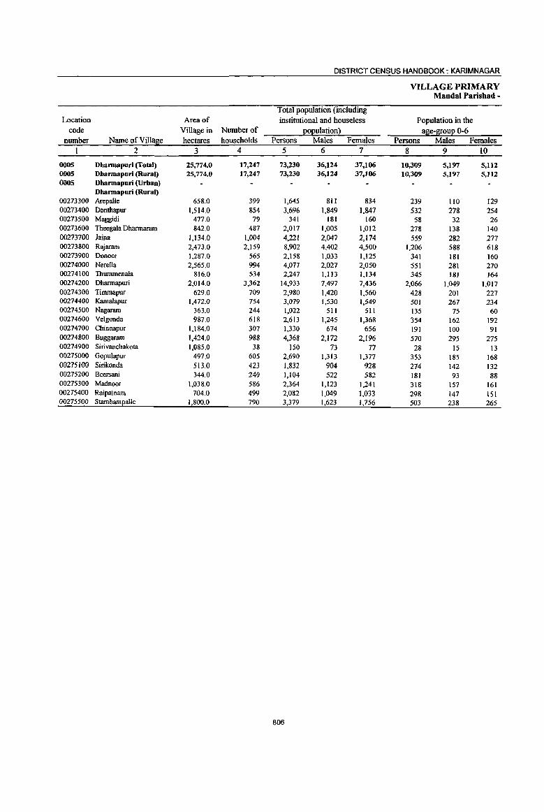
DISTRICT CENSUS HANDBOOK: KARIMNAGAR
VILLAGE PRIMARY MandaI Parisbad -
Total population (including Location Area of institutional and houseless Population in the
code Village in Number of EOEulation} age-1[ouE 0-6 number Name ofVilIa~e hectares households Persons Males Females Persons Males Females
1 2 3 4 5 6 7 8 9 10
0005 Dbarmapuri (Total) 25,774.0 17,247 73,230 36,124 37,106 10,309 5,197 5,112 0005 Dbarmapuri (Rural) 25,774.0 17,247 73,230 36,124 37,106 10,309 5,197 5,112 0005 Dharmapuri (Urban)
Dbarmapuri (Rural) 00273300 Arepalle 658.0 399 1,645 811 834 239 1I0 129 00273400 Donthapur 1,514.0 854 3,696 1,849 1,847 532 278 254 00273500 Maggidi 477.0 79 341 181 160 58 32 26 00273600 Tbeegala Dharrnaram 842.0 487 2,017 1,005 1,012 278 138 140 00273700 Jaina 1,134.0 1,004 4,221 2,047 2,174 559 282 277 00273800 Rajarnm 2,473.0 2,159 8,902 4,402 4,500 1,206 588 618 00273900 Donoor 1,287.0 565 2,158 1,033 1,125 341 181 160 00274000 Nerella 2,565.0 994 4,077 2,027 2,050 551 281 270 00274100 Thummenala 816.0 534 2,247 I,] 13 1,134 345 181 164 00274200 Dharrnapuri 2,014.0 3,362 14,933 7,497 7,436 2,066 1,049 1,017 00274300 Timmapur 629.0 709 2,980 1,420 1,560 428 201 227 00274400 Kamalapur 1,472.0 754 3,079 1,530 1,549 501 267 234 00274500 Nagaram 363.0 244 1,022 511 511 135 75 60 00274600 Velgonda 987.0 618 2,613 1,245 1,368 354 162 192 00274700 Chinnapur 1,184.0 307 1,330 674 656 191 100 91 00274800 Buggaram 1,424.0 988 4,368 2,172 2,196 570 295 275 00274900 Sirivanchakota 1,085.0 38 150 73 77 28 15 13 00275000 Gopulapur 497.0 605 2,690 1,313 1,377 353 185 168 002751{)0 Sirikonda 513.0 423 1,832 904 928 274 142 132 00275200 Beersani 344.0 249 1,104 522 582 181 93 88 00275300 Madnoor 1,038.0 586 2,364 1,123 1,241 318 157 161 00275400 Raipatnam 704.0 499 2,082 1,049 1,033 298 147 151 00275500 Starnbamealle 1,800.0 790 3,379 1,623 1,756 503 238 265
806
PRIMARY CEN~US ABSTRACT
CENSUS AB'STRACT I
Dhannapuri
Scheduled Castes EOEuation . Scheduled Tribes EOEulation Literates
Persons Males Females Persons Males Females Persons Males Females Name of Village
11 12 13 14 15 16 17 18 19 2
15,648 7,720 7,928 588 365 283 25,644 16,516 9,128 Dhannapuri (fotal) 15,648 7,720 7,928 588 305 283 25,644 16,516 9,128 Dhannapuri (Rural)
Dhannapuri (Urban) Dhannapuri (Rural)
807 411 396 46 25 21 321 215 106 Arepal\e 1,014 520 494 1,306 855 451 Donthapur
189 100 89 84 59 25 Maggidi 880 432 448 711 474 237 Theegala Dharmaram
1,094 498 596 150 65 85 1,254 822 432 Iaina 2,010 977 1,033 288 150 138 2,496 1,657 839 Rajaram
612 291 321 568 370 198 Donoor 635 305 330 8 5 3 1,202 820 382 Nerella 573 294 279 673 423 250 Thummenala
1,784 907 877 62 48 14 6,930 4,363 2,567 Dharmapuri 1,054 506 548 8 3 5 946 579 367 Timmapur
587 275 312 7 3 4 1,045 683 362 KamaJapur 314 158 156 3 2 365 243 122 Nagararn 432 203 229 966 625 341 Velgonda 384 194 190 539 362 177 Chinnapur 723 384 339 1,741 1,104 637 Buggaram
49 23 26 44 27 17 Siri vanchalcota 396 199 197 1,018 643 375 Gopulapur 549 274 275 6 5 62() 391 229 Sirikonda 199 94 105 326 220 106 Beersani 335 160 175 923 551 372 Madnoor 328 171 157 559 387 172 Raipatnam 700 344 356 9 3 6 1,007 643 364 Stambampalle
807
DISTRICT CENSUS HANDBOOK: KARIMNAGAR
VILLAGE PRIMARY Mandai Parishad -
Location code llIiterates Total workers Main workers
number Name of Villa e Persons Males Females Persons Males Females Males Females I 2 20 21 22 23 24 25 27 28
I
0005 Dhannapuri (rotal) 47,586 19,608 27,978 40,204 20,870 19,334 3!S,425 19,253 16,172 0005 Dhannapuri (Rural) 47,586 19,608 27,978 40,204 20,870 19,334 3~,425 19,253 16,172 0005 Dharmapuri (Urban)
Dharmapuri (Rural) 00273300 ArepalJe 1,324 596 728 1,079 520 559 1,034 500 534 00273400 Donthapur 2,390 994 1,396 2,133 1,129 1,004 2,079 1,106 973 00273500 Maggidi 257 122 135 224 121 103 224 121 103 00273600 Theegala Dharmaram 1,306 531 775 1,064 5S9 475 912 497 415 00273700 Iaina 2,967 1,225 1,742 2,516 1,206 1,310 .2,203 1,075 1,128 00273800 Rajaram 6,406 2,745 3,661 5,427 2,725 2,702 5,112 2,647 2,465 00273900 Donoor 1,590 663 927 1,164 565 599 469 291 178 00274000 Nerella 2,875 1,207 1,668 1,980 1,137 843 ; 1,698 1,042 656
00274100 Thununenala 1,574 690 884 1,192 668 524 989 571 418
00274200 Dbannapuri 8,003 3,134 4,869 7,037 3,987 3,050 6,541 3,826 2,715 00274300 Timmapur 2,034 841 1,193 1,713 855 858 1,429 819 610 00274400 KamalapuI 2,034 847 1,187 1,798 880 918 1,504 802 702 00274500 Nagaram 657 268 389 591 297 294 591 297 294 00274600 Velgonda 1,647 620 1,027 1,509 713 796 683 365 318
00274700 Chinnapur 791 312 479 690 381 309 673 378 295 00274800 Buggaram 2,627 1,068 1,559 2,449 1,241 1,208 : 2,106 1,154 952
00274900 Sirivanchakota 106 46 60 87 41 46 86 41 45 00275000 Gopulapur 1,672 670 1,002 1,542 745 797 '1,531 739 792 00275100 Sirikonda 1,212 513 699 845 510 335 841 508 333
00275200 Beersani 778 302 476 648 303 345 , 594 298 296 00275300 Madnoor 1,441 572 869 1,315 615 700 1,292 613 679 00275400 Raipatnam 1,523 662 861 1,233 655 578 1,161 625 536
00275500 StambamEalle 2,372 980 1,392 1,968 987 981 I 1,673 938 735
808
PRIMARY CENSUS ABSTRACT
CENSUS ABSTRACT Dharmapuri
Industrial cate~0!X: of main workers Household industry
Cultivators Agricultural labourers workers Other workers Persons Males I Females Persotts Males· Females Persons Males Females Persons Males Females Name of Village
29 30 31 32 33 34 35 36 37 38 39 40 2
11,956 6,879 4,177 12,447 6,012 6,435 4,669 1,952 3,617 7,253 5,310 1,943 Dharmapuri (Total) 11,056 6,879 4,177 12,447 6,012 6,435 4,669 1,952 3,617 7,253 5,310 1,943 Dharmapuri (Rural)
Dharmapuri (Urban) Dbarmapuri (Rural)
422 267 155 453 191 262 10 6 4 149 36 113 Arepalle 755 466 289 1,018 473 545 129 43 86 177 124 53 DonthapuT lIO 62 4& 68 35 33 14 14 32 24 8 Maggidi 354 223 131 316 225 91 191 12 179 51 37 14 Theegala Dharmaram 779 482 297 822 397 425 436 69 367 166 127 39 Jaina
1,307 871 436 2,375 1,073 1,302 725 91 634 705 612 93 Rajaram
277 186 91 9 7 2 81 8 73 102 90 12 Donoor 315 237 78 610 350 260 266 146 120 507 309 198 Nerella 524 322 202 214 1I2 102 38 37 213 136 77 Thummenala 756 502 254 1,610 873 737 1,313 268 1,045 2,862 2,183 679 Dharmapuri 233 182 51 722 363 359 139 7 132 335 267 68 Timmapur 398 248 150 603 234 369 102 38 64 401 282 119 Kamalapur 242 124 118 225 97 128 40 9 31 84 67 17 Nagaram 594 310 284 39 27 12 6 6 44 22 22 Velgonda
122 84 38 283 156 127 154 48 106 114 90 24 Chinnapur 950 568 382 594 278 316 311 118 193 251 190 61 Buggaram 46 24 22 27 9 18 12 8 4 I I Sirivanchakota
631 367 264 493 235 258 291 65 226 116 72 44 Gopulapur 373 237 136 328 189 139 62 9 53 78 73 5 Sirikonda
240 162 78 227 90 137 96 22 74 31 24 7 Beersani
303 171 132 509 220 289 66 4 62 414 218 196 Madnoor 636 364 272 322 139 183 70 31 39 133 91 42 Raipatnam 689 420 269 580 239 341 117 43 74 287 236 51 Stambampalle
809
DISTRICT CENSUS HANDBOOK: KARIMNAGAR
VILLAGE PRIMARY MandaI Paris bad -
Indusnialcatego~
Location code Mar~inal workers Cultivators . Agriculturallabourers
number Name ofViIIal1!e Persons Males Females Persons Males Females P~rsons Males Females
2 41 42 43 44 45 46 47 48 49
0005 Dharmapuri (Total) 4,779 1,617 3,162 215 S8 127 3,144 1,064 2,080 OOOS Dharmapuri (Rural) 4,779 1,617 3,162 215 88 127 3,144 1,064 2,080 0005 Dbarmapuri (Urban)
Dbarmapuri (Rural) 00273300 Arepalle 45 20 25 33 13 20 00273400 Dontbapur 54 23 31 47 22 25 00273500 Maggidi 00273600 Theegala Dharmaram 152 92 60 19 12 7 109 62 47 00273700 Jaina 313 131 182 10 4 6 178 79 99 00273800 RlYaram 315 78 237 22 7 15 242 59 183 00273900 Donoor 695 274 421 27 19 8 533 210 323 00274000 Nerella 282 95 187 5 2 3 153 63 90 00274100 Thummenala 203 97 106 8 4 4 153 75 78 00274200 Dharmapuri 496 161 335 27 13 14 266 58 208 00274300 Timmapur 284 36 248 5 2 3 254 28 226 00274400 Kamalapur 294 78 216 27 3 24 202 60 142 00274500 Nagaram 00274600 Velgonda 826 348 478 12 8 4 468 226 242 00274700 Chinnapur 17 3 14 3 3 10 I 9 00274800 Buggaram 343 87 256 13 3 10 196 59 137 00274900 S irivanchakota 00275000 Gopulapur 11 6 5 4 2 2 00275100 Sirikonda 4 2 2 1 1 00275200 Beersani 54 5 49 1 I 30 3 27 00275300 Madnoor 23 2 21 3 3 5 2 3 00275400 Raipatnam 72 30 42 3 2 57 22 35 00275500 Stambamealle 295 49 246 28 10 18 202 20 182
810

PRIMARY CENSUS ABSTRACT
CENSUS ABSTRACT Dharmapuri
of marfiinal workers Location
Hous~hold industry workers Other workers Non-workers code
Persons Males Females Persons Males Females Persons Males Females Name ofVilla2;e number 50 51 52 53 54 55 56 57 58 2 1
713 67 646 707 398 309 33,026 15,254 11,772 Dharmapuri (Total) OOOS 713 67 646 707 398 309 33,026 15,254 17,772 Dharmapuri (Rural) 0005
Dharmapuri (Urban) 0005 Dharmapuri (Rural)
II 7 4 566 291 275 ArepaUe 00273300 3 3 3 2 1,563 720 843 Donthapur 00273400
117 60 57 Maggidi 00273500 8 2 6 16 16 953 416 537 Theegala Dharmaram 00273600
54 2 52 71 46 25 1,705 841 864 Jaina 00273700 2& 3 2S 23 9 14 3,475 1,677 1,798 Rajaram 00273800 77 6 71 58 39 19 994 468 526 Donoor 00273900 67 8 59 57 22 35 2,097 890 1,207 Nerella 00274000
3 3 39 18 21 1,055 445 610 Thummenala 00274100 81 12 69 122 78 44 7,896 3,510 4,386 Dharmapuri 00274200 17 17 8 6 2 1,267 565 702 Timmapur 00274300 28 27 37 14 23 1,281 650 631 Kamalapur 00274400
431 214 217 Nagaram 00274500 194 15 179 152 99 53 1,104 532 572 Velgonda 00274600
3 I 2 I 640 293 347 Chinnapur 00274700 103 14 89 31 11 20 1,919 931 988 Buggararn 00274800
63 32 31 Sirivanchakota 00274900 3 2 4 3 1,148 568 580 Gopulapur 00275000
3 2 1 987· 394 593 Sirikonda 00275100 . 9 9 14 2 12 456 219 237 Beersani 00275200
15 15 1,049 508 541 Madnoor 00275300 3 3 9 7 2 849 394 455 Raipatnam 00275400
32 2 30 33 17 16 1,411 636 775 Stalnbameaile 00275500
811

DISTRICT CENSUS HANDBOOK: KARIMNAGAR
VILLAGE PRIMARY MandaI Parishad -
Total population (including Location Area of institutional and houseless Population in the
code Village in Number of ~o~ulationl age-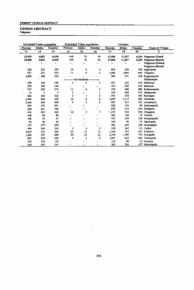
PRIMARY CENSUS ABSTRACT
CENSUS ABSTRACT Velgatoor
Scheduled Castes l!0l!uation Scheduled Tribes l!0(!ulation Literates Persons Males Females Persons Males Females Persons Males Females Name of Village
11 12 13 14 15 16 17 18 19 2
13,520 6,862 6,658 145 71 74 17,606 ll,247 6,359 Velgatoor (fotal) 13,520 6,862 6,658 145 71 74 17,606 11,247 6,359 Velgatoor (Rural)
Velgatoor (Urban) Velgatoor (Rural)
622 323 299 10 6 4 816 526 290 Jagdevpeta 671 321 350 11 6 5 1,689 1,046 643 Velgatoor
1,068 546 522 909 571 338 Kapparaopeta Un-inhabited---- Mukktraopet
370 180 190 4 1 3 477 329 148 Muthunur 270 130 140 435 282 153 Ramnoor 757 383 374 11 6 5 776 488 288 Kishanraopeta
14 7 7 433 260 173 Sakapuram 686 354 332 3 1 2 575 379 196 Kondapur
1,144 584 560 12 6 6 1,699 1,117 582 Gullakota 1,160 560 600 5 3 2 827 515 312 Ambaripeta
394 193 201 225 136 89 Sankenapalle
329 161 168 825 515 310 Paidipalle 616 307 309 12 5 7 1,123 124 399 Cheggaon 188 99 89 202 130 72 Undeda 100 53 47 417 259 158 Munjampalle 92 46 46 103 76 27 Sanabanda
527 277 250 981 633 348 Godiselapet 494 249 245 5 3 2 278 165 113 Padkal
1.039 531 508 25 II 14 1,164 733 431 Kothapet 1,483 797 686 42 21 21 2,100 1.385 715 Endapalle
802 420 382 4 2 2 1,007 643 364 Pathagudur 276 134 142 152 99 53 Suraram 418 207 211 393 236 157 Maredupalle
813

DISTRICT CENSUS HANDBOOK: KARIM NAGAR
VILLAGE PRIMARY Mandai Parishad -
Location code Illiterates Total workers Main workers
nwnber Name of Villae!e Persons Males Females Persons . Males Females Persons Males Females 1 2 20 21 22 23 24 25 26 27 28
0006 Velgatoor (Total) 29,623 12,580 17,043 26,329 13,861 12,468 23,910 12,914 10,996 0006 Vetgatoor (Rural) 29,623 12,580 17,043 26,329 13,861 12,468 23,910 12,914 10,996 0006 Velgatoor (Urban)
Velgatoor (Rural) 00275600 Jagdevpela 1,419 592 827 1,371 707 664 1,293 677 616 00275700 Velgatoor 2,214 922 1,292 1,917 1,066 851 1,670 983 687 00275800 Kapparaopeta 1,592 692 900 1,466 766 700 1,450 755 695 00275900 Mukktraopet ----Un-inhabited-------00276000 Muthunur 1,385 609 776 1,097 561 536 1,084 555 529 00276100 Ramnoor 579 216 363 563 302 261 561 302 259 00276200 Kishanraopeta 1,169 477 692 1,115 576 539 1,060 544 516 00276300 Sakapuram 762 335 427 688 336 352 684 336 348 00276400 Kondapur 1,475 668 807 1,149 625 524 1,124 609 515 00276500 Gullakota 3,220 1,353 1,867 2,834 1,470 1,364 2,341 1,298 1,043 00276600 Ambaripeta 1,274 515 759 1,113 593 520 J,034 572 462 00276700 Sankenapalle 448 197 251 371 205 166 371 205 166 00276800 Paidipalle 1,501 640 861 1,310 671 639 1,301 670 631 00276900 Cheggaon 1,729 714 ],015 1,594 837 757 1,570 835 735 00277000 Undeda 419 187 232 385 188 197 376 185 191 00277100 Munjampalle 895 427 468 791 430 361 786 430 356 00277200 Sanabanda 150 59 91 143 77 66 \39 73 66 00277300 Godiselapet 1,514 649 865 1,505 766 739 1,451 759 692 00277400 Padkal 499 226 273 400 217 183 400 217 183 00277500 Kothapet 1,516 624 892 1,396 770 626 603 371 232 00277600 Endapalle 3,157 1,312 1,845 2,773 1,484 ],289 2,662 1,454 1,208 00277700 Pathagudur 1,637 692 945 1,463 760 703 1,220 694 526 00277800 Suraram 298 126 172 244 126 118 224 122 102 00277900 Matedul2alle 771 348 423 641 328 313 506 268 238
814
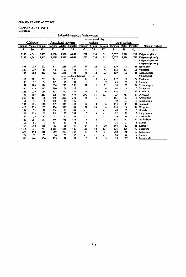
PRIMARY CENSUS ABSTRACT
CENSUS ABSTRACT Velgatoor
Industrial cate~0!X of main workers
Household industry
Cultivators Agricultural labourers workers Other workers Persons Males Females Persons Males Females Persons Males Females Persons Males Females Name of Village
29 30 31 32 33 34 35 36 37 38 39 40 2
7,368 4,561 2,807 12,188 5,320 6,868 777 235 S42 3,577 2,798 779 Velgatoor (Total) 7,368 4,561 2,807 12,188 5,320 6,868 777 235 542 3,577 2,798 779 Velgatoor (Rural)
Velgatool'(Urban) . Velgatoor (Rural)
478 255 223 647 288 359 39 26 13 129 108 21 Jagdevpeta 289 229 60 745 312 433 54 11 43 582 431 151 Velgatoor 484 252 232 792 388 404 35 12 23 139 103 36 Kapparaopeta
---Un-inhabited--- Mukktraopet , 514 281 233 421 175 246 32 9 23 117 90 27 Muthunur
146 92 54 342 158 184 9 9 64 52 12 Rarnnoor 298 184 114 636 277 359 32 II 21 94 72 22 Kishanraopeta 236 119 117 380 168 212 4 4 64 49 15 Sakapuram 326 210 116 601 247 354 13 7 6 184 145 39 Kondapur 767 486 281 899 444 455 252 31 221 423 337 86 Gullakota 269 194 75 645 280 365 15 II 4 105 87 18 Ambaripeta 51 43 8 280 135 145 40 27 13 Sankenapalle
344 203 141 789 346 443 14 8 6 154 113 41 Paidipalle 423 273 150 906 359 547 27 23 4 214 180 34 Cheggaon 144 73 71 184 80 104 48 32 16 Undeda 278 228 50 408 120 288 3 3 97 79 18 Munjampalle 67 35 32 53 22 31 19 16 3 Sanabanda
427 255 172 866 385 481 ~ 2 3 153 117 36 Godiselapet 63 56 7 304 133 171 5 4 28 27 Padkal
408 250 158 63 25 38 24 14 10 108 82 26 Kothapet 565 321 244 1,385 645 740 186 52 134 526 436 90 Endapalle 400 290 110 567 224 343 23 12 II 230 168 62 Pathagudur 104 71 33 96 31 65 24 20 4 Suraram 287 161 126 179 78 101 5 2 3 35 27 8 MaredupaUe
815
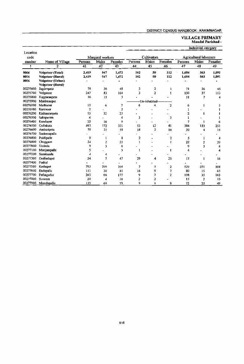
DISTRICT CENSUS HANDBOOK: KARIM NAGAR
VILLAGE PRIMARY Mandai Parishad -
Industrial cate!!i0!! Location
code Mar!!iinal workers Cultivators Agricultural labourers number Name ofVi1l~e Persons Males Females Persons Males Females Persons Males Females
I 2 41 42 43 44 45 46 47 48 49
0006 Velgatoor(Total) 2,419 947 1,472 162 50 112 1,654 563 1,091 0006 Velgatoor (Rural) 2,419 947 1,472 162 50 112 1,654 563 1,091 0006 Velgatoor (Urban)
Velgatoor (Rural) 00275600 Jagdevpeta 78 30 48 3 2 71 26 45 00275700 Velgatoor 247 83 164 3 2 150 37 113 00275800 Kapparaopeta 16 II 5 II 7 4 00275900 Mukktraopet ----Un-inhabited-----00276000 Muthunur 13 6 7 6 4 2 6 5 00276100 Rarnnoor 2 2 I 00276200 Kishanraopeta 55 32 23 2 00276300 Sakapuram 4 4 3 3 00276400 Kondapur 25 16 9 7 I 6 00276500 Gullakota 493 172 321 53 12 41 384 133 251 00276600 Ambaripeta 79 21 58 18 2 16 20 4 16 00276700 Sankenapalle 00276800 Paidipalle 9 8 2 2 5 4 00276900 Cheggaon 24 2 22 22 2 20 00277000 Undeda 9 3 6 9 3 6 00277100 Munjampalle 5 5 4 4 00277200 Sanabanda 4 4 00277300 Godiselapet 54 7 47 29 4 25 17 16 00277400 Padkal 00277500 Kothapet 793 399 394 7 5 2 579 271 308 00277600 Endapalle 111 30 81 16 9 7 80 15 65 00277700 Pathagudur 243 66 177 9 7 2 198 35 163 00277800 Suraram 20 4 16 2 2 15 2 13 00277900 MareduJ!alle 135 60 75 9 8 72 23 49
816
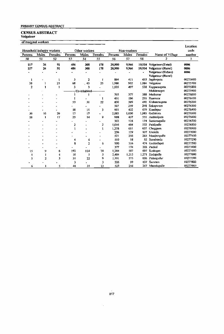
P~IMARY CENSUS ABSTRACT
CENSUS ABSTRACT Velgatoor
of mar~inal workers Location
Household industry workers Other workers Non-workers code Persons Males Females Persons Males Females Persons Males Females Name ofViIla!.l!e number
50 51 52 53 54 55 56 57 58 2
117 26 91 486 308 178 20,900 9,966 10,934 Velgatoor (Total) 0006 117 26 91 486 308 178 20,900 9,966 10,934 Velgatoor (Rural) 0006
Velgatoor (Urban) 0006 Velgatoor (Rural)
3 2 864 411 453 Jagdevpeta 00275600 26 25 68 ,43 25 1,986 902 1,084 Velgatoor 00275700
2 1 3 3 1,035 497 538 Kapparaopeta 00275800 ----Un-inhabited--- Mukktraopet 00275900
i I 765 377 388 Mutbunur 00276000 451 196 255 Ramnoor 00276100
53 31 22 830 389 441 Kisbanraopeta 00276200 507 259 248 Sakapuram 00276300
18 15 3 901 422 479 Kondapur 00276400 39 10 29 17 17 2,085 1,000 1,085 Gullakota 00276500 18 17 23 14 9 988 437 551 Ambaripeta 00276600
302 128 174 Sankenapalle 00276700 2 2 1,016 484 532 Paidipalle 00276800
I 1,258 601 657 Cheggaon 00276900 236 129 107 Undeda 00277000 521 256 265 Munjampalle 00277100
4 4 llO 58 52 Sanabanda 00277200 8 2 6 990 516 414 Godiselapet 00277300
371 174 203 Padkal 00271400 15 9 6 192 114 78 1,284 587 691 Kotbapet 00277500 5 4 10 5 5 2,484 1,213 1,271 Endapalle 00271600 5 2 3 31 22 9 1,181 575 606 Pathagudur 00277700
3 3 206 99 101 Surararn 00277800 6 5 48 35 13 523 256 267 Maredupalle 00277900
817

DISTRICT CENSUS HANDBOOK: KARIMNAGAR
VILLAGE PRIMARY Mandai Parishad -
Total population (including Location Area of institutional and houseless Population in the
code Village in Number of EOEulationi age-l[ouJ! 0-6 number NameofVill~e hectares households Persons Males Females Persons Males Females
2 3 4 5 6 7 8 9 lO
0007 Ramagundam (Total) 21,129.0 10,389 42,723 21,560 21,163 5,918 3,028 2,890 0007 Ramagundam (Rural) 19,835.0 8,794 35,756 17,946 17,810 5,011 2,551 2,460 0007 Ramagundam (Urban) 1,294.0 1,595 6,967 3,614 3,353 907 477 430
Ramagundam (Rural) 00278000 Kukkalagudur 1,244.0 653 2,422 1,216 1,206 303 161 142 00278100 Vemnoor 620.0 184 725 338 387 103 51 52 00278200 Maddiriyala 695.0 236 767 406 361 101 56 45 00278300 Potial 1,267.0 521 2,027 1,033 994 278 143 135 00278400 SomanapaUe 223.0 186 750 371 379 104 49 SS 00278500 Munnoor 1,159.0 502 2,123 1,095 1,028 311 168 143 00278600 YeUampalle 824.0 193 916 465 451 131 71 60 00278700 Goelwada 1,596.0 516 2,158 1,105 1,053 282 149 133 00278800 Antargoan 418.0 287 1,286 635 651 161 74 87 00278900 Raidandi 1,787.0 739 2,967 1,479 1,488 422 217 205 00279000 Brahmanapalle 613.0 449 1,783 907 876 253 123 130 00279100 Akenpalle 881.0 227 898 445 453 143 78 65 00279200 Eklaspur 633.0 156 550 275 275 100 52 48 00279300 Putnoor 1,049.0 402 1,733 860 873 240 126 114 00279400 Gudipalle 230.0 157 643 305 338 96 46 50 00279500 Jayyaram 715.0 272 1,108 546 562 175 90 85 00279600 Esa1atakka1lapalle 2,432.0 1,237 5,335 2,656 2,679 808 402 406 00279700 Mogalpahad 688.0 ------Un-inhabited----00279800 Kundanpalle 1,215.0 644 2,786 1,436 1,350 380 192 188 00279900 Lingapur 565.0 531 1,991 987 1,004 271 133 138 00280000 Elkalpalle 981.0 702 2,788 1,386 1,402 349 170 179
Ramagundam (Urban) 40302000 Palakurthy (CT) 1,294.0 1,595 6,967 3,614 3,353 907 477 430
818
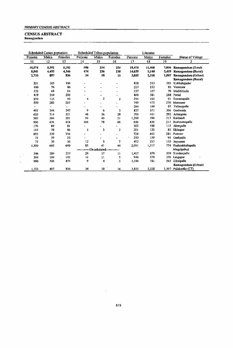
PRIMARY CENSUS ABSTRACT
CENSUS ABSTRACT' Ramagundam
Scheduled Castes EOEuation Scheduled Tribes EOEulation Literates Persons Males Females Persons Males Females Persons Males Females Name of Village
11 12 I3 14 15 16 17 18 19 2
. 10.,574 5,392 5,182 508 254 254 18,474 11,468 7,006 Ramagundam (Total) 8,841 4,495 4,346 474 236 238 14,639 9,140 5,499 Ramagundam (Rural) 1,733 897 836 34 18 16 3,835 2,328 1,507 Ramagundam (Urban)
Ramagundam (Rural) 331 165 166 828 533 295 Kukkalagudur 160 74 86 217 132 85 Vemnoor 132 68 64 237 167 70 Maddiriyala 419 214 205 869 581 288 Potial 210 115 95 4 2 2 256 165 91 Somanapalle 550 283 267 749 473 276 Munnoor
264 169 95 Yellampalle 491 244 241 9 6 3 877 511 306 Goelwada 635 314 321 46 26 20 703 411 292 Antargoan 585 304 281 94 43 51 1,299 786 513 Raidandi 930 476 454 166 78 88 650 439 211 Brahmahapalle 170 89 81 303 188 115 Akenpalle 164 78 86 5 3 2 201 120 8] E1daspur 695 339 356 724 443 281 Putnoor
74 39 35 250 159 91 Gudipalle 15 39 . 36 12 5 1 412 257 155 Jayyaram
1.,300 660 640 85 41 44 2,091 1.317 774 Esalatakkallapalle Un-inhabited Mogalpahad
546 289 257 28 17 11 1,417 878 539 KundanpaUe 394 199 195 16 II 5 946 570 376 Lingapur 980 506 474 9 4 5 1,346 181 565 Elkalpalle
Ramagundam (Urban) 1,733 897 836 34 18 16 3,835 2.328 1,507 Palakurthy (CT)
819

DISTRICT CENSUS HANDBOOK: KARIMNAGAR
VILLAGE PRIMARY Mandai Parishad -
Location code Illiterates Total workers Main workers
number Name of V illa~e Persons Males Females Persons Males Females Persons Males Females 1 2 20 21 22 23 24 25 26 27 28
0007 Ramagundam (Total) 24,249 10,092 14,157 18,994 11,897 7,097 15,149 10,621 4,528 0007 Ramagundam (Rural) 21,117 8,806 12,311 16,644 10,082 6,562 13,427 9,126 4,301 0007 Ramagundam (Urban) 3,132 1,286 1,846 2,350 1,815 535 1,722 1,495 227
Ramagundam (Rural) 00278000 Kukkalagudur 1,594 683 911 1,324 736 588 999 606 393 00278100 Vemnoor 508 206 302 383 195 188 317 184 133 00278200 Maddiriyala 530 239 291 441 238 203 229 197 32 00278300 Potial 1,158 452 706 1,061 592 469 388 360 28 00278400 Somanapalle 494 206 288 373 203 170 348 201 147 00278500 Munnoor 1,374 622 752 1,137 686 451 1,120 682 438 00278600 Yellampalle 652 296 356 548 300 248 532 299 233 00278700 Goelwada 1,281 534 747 1,132 672 460 955 568 387 00278800 Antargoan 583 224 359 510 361 149 503 358 145 00278900 Raidandi 1,668 693 975 1,190 770 420 986 704 282 00279000 Brahmanapalle 1,133 468 665 957 524 433 894 519 375 00279100 Akenpalle 595 257 338 480 I 247 233 427 244 183 00279200 Eklaspur 349 155 194 303 177 126 303 177 126 00279300 Putnoor 1,009 417 592 962 506 456 925 498 427 00279400 Gudipalle 393 146 247 290 167 123 189 159 30 00279500 Jayyaram 696 289 407 599 325 274 377 291 86 00279600 EsalatakkallapalJe 3,244 1,339 1,905 2,322 1,434 888 1,807 1,251 556 00279700 MQgalpahad ----Un-inhabited-------00279800 KundanpalJe 1,369 558 81l 857 700 157 747 689 58 00279900 Lingapur 1,045 417 628 707 524 183 664 519 145 00280000 Elkalpalle 1,442 605 837 1,068 72S 343 717 620 97
Ramagundam (Urban) 40302000 Palakurthy (en 3,132 1,286 1,846 2,350 1,815 535 1,722 1,495 227
820
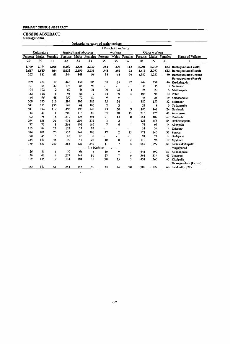
PRIMARY CENSUS ABSTRACT
CENSUS ABSTRACT Ramagundam
Industrial cate~0!X of main workers Household industry
Cultivators Agricultural labourers workers Other workers Persons Males Females Persons Males Females Persons Males Females Persons Males Females Name of Village
29 30 31 32 33 34 35 36 37 38 39 40 2
3,799 2,794 1,005 5,267 2,538 2,729 382 270 112 5,701 5,019 682 Ramagundam (Total) 3,637 2,683 954 5,023 2,390 2,633 348 256 92 4,419 3,797 622 Ramagundam (Rural)
162 III 51 244 148 96 34 14 20 1,282 1,222 60 Ramagundam (Urban) Ramagundam (Rural)
239 222 17 466 158 308 50 28 22 244 198 46 Kukkalagudur 101 64 37 178 85 93 38 35 3 Vemnoor 104 102 2 67 46 11 30 26 4 28 23 5 Maddiriyala 153 148 5 95 88 7 34 31J 4 IIJ6 94 12 Potial 144 96 48 150 70 80 9 9 45 26 19 Somanapalle 309 193 116 594 305 289 35 34 182 150 32 Murmoor 341 211 130 168 68 100 2 2 21 18 3 YeUampaile 311 194 117 436 193 243 23 20 3 185 161 24 Goelwada 34 30 4 200 115 85 53 38 IS 216 175 41 Antargoan 92 76 16 319 128 191 21 13 8 554 487 67 Raidandi
194 158 36 474 201 273 3 2 223 158 65 Brahmanapalle 77 76 1 168 101 167 7 6 75 61 14 Akenpalle
113 84 29 152 59 93 38 34 4 Eklaspur 184 108 76 553 248 305 17 2 15 171 140 31 Putnoor 50 45 5 48 40 8 91 74 17 Gudipalle
184 140 44 70 47 23 10 8 2 113 96 17 Jayyaram 779 530 249 364 122 242 11 7 4 653 592 61 Esalatakkallapalle
----Un-inhabited---- Mogalpahad 26 25 70 65 5 10 9 641 590 51 Kundanpalle 50 46 4 237 147 90 13 7 6 364 319 45 Lingapur
152 135 17 114 104 JO 20 15 5 431 366 65 Elkalpalle Ramagundam (Urban)
162 tIl 51 244 148 96 34 14 20 1,282 1,222 60 Palakurthy (CY)
821

DISTRICT CENSUS HANDBOOK: KARIMNAGAR
VILLAGE PRIMARY Mandai Parishad -
Industrial categ0!X Location
code Mar~inal workers Cultivators Agricultural labourers number Name ofVilla~e Persons Males Females Persons Males Females Persons Males Females
I 2 41 42 43 44 45 46 47 48 49
0007 Ramagundam (Total) 3,845 1,276 2,569 303 54 249 2,854 819 2,035 0007 Ramagundam (Rural) 3,217 956 2,261 290 52 238 2,681 782 1,899 0007 Ramagundam (Urban) 628 320 308 13 2 II 173 37 136
Ramagundam (Rural) 00278000 Kukkalagudur 325 130 195 7 2 5 317 127 190 00278100 Vernnoor 66 II 55 4 I 3 61 10 51 00278200 Maddiriyala 212 41 171 3 2 1 204 39 165 00278300 Porial 673 232 441 107 4 103 543 218 325 00278400 SomanapalJe 25 2 23 2 I 22 22 00278500 Murmoor 17 4 13 2 2 15 2 13 00278600 YeUampaUe 16 15 15 1 14 00278700 Goelwada 177 104 73 26 15 11 125 68 57 00278800 Antargoan 7 3 4 4 I 3 00278900 Raidandi 204 66 138 8 4 4 154 34 120 00279000 BnthmanapaUe 63 5 58 6 6 55 5 50 00279100 Akenpalle 53 3 50 49 2 47 00279200 Eklaspur 00279300 Putnoor 37 8 29 2 I 25 5 20 00279400 GudipaUe lOt 8 93 27 2 25 59 4 55 00279500 Jayyaram 222 34 188 71 11 60 130 19 111 00279600 Esalatakkallapalle 515 183 332 10 5 5 470 152 318 00279700 Mogalpahad ----Un-inhabited----00279800 KundanpaUe 110 11 99 7 2 5 83 4 79 00279900 Lingapur 43 5 38 I 1 38 5 33 00280000 Elkalpalle 351 105 246 5 5 312 86 226
Ramagundam (Urban) 40302000 Palakurthy (CT) 628 320 308 13 2 11 173 37 136
822

PRIMARY CENSUS ABSTRACT
CENSUS ABSTRACT Ramagundam
of mar~inal workers Location
Household industry workers Other workers Non~workers code Persons Males Females Persons Males Females Persons Males Females Name of V iIla~e number
50 51 52 53 54 55 56 57 58 2 I
63 23 40 625 380 245 23,729 9,663 14,066 Ramagundam (Total) 0007 5S 20 35 191 102 89 19,112 7,864 11,248 Ramagundam (Rural) 0007
8 3 5 434 278 156 4,617 1,799 2,818 Ramagundam (Urban) 0007 Ramagundam (Rural)
1,098 480 618 Kukkalagudur 00278000 342 143 199 Vemnoor 00278100
4 4 I I 326 168 158 Maddiriyala 00278200 12 6 6 II 4 7 966 441 525 Potial 00278300
377 168 209 Somanapalle 00278400 986 409 577 Munnoor 00278500 368 165 203 Yellampalle 00278600
10 9 16 12 4 1,026 433 593 Goelwada 00278700 3 2 1 776 274 502 Antargoan 00278800
9 2 1 33 26 7 1,777 709 1,068 Raidandi 00278900 2 2 826 383 443 Brnhmanapalle 00279000 3 2 418 198 220 Akenpalle 00279100
247 98 149 Eklaspur 00279200 8 7 2 I 771 354 417 Putnoor 00279300
15 2 I3 353 138 215 GudipaUe 00279400 5 5 16 4 12 509 221 288 Jayyaram 00279500
34 26 8 3,013 1,.222 1,791 Esalatakkallapalle 00279600 ---Un-inhabited----- Mogalpahad 00279700
2 2 18 5 13 1,929 736 1,193 Kundanpalle 00279800 2 2 2 2 1,284 463 821 Lingapur 00279900
34 19 15 1,720 661 1,059 Elkalpalle 00280000 Ramagundam (Urban)
8 3 5 434 278 156 4,617 1,799 2,818 Palakurthy (CT! 40302000
823
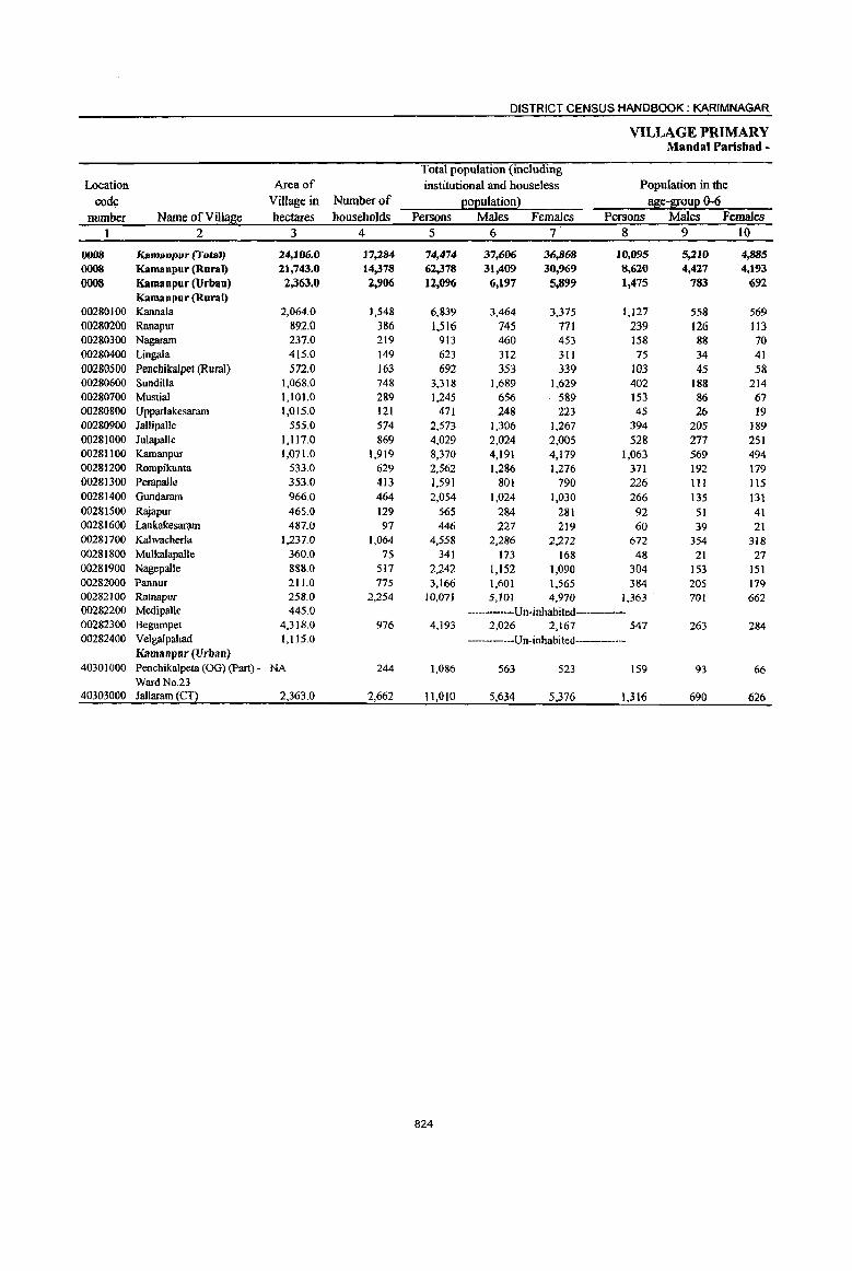
DISTRICT CENSUS HANDBOOK: KARIMNAGAR
VILLAGE PRIMARY Mandai Parishad -
Total population (including
Location Area of institutional and houseless Population in the
code Village in Number of EOEulation! age-I[oup 0-6 number Name of Village hectares households Persons Males Females Persons Males Females
1 2 3 4 5 6 7 8 9 lO
0008 Kamanpur (TotaJ) 24,106.0 17.284 74,474 37,606 36,868 10,095 5,210 4,885 0008 Kamanpur (Rural) 21,743.0 14,378 62,378 31,409 30,969 8,620 4,427 4,193
0008 Kamanpur (Urban) 2,363.0 2,906 12,096 6,197 5,899 1,475 783 692 Kamanpur (Rural)
00280100 Kannala 2,064.0 1,548 6,839 3,464 3,375 1,127 558 569 00280200 Ranapur 892.0 386 1,516 745 771 239 126 II3 00280300 Nagaram 237.0 219 913 460 453 158 88 70 00280400 Lingala 415.0 149 623 312 311 75 34 41 00280500 Penchikalpet (Rural) 572.0 163 692 353 339 103 45 58 00280600 Sundilla 1,068.0 748 3,318 1,689 1,629 402 188 214 00280700 Mustial 1,101.0 289 1,245 656 589 153 86 67 00280800 Upparlakesaram 1,015.0 121 471 248 223 45 26 19 00280900 Jallipalle 555.0 574 2,573 1,306 1,267 394 205 189 00281000 Julapalle 1,117.0 869 4,029 2,024 2,005 528 277 251 00281100 Kamanpur 1,071.0 1,919 8,370 4,191 4,179 1,063 569 494 00281200 Rompikunta 533.0 629 2,562 1,286 1,276 371 192 179 00281300 PerapalJe 353.0 413 1,591 801 790 226 III 115 00281400 Gundaram 966.0 464 2,054 1,024 1,030 266 135 131 00281500 Rajapur 465.0 129 565 284 281 92 51 41 00281600 Lankakesararn 487.0 97 446 227 219 60 39 21 00281700 Kalwacherla 1,237.0 1,064 4,558 2,286 2,272 672 354 318 00281800 Mulka1apalle 360.0 75 341 173 168 48 21 27 00281900 Nagepalle 888.0 517 2,242 1,152 1,090 304 153 151 00282000 PannuT 211.0 775 3,166 1,601 1,565 384 205 179 00282100 Ratnapur 258.0 2,254 10,071 5,101 4,970 1,363 701 662 00282200 Medipal1e 445.0 ------Un-inhabited-------00282300 Begumpet 4,318.0 976 4,193 2,026 2,167 547 263 284 00282400 Velgalpahad 1,115.0 -------Un-inhabited------
Kamanpur (Urban) 40301000 Penchika1peta (00) (Part) - NA 244 1,086 563 523 159 93 66
Ward No.23 40303000 Jallaram (CT) 2,363.0 2,662 11,010 5,634 5,376 1,316 690 626
824
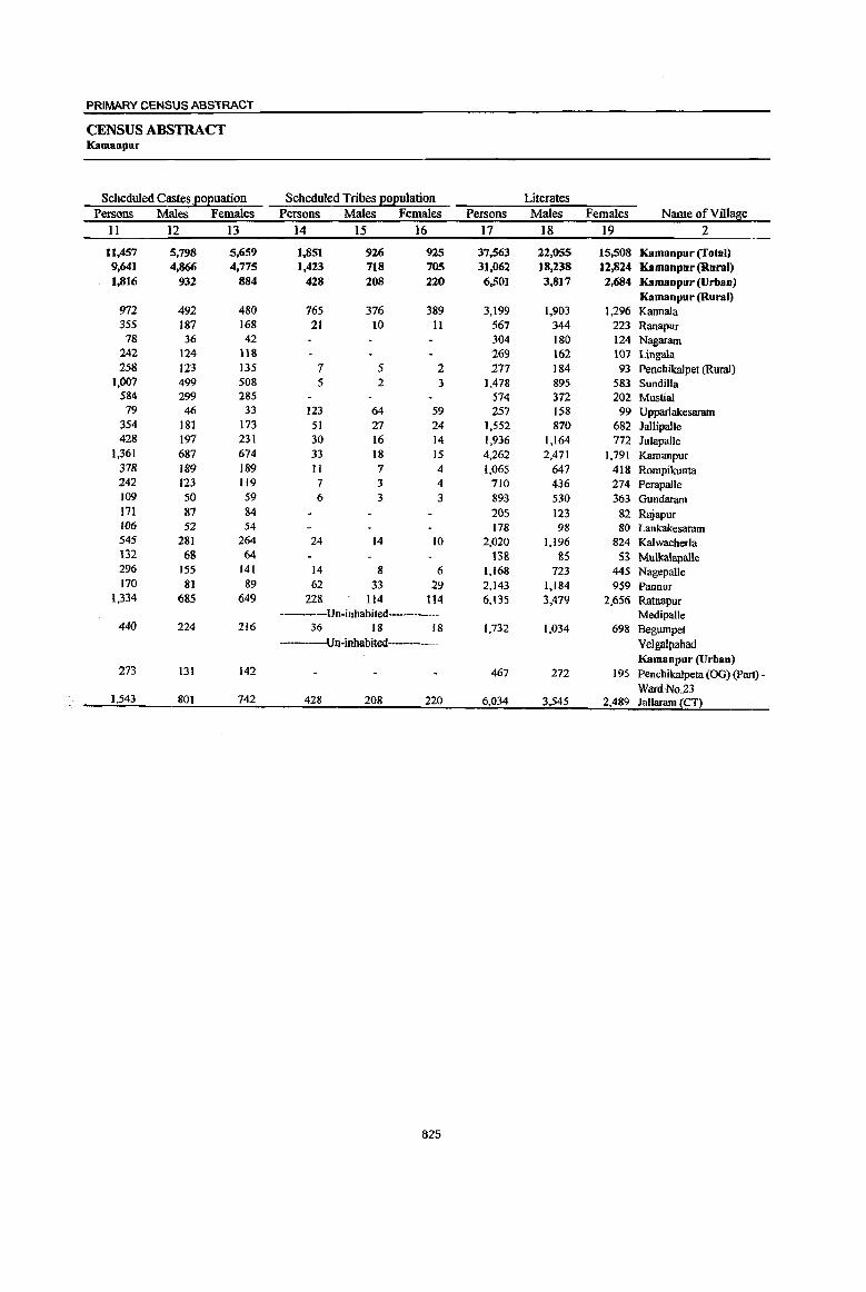
PRIMARY CENSUS ABSTRACT
CENSUS ABSTRACT Kamanpur
Scheduled Castes .EoEuation Scheduled Tribes EOEulation Literates Persons Males Females Persons Males Females Persons Males Females Name ofVilla~e
11 12 13 14 15 16 17 18 19 2
11,457 5,798 5,659 1,851 926 925 37,563 22,055 15,508 Kamanpur (fotal) 9,641 4,866 4,775 1,423 718 70S 31,062 18,238 12,824 Kamanpur (Rural) 1,816 932 884 428 208 220 6,501 3,817 2,684 Kamanpur (Urban)
Kamanpur (Rural) 972 492 480 765 376 389 3,199 1,903 1,296 Kannala 355 187 168 21 10 11 567 344 223 Ranapur
78 36 42 304 180 124 Nagararn 242 124 118 269 162 101 Lingala 258 123 135 7 5 2 177 184 93 Penchikalpet (Rural)
1,007 499 508 5 2 3 1,478 895 583 Sundilla 584 299 285 574 372 202 Mustial 79 46 33 123 64 59 257 158 99 Upparlakesaram
354 181 173 51 27 24 1,552 870 682 Jallipalle 428 197 231 30 16 14 1,936 1,164 772 JulapalJe
1,361 687 674 33 18 15 4,262 2,471 1,791 Kamanpur 378 189 189 11 7 4 1,065 647 418 Rompikunta 242 123 119 7 3 4 710 436 274 Perapalle 109 50 59 6 3 3 893 530 363 Gundaram 171 87 84 205 123 82 Rajapur 106 52 54 178 98 80 Lank:ak:esatam 545 281 264 24 14 10 2,020 1,196 824 Kalwacherla 132 68 64 13& &5 53 Mulkalapalle 296 155 141 14 8 6 1,168 723 445 Nagepalle 170 81 89 62 33 29 2)43 1,184 959 Pannur
1,334 685 649 228 114 114 6,135 3,479 2,656 Ratnapur -----Un-inhabited----- MedipaIle
440 224 216 36 18 18 1,732 1,034 698 8egumpet ---Un-inhabited Velgalpahad
Kamanpur (Urban) 273 131 142 467 272 195 Pencbikalpeta (OG) (part) -
Ward No23 1,543 801 742 428 208 220 6,034 3,545 2,489 Iallaram (CT)
825
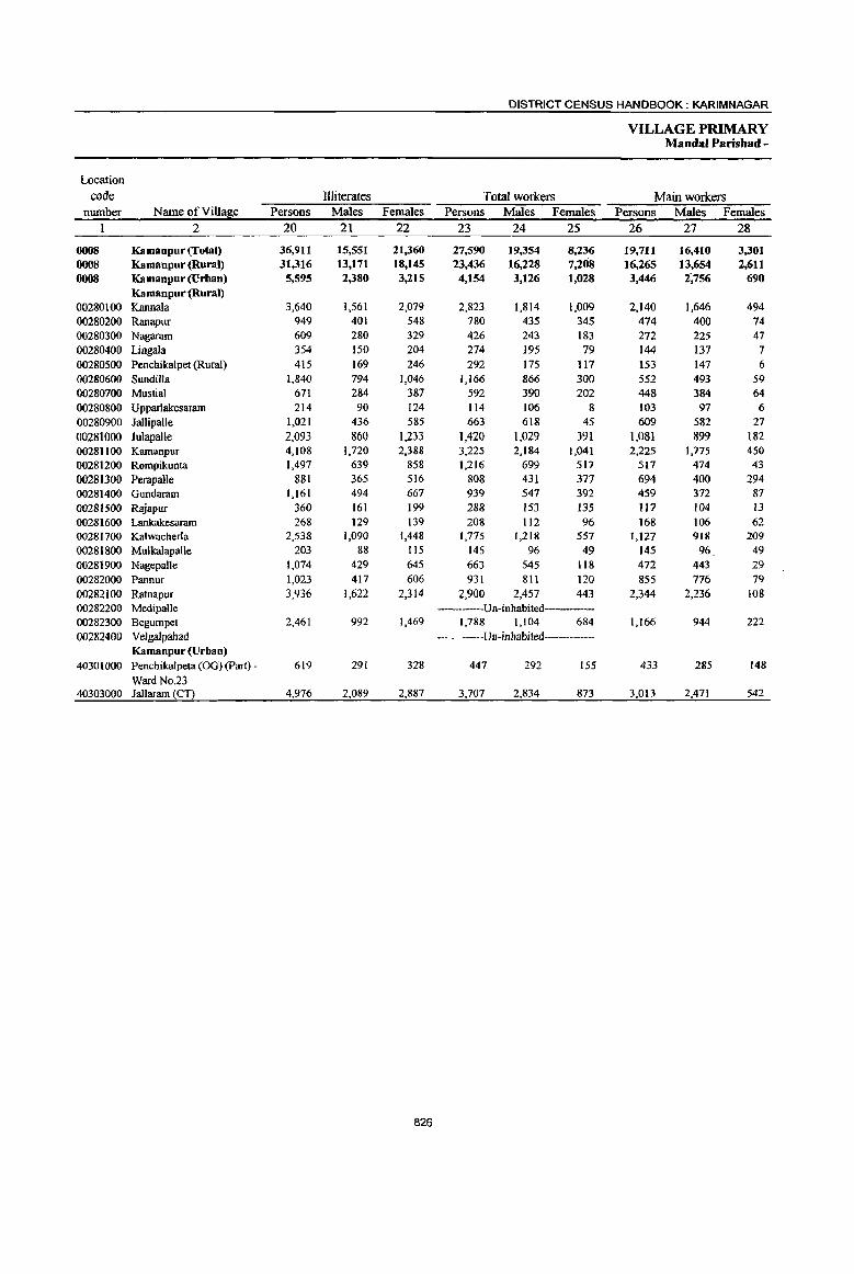
DISTRICT CENSUS HANDBOOK: KARIM NAGAR
VILLAGE PRIMARY Mandai Paris bad -
Location
code llliterates Total workers Main workers number Name ofVillaj1ie Persons Males Females Persons Males Females Persons Males Females
2 20 21 22 23 24 25 26 27 28
0008 Kamanpur (Total) 36,911 15,551 21,360 27,590 19,354 8,236 19,711 16,410 3,301 0008 Kamanpur (Rural) 31,316 13,171 18,145 23,436 16,228 7,208 16,265 13,654 2,611 0008 Kamanpur (Urban) 5,595 2,380 3,215 4,154 3,126 1,028 3,446 2~756 690
Kamanpur (Rural) . 00280100 Kannala 3,640 1,561 2,079 2,823 1,814 1,009 2,140 1,646 494 00280200 Ranapur 949 401 548 780 435 345 474 400 74 00280300 Nagaram 609 280 329 426 243 183 272 225 47 00280400 Lingala 354 150 204 274 195 79 144 137 7 00280500 Penchikalpet (Rural) 415 169 246 292 175 117 153 147 6 00280600 Sundilla 1,840 794 1,046 1,166 866 300 552 493 59 00280700 Mustial 671 284 387 592 390 202 448 384 64 00280800 Upparlakesaram 214 90 124 114 106 8 103 97 6 00280900 Jallipalle 1,021 436 585 663 618 45 609 582 27 00281000 Julapalle 2,093 860 1,233 1,420 1,029 391 1,081 899 182 00281100 Kamanpur 4,108 1,720 2,388 3,225 2,184 1,041 2,225 1,775 450 00281200 Rompikunta 1,497 639 858 1,216 699 517 517 474 43 00281300 Perapalle 881 365 516 808 431 377 694 400 294 00281400 Gundaram 1,161 494 667 939 547 392 459 372 87 00281500 Rajapur 360 161 199 288 153 135 117 104 13 00281600 Lankakesaram 268 129 139 208 112 96 168 106 62 00281700 Kalwacherla 2,538 1,090 1,448 1,775 1,218 557 1,127 918 209 00281800 MulkalapalJe 203 88 115 145 96 49 145 96 49 00281900 Nagepalle 1,074 429 645 663 545 118 472 443 29 00282000 Pannur 1,023 417 606 931 811 120 855 776 79 00282100 Ratnapur 3,936 1,622 2,314 2,900 2,457 443 2,344 2,236 108 00282200 Medipalle -----Un-inhabited------00282300 Begumpet 2,461 992 1,469 1,788 1,104 684 1,166 944 222 00282400 Velgalpahad ----Un-inhabited------
Kamanpur (Urban) 40301000 Penchikalpeta (OG) (part) - 619 291 328 447 292 155 433 285 148
Ward No.23 40303000 Jallaram (CT) 4,976 2,089 2,887 3,707 2,834 873 3,013 2,471 542
826
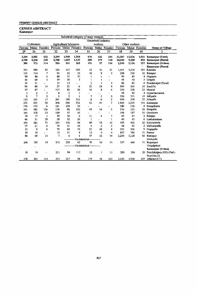
PRIMARY CENSUS ABSTRACT
CENSUS ABSTRACT Kamanpur
Industrial cateL\:0!X of main workers
Household industry Cultivators Agricultural labourers workers Other workers
Persons Males Females Persons Males Females Persons Males Females Persons Males Females Name of Village
29 30 31 32 33 34 35 36 37 38 39 40 2
3,154 2,502 652 3,294 1,940 1,354 676 432 244 12,587 11,536 1,051 Kamanpur (foml) 2,768 2,230 538 2.768 1,629 1,139 485 375 110 10,244 9,420 824 Kamanpur (Rural)
386 272 114 526 311 215 191 57 134 2,343 2.116 227 Kamanpur (Urban) Kamanpur (Rural)
351 288 63 326 1\7 209 52 31 21 1,411 1,2)0 201 Kannala 121 114 7 95 62 33 10 8 2 248 216 32 Ranapur 94 88 6 88 51 37 89 85 4 Nagaram 61 60 39 36 3 1 I 43 40 3 Lingala 51 51 13 13 3 I 2 86 82 4 Penchikalpet (Rural) 94 80 14 27 21 6 32 28 4 399 364 35 Sundilla 67 67 117 81 36 14 8 6 250 228 22 Mustial 3 2 1 6 5 I 94 90 4 Upparlakesaram 9 7 2 3 2 I 7 2 5 590 571 19 Jallipalle
152 135 17 291 180 III 8 6 2 630 578 52 Julapalle 275 225 50 498 246 252 52 45 7 1,400 1,259 141 Kamanpur 176 170 6 161 128 33 180 176 4 Rompikunta 341 185 156 178 68 110 19 14 5 156 133 23 Perapalle 161 128 33 100 57 43 198 187 11 Gundaram
18 17 1 39 36 3 11 4 7 49 47 2 Rajapur 60 31 29 58 32 26 1 1 49 43 6 Lankakesaram
356 281 75 254 156 98 88 78 10 429 403 26 Kalwacherla 27 21 6 70 31 39 4 2 2 44 42 2 Mulkalapalle 15 9 6 70 60 10 52 48 4 335 326 9 Nagepalle 10 10 15 II 4 13 9 4 817 746 71 Pannur 80 69 11 7 6 I 47 33 14 2,210 2,128 82 Ratnapur
----Un-inhabited---- MedipaUe 246 192 54 313 230 83 70 56 14 537 466 71 Begumpet
------Un-inhabited------- Velgalpahad Kamanpur (Urban)
10 10 211 94 117 12 II 200 180 20 Penchikalpeta (OG) (part) -Ward No.23
376 262 114 315 217 98 179 56 123 2,143 1,936 207 JaUarnrn (CT)
827
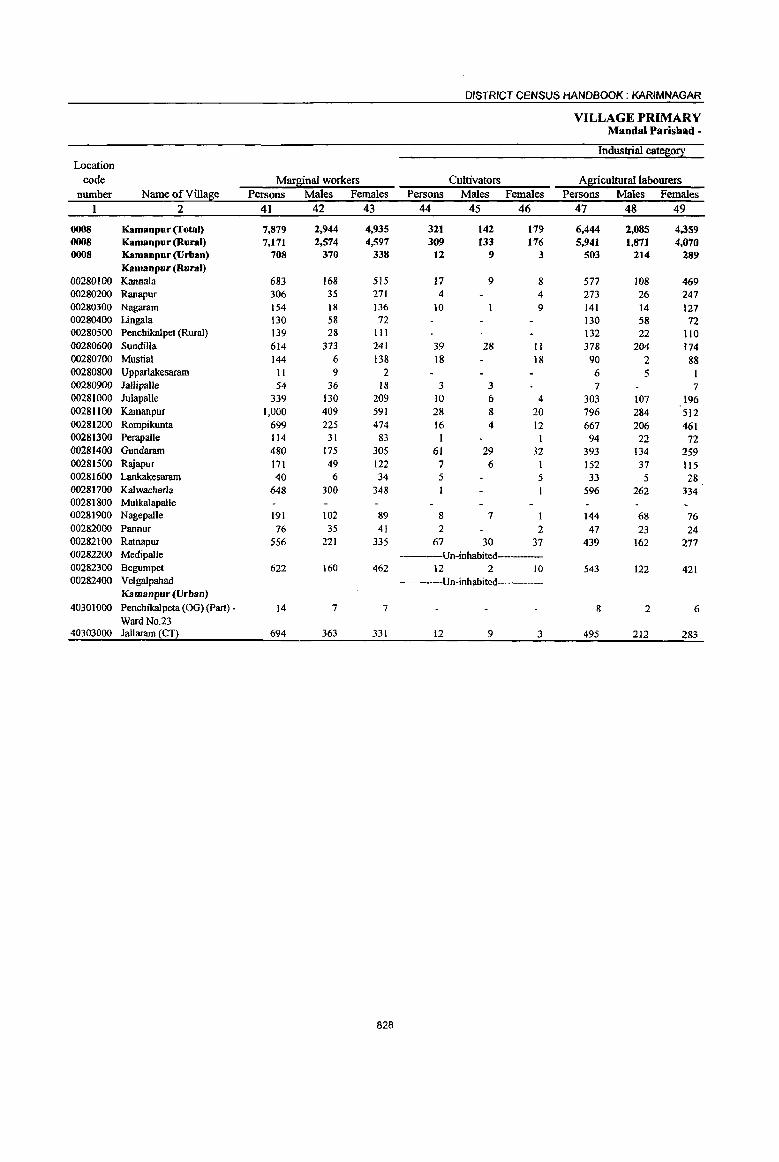
DISTRICT CENSUS HANDBOOK: KARIMNAGAR
VILLAGE PRIMARY Mandai Parishad-
Industrial cate~0!i: Location
code Marlliinal workers Cultivators Agricultural labourers number Name of Villaf:e Persons Males Females Persons Males Females Persons Males Females
2 41 42 43 44 45 46 47 48 49
0008 Kamanpur (Total) 7,879 2,944 4,935 321 142 179 6,444 2,085 4,359 0008 Kamanpur (Rural) 7,171 2,574 4,597 309 133 176 5,941 1,871 4,070 0008 Kamanpur (Urban) 708 370 338 12 9 3 503 214 289
Kamanpur (RuraJ) 00280100 Kannala 683 168 515 17 9 8 577 108 469 00280200 Ranapur 306 35 271 4 4 273 26 247 00280300 Nagaram 154 18 136 10 9 141 14 127 00280400 Lingala 130 58 72 130 58 72 00280500 Penchikalpet (Rural) 139 28 III 132 22 110 00280600 Sundilla 614 373 241 39 28 II 378 204 174 00280700 Mustial 144 6 138 18 18 90 2 88 00280800 Upparlakesaram II 9 2 6 5 I 00280900 Jallipalle 54 36 18 3 3 7 7 00281000 JulapaUe 339 130 209 10 6 4 303 107 196 00281100 K.amanpur 1,000 409 591 28 8 20 796 284 512 00281200 Rompikunta 699 225 474 16 4 12 667 206 461 00281300 PerapaUe 114 31 83 1 94 22 72 00281400 Gundaram 480 175 305 61 29 32 393 134 259 00281500 Rajapur 171 49 122 7 6 152 37 115 00281600 Lankakesaram 40 6 34 5 5 33 5 28 00281700 Kalwacherla 648 300 348 596 262 334 00281800 Mulkalapalle 00281900 Nagepalle 191 102 89 8 7 I 144 68 76 00282000 Pannur 76 35 41 2 2 47 23 24 00282100 Ratnapur 556 221 335 67 30 37 439 162 277 00282200 Medipalle ----Un-inhabited-----00282300 Begumpet 622 160 462 12 2 10 543 122 421 00282400 Velgalpahad ----Un-inhabited------
Kamanpur (Urban) 40301000 Penchikalpeta COG) (part) - 14 7 7 8 2 6
Ward No.23 40303000 Jallaram (CT) 694 363 331 12 9 3 495 212 283
828
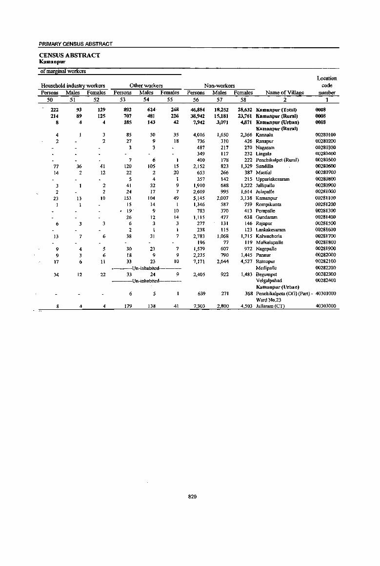
PRIMARY CENSUS ABSTRACT
CENSUS ABSTRACT Kamanpur
of marsinal workers Location
Household industry workers Other workers Non-workers code
Persons Males Females Persons Males Females Persons Males Females Name ofVill~e number 50 51 52 53 54 55 56 57 58 2 "1
222 93 129 892 624 268 46,884 18,252 28,632 Kamanpur (Total) 0008 214 89 125 707 481 226 38,942 15,181 23,761 Kamanpur (Rural) 0008
8 4 4 185 143 42 7,942 .3,071 4,871 Kamanpur (Urban) 0008 Kamanpur (Rural)
4 3 85 50 35 4,016 1,650 2,366 Kannala 00280100 2 2 27 9 18 736 310 426 Ranapur 00280200
3 3 487 217 270 Nagaram 00280300 349 117 232 Lingala 00280400
7 6 400 178 222 Penchikalpet (Rural) 00280500 77 36 41 120 105 15 2,152 823 1,329 Sundilla 00280600 14 2 12 22 2 20 653 266 387 Mustial 00280700
5 4 357 142 215 Upparlakesaram 00280800 3 2 41 32 9 1,910 688 1,222 JallipaIJe 00280900 2 2 24 17 7 2,609 995 1,614 JulapaUe ()028 1000
23 13 10 153 104 49 5,145 2,007 3,138 Kamanpur 00281100 1 1 15 14 1 1,346 587 759 Rompikunta 00281200 . 19' 9 10 783 370 413 Perapalle 00281300
26 12 14 1,115 477 638 Gundaram 00281400
6 3 3 6 3 3 277 l31 146 Rajapur 00281500 2 238 1I5 123 Lankakesaram 00281600
13 7 6 38 31 7 2,783 1,068 1,715 Kalwacherla 00281700 196 77 119 MulkaJapalJe 00281800
9 4 5 30 23 7 1,579 607 972 Nagepalle 00281900 9 3 6 18 9 9 2,235 790 1,445 Pannur 00282000
17 6 11 33 23 10 7,171 2,644 4,527 Ratnapur 00282100
Un-inhabited----- Mcdipalle 00282200 34 12 22 33 24 9 2,405 922 1,483 Begumpet 00282300
----Un-inhabited---- Velgalpahad 00282400 Kamanpur (Urban)
6 5 639 271 368 Penchikalpeta (OG) (Part) - 40301000 Ward No.23
8 4 4 179 138 41 7,303 2,800 4,503 Jallaram (CT) 40303000
829

DISTRICT CENSUS HANDBOOK: KARIMNAGAR
VILLAGE PRIMARY Mandai Parishad -
Total population (including Location Area of institutional and houseless Population in the
code Village in Number of 2°2ulation l a~e-S!0u2 0-6 number Name of Village hectares households Persons Males Females Persons Males Females
1 2 3 4 5 6 7 8 9 10
0009 Manthani (Total) 32,960.0 12,401 50,405 25,487 24,918 6,772 3,432 3,340 0009 Manthani (Rural) 32,960.0 12,401 50,405 25,487 24,918 6,772 3,432 3,340 0009 Manthani (Urban)
Manthani (Rural) 00282500 Kasipeta 348.0 ------Un-inhabited-----00282600 Gunjapaduga 1,529.0 874 3,755 1,858 1,897 500 247 253 0028270(J Uppalla 714.0 264 1,160 607 553 143 72 71 00282800 Nagaram 1,080.0 441 1,642 841 801 200 101 99 00282900 Pandulapalle 308.0 220 849 410 439 90 44 46 00283000 Adrial 592.0 -----Un-inhabited---00283100 Siripuram 653.0 711 2,903 1,492 1,411 358 186 172 00283200 RachepaUe 390.0 200 884 445 439 138 71 67 00283300 Akkepalle 279.0 324 1,286 649 637 187 95 92 00283400 Kannala 456.0 149 562 275 287 64 32 32 00283500 Mallepalle 282.0 127 564 282 282 83 41 42 00283600 AnguluI(D) 149.0 ------Un-inhabited-----00283700 Vilochavaram 736.0 250 975 469 506 151 61 90 00283800 Khanapur 977.0 177 721 374 347 108 52 56 00283900 Kbansaibpeta 1,271.0 125 523 271 252 61 36 25 00284000 AmmagaripalJe 602.0 ------Un-inhabiled---00284100 Arenda 2,225.0 381 1,333 661 672 171 85 86 00284200 Mallaram 460.0 202 766 386 380 100 41 59 00284300 Venkatapur 616.0 242 1,004 519 485 125 67 58 00284400 Sarnepalle 468.0 98 350 166 184 58 19 39 00284500 Nagepalle 459.0 206 896 455 441 139 82 57 00284600 Adavisomanpalle 1,552.0 314 1,039 530 509 173 94 79 00284100 Bhatpalle 1,938.0 96 393 207 186 66 35 31 00284800 Eklaspur 2,636.0 704 2,681 1,318 l,363 378 190 188 00284900 Bitpalle (K) 1,760.0 107 437 222 215 49 29 20 00285000 Manthani 2,297.0 4,059 17,049 8,105 8,344 2,142 '1,090 1,052 00285100 Gumnoor 870.0 316 1,371 695 676 194 92 102 00285200 Kuchirajpalle 215.0 125 483 233 250 77 48 29 00285300 Puttapaka 879.0 314 1,441 745 696 221 125 96 00285400 Lakkapur 177.0 312 1,204 622 582 193 103 90 00285500 Maidipa1le 603.0 158 724 360 364 118 57 61 00285600 Gaddalapalle 2,953.0 413 1,607 826 781 252 129 123 00285700 Gopalpur 447.0 151 591 294 297 59 29 30 00285800 Peddaodela 1,059.0 116 435 194 241 46 14 32 00285'900 Chinnaodela 379.0 225 777 376 401 128 65 63
830

PRIMARY CENSUS ABSTRACT
CENSUS ABSTRACT Manthani
Scheduled Castes ~o~uation Scheduled Tribes EOEulation Literates Persons Males Females Persons Males Females Persons Males Females Name of Village
11 12 13 14 15 16 17 18 19 2
11,279 5,795 5,484 1,149 582 567 23,959 14,148 9,811 Manthani (Total) 11,279 5,795 5,484 1,149 582 567 23,959 14,148 9,811 Manthani (Rural)
Manthani (Urban) Manthani (Rural)
Un-inhabited- Kasipeta 727 365 362 8 2 6 1,816 1,022 794 Gunjapaduga 532 287 245 544 342 202 UppatJa 608 316 292 7 3 4 754 459 295 Nagaram 237 111 126 325 179 146 PandulapaUe
---Un-inhabited---- Adrial 584 293 291 6 3 3 1,301 794 507 Siripuram
79 41 38 110 50 60 352 202 150 RachepaUe 96 48 48 11 5 6 509 301 208 AkkepaUe
108 59 49 304 184 120 Kannala 289 149 140 266 ISO 116 Mallepalle
---Un-inhabited---- AnguluI(D)
250 117 133 319 182 137 Vilochavaram 278 139 139 252 161 91 Khanapur 152 81 71 50 27 23 177 III 66 Khansaibpeta
---Un-inhabited---- Arnmagaripalle 430 216 214 34 18 16 514 331 183 Arenda 250 131 119 355 219 136 Mallaram 276 144 132 184 93 91 423 260 163 Venkatapur
86 40 46 40 22 18 132 76 56 Sarnepal\e 344 175 169 303 189 114 NagepaJle 696 353 343 95 47 48 304 205 99 AdavisomanpalJe
27 10 17 134 71 63 121 81 40 Bhatpalle 586 285 301 77 33 44 1,123 664 459 Eklaspur 56 26 30 199 Its 81 Bitpalle(K)
2,039 1,140 899 236 133 103 10,340 5,968 4,372 Manthani 698 363 335 2 I I 521 323 198 Gumnoor 191 88 103 149 88 61 Kuchirajpalle 459 234 225 624 382 242 Puttapaka 323 163 160 429 270 159 Lakkapur 162 76 86 13 4 9 307 178 129 Maidipalle 229 113 116 539 347 192 GaddaJapalJe
268 155 113 Gopalpur 288 130 158 96 47 49 149 70 79 Peddaodela 199 102 97 46 23 23 240 137 103 Chinnaodela
831

DISTRICT CENSUS HANDBOOK: KARIMNAGAR
VILLAGE PRIMARY Mandai Parishad -
Location code Illiterates Total workers Main workers
number Name of Village Persons Males Females Persons Males Females Persons Males Females I 2 20 21 22 23 24 25 26 27 28
0009 Manthani (Total) 26,446 11,339 15,107 22,304 13,828 8,476 16,013 11,556 4,457 0009 Manthani (Rural) 26,446 11,339 15,107 22,304 13,828 8,476 16,013 11,556 4,457 0009 Manthani~rban)
Manthani (Rural) (ioi82500 Kasipeta -----Un-inhabited-----002826{)0 Gunjapaduga 1,939 836 1,103 1,629 951 678 587 525 62 00282700 Uppatla 616 265 351 645 374 271 441 336 105 002&2800 Nagararn 888 382 506 608 460 148 359 302 57 00282900 Pandulapalle 524 231 293 344 230 114 231 180 51 00283000 Adrial ---Un-inhabited------00283100 Siripunun 1,602 698 904 1,415 837 578 940 710 230 00283200 Rachepalle 532 243 289 340 252 88 135 135 00283300 Akkepalle 777 348 429 616 356 260 369 313 56 00283400 Kannala 258 91 167 210 137 73 142 116 26 00283500 Mallepalle 298 132 166 270 172 98 166 146 20 00283600 Angulur(D) -----Un-inhabited-----00283700 Vilochavaram 656 287 369 530 277 253 350 211 139 00283800 Khanapur 469 213 256 433 227 206 433 227 206 00283900 Khansaibpeta 346 160 186 304 157 147 182 101 81 00284000 AmmagaripaiJe ----Un-inhabited-----00284100 Arenda 819 330 489 703 387 316 583 384 199 00284200 Mallararn 411 167 244 370 195 175 240 176 64 00284300 Venkatapur 581 259 322 557 303 254 557 303 254 00284400 SarnepaUe 218 90 128 185 100 85 180 98 82 00284500 Nagepalle 593 266 327 522 256 266 323 245 78 OOZ84600 Adavisomanpalle 735 32.5 410 621 337 284 569 333 236 00284700 Bhatpalle 272 126 146 209 116 93 208 116 92 00284800 Eklaspur 1,558 654 904 1,298 731 567 824 635 189 00284900 Bitpalle (K) 238 104 134 214 117 97 42 37 5 00285000 Manthani 6,709 2,737 3,972 5,738 4,303 1,435 4,937 3,893 1,044 00285100 Gumnoor 850 372 478 710 386 324 281 231 50 00285200 Kuchirajpalle 334 145 189 255 120 135 253 119 134 00285300 Puttapaka 817 363 454 557 431 126 428 380 48 00285400 Lakkapur 775 352 423 687 390 297 268 166 102 00285500 Maidipalle 417 182 235 405 217 188 405 217 188 00285600 Gaddalapalle 1,068 479 589 855 457 398 575 403 112 00285700 Gopalpur 323 139 184 318 172 146 305 160 145 00285800 Peddaodela 286 124 162 287 142 145 287 142 145 00285900 Chinnaodela 537 239 298 469 238 231 413 216 197
832
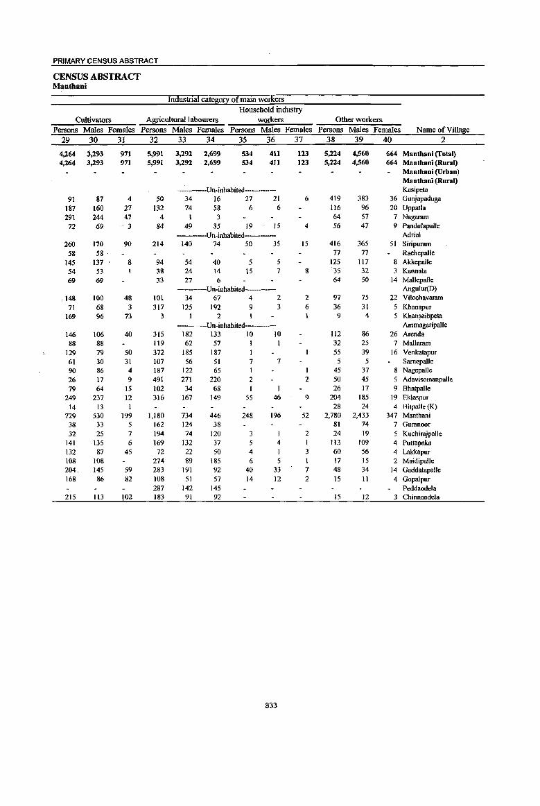
PRIMARY CENSUS ABSTRACT
CENSUS ABSTRACT Mantbani
Industrial cate~0!1 of main workers
Household industry
Cultivators A~culturallabourers workers Other workers
Persons Males Females Persons Males Females Persons Males Females Persons Males Females Name of Village
29 30 31 32 33 34 35 36 37 38 39 40 2
4,264 3.293 971 5,991 3,292 2,699 534 411 123 5,224 4,560 664 Manthani (Total) 4,264 3,293 971 5,991 3,292 2,699 534 411 123 5,224 4,560 664 Manthani (Rural)
Manthani (Urban) Manthani (Rural)
Un-inhabited---- Kasipeta
91 87 4 SO 34 16 27 21 6 419 383 36 Gunjapaduga
187 160 27 132 74 58 6 6 116 96 20 Uppatla 291 244 47 4 1 3 64 57 7 Nagaram
72 69 - 3 84 49 35 19 15 4 56 47 9 Pandulapalle Un-inhabited Adrial
260 170 90 214 140 74 50 35 15 416 365 51 Siripuram
58 58 . 77 77 RachepalJe
145 137 8 94 54 40 5 5 125 117 8 Akkepalle 54 53 38 24 14 15 7 8 35 32 3 Kannala
69 69 33 27 6 64 50 14 Mallepalle ----Un-inhabited- Angulur(D)
148 100 4& 101 34 67 4 2 2 97 75 22 Vilochavaram
71 68 3 317 125 192 9 3 6 36 31 5 Khanapur }69 96 73 3 2 9 4 5 Khansaibpeta
Un-inhabited---- Ammagaripalle
146 106 40 315 182 133 10 10 112 86 26 Arenda 88 88 119 62 57 I 32 25 7 Mallaram
129 79 50 372 185 187 55 39 16 Venkatapur 61 30 31 107 56 51 7 7 5 5 Samepalle 90 86 4 187 122 65 1 I 45 37 8 Nagepalle
26 17 9 491 271 220 2 2 50 45 5 Adavisomanpalle 79 64 IS 102 34 68 26 17 9 Bhatpalle
249 237 12 316 167 149 55 46 9 204 185 19 Eklaspur 14 I3 I 28 24 4 Bitpalle (K)
729 530 199 1,180 734 446 248 196 52 2,780 2,433 347 Manthani 38 33 5 162 124 38 81 74 7 Gumnoor
32 25 7 194 74 120 3 2 24 19 5 KuchirajpalJe 141 135 6 169 132 37 5 4 I 113 109 4 Puttapaka 132 87 45 72 22 50 4 I 3 60 56 4 Lalckapur 108 108 274 89 185 6 5 17 15 2 Maidipalle 204. 145 59 283 191 92 40 33 7 48 34 14 Gaddalapalle 168 86 82 108 51 57 14 12 2 15 11 4 Gopalpur
287 142 145 Peddaode1a 215 Il3 102 183 91 92 15 12 3 Chinnaodela
833
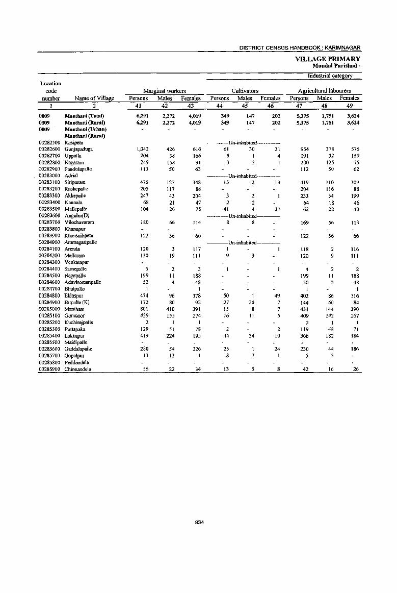
DISTRICT CENSUS HANDBOOK: KARIMNAGAR
VILLAGE PRIMARY Mandai Parishad -
Industrial cate~0!l Location
code Marl!iinal workers Cultivators A1!i!iculturallabourers number Name ofVillal!ie Persons Males Females Persons Males Females Persons Males Females
1 2 41 42 43 44 45 46 47 48 49
0009 Manthani (Total) 6,291 2,272 4,019 349 147 202 5,375 1,751 3,624 0009 Manthani (Rural) 6,291 2,272 4,019 349 147 202 5,375 1,751 3,624 0009 Manthani (Urban)
Mantbani (Rural) 00282500 Kasipeta ---Un-inhabited------00282600 Gunjapaduga 1.042 426 616 61 30 31 954 378 576 00282700 Uppatla 204 38 166 5 1 4 191 32 159 00282800 Nagaram 249 158 91 3 2 200 125 75 00282900 PanduJapafJe (13 50 63 112 50 62 00283000 Adrial ---Un-inhabited------00283100 Siripuram 475 127 348 15 2 13 419 110 309 00283200 Rachepalle 205 117 88 204 116 88 00283300 AkkepaUe 247 43 204 3 2 233 34 199 00283400 Kannala 68 21 47 2 2 64 18 46 00283500 Mallepalle 104 26 78 41 4 37 62 22 40 00283600 Angulur(D) ----Un-inhabited------00283700 Vilochavaram 180 66 114 8 8 169 56 113 00283800 Khanapur 00283900 Khansaibpeta 122 56 66 122 56 66 00284000 Ammagaripalle ----Un-inhabited-----00284100 Arenda 120 3 117 I 1 118 2 116 00284200 Mallaram 130 19 III 9 9 120 9 III 00284300 Venkatapur 00284400 Samepalle 5 2 3 4 2 2 00284500 Nagepalle 199 11 188 199 II 188 00284600 AdavisOInanpalle 52 4 48 50 2 48 00284700 Bhatpalle 1 1 I I 00284800 Eklaspur 474 96 378 50 49 402 86 316 00284900 BitpalJe (K) 172 80 92 27 20 7 144 60 84 00285000 Manthani 801 410 391 15 8 7 434 144 290 00285100 Gumnoo( 429 155 274 16 II 5 409 142 267 00285200 Kuchirajpalle 2 2 I I 00285300 Puttapaka 129 51 78 2 2 119 48 71 00285400 Lakkapur 419 224 195 44 34 10 366 182 184 00285500 Maidipalle 00285600 Gadda1apalle 280 54 226 25 24 230 44 186 00285700 Gopalpur 13 12 8 7 5 5 00285800 Peddaodela 00285900 Chinnaodela 56 22 34 13 5 8 42 16 26
834

PRIMARY CENSUS ABSTRACT
CENSUS ABSTRACT Mantbani
of mar~inal workers Location
Household industry workers Other workers Non-workers code
Persons Males Females Persons Males Females Persons Males Females Name ofVilla~e number
50 51 52 53 54 55 56 57 58 2
107 44 6J 460 330 130 28,101 11,659 16,442 Manthani (Total) 0009 107 44 63 460 330 130 28,101 11,659 16,442 Maothani (Rural) 0009
Manthani (Urban) 0009 Manthan! (Rural)
Un-inhabited---- Kasipeta 00282500 4 2 2 23 16 7 2,126 907 1,219 Gunjapaduga 00282600 3 3 5 2 3 515 233 282 Uppatla 00282700
46 31 15 1,034 381 653 Nagaram 00282800 505 180 325 Pandulapalle 00282900
----Un-inhabited Adrial 00283000 21 5 16 20 10 10 1,488 655 833 Siripuram 00283100
1 544 193 351 RachepaUe 00283200 4 2 2 7 5 2 670 293 377 Akkepalle 00283300
352 138 214 Kannala 00283400 I 294 110 184 Mallepalle 00283500 Un~inhabited Angulur(D) 00283600
3 2 445 192 253 Vilochavaram 00283700 288 147 141 Khanapur 00283800 219 114 lOS Khansaibpeta 00283900
------Un-inhabited------ AmmagaripalJe 00284000 I I 630 274 356 Arenda 00284100 I I 396 191 205 Mallaram 00284200
447 216 231 Venkatapur 00284300 165 66 99 Samepaile 00284400 374 199 175 Nagepalle 00284500
2 2 418 ·193 225 Adavisomanpalle 00284600 184 91 93 Bhatpalle 00284700
3 2 19 8 II 1,383 587 796 Eklaspur 00284800 I 223 105 118 Bitpalle (K) 00284900
47 21 26 305 237 68 1I,311 4,402 6,909 Manthani 00285000 4 2 2 661 309 352 Gumnoor 00285100
228 113 115 Kuchirajpalle 00285200 4 3 4 2 2 884 314 570 Puttapaka 00285300 4 3 5 5 517 232 285 Lakkapur 00285400
319 143 176 Maidipalle 00285500 14 3 11 11 6 5 752 369 383 GaddaJapalle 00285600
273 122 151 Gopalpur 00285700 148 52 96 Peddaodela 00285800 308 138 170 Chinnaodela 00285900
835

DISTRICT CENSUS HANDBOOK: KARIMNAGAR
VILLAGE PRIMARY Mandai Parisbad -
Total population (including Location Area of institutional and houseless Population in the
code Village in Number of 12°l2ulation 1 age-E!0ul2 0-6 number Name ofVilla8e hectares households Persons Males Females Persons Males Females
1 2 3 4 5 6 7 8 9 10
0010 Kataram (Total) 22,016.0 7,719 31,259 , 15,741 15,518 4,550 2,342 2,208 0010 Kataram (Rural) 22,016.0 7,719 31,259 15,741 15,518 4,550 2,342 2,208 0010 Kataram (Urban)
Kataram (Rural) 00286000 Damerakunta 906.0 657 2,611 1,312 1,299 375 202 173 00286100 Gundrathpalle 762.0 104 413 204 209 47 25 22 00286200 Mallaram 405.0 69. 242 121 121 33 15 18 00286300 RaghupaUe 168.0 128 541 266 275 81 42 39 00286400 Veerapoor 918.0 94 342 172 170 41 18 23 00286500 Jadaraopet 335.0 163 719 353 366 80 37 43 00286600 Gudoor 359.0 65 281 133 148 35 14 21 00286700 Vilasagar 1,965.0 746 2,989 1,506 1,483 388 214 174 00286800 Dhannasagar 349.0 171 612 321 291 76 44 32 00286900 Odipilavancha 749.0 239 944 473 471 110 55 55 00287000 Gummallapalle 846.0 249 1,136 568 568 173 91 82 00287100 Regulagudem 620.0 180 819 422 397 106 57 49 00287200 Devarampalle 667.0 305 1,279 647 632 214 107 107 00287300 Dhanwada 1,335.0 600 2,452 1,231 1,221 363 182 181 00287400 Adivarampet 258.0 117 465 239 226 86 44 42 00287500 Nasthur Palle 3,830.0 108 390 198 192 49 27 22 00287600 Pochampalle 259.0 ------Un-inhabited------00287700 Morepalle 48.0 ------Un-inhabited---------00287800 Bopparam 460.0 244 988 492 496 147 68 79 00287900 Chidnepalle 366.0 280 1,019 519 500 159 86 73 00288000 Nallagunta 107.0 -------Un-inhabited-----·_· 00288100 Garepalle 537.0 717 3,020 1,550 1,470 475 243 232 00288200 Kataram 1.159.0 670 2,813 1,391 1,422 467 236 231 00288300 Kambalpad 301.0 27 64 30 34 6 4 2 00288400 Kothapalle 196.0 95 360 196 164 43 26 17 00288500 Sunderajpet 683.0 286 1,131 579 552 170 84 86 00288600 Medipalle 586.0 153 574 280 294 82 38 44 00288700 Bayyaram 871.0 493 2,041 1,015 1,026 302 150 152 00288800 Pothulvai 581.0 337 1,366 710 656 231 124 107 00288900 Chinthakani 1,042.0 286 1,188 595 593 142 74 68 00289000 Prathapagiri 346.0 136 460 218 242 69 35 34
836
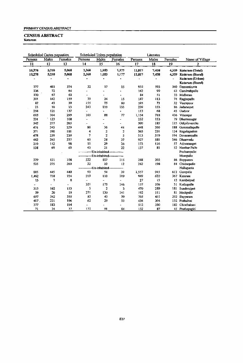
PRIMARY CENSUS ABSTRACT
CENSUS ABSTRACT Kataram
Scheduled Castes ~uation Scheduled Tribes EOEutation Literates Persons Males Females Persons Males Females Persons Males Females Name of Village
11 12 13 14 15 16 17 18 19 2
10,278 5,210 5,068 2,360 1,183 1,177 11,817 7,458 4,359 Kataram (fotal) 10,278 5,210 5,068 2,360 1,183 1,177 11,817 7,458 4,359 Kataranr(Rural)
Kataram (Urban) Kataram (Rural)
777 403 374 32 17 15 933 593 340 Damerakunta 136 72 64 162 99 63 Gundrathpalle 130 67 63 84 51 33 Mallararn 301 142 159 39 24 15 187 113 74 Raghupalle
82 43 39 155 75 80 I()S 73 32 Veerapoor 23 10 13 243 110 133 239 153 86 Jadaraopet
258 121 137 113 68 45 Gudoor 603 304 299 165 88 77 1,154 718 436 Vilasagar 231 123 108 232 153 79 Dhannasagar 542 277 265 300 185 I IS Odipilavancha 474 245 229 80 36 44 448 260 188 Gummallapalle 371 190 181 4 2 2 365 231 134 Regulagudem 478 239 239 7 2 5 513 319 194 Devarampalle 482 245 237 65 28 37 927 581 346 Dhanwada 210 112 98 55 29 26 173 116 57 Adivararnpet 138 69 69 43 21 22 137 85 52 Nasthur Palle
Un-inhabited----- PochampaUe Un-inhabited----- Morepalle
229 121 108 222 107 115 288 202 86 Bopparam 535 275 260 22 10 12 282 198 84 Chidnepalle
----Un-inhabited---- Nallagunta 885 445 440 93 54 39 1,557 945 612 Garepalle
1,462 738 724 219 110 109 989 622 367 Kataram 15 7 8 27 15 12 Kambalpru!
321 175 146 157 106 51 Kotbapalle 315 162 153 5 2 3 470 289 181 Sunderajpet
39 20 19 271 130 141 192 III 81 Medipalle 697 342 355 82 43 39 703 451 252 Bayyararn 417. 221 196 62 29 33 436 304 132 Pothulvai 377 183 194 512 330 182 Chinthakani 7t 34 37 175 91 84 132 87 45 Prathapagiri
837
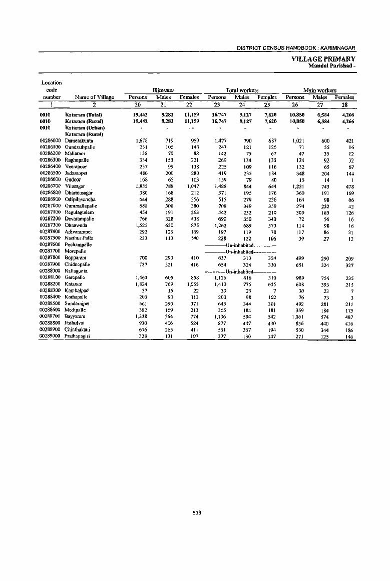
DISTRICT CENSUS HANDBOOK; KARIMNAGAR
VILLAGE PRIMARY Mandai Parishad -
Location
code llliterates Total workers Main workers number Name ofViUage Persons Males Females Persons Males Females Persons Males Females
2 20 21 22 23 24 25 26 27 28
0010 Kataram (fotal) 19,442 8,283 11,159 16,747 9,127 7,620 10,850 6,584 4,266 0010 Kataram (RU1'8J) 19,442 8,283 11,159 16,747 9,127 7,620 10,850 6,584 4,266 0010 Kataram (Urban)
Kataram (Rural) 00286000 Damerakunta 1,678 719 959 1,477 790 687 1,021 600 421 00286100 Gundrathpalle 251 105 146 247 121 126 71 55 16 00286200 Mallaram 158 70 88 142 75 67 47 35 12 00286300 Raghupalle 354 153 201 269 134 !35 124 92 32 00286400 Veerapoor 237 99 138 225 109 116 132 65 67 00286500 Jadaraopet 480 200 280 419 235 184 348 204 144 00286600 Gudoor 168 65 103 159 79 80 IS 14 I 00286700 Vilasagar 1,835 788 1,047 1,488 844 644 1,221 743 418 00286800 Dharmasagar 380 168 212 371 195 176 360 191 169 00286900 Odipilavancha 644 288 356 515 279 236 164 98 66 00287000 Gummallapalle 688 308 380 708 349 359 274 232 42 00287100 Regulagudem 454 191 263 442 232 210 309 183 126 00287200 Devarampalle 766 328 438 690 350 340 72 56 16 00287300 Dhanwada 1,525 650 875 1,262 689 573 1I4 98 16 00287400 Adivarampet 292 123 169 197 119 78 117 86 31 00287500 Nasthur Palle 253 113 140 228 122 106 39 27 12 00287600 Pochampalle ---Un-inhabited 00287700 Morepalle Un-inhabited---00287800 Bopparam 700 290 410 637 313 324 499 290 209 00287900 Chidnepalle 737 321 416 654 324 330 651 324 327 00288000 Nallagunta ----Un-inhabited 00288100 Garepalle 1,463 605 858 1,126 816 310 989 754 235 00288200 Kataram 1,824 769 1,055 1,410 775 635 608 393 215 00288300 Kambalpad 37 15 22 30 23 7 30 23 7 00288400 Kothapalle 203 90 113 200 98 102 76 73 3 00288500 Sunder~pet 66] 290 371 645 344 30] 492 281 211 00288600 Medipalle 382 169 213 365 184 181 359 184 175 00288700 Bayyaram 1,338 564 774 1,136 594 542 1,061 574 487 00288800 Pothulvai 930 406 524 877 447 430 856 440 416 00288900 Chinthakani 676 265 411 551 357 194 530 344 186 00289000 Prathapagiri 328 131 197 277 130 147 271 125 146
838
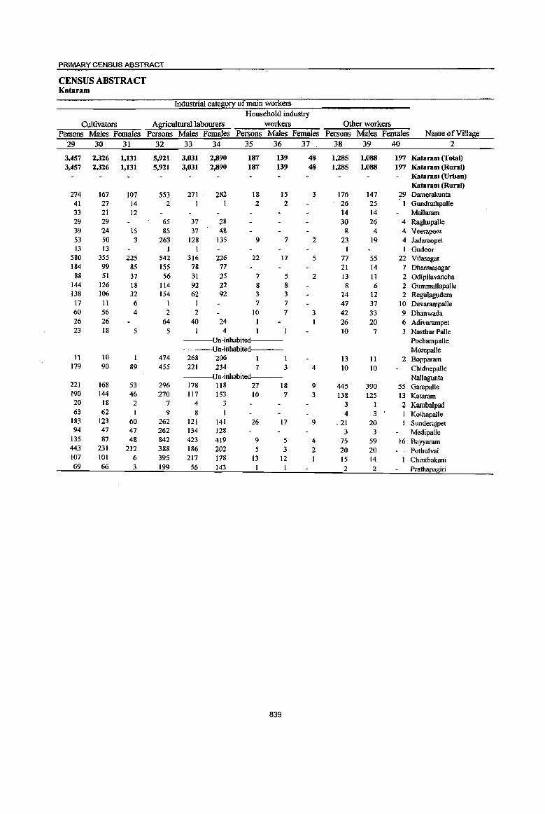
PRIMARY CENSUS ABSTRACT
CENSUS ABSTRACT Kataram
Industrial catel:l:0!X of main workers
Household industry
Cultivators Agricultura1labourers workers Other workers
Persons Males. Females Persons Males Females Persons Males Females Persons Males Females Name of Village
29 30 31 32 33 34 35 36 37 38 39 40 2
3,457 2,326 1,131 5,921 3,031 2,890 187 139 48 1,285 1,088 197 Kataram (Total) 3,457 2,326 1,131 5,921 3,031 2,890 187 139 48 1,285 1,088 197 Kataram (Rural)
Kataram (Urban) Kataram (Rural)
274 167 107 553 271 282 18 15 3 176 147 29 Damerakunta 41 27 14 2 2 2 26 25 Gundratbpalle 33 21 12 14 14 MalJaram 29 29 65 37 28 30 26 4 Raghupalle 39 24 \5 &S 37 4& & 4 4 Veerapoor 53 50 3 263 128 135 9 7 2 23 19 4 Jadaraopet 13 13 Gudoor
580 355 225 542 316 226 22 17 5 77 55 22 Vilasagar 184 99 85 155 78 77 21 14 7 Dharmasagar 88 51 37 56 31 25 7 5 2 13 11 2 Odipilavancha
144 126 18 114 92 22 8 8 8 6 2 Gummallapalle 138 106 32 154 62 92 3 3 14 12 2 Regulagudem
17 II 6 I 7 7 47 37 10 Devarampalle 60 56 4 2 2 10 7 3 42 33 9 Dhanwada 26 26 64 40 24 I I 26 20 6 Adivarampet 23 18 5 5 4 10 7 3 Nasthur Palle
Un-inhabited Pocbampalle ----Un-inbabited- Morepalle
11 10 1 474 268 206 I 1 13 11 2 Bopparam 179 90 89 455 221 234 7 3 4 to to Chidnepalle
----Un-inhabited Nallagunta 221 168 53 296 178 118 27 18 9 445 390 55 Garepalle 190 144 46 270 117 153 10 7 3 138 125 13 Kataram 20 18 2 7 4 3 3 1 2 Kambalpad 63 62 1 9 8 1 4 3 Kothapalle
183 123 60 262 121 141 26 17 9 ,21 20 Sunderajpet 94 47 47 262 134 128 3 3 Medipalle
135 87 48 842 423 419 9 5 4 75 S9 16 Bayyaram 443 231 212 388 186 202 5 3 2 20 20 Pothulvai 107 101 6 395 217 178 13 12 15 14 Chinthakani 69 66 3 199 56 143 2 2 Prathapagiri
839

DISTRICT CENSUS HANDBOOK: KARIMNAGAR
VILLAGE PRIMARY Mandai Parisbad -
Industrial cate!!i0~ Location
code Mar!1iinal workers Cultivators Agricultura11abourers number Name ofVilla!1ie Persons Males Females Persons Males Females Persons Males Females
2 41 42 43 44 45 46 47 48 49
0010 Kataram (Total) 5,897 2,543 3,354 231 89 142 5,449 2,328 3,121 0010 Kataram (Rural) 5,897 2,543 3,354 231 89 142 5,449 2,328 3,121 0010 Kataram (Urban)
Katararn (Rural) 00286000 Damerakunta 456 190 266 13 5 8 440 184 256 00286100 Gundratbpalle 176 66 110 2 165 60 105 00286200 Mallaram 95 40 55 95 40 55 00286300 Raghupalle 145 42 103 142 42 100 00286400 Veerapoor 93 44 49 I I 91 42 49 00286500 Jadaraopet 71 31 40 9 4 5 61 27 34 00286600 Gudoor J44 65 79 141 63 78 00286700 Vilasagar 267 101 166 38 17 21 221 79 142 00286800 Dharmasagar 11 4 7 2 2 9 4 5 00286900 Odipilavancha 351 181 170 4 2 2 341 175 166 00287000 Gummallapalle 434 117 317 45 9 36 379 105 274 00287100 Regulagudem 133 49 84 131 49 82 00287200 Devararnpalle 618 294 324 5 3 2 601 288 313 00287300 Dhanwada 1,148 591 557 II 4 7 1,132 583 549 00287400 Adivarampet 80 33 47 2 2 58 23 35 00287500 Nastbur Palle 189 95 94 6 3 3 182 91 91 00287600 Pochampalle ----Un-inhabited-----00287700 Morepalle -----Un-inhabited-----00287800 Bopparam 138 23 115 138 23 115 00287900 Chidnepalle 3 3 2 2 00288000 NaJlagunta ----Un-inhabited-----00288100 Garepalle 137 62 75 6 2 4 112 50 62 00288200 Kataram 802 382 420 13 8 5 681 303 378 00288300 Kambalpad 00288400 Kothapalle 124 25 99 6 3 3 118 22 96
00288500 Sunderajpet 153 63 90 41 19 22 III 43 68 00288600 Medipalle 6 6 6 6 00288700 Bayyaram 75 20 55 6 3 3 66 16 50
00288800 Potbulvai 21 7 14 7 2 5 14 5 9
00288900 Chinthakani 21 13 8 II 3 8 6 6 00289000 Prathapagiri 6 5 6 5
840
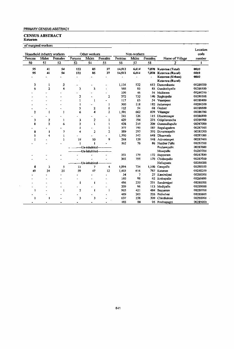
PRIMARY CENSUS ABSTRACT
CENSUS ABSTRACT Kataram
of marginal workers Location
Household indus!!! workers Other workers Non-workers code
Persons Males Females Persons Males Females Persons Males Females Name ofVilla8e number
50 51 52 53 54 55 56 57 58 2
95 41 54 122 85 37 14,512 6,614 7,898 Kataram (Total) 0010 95 41 54 122 85 37 14,512 6,614 7,898 Kataram (Rural) 0010
Kataram (Urban) 0010 Kataram (Rural)
3 2 1,134 522 612 Damerakunta 00286000 6 2 4 3 3 166 83 83 Gundrathpalle 00286100·
100 46 54 Mallaram 00286200 2 2 272 132 140 Raghupalle 00286300 1 117 63 54 Veerapoor 00286400
1 300 118 182 Jadaraopet 00286500 3 2 1 122 54 68 Gudoor 00286600
2 6 4 2 1,501 662 839 Vilasagar 00286700 241 126 115 Dharmasagar 00286800
3 2 1 3 2 429 194 235 Odipilavancha 00286900 g 2 6 2 428 219 209 Gummallapalle 00287000
I 1 377 190 187 Regu1agudem 00287100 8 7 4 2 2 589 297 292 DevarampaUe 00287200 5 4 1,190 542 648 Dhanwada 00287300
19 10 9 268 120 148 Adivarampet 00287400 1 1 162 76 86 Nasthur Palle 00287500 Un-inhabited----- Pochampalle 00287600
---Un-inhabited----- Morepalle 00287700 351 179 172 Bopparam 00287800 365 195 170 Chidnepalle 00287900
---Un-inbabited----- Nallagunta 00288000 8 3 5 11 7 4 1,894 734 1,160 Garepalle 00288100
49 24 25 59 47 12 1,403 616 787 Kataram 00288200 34 7 27 Kambalpad 00288300
160 98 62 Kothapalle 00288400 486 235 251 Sunderajpet 00288500 209 96 In Medipalle 00288600
2 905 421 484 Bayyaram 00288700 489 263 226 Pothulvai 00288800
3 3 637 238 399 Chinthakani 00288900 183 88 95 Prathapagiri 00289000
841
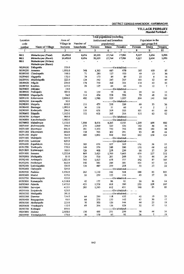
DISTRICT CENSUS HANDBOOK: KARIMNAGAR
VILLAGE PRIMARY Mandai Parishad -
Total population (including Location Area of institutional and houseless Population in the
code Village in Nurnberof l!°eulation2 age-S!:0ue 0-6 number Name ofVi11a~e hectares households Persons Males Females Persons Males Females
1 2 3 4 5 6 7 8 9 10
OOll Mabadevpur (Total) 35,499.0 8,694 35,325 17,744 17,581 5,227 2,634 2,593 0011 Mabadevpur (Rural) 35,499.0 8,694 35,325 17,744 17,581 5,227 2,634 2,593 0011 Mabadevpur (Urban)
Mabadevpur (Rural) 00289100 Tallagadda 329.0 -----Un-inhabited-----00289200 Annaram 1,850.0 368 1,363 685 678 185 100 85 00289300 Chindrapalle 168.0 71 280 127 153 49 13 36 00289400 NagepalJe 132.0 34 173 84 89 22 6 16 00289500 M:uddulapalle 222.0 124 542 285 257 101 52 49 00289600 Palgula 239.0 178 719 368 351 118 63 S5 00289700 Kuntlam 357.0 29 127 64 63 19 12 7 00289800 Balijapur 19.0 ----Un-inhabited---00289900 Puskupalle 507.0 41 159 78 81 29 14 15 00290000 Ma,ieedpalle 54.0 114 454 228 226 75 40 35 00290100 Kaleswaram 2,849.0 492 1,986 959 1,027 304 141 163 00290200 Kannepalle 30.0 ----Un-inhabited----00290300 Metpalle 658.0 III 477 238 239 69 33 36 00290400 Beersagar 1,093.0 36 111 51 60 4 2 2 00290500 KudurpalJe 294.0 155 651 318 333 101 41 60 00290600 Edapalle 1.102.0 153 621 305 316 115 63 52 00290700 Kothapet 969.0 ----Un-inhabited---00290800 Kancherlapalle 1,082.0 Un-inhabited----00290900 Mahadevpur 1,153.0 1,884 8,416 4,265 4,151 1,209 609 600 00291000 Brahmanpalle 396.0 279 1,069 533 536 162 86 76 00291100 Bommapur 681.0 381 1,453 710 743 190 102 88 00291200 Elkeswaram 683.0 158 593 302 291 93 49 44 00291300 Beglur 764.0 489 1,893 948 945 262 138 124 00291400 Muktipalle 343.0 ------Un-inhabited------00291500 LlIxmipur 629.0 --------Un-inhabited----~----
00291600 Rapallekota 535.0 183 676 357 319 111 56 55 00291700 Yenkepalle 779.0 149 579 289 290 130 68 62 00291800 Kishtaraop<:t 183.0 126 468 238 230 66 37 29 00291900 Suraram 1,222.0 869 3,423 1,760 1,663 459 227 232 00292000 Medigadda 81.0 136 510 261 249 73 44 29 00292100 Ambatpalle 1,021.0 343 1,415 6713 737 192 87 105 00292200 Peddampet 462.0 140 585 284 301 101 47 54 00292300 Lenkalagadda 336.0 134 487 259 228 55 33 22 00292400 Garkepalle 334.0 ----Un-inhabited------00292500 Pankena 1,930.0 263 l,llO 542 568 188 83 105 00292600 Moded 127.0 55 239 125 114 43 17 26 00292700 Bheemanpalle 153.0 ---Un-inhabited-------00292800 Kamanpalle 4,518.0 42 177 96 81 30 16 14 00292900 Palmela 1,475.0 421 1,578 818 760 235 128 107 00293000 Sarvaipet 413.0 285 1,243 612 631 168 85 83 00293100 Boipalmela 123.0 ------Un-inhabited----00293200 Medigadda 391.0 -----Un-inhabited-------00293300 Dammur 334.0 64 250 118 132 42 19 23 00293400 Burgugudem 99.0 68 275 133 142 47 30 17
00293500 Neelampalle 223.0 70 300 156 144 44 25 19 00293600 Venchepalle 133.0 69 264 136 128 32 17 15 00293700 Kishtapur 899.0 --------Un-inhabited----00293800 Muknur 2,928.0 130 481 251 230 78 44 34 00293900 Timmatigudem 171.0 50 178 83 95 26 7 19
842
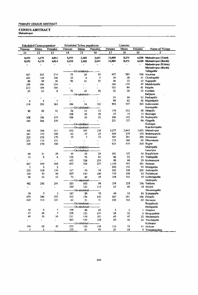
PRIMARY CENSUS ABSTRACT
CENSUS ABSTRACT Mahadevpur
Scheduled Castes EOEuation Scheduled Tribes EOEulation Literates
Persons Males Females Persons Males Females Persons Males Females Name ofViUage
II 12 13 14 15 16 17 18 19 2
8,193 4,179 4,014 5,193 2,582 2,611 12,809 8,271 4,538 Mabadevpur (Total)
8,193 4,179 4,014 5,193 2,582 2,611 12,809 8,271 4,538 Mahadevpur (Rural) Mahadevpur (Urban) Mahadevpur (Rural)
Un-inhabited- Tallagadda
427 213 214 71 36 35 437 283 154 Annaram 265 119 146 13, 6 7 59 38 21 Chindrapalle
69 39 30 96 41 55 46 33 13 Nagepalle
338 184 154 166 119 47 Muddulapalle
213 109 104 135 94 41 Palgula
23 15 8 73 35 38 32 20 12 Kunt1am Un-inhabited--- Balijapur
51 36 15 Puskupalle
4 3 99 63 36 MajeedpaUe
518 255 263 186 54 132 922 557 365 Kaleswaram
Un-inhabited Kannepalle
86 45 41 26 14 \2 170 112 58 Metpalle 108 50 58 27 14 13 Beersagar
358 181 177 106 55 51 196 142 54 KudurpaiJe
542 266 276 221 127 94 Edapalle
Un-inhabited Kothapet
----Un-inhabited---- Kancheriapalle
705 394 311 355 197 158 4,277 2,642 1,635 Mahadevpur
381 172 209 62 37 25 429 279 150 Bmhmanpalle
325 }55 170 19 7 12 597 391 206 Bommapur
231 110 121 173 104 69 Elkeswaram
330 170 160 625 419 206 Beglur
-----Un-inhabited Muktipalle ----Un-inhabited----- Laxmipur
60 31 29 49 23 26 181 127 54 ,Rapallekota
15 9 6 156 75 81 66 53 J3 Yenkepalle 452 228 224 88 68 20 Kishtaraopet
827 459 368 653 326 327 1,156 795 361 Suraram 5 3 2 246 152 94 Medigadda
252 118 134 117 59 58 542 338 204 Ambatpalle 119 53 66 307 147 160 153 100 53 Peddampet 96 54 42 72 42 30 164 105 59 Lenkalagadda
Un-inhabited Garkepalle 482 241 241 203 105 98 334 228 106 Pankena
239 125 114 63 45 18 Moded -----Un-inhabited------ Bheemanpalle
W 7 3 167 89 78 49 33 16 Kamanpalle 673 346 327 312 170 142 567 381 186 Palmela 632 311 321 62 31 31 226 164 62 Sarvaipet
----Un-inhabited------ B(}ipalmela ----Un-inhabited---- Medigadda
16 9 7 109 46 63 3 2 1 Dammur 17 10 7 258 123 135 28 22 6 Burgugudem 69 35 34 211 110 101 69 47 22 NeeJampaile
263 135 128 69 45 24 Venchepalle -------Un-inhabited Kishtapur
104 62 42 273 135 138 116 75 41 Muknur 1 1 175 81 94 27 18 9 iimmatigudem
843
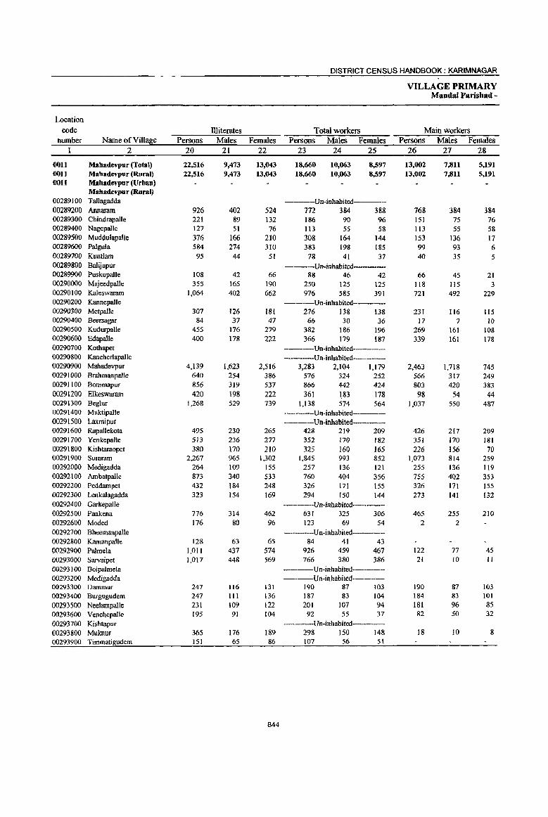
Location code
number Name of Village 2
OOll Mahadevpur (£otal) 0011 Mahadevpur (Rural) 0011 Mahadevpur (Urban)
Mahadevpur (Rural) 00289100 Tallagadda 00289200 Annaram 00289300 Chindrapalle 00289400 Nagepalle 00289500 MuddulapaUe 00289600 Palgula 00289700 Kuntlarn 00289800 Balijapur 00289900 Puskupalle 00290000 Majeedpalle 00290100 Kaleswaram 00290200 Kannepalle 00290300 Metpalle 00290400 Beersagar 00290500 Kudurpalle 00290600 Edapalle 00290700 Kothapet 00290800 Kancherlapalle 00290900 Mahadevpur 00291000 Brahrnanpalle 00291100 Bomrnapur 00291200 Elkeswaram 00291300 Beglur 00291400 Muktipalle 00291500 Laxmipur 00291600 Rapallekota 00291700 Yenkepalle 00291800 Kishtaraopet 00291900 Suranun 00292000 Medigadda 00292100 Ambatpalle 00292200 Peddatnpet 00292300 Lenkalagadda 00292400 Garkepalle 00292500 Pankena 00292600 Moded 00292700 Bheemanpalle 00292800 KamanpaUe 00292900 Palmela 00293000 Sarvaipet 00293100 Boipalmela 00293200 Medigadda 00293300 Dammur 00293400 Burgugudem 00293500 Neelampalle 00293600 Venchepalle 00293700 KishtapUT 00293800 Muknur 00293900 Timmatigudem
Persons 20
22,516 22,516
926 221 127 376 584 95
108 355
1,064
307 84
455 400
4,139 640 856 420
1,268
495 5lJ 380
2,267 264 873 432 323
776 176
128 1,011 1,017
247 247 231 195
365 151
lliiterates Males
21
9,473 9,473
402 89 51
166 274 44
42 165 402
126 37
176 178
1,623 254 319 198 529
230 236 170 965 109 340 184 154
314 80
63 437 448
116 III 109
91
176 65
Females 22
13,043 13,043
524 132
76 210 310
51
66 190 662
181 47
279 222
2,516 386 537 222 739
265 277 210
1,302 155 533 248 169
462 96
65 574 569
131 136 122 104
189 86
844
DISTRICT CENSUS HANDBOOK: KARIMNAGAR
Total workers Persons Males Females
23 24 25
18,660 18,660
10,063 10,063
8,597 8,597
-----Un-inhabited----772 384 388 186 113
308 383
78
90 55
164 198 41
96 58
144 185 37
-----Un-inhabited----88 46 42
250 976
125 585
125 391
------Un-inhabited-----276 138 138
66 30 36 382 366
186 179
196 187
-----Un-inhabited--------Un-inhabited----
3,283 2,104 1,179 576 324 252 866 442 424 361 183 178
1,138 574 564 ----Un-inhabited-------------Un-inhabited-------
428 219 209 352 170 182 325 160 165
1,845 257 760 326 294
993 136 404 171 150
852 121 356 155 144
------Un-inhabited---631 325 306 123 69 54
--------Un-inhabited------84 41 43
926 459 467 766 380 386
------Un-inhabited---------Un-inhabited------
190 187 201
92
87 83
107 55
103 104 94 37
---------Un-inhabited----298 150 148 107 56 51
VILLAGE PRIMARY Mandai Parishad -
Main workers Persons Males Females
26 27 28
13,002 13,002
768 151 113 153 99 40
66 118 721
231 17
269 339
2,463 566 803 98
1,037
426 351 226
1,073 255 755 326 273
465 2
122 21
190 184 181 82
18
7,811 7,811
384 75 55
136 93 35
45 115 492
116 7
161 161
1,718 317 420
54 550
217 170 156 814 136 402 171 141
255 2
77 10
87 83 96 50
10
5,191 5,191
384 76 58 17 6 5
21 3
229
115 IQ
108 178
745 249 383
44 487
209 181 70
259 119 353 155 132
210
45 11
103 101 85 32
8
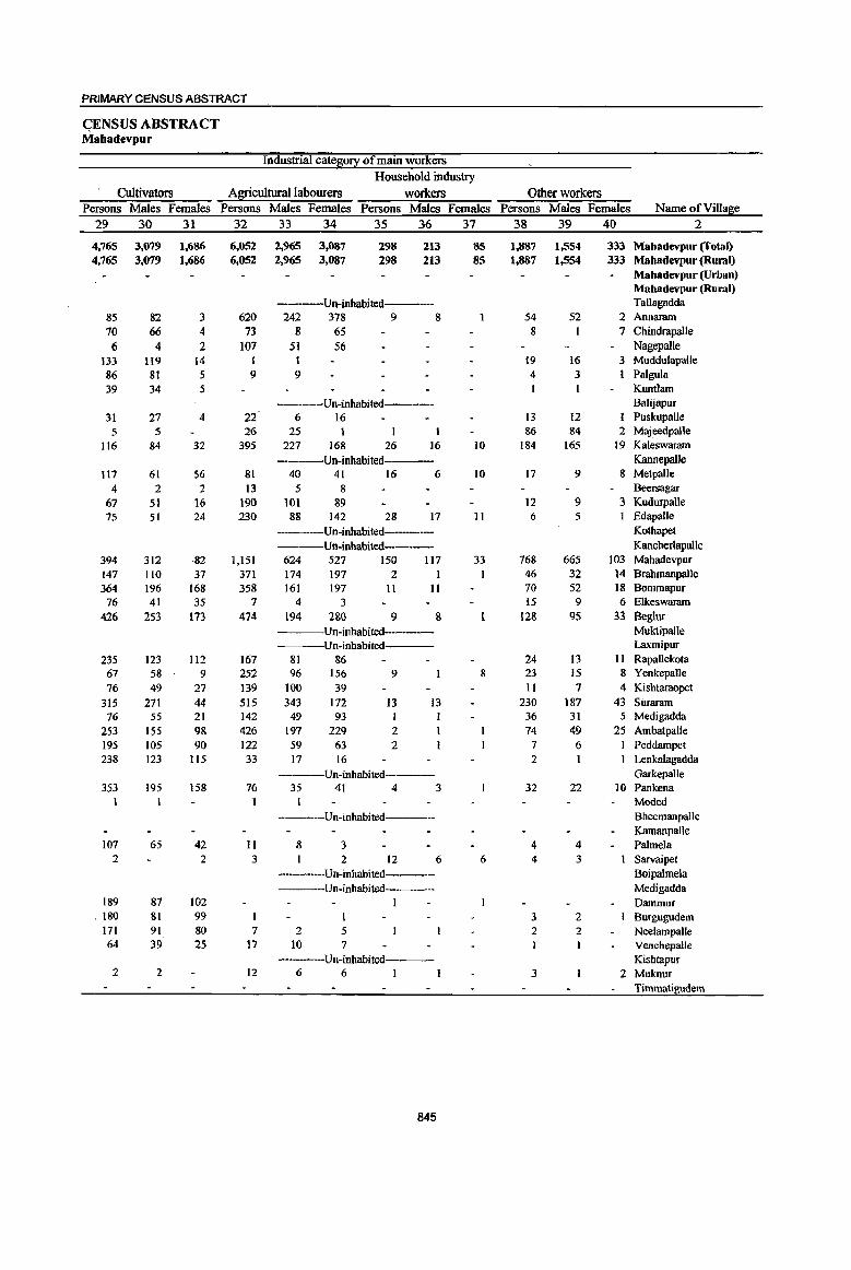
PRIMARY CENSUS ABSTRACT
<;ENSUS ABSTRACT Mabadevpur
Industrial catego!,1 of main workers
Household industry
Cultivators Agricultural labourers workers Other workers Persons Males Females Persons Males Females Persons Males Females Persons Males Females Name of Village
29 30 31 32 33 34 35 36 37 38 39 40 2
4,765 3,079 1,686 6,052 2,965 3,087 298 213 85 1,887 1,554 333 Mabadevpur (Total) 4,765 3,079 1,686 6,052 2,965 3,087 298 213 85 1,881 1,554 333 Mabadevpur (Rural)
Mabadevpur (Urban) Mabadevpur (Rural)
Un-inhabited Tallagadda 85 82 3 620 242 378 9 8 54 52 2 Annaram 10 66 4 73 g 65 8 1 7 Chindrapalle 6 4 2 to7 51 56 Nagepalle
133 119 14 I I 19 16 3 Muddulapalle 86 81 5 9 9 4 3 Palgula 39 34 5 Kuntlam
----Un-inhabited---- Balijapur 31 27 4 22 6 16 13 12 Puskupalle 5 5 26 25 I 86 84 2 MajeedpaUe
116 84 32 395 227 168 26 16 10 184 165 19 Kaleswaram
----Un-inhabited----- Kannepalle 117 61 56 81 40 41 16 6 10 17 9 8 Metpalle
4 2 2 13 5 8 Beersagar 67 51 16 190 101 89 12 9 3 Kudurpalle 75 51 24 230 88 142 28 17 11 6 5 EdapaUe
Un-inhabited Kothapet Un-inhabited Kancberlapal\e
394 312 -82 1,151 624 527 150 117 33 768 665 103 Mahadevpur 147 110 37 371 174 197 2 I 46 32 14 BralJmanpalle 364 196 168 358 161 197 11 11 70 52 18 Bommapur 76 41 35 7 4 3 15 9 6 Elkeswaram
426 253 173 474 194 2&0 9 8 12& 9S 33 Beglur Un-inhabited Muktipalle
---Un-inhabited Laxmipur 235 123 112 167 81 86 24 13 11 Rapallekota 67 58 9 252 96 156 9 8 23 15 8 Yenkepalle 76 49 27 139 100 39 II 7 4 Kishtaraopet
315 271 44 515 343 172 13 13 230 187 43 Suraram 76 55 21 142 49 93 1 36 31 5 Medigadda
253 155 98 426 197 229 2 74 49 25 Arnbatpalle 195 105 90 122 59 63 2 7 6 Peddampet 238 123 ll5 33 17 16 2 Lenkalagadda
-----Un-inhabited- Garkepalle 353 195 158 76 35 41 4 3 32 22 10 Pankena
I Mooed ----Un-inhabited----- Bheemanpalle
Karnanpalle 107 65 42 11 8 3 4 4 PalmeJa
2 2 3 2 12 6 6 4 3 Sarvaipet ----Un-inhabited----- Boipalmela ---Un-inhabited---- Medigadda
189 87 102 I Dammur , 180 81 99 3 2 Burgugudem
171 91 80 7 2 5 2 2 Neelampalle 64 39 25 17 10 7 Venchepalle
-----Un-inhabited Kishtapur 2 2 12 6 6 3 2 Muknur
Timmatigudem
845

DISTRICT CENSUS HANDBOOK: KARIMNAGAR
VILLAGE PRIMARY Mandai Parishad -
Industrial cate~0!X Location
code MarBinal workers Cultivators A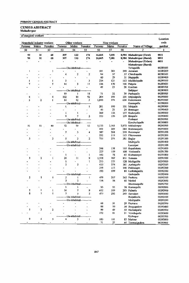
PRIMARY CENSUS ABSTRACT
CENSUS ABSTRACT Mahadevpur
ofmar~inal workers Location
Household industry workers Other workers Non-workers code
Persons Males Females Persons Males Females Persons Males Females Name of Village number
50 51 52 53 54 55 56 57 58 2 I
99 31 68 307 133 174 16,665 7,681 8,984 Mabadevpur (Total) 0011 99 31 68 307 133 174 16,665 7,681 8,984 Mabadevpur (Rural) 0011
Mabadevpur~rban) 0011 Mahadevpur (Rural)
---Un-inhabited Tallagadda 00289100 591 301 290 Annaram 00289200
4 2 2 94 37 57 Chindrapalle 00289300 60 29 31 Nagepalle 00289400
3 3 234 121 1I3 MuddulapaUe 00289500 7 7 14 3 II 336 170 166 Palgula ~0289600
49 23 26 Kuntlarn 00289700 ---Un-inhabited---- Balijapur 00289800
19 1 18 71 32 39 Puskupalle 00289900 4 4 102 10 92 204 103 101 MajeedpaUe 00290000 3 2 14 12 2 1,010 374 636 Kaleswaram 00290100
----Un-inhabited---- Kannepalle 00290200 1 1 201 100 101 Metpalle 00290300
45 21 24 Beersagar 00290400 I 269 132 137 Kudurpalle 00290500 9 7 2 255 126 129 Edapalle 00290600
---Un-inhabited--- Kothapet 00290700 ----Un-inhabited Kancherlapalle 00290800
51 11 40 72 S9 13 5,133 2,161 2,972 MahadevpuT 00290900 493 209 284 BrahmanpaUe 00291000
7 3 4 587 268 ,319 Bommapur 00291100 232 119 113 Elkeswaram 00291200
3 3 5 3 2 755 374 381 Beglur 00291300 ----Un-inhabited----- Muktipalle 00291400 -----Un-inhabited------ Laxmipur 00291500
248 138 110 Rapallekota 00291600 227 119 108 Yenkepalle 00291700
I 143 78 65 Kishtaraopet 00291800 3 2 20 II 9 1,578 767 811 Surararn 00291900
253 125 128 Medigadda 00292000 2 2 655 274 381 Ambatpalle 00292100
259 ll3 146 Peddampet 00292200 193 109 84 Lenkalagadda 00292300
---Un-inhabited----- Garkepalle 00292400 2 2 I 1 479 217 262 Pankena 00292500
2 2 116 S6 60 Mooed 00292600 ----Un-inbabited---- Bheernanpalle 00292700
1 1 93 5S 38 KamanpaUe 00292800 2 16 7 9 652 359 293 Palmela 00292900 8 7 7 5 2 477 232 245 SaIVaipet 00293000
----Un-inhabited------ Boipalmela 00293100 ------Un-inhabited------ Medigadda 00293200
60 31 29 Dammur 00293300 88 50 38 Burgugudem 00293400
5 3 2 99 49 50 Neelampalle 00293500 172 81 91 Venchepalle 00293600
------Un-inhabited--------- Kishtapur 00293700 9 4 5 4 3 I 183 101 82 Muknur 00293800
71 27 44 Timmatigudem 00293900
847

DISTRICT CENSUS HANDBOOK: KARIMNAGAR
VILLAGE PRIMARY Mandai Parisbad -
Total population (including Location Area of institutional and houseless Population in the
code Village in Number of EOEulation~ !£ie-l[ouE 0-6 number Name ofVilla~e hectares households Persons Males Females Persons Males Females
I 2 3 4 5 6 7 8 9 10
0012 Mutbaram (Mahadevpur) 28,249.0 5.598 23,327 11,701 11,626 3,952 1,982 1,970 ITotal)
0012 Mutharam (Mahadevpur) 28,249.0 5,598 23,327 1l,701 11,626 3,952 1,982 1,970 (Rural)
0012 Mutharam (Mahadevpur) mrbanl Mutharam (Mahadevpur) lRuran
00294000 Mulugupalle 2.193.0 362 1,595 781 814 245 115 130 00294100 Polaram 2,465.0 297 1,119 566 553 167 88 79 00294200 Stambhampalle (PP) 205.0 183 785 394 391 148 66 82 00294300 Korlakunta 364.0 212 970 488 482 198 105 93 00294400 Madharam 1,236.0 154 691 340 351 128 57 71 00294500 Jeelapalle 491.0 297 1,230 627 603 194 105 89 00294600 Nimmagudem 399.0 295 1,073 547 526 232 117 115 00294700 Yamanpalle 332.0 421 1,514 760 754 264 129 135 00294800 Mutharam (Mahadevpur) 2,848.0 867 3,719 1,857 1,862 582 282 300 00294900 Vajnepalle 483.0 103 439 225 214 80 45 35 00295000 Nallagunta (Meenajipeta) 1,545.0 490 2,064 1,069 995 354 191 163 00295100 Regula Gudem 632.0 209 784 387 397 117 53 64 00295200 Borlagudem 866.0 468 2,029 1,019 1,010 302 158 144 00295300 Pegdapalle 829.0 227 957 468 489 145 68 77 00295400 Yetnaram 1,241.0 100 414 193 221 88 41 47 00295500 Singampalle 266.0 112 458 248 210 90 56 34 00295600 Gaddalapalle 334.0 ------Un-inhabited-----00295700 Kankunoor 627.0 275 1,252 631 621 220 118 102 00295800 Reddjpalle 4,250.0 53 210 101 109 58 27 31 00295900 Stambhampalle (P.K.) 564.0 177 763 381 382 107 51 56 00296000 Gandikamaram 5,754.0 177 752 377 375 118 53 65 00296100 Singaram 325.0 119 509 242 267 115 57 58
848

PRIMARY CENSUS ABSTRACT
CENSUS ABSTRACT Mutbaram (Mabadevpur)
Scheduled Castes EOEuation Scheduled Tnoes EOEulation Literates Persons Males Females Persons Males Females Persons Males Females Namei>fViIlase
11 12 13 14 15 16 17 18 19 2
6,606 3,294 3,312 7,681 3,869 3,812 6,546 4,386 2,160 Mut~aram (Mahadevpur) {Tatan
6,606 / 3,294 3,312 7,681 3.869 3,812 6,546 4,386 2,160 Mutharam (Mabadevpur) lRuran
- Mutbaram (Mabadevpur) mrban\ Mutharam (Mahadevpur) lRurall
462 230 232 251 li8 133 494 316 178 Mulugupalle 443 230 213 379 189 190 281 190 91 Polaram 764 380 384 219 156 63 Stambhampal1e (PP) 181 92 89 68 37 31 228 159 69 Korlakunta 229 117 112 378 179 199 237 175 62 Madharam 308 151 157 479 246 233 407 257 150 JeelapaiJe 346 176 170 625 319 306 227 161 66 Nimmagudem 832 414 418 35 18 17 275 200 75 Yamanpalle
1,458 729 729 975 495 480 1,198 787 411 Mutharam (Mahadevpur) 252 127 125 5 4 1 120 70 50 Vl!inepalle 175 89 86 296 154 142 519 365 154 Nallagunta (Meenajipeta) 67 33 34 231 108 123 149 89 60 Regula Gudem
178 85 93 1,010 515 485 690 454 236 Borlagudem 199 97 102 742 361 381 330 235 95 Pegdapalle 169 78 91 198 93 105 37 26 11 Yetnaram 48 22 26 342 184 158 127 89 38 Singampalle
-----Un-inhabited---- Gaddalapalle 136 72 64 1,001 499 502 345 224 121 Kankunoor 41 21 20 169 80 89 43 25 18 Reddipalle
235 III 124 373 186 187 202 128 74 Stambhampalle (p-K) 29 18 II 124 74 50 255 169 86 Gandikamaram 54 22 32 163 111 52 Singaram
849
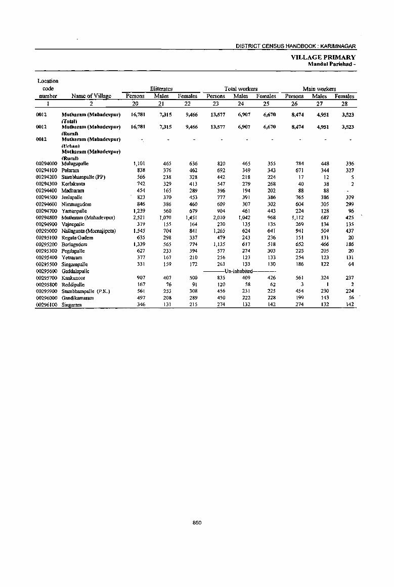
DISTRICT CENSUS HANDBOOK: KARIMNAGAR
VILLAGE PRIMARY MandaI Parishad -
Location code Illiterates Total workers Main workers
number Name ofVilla~e Persons Males Females Persons Males Females Persons Males Females 2 20 21 22 23 24 25 26 27 28
0012 Mutbaram (Mabadevpur) 16,781 7,315 9,466 13,577 6,907 6;670 8,474 4,951 3,523 /Tolan
0012 Mutbaram (Mabadevpur) 16,781 7,315 9,466 13,577 6,907 6,670 8,474 4,951 3,523 (Ruran
0012 Mutbaram (Mabadevpur) (Urban) Mutharam (Mabadevpur) lRural)
00294000 Mulugupalle 1,101 465 636 820 465 355 784 448 336 00294100 Po1aram 838 376 462 692 349 343 671 344 327 00294200 StambhampaUe (PP) 566 238 328 442 218 224 17 12 5 00294300 Korlakunta 742 329 413 547 279 268 40 38 2 00294400 Madharam 454 165 289 396 194 202 88 88 00294500 Jee1apalle 823 370 453 777 391 386 765 386 379 00294600 Nimmagudem 846 386 460 609 307 302 604 305 299 00294700 Yamanpalle 1,239 560 679 904 461 443 224 128 96 00294800 Mutharam (Mahadevpur) 2,521 1,070 1,451 2,010 1,042 968 1,112 687 425 00294900 Vajnepal1e 319 155 164 270 135 135 269 134 135 00295000 Nallagunta (Meenajipeta) 1,545 704 841 1,265 624 641 941 504 437 00295100 Regula Gudem 635 298 337 479 243 236 151 131 20 00295200 Borlagudem 1,339 565 774 1,135 617 518 652 466 186 00295300 Pegdapalle 627 233 394 577 274 303 225 205 20 00295400 Yetnaram 377 167 210 256 123 133 254 123 131 00295500 SingampaUe 331 159 172 263 133 130 186 122 64 00295600 Gaddalapalle ----Un-inhabited------00295700 KankwlOor 907 407 500 835 409 426 561 324 237 00295800 ReddipaBe 167 76 91 120 58 62 3 2 00295900 StaInbhampalle (p.K.) 561 253 308 456 231 225 454 230 224 00296000 Gandikamaram 497 208 289 450 222 228 199 143 56 00296100 Singaram 346 131 215 274 132 142 274 132 142
850
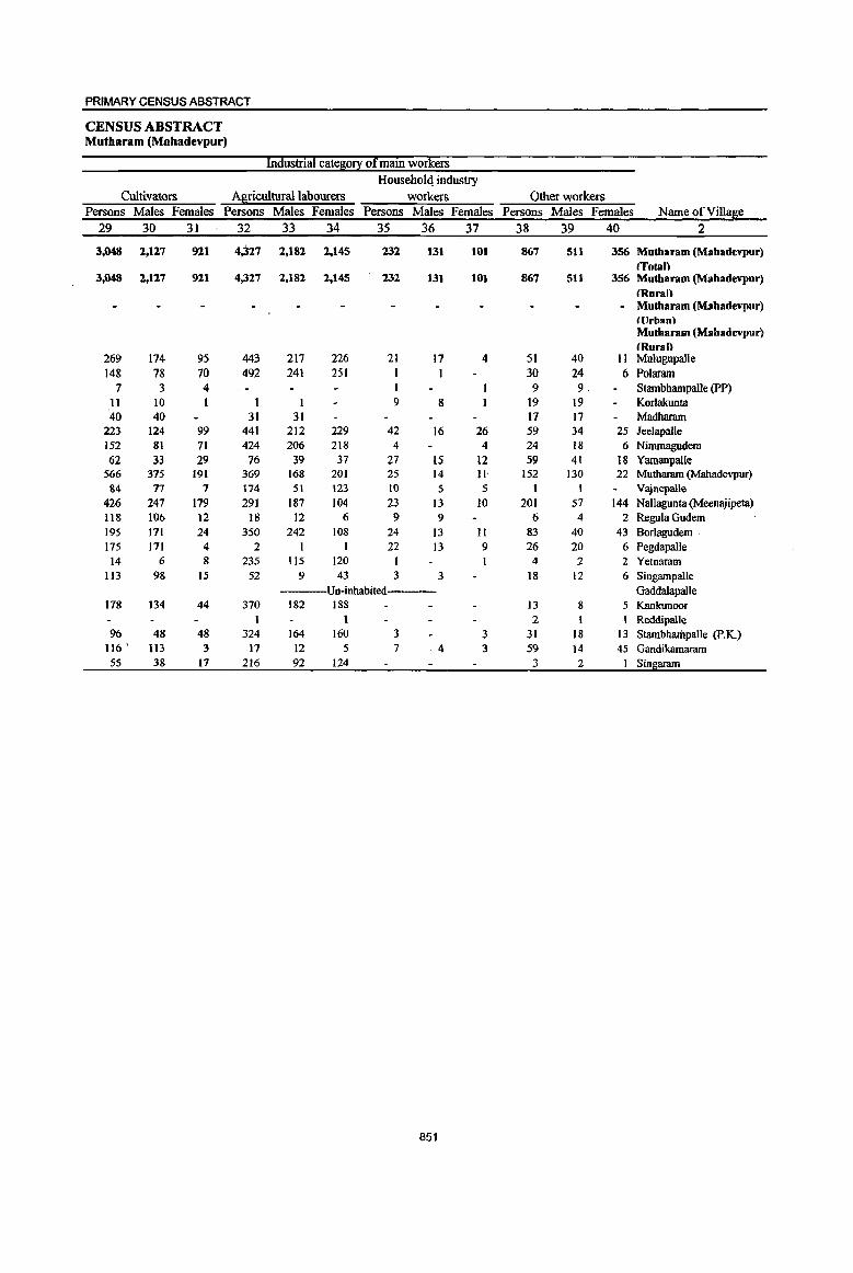
PRIMARY CENSUS ABSTRACT
CENSUS ABSTRACT Mutharam (Mabadevpur)
Industrial cate80!! of main workers Householq industry
Cultivators Agricultural labourers workers Other workers Persons Males Females Persons Males Females Persons Males Females Persons Males Females Name ofVilla~e
29 30 31 32 33 34 35 36 37 38 39 40 2
3,048 2,127 921 4,327 2,182 2,145 232 131 101 867 511 356 Mutbaram (Mabadevpur) (fotal)
3,048 2,127 921 4,327 2,182 2,145 232 131 101 867 511 356 Mutbaram (Mabadevpur) (Rural)
- Mutharam (Mabadevpur) ((Jrhan) Mutharam (Mabadevpur) (Rural)
269 174 95 443 217 226 21 17 4 51 40 11 Mu1ugupalle 148 78 70 492 241 251 I I 30 24 6 Polaram
7 3 4 9 9 Stambhampalle (PP) 11 10 I I 9 8 19 19 Korlakunta 40 40 31 31 17 17 Madharam
223 124 99 441 212 229 42 16 26 59 34 25 Jeelapalle 152 81 71 424 206 218 4 4 24 18 6 Nimmagudem 62 33 29 76 39 37 27 15 12 59 41 18 Yamanpalle
566 375 191 369 168 20] 25 14 ll' 152 130 22 Mutharam (Mahadevpur) 84 77 7 174 51 123 10 5 5 1 1 Vajnepalle
426 247 179 291 187 104 23 13 10 201 57 144 Nallagunta (Meenajipeta) 118 106 12 18 12 6 9 9 6 4 2 Regula Gudem 195 171 24 350 242 108 24 13 II 83 40 43 Borlagudem 175 171 4 2 I I 22 13 9 26 20 6 Pegdapalle 14 6 8 235 115 120 I 4 2 2 Yetnaram
113 98 15 52 9 43 3 3 18 12 6 Singampalle Un-inhabited---- Gaddalapalle
178 134 44 370 182 188 13 8 5 Kankunoor t 1 2 1 1 Reddipalle
96 48 48 324 164 160 3 3 31 18 13 Stambharitpalle (p.K.) 116 • 113 3 17 12 5 7 4 3 59 14 45 Gandikamaram 55 38 17 216 92 124 3 2 I Singaram
851

DISTRICT CENSUS HANDBOOK: KARIM NAGAR
VILLAGE PRIMARY Mandai Parishad-
Industrial catel:50!1
Location
code Marginal workers Cultivators Agricultural labourers
number Name of Villal!le Persons Males Females Persons Males Females Persons Males Females
1 2 41 42 43 44 45 46 47 48 49
0012 Mutbaram (Mabadevpur) 5,103 1,956 3,147 221 137 84 4,462 1,714 2,748 (fatal)
0012 Mutharam (Mahadevpur) 5,103 1,956 3,147 221 137 84 4,462 1,714 2,748 tHural)
0012 Mutharam (Mahadevpur) ((Jrhan) Mutbaram (Mabadevpur) (Rural)
00294000 MuJugupalle 36 17 19 2 2 30 12 18 00294100 Polararn 21 5 16 19 3 16 00294200 Stambhampalle (PP) 425 206 219 70 57 13 353 149 204 00294300 Korlakunta 507 241 266 16 16 488 222 266 00294400 Madharam 308 106 202 I 307 105 202 00294500 JeeJapalJe 12 5 7 1 9 4 5 00294600 Nimmagudem 5 2 3 3 1 2 00294700 YamanpaUe 680 333 347 1 1 677 331 346 00294800 Muthararn (Mahadevpur) 898 355 543 34 16 18 849 329 520 00294900 Vajnepalle 00295000 Nallagunta (Meenajipeta) 324 120 204 10 6 4 299 106 193 00295100 Regula Gudem 328 112 216 I 1 316 110 206 00295200 Borlagudem 483 151 332 23 21 2 336 104 232 00295300 Pegdapalle 352 69 283 13 6 7 270 59 211 00295400 Yetnaram 2 2 1 1 00295500 Singampalle 77 II 66 37 6 31 27 26 00295600 Gaddalapalle -----Un-inhabited-----00295700 Kankunoor 274 85 189 4 2 2 222 56 166 00295800 Reddipalle 117 57 60 117 57 60 00295900 Stambhampalle (p.K.) 2 I I 2 I I 00296000 Gandikamaram 251 79 172 8 2 6 137 64 73 00296100 Sin~aram
852
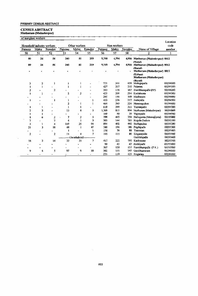
PRIMARY CENSUS ABSTRACT
CENSUS ABSTRACT Mutharam (Mahadevpur)
of marginal workers Location
Household industry workers Other workers Non-workers code Persons Males Females Persons Males Females Persons Males Females Name ofVill~e number '
50 51 52 53 54 55 56 57 58 2
80 24 56 340 81 259 9,750 4,794 4,956 Mutbaram (Mabadevpur) 0012 (fotall
80 24 56 340 81 259 9,750 4,794 4,956 Mutbaram (Mabadevpur) 0012 (Rural)
- Mutbaram (Mabadevpur) 0012 HJrban\ Mutharam (Mahadevpur) (Huran
3 2 775 316 459 Mulugupalle 00294000 1 1 427 217 2)0 Polarnm 00294100 2 2 343 176 167 Stanlbhampalle (PP) 00294200
2 2 423 209 214 Korlakunta 00294300 295 146 149 Madharnm 00294400
1 453 236 217 Jeelapalle 00294500 2 464 240 224 Nimmagudem 00294600
610 299 311 YamanpalJe 00294700 2 2 13 8 5 1,709 815 894 Mutharam (Mahadevpur) 00294800
1 169 90 79 Vajnepalle 00294900 8 6 2 7 2 5 799 445 354 Nallagunta (Meenajipeta) 00295000 7 7 4 3 305 144 161 Regula Gudem 00295100 5 1 4 119 25 94 894 402 492 Borlagudem 00295200
21 3 18 48 I 47 380 194 186 Pegdapalle 00295300 158 70 88 Yetnarnm 00295400
2 2 II 4 7 195 Its 80 SingampaUe 00295500 ---Un-inhabited---- Gaddalapalle 00295600
16 2 14 32 25 7 417 222 195 Kankunoor 00295700 90 43 47 Reddipalle 00295800
307 150 157 Stambhampalle (P.K.) 00295900 9 4 5 97 9 88 302 155 147 Gandikamaram 00296000
235 110 125 Singaram 00296100
853
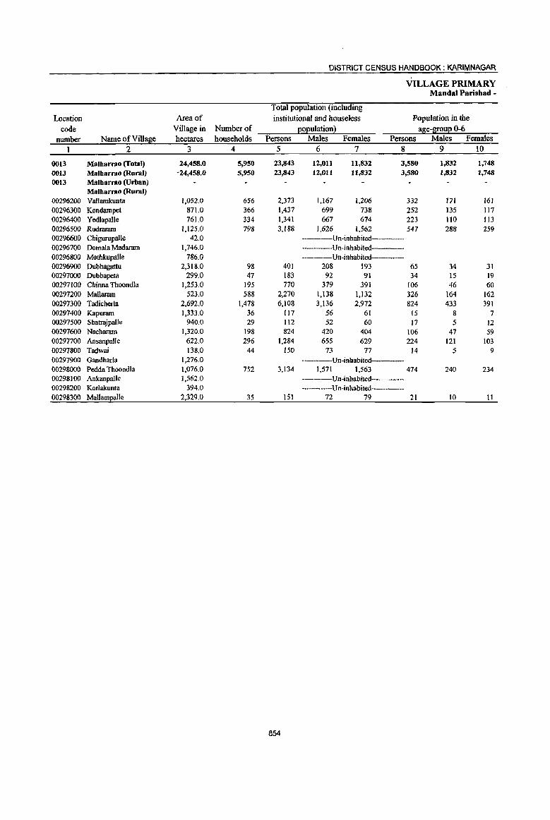
DISTRICT CENSUS HANDBOOK: KARIMNAGAR
VILLAGE PRIMARY Mandai Parishad -
Total population (including
Location Area of institutional and houseless Population in the code Village in Number of EOEulation} age-BE~uE 0-6
number Name ofVilIa~e hectares households Persons Males Females Persons Males Females 1 2 3 4 5 6 7 8 9 10
0013 Malharrao (fotal) 24,458.0 5,950 23,843 12,011 11,832 3,580 1,832 1,748 0013 Malharrao (Rural) -24,458.{} 5,950 23,843 12,011 11,832 3,580 1,832 1,748 0013 Malharrao (Urban)
Malharrao (Rural) 00296200 Vallamkunta 1,052.0 656 2,373 1,167 1,206 332 171 161 00296300 Kondampet 871.0 366 1,437 699 738 252 135 117 00296400 Yed1apalle 761.0 334 1,341 667 674 223 110 113 00296500 Rudraram 1,125.0 798 3,188 1,626 1,562 547 288 259 00296600 Chigurupalle 42.0 ------Un-inhabited----00296700 Domala Madaram 1,746.0 -------Un-inhabited-----00296800 Mothkupalle 786.0 -----Un-inhabited---------00296900 Dubbagattu 2,318.0 98 401 208 193 65 34 31 00297000 Dubbapeta 299.0 47 183 92 91 34 15 19 00297100 Chinna Thoondfa 1,253.0 195 770 379 391 106 46 60 00297200 Mallaram 523.0 588 2,270 1,138 1,132 326 164 162 00297300 Tadicherla 2,692.0 1,478 6,108 3,136 2,972 824 433 391 00297400 Kapuram 1,333.0 36 117 56 61 15 8 7 00297500 Sbauajpalle 940.0 29 112 52 60 17 5 12 00297600 Nacharam 1,320.0 198 824 420 404 106 47 59 00297700 Ansanpalle 622.0 296 1,284 655 629 224 121 103 00297800 Tadwai 138.0 44 150 73 77 14 5 9 00297900 Gandharfa 1,276.0 ----Un-inhabited-----00298000 Pedda Thoondla 1,076.0 752 3,134 1,571 1,563 474 240 234 00298100 Ankanpalle 1,562.0 ----Un-inhabited-00298200 Korlakunta 394.0 -----Un-inhabited------00298300 MallamEalle 2,329.0 35 151 72 79 21 10 11
854
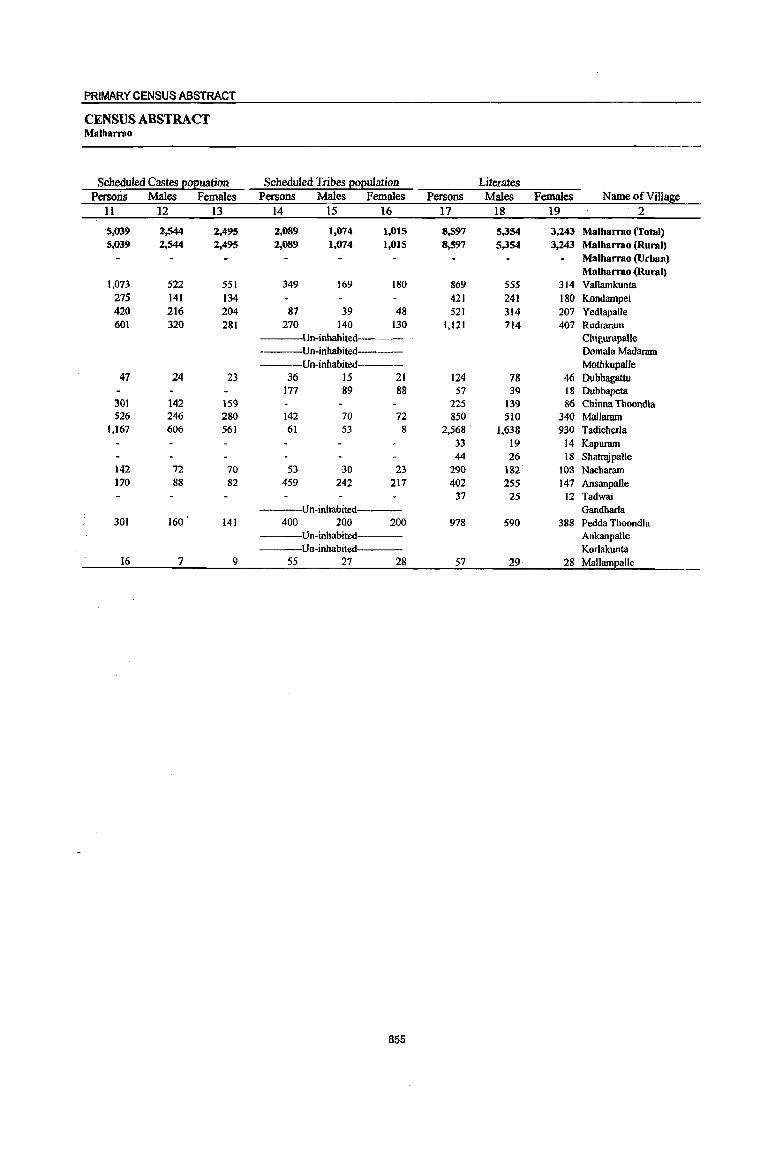
PRIMARY CENSUS ABSTRACT
CENSUS ABSTRACT Malharrao
Scheduled Castes e02U3tion Scheduled Tribes 2oeulation Literates Persons Males Females Persons Males Females Persons Males Females Name of Village
II 12 13 14 15 16 17 18 19 2
"5,039 2,544 2,495 2,089 1,074 1,015 8,597 5,354 3,243 Malharrao (Total) 5,039 2,544 2,495 2,089 1,074 1,015 8,597 5,354 3,243 Malharrao (Rural)
Malharrao (Urban) Malharrao (Rural)
1,073 522 551 349 169 180 869 555 314 Vallamkunta 275 141 134 421 241 180 Kondampet 420 216 204 87 39 48 521 314 207 Yedlapalle 601 320 281 270 140 130 1,121 714 407 Rudrararn
Un-inhabited---- Chigurupalle ----Un-inhabited Domala Madaram ----Un-inhabited----- Mothkupalle
47 24 23 36 15 21 124 78 46 Dubbagattu 177 89 88 57 39 18 Dubbapeta
301 142 159 225 139 86 Chinna Thoondla 526 246 280 142 70 72 850 510 340 Mallaram
1,167 606 561 61 53 8 2,568 " 1,638 930 Tadicherla 33 19 14 Kapuram 44 26 18 Shatrajpalle
142 72 70 53 30 23 290 182 108 Nacharam 170 88 82 459 242 217 402 255 147 Ansanpalle
37 25 12 Tadwai ----Un-inhabited----- Gandharla
301 160 141 400 200 200 978 590 388 Pedda Thoondla ----Un-inhabited---- Ankanpalle
Un-inhabited---- Korlakunta 16 7 9 55 27 28 57 29 28 Mallampalle
855

DISTRICT CENSUS HANDBOOK: KARIMNAGAR
VILLAGE PRIMARY Mandai Parisbad -
Location
code illiterates Total workers Main workers number Name ofVilla~e Persons Males Females Persons Males Females Persons Males Females
1 2 20 21 22 23 24 25 26 27 28
0013 Malharrao (Total) 15,246 6,657 8,589 13,211 7,059 6,152 9,521 5,689 3,832 0013 Malharrao (Rural) 15,246 6,657 8,589 13,211 7,059 6,152 9,521 5,689 3,832 0013 Malharrao (Urban)
Malharrao (Rural) 00296200 Vallamkunta 1,504 612 892 1,375 738 637 285 264 21 00296300 Kondampet 1,016 458 558 751 395 356 240 223 17 00296400 Yedlapalle 820 353 467 689 369 320 237 170 67 00296500 Rudraram 2,067 912 1,155 1,942 990 952 1,467 799 668 00296600 Chigurupalle -----Un-inhabited---00296700 Domala Madaram ----Un-inhabited-00296800 Mothkupalle ---Un-inhabited 00296900 Dubbagattu 277 130 147 249 125 124 202 103 99 00297000 Dubbapeta 126 53 73 102 52 50 91 50 41 00297100 Chinna Thoondla 545 240 305 478 256 222 478 256 222 00297200 Mallaram 1,420 628 792 1,293 717 576 1,203 708 495 00297300 Tadicherla 3,540 1,498 2,042 3,343 1,764 1,579 2,719 1,566 1,153 00297400 Kapurarn 84 37 47 80 36 44 78 36 42 00297500 Sharrajpalle 68 26 42 76 41 35 75 41 34 00297600 Nacharam 534 238 296 461 237 224 449 230 219 00297700 Ansanpalle 882 400 482 676 351 325 398 276 122 00297800 Tadwai 113 48 65 89 43 46 89 43 46 00297900 Gandharla ---Un-inhabited------00298000 Pedda Thoondla 2,156 981 1,175 1,514 901 613 1,465 880 585 00298100 Ankanpalle ----Un-inhabited---00298200 Korlakunta ----Un-inhabited-----00298300 Mallampalle 94 43 51 93 44 49 45 44
856

PRIMARY CENSUS ABSTRACT
CENSUS ABSTRACT Malharrao
Industrial cate8Q!X Qf main wQrkers
Household industry Cultivators Agricultural labourers workers Other workers
Persons Males Females. Persons Males Females Persons. Males Females Persons Males Females NameofViUage
29 30 31 32 33 34 35 36 37 38 39 40 2
3,243 2,341 902 4,930 2,321 2,609 246 158 88 1,102 869 233 Malbarrao (Total) 3,243 2,341 902 4,930 2,321 2,609 246 158 88 1,102 869 233 Malbarrao (Rural)
Malbarrao (Urban) Malharrao (Rural)
142 141 17 16 1 3S 26 9 91 81 10 Vallamkunta 115 115 61 58 3 2 2 62 50 12 Kondampet 161 113 48 11 6 5 3 I 2 62 50 12 Yedlapalle 468 271 197 661 309 352 82 46 36 256 173 83 Rudraram
---Un-inhabited--- Chigurupalle ----Un-inhabited---- Domala Madaram
Un-inhabited Mothkupalle 67 48 19 l30 53 77 4 2 2 Dubbagattu 58 44 14 31 4 27 I Dubbapeta
179 114 65 289 136 IS3 6 5 4 3 Chinna Thoondla 367 297 70 773 362 411 36 31 5 27 18 9 Mallaram 509 384 125 1,725 792 933 33 18 15 452 372 80 Tadicherla
3 I 2 75 35 40 Kapuram 48 28 20 24 II I3 2 Shatrajpalle
137 118 19 285 93 192 8 3 5 19 16 3 Nacharam 149 123 26 195 109 86 13 10 3 41 34 7 Ansanpalle 61 32 29 27 II 16 1 Tadwai
Un-inhabited----- Gandharla 742 475 267 624 324 300 21 13 8 78 68 10 Pedda Thoondla
-~-Un-inhabited--- AnkanpalJe ---Un-inhabited--- Korlakunta
37 37 2 2 1 1 5 4 Mallampalle
857
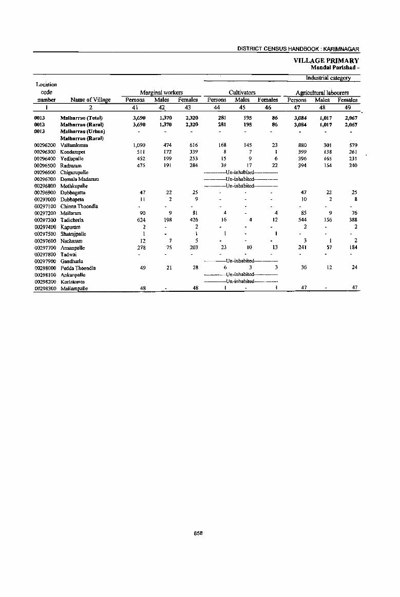
DISTRICT CENSUS HANDBOOK; KARIM NAGAR
VILLAGE PRIMARY Mandai Parisbad -
Location Industrial cate~0!X
code Marginal workers Cultivators Agriculturallahourers number Name ofVill~e Persons Males Females Persons Males Females Persons Males Females
1 2 41 42 43 44 45 46 47 48 49
0013 MalharnlO (Total) 3,690 1,370 2,320 281 195 86 3,084 1,017 2,067 0013 Malharrao (Rural) 3,690 1,370 2,320 281 195 86 3,084 1,017 2,067 0013 Malharrao (Urban)
Malharrao (Rural) 00296200 Vallamkunta 1,090 474 616 168 145 23 880 301 579 00296300 Kondampet 511 172 339 8 7 399 138 261 00296400 Yedlapalle 452 199 253 15 9 6 396 165 231 00296500 Rudraram 475 191 284 39 17 22 394 154 240 00296600 Chigurupalle --------Un-inhabited-----00296700 Domala Madaram -----Un-inhabited-------00296800 Mothkupalle -----Un-inhabited----00296900 Dubbagattu 47 22 25 47 22 25 00297000 Dubbapeta II 2 9 10 2 8 00297100 Chinna Thoondla 00297200 Mallaram 90 9 81 4 4 85 9 76 00297300 Tadicherla 624 198 426 16 4 12 544 156 388 00297400 Kapuram 2 2 2 2 00297500 ShatrajpalJe 00297600 Nacharam 12 7 5 3 2 00297700 Ansanpalle 278 75 203 23 10 13 241 57 184 00297800 Tadwai 00297900 Gandharla Un-inhabited----
00298000 Pedda ThoondJa 49 21 28 6 3 3 36 12 24 00298100 Ankanpalle ---Un-inhabited 00298200 Korlakunta ---Un-inhabited-----00298300 MallamEalle 48 48 1 I 47 47
858

PRIMARY CENSUS ABSTRACT
CENSUS ABSTRACT Malbarrao
of mars;inal workers Location
Household industry workers Other workers Non-workers code Persons Males Females Persons Males Females Persons Males Females Name ofVill~e number
50 51 52 53 54 55 56 57 58 2 1
60 24 36 265 134 131 10,632 4,952 5,680 Malharrao (Total) 0013 60 24 36 265 134 131 10,632 4,952 5,680 Malharrao (Rural) 0013
Malharrao (Urban) 0013 Malharrao (Rural)
13 5 8 29 23 6 998 429 569 Vallamkunta 00296200 103 27 76 686 304 382 Kondampet 00296300
3 3 38 22 16 652 298 354 Yedlapalle 00296400 16 7 9 26 13 13 1,246 636 610 Rudraram 00296500
---Un-inhabited---- Chigurupalle ()O296600 Un-inhabited------ Domala Madaram 00296700
---Un-inhabited--- Mothkupalle 00296800 152 83 69 Dubbagattu 00296900
81 40 41 Dubbapeta 00297000 292 123 169 Chinna Thoondla 00297100
1 977 421 556 Mallaram 00297200 20 7 13 44 31 13 2,765 1,372 1,393 Tadicherla 00297300
37 20 17 Kapuram 00297400 36 II 25 Shatrajpalle 00297500
9 6 3 363 183 180 Nacharam 00297600 5 2 3 9 6 3 608 304 304 Ansanpalle 00297700
61 30 31 Tadwai 00297800 Un-inhabited---- Gandharla 00297900
7 6 I 1,620 670 950 Pedda Thoondla 00298000 ---Un-inhabited---- Ankanpalle 00298100 ---Un-inhabited Korlakunta 00298200
58 28 30 Mallampalle 00298300
859
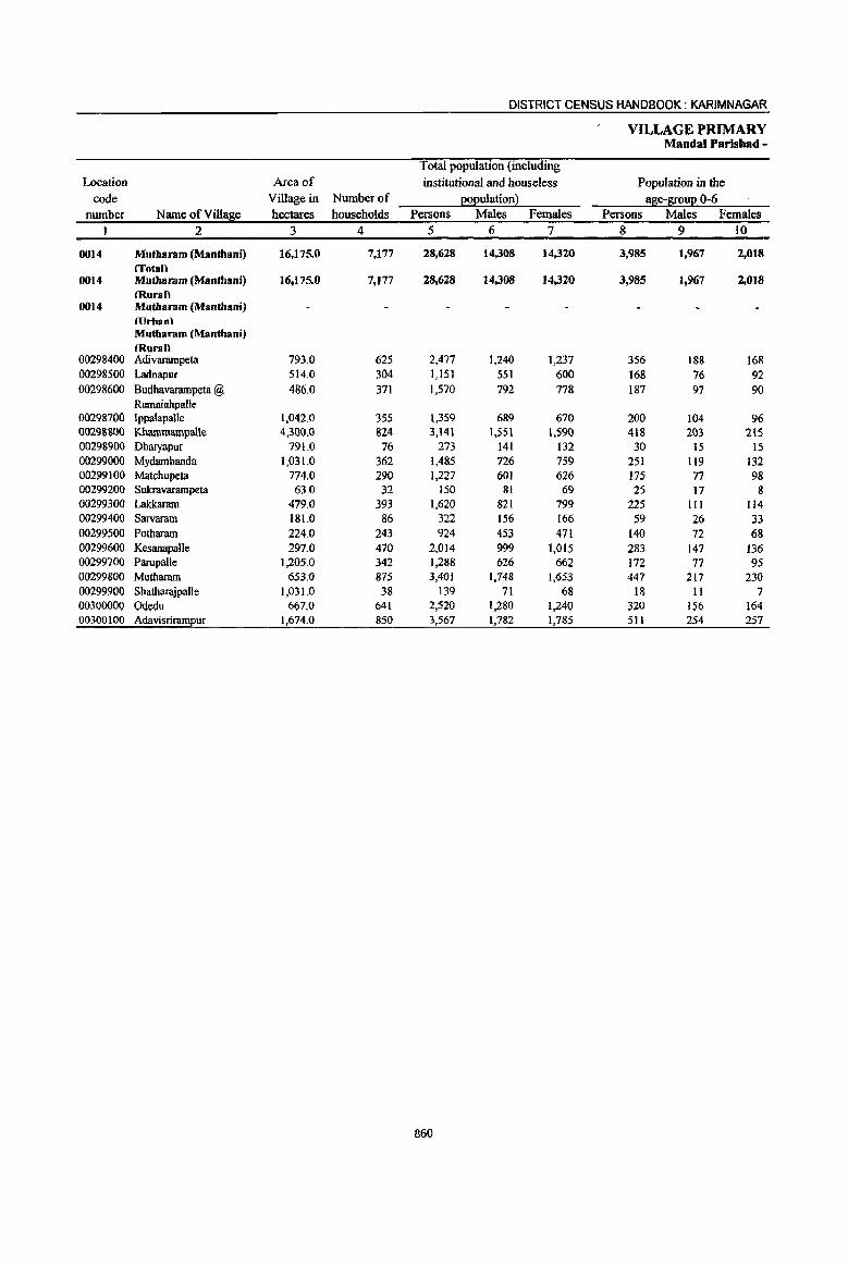
DISTRICT CENSUS HANDBOOK: KARIMNAGAR
VILLAGE PRIMARY Mandai Parishad -
Total population (including
Location Area of institutional and houseless Population in the code Village in Number of EOEuiation} age-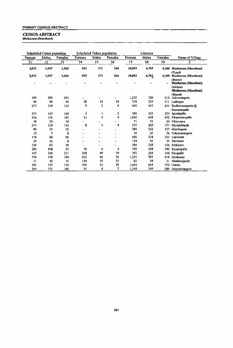
PRIMARY CENSUS ABSTRACT
CENSUS ABSTRACT Mutharam (Manthani)
Scheduled Castes ~o~uation Scheduled Tribes ~oEulation Literates Persons Males Females Persons Males Females Persons Males Females Name ofViUage
II 12 13 14 15 16 17 18 19 2
3,912 1,947 1,965 535 271 264 10,803 6,703 4,100 Mutharam (Manthani) {Totan
3,912 1,947 1,965 535 271 264 10,803 6,70~., 4,100 Mutbararn (Mantbani) {Ruran Mutbaram (Mantbani) (Urban\ Mutbaram (Mantbooi) (Rural)
589 296 293 1,.232 720 512 Adivarampeta 86 40 46 28 14 14 538 327 211 Ladnapur
277 154 123 9 5 4 660 415 245 Budhavarampeta @ Ramaiahpalie
237 117 120 3 2 580 355 225 Ippalapalle 356 171 185 I3 4 9 1,060 638 422 Khammampalle
38 20 18 71 51 20 Dhmyapur 257 124 133 8 4 4 437 260 177 Mydambanda
89 37 52 389 232 157 Matcbupeta
15 7 g 59 35 24 Sukravarampeta 178 88 90 606 374 232 Lakkaram 20 12 8 114 81 33 Sarvaram
120 62 58 384 228 156 Potbaram 200 108 92 10 6 4 749 4S9 290 KesanapaUe 427 216 211 108 49 59 392 244 148 Parupalle 376 178 198 122 66 56 1.255 797 458 Mutharam
21 10 II 114 S9 55 65 34 31 Shatbarajpalle 262 132 130 105 55 50 1,064 694 370 Odedu 364 175 189 15 8 7 1,148 759 389 Adavisrirampuf
861
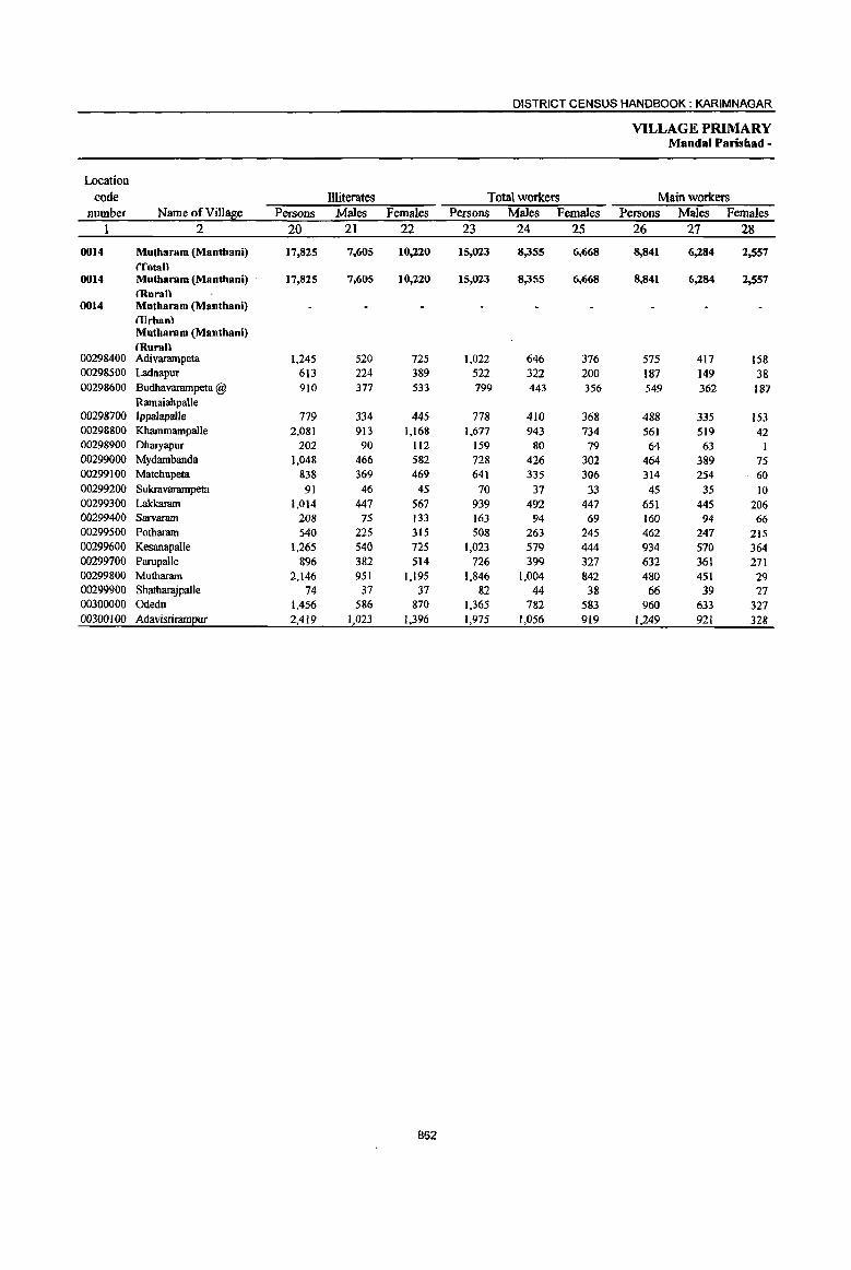
DISTRICT CENSUS HANDBOOK: KARIM NAGAR
VILLAGE PRIMARY Mandai Paris bad -
Location
code llliterates Total workers Main workers number Name ofVilIa8e Persons Males Females Persons Males Females Persons Males Females
2 20 21 22 23 24 25 26 27 28
0014 Mutharam (Manthani) 17,825 7,605 10,220 15,023 8,355 6,668 8,841 6,284 2,557 (Tatall
0014 Mutharam (Manthani) 17,825 7,605 10,220 15,023 8,355 6,668 8,841 6,284 2,557 (Kuran
0014 Mutbaram (Mantbani) IlJrhan\ Mutharam (Manthani) (Rurall
00298400 Adivarampeta 1,245 520 725 1,022 646 376 575 417 158 00298500 Ladnapur 613 224 389 522 322 200 187 149 38 00298600 Budhavarampeta @ 91O 377 533 799 443 356 549 362 187
Ramaiahpalle 00298700 IppalapaUe 779 334 445 778 410 368 488 335 153 00298800 KbammampalJe 2,081 913 1,168 1,677 943 734 561 519 42 00298900 Dharyapur 202 90 112 159 80 79 64 63 I 00299000 Mydambanda 1,048 466 582 728 426 302 464 389 75 00299100 Matchupeta 838 369 469 641 335 306 314 254 60 00299200 Sukravarampeta 91 46 45 70 37 33 45 35 10 00299300 Lakkaram 1,014 441 561 939 492 447 651 445 206 00299400 Sarvaram 208 75 133 163 94 69 160 94 66 00299500 Potharam 540 225 315 508 263 245 462 241 215 00299600 KesanapalJe 1,265 540 725 1,023 579 444 934 570 364 00299700 Parupalle 896 382 514 726 399 327 632 361 271 00299800 Mutharam 2,146 951 1,195 1,846 1,004 842 480 451 29 00299900 Shatharajpalle 74 31 31 &2 44 38 66 39 27 00300000 Odedu 1,456 586 810 1,365 782 583 960 633 321 00300100 Adavisriram2ur 2,419 1,023 1,396 1,975 1,056 919 1,249 921 328
862
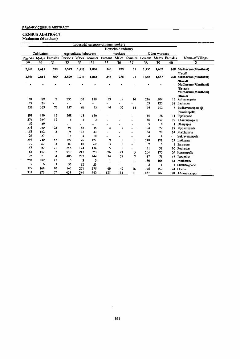
PRIMARY CENSUS ABSTRACT
CENSUS ABSTRAcT Mutharam (Manthani)
Industrial cate~o!y of main workers Household industry
Cultivators Agricultural labourers workers Other workers Persons, Males Females Persons Males Females Persons Males Females Persons Males Females Name of Village
29 30 31 32 33 34 35 36 37 38 39 40 2
2,961 2,611 350 3,579 1,711 1,868 346 275 71 1,955 1,687 268 Mutharam (Manthani) ffotaU
2,961 2,611 350 3,579 1,711 1,868 346 275 71 1,955 1,687 268 Mutharam (Manthani) 'Rural)
- Mutharam (Manthani) (llrhanl Mutharam (Manthani) (Rural)
91 89 2 235 105 130 33 19 14 216 204 12 Adivarampeta 24 24 163 125 38 Ladnapur
238 163 75 157 64 93 46 32 14 108 103 5 Budhavarampeta @ Ramaiahpalle
191 179 12 208 78 130 89 78 11 Ippalapalle 376 364 12 5 3 2 180 152 28 KbammampaJle 59 59 5 4 Dharyapur
273 250 23 93 58 35 4 4 94 77 17 Mydambanda 155 152 3 75 32 43 84 70 14 Matchupeta 27 27 14 4 10 4 4 Sukravarampeta
297 240 57 197 ' 76 121 9 8 148 121 27 Lakkaram 70 67 3 80 18 62 3 3 7 6 1 Sarvaram
158 87 71 258 124 134 5 5 41 31 10 Potharam 164 157 7 540 217 323 26 21 5 204 175 29 Kesanapalle 25 21 4 486 242 244 34 27 7 87 71 16 Parupalle
293 282 II 6 3 3 I I 180 166 14 Mutharam 9 6 3 55 32 23 2 I 1 ShatbarajpaJle
178 168 10 546 271 275 60 42 18 176 152 24 Odedu 333 276 57 624 384 240 125 114 11 167 147 20 Adavisrirampur
863
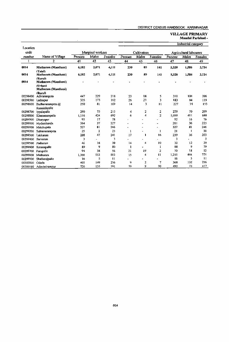
DISTRICT CENSUS HANDBOOK: KARIM NAGAR
VILLAGE·PRIMARY MandaI Parisbad-
Industrial category Location
code Marginal workers Cultivators Agricultural labourers number Name ofVill~e Persons Males Females Persons Males Females Persons Males Females
1 2 41 42 43 44 45 46 47 48 49
0014 Mutbaram (Manthani) 6,182 2,071 4,111 230 89 141 5,320 1,586 3,734 (Total)
0014 Mutharam (Manthani) 6,182 2,071 4,111 230 89 141 5,320 1,586 3,734 (Ruran
0014 Mutharam (Manthani) (lJrhan\ Mutharam (Manthani) (Rural)
00298400 Adivarampeta 447 229 218 23 18 5 310 104 206 00298500 Ladnapur 335 173 162 26 23 3 183 64 119 00298600 Budhavarampeta @ 250 81 169 14 3 II 227 74 153
Ramaiahpalle 00298700 Jppalapalle 290 75 215 4 2 2 279 70 209 00298800 Kbammampalle 1,116 424 692 6 4 2 1,099 411 688 00298900 Dharyapur 95 17 78 92 16 76 00299000 Mydambanda 264 37 227 261 36 225 00299100 Matchupeta 327 81 246 327 81 246 00299200 Sukravarampeta 25 2 23 I I 21 I 20 00299300 Lakkaram 288 47 241 17 16 239 36 203 00299400 Sarvaram 3 3 3 3 00299500 Potharam 46 16 30 14 4 10 32 12 20 00299600 KesanapalJe 89 9 80 1 1 88 9 79 00299700 Parupalle 94 38 56 21 19 2 70 18 52 00299800 Mutharam 1,366 553 813 15 4 II 1,215 444 771 00299900 Shatharajpalle 16 5 II 16 5 II
00300000 Odedu 405 149 256 9 2 7 368 132 236 00300100 AdavisriramEur 726 135 59l 79 9 70 490 73 411
864

\ PRIMARY CENSUS ABSTRACT
CENSUS ABSTRACT Mutharam (Manthani)
of marSinal workers Location
Household industry workers Other workers Non-workers code Persons Males Females Persons Males Females Persons Males Females Name ofVi1l~e number
50 51 52 53 54 55 56 57 58 2 1
184 89 95 448 307 141 13,605 5,953 7,652 Mutharam (Manthani) 0014 (Tntal\
184 89 95 448 307 141 13,605 5,953 7,652 Mutharam (Manthani) 0014 (Rurall
- Mutharam (Manthani) 0014 (Urban) Mutharam (Manthani) (Rural\
2 2 112 105 7 1,455 594 861 Aruvarampeta 00298400 36 31 5 90 55 35 629 229 400 Ladnapur 00298500 5 4 4 3 771 349 422 Budhavarampeta @ 0029860Q
Ramaiahpalle 7 3 4 581 279 302 Ippalapalle 00298700
3 2 8 8 1,464 608 856 Kharnmarnpalle 00298800 3 2 114 61 53 Dhruyapur 00298900
2 757 300 457 Mydambanda 00299000 586 266 320 Matchupeta 00299100
3 1 2 80 44 36 SukI"avarampeta 00299200 31 9 22 681 329 352 Lakkaram 00299300
159 62 97 Sarvaram 00299400 416 190 226 Potha,.nn 00299500 991 420 -571 Kesanapalle 00299600
3 1 2 562 227 335 Parupalle 00299700 IO 9 126 96 30 1,555 744 811 Mutharam 00299800
57 27 30 Sbatbarajpalle 00299900 5 2 3 23 13 10 1,155 498 657 Odedu 00300000
120 41 79 37 12 25 1,592 726 866 Adavisrirameur 00300100
865

DISTRICT CENSUS HANDBOOK: KARIM NAGAR
VILLAGE PRIMARY Mandai Paris bad -
Total population (including Location Area of institutional and houseless Population in the
code Village in Number of EOEulation} age-S!0uE 0-6 number Name of Villafie hectares households Persons Males Females Persons Males Females
1 2 3 4 5 6 7 8 9 10
0015 Srirampur (Total) 17,828.0 9,832 37,272 18,806 18,466 5,266 2,722 2,544 0015 Srirampur (Rural) 17,828.0 9,832 37;1.72 18,806 18,466 5,266 2,722 2,544 0015 Srirampur (Urban)
Srirampur (Rural) 00300200 Madipalle 388.0 645 2,509 1,277 1,232 348 189 159 00300300 Mangapet 546.0 370 1,446 723 723 180 94 86 00300400 Vennampalle 2,434.0 841 3,248 1,645 1,603 488 268 220 00300500 Jafarkbanpet 197.0 272 1,027 520 507 173 81 92 00300600 Edulapuram 890.0 229 825 424 401 110 49 61 00300700 Kunaram 2,473.0 808 2,883 1,431 1,452 364 191 173 00300800 Pegadapalle 713.0 1,064 4,128 2,072 2,056 636 333 303 00300900 Gangaram 837.0 761 2,958 1,499 1,459 429 229 • 200 00301000 Peddampet 650.0 317 1,210 611 599 207 103 104 00301100 Pandilla 892.0 534 1,941 947 994 256 117 139 00301200 Srirampur 1,972.0 1,491 5,695 2,872 2,823 782 385 397 00301300 Rathupalle 1,639.0 395 1,528 789 739 199 lI8 81 00301400 Motlapalle 804.0 395 1,579 819 760 211 113 98 00301500 Tharupalle 902.0 345 1,374 687 687 185 90 95 00301600 Mallial 945.0 568 2,114 1,053 1,061 308 153 155 00301700 MilZlUtlpet 962.0 472 1,595 804 791 216 110 106 00301800 Kistampet 584.0 325 1,212 633 579 174 99 75
866

PRIMARY CENSUS ABSTRACT
CENSUS ABSTRACT Srirnmpur
Scheduled Castes EOEU3tion Scheduled Tribes EOEulation Literates Persons Males Females Persons Males Females Persons Males Females Name of Village
11 12 13 14 15 16 17 18 19 2
6,350 3,267 3,083 188 99 89 15,220 9,587 5,633 Srirnmpur (Total) 6,350 3,267 3,083 188 99 89 15,220 9,587 5,633 Srirnmpur (Rural)
Srirampur (Urban) Srirampur (Rural)
330 178 152 1,007 632 375 Madipalle 192 93 99 606 375 231 Mangapet 657 348 309 1,187 741 446 Vennampal1e 125 61 64 8 3 5 441 286 155 Jafarkhanpet 192 101 91 311 217 94 Edulapuram 585 293 292 10 3 7 1,286 802 484 Kunaram 528 259 269 1,709 1,045 664 Pegadapalle 312 160 152 1,146 733 413 Gangaram
8 5 3 464 289 175 Peddampet 436 212 224 63 33 30 766 458 308 Pandilla 824 425 399 3 2 1 2,541 1,609 932 Srirampur 331 171 160 87 47 40 603 371 232 Rathupalle 440 235 205 628 399 229 Motlapalle 387 199 188 504 341 163 Tharupalle 500 260 240 9 6 3 906 568 338 Mallia] 242 121 121 619 400 219 Mirzampet 269 151 118 496 321 175 Kistampet
867
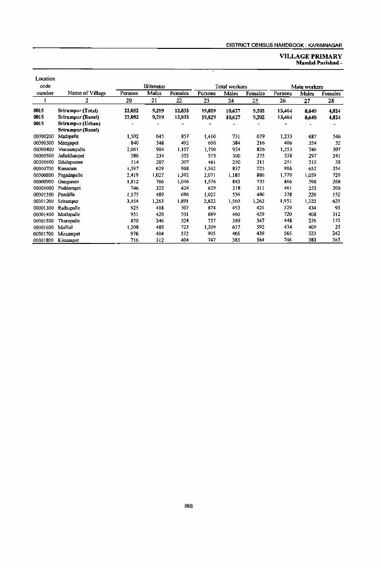
DISTRICT CENSUS HANDBOOK: KARIMNAGAR
VILLAGE PRIMARY Mandai Parishad -
Location
code flliterates Total workers Main workers number Name of Village Persons Males Females Persons Males Females Persons Males Females
I 2 20 21 22 23 24 25 26 27 28
0015 Srirampur (Total) 22,052 9,219 12,833 19,829 10,627 9,202 13,464 8,640 4,824 0015 Srirampur (Rural) 22,052 9,219 12,833 19,829 10,627 9,202 13,464 8,640 4,824 0015 Srirampur (Urban)
Srirampur (Rural) 00300200 Madipalle 1,502 645 857 1,410 731 679 1,233 687 546 00300300 Mangapet 840 348 492 600 384 216 406 354 52 00300400 Vennampalle 2,061 904 1,157 1,750 924 826 1.253 746 507 00300500 Jafarkhanpet 586 234 352 575 300 275 538 297 241 00300600 Edulapuram 514 207 307 461 250 211 251 213 38 00300700 Kunaram 1,597 629 968 1,562 837 725 906 652 254 00300800 Pegadapalle 2,419 1,027 1,392 2,071 1,185 886 1,779 1,059 720 00300900 Gangaram 1,812 766 1,046 1,576 843 733 866 598 268 00301000 Peddampet 746 322 424 629 318 311 461 253 208 00301100 Pandilla 1,175 489 686 1,022 536 486 378 226 152 00301200 Srirampur 3,154 1,263 1,891 2,822 1,560 1,262 1,951 1,322 629 00301300 Rathupalle 925 418 507 874 453 421 529 434 95 00301400 Motlapalle 951 420 531 889 460 429 720 408 312 00301500 Tbarupalle 870 346 524 727 380 347 448 276 172 00301600 Mallial 1,208 485 723 1,209 617 592 434 409 25 00301700 Mirzampet 976 404 572 905 466 439 565 323 242 00301800 Kistameet 716 312 404 747 383 364 746 383 363
868
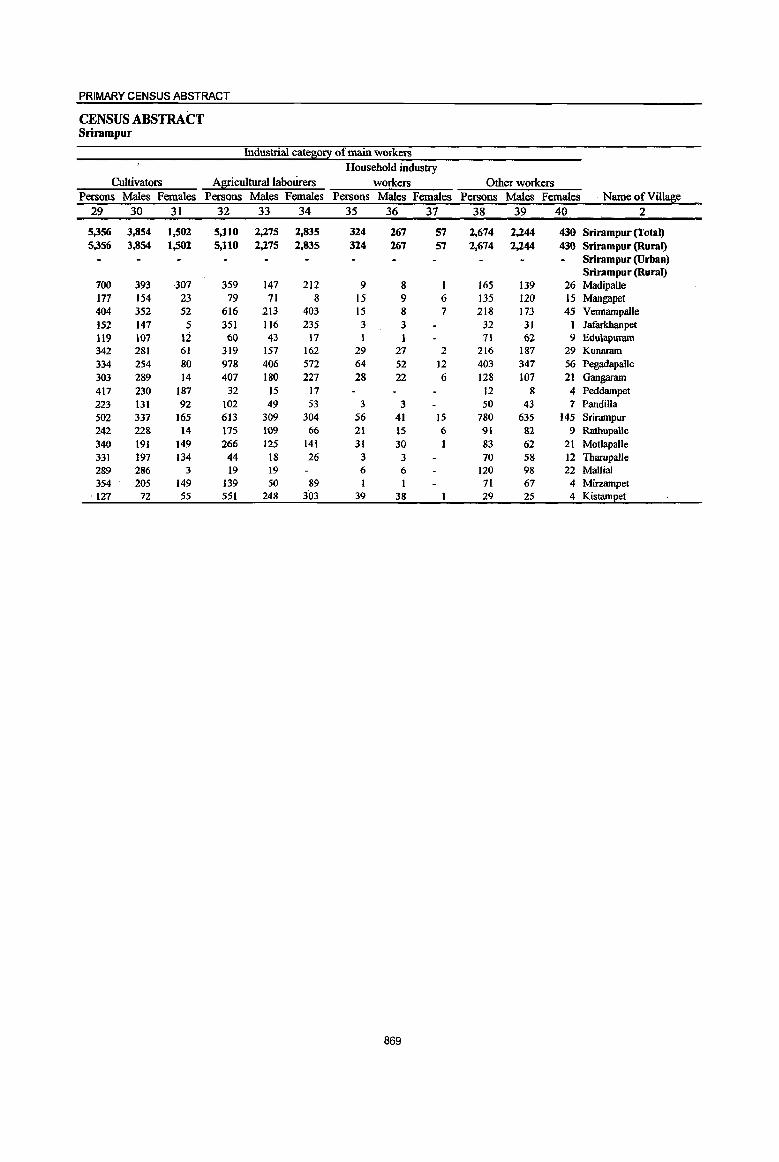
PRIMARY CENSUS ABSTRACT
CENSUS ABSTRACT Srirampur
Industrial cate~0!1 of main workers
Household industry Cultivators Agricultural laboUrers workers Other workers
Persons Males Females Persons Males Females Persons Males Females Persons Males Females Name of Village 29 30 31 32 33 34 35 36 37 38 39 40 2
5,356 3,854 1,502 5,110 2,275 2,835 324 267 57 2,674 2,244 430 Srirampur (Total) 5,356 3,854 1,502 5,110 2,275 2,835 324 267 57 2,674 2,244 430 Srirampur (Rural)
Srirampur (Urban) Srirampur (Rural)
700 393 307 359 147 212 9 8 I 165 139 26 Madipalle 177 154 23 79 71 8 15 9 6 135 120 15 Mangapet 404 352 52 616 213 403 15 8 7 218 173 45 Vennampalle 152 147 5 351 116 235 3 3 32 31 Jafarkbanpet 119 107 12 60 43 17 1 71 62 9 Edulapuram 342 281 61 319 157 162 29 27 2 216 187 29 Kunaram 334 254 80 978 406 572 64 52 12 403 347 56 Pegadapalle 303 289 14 407 180 227 28 22 6 128 107 21 Gangaram 417 230 187 32 15 17 12 8 4 Peddampet 223 131 92 102 49 53 3 3 50 43 7 Pandilla 502 337 165 613 309 304 56 41 15 780 635 145 Srirampur 242 228 14 175 109 66 21 15 6 91 82 9 RathupalJe 340 191 149 266 125 141 31 30 1 83 62 21 Motlapalle 331 197 134 44 18 26 3 3 70 58 12 Tharupalle 289 286 3 19 19 6 6 120 98 22 Mallial 354 205 149 139 50 89 1 71 67 4 Mirzampet
. 127 72 55 551 248 303 39 38 29 25 4 Kistampet
869
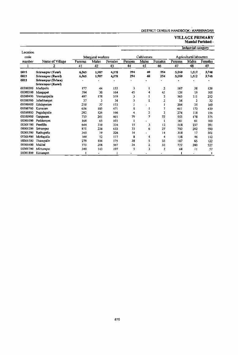
DISTRICT CENSUS HANDBOOK: KARIMNAGAR
VILLAGE PRIMARY MandaI Parisbad -
Industrial cates0!X Location
code MarBinal workers Cultivators Agricultural labourers number Name ofVilla~e Persons Males Females Persons Males Females Persons Males Females
1 2 41 42 43 44 45 46 47 48 49
0015 Srirampur (Total) 6,365 1,987 4,378 294 40 254 5,260 1,512 3,748 0015 Srirampur (Rural) 6,365 1,987 4,378 294 40 254 5,260 1,512 3,748 0015 Srirampur (Urban)
Srirampur (Rural) 00300200 Madipalle 177 44 133 3 1 2 167 38 129 00300300 Mangapet 194 30 164 45 4 41 124 19 105 00300400 Vennampalle 497 178 319 3 2 363 111 252 00300500 Jafarkbanpet 37 3 34 3 2 34 2 32 00300600 Edulapuram 210 37 173 1 204 35 169 00300700 Kunaram 656 185 471 8 1 7 611 172 439 00300800 Pegadapalle 292 126 166 4 2 2 274 118 156 00300900 Gangaram 710 245 465 79 7 72 553 178 375 00301000 Peddampet 168 65 103 161 61 100 00301100 Pandilla 644 310 334 15 3 12 518 237 281 00301200 Srirampur 871 238 633 33 6 27 792 202 590 00301300 Rathupa!le 345 19 326 14 14 JI8 17 JOl 00301400 MQt\apaUe 169 52 117 8 4 4 158 46 Il2 00301500 Tharupa!le 279 104 175 38 5 33 187 65 122 00301600 Mallia! 775 208 567 34 2 32 727 200 527 00301700 Mirzampet 340 143 197 5 3 2 68 II 57 00301800 Kistampet I I
870

PRIMARY CENSUS ABSTRACT
CENSUS ABSTRACT Srirampur
ofIllllfginal workers
Location
Household industry workers Other workers Non-workers code
Persons Males Females Persons Males Females Persons Males Females Name ofVilla~e number
50 51 52 53 54 55 56 57 58 2 I
114 50 64 697 385 312 17,443 8,179 9,264 Srirampur (Total) 0015 114 50 64 697 385 312 17,443 8,179 9,264 Srirampur (Rural) 0015
Srirampur (Urban) 0015 Srirampur (Rural)
7 5 2 1,099 546 553 Madipalle 00300200 9 8 16 6 10 846 339 507 Mangapet 00300300· 4 2 2 127 64 63 1,498 721 777 Vennampalle 00300400
452 220 232 Jafarkbanpet 00300500 5 2 3 364 174 190 Edulapuram 00300600
24 3 21 13 9 4 1,321 594 727 I<.unaram 00300700 I I 13 6 7 2,057 887 1,170 PegadapalJe 00300800 6 6 72 54 18 1,382 656 77.6 Gangaram 00300900 I 1 5 4 1 58t 293 288 Peddampet 00301000
54 28 26 57 42 15 919 411 508 Pandilla 00301100 8 5 3 38 25 13 2,873 1,312 1,561 Srirampur 00301200
12 2 10 654 336 318 Ratbupalle 00301300 2 690 359 331 Motlapalle 00301400
54 34 20 647 307 340 Tharupalle 00301500 5 4 9 2 7 905 436 469 Mallial 00301600
267 129 U8 690 338 352 Mirzampet 00301700 465 250 215 Kistampet 00301800
871

DISTRICT CENSUS HANDBOOK: KARIMNAGAR
VILLAGE PRIMARY Mandai Parishad -
Total population (including Location Area of institutional and houseless Population in the
code Village in Number of I!0l!ulationl aj!ie-j[0ul! 0-6 number Name ofVilla~e hectares households Persons Males Females Persons Males Females
I 2 3 4 5 6 7 8 9 IO
0016 Peddapalle (Total) 22,787.0 21,199 90,830 45,418 45,412 12,914 6,652 6.262 0016 Peddapalle (Rural) 22,787.0 21,199 90,830 45,418 45,412 12,914 6,652 6.262 0016 Peddapalle (Urban)
Peddapalle (Rural) 00301900 Palthem 1,285.0 930 3,712 1,838 1,874 584 286 298 00302000 TurkaIamaddi Kunta 988.0 779 3,210 1,617 1593 528 290 238 00302100 Appannapet 1,847.0 1,519 6,042 3,022 3,020 939 483 456 00302200 Kanagarthi 574.0 526 2,153 1,065 1,088 326 152 174 00302300 Ragineedu 914.0 636 2,653 1,305 1,348 349 167 182 00302400 Brahmanpalle(PS) .614.0 423 1,773 907 866 256 121 135 00302500 Raghavapur 2,111.0 1,454 5,743 2,869 2,874 828 448 380 00302600 Rangapur 1,325.0 491 2,035 1,007 1,028 328 170 158 00302700 Sabitham 379.0 304 1,283 649 634 174 97 77 00302800 Gattusingaram 591.0 ------Un-inhabited----00302900 Gowreddipeta 858.0 438 1,990 1,001 989 334 181 153 00303000 Peddapalle 1,036.0 7,837 36,221 18,106 18,115 4,860 2,511 2,349 00303100 Nittur 577.0 479 1,778 895 883 235 124 111 00303200 Nimmanapalle 265.0 217 966 480 486 114 53 61 00303300 Peddakalvala 507.0 636 2,669 1,346 1,323 394 214 180 00303400 Rangarnpalle 363.0 399 1,765 922 843 242 131 III 00303500 Rarnpalle 2,131.0 1,111 4,809 2,440 2,369 686 352 334 00303600 Cheekurai 528.0 320 1,398 707 691 224 122 102 00303700 Peddabonkur 1,025.0 485 2,030 1,006 1,024 277 ISO 127 00303800 Kothapalle 1,120.0 564 2,226 1,075 1,151 316 152 164 00303900 Bhojannapet 542.0 436 1,749 881 868 260 122 138 00304000 Mulasala 994.0 465 1,731 845 886 260 111 143 00304100 Maredu~onda 2,213.0 750 2,894 1,435 1,459 400 209 191
872
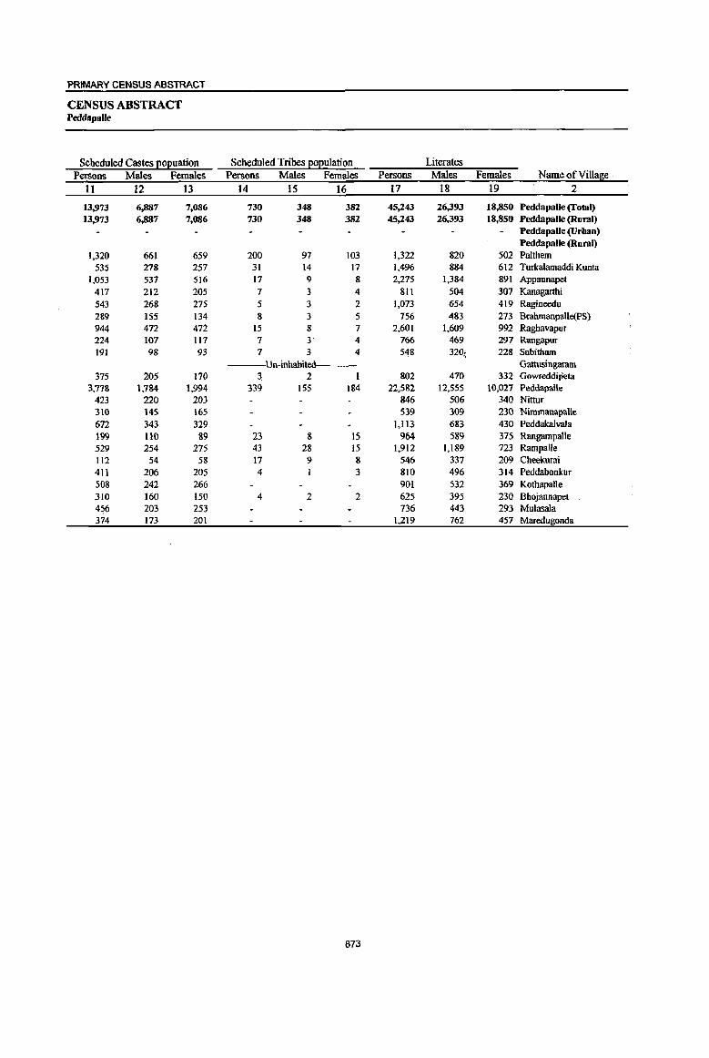
PRIMARY CENSUS ABSTRACT
CENSUS ABSTRACT Peddapalle
Scheduled Castes EOl2uation Scheduled Tribes EOEuiation Literates
Persons Males Females Persons Males Females Persons Males Females Name of Village .
11 12 13 14 15 16 17 18 19 2
13,973 6,887 7,086 730 348 382 45,243 26,393 18,850 PeddapalJe (Total) 13,973 6,887 7,086 730 348 382 45,243 26,393 18,850 Peddapalle (Rural)
PeddapaUe~rban)
Peddapalle (Rural) 1,320 661 659 200 97 103 1,322 820 502 Palthem
535 278 257 31 14 17 1.496 884 612 Turkalamaddi Kunta 1,053 537 516 17 9 8 2,275 1,384 891 Appannapet
4\7 212 205 7 3 4 81l 504 307 Kanagarthi 543 268 275 5 3 2 1,073 654 419 Ragineedu 2S9 155 134 8 3 5 756 483 273 BrahmanpaUe{PS) 944 472 472 15 8 7 2,601 1.609 992 Raghavapur 224 107 Il7 7 3 4 766 469 297 Rangapur 191 98 93 7 3 4 548 320'. 228 Sabitham
Un-inhabited Gattusingaram 375 205 170 ~ 2 802 470 332 GowreddiPeta
3,778 1.784 1.994 339 155 184 22,582 12,555 10,027 Peddapalle 423 220 203 846 506 340 Nittur 310 145 165 539 309 230 Nimmanapalle 672 343 329 1,113 683 430 Peddakalvala 199 no 89 23 8 15 964 589 375 Rangampalle 529 254 275 43 28 15 1,912 1,189 723 Rampalle 112 54 58 17 9 8 546 337 209 Cheekurai 411 206 205 4 3 810 496 314 Peddabonkur 508 242 266 901 532 369 Kothapalle 310 160 150 4 2 2 625 395 230 Bhojannapet 456 203 253 736 443 293 Mulasala 374 173 201 1,219 762 457 Maredugonda
873
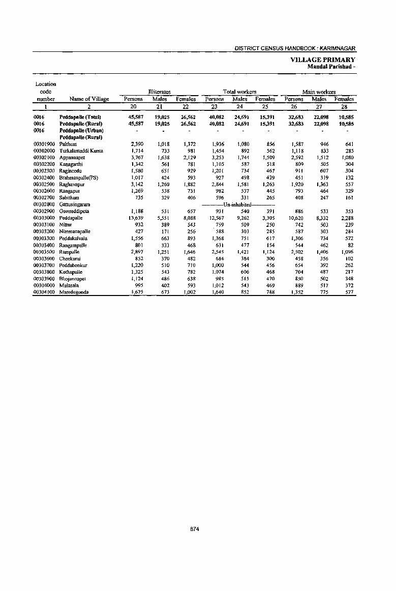
DISTRICT CENSUS HANDBOOK: KARIMNAGAR
VILLAGE PRIMARY Mandai Parishad -
Location code Dliterates Total workers Main workers
number Name of Villa~e Persons Males Females Persons Males Females Persons Males Females 2 20 21 22 23 24 25 26 27 28
0016 Peddapalle (Total) 45,587 19,025 26,562 40,082 24,691 15,391 32,683 22,098 10,585 0016 Peddapalle (Rural) 45,587 19,025 26,562 40,082 24,691 15,391 32,683 22,098 10,585 0016 Peddapalle (Urban)
Peddapalle (Rural) 00301900 Palthem 2,390 1,018 1,372 1,936 1,080 856 1.587 946 641 00302000 Turkalamaddi Kunta 1,714 733 981 1,454 892 562 1,118 833 285 00302100 Appaonapet 3,767 1,638 2,129 3,253 1,744 1,509 2,592 1,512 1,080 00302200 Kanagarthi 1,342 561 781 1,105 587 518 809 505 304 00302300 Ragineedu 1,580 651 929 1,201 734 467 911 607 304 00302400 Brahmanpalle(PS) 1,017 424 593 927 498 429 451 319 132 00302500 Raghavapur 3,142 1,260 [,882 2,844 [,581 1,263 [,920 1,363 557 00302600 Rangapur 1,269 538 731 982 537 445 793 464 329 00302700 Sabitham 735 329 406 596 33[ 265 408 247 161 00302800 Gattusingaram ------Un-inhabited----00302900 Gowreddipeta 1,188 531 657 931 540 391 886 533 353 00303000 PeddapaUe 13,639 5,551 8,088 12,567 9,262 3,305 10,620 8,332 2,288 00303100 Nittur 932 389 543 759 509 250 742 503 239 00303200 Nimmanapalle 427 171 256 588 303 285 587 303 284 00303300 Peddaka[vala 1,556 663 893 1,368 75[ 617 1,306 734 572 00303400 Rangampalle 801 333 468 631 477 154 544 462 82 00303500 Rampalle 2,897 1,251 1,646 2,545 1,421 1,124 2,502 1,406 1,096 00303600 Cheekurai 852 370 482 684 384 300 458 356 102 00303700 Peddabonkur 1,210 510 710 1,000 544 456 654 392 262 00303800 Kothapalle 1,325 543 782 1,074 606 468 704 487 217 00303900 Bhojannapet 1,124 486 638 985 515 470 850 502 348 00304000 Mulasala 995 402 593 1,012 543 469 889 517 372 00304100 Maredugonda 1-,675 673 1,002 1,640 852 788 1,352 775 577
874

PRIMARY CENSUS ABSTRACT
CENSUS ABSTRACT Peddapalle
Industrial cate~0!I of main workers Household industry
Cultivators AgriculturaJJabourers workers Other workers
Persons Males Females Persons Males. Females Persons Males Females Persons Males Females Name of Village
29 30 31 32 33 34 35 36 37 38 39 40 2
8,689 5,928 2,761 10,544 4,738 5,806 1,031 695 336 12,419 10,737 1,682 Peddapalle (Total) 8,689 5,928 2,761 10,544 4,738 5,806 1,031 695 336 12,419 10,737 1,682 Peddapalle (Rural) . Peddapalle (Urban)
Peddapalle (Rural) 791 500 291 586 286 300 28 17 11 182 143 39 Palthem 313 268 45 435 244 191 45 35 10 325 286 39 Turkalamaddi Kunta 895 550 345 922 424 498 146 75 71 629 463 166 Appannapet 486 314 172 195 78 117 17 12 5 III 1.01 10 Kanagarthi 253 165 88 316 129 187 26 19 7 316 294 22 Ragineedu 340 229 III 28 19 9 5 3 2 78 68 10 Bra1unanpalle(PS) 502 . 366 136 613 263 350 36 8 28 769 726 43 Raghavapur 324 177 147 219 72 147 9 6 3 241 209 32 Rangapur 103 57 46 165 73 92 60 42 18 80 75 5 Sabitham
---Un-inhabited Gattusingaram 192 149 43 454 176 278 8 6 2 232 202 30 Gowreddipeta
1,308 939 369 1,948 986 962 389 287 102 6,975 6,120 855 PeddapaUe 202 180 22 352 169 183 14 4 10 174 150 24 Nittur 204 119 85 316 134 182 8 4 4 59 46 13 Nimmanapalle 373 226 147 515 203 372 6 3 3 352 302 50 Peddakalvala
86 80 6 86 52 34 19 18 1 353 312 41 Rangampalle 726 440 286 1,308 599 709 16 10 6 452 357 95 Rampalle 196 138 58 44 30 14 2 2 216 186 30 Cheekurai 171 135 36 339 144 195 32 27 5 112 86 26 Peddabonkur 228 204 24 322 144 178 60 50 10 94 89 5 KothapalJe 117 87 30 491 227 264 27 11 16 215 177 38 Bhojannapet 333 222 III 387 164 223 16 3 13 153 128 25 Mulasala 546 383 163 443 122 321 62 53 9 301 217 84 Maredugonda
875

DISTRICT CENSUS HANDBOOK: KARIM NAGAR
VILLAGE PRIMARY Mandai Parisbad -
Industrial category Location
code Mar~inal workers Cultivators Agricultural labourers number NameofVill~e Persons Males Females Persons Males Females Persons Males Females
1 2 41 42 43 44 45 46 47 48 49
0016 Peddapalle (Total) 7,399 2,593 4,806 508 148 360 5,521 1,592 3,929 0016 Peddapalle (Rural) 7,399 2,593 4,806 508 148 360 5,521 1,592 3,929 0016 Peddapalle (Urban)
Peddapalle (Rural) 00301900 PaIthem 349 134 215 50 22 28 209 67 142 00302000 Turkalamaddi Kunta 336 ' 59 277 20 4 16 291 42 249 00302100 Appannapet 661 232 429 13 2 II 601 211 390 00302200 Kanagarthi 296 82 214 2 I 268 67 201 00302300 Ragineedu 290 127 163 19 5 14 212 68 144 00302400 Bmhmanpalle(PS) 476 179 297 6 3 3 442 lSI 291 00302500 Raghavapur .924 218 706 18 4 14 827 150 677 00302600 Rangapur 189 73 116 7 2 5 182 71 III
00302700 Sabitham 188 84 104 2 I I 171 74 97 00302800 Gattusingaram ------Un-inhabited---00302900 Gowreddipeta 4S 7 38 5 1 4 34 5 29 00303000 Peddapalle 1,947 930 1,017 272 79 193 993 351 642 00303100 Nittur 17 6 II 13 3 10
00303200 Nimmanapalle I I I I
00303300 Peddakalvala 62 17 45 2 50 II 39 00303400 Rangampalle 87 15 72 11 II 34 5 29 00303500 Rampalle 43 15 28 3 3 32 10 22 00303600 Cheekurai 226 28 198 21 I 20 193 17 176 00303700 Peddabonkur 346 152 194 15 6 9 303 132 171 00303800 Kothapalle 370 119 251 5 4 I 333 85 248 00303900 Bhojannapet --.05 13 122 3 3 35 8 27 00304000 Mulasala 123 26 97 19 9 10 76 14 62 00304100 Maredullionda 288 77 211 14 3 II 221 50 171
876

PRIMARY CENS!)S ABSTRACT
CENSUS ABSTRACT Peddapalle
of marfiinal workers Location
Household indus!!:l: workers Other workers Non-workers code
Persons Males Females· Persons Males Females Persons Males Females Name of Villafie number
50 51 52 53 54 55 56 57 58 2
275 103 172 1,095 750 345 50,748 20,727 30,021 Peddapalle (Total) 0016 275 103 172 1,095 750 345 50,748 20,727 30,021 Peddapalle (Rural) 0016
Peddapalle (Urban) 0016 PeddapalJe (Rural)
21 20 69 44 25 1,776 758 1,018 Palthem 00301900 3 3 22 13 9 1,756 725 1,031 Turkalamaddi Kunta 00302000
15 4 11 32 IS 17 2,789 1,278 1,511 Appannapet 00302100 10 4 6 16 10 6 1,048 478 570 Kanagarthi 00302200 I I 58 53 5 1,452 571 881 Ragineedu 00302300 3 3 25 22 3 846 409 437 Brahmanpalle(PS) 00302400 3 2 76 63 13 2,899 1,288 1,611 RaghavapuJ 00302500
1,053 470 583 Rangapur 00302600 ' 11 5 6 4 4 687 318 369 Sabitham 00302700
Un-inhabited---- Gattusingaram 00302800· 1 1 5 I 4 1,059 461 598 Gowreddipeta 00302900
88 46 42 594 454 140 23,654 8,844 14,810 PeddapaUe 00303000 3 3 1,019 386 633 Nittur 00303100 .
378 177 201 Nimmanapalle 00303200 10 5 5 1,301 595 706 Peddakalvala 00303300
24 24 18 10 8 1,134 445 689 Rangarnpalle 00303400 8 5 3 2,264 1,019 1,245 Rarnpalle 00303500
2 2 10 8 2 714 323 391 Cheekurai 00303600 21 8 13 7 6 I 1,030 462 568 PeddabonkuT 00303700 24 23 I 8 7 I 1,152 469 683 Kothapalle 00303800 18 1 17 79 4 75 764 366 398 Bbojannapet 00303900 24 23 4 2 2 719 302 417 Mulasala 00304000 6 3 3 47 21 26 1,254 583 671 Maredugonda 00304100
877
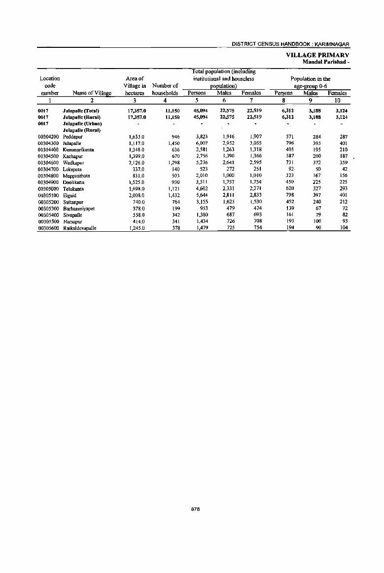
DISTRICT CENSUS HANDBOOK: KARIMNAGAR
VILLAGE PRIMARY Mandai Parishad -
Total population (including Location Area of institutional and houseless Population in the
code Village in Number of Eoeulation2 age-S!0uE 0-6 number Name of Village hectares households Persons Males Females Persons Males Females
1 2 3 4 5 6 7 8 9 10
0017 Julapalle (Total) 17,357.0 11,150 45,094 22,575 22,519 6,312 3,188 3,124 0017 Julapalle (Rural) 17,357.0 11,150 45,094 22,575 22,519 6,312 3,188 3,124 0017 Julapalle (Urban)
Julapalle (Rural) 00304200 Peddapur 1,633.0 946 3,823 1,916 1,907 571 284 287 00304300 Julapalle 1,117.0 1,450 6,007 2,952 3,055 796 395 401 00304400 Kummarikunta 1,348.0 636 2,581 1,263 1,318 405 195 210 00304500 Kachapur 1,399.0 670 2,756 1,390 1,366 387 200 187 00304600 Wadkapur 2,126.0 1,298 5,236 2,641 2,595 731 372 359 00304700 Lokapeta 337.0 140 523 272 251 92· 50 42 00304800 Muppirithota 831.0 503 2,010 1,000 1,010 323 167 156 00304900 Doolikatta 1,525.0 930 3,511 1,757 1,754 450 225 225
00305000 Telukunta 1,698.0 1,121 4,602 2,331 2,271 620 327 293
00305100 Elgaid 2,008.0 1,432 5,644 2,811 2,833 798 397 401
00305200 Sultanpuf 740.0 764 3,155 1,625 1,530 452 240 212
00305300 Burhanmiyapet 378.0 199 953 479 474 139 67 72 00305400 SivapaUe 558.0 342 1,380 687 693 161 79 82 00305500 Narsapur 414.0 341 1,434 726 708 193 100 93
00305600 Raikaldevapalle 1,245.0 378 1,479 725 754 194 90 104
878

PRIMARY CENSUS ABSTRACT
CENSUS ABSTRACT Julapalle
Scheduled Castes ~o~uation Scheduled Tribes 202ulation Literates Persons Males Females Persons Males Females Persons Males Females Name of Village
11 12 13 14 15 16 17 18 19 2
10,446 5,267 5,179 283 131 152 18,789 11,784 7,005 JulapaUe (Total) 16,446 5,267 5,179 283 131 152 18,789 11,784 7,005 Julapalle (Rural)
Jula palle (U rOOIl) Julapalle (Rural)
1,017 518 499 29 13 16 1,506 954 552 Peddapur ·931 455 476 38 15 23 2,701 1,674 1,027 Julapalle 477 234 243 6 3 3 948 591 357 Kummarilrunta 726 360 366 26 10 16 1,245 781 464 Kachapur
1,344 690 654 38 20 18 1,915 1,193 n2 Wadkllpur 34 19 15 193 113 80 Lokapeta
389 204 IS5 22 9 13 657 400 257 Muppirithota 1,298 661 637 15 9 6 1,440 945 495 Ooolikattll 1,024 523 501 29· 14 15 1,966 1,266 700 Telukunta 1,041 506 535 11 6 5 2,485 1,544 941 Eigaid
836 431 405 22 8 14 1,254 786 468 Sultanpur 215 101 1I4 514 326 188 Burhanmiy!!pet 273 158 115 9 6 3 621 377 244 Sivapruie 269 137 132 8 3 5 692 433 259 Narsapur 572 270 302 30 15 15 652 401 251 Raikaldevaprule
879

DISTRICT CENSUS HANDBOOK: KARIMNAGAR
VILLAGE PRIMARY Mandai Parisbad -
Location code illiterates Total workers Main workers
number Name ofViIla~e Persons Males Females Persons Males Females Persons Males Females 1 2 20 21 22 23 24 25 26 27 28
0017 Julapalle (fotal) 26,305 10,791 15,514 23,040 12,936 l<1,HI4 19,876 12,054 7,822 0017 Julapalle (Rural) 26,305 10,791 15,514 23,040 12,936 10,104 19,876 12,054 7,822 0017 Julapalle (Urban)
Jutapalle (Rural) 00304200 Peddapur 2,317 962 1,355 1,954 1,104 850 1,744 1,047 697 00304300 Julapalle 3,306 1,278 2,028 3,106 1,714 1,392 2,766 1,616 1,150 00304400 Kummarikunta 1,633 672 961 1,453 791 662 1,319 779 540 00304500 Kachapur 1,511 609 902 1,548 808 740 1,508 799 709 00304600 Wadkapur 3,321 1,448 1,873 2,662 1,488 1,174 2,388 1,415 973 00304700 Lckapeta 330 IS9 171 238 147 91 229 14S 84 00304800 Muppirithota 1,353 600 753 974 535 439 741 494 247 00304900 Doolikatta 2,071 812 1,259 1,640 1,003 637 1,352 900 452 00305000 Telukunta 2,636 1,065 I,S71 2,495 1,332 1,163 2,268 1,243 1,025 00305100 Eigaid 3,159 1,267 1,892 2,839 1,565 1,274 2,308 1,339 969 00305200 Sultanpur 1,901 839 1,062 1,528 918 610 944 836 108
00305300 Burhanmiyapet 439 153 286 493 271 222 372 228 144
00305400 Sivapalle 759 310 449 601 406 195 596 406 190
00305500 Narsapur 742 293 449 746 444 302 746 444 302
00305600 Raikaldeva2alle 827 324 503 763 410 353 595 363 232
880

PRIMARY CENSUS ABSTRACT
CENSUS ABSTRACT Julapalle
Industrial cate~0!1 of main workers H{)usehold industry
Cultivators Agricultural labourers workers Other workers Persons Males Females Persons Males Females Persons Males Females Persons Males Females Name of Village
29 30 31 32 33 34 35 36 .37 38 39 40 2
6,900 4,587 2.313 8,078 3,601 4,477 819 539 280 4,079 3.327 752 Julapalle (Total) 6,900 4,587 2.313 8,078 3,601 4,477 819 539 280 4,079 3,327 752 Julapalle (Rural)
Julapalle (Urban) Julapalle (Rural)
382 276 106 841 362 479 31 15 16 490 394 96 Peddapur 714 430 284 1,020 404 616 118 36 82 914 746 168 Julapalle 540 364 176 488 174 314 83 59 24 208 182 26 Kummarikunta 755 415 340 541 235 306 25 9 16 187 140 47 Kachapur 834 588 246 1,109 441 668 37 28' 9 408 358 50 Wadkapur 44 35 9 137 73 64 2 2 46 3S II LokaPeta
190 149 41 340 159 181 165 153 12 46 33 13 Muppirithota 320 249 71 646 314 332 82 80 2 304 257 41 Doolikatta 907 530 317 866 356 510 l()O 46 54 395 311 84 Telukunta 890 554 336 862 379 483 65 38 27 491 368 123 Elgaid 349 327 22 3Q6 271 35 80 54 26 209 184 25 Su1tanpur 252 154 98 69 38 31 12 6 6 39 30 9 Burhanmiyapet 188 181 7 310 145 165 1 1 97 80 17 SivapaUe 306 183 123 293 133 160 14 11 3 133 117 16 Narsapur 229 152 77 250 117 133 4 2 2 112 92 20 Raika1devapalle
881
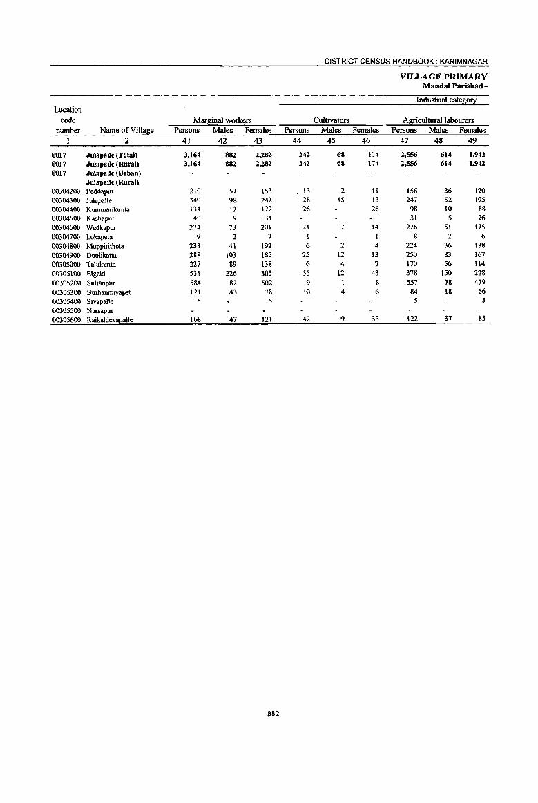
DISTRICT CENSUS HANDBOOK: KARIM NAGAR
VILLAGE PRIMARY Mandai Parishad -
Industrial cate~o~ Location
code MarSinal workers Cultivators Agricultural labourers
number Name ofVilla~e Persons Males Females Persons Males Females Persons Males Females
1 2 41 42 43 44 45 46 47 48 49
0017 Julapalle (Total) 3,164 882 2,282 242 68 174 2,556 614 1,942 0017 JulapaUe (Rural) 3,164 882 2,282 242 68 174 2,556 614 1,942 0017 Julapalle (Urban)
Julapalle (Rural) 00304200 PeddapuT 210 57 153 13 2 11 156 36 120 00304300 lulapalle 340 98 242 28 15 13 247 52 195
00304400 Kummarikunta 134 12 122 26 26 98 10 88 00304500 Kachapur 40 9 31 31 5 26 00304600 Wadkapur 274 73 201 21 7 14 226 51 175 00304700 Lokapeta 9 2 7 1 1 8 2 6 00304800 Muppiritho1a 233 41 192 6 2 4 224 36 188 00304900 Doolikatta 288 103 185 25 12 B 250 83 167 00305000 Telukunta 227 &9 13& 6 4 2 170 56 114 00305100 E\gaid 53\ 226 305 5S 12 43 378 150 228 00305200 Sultanpur 584 82 502 9 1 8 557 78 479 00305300 Burhanmiyapet 121 43 78 to 4 6 84 18 66
00305400 Sivapalle S 5 5 5
00305500 Narsapur 00305600 RaikaldevaEalle 168 47 \21 42 9 33 122 37 &5
882

PRIMARY CENSUS' ABSTRACT
CENSUS ABSTRACT JulapaUe
of marsinal workers Location
Household industry workers Other workers Non-workers code Persons . Males Females Persons Males Females Persons Males Females Name of Village number
50 51 52 53 54 55 56 57 58 2 I
90 17 73 276 183 93 22,054 9,639 12,415 Julapalle (Total) 0017 90 17 73 276 183 93 22,054 9,639 12,415 Julapalle (Rural) 0017
Julapalle (Urban) 0017 Julapalle (Rural)
17 2 15 24 17 7 1,869 812 1,057 Peddapur 00304200 24 2 22 41 29 12 2,901 1,238 1,663 Julapalle 00304300 4 1 3 6 I 5 1,128 472 656 Kummarikunta 00304400 6 5 3 3 1,208 582 626 Kacbapur 00304500 I 26 15 II 2,574 1,153 tA21 Wadkapur 00304600
285 125 160 Lokapeta 00304700 3 3 1,036 465 571 Muppiritbota 00304800 I 12 7 5 1,871 754 1,117 Doolikatta 00304900 2 2 49 29 20 2,107 999 1,108 Telukunta 00305000
15 6 9 83 58 25 2,805 1,246 1,559 Elgaid 00305100 14 13 4 2 2 1,627 707 920 Sultanpur 00305200
26 21 5 460 208 252 Burhanmiyapet 00305300 779 281 498 SivapaUe 00305400 688 282 406 Narsapur 00305500
2 2 2 716 315 401 Raikaldevapalle 00305600
883
DISTRICT CENSUS HANDBOOK: KARIMNAGAR
VILLAGE PRIMARY Mandai Parishad -
Total population (including Location Area of institutional and houseless Population in the
code Village in Nwnberof ~o~ulationl al:lie-&!:ou~ 0-6 number Name ofVilla~e hectares households Persons Males Females Persons Males Females
I 2 3 4 5 6 7 8 9 10
0018 Dharmaram (Total) 20,200.0 12,357 49,636 24,590 25,046 ·7,101 3,612 3,489 0018 Dhannaram (Rural) 20,200.0 12,357 49,636 24,590 25,046 7,101 3,612 3,489 0018 Dharmaram (Urban)
Dharmaram (Rural) 00305700 Narsingapur 695.0 469 1,742 860 882 218 109 109 00305800 Pathipaka 1,687.0 694 2,614 1,334 1,280 322 168 154 00305900 Bommareddipalle 3,463.0 2,083 8,749 4,380 4,369 1,275 651 624 00306000 Myadaram 1,819.0 1,772 6,992 3,500 3,492 901 460 441 00306100 Sayarnpeta 751.0 233 814 408 406 139 12 67
00306200 Khanampalle 794.0 282 1,047 506 541 143 68 75 00306300 Paidichinthala Palle 471.0 225 888 450 438 121 60 61 00306400 Rachapalle 390.0 720 2,680 1,325 1,355 394 211 183 00306500 Dongathurthy 856.0 741 3,022 1,538 1,484 434 219 215 00306600 Botlavanaparthy 1,092.0 755 3,035 1,513 1,522 473 244 229 00306700 Khilavanaparthy 1,652.0 561 2,229 1,106 1,123 344 178 166
00306800 Chamanpalle 661.0 412 1,611 788 823 247 131 116
00306900 Kothur 1,436.0 707 2,870 1,424 1,446 413 206 207
00307000 Katkanpalle 1,641.0 1,184 4,779 2,408 2,311 788 394 394
00307100 Mallapur 1,132.0 453 2,391 925 1,466 291 126 165
00307200 Kammarikhanpeta 1,111.0 529 2,016 1,028 988 265 139 126
00307300 Abba2uram 549.0 537 2,157 1,097 1,060 333 176 157
884

PRIMARY CENSUS ABSTRACT
CENSUS ABSTRACT Dbarmaram
Scheduled Castes EOEuation Scheduled Tribes EOEulation Literates Persons Males Females Persons Males Females Persons Males Females Name of Village
II 12 13 14 15 16 17 18 19 2
10,432 5,050 5,382 2,755 1,406 1,349 18,443 11,311 7,132 Dharmaram (Total) 10,432 5,050 5,382 2,155 1,406 1,349 18,443 11,311 7,132 Dharmaram (Ru"'!)
Dharmaram (Urban) Dharmaram (Rural)
315 153 162 42 16 26 619 393 226 Narsingapur 608 328 280 133 69 64 902 587 315 Pathipaka
1,577 800 777 762 384 378 3,428 2,127 1,301 Bommareddipalle 1,638 825 813 52 26 26 2,647 1,731 916 Myadaram
249 129 120 325 196 129 Sayampeta 130 76 54 296 182 114 Khanampalle 239 117 122 9 5 4 318 217 101 Paidichintbala Palle' 442 219 223 1,005 607 398 Rachapalle 566 273 293 9 5 4 1,138 752 386 Dongathurthy 476 243 233 29 15 14 958 611 347 Botlavanaparthy 318 163 155 10 5 5 749 461 288 Kbilavanaparthy 573 273 300 10 4 6 544 326 218 Chamanpalle 484 243 241 321 168 153 1,057 628 429 Kothur 614 308 306 955 505 450 1,584 1,031 553 Katkanpalle
1,488 525 963 27 I 26 1,183 409 774 Mallapur 431 221 210 392 201 191 867 538 329 Kammarikhanpeta 284 154 130 4 2 2 823 515 308 Abbapuram
885
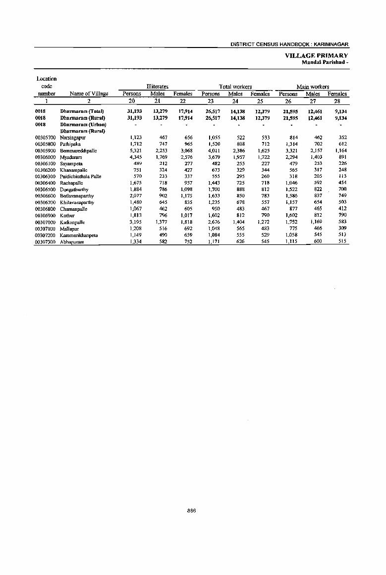
DISTRICT CENSUS HANDBOOK: KARIMNAGAR
VILLAGE PRIMARY Mandai Parishad -
Wcation code Illiterates Total workers Main workers
number Name of Village Persons Males Females Persons Males Females Persons Males Females 1 2 20 21 22 23 24 25 26 27 28
0018 Dharmaram (Total) 31,193 13,279 17,914 26,517 14,138 12,379 21,595 12,461 9,134 0018 Dharmaram (Rural) 31,193 13,279 17,914 26,517 14,138 12,379 21,595 12,461 9,134 0018 Dharmaram (Urban)
Dharmaram (Rural) 00305700 Narsingapur 1,123 467 656 1,055 522 533 814 462 352 00305800 PatlJipaka 1,712 747 965 1,520 808 712 1,314 702 612 00305900 Bommareddipalle 5,321 2,253 3,068 4,011 2,386 1,625 3,321 2,157 1,164 00306000 Myadararn 4,345 1,769 2,576 3,679 1,957 1,722 2,294 1,403 891 00306100 Sayampeta 489 212 277 482 255 227 479 253 226 00306200 Khanampalle 751 324 427 673 329 344 565 317 248 00306300 Paidichinthala Palle 570 233 337 555 295 260 318 205 113 00306400 Rachapalle 1,675 718 957 1,443 725 718 1,046 592 454
00306500 Dongathurthy 1,884 786 1,098 1,700 888 812 1,522 822 700 00306600 Botlavanaparthy 2,077 902 1,175 1,633 850 783 1,586 837 749
00306700 Khilavanaparthy 1,480 645 835 1,235 678 557 1,157 654 503
00306800 Chamanpalle 1,067 462 605 950 483 467 877 465 412
00306900 Kothur 1,813 796 1,017 1,602 812 790 1,602 812 790
00307000 Katkanpalle 3,195 1,377 1,818 2,676 1,404 1,272 1,752 1,169 583
00307100 Mallapur 1,208 516 692 1,048 565 483 775 466 309
00307200 Karnmarikhanpeta 1,149 490 659 1,084 555 529 1,058 545 513
00307300 Abbapuram 1,334 582 752 1,171 626 545 1,1 IS 600 515
886

PRIMARY CENSUS ABSTRACT
CENSUS ABSTRACT Dharmaram
Industrial cate~o!y of main workers
Household industry
Cultivators Agricu1tura1la~>ourers workers Other workers Persons Males Females Persons Males Females Persons Males Females Persons Males Females Name of Village
29 30 31 32 33 34 35 36 37 38 39 40 2
7,141 4,606 2,535 9,146 3,917 5,229 857 457 400 4,451 3,481 970 Dharmaram (fotal) 7,141 4,606 2,535 9,146 3,917 5,229 857 457 400 4,451 3,481 970 Dhannaram (Rural)
Dhannaram (Urban) Dhannaram (Rural)
237 163 74 422 179 243 28 24 4 127 96 31 Narsingapur 455 253 202 497 234 263 107 35 72 255 180 75 Pathipaka 802 608 194 824 327 497 125 63 62 1,570 1,159 41l Bommareddipalle 727 500 227 897 396 501 138 69 69 532 438 94 Myadaram 183 128 SS 212 62 150 13 6 7 71 57 14 Sayampeta 141 117 24 270 59 211 33 27 6 121 114 7 Khanampalle 165· 102 63 66 29 37 9 7 2 78 67 II Paidichinthala Palle 359 233 126 398 123 275 51 45 6 238 191 47 Rachapalle 486 274 212 853 399 454 4 1 3 179 148 31 Dongathurthy 535 331 204 741 280 461 49 25 24 261 201 60 Botlavanaparthy 299 200 99 608 2S6 352 32 20 12 218 178 40 Khilavanaparthy 233 136 97 524 245 279 66 35 31 54 49 5 Chamanpalle 442 225 217 988 481 507 81 41 40 91 65 26 Kothur
1,024 708 316 412 213 199 70 37 33 246 211 35 Katkanpalle 243 171 72 405 208 197 14 6 8 113 81 32 MaUapur 360 198 162 587 253 334 11 5 6 100 89 II Kammarikhanpeta 450 259 191 442 173 269 26 11 15 197 157 40 Abbapuram
887
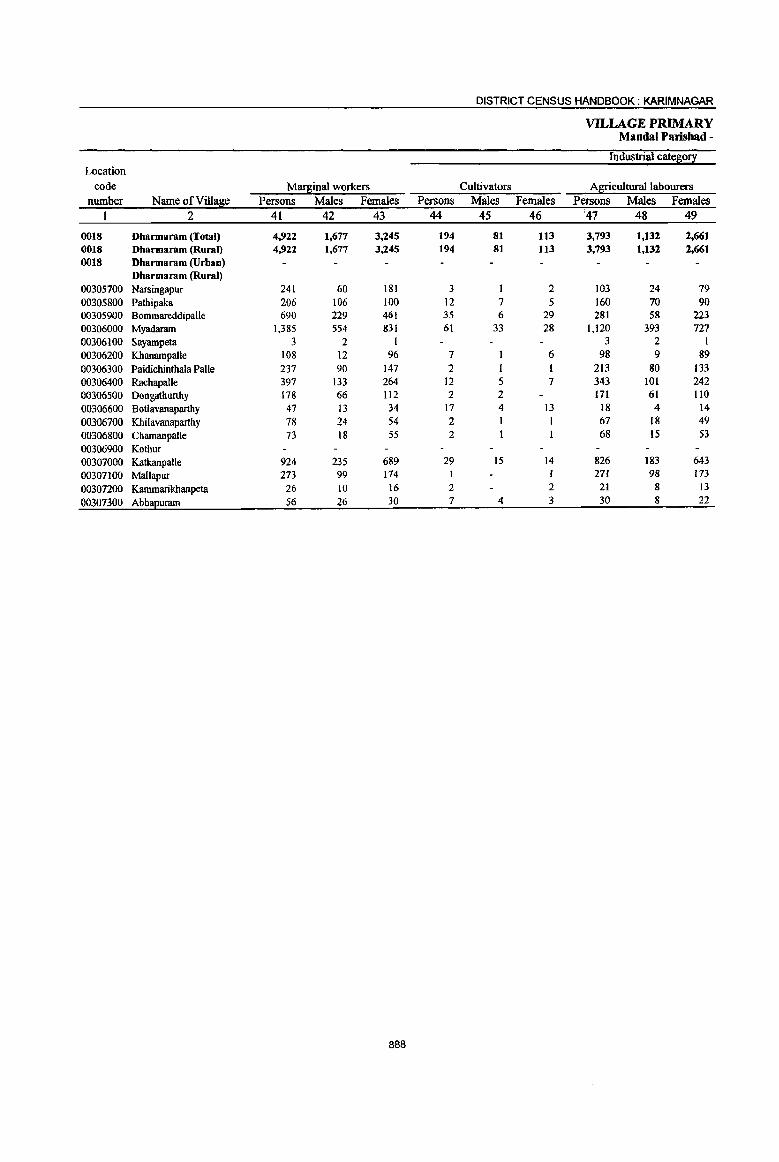
DISTRICT CENSUS HANDBOOK: KARIM NAGAR
VILLAGE PRIMARY Mandai Parishad -
Industrial cate~o!! Location
code Mart."\inal workers Cultivators Agricultural labourers number Name of Village Persons Males Females Persons Males Females Persons Males Females
I 2 41 42 43 44 45 46 '47 48 49
0018 Dharmaram (Total) 4,922 1,677 3,245 194 81 113 3,793 1,132 2,661 0018 Dharmaram (Rural) 4,922 1,677 3,245 194 81 113 3,793 1,132 2,661 0018 Dharmaram (Urban)
Dharmaram (Rural) 00305700 Narsingapur 241 60 181 3 I 2 103 24 79 00305800 Pathipaka 206 106 100 12 7 5 160 70 90 00305900 Bommareddipalle 690 229 461 35 6 29 281 58 223 00306000 Myadaram 1.385 554 831 61 33 28 1.120 393 727 00306100 Sayampeta 3 2 I 3 2 I 00306200 Khanampalle 108 12 96 7 6 98 9 89 00306300 Paidichinthala Palle 237 90 147 2 213 80 133 00306400 Rachapalle 397 133 264 12 5 7 343 101 242 00306500 Dongathunhy 178 66 Il2 2 2 171 61 IlO 00306600 Botlavanaparthy 47 13 34 17 4 13 18 4 14 00306700 Khilavanaparthy 78 24 54 2 I I 67 18 49 00306800 ChamanpaUe 73 18 55 2 68 15 53 00306900 Kothur 00307000 Katkanpalle 924 235 689 29 15 14 826 183 643 00307100 Mallapur 273 99 174 I 271 98 173 00307200 Kammarikbanpeta 26 10 16 2 2 21 8 13 00307300 AbbaEuram 56 26 30 7 4 3 30 8 22
888

PRIMARY CENSUS ABSTRACT
CENSUS ABSTRACT Dharmaram
of marginal workers Location
Household industry workers Other workers Non-workers code Persons Males Females Persons Males Females Persons Males Females Name ofVilla~e nwnber
50 51 52 53 54 55 56 57 58 2
239 , 49 190 696 415 281 23,119 10,452 12,667 Dharmaram (Total) 0018 239 49 190 696 415 281 23,119 10,452 12,667 Dharmaram (Rural) 0018
Dharmaram (Urban) 0018 Dharmaram (Rural)
96 8 88 39 27 12 687 338 349 Narsingapur 00305700 3 3 31 26 5 1,094 526 568 Pathipaka 00305800
54 4 50 320 161 159 4,738 1,994 2,744 Bonunareddipalle 00305900 58 25 33 146 103 43 3,313 1,543 1,770 Myadaram 00306000
332 153 179 Sayampeta 00306100 2 I 1 I 374 177 197 Khanampalle 00306200 2 2 20 9 II 333 155 178 Paidichinthala Palle 00306300
41 27 14 1,237 600 637 Rachapalle 00306400 5 3 2 1,322 650 672 Dongathurthy 00306500
5 4 7 4 3 1,402 663 739 Bodavanapartby 00306600 9 5 4 994 428 566 Khilavanapartby 00306700
2 1 661 305 356 Chamanpalle 00306800 1,268 612 656 Kothur 00306900
16 6 10 53 31 22 2,103 1,004 1,099 Katkanpalle 00307000 1 I 1,343 360 983 Mallapur 00307100 3 2 932 473 459 Kammarikhanpeta 00307200
19 14 5 986 471 515 Abb!!2uram 00307300
889
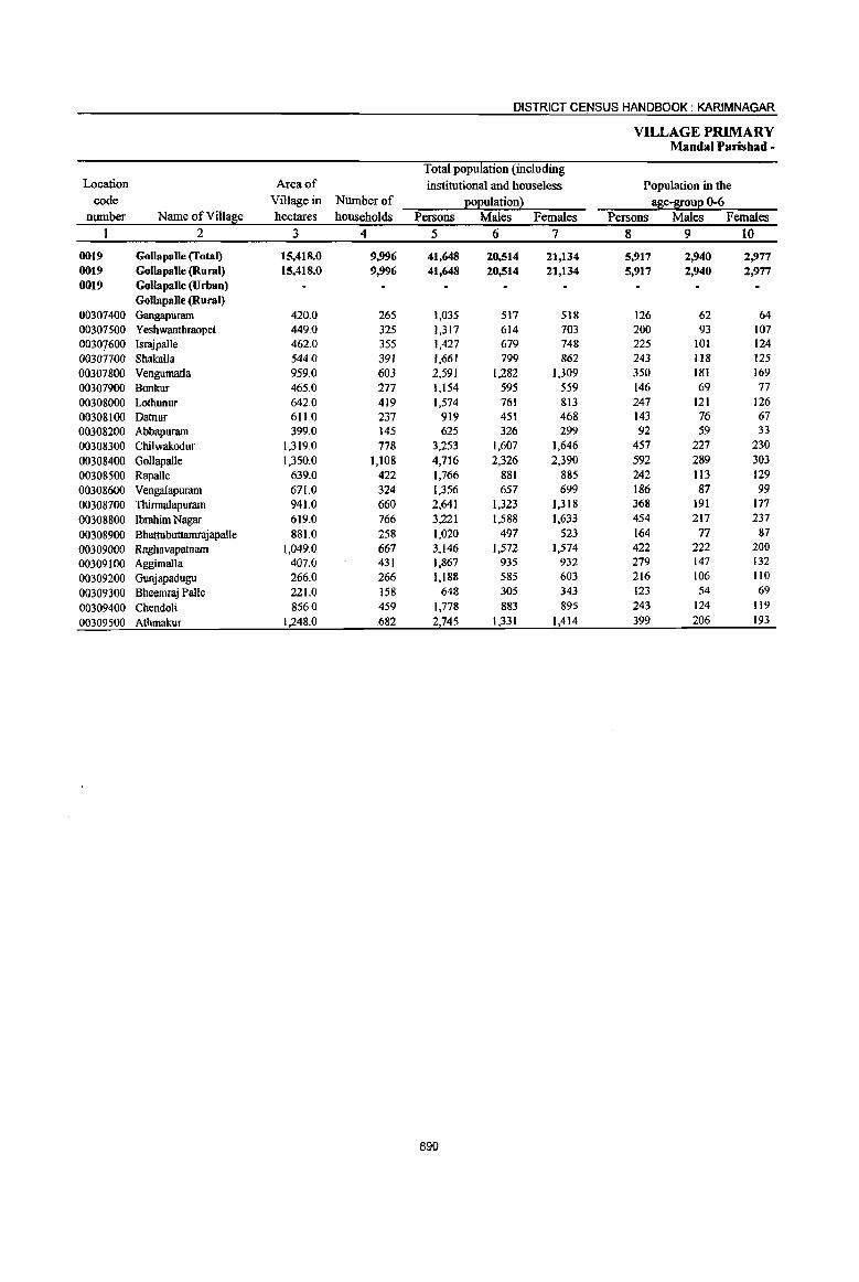
DISTRICT CENSUS HANDBOOK: KARIMNAGAR
VILLAGE PRIMARY Mandai Parishad-
Total popUlation (including Location Area of institutional and houseless Population in the
code Village in Number of EOEulation~ ~e-l[ouE 0-6 number Name ofViIlas:e hectares households Persons Males Females Persons Males Females
1 2 3 4 5 6 7 8 9 10
0019 Gollapalle (Total) 15,418.0 9,996 41,648 20,514 21,134 5,917 2,940 2,977 0019 Gollapalle (Rural) 15,418.0 9,996 41,648 20,514 21,134 5,917 2,940 2,977 0019 GQllapaUe (Urban)
Gollapalle (Rural) 00307400 Gangapuram 420.0 265 1,035 517 518 126 62 64 00307500 Yeshwanthraopet 449.0 325 1,317 614 703 200 93 107 00307600 IsrajpalJe 462.0 355 1,427 679 748 225 101 124 003077()0 Shaka1la 544.0 391 1,661 799 862 243 118 125 00307800 Vengumatla 959.0 603 2,591 1,282 1,309 350 181 169 00307900 Bonkur 465.0 277 1,154 595 559 146 69 77 00308000 Lothunur 642.0 419 1,574 761 813 247 121 126 00308100 Datnur 611.0 237 919 451 468 143 76 67 00308200 Abbapuram 399.0 145 625 326 299 92 59 33 00308300 Chilwakodur 1,319.0 778 3,253 1,607 1,646 457 227 230 00308400 Gollapalle 1,350.0 1,108 4,716 2,326 2,390 592 289 303 00308500 Rapalle 639.0 422 1,766 881 885 242 113 129 00308600 Vengalapuram 671.0 324 1,356 657 699 186 87 99
00308700 Thirmalapuram 941.0 660 2,641 1,323 1,318 ;368 191 177 00308800 Ibrahim Nagar 619.0 766 3,221 1,588 1,633 454 217 237 00308900 Bhattubuttamrajapalle 881.0 258 1,020 497 523 164 77 87 00309000 Raghavapatnam 1,049.0 667 3,146 1,572 1,574 422 222 200 00309100 Aggimalla 407.0 431 1,867 935 932 279 147 132 00309200 Gunjapadugu 266.0 266 1,188 585 603 216 106 110 00309300 Bheemraj Palle 221.0 158 648 305 343 123 54 69
00309400 Chendoli 856.0 459 1,778 883 895 243 124 119
00309500 Athmakur 1,248.0 682 2,745 1,331 1,414 399 206 193
890

PRIMARY CENSUS ABSTRACT
CENSUS ABSTRACT Gollapalle
Scheduled Castes Eoeuation Scheduled Tribes Eoeulation Literates Persons Males Females ,Persons Males Females Persons Males Females Name of Village
II 12 13 14 15 16 17 18 19 2
8,738 4,308 4,430 311 147 164 15,415 9,961 5,454 GollapaDe (Total)
8,738 4,308 4,430 311 147 164 15,415 9,961 5,454 GoUapalle (Rural) Gollapalle (Urban) Gollapalle (Rural)
159 84 75 331 220 111 Gangapuram 393 188 205 588 375 213 Yesbwanthraopet 424 205 219 11 4 7 446 286 160 Israjpalle
707 354 353 20 7 13 604 389 215 Shakalla 422 199 223 889 567 322 Vengumatla
265 147 118 I 1 499 327 172 Bonkur
550 282 268 5 3 2 688 440 248 Lothunur 208 109 99 6 4 2 350 231 119 Datnur 122 64 58 206 139 67 Abbapuram 594 291 303 14 7 7 1,325 832 493 Chilwakodur 735 355 380 2,079 1,276 803 Gollapalle 445 206 239 4 2 2 724 464 260 Rapalle 459 213 246 435 303 132 Vengalapuram 532 279 253 7 2 5 801 541 260 Thirmalapuram 623 311 312 51 23 28 1,183 793 390 Ibrahim Nagar 176 85 91 164 81 83 321 209 112 Bhattubuttamrajapalle 394 199 195 5 3 2 1,387 905 482 Raghavapatnam 250 117 133 622 405 217 Aggimalla 448 224 224 366 250 116 Gunjapadugu 154 72 82 274 167 107 'Bheemraj Palle 276 134 142 3 2 1 644 418 226 Chendoli 402 190 212 20 8 12 653 424 229 Athmakur
891

DISTRICT CENSUS HANDBOOK: KARIMNAGAR
VILLAGE PRIMARY Mandai Parishad •
Location code Illiterates Total workers Main workers
number Name of Villa~e Persons Males Females Persons Males Females Persons Males Females 1 2 20 21 22 23 24 25 26 27 28
0019 Gollapalle (Total) 26,233 10,553 15,680 24,268 12,223 12,045 21,401 11,382 10,019 0019 Gollapalle (Rural) 26,233 10,553 15,680 24,268 12,223 12,045 21,401 1l,382 10,019 0019 Gollapalle (Urban)
Gollapalle (Rural) 00307400 Gangapuram 704 297 407 655 327 328 586 325 261 00307500 Yeshwanthraopet 729 239 490 746 349 397 524 269 255 00307600 Israjpalle 981 393 588 862 423 439 850 421 429 00307700 Shakalla 1,057 410 647 920 465 455 811 436 375 00307800 Vengumatla 1,702 715 987 1,564 797 767 1,454 767 687 00307900 Bonkuc 655 268 387 612 327 285 611 327 284 00308000 Lothunur 886 321 565 910 442 468 878 427 451 00308100 Datnur 569 220 349 491 246 245 489 246 243 00308200 Abbapuram 419 187 232 363 185 178 362 185 177
00308300 Chilwakodur 1,928 775 1,153 1,883 981 902 1,639 880 759 00308400 GoUapalle 2,637 1,050 1,587 2,543 1,346 1,197 2,303 1,262 1,041 00308500 Rapalle 1,042 417 625 1,025 534 491 1,025 534 491 00308600 Vengalapuram 921 354 567 920 446 474 734 371 363 00308700 Thinnalapuram 1,840 782 1,058 1,555 776 779 1,383 696 687 00308800 Ibrahim Nagar 2,038 795 1,243 1,914 968 946 1,810 922 888 00308900 Bhattubuttamrajapalle 699 288 411 568 288 180 567 288 279 00309000 Raghavapatnam 1,759 667 1,092 2,009 1,009 1,000 1,003 831 172 00309100 Aggimalla 1,245 530 715 1,130 564 566 916 463 453 00309100 Gunjapadugu 822 335 487 602 312 290 491 301 190 00309300 Bheemraj Palle 374 138 236 370 168 202 362 164 198 00309400 Chendoli 1,134 465 669 989 486 503 971 484 487 00309500 Athmakur 2,092 907 1,185 1,637 784 853 1,632 783 849
892
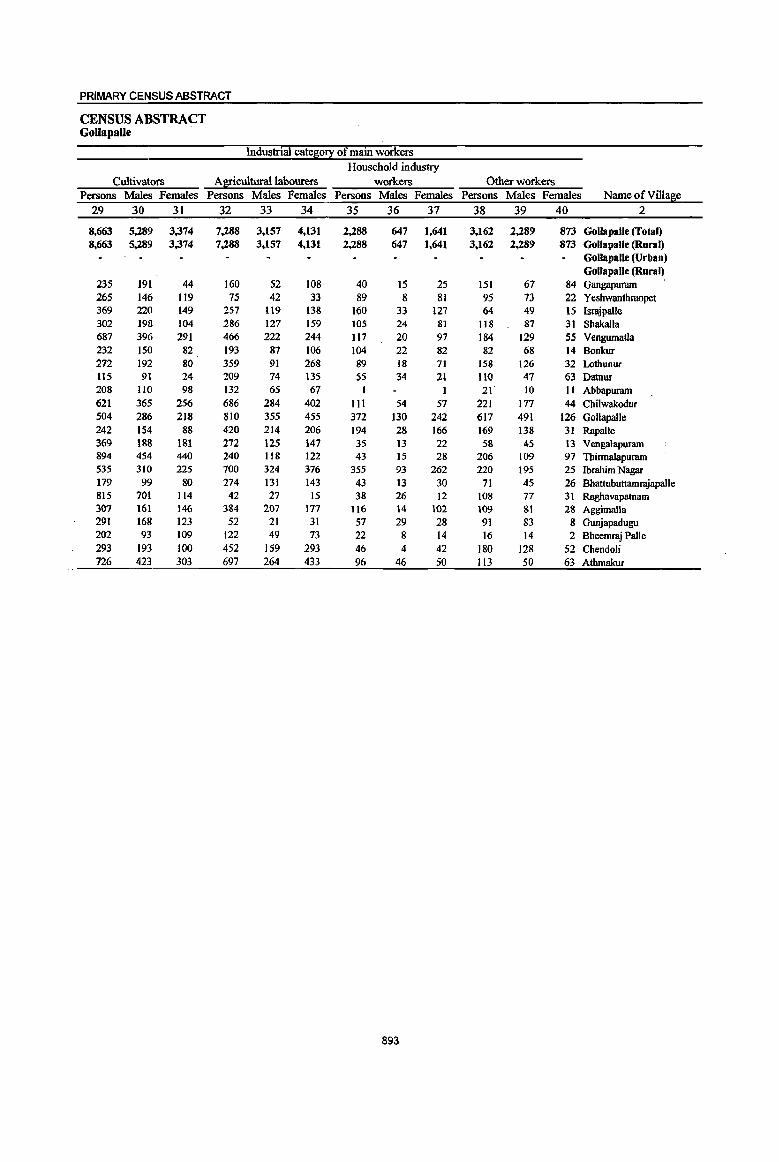
PRIMARY CENSUS ABSTRACT
CENSUS ABSTRACT Gollapalle
IndUlltrial cate,&o!l: of main workers Household industry
Cultivators Agricultural labourers workers Other workers Persons Males Females Persons Males Females Persons Males Females Persons Males Females Name of Village
29 30 31 32 33 34 35 36 37 38 39 40 2
8,663 5,289 3,374 7,288 3,157 4,131 2,288 647 1,641 3,162 2,289 873 Gollapalle (rotal) 8,663 5,289 3,374 7,288 3,157 4,131 2,288 647 1,641 3,162 2,289 873 Gollapalle (Rural)
Gollapalle (Urban) GollapaJle (Rural)
235 191 44 160 52 108 40 15 25 151 67 84 Gangapuram 265 146 119 75 42 33 89 8 81 95 73 22 Yeshwanthraopet 369 220 149 257 119 138 160 33 127 <i4 49 IS Israjpalle 302 198 104 286 127 159 105 24 81 118 87 31 Shakalla 687 396 291 466 222 244 117 20 97 184 129 55 Vengumatla 232 150 82 193 87 106 104 22 82 82 68 14 Bonkur 272 192 80 359 91 268 89 18 71 158 126 32 Lothunur 1t5 91 24 209 14 135 55 34 21 110 41 63 Datnur 208 no 98 132 65 67 1 21 10 II Abbapuram 621 365 256 686 284 402 111 54 57 221 177 44 Chilwakodur 504 286 218 810 355 455 372 130 242 617 491 126 Gollapalle 242 154 88 420 214 206 194 28 166 169 138 31 Rapalle 369 188 181 272 125 147 35 13 22 58 45 13 Vengalapuram 894 454 440 240 1I8 122 43 15 28 206 109 97 ThirmaJapuram 535 310 225 700 324 376 355 93 262 220 195 25 Ibrahim Nagar 179 99 80 274 131 143 43 13 30 71 45 26 Bhattubuttamrajapalle 815 701 114 42 27 15 38 26 12 108 77 31 Raghavapatnam 307 161 146 384 207 177 116 14 102 109 81 28 Aggimalla 291 168 123 52 21 31 57 29 28 91 83 8 Gunjapadugu 202 93 109 122 49 73 22 8 14 16 14 2 Bheemraj Palle 293 193 100 452 159 293 46 4 42 180 128 52 Chendoli 726 423 303 697 264 433 96 46 50 113 50 63 Athmakur
893

DISTRICT CENSUS HJt.NDBOOK : KARIMNAGAR
VILLAGE PRIMARY Mandai Parisbad -
Industrial cate~0!i: Location
code Marginal workers Cultivators Ai2:!cultura11abourers number Name ofVi11a~e Persons Males Females Persons Males Females Persons Males Females
I 2 41 42 43 44 45 46 47 48 49
0019 Gollapalle (rota I) 2,867 841 2,026 120 49 71 2,143 598 1,545 0019 Gollapalle (Rural) 2,867 841 2,026 120 49 71 2,143 598 1,545 0019 Gollapalle (Urban)
GolJapalJe (Rural) 00307400 Gangapuram 69 2 67 2 I 00307500 Yeshwanthraopet 222 80 142 3 3 150 61 89 00307600 lsrajpalle 12 2 10 II 2 9 00307100 Shakalla 109 29 80 3 2 1 91 22 69 00307800 Vengumatla 110 30 80 21 4 17 69 17 52 00307900 Bonkur 00308000 Lothunur 32 15 17 7 5 2 14 4 10 00308100 Datnur 2 2 2 2 00308200 Abbapuram I I
00308300 Chilwakodur 244 101 143 5 3 2 230 97 133 00308400 Gollapalle 240 84 156 7 2 5 126 41 85 00308500 RapaIle 00308600 Vengalapuram 186 75 111 26 15 It 114 42 72
00308700 Thirrnalapuram 172 80 92 3 I 2 128 63 65 00308800 Ibrahim Nagar 104 46 58 8 5 3 53 22 31 00308900 Bhattubuttamrajapalle 1 1 1 1 00309000 Raghavapatnarn 1,006 178 828 27 9 18 893 141 752 00309100 Aggimalla 214 101 113 4 4 138 74 64
00309200 Gunjapadugu III 11 100 107 10 97 00309300 Bheemraj Palle 8 4 4 2 4 2 2
00309400 Chendoli 18 2 16 2 6 6
00309500 Athmakur 5 I 4 4 4
894
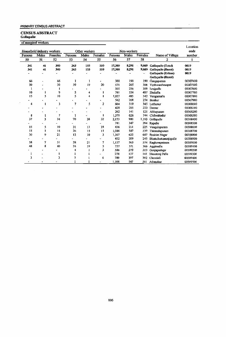
PRIMARY CENSUS ABSTRACT
CENSUS ABSTRACT GoUapalle
of marginal workers
Location
Household industry workers Other workers Non-workers code
Persons Males Females Persons Males Females Persons Males Females Name ofVilla~e number
50 51 . 52 53 54 55 56 57 58 2 I
341 41 300 263 153 110 17.380 8,291 9,089 GollapaUe (Total) 0019 341 41 300 263 153 110 17.380 8,291 9,089 GollapalJe (Rural) 0019
GollapalJe (Urban) 0019 GoIlapalle (Rural)
00307400 66 66 380 190 190 Gangapuram 30 30 39 19 20 571 265 306 Yeshwanthraopet 00307500
1 1 565 256 309 Israjpalle 00307600 10 1 9 5 4 741 334 407 Shakalla 00307700 15 5 10 5 4 1.027 485 542 Vengumatla 00307800
542 268 274 Bonkur 00307900 4 3 7 5 2 664 319 345 Lothunur 00308000
428 205 223 Datnur 00308100 262 141 121 Abbapuram 00308200
8 1 7 1,370 626 744 Chilwakodur 00308300 37 3 34 70 38 32 2,173 980 1,193 Gollapalle 00308400
741 347 394 RapaUe 00308500 15 5 10 31 13 18 436 211 225 Vengalapuram 00308600 15 1 14 26 15 11 1,086 547 539 Thinnalapuram 00308700 30 9 21 13 10 3 1,307 620 687 Ibrahim Nagar 00308800
452 209 243 Bhattubuttamrajapalle 00308900 58 7 51 28 21 7 1,137 563 574 Raghavapatnam 00309000 48 8 40 24 19 5 737 371 366 Aggimalla 00309100
4 1 3 586 273 313 Gunjapadugu 00309200 I 1 278 137 141 Bheemraj Palle 00309300 3 3 7 6 789 397 392 Chendoli 00309400
1,108 547 561 Athmakur 00309500
895

DISTRICT CENSUS HANDBOOK: KARIMNAGAR
VILLAGE PRIMARY Mandai Parishad -
Total population (including
Location Area of institutional and houseless Population in the
code Village in Number of £o£ulation ~ a~e-I[ou£ 0-6 number Name ofVill~e hectares households Persons Males Females Persons Males Females
I 2 3 4 5 6 7 8 9 10
0020 Mallial (Total) 16,687.0 10,660 45,244 21,952 23,292 5,999 3,048 2,951 0020 Mamal (Rural) 16,687.0 10,660 45,244 21,952 23,292 5,999 3,048 2,951 0020 Mallial (Urban)
Mallial (Rural) 00309600 Rampur 709.0 514 2,198 1,085 1,113 316 162 154
00309700 Obulapur 1,248.0 407 1,669 757 912 231 Il2 119 00309800 Gorregundam 1,061.0 86 338 160 178 47 20 27 00309900 Maddutla 1,150.0 566 2,333 1,160 1,173 289 148 141 00310000 Potharam 818.0 786 3,063 1,525 1,538 409 225 184 00310100 Rajaram 2,129.0 411 1,515 756 759 274 130 144
00310200 Nookapalle 1,432.0 980 3,953 1,912 2,041 483 257 226
00310300 Mallial 1,954.0 2,569 Il,684 5,719 5,965 1,506 766 740
00310400 Manala 1,017.0 473 1,860 885 975 266 137 129
00310500 Myadampal1e 627.0 488 2,037 997 1,040 263 131 132
00310600 Thakkallapalle 996.0 998 4,262 2,101 2,161 592 325 267
00310700 TbatipaUe 1,085.0 686 3,003 1,258 1,745 375 174 201
00310800 Sarvapur 653.0 310 1,437 713 724 195 91 104
00310900 Muthyampeta 966.0 943 3,895 1,903 1,992 452 226 226
00311000 BalwanthaEur 842.0 443 1,997 1,021 976 301 144 157
896

PRIMARY CENSUS ABSTRACT
CENSUS ABSTRACT Mallial
Scheduled Castes 20Euation Scheduled Tnl>es EOEulation Literates Persons Males Females Persons Males Females Persons Males Females Name of Village
11 12 13 14 15 16 17 18 19 2
9,OSO 4,456 4,594 176 80 96 18,287 11,222 7,065 Mallial (fotal) 9,050 4,456 4,594 176 80 96 ' 18,287 11,222 7,065 Mallial (Rural)
Mallial (Urban) MaDial (Rural)
377 194 183 5 2 3 767 488 279 Rampur 349 164 185 5 2 3 619 354 265 Obulapur 106 50 56 2 I I 118 72 46 Gorregundam 301 155 146 5 2 3 799 505 294 Maddutla 723 367 356 10 5 5 1,089 711 37& Pothlllllltl
80 37 43 363 256 107 Rajaram 1,049 511 538 27 10 17 1,569 964 60S Nookapalle 1,566 791 775 29 18 11 5,654 3,457 2,197 Mallial
656 341 315 2 599 376 223 Manala 507 242 265 716 451 265 Myadampalle
1,134 553 581 42 21 21 1,554, 1,008 546 Thakkallapalle 711 293 418 14 I 13 1,397 678 719 Thatipalle 381 191 190 25 12 13 546 344 202 Sarvapur 790 394 396 10 5 5 1,799 1,092 707 Muthyampeta 320 173 147 698 466 232 Balwanthapur
897

DISTRICT CENSUS HANDBOOK: KARIMNAGAR
VILLAGE PRIMARY Mandai Parishad -
Location code filiterates Total workers Main workers
number Name ofViUage Persons Males Females Persons Males Females Persons Males Females 1 2 20 21 22 23 24 25 26 27 28
0020 Mallial (Total) 26,957 10,730 16,227 27,415 13,425 13,990 22,508 11,632 10,876 0020 Mallial (Rural) 26,957 10,730 16,227 27,415 13,425 13,990 22,508 11,632 10,876 0020 Mallial (Urban)
Mallial (Rural) 00309600 Rampur 1,431 597 834 1,318 653 665 1,281 642 639 00309700 Obulapur 1,050 403 647 (,032 463 569 945 42( 524
00309800 Gorregundam 220 88 132 217 101 116 199 91 108
00309900 Maddutla 1,534 655 879 1,564 782 782 1,456 727 729 00310000 Potharam 1,974 814 1,160 1,952 952 1,000 1,779 870 909 00310100 R~aram 1,152 500 652 889 462 427 867 453 414 00310200 Nookapalle 2,384 948 1,436 2,745 1,347 1,398 2,388 1,171 1,217
00310300 Mallial 6,030 2,262 3,768 6,501 3,154 3,347 4,922 2,649 2,273 00310400 Manala 1,261 509 752 1,129 546 583 929 420 509 00310500 MyadampalJe 1,321 546 775 1,198 619 579 808 498 310 00310600 Thakkallapalle 2,708 1,093 1,615 2,561 1,248 1,313 2,115 1,057 1,058 00310700 Thatipalle 1,606 580 1,026 1,833 778 1,055 1,376 665 711
00310800 Sarvapur 891 369 522 771 439 332 356 317 39
00310900 Muthyampeta 2,096 81l 1,285 2,474 1,230 1,244 2,183 1,084 1,099 00311000 Balwantha2ur 1,299 555 744 1,231 651 580 904 567 337
898

PRIMARY CENSUS ABSTRACT
CENSUS ABSTRACT MaDial
Industrial cateS0!l: of main workers Household industry
Cultivators Agricultural labourers workers Other workers Persons Males Females Persons Males Females Persons Males Females Persons Males Females Name of Village
29 30 31 32 33 34 35 36 37 38 39 40 2
6,191 3,735 2,456 5,412 2,918 2,494 6,080 933 5,147 4,825 4,046 779 Mallial (Total) 6,191 3,735 2.456 5,412 2,918 2,494 6,080 933 5,147 4,825 4,046 779 Mallial (Rura})
Mallial (Urban) Mallial (Rural)
422 229 193 433 213 220 266 52 214 160 148 12 Rampur 376 184 192 247 109 138 194 21 173 128 107 21 Obulapur 82 33 49 32 13 19 44 9 35 41 36 5 Gorregundam
598 358 240 298 158 140 305 31 274 255 180 75 Maddutla 445 281 164 746 389 357 366 26 340 222 174 48 Potharam 195 III 84 41 21 20 473 175 298 158 146 12 Rajaram 891 471 420 595 327 268 661 189 472 241 184 57 Nookapalle 551 353 198 1,074 712 362 1,625 133 1,492 1,672 1,451 221 Mallia! 236 137 99 357 174 183 215 18 197 121 91 30 Manala 353 267 86 94 38 56 162 24 138 199 169 30 Myadampalle 690 429 261 501 241 260 474 44 430 450 343 107 ThakkaIlapalle 401 249 152 286 131 155 403 41 362 286 . 244 42 Thatipalle 128 120 8 93 84 9 28 14 14 107 99 8 Sarvapur 496 270 226 410 207 203 634 66 568 643 541 102 Muthyampeta 327 243 84 205 101 104 230 90 140 142 133 9 Balwanthapur
899
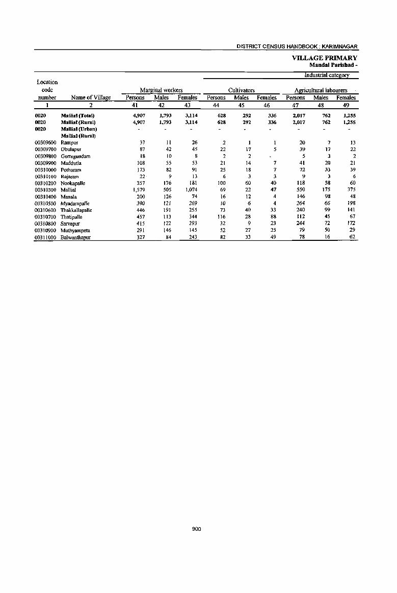
DISTRICT CENSUS HANDBOOK: KARIMNAGAR
VILLAGE PRIMARY Mandai Parishad -
Industrial catelri0!! Location
code MarBinal workers Cultivators Agriculturaiiabourers number Name of ViIl~e Persons Males Females Persons Males Females Persons Males Females
1 2 41 42 43 44 45 46 47 48 49
0020 Mallial (Total) 4,907 1,793 3,114 628 292 336 2,017 762 1,255 0020 Mallial (Rural) 4,907 1,793 3,114 628 292 336 2,017 762 1,255 0020 Mallial (Urban)
Mallial (Rural) 00309600 Rampur 37 II 26 2 20 7 13 00309700 Obulapur 87 42 45 22 17 5 39 17 22 00309800 Gorregundam 18 10 8 2 2 5 3 2 00309900 Maddut1a 108 55 53 21 14 7 41 20 21 00310000 Potharam 173 82 91 25 18 7 72 33 39 00310100 Rajaram 22, 9 I3 6 3 3 9 3 6
00310200 Nookapalle 357 176 181 100 60 40 118 58 60 00310300 Mallial 1,579 505 1,074 69 22 47 550 175 375 00310400 Manala 200 126 74 16 12 4 146 98 48 00310500 Myadampalle 390 121 269 10 6 4 264 66 198 00310600 Thakkallapalle 446 191 255 73 40 33 240 99 141 00310700 Thatipalle 457 113 344 116 28 88 112 45 67 00310800 Sarvapur 415 122 293 32 9 23 244 72 172 00310900 Muthyarnpeta 291 146 145 52 27 25 79 50 29 00311000 Balwanth~ur 327 84 243 82 33 49 78 16 62
900
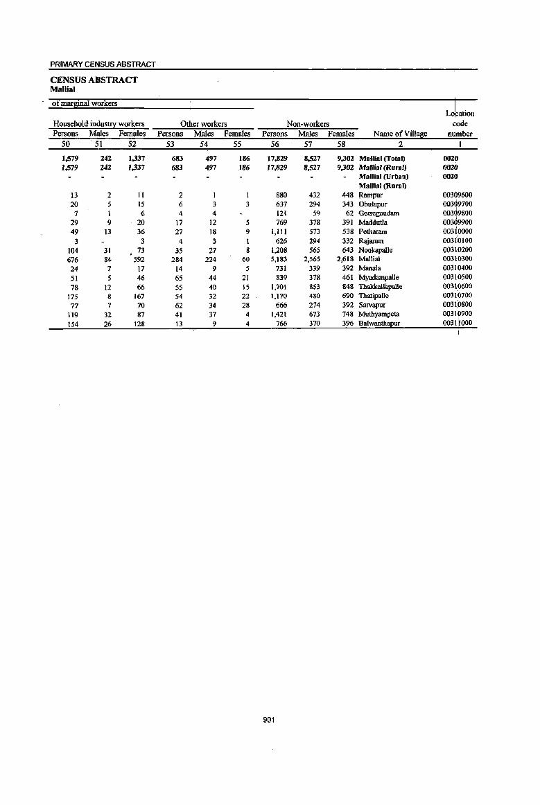
PRIMARY CENSUS ABSTRACT
CENSUS ABSTRACT Mallial
of marginal workers I
Lobation
Household industry workers Other workers Non-workers code Persons Males Females Persons • Males Females Persons Males Females Name ofVill~e nUmber
50 51 52 53 54 55 56 57 58 2 I
1,579 242 1,337 683 497 186 17,829 8,527 9,302 Mallia' (Total) 0020 1,579 242 J,337 683 497 186 17,829 8.527 9,302 Mallia' (Rura') 0020
Mallia. (Urban) 0020 Mallia. (Rural)
13 2 11 2 880 432 448 Rampur 00309600 20 5 IS 6 3 3 637 294 343 Obulapur 00309700
7 1 6 4 4 121 59 62 Gorregundarn 00309800
29 9 20 17 12 5 769 378 391 MaddutJa 00309900 49 13 36 27 18 9 1,111 573 538 Potharam 00310000
I
3 3 4 3 1 626 294 332 Rajaram 00310100
104 31 . 73 35 27 8 1,208 565 643 NookapaUe 00310200
676 84 592 284 224 60 5,183 2,565 2,618 Mallial 00310300
24 7 17 14 9 5 731 339 392 Manala 00310400
51 5 46 65 44 21 839 378 461 Myadampalle 00310500
78 12 66 55 40 15 1,701 853 848 Thakkalfapalle 00310600
175 8 167 54 32 22 1,170 480 690 Thatipalle 00310700
77 7 70 62 34 28 666 274 392 Sarvapur 00310800
119 32 87 41 37 4 1,421 673 748 Muthyampeta 00311
900
154 26 128 13 9 4 766 370 396 Balwanth ur 0031 000
901

DISTRICT CENSUS HANDBOOK: KARIMNAGAR
VILLAGE PRlMARY MandaI farishad -
Total population (including Location Area of institutional and houseless Population in the
code Village in Number of ~o~ulation! af!e-l[ou~ ()-6 number Name ofVilla8e hectares' households Persons Males Females Persons Males Females
2 3 4 5 6 7 8 9 10
0021 Jagtial (fotal) 21,553.0 15,501 65,044 32,025 33,019 8,817' 4,530 4,287 0021 Jagtial (Rural) 21,553.0 15,501 65,044 32,025 33,019 8,817 4,530 4,287 0021 Jagtial (Urban)
Jagtial (Rural) 00311100 Kannapur 218.0 164 735 361 374 95 43 52 00311200 P()randla 1,047.0 949 3,856 1,931 1,925 467 267 200 00311300 Thippannapet l,lO8.0 852 3,496 1,713 1,783 531 258 273 00311400 Polasa 1,482.0 1,072 4,791 2,319 2,472 714 367 347 00311500 Gullapeta 324.0 406 1,899 938 961 272 132 140 00311600 TbakkalJapalJe 331.0 288 ],188 590 598 154 70 84 00311700 Habsipur 1,112.0 354 1,465 702 763 165 83 82 00311800 Somanpalle 425.0 432 1,682 848 834 264 145 119 00311900 Kalleda 904.Q 679 2,918 1,459 1,459 398 205 193 00312000 Anantharam 913.0 612 2,347 1,183 1,164 348 190 158 00312100 Lakshmipurarn 929.0 889 3,805 1,881 1,924 438 225 213 00312200 Thimmapur 629.0 279 1,115 551 564 128 69 59 00312300 Jagtial (Rural) 1,963.0 751 3,180 1,565 1,615 477 266 211 00312400 KandlapaUe 715.0 391 1,591 784 807 190 98 92 00312500 ChelgaI 1,150.0 1,170 5,037 2,536 2,501 650 334 316 00312600 MorapaIle 865.0 730 2,852 1,353 1,499 417 219 198 00312700 TatipaIle 1,287.0 758 2,976 1,470 1,506 394 185 209 00312800 Anthargaon 1,223.0 717 2,926 1,397 1,529 369 185 184 00312900 Dharur 518.0 578 2,513 1,238 1,275 346 165 181 00313000 Narsingapur 1,299.0 1,019 4,282 2,073 2,209 567 294 273 00313100 Eldurthi 704.0 434 1,874 944 930 231 119 112 00313200 Mothe (Rural) 946.0 977 4,309 2,146 2,163 661 344 317 00313300 Jabithapur 1,163.0 725 3,175 1,525 1,650 410 190 220 00313400 Dhannaram 298.0 275 1,032 518 514 13I 77 54
902
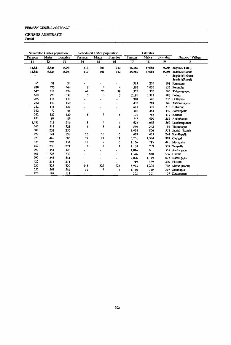
PRIMARY CENSUS ABSTRACT
CENSUS ABSTRACT Jagtial
Scheduled Castes EOEuation Scheduled Tribes EOEuiation Literates Name of Vill~ge Pmons Males Females Persons Males Females Pmons Males Females
II 12 13 14 15 16 17 18 19 2 I
I
11,821 5,824 5,997 613 301 312 26,789 17,081 9,708 Jagtial (Total) 11,821 5,824 5,997 613 301 312 26,789 17,081 9,708 Jagtial (Rural)
Jagtial(Urban) Jagtial (Rural)
65 31 34 313 205 108 Kannapur 940 476 464 8 4 4 1,592 1,035 557 Porandla 642 318 324 64 26 38 1,376 876 500 Thippannapet 610 278 332 5 3 2 2,195 1,313 882 Polasa 225 114 III 781 545 236 Gullapeta 292 142 150 433 284 149 ThakkallapaUe 242 III 131 613 397 216 Habsipur 142 77 65 500 351 149 Somanpalle 242 122 120 8 3 5 1,172 755 417 Kalleda 186 97 89 747 490 257 Anantharam
1,032 513 519 8 4 4 1,625 1,065 560 Lakshmipuram 646 318 328 4 t 3 540 342 198 Thimmapur 508 252 256 1,424 866 558 Jagtial (Rural) 279 141 138 20 to to 679 435 244 Kandlapalle 973 468 505 29 17 12 2,201 1,394 807 Chelgal 626 292 334 II 5 6 1,156 715 441 Morapalle 462 238 224 2 1,108 709 399 Tatipalle 699 353 346 1,016 651 365 Anthargaon 466 227 239 1,376 840 536 Dharur 695 344 351 1,826 1,149 677 Narsingapur 422 211 211 719 489 230 Eldurthi 651 328 329 443 220 223 1,923 1.205 118 Mothe (Rural) 550 264 286 II 7 4 1,166 769 397 Jabithapur 220 109 HI 308 201 107 Dharmaram
903
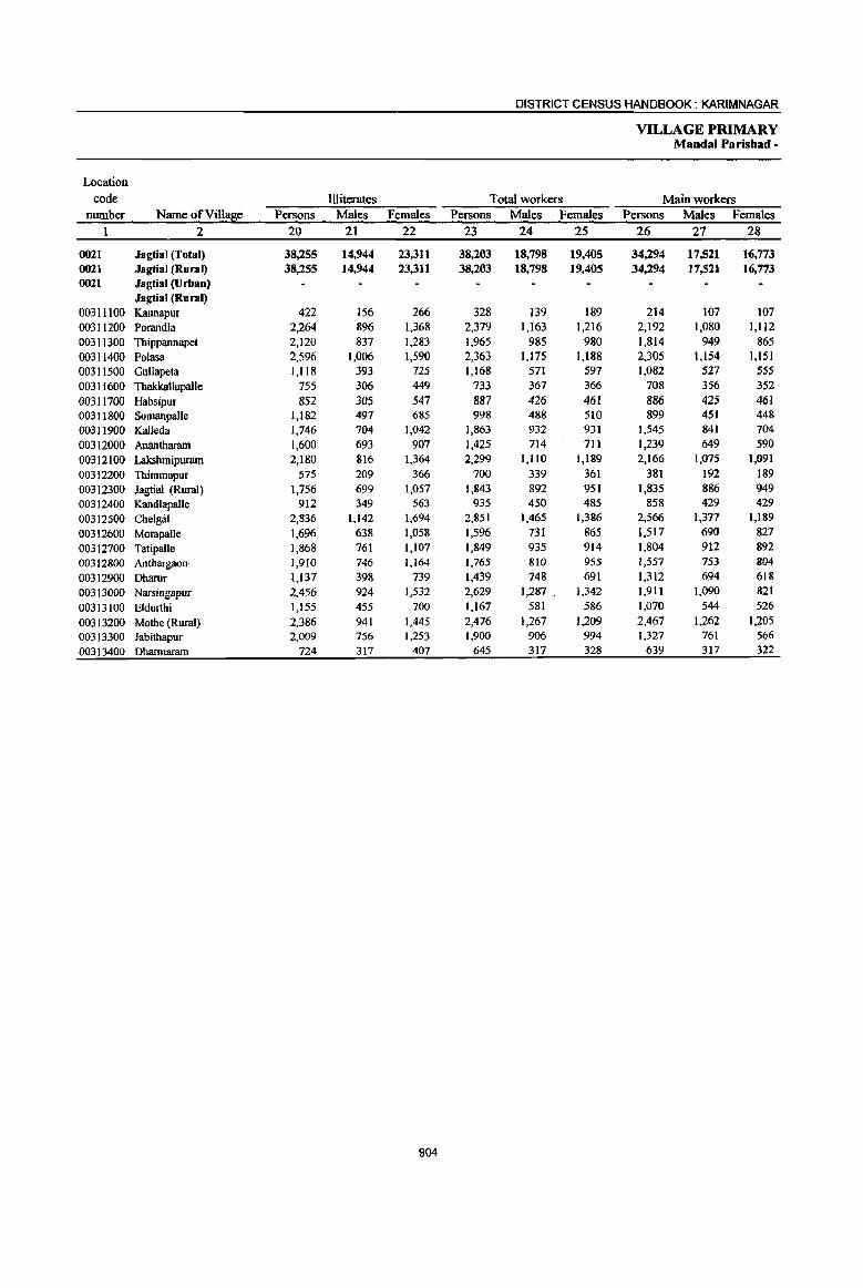
DISTRICT CENSUS HANDBOOK: KARIMNAGAR
VILLAGE PRIMARY MandaI Parishad -
Location
code Illiterates Total workers Main workers number Name ofVilla~e Persons Males Females Persons Males Females Persons Males Females
2 20 21 22 23 24 25 26 27 28
0021 Jagtial (Total) 38,255 14,944 23,311 38,203 18,798 19,405 34,294 17,521 16,773 0021 Jagtial (Rural) 38,255 14,944 23,311 38,203 18,798 19,405 34,294 17,521 16,773 0021 Jagtial (Urban)
Jagtial (Rural) 00311100 Kannapur 422 156 266 328 139 189 214 107 107 00311200 Ponmdla 2,264 896 1,368 2,379 1,163 1,216 2,192 1,080 1,112 00311300 Thippannapet 2,120 837 1,283 1,965 985 980 1,814 949 865 00311400 Polasa 2,596 1,006 1,590 2,363 1,175 1,188 2,305 1,154 1,151 00311500 GuUapeta 1,118 393 125 1,168 511 591 1,082 527 555
00311600 Thakkallapalle 755 306 449 733 367 366 108 356 352
00311700 Habsipur 852 305 547 887 426 461 886 425 461 00311800 Somanpalle 1,182 497 685 998 488 510 899 451 448 00311900 Kalleda 1,746 704 1,042 1,863 932 931 1,545 841 704
00312000 Anantharam 1,600 693 907 1,425 714 711 1,239 649 590
00312100 Lakshmipuram 2,180 816 1,364 2,299 1,110 1,189 2,166 1,015 1,091
00312200 Thimmapur 575 209 366 700 339 361 381 192 189 00312300 Jagtial (Rural) 1,756 699 1,057 1,843 892 951 1,835 886 949 00312400 KandlapaUe 912 349 563 935 450 485 858 429 429
00312500 Chelgal 2,836 1,142 1,694 2,851 1,465 1,386 2,566 1,377 1,189
00312600 Morapalle 1,696 638 1,058 1,596 731 865 1,517 690 827
00312700 Tatipalle 1,868 761 1,107 1,849 935 914 1,804 912 892
00312800 Anthargaon· 1,910 746 1,164 1,765 810 955 1,557 753 804
00312900 Dharur 1,137 398 739 1,439 748 691 1,312 694 618
00313000 Narsingapur 2,456 924 1,532 2,629 1,287 1,342 1,911 1,090 821
00313100 Eldurthi 1,155 455 700 1,167 581 586 1,070 544 526
00313200 Mothe (Rural) 2,386 941 1,445 2,476 1,267 1,209 2,467 1,262 1,205 00313300 Jabithapur 2,009 756 1,253 1,900 906 994 1,327 761 566
00313400 Dharmaram 724 317 407 645 317 328 639 317 322
904
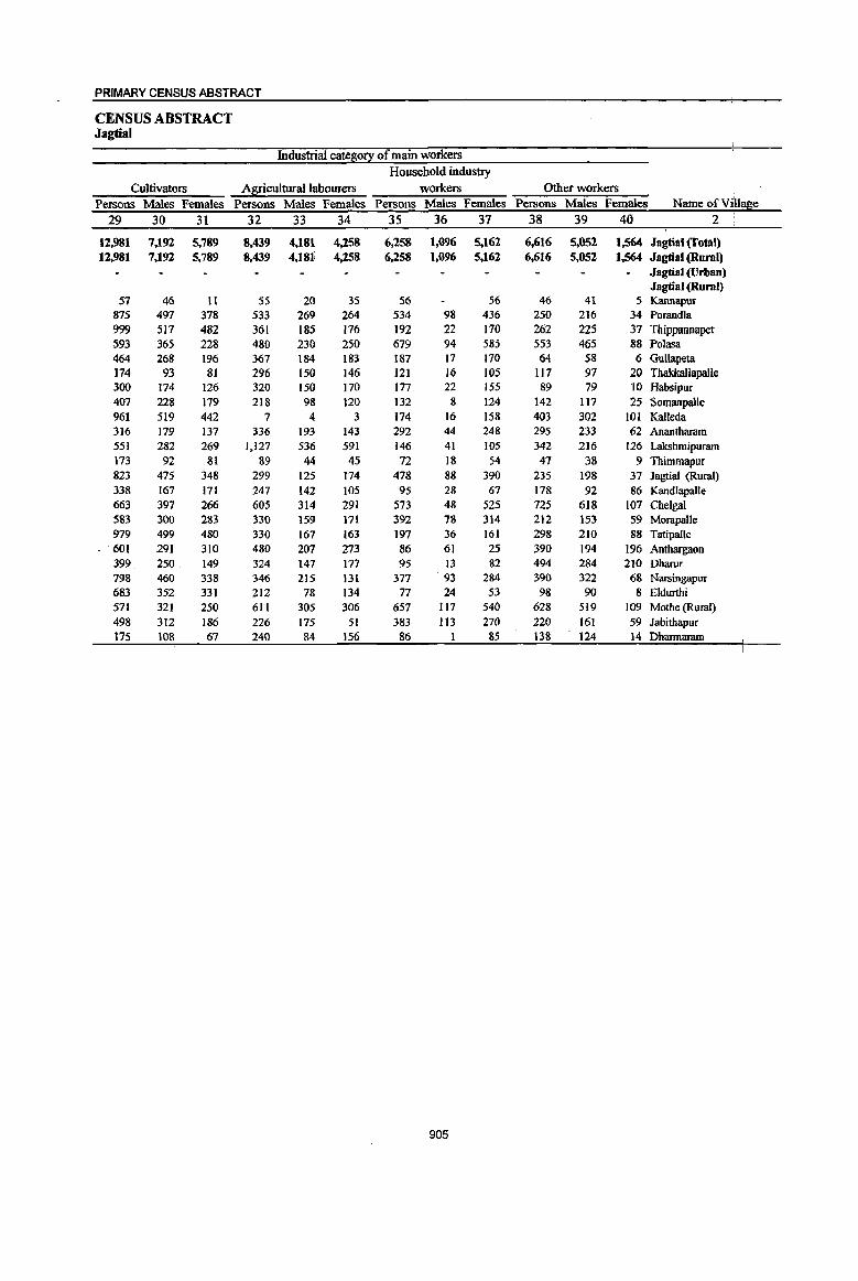
PRIMARY CENSUS ABSTRACT
CENSUS ABSTRACT Jagtial
Industrial catetlo!l: of main workers Household industry
Cultivators Agricultural labourers workers Other workers Persons Males Females Persons Males Females Persons Males Females Persons Males Females Name ofVill2&e
29 30 31 32 33 34 35 36 37 38 39 40 2
12,981 7,192 5,789 8,439 4,181 4,258 6,258 1,096 5,162 6,616 5,052 1,564 Jagtilll (Total) 12,981 7,192 5,789 8,439 4,181 4,258 6,258 1,096 5,162 6,616 5,052 1,564 Jagtial (Rural)
Jagtial (Urban) Jagtial (Rural)
57 46 tl 55 20 35 56 56 46 41 5 Kannapur 875 497 378 533 269 264 534 98 436 250 216 34 Porandla 999 517 482 361 185 176 192 22 170 262 225 37 Thippannapet 593 365 228 480 230 250 679 94 585 553 465 88 Polasa 464 268 196 367 184 183 187 17 170 64 58 6 Gullapeta 174 93 81 296 150 146 121 16 105 Il7 97 20 Thakkallapalle 300 174 126 320 150 170 177 22 155 89 79 10 Habsipur 407 228 179 218 98 120 132 g 124 142 117 25 Somanpalle 961 519 442 7 4 3 174 16 158 403 302 101 Kalleda 316 179 137 336 193 143 292 44 248 295 233 62 Anantharam 551 282 269 1,127 536 591 146 41 105 342 216 126 Lakshmipuram 173 92 81 89 44 45 72 18 54 47 38 9 Thimmapur 823 475 348 299 125 174 478 88 390 235 198 37 Jagtial (Rural) 338 167 171 247 142 105 95 28 67 178 92 86 Kandlapalle 663 397 266 605 314 291 573 48 525 725 618 107 Chelgal 583 300 283 330 159 171 392 78 314 212 153 59 Morapalle 979 499 480 330 167 163 197 36 161 298 210 88 Tatipalle 601 291 310 480 207 273 86 61 25 390 194 196 Anthargaon 399 250 149 324 147 177 95 13 82 494 284 210 Dharur 798 460 338 346 215 131 377 93 284 390 322 68 Narsingapur 683 352 331 212 78 134 77 24 53 98 90 8 Eldurthi 571 321 250 611 305 306 657 117 540 628 519 109 Mothe (Rural) 498 312 186 226 175 51 383 113 27() 220 161 59 Jabithapur 115 108 67 240 84 156 86 8S 138 124 14 Dharmaram
905
DISTRICT CENSUS HANDBOOK: KARIMNAGAR
VILLAGE PRIMARY Mandal-Parishad -
Industrial cateSQ!! Location
code Marginal workers Cultivators Agricultural labourers nwnber Name ofVil1a~e Persons Males Females Persons Males Females Persons Males Females
I 2 41 42 43 44 45 46 47 48 49
0021 Jagtial (Total) 3,909 1,277 2,632 164 59 105 1,932 690 1,242 0021 Jagtial (Rural) 3,909 1,277 2,632 164 59 105 1,932 690 1,242 0021 Jagtial (Urban)
Jagtial (Rural) -00311100 Kannapur 114 32 82 47 27 20 00311200 Porandla 187 83 104 1 127 64 63 oo3113oo Thippannapet 151 36 115 II 5 6 53 15 38 00311400 Polasa 58 21 37 5 2 3 19 5 14 00311500 Gullapeta 86 44 42 2 I I {J03116oo Thakkallapalle 25 11 14 13 5 8 00311700 Habsipur I I 00311800 Somanpalle 99 37 62 )) 10 66 27 39 00311900 Kalleda 318 91 227 2 2 16 9 7 00312000 Anantharam 186 65 121 5 3 2 140 49 91 00312100 Lakshmipuram 133 35 98 7 4 3 78 28 50 00312200 Thimmapur 319 147 172 12 5 7 285 132 153 00312300 Jagtial (Rural) 8 6 2 6 4 2 00312400 Kandlapalle 77 21 56 54 6 48 00312500 Chelgal 285 88 197 17 5 12 139 S5 84 00312600 Morapalle 79 41 38 6 4 2 39 20 19 00312700 Tatipalle 45 23 22 8 7 21 11 10 00312800 Anthargaon 208 57 lSI £07 35 72
00312900 Dharur 127 54 73 5 2 3 51 25 26 00313000 Narsingapur 718 197 521 22 10 12 277 S8 219 00313100 Eldurthi 97 37 60 7 3 4 S6 17 39
00313200 Mothe (Rural) 9 5 4 I 1 2 I I
00313300 Jabithapur 573 145 428 39 11 28 332 97 235 00313400 Dharmaram 6 6 4 4
906
PRIMARY CENSUS ABSTRACT
CENSUS ABSTRACT Jagtial
of marginal workers 1:'-Household industry workers Other workers Non-workers de Persons Males Females Persons Males Females Persons Males Females Name ofVillal!ie ber
50 51 52 53 54 55 56 57 58 2 ! '}
963 72 891 850 456 394 26,841 13,127 13,614 Jagtial (Total) 0021 963 72 891 850 456 394 26,841 13,227 13,614 Jagtial (Rural) 0021
Jagtial (Urban) 0021 Jagtial (Rural)
OO~lll00 62 61 4 3 407 222 185 Kannapur 40 6 34 19 13 6 1,477 768 709 Porandla ,::: 73 3 70 14 J3 I 1,531 728 803 Thippannapet 17 I 16 17 13 4 2,428 1,144 1,284 Polasa 00 11400
84 43 41 731 367 364 Gullapeta 00 11500 6 6 6 6 455 223 232 ThakkaUapaile 00 11600
I 578 276 302 Habsipur 00 11700 13 3 }{} 9 6 3 684 360 324 Somanpalle 00~1l8oo
124 124 176 82 94 1,055 527 528 Kalleda 00311900 26 3 23 15 10 5 922 469 453 Anantharam .00312000 45 44 3 2 I 1,506 771 735 Lakshmipuram 003PlOO 7 6 15 9 6 415 212 203 Thimrnapur 003'12200
I I 1,337 673 664 Jagtial (Rural) 003112300 21 15 6 656 334 322 Kandlapalle 003 2400
86 2 84 43 26 17 2,186 1,071 1,115 Chelgal 003 2500 12 II 22 16 6 1,256 622 634 Morapalle 003 2600 5 3 2 II 8 3 1,127 535 592 Tatipalle 003 2700
22 3 19 79 19 60 1,161 587 574 Anthargaon 003 2800 I I 70 27 43 1,074 490 584 Dharur 003 2900
208 13 195 211 lJ6 95 1,653 786 867 Narsingapur 003 3000 21 4 17 13 13 707 363 344 Eldurthi 00313100 ,
3 3 3 3 1,833 879 954 Mothe (Rural) 00313200 190 26 164 12 Il 1,275 619 656 Jabithapur 00313300
I 387 201 186 Dharmaram 00313400
907

DISTRICT CENSUS HANDBOOK: KARIM NAGAR
VILLAGE PRIMARY MandaI Parisbad -
Total population (including Location Area of institutional and houseless Population in the
code Village in Number of ~o~u1ation~ aBe-S!:ou~ 0-6 number Name of Village hectares households Persons Males Females Persons Males Females
1 2 3 4 5 6 7 8 9 10
0022 Medipalle (Total) 19,699.0 1l,974 49,773 24,151 25,622 7,029 3,568 3,461 0022 Medipalle (Rural) 19,699.0 1l,974 49,773 24,151 25,622 7,029 3,568 3,461 0022 Medipalle (Urban)
MedipaUe (Rural) 00313500 Katlakunta 1.219.0 1,142 4,253 2,027 2,226 542 270 272 00313600 PormalJa 1,603.0 1,173 4,846 2.297 2,549 678 327 351 00313700 Thombamo Peta 328.0 313 1,297 616 681 169 92 77 00313800 Medipalle 1,848.0 1,249 5,813 3,032 2,781 820 417 403 00313900 Kondapur 1,327.0 1,030 4,378 2,117 2,261 632 323 309 00314000 Vallampalle 603.0 581 2,444 1,149 1,295 362 167 195 00314100 Machapur 333.0 210 900 459 441 128 71 57 00314200 Dammannapeta 295.0 331 1,438 667 771 235 112 123 00314300 KaIvakota 1,025.0 482 2,113 1,018 1,095 306 153 153 00314400 Rangapur 318.0 220 795 376 419 108 58 50 00314500 Kacharam 868.0 498 1,926 947 979 28t 144 137 00314600 Venkatarnopeta 749.0 560 2,375 1,191 1,184 348 194 154 00314700 Raghojipeta 542.0 286 1,103 525 578 152 86 66 00314800 Bheemaram 1,686.0 859 3,491 1,659 ],832 482 244 238 00314900 Manonegudem 1,029.0 874 3,577 1,711 1,866 500 256 244 00315000 Lingampeta 535.0 375 1,561 739 822 201 110 91 00315100 Govindaram 3,116.0 1,125 4,698 2,250 2,448 695 344 351 00315200 Pasnoor 708.0 439 1,788 868 920 241 122 119 00315300 Voddedu 1,567.0 227 977 503 474 149 78 71
908
PRIMARY CENSUS ABSTRACT
CENSUS ABSTRACT Medipalle
Scheduled Castes EOEuation Scheduled Tribes EOEulation Literates Name of Vii! Persons Males Females Persons Males Females Persons Males Females e
II 12 13 14 15 16 17 18 19 2
9,028 4,507 4,521 624 310 314 19,201 12,034 7,167 Medipalle (rotal) I 9,028 4,507 4,521 624 310 314 19,201 12,034 7,167 Medipalle (Rural) I
Medipalle (Urban)
955 463 492 68 20 48 1,642 1,020 622 Medipalle (Rural) \ Katlakunta
717 330 387 41 22 19 1,933 1,181 752 Pormalla 238 120 118 3 2 1 481 321 160 Thombarao Peta
1,284 839 445 87 60 27 2,910 1,915 995 Medipalle 823 400 423 27 14 13 1,602 976 626 Kondapur 393 182 211 13 5 8 995 628 367 Vallampalle 201 101 100 413 255 158 Machapur 116 51 65 76 33 43 484 294 190 Dammannapeta 370 178 192 25 13 12 925 556 369 Kalvakota 294 137 157 11 6' 5 308 184 124 Rangapur 596 296 300 tl 6 5 649 427 222 Kacharam 357 175 182 15 7 8 869 572 297 Venkataraopeta 163 75 88 264 142 122 Raghojipeta 485 215 270 17 8 9 1,150 681 469 Bheemaram 663 300 363 20 10 10 1,518 947 571 Mannnegudem 247 110 137 551 327 224 Lingampeta 611 290 321 90 45 45 1,639 1,033 606 Govindaram 305 134 171 120 59 61 558 368 190 Pasnoor 210 111 99 310 207 103 Voddedu
909
DISTRICT CENSUS HANDBOOK: KARIMNAGAR
VILLAGE PRIMARY Mandai Parisbad -
Location code llliterates Total workers Main workers
number Name ofVill~e Persons Males Females Persons Males Females Persons Males Females I 2 20 21 22 23 24 25 26 27 28
0022 Medipalle (Total) 30,572 12,117 18,455 28,592 13,634 14,958 25,506 12,216 13,290 0022 Medipalle (Rural) 30,572 12,117 18,455 28,592 13,634 14,958 25,506 12,216 13,290 0022 Medipalle (Urban)
Medipalle (Rural) 00313500 Katlakunta 2,611 1,007 1,604 2,539 1,196 1,343 2,397 1,133 1,264 00313600 Pormalla 2,913 1,116 1,797 2,800 1,311 1,489 2,547 1,180 1,367 00313700 Thombarao Peta 816 295 521 798 361 437 731 332 399 00313800 Medipalle 2,903 1,117 1,786 2,820 1,419 1,401 2,561 1,330 1,231 00313900 Kondapur 2,776 1,141 1,635 2,456 1,164 1,292 2,201 1,032 1,169 00314000 Vallampalle 1,449 521 928 1,513 713 800 1,424 664 760 00314100 MaChapUT 487 204 283 507 255 252 422 208 214 00314200 Dammannapeta 954 373 581 872 401 471 817 370 447 00314300 Kalvakota 1,188 462 726 1,191 565 626 959 462 497 00314400 Rangapur 487 192 295 444 222 222 378 212 166 00314500 Kacbaram 1,277 520 757 1,155 557 598 1,096 526 570 00314600 VenkataI'aopeta 1,506 619 887 1,432 705 727 1,335 680 655 00314700 Raghojipeta 839 383 456 645 311 334 614 301 313 00314800 Bheemaram 2,341 978 1,363 1,995 953 1,042 1,741 811 930 00314900 Mannnegudem 2,059 764 1,295 2,065 934 1,131 1,720 772 948 00315000 Lingampeta 1,010 412 598 934 434 500 918 426 492 00315100 Govindaram 3,059 1,217 1,842 2,779 1,330 1,449 2,490 1,206 1,284 00315200 Pasnoor 1,230 500 730 1,048 494 554 865 412 453 00315300 Voddedu 667 296 371 599 309 290 290 159 131
910
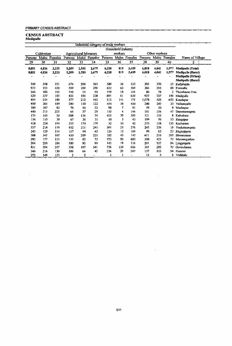
PRIMARY CENSUS ABSTRACT
CENSUS ABSTRACT MedipalJe
Industrial cate~0!X of main workers Household industry
Cultivators Agricultural labourers workers -Other workers Persons Males Females Persons Males Females Persons Males Females Persons Males Females NameofV· a e
29 30 31 32 33 34 35 36 37 38 39 40 2
8,051 4,826 3,225 5,209 2,530 2,679 6,228 819 5,409 6,018 4,041 1,'Y17 M .. ' .... rr.l
8,051 4,826 3,225 5,209 2,530 2,679 6,228 819 5,409 6,018 4,041 1,977 Medipalle (Rural - Medipalle (Urba )
Medipalle (Rural 749 398 351 674 309 365 589 56 533 385 370 J5 Katlakunta 973 553 420 559 269 290 632 63 569 383 295 88 Pormalla 346 183 163 146 53 93 159 18 141 80 78 2 Thombarao Peta 520 337 183 423 195 228 691 61 630 927 737 190 Medipalle 434 254 180 377 212 165 312 141 171 1,078 425 653 Kondapur 450 261 189 240 118 122 454 38 416 280 247 33 Vallampalle 189 107 82 76 44. 32 98 7 91 59 50 9 Machapur 440 215 225 66 37 29 150 4 146 161 114 47 Dammannapeta 175 145 30 208 134 74 455 70 385 121 113 8 Kalvakota 154 115 39 67 36 31 48 5 43 109 56 53 Rangapur 418 224 194 353 174 179 52 10 42 273 118 155 Kacharam 337 218 119 452 211 241 301 25 276 245 226 19 Venkataraopeta 243 129 114 157 94 63 124 15 109 90 63 27 Raghojipeta 508 341 167 430 209 221 192 45 147 611 216 395 Bheemaram 292 177 115 155 82 73 773 90 683 500 423 77 Mannnegudem 394 210 1&4 180 90 90 143 19 124 201 107 94 Lingarnpeta 811 594 217 538 197 341 776 120 656 365 295 70 Govindaram 346 216 130 106 64 42 276 29 247 137 103 34 Pasnoor 272 149 123 2 2 3 3 13 5 8 Voddedu
911

DISTRICT CENSUS HANDBOOK: KARIMNAGAR
VILLAGE PRIMARY Mandai Parisbad -
Indusbialcate~o~ Location
code Mar~inal workers Cultivators Agricultural labourers number Name ofVill~e Persons Males Females Persons Males Females· Persons Males Females
1 2 41 42 43 44 45 46 '47 48 49
'0022 Medipalle (Total) 3.086 1,418 1,668 252 123 129 1,707 758 949 0022 MedipaJle (Rural) 3.086 1,418 1,668 252 123 129 1,707 758 949 0022 Medipalle (Urban)
Medipalle (Rural) 00313500 Katlakunta 142 63 79 12 8 4 101 39 62 00313600 Ponnalla 253 131 122 20 2 18 136 67 69 00313700 Thombarao Peta 67 29 38 21 13 8 32 10 22 00313800 Medipalle 259 89 170 5 4 79 22 57 00313900 Kondapur 255 132 123 2 2 165 90 75 00314000 Vallampalle 89 49 40 14 8 6 45 23 22 00314100 Machapur 85 47 38 10 4 6 25 15 10 00314200 Danunannapeta 55 31 24 31 27 4 7 6 00314300 Kalvalcota 232 103 129 I I 119 65 54 00314400 Rangapur 66 10 56 10 2 8 33 3 30 00314500 Kacharam 59 31 28 29 13 16 00314600 Venkataraopeta 97 25 72 14 2 12 58 IS 43 00314700 Raghojipeta 31 10 21 2 2 22 6 16 00314800 Bheemaram 254 142 112 26 I3 13 118 65 53 00314900 Mannnegudem 345 162 183 34 19 15 187 78 109 00315000 Lingampeta 16 8 8 12 5 7 00315100 Govindaram 289 124 165 26 14 12 196 70 126 00315200 Pasnoor 183 82 101 21 9 12 138 63 75 00315300 Voddedu 309 150 159 3 I 2 205 108 97
912

PRIMARY CENSUS ABSTRACT
CENSUS ABSTRACT Medipalle
of marginal workers
Household industry workers Other workers Non-workers Persons Males Females Persons Males Females Persons Males Females Name of Villa e
50 51 52 53 54 55 56 57 58 2
402 71 331 725 466 259 21,181 10,517 10,664 Medipalle (Total) 402 11 331 725 466 259 21,181 10,517 10,664 Medipalle (Rural)
Medipalle (Urban) MedipaUe (Rural)
12 11 17 15 2 1,714 831 883 Katlakunta 003 3500 16 5 II 81 57 24 2,046 986 1,060 Ponnalla 003 3600 II 3 8 3 3 499 255 244 Thombarao Peta 003 3700 92 7 85 83 59 24 2,993 1,613 1,380 Medipalle 003 3800 35 12 23 53 30 23 1,922 953 969 Kondapur 003 3900 12 3 9 18 15 3 931 436 495 Vallampalle 003 4000 1 49 28 21 393 204 189 Machapur 003 4100
12 12 5 3 2 566 266 300 Dammannapeta 003 4200 64 3 61 48 35 13 922 453 469 Kalvakota 003 4300 7 6 16 4 12 351 154 197 Rangapur 003 4400
30 18 12 771 390 381 Kacharam 003114500
19 3 16 6 5 1 943 486 457 Venkataraopeta 003M600 1 6 3 3 458 214 244 Raghojipeta 00311 700
31 30 79 63 16 1,496 706 790 Bheemaram 0031 800 26 6 20 98 59 39 1,512 777 735 Mannnegudem
I I 3 2 I 627 305 322 Lingampeta
17 2 IS SO 38 12 1,919 920 999 Govindaram 0031 100
II 2 9 13 8 5 740 374 366 Pasnoor
34 20 14 67 21 46 378 194 184 Voddedu
913

DISTRICT CENSUS HANDBOOK: KARIMNAGAR
VILLAGE PRIMARY Mandai Parishad -
Total population (including Location Area of institutional and houseless Population in the
code Village in Number of EOEulation2 ~e-!l0uE 0-6 number Name of Village hectares households Persons Males Females Persons Males Females
I 2 3 4 5 6 7 8 9 10
0023 Koratla (Total) 11,716.0 9,432 40,417 19,685 20,732 5,220 2,517 2,703 0023 Koratla (Rural) 11,716.0 9,432 40,417 19,685 20,732 5,220 2,517 2,703 0023 Koratla (Urban)
Koratla (Rural) 00315400 Yousufnagar 428.0 722 2,933 1,456 1,477 428 214 214 00315500 Ailapur 2,004.0 1,855 8,301 3,999 4,302 1,054 526 528 00315600 Kallur 772.0 379 1,669 816 853 212 98 114 00315700 Paidimadugu 1,114.0 1,051 4,250 2,037 2,213 553 275 278 00315800 JoganpalJe 934.0 672 2,676 1,319 1,357 296 133 ]63 00315900 Chinnametpalle 1,033.0 596 2,524 1,213 1,311 285 147 138 00316000 Madhapur 906.0 606 2,686 1,307 1,379 321 158 163 00316100 Peddapur 809.0 448 2,252 1,185 1,067 269 121 148 00316200 YakeenpuT 796.0 570 2,558 1,232 1,326 342 167 175 00316300 Nagulpeta 473.0 393 1,651 790 861 226 101 125 00316400 Sangem 556.0 363 1,494 748 746 190 97 93 00316500 Gum1apur 482.0 380 1,449 674 775 202 83 119 00316600 Venkatapur 576.0 486 2,087 999 1,088 295 128 167 00316700 Mohanrao Peta 833.0 911 3,887 1,910 1,977 547 269 278
914
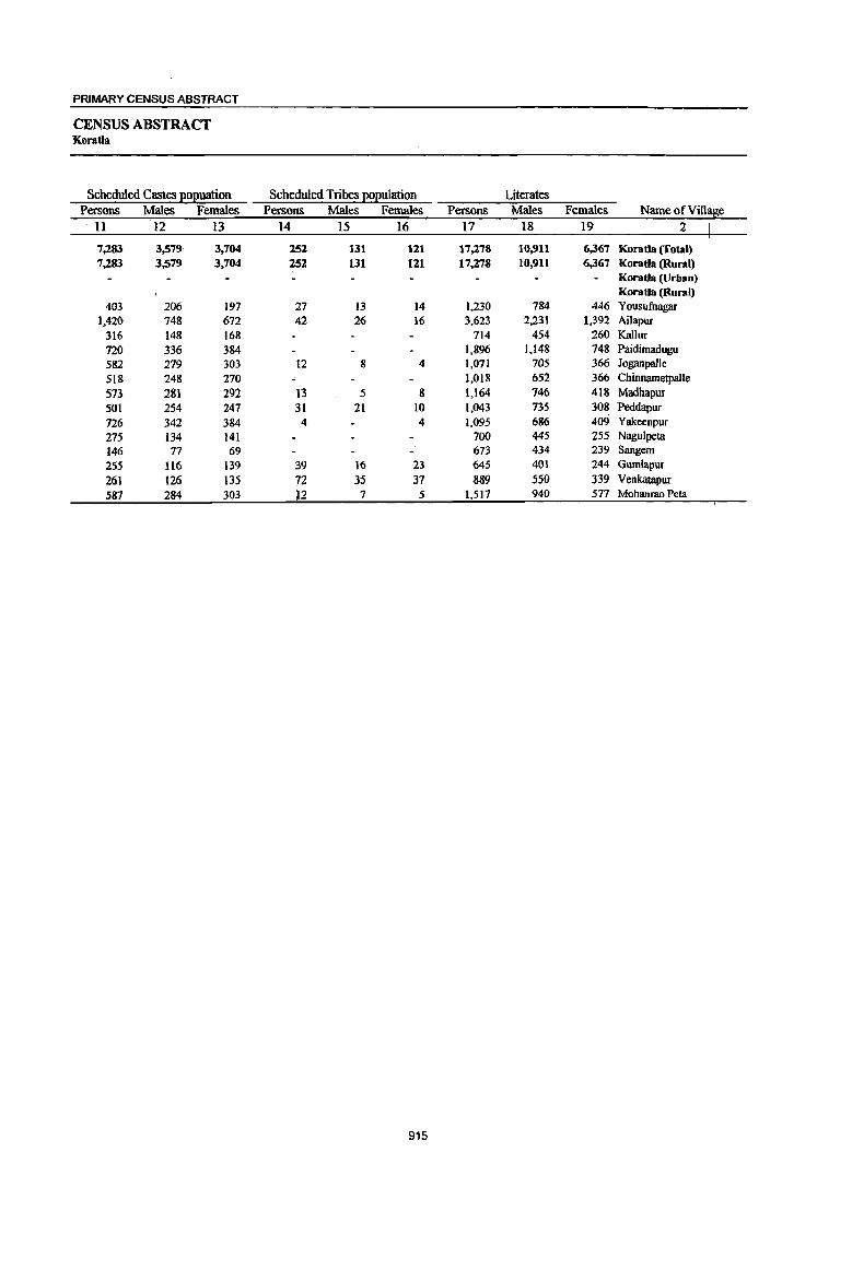
PRIMARY CENSUS ABSTRACT
CENSUS ABSTRACT Koratla
Scheduled Castes l!oI!uation Scheduled Tribes I!oEulation Literates Persons Males Females Persons Males Females Persons Males Females
11 12 13 14 15 16 17 18 19
7,283 3,579 3,764 252 131 121 17,278 10,911 6,367 Koratla (fatal) 7,283 3,579 3,704 252 131 121 17,278 10,911 6,367 Koratla (Rural)
Koratla (Urban) Koratla (Rural)
403 206 197 27 13 14 1,230 784 446 Yousufuagar 1,420 748 672 42 26 16 3,623 2,231 1,392 Ailapur
316 148 168 714 454 260 Kallur 720 336 384 1,896 1,148 748 Paidirnadugu 582 279 303 12 8 4 1,071 705 366 Joganpalle 518 248 270 1,018 652 366 Chinnametpalle 573 281 292 13 5 8 1,164 146 418 Madhapur 501 254 247 31 21 10 1,043 135 308 Peddapur 726 342 384 4 4 1,095 686 409 Yakeenpur 275 134 141 700 445 255 Nagulpeta 146 77 69 673 434 239 Sangem 255 116 139 39 16 23 M5 401 244 Gumlapur 261 126 135 72 3S 37 889 550 339 Venkatapur 587 284 303 12 7 5 1,517 940 577 Mohanrao Peta
915

DISTRICT CENSUS HANDBOOK; KARIMNAGAR
VILLAGE PRIMARY MandaI Parishad -
Location code llliterates Total workers Main workers
number Name ofVil1~e Persons Males Females Persons Males Females Persons Males Females 1 2 20 21 22 23 24 25 26 27 28
0023 Koratla (Total) 23,139 8,774 14,365 23,636 11,196 12,440 22,487 10,718 11,769 0023 Koratla (Rural) 23,139 8,774 14,365 23,636 11,196 12,440 22,487 10,718 11,769 0023 Koratla (Urban)
Koratlil (Rural) 00315400 Yousufuagar 1,703 672 1,031 1,821 877 944 1,783 861 922 00315500 Ailapur 4,678 1,768 2,910 4,630 2,132 2,498 4,495 2,071 2,424 00315600 Kallur 955 362 593 1,004 480 524 956 452 504 00315700 Paidimadugu 2,354 889 1,465 2,540 1,177 1,363 2,196 1,016 1,180 00315800 Joganpalle 1,605 614 991 1,638 808 830 1,623 797 826 00315900 Chinnametpalle 1,506 561 945 1,431 677 754 1,368 663 705 00316000 MadbapuT 1,522 561 961 1,598 756 842 1,588 749 839 00316100 Peddapur 1,209 450 759 1,230 578 652 1,045 542 503 00316200 Yakeenpur 1,463 546 917 1,506 725 781 1,479 711 768 00316300 NaguJpeta 951 345 606 909 431 478 775 371 404 00316400 Sangem 821 314 507 946 474 472 919 462 457 00316500 Gumlapur 804 273 531 846 383 463 830 380 450 00316600 Venkatapur 1,198 449 749 1,216 579 637 1,174 560 614 00316700 Mohanrao Peta 2,370 970 1,400 2,321 1,1l9 1,202 2,256 1,083 1,173
916

PRIMARY CENSUS ABSTRACT
CENSUS ABSTRACT Koratla
Industrial cate~0!1 of main workers Household industry
Cultivators Agricultural labourers workers Other workers Persons Males Females Persons Males Females Persons Males Females Persons Males Females Name of Vi la e
29 30 31 32 33 34 3S 36 37 38 39 40 2
6,393 3,770 2,623 5,466 2,966 2,500 6,792· 671 6,121 3,836 3,311 525 Koratla (Total) 6,393 3,770 2,t'i23 5,466 2,966 2,500 6,792 671 6,121 3,836 3,311 525 Koratla (Rural)
Koratls (Urban) Koratls (Rural)
225 156 69 404 276 128 733 26 707 421 403 18 Yousufuagar 961 557 404 1,114 515 599 1,449 160 1,289 971 839 132 Ailapur 338 207 131 149 79 70 295 8 287 174 158 16 Kallor 569 383 186 444 250 194 860 97 763 323 286 37 Paidimadugu 642 342 300 427 249 178 290 45 245 264 161 103 Joganpalle 425 237 188 408 245 163 375 38 337 160 143 17 Chinnametpalle
.533 291 242 466 250 216 369 7 362 220 201 19 Madhapur 426 249 177 289 169 120 290 90 200 40 34 6 Peddapur
551 300 251 396 234 162 320 3 317 212 174 38 Yal<eenpur
243 164 79 152 71 81 236 12 224 144 124 20 Nagulpeta
273 146 127 294 169 125 253 52 201 99 95 4 Sangem
215 146 69 164 91 73 320 35 285 131 108 23 Gumlapur
456 254 202 210 116 94 328 33 295 180 157 23 Venkatapur
536 338 198 '549 252 297 674 65 609 497 428 69 Mohanrao Peta
917
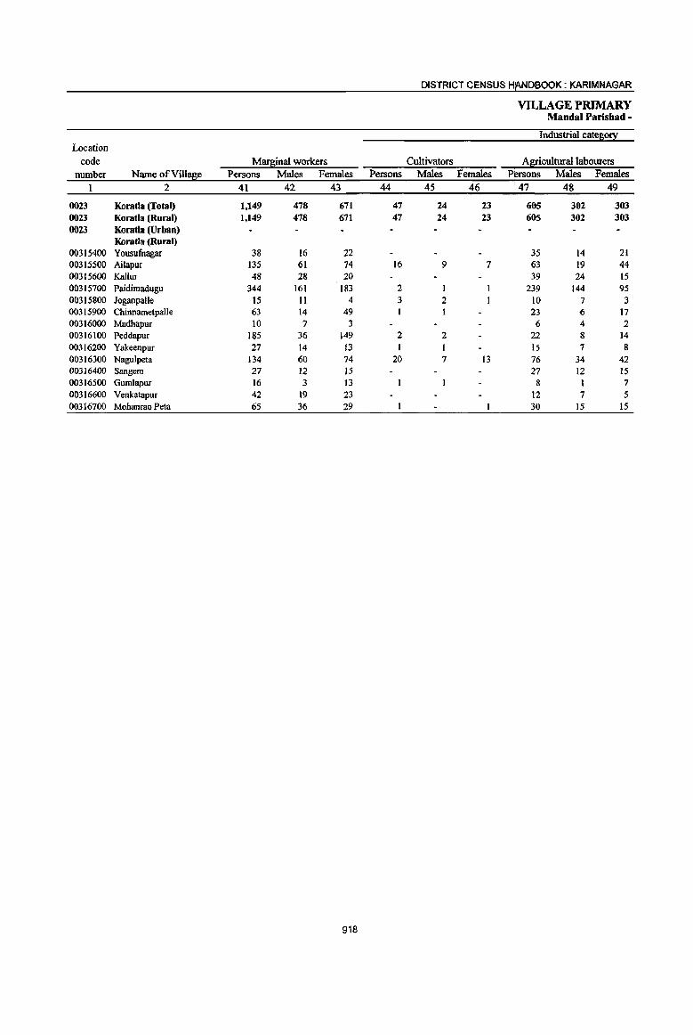
DISTRICT CENSUS HANDBOOK: KARIMNAGAR
VILLAGE PRIMARY Mandai Parisbad -
Industrial cateso!l: Location
code Marginal workers Cultivators Agricultural labourers number Name ofVilla~e Persons Males Females Persons Males Females Persons Males Females
1 2 41 42 43 44 45 46 47 48 49
0023 Koratla (Total) 1,149 478 671 47 24 23 665 302 303 0023 Koratla (Rural) 1,149 478 671 47 24 23 605 302 303 0023 Koratla (Urban)
Koratla (Rural) 00315400 Yousufnagar 38 16 22 35 14 21 00315500 Ailapur 135 61 74 16 9 7 63 19 44 00315600 Kallur 48 28 20 39 24 15 00315700 Paidimadugu 344 161 183 2 1 239 144 95 00315800 JQganpalle 15 11 4 3 2 10 7 3 00315900 Chinnametpalle 63 14 49 23 6 17 00316000 Madhapur 10 7 3 6 4 2 00316100 Peddapur 185 36 149 2 2 22 8 14 00316200 Yakeenpur 27 14 13 1 15 7 8 00316300 Nagulpeta 134 60 74 20 7 13 76 34 42 00316400 Sangem 27 12 15 27 12 15 00316500 Gumlapur 16 3 13 8 I 7 00316600 Venkatapur 42 19 23 12 7 5 00316700 Mohanrao Peta 65 36 29 30 15 15
918

PRIMARY CENSUS ABSTRACT
CENSUS ABSTRACT Koratla
of marginal workers
Household industry workers Other workers Non-workers Persons Males Females Persons Males Females Persons Males Females
50 51 52 53 54 55 56 57 58
340 54 286 157 98 59 16,781 8,489 8,l92 Koratla (Total) 340 54 286 157 98 59 16,781 8,489 8,l92 Koratla (Rural)
Koratla (Urban) Koratla (Rural)
2 2 1,112 579 533 Yousufnagar 003 15400 48 26 22 8 7 3,671 1,867 1,804 Ailapur 003 15500 4 4 5 4 1 665 336 329 Kallur 003 15600
87 6 81 16 10 6 1,710 860 850 Paidimadugu 003 5700 2 2 1.038 511 527 JoganpaJJe 003 5800
35 3 32 4 4 1.093 536 551 ChinnametpaJle 003 5900 4 3 1,088 551 531 Madhapur 003 6000
123 13 110 38 13 25 1,022 601 415 Peddapur 003 6100 1 I 10 6 4 1,052 507 545 Yakeenpur 003 6200
13 2 II 25 11 8 742 359 383 Nagulpeta 003 6300 548 274 274 Sangem 003 6400
7 6 603 291 312 Gumlapur 003 6500 12 12 18 12 6 871 420 451 Venkatapur 003 6600 9 3 6 25 18 7 1,566 791 775 Mohamao Peta 003 16700
919
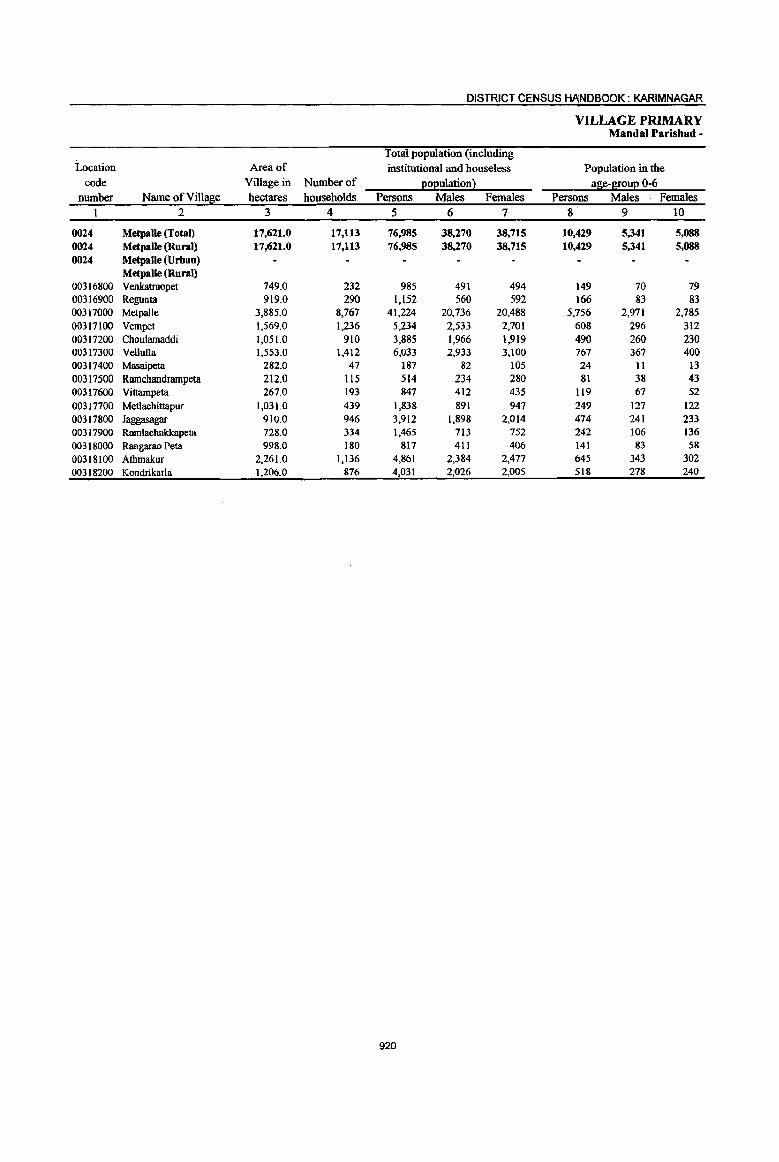
DISTRICT CENSUS H~NDBOOK: KARIMNAGAR
VILLAGE PRIMARY Mandai Parishad -
Total population (including Location Area of institutional and bouseless Population in the
code Village in Number of 2°2ulation~ a~e-B!0uE 0-6 Dumber Name ofVilla~e hectares households Persons Males Females Persons Males Females
1 2 3 4 5 6 7 8 9 10
0024 Metpalle (Total) 17,621.0 17,113 76,985 38,270 38,715 10,429 5,341 5,088 0024 Metpalle (Rural) 17,621.0 17,113 76,985 38,270 38,715 10,429 5,341 5,088 0024 Metpalle (Urban)
Metpalle (Rural) 00316800 Venkatraopet 749.0 232 985 491 494 149 70 79 00316900 Regunta 919.0 290 1,152 560 592 166 83 83 00317000 Metpalle 3,885.0 8,767 41,224 20,736 20,488 5,756 2,971 2,785 00317100 Vempet 1,569.0 1,236 5,234 2,533 2,701 608 296 312 00317200 Choulamaddi 1,051.0 910 3,885 1,966 1,919 490 260 230 00317300 Vellulla 1,553.0 1,412 6,033 2,933 3,100 767 367 400 00317400 Masaipeta 282.0 47 187 82 105 24 II 13 00317500 Ramchandrampeta 212.0 115 514 234 280 81 38 43 00317600 Vittampeta 267.0 193 847 412 435 119 67 52 00317700 Metlachittapur 1,031.0 439 1,838 891 947 249 127 122 00317800 Jaggasagar 910.0 946 3,912 1,898 2,014 474 241 233 00317900 Ramlacbakkapeta 728.0 334 1,465 713 752 242 106 136 00318000 Rangarao Peta 998.0 180 817 411 406 141 83 58
00318100 Athmakur 2,261.0 1,136 4,861 2,384 2,477 645 343 302 00318200 Kondrikarla 1,206.0 876 4,031 2,026 2,005 518 278 240
920
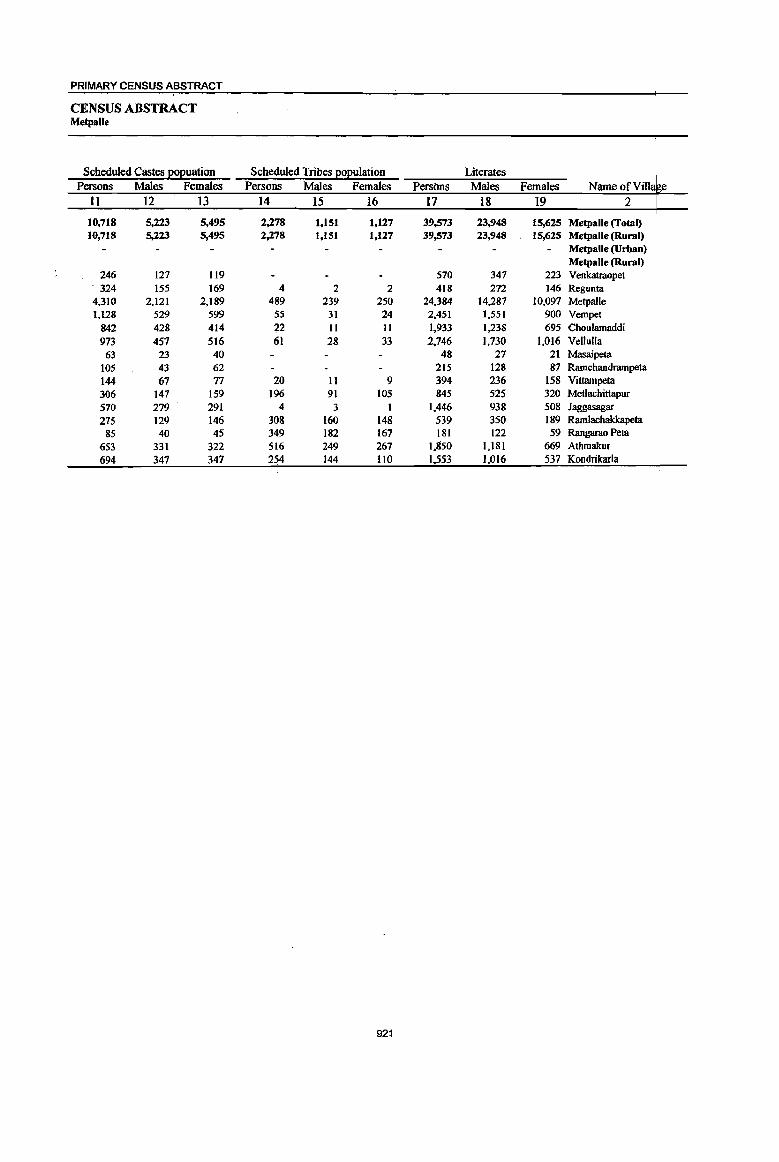
PRIMARY CENSUS ABSTRACT
CENSUS ABSTRACT Metpalle
Scheduled Castes ~o2uation Scheduled Tribes 2012ulation Literates Persons Males Females Persons Males Females Persons Males Females Name orVilla e
II 12 13 14 15 16 17 18 19 2
10,718 5,223 5,495 2,278 1,151 1,127 39,573 23,948 15,625 Metpalle (Total) 10,718 5,223 5,495 2,278 1,151 1,127 39,573 23,948 15,625 Metpalle (Rural)
MetpalJe (Urban) Metpalle (Rural)
246 127 119 570 347 223 Venkatraopet . 324 155 169 4 2 2 418 272 146 Regunta 4,310 2,121 2,189 489 239 250 24,384 14,287 10,097 Metpalle 1,128 529 599 55 31 24 2,451 1,551 900 Vempet
842 428 414 22 11 11 1,933 1,238 695 Choulamaddi 973 457 516 61 28 33 2,746 1,730 1,016 Vellulla
63 23 40 48 21 21 Masaipeta 105 43 62 215 128 87 Ramchandrampeta 144 67 77 20 11 9 394 236 158 Vittampeta 306 147 159 196 91 105 845 525 320 Metlachittapur 570 279 291 4 3 I 1.446 938 508 Jaggasagar 275 129 146 308 160 148 539 350 189 Ramlachakkapeta 85 40 45 349 182 167 181 122 59 Rangarao Peta
653 331 322 516 249 267 1.850 l,l81 669 Athmakur 694 347 347 254 144 110 1,553 1,016 537 Kondrikarla
921
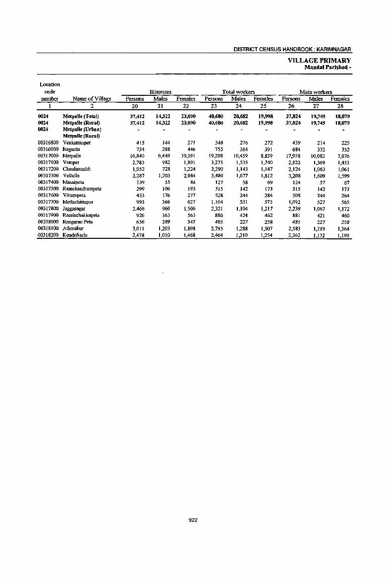
DISTRICT CENSUS HANDBOOK: KARIMNAGAR
VILLAGE PRIMARY Mandai Parishad -
Location
code Illiterates Total workers Main workers number Name of VillaB,e Persons Males Females Persons Males Females Rersons Males Females
1 2 20 21 22 23 24 2S 26 27 28
0024 Metpalle (Total) 37,412 14,322 23,090 40,680 20,682 19.998 37.824 19,745 18,079 0024 Metpalle (Rural) 37,412 14,322 23,090 40,680 20,682 19,998 37,824 19.745 18,079 0024 Metpalle (Urban)
Metpalle (Rural) 00316800 Venkatraopet 415 144 271 548 276 272 439 214 225 00316900 Regunta 734 288 446 755 364 391 684 332 352 00317000 Metpalle 16,840 6,449 10,391 19,298 10,459 8,839 17,958 10,082 7,876 00317100 Vempet 2,783 982 1,801 3,275 1,535 1,740 2,822 1,369 1,453 00317200 Choulamaddi 1,952 728 1,224 2,290 1,143 1,147 2,124 1,063 1,061 00317300 VeJlulla 3,287 1,203 2,084 3,489 1,677 1,812 3,208 1,609 1,599 00317400 Masaipeta 139 55 84 127 58 69 124 57 67 00317500 Ramchandrampeta 299 106 193 315 142 173 315 142 173 00317600 Vittampeta 453 176 277 528 244 284 508 244 264 00317700 Metlachittapur 993 366 627 1,104 531 573 1,092 527 565 00317800 Jaggasagar 2,466 960 1,506 2,321 1,104 1,217 2,239 1,067 1,172 00317900 Ramlachakkapeta 926 363 563 886 424 462 881 421 460 00318000 Rangarao Peta 636 289 347 485 227 258 485 227 258 00318100 Athmakur 3,011 1,203 1,808 2,795 1,288 1,507 2,583 1,219 1,364 00318200 Kondrikarla 2,478 1,010 1,468 2,464 1,210 1,254 2,362 1,172 1,190
922
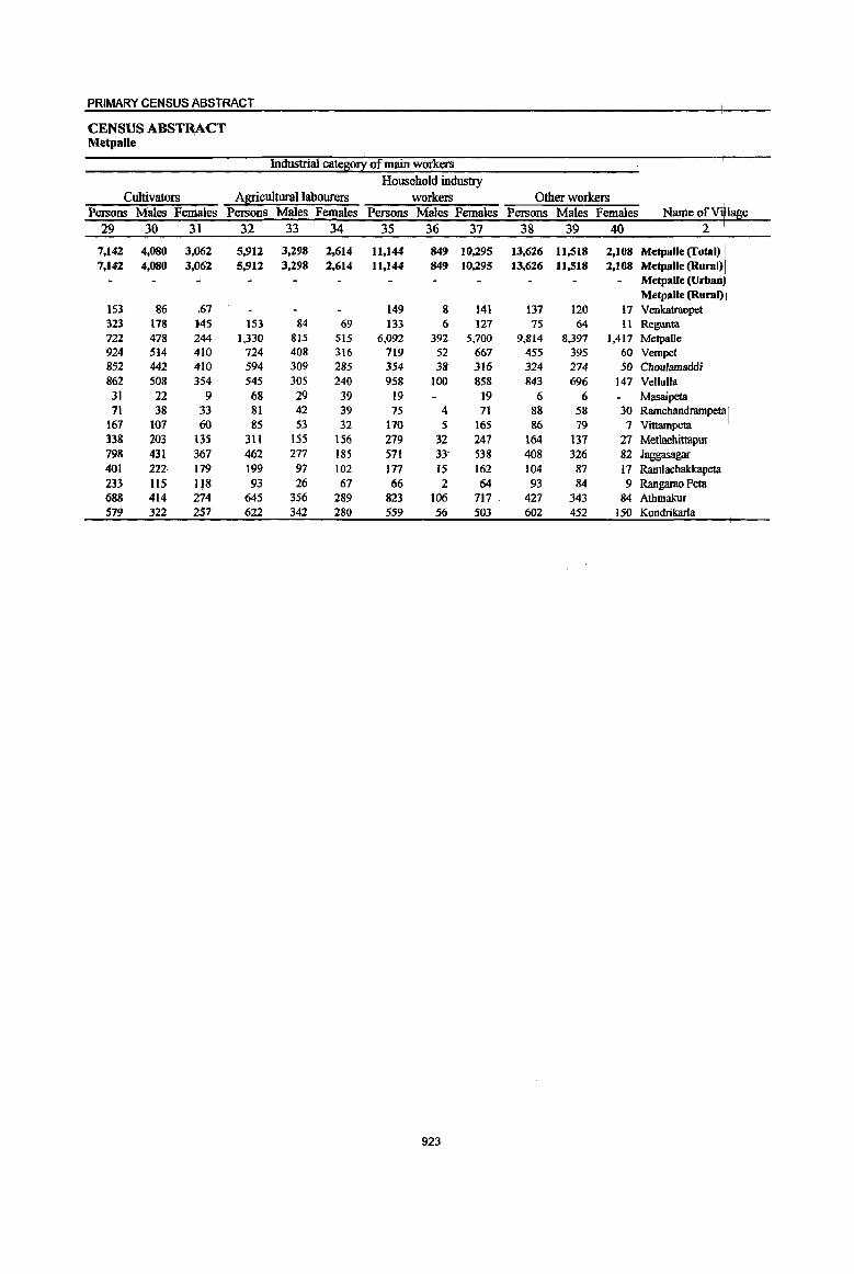
PRIMARY CENSUS ABSTRACT
CENSUS ABSTR,ACT Metpalie
Industrial cateso!l: of main workers Household industry
Cultivators Agricultural labourers workers Other workers Persons Males Females Persons Males Females Persons Males Females Persons Males Females Name of Vi 1 e
29 30 31 32 33 34 35 36 37 38 39 40 2
7,142 4,080 3,062 5,912 3,298 2,614 11,144 849 10,295 13,626 11,518 2,108 Metpalle (Total) 7,142 4,080 3,062 5,912 3,298 2,614 11,144 849 10,295 13,626 11,518 2,108 Metpalle (Rural)
Metpalle (Urban Metpalle (Rural)
153 86 ,67 149 8 141 137 120 17 Venkatraopet 323 178 145 153 84 69 133 6 127 75 64 II Regunta 722 478 244 1,330 815 515 6,092 392 5,700 9,814 8,397 1,417 Metpalle 924 514 410 724 408 316 719 52 667 455 395 60 Vempet 852 442 410 594 309 285 354 38 316 324 274 50 Choulamaddi 862 508 354 545 305 240 958 100 858 843 696 147 Vellulla
31 22 9 68 29 39 19 19 6 6 Masaipeta 71 38 33 81 42 39 75 4 71 88 58 30 Ramchandrarnpeta I
161 101 60 85 53 32 170 5 165 86 79 7 Vittampeta 33& 203 135 31l 155 156 279 32 247 164 137 27 Met1achittapur 798 431 367 462 277 185 571 33- 538 408 326 82 Jaggasagar 401 222 179 199 97 102 177 15 162 104 87 17 Ramlacbakkapeta 233 lIs 118 93 26 67 66 2 64 93 84 9 Rangruao Peta 688 414 274 645 356 289 823 106 717 . 427 343 84 Atbmalrur 579 322 257 622 342 280 559 56 503 602 452 ISO Kondrikarla
923
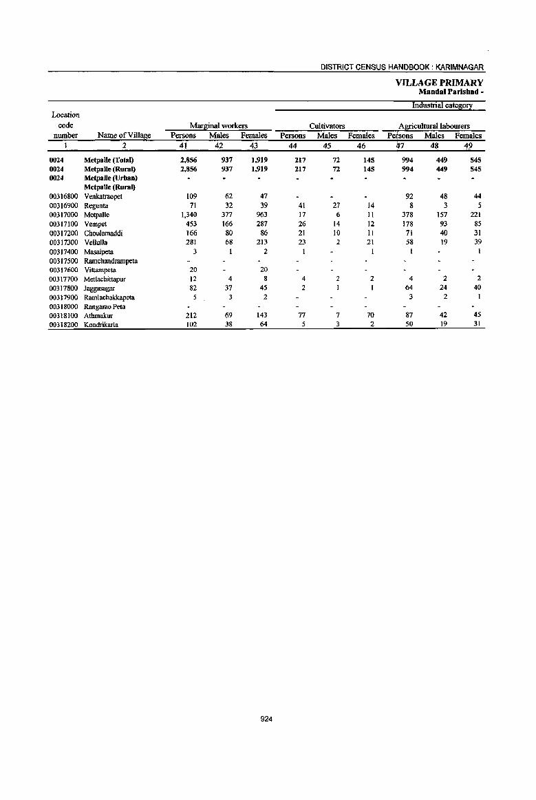
DISTRICT CENSUS HI\NDBOOK : KARIMNAGAR
VILLAGE PRIMARY Mandai Parishad -
Industrial cate~0!I Location
code ~ar~U1al\¥orkers Cultivators A~culturallabourers number Name ofVill~e Persons ~ales Females Persons ~ales Females Persons ~ales Females
1 2 41 42 43 44 45 46 47 48 49
0024 Metpalle (Total) 2,856 937 1,919 217 72 145 994 449 545 0024 Metpalle (Rural) 2,856 937 1,919 217 72 145 994 449 545 0024 Metpalle (Urban)
Metpalle (Rural) 00316800 Venkatrnopet 109 62 47 92 48 44 00316900 Regunta 71 32 39 41 27 14 8 3 .5 00317000 Metpalle 1,340 377 963 17 6 Il 378 157 221 00317100 Vempet 453 166 287 26 14 12 178 93 85 00317200 Choulamaddi 166 80 86 21 10 II 71 40 31 00317300 Vellulla 281 68 213 23 2 21 58 19 39 00317400 Masaipeta 3 2 I 00317500 Ramcbandrampeta 00317600 Vittampeta 20 20 00317700 Metlacbittapur 12 4 8 4 2 2 4 2 2 00317800 Jaggasagar 82 37 45 2 I 64 24 40 00317900 Ram1acbakkapeta 5 3 2 3 2 00318000 Rangarao Peta 00318100 Atbmakur 212 69 143 77 7 70 87 42 45 00318200 Kondrikarla 102 38 64 5 3 2 50 19 31
924
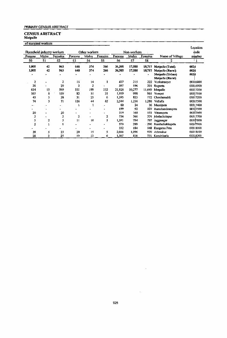
PRIMARY CENSUS ABSTRACT
CENSUS ABSTRACT Metpalle
of mar~inal workers
Household industry workers Other workers Non-workers PefSOns Males Females Persons Males Females Persons Males Females
50 51 52 53 54 55 56 57 58
1,005 42 963 640 374 266 36,305 17,588 18,717 Metpalle (Total) .1,005 42 963 640 374 266 36,305 . 17,588 18,717 MetpaUe (Rural)
Metpalle (Urban) Metpalle (Rural)
2 2 15 14 437 215 222 Venkatraopet 003 6800 20 20 2 2 397 196 201 Regunta 003 6900
614 15 599 331 199 132 21,926 10,277 11,649 Metpal1e 003 7000 167 8 159 82 51 31 1,959 998 961 Vempet 003 7100 43 5 38 31 25 6 1,595 823 772 Choulamaddi 003 7200 74 3 71 126 44 82 2,544 1,256 1,288 Vellulla 003 7300
1 60 24 36 Masaipeta 003 7400 199 92 107 Ramchandrampeta 003 7500
20 20 319 168 151 Vittamptlta 003 7600 2 2 2 2 734 360 374 _Metlachittapur 003 7700 5 2 3 II 10 1,591 794 797 Jaggasagar 003 7800 2 579 289 290 Ramlachakkapeta 003 17900
332 184 148 Rangarao Peta 003 18000 28 5 23 20 15 5 2,066 1,096 970 Athmakur 003 18100 28 3 25 19 13 6 1,567 816 751 Kondrikarla 003 1 200
925

DISTRICT CENSUS ~NDBOOK: KARIMNAGAR
VILLAGE PRIMARY . Mandai Parishad -
Total population (including Location Area of institutional and houseless Population in the
code Village in Nwnberof EOEulation l age-![oul! 0-6 nwnber Name ofViUage hectares households Persons Males Females Persons Males Females
I 2 3 4 5 6 7 8 9 10
0025 Katblapur (Total) 17,762.0 10,045 42,786 20,491 22,295 5,943 2,946 2,997 0025 Katblapur (Rural) 17,762.0 10,045 42,786 20,491 22,295 5.943 2,946 2,997 0025 Kathlapur (Urban)
Katblapur (Rural) 00318300 Sirkonda 1,473.0 961 4,546 2,162 2,384 577 286 29]
00318400 ThakkallapaUe 1,680.0 727 3,057 1,435 1,622 483 236 247 00318500 Bommena 608.0 582 2,575 1,272 1,303 369 199 170 00318600 Dulur 657.0 392 1,612 761 851 212 104 108 00318700 Naga Matlappakunta 55.0 ---Un-inhabited---00318800 Kathlapur 926.0 790 3).72 1,602 1,670 424 212 212 00318900 Peggerla 439.0 400 1,712 820 892 270 138 132 00319000 Ootpatle 320.0 299 1,132 502 630 165 75 90 00319100 Bhushanrao Peta 809.0 697 2,826 1,369 1,457 377 181 196 00319200 Chinthakunta 2,002.0 601 2,623 1).06 1,417 391 199 192 00319300 Dumpeta 874.0 491 2,155 1,038 1,117 283 133 150 00319400 Posanipeta 540.0 355 1,452 670 782 181 87 94 00319500 Gambhirpur 1,486.0 935 4,220 2,056 2,164 532 258 274 00319600 Thandriya1 1,083.0 1,012 4,130 1,929 2,201 646 315 331 00319700 Ippapatle 778.0 297 1,204 575 629 172 89 83 00319800 Potharam 994.0 427 1,898 946 952 266 129 137 00319900 Kalikota 796.0 381 1,446 709 737 220 III 109 00320000 Ambaripet 883.0 528 2).57 1,119 1,138 264 125 139 00320100 Thurthi 1,359.0 170 669 320 349 III 69 42
926
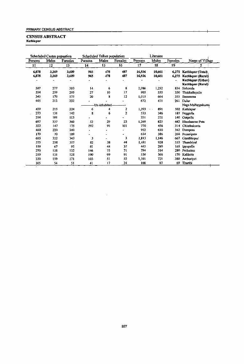
PRIMARY CENSUS ABSTRACT
CENSUS ABSTRACT Kathlapur
Scheduled Castes ~o~uation Scheduled Tribes [!o[!ulation Literates Persons Males Females Persons Males Females Persons Males Females Name QfVill e
11 12 13 14 15 16 17 18 19 2
6,878 3,269 3,609 965 478 487 16,936 10,661 6,275 Katblapur (Total) 6,878 3,269 3,609 965 478 487 16,936 10,661 6,275 Katblapur (Rural)
Katblapur (Urban Kathla pur (Rural)
587 277 310 14 6 8 2,086 1,252 834 Sirkonda 554 259 295 27 10 17 905 555 350 Thakkallapalle 345 170 175 20 8 12 1,015 664 351 Bommena 44S 213 232 672 411 261 Dulur
Un-inhabited Naga Mallappakun~ 439 215 224 6 4 2 1,393 891 502 Kathlapur 273 131 142 8 6 2 533 346 187 Peggerla 214 101 113 351 211 140 Ootpalle 697 337 360 52 29 23 1,269 827 442 Bhushanrao Peta 322 147 175 192 91 101 770 456 314 Chinthakunta 460 220 240 952 610 342 Dumpeta 179 70 109 654 386 268 Posanipeta 665 322 343 3 3 1,813 1,146 667 Gambhirpur 575 258 317 82 38 44 1,481 928 553 Thandriyal 159 67 92 81 44 37 445 280 165 Ippapalle 270 138 132 146 75 71 794 514 280 Potharam 259 131 128 190 99 91 536 366 170 Kalikota 330 159 171 103 51 52 1,101 721 380 Ambaripet 105 54 51 41 17 24 166 97 69 Thurthi
927
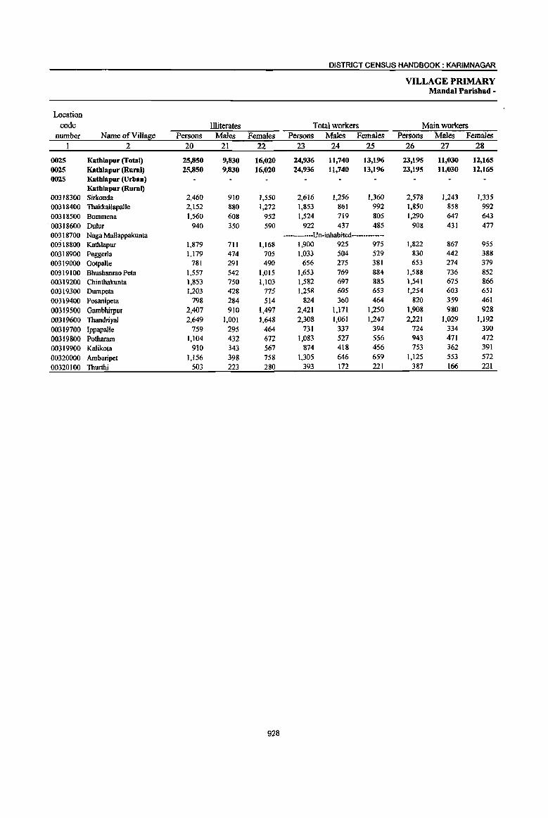
DISTRICT CENSUS HANDBOOK: KARIM NAGAR
VILLAGE PRIMARY Mandai Parishad -
Location code Illiterates Total workers Main workers
number Name ofViII!!Se Persons Males Females Persons Males Females Persons Males Females 2 20 21 22 23 24 25 26 27 28
0025 Kathlapur (Total) 25,850 9,830 16,020 24,936 11,740 13,196 23,195 11,030 12,165 0025 Kathlapur (Rural) 25,850 9,830 16,020 24,936 11,740 13,196 23,195 11,030 12,165 0025 Kathlapur (Urban)
Kathlapur (Rural) 00318300 Sirkonda 2,460 910 1,550 2,616 1,256 1,360 2,578 1,243 1,335 00318400 Tbakkallapalle 2,152 880 1,272 1,853 861 992 1,850 858 992 00318500 Bommena 1,560 608 952 1,524 719 805 1,290 647 643
, 00318600 Dulur 940 350 590 922 437 485 908 431 477 00318700 Naga Mallappakunta ---Un-inhabited--------00318800 Kathlapur 1,879 711 1,168 1,900 925 975 1,822 867 955 00318900 Peggerla 1,179 474 705 1,033 504 529 830 442 388 00319000 Ootpalle 781 291 490 656 275 381 653 274 379
00319100 Bhushanrao Peta 1,557 542 1,015 1,653 769 884 1,588 736 852 00319200 Chinthakunta 1,853 750 1,103 1,582 697 885 1,541 675 866 00319300 Dumpeta 1,203 428 77S 1,258 605 653 1,254 603 651
00319400 Posanipeta 798 284 514 824 360 464 820 359 461
00319500 Gambhirpur 2,407 910 1,497 2,421 1,171 1,250 1,908 980 928
00319600 Thandriyal 2,649 1,001 1,648 2,308 1,061 1,247 2,221 ],029 1,192
00319700 Ippapalle 759 295 464 731 337 394 724 334 390
00319800 Potharam 1,104 432 672 1,083 527 556 943 471 472
00319900 Kalikota 910 343 567 874 418 456 753 362 391
00320000 Ambaripet 1,156 398 758 1,305 646 659 1,125 553 572
00320100 Thurthi 503 223 280 393 172 221 387 166 221
928

PRIMARY CENSUS ABSTRACT
CENSUS ABSTRACT Kathlapur
Industrial catel!i0!I ofmain workers Household industry
Cultivators Agricultural labourers workers Other workers Persons Males Femrues Persons Males Females Persons Males Females Persons Males Females NameofV' e
29 30 31 32 33 34 35 36 37 38 39 40 2
7,036 3,903 3,133 5,377 3,016 2,361 6,685 803 5,882 4,097 3,308 789 Kathlapur (Total) 7,036 3,903 3,133 5,377 3,016 2,361 6,685 803 5,882 4,097 3,308 789 Katblapur (Rural
Katblapur (Vrba )
423 244 179 914 534 380 842 106 736 399 359 40 Kathlapur (Rural Sirkonda '
472 266 206 586 299 287 435 47 388 357 246 III Thakka1lapalle 403 217 186 338 204 134 302 25 277 247 201 46 Bommena 366 190 176 158 77 81 187 42 145 197 122 75 Dulur
Un-inhabited--- Naga Mallappakun~ 660 365 295 332 167 165 512 58 454 318 277 41 Kathlapur 406 215 191 III 74 37 158 12 146 155 141 14 Peggerla 308 149 159 86 40 46 166 8 158 93 77 16 Ootpalle 370 199 171 445 229 216 514 91 423 259 217 42 Bhushanrao Peta 642 341 30] 303 156 147 355 32 323 241 146 95 Chinthakunta 226 123 103 386 251 135 500 107 393 142 122 20 Dumpeta 223 Il3 llO 245 127 118 253 37 216 99 82 17 Posanipeta 556 357 1~9 355 222 133 624 68 556 373 333 40 Gambhirpur 641 353 288 418 248 170 768 82 686 394 346 48 Thandriyal 349 176 173 125 57 68 154 27 127 96 74 22 Ippapalle 241 161 80 246 137 109 231 52 179 225 121 104 Potharam 288 150 138 129 75 54 178 I 177 158 136 22 Kalikota 326 209 117 117 72 45 396 8 388 286 264 22 Ambaripet
. 136 75 61 83 47 36 110 110 58 44 14 Thurthi
929

DISTRICT CENSUS HANDBOOK: KARIMNAGAR
VILLAGE PRIMARY Mandai Parisbad -
Industrial cate~o!! Location
code Maq~inal workers Cultivators Agricultura11abourers number Name ofVil1a~e Persons Males Females Persons Males Females Persons Males Females
1 2 4] 42 43 44 45 46 47 48 49
0025 Kathlapur (Total) 1,741 710 1,031 99 38 61 889 423 466 0025 Kathlapur (Rural) 1,741 710 1,031 99 38 61 889 423 466 0025 Kathlapur (Urban)
Kathlapur (Rural) 00318300 Sirkonda 38 13 25 20 7 13 00318400 TbakkaJlapalle 3 3 00318500 Bommena 234 72 162 2 2 133 53 80 00318600 Dulur 14 6 8 IO 3 7 00~18700 Naga Mallappakunta ---Un-inhabited----00318800 Kathlapur 78 58 20 1 I 40 24 16 00318900 Peggerla 203 62 141 52 19 33 59 21 38 00319000 Ootpalle 3 I 2 3 I 2 00319100 Bhushanrao Peta 65 33 32 3 2 30 16 14 00319200 Chinthakunta 41 22 19 4 4 29 14 15 00319300 Dumpeta 4 2 2 3 I 2 00319400 Posanipeta 4 1 3 1 00319500 Gambhirpur 513 191 322 7 3 4 205 112 93 00319600 Thandriyal 87 32 55 13 3 10 54 19 35 00319700 IppapaUe 7 3 4 I 00319800 Potharam 140 56 84 12 5 7 56 25 31 00319900 Kalikota 121 56 65 2 2 86 38 48 00320000 Ambaripet 180 93 87 156 85 71 00320100 Thurthi 6 6 2 2 3 3
930

PRIMARY CENSUS ABSTRACT
CENSUS ABSTRACT Kathlapur
of mar~inal workers •
Household industry workers Other workers Non-workers Persons Males Females Persons Males Females Persons Males Females Name of Villa e
50 51 52 53 54 55 56 57 58 2
499 55 444 254 194 60 17.850 8,751 9,099 Katblapur (Total) 499 55 444 254 194 60 17.850 8,751 9,099 Katblapur(Rural)
Katblapur (Urban) Kathlapur (Rural)
14 3 II 4 3 1,930 906 1,024 Sirkonda 003 8300 2 2 1,204 574 630 Thakkallapalle 003 8400
79 5 74 20 14 6 1,051 553 498 Bommena 003 8500 1 I 3 3 690 324 366 Dulur 003 8600
Un-inhabited Naga Mallappakunta 003 8700 I 1 36 33 3 1,372 677 695 Kathlapur 003 8800
78 12 66 14 10 4 679 316 363 Peggerla 003 8900 476 227 249 OotpaIle 003 9000
9 2 7 23 14 9 1,173 600 573 Bhushanrao Peta 003 9100 5 4 3 3 1,041 509 532 Chinthakunta 0031 9200
1 I 897 433 464 Dumpeta 0031 9300 3 1 2 628 310 318 Posanipeta 0031 9400
227 24 203 74 52 22 1,799 885 914 Garnbhirpur 0031 9500 7 7 13 10 3 1,822 868 954 Thandriyal I 1 4 2 2 473 238 235 Ippapalle
50 7 43 22 19 3 815 419 396 Potharam II II 22 18 4 572 291 281 KaJikota 15 IS 9 8 1 952 473 479 Ambaripet
1 276 148 128 Thurthi
931
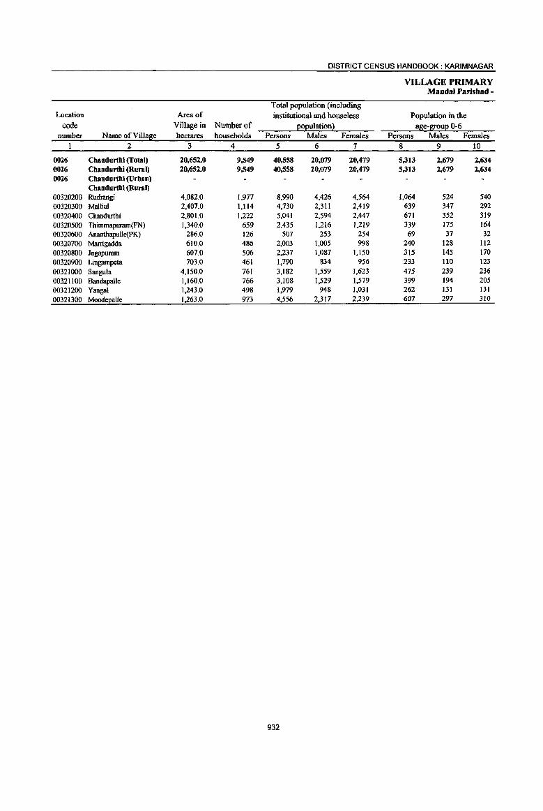
DISTRICT CENSUS HANDBOOK: KARIMNAGAR
VILLAGE PRIMARY MandaI Parishad -
Total population (including Location Area of institutional and houseless Population in the
code Village in Number of ~o~ulationl age-B!:0u~ 0-6 number Name ofVilIa~e hectares households Persons Males Females Persons Males Females
2 3 4 5 6 7 8 9 io
0026 Chandurthi (fotal) 20,652.0 9,549 40,558 20,079 20,479 5,313 2,679 2,634 0026 Cbandurthi (Rural) 20,652.0 9,549 40,558 20,079 20,479 5,313 2,679 2,634 0026 Cbandurthi (Urban)
Chandurthi (Rural) 00320200 Rudrangi 4,082.0 1,977 8,990 4,426 4,564 1,064 524 540 00320300 Mallia! 2,407.0 1,114 4,730 2,311 2,419 639 347 292 00320400 Chandurthi 2,801.0 1,222 5,041 2,594 2,447 671 352 319
00320500 Thimmapuram(PN) 1,340.0 659 2,435 1,216 1,219 339 175 164 00320600 Anantbapalle(PK) 286.0 126 507 253 254 69 37 32 00320700 Marrigadda 610.0 486 2,003 1,005 998 240 128 112 00320800 Jogapuram 607.0 506 2,237 1,087 1,150 315 145 170
00320900 Lingampeta 703.0 461 1,790 834 956 233 lIO 123
00321000 Sangula 4,150.0 761 3,182 1,559 1,623 475 239 236
00321100 Bandapalle 1,160.0 766 3,108 1,529 1,579 399 194 205 00321200 Yangal 1,243.0 498 1,979 948 1,031 262 131 131
00321300 MoodepaUe 1.263.0 973 4,556 2,317 2,239 607 297 310
932
PRIMARY CENSUS ABSTRACT
CENSUS ABSTRACT Chaodurthi
Scheduled Castes I!ol!uation Scheduled Tribes l!oEulation Literates Persons Males Females Persons Males Females Persons Males Females NameofVill e
11 12 13 14 15 16 ,17 18 19 2
7,427 3,672 3,755 932 507 425 16,023 10,300 5,723 Chandurthi (Total) 7,427 3,672 3,755 932 507 425 16,023 10,300 5,723 Chandurthi (Rural)
Chandurthi (Urban Chandurthi (Rural)
1,.284 641 643 287 157 130 3,380 2,1l2 1,268 Rudrangi 1,027 512 515 23 7 16 1,729 1,116 613 Mallial 1,139 562 577 62 50 12 2,216 1,472 744 Chandurthi
493 248 245 5 2 3 919 597 322 Thimmapuram(pN) 30 13 17 162 102 60 Ananthapalle(PK)
289 145 144 936 614 322 Marrigadda 267 123 144 5 3 2 961 614 347 Jogapuram
472 222 250 660 406 254 Lingampeta 469 230 239 501 264 237 1,083 703 380 Sangula 636 312 324 14 7 7 1,289 822 467 Bandapalle 315 156 159 27 13 14 728 474 254 Yanga1
1,006 508 498 8 4 4 1,960 1,.268 692 Moodepalle
933

DISTRICT CENSUS HANDBOOK: KARIM NAGAR
VILLAGE PRIMARY Mandai Parishad -
Location code Illiterates Total workers Main workers
number Name ofVill~e Persons Males Females Persons Males Females Persons Males Females 1 2 20 21 22 23 24 25 26 27 28
0026 Cbandurthi (fotal) 24,535 9,779 14,756 23,090 11,482 11,608 21,763 11.052 10,711 0026 Cbandurtbi (Rural) 24,535 9,779 14,756 23,090 11,482 11,608 21,763 11,052 10,711 0026 Chandurtbi (Urban)
Chandurthi (Rural) 00320200 Rudrangi 5,610 2,314 3,296 5,213 2,568 2,645 4,893 2,429 2,464 00320300 Mallia! 3,001 1,195 1,806 2,651 1,237 1,414 2,572 1,215 1,357 00320400 Chandurthi 2,825 1,122 1,703 2,732 1,389 1,343 2,703 1,371 1,332 00320500 Thimmapuram(pN) 1,516 619 897 1,288 720 568 1,072 662 410 00320600 Ananthapalle(PK) 345 lSI 194 336 157 179 298 147 151 00320700 Marrigadda 1,067 391 676 1,152 576 576 1,055 541 514 00320800 Jogapuram 1,276 473 803 1,185 628 557 1,143 619 524 00320900 Lingampeta 1,130 428 702 1,048 474 574 1,014 456 558 00321000 Sangula 2,099 856 1,243 1,789 883 906 1,458 821 637 00321100 Bandapalle 1,819 707 1,112 1,777 905 872 1,735 897 838 00321200 Yanga! 1,251 474 177 1,139 529 610 1,084 509 575 00321300 MoodeEa!le 2,596 1,049 1,547 2,780 1,416 1,364 2,736 1,385 1,351
934
PRIMARY CENSUS ABSTRACT
CENSUS ABSTRACT Cbandurthi
Industrial cates0!X of main workers Household industry
Cultivators Agricultural labourers workers Other workers Persons Males Females Persons Males Females Persons Males Females Persons Males Females
29 30 3.1 ·32 33 34 35 36 37 38 39 40
7,339 4,473 2,866 6,384 3,354 3,030 4,989 902 4,087 3,051 2,323 728 Chandurthi (To I) 7,339 4.473 2.866 6,384 3,354 3,030 4,989 902 4.087 3,051 2,323 728 Chandurthi (Ru I)
Chandurthi (Urb n)
1,273 746 527 1,772 1,043 729 1,178 104 1,074 670 536 134 Chandurtbi (Ru'1'l) Rudrangi
897 493 404 642 357 285 580 24 556 453 341 112 Mallia! 830 53{) 300 730 361 369 694 136 558 449 344 105
"""".rthi * 371 301 70 391 217 174 173 24 149 137 120 17 Thimmapuram{p 135 87 48 IS 2 13 54 6 48 94 52 42 Ananthapalle(PK) 314 202 Il2 274 122 152 320 92 228 147 125 22 Marrigadda 355 234 121 367 218 149 272 21 251 149 146 3 Jogapuram 372 232 140 182 81 101 291 5 286 169 138 31 Lingampeta 658 399 259 287 168 119 391 157 234 122 97 25 SanguJa 887 477 410 511 258 253 220 73 147 I17 89 28 8andapalle 164 130 34 512 202 310 226 41 185 182 136 46 Yangal
1,083 642 441 701 325 376 590 219 371 362 199 163 Moodepalle
935

DISTRICT CENSUS HANDBOOK: KARIMNAGAR
VILLAGE PRIMARY MandaI Parishad -
Industrial cate~0!X Location
code Mar~inal workers Cultivators Agricultural labourers number Name ofVilla~e Persons Males Females Persons Males Females Persons Males Females
I 2 41 42 43 44 45 46 47 48 49
0026 Chandurthi (I'ol81) 1.327 430 897 73 31 42 721 284 437 0026 Chandurthi (Rural) 1.327 430 897 73 31 42 721 284 437 0026 Chandurthi (Urban)
Chandurthi (Rural) 00320200 Rudrangi 320 139 181 11 8 3 212 126 86 00320300 Mallia! 79 22 57 27 11 16 28 8 20 00320400 Chandurthi 29 18 II 2 2 20 12 8 00320500 Thimmapuram(pN) 216 58 158 4 4 77 20 57 00320600 Ananthapalle(PK) 38 10 28 2 2 00320700 Marrigadda 97 35 62 5 2 3 57 16 41 00320800 Jogapuram 42 9 33 8 4 4 13 5 8 00320900 Lingampeta 34 18 16 26 J3 13 00321000 Sangula 331 62 269 12 11 204 44 160 00321100 Bandapalle 42 8 34 11 5 6 00321200 Yangal 55 20 35 47 16 31 00321300 Moode~a1le 44 31 13 3 2 24 17 7
936

PRIMARY CENSUS ABSTRACT
CENSUS ABSTRACT Cbandurtbi
of mar~inal workers .
Household industry workers . "Other workers Non-workers Persons Males Females Persons Males Females Persons Males Females Name or Villa e
50 51 52 53 54 55 56 57 58 2
386 14 372 147 101 46 17,468 8,597 8,871 Chandurthi (Total) 002 386 14 372 147 101 46 17,468 8,597 8,871 Cbandurtbi (Rural) 002
Chandurthi (Urban) 002 Chandurtbi (Rural)
92 92 5 5 3,777 1,858 1,919 Rudrangi 003 0200 19 1 18 5 2 3 2,079 1,074 1,005 Mallia] 003 0300 3 I 2 4 3 I 2,309 1,205 1,104 Chandurthi 003 0400
87 3 84 48 35 13 1,147 496 651 Thimmapuraro(pN) 003 0500 19 1 18 17 7 10 171 96 75 Ananthapalle(PK) 003 0600 21 4 17 14 13 I 851 429 422 Marrigadda 003 0700 21 21 1,052 459 593 Jogapuram 003 0800 3 3 4 4 742 360 382 Lingampeta 003 0900
89 3 86 26 14 12 1,393 676 717 SanguJa 003 1000 27 27 4 3 1,331 624 707 Bandapa1le 003 1100
1 I 7 4 3 840 419 421 Yangal 003 1200 4 3 I3 11 2 1,776 901 875 Moode aile 003 1300
937
DISTRICT CENSUS HANDBOOK: KARIMNAGAR
VILLAGE PRIMARY Mandai Parishad -
Total population (including Location Area of institutional and houseless Population in the
code Village in Number of (!o(!uiation} ase-l[ou(! 0-6 number Name of Village hectares households Persons Males Females Persons Males Females
1 2 3 4 5 6 7 8 9 10
0027 Kodimial (Total) 15,046.0 10,342 42,346 20,719 21,627 5,825 2,961 2,864 0027 Kodimial (Rural) 15,046.0 10,342 42,346 20,719 21,627 5,825 2,961 2,864 0027 Kodimial (Urban)
Kodimial (Rural) 00321400 Surampeta 1,429.0 326 1,306 649 657 231 109 122 00321500 Konapur 710.0 295 1,196 589 607 178 86 92 00321600 Potharam 818.0 204 922 477 445 148 78 70 00321700 Thiramalapur 782.0 441 1,679 797 882 235 118 117 00321800 Sanivarampeta 220.0 llS 448 227 221 53 32 21 00321900 Ramsagar 1,225.0 734 3,089 1,529 1,560 396 188 208 00322000 Nachupalle 1,508.0 1,060 4,246 2.094 2.152 520 262 258 00322100 Kodimial 1,580.0 2,602 10,752 5,217 5,535 1,448 748 700 00322200 Kondapur 917.0 228 950 464 486 170 81 89 00322300 NalJagonda 987.0 351 1,403 664 739 191 97 94 00322400 Thippaipalle 668.0 527 2.003 959 1,044 282 155 127 00322500 Cheppial 904.0 749 3,190 1.577 1,613 425 224 201 00322600 Pudur 1,218.0 1,387 5,878 2.938 2,940 819 424 395 00322700 Gourapur 611.0 294 1,156 549 607 1St 77 74 00322800 Namilikonda 1,469.0 1,029 4,128 1,989 2,139 578 282 296
938
PRIMARY CENSUS ~BSTRACT
CENSUS ABSTR1\.CT Kodimial
Scheduled Castes l!o2uation Scheduled Tribes 222ulation Literates Persons Males Females Persons Males Females Persons Males Females NameofVill e
II 12 13 14 15 16 17 18 19 2
8,538 4,206 4,332 879 441 438 16,984 10,575 6,409 Kodimial (Total) 8,538 4,206 4,332 879 441 438 16,984 10,575 6,409 Kodimial (Rural)
Kodimial (Urban) Kodimial (Rural)
156 78 78 568 282 286 326 215 III Surampeta 220 112 108 18 9 9 445 273 172 Konapur 102 55 47 175 117 58 Potharam 35i 171 180 13 7 6 639 408 231 Thiramalapur 139 74 65 181 107 74 Sanivarampeta 642 324 318 9 5 4 1,333 820 513 Ramsagar 866 418 448 84 44 40 1,699 1,067 632 Nachupalle
2,550 1,260 1,290 34 18 16 4,870 2,926 1,944 Kodimial 190 92, 98 250 159 91 Kondapur 244 123 121 453 289 164 Nallagonda 387 185 202 12 7 5 799 488 311 ThippaipalJe 581 272 309 36 20 16 1,208 178 430 Cheppial 787 385 402 74 34 40 2,559 1,621 938 Pudur 330 159 171 3JJ Ii,. 209 102 Gourapur 993 498 495 31 15 16 1,736 1,098 638 Namilikonda
939
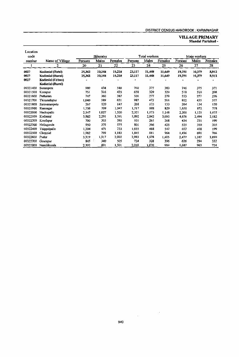
DISTRICT CENSUS HANDBOOK: KARIMNAGAR
VILLAGE PRIMARY Mandai Parishad -
Location
code Hliterates Total workers Main workers number Name ofVil1~e Persons Males Females Persons Males Females Persons Males Females
1 2 20 21 22 23 24 25 26 27 28
0027 Kodimial (Total) 25,362 10,144 15,218 23,117 11,468 11,649 19,291 10,379 8,912 0027 Kodimial (Rural) 25,362 10,144 15,218 23,117 11,468 11,649 19.291 10,379 8.912 0027 Kodimial (Urban)
Kodimial (Rural) 00321400 Surampeta 980 434 546 760 377 383 746 375 371 00321500 Konapur 751 316 435 658 329 329 518 310 208 00321600 Pothararn 747 360 387 556 277 279 553 277 276 00321700 Thiramalapur 1,040 389 651 987 473 514 812 435 377 00321800 Sanivarampeta 267 120 147 268 135 133 264 134 130 00321900 Ramsagar 1,756 709 1,047 1,717 888 829 1,650 872 778 00322000 Nachupalle 2,547 1,027 1,520 2,321 1,173 1,148 2,200 1,125 1,075 00322100 Kodimial 5,882 2,291 3,591 5,892 2,842 3,050 4,676 2,494 2,182 00322200 Kondapur 700 305 395 531 263 268 434 235 199 00322300 NalJagonda 950 375 575 801 366 435 535 330 205 00322400 Thippaipalle 1,204 471 733 1,035 488 547 657 458 199 00322500 Cheppial 1,982 799 1,183 1,845 881 964 1,456 690 766 00322600 PudUT 3,319 1,317 2,002 2,983 1,578 1,405 2,477 1,387 1,090 00322700 Gourapur 845 340 505 724 328 396 626 294 332 00322800 Namilikonda 2,392 891 1,501 2,039 1,070 969 1,687 963 724
940
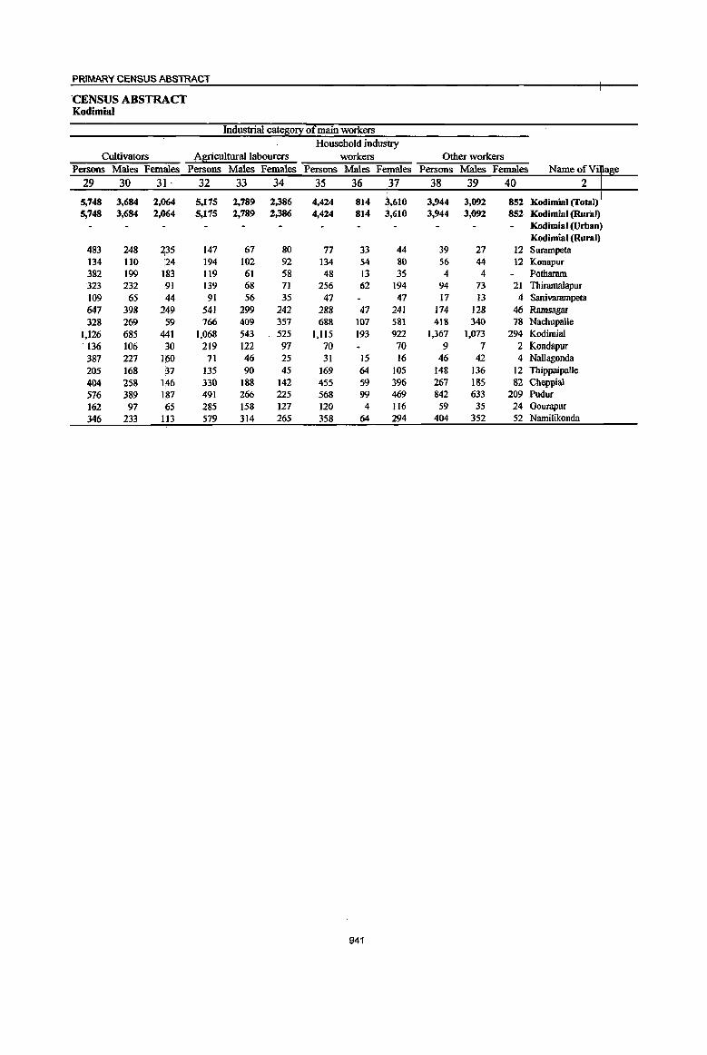
PRIMARY CENSUS ABSTRACT
·CENSUS ABS~CT Kodimial
Industrial cateso!l: of main workers Household induStry
Cultivators A~culturallabourers workers Other workers Persons Males Females Persons Males Females Persons Males Females Persons Males Females Name of Vi e
29 30 31 - 32 33 34 35 36 37 38 39 40 2
5,748 3,684 2,064 5,175 2,789 2,386 4,424 814 i610 3,944 3,092 852 Kod ..... I(T ... ~J 5,748 3,684 2,064 5,175 2,789 2,386 4,424 814 3,610 3,944 3,092 852 Kodimial (Run .. )
Kodimial (Urban
483 147 67 80 33 12 Kodimial (Rural) I
248 235 77 44 39 27 Surampeta 134 110 i24 194 102 92 134 54 80 56 44 12 KonapuT 382 199 183 119 61 58 48 13 35 4 4 Pothararn 323 232 ,91 139 68 71 256 62 194 94 73 21 Thiramalapur 109 65 44 91 56 35 47 47 17 13 4 Saliivarampeta
647 398 249 541 299 242 288 47 241 174 128 46 Ramsagar 328 269 59 766 409 357 688 107 581 418 340 78 Nacbupalle
1,126 685 441 1,068 543 525 1,115 193 922 1,367 1,073 294 Kodimial ·136 106 ao 219 122 97 70 70 9 7 2 Kondapur 387 227 HiO 71 46 25 31 15 16 46 42 4 Nallagonda 205 168 37 135 90 45 169 64 lOS 148 136 12 ThippaipaUe 404 258 146 330 188 142 455 59 396 267 185 82 Cheppial 576 389 187 491 266 225 568 99 469 842 633 209 Pudur 162 97 65 285 158 127 120 4 116 59 35 24 Gourapur 346 233 H3 579 314 265 358 64 294 404 352 52 Namilikonda
941

DISTRICT CENSUS HANDBOOK: KARIMNAGAR
VILLAGE PRIMARY Mandai Parisbad -
Industrial catelii0!X Location
code MarS;inal workers Cultivators Agricultural labourers number Name of Villase Persons Males Females Persons Males Females Persons Males Females
I 2 41 42 43 44 4S 46 47 48 49
0027 Kodimial (Total) 3,826 1,089 2,737 164 55 109 1,962 631 1,331 0027 Kodimial (Rural) 3,826 1,089 2,737 164 55 109 1,962 631 1,331 0027 Kodimial (Urban)
Kodimial (Rural) 00321400 Surampeta 14 2 12 7 2 5 7 7 00321500 Konapur 140 19 121 8 7 89 12 77 00321600 Pothamm 3 3 00321700 Thimrna1apur 175 38 137 3 2 137 30 107 00321800 Sanivarampeta 4 I 3 1 1 00321900 Ramsagar 67 16 51 3 2 20 6 14 00322000 Nacbupalle 121 48 73 4 4 51 13 38 00322100 Kodimial 1,216 348 868 45 22 23 567 209 358 00322200 Kondapur 97 28 69 1 96 27 69 00322300 Nallagonda 266 36 230 18 2 16 111 27 84 00322400 Thippaipalle 378 30 348 26 6 20 195 17 178 00322500 Cheppial 389 191 198 I I 332 162 170 00322600 Pudur 506 ]91 315 6 4 2 190 97 93 00322700 Gourapur 98 34 64 6 4 2 13 8 5 00322800 Namilikonda 352 107 245 36 7 29 153 22 131
942

PRIMARY CENSUS ABSTRACT
CENSUS ABSTRACT Kodimial
of mar~inal workers
Household industry ,,¥orkers Other workers Non-workers Persons Males Females Persons Males Females Persons Males Females
50 51 52 53 54 55 56 57 58
I,OSO 58 992 650 345 30S 19,229 9,251 9,978 Kodirnial (rotal) 002 1,050 58 992 650 345 305 19,229 9,251 9,978 Kodirnial (Rural) 002
Kodimial (Urban) 002 Kodirnial (Rural)
546 272 274 Surampeta 003 1400 37 36 6 5 538 260 278 Konapur 003 1500 3 3 366 200 166 Potharam oo3i1600
28 2 26 7 5 2 692 324 368 Thiramalapur 003i17oo 3 3 180 92 88 Sanivanunpeta 003 1800
34 2 32 10 7 3 1,372 641 731. Ramsagar 003 1900 12 12 54 31 23 1,925 921 1,004 Nachupalle 003 2000
420 20' 400 184 97 87 4,860 2,375 2,485 Kodimia1 419 201 218 Kondapur
133 6 127 4 I 3 602 298 304 Nallagonda 150 4 146 7 3 4 968 471 497 Thippaipalle
15 4 11 41 25 16 1,345 696 649 Cheppial 150 5 145 J60 85 75 2,895 1,360 1,535 Pudur 45 8 37 34 14 20 432 221 21I Gourapur 20 6 14 J43 72 71 2,089 919 1,170 Namilikonda
943
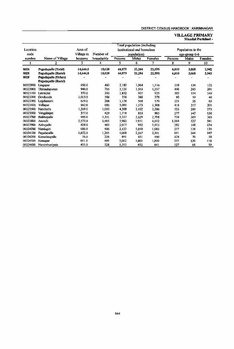
DISTRICT CENSUS HANDBOOK: KARIMNAGAR
VILLAGE PRIMARY MandaI Parishad -
Total population (including Location Area of institutional and houseless Population in the
code Village in Number of e02ulationl !!Se-S!0ue 0-6 number Name ofViIl!!Se hectares hoUseholds Persons Males Females Persons Males Females
I 2 3 4 5 6 7 8 9 10
0028 Pegadapalle (Total) 14,644.0 10,628 44,879 22,284 22,595 6,010 3,068 2,942 0028 PegadapalJe (Rural) 14,644.0 10,628 44,879 22,284 22,595 6,010 3,068 2,942 0028 Pegadapalle (Urban)
Pegadapalle (Rural) 00322900 Lingapur 956.0 460 2,180 1,064 1,116 258 136 122 00323000 Thirmalapuram 940.0 716 3,120 1,563 1,557 446 245 201 00323100 Laxmipur 370.0 390 1,832 907 925 303 154 149 00323200 Devikonda 1,015.0 188 758 380 378 90 50 40 00323300 Legalamarri 619.0 288 1,138 568 570 121 56 65 00323400 Yellapur 942.0 686 3,081 1,573 1,508 418 217 201 00323500 Nancherla 1,269.0 1,010 4,308 2,102 2,206 533 260 273 00323600 Vengalaipet 377.0 429 1,718 853 865 277 147 130 00323700 Bathkepalle 995.0 1,331 5,337 2,629 2,708 734 369 365 00323800 Aravelli 2,575.0 1,905 7,983 3,951 4,032 1,068 527 541 00323900 Aithupalle 828.0 485 2,017 992 1,025 282 148 134 00324000 Nandagiri 686.0 486 2,133 1,050 1,083 277 138 139 00324100 Pegadapalle 1,652.0 1,205 5,068 2,567 2,501 691 344 347 00324200 KeesulatapaUe 74.0 226 891 431 460 128 70 58 00324300 Namapur 911.0 499 2,002 1,002 1,000 257 139 118 00324400 Narsimhuni~ta 435.0 324 1,313 652 661 127 68 59
944
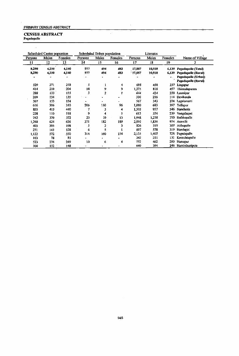
PRIMARY CENSUS ABSTRACT
CENSUS ABSTRACT Pegadapalle
Scheduled Castes eOEuation Scheduled Tribes EOEulation Literates I
Persons Males Females Persons Males Females ~ersons Males Females NameofVill: e Il 12 13 14 15 16 17 18 19 2
I 8,290 4,150 4,140 977 494 483 17,057 10,918 6,139 Pegadapalle (Total~ 8,290 4.150 4,140 977 494 483 : 17.057 10,918 6.139 Pegadapalle (Rural)
Pegadapalle (Urbart) I
271 258 5 695 458 237 Pegadapalle (Rural~
529 I 4 Lingapur 414 210 204 18 9 9 1,275 818 457 Thirmalapuram 288 133 155 3 2 1 644 424 220 Laxmipur 269 134 135 330 216 114 Devikonda 307 153 154 567 343 224 Legalamarri 616 306 310 206 110 96 1.080 683 397 Yellapur 855 415 440 7 3 4 1.503 957 546 Nancherla 228 110 118 9 4 5 613 374 239 Vengalaipet 742 370 372 23 IO 13 1.948 1,238 710 Bathkepalle
1,260 624 636 371 182 189 2.810 1,836 974 Aravelli 403 205 198 5 2 3 826 519 307 Aithupalle 271 143 128 6 5 1 897 578 319 Nandagiri
1,122 572 550 314 160 154 2.135 1,407 128 Pegadapalle
163 78 85 342 211 131 Keesulatapalle
523 274 249 10 6 4 752 462 290 Namapur
300 152 148 640 394 246 Narsimhunipeta
945

DISTRICT CENSUS HANDBOOK: KARIMNAGAR
VILLAGE PRIMARY Mandai Parishad -
Location code llIiterates Total workers Main workers
number Name ofVillae;e Persons Males Females Persons Males Females Persons Males Females 1 2 20 21 22 23 24 25 26 27 28
0028 Pegadapalle (Total) 27,822 11,366 16,456 26,096 13,134 12,962 22,695 11,978 10,717 0028 Pegadapalle (Rural) 27,822 11,366 16,456 26,096 13,134 12,962 22,695 11,978 10,717 0028 PegadapaUe (Urban)
Pegadapalle (Rural) 00322900 LingapuT 1,485 606 879 1,351 651 700 1,324 642 682 00323000 Thinnalapuram 1,845 745 1,100 1,811 909 902 1,397 871 526 00323100 Laxmipur 1,188 483 705 1,090 550 540 1,090 550 540 00323200 Devikonda 428 164 264 444 231 213 430 228 202 00323300 Legalamarri 571 225 346 671 362 309 648 355 293 00323400 YellapuT 2,001 890 1,lll 1,783 944 839 639 476 163 00323500 Nancherla 2,805 1,145 1,660 2,368 1,203 1,165 2,160 1,116 1,044 00323600 Vengalaipet 1,105 479 626 1,048 522 526 1,035 517 518 00323700 Bathkepalle 3,389 1,391 1,998 3,153 1,571 1,582 2,767 1,463 1,304 00323800 Aravelli 5,173 2,115 3,058 4,811 2,375 2,436 4,690 2,314 2,376 00323900 Aithupalle 1,191 473 718 1,158 577 581 593 340 253 00324000 Nandagiri 1,236 472 764 1,180 591 589 998 553 445 00324100 Pegadapalle 2,933 1,160 1,773 2,790 1,404 1,386 2,567 1,334 1,233 00324200 Keesulatapalle 549 220 329 475 236 239 444 225 219 00324300 Namapur 1,250 540 710 1,154 602 552 1,107 589 518 00324400 Narsimhuni~ta 673 258 415 809 406 403 806 405 401
946
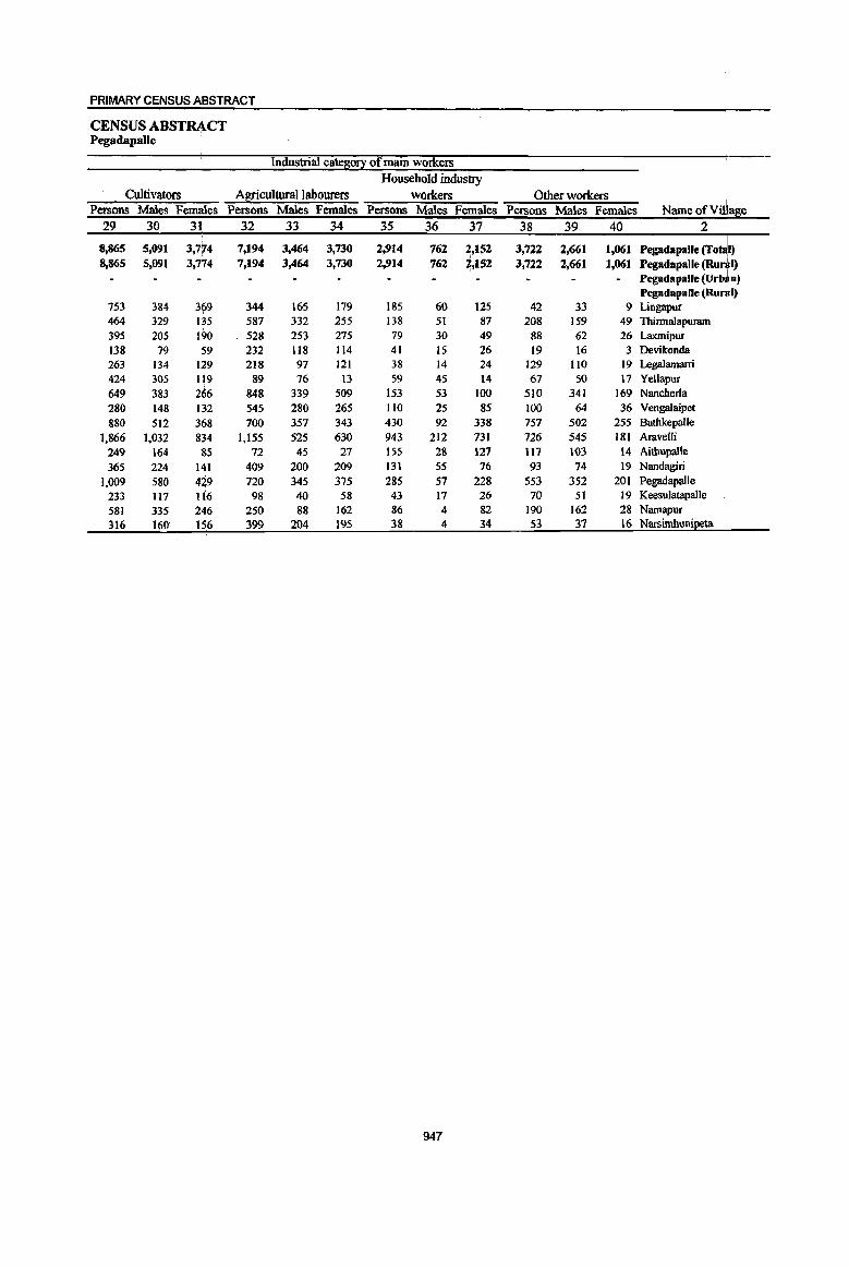
PRIMARY CENSUS ABSTRACT
CENSUS ABSTRACT Pegadapalle
Industrial cate~ of main workers Household industry
Cultivators Agricultural labourers workers Other workers Persons Males Femmes Persons Males Females Persons Males Females Persons Males Females NameofVil e
29 30 31 32 33 34 35 36 37 38 39 40 2
8,865 5,091 3,774 7,194 3,464 3,730 2,914 762 2,152 3,722 2,661 1,061 ~:::::::: ~:j:) 8,865 5,091 3,774 7,194 3,464 3,730 2,914 762 ~,152 3,722 2,661 1,061 Pegadapalle (Urb~n) Pegadapalle (RuJI)
753 384 3(>9 344 165 179 185 60 125 42 33 9 Lingapur I 464 329 135 587 332 255 138 51 87 208 159 49 Thirmalapuram 395 205 190 528 253 275 79 30 49 88 62 26 Laxmipur 138 79 59 232 118 114 41 15 26 19 16 3 Devikonda 263 134 129 218 97 121 38 14 24 129 110 19 Legalamarri
424 305 li9 89 76 13 59 45 14 67 50 17 YeUapur 649 383 266 848 339 509 153 53 100 510 341 169 Nancherla 280 148 132 545 280 265 110 25 85 100 64 36 Vengalaipet 880 512 368 700 357 343 430 92 338 757 502 255 Batbkepalle
].866 1,032 834 1,155 525 630 943 212 731 726 545 181 Aravelli 249 164 85 72 45 27 155 28 127 117 103 14 Aithupalle 365 224 141 409 200 209 131 55 76 93 74 19 Nandagiri
1,009 580 4~9 720 345 375 285 57 228 553 352 201 Pegadapa1le 233 1I7 116 98 40 58 43 17 26 70 51 19 Keesulatapalle 581 335 246 250 88 162 86 4 82 190 162 28 Namapur
.316 160 156 399 204 195 38 4 34 53 37 16 Narsimhunipeta
947
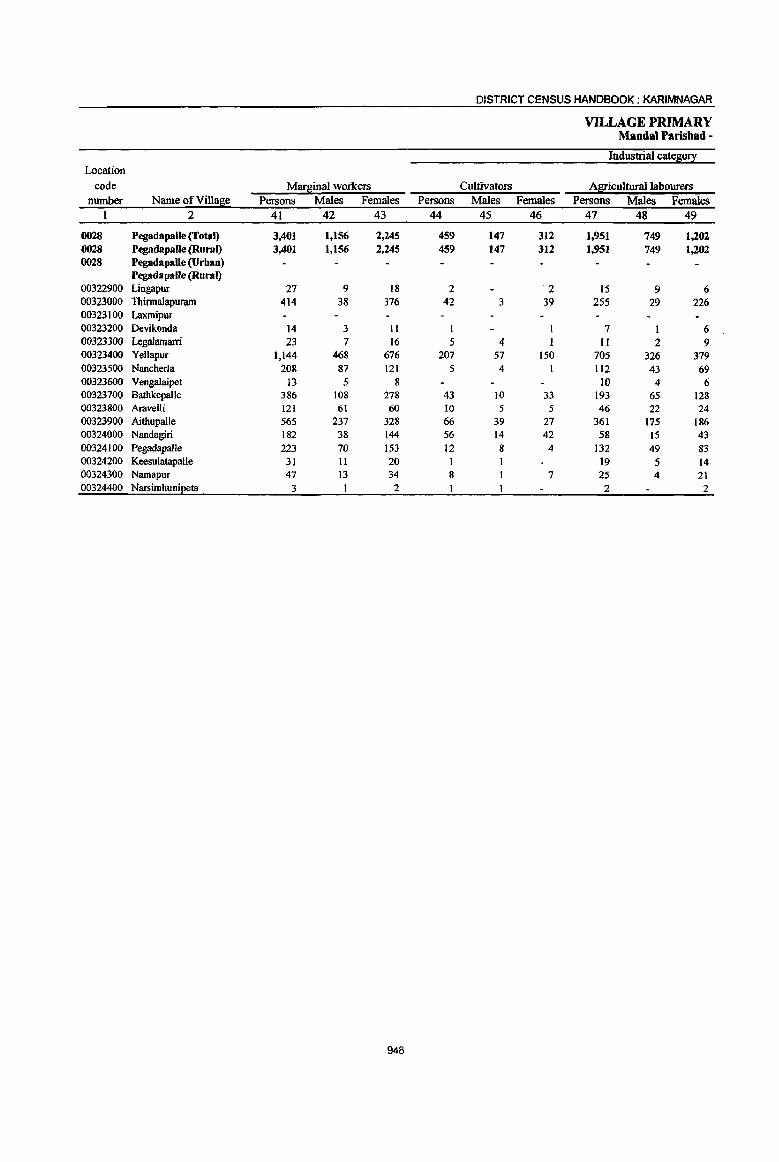
DISTRICT CENSUS HANDBOOK: KARIMNAGAR
VILLAGE PRIMARY MandaI Parishad -
Industrial cate~O!! Location
code Mar~inaJ workers Cultivators Agricultural labourers number Name ofVilla~e Persons Males Females Persons Males Females Persons Males Females
I 2 41 42 43 44 45 46 47 48 49
0028 Pegadapalle (Toml) 3,401 1,156 2,245 459 147 312 1,951 749 1,202 0028 Pegadapalle (Rural) 3,401 1,156 2,245 459 147 312 1,951 749 1,202 0028 Pegadapalle (Urban)
Pegadapalle (Rural) 00322900 Lingapur 27 9 18 2 2 15 9 6 00323000 Thirmalapuram 414 38 376 42 3 39 255 29 226 00323100 Laxmipur 00323200 IXvikonda 14 3 II I I 7 I 6 ()03233oo Legalamarri 23 7 16 5 4 I II 2 9 00323400 YeUapur 1,144 468 676 207 57 150 705 326 379 00323500 Nancherla 208 87 121 5 4 112 43 69 00323600 Vengalaipet 13 5 8 10 4 6 00323700 Bathkepalle 386 108 278 43 10 33 193 65 128 00323800 Aravelli 121 61 60 10 5 5 46 22 24 00323900 Aithupalle 565 237 328 66 39 27 361 175 186 00324000 Nandagiri 182 38 144 56 14 42 58 15 43 00324100 Pegadapalle 223 70 153 12 8 4 132 49 83 00324200 Keesulatapalle 31 11 20 19 5 14 00324300 Namapur 47 13 34 8 7 25 4 21 00324400 N3ISirnhuni~ta 3 2 2 2
948
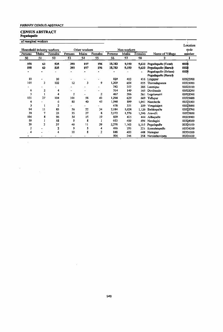
949
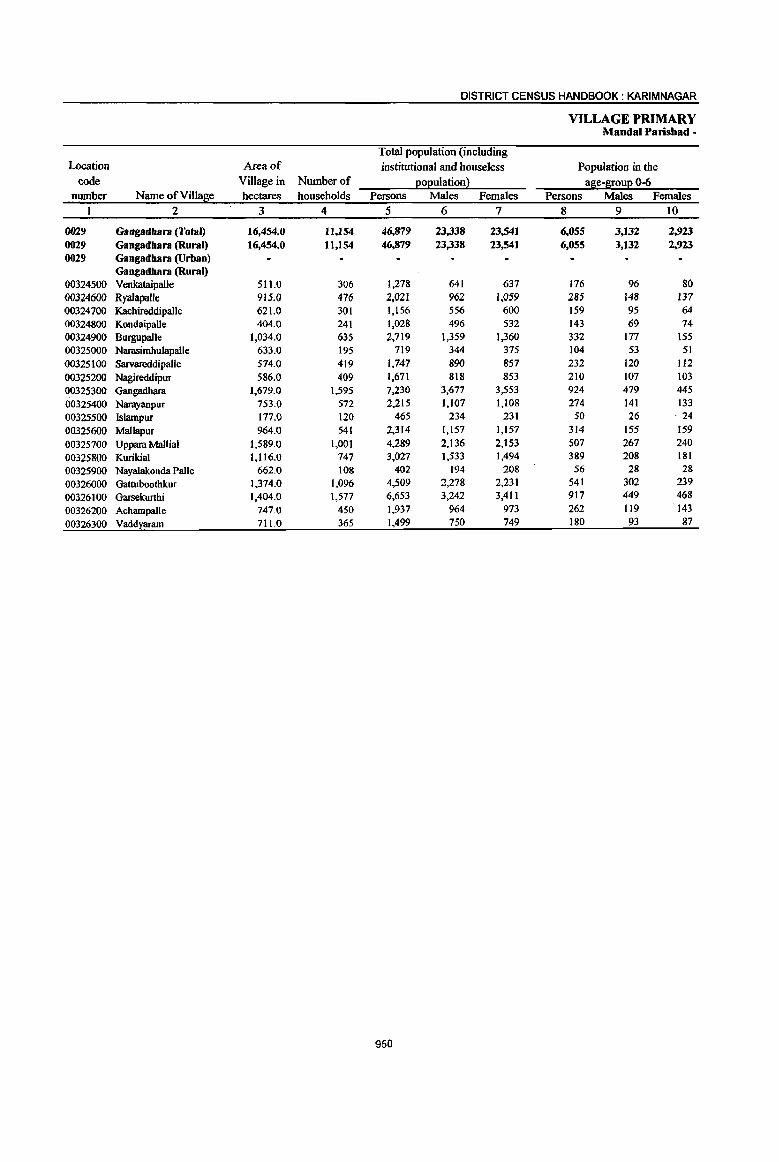
DISTRICT CENSUS HANDBOOK: KARIMNAGAR
VILLAGE PRIMARY Mandai Parishad -
Total population (including Location Area of institutional and houseless Population in the
code Village in Number of l2:o);!ulation2 !!,ge-S!ou);! 0-6 number NameofVm~e hectares households Persons Males Females Persons Males Females
I 2 3 4 5 6 7 8 9 10
0029 Gangadhara (Total) 16,454.0 11,154 46,879 23,338 23,541 6,055 3,132 2,923 0029 Gangadhara (Rural) 16,454.0 1l,1S4 46,879 23,338 23,541 6,055 3,132 2,923 0029 Gangadhara (Urban)
Gangadhara (Rural) 00324500 Venkataipalle 511.0 306 1,278 641 637 176 96 80 00324600 Ryalapalle 915.0 476 2,021 962 1,059 285 148 137 00324700 Kachireddipalle 621.0 301 1,156 556 600 159 95 64 00324800 Kondaipalle 404.0 241 1,028 496 532 143 69 74 00324900 Burgupalle 1,034.0 635 2,719 1,359 1,360 332 177 155 00325000 Narasimhulapalle 633.0 195 119 344 375 104 53 51 00325100 Sarvareddipalle 574.0 419 1,747 890 857 232 120 112 00325200 Nagireddipur 586.0 409 1,671 818 853 210 107 103 00325300 Gangadbara 1,679.0 1,595 7,230 3,677 3,553 924 479 445 00325400 Narayanpur 753.0 572 2,215 1,107 1,108 274 141 133 00325500 Islampur 177.0 120 465 234 231 50 26 ·24 00325600 Mallapur 964.0 541 2,314 1,157 1,157 314 155 159 00325700 Uppara Mallial 1,589.0 1,001 4,289 2,136 2,153 507 267 240 00325800 Kurikial 1,116.0 747 3,027 1,533 1,494 389 208 181 00325900 Nayalakonda Palle 662.0 108 402 194 208 56 28 28 00326000 Gattuboothkur 1,374.0 1,096 4,509 2,278 2,231 541 302 239 00326100 Garsekurthi 1,404.0 1,577 6,653 3,242 3,411 911 449 468 00326200 Achampalle 747.0 450 1,937 964 973 262 119 ·143
00326300 Vaddyaram 711.0 365 1,499 750 749 180 93 87
950

PRIMARY CENSUS ABSTRACT
CENSUS ABSTRACT Gangadhara
Scheduled Castes Eo(!uation Scheduled Tribes p:ol!ulation Literates Persons Males Females Persons Males Females Persons Males Females Name ofViIl~ e
11 12 13 14 15 16 17 18 19 2
9,551 4,845 4,706 284 140 144 21,000 13,234 7,766 Gangadbara (Total 9,551 4,845 4,706 284 140 144 21,000 13,234 7,766 Gangadbara (Rural)
Gangadhara (Urban) Gangadbara (Rural)
211 105 106 518 347 17l Venkataipalle 489 236 253 717 461 256 Ryalapalle 187 89 98 497 302 195 KachireddipaJle 185 93 92 389 248 141 KondaipaJle 438 229 209 25 13 12 1,221 747 474 Burgupalle 164 79 85 269 164 105 Narasimhulapalle 482 249 233 14 6 8 750 493 257 Sarvareddipalle 302 ISS 147 613 379 234 Nagireddipur
1,835 949 886 86 42 44 3,547 2,248 1,299 Gangadhara
522 280 242 14 7 7 973 626 347 Narayanpur 161 82 79 206 134 72 Islampur
445 203 242 25 14 11 914 582 332 Mallapur
678 347 331 14 7 7 2,134 1,289 845 Uppara Mallial
553 275 278 49 25 24 1,435 905 530 Kurikial
5 2 3 ISO 92 58 NayalaIconda Palle
1,011 511 500 4 2 2 2,052 1,323 729 Gattuboothkur
816 416 400 37 16 21 3,038 1,892 1,146 Garsekurthi
481 250 231 II 5 6 864 560 304 Achampalle
58Q 295 291 5 3 2 713 442 271 Vaddyaram
951

DISTRICT CENSUS HANDBOOK: KARIMNAGAR
VILLAGE PRIMARY Mandai Parishad -
Location
code illiterates Total workers Main workers number Name ofVilla~e Persons Males Females Persons Males Females Persons Males Females
1 2 20 21 22 23 24 25 26 27 28
0029 Gangadbara (Total) 25,879 10.104 15,775 26,095 13,117 12,978 22,805 12,002 10,803 0029 Gangadbara (Rural) 25,879 10,104 15,775 26,095 13,117 12,978 22,805 12,002 10,803 0029 Gangadbara (Urban)
Gangadbara (Rural) 00324500 VeokataipaJle 760 294 466 734 367 367 579 335 244 00324600 Ryalapalle 1,304 501 803 1,158 534 624 1,048 480 568 00324700 Kachireddipalle 659 254 405 619 286 333 526 260 266 00324800 Kondaipalle 639 248 391 578 274 304 545 263 282 00324900 Burgupalle 1,498 612 886 1.569 827 742 1,399 757 642 00325000 Narasimhulapalle 450 180 270 436 215 221 434 214 220 00325100 Sarvareddipalle 997 397 600 952 492 460 937 481 456 00325200 Nagireddipur 1,058 439 619 895 443 452 667 329 338 00325300 Gangadhara 3,683 1,429 2,254 3,822 1,952 1,870 2,781 1,538 1,243 00325400 Narayanpur 1,242 481 761 1,299 656 643 1,130 632 498 00325500 Islampur 259 100 159 280 140 140 280 140 140 00325600 Mallapur 1,400 575 825 1,313 681 632 1,188 663 525 00325700 Uppara Mallial 2,155 847 1,308 2,429 1,208 1,221 2,100 1,163 937 00325800 Kurikial 1,592 628 964 1,707 870 837 1,627 862 765 00325900 Nayalakonda Palle 252 102 150 229 106 123 176 99 77 00326000 Gattuboothkur 2,457 955 1,502 2,577 1,331 1,246 2,378 1,260 1,118 00326100 Garsekurthi 3,615 1,350 2,265 3,614 1,747 1,867 3,409 1,673 1,736 00326200 AchampalJe 1,073 404 669 1,127 581 546 1,094 570 524 00326300 Vaddxaram 786 308 478 757 407 350 507 283 224
952
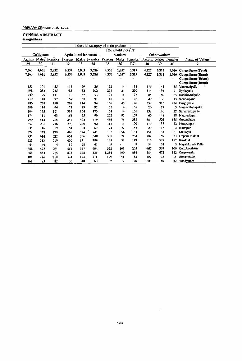
PRIMARY CENSUS ~BSTRACT
CENSUS ABS~CT Gangadbara
Industrial cate~0!X of main workers i Household industry
Cultivators Agricultural labourers workers Other workers .1 Persons Males FemitIes Persons Males Females Persons Males Feinales Persons Males Females Name of Village
29 30 31 32 33 34 35 36 :.37 38 39 40 2 I 7,563 4,631 2,932 6,539 3,003 3,536 4,376 1,057 3,319 4,327 3,311 1,016 Gangadbara (To~l) 7,563 4,631 2,,32 6,539 3,003 3,536 4,376 I,OS7 ~,319 4,327 3,311 1,016 Gangadbara (Rural)
Gangadbara (Urban) Gangadbara (Ru~l)
156 101 55 115 79 36 132 14 118 176 141 35 Venkataipalle 498 283 215 185 83 102 251 21 230 114 93 21 Ryalapalle 240 129 III 110 57 53 91 14 77 85 60 25 Kachireddipalle 219 147 72 159 68 91 118 12 106 49 36 13 Kondaipalle 486 288 198 208 114 94 166 40 126 539 315 224 Burgupalle 208 114 ~4 171 79 92 35 4 31 20 17 3 Narasimhulapalle 304 193 IP 337 164 173 164 14 150 132 lJO 22 Sarvareddipalle 174 111 63 165 75 90 262 95 167 66 48 18 Nagireddipur 799 514 285 842 423 419 456 75 381 684 526 158 Gangadhara
557 281 216 29\) 200 90 113 13 100 170 138 32 Narayanpur 35 16 19 151 84 67 74 22 52 20 18 2 lslampur
377 248 129 465 224 241 192 58 134 154 133 21 MaUapur 936 614 322 654 306 348 308 74 234 202 169 33 Uppara Mallial 523 313 210 400 1I1 289 188 39 149 516 399 117 Kurikial 44 40 4 89 28 61 9 9 34 31 3 Nayalakonda PalJe
688 421 261 851 351 494 372 109 263 467 367 100 Gattuboothkur 668 453 215 813 348 525 1,284 400 884 584 472 112 Garsekurthi 484 214 210 374 163 211 129 4! 88 107 92 15 AchampalJe 167 85 82 100 40 60 32 12 20 208 146 62 Vaddyaram
953

DISTRICT CENSUS HANDBOOK: KARIMNAGAR
VILLAGE PRIMARY Mandai Parisbad -
Industrial cate80!X Location
code Marginal workers Cultivators Agricultural labourers
number Name ofVillase Persons Males Females Persons Males Females Persons Males Females
1 2 41 42 43 44 45 46 47 48 49
0029 Gangadhara (Total) 3,290 1,115 2,175 170 90 80 2,185 704 1,481 0029 Gangadhara (Rural) 3,290 1,115 2,175 176 90 80 2,185 704 1,481 0029 Gangadhara (Urban)
Gangadhara (Rural) 00324500 Venkataipalle 155 32 123 5 4 1 104 20 84 00324600 RyalapaJle 110 54 56 2 I I 85 39 46 00324700 Kachireddipalle 93 26 67 14 6 8 62 18 44 00324800 Kondaipalle 33 11 22 2 1 23 8 15 00324900 Burgupalle 170 70 100 2 2 87 40 47 00325000 Narasimhulapalle 2 1 1 00325100 Sarvareddipalle 15 II 4 14 10 4 00325200 Nagireddipur 228 114 114 21 12 9 182 84 98 00325300 Gangadhara 1,041 414 627 59 38 21 629 266 363 00325400 Narayanpur 169 24 145 3 2 139 21 118 00325500 lslampur 00325600 Mallapur 125 18 107 4 4 90 7 83 00325700 Uppara Mallial 329 45 284 34 10 24 265 21 244 00325800 KurikiaJ 80 8 72 56 4 52 00325900 Nayalakonda Palle 53 7 46 I 1 49 7 42 00326000 Gattuboothkur 199 71 128 6 4 2 128 38 90 00326100 Garsekurthi 205 74 131 5 2 3 61 17 44 00326200 AchampaUe 33 11 22 10 3 7
00326300 Vadd~aram 250 124 126 10 7 3 200 101 99
954
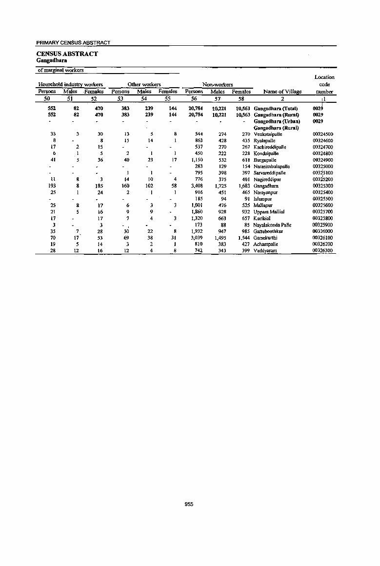
PRIMARY CENSUS ABSTRACT
CENSUS ABSTRACT Gangadhara
of marginal worlcers
Location
Household induS!;!! workers Other workers N<lfi-WOrkers code Persons Males Females Persons Males Females Persons : Males. Females Name ofVill~e number
50 51 52 53 54 55 56 57 58 2 II
552 82 470 383 239 144 20,784 10,221 10,563 Gangadhara (Total) 002 552 82 470 383 239 144 20,784 10,221 10,563. Gangadbara (Rural) 002
Gangadhara (Urban) 0029 Gangadbara (Rural)
33 3 30 13 5 8 544 274 270 Venkataipalle 00324500 8 8 15 14 I 863 428 435 Ryalapalle 00324600
17 2 IS 537 270 267 Kachireddipalle 00324700 6 5 2 450 222 228 Kondaipalle 00324800
41 5 36 40 23 17 1,150 532 618 Burgupalle 00324900 283 129 154 Narasimhulapalle 00325000 795 398 397 Sarvareddipalle 00325100
II 8 3 14 10 4 776 375 40 I Nagireddipur 00325200 193 8 185 160 102 58 3,408 1,725 1,683. Gangadbara 003~5300 25 24 2 916 451 465 Narayanpur 003 15400
185 94 91 Islampur 00325500 25 8 17 6 3 3 1,001 476 525 MaUapur 00325600 21 5 16 9 9 1,860 928 932 Uppara Mallial 00325700 17 17 7 4 3 1,320 663 657 Kurikial 00325800 3 3
t 173 88 85 Nayalakonda Palle 00325900
35 7 28 30 22 8 1,932 947 985 Gattuboothkur 00326000 70 17 53 69 38 31 3,039 1,495 1,544 Garsekurtbi 00326100 19 5 14 3 2 I 810 383 427 Achampal1e 00326200 28 12 16 12 4 8 742 343 399 Vadd~ 00326300
955
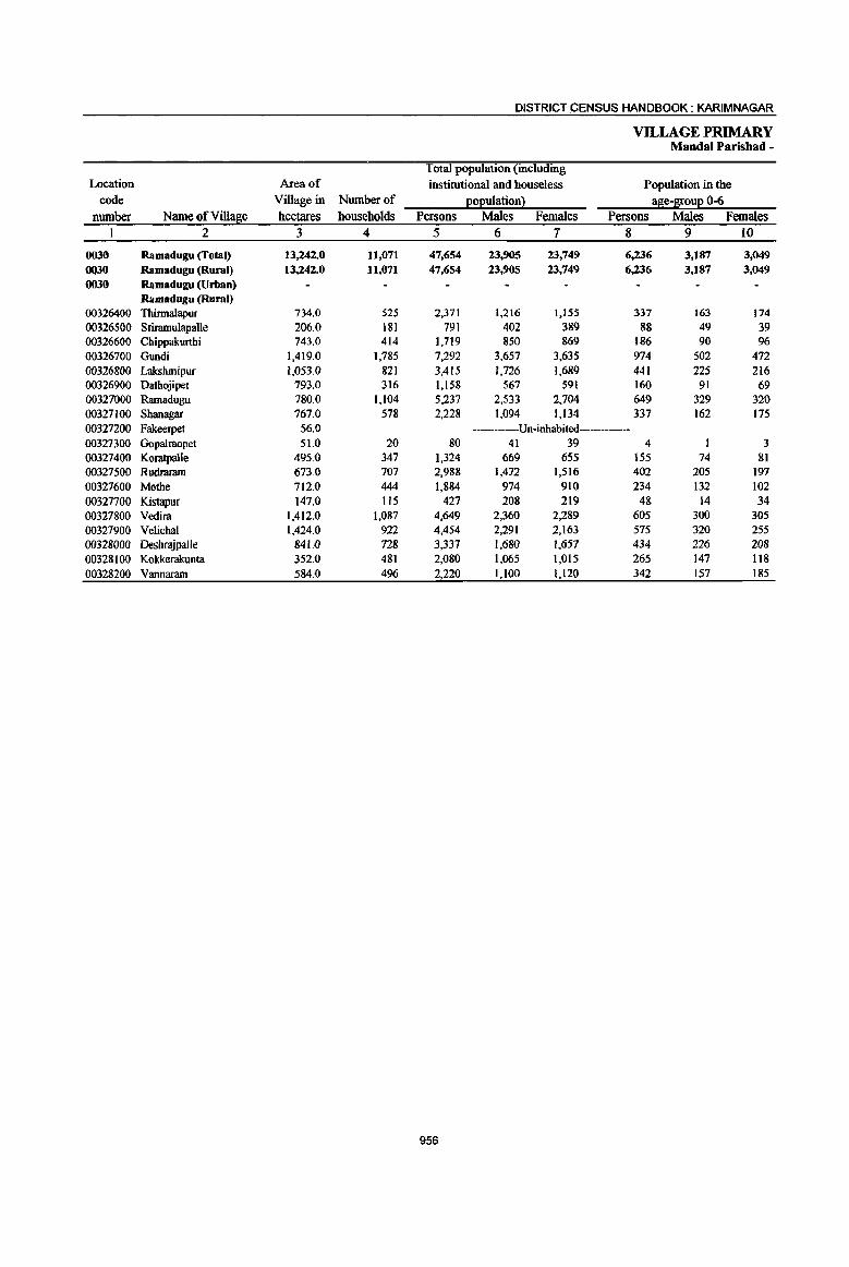
DISTRICT CENSUS HANDBOOK: KARIM NAGAR
VILLAGE PRIMARY Mandai Parishad -
Total population (including Location Area of institutional and houseless Population in the
code Village in Number of eo:euiationl al!ie-~uE°-6 number Name ofVillalrie hectares households Persons Males Females Persons Males Females
1 2 3 4 5 6 7 8 9 10
0030 Ramadugu (Total) 13,242.0 11,071 47,654 23,905 23,749 6,236 3,187 3,049 OQ30 Ramadugu (Rural) 13,242.0 11,071 47,654 23,905 23,749 6,236 3,187 3,049 0030 Ramadugu (Urban)
Ramadugu (Rural) 00326400 Thinnalapur 734.0 525 2,371 1,216 1,155 337 163 )74 00326500 Sriramulapalle 206.0 181 791 402 389 88 49 39 00326600 Chippakurthi 743.0 414 1,719 850 869 186 90 96 00326700 Gundi 1,419.0 1,785 7,292 3,657 3,635 974 502 472 00326800 Lakshrnipur 1,053.0 821 3,415 1,726 1,689 441 225 216 00326900 Dathojipet 793.0 316 1,158 567 591 160 91 69 00327000 Ramadugu 780.0 1,104 5,237 2,533 2,704 649 329 320 00327100 Shanagar 767.0 578 2,228 1,094 1,134 337 162 175 00327200 Fakeerpet 56.0 ----Un-inhabited 00327300 Gopalraopet 51.0 20 80 41 39 4 3 00327400 Koratpalle 495.0 347 1,324 669 655 155 74 81 00327500 Rudraram 673.0 707 2,988 1,472 1,516 402 205 197 00327600 Mothe 712.0 444 1,884 974 910 234 132 102 00327700 Kistapur 147.0 115 427 208 219 48 14 34 00327800 Vedira 1,412.0 1,087 4,649 2,360 2,289 605 300 305 00327900 Velichal 1,424.0 922 4,454 2,291 2,163 575 320 255 00328000 Desbrnjpalle 841.<) 728 3,337 1,680 1,657 434 226 208 00328100 Kokkerakunta 352.0 481 2,080 1,065 1,015 265 147 118 00328200 Vannararn 584.0 496 2,220 1,100 1,120 342 157 185
956
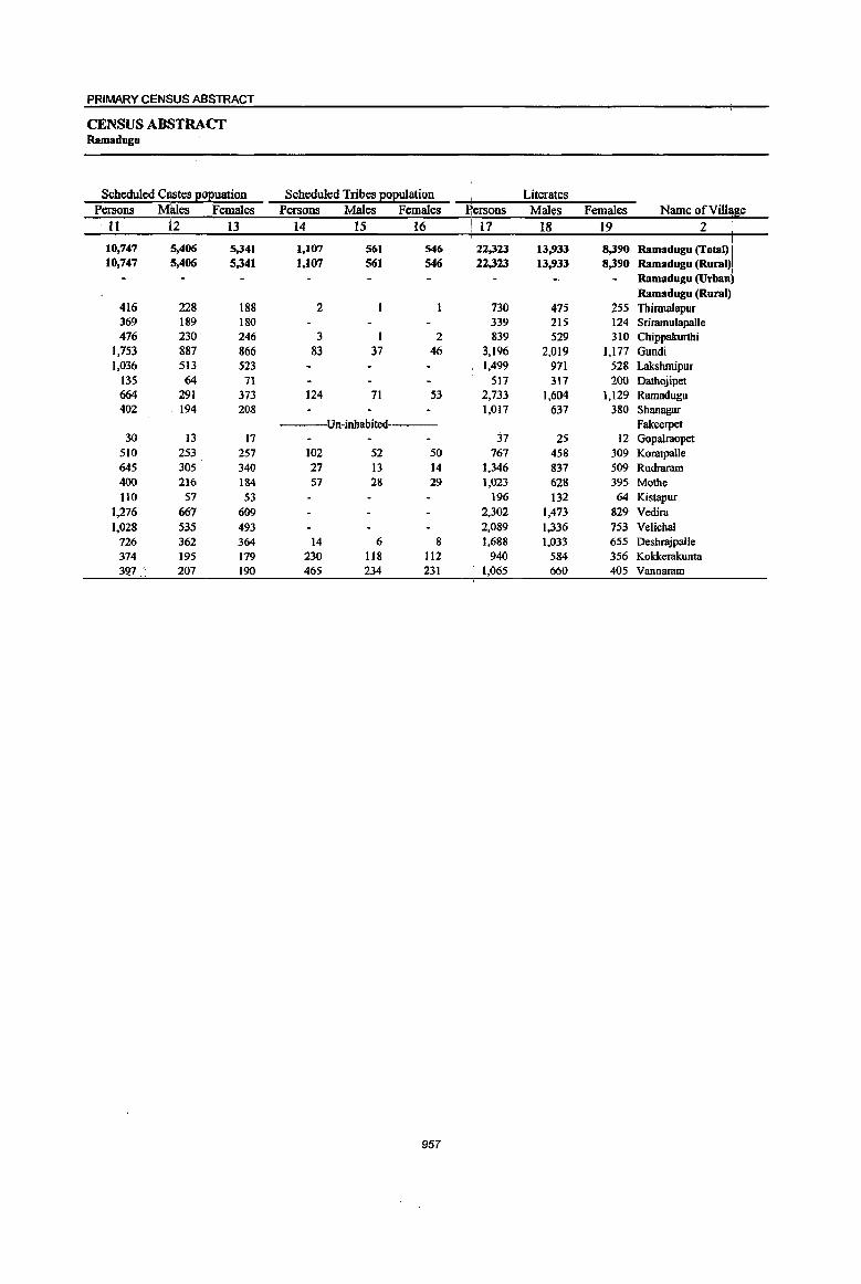
PRIMARY CENSUS ABSTRACT
CENSUS ABSTRACT Ramadugu
Scheduled Castes gOEuation Scheduled Tribes EOEuiation Literates Persons MlIles Females Persons Males Females ~ersons Males Females Name ofViIlcme -II 12 13 14 15 16 ! 17 18 19 2
I 10.747 5.406 5.341 1.107 561 546 22.323 13.933 8.390 Ramadugu (Total) I 10.747 5.406 5,,341 t.l07 561 546 22,,323 13.933 8,,390 Ramadugu (Rural)1
Ramadugu (Urban) Ramadugu (Rural):
416 228 188 2 730 475 255 Thirmalapur I
369 189 180 339 215 124 Srirnrnulapalle 476 230 246 3 1 2 839 529 310 Chippakurthi
];753 887 866 83 37 46 3,196 2,019 1,177 Gundi 1,036 513 523 1,499 971 528 Lakshmipur
135 64 71 5\7 317 200 Dathojipet 664 291 373 124 71 53 2,733 1,604 1,129 Ramadugu 402 194 208 1,017 637 380 Shanagar
---Un-inhabited Fakeerpet 30 13 17 37 25 12 Gupalraopet
510 253 257 102 52 50 767 458 309 KoratpalJe 645 305 340 27 13 14 1,346 837 509 Rudraram 400 216 184 57 28 29 1,023 628 395 Mothe 110 57 53 196 132 64 Kistapur
1,276 667 609 2,302 1,473 829 Vedira 1,028 535 493 2,089 1,,336 753 Velichal
726 362 364 14 6 8 1,688 1,033 655 DeshrajpalJe 374 195 179 230 118 112 940 584 356 Kokkerakunta 39.7, 207 190 465 234 231 1,065 660 405 Vannaram
957

DISTRICT CENSUS HANDBOOK: KARIMNAGAR
VILLAGE PRIMARY Mandai Parisbad -
Location code Illiterates Total workers Main workers
number Name ofVill~e Persons Males Females Persons Males Females Persons Males Females 1 2 20 21 22 23 24 25 26 27 28
0030 Ramadugu (Total) 25,331 9,972 15,359 25,151 13,306 11,845 19,852 11,777 8,075 0030 Ramadugu (Rural) 25,331 9,972 15,359 25,151 13,306 11,845 19.852 11,777 8,075 0030 Ramadugu (Urban)
Ramadugu (Rural) 00326400 Thinnalapur 1,641 741 900 1,400 735 665 404 297 107 00326500 Sriramulapalle 452 187 265 440 224 216 433 222 211 00326600 Chippakurthi 880 321 559 1,031 514 517 1,026 513 513 00326700 Gundi 4,096 1,638 2,458 3,322 1,948 1,374 2,216 1,672 544 00326800 Lakshmipur 1,916 755 1,161 1,925 963 962 1,420 825 595 00326900 Datbojipet 641 250 391 684 328 356 568 304 264 00327000 Ramadugu 2,504 929 1,575 2,567 1,402 1,165 2,353 1,301 1,052 00327100 Shanagar 1,211 457 754 1,204 631 573 814 610 204 00327200 Fakeerpet Un-inhabited 00327300 Gopalraopet 43 16 27 56 28 28 41 20 21 00327400 Koratpalle 557 211 346 608 340 268 283 245 38 00327500 Rudraram 1,642 635 1,007 1,690 847 843 1,220 755 465 00327600 Mothe 861 346 515 1,029 534 495 739 420 319 00327700. Kistapur 231 76 155 249 119 130 205 108 97 00327800 Vedira 2,347 887 1,460 2;267 1,217 1,050 2.043 1,200 843 00327900 Velichal 2,365 955 1,410 2,394 1,267 1,127 2,363 1,249 1,114 00328000 Deshrajpalle 1,649 647 1,002 1,901 1,014 887 1,761 996 765 00328100 Kokkerakunta 1,140 481 659 1,111 586 525 1.103 581 522 00328200 Vannaram 1,155 440 715 1,273 609 664 860 459 401
958
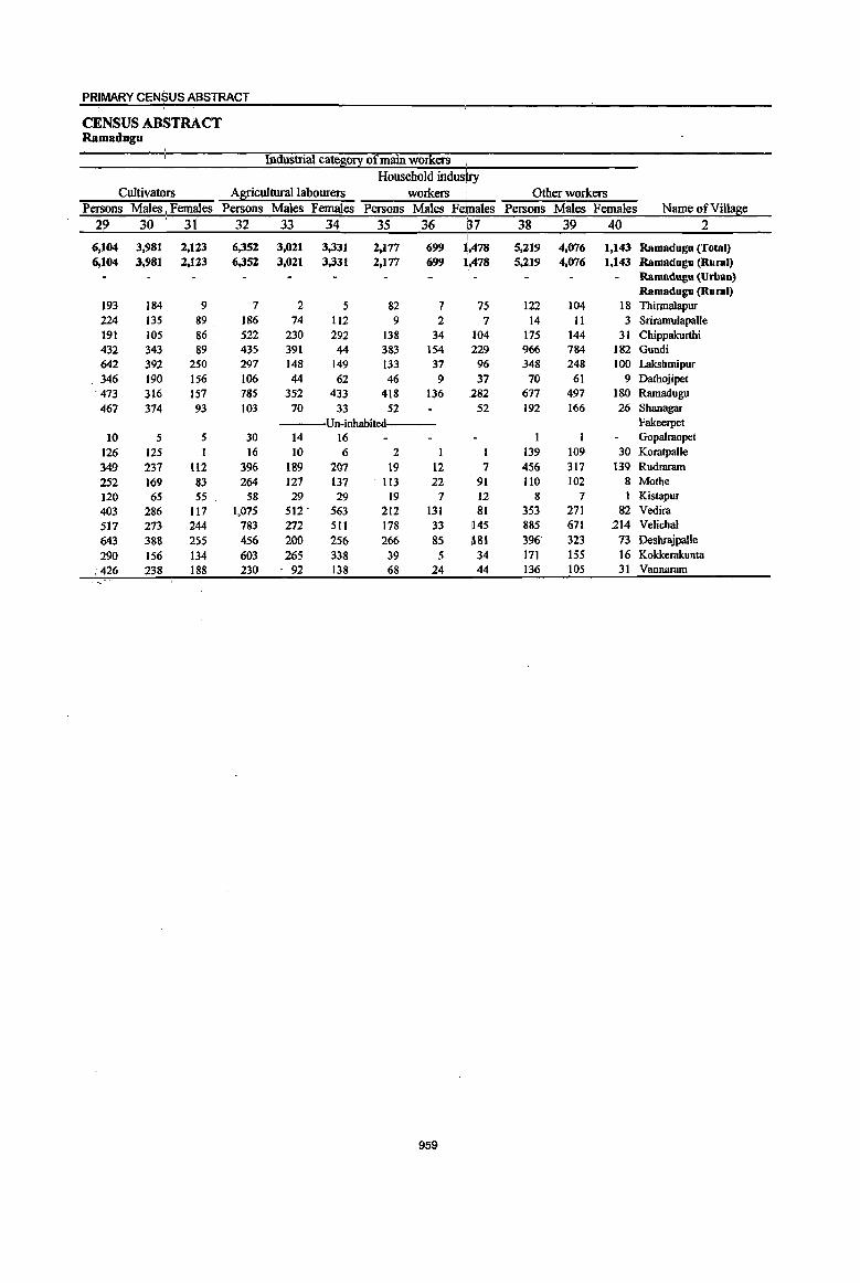
PRIMARY CEN$US ABSTRACT
CENSUS ABSTRACT Ramadugu
Industria\ cateso~ of main workers Household industry
Cultivators Agricultural labourers workers Other workers Persons Males, Females Persons Males Females Persons Males Fehtales Persons Males Females Name of Village
29 30 31 32 33 34 35 36 !37 38 39 40 2 ,
6,104 3,981 2,123 6,352 3,021 3,331 2,177 699 1,,478 5,219 4,076 1,143 Ramadugu (Total) 6,104 3,981 ' 2,ll3 6,352 3,021 3,331 2,177 699 JI,,478 5,219 4,076 1,143 Ramadugu (Rural)
Ramadugu (Urban) Ramadugu (Rural)
193 184 9 7 2 5 82 7 75 122 104 18 Thinnalapur 224 135 89 186 74 112 9 2 7 14 11 3 Sriramulapalle 191 105 86 522 230 292 138 34 104 175 144 31 Chippakurthi 432 343 89 435 391 44 383 154 229 966 784 182 Gundi 642 392 250 297 148 149 133 37 96 348 248 100 Lakshmipur
. 346 190 156 106 44 62 46 9 37 70 61 9 Dathojipet . 473 316 157 785 352 433 418 136 282 677 497 180 Ramadugu 467 374 93 103 70 33 52 52 192 166 26 Shanagar
Un-inhabited Fakeerpet 10 5 5 30 14 16 Gopalraopet
126 125 I 16 10 6 2 1 1 139 109 30 Koratpalle 349 237 112 396 189 207 19 12 7 456 317 139 Rudraram 252 ]69 83 264 127 137 113 22 91 110 102 8 Mothe 120 65 55 58 29 29 19 7 12 8 7 1 Kistapur 403 286 117 1,075 512 . 563 212 131 81 353 271 82 Vedira 517 273 244 783 272 511 178 33 1145 885 671 214 Velichal 643 388 255 456 200 256 266 85 ',181 396 323 73 Desbrajpalle 290 156 134 603 265 338 39 5 34 171 155 16 Kokkerakunta
.426 238 188 230 . 92 138 68 24 44 136 105 31 Vannaram
959
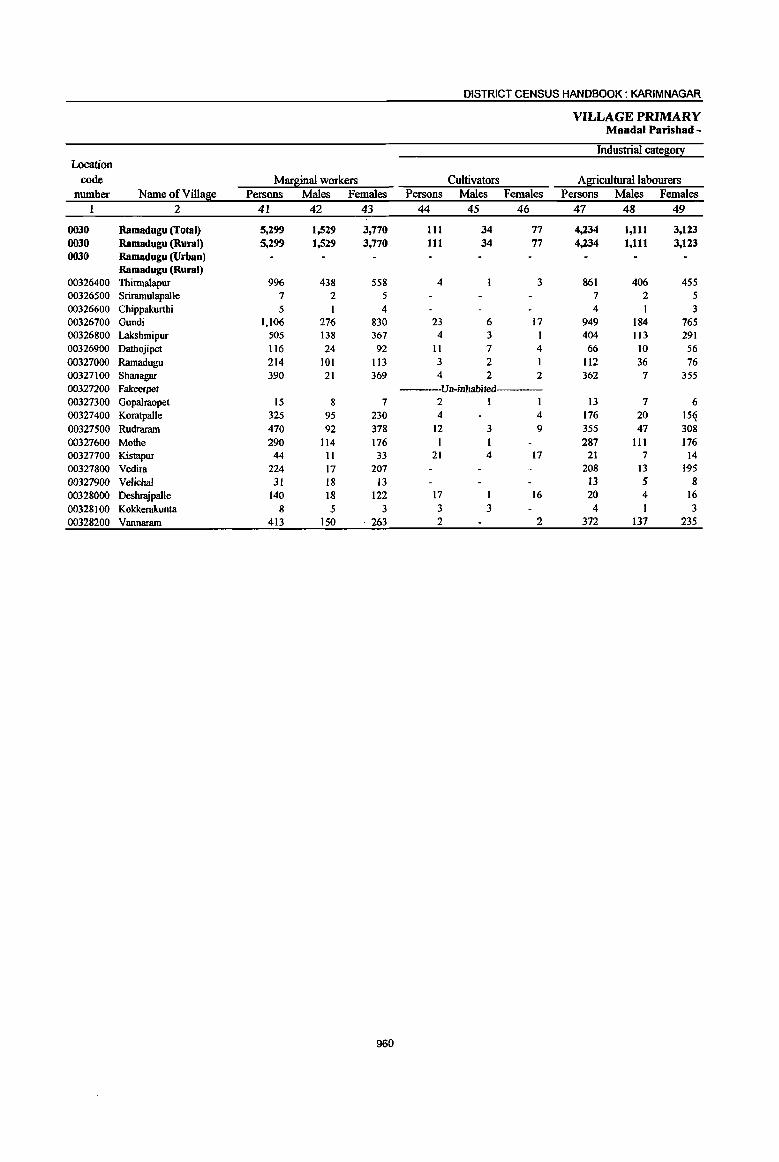
DISTRICT CENSUS HANDBOOK: KARIM NAGAR
VILLAGE PRIMARY Mandai Parishad -
Industrial cate8;o!}: Location
code Marginal workers Cultivators A8;!:iculturallabourers number Name ofVi1la~e Persons Males Females Persons Males Females Persons Males Females
1 2 41 42 43 44 45 46 47 48 49
0030 Ramadugu (Total) 5,299 1,529 3,770 III 34 77 4,234 1,111 3,123 0030 Ramadugu (Rural) 5,299 1,529 3,770 111 34 77 4,234 1,111 3,123 0030 Ramadugu (Urban)
Ramadugu (Rural) 00326400 Thirmalapur 996 438 558 4 3 861 406 455 00326500 Sriramu1apal1e 7 2 5 7 2 5 00326600 Chippakurthi 5 I 4 4 3 00326700 Gundi 1,106 276 830 23 6 17 949 184 765 00326800 Lakshmipur 505 138 367 4 3 I 404 113 291 00326900 Dathojipet 116 24 92 II 7 4 66 10 56 00327000 Ramadugu 214 101 113 3 2 1 112 36 76 00327100 Shanagar 390 21 369 4 2 2 362 7 355 00327200 Fakee!pet Un-inhabited 00327300 GopaIraopet 15 8 7 2 I 13 7 6 00327400 Koratpalle 325 95 230 4 4 176 20 15(i 00327500 Rudrararn 470 92 378 12 3 9 355 47 308 00327600 Mothe 290 114 176 287 III 176 00327700 Kistapur 44 11 33 21 4 17 21 7 14 00327800 Vedim 224 17 207 208 13 195 00327900 Velichal 31 18 I3 13 5 8 00328000 Deshmjpalle 140 18 122 17 16 20 4 16
00328100 Kokkerakunta 8 5 3 3 3 4 I 3 00328200 Vannaram 413 150 . 263 2 2 372 137 235
960
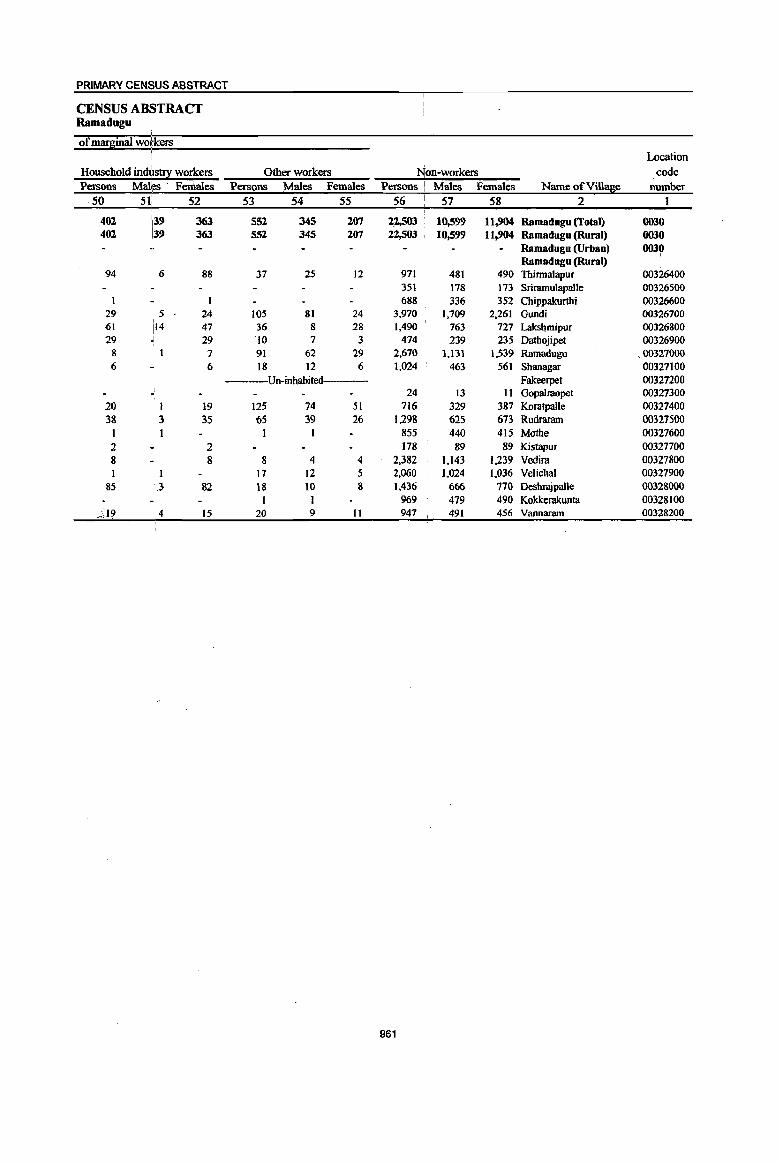
PRIMARY CENSUS ABSTRACT
CENSUS ABSTRACT Ramadugu
i
of mar~inal workers , Location
Household ind\~IS!!X workers Other workers Non-workers code Persons MaI!es . Females Persons Males Females Persons \ Males Females Name ofVi1la~e number
50 5( 52 53 54 55 56 57 58 2 I
402 i39 363 552 345 207 22,503 10,599 11,904 Ramadugu (Total) 0030 402 139 363 552 345 207 22,503 10,599 11,904 Ramadugu (Rural) 0030
Ramadugu (Urban) 0030 , Ramadugu (Rural)
94 6 88 37 25 12 971 481 490 Thirmalapur 00326400 351 178 173 Sriramulapalle 00326500 688 336 352 Chippakurthi 00326600
29 i 5 24 105 81 24 3,970 1,709 2,261 Gundi 00326700 61 i14 47 36 8 28 1,490 763 727 Laksl!mipur 00326800 29 J 29 10 7 3 474 239 235 Dathojipet 00326900
8 7 91 62 29 2,670 1,131 1,539 Rarnadugu .. 00321000 6 6 18 12 6 1,024 463 561 Shanagar 00327100
Un-inhabited---- Fakeerpet 00327200 - 24 13 11 Gopalmopet 00327300
20 I 19 125 74 51 716 329 387 Koratpalle 00327400 38 3 35 65 39 26 1,298 625 673 Rudraram 00327500
1 1 1 855 440 415 Mothe 00327600 2 2 178 89 89 KistapUI 00327700 8 8 8 4 4 2,382 1,143 1,239 Vedira 00327800 1 I 17 12 5 2,060 1,024 1,036 Velichal 00327900
85 :.3 82 18 10 8 1,436 666 770 Deshrajpalle 00328000 I I 969 479 490 Kokkerakunta 00328100
.;)9 4 15 20 9 11 947 491 456 Vannaram 00328200
961
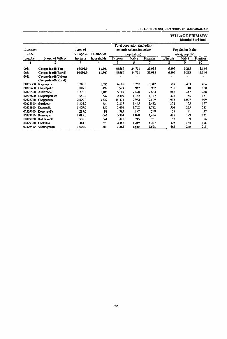
DISTRICT CENSUS HANDBOOK: KARIMNAGAR
VILLAGE PRIMARY Mandai Parishad -
Total population (including Location Area of institutional and houseless Population in the
code Village in Number of E£Eulation! ase-
PRIMARY CENSUS ABSJ"RACT
CENSUS ABSTRACT Choppadandi
Scheduled Castes EOEuation Scheduled Tribes EOEulation I Literates Persons Mates Females Persons Males Females P~rsons Males Females Name of Village
11 1;2 13 14 15 16 i 17 18 19 2
12,049 (i,272 5.777 665 396 269 1 22,260 14,073 8,187 Clloppadandi (Total) 12,049 ~),272 5.777 665 396 269 !22,260 14,073 8,187 Choppadandi (Rural)
Choppadandi (Urban) Choppadandi (Rural)
1,464 725 739 91 42 49 2,327 1,495 832 Ragampeta 538 260 278 806 505 301 Chityalpalle
1,690 832 858 81 41 40 2,248 1,374 874 Amakonda 737 367 370 3 2 945 608 337 Bhupalapamam
2,624 (368 1,256 196 156 40 8,272 5,095 3,177 Choppadandi 790 ' 400 390 71 34 37 1,335 842 493 Gumlapur
1,352 679 673 80 38 42 1,408 897 511 Katnepalle 138 61 77 193 109 84 Konerupalle
1,190 : 817 373 100 62 38 1,657 1,232 425 Rukmapur 207 ; 102 105 16 10 6 617 378 239 Kolimikunta 610 ; 311 299 ' 1,099 682 417 Chakunta 709 ,350 359 27 11 16 : 1,353 856 497 Vedurughattu
963
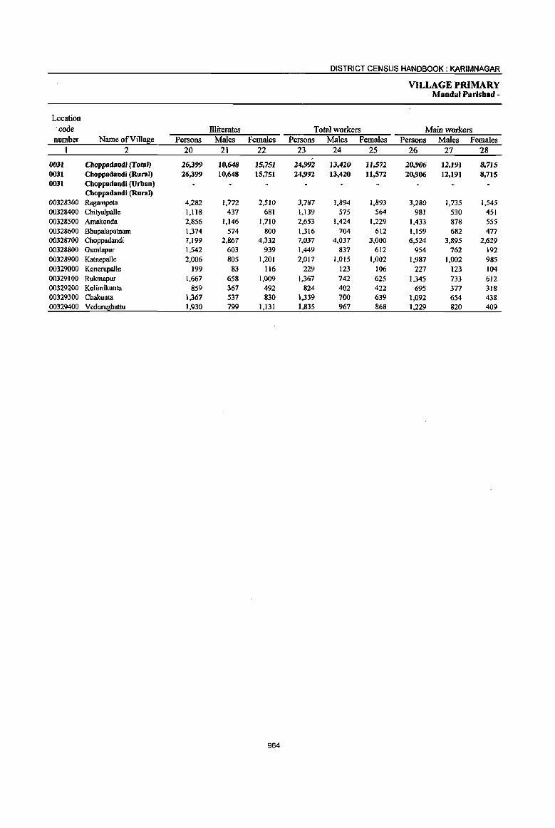
DISTRICT CENSUS HANDBOOK: KARIMNAGAR
VILLAGE PRIMARY Mandai Parisbad -
Location . code llliterates Total workers Main workers
number Name ofVilla~e Persons Males Females Persons Males Females Persons Males Females 1 2 20 21 22 23 24 25 26 27 28
, 0031 Clloppadalldi (Total) 26,399 10,648 15,751 24,9.92 13,420 11,572 20,906 12,191 8,715 0031 Cboppadandi (Rural) 26,399 10,648 15,751 24,992 13,420 11,572 20,906 12,191 8,715 0031 Choppadandi~rban)
Cboppadandi (Rural) 00328300 Ragampeta 4,282 1,772 2,510 3,787 1,894 1,893 3,280 1,735 1,545 00328400 CbityalpaUe 1,118 437 681 1,139 575 564 981 530 451 00328500 Amakonda 2,856 1,146 1,710 2,653 1,424 1,229 1,433 878 555 00328600 Bbupalapatnam 1,374 574 800 1,316 704 612 1,159 682 477 00328700 Choppadandi 7,199 2,867 4,332 7,037 4,037 3,000 6,524 3,895 2,629 00328800 Gumlapur 1,542 603 939 1,449 837 612 954 762 192 00328900 Katnepalle 2,006 805 1,201 2,017 1,015 1,002 1,987 1,002 985 00329000 Konerupaile 199 83 116 229 123 106 227 123 104 00329100 Rukmapur 1,667 658 1,009 1,367 142 625 1,345 733 612 00329200 Kolimikunta 859 367 492 824 402 422 695 377 318 00329300 Cbakunta 1,367 537 830 1,339 700 639 1,092 654 438 00329400 Veduru!l!!attu 1,930 799 1,131 1,835 967 868 1,229 820 409
964

PRIMARY CENSUS ABSTRACT
CENSUS AB~TRACT Choppadandi
Industrial cateS0!I of main workers ,
Household indus:try Cuitivat~rs Agricuiturallabourers workers I Other workers
Persons Males i Females Persons Males Females Persons Males FelnaIes Persons Males Females Name of Village 29 30 ! 31 32 33 34 35 36 :37 38 39 40 2
5,844 3.647 2.197 8.605 3,835 4.770 1.719 734 ' 985 4.738 3,975 763 Cboppadandi (Total) 5,844 3.647 2,197 8,605 3,835. 4,770 1.719 734 985 4,738 3,975 763 CboppadandiQRuraO
Cboppadandi (Urban) Cboppadandi (Rural)
884 517 367 1,703 774 929 206 46 160 487 398 89 Ragampeta 458 263, 195 349 166 183 65 29 36 109 72 37 Cbityalpalle 626 358 i 268 273 123 150 142 57 85 392 340 52 Arnakonda 262 114 88 713 363 350 20 10 10 164 135 29 Bbupalapatnam 712 425 287 2,636 1,207 1,429 1,062 466 596 2,114 1,797 317 Cboppadandi 347 293 54 310 229 81 66 32 34 231 208 23 Gum1apur
834 497 337 880 328 552 63 31 32 210 146 64 Katnepalle 129 71 , 58 71 29 42 2 2 25 21 4 KonerupaUe
458 275 " 183 620 259 361 16 8 8 251 191 60 Rukmapur
242 163 , 79 311 103 208 25 18 7 117 93 24 Kolimilrunta 408 273 135 448 116 272 15 10 5 221 195 26 Cbakunta
484 338 , 146 291 78 213 37 25 12 417 379 38 Vedurughattu
965
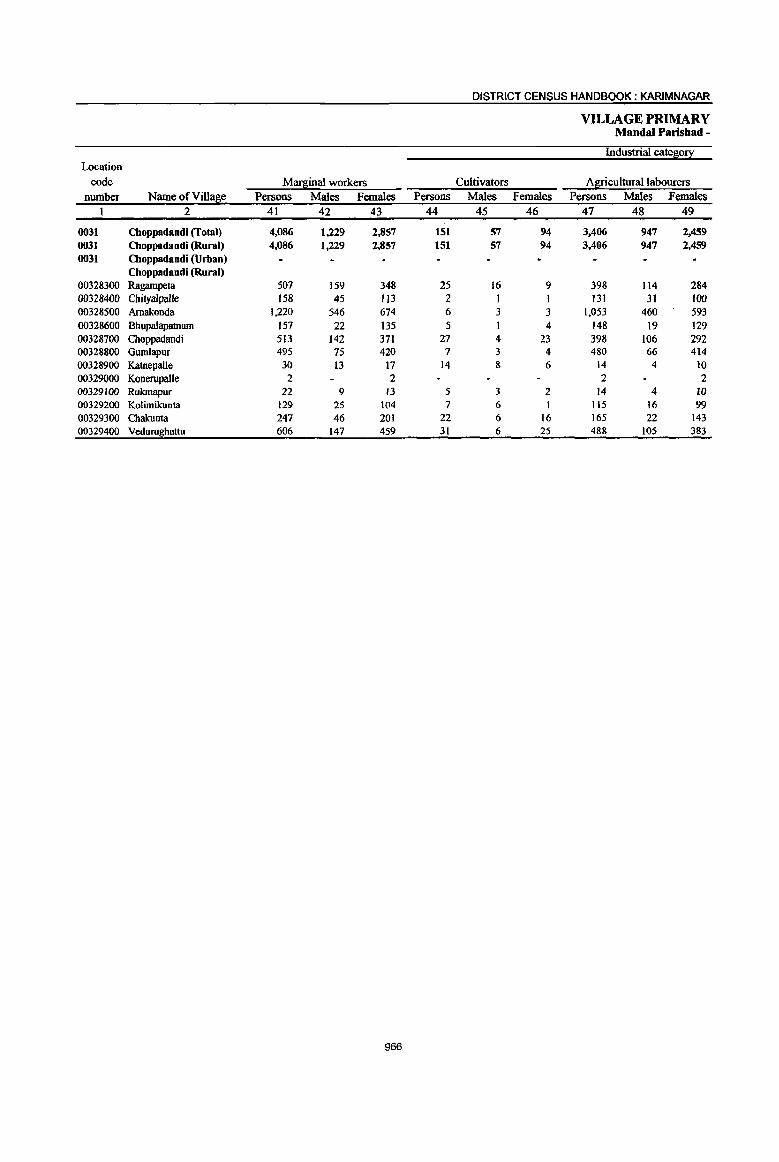
DISTRICT CENSUS HANDBOOK: KARIM NAGAR
VILLAGE PRIMARY Mandai Paris bad -
Industrial cate~0!l: Location
code Mar~inal workers Cultivators A~iculturallabourers
number Name ofVill!!f:e Persons Males Females Persons Males Females Persons Males Females 1 2 41 42 43 44 45 46 47 48 49
0031 Choppadandi (Total) 4,086 1,229 2,857 151 57 94 3,406 947 2,459 0031 Choppadandi (Rural) 4,086 1,229 2,857 151 57 94 3,406 947 2,459 0031 Choppadandi~rban)
Choppadandi (Rural) 00328300 Ragampeta 507 159 348 25 16 9 398 114 284 00328400 ChityaJpalle 158 45 113 2 I 131 31 100 00328500 Amakonda 1,220 546 674 6 3 3 1.053 460 593 00328600 Bhupalapatnarn 157 22 135 5 4 148 19 129 00328700 Choppadandi 513 142 371 27 4 23 398 106 292 00328800 Gum1apur 495 75 420 7 3 4 480 66 414 00328900 Katnepalle 30 13 17 14 8 6 14 4 10 00329000 KonerupaUe 2 2 2 2 00329100 Rukmapur 22 9 13 5 J 2 14 4 10 00329200 Kolimikunta 129 25 104 7 6 I 115 16 99 00329300 Chakunta 247 46 201 22 6 16 165 22 143 00329400 Veduru~hattu 606 147 459 31 6 25 488 105 383
966
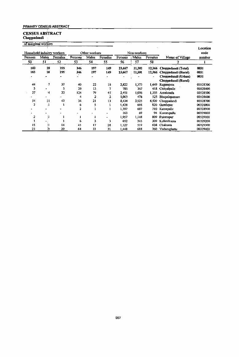
967
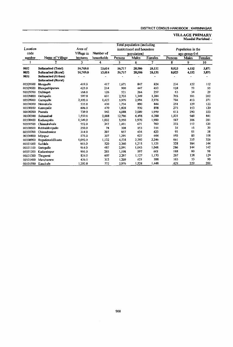
DISTRICT CENSUS HANDBOOK: KARIM NAGAR
VILLAGE PRIMARY Mandai Parishad-
Total population (including Location Area of institutional and houseless Population in the
code Village in Nurnberof :eoE,ulationl age-S!0u:e 0-6 number Name ofVilla~e hectares households Persons Males Females Persons Males Females
1 2 3 4 5 6 7 8 9 10
0032 Sultanabad (fotal) 16,769.0 13,614 56,717 28,586 28,131 8,023 4,152 3,871 0032 Sultanabad (Rural) 16,769.0 13,614 56,717 28,586 28,131 8,023 4,152 3,871 0032 Sultanabad (Urban)
Sultanabad (Rural) (}03295oo Ithrajpalle 419.0 417 1,671 847 824 234 122 112 00329600 Bhoopathipuram 425.0 214 900 447 453 128 73 55 00329700 Dubbapet 168.0 126 521 264 257 63 34 29 00329800 Gollapalle 597.0 631 2,733 1,349 1,384 393 191 202 00329900 Garrepalle 2,102.0 1,423 5,970 2,994 2,976 784 413 371 00330000 Neerukulla 535.0 430 1,734 890 844 251 129 122 00330100 Katnepalle 606.0 470 1,828 930 898 273 153 120 00330200 Poosala 739.0 942 4,088 2,089 1,999 613 290 323 00330300 Sultanabad 1,550.0 2,888 12,786 6,498 6,288 1,821 980 841 00330400 Kodurupaka 1,549.0 1,032 3,950 1,970 1,980 587 306 281 00330500 Chinnakalvala 552.0 347 1,431 671 760 233 Il3 120 00330600 Rebbaldevipalle 250.0 74 308 153 155 35 15 20 00330700 Chinnabonkur 314.0 207 857 434 423 93 55 38 00330800 Miyapur 575.0 307 1,291 627 664 193 85 108
00330900 Regadimaddikunta 1,092.0 1,122 4,538 2,292 2,246 661 335 326 00331000 Suddala 915.0 520 2,340 1,215 1,125 328 184 144
00331100 Gattepalle 914.0 487 2,091 1,043 1,048 286 144 142
00331200 Kadambapur 995.0 285 1,198 597 601 188 90 98
00331300 Thogarrai 834.0 607 2,297 1,127 1,170 267 138 129 00331400 Mancharami 436.0 313 1,209 621 588 163 73 90
00331500 Kanulrula 1,202.0 772 2,976 1,528 1,448 429 229 200
968
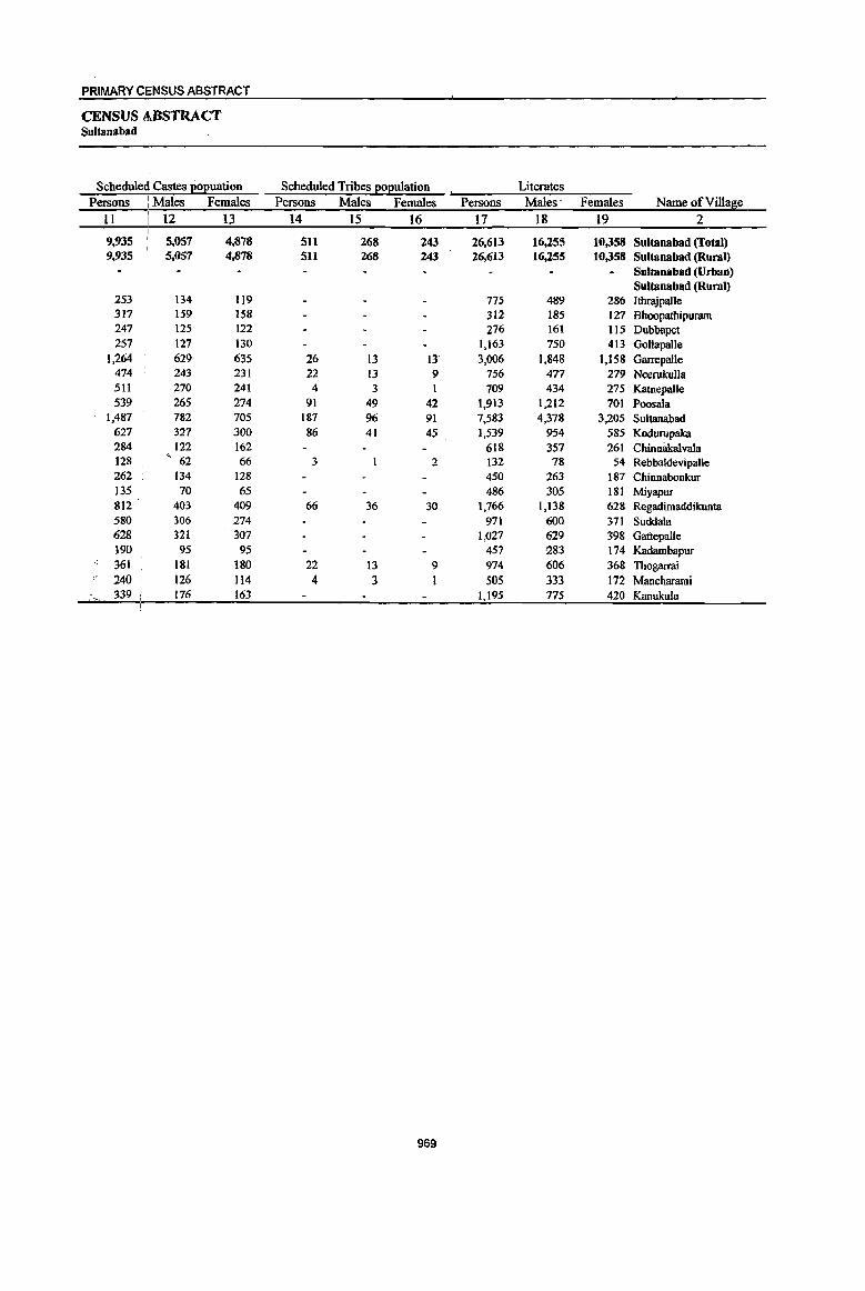
PRIMARY CI;NSUS ABSTRACT
CENSUS ABSTRACT SuJtanabad
I • Scheduled Tribes J:!0J2ulation Literates Scheduled Castes I!0I!uation
Persons : Males Females Persons Males Females Persons Males- Females Name of Village
11 12 13 14 15 16 17 18 19 2
9,935 5,057 4,878 511 268 243 26,613 16,255 10,358 Sultanabad (Total) 9,935 5,057 4,878 SII 268 243 26,613 16,255 10,358 Sultana bad (Rural)
Sultanabad (Urban) Sultana bad (Rural)
253 134 119 775 489 286 IthrajpaUe 317 159 158 312 185 127 Bhoopathipuram 247 125 122 276 )61 115 Dubbapet 257 127 130 1,163 750 413 GoUapaile
1,264 629 635 26 13 13 3,006 1,848 1,158 Garrepalle 474 243 231 22 13 9 756 477 279 Neerukulla 511 270 241 4 3 1 709 434 275 Katnepalle 539 265 274 91 49 42 1,913 1,212 701 Poosala
1,487 782 705 187. 96 91 7,583 4,378 3,205 Sultanabad 627 327 300 86 41 45 1,539 954 585 Kodurupaka 284 122 162 618 357 261 Chinnakalvala 128 ~ 62 66 3 2 132 78 54 Rebbaldevipalle 262 134 128 450 263 187 Chinnabonkur 135 70 65 486 305 181 Miyapur 812 403 409 66 36 30 1,766 1,138 628 Regadimaddikunta 580 306 274 971 600 371 Suddala 628 321 307 1,027 629 39& Gattepalle 190 95 95 457 283 174 Kadambapur 361 181 180 22 13 9 974 606 368 Thogarrai 240 126 114 4 3 1 505 333 172 Mancharami
.. "~., . 339 176 163 1,195 775 420 Kanukula
969
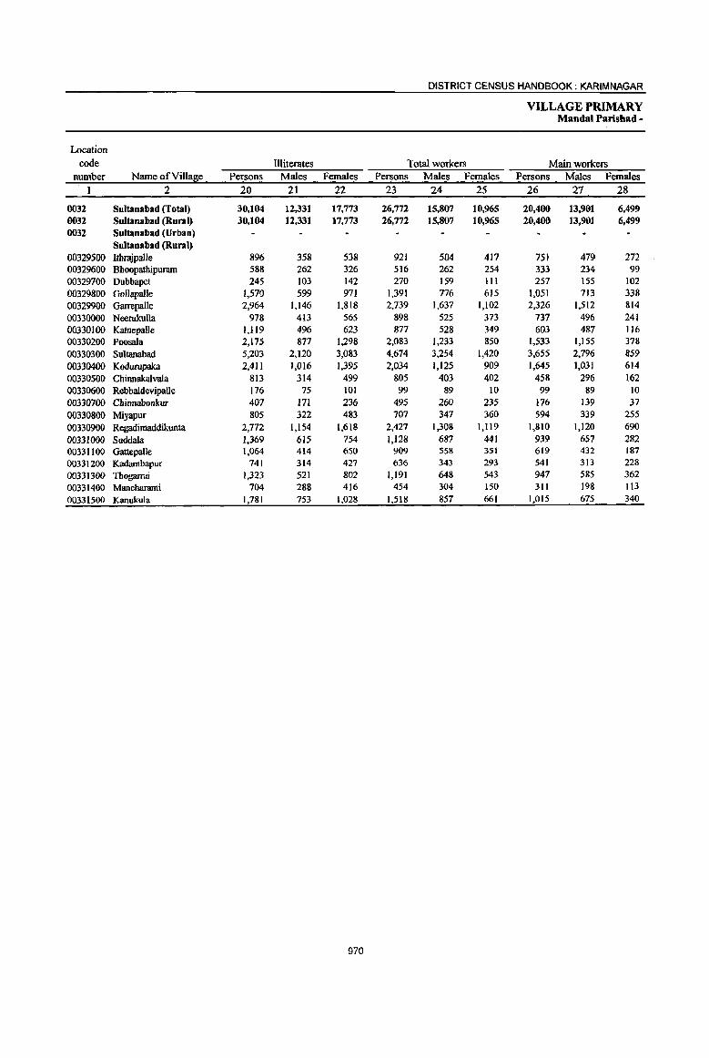
DISTRICT CENSUS HANDBOOK: KARIM NAGAR
VILLAGE PRIMARY Mandai Parishad -
Location code Illiterates Total workers Main workers
number Name of Vi1la~e Persons Males Females Persons Males Females Persons Males Females 1 2 20 21 22 23 24 2S 26 27 28
0032 Sultana bad (fotal) 30,104 12,331 17,773 26,772 15,807 10,965 20,400 13,901 6,499 0032 Sultanabad (Rural) 30.104 12,331 17,773 26,772 15,807 10,965 20,400 13,901 6,499 0032 Sultanabad (Urban)
Sultana bad (Rural) 00329500 Itbrajpalle 896 358 538 921 504 417 751 479 272 00329600 Bhoopathipuram 588 262 326 516 262 254 333 234 99 00329700 Dubbapet 245 103 142 270 159 III 257 155 102 00329800 Gollapalle 1,570 599 971 1,391 776 615 1,051 713 338 00329900 Garrepalle 2,964 1,146 1,818 2,739 1,637 1,102 2,326 1,512 814 00330000 Neerukulta 978 413 565 898 525 373 737 496 241 00330100 Katnepalle 1,119 496 623 877 528 349 603 487 116 00330200 Poosala 2,175 877 1,298 2,083 1,233 850 1,533 1,155 378 00330300 Sultanabad 5,203 2,120 3,083 4,674 3,254 1,420 3,655 2,796 859 00330400 Kodurupaka 2,411 1,016 1,395 2,034 1,125 909 1,645 1,031 614 00330500 Chinnakalvaia 813 314 499 805 403 402 458 296 162 00330600 RebbaidevipaUe 176 75 101 99 89 10 99 89 10 00330700 Chinnaoonkur 407 171 236 495 260 235 176 139 37 00330800 Miyapur 805 322 483 707 347 360 594 339 255 00330900 Regadimaddikunta 2,772 1,154 1,618 2,427 1,308 1,119 1,810 1,120 690 00331000 Suddala 1,369 615 754 1,128 687 441 939 657 282 00331100 GattepaUe 1,064 414 650 909 558 351 619 432 187 00331200 Kadambapur 741 314 427 636 343 293 541 313 228 00331300 Thogarrai 1,323 521 802 1,191 648 543 947 585 362 00331400 Mancbarami 704 288 416 454 304 150 311 198 113 00331500 Kanukula 1,781 753 1,028 1,518 857 661 1,015 675 340
970
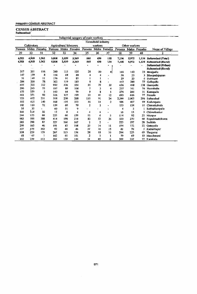
PRIMARY CEENSUS ABSTRACT
CENSUS ABSTRACT Sultanabad '
Industrial cate~0!X of main workerS Household industry
Cultivators A![!culturallabourers workers Other workers Persons Males Females Persons Males Females Persons Males Females Persons Males Females Name of Village
29 3D 31 32 33 34 35 36 37 38 39 40 2 i
6,921 4,960 1,961 5,808 2,539 3,269 565 430 135 7,106 5,972 1,134 Sultanabad (Total) 6,921 4,~60 1,961 5,808 2,539 3,269 565 430 135 7,106 5,972 1,134 Sultana bad (Rural)
-&1
Sultana bad (Urban) Sultana bad (Rural)
317 201 116 240 115 125. 28 -20 166 143 23 Ithrajpalle 147 139 8 156 68 88 4 4 l6 23 3 Bhoopathipumm .
51 i40 II 176 91 85 1 I 29 23 {; Dubbapet 284 206 78 302 119 183 8 8 457 380 77 Gol1apalle
I 6[5 503 112 990 436 554 85 75 10 636 498 [38 Garrepa{[e 296 1243 53 197 89 108 7 3 4 237 161 76 Neerukulla ,
5 9 8 31 Katnepal1e 175 170 143 64 79 1 276 245 461 ;371 90 326 127 199 53 41 12 693 616 77 Poosala 723 ~72 251 518 230 288 115 91 24 2,299 2,003 296 Sultanabad 555 415 140 568 195 373 16 14 2 506 407 99 Kodurupaka
I 182 HO 72 139 60 79 2 2 135 124 II Chinnakalvala 35 35 60 51 9 4 3 Rebbaldevipalle
144 rlt4 30 12 8 4 4 4 16 13 3 Chinnabonkur 244 p5 69 225 66 159 11 6 5 114 92 22 Miyapur 983 <595 388 414 198 216 83 57 26 330 270 60 Regadimaddikunta 385 :298 87 327 160 167 2 2 225 197 28 Suddala 209 [163 46 191 83 108 25 14 11 194 172 22 Gattepalle 337 [175 162 92 46 46 31 16 15 8] 76 5 Kadambapur 358 ,229 129 267 113 154 28 18 10 294 225 69 Thogarrai 68 67 1 162 61 101 2 I I 79 69 10 Manclwami
352 :239 113 303 159 144 51 45 6 309 232 77 Kanukula
971
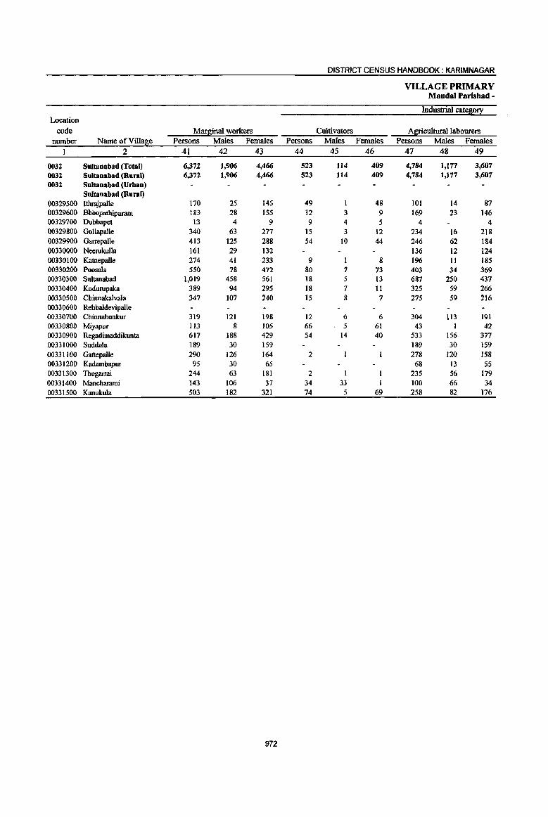
DISTRICT CENSUS HANDBOOK: KARIMNAGAR
VILLAGE PRIMARY Mandai Parishad -
Industrial ca~0!I Location
code Marginal workers Cultivators Agricultural labourers number Name ofVill~e Persons Males Females Persons Males Females Persons Males Females
1 2 41 42 43 44 45 46 47 48 49
0032 Sultanabad (Total) 6,372 1,906 4,466 523 114 409 4,784 1,177 3,607 0032 Sultana bad (Rural) 6,372 1,906 4,466 523 114 409 4,784 1,177 3,607 0032 Sultanabad (Urban)
Sultanabad (Rural) 00329500 Ithrajpalle 170 25 145 49 1 48 101 14 87 00329600 Bhau-pmhipuram Ii>"
__ J 28 155 12 3 9 169 23 146 00329700 Dubbapet 13 4 9 9 4 5 4 4 00329800 Gl>llapalle 340 63 277 15 3 12 234 16 218 00329900 Garrepalle 413 125 288 54 10 44 246 62 184 00330000 Neerukulla 161 29 132 136 12 124 00330100 Katnepalle 274 41 233 9 I 8 196 II 185 00330200 Poosala 550 78 472 80 1 73 403 34 369 00330300 Sultanabad 1,019 458 561 18 5 13 687 250 437 00330400 Kodurupaka 389 94 295 18 7 II 325 59 266 00330500 Chinnakalvala 347 107 240 ]5 8 7 275 59 216 00330600 Rebbaldevipalle 00330700 Chinnabonkur 319 121 198 12 6 6 304 113 191 00330800 Miyapur 113 8 105 66 5 61 43 1 42 00330900 Regadimaddikunta 617 188 429 S4 14 40 533 156 377 00331000 Suddala 189 30 159 189 30 159 00331100 Gattepalle 290 126 164 2 278 120 158 00331200 Kadambapur 95 30 65 68 13 SS 00331300 Thogarrai 244 63 181 2 235 56 179 00331400 Manchammi 143 106 37 34 33 I 100 66 34 00331500 Kanulrula 503 182 321 74 5 69 258 82 176
972

PRIMARY CENSUS ABSTRACT i
CENSUS ABSTRACT Sultanabad
I
I
of marginal worlcers Location
Household indu~try workers Other workers Non-workers code Persons Males Females Persons Males Females Persons Males Females Name ofVilla~e number
50 51, 52 53 54 55 56 57 58 2 1 ,
131 59 72 934 556 378 29,945 12,779 17,166 Sultanabad (Total) 0032 I
131 59 72 934 556 378 29,945 12,779 17,166 Sultanabad (Rural) 0032 Sultanabad (Urban) 0032 Sultanabad (Rural)
2 2 18 10 8 750 343 407 Ithrajpalle 00329500 2 2 384 185 199 Bhoopathipuram 00329600
2S1 lOS 146 -Dubhapet . -00329700 90 44 46 1,342 573 769 Gollapalle 00329800
42 29 13 71 24 47 3,231 1,357 1,874 Garrepalle 00329900 6 :4 2 19 13 6 836 365 471 Neerukulla 00330000 9 '4 5 60 25 35 951 402 549 Katnepalle 00330100 5 '1 4 62 36 26 2,005 856 1,149 Poosala 00330200
27 11 16 287 192 95 8,112 3,244 4,868 Sultanabad 00330300 7 :2 5 39 26 13 1,916 845 1,071 Kodurupaka 00330400
57 40 17 626 268 358 ChinnakalvaIa .00330500 209 64 145 Rebbaldevipalle 00330600
3 2 362 174 188 Chinnabonkur 00330700 2 1 2 1 I 584 280 304 Miyapur 00330800 8 8 22 18 4 2,lIl 984 1,127 Regadimaddikunta 00330900
1,212 528 684 Suddala 00331000 _3 I 2 7 4 3 1,182 485 697 GattepaIle 00331100 3 3 24 17 7 562 254 308 Kadambapur 00331200 I 1 6 6 1,106 479 627 Thogarrai 00331300 3 3 6 4 2 755 317 438 Mancharami 00331400
12 i3 9 159 92 67 1,458 671 787 Kanukula 00331500
973
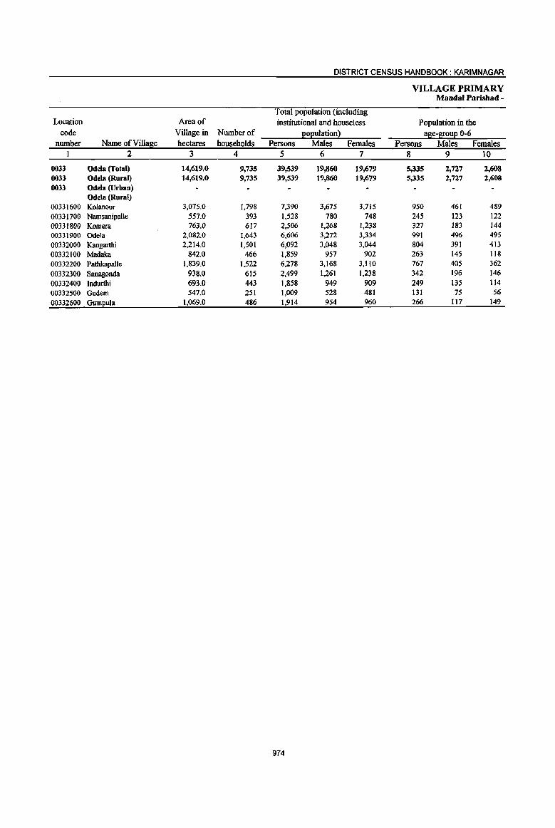
DISTRICT CENSUS HANDBOOK: KARIM NAGAR
VILLAGE PRIMARY Mandai Parishad -
Total population (including Location Area of institutional and houseless Population in the
code Village in Number of l!ol!ulationl a~e-l[oul! 0-6 number Name ofVilla~e hectares households Persons Males Females Persons Males Females
1 2 3 4 5 6 7 8 9 10
0033 Odela (Total) 14,619.6 9,735 39,539 19,866 19,679 5,335 2,727 2,608 0033 Odela (Rural) 14,619." 9,735 39,539 19,860 19,679 5,335 2,727 2,608 0033 Odela (Urban)
Odela (Rural) 00331600 Kolanoor 3,075.0 1,798 7,390 3,675 3,715 950 461 489 00331700 NamsanipaUe 557.0 393 1,528 780 748 245 123 122 00331800 Komera 763.0 617 2,506 1,268 1,238 327 183 144 00331900 Ode1a 2,082.0 1,643 6,606 3,272 3,334 991 496 495 00332000 Kangarthi 2,214.0 1,501 6,092 3,048 3,044 804 391 413 00332100 Madaka 842.0 466 1,859 957 902 263 145 118 00332200 Pathkapalle 1,839.0 1,522 6,278 3,168 3,1l0 767 405 362
00332300 Sanagonda 938.0 615 2,499 1,261 1,238 342 196 146
00332400 Indurthi 693.0 443 1,858 949 909 249 135 114 00332500 Gudem 547.0 251 1,009 528 481 131 75 56
00332600 Guml!ula 1,069.0 486 1,914 954 960 266 1t7 149
974

PRIMARY CENSUS ABSTRACT
CENSUS ABSTRACT Odela
Scheduled Castes l!oEuation Scheduled Tribes l!oEulation Literates
Persons MMes Females Persons Males Females p,ersons Males Females Name of Village
11 12 13 14 15 16 17 18 19 2
6,313 3,170 3,143 378 195 183 16,973 10,625 6,348 Odela (Total) 6,313 3,170 3,143 378 195 183 16,973 10,625 6,348 Odela (Rural)
Odela (Urban) Odela (Rural)
1,474 742 732 21 8 13 3,424 2,092 1,332 Kolanoor 169 92 77 186 94 92 482 303 179 Namsanipalle 385 204 181 1,123 686 437 Komera 734 354 380 2,589 1,624 965 Odela 794 387 407 5 I 4 2,590 1,632 958 Kangarthi 293 143 150 liS 65 50 822 522 300 Madaka
1,100 548 552 4 3 1 2,973 1,869 1,104 Patbkapal\e 330 : 167 163 6 4 2 1,013 614 399 Sanagonda 384 • 207 177 19 8 II 711 460 251 Indurthi 128 68 60 3 2 403 270 133 Gudem 522 : 258 264 19 II 8 843 553 290 Gumpula
975
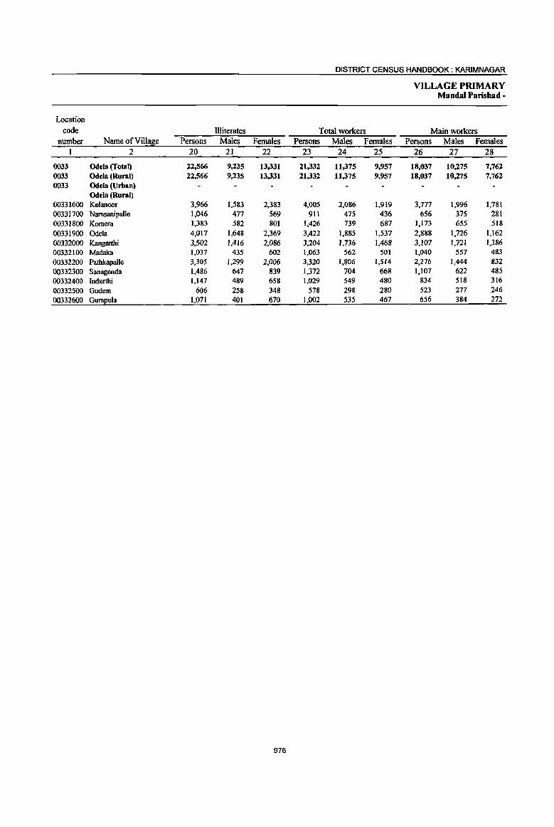
DISTRICT CENSUS HANDBOOK: KARIMNAGAR
VILLAGE PRIMARY Mandai Parishad -
Location code Illiterates Total workers Main workers
number Name ofVilla~e Persons Males Females Persons Males Females Persons Males Females I 2 20 21 22 23 24 25 26 27 28
0033 Odela (Total) 22,566 9,235 13,331 21,332 11,375 9,957 18,037 10,275 7,762 0033 Odela (Rural) 22,566 9,235 13,331 21,332 11,375 9,957 18,037 10,275 7,762 0033 Odela (Urban)
Odela (Rural) 00331600 Kolanoor 3,966 1,583 2,383 4,005 2,086 1,919 3,777 1,996 1,781 00331700 Namsanipalle 1,046 477 569 911 475 436 656 375 281 00331800 Komera 1,383 582 801 1,426 739 687 1,173 655 518
00331900 Odela 4,017 1,648 2,369 3,422 1,885 1,537 2,888 1,726 1,162
00332000 Kangarthi 3,502 1,416 2,086 3,204 1,736 1,468 3,107 1,721 1,386 00332100 Madaka 1,031 435 602 1,063 562 501 1,040 557 483
00332200 Pathkapalle 3,305 1,299 2,006 3,320 1,806 1,514 2,276 1,444 832
00332300 Sanllgonda 1,486 647 839 1,372 704 668 1,107 622 485
00332400 Indurthi 1,147 489 658 1,029 549 480 834 518 316
00332500 Gudem 606 258 348 518 298 280 523 271 246
00332600 Guml!ula 1,071 401 670 1,002 535 467 656 384 272
976
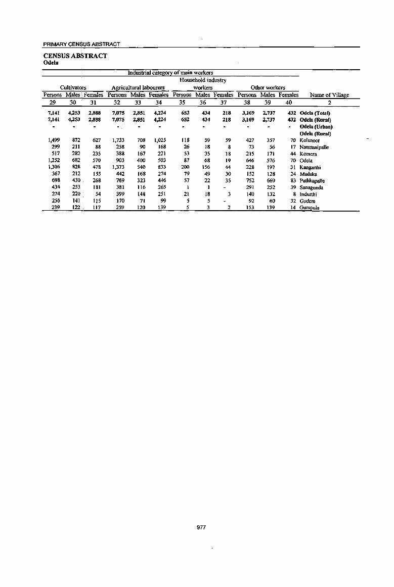
PRIMARY CEN$US ABSTRACT
CENSUS ABSTRACT Odela
Industrial cate~o!! of main workers Household industry
Cultivat~rs Agricultural labourers workers Other workers Persons Males \ Females PersonS Males Females Persons Males Females Persons Males Females Name of Village
29 30 : 31 32 33 34 35 36 37 38 39 40 2
7,141 4,253 2,888 7,075 2,851 4,224 652 434 218 3,169 2,737 432 Odela (Total) 7,141 4,253 2,888 7,075 2,851 4,224 652 434 218 3,169 2,737 432 Odela (Rural)
Odela (Urban) Odela (Rural)
1,499 872 627 1,733 708 1,025 118 59 59 427 357 70 Kolanoor 299 211 88 258 90 168 26 18 8 73 56 17 Namsanipalle 517 282 235 388 167 221 53 35 18 215 171 44 Komera
1,252 682 570 903 400 503 87 68 19 646 576 70 Odela 1,306 828 478 1,373 540 833 200 )56 44 228 197 31 Kangarthi
367 212 155 442 168 214 79 49 30 152 128 24 Madaka 698 430 268 769 323 446 57 22 35 752 669 83 Pathkapalle 434 253 181 381 116 265 I I 291 252 39 Sanagonda 274 220 ' 54 399 148 251 21 18 3 140 132 8 lndurthi 256 141 115 170 71 99 :5 5 92 60 32 Gudem 239 122 , 117 259 120 139 5 3 2 153 139 14 Gumpula
977
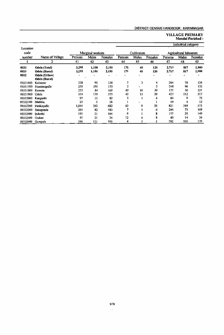
978

PRIMARY CENj3US ABSTRACT , CENSUS AB\STRACT Odela
of marginal workers Location
Household ind"lJstry woikers Other workers Non-workers code Persons Males Females Persons Males Females Persons Males Females Name ofVill~e number
50 51 52 53 54 55 56 57 58 2 1
57 IS 42 350 223 127 18,207 8,485 9,722 Odela (Total) 0033 57 15 42 350 223 127 18,207 8,485 9,722 Odela (Rural) 0033
Odela (Urban) 0033 Odela (Rural)
2 2 15 9 6 3.385 1.589 1.796 Kolanoor 00331600 5 4 1 617 ' 305 312 NamsanipaUe 00331700
5 2 3 31 22 15 1,080 529 551 Komera 00331800 8 1 7 57 33 24 3,184 1,387 1,797 Odela 00331900
8 5 3 2,888 1,312 1,576 Kangarthi 00332000 2 :,1 1 1 1 796 395 401 Madaka 00332100
32 ,7 25 149 98 51 2.958 1,362, 1,596 Pathkapalle 00332200 I 13 5 8 1,127 557 570 Sanagonda 00332300 2 2 7 2 5 829 400 429 Indurthi 00332400 1 1 2 2 431 230 201 Gudem 00332500 4 ,2 2 56 43 13 912 419 493 Gum£ula 00332600
979

DISTRICT CENSUS HANDBOOK: KARIMNAGAR
VILLAGE PRIMARY Mandai Parisbad •
Total population (including Location Area of institutional and houseless Population in the
code Village in Number of )2o}!ulation l a~e-~ou2 0-6 number Name ofVilla~e hectares households Persons Males Females Persons Males Females
I 2 3 4 5 6 7 8 9 to
0034 Manakondur (Total) 19,777.0 15,290 64,864 32,725 32,139 8,860 4,516 4,344 0034 Manakondur (Rural) 19,777.0 15,290 64,864 32,725 32,139 8,860 4,516 4,344 0034 Manakondur~rban)
Manakondur (Rural) 00332700 Lingapur 575.0 475 1,975 976 999 263 126 137 00332800 Veldi 1,572.0 1,376 5,770 2,885 2,885 797 415 382 00332900 VegurupaUe 851.0 564 2,123 1,053 1,070 264 126 138 00333000 Utoor 1,745.0 885 3,688 1,890 1,798 416 217 199 00333100 Pachchunur 1,176.0 884 3,839 1,940 1,899 593 299 294 00333200 Maddikunta 579.0 343 1,337 678 659 206 108 98 00333300 Kalledu 648.0 502 2,232 I.I47 1,085 312 172 140 00333400 Devampalle 838.0 525 2,137 1,043 1,094 293 131 162 00333500 Lalithapur 242.0 194 856 424 432 l33 69 64 00333600 Annaram 1,684.0 1,120 4,680 2,350 2,330 645 335 310 00333700 Manakondur 1,989.0 2,744 12,249 6,245 6,004 1,635 845 790 00333800 Munjampalle 616.0 551 2,180 1,096 1,084 255 140 115 00333900 Edulagattepalle 534.0 412 1,624 814 810 211 107 104 00334000 Chengerla 1,839.0 1,137 4,886 2,480 2,406 663 336 327 00334100 Gattududdenapalle 851.0 734 3,221 1,636 1,585 445 203 242 00334200 Vannaram 367.0 262 1,189 611 578 162 87 75 00334300 Gangipalle 1,784.0 1,201 5,111 2,549 2,562 695 352 343 00334400 Kond!2alkala 1,887.0 1,381 5,767 2,908 2,859 872 448 424
980

PRIMARY CENSUS ABSTRACT
CENSUS ABSTRACT Manakondur
Scheduled Castes EOEuation Scheduled Tribes EOEulation Literates Persons M8les Females Persons Males Females Persons Males Females Name ofViUage
11 12 13 14 15 16 17 18 19 2
14,293 '1,241 7,052 615 312 JOJ 28,794 17,977 10,817 Manakondur (Total) 14,293 '1,241 7,052 615 312 303 28,794 17,977 10,817 Manakondur (Rural)
Manakondur (Urban) Manakondur (Rural)
371 180 191 137 67 70 811 504 307 Lingapur 1,660 ' 819 841 12 7 5 2,435 1,514 921 Veldi
562 280 282 1,000 605 395 Vegurupalle 977 ' 538 439 1,877 1,193 684 Utoor
1,006 i 506 500 48 22 26 1,505 951 554 Pachchunur 215 99 116 535 330 205 Maddikunta 412 208 204 959 594 365 Kalledu ,
425 220 205 792 497 295 Devampalle 212 102 110 343 204 ,139 Lalithapur
1,338 ,680 658 40 18 22 2,092 1,314 778 Annaram 3,004 ),522 1,482 343 182 161 6,282 3,840 2,442 Manakondur
84 43 41 1,011 641 370 Munjampalle 233 lt4 119 765 466 299 Edulagattepalle 745 :369 376 9 3 6 2,129 1,377 752 Chengerla 781 393 388 1,405 887 518 Gattududdenapalle 271 147 124 440 283 157 Vannaram
1,258 '639 619 2,196 1,363 833 Gangipalle 739 ,382 357 25 12 13 2,217 1,414 803 Kondapalkala
981

DISTRICT CENSUS HANDBOOK: KARIMNAGAR
VILLAGE PRIMARY Mandai Parishad •
Location
code llliterates Total workers Main workers number Name of Village Persons Males Females Persons Males Females Persons Males Females
1 2 20 21 22 23 24 25 26 27 28
0034 Manakondur (Total) 36,070 14,748 21,322 32,805 18,489 14,316 30,104 17,681 12,423 0034 Manakondur (Rural) 36,070 14,748 21,322 32,805 18,489 14,316 30,104 17,681 12,423 0034 Manakondur (Urban)
Manali.ondur (Rural) 00332700 Lingapur 1,164 472 692 948 554 394 764 500 264 00332800 Veldi 3,335 1,371 1,964 2,796 1,653 1,143 2,153 1,415 738 00332900 Vegurupaile 1,123 448 675 1,154 635 519 1,136 627 509 00333000 Utoor 1,811 697 1,114 1,972 1,060 912 1,906 1,033 873 00333)00 Pachchuour 2,334 989 1,345 1,851 1,091 760 1,691 1,068 623 00333200 Maddikunta 802 348 454 700 362 338 600 351 249 00333300 Kailedu 1,273 553 720 1,227 663 564 1,173 637 536 00333400 Devampaile 1,345 546 799 1,162 596 566 1,144 592 552 00333500 Lalithapur 513 220 293 453 242 211 437 240 197 00333600 Annaram 2,588 1,036 1,552 2,488 1,355 1,133 2,378 1,334 1,044
00333700 Manakondur 5,967 2,405 3,562 5,395 3,287 2,108 5,219 3,235 1,984 00333800 Munjampaile 1,169 455 714 1,237 670 567 1,227 667 560
00333900 Edulagattepaile 859 348 511 858 483 375 671 446 225
00334000 Chengerla 2,757 1,103 1,654 2,674 1,456 1,218 2,239 1,280 959
00334100 Gattududdenapalle 1,816 749 1,067 1,723 976 747 1,675 957 718
00334200 Vannaram 749 328 421 602 320 282 464 320 144
00334300 Gangipaile 2,915 1,186 1,729 2,487 1,411 1,076 2,351 1,349 1,002
00334400 Kond~kala 3,550 1,494 2,056 3,078 1,675 1,403 2,876 1,630 1,246
982
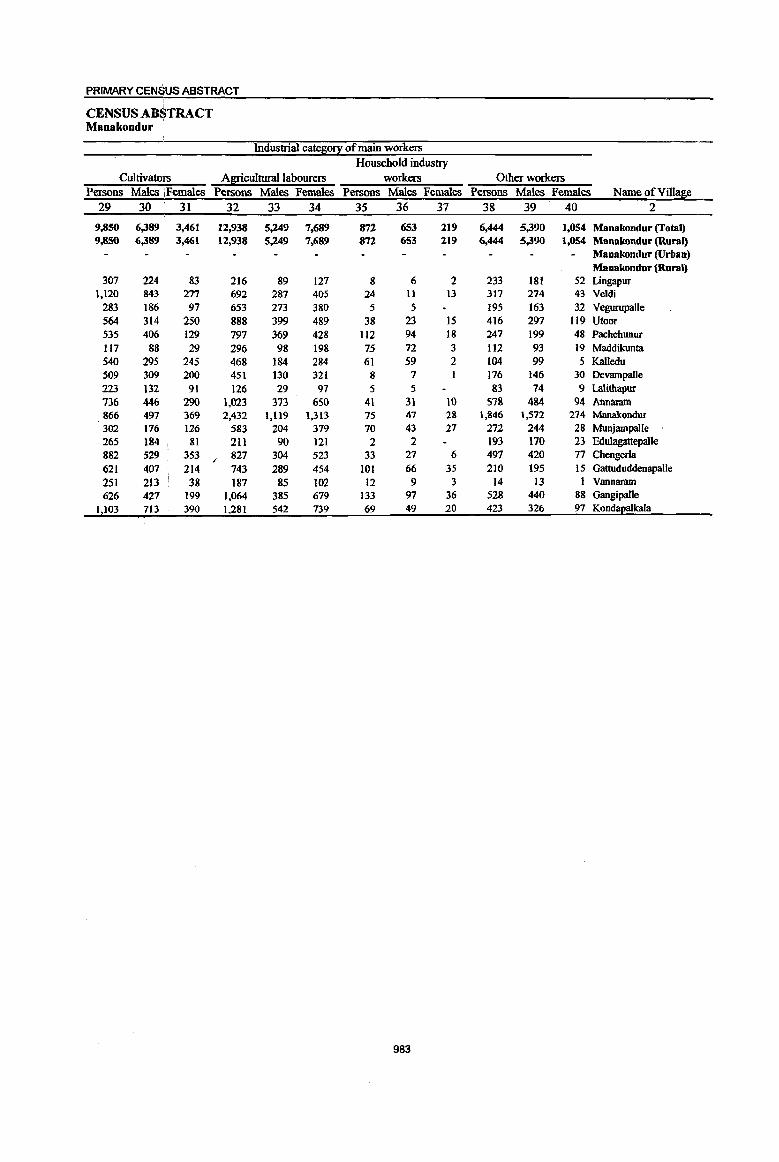
PRIMARY CENSUS ABSTRACT
CENSUS AB~TRACT Manakondur
Industrial cates0!X of main workers Household industty
Cultivatoli's Agricultural labourers workers Other workers Persons Males !Females Persons Males Females Persons Males Females Persons Males Females Name of Village
29 30 31 32 33 34 35 36 37 38 39 40 2
9,850 6,389 3,461 12,938 5,249 7,689 872 653 219 6,444 5,390 1,054 Manakondur (Total) 9,850 6,389 3,461 12,938 5,249 7,689 872 653 219 6,444 5,390 1,054 Manakondur (Rural)
Manakondur (Urban) Manakondur (Rural)
307 224 83 216 89 127 8 6 2 233 18t 52 Lingapur 1,120 843 277 692 287 405 24 11 13 317 274 43 Veldi
283 186 97 653 273 380 5 5 195 163 32 Vegurupalle 564 314 250 888 399 489 38 23 15 416 297 119 Utoor 535 406 129 797 369 428 112 94 18 247 199 48 Pachchunur 117 88 29 296 98 198 75 72 3 112 93 19 Maddikunta 540 295 245 468 184 284 61 59 2 104 99 5 Kalledu 509 309 200 451 130 321 8 7 176 146 30 Devampalle 223 132 91 126 29 97 5 5 83 74 9 Lalithapur 736 446 290 1,023 373 650 41 31 10 578 484 94 Annaram 866 497 369 2,432 1,119 1,313 75 47 28 1,846 1,572 274 ManakonduT 302 176 126 583 204 379 70 43 27 272 244 28 Munjampalle 265 184 81 211 90 121 2 2 193 170 23 Edulagattepalle 882 529 353 ; 827 304 523 33 27 6 497 420 77 Chengerla 621 407 214 743 289 454 101 66 35 210 195 15 Gattududdenapalle 251 213 38 187 85 102 12 9 3 14 13 1 Vannaram 626 427 199 1,064 385 679 133 97 36 528 440 88 Gangipalle
1,103 713 390 1,281 542 739 69 49 20 423 326 97 Kondapalkala
983
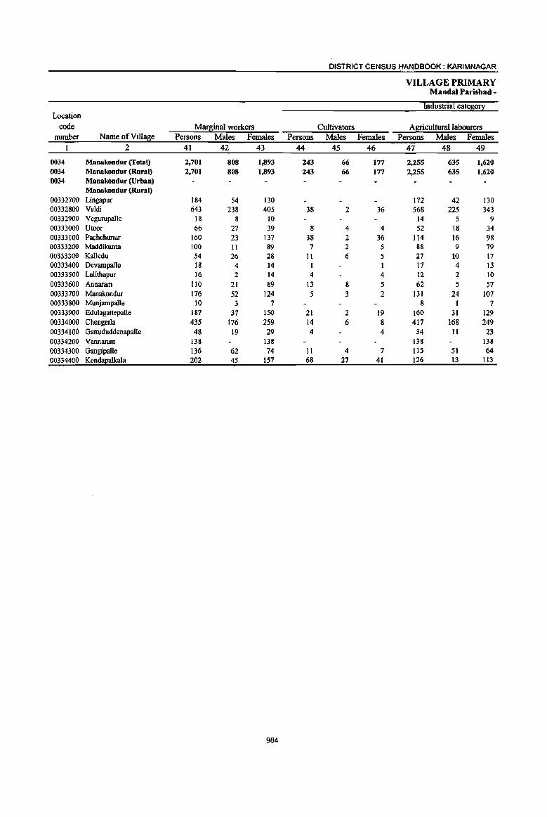
DISTRICT CENSUS HANDBOOK: KARIM NAGAR
VILLAGE PRIMARY MandaI Parisbad -
Industrial cate~0!l: Location
code MarE;inal workers Cultivators Agricultural labourers number Name ofVillase Persons Males Females Persons Males Females Persons Males Females
1 2 41 42 43 44 45 46 47 48 49
0034 Manakondur (Total) 2,701 808 1,893 243 66 177 :z.:z55 635 1,620 0034 Manakondur (Rural) 2,701 808 1,893 243 66 177 2,255 635 1,620 0034 Manakondur (Urban)
Manakondur (Rural) 00332700 Lingapur 184 54 130 172 42 130 00332800 Veldi 643 238 405 38 2 36 568 225 343 00332900 Vegurupalle 18 8 10 14 5 9 00333000 Utoor 66 27 39 8 4 4 52 18 34 00333100 Pachchunur 160 23 137 38 2 36 114 16 98 00333200 Maddikunta 100 11 89 7 2 5 88 9 79 00333300 Kalledu 54 26 28 It 6 5 27 10 17 00333400 Devampalle 18 4 14 1 17 4 13 00333500 Lalithapur 16 2 14 4 4 12 2 10 00333600 Annaram 110 21 89 13 8 5 62 5 57 00333700 Manakondur 176 52 124 5 3 2 131 24 107 00333800 Munjampalle 10 3 7 8 I 7 00333900 Edulagattepalle 187 37 150 21 2 19 160 31 129 00334000 Chengerla 435 176 259 14 6 8 417 168 249 00334100 Gattududdenapalle 48 19 29 4 4 34 11 23 00334200 Vannaram 138 138 138 138 00334300 GangipaUe 136 62 74 11 4 7 1I5 51 64 00334400 Kond!!Ealkala 202 45 157 68 27 41 126 13 113
984

PRIMARY CENS~S ABSTRACT
CENSUS ABSTRACT Maoakondur
of marginal workers Location
Household indU$try workers Other workers Non-workers code Persons Males Females Persons Males Females Persons Males Females Name of Villa~e number
50 51 52 53 54 55 S6 57 58 2 1
31 19 12 172 88 84 32,059 14,236 17,823 Manakoodur (Total) 0034 31 19 12 172 88 84 32,059 14,236 17,823 Manakondur (Rural) 0034
Manakondur (Urban) 0034 Manakondur (Rural)
12 12 1,027 422 605 Lingapur 00332700 37 11 26 2,974 1,232 1,742 Veldi 00332800 4 3 969 418 551 Vegurupalle 00332900 5 5 1,716 830 886 Utoor 00333000 7 4 3 1,988 849 1,139 Pachchunur 00333100 5 5 637 316 321 Maddikunta 00333200
16 10 6 1,005 484 521 Kalledu 00333300 975 447 528 DevampaJle 00333400 403 182 221 Lalithapur 00333500
4 3 31 7 24 2,192 995 1,197 Annaram 00333600 18 13 5 22 12 10 6,854· 2,958 3,896 Manakondur 00333700
2 2 943 426 517 MuojampalJe 00333800 6 4 2 766 331 435 Edulagattepalle 00333900 4 2 2 2,212 1,024 1,188 Chengcrla 00334000 9 7 2 1,498 660 838 Gattududdcnapalle 00334100
587 291 296 Vannaram 00334200 4 2 2 6 5 2,624 1,138 1,486 Gangipalle 00334300 2 ,1 6 4 2 2,689 1,233 1,456 Kondapalkala 00334400
985

DISTRICT CENSUS HANDBOOK: KARIM NAGAR
VILLAGE PRIMARY Mandai Parishad -
Total population (including Location Area of institutional and houseless Population in the
code Village in Number of 2°2u1ation} age-1[ouE: 0-6 number Name of Village hectares households Persons Males Females Persons Males Females
I 2 3 4 5 6 7 8 9 10
0035 Karimnagar (Total) 21,716.0 18,728 83,722 42,618 41,104 11,429 5,862 5,567 0035 Karimnagar (Rural) 20,155.0 15,919 71,073 36,079 34,994 9,748 5,004 4,744 0035 Karimnagar (Urban) 1,561.0 2,749 12,649 6,539 6,110 1,681 858 823
Karimnagar (Rural) 00334500 Nagulamalial 828.0 398 1,706 880 826 219 118 101 00334600 Khazipur 1,006.0 339 1,539 761 778 197 89 108 00334700 Asifnagar 566.0 1,110 5,118 2,575 2,543 780 386 394 00334800 Eigandal 1,720.0 979 4,304 2,151 2,153 564 294 270 00334900 Baddipalle 611.0 320 1,]86 583 603 14] 69 72 00335000 Kamanpur 759.0 546 2,217 1,161 1,056 356 195 161 00335100 Malkapur 536.0 582 2,372 1,172 1,200 286 156 130
00335200 Kothapalle(Haveli) 1,606.0 2,224 10,6]4 5,231 5,383 1,284 647 637 00335300 Nagunur 1,940.0 1,089 4,664 2,306 2,358 663 338 325 00335400 Jublinagar 400.0 270 1,185 597 588 174 87 87
00335500 Fakeerpet 93.0 141 557 282 275 77 42 35
00335600 Chamanpalle 1,190.0 962 4,050 2,090 1,960 526 272 254
00335700 Taharakondapur 251.0 104 450 231 219 67 37 30
00335800 CherIabuthkur 771.0 687 2,890 1,459 1,431 359 190 169
00335900 Maqdumpur 858.0 671 3,059 1,542 1,517 472 240 232
00336000 lrukulla 657.0 325 1,455 748 707 207 107 100
00336100 Elbotharam 579.0 482 2,239 1,159 1,080 319 147 172
00336200 Wallampahad 284.0 333 1,417 712 705 177 96 81
00336300 Arepalle (Rural) 815.0 785 3,442 1,747 1,695 489 266 223
00336400 Rekurthi 490.0 950 5,047 2,836 2,211 693 349 344
00336500 Lakshmipur 186.0 248 1,196 601 595 180 107 73
00336600 Chintakunta (Rural) 1,01l.0 703 3,123 1,593 1,530 467 242 225
00336700 Itasnapur 836.0 ---Un-inhabited----
00336800 Pothgal 342.0 Un-inhabited---
00336900 Durshed 1,118.0 1,336 5,522 2,759 2,763 799 399 400
00337000 Chegurti 702.0 395 1,721 903 818 252 131 121
Karimnagar (Urban)
40306000 Bommakal (00) - Ward 1,441.0 1,554 7;266 3,694 3,572 1,012 505 507
No. II 40306000 Arepalle (OG) (part) - Ward NA 483 2,105 1,065 1,040 267 130 137
No.1 2 40306000 Sitarampur (00) - Ward 120.0 365 1,605 862 743 182 99 83
No.13 40306000 Chintakunta (OG) (part)- NA 347 1,673 918 755 220 124 96
Ward No.14
986
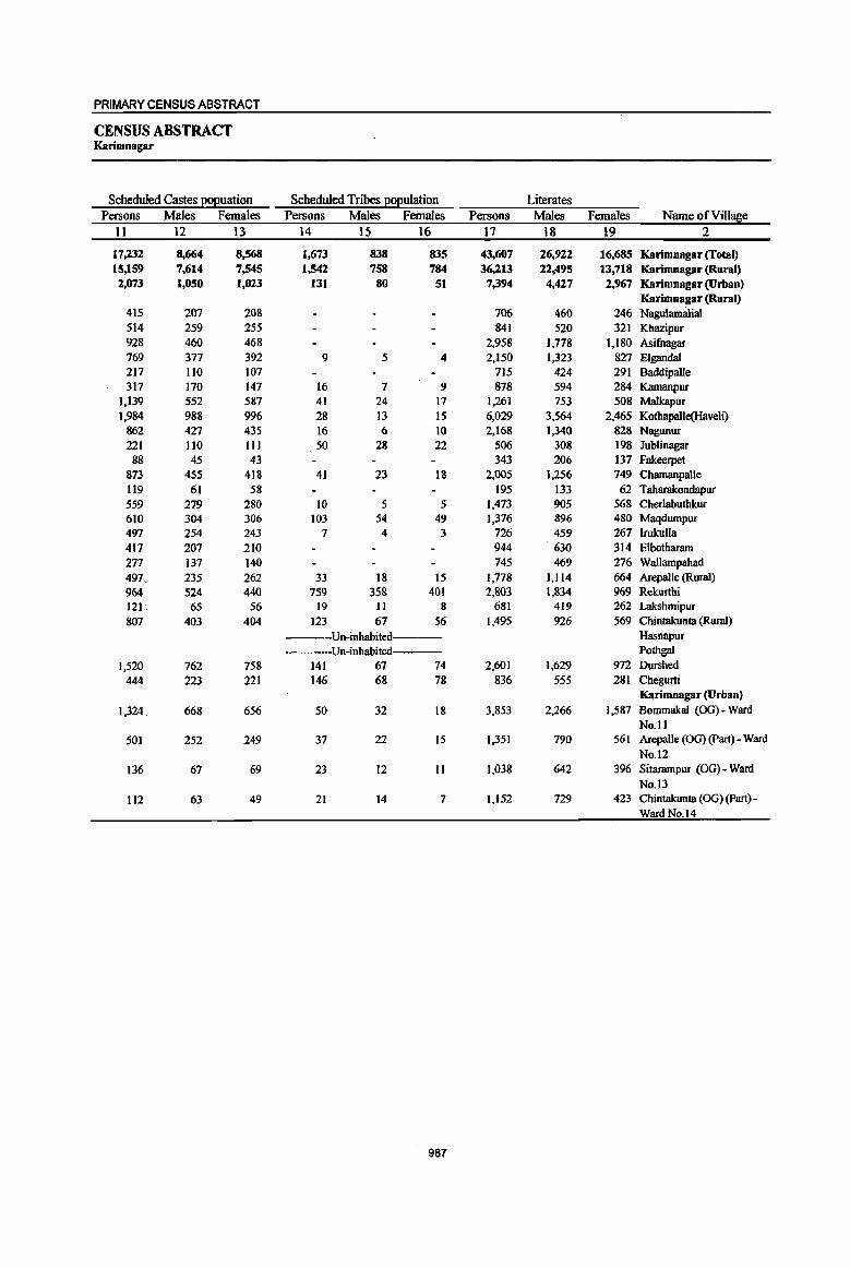
PRIMARY CENSUS ABSTRACT
CENSUS ABSTRACT Karimnagar
Scheduled Castes I!0l!uation Scheduled Tribes I!ol!ulation Literates Persons Males Females Persons Males Females Persons Males Females Name of Villa~e
11 12 13 14 15 16 17 18 19 2
17,232 8,664 8,568 1,673 838 835 43,607 26,922 16,685 Karimnagar (Total) 15,159 7,614 7,545 1,542 758 784 36,213 22,495 13,718 Karimnagar (Rural) 2,073 1,050 1,023 131 80 51 7,394 4,427 2,967 Karimnagar (Urban)
Karimnagar (Rural) 415 207 208 706 460 246 Nagulamalial 514 259 255 841 520 321 Kbazipur 928 460 468 2,958 1,778 1,180 Asifnagar 769 377 392 9 5 4 2,150 1,323 827 Elgandal 217 110 107 715 424 291 Baddipalle 317 170 147 16 7 9 878 594 284 Kamanpur
1,139 552 587 41 24 17 1,261 753 508 Malkapur 1,984 988 996 28 13 15 6,029 3,564 2,465 KotbapaIle(Haveli)
862 427 435 16 6 10 2,168 1,340 828 Nagunur 221 110 111 50 28 22 506 308 198 Jublinagar 88 45 43 343 206 137 Fakeerpet
873 455 418 41 23 18 2,005 1,256 749 Chamanpalle 119 61 58 195 133 62 Taharakondapur 559 279 280 to 5 5 1,473 905 568 Cherlabuthkur 610 304 306 103 54 49 1,376 896 480 Maqdumpur 497 254 243 7 4 3 726 459 267 lrukulla 417 207 210 944 630 314 Elbotharam 277 137 140 745 469 276 Wallampahad 497 .. 235 262 33 18 15 1,778 1,114 664 Arepalle (Rural) 964 524 440 759 358 401 2,803 1,834 969 Rekurthi 121 " 65 56 19 II 8 681 419 262 Lakshmipur 807 403 404 123 67 56 1,495 926 569 Chintakunta (Rural)
---Un-inhabited--- Hasnapur -----Un-inhabited PothgaI
1,520 762 758 141 67 74 2,601 1,629 972 Durshed 444 223 221 146 68 78 836 555 281 Chegurti
Karimnagar (Urban)
1,324 668 656 50 32 18 3,853 2,266 1,587 Bommakal (OG) - Ward No.11
501 252 249 37 22 15 1,351 790 561 ArepalJe (00) (part) - Ward No.12
136 67 69 23 12 II 1,038 642 396 Sitarampur (OG) - Ward No. 13
112 63 49 21 14 7 1,152 729 423 Chintakunta (OG) (part)-Ward No. 14
987
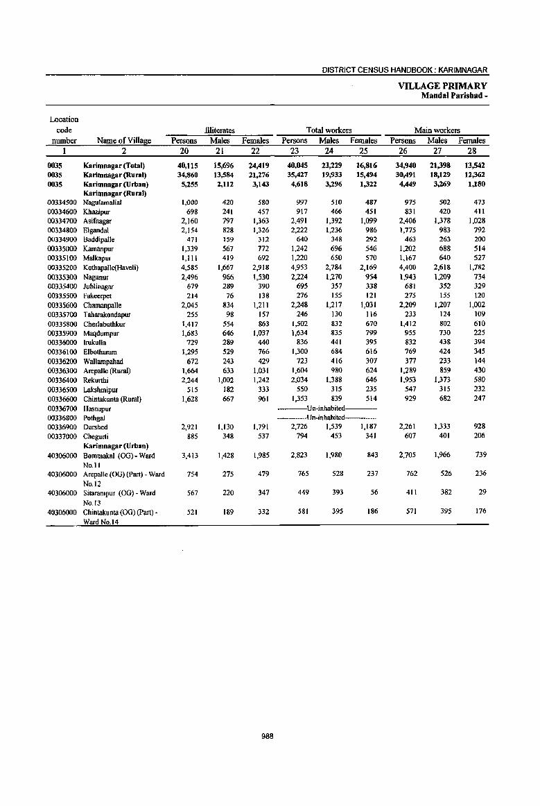
DISTRICT CENSUS HANDBOOK: KARIMNAGAR
VILLAGE PRIMARY Mandai Parisbad -
Location code llliterates Total workers Main workers
number Name ofVi1la~e Persons Males Females Persons Males Females Persons Males Females I 2 20 21 22 23 24 25 26 27 28
0035 Karimnagar (Total) 40,115 15,696 24,419 40,045 23,229 16,816 34,940 21,398 13,542 0035 Karimnagar (Rural) 34,860 13,584 21,276 35,427 19,933 15,494 30,491 18,129 12,362
0035 Karimnagar(Urban) 5,255 2,112 3,143 4,618 3,296 1,322 4,449 3,269 1,180 Karimnagar (Rural)
00334500 Nagulamalial 1,000 420 580 997 510 487 975 502 473 00334600 Khazipur 698 241 457 917 466 451 831 420 411 00334700 Asifnagar 2,160 797 1,363 2,491 1,392 1,099 2,406 1,378 1,028 00334800 Eigandal 2,154 828 1,326 2,222 1,236 986 1,775 983 792 00334900 Baddipaile 471 159 312 640 348 292 463 263 200
00335000 Kamanpur 1,339 567 772 1,242 696 546 1,202 688 514 00335100 Malkapur 1,111 419 692 1,220 650 570 1,167 640 527
00335200 Kothapaile(Haveli) 4,585 1,667 2,918 4,953 2,784 2,169 4,400 2,618 1,782
00335300 Nagunur 2,496 966 1,530 2,224 1,270 954 t,943 1.209 734 00335400 Jublinagar 679 289 390 695 357 338 681 352 329
00335500 Fakeerpet 214 76 138 276 155 121 275 155 120
00335600 Chamanpalle 2,045 834 1,211 2,248 1,217 1,031 2,209 1,207 1,002
00335700 Taharakondapur 255 98 157 246 130 I16 233 124 109
00335800 Cherlabuthkur 1,417 554 863 1,502 832 670 1,412 802 610
00335900 Maqdumpur 1,683 646 1,037 1,634 835 799 955 730 225
00336000 lrukulla 729 289 440 836 441 395 832 438 394
00336100 Elbotharam 1,295 529 766 1,300 684 616 769 424 345
00336200 Wallampahad 672 243 429 723 416 307 377 233 144
00336300 Arepalle (Rural) 1,664 633 1,031 1,604 980 624 1,289 859 430
00336400 Rekurthi 2,244 1,002 1,242 2,034 1,388 646 1,953 1,373 580
00336500 Lakshmipur 515 182 333 550 315 235 547 315 232
00336600 Chintakunta (Rural) 1,628 667 961 1,353 839 514 929 682 247
00336700 Hasnapur Un-inhabited----
00336800 Pothgal Un-inbabited---00336900 Durshed 2,921 1,130 1.791 2.726 1,539 1,187 2,261 1.333 928
00337000 Chegurti 885 348 537 794 453 341 607 401 206
Karimnagar (Urban)
40306000 Bommakal (OG) - Ward 3.413 1,428 1,985 2,823 1,980 843 2,705 1,966 739
No.l1 40306000 Arepalle (OG) (part) - Ward 754 275 479 765 528 237 762 526 236
No. 12 40306000 Sitarampur (OG) - Ward 567 220 347 449 393 56 411 382 29
No. 13 40306000 Chintakunta (OG) (part) - 521 189 332 581 395 186 571 395 176
Ward No.14
988
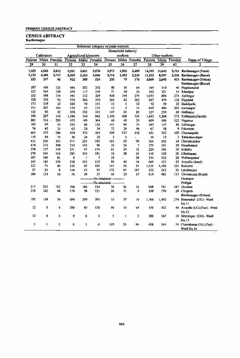
PRIMARY CENSUS ABSTRACT
CENSUS ABSTRACT KBrimnagar
Industrial cate~0!X of main workers Household industry
Cultivators Agricultural labourers workers Other workers Persons Males Females Persons Males Females Persons Males Females Persons Males Females Name ofVill~e
29 30 31 32 33 34 35 36 37 38 39 40 2
7,355 4,543 2,812 9,221 3,651 5,570 3,971 1,562 2,409 14,393 11,642 2,751 Karimnagar (Total) 7,133 4,386 2,747 8,309 3,263 5,046 3,716 1,483 2,233 11,333 8.997 2,336 Karimnagar (Rural)
222 157 65 9U 388 524 255 79 176 3,060 2,645 415 Karimnagar (Urban) Karimnagar (Rural)
287 166 121 444 202 242 80 16 64 164 ·118 46 Nagulamalial 322 164 158 276 117 159 71 18 53 162 121 41 Kbazipur 352 198 154 541 212 329 438 164 2.74 1,075 804 271 Asifnagar 328 236 92 576 206 370 264 62 202 607 479 128 Elgandal 173 138 35 185 74 III 33 1 32 72 50 22 Baddipalle 371 207 164 170 35 135 12 2 10 649 444 205 Kamanpur 135 93 42 558 223 335 147 65 82 327 259 68 Malkapur 380 237 143 1,186 544 642 1,192 468 724 1,642 1,369 273 Kothapalle(Haveli) 801 516 285 473 169 304 60 40 20 609 484 125 Nagunur 102 69 33 195 60 135 141 66 75 243 157 86 Jublinagar 14 43 31 62 28 34 72 26 46 67 58 9 Fakeerpet
661 375 286 818 353 465 299 157 142 431 322 109 Chamanpalle 158 84 74 56 24 32 3 3 16 13 3 Taharakondapur 415 250 165 517 225 292 164 65 99 316 262 54 Cherlabuthkur 418 310 108 233 143 90 33 26 7 271 251 20 Maqdumpur 276 121 149 271 97 174 61 29 32 224 185 39 Irukulla 278 164 114 285 104 181 58 28 30 148 128 20 Elbotharam 187 106 81 8 1 7 28 28 154 126 28 Wallampahad 343 184 159 238 103 135 99 45 54 609 527 82 Arepal1e (Rural) 123 74 49 152 47 105 147 56 91 1,531 1,196 335 Rekurthi 33 25 8 1I0 13 97 172 65 107 232 212 20 Lakshmipur
189 133 56 76 39 37 46 29 17 618 481 137 Chintakunta (Rural) ---Un-inhabited---- Hasnapur
Un-inhabited Pothgal 517 325 192 700 186 514 76 41 35 968 781 187 Durshed 210 162 48 179 58 121 20 II 9 198 170 28 Chegurti
KarimDagar (Urban) 192 138 54 694 299 395 53 37 16 1,766 1,492 274 BommakaJ (OG) - Ward
No.11 12 8 4 200 80 120 80 16 64 470 422 48 Arepalle (OG) (part) - Ward
No. 12 13 8 5 9 6 3 3 2 386 367 19 Sitarampur (OG) - Ward
No. 13 5 3 2 9 3 6 119 25 94 438 364 74 Chintakunta (OG) (Part) -
Ward No. 14
989
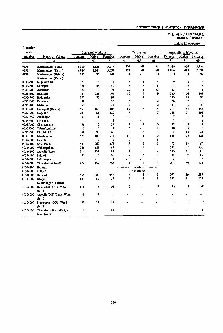
DISTRICT CENSUS HANDBOOK: KARIMNAGAR
VILLAGE PRIMARY Mandai Parishad -
Industrial cate~o!! Location
code Mar~inal workers Cultivators Agricultural labourers number Name ofViIlage Persons Males Females Persons Males Females Persons Males Females
1 2 41 42 43 44 45 46 47 48 49
0035 Karimnagar (Total) 5, lOS 1,831 3,274 132 41 91 2,989 834 2,155 0035 Karimnagar (Rural) 4,936 1,804 3,132 129 41 88 2,886 829 2,057 0035 KarUnnagar(Urban) 169 27 142 3 3 103 5 98
Karimnagar (Rural) 00334500 Nagulamalial 22 8 14 5 I 4 9 4 5 00334600 Khazipur 86 46 40 6 5 1 21 9 12 00334700 Asifnagar 85 14 71 20 3 17 13 5 8 00334800 Elgandal 447 253 194 16 7 9 275 166 109 00334900 Baddipalle 177 85 92 1 I 173 83 90 00335000 Kamanpur 40 8 32 2 2 20 2 18
00335100 Malkapur 53 10 43 2 2 41 5 36 00335200 Kotbapa]Je(Haveli) 553 166 387 )0 6 4 221 65 156 00335300 Nagunur 281 61 220 7 7 218 25 193 00335400 Jublinagar 14 5 9 8 7 00335500 Fakeerpet I I 1 I 00335600 Chamanpalle 39 10 29 7 6 22 5 17 00335700 Taharakondapur 13 6 7 2 2 10 5 5 00335800 Cherlabuthkur 90 30 60 6 3 3 54 J3 41 00335900 Maqdurnpur 679 105 574 II 10 618 90 528 00336000 lrukulla 4 3 I I
00336100 Elbotharam 531 260 271 3 2 72 13 59 00336200 Wallarnpahad 346 183 163 253 92 161 00336300 Arepalle (Rural) 315 121 194 9 9 110 24 86 00336400 Rekurthi 81 IS 66 5 2 3 18 2 16 00336500 LakshmipuT 3 3 2 2
00336600 Chintakunta (Rural) 424 157 267 4 3 203 30 173 00336700 Hasnapur ---Un-inhabited------00336800 Pothgal ----Un-inhabited-----00336900 Durshed 465 206 259 7 4 3 369 159 210 00337000 Chegurti 187 52 135 4 3 155 31 124
Karimnagar (Urban) 40306000 Bommakal (OG) - Ward 118 14 104 3 3 91 3 88
No. II 40306000 Arepalle (00) (part) - Ward 3 2
No.12 40306000 Sitarampur (00) - Ward 38 11 27 II 2 9
No. 13 40306000 Chintakunta (OG) (part) - 10 10
Ward No.14
990
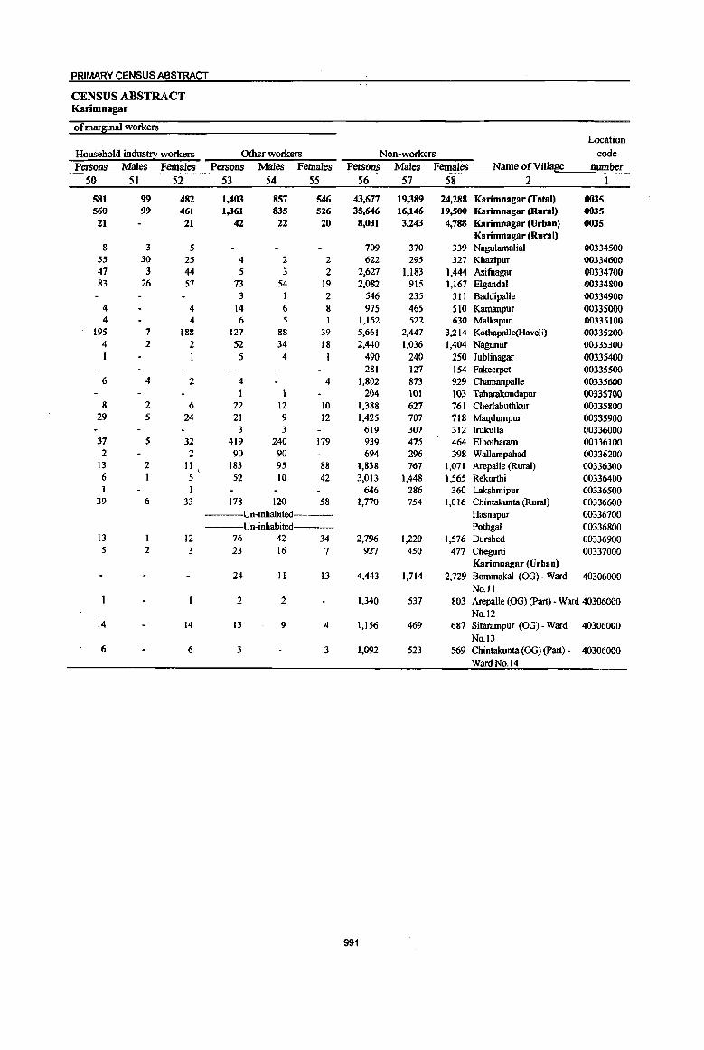
PRIMARY CENSUS ABSTRACT
CENSUS ABSTRACT Karimnagar
of marsinal workers Location
Household industry workers Other workers Non-workers code
Persons Males Females Persons Males Females Persons Males Females Name ofVi11~e number 50 51 52 53 54 55 56 57 58 2 1
581 99 482 1,403 857 546 43,677 19,389 24,288 Karimnagar (Toml) 0035 560 99 461 1,361 835 526 35,646 16,146 19,500 Karimnagar (Rural) 0035
21 21 42 22 20 8,031 3,243 4,788 Karimnagar (Urban) 0035 Karimnaga r (Rural)
8 3 5 709 370 339 Nagulamalial 00334500 55 30 25 4 2 2 622 295 327 Khazipur 00334600 47 3 44 5 3 2 2,627 1,183 1,444 Asifnagar 00334700 83 26 57 73 54 19 2,082 915 1,167 Elgandal 00334800
3 1 2 546 235 311 Baddipalle 00334900 4 4 14 6 8 975 465 SIO Kamanpur 00335000 4 4 6 5 1,152 522 630 Malkapur 00335100
195 7 188 127 88 39 5,661 2,447 3,214 Kothapalle(Haveli) 00335200 4 2 2 52 34 18 2,440 1,036 1,404 Nagunur 00335300 I 1 5 4 I 490 240 250 Jublinagar 00335400
281 127 154 Fakeerpet 00335500 6 4 2 4 4 1,802 873 929 Chamanpalle 00335600
1 1 204 101 103 Taharakondapur 00335700 8 2 6 22 12 10 1,388 627 761 Cherlabuthlrur 00335800
29 5 24 21 9 12 1,425 707 718 Maqdumpur 00335900 3 3 619 307 312 lrukulla 00336000
37 5 32 419 240 179 939 475 464 Elbotharam 00336100 2 2 90 90 694 296 398 Wallampahad 00336200
13 2 II 183 95 88 1,838 761 1,071 Arepalle (Rural) 00336300 6 5 52 10 42 3,013 1,448 1,565 Rekurthi 00336400 1 1 646 286 360 Lakshmipur 00336500
39 6 33 178 120 58 1,770 754 1,016 Chintakunta (Rural) 00336600 Un-inhabited Hasnapur 00336700 Un-inhabited---- Pothgal 00336800
13 12 76 42 34 2,796 1,220 1,576 Dumhed 00336900 5 2 3 23 16 7 927 450 477 Chegurti 00337000
Karimnagar(Urban) 24 11 13 4,443 1,714 2,729 Borrunakal (00) - Ward 40306000
No.1 I 2 2 1,340 537 803 Arepalle (00) (part) - Ward 40306000
No. 12 14 14 13 9 4 1,156 469 687 SitaramPUT (OG) - Ward 40306000
No. 13 6 6 3 3 1,092 523 569 Chintakunta (00) (part) • 40306000
Ward No.1 4
991
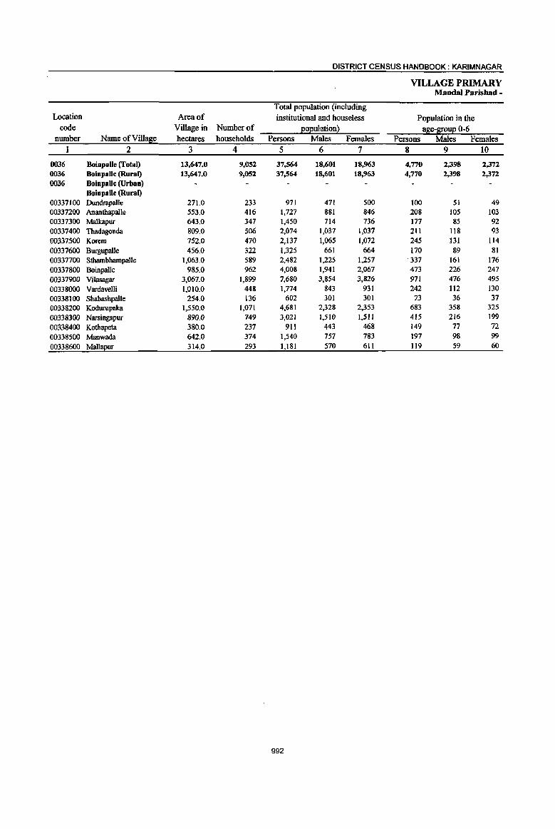
DISTRICT CENSUS HANDBOOK: KARIMNAGAR
VILLAGE PRIMARY Manda' Parisbad -
Total population (including Location Area of institutional and houseless Population in the
code Village in Number of l!°Eulationl !!Be-a!:0!!{! 0-6 number Name ofVilla~e hectares households Persons Males Females Persons Males Females
I 2 3 4 5 6 7 8 9 10
0036 Boinpalle (Total) 13,647.0 9,052 37,564 18,601 18,963 4,770 2,398 2,372 0036 BoinpaJle (Rural) 13,647.0 9,052 37,564 18,601 18,963 4,770 2,398 2,372 0036 Boinpalle (Urban)
Boinpalle (Rural) 00337100 Dundrapalle 271.0 233 971 411 500 100 51 49 00331200 Ananthapalle 553.0 416 1,727 881 846 208 lOS 103 00331300 Malkapur 643.0 341 1,450 714 136 177 85 92 00337400 Thadagonda 809.0 506 2,074 1,031 1,037 211 118 93 00337500 Korem 752.0 470 2,137 1,065 1,072 245 131 114 00337600 Burgupalle 456.0 322 1,325 661 664 170 89 81 00337700 Sthambhampalle 1,063.0 589 2,482 1,225 1,251 '337 161 176 00337800 Boinpalle 985.0 962 4,008 1,941 2,067 473 226 247 00337900 ViJasagar 3,067.0 1,899 7,680 3,854 3,826 971 476 495
00338000 Vardavelli 1,010.0 448 1,774 843 931 242 112 130 00338100 Shabashpalle 254.0 136 602 301 301 73 36 37
00338200 Kodurupaka 1,550.0 1,071 4,681 2,328 2,353 683 358 325
00338300 Narsingapur 890.0 749 3,021 1,510 1,511 415 216 199
00338400 Kothapeta 380.0 237 911 443 468 149 77 72 00338500 Manwada 642.0 374 1,540 757 783 197 98 99
00338600 MallaEur 314.0 293 1,181 570 611 119 59 60
992
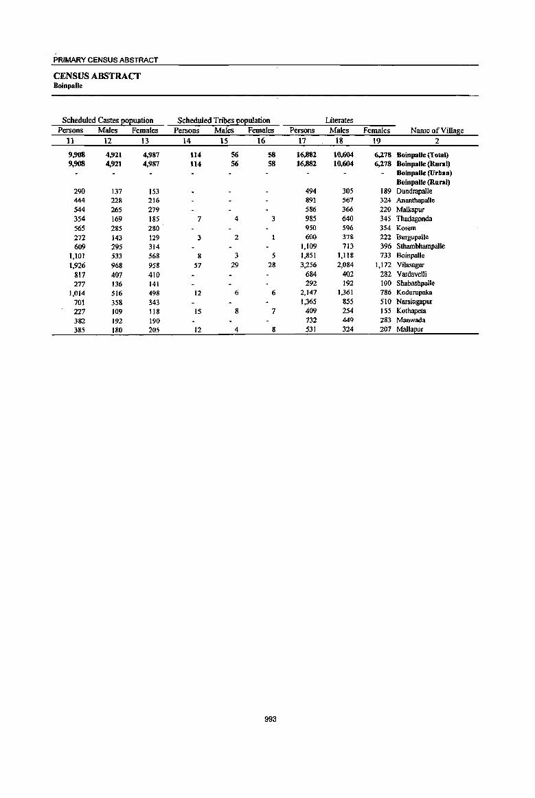
PRIMARY CENSUS ABSTRACT
CENSUS ABSTRACT Boillpalle
Scheduled Castes EOEuation Scheduled Tribes EOEulation Literates
Persons Males Females Persons Males Females Persons Males Females Name of Village
11 12 13 14 15 16 17 18 19 2
9,908 4,921 4,987 114 56 58 16,882 10,604 6,278 Boinpalle (Total) 9,908 4,921 4,987 114 56 58 16,882 10,604 6,278 Boinpalle (Rural)
Boinpalle (Urban) Boinpalle (Rural)
290 137 153 494 305 189 Dundrnpalle 444 228 216 891 567 324 Ananthapal1e 544 265 279 586 366 220 Malkapur 354 169 185 7 4 3 985 640 345 Thadagonda 565 285 280 950 596 354 KOTem
272 143 129 3 2 600 378 1.22 BurgupaUe
609 295 314 1,109 713 396 Stbambbampalle 1,101 533 568 8 3 5 1,851 l,llS 733 BoinpaJle
1,926 968 958 57 29 28 3,256 2,084 1,172 Vilasagar
817 407 410 684 402 282 Vardavelli 277 136 141 292 192 100 Sbabashpalle
1,014 516 498 12 6 6 2,147 1,361 786 Kodurupaka
701 358 343 1,365 855 510 Narsingapur
227 109 118 15 8 7 409 254 155 Kothapeta 382 192 190 132 449 283 Manwada
385 180 205 12 4 8 531 324 207 Mallapur
993
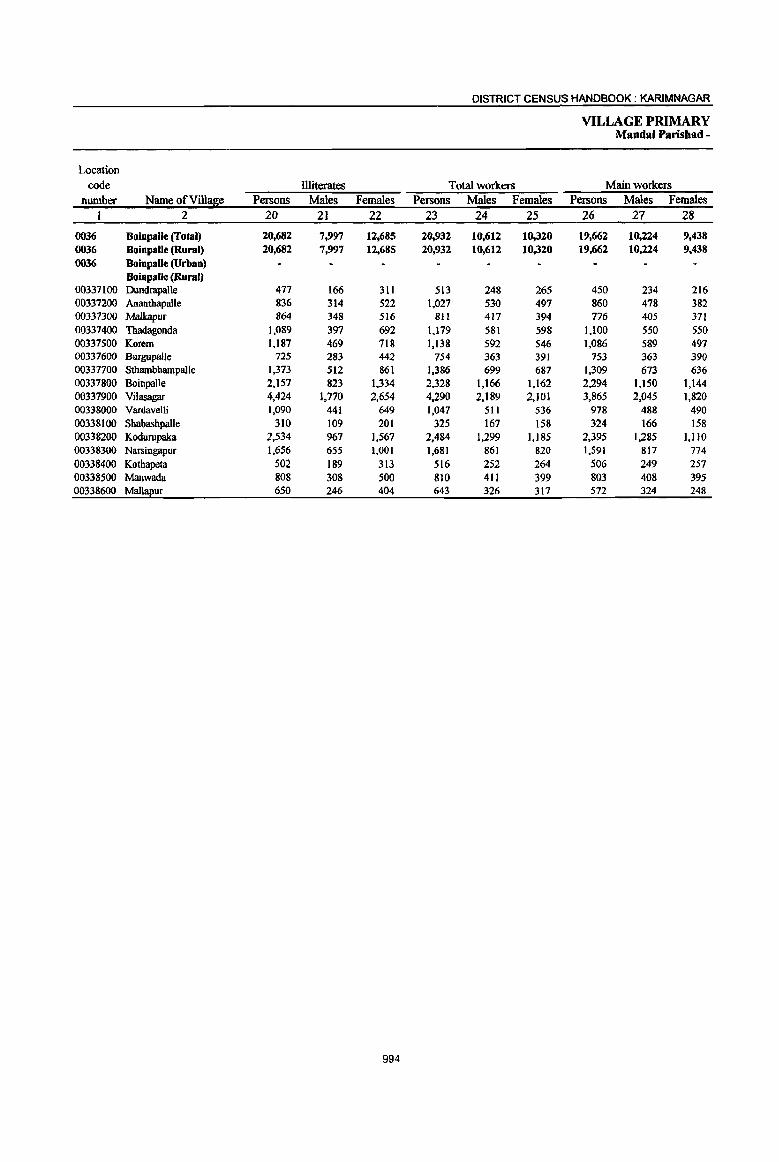
DISTRICT CENSUS HANDBOOK: KARIMNAGAR
VILLAGE PRIMARY Mandai Parisbad -
Location
code illiterates Total workers Main workers
number Name ofVill!$e Persons Males Females Persons Males Females Persons Males Females
1 2 20 21 22 23 24 25 26 27 28
0036 Boinpalle (Total) 20,682 7,997 12,685 20,932 10,612 10,320 19,662 10,224 9,438 0036 Boinpalle (Rural) 20,682 7,997 12,685 20,932 10,612 10,320 19,662 10,224 9,438
0036 Boinpalle (Urban) Boinpalle (Rural)
00337100 Dundrapalle 477 166 311 513 248 265 450 234 216 00337200 Ananthapalle 836 314 522 1,027 530 497 860 478 382 00337300 Malkapur 864 348 516 811 417 394 776 405 371 00337400 Thadagonda 1,089 397 692 1,179 581 598 1,100 550 550 00337500 Korem 1,187 469 718 1,138 592 546 1,086 589 497 00337600 Burgupalle 725 283 442 754 363 391 753 363 390 00331700 Sthambbampalle 1,373 512 861 1,386 699 687 1,309 673 636 00337800 Boinpalle 2,157 823 1,334 2,328 1,166 1,162 2,294 1.150 1,144 00337900 Vilasagar 4,424 1,770 2,654 4,290 2,189 2,101 3,865 2,045 1,820 00338000 VardavelIi 1,090 441 649 1,047 511 536 978 488 490 00338100 Sbabasbpalle 310 109 201 325 167 158 324 166 158 00338200 Kodurupaka 2,534 967 1,567 2,484 1,299 1,185 2,395 1,285 1,110 00338300 NlIISingapur 1,656 655 1,001 1,681 861 820 1,591 817 774 00338400 Kothapeta 502 189 313 516 252 264 506 249 257 00338500 Manwada 808 308 500 810 411 399 803 408 395 00338600 Mall!!j!ur 650 246 404 643 326 317 572 324 248
994

PRIMARY CENSUS ABSTRACT
CENSUS ABSTRACT Boinpalle
Industrial cate80!i: of main workers i Household industry
Cultivators A!l!culturallabourers workers Other workers Persons Males Females Persons Males Females Persons Males Females Persons Males Females Name of Village
29 30 31 32 33 34 35 36: 37 38 39 40 2
(i,816 4,073 2,743 6,896 3,013 3,883 3,042 856 2,186 2,908 2,282 626 BoinpaUe (Total) 6,816 4,073 2,743 6,896 3,013 3,883 3,042 856 2,186 2,908 2,282 626 Boinpalle (Rural)
BoinpalJe (Urban) Boinpalle (Rural)
152 91 61 US 63 52 119 27 92 64 53 11 Dundrapalle 286 162 124 311 174 137 172 80 92 91 62 29 Ananthapalle 193 175 18 314 115 199 153 17 136 116 98 18 Malkapur
319 209 170 249 112 137 263 46 217 209 183 26 Thadagonda 263 190 73 488 198 290 109 37 72 226 164 62 Korem
251 148 103 167 62 105 259 84 175 16 69 1 Burgupalle
453 255 198 484 242 242 212 55 157 160 121 39 Sthambhampalle
455 245 210 1,020 508 512 509 138 371 310 259 51 Boinpalle
1,418 936 482 1,362 541 821 511 122 389 574 446 128 Vilasagar
420 220 200 342 150 192 93 30 63 123 88 35 Vardavelli
132 75 57 III 47 64 32 4 28 49 40 9 Shabasbpalle
1,119 627 492 687 258 429 256 131 125 333 269 64 Kodurupaka
558 33S 223 482 208 274 233 S4 179 318 220 98 NarsingapuT
153 83 70 203 87 116 59 10 49 91 69 22 Kothapeta
322 166 156 327 137 190 45 15 30 109 90 19 Manwada
262 156 106 234 III 123 17 6 II 59 51 8 Mallapur
995
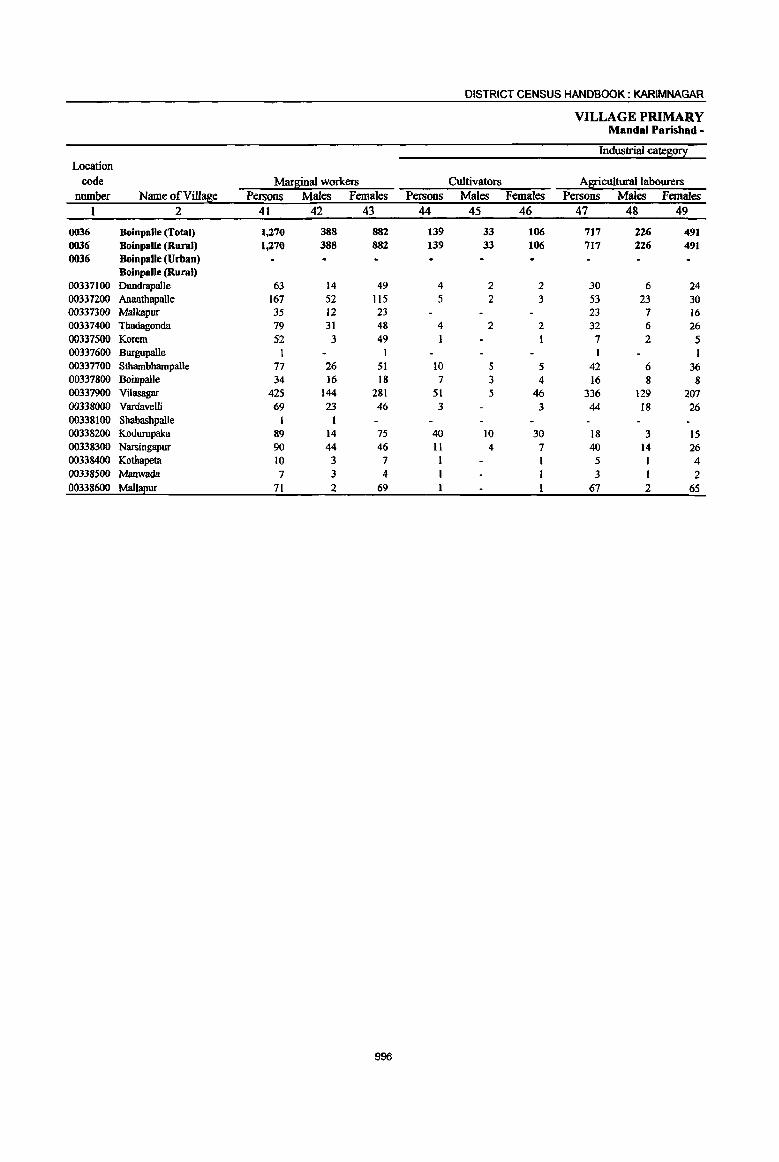
DISTRICT CENSUS HANDBOOK: KARIMNAGAR
VILLAGE PRIMARY Mandai Parishad -
Industrial cate~0!.1 Location
code Mar2;inal workers Cultivators Agricultural labourers number Name ofVilla~e Persons Males Females Persons Males Females Persons Males Females
1 2 41 42 43 44 45 46 47 48 49
0036 Boinpalle (Total) 1,270 388 882 139 33 106 717 226 491 0036 BoinpaUe (Rural) 1,270 388 882 139 33 106 717 226 491 0036 Boinpalle (Urban)
Boinpalle (Rural) 00337100 Dundrapalle 63 14 49 4 2 2 30 6 24 00337200 Ananthapalle 167 52 1I5 5 2 3 53 23 30 00337300 Malkapur 35 12 23 23 7 16 00337400 Thadagonda 79 31 48 4 2 2 32 6 26 00337500 Korem 52 3 49 I I 7 2 5 00337600 Burgupalle I 00337700 Sthambhampalle 77 26 51 10 5 5 42 6 36 00337800 Boinpalle 34 ]6 18 7 3 4 16 8 8 00337900 Vilasagar 425 144 281 51 5 46 336 129 207 00338000 Vardavelli 69 23 46 3 3 44 18 26 00338100 Shabashpalle 00338200 Kodurupaka 89 14 75 40 10 30 18 3 15 00338300 Narsingapur 90 44 46 11 4 7 40 14 26 00338400 Kothapeta 10 3 7 I 5 I 4 00338500 Manwada 7 3 4 3 I 2 00338600 Mall!!2ur 71 2 69 67 2 6S
996

PRIMARY CENSUS ABSTRACT
CENSUS ABSTRACT Boiopalle
ofm~inal workers Location
Household industry workers Other workers Non~workers code Persons Males Females Persons Males Females Persons Males Females Name ofVi.lla~e number
50 51 52 53 54 55 56 57 58 2 1
276 116 230 138 83 55 16,632 7,989 8,643 Boinpalle (Total) 0036 276 46 230 138 83 55 16,632 7,989 8,643 Boinpalle (Rural) 0036
BOinpalle (Urban) 0036 Boinpalle (Rural)
26 5 21 3 2 458 223 235 Dundrapalle 00337100 81 15 66 28 12 16 700 . 351 349 AnanthapaUe 00337200
8 1 7 4 4 639 297 342 Malkapur 00337300 23 8 15 20 15 5 895 456 439 Thadagonda 00337400 40 40 4 3 999 473 526 Korem 00337500
571 .298 273 Burgupalle 00337600 10 4 6 15 11 4 1,096 526 570 Slhambbampalle 00337700 10 5 5 1 1 1,680 775 905 Boinpalle 00337800
18 1 17 20 9 11 3,390 1,665 1,725 Vilasagar 00337900 18 1 17 4 4 127 332 395 Vardavelli 00338000
1 277 134 143 Shabashpalle 00338100
20 20 II 1 10 2,197 1,029 1,168 Kodurupaka 00338200
19 6 13 20 20 1,340 649 691 Narsingapur 00338300 2 2 2 2 395 191 204 Kothapeta 00338400
2 2 730 346 384 Manwada 00338500
3 3 538 244 294 Mall!!I!ur 00338600
997
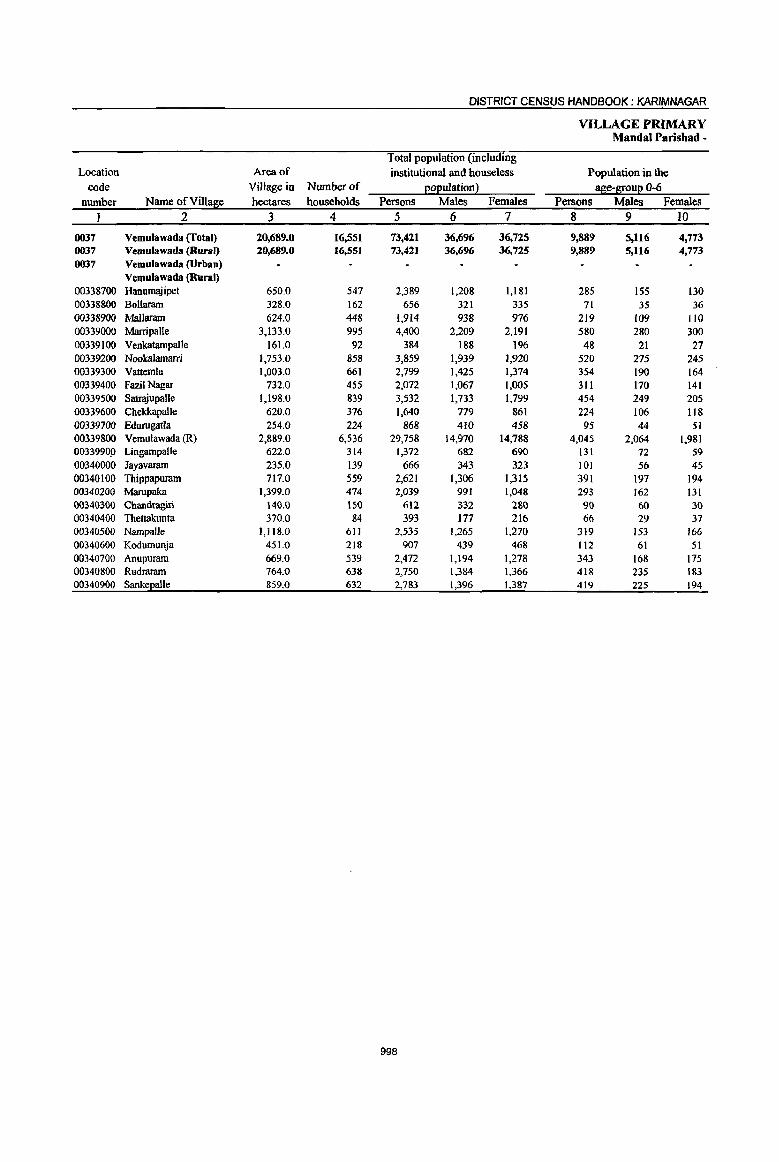
DISTRICT CENSUS HANDBOOK: KARIMNAGAR
VILLAGE PRIMARY MandaI Parishad ~
Total population (including Location Area of institutional and houseless Population in the
code Village in Number of eoeulation2 ase-I[oue 0-6 number Name ()fVill~e hectares households Persons Males Females Persons Males Females
2 3 4 5 6 7 8 9 10
0037 Vemulawada (Total) 20,689.0 16,551 73,421 36,696 36,725 9,889 5,116 4,773 0037 Vemulawada (Rural) 20,689.0 16,551 73,421 36,696 36,725 9,889 5,116 4,773 0037 Vemulawada (Urban)
Vemulawada (Rural) 00338700 Hanumajipet 650.0 547 2,389 1,208 1,181 285 ISS 130 00338800 Bollaram 328.0 162 656 321 335 71 35 36 00338900 Mallaram 624.Q 448 1,914 938 976 219 109 110 00339000 MarripaUe 3,133.0 995 4,400 2,209 2,191 580 280 300 00339100 Venkatampalle 161.0 92 384 188 196 48 21 27 00339200 NooIca1amarri 1,753.0 858 3,859 1,939 1,920 520 275 245 00339300 Vattemla 1,003.0 661 2,799 1,425 1,374 354 190 164 00339400 FazilNagar 732.0 455 2,072 1,067 1,005 311 170 141 00339500 SatrajupaUe 1,198.0 839 3,532 1,733 1,799 454 249 205 00339600 Chekkapalle 620.0 376 1,640 779 861 224 106 118 00339700 Edurugatla 254.0 224 868 410 458 95 44 51 00339800 Vemulawada (R) 2,889.0 6,536 29,758 14,970 14,788 4,045 2,064 1,981 0033990.0 Lingampalle 622.0 314 1,372 682 690 131 72 59 00340000 Jayavaram 235.0 139 666 343 323 101 56 45 00340100 Thippapuram 717.0 559 2,621 1,306 1,315 391 197 194 00340200 Marupaka 1,399.0 474 2,039 991 1,048 293 162 131 00340300 Chandragiri 140.0 ISO 612 332 280 90 60 30 00340400 Thettakunta 370.0 84 393 177 216 66 29 37 00340500 Nampalle 1,118.0 611 2,535 1,265 1,270 319 153 166 00340600 Kodumunja 451.0 218 907 439 468 112 61 51 00340700 Anupuram 669.0 539 2,472 1,194 1,278 343 168 175 00340800 Rudraram 764.0 638 2,750 1,384 1,366 418 235 183 00340900 SankeEalie 859.0 632 2,783 1,396 1,387 419 225 194
998
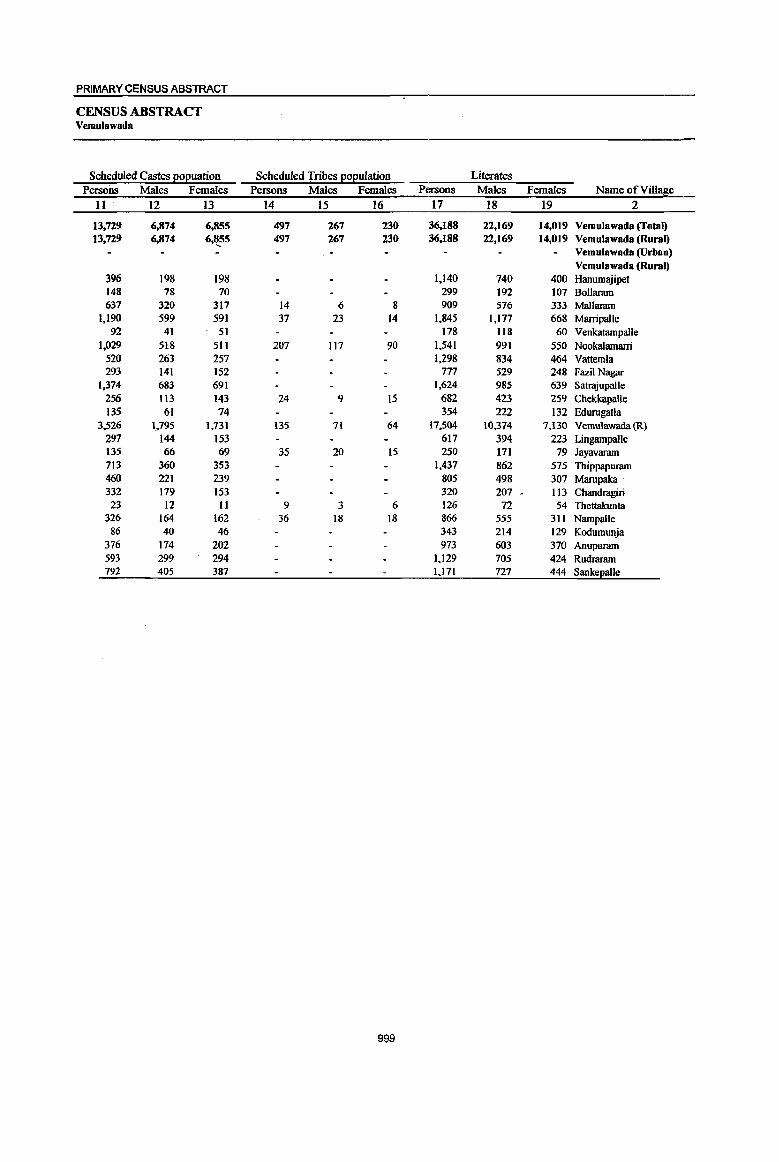
PRIMARY CENSUS ABSTRACT
CENSUS ABSTRACT Vemulawada
Scheduled Castes E02uation Scheduled Tribes EOEulation . Literates Persons Males Females Persons Males Females ·Persons Males Females Name of Village
11· 12 13 14 15 16 17 18 19 2
13,729 6,874 6,855 497 267 230 36,188 22,169 14,019 Vemulawada (Total) 13,729 6,874 6,'t55 497 267 230 36,188 22,169 14,019 Vemulawada (Rural)
Vemulawada (Urban) Vemulawada (Rural)
396 198 198 1,140 740 400 Hanumajipet 148 78 70 299 192 107 Bollaram 637 320 317 14 6 8 909 576 333 Mallaram
1,190 599 591 37 23 14 1,845 1,177 668 Marripalle 92 41 51 178 118 60 Venkatampalle
1,029 518 511 207 117 90 1,541 991 550 Nookalamarri 520 263 257 1,298 834 464 Vattemla 293 141 152 777 529 248 FazilNagar
1,374 683 691 1,624 985 639 SatrajupalJe 256 tI3 143 24 9 15 682 423 259 Chekkapalle 135 61 74 354 222 132 Edurugatla
3,526 1,795 1,731 135 71 64 17,504 10,374 7,130 Vemulawada(R) 297 144 153 617 394 223 Lingampalle 135 66 69 35 20 15 250 171 79 Jayavaram 713 360 353 1,437 862 575 Thippapuram 460 221 239 805 498 307 Marupaka· 332 179 153 320 207 • 113 Chandrngiri 23 12 II 9 3 6 126 72 54 Thettakunta
326 164 162 36 18 18 866 555 311 Nampalle 86 40 46 343 214 129 Kodumunja
376 174 202 973 603 370 Anupuram 593 299 294 1.129 705 424 Rudraram 792 405 387 1,171 727 444 SankeEalle
999

DISTRICT CENSUS HANDBOOK: KARIMNAGAR
VILLAGE PRIMARY Mandai Parishad -
Location
code Illiterates Total woIkers Main woIkers number Name ofViIla8e Persons Males Females Persons Males Females Persons Males Females
1 2 20 21 22 23 24 25 26 27 28
0037 Vemulawada (fotal) 37,233 14,527 22,706 37,273 20,()82 J7,191 33,236 18,835 14,4()1 0037 Vemulawada (Rural) 37,233 14,527 22,706 37,273 20,082 17,191 33,236 18,835 14,401 0037 Vemulawada (Urban)
Vemulawada (Rural) 00338700 Hanumajipet 1,249 468 781 1,351 684 667 821 651 170 00338800 Bollaram 357 129 228 409 198 211 397 195 202 00338900 Mallaram 1,005 362 643 1,079 535 544 1,028 521 507 00339000 Marripalle 2,555 1,032 1,523 2,397 1,252 1,145 1,840 1,070 770 00339100 Venlcatarnpalle 206 70 136 246 118 128 225 m 112 00339200 Nookalamarri 2,318 948 1,370 2,192 1,080 1,112 1,902 1,005 897 00339300 Vattemla 1,501 591 910 1,719 887 832 1,698 878 820 00339400 Fazil Nagar 1,295 538 757 1,186 601 585 1,156 599 557 00339500 Satrajupalle 1,908 748 1,160 1,820 913 907 1,298 696 602 00339600 Chelckapal1e 958 356 602 943 462 481 930 460 470 00339700 EdurugatJa 514 188 326 482 237 245 383 215 168 00339800 Vemulawada (R) 12,254 4,596 7,658 12,833 7,788 5,045 11,820 7,416 4,404 00339900 Lingampalle 755 288 467 807 391 416 804 391 413 00340000 Jayavaram 416 172 244 398 192 206 389 192 197 00340100 Thippapuram 1,184 444 740 1,357 686 671 1,316 679 637 00340200 Marupaka 1,234 493 741 1,245 577 668 1,131 526 605 00340300 Chandragiri 292 125 167 345 185 160 170 120 50 00340400 Thettakunta 267 105 162 220 104 116 39 38 1
00340500 Narnpalle 1,669 710 959 1,403 728 ' 675 1,314 699 615 00340600 Kodumunja 564 225 339 489 226 263 488 226 262 00340700 Anupuram 1,499 591 908 1,249 675 574 1,084 604 480
00340800 Rudraram 1,621 679 942 1,526 760 766 1,476 752 724 00340900 Sankel!alle 1,612 669 943 1,577 803 774 1,527 789 738
1000

PRIMARY CENSUS ABSTRACT
CENSUS ABSTRACT Vemulawada
Industrial catelllo!I of main workers Household industry
Cultivators Agricultura11abourers workers Other workers Persons Males Females Persons Males Females Persons Males Females Persons Males Females Name of Village
29 30 31 32 33 34 35 36 37 38 39 40 2
7,625 4,947 2,678 8,655 3,836 4,819 5,842 1,287 4,S55 11,114 8,765 2,349 Vemulawada (Total) 7,625 4,947 2,678 8,655 3,836 4,819 5,842 1,287 4,555 11,114 8.,765 2,349 Vemolawada (Rural)
Vemulawada (Urban) Vemulawada (Rural)
231 184 47 241 177 64 116 71 45 233 219 14 Hanumajipet 152 93 59 130 62 68 69 5 64 46 35 11 Bollarnm 254 173 81 384 153 231 149 29 120 241 166 75 Mallarnm 756 511 245 505 262 243 173 25 148 406 272 134 Marripal1e 126 72 54 40 19 21 39 6 33 20 16 4 Venkatampalle 640 477 163 592 218 374 352 66 286 318 244 74 Nookalamani 396 240 156 536 303 233 557 186 371 209 149 60 Vattemla 438 244 194 362 194 168 242 71 171 114 90 24 Fazi1 Nagar 272 172 100 689 322 367 210 84 126 127 118 9 Satrajupalle 394 232 162 177 77 JOO 132 41 91 227 110 " 117 Chekkapatle 118 82 36 74 27 47 77 12 65 114 94 20 Edurugatla 813 500 313 1,607 764 843 2,324 446 1,878 7,076 5,706 1,370 Vemulawada (R) 207 206 1 373 81 292 106 21 85 118 83 35 Lingampalle 96 96 196 32 164 33 4 29 64 60 4 Jayavaram
190 105 85 395 146 249 251 29 222 480 399 81 Thippapuram 584 312 272 280 120 160 154 II 143 113 83 30 Marupaka 78 65 13 16 12 4 42 12 30 34 31 3 Chandragiri 3 3 1 1 35 34 I Thettakunta
,X" 414 250 164 425 190 235 89 4 85 386 255 131 Nampalle ,~. 123 71 52 139 48 91 103 1 102 123 106 17 Kodumunja i' 522 347 175 243 92 151 140 31 109 179 134 45 Anupuram
282 188 94 660 264 396 222 40 182 312 260 52 Rudraram 536 324 212 591 273 318 261 91 170 139 101 38 Sankepalle
1001
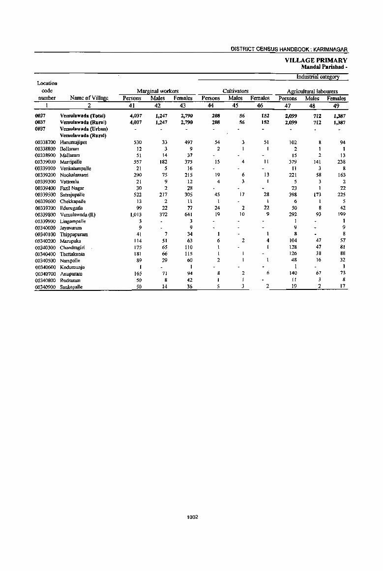
DISTRICT CENSUS HANDBOOK: KARIMNAGAR
VILLAGE PRIMARY Mandai Parishad -
Industrial catego!! Location
code Marl1;inal workers Cultivators A
PRIMARY CENSUS ABSTRACT
CENSUS ABSTRACT Vemulawada
of marginal workers Location
Household indus!!I workers Other workers Non-workers code
Persons Males Females Persons Males Females Persons Males Females Name ofVill!!£ie number 50 51 52 53 54 55 56 57 58 2 I
973 !n 876 757 382 375 36,148 16,614 19,534 Vemulawada (Total) 0037 973 in 876 757 382 375 36,148 16,614 19,534 Vemulawada (Rural) 0037
Vemulawada (Urban) 0037 Vemulawada (Rural)
312 7 305 62 15 47 1,038 524 514 Hanuml\iipet 00338700 8 I 7 247 123 124 Bollaram 00338800
16 I IS 20 11 9 835 403 432 Mallaram 00338900 120 5 115 43 32 11 2,003 957 1,046 Marripalle 00339000
8 8 2 2 138 70 68 Venkatampalle 00339100 33 2 31 17 9 8 1,667 859 808 Nookalamarri 00339200 9 I 8 3 2 t 1,080 538 542 Vattemla 00339300 1 6 I 5 886 466 420 FazilNagar 00339400
54 11 43 25 16 9 1,712 820 892 Satrajupalle 00339500 4 1 3 2 2 697 317 380 Cbekkapalle 00339600
14 4 10 II 8 3 386 173 213 Edurugatla 00339700 270 45 225 432 224 208 16,925 7,182 9,743 Vemulawada (R) 00339800
1 1 1 1 565 291 274 Lingampalle 00339900 268 151 117 Jayavaram 00340000
23 2 21 9 5 4 1,264 620 644 Thippapuram 00340100 3 2 1 I 794 414 380 Marupaka 00340200
27 5 22 19 13 6 267 147 120 Chandragiri 00340300 26 ') 17 28 18 10 173 73 100 Thettakunta 00340400 It 11 28 12 16 1,132 537 595 Nampalle • 00340500
418 213 205 Kodumunja 00340600 12 II 5 4 1,223 519 704 Anupuram 00340700 21 21 17 4 13 1,224 624 600 Rudraram 00340800
26 9 17 1,206 593 613 Sankepalle 00340900
1003

DISTRICT CENSUS HANDBOOK: KARIMNAGAR
VILLAGE PRIMARY Mandai Parishad -
Total population (including Location Area of institutional and houseless Population in the
code Village in Number of EOEulationl age-grouE 0-6 number Name ofVilla~e hectares households Persons Males Females Persons Males Females
I 2 3 4 5 6 7 8 9 10
0038 Konaraopeta (Total) 20,924.0 9,664 41,381 20,640 20,741 5,720 2,957 2,763 0038 Konaraopeta (Rural) 20,924.0 9,664 41,381 20,640 20,741 5,720 2,957 2,763 0038 Konaraopeta (Urban)
Konaraopeta (Rural) 00341000 Marrimadla 1,639.0 345 1,616 797 819 237 1I8 119 00341100 Vattimalla 2,094.0 670 3,059 1,531 1.528 476 233 243 00341200 Nimmapalle 2,564.0 892 3,976 1,973 2,003 626 313 313 00341300 Lachchapeta 63.0 ---Un-inhabited---00341400 Kondapuram (PR) 737.0 220 980 472 508 158 77 81 00341500 Bausaipeta 951.0 572 2,632 1,304 1,328 364 188 J 176 00341600 Mamidipal1e 956.0 629 2,589 1,280 1,309 344 180 164
00341700 Venkatraopeta 329.0 320 1,332 693 639 158 91 67 00341800 Konaraopet 1,898.0 1,141 4,620 2,277 2,343 645 339 306
00341900 SivangalapaUe 913.0 167 709 352 357 95 43 52
00342000 Nizamabad 1,936.0 763 3,341 1,676 1,665 420 221 199
00342100 Kanagarthi 1,029.0 579 2,486 1,247 1,239 349 195 154 00342200 Palle (MaIda) 470.0 284 1,232 613 619 145 79 66 00342300 Suddala 868.0 705 2,918 1,470 1,448 422 222 200 00342400 Ramannapet 696.0 210 892 445 447 124 67 57
00342500 Nagaram 653.0 301 1,223 626 597 149 77 72
00342600 Malkapet 471.0 453 1,900 965 935 272 145 127 00342700 Dharrnaram 1,255.0 579 2,388 1,206 1,182 324 168 156
00342800 Marthanpet 190.0 277 1,099 542 557 119 56 63
00342900 Kolanur 1,212.0 557 2,389 1,171 1,218 293 145 148
1004

PRIMARY CENSUS ABSTRACT
CENSUS ABSTRACT Konaraopeta
Scheduled Castes E012uation Scheduled Tribes 12oI!ulation Literates Persons Males Females Persons Males Females Persons Males Females Name of Village
11 12 13 14 15 16 17 18 19 2 i
9,770 4,922 4,848 1,915 967 948 16,756 10,969 5,787 Konaraopeta (Total) 9,770 4,922 4,848 1,915 967 948 16,756 10,969 5,787 Konaraopeta (Rural)
Konaraopeta (Urban) Konaraopeta (Rural)
735 354 381 711 462 249 Marrimadla 437 217 220 1,086 532 554 1,113 780 333 Vattimalla 977 492 485 330 169 161 1,597 1,048 549 NimmapaIle
Un-inhabited Lachchapeta 170 90 ·80 58 30 28 447 264 183 Kondapumm (PR) 715 357 358 385 195 190 872 566 306 Bausaipeta 646 308 338 9 5 4 1,202 754 448 Mamidipalle 264 132 132 651 438 213 Venkatraopeta 702 360 342 II 3 8 1,823 1,200 623 Konaraopet 112 59 53 316 213 103 Sivangalapalle 796 409 387 4 3 1,502 974 528 Nizamabad 698 353 345 21 21 968 634 334 Kanagarthi 147 71 76 443 292 151 Palle (Makta) 733 381 352 3 2 1,156 761 395 Suddala 306 155 151 348 221 127 Ramannapet 428 226 202 471 313 158 Nagaram 386 202 184 647 434 213 Malkapet 540 273 267 7 7 945 635 310 Dhannaram 266 131 135 445 281 164 Marthanpet 712 352 360 1,099 699 400 Kolanur
1005
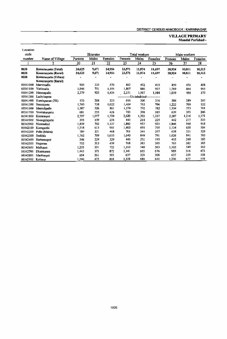
DISTRICT CENSUS HANDBOOK: KARIMNAGAR
VILLAGE PRIMARY Mandai Parishad -
Location
code Illiterates Total workers Main workers number Name of Village Persons Males Females Persons Males Females Persons Males Females
I 2 20 21 22 23 24 25 26 27 28
0038 Konaraopeta (Total) 24,625 9,671 14,954 23,571 11,874 11,697 20,924 10,811 10,113 0038 Konaraopeta (Rural) 24,625 9,671 14,954 23,571 11,874 11,697 20,924 10,811 10,113 0038 Konaraopeta (Urban)
Konaraopeta (Rural) 00341000 Marrimadla 905 335 570 862 452 410 859 451 408 00341100 Vattimalla 1,946 751 1,195 1,807 880 927 1,769 864 90S 00341200 Nimmapalle 2,379 925 1,454 2,151 1,067 1,084 1,039 466 573 00341300 Lachchapeta Un-inhabited-----00341400 Kondapuram (PR) 533 208 325 616 300 316 586 289 297 00341500 Bausaipeta 1,760 738 1,022 1,469 763 706 1,222 700 522 00341600 Marnidipalle 1,387 526 861 1,574 792 782 1,534 773 761 00341700 Venkatraopeta 681 255 426 783 398 385 639 393 246 00341800 Konaraopet 2,797 1,077 1,720 2,620 1,303 1,317 2,387 1,216 1,171 00341900 Sivangalapalle 393 139 254 443 218 225 442 217 225 00342000 Nizamabad 1,839 702 1,137 1,882 957 925 1,866 948 918 00342100 Kanagarthi 1,518 613 905 1,400 695 705 1,134 630 504 00342200 Palle (Makta) 789 321 468 701 344 357 659 331 328 00342300 Suddala 1,762 709 1,053 1,640 849 791 1,626 841 785 00342400 Ramannapet 544 224 320 446 251 195 433 248 185 00342500 Nagaram 752 313 439 768 383 385 765 382 383 00342600 Malkapet 1,253 531 722 1,103 540 563 1,102 540 562 00342700 Dharmaram 1,443 571 872 1,341 665 676 989 516 473 00342800 Marthanpet 654 261 393 637 329 308 637 329 308 00342900 Kolanur 1,290 472 818 1,328 688 640 1;236 677 559
1006

PRIMARY CENSUS ABSTRACT
CENSUS ABSTRACT Konaraopeta
Industrial cate~0!2: of main workers Household industry
Cultivators Agricultural labourers workers Other workers Persons Males Females Persons Males Females Persons Males Females Persons Males Females Name of Village
29 30 31 32 33 34 35 36 37 38 39 40 2
8,148 4,875 3,273 6,173 2,901 3,272 3,543 716 2,827 3,060 2,319 741 Konaraopeta (Total) 8,148 4,875 ,3,273 6,173 2,901 3,272 3,543 716 2,827 3,060 2,319 741 Konaraopeta (Rural)
Konaraopeta (Urban) Konaraopeta (Rural)
299 187 112 318 150 168 133 26 107 109 88 21 Marrimadla 1,264 634 630 179 94 85 59 9 50 267 127 140 Vattimalla
248 143 105 62 28 34 433 49 384 296 246 50 NimmapaIle ---Un-inhabited---- Lachchapeta
266 143 123 119 59 60 157 56 101 44 31 13 Kondapuram (PR) 468 354 114 353 113 240 148 9 139 253 224 29 Bausaipeta 495 272 223 517 251 266 293 74 219 229 176 53 Mamidipal1e 174 III 63 350 185 165 51 42 9 64 55 9 Venkatraopeta 597 430 167 1,058 493 565 393 34 359 339 259 80 Konaraopet 219 109 110 192 96 96 22 6 16 9 6 3 Sivangalapalle 581 322 259 693 353 340 309 42 267 283 231 52 Nizamabad 477 299 178 283 139 144 228 64 164 1:t6 128 18 Kanagarthi 392 215 177 89 37 52 125 29 96 53 50 3 Palle (Makta) 678 378 300 463 225 238 226 57 169 259 181 78 Suddala 263 178 85 94 31 63 37 10 27 39 29 IO Ramannapet 550 290 260 97 46 51 82 22 60 36 24 12 Nagaram 274 234 40 524 224 300 239 18 221 65 64 Malkapet 399 263 136 126 43 83 231 44 187 233 166 67 Dhannaram
. 246 144 102 221 118 103 146 50 96 24 17 7 Marthanpet 258 169 89 435 216 219 231 75 156 312 217 95 Kolanur
1007
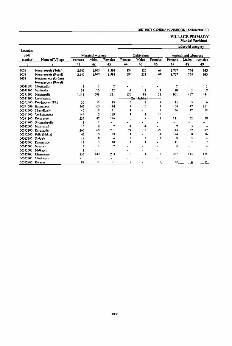
DISTRICT CENSUS HANDBOOK: KARIMNAGAR
VILLAGE PRIMARY MandaI Parishad -
Industrial cateS;0!i: Location
code Marginal workers Cultivators Agricultural labourers number Name ofVill~e Persons Males Females Persons Males Females Persons Males Females
2 41 42 43 44 45 46 47 48 49
0038 Konaraopeta (Total) 2,647 1,063 1,584 194 125 69 1,707 774 933 0038 Konaraopeta (Rural) 2,647 1,063 ),584 194 125 69 1,707 774 933 0038 Konaraopeta (Urban)
Konaraopeta (Rural) 00341000 Marrimadla 3 1 2 2 2 00341100 Vattimalla 38 16 22 4 2 2 10 5 5 00341200 NimmapaUe 1,112 601 511 120 98 22 901 457 444 00341300 Lachcbapeta Un-inhabited----00341400 Kondapuram (PR) 30 11 19 3 2 I 11 5 6 00341500 Bausaipeta 247 63 184 4 3 158 47 III 00341600 Mamidipalle 40 19 21 I 36 17 19 00341700 Venkatraopeta 144 5 139 11 I 10 1 1 00341800 Konaraopet 233 87 146 10 9 111 52 S9 00341900 Sivangalapal1e I
00342000 Nizamabad 16 9 7 4 4 7 3 4
00342100 Kanagarthi 266 65 201 27 2 25 144 52 92 00342200 Palle (Makta) 42 J3 29 24 8 16
00342300 Suddala 14 8 6 3 2 9 5 4 00342400 Ramannapet 13 3 10 I I 11 2 9 00342500 Nagaram 3 1 2 2 2
00342600 Malkapet I I 1
00342700 Dharrnaram 352 149 203 3 2 237 113 124
00342800 Marthanpet 00342900 Kolanur 92 11 81 2 2 42 8 34
1008
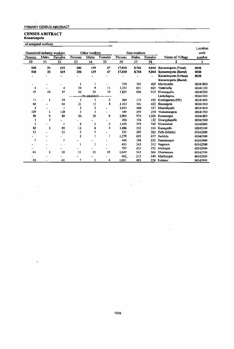
1009
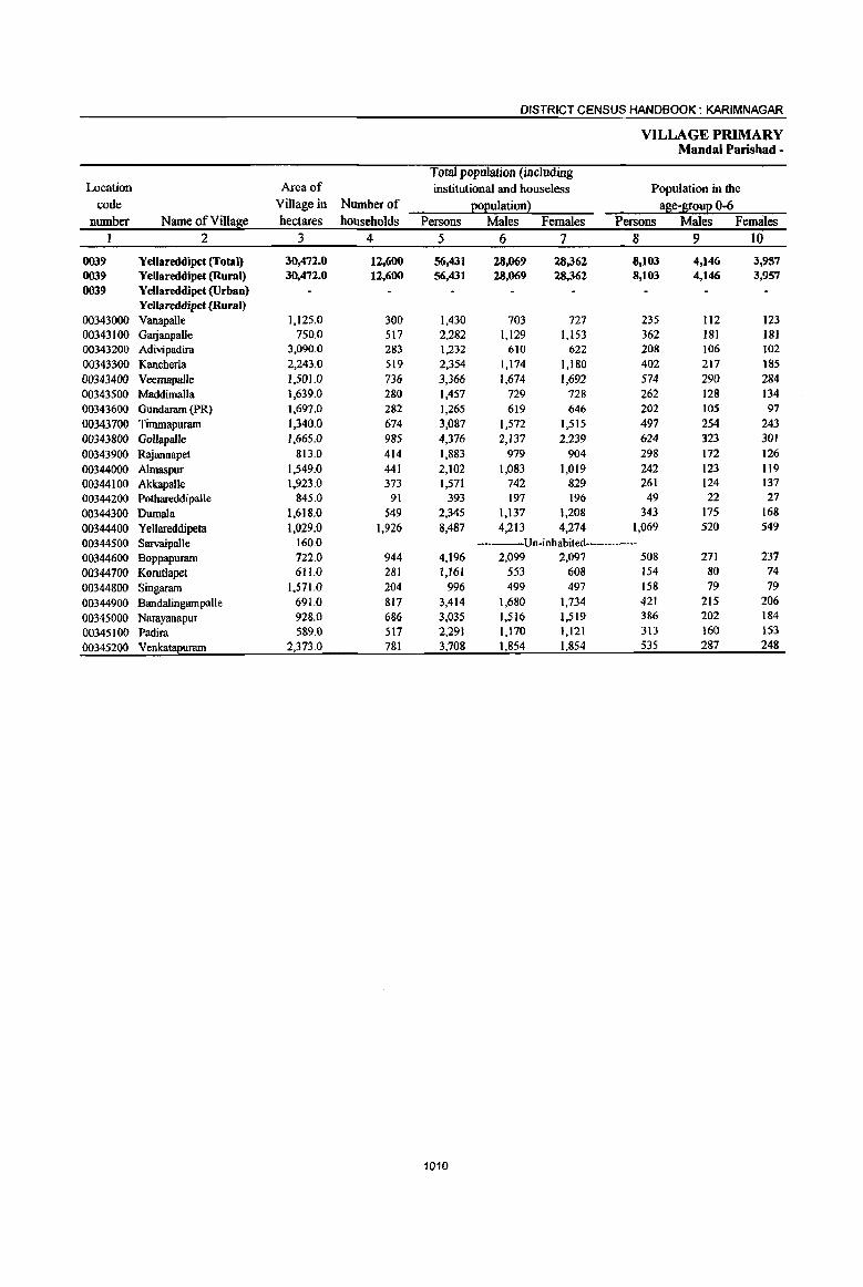
DISTRICT CENSUS HANDBOOK: KARIMNAGAR
VILLAGE PRIMARY Mandai Parisbad -
Total population (including Location Area of institutional and houseless Population in the
code Village in Number of EOEulation2 a~e-&ouE 0-6 number Name ofVilla~e hectares households Persons Males Females Persons Males Females
1 2 3 4 5 6 7 8 9 10
0039 Yel1areddipet (Total) 30,472.0 12,600 56,431 18,069 28,361 8,103 4,146 3,957 0039 YeUareddipet (Rural) 30,472.0 12,600 56,431 28,069 28,362 8,103 4,146 3,957 0039 Yellareddipet (Urban)
Yel~reddipet (Rural) 00343000 Vanapalle 1,125.0 300 1,430 703 727 235 112 123 00343100 Garjanpalle 750.0 517 2,282 1,129 1,153 362 181 18) 00343200 Adivipadira 3,090.0 283 1,232 610 622 208 106 102 00343300 Kancherla 2,243.0 519 2,354 1,174 1,180 402 217 185 00343400 Veernapalle 1,50l.0 736 3,366 1,674 1,692 574 290 284 00343500 Maddimalla 1,639.0 280 1,457 729 728 262 128 134 00343600 Gundaram (PR) 1,697.0 282 1,265 619 646 202 105 97 00343700 Timmapuram 1,340.0 674 3,087 1,572 1,515 497 254 243 00343800 Gollapalle 1,665.0 985 4,376 2,137 2,239 624 323 301 00343900 Rajannapet 813.0 414 1,883 979 904 298 172 126
00344000 A1maspur 1,549.0 441 2,102 1,083 1,019 242 123 1I9 00344100 AkkapaJle 1,923.0 373 1,571 742 829 261 124 137 00344200 Potbareddipalle 845.0 91 393 197 196 49 22 27
00344300 Dumala 1,618.0 549 2,345 1,137 1,208 343 175 168
00344400 YeUareddipela 1,029.0 1,926 8,487 4,213 4,274 1,069 520 549
00344500 Sarvaipal1e 160.0 ---Un-inhabited 00344600 Boppapuram 722.0 944 4,196 2,099 2,097 508 271 237
00344700 Korutlapet 61l.0 281 1,161 553 608 154 80 74
00344800 Singaram 1,571.0 204 996 499 497 158 79 79
00344900 Bandalingampalle 691.0 817 3,414 1,680 1,734 421 215 206
00345000 Narayanapur 928.0 686 3,035 1,516 1,519 386 202 184
00345100 Padira 5&9.0 517 2,291 1,170 1,121 313 160 153
00345200 VenkataI!uram 2,373.0 781 3,708 1,854 1,854 535 287 248
1010
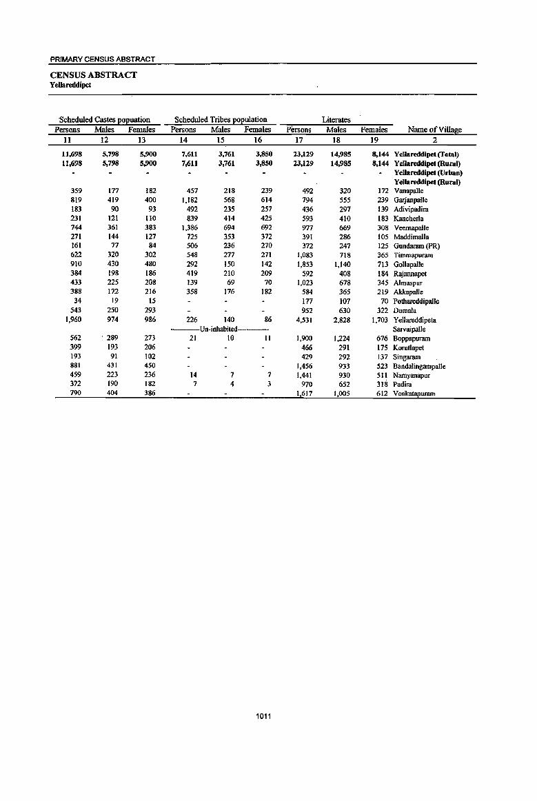
PRIMARY CENSUS ABSTRACT
CENSUS ABSTRACT YeUareddipet
Scheduled Castes 20l!uation Scheduled Tribes ~ulation Literates Persons Mates Females Persons Males Females Persons Males Females Name of Village
11 12 13 14 15 16 17 18 19 2
11,698 5,798 5,900 7,611 3,761 3,850 23,129 14,985 8,144 Yellareddipet (futal) 11,698 5,798 5,900 7,611 3,761 3,850 23,lZ9 14,985 8,144 Yellareddipet (Rural)
Yellareddipet (Urban) YeJlareddipet (Rural)
359 177 182 457 218 239 492 320 172 Vanapalle 819 419 400 1,182 568 614 794 555 239 Garjanpalle 183 90 93 492 235 257 436 297 139 Adivipadira 231 121 110 839 414 425 593 410 183 Kancherla 744 361 383 1,386 694 692 977 669 308 Veemapalle 271 144 127 725 353 372 391 286 105 Maddimalla 161 77 84 506 236 270 372 247 125 Gundaram (PR) 622 320 302 548 277 271 1,083 718 365 Timmapuram 910 430 480 292 150 142 1,853 1,140 713 Gollapal1e 384 198 186 419 210 209 592 408 184 R~annapet 433 225 208 139 69 70 1,023 678 345 Almaspur 388 172 216 358 176 J82 584 365 219 Akkapalle
34 19 IS 177 107 70 Pothareddipalle 543 250 293 952 630 322 Dumala
1,960 974 986 226 140 86 4,531 2,828 1,703 Yellareddipeta Un-inhabited Sarvaipalle
562 289 273 21 10 II 1,900 1,224 676 Boppapuram 399 193 206 466 291 175 Korutlapet 193 91 102 429 292 137 Singararn 881 431 450 1,456 933 523 Bandalingampalle 459 223 236 14 7 7 1,441 930 511 Narayanapur 372 190 182 7 4 3 970 652 318 Padira 790 404 386 1,617 1,005 612 Venkatapuram
1011
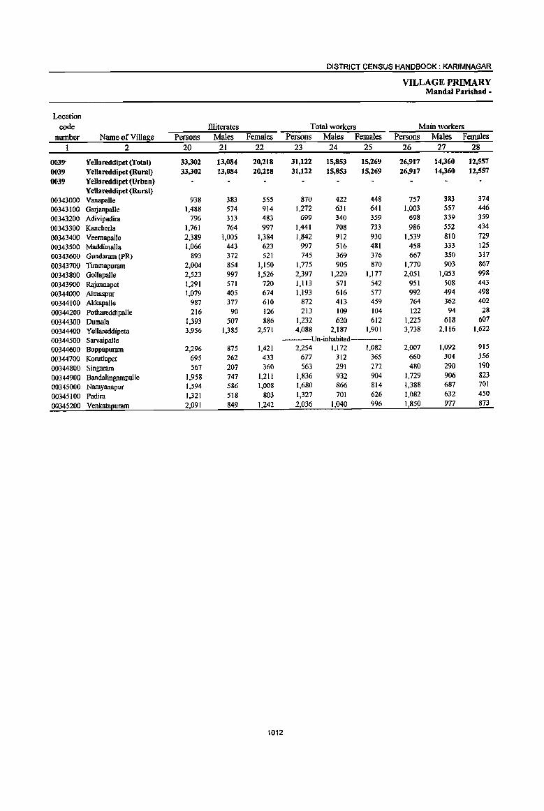
DISTRICT CENSUS HANDBOOK: KARIMNAGAR
VILLAGE PRIMARY Mandai Parisbad -
Location
code Illiterates Total workers Main workers
number Name of Villa~e Persons Males Females Persons Males Females Persons Males Females 1 2 20 21 22 23 24 25 26 27 28
0039- Yellareddipet (Total) 33,302 13,084 20,218 31,122 15,853 15,269 26,917 14,360 12,557 0039 Yellareddipet (Rural) 33,302 13,084 20,218 31,122 15,853 15,269 26,917 14,360 12,557 0039 Yellareddipet (Urban)
YeUareddipet (Rural) 00343000 Vanapalle 938 383 555 870 422 448 757 383 374 00343100 Garjanpalle 1,488 574 914 1,272 631 641 1,003 557 446 00343200 Adivipadira 796 313 483 699 340 359 698 339 359
00343300 Kancherla 1,761 764 997 1,441 708 733 986 552 434
00343400 Veernapalle 2,389 1,005 1,384 1,842 912 930 1,539 810 729 00343500 Maddimalla 1,066 443 623 997 516 481 458 333 125 00343600 Gundaram (PR) 893 372 521 745 369 376 667 350 317
00343700 Timmapuram 2,004 854 1,150 1,775 905 870 1,770 903 867
00343800 Gollapalle 2,523 997 1,526 2,397 1,220 1,177 2,051 1,053 998
00343900 Rajannapet 1,291 571 720 1,113 571 542 951 508 443
00344000 Almaspur 1,079 405 674 1,193 616 577 992 494 498
00344100 Akkapalle 987 377 610 872 413 459 764 362 402
00344200 Pothareddipalle 216 90 126 213 109 104 122 94 28
00344300 Dumala 1,393 507 886 1,232 620 612 1,225 618 607
00344400 Yellareddipeta 3,956 1,385 2,571 4,088 2,187 1,901 3,738 2,116 1,622
00344500 Sarvaipalle ----Un-inhabited----
00344600 Boppapuram 2,296 875 1,421 2,254 1,172 1,082 2,007 1,092 915
00344700 Korutlapet 695 262 433 677 312 365 660 304 356
00344800 Singaram 567 207 360 563 291 272 480 290 190
00344900 Bandaiingampalle 1,958 747 1,211 1,836 932 904 1,729 906 823
00345000 Narayanapur 1,594 586 1,008 1,680 866 814 1,388 687 701
00345100 Padira 1,321 518 803 1,327 701 626 1,082 632 450
00345200 Venkala2uram 2,091 849 1,242 2,036 1,040 996 1,850 977 873
1012

PRIMARY CENSUS ABSTRACT
CENSUS ABSTRACT Yellareddipet
Industrial cateso~ of main workers Household industry
Cultivators Agricultural labourers workers Other workers Persons Males; Females Persons Males Females Persons Males Females Persons Males Females Name of Village
29 . 30 31 32 33 34 35 36 37 38 39 40 2
10,183 6,360 3,823 6,313 3,092 3,221 4,289 656 3,633 6,132 4,252 1,880 YelJareddipet (Total) 10,183 6,360 3,823 6,313 3,092 3,221 4,289 656 3,633 6,132 4,252 1,880 YelJareddipet (Rural)
YelJareddipet (Urban) YelJareddipet (Rural)
617 304 313 46 24 22 13 7 6 81 48 33 Vanapalle 270 239 31 634 246 388 45 26 19 54 46 8 GlIljanpalle 331 171 160 208 109 99 III 33 7& 48 26 22 Adivipadira 486 348 138 397 161 236 73 21 52 30 22 8 Kancherla 990 547 443 252 101 151 52 52 245 162 83 VeemapaUe 287 181 106 159 142 17 3 2 I 9 8 I Maddimalla 403 233 170 118 56 62 ]46 6] 85 Gundaram (PR) 704 474 230 498 200 298 420 Il2 308 148 117 31 Timmapurarn 719 404 315 282 133 149 430 31 399 620 485 135 GolJapalle 442 242 2{)0 239 124 115 91 II 80 179 131 48 Rajannapet 471 282 189 33 21 12 16 6 10 472 185 287 Almaspur 107 60 47 455 249 206 146 9 137 56 44 12 Akkapalle 87 87 I I 25 2 23 9 5 4 Pothareddipalle
352 220 132 389 184 205 312 62 250 172 152 10 Dumala 868 593 275 616 345 271 999 92 907 1,255 1,086 169 Yellareddipeta
----Un-inhabited--- SarvaipalJe 625 383 242 280 123 157 281 30 251 821 556 265 Boppapurarn 237 138 99 177 87 90 168 IS 153 78 64 14 Korutlapet
.:r.:: 141 99 42 123 76 47 41 I 40 175 114 61 Singaram 568 382 186 479 257 222 149 19 130 533 248 285 Bandalingampalle 361 128 133 357 196 161 351 23 328 319 240 79 Narayanapur 530 357 173 129 64 65 53 13 40 370 198 J72 Padira 587 388 199 441 194 147 510 141 369 312 254 58 Venkatapurarn
1013
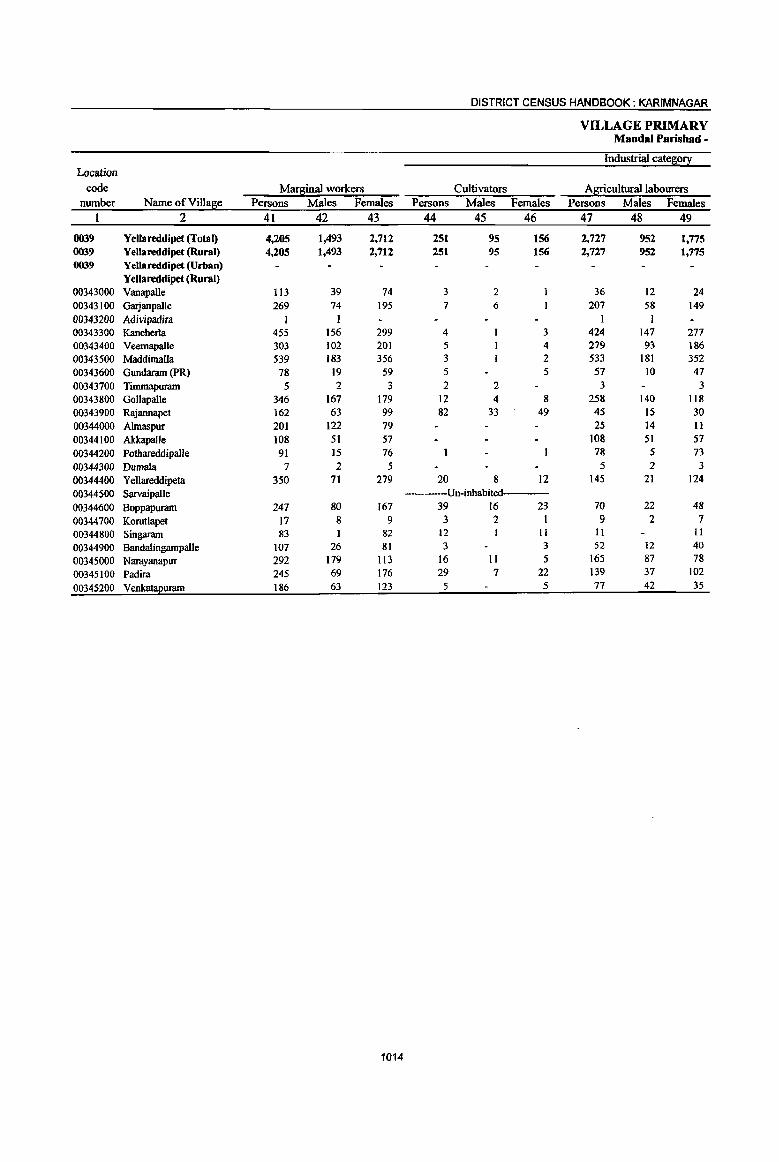
DISTRICT CENSUS HANDBOOK: KARIMNAGAR
VILLAGE PRIMARY MandaI Parishad -
Industrial category Location
code Mar~inal workers Cultivators Agricultural labourers number Name of Villa fie Persons Males Females Persons Males Females Persons Males Females
2 41 42 43 44 45 46 47 48 49
0039 Yellareddipet (Total) 4,205 1,493 2,712 251 95 156 2,727 952 1,775 0039 Yellareddipet (Rural) 4,205 1,493 2,712 251 95 156 2,727 952 1,775 0039 Yellareddipet (Urban)
Yellareddipet (Rural) 00343000 Vanapalle 113 39 74 3 2 36 12 24 00343100 Garjanpalle 269 74 195 7 6 207 58 149 00343200 Adivipadira 1 I I I 00343300 Kancherla 455 156 299 4 3 424 147 277 00343400 Veemapalle 303 102 201 5 4 279 93 186 00343500 Maddimalla 539 183 356 3 2 533 181 352 00343600 Gundaram (PR) 78 19 59 5 5 57 10 47 00343700 Timmapuram 5 2 3 2 2 3 3 00343800 Gollapalle 346 167 179 12 4 8 258 140 118 00343900 Rajannapet 162 63 99 82 33 49 45 15 30 00344000 Almaspur 201 122 79 25 14 II 00344100 Akkapalle 108 51 57 108 51 57 00344200 Pothareddipalle 91 15 76 78 5 73 00344300 Dumala 7 2 5 5 2 3 00344400 Yellareddipeta 350 71 279 20 8 12 145 21 124 00344500 Sarvaipalle Un-inhabited 00344600 Boppapuram 247 80 167 39 16 23 70 22 48 00344700 Korutlapet 17 8 9 3 2 1 9 2 7 00344800 Singaram 83 I 82 12 11 II II
00344900 BandaiingampaIle 107 26 81 3 3 52 12 40 00345000 Narayanapur 292 179 113 16 II 5 165 87 78 00345100 Padira 245 69 176 29 7 22 139 37 102
00345200 Venka!!2uram 186 63 123 5 5 77 42 35
1014

1015
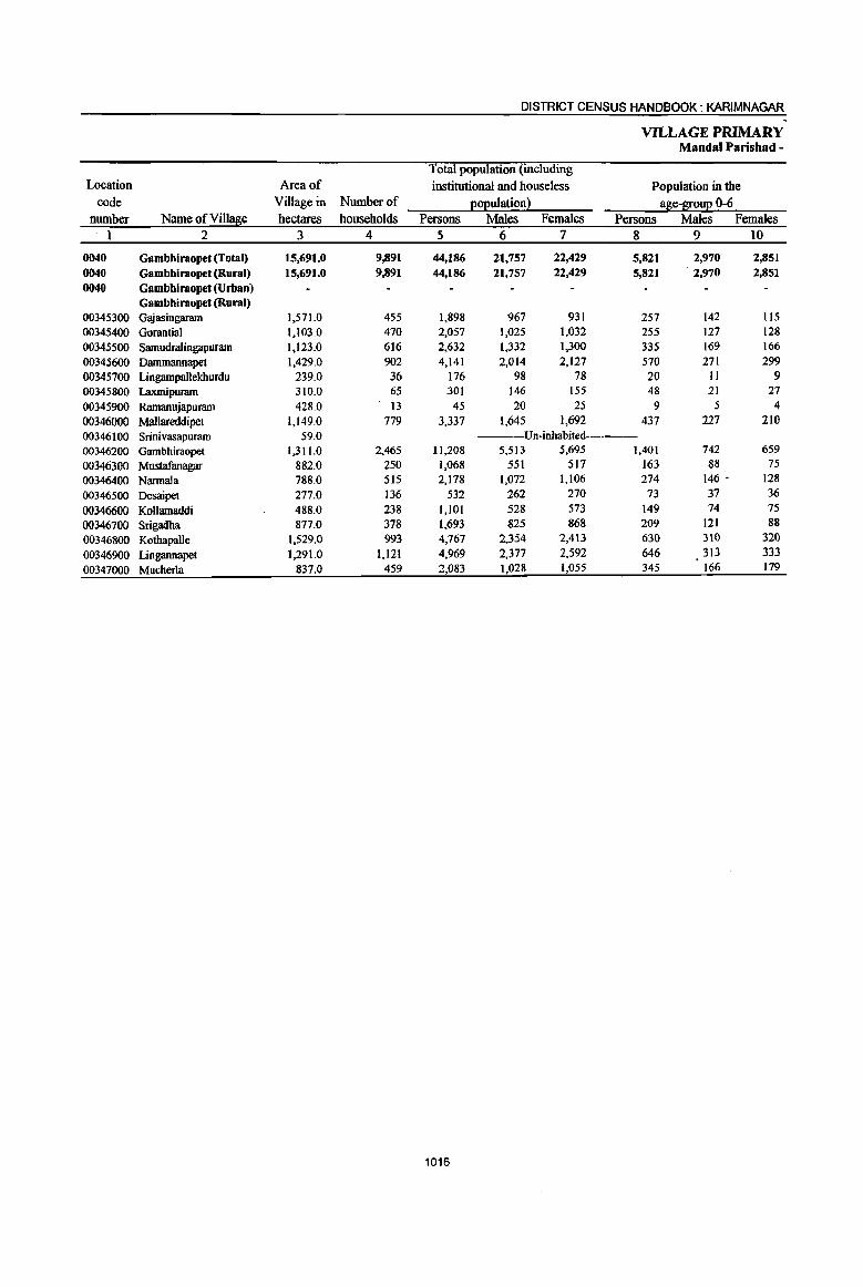
DISTRICT CENSUS HANDBOOK: KARIMNAGAR
VILLAGE PRIMARY Mandai Parishad -
Total population (including
Location Area of institutional and houseless Population in the code Village in Number of EOEulation~ a~e-S!0uE 0-6
number Name ofVill!$e hectares households Persons Males Females Persons Males Females
1 2 3 4 5 6 7 8 9 10
0040 Gambhiraopet (Total) 15,691.0 9,891 44,186 21,757 22,429 5,821 2,970 2,851 0040 Gambhiraopet (Rural) 15,691.0 9,891 44,186 21,757 22,429 5,821 2,970 2,851 0040 Gambbiraopet (Urban)
Gambhiraopet (Rural) 00345300 Gajasingaram 1,571.0 455 1,898 967 931 257 142 115 00345400 Gorantial 1,103.0 470 2,057 1,025 1,032 255 127 128 00345500 Samudralingapuram 1,123.0 616 2,632 1,332 1,300 335 169 166
00345600 Dammannapet 1,429.0 902 4,141 2,014 2,127 570 271 299 00345700 Ljngampallekburdu 239.0 36 176 98 78 20 II 9 00345800 Laxmipuram 310.0 65 301 146 155 48 21 27
00345900 Ramanujapuram 428.0 I3 45 20 25 9 5 4
00346000 Mallareddipet I,149.0 779 3,337 1,645 1,692 437 227 210
00346100 Srinivasapuram 59.0 ---Un-inhabited---00346200 Gambhiraopet 1,311.0 2,465 11,208 5,513 5,695 1,401 742 659
00346300 Mustafanagar 882.0 250 1,068 551 517 163 88 75
00346400 Nannala 788.0 515 2,178 1,072 1,106 274 146 • 128
00346500 Desaipet 277.0 136 532 262 270 73 37 36
00346600 Kollamaddi 488.0 238 1,101 528 573 149 74 75
00346700 Srigadha 877.0 378 1,693 825 868 209 121 88
00346800 Kothapal1e 1,529.0 993 4,767 2,354 2,413 630 310 320
00346900 Lingannapet 1,291.0 1,121 4,969 2,377 2,592 646 313 333
00347000 Mucherla 837.0 459 2,083 1,028 1,055 345 166 179
1016
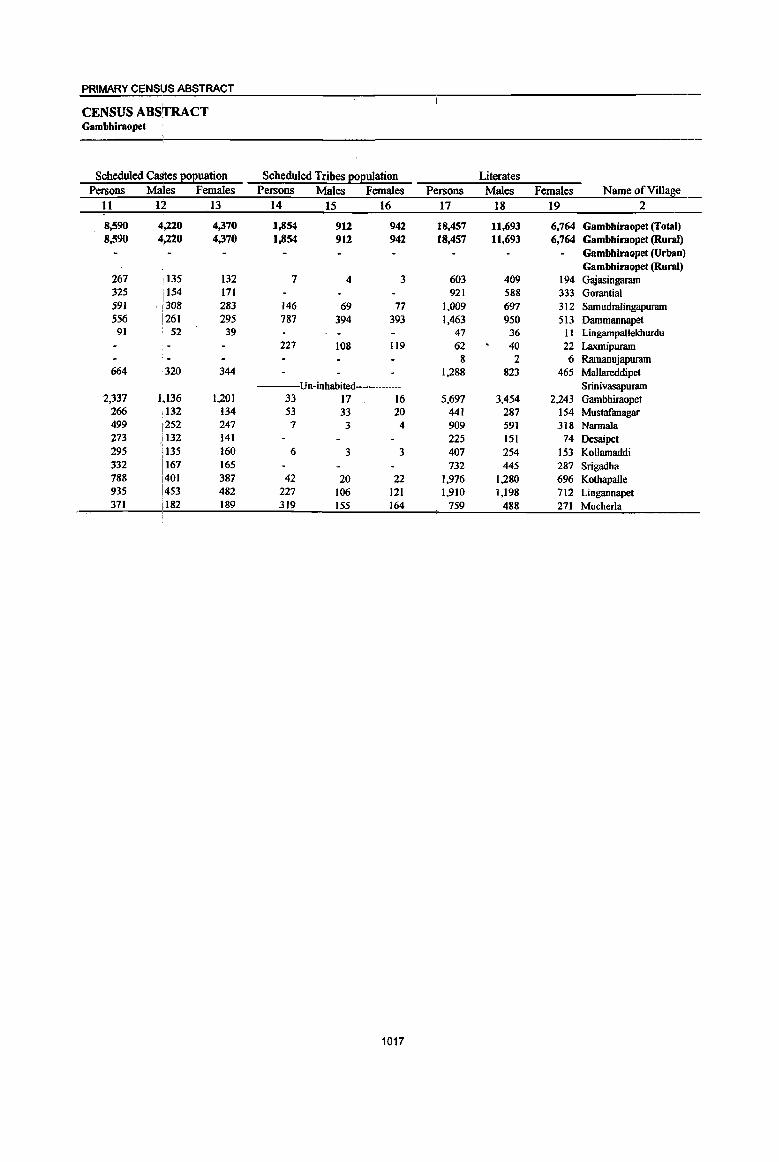
PRIMARY CENSUS ABSTRACT
CENSUS ABSrrRACT Gambhiraopet
Scheduled CaStes 1!oEuation Scheduled Tribes EOEulation Literates Persons Males Females Persons Males Females Persons Males Females Name ofVinage
11 12 13 14 15 16 17 18 19 2
8,590 4,220 4,370 1,854 912 942 18,457 11,693 6,764 Gambhiraopet (Total) 8,590 ~,220 4,370 1,854 912 942 18,457 11,693 6,764 Gambhiraopet (Rural)
Gambhiraopet (Urban) Gambhiraopet (Rural)
267 135 132 7 4 3 603 409 194 Gajasingaram 325 i 154 171 921 588 333 Gorantial 591 ' /308 283 146 69 77 1,009 697 312 Samudralingapuram 556 !261 295 787 394 393 1,463 950 513 Dammannapet
91 52 39 47 36 II LingampalJekburdu 227 108 119 62 40 22 Laxmipuram
8 2 6 Ramanujapuram 664 320 344 1,288 823 465 Mallareddipet
Un-inhabited Srinivasapuram 2,337 1,136 1,201 33 17 16 5,697 3,454 2,243 Gambhiraopet
266 ,132 134 53 33 20 441 287 154 Mustafanagar 499 [252 247 7 3 4 909 591 318 Nannala '].73 i132 141 225 151 74 Desaipet 295 f135 160 6 3 3 407 254 153 Kollamaddi 332 1167 165 732 445 287 Srigadha
I
788 i401 387 42 20 22 1,976 1,280 696 Kothapalle 935 i453 482 227 106 121 1,910 1,198 712 Lingannapet 371 il82 189 319 155 164 759 488 271 Mucherla
1017
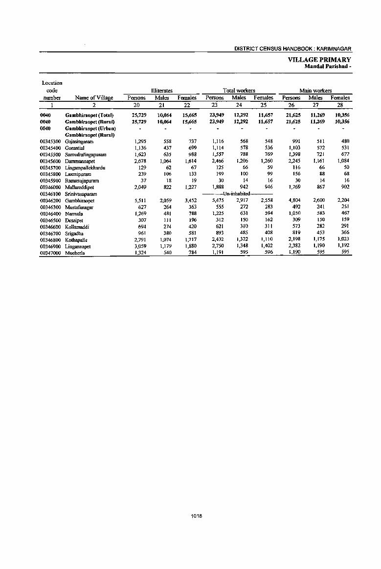
DISTRICT CENSUS HANDBOOK: KARIM NAGAR
VILLAGE PRIMARY Mandai Parishad -
Location
code Illiterates Total workers Main workers number Name ofVilla~e Persons Males Females Persons Males Females Persons Males Females
1 2 20 21 22 23 24 25 26 27 28
0040 Gambhiraopet (Total) 25,729 10,064 15,665 23,949 12,292 11,657 21,625 11,269 10,356 0040 Gambhiraopet (Rural) 25,729 10,064 15,665 23,949 12,292 11,657 21,625 1l,269 1(),356
0040 Gamhhiraopet (Urban) Gambhiraopet (Rural)
00345300 Gajasingaram 1,295 558 737 1,116 568 548 991 511 480
00345400 Gorantial 1,136 437 699 1,114 578 536 1,103 572 531
00345500 Samudralingapumm 1,623 635 988 1,557 788 769 1,398 721 677
00345600 Dammannapet 2,678 1,064 1,614 2,466 1,206 1,260 2,245 1,161 1,084
00345700 Lingampallekhurdu 129 62 67 125 66 59 116 66 50 00345800 Laxmipumm 239 106 133 199 100 99 156 88 68
00345900 Ramanujapuram 37 18 19 30 14 16 30 14 16
00346000 Mallareddipet 2,049 822 1,227 1,888 942 946 1,769 867 902
00346100 Srinivasapumm Un-inhabited
00346200 Gambhiraopet 5,511 2,059 3,452 5,475 2,917 2,558 4,804 2,600 2,204
00346300 Mustafanagar 627 264 363 555 272 283 492 241 251
00346400 Narmala 1,269 481 788 1,225 631 594 1,050 583 467
00346500 Desaipet 307 III 196 312 150 162 309 150 159
00346600 Kollamaddi 694 274 420 621 310 311 573 282 291
00346700 Srigadha 961 380 581 893 485 408 819 453 366
00346800 KothapaUe 2,791 1,074 1,717 2,432 1,322 1,110 2,198 1,175 1,023
00346900 Lingannapet 3,059 1,179 1,880 2,750 1,348 1,402 2,382 1,190 1,192
00347000 Mucherla 1,324 540 784 1,191 595 596 1,190 595 595
1018
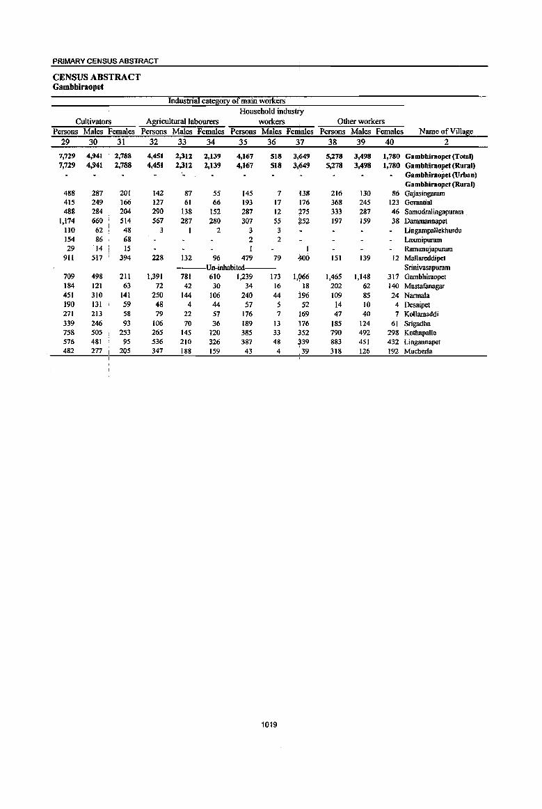
PRIMARY CENStls ABS"tRACT
CENSUS ABSTRACT Gambhiraopet
Industrial catego~ of main workers
Household industry
Cultivato~ Agricultural labourers workers Other workers
Persons Males Females Persons Males Females Persons Males Females Persons Males Females Name of Village
29 30 I 31 32 33 34 35 36 37 38 39 40 2
7,729 4,941 2,788 4,451 2,312 2,139 4,167 518 3,649 5,278 3,498 1,780 Gambbiraopet (Total) 7,729 4,941 2,788 4,451 2,312 2,139 4,167 518 3,~49 5,278 3,498 1,780 Gambhiraopet (Rural)
Gambbiraopet (Urban) Gambhiraopet (Rural)
488 287 201 142 87 55 145 7 138 216 130 86 Gajasingarmn 415 249 166 127 61 66 193 17 176 368 245 123 Gorantial 488 284 204 290 138 152 287 12 275 333 287 46 Samudralingapuram ,
1,174 660 514 567 287 280 307 55 252 197 159 38 Dammannapet llO 62 48 3 1 2 3 3 Lingampallekhurdu 154 86 68 2 2 Laxmipuram 29 '14 , 15 Ramanujapuram
911 517 394 228 132 96 479 79 400 151 139 12 Mallareddipet Un-inhabited Srinivasapuram
709 498 211 1,391 781 610 1,239 173 1,966 1,465 1,148 317 Gambhiraopet 184 121 63 72 42 30 34 16 18 202 62 (40 Mustafanagar 451 310 141 250 144 106 240 44 196 109 85 24 Narmala 190 131 59 48 4 44 57 5 52 14 10 4 Desaipet 271 213 58 79 22 57 176 7 169 47 40 7 Kollamaddi 339 246 93 106 70 36 189 13 176 185 124 61 Srigadha 758 50S 253 265 145 120 385 33 352 790 492 298 Kothapalle 576 481 95 536 210 326 387 48 339 883 451 432 Lingannapet 482 277 I 205 347 188 159 43 4 ,39 318 126 192 Mucherla
1019
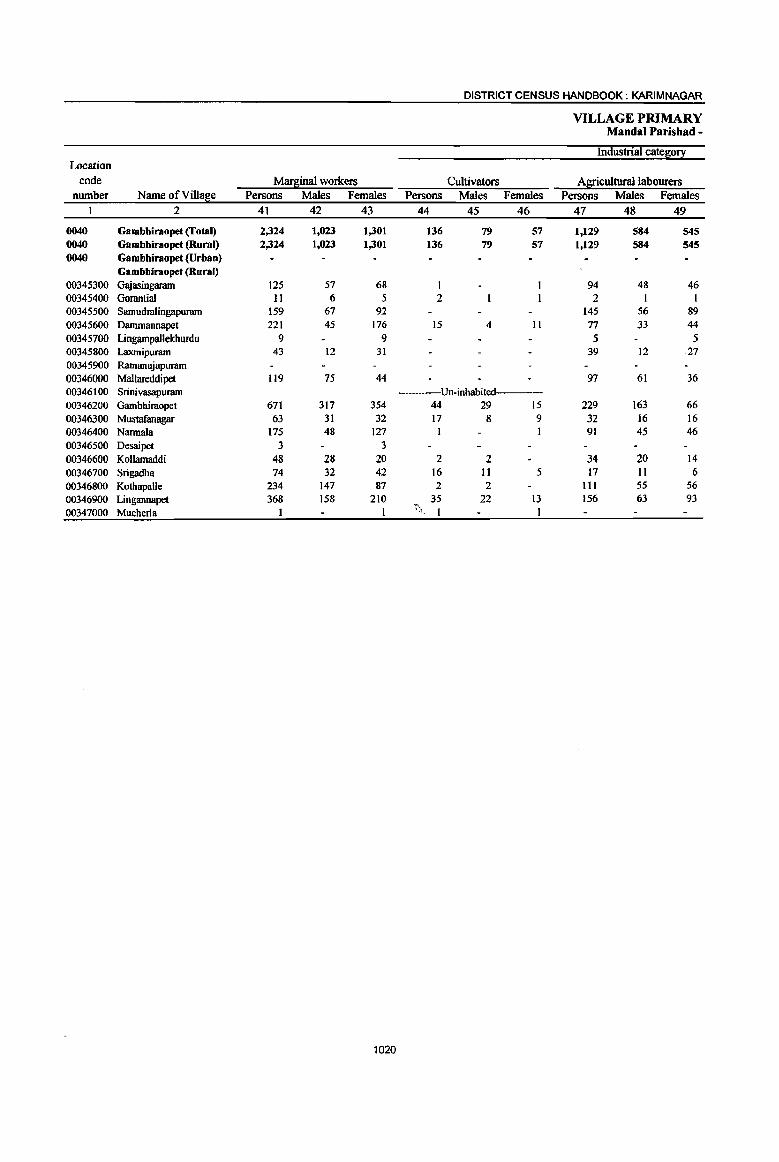
DISTRICT CENSUS HANDBOOK: KARIM NAGAR
VILLAGE PRIMARY Mimdal Parishad -
Industrial catefi0!1: Location
code Marfiinal workers Cultivators Al[icultural labourers nwnber Name ofViUa8e Persons Males Females Persons Males Females Persons Males Females
1 2 41 42 43 44 45 46 47 48 49
0040 Gambbiraopet (Total) 2,324 1,023 1,301 136 79 57 1,129 584 545 0040 Gambbiraopet (Rural) 2,324 1,023 1,301 136 79 57 1,129 584 545 0040 Gambhiraopet (Urbao)
Gambhiraopet (Rural) 00345300 Gajasingaram 125 57 68 1 94 48 46 00345400 Gorantial 11 6 5 2 2 I I 00345500 Samudralingapuram 159 67 92 145 56 89 00345600 Dammannapet 221 45 176 15 4 II 77 33 44 00345700 Lingampallekburdu 9 9 5 5 00345800 Laxmipuram 43 12 31 39 12 27 00345900 Ramanujapuram 00346000 Mallareddipet 119 75 44 97 61 36 00346100 Srinivasapuram Un-inhabited---00346200 Gambhiraopet 671 317 354 44 29 15 229 163 66 00346300 Mustafanagar 63 31 32 17 8 9 32 16 16 00346400 Narmala 175 48 127 I 91 45 46 00346500 Desaipet 3 3 00346600 Kollamaddi 48 28 20 2 2 34 20 14 00346700 Srigadha 74 32 42 16 II 5 17 11 6 00346800 Kothapalle 234 147 87 2 2 III 55 56 00346900 Lingannapet 368 158 210 35 22 13 156 63 93 00347000 Mucherla 1 ~\ I 1
1020
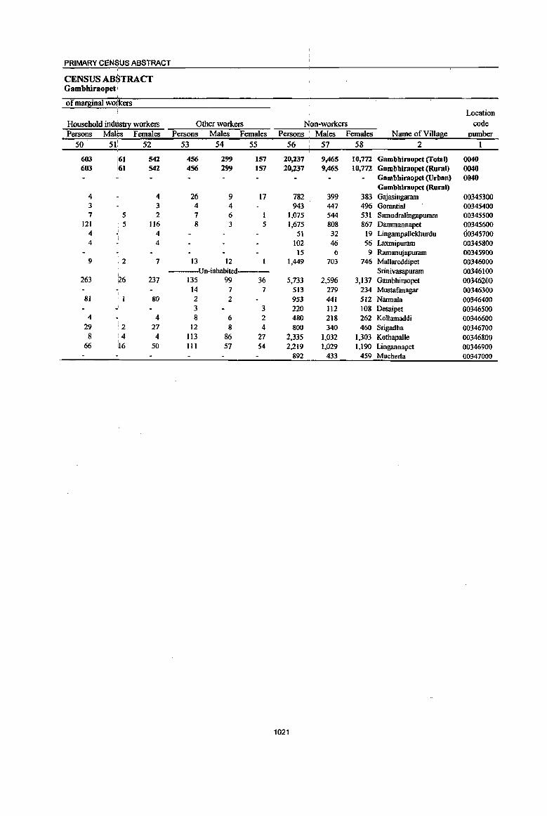
1021

DISTRICT CENSUS HANDBOOK: KARIM NAGAR
VILLAGE PRIMARY Mandai Parishad -
Total population (including Location Area of institutional and houseless Population in the
code Village in Number of (!o£ulatioDl a~e-~o~0-6 number Name ofVill!Be hectares households Persons Males Females Persons Males Females
1 2 3 4 5 6 7 8 9 10
0041 Mustabad (Total) 15,961.0 9,907 44,349 22,179 22,170 5,677 2,955 2,722 0041 Mustabad (Rural) 15,961.0 9,907 44,349 22,179 22,170 5,677 2,955 2,722 0041 Mustabad (Urban)
Mustabad (Rural) 00347100 Kondapur 545.0 603 2,638 1,288 1,350 356 189 167 00347200 AunooT 894.0 921 4,262 2,165 2,097 531 274 251 00347300 Turkapalle 126.0 ---Un-inhabited---00347400 Gudem 1,098.0 948 4,050 2,012 2,038 478 261 217 00347500 Namapur 2,517.0 829 3,758 1,893 1,865 531 294 237
00347600 Gudur 337.0 210 779 388 391 96 47 49 00347700 Pothugal 1,838.0 1,299 5,614 2,859 2,755 690 367 323
00347800 Terlumaddi 1,078.0 538 2,435 1,200 1,235 378 189 189
00347900 Mustabad 1,687.0 1,790 8,293 4,193 4,100 994 505 489
00348000 Moraipalle 514.0 308 1,418 686 732 159 82 77
00348100 Chippalapalle 933.0 308 1,405 707 698 192 103 89
00348200 Cheekod 1,108.0 685 3,050 1,533 1,517 391 200 191
00348300 Maddikunta 870.0 325 1,396 684 712 158 79 79
00348400 Moinkunta 774.0 303 1,418 709 709 155 82 73
00348500 Bandankal 1,269.0 753 3,449 1,679 1,770 497 246 251
00348600 Mo~ur 373.0 87 384 183 201 71 37 34
1022
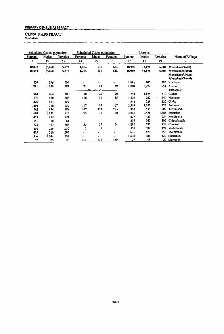
PRIMARY CENSUS ABSTRACT
CENSUS AB,STRACT Mustabad
Scheduled C~tes E02uation Scheduled Tribes 2oeulation Literates Persons Males Females Persons Males Females Persons Males Females Name of Village
11 )2 13 14 15 16 ' 17 18 19 2
10,832 i5,460 5,372 1,254 631 623 18,980 12,176 6,804 Mustabad (Total) 10,832 is.460 5,372 1,254 631 623 18,980 12,176 6,804 Mustabad (Rural)
Mustabad (Urban) Mustabad (Rural)
800 396 404 1,091 70S 386 Kondapur
1..211 629 582 23 13 10 1,880 1,229 651 Aunoor Un-inhabited Turkapalle
964 ' 484 480 40 20 20 1,744 1,125 619 Gudem 1,191 i 588 603 106 51 55 1,502 962 540 Namapur
320 i 163 157 348 228 120 Gudur
1,492 1740 752 147 85 62 2,514 1,591 923 Pothugal
362 I 174 188 557 274 283 863 575 288 Terlumaddi
1.684 871 813 75 37 38 3,816 2,428 1,388 Mustabad
453 232 221 677 423 254 Moraipalle
151 70 81 538 343 195 Chippalapalle 775 407 368 53 29 24 1,291 832 459 Cheekod
456 226 230 2 561 384 177 Maddikunta
415 210 205 675 420 255 Moinkunta
S06 244 262 1,403 883 520 BandankaI
52 26 26 251 121 130 77 48 29 Morrapur
1023
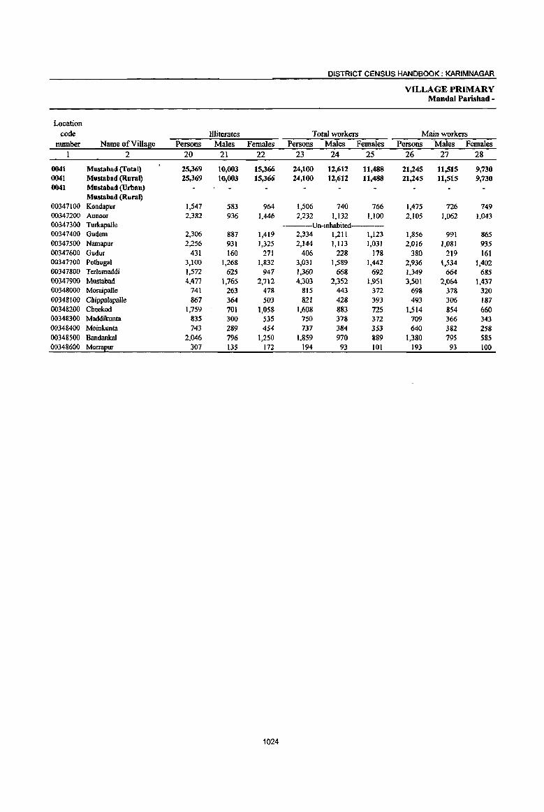
DISTRICT CENSUS HANDBOOK: KARIMNAGAR
VILLAGE PRIMARY Mandai Parisbad -
Location code Illiterates Total workers Main workers
number Name of Village Persons Males Females Persons Males Females Persons Males Females 1 2 20 21 22 23 24 25 26 27 28
0041 Mustabad (fatal) 25,369 10,003 15,366 24,100 12,612 11,488 21,245 11,515 9,730 0041 Mustabad (Rural) 25,369 10,003 15,366 24,100 12,612 11.488 21,245 11,515 9,730 0041 Mustabad (Urban)
Mustabad (Rural) 0()347 I 00 Kondapur 1,547 583 964 1,506 740 766 1,475 726 749 00347200 Aunoor 2,382 936 1,446 2,232 1,132 1,100 2,105 1,062 1,043 00347300 Turkapalle ----Un-inhabited----00347400 Gudem 2,306 887 1,419 2,334 1,211 1,123 1,856 991 865 00347500 Namapur 2,256 931 1,325 2,144 1,113 1,031 2,016 1,081 935 00347600 Gudur 431 160 271 406 228 178 380 219 161 00347700 PothugaI 3,100 1,268 1,832 3,031 1,589 1,442 2,936 1,534 1,402 00347800 Terlumaddi 1,572 625 947 1,360 668 692 1,349 664 685 00347900 Mustabad 4,477 1,765 2,712 4,303 2,352 1.951 3,501 2,064 1,437 00348000 MoraipaUe 741 263 478 815 443 372 698 378 320 00348100 Chippalapalle 867 364 503 821 428 393 493 306 187 00348200 Cheekod 1,759 701 1,058 1,608 883 72S 1,514 854 660 00348300 Maddikunta 835 300 535 750 378 372 709 366 343 00348400 Moinkunta 743 289 454 737 384 353 640 382 258 00348500 Bandankal 2,046 796 1,250 1,859 970 889 1,380 195 585 00348600 Mo~ur 307 135 172 194 93 101 193 93 100
1024

PRIMARY CENSUS ABSTRACT
CENSUS ABSTRACT Mustabad
Industrial cate80!X of main workers Household indust;ry
Cultivator;s Agricultural labourers workers Other workers Persons Males IFemales Persons Males Females Persons Males Females Persons Males Females Name ofViIlage
29 30 I 31 32 33 34 35 36 37 38 39 40 2 i
(),890 4,687 , 2,203 5,863 2,899 2,964 4,296 726 3;570 4,196 3,203 993 Mustabad (Total) 6,890 4,687 2,203 5,863 2,899 2,964 4,296 726 3,570 4,196 3,203 993 Mustabad (Rural)
Mustabad (Urbao) Mustabad (Rural)
S2S 2S9 236 474 230 244 227 18 209 249 189 60 Kondapur 674 453 221 631 265 366 438 73 365 362 271 91 Aunoor
----Un-inhabited- Turkapalle 779 529 250 255 104 lSI 465 59 406 357 299 58 Gudem 495 363 132 891 419 472 270 49 221 360 250 110 Namapur 173 149 24 107 25 82 59 8 51 41 37 4 Gudur 710 437 273 929 485 444 610 50 560 687 562 125 Pothugal 628 380 248 323 110 213 180 7 173 218 167 51 Terlumaddi 807 578 229 817 506 311 777 127 650 1,100 853 247 .Mustabad 309 249 60 128 83 45 224 13 211 37 33 4 Moraipalle 214 152 62 110 56 54 78 26 52 91 72 19 Chippalapalle 267 218 49 565 307 258 504 205 299 178 124 54 Cheekod 259 168 91 174 101 73 95 13 82 181 84 97 Maddikunta 314 196 118 176 99 77 64 7 57 86 80 6 Moinkunta 672 470 202 165 77 88 299 71 228 244 177 67 Bandaokal 64 56 8 liS 32 86 6 6 5 5 MorrapuT
1025
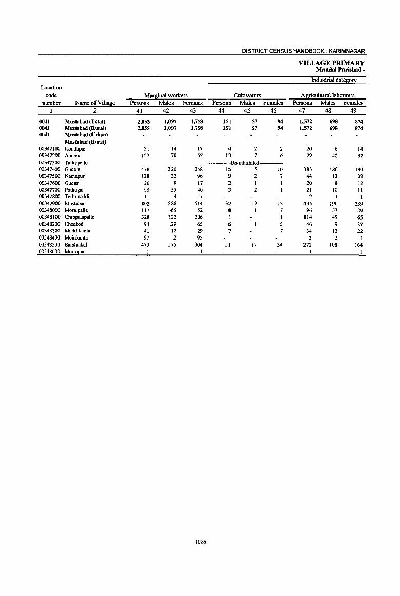
DISTRICT CENSUS HANDBOOK; KARIMNAGAR
VILLAGE PRIMARY Mandai Parishad -
Industrial cateso!1 Location
code Marsinal workers Cultivators Agricultural labourers number Name ofViIla6e Persons Males Females Persons Males Females Persons Males Females
1 2 41 42 43 44 45 46 47 48 49
0041 Mustabad (fotal) 2,855 1,097 1,758 151 57 94 1,572 698 874 0041 Mustabad (Rural) 2,855 1,097 1,758 151 57 94 1,572 698 874 0041 Mustaba.d (Urban)
Mustabad (Rural) 00347100 Kondapur 31 14 17 4 2 2 20 6 14 00347200 Aunoor 127 70 57 13 7 6 79 42 37 00347300 TuIkapalle ----Un-inhabited 00347400 Gudem 478 220 258 15 5 10 385 186 199 00347500 Namapur 128 32 96 9 2 7 44 \2 32 00347600 Gudur 26 9 17 2 20 8 12 00347700 Pothugal 95 55 40 3 2 21 10 II 00347800 Terlumaddi 11 4 7 2 1 I 00347900 Mustabad 802 288 514 32 19 13 435 196 239 00348000 MoraipaUe 117 65 52 8 7 96 57 39 00348100 Chippalapalle 328 122 206 I 1 114 49 65 00348200 Cheekod 94 29 65 6 5 46 9 37 00348300 Maddikunta 41 12 29 7 7 34 12 22 00348400 Moinkunta 97 2 95 3 2 1 00348500 Bandankal 479 175 304 51 17 34 272 108 164 00348600 Mo!!!!£ur
1026
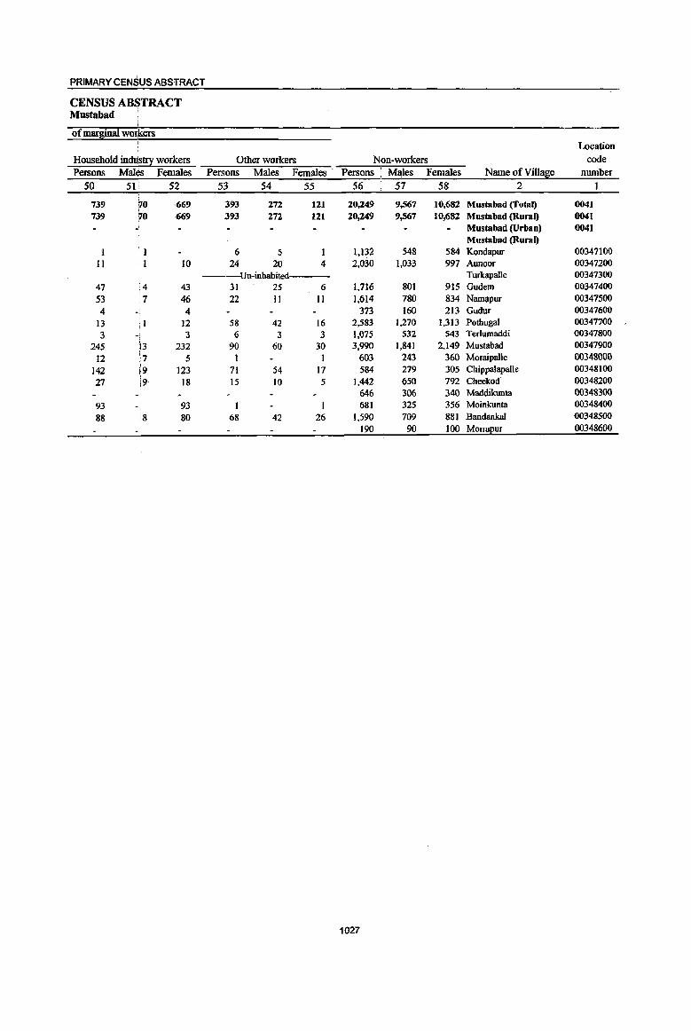
PRIMARY CENSUS ABSTRACT
CENSUS AB$TRACT Mustabad
Qf m~inal wQlkers I Ulcation
Household industry workers Other workers Non-workers code Persons Males Females Persons Males Females . Persons MllIes Females Name of Villase number
50 51 i 52 53 54 55 56 57 58 2 1
739 ~o ,669 393 272 121 20,249 9,567 10,682 Mustabad (Total) 0041 739 ~O 669 393 272 121 20,249 9,567 10,682 Mustabad (Rural) 0041
- Mustabad (Urban) 0041 Mustabad (Rural)
1 6 5 1 1,132 548 584 Kondapur 00347100 II 10 24 20 4 2,030 1,033 997 Aunoor 00347200
Un-inhabited Turkapalle 00347300 47 !4 43 31 25 6 1,716 801 915 Gudem 00347400 53 7 46 22 II II 1,614 780 834 Namapur 00347500
I
4 -t 4 373 160 213 Gudur 00347600 13 II 12 58 42 16 2,583 1,270 1,313 Pothugal 00347700 3 .. \ 3 () 3 3 1,015 532 543 Tedumaddi 00347800
245 l3 232 90 60 30 3,990 1,841 2,149 Mustabad 00347900 12 :, 5 1 1 603 243 360 Mornipalle 00348000
142 ~9 123 71 54 17 584 279 305 Chippalapalle 00348100 21 i9 18 15 10 5 1,442 650 792 Cheekod 00348200
646 306 340 Maddikunta 00348300 93 93 681 325 356 Moinkunta 00348400 88
18 80 68 42 26 1,590 709 881 Bandankal 00348500
-I 190 90 100 M0!!!!Eur 00348600
1027
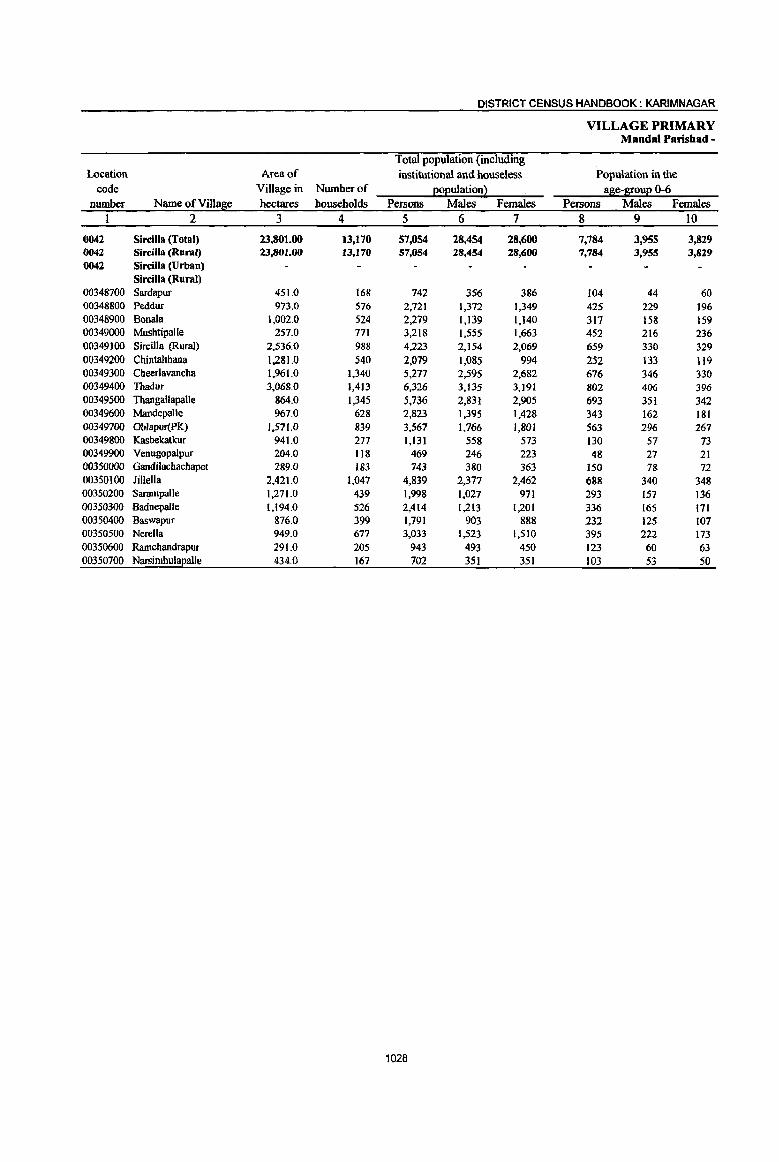
DISTRICT CENSUS HANDBOOK: KARIMNAGAR
VILLAGE PRIMARY Mandai Parisbad -
Total population (including Location Area of institutional and houseless Population in the
code Village in Number of (!o(!ulationl a~e-1[ou(! 0-6 number Name of Villaae hectares households Persons Males Females Persons Males Females
1 2 3 4 5 6 7 8 9 10
0042 Sircilla (Total) 23,801.00 13,170 57,054 28,454 28,600 7,784 3,955 3,829 0042 Sircilla (Rural) 23,801.00 13,170 57,054 28,454 28,600 7,784 3,955 3,829 0042 Sircilla (Urban)
Sircilla (Rural) 00348700 Sardapur 451.0 168 742 356 386 104 44 60 00348800 Peddur 973.0 516 2,721 1,372 1,349 425 229 196 00348900 Bonala 1,002.0 524 2,279 1,139 1,140 317 158 159 00349000 Mushtipalle 257.0 771 3,218 1,555 1,663 452 216 236 00349100 Sircilla (Rural) 2,536.0 988 4,223 2,154 2,069 659 330 329 00349200 Chintalthana 1,281.0 540 2,079 1,085 994 252 I33 119 00349300 Cheerlavancha 1,961.0 1,340 5,277 2,595 2,682 676 346 330 00349400 Thadur 3,068.0 1,413 6,326 3,135 3,191 802 406 396 00349500 Thangallapalle 864.0 1,345 5,736 2,83} 2,905 693 351 342 00349600 Mandepalle 967.0 628 2,823 1,395 1,428 343 162 181 00349700 Oblapur(PK) 1,571.0 839 3,567 1,766 1,801 563 296 267 00349800 Kasbekatkur 941.0 277 1,131 558 573 130 57 73 00349900 Venugopalpur 204.0 118 469 246 223 48 27 21 00350000 Gandilachachapet 289.0 183 743 380 363 150 78 72 00350100 lillella 2,421.0 1,047 4,839 2,377 2,462 688 340 348 00350200 Sarampalle 1,271.0 439 1,998 1.027 971 293 157 136 00350300 Badnepalle 1,194.0 526 2,414 1,213 1,201 336 165 I7l 00350400 Baswapur 876.0 399 1,791 903 888 232 125 107 00350500 Nerella 949.0 677 3,033 1,523 1,510 395 222 173 00350600 Ramchandrapur 291.0 205 943 493 450 123 60 63 00350700 Narsimbula~a]le 434.0 167 702 351 351 103 53 50
1028
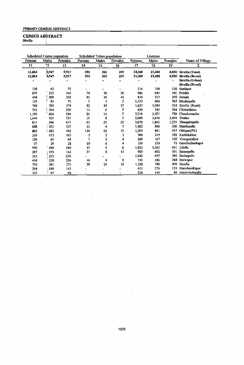
PRIMARY CENSUS ABSTRACT i
CENSUS ABSTRACT I
Sircilla
Scheduled C~tes Eoeuation Scheduled Tribes Eoeulation Literates Persons Mllles Females Persons Males Females Bersons Males Females Name of Village
11 ~2 13 14 15 16 17 18 19 2
11,864 ~,947 5,917 593 303 290 24,308 15,488 8,820 Sircilla (Total) 11,864 5,947 5,917 593 303 290 24,308 15,488 8,820 SirciUa (Rural)
Sircilla (Urban) Sircilla (Rural)
138 63 75 316 190 126 Sardapur 679 I 333 346 74 38 36 984 643 341 Peddur 438 209 229 81 40 41 816 517 299 Donala 155 83 72 2 1 1 1,533 968 565 Mushtipalle
766 i 392 374 82 45 37 1,637 1,084 553 Sircilla (Rural) 753 1394 359 13 6 7 829 545 284 Chintaltbana
1,190 ',606 584 21 14 7 2,210 1,421 789 Cheerlavancha 1,444 : 707 737 15 8 7 2,680 1,676 1,004 Tbadur
811 ',394 417 45 25 20 3,070 t,845 1,225 Thangallapalle
688 351 337 11 4 7 1,402 896 506 Mandepalle
865 ; 423 442 136 65 71 1,298 841 457 Oblapur(PK)
·336 173 163 5 2 3 500 319 181 Kasbekatkur 129 65 64 7 3 4 269 167 102 Venugopalpur
57 29 28 10 6 4 199 128 71 Gandilachachapet
970 490 480 15 9 6 1,923 1,262 661 JiIlella
297 ! 155 142 21 8 13 903 602 301 Sarampalle
513 ' 255 258 1,082 697 385 Badnepalle
454 : 228 226 16 8 8 730 482 248 Baswapur
754 i 381 373 39 21 18 1,288 789 499 Nerella
294 I 149 145 411 276 135 Ramchandrapur
i33 67 66 228 140 88 Narsimhulapalle
1029

DISTRICT CENSUS HANDBOOK: KARIMNAGAR
VILLAGE PRIMARY Mandai Paris bad -
Location
code Illiterates Total workers Main workers number Name ofVi1l!!£ie Persons Males Females Persons Males Females Persons Males Females
1 2 20 21 22 23 24 25 26 27 28 0042 Sircilla (Total) 32,746 12,966 19,780 31,959 16,445 15,514 29,074 15,571 13,503 0042 Sircilla (Rural) 32,746 12,966 19,780 31,959 16,445 15,514 29,074 15,571 13,503 0042 Sircilla (Urban)
Sircilla (Rural) 00348700 Sardapur 426 166 260 411 223 188 399 218 181 00348800 Peddur 1,737 729 1,008 1,509 777 732 1,246 672 574 00348900 Bonala 1,463 622 841 1,316 667 649 1,133 618 515 00349000 Mushtipalle 1,685 587 1,098 1,834 877 957 1,669 820 849 00349100 Sircilla (Rural) 2,586 1,070 1,516 2,363 1,239 1,124 2,174 1,191 983 00349200 Chintalthana 1,250 540 710 1,076 602 474 1,037 584 453 00349300 Cheerlavancha 3,067 1,174 1,893 2,939 1,483 1,456 2,325 1,283 1,042 00349400 ThOOur 3,646 1,459 2,187 3,494 1,792 1,702 3,174 1,730 1,444 00349500 Thangallapalle 2,666 986 1.680 3,082 1,561 1,521 2,869 1,523 1,346 00349600 MandepaUe 1,421 499 922 1,561 805 756 1,550 802 748 00349700 ObJapur(PK) 2,269 925 1,344 2,029 1,060 969 1,901 1,044 857 00349800 Kasbekatkur 631 239 392 632 334 298 593 326 267 00349900 Venugopalpur 200 79 121 220 132 88 200 117 83 00350000 Gandilachachapet 544 252 292 412 229 183 411 229 182 00350100 lil1ella 2,916 1,115 1,801 2,766 1,404 1,362 2,540 1,306 1,234 00350200 Sarampalle 1,095 425 670 1,138 581 557 1,090 559 531 00350300 Badnepalle 1,332 516 816 1,356 722 634 1,170 691 479 00350400 Baswapur 1,061 421 640 1,042 514 528 1,018 500 518 00350500 Nerella 1,745 734 1,011 1,761 917 844 1,758 916 842 00350600 Ramchandrapur 532 217 315 591 310 281 590 310 280 00350700 Narsimhul!!Ealle 474 211 263 427 216 211 227 132 95
1030
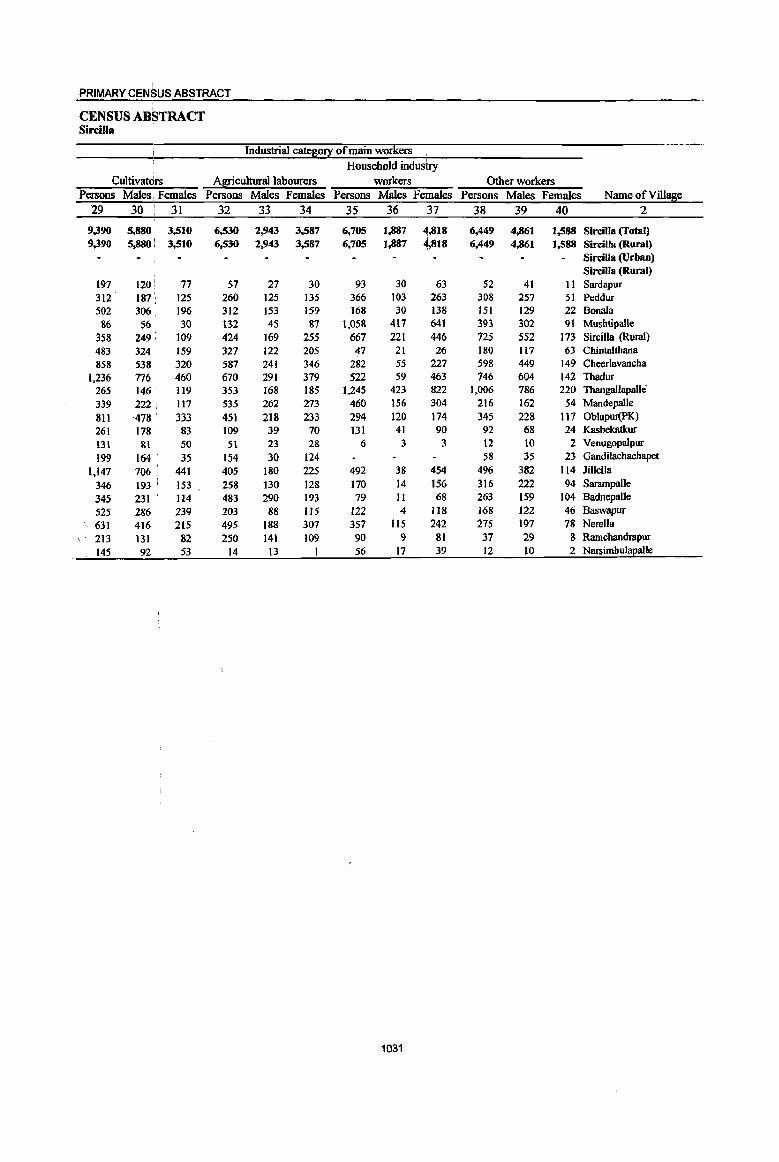
PRIMARY CENSUS ABSTRACT
CENSUS ABSTRACT Sircilla
Industrial catego~ of main workers Household industry
Cultivatdrs Agricultural labourers workers Other workers Persons Males; Females Persons Males Females Persons Males Females Persons Males Females Name ofYillage
29 30 ,
31 32 33 34 35 36 37 38 39 40 2
9.390 5,880 3,510 6,530 2,943 3,587 6,705 1,887 4;,818 6,449 4,861 1.588 Sircilla (Total) 9.390 5.880 : 3,510 6.530 2,943 3,587 6,705 1,887 4,818 6,449 4,861 1.588 Sircilla (Rural)
SirciUa (Urban) Sircilla (Rural)
197 120 i 77 57 27 30 93 30 63 52 41 II Sardapur 312 187: 125 260 125 135 366 103 263 308 257 51 Peddur 502 306 196 312 153 159 168 30 138 151 129 22 Bonala 86 56 30 132 45 81 1,058 411 641 393 302 91 Mushtipalle
358 249 ; 109 424 169 255 667 221 446 725 552 173 SirciIla {Rural) 483 3Z4 159 327 122 205 47 21 26 180 117 63 Chintalthana 858 538 320 587 241 346 282 55 227 598 449 149 Cheerlavancha
1.236 176 460 670 291 319 522 59 463 746 604 142 Thadur 265 146 119 353 168 185 1,245 423 822 1,006 786 220 Thangallapalle 339 222. 117 535 262 273 460 156 304 216 162 54 Mandepalle 811 ,478 i 333 451 218 233 294 120 174 345 228 117 Oblapur(PK) 261 178 83 109 39 70 131 41 90 92 68 24 Kasbekatkur 131 81 50 51 23 28 6 3 3 12 to 2 Venugopalpur 199 164 35 154 30 124 58 35 23 Gandilachachapet
1,141 106 441 405 180 225 492 38 454 496 382 114 Jillella 346 193 ' 153 258 130 128 170 14 156 316 222 94 Sarampal1e 345 231 114 483 290 193 79 11 68 263 159 104 Badnepalle 525 286 239 203 88 115 122 4 1I8 168 122 46 Baswapur 631 416 215 495 188 307 351 1I5 242 275 191 18 Nerella 213 131 82 250 141 109 90 9 81 37 29 8 Ramcbandrapur 145
", 92 53 14 13 56 11 39 12 10 2 Narsimhulapalle
1031
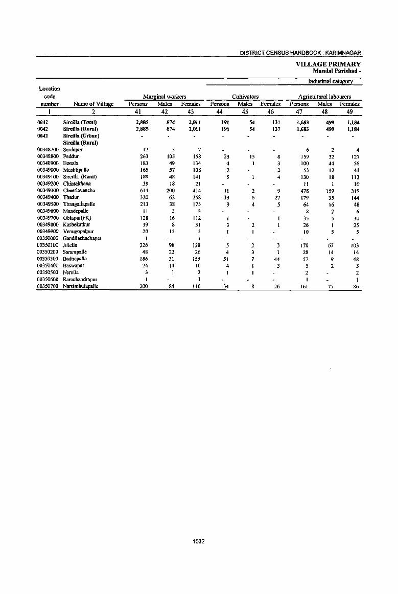
DISTRICT CENSUS HANDBOOK: KARIMNAGAR
VILLAGE PRIMARY Mandai Parishad -
Industrial catelllo!! Location
code Mars:inal workers Cultivators Agricultural labourers number Name of Villase Persons Males Females Persons Males Females Persons Males Females
I 2 41 42 43 44 45 46 47 48 49
0042 Sircilla (Total) 2.885 874 2,011 191 54 137 1,683 499 1,184 0042 Sircilla (Rural) 2,885 874 2,011 191 54 137 1,683 499 1,184 0042 Sircilla (Urban)
Sircilla (Rural) 00348700 Sardapur 12 5 7 6 2 4 00348800 Peddur 263 lOS 158 23 15 8 159 32 127 00348900 Bonala 183 49 134 4 3 100 44 56 00349000 Mushtipalle 165 57 108 2 2 53 12 41 00349100 Sircilla (Rural) 189 48 141 5 4 130 18 112 00349200 Cbintalthana 39 18 21 II 10 00349300 Cheerlavancha 614 200 414 11 2 9 478 159 319 00349400 Thadur 320 62 258 33 6 27 179 35 144 00349500 ThangallapaIle 213 38 175 9 4 5 64 16 48 00349600 Mandepalle 11 3 8 8 2 6 00349700 Oblapur(PK) 128 16 112 I 35 5 30 00349800 Kasbelcatkur 39 8 31 3 2 26 1 25 00349900 Venugopalpur 20 15 5 10 5 5 00350000 Gandilachachapet I 1
00350}00 Jillella 226 98 128 5 2 3 170 67 103 00350200 Sarampalle 48 22 26 4 3 28 14 14 00350300 Badnepalle 186 31 155 51 7 44 57 9 48 00350400 Baswapur 24 14 10 4 I 3 5 2 3 00350500 Nerella 3 I 2 2 2 00350600 Ramchandrapur I 00350700 Narsimhul~alle 200 84 116 34 8 26 161 75 86
1032

PRIMARY CENSUS ABSTRACT I
CENSUS AB~TRACT Sircilla
of marginal wo~kers Location
Household industry workers Other workers Non-workers code Persons Males Females Persons Males Females Persons Males Females Name ofVillal1!e number
50 51 52 53 54 55 56 57 58 2 I
568 :46 522 443 275 168 25,095 12,009 13,086 Sircilla (Total) 0042 568 46 522 443 275 168 25,095 12,009 13,086 Sircilla (Rural) 0042
Sircilla (Urban) 0042 Sircilla (Rural)
3 3 3 3 331 133 198 Sardapur 00348700 2 1 1 79 57 22 1,212 595 617 Peddur 00348800
76 . 1 75 3 3 963 472 491 Bonala 00348900 70 ~2 58 40 33 7 1,384 678 706 Mushtipalle 00349000 28 ~O 18 26 19 7- 1,860 915 945 Sircilta (Rural) 00349100
28 17 11 1,003 483 520 Chintalthana 00349200 64 2 62 61 37 24 2,338 1,112 1,226 Cheerlavancha 00349300 64 2 62 44 19 25 2,832 1,343 1,489 Thadur 00349400 99 3 96 41 15 26 2,654 1,270 1,384· Thangallapalle 00349500
t 2 1 1 1,262 590 672 Mandepalle 00349600 72 : 2 70 20 9 II 1,538 706 832 Oblapur(PK) 00349700 6 ! I 5 4 4 499 224 275 Kasbekatkur 00349800
9 9 249 114 13S Venugopalpur 00349900 331 151 180 Gandilachachapet 00350000
18 17 33 28 5 2,073 973 1,100 Jillella 00350100 6 6 10 5 5 860 446 414 Sarampalle 00350200
42 :2 40 36 13 23 1,058 491 567 Badnepalle 00350300 12 i8 4 3 3 749 389 360 Baswapur 00350400
1,272 606 666 Nerella 00350500 352 183 169 Rmnchandrapur 00350600
5 .1 4 275 135 140 NarsimhulaEalle 00350700
1033

DISTRICT CENSUS HANDBOOK: KARIMNAGAR
VILLAGE PRIMARY Mandai Parishad -
Total population (including Location Area of institutional and houseless Population in the
code Village in Number of EOEulationl age-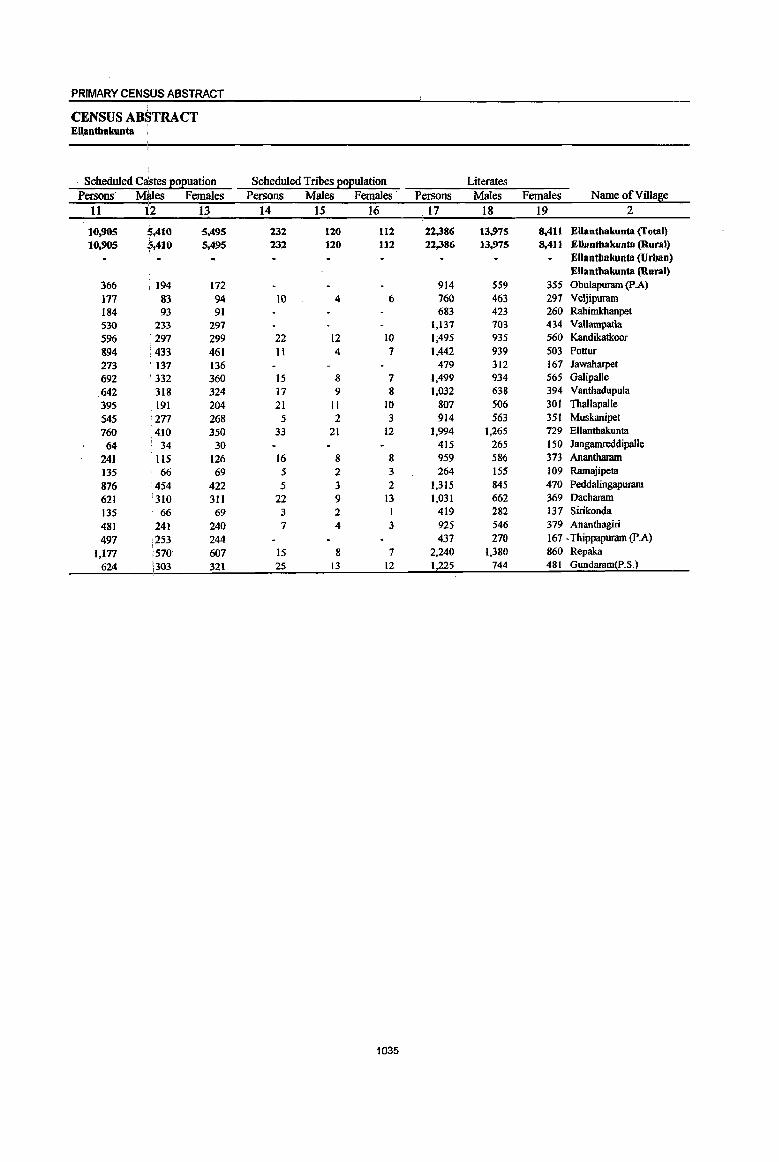
PRIMARY CENSUS ABSTRACT I
CENSUS ABSTRACT EUantbakunta
. Scheduled Castes ~o2uation Scheduled Tribes ~o2ulation Literates Persons' MMes Females Persons Males Females' Persons Males Females Name of Village
11 12 13 14 15 16 17 18 19 2
10,905 kAIO 5,495 232 120 112 22,.386 13,975 8,411 Ellanthalrunta (Total) I
10.905 5,410 5,495 232 120 112 22,386 13,975 8,411 Ellantbakunta (Rural) Ellanthakunta (Urban) Ellantbakuuta (Rural)
366 194 172 914 559 355 Obulapuram (p.A)
171 83 94 10 4 6 160 463 297 Veljipuram 184 93 91 683 423 260 RahirnIdIanpet
530 233 297 1,137 703 434 Vallampatla
596 : 297 299 22 12 10 1;495 935 560 Kandikatkoor
894 : 433 461 11 4 7 1,442 939 503 Pottur
273 137 136 479 312 167 Jawaharpet
692 ' 332 360 15 8 7 1,499 934 565 Galipalle
642 318 324 17 9 8 1,032 638 394 Vanthadupula
395 191 204 21 11 10 807 506 30t Tballapalle
545 : 277 268 5 2 3 914 563 351 Muskanipet
760 '410 350 33 21 12 1,994 1,265 729 Ellanthakunta
64 34 30 415 265 150 Jangamreddipalle
241 liS 126 16 8 8 959 586 373 Anantbaram
135 66 69 5 2 3 264 155 109 Ramajipeta
876 454 422 5 3 2 1,315 845 470 Peddalingapuram
621 1310 311 22 9 I3 1,031 662 369 Dacharam
135 66 69 3 2 1 419 282 137 Sirikonda
481 241 240 7 4 3 925 546 379 Ananthagiri
497 253 244 437 270 167 . Thippapuram (p.A)
1,177 570 607 15 8 7 2,240 1,380 860 Repaka
624 303 321 25 13 12 1,225 744 481 Gundaram(p.S.)
1035

DISTRICT CENSUS HANDBOOK: KARIMNAGAR
VILLAGE PRIMARY Mandai Parishad -
Location code illiterates Total workers Main workers
number Name ofVilla~e Persons Males Females Persons Males Females Persons Males Females 1 2 20 21 22 23 24 25 26 27 28
0043 Ellantbakunta (fotal) 26,604 10,155 16,449 27,331 13,910 13,421 22,760 12,464 10,296 0043 Ellanthakunta (Rural) 26,604 10,155 16,449 27,331 13,910 13,421 22,760 12,464 10,296 0043 Ellanthakunta (Urban)
Ellanthakunta (Rural) 00350800 Obulapuram (P A) 1,171 458 713 1.125 597 528 967 537 430 00350900 Veljipuram 774 287 487 891 441 450 880 433 447 00351000 Rahimkhanpet 975 372 603 950 474 476 631 394 237 00351100 Vallampatla 1,610 598 1,012 1,509 715 794 1,467 699 768 00351200 Kandikatkoor 1,928 760 1,168 2,016 1,017 999 1,932 996 936 00351300 Pottur 1,650 596 1,054 1,766 897 869 1,590 844 746 00351400 Jawaharpet 653 251 402 704 369 335 454 288 166 00351500 Galipalle 1,405 510 895 1,649 843 806 1,338 707 631 00351600 Vanthadupula 1.406 542 864 1,345 677 668 1,158 576 582 00351700 Thallapalle 917 360 557 1,060 527 533 1,044 521 523 00351800 Muskanipet 1.034 392 642 1,131 541 590 814 522 292 00351900 Ellanthakunta 1,480 547 933 1,460 895 565 1,307 836 471 00352000 Jangamreddipalle 396 127 269 488 248 240 356 193 163 00352100 Anantbaram 1,083 386 697 1,112 538 574 845 488 357 00352200 Ramajipeta 335 143 192 395 190 205 389 187 202 00352300 Peddalingapuram 1,698 679 1,019 1,703 862 841 1,550 810 740 00352400 Dacharam 1,009 348 661 1,198 600 598 895 537 358 00352500 Sirikonda 621 227 394 597 297 300 529 269 260 00352600 Anantbagiri 1,301 516 785 1,296 642 654 928 538 390 00352700 Thippapuram (p.A) 673 282 391 650 347 303 504 330 174 00352800 Repaka 3,017 1,189 1,828 2,855 1,442 1,413 1,847 1,037 810 00352900 Gundaram(p.S.) 1,468 585 883 1,431 751 680 1,335 722 613
1036

PRIMARY CENSUS ABSTRACT I I
CENSUS ABSTRACT EJlanthakunta I
Industrial cate~0!X of main workers Household industry
Cultivators Agricultural labourers workers Other workers Persons Males :Females Persons Males Females Persons Males Females Persons Males Females Name ofViUage
29 - 30 31 32 33 34 35 36 37 38 39 40 2
9,955 6,014 3,941 6,541 2,568 3,973 1,979 720 1,259 4,285 3,162 1,123 Ellantbakunta (Total) 9,955 6,014 3,941 6,541 2,568 3,973 1,979 720 1,259 4,285 3,162 1,123 Ellanthakunta (Rural)
Ellantbakunta (Urban) Ellantbakunta (Rural)
623 367 , 256 148 64 84 79 28 51 117 78 39 Obulapuram (p.A) 382 244 138 188 58 130 269 104 165 41 27 14 Veljipuram 281 227 54 166 60 106 81 27 54 103 80 23 Rahimkhanpet 603 330 273 475 156 319 138 19 119 251 194 57 Vallampatla 623 437 186 687 229 458 176 38 138 446 292 154 Kandikatkoor 620 384 236 683 254 429 62 36 26 225 170 55 Pottur 216 122 94 138 93 45 6 5 I 94 68 26 Jawaharpet 498 249 249 484 218 266 27 12 15 329 228 101 Galipalle
363 202 161 602 242 360 13 7 6 180 125 55 Vanthadupula 454 228 226 380 149 231 39 25 14 171 119 52 Thallapal1e 310 194 116 264 140 124 14 10 4 226 178 48 Muskanipet 203 120 83 243 lJl 132 152 45 107 709 560 149 Ellanthakunta 261 139 • 122 29 10 19 8 5 3 58 39 19 Jangamreddipalle 499 301 198 66 33 33 71 16 55 209 138 71 Anantharam 281 138 143 88 41 47 9 3 6 11 5 6 Ramajipeta 738 396 342 459 211 248 168 67 101 185 136 49 Peddalingapuram 572 369 203 37 20 17 147 27 120 139 121 18 Dacbaram
278 168 lIO 141 53 88 69 12 57 41 36 5 Sirikonda 468 295 173 182 84 98 87 23 64 191 136 55 Ananthagiri 269 219 50 135 45 90 100 66 34 Thippapuram (p.A)
802 490 312 498 164 334 262 158 104 285 225 60 Repaka 6Il 395 216 448 133 315 102 53 49 174 141 33 Gundaram(p.S.)
1037
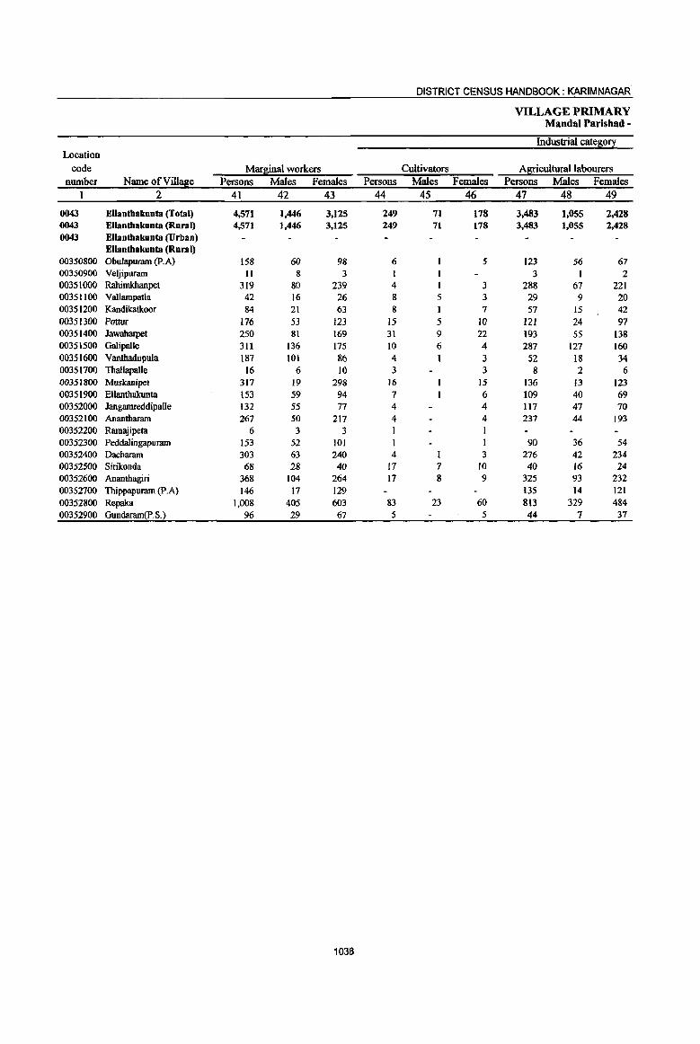
DISTRICT CENSUS HANDBOOK: KARIM NAGAR
VILLAGE PRIMARY MandaI Parishad -
IndusUialcate~o~ Location
code Marfiinal workers Cultivators Al[!culturallabourers number Name ofVill~e Persons Males Females Persons Males Females Persons Males Females
1 2 41 42 43 44 45 46 47 48 49
0043 Ellanthakunta (Total) 4,571 1,446 3,125 249 71 178 3,483 1,055 2,428 0043 Ellanthakunta (Rural) 4,571 1,446 3,125 249 71 178 3,483 1,055 2,428 0043 Ellanthakunta (Urban)
Ellanthakunta (Rural) 00350800 Obulapuram (F.A) 158 60 98 6 5 123 56 67 00350900 Veljipuram 11 8 3 I 3 I 2 00351000 Rahimkhanpet 319 80 239 4 3 288 67 221 00351100 Vallampatla 42 16 26 8 5 3 29 9 20 00351200 Kandikatkoor 84 21 63 8 I 7 57 IS 42 00351300 Pottur 176 53 123 15 5 10 121 24 97 00351400 Jawaharpet 250 81 169 31 9 22 193 55 138 00351500 Galipalle 311 136 175 10 6 4 287 127 160 00351600 Vanthadullula 187 101 86 4 1 3 52 18 34 00351700 Thallapalle 16 6 10 3 3 8 2 6 00351800 Muskanipet 317 19 298 16 15 136 13 123 00351900 Ellanthakunta 153 59 94 7 6 109 40 69 00352000 JangamreddipaUe 132 55 n 4 4 117 47 70 00352100 Anantharam 267 50 217 4 4 237 44 193 00352200 Ramajipeta 6 3 3 00352300 Peddalingapuram 153 52 101 90 36 54 00352400 Dacharam 303 63 240 4 3 276 42 234 00352500 Sirikonda 68 28 40 17 7 10 40 16 24 00352600 Ananthagiri 368 104 264 17 8 9 325 93 232 00352700 Thippapuram (P.A) 146 17 129 135 14 121 00352800 Repaka 1,008 405 603 83 23 60 813 329 484 00352900 Gundaram(P.S.) 96 29 67 5 5 44 7 37
1038

PRIMARY CENSUS ABSTRACT
CENSUS ABSTRACT Ellantbakunta !
, of marginal wo~kers
Location
Household industry workers Other workers Non-workers code
Persons Males Females Persons Males Females Persons Males Females Name of Vi1I~e nwnber
50 51' 52 53 54 55 56 57 58 2 1
256 49 207 S83 271 312 21,659 10,220 11,439 Ellanthakunta (fotal) 0043 256 49 207 583 271 312 21,659 10,220 11,439 Ellanthakunta (Rural) 0043
Ellanthakuota (Urban) 0043 Ellanthakunta (Rural)
26 ,2 24 3 2 960 420 540 Obulapuram (p.A) 00350800 6 5 643 309 334 Veljipuram 00350900
16 3 13 II 9 2 708 321 387 Rahimkhanpet 00351000 3 3 2 2 1,238 586 652 VallampaJla 00351100 9 i I 8 10 4 6 1,407 678 129 Kandikatkoor 00351200
I
11 i5 6 29 19 10 1,326 638 688 Pottur 00351300 to :5 5 16 12 4 428 194 234 Jawaharpet 00351400 7 6 7 2 5 1,255 601 654 Galipalle 00351500 7 I 6 124 81 43 1,093 503 590 Vanthadupula 00351600 4 3 1 1 I 664 339 325 Thallapalle 00351700 2 2 163 5 158 817 414 403 Muskanipet 00351800
15 IS 22 18 4 2,014 917 1,097 Ellanthakunta 00351900 1 I 10 8 2 323 144 179 Jangamreddipalle 00352000
12 12 14 6 8 930 434 496 Anantharam 00352100 5 3 2 204 108 96 Ramajipeta 00352200
24 24 38 16 22 1,310 662 648 Peddalingapuram 00352300 3 3 20 20 842 410 432 Dacharam 00352400 9 13 6 2 2 443 212 ,231 Sirikonda 00352500
21 1 20 5 2 3 930 420 510 Ananthagiri 00352600 8 2 6 3 2 460 205 255 Thippapuram (p.A) 00352700
43 18 25 69 35 34 2,402 1,127 1.275 Repaka 00352800 19 - 19 28 22 6 1,262 578 684 Gundaram(p.S.) 00352900
1039
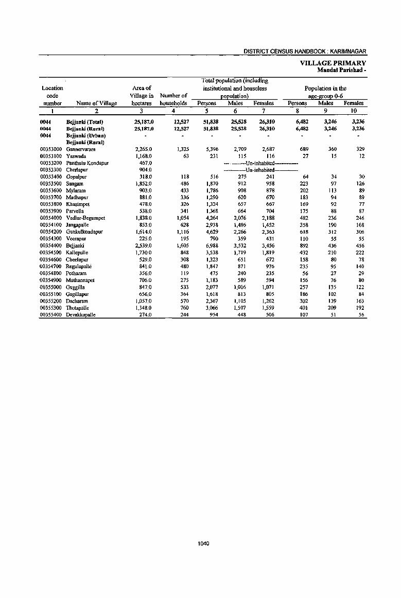
DISTRICT CENSUS HANDBOOK: KARIMNAGAR
VILLAGE PRIMARY Mandai Parishad -
Total population (including Location Area of institutional and houseless Population in the
code Village in Number of Eo£ulation~ aSe-S!:0u£ 0-6 number Name ofViIl~e hectares households Persons Males Females Persons Males Females
1 2 3 4 5 6 7 8 9 10
0044 Bejjanki (Total) 25,187.0 12,527 51,838 25,528 26,310 6,482 3,246 3,236 0044 Bejjanki (Rural) 25,187.0 12,521 51,838 25,528 26,310 6,482 3,246 3,236 0044 Bejjanki (Urban)
Bejjsoki (Rural) 00353000 Gannervaram 2,265.0 1,325 5,396 2,709 2,687 689 360 329 00353100 Yaswada 1,168.0 63 231 115 116 27 15 12 00353200 Panthulu Kondapur 467.0 ----Un-inhabited---00353300 Cherlapur 904.0 ----Un-inhabited 00353400 GDpalpur 318.0 118 516 275 241 64 34 30 00353500 Sangam 1,852.0 486 1,870 912 958 223 97 126 00353600 MyJaram 903.0 433 1,786 908 878 202 113 89 00353700 Madhapur 881.0 336 1,290 620 670 183 94 89 00353800 Khasimpet 478.0 326 1,324 657 667 169 92 77 00353900 Parvella 538.0 341 1,368 664 704 175 88 87 00354000 Vad1ur-Begumpet 1,838.0 1,054 4,264 2,076 2,188 482 236 246 00354100 Jangapalle 853.0 628 2,938 1,486 1,452 358 190 168 00354200 Gunkulkondapur 1,614.0 1,116 4,629 2,266 2,363 618 312 306 00354300 Veerapur 225.0 195 790 359 431 1I0 55 55 00354400 Beijanki 2,539.0 1,605 6,988 3,532 3,456 892 436 456 00354500 Kal1epalle 1,730.0 848 3,538 1,719 1,819 432 210 222 00354600 Cheelapur 529.0 308 1,323 651 672 158 80 78 00354700 Regulapalle 841.0 480 1,847 871 976 235 95 140 00354800 Potharam 356.0 119 475 240 235 56 27 29 00354900 Muthannapet 706.0 275 1,183 589 594 156 76 80 00355000 Guggilla 847.0 533 2,077 1,006 1,071 257 135 122 00355100 Gagillapur 656.0 364 1,618 813 805 186 102 84 00355100 Dacharam 1,057.0 570 2,367 1,105 1,262 302 139 163 00355300 Thotapalle 1,348.0 760 3,066 1,507 1,559 401 209 192 00355400 Devakkapalle 274.0 244 954 448 506 107 51 56
1040
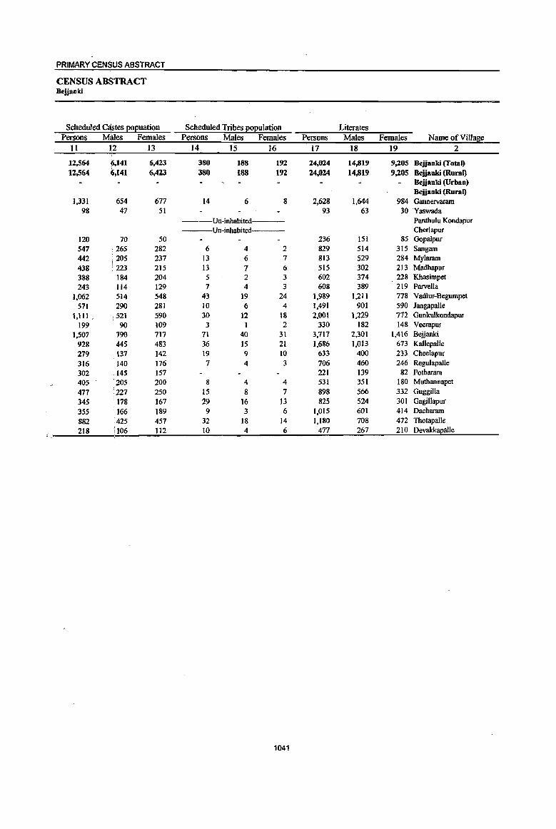
PRIMARY CENSUS ABSTRACT
CENSUS ABSTRACT Bejjanki
Scheduled C~tes eoeuation Scheduled Tribes ~eulation Literates Persons Mhles Females Persons Males Females ~ersons Males Females Name of Village
11 12 13 14 15 16 ' 17 18 19 2
12,564 ~,141 6,423 380 188 192 24,024 14,819 9,205 Bejjanki (Total) 12,564 6,141 6,423 380 188 192 24,024 14,819 9,205 Bejjanki (Rural)
Bejjanki (Urban) Bejjanki (Rural)
],331 654 677 14 6 8 2,628 1,644 984 Gannervaram 98 47 51 93 63 30 'Yaswada
Un-inhabited Panthulu Kondapur Un-inhabited Cherlapur
120 70 50 236 151 85 Gopalpur 547 265 282 6 4 2 829 514 315 Sangam 442 205 237 13 6 7 813 529 284 Mylaram 438 223 215 13 7 6 SIS 302 213 Madhapur 388 . 184 204 5 2 3 602 374 228 Khasimpet
243 114 129 7 4 3 608 389 219 Parvella
1,062 514 548 43 19 24 1,989 1,211 778 Vad1ur-Begumpet
571 290 281 10 6 4 1,491 901 590 Jangapal1e 1,111 , ,521 590 30 12 18 2,001 1,229 772 Gunkulkondapur
199 90 109 3 1 2 330 182 148 Veerapur 1,507 790 717 71 40 31 3,717 2,301 1,416 Bejjanlci
928 ;445 483 36 15 21 1,686 1,013 673 Kal1epalle
219 131 142 19 9 10 633 400 233 Cheelapur
316 140 176 7 4 3 706 460 246 Regulapalle
302 t4S 157 221 139 82 Potharam
405 205 200 8 4 4 531 3SI 180 Muthannapet
471 '227 250 IS 8 7 898 566 332 Guggilla
345 178 167 29 16 13 825 524 301 Gagillapur
355 166 189 9 3 6 1,015 601 414 Dacharam
882 425 457 32 18 14 1,180 708 472 Thotapalle
218 '106 112 10 4 6 477 267 210 Devakkapalle -
1041

DISTRICT CENSUS HANDBOOK: KARIMNAGAR
VILLAGE PRIMARY MandaI Parishad -
Location code Illiterates Total workers Main workers
number Name ofViIlase Persons Males Females Persons Males Females Persons Males Females I 2 20 21 22 23 24 25 26 27 28
0044 Bejjanki (Total) 27,814 10,709 17,105 28,305 14,488 13,817 23,687 13,118 10,569 0044 Bejjanki (Rural) 27,814 10,709 17,105 28,305 14,488 13,817 23,687 13,118 10,569 0044 Bejjanki (Urban)
Bejjanki (Rural) 00353000 Gannervararn 2,768 1,065 1,703 3,111 1,579 1,532 2,743 1,436 1,307 00353100 Yaswada 138 52 86 155 74 81 155 74 81 003532()O Pantilu\u Kondapur Un-inhabited 00353300 Cherlapur ---Un-inhabited 00353400 Gopalpur 280 124 156 304 165 139 281 158 123 00353500 Sangam 1,041 398 643 881 522 359 845 515 330 00353600 My\aram 973 379 594 993 515 478 825 446 379 00353700 Madbapur 1"15 318 457 743 380 363 719 372 347 00353800 Khasimpet 722 283 439 801 396 405 785 393 392 00353900 ParvelJa 760 275 485 839 406 433 SI6 396 420 00354000 Vadlur-Begumpet 2,275 865 1,410 2,387 '1,208 1,179 2,020 1,072 948 00354100 Jangapalle 1,447 585 862 1,633 844 789 1,331 719 612 00354200 Gunkulkondapur 2,628 1,037 1,591 2,577 1,320 1,257 I,S40 1,20S 632 00354300 Veerapur 460 177 283 462 224 238 448 215 233 00354400 Bejjanki 3,271 1,231 2,040 3,401 1,821 1,580 3,004 1,710 1,294 00354500 Kallepalle 1,852 706 1,146 2,034 1,007 1,027 1,471 898 573 00354600 CheelapuT 690 25t 439 710 355 355 674 342 332 00354700 RegulapaJle 1,141 411 730 1,055 504 551 606 388 218 00354800 Pothararn 254 101 153 284 156 128 280 154 126 00354900 Muthannapet 652 238 414 618 314 304 606 309 297 00355000 Guggilla 1,179 440 739 1,132 555 577 939 508 431 00355100 Gagillapur 793 289 504 948 466 482 904 458 446 00355200 Dacharam 1,352 504 848 1,180 567 613 1,032 548 484 00355300 ThotapaUe 1,886 799 1,087 1,567 859 708 962 576 386 00355400 Devakkapalle 477 181 296 490 251 239 401 223 178
1042

PRIMARY CENSUS ABSTRACT
CENSUS ABSTRACT Bejjanki
Industrial cate~0!X of main workers Household industry
Cultivators Agricultural labourers workers Other workers Persons Males iFemales Persons Males Females Persons Males Females Persons Males Females Name of Village
29 30 31 32 33 . 34 35 36 37 38 39 40 2
9,485 5,510 3,975 8,232 3,402 4,830 1,633 912 721 4,337 3,,294 1,043 Bejjanki (Total) 9,485 5,510 3,975 8,232 3,462 4,830 1,633 912 721 4,337 3,294 1,043 Bejjanki (Rural)
Bejjanki (Urban) Bejjanki (Rural)
904 528 376 1,223 507 716 256 130 126 360 271 89 Gannervaram 60 35 . 25 93 38 55 2 Yaswada
Un-inhabited- Panthulu Kondapur Un-inhabited Cherlapur
172 97 75 70 31 39 10 1 3 29 23 6 Gopalpur 358 229 129 370 190 180 2 2 115 94 21 Sangam 411 243 i 168 266 85 181 11 9 2 137 109 28 Mylanun
. 352 185 167 270 113 157 63 45 18 34 29 5 Madhapur 395 195 200 289 127 162 50 29 21 51 42 9 Khasimpet 462 227 235 235 95 140 29 15 14 90 S9 31 Parvella 762 421 341 732 302 430 171 83 88 355 266 89 Vadl~-Begumpet
531 291 240 508 211 297 105 58 47 187 159 28 JangapaUe 786 566 220 388 197 191 142 84 58 524 361 163 Gunkulkondapur 234 116 tl8 155 57 98 42 32 10 17 10 7 Veerapur
1,175 653 522 864 344 520 183 97 86 782 616 166 Bejjanki 660 420 240 385 170 215 159 79 80 267 229 38 Kallepalle 304 150 154 191 74 117 76 35 41 103 83 20 Cbeelapur 253 171 82 III 31 80 42 19 23 200 167 33 RegulapaUe 128 77 51 127 57 70 1 I 24 19 5 Pothanun 276 151 125 274 121 153 7 4 3 49 33 16 Muthannapet 462 259 203 251 106 145 136 76 60 90 67 23 Guggilla 208 107 101 470 167 303 9 9 217 175 42 G3gillapur 254 167 87 521 188 333 49 33 16 208 160 48 Dachararn
195 140 55 266 118 148 59 42 17 442 276 166 Thotapalle 143 82 61 173 73 100 31 23 8 54 45 9 Devakkapalle
1043
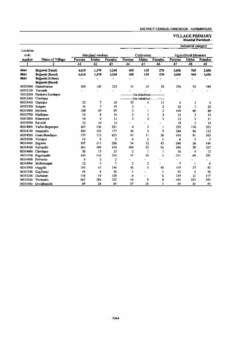
DISTRICT CENSUS HANDBOOK: KARIMNAGAR
VILLAGE PRIMARY Mandai Parishad -
Industrial cate80!! Location
code Mar~inal workers Cultivators Agricultural labourers number Name of Vil1~e Persons Males Females Persons Males Females Persons Males Females
1 2 41 42 43 44 45 46 47 48 49
0044 Bejjanki (Total) 4,618 1,370 3,248 405 135 270 3,601 945 2,656 0044 Bejjanki (Rural) 4,618 1,370 3,248 405 13S 270 3,601 945 2,6S6 0044 Bejjanki (Urban)
Bejjanki (Rural) 00353000 Gannervaram 368 143 225 51 33 18 276 92 184 00353100 Yaswada 00353200 Panthulu Kondapur ----Un-inbabited-----00353300 Cherlapur ----Un-inhabited----00353400 Gopalpur 23 7 16 15 4 11 6 2 4 00353500 Sangam 36 7 29 2 2 32 7 25 00353600 Mylararn 168 69 99 3 I 2 149 60 89 00353700 Madhapur 24 8 16 3 I 2 16 3 13 00353800 Khasimpet 16 3 13 3 2 12 11 00353900 Parvella 23 10 I3 18 5 13 00354000 Vadlur·Begumpet 367 136 231 4 3 332 110 222 00354100 Jangapalle 302 125 177 10 5 5 248 96 152 00354200 Gunkulkondapur 737 112 625 47 II 36 654 91 563 00354300 Veerapur 14 9 5 4 3 I 6 3 3 00354400 Bejjanki 397 III 286 54 12 42 240 56 184 00354500 K.allepalle 563 109 454 104 23 81 396 59 337 00354600 Cheelapur 36 13 23 2 1 16 4 12 00354700 Regulapalle 449 116 333 15 I{) 5 351 69 282 00354800 Potharam 4 2 2 00354900 Muthannapet 12 5 7 2 2 7 6 00355000 Guggilla 193 47 146 46 6 40 119 37 82 00355100 GagiIJapur 44 8 36 1 1 33 3 30 00355200 Dacharam 148 19 129 6 6 129 12 117 00355300 Thotapalle 605 283 322 16 8 8 505 223 282 00355400 Devakka2alle 89 28 61 17 10 7 56 II 45
.1044

PRIMARY CENSUS ABSTRACT
CENSUS ABSTRACT Bejjanki
{)fmar~mal workers Location
Household indUstry workers Other workers Non-workers code Persons Males Females Persons Males Females Persons Males Females Name ofVill~e number
50 51 52 . 53 54 55 56 57 58 2 1
285 70 .215 327 220 107 23,533 11,040 12,493 Bejjanki (Total) 0044 285 70 215 327 220 107 23,533 11,040 12,493 Bejjanki (Rural) 0044
Bejjanki (Urban) 0044 Bejjanki (Rural)
22 10 12 19 8 11 2,285 1,130 1.155 Gannervaram 00353000 76 41 35 Yaswada 00353100
Un-inhabited Panthulu Kondapur 00353200 Un-inhabited---- Cherlapur 00353300
1 1 1 212 110 102 Gopalpur 00353400 2 2 989 390 599 Sangam (}0353500 7 6 9 7 2 793 393 400 Mylararn 00353600 4 3 547 240 307 Madhapur 00353700
I 523 261 262 Khasimpet 00353800 5 5 529 258 271 Parvella 00353900
4 4 27 23 4 1,877 868 1,009 Vadlur-Begumpet 00354000 30 14 16 14 10 4 1.305 642 663 Jangapalle 00354100 14 2 12 22 8 14 2,052 946 1,106 Gunlrulkondapur 00354200
4 3 1 328 135 193 V~rapur 00354300 54 6 48 49 37 12 3,587 1,711 1,876 Bejjanki 00354400
I
37 4 33 26 23 3 1,504 712 792 KaUepaile 00354500 10 9 8 7 613 296 317 Cbeelapur 00354600
I
SO 14 36 33 23 10 792 367 425 Regulapalle 00354700
1 I 3 2 I 191 84 107 Pothararn 00354800 2 1 1 1 565 275 290 Muthannapet 00354900
26 2 24 2 2 945 451 494 Guggilla (}0355000 4 2 2 6 3 3 670 347 323 GagiUapur (}0355100 3 2 10 6 4 1,187 538 649 Dachararn 00355200
11 8 3 73 44 29 1,499 648 851 Thotapalle 00355300 3 I 2 I3 6 7 464 197 267 Devakkaealle 00355400
1045
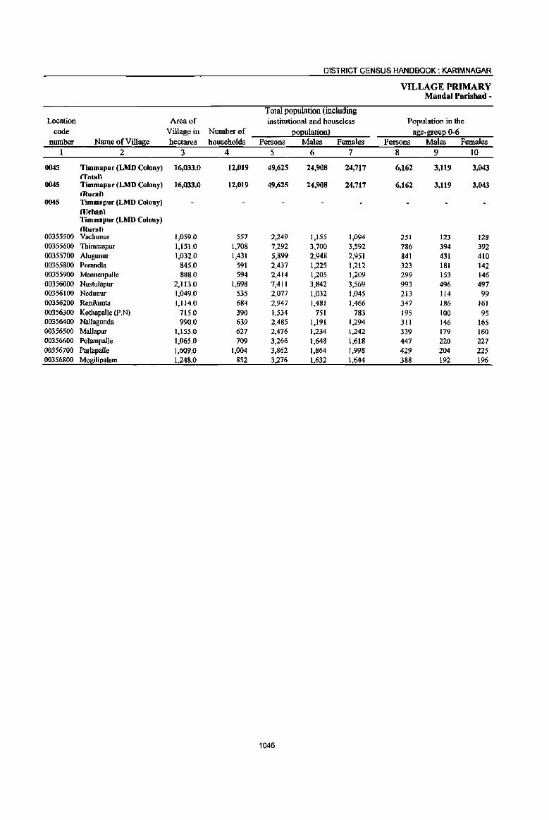
DISTRICT CENSUS HANDBOOK: KARIMNAGAR
VILLAGE PRIMARY Mandai Parishad -
Total population (including Location Area of institutional and houseless Population in the
code Village in Number of p:op:u1ation l ase-l[oup: 0-6 number Name ofVi1l~e hectares households Persons Males Females Persons Males Females
1 2 3 4 5 6 7 8 9 10
0045 Timmapur (LMD Colony) 16,033.0 12,019 49,625 24,908 24,717 6,162 3,119 3,043 /Total)
0045 Timmapur (LMD Colony) 16,033.0 11,019 49,615 14,908 14,717 6.161 3.119 3,043 (Rural)
0045 Timmapur (LMD Colony) l1Irhanl Timmapur (LMD Colony) (Rural)
00355500 Vachunur 1,059.0 557 2,249 1,155 1,094 251 123 J28 00355600 Thimmapur 1,15l.0 1,708 7,292 3,700 3,592 786 394 392 00355700 A1ugunur 1,032.0 1,431 5,899 2,948 2,951 841 431 410 00355800 Porandla 845.0 591 2,437 1,225 1,212 323 181 142 00355900 Mannenpalle 888.0 594 2,414 1,205 1,209 299 153 146 00356000 Nustulapur 2,113.0 1.698 7,411 3,842 3,569 993 496 497 00356100 Nedunur 1,049.0 535 2,077 1,032 1,045 213 114 99 00356200 Renikunta 1,1l4.0 684 2,947 1,481 1,466 347 186 161 00356300 Kothapalle (p.N) 715.0 390 1,534 751 783 195 100 95 00356400 Nallagonda 990.0 639 2,485 1,191 1,294 311 146 165 00356500 Mallapur 1.155.0 627 2,476 1,234 1,242 339 179 160 00356600 Poiampalle 1,065.0 709 3,266 1,648 1,618 447 220 227 00356700 Parlapalle 1,609.0 1,004 3,862 1,864 1,998 429 204 225 00356800 M01l!lil2alem 1,248.0 852 3,276 1,632 1,644 388 192 196
1046

PRIMARY CENSUS ABSTRACT
CENSUS ABSTRACT Timmapur (LMD Colony)
I
Scheduled Castes eOEuation Scheduled Tribes EOEuiation Literates
Persons MMes Females Persons Males Females Persons Males Females Name ofVilla~e
II 12 l3 14 15 16 17 18 19 2
10,445 5,176 5,269 466 243 223 23,100 14,143 8,957 Timmapur (LMD Colony) ITotall
10,445 5.176 5,269 466 243 223 23,100 14,143 8,957 Timmapur (LMD Colony) (Ruran
- Timmapur (LMD Colony) (Urhan} Timmapur (LMD Colony) (Rural)
587 ' 309 278 25 13 12 1,022 661 361 Vachunur 935 479 456 25 12 13 4,101 2,472 1,629 Thimmapur
1,150 579 571 104 46 58 2,907 1,749 1,158 Alugunur
553 ' 270 283 35 21 14 918 554 364 Porandla 768 390 378 24 10 14 1,027 655 372 Mannenpa]le
1,776 866 910 87 58 29 3,535 2,243 1,292 Nustulapur
701 350 351 25 9 16 1,005 606 399 Nedunur 664 340 324 31 16 15 1,387 864 523 Renikunta
453 209 244 12 7 5 741 440 301 Kothapalle (p.N)
967 465 502 15 9 6 1,187 712 475 Nallagonda 319 160 159 14 8 6 890 538 352 Mallapur
423 217 206 1,213 757 456 Polampalle
710 335 375 43 22 21 1,744 1,Q43 701 Parlapalle 439 i 207 232 26 12 14 1,423 849 574 Mo~liEalem
1047
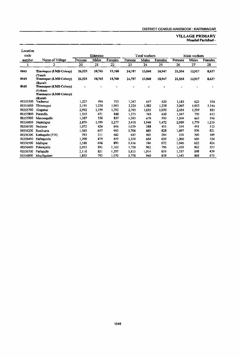
DISTRICT CENSUS HANDBOOK: KARIMNAGAR
VILLAGE PRIMARY Mandai Parisbad -
Location
code illiterates Total workers Main workers number Name ofVill!Eie Persons Males Females Persons Males Females Persons Males Females
1 2 20 21 22 23 24 25 26 27 28
0045 Timmapur (LMD Colony) 26,525 10,765 15,760 24,787 13,840 10,947 21,554 12,917 8,637 (Total)
0045 Timmapur (LMD Colony) 26,525 10,765 15,760 24,787 13,840 10,947 21,554 12,917 8,637 (Rural)
0045 Timmapur (LMD Colony) (Urban) Timmapur (LMD Colony) (Rural)
00355500 Vachunur 1,227 494 733 1,267 647 620 1,183 625 558 00355600 Thimmapur 3,191 1,228 1,963 3,220 1,982 1,238 3,097 1,953 1,144 00355700 A1ugunur 2,992 1,199 1,793 2,705 1,635 1,070 2,434 1,599 835 00355800 Porandla 1,519 671 848 1,375 745 630 1,347 735 612 00355900 Mannenpalle 1,387 550 831 1,263 670 593 1,209 663 546 00356000 Nustulapur 3,876 1,599 2;277 3,418 1,946 1,472 2,989 1,779 1;210 00356100 Nedunur 1,072 426 646 1,039 588 451 554 441 113 00356200 Renikunta 1,560 617 943 1,708 880 828 1,697 876 821 00356300 Kothapalle (p.N) 793 311 482 687 403 284 559 390 169 00356400 NalJagonda J;298 479 819 1,320 684 636 1,200 666 534 00356500 Mallapur 1,586 696 890 1,416 744 672 1,046 622 424 00356600 Polampalle 2,053 891 1,162 1,758 962 796 1,359 802 557 00356700 Parlapalle 2,118 821 1,297 1,833 1,014 819 1,337 898 439 00356800 Mogilil2alem 1,853 783 1,070 1,778 940 838 1,543 868 675
1048
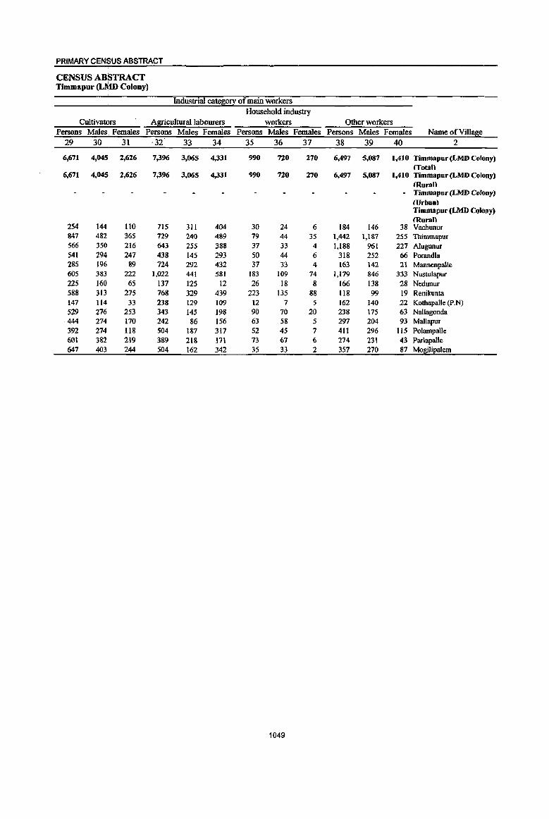
PRIMARY CENSUS ABSTRACT
CENSUS ABSTRACT Timmapur (LMD Colony)
Industrial cate~0!I of main workers Household industry
Cultivators Al:[!culturallabourers workers Other wotkers Persons Males. Females Persons Males Females Persons Males Females Persons Males Females Name of ViI lase
29 30 31 ·32 33 34 35 36 37 38 39 40 2
6,671 4,045 2,626 7,396 3,065 4,331 990 720 270 6,497 5,087 1,410 Timmapur (LMD Colony) (Total)
6,671 4,045 2,626 7,396 3,065 4,331 990 720 270 6,497 5,087 1,410 Timmapur(LMDColony) tRuran
- Timmapur (LMD Colony) (llrhan) Timmapur (LMD Colony) (Rural)
254 144 110 715 311 404 30 24 6 184 146 38 Vachunur 847 482 365 729 240 489 79 44 35 1,442 1,187 255 Thimmapur 566 350 216 643 255 388 37 33 4 1,188 961 227 Alugunur 541 294 247 438 145 293 50 44 6 318 252 66 Porandla 285 196 89 724 292 432 37 33 4 163 142 21 Mannenpalle 605 383 222 1,022 441 581 183 109 74 1,179 846 333 Nustulapur 225 160 65 137 125 12 26 18 8 166 138 28 Nedunur 588 313 275 768 329 439 223 135 88 118 99 19 Renilrunta 147 114 33 238 129 109 12 7 5 162 140 22 KotbapaJle (p.N) 529 276 253 343 145 198 90 70 20 238 175 63 Nallagonda 444 274 170 242 86 156 63 58 5 291 204 93 Mallapur 392 274 118 504 187 317 52 45 7 411 296 115 PoJampaJJe 601 382 219 389 218 171 73 67 6 274 231 43 Parlapalle 647 403 244 504 162 342 35 33 2 357 270 87 Mo~Ji~aJem
1049
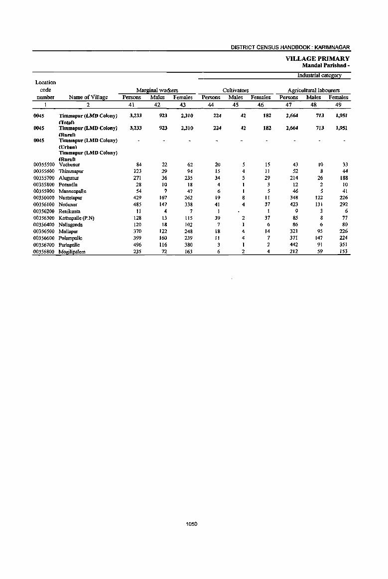
DISTRICT CENSUS HANDBOOK: KARIM NAGAR
VILLAGE PRIMARY MandaI Parishad -
Industrial catgr;o!}:: Location
code Marginal workers Cultivators Agricultural labourers number Name ofVilla~e Persons Males Females Persons Males Females Persons Males Females
1 2 41 42 43 44 45 46 47 48 49
0045 Timmapur (LMD Colony) 3,233 923 2,3JQ 224 42 182 2,664 711 1,951 lTotan
0045 Timmapur (LMD Colony) 3,233 923 2,310 224 42 182 2,664 713 1,951 (Rural)
0045 Timmapur (LMD Colony) CUrbanl Timmapur (LMD Colony) murall
00355500 Vachunur 84 22 62 20 5 15 43 10 33 00355600 Thimmapur ]23 29 94 15 4 II 52 8 44 00355700 Alugunur 271 36 235 34 5 29 214 26 188 00355800 Porandla 28 10 18 4 I 3 12 2 10 00355900 Mannenpalte 54 ? 47 6 1 5 46 5 41 00356000 Nusrulapur 429 161 262 19 a 11 348 122 226 00356100 Nedunur 485 141 338 41 4 37 423 131 292 00356200 Renikunta 11 4 7 I I 9 3 6 00356300 Kothapalle (P.N) 128 13 115 39 2 37 85 8 71 00356400 Nallagonda 120 18 102 7 6 86 6 80 00356500 MaUapur 370 122 248 18 4 14 321 95 226 00356600 Polampalle 399 160 239 II 4 7 371 147 224 00356700 Parlapalle 496 116 380 3 2 442 91 351 00356800 Mogilipalem 235 72 163 6 2 4 212 59 153
1050

PRIMARY CENSUS ABSTRACT
CENSUS ABSTRACT Timmapur (Lt\.lD Colony)
of marginal wo~ers Location
Household indUs!!): workers Other workers Non-workers code Persons Males Females Persons Males Females Persons Males Females Name of VillaSie number
50 51 52 53 54 55 56 57 58 2 I
136 51 85 209 117 92 24,838 11,068 13,770 Timmapur (LMD Colony) 0045 {Total)
136 51 85 209 117 92 24,838 11,068 13,770 Timmapur(LMD Colony) 0045 (Rural)
- Timmapur (LMD Colony) 0045 (Urban) Timmapur (LMO Colony) (Rural)
14 2 12 7 5 2 982 S{)8 474 Nachunur 00355500 23 2 21 33 15 18 4,072 1,718 2;354 Thimmapur 00355600 2 2 21 5 16 3,194 1.313 1,881 Alugunur 00355700
12 7 5 1,062 480 582 Porandla 00355800 2 1.151 535 616 MannenpaUe 00355900
34 22 12 28 15 13 3,993 1,896 2,097 Nustulapur ()0356oo0 7 2 5 14 10 4 1,038 444 594 Nedunur 00356100
I I 1,239 601 638 Renikunta 00356200 4 3 847 348 499 Kothapalle (p.N) 00356300
19 3 16 8 8 1,165 507 658 Nallagonda 00356400 10 '1 3 21 16 5 1,060 490 570 Mallapur 00356500 11 7 4 6 2 4 1,508 686 822 PolampaUe 00356600
10 3 7 41 21 20 2,029 850 1,179 ParJapalJe 00356700
4 ,2 2 13 9 4 1,498 692 806 MogiliEalem 00356800
1051
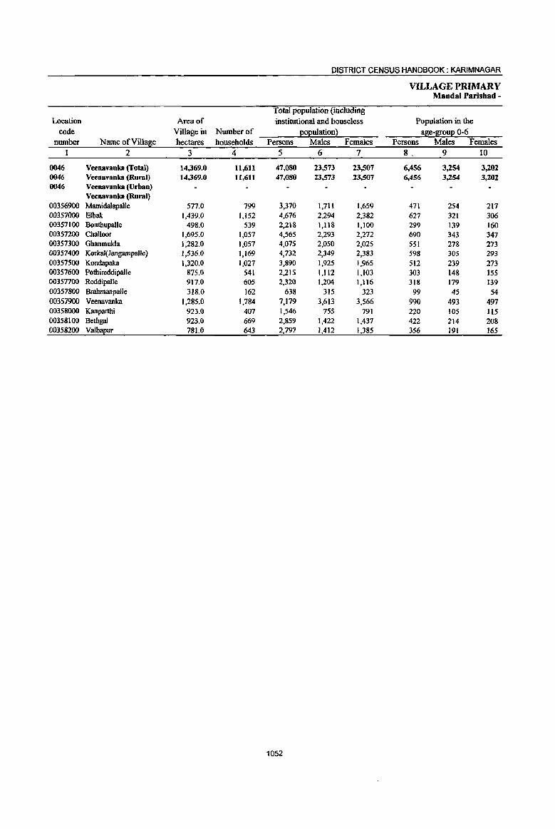
DISTRICT CENSUS HANDBOOK: KARIMNAGAR
VILLAGE PRIMARY Mandai Parishad -
Total population (including Location Area of institutional and houseless Population in the
code Village in Number of EOI!ulation l a~e-~ou:e 0-6 number Name of Villa~e hectares households Persons Males Females Persons Males Females
I 2 3 4 5 6 7 8. 9 IO
0046 Veenavanka (Total) 14,369.0 11,611 47,080 23,573 23,507 6,456 3,254 3,202 0046 Veenavanka (Rural) 14,369.0 11,611 47,080 23,573 23,507 6,456 3,254 3,202 0046 Veenavanka (Urban)
Veenavanka (Rural) 00356900 Marnidalapalle 577.0 799 3,370 1,711 1,659 471 254 217 00357000 Elba!.: 1,439.0 1,152 4,676 2,294 2,382 627 321 306 00357100 Bonthupalle 498.0 539 2,218 1,118 1,100 299 139 160 00357200 Challoor 1,695.0 1,057 4,565 2,293 2;272 690 343 347 00357300 Ghanmukla 1,282.0 1,057 4,075 2,050 2,025 551 278 273 00357400 Korkal(Jangampalle) 1,536.0 ',169 4,732 2,349 2,383 598 305 293 00357500 Kondapaka 1,320.0 1,027 3,890 1,925 1,965 512 239 273 00357600 Pothireddipalle 875.0 541 2,215 1,112 1,103 303 148 155 00357700 Reddipalle 917.0 605 2,320 1;204 1,1l6 318 179 139 00357800 Brahmanpalle 318.0 162 638 315 323 99 45 54 00357900 Veenavanka 1,285.0 1,784 7,179 3,613 3,566 990 493 497 00358000 Kanparthi 923.0 407 1,546 755 791 220 105 115 00358100 Bethgal 923.0 669 2,859 1,422 1,437 422 214 208 00358200 Valbapur 781.0 643 2,797 1,412 1,385 356 191 165
1052

PRIMARY CENSUS ABSTRACT
CENSUS ABSTRACT Veenavanka
Scheduled Cistes EOEuation Scheduled Tribes EOEulation Litemtes Persons Milles Females Persons Males Females Persons Males Females Name of Village
11 12 13 14 15 16 17 18 19 2
9,168 4,601 4,567 778 387 391 20,485 12,891 7,594 Veenavanka (Total) 9,168 4,601 4,567 778 387 391 20,485 12,891 7,594 Veenavanka (Rural)
Veenavanka (Urban) Veenavanka (Rural)
580 299 281 20 10 IO 1,528 959 569 Mamidalapalle 709 339 370 153 82 71 1,946 1,208 738 Elba!< 652 328 324 172 86 86 661 443 218 Bonthupalle 675 : 342 333 42 21 21 2,244 1,385 859 Challoor 726 ,377 349 37 14 23 1,574 1,023 551 Ghanmukla
668 325 343 49 26 23 2,033 1,266 767 Korkal(JangampalJe)
715 : 343 372 74 33 41 1,680 1,079 601 Kondapaka
0518 ' 2056 262 48 2S 23 80S 511 294 Pothireddipalle
591 303 288 38 21 17 1,033 653 380 Reddipalle
230 112 11& 9 4 5 249 161 && Btahmanpalle
1,306 668 638 67 31 36 3,430 2,135 1,295 Veenavanka
489 239 250 25 12 13 684 440 244 Kanparthi
103 358 345 25 11 14 1,390 855 535 Bethgal
606 : 312 294 19 II 8 1,228 113 455 Valbapur
1053
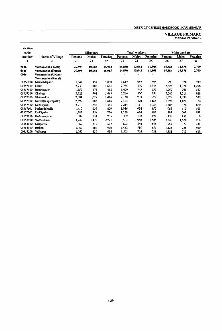
DISTRICT CENSUS HANDBOOK; KARIM NAGAR
VILLAGE PRIMARY MandaI Parishad -
Location code llIiterates Total workers Main workers
number Name ofVilIase Persons Males Females Persons Males Females Persons Males Females 1 2 20 21 22 23 24 25 26 27 28
0046 Veenavanka (Total) 26,595 10,682 15,913 24,850 13,542 11,308 19,584 11,875 7,709 0046 Veenavanka (Rural) 26,595 10,682 15,913 24,850 13,542 11,308 19,584 11,875 7,709 0046 Veenavanka (Urban)
Veen8vanka (Rural) 00356900 MamidaJapal)e 1,842 752 1,090 1,647 952 695 990 778 212 00357000 Elbak 2,730 1,086 1,644 2,765 1,419 1,346 2,626 1,370 1,256 00357100 Bonthupalle 1,557 675 882 1,400 743 657 1,260 708 552 00357200 Challoor 2,321 908 1,413 2,284 1,300 984 2,040 1,211 829 00357300 Ghanmukla 2,501 1,027 1,474 2,130 1,203 927 1,578 1,039 539 00357400 Korkal(Jangampalle) 2,699 1,083 1,616 2,474 1,320 1,154 1,893 1,121 772 00357500 Kondapaka 2,210 846 1,364 2,214 1,161 1,053 1,588 928 660 00357600 Pothireddipalle [,410 60[ 809 1,086 634 452 988 619 369 00357700 Reddipalle 1,287 551 736 1,159 674 485 707 509 198 00357800 Brahmanpal[e 389 154 235 352 [78 174 158 152 6 00357900 Veenavanka 3,749 1,478 2,271 3,501 1,956 1,545 2,542 1,628 914 00358000 Kanparthi 862 315 547 893 448 445 757 373 384 00358100 Bethgal 1,469 567 902 1,442 789 653 1,126 726 400 00358200 Valb!!2ur 1,569 639 930 1,503 765 738 1,33) 713 618
1054
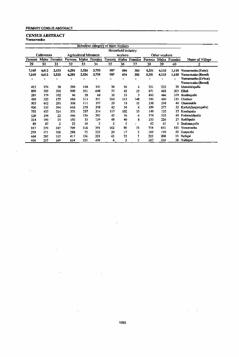
PRIMARY CENSUS ABSTRACT
CENSUS ABSTRACT Veenavanka
Industrial cate~o!.! of main workers
Household industry Cultivators Agricultural labourers workers Other workers
Persons Males : Females Persons Males Females Persons Males Females Persons Males Females Name of Village 29 30 31 32 33 34 35 36 37 38 39 40 2
7,145 4,612 2,533 6,281 2,526 3,755 907 604 303 5,251 4,133 1,118 Veenavanka (Total) 7,145 4,612 ' 2,533 6,281 2,526 3,755 907 604 303 5,251 4,133 l,llS Veenavanka (Rural)
Veenavanka (Urban) Veenavanka (Rural)
412 374 38 289 148 141 38 34 4 251 222 29 MamidalapaUe 899 509 390 999 351 648 57 42 15 671 468 203 Elbak 281 179 102 96 28 68 38 35 3 845 466 379 Bonthupalle 498 323 175 684 313 371 263 115 148 595 460 135 Challoor 903 612 291 308 111 197 29 18 II 338 298 40 Ghanmukla 926 532 394 616 278 338 42 34 8 309 277 32 Korkal(JangampaUe) 751 437 314 571 257 314 117 102 15 149 132 17 Kondapaka 126 104 22 446 154 292 42 36 6 374 325 49 Pothireddipalle 214 190 ' 24 192 53 139 48 40 8 253 226 27 ReddipaUe 89 87 2 22 19 3 5 5 42 41 I Brahmanpalle
917 570 347 709 318 391 162 89 73 754 651 103 Veenavanka
279 171 108 298 75 223 20 17 3 160 110 50 Kanparthi 444 287 157 417 196 221 42 35 7 223 208 15 Bethgal 406 237 169 634 225 409 4 2 2 287 249 38 Valbapur
1055

DISTRICT CENSUS HANDBOOK; KARIMNAGAR
VILLAGE PRIMARY Mandai Paris bad -
Industrial cates;0!.l: Location
code Marfiinal workers Cultivators Agricultural labourers number Name of Villase Persons Males Females Persons Males Females Persons Males Females
1 2 41 42 43 44 45 46 47 48 49
0046 Veenavanka (fotal) 5,266 1,667 3,599 186 67 119 4,174 1,067 3,107 0046 Veenavanka (Rural) 5,266 1,667 3,599 186 67 119 4,174 1,067 3,11)7 0046 Veenavanka (Urban)
Veenavanka (Rural) 00356900 Mamidalapalle 657 174 483 14 3 II 551 128 423 00357000 Elbak 139 49 90 14 4 10 79 24 55 00357100 Bonthupalle 140 35 105 2 2 106 15 91 00357200 Challoor 244 89 155 9 3 6 196 61 135 00357300 GbanmukJa 552 164 388 17 5 12 416 120 296 00357400 Korkal(Jangampalle) 581 199 382 5 4 418 82 336 00357500 Kondapaka 626 233 393 10 2 8 547 180 367 00357600 Pothireddipalle 98 15 83 9 3 6 78 9 69 00357700 Reddipalle 452 165 287 14 6 8 313 71 ' 242 00357800 Brahmanpalle 194 26 168 14 14 162 15 147 00357900 Veenavanka 959 328 631 34 9 25 808 246 562 00358000 Kanpartbi 136 75 61 35 27 8 84 33 51 00358100 Bethgal 316 63 253 3 3 271 46 225 00358200 Valb!!l!ur 172 52 120 6 2 4 145 37 108
1056

PRIMARY CENSUS ABSTRACT
CENSUS ABSTRACT Veenavanka
of marginal workers Location
Household indus!!l: workers Other workers Non-workers code
Persons Males Females Persons Males Females Persons Males. Females Name ofVill~e number
50 51 52 53 54 55 56 57 58 2 1
229 93 136 677 440 237 22,230 10,031 12,199 Veeoavanka (fatal) 0046 229 93 136 677 440 237 22,230 10,031 12,199 Veenavanka (Rural) 0046
Veenavanka (Urban) 0046 VeenavankS (Rural)
23 5 18 69 38 31 1,723 759 964 Mamidalapalle 00356900 22 11 II 24 10 14 1,911 875 1,036 Elbak 00357000 II I 10 21 17 4 818 375 443 Bonthupalle 00357100 7 3 4 32 22 10 2,281 993 1,288 Challoor 00357200 2 2 117 39 78 1,945 847 1,098 Ghanmukla 00357300
33 15 18 125 101 24 2,258 1,029 1,229 Korkal(Jangampaile) 00357400 28 17 II 41 34 7 1,676 764 912 Koridapaka 00357500
5 5 6 3 3 1,129 478 651 Pothireddipalle 00357600 21 6 15 104 82 22 1,161 530 631 Reddipalle 00357700
3 2 1 15 9 6 286 137 149 BrnhmanpalJe 00357800 50 25 25 67 48 19 3,678 1,657 2,021 Veenavanl9t 00357900
1 16 14 2 653 307 346 Kanparthi 00358000 22 7 15 20 10 10 1,417 633 784 Bethgal 00358100
20 13 7 1,294 647 647 Valbapur 00358200
1057

DISTRICT CENSUS HANDBOOK: KARIMNAGAR
VILLAGE PRIMARY Mandai Parishad - '
Total population (including Location Area of .institutional and houseless Popu1ation in the
code Village in Number of J2oJ2ulation} age-~ouJ2 0-6 number Name of Village hectares households Persons Males Females Persons Males Females
1 2 3 4 5 6 7 8 9 10
0047 Jammikunta (Total) 22,286.0 22,826 93,501 41,127 46,374 13,312 6,749 6,563
0047 Jammikunta (Rural) 22,286.0 22,826 93,501 41,127 46,374 13,312 6,749 6,563 0047 Jammikunta (Urban)
Jammikunta (Rural) 00358300 Vilasagar 575,0 284 1,352 677 675 196 90 106 00358400 Thangula 1,734,0 1,016 3,938 1,972 1,966 532 275 257 00358500 Vavilala 1,906.0 1,514 5,919 2,976 2,943 857 428 429
00358600 Vantbadupula 454.0 330 1,202 605 597 142 67 75 00358700 Rachapalle 1,023,0 768 3,031 1,515 1,516 426 208 218 00358800 Bijigirsharief 1,654.0 1,271 5,060 2,510 2,550 664 309 355
00358900 KorepaIle 1,488.0 1,176 4,523 2,280 2,243 669 345 324
00359000 Saidabad 537.0 370 1,542 767 775 284 141 143
00359100 Jammikunta 3,097.0 6,468 27,335 13,819 13,516 3,905 2,006 1,899
00359200 Dharmaram (p.B) 378.0 2.351 10,030 5,062 4,968 1,445 726 719
00359300 Madipa!le 1,410,0 1,064 4,385 2,222 2,163 608 300 308
00359400 Kanagarthi 896.0 551 2,216 1,134 1,082 360 190 170
00359500 Mallia! 1,454.0 1,062 4,381 2,234 2,147 539 297 242
00359600 Ellanthakunta 1,488.0 1,483 6,008 3,056 2,952 877 431 446
00359700 Chinnakomatipalle 275.0 275 1,175 589 586 200 109 91
00359800 Tekurthi 914.0 538 2,211 1,101 1,110 327 167 160
00359900 Bujunoor 1,495.0 901 3,388 1,686 1,702 479 237 242
00360000 Sirsedu 1,164.0 1,163 4,791 2,392 2,399 671 349 322
00360100 Patharla~alle 344.0 241 1,014 530 484 131 74 57
1058
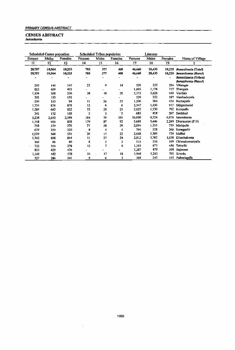
PRIMARY CENSUS ABSTRACT
CENSUS ABSTRACT Jammikunta
Scheduled Castes ~o~uation Scheduled Tnoes ~o~ulation Literates Persons Males Females Persons Males Females Persons Males Females Name of Village
II 12 13 14 15 16 17 18 19 2
20,787 10,564 10,223 785 377 408 46,660 28,435 18,225 Jammikunta (fotal) 20,787 10,564 10,223 785 377 408 46,660 28,435 18,225 Jammikunta (Rural)
Jammikunta (Urban) Jammikunta (Rural)
293 146 147 23 9 14 5S9 355 204 Vilasagar Sl2 409 403 1,895 1,178 717 Thangula
1,104 568 536 38 18 20 2,575 1,626 949 Vavilala 301 150 lSI 539 352 IS7 Vanthadupula 204 110 94 51 26 25 1,200 766 434 Rachapalle
1,754 876 878 12 6 6 2,347 1,430 917 Bijigirsharief
1,284 662 622 53 28 25 2,022 1,230 792 KorepaJle
341 172 169 5 3 2 685 418""' 267 Saidabad 5,238 2,650 2,588 184 79 lOS 16,000 9,324 6,676 lammikunta
1,758 900 858 179 87 92 5,695 3,446 2,249 Dharmaram (P_B)
758 379 379 77 38 39 2,094 1,355 739 Madipalle
679 359 320 8 4 4 794 528 266 Kanagarthi
1,079 548 531 39 17 22 2,048 1,309 739 Mallial
1,742 898 844 51 27 24 2,812 1,762 1,050 Ellanthakunta
166 86 80 8 5 3 515 316 199 Chinnakomatipalle
732 354 378 13 7 6 1,161 675 486 Tekurthi
855 429 426 1,387 879 508 Bujunoor
1,160 582 578 35 17 18 1,944 1,243 701 Sirsedu
527 286 241 9 6 3 388 243 145 Patharlapalle
1059
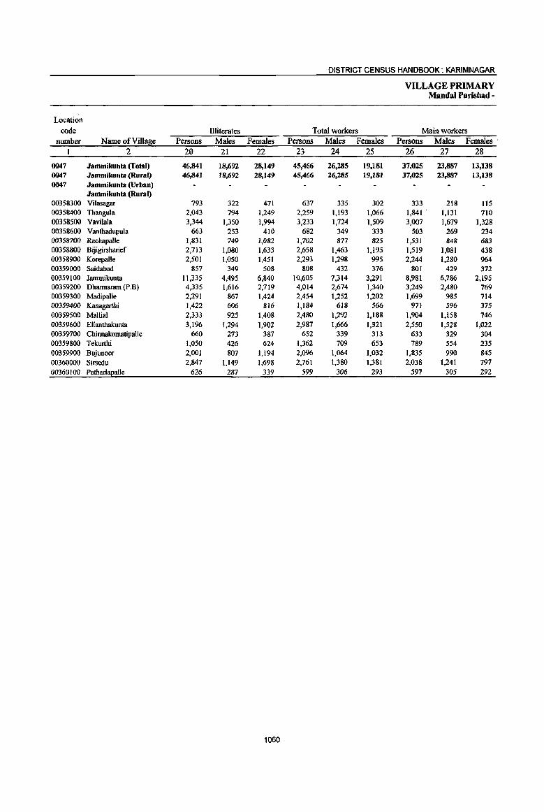
DISTRICT CENSUS HANDBOOK: KARIMNAGAR
VILLAGE PRIMARY Mandai Parishad -
Location code Illiterates Total workers Main workers
number Name ofVill~e Persons Males Females Persons Males Females Persons Males Females . 1 2 20 21 22 23 24 25 26 27 28
0047 Jammikunta (Total) 46,841 18,692 28,149 45,466 26,285 19,181 37,025 23,887 13,138 0047 Jammikunta (Rural) 46,841 18,692 28,149 45,466 26,285 19,181 37,025 23,887 13,138 0047 Jammikunta (Urban)
Jammikunta (Rural) 00358300 Vilasagar 793 322 471 637 335 302 333 218 115 00358400 Thangula 2,043 794 1,249 2,259 1,193 1,066 1,841 . 1,131 710 00358500 Vavilala 3,344 1,350 1,994 3,233 1,724 1,509 3,007 1,679 1,328 00358600 Vanthadupula 663 253 410 682 349 333 503 269 234 00358700 Rachapalle 1,831 749 1,082 1,702 877 825 1,531 848 683 00358800 Bijigirsharief 2,713 1,080 1,633 2,658 1,463 1,195 1,519 1,081 438 00358900 Korepalle 2,501 1,050 1,451 2,293 1,298 995 2,244 1,280 964 00359000 Saidabad 857 349 508 808 432 376 801 429 372 00359100 Jammilrunta 11.335 4,495 6,840 10,605 7.314 3,291 8,981 6,786 2,195 00359200 Dharmaram (p.B) 4,335 1,616 2,719 4,014 2,674 1,340 3,249 2,480 769 00359300 Madipalle 2,291 867 1,424 2,454 1,252 1,202 1,699 985 714 00359400 Kanagarthi 1,422 606 816 1,184 618 566 971 596 375 00359500 Mallial 2,333 925 1,408 2,480 1,292 1,188 1,904 1,158 746 00359600 Ellanthakunta 3,196 1,294 1,902 2,987 1,666 1,321 2,550 1,528 1,022 00359700 ChinnakomatipaUe 660 273 387 652 339 313 633 329 304 00359800 Tekurthi 1,050 426 624 1,362 709 653 789 554 235 00359900 Bujunoor 2,00] 807 1,194 2,096 1,064 1.032 1,835 990 845 00360000 Sirsedu 2,847 1,149 1,698 2,761 1,380 1,381 2,038 1,241 797 00360100 Patharl~alle 626 287 339 599 306 293 597 305 292
1060

PRIMARY CENSUS ABSTRACT
CENSUS ABSTRACT Jammikunta
Industrial catelli0!X of main workers Household industry
Cultivators Agricultural labourers workers Other workers Persons Males Females Persons Males Females Persons Males Females Persons Males Females Name of Village
29 30 31 32 33 34 35 36 37 38 39 40 2
10,921 6,689 4,232 12,430 5,533 6,897 1,189 873 316 12,485 10,792 1,693 Jammikunta (Total) 10,921 6,{i89 4,232 12,430 5,533 6,897 1,189 873 316 12,485 10,792 1,693 Jammikunta (Rural)
Jammikunta (Urban) Jammikunta (Rural)
120 78 42 84 46 38 3 3 126 91 35 Vilasagar 500 365 135 989 475 514 25 20 5 327 271 S6 Tbangula 794 465 329 1,417 574 843 155 116 39 641 524 117 Vavilala 338 172 166 114 53 61 18 14 4 33 30 3 Vanthadupula 660 387 273 565 201 364 54 34 20 252 226 26 Rachapalle 718 511 206 397 215 182 48 36 12 356 318 38 Bijigirsbarief 665 392 273 1,154 519 635 23 18 5 402 351 51 Korepalle 313 166 147 200 52 148 88 48 40 200 163 37 Saidabad
1,220 808 412 1,628 744 884 408 321 87 5.725 4,913 812 Jamrnikunta 449 266 183 451 215 236 88 ,66 22 2.261 1.933 328 Dharmaram (p.B) 859 462 397 500 210 290 31 22 9 309 291 18 MadipaIle 354 249 105 501 242 259 116 lOS II Kanagartbi 881 584 297 760 333 427 32 23 9 231 218 13 Mallial 681 409 272 1.104 420 684 25 21 4 740 678 62 Ellanthakunta 256 133 123 252 83 169 43 32 II 82 81 I Chinnakomatipalle 286 168 118 305 197 108 1 I 197 188 9 Tekurthi 812 436 376 854 404 450 60 46 14 109 104 5 Bujunoor 760 490 270 854 421 433 87 52 35 337 278 59 Sirsedu 255 .147 108 301 129 172 41 29 12 Patharlapalle
1061
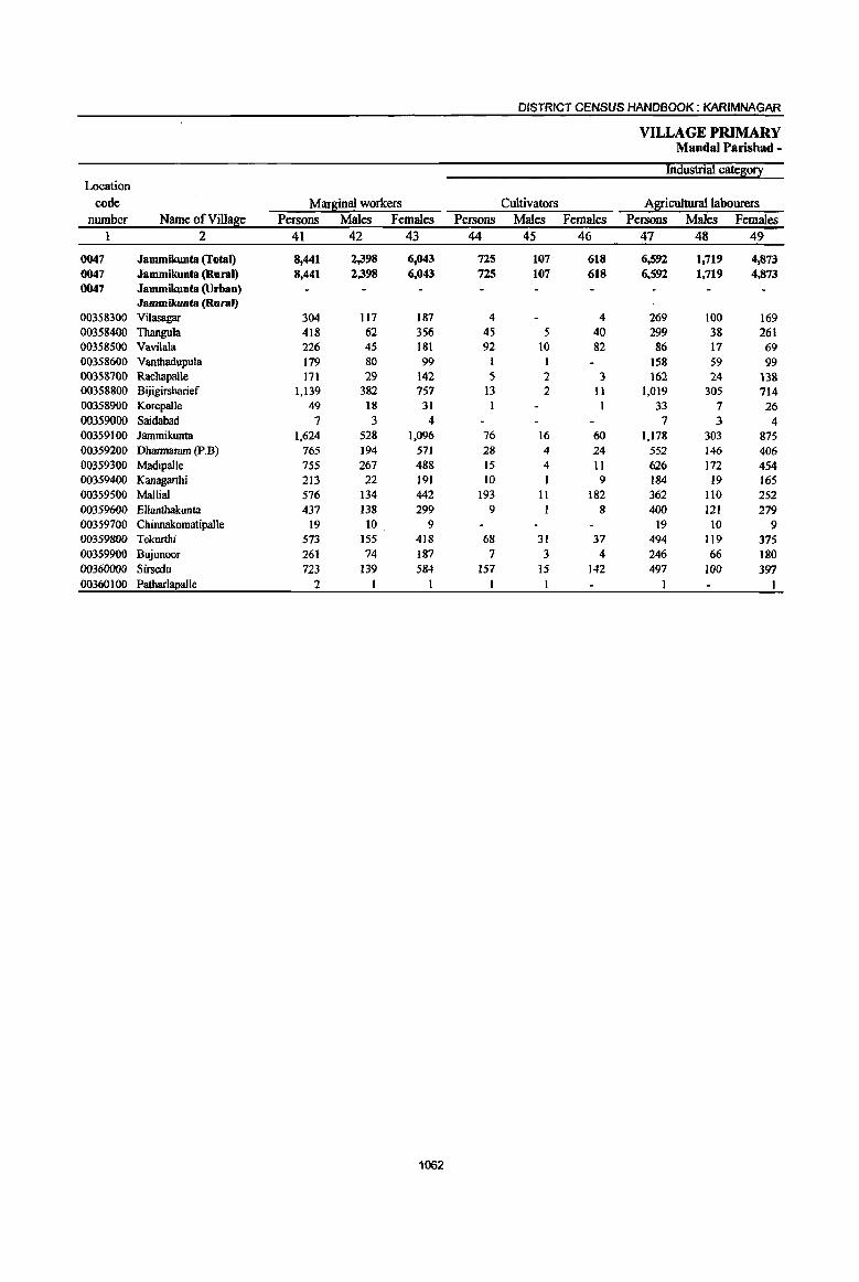
DISTRICT CENSUS HANDBOOK: KARIMNAGAR
VILLAGE PRIMARY Mandai Parishad -
Industrial cate~0!I Location
code Mar~inal workers Cultivators Agricultural labourers number Name of Village Persons Males Females Persons Males Females Persons Males Females
1 2 41 42 43 44 45 46 47 48 49
0047 Jammikunta (Total) 8,441 2,398 6,043 725 107 618 6,592 1,719 4,873 0047 Jammikunta (Rural) 8,441 2,398 6,043 725 107 618 6,592 1,719 4,873 0047 Jammikunta (Urban)
Jammikunta (Rural) 00358300 Vilasagar 304 1I7 187 4 4 269 100 169 00358400 Thangula 418 62 356 45 5 40 299 38 261 00358500 Vavilala 226 45 181 92 10 82 86 17 69 00358600 Vantbadupula 179 80 99 1 I 158 59 99 00358700 Racbapalle 171 29 142 5 2 3 162 24 138 00358800 Bijigirsharief 1,139 382 757 13 2 II 1,019 305 714 00358900 Korepalle 49 18 31 I I 33 7 26 00359000 Saidabad 7 3 4 7 3 4 00359100 Jammikunta 1,624 528 1,096 76 16 60 1,178 303 875 00359200 Dhannaram (p.B) 765 194 571 28 4 24 552 146 406 00359300 Madipalle 755 267 488 15 4 1I 626 172 454 00359400 Kanagarthi 213 22 191 10 9 184 19 165 00359500 Mallial 576 134 442 193 II 182 362 IIO 252 00359600 Ellantbakunta 437 138 299 9 8 400 121 279 00359700 Chinnakomatipalle 19 10 9 19 10 9 00359800 Tekurthi 573 155 418 68 31 37 494 119 375 00359900 Bujunoor 261 74 187 7 3 4 246 66 180 00360000 Sirsedu 723 139 584 157 15 142 497 100 397 00360100 Patharl!!2al1e 2
1062

PRIMARY CENSUS ABSTRACT
CENSUS ABSTRACT Jammikunta
of mar~al workers Location
Household indus!!! workers Other workers Non-workers code Persons Males Females Persons Males Females Persons Males Females Name ofVilla!e number
50 51 52 53 54 55 56 57 58 2 1
257 59 198 867 513 354 48,035 20,842 27,193 Jammikunta (Total) 0047 257 59 198 867 513 354 48,035 20,842 27,193 Jammikunta (Rural) 0047
Jammikunta (Urban) 0047 Jammikunta (Rural)
30 17 13 715 342 373 Vilasagar 00358300 28 28 46 19 27 1,679 779 900 Thangula 00358400 13 4 9 35 14 21 2,686 1,252 1,434 Vavilala 00358500
I 19 19 520 256 264 Vantbadupula 00358600 4 3 1,329 638 691 Rachapalle 00358700
18 5 13 89 70 19 2,402 1,047 1,355 Bijigirsharief 00358800 15 11 4 2,230 982 1,248 Korepalle 00358900
734 335 399 Saidabad 00359000 51 18 33 319 191 128 16,730 6,505 10,225 Jammikunta 00359100 68 5 63 117 39 78 6,016 2,388 3,628 Dhannaram (P_B) 00359200 39 20 19 75 71 4 1,931 970 961 Madipalle 00359300 II II 8 2 6 1,032 516 516 Kanagarthi 00359400 5 4 16 12 4 1,901 942 959 Mallial 00359500 2 2 26 16 10 3,021 1,390 1,631 Ellanthakunta 00359600
523 250 273 Chinnakomatipalle 00359700 3 2 8 4 4 849 392 457 Tekurthi 00359800 3 2 5 4 I 1,292 622 670 Bujunoor 00359900
14 3 11 55 21 34 2,030 1,012 1,018 Sirsedu 00360000 415 224 191 PatharlaEalle 00360100
1063
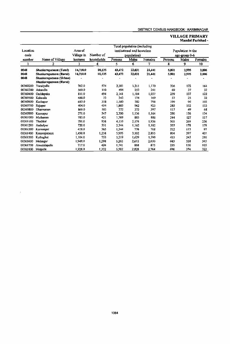
DISTRICT CENSUS HANDBOOK: KARIMNAGAR
VILLAGE PRIMARY Mandai Parisbad -
Total population (including Location Area of institutional and houseless Population in the
code Village in Number of eOEuiation 2 !!Se-l[ouE 0-6 number Name of Villase hectares households Persons Males Females Persons Males Females
1 2 3 4 5· 6 7 8 9 10
0048 Shankarapatnam (Total) 14,710.0 10,135 43,472 22,031 21,441 5,801 2,995 2,806 0048 Shankarapatnam (Rural) 14,710.0 10,135 43,472 22,031 21,441 5,801 2,995 2,806 0048 Shaokarapatnam (Urban)
Shankarapatnam (Rural) 00360200 Yeradpalle 762.0 574 2,381 1,211 1,170 336 172 164 00360300 Arkandla 560.0 110 494 253 241 69 37 32 00360400 Gaddapaka 811.0 494 2,141 1,104 l,037 259 137 122 00360500 Kalavala 488.0 73 343 174 169 57 25 32 00360600 Kachapur 683.0 358 1,580 782 798 199 96 103 00360700 Rajapur 404.0 454 1,885 962 923 285 152 133 00360800 Dbarmaram 869.0 185 772 375 397 117 49 68 00360900 Kannapur 271.0 547 2,300 1,136 1,164 290 156 134 00361000 Mutharam 785.0 421 1,769 883 886 244 127 117 00361100 Thadikal 791.0 938 4,110 2,174 1,936 505 269 236 00361200 Ambalpur 720.0 551 2,344 1,162 1,182 357 178 179 00361300 Kareernpet 418.0 365 1,544 776 768 212 115 97 00361400 Kesavapatnarn 1,450.0 1,258 5,995 3,102 2,893 804 397 407 00361500 Kothaghat 1,104.0 753 3,219 1,629 1,590 453 243 210 00361600 Molaogur 1,949.0 1,298 5,262 2,612 2,650 683 338 345 00361700 Amudalapalle 717.0 424 1,741 868 873 235 130 105 00361800 Me!l!alle 1,928.0 1,332 5,592 2,828 2,764 696 374 322
1064
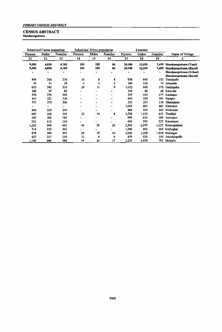
PRIMARY CENSUS ABSTRACT
CENSUS ABSTRACT Shankarapatnam
Scheduled Castes EOEuation Scheduled Tribes EOEulation Literates Persons Males Females Persons Males Females Persons Males Females Name ofVill~e
11 12 13 14 15 16 17 18 19 2
9,585 4,820 4,765 189 103 86 20,100 12,601 7,499 Shankarapatnam (Total) 9,585 4,820- 4,765 189 103 86 20,100 12,601 -7,499 Shankarapatnam (Rural)
Shankarapatnam (Urban) Shankarapatnam (Rural)
494 260 234 16 & 8 998 645 353 Yeradpal1e 59 31 28 4 2 2 189 116 73 Arkandla
655 345 310 20 11 9 1,022 649 373 Gaddapaka 182 97 85 134 _ 86 48 Kalavala 578 276 302 727 450 277 Kachapur 457 221 236 830 529 301 Rajapur 771 375 396 355 217 138 Dhannaram
1,069 665 404 Kannapur 469 229 240 884 539 345 Mutharam 687 358 329 22 14 8 1,738 1,125 613 Thadikal 347 163 184 999 610 389 Ambalpur 222 1I2 lIO 620 393 227 Kareempet
1,355 694 661 46 20 26 3,304 2,079 1,225 Kesavapatnam 714 352 362 1,506 942 564 Kothaghat 978 484 494 28 18 10 2,626 1,608 1,018 Molangur 427 217 210 12 6 6 879 520 359 Amudalapalle
1,190 606 584 41 24 17 2,220 1,428 792 Me!j!alle
1065
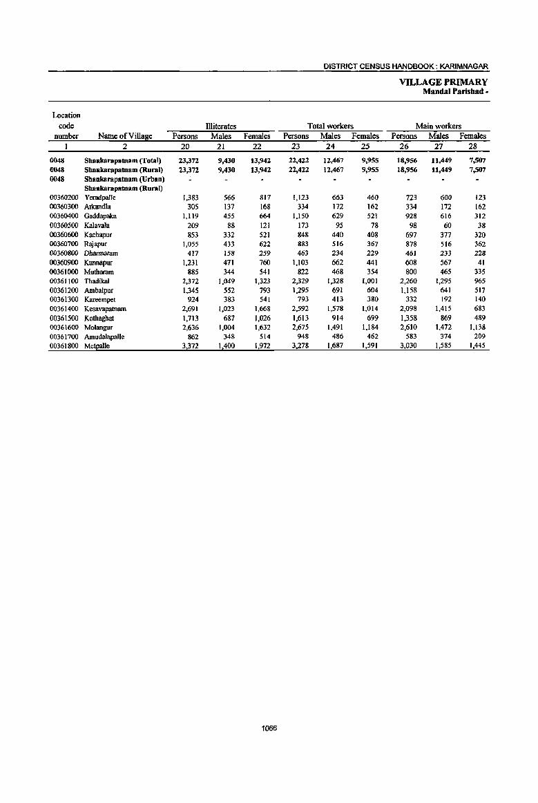
DISTRICT CENSUS HANDBOOK: KARIM NAGAR
VILLAGE PRIMARY Mandai Parishad •
Location code llliterates Total workers Main workers
number Name ofVill~e Persons Males Females Persons Males Females Persons Males Females 1 2 20 21 22 23 24 25 26 27 28
0048 Shanlmrapatnam (fotal) 23,372 9,430 13,942 22,422 12,467 9,955 18,956 11,449 7,507 0048 Shanlmrapatnam (Rural) 23,372 9,430 13,942 22,422 12,467 9,955 18,956 11,449 7,507 0048 Sbankarapatnam (Urban)
Shankarapatnam (Rural) 00360200 Yeradpalle 1,383 566 817 1,123 663 460 723 600 123 00360300 Arkandla 305 137 168 334 172 162 334 172 162 00360400 Gaddapaka 1,119 455 664 1,150 629 521 928 616 312 00360500 Kalavala 209 88 121 173 95 78 98 60 38 00360600 Kacbapur 853 332 521 848 440 408 697 377 320 00360700 Rajapur 1,055 433 622 883 516 367 878 516 362 00360800 Dhannaram 417 158 259 463 234 229 46) 233 228 00360900 Kannapur 1,231 471 760 1,103 662 441 608 567 41 00361000 Mutharam 885 344 541 822 468 354 800 465 335 00361100 Thadikal 2,372 1,049 1,323 2,329 1,328 1,001 2,260 1,295 %5 00361200 Ambalpur 1,345 552 793 1,295 691 604 1,158 641 517 00361300 Kareempet 924 383 541 793 413 380 332 192 140
00361400 Kesavapatnam 2,691 1,023 1,668 2,592 1,578 1,014 2,098 1,415 683
00361500 Kothaghat 1,713 687 1,026 1,613 914 699 1,358 869 489 00361600 Molangur 2,636 1,004 1,632 2,675 1,491 1,184 2,610 1,472 1,138 00361700 Amudalapalle 862 348 514 948 486 462 583 374 209
00361800 Me!Ealle 3,372 1,400 1,972 3,278 1,687 1,591 3,030 1,585 1,445
1066
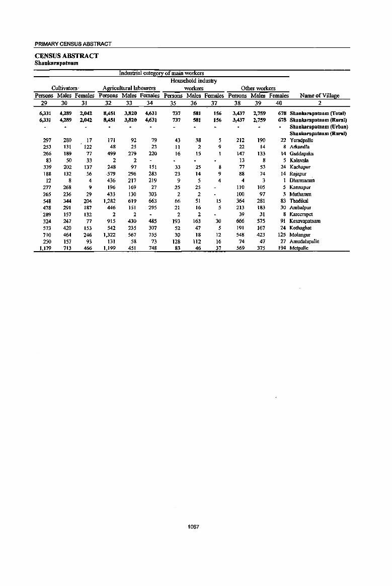
PRIMARY CENSUS ABSTRACT
CENSUS ABSTRACT Shankarapatnam
Industrial cate~0!i: of main workers Household industry
Cultivators - Agricultural labourers workers Other workers Persons Males Females Persons Males Females Persons Males Females Persons Males Females Name of Vill!!fie
29 30 31 .32 33 34 35 36 37 38 39 40 2
6,331 4,289 2,042 8,451 3,820 4,631 737 581 156 3,437 2,759 678 Shankarapatnam (rotal) 6,331 4,289 2,042 8,451 3,820 4,631 737 581 156 3,437 2,759 678 Shankarapatnam (Rural)
Shankarapatnam (Urban) Shankarapatnam (Rural)
297 280 17 171 92 79 43 38 5 212 190 22 Yeradpalle 253 131 122 48 25 23 II 2 9 22 14 8 Arkandla 266 189 11 499 219 220 16 15 I 141 133 14 Gaddapaka
83 50 33 2 2 13 8 5 Kalavala 339 202 137 248 97 151 33 25 8 77 53 24 Kachapur 188 132 56 579 296 283 23 14 9 88 74 14 Rajapur 12 8 4 436 211 219 9 5 4 4 3 1 Dhannaram
271 268 9 196 169 27 25 25 110 105 5 Kannapur
265 236 29 433 130 303 2 2 100 97 3 Mutharam 548 344 204 1.282 619 663 66 51 15 364 281 83 Thadikal 478 291 187 446 151 295 21 16 5 213 183 30 Ambalpur 289 157 132 2 2 2 2 39 31 8 Kareempet 324 247 77 915 430 485 193 163 30 666 575 91 Kesavapatnam 573 420 153 542 235 307 52 47 5 191 167 24 Kothaghat 110 464 246 1,322 567 755 30 18 12 548 423 125 Molangur 250 157 93 131 58 73 128 112 16 74 47 27 Amudalapalle
1,119 713 466 1,199 451 748 83 46 31 569 375 194 MS!alle
1067

DISTRICT CENSUS HANDBOOK: KARIMNAGAR
VILLAGE PRIMARY Mandai Parishad -
Industrial cate~O!! Location
code Marginal workers Cultivators Agricultural labourers number Name ofVilla~e Persons Males Females Persons Males Females Persons Males Females
1 2 41 42 43 44 45 46 47 48 49
0048 Sbankarapatnam (Total) 3,466 1,018 2,448 103 34 69 2,981 767 2,214 0048 Shankarapatnam (Rural) 3,466 1,618 2,448 103 34 69 2,981 767 2,214 0048 Sbankarapatnam (Urban)
Shankarapatnam (Rurat) 00360200 Yeradpalle 400 63 337 6 2 4 357 51 306 00360300 Arkandla 00360400 Gaddapaka 222 13 209 4 4 216 13 203 00360500 Kalavala 75 3S 40 2 59 23 36 00360600 Kachapur 151 63 88 6 3 3 131 55 76 00360700 Rajapur 5 5 4 4 00360800 Dhannaram 2 I 1 2 I 1 00360900 Kannapur 495 9S 400 12 8 4 465 72 393 00361000 Mutharam 22 3 19 3 3 18 2 16 00361100 Thadikal 69 33 36 9 6 3 44 17 27 00361200 Ambalpur 137 50 87 2 2 lJ3 30 83 00361300 Kareempet 461 221 240 9 4 5 409 177 232 00361400 Kesavapatnam 494 163 331 26 4 22 401 129 272 00361500 Kothaghat 255 45 210 I 1 245 42 203 00361600 Molangur 65 19 46 2 2 53 14 39 00361700 Amudalapalle 365 112 253 7 3 4 344 101 243 00361800 Me!£a1le 248 102 146 14 3 11 120 40 80
1068
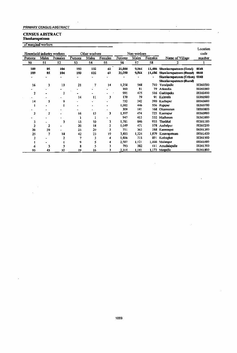
PRIMARY CENSUS ABSTRACT
CENSUS ABSTRACT Shaokarapatnam
of marginal workers Location
Household indus!!X workers Other workers Non-workers code Persons Males Females Persons Males Females . Persons Males Females Name ofVill~e nwnber
50 51 52 53 54 55 56 57 58 2 1
189 85 104 193 132 61 21,050 9,564 11.486 Shankarapatnam (Total) 0048 189 85 104 193 132 61 21,050 9,564 11.486 Shankarapatnam (Rural) 0048
Shankarapatnam (Urban) 0048 Shankarapatoam (Rural)
16 3 13 21 7 14 1,258 548 710 Yeradpalle 00360200 160 81 79 Arkandla 00360300
2 2 991 475 516 Gaddapaka 00360400 14 11 3 170 79 91 Kalavala 00360500
14 5 9 732 342 390 KachlillUr 00360600 1 1.002 446 556 Rajapur 00360700
309 141 16& Dharmamrn 00360800 2 2 16 13 3 1.197 474 723 Kannapur 00360900
1 1 947 415 532 Mutharam 00361000 3 3 13 10 3 1.781 846 935 Thadikal 00361100 2 2 20 18 2 1,049 471 578 Ambalpur 00361200
20 20 23 20 3 751 363 388 Kareempet 00361300 25 7 18 42 23 19 3.403 1,524 1,879 Kesavapatnam 00361400
2 2 7 3 4 1,606 715 891 Kothaghat 00361500 I 1 9 5 4 2,587 1,121 1,466 Molangur 00361600
6 3 3 8 5 3 793 382 411 Amudalapalle 00361700 95 43 52 19 16 3 2,314 1,141 1.173 Me!)!alle 00361800
1069
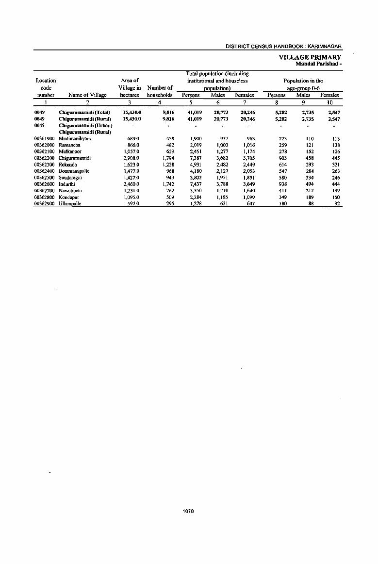
DISTRICT CENSUS HANDBOOK: KARIMNAGAR
VILLAGE PRIMARY Mandai Parishad -
Total population (including Location Area of institutional and houseless Population in the
code Village in Number of E012ulation2 aEe-~oul2 0-6 number Name ofVi1Ial!ie hectares households Persons Males Females Persons Males Females
1 2 3 4 5 6 7 8 9 10
0049 Chigurumamidi (Total) 15,430.0 9.816 41,019 20,773 20,246 5,282 2,735 2,547 0049 Cbigurumamidi (Rural) 15,430.0 9,816 41,019 20,773 20,246 5,282 2.735 2,547 0049 Cbigurumamidi (Urban)
Cbigurumamidi (Rural) 00361900 Mudimanikyam 689.0 458 1,900 937 963 223 110 113 00362000 Ramancha 866.0 482 2,019 1,003 1,016 259 121 138 00362100 Mulkanoor 1,057.0 629 2,451 1;1.77 1,174 278 152 126 00362200 Chigurumamidi 2,908.0 1,794 7,387 3,682 3,705 903 458 445 00362300 Rekonda 1,623.0 1,228 4,931 2,482 2,449 614 293 321 00362400 Bommanapalle 1,477.0 968 4,180 2,127 2,053 547 284 263 00362500 Sundaragiri 1,427.0 949 3,802 1,951 1,851 580 334 246 00362600 Indurthi 2,460.0 1,742 7,437 3,788 3,649 938 494 444 00362700 Nawabpeta 1,231.0 762 3,350 1,710 1,640 411 212 199 00362800 Kondapur 1,095.0 509 2,284 1,185 1,099 349 189 160 00362900 Ullampatle 597.0 295 1,278 631 647 180 88 92
1070
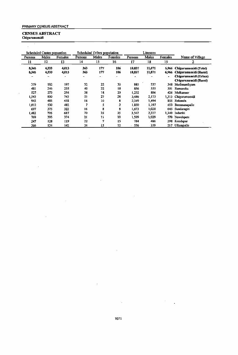
PRIMARY CENSUS ABSTRACT
CENSUS ABSTRACT Chigurumamidi
Scheduled Castes EOEuation Scheduled Tribes I!ol!ulation Literates Persons Males Females Persons Males Females Persons Males Females Name ofVilla~e
11 12 13 14 15 16 17 18 19 2
8,346 4,333 4,013 363 177 186 18,837 11,871 6,966 Chigurumamidi (Total) 8,346 4,333 4,013 363 177 186 18,837 11,871 6,966 Chigurumamidi (Rural)
Chigurumamidi (Urban) Chigurumamidi (Rural)
379 182 197 52 22 30 885 537 348 Mudimanilcyam 481 246 235 40 22 18 856 555 301 Ramancha 527 273 254 38 18 20 1,232 806 426 Mulkanoor
1,543 800 743 55 27 28 3,486 2,173 1,313 Chigurumamidi 943 485 458 18 10 8 2,349 1,494 855 Rekonda
1,012 530 482 7 5 2 1,850 1,197 653 Bommanapalle 697 375 322 16 8 8 1,673 1,028 645 Sundaragiri
1,482 795 687 70 35 35 3,567 2).27 1,340 Indurthi 769 395 374 21 11 10 1,599 1,029 570 Nawabpeta
247 128 119 22 7 15 784 486 298 KondapUf 266 124 142 24 12 12 . 556 339 217 U1lamEalle
1071

DISTRICT CENSUS HANDBOOK: KARIMNAGAR
VILLAGE PRIMARY Mandai Parisbad -
Location code lliiterates Total workers Main workers
number Name ofVillaf!e Persons Males Females Persons Males Females Persons Males Females 1 2 20 21 22 23 24 25 26 27 28
0049 Cbigurumamidi (Total) 22,182 8,902 13,280 21,632 11,588 10,044 18,022 10,472 7,550 0049 Cbigurumamidi (Rural) 22,182 8,902 13,280 21,632 11,588 10,044 18,022 10,472 7,550 0049 Cbigurumamidi (Urban)
Cbigurumamidi (Rural) 00361900 Mudimanikyam 1,015 400 615 1,052 533 519 1,048 532 516 00362000 Ramancha 1,163 448 715 1,131 582 549 1,000 558 442 00362100 Mulkanoor 1,219 471 748 1,383 748 635 1,349 731 618 00362200 Chigurumamidi 3,901 1,509 2,392 3,810 2,069 1,741 2,950 1,767 1,183 00362300 Rekonda 2,582 988 1,594 2,652 1,394 1,258 1,687 1,086 601 00362400 Bommanapalle 2,330 930 1,400 2,359 1,217 1,142 2,100 1,155 945 00362500 Sundaragiri 2,129 923 1,206 1,915 1,057 858 1,797 1,022 775 00362600 IndlJrthi 3,870 1,561 2,309 3,909 2,142 1,767 3,100 1,848 1,252 00362700 Nawabpeta 1,751 681 1,070 1,803 975 828 1,384 906 478 00362800 Kondapur 1,500 699 801 990 543 447 990 543 447 00362900 UllampaIle 122 292 430 628 328 300 617 324 293
1072
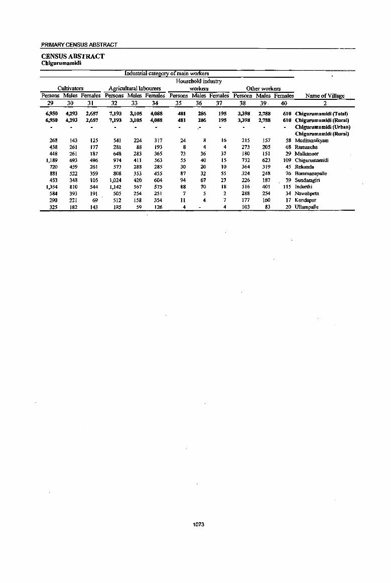
PRIMARY CENSUS ABSTRACT
CENSUS ABSTRACT Chigurumamidi
Industrial cate~0!X of main workers Household industry
Cultivators Agricultural labourers workers Other workers Persons Males Females Persons Males Females Persons MaleS Females Persons Males Females Name ofVilla~e
29 30 31 32 33 34 35 36 37 38 39 40 2
6,950 4,293 2,657 7,193 3,105 4,088 481 286 195 3,398 2,788 610 Chigurumamidi (Total) 6,950 4,293 2,657 7,193 3,105 4,088 481 286 195 3,398 2,788 610 Chigurumamidi (Rural)
- Chigurumamidi (Urban) Chigurumamidi (Rural)
268 143 125 541 224 317 24 8 16 215 157 58 Mudimanikyam 438 261 177 281 88 193 8 4 4 273 205 68 Ramancha 448 261 187 648 283 365 73 36 37 180 151 29 Mulkanoor
1,189 693 496 974 411 563 55 40 15 732 623 109 Chigurumamidi 720 459 261 573 288 285 30 20 10 364 319 45 Rekonda 881 522 359 808 353 455 87 32 55 324 248 76 Bommanapalle 453 348 105 1,024 420 604 94 67 27 226 187 39 Sundaragiri
1,354 810 544 1,142 567 575 88 70 18 516 401 115 Indurthi 584 393 191 505 254 251 7 5 2 288 254 34 Nawabpeta 290 221 69 512 158 354 11 4 7 177 160 17 Kondapur 325 182 143 185 59 126 4 4 103 83 20 Ullamealle
1073

DISTRICT CENSUS HANDBOOK: KARIM NAGAR
VILLAGE PRIMARY Mandai Parishad -.
Industrial catej!i0!! Location
code MarBinal workers Cultivators Agricultural labourers number Name ofVilla~e Persons Males Females Persons Males Females Persons Males Females
I 2 41 42 43 44 45 46 47 48 49
0049 Chigurumamidi (Total) 3,610 1,116 2,494 323 68 255 2,998 892 2,106 0049 Chigurumamidi (Rural) 3,610 1,116 2,494 323 68 255 2,998 892 2,106 0049 Chigurumamidi (Urban)
Chigurumamidi (Rural) 00361900 Mudimanikyam 4 1 3 2 I I 00362000 Ramancha 131 24 107 3 2 122 19 103 00362100 Mulkanoor 34 17 17 3 3 24 13 11 00362200 Chigurumamidi 860 302 558 44 9 35 781 271 510 00362300 Rekonda 965 308 657 154 38 116 723 217 506 00362400 Bommanapalle 259 62 197 12 11 227 55 172 00362500 Sundaragiri 118 35 83 3 1 2 102 28 74 00362600 Indurthi 809 294 515 44 13 31 684 234 450 00362700 Nawabpeta 419 69 350 53 3 50 330 53 277 00362800 Kondapuf 00362900 mlamealle 11 4 7 7 2 5 3 2
1074
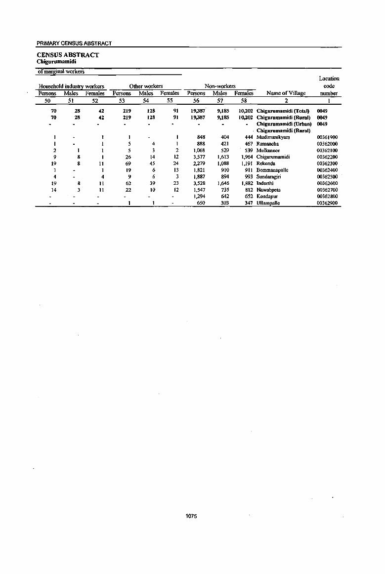
PRIMARY CENSUS ABSTRACT
CENSUS ABSTRACT Cbigurumamidi
ofm~inal workers Location
Household indus!!X workers Other workers Non-workers code Persons Males Females Persons Males Females Persons Males Females Name ofVillas;c number
50 51 52 53 54 55 56 57 58 2 1
70 28 42 219 128 91 19,387 9,185 10,202 Chigurumamidi (Total) 0049 70 28 42 219 128 91 19,387 9,185 10,2.02 Chigurumamidi (Rural) 0049
Chigurumamidi (Urban) 0049 Chigurumamidi (Rural)
1 848 404 444 Mudimanikyam 00361900 5 4 888 421 467 Ramancha 00362000
2 1 5 3 2 1,068 529 539 Mulkanoor 00362100 9 8 26 14 12 3,577 1,613 1,964 Chigurumamidi 00362200
19 8 11 69 45 24 2),79 1,088 1,191 Rekonda 00362300 1 1 19 6 13 1,821 910 911 BommanapaUe 00362400 4 4 9 6 3 1,887 894 993 Sundaragiri 00362500
19 8 11 62 39 23 ),528 1,646 1,882 Indurthi 00362600 14 3 11 22 10 12 1,547 735 812 Nawabpeta 00362700
1),94 642 652 Kondapur 00362800 650 303 347 mIamEalle 00362900
1075

DISTRICT CENSUS HANDBOOK: KARIMNAGAR
VILLAGE PRIMARY Mandai Parishad -
Total population (including Location Area of institutional and houseless Population in the
code Village in Number of ~ulation2 age-S!:0ul! 0-6 number Name ofViIla!!ie hectares households Persons Males Females Persons Males Females
1 2 3 4 5 6 7 8 9 10
OOSO Kobeda (fotal) 21,052.0 10,325 45,160 22,575 22,585 6,001 2,962 3,039 0050 Kobeda (Rural) 21,052.0 10,325 45,160 22,575 22,585 6,001 2,962 3,039 0050 Kobeda (Urban)
Kobeda (Rural) 00363000 Sanigaram 1,722.0 1,117 5,242 2,689 2,553 643 308 335
00363100 Gundareddipalle 1,591.0 482 1,927 951 976 235 119 116 00363200 Baswapur 3,683.0 1,461 6,428 3,180 3,248 910 451 459 00363300 Kurella 1,080.0 540 2,353 1,145 1,208 285 130 155 00363400 Thangallapalle 1,421.0 732 3,006 1,464 1,542 386 186 200 00363500 Vinjapalle 1,000.0 619 2,595 1,261 1,334 359 174 185
00363600 Ramachandrapur 887.0 412 1,674 799 875 236 126 110
00363700 Varikolu 1,080.0 490 2,086 1,023 1,063 293 148 145 00363800 Gottalamitta 381.0 166 670 328 342 82 49 33 00363900 Narayanapur 591.0 404 1,595 793 802 200 105 95
00364000 Sriramulapalle 399.0 365 1,554 768 786 223 123 100
00364100 Nakkira Kommula 389.0 182 790 385 405 114 46 68 (J03642oo Pariveda 499.0 316 1,415 687 728 193 87 106
00364300 Kachapur 718.0 490 2,073 1,031 1,042 246 120 126
00364400 Koheda 3,560.0 1,418 (1,907 3,638 3,269 902 447 455
00364500 Samudrala 2,051.0 1,131 4,845 2,433 2,412 694 343 351
1076
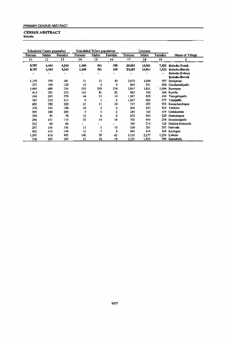
PRIMARY CENSUS ABSTRACT
CENSUS ABSTRACT Kobeda
Scheduled Castes EOEuation Persons Males Females
11 12 13
8,707 4,464 4,243 8,707 4,464 4,243
1,139 598 541 237 108 129
1,445 689 756 413 201 212 540 262 278 587 272 315 602 282 320 378 194 184 395 186 209 169 91 78 246 131 115 132 66 66 297 156 141 302 153 149
1,295 810 485 530 265 265
Scheduled Tribes EOEulation Persons Males' Females
14 15 16
1,100 541 559 1,100 541 SS9
51 21 30 13 4 9
533 259 274 163 81 82 44 25 19
9 5 4 21 11 10 10 4 6 5 3 2
12 6 6 32 14 18
15 5 10 15 7 8
140 78 ,62
37 18 19
1077
Literates Persons Males Females Name of Village
17 18 19 2
20,583 13,061 7,522 Kobeda (Total) 20,583 13,061 7,522 Koheda (Ruml)
Koheda (Urban) Koheda (Rum I)
2,673 1,686 987 Sanigaram 849 551 298 Gundareddipalle
2,947 1,851 1,096 Baswapur 962 596 366 Kurella
1,267 828 439 ThangailapaUe 1,037 660 377 Vinjapalle
717 422 295 Ramachandrapur 859 535 324 Varikolu 284 165 119 Gottalamitta 672 443 229 Narayanapur 702 444 258 Sriramulapalle 340 214 126 Nakkim Kommula 558 351 207 Pariveda 985 616 369 Kachapur
3,510 2).77 1,233 Koheda 2,221 1,422 799 Samudmla

DISTRICT CENSUS HANDBOOK: KARIM NAGAR
VILLAGE PRIMARY MandaI Parishad -
Location code llIiterates Total workers Main workers
number Name ofVill~e Persons Males Females Persons Males Females Persons Males Females 1 2 20 21 22 23 24 25 26 27 28
0050 Koheda (Toml) 24.577 9.514 15,063 25,101 12,809 12,292 21,698 11,791 9,907 0050 Koheda (Rural) 24,577 9.514 15,063 25,101 12,809 12,292 21,698 11,791 9,907 0050 Koheda (Urban)
Kobeda (Rural) 00363000 Sanigaram 2,569 1,003 1,566 2,864 1,509 1,355 2,778 1,465 1,313 00363100 Gundareddipalle 1,078 400 678 1,186 575 611 747 476 271 00363200 Baswapur 3,481 1,329 2,152 3,627 1,827 1,800 3,540 1,796 1,744 00363300 Kurella 1,391 549 842 1,393 685 708 1,298 659 639 00363400 Thangallapalle 1,739 636 1,103 1,590 808 782 1,120 639 481 00363500 Vinjapalle 1,558 601 957 1,503 751 752 1,359 728 631 00363600 Ramachandrapur 957 377 580 979 480 499 979 480 499 00363700 Varikolu 1,227 488 739 1,258 629 629 1,072 S99 473 00363800 Gottalamitta 386 163 223 420 199 221 420 199 221 00363900 Narayanapur 923 350 573 923 457 466 609 353 256 00364000 Sriramulapalle 852 324 528 870 417 453 858 407 451 00364100 Nakkira Kommula 450 171 279 481 244 237 287 199 88 00364200 Pariveda 857 336 521 761 402 359 584 336 248 00364300 Kachapur 1,088 415 673 1,134 584 550 861 518 343 00364400 Koheda 3,397 1,361 2,036 3,388 1,856 1.532 2,637 1,586 1,051 00364500 Samudrala 2,624 1,011 1,613 2,724 1,386 1,338 2,549 1,351 1,198
1078
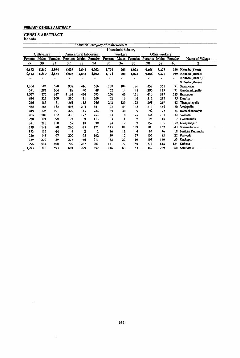
PRIMARY CENSUS ABSTRACT
CENSUS ABSTRACT Koheda
Industrial cat~0!1 of main workers Household industry
Cultivators Al1!!cultural labourers workers Other workers Persons Males Females Persons Males Females Persons Males Females Persons Males Females Name of Village
29 30 31 32 33 34 35 36 37 38 39 40 2
9,173 5,319 3,854 6,635 2,542 4,093 1,724 783 1,021 4,166 3,227 939 Koheda (Total) 9,173 5,319 3,854 6,635 2,542 4,093 1,724 703 1,021 4,166 3,227 939 Kobeda (Rural)
Koheda (Urban) Koheda (Rural)
1,164 584 580 932 416 516 230 104 126 452 361 91 Sanigaram 391 287 104 88 40 48 62 14 48 206 135 71 Gundareddipalle
1,501 87{) 637 1,163 470 693 260 69 191 610 387 223 Baswapur 634 325 309 290 81 209 62 16 46 312 237 75 Kurella 256 185 11 361 115 246 242 120 122 261 219 42 Tbangallapalle 448 266 182 595 244 351 102 54 48 214 164 SO Vinjapalle 419 228 191 429 145 284 39 30 9 92 77 15 Ramachandrapur 465 283 182 430 177 253 33 8 25 144 131 13 Varikolu 220 121 99 172 59 Il3 3 1 2 25 18 7 Gottalamitta 371 213 158 57 18 39 24 17 7 157 105 52 Narayanapur 239 141 98 216 45 171 223 84 139 180 137 43 Sriramulapalle 173 109 64 4 2 2 16 12 4 94 76 18 Nalddra Kommula 240 143 97 200 98 102 39 12 27 105 83 22 Pariveda 359 270 89 217 66 211 32 22 10 193 160 33 Kachapur 994 594 400 730 267 463 141 77 64 712 648 124 Koheda
1,293 700 593 691 299 392 216 63 153 349 289 60 Samudrala
1079

DISTRICT CENSUS HANDBOOK: KARIMNAGAR
VILLAGE PRIMARY Mandai Parisbad -
Industrial cate~0!X Location
code Marginal workers Cultivators Agricultural labourers number Name of Village Persons Males Females Persons Males Females Persons Males Females
I 2 41 42 43 44 45 46 47 48 49
0050 Koheda (Total) 3,403 1,018 2,385 311 6S 246 2,144 528 1,616 0050 Kobeda (Rural) 3,403 1,018 2,385 311 6S 246 2,144 528 1,616 0050 Kobeda (Urban)
Kobeda (Rural) 00363000 Sanigaram 86 44 42 4 2 2 51 17 34 00363100 Gundareddipalle 439 99 340 148 18 130 156 34 122 00363200 Baswapur 87 31 56 67 17 50 00363300 Kurella 95 26 69 12 5 7 55 8 47 00363400 Thangallapalle 47O 169 301 27 8 19 344 107 237 00363500 Vinjapalle 144 23 121 28 5 23 77 13 64 00363600 Ramachandrapur 00363700 Van"kolu 186 30 156 2 2 04 18 116 00363800 GottaIamitta 00363900 Narayanapur 314 104 210 3 2 293 97 196 00364000 Sriramulapalle 12 10 2 4 2 2 00364100 Nakkira Kommula 194 45 149 12 II 170 38 132 00364200 Pariveda 177 66 1I1 2 2 159 54 105 00364300 Kachapur 273 66 207 29 7 22 223 45 178 00364400 Koheda 751 270 481 36 16 20 270 51 219 00364500 Samudrala 175 35 140 7 6 141 27 114
1080

PRIMARY CENSUS ABSTRACT
CENSUS ABSTRACT Kobeda
of marsinal workers Location
Household industry workers Other workers Non~workers code
Persons Males Females Persons Males Females Persons Males Females Name ofVill~e number
50 51 52 53 54 55 56 57 58 2
286 56 230 662 369 293 20,059 9,766 10,293 Koheda (Total) 0050 286 56 230 662 369 293 20,059 9,766 10,293 Koheda (Rural) 0050
Koheda (Urban) 0050 Koheda (Rural)
4 3 27 22 5 2,378 1,180 1,198 Sanigaram 00363000 26 10 16 109 37 72 741 376 365 Gundareddipalle 00363100 5 1 4 14 13 I 2,801 1,353 1,448 Baswapur 00363200
11 3 8 17 10 7 960 460 500 Kurella 00363300 45 21 24 54 33 21 1,416 656 760 ThangaUapaIle 00363400 31 31 8 5 3 1,092 510 582 Vinjapalle 00363500 .
695 319 376 Ramachandrapur 00363600 39 3 36 II 9 2 828 394 434 Varikolu 00363700
250 129 121 Gottalamitta 00363800 7 6 11 4 7 672 336 336 Narayanapuf 00363900
8 8 684 351 333 Sriramulapalle 00364000 3 2 9 4 5 309 141 168 Nakkira Kommula 00364100 2 1 14 II 3 654 285 369 Pariveda 00364200 6 6 IS 14 939 447 492 Kachapur 00364300
98 IV 88 347 193 154 3,519 1,782 1,737 Koheda 00364400 9 8 18 6 12 2,121 1,047 1,074 Samudrala 00364500
1081
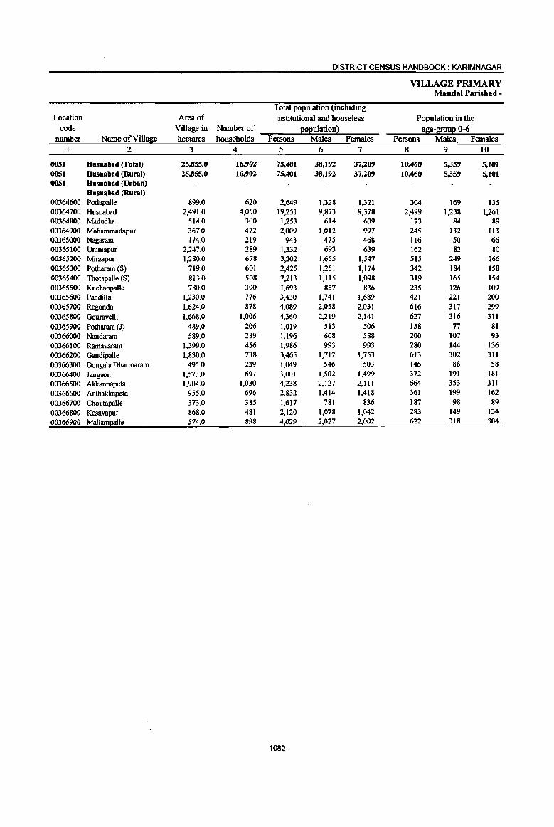
DISTRICT CENSUS HANDBOOK: KARIMNAGAR
VILLAGE PRIMARY Mandai Parishad -
Total population (including Location Area of institutional and houseless Population in the
code Village in Number of 2°Eulation} age-l[ouE 0-6 number Name of Village hectares households Persons Males Females Persons Males Females
1 2 3 4 5 6 7 8 9 10
0051 Husnabad (Total) 25,855.0 16,902 75,401 38,192 37,209 10,460 5,359 5,101 0051 Husnabad (Rural) 25,855.0 16,902 75,401 38,192 37,209 10,460 5,359 5,101 0051 Husnabad (Urban)
Husnabad (Rural) 00364600 PotlapaUe 899.0 620 2,649 1,328 1,321 304 169 135 00364700 Husnabad 2,491.0 4,050 19,251 9,873 9,378 2,499 1,238 1,261 00364800 Madudha 514.0 300 1,253 614 639 173 84 89 00364900 Moharnmadapur 367.0 472 2,009 1,012 997 245 132 113 00365000 Nagaram 174.0 219 943 475 468 116 50 66 00365100 Ummapur 2,247.0 289 1,332 693 639 162 82 80 00365200 Mirzapur 1,280.0 678 3,202 1,655 1,547 515 249 266 00365300 Potharam (S) 719.0 601 2,425 1,251 1.174 342 184 158 00365400 Thotapalle (S) 813.0 508 2,213 1,115 1,098 319 165 154 00365500 Kuchanpalle 780.0 390 1,693 857 836 235 126 109 00365600 Pandilla 1,230.0 776 3,430 1,741 1,689 421 221 200 00365700 Regonda 1,624.0 878 4,089 2,058 2,031 616 317 299 00365800 Gouravelli 1,668.0 1,006 4,360 2,219 2,141 627 316 311
00365900 Potharam (J) 489.0 206 1,019 513 506 158 77 81 00366000 Nandaram 589.0 289 1,196 608 588 200 107 93 00366100 Ramavaram 1,399.0 456 1,986 993 993 280 144 136
00366200 Gandipalle 1,830.0 738 3,465 1,712 1,753 613 302 311
00366300 OongaJa Dharmararn 495.0 239 1,049 546 503 146 88 58
00366400 Jangaon 1,573.0 697 3,001 1,502 1,499 372 191 181
00366500 Akkannapeta 1,904.0 1,030 4,238 2,127 2,111 664 353 311
00366600 Anthakkapeta 955.0 696 2,832 1,414 1.418 361 199 162
00366700 Choutapalle 373.0 385 1,617 781 836 187 98 89
00366800 Kesavapur 868.0 481 2,120 1,078 1,042 283 149 134
00366900 Mallaml!a1le 574.0 898 4,029 2,027 2,002 622 318 304
1082
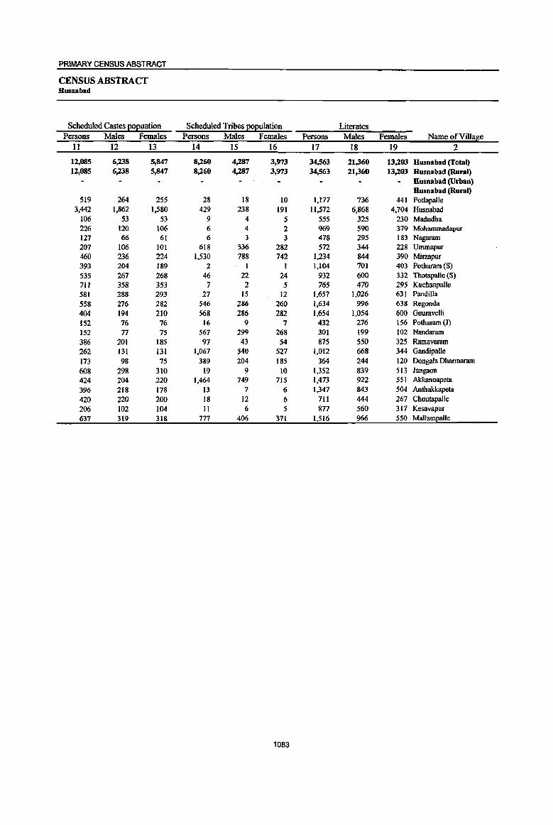
PRIMARY CENSUS ABSTRACT
CENSUS ABSTRACT Husnabad
Scheduled Castes I!ol!uation Scheduled Tribes l!ol!uIation Literates Persons Males Females Persons Males Females Persons Males Females Name of Village
11 12 13 14 15 16 17 18 19 2
12,085 6,238 5,847 8,260 4,287 3,973 34,563 21,360 13,203 Husnabad (Total) 12,085 6,238 5,847 8,260 4,287 3,973 34,563 21,360 13,203 Husnabad (Rural)
HU5nabad (Urban) Husnabad (Rural)
519 264 255 28 18 10 1,177 736 441 Potlapalle 3,442 1,862 1,580 429 238 191 11,572 6,868 4,704 Husnabad
106 53 53 9 4 5 555 325 230 Madudha 226 120 106 {) 4 2 969 590 379 Mohammadapur 127 66 61 6 3 3 478 295 183 Nagaram 207 106 101 618 336 282 572 344 228 Ummapur 460 236 224 1,530 788 742 1,234 844 390 Mirzapur 393 204 189 2 1 1 1,104 701 403 Potharam (S)
535 267 268 46 22 24 932 600 332 Thotapalle (5)
7IJ 358 353 7 2 5 765 470 295 Kuchanpalle 581 288 293 27 15 12 1,657 1,026 631 Pandilla
558 276 282 546 286 260 1,634 996 638 Regonda
404 194 210 568 286 282 1,654 1,054 600 Gouravelli
152 76 76 16 9 7 432 276 156 Potharam (1)
152 77 75 567 299 268 301 199 102 Nandaram
386 201 185 97 43 54 875 550 325 Ramavaram
262 131 131 1,067 540 527 1,012 668 344 Gandipal1e
173 98 75 389 204 185 364 244 120 Dongata Dharmaram
608 298 310 19 9 10 1,352 839 513 Jangaon
424 204 220 1,464 749 715 1,473 922 551 Akkannapeta
396 218 178 13 7 6 1,347 843 504 Anthakkapeta
420 220 200 18 12 6 711 444 267 Choutapalle
206 102 104 II 6 5 877 560 317 Kesavapur
637 319 318 777 406 371 1,516 966 550 Mallampalle
1083

DISTRICT CENSUS' HANDBOOK : KARIMNAGAR
VILLAGE PRIMARY Mandai Parishad •
Location
code llliterates Total workers Main workers number Name ofVillase Persons Males Females Persons Males Females Persons Males Females
1 2 20 21 22 23 24 25 26 27 28
0051 Husnabad (Total) 40,838 16,832 24,006 37,249 20,758 16,491 29,494 18,161 11,333 0051 Husnabad (Rural) 40,838 16,832 24,006 37,249 20,758 16,491 29,494 18,161 11,333 0051 Husuabad (Urban)
Husnabad (Rural) 00364600 Potlapalle 1,472 592 880 1,345 740 605 1,286 723 563 00364700 Husnabad 7,679 3,005 4,674 6,919 4,749 2,170 6,006 4,322 1,684 00364800 Madudha 698 289 409 757 374 383 516 350 166 00364900 Mohammadapur 1,040 422 618 1,017 576 441 683 472 211 00365000 Nagaram 465 180 285 549 282 267 393 232 161 00365100 Ummapur 760 349 411 656 362 294 642 359 283 00365200 MirzapUf 1,968 811 1,157 1,732 881 851 1,345 709 636 00365300 Potharam (S) 1,321 550 771 1,337 721 616 605 462 143 00365400 Thotapalle (S) 1,281 515 766 1,189 614 575 750 451 299 00365500 Kuchanpalle 928 387 541 958 495 463 942 488 454 00365600 Pandilla 1,773 715 1,058 1,931 979 952 1,660 907 753 00365700 Regonda 2,455 1,062 1,393 2,306 1,214 l,W2 1,319 895 424 00365800 Gouravelli 2,706 1,165 1,541 2,379 1,255 1,124 1,717 994 723 00365900 Potharam (1) 587 237 350 571 307 264 559 303 256 00366000 Nandaram 895 409 486 696 356 340 542 311 231 00366100 Ramavaram 1,111 443 668 1,049 558 491 911 522 389 00366200 Gandipalle 2,453 1,044 1,409 1,818 973 845 1,343 845 498 00366300 Dongala Dhannaram 685 302 383 606 301 305 474 243 231 00366400 Jangaon 1,649 663 986 1,665 877 788 1,511 824 687 00366500 Akkannapeta 2,765 1,205 1,560 2,226 1,197 1,029 2,168 1,183 985 00366600 Anthakkapeta 1,485 571 914 1,467 781 686 1,365 773 592 00366700 Choutapalle 906 337 569 753 449 304 536 405 131 00366800 Kesavapur 1,243 518 725 1,131 584 547 578 391 187 00366900 MallamEalle 2,513 1,061 1,452 2,192 1,133 1,059 1,643 997 646
1084

PRIMARY CENSUS ABSTRACT
CENSUS ABSTRACT Husnabad
Industrial cate~0!1 of main workers Household industry
Cultivators Agricultural labourers workers Other workers Persons Males Females Persons Males Females Persons Males Females Persons Males Females Name ofViUage
29 30 31 32 33 34 35 36 37 38 39 40 2
13,591 8,569 5,022 8,045 3,383 4,662 1,168 739 429 6,690 5,470 1,220 Husnabad (Total) 13,591 8,569 5,022 8,045 3,383 4,662 1,168 739 429 6,690 5,470 1,220 Husnabad (Rural)
Husnabad (Urban) Husnabad (Rural)
323 237 86 621 198 423 41 26 15 301 262 39 Potlapalle 875 625 250 1,804 963 841 388 275 113 2,939 2,459 480 Husnabad 301 230 71 105 30 75 6 2 4 104 88 16 Madudha 416 299 117 95 34 61 5 4 I 167 135 32 Mohammadapur 192 120 72 126 51 75 42 30 12 33 31 2 Nagaram 456 255 201 164 85 79 2 I 1 20 18 2 Ummapur 848 453 395 309 121 188 25 15 10 163 120 43 Mirzapur
266 207 59 120 56 64 30 23 7 189 176 13 Potharam (8) 328 226 102 238 81 157 54 37 17 130 107 23 Thotapalle (8) 258 150 108 459 174 285 41 25 . 16 184 139 45 Kuchanpalle 603 406 197 631 190 441 23 17 6 403 294 109 Pandilla
1,007 683 324 106 51 55 15 7 8 191 154 37 Regonda 943 563 380 567 279 288 31 20 n 176 132 44 Gouravelli 380 200 180 123 63 60 17 4 13 39 36 3 Potharam (J) 323 199 124 172 75 97 10 8 2 37 29 8 Nandaram 407 226 181 205 72 133 50 26 24 249 198 51 Ramavaram 759 594 165 401 117 284 79 46 33 104 88 16 Gandipa1le 409 207 202 33 13 20 2 I 1 30 22 8 Dongala Dhannaram 670 348 322 465 206 259 31 19 12 345 251 94 Jangaon
1,520 852 668 386 137 249 38 28 10 224 166 58 Akkannapeta 456 302 154 506 208 298 185 87 98 218 176 42 Anthakkapeta 245 201 44 182 103 79 4 2 2 105 99 6 Choutapalle 418 289 129 73 25 48 33 31 2 54 46 8 Kesavapur
1,188 697 491 154 51 103 16 5 II 285 244 41 Mallampalle
1085
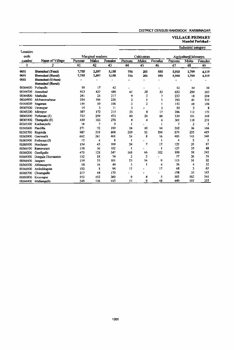
DISTRICT CENSUS HANDBOOK: KARIMNAGAR
VILLAGE PRIMARY Mandai Parishad •
Industrial cateS0!I Location
code Marginal workers Cultivators Agricultural labourers number Name ofViU!!Se Persons Males Females Persons Males Females Persons Males Females
1 2 41 42 43 44 45 46 47 48 49
0051 Husnabad (Total) 7,755 2.,597 5,158 756 201 555 5,918 1,799 4,119 0051 HusDabad (Rural) 7,755 2,597 5,158 756 201 555 5,918 1,799 4,119 0051 HusDabad (Urban)
Husnabad (Rural) 00364600 Potlapalle 59 17 42 52 14 38 00364700 Husnabad 913 427 486 61 28 33 653 290 363 00364800 Madudha 241 24 217 9 2 7 222 18 204 00364900 Mohammadapur 334 104 230 2 1 293 81 212 00365000 Nagaram 156 50 106 3 2 I 152 48 104 00365100 Ummapur 14 3 11 3 3 10 2 8 00365200 Mirzapur 387 172 215 25 8 17 286 111 175 00365300 Potharam (S) 732 259 473 80 20 60 539 191 348 00365400 ThotapalJe (8) 439 163 276 8 4 4 361 110 251 00365500 Kuchanpalle 16 7 9 7 2 5 00365600 Pandilla 271 72 199 24 10 14 202 36 166 00365700 Regonda 987 319 668 209 15 194 674 255 419 00365800 Gouravelli 662 261 401 24 8 16 483 143 340 00365900 Potharam (J) 12 4 8 4 2 2 00366000 Nandaram 154 45 109 24 7 17 122 35 87 00366100 Ramavaram 138 36 102 1 1 123 35 88 00366200 Gandipalle 475 128 347 168 66 102 300 58 242 00366300 Dongala Dharmaram 132 58 74 2 2 77 26 51 00366400 Jangaon 154 53 101 23 14 9 113 31 82 00366500 Akkannapeta 58 14 44 5 4 36 4 32 00366600 Anthakkapeta 102 8 94 17 17 68 3 65 00366700 Choutapalle 217 44 173 198 35 163 00366800 Kesavapur 553 193 360 9 4 5 503 162 341 00366900 Mal1am2alle 549 136 413 57 9 48 440 107 333
1086

1087
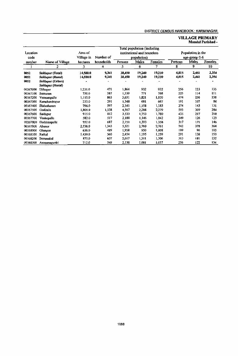
DISTRICT CENSUS HANDBOOK: KARIM NAGAR
VILLAGE PRIMARY Mandai Parishad -
Total population (including Location Area of institutional and houseless Population in the
code Village in Nwnberof Eo):!ulationl a8e-l[ouE 0-6 nwnber Name ofVill~e hectares households Persons Males Females Persons Males Females
1 2 3 4 5 6 7 8 9 10
0052 Saidapur (Total) 14,580.0 9,341 38,450 19,240 19,210 4,815 2,461 2,354
0052 Saidapur (Rural) 14,580.0 9,341 38,450 19,240 19,210 4,815 2,461 2,354
0052 Saidapur (Urban) Saidapur (Rural)
00367000 Eklaspur 1,231.0 471 1,864 932 932 256 123 133 00367100 Somaram 750.0 387 1,539 771 768 225 114 III 00367200 Vennampalle 1,115.0 863 3,631 1,821 1,810 474 236 238 00367300 Ramchandrapur 233.0 291 1,348 681 667 191 107 84
00367400 Elabotharam 796.0 597 2,341 1,158 1,183 274 143 131 00367500 Godisala 1,806.0 1,138 4,567 2,288 2,279 593 309 284 00367600 Saidapur 915.0 812 3,533 1,753 1,780 435 217 218 00367700 Venkepalle 582.0 517 2,188 1,146 1,042 249 126 123 00367800 Duddenapalle 952.0 687 2,751 1,393 1,358 317 171 146 00367900 Akunur 2,538.0 1,343 5,521 2,760 2,761 742 378 364 00368000 Ghanpur 636.0 489 1,958 950 1,008 199 96 103 00368100 Raikal 1,439.0 560 2,454 1,195 1,259 291 138 153 00368200 Bommakal 875.0 637 2,617 1,311 1,306 313 181 132
00368300 Ammana~rthi 712.0 549 2,138 1,081 1,057 256 122 134
1088
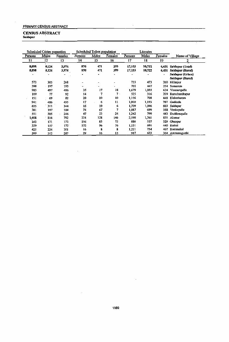
PRIMARY CENSUS ABSTRACT
CENSUS ABSTRACT Saidapur
Scheduled aistes EOEuation Scheduled Tribes ~ulatioil Literates Persons Males Females Persons Males Females Persons Males Females Name of Village
11 1:2 I:? 14 15 16 17 18 19 2
8,098 1',124 3,974 870 471 399 17,153 10,722 6,431 Saidapur (Total) 8,098 :4,124 3,974 870 471 399 17,153 10,722 6,431 Saidapur (Rural)
Saidapur (Urban) Saidapur (Rural)
573 305 268 733 473 260 Eklaspur 390 197 193 701 447 254 Somaram 983 497 486 35 17 18 1,679 1,055 624 Vennampalle 169 77 92 14 7 7· 525 316 209 Ramchandrapur 151 69 82 20 10 10 1,156 708 448 Elabotharam 941 486 455 17 6 11 1,900 1,193 707 Godisala 655 311 344 16 10 6 1,709 1,046 663 Saidapur 381 197 184 74 67 7 1,087 699 388 Venkepalle 551 305 246 47 23 24 1,242 799 443 Duddenapalle
1,608 816 792 274 128 146 2,196 1,361 835 Akunur 343 171 172 156 83 73 886 557 329 Ghanpur 329 157 172 172 96 76 1,131 691 440 Raikal
425 224 201 16 8 8 1,221 754 467 Bommakal 599 312 287 29 16 13 987 623 364 Ammanagurthi
1089

DISTRICT CENSUS HANDBOOK: KARIM NAGAR
VILLAGE PRIMARY Mandai Parisbad •
Location code Illiterates Total workers Main workers
number Name of ViII age Persons Males Females Persons Males Females Persons Males Females I 2 20 21 22 23 24 25 26 27 28
0052 Saidapur (Total) 21,297 8,518 12,779 20,279 10,860 9,419 14,612 9,011 5,601 0052 Saidapur (Rural) 21,297 8,518 12,779 20,279 10,860 9,419 14,612 9,011 5,601 0052 Saidapur (Urban)
Saidapur (Rural) 00367000 Eklaspur 1,131 459 672 1,013 544 469 532 434 98 00367100 Somaram 838 324 514 810 426 384 535 368 167 00367200 Vennampalle 1,952 766 1,186 2,113 1,107 1,006 1,354 968 386 00367300 Ramcbandrapur 823 365 458 730 373 357 729 372 357 00367400 Elaootharam 1,185 450 735 1,232 669 563 944 565 379 00367500 Godisala 2,667 1,095 1,572 2,568 1,341 1,227 2,473 1,308 1,165 00367600 Saidapur 1,824 707 1,117 1,620 910 710 1,188 733 455 00367700 Veokepalle 1,101 447 654 966 595 371 486 362 124 00367800 Duddenapalle 1,509 594 915 1,384 735 649 1,332 713 619 00367900 Akunur 3,325 1,399 1,926 2,990 1,575 1,415 1,786 1,128 658 00368000 Ghanpur 1,072 393 679 1,187 567 620 892 475 417 00368100 Raikal 1,323 504 819 1,291 688 603 801 475 326 00368200 Bommakal 1,396 557 839 1,235 712 523 831 618 213 00368300 Ammanagurthi 1,151 458 693 1,140 618 522 729 492 237
1090
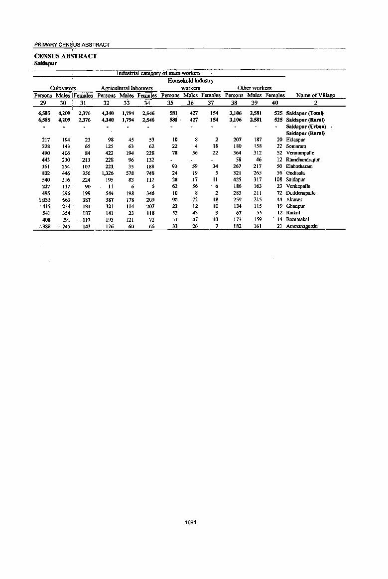
PRIMARY CENSUS ABSTRACT
CENSUS ABSTRACT Saidapur
Industrial cate~0!l: of main workers Household industry
Cultivatoit's Agricultural labourers workers Other workers Persons Males I Females Persons Males Females Persons Males Females Persons Males Females Name of Village
29 30 ,
31 32 33 34 35 36 37 38 39 40 2
6,585 4,209 2,376 4,340 1,794 2,546 581 427 154 3,106 2,581 525 Sa ida pur (Total) 6;585 4,209 2,376 4,340 1,794 2,546 581 ' 427 154 3,106 2,581 525 Saidapur (Rural)
Saidapur (Urban). Saidapur (Rural)
217 194 23 98 45 53 10 8 2 207 187 20 Eklaspur 208 143 65 125 63 62 22 4 18 180 158 22 Sor_naram 490 406 84 422 194 228 78 56 22 364 312 52 Vennarnpalle 443 230 213 228 96 132 58 46 12 Ramchandrapur 361 254 107 223, 35 188 93 59 34 267 217 50 Elabotharam 802 446 356 1,326 578 748 24 19 5 321 265 56 Godisala 540 316 224 195 83 112 28 17 11 425 317 108 Saidapur 227 137 90 11 6 5 62 S6 6 186 163 23 Venkepalle 495 296 199 544 198 346 10 8 2 283 211 72 Duddenapalle
\,050 663 387 387 \78 209 90 72 18 259 215 44 Akunur , 415 234 ' 181 321 114 207 22 12 10 134 115 19 Ghanpur ,
541 354 187 141 23 118 52 43 9 67 55 12 Raikal
408 291 /117 193 121 72 57 47 10 173 159 ' 14 Bommakal '.",.388 . ~. 245 143 126 60 66 33 26 7 182 161 21 Ammanagurthi
1091
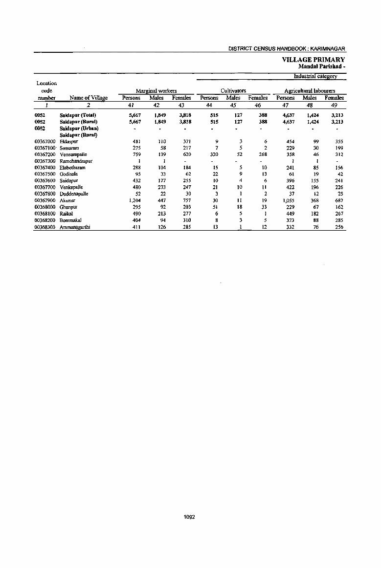
DISTRICT CENSUS HANDBOOK: KARIMNAGAR
VILLAGE PRIMARY Mandai Parisbad -
Industrial cate~0!X Location
code Mar~inaJ workers Cultivators Agricultural labourers number Name ofVillase Persons Males Females Persons Males Females Persons Males Females
] 2 4] 42 43 44 45 46 47 48 49
0052 Saidapur (Total) 5,667 1,849 3,818 515 127 388 4,637 1,424 3,213 0052 Saidapur (Rural) 5.667 1,849 3,818 515 127 388 4,637 1,424 3.213 OOSl Saidapur (Urban)
Saidapu .. (Rural) 00367000 Eklaspur 481 1I0 371 9 3 6 454 99 355 00367100 Somaram 275 58 217 7 5 2 229 30 199 00367200 Vennampalle 759 )39 620 320 52 268 358 46 312 00367300 Ramcbandrapur I I I I 00367400 Elabotharam 288 104 184 15 5 10 241 85 156 00367500 Godisala 95 33 62 22 9 13 61 19 42 00367600 Saidapur 432 177 255 10 4 6 396 155 241 00367700 Venkepalle 480 233 247 21 10 11 422 196 226 00367800 Duddenapalle 52 22 30 3 1 2 37 12 25 00367900 Akunur 1,204 447 757 30 11 19 1,055 368 687 00368000 Ghanpur 295 92 203 51 18 33 229 67 162 00368100 Raikal 490 213 277 6 5 1 449 182 267 00368200 Bommakal 404 94 310 8 3 5 373 88 285 00368300 Amrnanagurthi 411 126 285 13 1 12 332 76 256
1092
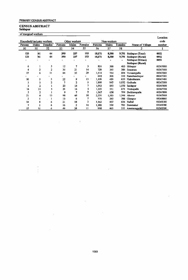
PRIMARY CENSUS ABSTRACT
CENSUS ABSTRACT Saidapur
of marginal woikers Location
Household indus!!! workers Other workers Non-workers code Persons Males Females- Persons Males Females Persons Males Females Name of Vill~e number
50 51; 52 53 54 55 56 57 58 2 1
125 i61 64 390 237 153 18,171 8,380 9,791 Saidapur (fotal) 0052 125 ~I 64 390 237 153 18,171 8,380 9,791 Saidapur (Rural) 0052
Saidapur (Urban) 0052 Saidapur (Rural)
6 5 12 7 5 851 388 463 Eklaspur 00367000 4 2 2 35 21 14 729 345 384 Somaram 00367100
17 6 11 64 35 29 1,518 714 804 Vennampalle 00367200 618 308 310 Ramchandrapur 00367300
10 5 5 22 9 13 1,109 489 620 Elabotharam 00367400 5 3 2 7 2 5 1,999 947 l,os2 Godisala 00367500 3 2 1 23 16 7 1,913 843 1,070 Swdapur 00367600
16 ~11 5 21 16 5 1,222 551 671 Venkepalle 00367700 3 2 1 9 7 2 1,367 658 709 Duddenapalle 00367800
21 8 13 98 60 38 2,531 1,185 1,346 Akunur 00367900 2 I I 13 6 7 771 383 388 Gltanpur 00368000
14 8 6 21 18 3 1,163 507 656 Raikal 00368100 7 6 16 2 14 1,382 599 783 Bommakal 00368200
17 II 6 49 38 11 998 463 535 Ammanagurthi 00368300
1093

DISTRICT CENSUS HANDBOOK: KARIM NAGAR
VILLAGE PRIMARY Mandai Parisbad -
Total population (including Location Area of institutional and houseless Population in the
code Village in Number of EOEulation~ age-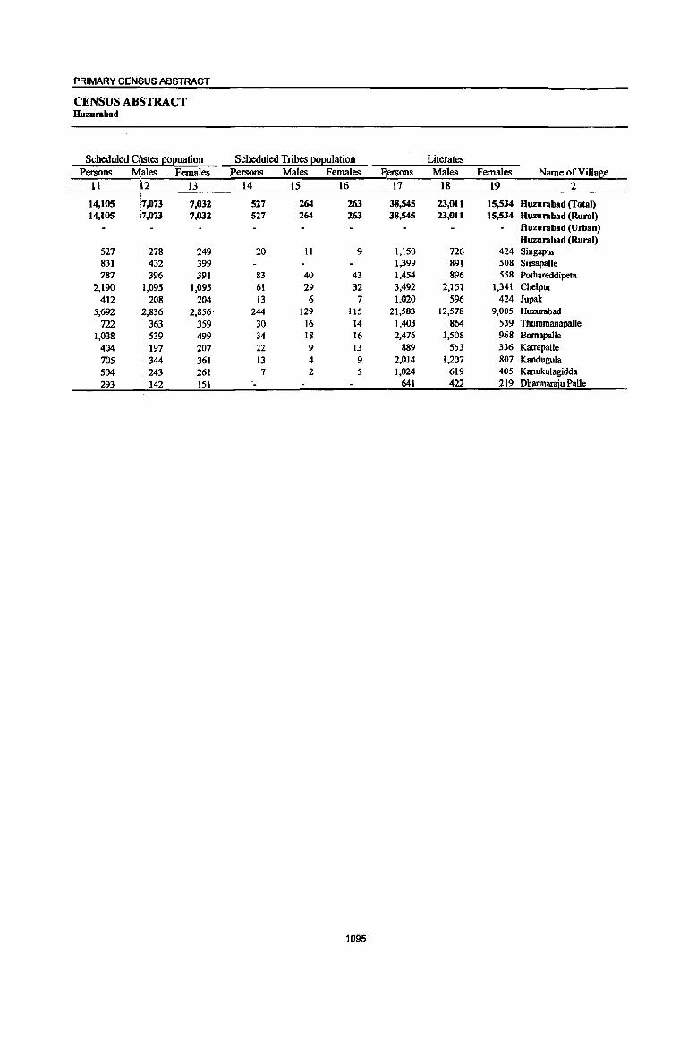
PRIMARY CENSUS ABSTRACT
CENSUS ABSTRACT Huzurabad
Scheduled C(lstes Eoeuation Persons M'ales Females
II i2 13
14,105 '7,073 7,032 14,105 i7,073 7,032
527 278 249 831 432 399 787 396 391
2,190 ;1,095 1,095 412 208 204
5,692 ~,836 2,856 722 363 359
1,038 539 499 404 197 207 705 344 361 504 .243 261 293 142 151
Scheduled Tribes EOl!ulation Persons Males Females
14 IS 16
527 264 263 527 264 263
20 II 9
83 40 43 61 29 32 13 6 7
244 129 lIS 30 16 14 34 18 16 22 9 l3
13 4 9 7 2 5
-_
1095
Literates Pjersons Males Females Name of Village
17 18 19 2
38,545 23,011 15,534 Huzurabad (Total) 38,545 23,011 15,534 Huzurabad (Rural)
Huzurabad (Urban) Huzurabad (Rural)
l,l50 726 424 Singaput 1,,399 891 508 Sirsapalle 1,454 896 558 Pothareddipeta 3,492 2,151 1,341 Chelpur 1,020 596 424 Jupak
21,583 12,578 9,005 Huzurabad 1,403 864 539 Thummanapalle 2,476 1,508 968 Bomapalle
889 553 336 Katrepalle 2,014 1,207 807 Kandugula 1,024 619 405 Kanukulagidda
641 422 219 Dharmanvu Palle

DISTRICT CENSUS HANDBOOK: KARIMNAGAR
VILLAGE PRIMARY Mandai Parish ad -
Location code Illiterates Total workers Main workers
number Name ofVill~e Persons Males Females Persons Males Females Persons Males Females I 2 20 21 22 23 24 25 26 27 28
0053 Huzurabad (Total) 32,656 12,916 19,740 32,510 19,193 13,317 28,288 17,969 10,319 0053 Huzurabad (Rural) 32,656 12,916 19,740 32,510 19,193 13,317 28,288 17,969 10,319 0053 Huzurabad (Urban)
Huzurabad (Rural) 00368400 Singapur 1,307 553 754 1,296 723 573 1,261 716 545 00368500 Sirsapalle 1,603 642 961 1,518 822 696 1,340 743 597 00368600 Pothareddipeta 2,127 927 1,200 2,023 1,065 958 1,866 1,029 837 00368700 ChelpuT 3,774 1,482 2,292 3,639 1,986 1,653 2,680 1.852 828 00368800 Jupak 992 419 573 1,192 607 585 1,184 604 580 00368900 Huzurabad 13,997 5,469 8.528 14,126 9.181 4,945 12,881 8,770 4,111 00369000 Thummanapalle 1,428 547 881 1,505 810 695 1,449 788 661 00369100 Bornapalle 2,145 837 1,308 2,088 1,241 847 1,657 J,036 621 00369200 Katrepalle 1,024 403 621 998 543 455 748 478 270 00369300 Kandugula 2,226 867 1,359 2,203 1,155 1,048 1,382 919 463 00369400 Kanulrulagidda 983 354 629 1,068 586 482 1,037 578 459 00369500 Dhannaraju Palle 1,050 416 634 854 474 380 803 456 347
1096
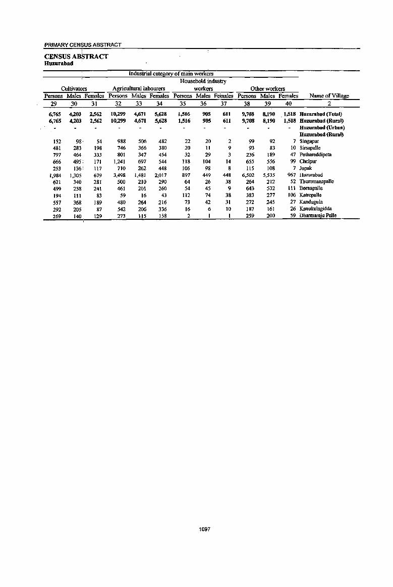
PRIMARY CENSUS ABSTRACT
CENSUS ABSTRACT Huzurabad
Industrial categ0!I of main workers
Household industry
CultivatQIS Agricultural labourers workers Other workers Persons Males . Females Persons Males Females Persons Males Females Persons Males Females Name of Village
29 30 31 32 33 34 35 36 37 38 39 40 2
. 6,765 4,203 2,562 10,299 4,671 5,628 1,516 905 611 9,708 8,190 1,518 Huzurabad (Total) 6,765 4,203 2,562 10,299 4,671 5,628 1,516 905 611 9,708 8,190 1,518 Huzurabad (Rural)
Huzurabad (Urban) Huzurabad (Rilral)
IS2 98 S4 988 506 482 22 20 2 99 92 7 Singapur 481 283 198 746 366 380 20 11 9 93 83 10 Sirsapalie 797 464 333 801 347 454 32 29 3 236 189 47 Pothareddipeta
666 495 171 1,241 697 544 118 104 14 655 556 99 Chelpur 253 IW 117 710 262 448 106 98 8 liS 108 7 Jupak
1,984 1,305 679 3,498 1,481 2,017 897 449 448 6,502 5,535 967 Huzurabad
621 340 281 500 210 290 64 26 38 264 212 52 ThummanapaUe
499 258 241 461 201 260 54 45 9 643 532 III BornapaUe
194 III 83 59 16 43 112 74 38 383 277 106 Katrepalle
557 368 189 480 264 216 73 42 31 272 245 27 Kandugula
292 205 87 542 206 336 16 6 10 187 161 26 Kanlllrulagidda
269 140 129 273 115 158 2 259 200 59 Dhannaraju Palle
1097
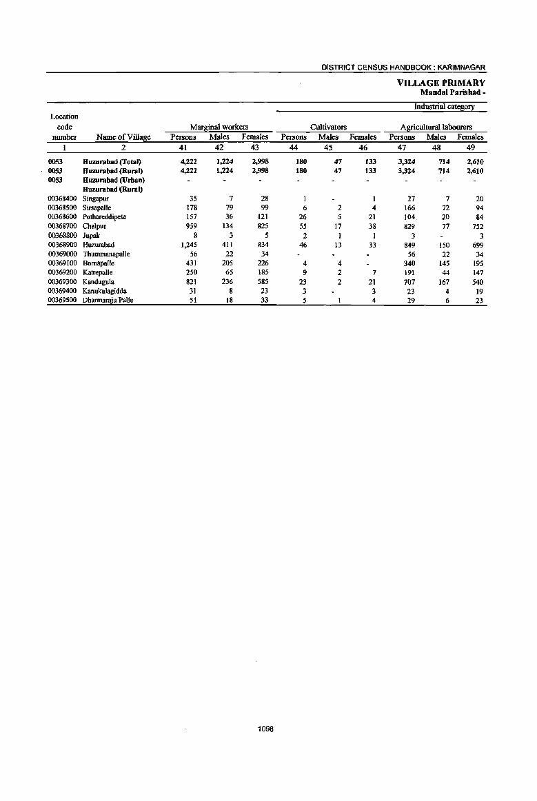
DISTRICT CENSUS HANDBOOK: KARIMNAGAR
VILLAGE PRIMARY Mandai Parishad -
Industrial cateS0!l: Location
code Marginal workers Cultivators Agricultural labourers number Name of ViUaBe Persons Males Females Persons Males Females Persons Males Females
1 2 41 42 43 44 45 46 47 48 49
0053 Huzurabad (Total) 4,222 1,224 2,998 180 47 133 3,324 714 2,610 0053 Huzurabad (Rural) 4,222 1,224 2,998 180 47 133 3,324 714 2,610 0053 Huzurabad (Urban)
Huzurabad (Rural) 00368400 Singapur 35 7 28 1 1 27 7 20 00368500 Sirsapalle 178 79 99 6 2 4 166 72 94 0036&600 Pothareddipeta 157 36 121 26 5 21 104 20 &4 00368700 Chelpur 959 134 825 55 17 38 829 77 752 00368800 Jupak 8 3 5 2 1 I 3 3 00368900 Huzurabad 1,245 411 834 46 13 33 849 150 699 00369000 Thummanapalle 56 22 34 56 22 34 00369100 Bornapalle 431 205 226 4 4 340 145 195 00369200 Katrepalle 250 65 185 9 2 7 191 44 147 00369300 Kandugula 821 236 585 23 2 21 707 167 540 00369400 KanukuJagidda 31 8 23 3 3 23 4 19 00369500 Dharmar:2u Palle 51 18 33 5 4 29 6 23
1098

PRIMARY CENSUS ABSTRACT
CENSUS ABSTRACT Huzurabad
of mars!!!al wOlokers Location
Household indUs!!! workers Other workers Non-workers code Persons Males Females Persons Males Females Persons Males Females Name ofYillage number
50 51 52 53 54 55 56 51 58 2 1
ISS 61 94 563 402 161 38,691 16,734 21,957 Huzurabad (Total) 0053 155 61 94 563 402 161 38.,691 16,734 21,957 Huzurabad (Rural) 0053
Huzurabad (Urban) 0053 Huzurabad (Rural)
2 2 5 5 1,161 556 605 Singapur 00368400 6 5 1,484 711 773 Sirsapalle 00368500
7 3 4 20 8 12 1,558 758 800 Pothareddipeta 00368600 15 3 12 60 37 23 3,627 1,647 1,980 Chelpur 00368700
3 2 1 820 408 412 'Jupak 00368800 83 33 50 267 215 52 21,454 8,866 12,588 Huzurabad 00368900
1)26 601 725 Thummanapalle 00369000 I 86 56 30 2.533 1,104 1,429 Bomapalle 00369100
18 3 15 32 16 16 915 413 502 Katrepalle 00369200 27 19 8 64 48 16 2,037 919 1,118 Kandugula 00369300
1 I 4 4 939 387 552 Kanukulagidda 00369400 1 16 11 5 831 364 473 Dharmaraju Palle 00369500
1099

DISTRICT CENSUS HANDBOOK: KARIMNAGAR
VILLAGE PRIMARY MandaI Parishad -
Total population (including Location Area of institutional and houseless Population in the
code Village in Number of l!oEulation l !.S.e-8!0uE 0-6 number Name ofViU~e hectares households Persons Males Females Persons Males Females
I 2 3 4 5 6 7 8 9 10
0054 Kamalapur 16,173.0 14,Jll 59,466 29,964 29,502 8,167 4,086 4,081 0054 Kamalapur 16,173.0 14,322 59,466 29,964 29,502 8,167 4.086 4.081 0054 Kamalapur
00369600 Bhimpalle 618.0 764 2,979 1,499 1,480 386 201 185 00369700 Kannur 941.0 757 2,971 1,473 1,498 392 171 221 00369800 Gunded 717.0 456 1,954 970 984 283 142 141 00369900 Marripalligudem 1,452.0 1,174 4,584 2,323 2,26] 637 339 298 00370000 Jujnoor 492.0 49 200 101 99 21 10 11 00370100 Sanigaram 1,433.0 1,339 5.535 2,809 2,726 726 387 339 00370200 VangapaUe 1,821.0 1,237 4,728 2,365 2,363 669 350 319 00370300 KamalapUT 1,316.0 2,417 10,593 5,387 5,206 1,503 729 774 00370400 Uppal 1,799.0 1,425 6,475 3,248 3,227 910 462 448 00370500 Desbarajpalle 575.0 362 1,572 793 779 202 9() 112 003~0600 Kaniparthi 1,284.0 758 3,136 1,569 1,567 442 203 239 00370700 Gudur 1,150.0 872 3,610 1,803 1,807 487 227 260 00370800 Ambala 1,190.0 1,404 5,929 2,986 2,943 789 406 383 00370900 Nerella 670.0 437 1,730 887 843 235 131 104 00371000 Madannapeta 338.0 530 2,119 1,080 1,039 322 161 161 00371100 Guniearthi 377.0 341 1,351 671 680 163 77 86
1100
PRIMARY CENSUS ABSTRACT
CENSUS ABSTRACT Kamalapur
Scheduled Castes E2I!uation Scheduled Tribes Eopulation Literates Persons Males Females Persons Males Females Persons Males Females Name of Village
11 12 13 14 15 16 17 18 19 2
11,615 [5,893 5,722 275 144 131 27,203 17,293 9,910 Kamalapur 11,615 :5,893 5,722 275 144 131 27,203 17,293 9,910 Kamalapur
Kamalapur
499 263 236 15 8 7 1,271 805 466 BhimpalJe 632 308 324 45 23 22 1,363 847 516 Kannur 213 102 III 829 545 284 Gunded
1,1I0 559 551 12 4 8 1,974 1,293 681 Marripalligudem 83 54 29 Jujnoor
801 408 393 17 I{) 7 2,633 1,653 980 Sanigaram 1,273 644 629 1,707 1,124 583 VangapaIle 1,807 916 891 61 32 29 5,298 3,338 1,960 Kamalapur 1,218 637 581 77 40 37 3,165 1,935 1,230 Uppal
486 243 243 12 5 7 829 507 322 DesharajpalJe 817 407 410 II 6 5 1,437 928 509 Kaniparthi 846 420 426 12 6 6 1,677 1,082 595 Gudur
763 405 358 13 10 3 2,734 1,755 979 Ambala 451 232 219 661 424 237 Nerella 345 173 172 875 575 300 Madannapeta 354 176 178 667 428 239 Guniparthi
1101

DISTRICT CENSUS HANDBOOK: KARIMNAGAR
VILLAGE PRIMARY Mandai Parishad -
Location code illiterates Total workers Main workers
number Name ofVill!!£ie Persons Males Females Persons Males Females Persons Males Females 1 2 20 21 22 23 24 25 26 27 28
0054 Kamalapur 32,263 12,671 19,592 31,078 16,550 14,528 25,577 14,909 10,668 0054 Kamalapur 32,263 12,671 19,592 31,078 16,550 14,528 25,577 14,909 10,668 0054 Kamalapur
00369600 Bhimpalle 1,708 694 1,014 1,608 821 787 587 420 167 00369700 Krumur 1,608 626 982 1,659 844 815 1,371 775 596 00369800 Gunded 1,125 425 700 992 533 459 925 510 415 00369900 Marripalligudem 2,610 1,030 1,580 2,583 1,349 1,234 2,021 1,233 788 00370000 Jujnoor ll7 47 70 130 65 65 129 65 64 00370100 Sanigaram 2,902 1,156 1,746 2,860 1,582 1,278 2,543 1,460 1,083 00370200 Vangapalle 3,021 1,241 1,780 2,854 1,435 1,419 1,601 1,159 442 00370300 KarnaJapur 5,,295 2,049 3,246 4,712 2,690 2,022 4,216 2,543 1,673 00370400 Uppal 3,310 1,313 1,997 3,050 1,725 1,325 2,620 1,590 1,030 00370500 Deshamjpalle 743 286 457 849 451 398 712 413 299 00370600 Kaniparthi 1,699 641 1,058 1,650 881 769 1,383 761 622 00370700 Gudur 1,933 721 1,212 2,021 1,047 974 1,906 1,011 895 00370800 Ambala 3,195 1,231 1,964 3,222 1,665 1,557 2,972 1,614 1,358 00370900 Nerella 1,069 463 606 982 493 489 885 461 424 00371000 Madannapeta 1,244 505 739 1,185 609 576 1,004 540 464 00371100 Gunil?!!:!hi 684 243 441 721 360 361 702 354 348
1102
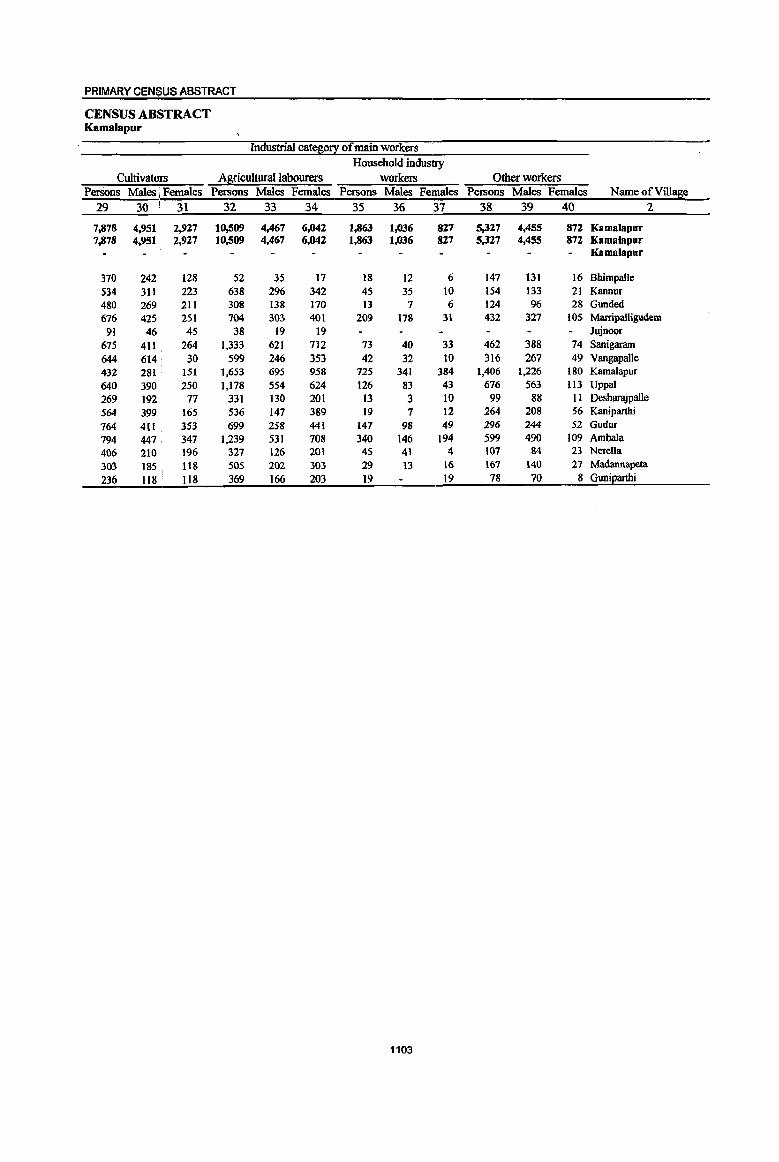
PRIMARY CENSUS ABSTRACT
CENSUS ABSTRACT Kamalapur
Industrial cateso!! of main workers Household industry
CultivatQrs Agricultural labourers workers Other workers PerSons Males I Females Persons Males Females Persons Males Females Persons Males Females Name ofViUage
29 30 ! 31 32 33 34 35 36 .37 38 39 40 2 i
7.878 4,951 : 2,927 10,509 4,467 6,042 1,863 1,036 827 5,327 4,455 872 Kamalapur 7.878 4,951 2,927 10,509 4,467 6,042 1,863 1,036 827 5,327 4,455 872 Kamalapur
Kamalapur
370 242 128 52 35 17 18 12 6 147 131 16 Bhimpalle 534 311 223 638 296 342 45 35 10 154 133 21 Kannur 480 269 211 308 138 170 13 7 6 124 96 28 Gunded
676 425 251 704 303 401 209 178 31 432 327 105 Marripalligudem 91 46 45 38 19 19 Jujnoor
675 411 . 264 1,333 621 712 73 40 33 462 388 74 Sanigaratn 644 614 30 599 246 353 42 32 10 316 267 49 Vangapalle 432 281 151 1,653 695 958 725 341 384 1,406 1,226 180 Kamalapur 640 390 250 1,178 554 624 126 83 43 676 563 113 Uppal 269 192 77 331 130 201 13 3 10 99 88 II Desharajpalle 564 399 165 536 147 389 19 7 12 264 208 56 Kaniparthi 164 411 353 699 258 441 147 98 49 296 244 52 Gudur
794 447 347 1,239 531 708 340 146 194 599 490 109 Ambala 406 210 196 327 126 201 45 41 4 107 84 23 Nerella 303 185 118 505 202 303 29 13 16 167 140 27 Madannapeta 236 118 118 369 166 203 19 19 78 70 8 Guniparthi
1103
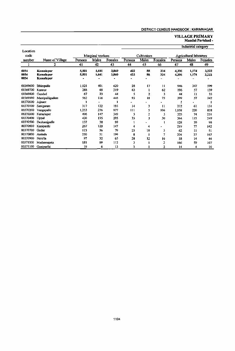
DISTRICT CENSUS HANDBOOK: KARIMNAGAR
VILLAGE PRIMARY Mandai Parishad -
Industrial cate80!! Location
code Mar~al workers Cultivators Agricultural labourers number Name ofViIla8e Persons Males Females Persons Males Females Persons Males Females
1 2 41 42 43 44 45 46 47 48 49
0054 Kamafapur 5,501 1,641 3,860 422 88 334 4,396 1,174 3,222 0054 Kamala pur 5,501 1.641 3,860 422 88 334 4,396 1,174 3,222 0054 Kamalapur
00369600 Bhimpalle 1,021 401 620 28 17 11 946 347 599 00369700 Kannur 288 69 219 63 1 62 196 57 139 00369800 Gunded 67 23 44 5 2 3 44 It 33 00369900 Marripalligudem 562 116 446 93 18 75 399 57 342 00370000 Jujnoor I I I I 00370100 Sanigaram 317 122 195 14 3 II 212 61 151 00370200 Vangapalle 1,253 276 977 111 5 106 1,058 220 838 00370300 Kamalapur 496 147 349 5 2 3 325 74 251 00370400 Uppal 430 135 295 33 3 30 364 115 249 00370500 Desharajpalle 137 38 99 1 128 30 98 00370600 Kaniparthi 267 120 147 4 4 219 77 142 00370700 Gudur 115 36 79 23 18 5 62 11 51 00370800 Ambala 250 51 199 8 I 7 204 37 167 00370900 Nerella 97 32 65 28 12 16 58 14 44 00371000 Madannapeta 181 69 112 3 2 166 59 107 00371100 Guni2arthi 19 6 13 3 2 14 4 10
1104
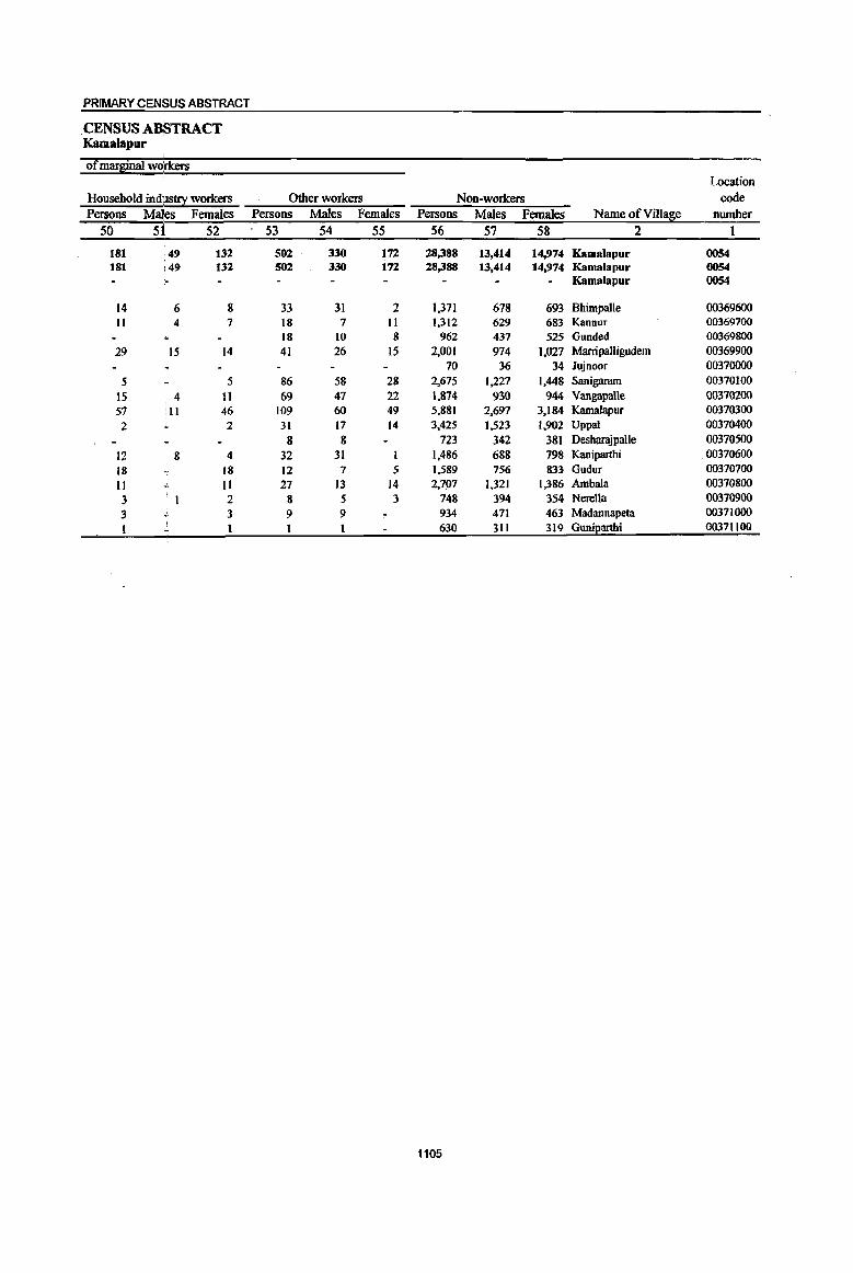
PRIMARY CEN$US ABSTRACT
.CENSUS ABSTRACT Kamalapur
of marginal workers Location
Household indJIStrY workers Other workers ~on-workers code
Persons Males Females Persons Males Females Persons Males Females Name ofVill~e number 50 51 52 53 54 55 56 57 58 2 1
181 ·49 132 502 330 172 28,388 13,414 14,974 Kamalapur 0054 181 ,49 132 502 330 172 28,388 13,414 14,974 Kamalapur 0054
Kamalapur 0054
14 6 8 33 31 2 1,371 678 693 Bhimpalle 00369600 II 4 7 18 7 II 1,312 629 683 Kannur 00369700
18 10 8 962 437 525 Gunded 00369800 29 15 14 41 26 15 2,001 974 1,027 Marripalligudem 00369900
70 36 34 Jujnoor 00370000 5 5 86 58 28 2,675 1,227 1,448 Sanigaram 00370100
15 4 11 69 47 22 1,874 930 944 Vangapalle 00370200 57 II 46 109 60 49 5,881 2,697 3,184 Kamalapur 00370300 2 2 31 17 14 3,425 1,523 1,902 Uppal 00370400
8 8 723 342 381 Deshangpalle 00370500 12 8 4 32 31 1 1,486 688 798 Kaniparthi 00370600 18 18 12 7 5 1,589 756 833 Gudur 00370100 11 II 27 13 14 2,707 1,321 1,386 AmbaJa 00370800 3 2 8 5 3 748 394 354 NereUa 00370900 3 3 9 9 934 471 463 Madannapeta 00371000 t 630 31t 319 Guni2arthi 00371100
1105

DISTRICT CENSUS HANDBOOK: KARIMNAGAR
VILLAGE PRIMARY MandaI Parishad -
Total population (including Location Area of institutional and houseless Population in the
code Village in Number of 2°2ulation} al!ie-~u20-6 number Name ofVilla~e hectares households Persons Males Females Persons Males Females
1 2 3 4 5 6 7 8 9 10
0055 Bbeemadevarpalle 17,819.0 12,408 54,379 27,438 26,941 7.058 3,568 3.490 0055 Bbeemlldevarpalle 17,819.0 12,408 54,379 27,438 26,941 7,OSS 3,568 3.490 0055 Bheemadevarpalle
00371200 Vangara 2,439.0 1,330 5,891 2,920 2,971 738 401 337 00371300 Bheemadevarpalle 544.0 547 2,393 1,290 1,103 274 125 149 00371400 Ratnagiri 580.0 398 1,749 891 858 258 137 121 00371500 Manikyapur 658.0 667 3,043 1,534 1,509 386 171 209 00311600 Koppur 695.Q 713 2,979 1,490 1,489 458 223 235 00311700 Kothapalle 1,513.0 870 3,883 1,904 1,979 519 249 270 00371800 Mulkanoor 1,663.0 1,781 8,521 4,305 4,216 962 492 470 00371900 Mutharam (p.K) 517.0 256 1,149 S77 S72 132 73 S9 00372000 Mustafapur 1,068.0 607 2,511 1,262 1,249 373 202 )7)
00372100 Gatlanarsingapuf 1,728.0 1,051 4,562 2,313 2,249 620 294 326 00372200 Kothakonda 1,540.0 1,005 4,433 2,243 2,190 600 326 274 00312300 Mallaram 709.0 894 3,960 2,018 1,942 565 300 265 00372400 Katkur 2,013.0 1,151 4,555 2,311 2,244 588 281 301 00372500 Kannaram 653.0 423 1,911 984 927 233 112 121 00372600 Erraballe 1,499.0 715 2,839 1,396 1,443 352 170 1"82
1106
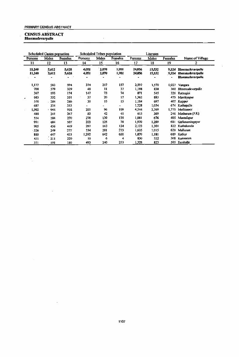
PRIMARY CENSUS ABSTRACT
CENSUS ABSTRACT Bheemadevarp:alle
Scheduled Castes EOEuation Scheduled Tribes EO£ulation Literates Persons Males Females Persons Males Females Persons Males Females Name of Village
II 12 13 14 15 16 17 18 19 2
11,240 :5,612 . 5,628 4,051 2,070 1,981 24,856 15,532 9,324 Bheemadevarpalle 11,240 5,612 5,628 4,051 2,070 1,981 24,856 15,532 ,9,324 Bheemadevarpalle
Bheemadevarpalle
1,177 53) 594 374 217 157 2,597 1,57Q 1,027 Vangam 708 379 329 48 Il 37 1,198 838 360 Bheemadevarpalle 367 193 174 147 73 74 871 545 326 Ratnagiri 683 332 351 37 20 17 1,362 883 479 Manikyapur 570 . 284 286 30 15 15 1,104 697 407 Koppur 687 334 353 1,728 1,054 674 Kothapalle
1,902 944 958 205 96 109 4,544 2,769 1,775 Mulkanoor 488 241 247 83 42 41 615 369 246 Muthanun (p.K) 554 .284 270 278 139 139 1,081 676 405 Mustafapur 991 ,484 507 203 125 78 1,970 1,289 681 Gatlanarsingapur 905 456 449 297 163 134 2,123 1,301 822 Kothakonda 526 249 277 554 281 273 1,635 1,015 620 Mallanun 880 447 433 1,292 642 650 1,870 1,181 689 Katkur 431 .211 220 10 6 4 830 522 308 Kannaram 371 191 180 493 240 253 1,328 823 505 Erraballe
1107

DISTRICT CENSUS HANDBOOK: KARIMNAGAR
VILLAGE PRIMARY Mandai Parisbad-
Location code illiterates Total workers Main workers
number Name ofVillase Persons Males Females Persons Males Females Persons Males Females 1 2 20 21 22 23 24 25 26 27 28
0055 BbeemadevarpaUe 29,523 11,906 17,617 27,136 14,977 12,159 22,355 13,724 8,631 0055 Bheemadevarpalle 29,523 11,906 17,617 27,136 14,977 12,159 22,355 13.724 8,631 0055 Bheemadevarpalle
00371200 Vangara 3,294 1,350 1,944 2,907 1,563 1,344 2,788 1,532 1,256 00371300 BheemadevwpalJe 1,195 452 743 826 61S 211 71S S68 147 00371400 Ratnagiri 878 346 532 914 468 446 629 408 221 00371500 Manikyapur 1,681 651 1,030 1,732 915 817 1,050 696 354 00371600 Koppur 1,875 793 1,082 1,558 814 744 1,028 567 461 00371700 Kotbapalle 2,155 850 1,305 1,879 1,099 780 1,343 1,000 343 00371800 Mulkanoor 3,977 1,536 2,441 3,570 2,138 1,432 3,177 2,082 1,095 00371900 Mutbaram (p.K) 534 208 326 601 303 298 587 300 287 00372000 MusIlIfapur 1,430 586 844 1,367 697 670 1,263 691 572 00372100 Gatlanarsingapur 2,592 1,024 1,568 2,380 1,318 1,062 1,985 1,189 796 00372200 Kothakonda 2,310 942 1,368 2,128 1,194 934 1,965 1,174 791 00372300 MaIlaram 2,325 1,003 1,322 2,174 1,178 996 1,938 1,146 792 00372400 Katkur 2,685 1,130 1,555 2,475 1,320 1,155 1,793 1,168 625 00372500 Kannaram 1,081 462 619 1,038 556 482 805 474 331 00372600 Erraballe 1,511 573 938 1,587 799 788 1,289 729 560
1108

PRIMARY CENSUS ABSTRACT
CENSUS ABSTRACT Bheem8devar~alle
Industrial catego!):: of main workers Household industry
Cultivators Agricultural labourers workers Other workers Persons Males i Females Persons Males Females Persons Males Females Persons Males Females Name of Village
29 30 31 32 33 34 35 36 37 38 39 40 2
9,294 5,975, 3,319 7,593 3,494 4,099 837 471 365 4,631 3,783 848 Bbeemadevarpalle 9,294 5,975. 3,319 7,593 3,494 4,099 837 472 365 4,631 3,783 848 Bheemadevarpalle
Bheemadevarpalle
1,279 714 565 881 313 568 38 27 11 590 478 112 Vangara 212 206 6 265 154 III 26 20 6 212 188 24 Bheemadevarpalle 270 202 68 233 101 132 39 32 7 87 73 14 Ratnagiri 534 354 180 262 146 116 57 26 31 197 170 27 Manikyapur 307 197 110 348 134 214 22 5 17 351 231 120 Koppur 523 424 99 436 271 165 60 34 26 324 271 53 Kothapalle 713 455 258 1,281 710 571 241 119 122 942 798 144 Mu1kanoor 245 137 108 276 109 167 4 4 62 54 8 Mutharam (P.K) 648 349 299 462 219 243 59 40 19 94 83 11 Mustafapur 903 560 343 673 296 377 53 38 15 356 295 61 Gatlanarsingapur
.794 434 360 617 269 348 35 21 14 519 450 69 Kothakonda 920 636 284 580 193 387 49 24 25 389 293 96 Mallaram 922 682 240 524 247 277 97 56 41 250 183 67 Katkur 379 252 127 274 110 164 48 28 20 104 84 20 Kannaram 645 373. 272 481 222 259 9 2 7 154 132 22 Erraballe
1109
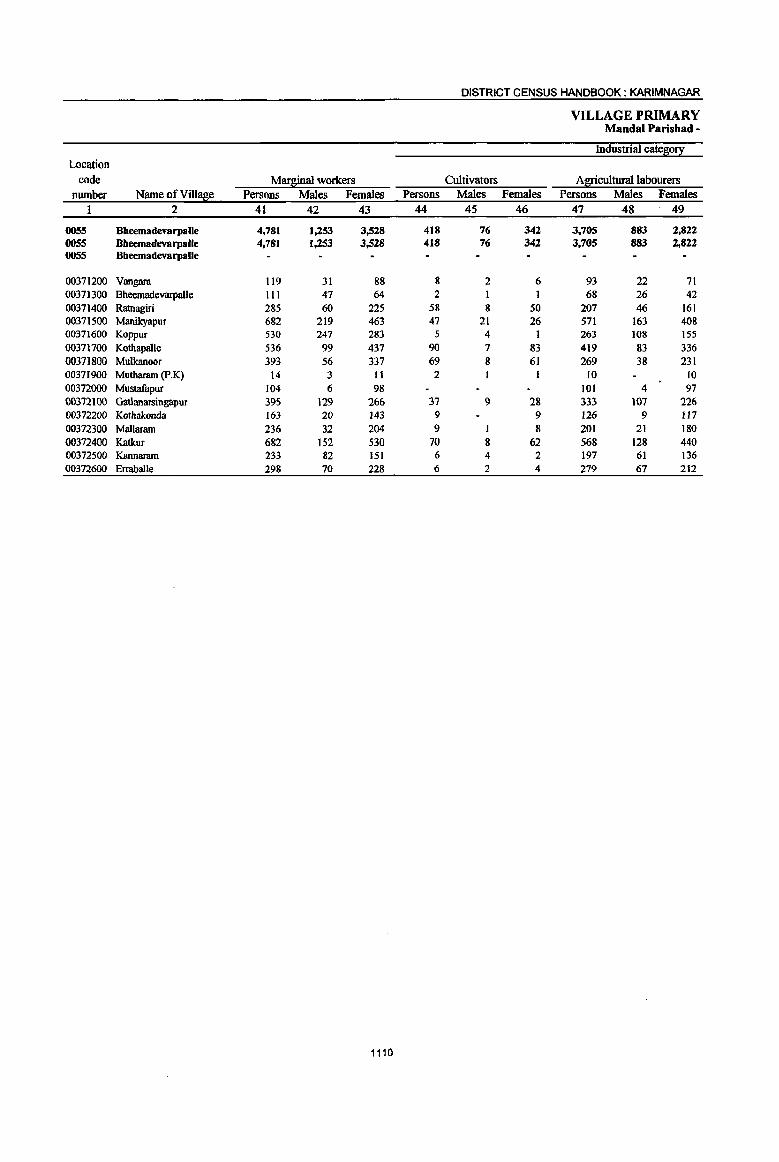
DISTRICT CENSUS HANDBOOK: KARIMNAGAR
VILLAGE PRIMARY Mandai Parish ad -
Industrial category Location
code Marginal workers Cultivators Agricultural labourers number Name ofVill!!Se Persons Males Females Persons Males Females Persons Males Females
1 2 41 42 43 44 45 46 47 48 49
0055 BheemadevarpalJe 4,781 1,253 3,528 418 76 342 3,705 883 2,822 OO5S Bheemadevarpalle 4,781 1,253 3,528 418 76 342 3,705 883 2,822 0055 BheemadevarpalJe
00371200 Vangara 119 31 88 8 2 6 93 22 71 00371300 Bheemadevarpalle III 47 64 2 68 26 42 00371400 Ratnagiri 285 60 225 58 8 50 207 46 161 00371500 Manikyapur 682 219 463 47 21 26 571 163 408 00371600 Koppur 530 247 283 5 4 1 263 108 155 00371700 Kothapalle 536 99 437 90 7 83 419 83 336 00371800 Mulkanoor 393 56 337 69 8 61 269 38 231 00371900 Mutharam (p.K) 14 3 II 2 10 10 00372000 Mustafapur 104 6 98 101 4 97 00372100 Gatlanarsingapur 395 129 266 37 9 28 333 107 226 00372200 Kothakonda 163 20 143 9 9 126 9 117 00372300 Mallaram 236 32 204 9 I 8 201 21 180 00372400 Katkur 682 152 530 70 8 62 568 128 440 00372500 Kannaram 233 82 151 6 4 2 197 61 136 00372600 Erraballe 298 70 228 6 2 4 279 67 212
1110

PRIMARY CENSUS ABSTRACT
CENSUS ABSTRACT I
Bheemsdevsl'JI/slle
of marginal wOI:kers Location
Household indUstry workers Other workers Non-workers code Persons Mal:e,s Females Persons Males Females Persons Males Females Name ofVilla~e number
50 51 52 53 54 55 56 57 58 2 I
118 :25 93 540 269 271 27,243 12,461 14,782 Bbeemadevarpalle 0055 118 25 93 540 269 271 27,243 12,461 14,782 Bbeemadevarpalle 0055
Bbeemadevarpalle 0055
5 2 3 13 5 8 2,984 1,357 1,627 Vangara 00371200 10 2 8 31 18 13 1,567 675 892 Bheemadevarpalle 00371300 6 1 5 14 5 9 835 423 412 Ratnagiri 00371400
8 3 5 56 32 24 1.311 619 692 Manikyapur 00371500 7 , 1 6 255 134 121 1,421 676 745 Koppur 00371600
14 2 12 13 7 6 2,004 805 1,199 Kothapalle 00371100
21 2 25 28 8 20 4,951 2,167 2,784 Mulkanoor 00371800 2 2 548 274 274 Mutharam (p.K) 00371900
1 2 2 1,144 565 579 Mustafapur 00372000
10 4 6 15 9 6 2,182 995 1,187 Gatlanarsingapur 00372100
6 6 22 11 II 2.305 1,049 1,256 Kothakonda 00312200
8 2 6 18 8 10 1,786 840 946 Mallaram 00372300
7 3 4 37 13 24 2,080 991 1,089 Katkur 00372400
8 3 5 22 14 8 873 428 445 Kannaram 00372500
- 1 12 1 11 1,252 597 655 Erraballe 00372600
1111
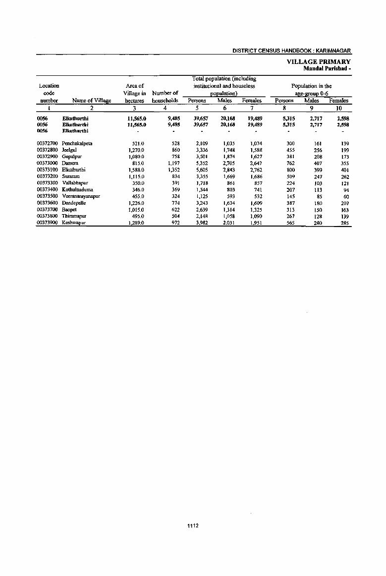
DISTRICT CENSUS HANDBOOK: KARIMNAGAR
VILLAGE PRIMARY Mandai Parishad -
Total population (including Location Area of institutional and houseless Population in the
code Village in Number of EOEulationl a~e-&ouE 0-6 number Name ofVill!$e hectares households Persons Males Females Persons Males Females
1 2 3 4 5 6 7 8 9 10
0056 Elkathurthi 1l,565.0 9,485 39,657 20,168 19,489 5,315 2,717 2,598 0056 Elkathurtbi 11,565.0 9,485 39,657 20,168 19,489 5,315 2,717 2,598 0056 Elkathurthi
00372700 Penchakalpeta 521.0 528 2,109 1,035 1,074 300 161 139 00372800 leelgul 1,270.0 860 3,336 1,748 1,588 455 256 199 00372900 Gopalpur 1,080.0 758 3,501 1,874 1,627 381 208 173 00373000 Darnera 815.0 1.197 5,352 2,705 2,647 762 407 355 00373100 Elkathurthi 1,5&&.0 1,352 5,605 2,&43 2,762 &00 399 401 00373200 Suraram 1,115.0 834 3,355 1,669 1,686 509 247 262 00373300 VaJlabhapur 350.0 391 1,7J8 861 857 224 103 121 00373400 Kothulnaduma 346.0 369 1,544 803 741 207 113 94 00373500 Veeranarayanapur 455.0 324 1,125 593 532 145 85 60 00373600 DandepaJle 1,226.0 774 3,243 1,634 1,609 387 180 207 00373700 Baopet 1,015.0 622 2,639 1,314 1,325 313 150 163 00373800 TItimmapur 495.0 504 2,148 1,058 1,090 267 128 139 00373900 Keshw!!.I!ur 1,289.0 972 3,982 2,031 1,951 565 280 285
1112

PRIMARY CENSUS ABSTRACT
CENSUS A~STRACT Elkathurthi
Scheduled C~tes ~Euation Scheduled Tribes EOEulation Literates Persons Males Females Persons Males Females Persons Males Females Name of Village
n \11 13 14 15 16 17 18 19 2
11,639 15,980 5,659 414 205 209 18,327 11.437 6,890 Elkathurthi 11.639 \5,980 5,659 414 20S 209 18,327 11,437 6,890 Elkathurthi
Elkathurthi
509 253 256 30 18 12 860 523 337 Penchakalpeta 818 454 364 51 32 19 1,484 954 530 Jeelgul
1,126 614 512 n 16 16 1,656 1,051 60S Gopalpur 1,580 801 779 66 30 36 2,411 1,476 935 Damera 1,437 761 676 67 29 38 2,507 1,560 947 Elkathurthi
621 320 301 10 5 5 1,497 919 578 Suraram 718 375 343 II 4 7 901 549 352 YaUabbapur 368 182 186 24 13 II 713 458 255 Kothulnaduma 435 231 204 5 3 2 603 377 226 Yeeranarayanapur
997 483 514 52 25 27 1,490 970 520 Dandepalle 910 458 452 37 17 20 1,359 825 534 Baopet 684 327 357 29 13 16 1,024 615 409 Thimmapur
1,436 721 715 1,822 1,160 662 Keshwapur
1113

DISTRICT CENSUS HANDBOOK: KARIMNAGAR
VILLAGE PRIMARY Mandai Paris bad -
Location code illiterates Total workers Main workers
nwnber Name ofVillase Persons Males Females Persons Males Females Persons Males Females
I 2 20 21 22 23 24 25 26 27 28
0056 Elkathurthi 21,330 8,731 12,599 20,699 11,278 9,421 14,611 9,457 5,154 0056 Elkatburthi 21,330 8,731 12,599 20,699 11,278 9,421 14,611 9,457 5,154 0056 Elkathurthi
00372700 Penchakalpeta 1,249 512 737 1.133 583 550 914 493 421 00372800 Jeelgul 1,852 794 1,058 1,840 965 875 759 654 105 00372900 Gopalpur 1,845 823 1,022 1.738 1,012 726 1,233 850 383 00373000 Damera 2,941 1.229 1,712 2,862 1,538 1,324 1.905 1,156 749 00373100 Elkathurthi 3,098 1,283 1,815 2,692 1,511 1,181 2,048 1,351 697 00373200 Suraram 1,858 750 1,108 1,754 972 782 1,512 926 586 00373300 Vallabhapur 817 312 50S 896 478 418 714 420 294 00373400 Kothulnaduma 831 345 486 770 460 310 160 454 306 00373500 VeeranamyanapuT 522 216 306 568 318 250 345 237 108 00373600 Dandepalle 1,753 664 1,089 1,686 943 743 1,084 799 285 00373700 Baopet 1,280 489 791 1,427 731 696 1,127 684 443 00373800 Thimmapur 1,124 443 681 1,208 606 602 892 576 316 00373900 Keshw!!Eur 2,160 871 1,289 2.125 1,161 964 1,318 857 461
1114

PRIMARY CENSUS ABSTRACT
CENSUS ABSTRACT Elkatburtbi
;
Industrial cate~0!X of main workers Household industry
Cultivat~rs Agricultural labourers workers Other workers Persons Males I Females Persons Males Females Persons Males Females Persons Males Females Name of Village
29 30 31 32 33 34 35 36 37 38 39 40 2
5,569 3,837 1,732 5,085 2,491 2,594 905 599 306 3,052 2,530 522 Elkathurthi 5,569 3,837 1,732 5,085 2,491 2,594 905 599 306 3,052 2,530 522 Elkathurthi
Elkathurthi
504 267 237 223 93 130 39 14 25 148 119 29 Penchakalpeta 336 288 48 164 132 32 92 89 3 167 145 22 leelgul 605 393 212 168 77 91 75 65 10 385 315 70 Gopalpur 773 487 286 704 378 326 105 28 77 323 263 60 Damera 472 326 146 886 492 394 177 87 90 513 446 67 Elkathurthi
483 406 77 706 265 441 55 23 32 268 232 36 Suraram 298 174 124 296 144 152 120 102 18 Vallabhapur 156 1I8 38 375 140 235 70 57 13 159 139 20 Kothu1naduma 113 109 4 74 30 44 41 29 12 117 69 48 Veeranarayanapur 427 307 120 376 243 133 118 104 14 163 145 18 Dandepalle 527 314 213 367 177 190 77 55 22 156 138 18 8aopet
341 266 75 287 105 182 15 14 I 249 191 58 Thimmapur 534 382 152 459 215 244 41 34 7 284 226 58 Keshwapur
1115

DISTRICT CENSUS HANDBOOK: KARIMNAGAR
VILLAGE PRIMARY Mandai Parishad -
Industrial ca~0!1 Location
code MarBinal workers Cultivators Agricultural labourers number Name of Villa~e Persons Males Females Persons Males Females Persons Males Females
1 2 41 42 43 44 45 46 47 48 49
0056 Elkathurthi 6,088 1,821 4,267 198 39 159 5,316 1,512 3,804 0056 Elkatburthi 6,088 1,821 4,267 198 39 159 5,316 1,512 3,804 0056 Elkatburtbi
00372700 Pencbakalpeta 219 90 129 9 4 5 1&4 72 112 00372800 Jeelgul 1,081 311 770 81 9 72 973 291 682 00372900 GopaJpur 505 162 343 2 I I 457 128 329 00373000 Damera 957 382 575 28 8 20 836 333 503 00373100 Elkathurthi 644 160 484 23 10 13 523 102 421 00373200 Suraram 242 46 196 5 5 155 23 132 00373300 Vallabhapur 182 58 124 141 27 114 00373400 Kothulnaduma 10 6 4 00373500 Veeranarayanapur 223 81 142 214 77 137 00373600 Dandepalle 602 144 458 JO 3 7 557 127 430 00373700 Baopet 300 47 253 16 16 229 44 185 00373800 Thimmapur 316 30 286 14 1 13 287 16 271 00373900 Kesh~ur 807 304 503 10 .3 7 759 272 487
1116
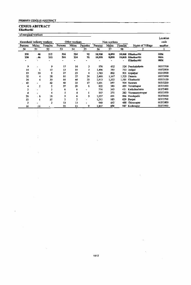
1117
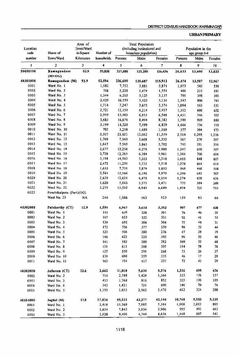
Location code
number
50050100
40301000
0001 0002
0003
0004
0005
0006
0007
0008
0009
0010
0011
0012
0013
0014
0015 0016
0017
0018
0019
0020
0021
0022
0023
410302000
0001
0002
0003
0004 0005
0006
0007
0008
0009 0010
001l
40303000
0002
0003
0004
0005
40304000
0001
0002
0003
Area of TownlWard
Name of
TownlWard
in Square Number of
Kilometre households
2 3
Ramagundam 93.9
(M+OG)
Ramagundam (M) 93.9
Ward No. I Ward No.2
Ward No.3
Ward No.4
Ward No.5
Ward No.6 Ward No.7
Ward No.8
Ward No.9
Ward No. 10
Ward No. II
Ward No. 12
Ward No. 13
Ward No. 14
Ward No. 15
Ward No. 16
Ward No. 17
Ward No. 18
Ward No. 19
Ward No. 20
Ward No. 21
Ward No. 22
Penchikalpeta (Part)(OG)
Ward No. 23 NA
Palakurthy (CT)
Ward No.1
Ward No.2
Ward No.3
Ward No.4 Ward No.5
Ward No.6
Ward No.7
Ward No.8
Ward No.9
Ward No. 10
Ward No. II
Jallaram (CT)
Ward No.2
Ward No.3
Ward No.4
Ward No.5
Jagtial (M)
Ward No. I
Ward No.2
Ward No.3
12.9
23.6
17.8
4
52,838
52,594
1,582
708 1,344
2,429
1,714
2,721 2,959
3,683
3,199
702
5,307
1,769
1,647
2,677 2,728 3,198
2,472
1,653
2,564
2,639
1,620
3,279
244
1,595
145
167
139
172 125
146
141
131
127 139
163
2,662
714
413
342 1,193
17,826
3,418
1,634
1,928
DISTRICT CENSUS HANDBOOK: KARIMNAGAR
Total Population (including institutional and
houseless population)
Persons Males Females
5
237,686
236,600
7,752
3,228 6,262
10,559
7,247
12,151
13,403
16,676
14,228
3,258
23,621
7,160
7,565 12,256
12,265
14,563
11,250
7,731
12,166
12,624
7,043
13,592
1,086
6,967
639
653
610
736 506
623
582
615
559 690
754
11,010 2,788
1,768
1,421
5,033
85,521
15,369
7,842
9,400
1118
6
121,250
120,687
3,881 1,674
3,125
5,425
3,673
6,214 6,855
8,494
7,399
1,689
12,062
3,608
3,863
6,276 6,304
7,353
5,732
3,879
6,196
6,470
3,572 6,943
563
3,614
338
322
306
377
280
320 300 308
291 355
417
5,634
1,424
916 731
2,563
43,377
7,985 3,936 4,744
7
116,436
115,913
3,871 1,554
3,137
5,134
3,574
5,937 6,548
8,182
6,829
1,569
11,559
3,552
3,702
5,980
5,961
7,210
5,518
3,852
5,970 6,154
3,471
6,649
523
3,353
301
331
304
359 226
303
282
307
268 335
337
5,376
1,364
852
690
2,470
42,144
7,384 3,906
4,656
URBANPRIMARY
Population in the age group 0-6
Persons Males Females
8
26,633
26,474
1,073 406
791
1,547
1,094
1,312 1,451
1,789
1,446
377 2,514
567
745
1,247
1,304
1,655
1,278
968
1,390
1,274
772
1,474
159
907
76 92 75
96 47 96
100
154
53 46 72
1,316
333
225
146
612
10,768
1,908
955
1,148
9
13,600
13,507
543
215
398
806
563
680
746
909
736
204
1,298
270
391
650 700
848
664 460 683
638 384 721
93
477
46 41
44 52 28
50
52 78 26 17 43
690 176
120 70
324
5,533
1,013
492
607
10
13,033
12,967
530
191 393
741
531
632
705
880
710
173 1,216
297
354
597
604
807 614
508
707
636
388 753
66
430
30
51
31
44 19 46
48
76
27 29
29
626
157 105
76 288
5,235
895
463 541

PART B - PRIMARY CENSUS ABSTRACT
CENSUSA1JS1'lU,Cf
Scheduled Castesi population
Persons Males' Females
II 12
46,695 23,581
46,422
667 707
1,119 2,519 1,217 1,639 3,594
6,286
2,014 672
3,015
1,246
1,862
3,768 2,723 1,642
1,703
195 1,742> 4,366
1,099
2,627
273
1,733
162
254 297
51 70
223 228
11
93
t68 176
1,543 532
317 101 593
6,147
1,021
389 1,052
23,4511
337
368
548
1,251
609 849~
1,805
3,219
1,029 337
1,522
612 928,
1,910 1,406
799
879
73 869
2,218
555
1,327
131
897,
82 128
148 25 41
115 120
5
50 84
99
801 280 t63 54
304
3,039 530
192 495
13
23,114
22,972
330
339 571
1,268
608 790
1,789
3,067
985 335
1,493 634
934
1,858 1,317
843
824 122 873
2,148
544 1,300
142
836
80
126 149 26 29
108
108 6
43
84
77
742
252
154 47
289
3,108 491 197 557
Scheduled Tribes population Literates
Persons Males Females Persons Males Females
14
3,493
3,493
490
56
52
477
151 86
170
126
216 22
662
76
20
112 16 88
119
57 24 37
53
383
34
5
4
12 4
7
2
428
9
31
25 363
348
105 15
15
1,748
1,748 237
26
27
236
75 38
89
69 III
8
338
39
to 56
6
42
61 36 14
16 25
189
18
3
2
7 2
3
208 6
15 12
175
209
53
9
16 17
1,745 146,581
1,745
253
30 25
241
76 48
81
57
105 14
324
37
10
56 10
46
58 21 10 21
28 194
16
2
2
5 2
4
220
3
16
I3 188
139 52
6
1119
146,114
4,814 1,543
3,804
5,783
4,466 8,370 7,818
9,126
7,946 1,716
15,562
5,127
4,932
7,587 7,826 9,096
6,609 4,906 8,023
7,818
4,599
8,643
467
3,835
278
291 274 412 301
316
296 141 448 505 573
6,034
1,468
850 683
3,033
55,406 10,207
5,392 5,974
18
84,207
83,935 2,742
974
2,136
3,440
2,511 4,728
4,568
5,305
4:739 1,041 8,849
2,852
2,807 4,421 4,544
5,237
3,769 2,797 4,590
4,552
2,632 4,701
272
2,328
183
176 158 250 200
192
179 94
260
293
343
3,545
871
515 424
1,735
32,087 6,112
3,123 3,494
19
62,374
62,179 2,072
569 1,668
2,343
1,955 3,642
3,250
3,821 3,207
675 6,713 2,275
2,125
3,166 3,282
3,859
2,840
2,109 3,433
3,266
1,967
3,942
195
1,507
95
115 116 162 101
124 117 47
188
212 230
2,489
597
335 259
1,298
23,319
4,095
2,269 2,480
Name of
TownlWard
2
Ramagundam (M+OG) Ramagundam (M)
Ward No.1
Ward No.2 Ward No.3
Ward No.4
Ward No.5 Ward No.6
Ward NO.7
Ward No.8
Ward No.9 Ward No. 10 Ward No. 11 Ward No. 12
Ward No. 13
Ward No. 14 Ward No. 15
Ward No. 16
Ward No. 17 Ward No. 18 Ward No. 19
Ward No. 20
Ward No. 21
Ward No. 22
Penchikalpeta (Part)(OG)
Ward No. 23
Palakurthy (CT)
Ward No.1
Ward No.2
Ward No.3 Ward No.4
Ward NO.5
Ward NO.6
Ward NO.7
Ward No.8
Ward No.9
Ward No. 10
Ward No. II
Jallaram (CT)
Ward No.2
Ward No.3
Ward No.4
Ward No.5
Jagtial (M)
Ward No.1
Ward No.2 Ward No.3
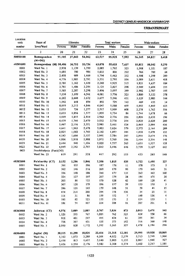
Location code
number
5;0050100
4:0301000
0001 0002
0003 0004
0005 0006
0007
0008
0009
0010
0011
0012
0013
0014
0015
0016
0017 0018
0019
0020
0021
0022 0023
40302000
0001
0002
0003
0004
0005
0006
0007
0008
0009
0010 0011
40303000
0002
0003 0004
0005
40304000
0001 0002
0003
Illiterates Name of TownlWard Persons Males Females
2 20 21 22
Ramagundam (M+OG)
91,105 37,043 54,062
Ramagundam (M) 90,486
Ward No. 1 2,938 Ward No.2 1,685
Ward No. 3 2,458 Ward No. 4 4,776
Ward No.5 2,781
War4 No.6 Ward No.7
Ward No.8
Ward No.9
Ward No. 10
Ward No. 11
Ward No. 12
Ward No. 13
Ward No. 14
Ward No. 15
Ward No. 16
Ward No. 17 Ward No. 18
Ward No. 19
Ward No. 20
Ward No. 21
Ward No. 22
3,781
5,585
7,550
6,282
1,542
8,059
2,033 2,633
4,669
4,439
5,467
4,641 2,825
4,143
4,806
2,444
4,949 Penchikalpeta (Part)(OG)
Ward No. 23 619
Palakurthy (CT) Ward No. I
Ward No.2
Ward No.3
Ward No.4
Ward No.5
Ward No.6
Ward No.7
Ward No.8
Ward No.9
Ward No. 10
Ward No. II
Jallaram (CT) Ward No.2
Ward No.3 Ward No.4 Ward No.5
Jagtial (M) Ward No.1
Ward No.2
Ward No.3
3,132
361
362
336
324
205
307
286
474
III
185 181
4,976
1,320
918 738
2,000
30,115 5,162 2,450
3,426
36,752
1,139
700
989 1,985
1,162
1,486
2,287
3,189
2,660
648
3,213
756 1,056
1,855
1,760
2,116
1,963 1,082
1,606
1,918
940
2,242
291
1,286
155
146
148
127
80
128
121
214
31 62
74
2,089
553 401 307 828
11,290
1,873 813
1,250
53,734
1,799
985
1,469 2,791
1,619
2,295
3,298
4,361
3,622
894 4,846
1,277
1,577
2,814
2,679
3,351
2,678 1,743
2,537
2,888
1,504
2,707
328
1,846
206
216
188
197
125
179
165
260
80 123 107
2,887
767 517 431
1,172
18,825
3,289 1,637 2,176
1120
DISlRICTCENSUS HANDBOOK:KARIMNAGt\R
Total workers
Persons Males Females
23 24 25
63,517 55,925 7,592
63,070
2,085 1,033
1,794 3,351
2,240
3,125
3,496
4,081
3,677
892
6,047
2,517 1,820
2,962
3,032
3,985
3,003 2,102
2,991
2,975
2,020
3,842
447
2,350
187
269
310
207
170
196
179
294
159
155 224
3,707
1,085
495 535
1,592
33,416 6,301
3,140
3,582
55,633
1,762
801 1,462
2,795
1,925
2,827
3,097
3,756
3,246
729 5,588
1,909
1,734
2,736
2,778
3,461
2,624
1,897 2,784
2,769
1,757
3,196
292
1,815
176
179
177
179
128
157
148
158
152 153 208
2,834
762
434 373
1,265
21,315 4,022
2,005
2,308
7,437
323
232
332
556
315
298
399
325
431
163
459
608
86
226
254
524
379 205
207
206
263 646
155
535
II
90
133
28
42
39
31 136
7 2
16
873
323 61
162
327
12,101
2,279 1,135
1,274
URBANPRIMARY
Main workers
Persons Males Females
26 27
56,245 50,827
55,812
1,508
766
1,508
3,089
1,821
2,949
2,902
3,800
3,129
469
5,892
2,278
1,744
2,826
2,820
3,460
2,373 1,830
2,850
2,404
1,655
3,739
433
1,722
178
170
263
195
169
153
59
34
140 154
207
3,013
624
395 516
1,478
29,995
5,713 2,867
3,402
50,542
1,321
702
1,299 2,631
1,637
2,694
2,707
3,522
2,985
455 5,469
1,762
1,678
2,630
2,620
3,004
2,164
1,678
2,674
2,256
1,527 3,127
285
1,495
173
149
163
175
128 150
44
23
136 153 201
2,471
558 361
368 1,184
19,930 3,749 1,940
2,217
28
5,418
5,270
187
64 209 458
184
255
195
278 144
14
423
516
66
196
200
456
209 152
176
148
128
612
148
227
5
21
100
20
41
3
IS
11
4
6
542
66 34
148
294
10,065 1,964
927
1,185
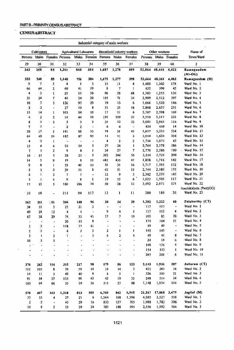
PARTS - PRIMARYICENSUSABSTRACT
CENSUSABSTRAcr
Industrial category of main workers
Cultivators Agricultural Labourers Household industry workers
Persons Males F~males Persons Males Females Persons Males Females
29
343
333
9 66 4
31
10 3
15
4
8
7
20
64
4
12
7
16
14
9 5 3 5
17
10
162
38
40 67
2
2
3
10
376 III 14
91
160
570
37
2 10
30
258
248 7
64 3
24
7 3
14
2 5
7
17 40
3
6
5
11 5
8
3
12
10
11l
35 28
38
2
2
1
5
262 103 II 54
94
407
33 2
8
I 31
85
85
2
2
I
7
3
2
3
3
24
6
2 5 9 I
2 2
4
5
51
3
12
29
2
5
114
8
3
37
66
163 4
2
32
1,351
1,140
4 60 25
44
126
27 103
54
5 2
141 182
23
9 28
19
53 39
7
9
180
211
244 23
4 74
20
118
4
I
315 76
49 135
55
1,318
27 45
53
33
850
756
I 41
15
24
97
19 84
44
3
2
88
87
20 8
23
8 40
31
7 8
106
94
148
21
4
33 II
77 2
217 58
40
90
29
813
21
29
29
34
501
384 3
19 10
20
29 8
19 10
2
53
95
3
5
II
13
8
74
117
96
2
41
9
41
2
I
98 18
9 45
26
505
6
16
24
35
1,687
1,675
15 8
96
105
19
51 17
192 35
6 74
14
4
27
34
302
482
51
62
12
19 50
12
34
9 17
2
6
179 16
6
42 115
6,760
1,564
832 783
36
1,278
1,277
II 7
28
71
13 35 II
159
12
6 31
II
2
26
27 246 435
35
51
9 13
38
14
4
7
1
2
56 14
5
10
27
842
168 127
188
1121
37
409
398
4 I
68
34
6 16 6
33
23
43
3
2
I
7 56
47
16
II 3
6
12
II
20
5
10
I
4
123 2
I
32
88
5,918
1,396
705
595
Other workers Name of Town/Ward Persons Males Females
38 39 40 2
52,864 48,441 4,423 Ramagundam (M+OG)
Ramagundam (M)
Ward No.1
52,664 48,261 4,403
1,480 1,302 178 632
1,383
2,909
1,666
590
1,253
2,512
1,520 2,868 2,637 2,767 2,598
3,550
3,081
454 5,657
2,018
1,736
2,764
2,770
3,114
1,858
1,717
2,744 2,382
1,622 3,492
200
1,282
117
117
105 175
49
145
49 24
140
154
207
2,143 421
326 248
1,148
21,347
4,085
1,988
2,556
3,317
2,965
440
5,333
1,624
1,673
2,578
2,580
2,724
1,716
1,595
2,589
2,239
1,505
2,971
180
1,222
117
113
85 164 49
145
41
18
136
153
201
1,936
383
305 214
1,034
17,868
3,527
1,782
1,992
42
130
397
146
231
169
Ward No.2
Ward No.3
Ward No.4
Ward NO.5
Ward No.6
Ward NO.7
233 Ward No. 8
116 Ward No.9 14 Ward No. 10
324 Ward No. II
394 Ward No. 12
63 Ward No. 13
186 Ward No. 14
190 Ward No. 15
390 Ward No. 16
142 Ward No. 17
122 Ward No. 18
155 Ward No. 19
143 Ward No. 20
117 Ward No. 21
521 Ward No. 22
Penchikalpeta (Part)(OG) 20 Ward No. 23
60 Palakurtby (CT)
Ward No.1
4 Ward No.2
20 Ward No.3
11
8
6
4
I
6
207
38 21 34
114
3,479
558
206
564
Ward NO.4
Ward No.5
Ward No.6
Ward No.7 Ward NO.8
Ward NO.9
Ward No. 10
Ward No. 11
Jallaram (CT)
Ward No.2 Ward No.3
Ward No.4
Ward No.5
Jagtial (M)
Ward No.1
Ward No.2
Ward No.3

Location code
number
5:0050100
4>0301000
0001 0002 0003 0004 0005 0006 0007 0008 0009 0010 0011 0012 0013 0014 0015 0016
0017 0018 0019 0020 0021 0022 0023
·'0302000 0001 0002 0003 0004 0005 0006 0007 0008 0009
Name of
TownlWard
Marginal workers
Persons Males Females
2
Ramagundam (M+OG)
41
7,272
Ramagundam (M) 7,258
Ward No. I 577
Ward No. 2 267 Ward No. 3 286 Ward No.4
Ward No.5
Ward No.6
Ward No.7
Ward No.8
Ward No.9
Ward No. 10 Ward No. 11 Ward No. 12 Ward No. 13 Ward No. 14 Ward No. IS
Ward No. 16
Ward No. 17 Ward No. 18
Ward No. 19 Ward No. 20 Ward No. 21 Ward No. 22
262 419 176 594 281 548 423 155 239
76 136 212 525 630 272
141
571 365 103
Pench ikalpeta(Part)( OG)
Ward No. 23 14
Palakurthy (CT)
Ward No. I
Ward No.2
Ward No.3
Ward No.4
Ward No.5
Ward No.6
Ward No.7
Ward No.8
Ward NO.9
628
9
99
47 12
I
43 120
260 19
42 43
5,098 2,174
5,091 2,167
441 136 99 168
163 123 164 288 133 390 234 261 274 119
147 56
106 158
457 460
219 110
513
230 69
7
320
3
30 14 4
7
104 135
16
98 131 43
204 47
287 149
36
92 20 30 54 68
170 53 31 58
135 34
7
308 6
69 33
8
36 16
125
3 0010 Ward No. 10 0011
40303000 0002 0003 0004 0005
40304000 0001 0002 0003
Ward No. II
Jallaram (CT)
Ward No.2 Ward NO.3
Ward No.4
Ward NO.5
Jagtial (M)
Ward No. I Ward No.2
Ward No.3
17
694
461
100 19
114
3,421 588
273 180
7
363 204
73
5
81
1,385
273 65 91
10
331
257 27
14 33
2,036 315
208 89
1122
D~CTCENSUSHAN08OOK: KARIMNAGAR
URBANPRIMARY
Industrial category of marginal workers
Cultivators Agricultural "tabourers
Persons Males Females Persons Males Females
44
58
58
2
2
19
3
2
1 4
1
4 16
13
12
12 9
3
36 5
45
32
32
2
14
2
4 6
2
2
9
7
2
15
2
46
26
26
2
5
3
3
JO
11
10
3
2
21 3
47
1,301
1,293
4
212 92 47 26 37
250 II 2
265 32
123
I
29 18
119
3
11
8 2
8
173 8
82 19 8
1
35 10 4
6
495 415
59
13 8
444 58
I
24
48
715
713
2 73 30 22 20 24
141 4
2 152 28 58
26 12 98
I
11
7
2
37 2
18
4
5
3
2
3
212 170 35
2
5
206 16
I
7
49
586
580
2 139 62 25 6
13 109
7
I13
4
65
I 3
6 21
2
6
136
6
64
15
8
30 7
2
3
283 245
24 II
3
238 42
17

PART B- PRIMARY CENSUS ABSTRACT
CENSUSABSTRA~cr
In~al category of marginal workers
Household industcy workers Other workers Non-workers
Location code
nwnber
Persons Males • Females Persons Males Females Persons Males Females
Name of
TownlWard
50
437
437
2 5
7 S5 23
6
15
43 16 29
12
3
6
5
17
59 22 22 18
21 13
.38
8
2
2
3
8 3 1
2
2
1,144
198 95 70
51
268
268
1
2
2 39
9 4
9 32
3 22
7
4
5
47
11 13
7
16 7
27
3
2
4 2
90
10
10
18
52
169
169
1
3
5
16 14
2 6
11 13
7
5
3
5
1
12
12
11
9
11
5 6
11
5
2
2
4
2
I
1,054
188
85
52
53
5,476
5,470
571
48
187
160 369
131 310 227 527 127
110
109 70
130 193
433
S74 130 120
538 343
63
6
434
17 16
4
6 108
256
18
7
179 34 40
I
104
1,797
327
177
86
54
4,083
4,078
438
24
131 103
259
103 226
198 256
98
83
88 S5
101
153 380
431 107 102
485
216
41
5
278
12
8
4
2
99 133
16
3
138
25 37
I
75
1,074
245
54
66
55
1,393
1,392
133 24
56 57
110
28
84
29 271
29
27 21
15 29 40
53 143
23
18
53 127
22
156
5
8
4 9
123
2
4
41 9 3
29
723
82 123
20
1123
56 57
174,169 65,325
173,530 65,054
5,667
2,195
4,468
7,208 5,007
9,026
9,907
12,595 10,551 2,366
17,574
4,643
5,745 9,294
9,233
10,578
8,247
5,629
9,175
9,649
5,023
9,750
639
4,617
452
384
300
529 336
427
403
321
400
535
530
7,303 1,703 1,273
886 3,441
52,105
9,068 4,702
5,818
2,119
873
1,663
2,630 1,748
3,387
3,758 4,738 4,153
960
6,474
1,699
2,129 3,540
3,526
3,892
3,108
1,982
3,412
3,701 1,815
3,747
271
1,799 162
143
129
198
152
163 152
150
139
202
209
2,800 662 482
358 1,298
22,062
3,963
1,931
2,436
58 2
108,844 Ramagundam 50050100
(M+OG)
108,476 Ramagundam 40301000 (M)
3,548
1,322
2,805 4,578 3,259
5,639
6,149
7,857 6,398 1,406
Ward No.1
Ward No.2
Ward NO.3 Ward No.4
Ward No.5
Ward NO.6
Ward No.7
Ward No.8 Ward No.9 Ward No. 10
Ward No. 11
Ward No. 12
Ward No. 13 Ward No. 14
Ward No. 15
Ward No. 16 Ward No. 17
Ward No. 18
Ward No. 19
0001
0002
0003 0004
0005
0006
0007
0008 0009 0010
0011
0012 0013 0014
0015 0016
0017
0018
0019
11,100
2,944
3,616 5,754
5,707
6,686
5,139 3,647
5,763
5,948 3,208
6,003
Ward No. 20 0020 Ward No. 21 0021
Ward No. 22 0022
Penchikalpeta(Part)(OG)0023
368 Ward No. 23
2,818 Palakurtby(CT)40302000 290 Ward No. 1 0001
241 Ward No. 2 171 Ward No. 3
331 Ward No. 4
184 Ward No. 5
264 Ward No. 6
251 Ward No. 7
171 Ward No.8
261 Ward No. 9
333 Ward No. 10
321 Ward No. 11
0002
0003
0004
0005
0006
0007
0008
0009 0010
0011
4,503 1,041
Jallaram (CT) 40303000
791 Ward NO.3
528 Ward No. 4
2,143 Ward No. 5
30,043
5,105
2,771 3,382
Jagtial (M) Ward No. I
Ward No.2
Ward NO.3
·,,..,..0002 0003
0004
0005
40304000
0001
0002
0003
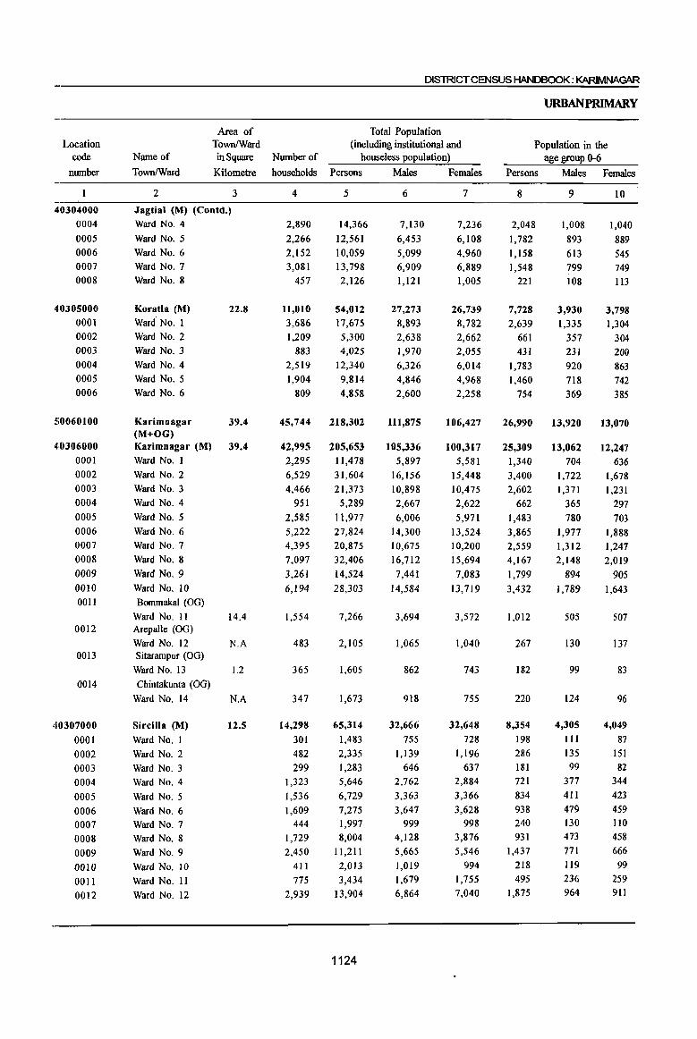
Location code
number
40304000
0004
0005
0006
0007
0008
40305000 0001
0002
0003 0004
0005
0006
5;0060100
410306000
0001
0002
0003
0004
0005
0006
0007
0008
0009 0010
Name of
TownlWard
2
Area of TownlWard in Square
Kilometre
3
Jagtial (M) (Contd.) Ward No.4
Ward No.5
Ward No.6
Ward NO.7
Ward No.8
Koratla (M)
Ward' No. 1
Ward No.2
Ward NO.3
Ward No.4
Ward No.5
Ward No.6
22.8
Karimnagar 39.4 (M+OG) Karimnagar (M) 39.4 Ward No. I
Ward No.2
Ward No.3
Ward No.4
Ward No.5
Ward No.6
Ward No.7
Ward No.8
Ward No.9
Ward No. IO 0011 Bommakal (OG)
0012
0013
Ward No. II Arepalle (OG)
Ward No. 12 Sitarampur (OG)
Ward No. 13
0014 Chintakunta (OG)
40307000
0001
0002
0003
0004
0005
0006
0007
0008
0009
0010
0011
0012
Ward No. 14
Sircilla (M)
Ward No.1
Ward No.2
Ward NO.3
Ward No.4
Ward NO.5
Ward NO.6
Ward NO.7
Ward NO.8
Ward NO.9
Ward No. 10 Ward No. 11
Ward No. 12
14.4
N.A
I.2
N.A
12.5
DISTRICT CENSUS HANDBOOK: KARIMNAGAR
Number of
households
Total Population (including institutional and
houseless population)
Persons Males Females
4
2,890
2,266
2,152
3,081
457
11,010 3,686
1,209
883
2,519
1,904
809
5
14,366
12,561
10,059
13,798
2,126
54,012 17,675
5,300
4,025
12,340
9,814
4,858
45,744 218,302
42,995 205,653
2,295 11,478
6,529 31,604
4,466
951
2,585
5,222
4,395
7,097
3,261
6,194
1,554
483
365
347
14,298
301
482
299
1,323
1,536
1,609 444
1,729 2,450
411
775
2,939
21,373
5,289
11,977
27,824
20,875
32,406
14,524
28,303
7,266
2,105
1,605
1,673
65,314
1,483
2,335
1,283
5,646
6,729
7,275
1,997
8,004
1l,211
2,013
3,434
13,904
1124
6
7,130
6,453
5,099
6,909
1,121
27,273
8,893
2,638
1,970 6,326
4,846
2,600
111,875
105,336
5,897
16,156
10,898
2,667
6,006
14,300
10,675
16,712
7,441
14,584
3,694
1,065
862
918
32,666
755
1,139 646
2,762
3,363
3,647
999
4,128
5,665
1,019 1,679
6,864
7
7,236
6,108
4,960
6,889
1,005
26,739 8,782
2,662
2,055 6,014
4,968
2,258
106,427
100,317 5,581
15,448
10,475
2,622
5,971
13,524
10,200
15,694
7,083
13,719
3,572
1,040
743
755
32,648
728
1,196
637 2,884
3,366
3,628 998
3,876
5,546
994
1,755
7,040
URBANPRIMARY
Population in the age group 0-6
Persons Males Females
8
2,048
1,782
1,158
1,548
221
7,728 2,639
661
431
1,783
1,460
754
26,990
25,309 1,340
3,400
2,602
662
1,483
3,865
2,559
4,167
1,799
3,432
1,012
267
182
220
8,354 198 286
181
721
834
938 240
931
1,437
218
495
1,875
9
1,008
893 613
799
108
3,930 1,335
357
231
920
718
369
13,920
13,062
704
1,722
1,371
365
780
1,977
1,312
2,148
894 1,789
505
130
99
124
4,305
III
135
99
377
411
479
130
473
771
119
236
964
10
1,040
889
545
749
113
3,798 1,304
304
200
863
742
385
13,070
12,241
636 1,678
1,231
297 703
1,888
1,241
2,019
905
1,643
507
137
83
96
4,049
87 151
82 344 423
459
110 458
666
99 259
911

PARTB-PRI~CENSUSABSTRACT
CENSUSABSfRACf
Scheduled Cas* population
Persons
11
1,898
662 445
543
137
4,127
496
78
85
1,773
1,664
31
20,362
18,289
83
1,509
2,898
600
404
6,051
1,114
1,454
645
3,531
1,324
501
136
112
3,114
4
1,533
9 253 IS3
27
46
131
637 19
161
141
MaleS
12
916
368 253
204 81
2,04;J
253 4J 37 ,
921 776
15
10,219
9,169
43
6511
1,46J.
300
207
3,079 602
no 324
1,781
668
252
61
63
1,527
2
735 5
94
75 14
20 100
324
9
85 64
Females
13
982
294
192
339
56
2,084
243 37
48
852 888
16
10,143
9,120
40
858
1,436 300 197
2,972
512 734 321
1,750
656
249
69
49
1,587 2
798
4
159
78 13
26 31
313 10
76
77
Scheduled Tribes population Literates
Persons Males Females Persons Males Females
14
34 6
23
122 43
726 531
14 5
162
14
3,608
3,477
242 209
3
12 168 382
1,102
477
882
so
37
23
21
469
8
69
15 21
4
283 20
5
6
38
IS
15
6 18
89
19
429
273
7
3 139
7
1,876
1,796
141 116
2
6 84
200 553 256
438
32
22
12
14
248
5
30 7
IO 2
155
II 2
3 23
16
19
5 33
24
297
258
7 2
23
7
1,732
1,681
101 93
I
6
84 182 549
221
444
18
15
11
7
221
3
39
8
II 2
128 9 3 3
15
1125
17
8,027
8,9H
6,136
9,145
1,614
31,488
9,849
3,437
2,774
6,862 5,838 2,728
157,676
150,282
8,512 25,130 16,135
3,872
8,529
19,444
16,233 22,264
10,159
20,004
3,853
1,351
1,038
1,152
39,527 900
1,408
794
3,805 4,416
4,410
1,461 5,237
6,814
1,474
1,945
6,863
18
4,666
5,022
3,599 5,119
952
18,160 5,788
1,966
1,568
4,075
3,297 1,466
88,238
83,811
4,793 13,580
8,779
2,048
4,736
11,002
8,854
12,786
5,819 11,414
2,266
790
642
729
23,630
525
824
482
2,076 2,616
2,691 819
3,160 4,187
829
1,169
4,252
19
3,361
3,889
2,537
4,026
662
13,328
4,061
1,471
1,206 2,787
2,541
1,262
69,438
66,471
3,719
11,550 7,356
1,824
3,793
8,442
7,379
9,478 4,340
8,590
1,587
561
396
423
15,897
375 584 312
1,729
1,800
1,719 642
2,077
2,627
645 776
2,611
Name of
TownlWard
2
Jagtial (M) (Contd.) Ward No.4
Ward No.5
Ward No.6
Ward NO.7
Ward NO.8
Koratla (M)
Ward No.1
Ward No.2
Ward NO.3
Ward No.4
Ward No.5
Ward NO.6
Karimnagar (M+OG) Karimnagar (M)
Ward No. I
Ward No.2
Ward NO.3 Ward NO.4
Ward NO.5
Ward No.6
Ward No.7
Ward No.8
Ward No.9
Ward No. 10
Bommakal (OG)
Ward No. II
Arepalle (OG) Ward No. 12
Sitarampur (OG) Ward No. 13 Chintakunta (OG)
Ward No. 14
Sircilla (M)
Ward No. I
Ward No.2
Ward No.3
Ward No.4
Ward No.5
Ward No.6
Ward NO.7
Ward No.8
Ward NO.9 Ward No. IO
Ward No. 11
Ward No. 12
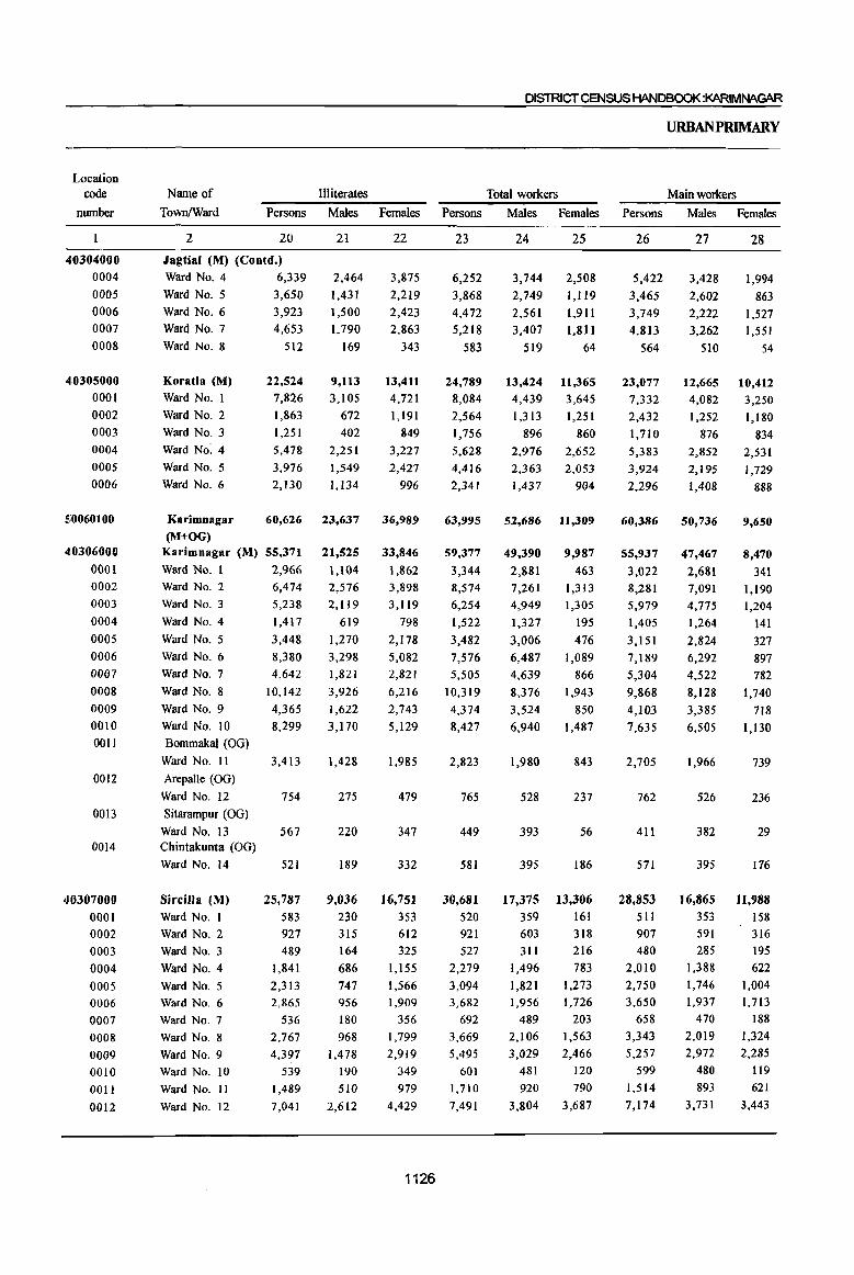
Location code
number
40304000 0004
OOOS 0006
0007
0008
40305000
0001
0002
0003
0004
OOOS 0006
510060100
410306000
0001 0002
0003
0004
0005
0006
0007
0008
0009
0010
0011
0012
0013
0014
'JOJ07000 0001 0002
0003
0004
0005 0006
0007
0008
0009 0010
001l
0012
DISlRICTCENSUSHANDBQOK:KARIMNAGAR
Illiterates Total workers Name of Town/Ward Persons Males Females Persons Males Females
2 20
Jagtial (M) (Coutd.)
Ward No. 4 6,339
Ward No.5 3,650
Ward No.6
Ward NO.7
Ward No.8
Koratla (M) Ward No.1
Ward No.2
Ward NO.3
Ward No.4
Ward No.5
Ward No.6
Karimnagar
(M+OG)
3,923
4,653
512
22,524
7,826
1,863
1,251
5,478
3,976
2,130
60,626
Karimnagar (M) 55,371
Ward No. 1 2,966 Ward No.2
Ward No.3
Ward No.4
Ward No.5
Ward No.6
Ward No.7
Ward No.8
Ward No.9
Ward No. 10
Bommakal (OG) Ward No. II
Arepalle (OG)
Ward No. 12
Sitarampur (OG)
Ward No. 13 Chintakunta (OG) Ward No. 14
Sircilla (M) Ward No.1 Ward No.2
Ward No.3
Ward NO.4
Ward No.5 Ward NO.6
Ward No.7
Ward No.8
Ward No.9 Ward No. 10
Ward No. II
Ward No. 12
6,474
5,238
1,417
3,448
8,380 4,642
10,142
4,365
8,299
3,413
754
567
521
25,787
583 927
489
1,841
2,313 2,865
536
2,767
4,397 539
1,489
7,041
21
2,464
1,431
1,500
1,790
169
9,113
3,105
672
402
2,251
1,549
1,134
23,637
21,525
1,104
2,576 2,119
619
],270
3,298 1,821
3,926
1,622 3,]70
1,428
275
220
189
9,036 230 315
164
686
747 956
180
968
1,478
190
510
2,612
22
3,875
2,219
2,423
2,863
343
13,411 4,721
1,191
849
3,227
2,427
996
36,989
33,846
1,862 3,898
3,119
798
2,178
5,082
2,821
6,216
2,743
5,129
1,985
479
347
332
16,751
353 612
325
1,155
1,566 1,909
356
1,799
2,919
349
979
4,429
1126
23
6,252
3,868
4,472
5,218
583
24,789
8,084
2,564
1,756
5,628
4,416
2,341
63,995
59,377
3,344 8,574
6,254
1,522
3,482
7,576 5,505
10,319
4,374
8,427
2,823
765
449
581
30,681 520 921
527
2,279
3,094 3,682
692
3,669
5,495 601
1,710
7,491
24 25
3,744 2,508
2,749 1,119
2,561
3,407
519
13,424 4,439
1,313
896
2,976
2,363
1,437
52,686
49,390
2,881
7,261 4,949
1,327
3,006
6,487
4,639
8,376
3,524
6,940
1,980
528
393
395
17,375
359 603 311
1,496
1,821 1,956
489
2,106
3,029 481
920
3,804
1,911
1,811
64
11,365
3,645
1,251
860
2,652
2,053
904
11,309
9,987
463 1,313 1,305
195
476
1,089
866
1,943
850
1,487
843
237
56
186
13,306 161
318 216
783
1,273 1,726
203 1,563
2,466 120
790
3,687
URBANPRIMARY
Main workers
Persons Males Females
26
5,422
3,465
3,749
4,813
564
23,077
7,332
2,432
1,710
5,383
3,924
2,296
60,386
55,937
3,022 8,281 5,979
1,405
3,151
7,189
5,304
9,868
4,103
7,635
2,705
762
411
571
28,853 511 907 480
2,010
2,750 3,650
658 3,343
5,257 599
1,514
7,174
27
3,428
2,602
2,222
3,262
510
12,665 4,082
1,252
876
2,852
2,195
1,408
50,736
47,467
2,681 7,091
4,775
1,264
2,824
6,292 4,522
8,128
3,385 6,505
1,966
526
382
395
16,865 353 591 285
1,388
1,746 1.937
470 2,019
2,972
480
893 3,731
28
1,994
863 1,527
1,551
54
10,412
3,250
1,180
834 2,531
1,729
888
9,650
8,470.
341 1,190 1,204
141
327
897 782
1,740
718 1,130
739
236
29
176
11,988 158 316
195 622
1,004 1,713
188 1,324
2,285 119
621
3,443

PARTS- PRIMARY iCENSUSABSTRACT
CENSUSABSTRAcr
Industrial category of main workers
Cultivators Agricultural Labourers Household industry wodcers Other wodcers
Persons Males Females Persons Males Females Persons Males Females Persons Males Females
29
30
39
283
169
30
26
33
167
138
339 254
183 135
67
9
53
23
4
49
6
38
22
4
543 419
321
2
95
52
5 11
9
26
33
13 75
262
2
83
40
5 9
7
14
28
9 65
192 138
12 8
13
5
179
8 19
13
4
6
11
6
42 43
2
17 8
8
3 .
124
5
13 10
4
5
9
6
23
29
I
14
5
31
4
6 116
31
32
379
83 416
313
2
85 1,110
48 410
18
3
IS
I
27
3
273
278
119
l24 1,249
59
12
12
2
2
12
5 4
10
54
4
5
2
55
3 6
3
1
2
19
14
1
3 3
337
11
15
39
4
52
31
59
79 46
694
200
9
9
842
2
288
3
13 30
22 2
108 152
21
75 126
33
234
59 237
202
2
34
145
24 179
HI
35
1,132
639 829
965
16
708 402 9,050
234 176 2,808
15
2
175
185
97
12
1
98
93
22
1,064
686
2,078
1,559
855
36
123
69 59
98
10
37
1,009
570 770
867
6
912 8,138
316 2,492
53
109
123
220
91
1,011
577
1,955
1,339
764
38
3,881
2,704 2,221
3,366
546
39
3,045
2,441 1,759
2,824
498
40
836
263 462
542
48
12,578 10,791 1,787
3,931 3,397 534
1,274
1,012
2,979
2,064
1,135
759
2,516
1,768
1,318 1,216
139 253
463
296
102
613 636 2,305 1,168 1,137 56,289 48,536 7,753
225
6 H
27
4
30
17
35
57 37
112
5 4
12
22
14
24
22
9
299 395
80 120
6
3
461
1
184
8 22 12
58
91
16
37
32
3
6
381
1
104
3
5 8
10
2
50
61
5
38
94
2,050 164
121
109
54
70 331
123
376
195 507
53
80
3
119
14,007
249
140
225
736 1,113 1,856
154
1,465
3,095
95
981
3,898
1,089
51
70
65
45 55
217
60
150
93 283
37
16
25
4,735
114
28
66
303 405 529
33
466
1,076
14
428
1,273
1127
961
113
51
44 9
15 114
63
226
102 224
16
64
2
94
9,272
135
112
159
433 708
1,327
121
999 2,019
81
553 2,625
53,229
2,845
8,050
5,779
1,345 3,066
6,797
5,124
9,400
3,816
45,891 7,338
2,622 223
6,927 1,123
4,643 1,136
1,213 132 2,756 310
6,038 759
4,431 693
7,915 1,485
3,226 590 7,007 6,120 887
1,766 1,492 274
470 422 48
386
438
13,825
252
460
239
1,257 1,601 1,761
496
1,728
1,967
481
441
3,142
367 19
364 74
11,545 2,280
233 19
366 94
209
1,073 1,314 1,387
431
1,472
1,776
449
414
2,421
30
184 287 374
65
256
191
32
27
721
Name of
TownlWard
2
Jagtial (M) (eontd.)
Ward No.4
Ward No.5 Ward No.6
Ward No.7
Ward No.8
Koratia (M)
Ward No. I
Ward No.2
Ward No.3
Ward No.4
Ward No.5
Ward No.6
Karimnagar (M+OG)
Karimnagar (M)
Ward No. I
Ward No.2
Ward No.3
Ward No.4 Ward No.5
Ward No.6
Ward No.7
Ward No.8
Ward No.9
Ward No. 10
Bommakal (OG)
Ward No. 11
Arepalle (OG) Ward No. 12
Sitarampur (OG)
Ward No.13
Chintakunta (00)
Ward No. 14
Sircilla (M)
Ward No. I
Ward No.2
Ward No.3
Ward No.4
Ward No.5 Ward No.6
Ward No.7
Ward No.8
Ward No.9
Ward No. 10
Ward No. 11
Ward No. 12
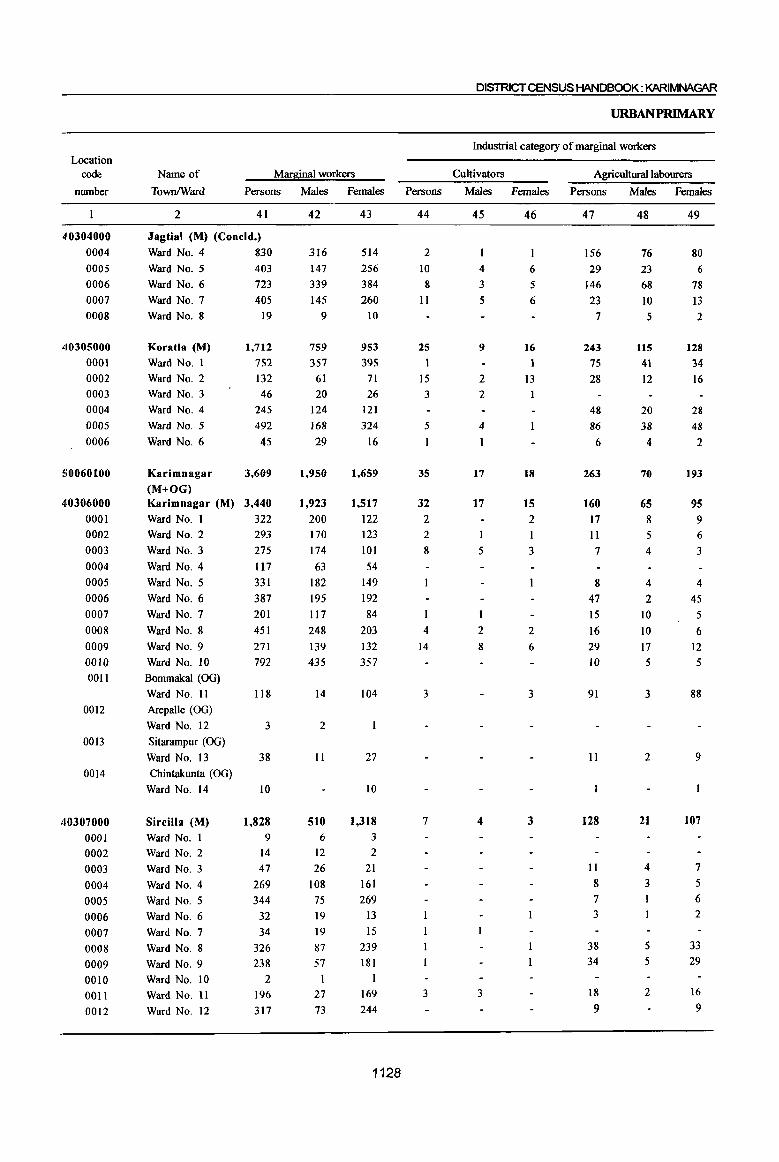
Location code
DISTRICT CENSUS HANDBOOK: KARIMNAGAR
URBANPRIMARY
Industrial category of marginal workers
Marginal workers Cultivators Agricultural labourers
number
Name of
Town/Ward Persons Males Females Persons Males Females Persons Males Females
410304000
0004 0005 0006 0007 0008
410305000
0001 0002 0003 0004 0005 0006
S0060100
410306000 0001 0002 0003 0004 0005 0006 0007 0008 0009 0010 001l
0012
0013
2 41
Jagtial (M) (Concld.)
Ward No. 4 830 Ward No.5
Ward No.6
Ward NO.7
Ward No.8
Koratla (M)
Ward No.1
Ward No.2
Ward NO.3
Ward NO.4
Ward No.5
Ward NO.6
Karimnagar
(M+OG)
403 723
405 19
1,712
752
132 46
245
492 45
3,609
Karimnagar (M) 3,440
Ward No. 1 322
Ward No.2
Ward No.3
Ward No.4
Ward No.5
Ward No.6
Ward No.7
Ward No.8
Ward No.9
Ward No. 10
Bommakal (OG)
Ward No. II Arepalle (OG)
Ward No. 12
Sitarampur (00)
Ward No. 13
293
275 117 331
387
201 451 271 792
118
3
38 0014 Chintakunta (00)
40307000 0001 0002 0003 0004 0005 0006 0007 0008 0009 0010 0011 0012
Ward No. 14
Sircilla (M)
Ward No. I Ward No.2
Ward No.3
Ward No.4
Ward NO.5
Ward No.6
Ward No.7
Ward No.8
Ward No.9
Ward No. 10 Ward No. 11
Ward No. 12
10
1,828 9
14
47 269 344
32
34 326
238
2 196 317
42
316 147 339 145
9
759
357 61 20
124
168 29
1,950
1,923 200 170 174 63
182 195 117 248
139 435
14
2
II
510 6
12 26
108 75 19 19 87 57
27 73
43
514
256
384
260 10
953
395
71 26
121 324
16
1,659
1,517 122 123
101 54
149
192 84
203
132 357
104
27
10
1,318
3
2
21 161 269
13
15 239
181
169 244
1128
44
2
10 8
11
25 1
15 3
5
35
32 2 2
8
I
4
14
3
7
3
45
4 3
5
9
2
2
4
I
17
17
1
5
2
8
4
3
46
6
5
6
16
1
13
18
15 2 I
3
2 6
3
3
47
156
29 146 23
7
243
75 28
48
86 6
263
160
17 11
7
8 47 15 16 29
10
91
11
128
11
8
7 3
38 34
18 9
48
76 23 68
10 5
115
41
12
20 38
4
70
65 8 5
4
4
2 10 10 17 5
3
2
21
4
3
5 5
2
49
80 6
78
13
2
128
34
16
28
48
2
193
95 9
6
3
4
45 5
6 12 5
88
9
107
7
5 6 2
33 29
16
9
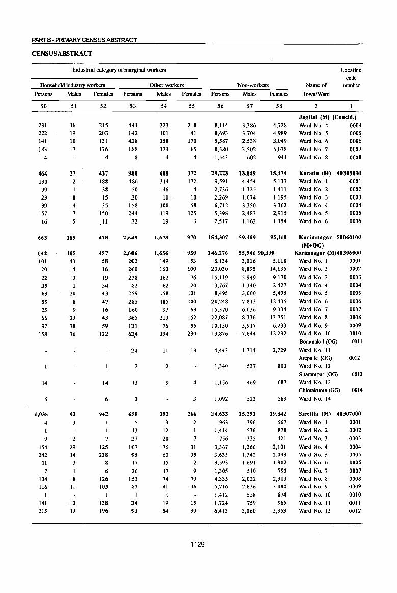
PARTB - PRIMARY PENSUSABSTRACT
Indtlstrlal category of marginal workers
Household indus'lf' workers
Persons
50
231
222
141
183
4
464 190
39 23
39 157
16
663
642 101
20
22
35 63
55 25
66
97
158
14
6
1,035
4
I
9 154 242
11
7
134 116
I
141
215
Males
51
16
19
10
7
27 2
1
8 4 7 5
185
185
43
4
3
20
8
9 23
.38 36
93
3
2 29 14
3
I
8 II
3
19
Females Persons
52
215 203
131
176
4
437
188
38 15
35 150
II
478
457
58
16
19
34
43
47
16
43
59
122
14
6
942
7
125 228
8
6
126 105
I
138
196
53
441
142
428
188
8
980 486
50 20
158
244 22
2,648
2,606
202
260
238
82
259
285
160
365
l31 62,4
24
2
13
3
658
5
l3
27
107
95 17
26
153 87
I
34
93
Other workers
Males Females Persons
54
223
101
258
123
4
608 314
46
10
100
119
19
1,678
1,656
149
160
162
62 158
185
97
213
76
394
11
2
9
392
3
12
20
76 60
15
17
74 41
1
19 54
55
218 41
170
65
4
372
172
4
10
58
125
3
970
950
53
100
76
20 101
100
63
152
55
230
I3
4
3
266
2
I
7 31 35
2
9
79 46
15
39
1129
56
8,114
8,693
5,587
8,580
1,543
29,223 9,591
2,736
2,269
6,712
5,398 2,517
154,307
1416,276
8,134
23,030
15,119
3,767 8,495
20,248
15,370
22,087
10,150
19,876
4,443
1,340
1,156
1,092
34,633
963
1,414
756
3,367 3,635
3,593
1,305
4,335 5,716
1,412
1,724
6,413
Non-workers
Males
57
3,386
3,704
2,538
3,502
602
13,849 4,454
1,325
1,074
3,350
2,483 1,163
59,189
Females
58
4,728 4,989
3,049
5,078
941
15,374
5,137
1,411
1,195
3,362
2,915 1,354
95,118
55,946 90,330
3,016 5,118
8,895 14,135
5,949 9,170
1,340 3,000
7,813
6,036
8,336
3,917 7,644
1,714
537
469
523
15,291
396
536
335 1,266 1,542
1,691
510
2,022 2,636
538
759 3,060
2,427
5,495
12,435
9,334
13,751
6,233
12,232
2,729
803
687
569
19,342
567
878
421
2,101 2,093
1,902
795
2,313 3,080
874
965
3,353
Name of
Town!Ward
2
Location code
nwnber
1
Jagtial (M) (Cooeld.)
Ward No. 4 0004 Ward No.5 0005
Ward No. 6 0006 Ward NO.7
Ward NO.8
0007
0008
Koratla (M) 40305000
Ward No.1 0001
Ward No.2
Ward No.3 Ward No.4
Ward NO.5 Ward NO.6
0002
0003 0004
0005
0006
Karimnagar 50060100
(M+OG) Karimnagar (M)40J06000
Ward No. 1 0001
Ward No. 2 0002
Ward No. 3 0003
Ward No.4 Ward No.5
Ward NO.6
Ward NO.7
Ward NO.8
Ward No.9
Ward No. 10
Bommakal (OG)
Ward No. 11
Arepalle (OG)
Ward No. 12
0004 0005
0006
0007
0008
0009
0010
001l
0012
Sitarampur (OG) 0013
Ward No. 13
Chintakunta (OG)
Ward No. 14
0014
Sircilla (M) 40307000
Ward No. 1 0001
Ward No. 2 0002
Ward No. 3 0003
Ward No.4 Ward No.5
Ward No.6
Ward No.7
Ward No.8 Ward No.9
Ward No. 10
Ward No. 11
Ward No. 12
0004
0005 0006
0007
0008 0009
0010
0011
0012

ANNEXURES

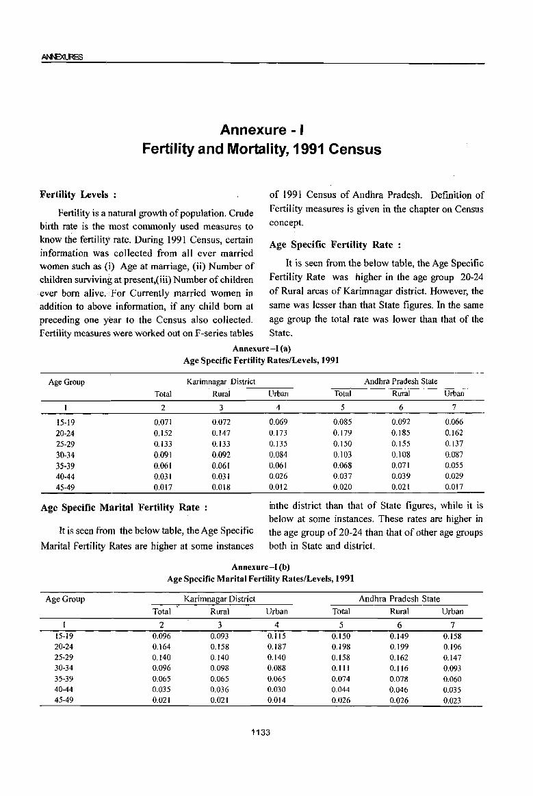
Annexure -I Fertility and Mortality, 1991 Census
Fertility Levels :
Fertility is a natural growth of population. Crude birth rate is the most commonly used measures to know the fertility rate. During 1991 Census, certain information waS collected from all ever married women such as (i) Age at marriage, (ii) Number of children surviving at present,(iii) Number of children ever born alive. :For Currently married women in
of 1991 Census of Andhra Pradesh. Definition of
Fertility measures is given in the chapter on Census concept.
Age Specific Fertility Rate :
. addition to above information, if any child born at preceding one year to the Census also collected.
It is seen from the below table, the Age Specific
Fertility Rate was higher in the age group 20-24
of Rural areas of Karimnagar district. However, the
same was lesser than that State figures. In the same
age group the total rate was lower than that of the
Fertility measures were worked out on F-series tables State.
Age Group
15-19 20-24 25-29
30-34 35-39 40-44 45-49
Total
2
0.071 0.152 0.133 0.091 0.061 0.031 0.017
Annexure-I (a) Age Specific Fertility Rates/Levels, 1991
Karimnagar District
Rural Urban Total
3 4 5
0.072 0.069 0.085
0.147 0.173 0.179
0.133 0.135 0.150
0.092 0.084 0.103
0.061 0.061 0.068 0.031 0.026 0.037
0.018 0.012 0.020
Andhra Pradesh State
Rural Urban
6 7
0.092 0.066 0.185 0.162 0.155 0.137
0.108 0.087 0.071 0.055 0.039 0.029 0.021 0.017
Age Specific M~rital Fertility Rate : inthe district than that of State figures, while it is below at some instances. These rates are higher in
It is seen from the below table, the Age Specific the age group of 20-24 than that of other age groups
Marital Fertility Rates are higher at some instances both in State and district.
Age Group
15-19 20-24 25-29 30-34 35-39 40-44 45-49
Annexure-I (b)
Age Specific Marital Fertility Rates/Levels, 1991
Karimnagar District
Total Rural Urban Total
2 3 4 5 0.096 0.093 0.115 0.150 0.164 0.158 0.187 0.198 0.140 0.140 0.140 0.158 0.096 0.098 0.088 0.111 0.065 0.065 0.065 0.074 0.Q35 0.036 0.030 0.044 0.021 0.021 0.014 0.026
1133
Andhra Pradesh State
Rural
6 0.149 0.199 0.162 0.116 0.Q78
0.046 0.026
Urban
7 0.158 0.196 0.147 0.093 0.060 0.035 0.023
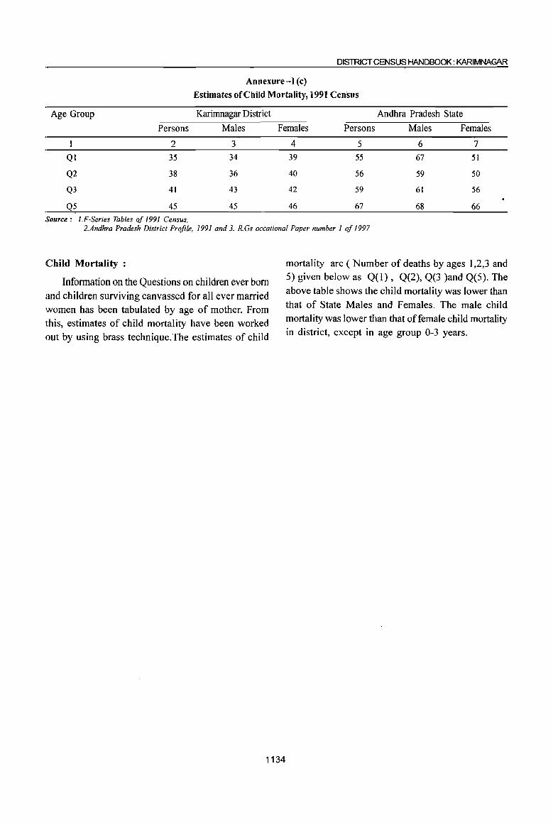
DISTRICT CENSUS HANDBOOK: KARIMNAGAR
Annexure-I (c)
Estimates of Child Mortality, 1991 Census
Age Group Karimnagar District Andhra Pradesh State
Persons Males Females Persons Males Females
QI
Q2
Q3
Q5
2
35
38
41
45 Source: I.F-Series Tables of 1991 Census.
3 4
34 39
36 40
43 42
45 46
5 6 7
55 67 51
56 59 50
59 61 56
67 68 66
2.Andhra Pradesh District Profile. 1991 and 3. R.Gs occational Paper number 1 of 1997
Child Mortality :
Information on the Questions on children ever born
and children surviving canvassed for all ever married women has been tabulated by age of mother. From this, estimates of child mortality have been worked out by using brass technique.The estimates of child
1134
mortality are ( Number of deaths by ages 1,2,3 and 5) given below as Q(l), Q(2), Q(3 )and Q(5). The
above table shows the child mortality was lower than that of State Males and Females. The male child mortality was lower than that offemale child mortality in district, except in age group 0-3 years.

Annexure -II Various measures of Fertility and Mean Age at Marriage
1991 Census
Sl. Name of State I Child Total Total General General No. of Child- Mean No. District Birth Fertility Marital Fertility Marital children Woman age at
Rate Rate Fertility Rate Fertility per ever Ratio marriage Rate Rate married (0-4) of
women currently in the married
age group women 45-49
2. 3 4 5 6 7 8 9 to
Andhra Frradesh 27.9 3.4 4.5 112 136 3.8 437 16.8
1 Srikakularn 27.1 3.4 4.5 107 134 3.8 446 17.7
2 Vtzianagararn 27.5 3.4 4.5 106 131 3.6 402 17.9
3 Visakhapatnam 29.0 3.4 4.5 110 138 3.5 389 17.3
4 East Godavari 29.0 3.4 4.5 114 139 3.7 428 16.6
5 West Godavari 26.1 3.0 4.4 102 126 3.7 412 16.9
6 Krishna 28.1 3.3 5.1 110 144 3.5 395 17.0
7 Guntur 26.8 3.2 4.2 106 128 3.5 387 16.7
8 Prakasam 28.3 3.5 4.4 116 137 3.7 426 17.0
9 Nellore 26.6 3.1 4.3 103 127 3.5 387 17.6
to Chittoor 26.6 3.1 4.3 103 127 3.4 386 17.8
II Cuddapah 26.9 3.4 4.4 108 132 3.6 401 18.0
12 Anantapur 30.4 3.9 5.0 126 152 4.1 457 17.7
13 Kumool 32.9 4.3 5.3 141 169 4.4 533 l7.t
14 Mahbubnagar 33.5 4.5 5.2 145 167 4.4 540 15.7
15 Rangareddi 31.1 3.9 5.0 129 156 4.1 494 16.5
16 Hyderabad 33.9 4.1 6.4 135 188 3.8 417 18.3
17 Medak 31.3 4.2 4.9 134 156 3.9 503 15.7
18 Nizamabad 27.5 3.3 4.2 109 132 3.7 445 15.7
19 Adilabad 30.2 3.8 4.8 126 150 4.1 506 16.4
20 Karimnagar 28.1 3.4 4.1 Il2 131 3.7 409 15.5
21 Warangal 31.6 4.1 4.8 130 150 4.1 452 15.4
22 Kharnmam 30.4 3.7 4.7 124 149 4.2 455 16.8
23 Nalgonda 32.9 4.3 5.1 139 159 4.0 484 15.5 Source: 1. F-series 'tables of /99/ Census
2. Andhra Pradesh district projile,1991 Census 3. R.G's occasional paper of 1997
Fertility Measures : State in TMFR, GMFR, CWR and mean age at
The above table shows the various measures of marriage of currently married woman. This district
fertility and mean age at marriage recorded during has recorded higher rate in CBR, while remaining
1991 Census. They recorded lower rates than that of are equal to state rates.
1135

DISTRICT CENSUS HANDBOOK: KARIMNAGAR
Annexure III Percentage distribution of Migrants by place of birth/place of last
residence, 1991 Census and 2001 Census
Migration :
The migrants by place of birth in Andhra Pradesh State were returned 194.64 lakhs as per the 1991 Census, comprising of 62.53 lakhs were males and
132.11 lakhs. were females. These migrants constitute 29.27% of the total population. Male constitute 18.54% of the males population and female constitute 40.30%
of the female population.
Annexure- ID(a)
Distribution of Migrants by Place of Birth and Percentage, 1991 Census
Place of Birth Karimnagar District Andhra Pradesh State
Persons Males Females Persons Males Females
2 3 4 5 6 7 (a) Migrants born 8,21,246 2,09,834 6,11,412 18,406,950 5,847,797 12,559,153
within the state (97.18 ) (94.90 ) (97.99 ) (94.56) (93.52) (95.06) of enumeration
(i) Migrants born 6,65,680 1,57,522 5,07,758 13,816,569 4,038,900 9,777,669 elsewhere in the (78.78) (71.42 ) (81.38) (70.98) (64.59) (74.01) District of enumeration
(ii)Migrants born 1,55,566 51,912 1,03,654 4,590,381 1,808,897 2,781,484 in other Districts (18.40) (23.48) (16.61 ) (23.58) (28.93) (21.05) of State
(b) Migrants born 23,151 10,910 12,241 1,026,863 388;924 637,939 in other States (2.74 ) (4.93) (1.96) (5.28) (6.22) (4.83) ofIndia
(c) Migrants born 640 360 280 30,6]0 ]6,120 14,490 in other countries (0.08) (0.16) (0.05) (0.16) (0.26) (0.11)
Total Migrants 8,45,037 2,21,104 6,23,933 194,64,423 62,52841 1,32,11582 (100.00) (100.00) (100.00) (100.00) (100.00) (100.00)
Source: Part -VA and VB - D Series, J 991 ( Vol-I)
In Karimnagar district too females migrants were district by place of birth, it can be seen from the more in number than that of males in all categeries above table that the intra district migration was more except, those who born in other countries. Males were than that of State in both the sexes. While migrants fonning more percentage in inter district migrants to from other districts of the State and other States of 1total male migrants than that of female inter district India were lesser percentage in the district than that migrants percentage to total female migrants. Similiar of state. The number of female internal migrants are is in case of Inter state migrants also.
more at all level, which was natural due to marriages. From the distribution of total migrants in the
1136

Inset table to Annexure lli(a) Distribution ofMigraots by Place of Birth and Percentage, 2001 Census
Place of Birth Karimnagar District Andhra Pradesh State
Persons Males
2 3
(a) Migrants bOrn 988,732 248,571 within the state (97.8) (95.6) of enumeration (i) Migrants born 827,259 192,168
elsewher¢ in the (81.8) (73.9) District Qf enumeration
(ii)Migrants born 161,473 56,403 in other Districts (16.0) (21.7)
of State (b) Migrants bOrn 21,768 11,335
in other States (2.2) (4.4) of India
(c) Migrants born 316 186 in other countries (0.1)
Total Migrant~ 1,010,816 260,092 (100.0) (100.0)
Source: Migration Ta'bles (D Series) - 2001
the migrants by place of birth were returned
194.6 and 228.3 lakhs in Andhra Pradesh State as per the 1991 and 2001 Censuses respectively. It shows a growth 'fate of 17.3% total migrants over
1991 Census with a breakup of 21.8% males and 15.2%· females. In Karimnagar district the migrants are 845,037 per~ons as per 1991 Census whereas 1,010,816 persons are in 2001 Census with a growth
Females Persons Males Females
4 5 6 7
740,161 21,782,141 7,205,057 14,577,084 (98.6) (95.4) (94.6) (95.8)
635,091 16,899,184 5,147,046 11,752,138 (84.6) (74.0) (67.6) (77.2)
105,070 4,882,957 2,058,011 2,824,946 (14.0) (21.4) (27) (18.6)
10,433 1,029,252 399,416 629,836 (1.4) (4.5) (5.2) . (4.1)
130 22,913 12,981 9,932 (0.1) (0.2) (0.1)
750,724 22,834,306 7,617,454 15,216,852
(100.0) (100.0) (100.0) (100.0)
rate of 19.6% over 1991 census. In both the Censuses the female migrants are more than male migrants due to marriages.
In respect of inter district migrants, male migrants are fonning less percentage than female migrants. In the case of inter-state migrants the males are more than females in both the Censuses. Similar is jn case of International Migrants.
Annexure lli(b) Rural and Urban composition ofinternal Migrants by place of birth, 1991 Census
Place of Birth Place of Enumeration Total Rural Urban
2 3 4
Andhra Pradesh State
Total Internal Migrants
l. Within the State Total 18,406,950 12,827,832 5,579,118
(100.00) (69.69) (30.31)
Rural 15,623,336 11,766,977 3,856,359
(84.88) (63.92) (20.95)
Urban 2,772,174 1,052,205 1,719,969
(15.06) (5.72) (9.34)
1137
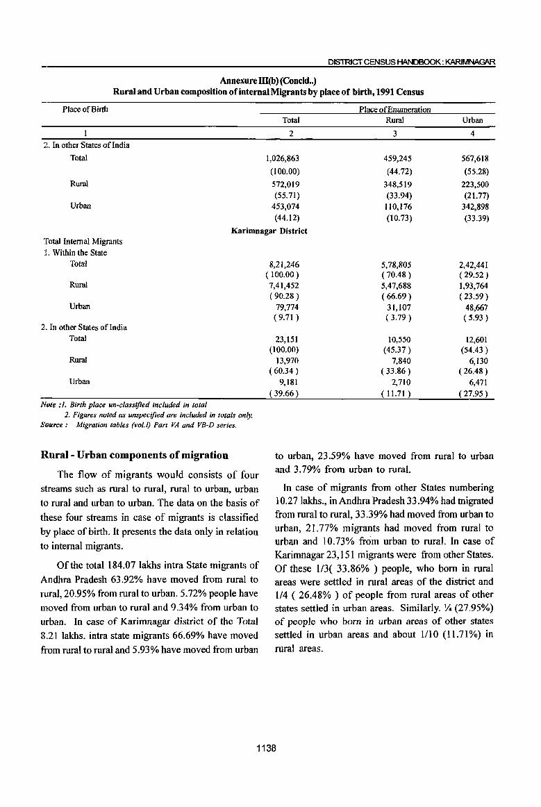
DISTRICT CENSUS HANDBOOK: KARIMNAGAR
Annexure m(b) (Condd .. ) Rural and Urban composition of internal Migrants by place of birth, 1991 Census
Place of Birth Place of Enumeration Total Rural Urban
2 3 4 -2. In other States of India
Total 1,026,863 459,245 567,618
(100.00) (44.72) (55.28)
Rural 572,019 348,519 223,500 (55.71) (33.94) (21.77)
Urban 453,074 1l0,176 342,898 (44.12) (10.73) (33.39)
Karimnagar District Total Internal Migrants
:t. Within the State Total
Rural
Urban
2. In other States of India Total
Rural
Urban
Note: 1. Birth place un-classified included in lolal 2. Figures noled as unspecified are included in totals only.
Source: Migralion tables (vol.I) Part VA and VB-D series.
Rural- Urban components of migration
The flow of migrants would consists of four streams such as rural to rural, rural to urban, urban
to rural and urban to urban. The data on the basis of
these four streams in case of migrants is classified by place of birth. It presents the data only in relation
to internal migrants.
Of the total 184.07 lakhs intra State migrants of
Andhra Pradesh 63.92% have moved from rural to IUral, 20.95% from rural to urban. 5.72% people have moved from urban to rural and 9.34% from urban to urban. In case of Karimnagar district of the Total
8.21 lakhs. intra state migrants 66.69% have moved
from rural to rural and 5.93% have moved from urban
8,21,246 ( 100.00) 7,41,452 (90.28 )
79,774 (9.71 )
23,151 (100.00)
13,970 (60.34 )
9,181 (39.66 )
5,78,805 ( 70.48) 5,47,688 (66.69 )
31,107 (3.79 )
10,550 (45.37 )
7,840 (33.86 )
2,710 (11.71)
2,42,441 (29.52 ) 1,93,764 (23.59 )
48,667 (5.93 )
12,601 (54.43 )
6,130 (26.48 )
6,471 (27.95 )
to urban, 23.59% have moved from rural to urban and 3.79% from urban to rural.
In case of migrants from other States numbering 10.27Iakhs., in Andhra Pradesh 33.94% had migrated from rural to rural, 33.39% had moved from urban to urban, 21.77% migrants had moved from rural to urban and 10.73% from urban to rural. In case of Karimnagar 23,151 migrants were from other States. Of these 113( 33.86% ) people, who born in rural areas were settled in rural areas of the district and 114 ( 26.48% ) of people from rural areas of other states settled in urban areas. Similarly. lJ.i (27.95%) of people who born in urban areas of other states settled in urban areas and about 1110 (11.71%) in
rural areas.
1138
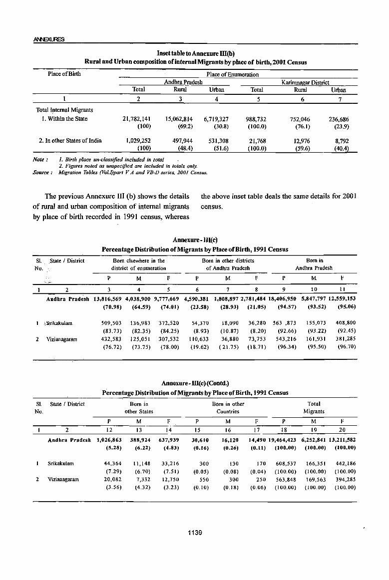
Inset table to Annexure III(b) Rural and Urban composition of internal Migrants by place of birth,2001 Census
Place of Birth Place of Enumeration Andhra Pradesh Karimnagar District
Total Rural Urban Total Rural Urban 1 2 3 4 5 6 7
Total Internal Migrants
I. Within the State 21,782,141 15,062,814 6,719,327 988,732 752,046 236,686 (toO) (69.2) (30.8) (100.0) (76.1) (23.9)
2. In other States oflndia 1,029,252 497,944 531,308 21,768 12,976 8,792 (100) (48.4) (51.6) (100.0) (59.6) (40.4)
Note: 1. Birth place un-classified included in total 2. Figures noted as unspecified are included in totals only.
Source: Migration Tables (Vol./)part V A and VB-D series, 2001 Census.
The previous Annexure III (b) shows the details
of rural and urban composition of internal migrants
by place of birth recorded in 1991 census, whereas
the above inset table deals the same details for 2001
census.
SI. State / District No.
2
Andbra Pradesb
;:Srikakulam
2 Vizianagaram
SI. State / District No.
2
Andhra Pradesb
Srikakulam
2 Vizianagaram
Annexure - III(c)
Percentage Distribution of Migrants by Place of Birth, 1991 Census
Born elsewhere in the Born in other districts Born in district of enumeration of Andhra Pradesh Andhra Pradesh
p
3
13,816,569
(70.98)
509,503
(83.73)
432,583
(76.72)
M
4
4,038,900
(64.59)
136,983
(82.35)
125,051
(73.75)
F
5
9,777,669
(74.01)
372,520
(84.25)
307,532
(78.00)
P
6
4,590,381
(23.58)
54,370
(8.93)
110,633
(19.62)
M F P
7 8 9
1,808,897 2,781,484 18,406,950
(28.93)
18,090
(10.87)
36,880
( 21.15)
(21.05)
36,280
(8.20)
73,753
(18.71)
(94.57)
563 ,873
(92.66) 543,216
(96.34)
Annexure - m(c) (Contd.)
Percentage Distribution of Migrants by Place ofBirtb, 1991 Census
Born in Born in other other States Countries
p M F P M F P
12 13 14 15 16 17 18
1,026,863 388,924 637,939 30,610 16,120 14,490 19,464,423 (5.28) (6.22) (4.83) (0.16) (0.26) (0.11) (100.00)
44,364 11,148 33,216 300 130 170 608,537 (7.29) (6.70) (7.51) (0.05) (0.08) (0.04) (100.00)
20,082 7,332 12,750 550 300 250 563,848 (3.56) (4.32) (3.23) (0.10) (0.18) (0.06) (lOO.OO)
1139
M F
10 11
5,847,797 12,559,153
(93.52)
155,073
(93.22)
161,931
(95.50)
Total Migrants
M
19
6,252,841
(100.00)
166,351
(100.00)
169,563
(100.00)
(95.06)
408,800
(92.45)
381,285
(96.70)
F
20
13,211,582 (100.00)
442,186
(100.00)
394,285
(100.00)
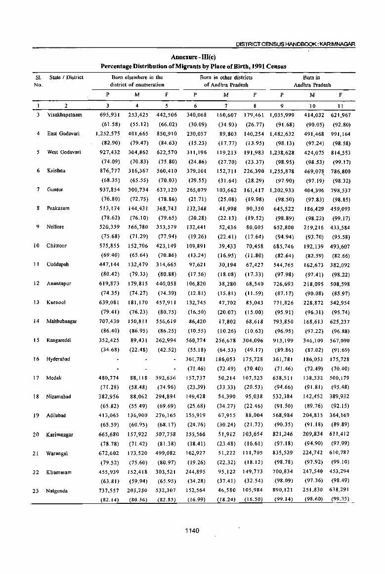
SI. State I District No.
2
3 Visakhapatnam
4 East Godavari
5 West Godavari
6 Krishna
7 Guntur
8 Prakasam
9 Nellore
10 Chittoor
11 Cuddapah
12 Anantapur
13 Kurnool
14 Mahhubnagar
1 5 Rangareddi
16 Hyderabad
17 Medak
1 8 Nizamabad
19 Adilabad
20 Karimnagar
21 Warangal
22 Khammam
23 Nalgonda
DISTRICT CENSUS HANDBOOK: KARlMNAGAR
Annexure - ID(c) Percentage Distribution of Migrants by Place of Birth, 1991 Census
Born elsewhere in the district of enumeration
Born in other districts of Andhra Pradesh
Born in Andhra Pradesh
P
3
695,931
(61.58)
1,252,575
(82.90)
927,432
(74.09)
876,777
(68.35)
937,854
(76.80)
513,174
(78.62)
520,359
(75.68)
575,855
M
4
253,425
(55.12)
401.665
(79,47)
304,862
(70.83)
316,367
(65.55)
300,734
(72.75)
144,431
(76.10)
166,780
(71.29)
152,706
F
5
442,506
(66.02)
850,910
(84.63)
622,570
(75.80)
560,410
(70.03)
637,120
(78.86)
368,743
(79.65)
353,579
(77.94)
423,149
(69,40) (65.64) (70.86)
447,144
(80.42)
132,479
(79.33)
314,665
(80.88)
P
6
340,068
(30.09)
230,057
(15.23)
311,196
(24.86)
379,101
(29.55)
265,079
(21.71 )
132,348
(20.28)
132,441
(19.26)
109,891
(13.24)
97,621
(17.56)
619,873 179,815 440,058 106,820
(74.35) (74.27) (74.39) (12.81)
639,081
(79,41 )
707,430
(86,40)
352,425
(34.68)
480,774
(71.28)
382,956
(65.82)
413,065
(65.59)
665,680
(78.78)
672,602
(79.52)
455,939
(63.81)
737,557
(82.14)
181,170 457,911
(76.23) (80.75)
150,811
(86.95)
89,431
(22,48)
88,118
(58,48)
88,062
(55.49)
136,900
(60.95)
157,922
(71.42)
173,520
(75.60)
152,418
(59.94)
205,250
(80.36)
556,619
(86.25)
262,994
(42.52)
392,656
(74.96)
294,894
(69.69)
276,165
(68.17)
507,758
(81.38)
499,082
(80.97)
303,521
(65.95)
532,307
(82.85)
132,745
(16.50)
86,420
(10.55)
560,774
(55.18)
361,781
(71.46)
157,737
(23.39)
149,428
(25.68)
155,919
(24.76)
155,566
(18.41)
162,927
(19.26)
244,895
(34.28)
152,564
(16.99)
1140
M
7
160,607
(34.93)
89,803
(17.77)
119,213
(27.70)
152,711
(31.64)
103,662
(25.08)
41,998
(22.13)
52,436
(22.41)
39,433
F p
8 9
179,461 1,035,999
(26.77) (91.68)
140,254 1,482,632
(13.95) (98.13)
191,983 1,238,628
(23.37) (98.95)
226,390 1,255,878
(28.29) (97.90)
161,417 1,202,933
(19.98) (98.50)
90,350
(19.52)
80,005
(17.64)
70,458
645,522
(98.89)
652,800
(16.95) (11.80)
(94.94)
685,746
(82.64)
544,765
(97.98)
30,194
(18.08)
67,427
(17.33)
M F
10 11
414,032 621,967
(90.05) (92.80)
491,468 991,164
(97.24) (98.58)
424,075 814,553
(98.53) (99.17)
469,07~ 786,800
(97.19) (98.32)
404,396 798,537
(97.83) (98.85)
186,429 459,093
(98.22) (99.17)
219,216 433,584
(93.70) (95.58)
192,139 493,607
(82.59) (82.66)
162,673 382,092
(97.41) (98.22)
38,280 68,540 726,693 218,095 508,598
(15.81) (11.59) (87.17) (90.08) (85.97)
47,702
(20.07)
17,802
(10.26)
85,043
(15.00)
68,618
(10.63)
256,678 304,096
(64.53) (49.17)
186,053
(72.49)
50,214
(33.33)
54,390
(34.27)
67,915
(30.24)
51,912
(23.48)
51,222
(22.32)
95,122
(37.41)
46,580
(18.24)
175,728
(70.40)
107,523
(20.53)
95,038
(22.46)
88,004
(21. 72)
103,654
(16.61)
111,705
(18.12)
149,773
(32.54)
105,984
(16.50)
771,826
(95.91)
793,850
(96.95)
913,199
(89.86)
361,781
(71.46)
638,511
(94.66)
532,384
(91.50)
568,984
(90.35)
821,246
(97.18)
835,529
(98.78)
700,834
(98.09)
890,121
(99.14)
228,872 542,954
(96.3 I) (95.74)
168,613 625,237
(97.22) (96.88)
346,109 567,090
(87.02) (91.69)
186,053
(72.49)
138,332
(91.81)
175,728
(70,40)
500,179
(95.48)
142,452 389,932
(89.76) (92.15)
204,815 364,169
(91.18) (89.89)
209,834 611,412
(94.90) (97.99)
224,742 610,787
(97.92) (99.10)
247,540 453,294
(97.36) (98.49)
251,830 638,291
(98.60) (99.35)
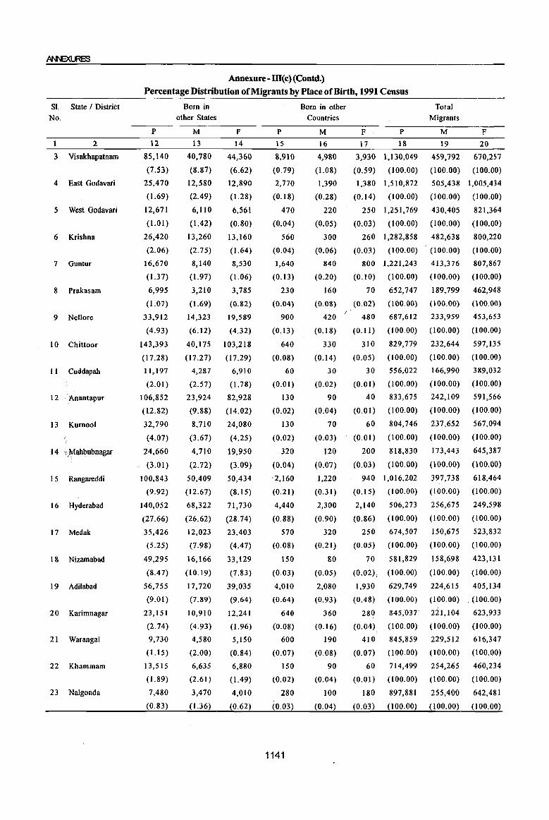
SI. State I DistriCt No.
1 2
3 Visakhapatnam
4 East Godavari
5 West Godavari
6 Krishna
7 Guntur
8 Prakasam
9 Nellore
10 Chittoor
II Cuddapah
12 . Anantapur
13 Kumool
14 i,Mahbubnagar
1 5 Rangareddi
16 Hyderabad
17 Medak
18 Nizamabad
19 Adilabad
20 Karimnagar
21 WaTangal
22 Khammam
23 Nalgonda
Annexure- ill(c)(Contd.) Percentage Distribution of Migrants by Place of Birth, 1991 Census
p
12
85,140
(7.53)
25,470
(1.69)
12,671
(1.01)
26,420
(2.06)
16,670
(1.37)
6,995
(1.07)
33,912
(4.93)
143,393
(17.28)
11,197
(2.01)
106,852
(12.82)
32,790
(4.07)
24,660
(3.01)
100,843
(9.92)
140,052
(27.66)
35,426
(5.25)
49,295
(8.47)
56,755
(9.0 I)
23, I 5 I
(2.74)
9,730
(1.15)
13,515
(1.89)
7,480
(0.83)
Born in other States
M
13
40,780
(8.87)
12,580
(2.49)
6,110
(1.42)
13,260
(2.75)
8,140
(1.97)
3,210
(1.69)
14,323
(6.I2)
40,175
(17.27)
4,287
(2.57)
23,924
(9.88)
8,710
(3.67)
4,710
(2.72)
50,409
(12.67)
68,322
(26.62)
12,023
(7.9S)
16,166
(10.19)
17,720
(7.S9)
10,910
(4.93)
4,580
(2.00)
6,635
(2.61)
3,470
(1.36)
F
14
44,360
(6.62)
12,890
(1.28)
6,561
(0.80)
13,160
(1.64)
8,530
(1.06)
3,785
(0.S2)
19,589
(4.32)
103,218
(17.29)
6,910
(I.78)
82,928
(14.02)
24,080
(4.25)
19,950
(3.09)
50,434
(8.15)
71,730
(28.74)
23,403
(4.47)
33,129
(7.83)
39,035
(9.64)
12,241
( 1.96)
5,150
(0.84)
6,880
( 1.49)
4,010
(0.62)
p
15
8,910
(0.79)
2,770
(0.18)
470
(0.04)
560
(0.04)
1,640
(0.13)
230
(0.04)
900
(0.13)
640
(0.08)
60
(0.01)
130
(0.02)
130
(0.02)
320
(0.04)
'2,160
(0.21)
4,440
(0.88)
570
(0.08)
150
(0.03)
4,010
(0.64)
640
(0.08)
600
(0.07)
150
(0.02)
280
(0.03)
1141
Born in other Countries
M
16
4,980
(1.08)
1,390
(0.28)
220
(0.05)
300
(0.06)
840
(0.20)
160
(0.08)
420
(0.18)
330
(0.14)
30
(0.02)
90
(0.04)
70
(0.03)
120
(0.07)
1,220
(0.31)
2,300
(0.90)
320
(0.21 )
80
(0.05)
2,080
(0.93)
360
(0.16)
190
(0.08)
90
(0.04)
100
(0.04)
F
17
3,930
(0.59)
p
IS
1,130,049
(100.00)
1,380 1,510,872
(0.14) (100.00)
250 1,251,769
(0.03) (100.00)
260 1,282,858
(0.03) (100.00)
800 1,221,243
(0.10) (100.00)
70
(0.02)
480
(0.11)
310
(0.05)
30
(0.01)
40
(0.01)
60
(0.01)
200
(0.03)
652,747
(l00.00)
687,612
(100.00)
829,779
(100.00)
556,022
(100.00)
833,675
(100.00)
804,746
(l00.00)
818,830
(l00.00)
Total Migrants
M
19
459,792
(l00.00)
F
20
670,257
(100.00)
505,438 1,005,434
(100.00) (100.00)
430,405
(100.00)
482,638
(100.00)
413,376
(100.00)
189,799
(l00.00)
233,959
(100.00)
232,644
(lOO.OO)
166,990
(100.00)
242,109
(100.00)
237,652
(100.00)
173,443
(l00.00)
821,364
(100.00)
800,220
(100.00)
807,867
(100.00)
462,948
(100.00)
453,653
(100.00)
597,135
(100.00)
389,032
(100.00)
591,566
(l00.00)
567,094
(100.00)
645,387
(l00.00)
940 1,016,202 397,738 618,464
(0.15) (100.00) (100.00) (100.00)
2,140
(0.86)
250
(0.05)
506,273
(l00.00)
674,507
(100.00)
70 581,829
(0.02), (100.00)
1,930
(0.48)
280
(0.04)
410
(0.07)
60
(0.01)
180
(0.03)
629,749
(100.00)
845,037
(l00.00)
845,859
(l00.00)
714,499
(l00.00)
897,881
(100.00)
256,675
(100.00)
150,675
(100.00)
158,698
(100.00)
249,598
(100.00)
523,832
(100.00)
423,131
(100.00)
224,615 405,134
(100.00) .. (l00.00)
221,104
(100.00)
229,512
(100.00)
254,265
(100.00)
255,400
(100.00)
623,933
(100.00)
616,347
(l00.00)
460,234
(100.00)
642,481
(100.00)
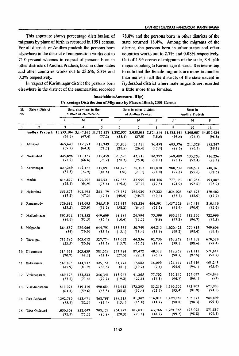
DISTRICT CENSUS HANDBOOK: KARIMNAGAR
This annexure shows percentage distribution of 78.8% and the persons born in other districts of the migrants by place of birth as recorded in 1991 census. state returned 18.4%. Among the migrants of the For all districts of Andhra pradesh the persons born district, the persons born in other states and other elsewhere in the district of enumeration works out to countries works out to 2.7% and 0.08% respectively. 71.0 percent whereas in respect of persons born in Out of 1.95 crores of migrants of the state, 8.4 lakh other districts of Andhra Pradesh, born in other states migrants belong to Karimnagar district. It is interesting and other countries works out to 23.6%, 5.3% and to note that the female migrants are more in number 0.2% respectively. than males in all the districts of the state except in
In respect of Karimnagar district the persons born Hyderabad district where male migrants are recorded elsewhere in the district of the enumeration recorded a little more than females.
Inset table to Annexure - ill( c)
Percentage Distribution of Migrants by Place ofBirtb, 2001 Census
SI. State / District Born elsewhere in the Born in other districts Born in No. district of enumeration of Andhra Pradesh Andhra Pradesh
P M F P M F P M F
2 3 4 5 6 7 8 9 10 II Andhra Pradesh 16,899,184 5,147,046 11,752,138 4,882,957 2,058,011 2,824,946 21,782,141 7,205,057 14,577,084
(74.0) (67.6) (77.2) (21.4) (27.0) (18.6) (95.4) (94.6) (95.8)
Adilabad 465,643 149,894 315,749 137,933 61,435 76,498 603,576 211,329 392,247 (69.2) (64.3) (71.7) (20.5) (26.4) (17.4) (89.6) (90.7) (89.1)
2 Nizamabad 445,896 110,437 335,459 123,593 42,816 80,777 569,489 153,253 416,236 (72.9) (66.6) (75.2) (20.2) (25.8) (18.1 ) (93.1 ) (92.4) (93.4)
3 Karimnagar 827,259 192,168 635,091 161,473 56,403 105,070 988,732 248;571 740,161 (81.8) (73.9) (84.6) (16) (21. 7) (14.0) (97.8) (95.6) (98.6)
4 Medak 614,817 129,296 485,521 162,356 53,990 108,366 777,173 183,286 593,887 (75.1) (64.9) (78.4) (19.8) (27.1) (17.5) (94.9) (92.0) (95.9)
5 Hyderabad 555,873 302,694 253,179 478,152 260,929 217,223 1,034,025 563,623 470,402 (47.2) (47.3) (47.1) (40.6) (40.7) (40.4) (87.7) (88.0) (87.4)
6 Rangareddy 529,612 184,093 345,519 927,917 463,326 464,591 1,457,529 647,419 810,110 (33.2) (25.6) (39.5) (58.2) (64.4) (53.1) (91.4) (90.0) (92.6)
7 Mahbubnagar 807,932 158,332 649,600 98,384 24,994 73,390 906,316 183,326 722,990 (86.6) (83.5) (87.4) (10.6) (13.2) (9.9) (97.2) (96.7) (97.3)
8 Nalgonda 864,857 220,066 644,791 155,564 50,749 104,815 1,020,421 270,815 749,606 (84) (79.9) (85.5) (15.1 ) (18.4) (13.9) (99.2) (98.4 ) (99.4)
9 Warangal 730,786 203,012 527,774 137,092 44,356 92,736 867,878 247,368 620,510 (83.5) (80.9) (84.5) (15.7) (17.7) (14.9) (99.1 ) (98.6) (99.4)
10 Khammam 584,968 203,639 381,329 227,784 87,472 140,312 812,752 291,111 521,641 (70.7) (68.2) (72.1) (27.5) (29.3) (26.5) (98.3) (97.5) (98.7)
U Srikakulam 569,895 144,737 425,158 53,772 17,682 36,090 623,667 162,419 461,248 (85.9) (83.9) (86.6) (8.1) (l0.2) (7.4) (94.0) (94.1) (93.9)
12 Vizianagaram 480,173 133,832 346,341 118,967 41,265 77,702 599,140 175,097 424,043 (77.5) (73.4) (79.2) (19.2) (22.6) (17.8) (96.7) (96.1) (97)
13 Visakhapatnam 810,094 319,410 490,684 356,612 173,393 183,219 1,166,706 492,803 673,903 (64.8) (59.6) (68.8) (28.5) (32.4) (25.7) (93.4) (91.9) (94.5)
14 East Godavari 1,292,769 423,971 868,798 197,313 81,302 116,011 1,490,082 505,273 984,809
(85.8) (82.5) (87.4) (13.1) (15.8) (II. 7) (98.8) (98.3) (99.1)
IS West Godavari 1,030,168 322,047 708,121 264,797 101,031 163,766 1,294,965 423,078 871,887
(78.9) (75.2) (80.8) (20.3) (23.6) (18.7) (99.2) (98.8) (99.4)
1142
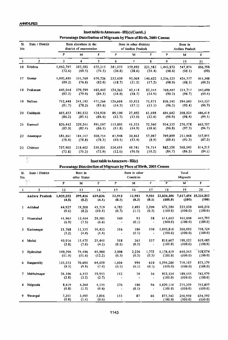
Inset tabletoAnnexure-m(c) (Contd •• )
Percentage Distribution of Migrants by Place of Birth, 2001 Census
SI. State I Distri¢t Born elsewhere in the Born in other districts Born in No. district of enumeration of Andhra Pradesh Andhra Pradesh
P M F P M F P M F
2 3 4 5 6 7 8 9 10 Ii
16 Krishna 1,062,797 387,582 675,215 381,075 159,492 221,583 1,443,872 547,074 896,798 (72.6) (69.5) (74.5) (26.0) (28.6) (24.4) (98.6) (98.1) (99)
17 Guntur 1,002,495 331,769 670,726 233,630 93,008 140,622 1,236,125 424,777 811,348 (80.2) (16.8) (82.0) (18.7) (21.5) (17.2) (98.9) (98.3) (99.2)
18 Prilkasam 645,044 179,599 465,445 124,363 '42,118 82,245 769,407 221,717 547,690 (83.2) (79.9) (84.5) (16.0) (18.7) (14.9) (99.2) (98.7) (99.4)
19 Nellore 712,448 241,182 471,266 126,694 52,823 73,871 839,142 294,005 545,137 (81.7) (78.2) (83.6) (14.5) (17.1) (13.1) (96.3) (9504) (96.7)
20 Cuddapah 605,452 180,532 424,920 89,190 27,492 61,698 694,642 208,024 486,618 (86.2) (85.4) (86.6) (12.7) (13.0) (12.6) (98.9) (98.4) (99.1)
21 Kurnool 820,442 229,245 591,197 113,893 41,333 72,560 934,335 270,578 663,757 (85.0) (82.4) (86.1 ) (11.8) (14.9) (10.6) (96.8) (97.3) (96.7)
22 Anantapur 681,861 181,107 500,754 87,948 30,861 57,087 769,809 211,968 557,841 (78.4) (78.8) (78.3) (10.1) (13.4) (8.9) (88.6) (92.3) (87.2)
23 Chittoor 757,903 218,402 539,501 124,455 49,741 74,714 882,358 268,143 614,215 (72.8) (70.2) (73.9) (12.0) (\6.0) (10.2) (84.7) (86.2) (84.\)
.,: .. ,
Inset table to Annexure- m(c}
Percentage Distribution of Migrants by Place of Birth, 2001 Census
SI. State I District Born in Born in other Total
No. other States Countries Migrants ";;.. ..
P M F P M F P M F
2 12 13 14 15 16 17 18 19 20
Andhra Pradesh 1,029,252 399,416 629,836 22,913 12,981 9,932 22,834,306 7,617,454 15,216,852 (4.5) (5.2) (4.1) (0.1) (0.2) (0.1) (100.0) (100) (100)
Adilabad 64,927 19,208 45,719 4,783 2,493 2,290 673,286 233,030 440,256 (9.6) (8.2) (lOA) (0.7) (l.I ) (0.5) (100.0) (100.0) (100.0)
2 Nizamabad 41,965 12,464 29,501 149 91 58 611,603 165,808 445,795 (6.9) (7.5) (6.6) (0.1) (l00.0) (100.0) (100.0)
3 Karimnagar 21,768 11,335 10,433 316 186 130 1,010,816 260,092 750,724 (2.2) (4.4) (1.4) (0.1) (100.0) (100.0) (100.0)
4 Medak 40,916 15,475 25,441 518 361 157 818,607 199,122 619,485 (5.0) (7.8) (4.1) (0.1) (0.2) (100.0) (100.0) (100.0)
5 Hyderabad 140,396 74,496 65,900 3,998 2,226 1,772 1,178,4J9 640,345 531(0'74 (11.9) (11.6) (12.2) (0.3) (0.3) '(0.3) (i00.0) (100.0) (100.0)
6 Rangareddy 135,153 70,694 64,459 1,604 994 610 1,594,286 719,107 875,179 (8.5) (9.8) (7.4) (0.1) (0.1) (0.1) (100.0) (l00.0) (100.0)
7 Mahbubnagar 26,106 6,153 19,953 1I2 76 36 932,534 189,555 742,979 (2.8) (3.2) (2.7) (100.0) (100.0) (l00.0)
8 Nalgonda 8,419 4,264 4,155 276 180 96 1,029,116 275,259 753,857 (0.8) (1.5) (0.6) (0.1) (100.0) (100.0) (100.0)
9 Warangal 7,311 3,495 3,816 153 87 66 875,342 250,950 624,392 (0.8) (104) (0.6) (100.0) (100.0) (100.0)
1143

DIS1RICTCENSUS HANDBOOK: KARIMNAGAR
Inset table toAnnexure -m( c) (Concld .. ) Percentage Distribution of Migrants by Place of Birth, 2001 Census
51. State I District Born in Born in other Total No. other States Countries Migrants
P M F P M F P M F
2 12 13 14 15 16 17 18 19 20
10 Khammam 14,058 7,155 6,903 250 158 92 827,060 298,424 528,636 (I. 7) (2.4) (1.3) (0.1) (100.0) (100.0) (100.0)
II Srikakulam 39,747 10,094 29,653 170 89 81 663,584 172,602 490,982 (6.0) (5.8) (6.0) (0.1) (100.0) (100.0) (100.0)
12 Vizianagaram 20,112 7,019 13,093 315 160 155 619,567 182,276 437,291 (3.2) (3.9) (3) (0.1) (0.1) (100.0) (100.0) (100.0)
13 Visakhapatnam 78,659 40,952 37,707 3,907 2,222 1,685 1,249,272 535,977 713,295 (6.3) (7.6) (5.3) (0.3) (0.4) (0.2) (100.0) (100.0) (100.0)
14 East Godavari 16,377 8,032 8,345 995 575 420 1,507,454 S13,880 993,574 (Ll) (1.6) (0.8) (0.1) (0.1) (100.0) (100.0) (100.0)
15 West Godavari 9,951 5,058 4,893 362 240 122 1,305,278 428,376 876,902 (0.8) (1.2) (0.6) (0.1) (100.0) (100.0) (100.0)
16 Krishna 19,263 10,001 9,262 583 350 233 1,463,718 557,425 906,293 (1.3) ( 1.8) (1.0) (0.1) (100.0) (100.0) (100.0)
17 Guntur 12,366 6,507 5,859 1,269 740 529 1,249,760 432,024 817,736 (I) (1.5) (0.7) (0.1) (0.2) (0.1) (100.0) (100.0) (100.0)
18 Prakasam 5,620 2,722 2,898 379 219 160 775,406 224,658 550,748 (0.7) (1.2) (0.5) (0.1) (100.0) (l00.0) (100.0)
19 Nellore 31,214 13,463 17,751 1,329 755 574 871,685 308,223 563,462 (3.6) (4.4) (3.2) (0.2) (0.2) (0.1) (100.0) (100.0) (100.0)
20 Cuddapah 7,465 3,281 4,184 144 75 69 702,251 211,380 490,871 (Ll) (1.6) (0.9) (100.0) (l00.0) (l00.0)
21 Kurnool 30,325 7,422 22,903 193 127 66 964,853 278,127 686,726 (3.1) (2.7) (3.3) (100.0) (100.0) (100.0)
22 AnantapuT 99,062 17,618 81,444 342 IS6 186 869,213 229,742 639,471 (11.4) (7.7) (12.7) (0.1) (l00.0) (100.0) (100.0)
23 Chittoor 158,072 42,508 115,564 766 421 345 1,041,196 311,072 730,124 (15.2) (13.7) (15.8) (0.1) (0.1) (100.0) (100.0) (100.0)
. Source: Migration Tables (D Series) • 2001
The above annexures show the percentage In respect of Karimnagar district the difference distribution of migrants by place of birth as recorded between the two Censuses can be observed the in both the Censuses of 1991 and 2001 in Andhra percentage of 3% persons, 6.3% males and 7.4% lPradesh state. It is observed that 3.0% increase in females in the persons born elsewhere in the district the migration who were born elsewhere in the district of the enumeration. Regarding the migrants from of enumeration with a sex breakup of 3.0% each, other states in India only a minor variation is recorded whereas in respect of the migrants who were born with -0.5%. in other districts of the state, in other states of the country and in other countries are recorded with a Among the migrants that are born in the Abroad
difference of (-)2.2% to -0.8% and (-)0.1% a minor decrease is noticed in the percentage variation
respectively between two censuses of 1991 and 2001. between 1991 and 2001 censuses (i.e. (-) 0.1%).
1144

Annexure IV Brief account of Main religions in the district! mandai as per
1991 Census and 2001 Census
Religion: During 1991 Census, the religion data was
The data on religion has been collected and collected through question No.8 of the individual slips
, presented for 6 major religions viz. Hindus, Muslims, and recorded the religion as stated by the individual
Christians, Sikhs, Jains and Buddhists. In respect of under six major r~ligions. The minor religions other
minor religions, they have been classified and shown than these six religions, as reported by the respondent,
under the category "Others". recorded and classified under the category "Others".
Annexure IV(a) Main Religions in the District I Mandals 1991 Census
Dist- Name of the District! Totall Total Hindus Muslims Christians triet Mandai I Town Rural! Code Urban Persons Males Females Males Females Males Females Males Females
I 2 3 4 5 6 7 8 9 10 II 12
20 Karimnagar' District T 3,037,486 1,529,791 1,507,695 1,434,367 1,414,486 86,591 84,357 7,416 7,591
R 2,413,167 1,211,030 1,202,137 1,168,436 1,160,212 37,792 37,365 4,129 3,972
U 624,319 318,761 305,558 265,931 254,274 48,799 46,992 3,287 3,619
Ibrahimpatnam T/R 44,205 21,067 23,138 20,420 22,463 503 540 143 135
Mallapur T/R ' 45,305 22,225 23,080 21,461 22,319 683 688 10 9
Raikal T/R 52,780 25,897 26,883 24,538 25,429 1,326 1,408 33 46
" 'Sarangapur T/R 39,218 19,801 19,417 19,347 19,029 345 292 106 92 'Dharmapuri T/R 64,252 31,828 32,424 31,052 31,608 768 812 4 3
,Velgatoor T/R 41,435 21,033 20,402 20,563 19,923 403 411 67 68
Ramagundam T 252,893 129,501 123,392 117,830~ 112,337 10,020 9,420 1,581 1,578
R 38,509 19,636 18,873 18,739 18,035 717 686 177 152
U 214,384 109,865 104,519 99,091 94,302 9,303 8,734 1,404 1,426
Ramagundam (Nac) U 214,384 109,865 104,519 99,091 94,302 9,303 8,734 1,404 1,426
Kamanpur T/R 59,527 30,173 29,354 28,768 28,019 1,263 1,200 116 118
Manthani T 44,270 22,398 21,872 21,643 21,182 736 673 19 17
R 29,631 15,047 14,584 14,858 14,431 189 153 U 14,639 7,351 7,288 6,785 6,751 547 520 19 17
Manthani (P) U 14,639 7,351 7,288 6,785 6,751 547 520 19 17
Kataram T/R 29,424 15,018 14,406 14,511 13,942 490 452 13 12 Mahadevpur T/R 31,241 15,728 15,513 14,639 14,469 1,033 994 56 50 Mutharam (Mahadevpur) T/R 20,115 10,215 9,900 10,013 9,737 157 131 45 32
Malharrao T/R 19,924 10,189 9,735 9,981 9,563 183 152 24 20
Mutharam (Manthani) T/R 26,198 13,144 13,054 12,941 12,848 191 199 12 7
Srirampur T/R 34,077 17,234 16,843 16,8'77 16,483 317 329 39 31
Peddapalle T 74,278 37,552 36,726 33,487 32,820 3,889 3,731 176 175 R 45,989 23,052 22,937 22,242 22,108 757 777 53 52 U 28,289 14,500 13,789 11,245 10,712 3,132 2,954 123 123
Peddapalle (P) U 28,289 14,500 13,789 11,245 10,712 3,132 2,954 123 123 Julapalle T/R 42,316 21,509 20,807 20,925 20,251 453 439 131 117 Dharmaram T 41,927 20,940 20,9117 20,647 20,684 289 292 4 II (WO Bommareddipalle) Gollapalle T/R 36,307 18,120 18,187 17,587 17,710 363 330 159 138
1145
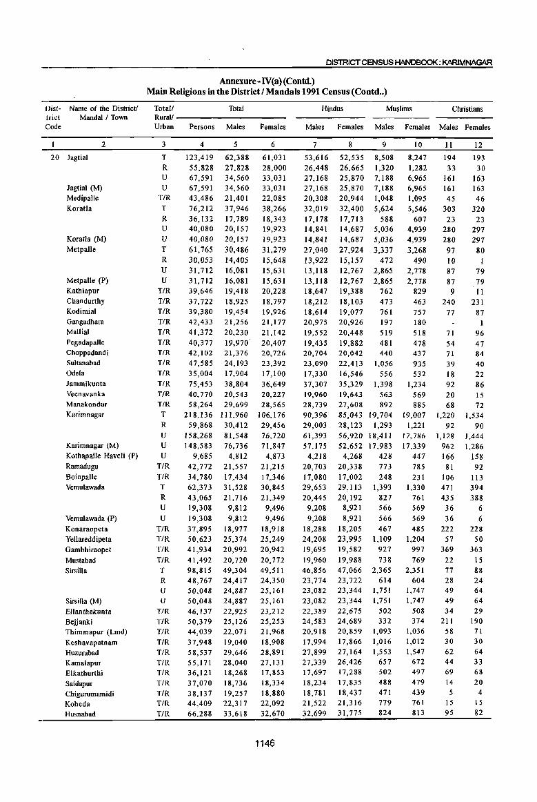
Dist- Name of the District! trict Mandai I Town Code
2
20 lagtial
lagtial (M) Medipalle Koratla
Koratla (M) Metpalle
Metpalle (P) Kathlapur Chandurthy Kodimial Gangadhara Mallial Pegadapalle Choppadandi Sultanabad Odela lammikunta Veenavanka Manakondur Karimnagar
Karimnagar (M) Kothapalle Haveli (P)
Ramadugu Boinpalle Vemulawada
Vemulawada (P) Konaraopeta Yellareddipeta Oambhiraopet
Mustabad Sirsilla
Sirsilla (M) Ellanthakunta Bejjanki Thimmapur (Lmd) Keshavapatnam Huzurabad Kamalapur Elkathurthi Saidapur Chigurumamidi Koheda Husnabad
DISTRICT CENSUS HANDBOOK: KARIMNAGAR
Annexure- N(a) (Contd.) Main Religions in the District I Mandals 1991 Census (Contd .. )
Total! Total Rurall -----------Urban Persons Males Females
3
T R U U
T/R T R U U T R U U
T/R T/R T/R T/R T/R T/R T/R T/R T/R T/R T/R T/R T
R U U
U T/R T/R T
R U
U T/R T/R T/R T/R T R
U U
T/R T/R T/R T/R T/R T/R T/R T/R T/R T/R T/R
4
123,419 55,828 67,591 67,591 43,486 76,212 36,132 40,080 40,080 61,765 30,053 31,712 31,712 39,646 37,722 39,380 42,433 41,372 40,377 42,102 47,585 35,004 75,453 40,770
5
62,388 27,828 34,560 34,560 21,401 37,946 17,789 20,157 20,157 30,486 14,405 16,081 16,081 19,418 18,925 19,454 21,256 20,230 19,970 21,376 24,193 17,904 38,804 20,543
58,264 29,699 218,136 111,960
59,868 30,412 158,268 148,583
9,685 42,772 34,780 62,373 43,065 19,308 19,308 37,895 50,623 41,934 41,492 98,815 48,767 50,048 50,048 46,137 50,379 44,039 37,948 58,537 55,171 36,121 37,070 38,137 44,409 66,288
81,548 76,736
4,812 21,557 17,434 31,528 21,716
9,812 9,812
18,977 25,374 20,992 20,720 49,304 24,417 24,887 14,887 22,925 25,126 22,071 19,040 29,646 28,040 18,268 18,736 19,257 22,317 33,618
6
61,031 28,000 33,031 33,031 22,085 38,266 18,343 19,923 19,923 31,279 15,648 15,631 15,631 20,228 18,797 19,926 21,177 21,142 20,407 20,726 23,392 17,100 36,649 20,227 28,565
106,176 29,456 76,720 71,847
4,873 21,215 17,346 30,845 21,349
9,496 9,496
18,918 25,249 20,942 20,772 49,511 24,350 25,161 25,161 23,212 25,253 21,968 18,908 28,891 27,131 17,853 18,334 18,880 22,092 32,670
1146
Hindus Muslims Christians
Males Females Males Females Males Females
7
53,616 26,448 27,168 27,168 20,308 32,019 17,178 14,841 14,841 27,040 13,922 13,118 13,118 18,647 18,212 18,614 20,975 19,552 19,435 20,704 23,090 17,330 37,307 19,960 28,739 90,396 29,003 61,393 57,175
4,218 20,703 17,080 29,653 20,445
9,208 9,208
18,288 24,208 19,695
19,960 46,856 23,774 23,082 23,082 22,389 24,583 20,918 17,994 27,899 27,339 17,697 18,234 18,781 21,522 32,699
8
52,535 26,665 25,870 25,870 20,944 32,400 17,713 14,687 14,687 27,924 15,157 12,767 12,767 19,388 18, I 03 19,077 20,926 20,448 19,882 20,042 22,413 16,546 35,329 19,643 27,608 85,043 28,123 56,920 52,652
4,268 20,338 17,002 29,113 20,192
8,921 8,921
18,205 23,995 19,582
19,988 47,066 23,722 23,344 23,344 22,675 24,689 20,859 17,866 27,164 26,426 17,288 17,835 18,437 21,316 31,775
9
8,508 1,320 7,188 7,188 1,048 5,624
588 5,036 5,036 3,337
472 2,865 2,865
762 473 761 197 519 481 440
1,056 556
1,398 563 892
19,704 1,293
18,411 17,983
428 773 248
1,393 827 566 566 467
1,109 927 738
2,365 614
1,751 1,751
502 332
1,093 1,016 1,553
657 502 488 471 779 824
10
8,247 1,282 6,965 6,965 1,095 5,546
607 4,939 4,939 3,268
490 2,778 2,778
829 463 757 180 518 478 437 935 532
1,234 569 885
19,007 1,221
17,786 17,339
447 785 231
1,330 761 569 569 485
1,204 997
769 2,351
604 1,747 1,747
508 374
1,036 1,012 1,547
672 497 479 439 761 813
11
194 33
161 161 45
303 23
280 280
97 10 87 87 9
240 77
71 54 71 39 18 92 20 68
1,220 92
1,128 962 166 81
106 471 435 36 36
222 57
369
22 77 28 49 49 34
211 58 30 62 44 69 14 5
15 95
12
193 30
163 163 46
320 23
297 297
80
79 79 11
231 87
I
96 47 84 40 22 86 15 72
1,534 90
1,444
1,286 158 92
113 394 388
6 6
228 50
363 15 88 24 64 64 29
190 71 30 64 33 68 20
4 IS 82

Annexure-IV(a) (Contd.) Main Religions in the District I Manda Is 1991 Census (Concld •• )
Dist- Name of the District! Total/ Jains Buddhists Sikhs Others Religion trict MandaI! Town Rural/ not stated Code Urban MjIles Females Males Females Males Females Males Females Males Females
2 3 13 14 15 16 17 18 19 20 21 22
20 Karimnagar District T 10 7 36 32 757 660 6 1 608 561 R 3 2 25 22 107 74 6 1 532 489 U 7 5 11 10 650 586 76 72
Ibrahimpatnam T/R Mallapur T/R 71 64 Raikal T/R Sarangapur T/R 1 ., . 4 2 Dharmapuri T/R 4 Velgatoor T!R Ramagundam T 63 54 7 3
R 1 2 U 62 54 5 3
Ramagundam (Nac) U 62 54 5 3 Kamanpur T/R 3 2 4 4 19 11 Manthani T
R U
Manthani (P) U Kataram T/R 4 Mahadevpur T/R Mutharam (Mahadevpur)T/R
Malharrao T/R Mutharam (Manthani) T/R Srirampur T/R Peddapalle T
R
U Peddapalle (P) U
·lulapalle T/R Dharmaram T HlO Bommareddipalle) Gollapalle T/R II 9
Jagtial T 70 56
R 27 23
U 43 33 lagtial ~M) U 43 33 Medipalle T/R Koratla T
R U
Koratla (M) U Metpalle T II 7
R
U II 7 Metpalle (P) U 11 7 Kathlapur T/R Chandurthy T/R Kodimial T/R 2 5
Gangadhara T/R 84 70 Mallia! T/R 88 80 Pegadapalle T/R Choppadandi T/R 4 2 157 161 Sultanabad T/R 8 4 Odela T/R
1147

DISTRICT CENSUS HANDBOOK: KARIMNAGAR
Annexure -1V(a} (Concld.) Main Religions in the District I Mandals 1991 Census (Concld .. )
Dist- Name of the District! Total! Jains Buddhists Sikhs Others Religion trict MandaI I Town Rural! Code Urban Males Females Males
2 3 13 14 15 20 Jammikunta T/R
Veenavanka T/R Manakondur T/R Karimnagar T 7 5 26
R 19 U 7 5 7
Karimnagar (M) U 7 5 7 Kothapalle Haveli (P) U Ramadugu T/R Boinpalle T/R Vemulawada T
R
U Vemulawada (P) U Konaraopeta T/R Yellareddipeta T/R Gambhiraopet T/R Mustabad T/R Sirsilla T 4
R U 4
Sirsilla (M) U 4 Ellanthakunta T/R Bejjanki T/R
Thimmapur (Lmd) T/R
Keshavapatnam T/R
Huzurabad T/R Kamalapur T/R
Elkathurthi T/R
Saidapur T/R Chigurumamidi T/R Koheda T/R Husnabad T/R Bheemadevarpalle T/R
There were six Religions that had been identified in the State during 1991 Census. These were 1. Hindu 2. Muslim, 3. Christian, 4. lains, 5. Buddhist and 6. Sikh. In the Karimnagar district too there were six Religions during 1991 Census. This district had 30,37,486 Population as per 1991 Census, comprising 28,48,853 Hindus, 1,70,948 Muslims, 15,007 Christians, 1,417 Sikhs, 17 persons belong to lains and 68 persons have returned as Buddhists. In terms of percentage, the percentage to total population of Hindus have recorded with 93.8, followed by Muslims with 5.6 and 0.5 of Christians. 1169 persons recorded as no Religion in the district, comprising 608 males and 56 I females.
In all 56 Mandals, Hindus, Muslims and Christians
not stated Females Males Females Males Females Males Females
16 17 18 19 20 21 22 7
23 536 495 71 69 18 5 4
5 531 491 71 69 5 531 491 71 69
11 8 9 8 2 2
5
5 5
2 2
4 2 128 114
Religions had been returned in both Rural and Urban areas of the district in 1991 Census. Among these three Religions, Hindu Religion had highest popularion in almost all the Mandals.
As regards, Muslim Religion, this Religion occupied second place in the district. Karimnagar Mandai had recorded highest Muslim population in the district i.e.,38,711 with 17.7per centage of total mandai population followed by Ramagundam and Jagtial Mandals with 19,440 and 16,755 persons respectively. The least number of Muslims were recorded in Mutharam Mandai with 288 persons only.
Though the Christian Religion was identified in all 56 Mandals, the number of Christians were very less when compared with Hindus and Muslims. There
1148
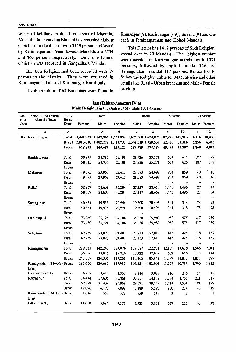
~
was no Christians in the Rural areas of Manthini Kamanpur (8), Karimnagar (49) , Sircilla (9) and one MandaI. Ramagundam Mandai has recorded highest each in Ibrahimpatnam and Kohed Mandals. Christians in the district with 3159 persons followed This District has 1417 persons of Sikh Religion, by Karimnagar and Vemulawada Mandals are 2754 spread over in 20 Mandals. The highest number and 865 persons respectively. Only one female was recorded in Karimnagar mandai with 1031 Christian was recorded in Gangadhara MandaI. persons, followed by Jagtial mandai 126 and
The Jain Religion had been recorded with 17 Ramagundam mandai 117 persons. Reader has to perons in the district. They were returned in follow the Religion Table for Mandai-wise and other Karimnagar Urban and Karimnagar Rural only. details like Rural- Urban breackup and Male - Female
The distribution of 68 Buddhists were found in breakup.
Inset Table to Annexure IV(a) Main Religions in the District I Mandals 2001 Census
Dist- Name of the District! Totalf Total Hindus Muslims Christians trict Mandai f Town Rural! Code Urban Persons Males Females Males Females Males Females Males Females
1 2 3 4 5 6 7 8 9 10 11 12
03 Karimnagar Total 3,491,822 1,747,968 1,743,854 1,627,008 1,624,826 107,898 105,913 10,116 10,460
Rural 2,813,010 1,402,279 1,410,731 1,342,019 1,350,537 52,406 52,316 6,256 6,433
Urban 678,812 345,689 333,123 284,989 274,289 55,492 53,597 3,860 4,027
Ibrahimpatnam Total 50,845 24,737 26,108 23,926 25,271 604 625 187 199
Rural 50,845 24,737 26,108 23,926 25,271 604 625 187 199
Urban
Mallapur Total 49,575 23,963 25,612 23,083 24,697 824 859 40 40
Rural 49,575 23,963 25,612 23,083 24,697 824 859 40 40
Urban
Raikal Total 58,807 28,603 30,204 27,1.17 28,659 1,445 1,496 27 34
Rural 58,807 28,603 30,204 27,117 28,659 1,445 1,496 27 34
Urban
Sarangapur Total 40,881 19,935 20,946 19,508 20,496 344 348 78 93
Rural 40,881 19,935 20,946 19,508 20,496 344 348 78 93
Urban
Dharmapuri Total 73,230 36,124 37,106 35,030 35,982 952 975 137 139
Rural 73,230 36,124 37,106 35,030 35,982 952 975 137 139
Urban
Velgatoor Total 47,229 23,827 23,402 23,233 22,819 415 425 178 157
Rural 47,229 23,827 23,402 23,233 22,819 415 425 178 157
Urban
Ramagundam Total 279,323 142,247 137,076 127,687 122,971 12,139 1l,678 1,966 2,011
Rural 35,756 17,946 17,810 17,222 17,029 602 646 II3 124
Urban 243,567 124,301 119,266 110,465 105,942 II,537 11,032 1,853 1,887
Ramagundam (M+OG) Urban 236,600 120,687 115,913 107,221 102,905 11,227 10,756 1,799 1,852 (Part)
Palakurthy (CT) Urban 6,967 3,614 3,353 3,244 3,037 310 276 54 35
Kamanpur Total 74,474 37,606 36,868 35,551 34,839 1,784 1,765 221 217 Rural 62,378 31,409 30,969 29,671 29,249 1,514 ],50] 181 178 Urban 12,096 6,197 5,899 5,880 5,590 270 264 40 39
Ramagundam (M+OG) Urban 1,086 563 523 559 519 3 2 1 (Part)
lallaram (CT) Urban 11,010 5,634 5,376 5,321 5,071 267 262 40 38
1149

DISTRICT CENSUS HANDBOOK: KARIMNAGAR
Inset Table toAnnexure IV(a) (Contd •• ) Main Religions in the District I Mandals 2001 Census
Dist- Name of the DistrieU Total! triet Mandai I Town Rurall Code Urban
2
03 Manthani
Kataram
Mahadevpur
Mutharam
(Mahadevpur)
Malharrao
3
Total
Rural
Urban
Total
Rural
Urban
Total
Rural
Urban
Total
Rural
Urban
Total
Rural
Urban
Mutharam (Manthani) Total
Srirampur
Peddapalle
JulapaUe
Dharmaram
Gollapalle
Mallial
Jagtial
Jagtial (M)
MedipaUe
Koratla
Koratla (M)
Rural Urban
Total
Rural
Urban
Total
Rural
Urban
Total
Rural
Urban
Total
Rural
Urban
Total Rural
Urban
Total
Rural
Urban
Total
Rural Urban
Urban
Total
Rural
Urban
Total
Rural
Urban
Urban
Total
Persons Males Females
4 5 6
50,405 25,487 24,918 50,405 25,487 24,918
31,259 15,741 31,259 15,741
35,325 35,325
23,327
17,744 17,744
11,701
15,518 15,518
17,581 17,581
11,626
23,327 11,701 11,626
23,843 23,843
12,011 12,0 II
28,628 14,308 28,628 14,308
37,272 37,272
90,830 90,830
45,094 45,094
49,636 49,636
41,648 41,648
18,806 18,806
45,418 45,418
22,575 22,575
24,590 24,590
20,514 20,514
11,832 11,832
14,320 14,320
18,466 18,466
45,412 45,412
22,519 22,519
25,046 25,046
21,134 21,134
45,244 21,952 23,292 45,244 21,952 23,292
150,565 65,044 85,521 85,521 49,773 49,773
94,429 40,417 54,012 54,012
75,402 32,025 43,377 43,377 24,151 24,151
46,958 19,685 27,273 27,273
75,163 33,019 42,144 42,144 25,622 25,622
47,471 20,732 26,739 26,739
1150
Hindus Muslims Christians
Males Females Males Females Males Females
7 8
24,507 23,993 24,507 23,993
14,944 14,784 14,944 14,784
9
865 865
648 648
10
799 799
600 600
16,408 16,408
16,285 1,161 1,115 16,285 1,161 1,1I5
11,491 11,429 149 133
11,491 11,429 149 133
1I,778 II,778
14,089 14,089
18,363 18,363
40,084 40,084
21,935 21,935
24,183 24,183
20,033 20,033
1I,606 1I,606
14,102 14,102
18,024 18,024
186 186
206 206
364 364
40,182 4,951 40,182 4,951
21,874 21,874
24,648 24,648
20,631 20,631
503 503
329 329
378 378
182 182
204 204
371 371
4,822 4,822
509 509
322 322
394 394
21,180 22,541 719 719
701 701 21,180 22,541
63,844 30,180 33,664 33,664 23,052 23,052
38,235 18,981 19,254 19,254
64,023 10,983 10,523 31,183 1,642 1,597 32,840 9,341 8,926 32,840 9,341 24,437 979 24,437 979
38,804 8,597 19,983 685 18,821 7,912 18,821 7,912
8,926 1,057 1,057
8,512 720
7,792 7,792
11
. 92
92
124 124
173 173
60
60
33 33
9 9
55 55
361 361
108 108
46 46
86 86
45 45
437 142 295 295 II7 117
98 12 86 86
12
104 104
115 115
178 178
63
63
36 36
9 9
44 44
379 379
104 104
51 51
96 96
42 42
502 177 325 325 123 123
126 21
105 105

Inset Table to Annexure IV(a) (Contd •• ) Main Religions in the District I Mandals 2001 Census
Dist- Name of the District! Total! trict Mandai I Town Rural! Code Urban
2 03 . Metpalle
. Kathlapur
Chandurthi
Kodimial
Pegadapalle
Gangadhara
Ramadugu
Choppadandi
, Sultanabad
Odela
Manakondur
Karimnagar
3 Total
Rural Urban
Total
Rural
Urban
Total
Rural
Urban
Total
Rural Urban
Total
Rural Urban
Total
Rural
Urban
Total
Rural
Urban Total
Rural
Urban
Total
Rural
Urban
Total
Rural
Urban
Total
Rural
Urban
Total
Rural
Urban
Karimnagar (M+OG) Urban
BoinpaUe Total
Vemulawada
Konaraopeta
Yellareddipet
Rural
Urban Total
Rural
Urban Total Rural
Urban
Total
Rural
Urban
Total
Persons Males Females
4
76,985 76,985
42,786 42,786
40,558 40,558
42,346 42,346
44,879 44,879
46,879 46,879
47,654 47,654
48,659 48,659
56,717 56,717
5
38,270 38,270
20,491 20,491
20,079 20,079
20,719 20,719
22,284 22,284
23,338 23,338
23,905 23,905
24,721 24,721
28,586 28,586
39,539 19,860 39,539 19,860
64,864 32,725 64,864 32,725
289,375 147,954 71,073 36,079
218,302 218,302
37,564 37,564
73,421 73,421
111,875 111,875
18,601 18,601
36,696 36,696
41,381 20,640 41,381 20,640
6
38,7l5 38,715
22,295 22,295
20,479 20,479
21,627 21,627
22,595 22,595
23,541 23,541
23,749 23,749
23,938 23,938
28,131 28,131
19,679 19,679
32,139 32,139
141,421 34,994
106,427 106,427
18,963 18,963
36,725 36,725
20,741 20,741
56,431 28,069 28,362 56,431 28,069 28,362
1151
Hindus Muslims Christians
Males Females Males Females Males Females
7
33,872 33,872
19,566 19,566
19,454 19,454
19,887 19,887
21,654 21,654
22,752 22,752
23,1l9 23,119
24,091 24,091
27,288 27,288
19,305 19,305
31,542 31,542
8
34,381 34,381
21,309 21,309
19,831 19,831
20,747 20,747
21,969 21,969
22,950 22,950
22,932 22,932
23,304 23,304
26,895 26,895
9
4,199 4,199
791 791
527 527
756 756
534 534
412 412
737 737
543 543
1,224 1,224
19,128 517 19,128 517
30,972 1,074
30,972 1,074
10
4,149 4,149
856 856
525 525
799 799
515 515
414 414
756 756
555 555
1,154 1,154
513 513
1,052 1,052
119,383 113,754 26,020 25,127 33,919 32,982 1,800 1,706
85,464 85,464 18,258 18,258
80,772 80,772 18,603 18,603
34,389 . ~34,420 34,389 34,420
19,860 19,860
19,939 19,939
24,220 24,220
282 282
23,421 23,421
295 295
1,783, 1,764 1,783 1,764
570 570
580 580
26,468 26,773 1,329 1,340 26,468 26,773 1,329 1,340
11
154 154
80 80
98 98
68 68
79 79
151 151
45 45
80 80
61 61
20 20
85 85
1,784
323 1,461 1,461
51 51
12 157 157
70 70
123 123
71 71
94 94
157 157
58 58
67 67
65 65
22 22
96 96
1,836 273
1,563 1,563
54 54
487- ",,,518 487 518
209 209
13l 133
217 217
123 123
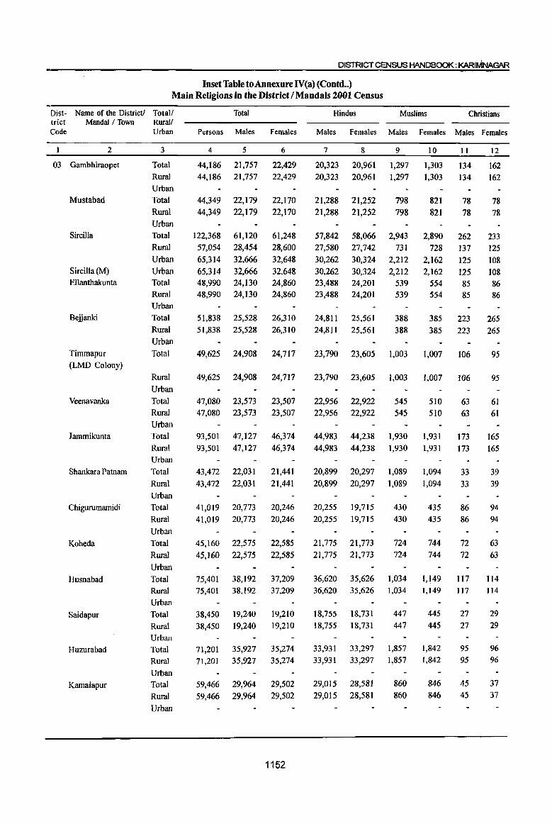
DISTRICT CENSUS HANDBOOK:KARIMNAGAR
Inset Table to Annexure IV(a) (Contd .. ) Main Religions in the District I Mandals 2001 Census
Dist - Name of the District! Totall trict Mandal / Town Rural/ Code Urban
2
03 Gambhiraopet
Mustabad
Sircilla
Sircilla (M)
Ellanthakunta
Beijanki
Timmapur
(LMD Colony)
Veenavanka
Jammikunta
Shankara Patnam
Chigurumamidi
Koheda
Husnabad
Saidapur
Huzurabad
Kamalapur
3
Total
Rural
Urban
Total
Rural Urban
Total
Rural Urban
Urban
Total
Rural Urban
Total
Rural Urban
Total
Rural Urban
Total
Rural Urban
Total
Rural Urban
Total
Rural Urban
Total
Rural Urban
Total
Rural Urban
Total
Rural Urban
Total
Rural
Urban
Total
Rural Urban
Total
Rural Urban
Total
Persons Males Females
4
44,186 44,186
44,349 44,349
122,368 57,054 65,314 65,314 48,990 48,990
5
21,757 21,757
22,179 22,179
61,120 28,454 32,666 32,666 24,130 24,130
6
22,429 22,429
22,170 22,170
61,248 28,600 32,648 32,648 24,860 24,860
51,838 25,528 26,310 51,838 25,528 26,310
49,625 24,908 24,717
49,625 24,908 24,717
47,080 47,080
23,573 23,573
93,501 47,127 93,501 47,127
43,472 22,031 43,472 22,031
41,019 41,019
45,160 45,160
20,773 20,773
22,575 22,575
23,507 23,507
46,374 46,374
21,441 21,441
20,246 20,246
22,585 22,585
75,401 38,192 37,209 75,401 38,192 37,209
38,450 38,450
71,201 71,201
59,466 59,466
19,240 19,240
35,927 35,927
29,964 29,964
19,210 19,210
35,274 35,274
29,502 29,502
1152
Hindus Muslims Christians
Males Females Males Females Males Females
7
20,323 20,323
21,288 21,288
57,842 27,580 30,262 30,262 23,488 23,488
8
20,961 20,961
21,252 21,252
58,066 27,742 30,324 30,324 24,201 24,201
9
1,297 1,297
798 798
2,943 731
2,212 2,212
539 539
10
1,303 1,303
821 821
2,890 728
2,162 2,162
554 554
II
134 134
78 78
262 137 125 125 85 85
12
162 162
78 78
233 125 108 108 86 86
24,811 25,561 388 388
385 223 265 24,811 25,561 385 223 265
23,790 23,605 1,003 1,007 106
23,790 23,605 1,003 1,007 106
22,956 22,956
44,983 44,983
20,899 20,899
20,255 20,255
21,775 21,775
22,922 22,922
44,238 44,238
20,297 20,297
19,715 19,715
21,773 21,773
545 545
1,930 1,930
1,089 1,089
430 430
724 724
510 510
1,931 1,931
1,094 1,094
435 435
744 744
63 63
173 173
33 33
86 86
72 72
36,620 35,626 1,034 1,149 117 36,620 35,626 1,034 1,149 117
18,755 18,755
33,931 33,931
29,015 29,015
18,731 18,731
33,297 33,297
28,581 28,581
447
447
1,857 1,857
860 860
445 445
1,842 1,842
846 846
27 27
95 95
45 45
95
95
61 61
165 165
39 39
94 94
63 63
114
114
29 29
96 96
37 37

Inset Table toAnnexureIV(a) (Contd •• ) . Main Religions in the District} Mandals 2001 Census·
Dist- Name of the District! Total! Total Hindus Muslims Christians trict Mandai f Town Rurall ------Code Urban Persons Males Females Males Females Males Females Males Females
2 3 4 5 6 7 8 9 10 II 12
03 Bheemadevarpalle Total 54,379 27,438 26,941 26,621 26,163 686 650 100 . 102 Rural 54,379 27,438 26,941 26,621 26,163 686 650 100 102 Urban
Elkathurthi Total 39,657 20,168 19,489 19,507 18,833 505 498 154 151 Rural 39,657 20,168 19,489 19,507 18,833 505 498 154 151 Urban
Inset Table to Annexure IV(a) (Contd .. )
Main Religions in the District I Mandals 2001 Census
Dist- Name of the District! Total! Jaios Buddhists Sikhs Others Religion trict Mandai fTown Rural/ not stated Code Urban Males Females Males . Females Males Females Males Females Males Females
2 3 13 14 15 16 17 18 19 20 21 22
03 Karimnagar Total 45 36 64 58 1,051 911 157 155 1,629 1,495 Rural 14 16 29 23 220 163 125 119 1,210 1,124 Urban 31 20 35 35 831 748 32 36 419 371
Ibrahimpatnam Total II 4 9 9 Rural 11 4 9 9
Urban ,Mallapur Total 15 15
Rural 15 15 Urban
Raikal Total 7 6 7 8 Rural 7 6 7 8
Urban Sarangapur Total 5 8
Rural 5 8 Urban
Dharmapuri Total 2 4 8 Rural 2 4 8
Urban Velgatoor Total 1
Rural I
Urban Ramagundam Total 7 4 7 12 177 145 22 27 242 228
Rural 1 1 8 10 Urban 7 4 7 12 176 144 22 27 234 218
Ramagundam (M+OG) Urban 6 4 7 12 171 139 22 27 234 218 (Part) Palakurthy (CT) Urban 5 5 Kamanpur Total 6 8 21 14 23 23
Rural 6 8 15 10 22 22 Urban 6 4
Ramagundam (M+OG) Urban (Part) lallaram (CT) Urban 6 4
1153
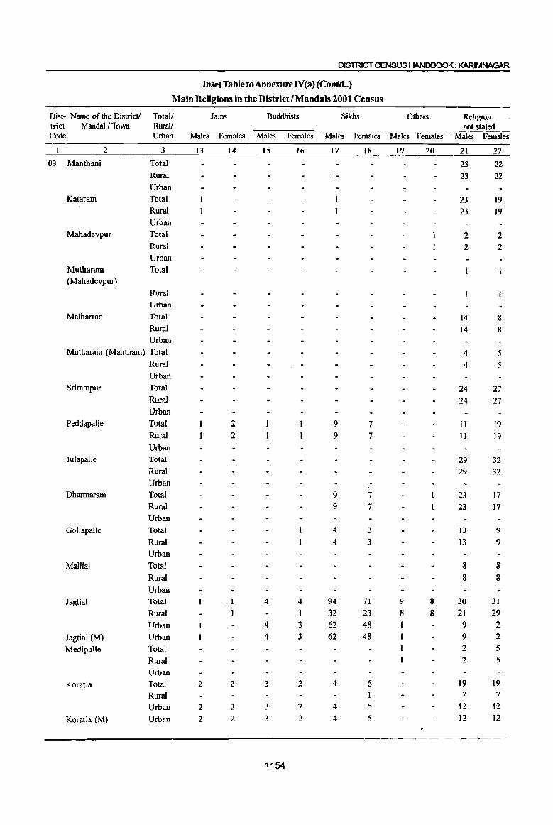
DISTRICT CENSUS HANDBOOK: KARIMNAGAR
Inset Table to Annexure IV(a) (Contd .. )
Main Religions in the District I Mandals 2001 Census
Dist- Name of the District! Totall Jains Buddhists Sikhs Others Religion trict Mandal! Town Rural! not stated Code Urban Males Females Males Females Males Females Males Females Males Females
2 3 13 14 15 16 17 18 19 20 21 22 03 Manthani Total 23 22
Rural 23 22 Urban
Kataram Total 23 19 Rural 23 19 Urban
Mahadevpur Total 2 2 Rural 2 2 Urban
Mutharam Total (Mahadevpur)
Rural Urban
Malharrao Total 14 8 Rural 14 8 Urban
Mutharam (Man than i) Total 4 5 Rural 4 5 Urban
Srirampur Total 24 27 Rural 24 27 Urban
PeddapaUe Total 2 9 7 II 19 Rural 2 9 7 II 19 Urban
Julapalle Total 29 32 Rural 29 32 Urban
Dharmaram Total 9 7 23 17 Rural 9 7 23 17 Urban
Gollapalle Total 4 3 13 9 Rural 4 3 I3 9 Urban
Mallial Total 8 8 Rural 8 8 Urban
Jagtial Total 4 4 94 71 9 8 30 31 Rural I 32 23 8 8 21 29 Urban 4 3 62 48 9 2
Jagtial (M) Urban 4 3 62 48 9 2
tviedipalle Total 2 5
Rural 2 5
Urban Koratla Total 2 2 3 2 4 6 19 19
Rural 7 7
Urban 2 2 3 2 4 5 12 12
Koratla (M) Urban 2 2 3 2 4 5 12 12
1154
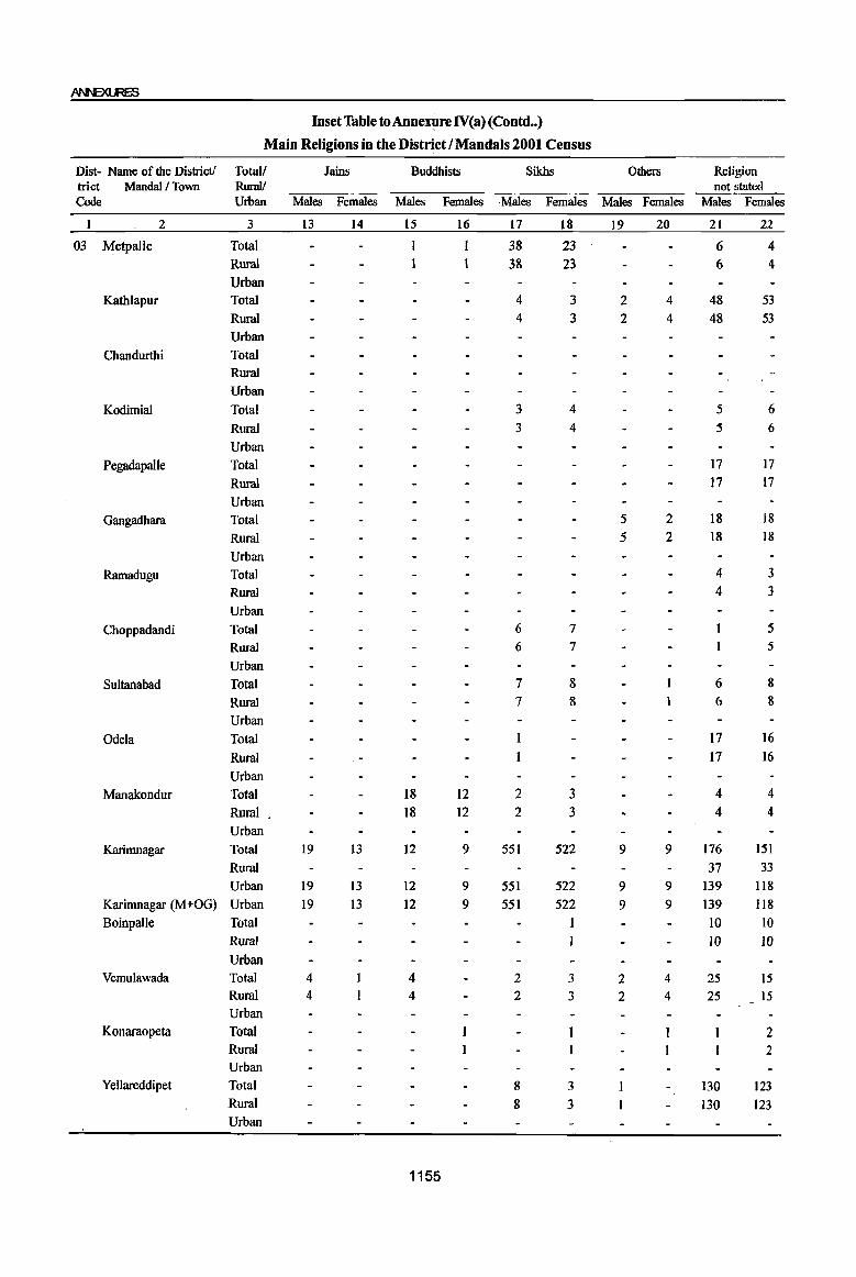
InsetTabletoAnnexoreIV(a) (Contd .. )
Main Religions in the District I Mandals 2001 Census
Dist- Name of the District! Totall Jains Buddhists Sikhs Others Religion trict MandaI I Town Rural! not stated Code Urban Males Females Males Females Males Females Males Females Males Females
I 2 3 13 14 15 16 17 18 19 20 21 22
03 Metpalle Total I I 38 23 6 4 Rural 38 23 6 4 Urban
Kathlapur Total 4 3 2 4 48 53 Rural 4 3 2 4 48 53 Urban
Chandurthi Total Rural Urban
KodimiaI Total 3 4 5 6 Rural 3 4 5 6 Urban
Pegadapalle Total 17 17
Rural 17 17
Urban Gangadhara Total 5 2 18 18
Rural 5 2 18 18 Urban
Ramadugu Total 4 3 Rural 4 3
Urban Choppadandi Total 6 7 5
Rural 6 7 5 Urban
Sultanabad Total 7 8 6 8
Rural 7 8 6 8
Urban
Odela Total 17 16 Rural 17 16 Urban
Manakondur Total 18 12 2 3 4 4 Rural , 18 12 2 3 4 4 Urban
Karimnagar Total 19 13 12 9 551 522 9 9 176 151 Rural 37 33 Urban 19 13 12 9 551 522 9 9 139 1I8
Karimnagar (M+OG) Urban 19 13 12 9 551 522 9 9 139 1I8 Boinpalle Total 1 10 10
Rural 10 10 Urban
Vemulawada Total 4 4 2 3 2 4 25 15 Rural 4 4 2 3 2 4 25 15 Urban
Konaraopeta Total 2 Rural 2 Urban
Yellareddipet Total 8 3 130 123 Rural 8 3 130 123 Urban
1155
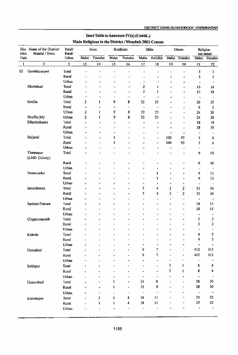
DISTRICT CENSUS HANDBOOK: KARlMNAGIIR
Inset Table to Annexure N(a) (Corttd •• )
Main Religions in the District I Mandals 2001 Census
Dist- Name of the District! Total! Jains Buddhists Sikhs Others Religion trict Mandal! Town Rural! . not stated Code Urban Males Females Males Females Males Females Males Females Males Females
2 3 13 14 15 16 17 18 19 20 21 22
03 Gambhiraopet Total 3 3 Rural 3 3 Urban
Mustabad Total 2 13 18 Rural 2 13 18 Urban
SirciIla Total 2 9 8 32 25 30 25 Rural 6 5 Urban 2 9 8 32 25 24 20
Sircilla (M) Urban 2 9 8 32 25 24 20 Ellanthakunta Total 18 19
Rural 18 19 Urban
Beiianki Total 100 93 5 6 Rural 100 93 5 6 Urban
Timmapur Total 9 10 (LMD Colony)
Rural 9 10 Urban
Veenavanka Total 9 13 Rural 9 13 Urban
Jammikunta Total 5 4 3 2 33 34 Rural 5 4 3 2 33 34 Urban
Sankara Patnam Total to 11 Rural 10 II Urban
Chigurumamidi Total 2 2 Rural 2 2 Urban
Koheda Total 4 5 Rural 4 5 Urban
Husnabad Total 9 7 412 313
Rural 9 7 412 313
Urban
Saidapur Total 3 8 4
Rural 3 8 4
Urban
Huzurabad Total 15 9 28 30
Rural 15 9 28 30
Urban
Kamalapur Total 4 18 11 25 22
Rural 4 18 II 25 22
Urban
1156
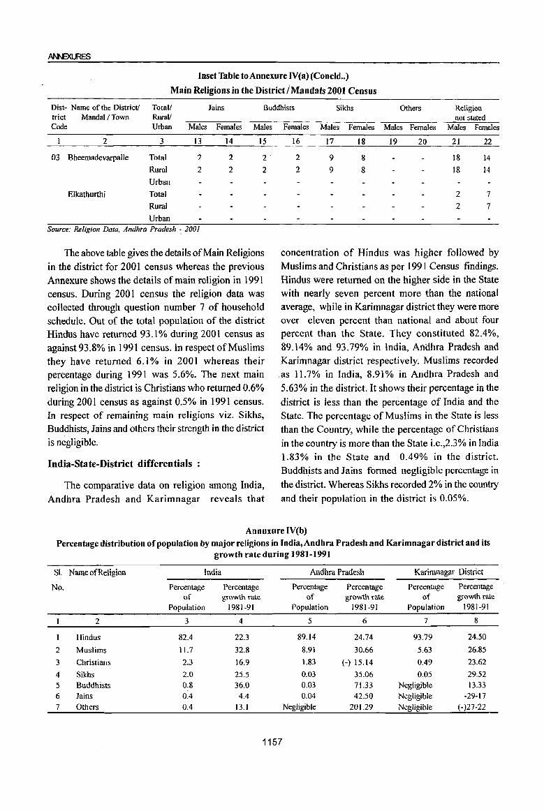
Inset Table toAnnexure lV(a) (Concld .. )
Main Religions in the District I Mandals 2001 Census
Dist- Name of the District! Totall Jains Buddhists Sikhs Others Religion trict MandaI/Town RuraV Code Urban Males Females Males
2 3 13 14 15
03 Bheemadevarpalle Total 2 2 2·
Rural 2 2 2 Urban
Elkathurthi Total
Rural
Urban Source: Religion Data. Andhra Pradesh ~ 2001
The above table gives the details of Main Religions in the district for 2001 census whereas the previous Annexure shows the details of main religion in 1991 census. During 2001 census the religion data was collected through question number 7 of household schedule. Out of the total population of the district Hindus have returned 93.1% during 2001 census as against 93.8% in 1991 census. In respect of Muslims they have returned 6.1 % in 2001 whereas their percentage during 1991 was 5.6%. The next main religion in the district is Christians who returned 0.6% during 2001 census as against 0.5% in 1991 census. In respect of remaining main religions viz. Sikhs, Buddhists, Jains and others their strength in the district is negligible.
India-State-District differentials
The comparative data on religion among India, Andhra Pradesh and Karimnagar reveals that
not stated Females Males Females Males Females Males Females
16 17 18 19 20 21 22
2 9 8 18 14
2 9 8 18 14
2 7 2 7
concentration of Hindus was higher followed by Muslims and Christians as per 199 I Census findings. Hindus were returned on the higher side in the State with nearly seven percent more than the national average, while in Karimnagar district they were more over eleven percent than national and about four percent than the State. They constituted 82.4%, 89.14% and 93.79% in India, Afidhra Pradesh and Karimnagar district respectively. Muslims recorded .as 11.7% in India, 8.91% in Andhra Pradesh and 5.63% in the district. It shows their percentage in the district is less than the percentage of India and the State. The percentage of Muslims in the State is less than the Country, while the percentage of Christians in the country is more than the State i.e.,2.3% in India 1.83% in the State and 0.49% in the district. Buddhists and Jains formed negligible percentage in the district. Whereas Sikhs recorded 2% in the country and their population in the district is 0.05%.
Annuxure rV(b) Percentage distribution of population by major religions in India,Andhra Pradesh and Karimnagar district and its
growth rate during 1981-1991
SI. Name of Religion India Andhra Pradesh Karimnagar District
No. Percentage Percentage . Percentage Percentage Percentage Percentage of growth rate of growth rate of growth rate
Population 1981-91 Population 1981-91 Population 1981-91
2 3 4 5 6 7 8
Hindus 82.4 22.3 89.14 24.74 93.79 24.50
2 Muslims 11.7 32.8 8.91 30.66 5.63 26.85
3 Christians 2.3 16.9 1.83 (-) 15.14 0.49 23.62
4 Sikhs 2.0 25.5 0.03 35.06 0.05 29.52
5 Buddhists 0.8 36.0 0.03 71.33 Negligible 13.33
6 Jains 0.4 4.4 0.04 42.50 Negligible -29-17
7 Others 0.4 13.1 Negligible 201.29 Negligible (-)27-22
1157
Religion-wise growth in the State during the
decade 1981-1991 shows that Hindus recorded higher
growth rate than India as a whole i.e. 24.74% as
against 22.3% in India. The growth rate of Hindus (
in the district was 24.50 and it was on par with the
DISTRICT CENSUS HANDBOOK: KARIMNAGAR
State and more than Country. The growth rate among
the Muslims in the district was 26.8% and it was less
than that of State and Country. The Christians
population has decreased in the State, but it is
increased in the district during the decade.
Inset Table to Annexure IV (b) Percentage distribution of population by major -religions in India, Andhra Pradesh and Karimnagar district and its
growth rate during 1991-2001
SL Name of Religion India
No. Percentage Percentage of growth rate
Population . 1991-2001
2 3 4
1 Hindus 805 20.3
2 Muslims 13.4 36.0 3 Christians 2.3 22.6 4 Sikhs 1.9 18.2 5 Buddhists 0.8 24.5 6 Jains 0.4 0.3 7 Others 0.6 103.1
Source: Religion Data, Andhra Pradesh - 200f
This table gives the comparative data on religions among India, Andhra Pradesh and Karimnagar district between 1991 and 2001 census, whereas the previous Annexure furnish the comparative data on religion during 1981 and 1991. At India level among the total population returned in the 200 I census Hindus constituted 80.5% as against 82.4% in 1991. The percentage growth rate of Hindus during the decade 1991-2001 has recorded 20.3 whereas the corresponding growth rate during 1981 and 1991 was 22.3%. It clearly shows that growth rate in Hindu popUlation is diminishing which can be attributed that the people of this religion is more conscious about family planning methods. In Andhra Pradesh the percentage of Hindus has recorded 89.0 whereas the corresponding figure during 1991 was 89.1 %. However the percentage growth rate of Hindus has fallen to 14.4 from the percentage growth rate of 24.7 as recorded during the decade 1981-1991. In Karimnagar district though the percentage of population of Hindus recorded 93.1 % as against 93.8% in 1991 their growth rate in 1991-2001 has fallen to 14.2% as against the growth rate of24.5 % in 1981-1991.
In respect of Muslims, their percentage to total
Andhra Pradesh Karimnagar District
Percentage Percentage Percentage Percentage of growth rate of growth rate
Population 1991-2001 Population 1991-2001
5 6 7 8
89.0 14.4 93.1 14.2
9.2 17.9 6.1 25.1 1.6 -2.8 0.6 37.1 0.0 41.5 0.1 38.5 0.0 44.6 79.4 0.1 57.5 376.5
86.0 4357.1
population has recorded 13.4 at India level as against 11.7% in 1991. In Andhra Pradesh their percentage has gone up to 9.2% from 8.9% in 1991. In respect of Karimnagar district, Muslims constituted 6.1 % of total population during 2001, whereas the corresponding figure recorded in 1991 was 5.6. However in this district the growth rate in the decade 1991-2001 has declined to 25.1% as against the growth rate of 26.9% recorded in 1981-1991.
The other main religion going by numerical strength is Christians. They constituted 2.3% of total population at India level during 2001 census. Their growth rate during the decade 1991-2001 is 22.6% at India level as against the growth rate of 16.9% recorded in 1981-91. In Andhra Pradesh their percentage growth rate continues to show the negative trend. The percentage growth rate of this community recorded during 1991-2001 is (-) 2.8 as against (-) 15.1 recorded during decade 1981-1991. In Karimnagar district during 2001 Christians constituted 0.6 % to total population as against 0.5 % in 1991. The percentage growth rate of this community during 1991-200 I has recorded 37.1 % as against 23.6% in 1981-1991. In respect of other main communities their growth rate is negligible.
1158
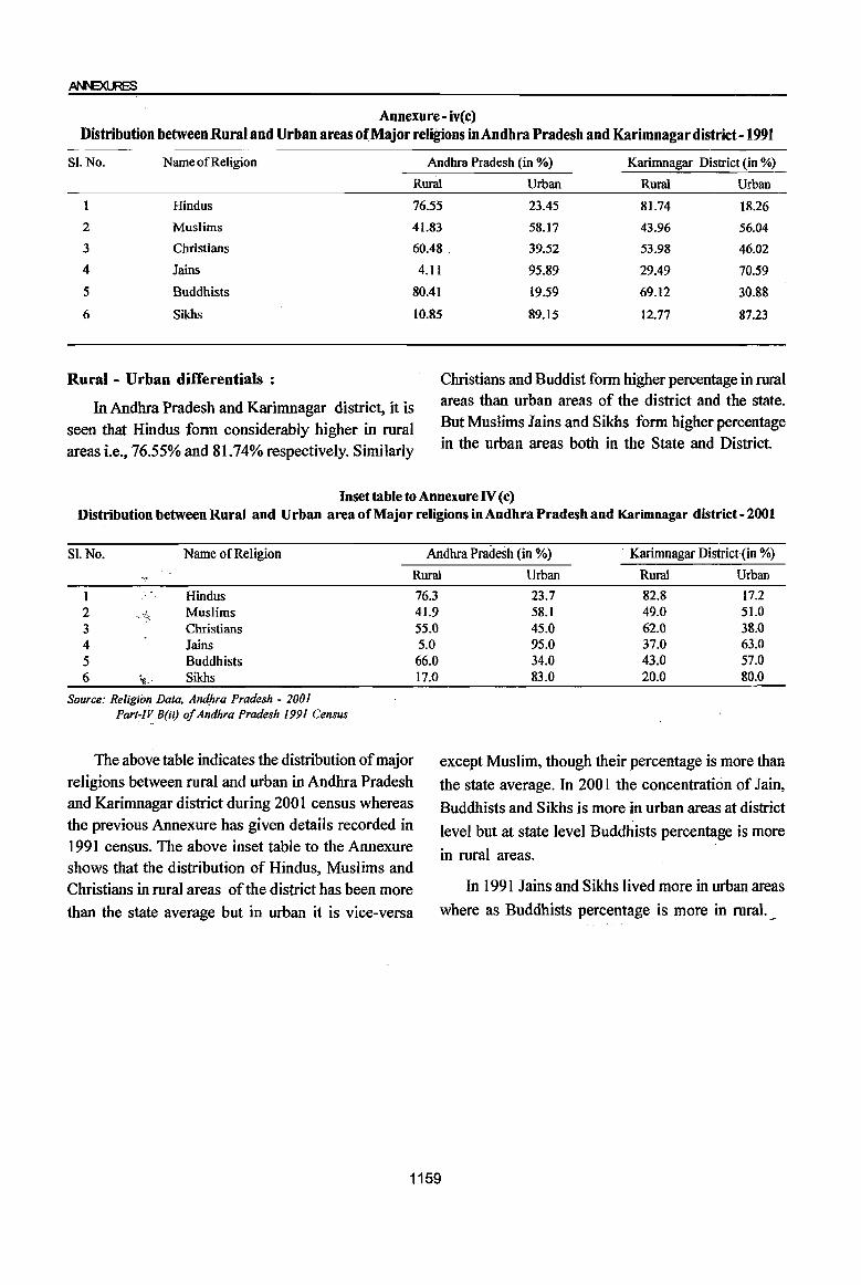
Annexure- iv(c) Distribution between Rural and Urban areas orMajor religions in Andhra Pradesh and Karimnagar district -1991
Sl.No. Name of Religion Andhra Pradesh (in %) Karimnagar District (in %)
Rural Urban Rural Urban
Hindus 76.55 23.45 81.74 18.26
2
3
4
5
6
Muslims 41.83 58.17 43.96 56.04
Christians 60.48 _ 39.52 53.98 46.02
Jains 4.11 95.89 29.49 70.59
Buddhists 80.41 19.59 69.12 30.88
Sikhs
Rural - Urban differentials:
In Andhra Pradesh and Karimnagar district, it is
seen that Hindus form considerably higher in rural areas i.e., 76.55% and 81.74% respectively. Similarly
10.85 89.15 12.77 87.23
Christians and Buddist form higher percentage in rural areas than urban areas of the district and the state. But Muslims Jains and Sikhs form higher percentage in the urban areas both in the State and District
Inset table to Annexure IV (c) Distribution between Rural and Urban area of Major religions in Andhra Pradesh and Karimnagar district - 2001
S1. No. Name of Religion Andhra Pmdesh (in %) . Karimnagar District(in %)
Rural Urban Ruml Urban
1 Hindus 2 Muslims 3 Christians 4 Jains 5 Buddhists 6 ~.' Sikhs
Source: Religion Data. Am:{hra Pradesh - 2001 ParI-IV B(ii) of Andhra Pradesh 1991 Census
The above table indicates the distribution of major religions between rural and urban in Andhra Pradesh and Karimnagar district during 2001 census whereas the previous Annexure has given details recorded in 1991 census. The above inset table to the Annexure shows that the distribution of Hindus, Muslims and Christians in rural areas of the district has been more
than the state average but in urban it is vice-versa
76.3 41.9 55.0 5.0
66.0 17.0
23.7 82.8 17.2 58.1 49.0 51.0 45.0 62.0 38.0 95.0 37.0 63.0 34.0 43.0 57.0 83.0 20.0 80.0
except Muslim, though their percentage is more than
the state average. In 2001 the concentration of Jain,
Buddhists and Sikhs is more in urban areas at district
level but at state level Buddhists percentage is more
in rural areas.
In 1991 Jains and Sikhs lived more in urban areas
where as Buddhists percentage is more in rural._
1159
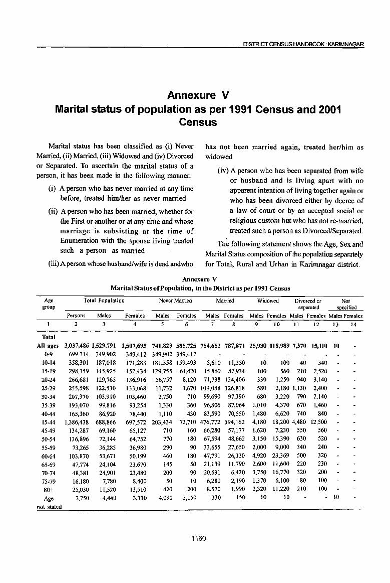
DISTRICT CENSUS HANDBOOK : KARIMNAGAR
Annexure V Marital status of population as per 1991 Census and 2001
Census
Marital status has been classified as (i) Never Married, (ii) Married, (iii) Widowed and (iv) Divorced or Separated. To ascertain the marital status of a person, it has been made in the following manner.
(i) A person who has never married at any time before, treated himlher as never married
(ii) A person who has been married, whether for the First or another or at any time and whose marriage is subsisting at the time of Enumeration with the spouse living treated such a person as married
(iii) A person whose husband/wife is dead andwho
has not been married again, treated her/him as widowed
(iv) A person who has been separated from wife or husband and is living apart with no apparent intention of living together again or who has been divorced either by decree of a law of court or by an accepted social or religious custom but who has not fe-married, treated such a person as Divorced/Separated.
Thb following statement shows the Age, Sex and Marital Status composition of the population separately for Total, Rural and Urban in Karimnagar district.
Annexure V Marital Status ofPopulationt in the District as per 1991 Census
Age Total Population Never Married Married Widowed Divorced or Not group sel!arated sJ!ecified
Persons Males Females Males Females Males Females Males Females Males Females Males Females
2 3 4 5 6 7 8 9 10 II 12 13 14
Total All ages 3,037,486 1,529,791 1,507,695 741,829 585,725 754,652 787,871 25,930 118,989 7,370 15,110 10
0-9 699,314 349,902 349,412 349,902 349,412 10-14 358,301 187,018 171,283 181,358 159,493 5,610 1l,350 10 100 40 340 15-19 298,359 145,925 152,434 129,755 61,420 15,860 87,934 100 560 210 2,520
20-24 266,681 129,765 136,916 56,757 8,120 71,738 124,406 330 1,250 940 3,140
25-29 255,598 122,530 133,068 11,732 1,670 109,088 126,818 580 2,180 1,130 2,400
30-34 207,370 103,910 103,460 2,750 710 99,690 97,390 680 3,220 790 2,140
35-39 193,070 99,816 93,254 1,330 360 96,806 . 87,064 1,010 4,370 670 1,460
40-44 165,360 86,920 78,440 1,110 430 83,590 70,550 1,480 6,620 740 840
15-44 1,386,438 688,866 697,572 203,434 72,710 476,772 594,162 4,180 18,200 4,480 12,500
45-49 134,287 69,160 65,127 710 160 66,280 57,177 1,620 7,230 550 560
50-54 136,896 72,144 64,752 770 180 67,594 48,662 3,150 15,390 630 520
55-59 73,265 36,285 36,980 290 90 33,655 27,650 2,000 9,000 340 240
60-64 103,870 53,671 50,199 460 180 47,791 26,330 4,920 23,369 500 320
65-69 47,774 24,104 23,670 145 50 21,139 11,790 2,600 11,600 220 230
70-74 48,381 24,901 23,480 200 90 20,631 6,420 3,750 16,770 320 200
75-79 16,180 7,780 8,400 50 10 6,280 2,190 1,370 6,100 80 100
80+ 25,030 11,520 13,510 420 200 8,570 1,990 2,320 11,220 210 100
Age 7,750 4,440 3,310 4,090 3,150 330 150 10 10 - 10
not stated
1160
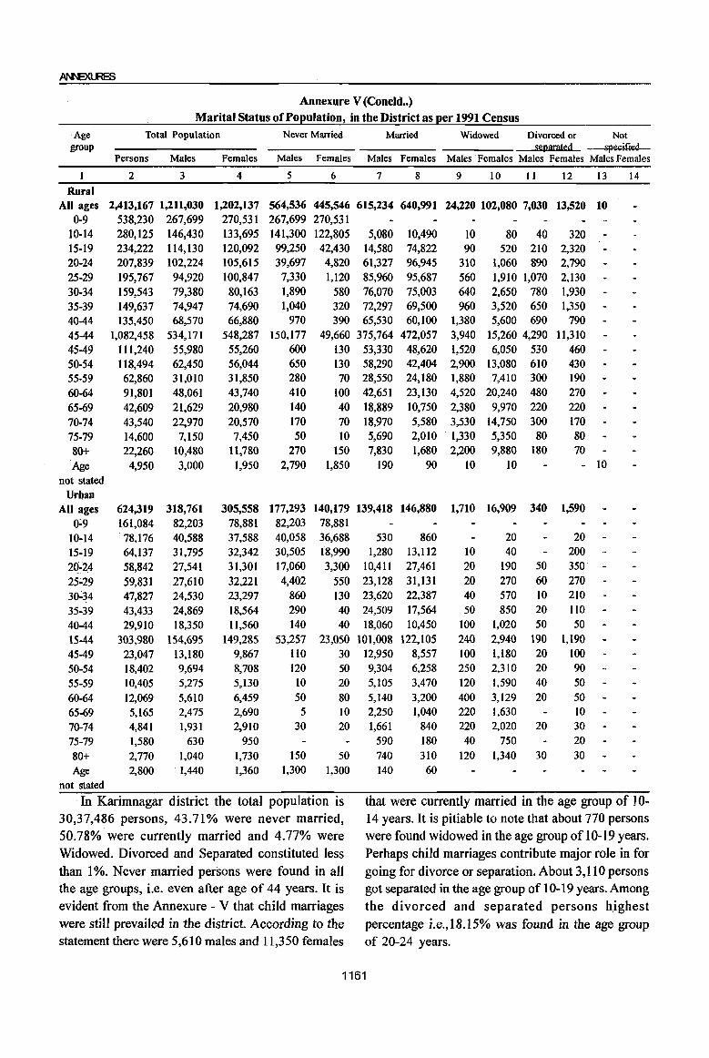
Annexure V(Concld .. ) Marital Status ofPo~ulation, in the District as ~er 1991 Census
. Age Total Population Never Married Married Widowed Divorced or Not group separated specified
Persons Males Females Males Females Males Females Males Females Males Females Males Females
2 3 4 5 6 7 8 9 10 11 12 13 14
Rural All ages 2,413,167 1,211,030 1,202,137 564,536 445,546 615,234 640,991 24,220 102,080 7,030 13,520 10
0-9 538,230 267,699 270,531 267,699 270,531 10-14 280,125 146,430 133,695 141,300 122,805 5,080 10,490 10 80 40 320 15-19 234,222 114,130 120,092 99,250 42,430 14,580 74,822 90 520 210 2,320 20-24 207,839 102,224 105,615 39,697 4,820 61,327 96,945 310 1,060 890 2,790 25-29 195,767 94,920 100,847 7,330 1,120 85,960 95,687 560 1,910 1,070 2,130 30-34 159,543 79,380 80,163 1,890 580 76,070 75,003 640 2,650 780 1,930 35-39 149,637 74,947 74,690 1,040 320 72,297 69,500 960 3,520 650 1,350 40-44 135,450 68,570 66,880 970 390 65,530 60,100 1,380 5,600 690 790 45-44 1,082,458 534,171 548,287 150,177 49,660 375,764 472,057 3,940 15,260 4,290 11,310 45-49 111,240 55,980 55,260 600 130 53,330 48,620 1,520 6,050 530 460 50-54 118,494 62,450 56,044 650 130 58,290 42,404 2,900 13,080 610 430 55-59 62,860 31,010 31,850 280 70 28,550 24,180 1,880 7,410 300 190
60-64 91,801 48,061 43,740 410 100 42,651 23,130 4,520 20,240 480 270
65-69 42,609 21,629 20,980 140 40 18,889 10,750 2,380 9,970 220 220
70-74 43,540 22,970 20,570 170 70 18,970 5,580 3,530 14,750 300 170
75-79 14,600 7,150 7,450 50 10 5,690 2,010 . 1,330 5,350 80 80
80+ 22,260 10,480 11,780 270 150 7,830 . 1,680 2,200 9,880 180 70
Age 4,950 3,000 1,950 2,790 1,850 190 90 10 10 - 10
not stated
Urban
All ages 624,319 318,761 305,558 177,293 140,179 139,418 146,880 1,710 16,909 340 1,590 0~9 161,084 82,203 78,881 82,203 78,881
10-14 78,176 40,588 37,588 40,058 36,688 530 860 20 20
15-19 64,137 31,795 32,342 30,505 "8,990 1,280 13,112 10 40 200
2q-24 58,842 27,541 31,301 17,060 3,300 10,411 27,461 20 190 50 350
25;29 59,831 27,610 32,221 4,402 550 23,128 31,131 20 270 60 270 30~34 47,827 24,530 23,297 860 130 23,620 22,387 40 570 10 210
35-39 43,433 24,869 18,564 290 40 24,509 17,564 50 850 20 1I0
40-44 29,910 18,350 11,560 140 40 18,060 10,450 100 1,020 50 50
15-44 303,980 154,695 149,285 53,257 23,050 101,008 122,105 240 2,940 190 1,190
45-49 23,047 13,180 9,867 1I0 30 12,950 8,557 100 1,180 20 100 50-54 18,402 9,694 8,708 120 50 9,304 6,258 250 2,310 20 90
55-59 10,405 5,275 5,130 to 20 5,105 3,470 120 1,590 40 50
60-64 12,069 5,610 6,459 50 80 5,140 3,200 400 3,129 20 50
65-69 5,165 2,475 2,690 5 10 2,250 1,040 220 1,630 10
70-74 4,841 1,931 2,910 30 20 1,661 840 220 2,020 20 30
75-79 1,580 630 950 590 180 40 750 20
80+ 2,770 1,040 1,730 150 50 740 310 120 1,340 30 30 Age 2,800 . 1,440 1,360 1,300 1,300 140 60
not stated
In Karimnagar district the total population is that were currently married in the age group of 10-30,37,486 persons, 43.71% were never married, 14 years. It is pitiable to note that about 770 persons 50.78% were currently married and 4.77% were were found widowed in the age group of 10-19 years. Widowed. Divorced and Separated constituted less Perhaps child marriages contribute major role in for than 1 %. Never married persons were found in all going for divorce or separation. About 3,110 persons the age groups, Le. even after age of 44 years. It is got separated in the age group of 10-19 years. Among evident from the Annexure - V that child marriages the divorced and separated persons highest were still prevailed in the district. According to the percentage i.e.,18.l5% was found in the age group statement there were 5,610 males and 11,350 females of 20-24 years.
1161
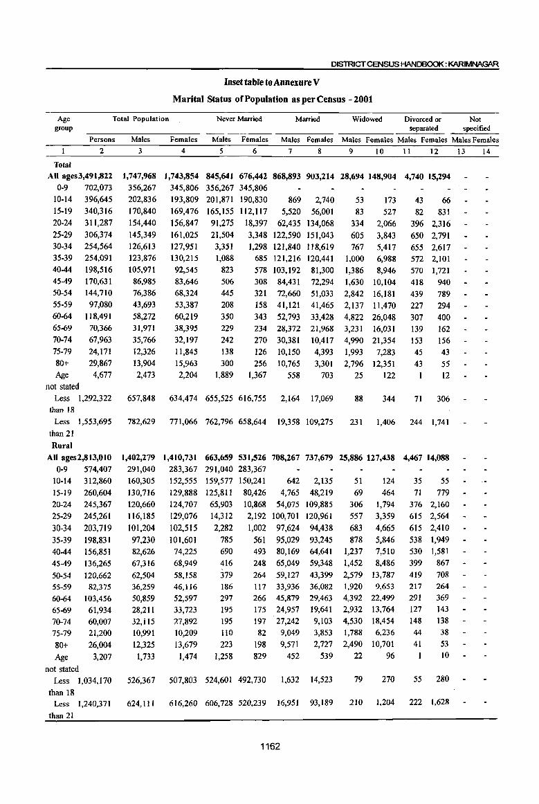
DI5TRICTCENSUS HANDBOOK: KARIMNAGAR
Inset table to Annexure V
Marital Status of Population as per Census - 2001
Age Total Population Never Married Married Widowed Divorced or Not group separated specified
Persons Males Females Males Females Males Females Males Females Males Females Males Females
2 3 4 5 6 7 8 9 10 11 12
Total
All ages3,491,822 0-9 702,073
1,747,968 356,267
202,836
170,840
154,440
145,349
126,613 123,876
105,971
1,743,854 345,806
193,809
169,476
156,847
161,025
127,951 130,215
845,641 676,442 868,893 903,214 28,694 148,904 4,740 15,294 356,267 345,806
10-14 396,645
15-19 340,316
20-24 311,287
25-29 306,374
30-34 254,564 35-39 254,091
40-44 198,516 45-49 50-54
55-59
60-64 65-69
70-74
75-79
80+ Age
not stated
170,631
144,710
97,080
118,491 70,366
67,963
24,171
29,867 4,677
86,985 76,386
43,693
58,272 31,971
35,766
12,326
13,904 2,473
92,545 83,646
68,324
53,387
60,219 38,395
32,197
11,845 15,963
2,204
201,871 190,830 869 2,740
165,155 112,117 5,520 56,001
91,275 18,397 62,435 134,068
21,504 3,348 122,590 151,043
3,351 1,298 121,840 118,619
53
83
334
605 767
173
527
2,066
3,843
5,417 1,088
823
506 445 208
350 229
242
138
300
685 121,216 120,441 1,000 6,988
1,889
578 103,192 81,300 1,386 8,946 308 321
158
343 234
270
126
256 1,367
84,431
72,660
41,121
52,793 28,372
30,381
10,150
10,765
558
72,294
51,033 41,465
33,428
21,968 10,417
4,393
3,301
703
1,630
2,842
2,137
4,822 3,231
4,990
1,993 2,796
25
10,104
16,181
11,470
26,048
16,031 21,354
7,283
12,351 122
Less 1,292,322 657,848 634,474 655,525 616,755 2,164 17,069 88 344 than 18
43 66
82 831
396 2,316
650 2,791
655 2,617 572 2,101
570 1,721
418
439
227
307
139 153
45 43
I
940
789 294
400 162
156 43
55 12
71 306
Less 1,553,695 782,629 771,066 762,796 658,644 19,358 109,275 231 1,406 244 1,741 than 21
Rural
All ages2,813,010 1,402,279 1,410,731 663,659 531,526 708,267 737,679 25,886 127,438 4,467 14,088 0-9 574,407 291,040 283,367 291,040 283,367
10-14
15-19
20-24
25-29
30-34
35-39 40-44
45-49
50-54 55-59
60-64
65-69 70-74 75-79
80+
Age not stated
312,860
260,604 245,367
245,261
203,719
198,831
156,851 136,265
120,662 82,375
103,456
61,934 60,007 21,200
26,004
3,207
160,305
130,716
120,660
116,185
101,204
97,230 82,626
67,316
62,504 36,259
50,859 28,211
32,il5 10,991
12,325
1,733
152,555
129,888
124,707
129,076
102,515
101,601 74,225
68,949
58,158 46,116
52,597
33,723 :27,892 10,209
13,679
1,474
159,577 150,241
125,811 80,426
65,903 10,868
642 2,135
4,765 48,219
54,075 109,885
120,961
94,438
93,245 64,641
59,348
51
69
306 557
683
878
124
464
1,794
3,359
4,665
5,846 7,510
8,486
14,312
2,282
785 690
416
379 186 297
195
195 lIO 223
1,258
2,192
1,002
561 493
248
100,701
97,624
95,029 80,169
65,049
1,237
1,452
264 59,127 43,399 2,579 13,787
117 33,936 36,082 266 45,879 29,463 175 24,957 19,641
1,920 9,653 4,392 22,499 2,932 13,764
197 27,242 9,103 4,530 18,454
82 9,049
198 9,571
829 452
3,853 1,788 6,236 2,727 2,490 10,701
539 22 96
Less 1,034,170 526,367 507,803 524,601 492,730 1,632 14,523 79 270
than 18
35 55
71 779 376 2,160
615 2,564
615 2,410
538 1,949 530 1,581
399 867
419 708 217 291 127 148 44
41
1
264 369 143 138
38
53 10
55 280
Less 1,240,371 624,111 616,260 606,728 520,239 16,951 93,189 210 1,204 222 1,628
than 21
1162
13 14

Age group
Total Population
Inset table to Annexure V (Concld •• )
Marital Status of Population as per Census - 2001
Never Married Married Widowed Divorced or separated
Not specified
Persons Males Females Males Females Males Females Males Females Males Females Males Females 2 3 4 5 6 7 8 9 10 II 12 13 14
Urban
All ages 678,812 345,689 333,123 181,982 144,916 160,626 165,535 2,808 21,466 273 1,206
0-9 127,666 65,227 62,439· 65,227 62,439 42,294 40,589
39,344 31,691
25,372 7,529
227 605
755 7,782
8,360 24,183
10-14
15-19
20-24 25-29 30-34
35-39
40-44
4549
50-54
55-59
60-64
65-69
70-74
75-79
83,785
79,712
65,920 61,113 50,845
55,260
41,665
34,366
24,048
14,705
15,035
42,531
40,124
33,780
29,164 25,409
26,646
23,345
19,669
13,882
41,254
39,588
32,140 31,949 25,436
28,614
18,3io
14,697
10,166
7,192 1,069
303
133
90
1,156 21,889 30,082 296 24,216 24,181·
124 26,187 27,196
85 23,023 16,659
60 19,382 12,946
2 14
28 48 84
122
149
178
263
217
430
299
49
63
272 484 752
1,142
1,436
1,618
2,394
1,817
3,549
2,267
8
11
20 35 40
34
40
19
20
10
16
12
II
52
156 227 207
152
140
73
81
30
31
19
18
66 22 53 34 47
28
77
57 13;533 7,634
7,434
7,413
3,760
3,651
1,335 1,579
7,271
7,622
4,672
4,305
1,636 2,284
41 7,185 5,383
77 6,914 3,965
8,432 7,956
2,971
3,863 1,470
59 3,415, 2,327
73 3,139 1,314 460 2,900 5
I
2 44 1,101 540 205 1,047 5
2
2 80+
Age
58 1,194 574 306 1,650
740 730 631 538 106 164 3 26
noLstated
Less 258,152 131,481 126,671 130,924 124,025 532 2,546 9 74 16 26
than 18 Less 313,324 158,518 154,806 156,068 138,405 2,407 16,086 21 202 22 113
than 21
Source: Socio-cultural Tables (C-Series) - 2001
The above inset table gives the details by age, sex and marital status composition of the population separately for total, rural and urban areas of the district during 2001 census, whereas the previous Annexure shows the above details for 1991 census. In 1991 while furnishing age group-wise marital status data, a separate age group 15-44 where the marital status was high has been shown. In 2001 census keeping in view of persons aged less than 18 years and persons aged less than 21 years, being high concentration of marital status, has been furnished. In the district population of3,491,822 persons, 845,641 (24.22%) males and 676,442 (19.37%) females were recorded as never married. In the total district population, 868,893 (24.88%) males and 903,214 (25.87%) females were found married during 2001
census. It is pity to note that as against 148,904 widows 28,694 widowers were found in the district during 2001 census. The reason for high percentage of widows can be attributed to aged males marrying younger females. As against total population of 1,292,322 persons in the age group less than 18 years, 50.7% males and 47.7% females were found never married in 200 I census. In respect of married persons under the age group less than 18 years, only 0.17% males and 1.32% females were recorded in 2001 census which means public are more consCious about Marriage Act and also ill-fate of early marriages. Similar trend is noticed both at TUral and urban areas even for age group less than 21 years. There is no much variation in the figures of marital status of the district between 1991 and 2001 censuses.
1163
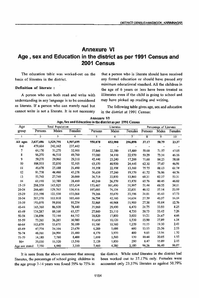
DISTRJCTCENSUS HANDBOOK: KARIMNAGAR
Annexure VI Age, sex and Education in the district as per 1991 Census and
2001 Census
The education table was worked-out on the that a person who is literate should have received
basis of literates in the district. any formal education or should have passed any
minimum educational standard. All the children in J)efinition of literate : the age of 6 years or less have been treated as
A person who can both read and write with illiterates even if the child is going to school and
understanding in any language is to be considered may have picked up reading and writing.
as literate. If a person who can merely read but The following table gives age, sex and education cannot write is not a literate. It is not necessary in the district at 1991 Census:
Annexure VI Age, Sex and Education in the district as per 1991 Census
Age Total Population Literates Percentage of Literates group Persons Males Females Persons Males Females Persons Males Females
2 3 4 5 6 7 8 9 10
All ages 3,037,486 1,529,791 1,507,695 950,878 653,980 296,898 37.17 50.79 23.37 0-6 479,604 242,162 237,442
7 64,170 31,270 32,900 37,860 22,380 15,480 59.00 71.57 47.05 8 96,270 46,510 49,760 57,080 34,110 22,970 59.29 73.34 46.16 9 59,270 29,960 29,310 42,440 25,240 17,200 71.60 84.25 58.68
10 104,935 52,830 52,105 65,370 40,930 24,440 62.30 77.47 46.91 IJ 46,678 25,188 21,490 35,358 22,198 13,160 75.75 88.13 61.24 12 91,758 48,480 43,278 56,630 37,260 19,370 61.72 76.86 44.76
13 53,740 27,740 26,000 36,710 22,850 13,860 68.31 82.37 53.31
14 61,190 32,780 28,410 40,240 26,370 13,870 65.76 80.45 48.82
15-19 298,359 145,925 152,434 153,487 101,490 51,997 51.44 69.55 34.11
20-24 266,681 129,765 136,916 107,005 74,154 32,851 40.12 57.14 23.99
25-29 255,598 122,530 133,068 79,266 55,670 23,596 31.01 45.43 17.73
30-34 207,370 103,910 103,460 56,794 42,160 14,634 27.39 40.57 14.14
35-39 193,070 99,816 93,254 52,868 40,968 11,900 27.38 41.04 12.76
40-44 165,360 86,920 78,440 35,960 29,490 6,470 21.75 33.93 8.25
45-49 134,287 69,160 65,127 27,840 23,110 4,730 20.73 33.42 7.26
50-54 136,896 72,144 64,752 20,820 17,800 3,020 15.21 24.67 4.66
55-59 73,265 36,285 36,980 11,650 10,120 1,530 15.90 27.89 4.14
60-64 103,870 53,671 50,199 II,580 10,360 1,220 11.15 19.30 2.43
65-69 47,774 24,104 23,670 6,280 5,680 600 13.15 23.56 2.53
70-74 48,381 24,901 23,480 4,370 3,970 400 9.03 15.94 1.70
75-79 16,180 7,780 8,400 1,690 1,560 130 10.44 20.05 1.55
80+ 25,030 11,520 13,510 2,120 1,830 290 8.47 15.89 2.15
Age not stated 7,750 4,440 3,310 7,460 4,280 3,180 96.26 96.40 96.07
It is seen from the above statement that among the district. While total literates in the district had
literates, the percentage of school going children in been worked out to 37.17% only. Females were
the age group 7-14 years was found 59% to 75% in accounted only 23.37% literates as against 50.79%
1164
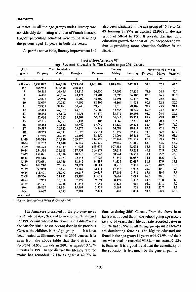
of males. In all the age groups males literacy was
considerably dominating with that of female literacy.
Highest percentage educated were found in among
the persons aged 11 years in both the sexes.
As per the above table, literacy improvement had
also been identified in the age group of 15-19 to 45-49 forming 35.87% as against 12.96% in the age group of 50-54 to 80+. It reveals that the rapid education growth than that of Pre-independent days, due to providing more education facilities in the district.
Inset table to Annexure VI Age, Sex And Education In The District as per, 2001 Census
Age Total Po~ulation Literates Percentage of Literates group Persons Males Females Persons Males Females Persons Males Females
2 3 4 5 6 7 8 9 10
All ages 3,491,822 1,747,968 1,743,854 1,661,089 1,013,328 647,761 54.9 67.1 42.7 0-6 465,964 237,508 228,456 7 76,812 39,495 37,317 56,732 29,595 27,137 73.9 74.9 72.7 8 86,420 43,296 43,124 73,701 37,595 36,106 85.3 86.8 83.7 9 72,877 35,968 36,909 66,509 33,391 33,118 91.3 92.8 89.7 10 98,039 50,243 47,796 88,297 46,364 41,933 90.1 92.3 87.7 11 63,831 32,891 30,940 59,918 31,510 28,408 93.9 95.8 91.8 12 92,403 47,787 44,616 83,082 44,555 38,527 89.9 93.2 86.4 13 70,358 35,602 34,756 64,170 33,772 30,398 91.2 94.9 87.5 14 72,014 36,313 35,701 64,024 34,047 29,977 88.9 93.8 84.0 15 72,735 37,291 35,444 61,485 33,669 27,816 84.5 90.3 78.5 16 70,282 34,642 35,640 57,942 31,129 26,813 82.4 89.9 75.2 17 50,587 26,812 23,775 43,148 24,691 18,457 85.3 92.1 77.6 U, 98,763 47,741 51,022 73,854 41,377 32,477 74.8 86.7 63.7 19 47,949 24,354 23,595 38,150 21,996 16,154 79.6 90.3 68.5
15-19 340,316 170,840 169,476 274,579 152,862 121,717 80.7 89.5 71.8 20-24 311,287 154,440 156,847 212,529 129,049 83,480 68.3 83.6 53.2 25-29 306,374 145,349 161,025 169,976 107,283 62,693 55.5 73.8 38.9 30-34 254,564 126,613 127,951 114,877 79,613 35,264 45.1 62.9 27.6 35~39 254,091 123,876 130,215 97,542 68,944 28,598 38.4 55.7 22.0 40-44 198,516 105,971 92,545 67,627 51,540 16,087 34.1 48.6 17.4 4549 170,631 86,985 83,646 54,297 41,658 12,639 3l.8 47.9 15.1 50-54 144,710 76,386 68,324 38,081 30,710 7,371 26.3 40.2 10.8 55-59 97,080 43,693 53,387 22,514 17,542 4,972 23.2 40.1 9.3 60-64 II 8,491 58,272 60,219 20,657 17,116 3,541 17.4 29.4 5.9 65-69 70,366 31,971 38,395 11,628 9,609 2,019 16.5 30.1 5.3 70-74 67,963 35,766 32,197 9,894 8,497 1,397 14.6 23.8 4.3 75-79 24,171 12,326 1l,845 4,042 3,423 619 16.7 27.8 5.2 80+ 29,867 13,904 15,963 3,919 3,163 756 13.1 22.7 4.7 Age 4,677 2,473 2,204 2,494 1,490 1,004 53.3 60.3 45.6
not stated
Source: Socio-cultural Tables (C-Series) - 2001
The Annexure presented in the pre-page gives females during 2001 Census. From the above inset the details of Age, Sex and Education in the district table it is noticed that in the school going age groups for 1991 census whereas the above inset table reveals i.e 7 to 14 years, their literacy rate recorded between the data for 200 1 Census. As was done in the previous 73.9% and 88.9%. In all the age groups male literates Census. the children in the Age group 0-6 have are dominating females. The highest educated are been treated as illiterates even in 2001 census. It is found in the age group 11 years with 93.9% and their seen from the above table that the district has sex-~ise breakup recorded 95.8% in males and 91.8% recorded 54.9% literates in 2001 as against 37.2% in females. It is a good trend that the essentiality of literates in 1991. In the district the literacy rate for the education is felt much by the general public. males has recorded 67.1% as against 42.7% in
1165
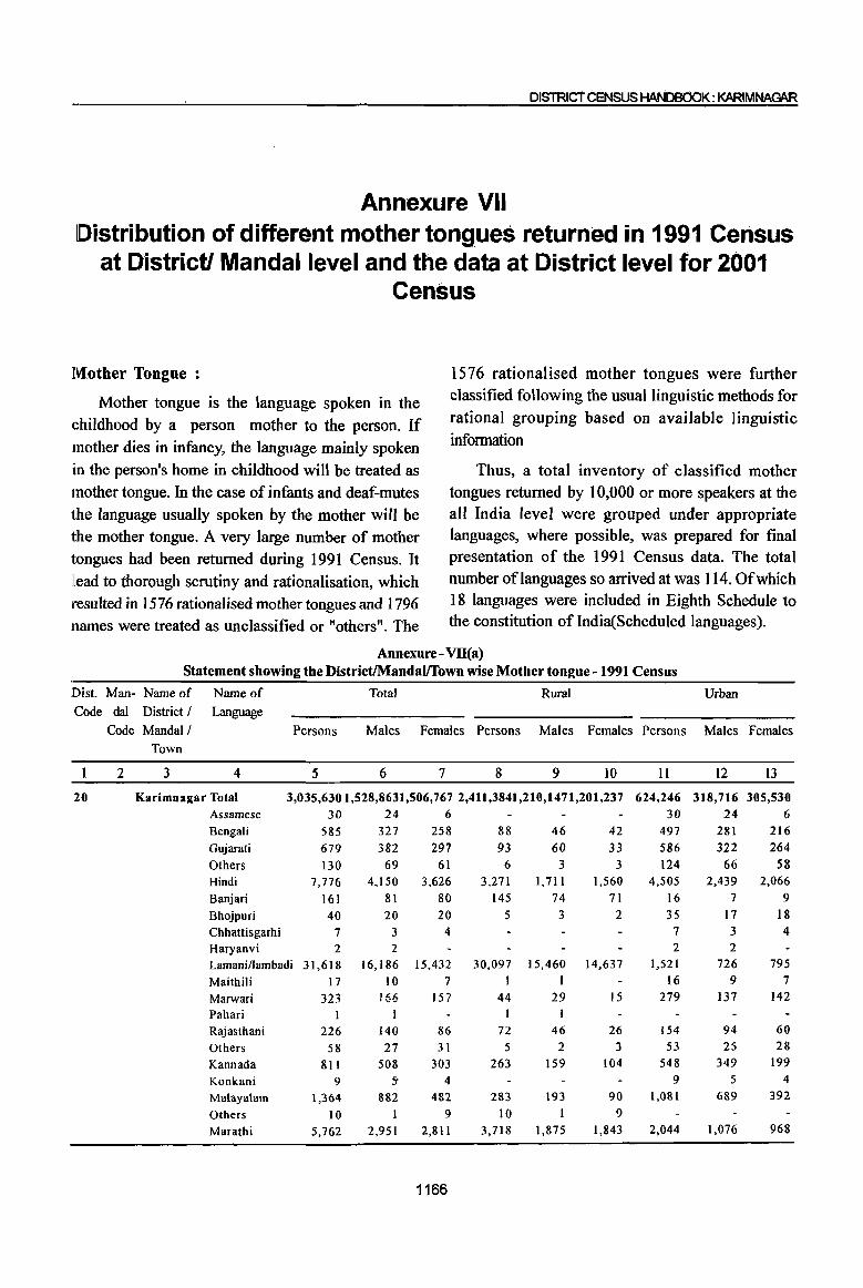
DISTRIct CENSUS HAN08dOK: KARIMNAGAR
Annexure VII Distribution of different mother tongues returned in 1991 Census
at District! Mandai level and the data at District level for 2001 Census
Mother Tongue :
Mother tongue is the language spoken in the (;hildhood by a person mother to the person. If mother dies in infancy, the language mainly spoken in the person's home in childhood will be treated as mother tongue. In the case of infants and deaf-mutes the language usually spoken by the mother will be the mother tongue. A very large number of mother tongues had been returned during 1991 Census. It llead to thorough scrutiny and rationalisation, which resulted in 1576 rationalised mother tongues and 1796 lllames were treated as unclassified or "others". The
1576 rationalised mother tongues were further classified following the usual linguistic methods for rational grouping based on available linguistic infonnation
Thus, a total inventory of classified mother tongues returned by 10,000 or more speakers at the all India level were grouped under appropriate languages, where possible, was prepared for final presentation of the 1991 Census data. The total number of languages so arrived at was 114. Of which 18 languages were included in Eighth Schedule to the constitution of India(Scheduled languages).
Annexure- Vll(a) Statement showing the DistrictIMandalffown wise Mother tongue - 1991 Census
Dist. Man- Name of Name of Total Rural Urban
Code dal District! Language
Code Mandai! Persons Males Females Persons Males Females Persons Males Females Town
2 3 4 5 6 7 8 9 IO It 12 13
20 Karimnagar Total 3,035,6301,528,8631,506,767 2,411,3841,210,1471,201,237 624,246 318,716 305,530 Assamese 30 24 6 30 24 6 Bengali 585 327 258 88 46 42 497 281 216 Gujarati 679 382 297 93 60 33 586 322 264
Others 130 69 61 6 3 3 124 66 58 Hindi 7,776 4,150 3,626 3,271 1,711 1,560 4,505 2,439 2,066
Banjari 161 81 80 145 74 71 16 7 9
Bhojpuri 40 20 20 5 3 2 35 17 18
Chhattisgarhi 7 3 4 7 3 4 Haryanvi 2 2 2 2 Lamaninambadi 31,618 16,186 15,432 30,097 15,460 14,637 1,521 726 795
Maithili 17 10 7 1 1 16 9 7
Marwari 323 166 157 44 29 15 279 137 142
Pahari Rajasthani 226 140 86 72 46 26 154 94 60
Others 58 27 31 5 2 3 53 25 28
Kannada 811 508 303 263 159 104 548 349 199
Konkani 9 5' 4 9 5 4
Malayalam 1,364 882 482 283 193 90 1,081 689 392
Others 10 9 10 1 9
Marathi 5,762 2,951 2,811 3,718 1,875 1,843 2,044 1,076 968
1166

Annexure- VII(a) (Contd .• ) Statement showing the DistrictIMandalffown wise Mother tongue-1991 Census
Dist. Man- Name of Name of Total Rural Urban Code dal District I Language
Code Mandall Persons Males Females Persons Males Females Persons Males Females
2
20
1
2
3
4
Town
3 4
Others Gorkhali/nepali Oriya RelIi Otbers Punjabi Others Sanskrit Sindhi
5 274 108
3,95-1 363 583 829 387 II
303
6
142 74
2,078 184 294 437 199
7 1?8
7
132 34
1;873 179 289 392 188
4 145
8
235 36
1,704
123 120 35 11 8
9
123 25
913
65 66 19 7 2
10 112 II
791
58 54
16
4 6
Tamil 3,729 2,079 1,650 2,063 1,124 939 Yerukalalyerukula ,401 1,208 1,193 1,937 982 955
Telugu 2,809,8241,413,2321,396,5922,302,2581,154,3851,147,873 Others 307 145 162 224 106 118 Urdu 162,945 82,689 80,256 64,522 32,664 31,858 Others 6 2 4 6 2 4
Ibrabimpatnam Total 44,205 21,067 23,138 44,205 21,067 23,138 Hindi 80 45 35 80 45 35 Lamanillambadi 822 407 415 822 407 415
Rajasthani 2 2 2 2 Kannada 8 5 3 8 5 3 Marathi Tamil Telugu Urdu
22 3
42,397 871
MalJapur Total 45,305 Gujarati 5 Hindi 71 Banjari 145 Lamani/lambadi 1,469 Marathi 8 Others 8 Tamil 4 YerukalalyerukuJa 5 Telugu 42,644
Urdu 946 Raikal Total 52,160
Gujarati 3 Hindi Lamanillambadi Marwari Others Kannada Marathi Others Tamil
7
719
3
12 44
4 6
Yerukalalyerukula 13 Telugu 48,800 Urdu 2,548
Sarangapur Total 38,451 Hindi 5 Lamanillambadi 499 Tamil 4 Yerukalalyerukula 9
13 2
20,173 420
9
22,224 451
22,225· 23,080 3 2
32 39 74 71
721 748 6 2 4 4 3 I 3 2
20,886 21,758 493
25,571
1 5
359 2
7 21
2 5 8
23,922 1,238
19,432
255 2 9
453 26,589
2 2
360 I
5
23 2
5
24,878 1,310
19,019 4
244 2
1167
22 3
13 2
42,397 20, I 73 871 420
45,305 5
71 145
1,469 8 8 4
5
22,225 3
32 74
721 6 4
3 3
42,644 20,886
946 493 52,160 25,571
3 1 7
719
3
5 359
2
7 21
2 5
13 8 48,800 23,922
2,548 1,238 38,451
5 499
4
9
19,432 1
255
2 9
9
22,224 451
23,080 2
39 71
748 2 4
I 2
21,758 453
26,589 2 2
360 I
5 23
2 I 5
24,878 1,310
19,019 4
244 2
11
39 72
2,247 363 460 709 352
295
12
19 49
1,165 184 229 371 180
156
I3
20 23
1,082 179 231 338 172
139 1,666 955 711
464 226 238 507,566 258,847 248,719
83 39 44 98,423 50,025 48,398

DISTRICT CENSUS HANDBOOK: KARlMNAGAR
Annexure- VII(a)(Contd •• ) Statement showing the District/Mandal/foWD wise Mother tongue -1991 Census
Dist. Man- Name of Code dal District /
Code MandaI / Town
Name of Language
Persons
Total Rural Urban
Males Females Persons Males Females Persons Males Females
1 2 3 4 5 6 7 8 9 10 II 12 13 ::l~0~----~----~--------~Te~l-ug-u------------3~7~,3~5~8-----1~8,~8-5~7--1-8,-5~0-1-----3-7,~3~58-----1-8,-8~57-----1-8-,5~0~1-------~----~----~--
5
6
7
7
Urdu 576 308 268 576 308 268 Dharmapuri Total 64,249 31,825 32,424 64,249·31,825 32,424
Gujarati 5 4 1 5 4 1 Hindi Lamani/lambadi Kannada Marathi
195 92 103 195 92 103 135 66 69 135 66 69 II 6 5 II 6 5 39 22 17 39 22 17
Gorkhali/nepali 2 1
Tamil 28 13 15 Yerukalalyerukula 6 3 3 Telugu 62,623 31,03531,588 Urdu 1,205 583 622
Velgatoor Total 41,435 21,033 20,402 Yerukalalyerukula 2 7 12
Telugu 40,938 20,782 20,156
Urdu 470 239 231
2 15 3
31,588 622
20,402 12
20,156 131
15 -0
Ramagundam Total 252,721 129,416 123,305
28 6
62,623 1,205
41,435 15
40,938 470
38,388
13 3
31,035
583 21,033
27 20,782
239 19,584 18,804 214,333 109,832 104,501
Assamese Bengali
Gujarati Others Hindi Banjari Bhojpuri Chhattisgarhi Lamani/lambadi Maithili Marwari Raja.sthani Others Kannada Konkani Malayalam
Marathi
Others Gorkhali/nepali Oriya Relli Others Punjabi
29 500 113
9 2,674
6 39
7 679
16 122
17 4
249 9
954
675 4
33 2,188
363 460 156
23 280
61 4
1,471
2 19 3
329 9
61 10
1
132
5 590 357
I 24
1,127
184 229
82
6 220
52 5
1,203 4
20 4
350 7
61 7
3
117
4 364
318
3 9
1,061 179 231
74 Sindhi 57 29 28 Tamil 1,534 846 688 Yerukalalyerukula 127 64 63 Telugu 223,540 114,147 109,393 Urdu 18,151 9,324 8,827
Others 6 2 4 RamaguDdam (M) Total 214,333 109,832 104,501
Assamese 29 23 6 Bengali Gujarati Others Hindi
477 113
9 2,335
268 61 4
1,268
209 52 5
1.067
1168
23
339
5
44
2 2
4
9
79 64
6 131
21
318 27
36,183 1,125
6
12
203
3
22
2
I 4
54
32
4 74
9
158 13
18,421 569
2
11
136
2
22
3 5
25 32
2 57
12
29 477
113 9
2,335 6
34 7
635 16
120 15
240
9 875 611
4
27 2,057
363 460
135 57
160 1,216 14 100
17,762 187,357 556 17,026
4
23
268 61 4
1,268 2
16 3
307 9
60 8
128
5 536 325
I 20
1,053 184 229
73 29
688 51
95,726 8,755
6 209
52 5
1,067 4
18 4
328 7
60 7
112 4
339 286
3 7
1,004 179 231
62 28
528 49
91,631 8,271
- 214,333 109,832 104,501 29 23 6
477
113 9
2,335
268 61
4
1.268
209 52
5 1,067

Annexure-Vll(a)(Contd .. ) Statement showing the DistrictIMandalffown wise Mother tongue -1991 Census
Dist. Man- Name of Name of Total Rural Urban
Code dal District! Language
Code Mandai! Persons Males Females Persons Males Females Persons Males Females Town
2 3 4 5 6 7 8 9 10 11 12 13
20 Banjari 6 2 4 6 2 4 . Bhojpuri 34 16 18 34 16 18
Chhattisgarhi 7 3 4 7 3 4 Lamani/lambadi 635 307 328 635 307 328 Maithili 16 9 7 16 9 7 Marwari 120 60 60 120 60 60 Rajasthani 15 8 7 15 8 7 Kannada 240 128 112 240 128 1I2 Konkani 9 5 4 9 5 4 Malayalam 875 536 339 875 536 339 Marathi 611 325 286 611 325 286 Others 4 1 3 4 I 3 Gorkhali/nepali 27 20 7 27 20 7 Oriya 2,057 1,053 1,004 2,057 1,053 1,004 Relli 363 184 179 363 184 179 Others 460 229 231 460 229 231 Punjabi 135 73 62 135 73 62 Sindhi 57 29 28 57 29 28 Tamil 1,216 688 528 1,216 688 528 Yerukalalyerukula 100 51 49 100 51 49 Telugu 187,357 95,726 91,631 - 187,357 95,726 91,631 Urdu 17,026 8,755 8,271 17,026 8,755 8,271
8 Kamanpur Total 59,527 30,173 29,354 59,527 30,173 29,354 Bengali 27 17 10 27 17 10 Hindi 247 126 121 247 126 121 Lamanillambadi 977 496 481 977 496 481 Marwari 2 2 Rajasthani 34 21 13 34 21 13 Kannada 20 9 II 20 9 11 Malayalam 46 27 19 46 27 19 Marathi 33 18 15 33 18 15 Gorkhali/nepali I I I
Oriya 18 12 6 18 12 6 Punjabi 30 18 12 30 18 12 Tamil 79 42 37 79 42 37 Yerukalalyerukula 30 13 17 30 13 17 Telugu 55,560 28,128 27,432 55,560 28,128 27,432 Urdu 2,423 1,244 1,179 2,423 1,244 ,1,179
9 Manthani Total 44,270 22,398 21,872 29,631 15,047 14,584 14,639 7,351 7,288 Hindi 15 8 7 8 6 2 7 2 5 Banjari 3 I 2 3 I 2 Kannada 10 5 5 2 8 4 4 Marathi 11 5 6 11 5 6 Punjabi 9 6 3 9 6 3 Telugu 42,858 21,666 21,192 29,325 14,881 44,444 13,533 6,785 6,748 Urdu 1,364 707 657 296 159 137 1,068 548 520
9 Mantbani (P) Total 14,639 7,351 7,288 14,639 7,351 7,288 Hindi 7 2 5 7 2 5 Banjari 3 I 2 3 2 Kannada 8 4 4 8 4 4 Marathi II 5 6 11 5 6 Punjabi 9 6 3 9 6 3 Telugu 13,533 6,785 6,748 13,533 6,785 6,748 Urdu 1,068 548 520 1,068 548 520
1169
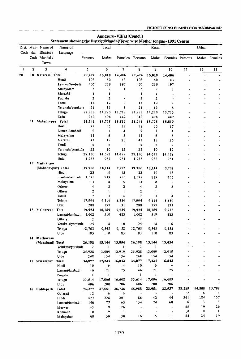
DISTRICT CENSUS HANDBOOK: KARlMNAGAR
Annexure- VII(a)(Contd •. ) Statement showing the DistrictIMandalfTown wise Mother tongue - 1991 Census
Dist. Man- Name of Name of Total Rural Urban
Code dal District / Language
Code Mandal/ Persons Males Females Persons Males Females Persons Males Females Town
2 3 4 5 6 7 8 9 10 It 12 13
20 10 Kataram Total 29,424 15,018 14,406 29,424 15,018 14,406 Hindi 103 60 43 103 60 43 Lamani/lambadi 407 210 197 407 210 197 Malayalam 3 2 3 2 Marathi I I I I Punjabi 2 2 2 2 Tamil 14 12 2 14 12 2 Yerukalalyerukula 21 13 8 21 13 8 Telugu 27,933 14,220 13,713 27,933 14,220 13,713 Urdu 940 498 442 940 498 442
11 Mahadevpur Total 31,241 15,728 15,513 31,241 15,728 15,513 Hindi 72 35 37 72 35 37 Lamani/lambadi 5 1 4 5 I 4 Malayalam II 6 5 II 6 5 Marathi 43 17 26 43 17 26 Tamil 5 5 5 5 Yerukalalyerukula 22 10 12 22 10 12 Telugu 29,150 14,672 14,478 29,150 14,672 14,478 Urdu 1,933 982 951 1,933 982 951
12 Mutbaram (Mahadevpur) Total 19,906 10,1l4 9,792 19,906 10,114 9,792
Hindi 23 10 13 23 10 13 LamanilIambadi 1,575 819 756 1,575 819 756 Malayalam 13 8 5 13 8 5 Others 4 2 2 4 2 2 Others 2 2 Tamil 7 3 4 7 3 4 Telugu 17,994 9,114 8,880 17,994 9,114 8,880 Urdu 288 157 131 288 157 131
13 Malharrao Total 19,924 10,189 9,735 19,924 10,189 9,735 LamanilIambadi 1,002 519 483 1,002 519 483 Others 2 I I 2 I I Yerukalalyerukula 24 14 10 24 14 10 Ielugu 18,703 9,545 9,158 18,703 9,545 9,158 Urdu 193 1I0 83 193 110 83
14 Mutharam (Mantbani) Total 26,198 13,144 13,054 26,198 13,144 13,054
Yerukalalyeruku[a 2 I I 2 I I
Telugu 25,928 13,009 12,919 25,928 13,009 12,919 Urdu 268 134 134 268 134 134
15 Srirampur Total 34,077 17,234 16,843 34,077 17,234 16,843
Hindi 10 6 4 10 6 4
Lamani/lambadi 46 21 25 46 21 25
Punjabi 1 1 1
Telugu 33,614 17,006 16,608 33,614 17,006 16,608
Urdu 406 200 206 406 200 206
16 Peddapalle Total 74,277 37,551 36,726 45,988 23,051 22,937 28,289 14,500 13,789
Gujarati 12 6 6 12 6 6
Hindi 427 226 201 86 42 44 341 184 157
Lamanillambadi 140 77 63 134 74 60 6 3 3
Marwari 45 19 26 45 19 26
Kannada 10 9 1 10 9 1
Malayalam 60 30 30 16 5 II 44 25 19
1170

Annexure- Vll(a)(Contd .• ) Statement showing the DistrictIMandal!Thwn wise Mother tongue - 1991 Census
Dist. Man- Name of Name of Total Rural Urban
Code daI District / Language Code MandaI! Persons Males Females Persons Males Females Persons Males Females
20
Town
2 3 4
Marathi Gorkhali/nepali Oriya Others
5
54 10
I
21 Tamil 28 Yerukalalyerukula 67 Telugu 65,677 Urdu 7,725
16 PeddapaUe (P)Total Gujarati
28,289 12
341 Hindi Lamanillambadi Marwari Kannada Malayalam Marathi Gorkhali/nepali
Tamil
6 45 10 44 51 10
28 Yerukalalyerukula 33 Telugu 21,623 Urdu
17 Julapalle Total Hindi Lamanillambadi Rajasthani Marathi Oriya Others
6,086 42,316
77 36
2 16
121 13
Tamil 11 Yerukalalyerukula 68 Telugu 41,219 Urdu 743
18 Dharmaram Total
Hindi Lamani/lambadi Rajasthani Kannada
41,927
32 1,797
2 10
Marathi 13 Yerukalalyerukula 75 Telugu 39,722 Urdu 276
19 Gollapalle Total 36,307 Hindi 11 Lamanillambadi 99 Marwari 7 Marathi 17 Yerukalalyerukula 3 I Telugu 35,567 Urdu 565
20 Jagtial Total 123,375 Bengali Gujarati Others
2 40 27
6
30 5 I
12 17
34 33,071
4,014 14,500
6 184
3 19
9 25 27
5 17 16
11,057 3,131
21,509 41 19
11 62
5 8
39 20,942
381 20,940
14 928
2 5
6 33
19,802 150
18,120
12 50
6 10 14
17,732 296
62,368 2
23 14
7
24 5
9 II
33 32,606
3,711 13,789
6 157
3 16
19 24
5
11 17
10,566 2,954
20,807 36 17
5
59 8
13 29
20,277 362
20,987 18
869
5
7
42 19,920
126 18,187
9 49
I
7 17
8 3
I
21
9
3
1 12
34 18 44,054 11,014
1,639 882
42,316 77 36
2 16
121 13
21,509 41 19
II
62 5
21 8
68 39 41,219 20,942
743 381 41,927
32 1,797
2 10
13 75
39,722 276
36,307 21 99
7
17 31
20,940
14 928
2 5
6
17,835' 35,567
33 19,802
150 18,120
12 50
6 10 14
17,732 269 565
61,007 55,789
17 13
1171
296 27,811
10
9
16 22,040
757
20,807 36 17
5
59 8
13
29 20,277
362 20,987
18 869
5
7
42 19,920
126 18,187
9 49
1 7
17 17,835
269 27,978
11
51 10
28 33
21,623 6,086
28,289 12
341
6 45 10 44 51 10
28 33
21,623 6,086
67,586
2 40 27
12
27 5
17 16
11,057 3,132
14,500
6 184
3 19 9
25 27
5
17 16
11,057 3,132
13
24 5
II 17
10,566 2,954
13,789
6 157
3 26
19 24
5
II 17
10,566 2,954
34,557 33,029 2
23 17 14 13
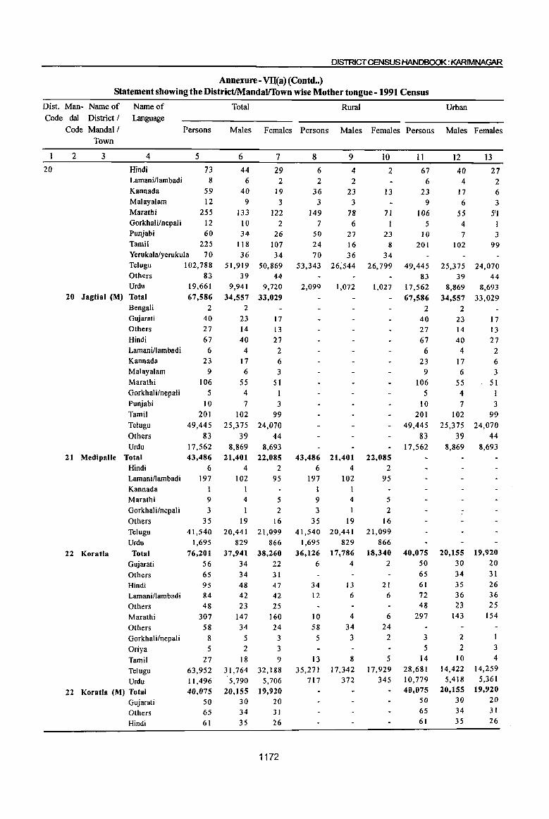
DISTRICT CENSUS HANDBOOK: KARIMNA~
Annexure- Vll(a)(Contd •• ) Statement showing the DistrictIMandalffown wise Mother tongue - 1991 Census
Dist. Man- Name of Code dal District I
Code Mandai I Town
Name of Language
Persons
20
2 3 4
Hindi Lamani/lambadi
5
73 8
Kannada 59 Malayalam 12 Marathi 255 Gorkhali/nepaJi 12 Punjabi 60 Tamil 225 Yerukalalyerukula 70 Telugu 102,788 Others Urdu
20 Jagtial (M) Total
83 19,661 67,586
Bengali Gujarati
Others
Hindi Lamani/lambadi Kannada Malayalam
Marathi
Gorkhali/nepali Punjabi
Tamil
Telugu
Others Urdu
21 MedipalJe Total
22 Koratla
Hindi Lamani/lambadi Kannada Marathi
GorkhaJi/nepal i
Others
Telugu Urdu
Total Gujarati
Others Hindi Lamani/lambadi Others Marathi
Others
Gorkhali/nepali
Oriya
Tamil Telugu Urdu
22 Koratla (M) Total Gujarati Others Hindi
2 40 27 67
6 23 9
106 5
10 201
49,445 83
17,562 43,486
6 197
1
9
3 35
41,540 1,695
76,201 56 65 9S 84 48
307 58
8 5
27 63,952 11,496 40,075
50 65 61
Total Rural Urban
Males Females Persons Males Females Persons Males Females.
6
44 6
7
29 2
40 19 9 3
133 122 10 2 34 26
118 107 36 34
51,919 50,869 39 44
9,941 9,720 34,557 33,029
2 23 14 40
4 17 6
55 4 7
102 25,375
39
8,869 21,401
4 102
4
I
19
17 13 27 2 6 3
5 I
3 99
24,070 44
8,693 22,085
2 95
5
2
16 20,441 21,099
829 866 37,941 38,260
34 22 34 48 42 23
147 34
5 2
18 31,764 ·5,790
20,155 30 34 35
31 47 42 25
160 24
3
3 9
32,188 5,706
19,920 20 31 26
1172
8
6 2
9
4 2
36 23 3 3
149 78 7 6
50 27 24 16 70 36
53,343 26;544
2,099 1,072
43,486 21,401 6 4
197 102
9
3
35
4
I
19 41,540 20,441
1,695 829 36,126 17,786
6 4
34 12
10 58
5
13 35,271
117
13 6
4 34
3
8 17,342
312
10
2
13
71 1
23 8
34 26,799
1,027
22,085 2
95
5 2
16 21,099
866 18,340
2
21 6
6 24
2
5 17,929
345
II
67 6
12
40 4
13
27 2
23 17 6 9 6 3
106 55 511
5 4 1 10 7 3
201 102 99
49,445 25,375 24,070 83
17,562 67,586
2 40 27 67
6 23 9
106 5
10 201
49,445 83
17,562
40,075 50 65 61 72 48
297
3 5
14 28,681 10,779 40,075
50 65 61
39 44 8,869 8,693
34,557 33,029 2
23 14 40 4
17 6
55 4 7
102 25,375
39
8,869
20,155 30 34 35 36 23
143
2 2
10 14,422
5,418 20,155
30 34 35
17 13 27
2 6 3
51
3 99
24,070 44
8,693
19,920 20 31 26 36 25
154
3 4
14,259 5,361
19,920 20 31 26

Annexure- Vll(a)(Contd..) Statement showing the DistrictIMandalffown wise Mother tongue - 1991 Census
Dist. Man- Name of Name of Total Rural Urban
Code daI District I Language
Code Mandai! Persons Males Females Persons Males Females Persons Males Females
Town
2 3 4 5 6 7 8 9 10 11 12 13 20 Lamanillambadi 72 36 36 72 36 36
Others 48 23 25 48 23 25 Marathi 297 143 154 297 143 154 Gorkhali/nepali 3 2 1 3 2 1 Oriya 5 2 3 5 2 3 Tamil 14 10 4 14 10 4 Telugu 28,681 14,422 14,259 28,681 14,422 14,259 Urdu 10,779 5,418 5,361 10,779 5,418 5,361
23 Metpalle Total 61,763 30,484 31,279 30,053 14,405 15,648 31,710 16,079 15,631 Gujarati 71 50 21 16 II 5 55 39 16 Others 15 9 6 6 3 3 9 6 3 Hindi 38 16 22 38 16 22 Lamanillambadi 1,214 633 581 1,160 600 560 54 33 21 Rajasthani 11 8 3 II 8 3 Kannada 48 29 19 4 3 44 26 18 Malayalam 6 6 6 6 Marathi 250 146 104 69 44 25 181 102 79 Others 35 18 17 35 18 17 Gorkhali/nepali 4 4 3 3 Punjabi 14 8 6 14 8 6 Tamil 25 18 7 25 18 7 Yerukalalyerukula 205 100 105 205 100 105 Telugu 53,270 26, III 27,159 28,004 13,349 14,655 25,266 12,762 12,504 Urdu 6,557 3,328 3,229 793 394 399 5,764 2,934 2,830
23 Metpalle (P)Total 31,710 16,079 15,631 31,710 16,079 15,631 Gujarati 55 39 16 55 39 16 Others 9 6 3 9 6 3 Hindi 38 16 22 38 16 22 Lamanillambadi 54 33 21 54 33 21 Rajasthani II 8 3 II 8 3 Kannada 44 26 18 44 26 18 Malayalam 6 6 6 6 Marathi 181 102 79 181 102 79 Others 35 18 17 35 18 17 Gorkhali/nepali 3 3 3 3 Punjabi 14 8 6 14 8 6 Tamil 25 18 7 25 18 7 Yerukalalyerukula 205 100 lOS 205 100 105 Telugu 25,266 12,762 12,504 25,266 12,762 12,504 Urdu 5,764 2,934 2,830 5,764 2,934 2,830
24 Katblapur Total 39,646 19,418 20,228 39,646 19,418 20,228 Gujarati 10 7 3 10 7 3 Hindi 49 21 28 49 21 28 Lamanillambadi 695 375 320 695 375 320 Rajasthani 5 2 3 5 2 3 Yerukala1yerukula 12 6 6 12 6 6 Telugu 37,472 18,324 19,148 37,472 18,324 19,148 Urdu 1,403 683 720 1,403 683 720
25 Chandurthy Total 37,722 18,925 18,797 37,722 18,925 18,797 Hindi 9 5 4 9 5 4 Lamanillambadi 491 258 233 491 258 233 Marathi 178 88 90 178 88 90 Tamil 12 9 3 12 9 3 Yerukalalyerukula 10 4 6 10 4 6 Telugu 36,554 18,318 18,236 36,554 18,3) 8 18,236 Urdu 468 243 225 468 243 225
1173

DISTRICT CENSUS HANDBOOK: KARIMNAGAR
Annexure- Vll(a)(Contd •• ) Statement showing the DistrictIMandallTown wise Mother tongue -1991 Census
Dist. Man- Name of Name of Total Rural Urban
Code dal District! Language
Code Mandai! Persons Males Females Persons Males Females Persons Males Females
Town
2 3 4 5 6 7 8 9 10 11 12 13
20 26 Kodimial Total 39,380 19,454 19,926 39,380 19,454 19,926 Hindi 90 44 46 90 44 46 Kannada 3 2 1 3 2 Telugu 38,305 18,922 19,383 38,305 18,922 19,383 Urdu 982 486 496 982 486 496
27 Gangadhara Totsl 42,433 21,256 21,177 42,433 21,256 21,177 Hindi 8 5 3 8 5 3 Gorkhali/nepal i 1 I I I Tamil 6 3 3 6 3 3 Yerukalalyerukula 20 II 9 20 11 9 Telugu 42,167 21, III 21,056 42,167 21, III 21,056 Urdu 231 125 106 231 125 106
28 Mallial Total 41,372 20,230 21,142 41,372 20,230 21,142 Gujarati 11 7 4 I I 7 4 Hindi 6 3 3 6 3 3 Marathi 113 62 51 113 62 51 Gorkhali/nepali I I Sanskrit 11 7 4 11 7 4 Tamil 43 37 6 43 37 6 Yerukalalyerukula 13 5 8 13 5 8 Telugu 40,556 19,798 20,758 40,556 19,798 20,758 Urdu 618 310 308 618 310 308
29 PegadapalJe Total 40,377 19,970 20,407 40,377 19,970 20,407 Gujarati 4 2 2 4 2 2 Hindi 32 13 19 32 13 19 LamaniIJambadi 664 335 329 664 335 329 Kannada 5 4 5 4 Malayalam I I I Marathi 22 II II 22 1 I 11 Yerukalalyerukula 4S 24 21 45 24 21 Telugu 38,948 19,252 19,696 38,948 19,252 19,696 Urdu 656 328 328 656 328 328
30 Cboppadandi Total 42,101 21,375 20,726 42,101 21,375 20,726 Gujarati 3 2 I 3 2 1 Hindi 44 36 8 44 36 8
Maithili I I I 1 Marathi 25 8 17 25 8 17
Punjabi 6 4 2 6 4 2
Tamil 22 18 4 22 18 4
YerukalalYerukula 79 41 38 79 41 38 Telugu 41,324 20,959 20,365 41,324 20,959 20,365
Urdu 597 306 291 597 306 291
31 Sultana bad Total 47,585 24,193 23,392 47,585 24,193 23,392
Hindi 20 14 6 20 14 6
Malayalam 2 2 2 2
Marathi 8 4 4 8 4 4
Oriya 837 429 408 837 429 408
Tamil 32 15 J 7 32 15 17
Yerukalalyerukula 98 45 53 98 45 53
Telugu 44,704 22,686 22,018 44,704 22,686 22,018
Urdu 1,884 1,000 884 1,884 1,000 884
32 Odels Total 35,004 17,904 17,100 35,004 17,904 17,100
Hindi 104 54 50 1.04 54 50
1174
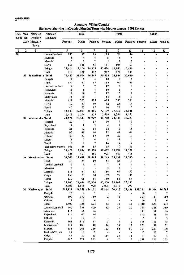
Annexure- Vll(a) (Contd •. ) Statement showing the DistrictIMandavrown wise Mother tongue -1991 Census
Dist. Man- Name of Code dal District I
Code Mandall Town
Name of Language
Total Rural Urban
1 20
Persons, Males Females Persons Males Females Persons Males Females
2 3 4 Lamani/lambadi
Kannada Marathi
5 185
8 5
6 99 4 3
7 86 4
2
8 185
8 5
9 99
4 3
10 86 4 2
11
Oriya 161 108 53 161 108 53 Telugu 33,624 17,166 16,458 33,624 17,166 16,458 Urdu 917 470 447 917 470 447
33 Jammikuota Total 75,453 Bengali 10 Hindi 135
LamanilLambadi 12 Rajasthani I 0 Kannada Malayalam
Marathi Oriya Tamil Telugu
Urdu
34 Veeoavanka Total Bengali Rajasthani
Kannada
Marathi Others Sindhi
12 16
618 42 40
72,139 2,419
40,770 20
4
28 93 39
8 Tamil 16 YerukalalYerukula 165 Telugu 39,472 Urdu
35 Manakondur Total
Hindi Lamimi/Lambadi Marwari
Marathi Oriya
Tamil
925 58,263
43 7 3
116 159 130
Telugu
Urdu 36 Karimnagar Total
Bengali
55,800 2,005
218,129 16
Gujarati
Others Hindi
Lamani/Lambadi Marwari Rajasthani Others Kannada Malayalam'
Marathi GorkhaJi/Nepal i Oriya Punjabi
309 14
1,400 760 114
115 5
163 157 484
17 41
542
38,804 36,649 5 5
67 68 5 7 6 4
10 15
303 23
2
1
315 19
23 17 37,053 35,086
1,294 1,125 20,543 20,227
7 13 3
12 16 49 44 22
2 9
80 19,894
467 29,698
24 3 3
64 79 66
28,444 1,015
111,958 9
159 8
726 351
58 69
2 116
109 265
10 26
277
17 6 7
85 19,578
458 28,565
19 4
52 80 64
27,356 990
106,171 7
150 6
674 409
56 46
3 47 48
219 7
15 265
1175
75,453 10
135
12 10 12 16
618 42 40
72,139 2,419
40,770 20
4 28 93
38,804 5
67 5 6
10 15
303 23 23
37,053 1,294
20,543 7 I
12 49
39 22 8 2
16 9 165 80
39,472 19,894 925 467
58,263 29,698
43 24 7 3
116 159 130
3 3
64 79 66
55,800 28,444 2,005 1,015
59,868 30,412
2
82 42
3
36 123
24 4
2
42 22
19 64
13 2
36,649 5
68 7 4 2
1
315 19 17
35,086 1,125
20,227 13 3
16 44 17 6
7 85
19,578 458
28,565 19 4
52 80 64
27,356 990
29,456 158,261 16
307 14
40 20
2 17 59
11 2
1,318 718 114 115
5 160 121 361
17 17
, 538
12 13
81,546 76,715 9 7
157 8
684 329
58 69 2
115 90
201 10 13
275
150 6
634 389
56 46
3 45 31
160 7 4
263
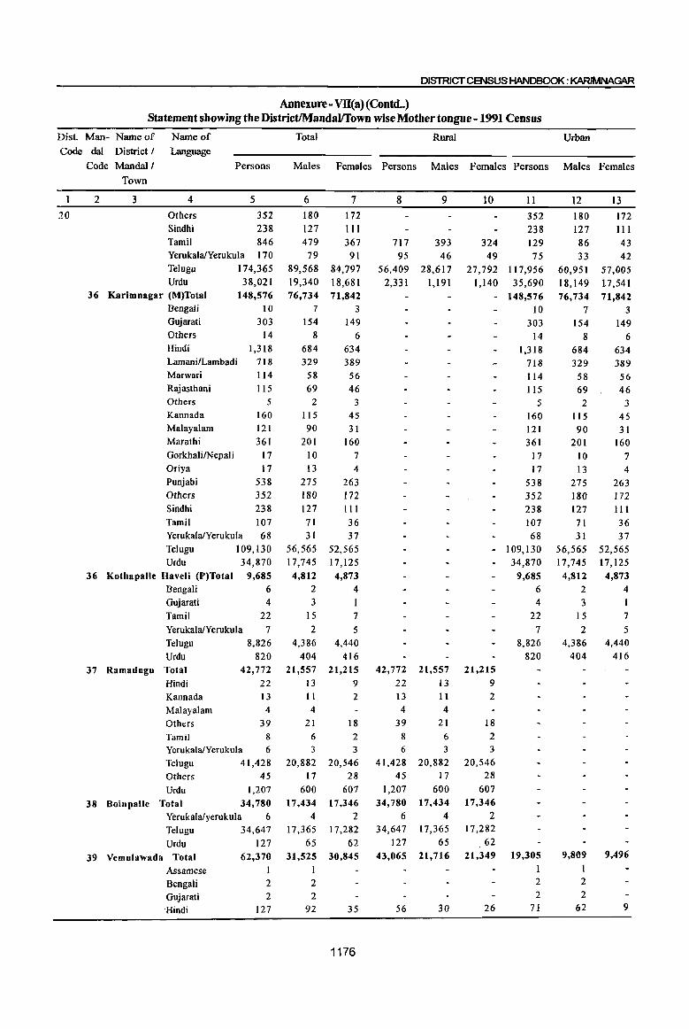
DISTRICT CENSUS HANDBOOK: KARIMNAG\R
Annexure- VII(a)(Contd •. ) Statement showing the DistrictIMandallTown wise Mother tongue - 1991 Census
Dist. Man- Name of Code dal District I
Code Mandai!
Name of Language
Persons
20
Town
2 3 4
Others Sindhi
5
352 238
Tamil 846 YerukalalYerukula 170 Telugu 174,365 Urdu 38,021
36 Karimnagar (M)Total Bengali Gujarati Others
148,576 10
303 14
Hindi 1,318 Lamani/Lambadi 718 Marwari 114 Rajasthani 115 Others 5 Kannada 160 Malayalam 121 Marathi 361 GorkhalilNepali 17 Oriya 17 Punjabi 538 Others 352 Sindhi 238 Tamil 107 YerukalalYerukula 68 Telugu 109,130 Urdu 34,870
36 KothapaUe Haveli (P)Total 9,685 Bengali 6
Gujarati 4 Tamil 22 YerukalalYerukula 7 Telugu 8,826 Urdu 820
37 Ramadugu Total Hindi Kannada Malayalam Others
42,772 22 13 4
39 Tamil 8 YerukalafYerukula 6
Telugu 41,428 Others 45 Urdu 1,207
38 Boinpalle Total 34,780 Yerukalalyerukula 6 Telugu 34,647
Urdu 39 Vemulawada Total
Assamese Bengali Gujarati ·Hindi
127 62,370
1 2 2
127
Total Rural Urban
Males Females Persons Males Females Persons Males Females
6 180 127 479
79 89,568 19,340 76,734
7
154 8
684 329
58 69
2
115 90
201 10 13
275 180 127 71 31
56,565 17,745 4,812
2 3
15
2 4,386
404 21,557
13 11 4
7
172
III 367 91
84,797 18,681 71,842
3 149
6 634 389
56 46
3
45 31
160 7
4
263 172 III
36 37
52,565 17,125
4,873 4
7 5
4,440 416
21,215 9
2
21 18 6 2 3 3
20,882 20,546 17 28
600 17,434
4 17,365
65
607 17,346
2 17,282
62 31,525 30.845
1 2 2
92 35
1176
8
717 95
56,409 2,331
42,772 22 13 4
9
393 46
28,617 1,191
21,557 13 11 4
39 21 8 6 6 3
41,428 20,882 45 17
1,207 600 34,780 17,434
6 4 34,647
127 17,365
65 43,065 21,716
56 30
10 11
352 238
324 129 49 75
27,792 117,956 1,140 35,690
- 148,576 10
303 14
1,318 718 114 115
5 160 121 361
17 17
538 352 238 107 68
- 109,130 34,870
9,685 6 4
22 7
8,826 820
21,215 9 2
18 2 3
20,546 28
607 17.346
2 17,282
62 21,349
26
19,305 1 2 2
71
12
180 127 86 33
60,951 18,149
13
172
III 43 42
57,005 17,541
76,734 71,842 7 3
154 149 8 6
684 329
58 69 2
115 90
201 10 13
275 180 127 71 31
56,565 17,745
4,812 2
3 15 2
4,386 404
9,809
2
2
62
634 389
56 46
3 45 31
160 7
4
263 172 111 36 37
52,565 17,125
4,873 4
7
5 4,440
416
9,496
9
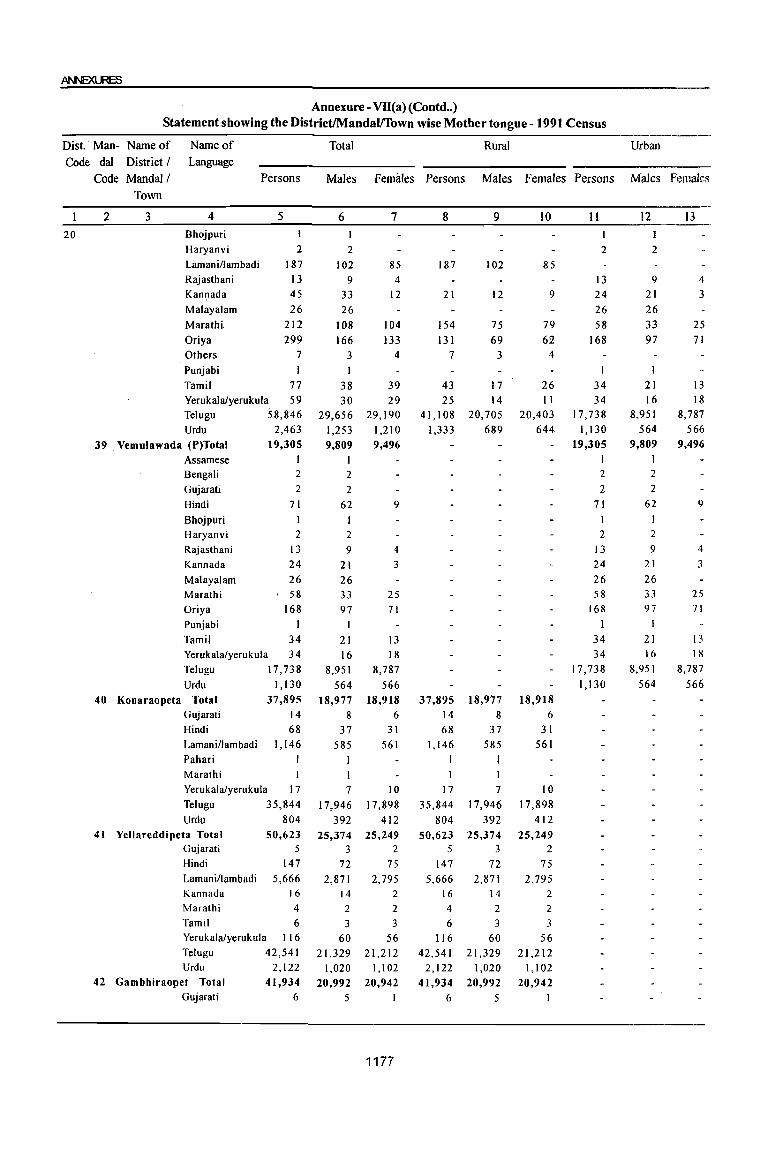
Annexure - VII(a}(Contd .. ) Statement showing the DistrictIMandalffown wise Mother tongue - 1991 Census
Dist. Man- Name of Name of Total Rural Urban Code dal District I Language
Code Mandal/ Persons Males Femiiles Persons Males Females Persons Males females Town
2 3 4 5 6 7 8 9 10 II 12 13
20 Bhojpuri I I
Haryanvi 2 2 2 2
Lamaniflambadi 187 102 85 187 102 85 Rajasthani 13 9 4 13 9 4 Kannada 45 33 12 21 12 9 24 21 3 Malayalam 26 26 26 26 Marathi 212 108 104 154 75 79 58 33 25
Oriya 299 166 133 131 69 62 168 97 71 Others 7 3 4 7 3 4
Punjabi I
Tamil 77 38 39 43 17 26 34 21 13 Yerukalafyerukula 59 30 29 25 14 II 34 16 18 TeJugu 58,846 29,656 29,190 41,108 20,705 20,403 17,738 8,951 8,787
Urdu 2,463 1,253 1,210 1,333 689 644 1,130 564 566
39 . Vemu1awada (P)Total 19,305 9,809 9,496 19,305 9,809 9,496
Assamese I 1 Bengali 2 2 2 2
Gujarati 2 2 2 2
Hindi 71 62 9 71 62 9
Bhojpuri I I Haryanvi 2 2 2 2
Rajasthani 13 9 4 13 9 4
Kannada 24 21 3 24 21 3
Malayalam 26 26 26 26 Marathi 58 33 25 58 33 25
Oriya 168 97 71 168 97 71
Punjabi I I 1 I
Tamil 34 21 13 34 21 13 Yerukalafyerukula 34 16 18 34 16 18
Telugu 17,738 8,951 8,787 17,738 8,951 8,787
Urdu 1,130 564 566 1,130 564 566
40 Konaraopeta Total 37,895 18,977 18,918 37,895 18,977 18,918 Gujarati 14 8 6 14 8 6 Hindi 68 37 31 68 37 31 Lamani/lambadi 1,146 585 561 1,146 585 561 Pahari I 1 1 1 Marathi 1 1 Yerukalafyerukula 17 7 10 17 7 10 Telugu 35,844 17,946 17,898 35,844 17,946 17,898 Urdu 804 392 412 804 392 412
41 Yellareddipeta Total 50,623 25,374 25,249 50,623 25,374 25,249 Gujarati 5 3 2 5 3 2
Hindi 147 72 75 147 72 75 Lamani/lambadi 5,666 2,871 2,795 5,666 2,871 2,795 Kannada 16 14 2 16 14 2
Marathi 4 2 2 4 2 2
Tamil 6 3 3 6 3 3 Yerukalafyerukula 116 60 56 116 60 56 Telugu 42,541 21,329 21,212 42,541 21,329 21,212 Urdu 2,122 1,020 1,102 2,122 1,020 1,102
42 Gambhiraopet Total 41,934 20,992 20,942 41,934 20,992 20,942 Gujarati 6 5 6 5
1177

DISTRICT CENSUS HANDBOOK: KARIMNAGAR
Annexure - VII(a) (Contd .. ) Statement showing the DistrictIMandaVTown wise Mother tongue - 1991 Census
Dist. Man- Name of Name of Total Rural Urban
Code dal District I Language
Code Mandai I Persons Males Females Persons Males Females Persons Males Females
Town
2 3 4 5 6 7 8 9 10 II 12 13 20 Hindi 60 31 29 60 31 29
Lamani/lambadi 949 475 474 949 475 474 Kannada 3 3 3 3 Marathi 5 3 2 5 3 2 Yerukalalyerukula 38 18 20 38 18 20 Telugu 38,346 19,227 19,119 38,346 19,227 19,119 Urdu 2,527 1,230 1,297 2,527 1,230 1,297
43 Mustabad Total 41,492 20,720 20,772 41,492 20,720 20,772 Hindi 18 7 I I 18 7 I I Lamani/lambadi 647 335 312 647 335 312 Marwari 24 13 I I 24 13 II Marathi 18 7 II 18 7 II Tamil I I I I Yerukalalyerukula 86 50 36 86 50 36 Ielugu 39,040 19,498 19,542 39,040 19,498 19,542 Urdu 1,658 809 849 1,658 809 849
44 Sirsilla Total 98,815 49,304 49,511 48,767 24,417 24,350 50,048 24,887 25,161 Gujarati 7 4 3 7 4 3 Hindi 288 156 132 21 8 13 267 148 119 Banjari 7 4 3 7 4 3 Lamani!1ambadi 104 57 47 74 43 31 30 14 16 Kannada 43 31 12 4 2 2 39 29 10 Marathi 386 195 191 18 10 8 368 185 183 Gorkhal i/nepal i 7 5 2 7 5 2 Oriya I Punjabi 2 I 2 I
Tamil 19 13 6 19 13 6 Yerukalalyerukula 58 35 23 41 25 16 17 10 7 Tclugu 93,434 46,569 46,865 47,467 23,751 23,716 45,967 22,818 23,149
Urdu 4,459 2,233 2,226 1,141 577 564 3,318 1,656 1,662
44 Sirsilla (M) Total 50,048 24,887 25,161 50,048 24,887 25,161
Gujarati 7 4 3 7 4 3
Hindi 267 148 119 267 148 I 19
Banjari 7 4 3 7 4 3
LamanilLambadi 30 14 16 30 14 16
Kannada 39 29 10 39 29 10
Marathi 368 185 183 368 185 183
Gorkha\i/Nepali 7 5 2 7 5 2
Punjab! 2 I 2
Tamil 19 13 6 19 13 6
Yerukala/Yerukula 17 10 7 17 10 7
Iclugu 45,967 22,818 23,149 45,967 22,818 23,149
Urdu 3,318 1,656 1,662 3,3 I 8 1,656 1,662
45 Ellanthakunta Total 46,]37 22,925 23,212 46,137 22,925 23,212
Hindi 56 27 29 56 27 29
Kannada 2 2 2 2
Marathi 4 3 4 3 I
Iamil 4 2 2 4 2 2
Telugu 45,404 22,547 22,857 45,404 22,547 22,857
Urdu 667 344 323 667 344 323
46 8ejjanki Total 50,379 25,126 25,253 50,379 25,126 25,253
Bengali 4 3 I 4 3 I
Hindi 53 27 26 53 27 26
Marathi 317 149 168 317 149 168
Others 5 2 3 5 2 3
Tamil 36 18 18 36 18 18
1178

Annexure - Vll(a) (Contd •• ) Statement showing the District/Mandal/Town wise Mother tongue - 1991 Census
Dist. Man- Name of Name of Total Rural Urban
Code dal District I Language
Code Mandai I Persons Males Females Persons Males Females Persons Males Females
Town
2 3 4 5 6 7 8 9 lO 11 12 13
20 YerukalaIYerukula 28 12 16 28 12 16 Telugu 49,498 24,713 24,785 49,498 24,713 24,785 Urdu 438 202 236 438 202 236
47 Tbimmapur Total 44,039 22,071 21,968 44,039 22,071 21,968 Hindi 26 17 9 26 17 9 Kannada I I I I Malayalam 5 3 2 5 3 2 Marathi 34 20 14 34 20 14 Oriya 76 40 36 76 40 36 Punjabi 4 2 2 4 2 2 Tamil 239 130 109 239 130 109 YerukalalYerukula 43 21 22 43 21 22 Telugu 41,142 20,871 20,871 41,742 20,871 20,811 Urdu 1,869 966 903 1,869 966 903
48 Kesavapatnam Total 37,948 19,040 18,908 37,948 19,040 18,908 Hindi 21 10 II 21 10 II Kannada 5 5 5 5 Tamil 26 13 13 26 13 13 YerukalalYerukula 49 27 22 49 27 22 Telugu 35,856 17,988 17,868 35,856 17,988 17,868 Urdu 1,991 997 994 1,991 997 994
49 Huzurabad Total 58,537 29,646 28,891 58,537 29,646 28,891 Bengali 1 I Gujarati 3 2 3 2 Hindi 108 60 48 108 60 48 Lamani/Lambadi I 1 1 1 Rajasthani 9 7 2 9 7 2 Kannada 3 2 3 2 Malayalarn 48 46 2 48 46 2 Marathi 14 5 9 14 5 9 GorkhalifNepali 2 2 2 2 Oriya 2 2 2 2 Punjabi 2 I 1 2 I I Tamil 120 62 58 120 62 58 YerukalalYerukula 28 13 15 28 13 15 Telugu 55,193 27,942 27,251 55,193 27,942 27,251 Urdu 3,003 1,501 1,502 3,003 1,501 1,502
50 Kamalapur Total 55,171 28,040 27,131 55,171 28,040 27,131 Hindi 132 66 66 132 66 66 Marathi 1,020 507 513 1,020 507 513 Others 128 64 64 128 64 64 Tamil 14 8 6 14 8 6 YerukalalYerukula 86 49 37 86 49 37 -Telugu 52,674 26,790 25,884 52,674 26,790 25,884 Urdu 1,1l7 556 561 1,117 556 561
51 Elkathurthi Total 36,106 18,259 17,847 36,106 18,259 17,847 Hindi 130 68 62 130 68 62 Marathi 268 137 131 268 137 131 Tamil 6 4 2 6 4 2 YerukalalYerukula 38 15 23 38 15 23 Telugu 34,880 17,645 17,235 34,880 17,645 17,235 Urdu 784 390 394 784 390 394
52 Saidapur Total 37,070 18,736 18,334 37,070 18,736 18,334 Hindi 128 70 58 128 70 58 LamanilLambadi 294 176 118 294 176 1I8
1179

DISTRICT CENSUS HANDBOOK: KARlMNAGAR
Annexure - VD(a) (Concld •• ) Statement showing the DistrictlMandalffown wise Mother tongue - 1991 Census
Dist. Man- Name of Name of Total Rural Urban
Code dal District I Language
Code Mandal/ Persons Males Females Persons Males Females Persons Males Females
Town
2 3 4 5 6 7 8 9 10 II 12 13 20 Marathi 9 4 5 9 4 5
YerukalalYerukula 81 40 41 81 40 41 Telugu 35,961 18,145 17,816 35,961 18,145 17,816 Urdu 597 301 296 597 . 301 296
53 Chigurumamidi Total 38,137 19,257 18,880 38,137 19,257 18,880 Hindi 19 9 10 19 9 10 Marwari 3 3 3 3 Rajasthani 2 2 2 2 GorkhalilNepal i 6 3 3 6 3 3 Tamil 4 2 2 4 2 2 Telugu 37,431 18,883 18,548 37,431 18,883 18,548 Urdu' 672 355 317 672 355 317
54 Kobeda Total 44,409 22,317 22,092 44,409 22,317 22,092 Hindi 103 49 54 103 49 54 Lamanillambadi 266 140 126 266 140 126 Kannada 17 8 9 17 8 9 Gorkhali/nepaJi 1 1 1 1 Yerukalalyerukula 24 9 15 24 9 15 Telugu 42,464 21,334 21,130 42,464 21,334 21,130 Urdu 1,534 776 758 1,534 776 758
S5 Husnabad Total 66,288 33,618 32,670 66,288 33,618 32,670 Bengali 3 I 2 3 1 2 Hindi 17 8 9 17 8 9 Lamani/lambadi 5,730 2,978 2,752 5,730 2,978 2,752 Kannada 5 1 4 5 1 4 Others 10 9 10 I 9
Marathi II 6 5 11 6 5 Tamil 10 7 3 10 7 3 Yerukalalyerukula 121 64 57 121 64 57
Telugu 58,707 29,708 28,999 58,707 29,708 28,999
Others 179 89 90 179 89 90 Urdu 1,495 755 740 1,495 755 ' 740
56 Bheemadevarpalle Total 49,748 25,336 24,412 49,748 25,336 24,412
Hindi 42 23 19 42 23 19
Lamani/lambadi 1,904 980 924 1,904 980 924
Kannada 1 I I Others 28 15 13 28 15 13
Tamil 2 1 I 2 1 1
Yefukalalyerukula 103 50 53 103 50 53
Telugu 46,683 23,755 22,928 46,683 23,755 22,928
Urdu 985 Stt 474 985 511 474
Karimnagar district has dominated by the Telugu any Mandai of the District. Similarly Urdu and
speaking people with 28,09,824 comprising 92.7% Lambadi took their places as in the district except in
followed by Urdu with 5.4% and Lambadies with some Mandals. Lambadi has identified second place
1.0% during 1991 Census. Besides many other in Mallapur MandaI only. Interestingly, the Velgtoor
Languages were returned in the district, but their MandaI has found with three Languages only viz.,
contribution is very less percent. Telugu Language Telugu, Urdu and Yerukula.
was occupied 1st rank in the district as its Regional In Ramagundam MandaI Hindi and Oriya Language in the State. Languages occupied second and third ranks
Telugu has also donminated in all 56 mandals in respectively. In Karimnagar MandaI Urdu and Hindi
the district. No other Language has domoinated in took second and third places respectively.
1180
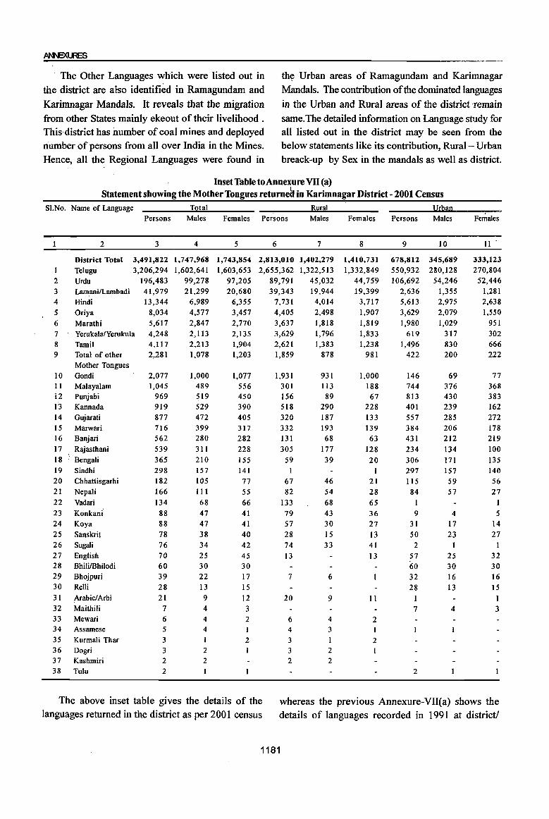
ArII"EXlJ6
, The Other Languages which were listed out in th~ Urban areas of Ramagundam and Karimnagar
the district are also identified in Ramagundam and Mandals. The contribution of the dominated languages
Karimnagar Mandals. It reveals that the migration in the Urban and Rural areas of the district remain
from other States mainly ekeout of their livelihood . same. The detailed information on Language study for This district has number of coal mines and deployed all listed out in the district may be seen from the number of persons from all over India in the Mines. below statements like its contribution, Rural- Urban Hence, all the Regional Languages were found in breack-up by Sex in the mandals as well as district.
Inset Table toAnnexure VII (a) Statement showing the Mother Tongues returnea in Karimnagar District - 2001 Census
SI.No. Name of Language Total Rural llW1l1l Persons Males Females Persons Males Females Persons Males Females
2 3 4 5 6 7 8 9 10 11'
District Total 3,491,822 1,747,968 1,743,854 2,813,010 1,402,279 1,410,731 678,812 345,689 333,123 1 Telugu 3,206,294 1,602,641 1,603,653 2,655,362 1,322,513 1,332,849 550,932 280,128 270,804
2 Urdu 196,483 99,278 97,205 89,791 45,032 44,759 106,692 54,246 52,446 3 Lamani/Lambadi 41,979 21,299 20,680 39,343 19,944 19,399 2,636 1,355 1,281 4 Hindi 13,344 6,989 6,355 7,731 4,014 3,717 5,613 2,975 2,638
5 Oriya 8,034 4,577 3,457 4,405 2,498 1,907 3,629 2,079 1,550
6 Maratbi 5,617 2,847 2,770 3,637 1,818 1,819 1,980 1,029 951 7 YerukalalYerukula 4,248 2,113 2,135 3,629 1,796 1,833 619 317 302 8 Tamil 4,117 2,213 1,904 2,621 1,383 1,238 1,496 830 666 9 Total of other 2,281 1,078 1,203 1,859 878 981 422 200 222
Mother Tongues 10 Gondi 2,077 1,000 1,077 1,931 931 1,000 146 69 77 II Malayalam 1,045 489 556 301 113 188 744 376 368 12 Punjabi 969 519 450 156 89 67 813 430 383 13 Kannada 919 529 390 518 290 228 401 239 162 14 Gujarati 877 472 405 320 187 133 557 285 272 IS Marwari 716 399 317 332 193 139 384 206 178 16 Banjari 562 280 282 131 68 63 431 212 219 17 Rajasthani 539 311 228 305 177 128 234 134 100 18 Bengali 365 210 155 59 39 20 306 171 135 19 Sindhi 298 157 141 I 297 157 140 20 Chhattisgarhi 182 105 77 67 46 21 liS 59 56 21 Nepali 166 III 55 82 54 28 84 57 27 22 Vadari 134 68 66 133 68 65 23 Konkani' 88 47 41 79 43 36 9 4 5 24 Koya 88 47 41 57 30 27 31 17 14 25 Sanskrit 78 38 40 28 15 13 50 23 27 26 Sugali 76 34 42 74 33 41 2 I 27 English 70 25 45 13 13 57 25 32 28 BhililBhilodi 60 30 30 60 30 30 29 Bhojpuri 39 22 17 7 6 32 16 16 30 Relli 28 13 15 28 13 15 31 Arabic/Arbi 21 9 12 20 9 II I I 32 Maithili 7 4 3 7 4 3 33 Mewari 6 4 2 6 4 2 34 Assamese 5 4 ) 4 3 I
35 Kurmali Thar 3 I 2 3 I 2 36 Dogri 3 2 3 2 I 37 Kashmiri 2 2 2 2 38 Tulu 2 2
The above inset table gives the details of the whereas the previous Annexure-VII(a) shows the languages returned in the district as per 2001 census details of languages recorded in 1991 at district!
1181
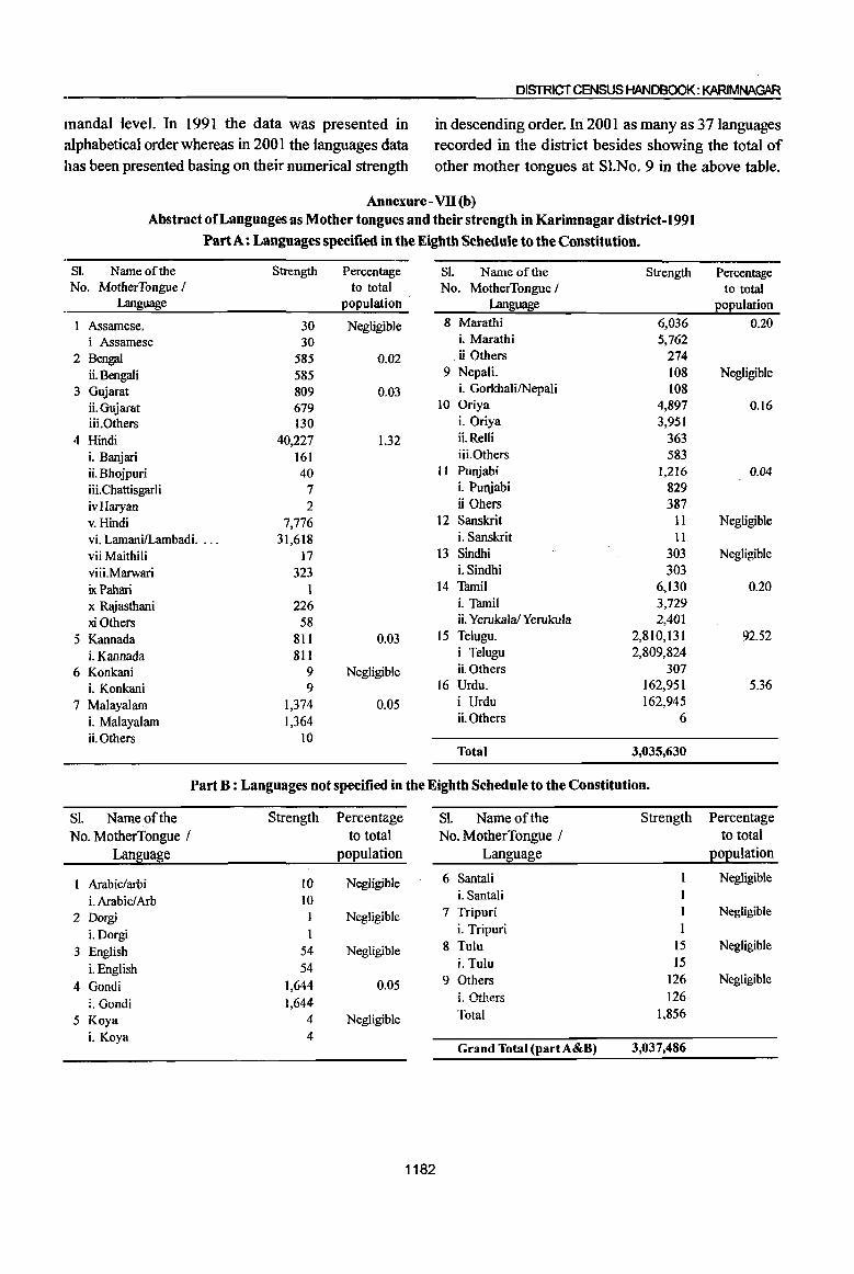
DISTRICT CENSUS HANDBOOK: KARIMNAGAR
mandai level. In 1991 the data was presented in alphabetical order whereas in 2001 the languages data has been presented basing on their numerical strength
in descending order. In 2001 as many as 37 languages recorded in the district besides showing the total of other mother tongues at Sl.No. 9 in the above table.
Annexure - VII (b)
Abstract of Languages as Mother tongues and their strength in Karimnagar district-1991
Part A: Languages specified in the Eighth Schedule to the Constitution.
S!. Name of the Strength Percentage S!. Name of the Strength No. MotherTongue I to total No. MotherTongue /
Language population Language
1 Assamese. 30 Negligible 8 Marathi 6,036
i Assamese 30 i. Marathi 5,762
2 Bengal 585 0.02 . ii Others 274
ii.Bengaii 585 9 Nepali. 108
3 Gujarat 809 0.03 i. GorkhalilNepali 108
ii.Gujarat 679 to Oriya 4,897
iii.Others 130 L Oriya 3,951
4 Hindi 40,227 1.32 iLRelli 363
i. Banjari 161 iiLOthers 583 ii. Bhojpuri 40 II Punjabi 1,216
iii. Chattisgarli 7 L Punjabi 829
ivHaryan 2 ii Obers 387
v. Hindi 7,776 12 Sanskrit 11 vi. LamanilLambadi. ... 31,618 i. Sanskrit 11 vii Maithili 17 13 Sindhi 303
viii.Marwari 323 i. Sindhi 303
ixPahari 1 14 Tamil 6,130
x Rajasthani 226 i. Tamil 3,729
xi Others 58 ii. YerukalalYerukula 2,401
5 Kannada 811 0.03 15 Telugu. 2,810,131
i. Kannada 811 i Telugu 2,809,824
6 Konkani 9 Negligible iLOthers 307
i. Konkani 9 16 Urdu. 162,951
7 Malayalam 1,374 0.05 i Urdu 162,945
i. Malayalam 1,364 ii.Others 6
ii.Others 10 Total 3,035,630
Part B : Languages not specified in the Eighth Schedule to the Constitution.
Sl. Name of the Strength Percentage Sl. Name of the Strength
No. MotherTongue / to total No. MotherTongue /
Language population Language
Arabic/arbi 10 Negligible 6 Santali
i. Arabic! Arb 10 i. Santali
2 Dorgi Negligible 7 Tripuri I
i.Dorgi i. Tripuri 1
3 English 54 Negligible 8 Tulu 15
i.English 54 i. Tulu 15
4 Gondi 1,644 0.05 9 Others 126
i. Gondi 1,644 i. Ot.'1ers 126
5 Koya 4 Negligible Total 1,856
L Koya 4 Grand Total (part A&B) 3,037,486
1182
Percentage to total
popUlation
0.20
Negligible
0.16
0.04
Negligible
Negligible
0.20
92.52
5.36
Percentage to total
population
Negligible
Negligible
Negligible
Negligible

.AJ'.IIEXI.R:S
It is seen from the below shown statement that population in 1991 Census, followed by Urdu speaking
as many as 24 languages were returned III people with 5.36%. The third place was occupied by
Karimnagar district. Out of which 16 were Scheduled the people, whose mother tongue was Hindi(1.32%).
languages and 8 are non-scheduled languages. Though The remaining 21 languages formed one percent and
there were 24 languages spoken in the district, Telugu below. speaking people were in majority with 92.52% to total
Inset Table to Annexure VII (b) Abstract oflanguages as Mother Tongues and their strength in
Karimnagar District - 2001 Census
SI. Name of the Strength Percentage No. MotherTongue I to total
Language population
1 2 3 4
Telugu 3,206,428 91.8
i. Telugu 3,206,294
ii. Vadari 134
2 Urdu 196,483 5.6 3 Hindi 57,453 1.6
i. LamanilLambadi 41,979
ii.Hindi 13,344
iii. Marwari 716
iv.Banjari 562
v. R~asthani 539
vi. Chattisgarhi 182 vii. Sugali 76 viii. Bhojpuri 39 ix. Maithili 7
x. Mewari 6 xi. Kurmalithar 3
4 Tamil 8,365 N i. Yerukala/Yerukula 4,248
ii. Tamil 4,1l7 5 Oriya 8,062 N
i. Oriya 8,034 ii. Relli 28
6 Marathi 5,617 N
N= Negligible
The above inset table gives the abstract of the languages as mother tongues and their strength in the district recorded in 2001 Census whereas the previous annexure shows the details for 1991 census. In 1991 the data was presented in alphabetical order whereas in 2001 the mother tongue data has been presented basing on their numerical strength in descending order. The mother tongues having minor returns have been clubbed together and added in the category of 'Others'. Telugu being the region's
SI. Name of the Strength Percentage No. MotherTongue / to total
Language population
1 2 3 4
7 Malayalam 1,045 N
8 Punjabi 969 N
9 Kannada 919 N 10 Gujarati 877 N II Bengali 365 N 12 Sindhi 298 N 13 Nepali 166 N
14 Konkani 88 N 15 Sanskrit 78 N 16 Assamese 5 N 17 Kashmiri 2 N 18 Others 4,602 N
i. Total of other 2,281
Mother Tongues
ii. Gondi 2,077
iii. Koya 88 iv.English 70
v. BhillBhilodi 60
iv. Arabic/ Arbi 21
vii. Dogri 3 viii. Tulu 2
Grand Total 3,491,822
language has recorded 9 I .8% to total population in the district with a slight decline in the percentage recorded in .199 I (92.5). The next highest language being spoken is Urdu with 5.6% to total population of the district whereas in 1991 the percentage of Urdu speaking people recorded 5.6. In respect of other scheduled languages it is noticed that their strength is negligible both in 1991 and 2001. In the district almost all the scheduled languages (except Manipuri) returned.
1183