The Role of Early Bronze Age Communities in Banded Flint Acquisition, 2000
Upload
historicenglandCategory
view
1download
0
F&,
on-]J]
r',
E]
/,
)-JV)
Irl
=TU&
THE NEOLITHIC FLINT MINES ANDASSOCIATBD FEATURES AT
BLACKPATCH, SUSSEX
An archaeological survey by the Royal Commission on
the Historical Monuments of England
@ Crcten copl,tighl Decembu 1998
MONUMENTSO'ENGLAND
THE NEOLITHIC FLINT MINES ANDASSOCIATED FEATURES AT
BLACKPATCH, SUSSEX
An archaeological surveY bY the
Royal Commission on the Historical Monuments of England
County:West SussexParish:PatchingNGR:TQ094088NMRNo:TQ 00 NE 5/43
Surveyed: D Field and M Barber
Report by: D Field and M Barber,APtranscription:C Dyer and S CrutchleyInvestigation: D Field and M BarberIllustrations: T Pearson
Royal commission on the Historical Monuments ofEngtandNational Monuments Record centre, Kemble Driv€, swindon,
sN2 2GZ 01793 414700
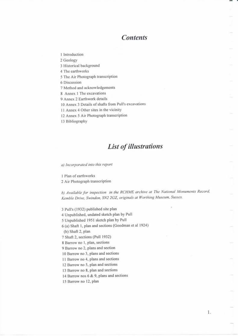
Contents
l lntroduction
2 Geology
3 Historical background
4 The earthworks
5 The Air Photogmph transcription
6 Discussion
7 Method and acknowledgements
8 Annex 1 The excavations
9 Annex 2 Earthwork details
l0 Annex 3 Details ofshaits from Pull's excavations
I I Annex 4 Other sites in the vicinity
l2 Annex 5 Air Photograph transcription
13 Bibliography
List of illustrations
a) Incorporated into this rePort
I Plan ofearthworks
2 Air Photograph transcriPtion
b) Available for insPection in the RCHME archive at The NQtiorull Monuments Recotd
Kemble Drive, Swindon, SN2 2GZ, oriSinals at Ilorthing Museum, Sussex'
3 Putl's (1912) published sile plan
4 Unpublished, undated sketch plan by Pull
5 Unpublished 1951 sketch plan by Pull
6 (a) Shaft 1, plan and sections (Goodman et al 1924)
(b) Shaft 2, plan
7 Shaft 2, sections (Pull 1932)
8 Baffow no l, plan, sections
9 Barrow no 2, plans and section
10 Banow no 3, plans and sections
ll Banow no 4. plans and sections
12 Barrow no 5, plan and sections
13 Barrow no 8, plan and sections
14 Barow nos 6 & 9, plans and sections
l5 Barrow no 12, plan
1.
Summary
Grount! and air photograph surve! b)) lhe RCHME hss recorded lhe remsining extsnt
ea hwotks an(l visible soil marks of lhe Neolithic Jlinl mine comPlex ot Blsckpstch'
,9zsse.L l/tis is comparetl to lhe work csrried oul by J Pull during the 1930,s and an
sssessmenl mtde of lhe chronologJ) and naturc ofthe sile.
Introduction
Traces ofearthworks that indicate the position ofthe Blackpatch flirlt mines were surveyed
by the Royal Commission on the Historical Monuments of England in February 1995 as part
of an investigation into Neolithic enclosure and industry in England. The flint mines are
listed in the National Archaeological Record as TQ 00 NE 5, and the associated "barrows" as
TQ 00 NE 43. The mines form Scheduled Ancient Monument No. AMS 47.
Located some 8km north-west of Wodhing in West Sussex, and 2.5km to the nodh of the
villages of Patching and Clapham, the mined area centred at TQ 094088 lies immediately
north-east of Myrtlegrove Farm in a field currently laid to pasture, at c 100m - 130m above
OD. The Patching-Clapham parish boundary runs through the site, and the mine shafts
themselves would appear to lie wholly on the west (Patching) side of the boundary' The
Harow Hill flint mines are intervisible at c 2km to the north-west, those at Church Hill are c
l 5km to the east, and beyond Church Hill (and obscured by it), the complex at Cissbury lies
some 4km distant.
Geology
Situated centrally on the Sussex White Chalk Formation some 3km south ofthe South Downs
escarpment, the site occupies a spur that runs south from the slopes of Blackpatch Hill. A
series of coombes running north-south provide access to the coastal plain, with the present
coastline 6.5m distant. The exploited material is probably sheet flint from the upper part of
the Old Nore Beds of the Newhaven Chalk Member (Mortimer 1986, 4l). Only one flint seam
is visible in excavtion photographs and section drawings, which, judging from the depths of
the excavated shafts appea$ to be roughly horizontal, and is likely to outcrop around the false
cr€st of the ridge. Other flint seams, although apparently not exploited, are likely to be
present and may outcrop further down the ridge slopes. On the surface lie shallow and well-
drained soils ofthe Icknield Series, with much surface flint derived from an eroded seam.
2.
Historical Background
The flint mine site lies adjacent to the Patching/Clapham boundary at some distance from the
respective villages, and it is likely that this is the reason for its survival into the 2oth century,
having escaped cultivation during the historic period. In fact, the evidence from the
excavation of the very low burial nounds around the flint mines suggests that little if any
ploughing had ever occuned around the mines prior to the excavations this century.
The area seems to have formed part of the Michelgrove Estate, a name first mentioned in
1193 and centred at Michelgrove House lkm to the south-west ofthe flint mines (Eustace
193 0 i Hudson I 980). The name suggests a wood land origin but by the I 6th century there was
pasture for 1000 sheep at Michelgrove Farm (Hudson 1980,15) and the land in the vicinity
would appear to have been open downland at that time. The Toposraphical Survev of the
Countv of Sussex by T Yeakell and W Gardiner published in I 778 shows M ichelgrove House
itself with extensive formal gardens. Enclosed fields are also present but the flint mine site
lay outside the enclosed area, and an undated Estate Plan ofthe same period shows the site as
'The Downs'(WSRO QR/W635). Myrtlegrove Farm, formerly Michelgrove Farm, situated
immediately south-west of the mine site, was established in 1814, reducing somewhat the
former sheepwalks (Hudson 1980,186,189), while the Tithe Map for Patching dated 1838
(WSRO TD/W96) shows the field containing the mine site as enclosed, but with no name
The area is shown as open downland on the I st edition OS 25 inch map surveyed in 1876, but
much ofthe area was ploughed during World War ll. In l97l, the OS field investigator stated
that "all that remains arevague unsut-veyable undulations in the area oftheJlint mines, and
the a orphous remains ofa banow,....The area is now under pasture.
The flint mines were first recorded by Mr CH Goodman in 1919, and were 'discovered'
independently by JH Pull in 1922. The s ite was planned and excavated by J ohn Pull and partly
published in the Sussex Archaeological Collections, the columns ofthe Worthing Herald, and
a book about the sit e, 'TheJlint uiners of Blackpatch" wtitten by Pull for a general rather than
academic audience. Despite an assessment of Pull's work in the area by E Pye (1968), much
olthe site remains unpublished and little known, and details are therefore provided in Annex
1. Pull's plan (Figs 4 & 5) of the flint mines indicates the presence of some 120 shafts'
However, following the bulldozing and ploughing ofthe 1950s, little now remains above
ground.
Finally, the area ofthe flint mines itself was bulldozed during the early 1950s (Ratcliffe-
Densham & Ratcliffe-Densham 1953, 69). Traditionally the farmer has tended to take the
blame for this, but various unpublished sources (eg Sussex Archaeological Committee
minutes 8/2/1950) indicate that the destruction was carried out at the behest of the War
Agricultural Committee, apparently without the knowledge or cons€nt of the tenant farmer'
The Ratcliffe-Denshams were primarily concerned with the excavation of the Bronze Age
site on the adiacent ridge, but their statement that the 'whole lrea was scheduled forimmediate deep ploughing'may refer to the flint mines as well.
3.
The Earthworks
The mined area covers some 2.5ha, but the site incorporates barrows and other archaeological
features that coverthewhole ofthechalkspur. None ofthese other features remain extant and
they cannot be plotted as soil marks. Of the mine complex little remains. The position ofonly
twelve shafts can be ascertained (Fig 1), but they are barely visible, shallow and diffuse, and
nowhere more than 0.25m deep (though note that a number ofthe infilled shafts described by
Pull were scarcely any deeper before ploughing and bulldozing) They are well-spaced and
presumably represent some ofwhat may have been the better preserved examples before the
bulldozing episode. Shallow spoil heaps can also be discemed in places but apart from two
instances are too diffuse to Plot.
The depressions range from 6m to 12m in diameter, but given the recent destruction these
dimensions are meaningless beyond identilying the position ofshafts. Many are now oval in
plan and this too may reflect the direction ofploughing or bulldozing more than their original
form. Details of individual shafts are noted in Annex l. None of them correspond precisely
with those marked on Pull's Plan.
The depressions are placed in the west and south, between the false crest and the sunmit of
the ridge, and extend east as far as the farmtrack that runs north to south along the spine ofthe
ridge. An air photograph ofthe area taken before 1953, and probably before 1950 (Ratcliffe-
Densham & Ratcliffe-Densham 1953 ) suggests that there is some order to the site but this can
no longer be detected on the ground.
In the south-east, only a few metres from the farmtrack, a mound 0.3rn high partially covers
two shallow depressions. Only its bulk differentiates it from the other shallow spoil heaps'
Pull notes a barrow in this position, his no. 3, which he described as being lft (0 3m) high lfthis mound is indeed Barrow 3, then it is the only remaining feature which can be identified
on Pull's plan, in which case it survives today to a height similar to that recorded by Pull prior
to excavation.
The Air Photograph transcriPtion
The vertical air photographs clearly show at least 80 individual mineshafts in an area 240m
by 90m (Fig 2). The shafts positioned on the plot are widely spaced, and some must be
obscured by material spread from the spoilheaps. Assuming that the area was as densely
packed with shafts as Pull's plan suggests, and that some shafts were Iikely to remain invisible
on the surface, then his total number may be an underestimate. A discrete area of light
coloured soil at TQ09430878, is thought to represent the barrow noted above (Pull's barrow
no 3). Details of methods employed and photographs consulted are available in the
transcription report (see Annex 5).
4.
Discussion
Despite the extensive nature of Pull's excavations at Blackpatch, the extant records are
patchy, with only selective information being recorded Furthemlore, knowledge of Pull's
excavation techniques is very limited. Photographs seem to exist only for shaft l, while the
only known section drawings are ofshafts I and 2. Subterranean plans survive only for shafts
1,2,5 arrd7, while with the exception ofshaft l, notes and descriptions are often minimal'
Nevertheless the field survey aDd air transcription evidence coupled with the excavation
records that do survive permit a number of observations to be made.
It seems possible that extraction commenced on the west and south sides ofthe Iidge where
the flint outcropped. There is no surface evidence of quarrying there, but the remains ofsuch
activity could have been easily destroyed by cultivation. At present, the full extent of
extraction remains problematic. shaft 6, in the northern part of the site, lacked galleries,
while Shaft 5, on the eastem limit ofthe mined area, had no flint seam, and thus no galleries,
on its eastern side. Both cases perhaps suggest that the flint seam had faulted, or was Irot
continuous. Certainly, it appears unlikely that mining extended eastwards beyond the summit
ofthe ridge. However, the evidence from the excavations of the 'barows' certainly indicates
that mining-related activities took place further to the north. Pull's Barrow 2 appears to have
covered a shaft - indeed, the'barrow'may actually have been the surrounding spoil Similarly
Barrow 4, outlying even fufiher to the north, may also represent a trial shaft'
pull's plan of the site shows shafts of various sizes in no particular order, but with small
examples alongside large ones. Some shafts were positioned very close to each other' His
shaft 3, for example, was separated from its neighbour to the west by no more than I ft (0'3m)
ofchalk (Pull 1927), and the Air Photograph transcription shows some shafts that appear to
be almost linked. Apart from Shaft 1, which measures some 5 lm across' the excavated
examples are all of similar dimensions, being between 3m and 3.6m in diameter, rather small
when compared to the shafts at Cissbury which reached up to 36m in diameter' Scrutiny of
Pull's plan suggests that there may be no more than four or five others that approach the
diameter of shaft I , although the RCHME plan records shafts up to 10m across However, this
lack of uniformity does at least provide some evidence to suggest either diflering extraction
practices over a long span of time, or that the site was used on an ad y'roc basis rather than by
groups of serni-specialist miners, or both.
The seam appears to have been at a relatively shallow depth. On the surface, the depressions
are now no more than 0.25m deep, but when excavated Shafts l, 2 and 7 all bottomed out at
just over 3 m with Shaft 3 in the centre of the m ined area at 3.6m. No measurement is provided
for Shaft 4 which lies close to the southern edge ofthe exploited area, where shallower shafts
might be expected, but Shaft 6 in the north-west was only 1.8m deep, and there appears to
have been no attempt to exploit deeper seams
The material was extracted from the seams by means ofgalleries excavated from the base of
most shafts, and it apPears likely that in each case as much ofthe flint was extracted as safety
5.
allowed. Goodman et als (1924) plan of Shaft I shows thin walls and sometimes single
pillars ofchalk left to support the roof. Pull commented that the galleries of Shaft 2were'very
complicated', and shafts 7 and 8 were said to have 'extensive ramifying galleries ertending
from the base and connecling with neighbouring shafts '. In the case of Shaft 7 there were
eight separate galleries. Occasionally there is evidence that care was taken not to break
through into adjacent workings, while in galleries ll and VII small apertures, too small to
permit access, cut through into neighbouring galleries. Elsewhere, Pull noted the lack ofgalleries on one side ofa shaft and pointed out that by tapping the chalk wall it was possible to
determine the presence of workings which had already exploited that area. ln the
subterranean plans, the galleries appear to run for no great distance. In shaft l, for example,
galleries extended for only 3m, although in Shaft 7 they were very much longer, one
extending for some 7m. Both ofthese shafts are in the north-east where the ground rises, and
where gallery mining might be considered more efficient than the sinking of further shafts.
Some of the shafts may have been partially backfilled almost immediately with spoil from
another shaft. One, situated adiacent to shaft 3 was reported as being completely filled with
rubble. Shaft 2 was two-thirds filled, although th€ section drawing shows four different
rubble layers that may mark different events. Shaft 6 was half-fitled with rubble, while the
filling ofShaft 7 appears to have involved a number ofepisodes that included the placing ofa
cremation deposit between two layers of chalk one-third of the way down the profile, and a
flint 'working floor' two-thirds of the way down, each deposit occurring between layers of
rubble. Other shafts, in particular those with overlying 'barrows', ie Shafts l, 3 and 8, were
filled to the brim with chalk rubble. Iftheir overlying mounds were indeed barrows, it may be
that this deliberate filling was carried out much Iater in order to provide a stable base lor
mound construction.
A single radiocarbon determination for Blackpatch was obtained during the early [970s as
part of the British Museum's programme of dating flint mines. The determination of
3140+ 150 bc (BM-290) was produced from an antler pick recovered by Pull from one of the
galleries belonging to Shaft no. 4 (Holgate l99l , 3 9). The determination corre lates with those
from other Sussex mines obtained during the same programme, and together these suggest
that flint mining on the South Downs began during the early 4th millennium BC. However,
caution should be applied to this apparent chronological horizon, as each site has been dated
by single C14 assays on, in some cases, poorly provenanced material Recent comments on
the dates obtained for material fiom Grimes Graves at around the same time, and under the
same conditions, are also worth bearing in mind (Ambers, ppl00-108 in Longworth and
Varndell 1996). Furthermore, Shaft 4 at Blackpatch is located towards the southern €dge of
the mined area, and it has already been suggested above that this may have been one of the
earliest areas to be exploited.
However, studies ofthe published and extant lithic material from Blackpatch have tended to
support this early dating (Pye 1968, Gardiner 1988), and consequently a view has emerged
which places Neolithic flint mining on the South Downs almost wholly within the 4th
millennium BC (eg Bradley and Edmonds 1993, 3'7), and later Neolithic and Bronze Age
activity is explained as the scavenging ofearlier spoil-heaps (Drewett 1988, 79). There are
some difficulties with this, particularly as far as Blackpatch is concemed. For example, it
implies that all the axes recovered from such sites are early in date; that the upper levels of
6.
shaft fills and their contents are very much later in date than the shafts themselves, which
must therefore have contained little immediate backfilling; and that the available radiocarbon
determinations provide a fair indication ofthe chronological range ofthe flint mining.
As far as the context of individual items is concerned, insufficient information appears in
Pull's published and unpublished papers in order to ascertain whether thete are clear and
repeated patterns in the stratigraphical location ofpostulated early' and ' late' m aterial within
shaft fills. Gardiner's (1988, 1260f0 summary of the extant material suggests that such
information is no longer recoverable. As a result, the length of time over which flint
extraction occuffed at Blackpatch hinges primarily on the relationship between the 'barrows'
and the shafts. Pull clearly felt that there was good evidence in favour of a broad
contemporaneity between the two, and that the burials were of miners, although this
interpretation was influenced by contemporary ideas about the Neolithic and Early Bronze
Age in southern England. However, if we are to lollow more recent opinion about the
southem flint mines, there is a clear problem to be ovetcome at Blackpatch conceming the
evidence for Collared Urn and Beaker-associated activity.
As noted below (Annex l) there is good evidence to show that some ofthe'barrows'overlay
mineshafts. Pull's plan of Banow I shows that it covered both Shaft 3 and another
immediately adjacent shaft, as well as partially overlapping his Shafts 3a and 4a. The
RCHME survey suggests a similar situation for Banow 3, which appears to overlie
RCHME's shafts 7 and 10. This is an interesting ocourrence which recalls the frequent
associations of causewayed enclosures and other Neolithic monuments with later round
banows, though by itself this sirnply confirms the acsepted chronology. However, Pull
records a shaft appearing to cut the edge of Barrow 12, which if correct implies that this
mound at least was present before mining ceased.
The composition of some mounds is said by Pull to be of mined flint, and there are other
consistent features in their construction (Annex l) Some are composed ofwhat might be
described as flint mine spoil: Barrow I - chalk blocks and rubble; Barrow 4 - predominantly
flint; Barrow 6 -'mined' and surface flint; Barrow 8 - large 'mined' flints; Banow 12 - chalk
rubble, chalk blocks and flint; and Banows l, 3, 5, 6, 7 and I I which all feature a closely-set
capping of flint nodules. The ring ditch, 'barrow' 9, also featured a layer of 'mined' flint
nodules sealing the lower ditch deposits. It is particularly of interest to note that the
occurrence ofnodules, chalk rubble and other 'mined' material is not restricted to the barrows
closest to the known mineshafts.
It has already been suggested that the mound of Barrow I and the filling of Shaft 3 might
suggest a single episode, although the evidence needed to evaluate this suggestion is not
extant. Ifthis were the case, the act of backfilling the shaft is effectively dated to the Eally
Bronze Age by the presence of Collared Urn sherds accompanying the cremation deposit
within the mound. However, while it seems possible that the infilling of immediately
adjacent shafts had occurred prior to the digging of Shaft 3, raising the possibility of a
relatively late date for the shaft in the mining sequence, the relationship between the shaft fill
and the mound remains problematic. The mound though is almost certainly Early Bronze
Age, something which is reinforced by similarities shared with other'barrows' at Blackpatch'
The vertical profile ofthe top ofthe shaft suggests little weathering, something apparently
7.
supported by the lack of a silt layer between mound and shaft fill. However, there are
altemative scenarios to consider - for example, any rainwash could have percolated down
through the rubble fi11 ofthe shaft.
Thus there could have been a short interval only between the digging of the shaft and the
construction ofthe mound, but this cannot be clearly demonstrated. However, it is also worth
bearing in mind the possible source ofthe flint nodules used to cap the mound. Ifthere was a
clear chronological gap between shaft and mound, then the implication is that a considerable
quantity of unused, mined nodules had been lying around at the site for a period of maybe
1000 years or more. Pull presumably distinguished these nodules from the Iocal surface flint
by their unweathered chalky cortex. An altemative is the possibility that the mound was
capped with nodules extracted from an adjacent shaft, which could even have been dug
expressly for this purpose, as pafi of the activities associated with the interment of the
individual whose cremated remains were deposited within the mound. However, this would
still leave unresolved the problem of the source of nodules overlying burial deposits which
were not associated with mine shafts or extraction pits (see below).
In the case ofBarrow 3, a pit apparently dug to obtain flint was backfilled and a low mound
constructed over it, again with no apparent distinction between mound and shaft fill. The
relationship ofthe inhumations to each other is unclear - they are linked primarily by burial
posture and the lack of evidence for disturbance to the flinCcapped mound. However,
whereas the evidence from Barrow I seems to point to an Early Bronze Age date, the artefacts
associated with the Barrow 3 interments suggest a much earlier date, most notably the leaf
arrowhead in direct contact with the first inhumation. A possible solution is that the
cremation deposit, mound and nodule capping represent a later addition to a partially
backfilled shaft which had already been utilised for the deposition ofhuman remains Pull's
description of the position of the leaf arrowhead and other items appears to rule out the
possibility that some ofthese items could be residual.
The apparent isolation of Barrow 4 from the others and from the mines is also problematic,
situated as it is at the head ofthe adjacent ridge (the one containing the Blackpatch Middle
Bronze Age settlement site - see below) and may possibly relate to activity in that direction'
Pull makes no mention of any possible features between the mines and the banow, and the
nature ofthe vegetation cover at the time is unclear. Thus its isolation may be more apparent
than real in terms of surface indications. Altematively, along with the content and features
beneath some ofthe other mounds, it may serve to indicate the true extent of flint extraction at
Blackpatch. The temptation is to interpret the pit as having been dug to obtain flint rather than
specifically for burial because of its size and depth, although grave pits of similar dimensions
are by no means unknown from beneath prehistoric barrows. In addition, the pit seems not to
have encountered a flint seam. As far as dating is concerned, the human remains and finds
ftom the flint layer in the pit might indicate a Neolithic rather than later date. The Beaker
sherd found near the mound is of little value beyond indicating late Neolithic/Early Bronze
Age activity in the area.
Barrow 5, unlike othermounds decribed here, does not appear to conceal an obvious possible
source for the flint nodules used as capping. Pull considers the low mound to represent
mining spoil, primarily because of the presence of chalk rubble in a mound which neither
8.
concealed nor was surrounded by a ditch, and also because ofthe floorstone' cappitg The
lack of any visible hollow on the surface in the surrounding area led him to assume that the
material had been brought c200ft (6 1m) from the m ine area to the west. Whatever the origin
of the nodules, the association of flint capping and Collared Urn is clearly demonstrated,
although again there is a problematic occurence of ieaf arrowheads. without them there
would be little problem in assigning an Early Bronze Age date to the barrow and its contents.
The obvious possibilities are that Pull inconectly identified these objects, or that they are
'residual' among the material used to construct the low mound, or they represent a very rare
but not unknown late occurence of leaf arrowhead
Barrow 6 again raises difficulties by concealing a further leaf arrowhead as well as later
material, all in uncertain association, although on this occasion the pottery was Beaker mther
than Collared Urn. As with Barrow 5, the pottery probably represents the best chronological
indicator, although the date range for Beakers is fairly iengthy (c2500- l700BC - see Kinnes
et qt 1991).lt is worth noting that Pull's archive contajns two different section drawings of
this Barro\,r', one showing the pit to be flat-bottomed, the other showing an irregular bottom
which is deepest in the centre. No flint seam appears to have been present, although again the
mound appears to have contained miIred material as well as a capping ofnodules However,
the contents ofthe pit and part ofthe rnound appears to have comprised a sizeable deposit of
mostly bumt material.
. Barrow 7 again links the nodule capping ofa low mound with Collared Urns, although on this
occasion the interment is an inhumation rather than a cremation, and the burial posture is
reminisaent ofthe leaf arrowhead-accompanied burial in Barrow 3 Again, the source ofthe
mined material is unclear, but may have been the mine area to the west.
Barrow 8 is again some distance from the mines, yet features apparently mined material as
well as Collared Um sherds. However, on this occasion no human remains were found Note
also that there was no flint nodule layer.
Barrow 9 is not a barro\Y at all, but can be grouped loosely among other ring ditch/hengifom
enclosures ofthe late Neolithic/Early Bronze Age. The presence ofeollared Urn and Beaker
sherds within the primary fill ofthe ditch broadly confirms this dating, as well as providing a
Iink with several ofthe 'barrows'. ln faat it could be argued that this monument replaced the
mines as a focus for burial monuments. The flint nodules provide a material link with the
mines, ifnot an actual link with mining. It is unfortunate that so little detail sulvives ofPull's
excavation techniques, as it is not clear ifhe fully excavated this feature He certainly appears
to have cleared out the full ditch circuit, but it is not clear if he excavated the external bank.
As for the enclosed area, there is a possibility that in treating the site as a potential barrow, he
only trenched across the centre in a search for a primary burial
Russell (1996, 28-9) has included this site within a discussion of 'anomalous' Late
Neolithic/Early Bronze Age enclosures in south-east England, and particularly in Sussex He
too makes a comparison with henges, though follows Harding and Lee (1987,34-5) in
regarding the lack of an obvious entrance as a problem. However, he feels that this site along
with the other 'barrows, makes it clear that mining and non-domestic activity occurred
contemporaneously into the Beaker period.
9.
Barrow 10 is equally anomalous, but for other reasons. Although its plesence gives a certain
symmetry to the arrangement ofmound north-east ofthe mines, its construction and contents
seem to support the idea that it the probable early Medieval inhumation is primary rather than
secondary, and that the mound is of similar date. However, Pull's reference to 'disturbance'
beneath the mound is worth noting, as the relationship between this and the grave-pit is
uncertain. It may just represent some surface flint digging fortuitously preserved beneath a
later mound, but this is highly speculative, and the necessary detail is lacking from Pull's
archive.
Banow I l, the furthest from the mined area, again links the nodule capping ola low mound
with a Collared Um-associated interment. ln fact, along with solre ofthe other 'Barrows', the
lack of height of the mound is worth noting Pull describes it as being 9" high' yet this
included the flint nodule capping plus an inverted collared urn between two slabs oftabular
flint as well as any mound material.
Barrow 12 would appear, initially at least, to provide good evidence for later mining,
although again there are difficulties with the available information. Pull observed no break
between the mound and the infill of Shaft 8. Furthermore the shaft was near-vertically sided
at the top, indicating little ifany weathering ofthe sides.
The posture ofthe inhumations is reminiscent ofothers at Blackpatch, while the presence of
two inhumations and a scattered third interment resembles the situation beneath Barrow 3'
Pull's belief that the first inhumation was disturbed by the second might suggest several
events over a period of time. In this respect it is worth highlighting the fact that the mound is
centred over the burials and not the shaft. On the available evidence there is nothing to algue
strongly infavourofan Early Bronze Age date ratherthan a much earl ier Neol ithic one lnthe
latter case, the absence of a flint nodule capping is interesting, as this might confirm that such
a feature is a 'late' one.
More intriguing with regard to relative chronology is the relationship between the mound and
neighbouring shafts. Pull argued that the mound had been partially cut away by the digging of
an adjacent shaft, although it is possible that the mound had partially eroded into a pre-
existing shaft. Mining spoil partially overlay the mound, and also partially covered Floor 3,
whichitselfimpingedonthebarrowmound.AllthiSevidenceprovidesstrongsupporting,but by no means conclusive, evidence for mining subsequent to the construction of the
barrow. In this respect it is unfortunate that chronologically sensitive artefacts were absent
from the burials, particularly as there is nothing about them which would strongly favour a
late date rather than an earlier one
Of the other discoYeries ofhuman remains, those in Shafts 4 and 7 are reminiscent of some
the barrow interments, but are effectively undated. The shaft'l cremalion mighl be considered
a rare early Neolithic occurrence but given the evidence from elsewhere on site one might
take the view that it is a Bronze Age deposit Floor 2 is more interesting, in that a fairly
discrete deposit ofcremated remains was associated with Beaker sherds, and appears to have
predated the formation of a fairly substantial 'working floor" which itself was partially
coveredbyadepositofminingspoilatoneend,andwhichitselfpost.datesaninfilledmine
10.
shaft at another end. This would seem to be a clear indication that mining was occurrlng
within the main mine complex at a late date Again, however, the evidence is not conclusive,
and the detail required to evaluate the possibility of Late Neolithic or Early Bronze Age
mining at Blackpatch does not exist within the extant archive.
Assessing the overall chronology of the Blackpatch complex, and in particular the flint
mining, remains problematic. The earlier Neolith ic Cl4 date clearly indicates activity at this
period, although the date has a sizeable error range, and was obtained at the same time as
some ofthe Grime's Graves Cl4 determinations against which question marks have recently
been placed (Ambers in Longworth & Vamdell 1996, 100-108). However, in addition to the
scientific and artefactual evidence for 4th millennium BC mining, the presence of probable
Neolithic funerary activity argues for a more than utilitarian function for the site. Particularly
noteworthy here are the two inhumations in Barrow 3, associated with a platform ofnodules'
three flint axes, a leaf arrowhead and a boar's tusk. The incomplete skeleton from Barrow 4
and the cremated child with flint axes in Barrow I might also be further examples
Later activity, associated with Collared Ums and also Beaker sherds, is particularly evident
in a number of the banows, particularly those away from the visible mines, and appears to
support the idea that the capping of mounds with flint nodules belongs to this horizon of
activity. pull seemed quite certain that they were nodules of mined flint. The possibility that
they were mined in the late Neolithic or Early Bronze Age is clearly worth considering,
though currently is incapable of proof. The evidence provided by the stratigraphic
relationships between shafts, mounds and working floors is hardly conclusive but provides
useful support. Likewise the presence of mining debris in some ofthese late mounds
The nature of this later activity is any case far from utilitarian, involving as it does the
construction ofburial and ceremonial monuments. Ifthe associated nodules wele obtained at
this time, then the flint extraction itself may have been primarily for funerary purposes rather
than implement manufacture. Thus there may have been a link ofsorts between the mines and
those buried in the barrows, although this would have been rather different to the link
envisaged by Pu ll.
The evidence for further activity dufing this period may be supported by Pull's discoveries in
the so-called 'dwelling' sites immediately south east ofBarrows 6-9. Unfortunately the nature
of these features is unknown, but the cache of scrapers, the possible Beaker sherds and the
other artefacts are intriguing. The possibility that some ofthese finds were residual must be
borne in mind, as must the uncertainty overthe pottery identification. However, there must be
a possibility that these features represent the remains of huts, perhaps terraced into the
hillside, although Pull mentions no post holes and in fact provides very linle information
about these features at all.
The nature of subsequent activity is even more obscure. The Middle Bronze Age enclosure
(see below) at Blackpatch was situated no less than 400m to the west. Its bank was revetted
with tabular flint likely to have come from a flint s€am rather than being found loose on the
surface, though whether this represents cont€mporary mining or the exploitation of surface
spoil associated with the mines is debatable. The two circular dePre,(sioll't' at the site also
featured a large quantity of flint within their respective fills. The pottery from the site, as is
11.
typical of the period, was also heavily flinrgritted The presence of Deverel-Rimbury
material should also b€ noted at Grimes Graves, while small rectangular enciosures similar to
that at Blackpatch are present at Cissbury and Easton Down, as well as at nearby Hanow Hill.
The 'Celtic' field system noted around the Blackpatch Middle Bronze Age enclosure may
also have extended to the area of the flint mines and obscured detail at the edges A few
Romano-British sherds incorporated in the topsoil over shafts I and 2 imply some nearby
activity of that period.
The final phase ofactivity atthe site is represented by the five inhumations ofprobable early
Medieval date. All five were male extended inhumations, orientated east-west with heads to
the west. All were laid on their backs. All three in Barrow l2 had their hands folded on the
pelvis. The position of the hands is unclear in the case of Barrow 2, although the left hand
purportedly held an iron knife, which may suggest that the left arm at least was by the side. In
Barrow 10, the left arm was extended by the side while the right ann was crossed over the
body towards the left thigh, which had been severed half-way along its length and lay at an
oblique angle to the pelvis. The Barrow 2 inhumation and the most northerly ofthe three in
Barow 12 lacked skulls, while the Barrow l0 burial was positioned with its face looking
upwards, its mouth open and filled with clay.
The inhumation in Barrow 2 was interred in an east-west grave pit cut into the body of the
mound, and disturbing the pit beneath it. Those in Barrow l2 are simply said to have been
inserted into the mound and no details ofgrave structure are recorded That beneath Barrow
10 appears to be a prirnary interment over which the mound has been constructed.
The dating ofthese inhumations to the early Medieval period is by no means certain, but this
seems the most likely option. The earlier part of that period in particular is noted for the
insertion of inhumations into extant prehistoric monuments, usually round barrows The
evidence of barrow construction, and the principal features of burial rite, also support this
attribution. However, it is difficultto bemore specific interms ofdate and interpretation The
absence ofgrave goods and the east-west orientation are not padicularly sensitive indicators
of date, while the severed femur, the two missing skulls and clay-filled mouth suggest that
lhis is nol an ordinary cemetery.
M eth o d an d Acknow le dg em ents
The survey was carried out in February 1995 by Martyn Barber Qnd David Field using a lL/ild
TC 2000 Electronic Theodolite with integral EDM Data wqs captured on a GRE 3
datalogger and plottedvid ComPaq computer on a Calcomp 3024 plotter. The resuking plan
was inkedfor archive by Trevor Pearson. Carolyn Dyer and Simon Crutchley prepared the
Air Photograph transcript in February 1996. The report was researched and prepared by
Martyn Barber and David Field, and edited by Peter Topping who led the proiect. The site
archive has been deposited in the Nqtional Monuments Record, Kemble Drive, Swindon SN2
2GZ (NMR nos. rQ 00 NE 5, rQ 00 NE 43).
12.

The RCHME is groteful to Mr I Jenkins ofMyrtlegrove Farmfor permission to cqfty out the
survey, to Dr Sally Il hite at lYorthing Museum for access lo the John Pull archive, and to the
staff of the 14/est Sussex Record Offce fot access ttt relevant historical docunentdtion-
13.
Annex I
The Excavations
The flint mines were discovered by John Pull in 1922, though the report ofthe first season's
work suggested that they had previously been pointed out by CH Goodman (Goodman et al
1924, 71). Pull was a Worthing-based Post Office worker self-taught in both archaeology and
geology whose rather difficult relationship with the archaeological 'establishment' in Sussex
(White 1995) has resulted in much ofhis work on the South Downs remaining poorly known
The problems seem to have begun at Blackpatch, which appears to have been his first major
excavation.
Follow ing h is discovery ofthe site in 1922, John Pu ll began ex cavating one ofthe shafts early
that summer. On August 5th, 1922, the excavation was taken over by the Worthing
Archaeological Society, with Pull superintending the work. A report on that first season was
published by a committee of the Wofihing Archaeological Society consisting of CH
Goodman, M Frost, E Curwen and EC Currven (Goodman e t al 1924) Thebackground to the
preparation ofthat report had considerable repercussions for Pull and the publication ofhis
subsequent work at Blackpatch and other sites on the Sussex Downs Pull's original report of
the first year,s work had been rejected by the committee. Pull resigned from the worthing
Archaeological Society in protest (as did Herbert Toms, among others), and along with
several of his colleagues he publicly disassociated himself from the published report, most
notably in the following letter to the Worthing Herald in 1924 (signed by Pull plus W
Dillaway, WH Watkins, and H Bunce):
'Sit, hNing with mixed fee!ings carefully perused the canlents ofan exlraordinary report on
excqvations at Blackpatch, 1922, preparerl on behalfo;fthe worthing Archaeological society
by an editorial committee and published in a recent issue of the Sussex Archaeological
Colleclions, we feel that despite our QdmirQtion of this literary effort we as serious
archaeologists should point out thdt thi; record is not as recognised by the authorised
excavatorc.
One can quite appreciqte the most A)orthy motives which movedthe Worthing Archaeological
Society to make some permanent record of that portion of the work in which its members
assisted. However, as this was considered a scientific excovation we are aftxious to know why
the record before us was not based on the exact notes and measurements made by the director
ofexcavations as the work proceeded
The record oftheworkdone prior to the advent ofthe Ilorthing Archaeological Society must
of necessity be pure fction, goodfction we Qdmil, but nevertheless - fclionIl/e yield to no-one in our admirationfor the editorial committee in producing the undoubted
work of art, especially corcidering the artistic mannet with \a'hich it iSnored dll necessary
and no doubt troublesome data.
A comparison of this record with the official report will be sulfrcient proof of the arlistic and
literaryvalue oftheformet, but as we are not artists, but merely dull archdeologists' we ale
surprised to obser'te that this workwqs accepted by a scienttrtc body' It is common knowledge
14.
that the Sussex Archaeological Society takes great pride in lhe accuracy ofdata appearing in
its proceedings ond therefore in view of the fact that the unauthorised report has already
been submitted to them we can only trust thqt in the interests of scientifrc truth it will lqke
steps lo expunge all purely artistic efforts of this kindfrom ils collection\ '
While the Worthing Archaeological Society moved across to Harrow Hill to investigate the
flint mines there, Pull remained at Blackpatch until 1930. However, his differences with the
local and county societies led to the use of alternative, local outlets for the publication of
reports ofhis work, such as the Worthing Herald and the Sussex County Magazine. Although
these articles often contained considerable detail, their contents inevitably escaped the
attention of many of his contemporaries as well as later generations of archaeologists. The
best-known account of his work at Blackpatch, his 1932 book 'The Flint Miners ofBlackpatch', was aimed at the general reader, a point clearly not appreciated by those who
gave it such a rough reception. For example, Piggott and Clark (1932), who had first met
while working on Cecil Curwen's excavations at the Trundle in 1928, claimed that "while we
recognize that the site must have yielded most valuable evidence' it is presented so
unscientifically that we cannot utilize it." Pull died in 1960 with no detailed account ofhis
work on the South Downs haYing appeared. However, a sutnnlary account appeared in Pye's
(1968) unpublished thesis, while Gardiner's (1988) unpublished PhD thesis included
tabulated lists of artefacts.
The site is described in the first report (Goodman et al 1924) as consisting of '60 lo 100
saucer-shapecl depressions, clustered closely together, and varying between six inches and
threefeet in depth. Neqr lhe centre ofthis group, which is comma-shaped' 270 paces in length
and g0 in greqtest breadth, is a symmetric(tl mound, 15 feet (measurements are in imPerial
where recorded as such by the excavators) in didmele\ with a cupped summil. 'Pull himself is
said by Holgate( 1991, 39) to have recorded 64 shafts in all, although the OS (NMR no TQ 00
NE 5) quote a total of 100, and an unpublished plan by Pull appears to show some 120'
The excavations 1 922-30
The primary source for the following account is Pull (1932), with additional information
drawn from Pull's numerous newspaper articles and unpublished archive (the latter housed in
Worthing Museum) and other sources as appropriate.
Shaft l, excavated in 1922, was situated towards the centre ofthe visibly mined area,'a few
yards north-east ofthe mound'. On the surface it was represented by a large saucer-shaped
depression surrounded by an irregular 'ridge' ofchalk rubble which stood up to 3 feet above
the natural ground level at the lip ofthe shaft. The southem halfofthe shaft fill was excavated
to a depth ofaround 6 feet, a point at which the entrance to a gallery on the south east (Gallery
IV - see below) hadjust become visible. It was at this point that members ofthe Worthing
Archaeological Society became involved, removing the remainder ofthe fill on the northern
side (the north east quadrant first, followed by the north west) to a depth of 6 feet. Then, on
the grounds thal'it was deemed advisable to expose and enler each gallery on one day, to
obviate the chance ofmischievous persons entering them before the excav.ttors'(Goodmat\ et
15.
al 1 924, 73), subsequent digging out of the shaft fi ll was continued in front of each gallery in
tum (in the order Gallery I, Il, III, IV, Vl, VII, V).
Thus when finally cleared the shaft proved to be roughly circular, a maximum of l7 feet in
diameter, 1 l feet deep (Goodman et al1924,73, Pull lg32,35thelattercitesameandepthof
l0% feet), the depth ofthe first and only seam offlint encountered, and with seven galleries
radiating out from its base. An eighth ftole' represented an opening into a gallery belonging
to the shaft to the north. The sides of the shaft were described as being vertical
coodman et al (1924, 73-77) divided the fill ofthe shaft into two main layers, and described
them as follows:
(l)thelower4ft(1.2m)to5ft(1.5m)featuredatrack'oflargechalkblocks'pileduponthefloor in the centre of the shaft opposite the longer galleries, but not extending outwards to
block the entrances to these galleries. Around, but not between, these piles of chalk blocks
was loose chalk rubble. Finds from this '/ayer'(all 5 ft ( l.5m) of it) included flint nodules,
some small 'zests'of flint flakes, plus antler fragments and tines. Flint implements were
scarce, although the two halves ofa broken flint axe were found, loft to 12 ft (3m to 3.6m)
apart, on opposite sides of the shaft. An axe was also found lying on the floor of the shaft
beside the entrance to Gallery V. Charcoal was noted on the piles of chalk blocks
immediately outside Galleries I and IV. Fragments of a pig skull were scattered throughout
the south-west quadrant ofthe shaft fill. There was no calcined flint or pottery.
(2) the upper shaft fill again featured chalk blocks within chalk rubble, but this time the
blocks appeared to have been thrown in from above, in contrast to those in the lower layer
which appeared never to have been removed llom the shaft at all. Also within the fill were
'numerous' flint impleme\ls 'in all st(lges of manufacture', plus more 'nests ofJlates'. Some
more antler fragments were found, one still with part of the deer skull attached. In addition,
there was also -a
small, Jlattened cylinder of chalk' c 3% inches long by lV" inches max
diameter.
At the top of the fill, immediately beneath the turf, were calcirrcd flints; a few coarse
potsherds; ox, pig bones, plus twelve or fifteen jaws of sheep complete with teeth - no other
sheep bones were present; and two fragments of Lower Greensand ironstone; along with
flintworking debris and flint implements including an axe, plus a quartzite hammer-stone'
The topsoil included a variety of more recent material including Rornano-British potsherds
Pull ( 1932, 37-40) provides a slightly different interpretation ofthe fill, arguing that the shaft
had been deliberately filled to within 3 feet of the top with several layers of chalk debris
which could be clearly distinguished in section. "Tilts of large chalk blocks wele interrupted
by layers offlint flakes, small chalk, and one thin band ofcharcoal. The material at the top of
the infill he describ ed as a'temporqry liy ing Jl oor" the material having been deposited within
the hollow above the infill prior to development ofthe overlying topsoil
to-
Ihe Galleries
According to Pull ( 1932, 35), the seven gallery entrances averaged 2.5ft in height, whilst the
galleries themselves varied in width from 3 to 7ft (0.9m to 2.1m), and 5 to 30ft ( 1.5m to 9.I m)
in length. Some remained clear of debris in places, though for the most part they contain€d
either masses of chalk rubble or neatly stacked chalk blocks. Occasional quantities of fine
splinters of flint indicated that extraction of nodules could require considerable force at
times.
Gallery I - the first opened, located on the north-west side ofthe shaft. It is described as being
fairly free of debris. Small blocks of chalk were carefully stacked against the left wall Asmall quantity of charcoal was found at one point on these blocks. Several pick-holes were
observed in the walls ofthe gallery. Fragments offour antler picks were found lying on the
gallery floor.
Gallery ll - on the west side ofthe shaft, and described by Goodtnan et al (1924) as containing
little of interest except for two small square openings which connect with galleries belonging
to a neighbouring shaft. The openings were at floor level and just large enough to admit the
arm'.
Gallery III - on the south-west side ofthe shaft, this seems only to have been started and
never continued'. Again described as containing nothing of interest. A pit 2ft deep had been
dug into the floor ofthe shaftjust in front ofthe gallery entrance.
Gallery IV - the entrance is on the south-east side ofthe shaft, but the gallery itselfruns north-
south. tt was filled with chalk blocks and rubble to within a foot ofits roof, with the exception
of its southem end. Again, small chalk blocks had been stacked along one wall (the left). A
broken antler pick was recovered ftom beneath one pafiicularly large chalk block.
Gallery V - the entrance is on the eastem side of the shaft, and the, gallery runs south-east
before meeting a gallery from an adjacent shaft (slightly north-east ofShaft 1) at right angles.
Although the entrance of Gallery V was separated from that of Gallery IV at its entrance by a
narrow pillar of chalk, they were in fact connected behind this pillar. Wlren discovered this
connecting passage was entirely blocked with stacked debris. At the point where Gallery V
meets the Gallery from the adjacent shaft was a pit dug into the floor some fifleen inches
(0.38m) deep. A small pit 2%ft (0.7m) deep had also been dug in the floor of the shaft just
outside the entrance to Gallery V. No finds are reported from Galleries or pits.
Gallery VI - the entrance is on the north-east side of the shaft. An antler pick was found
among the debris in the entrance area. The published plan (Goodman et al (1924) plate l)appears to show a pit outside the entrance to this Gallery, although this feature is not
commented on in the text.
Gallery VII - on the north side of the shaft. This Gallery has two small openings which
connect with Galleries belonging to another shaft. Though larger, these are comparable to the
17.
openings in Gallery IL On the eastern side ofthe entmnce to Gallery VII, 'a small undercut
buttress ofchalkprojects into the shaft.'
Pull ( 1932, 36) suggested that the reason for the lack ofgalleries emanating from the southem
side ofthe shaft was the presence ofgalleries in that direction belonging to adjacent shafts
He was 'able to ascertain, by sounding with a wooden rod, thal the chalk wall was here very
thin, and concealed galleries came toward and almost through it fron the south.'Likewise he
attributed the shorter length ofthe galleries on the westem side to the fact that Shaft I posf
dated the galleried shaft lying in that direction.
The report on the flint implements from the shaft (Goodman etal1924,83-91) appears to be
restricted to a discussion of 150 implements 'preserved in one of lhe lodges of Arundel
Costle',lhe Duke of Norfolk being owner ofthe land containing the Blackpatch site. Sixty-
one of these are described as 'axes in |arious stages of mdnufacture; vety few are perfect,
some are broken, and the maiority can only be described as rough-outs'. Overall, despite
comparisons between various implements from the excaYation as Mousterian or Acheulian
types, the report generally reflects an uncertainty over the date and cultural affiliations ofthe
site - it is noted, for instance, that 'most would clqim the celts as definitely Neolithic', and the
authors stress their belief that 'all the implenents found belong lo one period of culture'
The reporton the first year's work (Goodman et al 1924) is rounded offwith a section entitled
'General Considerations' written by the Curwens (pp94-l I l), essentially a review of the
general 'problem' of prehistoric flint mines. The general tone of the piece appears to be
against the Palaeolithic origins debate which centred around the then-ongoing excavations at
Grimes Graves. However, the Curwens avoid any explioit statement on the date of mining at
Blackpatch.
Shaft 2 - This shaft, excavated by Pull in 1923, was located 24 yards (21.9m) south of shaft 1.
It was represented on the surface by a shallow depression 9% ft (2.8m) in diameter and 3
inches (0.07m) deep. It was surrounded by five larger depressions The shaft fill is described
simply as consisting of(from th€ top):
- c lft (0.3m) depth oftopsoil; this included some Romano-British pottery;
- fine silt or rainwash, slightly coarser at base - 2%ft (7.3m);
- the remainder, to the bottom ofthe shaft, 'was filled with strafirted tilts or layers ofvarious-sized chqlk rubble and chalk blocks' (Pull 1932,42)
The shaft proved to be loft (3m) in d iameter at its mouth, decreas ing to 7ft (2. I m) at a depth
of6ft ( l.8m). The narrowing of width was partly due to the funnel-shaped nature ofthe upper
part ofthe shaft, but also due to the presence of 'sleps' proj ecting into the shaft. One crossed
the south-east comer of the shaft at a depth of 3ft (0.9m). Another, at a depth of 6ft ( I 8m),
projected into the shaft from the south, reducing the lower part ofthe shaft to a semi-circular
section 472ft (1.3m) wide max. The shaft was 1Oft 9in (3 lm) deep.
Five openings were uncovered at the base, four ofthem galleries, the fifth described as a hole
cut into the shaft in order to allow light into a gallery. The gallery system was described by
18.
Pull as ve4r complicated- The galleries ramifed in every direction, linking up shaft wilh
shaft and gallery with gallery, both with the systen belonging to Shaft no. 2 and with similar
complicated syslems of neighbouring pits, to the bases of which access wqs gained... (There)
had been considerable falls of roof in several places...So closed and interlocked were the
it'orkings that it was realized that the whole area in the neighbourhood rests merely upon thin
walls and slender isolated buttresses.' All the galleries, where they tumed at right angles to
their entmnces, had their walls pierced at regular intervats to allow light in from the shaft
Shafts 3 to 8 - These are all described very briefly by Pull (1932, 44).3,4, and 7 were
described as being of similar character to no. 2, roughiy circular, 'and had extensive
ramifuing galleries radialingfrom their base and connecling them with their neighbours.' Allare said to possess similar infilling and archaeological evidence.
Shaft 3 was dug adjacent to and \,r'est of a shaft which had been completely refilled with spoil.
The two shafts were separated at the top by j ust I ft (0.3 m) of so lid chalk. Shaft 3 was also the
shaft over which banow I had been constructed (see below). After excavation ofbarrow l,the shaft was excavated. It proved to be l2 ft (3.6m) deep with a number ofgalleries radiating
out from the base. The inhlling was apparently unstratified and yielded, as did the barrow
mound above it, antler fragments, flint implements and flakes (Pull 1927).
The top layer of fill of Shaft 4, - I foot (0.3 n) below the rqinwash', contajned fragments of a
human femur plus a lower jaw with some teeth still Present. These were identified as
belonging to 2 individuals, the thigh belonging to an adult and the jaw to a'very young
person'. Pull, assuming that any interment of human remains would have occurred with a
certain degree of formality and ceremony, interprets these as fragments of inhumations
disturbed by the mining activity, and therefore earlier than the mining ofshaft 4.
Shaft 7 (Pull & Sainsbury 1930d) was 1Oft (3m) deep and 12ft (3 6m) in diameter, with
entrances to eight galleries at its base. In the fill of Shaft ? ('tilts of chalk rubble thrown in qt
intervals from adjacent mines), about one third ofthe way down and between two layers of
chalk, was an interment comprising the cremated remains ofan individual, described by Pull
as'in situ, unclisturbed, ceremoniQl in character, and definitely-contemporary with the
mining.' The interment was placed centrally within the shaft, and cons isted of an 'oval layer
ofcharcoa! containing a small quanlity ofthoroughly cremated human bones and afew burnt
Jlints'. The sunounding chalk bore no traces ofburning. Accompanying the deposit were a
flint axe, a flint knife, a scraper, some flakes and bumt stone s, and a 'charm' of worked chalk
(see below).
About two-thirds ofthe way down the shaft, again between two layers of chalk, 'was a large
flint workshopJloor, piled withJlint nodules, Jlakes and inplements, and liltercd with animal
Dones', chiefly ox (Pull & Sainsbury 1930d).
Shaft 5 had an irregular elongated oval plan. It was 'well away from the crest ofthe hill, right
on the border of the ancient roed which Passes along the eastern edge of the mining area' and
its galleries were confined to its western side.
19.
Located at the northern edge ofthe pit area, shaft 6 is again described very briefly. The main
point to note is the abs€nce ofgalleries. No undercutting ofthe walls ofthe shaft was noted.
Pull carried out soundings ofthe walls, and suggested that the results also implied a lack of
galleries emanating from surrounding shafts. Pull & Sainsbury (1929d) add a few more
details. The shaft was oval with a minimum diameter of 1Oft (3m); the sides were vertical, and
the shaft 6ft ( I .8m) deep. The fill consisted of I ft (0.3m) of'surface mould'; then 2ft (0 6m)
of chalk silt, the lowest part of it filled with mollusca; then unstratified chalk rubble and
blocks including flint implements and broken antler tines. The mined seam was observed in
the walls of the shaft 3 inches (0.07m) above the bottom. Ten lumps of chalk described by
Pull as 'thong whiterers'were found at the bottom.
Sha1l 8 is not mentioned in Pull's book (Pull 1932) except in association with Barrow l2 (see
below), but is referred to in one of his articles for the Worthing Herald (Pull & Sainsbury
1930d). Situated between Floor 3 and Shaft 7, it too had an extensive gallery system at it base,
connecting with Shaft 7, among others. The shaft was filled with chalk rubble No other
details are supplied about the contents ofthe shaft. Barrow l2 was appalently erected overthe
shaft before any 'r(iinwash' hadaccumulated or top ofthe shaft fill.
Among the finds singled out for mention by Pull was a fragment of an oval-sectioned chalk
'cylinder' and another piece of carved chalk 'somewhal like the toe of a boot' from near the
bottom of shaft 7, plus a 'chalk cone with twisted base'from higher up in the fill From
Gallery I of this same shaft came another piece of carved chalk described as a 'spherical
chalk carving which appears to have been a sculpture, in the round, of a human head' (Pull
1932, 108 & plate l0). In addition to these and the cylinder from shaft I (noted earlier) were a
number ofother chalk items described by Pull as'charms'- worked chalk objects in a variety
ofshapes (egg-shaped, sqtare, 'cushion-shaped', heatr-shaped etc). These came from both
shatls, barrows and hut sites.
Flint implements are treated in a rather general manner within a chapter which discusses
material fiom all excavated areas, ie working floors, hut sites and barrows as well as the
shafts. Pye tabulated the material from Shaft t, which she regarded as probably being'fairly
representative of fhe whole si/e'. Axes and roughouts dominate -(73 out of l4l items),
although no quantification is provided ofthe numerous unretouched blades and flakes which
were encountered during excavation. The remainder ofthe quantified assemblage is made up
of scrapers, hammerstones, wedges, knives, points, cores and 'miscellaneous' lt is
interesting to compare these figures with the flint artefacts recovered from the barrows,
although again the true total ofworked flint artefacts remains unknown. Axes and roughouts
are again the largest category (l I out of 22+ items), the rest consisting of scrapers,
hammerstones, wedges, knives, arrowheads, cores and, once more' 'miscellaneous''
The'Flint WorkshoPs'
Pull located and examined four 'surface chipping floors' during the 1922-30 excavations
Floor I - located in the extreme south-west ofthe mined area, it was discovered by probing lt'partly occupied a ridge between the lips of three shafts' and was c 15ft (4 5m) in maximum
20.
extent and up to 3in (0.07m) deep. The main contents of the floor'were flakes, discarded
nodules, and broken or incomplete artefacts of flint, the iatter including 'several roughly
blocked-out axes', all resting directly on the ground surface. Part of the 'floor' was covered by
a small amount of spoil from an adjacent mine shaft, and Pull takes this to indicate that the
/oor' preceded that panicular shali.
Floor 2 - located between Shaft 2 and the shaft immediately to its south-west, this was
discovered during the excavation of Shaft 2. It occup ied 'the s hapeless r idge of undisturbed
ground between Shaft 2 and the shaft immediately lo the South West'. Again 'it consisled oJ a
mass offlakes andJlint debris resting directly on lhe otiginal hill surface'.The east end ofthe
Jloor'was coverecl by up to a foot (o.3m) ofchalk rubble interpreted as mining debris.
The Jloar'contained the 'residue of two large heqrths', each consisting of quantities of
calcined flints, including flakes. one was close to the lip of Shaft 2. Some pot sherds'
undescribed, were fo und 'afewfeet to lhe ltest'. As for the se cond 'hearth', Pull w rites (1932'
60) that -where
the western end ofthe Jloor dipped into the depression formed over the head
of the mine shaft to the south-west of Pit 2, a number ofJlinl implements were met with
Beyonrl this point the Jloar was surmounted by the second hearth'. lts contents included
charcoal, plus burnt animal and human bones. ln the vicinity were numerous'animal bones,
mainly ox, pig and sheep, and more undescribed potsherds, plus a large quantity ofash in the
depression above the shaft. Separate from the hearths but within the floor'was 'a small,
much-worn-down rubber of fi ne-grained I ight-coloured sandstone'.
The main find from Floor 2 occurred 16ft (4 8m) from the lip of Shaft 2. It consisted of a
deposit of cremated human bones lying directly on the chalk surface beneath the floor''Covering an area ofabout I sq ft (0.3m2), the cremated remains were piled in a round heap
and mixed with a quantity ofcharcoal. The lack ofevidence for burning around these remains
suggests that the cremation had not occurred on this spot Pull in fact suggestedthat the south
west hearth, 9ft (2.7m) from the cremation deposit, \Yas the place where the cremation had
actually occurred.several fragments of pottery were in contact with these remains. The
pottery, which Pull described as 'British No. I and of the Beaker class', was said to be
'idenlical in pasle and texture with the other fragments found on the.floor'-
Also in contact with the bones was a flint axe Nearby was 'an elongated oval implement of
Jlint and allint pick ofpeculiar form',while a foot to the we stwas 'a small chc)rm or pendant,
fashioned from soft lleqlden sandstone'.
Pull noted that the floor' herc was in the area covered by mining spoil (ie chalk rubble),
probably from Shaft 2, and that the cremation clearly predated this (note that the 'floor'
appears to post-date the shaft to the south-w€st). Pull in fact argued that 'lt is certain that lhe
whole of the Jloor and the hearth at its western end is earlier thqn Shaft 2, cts it appears thal
the mining debris which surmounted the Jloor had been tilted; also the Jloor ended so
abruptly at the tip of Shaft 2, as to present the qppearqnce ofhaving been cut throughwhen
that shaft was sunlc '(Pull & Sainsbury 1929c).
Floor 3 - located towards the northern end ofthe mined area, this lay in an area between the
lips ofthree shafts and partly overlay the mouth ofa fourth. The floor was also partly covered
21.
by mining spoil which Pull believed to have been added to the mound of barrow l2 (see
below). Like FIoor l, it consisted ofa closely-packed layer offlint material (including flakes,
'chippings' and nodules as well as numerous implements eg axes, picks, ovates are
mentioned) 3 to 4 inches (0.07 to 0.lm) deep (Pull 1932, Pull & Sainsbury 1930d).
Floor 4 - a short distance south-east ofFloor 1, this material lay in an area between two shafts,
and was partially overlain by spoil. Material from the floor included a broken red deer antler
pick, several incomplete flint axes, and a complete flint axe broken in two
The Round Barrows
Pullidentifiedand'thoroughlyinvestigated'adozenfeaturesinandaroundtheflintminingsite which he referred to as round barrows. However, it is highly debatable whether this
represents a satisfactory term with which to describe them. The slight nature ofsome ofthem,
many less than lft (0.3m) high, even raises questions about the appropriateness ofthe term
'mound'.ln addition the frequent presence ofa layer ofclosely-packed fl int nodules displays
affinities with some Early Bronze Age cremation cemeteries rvhich are covered in a similar
fashion, eg Steyning Round Hill (Burstow 1958), a couple of miles north-east of Cissbury,
and Easton Down, Wilts (Stone 1933). Furthermore, layers or mounds offlint nodules are by
no means uncommon features ofround barrows on the South Downs and further afield. While
much ofthe material used in the construction ofthe various mounds may have been scooped
up from old spoil heaps and working floors, there is clear indication of extraction at a late
date, and it will be argued that the presence of large quantities offlint nodules associated with
some ofthese mounds suggests that they were mined specifically for that purpose.
The 12 features are described below using Pull's nomenclature and numbering, the latter
representing the sequence of excavation:
'Barrow' 1 - Excavations occured on two sepamte occasions. The first comprised a narrow
trench dug into the eastem side ofthe mound in 1923. Publication ofthat work (Pull 1923)
prompted some debate in the local press. As a result, the mound was fully excavated four
years later (Pull 1927). The barow consisted ofa hemispherical mound 44ft in diameter and
5ft high erected over the infilled Shaft 3, comfortably within the main area of mining' A
bowl-shaped depression of ?ft (2.1m) radius on its crest would appear to be the result ofthe
shaft fill beneath the mound slumping some time after mound construction. In total the
mound also impinged on five sunken depressions presumed also to represent infilled shafts.
The mound itself consisted of chalk blocks and rubble - mining spoil - and was completely
covered by a capping of closely-packed flint nodules (floorstone according to Pull) The
capping was intact within the slumped area, and subsequent to the slumping some silt/soil had
partially filled the crater above the nodules.
Pull stated that no silting had occurred between the mound and the infill of shaft 3'
Furthermore, he described the fill ofthe shaft as unstratified, and containing antler fragments,
flint implements an d flakes 'es did the b(lrrow mound above it'- The implication of this and
the chalk rubble making up the mound is that the filling ofthe shaft and construction ofthe
22.
mound may effectively represent a single episode contemporary with the interments
described below.
Three feet (0.9m) south ofthe centre ofthe mound and 3ft (0.9m) below the turfat the bottom
of the crater was an interment consisting of the cremated remains of a child spread over an
area ofsome 7 feet (2.1m). The remains were mixed with ashes and charcoal, and associated
with Collared Um sherds (assigned by Longworth (1984) to his'unclassified series, south-
eastem style'). Also in close proximity to the bones were two small flint celts (Pull 1927
claims that one was in actual contact with the interment), an oval flint knife snapped in two,
and some pieces ofworked chalk. A further portion ofthis mixed deposit occurred in the crest
ofthe mound at a higher level, only some 18 inches below the surface. This discrepancy, as
suggested by Pull, appears to have been caused by the slumping Pull's description of this
intement is a little ambiguous, and lacks some of the detail present in his later excavation
notes, but it is possible that the cremation and some at least of the associated material were
placed or spread on some level surface or 'platform'prior to completion ofthe mound and the
capping with flint nodules.
'Barrow' 2 - Located, according to Pull,'on some open ground at the north'east extremity ofthe mine field, arul...separated from the nedrest shafts by some 20ft (6n) of undisturbed
surface'. The mound was roughly oval, 27ft (8.2m) by 22ft (6.7m), and a maximum of l0
inches (0.3m) high, and made up entirely ofchalk and soil, although the presence offlakes of
mined flint within the mound was also noted There was no capping of flint nodules Pull
refers to this mound as covering an oval grave cut into the chalk, but his description and
section drawing suggest that the feature is in fact a pit dug to the level ofthe flint seam, and
which has subsequently been used for the interment of human remains before being
concealed by a low mound.
The sequence of events is confused somewhat by the later insertion of a (probable) Saxon
inhumation. Beginning with the pit, this was orientated nofih-east to south-west and was 9ft
long by 5-5tl wide. The sides were near vertical. Its depth was a minimum of2.25ft but in the
centre and for its full width it had been dug to a depth of4 5ft. The seetion drawing appears to
indicate that the shallower depth roughly coincided with the flint seam, whilst the deeper
section occurs in an area where a vertical seam existed. Pull regarded the pit as a grave,
although it would seem more Iikely to have been dug initially for flint extraction
The lowest fill ofthe pit contained chalk blocks and rubble without an admixture ofsoil At
the bottom was a splinter from an antler pick, plus a block of chalk bearing a hole possibly
made by just such an implement. Within the 'hole in thefloor" among this rubble, were the
partial remains ofthe skeleton ofan adult male, including skull, some arm bones, part ofthe
pelvis and sacrum, and a phalange. Pull suggested that this was 'distinctly and
undoubtedly...one of the Beeker folk' on the basis of the skull, which he described as
'markedly brachycephqlic'. Pull regarded the bones as representing a disturbed inhumation
which had been 'reinterred in a confused heap' after the interment of the secondary burial
The upper part ofthe pit, in the area undisturbed by the later inhumation, was filled with soil
rather than chalk rubble, and contained a single human skull fragment, apparently of a young
2J.
person. It occured 9 inches (0.02m) below the turf, near the bottom of this soil infill, at the
westem edge ofthe oval pit. Close to it were two pieces ofchalk stained green as though they
had been in contact with an item ofcopper or bronze. Pull regarded this as the remnants ofa
secondary interment largely destroyed or removed by the later Saxon actiYity
Notwithstanding the evident flint extraction and Pull's faith in skull shape, these first two
interments are effectively undated, and may belong anywhere within the Neolithic and Early
Bronze Ages, if not later.
The final interment was placed in a grave dug easGwest into the mound, from the east side'
oval in shape, it contained a male inhumation laid on its back, feet to east and head to west.
Bone preservation appears to have been poor in places, but Pull suggests that the skull was
absent. A'mass ofiron scoriq'beneath the bones ofthe left hand appears to have represented
the remains of a short iron knife.
.Bafrow, 3 - Situated right on the eastern edge ofthe mined area, this again seems to consist of
a low hemispherical rnound sealing a backfilled pit dug as far as the flint seam (Pull's Shaft
no. 5). The flint seam was present only on the western side, and the base of the pit has been
extended in this direction in a number ofplaces. Depressions, presumably representing other
infilled shafts, were observed to the north, west and south, but not to the east, where it appears
likely that the flint seam was not present.
The mound was 28ft (8.5m) in diameter and up to i ft (0.3m) high. At its core was a flint cairn
14ft (4.2m) in diameter and 9in (0.02m) high in the centre, and consisting ofnodules, waste
flakes, implements and hammer stones. This cairn overlay the deposits of hurnan remains,
and was itself covered by chalk and soil, this in tum being capped by a layer of large flint
nodules, some of them weighing up to l4lbs (6.35kg).
The upper mound contained what Pull and Sainsbury (1928b) refened to as a'workshop
floor' - ie the flirl caim - consisting of nodules, compacted masses of flakes, fine chippings
and splinters, hammerstones, and implements in various stages ofmanufacture, They clearly
regarded this as in situ knapping debris, though it may equally- be largely redeposited
material. tn the centre ofthis layer was an area 6ft ( I .8m) in radius containing burnt flints and
charcoal, though Pull is quite certain that this material is not ifl silr, ie the buming had
occurred elsewhere. This bumt material apparently lay between the flint capping and the
'workshop floor'. This is somewhat problematic given the maximum height of the mound
(0.3m) and the maximum height of the flint caim (0.22m) Only O 0?m remains for the turi
capping of nodules, chalk and soil layer, and burnt material Presumably Pull is not
differentiating between the mound and the shaft fill, which in tum could be taken as an
indication that there was no clear differentiation between the two. This is further indicated by
Pulls discussion of the inlerments
A platform offlint nodules was observed 0 45m below the apex ofthe mound Pull states that
it was formed ofbo th 'Jlint nodules deriveelfrom the mined seam, together with large slabs of
tabular flint which traverses the semi-vertical joint planes met with in the mine shafts' (P]ull
1932,':'0). None of these nodules showed any sign of working, despite their apparent
suitability for knapping. The platform was also slightly off-centle in relation to the mound.
.\^
Taken together, both statements indicate that the platform was actually within the upper fill of
the shaft. The flint cairn/working floor covering this platform suggests a substantial
assemblage offlint-working debris deposited on top ofthe first interment.
The interment on the platform comprised the contracted skeleton ofa young male laid on its
left side, head to north, face to east, with the hands up to the face Pull states that the skeleton
was surrounded by flint implements, but given the fact that the platform was covered by a
mass of worked flint, the presence of at least some of these implenents may well be
fortuitous. However, west of the skeleton and in contact with it behind the shoulders was a
leaf-shaped arrowhead which, if a genuine association (and correct typological
identification), would appear to indicate a likely date no later than the mid-3rd millennium
BC. Other items mentioned by Pull are a large chopper and an ovate implement lft (0.3m)
further west; a 'very finely finished Cissbury type axe'and a less well-finished one, plus a
boar tusk. all north ofthe skeleton, near the head; and a large rough axe 'ofCissbury type"
east ofthe skeleton.
The second interment was described as being 5ft (1.5m) south-east of the centre ofthe
mound, I ft (0.3m) beneath the surface, and 2ft (0.6m) south-east of the other inhumation.
These two burials were separated by 2ft (0.6m) ofchalk and soil, and if Pull's measurements
are accurate, may have been slightly separaled 've ically' as well. This second burial
occupied an area 4ft (1.2m) square, and was laid on slightly compacted chalk rubble and soil'
Pult does not describe the nature ofthe material covering the skeleton The burial was that of
a young female, contracted on the left side, head to north, face to east and hands on knees, ie
almost identical to the first. Placed over the lower jaw and teeth was a large flat block of
tabular flint bearing a crescent-shaped thermal fracture, which Pull felt had been extended by
artificial chipping. The skeleton was also accompanied by a flint axe plus ox and pig teeth'
Scattered throughout the area occupied by the two inhumations was the cremated remains ofa
third. Pull argued for its contemporaneity with the other two as there was no evidence of
disturbance to the mound above the inhumations. This presumably implies that the cremated
remains were, at least, not beneath the skeletons.
'Barrow'4 - Situated some distance north ofthe mined area, on the crest ofthe next ridge to
the west, this mound was 36ft (10.9m) north to south by 32ft (9.1m) east to west, and lft(0.3m) high. The mound was made up ofchalk, soil and flints, with the flint predominating.
There was no capping of flint nodules. Like the other mounds, there was no accompanying
ditch.
Beneath the mound, but slightly off-centre, was a large oval pit (or grave) measuring 8ft
(2.4m) north-west - south-east, and 5ft (1.5m) wide, cut 2ft (0 6m) into the chalk. It was
vertically sided and had a flat bottom. The upper fill ofthe pit was 0.2m of soil; then came
0.2m ofcompacted small pieces ofchalk and soil;then a mass ofloose flints without any soil
matrix; and finally a shallow layer of small chalk rubble covering the floor ofthe pit'
The flint layer contained the incomplete remains of the skeleton of an adult male. Pull felt
initially that the incomplete, 'disturbed' \alwe ofthe skeleton was a feature ofthe original
25.
burial rite, but later suggested disturbance by a'vanished'secondary burial. However, no
evidence was presented for the latter. Incomplete inhumation was ofcourse also a feature of"banow" 2 (above).
Also present within the flint layer at the eastem end were a large triangular flint arrowhead,
an oval flint knile, and an ox tooth, while at the westem end were several flakes, a rough flint
knife and a flint core. Adopting the nomenclature of Grime's Graves, Pull stated that the
implements were of mined floorstone' bfi that most of the flint present was not. The only
other artefact mentioned by Pull was a single Beaker sherd found on the surface a few yards
east ofthe barrow.
'Barrow' 5 - According to Pull, this mound was located about 2001t (6 I rn) from the mines,
slightly north of east. The mound was 21ft (6.4m) in diameter and a maximum of 9 inches
(0.2m)" high. It consisted primarily of small chalk rubble and soil, and was capped with a
layer of flint nodules- The mound had been constructed over an area of ground that was
featureless with the exception ofan off-centre shallow depression. Pull is not clear on this,
but it seems possible that the mound was built directly on the chalk, particularly given the
utilisation ofthe shallow depression, which Pull felt was a natural feature.
The depression contained a Collared Um (Longworth 1984, Secondary series, South-eastern
style) 4.5 inches (0.01m) high, standing upright, its mouth covered by a large flat slab of
tabular flint. The pot itself was completely empty save for a single retouched flint flake
'slruckfrom the outer crust ofa nodule...ll bore centrically upon its face a thermalfracture ofthree cup-shaped pils arrdnged triangularly so as to produce a resemblance to a clover leaf.'
A scatter offlakes sunounded the um and also occurred above the cover stone, though given
that the mound was apparently made up of mining spoil, this may have been accidental 6
inches (o.0l5m) east and then lft (0.3m) south of the urn (and presumably outside the
depression) was a quantity of thoroughly cremated human bones ananged in a crescent.
Among these remains was a small pebble of whitish yellow quartz, ard a 'small fne flintblade with semi-circulqr hollows 14,orn in both cuttinT edges as if it had served the purpose ofan qrrov) or speqr shaft trimmer.'South ofthe cremation were two leaf-shaped anowheads, a
small two-edged blade or knife, and an elongated water wom pebble of black flint.
Unfortunately Pull does not state how far south these items were, so it is not possible to say
that there was a definite close association between a collared urn and leaf-shaped arrowheads.
the hollow containing the urn and the area around the bones was packed with a mixture offine
soil and charcoal.
Around the central and south-western parts of the mound, the covering layer of flints was
covered with and also lay on top of numerous flint flakes and fne chippings', mostly
occurring in little heaps. Pull interpreted these as in situ flint knapping debris representing the
final stages of implement manufacture, which had clearly occurred during and after the
laying ofthe flint capping. Pull felt that the knapping activity was closely associated with the
act ofburial.
lo.
'Barrow' 6 Pu ll describes this mound as being I 00 yards (91m) north of no 5' although ifthis
is correct then his plan is clearly in error, as among other things, it depicts mound 6 closer to
mound 5 than the latter is to the mines, yet elsewhere he describes mound 5 as being 20011
(60m) from the mines. lt is assumed here that mound 6 was actually l00ft (30.4m) north-east
ofmound 5. "Barrow" g lies roughly halfivay between them.
This mound was l5ft (4.5m) in diameter and 9" high, and was made primarily of mined and
surface flint, plus soil and some chalk rubble. Once again, the mound was capped by a
closely-packed layer offlint nodules. This time, Pull states clearly that the mound rested upon
3" of 'undisturbed mould' over 3" of chalk silt.
Beneath the mound, off-centre to the north-west, was a small oval pit cut into the chalk.
orientated north-west - south-east, it measured 2ft (0.6m) by l.5ft (0.4m), and was vertically-
sided and a maximum of 1.25ft (0.3m) deep, although the depth was irregular, and the section
drawing suggests that this represents another pit dug to look lor and/or extract flint lt was
filled to the top with 'afne black mould mixed with large quantities of charcoal', which also
contained a large quantity of cremated human remains, numerous flint flakes, some burnt,
plus some burnt flint pebbles, a single Beaker sherd, an unburnt bone pin, plus a cortical flake
with thermal fracture similar to that contained within tlte collared um beneath mound 5.
Immediately above the pit and around it for a radius of2ft. the mound was composed of bumt
flints mixed with a few unburnt ones. Three feet to the SE was a large quantity ofunburnt flint
plus a leaf-shaped arrowhead and a small two-edged blade. Again it is not possible to directly
associate artefacts such as the leaf-shaped arrowhead with the material in the pit fill'
.Barrow' 7 - Located 228 ft (69m) north-east ofmound 2, but closer to mound 5, this featule
was 20ft (6m) in diameter and 9" high Flat-topped to within 3ft (0 9ln) of its edge, it was
again capped with a layer offlint nodules, though this time Pull noted the presence of several
'rough implements' also. In addition, quantities offlakes a\d' 'chippings' again occurred on
and under lhe nodule laYer.
Beneath the mound was a saucer-shaped hollow in the chalk, which contained the - much
decayed skeleton of a young person', contracted on its right side, face to the north-east and
hands up to the face. In front ofthe face were two flint flakes and sherds from a collared urn
(Longworth 1984 Secondary Series, SE style) Behind the back was a worn obj ect of worked
chalk, some pieces ofsandstone and a fine oval tool, apparently of mined flint'
'Barrow'8 - Located 80 yards (?feet) north-east ofmound 2, this feature was omitted from
pull's published site plan. The mound was l2ft (3.6m) in diameter and 6" high, and consisted
almost entirely of large mined flints. Centmlly located beneath the mound was a saucer-
shaped hollow in the chalk some 6ft (1.8m) across and entirely filled up with loose chalk
rubble. Above the hollow was found 'the much decayed remains'of a small collared urn
(Longworth 1984 Unclassified series, SE style). Also distributed around the lip ofthe hollow
were some bumt flint flakes, a scraper, a fine oval tool, and quantities of unburnt flakes
2'7.
'Barrow' 9 - Pull described this feature as a barrow only 'v'ith considerable reluctance''
Situated roughly midway between mounds 5 and 6, it clearly was not a banow at all. 40ft
(12m) in diameter, it consisted of an uninterrupted ring ditch 3ft (0.9m) wide and lft 9in
(0.5m) deep, accompanied by an extemal bank I ft (0 3m) high and l0ft (3m) wide, enclosing
an apparently featureless central flat area. lt is not clear how much of this central area was
actually examined, though according to Pull it was covered by turfover 9" ofsoil mixed with
surface flints. East ofthe cantre were some fragments ofbon€s and teeth ofox, pig and sheep,
plus some bumt flints and a pair of flint knives.
The primary fi tl ofthe ditch consisted of3 " of fine silt. On top ofthis, for rlre whole width and
length ofthe ditch, was a layer ofclosely laid flint nodules c9" deep. Pull described them as
mined flint. The ditch fill above the nodules was described simply as 'zror'rld''
A number of items were found in the primary silt beneath the flint layer. In the NW sector
were collared urn sherds; in the W were half a flint axe, a flint pick' a core, a knife, and
numerous flakes; in the S were some human bones ('much decayed), some red deer antler, 3
scrapers, and some possible Beaker sherds. Pull states that these sherds were very similar in
paste and texture to those from adjacent barrows, which means that if they were Beaker
sherds, then they were possibly manufactured and fired in a similar way to the collared urns
ftom the other mounds.
'Barrow' 10 - Located b€tween mounds 6 and 11, this was a mound 32ft (9.7m) in diameter
and 3ft (0.9rn) high, constructed ofsoil and clay-with-flints, and lacking any capping layer of
nodules. the mound covered a centrally placed pit 7ft (2.1m) long and 2 5ft wide dug 2 25ft
(0.6m) into the chalk. It contained the 'partially decayed' skeleton of an adult male fully
extended on its back, head to west, feet east, left arm by its side and right arm crossed over the
body towards thethigh (Pull & Sainsbury 1930c). The leftfemurwas comPletely severed half
way along its length. The form of burial implied a Saxon date to Pull, who found nothing
within the mound to connect it to the flint mining period at all.
'Banow' I I Another small mound 16ft (4-8m) in diameter and 9" high, this was located on
higher ground to the Nw of mound 10, and nearer the hill summit The mound itself was
largely composed of soil and flints, including some flint flakes and a few bumt stones, and
was capped by a layer offlint nodules centrally located beneath the mound and placed on the
old ground surface was an inverted undecorated collared urn (Longworth 1984, Secondary
Series SE style). The um was standing on a slab oftabular flint, while a similar slab rested on
its uptumed base. The um was l/3 full with the cremated remains of a young person'
'Barrow' l2 The last mound to be excavated by Pull at Blackpatch, this had been constructed
within the mined area and completely covered the mouth of shaft 8 The mound was 28ft
(8.5m) in diameter and 2ft 6in (0.7rn) high. No rainwash layer was noted between the base of
the mound and the fill of the galleried shaft, which was actually off-centre, slightly to the
north, beneath the mound. The shaft had apparently been filled with chalk rubble, while the
mound was composed ofchalk rubble, chalk blocks, and waste flint. Little else is noted about
28.
the shaft, although Pull's plan ofthe site suggests that it was much narrower at the mouth than
the surrounding shafts, perhaps implying that little time had elapsed for weathering to occur
before it was completely infilled.
Instead ofthe shaft. a series ofinterments were centrally located beneath tlle mound. The first
was a little south ofthe lip ofthe shaft, and was a skeleton contracted on its right side with
head to west and face to south. It had apparently been disturbed by the insertion of a second
inhumation, an adult male, crouched on its right side, head to west, face to south, and hands
up to and before the face. In the hands was an object of worked chalk while 3 more were
found behind the back. At the feet were a flint axe and a flint knife. The bones of a third
skeleton were scattered throughout the centre ofthe mound.
Finally, it should be noted that 3 probable Saxon inhumations had been inserted into the upper
part of the mound, one to the north and two to the south of the original burials. All were
extended and laid on their backs. heads to west, feet to east, with hands neatly folded on the
pelvis. The most northerly lacked its skull.
'Dwelling Sites'
While excavating at the flint mines, Pull also took the opportunity to investigate some nearby
features which he interpreted as being tlrc 'dwelling sites, which had obviously been occupied
by the mining people'. Pull locates these 'dwellings' (Pull & Sainsbury 1929e, Pull 1932) to
the nodh-east ofthe main mining area, on the 'upward sloping end' ofthe deep coombe to the
east of the ridge containing the mining area. He clainls that this end of the coombe 'ls
enclosed by a large oval earthv'ork of unknown origin', and the area from the earthwork
westwards to the m ines 'is dotted v)ilh (l considerQble number ofdwelling sites'. He describes
them as being widely-scattered, with surface indications consisting sometimes of slight
depressions in the turf, 'but more usually (of1 lhe extra greenness and shortness of the turf
itseU.
He examined several. They consisted either of circular, flat bottomed and vertically-sided
excavations into the chalk, or saucer-shaped excavations. They were generally 9- 18in (0.4m)
deep and 8-20ft (2.4-6m) in diameter. Of those examined, Pull stated that all had a similar'natural infilling' of 'about I foot of soil, broken chalk and flints; and below this, at the
bollom, aboul 6 lnches of chalk mud or rainwash'. Adefacts recovered include potsherds,
flintflakes,flintimplem€nts,'brokensandstonerabbers',animal bones and burnt flints Pull
(l932) adds that'six [NB seven in Pull & Sainsbury 1929e] beautlful scrapers were found
together in a heap at the botlom of one of these sites These and a Jlinl axe can be matched
with others from the mines'. According to Pull the flint implements recovered from these
features were made of mined flint. No hearths or areas of burning were noted.
Unfortunately Pull published no plans, sections or illustrations of finds from these sites'
Curwen (1954, I 18) displays some scepticism towards the interpretation ofthese features as
'dwellings', and regarded the pottery as 'holding the key to the situation. The few sherds
shown to fCurwen] by Mr Putl are of indeletminate character' Pull himself (Pull &
29.
'Barrow' 9 - Pull described this feature as a barrow only 'with considetqble reluclance'.
Situated roughly midway between mounds 5 and 6, it clearly was not a barrow at all. 40ft
(12m) in diameter, it consisted ofan uninterrupted ring ditch 3ft (0.9m) wide and lft 9in
(0.5m) deep, accompanied by an external bank I ft (0 3m) high and l0ft (3m) wide, enclosing
an apparently featureless central flat area. It is not clear how much of this central area was
actually examined, though according to Pull it was covered by tulfover 9" ofsoil mixed with
surface flints. East ofthe centre were some fragments ofbones and teeth ofox, pig and sheep,
plus some bumt flints and a pair of flint knives.
The primary fill ofthe ditch consisted of3" offine silt. On top ofthis, for the whole width and
length ofthe ditch, was a layer ofclosely laid flint nodules c9" deep. Pull described them as
mined flint. The ditch fill above the nodules was described simply as zozld'.
A number of items were found in the primary silt beneath the flint layer' ln the NW sector
were collared um sherds; in the W were half a flint axe, a flint pick, a core, a knife, and
numerous flakes: in the S were some human bones ('nac} decayed), some red deer antler' 3
scrapers, and some possible Beaker sherds. Pull states that these sherds were very similar in
paste and texture to those from adjacent barrows, which means that if they were Beaker
sherds, then they were possibly manufactured and fired in a similar way to the collared urns
from the other mounds.
'Barrow' 10 - Located between mounds 6 and 11, this was a mound 32ft (9.7m) in diameter
and 3ft (0.9m) high, constructed ofsoil and clay-with-flints, and lacking any capping layer of
nodules. the mound covered a centrally placed pit 7ft (2.1m) long and 2.5ft wid e dug2 25ft
(0.6m) into the chalk. It contained the 'partially decayed' skeleton of an adult male fully
extended on its back, head to west, feet east, left arm by its side and right arm crossed over the
body towards the thigh (PuU & Sainsbury 193 0c). The left femur was comp letely severed half
way along its length. The form of burial implied a Saxon date to Pull, who found nothing
within the mound to connect it to the flint mining period at all.
'Banow' I I Another small mound 16ft (4.8m) in diameter and 9" high, this was located on
higher ground to the Nw of mound 10, and nearer the hill summit The mound itself was
largely composed of soil and flints, including some flint flakes and a few bumt stones, and
was capped by a layer offlint nodules centrally located beneath the mound and placed on the
old ground surface was an inverted undecorated collared um (Longworth 1984, Secondary
series SE style). The um was standing on a slab oftabular flint, while a similar slab rested on
its upturned base. The um was l/3 full with the cremated remains ofa young person
.Barrow' I 2 The last mound to be excavated by Pull at Blackpatch, this had been constlucted
within the mined area and completely covered the mouth of shaft 8. The mound was 28ft
(8.5m) in diameter and 2ft 6in (0.7m) high. No rainwash layer was noted between the base of
the mound and the fill of the galleried shaft, which was actually off-centre, slightly to the
north, beneath the mound. The shaft had apparently been filled with chalk rubble, while the
mound was composed ofchalk rubble, chalk blocks, and waste flint. Little else is noted about
28.

Sainsbury 1929e) felt the sherds comparable with pottery from the barrows and flom beneath
Floor 2.
30.
Annex 2
Earthwork details at BlackPatch
Only one of Pull's features can be identified with any reasonable certainty on the ground, his
Barrow 3. This number has been retained. Two depressions lie alongside this but cannot with
certainty be linked to any shown by Pull. A unique numbering system for the shafts has
therefore been adopted. PULL'S SHAFTS 1-8 DO NOT CORRESPOND TO THOSE
BELOW,
Shafts (refer to plan)
I Circular shaft 8m diameter x 0.2m deep.
2 Circular shaft l0m diameter x 0.2m deep, but partially overlaid by spoil (S1) that
enhances the height.
3 Slightly oval shatl 10 x 8n x 0.2n deep.
4 Slightly oval shaft 8 x 7m x 0.2m deep.
5 Slightly oval shaft 8 x 6m x 0.1m deep.
6 Slightly oval shaft 9 x 7m x 0.2m deep.
7 Shaft apparently oval 9 x 7m x 0.2m deep but partly overlain by spoil from barrow
83,
8 Shaft 8 appears to be oval 15 x 12m x 0.25m deep, but which is partly overlain by
barow 83.
9 Slightly oval shaft 11 x lOm x 0.25m deep.
10 Shaft that appears to be slightly oval 11 x lom x 0.25m deep, but which is partly
overlain by barrow 83.
11 Oval shaped shaft 12m x l lm x 0.25m deep.
Spoil Heaps
Only two spoil heaps wer€ clear enough to plot
S I Respects shaft I but appears to overlie shaft 2. lt remains some 0.3m high and can be
tmced for some 35m as a single scarp along the slope ofthe ridge
52 At the extremity ofthe surviving earthworks as a shallow scarp 20m long x 0.25m
high.
BarrowI
This appears to be the same as Pull's barrow 3. It is now slightly oval and lies 20m from the N-
S farmtrack. It measures 16 x I lm x 0.3m high, and appears to overlie shafts 7 and 10,
although the edges are obscured by the bulldozer and there can be no certainty ofthis.
31.
Annex 3
Details of shafts from Pull's excavations
Surviving illustrations
Shaft I Photograph (Pull 1932,34)
Shaft 2 Section (Prll 1932, 43)
Shaft 3
Shaft 4
Shaft 5
Shaft 6
Shaft 7 Plan (Pull 1932, 46)
Shaft 8
Depth ofseam
Shaft 1 10.5'deep
Shaft 2 10.9' deep
Shaft 3 12' deeP
Shaft 4
Shaft 5
Shaft 6 6' deep
Shaft 7 10' deeP
Shafi 8
Diameter of shaft
Shaft 1 17'vertical sides
Shaft 2 l0' at surface, decreasing to 7' at a depth of6'Shaft3 Said to be simitar to shaft 2
Shaft4 Said to be similar to shaft 2
Shaft 5
Shaft 6 l0' vertical sides
Shaft7 12'
Shaft 8 11' (taken from illustration of barrow 12)
Galleries
Shaft 1 Individually described.
Shaft 2 4 + I hole 'to let in light'. System 'very complicated'; see description
shaft 3 said to be similar to 2 with 'extensive ramifying galleries radiating out from the base
. and connecting with neighbouring shafts'.
Shaft 4 Ditto.
Shaft 5
Shaft 6 No galleries.
Shaft 7 Said to be similar to 2 with 'entrances to eight galleries','extensiYe ramirying
galleries radiating out from the base and connecting with neighbouring shafts'.
Shaft 8 'Extensive galleries', 'connected with 7'.
Galleries invariably only backfilled close to mouth; see section ofshaft 2 and description ofshaft l.
Backfilling
Shaft I Chalk block stack at base. Upper - chalk blocks in rubble apparently from above
Shaft2 Stratified 'tilts' ofvarious sized chalk rubble and blocks, with 2.25' offine silt above,
and 1'oftopsoil. Section drawing shows 6 layers.
Shaft 3 Apparently unstratified.
Shaft 4 I' oftopsoil.Shaft 5
shaft 6 Unstratified chalk rubble and blocks, with 2ft of chalk silt above, and l' sudace
mould.
Shaft 7 Two-thirds down between two layers ofchalk lay a flint work floor. One-third ofthe
way down between two layers ofchalk lay a cremation.
Shaft 8 Filled with chalk rubble.
Chronology
Shaft 2 Topsoil included RB pottery. Floor and heafihs and cremation adjacent Pull
suggests 2 is later than that to the SOW.
Shaft 3 To the W ofshaft that had been completely backfilled, separated at top by l' (0 3m)
ofchalk. Suggests 3 came later, though 3 too was apparently unstratified with a barrow on top
and the sequence could have been in reverse.
Shaft4 l' (0.3m) below the rainwash frags ofa human femur and lowerjaw fiom different
individuals. Pull int€rprets these as being burials disturbed by the mining; 7 therefore earlier
than shaft 4.
Shaft5 Barrow 3 over.
Shaft 6
Shaft 7 One-third down a cremation with flint axe, knife etc (?crem = late)
Shaft 8 Barrow l2 over.
Floor 1 Between the lips of 3 shafts, ie earlier than them. Part of floor covered by spoil'
Floor2 E end offloor covered with up to 1' (0.3m) ofchalk rubble. See shaft 2 Pull suggests
Beaker pott€ry.
Floor 3 Between the lips ofthree shafts and partly overlay a fourth. Floor also partly covered
by mining spoil.
33.

Floor 4 Between two shafts and was partially overlain by spoil.
34.
Annex 4
Other Sites in the Vicinity
Given the density of sites in the area, and the proximity of other flint mine sites which are
being dealt with separately, this section is confined to those sites closest to Blackpatch, plus
one or two of interest which are slightly further afield
TQ 00 NT 3 - Blackpatch Bronze Age settlement - a sub-rectangular enclosure set within a
field system. The site is described in fairly summary form here, but more detailed
reconsideration is clearly needed. Excavation in 1951 (Ratcliffe-Densham & Ratcliffe-
Densham 1953) recovered a circular arrangement of post-holes indicating the presence of a
round house. The surface within the post-hole circle was 'covered' with burnt flints, Deverel-
Rimbury sherds' a flint scraper and a flint knife were also found 2 pits were uncovered within
the area of the round house, one containing quern fragments, Deverel-Rimbury sherds,
charcoal and flint; the other full of bumt flints plus a couple of potsherds. The complete
skeleton ofa lamb (or a kid) had been buried in the space between two ofthe post-holes.
A series of trenches across the westem side of the enclosure suggested that the bank was
constructed of rammed chalk, 'with a sofi ofrevetment of large tabular flints on either side'. A
slight depression was noted on either side ofthe bank, but it was argued that no true ditch was
present. Irregular tapering holes were observed in the top of the bank everyrvhere it was
examined. The excavators suggested that these indicated the former presence ofa hedge
The entrance to the enclosure was in the south-west comer' lmmediately to the east of this
entrance,oneithersideofthesouthemenclosurebank,weretwo'depressions'DepressionA,
that inside the enclosure, was bowl-shaped and 4ft 4in (1.3m) deep at its centre prior to
excavation. The depression had a level floor of broken flints within a matrix of fine black
earth. Numerous finds were made within this flint layer down to the underlying chalk
including Bronze Age, Iron Age and Roman potsherds, a Roman nail and a piece of sheet
bronze, human and animal bones, animal teeth, oyster shells, a variety of flint implements,
small quantities of charcoal, some rounded beach pebbles, several hundred bumt flints, a
'Gaulish coin' ofthe first century BC, and three flint discs made from tabular flint.
The other depression, which appears to have been sunounded by a bank connected to the
enclosure bank, was only examined by rapid trial holes during ploughing. No artefacts were
found. The fill consisted offlints, little chalk, and much soil, less black and more clayey than
that in the other depression. Both depressions were interpreted as being ponds.
TQ 00 NT 27 - bowl barrow at TQ 09540966, on the summit ofBlackpatch Hill, c5-600m to
the north ofthe flint mines. Described by the OS field investigation in 1970 as 10.5m in
diameter, 0.6m high and with no trace of a ditch.
35.

TQ 10NW 10 - bowlbarrow atTQ 10010872, c 3-500m east ofthe flint mines Described by
the OS field investigator in 1970 as being 9.5m in diameter and 0.2m high Grinsell (1934'
253) had described seeing nearly straight ditches running W-E on its N and S sides. These
were not visible in 1970.
36.
Annex 5
Air Photograph transcription and analysis
Summary
This report concems the air photographic survey of archaeological features in the vicinity of
the Neolithic flint mines at Blackpatch, west Sussex, (TQ094088). These mines were first
recognised in l9l9 when they still survived as eadhworks. The mines have now been
ploughed almost totally flat leaving very few surface remains. These were recorded in an
earthwork suryey ofthe site carried out by the field section ofthe Royal Commission on the
Historical Monuments ofEngland (RCHME) in conjunction with the Air Photography Unit.
All readily available photography held by The Royal Commission on the Historical
Monuments of England (RCHME) Swindon was examined in detail and a photogrammetric
plan prepared at 1:2500 of all the archaeological features visible. The photographic
collection held by The Cambridge Committee for Aerial Photography (CUCAP) was also
consulted.
Introduction
The photographic transcription ofthis site was undertaken between September 1994 and
February 1996, by the Air Photography Unit of the RCHME, as part of the Industry and
Enclosure in the Neolithic Project.
The archaeological interpretation and photographic transcription was canied out by Carolyn
Dyer and Simon Crutchley who jointly wrote this report.
The 1:2500 Air Photographic Transcription
Objectives
Th€ aim of this survey was to interpret and transcribe at l:2500 scale, all archaeological
features showing on the available photography within the survey area. The survey was
confined to a single modem field north-east of Myrtle Grove, an area of approximately 9 4
hectares.
37.
The final objective was to produce an accurate photogrammetric plan of all the
archaeological features within the survey area, in the form of an overlay to the OS l:2500
maps. Target accuracy was 12 m.
Definitions
For the purposes of the present survey, cropmark features are defined as those which haYe
been recorded by aerial photography as differentially coloured or textured marks in bare
plough-soil, arable crops, grass or any other form of vegetation.
Photographic Sources Consulted
During the course ofthis survey, all the specialist oblique and vertical air photographs held
by the RCHME were consulted. The CUCAP card index to their oblique collection was
consulted but no relevant photographs were Iisted.
It was not possible to carry out an exhaustive search for furlher photography which may be
held by commercial air survey companies or private individuals. Although itis possiblethat
some such coverage exists, it is unlikely to contain significant amounts of archaeological
information not already recorded on the air photographs which were available for
consultation.
Quality and Reliability of the Photography
Vertical Coverage
The early Ministry ofDefence (MOD) vertical photographs taken in the 1940's proved to be
the most useful as they clearly show a large area ofmine shafts surviving as earthworks Since
the mines were flattened in the early 1950's (Ratcliffe-Densham and Ratcliffe-Densham,
1953, 69) these photogmphs are probably the most comPlete and accurate record of the
earthworks still surviving. By using the Digicart, a simple earthwork survey ofthese features
was possible. The best images for showing the extent of the mining area were Meridian
verticals taken in March and April 1965. On these photographs, individual shafts clearly
show as dark cropmarks and large areas of light cropmarks are interpreted as spread spoil'
Table I lists the vertical photographs consulted.
Oblique Coverage
Oblique coverage ofthe site is extremely Iimited A number ofphotographs have been taken
ofarchaeological sites adjacent to the mines, but very few have been taken ofthe mining area
itself. A single colour photograph was taken ofthe area in 1995, for the express purpose of
recording the site, however, no archaeological features are visible. Table 2 lists the air
photographs consulted, giving accession number, date flown and repository information.
38.
Survey Methods and Techniques
Due to the need for accuracy, it was decided to produce plots of the various archaeological
features using computer-aided rectification. The fact that the photography which best
revealed the earthworks was at a qomparatively small scale, and that the site was on sloping
ground led to the majority ofthe survey being undertaken using the Digicart. Rectification ofadditional information was undertaken using AERIAL 4 20 software published by the
University of Bradford which uses plane transformation techniques offering metrical
precision in the region of t0-3 m at l:2500 scale. Control data was taken from the O S
l:2500 base maps (TQ0809-0909 and TQO808-0908).
In the course ofthe survey 2 separate stereoscopic models were set up on the digicart, one for
the RAF cover, one for the Meridian. There was some slight film distortion in one ofthe RAF
photogmphs and this, coupled with the absence ofone fiducial mark led to the unusually high
errors up to t 3.5 m. The Meridian cover produced residual errors no great€r than ll.5 m and
generally under I m. Two photogrammetric plots were also prepared using AERIAL digital
terrain models. The residual errors for one plot were higher than generally accepted (13.3 m)
and this was due to poor control and the marked slope. The digicart plots and those created in
AENAL matched reasonable well and it is a anticipated that most t'eatures were located
within 2 m oftheir true ground position on the final drawing.
Table 3 lists the digital files created during the course of ti're survey, giving file name,
maximum residual error and digitised photograph reference number for Aerial files and
control point information for the digicart models.
Cartographic Representation
At the time of plotting, the format of the published plans had not been decided No
topographical detail, including field boundaries, has therefore been included in the pencil
drawings.
Solid inked areas: Shafts.
Irregular stipple: Spoil (seen as earthworks on 1946 photographs).
Coloured lines: Spoil (seen as light cropmarks on 1965 photographs).
Inked lines: Hollows (seen as dark cropmarks on 1965 photographs).
The Archaeological Sites
The Neolithic Mines
The vertical air photographs clearly show at least 80 individual mine shafts in an area 240 m
by 90 m, centred on TQ094088. The 1965 Meridian photographs also show a widespread
39.
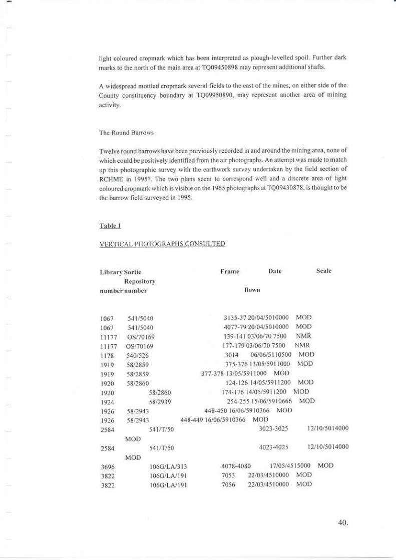
light coloured cropmark which has been interpreted as plough-levelled spoil Further dark
marks to the north ofthe main area at TQ09450898 may represent additional shafts.
A widespread mottled cropmark several fields to the east ofthe mines, on either side ofthe
County constituency boundary at TQ09950890, may represert another area of mining
activity.
The Round Barrows
Twelve round barrows have been previously recorded in and around the mining area, none ofwhich could be positively identified from the air photographs. An attempt was made to match
up this photographic survey with the earthwork survey undertaken by the field section ofRCHME in 1995?. The two plans seen to coffespond well and a discrete area of light
coloured cropmark which is visible on the 1965 photographs at TQ09430878, is thought to be
the barrow field surveyed in 1995.
Table 1
VERTICAL PHOTOGRAPHS CONSULTED
Library Sortie
Repository
number number
Frame Date Scale
flown
to67 541/5040 3t35-31 2010415010000 MoD
to6'7 54tlso4o 4077-79 20104150t0000 MoD
ttt7't os/70169 139-l4l 03/06170 7500 NMR
1tt7'7 0s/70169 1"/7-179 03106/707500 NMR
ll78 540/526 3014 06/06/5110500 MoD
1919 58/28s9 37 5-37 6 1310515911000 MoD
1919 58/2859 3'17 -3'.78 13105/5911000 MoD
t92o 58/2860 124-126 t4/05/591t200 MoD
t92o 58/2860 t74-l'1614105/5911200 MoD
t924 5S/2939 254-255 t5/06159t0666 MOD
\926 58/2943 448-450 16/06/5910366 MOD
t926 5812943 448-449 16/06/s910366 MOD
2584 s4l/T/50 3023'3025 l2l 10/5014000
MOD
2584 541/'t/so 4023-4025 12110/5014000
MOD
3696 t06GlLA/313 4078-4080 17105/4515000 MoD
3822 l06G/LAll9l 7053 2210314510000 MoD3822 r06G/LAll9l 7056 22103/4510000 MoD
40.
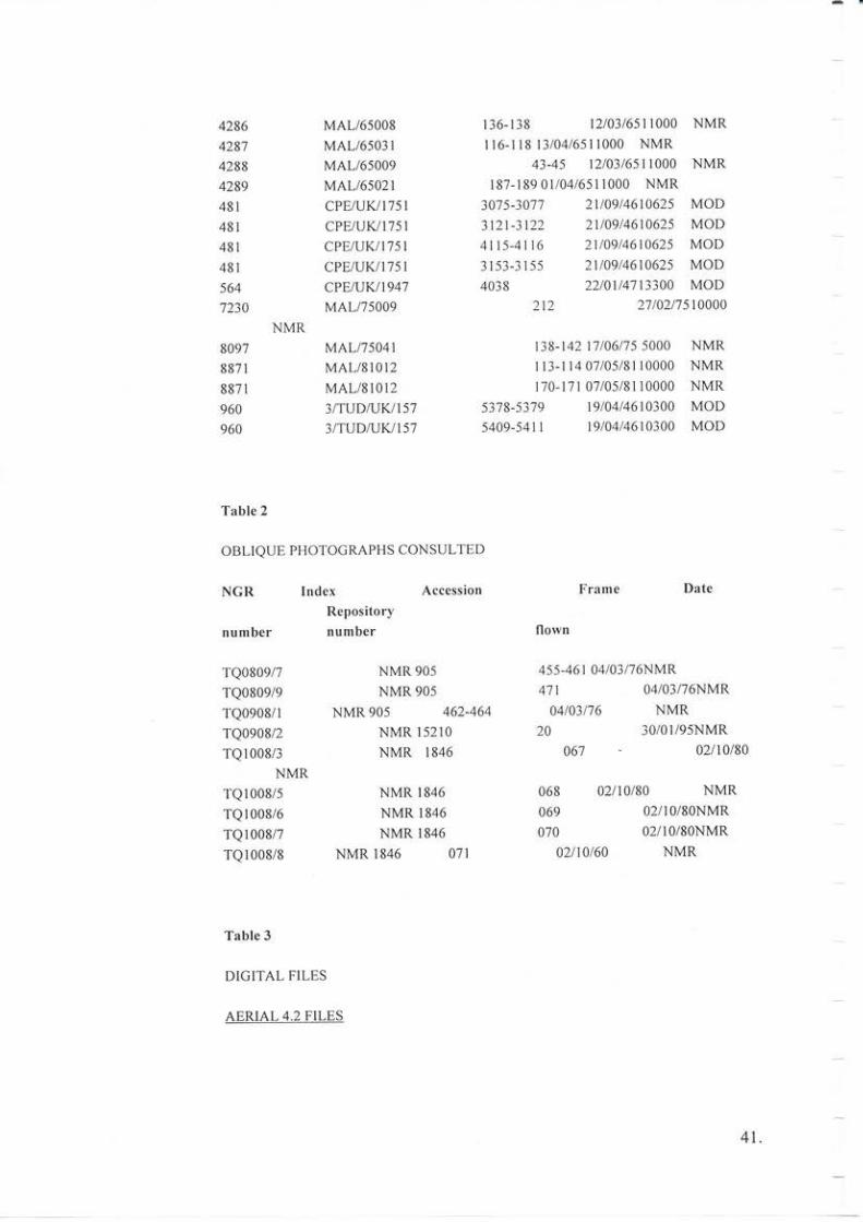
4286
4287
4288
4289
481
481
481
481
564
7230
8097
8871
8871
960
960
Table 2
OBLIQUE PHOTOGRAPHS CONSULTED
136-r38 l2103/6511000 NMRr r6-l r8 t3104/6511000 NMR
43-45 12i03l651 1000 NMR
187-189 0l/04/651 1000 NMR2t/09/4610625 MOD2v09/4610625 MOD2t/09/4610625 MOD21109/46t0625 MOD22/0t/47t3300 MOD
2t2 2'//0217s1o000
138-t421'71061'15 5000 NMRr 13-114 07105/8110000 NMR
1',70-l'11 07 /0518110000 NMR
5378-53',19 l9104/4610300 MOD
5409-5411 19/04/4610300 MOD
Frame Date
MAL/65008MAL/65031
MAL/65009
MAL/65021
CPE/UK.i 1751
CPE/UK,/I75ICPEruK/1751
CPE/UK/1751
oPENWt947MAL/7s009
NMRMALI'7s041
MAL/81012
MAL/81012
3ITUDNW1573/TUDNWI57
30'7 5-30'77
3121-3122
4115-4116
3 153-3 I 55
4038
NGR
number
TQo809/7
TQ08o9/9
TQ0908/1
TQo908/2
TQl008/3NMR
TQ 1008/5
TQ1008/6
TQl008/7TQl008/8
IndexRepository
nu mber
Accession
NMR 905
NMR 905
NMR 905 462-464
NMR 15210
NMR 1846
NMR 1846
NMR 1846
NMR 1846
NMR 1846 071
02l10/8oNMR02l10/8oNMR
NMR
flown
455-461
471
04/03/'76
20
o6'7
068
069
070
04/03/76NMR
02110180
04/03/76NMR
NMR30/01/95NMR
02/10/80
NMR
02t10/60
Table 3
DIGITAL FILES
AERIAL 4.2 FILES
41 .

BLACKPI.DIG MAL/65008 I37
BLACKP2.DIG CPENKI757 4116
DIGICART MODELS
Digitalfile name
t0l102
103
107
108
301
304
305
30?.
Digitisedphotograph
r€sidual €rror
AERIAL 4.2
AERIAL 4.2
+0.7 m
+ 1.5 m
DigitalMethod
Maximum
N.B Errors are presented in centimetres not metres.
RESIDUAL ERRORS FOR SHUT DOWN FILE BLACK367.SDF
Control Grid Grid Grid Error Error Errorpoint East North Height X Y Z
903400 841550
903550 861050
947750 941600
993750 916550
936400 851850
00000000
0 -32
o -28
0 -78
0 133
0593'70 0
7250 0
14690 0
13820 0
-19
27
-145
62
75
0
0
0
0
0
0
0
0
0
8
-7
3t-32
^n
tr
Table 4
RESIDUAL ERRORS FOR SHUT DOWN FILE BLACK367.SDF
Control Grid Grid Grid Error Error Errorpoint East North Height X Y Z
l0l 903400 841550 0 -95 -21 0
102 903550 861050 0 -51 4 0
103 947750 941600 0 -19 274 0
204 914300 1026500 0 -5 -347 0
105 969800 1023200 0 -89 42 0
406 1014500 982100 0 260 48 0
301 0 0 9370 0 0 -8
302 0 0 13820 0 0 l1
30300862600-2
43.
Bibliography
Bradley, R, & Edmonds, M,1993 Interpreting the Axe Trade; production and exchange in
Neolithic Britain Cambridge University Press
Clark, JGD, & Piggott, 5,1933 The Age of the British Flint Mires, Antiquity 7, 166-183
Clarke, DL, l9'l1 Beaker Pottery ofGreal Britain and lreland Cambridge University Press
Curwen, EC, 1929 Prehistoric Sussex The Homeland Association
Curwen, EC, 1954 The Archaeologt of Sussex 2nd ed Methuen
Drewett, P, 1978 Neolithic Sussex, in Drewett, P, ed Archaeologt in Sussex to AD I 500 CBA
Research Report 29, 23-29
Drewett, P, Rudling, D, & Gardiner, J, 1988 The South-Eqst to 1000AD Longman
Eustace, GW, 1930 The Tompkins Diary Sussex Archaeol Coll 71, 10-55
Gardiner, JP, 1988 The composition and distribution ofNeolithic surfaceflint assemblages in
central southern England',lJniversity of Reading Dept of Archaeology unpublished PhD
thesis
Goodman, CH, Frost, M, Curwen, E, & Curwen, E C, 1924 Blackpatch Flint-Mine
Excavation, 1922: report prepared on behalfofthe Worthing Archaeological Society Szssex
Archaeol Coll 65.69- L I I
Grinsell, LV, 1934 Sussex Barow s Sussex Archaeol Coll'7 5,217-2'7 5
Harding, A, & Lee, G, 1987 Henge monuments and related sites of Great Britain Brilish
Archaeol Rep 175 Oxford
Holgate, R, l99l Prehistoric Flint Mines Shire
Hudson, TP, 1980 The Victoria County History of Sussax 6,pt I
Kinnes, I A,Gibson, A, Ambers, J, Bowman, S, Leese, M, & Boast, R, 1991 Radiocarbon
dating and British Beakers; the British Museum programme Scottish Archaeol Revue 8'35-
68
Longworth, I, 1984 Collered tlrns ofthe Brorue Age in Greqt Britlin and IrelandCambridge
University Press
44.
Longworth, l, & Vamdell, G, 1996 Excavations at Grimes Graves, Norfolk 1972-1976
Fascicule 5 Mining in the deeper mines London: British Museum
Mortimer, RN, 1984 Controls on Upper Cretaceous Sedimentation in the South Downs, with
particular reference to flint distribution; in Seiveking, G de C, & HaI1, MB, eds The Scientific
Study of Flint and Chert,2l-22 Cambridge University Press
Musson, CR, I 9 54 An lllustrated Catalogue of Sussex Beaker and Bronze Age Pottery Slssex
Arc haeol Coll 92, 106-124
Pull, JH, 1923a A Downs Discovery - Blackpatch Prehistoric Mines: an industrial centre in
neolithic times; llorthing HeralcL/Herald Magazine March 3 I st(?) 1923
Pull, JH, 1923b The Downland Flint Mines: system of underground workings explained;
14/ or t h ing H erald/ H erald Magaz ine April 7 th, 1923
Pull, JH, 1923c The Age ofthe Blackpatch Flint Mines: do they date from late Palaeolithic
times: ryorthing Herald/Herald Magozize June 9th, 1923
Pull, JH, 1923d Additional Discoveries at Blackpatch: Bronze Age tumulus re-examined;
lVorthing Herald/Herald Magqzine November 3rd, 1923
Pull, JH, 1923e Blaokpatch: Further Discoveries - the chipping floors and surface occupation
levels; Worthing Heralcl/Herald Magazfue November 24th, 1923
Pull, JH, 1927 Flint Mining in the Bronze Age: An Ancient Burial Discovered at Blackpatch;
lVorthing Herald/Herald Magazine luly 23, 1927
Pull, JH, 1932 The Flint-Miners of Blackpatch Williams & Norgate, London
Pull, JH, & Sainsbury, CE 1928aThe Round Barrows ofBlackpatch: Article no I -Barow 2;
Il or t h i ng H e r al d/ H er a ld Ma gaz ine April 2l, 1 928
Pull, JH, & Sainsbury, CE, 1928b The Round Barrows of Blackpatch: Article no 2 -
Interesting Finds in Banow no 3; Iyorthing Heruld/Herald Magazine Apr|I28,1928
Pull, JH, & Sainsbury, CE, 1928c The Round Barrows ofBlackpatch: Article no 3 -Barow
no 4; llorthing Heralcl/Herold Magazire May 5th, 1928
Pull, JH, & Sainsbury, CE, 1928d The Round Barrows of Blackpatch: Article no 4 - The
Cissbury Type Celt and its Association With the Barrows of the Bronze Age, Worthing
Herald/Herald Magazine May l2('/), 1928
Pull, JH, & Sainsbury, CE, 1928e The Round Barows of Blackpatch: Article no 5 - The Non-
Marine Mollusca; llorthing Herald,/Herald Magazine May 26, 1928
45.

Pull, JH, & Sainsbury, CE, 1928fThe Round Barows of Blackpatch: Article no 6 - The
Beaker Folk; Worthing Herald/Herald Magazine June 9, 1928
Pull, JH, & Sainsbury, CE, 19289 The Round Barrows of Blackpatch: Afticle no 6 - The
Beaker Folk (continued): Worthing Herald/Herald Magazire June 16, 1928
Pull, JH, & Sainsbury, CE, 1928h The Round Barrows of Blackpatch: article no 7 - The
Relative Age ofthe Barrows and Flint Mines; ll/orthing Herald/Herald Magazine June 23
t928
Pull, JH, & Sainsbury, CE, 1928i The Round Barrows ofBlackpatch: Article no 8 - The Early
Bronze Age Culture Worthing Heralcl/Herald Magazine [tly 14, 1928
Pull, JH, & Sainsbury, CE, 1929a The Flint Miners of Blackpatch: Articleno I - BalrowNo.
5; Worthing Herald/Herqld Magazine Aprtl 20, 1929
Pull, JH, & Sainsbury, CE, 1929b The Flint Miners of Blackpatch: Article no 2 - ????;
lltorthing Herald/Herald Magazine May I 1th, 1929
Pull, JH, & Sainsbury, CE, 1929c The Flint Miners of Blackpatch; Article no 3 - A Burial
Beneath a Chipping Floo1' Worlhing Heralcl/Herald Magazine May 11, 1929
Pull, JH, & Sainsbury, CE, 1929d The Flint Miners ofBlackpatch: Article no 4 - The Chalk
Charms from Shaft 6; Worthing Herald/Herald Magazine May 25, 1929
Pufl, JH, & Sainsbury, CE, 1929e The Flint Miners of Blackpatch: Article no 5 - The
Dwellings and Hut Sites; I1/orthing Herald/Herald Magozine Jl:r,e 1, 19)q
Pull, JH, & Sainsbury, CE, 1929fThe Flint Miners ofBlackpatch: Article no 6 - A Colony of
Pull, JH, & Sainsbury, CE, 1929h Servants ofthe Blackpatch Miners: Article no I - The Ox;
Llorthing Herald/Herald Magazine October 19, 1929
Pull, JH, & Sainsbury, CE, 1929i Servants ofthe Blackpatch Miners: Article no 2 - The Pig
and the Sheep; ll/orthing Herald/Herald Magazine October 26, 1929
Pull, JH, & Sainsbury, CE, 1929j Servants of the Blackpatch Miners: Article no 3 - The Wild
Falna; 14/orthing Herald/Herald Magazrte November 9, 1929
Pull, JH, & Sainsbury, CE, 1929k Servants ofthe Blackpatch Miners: Article no 4 - The Red
Deer; Worthin4 Herald/Herald Magazrne November 16, 1929
Pull, JH, & Sainsbury, CE, 1930a Further Discoveries at Blackpatch: First Arti clel. Worthing
Herald/Herald Magazine May 31, 1930
46.
Pull, JH, & Sainsbury, CE, 1930b Further Discoveries at Blackpatch: Second Article;
Worthing Herald/Herald Magazine June 1 , 1930
Pu ll, JH, & Sainsbury, CE, 193 0c Further D iscoveries at Blackpatch: Th ird Article1' Il/orthing
herald/Herald Magazine June 21, 1930
Pull. JH, & Sainsbury, CE, 1930d Further Discoveries at Blackpatch: Fourth Article;
llorthing Herald/Herald Magazine July 5,1930
Pye, E, 1968 The Flint Mines qt Blackpatch, Church Hill andCissbuty, Sussex: A Report on
the Late JH Pull's Excavations 192 2- I 9 5 5. Il ith a reassessmenl of lhe pas ition offlifi mining
in Neolithic and Bronze Age Britain University of Edinburgh unpublished MA Thesis.
Ratcliffe-Densham, HBA, & Ratcliffe-Densham, MM, 1953 A Celtic Farm on Blackpatch
Sussex Arch.teol Coll9l, 69-83
Russell, M, 1996 A reassessmenl of the Bronze Age cemelery-barrow on ltford Hill, East
Srssex Bournemouth Uniyersity School of Conservation Sciences Research Report 2
Stone, JFS, 1933 A middle bronze age umfield on Easton Down Il ilts Archaeol Mag
xLvt,2l8-24
White, S, 1995 A most lovable character Sussex Past and PresenlDecember 1995,
11 ()
\?f
0a
osro fo7
?
,*'04
oo65
BI
Surviving surface features at Blackpatch
47.
t:
RCHMENGLAND
ti
ti
/i/i
/i/i
=y,Nlr'.'\.r'4\\\'
j$t?N
J\llD a,,i
Jti
..!b\l//
-,rr//:? .srul- Slz>n r'?rrrS '/11F
,),k uutn
BlackpatchWest Sussex
ooo
.lO O 100 metres
o^Qo
/oq-AfJ;
0
oq'^oU/
0
BI
Wackpatchest Sussex
ooo/ a
aa
0a; ttaOQ'Qr li
a0_
0
/i
oQbg
0
RCHMENGLAND
a 6ha1l
r'///y ecoit lseen as earttwvorks on 1946 vAPs)
:.: sooil? (seen as liqht croDmarks on 1965 VAPS)
O ho ow (seen as dark cropmarks on 1965 vAPs)t1
10 0 100 metres
///,)
''ra
a{
ti

NAT IO NALMONUMENTS
RECORD
The National Monaments Recoul contains
all the inJormation in this report - and more:
original photographs, plans okl arul new,
the rcsults oJ all RCHME fielil surveys, irulexes oJ
archaeologiul sites and his torical buiklings,
and complete couerage oJ Engla
in air photographs.
efir:Sq75 RoYAL
COMMISSION,'-tHISrOntcelMONUMENTSb'gNGLRItD
The Royal Commission on the Histotical Monumetts oJ England. gathe* irJomatiofl on Englatd's hetitage
aad ptoddes it throtgh thc National Monuments Record
Wo d llide Web: http: / / wtow.rchme.gou.uk
National Monuffients Recotd etquiries: telephote 0179j 114600
Ndtional Monnneflts Record Cefltrc' Grcat Westetn Viltage, Kemble Dit'e, Swindox SN2 2GZ
:tnt::*
Copyright © 2022 FDOKUMEN