Coltrinari-GM NOVO
20
Geomorphologic Information Systems, why not? Lylian COLTRINARI ([email protected] ) & J.P. PAIVA REIS ([email protected]) Department of Geography – University of São Paulo IAG /AIG REGIONAL CONFERENCE 2011 GEOMORPHOLOGY FOR HUMAN ADAPTATION TO CHANGING TROPICAL ENVIRONMENTS Addis Ababa , Ethiopia February 18 – 22, 2011
Transcript of Coltrinari-GM NOVO

Geomorphologic Information Systems, why
not?Lylian COLTRINARI ([email protected]) &
J.P. PAIVA REIS ([email protected]) Department of Geography – University of
São Paulo
IAG /AIG REGIONAL CONFERENCE 2011GEOMORPHOLOGY FOR HUMAN ADAPTATION TO
CHANGING TROPICAL ENVIRONMENTSAddis Ababa , Ethiopia February 18 – 22, 2011

INTRODUCTION
1962: International Conference of the Subcommission on Geomorphological Mapping - Poland The priniciples of geomorphological maps in Polandfield data + aerial photographs plotted on topographic maps (1:10,000 – 1:100,000)> morphometry, morphography, morphogenesis, and morphochronology identified by multicoloured signs
In the 1950´s: geomorphological mapping systems devised in European countries >> systems differ from one another / difficult comparisons among regional maps 1956 : 18 th International Geographical Congress (IGC) – Rio de Janeiro: > two projects of detailed geomorphological maps by Annaheim & Klimaszewski 1960: 19th IGC - Stockholm:> set up of Subcommission on Geomorphological Mapping to stabilize maps legendsproposition of uniform conception and principles of detailed geomorphological maps to assure comparisons >> difficult due to amount and type of information & different aspects emphasizedby authors

GEOGRAPHIC INFORMATION SYSTEMS• strong development • combine capacity to solve problems &
handling of large quantities of data,• construction of geomorphological
databases, legends and mapping systems
1968: 20th IGC - New Dehli Development of the Unified Key mapping system for international detailed geomorphological mapping of the world (Bashenina et al., 1968; Demek et al., 1972)
Publication of Geomorphological mapping system for international use (Verstappen & van Zuidam - ITC/Holland) In the 1970’s increasing attention on geomorphological mapping, publication of Manual of Detailed Geomorphological Mapping (Demek et al., 1972)) Remarks on the uncomplete character of a mapping system for the whole world based on contribution of scientists from
the northern hemisphere.LAST DECADES
INTRODUCTION

OBJECTIVEUse an analogic
morphological map into GIS

II – Study area : São- José-dos-Campos plateau (São Paulo/SE Brazil)
• SW extreme of Taubaté sedimentary basin• ≈ 220 km long / ENE orientation•central segment of the Continental Rift of Southeastern Brazil (CRSB) / Paleocenic age
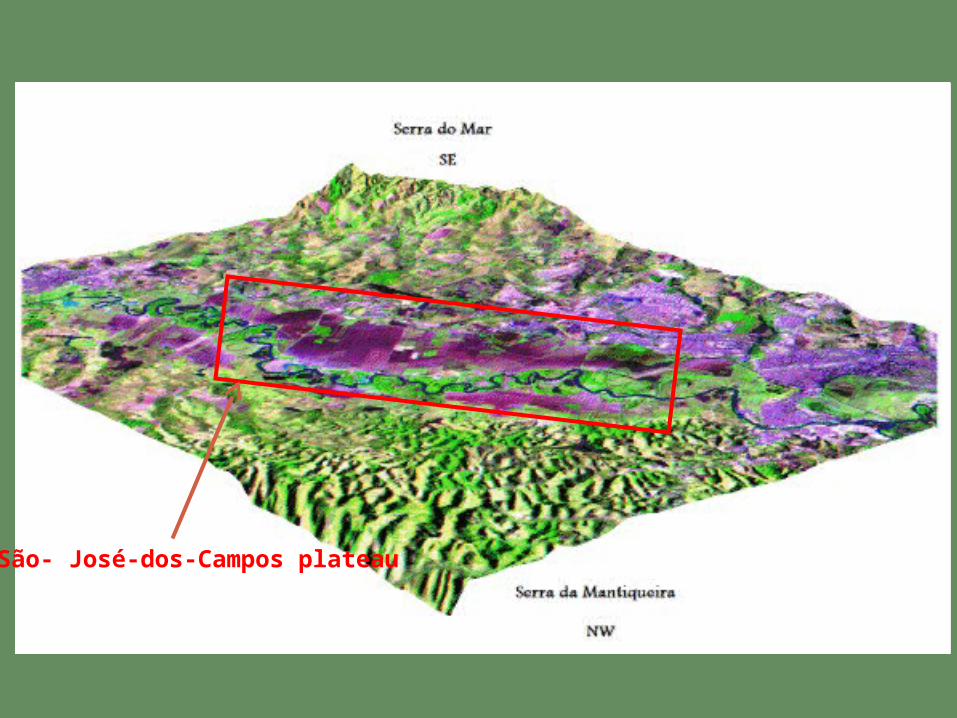
São- José-dos-Campos plateau
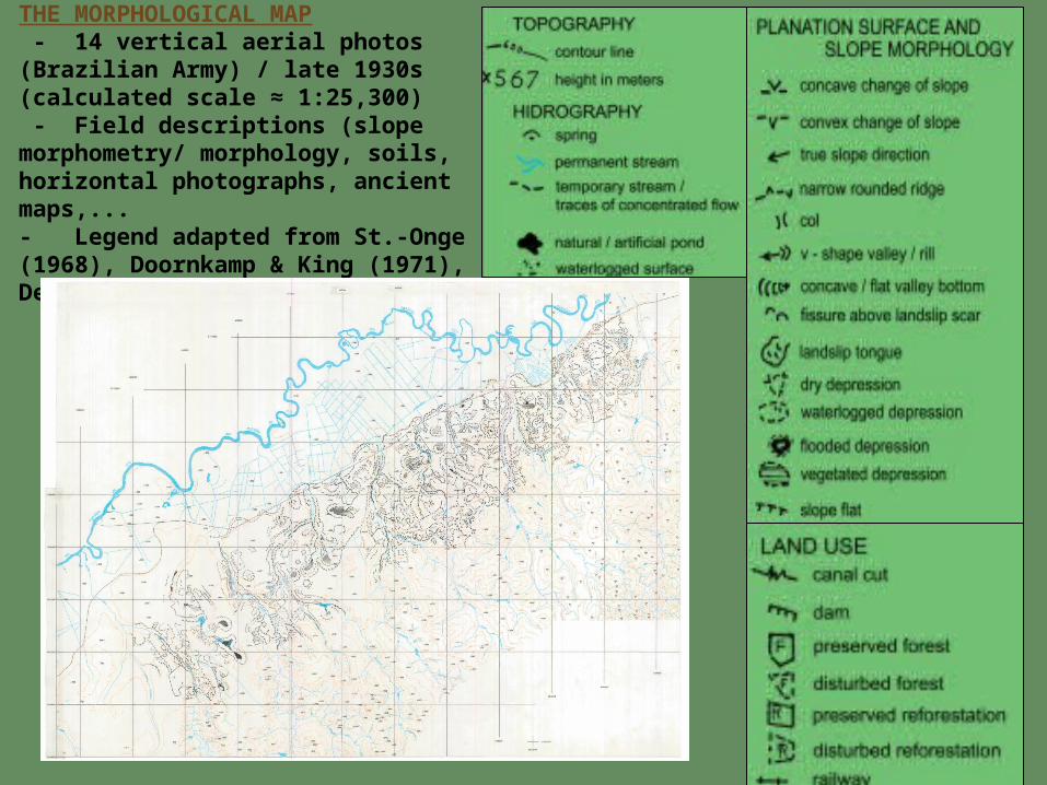
THE MORPHOLOGICAL MAP - 14 vertical aerial photos (Brazilian Army) / late 1930s (calculated scale ≈ 1:25,300) - Field descriptions (slope morphometry/ morphology, soils, horizontal photographs, ancient maps,...- Legend adapted from St.-Onge (1968), Doornkamp & King (1971), Demek et.al (1972)

THE MORPHOLOGICAL DIGITAL MAP (ArcGis 9.3)

Paraíb
a do S
ul
River
Serra
do
Mar
Serra
do
Mantiq
ueira


Paraíb
a do S
ul
River
Serra
do
Mantiq
ueira
Serra
do
Mar

Paraíb
a do S
ul
River
Serra
do
Mantiq
ueira
Serra
do
Mar

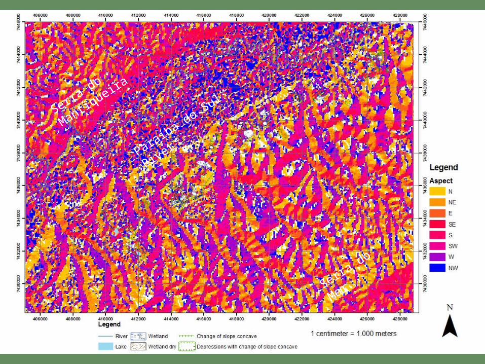
SÃO JOSÉ DOS CAMPOS PLATEAU - TOPOGRAPHY (IBGE)
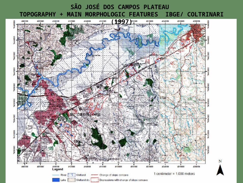
SÃO JOSÉ DOS CAMPOS PLATEAU TOPOGRAPHY + MAIN MORPHOLOGIC FEATURES IBGE/ COLTRINARI
(1997)
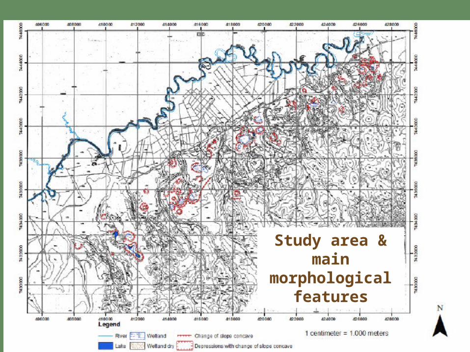
Study area & main
morphological features

Image 2blue/5green/7red
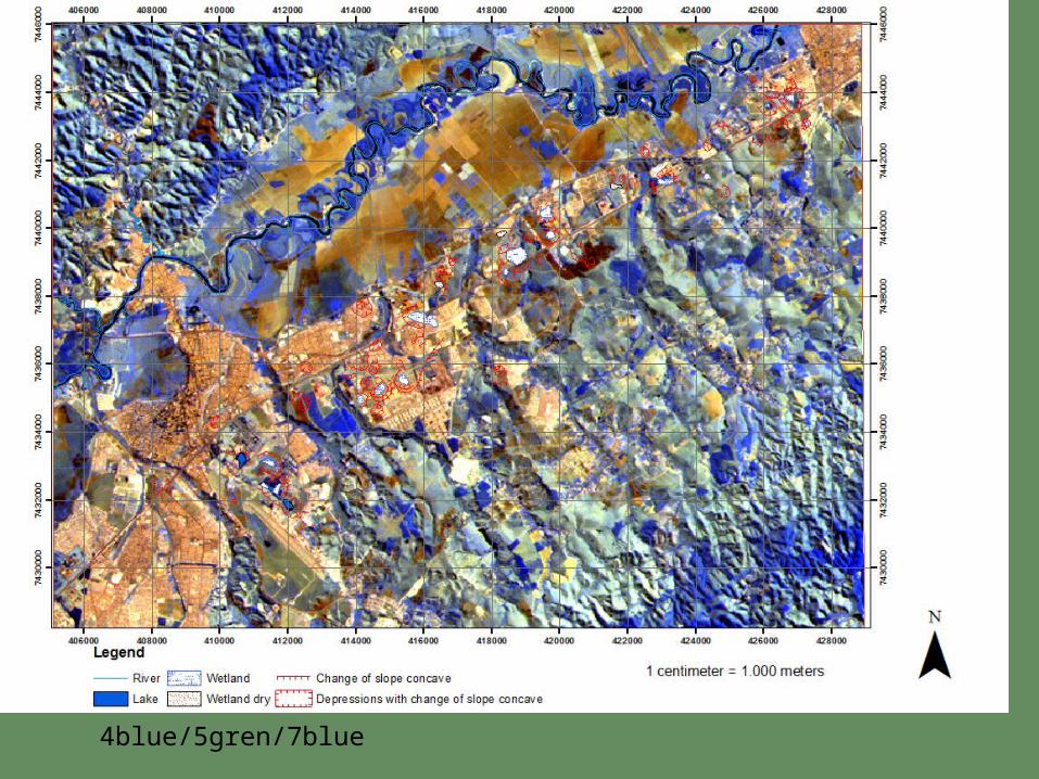
4blue/5gren/7blue
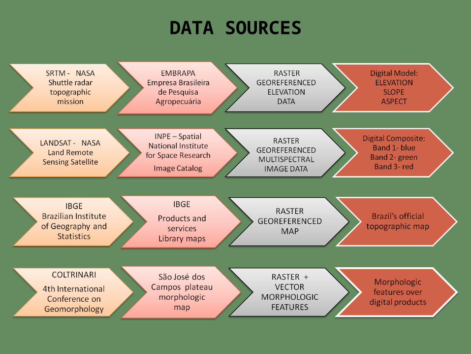
DATA SOURCES

THANK YOU!