Climate Change And Mitigation Measures For The Hydrometerological Disaster In Himachal Pradesh,...
10
INTERNATIONAL JOURNAL OF SCIENTIFIC & TECHNOLOGY RESEARCH VOLUME 4, ISSUE 01, JANUARY 2015 ISSN 2277-8616 267 IJSTR©2015 www.ijstr.org Climate Change And Mitigation Measures For The Hydrometerological Disaster In Himachal Pradesh, India- In Light Of Dams. Vinay K. Pandey, Ajai Mishra, Shashank S Mishra Abstract: Continuing climate change is predicted to lead to major changes in the climate of the Himalayan region. Casualties and damage due to hazards in mountain regions will increase irrespective of global warming, especially where populations are growing and infrastructure is developed at exposed locations. But climate change will definitely increase risk due to the fact that expected increases of heavy rainfall, heat waves, and glacier melt will amplify hazards in Himalayan region. The rapid release of melt water and rainfall may combine to trigger debris flows and flash flood in higher ranges, including the formation of potentially dangerous lakes. These lakes may breach suddenly, resulting in discharge of huge volume of water and debris. Himachal Pradesh had experienced a large number of incidences of Hydro-meteorological disaster (HMD) since its inception in 1971. Flash flood of March 1975, Dec 1988, Satluj flash flood of August 2000, July 2001, June 2005, Flash flood of July 2005 and Cloud burst in June 2013 are the major natural calamities in Himachal Pradesh. Due to continuous HMD brought heavy toll to the state as the loss was estimated in several thousand millions of rupees and also killed several hundreds of people besides large number of cattle heads. Through this paper, we carried out a comprehensive study of past HMD and mitigation measures, solution and concluded that these disaster are by their nature difficult to predict and control but it is possible to reduce the risk to lives and property through develop mitigation strategy and plan to construct dams/barrages with awareness and knowledge among local communities about the impacts of global warming, natural disaster and the threat to the ecosystem, communities, and infrastructure are generally inadequate. Keywords: Climate Change, Hydro-meteorological disasters (HMD), rainfall, Flash flood, Cloud burst, Mitigation measures, Dams. ———————————————————— 1. Introduction Climate change is a reality today, and some of the best evidence such as melting glaciers comes from mountain areas. Many scientists believe that the changes occurring in mountain ecosystems may provide an early glimpse of what could come to pass in lowland environments, and that mountains thus act as early warning systems. Continuing climate change is predicted to lead to major changes in the strength and timing of the Asian monsoon, inner Asian high pressure systems, and winter westerlies – the main systems affecting the climate of the Himalayan region. The impacts on river flows, groundwater recharge, natural hazards, and the ecosystem, as well as on people and their livelihoods, could be dramatic, although not the same in terms of rate, intensity, or direction in all parts of the region (Eriksson, Mats et.al., 2009). A substantial portion of the annual precipitation falls as snow, particularly at high altitudes (above 3000m) feeding the Himalayan glaciers. The high Himalayan and inner Asian ranges have the most highly glaciated areas outside the polar regions (Owen et al., 2002; Dyurgerov and Meier, 2005). Globally, climate change is very likely to increase the pressure exerted by non-seismic hazards. Higher temperatures will enhance the hydrological cycle and it is predicted that they will alter rainfall patterns and intensity (Thomas Kohler et. al., 2012). Effects will not be limited to changes in precipitation. Global warming reduces snow cover, melts away glaciers, and degrades permafrost (Bavay et. al., 2009). As vegetation development on such sites is a slow process, they may remain unprotected against erosion for decades or even centuries. As a result, slope failures, rock fall and debris flow will pose increasing threats to settlement and infrastructure in many places (Beniston, 2005). The Intergovernmental Panel on Climate Change in its global climate scenario (IPCC Assessment Report, 2001) has indicated that the pattern of global warming will be more pronounced at high altitude zones, especially those in the tropics and sub tropics upto 3 to 5 times faster warming than the rest of world. There are evidences to indicate that Himalayas are warming at the higher rate than the global average rate (IPCC, 2007a; Du et al., 2004) and its impact are studied by many scientist as Holeman, 1984; Singh & Singh, 1992; Ageta & Kadota, 1992; Zobel & Singh 1997; Yamada T, 1998; Fujita et al, 2001; Singh P & Bengtsson L, 2004; Dyurgerov & Meier, 2005; Benniston, 2005; Hewitt, 2005, Phillips M, 2006; Singh S.P., 2007, Kumar et al, 2006, 2007, 2008; Rabindranath, 2008 etc. Warming will be significant in arid regions of Asia and the Himalayan highlands, including the Tibetan Plateau (Gao et al.,2003; Yao et al., 2006). Retreat in glaciers can destabilize surrounding slopes and may give rise to catastrophic landslides (Ballantyne and Benn, 1994; Dadson and Church, 2005), which can dam streams and sometimes lead to outbreak floods. Excessive melt waters, often in combination with liquid precipitation, may trigger flash floods or debris flows (Hewitt, 2005). Available studies suggest changes in climatic patterns and an increase in extreme events. An increase in the frequency of high intensity rainfall often leading to flash floods and land slides has been reported (Chalise and Khanal, 2001; ICIMOD, 2007a; Iafiazova, 1997). Preliminary studies indicate that the Himalaya seems to be warming more than the global average rate (Liu & Chen, 2000; Shrestha et al., 1999), temperature increases are greater during the winter and autumn than during the ___________________________ GIPL, Energy division, 5th floor, Orbit Plaza, New Prabhadevi road, Prabhadevi, Mumbai-400025, Maharastra, India Department of Geology, University of Lucknow, Lucknow-226007, U.P., India. E-mail: [email protected]
-
Upload
independent -
Category
Documents
-
view
6 -
download
0
Transcript of Climate Change And Mitigation Measures For The Hydrometerological Disaster In Himachal Pradesh,...
INTERNATIONAL JOURNAL OF SCIENTIFIC & TECHNOLOGY RESEARCH VOLUME 4, ISSUE 01, JANUARY 2015 ISSN 2277-8616
267 IJSTR©2015 www.ijstr.org
Climate Change And Mitigation Measures For The Hydrometerological Disaster In Himachal Pradesh,
India- In Light Of Dams.
Vinay K. Pandey, Ajai Mishra, Shashank S Mishra
Abstract: Continuing climate change is predicted to lead to major changes in the climate of the Himalayan region. Casualties and damage due to hazards in mountain regions will increase irrespective of global warming, especially where populations are growing and infrastructure is developed at exposed locations. But climate change will definitely increase risk due to the fact that expected increases of heavy rainfall, heat waves, and glacier melt will amplify hazards in Himalayan region. The rapid release of melt water and rainfall may combine to trigger debris flows and flash flood in higher ranges, including the formation of potentially dangerous lakes. These lakes may breach suddenly, resulting in discharge of huge volume of water and debris. Himachal Pradesh had experienced a large number of incidences of Hydro-meteorological disaster (HMD) since its inception in 1971. Flash flood of March 1975, Dec 1988, Satluj flash flood of August 2000, July 2001, June 2005, Flash flood of July 2005 and Cloud burst in June 2013 are the major natural calamities in Himachal Pradesh. Due to continuous HMD brought heavy toll to the state as the loss was estimated in several thousand millions of rupees and also killed several hundreds of people besides large number of cattle heads. Through this paper, we carried out a comprehensive study of past HMD and mitigation measures, solution and concluded that these disaster are by their nature difficult to predict and control but it is possible to reduce the risk to lives and property through develop mitigation strategy and plan to construct dams/barrages with awareness and knowledge among local communities about the impacts of global warming, natural disaster and the threat to the ecosystem, communities, and infrastructure are generally inadequate. Keywords: Climate Change, Hydro-meteorological disasters (HMD), rainfall, Flash flood, Cloud burst, Mitigation measures, Dams.
————————————————————
1. Introduction Climate change is a reality today, and some of the best evidence such as melting glaciers comes from mountain areas. Many scientists believe that the changes occurring in mountain ecosystems may provide an early glimpse of what could come to pass in lowland environments, and that mountains thus act as early warning systems. Continuing climate change is predicted to lead to major changes in the strength and timing of the Asian monsoon, inner Asian high pressure systems, and winter westerlies – the main systems affecting the climate of the Himalayan region. The impacts on river flows, groundwater recharge, natural hazards, and the ecosystem, as well as on people and their livelihoods, could be dramatic, although not the same in terms of rate, intensity, or direction in all parts of the region (Eriksson, Mats et.al., 2009). A substantial portion of the annual precipitation falls as snow, particularly at high altitudes (above 3000m) feeding the Himalayan glaciers. The high Himalayan and inner Asian ranges have the most highly glaciated areas outside the polar regions (Owen et al., 2002; Dyurgerov and Meier, 2005). Globally, climate change is very likely to increase the pressure exerted by non-seismic hazards. Higher temperatures will enhance the hydrological cycle and it is predicted that they will alter rainfall patterns and intensity (Thomas Kohler et. al., 2012). Effects will not be limited to changes in precipitation.
Global warming reduces snow cover, melts away glaciers, and degrades permafrost (Bavay et. al., 2009). As vegetation development on such sites is a slow process, they may remain unprotected against erosion for decades or even centuries. As a result, slope failures, rock fall and debris flow will pose increasing threats to settlement and infrastructure in many places (Beniston, 2005). The Intergovernmental Panel on Climate Change in its global climate scenario (IPCC Assessment Report, 2001) has indicated that the pattern of global warming will be more pronounced at high altitude zones, especially those in the tropics and sub tropics upto 3 to 5 times faster warming than the rest of world. There are evidences to indicate that Himalayas are warming at the higher rate than the global average rate (IPCC, 2007a; Du et al., 2004) and its impact are studied by many scientist as Holeman, 1984; Singh & Singh, 1992; Ageta & Kadota, 1992; Zobel & Singh 1997; Yamada T, 1998; Fujita et al, 2001; Singh P & Bengtsson L, 2004; Dyurgerov & Meier, 2005; Benniston, 2005; Hewitt, 2005, Phillips M, 2006; Singh S.P., 2007, Kumar et al, 2006, 2007, 2008; Rabindranath, 2008 etc. Warming will be significant in arid regions of Asia and the Himalayan highlands, including the Tibetan Plateau (Gao et al.,2003; Yao et al., 2006). Retreat in glaciers can destabilize surrounding slopes and may give rise to catastrophic landslides (Ballantyne and Benn, 1994; Dadson and Church, 2005), which can dam streams and sometimes lead to outbreak floods. Excessive melt waters, often in combination with liquid precipitation, may trigger flash floods or debris flows (Hewitt, 2005). Available studies suggest changes in climatic patterns and an increase in extreme events. An increase in the frequency of high intensity rainfall often leading to flash floods and land slides has been reported (Chalise and Khanal, 2001; ICIMOD, 2007a; Iafiazova, 1997). Preliminary studies indicate that the Himalaya seems to be warming more than the global average rate (Liu & Chen, 2000; Shrestha et al., 1999), temperature increases are greater during the winter and autumn than during the
___________________________
GIPL, Energy division, 5th floor, Orbit Plaza, New Prabhadevi road, Prabhadevi, Mumbai-400025, Maharastra, India
Department of Geology, University of Lucknow, Lucknow-226007, U.P., India.
E-mail: [email protected]
INTERNATIONAL JOURNAL OF SCIENTIFIC & TECHNOLOGY RESEARCH VOLUME 4, ISSUE 01, JANUARY 2015 ISSN 2277-8616
268 IJSTR©2015 www.ijstr.org
summer; and the increases are larger at higher altitudes (Liu & Chen, 2000). The state of Himachal Pradesh has experienced a large number of incidences of flood since its inception in 1971. Though the state has also faced severe flood disaster in 1975 and 1988 but the last decade (1997-2005) had proved one of the worst decades as both the magnitude and frequency of floods have gone up. Flash flood of March 1975, Dec 1988, Satluj flash flood of August 2000, July 2001, June 2005, Flash flood of July 2005 (Sharma, D.D., 2006) and Cloud burst in June 2013 are the major natural calamities in Himachal Pradesh. Due to climatic change weather pattern such as change in frequency and magnitude of rainfall and flood/flash flood, avalanche, highly prone landslide area are getting activate. Through this paper, we carried out a comprehensive study about mitigation measures & solution through past Hydrometerological disaster (HMD) and effect of dams on HMD such as cloud burst, flash flood/ flood, Glacier Lake Outburst flood in Himachal Pradesh.
1.1 Study Area. Himachal Pradesh is predominantly a mountainous State located in North – West India. It shares an international border with China. The State has highly dissected mountain ranges interspersed with deep gorges and valleys. It is also characterized with diverse climate that varies from semi tropical in lower hills, to semi arctic in the cold deserts areas of Spiti and Kinnaur. Altitude ranges from 350 meters to 6975 meters above mean sea level. It is located between Latitude 30° 22‘ 44‖ N to 33° 12‘ 40‖ N and Longitude 75° 47‘ 55‖ E to 79° 04‘22‖ E. Himachal extends over an area 55673 Sq km. Twelve districts of the State have been divided into 3 Divisions, 52 Subdivisions, 77 Development Blocks and 3243 Panchayats. (DoES, GoHP; 2012 & 2013). Population of Himachal Pradesh is 68.56 lakh as per the Census report for the year 2011. 89.01% of the total population inhabits 20,604 villages in the rural areas of the State. These villages are sparsely distributed across the State having population density as low as 1 person per square kilometer in the remote and tribal area of Lahaul & Spiti, Hamirpur district has largest population density of 369 persons per square kilometer as against 123 persons per square kilometer for the whole State. Himachal Pradesh is one of the few states of the country where gender equality is an integral part of the social ethos as well as the overall development strategy. Female literacy is well above the national level and women employment is much higher than in most states of the country. (NIDM, 2013).
1.2 River. Himachal Pradesh provides water to both the Indus and Ganges basins. The drainage systems of the region are the Chandra Bhaga or the Chenab, the Ravi, the Beas, the Sutlej and the Yamuna. These rivers are perennial and are fed by snow and rainfall. They are protected by an extensive cover of natural vegetation. The Beas rises in the Pir Panjal range near the Rohtang Pass and flows about 256 km in Himachal Pradesh. The river is formed by a numerous of tributaries; the major tributaries are the Parbati, the Hurla, the Sainj, the Uhl, the Suheti, the Luni, the Banganga and the Chaki. During the month of August, increase in the inflow sometimes results in floods. The Chandrabhaga or Chenab, the largest river (in terms of volume of water) is formed after
the meeting of two streams namely, Chandra and Bhaga at Tandi, in Lahaul. It flows 122 km and covers an area of 7,500 sq. km². in Himachal, before entering Kashmir. The Chandra passes through the barren tribal land. The Ravi is born in Bara Banghal, Kangra district as a joint stream formed by the glacier fead Bhadal and Tantgari. The river is of about 158 km in length and has a catchment area of nearly 5,451 sq. km². Chamba lies on its right bank. The Sutlej originates in distant Tibet. The river cuts through both the great Himalayan and the Zaskar ranges and crosses the Indo-Tibetan border (near Shipkila). Then the river Spiti joins Sutlej from the north. Passing through gorges it emerges from the mountains at Bhakra. The catchment area of Sutlej in Himachal Pradesh is about 20,000 sq.km². The Yamuna has its origin in Yamunotri in Uttarkashi district, Uttarakhand. Its total catchment area in Himachal Pradesh is 2,320 sq. km². Its tributaries are the Tons, the Giri and the Bata. (http://www.webindia123.com/ himachal/land/rivers.htm)
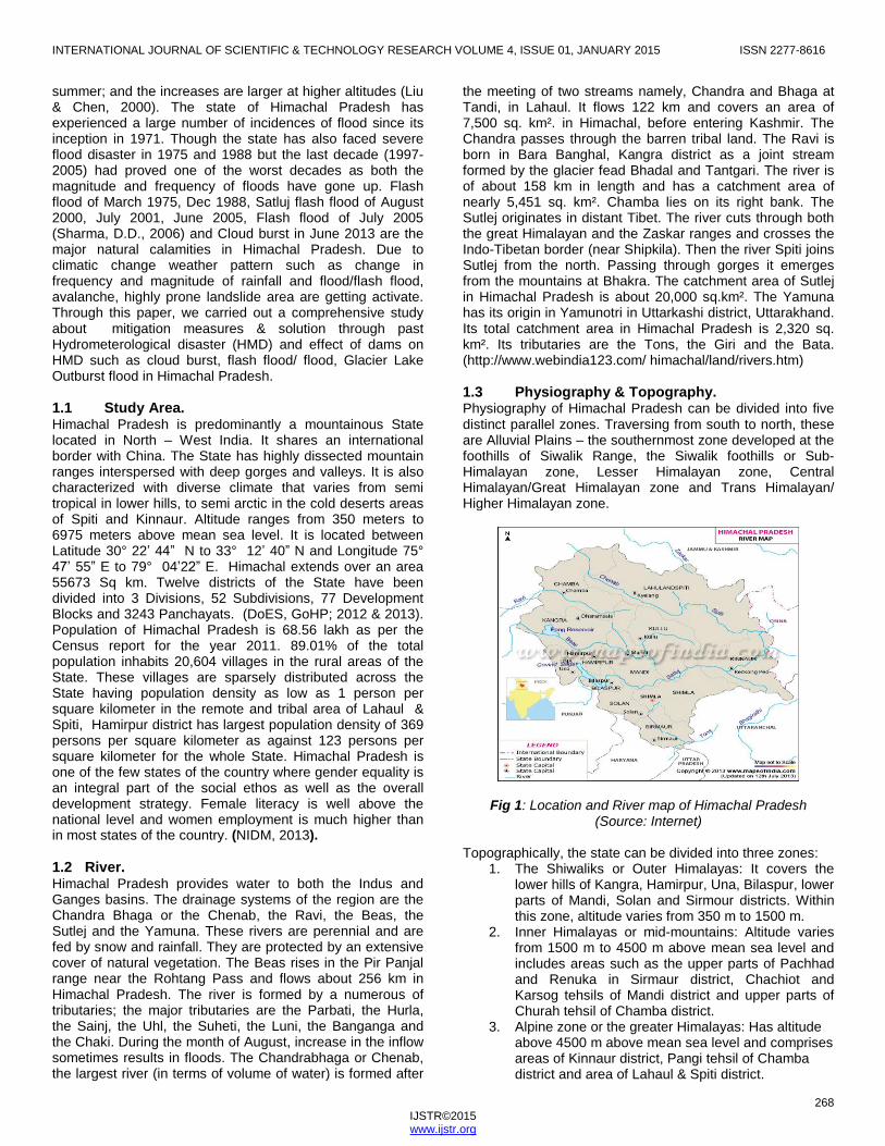
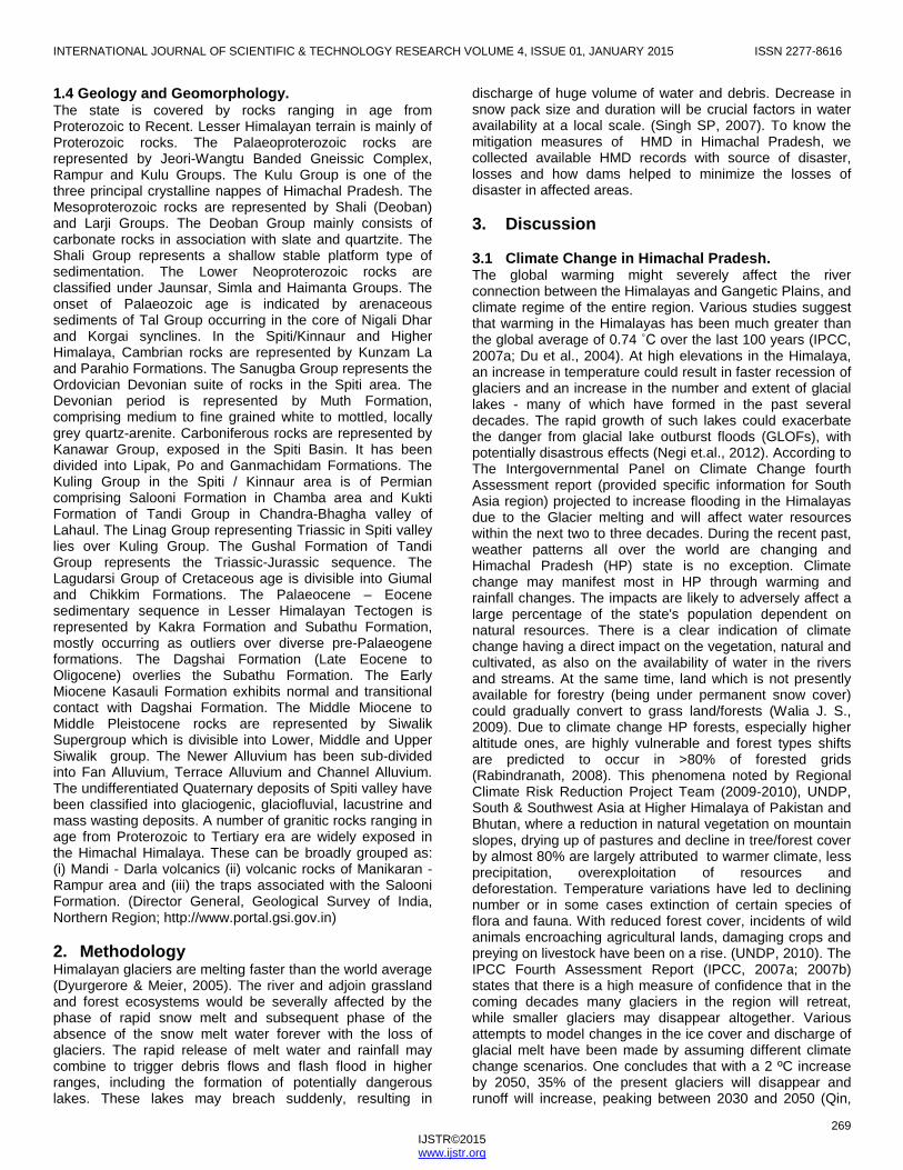
1.3 Physiography & Topography. Physiography of Himachal Pradesh can be divided into five distinct parallel zones. Traversing from south to north, these are Alluvial Plains – the southernmost zone developed at the foothills of Siwalik Range, the Siwalik foothills or Sub-Himalayan zone, Lesser Himalayan zone, Central Himalayan/Great Himalayan zone and Trans Himalayan/ Higher Himalayan zone.
Fig 1: Location and River map of Himachal Pradesh (Source: Internet)
Topographically, the state can be divided into three zones:
1. The Shiwaliks or Outer Himalayas: It covers the lower hills of Kangra, Hamirpur, Una, Bilaspur, lower parts of Mandi, Solan and Sirmour districts. Within this zone, altitude varies from 350 m to 1500 m.
2. Inner Himalayas or mid-mountains: Altitude varies from 1500 m to 4500 m above mean sea level and includes areas such as the upper parts of Pachhad and Renuka in Sirmaur district, Chachiot and Karsog tehsils of Mandi district and upper parts of Churah tehsil of Chamba district.
3. Alpine zone or the greater Himalayas: Has altitude above 4500 m above mean sea level and comprises areas of Kinnaur district, Pangi tehsil of Chamba district and area of Lahaul & Spiti district.
INTERNATIONAL JOURNAL OF SCIENTIFIC & TECHNOLOGY RESEARCH VOLUME 4, ISSUE 01, JANUARY 2015 ISSN 2277-8616
269 IJSTR©2015 www.ijstr.org
1.4 Geology and Geomorphology. The state is covered by rocks ranging in age from Proterozoic to Recent. Lesser Himalayan terrain is mainly of Proterozoic rocks. The Palaeoproterozoic rocks are represented by Jeori-Wangtu Banded Gneissic Complex, Rampur and Kulu Groups. The Kulu Group is one of the three principal crystalline nappes of Himachal Pradesh. The Mesoproterozoic rocks are represented by Shali (Deoban) and Larji Groups. The Deoban Group mainly consists of carbonate rocks in association with slate and quartzite. The Shali Group represents a shallow stable platform type of sedimentation. The Lower Neoproterozoic rocks are classified under Jaunsar, Simla and Haimanta Groups. The onset of Palaeozoic age is indicated by arenaceous sediments of Tal Group occurring in the core of Nigali Dhar and Korgai synclines. In the Spiti/Kinnaur and Higher Himalaya, Cambrian rocks are represented by Kunzam La and Parahio Formations. The Sanugba Group represents the Ordovician Devonian suite of rocks in the Spiti area. The Devonian period is represented by Muth Formation, comprising medium to fine grained white to mottled, locally grey quartz-arenite. Carboniferous rocks are represented by Kanawar Group, exposed in the Spiti Basin. It has been divided into Lipak, Po and Ganmachidam Formations. The Kuling Group in the Spiti / Kinnaur area is of Permian comprising Salooni Formation in Chamba area and Kukti Formation of Tandi Group in Chandra-Bhagha valley of Lahaul. The Linag Group representing Triassic in Spiti valley lies over Kuling Group. The Gushal Formation of Tandi Group represents the Triassic-Jurassic sequence. The Lagudarsi Group of Cretaceous age is divisible into Giumal and Chikkim Formations. The Palaeocene – Eocene sedimentary sequence in Lesser Himalayan Tectogen is represented by Kakra Formation and Subathu Formation, mostly occurring as outliers over diverse pre-Palaeogene formations. The Dagshai Formation (Late Eocene to Oligocene) overlies the Subathu Formation. The Early Miocene Kasauli Formation exhibits normal and transitional contact with Dagshai Formation. The Middle Miocene to Middle Pleistocene rocks are represented by Siwalik Supergroup which is divisible into Lower, Middle and Upper Siwalik group. The Newer Alluvium has been sub-divided into Fan Alluvium, Terrace Alluvium and Channel Alluvium. The undifferentiated Quaternary deposits of Spiti valley have been classified into glaciogenic, glaciofluvial, lacustrine and mass wasting deposits. A number of granitic rocks ranging in age from Proterozoic to Tertiary era are widely exposed in the Himachal Himalaya. These can be broadly grouped as: (i) Mandi - Darla volcanics (ii) volcanic rocks of Manikaran -Rampur area and (iii) the traps associated with the Salooni Formation. (Director General, Geological Survey of India, Northern Region; http://www.portal.gsi.gov.in)
2. Methodology Himalayan glaciers are melting faster than the world average (Dyurgerore & Meier, 2005). The river and adjoin grassland and forest ecosystems would be severally affected by the phase of rapid snow melt and subsequent phase of the absence of the snow melt water forever with the loss of glaciers. The rapid release of melt water and rainfall may combine to trigger debris flows and flash flood in higher ranges, including the formation of potentially dangerous lakes. These lakes may breach suddenly, resulting in
discharge of huge volume of water and debris. Decrease in snow pack size and duration will be crucial factors in water availability at a local scale. (Singh SP, 2007). To know the mitigation measures of HMD in Himachal Pradesh, we collected available HMD records with source of disaster, losses and how dams helped to minimize the losses of disaster in affected areas.
3. Discussion
3.1 Climate Change in Himachal Pradesh. The global warming might severely affect the river connection between the Himalayas and Gangetic Plains, and climate regime of the entire region. Various studies suggest that warming in the Himalayas has been much greater than the global average of 0.74 ˚C over the last 100 years (IPCC, 2007a; Du et al., 2004). At high elevations in the Himalaya, an increase in temperature could result in faster recession of glaciers and an increase in the number and extent of glacial lakes - many of which have formed in the past several decades. The rapid growth of such lakes could exacerbate the danger from glacial lake outburst floods (GLOFs), with potentially disastrous effects (Negi et.al., 2012). According to The Intergovernmental Panel on Climate Change fourth Assessment report (provided specific information for South Asia region) projected to increase flooding in the Himalayas due to the Glacier melting and will affect water resources within the next two to three decades. During the recent past, weather patterns all over the world are changing and Himachal Pradesh (HP) state is no exception. Climate change may manifest most in HP through warming and rainfall changes. The impacts are likely to adversely affect a large percentage of the state's population dependent on natural resources. There is a clear indication of climate change having a direct impact on the vegetation, natural and cultivated, as also on the availability of water in the rivers and streams. At the same time, land which is not presently available for forestry (being under permanent snow cover) could gradually convert to grass land/forests (Walia J. S., 2009). Due to climate change HP forests, especially higher altitude ones, are highly vulnerable and forest types shifts are predicted to occur in >80% of forested grids (Rabindranath, 2008). This phenomena noted by Regional Climate Risk Reduction Project Team (2009-2010), UNDP, South & Southwest Asia at Higher Himalaya of Pakistan and Bhutan, where a reduction in natural vegetation on mountain slopes, drying up of pastures and decline in tree/forest cover by almost 80% are largely attributed to warmer climate, less precipitation, overexploitation of resources and deforestation. Temperature variations have led to declining number or in some cases extinction of certain species of flora and fauna. With reduced forest cover, incidents of wild animals encroaching agricultural lands, damaging crops and preying on livestock have been on a rise. (UNDP, 2010). The IPCC Fourth Assessment Report (IPCC, 2007a; 2007b) states that there is a high measure of confidence that in the coming decades many glaciers in the region will retreat, while smaller glaciers may disappear altogether. Various attempts to model changes in the ice cover and discharge of glacial melt have been made by assuming different climate change scenarios. One concludes that with a 2 ºC increase by 2050, 35% of the present glaciers will disappear and runoff will increase, peaking between 2030 and 2050 (Qin,
INTERNATIONAL JOURNAL OF SCIENTIFIC & TECHNOLOGY RESEARCH VOLUME 4, ISSUE 01, JANUARY 2015 ISSN 2277-8616
270 IJSTR©2015 www.ijstr.org
2002). Retreat in glaciers can destabilize surrounding slopes and may give rise to catastrophic landslides (Ballantyne and Benn, 1994; Dadson and Church, 2005), which can dam streams and sometimes lead to outbreak floods. Excessive melt waters, often in combination with liquid precipitation, may trigger flash floods or debris flows. In the Karakoram, there is growing evidence that catastrophic rockslides have a substantial influence on glaciers and may have triggered glacial surges (Hewitt, 2005). Available studies suggest changes in climatic patterns and an increase in extreme events. An increase in the frequency of high intensity rainfall often leading to flash floods and land slides has been reported (Chalise and Khanal, 2001; ICIMOD, 2007a).
3.2 Hydrometerological disaster (HMD) in Himachal Pradesh.
Himachal Pradesh is vulnerable to 25 out of 33 types of hazards identified by the High Powered Committee (HPC) of Government of India and categorized into 5 sub-groups. Apart from identified hazards by HPC, the state is also confronting the emerging threats of climate change and man and animal conflict. Following events causes due to HMD and Geological disasters: Hydro-meteorological Disasters
1. Floods 2. Hailstorm 3. Cloud Burst 4. Heat Wave and Cold Wave 5. Snow Avalanches 6. Droughts 7. Thunder and Lightning
Geologically Related Disasters.
1. Landslides and Mudflows 2. Earthquakes 3. Dam Failures/ Dam Bursts
Due to heavy rainfall, rainwater penetrates into soil and rock surface; causes landslide and mudflow so Landslide and Mudflows are common in Geological as well as HMD. District wise hazard threat in Himachal Pradesh is given under table no 1
District Floods
Cloud Burst
Avalanche
Drought
Earthquake
Landslide
Kangra M M M H VH L
Chamba H H M M VH VH
Hamirpur L L - M H L
Mandi H H - M VH H
Kullu H VH H M VH VH
Bilaspur L L - M H M
Una H L - H H L
Sirmour L M - M H L
Solan L L - M H M
Kinnaur H VH VH M H H
Lahaul & Spiti
M H VH M H M
Shimla H H M M VH H
(Symbol: L= Low, M= Medium, H= High, VH= Very High)
Table 1: District wise Hazard threat in Himachal Pradesh (Source: NIDM, 2013)
Hazards both natural and manmade are of immediate concern to the State of Himachal Pradesh as it faces the fury of one or the other disaster every year. The fragile ecology and geology of the State coupled with large variations in Physio-climate conditions render it vulnerable to vagaries of nature in one way or the other. (NIDM, 2013) These disasters events have brought heavy toll to the state as the loss was estimated in several thousand millions of rupees and also killed several hundreds of people besides large number of cattle heads (Sharma, D.D.; 2006). Although widespread floods problems do not exist in the state because of topographical nature, continuing attention is necessary to reduce flood hazards in the state, more particularly the flash flood hazard the incidences of which are increasing causing large scale damage. The major flash floods have been tabulated as under table 2.
Prominent Flash Floods
History of Damage Occurred Type of Disaster
8 July 1973
Lake formed by the blockage of Satluj river due to Nathpa rock fall damaged Sanjay power house, loss of about Rs. 45 million estimated.
Geological disaster converted in Hydrometerological disaster
19 Jan. 1975
In Satluj basin two blockages were observed in Spiti valley. One on Parechu River between Sumdo and Kaurik due to landslide created by 19 Jan. 1975 earthquake. Blockage was 60m in height and 150m in length created temporary lake. In march this lake burst causing flash floods in Spiti valley.
Geological disaster converted in Hydrometerological disaster
On 29th Sept. 1988 (2.30 a.m.) a flash flood occurred due to cloud burst in Soldang Khad.
Caused heavy loss of life and property in the Soldng village; Washed away the Bhabanagar water works.; Washed away 2 Km of NH-22 across Soldan Khad.; Created landslides Block stopped the flow of Satluj river and created a temporary lake having dimensions roughly about 6000 m long. 200-250 m wide and 25-30 m deep extending up to Wangtoo Bridge.
Hydrometerological disaster
31 July and 2 August 1991
Cloudburst and flash flood along Soldan Khad in Satluj valley killed 32 people, 15 houses, 35 bigha agriculture land, 600 apple trees, 2Km of road of NH 22 and 20 m bridge on Soldan Khad washed away. Agriculture land along Leo village situated downstream.
Hydrometerological disaster
24 Feb 1993
Flood washed away 15 houses, 35 bigha of agriculture land and about 600 apple trees in Soldang village.
Hydrometerological disaster
4th and 5th September 1993
Satluj river blocked twice due to major landslide and rock fall near Jhakri and Nathpa, damaging NH-22. Another flash flood occurred in Duling Khad on 4th and 5th September causing extensive damage in Tapri, district Kinnaur.
Geological disaster converted in Hydrometerological disaster. Hydrometerological disaster
First flash flood occurred on 4th
• 32 people and 35 cattle lost their lives. • Huge debris formed a fan along Satluj and formed a take partially
Hydrometerological disaster

INTERNATIONAL JOURNAL OF SCIENTIFIC & TECHNOLOGY RESEARCH VOLUME 4, ISSUE 01, JANUARY 2015 ISSN 2277-8616
271 IJSTR©2015 www.ijstr.org
September 1995 at 2 p.m. After cloudbursts in the upper catchments of Duling Another flood came at 6 a.m. and 9 a.m. on 5th Sept. 1995 bursting the lake formed during the previous cloudbursts.
blocking the Satluj • Flash flood caused heavy damage due to change in course of Satluj from left to right bank increased the tow and lateral erosion at Tapri. • Washed away 19 houses, HRTC workshop along with 3 buses. • Change in course is still causing tow erosion to NH-22.
Feb-95
500 m road section of NH-22 washed away by Jakhri slide. Rs. 10 million loss to road and forest land, a village upper slope was in danger.
Geological disaster converted in Hydrometerological disaster.
4-5 Sept. 1995
Flash flood along Panwi Khad in Satluj valley washed away 19 houses, 3 buses, HRTC workshop and damaged HPPWD rest house at Tapri. Flood and landslide along Bas river in Kullu valley killed 65 people. NH damaged at numerous places, loss to government and private property, road and bridges estimated US$ 182 million.
Hydrometerological disaster.
11-Aug-97
Flash flood and landslide along Andhra khad in Pabbar valley killed 124 people, 456 cattle, washed away government and private buildings, 200 m road section and damaged Andhra power house at Chirgaon. Loss was estimated Rs. 10.63 million.
Hydrometerological disaster.
Aug-97
Cloudburst and flash flood along Satluj river killed 19 people, 464 cattle, 105 houses damaged, 10 cattle sheds and 39-hectare agriculture land. Total loss was estimated Rs.672.9 million.
Hydrometerological disaster.
Flash floods in the night of 31st July and 1st August 2000 in Satluj valley.
Unprecedented rise in the water level of Satluj river, from Tibetan Plateau through out the entire length of about 250 km up to Bhakra Dam. The flash flood ws termed as the one that occurs once in 61,000 years. Widespread damage in the valley right from its confluence with Spiti river near Khab to downstream areas. Extensive damage to 200 Km of NH-22, washed away 20 bridges, 22 Jhulas and badly damaged 12 bridges. About 1000 irrigation, sewerage, flood protection and water supply schemes were badly damaged. Expensive damage to hydel projects including NJPC. 135 people and 1673 cattle lost their lives. The total estimated loss was to the tune of Rs. 1466.26 crore.
Hydrometerological disaster.
Flash floods on
Cloudbursts in the upper reaches of Sainj valley caused flash floods,
Hydrometerological
the night of 23rd July 2001 in Sainj valley in District Kullu.
affecting about 40 families 2 bridges. Connecting road to Slund and Sainj was also washed away at a number of places. Two persons were washed away and 5 cattle perished. Some other areas in Kullu district were also affected.
disaster.
17th and 19th July 2001 floods in Mandi district.
Excessive rains caused damage to 160 houses in Mandi district and destroyed 11 cattle and one human life.
Hydrometerological disaster.
Flash floods in the night of 29th and 30th July 2001 in Chhota Bhangal and Baijnath Sub Division of Kangra District.
Caused widespread damage in the area. 12 deaths occurred due to flash floods and loss of 150 cattle was reported from the area. Bridge connecting Deol and Baijnath was also washed away. Total estimated loss was to the tune of Rs. 18.27 crores.
Hydrometerological disaster.
Flash floods in the night of 9th August and 10th August 2001 on Moral-Danda peak in the Rohru sub Division in Shimla District.
Flash floods occurred along two streams, one along the Devidhar area and an other along Darkali in Rampur Sub Division. Damage to infrastructure like roads, bridges, water supply schemes, forest wealth, agriculture land, horticulture land, footbridges, village paths, residential houses and water mills and loss of 3 lives and 39 cattle and destruction of private property. Total loss in both the Sub Divisions was 145.15 lacs.
Hydrometerological disaster.
Flash floods in the night of 21st and 22nd August 2001, cloudburst in Ani Sub Division of Kullu district occurred.
9 people lost their lives, 17 houses were washed away besides the loss of 12 cows, 18 oxen and 40 sheep and about 115 bighas of agriculture and horticulture land was washed away.
Hydrometerological disaster.
Flash floods in Sihunta ara and Tissa areas of Chamba district in the night of 12th and 13th August 2001.
Washed away 9 hectare of fertile land, 2 small bridges causing a total loss to property of some Rs. 2 Crore.
Hydrometerological disaster.
Flash floods due to cloudbursts in Gharsa valley on
Due to these flash floods 21 people lost their lives, 21 people suffered major injuries and 9 are still missing.
Hydrometerological disaster.
INTERNATIONAL JOURNAL OF SCIENTIFIC & TECHNOLOGY RESEARCH VOLUME 4, ISSUE 01, JANUARY 2015 ISSN 2277-8616
272 IJSTR©2015 www.ijstr.org
16th July 2003 in Kullu district.
Flash floods in Kangni nalla near Solang in Kullu district on 7th August 2003.
30 people lost their lives and 19 people were injured and 9 people are missing, 2 people lost their lives due to landslide in Bhang nalla.
Hydrometerological disaster.
Flash flood in Satluj river due to breach in the Parachoo lake in Tibetan catchment on 26th June 2005
Extensive damage as a result of risen water level of Satluj river due to breach in Parachoo lake formed in Tibet catchments. Washed away the NH-22 at a number of places, 10 bridges, 11 ropeways washed away, 15 motor able bridges and 8 jeep able and footbridges damaged/affected, 10 Km stretch of NH-22 between Wangtoo and Samdo was washed away, and various link roads were damaged. Total loss estimated to the government as well as public property was some Rs. 610 crore.
Hydrometerological disaster.
Cloud Burst in Sangla valley, Kinnaur district on June 15-17, 2013.
Abnormally high rainfall was experienced from June 15 to 17, which was 576% to 1,358% above normal as per Indian Metrological Department (IMD) data. Kinnaur district, which received 193.5mm rains on June 17, against normal 0.7mm for the day coupled with heavy snowfall in upper reaches, suffered maximum damage. In Kinnaur 23 people have lost their lives due to heavy rains and landslides. Besides, damage to 5,092 houses, 336 roads including National Highway and state highways, cowsheds and labour sheds, is being pegged around to over Rs 800 crores.
Hydrometerological disaster.
(Source: Bhandari, 1988; Sah et al, 1996; Sah and Mazari 1998; NIDM, 2013, Newspaper, 2013).
Table 2: List of Previous Flash flood & flood and history of
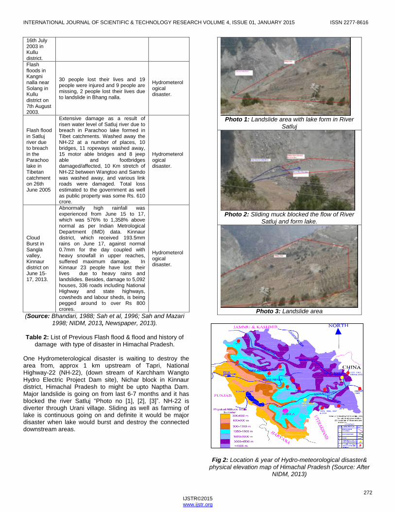
damage with type of disaster in Himachal Pradesh. One Hydrometerological disaster is waiting to destroy the area from, approx 1 km upstream of Tapri, National Highway-22 (NH-22), (down stream of Karchham Wangto Hydro Electric Project Dam site), Nichar block in Kinnaur district, Himachal Pradesh to might be upto Naptha Dam. Major landslide is going on from last 6-7 months and it has blocked the river Satluj ―Photo no [1], [2], [3]‖. NH-22 is diverter through Urani village. Sliding as well as farming of lake is continuous going on and definite it would be major disaster when lake would burst and destroy the connected downstream areas.
Photo 1: Landslide area with lake form in River
Satluj
Photo 2: Sliding muck blocked the flow of River
Satluj and form lake.
Photo 3: Landslide area
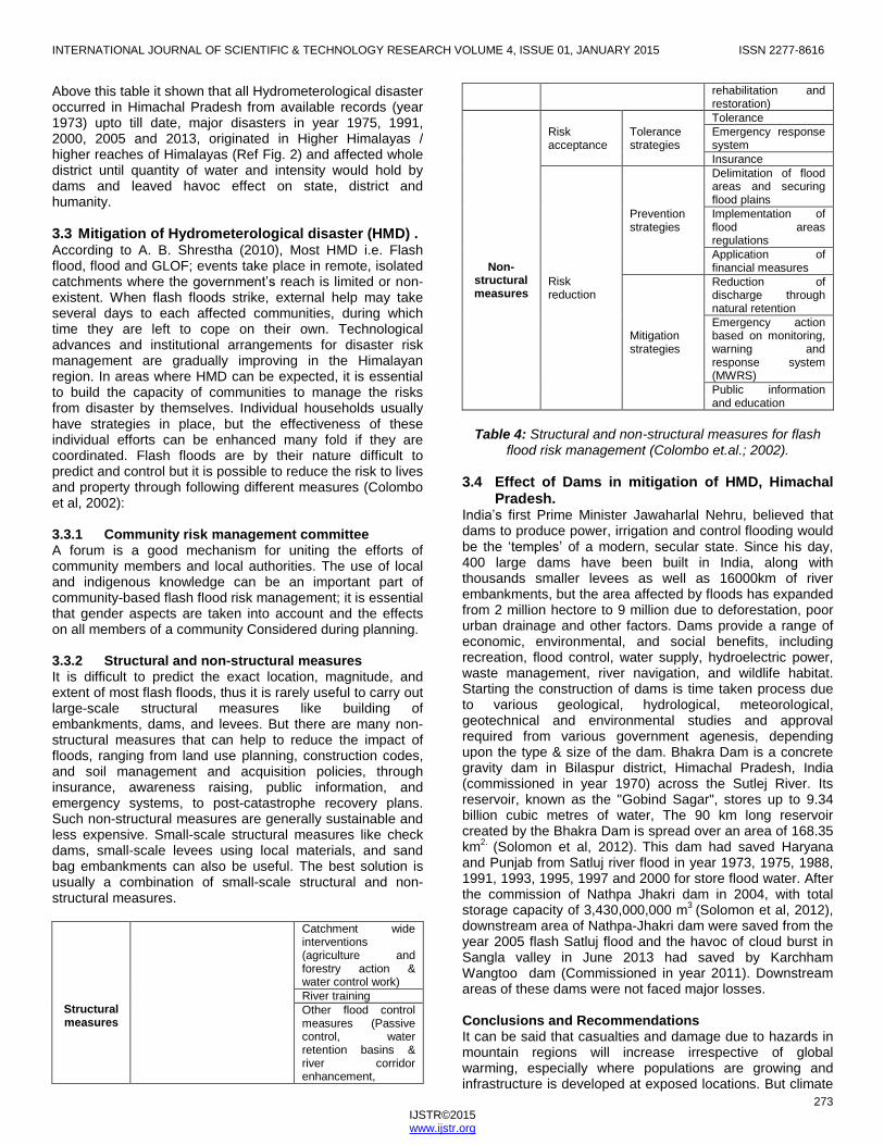
Fig 2: Location & year of Hydro-meteorological disaster& physical elevation map of Himachal Pradesh (Source: After
NIDM, 2013)
INTERNATIONAL JOURNAL OF SCIENTIFIC & TECHNOLOGY RESEARCH VOLUME 4, ISSUE 01, JANUARY 2015 ISSN 2277-8616
273 IJSTR©2015 www.ijstr.org
Above this table it shown that all Hydrometerological disaster occurred in Himachal Pradesh from available records (year 1973) upto till date, major disasters in year 1975, 1991, 2000, 2005 and 2013, originated in Higher Himalayas / higher reaches of Himalayas (Ref Fig. 2) and affected whole district until quantity of water and intensity would hold by dams and leaved havoc effect on state, district and humanity.
3.3 Mitigation of Hydrometerological disaster (HMD) . According to A. B. Shrestha (2010), Most HMD i.e. Flash flood, flood and GLOF; events take place in remote, isolated catchments where the government‘s reach is limited or non-existent. When flash floods strike, external help may take several days to each affected communities, during which time they are left to cope on their own. Technological advances and institutional arrangements for disaster risk management are gradually improving in the Himalayan region. In areas where HMD can be expected, it is essential to build the capacity of communities to manage the risks from disaster by themselves. Individual households usually have strategies in place, but the effectiveness of these individual efforts can be enhanced many fold if they are coordinated. Flash floods are by their nature difficult to predict and control but it is possible to reduce the risk to lives and property through following different measures (Colombo et al, 2002): 3.3.1 Community risk management committee A forum is a good mechanism for uniting the efforts of community members and local authorities. The use of local and indigenous knowledge can be an important part of community-based flash flood risk management; it is essential that gender aspects are taken into account and the effects on all members of a community Considered during planning. 3.3.2 Structural and non-structural measures It is difficult to predict the exact location, magnitude, and extent of most flash floods, thus it is rarely useful to carry out large-scale structural measures like building of embankments, dams, and levees. But there are many non-structural measures that can help to reduce the impact of floods, ranging from land use planning, construction codes, and soil management and acquisition policies, through insurance, awareness raising, public information, and emergency systems, to post-catastrophe recovery plans. Such non-structural measures are generally sustainable and less expensive. Small-scale structural measures like check dams, small-scale levees using local materials, and sand bag embankments can also be useful. The best solution is usually a combination of small-scale structural and non-structural measures.
Structural measures
Catchment wide interventions (agriculture and forestry action & water control work)
River training
Other flood control measures (Passive control, water retention basins & river corridor enhancement,
rehabilitation and restoration)
Non-structural measures
Risk acceptance
Tolerance strategies
Tolerance
Emergency response system
Insurance
Risk reduction
Prevention strategies
Delimitation of flood areas and securing flood plains
Implementation of flood areas regulations
Application of financial measures
Mitigation strategies
Reduction of discharge through natural retention
Emergency action based on monitoring, warning and response system (MWRS)
Public information and education
Table 4: Structural and non-structural measures for flash
flood risk management (Colombo et.al.; 2002).
3.4 Effect of Dams in mitigation of HMD, Himachal Pradesh.
India‘s first Prime Minister Jawaharlal Nehru, believed that dams to produce power, irrigation and control flooding would be the ‗temples‘ of a modern, secular state. Since his day, 400 large dams have been built in India, along with thousands smaller levees as well as 16000km of river embankments, but the area affected by floods has expanded from 2 million hectore to 9 million due to deforestation, poor urban drainage and other factors. Dams provide a range of economic, environmental, and social benefits, including recreation, flood control, water supply, hydroelectric power, waste management, river navigation, and wildlife habitat. Starting the construction of dams is time taken process due to various geological, hydrological, meteorological, geotechnical and environmental studies and approval required from various government agenesis, depending upon the type & size of the dam. Bhakra Dam is a concrete gravity dam in Bilaspur district, Himachal Pradesh, India (commissioned in year 1970) across the Sutlej River. Its reservoir, known as the "Gobind Sagar", stores up to 9.34 billion cubic metres of water, The 90 km long reservoir created by the Bhakra Dam is spread over an area of 168.35 km
2. (Solomon et al, 2012).
This dam had saved Haryana
and Punjab from Satluj river flood in year 1973, 1975, 1988, 1991, 1993, 1995, 1997 and 2000 for store flood water. After the commission of Nathpa Jhakri dam in 2004, with total storage capacity of 3,430,000,000 m
3 (Solomon et al, 2012),
downstream area of Nathpa-Jhakri dam were saved from the year 2005 flash Satluj flood and the havoc of cloud burst in Sangla valley in June 2013 had saved by Karchham Wangtoo dam (Commissioned in year 2011). Downstream areas of these dams were not faced major losses. Conclusions and Recommendations It can be said that casualties and damage due to hazards in mountain regions will increase irrespective of global warming, especially where populations are growing and infrastructure is developed at exposed locations. But climate
INTERNATIONAL JOURNAL OF SCIENTIFIC & TECHNOLOGY RESEARCH VOLUME 4, ISSUE 01, JANUARY 2015 ISSN 2277-8616
274 IJSTR©2015 www.ijstr.org
change will definitely increase risk due to the fact that expected increases of heavy rainfall, heat waves, and glacier melt will amplify hazards in Himalayan region. Adaptation strategies will need to adopt an integrative approach that covers the whole risk cycle from prevention to recovery. Possible entry points for factoring climate change into risk management include hazard mapping and spatial planning based on longer return periods of damaging events, coupled with risk monitoring and improved early warning systems (Lehning and Wilhelm 2006). Frequency and intensity of HMD is unpreductable and previously Himachal Pradesh had suffered a lot in refernce to loss of social, econimical, agricultural, infrastructural and offcourse human sentimentes. It is need to develop mitigation strategy and plan to construct dam. Only local society/community first affects by HMD and we cannot expect that government will be able to intervene everywhere. Government help cannot save us direct & long term impact of HMD. For the above study following conclusions and recommendations have been suggested for mitigation of HMD in Himachal Pradesh: (i) Most harvesting HMD happened in Higher reached of
Satluj basin in Himachal Pradesh and intensity and frequency of disaster are getting high.
(ii) Modern scientific knowledge and technical advances in forecasting and management are essential for the study of climate change and natural disaster. Technical advances in flood forecasting and management offer an opportunity for regional cooperation in disaster management.
(iii) Disaster preparedness and risk reduction should be seen as an integral part of water resources management.
(iv) Awareness and knowledge among local communities about the impacts of global warming, natural disaster and the threat to the ecosystem, communities, and infrastructure are generally inadequate. The media and academia together can play a significant role in public education, awareness building, and trend projection. They have a right to information and materials in their own languages and ways of communicating.
(v) Dams & Barrages are playing positive role to mitigate us, as absorbed the excess discharge of the river and helped in saving downstream areas from effect of flood, flash flood, cloud burst and glacial lake outburst flood.
(vi) Findings/ conclusions/recommendations of studies related to environment, disaster or social beneficial should be aware to the affected area community upto Gram Panchayat level including district administration.
(vii) Government should physically mark the disaster prone/ highly affected areas such as flood prone area, landslide area and mentioned by signee board ‗Disaster prone area‘. Municipal Corporation/ Gram Panchayat never allow to built any structure in this area.
(viii) To minimize the losses in Himachal Pradesh as well as other related disaster prone areas, Geological as well as hydro-meteorological studies, suggestions should be compulsory implemented for all civil structure.
Acknowledgment I would like to convey my gratefully and sincerely thanks to my employer Gammon Infrastructure Projects Limited, management, boss and colleague to provide me a chance to contribute own life in serve of developing nation & society. Again thanks to local environmental NGO‘s in Himachal Pradesh (those continue opposing the developments in the name of environment and humanity continue facing losses make by HMD time to time) who inspired me to prepare this paper for serving of humanity. Finally and most important, I would like to convey heartily thanks to my nature, family & friends for his inspiration, support, encouragement and faith on me to complete this task.
References [1] Ageta, Y. & T. Kadota, ―Predictions of changes of
glacier mass balance in the Nepal 36 K. Higuchi Himalaya and Tibetan Plateau: a case study of air temperature increase for three glaciers‖. Annals of Glaciology, 16, pp. 89-94, 1992.
[2] Ballantyne, C. K., & Benn, D. I., ―Paraglacial slope
adjustment and resedimentation following recent glacier retreat, Fabergstolsdalen, Norway.‖ Arctic and Alpine Research, 26(3), pp 255–269, 1994.
[3] Bavay M, Lehning M, Jonas T, and Löwe,
―Simulations of future snow cover and discharge in Alpine headwater catchments.‖ Hydrological Processes 23(1), pp. 95-108, 2009.
[4] Beniston M., ―The risks associated with climatic
change in mountain regions.‖ In: Huber U., Bugmann H. and Reasoner M. (eds) Global change and mountain regions: an overview of current knowledge. Springer, Dordrecht, pp 511-520, 2005.
[5] Bhandari, R.K., ―A novel low cost drum diaphragm
wall for landslide control in the Himalaya.‖ Proceedings: Second International Conference on Case Histories In Geotechnical Engineering, June 1-5, 1988, St. Louis, Mo., pp 2.60, 1988.
[6] Chalise, S. R., & Khanal, N. R., ―An introduction to
climate, hydrology and landslide hazards in the hindu kush-himalayan region. Landslide Hazard Mitigation in the Hindu Kush-Himalayas, Kathmandu.‖ ICIMOD, pp 51–62, 2001.
[7] Colombo, AG; Hevas, J; Arllam, ALV, ―Guidelines
on flash floods prevention and mitigation.‖ Institute for the Protection & Security of the Citizen Technological & Economic Risk Management (IPSRA), Italy, 2002.
[8] Dadson, S. J., & Church, M. ―Postglacial
topographic evolution of glaciated valleys: a stochastic landscape evolution model.‖ Earth Surface Processes and Landforms, 30(11), pp 1387–1403, 2005.
[9] Department of Economics & Statistics (DoES), Govt
of Himachal Pradesh (GoHP), ―Baseline Survey on
INTERNATIONAL JOURNAL OF SCIENTIFIC & TECHNOLOGY RESEARCH VOLUME 4, ISSUE 01, JANUARY 2015 ISSN 2277-8616
275 IJSTR©2015 www.ijstr.org
Assessment of Existing knowledge level, Awareness & Preventive Practices of Disaster Management in Himachal Pradesh, Shimla.‖ pp 3-6, 2012.
[10] Department of Economics & Statistics, Govt of
Himachal Pradesh, ―Statistical outline of Himachal Pradesh 2012-13‖, Shimla, 2013.
[11] Du, M. Y., Kawashima, S., Yonemura, S., Zhang, X.
Z., & Chen, S. B., ―Mutual influence between human activities and climate change in the tibetan plateau during recent years.‖ Global and Planetary Change, 41, pp 241–249, 2004.
[12] Dyurgerov, MB. and Meier MF., ―Glaciers and the
Changing Earth System: A 2004 Snapshot.‖ Institute of Arctic and Alpine Research, Occasional paper, 58, 2005.
[13] Eriksson, Mats; Jianchu, Xu; Shrestha, A. B,;
Vaidya, R.A.; Nepal, Santosh; Sandstrom, Kals, ―The Changing Himalayas- Impact of climate change on water resources and livelihoods in the Greater Himalayas. Perspectives on water and climate change adaptation.‖ ICIMOD, pp 1-22, 2009.
[14] Fujita, K.; Kadota, T.; Rana, B.; Kayastha, RB. &
Ageta, Y., ―Shrinkage of Glacier AX010 in Shorong region, Nepal Himalayas in the 1990s‖ Bull. Glaciol. Res, 18, 51–54, 2001.
[15] Gao, X. J., Li, D. L., Zhao, Z. C., & Giorgi, F.,
―Climate change due to greenhouse effects in Qinghai-Xizang Plateau and along the Qianghai- Tibet Railway.‖ Plateau Meteorol, 22(5), pp 458–463, 2003.
[16] Geology of Himachal Pradesh. Director General,
Geological Survey of India, Northern region; http://www.portal.gsi.gov.in. 2013.
[17] Hewitt, K., ―The Karakoram anomaly? Glacier
expansion and the ‗elevation effects‘ Karakoram Himalaya. Mountain.‖ Research and Development, 25(4), pp 332–340, 2005.
[18] Holeman, J.N., ―Sediment Yield of Major Rivers of
the World: Rivers and Lakes of Xizang (Tibet).‖ Science Press, Bejjing, 1984.
[19] Iafiazova, R. K., ―Climate change impact on mud
flow formation in Trans-Ili Alatay Mountains.‖ Hydrometeorology and Ecology, 3, pp 12–23, 1997.
[20] ICIMOD, ―Flash Flood Hotspot Mapping in Hindu
Kush-Himalayan Region ICIMOD (2007).‖ International Journal of Climatology 20, pp 1729-1742, 2007a.
[21] IPCC, ―3rd Assessment Report.‖ http:// en.wikipedia.
org/ wiki/ IPCC_Third_ Assessment Report 2001.
[22] IPCC: Climate Change 2007, ―The Physical Science Basis.‖ Contribution of Working Group I to the Fourth Assessment Report of the Intergovernmental Panel on Climate Change, 2007a.
[23] IPCC, ―Chapter 3. The physical science basis,
surface and atmospheric climate change.‖ In Solomon, S., D. Qin, et al. (eds.). Contribution of Working Group I to the Fourth Assessment Report of IPCC. New York Cambridge University Press, pp 235–336, 2007b.
[24] Kumar, K., S. Joshi & V. Joshi., ―Climate variability,
vulnerability, and coping mechanism in Alaknanda catchment, Central Himalaya, India.‖ AMBIO 37, pp 286-291, 2008.
[25] Kumar, R., A. K. Shai, K. Krishna Kumar, S. K.
Patwardhan, P. K. Mishra, J. V. Rewadhar, K. Kamal & G. B. Pant., ―High resolution climate change scenario for India for the 21st century.‖ Current Science 90, pp 334-345, 2006.
[26] Kumar, V., Singh, P., & Singh, V., ―Snow and glacier
melt contribution in the Beas River at Pandoh Dam, Himachal Pradesh, India.‖ Hydrological Sciences–Journal des Sciences Hydrologiques, 52(2), 2007.
[27] Lehning M, Wilhelm C., ― Risk Management and
Physical Modeling for Mountainous Natural Hazards.‖ In: Albeverio, S.; Jentsch, V.; Kantz, H. (eds.) Extreme Events in Nature and Society. Springer, Dordrecht, pp 277-292, 2006.
[28] Liu, X. & B. Chen., ―Climate warming in the Tibetan
Plateau during recent decades.‖ International Journal of Climatology, 20, pp 1729-1742, 2000.
[29] Location and River map of Himachal Pradesh.
http://www.mapsofindia.com/maps/ himachalpradesh/rivers. 2013.
[30] National Institute of Disaster Management (NIDM);
Himachal Pradesh, National Disaster Risk Reduction Portal. http://nidm.gov.in/PDF/DP/HIMACHAL.PDF, 2013.
[31] Negi G.C.S., Samal, P.K., Kuniyal J.C., Kothyari
B.P., Sharma R.K. & Dhyani P.P., ―Impact of climate change on the western Himalayan mountain ecosystems: An overview.‖ International Society for Tropical Ecology, 53(3), pp 345-356, 2012.
[32] Owen, L. A., Finkel, R. C., & Caffee, M. W., ―A note
on the extent of glaciation throughout the Himalaya during the global last glacial maximum.‖ Quaternary Science Reviews, 21, pp147–157,2002.
[33] Phillips M., ―Avalanche defense strategies and
monitoring of two sites in mountain permafrost terrain. Pontresina, eastern Swiss Alps.‖ Natural Hazards, 39, pp 353-379, 2006.
INTERNATIONAL JOURNAL OF SCIENTIFIC & TECHNOLOGY RESEARCH VOLUME 4, ISSUE 01, JANUARY 2015 ISSN 2277-8616
276 IJSTR©2015 www.ijstr.org
[34] Qin, D. H., ―Glacier Inventory of China (Maps).‖ Xi‘an: Xi‘an Cartographic Publishing House, 2002.
[35] Rabindranath, NH, ―Climate Change & Himachal
Pradesh: Impacts, Adaptation & Mitigation‖ Shimla, Himachal Pradesh, India, 2008.
[36] Regional Climate Risk Reduction Project Team.
Managing Climate risks in the Himalayas, Bureau for Crisis Prevention & Recovery, South & Southwest Asia, United Nations Development Programme (UNDP), 2009-2010.
[37] Rivers of Himachal Pradesh,
http://www.webindia123.com/himachal/land/rivers.htm 2013.
[38] Sah M.P. & Mazari R.K., ―Anthropogenically
accelerated mass movement, Kulu Valley Himachal Pradesh, India.‖ Geomorphology, 26, pp 123-138, 1998.
[39] Sah M.P., Virdi N. S. & Bartarya S. K, ―The Malling
slide of Kinnaur, causes, consequences and its control on channel blocking and flash floods in the Lower Spiti Valley, Himachal Pradesh.‖ In: Proc. Int. Conference on Disasters and Mitigation, Anna. University, Madras, 1(A-4), pp 102-106, 1996.
[40] Sharma D.D., ―Flood and Flash Flood in Himachal
Pradesh: A Geographical Analysis.‖ Published by National Institute of Disaster Management, Govt Of India, New Delhi, 2006.
[41] Shreshtha, AB, ―Managing Flash Flood Risk in the
Himalayas. Information sheet #1/10.‖ Published by International Center For Integrated Mountain Development (ICIMOD) Publication Unit, Kathmandu, Nepal, 2010.
[42] Shrestha, A. B., C. P. Wake, P. A. Mayewski & J. E.
Dibb, ―Maximum temperature and trends in the Himalaya and its vicinity: An analysis based on temperature records from Nepal from period 1971- 94‖. Journal of Climate, 12, pp 2775-2787, 1999.
[43] Singh S.P., ―Climate change an overview.‖ Fifteenth
national symposium on environment (NSE-15). Mitigation of pollutants for Clean environment BARC Macmillan India Ltd. Mumbai, pp 24-29, 2007.
[44] Singh, J.S. & S.P. Singh., ―Forests of Himalaya.‖
Gyanodaya Prakashan, Nainital, India, 1992.
[45] Singh, P., & Bengtsson, L., ―Hydrological sensitivity of a large Himalayan basin to climate change.‖ Hydrological Processes, 18, pp 2363–2385, 2004.
[46] Solomon, S., Kanjlia VK, Singh KP, Nakra SC,
―Hydroelectric Projects in India.‖ Publication no 312, Central Board of Irrigation & Power (CBIP), Govt of India (GoI), New Delhi, 2012.
[47] Thomas Kohler and Daniel Maselli, ―Mountain & Climate Change from understanding to Action.‖ 3
rd
Edition. Published by the Centre for Development and Environment (CDE), Rome, Italy, 2012.
[48] Walia J. S., ―Impact of climate change and Himachal
Pradesh‘s action plan strategy on forestry.‖ Journal of Indian Forester, pp 1155-1164, September 2009.
[49] Yamada, T., ―Monitoring of glacier lake and its
outburst floods in Nepal Himalaya.‖ Japanese Society of Snow and Ice, Monograph No. 1. Tokyo, 1998.
[50] Yao, T., Li, Z., Thompson, L. G., Mosley-Thompson,
E., Wang, Y.,Tian, L., Wang, N., and Duan, K., ‖18O records from Tibetan ice cores reveal differences in climatic changes‖ Ann. Glaciol., 43, pp 1–7, 2006.
[51] Zobel, D.B. & S.P Singh., ―Forests of Himalaya:
their contribution to ecological generalizations.― Bioscience 47, pp 735-745, 1997.