CITY PLAN COMMISSION Thursday, August 7, 2014 ...
543
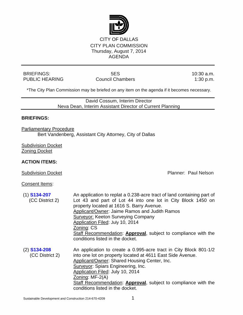
CITY OF DALLAS Sustainable Development and Construction 214-670-4209 1 CITY PLAN COMMISSION Thursday, August 7, 2014 AGENDA BRIEFINGS: 5ES 10:30 a.m. PUBLIC HEARING Council Chambers 1:30 p.m. *The City Plan Commission may be briefed on any item on the agenda if it becomes necessary. David Cossum, Interim Director Neva Dean, Interim Assistant Director of Current Planning BRIEFINGS: Parliamentary Procedure Bert Vandenberg, Assistant City Attorney, City of Dallas Subdivision Docket Zoning Docket ACTION ITEMS: Subdivision Docket Planner: Paul Nelson Consent Items: (1) S134-207 (CC District 2) An application to replat a 0.238-acre tract of land containing part of Lot 43 and part of Lot 44 into one lot in City Block 1450 on property located at 1616 S. Barry Avenue. Applicant/Owner: Jaime Ramos and Judith Ramos Surveyor: Keeton Surveying Company Application Filed: July 10, 2014 Zoning: CS Staff Recommendation: Approval, subject to compliance with the conditions listed in the docket. (2) S134-208 (CC District 2) An application to create a 0.995-acre tract in City Block 801-1/2 into one lot on property located at 4611 East Side Avenue. Applicant/Owner: Shared Housing Center, Inc. Surveyor: Spiars Engineering, Inc. Application Filed: July 10, 2014 Zoning: MF-2(A) Staff Recommendation: Approval, subject to compliance with the conditions listed in the docket.
-
Upload
khangminh22 -
Category
Documents
-
view
0 -
download
0
Transcript of CITY PLAN COMMISSION Thursday, August 7, 2014 ...
CITY OF DALLAS
Sustainable Development and Construction 214-670-4209 1
CITY PLAN COMMISSION Thursday, August 7, 2014
AGENDA BRIEFINGS: 5ES 10:30 a.m.PUBLIC HEARING Council Chambers 1:30 p.m.
*The City Plan Commission may be briefed on any item on the agenda if it becomes necessary.
David Cossum, Interim Director Neva Dean, Interim Assistant Director of Current Planning
BRIEFINGS: Parliamentary Procedure
Bert Vandenberg, Assistant City Attorney, City of Dallas Subdivision Docket Zoning Docket ACTION ITEMS: Subdivision Docket Planner: Paul Nelson Consent Items: (1) S134-207
(CC District 2) An application to replat a 0.238-acre tract of land containing part of Lot 43 and part of Lot 44 into one lot in City Block 1450 on property located at 1616 S. Barry Avenue.
Applicant/Owner: Jaime Ramos and Judith Ramos Surveyor: Keeton Surveying Company Application Filed: July 10, 2014
Zoning: CS Staff Recommendation: Approval, subject to compliance with the conditions listed in the docket.
(2) S134-208 (CC District 2)
An application to create a 0.995-acre tract in City Block 801-1/2 into one lot on property located at 4611 East Side Avenue.
Applicant/Owner: Shared Housing Center, Inc. Surveyor: Spiars Engineering, Inc. Application Filed: July 10, 2014 Zoning: MF-2(A) Staff Recommendation: Approval, subject to compliance with the
conditions listed in the docket.
City Plan Commission August 7, 2014
2
(3) S134-210 (CC District 6)
An application to replat a 3.776-acre tract of land containing part of Lot 5 in City Block 37/7888 into one 0.406-acre lot and one 3.370-acre lot on property located at 1930 Hi Line Drive.
Applicant/Owner: Feizy Properties, Ltd Surveyor: Kadleck & Associates Application Filed: July 11, 2014 Zoning: PD-621, Subdistrict 1 Staff Recommendation: Approval, subject to compliance with the
conditions listed in the docket.
(4) S134-211 (CC District 1)
An application to replat a 0.571-acre tract of land in City Block 1/3373 into 1 lot on property located along Zang Boulevard, northof West Fifth Street and west of Beckley Avenue.City Block 1/3373into 1 lot on property located along Zang Boulevard, north of WestFifth Street and west of Beckley Avenue.
Applicant/Owner: Randy Gaubert with Barclay Construction Group/Nabua Property Holdings, Inc.
Surveyor: Kadleck & Associates Application Filed: July 11, 2014 Zoning: CR Staff Recommendation: Approval, subject to compliance with the
conditions listed in the docket.
Residential Replats: (5) S134-204 (CC District 3)
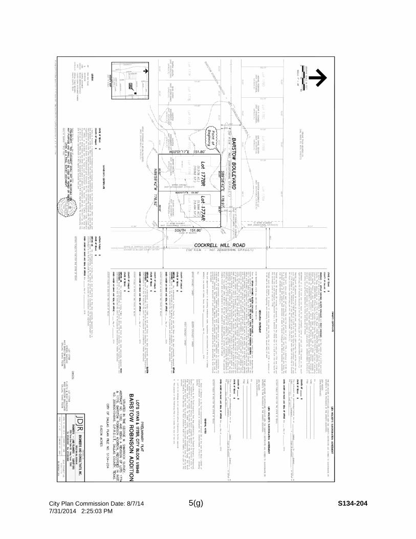
An application to replat a 0.6234-acre tract of land containing all of Lots 177A and 177B in City Block 1/6949 into one 0.3136 acre lotand one 0.3098 acre lot on property located at 4402 and 4412Barstow Boulevard.
Applicant/Owner: Efrain Sanchez and Elizeth & Ricky Gonzales Surveyor: JDJR Engineers and Consultants, Inc. Application Filed: July 9, 2014 Zoning: R-7.5 (A) Staff Recommendation: Approval, subject to compliance with the
conditions listed in the docket. (6) S134-205 (CC District 9)
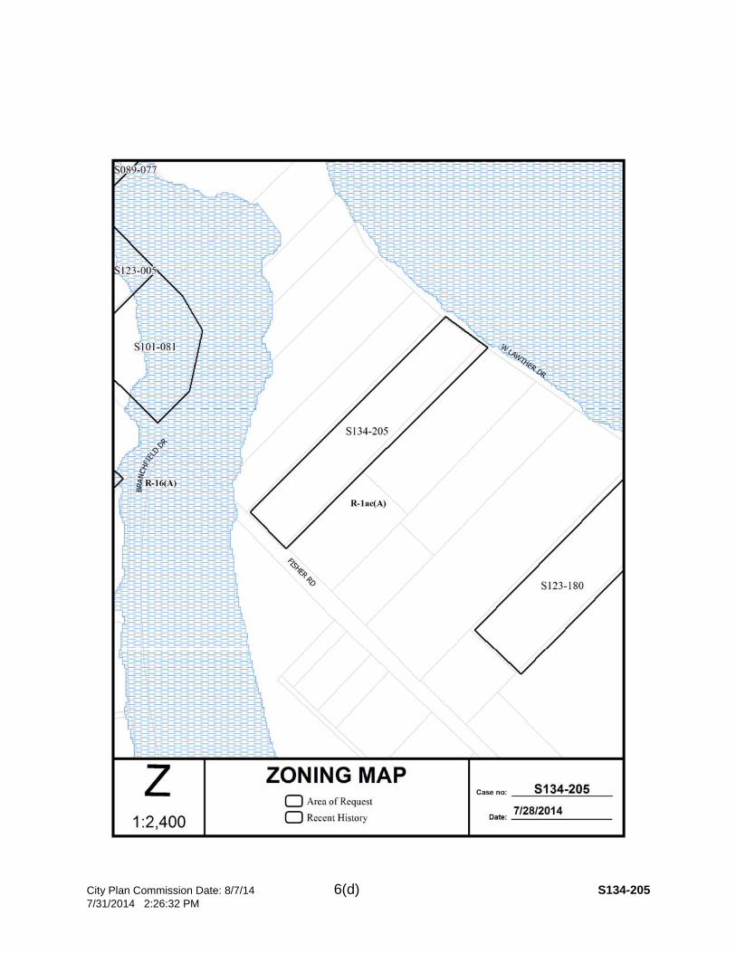
An application to replat a 3.0070-acre tract of land containing part of Tract 10 into one 2.0070 acre lot and one 1.000 acre lot onproperty located 4321 W. Lawther Road.
Applicant/Owner: Peter and Patricia Woolridge Surveyor: Texas Heritage Surveying, LLC Application Filed: July 9, 2014 Zoning: R-1AC (A) Staff Recommendation: Denial, subject to compliance with the
conditions listed in the docket.
City Plan Commission August 7, 2014
3
(7) S134-209 (CC District 13)
An application to replat a 9.8139-acre tract of land containing all of Lots 3 and 4 and all of Tracts 1 and 2 in City Block 6599 and atract of land in City Block 6598 into one lot on property located onRoyal Haven Lane, west of Webb Chapel Road.
Applicant/Owner: The Most Reverend Kevin J. Farrell, D.D.Bishop of the Roman Catholic Diocese of Dallas and HisSuccessors in office for the exclusive benefit of San Juan Parish
Surveyor: Spooner & Associates Application Filed: July 10, 2014 Zoning: R-10 (A) Staff Recommendation: Approval, subject to compliance with the
conditions listed in the docket.
Building Line Removal:
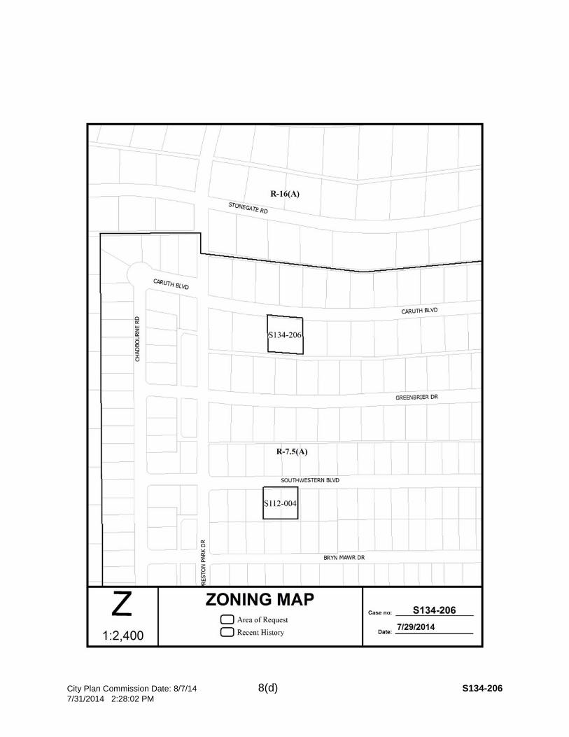
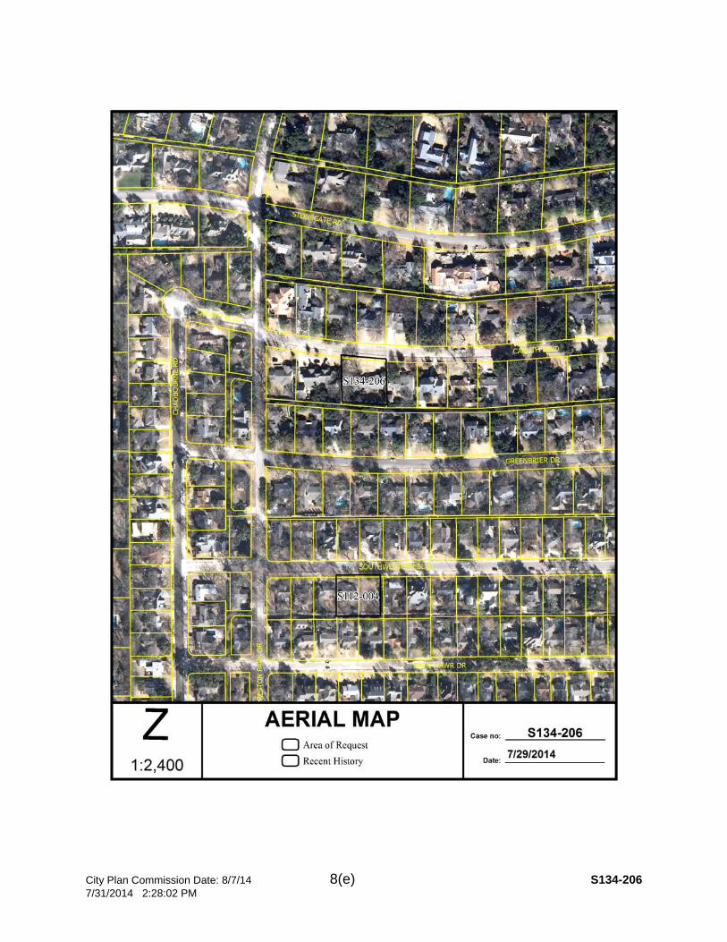
(8) S134-206 (CC District 13)
An application to replat a 0.4450-acre tract of land containing all of Lot 4, and part of Lot 3 into one lot and to reduce the existing 45foot platted Building Line along the south line of Caruth Boulevardto wrap around the proposed porch addition on property located at 5526 Caruth Boulevard.
Applicant/Owner: Gordon Luther and Mary Anne Wallace Surveyor: Texas Heritage Surveying, LLC Application Filed: July 10, 2014 Zoning: R-7.5 (A) Staff Recommendation: Approval, subject to compliance with the
conditions listed in the docket. Miscellaneous Items: D134-018 Danielle Jimenez (CC District 2)
An application for a development plan and landscape plan forPlanned Development Subdistrict No. 67, Tract C, within Planned Development District No. 193, the Oak Lawn Special PurposeDistrict, on the south corner of Miles Street and Holland Avenue.
Staff Recommendation: Approval Applicant: Wes Homeyer, Weekley Homes, LLC Representative: Robert Baldwin, Baldwin Associates
M134-045 Richard Brown (CC District 3)
An application for a minor amendment to the site plan for Specific Use Permit No. 1258 for a Transit passenger station or transferstation on property fronting on the southwest line of SouthLancaster Road, south of East Ledbetter Drive.
Staff Recommendation: Approval Applicant: Dallas Area Rapid Transit Representative: Martin Krueger
City Plan Commission August 7, 2014
4
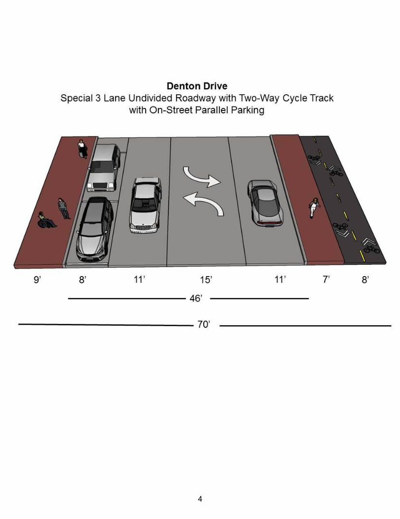
Thoroughfare Plan Amendments: Denton Drive from Webb Chapel Extension to Farmers Branch City Limits Tanya Brooks (CC District 6)
An amendment to the City of Dallas Thoroughfare Plan to changethe dimensional classification of Denton Drive from Webb ChapelExtension to Farmers Branch City Limits from a four laneundivided roadway (M-4-U) within 60 feet of right-of-way to a special three lane undivided roadway (SPCL 3U) with a bicyclefacility within a variable 62 to 80 feet right-of-way.
Staff Recommendation: Approval of the amendment to the Thoroughfare Plan to change the dimensional classification ofDenton Drive from Webb Chapel Extension to Farmers BranchCity Limits from a four lane undivided roadway (M-4-U) within 60 feet of right-of-way to a special three lane undivided roadway(SPCL 3U) with a bicycle facility within a variable 62 to 80 feetright-of-way. CPC Transportation Committee Recommendation: Approval
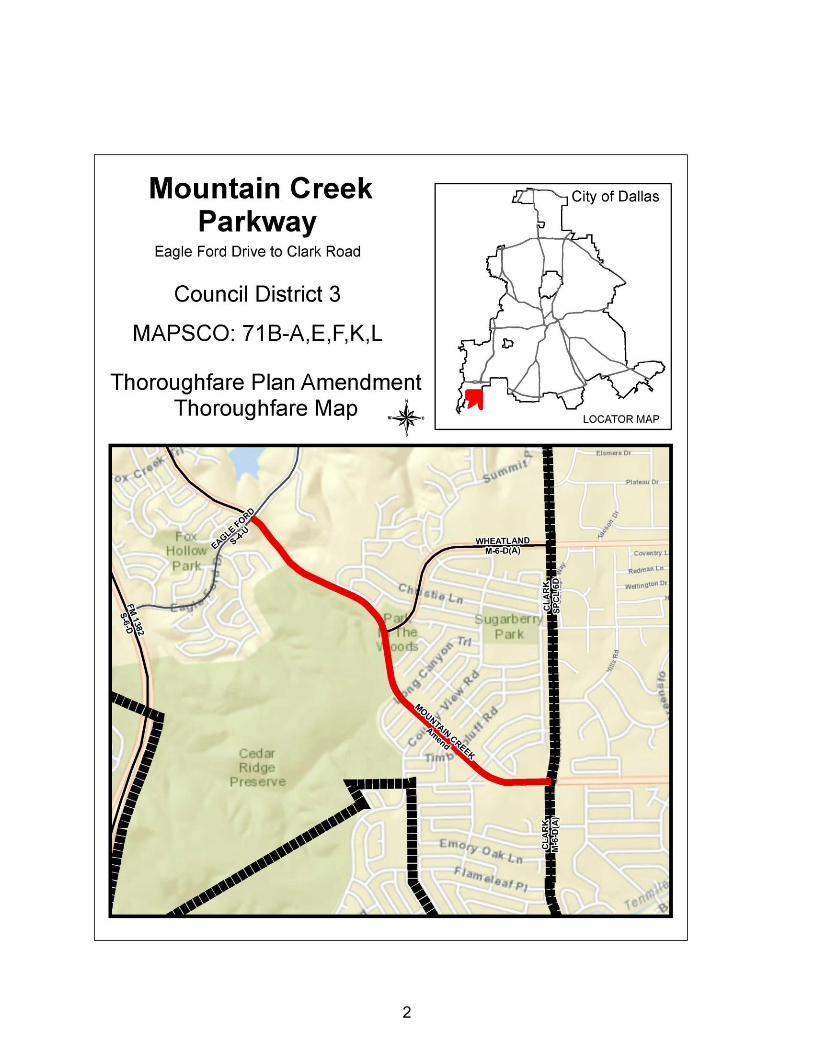
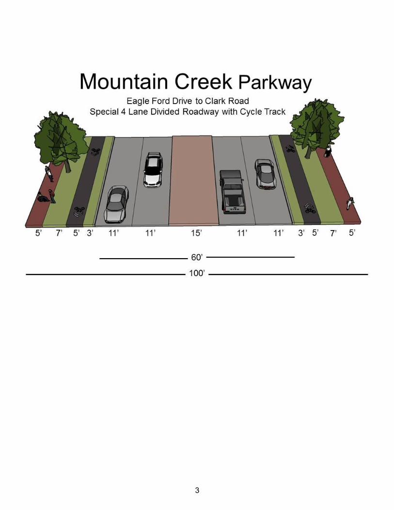
Mountain Creek Parkway from Eagle Ford Drive to Clark Road Tanya Brooks (CC District 3)
An amendment to the City of Dallas Thoroughfare Plan to changethe dimensional classification of Mountain Creek Parkway fromEagle Ford Drive to Clark Road from a six lane divided roadway{M-6-D(A)} within 100 feet of right-of-way to a special four lane divided roadway (SPCL 4D) with a bicycle facility within 100 feetright-of-way.
Staff Recommendation: Approval of the amendment to the Thoroughfare Plan to change the dimensional classification ofMountain Creek Parkway from Eagle Ford Drive to Clark Roadfrom a six lane divided roadway {M-6-D(A)} within 100 feet of right-of-way to a special four lane divided roadway (SPCL 4D) with a bicycle facility within 100 feet right-of-way. CPC Transportation Committee Recommendation: Approval
Zoning Cases – Consent: 1. Z134-233(RB) Richard Brown (CC District 7)
An application for a Planned Development District for a Group Residential Facility and CS Commercial Service District Uses onproperty zoned a CS Commercial Service District and a P(A)Parking District, on the northeast line of Laughlin Drive and thesouthwest line of Charles Street, east of Ferguson Road.
Staff Recommendation: Approval, subject to a development plan and conditions. Applicant: Directions Representative: Rob Baldwin
City Plan Commission August 7, 2014
5
2. Z134-235(RB) Richard Brown (CC District 6)
An application for a Specific Use Permit for a Bail bonds office onproperty within the Mixmaster Riverfront Subarea of PlannedDevelopment District No. 784, the Trinity River Corridor Special Purpose District, on the east line of South Riverfront Boulevard,south of Reunion Boulevard.
Staff Recommendation: Approval for a two-year period, with eligibility for automatic renewal for additional three-year periods, subject to a site plan and conditions. Applicant: Matthew Toback Representative: Santos Martinez
3. Z134-251(CG) Carrie Gordon (CC District 7)
An application for a Specific Use Permit for a fire station on property in an R-5(A) Single Family Residential Subdistrict of Planned Development District No. 595, generally at the north corner of Kimble Street and Pennsylvania Avenue.
Staff Recommendation: Approval for a permanent period, subject to a site plan, landscape plan, and conditions. Applicant: City of Dallas Representative: Elizabeth Brant
4. Z134-252(CG) Carrie Gordon (CC District 2)
An application for the renewal of Specific Use Permit No. 1981 fora bar, lounge or tavern and for an amendment to add a dance hallon property zoned Tract A within Planned Development DistrictNo. 269, the Deep Ellum/Near East Side Special Purpose District,on the north line of Main Street, east of Malcolm X Boulevard.
Staff Recommendation: Approval for a two-year period, subject to a revised site plan and conditions. Applicant: DBL Partners, LLC Representative: Roger Albright
5. Z134-257(CG) Carrie Gordon (CC District 7)
An application for the renewal of Specific Use Permit No. 1691 fora bar, lounge, or tavern on property zoned Planned DevelopmentDistrict No. 269, the Deep Ellum/Near East Side Special PurposeDistrict, on the south side of Exposition Avenue, east of Ash Lane.
Staff Recommendation: Approval for a three-year period, subject to conditions. Applicant/Representative: Timothy L. Austin
City Plan Commission August 7, 2014
6
6. Z134-225(WE) Warren Ellis (CC District 2)
An application for a Planned Development District for mixed usesand the termination of Specific Use Permit No. 566 for a Religious,Charitable, or Philanthropic Nature on property zoned an MF-2 Multiple Family Subdistrict within Planned Development DistrictNo. 193, the Oak Lawn Special Purpose District on the northcorner of Cedar Springs Road and Crestview Drive.
Staff Recommendation: Approval, subject to a development plan, revised landscape plan and staff’s recommended conditions andapproval of the termination of Specific Use Permit No. 566. Applicant: Deaf Action Center Representative: Tommy Mann and Laura Hoffmann, Winstead PC
7. Z134-246(WE) Warren Ellis (CC District 7)
An application for an amendment to Specific Use Permit No. 1817for an open enrollment charter school on property zoned an R-7.5(A) Single Family District, on the north side of Bruton Road,east of Masters Drive.
Staff Recommendation: Approval for a five-year period with eligibility for automatic renewals for additional five-year periods, subject to a site plan/traffic management plan and conditions. Applicant: Vicente Delgado Representative: Johnny Pecina
Zoning Cases – Under Advisement:
8. Z134-171(WE) Warren Ellis (CC District 13)
An application for a Planned Development District for mixed useson property zoned an MF-2(A) Multifamily District and a GO(A) General Office District on the north and south side of Meadow Road, west of Manderville Lane.
Staff Recommendation: Approval, subject to a revised conceptual plan and staff’s recommended conditions. Applicant: Provident Realty Advisors Representative: Maxwell Fisher, MASTERPLAN U/A From: July 24, 2014
9. Z134-223(WE) Warren Ellis (CC District 8)
An application for a Specific Use Permit for vehicle display, salesand services on property zoned Subdistrict 2 within PlannedDevelopment District No. 534, the C.F. Hawn Special PurposeDistrict on the southwest side of C.F. Hawn Freeway, east of Murdock Road.
Staff Recommendation: Hold under advisement until September 4, 2014. Applicant: Augustin M. Miranda Representative: Construction Concepts U/A From: July 24, 2014

City Plan Commission August 7, 2014
7
10. Z134-220(DJ) Danielle Jimenez (CC District 14)
An application for an MF-2(A) Multifamily District on property zoned a CR Community Retail District with a D Overlay on thewest corner of Shadyside Lane and East Grand Avenue.
Staff Recommendation: Approval with deed restrictions volunteered by the applicant. Applicant: CADG Shadyside, LLC Representative: Bryan Klein, Ion Design Group, LLC U/A From: June 19, 2014 and July 10, 2014
11. Z134-279(AF) Aldo Fritz (CC District 12)
An application for an amendment to deed restrictions volunteeredby the applicant located at the northwest corner of Gold Dust Trailand Levelland Road.
Staff Recommendation: Approval Applicant/Representative: Stephen L. & Cheryl D. Landers U/A From: July 24, 2014
12. Z134-234(MW) Megan Wimer (CC District 13)
An application for a Planned Development District for mixed useson property zoned an MC-1 Mixed Commercial District on the north side of Walnut Hill Lane, west of Rambler Road.
Staff Recommendation: Approval, subject to a development plan and conditions. Applicant: CMC Commercial Realty Representative: Rob Baldwin U/A From: July 24, 2014
13. Z134-175(LHS) L. Holmes Stringfellow (CC District 6)
An application to expand Subarea A-1 of Planned Development District No. 741 onto property zoned an A(A) Agricultural District,to incorporate Subareas F and G into Subarea A-2 of Planned Development District No. 741, and to terminate Specific UsePermit No. 1806 for gas drilling and production located east of Belt Line Road and north of Ranch Trail.
Staff Recommendation: Approval, subject to a revised conceptual plan, and revised conditions; and approval to terminate Specific Use Permit No. 1806. Applicant: Lucilio Pena Representative: Rob Baldwin U/A From: July 10, 2014 and July 24, 2014
City Plan Commission August 7, 2014
8
Zoning Cases – Individual:
14. Z134-145(RB) Richard Brown (CC District 6)
An application for a Planned Development District for certainResidential and Utility and public service uses on property zoned aTH-3(A) Townhouse District, an MF-2(A) Multifamily District, an MF-4(A) Multiple Family District, and a CS Commercial ServiceDistrict on property generally bounded by the east line of WillometAvenue between Stafford Avenue and Pollard Street, and the westline of Ormsby Street between the terminus of Seale Street andPollard Street.
Staff Recommendation: Approval, subject to a development plan, finished grade section plan, and staff’s recommended conditions. Applicant: Henry S. Miller Company Representative: Mark Housewright
15. Z134-240(WE) Warren Ellis (CC District 3)
An application for an amendment to the development plan andlandscape plan on property in Subarea 1 of Planned DevelopmentDistrict No. 585 on the north line of West Kiest Boulevard and westof Spur 408.
Staff Recommendation: Approval, subject to a revised development plan and revised landscape plan. Applicant: The Potters House Representative: Matthew Cragun, Cumulus Design
16. Z134-241(WE) Warren Ellis (CC District 14)
An application for a Planned Development Subdistrict for multiplefamily uses on property zoned an O-2 Office Subdistrict within Planned Development District No. 193, the Oak Lawn SpecialPurpose District, on the west corner Lemmon Avenue and OakGrove Avenue.
Staff Recommendation: Denial Applicant: Oak Grove Acquisitions, LLC Representative: Dallas Cothrum, Masterplan
17. Z134-275(WE) Warren Ellis (CC District 12)
An application for a Planned Development District for R-7.5(A) Single family district uses on property zoned PlannedDevelopment District No. 850, Urban Living Laboratory SpecialPurpose District and Specific Use Permit No. 764 for a college oruniversity and related uses on the east line of Coit Road, north of Cullum Street.
Staff Recommendation: Approval, subject a conceptual plan and conditions. Applicant: Centurion American Representative: Halff Associates Cumulus Design
City Plan Commission August 7, 2014
9
18. Z123-290 David Cossum (CC District 6)
A City Council authorized hearing to consider a PlannedDevelopment District for R-5(A) Single Family District uses and a child-care facility; community service center; and private recreationcenter, club, or area on property zoned an R-5(A) Single Family District on the northwest side of Bernal Drive, southwest ofPalacios Avenue.
Staff Recommendation: Approval, subject to a site plan and conditions. Applicant: Good Shepherd Community Center Representative: Michael Coker, Michael R. Coker Company
http://www.dallascityhall.com/development_services/authorized_hearings.html 19. Z067-203(VM) Valerie Miller (CC District 1)
A City Plan Commission authorized hearing to determine properzoning on property zoned Planned Development District No. 468,the Oak Cliff Special Purpose District, with deed restrictions on aportion, Specific Use Permit No. 10 for a nursing home, Specific Use Permit No. 1032 for a utility or government installation,Specific Use Permit No. 1623 for a financial institution with a drive-in window, and Specific Use Permit No. 1679 for a financialinstitution with a drive-in window, H/84 Lake Cliff Historic District, H/71 Betterton House Historic District; Planned DevelopmentDistrict No 160 with Specific Use Permit 2079 for a child-care facility; Planned Development District No 340; PlannedDevelopment District No 364; Planned Development District No830; an R-5(A) Single Family District; an R-7.5(A) Single Family District; a TH-2(A) Townhouse District; a CH Clustered HousingDistrict; an MF-2(A) Multifamily District; a CR Community RetailDistrict with deed restrictions; an IR Industrial/Research District; aCS Commercial Service District with deed restrictions; an LO-1 Office District with deed restrictions; an RR Regional RetailDistrict; an MU-1 Mixed-Use District with deed restrictions; an MU-2 Mixed-Use District; and a P(A) Parking District on propertygenerally bounded by Interstate 30 to the north, the east levee ofthe Trinity River to the northeast, Interstate 35 to the east, MarsalisStreet to the west, Eighth Street and Seventh Street to the south,Zang Boulevard to the west, Davis Street to the south, Elsbeth Street to the west, Neches Street to the south, Madison Street tothe west, between blocks BLK M/3363 LOT 1& 2 to the south,between blocks BLK M/3363 TR 23-A and 24 to the south, Bishop Avenue to the west, Colorado Boulevard to the north, both sides of Beckley Avenue to the west including property facing Interstate 30service road with consideration being given to appropriate zoningincluding use, development standards, parking, landscaping, sign,and other appropriate regulations, with retention of the H/84 Lake Cliff Historic District and H/71 Betterton House Historic District. Staff Recommendation: Approval of amendments to and expansion of Planned Development No. 468 with retention of

City Plan Commission August 7, 2014
10
Historic Overlay District No. 84 Lake Cliff, Historic Structure No. 71Betterton House, SUP No. 10, SUP No. 1032, SUP No. 1623, SUPNo. 1679, and existing deed restrictions and no change of zoning on a portion of Tract 1C within PD No. 160 on the east side of Elsbeth Street between Davis Street and 5th Street; and an R-5(A) District on the east side of Elsbeth Street, between 5th Street and Neches Street.
________________________________________________________________________ Other Matters Minutes: July 24, 2014 Adjournment
City Plan Commission August 7, 2014
11
CITY PLAN COMMISSION PUBLIC COMMITTEE MEETINGS
Thursday, August 7, 2014 ZONING ORDINANCE COMMITTEE (ZOC) MEETING – Thursday, August 7, 2014, City Hall, 1500 Marilla Street, in 5ES, at 9:00 a.m., to consider (1) DCA 078-016 - Consideration of amending the Dallas Development Code to amend regulations pertaining to outside storage and screening requirements and (2) DCA 134-007 - Consideration of amending Section 51A-1.106 of the Dallas Development Code to amend regulations pertaining to the posting of notification signs. Note: The official Committee Agendas will be posted in the City Secretary’s Office and City Website at www.ci.dallas.tx.us/cso/boardcal.shtml. Please review the official agenda for items for consideration.

City Plan Commission August 7, 2014
12
EXECUTIVE SESSION NOTICE The Commission may hold a closed executive session regarding any item on this agenda when: 1. seeking the advice of its attorney about pending or contemplated litigation,
settlement offers, or any matter in which the duty of the attorney to the Commission/Board under the Texas Disciplinary Rules of Professional Conduct of the State Bar of Texas clearly conflicts with the Texas Open Meetings Act. [Tex, Govt. Code §551.071]
2. deliberating the purchase, exchange, lease, or value of real property if
deliberation in an open meeting would have a detrimental effect on the position of the city in negations with a third person. [Tex. Govt. Code §551.072]
3. deliberating a negotiated contract for a prospective gift or donation to the city if
deliberation in an open meeting would have a detrimental effect on the position of the city in negations with a third person. [Tex. Govt. Code §551.073]
4. deliberating the appointment, employment, evaluation, reassignment, duties,
discipline, or dismissal of a public officer or employee; or to hear a complaint or charge against an officer or employee unless the officer or employee who is the subject of the deliberation or hearing requests a public hearing. [Tex. Govt. Code §551.074]
5. deliberating the deployment, or specific occasions for implementation, of
security personnel or devices. [Tex. Govt. Code §551.076] 6. discussing or deliberating commercial or financial information that the city has
received from a business prospect that the city seeks to have locate, stay or expand in or near the city and with which the city is conducting economic development negotiations; or deliberating the offer of a financial or other incentive to a business prospect. [Tex Govt. Code §551.086]

City Plan Commission Date: 8/7/14 1(a) S134-207 7/31/2014 2:29:54 PM
CITY PLAN COMMISSION THURSDAY, August 7, 2014 FILE NUMBER: S134-207 Subdivision Coordinator: La Shawn Green LOCATION: 1616 S. Barry Avenue DATE FILED: July 10, 2014 ZONING: CS
CITY COUNCIL DISTRICT: 2 SIZE OF REQUEST: 0.238-Acres MAPSCO: 46M APPLICANT/OWNER: Jaime Ramos and Judith Ramos REQUEST: An application to replat a 0.238-acre tract of land containing part of Lot 43 and part of Lot 44 into one lot in City Block 1450 on property located at 1616 S. Barry Avenue. SUBDIVISION HISTORY: There has been no recent platting activity within close proximity to this request.
STAFF RECOMMENDATION: The request complies with the requirements of the CS zoning district; therefore, staff recommends approval subject to compliance with the following conditions:
1. The final plat shall conform to all requirements of the Dallas Development Code, Texas Local Government Code, Texas Land Surveying Practices Act and the Rules and Regulations of the Texas Board of Land Surveying.
2. Sustainable Development and Construction, Engineering Division must verify that the plat conforms with water, wastewater and easement requirements under the provisions of Chapter 49 of the Dallas City Code.
3. Compliance with all plans, contracts, ordinances and requirements of the City of Dallas.
4. Provide a copy of the digital electronic CADD file of the final plat at the time the final plat is submitted for signature by the Chairman of the Plan Commission in a format that is compatible with the “Microstation” format to the Survey Section, Engineering Division in Room 200, 320 E. Jefferson Boulevard.
5. The number and location of fire hydrants, must comply with the International Fire Code section 508, Appendix C.
6. Any structure new or existing may not extend across new property lines. In addition, any detached sign must be shown on the final plat.
7. On the final plat, all easement abandonments and ROW abandonments must be by separate instrument and the recording information shown on the face of the plat. A release from the Real Estate Division is required prior to the plat being submitted to the Chairman for signature.
8. On the final plat include two boundary corners tagged with these coordinates: “Texas State Plane Coordinate System, North Central Zone, North American Datum of 1983 on Grid Coordinate values, No Scale and no Projection.”

City Plan Commission Date: 8/7/14 1(b) S134-207 7/31/2014 2:29:54 PM
9. On the final plat monument all set corners per the Monumentation Ordinance. Prior to submittal of the final plat for the Chairman’s signature the monuments must be verified by the Chief City Surveyors Office in the Public Works Department.
10. The maximum number of lots permitted by this plat is 1. 11. Place a note on the final plat “Lot-to-lot drainage is not permitted without
Engineering Division approval.” 12. Provide a detailed lot grading plan prepared by a Professional Engineer to
Sustainable Development and Construction, Engineering Division, Room 200, Oak Cliff Municipal Center.
13. A site plan must be submitted to the Water/Wastewater Section in Room 200 of 320 E. Jefferson Blvd. showing proposed new buildings, development, and proposed water and wastewater service locations with proposed service sizes.
14. Water/wastewater main extension may be required by Private Development Contract.
15. On the final plat show how all adjoining right-of-way was created. 16. On the final plat show all additions or tracts of land within 150 feet of the property
with the recording information for each tract. 17. On the final plat show the recording information on all existing easements within
150 feet of the property. 18. On the final plat include Lien Holder’s Subordination Agreement. 19. On the final plat identify the property as Lot 43A in City Block 1450.
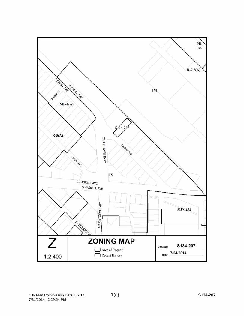
City Plan Commission Date: 8/7/14 1(c) S134-207 7/31/2014 2:29:54 PM
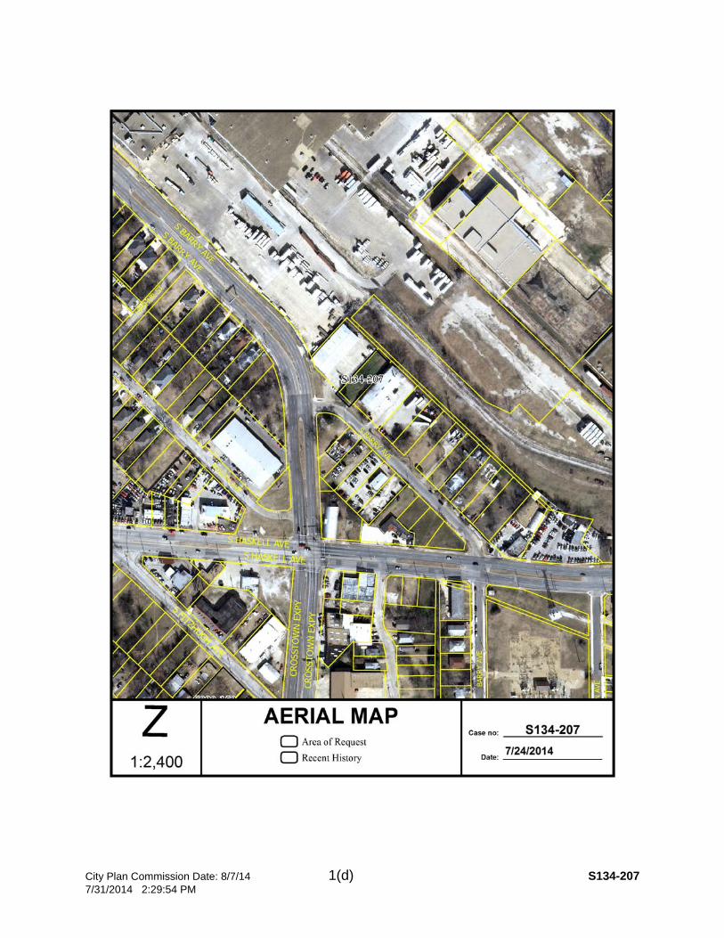
City Plan Commission Date: 8/7/14 1(d) S134-207 7/31/2014 2:29:54 PM
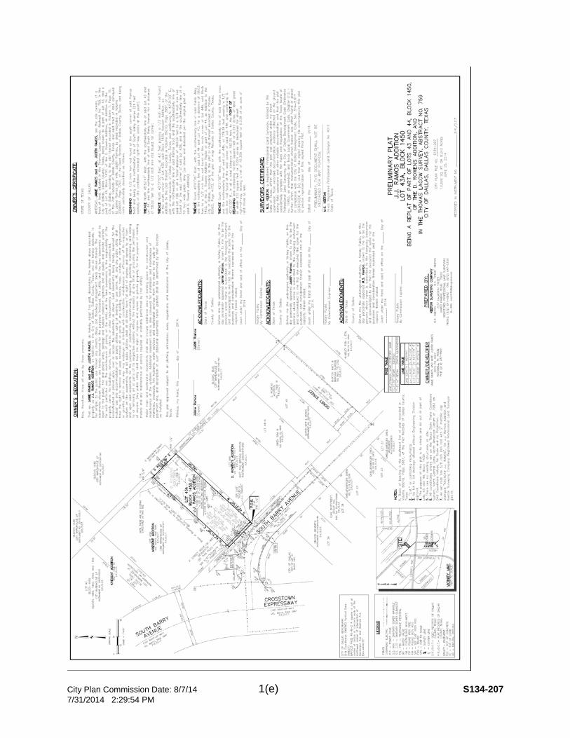
City Plan Commission Date: 8/7/14 1(e) S134-207 7/31/2014 2:29:54 PM

City Plan Commission Date: 8/7/14 2(a) S134-208 7/31/2014 2:31:00 PM
CITY PLAN COMMISSION THURSDAY, August 7, 2014 FILE NUMBER: S134-208 Subdivision Coordinator: La Shawn Green LOCATION: 4611 East Side Avenue DATE FILED: July 10, 2014 ZONING: MF-2(A)
CITY COUNCIL DISTRICT: 2 SIZE OF REQUEST: 0.995-Acres MAPSCO: 46F APPLICANT/OWNER: Shared Housing Center, Inc. REQUEST: An application to create a 0.995-acre tract of land in City Block 801-1/2 into one lot on property located at 4611 East Side Avenue. SUBDIVISION HISTORY: There has been no recent platting activity within close proximity to this request.
STAFF RECOMMENDATION: The request complies with the requirements of MF-2(A) zoning district; therefore, staff recommends approval subject to compliance with the following conditions:
1. The final plat shall conform to all requirements of the Dallas Development Code, Texas Local Government Code, Texas Land Surveying Practices Act and the Rules and Regulations of the Texas Board of Land Surveying.
2. Sustainable Development and Construction, Engineering Division must verify that the plat conforms with water, wastewater and easement requirements under the provisions of Chapter 49 of the Dallas City Code.
3. Compliance with all plans, contracts, ordinances and requirements of the City of Dallas.
4. Provide a copy of the digital electronic CADD file of the final plat at the time the final plat is submitted for signature by the Chairman of the Plan Commission in a format that is compatible with the “Microstation” format to the Survey Section, Engineering Division in Room 200, 320 E. Jefferson Boulevard.
5. The number and location of fire hydrants, must comply with the International Fire Code section 508, Appendix C.
6. Any structure new or existing may not extend across new property lines. In addition, any detached sign must be shown on the final plat.
7. On the final plat, all easement abandonments and ROW abandonments must be by separate instrument and the recording information shown on the face of the plat. A release from the Real Estate Division is required prior to the plat being submitted to the Chairman for signature.
8. On the final plat include two boundary corners tagged with these coordinates: “Texas State Plane Coordinate System, North Central Zone, North American Datum of 1983 on Grid Coordinate values, No Scale and no Projection.”
9. On the final plat monument all set corners per the Monumentation Ordinance. Prior to submittal of the final plat for the Chairman’s signature the monuments

City Plan Commission Date: 8/7/14 2(b) S134-208 7/31/2014 2:31:00 PM
must be verified by the Chief City Surveyors Office in the Public Works Department.
10. The maximum number of lots permitted by this plat is 1. 11. Place a note on the final plat “Lot-to-lot drainage is not permitted without
Engineering Division approval.” 12. Submit drainage and/or paving plans, prepared by a Professional Engineer, to
Sustainable Development and Construction, Engineering Division, Room 200, Oak Cliff Municipal Center. Additions and alterations to the public infrastructure require approval and may require private development contracts with bonds.
13. On the final plat dedicate 25 feet of right-of-way from the established centerline of Main Place.
14. A site plan must be submitted to the Water/Wastewater Section in Room 200 of 320 E. Jefferson Blvd. showing proposed new buildings, development, and proposed water and wastewater locations with proposed service sizes.
15. On the final plat show how all adjoining right-of-way was created. 16. On the final plat show the recording information on all existing easements within
150 feet of the property. 17. On the final plat choose a different addition name. 18. On the final plat extend side boundary lines to centerline of Main Place and
dedicate in fee simple for street right-of-way. 19. On the final plat identify the property as Lot 1 in City Block A/801.

City Plan Commission Date: 8/7/14 2(c) S134-208 7/31/2014 2:31:00 PM

City Plan Commission Date: 8/7/14 2(d) S134-208 7/31/2014 2:31:00 PM

City Plan Commission Date: 8/7/14 2(e) S134-208 7/31/2014 2:31:00 PM
City Plan Commission Date: 8/7/14 3(a) S134-210 7/31/2014 2:33:04 PM
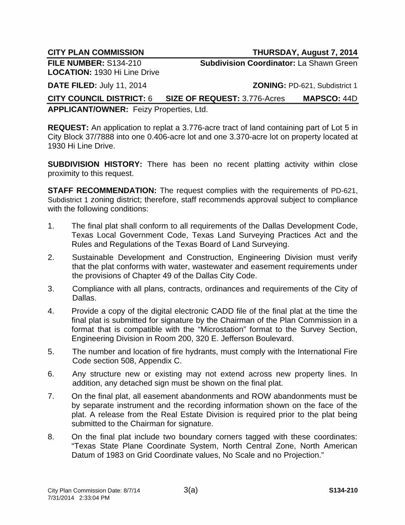
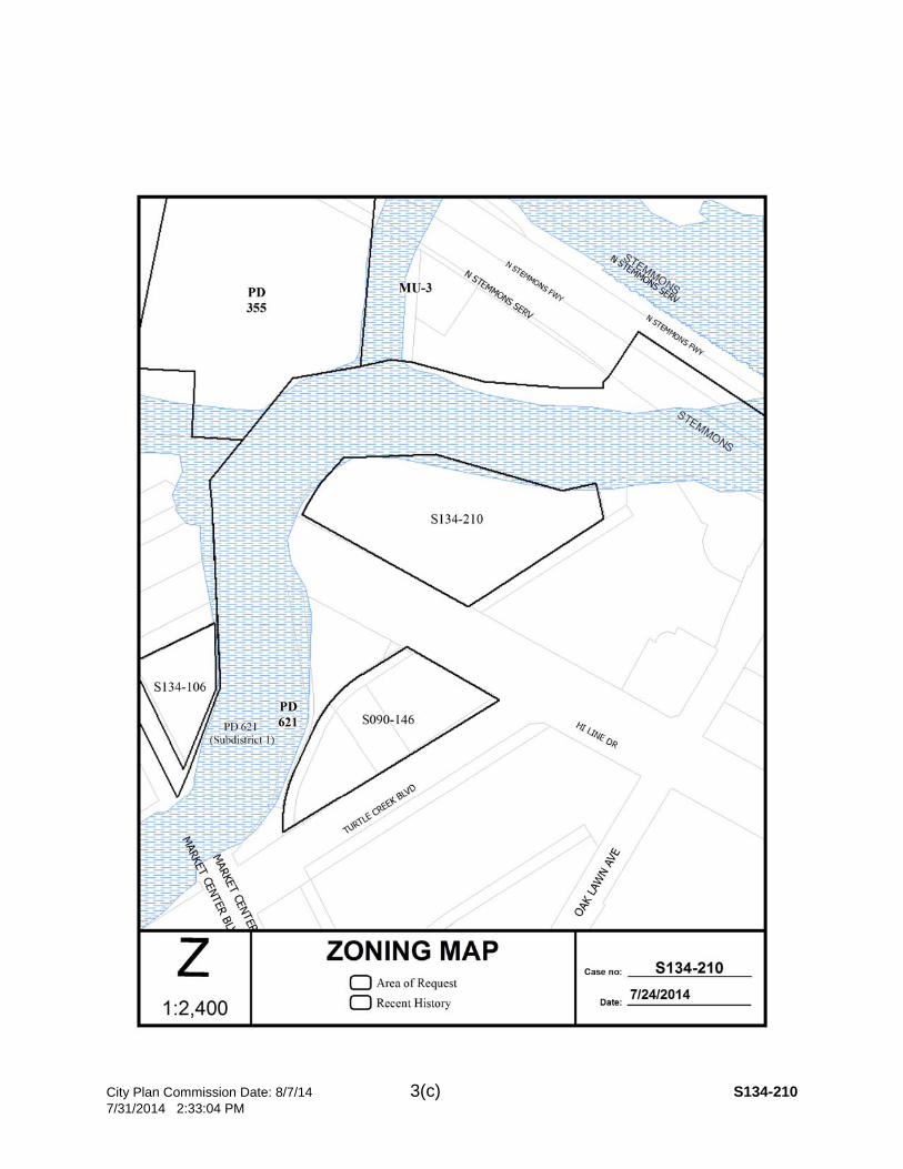
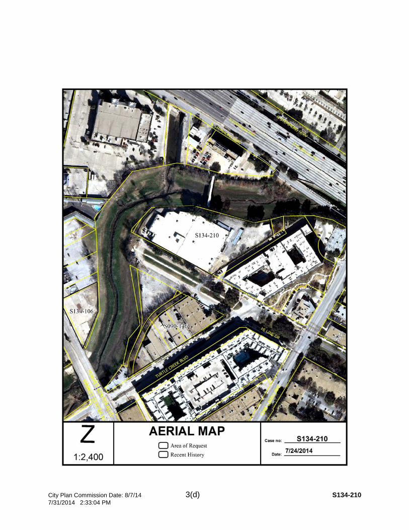
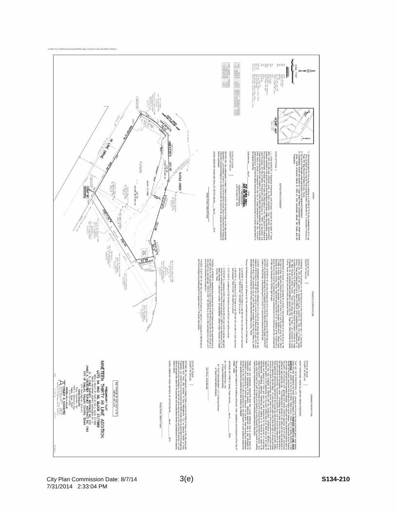
CITY PLAN COMMISSION THURSDAY, August 7, 2014 FILE NUMBER: S134-210 Subdivision Coordinator: La Shawn Green LOCATION: 1930 Hi Line Drive DATE FILED: July 11, 2014 ZONING: PD-621, Subdistrict 1
CITY COUNCIL DISTRICT: 6 SIZE OF REQUEST: 3.776-Acres MAPSCO: 44D APPLICANT/OWNER: Feizy Properties, Ltd. REQUEST: An application to replat a 3.776-acre tract of land containing part of Lot 5 in City Block 37/7888 into one 0.406-acre lot and one 3.370-acre lot on property located at 1930 Hi Line Drive. SUBDIVISION HISTORY: There has been no recent platting activity within close proximity to this request.
STAFF RECOMMENDATION: The request complies with the requirements of PD-621, Subdistrict 1 zoning district; therefore, staff recommends approval subject to compliance with the following conditions:
1. The final plat shall conform to all requirements of the Dallas Development Code, Texas Local Government Code, Texas Land Surveying Practices Act and the Rules and Regulations of the Texas Board of Land Surveying.
2. Sustainable Development and Construction, Engineering Division must verify that the plat conforms with water, wastewater and easement requirements under the provisions of Chapter 49 of the Dallas City Code.
3. Compliance with all plans, contracts, ordinances and requirements of the City of Dallas.
4. Provide a copy of the digital electronic CADD file of the final plat at the time the final plat is submitted for signature by the Chairman of the Plan Commission in a format that is compatible with the “Microstation” format to the Survey Section, Engineering Division in Room 200, 320 E. Jefferson Boulevard.
5. The number and location of fire hydrants, must comply with the International Fire Code section 508, Appendix C.
6. Any structure new or existing may not extend across new property lines. In addition, any detached sign must be shown on the final plat.
7. On the final plat, all easement abandonments and ROW abandonments must be by separate instrument and the recording information shown on the face of the plat. A release from the Real Estate Division is required prior to the plat being submitted to the Chairman for signature.
8. On the final plat include two boundary corners tagged with these coordinates: “Texas State Plane Coordinate System, North Central Zone, North American Datum of 1983 on Grid Coordinate values, No Scale and no Projection.”
City Plan Commission Date: 8/7/14 3(b) S134-210 7/31/2014 2:33:04 PM
9. On the final plat monument all set corners per the Monumentation Ordinance. Prior to submittal of the final plat for the Chairman’s signature the monuments must be verified by the Chief City Surveyors Office in the Public Works Department.
10. The maximum number of lots permitted by this plat is 2. 11. Submit drainage and/or paving plans, prepared by a Professional Engineer, to
Sustainable Development and Construction, Engineering Division, Room 200, Oak Cliff Municipal Center. Additions and alterations to the public infrastructure require approval and may require private development contracts with bonds
12. Place a note on the final plat “Lot-to-lot drainage is not permitted without Engineering Division approval.”
13. Location is in the Hampton Oak Lawn Sump (WSE 403.7). All construction for any proposed development must be above the 403.7 foot elevation. For the areas where the existing elevation is below 403.7 feet, and any improvement is proposed, there must be a fill permit applied for and approved by Public Works and Transportation Department and Minimum Finish Floor elevation for those areas will have to be established thru the process and placed on the face of the final plat.
14. A site plan must be submitted to the Water/Wastewater Section in Room 200 of 320 E. Jefferson Blvd. showing proposed new buildings, development, and proposed water and wastewater service locations.
15. On the final plat show how all adjoining right-of-way was created. 16. On the final plat show all additions or tracts of land within 150 feet of the property
with the recording information for each tract. 17. On the final plat show the recording information on all existing easements within
150 feet of the property. 18. Prior to the final plat, the existing one story brick building that traverses the
proposed lot lines shall be removed. 19. On the final plat, show and label the easement that is located along the northern
property line. 20. On the final plat identify the property as Lots 5A and 5B in City Block 37/7888.
City Plan Commission Date: 8/7/14 3(c) S134-210 7/31/2014 2:33:04 PM
City Plan Commission Date: 8/7/14 3(d) S134-210 7/31/2014 2:33:04 PM
City Plan Commission Date: 8/7/14 3(e) S134-210 7/31/2014 2:33:04 PM
City Plan Commission Date: 8/7/14 4(a) S134-211 7/31/2014 2:33:40 PM
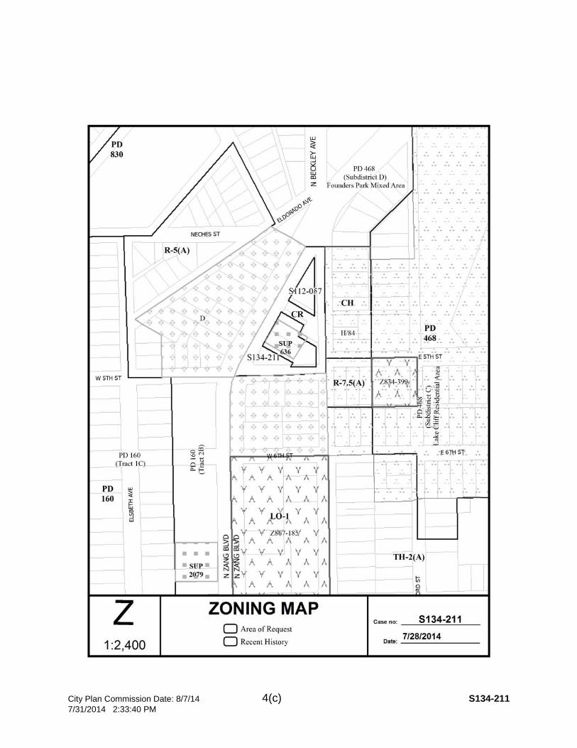
CITY PLAN COMMISSION THURSDAY, August 7, 2014 FILE NUMBER: S134-211 Subdivision Coordinator: La Shawn Green LOCATION: Zang Boulevard, north of West Fifth Street and west of Beckley Avenue. DATE FILED: July 10, 2014 ZONING: CR
CITY COUNCIL DISTRICT: 1 SIZE OF REQUEST: 0.571-Acres MAPSCO: 54D APPLICANT/OWNER: Randy Gaubert with Barclay Construction Group/Nabua Property Holdings, LLC REQUEST: An application to replat a 0.571-acre tract of land in City Block 1/3373 into 1 lot on property located along Zang Boulevard, north of West Fifth Street and west of Beckley Avenue. SUBDIVISION HISTORY: 1. S112-057 was an application north of the current request to create a 0.263 acre
lot from a tract of land in City Block 1/3373 on property located at 1030 Zang Boulevard at Beckley Avenue. The request administratively approved on January 6, 2012 and has not been recorded.
STAFF RECOMMENDATION: The request complies with the requirements of the CS zoning district; therefore, staff recommends approval subject to compliance with the following conditions:
1. The final plat shall conform to all requirements of the Dallas Development Code, Texas Local Government Code, Texas Land Surveying Practices Act and the Rules and Regulations of the Texas Board of Land Surveying.
2. Sustainable Development and Construction, Engineering Division must verify that the plat conforms with water, wastewater and easement requirements under the provisions of Chapter 49 of the Dallas City Code.
3. Compliance with all plans, contracts, ordinances and requirements of the City of Dallas.
4. Provide a copy of the digital electronic CADD file of the final plat at the time the final plat is submitted for signature by the Chairman of the Plan Commission in a format that is compatible with the “Microstation” format to the Survey Section, Engineering Division in Room 200, 320 E. Jefferson Boulevard.
5. The number and location of fire hydrants, must comply with the International Fire Code section 508, Appendix C.
6. Any structure new or existing may not extend across new property lines. In addition, any detached sign must be shown on the final plat.
7. On the final plat, all easement abandonments and ROW abandonments must be by separate instrument and the recording information shown on the face of the plat. A release from the Real Estate Division is required prior to the plat being submitted to the Chairman for signature.
City Plan Commission Date: 8/7/14 4(b) S134-211 7/31/2014 2:33:40 PM
8. On the final plat include two boundary corners tagged with these coordinates: “Texas State Plane Coordinate System, North Central Zone, North American Datum of 1983 on Grid Coordinate values, No Scale and no Projection.”
9. On the final plat monument all set corners per the Monumentation Ordinance. Prior to submittal of the final plat for the Chairman’s signature the monuments must be verified by the Chief City Surveyors Office in the Public Works Department.
10. The maximum number of lots permitted by this plat is 1. 11. Submit drainage and/or paving plans, prepared by a Professional Engineer, to
Sustainable Development and Construction, Engineering Division, Room 200, Oak Cliff Municipal Center. Additions and alterations to the public infrastructure require approval and may require private development contracts with bonds.
12. Detention may be required if the capacity of the available outfall is not adequate to carry the developed runoff.
13. Place a note on the final plat “Lot-to-lot drainage is not permitted without Engineering Division approval.”
14. On the final plat dedicate a 10 foot by 10 foot corner clip at North Beckley Avenue and West Fifth Street.
15. Water/wastewater main extension and relocation of wastewater is required by Private Development Contract.
16. On the final plat show how all adjoining right-of-way was created. 17. On the final plat monument all set corners per the monumentation provisions of
Section 51A-8.617 of the Dallas Development Code. Prior to submittal of the final plat for the Chairman’s signature the monuments must be verified by the Chief City Surveyors Office in the Public Works Department.
18. On the final plat include the Lien Holder’s Subordination Agreement. 19. On the final plat two control monuments must be shown. 20. Prior to final plat demonstrate provisions of Dallas Building Code per Table 602
for exterior wall ratings and Table 705.8 for openings on the north side wall of existing building adjoining the property line of Lot 2. Building Permit may be required prior to final plat.
21. On the final plat remove the “N” prefix from both Zang Blvd. and Beckley Avenue from the face of the plat and the legal description.
22. On the final plat identify the property as Lot 2 in City Block A/3373.
City Plan Commission Date: 8/7/14 4(c) S134-211 7/31/2014 2:33:40 PM

City Plan Commission Date: 8/7/14 4(d) S134-211 7/31/2014 2:33:40 PM

City Plan Commission Date: 8/7/14 4(e) S134-211 7/31/2014 2:33:40 PM
City Plan Commission Date: 8/7/14 5(a) S134-204 7/31/2014 2:25:03 PM
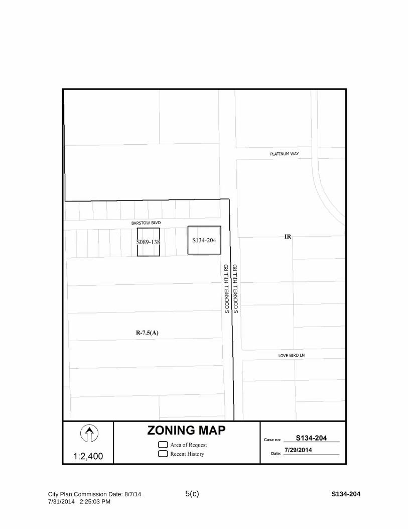
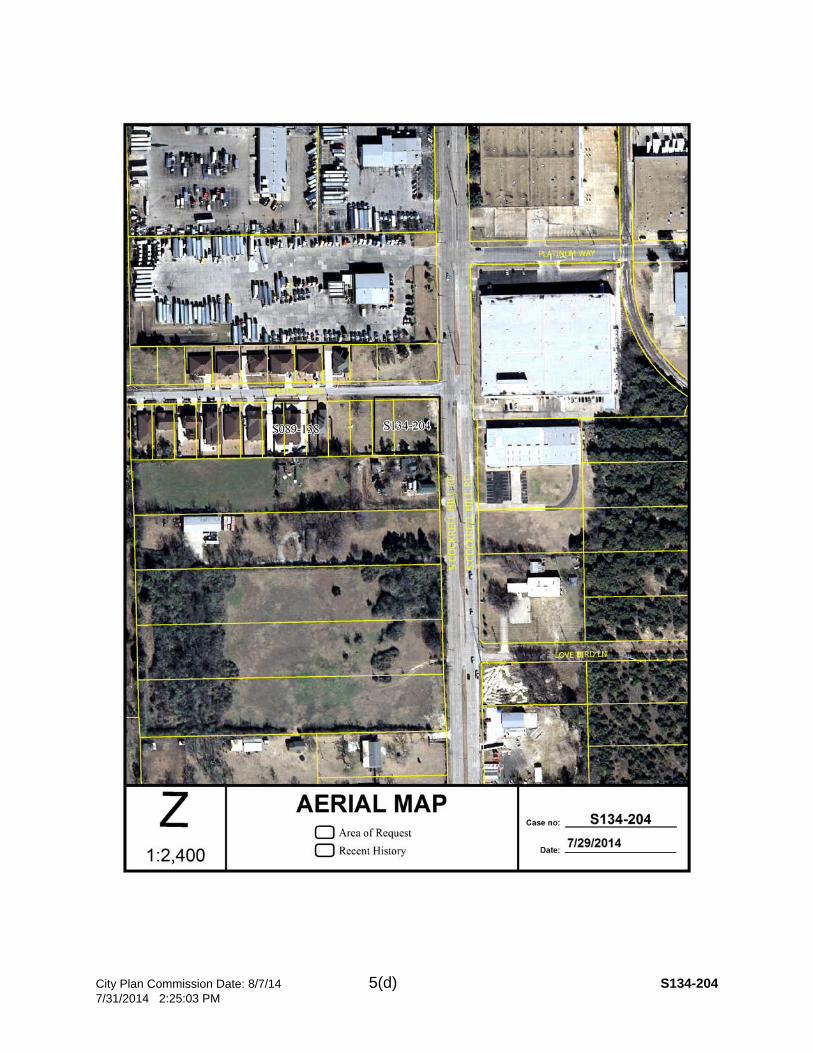
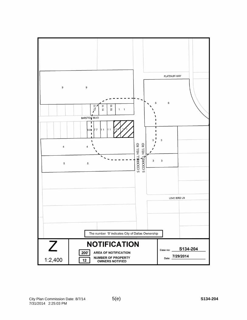
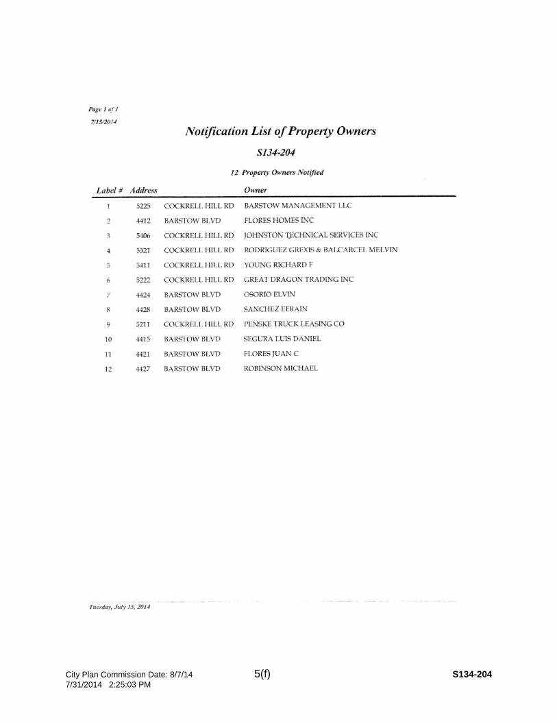
CITY PLAN COMMISSION THURSDAY, August 7, 2014 FILE NUMBER: S134-204 Subdivision Coordinator: La Shawn Green LOCATION: 4402 and 4412 Barstow Boulevard DATE FILED: July 9, 2014 ZONING: R-7.5(A) CITY COUNCIL DISTRICT: 3 SIZE OF REQUEST: 0.6234-Acres MAPSCO: 62M APPLICANT/OWNER: Efrain Sanchez and Elizeth & Ricky Gonzales REQUEST: An application to replat a 0.6234-acre tract of land containing all of Lots 177AA and 177BB in City Block 1/6949 into one 0.3136 acre lot and one 0.3098 acre lot on property located at 4402 and 4412 Barstow Boulevard. SUBDIVISION HISTORY: There has been no recent platting activity within close proximity to this request.
STAFF RECOMMENDATION: The request complies with the requirements of R-7.5(A) zoning district; therefore, staff recommends approval subject to compliance with the following conditions:
1. The final plat shall conform to all requirements of the Dallas Development Code, Texas Local Government Code, Texas Land Surveying Practices Act and the Rules and Regulations of the Texas Board of Land Surveying.
2. Sustainable Development and Construction, Engineering Division must verify that the plat conforms with water, wastewater and easement requirements under the provisions of Chapter 49 of the Dallas City Code.
3. Compliance with all plans, contracts, ordinances and requirements of the City of Dallas.
4. Provide a copy of the digital electronic CADD file of the final plat at the time the final plat is submitted for signature by the Chairman of the Plan Commission in a format that is compatible with the “Microstation” format to the Survey Section, Engineering Division in Room 200, 320 E. Jefferson Boulevard.
5. The number and location of fire hydrants, must comply with the International Fire Code section 508, Appendix C.
6. Any structure new or existing may not extend across new property lines. In addition, any detached sign must be shown on the final plat.
7. On the final plat, all easement abandonments and ROW abandonments must be by separate instrument and the recording information shown on the face of the plat. A release from the Real Estate Division is required prior to the plat being submitted to the Chairman for signature.
8. On the final plat include two boundary corners tagged with these coordinates: “Texas State Plane Coordinate System, North Central Zone, North American Datum of 1983 on Grid Coordinate values, No Scale and no Projection.”

City Plan Commission Date: 8/7/14 5(b) S134-204 7/31/2014 2:25:03 PM
9. On the final plat monument all set corners per the Monumentation Ordinance. Prior to submittal of the final plat for the Chairman’s signature the monuments must be verified by the Chief City Surveyors Office in the Public Works Department.
10. The maximum number of lots permitted by this plat is 2. 11. Place a note on the final plat “Lot-to-lot drainage is not permitted without
Engineering Division approval.” 12. Provide a detailed lot grading plan prepared by a Professional Engineer to
Sustainable Development and Construction, Engineering Division, Room 200, Oak Cliff Municipal Center.
13. A site plan must be submitted to the Water/Wastewater Section in Room 200 of 320 E. Jefferson Blvd. showing proposed new buildings, development, and proposed water and wastewater service locations.
14. Private service for water/wastewater cannot cross lot lines. 15. On the final plat, maintain 100 feet of right-of-way on Cockrell Hill Road. 16. Provide setbacks and dimensions of the current structures that are to remain on
the proposed lots to be shown to confirm that they will comply with the R-7.5(A) zoning district yard, lot, and space requirements.
17. On the final plat identify the property as Lots 177AA and 177BB in City Block 1/6949.
City Plan Commission Date: 8/7/14 5(c) S134-204 7/31/2014 2:25:03 PM
City Plan Commission Date: 8/7/14 5(d) S134-204 7/31/2014 2:25:03 PM
City Plan Commission Date: 8/7/14 5(e) S134-204 7/31/2014 2:25:03 PM
City Plan Commission Date: 8/7/14 5(f) S134-204 7/31/2014 2:25:03 PM
City Plan Commission Date: 8/7/14 5(g) S134-204 7/31/2014 2:25:03 PM

City Plan Commission Date: 8/7/14 6(a) S134-205 7/31/2014 2:26:32 PM
CITY PLAN COMMISSION THURSDAY, August 7, 2014 FILE NUMBER: S134-205 Subdivision Coordinator: La Shawn Green LOCATION: 4321 W. Lawther Drive DATE FILED: July 9, 2014 ZONING: R-1AC (A)
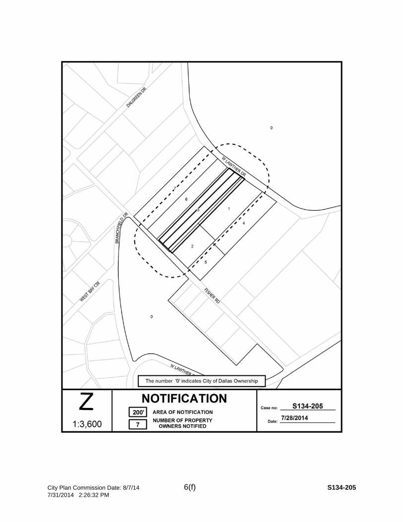
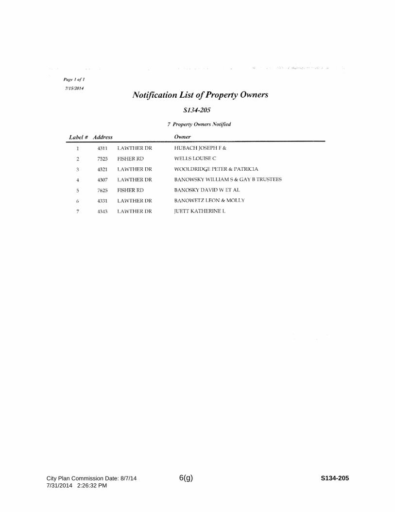
CITY COUNCIL DISTRICT: 9 SIZE OF REQUEST: 3.0070-Acres MAPSCO: 37K APPLICANT/OWNER: Peter and Patricia Woolridge REQUEST: An application to replat a 3.0070-acre tract of land containing part of Tract 10 into one 2.0070 acre lot and one 1.000 acre lot on property located at 4321 West Lawther Road. SUBDIVISION HISTORY: 1. S123-180 was an application southeast of the current request to replat a 3.650
acre tract of land containing all of lot 7B in City Block 4408 into one 1.949 acre lot and one 1.701 acre lot on property located at 4231 W. Lawther Road. The Request was denied on June 11, 2013.
2. S112-139 was an application west of the current request to replat a 2.4839 acre
tract of land containing part of Tract 4 in City Block 4408 to create one 1.3837 acre lot and one 1.1002 acre on W. Lawther Drive, northeast of Fisher Road and approved on June 21, 2012 and recorded on September 27, 2013.
3. S123-005 was an application west of the current request to create a 1.686 acre
lot from a tract of land in City Block 4410 located on property at 4012 Dalgreen Dr. & 7315 Fisher Rd. and was approved on November 1, 2012 and recorded on June 19, 2013.
STAFF RECOMMENDATION: The request complies with the minimum requirements of the R-1 ac (A) District; however, the request does not comply with Section 8.503(a) which indicates that “…Lots must conform in width, depth, and area to the pattern already established in the adjacent areas, having due regard to the character of the area, its particular suitability for development, and taking into consideration the natural topography of the ground, drainage, wastewater facilities, and the proposed layout of streets…”. The established platted lot pattern within this original subdivision consists primarily of lots measuring approximately 250 feet by 850 feet. The current request would create two lots; Lot 10A measuring 154 feet by 281 feet and Lot 10B measuring approximately 157 feet by 575 feet. Although there are a few lots within the subdivision that have either a similar configuration or size to the proposed Lots 10A and 10B, a recent request to subdivide land within the immediate vicinity was denied as the request would have created lots that would have been substantially smaller in size than those that currently exist within the subdivision. Therefore, staff recommends denial of this request. However, should the Commission approve the request; staff recommends that the approval be subject to the following conditions:
City Plan Commission Date: 8/7/14 6(b) S134-205 7/31/2014 2:26:32 PM
1. The final plat shall conform to all requirements of the Dallas Development Code, Texas Local Government Code, Texas Land Surveying Practices Act and the Rules and Regulations of the Texas Board of Land Surveying.
2. Sustainable Development and Construction, Engineering Division must verify that the plat conforms with water, wastewater and easement requirements under the provisions of Chapter 49 of the Dallas City Code.
3. Compliance with all plans, contracts, ordinances and requirements of the City of Dallas.
4. Provide a copy of the digital electronic CADD file of the final plat at the time the final plat is submitted for signature by the Chairman of the Plan Commission in a format that is compatible with the “Microstation” format to the Survey Section, Engineering Division in Room 200, 320 E. Jefferson Boulevard.
5. The number and location of fire hydrants, must comply with the International Fire Code section 508, Appendix C.
6. Any structure new or existing may not extend across new property lines. In addition, any detached sign must be shown on the final plat.
7. On the final plat, all easement abandonments and ROW abandonments must be by separate instrument and the recording information shown on the face of the plat. A release from the Real Estate Division is required prior to the plat being submitted to the Chairman for signature.
8. On the final plat include two boundary corners tagged with these coordinates: “Texas State Plane Coordinate System, North Central Zone, North American Datum of 1983 on Grid Coordinate values, No Scale and no Projection.”
9. On the final plat monument all set corners per the Monumentation Ordinance. Prior to submittal of the final plat for the Chairman’s signature the monuments must be verified by the Chief City Surveyors Office in the Public Works Department.
10. The maximum number of lots permitted by this plat is 2. 11. Submit drainage and/or paving plans, prepared by a Professional Engineer, to
Sustainable Development and Construction, Engineering Division, Room 200, Oak Cliff Municipal Center. Additions and alterations to the public infrastructure require approval and may require private development contracts with bonds.
12. Place a note on the final plat “Lot-to-lot drainage is not permitted without Engineering Division approval”.
13. On the final plat dedicate 30 feet of right-of-way or Street Easement from the established centerline of Fisher Road.
14. On the final plat determine the 100 year water surface elevation across the plat. 15. On the final plat dedicate floodway easement, floodway management area or
floodway easement (within common area) with the appropriate easement statement included on the face of the plat.
City Plan Commission Date: 8/7/14 6(c) S134-205 7/31/2014 2:26:32 PM
16. On the final plat include additional paragraph in owner’s certificate (pertaining to floodplain).
17. On the final plat specify minimum fill and minimum finished floor elevations. 18. On the final plat show the natural channel set back from the crest of the natural
channel. 19. Prior to submission of the final plat set floodway monument markers and provide
documentation that the monuments have been set. 20. Provide information regarding Fill Permit or Floodplain Alteration Permit if such
permit is applied for. 21. A site plan must be submitted to the Water/Wastewater Section in Room 200 of
320 E. Jefferson Blvd. showing proposed new buildings, development, and proposed water and wastewater service locations with proposed service sizes.
22. Water/wastewater main extension may be required by Private Development Contract.
23. Existing water and/or wastewater easements must be shown and/or increased to conform to current design standards. The minimum DWU easement size is 20 feet for water or wastewater and is 25 feet for an easement having both water and sewer.
24. On the final plat show how all adjoining right-of-way was created. 25. On the final plat show or list the prior plat on the map, in the legal description
and/or in the title block. 26. On the final plat include the Lien Holder’s Subordination Agreement. 27. On the final plat identify the property as Lots 10A and 10B in City Block 4409.
City Plan Commission Date: 8/7/14 6(d) S134-205 7/31/2014 2:26:32 PM

City Plan Commission Date: 8/7/14 6(e) S134-205 7/31/2014 2:26:32 PM
City Plan Commission Date: 8/7/14 6(f) S134-205 7/31/2014 2:26:32 PM
City Plan Commission Date: 8/7/14 6(g) S134-205 7/31/2014 2:26:32 PM

City Plan Commission Date: 8/7/14 6(h) S134-205 7/31/2014 2:26:32 PM
City Plan Commission Date: 8/7/14 7(a) S134-209 7/31/2014 2:32:06 PM
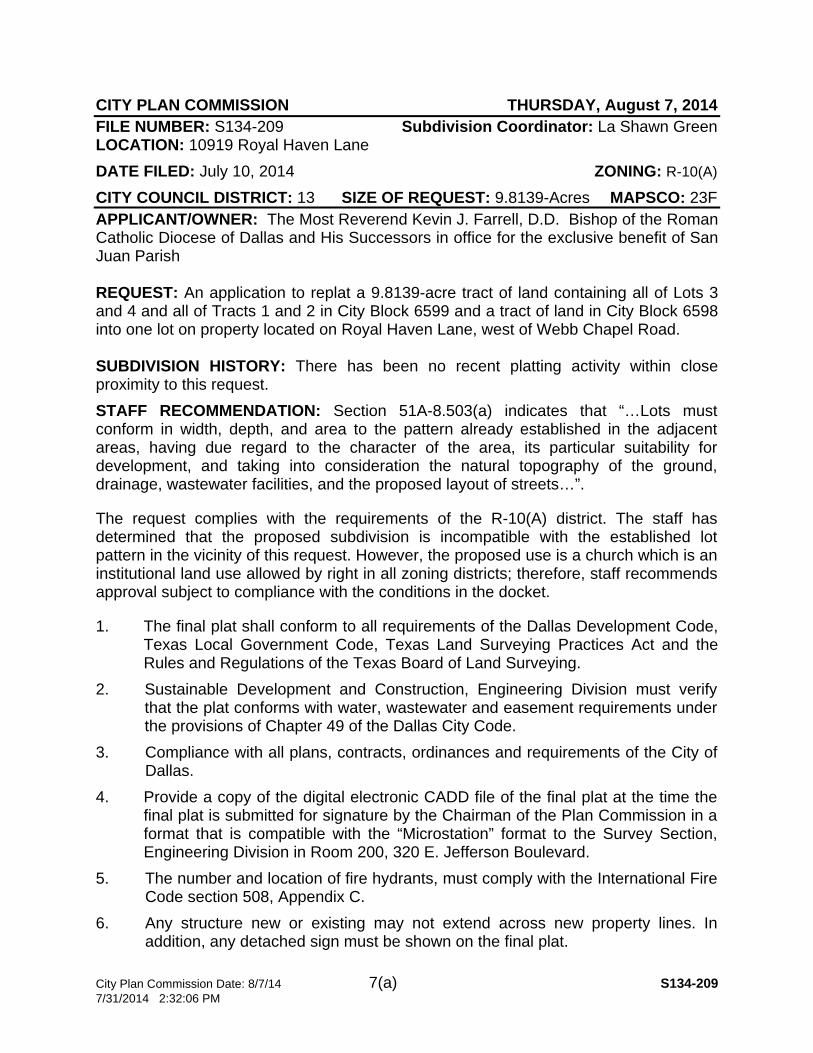
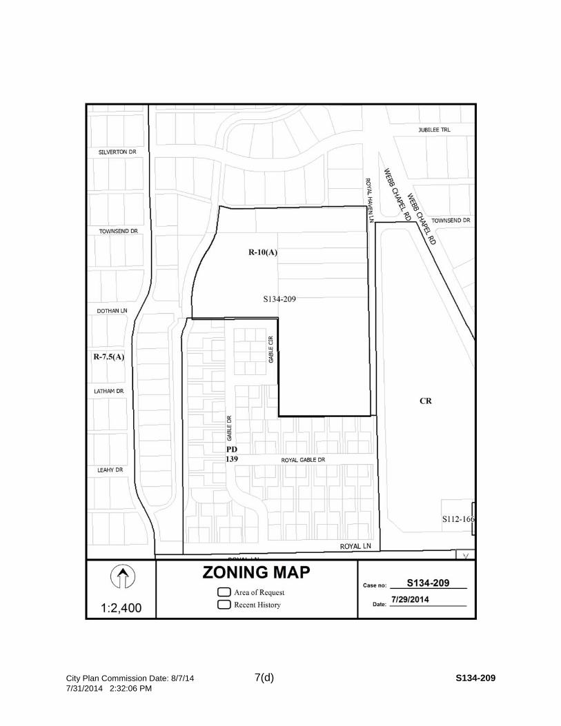
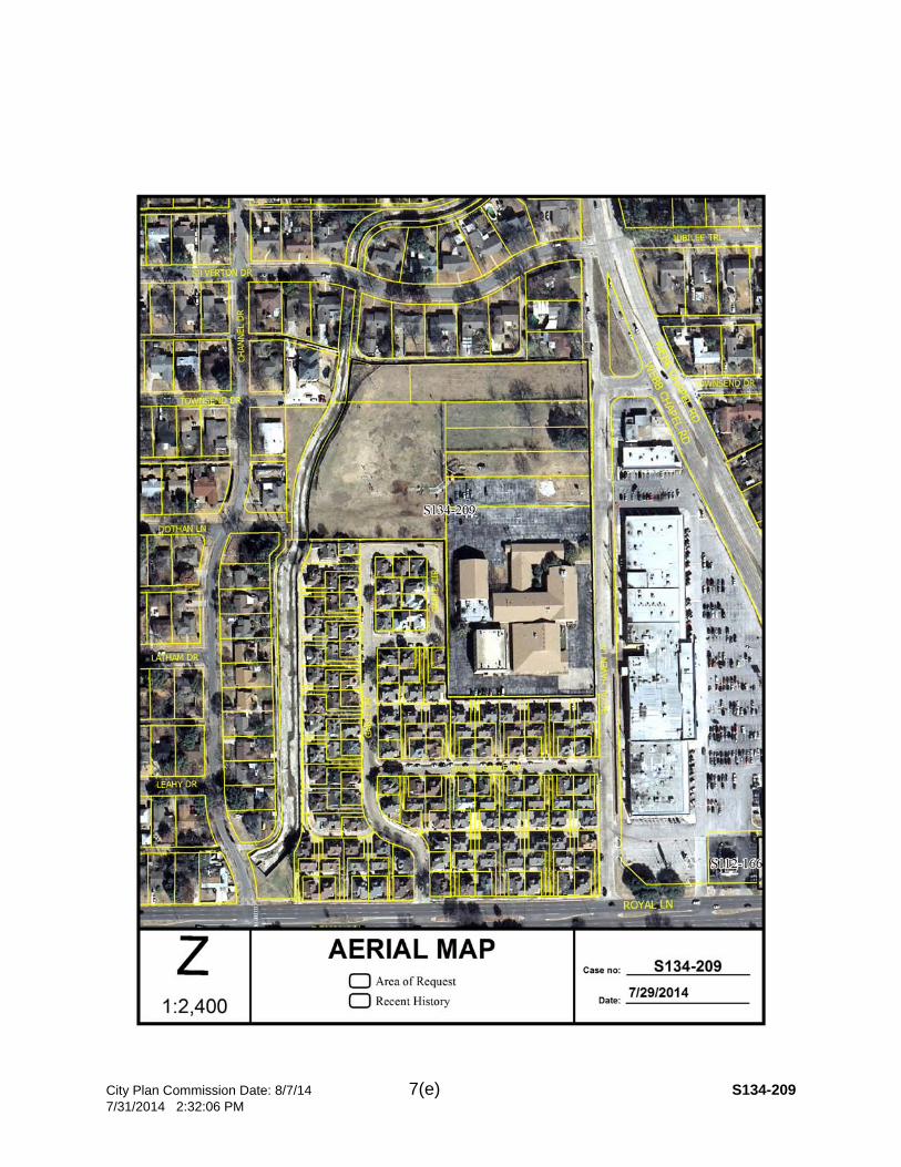
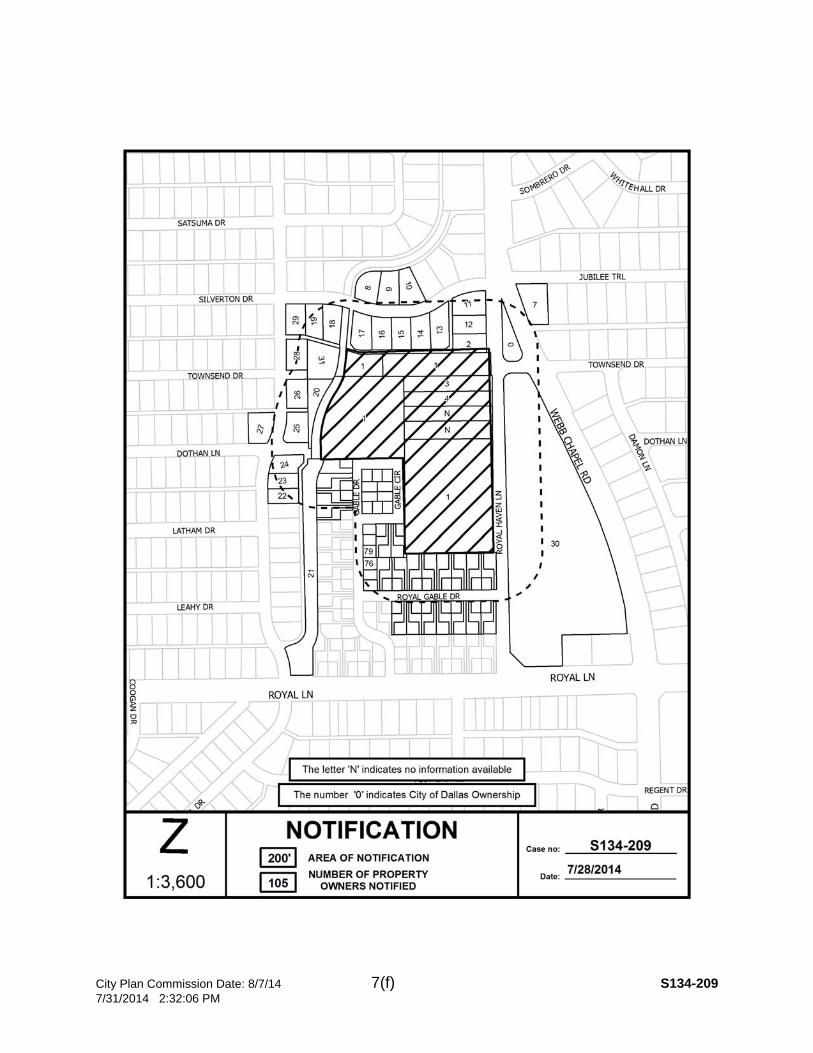
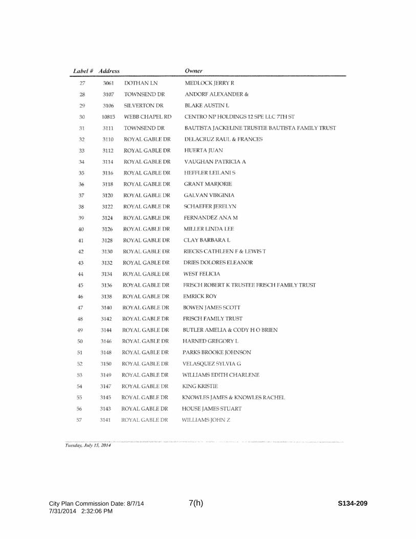
CITY PLAN COMMISSION THURSDAY, August 7, 2014 FILE NUMBER: S134-209 Subdivision Coordinator: La Shawn Green LOCATION: 10919 Royal Haven Lane DATE FILED: July 10, 2014 ZONING: R-10(A)
CITY COUNCIL DISTRICT: 13 SIZE OF REQUEST: 9.8139-Acres MAPSCO: 23F APPLICANT/OWNER: The Most Reverend Kevin J. Farrell, D.D. Bishop of the Roman Catholic Diocese of Dallas and His Successors in office for the exclusive benefit of San Juan Parish REQUEST: An application to replat a 9.8139-acre tract of land containing all of Lots 3 and 4 and all of Tracts 1 and 2 in City Block 6599 and a tract of land in City Block 6598 into one lot on property located on Royal Haven Lane, west of Webb Chapel Road. SUBDIVISION HISTORY: There has been no recent platting activity within close proximity to this request. STAFF RECOMMENDATION: Section 51A-8.503(a) indicates that “…Lots must conform in width, depth, and area to the pattern already established in the adjacent areas, having due regard to the character of the area, its particular suitability for development, and taking into consideration the natural topography of the ground, drainage, wastewater facilities, and the proposed layout of streets…”.
The request complies with the requirements of the R-10(A) district. The staff has determined that the proposed subdivision is incompatible with the established lot pattern in the vicinity of this request. However, the proposed use is a church which is an institutional land use allowed by right in all zoning districts; therefore, staff recommends approval subject to compliance with the conditions in the docket.
1. The final plat shall conform to all requirements of the Dallas Development Code, Texas Local Government Code, Texas Land Surveying Practices Act and the Rules and Regulations of the Texas Board of Land Surveying.
2. Sustainable Development and Construction, Engineering Division must verify that the plat conforms with water, wastewater and easement requirements under the provisions of Chapter 49 of the Dallas City Code.
3. Compliance with all plans, contracts, ordinances and requirements of the City of Dallas.
4. Provide a copy of the digital electronic CADD file of the final plat at the time the final plat is submitted for signature by the Chairman of the Plan Commission in a format that is compatible with the “Microstation” format to the Survey Section, Engineering Division in Room 200, 320 E. Jefferson Boulevard.
5. The number and location of fire hydrants, must comply with the International Fire Code section 508, Appendix C.
6. Any structure new or existing may not extend across new property lines. In addition, any detached sign must be shown on the final plat.
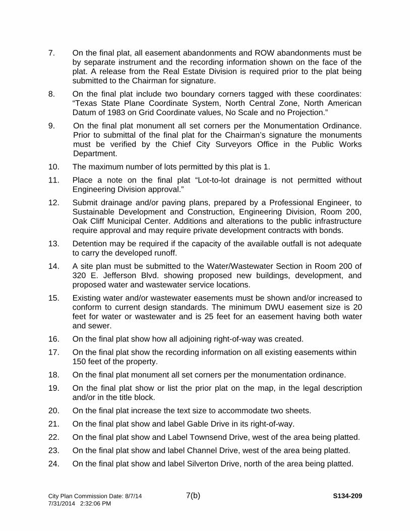
City Plan Commission Date: 8/7/14 7(b) S134-209 7/31/2014 2:32:06 PM
7. On the final plat, all easement abandonments and ROW abandonments must be by separate instrument and the recording information shown on the face of the plat. A release from the Real Estate Division is required prior to the plat being submitted to the Chairman for signature.
8. On the final plat include two boundary corners tagged with these coordinates: “Texas State Plane Coordinate System, North Central Zone, North American Datum of 1983 on Grid Coordinate values, No Scale and no Projection.”
9. On the final plat monument all set corners per the Monumentation Ordinance. Prior to submittal of the final plat for the Chairman’s signature the monuments must be verified by the Chief City Surveyors Office in the Public Works Department.
10. The maximum number of lots permitted by this plat is 1. 11. Place a note on the final plat “Lot-to-lot drainage is not permitted without
Engineering Division approval.” 12. Submit drainage and/or paving plans, prepared by a Professional Engineer, to
Sustainable Development and Construction, Engineering Division, Room 200, Oak Cliff Municipal Center. Additions and alterations to the public infrastructure require approval and may require private development contracts with bonds.
13. Detention may be required if the capacity of the available outfall is not adequate to carry the developed runoff.
14. A site plan must be submitted to the Water/Wastewater Section in Room 200 of 320 E. Jefferson Blvd. showing proposed new buildings, development, and proposed water and wastewater service locations.
15. Existing water and/or wastewater easements must be shown and/or increased to conform to current design standards. The minimum DWU easement size is 20 feet for water or wastewater and is 25 feet for an easement having both water and sewer.
16. On the final plat show how all adjoining right-of-way was created. 17. On the final plat show the recording information on all existing easements within
150 feet of the property. 18. On the final plat monument all set corners per the monumentation ordinance. 19. On the final plat show or list the prior plat on the map, in the legal description
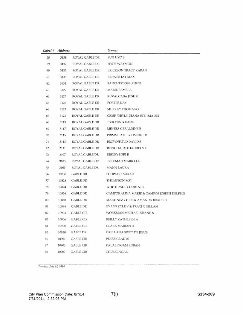
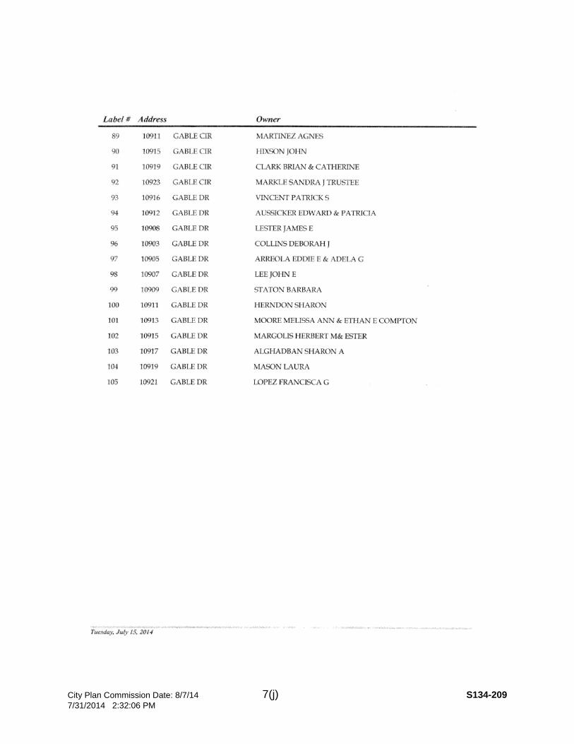
and/or in the title block. 20. On the final plat increase the text size to accommodate two sheets. 21. On the final plat show and label Gable Drive in its right-of-way. 22. On the final plat show and Label Townsend Drive, west of the area being platted. 23. On the final plat show and label Channel Drive, west of the area being platted. 24. On the final plat show and label Silverton Drive, north of the area being platted.

City Plan Commission Date: 8/7/14 7(c) S134-209 7/31/2014 2:32:06 PM
25. On the final plat show and label Royal Gable Drive, south of the area being platted.
26. On the final plat show and Webb Chapel Road, east of the area being platted. 27. On the final plat identify the property as Lot 1 in City Block A/6599.
City Plan Commission Date: 8/7/14 7(d) S134-209 7/31/2014 2:32:06 PM
City Plan Commission Date: 8/7/14 7(e) S134-209 7/31/2014 2:32:06 PM
City Plan Commission Date: 8/7/14 7(f) S134-209 7/31/2014 2:32:06 PM

City Plan Commission Date: 8/7/14 7(g) S134-209 7/31/2014 2:32:06 PM
City Plan Commission Date: 8/7/14 7(h) S134-209 7/31/2014 2:32:06 PM
City Plan Commission Date: 8/7/14 7(i) S134-209 7/31/2014 2:32:06 PM
City Plan Commission Date: 8/7/14 7(j) S134-209 7/31/2014 2:32:06 PM

City Plan Commission Date: 8/7/14 7(k) S134-209 7/31/2014 2:32:06 PM
City Plan Commission Date: 8/7/14 8(a) S134-206 7/31/2014 2:28:02 PM
CITY PLAN COMMISSION THURSDAY, August 7, 2014 FILE NUMBER: S134-206 Subdivision Coordinator: La Shawn Green LOCATION: 5526 Caruth Boulevard DATE FILED: July 10, 2014 ZONING: R-7.5 (A)
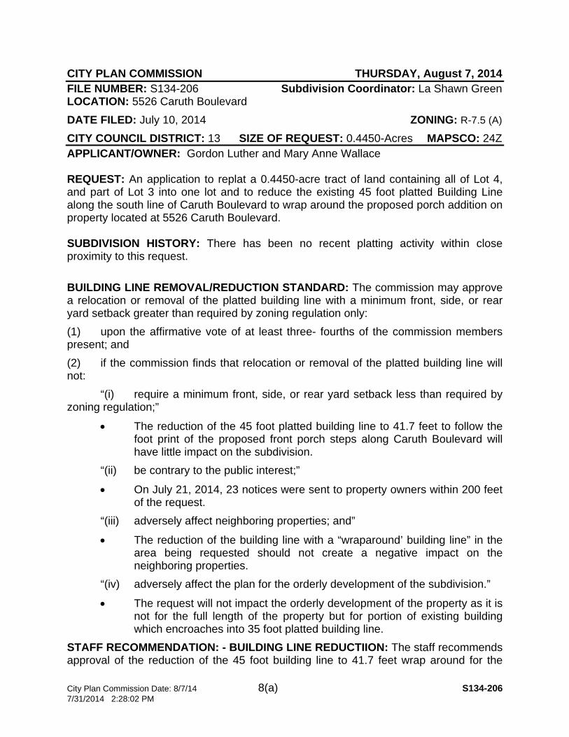
CITY COUNCIL DISTRICT: 13 SIZE OF REQUEST: 0.4450-Acres MAPSCO: 24Z APPLICANT/OWNER: Gordon Luther and Mary Anne Wallace REQUEST: An application to replat a 0.4450-acre tract of land containing all of Lot 4, and part of Lot 3 into one lot and to reduce the existing 45 foot platted Building Line along the south line of Caruth Boulevard to wrap around the proposed porch addition on property located at 5526 Caruth Boulevard. SUBDIVISION HISTORY: There has been no recent platting activity within close proximity to this request. BUILDING LINE REMOVAL/REDUCTION STANDARD: The commission may approve a relocation or removal of the platted building line with a minimum front, side, or rear yard setback greater than required by zoning regulation only: (1) upon the affirmative vote of at least three- fourths of the commission members present; and (2) if the commission finds that relocation or removal of the platted building line will not: “(i) require a minimum front, side, or rear yard setback less than required by zoning regulation;”
• The reduction of the 45 foot platted building line to 41.7 feet to follow the foot print of the proposed front porch steps along Caruth Boulevard will have little impact on the subdivision.
“(ii) be contrary to the public interest;”
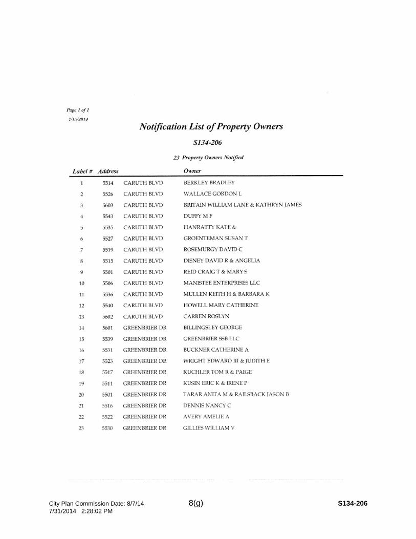
• On July 21, 2014, 23 notices were sent to property owners within 200 feet of the request.
“(iii) adversely affect neighboring properties; and”
• The reduction of the building line with a “wraparound’ building line” in the area being requested should not create a negative impact on the neighboring properties.
“(iv) adversely affect the plan for the orderly development of the subdivision.”
• The request will not impact the orderly development of the property as it is not for the full length of the property but for portion of existing building which encroaches into 35 foot platted building line.
STAFF RECOMMENDATION: - BUILDING LINE REDUCTIION: The staff recommends approval of the reduction of the 45 foot building line to 41.7 feet wrap around for the

City Plan Commission Date: 8/7/14 8(b) S134-206 7/31/2014 2:28:02 PM
proposed portion because the reduction is for an uncovered porch/steps. The existing required front yard setback in this district is 25 feet with a platted 45 foot building line and it will be maintained.
STAFF RECOMMENDATION: The request complies with the requirements of the R-7.5 (A) District; therefore, staff recommends approval subject to compliance with the following conditions:
1. The final plat shall conform to all requirements of the Dallas Development Code, Texas Local Government Code, Texas Land Surveying Practices Act and the Rules and Regulations of the Texas Board of Land Surveying.
2. Sustainable Development and Construction, Engineering Division must verify that the plat conforms with water, wastewater and easement requirements under the provisions of Chapter 49 of the Dallas City Code.
3. Compliance with all plans, contracts, ordinances and requirements of the City of Dallas.
4. Provide a copy of the digital electronic CADD file of the final plat at the time the final plat is submitted for signature by the Chairman of the Plan Commission in a format that is compatible with the “Microstation” format to the Survey Section, Engineering Division in Room 200, 320 E. Jefferson Boulevard.
5. The number and location of fire hydrants, must comply with the International Fire Code section 508, Appendix C.
6. Any structure new or existing may not extend across new property lines. In addition, any detached sign must be shown on the final plat.
7. On the final plat, all easement abandonments and ROW abandonments must be by separate instrument and the recording information shown on the face of the plat. A release from the Real Estate Division is required prior to the plat being submitted to the Chairman for signature.
8. On the final plat include two boundary corners tagged with these coordinates: “Texas State Plane Coordinate System, North Central Zone, North American Datum of 1983 on Grid Coordinate values, No Scale and no Projection.”
9. On the final plat monument all set corners per the Monumentation Ordinance. Prior to submittal of the final plat for the Chairman’s signature the monuments must be verified by the Chief City Surveyors Office in the Public Works Department.
10. The maximum number of lots permitted by this plat is 1. 11. Place a note on the final plat “Lot-to-lot drainage is not permitted without
Engineering Division approval.” 12. A site plan must be submitted to the Water/Wastewater Section in Room 200 of
320 E. Jefferson Blvd. showing proposed new buildings, development, and proposed water and wastewater service locations.
City Plan Commission Date: 8/7/14 8(c) S134-206 7/31/2014 2:28:02 PM
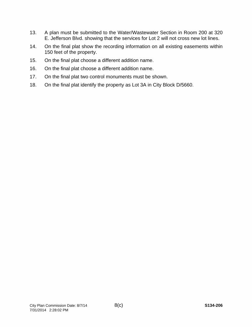
13. A plan must be submitted to the Water/Wastewater Section in Room 200 at 320 E. Jefferson Blvd. showing that the services for Lot 2 will not cross new lot lines.
14. On the final plat show the recording information on all existing easements within 150 feet of the property.
15. On the final plat choose a different addition name. 16. On the final plat choose a different addition name. 17. On the final plat two control monuments must be shown. 18. On the final plat identify the property as Lot 3A in City Block D/5660.
City Plan Commission Date: 8/7/14 8(d) S134-206 7/31/2014 2:28:02 PM
City Plan Commission Date: 8/7/14 8(e) S134-206 7/31/2014 2:28:02 PM

City Plan Commission Date: 8/7/14 8(f) S134-206 7/31/2014 2:28:02 PM
City Plan Commission Date: 8/7/14 8(g) S134-206 7/31/2014 2:28:02 PM

City Plan Commission Date: 8/7/14 8(h) S134-206 7/31/2014 2:28:02 PM
1
CITY PLAN COMMISSION THURSDAY, AUGUST 07, 2014
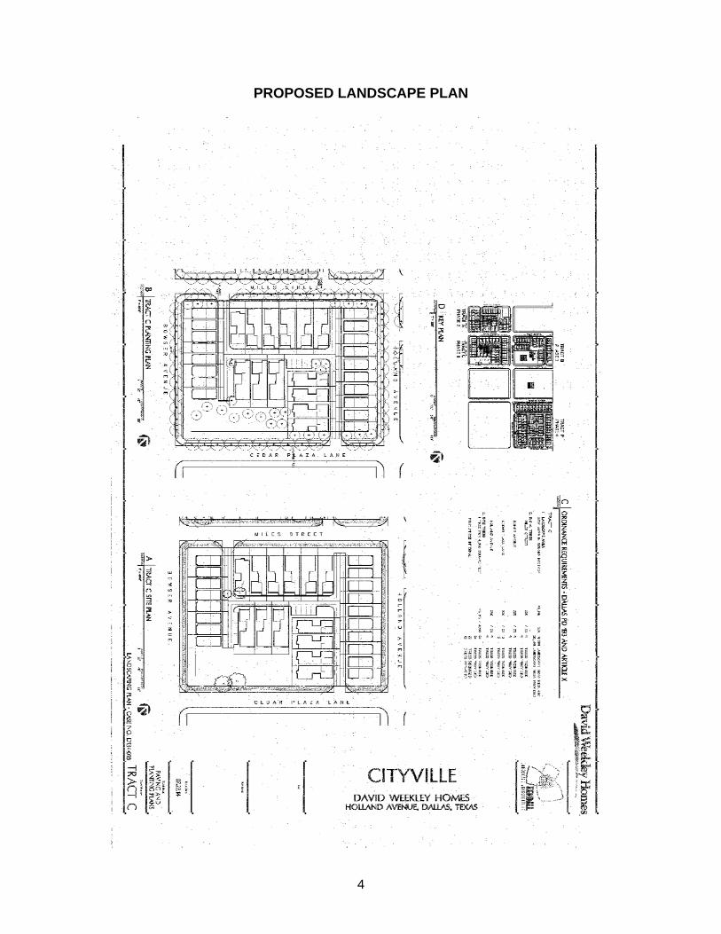
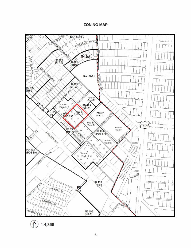
Planner: Danielle R. Jiménez FILE NUMBER: D134-018 DATE FILED: April 8, 2014 LOCATION: South Corner of Miles Street and Holland Avenue COUNCIL DISTRICT: 2 MAPSCO: 34-R SIZE OF REQUEST: 2.16 acres CENSUS TRACT: 0006.01 MISCELLANEOUS DOCKET ITEM
Applicant: Wes Homeyer, Weekley Homes, LLC
Owner: Weekley Homes, LLC
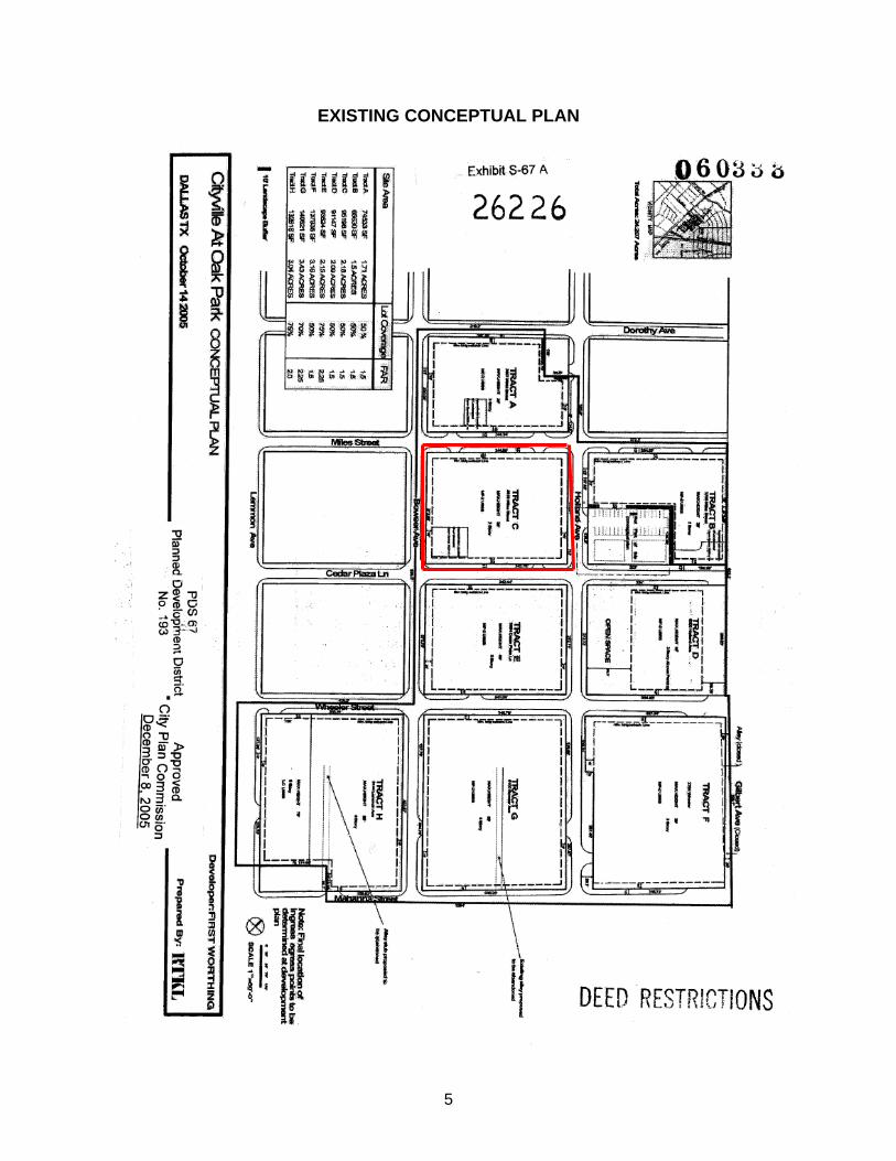
Representative: Robert Baldwin, Baldwin Associates Development Plan and Landscape Plan: On January 25, 2006, the City Council passed Ordinance No. 26226, which established Planned Development Subdistrict No. 67 within Planned Development District No. 193, the Oak Lawn Special Purpose District, on property generally bounded by Dorothy Avenue, Bowser Avenue, Wheeler Street, Lemmon Avenue, Mahanna Street, Gilbert Avenue, the city limit line, Miles Street, and Holland Avenue. The zoning was granted as a planned development district with a conceptual plan and requires City Plan Commission approval of a development plan and landscape plan for each phase of development prior to the issuance of a building permit. The plan provides for a shared access development with 31 single family lots and a landscaped open space. The development and landscape plans meet the requirements of Tract C within PDS 67 of PDD 193, the Oak Lawn Special Purpose District. STAFF RECOMMENDATION: Approval
2
Partners and Officers
Weekley Homes, LLC Chairman/CEO David Weekley Vice President Dick Weekley COO John Johnson CFO Heather Humphrey General Counsel John Burchfield Authorized Representative Ladd Fargo

3
PROPOSED DEVELOPMENT PLAN
4
PROPOSED LANDSCAPE PLAN
5
EXISTING CONCEPTUAL PLAN
6
ZONING MAP
7
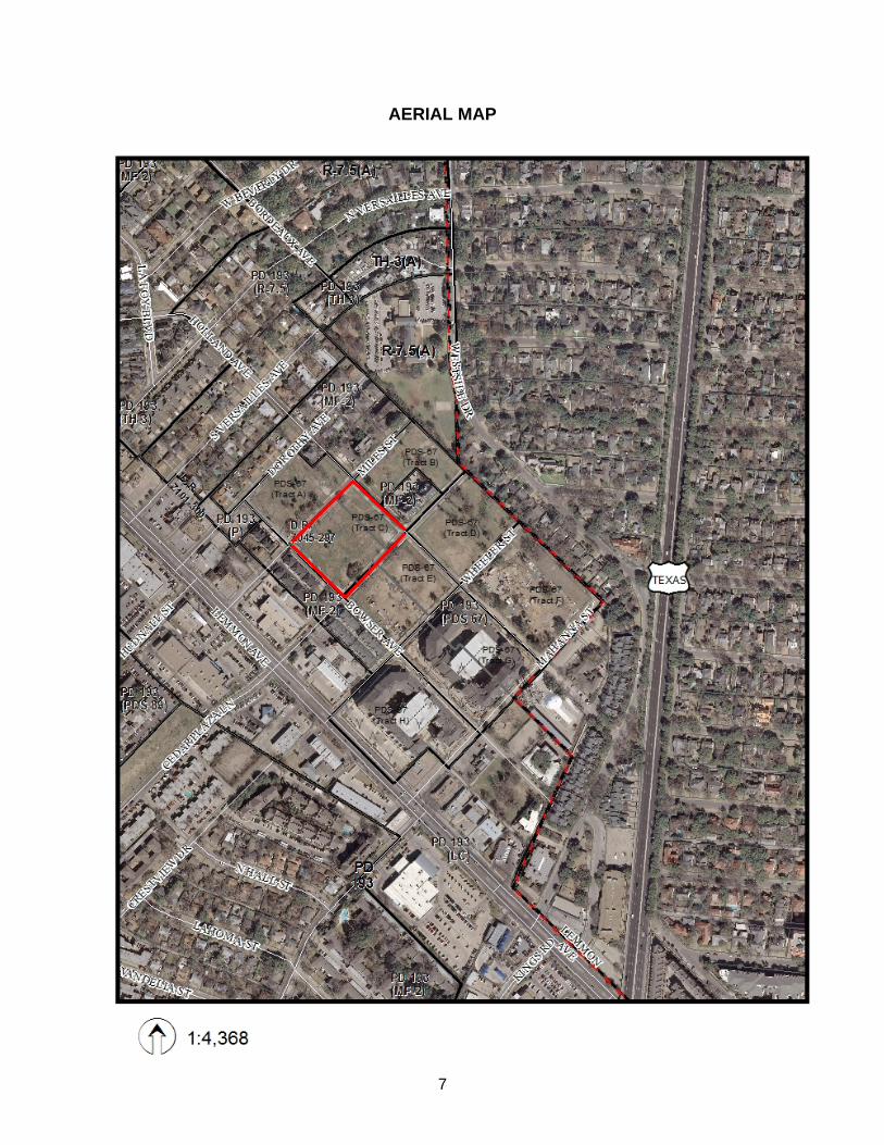
AERIAL MAP
1
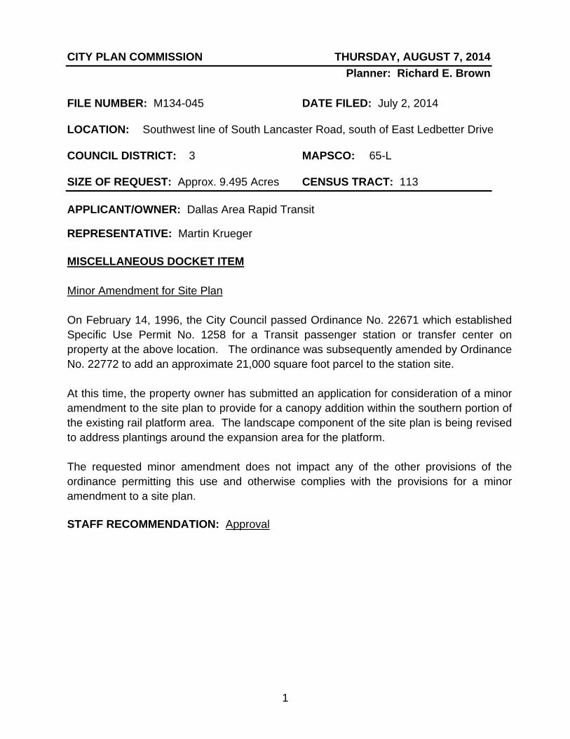
CITY PLAN COMMISSION THURSDAY, AUGUST 7, 2014 Planner: Richard E. Brown
FILE NUMBER: M134-045 DATE FILED: July 2, 2014
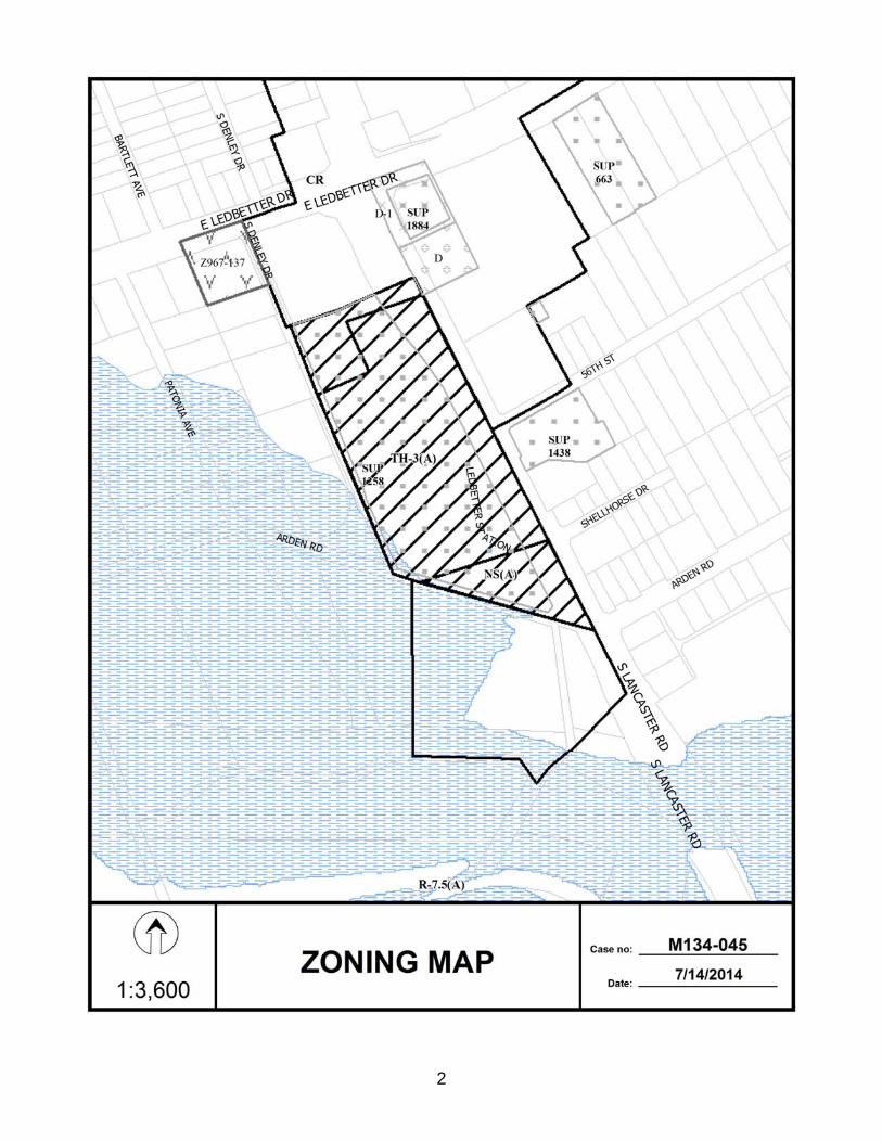
LOCATION: Southwest line of South Lancaster Road, south of East Ledbetter Drive
COUNCIL DISTRICT: 3 MAPSCO: 65-L
SIZE OF REQUEST: Approx. 9.495 Acres CENSUS TRACT: 113
APPLICANT/OWNER: Dallas Area Rapid Transit
REPRESENTATIVE: Martin Krueger MISCELLANEOUS DOCKET ITEM Minor Amendment for Site Plan
On February 14, 1996, the City Council passed Ordinance No. 22671 which established Specific Use Permit No. 1258 for a Transit passenger station or transfer center on property at the above location. The ordinance was subsequently amended by Ordinance No. 22772 to add an approximate 21,000 square foot parcel to the station site. At this time, the property owner has submitted an application for consideration of a minor amendment to the site plan to provide for a canopy addition within the southern portion of the existing rail platform area. The landscape component of the site plan is being revised to address plantings around the expansion area for the platform. The requested minor amendment does not impact any of the other provisions of the ordinance permitting this use and otherwise complies with the provisions for a minor amendment to a site plan. STAFF RECOMMENDATION: Approval
2
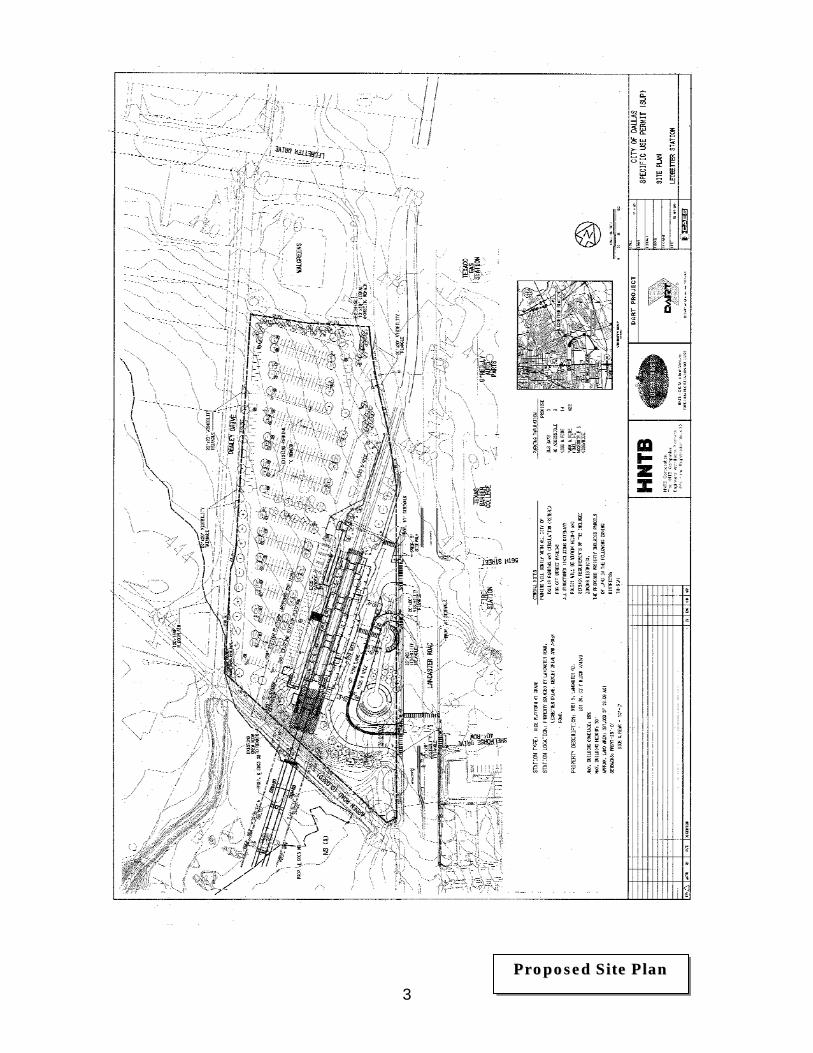
3PPrrooppoosseedd SSiittee PPllaann
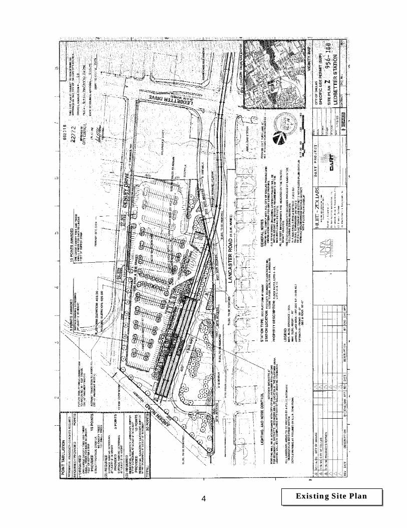
4 EExxiissttiinngg SSiittee PPllaann
5

6
7/14/2014
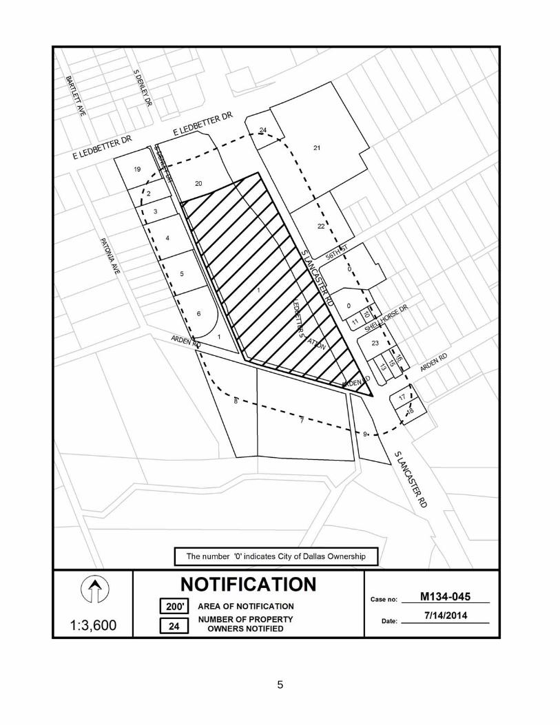
Notification List of Property Owners M134-045
24 Property Owners Notified
Label # Address Owner 1 5151 LANCASTER RD DALLAS AREA RAPID TRANSIT
2 5127 DENLEY DR WESLEY BRIAN H & KORI J
3 5129 DENLEY DR ALLEN DOROTHY P
4 5139 DENLEY DR ELLIS LYNETTE
5 5151 DENLEY DR GILLEY GAIL
6 5171 DENLEY DR GYEKEYE QUINCY PMB 1271
7 2031 HAMPSHIRE RD ANDERSON JIMMIE RAY
8 1942 ARDEN RD FRIDRICH VANCEL G
9 5307 LANCASTER RD ANDERSON JIMMY RAY
10 2113 SHELLHORSE DR STARKS GEORGE
11 2107 SHELLHORSE DR SWEET FELLOWSHIP CHURCH OF GOD IN CHRIST
12 2119 SHELLHORSE DR SUNDIAL INV PARTNERS LP
13 2107 ARDEN RD TURNER ROSE LEE
14 2103 ARDEN RD MERRYMAN PHYLLIS LEE & MERRYMAN JERRY D
15 2111 ARDEN RD DALLAS HOUSING ACQUISITION & DEV CORP CI
16 2115 ARDEN RD REGALADO JESUS I & MARTHA Y ESCAMILLA
17 5304 LANCASTER RD GARRETT GLENN
18 5308 LANCASTER RD ALDABA FRANCISCO B & NESTOR B ALDABA
19 1928 LEDBETTER DR H & L HOLDINGS GROUP LLC
20 5101 LANCASTER RD LEDGREEN LP & LANGREEN LP % ALLAN RILEY
21 2130 LEDBETTER DR MYDAL LLC % PETER KRAUS
22 5148 LANCASTER RD LEDBETTER & LANCASTER LTD
23 2106 SHELLHORSE DR SWEET FELLOWSHIP CHURCH OF GOD IN CHRIST
24 2104 LEDBETTER DR NR STATIONS INC
CITY PLAN COMMISSION THURSDAY, AUGUST 7, 2014
LOCATION: Denton Drive from Webb Chapel Extension to Farmers Branch City Limits
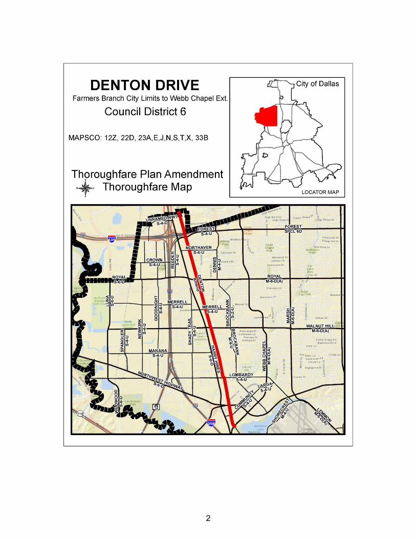
COUNCIL DISTRICT: 6 MAPSCO: 12Z, 22D, 23A, E, J, N, S, T, X, 33B PLANNER Tanya Brooks REQUEST An amendment to the City of Dallas Thoroughfare Plan to change the dimensional classification of Denton Drive from Webb Chapel Extension to Farmers Branch City Limits from a four lane undivided roadway (M-4-U) within 60 feet of right-of-way to a special three lane undivided roadway (SPCL 3U) with a bicycle facility within a variable 62 to 80 feet right-of-way. SUMMARY The Public Works Department is requesting an amendment to the City of Dallas Thoroughfare Plan to change the dimensional classification of Denton Drive from Webb Chapel Extension to Farmers Branch City Limits from a four lane undivided roadway (M-4-U) within 60 feet of right-of-way to a special three lane undivided roadway (SPCL 3U) within a variable 62 to 80 feet right-of-way. An eight foot two-way cycle track will be provided on the East side of Denton Drive. The City of Dallas and Dallas County have entered into an agreement to design and fund the construction of a roadway that promotes the Trail Connection Master Plan and provide access to adjacent land uses. To increase livability in this area, a sustainable street design approach that places emphasis on creating a complete multi-modal street system that facilitates walking, bicycling, transit use as well as automobile use was taken. The new design will improve connectivity for pedestrians and bicyclists to the DART Walnut Hill/Denton Station and the surrounding development. Staff has determined that a reduction in the number of travel lanes is appropriate and the proposed cross section can accommodate both existing and projected traffic volumes and enhance parkway amenities. The proposal incorporates the vision of the community and the Asian Trade District Master Plan. STAFF RECOMMENDATION Staff recommends approval of the amendment to the Thoroughfare Plan to change the dimensional classification of Denton Drive from Webb Chapel Extension to Farmers Branch City Limits from a four lane undivided roadway (M-4-U) within 60 feet of right-of-way to a special three lane undivided roadway (SPCL 3U) with a bicycle facility within a variable 62 to 80 feet right-of-way.
PRIOR ACTION/REVIEW (COUNCIL, BOARDS, COMMISSIONS) City Plan Commission July 24, 2014 Transportation Committee Recommendation Approval
MAPS
Attached
1
2

3
4

CITY PLAN COMMISSION THURSDAY, AUGUST 7, 2014
LOCATION: Mountain Creek Parkway from Eagle Ford Drive to Clark Road
COUNCIL DISTRICT: 3 MAPSCO: 71B- A,E,F,K,L PLANNER Tanya Brooks REQUEST An amendment to the City of Dallas Thoroughfare Plan to change the dimensional classification of Mountain Creek Parkway from Eagle Ford Drive to Clark Road from a six lane divided roadway {M-6-D(A)} within 100 feet of right-of-way to a special four lane divided roadway (SPCL 4D) with a bicycle facility within 100 feet right-of-way. SUMMARY The Public Works Department is requesting an amendment to the City of Dallas Thoroughfare Plan to change the dimensional classification of Mountain Creek Parkway from Eagle Ford Drive to Clark Road from a six lane divided roadway {M-6-D(A)} within 100 feet of right-of-way to a special four lane divided roadway (SPCL 4D) within 100 feet right-of-way. A one-way cycle track in both directions will be provided throughout the corridor. The City of Dallas and Dallas County have entered into an agreement to design and fund the construction of a roadway that promotes the Trail Connection Master Plan and provides access to adjacent land uses, specifically the Cedar Ridge Preserve. The adjacent land use has developed as single family residential homes and will not require a six lane divided roadway. Staff has worked with stakeholders in the community to establish a sustainable street design approach that meets the needs of existing property owners, proposed developments and all transportation modes. The new design creates a multi-modal street system that will facilitate walking, bicycling, as well as automobile use. The design provides an enhanced bicycle facility in both directions and sufficient sidewalks while maintaining adequate capacity for automobiles. STAFF RECOMMENDATION Staff recommends approval of the amendment to the Thoroughfare Plan to change the dimensional classification of Mountain Creek Parkway from Eagle Ford Drive to Clark Road from a six lane divided roadway {M-6-D(A)} within 100 feet of right-of-way to a special four lane divided roadway (SPCL 4D) with a bicycle facility within 100 feet right-of-way.
PRIOR ACTION/REVIEW (COUNCIL, BOARDS, COMMISSIONS) City Plan Commission July 24, 2014 Transportation Committee Recommendation Approval
MAPS
Attached
1
2
3

1-1
CITY PLAN COMMISSION THURSDAY, AUGUST 7, 2014 Planner: Richard E. Brown
FILE NUMBER: Z134-233(RB) DATE FILED: April 6, 2014
LOCATION: Northeast line of Laughlin Drive and southwest line of Charles Street, east of Ferguson
COUNCIL DISTRICT: 7 MAPSCO: 47-C
SIZE OF REQUEST: Approx. 1.13 Acres CENSUS TRACT: 122.04
APPLICANT: Directions
REPRESENTATIVE: Rob Baldwin
OWNER: Wade Henderson REQUEST: An application for a Planned Development District for a
Group Residential Facility and CS Commercial Service District Uses on property zoned a CS Commercial Service District and a P(A) Parking District.
SUMMARY: The applicant is requesting a Planned Development District
in order to utilize the existing improvements for a 100-bed group residential facility.
STAFF RECOMMENDATION: Approval, subject to a development plan and
conditions.

Z134-233(RB)
1-2
GUIDING CRIETERIA FOR RECOMMENDATION:
Staff recommends approval of the request, subject to a development plan and conditions, based upon:
1. Performance impacts upon surrounding property –The site will be developed with a similar use as has existed in the community, with development standards consistent with those previously existing on the property. Continuing a residentially themed use will ensure commercial uses will not further encroach towards the residential uses to the east.
2. Traffic impact – The request will not negatively impact the surrounding street system.
3. Comprehensive Plan or Area Plan Conformance – The proposed development
is in compliance with the Comprehensive Plan.
4. Justification for PDD Planned Development District Zoning as opposed to a straight zoning district – The existing CS District does not permit residential uses. Additionally, the applicant wishes to retain existing uses. A PDD permits the flexibility in development with consideration of adjacent uses. Certain nonresidential uses are recommended to be prohibited (i.e., adjacency to residential) while requiring buffering of an existing off-street parking area. A PDD permits such while requiring development per an approved plan, neither of which are required by existing zoning.
BACKGROUND INFORMATION:
• The site is developed with a vacant residential structure and surface parking, previously utilized as a convalescent home.
• The surface parking lot along the Laughlin Drive frontage is zoned a P(A) District.
• The applicant will utilize the existing improvements for a group residential facility and is requesting consideration of a PDD to permit a group residential use, while considering both lots as one for off-street parking interpretations.
Zoning History: There have been no zoning requests in the area within the past five years. Traffic: The Engineering Section of the Department of Sustainable Development and Construction has reviewed the applicant’s request and determined it will not negatively impact the surrounding street system.

Z134-233(RB)
1-3
Street Designation; Existing & Proposed ROW
Laughlin Drive Local; 40’ ROW Charles Street Local; 40’ ROW
Comprehensive Plan: The request site is located in an area considered a Commercial Center or Corridor. These areas primarily function as service and job destinations and are similar to Business Centers or Corridors, but are smaller and incorporate less density. These corridors, commonly at the intersection of major streets, are easily accessed via automobiles. Buckner Boulevard is an example of a Commercial Corridor. Buildings in these areas tend to be on separate parcels and stand one to five stories with offices, restaurants and a range of retail and commercial uses. In addition to jobs and services, Commercial Centers or Corridors also may include multifamily housing in low- to mid-rise apartment buildings or condominiums. Land Use Compatibility: The request site consists of a vacant structure and abutting parking area [P()A) District fronting on Laughlin Drive] previously operated as a convalescent home. The applicant proposes to utilize the existing structure to provide for a 100-bed group residential facility. The predominant land use in the immediate area east of Ferguson Road, which is developed with retail and commercial uses, depends on the site’s frontage: 1) the area north and east of the site’s frontage along Charles Road is retail and commercial, with a few legally nonconforming single family homes; while 2) the area to the south and east of the site’s frontage along Laughlin Drive is predominantly low-density residential [this area is zoned an MF-2(A) District and possesses single family, duplex, and multifamily structures]. The attached conditions reflect the result of discussions between the staff and applicant. It should be noted that while the applicant wishes to retain the existing CS District zoning, certain uses have been prohibited that in the opinion of staff, will ensure any redevelopment of the site with one or more of these nonresidential uses will maintain a measure of compatibility in terms of impact on these residents. Lastly, the surface parking area [currently a P(A) District) along Laughlin Drive is void of any streetscape along the street frontage. The applicant has agreed to provide planting materials to soften the presence of this parking area within the residential character along the eastern portion of the street. At this point, the applicant has not provided this detail (species, size/spacing of planting materials) at the time this material is being presented to CPC. It is anticipated this will be presented during the staff briefing.
Z134-233(RB)
1-4
Z134-233(RB)
1-5
“ARTICLE PD
SEC. 51P- .101. LEGISLATIVE HISTORY. PD was established by Ordinance No. , passed by the Dallas City Council on . SEC. 51P- .102. PROPERTY LOCATION AND SIZE. PD is established on property located on the northeast line of Laughlin Drive and the southwest line of Charles Street, east of Ferguson Road. The size of PD is approximately 1.13 acres. SEC. 51P- .103. DEFINITIONS AND INTERPRETATIONS.
(a) Unless otherwise stated, the definitions and interpretations in Chapter 51A apply to this article. (b) Unless otherwise stated, all references to articles, divisions, or sections in this article are to articles, divisions, or sections in Chapter 51A. (c) This district is considered to be a nonresidential zoning district. SEC. 51P- .104. DEVELOPMENT PLAN.
Development and use of the Property must comply with the attached development plan. In the event of a conflict between the provisions of this section and the development plan, the provisions of this section control.
SEC. 51P- .105 MAIN USES PERMITTED.
(a) Except as provided in this section, the only main uses permitted are those main uses permitted in the CS Commercial Service District, subject to the same conditions applicable in the CS Commercial Service District, as set out in the Dallas Development Code, as amended. For example, a use permitted in the CS Commercial Service District by specific use permit (SUP) only is permitted in this planned development district by SUP. A use subject to development impact review (DIR) in the CS Commercial Service District is subject to DIR in this planned development district, etc.
(b) The following use is permitted.
-- Group residential facility.

Z134-233(RB)
1-6
(c) The following uses are prohibited.
(1) Commercial uses. -- Bus or rail transit vehicle maintenance or storage facility. -- Commercial cleaning or laundry plant. -- Machine or welding shop. -- Machinery, heavy equipment, or truck sales and services. -- Tool or equipment rental. -- Vehicle or engine repair or maintenance.
(2) Industrial uses.
-- Industrial (inside) light manufacturing.
(3) Lodging uses.
-- Hotel or motel. -- Extended stay hotel or motel. -- Lodging or boarding house. -- Overnight general purpose shelter. (4) Recreation uses.
-- Temporary construction or sales office .
(5) Recreation uses.
-- Private recreation center, club, or area. (6) Retail and personal service uses.
-- Auto service center. -- Alcoholic beverage establishment. -- Car wash. -- Commercial amusement (inside). -- Commercial amusement (outside). -- Commercial motor vehicle parking lot. -- Commercial parking lot or garage. -- Liquor store. -- Pawn shop. -- Swap or buy shop. -- Vehicle display, sales, and service.
(7) Wholesale, distribution, and storage uses.
-- Contractor’s maintenance yard. -- Freight terminal. -- Manufactured building sales lot.
Z134-233(RB)
1-7
-- Mini-warehouse. -- Outside storage (with visual screening). -- Trade center. -- Warehouse.
SEC. 51P- .106. ACCESSORY USES.
(a) As a general rule, an accessory use is permitted in any district in which the main use is permitted. Some specific types of accessory uses, however, due to their unique nature, are subject to additional regulations contained in Section 51A-4.217. For more information regarding accessory uses, consult Section 51A-4.217.
SEC. 51P- .107. YARD, LOT AND SPACE REGULATIONS. (Note: The yard, lot, and space regulations in this subsection must be read together with the yard, lot, and space regulations contained in Division 51A-4.400. In the event of a conflict between this subsection and Division 51A-4.400, this subsection controls).
(a) In general. Except as provided in this section, the yard, lot, and space regulations for the CS Commercial Service District apply.
(b) Density: For a group residential facility, maximum number of beds is 100.
SEC. 51P- .108. OFF-STREET PARKING AND LOADING.
(a) Except as provided in this section, consult the use regulations in Division 51A-4.200 for the specific off-street parking and loading requirements for each use.
(b) For off-street parking, the Property is considered one lot.
SEC. 51P- .109. ENVIRONMENTAL PERFORMANCE STANDARDS.
See Article VI.
SEC. 51P- .110. LANDSCAPING.
(a) Landscaping must be provided in accordance with Article X. (b) All plant materials must be maintained in a healthy, growing condition.
SEC. 51P- .111. SIGNS.
Signs must comply with the provisions for business zoning districts in Article VII. SEC. 51P- .112. ADDITIONAL PROVISIONS. (a) The Property must be properly maintained in a state of good repair and neat appearance.
Z134-233(RB)
1-8
(b) Development and use of the Property must comply with all federal and state laws and regulations, and with all ordinances, rules, and regulations of the city. SEC. 51P- .113. COMPLIANCE WITH CONDITIONS. (a) All paved areas, permanent drives, streets, and drainage structures, if any, must be constructed in accordance with standard city specifications, and completed to the satisfaction of the city. (b) The building official shall not issue a building permit to authorize work, or a certificate of occupancy to authorize the operation of a use, until there has been full compliance with this article, the Dallas Development Code, the construction codes, and all other ordinances, rules, and regulations of the city.”

Z134-233(RB)
1-9 PPrrooppoosseedd DDeevveellooppmmeenntt PPllaann
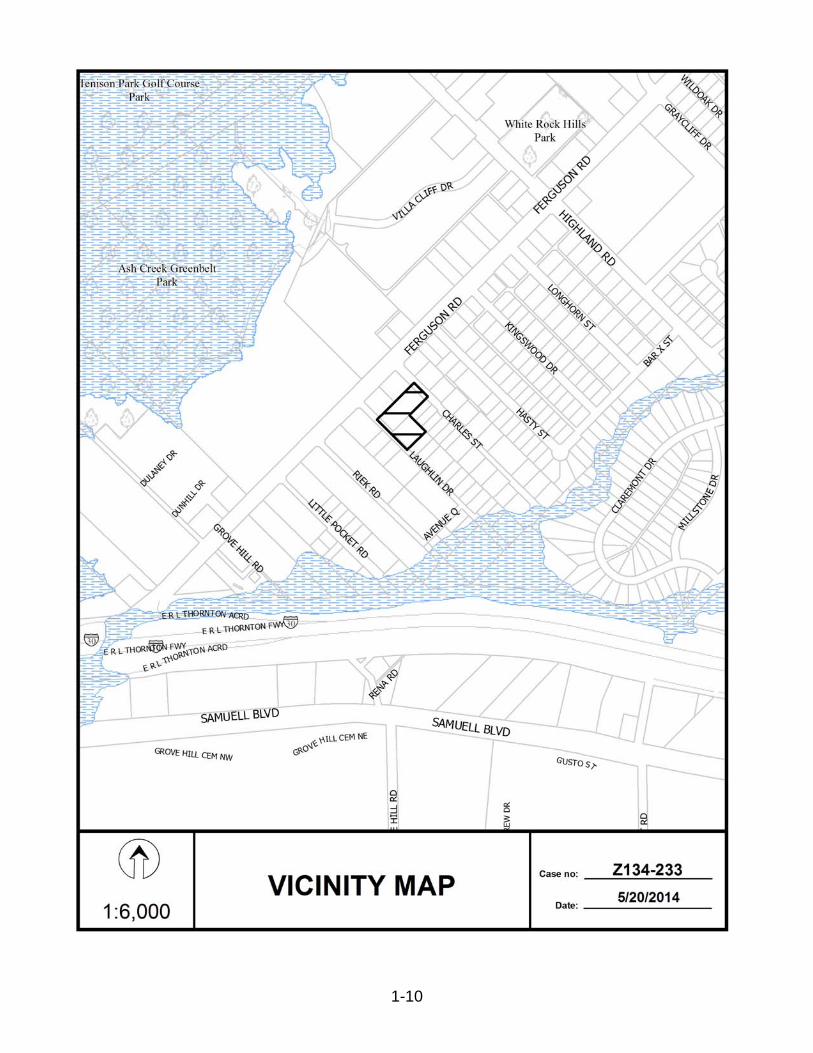
Z134-233(RB)
1-10

Z134-233(RB)
1-11
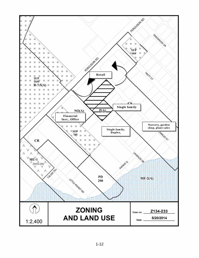
Z134-233(RB)
1-12
SSiinnggllee ffaammiillyy,, DDuupplleexx,,
SSiinnggllee ffaammiillyy
RReettaaiill
FFiinnaanncciiaall IInnsstt..,, OOffffiiccee
NNuurrsseerryy,, ggaarrddeenn sshhoopp,, ppllaanntt ssaalleess

Z134-233(RB)
1-13

Z134-233(RB)
1-14
5/19/2014
Notification List of Property Owners Z134-233
60 Property Owners Notified
Label # Address Owner 1 2331 LAUGHLIN DR HENDERSON WADE
2 7703 FERGUSON RD REED CHARLES E
3 7715 FERGUSON RD SCOGGINS AUDREY
4 7621 FERGUSON RD MONTERRA REDEVELOPMENT LLC %CROSS
EQUITI
5 7803 FERGUSON RD CASA SAN LUIS APARTMENTS LLC % R GUNTNUR
6 7400 FERGUSON RD CITY EMPLOYEES CREDIT UNION DALLAS TEXAS
7 2329 LITTLE POCKET RD MECHE ZENO APT 818
8 2339 LITTLE POCKET RD MEZA MARIA V
9 2345 LITTLE POCKET RD MA PARTNERS 3
10 2361 RIEK RD CREATIVE ARTS CENTER OF DALLAS INC
11 7508 FERGUSON RD ENSERCH FED CRED UNION
12 7474 FERGUSON RD CITY EMPLOYEES CREDIT UNION
13 7606 FERGUSON RD ARELLANO MIGUEL
14 2360 LAUGHLIN DR CREATIVE ARTS CENTER OF DALLAS INC THE
15 2338 LAUGHLIN DR MCCOSKEY ROBERT B & JOY D
16 2365 LAUGHLIN DR J & K ROACH INVESTMENTS LLC
17 7518 FERGUSON RD SEFCU FEDERAL CREDIT UNION % JIM BRISEND
18 2330 LAUGHLIN DR FERGUSON ROSALIND
19 2335 LAUGHLIN DR BARNES SUSAN
20 2339 LAUGHLIN DR NHS GENERAL CONTRACTING LLC
21 2359 LAUGHLIN DR RATHBUN LANCE HUDSON
22 2355 LAUGHLIN DR RIVERO RAFAEL & AYDEE
23 2402 LAUGHLIN DR US MORTGAGE CO INC
24 7620 FERGUSON RD CHRISTIAN STRONGHOLD BAPTIST CHURCH
25 2319 CHARLES ST GAMEZ TOM EDWARD LIFE EST
26 7708 FERGUSON RD DONOHO INVESTMENT CO
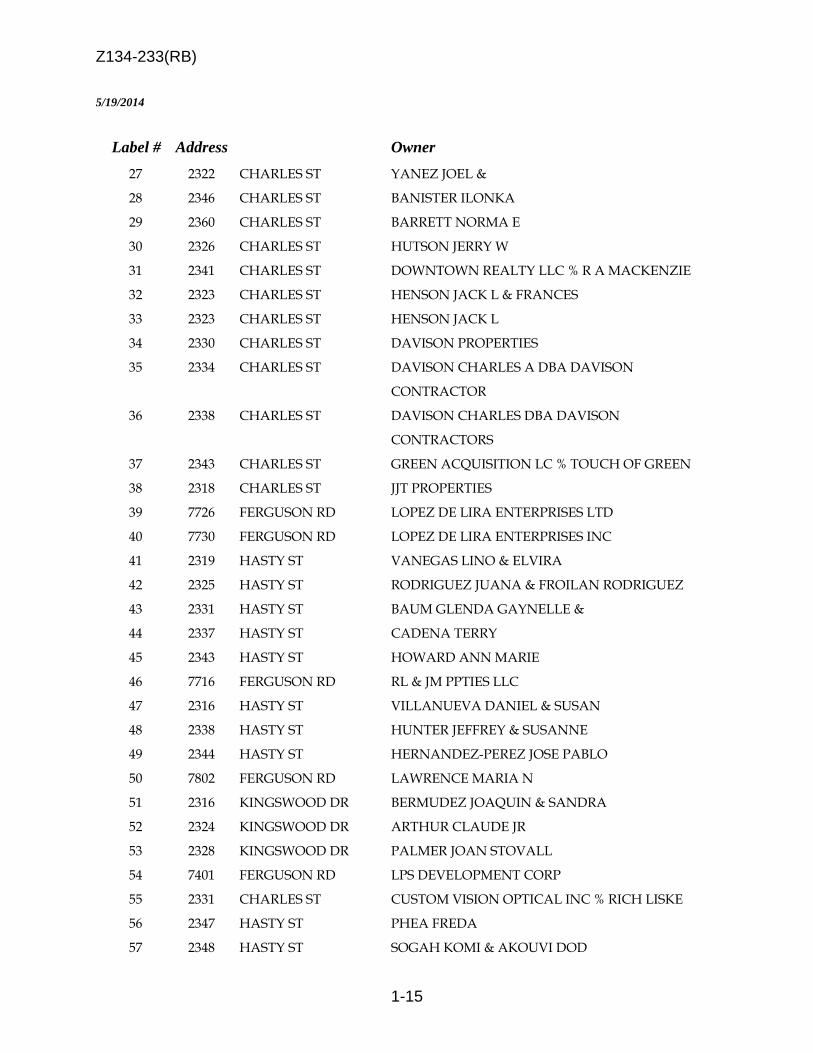
Z134-233(RB)
1-15
5/19/2014
Label # Address Owner 27 2322 CHARLES ST YANEZ JOEL &
28 2346 CHARLES ST BANISTER ILONKA
29 2360 CHARLES ST BARRETT NORMA E
30 2326 CHARLES ST HUTSON JERRY W
31 2341 CHARLES ST DOWNTOWN REALTY LLC % R A MACKENZIE
32 2323 CHARLES ST HENSON JACK L & FRANCES
33 2323 CHARLES ST HENSON JACK L
34 2330 CHARLES ST DAVISON PROPERTIES
35 2334 CHARLES ST DAVISON CHARLES A DBA DAVISON
CONTRACTOR
36 2338 CHARLES ST DAVISON CHARLES DBA DAVISON
CONTRACTORS
37 2343 CHARLES ST GREEN ACQUISITION LC % TOUCH OF GREEN
38 2318 CHARLES ST JJT PROPERTIES
39 7726 FERGUSON RD LOPEZ DE LIRA ENTERPRISES LTD
40 7730 FERGUSON RD LOPEZ DE LIRA ENTERPRISES INC
41 2319 HASTY ST VANEGAS LINO & ELVIRA
42 2325 HASTY ST RODRIGUEZ JUANA & FROILAN RODRIGUEZ
43 2331 HASTY ST BAUM GLENDA GAYNELLE &
44 2337 HASTY ST CADENA TERRY
45 2343 HASTY ST HOWARD ANN MARIE
46 7716 FERGUSON RD RL & JM PPTIES LLC
47 2316 HASTY ST VILLANUEVA DANIEL & SUSAN
48 2338 HASTY ST HUNTER JEFFREY & SUSANNE
49 2344 HASTY ST HERNANDEZ-PEREZ JOSE PABLO
50 7802 FERGUSON RD LAWRENCE MARIA N
51 2316 KINGSWOOD DR BERMUDEZ JOAQUIN & SANDRA
52 2324 KINGSWOOD DR ARTHUR CLAUDE JR
53 2328 KINGSWOOD DR PALMER JOAN STOVALL
54 7401 FERGUSON RD LPS DEVELOPMENT CORP
55 2331 CHARLES ST CUSTOM VISION OPTICAL INC % RICH LISKE
56 2347 HASTY ST PHEA FREDA
57 2348 HASTY ST SOGAH KOMI & AKOUVI DOD

Z134-233(RB)
1-16
5/19/2014
Label # Address Owner 58 2352 HASTY ST AVILA SAUL
59 2356 HASTY ST RODRIGUEZ LUIS &
60 2360 HASTY ST BANDA SANTIAGO
2-1
CITY PLAN COMMISSION THURSDAY, AUGUST 7, 2014
Planner: Richard E. Brown FILE NUMBER: Z134-235(RB) DATE FILED: April 18, 2014 LOCATION: East line of South Riverfront Boulevard, south of Reunion
Boulevard COUNCIL DISTRICT: 6 MAPSCO: 45-N SIZE OF REQUEST: Approx. 34,075 Sq. Ft. CENSUS TRACT: 100 APPLICANT: Matthew Toback REPRESENTATIVE: Santos Martinez OWNER: Leo E. Rieke Revocable Trust REQUEST: An application for a Specific Use Permit for a Bail bonds office
on property within the Mixmaster Riverfront Subarea of Planned Development District No. 784, the Trinity River Corridor Special Purpose District.
SUMMARY: The applicant is proposing to operate a bail bonds office within
the vacant 1,103-square-foot building. STAFF RECOMMENDATION: Approval for a two-year period, with eligibility for
automatic renewal for additional three-year periods, subject to a site plan and conditions.
Z134-235(RB)
2-2
GUIDING CRITERIA FOR RECOMMENATION:
Staff recommends approval of the request, subject a site plan and conditions, based upon:
1. Compatibility with surrounding uses and community facilities – The request will utilize existing improvements with off-street parking improvements greater than required. The proposed use is consistent with similar office-related uses along the thoroughfare with no residential adjacency that could be impacted by nonresidential uses.
2. Contribution to, enhancement, or promoting the welfare of the area of request and adjacent properties – The proposed use neither contributes to nor enhances the welfare of adjacent properties.
3. Not a detriment to the public health, safety, or general welfare – The proposed
use is not anticipated to be a detriment to the public health, safety, or general welfare.
4. Conforms in all other respects to all applicable zoning regulations and
standards – A certificate of occupancy will be required prior to use of the property for the intended use. No variances or special exceptions are requested.
BACKGROUND INFORMATION: • The site is developed with a vacant office structure (1,103 square feet) with an
expanded off-street parking area and an outdoor private amenity area. • The applicant is requesting an SUP in order to operate a bail bonds office within the
existing building. Zoning History:
File No. Request, Disposition, and Date 1. Z090-229 An SUP for a Bail bonds office. On March 9, 2011
City Council approved the request for a three-year period with eligibility for automatic renewal for additional two-year periods, subject to a site plan and conditions.
2. Z090-230 An SUP for a Bail bonds office. On April 13, 2011
City Council approved the request for a three-year
Z134-235(RB)
2-3
period with eligibility for automatic renewal for additional three-year periods, subject to a site plan and conditions.
3. Z101-355 An SUP for a Bail bonds office. On February 12,
2012, City Council approved the request for a two-year period with eligibility for automatic renewal for additional two-year periods, subject to a site plan and conditions.
Thoroughfare Designation; Existing & Proposed ROW
Riverfront Boulevard Principal Arterial; 130’ & 130’ ROW
Traffic: The Engineering Section of the Department Sustainable Development and Construction has reviewed the request and determined that it will not significantly impact the surrounding street system. Comprehensive Plan: The site is located within an area identified as a Commercial Corridor. These areas primarily function as service and job destinations and are similar to Business Centers or Corridors, but are smaller and incorporate less density. These corridors, commonly at the intersection of major streets, are easily accessed via automobiles. Buckner Boulevard is an example of a Commercial Corridor. Buildings in these areas tend to be on separate parcels and stand one to five stories with offices, restaurants and a range of retail and commercial uses. In addition to jobs and services, Commercial Centers or Corridors also may include multifamily housing in low- to mid-rise apartment buildings or condominiums. Landscaping and urban design will enhance the visitor’s experience and is used to separate sidewalks from major roads and define pedestrian routes in large parking lots. For large shopping centers, this may involve adding public plazas or other “town center” features. Public transit enhancements as well as quality access and visibility are important components of successful auto-oriented development. STAFF ANALYSIS: Land Use Compatibility: The request site is developed with a vacant 1,103 square foot office structure, a significant off-street parking area, and outdoor private amenity area. The applicant proposes to operate a bail bonds office within the building. Per PDD No. 784, the requested use requires an SUP when located more than 500 feet from a detention facility. The site is situated approximately 1,700 feet south of the Lew Sterrett Justice Center (Riverfront Boulevard and Commerce Street).
Z134-235(RB)
2-4
Surrounding land use consists of a mix of nonresidential uses in all directions, while the uses to the south are separated from the site by the elevated portion of westbound access to IH 30. As noted in the Zoning History section, three bail bonds offices have been granted SUP’s by the City Council, although one site has been vacated at this time (Reunion Boulevard, east of Riverfront Boulevard). It should be noted there are numerous bail bonds offices on properties concentrated along Riverfront Boulevard. The general provisions for a Specific Use Permit in Section 51A-4.219 of the Dallas Development Code specifically state: (1) The SUP provides a means for developing certain uses in a manner in which the specific use will be consistent with the character of the neighborhood; (2) Each SUP application must be evaluated as to its probable effect on the adjacent property and the community welfare and may be approved or denied as the findings indicate appropriate; (3) The city council shall not grant an SUP for a use except upon a finding that the use will: (A) complement or be compatible with the surrounding uses and community facilities; (B) contribute to, enhance, or promote the welfare of the area of request and adjacent properties; (C) not be detrimental to the public health, safety, or general welfare; and (D) conform in all other respects to all applicable zoning regulations and standards. The regulations in this chapter have been established in accordance with a comprehensive plan for the purpose of promoting the health, safety, morals, and general welfare of the city. The City of Dallas launched the Complete Streets Initiative in June, 2011 to improve the way we design and build streets. The vision of the Dallas Complete Streets Initiative is to build streets that are safe and comfortable for everyone: young or old, wheelchair or walker users, motorists, bicyclists, bus, and train riders alike. With respect to this site, Riverfront Boulevard from IH 30 to Reunion Boulevard is planned for construction to begin in October, 2014, with completion within 24 months. The portion of Riverfront Boulevard capturing the applicant’s site is designed for a five-foot parkway, a five-foot sidewalk, and a 5.5-foot cycletrack. In context with this initiative, the applicant has agreed to provide a landscape buffer along the site’s frontage. As noted in the attached conditions, the applicant will be required to provide this prior to the issuance of a certificate of occupancy for the use. Staff has determined the applicant’s request, subject to the attached site plan and conditions, complies with the intent of the requirements for a specific use permit. Off-Street Parking: Based on existing floor area of 1,103 square feet, the applicant’s request requires three off-street parking spaces, with 42 spaces being provided.
Z134-235(RB)
2-5
Landscaping: The site is void of landscape materials with the exception of an alignment of trees in the northeast corner of the site. The applicant is not proposing additional floor area or nonpermeable surface area that would require additional landscaping. In working with staff to begin efforts bringing forward the vision for landscaping the main corridors throughout the PDD, via the Complete Streets initiative, the applicant has agreed to provide the above-referenced streetscape improvements.

Z134-235(RB)
2-6
RECOMMENDED CONDITIONS FOR A SPECIFIC USE PERMIT FOR A BAIL BONDS OFFICE
1. USE: The only use authorized by this specific use permit is a bail bonds office.
2. SITE PLAN: Use and development of the Property must comply with the attached site plan.
3. TIME LIMIT: This specific use permit expires on (two-years from the passage of
the ordinance), but is eligible for automatic renewal for additional three-year periods pursuant to Section 51A-4.219 of Chapter 51A of the Dallas City Code, as amended. For automatic renewal to occur, the Property owner must file a complete application for automatic renewal with the director before the expiration of the current period. Failure to timely file a complete application will render this specific use permit ineligible for automatic renewal. (Note: The Code currently provides that applications for automatic renewal must be filed after the 180th but before the 120th day before the expiration of the current specific use permit period. The Property owner is responsible for checking the Code for possible revisions to this provision. The deadline for applications for automatic renewal is strictly enforced.)
4. LANDSCAPING: Prior to the issuance of a certificate of occupancy, landscaping
must be provided as shown on the attached site plan. Landscaping must be maintained in a healthy, growing condition.
5. INGRESS-EGRESS: Ingress and egress must be provided in the location shown
on the attached site plan. No other ingress or egress is permitted.
6. MAINTENANCE: The Property must be properly maintained in a state of good repair and neat appearance.
7. GENERAL REQUIREMENTS: Use of the Property must comply with all federal
and state laws and regulations, and with all ordinances, rules, and regulations of the City of Dallas.

Z134-235(RB)
2-7
PPrrooppoosseedd SSiittee PPllaann
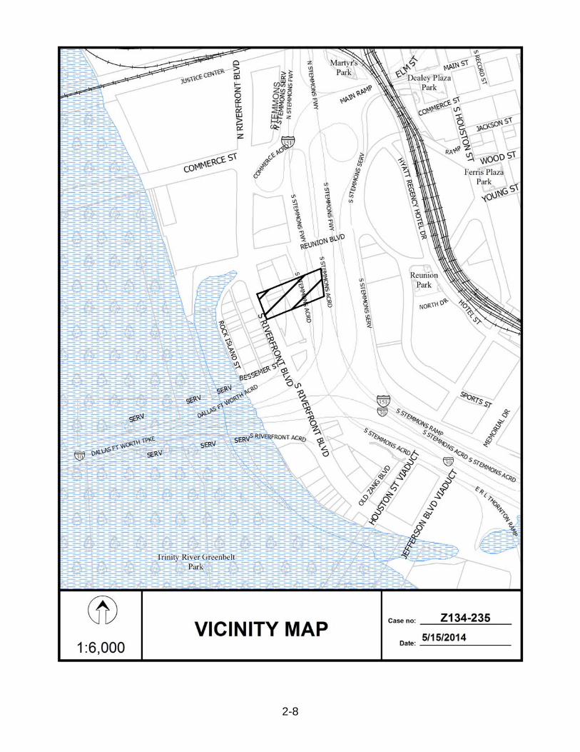
Z134-235(RB)
2-8
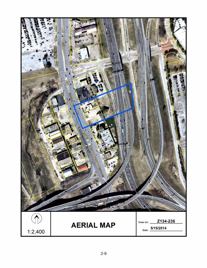
Z134-235(RB)
2-9
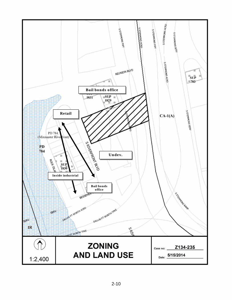
Z134-235(RB)
2-10
RReettaaiill
BBaaiill bboonnddss ooffffiiccee
UUnnddeevv..
BBaaiill bboonnddss ooffffiiccee
IInnssiiddee iinndduussttrriiaall

Z134-235(RB)
2-11
11 22
33
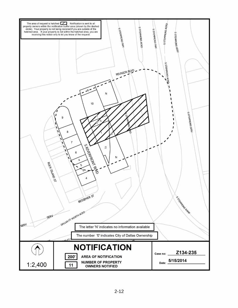
Z134-235(RB)
2-12

Z134-235(RB)
2-13
5/14/2014
Notification List of Property Owners Z134-235
11 Property Owners Notified
Label # Address Owner 1 350 RIVERFRONT BLVD RIEKE LUCY CHRISTINE TR ETAL
2 330 RIVERFRONT BLVD RIEKE LUCY CHRISTINE TR ETAL
3 330 RIVERFRONT BLVD RIEKE LUCY CHRISTINE TR & ETAL
4 351 RIVERFRONT BLVD LAKHANI MEHMOOD & MALIK LAKHANI
5 345 RIVERFRONT BLVD LAKHANI MEHMOOD
6 331 RIVERFRONT BLVD CHPD LP
7 323 RIVERFRONT BLVD LAMS FAMILY LTD
8 317 RIVERFRONT BLVD JIFFY PROPERTIES LP
9 311 RIVERFRONT BLVD JIFFY PPTIES LP
10 314 RIVERFRONT BLVD OZNICK LAUREN LYNN &
11 362 RIVERFRONT BLVD SANTIAGO GP LLC

3-1
CITY PLAN COMMISSION THURSDAY, AUGUST 7, 2014 Planner: Carrie F. Gordon
FILE NUMBER: Z134-251(CG) DATE FILED: May 2, 2014
LOCATION: North corner of Kimble Street and Pennsylvania Avenue
COUNCIL DISTRICT: 7 MAPSCO: 46-S, 46-W
SIZE OF REQUEST: 1.5 acres CENSUS TRACT: 203.00 APPLICANT/OWNER: City of Dallas
REPRESENTATIVE: Elizabeth Brant
REQUEST: An application for a Specific Use Permit for a fire station on property in an R-5(A) Single Family Residential Subdistrict of Planned Development District No. 595.
SUMMARY: The applicant is requesting a Specific Use Permit to construct the new City of Dallas Fire Station No. 6. The structure proposed is one-story, 12,200 square feet. The proposed station would have four bays, consisting of 16 beds to accommodate fire personnel.
STAFF RECOMMENDATION: Approval for a permanent period, subject to a site plan, landscape plan, and conditions.
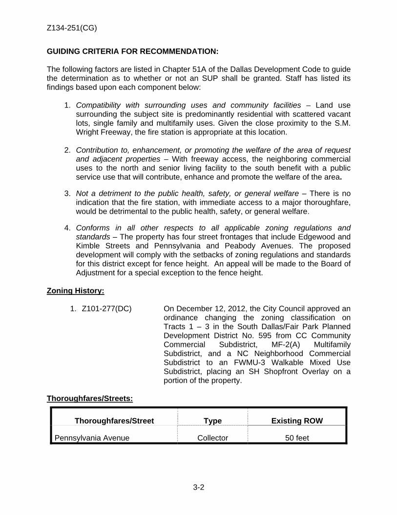
Z134-251(CG)
3-2
GUIDING CRITERIA FOR RECOMMENDATION: The following factors are listed in Chapter 51A of the Dallas Development Code to guide the determination as to whether or not an SUP shall be granted. Staff has listed its findings based upon each component below:
1. Compatibility with surrounding uses and community facilities – Land use surrounding the subject site is predominantly residential with scattered vacant lots, single family and multifamily uses. Given the close proximity to the S.M. Wright Freeway, the fire station is appropriate at this location.
2. Contribution to, enhancement, or promoting the welfare of the area of request and adjacent properties – With freeway access, the neighboring commercial uses to the north and senior living facility to the south benefit with a public service use that will contribute, enhance and promote the welfare of the area.
3. Not a detriment to the public health, safety, or general welfare – There is no
indication that the fire station, with immediate access to a major thoroughfare, would be detrimental to the public health, safety, or general welfare.
4. Conforms in all other respects to all applicable zoning regulations and
standards – The property has four street frontages that include Edgewood and Kimble Streets and Pennsylvania and Peabody Avenues. The proposed development will comply with the setbacks of zoning regulations and standards for this district except for fence height. An appeal will be made to the Board of Adjustment for a special exception to the fence height.
Zoning History:
1. Z101-277(DC) On December 12, 2012, the City Council approved an ordinance changing the zoning classification on Tracts 1 – 3 in the South Dallas/Fair Park Planned Development District No. 595 from CC Community Commercial Subdistrict, MF-2(A) Multifamily Subdistrict, and a NC Neighborhood Commercial Subdistrict to an FWMU-3 Walkable Mixed Use Subdistrict, placing an SH Shopfront Overlay on a portion of the property.
Thoroughfares/Streets:
Thoroughfares/Street Type Existing ROW
Pennsylvania Avenue Collector 50 feet
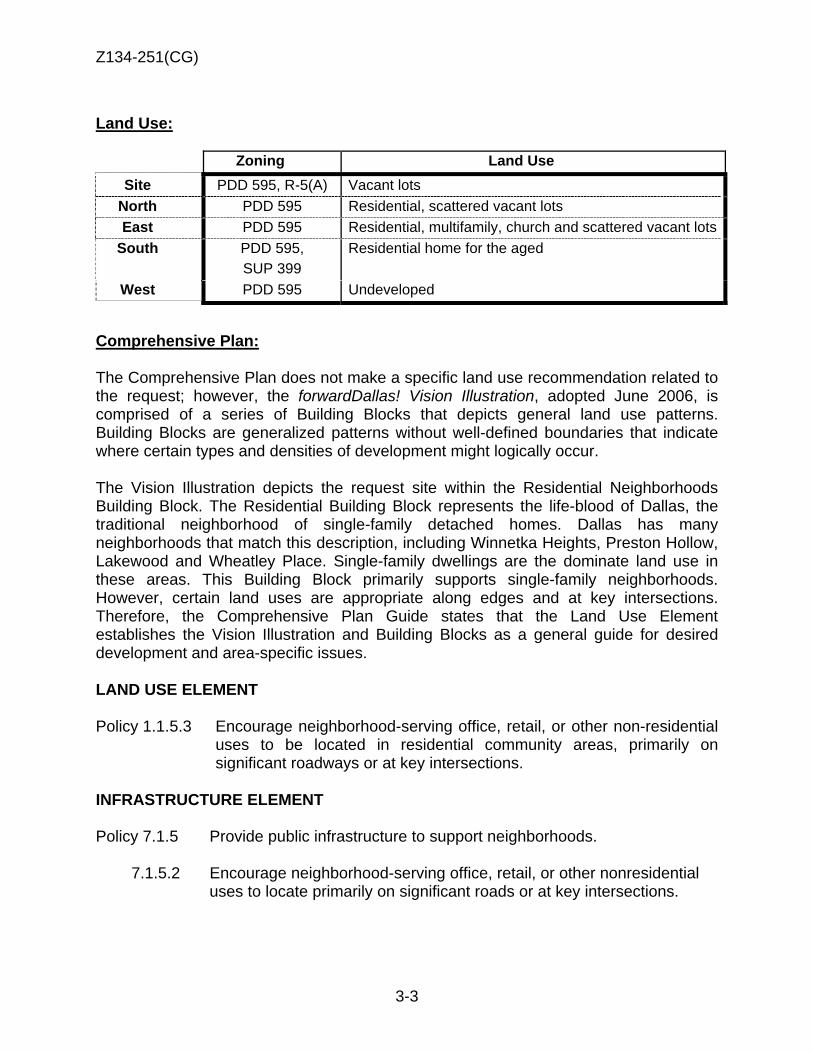
Z134-251(CG)
3-3
Land Use:
Zoning Land Use Site PDD 595, R-5(A) Vacant lots
North PDD 595 Residential, scattered vacant lots East PDD 595 Residential, multifamily, church and scattered vacant lots
South PDD 595, SUP 399
Residential home for the aged
West PDD 595 Undeveloped
Comprehensive Plan: The Comprehensive Plan does not make a specific land use recommendation related to the request; however, the forwardDallas! Vision Illustration, adopted June 2006, is comprised of a series of Building Blocks that depicts general land use patterns. Building Blocks are generalized patterns without well-defined boundaries that indicate where certain types and densities of development might logically occur. The Vision Illustration depicts the request site within the Residential Neighborhoods Building Block. The Residential Building Block represents the life-blood of Dallas, the traditional neighborhood of single-family detached homes. Dallas has many neighborhoods that match this description, including Winnetka Heights, Preston Hollow, Lakewood and Wheatley Place. Single-family dwellings are the dominate land use in these areas. This Building Block primarily supports single-family neighborhoods. However, certain land uses are appropriate along edges and at key intersections. Therefore, the Comprehensive Plan Guide states that the Land Use Element establishes the Vision Illustration and Building Blocks as a general guide for desired development and area-specific issues. LAND USE ELEMENT Policy 1.1.5.3 Encourage neighborhood-serving office, retail, or other non-residential
uses to be located in residential community areas, primarily on significant roadways or at key intersections.
INFRASTRUCTURE ELEMENT Policy 7.1.5 Provide public infrastructure to support neighborhoods. 7.1.5.2 Encourage neighborhood-serving office, retail, or other nonresidential
uses to locate primarily on significant roads or at key intersections.

Z134-251(CG)
3-4
Land Use Compatibility: The approximately 1.2 acre request site consists of vacant lots, and lies within the Residential R-5(A) subdistrict of Planned Development District 595. The surrounding land uses are predominantly residential with single family and multifamily uses to the north, east and south. Commercial, residential, institutional uses and vacant parcels are also dispersed within that boundary, with freeway frontage to the west.
Upon approval of the zoning change request, 20 lots will be re-platted into a single lot to construct the new fire station. The property has frontages on Edgewood and Kimble Streets and Pennsylvania and Peabody Avenues. The attached site plans shows a 10 foot setback on Edgewood Street. Should Building Inspection confirm that the setback along Edgewood Street is a 20-foot front yard setback, the site plan will be revised to comply with zoning district regulations.
The proposed development will comply with the setbacks of zoning regulations and standards for this district except for fence height. An appeal will be made to the Board of Adjustment for a special exception to the fence height. With immediate freeway access, the proposed fire station is a public service use that will not detrimentally impact the area. Staff is recommending approval. The general provisions for a Specific Use Permit in Section 51A-4.219 of the Dallas Development Code specifically state: (1) The SUP provides a means for developing certain uses in a manner in which the specific use will be consistent with the character of the neighborhood; (2) Each SUP application must be evaluated as to its probable effect on the adjacent property and the community welfare and may be approved or denied as the findings indicate appropriate; (3) The city council shall not grant an SUP for a use except upon a finding that the use will: (A) complement or be compatible with the surrounding uses and community facilities; (B) contribute to, enhance, or promote the welfare of the area of request and adjacent properties; (C) not be detrimental to the public health, safety, or general welfare; and (D) conform in all other respects to all applicable zoning regulations and standards. The regulations in this chapter have been established in accordance with a comprehensive plan for the purpose of promoting the health, safety, morals, and general welfare of the city.
Development Standards:
DISTRICT SETBACKS FAR Height Lot Coverage
Special Standards Primary Uses
Front Side/Rear
PDD 595 Single Family 20’ 5’
No max. dwelling unit
density 30’ 45%
Min. Lot: 5,000 sq.
ft. Single family
Other permitted structures
20’
10’
N/A
20’
25%
N/A
N/A
Landscaping: Landscaping attached landscape plan has been reviewed by the City’s Arborist and provided to meet the intent of Article X.

Z134-251(CG)
3-5
Parking: The Dallas Development Code requires 5 spaces plus one additional space per bed. Given the proposed 16 beds, 22 spaces are required plus 1 handicapped parking spaces for a total of 23 off-street parking spaces as shown on the attached site plan.
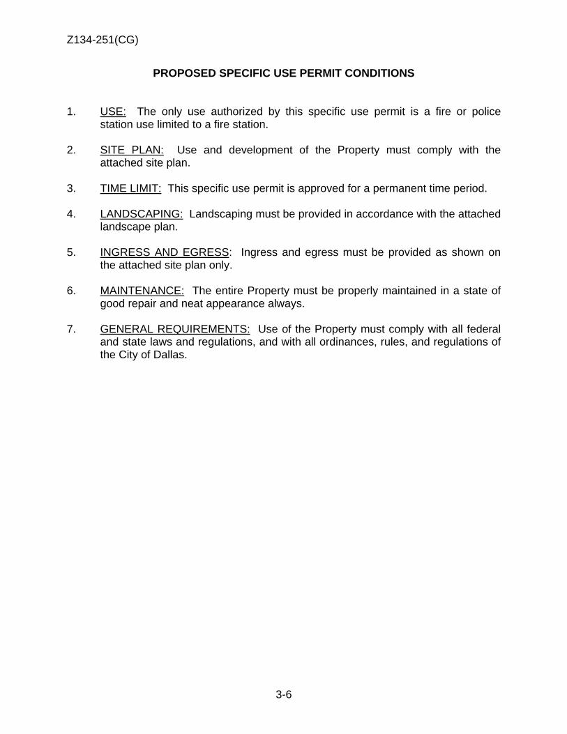
Z134-251(CG)
3-6
PROPOSED SPECIFIC USE PERMIT CONDITIONS 1. USE: The only use authorized by this specific use permit is a fire or police
station use limited to a fire station. 2. SITE PLAN: Use and development of the Property must comply with the
attached site plan. 3. TIME LIMIT: This specific use permit is approved for a permanent time period. 4. LANDSCAPING: Landscaping must be provided in accordance with the attached
landscape plan. 5. INGRESS AND EGRESS: Ingress and egress must be provided as shown on
the attached site plan only. 6. MAINTENANCE: The entire Property must be properly maintained in a state of
good repair and neat appearance always. 7. GENERAL REQUIREMENTS: Use of the Property must comply with all federal
and state laws and regulations, and with all ordinances, rules, and regulations of the City of Dallas.

Z134-251(CG)
3-7
PROPOSED SITE PLAN
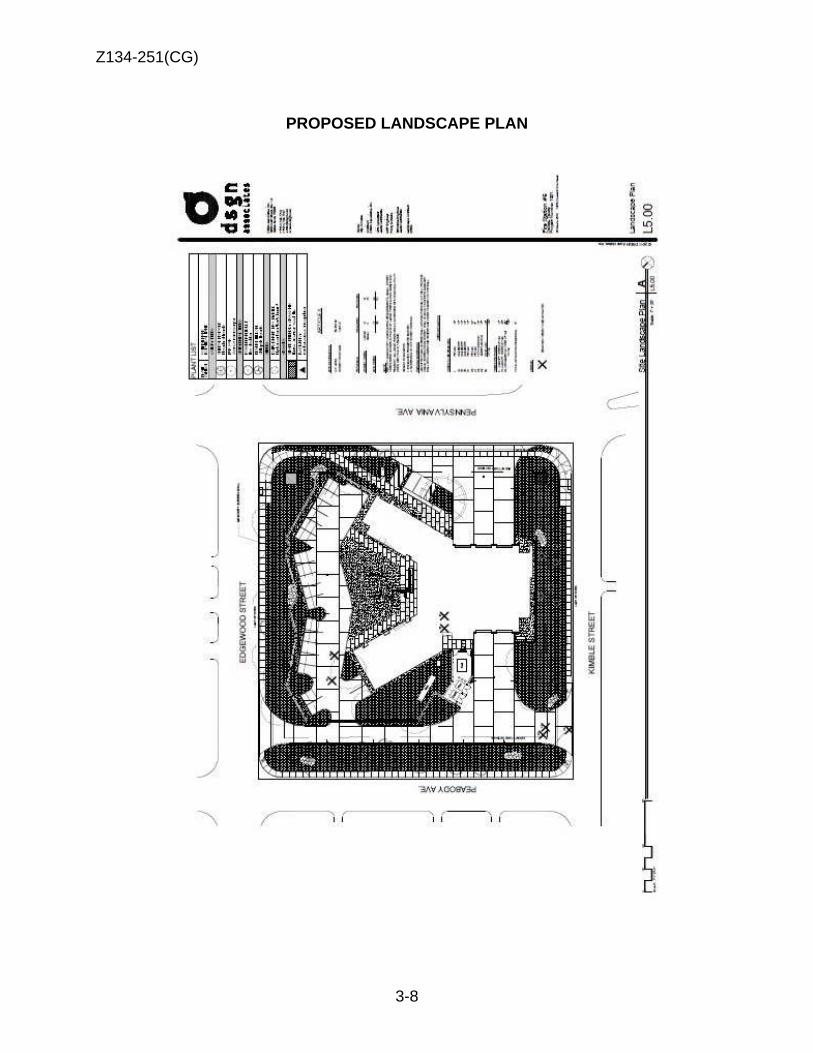
Z134-251(CG)
3-8
PROPOSED LANDSCAPE PLAN
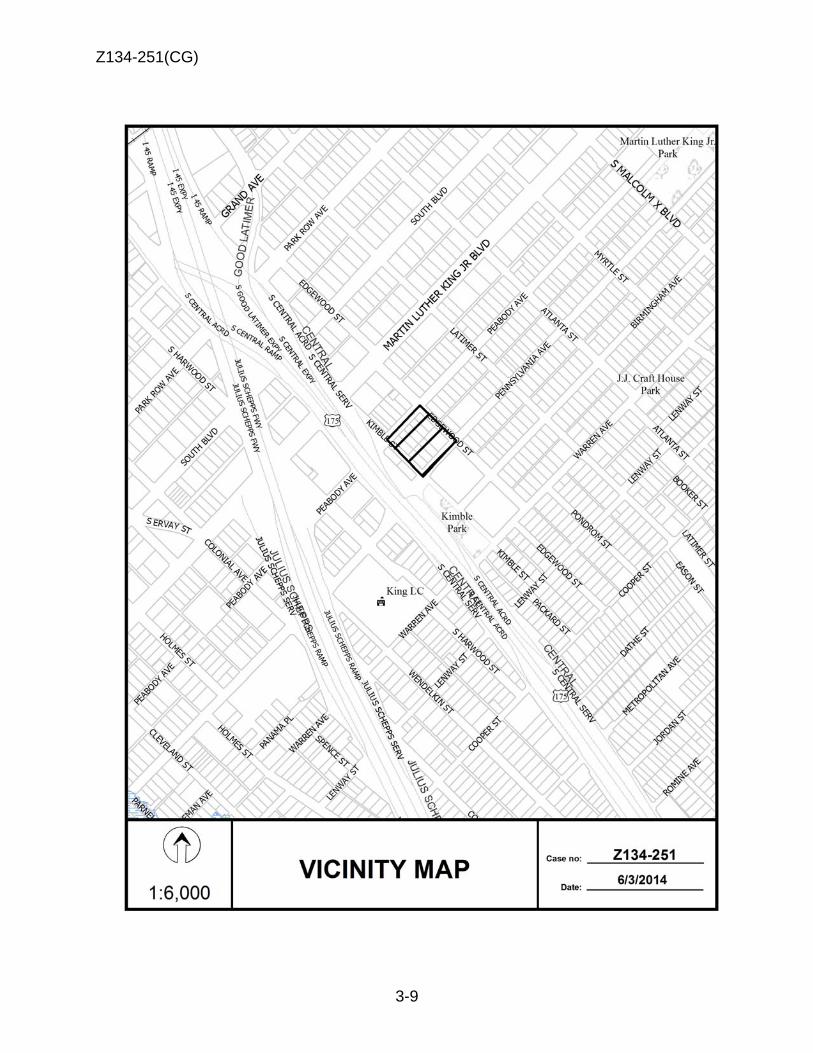
Z134-251(CG)
3-9

Z134-251(CG)
3-10
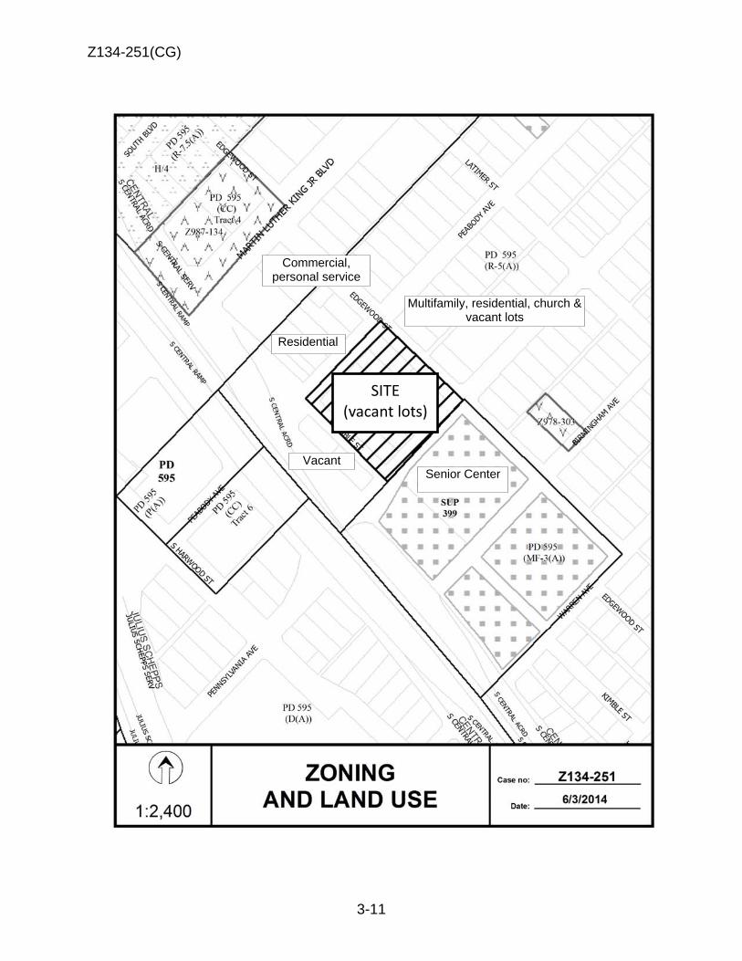
Z134-251(CG)
3-11
SITE(vacant lots)
Multifamily, residential, church & vacant lots
Residential
Senior Center Vacant
Commercial, personal service
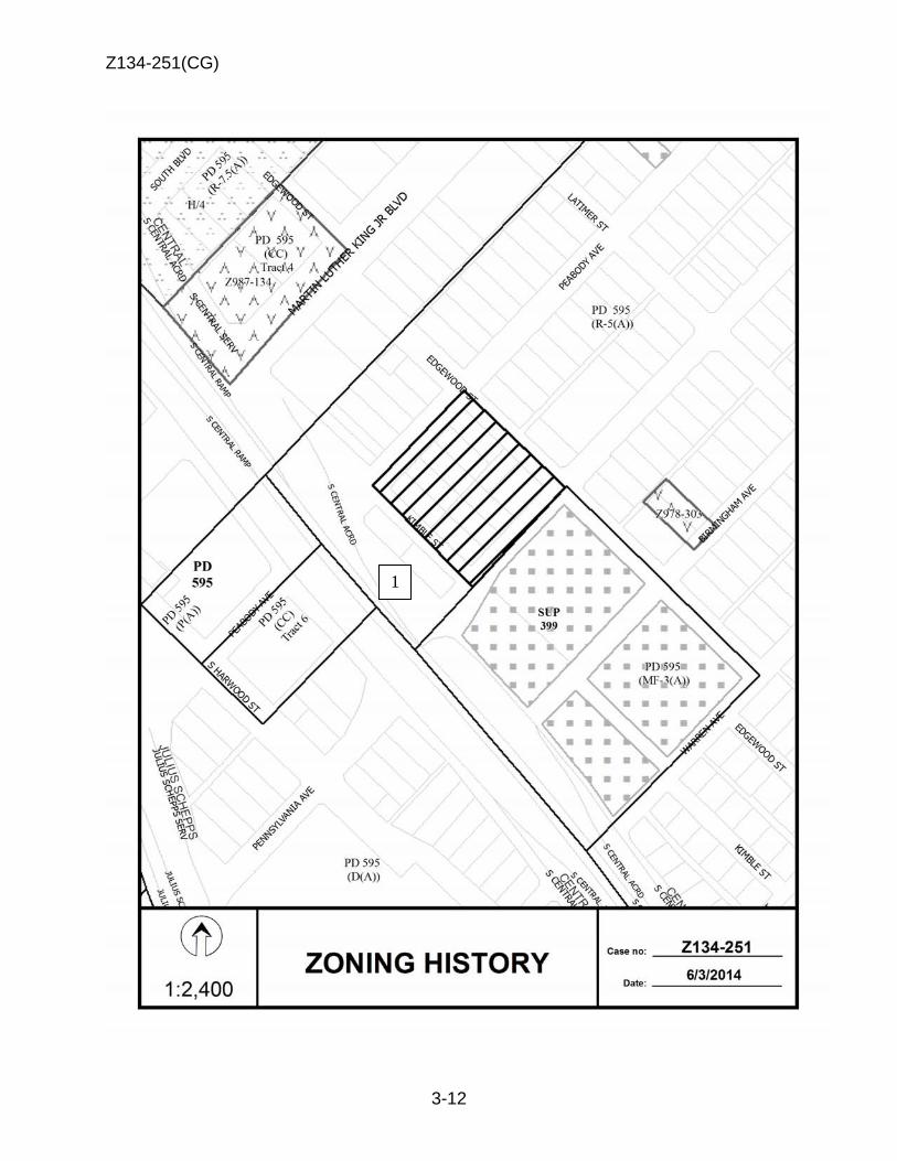
Z134-251(CG)
3-12
1
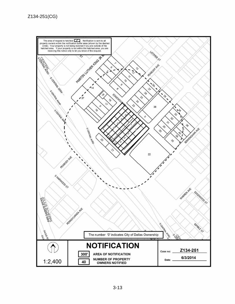
Z134-251(CG)
3-13
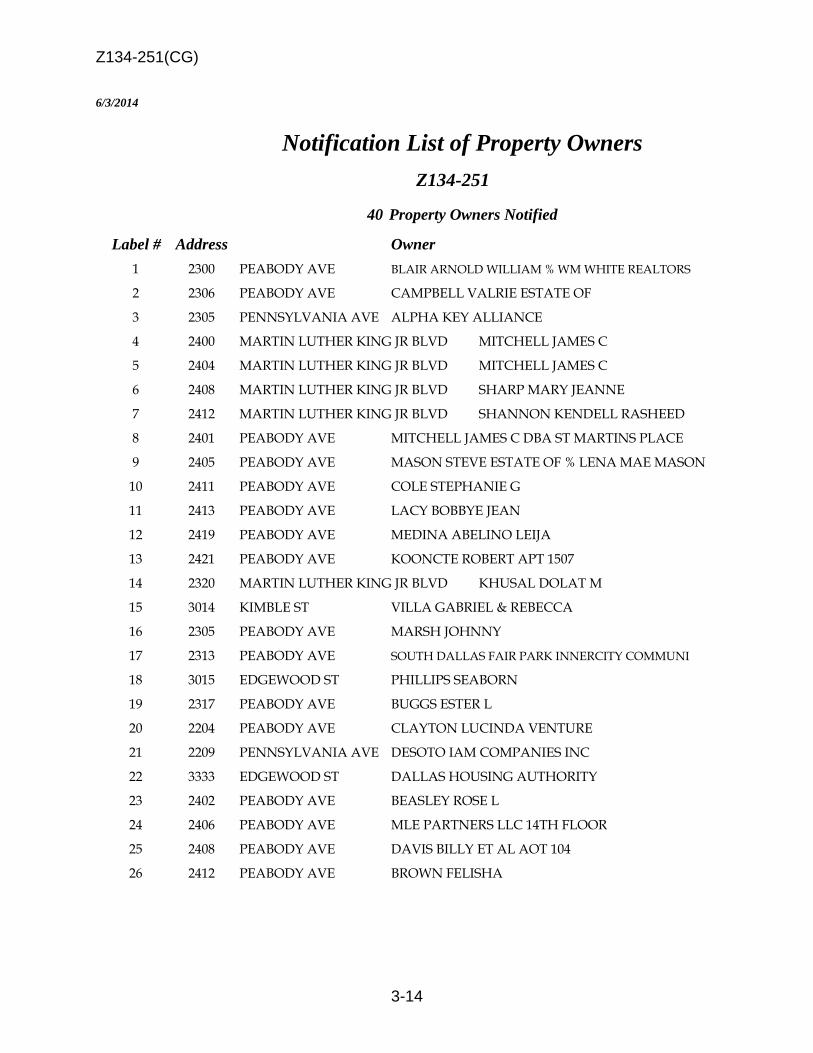
Z134-251(CG)
3-14
6/3/2014 Notification List of Property Owners
Z134-251
40 Property Owners Notified
Label # Address Owner 1 2300 PEABODY AVE BLAIR ARNOLD WILLIAM % WM WHITE REALTORS
2 2306 PEABODY AVE CAMPBELL VALRIE ESTATE OF 3 2305 PENNSYLVANIA AVE ALPHA KEY ALLIANCE 4 2400 MARTIN LUTHER KING JR BLVD MITCHELL JAMES C 5 2404 MARTIN LUTHER KING JR BLVD MITCHELL JAMES C 6 2408 MARTIN LUTHER KING JR BLVD SHARP MARY JEANNE 7 2412 MARTIN LUTHER KING JR BLVD SHANNON KENDELL RASHEED 8 2401 PEABODY AVE MITCHELL JAMES C DBA ST MARTINS PLACE 9 2405 PEABODY AVE MASON STEVE ESTATE OF % LENA MAE MASON 10 2411 PEABODY AVE COLE STEPHANIE G 11 2413 PEABODY AVE LACY BOBBYE JEAN 12 2419 PEABODY AVE MEDINA ABELINO LEIJA 13 2421 PEABODY AVE KOONCTE ROBERT APT 1507 14 2320 MARTIN LUTHER KING JR BLVD KHUSAL DOLAT M 15 3014 KIMBLE ST VILLA GABRIEL & REBECCA 16 2305 PEABODY AVE MARSH JOHNNY 17 2313 PEABODY AVE SOUTH DALLAS FAIR PARK INNERCITY COMMUNI
18 3015 EDGEWOOD ST PHILLIPS SEABORN 19 2317 PEABODY AVE BUGGS ESTER L 20 2204 PEABODY AVE CLAYTON LUCINDA VENTURE 21 2209 PENNSYLVANIA AVE DESOTO IAM COMPANIES INC 22 3333 EDGEWOOD ST DALLAS HOUSING AUTHORITY 23 2402 PEABODY AVE BEASLEY ROSE L 24 2406 PEABODY AVE MLE PARTNERS LLC 14TH FLOOR 25 2408 PEABODY AVE DAVIS BILLY ET AL AOT 104 26 2412 PEABODY AVE BROWN FELISHA

Z134-251(CG)
3-15
6/3/2014
Label # Address Owner 27 2416 PEABODY AVE JACKSON ROBERT D 28 2422 PEABODY AVE SKINNER LEIGHTON & BILLY RAY ANDERSON 29 2421 PENNSYLVANIA AVE ANDERSON CECIL E 30 2400 PENNSYLVANIA AVE DALLAS CITY OF & ETAL 31 2408 PENNSYLVANIA AVE EDNEY LODIE 32 2414 PENNSYLVANIA AVE HILTON HEAD FINANCE LLC 33 2416 PENNSYLVANIA AVE DAVIS LEONARD REECE 34 2420 PENNSYLVANIA AVE JOHNSON KATIE FRANCES P 35 2401 BIRMINGHAM AVE DARBY PATRICIA ANN 36 2417 BIRMINGHAM AVE LEONARD SANDRA THAMES 37 2310 MARTIN LUTHER KING JR BLVD CNB REAL ESTATE LLC 38 2409 PENNSYLVANIA AVE PRAISE TEMPLE % MILTON TRAYLOR 39 2409 BIRMINGHAM AVE ADAMS TIA 40 2411 BIRMINGHAM AVE CRAIG JAMES
4-1
CITY PLAN COMMISSION THURSDAY, AUGUST 7, 2014 Planner: Carrie F. Gordon
FILE NUMBER: Z134-252(CG) DATE FILED: May 5, 2014
LOCATION: North line of Main Street, East of Malcolm X Boulevard
COUNCIL DISTRICT: 2 MAPSCO: 45-M
SIZE OF REQUEST: + 3,055 square feet CENSUS TRACT: 204.00
REPRESENTATIVE: Roger Albright
APPLICANT: DBL Partners, LLC OWNER: SDL Partners, Ltd. REQUEST: An application for renewal of Specific Use Permit No. 1981
for a bar, lounge or tavern, with an amendment to permit a Commercial Amusement (Inside) use for a dance hall on property zoned Tract A within Planned Development District No. 269, the Deep Ellum/Near East Side District.
SUMMARY: The request is to continue operation of the entertainment
venue [2911 Main], and to allow the addition of a 100-square-foot dance floor area in the existing building.
STAFF RECOMMENDATION: Approval for a two-year period, subject to a revised
site plan and conditions.
Z134-252(CG)
4-2
GUIDING CRITERIA FOR RECOMMENDATION: The following factors are listed in Chapter 51A of the Dallas Development Code to guide the determination as to whether or not an SUP shall be granted. Staff has listed its findings based upon each component below:
1. Compatibility with surrounding uses and community facilities – The requested commercial amusement (inside) use is compatible and complements the adjacent retail, restaurant, and personal service uses. The use should not impact the surrounding area negatively from a land use perspective. The primary uses in PDD No. 269 consist of a mix of alcoholic beverage establishments, restaurant, personal service and office uses.
2. Contribution to, enhancement, or promoting the welfare of the area of request and adjacent properties – The use has had neither a positive nor negative contribution to the welfare of adjacent properties.
3. Not a detriment to the public health, safety, or general welfare – It is not foreseen that this use would be a detriment to the public health, safety or general welfare of the community.
4. Conforms in all other respects to all applicable zoning regulations and
standards – The request will comply with all zoning regulations and standards. BACKGROUND INFORMATION:
• The application is renewal of SUP No. 1981. The SUP was granted on August 12, 2012, for a bar, lounge or tavern use. In conjunction with renewal, the applicant is requesting an amendment to add a Commercial Amusement (Inside) use for a dance hall, not to exceed 100 square feet.
• The existing SUP will expire on August 22, 2014. Zoning History:
1. Z123-267(CG) On May 28, 2014, the City Council approved amendments to certain use regulations and development standards within Planned Development District No. 269, the Deep Ellum/East Side District.
2. Z112-250 (JH) On August 22, 2012, the City Council approved a
SUP for a bar, lounge, or tavern for a two-year period, subject to a site plan and conditions. [SUP No. 1981 expires 08/22/2014]

Z134-252(CG)
4-3
COMPREHENSIVE PLAN: The fowardDallas! Comprehensive Plan was adopted by the City Council in June 2006. The plan outlines several goals and policies which can serve as a framework for assisting in evaluating the applicant’s request, and it identifies the request site as being in an Urban Mixed Use Building Block. The Urban Mixed-Use Building Block incorporates a vibrant mix of residential and employment uses at a lower density than the Downtown Building Block. These areas are typically near Downtown, along the Trinity River or near major transit centers. Examples include Uptown, the City Place/West Village area, Stemmons Design District, Cedars and Deep Ellum. Urban Mixed-Use Building Blocks provide residents with a vibrant blend of opportunities to live, work, shop and play within a closely defined area. Buildings range from high-rise residential or mid-rise commercial towers to townhomes and small corner shops. Good access to transit is a critical element. Similar to Downtown, the Urban Mixed-Use Building Blocks offer employment and housing options and are important economic growth areas for businesses. People on foot or bike can enjoy interesting storefronts at ground level with benches, public art, on-street parking and wide sidewalks, creating an appealing streetscape. Large parking areas and other auto-oriented land uses are typically located at the edges.
Traffic:
The Engineering Section of the Department of Sustainable Development and Construction has reviewed the requested renewal and determined it will not significantly impact the surrounding street system. Thoroughfares/Streets:
Thoroughfares/Street Type Existing ROW
Malcolm X Boulevard Major Arterial 60 feet
STAFF ANALYSIS: Land Use Compatibility: The request site is developed with approximately 3,055 square feet of floor area on a 2,730 square foot building footprint. The application is for renewal of existing SUP No. 1981, with an amendment to the existing SUP to allow a commercial amusement (inside) use for a Class A Dance Hall on the first level of the facility, maximum 100-square-feet of floor area. With this licensure, dancing would be permitted three (3) or more days a week. The use is surrounded by other commercial uses and various surface parking lots. The site is within walking distance to the DART Green Line. As noted below, there has been minimal reported police activity at this location for the past two-years of issuance of the original SUP. As a result of this analysis, staff has determined the request complies with the general provisions for consideration of the SUP.
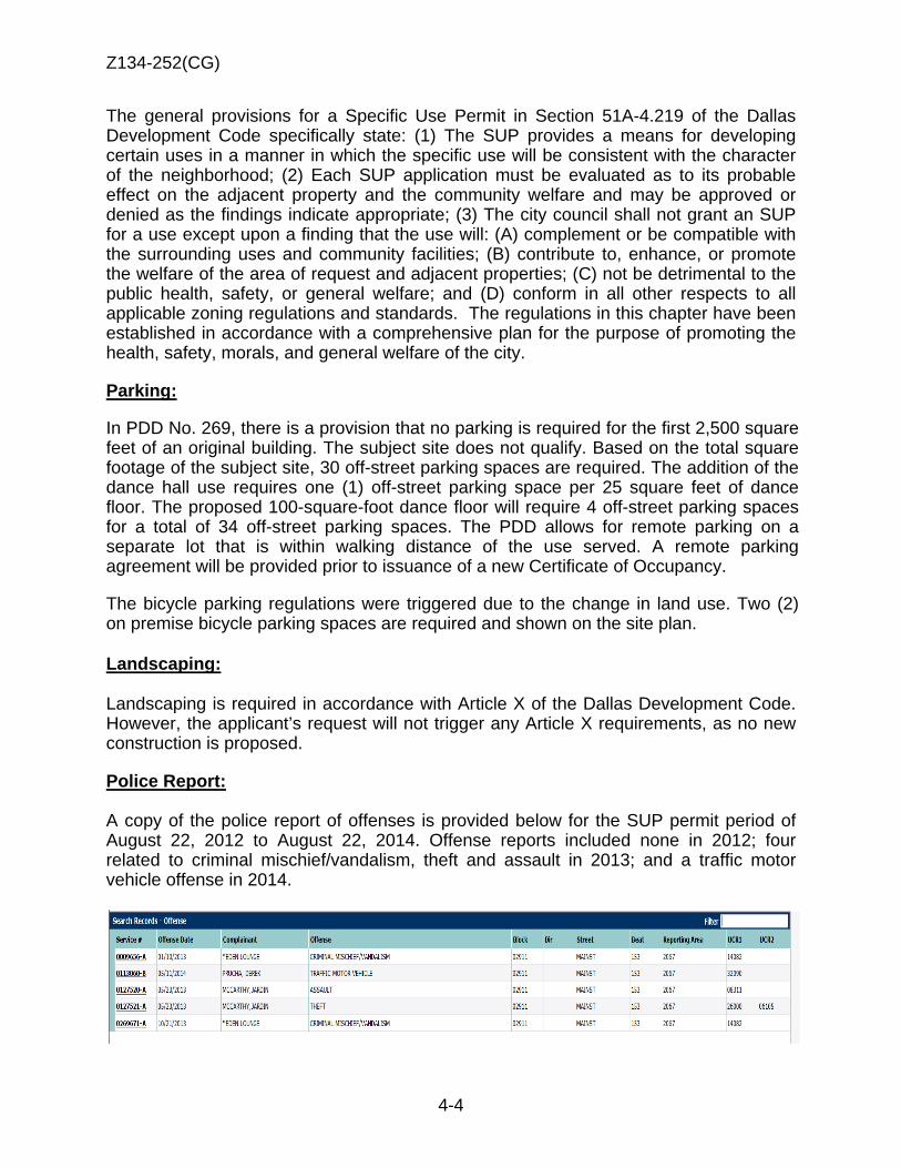
Z134-252(CG)
4-4
The general provisions for a Specific Use Permit in Section 51A-4.219 of the Dallas Development Code specifically state: (1) The SUP provides a means for developing certain uses in a manner in which the specific use will be consistent with the character of the neighborhood; (2) Each SUP application must be evaluated as to its probable effect on the adjacent property and the community welfare and may be approved or denied as the findings indicate appropriate; (3) The city council shall not grant an SUP for a use except upon a finding that the use will: (A) complement or be compatible with the surrounding uses and community facilities; (B) contribute to, enhance, or promote the welfare of the area of request and adjacent properties; (C) not be detrimental to the public health, safety, or general welfare; and (D) conform in all other respects to all applicable zoning regulations and standards. The regulations in this chapter have been established in accordance with a comprehensive plan for the purpose of promoting the health, safety, morals, and general welfare of the city.
Parking:
In PDD No. 269, there is a provision that no parking is required for the first 2,500 square feet of an original building. The subject site does not qualify. Based on the total square footage of the subject site, 30 off-street parking spaces are required. The addition of the dance hall use requires one (1) off-street parking space per 25 square feet of dance floor. The proposed 100-square-foot dance floor will require 4 off-street parking spaces for a total of 34 off-street parking spaces. The PDD allows for remote parking on a separate lot that is within walking distance of the use served. A remote parking agreement will be provided prior to issuance of a new Certificate of Occupancy.
The bicycle parking regulations were triggered due to the change in land use. Two (2) on premise bicycle parking spaces are required and shown on the site plan. Landscaping: Landscaping is required in accordance with Article X of the Dallas Development Code. However, the applicant’s request will not trigger any Article X requirements, as no new construction is proposed.
Police Report: A copy of the police report of offenses is provided below for the SUP permit period of August 22, 2012 to August 22, 2014. Offense reports included none in 2012; four related to criminal mischief/vandalism, theft and assault in 2013; and a traffic motor vehicle offense in 2014.
Z134-252(CG)
4-5
List of Partners/Principals/Officers
DNL Partners, LLC, is a Texas limited liability company
Its principals are:
1. Donald H. Nedler
2. Vincent Tricomi
3. Charles Eaves
4. Charles Allen Falkner Huff
5. Leopold Del Hierro

Z134-252(CG)
4-6
Proposed SUP Conditions 1. The only authorized uses by this specific use permit is are a bar, lounge, or
tavern and a commercial amusement (inside) limited to a dance hall. 2. SITE PLAN: Use and development of the Property must comply with the attached
site plan. 3. TIME LIMIT: This specific use permit expires on (two-years from passage of the
ordinance). 4. FLOOR AREA: The maximum floor area is 3,055 square feet in the location
shown on the attached site plan. 5. DANCE FLOOR AREA: A maximum 100 square-feet for dance floor area is only
allowed on the ground floor. 6. HOURS OF OPERATION: The allowed uses only operate between 11:00 a.m.
and 2:00 a.m. (the next day), Monday through Sunday.
7. PARKING: Parking must be provided in accordance with the requirements of Planned Development District No. 269. Delta credits, as defined in Section 51A-4.704(b)(4)(A) of Chapter 51A of the Dallas City Code, as amended, may not be used to meet the off-street parking requirement.
8. ROOF DECK: The roof deck may not exceed an area of 325 square feet in the location shown on the attached site plan.
9. CERTIFICATE OF OCCUPANCY: A new certificate of occupancy is required
prior to operation of the dance hall use.
10. MAINTENANCE: The Property must be properly maintained in a state of good repair and neat appearance.
11. GENERAL REQUIREMENTS: Use of the Property must comply with all federal and state laws and regulations, and with all ordinances, rules, and regulations of the City of Dallas.

Z134-252(CG)
4-7
REVISED SITE PLAN

Z134-252(CG)
4-8

Z134-252(CG)
4-9
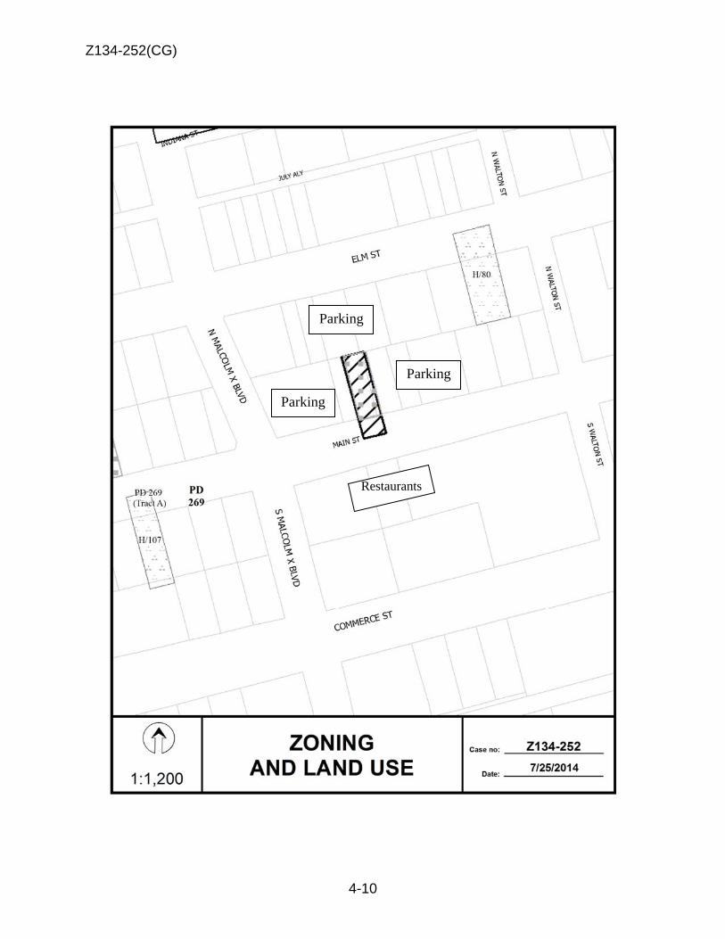
Z134-252(CG)
4-10
Parking
Parking
Parking
Restaurants

Z134-252(CG)
4-11
1
2

Z134-252(CG)
4-12

Z134-252(CG)
4-13
07/24/2014
Notification List of Property Owners Z134-252
17 Property Owners Notified
Label # Address Owner 1 2918 ELM ST ANDREASON JUSTINE POKLADNIK
2 2908 ELM ST SDL PARTNERS LTD
3 2900 MAIN ST SDL PARTNERS LTD &
4 2919 COMMERCE ST SDL PARTNERS LTD
5 2900 MAIN ST SUNRISE FURNITURE COMPANY
6 2901 COMMERCE ST CITY PARK A LOT LP
7 2824 MAIN ST BLADE PROPERTIES LLC
8 2825 MAIN ST SMITH PACIFIC INC
9 2936 ELM ST EISCHINGER FURTULA BUDD
10 2928 ELM ST ANDREASON JUSTIN MARIE POKLADNIK
11 2920 ELM ST ANDREASON JUSTINE MARIE POKLADNIK
12 2931 MAIN ST POKLADNIK CYRILL J
13 2913 MAIN ST POKLADNIK CYRILL J ESTATE
14 2905 ELM ST 2905 ELM STREET PTNR LTD
15 2907 ELM ST 2905 ELM STREET PTNRS LTD
16 2917 ELM ST CTC TEXAS ASSOCIATES LLC
17 2927 ELM ST MADISON PACIFIC DEV CO
5-1
CITY PLAN COMMISSION THURSDAY, AUGUST 7, 2014 Planner: Carrie F. Gordon
FILE NUMBER: Z134-257(CG) DATE FILED: May 7, 2014
LOCATION: South side of Exposition Avenue, east of Ash Lane
COUNCIL DISTRICT: 7 MAPSCO: 46-K
SIZE OF REQUEST: ±3,550 square feet CENSUS TRACT: 203.00
APPLICANT/REPRESENTATIVE: Timothy L. Austin
OWNER: John S. Roberts
REQUEST: An application to renew Specific Use Permit No. 1691 for a bar, lounge, or tavern on property zoned Planned Development District No. 269, the Deep Ellum/Near East Side Special Purpose District.
SUMMARY: The applicant is requesting the renewal of SUP No. 1691 to operate a bar, lounge, or tavern use [Sandaga 813]. A one-story structure and uncovered patio area are located on the ±6,500-square foot request site. The bar comprises ±3,550 square feet of floor area and the patio comprises ±2,950 square feet.
STAFF RECOMMENDATION: Approval for a three-year period, subject to
conditions.
Z134-257(CG)
5-2
GUIDING CRITERIA FOR RECOMMENDATION: The following factors are listed in Chapter 51A of the Dallas Development Code to guide the determination as to whether or not an SUP shall be granted. Staff has listed its findings based upon each component below:
1. Compatibility with surrounding uses and community facilities – The existing use is compatible with the adjacent warehouse, parking, bars, restaurant, and personal service uses. The use should not impact the surrounding uses negatively from a land use perspective. The primary uses in PDD No. 269 consists of mix of alcoholic beverage establishments, restaurant, personal service and office uses.
2. Contribution to, enhancement, or promoting the welfare of the area of request and adjacent properties – The use has had neither a positive nor negative contribution to the welfare of adjacent properties. The SUP has conditions that appear to mitigate any potential negative impacts.
3. Not a detriment to the public health, safety, or general welfare – It is not foreseen that this use would be a detriment to the public health, safety or general welfare of the community.
4. Conforms in all other respects to all applicable zoning regulations and
standards – The request will comply with all zoning regulations and standards.
BACKGROUND INFORMATION:
• Since December 12, 2007, Specific Use Permit renewal requests have been granted at this location, for a bar, lounge or tavern use.
• The SUP expired on May 14, 2014. The applicant is requesting renewal for a 3-year period.
Zoning History:
1. Z101-172(MW) On May 25, 2011, the City Council approved renewal of SUP 1691 for a bar, lounge or tavern. [SUP expires 5/25/2014.]
2. Z101-287(MG) On October 10, 2011, the City Council approved SUP 1910 for a bar, lounge or tavern. [SUP expires 10/10/2016.]
Z134-257(CG)
5-3
3. Z134-189(OTH) On June 11, 2014, the City Council approved renewal of SUP 1692 for a bar, lounge or tavern.
[SUP expires 6/11/2017.]
4. Z123-267(CG) On May 28, 2014, the City Council approved amendments to certain use regulations and development standards within Planned Development District No. 269, the Deep Ellum/East Side District.
Thoroughfares/Streets:
Thoroughfare/Street Type Existing ROW
Exposition Avenue Collector 80 feet
Traffic: The Engineering Section of the Department of Sustainable Development and Construction has reviewed the request and determined it will not significantly impact the surrounding street system. Land Use: Zoning Land Use Site PDD 269 Bar, lounge or tavern
North PDD 269 Mixed use (office and residential)
East PDD 269 Retail and personal service
South PDD 269 Surface parking
West PDD 269 Surface parking COMPREHENSIVE PLAN: The fowardDallas! Comprehensive Plan was adopted by the City Council in June 2006. The plan outlines several goals and policies which can serve as a framework for assisting in evaluating the applicant’s request, and it identifies the request site as being in an Urban Mixed Use Building Block. The Urban Mixed-Use Building Block incorporates a vibrant mix of residential and employment uses at a lower density than the Downtown Building Block. These areas are typically near Downtown, along the Trinity River or near major transit centers. Examples include Uptown, the City Place/West Village area, Stemmons Design District, Cedars and Deep Ellum. Urban Mixed-Use Building Blocks provide residents with a
Z134-257(CG)
5-4
vibrant blend of opportunities to live, work, shop and play within a closely defined area. Buildings range from high-rise residential or mid-rise commercial towers to townhomes and small corner shops. Good access to transit is a critical element. Similar to Downtown, the Urban Mixed-Use Building Blocks offer employment and housing options and are important economic growth areas for businesses. People on foot or bike can enjoy interesting storefronts at ground level with benches, public art, on-street parking and wide sidewalks, creating an appealing streetscape. Large parking areas and other auto-oriented land uses are typically located at the edges. STAFF ANALYSIS: Land Use Compatibility: The applicant is requesting renewal of SUP No. 1691 to continue operation of the existing bar.
The request site is surrounded by mixed use (office and residential) to the north, retail and personal service uses to the east, and surface parking to the south and west. The general provisions for a Specific Use Permit in Section 51A-4.219 of the Dallas Development Code specifically state: (1) The SUP provides a means for developing certain uses in a manner in which the specific use will be consistent with the character of the neighborhood; (2) Each SUP application must be evaluated as to its probable effect on the adjacent property and the community welfare and may be approved or denied as the findings indicate appropriate; (3) The city council shall not grant an SUP for a use except upon a finding that the use will: (A) complement or be compatible with the surrounding uses and community facilities; (B) contribute to, enhance, or promote the welfare of the area of request and adjacent properties; (C) not be detrimental to the public health, safety, or general welfare; and (D) conform in all other respects to all applicable zoning regulations and standards. The regulations in this chapter have been established in accordance with a comprehensive plan for the purpose of promoting the health, safety, morals, and general welfare of the city.
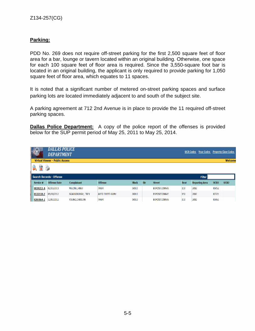
Z134-257(CG)
5-5
Parking: PDD No. 269 does not require off-street parking for the first 2,500 square feet of floor area for a bar, lounge or tavern located within an original building. Otherwise, one space for each 100 square feet of floor area is required. Since the 3,550-square foot bar is located in an original building, the applicant is only required to provide parking for 1,050 square feet of floor area, which equates to 11 spaces. It is noted that a significant number of metered on-street parking spaces and surface parking lots are located immediately adjacent to and south of the subject site. A parking agreement at 712 2nd Avenue is in place to provide the 11 required off-street parking spaces. Dallas Police Department: A copy of the police report of the offenses is provided below for the SUP permit period of May 25, 2011 to May 25, 2014.

Z134-257(CG)
5-6
Existing SUP No. 1691 Conditions
1. USE: The only use authorized by this specific use permit a bar, lounge, or tavern.
2. SITE PLAN: Use and development of the property must comply with the attached site plan.
3. TIME PERIOD: This specific use permit automatically terminates on (three years from passage of the ordinance).
4. FLOOR AREA:
A. The maximum floor area is 3,550 square feet in the location shown on the attached site plan.
B. The maximum area for the uncovered patio is 2,950 square feet in the
location shown on the attached site plan.
5. HOURS OF OPERATION: The bar, lounge or tavern may only operate between 12:00 p.m. (noon) and 1:00 a.m. (the next day), Monday through Wednesday and between 8:00 p.m. and 2:00 a.m. (the next day), Thursday through Sunday.
6. OFF-STREET PARKING: Parking must be provided in accordance with the remote and special parking requirements of Planned Development District No. 269 (the Deep Ellum/Near East Side District). Delta credits, as defined in Section 51A-4.704(b)(4), may not be used to meet the off-street parking requirement.
7. MAINTENANCE: The Property must be properly maintained in a state of good repair and neat appearance.
8. GENERAL REQUIREMENTS: Use of the Property must comply with all federal and state laws and regulations, and with all ordinances, rules, and regulations of the City of Dallas.
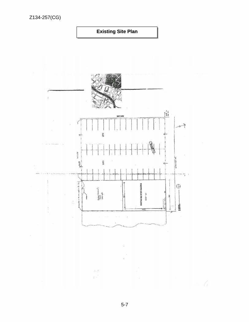
Z134-257(CG)
5-7
EExxiissttiinngg SSiittee PPllaann
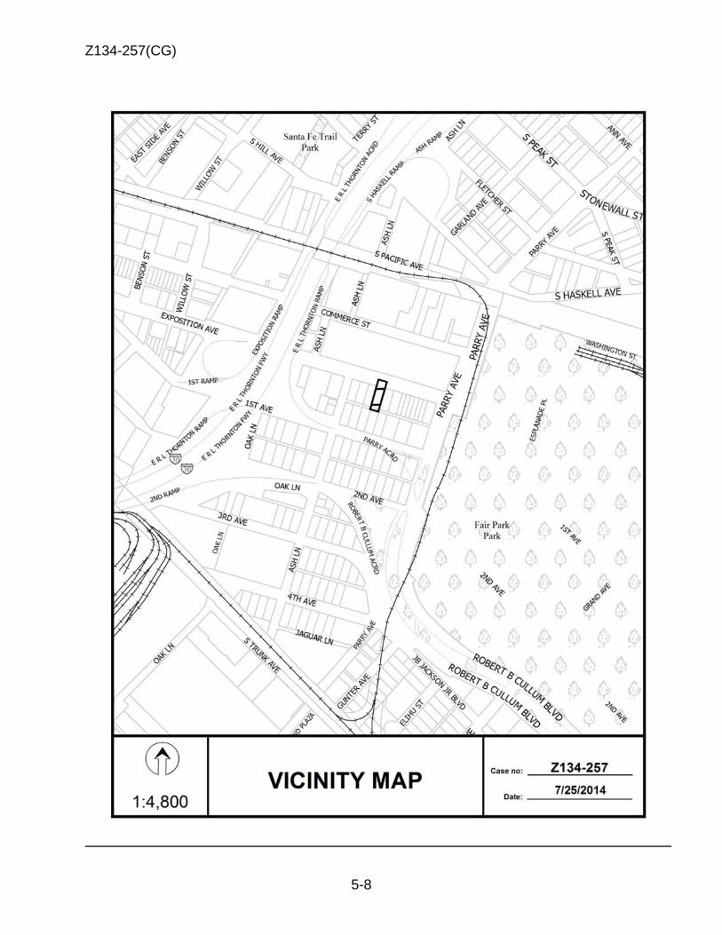
Z134-257(CG)
5-8
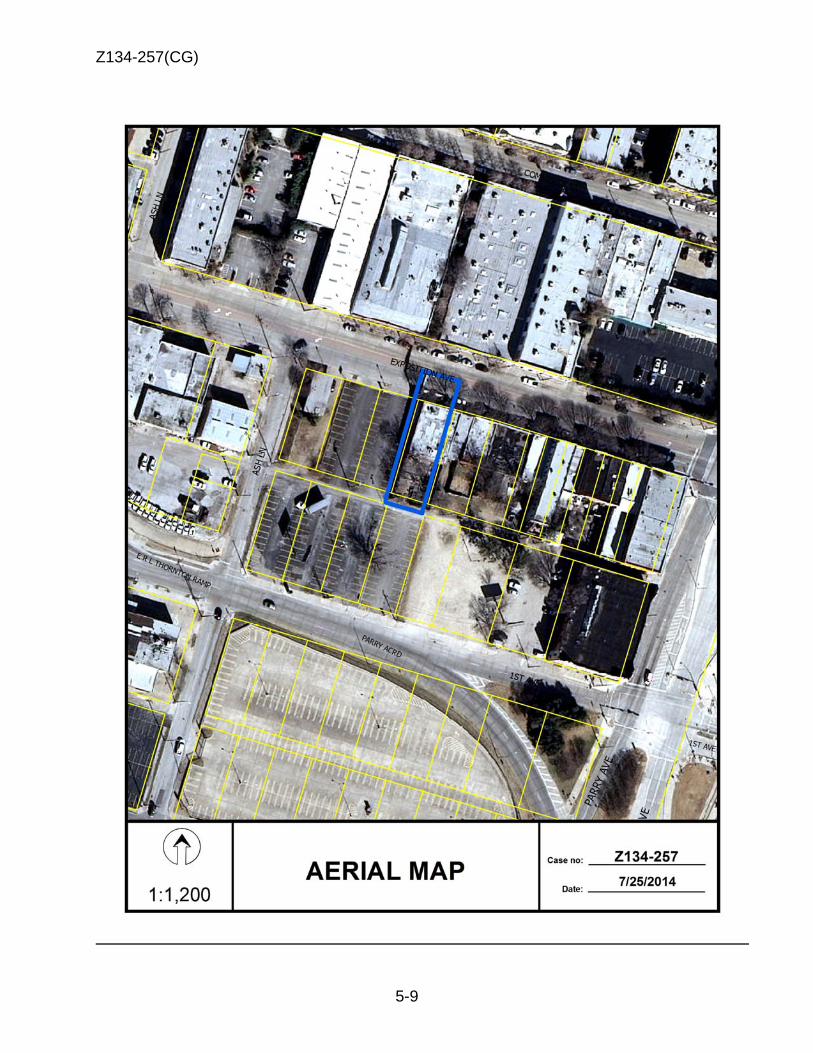
Z134-257(CG)
5-9

Z134-257(CG)
5-10
Office
Parking Bars and
restaurant
Parking
Retail/personal services
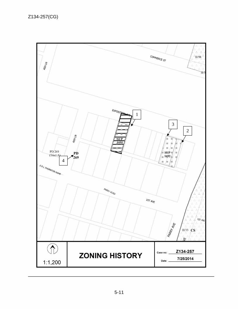
Z134-257(CG)
5-11
1
3
4
2
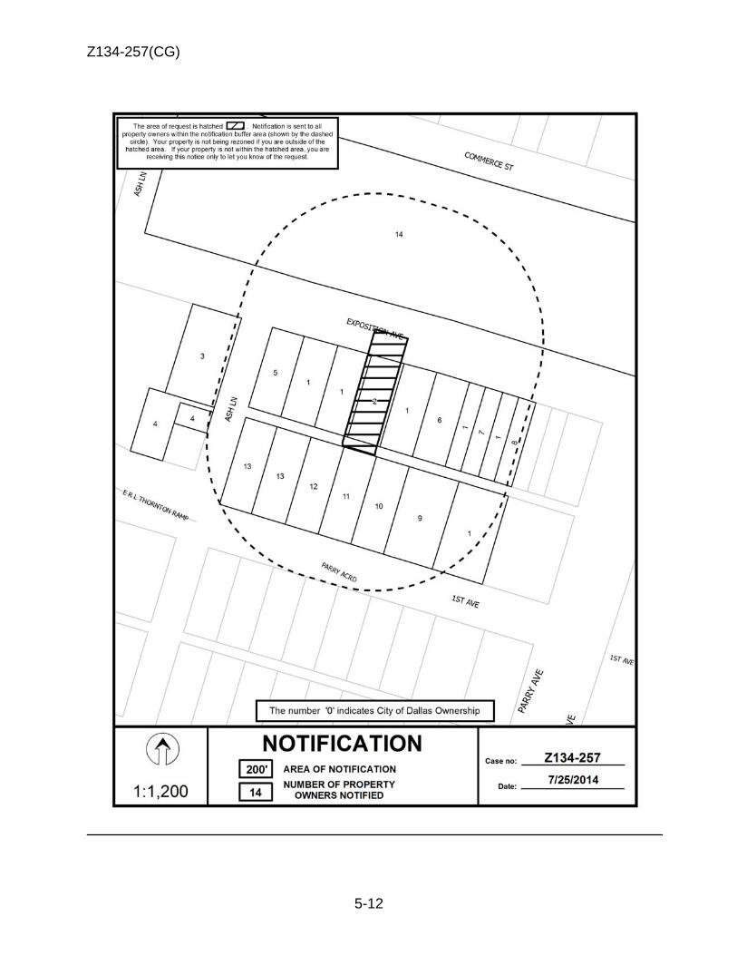
Z134-257(CG)
5-12
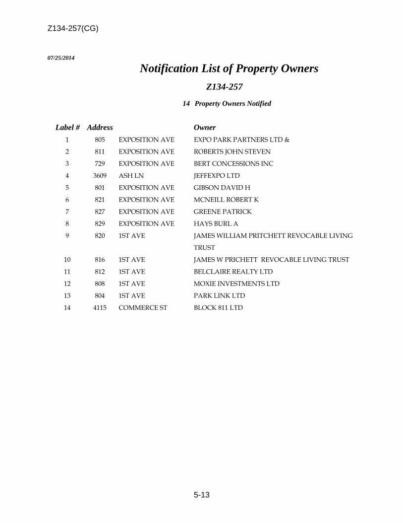
Z134-257(CG)
5-13
07/25/2014
Notification List of Property Owners Z134-257
14 Property Owners Notified
Label # Address Owner 1 805 EXPOSITION AVE EXPO PARK PARTNERS LTD &
2 811 EXPOSITION AVE ROBERTS JOHN STEVEN
3 729 EXPOSITION AVE BERT CONCESSIONS INC
4 3609 ASH LN JEFFEXPO LTD
5 801 EXPOSITION AVE GIBSON DAVID H
6 821 EXPOSITION AVE MCNEILL ROBERT K
7 827 EXPOSITION AVE GREENE PATRICK
8 829 EXPOSITION AVE HAYS BURL A
9 820 1ST AVE JAMES WILLIAM PRITCHETT REVOCABLE LIVING
TRUST
10 816 1ST AVE JAMES W PRICHETT REVOCABLE LIVING TRUST
11 812 1ST AVE BELCLAIRE REALTY LTD
12 808 1ST AVE MOXIE INVESTMENTS LTD
13 804 1ST AVE PARK LINK LTD
14 4115 COMMERCE ST BLOCK 811 LTD

6-1
CITY PLAN COMMISSION THURSDAY, AUGUST 7, 2014
Planner: Warren F. Ellis FILE NUMBER: Z134-225(WE) DATE FILED: April 9, 2014 LOCATION: Cedar Springs Road and Crestview Drive, north corner COUNCIL DISTRICT: 2 MAPSCO: 34-V SIZE OF REQUEST: Approx. 1.91 acres CENSUS TRACT: 6.01 APPLICANT / OWNER: Deaf Action Center REPRESENTATIVE: Tommy Mann and Laura Hoffmann, Winstead PC REQUEST: An application for a Planned Development Subdistrict for
mixed uses and the termination of Specific Use Permit No. 566 for a Religious, Charitable, or Philanthropic Nature on property zoned an MF-2 Multiple Family Subdistrict within Planned Development District No. 193, the Oak Lawn Special Purpose District.
SUMMARY: The purpose of this request is to allow for the construction of
a 101-unit multiple family development. A community center will be a part of the proposed development and will serve the tenants residing in the complex. In addition, the applicant will consolidate the uses that are currently permitted in Specific Use Permit No. 566 in the proposed Planned Development Subdistrict.
STAFF RECOMMENDATION: Approval, subject to a development plan, revised
landscape plan and staff’s recommended conditions and approval of the termination of Specific Use Permit No. 566.
Z134-225(WE)
6-2
GUIDING CRITERIA FOR RECOMMENDATION: Staff recommends approval based upon:
1. Performance impacts upon surrounding property – The proposed increase in height and density is compatible with the surrounding neighborhood because the scale of the proposed development is consistent with the surrounding development. The building heights that are contiguous to the request site are limited to a height of 36 feet. The applicant proposes to increase the building height by 14 additional feet and requires no additional setbacks for any portion of the building exceeding the 36 feet structure height. The additional setback should not negatively impact surrounding properties. Any structures that are constructed over the building height of 50 feet will have to comply with requirements in PD No. 193 to provide additional setbacks. In addition, the applicant will screen the mechanical overruns with the similar building materials. The applicant has been operating at this location for over 20 years and has been a vital part of this community. Cedar Springs Road, a 60-foot right-of-way, separates the site from the nearest residential zoning to the southwest. Due to the existing right-of-way and other surrounding uses, the proposed development is not anticipated to have a negative impact upon this property.
2. Traffic impact – The Engineering Section of the Department Sustainable development and Construction has determined that the increased density will not have a detrimental impact upon the surrounding street system.
3. Comprehensive Plan or Area Plan Conformance – The proposed request is in
compliance with the forwardDallas! Comprehensive Plan. The proposed low to mid-rise development is consistent with the surrounding development pattern. The proposed development is located within the Urban Neighborhood Building Block.
4. Justification for PDS Planned Development Subdistrict Zoning as opposed to the
existing MF-2 Subdistrict – The applicant is requesting a reduction in the off-street parking regulations from 1.5 spaces per bedroom to 1.0 spaces per unit and to reduce the setbacks based upon height from 36 feet to 50 feet. The applicant is proposing to increase the proposed structure height to 50 feet with an additional 12 feet of mechanical overruns. PD 193 requires additional setbacks when the structure height exceeds 36 feet in height within this Subdistrict. The development code states that “an additional setback must be provided that is equal to one-half in height of that portion of the building that exceeds 36 feet, up to a maximum total setback of 50 feet.” The impact of the structure height and density should have minimum impact on the surrounding properties. .
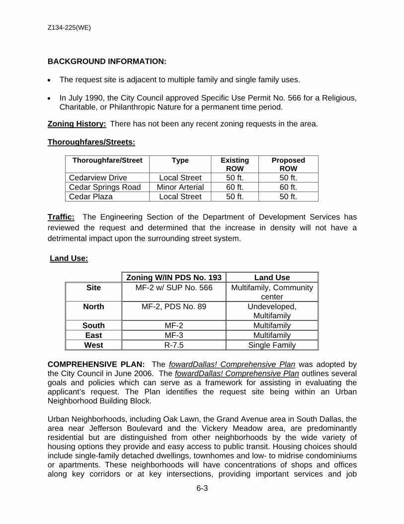
Z134-225(WE)
6-3
BACKGROUND INFORMATION: • The request site is adjacent to multiple family and single family uses.
• In July 1990, the City Council approved Specific Use Permit No. 566 for a Religious,
Charitable, or Philanthropic Nature for a permanent time period.
Zoning History: There has not been any recent zoning requests in the area. Thoroughfares/Streets:
Thoroughfare/Street Type Existing ROW
Proposed ROW
Cedarview Drive Local Street 50 ft. 50 ft. Cedar Springs Road Minor Arterial 60 ft. 60 ft. Cedar Plaza Local Street 50 ft. 50 ft.
Traffic: The Engineering Section of the Department of Development Services has reviewed the request and determined that the increase in density will not have a detrimental impact upon the surrounding street system. Land Use:
Zoning W/IN PDS No. 193 Land Use Site MF-2 w/ SUP No. 566 Multifamily, Community
center North MF-2, PDS No. 89 Undeveloped,
Multifamily South MF-2 Multifamily East MF-3 Multifamily West R-7.5 Single Family
COMPREHENSIVE PLAN: The fowardDallas! Comprehensive Plan was adopted by the City Council in June 2006. The fowardDallas! Comprehensive Plan outlines several goals and policies which can serve as a framework for assisting in evaluating the applicant’s request. The Plan identifies the request site being within an Urban Neighborhood Building Block. Urban Neighborhoods, including Oak Lawn, the Grand Avenue area in South Dallas, the area near Jefferson Boulevard and the Vickery Meadow area, are predominantly residential but are distinguished from other neighborhoods by the wide variety of housing options they provide and easy access to public transit. Housing choices should include single-family detached dwellings, townhomes and low- to midrise condominiums or apartments. These neighborhoods will have concentrations of shops and offices along key corridors or at key intersections, providing important services and job
Z134-225(WE)
6-4
opportunities within walking distance of residences. These areas may have mixed-use buildings with ground floor shops. Areas currently developed with single-family or duplex uses should generally be maintained unless redevelopment is addressed through an Area Planning process. Urban Neighborhood streets will be very pedestrian friendly, providing excellent connectivity to shopping, schools and other community services. Emphasis should be placed on slowing traffic through use of on-street parking and other similar traffic calming measures. Public investments in these areas will focus on parks, pathways, transit stops, pedestrian-oriented landscaping and road improvements. The proposed request is in compliance with the forwardDallas! Comprehensive Plan. The proposed mid-rise development is consistent with the surrounding development pattern. The existing development consists of low-rise multifamily developments. Area Plans: The Oak Lawn Special Purpose District and the Oak Lawn Plan include the following objectives: (1) To achieve buildings more urban in form. (2) To promote and protect an attractive street level pedestrian environment with continuous street frontage activities in retail areas. (3) To encourage the placement of off-street parking underground or within buildings similar in appearance to non-parking buildings. (4) To promote development appropriate to the character of nearby neighborhood uses by imposing standards sensitive to scale and adjacency issues. (5) To use existing zoned development densities as a base from which to plan, while providing bonuses to encourage residential development in commercial areas. (6) To discourage variances or zoning changes which would erode the quantity or quality of single-family neighborhoods, or would fail to adhere to the standards for multiple-family neighborhoods and commercial areas. (7) To promote landscape/streetscape quality and appearance. The applicant could meet certain provisions required in the abovementioned objectives in redeveloping the site for multiple family uses. A portion of each objective is not applicable to the proposed development such as, objectives 2, 5, and 6. The only objectives the proposed development could meet, as it relates to the entire statement, are objectives 4 and 7.

Z134-225(WE)
6-5
STAFF ANALYSIS: Land Use Compatibility: The 2.390-acre site is developed with multifamily uses. The area’s physical character consists primarily of multiple family and single family uses. The building heights that are contiguous to the request site are limited to a height of 36 feet. The applicant proposes to raze the existing 40-unit, multiple family development and construct a 101-unit multifamily development that will have a community center (private), an office and surface parking. The structure height will increase from 36 feet to 50 feet with 12 feet of mechanical overruns. There is a provision in the conditions that will permit the additional structure height without requiring the additional setbacks. In addition, the mechanical overruns will be screen with similar building materials. The current MF-2 Multiple Family Subdistrict allows the property to be used for medium density apartment development as well as more restrictive uses such as townhouses, duplexes, and single-family dwellings. The MF-2 Multiple Family Subdistrict permits a maximum structure height of 36 feet. Development Standards: DISTRICT SETBACKS Density Height Lot
Coverage Special
Standards PRIMARY Uses Front Side/Rear
Multiple Family MF-2 Subdistrict 15’ 10’15’
Min lot 2,000 sq. ft. 800 sq ft – E
1,000 sq. ft – 1 BR 1,200 sq ft – 2 BR
+150 sq ft each add BR
36’ 60% Multifamily, duplex, single family
Proposed PDS - proposed (Multiple Family) 15’ 10’/15’ 101 units
50’ 4 stories
60%
Multiple Family, accessory community service center, duplex, single family
Landscaping: Landscaping of any development will be in accordance with the landscape plan. The applicant will comply with the landscaping requirements in PDS No. 193, except where there are existing trees in the parkway. In these instances, the sidewalk will be installed around the existing trees. Parking: The applicant’s request for parking reduction for the proposed multiple family development is twofold: 1) its close proximity to a DART rail and bus line, and 2) the tenants’ primary source of transportation is DART due to the nature of this special population. The DART station is within ½ mile of the request site and is located at the south corner of Inwood Road and Denton Drive. Staff supports a reduction in the off-street parking requirement for the proposed development.
Z134-225(WE)
6-6
• Dominic Lacy President
• Jim Dowsett Vice President
• Sheri Christianson Secretary
• Michael McLaurin Treasurer
LIST OF OFFICERS Deaf Action Center

Z134-225(WE)
6-7
SUP 1566 - EXISTING CONDITIONS

Z134-225(WE)
6-8
EXISTING SITE PLAN Approved July 1990
Z134-225(WE)
6-9
“ARTICLE
PD
SEC. S-__.101. LEGISLATIVE HISTORY. PD Subdistrict was established by Ordinance No., passed by the Dallas City Council on _______, 2014. SEC. S-__.102. PROPERTY LOCATION AND SIZE. PD Subdistrict ___is established on property located on the north corner of Cedar Springs Road and Crestview Drive. The size of PD Subdistrict ____is approximately 1.91 acres.
SEC. S-__.103. DEFINITIONS AND INTERPRETATIONS. (a) Unless otherwise stated, the definitions and interpretations in Chapter 51 and in Part I of this article apply to this division. In the event of a conflict, this division controls. In the event of a conflict between Chapter 51 and Part I of this article, Part I of this article controls. (b) In this division, SUBDISTRICT means a subdistrict of PD No. 193. (c) Unless otherwise stated, all references to articles, divisions, or sections in this division are to articles, divisions, or sections in Chapter 51.
(d) This subdistrict is considered to be a residential zoning district.
SEC. S- .104. EXHIBITS. The following exhibits are incorporated into this division: (1) Exhibit ___A: . development plan (2) Exhibit ___B: . : landscape plan
SEC. S-__.105. DEVELOPMENT PLAN (a) For multiple family uses, development and use of the Property must comply with the development plan (Exhibit S-__) before the issuance of any building
PROPOSED PDS CONDITIONS
Z134-225(WE)
6-10
permit to authorize work on the Property. If there is a conflict between the text of this article and the approved development plan, the text of this section controls. SEC. S-__.106. LANDSCAPE PLAN (a) For multiple family uses, development and use of the Property must comply with the landscape plan (Exhibit S-__) before the issuance of any building permit to authorize work on the Property. If there is a conflict between the text of this article and the approved landscape plan, the text of this section controls. SEC. S-__.107. MAIN USES PERMITTED. (a) The only main uses permitted in this district are the same as those uses permitted in the MF-2 Subdistrict, subject to the same conditions applicable in the MF-2 Subdistrict, as set out in the Dallas Development Code, as amended. For example, a use permitted in the MF-2 Subdistrict only by specific use permit (SUP) is permitted in this planned development district only by SUP; a use subject to development impact review (DIR) in the MF-2 Subdistrict is subject to DIR in this planned development district; etc. The following additional uses are permitted in this subdistrict: (b) Office [Maximum 4,000 square feet of floor area] (c) Community center (private). [Maximum 6,000 square feet of floor area; use may include a kitchen for preparation of community meals]
SEC. S-__.108. ACCESSORY USES. (a) As a general rule, an accessory use is permitted in any subdistrict in which the main use is permitted. Some specific types of accessory uses, however, due to their unique nature, are subject to additional regulations in Section 51P-193.108. For more information regarding accessory uses, consult Section 51P-193.108. SEC. S-.__109. YARD, LOT, AND SPACE REGULATIONS. (Note: The yard, lot, and space regulations in this section must be read together with the yard, lot, and space regulations in Part I of this article. In the event of a conflict between this section and Part I of this article, this section controls.) (a) In general. Except as provided in this section, the yard, lot and space regulations for the MF-2 Multiple Family Subdistrict apply in this subdistrict. (b) Density. Maximum number of dwelling units is 101.
Z134-225(WE)
6-11
(c) Height. (1) Maximum structure height is 50 feet. (2) Additional setbacks over 36 feet in height are not required. Any building structure over 50 feet in height is required to provide additional setbacks per Section 51P-193.118, “Minimum Front Yard” of PDD No. 193. (3) The following structures may project a maximum of 12 feet above the maximum structure height: elevator penthouse or bulkhead, mechanical equipment rooms, cooling tower, tank designed to hold liquids, ornamental cupola or dome, skylights, observation deck, clerestory, visual screens which surround roof mounted mechanical equipment, chimney and vent stacks. (4) Parapet walls are limited to a maximum of six feet in height above the maximum structure height.
(d) Lot coverage. Maximum lot coverage is 60 percent. Aboveground
parking structures are included in lot coverage calculations; surface parking lots and underground parking structures are not. (e) Stories. Maximum number of stories is 4. SEC. S-__ .110. OFF-STREET PARKING AND LOADING. (a) In general. Except as provided in this section, consult the off-street parking and loading regulations of PD 193 for information regarding off-street parking and loading. (b) Multiple family uses. (1) Off-street parking for an accessory community center (private) use in conjunction with a multiple family use is not required. (2) For multiple family uses, a minimum of 1.0 space per studio or one bedroom dwelling unit is required and an additional 0.7 space per additional bedroom. (3) Assigned and residential parking spaces are prohibited.
SEC. S-__.111. ENVIRONMENTAL PERFORMANCE STANDARDS.
In general. Except as provided in this section, see Article VI, “Environmental Performance Standards.”
Z134-225(WE)
6-12
SEC. S-__.112. DESIGN STANDARDS (a) A minimum of two pedestrian amenities are required for each item on Cedar Springs Road frontage: (1) Benches (2) Trash receptacles (3) Bicycle racks (b) Facades (1) Facades facing the street must have building articulation with a minimum depth of one foot per every 75 feet of length. (2) A minimum of two different façade materials must be provided on each façade facing the street. SEC. S-__.113. LANDSCAPING. (a) In general. Except as provided, landscaping and screening must be provided in accordance with Part I of this article. (b) Sidewalks. (1) Sidewalks that are located two feet from back of curb must be located in that area parallel to and between 5 and 10 feet from back of the projected street curb. (2) Where the sidewalk widths are four feet and the parkways widths are two feet, the sidewalk widths are five feet, with a minimum parkway width of five feet.
(b) Installation date. Landscaping must be installed within six months after the issuance of a certificate of occupancy.
SEC. S-__.114. SIGNS. (a) Except as provided in this section, signs must comply with the provisions for non-business zoning districts.
SEC. S-__.115. ADDITIONAL PROVISIONS. (a) The entire Property must be properly maintained in a state of good repair and neat appearance.
Z134-225(WE)
6-13
(b) Development and use of the Property must comply with all federal and state laws and regulations, and with all ordinances, rules, and regulations of the City of Dallas.
SEC. S-__.116. COMPLIANCE WITH CONDITIONS.
(a) All paved areas, permanent drives, streets, and drainage structures, if any, must be constructed in accordance with standard City of Dallas specifications, and completed to the satisfaction of the director of public works and transportation. (b) The building official shall not issue a building permit to authorize work, or a certificate of occupancy to authorize the operation of a use in this Subdistrict until there has been full compliance with this article, the Dallas Development Code, the construction codes, and all other ordinances, rules, and regulations of the City of Dallas.
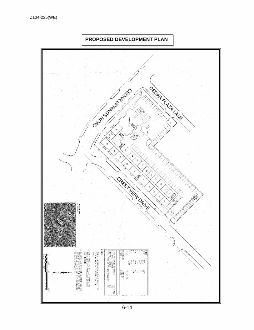
Z134-225(WE)
6-14
PROPOSED DEVELOPMENT PLAN
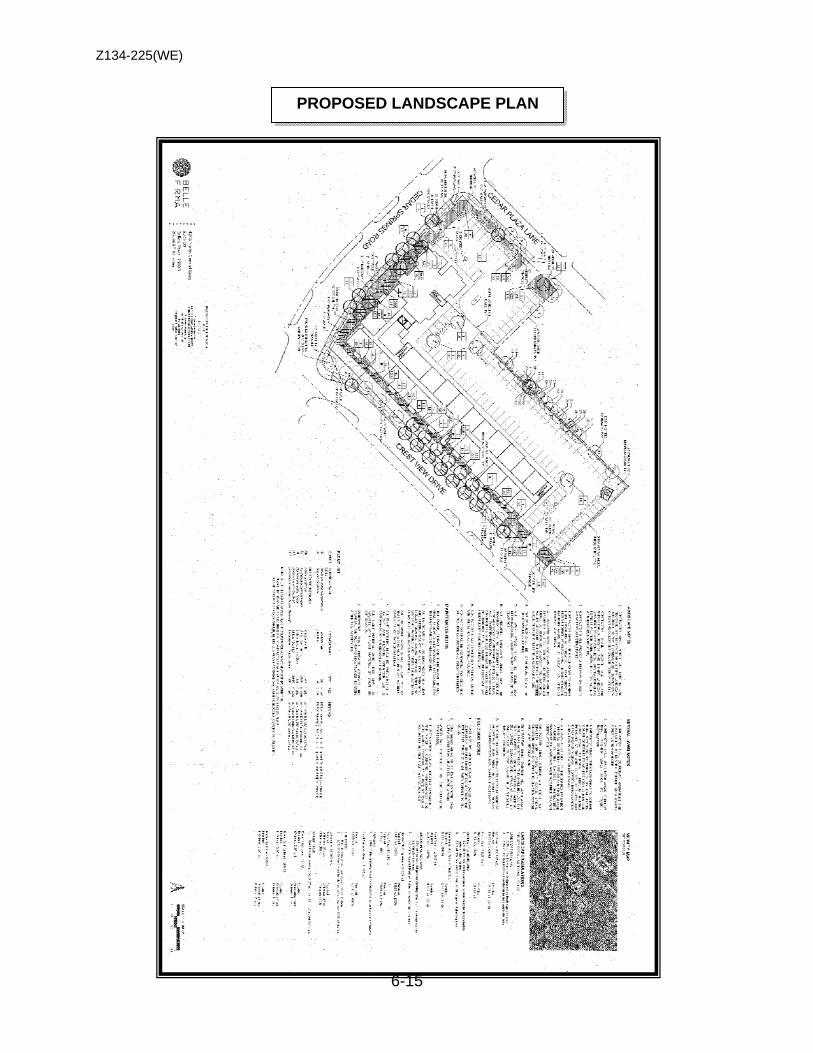
Z134-225(WE)
6-15
PROPOSED LANDSCAPE PLAN
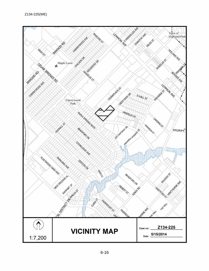
Z134-225(WE)
6-16
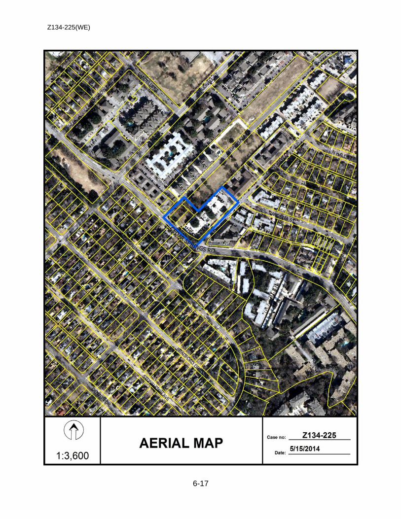
Z134-225(WE)
6-17
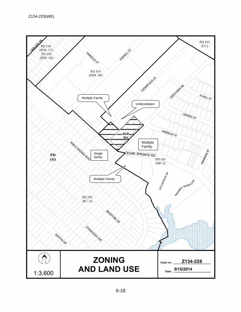
Z134-225(WE)
6-18
Single family
Multiple Family
Undeveloped
Multiple Family
Multiple Family

Z134-225(WE)
6-19
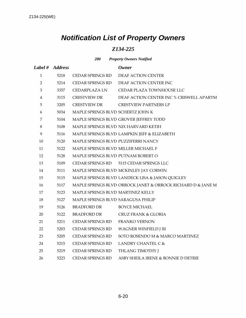
Z134-225(WE)
6-20
Notification List of Property Owners Z134-225
280 Property Owners Notified
Label # Address Owner
1 5218 CEDAR SPRINGS RD DEAF ACTION CENTER
2 5214 CEDAR SPRINGS RD DEAF ACTION CENTER INC
3 3357 CEDARPLAZA LN CEDAR PLAZA TOWNHOUSE LLC
4 3115 CRESTVIEW DR DEAF ACTION CENTER INC % CRISWELL APARTM
5 3205 CRESTVIEW DR CRESTVIEW PARTNERS LP
6 5034 MAPLE SPRINGS BLVD SCHERTZ JOHN K
7 5104 MAPLE SPRINGS BLVD GROVER JEFFREY TODD
8 5108 MAPLE SPRINGS BLVD NIX HARVARD KETIH
9 5116 MAPLE SPRINGS BLVD LAMPKIN JEFF & ELIZABETH
10 5120 MAPLE SPRINGS BLVD PUZZIFERRI NANCY
11 5122 MAPLE SPRINGS BLVD MILLER MICHAEL F
12 5128 MAPLE SPRINGS BLVD PUTNAM ROBERT O
13 5109 CEDAR SPRINGS RD 5115 CEDAR SPRINGS LLC
14 5111 MAPLE SPRINGS BLVD MCKINLEY JAY CORWIN
15 5115 MAPLE SPRINGS BLVD LANDECK LISA & JASON QUIGLEY
16 5117 MAPLE SPRINGS BLVD ORROCK JANET & ORROCK RICHARD D & JANE M
17 5123 MAPLE SPRINGS BLVD MARTINEZ KELLY
18 5127 MAPLE SPRINGS BLVD SARAGUSA PHILIP
19 5126 BRADFORD DR BOYCE MICHAEL
20 5122 BRADFORD DR CRUZ FRANK & GLORIA
21 5211 CEDAR SPRINGS RD FRANKO VERNON
22 5203 CEDAR SPRINGS RD WAGNER WINFIELD J III
23 5205 CEDAR SPRINGS RD SOTO ROSENDO M & MARCO MARTINEZ
24 5215 CEDAR SPRINGS RD LANDRY CHANTEL C &
25 5219 CEDAR SPRINGS RD THLANG TIMOTHY J
26 5223 CEDAR SPRINGS RD ASBY SHEILA IRENE & BONNIE D DETRIE
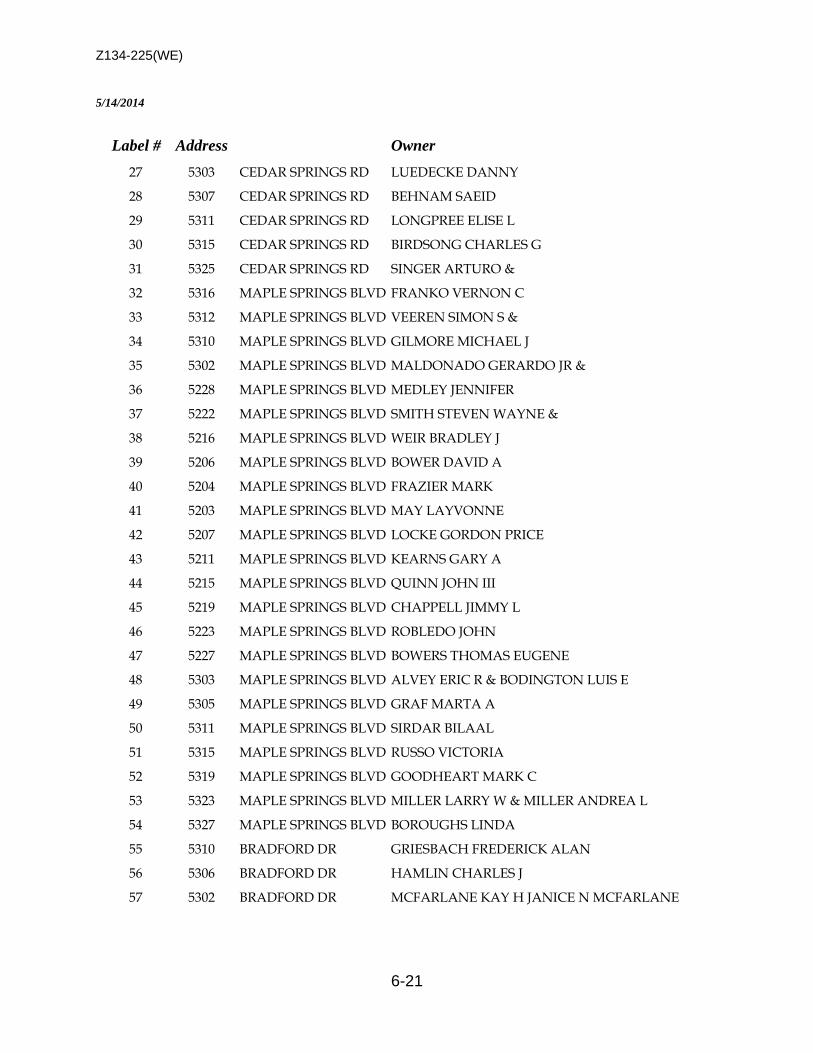
Z134-225(WE)
6-21
5/14/2014
Label # Address Owner
27 5303 CEDAR SPRINGS RD LUEDECKE DANNY
28 5307 CEDAR SPRINGS RD BEHNAM SAEID
29 5311 CEDAR SPRINGS RD LONGPREE ELISE L
30 5315 CEDAR SPRINGS RD BIRDSONG CHARLES G
31 5325 CEDAR SPRINGS RD SINGER ARTURO &
32 5316 MAPLE SPRINGS BLVD FRANKO VERNON C
33 5312 MAPLE SPRINGS BLVD VEEREN SIMON S &
34 5310 MAPLE SPRINGS BLVD GILMORE MICHAEL J
35 5302 MAPLE SPRINGS BLVD MALDONADO GERARDO JR &
36 5228 MAPLE SPRINGS BLVD MEDLEY JENNIFER
37 5222 MAPLE SPRINGS BLVD SMITH STEVEN WAYNE &
38 5216 MAPLE SPRINGS BLVD WEIR BRADLEY J
39 5206 MAPLE SPRINGS BLVD BOWER DAVID A
40 5204 MAPLE SPRINGS BLVD FRAZIER MARK
41 5203 MAPLE SPRINGS BLVD MAY LAYVONNE
42 5207 MAPLE SPRINGS BLVD LOCKE GORDON PRICE
43 5211 MAPLE SPRINGS BLVD KEARNS GARY A
44 5215 MAPLE SPRINGS BLVD QUINN JOHN III
45 5219 MAPLE SPRINGS BLVD CHAPPELL JIMMY L
46 5223 MAPLE SPRINGS BLVD ROBLEDO JOHN
47 5227 MAPLE SPRINGS BLVD BOWERS THOMAS EUGENE
48 5303 MAPLE SPRINGS BLVD ALVEY ERIC R & BODINGTON LUIS E
49 5305 MAPLE SPRINGS BLVD GRAF MARTA A
50 5311 MAPLE SPRINGS BLVD SIRDAR BILAAL
51 5315 MAPLE SPRINGS BLVD RUSSO VICTORIA
52 5319 MAPLE SPRINGS BLVD GOODHEART MARK C
53 5323 MAPLE SPRINGS BLVD MILLER LARRY W & MILLER ANDREA L
54 5327 MAPLE SPRINGS BLVD BOROUGHS LINDA
55 5310 BRADFORD DR GRIESBACH FREDERICK ALAN
56 5306 BRADFORD DR HAMLIN CHARLES J
57 5302 BRADFORD DR MCFARLANE KAY H JANICE N MCFARLANE
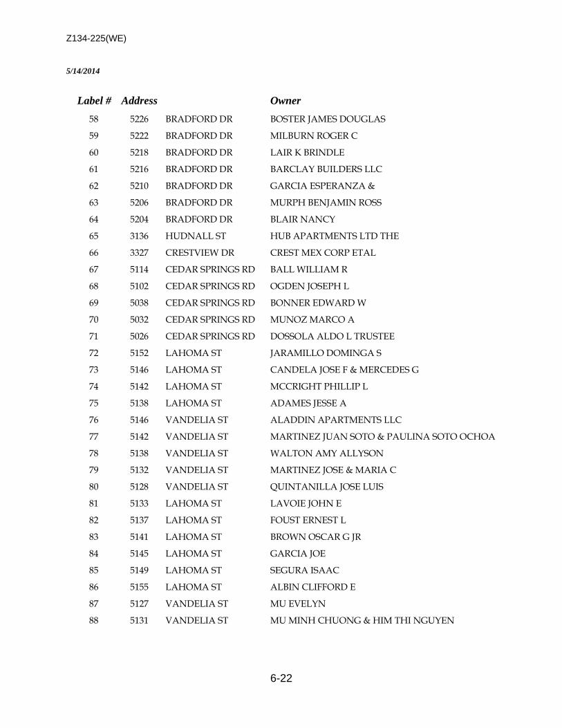
Z134-225(WE)
6-22
5/14/2014
Label # Address Owner
58 5226 BRADFORD DR BOSTER JAMES DOUGLAS
59 5222 BRADFORD DR MILBURN ROGER C
60 5218 BRADFORD DR LAIR K BRINDLE
61 5216 BRADFORD DR BARCLAY BUILDERS LLC
62 5210 BRADFORD DR GARCIA ESPERANZA &
63 5206 BRADFORD DR MURPH BENJAMIN ROSS
64 5204 BRADFORD DR BLAIR NANCY
65 3136 HUDNALL ST HUB APARTMENTS LTD THE
66 3327 CRESTVIEW DR CREST MEX CORP ETAL
67 5114 CEDAR SPRINGS RD BALL WILLIAM R
68 5102 CEDAR SPRINGS RD OGDEN JOSEPH L
69 5038 CEDAR SPRINGS RD BONNER EDWARD W
70 5032 CEDAR SPRINGS RD MUNOZ MARCO A
71 5026 CEDAR SPRINGS RD DOSSOLA ALDO L TRUSTEE
72 5152 LAHOMA ST JARAMILLO DOMINGA S
73 5146 LAHOMA ST CANDELA JOSE F & MERCEDES G
74 5142 LAHOMA ST MCCRIGHT PHILLIP L
75 5138 LAHOMA ST ADAMES JESSE A
76 5146 VANDELIA ST ALADDIN APARTMENTS LLC
77 5142 VANDELIA ST MARTINEZ JUAN SOTO & PAULINA SOTO OCHOA
78 5138 VANDELIA ST WALTON AMY ALLYSON
79 5132 VANDELIA ST MARTINEZ JOSE & MARIA C
80 5128 VANDELIA ST QUINTANILLA JOSE LUIS
81 5133 LAHOMA ST LAVOIE JOHN E
82 5137 LAHOMA ST FOUST ERNEST L
83 5141 LAHOMA ST BROWN OSCAR G JR
84 5145 LAHOMA ST GARCIA JOE
85 5149 LAHOMA ST SEGURA ISAAC
86 5155 LAHOMA ST ALBIN CLIFFORD E
87 5127 VANDELIA ST MU EVELYN
88 5131 VANDELIA ST MU MINH CHUONG & HIM THI NGUYEN

Z134-225(WE)
6-23
5/14/2014
Label # Address Owner
89 5135 VANDELIA ST MARTINEZ JOSE &
90 5139 VANDELIA ST CARMICHAEL JAMES D
91 5326 MAPLE SPRINGS BLVD OZERDIM CAGLAR
92 5322 MAPLE SPRINGS BLVD ROBINSON CLINTON D
93 5212 MAPLE SPRINGS BLVD HALL CHRISTIANA E
94 5414 CEDAR SPRINGS RD TEXAS PARK APARTMENTS LTD THE
95 5124 CEDAR SPRINGS RD TOLUCA SQUARE LTD
96 5128 CEDAR SPRINGS RD TOLUCA SQUARE LTDTES
97 5161 VANDELIA ST TOLUCA SQUARE LTP
98 5106 CEDAR SPRINGS RD MARROQUIN CARLOS UNIT A
99 5106 CEDAR SPRINGS RD CRAWFORD ELVIA & MARY A BUTSON APT
100 5106 CEDAR SPRINGS RD 5106 CEDAR SPRINGS HOMEOWNERS ASSOCIATIO
101 5106 CEDAR SPRINGS RD CRAWFORD ELVIA D UNIT E
102 5106 CEDAR SPRINGS RD BUTSON MARY ANN UNIT G
103 5010 LES CHATEAUX DR FARMER PRESTON
104 5010 LES CHATEAUX DR DITORE BARBARA
105 5012 LES CHATEAUX DR RAMSEY PHILIP DAWSON BLDG A UNIT #126
106 5012 LES CHATEAUX DR GRAF JOYCE ANN APT 127
107 5014 LES CHATEAUX DR ICE ERNEST D BLDG A UNIT 128
108 5014 LES CHATEAUX DR ROBBINS LESLIE D UNIT 129
109 5014 LES CHATEAUX DR JUAREZ RICARDO BLDG A UNIT 130
110 5010 LES CHATEAUX DR KUNOWSKY WILLIAM W JR BLDG A UNIT 224
111 5010 LES CHATEAUX DR POSEY MICHAEL G APT 204
112 5012 LES CHATEAUX DR HORANY JOHN K BLDG A UNIT 226
113 5012 LES CHATEAUX DR PARR WILLIAM E
114 5014 LES CHATEAUX DR LINTNER MEGAN # 228
115 5014 LES CHATEAUX DR HUIE MARVIN A & UNIT 316
116 5014 LES CHATEAUX DR ERWIN CLAUDE M JR BLDG A UNIT 230
117 5039 CEDAR SPRINGS RD MCCARTHY LARRY & DAWN
118 5039 CEDAR SPRINGS RD HART DAVID H BLD B APT 110
119 5039 CEDAR SPRINGS RD WYATT WARREN BLDG B UNIT 209
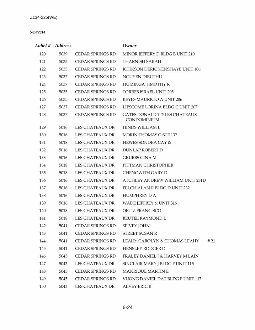
Z134-225(WE)
6-24
5/14/2014
Label # Address Owner
120 5039 CEDAR SPRINGS RD MINOR JEFFERY D BLDG B UNIT 210
121 5035 CEDAR SPRINGS RD THARNISH SARAH
122 5035 CEDAR SPRINGS RD JOHNSON DERIC KENSHAYE UNIT 106
123 5037 CEDAR SPRINGS RD NGUYEN DIEUTHU
124 5037 CEDAR SPRINGS RD HUIZINGA TIMOTHY R
125 5035 CEDAR SPRINGS RD TORRES ISRAEL UNIT 205
126 5035 CEDAR SPRINGS RD REYES MAURICIO A UNIT 206
127 5037 CEDAR SPRINGS RD LIPSCOME LORINA BLDG C UNIT 207
128 5037 CEDAR SPRINGS RD GATES DONALD T %LES CHATEAUX CONDOMINIUM
129 5016 LES CHATEAUX DR HINDS WILLIAM L
130 5016 LES CHATEAUX DR MORIN THOMAS G STE 132
131 5018 LES CHATEAUX DR HEWES SONDRA CAY &
132 5016 LES CHATEAUX DR DUNLAP ROBERT D
133 5016 LES CHATEAUX DR GRUBBS GINA M
134 5018 LES CHATEAUX DR PITTMAN CHRISTOPHER
135 5018 LES CHATEAUX DR CHENOWITH GARY D
136 5016 LES CHATEAUX DR ATCHLEY ANDREW WILLIAM UNIT 231D
137 5016 LES CHATEAUX DR FELCH ALAN R BLDG D UNIT 232
138 5016 LES CHATEAUX DR HUMPHREY D A
139 5016 LES CHATEAUX DR WADE JEFFREY & UNIT 316
140 5018 LES CHATEAUX DR ORTIZ FRANCISCO
141 5018 LES CHATEAUX DR BEUTEL RAYMOND L
142 5041 CEDAR SPRINGS RD SPIVEY JOHN
143 5041 CEDAR SPRINGS RD STREET SUSAN R
144 5041 CEDAR SPRINGS RD LEAHY CAROLYN & THOMAS LEAHY # 21
145 5041 CEDAR SPRINGS RD HENSLEY RODGER D
146 5043 CEDAR SPRINGS RD FRALEY DANIEL J & HARVEY M LAIN
147 5043 LES CHATEAUX DR SINCLAIR MARY J BLDG F UNIT 115
148 5045 CEDAR SPRINGS RD MANRIQUE MARTIN E
149 5045 CEDAR SPRINGS RD VUONG DANIEL DAT BLDG F UNIT 117
150 5043 LES CHATEAUX DR ALVEY ERIC R
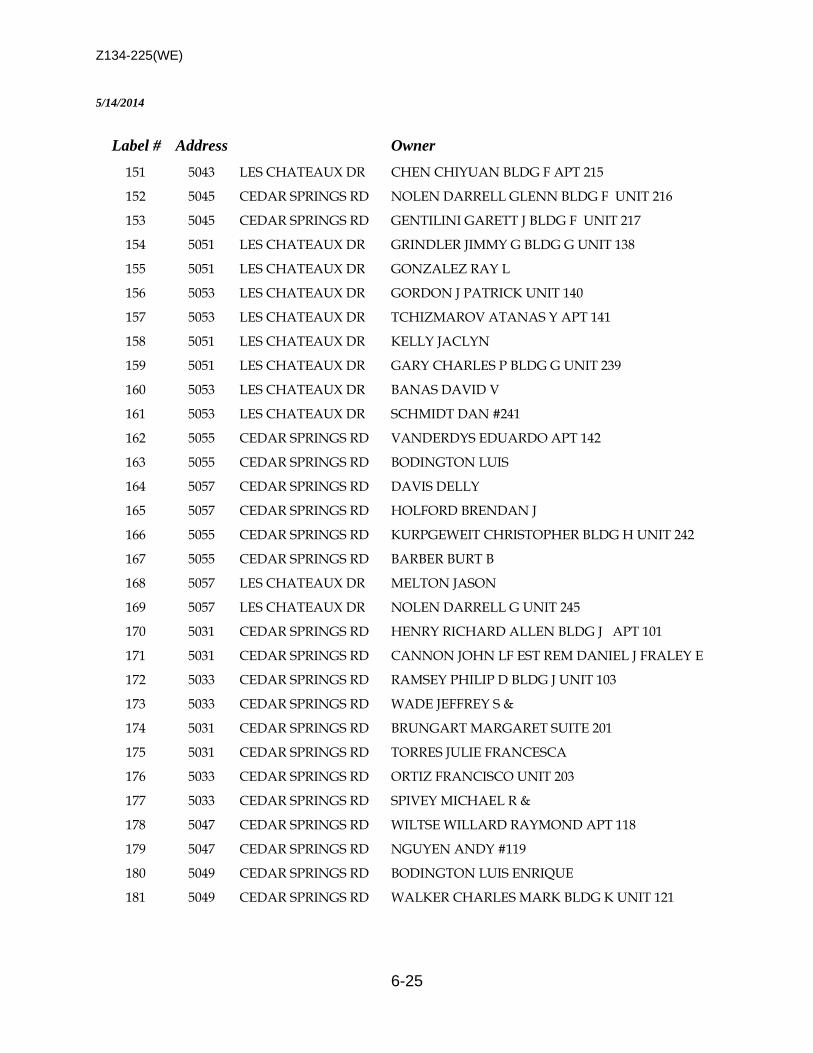
Z134-225(WE)
6-25
5/14/2014
Label # Address Owner
151 5043 LES CHATEAUX DR CHEN CHIYUAN BLDG F APT 215
152 5045 CEDAR SPRINGS RD NOLEN DARRELL GLENN BLDG F UNIT 216
153 5045 CEDAR SPRINGS RD GENTILINI GARETT J BLDG F UNIT 217
154 5051 LES CHATEAUX DR GRINDLER JIMMY G BLDG G UNIT 138
155 5051 LES CHATEAUX DR GONZALEZ RAY L
156 5053 LES CHATEAUX DR GORDON J PATRICK UNIT 140
157 5053 LES CHATEAUX DR TCHIZMAROV ATANAS Y APT 141
158 5051 LES CHATEAUX DR KELLY JACLYN
159 5051 LES CHATEAUX DR GARY CHARLES P BLDG G UNIT 239
160 5053 LES CHATEAUX DR BANAS DAVID V
161 5053 LES CHATEAUX DR SCHMIDT DAN #241
162 5055 CEDAR SPRINGS RD VANDERDYS EDUARDO APT 142
163 5055 CEDAR SPRINGS RD BODINGTON LUIS
164 5057 CEDAR SPRINGS RD DAVIS DELLY
165 5057 CEDAR SPRINGS RD HOLFORD BRENDAN J
166 5055 CEDAR SPRINGS RD KURPGEWEIT CHRISTOPHER BLDG H UNIT 242
167 5055 CEDAR SPRINGS RD BARBER BURT B
168 5057 LES CHATEAUX DR MELTON JASON
169 5057 LES CHATEAUX DR NOLEN DARRELL G UNIT 245
170 5031 CEDAR SPRINGS RD HENRY RICHARD ALLEN BLDG J APT 101
171 5031 CEDAR SPRINGS RD CANNON JOHN LF EST REM DANIEL J FRALEY E
172 5033 CEDAR SPRINGS RD RAMSEY PHILIP D BLDG J UNIT 103
173 5033 CEDAR SPRINGS RD WADE JEFFREY S &
174 5031 CEDAR SPRINGS RD BRUNGART MARGARET SUITE 201
175 5031 CEDAR SPRINGS RD TORRES JULIE FRANCESCA
176 5033 CEDAR SPRINGS RD ORTIZ FRANCISCO UNIT 203
177 5033 CEDAR SPRINGS RD SPIVEY MICHAEL R &
178 5047 CEDAR SPRINGS RD WILTSE WILLARD RAYMOND APT 118
179 5047 CEDAR SPRINGS RD NGUYEN ANDY #119
180 5049 CEDAR SPRINGS RD BODINGTON LUIS ENRIQUE
181 5049 CEDAR SPRINGS RD WALKER CHARLES MARK BLDG K UNIT 121

Z134-225(WE)
6-26
5/14/2014
Label # Address Owner
182 5058 CEDAR SPRINGS RD CARTER JAMES LEHRMAN
183 5056 CEDAR SPRINGS RD SCHIRPIK GRANT #123
184 5047 CEDAR SPRINGS RD SHANDORF DENNIS R
185 5049 CEDAR SPRINGS RD BROX JAMES L
186 5049 CEDAR SPRINGS RD RYDELL RUTH MAY BLDG K APT 221
187 5414 CEDAR SPRINGS RD TEXAS PARK APARTMENTS LTD THE
188 3111 CEDARPLAZA LN LAI CHAOCHENG UNIT 101 BLDG 1
189 3111 CEDARPLAZA LN TUROFF JEREMY TUROFF ALICIA
190 3111 CEDARPLAZA LN VICTORY JAMES D & BLDG 1 UNIT 103
191 3115 CEDARPLAZA LN GUZMAN AMPARO
192 3115 CEDARPLAZA LN CEDAR PLAZA TOWNHOUSE LLC
193 3115 CEDARPLAZA LN YAVASILE ANTHONY J UNIT 203
194 3119 CEDARPLAZA LN RHEIN ROBERT MATTHEW
195 3119 CEDARPLAZA LN JENNINGS MARK A
196 3119 CEDARPLAZA LN IYAMU IKPONMWOSA & BRENDA U UNIT 303
197 3123 CEDARPLAZA LN HAMAUEI GEORGE A
198 3123 CEDARPLAZA LN CAMILLI BRYAN B BLDG 4 UNIT 402
199 3123 CEDARPLAZA LN GIESSEL BARTON ELGIN UNIT 403
200 3127 CEDARPLAZA LN OCHANI TEEKAM & POONAM
201 3127 CEDARPLAZA LN ERWIN DENNIS W UNIT 503
202 3131 CEDARPLAZA LN GRANEY DENNIS P & SONIA P
203 3131 CEDARPLAZA LN ROSE PHLLIP BLDG 6 UNIT 603
204 3201 CEDARPLAZA LN HODGE DAVID
205 3030 MAHANNA SPRINGS DR GONZALEZ RAY L
206 3030 MAHANNA SPRINGS DR SHARPE ROXANN & HARVEY D
207 4927 CEDAR SPRINGS RD HINDS JAMES E & NORMA SUE
208 4927 CEDAR SPRINGS RD FRNKA EVELYN & RONALD A BLDG A UNIT 4927
209 4927 CEDAR SPRINGS RD LESZINSKI SLAWOMIR
210 4931 CEDAR SPRINGS RD GONZALEZ GILDA C APT A
211 4931 CEDAR SPRINGS RD HUTTON JEFFREY B BLDG A UNIT 4931B
212 4931 CEDAR SPRINGS RD FRELS STEPHEN BLDG A UNIT 4931C
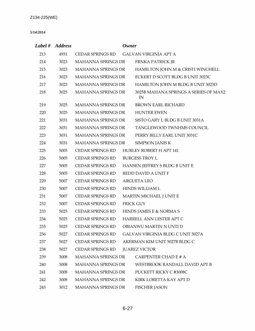
Z134-225(WE)
6-27
5/14/2014
Label # Address Owner
213 4931 CEDAR SPRINGS RD GALVAN VIRGINIA APT A
214 3023 MAHANNA SPRINGS DR FRNKA PATRICK JR
215 3023 MAHANNA SPRINGS DR HAMILTON JOHN M & CRISTI WINCHELL
216 3023 MAHANNA SPRINGS DR ECKERT D SCOTT BLDG B UNIT 3023C
217 3023 MAHANNA SPRINGS DR HAMILTON JOHN M BLDG B UNIT 3023D
218 3025 MAHANNA SPRINGS DR 3025B MAHANA SPRINGS A SERIES OF MAX2 IN
219 3025 MAHANNA SPRINGS DR BROWN EARL RICHARD
220 3025 MAHANNA SPRINGS DR HUNTER EWEN
221 3031 MAHANNA SPRINGS DR SISTO GARY L BLDG B UNIT 3031A
222 3031 MAHANNA SPRINGS DR TANGLEWOOD TWNHMS COUNCIL
223 3031 MAHANNA SPRINGS DR PERRY BILLY EARL UNIT 3031C
224 3031 MAHANNA SPRINGS DR SIMPSON JANIS K
225 5005 CEDAR SPRINGS RD HURLEY ROBERT H APT 141
226 5005 CEDAR SPRINGS RD BURGESS TROY L
227 5005 CEDAR SPRINGS RD HANSEN JEFFREY S BLDG B UNIT E
228 5005 CEDAR SPRINGS RD REDD DAVID A UNIT F
229 5007 CEDAR SPRINGS RD ARGUETA LEO
230 5007 CEDAR SPRINGS RD HINDS WILLIAM L
231 5007 CEDAR SPRINGS RD MARTIN MICHAEL J UNIT E
232 5007 CEDAR SPRINGS RD FRICK GUY
233 5025 CEDAR SPRINGS RD HINDS JAMES E & NORMA S
234 5025 CEDAR SPRINGS RD HARRELL ANN LESTER APT C
235 5025 CEDAR SPRINGS RD OBIANWU MARTIN N UNTI D
236 5027 CEDAR SPRINGS RD GALVAN VIRGINIA BLDG C UNIT 5027A
237 5027 CEDAR SPRINGS RD AKERMAN KIM UNIT 5027B BLDG C
238 5027 CEDAR SPRINGS RD JUAREZ VICTOR
239 3008 MAHANNA SPRINGS DR CARPENTER CHAD E # A
240 3008 MAHANNA SPRINGS DR WESTBROOK RANDALL DAVID APT B
241 3008 MAHANNA SPRINGS DR PUCKETT RICKY C #3008C
242 3008 MAHANNA SPRINGS DR KIRK LORETTA KAY APT D
243 3012 MAHANNA SPRINGS DR FISCHER JASON
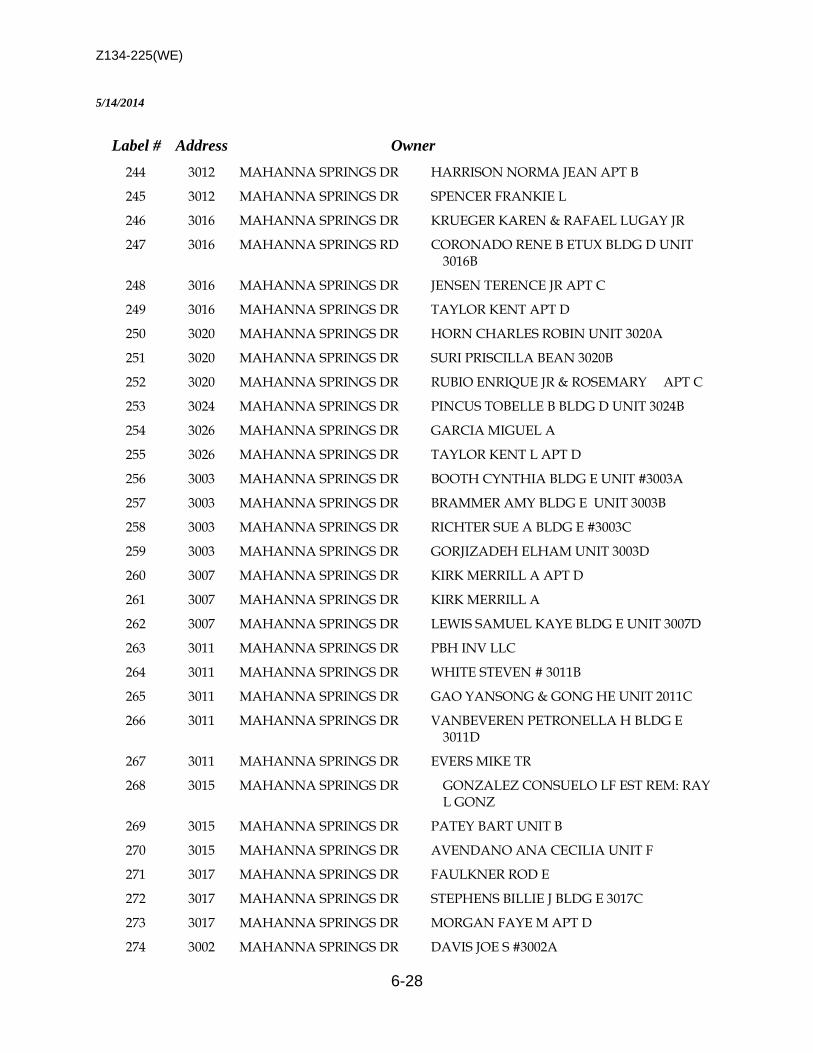
Z134-225(WE)
6-28
5/14/2014
Label # Address Owner
244 3012 MAHANNA SPRINGS DR HARRISON NORMA JEAN APT B
245 3012 MAHANNA SPRINGS DR SPENCER FRANKIE L
246 3016 MAHANNA SPRINGS DR KRUEGER KAREN & RAFAEL LUGAY JR
247 3016 MAHANNA SPRINGS RD CORONADO RENE B ETUX BLDG D UNIT 3016B
248 3016 MAHANNA SPRINGS DR JENSEN TERENCE JR APT C
249 3016 MAHANNA SPRINGS DR TAYLOR KENT APT D
250 3020 MAHANNA SPRINGS DR HORN CHARLES ROBIN UNIT 3020A
251 3020 MAHANNA SPRINGS DR SURI PRISCILLA BEAN 3020B
252 3020 MAHANNA SPRINGS DR RUBIO ENRIQUE JR & ROSEMARY APT C
253 3024 MAHANNA SPRINGS DR PINCUS TOBELLE B BLDG D UNIT 3024B
254 3026 MAHANNA SPRINGS DR GARCIA MIGUEL A
255 3026 MAHANNA SPRINGS DR TAYLOR KENT L APT D
256 3003 MAHANNA SPRINGS DR BOOTH CYNTHIA BLDG E UNIT #3003A
257 3003 MAHANNA SPRINGS DR BRAMMER AMY BLDG E UNIT 3003B
258 3003 MAHANNA SPRINGS DR RICHTER SUE A BLDG E #3003C
259 3003 MAHANNA SPRINGS DR GORJIZADEH ELHAM UNIT 3003D
260 3007 MAHANNA SPRINGS DR KIRK MERRILL A APT D
261 3007 MAHANNA SPRINGS DR KIRK MERRILL A
262 3007 MAHANNA SPRINGS DR LEWIS SAMUEL KAYE BLDG E UNIT 3007D
263 3011 MAHANNA SPRINGS DR PBH INV LLC
264 3011 MAHANNA SPRINGS DR WHITE STEVEN # 3011B
265 3011 MAHANNA SPRINGS DR GAO YANSONG & GONG HE UNIT 2011C
266 3011 MAHANNA SPRINGS DR VANBEVEREN PETRONELLA H BLDG E 3011D
267 3011 MAHANNA SPRINGS DR EVERS MIKE TR
268 3015 MAHANNA SPRINGS DR GONZALEZ CONSUELO LF EST REM: RAY L GONZ
269 3015 MAHANNA SPRINGS DR PATEY BART UNIT B
270 3015 MAHANNA SPRINGS DR AVENDANO ANA CECILIA UNIT F
271 3017 MAHANNA SPRINGS DR FAULKNER ROD E
272 3017 MAHANNA SPRINGS DR STEPHENS BILLIE J BLDG E 3017C
273 3017 MAHANNA SPRINGS DR MORGAN FAYE M APT D
274 3002 MAHANNA SPRINGS DR DAVIS JOE S #3002A
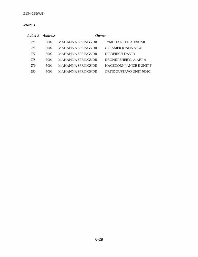
Z134-225(WE)
6-29
5/14/2014
Label # Address Owner
275 3002 MAHANNA SPRINGS DR TYMCHAK TED A #3002-B
276 3002 MAHANNA SPRINGS DR CREAMER JOANNA S &
277 3002 MAHANNA SPRINGS DR DIEDERICH DAVID
278 3004 MAHANNA SPRINGS DR DRONET SHERYL A APT A
279 3004 MAHANNA SPRINGS DR HAGEDORN JANICE E UNIT F
280 3004 MAHANNA SPRINGS DR ORTIZ GUSTAVO UNIT 3004C
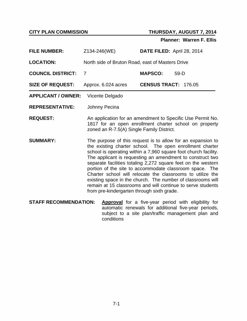
7-1
CITY PLAN COMMISSION THURSDAY, AUGUST 7, 2014
Planner: Warren F. Ellis FILE NUMBER: Z134-246(WE) DATE FILED: April 28, 2014 LOCATION: North side of Bruton Road, east of Masters Drive COUNCIL DISTRICT: 7 MAPSCO: 59-D SIZE OF REQUEST: Approx. 6.024 acres CENSUS TRACT: 176.05 APPLICANT / OWNER: Vicente Delgado REPRESENTATIVE: Johnny Pecina REQUEST: An application for an amendment to Specific Use Permit No.
1817 for an open enrollment charter school on property zoned an R-7.5(A) Single Family District.
SUMMARY: The purpose of this request is to allow for an expansion to
the existing charter school. The open enrollment charter school is operating within a 7,960 square foot church facility. The applicant is requesting an amendment to construct two separate facilities totaling 2,272 square feet on the western portion of the site to accommodate classroom space. The Charter school will relocate the classrooms to utilize the existing space in the church. The number of classrooms will remain at 15 classrooms and will continue to serve students from pre-kindergarten through sixth grade.
STAFF RECOMMENDATION: Approval for a five-year period with eligibility for
automatic renewals for additional five-year periods, subject to a site plan/traffic management plan and conditions
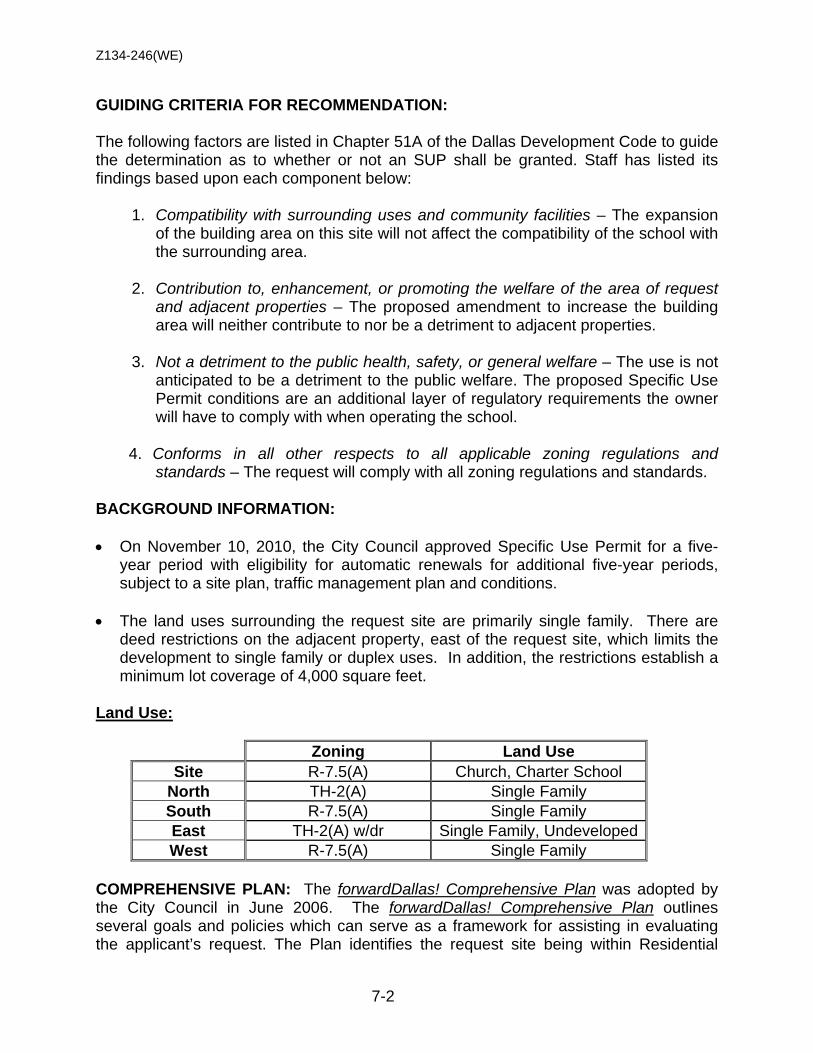
Z134-246(WE)
7-2
GUIDING CRITERIA FOR RECOMMENDATION: The following factors are listed in Chapter 51A of the Dallas Development Code to guide the determination as to whether or not an SUP shall be granted. Staff has listed its findings based upon each component below:
1. Compatibility with surrounding uses and community facilities – The expansion of the building area on this site will not affect the compatibility of the school with the surrounding area.
2. Contribution to, enhancement, or promoting the welfare of the area of request and adjacent properties – The proposed amendment to increase the building area will neither contribute to nor be a detriment to adjacent properties.
3. Not a detriment to the public health, safety, or general welfare – The use is not
anticipated to be a detriment to the public welfare. The proposed Specific Use Permit conditions are an additional layer of regulatory requirements the owner will have to comply with when operating the school.
4. Conforms in all other respects to all applicable zoning regulations and
standards – The request will comply with all zoning regulations and standards. BACKGROUND INFORMATION: • On November 10, 2010, the City Council approved Specific Use Permit for a five-
year period with eligibility for automatic renewals for additional five-year periods, subject to a site plan, traffic management plan and conditions.
• The land uses surrounding the request site are primarily single family. There are deed restrictions on the adjacent property, east of the request site, which limits the development to single family or duplex uses. In addition, the restrictions establish a minimum lot coverage of 4,000 square feet.
Land Use:
Zoning Land Use Site R-7.5(A) Church, Charter School
North TH-2(A) Single Family South R-7.5(A) Single Family East TH-2(A) w/dr Single Family, Undeveloped West R-7.5(A) Single Family
COMPREHENSIVE PLAN: The forwardDallas! Comprehensive Plan was adopted by the City Council in June 2006. The forwardDallas! Comprehensive Plan outlines several goals and policies which can serve as a framework for assisting in evaluating the applicant’s request. The Plan identifies the request site being within Residential

Z134-246(WE)
7-3
Neighborhood Building Block. The proposed development is in compliance with the forwardDallas! Comprehensive Plan. This Building Block represents the life-blood of Dallas, the traditional neighborhood of single-family detached homes. Dallas has many neighborhoods that match this description, including Winnetka Heights, Preston Hollow, Lakewood and Wheatley Place. Single-family dwellings are the dominate land use in these areas. Some shops, restaurants or institutional land uses such as schools and religious centers that serve neighborhood residents may be located at the edges or at key intersections. STAFF ANALYSIS: Land Use Compatibility: The general provisions for a Specific Use Permit in Section 51A-4.219 of the Dallas Development Code specifically state: (1) The SUP provides a means for developing certain uses in a manner in which the specific use will be consistent with the character of the neighborhood; (2) Each SUP application must be evaluated as to its probable effect on the adjacent property and the community welfare and may be approved or denied as the findings indicate appropriate; (3) The city council shall not grant an SUP for a use except upon a finding that the use will: (A) complement or be compatible with the surrounding uses and community facilities; (B) contribute to, enhance, or promote the welfare of the area of request and adjacent properties; (C) not be detrimental to the public health, safety, or general welfare; and (D) conform in all other respects to all applicable zoning regulations and standards. The request does not appear to have an adverse impact on the surrounding zoning and land uses. Development Standards: DISTRICT SETBACKS Density Height Lot
Coverage Special
Standards PRIMARY Uses Front Side/Rear
R-7.5(A) Single Family 25’ 5’ 1 Dwelling Unit/
7,500 sq. ft. 30’ 45% Single family
Landscaping: Landscaping of any development will be in accordance Article X, as amended. Thoroughfares/Streets:
Thoroughfare/Street Type Existing ROW
Proposed ROW
Bruton Road Principal Arterial 100 ft. 100 ft. Traffic: The Engineering Section of the Department Sustainable Development and Construction has reviewed the request and determined that it will not have a detrimental impact on the surrounding street system. The applicant has submitted a Traffic

Z134-246(WE)
7-4
Management Plan for the open enrollment charter school and will become a part of the Specific Use Permit conditions. Parking: The requirement for off-street parking for the school is derived by two criterions: 1) the number of classrooms, and 2) the type of institution that serves the students (e.g., elementary, middle or high school). The total number of proposed classrooms determines the number of required parking spaces. The Dallas Development Code requirement for off-street parking for a school is as follows:
• one and one half space for each kindergarten/elementary school classroom; • three and one-half spaces for each junior high/middle school classroom; and
The Building Inspections Department has requested the applicant provide additional off-street parking spaces on site to accommodate the increase in building area. The number of off-street parking spaces will increase by 21 spaces, from 83 spaces to 104 spaces. In addition, a parking agreement will be filed with the Building Official between the applicant and church.
Z134-246(WE)
7-5
• Darrell Pilcher President
• Floyd Pineda Vice-President
• Sarah Elizondo Secretary
• Gamaliel Solares Board Member
• Yolanda Mata Board Member
LIST OF OFFICERS
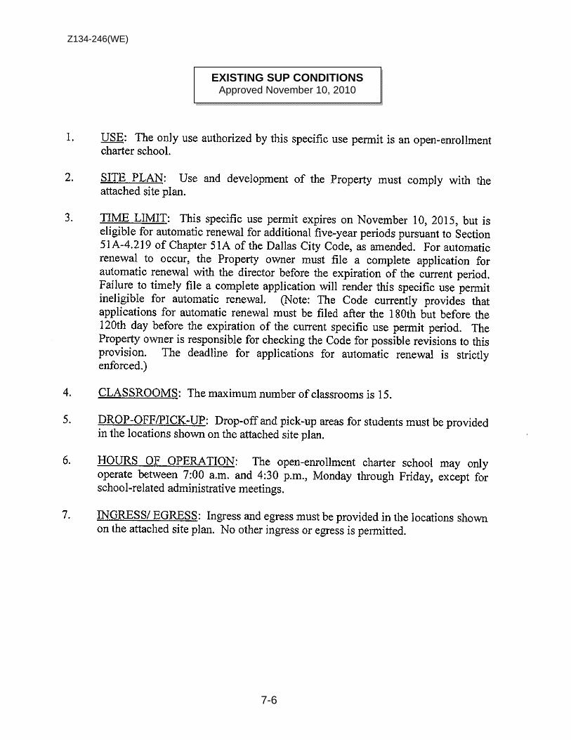
Z134-246(WE)
7-6
EXISTING SUP CONDITIONS
Approved November 10, 2010
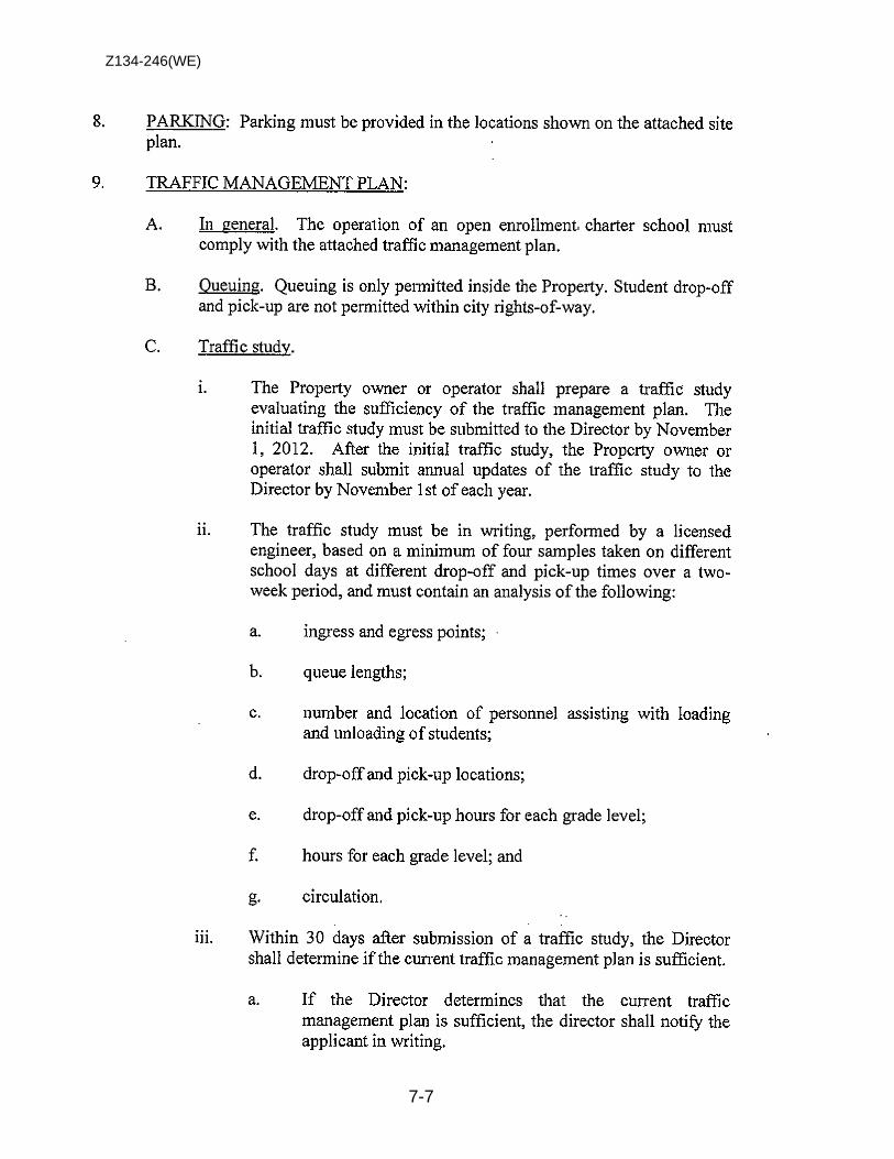
Z134-246(WE)
7-7
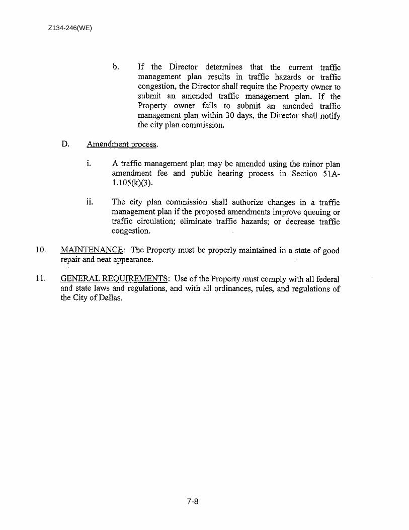
Z134-246(WE)
7-8
Z134-246(WE)
7-9
3. TIME LIMIT: This specific use permit expires on [November 10, 2015], (five-
years from the passage of the ordinance), but is eligible for automatic renewal for additional five-year periods, pursuant to Section 51A-4.219 of Chapter 51A of the Dallas City Code, as amended. For automatic renewal to occur, the Property owner must file a complete application for automatic renewal with the director before the expiration of the current period. Failure to timely file a complete application will render this specific use permit ineligible for automatic renewal. (Note: The Code currently provides that applications for automatic renewal must be filed after the 180th but before the 120th day before the expiration of the current specific use permit period. The Property owner is responsible for checking the Code for possible revisions to this provision. The deadline for application for automatic renewal is strictly enforced.)
PROPOSED SUP CONDITIONS

Z134-246(WE)
7-10
EXISTING SITE PLAN/ TRAFFIC MANAGEMENT PLAN
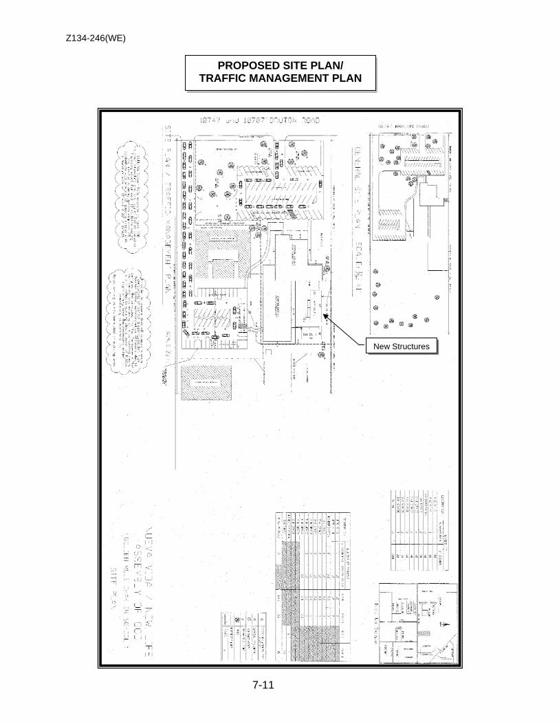
Z134-246(WE)
7-11
PROPOSED SITE PLAN/ TRAFFIC MANAGEMENT PLAN
New Structures
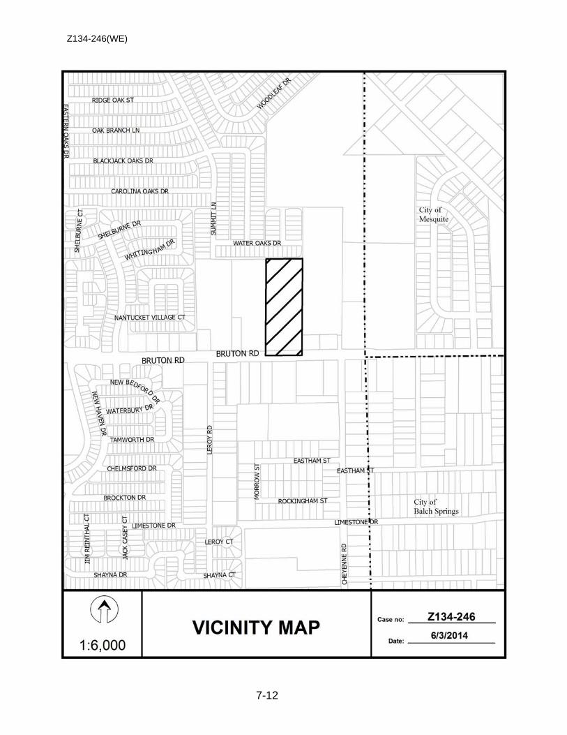
Z134-246(WE)
7-12

Z134-246(WE)
7-13
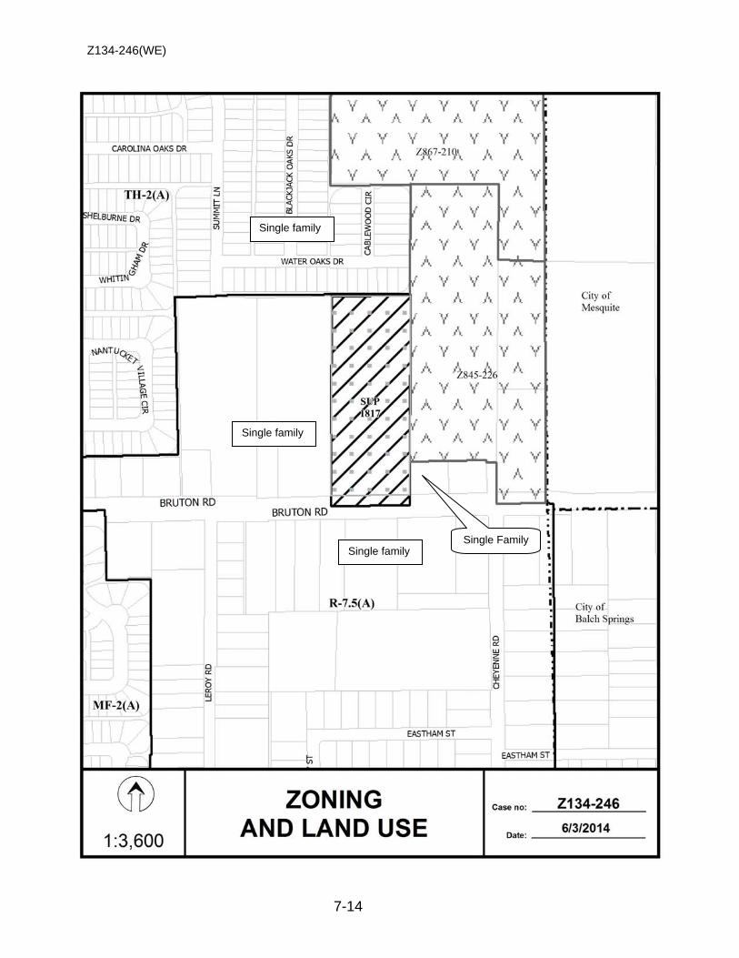
Z134-246(WE)
7-14
Single family
Single Family
Single family
Single family
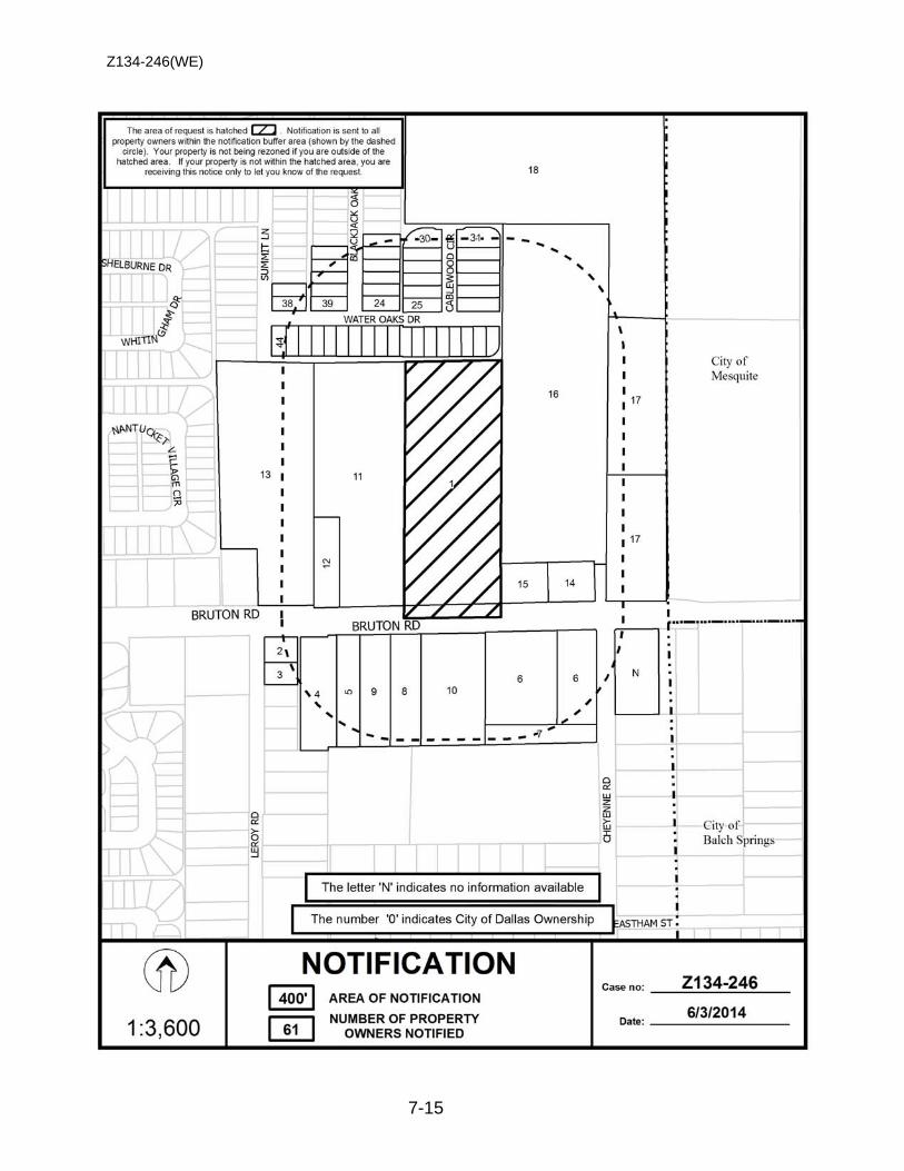
Z134-246(WE)
7-15

Z134-246(WE)
7-16
Notification List of Property Owners Z134-246
61 Property Owners Notified
Label # Address Owner
1 10747 BRUTON RD NUEVA VIDA NEW LIFE ASSEMBLY INC
2 2048 LEROY RD TURNER THERESA A
3 2042 LEROY RD HILL CHARLES RAY ESTATE % BRENDA MALONE
4 10612 BRUTON RD SAENZ ADALBERTO
5 10618 BRUTON RD GALLEGOS COSME G & REYNA A
6 10822 BRUTON RD MACIEL GUADALUPE & PABLO
7 10822 BRUTON RD CARBAJAL AUGUSTINE & VERONICA
8 10708 BRUTON RD RODRIGUEZ JOSE JUAN
9 10622 BRUTON RD FLORES JOSE B & GARY BROWNING
10 10726 BRUTON RD LAZARO MARTHA
11 10631 BRUTON RD ROBERTSON NORMAN L & MARY ELLEN
12 10625 BRUTON RD HOLMES JOHNNY & ALICE G
13 10601 BRUTON RD RICO MARCO A & SARITA
14 10825 BRUTON RD ELCA INVESTMENTS INC
15 10807 BRUTON RD JENNINGS ALISHA
16 10807 BRUTON RD TRISTAN PETRA
17 10901 BRUTON RD RODRIGUEZ DAGOBERTO & MARIA A
18 2501 SAM HOUSTON RD MESQUITE CITY OF
19 10556 BLACKJACK OAKS DR GUIDO JUSTO P& DINORA J
20 10560 BLACKJACK OAKS DR GIPSON EMMA LUTY
21 10564 BLACKJACK OAKS DR CHEN GINNY
22 10568 BLACKJACK OAKS DR MIMS ALICE M
23 10572 BLACKJACK OAKS DR REYES GUELLERMO & MARIANA
24 10576 BLACKJACK OAKS DR MILLER SHERA P
25 2303 CABLEWOOD CIR PEREA REFUGIO S
26 2307 CABLEWOOD CIR DOMINGUEZ BERTOLDO & CYNTHIA
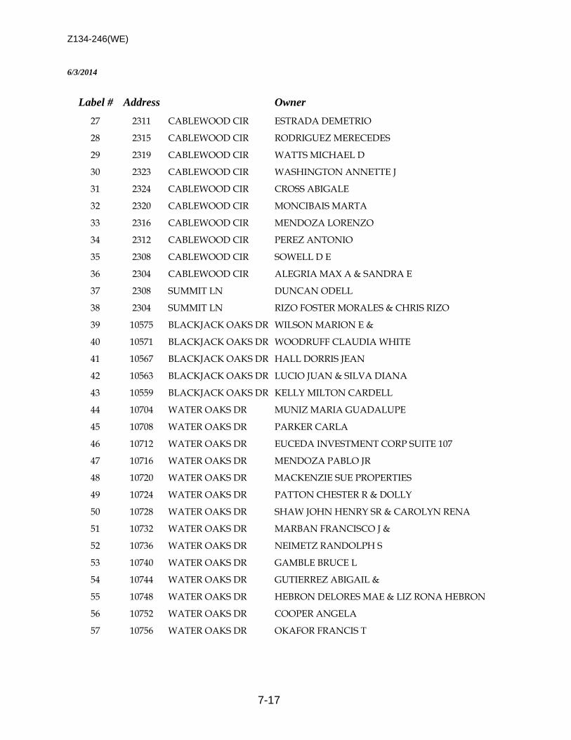
Z134-246(WE)
7-17
6/3/2014
Label # Address Owner
27 2311 CABLEWOOD CIR ESTRADA DEMETRIO
28 2315 CABLEWOOD CIR RODRIGUEZ MERECEDES
29 2319 CABLEWOOD CIR WATTS MICHAEL D
30 2323 CABLEWOOD CIR WASHINGTON ANNETTE J
31 2324 CABLEWOOD CIR CROSS ABIGALE
32 2320 CABLEWOOD CIR MONCIBAIS MARTA
33 2316 CABLEWOOD CIR MENDOZA LORENZO
34 2312 CABLEWOOD CIR PEREZ ANTONIO
35 2308 CABLEWOOD CIR SOWELL D E
36 2304 CABLEWOOD CIR ALEGRIA MAX A & SANDRA E
37 2308 SUMMIT LN DUNCAN ODELL
38 2304 SUMMIT LN RIZO FOSTER MORALES & CHRIS RIZO
39 10575 BLACKJACK OAKS DR WILSON MARION E &
40 10571 BLACKJACK OAKS DR WOODRUFF CLAUDIA WHITE
41 10567 BLACKJACK OAKS DR HALL DORRIS JEAN
42 10563 BLACKJACK OAKS DR LUCIO JUAN & SILVA DIANA
43 10559 BLACKJACK OAKS DR KELLY MILTON CARDELL
44 10704 WATER OAKS DR MUNIZ MARIA GUADALUPE
45 10708 WATER OAKS DR PARKER CARLA
46 10712 WATER OAKS DR EUCEDA INVESTMENT CORP SUITE 107
47 10716 WATER OAKS DR MENDOZA PABLO JR
48 10720 WATER OAKS DR MACKENZIE SUE PROPERTIES
49 10724 WATER OAKS DR PATTON CHESTER R & DOLLY
50 10728 WATER OAKS DR SHAW JOHN HENRY SR & CAROLYN RENA
51 10732 WATER OAKS DR MARBAN FRANCISCO J &
52 10736 WATER OAKS DR NEIMETZ RANDOLPH S
53 10740 WATER OAKS DR GAMBLE BRUCE L
54 10744 WATER OAKS DR GUTIERREZ ABIGAIL &
55 10748 WATER OAKS DR HEBRON DELORES MAE & LIZ RONA HEBRON
56 10752 WATER OAKS DR COOPER ANGELA
57 10756 WATER OAKS DR OKAFOR FRANCIS T
Z134-246(WE)
7-18
6/3/2014
Label # Address Owner
58 10804 WATER OAKS DR CORLEY ROBERT
59 10808 WATER OAKS DR BATTLE TRAVIS J
60 10812 WATER OAKS DR MOORE SARAH J
61 10816 WATER OAKS DR REEVES MAE JEWELL

8-1
CITY PLAN COMMISSION THURSDAY, AUGUST 7, 2014
Planner: Warren F. Ellis FILE NUMBER: Z134-171(WE) DATE FILED: February 27, 2014 LOCATION: North and south sides of Meadow Road, west of Manderville
Lane COUNCIL DISTRICT: 13 MAPSCO: 26-K SIZE OF REQUEST: Approx. 6.7 acres CENSUS TRACT: 78.23 APPLICANT: Provident Realty Advisors OWNER: TKG Valencia Midtown LLC REPRESENTATIVE: Maxwell Fisher, MASTERPLAN REQUEST: An application for a Planned Development District for mixed
uses on property zoned an MF-2(A) Multifamily District and a GO(A) General Office District.
SUMMARY: The purpose of this request is to allow for the construction of
a multifamily development and a one-story, medical complex on two tracts of land. The proposed development will have approximately 350 multifamily units on the southern portion of the property and approximately 50,000 square feet of medical office space on northern tract. The applicant wants the option of developing the southern tract with 450 multifamily units as an option if the medical complex is not developed.
STAFF RECOMMENDATION: Approval, subject to a revised conceptual plan and
staff’s recommended conditions PREVIOUS ACTION: On July 24, 2014, the City Plan Commission held this case under advisement in order for the applicant to make changes to the PDD conditions and conceptual plan.
Z134-171(WE)
8-2
GUIDING CRITERIA FOR RECOMMENDATION: Staff recommends approval the Planned Development District based upon:
1. Performance impacts upon surrounding property – The request for a Planned Development District for a mixed uses will allow for the construction of a multifamily and medical complex on two separate parcels. The request site on the northern tract is adjacent to several multifamily developments with an undeveloped tract of land (Planned Development District No. 895) to the north. The southern tract is adjacent to a hospital and a large tract of undeveloped land. The proposed medical complex on the northern tract and the multifamily development on the southern tract are consistent and compatible with the surrounding properties. The request site is located in a medical district that is supported with a mix of multifamily housing and retail and personal service uses.
2. Traffic impact – The Engineering Section of the Department of Sustainable Development and Constructions has determined that the request will not have a negative impact on the street system.
3. Comprehensive Plan or Area Plan Conformance – The forwardDallas!
Comprehensive Plan shows that the request site in located in an Urban Neighborhood and is in conformance with the fowardDallas! Plan.
4. Justification for PD Planned Development District as opposed to a straight zoning
district – The applicant’s request for a Planned Development District as opposed to a straight zoning is threefold: 1) to consolidate two zoning districts into a single district that will permit the development of a mixed use development, 2) eliminate the tower spacing requirement and urban form setbacks, and 3) permit certain design features in the required setbacks. A straight zoning district will not permit any variances to the yard, lot space regulations the applicant is seeking in the proposed development. However, staff is concerned that the proposed development is speculative due to the main uses that are being proposed in subarea A and subarea B. Staff recommends limiting the request to specifically reflect the uses that are being proposed within the development (i.e., medical and multifamily).
BACKGROUND INFORMATION: • The two sites are currently undeveloped.
• The applicant has submitted a Traffic Impact Analysis (TIA) Report that reflects a
50,000 square foot medical building and 375 multifamily units. However, the applicant has indicated that the both site could be developed with multifamily uses in the event the medical uses is not developed. The maximum number of multifamily units proposed is 650-units. Staff’s analysis is based on the applicant’s TIA that was submitted with the application.

Z134-171(WE)
8-3
• The request site is divided into two tracts of land. The northern tract is adjacent to an undeveloped tract of land (PDD No. 895) and two multifamily developments that are adjacent to the request site’s eastern and western property lines. The southern tract is adjacent to a hospital to west. The property to the south is undeveloped. A four lane, divided roadway is located on the eastern portion of the site.
Zoning History: There has been one recent zoning change requested in the area.
1. Z123-212 On August 28, 2013, the City Council approved Planned Development District No. 895 for mixed uses on property zoned a GO(A) General Office District.
Thoroughfares/Streets:
Thoroughfare/Street Type Existing ROW
Proposed ROW
Meadow Road Principal Arterial 100 ft. 100 ft. Traffic: The Engineering Section of the Department of Sustainable Development and Construction has reviewed the request and the Traffic Impact Analysis Report that was provided by the applicant. It was determined that the surrounding street system can accommodate the anticipated traffic associated with the proposed development. Surrounding Land Uses:
Zoning Land Use Site MF-2(A), GO(A) Undeveloped
North PDD No. 895 Undeveloped South MF-2(A) Undeveloped East R-7.5(A) Roadway, DART rail line West MU-3 SAH, MF-2(A) Hospital, Multifamily
COMPREHENSIVE PLAN: The forwardDallas! Comprehensive Plan was adopted by the City Council in June 2006. The forwardDallas! Comprehensive Plan outlines several goals and policies which can serve as a framework for assisting in evaluating the applicant’s request. The Plan identifies the request site as being in an Urban Neighborhood. The Vision Illustration depicts the request site as an Urban Neighborhood. Urban Neighborhoods, including Oak Lawn, the Grand Avenue area in South Dallas, the area near Jefferson Boulevard and the Vickery Meadow area, are predominately residential but are distinguished from other neighborhoods by the wide variety of housing options they provide and easy access to public transit. Housing choices should include single-family detached dwellings, townhomes and low- to midrise condominiums or apartments. These neighborhoods will have concentrations of shops and offices along

Z134-171(WE)
8-4
key corridors or at key intersections, providing important services and job opportunities within walking distance of residences. These areas may have mixed-use buildings with ground floor shops. Areas currently developed with single-family or duplex uses should generally be maintained unless redevelopment is addressed through an Area Planning process. Urban Neighborhood streets will be very pedestrian friendly, providing excellent connectivity to shopping, schools and other community services. Emphasis should be placed on slowing traffic through use of on-street parking and other similar traffic calming measures. Public investments in these areas will focus on parks, pathways, transit stops, pedestrian-oriented landscaping and road improvements. In general, the applicant’s proposal is consistent with the following goals and policies of the Comprehensive Plan. Development Standards: DISTRICT SETBACKS Density Height Lot
Coverage Special
Standards PRIMARY Uses Front Side/Rear
MF-2(A) - existing Multifamily 15’ 15’
Min lot 1,000 sq. ft. 800 sq ft – E
1,000 sq. ft – 1 BR 1,200 sq ft – 2 BR
+150 sq ft each add BR
36’ 60% Proximity Slope
Multifamily, duplex, single family
GO(A) - existing General office
15’ 20’ adjacent to residential
OTHER: No Min.
4.0 FAR 270’ 20 stories 80%
Proximity Slope U-form setback Tower spacing Visual Intrusion
Office, lodging – limited retail & personal service uses
PDD – staff’s rec Mixed uses
varies varies
Tract A & B
80%
Visual Intrusion Medical, multifamily
PDD – Appl. Proposal Mixed uses
varies varies
Tract A & B
80%
Visual Intrusion Office, retail & personal service, lodging, residential
Landscaping: Landscaping will be in accordance with Article X, as amended. Parking: Parking for the proposed development will be in accordance with the parking regulations in Division 51A-4.200 for the specific off-street parking and loading requirements for each use. The applicant has also proposed tandem parking within the development. Staff cannot support this type of parking because the applicant has not shown or provided any information to support the tandem parking within the proposed development.
Z134-171(WE)
8-5
LIST OF OFFICERS
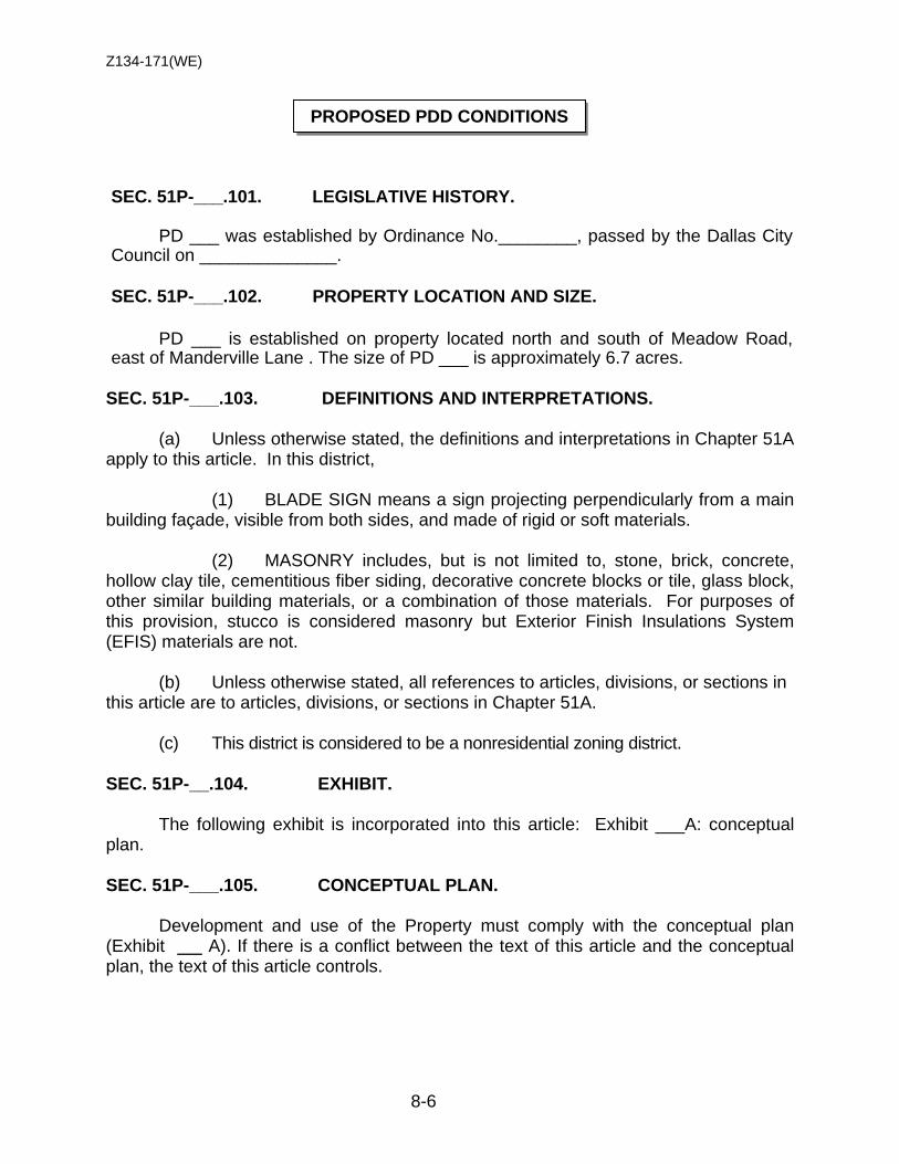
Z134-171(WE)
8-6
SEC. 51P-___.101. LEGISLATIVE HISTORY.
PD ___ was established by Ordinance No.________, passed by the Dallas City Council on ______________.
SEC. 51P-___.102. PROPERTY LOCATION AND SIZE.
PD ___ is established on property located north and south of Meadow Road, east of Manderville Lane . The size of PD ___ is approximately 6.7 acres.
SEC. 51P-___.103. DEFINITIONS AND INTERPRETATIONS. (a) Unless otherwise stated, the definitions and interpretations in Chapter 51A apply to this article. In this district, (1) BLADE SIGN means a sign projecting perpendicularly from a main building façade, visible from both sides, and made of rigid or soft materials.
(2) MASONRY includes, but is not limited to, stone, brick, concrete, hollow clay tile, cementitious fiber siding, decorative concrete blocks or tile, glass block, other similar building materials, or a combination of those materials. For purposes of this provision, stucco is considered masonry but Exterior Finish Insulations System (EFIS) materials are not. (b) Unless otherwise stated, all references to articles, divisions, or sections in this article are to articles, divisions, or sections in Chapter 51A.
(c) This district is considered to be a nonresidential zoning district.
SEC. 51P-__.104. EXHIBIT. The following exhibit is incorporated into this article: Exhibit ___A: conceptual plan. SEC. 51P-___.105. CONCEPTUAL PLAN.
Development and use of the Property must comply with the conceptual plan (Exhibit A). If there is a conflict between the text of this article and the conceptual plan, the text of this article controls.
PROPOSED PDD CONDITIONS
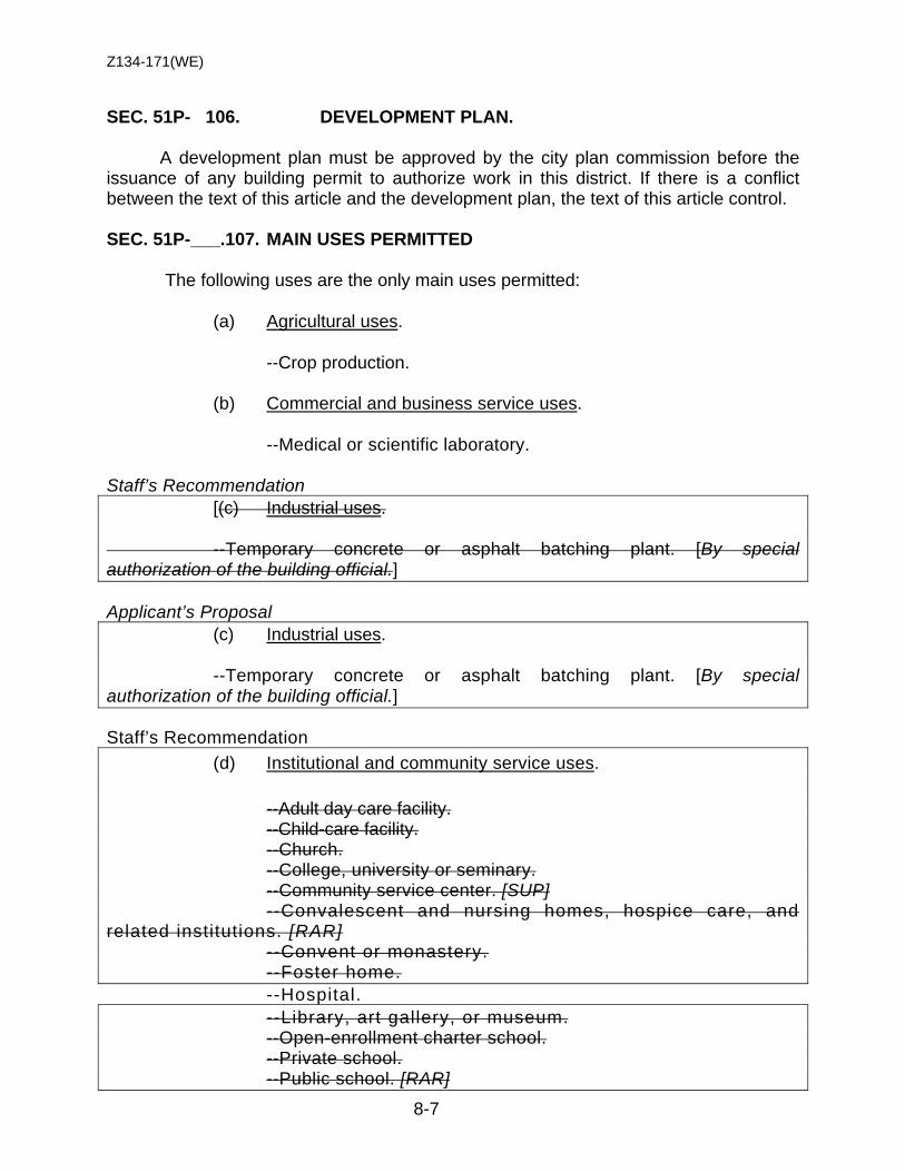
Z134-171(WE)
8-7
SEC. 51P- 106. DEVELOPMENT PLAN.
A development plan must be approved by the city plan commission before the issuance of any building permit to authorize work in this district. If there is a conflict between the text of this article and the development plan, the text of this article control.
SEC. 51P-___.107. MAIN USES PERMITTED
The following uses are the only main uses permitted:
(a) Agricultural uses.
--Crop production.
(b) Commercial and business service uses.
--Medical or scientific laboratory. Staff’s Recommendation [(c) Industrial uses. --Temporary concrete or asphalt batching plant. [By special authorization of the building official.]
Applicant’s Proposal (c) Industrial uses. --Temporary concrete or asphalt batching plant. [By special authorization of the building official.]
Staff’s Recommendation (d) Institutional and community service uses.
--Adult day care facility. --Child-care facility. --Church. --College, university or seminary. --Community service center. [SUP]
--Convalescent and nursing homes, hospice care, and related institutions. [RAR]
--Convent or monastery. --Foster home. --Hospital. --Library, art gallery, or museum. --Open-enrollment charter school. --Private school. --Public school. [RAR]

Z134-171(WE)
8-8
Staff’s Recommendation [(e) Lodging uses. --Hotel or motel.]
Applicant’s Proposal (e) Lodging uses. --Hotel or motel.
Staff’s Recommendation (f) Miscellaneous uses.
[--Carnival or circus (temporary). [By special authorization of the building official.]
--Temporary construction or sales office.
Applicant’s Proposal (f) Miscellaneous uses.
--Carnival or circus (temporary). [By special authorization of the building official.]
--Temporary construction or sales office.
(g) Office uses. --Financial institution without drive-in window. --Financial institution with drive-in window. --Medical clinic or ambulatory surgical center. --Office.
Staff’s Recommendation [(h) Recreation uses. --Country club with private membership. --Private recreation center, club, or area. --Public park, playground, or golf course.] Applicant’s Proposal (h) Recreation uses. --Country club with private membership. --Private recreation center, club, or area. --Public park, playground, or golf course.
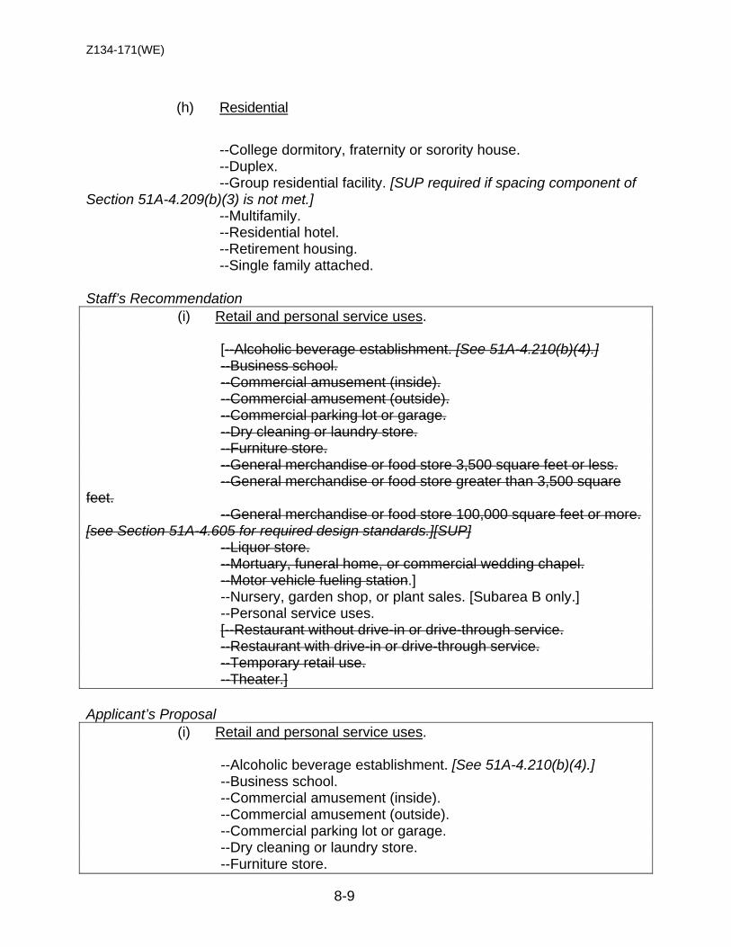
Z134-171(WE)
8-9
(h) Residential
--College dormitory, fraternity or sorority house. --Duplex. --Group residential facility. [SUP required if spacing component of
Section 51A-4.209(b)(3) is not met.] --Multifamily. --Residential hotel. --Retirement housing. --Single family attached.
Staff’s Recommendation (i) Retail and personal service uses. [--Alcoholic beverage establishment. [See 51A-4.210(b)(4).] --Business school. --Commercial amusement (inside). --Commercial amusement (outside). --Commercial parking lot or garage. --Dry cleaning or laundry store. --Furniture store. --General merchandise or food store 3,500 square feet or less. --General merchandise or food store greater than 3,500 square feet. --General merchandise or food store 100,000 square feet or more. [see Section 51A-4.605 for required design standards.][SUP] --Liquor store. --Mortuary, funeral home, or commercial wedding chapel. --Motor vehicle fueling station.] --Nursery, garden shop, or plant sales. [Subarea B only.] --Personal service uses. [--Restaurant without drive-in or drive-through service. --Restaurant with drive-in or drive-through service. --Temporary retail use. --Theater.]
Applicant’s Proposal (i) Retail and personal service uses. --Alcoholic beverage establishment. [See 51A-4.210(b)(4).] --Business school. --Commercial amusement (inside). --Commercial amusement (outside). --Commercial parking lot or garage. --Dry cleaning or laundry store. --Furniture store.
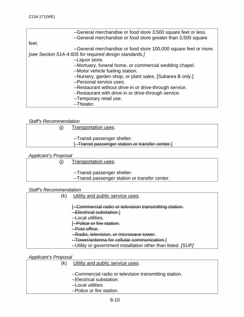
Z134-171(WE)
8-10
--General merchandise or food store 3,500 square feet or less. --General merchandise or food store greater than 3,500 square feet. --General merchandise or food store 100,000 square feet or more. [see Section 51A-4.605 for required design standards.] --Liquor store. --Mortuary, funeral home, or commercial wedding chapel. --Motor vehicle fueling station. --Nursery, garden shop, or plant sales. [Subarea B only.] --Personal service uses. --Restaurant without drive-in or drive-through service. --Restaurant with drive-in or drive-through service. --Temporary retail use. --Theater.
Staff’s Recommendation (j) Transportation uses. --Transit passenger shelter. [--Transit passenger station or transfer center.]
Applicant’s Proposal (j) Transportation uses. --Transit passenger shelter. --Transit passenger station or transfer center.
Staff’s Recommendation (k) Utility and public service uses. [--Commercial radio or television transmitting station. --Electrical substation.] --Local utilities. [--Police or fire station. --Post office. --Radio, television, or microwave tower. --Tower/antenna for cellular communication.] --Utility or government installation other than listed. [SUP]
Applicant’s Proposal (k) Utility and public service uses. --Commercial radio or television transmitting station. --Electrical substation. --Local utilities. --Police or fire station.
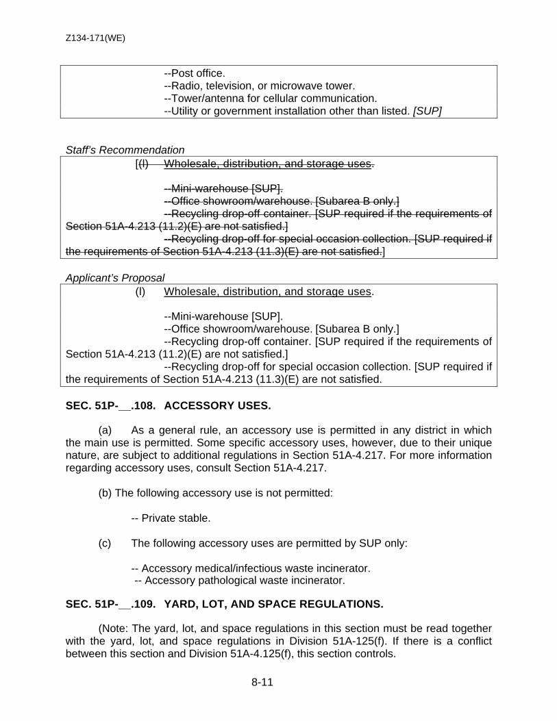
Z134-171(WE)
8-11
--Post office. --Radio, television, or microwave tower. --Tower/antenna for cellular communication. --Utility or government installation other than listed. [SUP] Staff’s Recommendation [(l) Wholesale, distribution, and storage uses. --Mini-warehouse [SUP]. --Office showroom/warehouse. [Subarea B only.] --Recycling drop-off container. [SUP required if the requirements of Section 51A-4.213 (11.2)(E) are not satisfied.] --Recycling drop-off for special occasion collection. [SUP required if the requirements of Section 51A-4.213 (11.3)(E) are not satisfied.] Applicant’s Proposal (l) Wholesale, distribution, and storage uses. --Mini-warehouse [SUP]. --Office showroom/warehouse. [Subarea B only.] --Recycling drop-off container. [SUP required if the requirements of Section 51A-4.213 (11.2)(E) are not satisfied.] --Recycling drop-off for special occasion collection. [SUP required if the requirements of Section 51A-4.213 (11.3)(E) are not satisfied. SEC. 51P-__.108. ACCESSORY USES.
(a) As a general rule, an accessory use is permitted in any district in which the main use is permitted. Some specific accessory uses, however, due to their unique nature, are subject to additional regulations in Section 51A-4.217. For more information regarding accessory uses, consult Section 51A-4.217.
(b) The following accessory use is not permitted:
-- Private stable.
(c) The following accessory uses are permitted by SUP only:
-- Accessory medical/infectious waste incinerator. -- Accessory pathological waste incinerator. SEC. 51P-__.109. YARD, LOT, AND SPACE REGULATIONS.
(Note: The yard, lot, and space regulations in this section must be read together with the yard, lot, and space regulations in Division 51A-125(f). If there is a conflict between this section and Division 51A-4.125(f), this section controls.
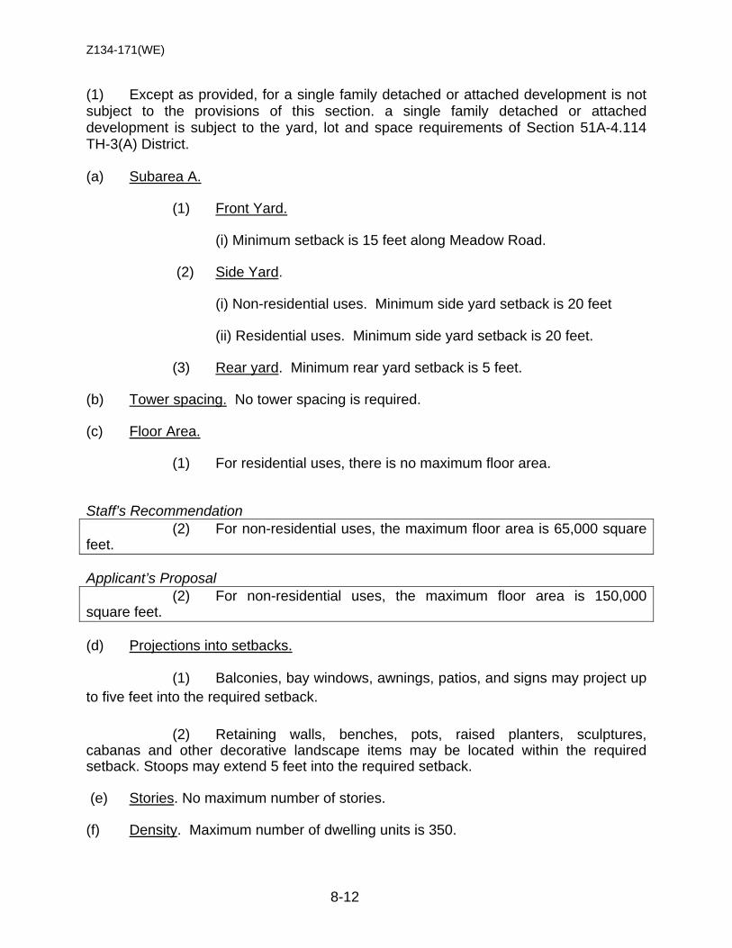
Z134-171(WE)
8-12
(1) Except as provided, for a single family detached or attached development is not subject to the provisions of this section. a single family detached or attached development is subject to the yard, lot and space requirements of Section 51A-4.114 TH-3(A) District. (a) Subarea A.
(1) Front Yard. (i) Minimum setback is 15 feet along Meadow Road.
(2) Side Yard.
(i) Non-residential uses. Minimum side yard setback is 20 feet (ii) Residential uses. Minimum side yard setback is 20 feet. (3) Rear yard. Minimum rear yard setback is 5 feet.
(b) Tower spacing. No tower spacing is required. (c) Floor Area.
(1) For residential uses, there is no maximum floor area. Staff’s Recommendation (2) For non-residential uses, the maximum floor area is 65,000 square feet. Applicant’s Proposal (2) For non-residential uses, the maximum floor area is 150,000 square feet.
(d) Projections into setbacks. (1) Balconies, bay windows, awnings, patios, and signs may project up to five feet into the required setback.
(2) Retaining walls, benches, pots, raised planters, sculptures, cabanas and other decorative landscape items may be located within the required setback. Stoops may extend 5 feet into the required setback.
(e) Stories. No maximum number of stories. (f) Density. Maximum number of dwelling units is 350.
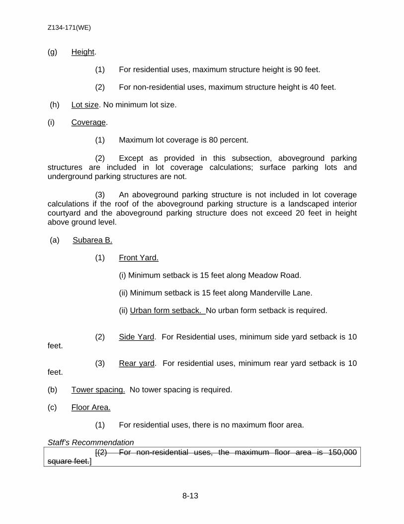
Z134-171(WE)
8-13
(g) Height. (1) For residential uses, maximum structure height is 90 feet. (2) For non-residential uses, maximum structure height is 40 feet. (h) Lot size. No minimum lot size.
(i) Coverage. (1) Maximum lot coverage is 80 percent. (2) Except as provided in this subsection, aboveground parking structures are included in lot coverage calculations; surface parking lots and underground parking structures are not.
(3) An aboveground parking structure is not included in lot coverage calculations if the roof of the aboveground parking structure is a landscaped interior courtyard and the aboveground parking structure does not exceed 20 feet in height above ground level. (a) Subarea B.
(1) Front Yard. (i) Minimum setback is 15 feet along Meadow Road. (ii) Minimum setback is 15 feet along Manderville Lane. (ii) Urban form setback. No urban form setback is required.
(2) Side Yard. For Residential uses, minimum side yard setback is 10 feet. (3) Rear yard. For residential uses, minimum rear yard setback is 10 feet.
(b) Tower spacing. No tower spacing is required. (c) Floor Area.
(1) For residential uses, there is no maximum floor area. Staff’s Recommendation [(2) For non-residential uses, the maximum floor area is 150,000 square feet.]
Z134-171(WE)
8-14
Applicant’s Proposal (2) For non-residential uses, the maximum floor area is 150,000 square feet.
(d) Projections into setbacks. (1) Balconies, bay windows, awnings, patios, and signs may project up to five feet into the required setback.
(2) Retaining walls, benches, pots, raised planters, sculptures, cabanas and other decorative landscape items may be located within the required setback. Stoops may extend 5 feet into the required setback.
(e) Stories. No maximum number of stories. (f) Density. Maximum number of dwelling units is 300. (g) Height. (1) For residential uses, maximum structure height is 90 feet. (h) Lot size. No minimum lot size.
(i) Coverage. (1) Maximum lot coverage is 80 percent. (2) Except as provided in this subsection, aboveground parking structures are included in lot coverage calculations; surface parking lots and underground parking structures are not.
(3) An aboveground parking structure is not included in lot coverage calculations if the roof of the aboveground parking structure is a landscaped interior courtyard and the aboveground parking structure does not exceed 20 feet in height above ground level. SEC. 51P-__.110. OFF-STREET PARKING AND LOADING.
(a) Consult the use regulations in Division 51A-4.200 for the specific off-street parking and loading requirements for each use. Staff’s Recommendation [(b) The use of tandem parking is permitted in conjunction with residential development only.]

Z134-171(WE)
8-15
Applicant’s Proposal (b) The use of tandem parking is permitted in conjunction with residential development only. SEC. 51P-___.111. ENVIRONMENTAL PERFORMANCE STANDARDS.
See Article VI. SEC. 51P-___.112. LANDSCAPING.
(a) Landscaping (1) In general. Except as provided in this section, landscaping must be provided in accordance with Article X.
(2) Existing street trees may count toward complying with the minimum site tree requirements. (3) The existing trees (and tree grates) along both Manderville Lane and Meadow Road count towards meeting the minimum street tree requirements. (4) The perimeter landscape buffer strip requirements do not apply. (5) All plant materials must be maintained in a healthy, growing condition. (b) Pedestrian amenities (1) In general. The following pedestrian amenities are required along Meadow Road and Manderville Road street frontages: (a) benches at a minimum of one per 200 feet of frontage. (b) trash receptacles at a minimum of one per 200 feet of frontage. (c) pedestrian lighting at a minimum of one per 150 feet of frontage.
(2) Maintenance. All pedestrian amenities must be maintained by the owner of the lot; if there is more than one owner, all owners are jointly and severally responsible for maintenance.
SEC. 51P-__.114. SIGNS.
(a) In general. Signs must comply with the provisions for business zoning districts in Article VII.
(b) Blade signs. One additional premise signs is permitted as blade signs for each multifamily structure per street frontage. The effective area for each sign may not
Z134-171(WE)
8-16
exceed 72 square feet per side. The blade signs must be attached to a main structure and may project no more than 2.5 feet into the required setback.
SEC. 51P-___.116. ADDITIONAL PROVISIONS.
(a) The Property must be properly maintained in a state of good repair and neat appearance.
(b) One temporary leasing office may be erected for up to 180 days from the
date of issuance of building permit without development plan approval and within the building setbacks. The building official may approve additional 30-day extensions.
(c) Development and use of the Property must comply with all federal and
state laws and regulations, and with all ordinances, rules, and regulations of the city. SEC. 51P-___.117. COMPLIANCE WITH CONDITIONS.
(a) All paved areas, permanent drives, streets, and drainage structures, if any, must be constructed in accordance with standard city specifications, and completed to the satisfaction of the director of public works and transportation. (b) The building official shall not issue a building permit to authorize work, or a certificate of occupancy to authorize the operation of a use, until there has been full compliance with this article, the Dallas Development Code, the construction codes, and all other ordinances, rules, and regulations of the city."

Z134-171(WE)
8-17
PROPOSED CONCEPTUAL PLAN
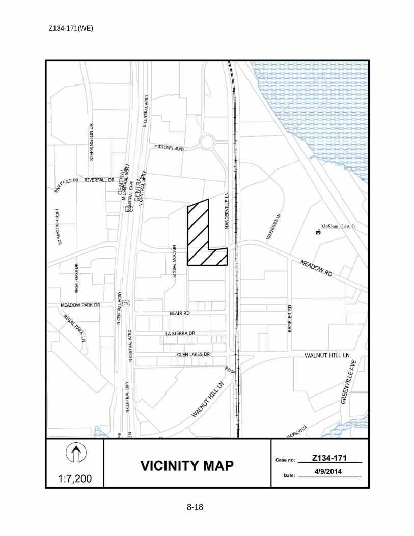
Z134-171(WE)
8-18
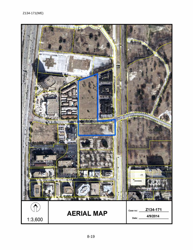
Z134-171(WE)
8-19
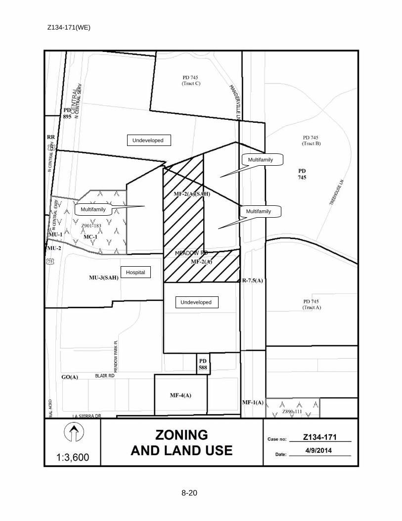
Z134-171(WE)
8-20
Undeveloped
Undeveloped
Hospital
Multifamily
Multifamily
Multifamily
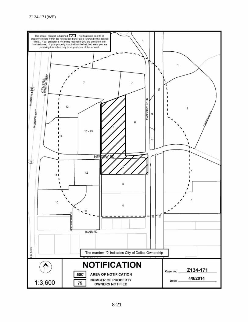
Z134-171(WE)
8-21
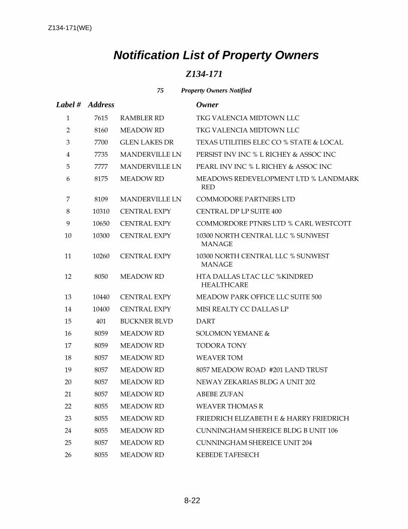
Z134-171(WE)
8-22
Notification List of Property Owners
Z134-171
75 Property Owners Notified
Label # Address Owner
1 7615 RAMBLER RD TKG VALENCIA MIDTOWN LLC
2 8160 MEADOW RD TKG VALENCIA MIDTOWN LLC
3 7700 GLEN LAKES DR TEXAS UTILITIES ELEC CO % STATE & LOCAL
4 7735 MANDERVILLE LN PERSIST INV INC % L RICHEY & ASSOC INC
5 7777 MANDERVILLE LN PEARL INV INC % L RICHEY & ASSOC INC
6 8175 MEADOW RD MEADOWS REDEVELOPMENT LTD % LANDMARK RED
7 8109 MANDERVILLE LN COMMODORE PARTNERS LTD
8 10310 CENTRAL EXPY CENTRAL DP LP SUITE 400
9 10650 CENTRAL EXPY COMMORDORE PTNRS LTD % CARL WESTCOTT
10 10300 CENTRAL EXPY 10300 NORTH CENTRAL LLC % SUNWEST MANAGE
11 10260 CENTRAL EXPY 10300 NORTH CENTRAL LLC % SUNWEST MANAGE
12 8050 MEADOW RD HTA DALLAS LTAC LLC %KINDRED HEALTHCARE
13 10440 CENTRAL EXPY MEADOW PARK OFFICE LLC SUITE 500
14 10400 CENTRAL EXPY MISI REALTY CC DALLAS LP
15 401 BUCKNER BLVD DART
16 8059 MEADOW RD SOLOMON YEMANE &
17 8059 MEADOW RD TODORA TONY
18 8057 MEADOW RD WEAVER TOM
19 8057 MEADOW RD 8057 MEADOW ROAD #201 LAND TRUST
20 8057 MEADOW RD NEWAY ZEKARIAS BLDG A UNIT 202
21 8057 MEADOW RD ABEBE ZUFAN
22 8055 MEADOW RD WEAVER THOMAS R
23 8055 MEADOW RD FRIEDRICH ELIZABETH E & HARRY FRIEDRICH
24 8055 MEADOW RD CUNNINGHAM SHEREICE BLDG B UNIT 106
25 8057 MEADOW RD CUNNINGHAM SHEREICE UNIT 204
26 8055 MEADOW RD KEBEDE TAFESECH
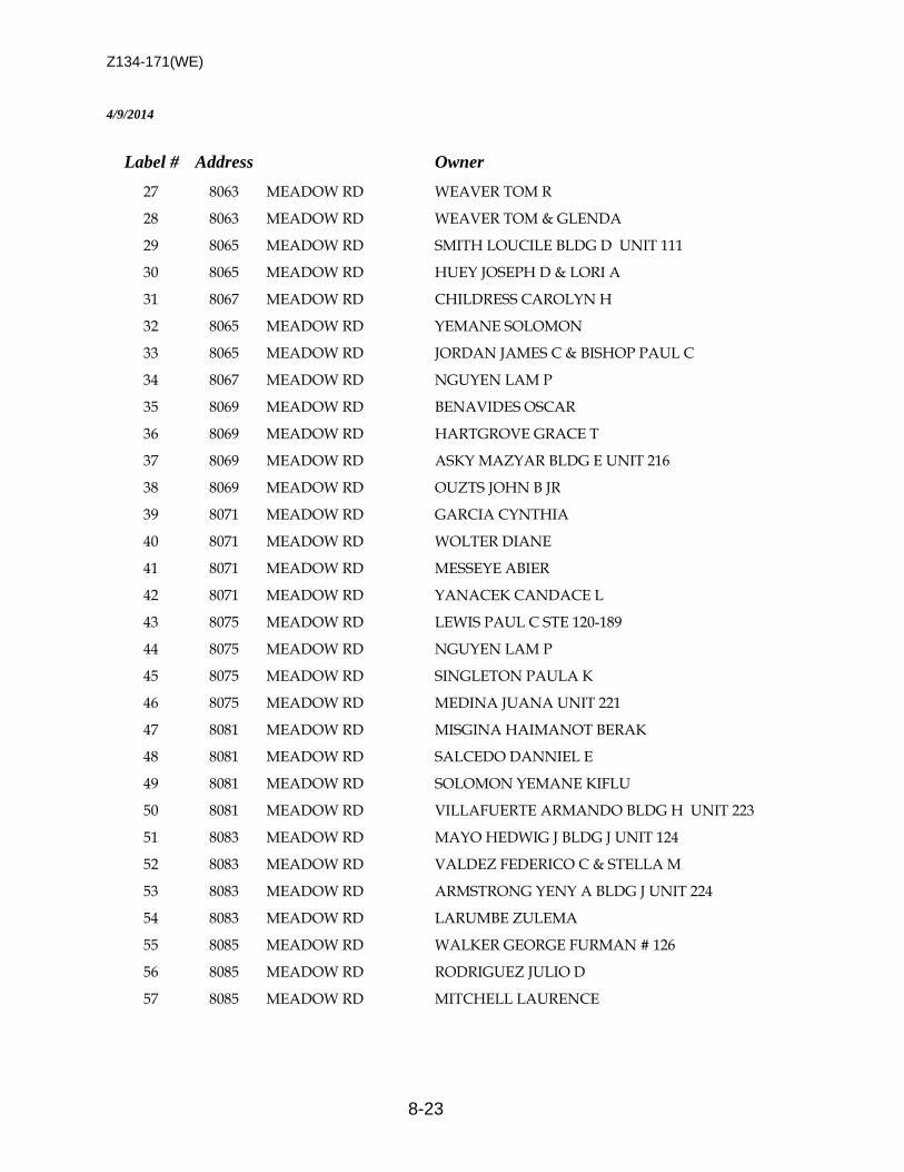
Z134-171(WE)
8-23
4/9/2014
Label # Address Owner
27 8063 MEADOW RD WEAVER TOM R
28 8063 MEADOW RD WEAVER TOM & GLENDA
29 8065 MEADOW RD SMITH LOUCILE BLDG D UNIT 111
30 8065 MEADOW RD HUEY JOSEPH D & LORI A
31 8067 MEADOW RD CHILDRESS CAROLYN H
32 8065 MEADOW RD YEMANE SOLOMON
33 8065 MEADOW RD JORDAN JAMES C & BISHOP PAUL C
34 8067 MEADOW RD NGUYEN LAM P
35 8069 MEADOW RD BENAVIDES OSCAR
36 8069 MEADOW RD HARTGROVE GRACE T
37 8069 MEADOW RD ASKY MAZYAR BLDG E UNIT 216
38 8069 MEADOW RD OUZTS JOHN B JR
39 8071 MEADOW RD GARCIA CYNTHIA
40 8071 MEADOW RD WOLTER DIANE
41 8071 MEADOW RD MESSEYE ABIER
42 8071 MEADOW RD YANACEK CANDACE L
43 8075 MEADOW RD LEWIS PAUL C STE 120-189
44 8075 MEADOW RD NGUYEN LAM P
45 8075 MEADOW RD SINGLETON PAULA K
46 8075 MEADOW RD MEDINA JUANA UNIT 221
47 8081 MEADOW RD MISGINA HAIMANOT BERAK
48 8081 MEADOW RD SALCEDO DANNIEL E
49 8081 MEADOW RD SOLOMON YEMANE KIFLU
50 8081 MEADOW RD VILLAFUERTE ARMANDO BLDG H UNIT 223
51 8083 MEADOW RD MAYO HEDWIG J BLDG J UNIT 124
52 8083 MEADOW RD VALDEZ FEDERICO C & STELLA M
53 8083 MEADOW RD ARMSTRONG YENY A BLDG J UNIT 224
54 8083 MEADOW RD LARUMBE ZULEMA
55 8085 MEADOW RD WALKER GEORGE FURMAN # 126
56 8085 MEADOW RD RODRIGUEZ JULIO D
57 8085 MEADOW RD MITCHELL LAURENCE
Z134-171(WE)
8-24
4/9/2014
Label # Address Owner
58 8087 MEADOW RD KIRK CHARLES GLEN
59 8087 MEADOW RD MINCKLER CHRISTOPHER R &
60 8087 MEADOW RD HOLCOMB JAMES RUSSELL III UNIT 229
61 8089 MEADOW RD JOHNSTON HILLARY BLDG M UNIT 230
62 8089 MEADOW RD HAILE TESHOME S UNIT 231
63 8091 MEADOW RD BENAVIDES OSCAR R JR UNIT 1102
64 8091 MEADOW RD ALEMU HULUMSEW ABEBE
65 8093 MEADOW RD KIDANE MULU HABITE & BLDG N #134
66 8093 MEADOW RD BENEVIDES OSCAR
67 8091 MEADOW RD CHOU AMY & APT 233
68 8093 MEADOW RD ABRAHA SELAMAWIT
69 8095 MEADOW RD MILLER PAULETTA J APT 213
70 8095 MEADOW RD TAN JINI L
71 8095 MEADOW RD SHEPHERD MARGARET BLDG P UNIT 137
72 8095 MEADOW RD SEUBERT SALLY A
73 8095 MEADOW RD STOKES CATRIONA BLDG P UNIT 236
74 8095 MEADOW RD FOSTER CORRIE LEE # 237-P
75 8079 MEADOW RD DYGOWSKI LAURIEANN
9-1
CITY PLAN COMMISSION THURSDAY, AUGUST 7, 2014
Planner: Warren F. Ellis FILE NUMBER: Z134-223(WE) DATE FILED: March 9, 2014 LOCATION: Southwest side of C.F. Hawn Freeway, east of Murdock Road COUNCIL DISTRICT: 8 MAPSCO: 58-Y SIZE OF REQUEST: Approx. 0. 05 acres CENSUS TRACT: 116.02 APPLICANT / OWNER: Augustin M. Miranda REPRESENTATIVE: Construction Concepts REQUEST: An application for a Specific Use Permit for vehicle display,
sales and services on property zoned Subdistrict 2 within Planned Development District No. 534, the C.F. Hawn Special Purpose District.
SUMMARY: The purpose of this request is to allow for the applicant to
display and sell automobiles on the site. The site is currently undeveloped.
STAFF RECOMMENDATION: Hold under advisement until September 4, 2014. PREVIOUS ACTION: On July 24, 2014, the City Commission held this case under advisement until August 7, 2014, to allow the applicant to meet with the city’s arborist to discuss options to comply with PDD No. 534 landscape requirements for the proposed development. Staff is requesting that the item be held because the landscaping concerns have not been resolved.

Z134-223(WE)
9-2
GUIDING CRITERIA FOR RECOMMENDATION: The following factors are listed in Chapter 51A of the Dallas Development Code to guide the determination as to whether or not an SUP shall be granted. Staff has listed its findings based upon each component below:
1. Compatibility with surrounding uses and community facilities – The proposed vehicle display, sales and service use should not negatively impact the surrounding uses. The proposed development is consistent with the mix of uses that are developed along the C.F. Hawn corridor. Uses such as vehicle display, sales, and services, auto service uses and motel uses are permitted within PDD No. 534, which encourages retail and personal service uses along the C.F. Hawn corridor. A 10-foot buffer required on the southern portion of site should help mitigate any potential impacts with the residential adjacency. The Code requires the applicant install a 6-foot fence to screen the adjacent residential uses from the proposed development.
2. Contribution to, enhancement, or promoting the welfare of the area of request and adjacent properties – The proposed vehicle, display and service development will be oriented along a major freeway where the development rights are governed by the CR Community Retail District. The landscape section within PDD No. 534 requires a 10-foot landscape strip along C.F. Hawn Freeway. This additional landscape strip is an enhancement feature to the Freeway, as it is considered to be a gateway to the City of Dallas. In addition, any new development within the Planned Development District No. 534 will have to comply with the installation of the landscaping requirements along the C.F. Hawn corridor. The proposed SUP, if approved, will have conditions that are associated with the use.
3. Not a detriment to the public health, safety, or general welfare – The use is not
anticipated to be a detriment to the public welfare.
4. Conforms in all other respects to all applicable zoning regulations and standards – The request will comply with all zoning regulations and standards.
BACKGROUND INFORMATION: • The applicant’s request for a Specific Use Permit will allow for the sale and display
of automobiles. The request is located along the C.F Hawn Freeway and is within Subdistrict 2 of PDD No. 534, where commercial and retail uses are encouraged to be developed.
• The site is adjacent to an undeveloped tract of land to the west, and a vehicle display, sales and service use to the west. Properties to the south consist of single family development.
• In August 1999, the City Council approved Planned Development District No. 534,
the C.F. Hawn Special Purpose District. The PDD established 3 Subdistricts that
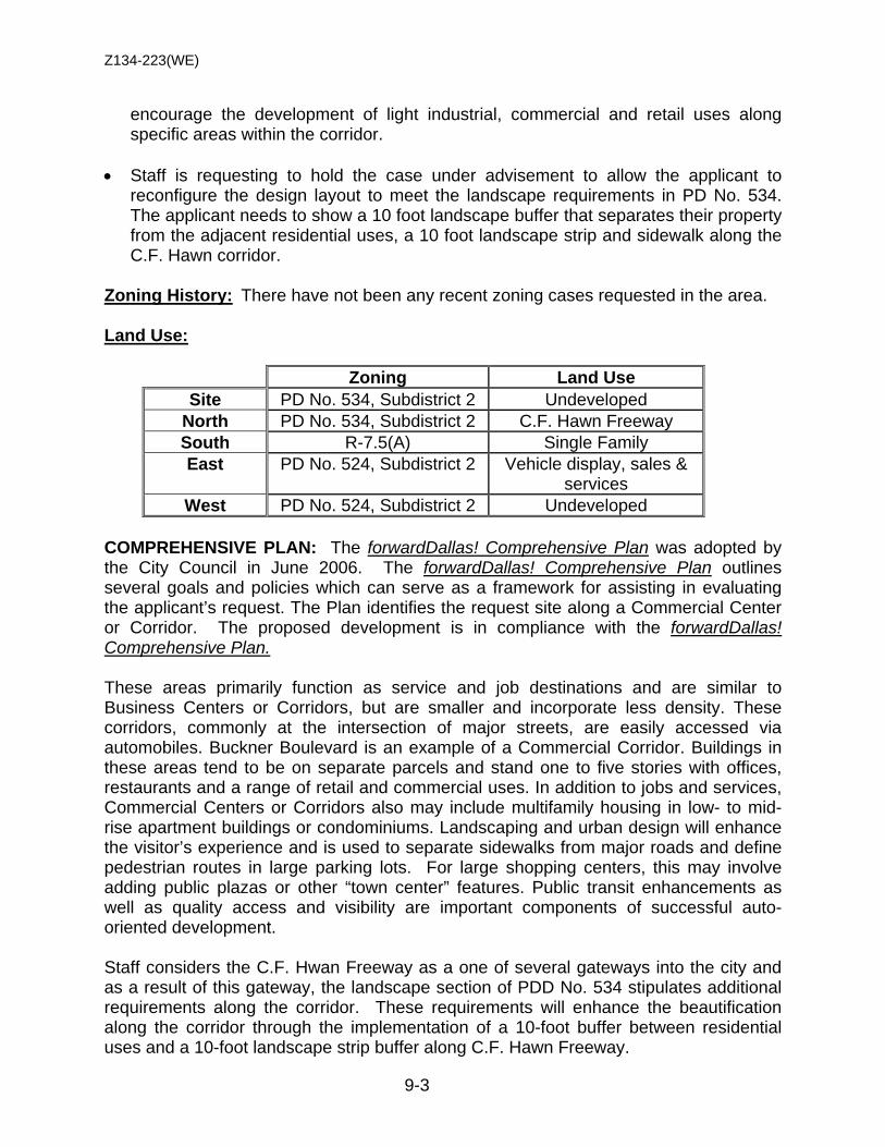
Z134-223(WE)
9-3
encourage the development of light industrial, commercial and retail uses along specific areas within the corridor.
• Staff is requesting to hold the case under advisement to allow the applicant to
reconfigure the design layout to meet the landscape requirements in PD No. 534. The applicant needs to show a 10 foot landscape buffer that separates their property from the adjacent residential uses, a 10 foot landscape strip and sidewalk along the C.F. Hawn corridor.
Zoning History: There have not been any recent zoning cases requested in the area. Land Use:
Zoning Land Use Site PD No. 534, Subdistrict 2 Undeveloped
North PD No. 534, Subdistrict 2 C.F. Hawn Freeway South R-7.5(A) Single Family East PD No. 524, Subdistrict 2 Vehicle display, sales &
services West PD No. 524, Subdistrict 2 Undeveloped
COMPREHENSIVE PLAN: The forwardDallas! Comprehensive Plan was adopted by the City Council in June 2006. The forwardDallas! Comprehensive Plan outlines several goals and policies which can serve as a framework for assisting in evaluating the applicant’s request. The Plan identifies the request site along a Commercial Center or Corridor. The proposed development is in compliance with the forwardDallas! Comprehensive Plan. These areas primarily function as service and job destinations and are similar to Business Centers or Corridors, but are smaller and incorporate less density. These corridors, commonly at the intersection of major streets, are easily accessed via automobiles. Buckner Boulevard is an example of a Commercial Corridor. Buildings in these areas tend to be on separate parcels and stand one to five stories with offices, restaurants and a range of retail and commercial uses. In addition to jobs and services, Commercial Centers or Corridors also may include multifamily housing in low- to mid-rise apartment buildings or condominiums. Landscaping and urban design will enhance the visitor’s experience and is used to separate sidewalks from major roads and define pedestrian routes in large parking lots. For large shopping centers, this may involve adding public plazas or other “town center” features. Public transit enhancements as well as quality access and visibility are important components of successful auto-oriented development. Staff considers the C.F. Hwan Freeway as a one of several gateways into the city and as a result of this gateway, the landscape section of PDD No. 534 stipulates additional requirements along the corridor. These requirements will enhance the beautification along the corridor through the implementation of a 10-foot buffer between residential uses and a 10-foot landscape strip buffer along C.F. Hawn Freeway.
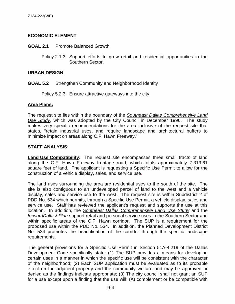
Z134-223(WE)
9-4
ECONOMIC ELEMENT GOAL 2.1 Promote Balanced Growth
Policy 2.1.3 Support efforts to grow retail and residential opportunities in the
Southern Sector. URBAN DESIGN GOAL 5.2 Strengthen Community and Neighborhood Identity
Policy 5.2.3 Ensure attractive gateways into the city.
Area Plans: The request site lies within the boundary of the Southeast Dallas Comprehensive Land Use Study, which was adopted by the City Council in December 1996. The study makes very specific recommendations for the area inclusive of the request site that states, “retain industrial uses, and require landscape and architectural buffers to minimize impact on areas along C.F. Hawn Freeway.”
STAFF ANALYSIS: Land Use Compatibility: The request site encompasses three small tracts of land along the C.F. Hawn Freeway frontage road, which totals approximately 7,319.61 square feet of land. The applicant is requesting a Specific Use Permit to allow for the construction of a vehicle display, sales, and service use. The land uses surrounding the area are residential uses to the south of the site. The site is also contiguous to an undeveloped parcel of land to the west and a vehicle display, sales and service use to the west. The request site is within Subdistrict 2 of PDD No. 534 which permits, through a Specific Use Permit, a vehicle display, sales and service use. Staff has reviewed the applicant’s request and supports the use at this location. In addition, the Southeast Dallas Comprehensive Land Use Study and the forwardDallas! Plan support retail and personal service uses in the Southern Sector and within specific areas of the C.F. Hawn corridor. The SUP is a requirement for the proposed use within the PDD No. 534. In addition, the Planned Development District No. 534 promotes the beautification of the corridor through the specific landscape requirements. The general provisions for a Specific Use Permit in Section 51A-4.219 of the Dallas Development Code specifically state: (1) The SUP provides a means for developing certain uses in a manner in which the specific use will be consistent with the character of the neighborhood; (2) Each SUP application must be evaluated as to its probable effect on the adjacent property and the community welfare and may be approved or denied as the findings indicate appropriate; (3) The city council shall not grant an SUP for a use except upon a finding that the use will: (A) complement or be compatible with
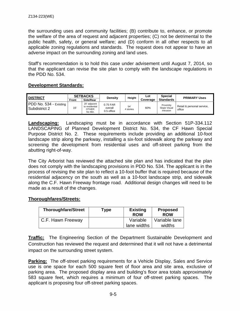
Z134-223(WE)
9-5
the surrounding uses and community facilities; (B) contribute to, enhance, or promote the welfare of the area of request and adjacent properties; (C) not be detrimental to the public health, safety, or general welfare; and (D) conform in all other respects to all applicable zoning regulations and standards. The request does not appear to have an adverse impact on the surrounding zoning and land uses. Staff’s recommendation is to hold this case under advisement until August 7, 2014, so that the applicant can revise the site plan to comply with the landscape regulations in the PDD No. 534. Development Standards: DISTRICT SETBACKS Density Height Lot
Coverage Special
Standards PRIMARY Uses Front Side/Rear
PDD No. 534 - Existing Subdistrict 2
15’ 20’ adjacent to residential
OTHER: No Min.
0.75 FAR overall
0.5 office
54’ 4 stories 60%
Proximity Slope Visual
Intrusion
Retail & personal service, office
Landscaping: Landscaping must be in accordance with Section 51P-334.112 LANDSCAPING of Planned Development District No. 534, the CF Hawn Special Purpose District No. 2. These requirements include providing an additional 10-foot landscape strip along the parkway, installing a six-foot sidewalk along the parkway and screening the development from residential uses and off-street parking from the abutting right-of-way. The City Arborist has reviewed the attached site plan and has indicated that the plan does not comply with the landscaping provisions in PDD No. 534. The applicant is in the process of revising the site plan to reflect a 10-foot buffer that is required because of the residential adjacency on the south as well as a 10-foot landscape strip, and sidewalk along the C.F. Hawn Freeway frontage road. Additional design changes will need to be made as a result of the changes. Thoroughfares/Streets:
Thoroughfare/Street Type Existing ROW
Proposed ROW
C.F. Hawn Freeway Variable lane widths
Variable lane widths
Traffic: The Engineering Section of the Department Sustainable Development and Construction has reviewed the request and determined that it will not have a detrimental impact on the surrounding street system. Parking: The off-street parking requirements for a Vehicle Display, Sales and Service use is one space for each 500 square feet of floor area and site area, exclusive of parking area. The proposed display area and building’s floor area totals approximately 583 square feet, which requires a minimum of four off-street parking spaces. The applicant is proposing four off-street parking spaces.

Z134-223(WE)
9-6
Note: Staff is recommending this case is be held under advisement to allow the applicant to revise the site plan
1. USE: The only use authorized by this specific use permit is a vehicle display, sales, and service use.
2. SITE PLAN: Use and development of the Property must comply with the
attached site plan.
3. TIME LIMIT: This specific use permit expires on (three-years from the passage of this ordinance).
4. MAXIMUM FLOOR AREA: The maximum floor area is 180 square feet. 5. HOURS OF OPERATION: The vehicle display, sales, and service use may only
operate during the hours 10:00 a.m. to 6:00 p.m., Monday through Friday. 6. LANDSCAPING: Landscaping must comply with Planned Development District
No. 534, the CF Hawn Special Purpose District No. 2.
7. MAINTENANCE: The Property must be properly maintained in a state of good repair and neat appearance.
8. GENERAL REQUIREMENTS: Use of the Property must comply with all
federal and state laws and regulations, and with all ordinances, rules, and regulations of the City of Dallas.
PROPOSED SUP CONDITIONS
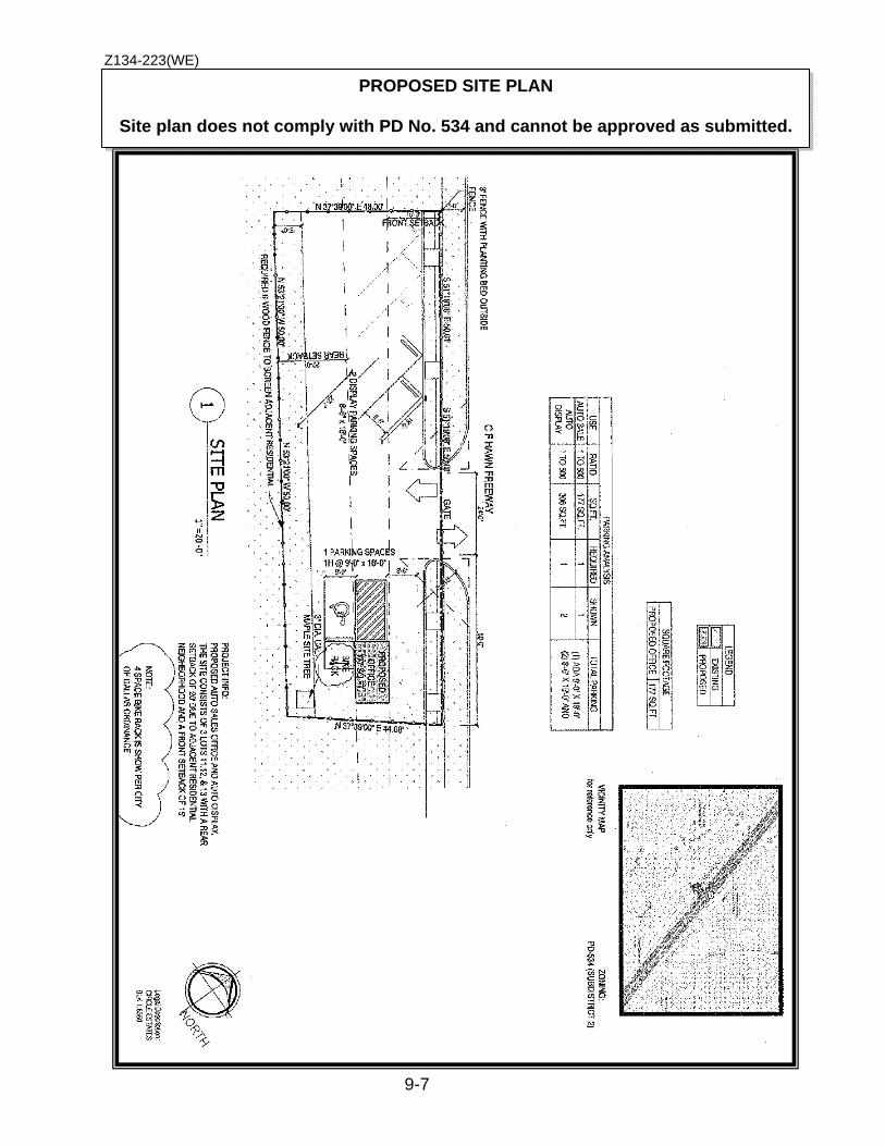
Z134-223(WE)
9-7
PROPOSED SITE PLAN
Site plan does not comply with PD No. 534 and cannot be approved as submitted.
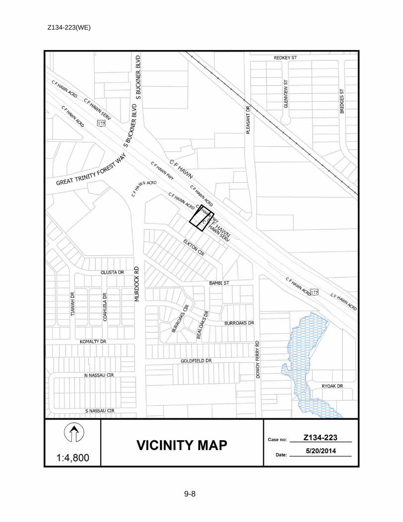
Z134-223(WE)
9-8

Z134-223(WE)
9-9

Z134-223(WE)
9-10
Single Family
Undeveloped
Vehicle display, sales & services
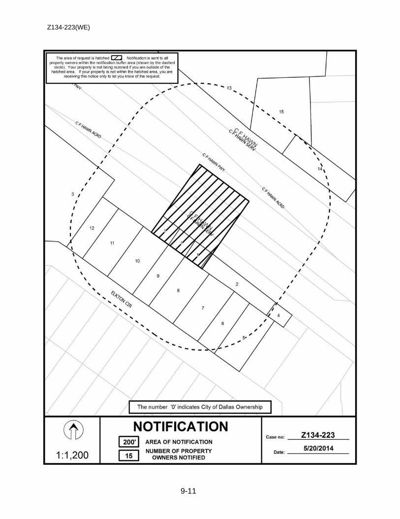
Z134-223(WE)
9-11

Z134-223(WE)
9-12
Notification List of Property Owners Z134-223
15 Property Owners Notified
Label # Address Owner
1 8132 C F HAWN FWY MIRANDA AGUSTIN M
2 8221 C F HAWN FWY JAY ROBERT L
3 8107 ELKTON CIR CITIZENS NATIONAL BANK OF TX
4 8227 C F HAWN FWY WILSON DAVID H
5 8215 ELKTON CIR WILSON MISTY
6 8211 ELKTON CIR MORA LIONEL V
7 8205 ELKTON CIR MORA LEONEL
8 8143 ELKTON CIR GUZMAN JUAN
9 8139 ELKTON CIR PARRA RAUDEL D & ANGELICA
10 8125 ELKTON CIR SALAS FELIPE R
11 8127 ELKTON CIR RAMOS GAUDENCIO
12 8123 ELKTON CIR ROSITAS JUANITA
13 8130 C F HAWN FWY STOVALL JIMMY A & LINDA J
14 8204 C F HAWN FWY 8204 CF HAWN LLC
15 8152 C F HAWN FWY STOVALL JIMMY A
10-1
CITY PLAN COMMISSION THURSDAY, AUGUST 7, 2014
Planner: Danielle R. Jimenez FILE NUMBER: Z134-220(DJ) DATE FILED: April 7, 2014 LOCATION: West corner of Shadyside Lane and East Grand Avenue COUNCIL DISTRICT: 14 MAPSCO: 37-W SIZE OF REQUEST: ±1.539 acres CENSUS TRACT: 0012.02 OWNER/APPLICANT: CADG Shadyside, LLC REPRESENTATIVE: Bryan Klein, Ion Design Group, LLC REQUEST: An application for an MF-2(A) Multifamily District on property
zoned a CR Community Retail District with a D Overlay. SUMMARY: The purpose of this request is to allow for a 13-unit, single-
family detached home subdivision. However, any uses in MF-2(A) will be allowed.
STAFF RECOMMENDATION: Approval with deed restrictions volunteered by the
applicant. PREVIOUS ACTION: On June 19 and July 10, 2014, the City Plan
Commission recommended to hold this case under advisement to allow the applicant to change his application from a general zoning change to a Planned Development District. The applicant recently submitted the request and it is under review.
Z134-220(DJ)
10-2
GUIDING CRITERIA FOR RECOMMENDATION: Staff recommends approval based upon:
1. Performance impacts upon surrounding property – Staff can support the application because the proposed use is compatible with surrounding land uses. The existing CR Community Retail District allows for more intense uses, i.e. alcoholic beverage establishments and restaurants with drive-in or drive-through services, when compared with the requested MF-2(A) Multifamily District, which does not allow for commercial and business service uses, or retail and personal service uses. Development standards are also affected. For example, the maximum height allowed in a CR district is 54 feet. The maximum height in an MF-2(A) district is 36 feet. Furthermore, both zoning districts are restricted by a residential proximity slope (RPS). In an MF-2(A) district, any portion of the building over 26 feet is subject to the RPS, and the angle of projection is 45 degrees, or a 1 to 1 slope. Further information on the differences in development standards for CR and MF-2(A) districts can be found in the development standards chart on page 4. The applicant has also volunteered deed restrictions to ensure that only single-family uses are allowed on the site. In conclusion, approval of an MF-2(A) district is more compatible with the surrounding land uses when compared with a CR district.
2. Traffic impact – The Engineering Section of the Department of Sustainable
Development and Construction has determined that the surrounding roadway system can accommodate the number of trips expected from the proposed zoning.
3. Comprehensive Plan or Area Plan Conformance – The forwardDallas!
Comprehensive Plan states that this area is within an Urban Neighborhood Block. Regarding housing, this particular block “should include single-family detached dwellings, townhomes and low- to midrise condominiums or apartments.” Therefore, a general zoning change allowing for multifamily uses is compatible with the comprehensive plan’s designation for the site.
BACKGROUND INFORMATION: • The request site is currently undeveloped and located within a floodplain. • The surrounding land uses north of the site consist of single-family residential. To the
east is East Grand Avenue. Single-family residential, a commercial amusement center (inside), and a masonic lodge are uses located south of the site. West of the site is open space.
• The site is in the midst of Conservation District No. 6, the Hollywood/Santa Monica
Conservation District. Conservation District neighborhoods create a direct, visual link to the past, contributing to a “sense of place.”
Z134-220(DJ)
10-3
Zoning History: Within the past six years, there has been one zoning change
request in the area. Z078-284(JA) 1. On December 10, 2008, City Council approved a general zoning
change to expand and amend Tract IIA in Conservation District No. 6, the Hollywood/Santa Monica Conservation District, on property zoned Tract IIA of Conservation District No. 6 and a CR Community Retail District, located on both sides of Shadyside Lane between Vivian Avenue and Lindsley Avenue, and the northeast side of Shadyside Lane between Vivian Avenue and East Grand Avenue.
Thoroughfares/Streets:
Thoroughfare/Street Type Existing ROW
Proposed ROW
Shadyside Lane Local 50 ft. 50 ft. East Grand Avenue Principal Arterial 60 ft. 60 ft.
Traffic: The Engineering Section of the Department of Sustainable Development and Construction has reviewed the request and determined that the proposed development will not have a negative impact on the surrounding street system. Land Use:
Zoning Land Use Site CR, D-Overlay Vacant
North Hollywood/Santa Monica Conservation
District (CD 6)
Single-Family
South CR & CD 6 Single-Family, Retail, Masonic Lodge
East East Grand Avenue Principal Arterial West CD 6 Single-Family
COMPREHENSIVE PLAN: The forwardDallas! Comprehensive Plan was adopted by the City Council in June 2006. The forwardDallas! Comprehensive Plan outlines several goals and policies which can serve as a framework for assisting in evaluating the applicant’s request. The Plan identifies the request site being in an Urban Neighborhood Building Block. This Building Block, which includes Oak Lawn, the Grand Avenue area in South Dallas, the area near Jefferson Boulevard and the Vickery Meadow area, are predominantly residential but are distinguished from other neighborhoods by the wide variety of housing options they provide and easy access to public transit. Housing choices should include single-family detached dwellings, townhomes and low- to midrise condominiums
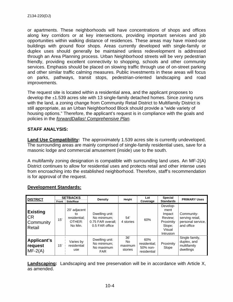
Z134-220(DJ)
10-4
or apartments. These neighborhoods will have concentrations of shops and offices along key corridors or at key intersections, providing important services and job opportunities within walking distance of residences. These areas may have mixed-use buildings with ground floor shops. Areas currently developed with single-family or duplex uses should generally be maintained unless redevelopment is addressed through an Area Planning process. Urban Neighborhood streets will be very pedestrian friendly, providing excellent connectivity to shopping, schools and other community services. Emphasis should be placed on slowing traffic through use of on-street parking and other similar traffic calming measures. Public investments in these areas will focus on parks, pathways, transit stops, pedestrian-oriented landscaping and road improvements. The request site is located within a residential area, and the applicant proposes to develop the ±1.539 acres site with 13 single-family detached homes. Since zoning runs with the land, a zoning change from Community Retail District to Multifamily District is still appropriate, as an Urban Neighborhood Block should provide a “wide variety of housing options.” Therefore, the applicant’s request is in compliance with the goals and policies in the forwardDallas! Comprehensive Plan. STAFF ANALYSIS: Land Use Compatibility: The approximately 1.539 acres site is currently undeveloped. The surrounding areas are mainly comprised of single-family residential uses, save for a masonic lodge and commercial amusement (inside) use to the south. A multifamily zoning designation is compatible with surrounding land uses. An MF-2(A) District continues to allow for residential uses and protects retail and other intense uses from encroaching into the established neighborhood. Therefore, staff’s recommendation is for approval of the request. Development Standards: DISTRICT SETBACKS Density Height Lot
Coverage Special
Standards PRIMARY Uses Front Side/Rear
Existing CR Community Retail
15’
20’ adjacent to
residential; OTHER: No Min.
Dwelling unit: No minimum;
0.75 FAR overall; 0.5 FAR office
54’ 4 stories 60%
Develop-ment
Impact Review;
Proximity Slope; Visual
Intrusion
Community-serving retail, personal service, and office
Applicant’s request MF-2(A)
15’ Varies by residential
use
Dwelling unit: No minimum; No maximum
FAR
36’ No
maximum stories
60% residential; 50% non-residential
Proximity Slope
Single family, duplex, and multifamily dwellings
Landscaping: Landscaping and tree preservation will be in accordance with Article X, as amended.

Z134-220(DJ)
10-5
CPC Previous Action: June 19, 2014 3. Z134-220(DJ) Planner: Danielle Jimenez
Motion: In considering an application for an MF-2(A) Multifamily District on property zoned a CR Community Retail District with a D Overlay on the west corner of Shadyside Lane and East Grand Avenue, it was moved to hold this case under advisement until July 10, 2014.
Maker: Shellene Second: Peadon Result: Carried: 14 to 0
For: 14 - Anglin, Soto, Rodgers, Culbreath, Shidid, Anantasomboon, Bagley,
Lavallaisaa, Tarpley, Shellene, Schultz, Peadon, Murphy, Abtahi Against: 0 Absent: 1 - Ridley Vacancy: 0
Notices: Area: 300 Mailed: 15 Replies: For: 1 Against: 3 Speakers: For: None
Against (Did not speak): David Card, 7126 Vivian Ave., Dallas, TX, 75223
CPC Previous Action: July 10, 2014 18. Z134-220(DJ) Planner: Danielle Jimenez
Motion: In considering an application for an MF-2(A) Multifamily District on property zoned a CR Community Retail District with a D Overlay on the west corner of Shadyside Lane and East Grand Avenue, it was moved to hold this case under advisement until August 7, 2014.
Maker: Ridley Second: Schultz Result: Carried: 13 to 0
For: 13 - Anglin, Emmons, Rodgers, Culbreath, Shidid, Anantasomboon,
Bagley, Lavallaisaa, Tarpley, Schultz, Peadon, Ridley, Abtahi Against: 0 Absent: 2 - Shellene, Murphy Vacancy: 0
Notices: Area: 300 Mailed: 15
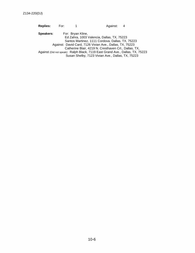
Z134-220(DJ)
10-6
Replies: For: 1 Against: 4 Speakers: For: Bryan Kline, Ed Zahra, 1003 Valencia, Dallas, TX, 75223 Santos Martinez, 1111 Cordova, Dallas, TX, 75223 Against: David Card, 7126 Vivian Ave., Dallas, TX, 75223 Catherine Blair, 4219 N. Cresthaven Crt., Dallas, TX, Against (Did not speak): Ralph Black, 7119 East Grand Ave., Dallas, TX, 75223 Susan Shelby, 7123 Vivian Ave., Dallas, TX, 75223
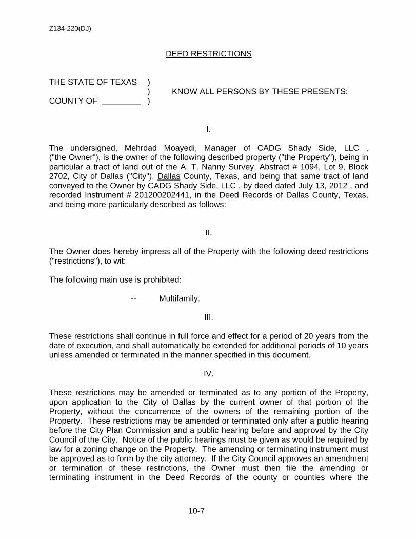
Z134-220(DJ)
10-7
DEED RESTRICTIONS THE STATE OF TEXAS ) ) KNOW ALL PERSONS BY THESE PRESENTS: COUNTY OF )
I. The undersigned, Mehrdad Moayedi, Manager of CADG Shady Side, LLC , ("the Owner"), is the owner of the following described property ("the Property"), being in particular a tract of land out of the A. T. Nanny Survey, Abstract # 1094, Lot 9, Block 2702, City of Dallas ("City"), Dallas County, Texas, and being that same tract of land conveyed to the Owner by CADG Shady Side, LLC , by deed dated July 13, 2012 , and recorded Instrument # 201200202441, in the Deed Records of Dallas County, Texas, and being more particularly described as follows:
II. The Owner does hereby impress all of the Property with the following deed restrictions ("restrictions"), to wit: The following main use is prohibited: -- Multifamily.
III. These restrictions shall continue in full force and effect for a period of 20 years from the date of execution, and shall automatically be extended for additional periods of 10 years unless amended or terminated in the manner specified in this document.
IV. These restrictions may be amended or terminated as to any portion of the Property, upon application to the City of Dallas by the current owner of that portion of the Property, without the concurrence of the owners of the remaining portion of the Property. These restrictions may be amended or terminated only after a public hearing before the City Plan Commission and a public hearing before and approval by the City Council of the City. Notice of the public hearings must be given as would be required by law for a zoning change on the Property. The amending or terminating instrument must be approved as to form by the city attorney. If the City Council approves an amendment or termination of these restrictions, the Owner must then file the amending or terminating instrument in the Deed Records of the county or counties where the
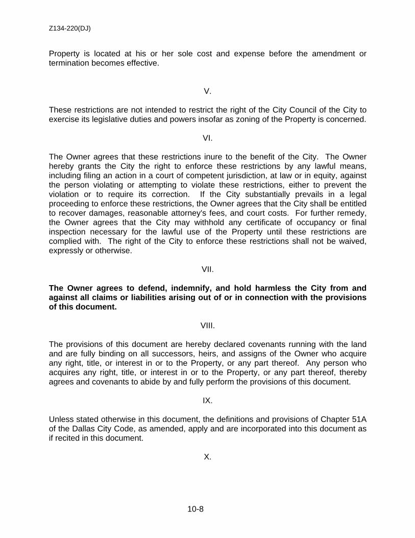
Z134-220(DJ)
10-8
Property is located at his or her sole cost and expense before the amendment or termination becomes effective.
V. These restrictions are not intended to restrict the right of the City Council of the City to exercise its legislative duties and powers insofar as zoning of the Property is concerned.
VI. The Owner agrees that these restrictions inure to the benefit of the City. The Owner hereby grants the City the right to enforce these restrictions by any lawful means, including filing an action in a court of competent jurisdiction, at law or in equity, against the person violating or attempting to violate these restrictions, either to prevent the violation or to require its correction. If the City substantially prevails in a legal proceeding to enforce these restrictions, the Owner agrees that the City shall be entitled to recover damages, reasonable attorney's fees, and court costs. For further remedy, the Owner agrees that the City may withhold any certificate of occupancy or final inspection necessary for the lawful use of the Property until these restrictions are complied with. The right of the City to enforce these restrictions shall not be waived, expressly or otherwise.
VII. The Owner agrees to defend, indemnify, and hold harmless the City from and against all claims or liabilities arising out of or in connection with the provisions of this document.
VIII. The provisions of this document are hereby declared covenants running with the land and are fully binding on all successors, heirs, and assigns of the Owner who acquire any right, title, or interest in or to the Property, or any part thereof. Any person who acquires any right, title, or interest in or to the Property, or any part thereof, thereby agrees and covenants to abide by and fully perform the provisions of this document.
IX. Unless stated otherwise in this document, the definitions and provisions of Chapter 51A of the Dallas City Code, as amended, apply and are incorporated into this document as if recited in this document.
X.
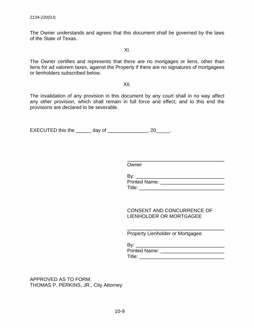
Z134-220(DJ)
10-9
The Owner understands and agrees that this document shall be governed by the laws of the State of Texas.
XI. The Owner certifies and represents that there are no mortgages or liens, other than liens for ad valorem taxes, against the Property if there are no signatures of mortgagees or lienholders subscribed below.
XII. The invalidation of any provision in this document by any court shall in no way affect any other provision, which shall remain in full force and effect, and to this end the provisions are declared to be severable. EXECUTED this the day of , 20_____. Owner By: Printed Name: Title:
CONSENT AND CONCURRENCE OF LIENHOLDER OR MORTGAGEE Property Lienholder or Mortgagee By: Printed Name: Title: APPROVED AS TO FORM: THOMAS P. PERKINS, JR., City Attorney
Z134-220(DJ)
10-10
By: Assistant City Attorney
[Attach an acknowledgment for each signer]
Z134-220(DJ)
10-11
ACKNOWLEDGMENT FORMS
Natural person
STATE OF TEXAS
COUNTY OF ______________________
This instrument was acknowledged before me on by
.
NOTARY PUBLIC [NOTARY PUBLIC STAMP]
Z134-220(DJ)
10-12
Attorney-in-fact signing for natural person
STATE OF TEXAS
COUNTY OF ______________________
This instrument was acknowledged before me on by
as attorney-in-fact on behalf of .
NOTARY PUBLIC [NOTARY PUBLIC STAMP]
Z134-220(DJ)
10-13
Partner signing for a partnership
STATE OF TEXAS
COUNTY OF ______________________
This instrument was acknowledged before me on by
, partner, on behalf of , a
partnership.
NOTARY PUBLIC [NOTARY PUBLIC STAMP]

Z134-220(DJ)
10-14
Officer signing for a corporation
STATE OF TEXAS
COUNTY OF ______________________
This instrument was acknowledged before me on by
, of a
corporation, on behalf of said corporation.
NOTARY PUBLIC [NOTARY PUBLIC STAMP]
Z134-220(DJ)
10-15
Public officer, trustee, executor, administrator, guardian, or other representative
STATE OF TEXAS
COUNTY OF ______________________
This instrument was acknowledged before me on by
as of
.
NOTARY PUBLIC [NOTARY PUBLIC STAMP]
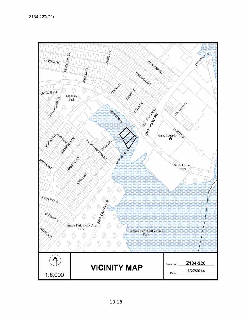
Z134-220(DJ)
10-16

Z134-220(DJ)
10-17
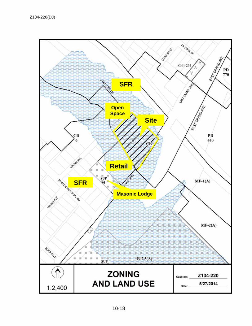
Z134-220(DJ)
10-18
Site
SFR
Retail
SFR
Open Space
Masonic Lodge
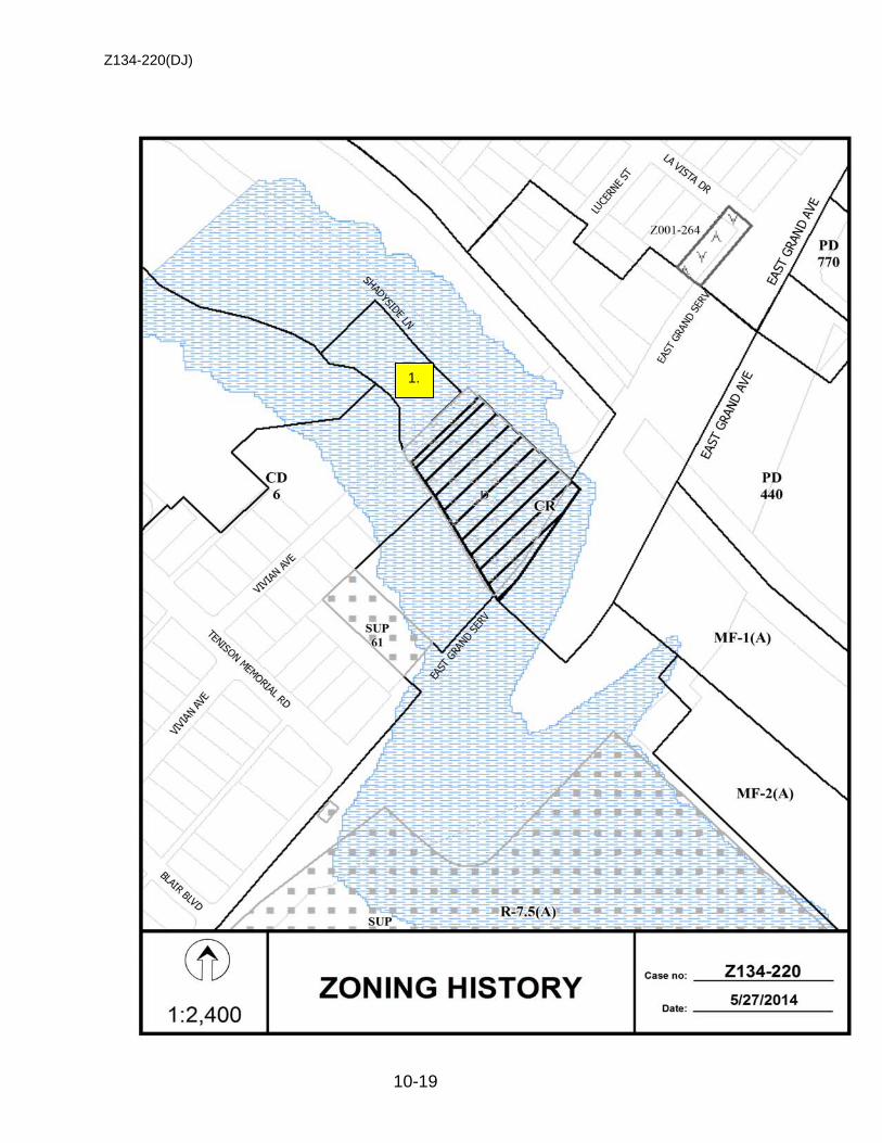
Z134-220(DJ)
10-19
1.
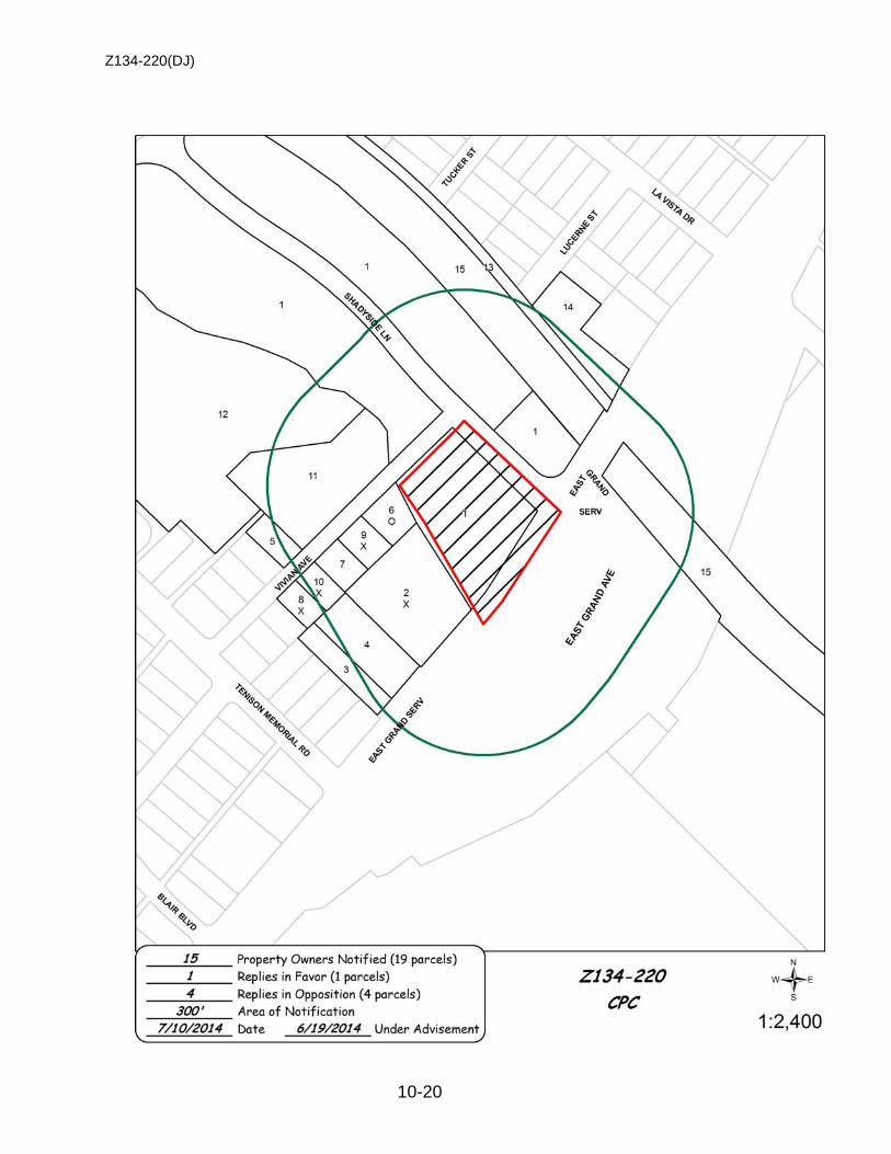
Z134-220(DJ)
10-20
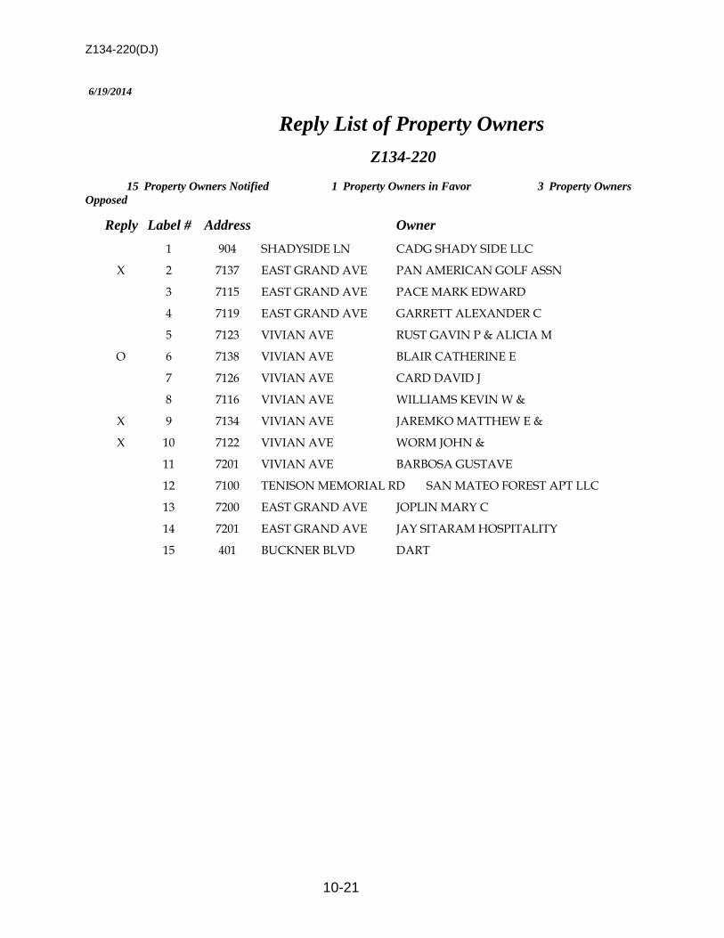
Z134-220(DJ)
10-21
6/19/2014
Reply List of Property Owners
Z134-220
15 Property Owners Notified 1 Property Owners in Favor 3 Property Owners Opposed
Reply Label # Address Owner
1 904 SHADYSIDE LN CADG SHADY SIDE LLC
X 2 7137 EAST GRAND AVE PAN AMERICAN GOLF ASSN
3 7115 EAST GRAND AVE PACE MARK EDWARD
4 7119 EAST GRAND AVE GARRETT ALEXANDER C
5 7123 VIVIAN AVE RUST GAVIN P & ALICIA M
O 6 7138 VIVIAN AVE BLAIR CATHERINE E
7 7126 VIVIAN AVE CARD DAVID J
8 7116 VIVIAN AVE WILLIAMS KEVIN W &
X 9 7134 VIVIAN AVE JAREMKO MATTHEW E &
X 10 7122 VIVIAN AVE WORM JOHN &
11 7201 VIVIAN AVE BARBOSA GUSTAVE
12 7100 TENISON MEMORIAL RD SAN MATEO FOREST APT LLC
13 7200 EAST GRAND AVE JOPLIN MARY C
14 7201 EAST GRAND AVE JAY SITARAM HOSPITALITY
15 401 BUCKNER BLVD DART
11-1
CITY PLAN COMMISSION THURSDAY, AUGUST 7, 2014
PLANNER: Aldo Fritz FILE NUMBER: Z134-279(AF) DATE FILED: June 20, 2014 LOCATION: Northwest corner of Gold Dust Trail and Levelland Road COUNCIL DISTRICT: 12 MAPSCO: 5- L SIZE OF REQUEST: Approx. 0.688 acres CENSUS TRACT: 317.18 APPLICANT/ OWNER/REPRESENTATIVE: Stephen L. & Cheryl D. Landers REQUEST: An application for an amendment to deed restrictions
volunteered by the applicant. SUMMARY: The applicant is proposing to remove the height restrictions
within the current deed restrictions to reflect the height permitted within the TH-2(A) Townhouse District. Currently the deed restrictions allow for a maximum structure height of 30 feet measured to the highest point of the structure. The TH-2(A) Townhouse District permits a maximum height of 36 feet.
STAFF RECOMMENDATION: Approval
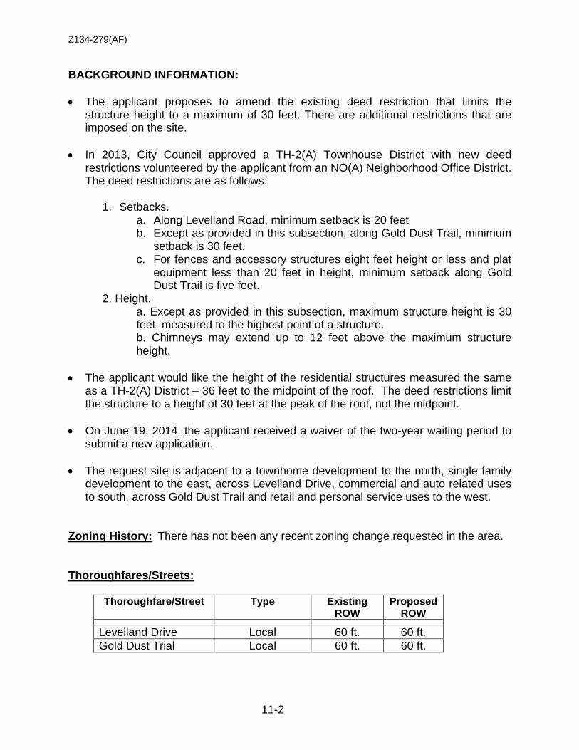
Z134-279(AF)
11-2
BACKGROUND INFORMATION: • The applicant proposes to amend the existing deed restriction that limits the
structure height to a maximum of 30 feet. There are additional restrictions that are imposed on the site.
• In 2013, City Council approved a TH-2(A) Townhouse District with new deed
restrictions volunteered by the applicant from an NO(A) Neighborhood Office District. The deed restrictions are as follows:
1. Setbacks.
a. Along Levelland Road, minimum setback is 20 feet b. Except as provided in this subsection, along Gold Dust Trail, minimum
setback is 30 feet. c. For fences and accessory structures eight feet height or less and plat
equipment less than 20 feet in height, minimum setback along Gold Dust Trail is five feet.
2. Height. a. Except as provided in this subsection, maximum structure height is 30 feet, measured to the highest point of a structure. b. Chimneys may extend up to 12 feet above the maximum structure height.
• The applicant would like the height of the residential structures measured the same
as a TH-2(A) District – 36 feet to the midpoint of the roof. The deed restrictions limit the structure to a height of 30 feet at the peak of the roof, not the midpoint.
• On June 19, 2014, the applicant received a waiver of the two-year waiting period to submit a new application.
• The request site is adjacent to a townhome development to the north, single family
development to the east, across Levelland Drive, commercial and auto related uses to south, across Gold Dust Trail and retail and personal service uses to the west.
Zoning History: There has not been any recent zoning change requested in the area. Thoroughfares/Streets:
Thoroughfare/Street Type Existing ROW
Proposed ROW
Levelland Drive Local 60 ft. 60 ft. Gold Dust Trial Local 60 ft. 60 ft.
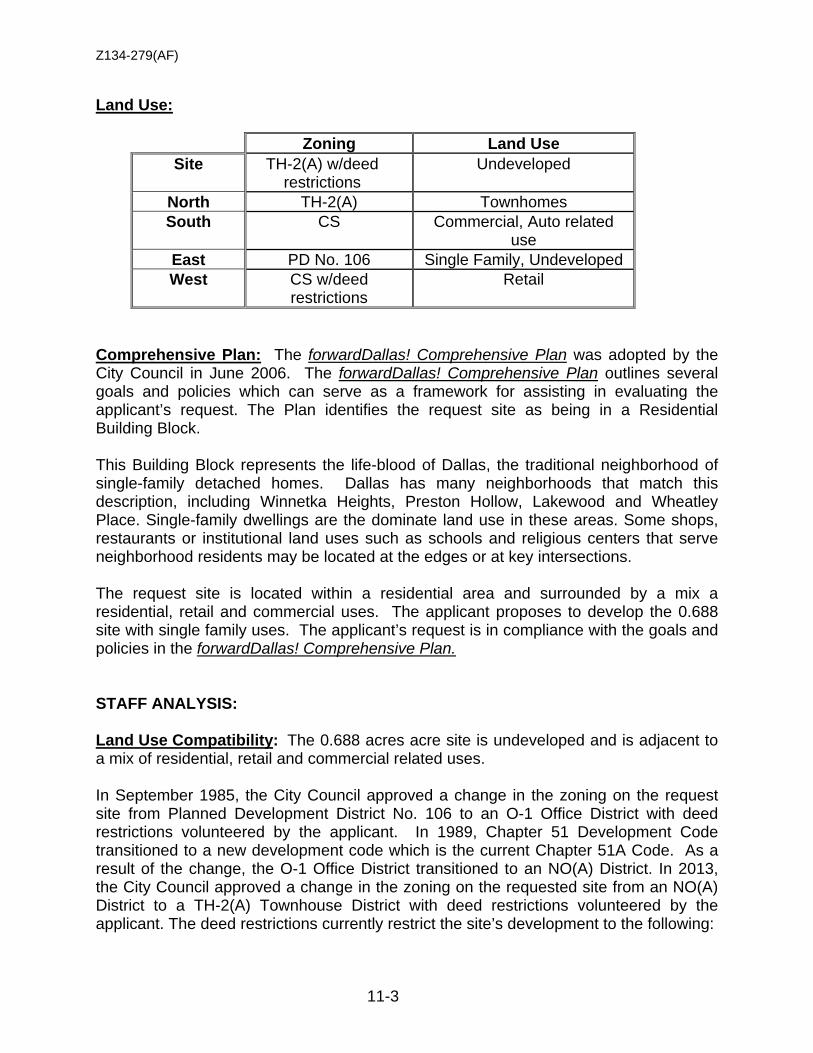
Z134-279(AF)
11-3
Land Use:
Zoning Land Use Site TH-2(A) w/deed
restrictions Undeveloped
North TH-2(A) Townhomes South CS Commercial, Auto related
use East PD No. 106 Single Family, Undeveloped West CS w/deed
restrictions Retail
Comprehensive Plan: The forwardDallas! Comprehensive Plan was adopted by the City Council in June 2006. The forwardDallas! Comprehensive Plan outlines several goals and policies which can serve as a framework for assisting in evaluating the applicant’s request. The Plan identifies the request site as being in a Residential Building Block. This Building Block represents the life-blood of Dallas, the traditional neighborhood of single-family detached homes. Dallas has many neighborhoods that match this description, including Winnetka Heights, Preston Hollow, Lakewood and Wheatley Place. Single-family dwellings are the dominate land use in these areas. Some shops, restaurants or institutional land uses such as schools and religious centers that serve neighborhood residents may be located at the edges or at key intersections. The request site is located within a residential area and surrounded by a mix a residential, retail and commercial uses. The applicant proposes to develop the 0.688 site with single family uses. The applicant’s request is in compliance with the goals and policies in the forwardDallas! Comprehensive Plan. STAFF ANALYSIS: Land Use Compatibility: The 0.688 acres acre site is undeveloped and is adjacent to a mix of residential, retail and commercial related uses. In September 1985, the City Council approved a change in the zoning on the request site from Planned Development District No. 106 to an O-1 Office District with deed restrictions volunteered by the applicant. In 1989, Chapter 51 Development Code transitioned to a new development code which is the current Chapter 51A Code. As a result of the change, the O-1 Office District transitioned to an NO(A) District. In 2013, the City Council approved a change in the zoning on the requested site from an NO(A) District to a TH-2(A) Townhouse District with deed restrictions volunteered by the applicant. The deed restrictions currently restrict the site’s development to the following:
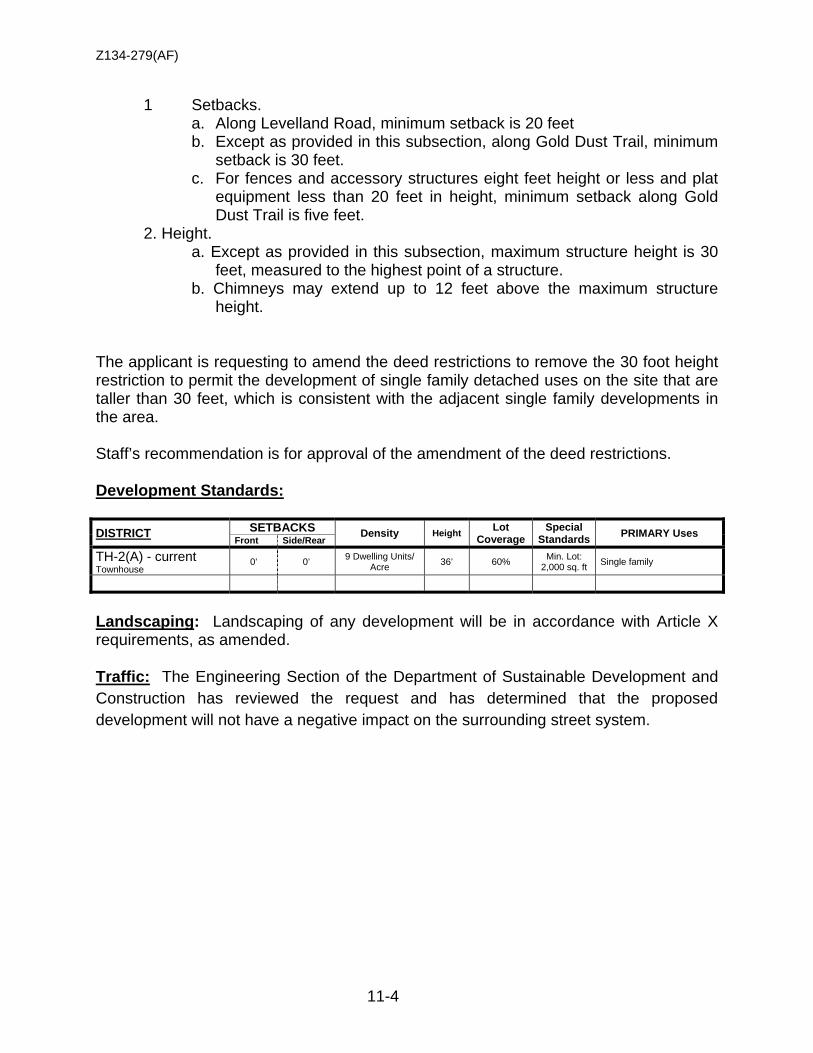
Z134-279(AF)
11-4
1 Setbacks. a. Along Levelland Road, minimum setback is 20 feet b. Except as provided in this subsection, along Gold Dust Trail, minimum
setback is 30 feet. c. For fences and accessory structures eight feet height or less and plat
equipment less than 20 feet in height, minimum setback along Gold Dust Trail is five feet.
2. Height. a. Except as provided in this subsection, maximum structure height is 30
feet, measured to the highest point of a structure. b. Chimneys may extend up to 12 feet above the maximum structure
height.
The applicant is requesting to amend the deed restrictions to remove the 30 foot height restriction to permit the development of single family detached uses on the site that are taller than 30 feet, which is consistent with the adjacent single family developments in the area. Staff’s recommendation is for approval of the amendment of the deed restrictions. Development Standards: DISTRICT SETBACKS Density Height Lot
Coverage Special
Standards PRIMARY Uses Front Side/Rear
TH-2(A) - current Townhouse
0’ 0’ 9 Dwelling Units/ Acre 36’ 60% Min. Lot:
2,000 sq. ft Single family
Landscaping: Landscaping of any development will be in accordance with Article X requirements, as amended. Traffic: The Engineering Section of the Department of Sustainable Development and Construction has reviewed the request and has determined that the proposed development will not have a negative impact on the surrounding street system.
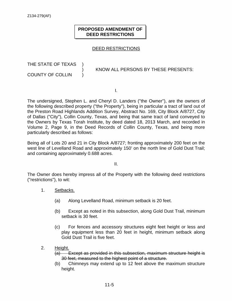
Z134-279(AF)
11-5
DEED RESTRICTIONS THE STATE OF TEXAS ) ) KNOW ALL PERSONS BY THESE PRESENTS: COUNTY OF COLLIN )
I. The undersigned, Stephen L. and Cheryl D. Landers ("the Owner"), are the owners of the following described property ("the Property"), being in particular a tract of land out of the Preston Road Highlands Addition Survey, Abstract No. 169, City Block A/8727, City of Dallas ("City"), Collin County, Texas, and being that same tract of land conveyed to the Owners by Texas Torah Institute, by deed dated 18, 2013 March, and recorded in Volume 2, Page 9, in the Deed Records of Collin County, Texas, and being more particularly described as follows: Being all of Lots 20 and 21 in City Block A/8727; fronting approximately 200 feet on the west line of Levelland Road and approximately 150’ on the north line of Gold Dust Trail; and containing approximately 0.688 acres.
II. The Owner does hereby impress all of the Property with the following deed restrictions ("restrictions"), to wit:
1. Setbacks.
(a) Along Levelland Road, minimum setback is 20 feet.
(b) Except as noted in this subsection, along Gold Dust Trail, minimum setback is 30 feet.
(c) For fences and accessory structures eight feet height or less and
play equipment less than 20 feet in height, minimum setback along Gold Dust Trail is five feet.
2. Height.
(a) Except as provided in this subsection, maximum structure height is 30 feet, measured to the highest point of a structure.
(b) Chimneys may extend up to 12 feet above the maximum structure height.
PROPOSED AMENDMENT OF DEED RESTRICTIONS
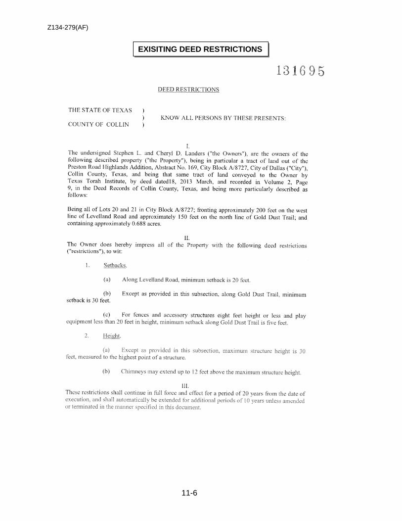
Z134-279(AF)
11-6
EXISITING DEED RESTRICTIONS
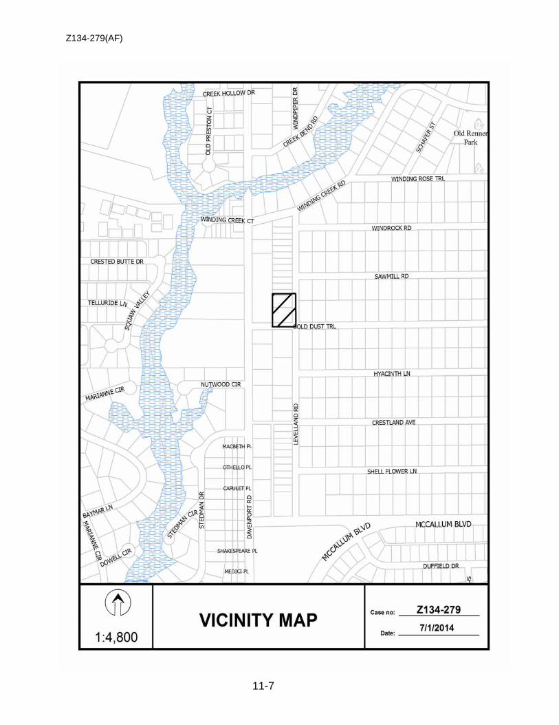
Z134-279(AF)
11-7
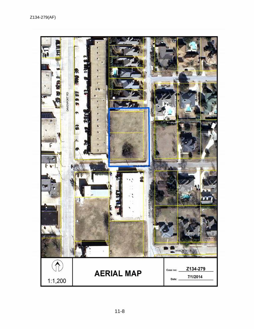
Z134-279(AF)
11-8
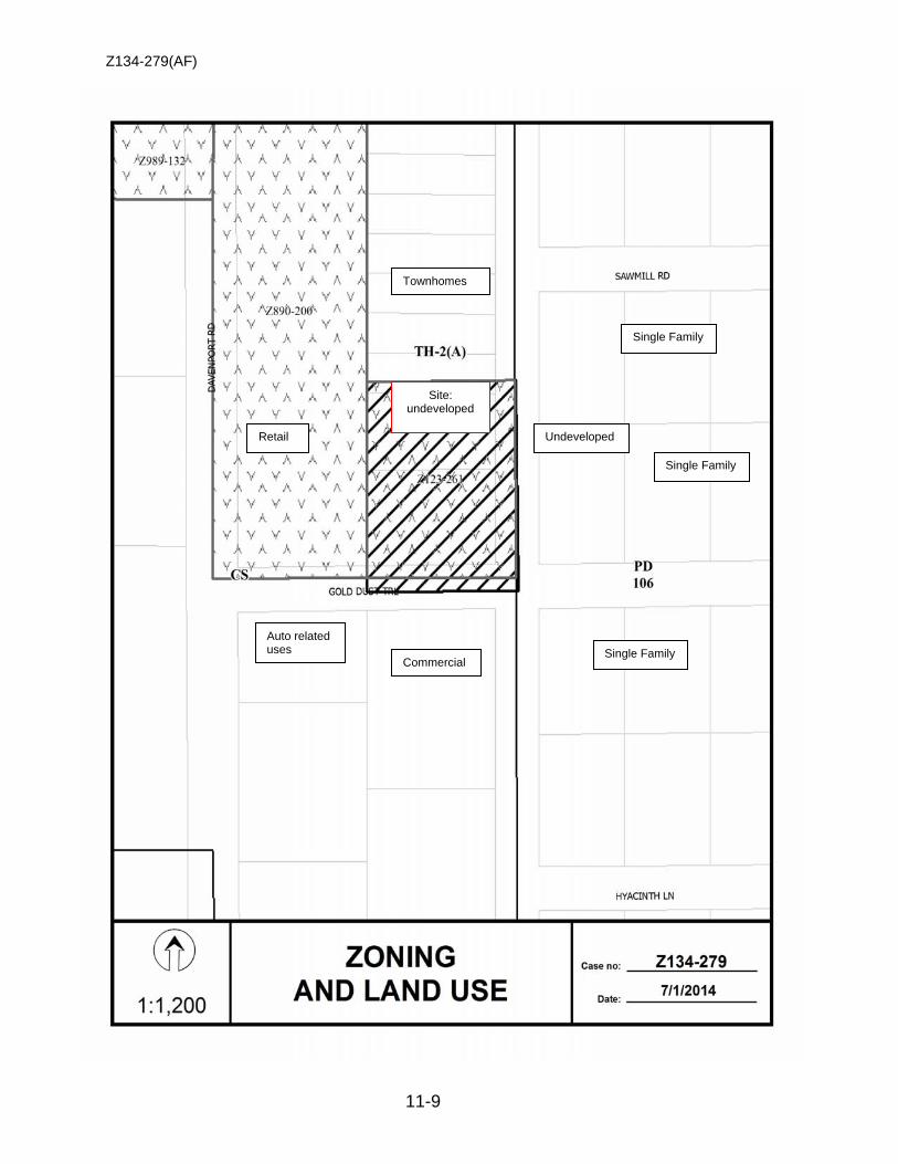
Z134-279(AF)
11-9
Townhomes
Commercial
Undeveloped
Single Family
Single Family
Single Family Auto related uses
Retail
Site: undeveloped

Z134-279(AF)
11-10

Z134-279(AF)
11-11
Notification List of Property Owners
Z134-279
18 Property Owners Notified
Label # Address Owner
1 6903 LEVELLAND LANDERS STEPHEN L & CHERYL D LANDERS
2 6905 LEVELLAND DAVIS TIMOTHY J
3 17738 DAVENPORT BOLD JIMMY
4 17752 DAVENPORT HERSON RODNEY AUTOMOTIVE
5 17800-17818 DAVENPORT DSW DAVENPORT PROPERTIES LP C/O DUTTON
6 6915 LEVELLAND VAYNMAN JEFF & RITA
7 6907 LEVELLAND TABARIA ELI & DANA F
8 6825 LEVELLAND LEVELLAND D & S PROPERTIES LP C/O DUTTON
9 6601 HYACINTH MORGAN JAMIE
10 6601 GOLD DUST ETHERIDGE LEE R
11 6606 SAWMILL PICOLO MICHAEL J
12 6602 SAWMILL QUEVEDO ALDO & ROCIO
13 6601 SAWMILL CAMPOS-FIELD LAURIE ANN & FIELD ERIC
14 6605 SAWMILL KATZ BRUCE M ETUX DEBBIE
15 6911 LEVELLAND RICE JENNIFER
16 6909 LEVELLAND GOAD CHARLES E
17 6604 GOLD DUST VAN CREVELD ASHLEY & KAREN
18 6600 GOLD DUST SUPANGAT WELLY L
12-1
CITY PLAN COMMISSION THURSDAY, AUGUST 7, 2014 Planner: Megan Wimer, AICP
FILE NUMBER: Z134-234(MW) DATE FILED: April 16, 2014
LOCATION: North side of Walnut Hill Lane, west of Rambler Road.
COUNCIL DISTRICT: 13 MAPSCO: 26-K
SIZE OF REQUEST: ±1.864 acres CENSUS TRACT: 78.23 REPRESENTATIVE: Robert Baldwin APPLICANT: CMC Commercial Realty OWNER: Swiss Avenue State Bank REQUEST: An application for a Planned Development District for mixed
uses on property zoned an MC-1 Mixed Commercial District SUMMARY: The applicant intends to redevelop the site with
approximately 250 multifamily dwelling units with a maximum structure height of 75 feet (six stories). The proposed Planned Development District allows a variety of uses that are permitted by right and by specific use permit in the MC-1 Mixed Commercial District and allows, but does not require, a mix of uses within a single building.
STAFF RECOMMENDATION: Approval, subject to a development plan and
conditions. PREVIOUS ACTION: The case was held under advisement on July 24,
2014. Since that time, the applicant provided a development plan and revised the conditions to exclude certain uses, specify the maximum floor area ratio (2.9), and account for eight-foot sidewalks.
Z134-234
12-2
GUIDING CRITERIA FOR RECOMMENDATION: Staff recommends approval based upon:
1. Performance impacts upon surrounding property – The proposed multifamily project will provide a housing option for employees of the adjacent office, medical clinic, hospital and nursing home uses. Therefore, performance impacts on surrounding properties are anticipated to be positive.
2. Traffic impact – Staff has reviewed the request and has determined that it will not significantly impact the surrounding roadway system. The proposed multifamily project will generate fewer trips than the existing financial institution with drive-in window.
3. Comprehensive Plan or Area Plan Conformance – The request complies with the Comprehensive Plan.
4. Justification for PD Planned Development District as opposed to a straight zoning district – The applicant proposes a planned development district to allow for residential uses. In addition, the proposed planned development district will allow increased structure height and decreased side and rear yard setbacks, but will require design standards for street frontages, wider sidewalks and additional street trees to promote pedestrian activity.
BACKGROUND INFORMATION:
• The ±1.864-acre request site is developed with a ±11,709-square foot financial institution with drive-in window, which was constructed in 1997.
• The request site is located within 500 feet of the Walnut Hill Lane DART Station.
Surrounding Zoning History: 1. Z123-324: On October 12, 2013, the City Council approved a Planned
Development District for GO(A) District Uses, subject to sign elevations and conditions.
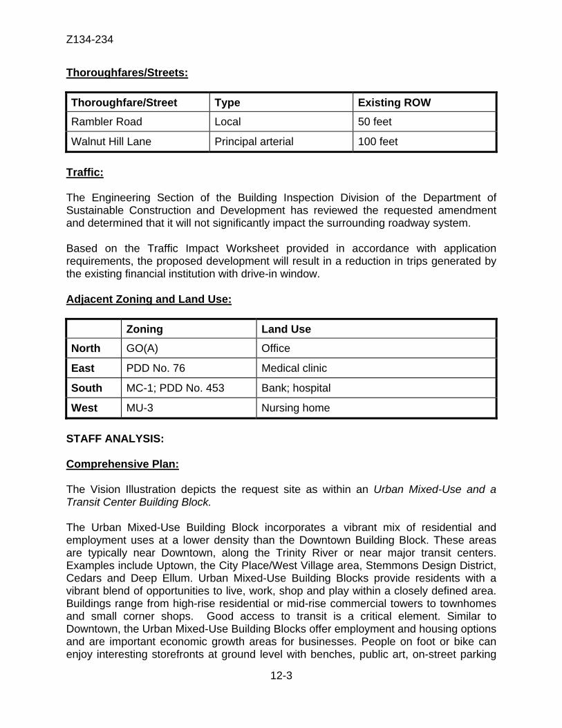
Z134-234
12-3
Thoroughfares/Streets:
Thoroughfare/Street Type Existing ROW Rambler Road Local 50 feet
Walnut Hill Lane Principal arterial 100 feet Traffic: The Engineering Section of the Building Inspection Division of the Department of Sustainable Construction and Development has reviewed the requested amendment and determined that it will not significantly impact the surrounding roadway system. Based on the Traffic Impact Worksheet provided in accordance with application requirements, the proposed development will result in a reduction in trips generated by the existing financial institution with drive-in window. Adjacent Zoning and Land Use: Zoning Land Use North GO(A) Office
East PDD No. 76 Medical clinic
South MC-1; PDD No. 453 Bank; hospital
West MU-3 Nursing home STAFF ANALYSIS: Comprehensive Plan: The Vision Illustration depicts the request site as within an Urban Mixed-Use and a Transit Center Building Block. The Urban Mixed-Use Building Block incorporates a vibrant mix of residential and employment uses at a lower density than the Downtown Building Block. These areas are typically near Downtown, along the Trinity River or near major transit centers. Examples include Uptown, the City Place/West Village area, Stemmons Design District, Cedars and Deep Ellum. Urban Mixed-Use Building Blocks provide residents with a vibrant blend of opportunities to live, work, shop and play within a closely defined area. Buildings range from high-rise residential or mid-rise commercial towers to townhomes and small corner shops. Good access to transit is a critical element. Similar to Downtown, the Urban Mixed-Use Building Blocks offer employment and housing options and are important economic growth areas for businesses. People on foot or bike can enjoy interesting storefronts at ground level with benches, public art, on-street parking
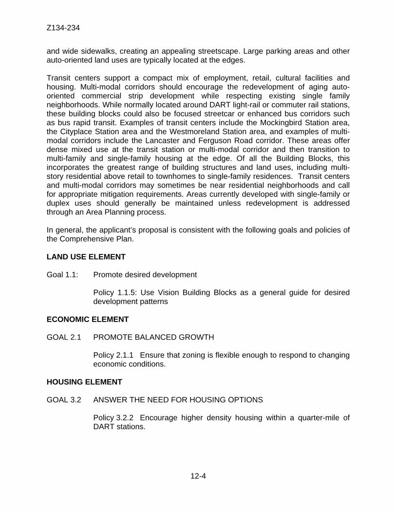
Z134-234
12-4
and wide sidewalks, creating an appealing streetscape. Large parking areas and other auto-oriented land uses are typically located at the edges. Transit centers support a compact mix of employment, retail, cultural facilities and housing. Multi-modal corridors should encourage the redevelopment of aging auto-oriented commercial strip development while respecting existing single family neighborhoods. While normally located around DART light-rail or commuter rail stations, these building blocks could also be focused streetcar or enhanced bus corridors such as bus rapid transit. Examples of transit centers include the Mockingbird Station area, the Cityplace Station area and the Westmoreland Station area, and examples of multi-modal corridors include the Lancaster and Ferguson Road corridor. These areas offer dense mixed use at the transit station or multi-modal corridor and then transition to multi-family and single-family housing at the edge. Of all the Building Blocks, this incorporates the greatest range of building structures and land uses, including multi-story residential above retail to townhomes to single-family residences. Transit centers and multi-modal corridors may sometimes be near residential neighborhoods and call for appropriate mitigation requirements. Areas currently developed with single-family or duplex uses should generally be maintained unless redevelopment is addressed through an Area Planning process. In general, the applicant’s proposal is consistent with the following goals and policies of the Comprehensive Plan. LAND USE ELEMENT
Goal 1.1: Promote desired development
Policy 1.1.5: Use Vision Building Blocks as a general guide for desired development patterns
ECONOMIC ELEMENT
GOAL 2.1 PROMOTE BALANCED GROWTH
Policy 2.1.1 Ensure that zoning is flexible enough to respond to changing economic conditions.
HOUSING ELEMENT GOAL 3.2 ANSWER THE NEED FOR HOUSING OPTIONS
Policy 3.2.2 Encourage higher density housing within a quarter-mile of DART stations.

Z134-234
12-5
URBAN DESIGN GOAL 5.1 PROMOTE A SENSE OF PLACE, SAFETY AND WALKABILITY
Policy 5.1.1 Promote pedestrian-friendly streetscapes. Policy 5.1.3 Encourage complementary building height, scale, design and character.
GOAL 5.3 ESTABLISHING WALK-TO CONVENIENCE
Policy 5.3.1 Encourage a balance of land uses within walking distance of each other. Policy 5.3.3 Encourage transit oriented developments and transit centers.
ENVIRONMENT ELEMENT GOAL 6.3 IMPROVE ENERGY EFFICIENCY AND AIR QUALITY
Policy 6.3.3 Limit vehicle miles traveled. Land Use Compatibility: The applicant intends to redevelop the site with approximately 250 multifamily dwelling units with a maximum structure height of 75 feet (six stories). The proposed Planned Development District allows a variety of uses that are permitted by right and by specific use permit in the MC-1 Mixed Commercial District and allows a mix of uses within a single building. The applicant proposes a planned development district to allow for residential uses. In addition, the proposed planned development district will allow increased structure height and decreased side and rear yard setbacks, but will require design standards for street frontages, wider sidewalks and additional street trees to promote pedestrian activity. The request site is located within 500 feet of the Walnut Hill Lane DART Station and is surrounded by office uses to the north, a medical clinic to the east, a bank and hospital to the south, and a nursing home to the west. The proposed planned development district is compatible with the surrounding uses. Furthermore, the proposed multifamily project will provide a viable housing option in this area of the city. Therefore, staff supports the request.
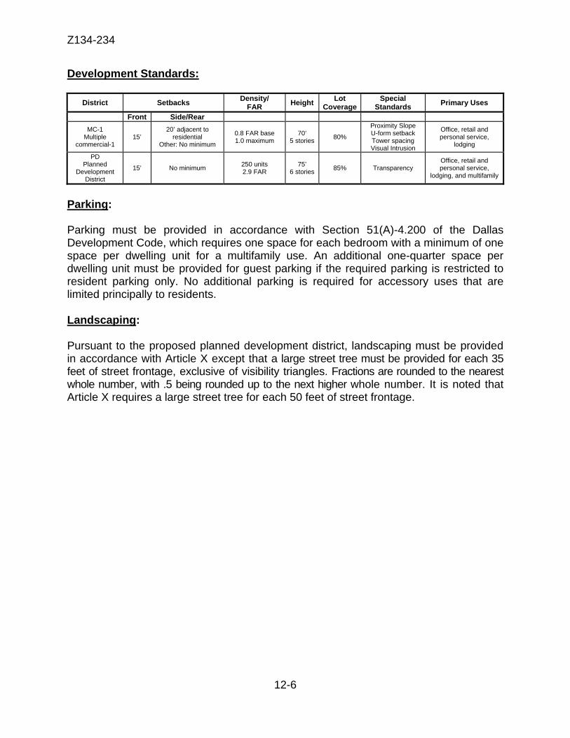
Z134-234
12-6
Development Standards:
District Setbacks Density/ FAR Height Lot
CoverageSpecial
Standards Primary Uses
Front Side/Rear MC-1
Multiple commercial-1
15’ 20’ adjacent to
residential Other: No minimum
0.8 FAR base 1.0 maximum
70’ 5 stories 80%
Proximity Slope U-form setback Tower spacing Visual Intrusion
Office, retail and personal service,
lodging
PD Planned
Development District
15’ No minimum 250 units 2.9 FAR
75’ 6 stories 85% Transparency
Office, retail and personal service,
lodging, and multifamily
Parking: Parking must be provided in accordance with Section 51(A)-4.200 of the Dallas Development Code, which requires one space for each bedroom with a minimum of one space per dwelling unit for a multifamily use. An additional one-quarter space per dwelling unit must be provided for guest parking if the required parking is restricted to resident parking only. No additional parking is required for accessory uses that are limited principally to residents. Landscaping:
Pursuant to the proposed planned development district, landscaping must be provided in accordance with Article X except that a large street tree must be provided for each 35 feet of street frontage, exclusive of visibility triangles. Fractions are rounded to the nearest whole number, with .5 being rounded up to the next higher whole number. It is noted that Article X requires a large street tree for each 50 feet of street frontage.

Z134-234
12-7
Partners/Principals/Officers: APPLICANT: CMC Commercial Realty Subash M. Gaitonde, President and Director OWNER: Swiss Avenue State Bank Stephen Bradshaw, President George Kaiser, Vice President

Z134-234
12-8
Z134-234 Proposed Conditions
SEC. 51P- .101. LEGISLATIVE HISTORY. PD was established by Ordinance No. , passed by the Dallas City Council on ______, 2014. SEC. 51P- .102. PROPERTY LOCATION AND SIZE. PD is established on property located on the north side of Walnut Hill Lane and the west side of Rambler Road. The size of PD is approximately 1.86 acres. SEC. 51P- .103. DEFINITIONS AND INTERPRETATIONS. (a) Unless otherwise stated, the definitions and interpretations in Chapter 51A apply to this article. (b) Unless otherwise stated, all references to articles, divisions, or sections in this article are to articles, divisions, or sections in Chapter 51A. (c) This district is considered to be a nonresidential zoning district. SEC. 51P- .104. EXHIBIT. The following exhibit is incorporated into this article: Exhibit A: development plan. SEC. 51P- .106. DEVELOPMENT PLAN. (a) Development and use of the Property must comply with the development plan (Exhibit ___). If there is a conflict between the text of this article and the development plan, the text of this article controls. Applicant proposed (staff does not support): (b) Modifications to the development plan that do not meet the requirements for a minor amendment in 51A-4.702(h) may be approved by the City Plan Commission following the requirements and procedures for a development plan in 51A-4.702(c)(3).
Z134-234
12-9
SEC. 51P- .107. MAIN USES PERMITTED.
(a) The following uses are the only main uses permitted:
(1) Commercial and business service uses.
--Medical or scientific laboratory [SUP].
(2) Institutional and community service uses. --Adult day care facility. --Child-care facility. --Church.
--Hospital [SUP].
(3) Lodging uses. --Extended stay hotel or motel. [SUP] --Hotel or motel. [RAR] [SUP].
(4) Miscellaneous uses. --Temporary construction or sales office.
(5) Office uses.
--Ambulatory surgical center. --Financial institution without drive-in window. --Financial institution with drive-in window [DIR]. --Medical clinic or ambulatory surgical center. --Office.
(6) Residential uses. --Duplex. --Multifamily. --Retirement housing.
(7) Retail and personal service uses.
--Commercial parking lot or garage. [RAR]
--Furniture store. --General merchandise or food store 3,500 square feet or less.
--General merchandise or food store greater than 3,500 square feet.
--Personal service uses.
Z134-234
12-10
--Restaurant without drive-in or drive-through service. [RAR] --Temporary retail use.
(8) Utility and public service uses.
--Local utilities. [SUP or RAR may be required. See Section 51A-4.212(4).] --Police or fire station. --Post office. --Radio, television, or microwave tower. [SUP] --Tower or antenna for cellular communication. [SUP][Limited to mounted only.]
(b) Mix of uses allowed in a single building. To encourage a live/work occupancy, buildings in this district may include both residential and nonresidential uses. Buildings in this district may be comprised of residential, nonresidential, or a mix of residential and nonresidential uses. SEC. 51P- .108. ACCESSORY USES.
Accessory uses. As a general rule, an accessory use is permitted in any district in which the main use is permitted. Some specific types of accessory uses, however, due to their unique nature, are subject to additional regulations in Section 51A-4.217. For more information regarding accessory uses, consult Section 51A-4.217. SEC. 51P- .109. YARD, LOT, AND SPACE REGULATIONS.
(Note: The yard, lot, and space regulations in this section must be read together with the yard, lot, and space regulations in Division 51A-4.400. If there is a conflict between this section and Division 51A-4.400, this section controls.)
(a) Setbacks.
(1) Front yard. Minimum front yard is 15 feet.
(2) Side and rear yard. No minimum side and rear yard.
(3) Urban form setback. None required.
(4) Tower spacing. None required. (5) Projections. Ordinary projections of canopies, balconies, stoops, stairs, retaining walls, bay windows, awnings, and other architectural features may project into the required setbacks up to 10 feet if a minimum five-foot sidewalk clearance from the projection is provided.
Z134-234
12-11
(b) Density. Maximum density is 250 dwelling units.
(c) Floor area. Maximum floor area ratio is 2.9. (d) Ground-story transparency. A minimum of 30 percent along Walnut Hill
Lane and Rambler Road. (e) Upper-story transparency. A minimum of 20 percent for floors two through
six. (f) Pedestrian entrance. Pedestrian entrances are required along Walnut Hill
Lane and Rambler Road. (g) Blank wall area. The maximum length for a blank wall is 30 feet. (h) Height. Maximum structure height is 75 feet. Rooftop projections, including
rooftop mechanicals, parapet walls, and elevator penthouses may exceed the maximum height by 15 feet.
(i) Lot coverage. Maximum lot coverage is 85 percent. Aboveground
parking structures are included in lot coverage calculations; surface parking lots and underground parking structures are not.
(j) Lot size. No minimum lot size. (k) Stories. The maximum number of stories is six.
SEC. 51P- .110. OFF-STREET PARKING AND LOADING.
In general. Consult the use regulations in Section 51(A)-4.200 for the specific off-street parking and loading requirements for each use. SEC. 51P- .111. ENVIRONMENTAL PERFORMANCE STANDARDS. See Article VI. SEC. 51P- .112. LANDSCAPING.
(a) Except as provided in this section, landscaping must be provided in accordance with Article X.
(b) A large street tree must be provided for each 35 feet of street frontage,
exclusive of visibility triangles. Fractions are rounded to the nearest whole number, with .5 being rounded up to the next higher whole number.
Z134-234
12-12
(c) Required large trees must have a minimum caliper of 3.5 inches or minimum height of six feet, depending on the standard measuring technique for the species.
(d) Plant materials must be maintained in a healthy, growing condition.
SEC. 51P- .113. SIDEWALKS.
A minimum eight-foot-wide sidewalk with at least six feet of unobstructed width must be provided along Walnut Hill Lane and Rambler Road. Tree grates do not count toward the minimum unobstructed sidewalk width.
SEC. 51P- .114. SIGNS. Signs must comply with the provisions for business zoning districts in Article VII. SEC. 51P- .115. ADDITIONAL PROVISIONS. (a) The Property must be properly maintained in a state of good repair and neat appearance. (b) Development and use of the Property must comply with all federal and state laws and regulations, and with all ordinances, rules, and regulations of the city. SEC. 51P- .116. COMPLIANCE WITH CONDITIONS. (a) All paved areas, permanent drives, streets, and drainage structures, if any, must be constructed in accordance with standard city specifications, and completed to the satisfaction of the director of public works and transportation. (b) The building official shall not issue a building permit to authorize work, or a certificate of occupancy to authorize the operation of a use, until there has been full compliance with this article, the Dallas Development Code, the construction codes, and all other ordinances, rules, and regulations of the city.
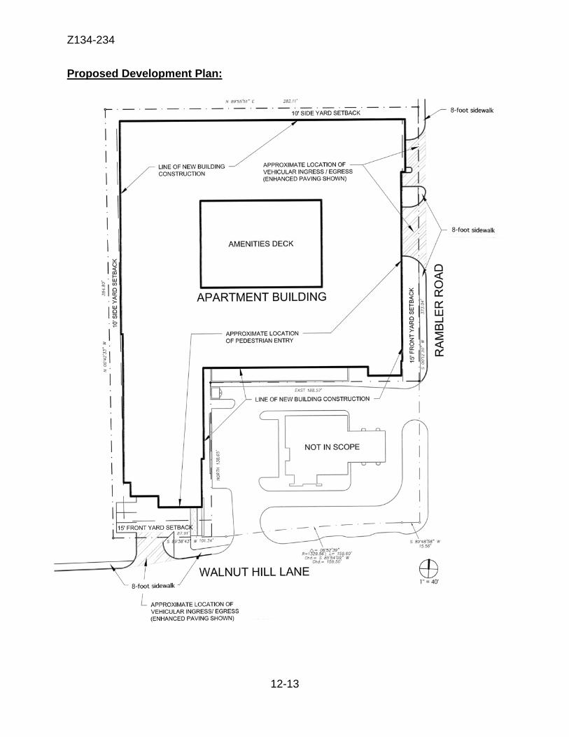
Z134-234
12-13
Proposed Development Plan:

Z134-234
12-14
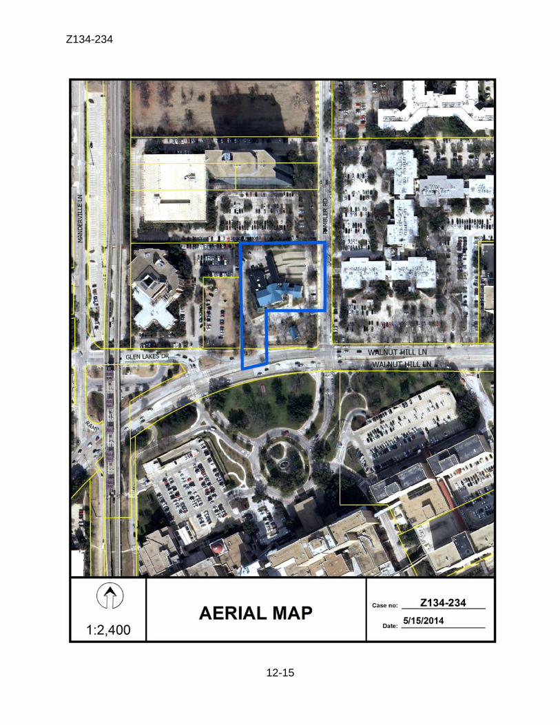
Z134-234
12-15
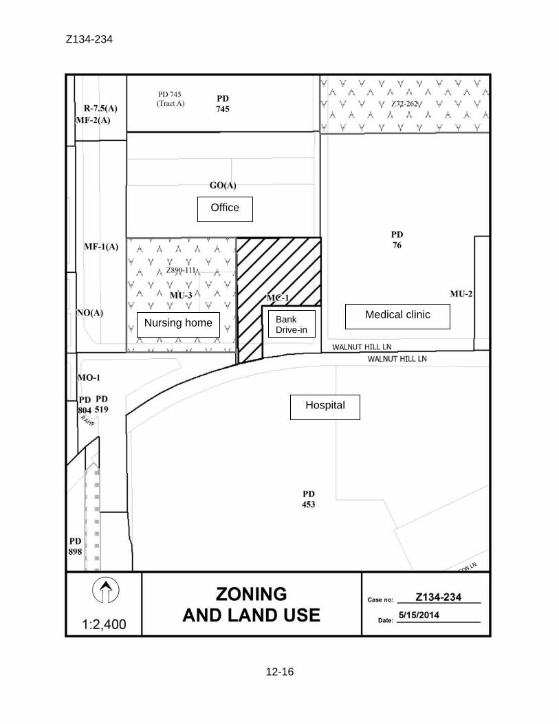
Z134-234
12-16
Hospital
Nursing home
Office
Medical clinic Bank Drive-in
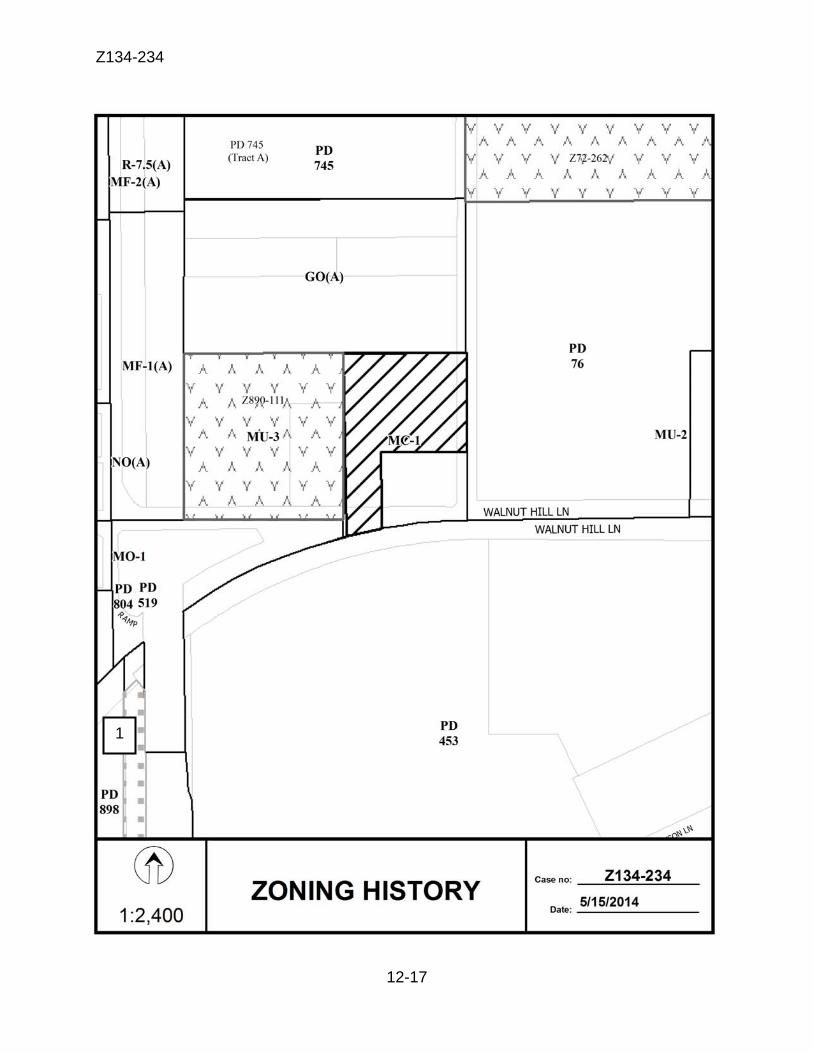
Z134-234
12-17
1
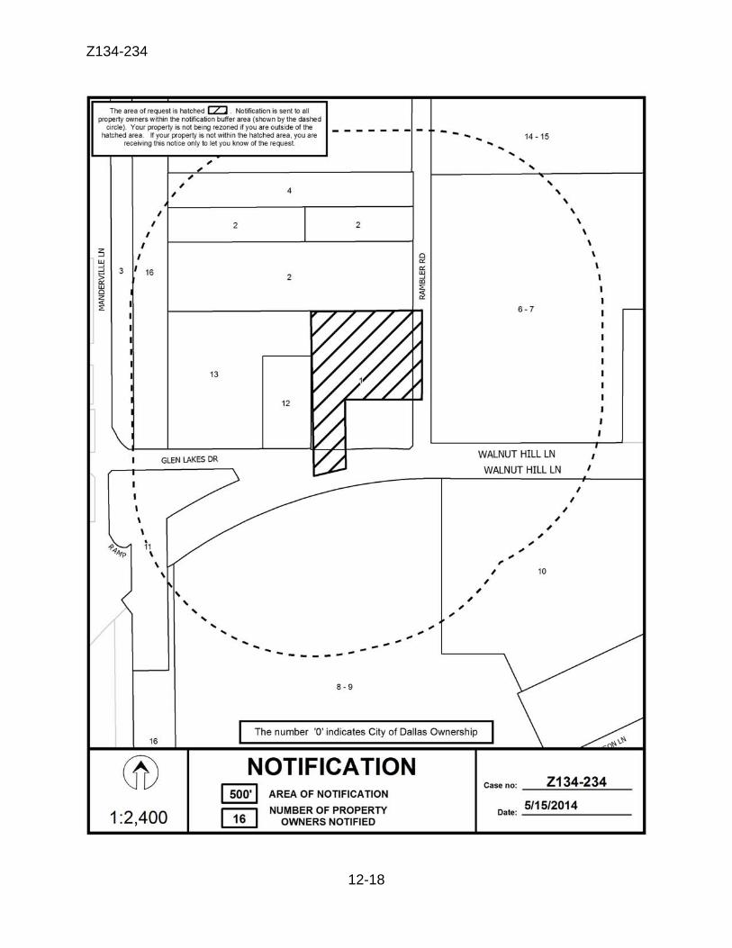
Z134-234
12-18
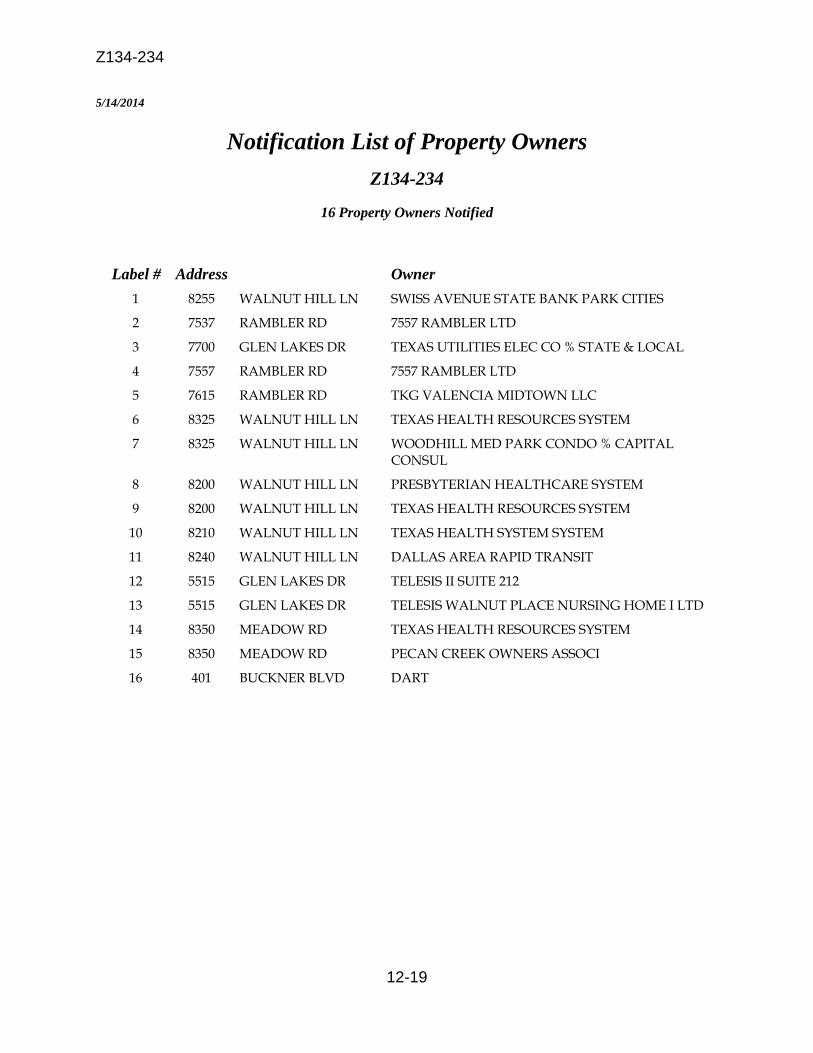
Z134-234
12-19
5/14/2014
Notification List of Property Owners Z134-234
16 Property Owners Notified
Label # Address Owner 1 8255 WALNUT HILL LN SWISS AVENUE STATE BANK PARK CITIES
2 7537 RAMBLER RD 7557 RAMBLER LTD
3 7700 GLEN LAKES DR TEXAS UTILITIES ELEC CO % STATE & LOCAL
4 7557 RAMBLER RD 7557 RAMBLER LTD
5 7615 RAMBLER RD TKG VALENCIA MIDTOWN LLC
6 8325 WALNUT HILL LN TEXAS HEALTH RESOURCES SYSTEM
7 8325 WALNUT HILL LN WOODHILL MED PARK CONDO % CAPITAL CONSUL
8 8200 WALNUT HILL LN PRESBYTERIAN HEALTHCARE SYSTEM
9 8200 WALNUT HILL LN TEXAS HEALTH RESOURCES SYSTEM
10 8210 WALNUT HILL LN TEXAS HEALTH SYSTEM SYSTEM
11 8240 WALNUT HILL LN DALLAS AREA RAPID TRANSIT
12 5515 GLEN LAKES DR TELESIS II SUITE 212
13 5515 GLEN LAKES DR TELESIS WALNUT PLACE NURSING HOME I LTD
14 8350 MEADOW RD TEXAS HEALTH RESOURCES SYSTEM
15 8350 MEADOW RD PECAN CREEK OWNERS ASSOCI
16 401 BUCKNER BLVD DART

13-1
CITY PLAN COMMISSION THURSDAY, AUGUST 7, 2014 Planner: LaShondra Holmes Stringfellow
FILE NUMBER: Z134-175(LHS) DATE FILED: February 25, 2014
LOCATION: East of Belt Line Road and north of Ranch Trail
COUNCIL DISTRICT: 6 MAPSCO: 11A-F
SIZE OF REQUEST: Approx. 11.798 acres CENSUS TRACT: 141.27
REPRESENTATIVE: Rob Baldwin
APPLICANT: Lucilio Pena, Billingsley Company OWNER: CW Shoreline Land, Ltd. REQUEST: An application to expand Subarea A-1 of Planned Development
District No. 741 onto property zoned an A(A) Agricultural District, to incorporate Subareas F and G into Subarea A-2 of Planned Development District No. 741, and to terminate Specific Use Permit No. 1806 for gas drilling and production.
SUMMARY: The proposed amendments to Planned Development No. 741
[Cypress Waters] include the following:
1) Incorporation of three tracts zoned A(A) into the surrounding development. The far northern tract (5.0 acres) will be incorporated into Subarea A-1 and the other two tracts to the southeast (0.154 and 0.944 acres respectively) will be incorporated into Subarea A-2. Subareas A-1 and A-2 permit mixed uses. These tracts were initially intended for gas drilling and production.
2) Subareas F (4.8 acres) and G (5.9 acres) are also being incorporated into Subarea A-2.
3) Finally, the special use permit for gas drilling and production is
being removed. STAFF RECOMMENDATION: Approval subject to a revised conceptual plan, and
revised conditions; and approval to terminate SUP No. 1806
13-2
GUIDING CRITERIA FOR RECOMMENDATION:
Staff recommends approval based upon:
1. Performance impacts upon surrounding property (lighting, noise, odor, etc.) – The proposed rezoning is compatible with the surrounding land uses as it is being incorporated into the same subareas of the PDD that surround all three tracts.
2. Traffic impact – The roadway system will be able to accommodate the expected trips from this development.
3. Comprehensive Plan or Area Plan Conformance – The subject site is in a transitional area of the forwardDallas! Plan of Urban Neighborhood and Business Center or Corridor. The proposed rezoning is consistent with the plan.
Surrounding Zoning History:
1. Z134-122 On April 23, 2014, City Council approved rezoning from A(A) to R-5(A) was approved
2. Z134-163 On May 14, 2014, City Council approved rezoning from A(A)
to R-5(A). Thoroughfares/Streets:
Belt Line Road is the nearest major access point for this property. Internal streets under construction will serve the site. STAFF ANALYSIS: Comprehensive Plan: The forwardDallas! Plan designates this area in a transitional area of the Business Center or Corridor Building Block and Urban Neighborhood. The Business Centers or Corridors Building Block represents major employment or shopping destinations outside of Downtown. Business Centers are usually at major intersections or along highways or major arterials and rely heavily on car access. These areas typically include high-rise office towers and low- to mid-rise residential buildings for condos or apartments and may include multifamily housing. Business Centers and Corridors provide important concentrations of employment within Dallas that compete with suburban areas. The Urban Neighborhood Building Block consists of neighborhoods that are predominantly residential but are distinguished from other neighborhoods by the wide variety of housing options they provide and easy access to public transit. Housing choices include single-family detached dwellings, townhomes and low- to mid-rise condominiums and apartments.
13-3
PROPOSED PDD CONDITIONS
ARTICLE 741.
PD 741. SEC. 51P-741.101. LEGISLATIVE HISTORY. PD 741 was established by Ordinance No. 26233, passed by the Dallas City Council on January 25, 2006. (Ord. Nos. 26233; 27915) SEC. 51P-741.102. PROPERTY LOCATION AND SIZE. PD 741 is established on property located on the north side of Hackberry Road, east of Belt Line Road. The size of PD 741 is approximately 1,030.08 acres. (Ord. Nos. 26233; 27915) SEC. 51P-741.103. DEFINITIONS AND INTERPRETATIONS. (a) Unless otherwise stated, the definitions and interpretations in Chapter 51A apply to this article. In this article: (1) A-FRAME SIGN means a self-supported A-shaped sign with two visible sides that are located on or adjacent to a sidewalk. (2) AWNING means a fabric or vinyl surface supported by a metal structure that is applied to the face of a building. (3) AWNING SIGN means a sign attached to, painted on, or otherwise applied to an awning. (4) BANNER means a sign applied on a strip of cloth, vinyl, or similar material and attached to a building or structure. Awning signs, canopy signs, and flags are not banners. (5) BLADE SIGN means a sign projecting perpendicularly from a main building facade, visible from both sides, and made of rigid or soft fabric materials. (6) CANOPY SIGN means a sign attached to, applied on, or supported by a canopy.
13-4
(7) DATA CENTER means a facility for storing, managing, processing, converting, warehousing, or disseminating data or information and includes the equipment that supports the data center, including computers, servers, and other data storage devices. (8) DISTRICT IDENTIFICATION SIGN means a sign that is a marker for the identification of the district. (9) KIOSK SIGN means a multi-sided structure for the display of signage for uses within this district, way-finding maps, artwork, and special events. (10) LIGHT MANUFACTURING means a facility where all processing, fabricating, assembly, or disassembly of items takes place wholly within an enclosed building. Typical items for processing, fabricating, assembly, or disassembly under this use include but are not limited to apparel, food, drapes, clothing accessories, bedspreads, decorations, artificial plants, jewelry, instruments, computers, and electronic devices. (11) MANUFACTURED HOUSING means a dwelling unit contained in a manufactured home. (12) PEDESTRIAN CONNECTION means an unobstructed area a minimum of six feet in width and illuminated to allow for pedestrian traffic. (13) TANDEM PARKING means one parking space in front of another parking space. (14) TRANSPARENCY means the total area of window and door openings filled with glass, expressed as a percentage of the total facade area by story. (15) TREE PLANTING ZONE means the area parallel to and between two-and-one-half and nine feet from the back of the projected street curb. (b) Unless otherwise stated, all references to articles, divisions, or sections in this article are to articles, divisions, or sections in Chapter 51A. (c) Subareas A-1, A-2, B, C, and D , and F are considered to be nonresidential zoning districts.
(d) Subareas G and H are is considered to be a residential zoning districts. (Ord. Nos. 26233; 27915) SEC. 51P-741.103.1. EXHIBITS.

13-5
The following exhibits are incorporated into this article:
(1) Exhibit 741A: conceptual plan. (2) Exhibit 741B: mixed use development (MUD) parking chart. (3) Exhibit 741C: tree list.
(4) Exhibit 741D: tree preserve area.
(5) Exhibit 741E: lighting. (6) Exhibit 741F: typical street sections. (Ord. 27915) SEC. 51P-741.103.2. SUBAREAS. This district is divided into five eight subareas: Subareas A-1, A-2, B, C, D, F, G, and H, as depicted on the conceptual plan. Subarea E shown on the conceptual plan is not part of this district. (Ord. 27915) SEC. 51P-741.104. CONCEPTUAL PLAN. Development and use of the Property must comply with the conceptual plan (Exhibit 741A). In the event of a conflict between the text of this article and the conceptual plan, the text of this article controls. In Subareas A-1, A-2, B, C, and D, minor adjustments to the final street alignments and locations are permitted at the time of platting without requiring an amendment to the conceptual plan. (Ord. Nos. 26233; 27915) SEC. 51P-741.105. DEVELOPMENT PLAN. (a) In Subareas A-1, A-2, B, C, and D, a development plan must be approved by the city plan commission before issuance of any building permit to authorize work in these subareas other than paving, grading, installation of infrastructure improvements, tree removal, irrigation improvements, or fill operations. (b) In Subareas F, G, and H, a development plan must be approved by the city plan commission before issuance of any building permit to authorize work in these subareas. A preliminary plat may serve as the development plan for development of single family uses. The development plan or preliminary plat must comply with the conceptual plan, development agreement, and conditions of this district.
13-6
(c) In Subareas A-1, A-2, B, C, and D, the provision of Section 51A-4.702 requiring submission of a development plan within six months after the city council's approval of these subareas does not apply. (d) A development plan is not required to reflect the entire district or an entire subarea and may include only a portion of the district or a subarea. (Ord. Nos. 26233; 27915) SEC. 51P-741.106. MAIN USES PERMITTED. (a) Subareas A-1, A-2, B, C, and D, and F in general. Except as provided in this section, the only main uses permitted in Subareas A-1, A-2, B, C, and D, and F are those main uses permitted in the MU-3 Mixed Use District, subject to the same conditions applicable in the MU-3 Mixed Use District, as set out in Chapter 51A. For example, a use permitted in the MU-3 Mixed Use District only by specific use permit (SUP) is permitted in these subareas only by SUP, and a use subject to development impact review (DIR) in the MU-3 Mixed Use District is subject to DIR in these subareas.
(b) Uses in Subareas A-1, A-2, B, C, and D not requiring residential adjacency review. The following uses are allowed by right without residential adjacency review:
-- Animal shelter or clinic without outside runs. -- Auto service center. -- Car wash. -- Commercial parking lot or garage. -- Convalescent and nursing homes, hospice care, and
related institutions. -- Hospital. -- Hotel or motel. -- Manufactured housing. [A maximum of five dwelling
units may be constructed in these subareas until a certificate of occupancy is issued or final inspection is performed for another residential use in these subareas. All manufactured housing must be removed within 90 days of the issuance of a certificate of occupancy or final inspection of another residential use.]
-- Public school other than an open-enrollment charter school. -- Restaurant without drive-in or drive-through service.
(c) Main uses permitted by right in Subareas A-1, A-2, B, C, and D. The following main uses are permitted by right: (1) Industrial uses.

13-7
-- Data center. -- Light manufacturing. (2) Miscellaneous uses. -- Placement of fill material. (3) Residential uses. -- Handicapped group dwelling unit. -- Single family. (4) Retail and personal service uses. -- Ambulance service. -- Surface parking. (5) Transportation uses. -- Commercial bus station and terminal. -- Private street or alley. -- Transit passenger station or transfer center. (d) Subareas G and H. The only main uses permitted in Subareas G and H are those main uses permitted in the TH-3(A) Townhouse District, subject to the same conditions applicable in the TH-3(A) Townhouse District, as set out in Chapter 51A. For example, a use permitted in the TH-3(A) Townhouse District only by specific use permit (SUP) is permitted in these subareas only by SUP, and a use subject to development impact review (DIR) in the TH-3(A) Townhouse District is subject to DIR in these subareas. (Ord. Nos. 26233; 27915) SEC. 51P-741.107. ACCESSORY USES. As a general rule, an accessory use is permitted in any district in which the main use is permitted. Some specific accessory uses, however, due to their unique nature, are subject to additional regulations in Section 51A-4.217. For more information regarding accessory uses, consult Section 51A-4.217. (Ord. Nos. 26233; 27915) SEC. 51P-741.108. YARD, LOT, AND SPACE REGULATIONS.
13-8
(Note: The yard, lot, and space regulations in this section must be read together with the yard, lot, and space regulations in Division 51A-4.400. In the event of a conflict between this section and Division 51A-4.400, this section controls.) (a) Subareas A-1, A-2, B, C, and D. (1) In general. Except as provided in this subsection, the yard, lot, and space regulations for the MU-3 Mixed Use District apply. (2) Front yard. (A) Minimum front yard is five feet. (B) No urban form setback is required. (C) Temporary structures such as tables, chairs, and related items for sidewalk dining may be located in the front yard. (D) Windows sills, bay windows, belt courses, cornices, other architectural features, and fireplace chimneys may project up to three feet into a required front yard. (E) Unenclosed balconies, unenclosed patios, stoops, and signs may project up to five feet into a required front yard. (3) Side and rear yard. (A) Except as provided in this subsection, no minimum side or rear yard is required. (B) For all uses other than single-family, minimum side and rear yard is five feet if a lot is adjacent to a public alley that borders a single-family use. (C) No tower spacing is required. (D) Window sills, bay windows, belt courses, cornices, other architectural features, and fireplace chimneys may project up to three feet into a required side or rear yard. (E) Unenclosed balconies, unenclosed patios, stoops, and signs may project up to five feet into a required side or rear yard. (4) Density. Maximum number of dwelling units is 10,000. (5) Floor area. All of Subareas A-1 and A-2 are considered one lot.
(6) Height.
13-9
(A) Habitable structures within 300 feet of the eastern boundary of the district are limited to 70 feet in height.
(B) The residential proximity slope provisions do not apply.
(7) Lot coverage. (A) Maximum lot coverage is 90 percent. Aboveground parking structures are included in lot coverage calculations; surface parking lots and underground parking structures are not. (B) All of Subareas A-1 and A-2 are considered one lot. (8) Lot size. For single-family uses, minimum lot size is 2,000 square feet. (9) Mixed use project. Subareas A-1 and A-2 are considered a mixed use project. (b) Subarea F. Except as provided in this subsection, the yard, lot, and space regulations for the MU-3 and MU-3(SAH) Mixed Use Districts apply. The minimum front yard setbacks may be reduced up to 100 percent upon a determination by the city plan commission that the proposed setbacks are part of the uniform development and streetscape of Subarea F. The proposed setbacks, as well as the street and parkway cross sections, must be reflected on a development plan and landscape plan. (c) Subareas G and H. Except as provided in this subsection, the yard, lot, and space regulations for the TH-1(A), TH-2(A), and TH-3(A) districts apply. Maximum dwelling unit density is 12 dwelling units per acre. (Ord. Nos. 26233; 27915) SEC. 51P-741.109. OFF-STREET PARKING AND LOADING. (a) Except as provided in this section, consult the use regulations in Division 51A-4.200 for the specific off-street parking and loading requirements for each use. (b) Subareas A-1, A-2, B, C, and D. (1) On-street parking spaces that are adjacent to a lot, or if adjacent to open space, within 80 feet of a lot as measured in a straight line without regard for intervening structures, may be counted toward the required parking for that lot. (2) For multifamily uses, 1.3 parking spaces per dwelling unit. (3) Tandem parking is allowed for single family uses.

13-10
(4) Parking that requires maneuvering within the proposed Cypress Waters Boulevard right-of-way may be counted toward required parking for the adjacent lot. (5) For children’s amusement center, commercial amusement (outside), dry cleaning or laundry store, general merchandise or food store 3,500 square feet or less, general merchandise or food store greater than 3,500 square feet, general merchandise or food store 100,000 square feet or more, household equipment and appliance repair, liquor store, personal service, skating rink, and swap or buy shop uses, one parking space per 250 square feet of floor area is required. (6) For a data center, one parking space per 5,000 square feet of floor area, except that one parking space per 333 square feet is required for any floor area used for office space. Handicapped parking must be provided pursuant to Section 51A-4.305. No loading space is required the first 50,000 square feet of floor area. One loading space is required for the first 150,000 square feet of floor area. One additional loading space is required for each additional 100,000 square feet of floor area or fraction thereof above the initial 150,000 square feet. (7) For light manufacturing, one parking space per 600 square feet of floor area. Handicapped parking must be provided pursuant to Section 51A-4.305. One loading space is required the first 50,000 square feet of floor area. Two loading spaces are required for the first 100,000 square feet of floor area. One additional loading space is required for each additional 100,000 square feet of floor area or fraction thereof above the initial 100,000 square feet. (8) Parking reductions for proximity to DART light rail stations. (A) Parking for all uses, except residential uses, located within a quarter mile of an existing DART light rail station, or a future rail station as indicated on an adopted service plan, may be reduced by 20 percent. (B) Parking for all uses, except residential uses, located more than a quarter mile but less than half a mile from an existing DART light rail station, or a future rail station as indicated on an adopted service plan, may be reduced by 20 percent provided there is a pedestrian connection to the DART light rail station. (9) Mixed use development parking reduction. (A) The off-street parking requirement for a mixed use development may be reduced in accordance with the mixed use development (MUD) parking chart (Exhibit 741B).

13-11
(B) This reduction may be used in combination with other parking reductions, except that the standard requirement for a mixed use development may not be reduced by more than 30 percent. (C) The adjusted off-street parking requirement for a mixed use development is calculated as follows: (i) First, the standard parking requirements for each of the uses in the mixed use development must be ascertained. (ii) Next, the parking demand for each use is determined for each of the five times of day shown in the MUD parking chart by multiplying the standard off-street parking requirement for each use by the percentage in the chart assigned to the category of use. If a use in the development does not fall within one of the categories shown in the MUD parking chart, the percentage assigned to that use is 100 percent for all five times of day. (iii) Finally, the “time of day” columns are totaled to produce sums that represent the aggregate parking demand for the development at each time of day. The largest of these five sums is the adjusted off-street parking requirement for the development. (10) Seven-and-a-half-foot-wide parking stalls may constitute up to 35 percent of the required parking spaces for any use. (11) For purposes of this subsection, each subarea is considered a lot. (Ord. Nos. 26233; 27915) SEC. 51P-741.110. ENVIRONMENTAL PERFORMANCE STANDARDS. See Article VI. (Ord. Nos. 26233; 27915) SEC. 51P-741.111. LANDSCAPING. (a) Subareas A-1 and A-2. (1) Landscape plan. (A) Except as provided in this subsection, a landscape plan must be submitted with the development plan and approved by the city plan commission before issuance of a building permit to authorize work in this subarea. No landscape plan is required for: (i) a public park;
13-12
(ii) the repair of existing structures; (iii) demolition; (iv) grading; (v) the installation of fencing or other structures for security purposes; (vi) work associated with a temporary use; (vii) work intended to provide for the irrigation or maintenance of landscaping; or (viii) the reconstruction or restoration of a building that has been damaged or destroyed by fire, explosion, flood, tornado, riot, act of public enemy, or accident of any kind if that reconstruction or restoration does not increase:
(aa) the number of buildings on the lot;
(bb) the number of stories in a building on the lot; (cc) the floor area of any building on the lot by more than 10 percent or 10,000 square feet, whichever is less; or (dd) the nonpermeable coverage of the lot by more than 10,000 square feet. (B) Except as provided in this subsection, landscape plans must adhere to either the requirements of this article or Article X. Submitted landscape plans must indicate which set of standards apply. (C) A landscape plan must contain the following information: (i) Date, scale, north point, and the names, addresses, and telephone numbers of both the property owner and the person preparing the plan. (ii) Location of existing boundary lines and dimensions of the lot, the zoning classification of the lot, the subarea classification of adjacent properties and a vicinity map. (iii) Approximate centerlines of existing water courses and the location of the 100-year flood plain, and geologically similar areas, if applicable; the approximate location of significant drainage features; and the
13-13
location and size of existing and proposed streets and alleys, utility easements, driveways, and sidewalks on or adjacent to the lot. (iv) Project name, street address, and lot and block description. (v) Location, height, and material of proposed screening and fencing (with berms to be delineated by one-foot contours). (vi) Locations and dimensions of proposed landscape buffer strips. (vii) Complete description of plant materials shown on the plan, including names (common and botanical name), locations, quantities, container or caliper sizes at installation, heights, spread, and spacing. The location and type of all existing trees on the lot over six inches in caliper must be specifically indicated. (viii) Complete description of landscaping and screening to be provided in or near off-street parking and loading areas, including information as to the amount (in square feet) of landscape area to be provided interior to parking areas and the number and location of required off-street parking and loading spaces. (ix) An indication of how existing healthy trees proposed to be retained will be protected from damage during construction. (x) Size, height, location, and material of proposed seating, lighting, planters, sculptures, and water features. (xi) A description of proposed watering methods. (xii) Location of visibility triangles on the lot. (xiii) Tabulation of design standard points earned by the plan. (xiv) Impervious area and front yard landscape area. (xv) Total quantity of pedestrian facilities, special amenities, and enhanced pavement each. (xvi) The total tree mitigation for the district as a running total and the total of proposed tree replacement plantings and alternate tree mitigation methods for that landscape plan. Each landscape plan should
13-14
subtract tree mitigation credit after a landscape plan has been approved by city plan commission. (xvii) The adjacent parkway area and any landscaping within the parkway area. (D) The city plan commission may approve a landscape plan that does not comply with the requirements of this subsection if: (i) strict compliance with this subsection is impractical due to site constraints or the location of protected trees, or would result in substantial hardship;
(ii) the landscape plan complies with the spirit and intent of this subsection; and
(iii) the variation or exception from this subsection will not adversely affect surrounding properties. (2) Tree planting zone. (A) In general. Trees must be planted no closer than 2.5 feet on center from any curb or paved roadway. Large trees must be planted no closer than 10 feet on center from a building wall and no closer than 20 feet from another large tree. (B) Number, location, and type of trees required. Each lot must have one or more trees whose trunks are located wholly within the tree planting zone. The number of required trees is determined by dividing the number of feet of lot frontage, exclusive of driveways and visibility triangles, by 30. Fractions are rounded to the nearest whole number, with 0.5 being rounded up to the next higher whole number. Trees must have a minimum caliper of two inches at the time of planting. (C) Tree spacing requirements. Required trees must be spaced as uniformly as practicable. The trunk of a required tree must be within 50 feet of another required tree. (3) Surface parking area trees. All required parking spaces within a surface parking area must be within 100 feet of a large canopy tree. (4) Landscape materials. (A) No artificial plant materials may be used to satisfy the requirements of this subsection.
13-15
(B) In satisfying the landscaping requirements of this subsection, the use of high quality, hardy, and drought tolerant plant materials is encouraged. (C) In addition to those trees listed in Article X, the trees listed in Exhibit 741C may be used to satisfy the requirements of this article. (5) Soil requirements. (A) Except as provided in this paragraph, landscape planting areas must have the following soil depths and dimensions: (i) Each large shrub and each small tree must be planted in soil that is at least 24 inches deep with a surface area of at least 16 square feet (total of 32 cubic feet). (ii) Each large tree must be planted in soil that is at least 36 inches deep with a surface area of at least 25 square feet (total of 75 cubic feet). (B) Landscape planting areas located above underground buildings or structures must have the following soil depths and dimensions: (i) Each large shrub and each small tree must be planted in soil that is at least 30 inches deep with a surface area of at least 25 square feet (total of 62.5 cubic feet). (ii) Each large tree must be planted in soil that is at least 40 inches deep with a surface area of at least 36 square feet (total of 120 cubic feet). (C) The building official may waive the minimum soil requirements if a landscape architect certifies that the proposed alternative soil depths and dimensions are sufficient to support the healthy and vigorous growth of the proposed plant materials. (6) Protection of landscape areas. Required landscape areas must be protected from vehicular traffic through the use of concrete curbs, wheel stops, or other permanent barriers. (7) Sidewalks and paving. (A) Sidewalks must have a minimum width of five feet, unless otherwise depicted on the typical street sections exhibit (Exhibit 741F).
13-16
(B) Public sidewalks occurring outside of the street right-of-way must be contained within an identified easement. (C) Alternative paving materials including, but not limited to, pavers, colored concrete, and stamped concrete are allowable materials to be used in the right-of-way. Cement-stabilized sand base can be used for pedestrian walkways. Cement-concrete base must be used for pavers and drive areas. (8) Design standards. All landscape plans must earn a minimum of 20 points. Points are earned for the use of design standards only when landscaping is provided in the front yard. For purposes of this subsection, a front yard may include those areas of public right-of-way located behind the curb utilized for streetscape. (A) Points for landscaping in front yard. One point is awarded for each three percent of the total front yard area provided as landscape area to a maximum of 15 points if the landscape area: (i) is at least 50 square feet; (ii) is planted with grass or other plant material as ground cover; and (iii) is planted with at least one of the following for every 100 square feet of landscape area, or fraction thereof: (aa) one large canopy tree; (bb) two small trees; (cc) one small tree and two large shrubs; or (dd) three shrubs. (B) Parking concealment for providing parking in a structure. Five points are awarded for providing parking in structures in which facades which face the right-of-way are: (i) architecturally complimentary to the main building; (ii) concealed by a green screen or other vegetation within three years after planting; or (iii) located 50 percent below grade.
13-17
(C) Parking concealment for surface parking. Three points are awarded for providing surface parking that is screened from a street using one or more of the following materials: (i) A three-foot-high earthen berm planted with turf grass or ground cover recommended for local area use by the building official. The berm may not have a slope that exceeds one foot of height for each three feet of width. (ii) A minimum three-foot-high solid masonry wall. (iii) Hedge-like evergreen plant materials recommended for local area use by the building official. The plant materials must be located in a bed that is at least three feet wide with a minimum soil depth of 24 inches. Initial plantings must be capable of obtaining a solid appearance within three years. Plant materials must be placed 36 inches on center over the entire length of the bed unless a landscape architect recommends an alternative planting density that the building official determines is capable of providing a solid appearance within three years. (iv) A combination of (i), (ii), and (iii). (D) Existing tree credits. Existing healthy trees are categorized in accordance with the definitions of this section and credited toward meeting the design standards as follows: (i) One point is awarded for each tree retained in or relocated to the front yard of the building site or the parkway, having a caliper equal to or greater than four inches but less than six inches, a credit of one required large tree is allowed. (ii) Two points are awarded for each tree retained in or relocated to the front yard of the building site or the parkway, having a caliper equal to or greater than six inches but less than 12 inches, a credit of two required large trees is allowed. (iii) Three points are awarded for each tree retained in or relocated to the front yard of the building site, the parkway, or within any of the subareas having a caliper equal to or greater than 12 inches, a credit of three required large trees is allowed. (E) Special amenities. (i) Enhanced pavement material.

13-18
(aa) Three points are awarded when enhanced pavement is used in crosswalks, raised intersections, and other traffic-calming devices in and adjacent to the public right of way. (Note: All vehicular pavement must comply with the construction and maintenance provisions for off-street parking in the Dallas Development Code.) (bb) Three points are awarded when at least 50 percent of all outdoor pedestrian pavement area in the front yard consists of enhanced pavement. (Note: All pedestrian pavement material and design must be approved by the building official.) (ii) Pedestrian facilities. (aa) One point is awarded for each publicly accessible special pedestrian feature such as a plaza, covered walkway, fountain, lake/pond, outdoor recreation facility, hike and bike path, and each work of public art up to a maximum of five points. (bb) One point is awarded for a pedestrian street furniture ensemble included in the front yard consisting of a cluster of at least two benches, one bicycle rack, and a trash receptacle. Maximum of three points. (F) Sustainable materials and methods. One point is awarded per each sustainable strategy successfully implemented as listed below: (i) Modular pavers or recycled brick on cement-stabilized sand base. (ii) Vegetated bio-swales for stormwater treatment, infiltration, or retention. (iii) Dedicated bike lane in the fronting right-of-way. (iv) Public transit stop. (v) A minimum of 50 percent pedestrian or vehicular paving with a pervious paving material. (vi) Planting area that is adjacent to or part of a larger restored habitat or riparian condition (not limited to front yard). (9) When landscaping must be completed.
13-19
(A) All landscaping located within the parkway or right-of-way must be installed before the issuance of a final certificate of occupancy for any building on the adjacent lot. (B) For a lot with one building, all other landscaping must be installed before the issuance of a final certificate of occupancy for the building on the lot. (C) For a lot with multiple buildings, all other landscaping must be installed before the issuance of a final certificate of occupancy for the final building on the lot.
(D) If the property owner provides the building official with documented assurance that the landscaping will be completed within six months, the building official may issue one six-month temporary certificate of occupancy and permit the property owner to complete landscaping during the six-month period. For purposes of this subsection, “documented assurance” means a copy of a valid contract to install the landscaping in accordance with the landscape plan within the six-month period, or a set of deed restrictions containing a covenant to install the landscaping in accordance with the landscape plan within the six-month period. The deed restriction must: (i) expressly provide that it may be enforced by the city; (ii) be approved as to form by the city attorney; and (iii) be filed in the deed records of the county in which the land is located. (10) Irrigation requirements. Except as otherwise provided in this paragraph, required plant materials must be located within 100 feet of a verifiable water supply. (A) The lake, as indicated on the conceptual plan, is an acceptable source for water to be used in irrigation. (B) Proposed watering methods must be indicated on the landscape plan; and adequate to maintain the plant materials in a healthy, growing condition at all times. (C) Drought tolerant planting may be temporarily irrigated as allowed by the director.
13-20
(11) Landscaping and public art within public right-of-way. Landscaping and public art located within the public right-of-way must be installed at the time of construction on the property adjacent to the right-of-way. Landscaping and public art within a right-of-way must be indicated on the development plan. (12) Private license granted. (A) The city council hereby grants a revocable, non-exclusive license to the owners or tenants (with the written consent of the owner) of all property in this subarea for the exclusive purposes of authorizing compliance with the parkway landscaping requirements of this article and the temporary placement for intervals of time less than 24 consecutive hours of A-frame signs, tables, chairs, and associated improvements for dining within the right-of-way. “Parkway” means the portion of a street right-of-way between the street curb and the lot line. An owner or tenant is not required to pay an initial or annual fee for this license, although a fee may be charged for issuance of a parkway landscape permit. This private license will not terminate at the end of any specific period, however, the city council reserves the right to terminate this license at will, by resolution passed by the city council, any time such termination becomes necessary. The determination by the city council of the need for termination is final and binding. The city shall become entitled to possession of the licensed area without giving any notice and without the necessity of legal proceedings to obtain possession when, in its judgment, the purpose or use of the license is inconsistent with the public use of the right-of-way or when the purpose or use of the license is likely to become a nuisance or a threat to public safety. Upon termination of the license by the city council, each owner or tenant shall remove all improvements and installations in the public rights-of-way to the satisfaction of the director of public works and transportation. (B) An owner or tenant is not required to comply with any landscaping requirement to the extent that compliance is made impossible due to the city council's revocation of the private license granted by this subsection. (C) Upon the installation of landscaping, dining equipment, and related amenities, such as irrigation systems, in the public rights-of-way, the owner or tenant shall procure, pay for, and keep in full force and effect commercial general liability insurance coverage with an insurance company authorized to do business in the State of Texas and otherwise acceptable to the city, covering, but not limited to, the liability assumed under the private license granted under this subsection, with combined single limits of liability for bodily injury and property damage of not less than $1,000,000 for each occurrence, and $2,000,000 annual aggregate. Coverage under this liability policy must be on an occurrence basis and the city shall be named as additional insured. Proof of such insurance must be sent to: Office of Risk

13-21
Management, City of Dallas, 1500 Marilla, Dallas, Texas 75201, and the policy must provide for 30 days prior written notice to the Office of Risk Management of cancellation, expiration, non-renewal, or material change in coverage. All subrogation rights for loss or damage against the city are hereby waived to the extent that they are covered by this liability insurance policy. (D) Each owner or tenant is responsible for maintaining the landscaping in a healthy, growing condition, for keeping related amenities in good repair and condition, and for keeping the premises safe and from deteriorating in value or condition, at no expense to the city. The city is absolutely exempt from any requirements to make repairs or to maintain the landscaping, related amenities, or the premises. The granting of a license for landscaping and related amenities under this paragraph does not release the owner or tenant from liability for the installation or maintenance of trees, landscaping, and related amenities in the public right-of-way. (13) Parkway landscape permit. (A) It is the responsibility of the property owner to apply for and obtain a parkway landscape permit before locating trees, landscaping, or related amenities in the parkway. An application for a parkway landscape permit must be made to the building official. The application must be in writing on a form approved by the building official and accompanied by plans or drawings showing the area of the parkway affected and the planting or other amenities proposed. (B) Upon receipt of the application and any required fees, the building official shall circulate it to all affected city departments and utilities for review and comment. If, after receiving comments from affected city departments and utilities, the building official determines that the construction, planting, or other amenities proposed will not be inconsistent with and will not unreasonably impair the public use of the right-of-way, the building official shall issue a parkway landscape permit to the property owner; otherwise, the building official shall deny the permit. (C) A property owner is not required to comply with any parkway landscaping requirement of this article if compliance is made impossible due to the building official’s denial of a parkway landscape permit. (D) A parkway landscape permit issued by the building official is subject to immediate revocation upon written notice if at any time the building official determines that the use of the parkway authorized by the permit is inconsistent with or unreasonably impairs the public use of the right-of-way. The property owner is not required to comply with any parkway landscaping
13-22
requirement of this section if compliance is made impossible due to the building official’s revocation of a parkway landscape permit. (E) The issuance of a parkway landscape permit under this paragraph does not excuse the property owner, his agents, or employees from liability for the installation or maintenance of trees or other amenities in the public right-of-way. (14) General maintenance. Required landscaping must be maintained in a healthy, growing condition. The property owner is responsible for regular weeding, mowing of grass, irrigating, fertilizing, pruning, and other maintenance of all plantings, as needed. Any plant that dies must be replaced with another living plant that complies with the approved landscape plan within 90 days after notification by the city. (b) Subareas B, C, D, G and H. Landscaping must be provided in accordance with Article X. (c) Subarea F. A landscape plan must be submitted with each development plan and approved by the city plan commission before issuance of a building permit to authorize work in this subarea. Landscaping must be provided as shown on the landscape plan. (d) Maintenance. Plant materials must be maintained in a healthy, growing condition. (Ord. Nos. 26233; 27915) SEC. 51P-741.111.1. TREE PRESERVATION, REMOVAL, AND
REPLACEMENT. (a) In general. Except as provided in this section, tree preservation must be provided in accordance with Article X.
(b) Subareas A-1 and A-2.
(1) Subareas A-1 and A-2 are considered one lot for purposes of tree mitigation and removal. (2) Total mitigation required is 19,998 caliper inches. (c) Subareas B, C, and D. (1) Subareas B, C, and D are considered one lot for tree mitigation and removal. (2) Total mitigation required is 2,543 caliper inches. (d) Tree inventory and replacement for Subareas A-1, A-2, B, C, and D.
13-23
(1) Trees planted within the right-of-way or designated open space may be counted as required and site trees and used for mitigation. Trees removed from an existing or proposed right-of-way do not have to be mitigated. (2) Trees that are preserved or relocated to a park, conservation easement, designated open space, or area shown on a development plan will receive a five-to-one caliper inch credit for purposes of satisfying tree mitigation requirements. (3) Mitigation of trees removed pursuant to a tree removal permit must be completed in accordance with the following schedule: (A) 25 percent of mitigation complete within five years after the issuance of the tree removal permit; (B) 50 percent of mitigation complete within 10 years after the issuance of the tree removal permit; (C) 75 percent of mitigation complete within 15 years after the issuance of the tree removal permit; (D) 100 percent of mitigation complete within 20 years after the issuance of the tree removal permit. (4) A minimum 17-acre tree preserve area must be maintained as shown on Exhibit 741D until such time as 75 percent of required mitigation is complete. (Ord. 27915) SEC. 51P-741.111.2. LIGHTING IN SUBAREAS A-1, A-2, B, C, AND D. (a) Decorative street lighting may be placed within the right-of-way. (b) Temporary string lighting may be affixed to buildings, light standards within the right-of-way, and landscaping within the right-of-way. (c) In addition to standard city fixtures and poles, fixtures and poles ranging in height from 12 feet to 25 feet and in general conformance with the design criteria outlined in the lighting exhibit (Exhibit 741E) are allowed on the Property and within the right-of-way. (d) The location, number, and type of light fixtures must be determined when a development plan is submitted. Exceptions to city standards may be
13-24
granted in order to achieve comprehensive and integrated urban design in relation to building elevations, locations, and orientations. (e) Athletic field lighting is permitted by right with a maximum height of 120 feet. (Ord. 27915) SEC. 51P-741.111.3. STORM DRAINAGE DESIGN IN SUBAREAS A-1, A-2, B, C,
AND D. Lots using the lake, as shown on the conceptual plan, as a drainage source are not required to provide detention on the lot. (Ord. 27915) SEC. 51P-741.111.4. STREET SECTIONS AND DESIGN IN SUBAREAS A-1, A-2,
B, C, AND D. (a) Streets must be one of the following street types, more particularly described in the typical street sections exhibit: (1) Park street. (2) Town center street. (3) Office and mixed-use street. (4) Boulevard. (5) Water street. (6) Avenue. (7) Residential street. (b) All development plans for Subareas A-1, A-2, B, C, and D must clearly identify which of the street types will be constructed and dedicated adjacent to the area depicted on the development plan. (c) Right-of-way dedications must be in accordance with the attached street sections. (d) Minor adjustments to final street right-of-way dedications and locations are permitted at the time of platting without requiring an amendment to Exhibit 741F. (Ord. 27915) SEC. 51P-741.111.5. TRANSPARENCY. In Subareas A-1, A-2, B, C, and D, any building with a front yard setback of less than 15 feet must meet the following minimum ground story transparency requirements.
13-25
(a) For a building with two or more types of uses, front yard facades must have a minimum transparency of 50 percent, and side yard facades must have a minimum transparency of 25 percent. (b) For retail, personal service, commercial and business service, institutional and community service, lodging, and multifamily uses, front yard facades must have a minimum transparency of 30 percent, and side yard facades must have a minimum transparency of 25 percent. (c) For single-family uses, front and side yard facades must have a minimum transparency of 20 percent. (Ord. 27915) SEC. 51P-741.111.6. VISUAL OBSTRUCTION REGULATIONS. (a) In Subareas A-1, A-2, B, C, and D, the definition of “visibility triangle” in Section 51A-4.602 for central area districts applies. (b) In Subareas A-1, A-2, B, C, and D, a conceptual street plan and street section exhibit acceptable to the director of public works and transportation must be included with the development plan submitted to the commission for approval. (c) In interpreting and enforcing the paving and drainage design manual, Subareas A-1 and A-2 are considered a special area. (Ord. 27915) SEC. 51P-741.112. SIGNS. (a) In general. Except as provided in this section, signs in Subareas A-1, A-2, B, C, and D, and F must comply with the provisions for business zoning districts in Article VII. Signs in Subareas G and H must comply with the provisions for non-business zoning districts in Article VII. (b) Subareas A-1 and A-2. (1) The effective area for signs includes the sum of the areas within minimum imaginary rectangles of vertical and horizontal lines, each of which fully contains a word. Supporting structures, walls, and architectural features are not included in the calculation of effective area. (2) For all signs other than district identification signs and attached signs, maximum effective area is 200 square feet. (3) Detached signs.
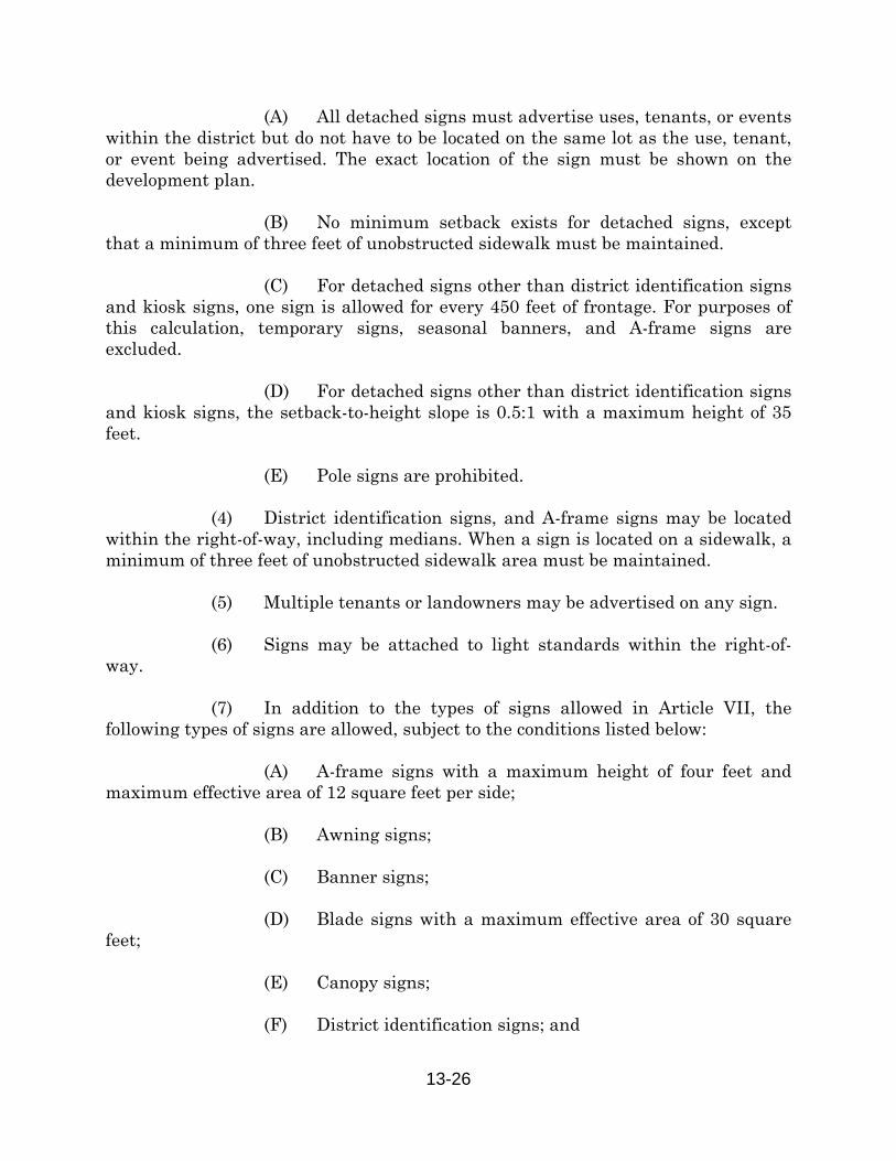
13-26
(A) All detached signs must advertise uses, tenants, or events within the district but do not have to be located on the same lot as the use, tenant, or event being advertised. The exact location of the sign must be shown on the development plan. (B) No minimum setback exists for detached signs, except that a minimum of three feet of unobstructed sidewalk must be maintained. (C) For detached signs other than district identification signs and kiosk signs, one sign is allowed for every 450 feet of frontage. For purposes of this calculation, temporary signs, seasonal banners, and A-frame signs are excluded. (D) For detached signs other than district identification signs and kiosk signs, the setback-to-height slope is 0.5:1 with a maximum height of 35 feet. (E) Pole signs are prohibited. (4) District identification signs, and A-frame signs may be located within the right-of-way, including medians. When a sign is located on a sidewalk, a minimum of three feet of unobstructed sidewalk area must be maintained. (5) Multiple tenants or landowners may be advertised on any sign. (6) Signs may be attached to light standards within the right-of-way. (7) In addition to the types of signs allowed in Article VII, the following types of signs are allowed, subject to the conditions listed below: (A) A-frame signs with a maximum height of four feet and maximum effective area of 12 square feet per side; (B) Awning signs; (C) Banner signs; (D) Blade signs with a maximum effective area of 30 square feet; (E) Canopy signs; (F) District identification signs; and
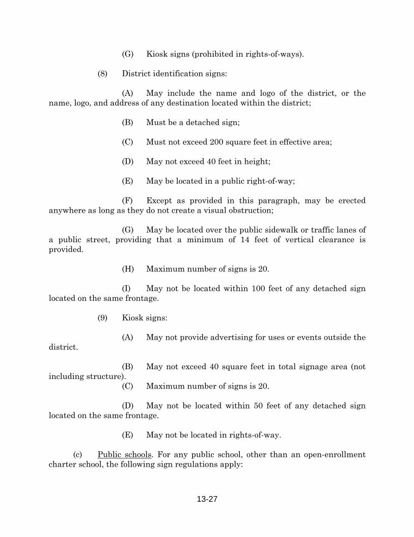
13-27
(G) Kiosk signs (prohibited in rights-of-ways). (8) District identification signs: (A) May include the name and logo of the district, or the name, logo, and address of any destination located within the district; (B) Must be a detached sign; (C) Must not exceed 200 square feet in effective area; (D) May not exceed 40 feet in height; (E) May be located in a public right-of-way; (F) Except as provided in this paragraph, may be erected anywhere as long as they do not create a visual obstruction; (G) May be located over the public sidewalk or traffic lanes of a public street, providing that a minimum of 14 feet of vertical clearance is provided. (H) Maximum number of signs is 20. (I) May not be located within 100 feet of any detached sign located on the same frontage. (9) Kiosk signs: (A) May not provide advertising for uses or events outside the district. (B) May not exceed 40 square feet in total signage area (not including structure). (C) Maximum number of signs is 20. (D) May not be located within 50 feet of any detached sign located on the same frontage. (E) May not be located in rights-of-way. (c) Public schools. For any public school, other than an open-enrollment charter school, the following sign regulations apply:
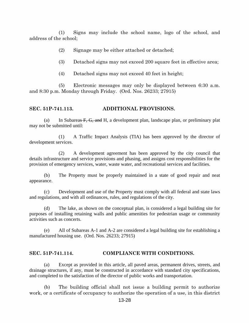
13-28
(1) Signs may include the school name, logo of the school, and address of the school; (2) Signage may be either attached or detached; (3) Detached signs may not exceed 200 square feet in effective area; (4) Detached signs may not exceed 40 feet in height; (5) Electronic messages may only be displayed between 6:30 a.m. and 8:30 p.m. Monday through Friday. (Ord. Nos. 26233; 27915) SEC. 51P-741.113. ADDITIONAL PROVISIONS.
(a) In Subareas F, G, and H, a development plan, landscape plan, or preliminary plat may not be submitted until: (1) A Traffic Impact Analysis (TIA) has been approved by the director of development services. (2) A development agreement has been approved by the city council that details infrastructure and service provisions and phasing, and assigns cost responsibilities for the provision of emergency services, water, waste water, and recreational services and facilities. (b) The Property must be properly maintained in a state of good repair and neat appearance. (c) Development and use of the Property must comply with all federal and state laws and regulations, and with all ordinances, rules, and regulations of the city. (d) The lake, as shown on the conceptual plan, is considered a legal building site for purposes of installing retaining walls and public amenities for pedestrian usage or community activities such as concerts. (e) All of Subareas A-1 and A-2 are considered a legal building site for establishing a manufactured housing use. (Ord. Nos. 26233; 27915) SEC. 51P-741.114. COMPLIANCE WITH CONDITIONS. (a) Except as provided in this article, all paved areas, permanent drives, streets, and drainage structures, if any, must be constructed in accordance with standard city specifications, and completed to the satisfaction of the director of public works and transportation. (b) The building official shall not issue a building permit to authorize work, or a certificate of occupancy to authorize the operation of a use, in this district

13-29
until there has been full compliance with this article, the Dallas Development Code, the construction codes, and all other ordinances, rules, and regulations of the city. (Ord. Nos. 26233; 27915) SEC. 51P-741.115. ZONING MAP. PD 741 is located on Zoning Map Nos. C-2, C-3, D-2, and D-3. (Ord. Nos. 26233; 27915)
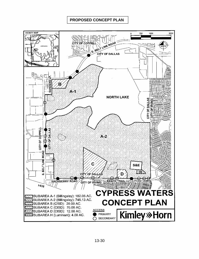
13-30
PROPOSED CONCEPT PLAN

Z134-175(LHS)
13-31
EXISTING CONCEPT PLAN
Z134-175(LHS)
13-32
SUP NO. 1806 – TO BE TERMINATED

Z134-175(LHS)
13-33
Z134-175(LHS)
13-34
Z134-175(LHS)
13-35
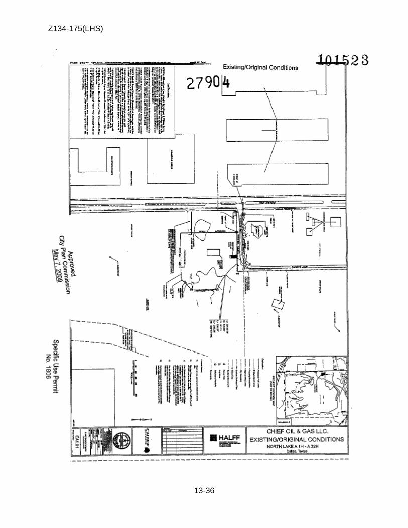
Z134-175(LHS)
13-36
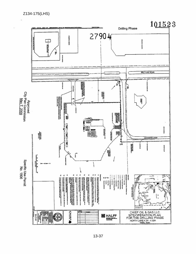
Z134-175(LHS)
13-37
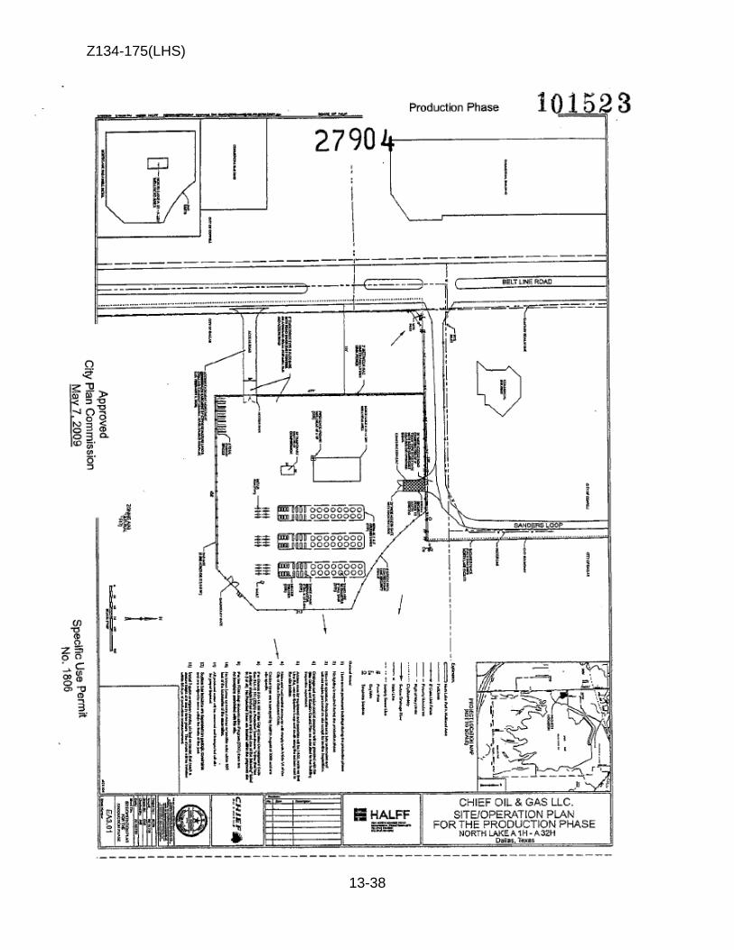
Z134-175(LHS)
13-38
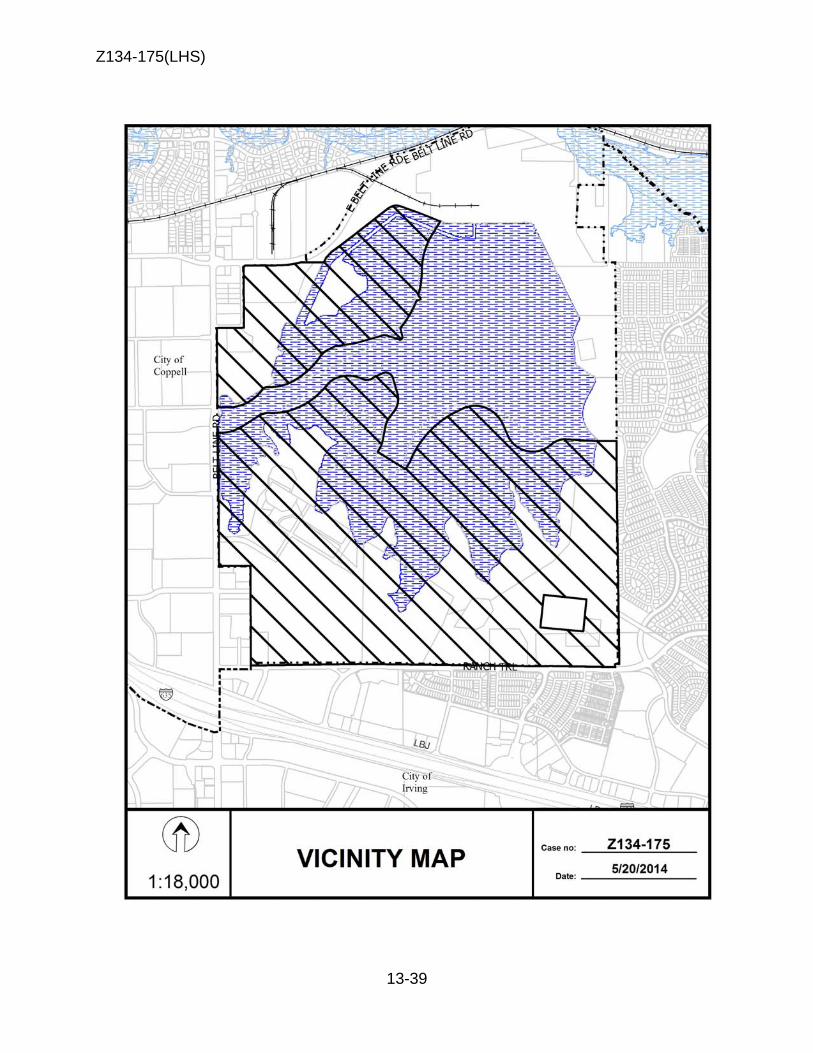
Z134-175(LHS)
13-39
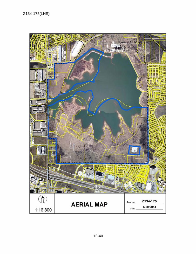
Z134-175(LHS)
13-40
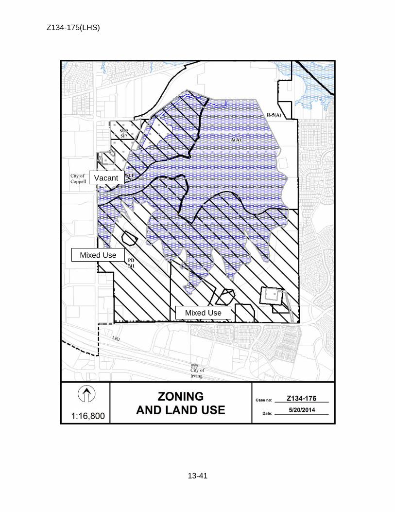
Z134-175(LHS)
13-41
Mixed Use
Mixed Use
Vacant
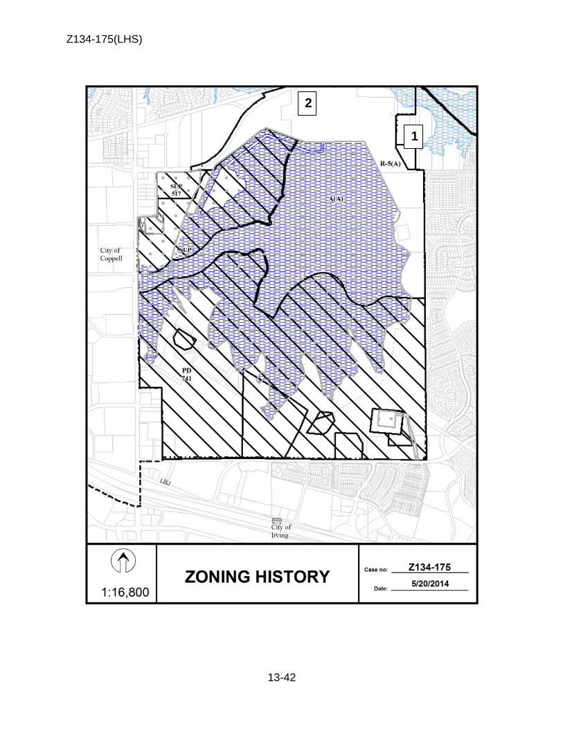
Z134-175(LHS)
13-42
2
1
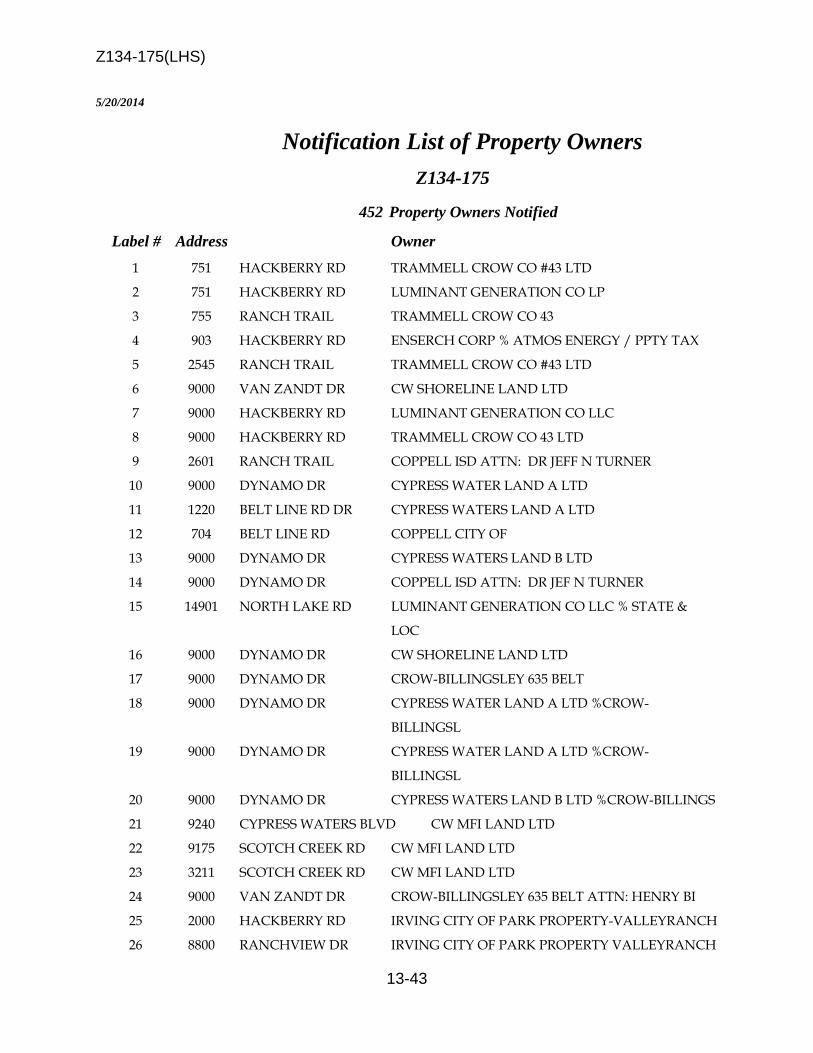
Z134-175(LHS)
13-43
5/20/2014 Notification List of Property Owners
Z134-175
452 Property Owners Notified
Label # Address Owner 1 751 HACKBERRY RD TRAMMELL CROW CO #43 LTD 2 751 HACKBERRY RD LUMINANT GENERATION CO LP 3 755 RANCH TRAIL TRAMMELL CROW CO 43 4 903 HACKBERRY RD ENSERCH CORP % ATMOS ENERGY / PPTY TAX 5 2545 RANCH TRAIL TRAMMELL CROW CO #43 LTD 6 9000 VAN ZANDT DR CW SHORELINE LAND LTD 7 9000 HACKBERRY RD LUMINANT GENERATION CO LLC 8 9000 HACKBERRY RD TRAMMELL CROW CO 43 LTD 9 2601 RANCH TRAIL COPPELL ISD ATTN: DR JEFF N TURNER 10 9000 DYNAMO DR CYPRESS WATER LAND A LTD 11 1220 BELT LINE RD DR CYPRESS WATERS LAND A LTD 12 704 BELT LINE RD COPPELL CITY OF 13 9000 DYNAMO DR CYPRESS WATERS LAND B LTD 14 9000 DYNAMO DR COPPELL ISD ATTN: DR JEF N TURNER 15 14901 NORTH LAKE RD LUMINANT GENERATION CO LLC % STATE &
LOC 16 9000 DYNAMO DR CW SHORELINE LAND LTD 17 9000 DYNAMO DR CROW-BILLINGSLEY 635 BELT 18 9000 DYNAMO DR CYPRESS WATER LAND A LTD %CROW-
BILLINGSL 19 9000 DYNAMO DR CYPRESS WATER LAND A LTD %CROW-
BILLINGSL 20 9000 DYNAMO DR CYPRESS WATERS LAND B LTD %CROW-BILLINGS 21 9240 CYPRESS WATERS BLVD CW MFI LAND LTD 22 9175 SCOTCH CREEK RD CW MFI LAND LTD 23 3211 SCOTCH CREEK RD CW MFI LAND LTD 24 9000 VAN ZANDT DR CROW-BILLINGSLEY 635 BELT ATTN: HENRY BI 25 2000 HACKBERRY RD IRVING CITY OF PARK PROPERTY-VALLEYRANCH 26 8800 RANCHVIEW DR IRVING CITY OF PARK PROPERTY VALLEYRANCH
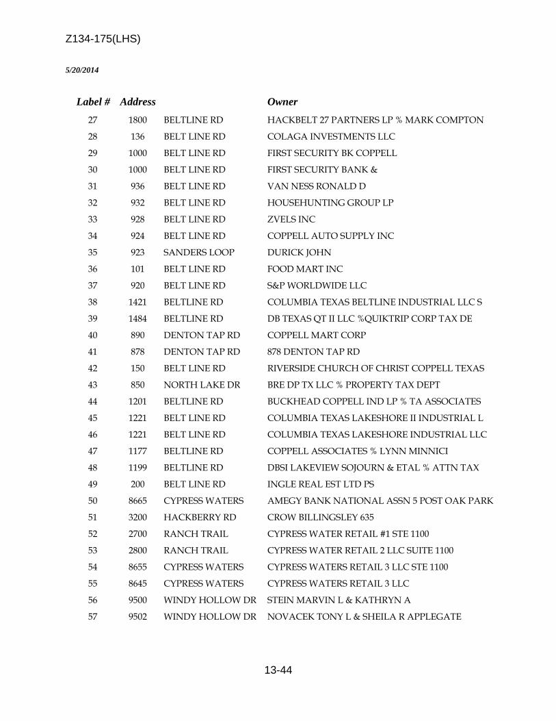
Z134-175(LHS)
13-44
5/20/2014
Label # Address Owner 27 1800 BELTLINE RD HACKBELT 27 PARTNERS LP % MARK COMPTON 28 136 BELT LINE RD COLAGA INVESTMENTS LLC 29 1000 BELT LINE RD FIRST SECURITY BK COPPELL 30 1000 BELT LINE RD FIRST SECURITY BANK & 31 936 BELT LINE RD VAN NESS RONALD D 32 932 BELT LINE RD HOUSEHUNTING GROUP LP 33 928 BELT LINE RD ZVELS INC 34 924 BELT LINE RD COPPELL AUTO SUPPLY INC 35 923 SANDERS LOOP DURICK JOHN 36 101 BELT LINE RD FOOD MART INC 37 920 BELT LINE RD S&P WORLDWIDE LLC 38 1421 BELTLINE RD COLUMBIA TEXAS BELTLINE INDUSTRIAL LLC S 39 1484 BELTLINE RD DB TEXAS QT II LLC %QUIKTRIP CORP TAX DE 40 890 DENTON TAP RD COPPELL MART CORP 41 878 DENTON TAP RD 878 DENTON TAP RD 42 150 BELT LINE RD RIVERSIDE CHURCH OF CHRIST COPPELL TEXAS 43 850 NORTH LAKE DR BRE DP TX LLC % PROPERTY TAX DEPT 44 1201 BELTLINE RD BUCKHEAD COPPELL IND LP % TA ASSOCIATES 45 1221 BELT LINE RD COLUMBIA TEXAS LAKESHORE II INDUSTRIAL L 46 1221 BELT LINE RD COLUMBIA TEXAS LAKESHORE INDUSTRIAL LLC 47 1177 BELTLINE RD COPPELL ASSOCIATES % LYNN MINNICI 48 1199 BELTLINE RD DBSI LAKEVIEW SOJOURN & ETAL % ATTN TAX 49 200 BELT LINE RD INGLE REAL EST LTD PS 50 8665 CYPRESS WATERS AMEGY BANK NATIONAL ASSN 5 POST OAK PARK 51 3200 HACKBERRY RD CROW BILLINGSLEY 635 52 2700 RANCH TRAIL CYPRESS WATER RETAIL #1 STE 1100 53 2800 RANCH TRAIL CYPRESS WATER RETAIL 2 LLC SUITE 1100 54 8655 CYPRESS WATERS CYPRESS WATERS RETAIL 3 LLC STE 1100 55 8645 CYPRESS WATERS CYPRESS WATERS RETAIL 3 LLC 56 9500 WINDY HOLLOW DR STEIN MARVIN L & KATHRYN A 57 9502 WINDY HOLLOW DR NOVACEK TONY L & SHEILA R APPLEGATE

Z134-175(LHS)
13-45
5/20/2014
Label # Address Owner 58 9504 WINDY HOLLOW DR KRISHNAMURTHY KARTHIK &
KRISHNAMURTHY VI 59 9506 WINDY HOLLOW DR GARZA ERICK & MARTHA M 60 9508 WINDY HOLLOW DR LIMAYE ARUN S 61 9510 WINDY HOLLOW DR AGASHE VINAYAK S & ANAGHA 62 9501 WINDY HOLLOW DR DENG LING 63 9503 WINDY HOLLOW DR WALL JIMMY F & MAVON E 64 9505 WINDY HOLLOW DR FARES FARID S 65 8505 WALTON BLVD BRE DDR MACARTHUR MARKETPLACE LLC % REAL 66 1201 RANCH TRAIL SHANTI NIKETAN LLC 67 9313 VISTA CIR SAMUDRALA NAGA V & RENUKA 68 9315 VISTA CIR OMOGAH FERDINAND C & EMELIA N 69 9317 VISTA CIR OTAKE THOMAS K & BRIGITTE CHRISTA OTAKE 70 9319 VISTA CIR RICHARDS MIKEL A & LEIGH ANN 71 9321 VISTA CIR HARIHARAN SIVARAMKRISHNAN RAJALAKSH
VENK 72 9323 VISTA CIR GREEN DARRYL L & HAVOLYN J 73 9325 VISTA CIR BOROYEVICH DUSHAN & MILIA 74 9327 VISTA CIR COUCH JONATHAN R & COOPER NATALIE A 75 9329 VISTA CIR GIFFORD KIMBERLY 76 9331 VISTA CIR HEHAR GURDEV S & PARMINDER K 77 9333 VISTA CIR CANNON JAMES D 78 9401 VISTA CIR KIM EVELYN 79 9403 VISTA CIR OKEREKE JACOB OBINNA & ROSEMARY 80 9405 VISTA CIR DUONG HONG CAM 81 9407 VISTA CIR CHAUDHRY & ASSOCIATES INC 82 9409 VISTA CIR RAGHU SRINIVAS R 83 9411 VISTA CIR MILLER DONNA M 84 9413 VISTA CIR SHAH PANKAJ & NITA 85 9415 VISTA CIR SINGHEE KAMAL RAJ 86 9417 VISTA CIR RADJA JAKISA 87 9419 VISTA CIR LINDSTEDT JOUNI & MILLA 88 9421 VISTA CIR HUFF CHONG

Z134-175(LHS)
13-46
5/20/2014
Label # Address Owner 89 9423 VISTA CIR PFAFF MONICA 90 9425 VISTA CIR SMITH RANDY A 91 9427 VISTA CIR ABOUKHAMIS OMAR A & REMA KETTANEH 92 9429 VISTA CIR KOTA NARASIMHAM V 93 9431 VISTA CIR RAHEEM ABDUL & ISHRATH JAHAN 94 9433 VISTA CIR NGUYEN TIEN DUC & MY VAN VU 95 9435 VISTA CIR VALLEY RANCH MASTER ASSN % CCMC 96 9501 VISTA CIR BRET MARY E & PHIL S SHERIDAN 97 9503 VISTA CIR TALATHI RAJESH 98 9505 VISTA CIR MERILAINEN PEKKA J & NEMNEIHOI HAOLAI 99 9507 VISTA CIR GONZALEZ GEORGE C & HIDAJATY THAJEB 100 9509 VISTA CIR DAVIS MARY P 101 9511 VISTA CIR BLEVINS THOMAS S & LAURA L 102 9513 VISTA CIR HUANG POTSANG & YENJING CHEN 103 9515 VISTA CIR FAMKAR BRIAN G 104 9310 VISTA CIR NAGARKAR SANJEEV 105 9312 VISTA CIR DOPPALAPUDI SASIDHAR & SOWJANYA PARUCHUR 106 9314 VISTA CIR JUAREZ HENRY 107 9316 VISTA CIR CARELOCK JANA S 108 9318 VISTA CIR APPEL ROY D & JANELL V 109 9320 VISTA CIR MERCHANT ZUBEDA 110 1442 RANCH HILL DR PIERCE JAMES C & SUZANNE H 111 1438 RANCH HILL DR PHILLIPS LINDA G 112 1434 RANCH HILL DR GOVINDASAMY RAMAMOORTHY & SUJATHA MANI 113 1430 RANCH HILL DR LOWERY FELECIA A 114 1426 RANCH HILL DR SINGH AMANPREET 115 1422 RANCH HILL DR RAMARAO SRINIVAS & SRIVIDYA RAO 116 1419 RANCH HILL DR OLIVARES JULIAN J & NANCY D 117 1423 RANCH HILL DR CONOVER WILLIAM G & YUNG 118 1427 RANCH HILL DR SUSANTIO FAMILY REVOCABLE TRUST 119 1431 RANCH HILL DR ISLAMRAJA MAZHAR & GHAZALA BASHARAT
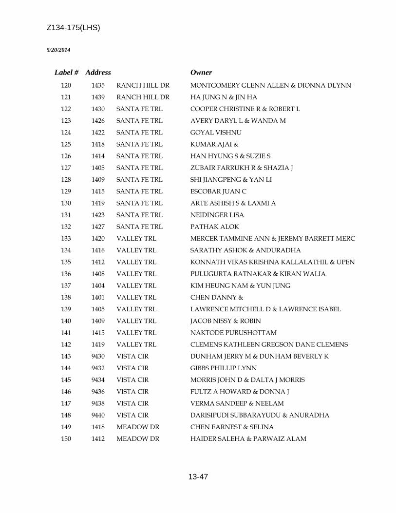
Z134-175(LHS)
13-47
5/20/2014
Label # Address Owner 120 1435 RANCH HILL DR MONTGOMERY GLENN ALLEN & DIONNA DLYNN 121 1439 RANCH HILL DR HA JUNG N & JIN HA 122 1430 SANTA FE TRL COOPER CHRISTINE R & ROBERT L 123 1426 SANTA FE TRL AVERY DARYL L & WANDA M 124 1422 SANTA FE TRL GOYAL VISHNU 125 1418 SANTA FE TRL KUMAR AJAI & 126 1414 SANTA FE TRL HAN HYUNG S & SUZIE S 127 1405 SANTA FE TRL ZUBAIR FARRUKH R & SHAZIA J 128 1409 SANTA FE TRL SHI JIANGPENG & YAN LI 129 1415 SANTA FE TRL ESCOBAR JUAN C 130 1419 SANTA FE TRL ARTE ASHISH S & LAXMI A 131 1423 SANTA FE TRL NEIDINGER LISA 132 1427 SANTA FE TRL PATHAK ALOK 133 1420 VALLEY TRL MERCER TAMMINE ANN & JEREMY BARRETT MERC 134 1416 VALLEY TRL SARATHY ASHOK & ANDURADHA 135 1412 VALLEY TRL KONNATH VIKAS KRISHNA KALLALATHIL & UPEN 136 1408 VALLEY TRL PULUGURTA RATNAKAR & KIRAN WALIA 137 1404 VALLEY TRL KIM HEUNG NAM & YUN JUNG 138 1401 VALLEY TRL CHEN DANNY & 139 1405 VALLEY TRL LAWRENCE MITCHELL D & LAWRENCE ISABEL 140 1409 VALLEY TRL JACOB NISSY & ROBIN 141 1415 VALLEY TRL NAKTODE PURUSHOTTAM 142 1419 VALLEY TRL CLEMENS KATHLEEN GREGSON DANE CLEMENS 143 9430 VISTA CIR DUNHAM JERRY M & DUNHAM BEVERLY K 144 9432 VISTA CIR GIBBS PHILLIP LYNN 145 9434 VISTA CIR MORRIS JOHN D & DALTA J MORRIS 146 9436 VISTA CIR FULTZ A HOWARD & DONNA J 147 9438 VISTA CIR VERMA SANDEEP & NEELAM 148 9440 VISTA CIR DARISIPUDI SUBBARAYUDU & ANURADHA 149 1418 MEADOW DR CHEN EARNEST & SELINA 150 1412 MEADOW DR HAIDER SALEHA & PARWAIZ ALAM
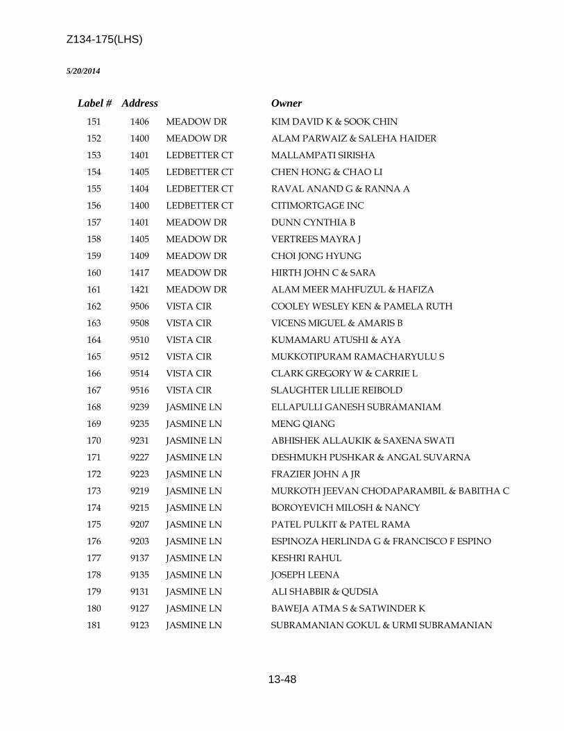
Z134-175(LHS)
13-48
5/20/2014
Label # Address Owner 151 1406 MEADOW DR KIM DAVID K & SOOK CHIN 152 1400 MEADOW DR ALAM PARWAIZ & SALEHA HAIDER 153 1401 LEDBETTER CT MALLAMPATI SIRISHA 154 1405 LEDBETTER CT CHEN HONG & CHAO LI 155 1404 LEDBETTER CT RAVAL ANAND G & RANNA A 156 1400 LEDBETTER CT CITIMORTGAGE INC 157 1401 MEADOW DR DUNN CYNTHIA B 158 1405 MEADOW DR VERTREES MAYRA J 159 1409 MEADOW DR CHOI JONG HYUNG 160 1417 MEADOW DR HIRTH JOHN C & SARA 161 1421 MEADOW DR ALAM MEER MAHFUZUL & HAFIZA 162 9506 VISTA CIR COOLEY WESLEY KEN & PAMELA RUTH 163 9508 VISTA CIR VICENS MIGUEL & AMARIS B 164 9510 VISTA CIR KUMAMARU ATUSHI & AYA 165 9512 VISTA CIR MUKKOTIPURAM RAMACHARYULU S 166 9514 VISTA CIR CLARK GREGORY W & CARRIE L 167 9516 VISTA CIR SLAUGHTER LILLIE REIBOLD 168 9239 JASMINE LN ELLAPULLI GANESH SUBRAMANIAM 169 9235 JASMINE LN MENG QIANG 170 9231 JASMINE LN ABHISHEK ALLAUKIK & SAXENA SWATI 171 9227 JASMINE LN DESHMUKH PUSHKAR & ANGAL SUVARNA 172 9223 JASMINE LN FRAZIER JOHN A JR 173 9219 JASMINE LN MURKOTH JEEVAN CHODAPARAMBIL & BABITHA C 174 9215 JASMINE LN BOROYEVICH MILOSH & NANCY 175 9207 JASMINE LN PATEL PULKIT & PATEL RAMA 176 9203 JASMINE LN ESPINOZA HERLINDA G & FRANCISCO F ESPINO 177 9137 JASMINE LN KESHRI RAHUL 178 9135 JASMINE LN JOSEPH LEENA 179 9131 JASMINE LN ALI SHABBIR & QUDSIA 180 9127 JASMINE LN BAWEJA ATMA S & SATWINDER K 181 9123 JASMINE LN SUBRAMANIAN GOKUL & URMI SUBRAMANIAN

Z134-175(LHS)
13-49
5/20/2014
Label # Address Owner 182 9119 JASMINE LN PATEL KALPANA & MANISH KUMAR 183 9115 JASMINE LN ORTIZ DIANA L 184 9109 JASMINE LN LIU ZHEN 185 9105 JASMINE LN GOETZE JOSEPH J & JAMI O 186 9057 JASMINE LN GARCIA ALVIN V & SALLY 187 9053 JASMINE LN COHEN SOLOMON L 188 9049 JASMINE LN VAN HO THANG & THIENNGA NGUYEN 189 9045 JASMINE LN RENKEN FAMILY TRUST 190 9041 JASMINE LN SHETTY ANUPKUMAR & MALINI 191 9037 JASMINE LN RAGURAMAN RAMANATHAN & SUNDARESWARA BHAG 192 9033 JASMINE LN RAMANATHAN SWAMINATHAN K & KAVITHA VISWA 193 9027 JASMINE LN NAG DEB KUMAR & ANUSHKA NAG 194 9023 JASMINE LN THETFORD TONY R & MARTHA J 195 9019 JASMINE LN DABAWALA MURTAZA & TASNEEM 196 9015 JASMINE LN RAJAPPA SURESH & GOVINDARAJAN PADMINI 197 9011 JASMINE LN NAGULAPALLI ESWARA PRASAD & SURAPANENI D 198 9009 JASMINE LN POTEMKIN ANDREI 199 9005 JASMINE LN PATHAK FALGUNI J 200 9107 COTONEASTER CT LOZANO MARIA 201 9112 OLEANDER WAY ALLURI SATISH 202 9116 OLEANDER WAY SHARYALA GANGADHAR 203 9124 OLEANDER WAY NAQVI RAHUL & LARISA 204 9133 OLEANDER WAY MAESHIMA YOSHI & LINDA E 205 9129 OLEANDER WAY RAMAKRISHNAN RANGARAJAN & LAKSHMI PRIYA 206 9125 OLEANDER WAY KRISHNASWAMY VELMURUGAN & PERUMALSAMY NA 207 9117 OLEANDER WAY KUMBUM THIRUMALA R & VELPUCHARLA DHATRI 208 9111 OLEANDER WAY VASIREDDY SREEDHAR & SAILAJA PALADUGU 209 9122 JASMINE LN BLODGETT ALLAN & LINDA CLOUTLER 210 9126 JASMINE LN DO LAM & CHRISTINE 211 9130 JASMINE LN RAMESH VIDHYA & RAMESH T RAMACHANDRAN 212 9134 JASMINE LN KANG SUNG W 213 9218 JASMINE LN TYAGI RAHUL & MANJIT KAUR 214 9222 JASMINE LN HARWOOD DAVID W
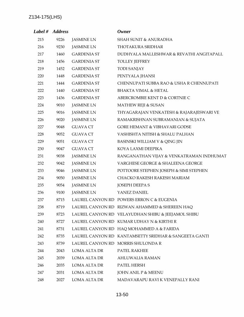
Z134-175(LHS)
13-50
Label # Address Owner 215 9226 JASMINE LN SHAH SUNIT & ANURADHA 216 9230 JASMINE LN THOTAKURA SRIDHAR 217 1460 GARDENIA ST DUDHYALA MALLESHWAR & REVATHI ANGITAPALL 218 1456 GARDENIA ST TOLLEY JEFFREY 219 1452 GARDENIA ST TODI SANJAY 220 1448 GARDENIA ST PENTYALA JHANSI 221 1444 GARDENIA ST CHENNUPATI SUBBA RAO & USHA R CHENNUPATI 222 1440 GARDENIA ST BHAKTA VIMAL & HETAL 223 1436 GARDENIA ST ABERCROMBIE KENT D & CORTNIE C 224 9010 JASMINE LN MATHEW REJI & SUSAN 225 9016 JASMINE LN THYAGARAJAN VENKATESH & RAJARAJESWARI VE 226 9020 JASMINE LN RAMAKRISHNAN SUBRAMANIAN & SUJATA 227 9048 GUAVA CT GORE HEMANT & VIBHAVARI GODSE 228 9052 GUAVA CT VASHISHTA NITISH & SHALU PALHAN 229 9051 GUAVA CT BASINSKI WILLIAM V & QING JIN 230 9047 GUAVA CT KOYA LAXMI DEEPIKA 231 9038 JASMINE LN RANGANATHAN VIJAY & VENKATRAMAN INDHUMAT 232 9042 JASMINE LN VARGHESE GEORGE & SHALEENA GEORGE 233 9046 JASMINE LN POTTOORE STEPHEN JOSEPH & SIMI STEPHEN 234 9050 JASMINE LN CHACKO RAKESH RAKESH MARIAM 235 9054 JASMINE LN JOSEPH DEEPA S 236 9100 JASMINE LN YANEZ DANIEL 237 8715 LAUREL CANYON RD POWERS ERRON C & EUGENIA 238 8719 LAUREL CANYON RD RIZWAN AHAMMED & SHEREEN HAQ 239 8723 LAUREL CANYON RD VELAYUDHAN SHIBU & JEEJAMOL SHIBU 240 8727 LAUREL CANYON RD KUMAR UDHAY N & KIRTHI R 241 8731 LAUREL CANYON RD HAQ MOHAMMED A & FARIDA 242 8735 LAUREL CANYON RD KANTAMSETTY SRIDHAR & SANGEETA GANTI 243 8739 LAUREL CANYON RD MORRIS SHULONDA R 244 2043 LOMA ALTA DR PATEL RAKHEE 245 2039 LOMA ALTA DR AHLUWALIA RAMAN 246 2035 LOMA ALTA DR PATEL HERSH 247 2031 LOMA ALTA DR JOHN ANIL P & MEENU 248 2027 LOMA ALTA DR MADAVARAPU RAVI K VENEPALLY RANI
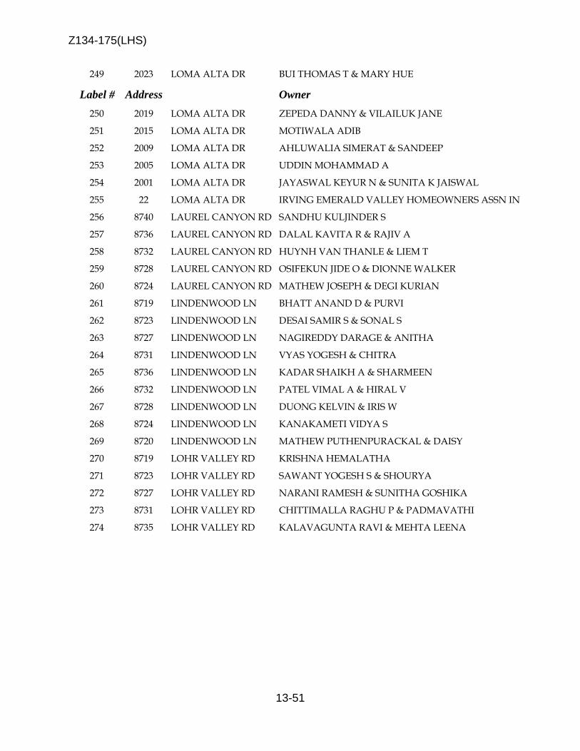
Z134-175(LHS)
13-51
249 2023 LOMA ALTA DR BUI THOMAS T & MARY HUE
Label # Address Owner 250 2019 LOMA ALTA DR ZEPEDA DANNY & VILAILUK JANE 251 2015 LOMA ALTA DR MOTIWALA ADIB 252 2009 LOMA ALTA DR AHLUWALIA SIMERAT & SANDEEP 253 2005 LOMA ALTA DR UDDIN MOHAMMAD A 254 2001 LOMA ALTA DR JAYASWAL KEYUR N & SUNITA K JAISWAL 255 22 LOMA ALTA DR IRVING EMERALD VALLEY HOMEOWNERS ASSN IN 256 8740 LAUREL CANYON RD SANDHU KULJINDER S 257 8736 LAUREL CANYON RD DALAL KAVITA R & RAJIV A 258 8732 LAUREL CANYON RD HUYNH VAN THANLE & LIEM T 259 8728 LAUREL CANYON RD OSIFEKUN JIDE O & DIONNE WALKER 260 8724 LAUREL CANYON RD MATHEW JOSEPH & DEGI KURIAN 261 8719 LINDENWOOD LN BHATT ANAND D & PURVI 262 8723 LINDENWOOD LN DESAI SAMIR S & SONAL S 263 8727 LINDENWOOD LN NAGIREDDY DARAGE & ANITHA 264 8731 LINDENWOOD LN VYAS YOGESH & CHITRA 265 8736 LINDENWOOD LN KADAR SHAIKH A & SHARMEEN 266 8732 LINDENWOOD LN PATEL VIMAL A & HIRAL V 267 8728 LINDENWOOD LN DUONG KELVIN & IRIS W 268 8724 LINDENWOOD LN KANAKAMETI VIDYA S 269 8720 LINDENWOOD LN MATHEW PUTHENPURACKAL & DAISY 270 8719 LOHR VALLEY RD KRISHNA HEMALATHA 271 8723 LOHR VALLEY RD SAWANT YOGESH S & SHOURYA 272 8727 LOHR VALLEY RD NARANI RAMESH & SUNITHA GOSHIKA 273 8731 LOHR VALLEY RD CHITTIMALLA RAGHU P & PADMAVATHI 274 8735 LOHR VALLEY RD KALAVAGUNTA RAVI & MEHTA LEENA

Z134-175(LHS)
13-52
5/20/2014
Label # Address Owner 275 8740 LOHR VALLEY RD VAIDYA DARPAN 276 8744 LOHR VALLEY RD TAYLOR SHARON 277 8726 LOHR VALLEY RD MALIK AKRAM M 278 8730 LOHR VALLEY RD HONG HYUNKI 279 8734 LOHR VALLEY RD IGNACIO OFELIA & STANLEY 280 8727 LOST CANYON RD THAMARAN LINEESH 281 8723 LOST CANYON RD PHATAK AMOL 282 8719 LOST CANYON RD SAVULGAY ANAND & SAVULGAY PUSHPA 283 8715 LOST CANYON RD MARAMRAJU SRINIVASRAO 284 8711 LOST CANYON RD MOGILI PRASAD & SWAPNA KARI 285 8707 LOST CANYON RD ANAND SUMIT & PUJA 286 8703 LOST CANYON RD RAMALINGAM VINOD 287 2255 LONGVIEW RD DUONG DUNG LE PHUONG & DUONG VICTOR 288 2251 LONGVIEW RD NERELLA ARVINDA S & MARISETTI RAMYA 289 2247 LONGVIEW RD VARDHINENI SRINIVASA & SWETHA 290 2243 LONGVIEW RD WON CARY 291 2239 LONGVIEW RD PATEL JAYESH 292 2235 LONGVIEW RD PEREIRA MELCHIADES 293 2231 LONGVIEW RD PATEL RAJKUMAR 294 2227 LONGVIEW RD DAKSHINAMURTHY RAVI & SWAMA RAVIKUMAR 295 2223 LONGVIEW RD VARANASI SOMANATH 296 2219 LONGVIEW RD WAHID MUHAMMAD 297 2215 LONGVIEW RD MISHRA SANJEEV & REKHA 298 2211 LONGVIEW RD CHO SUNJA & JOHN HWANG 299 2207 LONGVIEW RD KALLIDAIKURCHI RAMAKRISHNAN 300 2203 LONGVIEW RD SADEQ ABU 301 8728 LANDOVER PL SUGGS JAMES M & ROXANNE B 302 8728 LANDOVER PL SUGGS JAMES M & ROXANNE B SUGGS 303 8724 LANDOVER PL LALAPET RAGHAVAN & ARCHANA 304 8724 LANDOVER PL LALAPET RAGHAVAN & ARCHANA LALAPET 305 8720 LANDOVER PL SANGHAVI CHANDRESH K
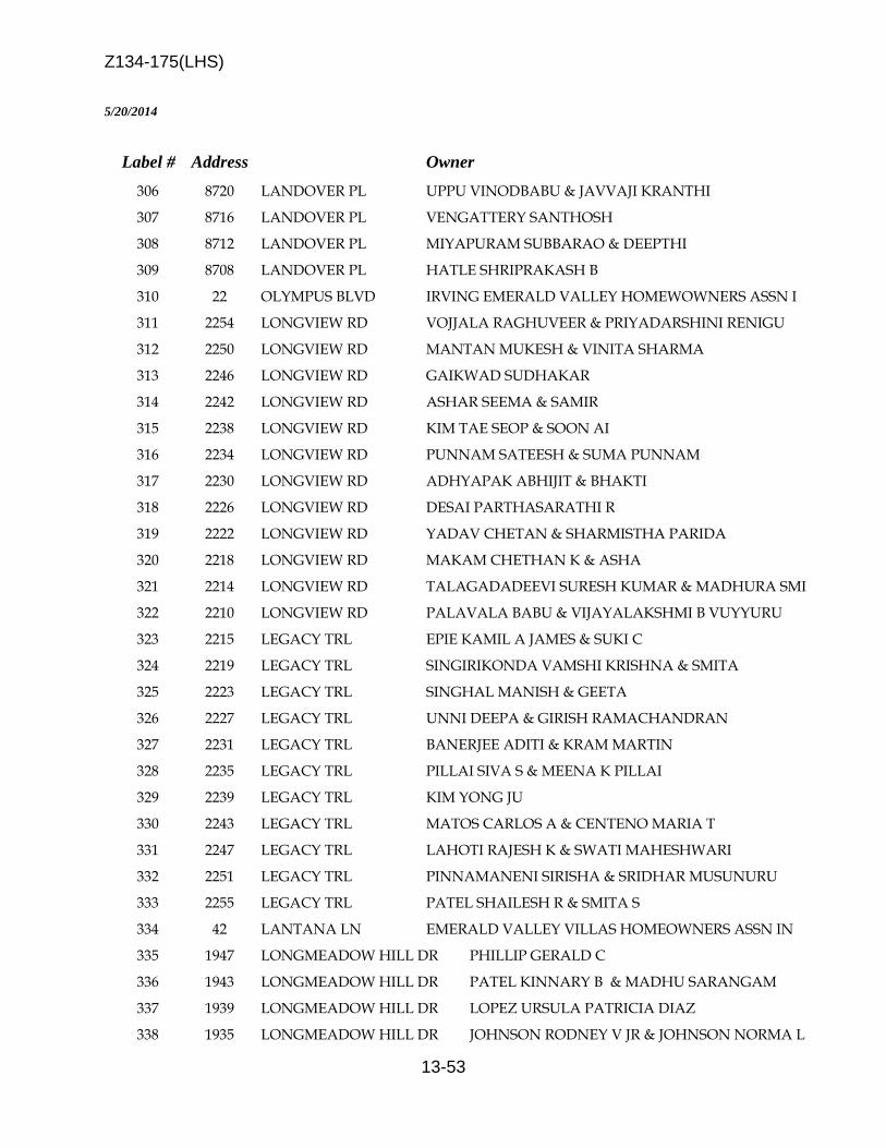
Z134-175(LHS)
13-53
5/20/2014
Label # Address Owner 306 8720 LANDOVER PL UPPU VINODBABU & JAVVAJI KRANTHI 307 8716 LANDOVER PL VENGATTERY SANTHOSH 308 8712 LANDOVER PL MIYAPURAM SUBBARAO & DEEPTHI 309 8708 LANDOVER PL HATLE SHRIPRAKASH B 310 22 OLYMPUS BLVD IRVING EMERALD VALLEY HOMEWOWNERS ASSN I 311 2254 LONGVIEW RD VOJJALA RAGHUVEER & PRIYADARSHINI RENIGU 312 2250 LONGVIEW RD MANTAN MUKESH & VINITA SHARMA 313 2246 LONGVIEW RD GAIKWAD SUDHAKAR 314 2242 LONGVIEW RD ASHAR SEEMA & SAMIR 315 2238 LONGVIEW RD KIM TAE SEOP & SOON AI 316 2234 LONGVIEW RD PUNNAM SATEESH & SUMA PUNNAM 317 2230 LONGVIEW RD ADHYAPAK ABHIJIT & BHAKTI 318 2226 LONGVIEW RD DESAI PARTHASARATHI R 319 2222 LONGVIEW RD YADAV CHETAN & SHARMISTHA PARIDA 320 2218 LONGVIEW RD MAKAM CHETHAN K & ASHA 321 2214 LONGVIEW RD TALAGADADEEVI SURESH KUMAR & MADHURA SMI 322 2210 LONGVIEW RD PALAVALA BABU & VIJAYALAKSHMI B VUYYURU 323 2215 LEGACY TRL EPIE KAMIL A JAMES & SUKI C 324 2219 LEGACY TRL SINGIRIKONDA VAMSHI KRISHNA & SMITA 325 2223 LEGACY TRL SINGHAL MANISH & GEETA 326 2227 LEGACY TRL UNNI DEEPA & GIRISH RAMACHANDRAN 327 2231 LEGACY TRL BANERJEE ADITI & KRAM MARTIN 328 2235 LEGACY TRL PILLAI SIVA S & MEENA K PILLAI 329 2239 LEGACY TRL KIM YONG JU 330 2243 LEGACY TRL MATOS CARLOS A & CENTENO MARIA T 331 2247 LEGACY TRL LAHOTI RAJESH K & SWATI MAHESHWARI 332 2251 LEGACY TRL PINNAMANENI SIRISHA & SRIDHAR MUSUNURU 333 2255 LEGACY TRL PATEL SHAILESH R & SMITA S 334 42 LANTANA LN EMERALD VALLEY VILLAS HOMEOWNERS ASSN IN 335 1947 LONGMEADOW HILL DR PHILLIP GERALD C 336 1943 LONGMEADOW HILL DR PATEL KINNARY B & MADHU SARANGAM 337 1939 LONGMEADOW HILL DR LOPEZ URSULA PATRICIA DIAZ 338 1935 LONGMEADOW HILL DR JOHNSON RODNEY V JR & JOHNSON NORMA L
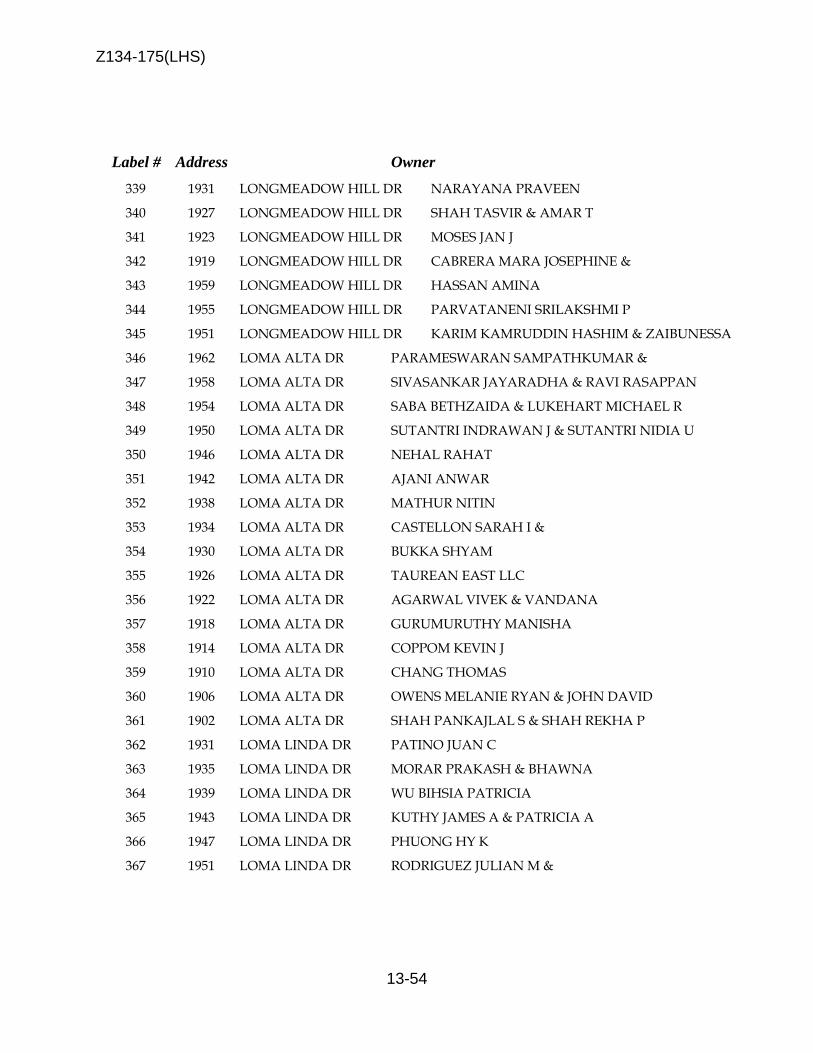
Z134-175(LHS)
13-54
Label # Address Owner 339 1931 LONGMEADOW HILL DR NARAYANA PRAVEEN 340 1927 LONGMEADOW HILL DR SHAH TASVIR & AMAR T 341 1923 LONGMEADOW HILL DR MOSES JAN J 342 1919 LONGMEADOW HILL DR CABRERA MARA JOSEPHINE & 343 1959 LONGMEADOW HILL DR HASSAN AMINA 344 1955 LONGMEADOW HILL DR PARVATANENI SRILAKSHMI P 345 1951 LONGMEADOW HILL DR KARIM KAMRUDDIN HASHIM & ZAIBUNESSA 346 1962 LOMA ALTA DR PARAMESWARAN SAMPATHKUMAR & 347 1958 LOMA ALTA DR SIVASANKAR JAYARADHA & RAVI RASAPPAN 348 1954 LOMA ALTA DR SABA BETHZAIDA & LUKEHART MICHAEL R 349 1950 LOMA ALTA DR SUTANTRI INDRAWAN J & SUTANTRI NIDIA U 350 1946 LOMA ALTA DR NEHAL RAHAT 351 1942 LOMA ALTA DR AJANI ANWAR 352 1938 LOMA ALTA DR MATHUR NITIN 353 1934 LOMA ALTA DR CASTELLON SARAH I & 354 1930 LOMA ALTA DR BUKKA SHYAM 355 1926 LOMA ALTA DR TAUREAN EAST LLC 356 1922 LOMA ALTA DR AGARWAL VIVEK & VANDANA 357 1918 LOMA ALTA DR GURUMURUTHY MANISHA 358 1914 LOMA ALTA DR COPPOM KEVIN J 359 1910 LOMA ALTA DR CHANG THOMAS 360 1906 LOMA ALTA DR OWENS MELANIE RYAN & JOHN DAVID 361 1902 LOMA ALTA DR SHAH PANKAJLAL S & SHAH REKHA P 362 1931 LOMA LINDA DR PATINO JUAN C 363 1935 LOMA LINDA DR MORAR PRAKASH & BHAWNA 364 1939 LOMA LINDA DR WU BIHSIA PATRICIA 365 1943 LOMA LINDA DR KUTHY JAMES A & PATRICIA A 366 1947 LOMA LINDA DR PHUONG HY K 367 1951 LOMA LINDA DR RODRIGUEZ JULIAN M &

Z134-175(LHS)
13-55
5/20/2014
Label # Address Owner 368 1955 LOMA LINDA DR SILVA ELMER & LIHUEY 369 1959 LOMA LINDA DR VARGAS FREDERICO 370 1963 LOMA LINDA DR SAYA SAUD Y 371 8776 IRON HORSE DR ASMUSSEN CRISTI SANCHEZ 372 8772 IRON HORSE DR HRNCIR TAYLOR L 373 8768 IRON HORSE DR KHALIL MUHAMMAD S & 374 8764 IRON HORSE DR BOEALIAH ADAKOU ELLA LAWSON & 375 8760 IRON HORSE DR KIM HO 376 8756 IRON HORSE DR MCHARGUE CHUCK L & MCHARGUE BARBARA J 377 8752 IRON HORSE DR RHA SUN A 378 8748 IRON HORSE DR PATEL ROOTVIK & PATEL NEHA 379 8744 IRON HORSE DR CARPENTER SANDRA D 380 8740 IRON HORSE DR ESKRIDGE MARILYN 381 8732 IRON HORSE DR SONG JOHN J 382 8728 IRON HORSE DR BROWN LESVIA 383 2443 NEWCASTLE BND RIZVI SAYEED HASAN & SAMIN ISLAM 384 2439 NEWCASTLE BND SHIVASHANKAR HARSHA & SHRUTHI SATYANARAY 385 2435 NEWCASTLE BND GEORGE MANJU & DIAS KURIAN 386 2431 NEWCASTLE BND SHAH MITULKUMAR K & BIJAL M 387 2427 NEWCASTLE BND DANDU RAJU & LAKSHMI 388 2423 NEWCASTLE BND VARGHESE SHINEY & VINOJ M THOMAS 389 2419 NEWCASTLE BND KAMTAM RAVINDRA L 390 2415 NEWCASTLE BND RAJPUT DHRUV 391 2409 NEWCASTLE BND BOPPANA SRINIVAS 392 2405 NEWCASTLE BND ARUMALLA PRADEEP 393 2401 NEWCASTLE BND KUMAR ARUN & PUSHPA 394 8722 NEWCASTLE BND MOHITE MAHESH & CHANDANA M 395 8718 NEWCASTLE BND GEORGE JOHNSON S 396 8714 NEWCASTLE BND RAMANATHAN KANNAN C 397 8710 NEWCASTLE BND KOKALA NARENDER & MADHAVI 398 8620 NEWCASTLE BND JAGTAP AJIT P
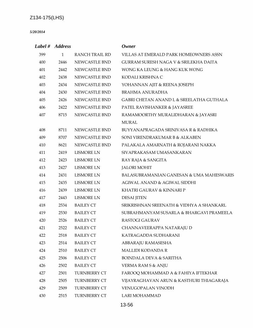
Z134-175(LHS)
13-56
5/20/2014
Label # Address Owner 399 1 RANCH TRAIL RD VILLAS AT EMERALD PARK HOMEOWNERS ASSN 400 2446 NEWCASTLE BND GURRAM SURESH NAGA V & SRILEKHA DAITA 401 2442 NEWCASTLE BND WONG KA LEUNG & HANG KUK WONG 402 2438 NEWCASTLE BND KODALI KRISHNA C 403 2434 NEWCASTLE BND YOHANNAN AJIT & REENA JOSEPH 404 2430 NEWCASTLE BND BRAHMA ANURADHA 405 2426 NEWCASTLE BND GABRI CHETAN ANAND L & SREELATHA GUTHALA 406 2422 NEWCASTLE BND PATEL RAVISHANKER & JAYASREE 407 8715 NEWCASTLE BND RAMAMOORTHY MURALIDHARAN & JAYASRI
MURAL 408 8711 NEWCASTLE BND BUYYANAPRAGADA SRINIVASA R & RADHIKA 409 8707 NEWCASTLE BND SONI VIRENDRAKUMAR B & ALKABEN 410 8621 NEWCASTLE BND PALAKALA AMARNATH & ROJARANI NAKKA 411 2419 LISMORE LN SIVAPRAKASAM UMASANKARAN 412 2423 LISMORE LN RAY RAJA & SANGITA 413 2427 LISMORE LN JALORI MOHIT 414 2431 LISMORE LN BALASUBRAMANIAN GANESAN & UMA MAHESWARIS 415 2435 LISMORE LN AGIWAL ANAND & AGIWAL SIDDHI 416 2439 LISMORE LN KHATRI GAURAV & KINNARI P 417 2443 LISMORE LN DESAI JITEN 418 2534 BAILEY CT SRIKRISHNAN SREENATH & VIDHYA A SHANKARL 419 2530 BAILEY CT SUBRAHMANYAM SUSARLA & BHARGAVI PRAMEELA 420 2526 BAILEY CT RASTOGI GAURAV 421 2522 BAILEY CT CHANNAVEERAPPA NATARAJU D 422 2518 BAILEY CT KATRAGADDA SUDHARANI 423 2514 BAILEY CT ABBARAJU RAMASESHA 424 2510 BAILEY CT MALLIDI KODANDA R 425 2506 BAILEY CT BOINDALA DEVA & SARITHA 426 2502 BAILEY CT VERMA RAM S & ANJU 427 2501 TURNBERRY CT FAROOQ MOHAMMAD A & FAHIYA IFTEKHAR 428 2505 TURNBERRY CT VIJAYRAGHAVAN ARUN & KASTHURI THIAGARAJA 429 2509 TURNBERRY CT VENUGOPALAN VINODH 430 2515 TURNBERRY CT LARI MOHAMMAD

Z134-175(LHS)
13-57
431 2519 TURNBERRY CT YADAVALLI NATARAJ & MADHAVI
Label # Address Owner 432 2523 TURNBERRY CT SHAH HITEN J & RACHANA K 433 2527 TURNBERRY CT MAHAJAN ASHISH 434 2531 TURNBERRY CT TATIPAMULA VIDYADHAR & SREERAMA 435 2535 TURNBERRY CT VENKATESWARAN SRINIVASAN & RAJALAKSHMI 436 2539 TURNBERRY CT PARNAPALLI UMAMAHESWARA & VANI 437 2543 TURNBERRY CT KATTA SRIDEVI 438 2551 TURNBERRY CT AKASAPU LAKSHMANA RAO 439 2555 TURNBERRY CT QUADRI SYED GHULAM ARIF 440 2559 TURNBERRY CT HARINARTHINI SIRISHA 441 2563 TURNBERRY CT HITEN PATEL 442 2560 TURNBERRY CT SINGH PREM & PARMINDER KAUR 443 2556 TURNBERRY CT SANAGALA SIVANAGI R 444 2552 TURNBERRY CT CHITAGI NEELESH 445 2544 TURNBERRY CT BALAN MOHANA SUNDAR 446 2540 TURNBERRY CT GHANTA SRINIVASA R 447 2536 TURNBERRY CT KUMAR EESHA & RENUKA 448 2532 TURNBERRY CT PAULRAJ SELVAKUMAR 449 2528 TURNBERRY CT LINGINENI SURESH KUMAR 450 400 DIVIDEND DR DUKE REALTY LTD PS % JEANNE COYLE 451 6 MACARTHUR BLVD TEXAS UTILITIES ELEC CO % STATE & LOCAL 452 413 BELT LINE RD SHAMS REAL ESTATE PTRS STE 240
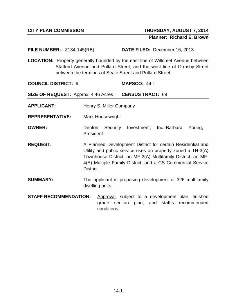
14-1
CITY PLAN COMMISSION THURSDAY, AUGUST 7, 2014 Planner: Richard E. Brown
FILE NUMBER: Z134-145(RB) DATE FILED: December 16, 2013
LOCATION: Property generally bounded by the east line of Willomet Avenue between Stafford Avenue and Pollard Street, and the west line of Ormsby Street between the terminus of Seale Street and Pollard Street
COUNCIL DISTRICT: 6 MAPSCO: 44 T
SIZE OF REQUEST: Approx. 4.46 Acres CENSUS TRACT: 69
APPLICANT: Henry S. Miller Company
REPRESENTATIVE: Mark Housewright
OWNER: Denton Security Investment, Inc.-Barbara Young, President
REQUEST: A Planned Development District for certain Residential and Utility and public service uses on property zoned a TH-3(A) Townhouse District, an MF-2(A) Multifamily District, an MF-4(A) Multiple Family District, and a CS Commercial Service District.
SUMMARY: The applicant is proposing development of 326 multifamily dwelling units.
STAFF RECOMMENDATION: Approval, subject to a development plan, finished grade section plan, and staff’s recommended conditions.
Z134-145(RB)
14-2
GUIDING CRITERIA FOR RECOMMENDATION:
Staff recommends approval subject to the attached development plan, finished grade section plan, and staff’s recommended conditions based upon:
1. Performance impacts upon surrounding property – As development will provide for multifamily dwelling units across the site, subject to staff’s recommended conditions, increase in structure height can be managed in context with the proposed massing of buildings.
2. Traffic impact – The submitted Traffic Impact Analysis has been reviewed by engineering staff and found to be managed by existing street network.
3. Comprehensive Plan or Area Plan Conformance – The request is in compliance with the designated Building Block for the area.
4. Subject to staff’s recommended conditions, the request maintains the vision for new development along and adjacent to Ft. Worth Avenue while ensuring a scale of development that respects the built environment.
BACKGROUND:
• The request site is predominately undeveloped with a small number of parcels developed with single family uses. One lot developed with a single family use along the Willomet Avenue frontage is not part of the zoning request.
• The applicant proposes to redevelop the site with multifamily uses.
• A PDD is being requested for consideration of the following: 1) reduced setbacks; 2) certain improvements encroaching into a required setback; 3) increase in structure height; 4) lack of compliance with the residential proximity slope; 5) increase in lot coverage; 6) alternative landscape regulations; and, 7) alternative tree mitigation. Zoning History: File No. Request, Disposition, and Date 1. Z134-286 PDD for Single family uses. Pending a
CPC public hearing.
Z134-145(RB)
14-3
Thoroughfare/Street Existing & Proposed ROW
Ft. Worth Avenue Principal Arterial; 100’ & 100’ ROW
Willomet Avenue Local; Variable Width (25’-50’) ROW
Stafford Avenue Local; 40’ ROW
Seale Street Local; 50’ ROW
Pollard Street Local; 60’ ROW
Conklin Street Local; 40’ ROW
Ormsby Street Local; 50’ ROW
Traffic: The Engineering Section of the Building Inspection Division of the Department of Sustainable Development and Construction has reviewed the requested PDD in conjunction with the required Traffic Impact Analysis and determined that the proposed development will not significantly impact the street system.
STAFF ANALYSIS: Comprehensive Plan: The request site is located in an area considered a Residential Neighborhood. This Building Block represents the life-blood of Dallas, the traditional neighborhood of single-family detached homes. Dallas has many neighborhoods that match this description, including Winnetka Heights, Preston Hollow, Lakewood and Wheatley Place. Single-family dwellings are the dominate land use in these areas. Some shops, restaurants or institutional land uses such as schools and religious centers that serve neighborhood residents may be located at the edges or at key intersections.
GOAL 1.2 Promote desired development. Policy 1.2.1 Use Vision Building Blocks as a general guide for desired
development patterns.
Land Use Compatibility: The site is predominately undeveloped but does include some parcels developed with single family uses. The site possesses significant topography, providing for unobstructed views of the city from various points on the site. It should be noted a parcel developed with a single family use along the east line of Willomet Avenue north of Stafford Avenue remains outside of the request area at this time.

Z134-145(RB)
14-4
The site is located approximately 940 feet north of Ft. Worth Avenue. This area has benefitted from recent private investment, with public improvements being provided in an effort to address current and future development trends. Examples of new development capture the Sylvan/30 mixed use project in the southeast quadrant of Ft. Worth Avenue and Sylvan Avenue and a zoning change abutting Sylvan/30 (250 dwelling units and 10,000 square feet of floor area for retail uses). Improvements in public infrastructure (roadway improvements, mid-block traffic signal, bike lanes) will benefit the area within this portion of the city. The applicant’s four and one-half acre parcel possesses four zoning districts:
o TH-3(A) District (wraps a leave-out parcel developed with a single family structure)-1.02 acres
o MF-2(A) District-28,153 square feet o MF-4(A) District-2.26 acres o CS District-23,160 square feet.
The following table is provided for reference as a comparison of development rights for a multifamily project. As the TH-3(A) District and CS District do not permit multifamily uses, they are excluded from this analysis:
PROVISION MF-2(A) (existing)
MF-4(A) (existing)
PROPOSED
LAND AREA 28,153 SF 2.26 ACRES 4.47 ACRES
F/S/R SETBACKS
15’/10’/15’ 35’/30’/30’* WILLOMET-25’; OTHER PERIMETER, 5’ AND 10’
DENSITY
NO MAXIMUM**
160 DU/ACRE ** 326 DWELLING UNITS
HEIGHT
36’ PLUS RPS @26’** 240’ PLUS RPS @26’** 44’-100’; NO RPS
STORIES
NO MAXIMUM NO MAXIMUM VARIES, BUT MAX. OF 12’ 6” FLOOR TO FLOOR HEIGHT
LOT COVERAGE
60% 80% 65% ENTIRE SITE- NO MAX FOR ANY SUBAREA
*ASSUMES DEVELOPMENT TRIGGERS URBAN FORM AND TOWER SPACING **RPS WILL IMPACT FINAL DEVELOPMENT (HEIGHT AND DENSITY)
Z134-145(RB)
14-5
The land area assembled for this request is surrounded by low density single family uses, a few undeveloped parcels zoned for R-7.5(A) District Uses (west of the site), as well as supporting institutional uses (Stafford Park, church) to the west/southwest across Willomet Avenue. The area north/northeast of the site is developed with various commercial and industrial uses, predominately fronting along both sides of Commerce Street. Eastward, the site is adjacent to undeveloped parcels zoned for CS District Uses (northern half of the property) and the Subdistrict 2 portion of PDD No. 732 which is partially developed with single family uses. It is also relevant to acknowledge a recently submitted request for an approximate five acre parcel envisioned for a higher-density (than permitted by existing zoning rights) single family residential project west of the site (see Zoning History). Certain development rights provide for 30 foot and 38 foot height zones and a minimum of 2,000 square foot lots for single family uses (maximum density not provided for in submitted materials). This application is representative of continued recent interest in developing/redeveloping parts of Oak Cliff, often providing for increased densities in and around single family neighborhoods. A planned development district is a marriage of uses and development standards that provides for flexibility of development that is sensitive to adjacent uses as well as preserving significant natural features. As has been discussed herein, the unique topography, along with the significant collection of mature trees across the site, creates challenges for development. Staff’s focus has been to manage a balance in assessing the requested increase in development rights to that of preserving natural features possessed within this approximate four and one-half acre perimeter. As the site is not in the escarpment or geological similar area (where protections are afforded to ensure development remains secondary to the environment), staff will be recommending requirements to mirror such responsibilities. A recommendation is being made to ensure the proposed development will mirror what is being presented (finished grade section plan), which will capture the uniqueness of the existing topography while complying with the focus of a PDD as a zoning tool. The attached recommended provisions will retain flexibility empowered to the building official that permits consideration of a deviation to anticipated grading of the site, due to environmental and engineering issues. As noted, the site’s topography provides for significant views in all directions. To provide a sense of the grade change across the property, Subarea B (northern half of the site) possesses an approximate 70 foot change of grade, from a high point along Willomet Avenue/Seale Street to Ormsby Street/Pollard Street (southwest to northeast). Subarea A, while less ‘dramatic’, does enjoy similar movements, possessing an
Z134-145(RB)
14-6
approximate 30 foot change of grade along the northern line of this subarea, from a high point along Willomet Avenue/Seale Street eastward. Along its southern line, an approximate eighteen foot drop in grade, west to east, then rising approximately eight feet to the subarea’s southeast corner exists. To put this into perspective, the following represents what one might see at street level related to anticipated elevations of the new construction (based on applicant’s submitted plans; noted dimensions are approximate):
Subarea A- 25 feet (at 10 foot setback) along Willomet Avenue b/t Seale Street and Stafford Avenue; 25 feet and 38 feet (at 10 foot setback) along Stafford Street, east of Willomet Avenue; and, 25 feet (at 10 foot setback) along the east line b/t Seale Street and Stafford Avenue. Subarea B- 25 feet (at 25’ setback), 50 feet and 63 feet (at 35 foot setback) along Willomet Avenue between Seale Street and Pollard Street; 75 feet and 88 feet along Seale Street, 70 feet west of Ormsby Street; and, 38 feet and 88 feet (at 10 foot setback) along Ormsby Street north of Seale Street.
While staff is supportive of the proposed development, the scale of the project is a concern in relation to the low density residential community that borders much of the site. The massing of the proposed development, exclusive of additional perimeter setbacks normally required but not provided, can have an imposing effect on adjacent residential areas. As a result of the effort to accommodate the requested density and massing of the project, staff is recommending an alternative structure height for the western portion of Subarea B; specifically extending the two story maximum structure height from a minimum setback of 35 feet to 110 feet. This will capture the four and five story structures (Building Nos. B-1 and B-2) that wrap the private open space area facing Willomet Avenue. This recommendation will ensure the transition from the single family adjacency on the ‘high side’ of the applicant’s property to that of the applicant’s development will be less impactful in terms of vertical encroachment. Urban Design: The applicant will be providing certain design criteria, inclusive of a minimum of 65 percent of the ground level/street facing dwelling units having direct

Z134-145(RB)
14-7
access to the street. Required pedestrian amenities, along with wide sidewalks (seven foot and 12 foot unobstructed sections), will ensure the development opens up to the residential character of the area, thereby encouraging infrastructure that permits a seamless interaction amongst owners and tenants typically found in low density residential areas. The wide sidewalks will ultimately facilitate anticipated increased foot traffic that will facilitate connectivity to the trail system.
Landscaping: The site, exclusive of the few residential dwellings, possesses significant native vegetation. The applicant’s landscape architect has been working with the chief arborist to address not only tree mitigation but methods to address how to provide the new plantings and other landscape materials in and around the new development.
Efforts have been expended to establish a vision for a landscape plan for the development that is sensitive to its perimeter. In conjunction with the required design standards, the street level presence of the development will provide for interaction with the surrounding residential community. Additionally, specific provisions are made for the development interacting with Stafford Park as well as providing for a future trail connection from the site.
The following represents a summary of anticipated preservation/mitigation for the site:
1. Protected inches originally removed from the site 1,377 2. Inches saved by the redesigned corner feature -145 3. Mitigation reduction due to the 1:1 preservation credit -167 3. Revised mitigation (inches) 1,065 4. Maximum caliper inches installed on-site -800 5. Balance 265 6. Maximum caliper inches installed at Stafford Park -78 7. Balance (18% of total caliper inches) 187
The site poses multiple challenges (anticipated development, slope, and subsurface conditions) as the applicant approaches required mitigation. The applicant and the chief arborist have agreed upon defined mitigation regulations, with a preference to provide as many plantings on the property and within the parkway, subject to licensing requirements. The identification of donor sites within close proximity to the site will facilitate off-site mitigation options, similar to the approach taken with the old Timbercreek Apartment site redevelopment (Northwest Highway/Skillman Street). Representatives of five of the six donor sites (excludes Continental Street Bridge and Landing) have been in discussions with the applicant to identify acceptance of new plantings.
Off-Street Parking: The applicant will be providing required parking on site, with
Z134-145(RB)
14-8
excess parking along all street frontages, exclusive of Willomet Avenue, Pollard Street, and Conklin Street. Tandem parking and a more restrictive percentage permitted for compact spaces has been proposed and supported. Lastly, on street parking (prohibited from meeting required parking) will be subject to approval of the Streets Services Section of Public Works and Transportation.
Z134-145(RB)
14-9
APPLICANT REQUESTED/STAFF RECOMMENDED CONDITIONS
ARTICLE ____
PD _____ SEC. 51P- .101. LEGISLATIVE HISTORY. PD was established by Ordinance No. , passed by the Dallas City Council on 2014. SEC. 51P- .102. PROPERTY LOCATION AND SIZE. PD is established on property generally bounded by the east line of Willomet Avenue between Stafford Avenue and Pollard Street, and the west line of Ormsby Street between the terminus of Seale Street and Pollard Street. The size of PD is approximately 4.46 acres. SEC. 51P-___.103. DEFINITIONS AND INTERPRETATIONS (a) Unless otherwise stated, all references to articles, divisions, or sections in this article are to articles, divisions, or sections in Chapter 51A. In this district,
(1) BLADE SIGN means a sign projecting perpendicularly from a main building façade, visible from both sides, and made of rigid or soft materials
(2) STOOP means a small porch leading to the entrance of a residence.
(3) TANDEM PARKING means one parking space in front of another
parking space, making it necessary to pass through one parking space to gain vehicular access to the other parking space.
(4) This district is considered to be a residential zoning district. SEC. 51P- .104. EXHIBITS.
The following exhibits are incorporated into this article:
Z134-145(RB)
14-10
(a) Exhibit ____ : Development Plan. (b) Exhibit _____: Existing Site Topography Survey. (c) Exhibit _____: Finished Grade Section Plan. SEC. 51P-___.105. DEVELOPMENT PLAN
(a) Except as provided in this section, a development plan must be approved by the city plan commission before the issuance of any building permit to authorize work in this district. If there is conflict between the text of this article and the development plan, the text of this article controls.
(b) Development plans may be submitted in phases or for a portion of any
part of the Property. SEC. 51P___.106. MAIN USES PERMITTED. The following uses are the only main uses permitted:
(a) Residential uses. -- Single family -- Multifamily. -- Handicapped group dwelling unit (b) Utility and public service uses.
-- Local utilities. -- Tower/antenna for cellular communication, limited to a Mounted
cellular antenna. SEC. 51P-___.107. ACCESSORY USES (a) As a general rule, an accessory use is permitted in any district in which the main use is permitted. Some specific accessory uses, however, due to their unique nature, are subject to additional regulations in Section 51A-4.217. For more information regarding accessory uses, consult Section 51A-4.217. (b) The following accessory uses are not permitted in this district:
-- Accessory outside display of merchandise. -- Accessory outside sale -- Accessory pathological waste incinerator.
Z134-145(RB)
14-11
(c) In this district, the following accessory uses are permitted by SUP only:
-- Accessory helistop. -- Amateur communication tower
SEC. 51P- .108. YARD, LOT, AND SPACE REGULATIONS. (Note: The yard, lot, and space regulations in this section must be read together with the yard, lot, and space regulations in Division 51A-4.400. If there is a conflict between this section and Division 51A-4.400, this section controls.) (a) In general. Except as provided in this section, the yard, lot, and space regulations for the MF-3(A) Multiple Family District apply. (b) Front yard. Except as provided in this subsection, minimum front yard is ten feet.
(1) Minimum setback on Conklin Street is five feet. (2) Minimum setback on Willomet Avenue is 25 feet.
(3) Balconies, bay windows, awnings, signs, and entryways affixed to
the building or part of the foundation may project up to five feet into required yards with a minimum of eight feet of clearance above the sidewalk.
(4) Stoops, steps, patios, stairs, planters, retaining walls, transformers
and other utility equipment, benches, pots, raised planters, sculptures, cabanas and other decorative landscape items may be located within the required setback with no projection limitation.
(5) Fences in a required front yard must be a minimum of 25 percent
open area for a street facing fence section may encroach into a required yard. (6) Urban form setback and tower spacing do not apply to this district. (7) The minimum front yard setbacks provided in this subsection may
not be extended by more than ten feet through the minor amendment process. For purposes of this subsection, the original development plan is the __, 2014 City Council approved development plan. (c) Density. Maximum number of dwelling units is 326.

Z134-145(RB)
14-12
(d) Height.
(1) Except as provided in this subsection, maximum structure height is 100 feet.
(2) Subarea A.
(A) Building A-1. Maximum structure height is 44 feet. (B) Building A-2. Maximum structure height is 36 feet. (C) Building A-3. Maximum structure height is 48 feet. (D) Building A-4. Maximum structure height is 36 feet. (E) Building A-5. Maximum structure height is 38 feet. (F) Parking A-1. Maximum structure height is 48 feet.
(3) Subarea B.
(A) Building B-1. Maximum structure height is 90 feet. (B) Building B-1A. Maximum structure height is 55 feet. (C) Building B-2. Maximum structure height is 90 feet. (D) Building B-2A. Maximum structure height is 66 feet. (E) Building B-3. Maximum structure height is 100 feet. (F) Building B-4. Maximum structure height is 95 feet. (C) Building B-5. Maximum structure height is 95 feet. (D) Building B-6. Maximum structure height is 85 feet. (E) Building B-7. Maximum structure height is 100 feet. (F) Building B-8. Maximum structure height is 12 feet. (G) Parking B-1. Maximum structure height is 85 feet.
(4) The maximum floor-to-floor height per story as indicated on the
development plan is 12 feet, six inches.
(5) The following may project up to 12 feet above the maximum height when setback a minimum of 25 feet from any building edge:
(A) Elevator penthouse or bulkhead. (B) Mechanical equipment room(s). (C) Cooling tower. (D) Tank designed to hold liquids. (E) Ornamental cupola or dome. (F) Skylights. (G) Observation deck. (H) Clerestory. (I) Visual screens which surround roof mounted mechanical
equipment. (J) Chimney and vent stacks. (K) Stair penthouse.

Z134-145(RB)
14-13
(6) Parapet walls limited may project six feet above the maximum height when setback a minimum 25 feet from any building edge.
(7) The residential proximity slope does not apply to this district.
(f) Stories.
(1) Except as provided in this subsection, maximum number of stories is eight.
(2) Subarea A.
(A) Building A-1. Maximum number of stories is two. (B) Building A-2. Maximum number of stories is three. (C) Building A-3. Maximum number of stories is two. (D) Building A-4. Maximum number of stories is two above one
story of off-street parking. (E) Building A-5. Maximum number of stories is one above one
story of off-street parking. (F) Building A-6. Maximum number of stories is two.
(3) Subarea B. Applicant requested:
(A) Building B-1. Maximum number of stories is five. (B) Building B-1A. Maximum number of stories is two.
Staff recommended:
(A) Building B-1. Maximum number of stories is two. (B) Building B-1A. Maximum number of stories is two.
Applicant requested:
(C) Building B-2. Maximum number of stories is four. (D) Building B-2A. Maximum number of stories is two.
Staff recommended: (C) Building B-2. Maximum number of stories is two. (D) Building B-2A. Maximum number of stories is two.
(E) Building B-3. Maximum number of stories is seven. (F) Building B-4. Maximum number of stories is seven. (C) Building B-5. Maximum number of stories is seven. (D) Building B-6. Maximum number of stories is six. (E) Building B-7. Maximum number of stories is seven. (F) Building B-8. Maximum number of stories is three. (G) Parking B-1. Maximum number of stories is eight.

Z134-145(RB)
14-14
(4) For purposes of this subsection, the stair penthouse for Building A-6 stair is not considered a story, but must comply with section 51P-__.108(d)(5).
Applicant requested: (g) Lot coverage.
(1) Except as provided in this section, maximum coverage is 65
percent. (2) No maximum coverage for any subarea.
(3) Aboveground parking structures are included in lot coverage
calculations; surface parking lots and underground structures are not.
Staff recommended: (g) Lot coverage.
(1) Except as provided in this section, maximum coverage is 65 percent.
(2) Maximum lot coverage for Subarea A is 35 percent. (3) Maximum lot coverage for Subarea B is 75 percent. (4) Aboveground parking structures are included in lot coverage
calculations; surface parking lots and underground structures are not.
Staff recommended: (h) Lot size.
(1) For single family, minimum lot size is 4,000 square feet. (2) For handicapped group dwelling unit, minimum lot size is 3,000
square feet. (2) For all other permitted uses, no minimum lot size.
SEC. 51P- .109. OFF-STREET PARKING
(a) In general. Except as provided in this section, consult the use regulations in Division 51A-4.200 for the specific off-street parking and loading requirements for each use.
(b) The use of tandem parking is permitted for residents only.
(c) A maximum of 25 percent compact parking is allowed. (d) Except as provided in this subparagraph, all off-street surface parking
spaces must be screened from view from the street by buildings.
Z134-145(RB)
14-15
(1) In Subarea A, a solid faced vehicular access gate accessed from Stafford Avenue may also be used to screen surface parking.
(2) Off-street parallel parking accessed from private drives is exempted
from this screening requirement.
(e) On street parking must be approved by the Streets Section of Public Works and Transportation and cannot be counted as required parking. SEC. 51P-___.110. ENVIRONMENTAL PERFORMANCE STANDARDS.
See Article VI.
SEC. 51P-___.111. PRESERVATION OF SIGNIFICANT NATURAL FEATURES.
Staff recommended:
(a) Except as provided in this section, finished grade for each subarea must comply with the Finished Grade Section Plan (exhibit ___C).
(b) The building official may deviate from any respective finished grade
elevation, subject to engineering and/or environmental issues identified during a grading plan review. SEC. 51P-___.112. LANDSCAPING
(a) In general. Except as provided in this section, landscaping must be provided in accordance with Article X.
(1) Street trees.
(A) A large tree must be provided for each thirty feet of frontage, with a minimum of two trees planted per frontage.
(B) To the extent possible, street trees should be spaced thirty
feet apart, but where necessary, street trees must be spaced no more than sixty feet from another required street tree and no less than twenty (feet from another required tree per frontage.
(C) Large trees must be located within twelve feet of the
projected street curb where no parallel parking is provided and within twenty feet of the projected street curb where parallel parking is provided.
(D) Subject to obtaining a private license, trees may be located
in the parkway. For the purposes of this paragraph, “projected street curb” means the

Z134-145(RB)
14-16
future location of the street curb consistent with the city thoroughfare plan as determined by the Director of Public Works and transportation.
(2) Site Trees. Subject to obtaining a private license, trees planted in
the parkway may be counted as site trees.
(3) Height and caliper. All trees must have a minimum height of eight feet and a minimum caliper of three and one-half inches, measured at a point twelve inches above the root ball.
(4) Approval in phases. Landscaping may be completed in phases on
a lot. Each phase for completion must be indicated on the landscape plan for construction.
(5) Water Detention. Where possible, landscape open space will be
contoured so that storm water is detained for a short duration to increase the ground water absorption and remove suspended solids.
(6) Tree mitigation. Except as provided in this section, tree
mitigation must be provided in accordance with Article X.
(A) Subject to obtaining a private license, street trees planted in the parkway may be counted toward the tree replacement requirement for the Property.
(B) Tree mitigation for a property in this district must be completed within five years of issue of a tree removal permit or a building permit authorizing tree removal on the property.
(C) The building official may permit the property owner up to five
years to plant the replacement trees, or otherwise mitigate for the tree removal, with the following restrictions.
(i) For single family or multifamily developments, at least
50 percent of the total caliper of replacement trees must be planted before 65 percent of the development has received a final building inspection or a certificate of occupancy, and all replacement trees must be planted prior to the completion of the development.
(ii) The landscape plan for the final phase of
development within the district must include a plan to accomplish any remaining tree mitigation requirements.
(iii) Tree replacement on sites other than this district, or
off-site, must begin within one year of removal permit. At least 50 percent of the planting of the total caliper of replacement inches designated for planting off-site must be completed within 36 months of removal permit. All off-site planting must be completed prior to the completion of the development.
Z134-145(RB)
14-17
(iv) The city plan commission may extend the deadline for completion if significant delays result from the permitting process or the installation of public improvements.
(v) If the recipient property owner for any location in this
subsection consents and the owner of the Property obtains the necessary licenses and permits, any replacement tree planted may qualify for the tree mitigation requirements of this article:
(AA) Stafford Park - 1103 Stafford Street (BB) Hattie Rankin Moore Park – 3352 North
Winnetka Avenue (CC) Westmount Park – 1620 Westmount Avenue (DD) Kessler Parkway Park – 1821 Kessler Parkway (EE) Western Heights Cemetery – 1617 Fort Worth
Avenue (FF) Continental Street Bridge and Landing - 1001
Continental Street Viaduct
(7) Tree Credits. For any protected tree of 15 diameter inches or
greater retained on the Property, the building official may authorize an inch-for-inch credit to apply to the mitigation of trees removed. A qualifying tree must be fully protected under a tree protection plan as specified in Section 51A-10.136. Where the building official has determined that irreparable damage has occurred to trees under a tree protection plan, the responsible party must remove and replace those trees.
SEC. 51P.___.113. PEDESTRIAN AMENITIES.
(a) The following pedestrian amenities are required on the Property: (1) Willomet Street. Three benches and three trash cans. (2) Seale Street. Three benches and three trash cans. (3) Ormsby Street. Two benches and two trash cans.
(4) Stafford Street. Two benches and two trash cans. (b) A minimum of one light standard, a minimum of 16 feet measured to the top of the fixture, must be provided for each 75 feet of street frontage. SEC. 51P-___.114. SIGNS.
(a) Except as provided in the section, signs must comply with the provisions for non-business zoning districts in Article VII.

Z134-145(RB)
14-18
(b) Blade sign.
(1) One blade sign is allowed on Ormsby Street, and one blade sign is
allowed on Seale Street within two hundred and fifty feet of the intersection with Ormsby Street.
(2) The maximum effective area for each blade sign is thirty-six square
feet. (3) Blade signs must be mounted a minimum of ten feet above the
sidewalk. (4) Internal illumination is prohibited.
SEC. 51P-___.115. URBAN DESIGN STANDARDS.
(a) To ensure compatibility with surrounding uses, building facades facing an
improved public right-of-way must be at least seventy percent masonry, excluding windows, entrances, and ingress and egress points.
(1) Masonry includes stone, brick, concrete, hollow clay tile, decorative
concrete blocks or tile, glass block, other similar building materials, or a combination of those materials. For purposes of this provision, stucco is considered masonry but Exterior Finish Insulations System (EFIS) materials are not. (2) Ten percent of the required masonry must be stone or brick material at the lowest building level.
(3) Decorative metal, wood, or synthetic wood wall-accent materials may
not exceed twenty percent of any one elevation. The use of corrugated metal panels is prohibited.
(b) Facade walls. Facade walls facing improved public rights-of-way must
incorporate at least three of the following design elements. The cumulative length of these design elements must extend for at least fifty percent of the facade wall’s horizontal length.
(1) A repeating pattern of wall recesses and projections, such as bays, offsets, reveals, expressed stair towers, or projecting ribs, that has a relief of at least eight inches.
(2) A repeating pattern of pilasters projecting from the facade wall by a
minimum of eight inches or balconies recessed by a minimum of eight inches.
(3) Enhanced exterior light fixtures such as wall sconces, light coves with concealed light sources, ground-mounted accent lights, or decorative pedestal lights.

Z134-145(RB)
14-19
(4) Trim, molding, a stone base, or accent elements using decorative contrasting colors of at least five percent of the area of the facade wall.
(5) At least three of the following design elements at the primary entrances as labeled on the development plan, so that the primary entrance is architecturally prominent and clearly visible from the abutting street:
(A) Architectural details such as arches, friezes, tile work,
murals, or moldings. (B) Integral planters or wing walls that incorporate landscaping
or seating. (C) Enhanced exterior light fixtures such as wall sconces, light
coves with concealed light sources, ground-mounted accent lights, or decorative pedestal lights.
(D) Arcades, awnings, canopies, covered walkways, or porticos.
(c) Facade wall changes. Facade walls must have one or more of the following changes:
(1) Changes of color, texture, or material, either diagonally,
horizontally, or vertically, at intervals of not less than ten feet and not more than one hundred feet.
(2) Changes in plane with a depth of at least eighteen inches, either
diagonally, horizontally, or vertically, at intervals of not less than twenty feet and not more than one hundred (feet.
(d) Facade transparency. A minimum of twenty percent of each street facing
building facade story must be composed of windows and unit entry doors. (e) Glass reflectivity. Glass reflectance shall be limited to a maximum of
twenty-seven (percent.
(e) Ground floor street-facing dwelling units. A minimum of 65 percent of the total ground floor street-facing dwelling units must have individual entries that access the street and must have an improved path connecting to the sidewalk. The improved path may be constructed of concrete, decomposed granite, or other similar material. Individual entries may be gated and private yards fenced if the fencing is at least 25 percent open. SEC. 51P.___.116. SIDEWALKS.
(a) Except as provided in this section, a minimum unobstructed seven foot-wide must be provided on all street frontages.
(b) Willomet Avenue. An additional unobstructed five foot-wide future
sidewalk area shall be reserved for a future trail connection that is completed to Stafford Avenue from the south or east and a connection to a trail north to Commerce Street exists.
Z134-145(RB)
14-20
(c) Stafford Avenue. A minimum unobstructed twelve foot-wide sidewalk must be provided.
(d) ADA-approved tree well grates are not considered an obstruction.
SEC.51P- .117. ADDITIONAL PROVISIONS.
(a) Except as provided in this subsection, a temporary leasing office may
operate on the Property for up to 180 days from the date the building permit is issued. If construction of the residential uses has not been completed, the building official may grant additional 30-day extensions for the temporary leasing office.
(c) The Property must be properly maintained in a state of good repair and
neat appearance. (d) Development and use of the Property must comply with all federal and
state laws and regulations, and with all ordinances, rules, and regulations of the city. SEC.51P- .118. COMPLIANCE WITH CONDITIONS. (a) All paved areas, permanent drives, streets, and drainage structures, if any, must be constructed in accordance with standard city specifications, and completed to the satisfaction of the director of public works and transportation. All improvements and upkeep are the responsibility of the owner. (b) The building official shall not issue a building permit to authorize work, or a certificate of occupancy to authorize the operation of a use, in this district until there has been full compliance with this article, the Dallas Development Code, the construction codes, and all other ordinances, rules, and regulations of the city.

Z134-145(RB)
14-21
PPrrooppoosseedd DDeevveellooppmmeenntt PPllaann
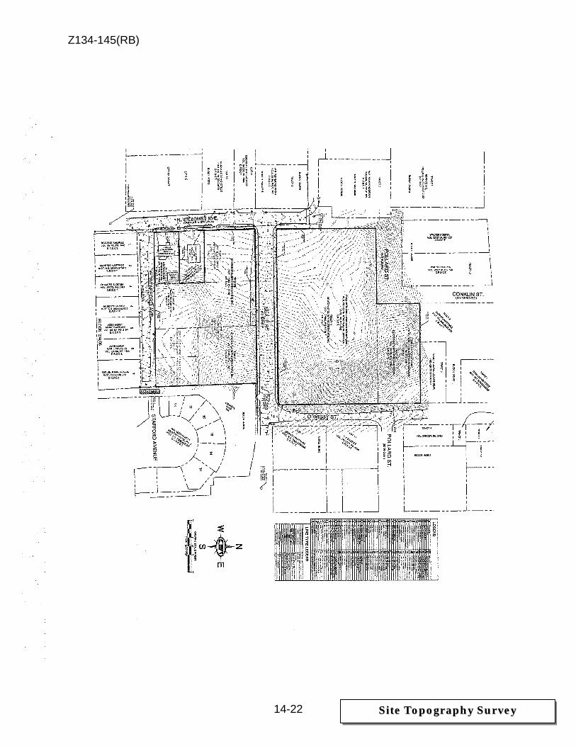
Z134-145(RB)
14-22
SSiittee TTooppooggrraapphhyy SSuurrvveeyy
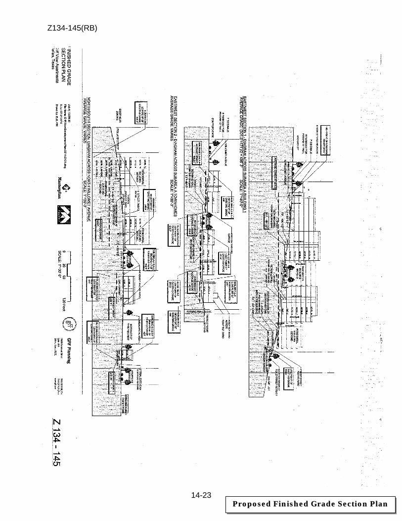
Z134-145(RB)
14-23
PPrrooppoosseedd FFiinniisshheedd GGrraaddee SSeeccttiioonn PPllaann
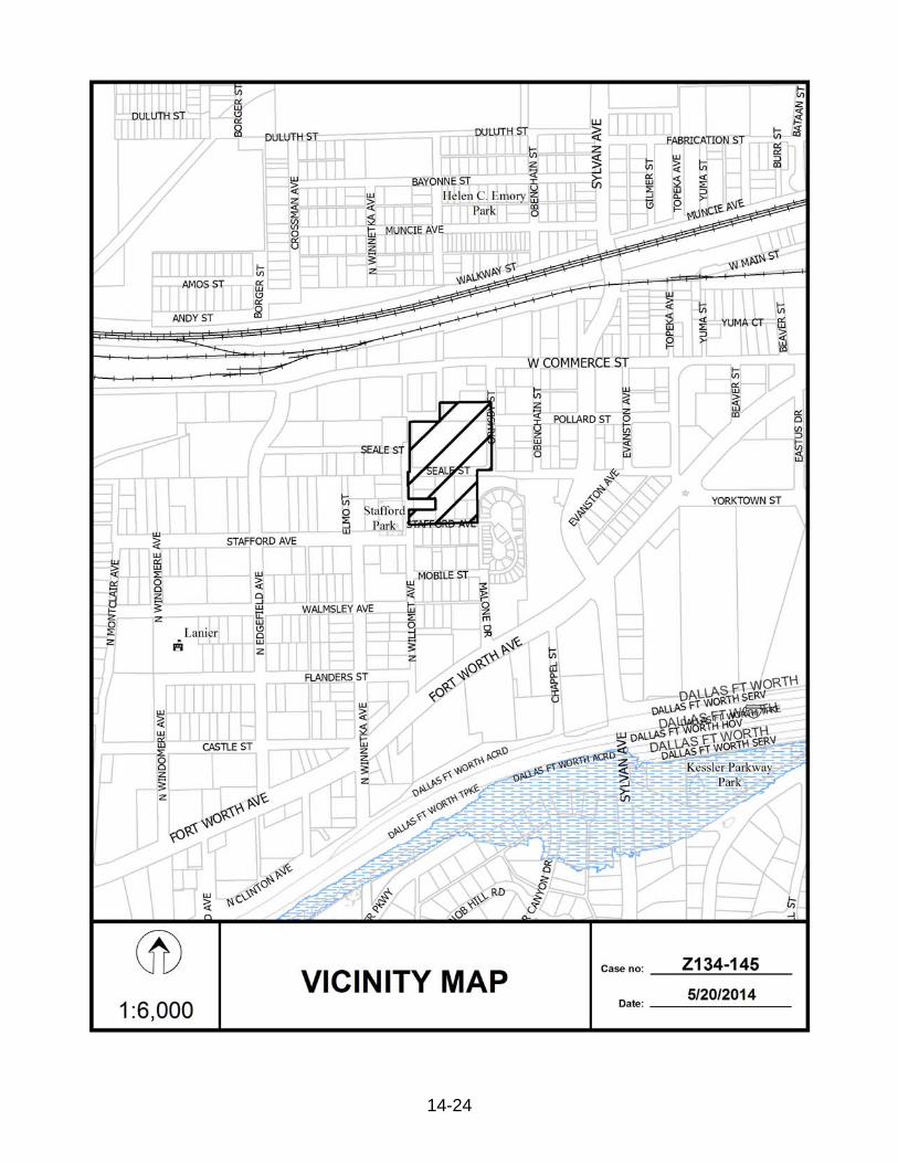
Z134-145(RB)
14-24
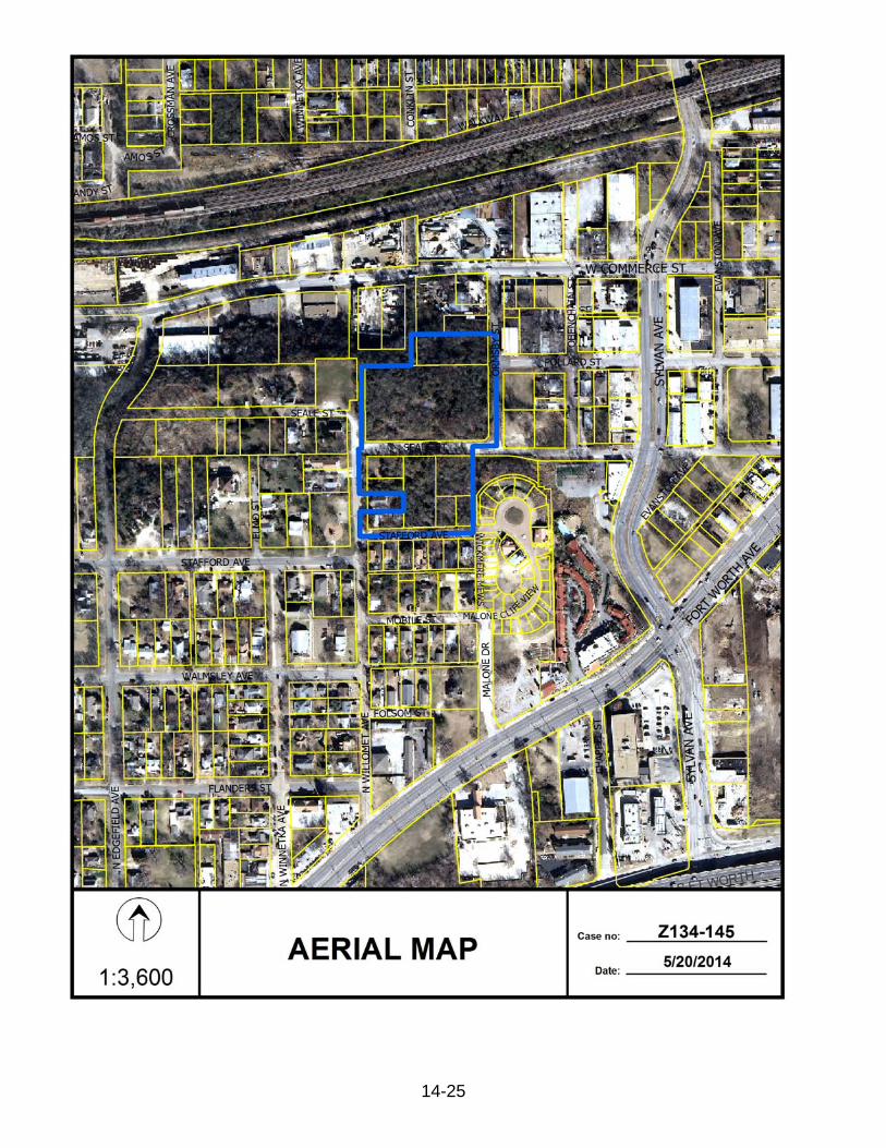
Z134-145(RB)
14-25
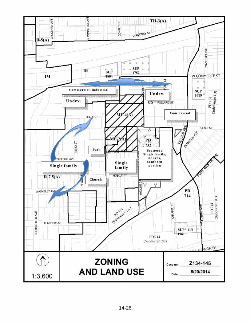
Z134-145(RB)
14-26
SSiinnggllee ffaammiillyy
PPaarrkk
SSiinnggllee ffaammiillyy
CCoommmmeerrcciiaall,, IInndduussttrriiaall UUnnddeevv..
SSccaatttteerreedd SSiinnggllee ffaammiillyy;;
nnoonnrreess,, ssoouutthheerrnn ppoorrttiioonn
CCoommmmeerrcciiaall
CChhuurrcchh
UUnnddeevv..

Z134-145(RB)
14-27
11
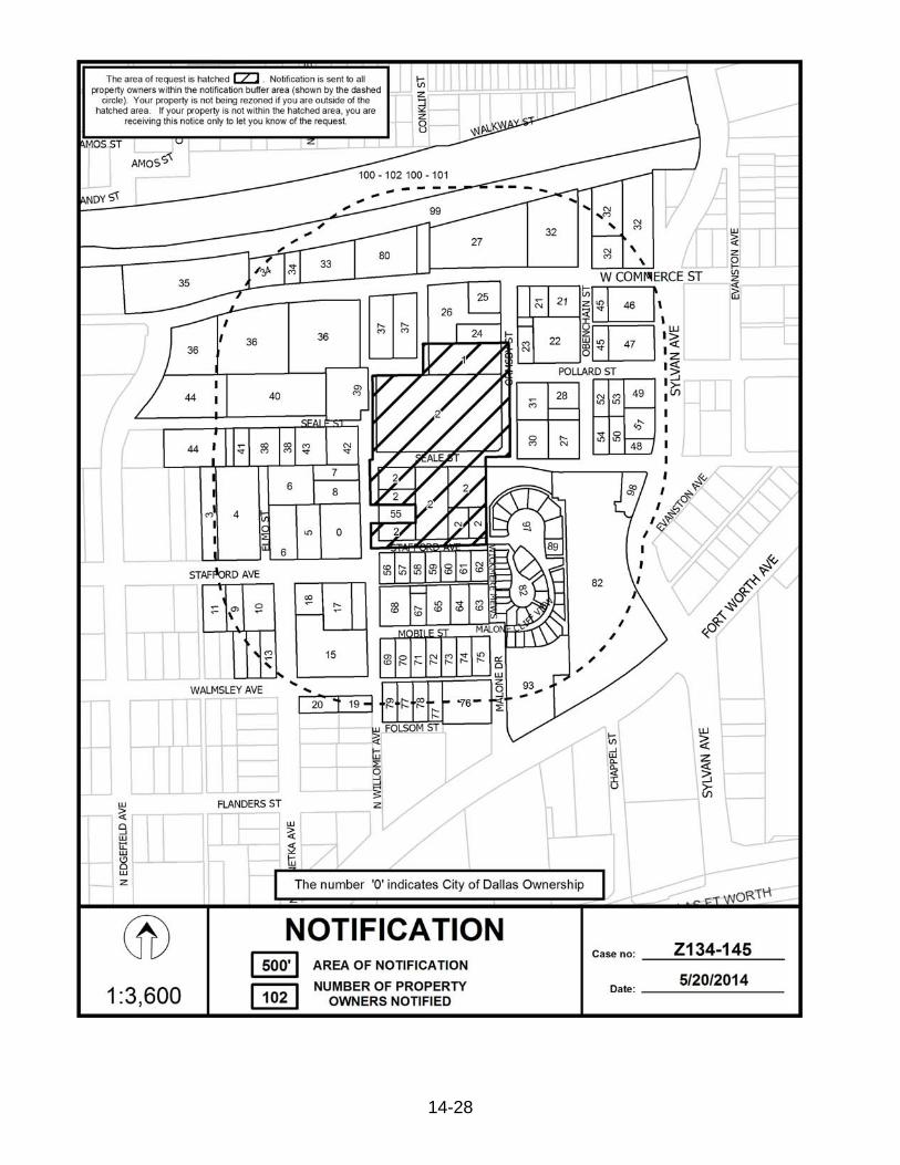
Z134-145(RB)
14-28
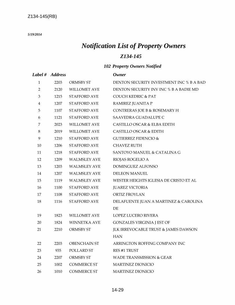
Z134-145(RB)
14-29
5/19/2014 Notification List of Property Owners
Z134-145
102 Property Owners Notified
Label # Address Owner 1 2203 ORMSBY ST DENTON SECURITY INVESTMENT INC % B A BAD 2 2120 WILLOMET AVE DENTON SECURITY INV INC % B A BADIE MD 3 1215 STAFFORD AVE COUCH KEDRIC & PAT 4 1207 STAFFORD AVE RAMIREZ JUANITA P 5 1107 STAFFORD AVE CONTRERAS JOE B & ROSEMARY H 6 1121 STAFFORD AVE SAAVEDRA GUADALUPE C 7 2023 WILLOMET AVE CASTILLO OSCAR & ELBA EDITH 8 2019 WILLOMET AVE CASTILLO OSCAR & EDITH 9 1210 STAFFORD AVE GUTIERREZ FIDENCIO & 10 1206 STAFFORD AVE CHAVEZ RUTH 11 1218 STAFFORD AVE SANTOYO MANUEL & CATALINA G 12 1209 WALMSLEY AVE RIOJAS ROGELIO A 13 1203 WALMSLEY AVE DOMINGUEZ ALFONSO 14 1207 WALMSLEY AVE DELEON MANUEL 15 1119 WALMSLEY AVE WESTER HEIGHTS IGLESIA DE CRISTO ET AL 16 1100 STAFFORD AVE JUAREZ VICTORIA 17 1108 STAFFORD AVE ORTIZ FROYLAN 18 1116 STAFFORD AVE DELAFUENTE JUAN A MARTINEZ & CAROLINA
DE 19 1823 WILLOMET AVE LOPEZ LUCERO RIVERA 20 1824 WINNETKA AVE GONZALES VIRGINIA J EST OF 21 2210 ORMSBY ST JLK IRREVOCABLE TRUST & JAMES DAWSON
HAN 22 2203 OBENCHAIN ST ARRINGTON ROFFING COMPANY INC 23 935 POLLARD ST RES #1 TRUST 24 2207 ORMSBY ST WADE TRANSMISSION & GEAR 25 1002 COMMERCE ST MARTINEZ DIONICIO 26 1010 COMMERCE ST MARTINEZ DIONICIO

Z134-145(RB)
14-30
5/19/2014
Label # Address Owner 27 2111 OBENCHAIN ST MARTINEZ DIONICIO 28 922 POLLARD ST REYNA LINDA 29 2115 OBENCHAIN ST VAZQUEZ MARIA ELSA & ERNESTO 30 933 SEALE ST MARTINEZ DIONICIO 31 934 POLLARD ST DAUBITZ C R 32 921 COMMERCE ST DABOUB REALTY LTD 33 1107 COMMERCE ST HMK LTD 34 1201 COMMERCE ST 1201 W COMMERCE LLC 35 1211 COMMERCE ST COMMERCIAL METALS CO STE 800 36 1220 COMMERCE ST ROPECO INC 37 1032 COMMERCE ST HUERTA WALTER 38 1118 SEALE ST NOAH IRENE 39 2115 WILLOMET AVE WILLIAMS TONY R 40 1122 SEALE ST BHR ENTERPRISES INC 41 1120 SEALE ST RAMIREZ TERESA & 42 2111 WILLOMET AVE WILLIAMS TONY R 43 1114 SEALE ST QUALLS KENNETH D & PAMELA 44 1219 SEALE ST GUTIERREZ JOSE A 45 914 COMMERCE ST SAUCEDO ABEL & AGUEDA SAUCEDO 46 902 COMMERCE ST GUERRERO EVELYN M TRUSTEE 47 907 POLLARD ST WADE WAYNE 48 2101 SYLVAN AVE AKIN PROPERTIES LLC 49 2121 SYLVAN AVE UMPHRESS MICHAEL L TR 50 911 SEALE ST HERNANDEZ JUAN % BANK OF AMERICA NA
TRUS 51 2107 SYLVAN AVE UMPRESS MICHALE L TR ETAL 52 914 POLLARD ST DAUBITZ CHARLES R 53 910 POLLARD ST RAMIREZ SANTA Z & RAMIREZ JOSE I 54 915 SEALE ST MARISCAL GERONIMO JR 55 2006 WILLOMET AVE MARTIN EMMA LEE 56 1026 STAFFORD AVE RAMIREZ ROGELIO LEON & ROSA ELIA L 57 1022 STAFFORD AVE MARTINEZ SILVERIO
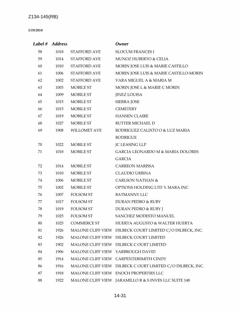
Z134-145(RB)
14-31
5/19/2014
Label # Address Owner 58 1018 STAFFORD AVE SLOCUM FRANCES I 59 1014 STAFFORD AVE MUNOZ HUBERTO & CELIA 60 1010 STAFFORD AVE MORIN JOSE LUIS & MARIE CASTILLO 61 1006 STAFFORD AVE MORIN JOSE LUIS & MARIE CASTILLO-MORIN 62 1002 STAFFORD AVE VARA MIGUEL A & MARIA M 63 1003 MOBILE ST MORIN JOSE L & MARIE C MORIN 64 1009 MOBILE ST JINEZ LOUISA 65 1015 MOBILE ST SIERRA JOSE 66 1015 MOBILE ST CEMETERY 67 1019 MOBILE ST HANSEN CLAIRE 68 1027 MOBILE ST RUTTER MICHAEL D 69 1908 WILLOMET AVE RODRIGUEZ CALIXTO O & LUZ MARIA
RODRIGUE 70 1022 MOBILE ST JC LEASING LLP 71 1018 MOBILE ST GARCIA LEONARDO M & MARIA DOLORES
GARCIA 72 1014 MOBILE ST CARREON MARISSA 73 1010 MOBILE ST CLAUDIO URBINA 74 1006 MOBILE ST CARLSON NATHAN & 75 1002 MOBILE ST OPTIONS HOLDING LTD % MARA INC 76 1007 FOLSOM ST BATMANNY LLC 77 1017 FOLSOM ST DURAN PEDRO & RUBY 78 1019 FOLSOM ST DURAN PEDRO & RUBY J 79 1025 FOLSOM ST SANCHEZ MODESTO MANUEL 80 1025 COMMERCE ST HUERTA AUGUSTO & WALTER HUERTA 81 1926 MALONE CLIFF VIEW DILBECK COURT LIMITED C/O DILBECK, INC. 82 1926 MALONE CLIFF VIEW DILBECK COURT LIMITED 83 1902 MALONE CLIFF VIEW DILBECK C OURT LIMITED 84 1906 MALONE CLIFF VIEW YARBROUGH DAVID 85 1914 MALONE CLIFF VIEW CARPENTERSMITH CINDY 86 1916 MALONE CLIFF VIEW DILBECK C OURT LIMITED C/O DILBECK, INC. 87 1918 MALONE CLIFF VIEW ENOCH PROPERTIES LLC 88 1922 MALONE CLIFF VIEW JARAMILLO R & S INVES LLC SUITE 148

Z134-145(RB)
14-32
5/19/2014
Label # Address Owner 89 1930 MALONE CLIFF VIEW LOVE GARY & CANDACE 90 1934 MALONE CLIFF VIEW ASHBURN HUNTER BYWATERS III 91 1938 MALONE CLIFF VIEW JONES SHAWN MARIE & A B 92 1942 MALONE CLIFF VIEW COOK MARY MCDERMOTT 93 1937 MALONE CLIFF VIEW DILBECK C OURT LIMITED C/O DILBECK, INC. 94 1908 WICKMERE MEWS WILLIAMSON MICHAEL RAY 95 1923 MALONE CLIFF VIEW FORBUS GARY L & MYRA N 96 1927 MALONE CLIFF VIEW TYNAN FRANCES E 97 1926 MALONE CLIFF VIEW VILLAS AT DILBECK COURT HOMEOWNERS ASSN 98 2001 SYLVAN AVE DILBECK COURT LIMITED % DILBECK GP INC 99 2300 GRAND AVE BNSF RAILWAY % PROPERTY TAX DEPT 100 9999 NO NAME ST UNION PACIFIC RR CO % TAX DEPT 101 4401 LINFIELD RD ST LOUIS S W RAILWAY CO % UNION PACIFIC 102 9999 NO NAME ST UNION PACIFIC RR CO % TAX DEPT
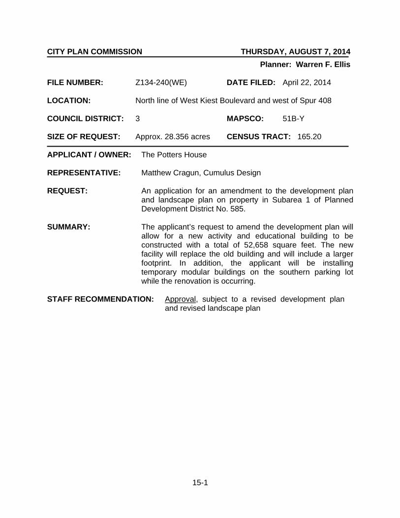
15-1
CITY PLAN COMMISSION THURSDAY, AUGUST 7, 2014
Planner: Warren F. Ellis FILE NUMBER: Z134-240(WE) DATE FILED: April 22, 2014 LOCATION: North line of West Kiest Boulevard and west of Spur 408 COUNCIL DISTRICT: 3 MAPSCO: 51B-Y SIZE OF REQUEST: Approx. 28.356 acres CENSUS TRACT: 165.20 APPLICANT / OWNER: The Potters House REPRESENTATIVE: Matthew Cragun, Cumulus Design REQUEST: An application for an amendment to the development plan
and landscape plan on property in Subarea 1 of Planned Development District No. 585.
SUMMARY: The applicant’s request to amend the development plan will
allow for a new activity and educational building to be constructed with a total of 52,658 square feet. The new facility will replace the old building and will include a larger footprint. In addition, the applicant will be installing temporary modular buildings on the southern parking lot while the renovation is occurring.
STAFF RECOMMENDATION: Approval, subject to a revised development plan
and revised landscape plan
Z134-240(WE)
15-2
GUIDING CRITERIA FOR RECOMMENDATION: Staff recommends approval based upon:
1. Performance impacts upon surrounding property – The proposed increase in total floor area for the youth center and educational building is compatible with the existing and future development that is proposed in the area. Presently, the site is adjacent to several tracts of undeveloped land. The adjacent Planned Development District is approved for a cemetery or a mausoleum and Townhouse development. The performance impact of the expansion should not have any impact on the surrounding property.
2. Traffic impact – The Engineering Section of the Department of Sustainable Development and Construction has determined that the increased density will not have a detrimental impact upon the surrounding street system.
3. Comprehensive Plan or Area Plan Conformance – The proposed request is in
compliance with the forwardDallas! Comprehensive Plan. The request site is located within a Campus Building Block.
BACKGROUND INFORMATION: • In June 2000, the City Council approved Planned Development District No. 585 for
TH-2(A) Townhouse District uses in Subarea 1 and an A(A) Agricultural District in Subarea 2, plus surface parking limited to providing a portion of the parking for a church.
Zoning History: There have not been any recent zoning requests in the area.
Thoroughfares/Streets:
Thoroughfare/Street Type Existing ROW
Proposed ROW
Kiest Boulevard Principal Arterial
100 ft. 100 ft.
Traffic: The Engineering Section of the Department of Development Services has reviewed the request and determined that the proposed renovated and expansion of the church will not have a detrimental impact upon the surrounding street system.
Z134-240(WE)
15-3
Land Use:
Zoning Land Use Site Subarea 1 of PDD No. 585 Church
North PDD No. 186 Undeveloped South Subarea 2 of PDD No. 585 Surface parking East PDD No. 186 Undeveloped West PDD No. 186 Undeveloped
COMPREHENSIVE PLAN: The fowardDallas! Comprehensive Plan was adopted by the City Council in June 2006. The fowardDallas! Comprehensive Plan outlines several goals and policies which can serve as a framework for assisting in evaluating the applicant’s request. The Plan identifies the request site being within an Urban Neighborhood Building Block. The Campus Building Block focuses on areas around large master-planned educational, institutional or business facilities outside the Downtown. The University of North Texas campus was the motivating factor for creating this Building Block, although other examples exist, such as the areas around the Southwestern Medical District, the Baylor University Medical Center, the Veterans Administration Hospital and Pinnacle Park. Campus Building Blocks often act as smaller versions of a complete community and include a range of single-family and multifamily housing for students, employees and visitors. A variety of offices, shops, services and open space should exist to support the major campus employer and area residents. Over time, areas such as UNT can take on a “university town” feel as they mature. All Campus Building Block areas should have convenient transit options as an integral component. Economic development efforts should capitalize on the spin-off employment opportunities generated by the primary employers. The proposed request is in compliance with the forwardDallas! Comprehensive Plan. The existing church is located at a key intersection and is adjacent to several undeveloped tracts of land and the Southern Baptist University. STAFF ANALYSIS: Land Use Compatibility: The 28.356-acre site is developed with a church use. The area’s physical character consists of a large undeveloped tract of land (PDD No. 186) and an institutional use (Dallas Baptist University) that is located west of the site. The property south of the site, across Kiest Boulevard, is developed with surface parking that serves as additional off-street parking for the church. The applicant’s request to amend the development plan and landscape plan will allow for the expansion of the existing youth and educational center. The existing building will be razed and the new facility will be constructed with a larger floor area. The new facility will be built in the same location as the pervious youth and educational center, but will be developed with an additional 8,008 square feet of floor area. The applicant will install several temporary modular buildings on the southern parking lot for
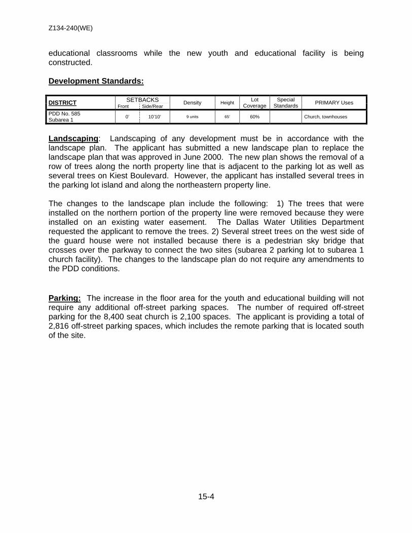
Z134-240(WE)
15-4
educational classrooms while the new youth and educational facility is being constructed. Development Standards: DISTRICT SETBACKS Density Height Lot
Coverage Special
Standards PRIMARY Uses Front Side/Rear
PDD No. 585 Subarea 1 0’ 10’10’ 9 units 65’ 60% Church, townhouses
Landscaping: Landscaping of any development must be in accordance with the landscape plan. The applicant has submitted a new landscape plan to replace the landscape plan that was approved in June 2000. The new plan shows the removal of a row of trees along the north property line that is adjacent to the parking lot as well as several trees on Kiest Boulevard. However, the applicant has installed several trees in the parking lot island and along the northeastern property line. The changes to the landscape plan include the following: 1) The trees that were installed on the northern portion of the property line were removed because they were installed on an existing water easement. The Dallas Water Utilities Department requested the applicant to remove the trees. 2) Several street trees on the west side of the guard house were not installed because there is a pedestrian sky bridge that crosses over the parkway to connect the two sites (subarea 2 parking lot to subarea 1 church facility). The changes to the landscape plan do not require any amendments to the PDD conditions. Parking: The increase in the floor area for the youth and educational building will not require any additional off-street parking spaces. The number of required off-street parking for the 8,400 seat church is 2,100 spaces. The applicant is providing a total of 2,816 off-street parking spaces, which includes the remote parking that is located south of the site.
Z134-240(WE)
15-5
• Thomas D. Jakes President and CEO
• Serita Jakes Vice President
• Darwin J. Bruce COO
• Susan McCarthy Treasurer an CFO
• Faith Johnson Secretary
LIST OF OFFICERS Potters House
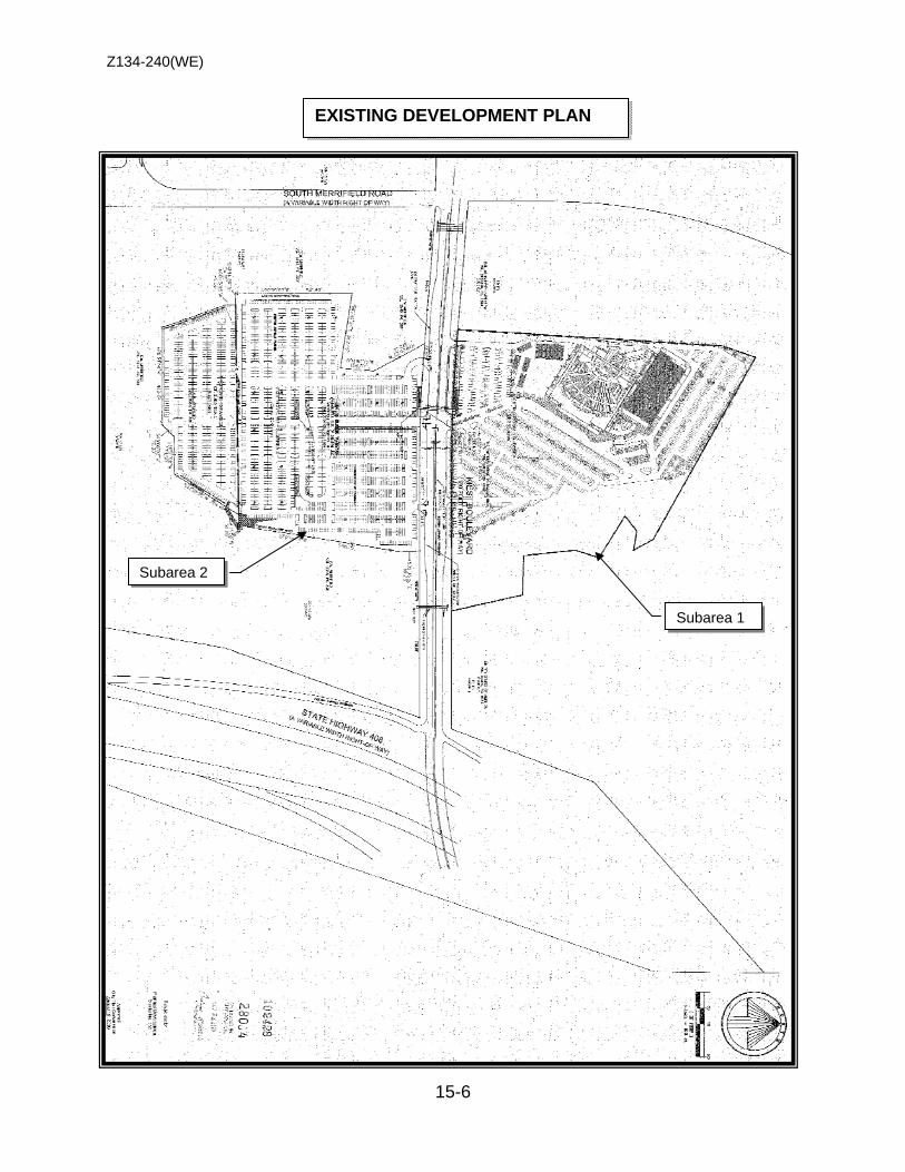
Z134-240(WE)
15-6
EXISTING DEVELOPMENT PLAN
Subarea 1
Subarea 2

Z134-240(WE)
15-7
EXISTING LANDSCAPE PLAN

Z134-240(WE)
15-8
PROPOSED DEVELOPMENT PLAN
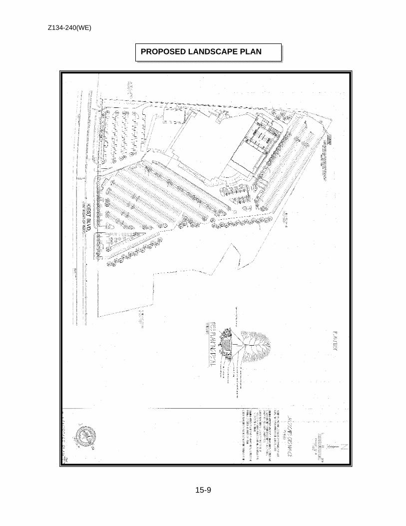
Z134-240(WE)
15-9
PROPOSED LANDSCAPE PLAN
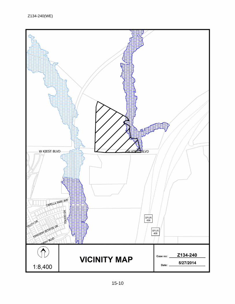
Z134-240(WE)
15-10
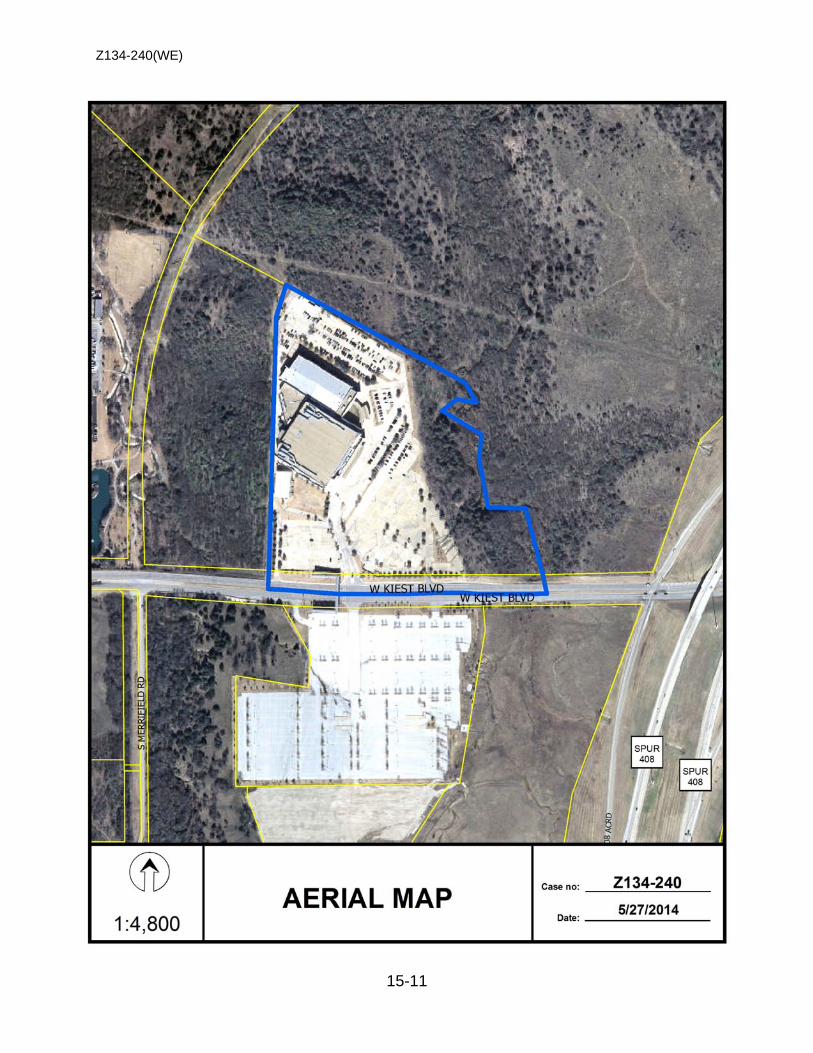
Z134-240(WE)
15-11
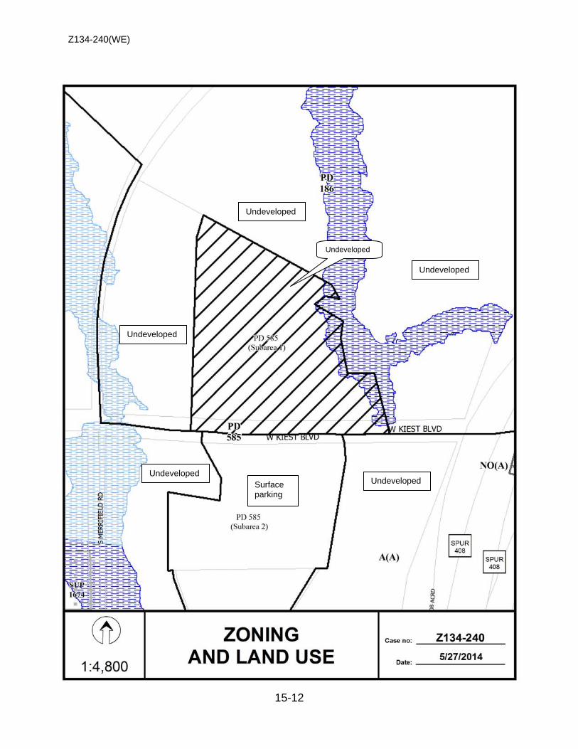
Z134-240(WE)
15-12
Undeveloped
Undeveloped
Undeveloped
Undeveloped
Undeveloped Undeveloped Surface
parking
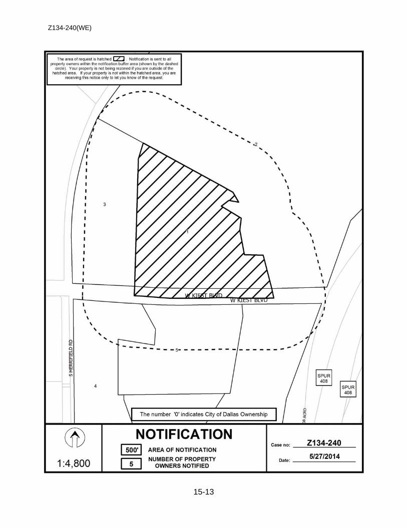
Z134-240(WE)
15-13
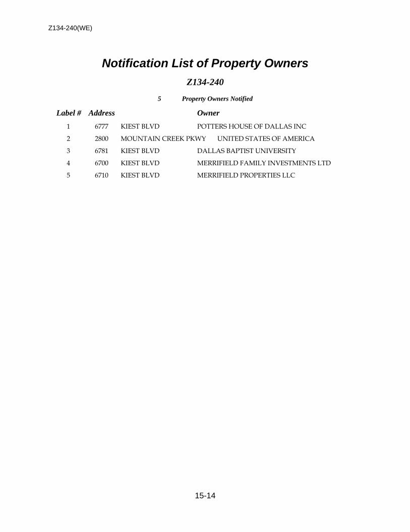
Z134-240(WE)
15-14
Notification List of Property Owners Z134-240
5 Property Owners Notified
Label # Address Owner
1 6777 KIEST BLVD POTTERS HOUSE OF DALLAS INC
2 2800 MOUNTAIN CREEK PKWY UNITED STATES OF AMERICA
3 6781 KIEST BLVD DALLAS BAPTIST UNIVERSITY
4 6700 KIEST BLVD MERRIFIELD FAMILY INVESTMENTS LTD
5 6710 KIEST BLVD MERRIFIELD PROPERTIES LLC
16-1
CITY PLAN COMMISSION THURSDAY, AUGUST 7, 2014
Planner: Warren F. Ellis FILE NUMBER: Z134-241(WE) DATE FILED: April 22, 2013 LOCATION: Lemmon Avenue and Oak Grove Avenue, west corner COUNCIL DISTRICT: 14 MAPSCO: 45-C SIZE OF REQUEST: Approx. 1.05 acres CENSUS TRACT: 17.03 APPLICANT / OWNER: Oak Grove Acquisitions, LLC REPRESENTATIVE: Dallas Cothrum, Masterplan REQUEST: An application for a Planned Development Subdistrict for
multiple family uses on property zoned an O-2 Office Subdistrict within Planned Development District No. 193, the Oak Lawn Special Purpose District.
. SUMMARY: The purpose of this request is to allow for the construction of
a 6-story, 175-unit multiple family development. The applicant is requesting a Planned Development Subdistrict of PD 193 to decrease the front yard setbacks from 20 feet to 10 feet and to increase the lot coverage from 60 percent to 75 percent in exchange for a reduction in the height that would typically be allowed in the existing subdistrict from 240 feet to 100 feet. Staff’s recommendation for denial is due to the fact that the proposed development plan does not comply with the front yard setback along Noble Avenue the applicant has proposed in the PDS conditions. PD 193 requires a 50-foot right-of-way and 30-foot pavement width for Noble Avenue, significantly more than the existing right-of-way and 18-foot pavement width. The front yard setback is measured from the 50-foot right-of-way per Chapter 51 that is the base code for PD 193.
STAFF RECOMMENDATION: Denial

Z134-241(WE)
16-2
GUIDING CRITERIA FOR RECOMMENDATION: Staff recommends denial based upon:
1. Performance impacts upon surrounding property – The request site is located in an area where there is a mix of development rights and standards based upon the various subdistricts. The surrounding land uses include retail, multiple family and office. The proposed use is compatible with these uses. Because the land uses are not changing, the impact of reducing the setbacks and increasing the lot coverage upon surrounding property must be determined. The multiple family development that is located southwest of the request site on Noble and North Hall Street, is in an LC Light Commercial Subdistrict. The front and side yard setbacks in an LC Subdistrict are 10-feet. Based upon the location of buildings along the adjoining street facades, staff is supportive of a reduction of the front yard setbacks as long as the required landscaping along Lemmon Avenue and Oak Grove Avenue are met. The applicant has indicated that this is the intent. Prior to City Council, the landscape plan needs to be revised to meet this requirement.
2. Traffic impact – The Engineering Section of the Department of Sustainable Development and Construction has determined that the request will not have a negative impact on the street system if certain conditions are met. The applicant has met with the City’s Engineering Section to discuss the dedication of additional right-of-way on Noble Avenue.
3. Comprehensive Plan or Area Plan Conformance – The forwardDallas!
Comprehensive Plan shows that the request site is located in an Urban Mixed Use Building Block. The request is in compliance with the Comprehensive Plan.
Zoning History: There has not been any recent zoning requests in the area.
Thoroughfares/Streets:
Thoroughfare/Street Type Existing ROW
Proposed ROW
Oak Grove Avenue Local Street 50 ft. 50 ft. Lemmon Avenue - East
Principal Arterial
60 ft. 60 ft.
Noble Avenue Local Street 20 ft. 20 ft. Traffic: The Engineering Section of the Department of Development Services has reviewed the request and determined that the increase in density will not have a detrimental impact upon the surrounding street system.
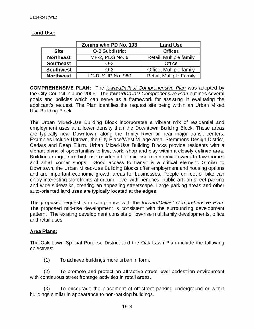
Z134-241(WE)
16-3
Land Use:
Zoning w/in PD No. 193 Land Use Site O-2 Subdistrict Offices
Northeast MF-2, PDS No. 6 Retail, Multiple family Southeast O-2 Office Southwest O-2 Office, Multiple family Northwest LC-D, SUP No. 980 Retail, Multiple Family
COMPREHENSIVE PLAN: The fowardDallas! Comprehensive Plan was adopted by the City Council in June 2006. The fowardDallas! Comprehensive Plan outlines several goals and policies which can serve as a framework for assisting in evaluating the applicant’s request. The Plan identifies the request site being within an Urban Mixed Use Building Block. The Urban Mixed-Use Building Block incorporates a vibrant mix of residential and employment uses at a lower density than the Downtown Building Block. These areas are typically near Downtown, along the Trinity River or near major transit centers. Examples include Uptown, the City Place/West Village area, Stemmons Design District, Cedars and Deep Ellum. Urban Mixed-Use Building Blocks provide residents with a vibrant blend of opportunities to live, work, shop and play within a closely defined area. Buildings range from high-rise residential or mid-rise commercial towers to townhomes and small corner shops. Good access to transit is a critical element. Similar to Downtown, the Urban Mixed-Use Building Blocks offer employment and housing options and are important economic growth areas for businesses. People on foot or bike can enjoy interesting storefronts at ground level with benches, public art, on-street parking and wide sidewalks, creating an appealing streetscape. Large parking areas and other auto-oriented land uses are typically located at the edges. The proposed request is in compliance with the forwardDallas! Comprehensive Plan. The proposed mid-rise development is consistent with the surrounding development pattern. The existing development consists of low-rise multifamily developments, office and retail uses. Area Plans: The Oak Lawn Special Purpose District and the Oak Lawn Plan include the following objectives: (1) To achieve buildings more urban in form. (2) To promote and protect an attractive street level pedestrian environment with continuous street frontage activities in retail areas. (3) To encourage the placement of off-street parking underground or within buildings similar in appearance to non-parking buildings.

Z134-241(WE)
16-4
(4) To promote development appropriate to the character of nearby neighborhood uses by imposing standards sensitive to scale and adjacency issues. (5) To use existing zoned development densities as a base from which to plan, while providing bonuses to encourage residential development in commercial areas. (6) To discourage variances or zoning changes which would erode the quantity or quality of single-family neighborhoods, or would fail to adhere to the standards for multiple-family neighborhoods and commercial areas. (7) To promote landscape/streetscape quality and appearance. The applicant’s request for a PDS for a multiple family development meets objectives 3, 4 and 7. STAFF ANALYSIS: Land Use Compatibility: The 1.05 acre site is developed with a one–story medical clinic and office building. The area’s physical character consists primarily of multiple family, retail and offices uses. The O-2 Office Subdistrict permits a maximum structure 240 feet but the applicant is proposing to develop the 175-unit multiple family development at a maximum height of 100 feet, with mechanical overruns extending 12 feet above the maximum height. Staff is concerned that the proposed multiple family development will not meet the landscaping requirements in PDD No. 193 for streets on Oak Grove Avenue and Lemmon Avenue. Staff recommendation is to permit alternative landscaping along Noble Street but comply with the landscaping regulations in PDD No. 193 for Lemmon Avenue and Oak Grove Avenue. Maintaining the integrity of Planned Development District No. 193 is vital to the overall vision of the Oak Lawn Special Purpose District. Development Standards: DISTRICT SETBACKS Density Height Lot
Coverage Special
Standards PRIMARY Uses Front Side/Rear
Office O-2 Subdistrict 20’ 10’25’
Min lot 2,000 sq. ft. 100 sq ft – E
125 sq. ft – 1 BR 150 sq ft – 2 BR
+25 sq ft each add BR
240’ 75% Multifamily, single family, office
Office – Applicant’s Rec O-2 Subdistrict 10’ 10’10’ 175 units 100’ 75% Multifamily, single family,
office Proposed PDS – Staff’s Rec. (Multiple Family) 10’ 10’/10’ 175 units 100’
75% Multiple Family, community service center, office
Landscaping: Staff believes that complying with a majority of the development standards in the O-2 Office Subdistrict is vital to maintaining the overall integrity of PDD No. 193. Prior to City Council, the landscape plan needs to address the following: 1) the general and special planting materials, 2) the type of trees being planted, 3) the enhanced pedestrian paving, and 4) the 10-foot landscape buffer along the garage frontage on Noble Avenue.

Z134-241(WE)
16-5
Oak Grove Acquisitions, LLC Manager – LG Capital, LLC • Fernando De Leon Manager of LG Capital, LLC
LIST OF OFFICERS
Z134-241(WE)
16-6
“ARTICLE
SEC. S- .101. LEGISLATIVE HISTORY.
PD Subdistrict was established by Ordinance No. , passed by the Dallas City Council on (Date) (Ord. )
SEC. S- .102. PROPERTY LOCATION AND SIZE.
PD Subdistrict is established on property generally located at the west corner of Oak Grove Avenue and Lemmon Avenue. The size of PD Subdistrict is 1.05 acres. (Ord.X)
SEC. S- .103. DEFINITIONS AND INTERPRETATIONS.
(a) Unless otherwise stated, the definitions and interpretations in Chapter 51 and Part I of this article apply to this division. If there is a conflict, this division controls. If there is a conflict between Chapter 51 and Part I of this article, Part I of this article controls.
(b) In this division:
(1) SUBDISTRICT means a subdistrict of PD 193.
(2) BLADE SIGNS means a sign projecting perpendicularly from the main building façade, or from a building corner, visible from both sides, and made of rigid or soft materials.
(c) Unless otherwise stated, all references to articles, divisions, or sections in this division are to articles, divisions, or sections in Chapter 51.
(d) This subdistrict is considered to be a nonresidential zoning district.
SEC. S- .104. EXHIBIT.
(a) The following exhibit is incorporated into this division:
(1) Exhibit S- A: development plan.
(2) Exhibit S- B: landscape plan.
PROPOSED PDS CONDITIONS

Z134-241(WE)
16-7
SEC. S- .105. DEVELOPMENT PLAN.
(a) Development and use of the Property must comply with the development plan (Exhibit S- ). If there is a conflict between the text of this division and the development plan, the text of this division controls. SEC. S- .105. LANDSCAPE PLAN.
(a) Landscaping of the Property must comply with the landscape plan (Exhibit S-.) If there is a conflict between the text of this division and the landscape plan, the text of this division controls. SEC. S- .106. MAIN USES PERMITTED.
(a) Except as provided in this section, the only main uses permitted in this subdistrict are those main uses permitted in the O-2 Office-2 Subdistrict, subject to the same conditions applicable in the O-2 Office-2 Subdistrict, as set out in Part I of this article. For example, a use permitted in the O-2 Office-2 Subdistrict only by specific use permit (SUP) is permitted in this subdistrict only by SUP; a use subject to development impact review (DIR) in the O-2 Office-2 Subdistrict is subject to DIR in this subdistrict; etc.
(b) The following additional main use is permitted: -- Accessory community center (private).
SEC. S- .107. ACCESSORY USES.
(a) As a general rule, an accessory use is permitted in any subdistrict in which the main use is permitted. Some specific accessory uses, however, due to their unique nature, are subject to additional regulations in Section 51P-193.108. For more information regarding accessory uses, consult Section 51P193.108.
(b) The following accessory uses are prohibited:
-- Amateur communication tower. -- Open storage. -- Private stable.
SEC. S- .108. YARD, LOT, AND SPACE REGULATIONS.
(Note: The yard, lot, and space regulations in this section must be read together with the yard, lot, and space regulations in Part I of this article. If there is a conflict between this section and Part I of this article, this section controls.)
(a) In general. Except as provided in this section, the yard, lot, and space regulations for the O-2 Office-2 Subdistrict apply.

Z134-241(WE)
16-8
(b) Front yard.
(1) The minimum front yard is 10 feet on Oak Grove Avenue and Noble Avenue.
(2) The minimum front yard is 20 feet on Lemmon Avenue.
(3) Balconies, including those vertical and horizontal peripheral walls defining such balconies, and the common walls separating such balconies, may project a maximum of five feet into a front yard. Balconies are not required to be shown on the development plan. Staff’s Recommendation
(1) [Any rights-of-way dedications in the form of corner clips at intersections are excluded from the required yard requirements above.]
Applicant’s Proposal
(2) Any rights-of-way dedications in the form of corner clips at intersections are excluded from the required yard requirements above.
(3) Raised porches/stoops.
(i) Lemmon Avenue and Oak Grove Avenue: Raised porches/stoops not exceeding four feet in height may extend a maximum of six feet into the required front yard. Steps from the raised porches/stoops may have a zero setback. (ii) Noble Avenue: Raised porches/stoops not exceeding four feet in height may extend a maximum of five feet into the required front yard. Steps from a raised porch/stoop may have a zero setback. Railings for stairs, stoops and/or porches or patios up to 42 inches in height are allowed in the required front yard.
(4) Raised porches/stoops are not required to be shown on the development plan.
(c) Side yard.
(1) The minimum side yard is 10 feet. The additional setbacks from a residential district, per Section 51P-193.119 does not apply to development in this district.
(2) Balconies may project a maximum of 5 feet into a side yard.
(d) Density. Maximum number of dwelling units is 175.
(e) Floor area. The maximum floor area is 185,000 square feet.
(f) Floor-to-area ratio (FAR). There is no maximum FAR.

Z134-241(WE)
16-9
(g) Height.
(1) Except as provided in this subsection, maximum structure height is 100 feet. (2) The following structures may project a maximum of 12 feet above the maximum structure height: elevator penthouse or bulkhead, mechanical equipment room(s), cooling tower, clerestories, communication towers, visual screens which surround roof mounted mechanical equipment, chimney and vent stacks and parapet walls limited to five feet in height.
(h) Lot coverage.
(1) Except as provided in this subsection, maximum lot coverage is 75 percent. Any lot coverage greater than 75% for a residential use must include an amenity deck with a minimum area of 2,500 square feet. (2) Aboveground parking structures are included in lot coverage calculations; surface parking lots and underground parking structures are not. SEC. S- .109. OFF-STREET PARKING AND LOADING.
(a) Except as provided in this section, consult Part I of this article for the specific off-street parking and loading requirements for each use.
(b) For multiple family uses: (1) one parking space per bedroom with a minimum of one space per dwelling unit is required. (2) An additional one-quarter space per dwelling unit must be provided for guest parking if the required parking is restricted to resident parking only. (3) Off-street parking for an accessory community center (private) is not required. (4) For residential uses, all parking must be located underground or within a structure. SEC. S- .110. ENVIRONMENTAL PERFORMANCE STANDARDS.
See Article VI.
SEC. S- .111. LANDSCAPING.
(a) Except as provided in this section, landscaping and screening must be provided in accordance with Part I of this article.
Z134-241(WE)
16-10
(1) The landscape buffer, as required in Section 26(b)(3)(D) to screen the parking garage adjacent to Noble Avenue does not apply provided a minimum of 6 evergreen trees or shrubs, at a minimum of five (5) feet in height at maturity, are provided between the garage and Noble Avenue.
(2) The parkway planting area requirement, per Section 26 (b)(1)(D)(4), is
not required for the most southwestern 70 feet of frontage along Noble Avenue. (3) The sidewalk location requirement of Section 26(b)(4)(ii) does not apply to the most southwestern 70 feet of frontage along Noble Avenue. The sidewalk may be located in the parkway against the street curb. (4) The building official may approve the use of an alternative to the required large canopy tree to avoid conflicts with overhead utilities. Staff’s Recommendation (5) The screening of electric transformers from Noble Avenue is not required.] Applicant’s Proposal (5) The screening of electric transformers from Noble Avenue is not required. (b) Sidewalks: (1) All sidewalks must be a minimum of 5 feet widths. (2) Sidewalks on Noble Avenue may be placed contiguous to the curb to divert from public utility infrastructure. (3) Sidewalks on Lemmon Avenue may be located between 5-15 feet from back of curb. (c) Trees (1) Trees are not required along Noble Avenue where displaced by sidewalk that is placed at back of curb to divert from public infrastructure.
(c) Plant materials must be maintained in a healthy, growing condition.
SEC. S- .112. SIGNS.
(a) Except as provided in this section, signs must comply with the provisions for business zoning districts in Article VII. (1) Two blade signs are permitted subject to the following regulations:

Z134-241(WE)
16-11
(i) Maximum effective area for each blade sign is 72 square feet per side. (ii) A maximum of one blade sign is permitted on Oak Grove Avenue. (iii) A maximum of one blade sign is permitted on Lemmon Avenue. (iv) Blade signs must be attached to the main structure. (v) Blade signs may project a maximum of 2.5 feet into required setbacks.
SEC. S- .113. ADDITIONAL PROVISIONS.
(a) The Property must be properly maintained in a state of good repair and neat appearance.
(b) Development and use of the Property must comply with all federal and state laws and regulations, and with all ordinances, rules, and regulations of the city.
Staff’s Recommendation (a) [There is no minimum vertical clearance requirement for balconies located a minimum of 3 feet from a public sidewalk.]
Applicant’s Proposal (a) There is no minimum vertical clearance requirement for balconies located a minimum of 3 feet from a public sidewalk.
(b) Development and use of the Property must comply with Part I of this article.
Staff’s Recommendation (c) [Utility transformers and associated equipment are permitted in the front yard adjacent to Noble Avenue.]
Applicant’s Proposal (c) Utility transformers and associated equipment are permitted in the front yard adjacent to Noble Avenue. Staff’s Recommendation (d) One temporary leasing or sales office may be erected for up to 180 days from the date of permit without the requirement of a development plan. [The temporary leasing office is permitted within the building setbacks.] The building official may approve additional 30-day extensions.
Applicant’s Proposal (d) One temporary leasing or sales office may be erected for up to 180 days from the
date of permit without the requirement of a development plan. The temporary leasing office is permitted within the building setbacks. The building official may approve

Z134-241(WE)
16-12
SEC. S-98.114. COMPLIANCE WITH CONDITIONS.
(a) All paved areas, permanent drives, streets, and drainage structures, if any, must be constructed in accordance with standard city specifications, and completed to the satisfaction of the city.
(b) The building official shall not issue a building permit to authorize work, or a certificate of occupancy to authorize the operation of a use, in this subdistrict until there has been full compliance with this division, the Dallas Development Code, the construction codes, and all other ordinances, rules, and regulations of the city.
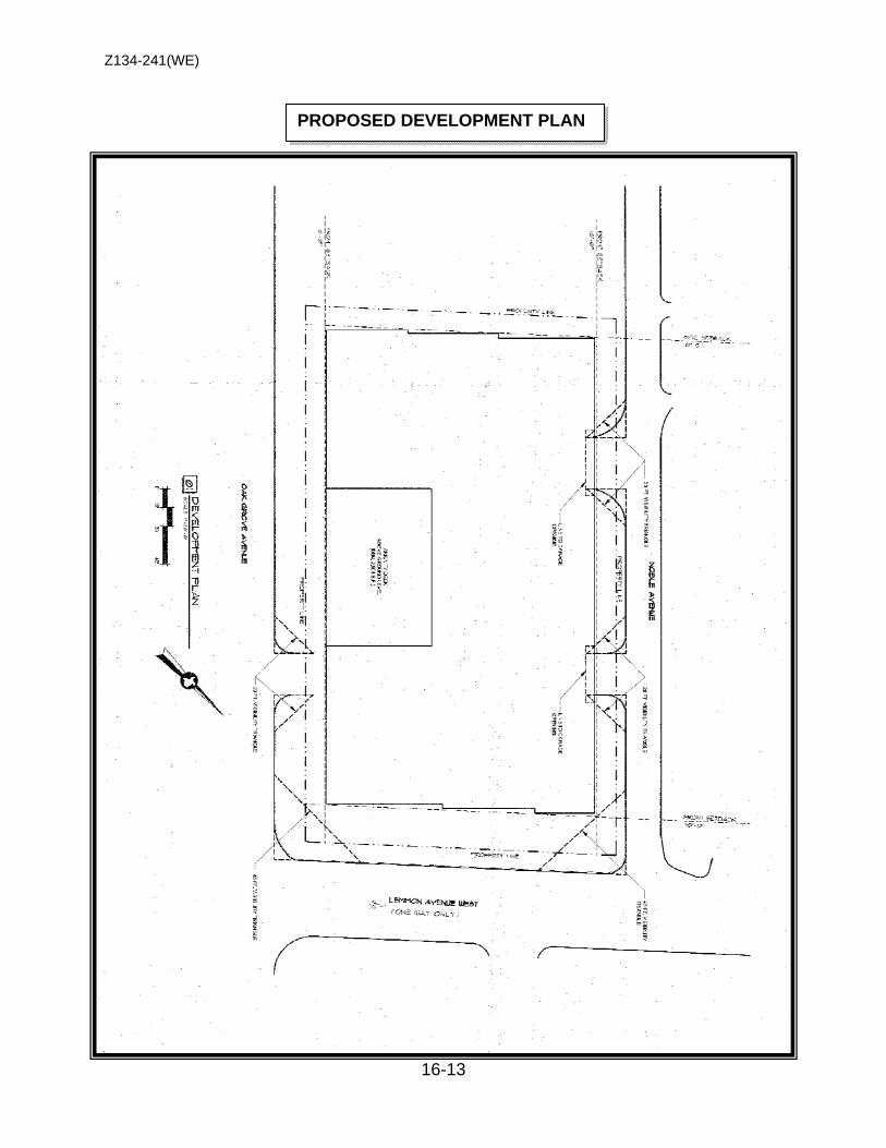
Z134-241(WE)
16-13
PROPOSED DEVELOPMENT PLAN
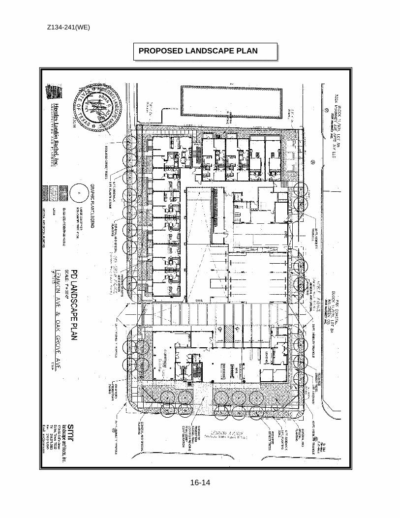
Z134-241(WE)
16-14
PROPOSED LANDSCAPE PLAN
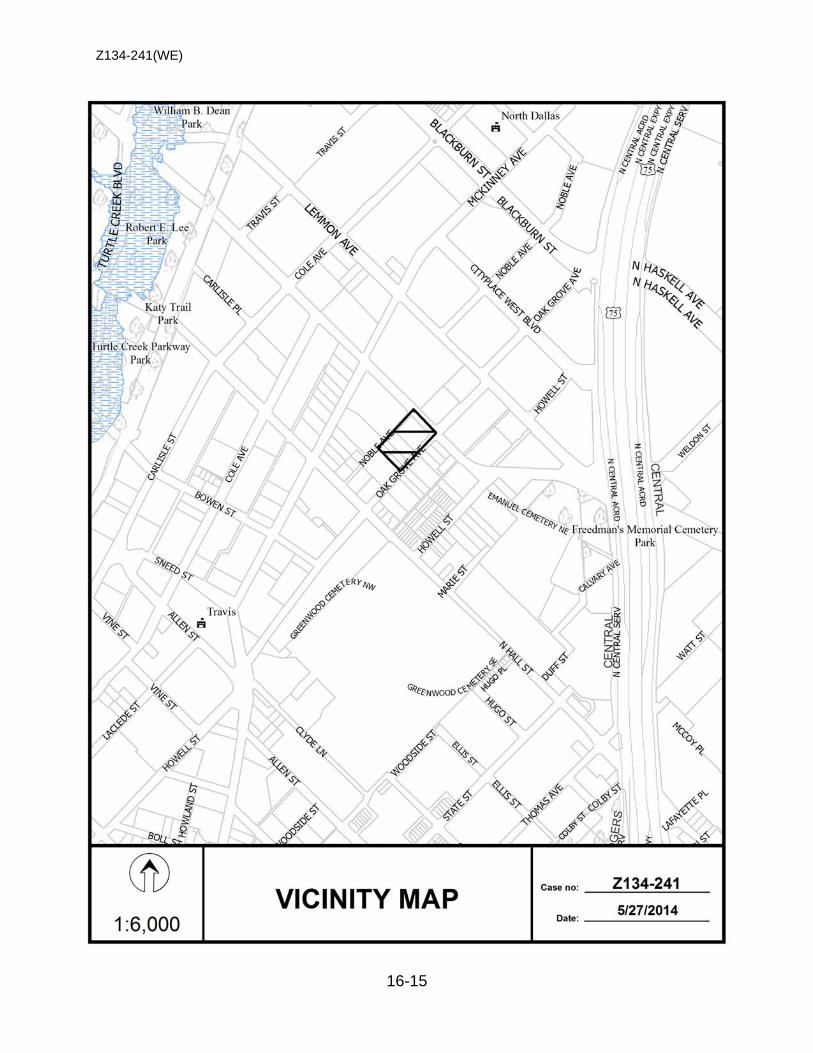
Z134-241(WE)
16-15
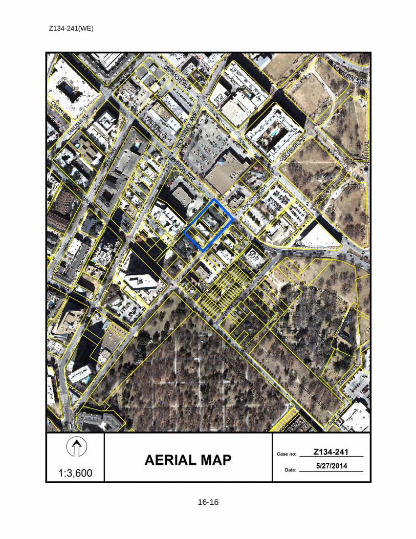
Z134-241(WE)
16-16
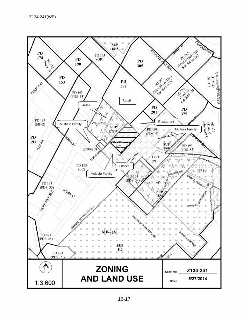
Z134-241(WE)
16-17
Retail
Multiple Family
Offices
Multiple Family
Multiple Family
Retail
Restaurant
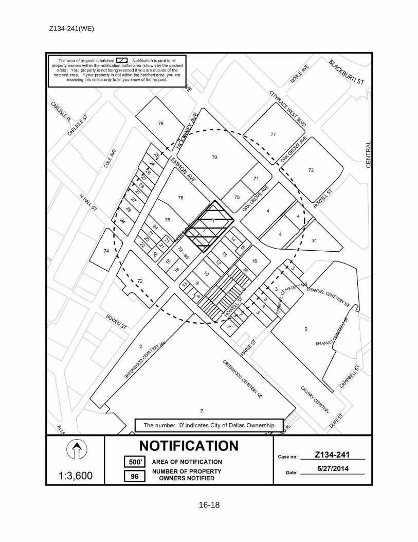
Z134-241(WE)
16-18
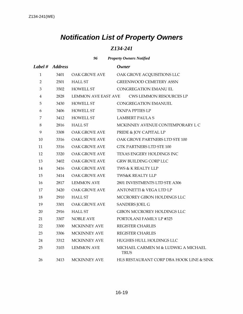
Z134-241(WE)
16-19
Notification List of Property Owners Z134-241
96 Property Owners Notified
Label # Address Owner
1 3401 OAK GROVE AVE OAK GROVE ACQUISITIONS LLC
2 2501 HALL ST GREENWOOD CEMETERY ASSN
3 3502 HOWELL ST CONGREGATION EMANU EL
4 2828 LEMMON AVE EAST AVE CWS LEMMON RESOURCES LP
5 3430 HOWELL ST CONGREGATION EMANUEL
6 3406 HOWELL ST TKNPA PPTIES LP
7 3412 HOWELL ST LAMBERT PAULA S
8 2816 HALL ST MCKINNEY AVENUE CONTEMPORARY L C
9 3308 OAK GROVE AVE PRIDE & JOY CAPITAL LP
10 3316 OAK GROVE AVE OAK GROVE PARTNERS LTD STE 100
11 3316 OAK GROVE AVE GTK PARTNERS LTD STE 100
12 3320 OAK GROVE AVE TEXAS ENGERY HOLDINGS INC
13 3402 OAK GROVE AVE GRW BUILDING CORP LLC
14 3416 OAK GROVE AVE TWS & K REALTY LLP
15 3414 OAK GROVE AVE TWS&K REALTY LLP
16 2817 LEMMON AVE 2801 INVESTMENTS LTD STE A306
17 3420 OAK GROVE AVE ANTONETTI & VEGA LTD LP
18 2910 HALL ST MCCROREY GIBON HOLDINGS LLC
19 3301 OAK GROVE AVE SANDERS JOEL G
20 2916 HALL ST GIBON MCCROREY HOLDINGS LLC
21 3307 NOBLE AVE PORTOLANI FAMILY LP #325
22 3300 MCKINNEY AVE REGISTER CHARLES
23 3306 MCKINNEY AVE REGISTER CHARLES
24 3312 MCKINNEY AVE HUGHES HULL HOLDINGS LLC
25 3103 LEMMON AVE MICHAEL CARMEN M & LUDWIG A MICHAEL TRUS
26 3413 MCKINNEY AVE HLS RESTAURANT CORP DBA HOOK LINE & SINK
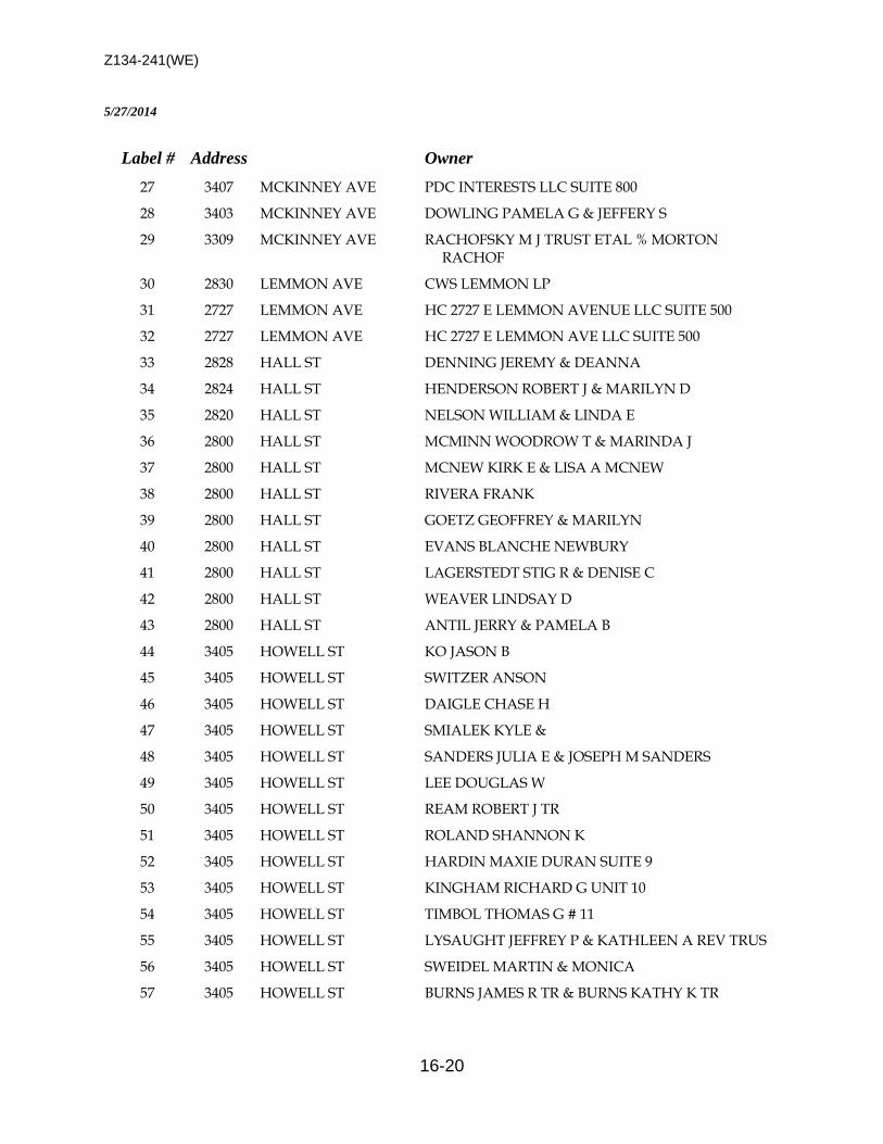
Z134-241(WE)
16-20
5/27/2014
Label # Address Owner
27 3407 MCKINNEY AVE PDC INTERESTS LLC SUITE 800
28 3403 MCKINNEY AVE DOWLING PAMELA G & JEFFERY S
29 3309 MCKINNEY AVE RACHOFSKY M J TRUST ETAL % MORTON RACHOF
30 2830 LEMMON AVE CWS LEMMON LP
31 2727 LEMMON AVE HC 2727 E LEMMON AVENUE LLC SUITE 500
32 2727 LEMMON AVE HC 2727 E LEMMON AVE LLC SUITE 500
33 2828 HALL ST DENNING JEREMY & DEANNA
34 2824 HALL ST HENDERSON ROBERT J & MARILYN D
35 2820 HALL ST NELSON WILLIAM & LINDA E
36 2800 HALL ST MCMINN WOODROW T & MARINDA J
37 2800 HALL ST MCNEW KIRK E & LISA A MCNEW
38 2800 HALL ST RIVERA FRANK
39 2800 HALL ST GOETZ GEOFFREY & MARILYN
40 2800 HALL ST EVANS BLANCHE NEWBURY
41 2800 HALL ST LAGERSTEDT STIG R & DENISE C
42 2800 HALL ST WEAVER LINDSAY D
43 2800 HALL ST ANTIL JERRY & PAMELA B
44 3405 HOWELL ST KO JASON B
45 3405 HOWELL ST SWITZER ANSON
46 3405 HOWELL ST DAIGLE CHASE H
47 3405 HOWELL ST SMIALEK KYLE &
48 3405 HOWELL ST SANDERS JULIA E & JOSEPH M SANDERS
49 3405 HOWELL ST LEE DOUGLAS W
50 3405 HOWELL ST REAM ROBERT J TR
51 3405 HOWELL ST ROLAND SHANNON K
52 3405 HOWELL ST HARDIN MAXIE DURAN SUITE 9
53 3405 HOWELL ST KINGHAM RICHARD G UNIT 10
54 3405 HOWELL ST TIMBOL THOMAS G # 11
55 3405 HOWELL ST LYSAUGHT JEFFREY P & KATHLEEN A REV TRUS
56 3405 HOWELL ST SWEIDEL MARTIN & MONICA
57 3405 HOWELL ST BURNS JAMES R TR & BURNS KATHY K TR
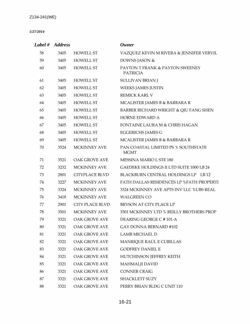
Z134-241(WE)
16-21
5/27/2014
Label # Address Owner
58 3405 HOWELL ST VAZQUEZ KEVIN M RIVERA & JENNIFER VERVIL
59 3405 HOWELL ST DOWNS JASON &
60 3405 HOWELL ST PAYTON T FRANK & PAYTON SWEENEY PATRICIA
61 3405 HOWELL ST SULLIVAN BRIAN J
62 3405 HOWELL ST WEEKS JAMES JUSTIN
63 3405 HOWELL ST REMICK KARL V
64 3405 HOWELL ST MCALISTER JAMES B & BARBARA R
65 3405 HOWELL ST BARBER RICHARD WRIGHT & QIU FANG SHEN
66 3405 HOWELL ST HORNE EDWARD A
67 3405 HOWELL ST FONTAINE LAURA M & CHRIS HAGAN
68 3405 HOWELL ST EGGERICHS JAMES G
69 3405 HOWELL ST MCALISTER JAMES B & BARBARA R
70 3524 MCKINNEY AVE PAN COASTAL LIMITED PS % SOUTHSTATE MGMT
71 3521 OAK GROVE AVE MESSINA MARIO L STE 180
72 3232 MCKINNEY AVE GAEDEKE HOLDINGS II LTD SUITE 1000 LB 24
73 2801 CITYPLACE BLVD BLACKBURN CENTRAL HOLDINGS LP LB 12
74 3227 MCKINNEY AVE FATH DALLAS RESIDENCES LP %FATH PROPERTI
75 3324 MCKINNEY AVE 3324 MCKINNEY AVE APTS INV LLC %UBS REAL
76 3418 MCKINNEY AVE WALGREEN CO
77 2901 CITY PLACE BLVD BRYSON AT CITY PLACE LP
78 3501 MCKINNEY AVE 3501 MCKINNEY LTD % REILLY BROTHERS PROP
79 3321 OAK GROVE AVE DEARING GEORGE C # 101-A
80 3321 OAK GROVE AVE GAY DONNA BERNARD #102
81 3321 OAK GROVE AVE LAMB MICHAEL D
82 3321 OAK GROVE AVE MANRIQUE RAUL E CUBILLAS
83 3321 OAK GROVE AVE GODFREY DANIEL E
84 3321 OAK GROVE AVE HUTCHINSON JEFFREY KEITH
85 3321 OAK GROVE AVE MAHMALJI DAVID
86 3321 OAK GROVE AVE CONNER CRAIG
87 3321 OAK GROVE AVE SHACKLETT SUZY
88 3321 OAK GROVE AVE PERRY BRIAN BLDG C UNIT 110
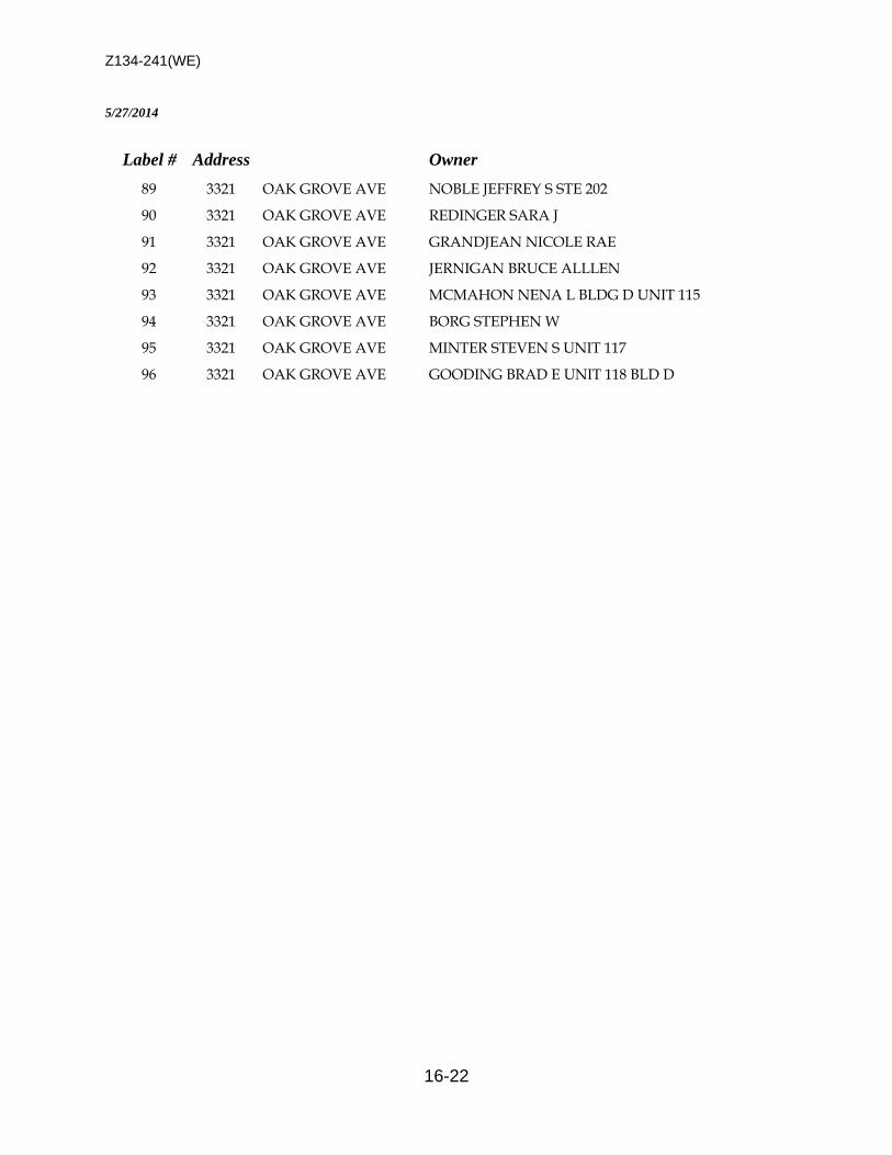
Z134-241(WE)
16-22
5/27/2014
Label # Address Owner
89 3321 OAK GROVE AVE NOBLE JEFFREY S STE 202
90 3321 OAK GROVE AVE REDINGER SARA J
91 3321 OAK GROVE AVE GRANDJEAN NICOLE RAE
92 3321 OAK GROVE AVE JERNIGAN BRUCE ALLLEN
93 3321 OAK GROVE AVE MCMAHON NENA L BLDG D UNIT 115
94 3321 OAK GROVE AVE BORG STEPHEN W
95 3321 OAK GROVE AVE MINTER STEVEN S UNIT 117
96 3321 OAK GROVE AVE GOODING BRAD E UNIT 118 BLD D

17-1
CITY PLAN COMMISSION THURSDAY, AUGUST 7, 2014
Planner: Warren F. Ellis FILE NUMBER: Z134-275(WE) DATE FILED: June 9, 2014 LOCATION: East line of Coit Road, north of Cullum Street COUNCIL DISTRICT: 12 MAPSCO: 6-K SIZE OF REQUEST: Approx. 162.83 acres CENSUS TRACT: 318.04 APPLICANT: Centurion American OWNER: Texas A & M University REPRESENTATIVE: Halff Associates Cumulus Design REQUEST: Planned Development District for single family uses on
property zoned Planned Development District No. 850, an Urban Living Laboratory Special Purpose District and Specific Use Permit No. 764 for a college or university and related uses, including an agricultural and urban research center.
SUMMARY: The purpose of this request is to allow for the construction of
a single family development. The single family development will consist of a mix of lot sizes that will range from 2,730 to 7,200 square foot lots.
STAFF RECOMMENDATION: Approval, subject a conceptual plan and conditions
Z134-275(WE)
17-2
GUIDING CRITERIA FOR RECOMMENDATION: Staff recommends approval based upon:
1. Performance impacts upon surrounding property – The proposed single family development is adjacent to and is surrounded by a mix of uses, such as retail and personal service, office and residential uses (senior living facility). The Texas A&M Agrilife Center is located south of the request site. The proposed residential development will be developed in several phases. There are two ingress/egress points into the development from Coit Road. The proposed development will be built primarily as single family detached but will provide approximately 180 townhouses within subarea 3 of the development. The proposed 900 unit single family development should have a positive impact from a land use and economic impact on the surrounding area.
The proposed 900 single family development will also reduce the development rights that are currently permitted in Planned Development District No. 850. In June 2011, the City Council approved PDD No. 850 for a mixed use development. The development rights within Planned Development District No. 850 permitted a maximum of 250 lodging uses, 2,000 single family uses, 745,000 square feet of commercial and business services, industrial, office and office showroom/warehouse uses and 135,000 square feet of institutional and community service and retail and personal service uses. Even though the intent of PDD No. 850 was to provide for the development of a research facility for sustainable development, the reduction in the development rights as it relates to density, scale and structure height could create a pedestrian friendly, walkable community that is supported by the research that is being conducted by the University.
2. Traffic impact – The Engineering Section of the Department Sustainable development and Construction has determined that the increased density will not have a detrimental impact upon the surrounding street system.
3. Comprehensive Plan or Area Plan Conformance – The proposed request is in
compliance with the forwardDallas! Comprehensive Plan. The request site is located within a Residential Neighborhood Building Block.
4. Justification for a Planned Development District as opposed to a straight zoning
district – The request site is located within two zoning districts: PDD No. 850 and R-7.5(A) Single Family. The proposed Planned Development District will provide the flexibility in the development rights and standards to modify the yard, lot and space regulations, and landscape requirements for the proposed single family development. A straight zoning district will not permit the flexibility that is allowed by a Planned Development District.
Z134-275(WE)
17-3
BACKGROUND INFORMATION: • The request site is currently undeveloped.
• The proposed single family development will wrap around a portion of the Texas
A&M University Research area. This area will remain a research center for the University.
Zoning History: There has not been any recent zoning requests in the area.
Thoroughfares/Streets:
Thoroughfare/Street Type Existing ROW
Proposed ROW
Coit Road Principal Arterial
100 ft. 100 ft.
Land Use:
Zoning Land Use Site PDD No. 850, R-7.5(A) Undeveloped
North PDD No. 895 Senior Living South City of Richardson Surface parking East PDD No. 780 w/dr, LI w/dr,
NO(A) Offices, Undeveloped
West CR w/SUP No. 1017, PDD No. 367, MU-1, R-7.5(A)
Offices, Retail, Commercial Amusement,
Texas A&M research COMPREHENSIVE PLAN: The fowardDallas! Comprehensive Plan was adopted by the City Council in June 2006. The fowardDallas! Comprehensive Plan outlines several goals and policies which can serve as a framework for assisting in evaluating the applicant’s request. The Plan identifies the request site being within a Residential Neighborhood Building Block. This Building Block represents the life-blood of Dallas, the traditional neighborhood of single-family detached homes. Dallas has many neighborhoods that match this description, including Winnetka Heights, Preston Hollow, Lakewood and Wheatley Place. Single-family dwellings are the dominate land use in these areas. Some shops, restaurants or institutional land uses such as schools and religious centers that serve neighborhood residents may be located at the edges or at key intersections. The proposed request is in compliance with the forwardDallas! Comprehensive Plan. The applicant proposes to development the +162 acre tract with approximately 900
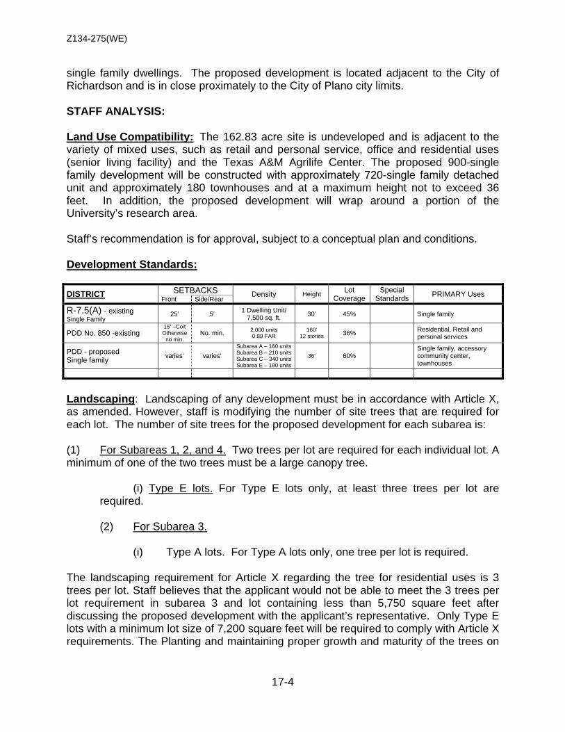
Z134-275(WE)
17-4
single family dwellings. The proposed development is located adjacent to the City of Richardson and is in close proximately to the City of Plano city limits. STAFF ANALYSIS: Land Use Compatibility: The 162.83 acre site is undeveloped and is adjacent to the variety of mixed uses, such as retail and personal service, office and residential uses (senior living facility) and the Texas A&M Agrilife Center. The proposed 900-single family development will be constructed with approximately 720-single family detached unit and approximately 180 townhouses and at a maximum height not to exceed 36 feet. In addition, the proposed development will wrap around a portion of the University’s research area. Staff’s recommendation is for approval, subject to a conceptual plan and conditions. Development Standards: DISTRICT SETBACKS Density Height Lot
Coverage Special
Standards PRIMARY Uses Front Side/Rear
R-7.5(A) - existing Single Family 25’ 5’ 1 Dwelling Unit/
7,500 sq. ft. 30’ 45% Single family
PDD No. 850 -existing 15’ –Coit Otherwise
no min. No. min. 2,000 units
0.89 FAR 160’
12 stories 36% Residential, Retail and personal services
PDD - proposed Single family varies’ varies’
Subarea A – 160 units Subarea B – 210 units Subarea C – 340 units Subarea E – 190 units
36’ 60% Single family, accessory community center, townhouses
Landscaping: Landscaping of any development must be in accordance with Article X, as amended. However, staff is modifying the number of site trees that are required for each lot. The number of site trees for the proposed development for each subarea is: (1) For Subareas 1, 2, and 4. Two trees per lot are required for each individual lot. A minimum of one of the two trees must be a large canopy tree.
(i) Type E lots. For Type E lots only, at least three trees per lot are required.
(2) For Subarea 3.
(i) Type A lots. For Type A lots only, one tree per lot is required. The landscaping requirement for Article X regarding the tree for residential uses is 3 trees per lot. Staff believes that the applicant would not be able to meet the 3 trees per lot requirement in subarea 3 and lot containing less than 5,750 square feet after discussing the proposed development with the applicant’s representative. Only Type E lots with a minimum lot size of 7,200 square feet will be required to comply with Article X requirements. The Planting and maintaining proper growth and maturity of the trees on

Z134-275(WE)
17-5
each lot was a concern in discussing the tree requirements for the proposed single family development. Traffic: The Engineering Section of the Department of Development Services has reviewed the request and determined that the proposed single family development will not have a detrimental impact upon the surrounding street system.

Z134-275(WE)
17-6
LIST OF OFFICERS Centurium American
LIST OF OFFICERS Texas A&M University

Z134-275(WE)
17-7
ARTICLE ___.
PD ___.
SEC. 51P-__.101. LEGISLATIVE HISTORY. PD ___ was established by Ordinance No. ____, passed by the Dallas City Council on ____, 2014. SEC. 51P-__.102. PROPERTY LOCATION AND SIZE. PD ___ is established on property located on the east side of Coit Road, north of McCullum Road. The size of PD ___ is approximately 162.83 acres. SEC. 51P-__.103. DEFINITIONS AND INTERPRETATIONS.
(a) Unless otherwise stated, the definitions and interpretations in Chapter 51A apply to this article.
(b) Unless otherwise stated, all references to articles, divisions, or sections in
this article are to articles, divisions, or sections in Chapter 51A. (c) CORNERSIDE YARD means a side yard that abuts a street (d) TYPE A LOTS means a minimum lot size of 2,730 square feet with a
minimum lot width of 26 feet and a minimum lot depth of 105 feet. (e) TYPE B LOTS means a minimum lot size of 5,750 square feet with a
minimum lot width of 50 feet and a minimum lot depth is 115 feet. (f) TYPE C LOTS means a minimum lot size of 4,400 square feet with a
minimum lot width is 40 feet and a minimum lot depth is 110 feet. (g) TYPE E LOTS means a minimum lot area of 7,200 square feet with a
minimum lot width of 60 feet and a minimum lot depth is 120 feet
(h) This district is considered to be a residential zoning district.
PROPOSED PDD CONDITIONS
Z134-275(WE)
17-8
SEC. 51P- .104. EXHIBIT. The following exhibit is incorporated into this article: Exhibit ___A: conceptual plan. SEC. 51P-___.105. CONCEPTUAL PLAN. Development and use of the Property must comply with the conceptual plan (Exhibit ___A). In the event of a conflict between the text of this article and the conceptual plan, the text of this article controls. SEC. 51P-___.106. DEVELOPMENT PLAN.
(a) A development plan that complies with the conceptual plan and this article must be submitted for each phase of development and must be approved by the city plan commission prior to the issuance of a building permit for that phase.
(b) All development plans must include a label for each lot indicating lot type
(Type A thru E as defined in this article) and must include a tabulation box including the total for each lot type in compliance with this article. SEC. 51P-___.107. MAIN USES PERMITTED. (a) Except as provided, the only main uses permitted in this district are those main uses permitted in the R-7.5(A) Single Family District, subject to the same conditions applicable in the Single Family District, as set out in the Dallas Development Code. For example, a use permitted in the R-7.5(A) Single Family District only by specific use permit (SUP) is permitted in this district only by SUP; a use subject to development impact review (DIR) in the R-7.5(A) Single Family District is subject to DIR in this district; etc.
(b) Accessory community center (private) [(Subarea 3), maximum 2,500 square feet)]
(c) Guard Houses [Two guard houses are permitted, one at each access
point] SEC. 51P-___.108. ACCESSORY USES. As a general rule, an accessory use is permitted in any district in which the main use is permitted. Some specific types of accessory uses, however, due to their unique nature, are subject to additional regulations in Section 51A-4.217. For more information regarding accessory uses, consult Section 51A-4.217.

Z134-275(WE)
17-9
SEC. 51P-___.109. YARD, LOT, AND SPACE REGULATIONS. (Note: The yard, lot, and space regulations in this section must be read together with the yard, lot, and space regulations in Division 51A-4.400. In the event of a conflict between this section and Division 51A-4.400, this section controls.) (a) In general. Except as otherwise provided in this section, the yard, lot, and space regulations contained in Section 51A-4.112, R-7.5(A) Single Family District, apply to this planned development district. (b) Cornerside yard. Minimum cornerside yard is 15 feet.
(c) Subarea 1
(1) Front yard. Minimum front yard is:
(a) Type B lots, minimum front yard is 20 feet.
(b) Type C lots, minimum front yard is 20 feet.
(c) Type E lots, minimum front yard is 25 feet.
(2) Side and rear yard. Minimum side yard is:
(a) Type B lots, minimum side yard is 5 feet. (b) Type C lots, minimum side yard is 5 feet.
(c) Type E lots, minimum side yard is 5 feet.
(3) Density. Total maximum of number of dwelling units is 160
(a) Type B lots. Maximum number of dwelling units is 65. (b) Type C lots. Maximum number of dwelling units is 60. (c) Type E lots. Maximum number of dwelling units is 35.
(4) Height. Maximum structure height is 36 feet.
(5) Lot Size. (a) Type B. Minimum lot size is 5,750 square feet. (b) Type C. Minimum lot size is 4,400 square feet.
Z134-275(WE)
17-10
(c) Type E. Minimum lot size is 7,200 square feet. (6) Stories. Maximum number of stories above grade is 2.
(d) Subarea 2 – Type B Lots
(1) Front yard. Minimum front yard is 20 feet.
(2) Side yard. Minimum side yard is 5 feet:
(3) Rear yard.
(a) Minimum rear yard is 20 feet. (b) For cul-de-sacs, minimum rear yard is 5 feet.
(4) Density. Maximum number of dwelling units is 210. (5) Height. Maximum structure height is 36 feet.
(6) Lot size. Minimum lot area is 5,750 square feet.
(7) Stories. Maximum number of stories is 2.
(e) Subarea 3
(1) Front yard. Minimum front yard is:
(a) Type A lots, minimum front yard is 25 feet.
(b) Type C lots, minimum front yard is 10 feet.
(2) Side yard. Minimum side yard is: (a) Type A lots, minimum side yard is 0 feet. (b) Type C lots, minimum side yard is 5 feet.
(3) Rear yard. Minimum rear yard is:
(1) Type A lots, minimum rear yard is 5 feet (2) Type C lots, Minimum rear yard is 20 feet.
Z134-275(WE)
17-11
(i) For cul-de-sacs, minimum rear yard is 5 feet.
(4) Density. Total maximum number of dwelling units is 340.
(a) Type A lots. Maximum number of dwelling units is 180. (b) Type C lots. Maximum number of dwelling units is 160.
(5) Height. Maximum structure height is 36 feet. (6) Lot size.
(a) Type A. Minimum lot size is 2,730 square feet. (b) Type C. Minimum lot size is 4,400 square feet. (7) Stories. Maximum number of stories above grade is 2. (f) Subarea 4
(1) Front yard. Minimum front yard is:
(a) Type B lots, minimum front yard is 25 feet.
(b) Type C lots, minimum front yard is 20 feet.
(2) Side and rear yards. Minimum side yard is 5 feet. (3) Density. Total maximum number of dwelling units is 190.
(a) Type B lots. Maximum number of dwelling units is 80. (b) Type C lots. Maximum number of dwelling units is 110.
(4) Height. Maximum structure height is 36 feet. (5) Lot size. (a) Type B. Minimum lot size is 5,750 square feet. (b) Type C. Minimum lot size is 4,400 square feet.
(6) Stories. For single family uses, maximum number of stories above grade is 2.

Z134-275(WE)
17-12
SEC. 51P-___.110. OFF-STREET PARKING AND LOADING. Consult the use regulations contained in Division 51A-4.200 for the specific off-street parking/loading requirements for each use. SEC. 51P-___.111. ENVIRONMENTAL PERFORMANCE STANDARDS. See Article VI. SEC. 51P-___.112. LANDSCAPING AND TREE MITIGATION. (a) Except as provided in this section, landscaping must be provided in accordance with Article X. (b) Accessory community center (private). For an accessory community center (private), landscaping must be in accordance with Article X, as amended. (c) Single family uses. The following tree requirements apply. (1) For Subareas 1, 2, and 4. Two trees per lot are required for each individual lot. A minimum of one of the two trees must be a large canopy tree.
(i) Type E lots. For Type E lots only, at least three trees per lot are required.
(2) For Subarea 3.
(i) Type A lots. For Type A lots only, one tree per lot is required. (d) Common areas. Common areas must be landscaped in accordance with the development plans. (e) Street Trees.
(1) Street trees must be provided along the main street and provided at one tree per 50 linear feet of street.
(2) Trees must be evenly distributed along both sides of the street and at a
consistent depth within 10-feet of the back of curb. (3) The installation of street must be competed with the completion of each
subarea addition.
Z134-275(WE)
17-13
SEC. 51P-___.113. FENCES (a) A minimum six-foot-high perimeter fence is required as shown on the conceptual plan. The fence material could consist of oriental metal, masonry, or wood or any combination. (b) Pedestrian or vehicular access gates are prohibited on the exterior or interior fences. SEC. 51P-___.114. SIGNS. Signs must comply with the provisions for non-business zoning districts in Article VII. SEC. 51P-___.115. ADDITIONAL PROVISIONS. (a) The entire Property must be properly maintained in a state of good repair and neat appearance.
(b) Development and use of the Property must comply with all federal and state laws and regulations, and with all ordinances, rules, and regulations of the city.
SEC. 51P-___.116. COMPLIANCE WITH CONDITIONS. (a) All paved areas, permanent drives, streets, and drainage structures, if any, must be constructed in accordance with standard city specifications, and completed to the satisfaction of the director of public works and transportation.
(b) The building official shall not issue a building permit to authorize work, or a certificate of occupancy to authorize the operation of a use in this district until there has been full compliance with this article, the Dallas Development Code, the construction codes, and all other ordinances, rules, and regulations of the city.

Z134-275(WE)
17-14
CONCEPTUAL PLAN
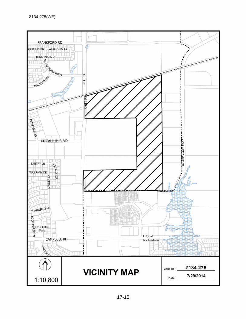
Z134-275(WE)
17-15

Z134-275(WE)
17-16
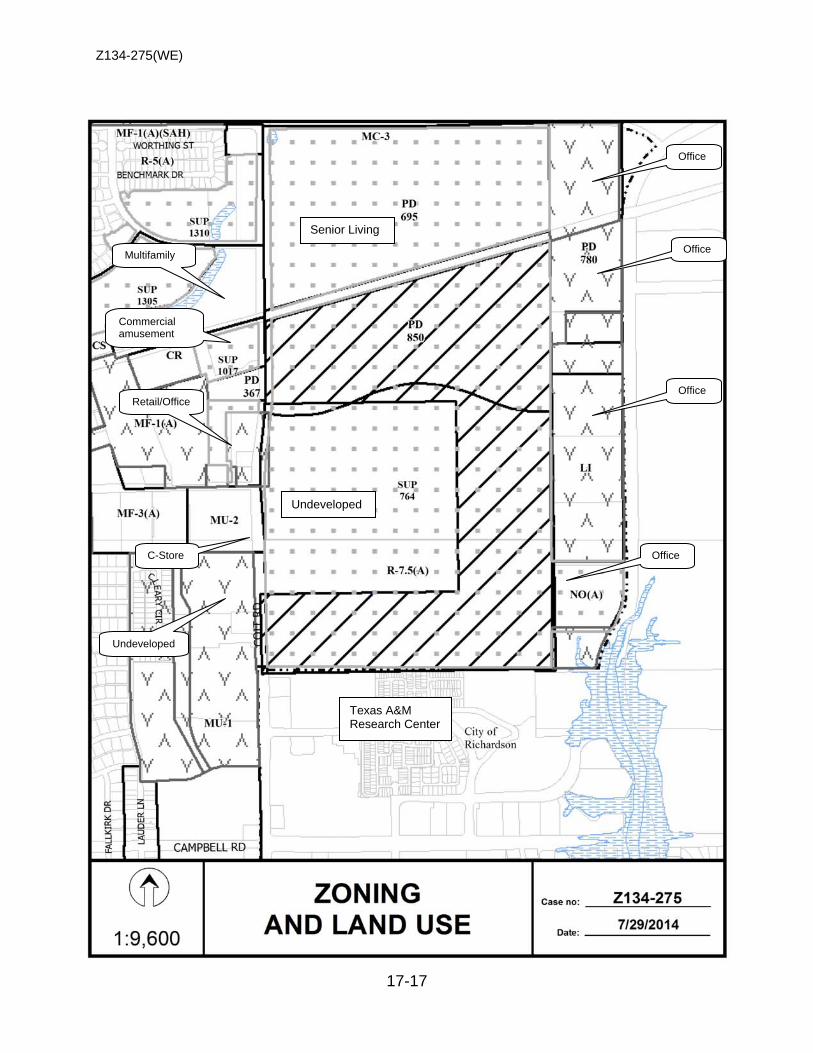
Z134-275(WE)
17-17
Multifamily
Senior Living
Undeveloped
Texas A&M Research Center
Retail/Office
Undeveloped
C-Store Office
Office
Office
Office
Commercial amusement
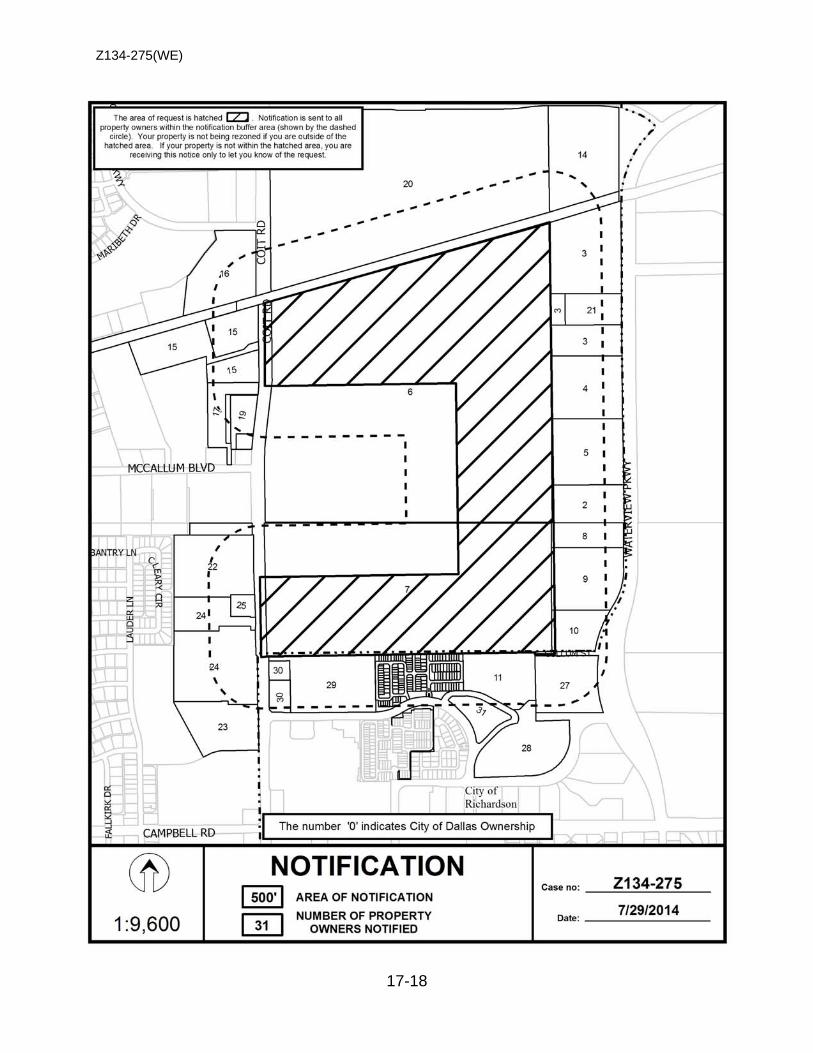
Z134-275(WE)
17-18
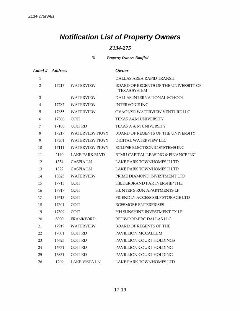
Z134-275(WE)
17-19
Notification List of Property Owners Z134-275
31 Property Owners Notified
Label # Address Owner 1 DALLAS AREA RAPID TRANSIT
2 17217 WATERVIEW BOARD OF REGENTS OF THE UNIVERSITY OF TEXAS SYSTEM
3 WATERVIEW DALLAS INTERNATIONAL SCHOOL
4 17787 WATERVIEW INTERVOICE INC
5 17655 WATERVIEW GVAOI/SR WATERVIEW VENTURE LLC
6 17300 COIT TEXAS A&M UNIVERSITY
7 17100 COIT RD TEXAS A & M UNIVERSITY
8 17217 WATERVIEW PKWY BOARD OF REGENTS OF THE UNIVERSITY
9 17201 WATERVIEW PKWY DIGITAL WATERVIEW LLC
10 17111 WATERVIEW PKWY ECLIPSE ELECTRONIC SYSTEMS INC
11 2140 LAKE PARK BLVD BTMU CAPITAL LEASING & FINANCE INC
12 1354 CASPIA LN LAKE PARK TOWNHOMES II LTD
13 1322 CASPIA LN LAKE PARK TOWNHOMES II LTD
14 18325 WATERVIEW PRIME DIAMOND INVESTMENT LTD
15 17713 COIT HILDERBRAND PARTNERSHIP THE
16 17817 COIT HUNTER'S RUN APARTMENTS LP
17 17613 COIT FRIENDLY ACCESS SELF STORAGE LTD
18 17501 COIT ROSSMORE ENTERPRISES
19 17509 COIT HH SUNSHINE INVESTMENT TX LP
20 8000 FRANKFORD REDWOOD-ERC DALLAS LLC
21 17919 WATERVIEW BOARD OF REGENTS OF THE
22 17001 COIT RD PAVILLION MCCALLUM
23 16623 COIT RD PAVILLION COURT HOLDINGS
24 16731 COIT RD PAVILLION COURT HOLDING
25 16831 COIT RD PAVILLION COURT HOLDING
26 1209 LAKE VISTA LN LAKE PARK TOWNHOMES LTD
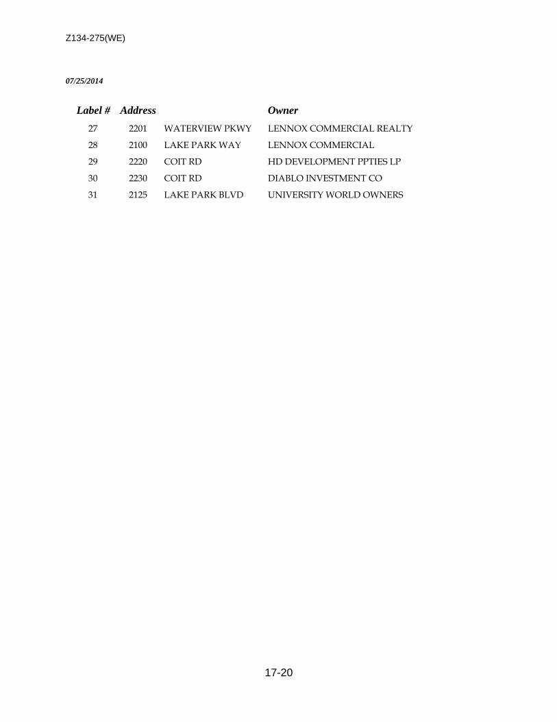
Z134-275(WE)
17-20
07/25/2014
Label # Address Owner 27 2201 WATERVIEW PKWY LENNOX COMMERCIAL REALTY
28 2100 LAKE PARK WAY LENNOX COMMERCIAL
29 2220 COIT RD HD DEVELOPMENT PPTIES LP
30 2230 COIT RD DIABLO INVESTMENT CO
31 2125 LAKE PARK BLVD UNIVERSITY WORLD OWNERS
18-1
CITY PLAN COMMISSION THURSDAY, AUGUST 7, 2014 Planner: David Cossum
FILE NUMBER: Z123-290 DATE INITIATED: May 22, 2013
LOCATION: Located on Bernal Drive between Palacios Avenue and Singleton Boulevard.
COUNCIL DISTRICT: 6 () MAPSCO: 42L
SIZE OF REQUEST: Approx. .37,500 sq. ft. CENSUS TRACT: 8
REPRESENTATIVE: Michael Coker, Michael R. Coker Company
APPLICANT/OWNER: Good Shepherd Community Center. REQUEST: A City Council authorized hearing to consider a Planned
Development District for R-5(A) Single Family District uses and a child-care facility; community service center; and private recreation center, club, or area on property zoned an R-5(A) Single Family District.
SUMMARY: The purpose of this zoning proposal would be to allow the
continued use of the property as a child care facility by allowing the child care facility by right and providing for development standards to allow for the existing buildings and other improvements on the site.
STAFF RECOMMENDATION: Approval, subject to a site plan and conditions.

Z123-290
18-2
GUIDING CRITERIA FOR RECOMMENDATION: Staff recommends approval subject to a development plan/landscape plan and conditions based upon:
1. Performance impacts upon surrounding property (lighting, noise, odor, etc.) – There are no proposed expansions and all improvements exist on the property today, with no proposed expansions that could impact the surrounding residential neighborhood.
2. Traffic impact – There is no projected increase in trip generation associated with the continued use of the property as a child care facility.
3. Comprehensive Plan or Area Plan Conformance – forwardDallas! recognizes the
importance of various institutional uses located within established residential areas.
4. Justification for PD Planned Development District Zoning as opposed to a Specific Use Permit – The applicant’s request for a Planned Development as opposed to a Specific Use Permit is threefold: 1) to allow an existing building encroachment into the front yard setback on Bernal, 2) Allow a fence over 4 feet in height in the front yard setback on Bernal, and 3) permit the entire request site to be treated as a single building site.
5. There has been a child care facility at this location for approximately 35 years with no known negative impacts. The facility is located on an arterial with adequate room for drop offs and pick-ups off the street and on the site.
BACKGROUND INFORMATION:
• The request site is currently developed as child-care facility, with a community service center, and private recreation center, club or area accessory to the child care facility.
• Specific Use Permit No. 1541 for a child-care facility; community service center; and private recreation center, club, or area was approved by City Council on April 14, 2004, for a five-year period with eligibility for additional five-year periods subject to a site plan and conditions. The Good Shepherd Community Center had been operating for 25 years at the subject location prior to obtaining the Specific Use Permit.
• The applicant submitted an application for automatic renewal on December 14, 2011. At that time it was determined the site was not in compliance with the site plan and conditions and could not be automatically renewed. Some of the issues that needed to be addressed to bring the facility into full compliance with zoning regulations could not be addressed with a new or amended Specific Use
Z123-290
18-3
Permit. This included encroachments of existing structures, parking and fences into required setbacks.
• Five City Councilmembers, in a memo dated April 17, 2013, requested the Mayor
place this item be placed on the City Council agenda and advertised as a public hearing as required by 51A-4.701(a)(1) of the Dallas Development Code to authorize consideration of proper zoning of the site.
• On May 22, 2013 City Council authorized a hearing to consider proper zoning of
the site with consideration given to a Planned Development District for R-5(A) Single Family District uses and a child-care facility; community service center; and private recreation center, club, or area.
• The original SUP included a community service center use to allow a food pantry on site and allowed a private recreation center, club, or area to allow the playground facility for the use to be located on an adjacent lot. Neither the community service center use or the private recreation center club or area are included as uses allowed by right in the proposed PD conditions and the playground area will be allowed as accessory to the child care facility.
• Mi Escueleta, also a non-profit organization, is assuming control over the facility and desires to continue to operate the child care facility on the site.
• The existing main structure is approximately 6,515 square feet and has approximately 15,414 square feet of outside play area on a 37,500 square feet lot.
• The site is surrounded by single family development.
• A six-foot solid wood fence on the western site of the property would be appropriate screening from the residential adjacent development.
• Day care facilities are permitted in all zoning districts but are subject to a specific use permit in residential districts, as a limited use in office districts, and as a use allowed by right in all other non-residential districts.
• The applicant has requested a PDD for consideration of the following: 1) child care facility allowed by right; 2) fencing and off-street parking permitted within a required front yard; 3) provide for alternative landscape regulations.
• The existing uses and development standards afforded by the R-5(A) District will be retained.

Z123-290
18-4
Zoning History: There has been one zoning request in the area other than the SUP on the request site.
1. Z056-230 On October 13, 2004, the City Council approved an NS(A) Neighborhood Service District, subject to deed restrictions volunteered by the applicant on property zoned an R-5(A) Single Family District located on the north side of Bernal Avenue, east of Palacios Street.
Thoroughfares/Streets:
Thoroughfares/Street Type Existing ROW
Bernal Drive Collector 150.ft.
Homer Street Local 50 ft. Traffic: The facility is located on a collector with adequate room for drop offs and pick-ups on the site. There is no increase in floor area proposed and there should be little impact on enrollment at the facility and no change in traffic impacts. Land Use:
Zoning Land Use
Site R-5(A) Child-care facility, community service center, and private recreation center, club or area
Northeast R-5(A) Single Family Residential
Southeast R-5(A) Single Family Residential
Southwest R-5(A) Single Family Residential
Northwest R-5(A) Single Family Residential

Z123-290
18-5
STAFF ANALYSIS: Comprehensive Plan: The request site is located in an area considered a Residential Neighborhood. This Building Block represents the life-blood of Dallas, the traditional neighborhood of single-family detached homes. Dallas has many neighborhoods that match this description, including Winnetka Heights, Preston Hollow, Lakewood and Wheatley Place. Single-family dwellings are the dominate land use in these areas. Some shops, restaurants or institutional land uses such as schools and religious centers that serve neighborhood residents may be located at the edges or at key intersections. GOAL 1.2 Promote desired development.
Policy 1.2.1 Use Vision Building Blocks as a general guide for desired
development patterns.
Area Plans: Ledbetter Singleton North Industrial Area Special Study The property is located in Subarea 2. The plan recommends for uses consistent with R-5 District. The use of the property complies with the plan’s recommendations.
West Dallas Comprehensive Land Use Study The property is located in Subarea 2: Ledbetter/Chalk Hill which is zoned Residential R-5(A). The use for the property complies with the West Dallas Comprehensive Land Use Study.
Land Use Compatibility: The request site developed with a structure housing a child care facility, with the balance of the property improved with play areas and surface parking. The applicant has requested a PDD for consideration of the following: 1) child care facility allowed by right; 2) fencing and off-street parking permitted within a required front yard; 3) provide for alternative landscape regulations.
The child care facility is located within an area developed with low-density single family uses. Staff recognizes the existing use as part of the fabric of this residential area. There is no proposed expansion of the use at this time. An accessory structure that was added to the site as part of the previous SUP site plan is located on a different portion of the site then shown on the approved site plan but has no impact on surrounding property .

Z123-290
18-6
As a result of this analysis, staff supports the request subject to the attached development plan and conditions.
Given the size of the facility and since the day care facility has been operating in a similar capacity for over 30 years at this location, staff is not requesting a traffic circulation plan.
Development Standards:
DISTRICT SETBACKS Density FAR Height Lot
Coverage Special
Standards Primary Uses Front Side/Rear Existing
R-5(A) Single Family 20’ 5’ 1 Dwelling Unit/
5,000 sq. ft. 30’ 45% Single family
Proposed
R-5(A) Child Care Facility
20’ (0 for
50 ft on Bernal
for Child care
facility)
5’ (10’ for child care facility)
1 Dwelling Unit/ 5,000 sq. ft. 30’
45% (30% for
Child Care facility)
Child Care facility
Parking and fence
in front yard
Single family Child care facility
Off-Street Parking:
Parking will exceed the requirements of the Development Code for a child care facility use.
Landscaping: The site possesses existing mature landscaping around the property. The existing landscaping is shown on the development/landscape plan
Z123-290
18-7
RECOMMENDED CONDITIONS FOR A PLANNED DEVELOPMENT DISTRICT
SEC. 51P___ .101. LEGISLATIVE HISTORY. PD _ was established by Ordinance No._, passed by the Dallas City Council on _. SEC. 51P ____.102 . PROPERTY LOCATION AND SIZE. PD _____ is established on property generally located on the northwest side of Bernal Drive, approximately 250 feet southwest of Palacios Avenue. The size of PD ___ is approximately 0.86 acres. SEC. 51P- .103. DEFINITIONS AND INTERPRETATIONS.
(a) Unless otherwise stated, the definitions and interpretations in Chapter 51A apply to this article.
(b) Unless otherwise stated, all references to articles, divisions, or sections in this article are to articles, divisions, or sections in Chapter 51A.
(c) This district is considered to be a residential zoning district.
(d) The entire district shall be considered a single building site for the purpose of a child care facility use. This provision expressly allows a playground area and parking areas to be on adjacent lots within this district.
SEC. 51P- .104. EXHIBITS. The following exhibits are incorporated into this article: (1) Exhibit __A: development/landscape plan. SEC. 51P-____.105. DEVELOPMENT PLAN.
(a) For a child care facility, development and use of the Property must comply with the development/landscape plan (Exhibit ___A). If there is a conflict between the text of this article and the development plan, the text of this article controls.
Z123-290
18-8
(b) For all other uses, no development plan is required, and the provisions of Section 51A-4.702 regarding submission of or amendments to a development plan, site analysis plan, conceptual plan, development schedule, and landscape plan do not apply.
SEC. 51P- .106. MAIN USES PERMITTED. (a) Except as provided in this section, the only main uses permitted are those main uses permitted in the R-5(A) Single Family District, subject to the same conditions applicable in the R-5(A) Single Family District, as set out in Chapter 51A. For example, a use permitted in the R-5(A) Single Family District only by specific use permit (SUP) is permitted in this district only by SUP; a use subject to development impact review (DIR) in the R-5(A) Single Family District is subject to DIR in this district, etc.
(b) A child care facility is permitted by right.
SEC. 51P- .107. ACCESSORY USES. As a general rule, an accessory use is permitted in any district in which the main use is permitted. Some specific accessory uses, however, due to their unique nature, are subject to additional regulations contained in Section 51A-4.217. For more information regarding accessory uses, consult Section 51A-4.217.
SEC. 51P- .108. YARD, LOT, AND SPACE REGULATIONS. (Note: The yard, lot, and space regulations in this section must be read together with the yard, lot, and space regulations in Division 51A-4.400. If there is a conflict between this section and Division 51A-4.400, this section controls).
(a) In general. Except as provided in this section, the yard, lot, and space regulations for the R-5(A) Single Family District apply.
(b) Front yard. For a child care facility, minimum front yard is 20 feet except that a portion of a building up to 50 feet in width may have a front yard setback of 0 feet.
(c) Side and Rear yard. For a child care facility, minimum side and rear yard is ten feet.
(d) Floor area. For a child care facility, maximum floor area is 10,000 square feet.
(e) Lot coverage. For a child care facility, maximum lot coverage is 30 percent.
(f) Building placement.
(1) No structures are permitted within 150 feet of Odessa Street except for playground equipment and a maximum 200 square foot accessory structure.

Z123-290
18-9
(2) One accessory structure a maximum of 700 square feet in area may encroach into a utility easement subject to 51A-8.602(f).
SEC. 51P- .109. OFF-STREET PARKING AND LOADING.
(a) In general. Except as provided in this section, consult the use regulations in Division 51A-4.200 for the specific off-street parking and loading requirements for each use.
(b) Parking placement and access restrictions for a child care facility use.
(1) Drive access is prohibited on Odessa Street.
(2) Parking is prohibited within 150 of Odessa Street.
(3) Parking may be provided in the required yards.
SEC. 51P- .111. FENCING.
(a) Fencing up to 8 feet in height may be provided in the required front yard on Bernal Street as reflected on the development plan.
(b) A minimum 6 feet tall solid screening fence must be provided adjacent to parking areas as indicated on the development plan.
SEC. 51P- .112. ENVIRONMENTAL PERFORMANCE STANDARDS.
See Article VI.
SEC. 51P- .113. LANDSCAPING.
(a) In general. Except as provided in this section, landscaping must be provided in accordance with Article X.
(b) Child-care facility. For a child-care facility, landscaping must be provided as
shown on the attached development/landscape plan.
(c) Maintenance. Plant materials must be maintained in a healthy, growing condition.
SEC. 51P- .114. SIGNS.
Signs must comply with the provisions for non-business zoning districts in Article VII. SEC. 51P- .115. ADDITIONAL PROVISIONS.
Z123-290
18-10
(a) The Property must be properly maintained in a state of good repair and neat appearance.
(b) Development and use of the Property must comply with all federal and state laws and regulations, and with all ordinances, rules, and regulations of the city. SEC. 51P- .116. COMPLIANCE WITH CONDITIONS.
(a) All paved areas, permanent drives, streets, and drainage structures, if any, must be constructed in accordance with standard city specifications, and completed to the satisfaction of the director of public works and transportation.
(b) The building official shall not issue a building permit to authorize work, or a certificate of occupancy to authorize the operation of a use, in this district until there has been full compliance with this article, the Dallas Development Code, the construction codes, and all other ordinances, rules, and regulations of the City of Dallas.
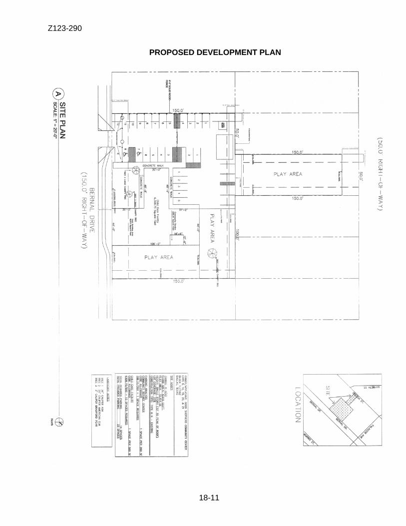
Z123-290
18-11
PROPOSED DEVELOPMENT PLAN
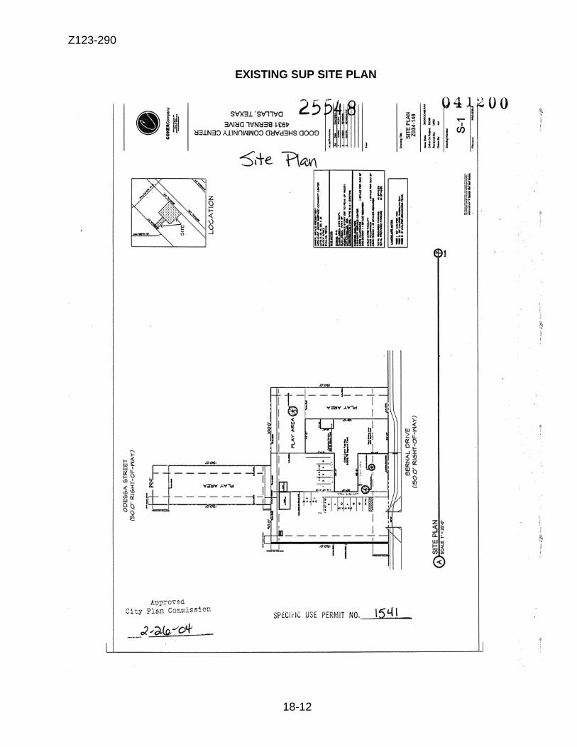
Z123-290
18-12
EXISTING SUP SITE PLAN
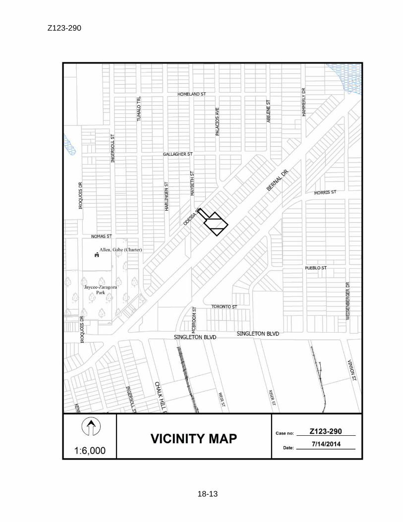
Z123-290
18-13
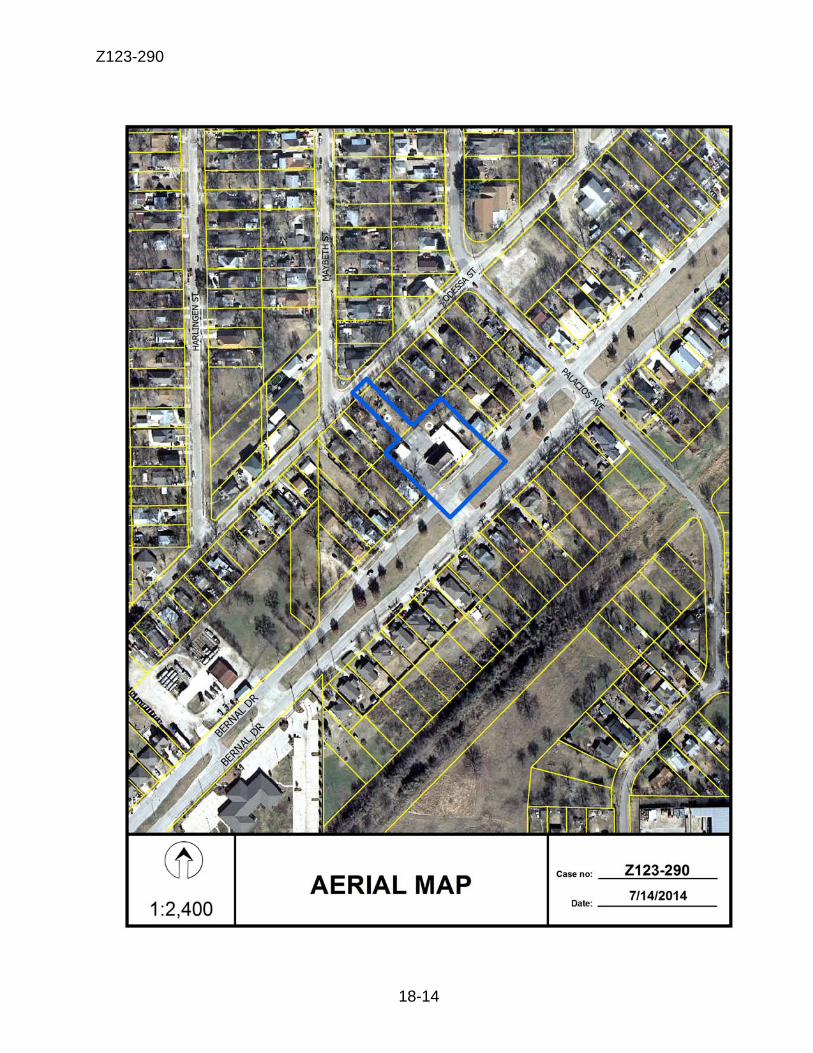
Z123-290
18-14
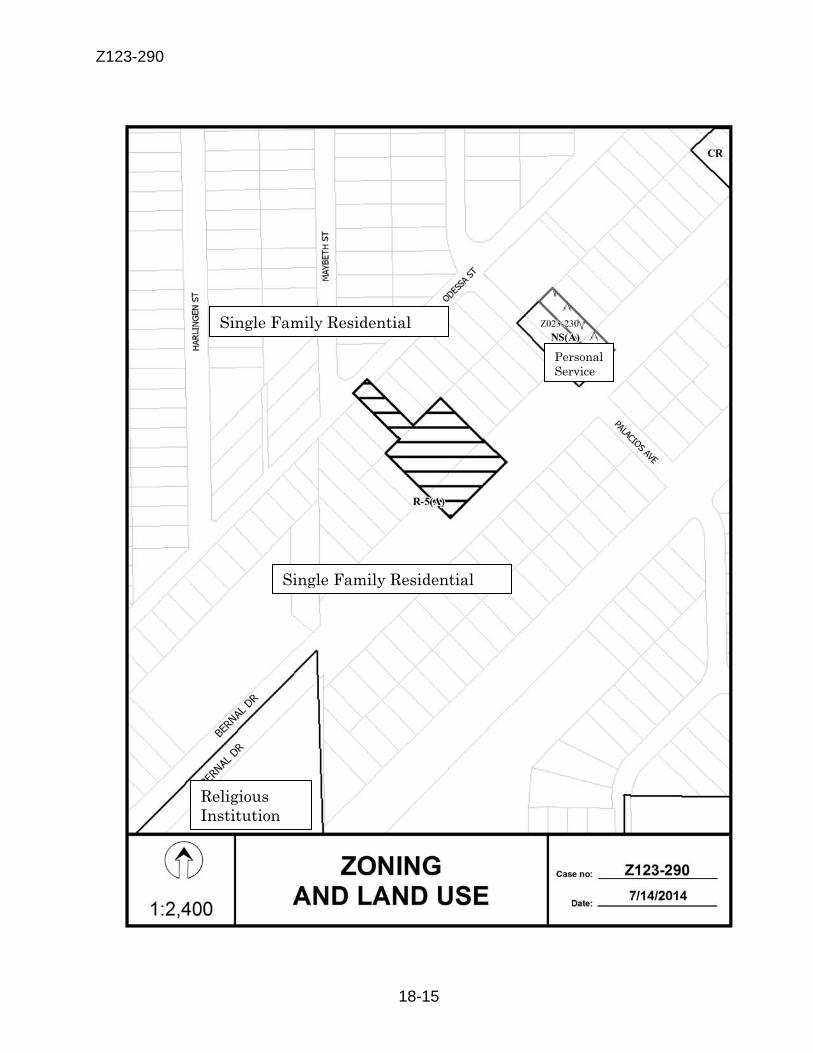
Z123-290
18-15
Personal Service
Single Family Residential
Single Family Residential
Religious Institution
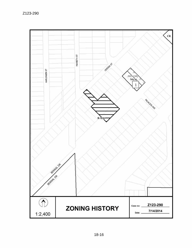
Z123-290
18-16
1
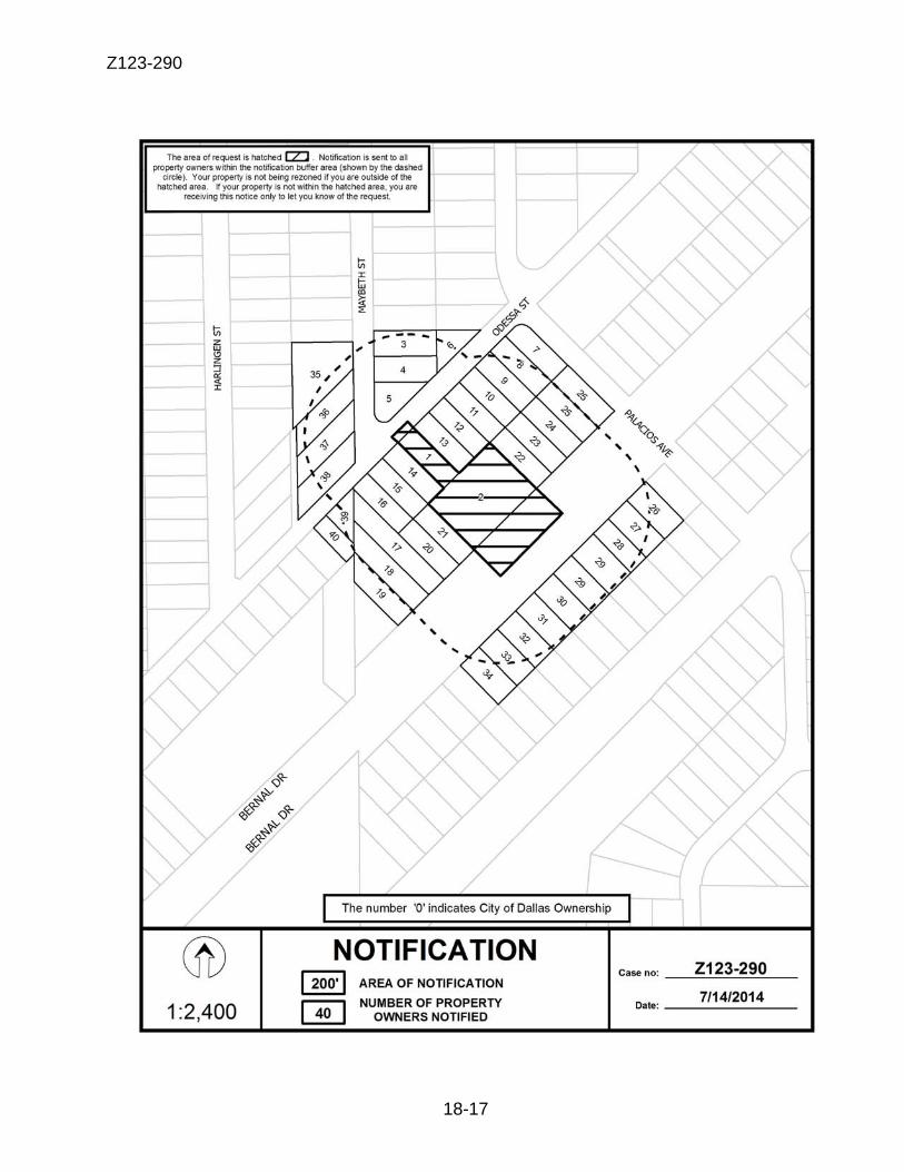
Z123-290
18-17
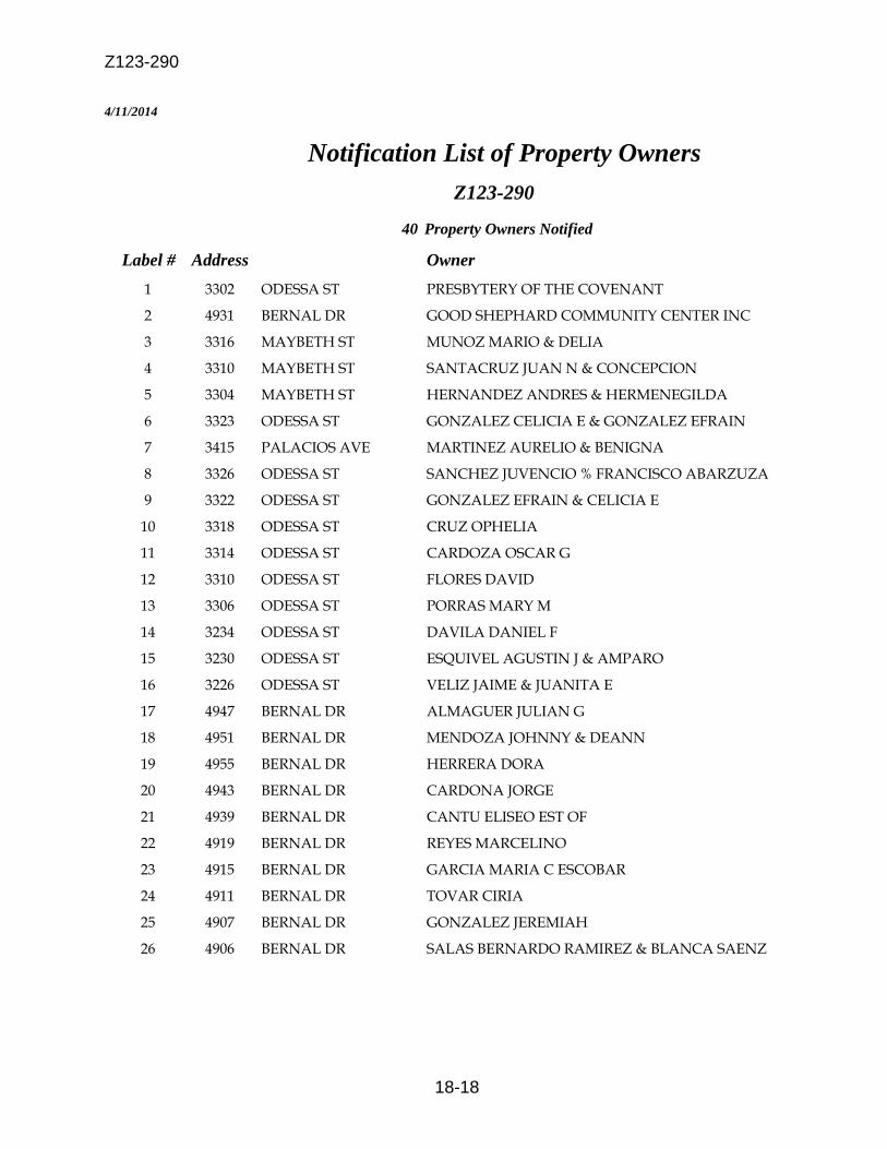
Z123-290
18-18
4/11/2014
Notification List of Property Owners Z123-290
40 Property Owners Notified
Label # Address Owner 1 3302 ODESSA ST PRESBYTERY OF THE COVENANT
2 4931 BERNAL DR GOOD SHEPHARD COMMUNITY CENTER INC
3 3316 MAYBETH ST MUNOZ MARIO & DELIA
4 3310 MAYBETH ST SANTACRUZ JUAN N & CONCEPCION
5 3304 MAYBETH ST HERNANDEZ ANDRES & HERMENEGILDA
6 3323 ODESSA ST GONZALEZ CELICIA E & GONZALEZ EFRAIN
7 3415 PALACIOS AVE MARTINEZ AURELIO & BENIGNA
8 3326 ODESSA ST SANCHEZ JUVENCIO % FRANCISCO ABARZUZA
9 3322 ODESSA ST GONZALEZ EFRAIN & CELICIA E
10 3318 ODESSA ST CRUZ OPHELIA
11 3314 ODESSA ST CARDOZA OSCAR G
12 3310 ODESSA ST FLORES DAVID
13 3306 ODESSA ST PORRAS MARY M
14 3234 ODESSA ST DAVILA DANIEL F
15 3230 ODESSA ST ESQUIVEL AGUSTIN J & AMPARO
16 3226 ODESSA ST VELIZ JAIME & JUANITA E
17 4947 BERNAL DR ALMAGUER JULIAN G
18 4951 BERNAL DR MENDOZA JOHNNY & DEANN
19 4955 BERNAL DR HERRERA DORA
20 4943 BERNAL DR CARDONA JORGE
21 4939 BERNAL DR CANTU ELISEO EST OF
22 4919 BERNAL DR REYES MARCELINO
23 4915 BERNAL DR GARCIA MARIA C ESCOBAR
24 4911 BERNAL DR TOVAR CIRIA
25 4907 BERNAL DR GONZALEZ JEREMIAH
26 4906 BERNAL DR SALAS BERNARDO RAMIREZ & BLANCA SAENZ
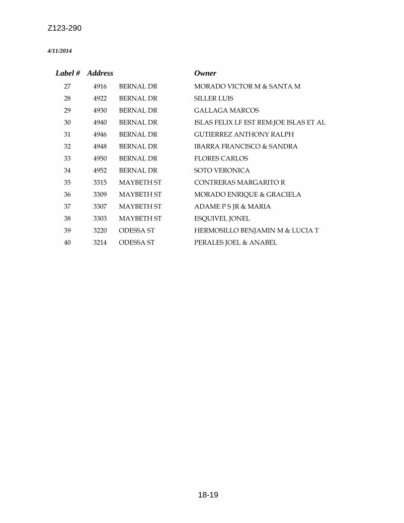
Z123-290
18-19
4/11/2014
Label # Address Owner 27 4916 BERNAL DR MORADO VICTOR M & SANTA M
28 4922 BERNAL DR SILLER LUIS
29 4930 BERNAL DR GALLAGA MARCOS
30 4940 BERNAL DR ISLAS FELIX LF EST REM:JOE ISLAS ET AL
31 4946 BERNAL DR GUTIERREZ ANTHONY RALPH
32 4948 BERNAL DR IBARRA FRANCISCO & SANDRA
33 4950 BERNAL DR FLORES CARLOS
34 4952 BERNAL DR SOTO VERONICA
35 3315 MAYBETH ST CONTRERAS MARGARITO R
36 3309 MAYBETH ST MORADO ENRIQUE & GRACIELA
37 3307 MAYBETH ST ADAME P S JR & MARIA
38 3303 MAYBETH ST ESQUIVEL JONEL
39 3220 ODESSA ST HERMOSILLO BENJAMIN M & LUCIA T
40 3214 ODESSA ST PERALES JOEL & ANABEL
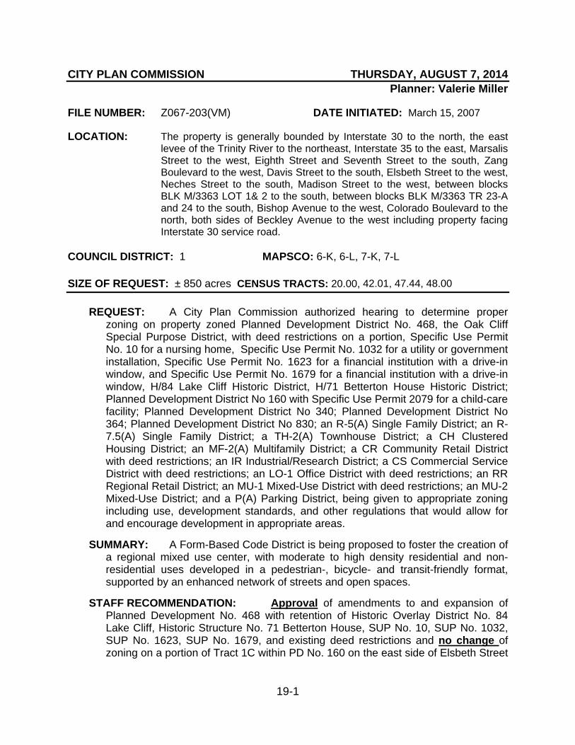
19-1
CITY PLAN COMMISSION THURSDAY, AUGUST 7, 2014 Planner: Valerie Miller
FILE NUMBER: Z067-203(VM) DATE INITIATED: March 15, 2007
LOCATION: The property is generally bounded by Interstate 30 to the north, the east levee of the Trinity River to the northeast, Interstate 35 to the east, Marsalis Street to the west, Eighth Street and Seventh Street to the south, Zang Boulevard to the west, Davis Street to the south, Elsbeth Street to the west, Neches Street to the south, Madison Street to the west, between blocks BLK M/3363 LOT 1& 2 to the south, between blocks BLK M/3363 TR 23-A and 24 to the south, Bishop Avenue to the west, Colorado Boulevard to the north, both sides of Beckley Avenue to the west including property facing Interstate 30 service road.
COUNCIL DISTRICT: 1 MAPSCO: 6-K, 6-L, 7-K, 7-L SIZE OF REQUEST: ± 850 acres CENSUS TRACTS: 20.00, 42.01, 47.44, 48.00
REQUEST: A City Plan Commission authorized hearing to determine proper zoning on property zoned Planned Development District No. 468, the Oak Cliff Special Purpose District, with deed restrictions on a portion, Specific Use Permit No. 10 for a nursing home, Specific Use Permit No. 1032 for a utility or government installation, Specific Use Permit No. 1623 for a financial institution with a drive-in window, and Specific Use Permit No. 1679 for a financial institution with a drive-in window, H/84 Lake Cliff Historic District, H/71 Betterton House Historic District; Planned Development District No 160 with Specific Use Permit 2079 for a child-care facility; Planned Development District No 340; Planned Development District No 364; Planned Development District No 830; an R-5(A) Single Family District; an R-7.5(A) Single Family District; a TH-2(A) Townhouse District; a CH Clustered Housing District; an MF-2(A) Multifamily District; a CR Community Retail District with deed restrictions; an IR Industrial/Research District; a CS Commercial Service District with deed restrictions; an LO-1 Office District with deed restrictions; an RR Regional Retail District; an MU-1 Mixed-Use District with deed restrictions; an MU-2 Mixed-Use District; and a P(A) Parking District, being given to appropriate zoning including use, development standards, and other regulations that would allow for and encourage development in appropriate areas.
SUMMARY: A Form-Based Code District is being proposed to foster the creation of
a regional mixed use center, with moderate to high density residential and non-residential uses developed in a pedestrian-, bicycle- and transit-friendly format, supported by an enhanced network of streets and open spaces.
STAFF RECOMMENDATION: Approval of amendments to and expansion of
Planned Development No. 468 with retention of Historic Overlay District No. 84 Lake Cliff, Historic Structure No. 71 Betterton House, SUP No. 10, SUP No. 1032, SUP No. 1623, SUP No. 1679, and existing deed restrictions and no change of zoning on a portion of Tract 1C within PD No. 160 on the east side of Elsbeth Street

Z067-203(VM)
19-2
between Davis Street and 5th Street; and an R-5(A) District on the east side of Elsbeth Street, between 5th Street and Neches Street.

Z067-203(VM)
19-3
BACKGROUND INFORMATION: As part of the implementation process for the Trinity River Corridor Comprehensive Land Use Plan, the City Plan Commission created an ad hoc committee to work with the community to develop zoning recommendations. In this case, the Oak Cliff Gateway Land Use Opportunity Plan adopted in 2005 called for continued residential development along the Lancaster and Ewing corridors, with the focus of mixed use development located along the river’s edge. In 2007, City Council initiated a zoning case directing staff to evaluate existing zoning regulations with the adopted vision for the area to determine what zoning changes were necessary to facilitate the type of development desired. Given that much of the existing zoning in the Oak Cliff Gateway complied with the adopted plan, staff’s initial recommendation regarding the zoning change was to only change a small portion of the area evaluated. The ad hoc committee hosted a series of meetings in September, October, and November of 2008 to discuss this proposed zoning change. Input from that series of meetings revealed a strong community sentiment to revise the adopted Oak Cliff Gateway Land Use Opportunity Plan, looking at the entire area to place a greater focus on mixed-use development and encourage a more walkable district. The adopted plan did not reflect the vision of the community or the best potential for this area’s redevelopment. As a result, staff began the process to revise the plan for the area. The City also established a new Neighborhood Investment Program (NIP) target area for the Marsalis corridor in 2008, which overlaps a portion of the Oak Cliff Gateway. Since the NIP is an effective tool to address a number of the planning issues that the community raised during the community meetings in the fall of 2008, staff from the Trinity River Corridor Project worked with the Housing Department to incorporate the new NIP area into the Oak Cliff Gateway planning process. The result was an expanded study area which included the zoning authorized hearing boundary and the Marsalis NIP area. In January and February of 2009, community meetings focused on seeking input to clearly define the vision for the neighborhood with the goal of outlining necessary amendments to the Oak Cliff Gateway Land Use Opportunity Plan. Since the community vision was so divergent from the existing adopted plan and zoning must be done in accordance with an adopted comprehensive plan, these amendments are necessary in order to move forward with a future recommendation for zoning changes that reflect the long-term vision for the area. At the conclusion of the series of planning meetings, groups of stakeholders requested that additional areas be included in the plan (Attachment A). After hearing testimony at the April 21, 2009 meeting, the CPC Committee recommended including two of the three areas highlighted on Attachment A in the planning study. Stakeholders advocating for the areas’ inclusion, felt the existing study area boundaries arbitrarily divided the neighborhood and left a gap between the area and other ongoing planning
Z067-203(VM)
19-4
studies. Testimony given at the CPC Committee meeting voiced concerns over adding property into the study area at the end of the process, without detailed input into the plan recommendations for that area. The Trinity River Committee was briefed regarding this item at their April 21, 2009 meeting, and recommended including all of the areas in the study (Attachment B) and directed staff to initiate a process to notify property owners and get community input on the long range vision for the additional area. On May 27, 2009, City Council authorized an amendment to forwardDallas! and the Trinity River Corridor Comprehensive Land Use Plan to incorporate revisions to the Oak Cliff Gateway Land Use Opportunity Plan for the area shown in Attachment B. The City Plan Commission Committee continued to host public meetings in July to gain further public input on plan revisions for the expanded boundaries of the planning study. On September 24, 2009, the Committee made a recommendation to the Plan Commission regarding proposed amendments to the Oak Cliff Gateway Land Use Plan (Attachment C). The Plan consists of two components outlining future land use designations and an urban design framework that identifies important corridors in the area and features, such as views and desired access points to the Trinity River Park. For your information, definitions for each of the land use designations referenced on the attached plan are included below.
• Mixed use - This category represents a mix of uses in a vertical
arrangement within a building. The active pedestrian uses are located on the ground floor with direct street access. The mix of land uses can include combinations such as retail on the ground floor and residential uses on upper floors; ground floor retail with office uses above; or ground floor office with residential uses above. Mixed use development fosters active pedestrian areas.
• Mixed use adaptive reuse would indicate that a similar range of uses [as
above] is appropriate but encourage the reuse of existing structures in order to maintain and enhance the character of the area.
• Mixed use high density - This category represents a mix of uses in a
dense vertical arrangement within a tall building. The active pedestrian uses are located on the ground floor with direct access to major streets and/or transit stations. High density mixed use development can include hotel, office, residential, entertainment and civic uses. Dense mixed-use development fosters active pedestrian areas and is usually located where it can take advantage of quality views.
• Neighborhood infill - This category represents conventional single family
detached homes that will be built within existing residential neighborhoods. ‘Infill’ homes fill in currently-vacant lots within or near an

Z067-203(VM)
19-5
existing a neighborhood. Residential infill supports the established neighborhood and can be supported by schools, churches and parks/open space. Infill development can occur on a lot by lot basis, or as a larger area of new housing within an existing neighborhood.
• Retail community - This category represents limited retail uses intended
to serve the needs of a small market area. Generally, the retail businesses here focus on goods and services such as groceries, prescription drugs and personal services. Most customers live in adjacent neighborhoods. This land use typically has a minimal impact on adjacent neighborhoods because it does not attract customers from a larger region and, as a result, generates less traffic and parking pressure than a large retail center.
On November 5, 2009, the City Plan Commission recommended approval of the Committee’s recommendation with the following changes, as shown in Attachment C:
• Amend the language recommended by the Committee to read: The Plan
recognizes the importance of (1) protection and reuse of contributing historic structures, (2) giving priority to the planning and implementation of a workable, multi-modal area-transportation plan to support the eventually higher densities envisioned by the Plan while maintaining enjoyable walkability and “bikability” for residents and visitors, and (3) minimizing negative impact on established single-family neighborhoods adjacent to the Plan area with the use of residential proximity slopes and by the careful planning of the traffic and parking patterns anticipated in higher density and mixed use development; and
• Revise the future land use designations to include: o A larger area of high-density mixed use along I-30 west of Beckley
and along the eastern portion of Greenbriar Lane; o Neighborhood Infill for properties along Ballard at the northwest
corner of Ballard and Madison, as well as along the eastern side of the block between Madison and El Dorado;
o Limiting the future land use designation to only office and townhouse uses for property near the southwest corner of Zang and Beckley; and
o Remove the western block face of Zang south of Fifth Street from the plan.
In 2010-2012, a steering committee was formed, appointed by previous council members, and prepared a draft ordinance for the area. On August 8, 2013, the City Plan Commission recommended approval of an authorized hearing to determine proper zoning on Oak Cliff Gateway, as shown in attachment D. On September 12, 2013, City Plan Commission recommended approval to expand the authorized hearing for Oak Cliff Gateway, as shown in attachment E.
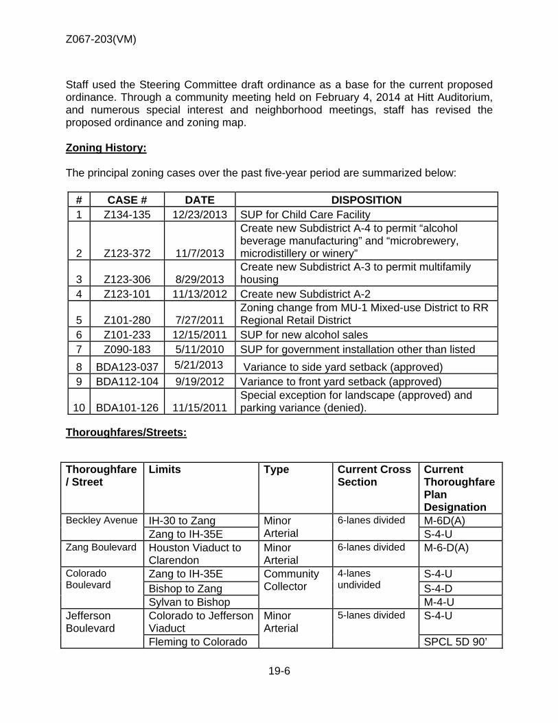
Z067-203(VM)
19-6
Staff used the Steering Committee draft ordinance as a base for the current proposed ordinance. Through a community meeting held on February 4, 2014 at Hitt Auditorium, and numerous special interest and neighborhood meetings, staff has revised the proposed ordinance and zoning map. Zoning History: The principal zoning cases over the past five-year period are summarized below:
# CASE # DATE DISPOSITION 1 Z134-135 12/23/2013 SUP for Child Care Facility
2 Z123-372 11/7/2013
Create new Subdistrict A-4 to permit “alcohol beverage manufacturing” and “microbrewery, microdistillery or winery”
3 Z123-306 8/29/2013 Create new Subdistrict A-3 to permit multifamily housing
4 Z123-101 11/13/2012 Create new Subdistrict A-2
5 Z101-280 7/27/2011 Zoning change from MU-1 Mixed-use District to RR Regional Retail District
6 Z101-233 12/15/2011 SUP for new alcohol sales 7 Z090-183 5/11/2010 SUP for government installation other than listed 8 BDA123-037 5/21/2013
Variance to side yard setback (approved) 9 BDA112-104 9/19/2012 Variance to front yard setback (approved)
10 BDA101-126 11/15/2011 Special exception for landscape (approved) and parking variance (denied).
Thoroughfares/Streets:
Thoroughfare / Street
Limits Type Current Cross Section
Current Thoroughfare Plan Designation
Beckley Avenue IH-30 to Zang Minor Arterial
6-lanes divided M-6D(A) Zang to IH-35E S-4-U
Zang Boulevard Houston Viaduct to Clarendon
Minor Arterial
6-lanes divided M-6-D(A)
Colorado Boulevard
Zang to IH-35E Community Collector
4-lanes undivided
S-4-U Bishop to Zang S-4-D Sylvan to Bishop M-4-U
Jefferson Boulevard
Colorado to Jefferson Viaduct
Minor Arterial
5-lanes divided S-4-U
Fleming to Colorado SPCL 5D 90’
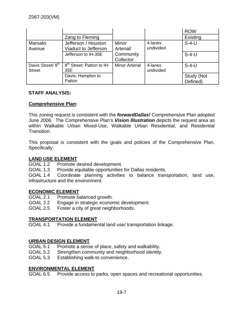
Z067-203(VM)
19-7
ROW Zang to Fleming Existing
Marsalis Avenue
Jefferson / Houston Viaduct to Jefferson
Minor Arterial/ Community Collector
4-lanes undivided
S-4-U
Jefferson to IH-35E S-4-U
Davis Street/ 8th Street
8th Street: Patton to IH-35E
Minor Arterial 4-lanes undivided
S-4-U
Davis: Hampton to Patton
Study (Not Defined)
STAFF ANALYSIS: Comprehensive Plan: This zoning request is consistent with the forwardDallas! Comprehensive Plan adopted June 2006. The Comprehensive Plan’s Vision Illustration depicts the request area as within Walkable Urban Mixed-Use, Walkable Urban Residential, and Residential Transition. This proposal is consistent with the goals and policies of the Comprehensive Plan. Specifically: LAND USE ELEMENT GOAL 1.2 Promote desired development. GOAL 1.3 Provide equitable opportunities for Dallas residents. GOAL 1.4 Coordinate planning activities to balance transportation, land use, infrastructure and the environment.
ECONOMIC ELEMENT GOAL 2.1 Promote balanced growth. GOAL 2.2 Engage in strategic economic development. GOAL 2.5 Foster a city of great neighborhoods. TRANSPORTATION ELEMENT GOAL 4.1 Provide a fundamental land use/ transportation linkage.
URBAN DESIGN ELEMENT GOAL 5.1 Promote a sense of place, safety and walkability. GOAL 5.2 Strengthen community and neighborhood identity. GOAL 5.3 Establishing walk-to convenience. ENVIRONMENTAL ELEMENT GOAL 6.5 Provide access to parks, open spaces and recreational opportunities.
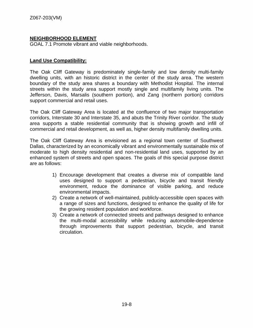
Z067-203(VM)
19-8
NEIGHBORHOOD ELEMENT GOAL 7.1 Promote vibrant and viable neighborhoods.
Land Use Compatibility: The Oak Cliff Gateway is predominately single-family and low density multi-family dwelling units, with an historic district in the center of the study area. The western boundary of the study area shares a boundary with Methodist Hospital. The internal streets within the study area support mostly single and multifamily living units. The Jefferson, Davis, Marsalis (southern portion), and Zang (northern portion) corridors support commercial and retail uses. The Oak Cliff Gateway Area is located at the confluence of two major transportation corridors, Interstate 30 and Interstate 35, and abuts the Trinity River corridor. The study area supports a stable residential community that is showing growth and infill of commercial and retail development, as well as, higher density multifamily dwelling units. The Oak Cliff Gateway Area is envisioned as a regional town center of Southwest Dallas, characterized by an economically vibrant and environmentally sustainable mix of moderate to high density residential and non-residential land uses, supported by an enhanced system of streets and open spaces. The goals of this special purpose district are as follows:
1) Encourage development that creates a diverse mix of compatible land uses designed to support a pedestrian, bicycle and transit friendly environment, reduce the dominance of visible parking, and reduce environmental impacts.
2) Create a network of well-maintained, publicly-accessible open spaces with a range of sizes and functions, designed to enhance the quality of life for the growing resident population and workforce.
3) Create a network of connected streets and pathways designed to enhance the multi-modal accessibility while reducing automobile-dependence through improvements that support pedestrian, bicycle, and transit circulation.
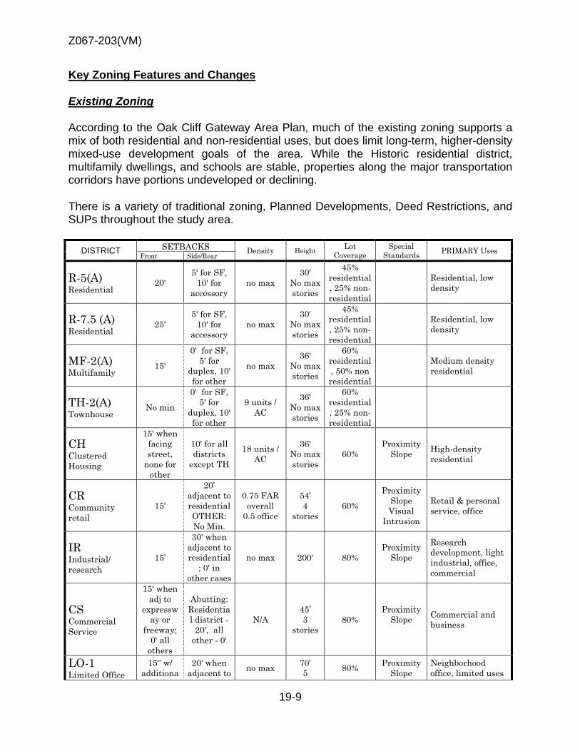
Z067-203(VM)
19-9
Key Zoning Features and Changes
Existing Zoning
According to the Oak Cliff Gateway Area Plan, much of the existing zoning supports a mix of both residential and non-residential uses, but does limit long-term, higher-density mixed-use development goals of the area. While the Historic residential district, multifamily dwellings, and schools are stable, properties along the major transportation corridors have portions undeveloped or declining.
There is a variety of traditional zoning, Planned Developments, Deed Restrictions, and SUPs throughout the study area.
DISTRICT SETBACKS Density Height Lot Coverage
Special Standards PRIMARY Uses
Front Side/Rear
R-5(A) Residential
20' 5' for SF,
10' for accessory
no max 30'
No max stories
45% residential, 25% non-residential
Residential, low density
R-7.5 (A) Residential
25' 5' for SF,
10' for accessory
no max 30'
No max stories
45% residential, 25% non-residential
Residential, low density
MF-2(A) Multifamily
15'
0' for SF, 5' for
duplex, 10' for other
no max 36'
No max stories
60% residential, 50% non residential
Medium density residential
TH-2(A) Townhouse
No min
0' for SF, 5' for
duplex, 10' for other
9 units / AC
36' No max stories
60% residential, 25% non-residential
CH Clustered Housing
15' when facing street,
none for other
10' for all districts
except TH
18 units / AC
36' No max stories
60% Proximity
Slope
High-density residential
CR Community retail
15’
20’ adjacent to residential OTHER: No Min.
0.75 FAR overall
0.5 office
54’ 4
stories 60%
Proximity Slope Visual
Intrusion
Retail & personal service, office
IR Industrial/ research
15’
30' when adjacent to residential
; 0' in other cases
no max 200' 80% Proximity
Slope
Research development, light industrial, office, commercial
CS Commercial Service
15' when adj to
expressway or
freeway; 0' all
others
Abutting: Residential district -
20', all other - 0'
N/A 45’ 3
stories 80%
Proximity Slope
Commercial and business
LO-1 Limited Office
15'' w/ additiona
20' when adjacent to no max 70’
5 80% Proximity Slope
Neighborhood office, limited uses

Z067-203(VM)
19-10
DISTRICT SETBACKS Density Height Lot Coverage
Special Standards PRIMARY Uses
Front Side/Rear
l 10' if over 45'
in height
residential; 0' in other cases;
additional 1' for every
2' in height
over 45' up to 30'
setback
stories U-form setback
RR Regional Retail
15'' w/ additiona
l 10' if over 45'
in height
20' when adjacent to residential
; 0' in other cases
no max 70’ 5
stories 80%
Proximity Slope
U-form setback
Regional retail, personal services, office uses
MU-1 Mixed use-1
15’
20’ adjacent to residential OTHER: No Min.
0.8 FAR base
1.0 FAR maximum + bonus for residential
90’ 7
stories 120’
9 stories with retail
80%
Proximity Slope
U-form setback Tower
spacing Visual
Intrusion
Office, retail & personal service, lodging, residential
MU-2 Mixed use-2
15’
20’ adjacent to residential OTHER: No Min.
1.6 FAR base
2.0 FAR maximum + bonus for residential
135’ 10
stories 180’ 14
stories with retail
80%
Proximity Slope
U-form setback Tower
spacing Visual
Intrusion
Office, retail & personal service, lodging, residential
P(A) Parking
Surface parking
The following chart summarizes the existing five planned development districts within the proposed rezoning:
PD # Permitted uses F.A.R. Height Other PD 160 – Tract 1C
Recreation, institutional, single family, utility
No max 30’
PD 160 – Tract 2B
Recreation, single family, multifamily, institutional, utility
No max 30’ Nonresidential hours: 6:30am-10pm
PD 340 – Tract 1 Uses limited to: dry cleaning, financial with & w/o window, general merchandise, medical clinic. MF, office, personal services, restaurant with & w/o drive through
51A requirements by use
45’
Development plan, restricted hours, no outside loud speakers except for drive-in/drive-through
PD 340 – Tract 2 Limited to 51A requirements by 36’ Development plan
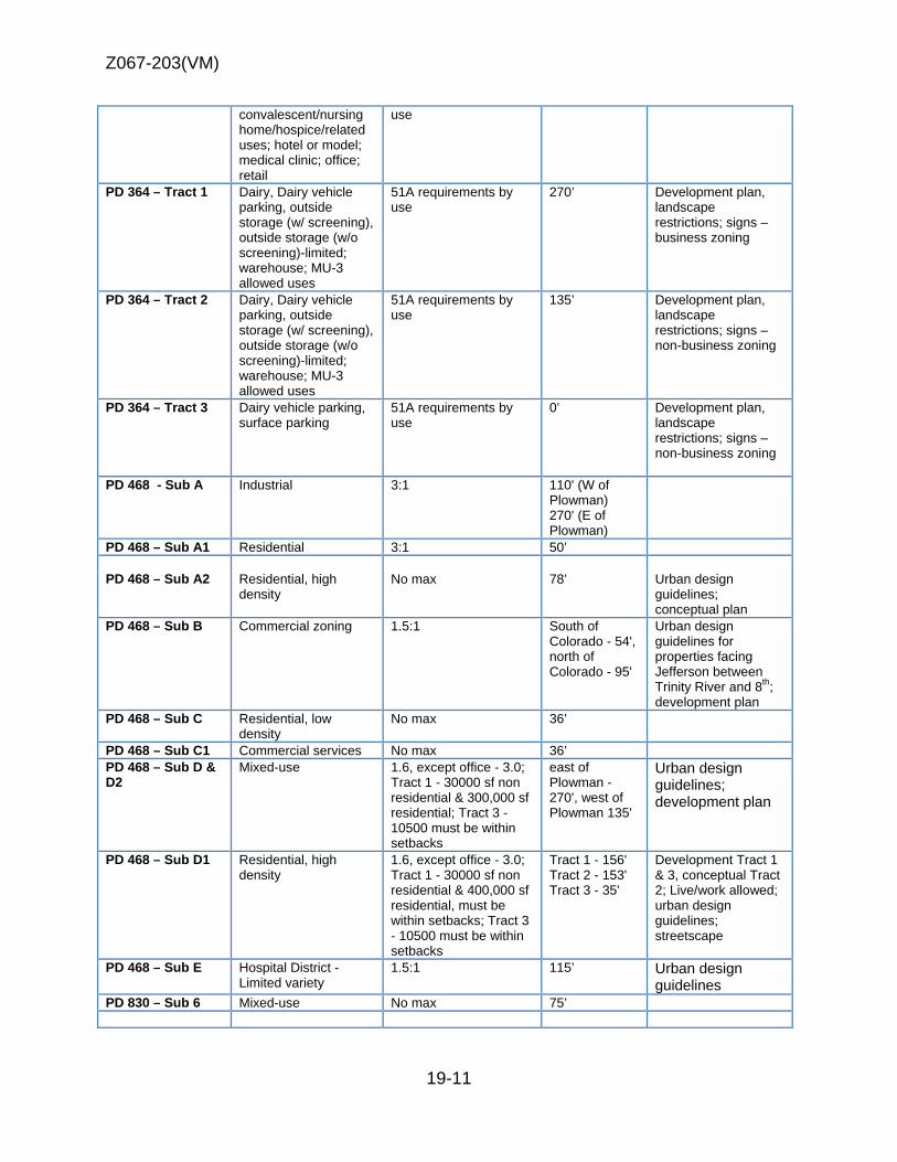
Z067-203(VM)
19-11
convalescent/nursing home/hospice/related uses; hotel or model; medical clinic; office; retail
use
PD 364 – Tract 1 Dairy, Dairy vehicle parking, outside storage (w/ screening), outside storage (w/o screening)-limited; warehouse; MU-3 allowed uses
51A requirements by use
270’ Development plan, landscape restrictions; signs – business zoning
PD 364 – Tract 2 Dairy, Dairy vehicle parking, outside storage (w/ screening), outside storage (w/o screening)-limited; warehouse; MU-3 allowed uses
51A requirements by use
135’ Development plan, landscape restrictions; signs – non-business zoning
PD 364 – Tract 3 Dairy vehicle parking, surface parking
51A requirements by use
0’ Development plan, landscape restrictions; signs – non-business zoning
PD 468 - Sub A Industrial 3:1 110' (W of Plowman) 270' (E of Plowman)
PD 468 – Sub A1 Residential 3:1 50’ PD 468 – Sub A2 Residential, high
density No max
78’ Urban design guidelines; conceptual plan
PD 468 – Sub B Commercial zoning 1.5:1 South of Colorado - 54', north of Colorado - 95'
Urban design guidelines for properties facing Jefferson between Trinity River and 8th; development plan
PD 468 – Sub C Residential, low density
No max 36’
PD 468 – Sub C1 Commercial services No max 36’ PD 468 – Sub D & D2
Mixed-use 1.6, except office - 3.0; Tract 1 - 30000 sf non residential & 300,000 sf residential; Tract 3 - 10500 must be within setbacks
east of Plowman - 270', west of Plowman 135'
Urban design guidelines; development plan
PD 468 – Sub D1 Residential, high density
1.6, except office - 3.0; Tract 1 - 30000 sf non residential & 400,000 sf residential, must be within setbacks; Tract 3 - 10500 must be within setbacks
Tract 1 - 156' Tract 2 - 153' Tract 3 - 35'
Development Tract 1 & 3, conceptual Tract 2; Live/work allowed; urban design guidelines; streetscape
PD 468 – Sub E Hospital District - Limited variety
1.5:1 115’
Urban design guidelines
PD 830 – Sub 6 Mixed-use No max 75’
Z067-203(VM)
19-12
Proposed Zoning
Proposed subdistricts Staff’s proposed Planned Development District is comprised of seven subdistricts that will use the Walkable Urban Mixed Use (WMU), Walkable Residential (WR), and Residential Transition (RTN) districts described in Article XIII, ‘Form Districts’. There will be a variety of residential and commercial/retail densities allowed, with higher densities being permitted the LBJ corridor, Trinity River Corridor, and medium densities along Zang, Colorado, and Beckley. The subdistricts will allow for adequate transitioning of densities while also providing for open space. Single family use is allowed in all form-based districts, but single family structures are only allowed in the RTN district, making 115 single family structures non-conforming with the proposed zoning changes. Lake Cliff Historic District Staff has proposed no change for the Lake Cliff Residenital and Founders Park area (subdistricts C & D), to prevent conflicts with the historic overlay. The current base zoning for the area, PD No. 468, subdistricts C & D, restricts uses to some community service and residenital. The historic overlay only allows for new construction in the rear of the property, and all renovation must compliment existing structures. The Steering Committee proposed to change the base zoning to form-based. Changing the base zoning to form-based would require amending and updating the historic overlay to match the height and setbacks in the underlying zoning. In addition, new structure types would need to be added for new construction. Amending the historic overlay would require approval from the Landmark Commission, which was not a part of this process. Steering Committee proposed ordinance Staff has referenced and supports a significant portion of the proposed Steering Committee form-based ordinance. To maintain consistancy with Article XIII, staff has proposed alternate options to include development types and uses based on development types, which were removed in the Steering Committee proposed ordinance. Staff proposes pedestrian friendly and street activating uses distrcit-wide. The Steering Committee proposed ordinance does not require street-activating uses on ground floor in any district except WMU-3-SH, and limited allowed uses in the study area. The Steering Committee’s proposal for street sections were consistant with Article XIII, and are supported in staff’s proposal. Building Types / Uses and Heights
In general, all properties in the proposed zoning area will receive an increase in development rights, relative to uses and heights. The Article XIII form based zoning districts allowed in each subdistrict specify the types of building form and uses allowed.
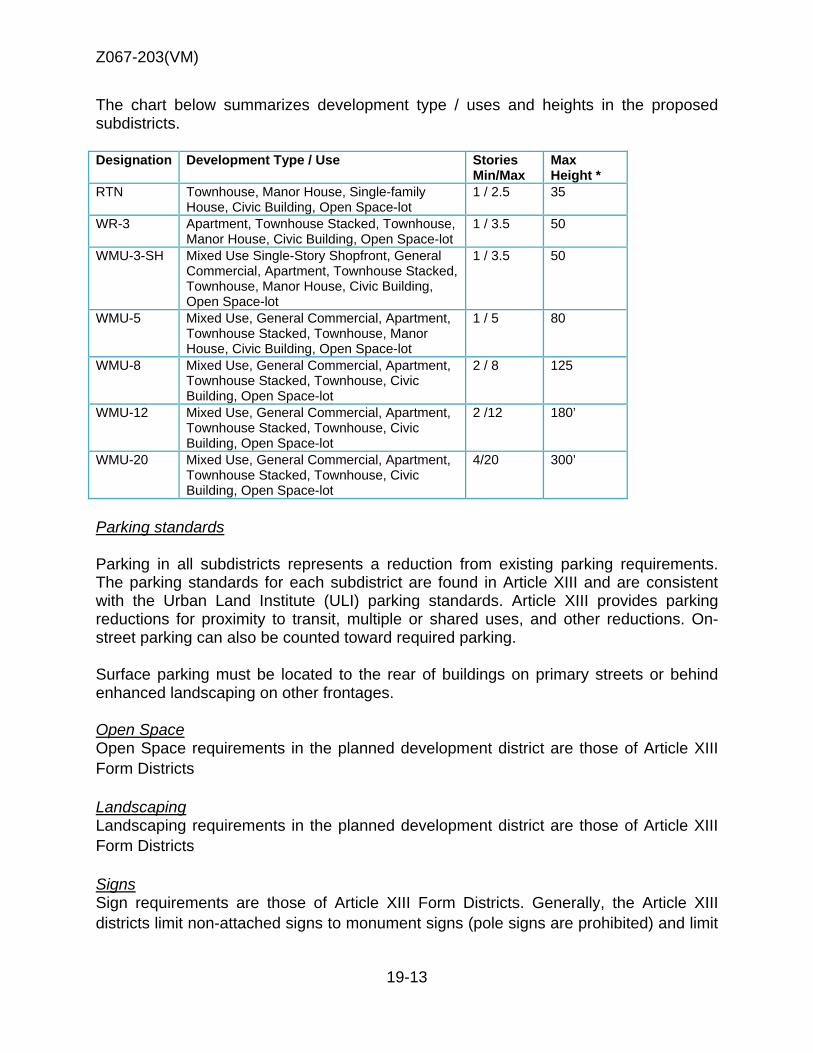
Z067-203(VM)
19-13
The chart below summarizes development type / uses and heights in the proposed subdistricts.
Designation Development Type / Use Stories Min/Max
Max Height *
RTN Townhouse, Manor House, Single-family House, Civic Building, Open Space-lot
1 / 2.5 35
WR-3 Apartment, Townhouse Stacked, Townhouse, Manor House, Civic Building, Open Space-lot
1 / 3.5 50
WMU-3-SH Mixed Use Single-Story Shopfront, General Commercial, Apartment, Townhouse Stacked, Townhouse, Manor House, Civic Building, Open Space-lot
1 / 3.5 50
WMU-5 Mixed Use, General Commercial, Apartment, Townhouse Stacked, Townhouse, Manor House, Civic Building, Open Space-lot
1 / 5 80
WMU-8 Mixed Use, General Commercial, Apartment, Townhouse Stacked, Townhouse, Civic Building, Open Space-lot
2 / 8 125
WMU-12 Mixed Use, General Commercial, Apartment, Townhouse Stacked, Townhouse, Civic Building, Open Space-lot
2 /12 180’
WMU-20 Mixed Use, General Commercial, Apartment, Townhouse Stacked, Townhouse, Civic Building, Open Space-lot
4/20 300’
Parking standards
Parking in all subdistricts represents a reduction from existing parking requirements. The parking standards for each subdistrict are found in Article XIII and are consistent with the Urban Land Institute (ULI) parking standards. Article XIII provides parking reductions for proximity to transit, multiple or shared uses, and other reductions. On-street parking can also be counted toward required parking.
Surface parking must be located to the rear of buildings on primary streets or behind enhanced landscaping on other frontages.
Open Space Open Space requirements in the planned development district are those of Article XIII Form Districts Landscaping Landscaping requirements in the planned development district are those of Article XIII Form Districts Signs Sign requirements are those of Article XIII Form Districts. Generally, the Article XIII districts limit non-attached signs to monument signs (pole signs are prohibited) and limit
Z067-203(VM)
19-14
ground story attached signs to 10 percent of the total area of the ground story façade, and upper story signs to 5 percent of the total area of the ground story facade.
Nonconformity
Existing uses and structures within the Oak Cliff Gateway District that do not comply with the provisions of the proposed zoning, if adopted, would be classified as nonconforming. This nonconformity can be either for a use, or for a structure. Use nonconformity is created when an existing use is no longer allowed in new zoning. Structural nonconformity is created when a building or structure no longer complies with the new zoning site standards.
Nonconforming Structures Buildings that no longer comply with current zoning regulations due to a change in those regulations are structurally nonconforming. A nonconforming structure may be repaired, remodeled, and rebuilt if destroyed by an act of nature such as a fire or storm. In the proposed planned development district most, if not all, structures will become structurally nonconforming. Most structures will be made non-conforming as to set back, entrance, and façade transparency requirements. Nonconforming Uses Generally, uses becoming nonconforming can remain in operation until such time as they relinquish their nonconforming rights. For example, businesses becoming nonconforming can remain in operation, remodel, rebuild on their existing footprint, and even add to their site if that addition does not increase the level of non-conformity. The chart below shows the number of businesses becoming nonconforming within the proposed planned development district. It is important to note that only 6 businesses with a current CO will become nonconforming. Nonconforming Structures Buildings that no longer comply with current zoning regulations due to a change in those regulations are structurally nonconforming. A nonconforming structure may be repaired, remodeled, and rebuilt if destroyed by an act of nature such as a fire or storm. In the proposed planned development district most, if not all, structures will become structurally nonconforming. No structures will be made non-conforming as to maximum height. All single story structures will be made non-conforming as to minimum height. Most structures will be made non-conforming as to set back, entrance, and façade transparency requirements.
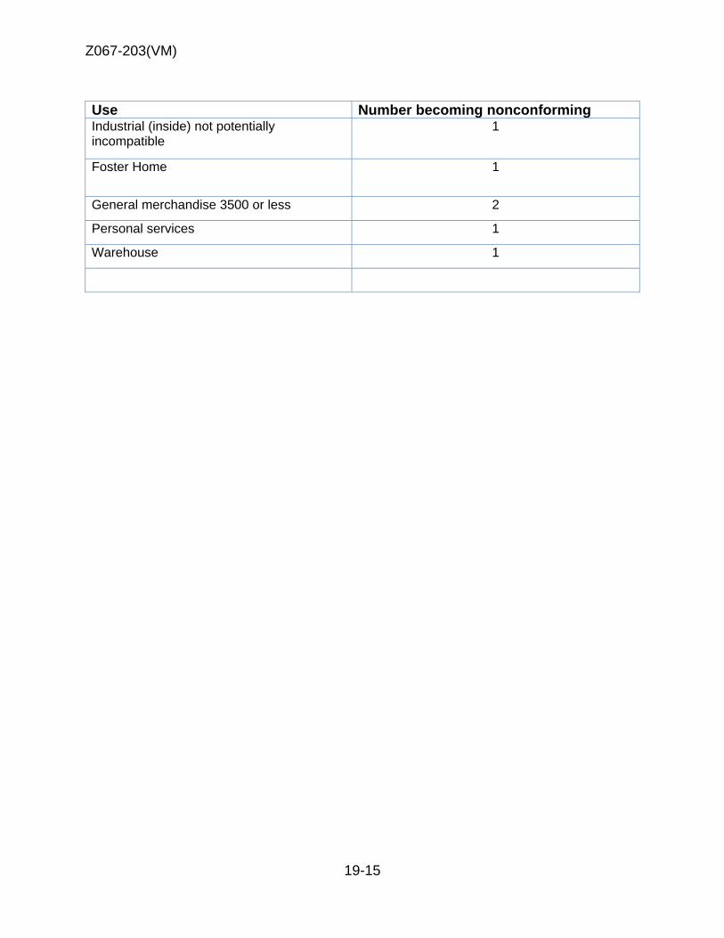
Z067-203(VM)
19-15
Use Number becoming nonconforming Industrial (inside) not potentially incompatible
1
Foster Home 1
General merchandise 3500 or less 2
Personal services 1
Warehouse 1
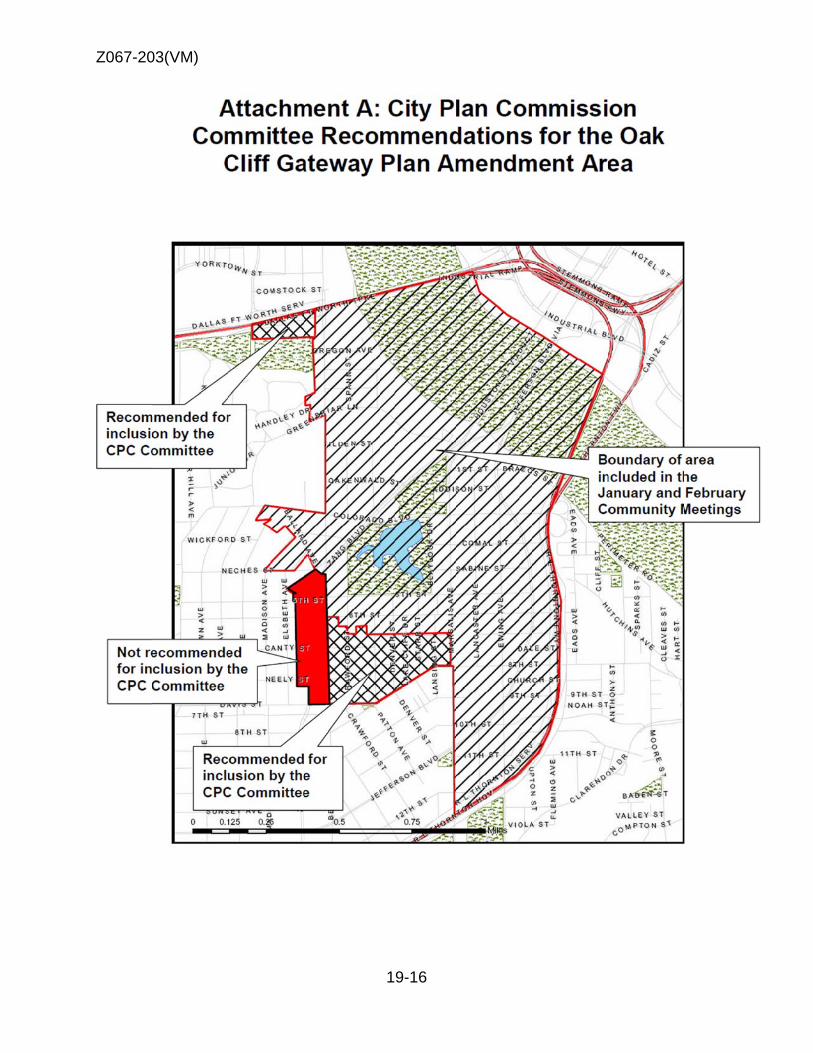
Z067-20
03(VM)
19-16
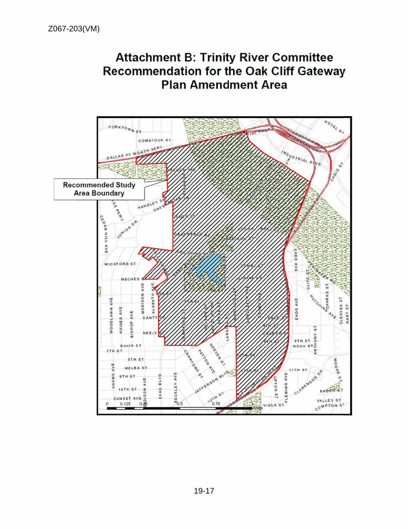
Z067-20
03(VM)
19-17
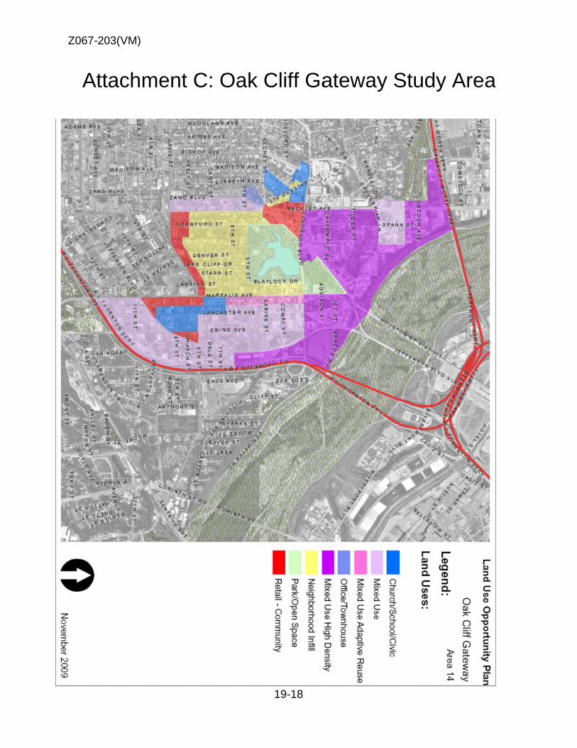
Z067-20
Att
03(VM)
achmeent C: Oak C
19-18
Cliff Ga
atewayy Studdy Areaa

Z067-20
Att
03(VM)
achmeent D: Oak C
19-19
Cliff Ga
atewayy Studdy Areaa

Z067-20
Att
03(VM)
tachmment E: Oak CStud
19-20
Cliff Gdy Are
Gatewaea
ay Exppandedd
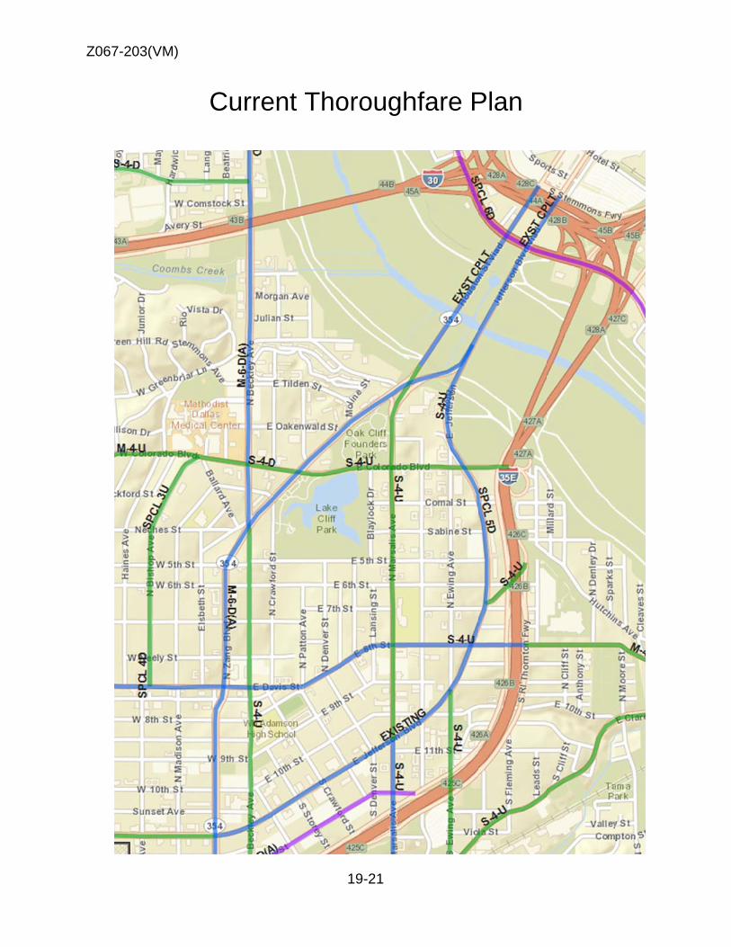
Z067-20
03(VM)
Curreent Tho
19-21
oroughhfare PPlan
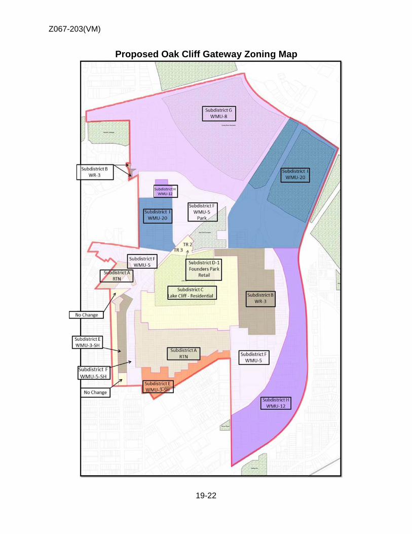
Z067-20
03(VM)
Proposedd Oak Cli
19-22
iff Gatewway Zoning Map

Z067-203(VM)
19-23
Staff Recommendation Conditions
ARTICLE 468.
PD 468.
Oak Cliff Gateway Special Purpose District SEC. 51P--468.101. LEGISLATIVE HISTORY. PD 468 was established by Ordinance No. 23057, passed by the Dallas City Council on March 12, 1997. Ordinance No. 23057 amended Ordinance No. 19455, Chapter 51A of the Dallas City Code, as amended. Ordinance No. 23057 was amended by Ordinance No. 23868, passed by the Dallas City Council on April 28, 1999, and Ordinance No. 25866, passed by the Dallas City Council on January 26, 2005. SEC. 51P-468.102. PROPERTY LOCATION AND SIZE.
PD 468 is established on property generally bounded by Jefferson Ave, Marsalis Ave, and 8th Street, Zang Blvd, south of Interstate 30, west of Beckley Ave, the Levee on the east side of the Trinity River, Interstate 35E (South R.L. Thornton Freeway). The size of PD 468 is approximately 850 acres.
SEC. 51P-468.103. PURPOSE.
This article provides standards specifically tailored to meet the needs of the Oak Cliff Gateway area of the city, which is hereby designated as an area of historical, cultural, and architectural importance and significance to the citizens of the city. The general objectives of these standards are to promote and protect the health, safety, welfare, convenience, and enjoyment of the public, and in part, to achieve the following:
(1) Accommodate the existing mix of uses in the area. (2) Protect the internal and adjacent stable residential neighborhoods.
(3) Preserve and enhance the historical, cultural, and architectural significance of the area.
(4) Strengthen the neighborhood identity.
(5) Create a more desirable pedestrian environment.
SEC. 51P-468.104. DEFINITIONS AND INTERPRETATIONS.
(a) Unless otherwise stated, the definitions in Article XIII apply to this article.
(b) Unless the context clearly indicates otherwise, in this article:

Z067-203(VM)
19-24
(1) ACCESSORY DWELLING UNIT means a residential unit:
a. Meets all residential requirements of 51A…… b. All accessory structures, combined, can be no more than 1,200 total
square feet . c. Only one accessory dwelling unit is allowed on the property. d. A single-family dwelling unit exists on the lot, or will be constructed in
conjunction with the accessory structure. e. Attached accessory dwelling units shall meet the same setbacks as
the main building in the zoning district. f. The owner must occupy the primary or accessory structure. g. The accessory structure cannot be sold separately. h. Accessory dwelling unit cannot be same square footage as main
structure.
Staff recommendation (1) DAIRYING means a facility primarily for the processing and delivery of milk
and milk products.
Steering Committee recommendation (2) Steering committee would like to remove dairying as an allowed use. Staff recommendation (3) LEGACY BUILDING means a building Staff still working on Legacy Building regulations Steering Committee recommendation (4) LEGACY BUILDING means a building
(1) Constructed before 1957. (2) The primary street-facing façade of the building is within 15 feet of the right-of-way line. (3) The building’s main entrance faces Colorado, Zang, Beckley, Marsalis, Jefferson, Eighth or Ballard. (4) The building window and door openings total at least 20 percent of the façade area that faces those streets, and (5) Off-street parking is not located in the required front yard.
(5) LIVE-WORK UNIT means an interior space that combines a residential and
an office or retail and personal service use. A live/work unit is considered a nonresidential use.
(6) VISUAL AND PERFORMING ARTS STUDIO (less than 6,000 SF) means a
facility for individual or group instruction in visual or performing arts, such as
Z067-203(VM)
19-25
painting, sculpture, ceramics, piano, guitar, or dance with interior square footage not to exceed 6,000 SF in building area.
(c) Unless otherwise stated, all references to articles, divisions, or sections in this article are to articles, divisions, or sections in Chapter 51A. (d) The following rules apply in interpreting the use regulations in this article:
(1) The absence of a symbol appearing after a listed use means that the use is
permitted by right.
(2) The symbol [SUP] appearing after a listed use means that the use is permitted by specific use permit only.
(3) The symbol [DIR] appearing after a listed use means that a site plan must be
submitted and approved in accordance with the requirements of Section 51A-4.803. (“DIR” means “development impact review.” For more information regarding development impact review generally, see Division 51A-4.800.)
(4) The symbol [RAR] appearing after a listed use means that, if the use has a
residential adjacency as defined in Section 51A-4.803, a site plan must be submitted and approved in accordance with the requirements of that section. (“RAR” means “residential adjacency review.” For more information regarding residential adjacency review generally, see Division 51A-4.800.)
(e) Unless the context clearly indicates otherwise, for purposes of interpreting Article XIII, the subdistricts are considered to be residential or nonresidential as indicated:
(1) Subdistrict A – RTN residential.
(2) Subdistrict B – WR-3 residential (3) Subdistrict C – Lake Cliff Park - residential.
(4) Subdistrict D-1 – Founders Park Retail - nonresidential.
(5) Subdistrict E- WMU-3-SH mixed-use.
(6) Subdistrict F – WMU-5 mixed-use.
(7) Subdistrict G – WMU-8 mixed-use.
(8) Subdistrict H – WMU-12 mixed-use.
(9) Subdistrict I – WMU-20 mixed-use.
Z067-203(VM)
19-26
Staff recommendation Move Steering Committee suggestion of WR-3 East Kessler Overlay (WUR-EK) under WR-3 with additional comments.
Steering Committee recommendation
(1) East Kessler Overlay (WUR-EK)
SEC. 51P-468.104.1. EXHIBITS.
The following exhibits are incorporated into this article:
(1) Exhibit 468A: Subdistrict map.
(2) Exhibit 468B: Tract 1 and 3 conceptual plan SEC. 51P-468.105. CREATION OF SUBDISTRICTS.
(a) This district is known as the Oak Cliff Gateway Special Purpose District, and is divided into the following 7subdistricts, as described in Exhibit A of Ordinance No. 23057, as amended, and as shown on the map labeled Exhibit 468A:
(2) Subdistrict A – RTN residential.
(3) Subdistrict B – WR-3 residential
(4) Subdistrict C – Lake Cliff Park residential.
(5) Subdistrict D-1 – Founders Park Retail - nonresidential.
(6) Subdistrict E- WMU-3-SH mixed-use.
(7) Subdistrict F – WMU-5 mixed-use.
(8) Subdistrict G – WMU-8 mixed-use.
(9) Subdistrict H – WMU-12 mixed-use.
(10) Subdistrict I – WMU-20 mixed-use.
Staff recommendation Move Steering Committee suggestion of WR-3 East Kessler Overlay (WUR-EK) under WR-3 with additional comments.
Steering Committee recommendation
Z067-203(VM)
19-27
(11) East Kessler Overlay (WUR-EK)
DIVISION 51P-468.200 GENERAL DEVELOPMENT STANDARDS SEC. 51P-468.201. SUBDISTRICT A
For allowed uses and site design, reference RTN of Article XIII. SEC. 51P-468.202. SUBDISTRICT B
For allowed uses and site design, reference WR-3 of Article XIII.
Steering Committee recommendation SEC. 51P-468.202.1 East Kessler Overlay (WUR-EK)
Special regulations apply to Lot 10B and the portion of Lot 10A within sixty (60) feet of Handley Drive in Dallas city block A/3778.
a. Building height limited to 2.5 stories and 35’. b. Minimum front yard setback for Handley and Greenbriar is 15’. c. No remote parking allowed in district. d. No detached signs allowed on Handley and Greenbriar, and 30’
min from Handley along Beckley. e. Backlit signs are not allowed.
SEC. 51P-468.203. SUBDISTRICT C - Lake Cliff Residential
(a) Main uses permitted
(2) Institutional and community service uses
- Child care facility. - Church. - Convalescent and nursing homes, hospice care, and related
institutions. - Public or private school.
(3) Recreation uses.
- Public park, playground, or golf course.
(4) Residential uses.
- Accessory Dwelling Unit. - Duplex. - Handicapped group dwelling unit. [SUP required if spacing
component of Section 51A-4.209(3.1) is not met]
Z067-203(VM)
19-28
- Multifamily. - Single family. - West of Marsalis Avenue, single family is the only permitted
residential use on the following lots:
(a) Lots that were vacant on March 12, 1997.
(b) Lots on which structures are removed, demolished, or destroyed by the intentional act of the owner or his agent.
- West of Marsalis Avenue, the number of dwelling units on a lot may
not be increased. If the number of dwelling units on a lot is reduced, the lot is thereafter to the lesser number of dwelling units.
(5) Transportation uses.
- Transit passenger shelter.
(6) Utility and public service uses.
- Local utilities.
(b) Accessory uses. As a general rule, an accessory use is permitted in any district in which the main use is permitted. Some specific types of accessory uses, however, due to their unique nature, are subject to additional regulations contained in Section 51A-4.217. For more information regarding accessory uses, consult Section 51A-4.217.
(c) Yard, lot, and space regulations.
(1) Application if subsection. The following yard, lot, and space regulations apply to all properties within Subdistrict C.
(2) In general. The yard, lot, and space regulations in this subsection must be read together with the yard, lot, space regulations contained in Division 51A-4.400. In the event of a conflict between this subsection and Division 51A-4.400, this subsection controls.
(3) Front yard. Minimum front yard is 15 feet, except west of Marsalis Avenue
minimum front yard for the R-7.5(A) Single Family District applies.
(4) Side and rear yard. No minimum side or rear yard. (5) Density. Maximum dwelling unit density is 30 units per acre.

Z067-203(VM)
19-29
(6) Floor area ratio. No maximum floor area ratio.
(7) Height. Maximum structure height is 36 feet.
(8) Lot coverage. Maximum lot coverage is 45 percent.
(9) Lot size. No minimum lot size.
(10) Stories. No maximum number of stories.
(d) Off-street parking and loading. Consult the use regulations contained in
Division 51A-4.200 for the specific off-street parking and loading requirements for each use.
(e) Environmental performance standards. See Article VI.
(f) Landscaping. (1) All landscaping must be provided in accordance with Article X. (2) Plant material must be maintained in a healthy, growing condition.
(f) Signs. Signs must comply with the provisions for business zoning districts contained in Article VII.
(g) CPTED review. Compliance with CPTED review standards is encouraged for
all construction requiring a building permit. Contact the building official plans examiner for information on CPTED review standards.
(h) Additional provisions.
a. Properties must be maintained in a state of good repair and neat appearance.
b. Development and use of the properties must comply with all federal
and state laws and regulations, and with all ordinances, rules, and regulations of the city. (Ord. Nos. 23057; 26042)
SEC. 51P-468.204. SUBDISTRICT D-1 – Founders Park Retail (Tracts 1 and 3)
(a) Main uses permitted. (1) Commercial and business service uses.
- Catering service. - Custom business services.
- Electronics service center. - Medical or scientific laboratory. [SUP]
(2) Institutional and community service uses
Z067-203(VM)
19-30
- Adult day care facility. [SUP] - Child care facility. [SUP] - Church. - College, university, or seminary. - Community service center. - Convalescent and nursing homes, hospice care, and related
institutions. [By right in Tract 1; otherwise, by SUP] - Hospital. [SUP] - Library, art gallery, or museum. - Public or private school.
(3) Lodging uses - Hotel or motel. [SUP]
(4) Miscellaneous uses
- Temporary construction or sales office.
(5) Office uses - Financial institution without drive-in window. - Financial institution with drive-in window. [SUP] - Medical clinic or ambulatory surgical center. - Office.
(6) Recreation uses - Private and public recreation center, club, or area. - Public park, playground, or golf course.
(7) Residential uses - College dormitory, fraternity or sorority house. - Duplex. - Handicapped group dwelling unit. [SUP required if spacing
component of Section 51A-4.209(3.1) is not met.] - Multifamily. - Retirement housing. - Single family. - Single family and duplex residential uses are also permitted as a
use category within a mixed use project. To qualify as a mixed use
project, a development must contain single family or duplex residential uses and one or more of the other use categories, and the combined floor areas of the uses in each category must equal or exceed the following percentages of the total floor area of the project:
Use Category Percentage of Total Floor Area Lodging 10 percent Office 15 percent Residential 10 percent Retail and personal service 5 percent
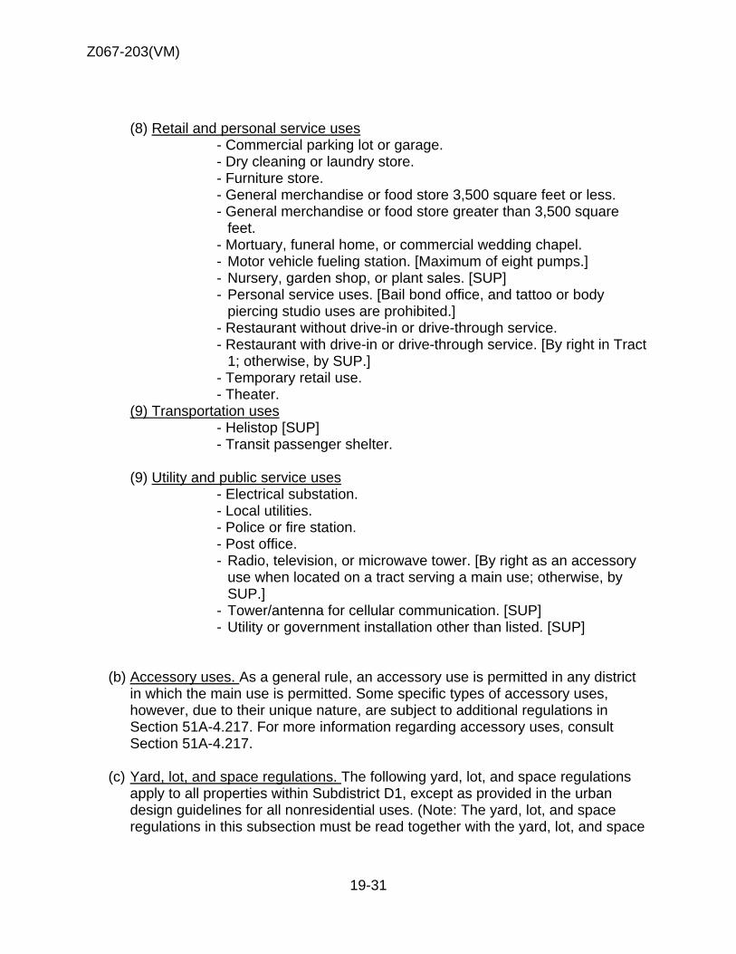
Z067-203(VM)
19-31
(8) Retail and personal service uses - Commercial parking lot or garage. - Dry cleaning or laundry store. - Furniture store. - General merchandise or food store 3,500 square feet or less. - General merchandise or food store greater than 3,500 square
feet. - Mortuary, funeral home, or commercial wedding chapel. - Motor vehicle fueling station. [Maximum of eight pumps.] - Nursery, garden shop, or plant sales. [SUP] - Personal service uses. [Bail bond office, and tattoo or body
piercing studio uses are prohibited.] - Restaurant without drive-in or drive-through service. - Restaurant with drive-in or drive-through service. [By right in Tract
1; otherwise, by SUP.] - Temporary retail use. - Theater.
(9) Transportation uses - Helistop [SUP] - Transit passenger shelter.
(9) Utility and public service uses
- Electrical substation. - Local utilities. - Police or fire station. - Post office. - Radio, television, or microwave tower. [By right as an accessory
use when located on a tract serving a main use; otherwise, by SUP.]
- Tower/antenna for cellular communication. [SUP] - Utility or government installation other than listed. [SUP]
(b) Accessory uses. As a general rule, an accessory use is permitted in any district in which the main use is permitted. Some specific types of accessory uses, however, due to their unique nature, are subject to additional regulations in Section 51A-4.217. For more information regarding accessory uses, consult Section 51A-4.217.
(c) Yard, lot, and space regulations. The following yard, lot, and space regulations
apply to all properties within Subdistrict D1, except as provided in the urban design guidelines for all nonresidential uses. (Note: The yard, lot, and space regulations in this subsection must be read together with the yard, lot, and space

Z067-203(VM)
19-32
regulations contained in Division 51A-4.400. In the event of a conflict between this subsection and Division 51A-4.400, this subsection controls.
(1) Front yard.
(A) Minimum front yard is as shown on the Tract 1 and 3 Conceptual Plan.
(2) Side and rear yard. Minimum side and rear yard is as shown on the Tract 1 and 3 Conceptual Plan.
(3) Density. (A) Except as provided below, maximum dwelling unit density is 50
units per acre, provided, however that if the dwelling unit density is 35 units per acre or more, development impact review pursuant to Section 51A-4.803(e) is required. Appeals from decisions on development impact review will be made pursuant to Section 51A-4.803(i).
(B) For Tract 1, maximum number of dwelling units is 400. A development impact review under Section 51A-4.803(e) is not required.
(C) For Tract 2, maximum number of dwelling units is 57 and dwelling units must be located as shown on the Tract 1 and 3 Conceptual Plan.
(4) Floor area.
(A) Except as provided below, maximum floor area ratio is 1.6, except that maximum floor area ratio for office uses is 3.0.
(B) For Tract 1, maximum floor area is 30,000 square feet for nonresidential uses and 400,000 square feet for residential uses. The floor area must be located within the building setbacks as shown on the Tract 1 and 3 Conceptual Plan.
(C) For Tract 3, maximum floor area is 10,500 square feet and the floor area must be located within the building setbacks as shown on the Tract 1 and 3 Conceptual Plan.
(5) Height.
(A) For Tract 1, maximum structure height is 156 feet as shown on the Tract 1 and 3 Conceptual Plan.
(B) For Tract 3, maximum structure height is 35 feet as shown on the Tract 1 and 3 Conceptual Plan.
(6) Lot coverage.
(A) For Tract 1, except as provided in this subparagraph,
maximum lot coverage is 80 percent. Aboveground parking structures do not count toward lot coverage if at least 50 percent of their off-street parking spaces are dedicated to

Z067-203(VM)
19-33
residential uses and at least 60 percent the roof surface is a landscape area as defined in Article X. Any portion of a building that is above 75 feet in height, measured along the west boundary of Tract 1 (Plowman right-of-way) may not have a floor plate greater than 60 percent of the lot.
(B) For Tract 3, maximum lot coverage is 80 percent.
(7) Lot size. No minimum lot size.
(8) Stories. (A) For Tract 1, maximum number of stories is 15. (B) For Tract 3, maximum number of stories is two.
(d) Off-street parking and loading.
(1) Except as provided below, consult the use regulations contained in
Division 51A-4.200 for the specific off-street parking/loading requirements for each use.
(A) For any permitted nonresidential use developed on Tract 1, no more than one head-in parking space may be credited for each nine feet of frontage along Plowman Avenue, with no more than 21 head-in parking spaces being provided as shown on the Tract 1 and 3 Conceptual Plan. The head-in or parallel parking on Plowman Avenue or Oakenwald Street as shown on the Tract 1 and 3 Conceptual Plan is not required.
(B) The property owner must stripe the head-in parking spaces
in accordance with city striping standards up to a distance of eight feet from the curb.
(C) The following off-street parking requirements apply for an
accessory community center (private) use on Tract 1: A minimum of one space per 500 square feet of floor area.
(D) The following off-street parking requirements apply for a
multifamily use on Tract 1: A minimum of one-and-one half spaces are required for each dwelling unit.
(E) Aboveground parking structures located on Tract 1 must be
constructed of materials similar to the materials used for any main structure located on Tract 1.
(2) All off-street surface parking lots, excluding driveways used for
ingress or
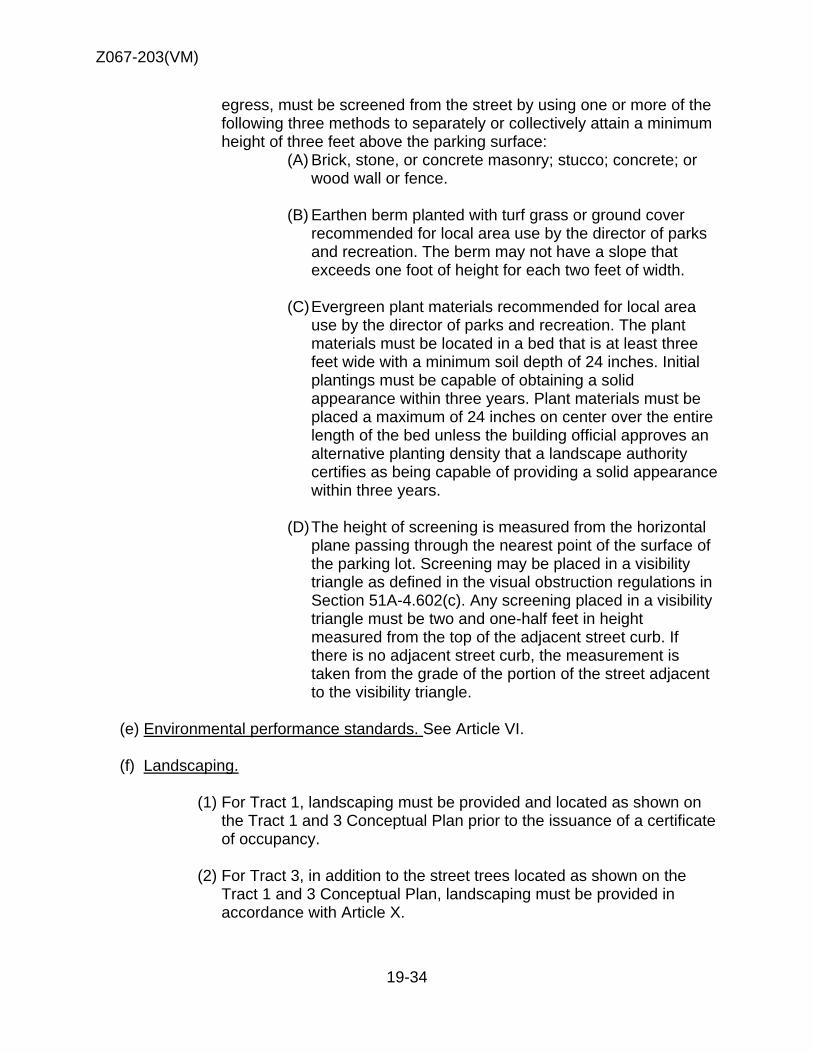
Z067-203(VM)
19-34
egress, must be screened from the street by using one or more of the following three methods to separately or collectively attain a minimum height of three feet above the parking surface:
(A) Brick, stone, or concrete masonry; stucco; concrete; or wood wall or fence.
(B) Earthen berm planted with turf grass or ground cover
recommended for local area use by the director of parks and recreation. The berm may not have a slope that exceeds one foot of height for each two feet of width.
(C) Evergreen plant materials recommended for local area
use by the director of parks and recreation. The plant materials must be located in a bed that is at least three feet wide with a minimum soil depth of 24 inches. Initial plantings must be capable of obtaining a solid appearance within three years. Plant materials must be placed a maximum of 24 inches on center over the entire length of the bed unless the building official approves an alternative planting density that a landscape authority certifies as being capable of providing a solid appearance within three years.
(D) The height of screening is measured from the horizontal
plane passing through the nearest point of the surface of the parking lot. Screening may be placed in a visibility triangle as defined in the visual obstruction regulations in Section 51A-4.602(c). Any screening placed in a visibility triangle must be two and one-half feet in height measured from the top of the adjacent street curb. If there is no adjacent street curb, the measurement is taken from the grade of the portion of the street adjacent to the visibility triangle.
(e) Environmental performance standards. See Article VI.
(f) Landscaping.
(1) For Tract 1, landscaping must be provided and located as shown on
the Tract 1 and 3 Conceptual Plan prior to the issuance of a certificate of occupancy.
(2) For Tract 3, in addition to the street trees located as shown on the
Tract 1 and 3 Conceptual Plan, landscaping must be provided in accordance with Article X.

Z067-203(VM)
19-35
(3) Plant material must be maintained in a healthy, growing condition.
(g) Landscaping in the parkway. In this section, parkway means the portion of a street right-of-way between the projected street curb and the lot line of the Property.
(1) Private license granted.
(A) The city council hereby grants a revocable, non-exclusive license
to the owners, or with the written consent of the owner, to the tenants (“property owner”) of all property in this district for the exclusive purpose of authorizing compliance with the parkway landscaping requirements of this article. A property owner is not required to pay an initial or annual fee for this license, although a fee may be charged for issuance of a parkway landscape permit in accordance with the Dallas Building Code, or Paragraph (2) of this section. This private license shall not terminate at the end of any specific time period, however, the city council reserves and has the absolute right to terminate this license at will, by resolution passed by the city council, any time such termination becomes necessary. The determination by the city of the necessity for such termination shall be final and binding and the city shall become entitled to possession of the premises without giving any notice and without the necessity of legal proceedings to obtain possession whenever in its judgment the purpose or use of this license is inconsistent with the public use of the right-of-way or when the purpose or use of this license is likely to become a nuisance or a public safety issue. Upon termination of the license by the director, each property owner shall remove all improvements and installations in the public rights-of-way in a manner satisfactory to the director of public works and transportation.
(B) A property owner is not required to comply with any landscaping
requirement if compliance is made impossible due to the director's revocation of a landscape permit or the revocation of the license granted herein affecting landscaping.
(C) Upon the installation of landscaping and related amenities, such
as irrigation systems, in the public rights-of-way, the property owner shall procure, pay for, and keep in full force and effect commercial general liability insurance coverage with an insurance company authorized to do business in the State of Texas and otherwise acceptable to the city, covering, but not limited to, the liability assumed under the license granted herein, with combined single limit s of liability for bodily injury and property damage of not

Z067-203(VM)
19-36
less than $1,000,000 for each occurrence, $2,000,000 annual aggregate. Coverage under this liability policy shall be on an “occurrence” basis and the city shall be named as additional insured. Proof of such insurance shall be sent to: Office of Risk Management, City of Dallas, 1500 Marilla, 1/C/North, Dallas, Texas 75201 and the policy shall provide for 30 days prior written notice to the Office of Risk Management of cancellation, expiration, non-renewal or material change in coverage. All subrogation rights for loss or damage against the city are hereby waived to the extent same are covered by this liability insurance policy.
(D) Each property owner shall be responsible for maintaining the
landscaping and related amenities in good repair and condition and to keep the premises safe and from deteriorating in value or condition, at no expense to the city, and the city shall be absolutely exempt from any requirements to make repairs or to maintain the landscaping and related amenities. The granting of a license for landscaping and related amenities under this section does not release the property owner from liability in the installation or maintenance of trees, landscaping, and related amenities in the public right-of-way.
(2) Parkway landscape permit.
(A) It is the responsibility of the property owner to apply for and obtain
a parkway landscape permit before locating trees, landscaping, or related amenities in the parkway. An application for a parkway landscape permit must be made to the director of public works and transportation before an application for a building permit is made for work on the lot. The application must be in writing on a form approved by the director and accompanied by plans or drawings showing the area of the parkway affected and the planting or other amenities proposed.
(B) Upon receipt of the application and any required fees, the director
shall circulate it to all affected city departments and utilities for review and comment. If, after receiving comments from affected city departments and utilities, the director determines that the construction and planting or other amenities proposed will not be inconsistent with and will not unreasonably impair the public use of the right-of-way, the director shall issue a parkway landscape permit to the property owner; otherwise, the director shall deny the permit.

Z067-203(VM)
19-37
(C) A property owner is not required to comply with any parkway landscaping requirement of this article if compliance is made impossible due to the director's denial of a parkway landscape permit.
(D) A parkway landscape permit issued by the director is subject to
immediate revocation upon written notice if at any time the director determines that the use of the parkway authorized by the permit is inconsistent with or unreasonably impairs the public use of the right-of-way. The property owner is not required to comply with any parkway landscaping requirement of this article if compliance is made impossible due to the director's revocation of a parkway landscape permit.
(E) The issuance of a parkway landscape permit under this paragraph
does not excuse the property owner, his agents, or employees from liability in the installation or maintenance of trees or other amenities in the public right-of-way.
(h) Signs.
(1) Except as provided below, signs must comply with the provisions for business zoning districts contained in Article VII.
(2) A maximum of three monument signs are permitted at the locations
shown on the Tract 1 and 3 Conceptual Plan.
(i) Urban design guidelines for all nonresidential uses.
(1) Purpose. The purpose of these urban design guidelines is to enhance the
pedestrian environment by increasing safety measures and providing amenities; and to preserve the historic character of Old Oak Cliff.
(2) Lighting. Exterior lighting of the front yard and parking areas must be directed
away from adjoining properties. (3) Street trees. In addition to any landscaping required by Article X, trees must
be planted within 10 feet of the front property line at a density of one tree for each 30 linear feet of frontage, excluding visibility triangles, driveways, and points of ingress and egress to and from the property.
(4) CPTED review. Compliance with CPTED review standards is encouraged for
all construction requiring a building permit. Contact the building official plans examiner for information on CPTED review standards.
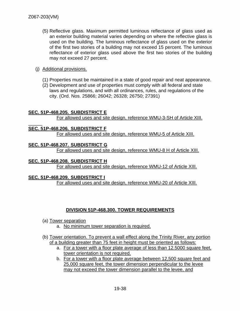
Z067-203(VM)
19-38
(5) Reflective glass. Maximum permitted luminous reflectance of glass used as an exterior building material varies depending on where the reflective glass is used on the building. The luminous reflectance of glass used on the exterior of the first two stories of a building may not exceed 15 percent. The luminous reflectance of exterior glass used above the first two stories of the building may not exceed 27 percent.
(j) Additional provisions.
(1) Properties must be maintained in a state of good repair and neat appearance. (2) Development and use of properties must comply with all federal and state
laws and regulations, and with all ordinances, rules, and regulations of the city. (Ord. Nos. 25866; 26042; 26328; 26750; 27391)
SEC. 51P-468.205. SUBDISTRICT E For allowed uses and site design, reference WMU-3-SH of Article XIII. SEC. 51P-468.206. SUBDISTRICT F For allowed uses and site design, reference WMU-5 of Article XIII. SEC. 51P-468.207. SUBDISTRICT G For allowed uses and site design, reference WMU-8 H of Article XIII. SEC. 51P-468.208. SUBDISTRICT H For allowed uses and site design, reference WMU-12 of Article XIII. SEC. 51P-468.209. SUBDISTRICT I
For allowed uses and site design, reference WMU-20 of Article XIII.
DIVISION 51P-468.300. TOWER REQUIREMENTS
(a) Tower separation a. No minimum tower separation is required.
(b) Tower orientation. To prevent a wall effect along the Trinity River, any portion
of a building greater than 75 feet in height must be oriented as follows: a. For a tower with a floor plate average of less than 12.5000 square feet,
tower orientation is not required. b. For a tower with a floor plate average between 12,500 square feet and
25,000 square feet, the tower dimension perpendicular to the levee may not exceed the tower dimension parallel to the levee, and

Z067-20
(c
(a
(b
S
03(VM)
c. Fothlelev
c) Urban fofoot for ebuilding o
a) Unless oto this Ar
b) Fences aa. In
Staff recothree
Steering Cofour feet in heexceed s
or a tower we tower dimast three (3vee.
rm setbackeach two feeover 55 fee
DIVISION otherwise strticle.
and Walls. a door yarommendati
mmittee rec
eight abovesix feet in h
with a floor mension pe3) times lon
k. An additioet in height
et in height.
51P-468.4tated, the d
. rd, a fence ion
commenda
e grade. In aeight above
19-39
plate averarpendicular
nger than th
onal front yt above 55 f
400. BUILDefinitions a
may not ex
ation
all other reqe grade.
age greaterr to the Trin
he tower dim
yard setbacfeet is requ
DING ELEMand interpre
xceed
quired yard
r than 25,00nity River lemension pa
k (only fronuired for tha
MENTS etations in A
ds, no fence
00 square fevee must barallel to the
nt yard) of oat portion of
Article XIII a
e or wall ma
feet, be at e
one f the
apply
ay

Z067-203(VM)
19-40
SEC. 51A-13.401. USES
(1) Allowed Uses
Staff Recommendation WMU-12 allows for dairying use.
Steering Committee recommendation Steering committee would like to remove dairying as an allowed use. Staff recommendation (2) Transitional Uses.
Purpose When a form district is initiated, it may not be possible to develop and completely transition the entire area at the inception. Transitional uses are intended to provide an opportunity for owners in a form district to make appropriate use of their property during the interim period as the district develops. No transitional use is allowed without a specific use permit which must contain a specified duration and, which may, if necessary, provide regulations as provided in this subsection to ensure compatibility of the use with surrounding property.
(A) A specific use permit approved for a transitional use must contain a specified
duration, which may not exceed five years. A specific use permit for a transitional use is not subject to automatic renewal. No off-street parking reductions are permitted.
(B) A specific use permit approved for a transitional use may modify the following
regulations of this article if the city council determines that no adverse impact on surrounding properties will result:
(i) Section 51A-13.302, “Height.” (ii) Section 51A-13.304, “Development Types.” (iii) Section 51A-13.305, “Building Elements.”
(C) A specific use permit for a transitional use does not create nonconforming rights in the use, structure, or any modifications of the regulations of this article. Upon expiration of the specific use permit, immediate compliance with all regulations of this article is required.
(D) No expiration of a specific use permit may occur while an application for renewal of the specific use permit is pending before the city plan commission or city council. If an application is pending at the end of the current time limit stated in the specific use permit ordinance, the time limit shall be extended as a matter of law:
(i) until the day following the next succeeding official agenda meeting of the city council after the council makes a final decision to deny the application; or
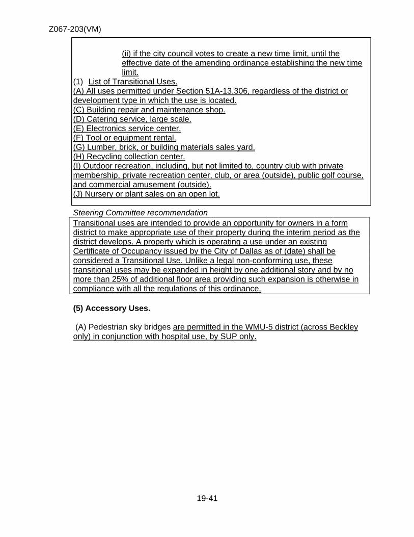
Z067-203(VM)
19-41
(ii) if the city council votes to create a new time limit, until the effective date of the amending ordinance establishing the new time limit.
(1) List of Transitional Uses. (A) All uses permitted under Section 51A-13.306, regardless of the district or development type in which the use is located.
(C) Building repair and maintenance shop. (D) Catering service, large scale.
(E) Electronics service center. (F) Tool or equipment rental. (G) Lumber, brick, or building materials sales yard. (H) Recycling collection center. (I) Outdoor recreation, including, but not limited to, country club with private membership, private recreation center, club, or area (outside), public golf course, and commercial amusement (outside). (J) Nursery or plant sales on an open lot. Steering Committee recommendation Transitional uses are intended to provide an opportunity for owners in a form district to make appropriate use of their property during the interim period as the district develops. A property which is operating a use under an existing Certificate of Occupancy issued by the City of Dallas as of (date) shall be considered a Transitional Use. Unlike a legal non-conforming use, these transitional uses may be expanded in height by one additional story and by no more than 25% of additional floor area providing such expansion is otherwise in compliance with all the regulations of this ordinance. (5) Accessory Uses.
(A) Pedestrian sky bridges are permitted in the WMU-5 district (across Beckley only) in conjunction with hospital use, by SUP only.
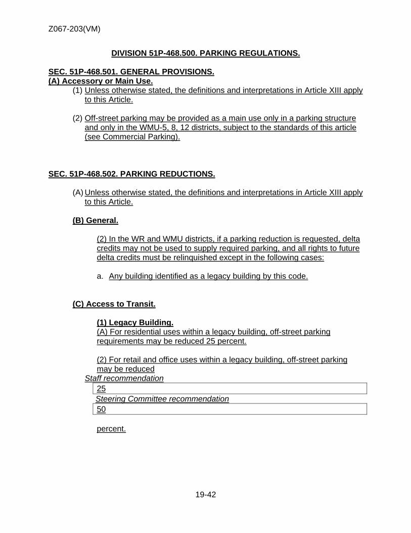
Z067-203(VM)
19-42
DIVISION 51P-468.500. PARKING REGULATIONS.
SEC. 51P-468.501. GENERAL PROVISIONS. (A) Accessory or Main Use.
(1) Unless otherwise stated, the definitions and interpretations in Article XIII apply to this Article.
(2) Off-street parking may be provided as a main use only in a parking structure
and only in the WMU-5, 8, 12 districts, subject to the standards of this article (see Commercial Parking).
SEC. 51P-468.502. PARKING REDUCTIONS.
(A) Unless otherwise stated, the definitions and interpretations in Article XIII apply to this Article.
(B) General.
(2) In the WR and WMU districts, if a parking reduction is requested, delta credits may not be used to supply required parking, and all rights to future delta credits must be relinquished except in the following cases:
a. Any building identified as a legacy building by this code.
(C) Access to Transit.
(1) Legacy Building. (A) For residential uses within a legacy building, off-street parking requirements may be reduced 25 percent.
(2) For retail and office uses within a legacy building, off-street parking may be reduced
Staff recommendation 25
Steering Committee recommendation 50 percent.
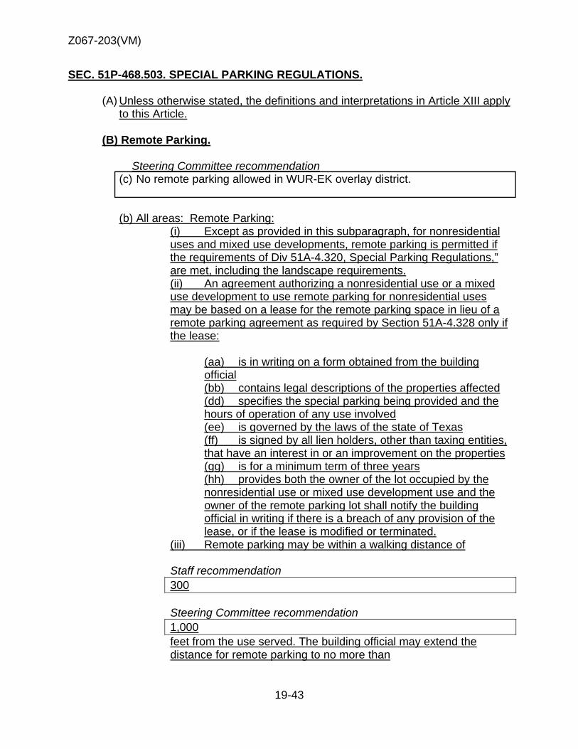
Z067-203(VM)
19-43
SEC. 51P-468.503. SPECIAL PARKING REGULATIONS.
(A) Unless otherwise stated, the definitions and interpretations in Article XIII apply to this Article.
(B) Remote Parking.
Steering Committee recommendation
(c) No remote parking allowed in WUR-EK overlay district.
(b) All areas: Remote Parking:
(i) Except as provided in this subparagraph, for nonresidential uses and mixed use developments, remote parking is permitted if the requirements of Div 51A-4.320, Special Parking Regulations,” are met, including the landscape requirements. (ii) An agreement authorizing a nonresidential use or a mixed use development to use remote parking for nonresidential uses may be based on a lease for the remote parking space in lieu of a remote parking agreement as required by Section 51A-4.328 only if the lease:
(aa) is in writing on a form obtained from the building official
(bb) contains legal descriptions of the properties affected (dd) specifies the special parking being provided and the
hours of operation of any use involved (ee) is governed by the laws of the state of Texas
(ff) is signed by all lien holders, other than taxing entities, that have an interest in or an improvement on the properties
(gg) is for a minimum term of three years (hh) provides both the owner of the lot occupied by the
nonresidential use or mixed use development use and the owner of the remote parking lot shall notify the building official in writing if there is a breach of any provision of the lease, or if the lease is modified or terminated.
(iii) Remote parking may be within a walking distance of Staff recommendation 300 Steering Committee recommendation 1,000 feet from the use served. The building official may extend the distance for remote parking to no more than
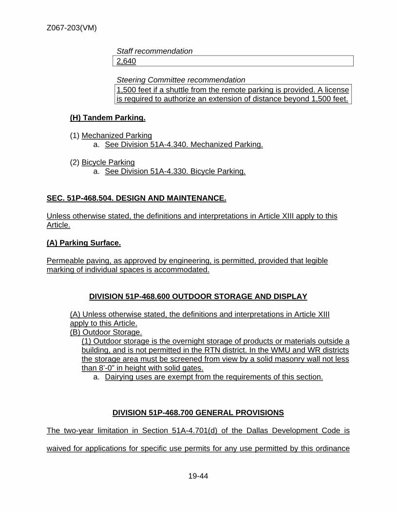
Z067-203(VM)
19-44
Staff recommendation 2,640 Steering Committee recommendation 1,500 feet if a shuttle from the remote parking is provided. A license is required to authorize an extension of distance beyond 1,500 feet.
(H) Tandem Parking. (1) Mechanized Parking
a. See Division 51A-4.340. Mechanized Parking.
(2) Bicycle Parking a. See Division 51A-4.330. Bicycle Parking.
SEC. 51P-468.504. DESIGN AND MAINTENANCE. Unless otherwise stated, the definitions and interpretations in Article XIII apply to this Article. (A) Parking Surface. Permeable paving, as approved by engineering, is permitted, provided that legible marking of individual spaces is accommodated.
DIVISION 51P-468.600 OUTDOOR STORAGE AND DISPLAY
(A) Unless otherwise stated, the definitions and interpretations in Article XIII apply to this Article. (B) Outdoor Storage.
(1) Outdoor storage is the overnight storage of products or materials outside a building, and is not permitted in the RTN district. In the WMU and WR districts the storage area must be screened from view by a solid masonry wall not less than 8’-0” in height with solid gates.
a. Dairying uses are exempt from the requirements of this section.
DIVISION 51P-468.700 GENERAL PROVISIONS The two-year limitation in Section 51A-4.701(d) of the Dallas Development Code is
waived for applications for specific use permits for any use permitted by this ordinance

Z067-203(VM)
19-45
until December XX, 201X. That the two-year limitation in Section 51A-4.701(d) of the
Dallas Development Code is waived for applications for rezoning to any subdistrict
permitted by this ordinance until December XX, 201X.

Z067-20
03(VM)
Propossed Distric
19-46
cts & Subbdistricts MMap

Z067-20
SF
03(VM)
R
Single Family
Single Family
Retail
Hospital
Mu
School
Ind
Re
SingleF
Park & Open Sp
Offic
Multi-Family
Church
ulti-Family
dustrial
19-47
etail
Family
pace
Mult
ce
Mu
Auto
Industria
Multi-Fam
ti-Family
ulti-Family
o Sales
al
mily
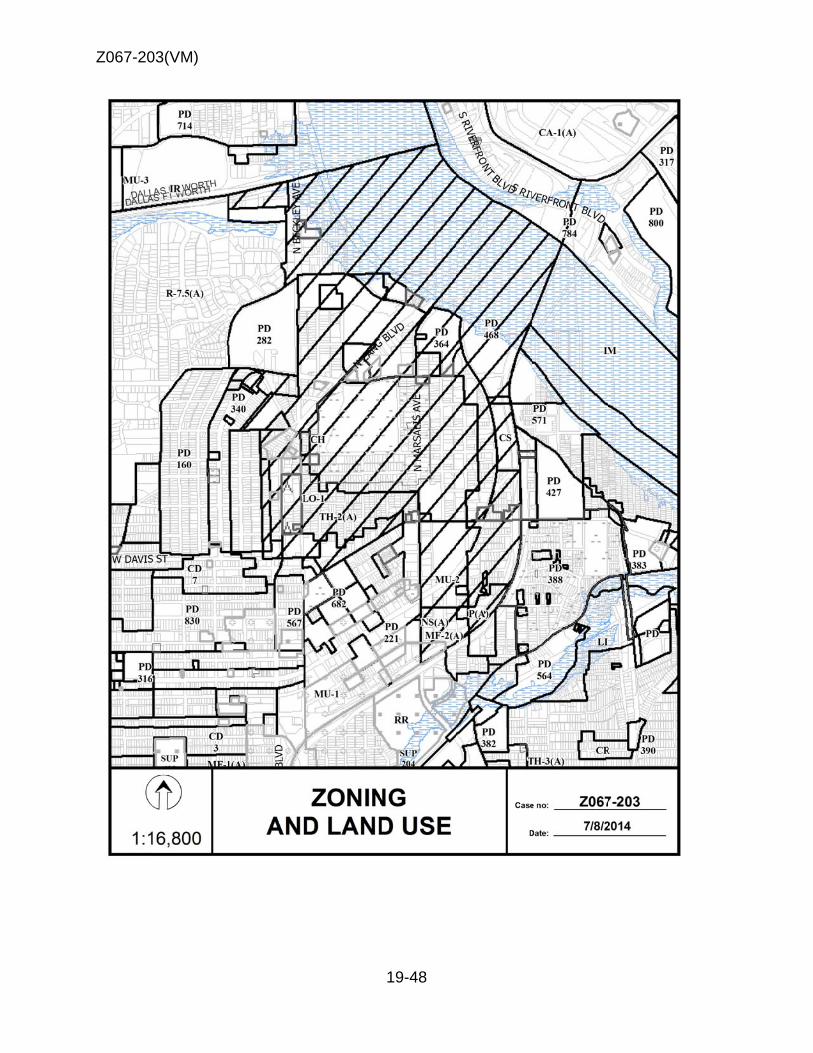
Z067-20
03(VM)
19-48

Z067-20
03(VM)
8
9
1
1
7
8
10
19-49
4 3
5
6
2
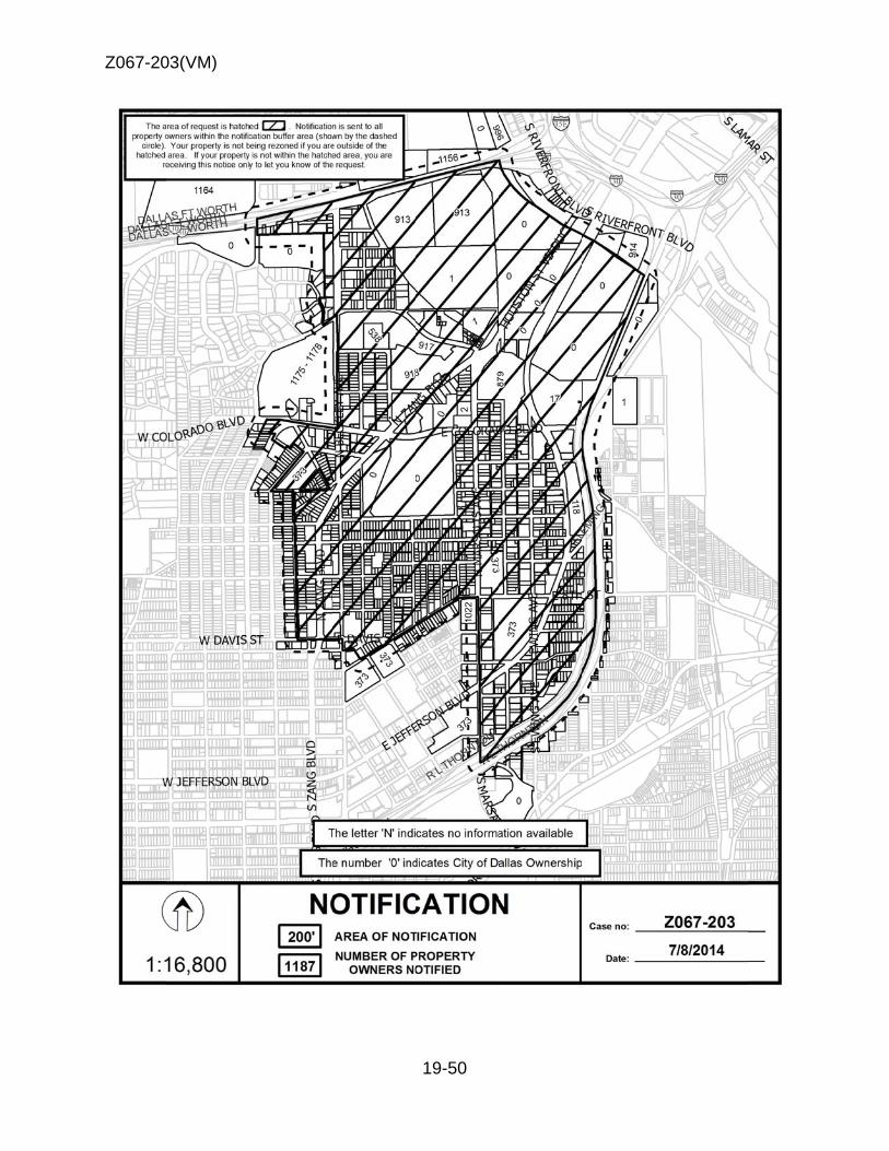
Z067-20
03(VM)
19-50

Z067-203(VM)
19-51
7/8/2014 Notification List of Property Owners
Z067-203
1187 Property Owners Notified
Label # Address Owner 1 1100 LANCASTER AVE CITY & COUNTY LEVEE DISTRICT ROOM 203 2 929 MARSALIS AVE SEGURA PATRICIA A 3 900 MARSALIS AVE RISING TIDE LTD PS % R K KNICKERBOCKER 4 908 MARSALIS AVE BAKER ALBERT L JR & 5 914 MARSALIS AVE MALONE TONY L 6 922 MARSALIS AVE CARTER CRAIG HARLAN & 7 926 MARSALIS AVE WIDMER LEE ANN 8 917 LANCASTER AVE WEISFED HERSCHEL A 9 925 LANCASTER AVE WEISFELD HERSHCEL A 10 618 ADDISON ST WEISFELD HERSCHEL ALAN 11 913 LANCASTER AVE SMITH ROBERT 12 911 LANCASTER AVE PRESTON DIGBY M & 13 619 COLORADO BLVD DILBECK AUDRY & DELLA MARLENE 14 901 LANCASTER AVE MCKNIGHT MARY L 15 701 COLORADO BLVD SOUTHERN FOODS GROUP LP SUITE 1200 LB 3 16 904 EWING AVE DOMINGUEZ INVESTMENTS LTD 17 909 COLORADO BLVD BELTLINE TRINITY GATEWAY 18 100 R L THORNTON FWY GRTP LTD SUITE 606 19 1400 JEFFERSON BLVD FIRST GLENDORA PARTNERS LTD 20 1421 JEFFERSON BLVD TRINITY BASIN PREPARATORY 21 1413 JEFFERSON BLVD HOOD WARREN W 22 1417 JEFFERSON BLVD TRINITY BASIN PREPARATORY 23 1411 JEFFERSON BLVD ALLEGHENY DALLAS INV % B MOSTELLER 24 1401 JEFFERSON BLVD GARCIA CATALINA E SOLE & SEPARATE 25 800 LANCASTER AVE FAIM ECONOMIC DEVELOPMENT CORP 26 804 LANCASTER AVE 804 N LANCASTER AVENUE LLC
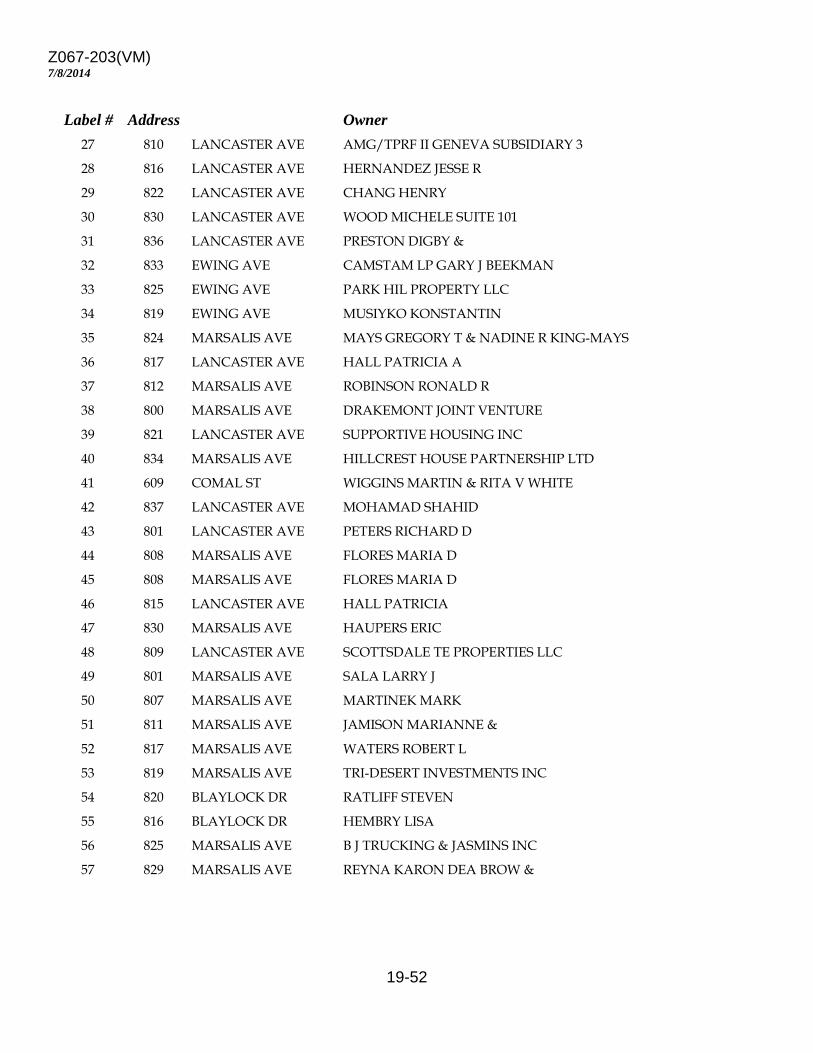
Z067-203(VM)
19-52
7/8/2014
Label # Address Owner 27 810 LANCASTER AVE AMG/TPRF II GENEVA SUBSIDIARY 3 28 816 LANCASTER AVE HERNANDEZ JESSE R 29 822 LANCASTER AVE CHANG HENRY 30 830 LANCASTER AVE WOOD MICHELE SUITE 101 31 836 LANCASTER AVE PRESTON DIGBY & 32 833 EWING AVE CAMSTAM LP GARY J BEEKMAN 33 825 EWING AVE PARK HIL PROPERTY LLC 34 819 EWING AVE MUSIYKO KONSTANTIN 35 824 MARSALIS AVE MAYS GREGORY T & NADINE R KING-MAYS 36 817 LANCASTER AVE HALL PATRICIA A 37 812 MARSALIS AVE ROBINSON RONALD R 38 800 MARSALIS AVE DRAKEMONT JOINT VENTURE 39 821 LANCASTER AVE SUPPORTIVE HOUSING INC 40 834 MARSALIS AVE HILLCREST HOUSE PARTNERSHIP LTD 41 609 COMAL ST WIGGINS MARTIN & RITA V WHITE 42 837 LANCASTER AVE MOHAMAD SHAHID 43 801 LANCASTER AVE PETERS RICHARD D 44 808 MARSALIS AVE FLORES MARIA D 45 808 MARSALIS AVE FLORES MARIA D 46 815 LANCASTER AVE HALL PATRICIA 47 830 MARSALIS AVE HAUPERS ERIC 48 809 LANCASTER AVE SCOTTSDALE TE PROPERTIES LLC 49 801 MARSALIS AVE SALA LARRY J 50 807 MARSALIS AVE MARTINEK MARK 51 811 MARSALIS AVE JAMISON MARIANNE & 52 817 MARSALIS AVE WATERS ROBERT L 53 819 MARSALIS AVE TRI-DESERT INVESTMENTS INC 54 820 BLAYLOCK DR RATLIFF STEVEN 55 816 BLAYLOCK DR HEMBRY LISA 56 825 MARSALIS AVE B J TRUCKING & JASMINS INC 57 829 MARSALIS AVE REYNA KARON DEA BROW &
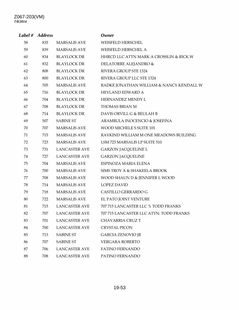
Z067-203(VM)
19-53
7/8/2014
Label # Address Owner 58 835 MARSALIS AVE WEISFELD HERSCHEL 59 839 MARSALIS AVE WEISFELD HERSCHEL A 60 834 BLAYLOCK DR HHRCD LLC ATTN MARK A CROSSLIN & RICK W 61 832 BLAYLOCK DR DELATORRE ALEJANDRO & 62 808 BLAYLOCK DR RIVERA GROUP STE 1324 63 800 BLAYLOCK DR RIVERA GROUP LLC STE 1324 64 705 MARSALIS AVE RADKE JONATHAN WILLIAM & NANCY KENDALL W 65 716 BLAYLOCK DR HEYLAND EDWARD A 66 704 BLAYLOCK DR HERNANDEZ MENDY L 67 708 BLAYLOCK DR THOMAS BRIAN M 68 714 BLAYLOCK DR DAVIS ORVILL G & BEULAH B 69 507 SABINE ST ARAMBULA INOCENCIO & JOSEFINA 70 707 MARSALIS AVE WOOD MICHELE S SUITE 101 71 715 MARSALIS AVE RAVKIND WILLIAM M ONE MEADOWS BUILDING 72 723 MARSALIS AVE LSM 723 MARSALIS LP SUITE 510 73 731 LANCASTER AVE GARZON JACQUELINE L 74 727 LANCASTER AVE GARZON JACQUELINE 75 704 MARSALIS AVE ESPINOZA MARIA ELENA 76 700 MARSALIS AVE SIMS TROY A & SHAKEELA BROOK 77 708 MARSALIS AVE WOOD SHAUN D & JENNIFER L WOOD 78 714 MARSALIS AVE LOPEZ DAVID 79 718 MARSALIS AVE CASTILLO GERRARDO G 80 722 MARSALIS AVE EL PATO JOINT VENTURE 81 715 LANCASTER AVE 707 715 LANCASTER LLC % TODD FRANKS 82 707 LANCASTER AVE 707 715 LANCASTER LLC ATTN: TODD FRANKS 83 701 LANCASTER AVE CHAVARRIA CRUZ T 84 700 LANCASTER AVE CRYSTAL PICON 85 713 SABINE ST GARCIA ZENOVIO JR 86 707 SABINE ST VERGARA ROBERTO 87 706 LANCASTER AVE FATINO FERNANDO 88 708 LANCASTER AVE PATINO FERNANDO
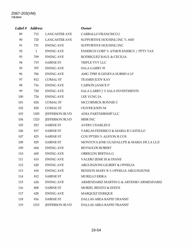
Z067-203(VM)
19-54
7/8/2014
Label # Address Owner 89 712 LANCASTER AVE CARBALLO FRANCISCO J 90 720 LANCASTER AVE SUPPORTIVE HOUSING INC % ASD 91 731 EWING AVE SUPPORTIVE HOUSING INC 92 1 EWING AVE ENSERCH CORP % ATMOS ENERGY / PPTY TAX 93 709 EWING AVE RODRIGUEZ RAUL & CECILIA 94 719 SABINE ST TRIPLE VVV LLC 95 707 EWING AVE SALA GARRY W 96 706 EWING AVE AMG TPRF II GENEVA SUBSID 4 LP 97 812 COMAL ST TEAMES JUDY KAY 98 716 EWING AVE CARSON JANICE P 99 720 EWING AVE SALA LARRY J % SALA INVESTMENTS 100 724 EWING AVE LEE YUNG JA 101 824 COMAL ST MCCORMICK BONNIE C 102 820 COMAL ST OLIVER JOHN M 103 1305 JEFFERSON BLVD ADIA PARTNERSHIP LLC 104 1323 JEFFERSON BLVD SRSR INC 105 823 SABINE ST AVERY CHARLES E 106 817 SABINE ST VARGAS FEDERICO & MARIA R CASTILLO 107 825 SABINE ST COX PPTIES % ALSTON R COX 108 829 SABINE ST MONTOYA JOSE GUADALUPE & MARIA DE LA LUZ 109 604 EWING AVE REYNOLDS ROBERT 110 600 EWING AVE OBREGON BERTHA G 111 610 EWING AVE VALERO JESSE III & DIANE 112 620 EWING AVE ARGUINZONI GILBERT & OPHELIA 113 618 EWING AVE RENDON MARY B % OPHELIA ARGUINZONE 114 812 SABINE ST MURILLO ERIKA 115 624 EWING AVE ARMENDARIZ MARTIN G & ARTEMIO ARMENDARIZ 116 808 SABINE ST MORIEL BENITO & EDITH 117 628 EWING AVE MARQUEZ ENRIQUE 118 816 SABINE ST DALLAS AREA RAPID TRANSIT 119 1215 JEFFERSON BLVD DALLAS AREA RAPID TRANSIT

Z067-203(VM)
19-55
7/8/2014
Label # Address Owner 120 602 LANCASTER AVE SALDIVAR FAMILY LTD PS 121 612 LANCASTER AVE AMG/ TPRF II GENEVA SUBSIDIARY I LP 122 618 LANCASTER AVE BRIGGEMAN SUSAN 123 624 LANCASTER AVE AURORA APT LLC 124 625 EWING AVE VEASLEY JAMES 125 619 EWING AVE DALLAS HOUSING ACQUISITION & DEVELOPMENT 126 609 EWING AVE DALLAS HOUSING ACQUISITION & DEV CORP CI 127 613 EWING AVE RODRIGUEZ NORA 128 600 MARSALIS AVE P & V INC 129 606 MARSALIS AVE AMG/TPRF II GENEVA SUBSIDIARY 2 LP 130 622 MARSALIS AVE ELAM EDNA EST OF 131 626 MARSALIS AVE KENNEDY LISA 132 630 MARSALIS AVE MARTINEZ PEDRO JOE & LUCIA O 133 614 SABINE ST HAYNES DELBERT K & AARON M & EMMA G HAYN 134 616 SABINE ST RAMOS GILBERTO VASQUEZ 135 627 LANCASTER AVE DSILVA JOHN 136 623 LANCASTER AVE REALESTATE R US INC 137 623 LANCASTER AVE MECCA APRIL INC 138 609 LANCASTER AVE AMG/TPRF II GENEVA SUBSIDIARY 2 LP 139 609 LANCASTER AVE BATTS DOUGLAS R 140 619 5TH ST FISHER BRANDY 141 612 BLAYLOCK DR SANDBERG LEIF A 142 616 BLAYLOCK DR DIETERT DALE M & 143 622 BLAYLOCK DR SMITH BOB W & LINDA J 144 606 BLAYLOCK DR GORDON EVA M & LESLIE W HALL 145 611 MARSALIS AVE OLIVER JOHN 146 601 MARSALIS AVE RISING TIDE LTD PS % KNICKERBOCKER INVS 147 615 MARSALIS AVE AMINI RAMIN 148 629 MARSALIS AVE JASSO JUANA HERMELINDA & 149 626 BLAYLOCK DR LOPEZ DAVID A 150 625 MARSALIS AVE SIXTOS ROCIO
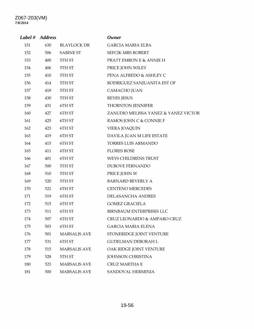
Z067-203(VM)
19-56
7/8/2014
Label # Address Owner 151 630 BLAYLOCK DR GARCIA MARIA ELBA 152 506 SABINE ST SEFCIK MRS ROBERT 153 400 5TH ST PRATT EMRON E & ANNIE H 154 406 5TH ST PRICE JOHN WILEY 155 410 5TH ST PENA ALFREDO & ASHLEY C 156 414 5TH ST RODRIGUEZ SANJUANITA EST OF 157 418 5TH ST CAMACHO JUAN 158 430 5TH ST REYES JESUS 159 431 6TH ST THORNTON JENNIFER 160 427 6TH ST ZANUDIO MELISSA YANEZ & YANEZ VICTOR 161 425 6TH ST RAMOS JOHN C & CONNIE F 162 423 6TH ST VIERA JOAQUIN 163 419 6TH ST DAVILA JUAN M LIFE ESTATE 164 415 6TH ST TORRES LUIS ARMANDO 165 411 6TH ST FLORES ROSE 166 401 6TH ST WEYS CHILDRENS TRUST 167 500 5TH ST DUBOVE FERNANDO 168 510 5TH ST PRICE JOHN W 169 520 5TH ST BARNARD BEVERLY A 170 521 6TH ST CENTENO MERCEDES 171 519 6TH ST DELASANCHA ANDRES 172 515 6TH ST GOMEZ GRACIELA 173 511 6TH ST BIRNBAUM ENTERPRISES LLC 174 507 6TH ST CRUZ LEONARDO & AMPARO CRUZ 175 503 6TH ST GARCIA MARIA ELENA 176 501 MARSALIS AVE STONERIDGE JOINT VENTURE 177 531 6TH ST GUDELMAN DEBORAH L 178 515 MARSALIS AVE OAK RIDGE JOINT VENTURE 179 528 5TH ST JOHNSON CHRISTINA 180 523 MARSALIS AVE CRUZ MARTHA E 181 500 MARSALIS AVE SANDOVAL HERMINIA
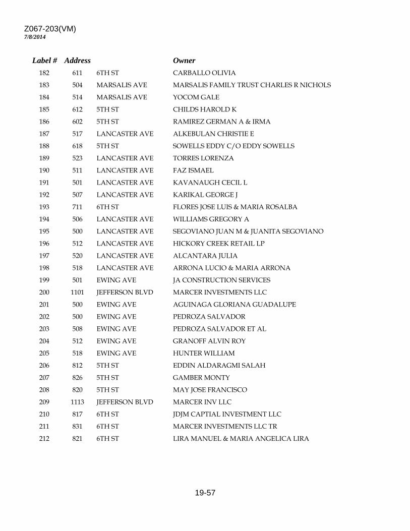
Z067-203(VM)
19-57
7/8/2014
Label # Address Owner 182 611 6TH ST CARBALLO OLIVIA 183 504 MARSALIS AVE MARSALIS FAMILY TRUST CHARLES R NICHOLS 184 514 MARSALIS AVE YOCOM GALE 185 612 5TH ST CHILDS HAROLD K 186 602 5TH ST RAMIREZ GERMAN A & IRMA 187 517 LANCASTER AVE ALKEBULAN CHRISTIE E 188 618 5TH ST SOWELLS EDDY C/O EDDY SOWELLS 189 523 LANCASTER AVE TORRES LORENZA 190 511 LANCASTER AVE FAZ ISMAEL 191 501 LANCASTER AVE KAVANAUGH CECIL L 192 507 LANCASTER AVE KARIKAL GEORGE J 193 711 6TH ST FLORES JOSE LUIS & MARIA ROSALBA 194 506 LANCASTER AVE WILLIAMS GREGORY A 195 500 LANCASTER AVE SEGOVIANO JUAN M & JUANITA SEGOVIANO 196 512 LANCASTER AVE HICKORY CREEK RETAIL LP 197 520 LANCASTER AVE ALCANTARA JULIA 198 518 LANCASTER AVE ARRONA LUCIO & MARIA ARRONA 199 501 EWING AVE JA CONSTRUCTION SERVICES 200 1101 JEFFERSON BLVD MARCER INVESTMENTS LLC 201 500 EWING AVE AGUINAGA GLORIANA GUADALUPE 202 500 EWING AVE PEDROZA SALVADOR 203 508 EWING AVE PEDROZA SALVADOR ET AL 204 512 EWING AVE GRANOFF ALVIN ROY 205 518 EWING AVE HUNTER WILLIAM 206 812 5TH ST EDDIN ALDARAGMI SALAH 207 826 5TH ST GAMBER MONTY 208 820 5TH ST MAY JOSE FRANCISCO 209 1113 JEFFERSON BLVD MARCER INV LLC 210 817 6TH ST JDJM CAPTIAL INVESTMENT LLC 211 831 6TH ST MARCER INVESTMENTS LLC TR 212 821 6TH ST LIRA MANUEL & MARIA ANGELICA LIRA
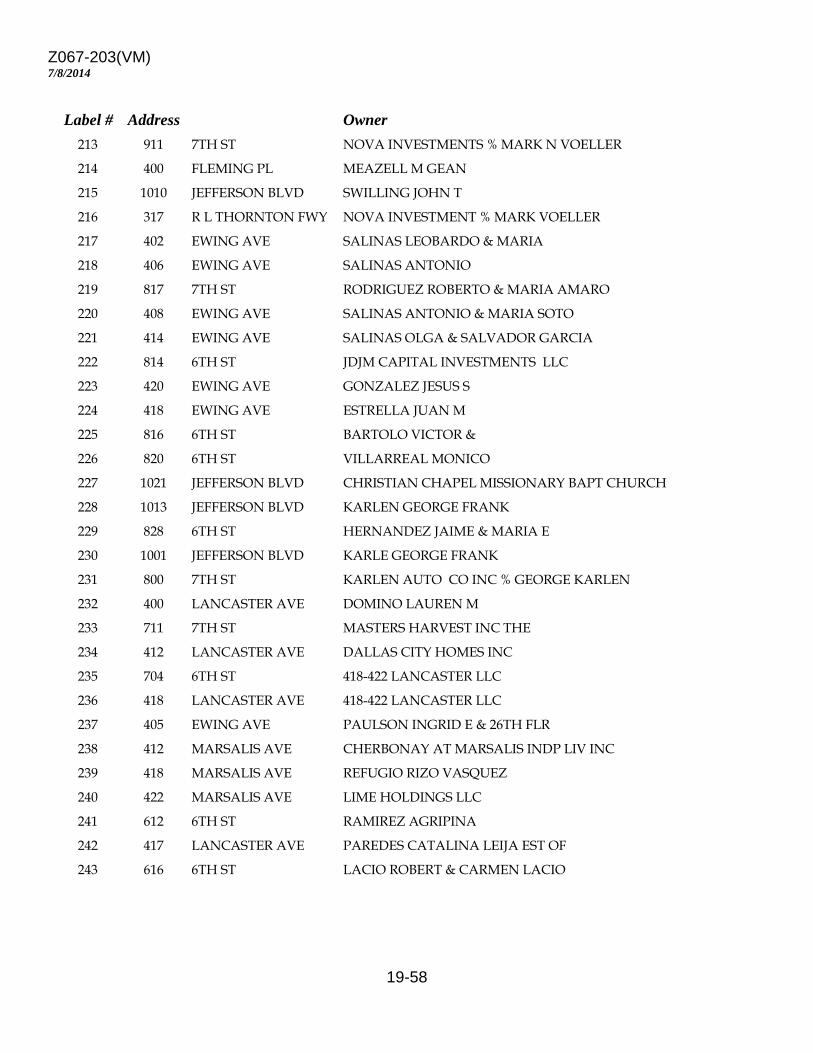
Z067-203(VM)
19-58
7/8/2014
Label # Address Owner 213 911 7TH ST NOVA INVESTMENTS % MARK N VOELLER 214 400 FLEMING PL MEAZELL M GEAN 215 1010 JEFFERSON BLVD SWILLING JOHN T 216 317 R L THORNTON FWY NOVA INVESTMENT % MARK VOELLER 217 402 EWING AVE SALINAS LEOBARDO & MARIA 218 406 EWING AVE SALINAS ANTONIO 219 817 7TH ST RODRIGUEZ ROBERTO & MARIA AMARO 220 408 EWING AVE SALINAS ANTONIO & MARIA SOTO 221 414 EWING AVE SALINAS OLGA & SALVADOR GARCIA 222 814 6TH ST JDJM CAPITAL INVESTMENTS LLC 223 420 EWING AVE GONZALEZ JESUS S 224 418 EWING AVE ESTRELLA JUAN M 225 816 6TH ST BARTOLO VICTOR & 226 820 6TH ST VILLARREAL MONICO 227 1021 JEFFERSON BLVD CHRISTIAN CHAPEL MISSIONARY BAPT CHURCH 228 1013 JEFFERSON BLVD KARLEN GEORGE FRANK 229 828 6TH ST HERNANDEZ JAIME & MARIA E 230 1001 JEFFERSON BLVD KARLE GEORGE FRANK 231 800 7TH ST KARLEN AUTO CO INC % GEORGE KARLEN 232 400 LANCASTER AVE DOMINO LAUREN M 233 711 7TH ST MASTERS HARVEST INC THE 234 412 LANCASTER AVE DALLAS CITY HOMES INC 235 704 6TH ST 418-422 LANCASTER LLC 236 418 LANCASTER AVE 418-422 LANCASTER LLC 237 405 EWING AVE PAULSON INGRID E & 26TH FLR 238 412 MARSALIS AVE CHERBONAY AT MARSALIS INDP LIV INC 239 418 MARSALIS AVE REFUGIO RIZO VASQUEZ 240 422 MARSALIS AVE LIME HOLDINGS LLC 241 612 6TH ST RAMIREZ AGRIPINA 242 417 LANCASTER AVE PAREDES CATALINA LEIJA EST OF 243 616 6TH ST LACIO ROBERT & CARMEN LACIO
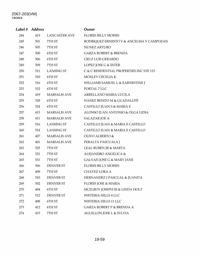
Z067-203(VM)
19-59
7/8/2014
Label # Address Owner 244 413 LANCASTER AVE FLORES BILLY MOISES 245 501 7TH ST RODRIQUEZ ERNESTO V & ANCELMA V CAMPOZAN 246 505 7TH ST NUNEZ ARTURO 247 500 6TH ST GARZA ROBERT & BRENDA 248 506 6TH ST CRUZ LUIS GERARDO 249 509 7TH ST LOPEZ JOSE G & ESTER 250 511 LANSING ST C & C RESIDENTIAL PROPERTIES INC STE 115 251 510 6TH ST MOXLEY CECELIA K 252 516 6TH ST WILLIAMS SAMUEL L & EARNESTINE J 253 532 6TH ST PORTAL 7 LLC 254 419 MARSALIS AVE ARRELLANO MARIA LUCILA 255 528 6TH ST NANEZ BENITO M & GUADALUPE 256 524 6TH ST CASTILLO JUAN S & MARIA E 257 415 MARSALIS AVE ALONSO JUAN ANTONIO & OLGA LIDIA 258 411 MARSALIS AVE SALAZAR JOE A 259 516 LANSING ST CASTILLO JUAN & MARIA E CASTILLO 260 514 LANSING ST CASTILLO JUAN & MARIA E CASTILLO 261 407 MARSALIS AVE OLIVO ALBERTO & 262 401 MARSALIS AVE PERALTA PASCUALA J 263 525 7TH ST LEAL RUBEN JR & MARTA 264 521 7TH ST ALEJANDRO ANGELICA & 265 531 7TH ST GALVAN JOSE G & MARY JANE 266 506 DENVER ST FLORES BILLY MOISES 267 409 7TH ST CHAVEZ LORA A 268 510 DENVER ST HERNANDEZ J PASCUAL & JUANITA 269 502 DENVER ST FLORES JOSE & MARIA 270 404 6TH ST MCELROY JOSEPH III & LINDA HOLT 271 512 DENVER ST WISTERIA HILLS 4 LLC 272 408 6TH ST WISTERIA HILLS 11 LLC 273 412 6TH ST GARZA ROBERT P & BRENDA A 274 415 7TH ST AGUILLON JOSE L & SYLVIA
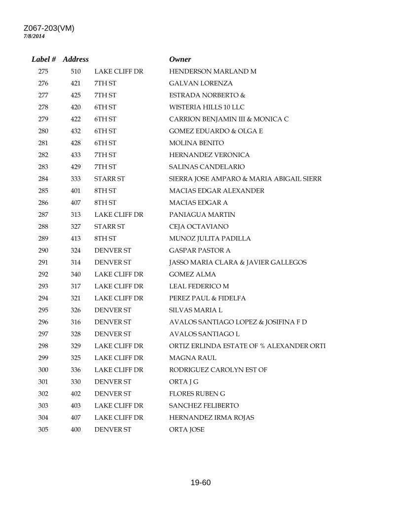
Z067-203(VM)
19-60
7/8/2014
Label # Address Owner 275 510 LAKE CLIFF DR HENDERSON MARLAND M 276 421 7TH ST GALVAN LORENZA 277 425 7TH ST ESTRADA NORBERTO & 278 420 6TH ST WISTERIA HILLS 10 LLC 279 422 6TH ST CARRION BENJAMIN III & MONICA C 280 432 6TH ST GOMEZ EDUARDO & OLGA E 281 428 6TH ST MOLINA BENITO 282 433 7TH ST HERNANDEZ VERONICA 283 429 7TH ST SALINAS CANDELARIO 284 333 STARR ST SIERRA JOSE AMPARO & MARIA ABIGAIL SIERR 285 401 8TH ST MACIAS EDGAR ALEXANDER 286 407 8TH ST MACIAS EDGAR A 287 313 LAKE CLIFF DR PANIAGUA MARTIN 288 327 STARR ST CEJA OCTAVIANO 289 413 8TH ST MUNOZ JULITA PADILLA 290 324 DENVER ST GASPAR PASTOR A 291 314 DENVER ST JASSO MARIA CLARA & JAVIER GALLEGOS 292 340 LAKE CLIFF DR GOMEZ ALMA 293 317 LAKE CLIFF DR LEAL FEDERICO M 294 321 LAKE CLIFF DR PEREZ PAUL & FIDELFA 295 326 DENVER ST SILVAS MARIA L 296 316 DENVER ST AVALOS SANTIAGO LOPEZ & JOSIFINA F D 297 328 DENVER ST AVALOS SANTIAGO L 298 329 LAKE CLIFF DR ORTIZ ERLINDA ESTATE OF % ALEXANDER ORTI 299 325 LAKE CLIFF DR MAGNA RAUL 300 336 LAKE CLIFF DR RODRIGUEZ CAROLYN EST OF 301 330 DENVER ST ORTA J G 302 402 DENVER ST FLORES RUBEN G 303 403 LAKE CLIFF DR SANCHEZ FELIBERTO 304 407 LAKE CLIFF DR HERNANDEZ IRMA ROJAS 305 400 DENVER ST ORTA JOSE
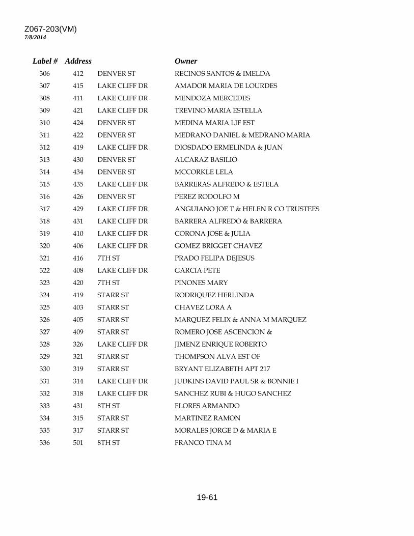
Z067-203(VM)
19-61
7/8/2014
Label # Address Owner 306 412 DENVER ST RECINOS SANTOS & IMELDA 307 415 LAKE CLIFF DR AMADOR MARIA DE LOURDES 308 411 LAKE CLIFF DR MENDOZA MERCEDES 309 421 LAKE CLIFF DR TREVINO MARIA ESTELLA 310 424 DENVER ST MEDINA MARIA LIF EST 311 422 DENVER ST MEDRANO DANIEL & MEDRANO MARIA 312 419 LAKE CLIFF DR DIOSDADO ERMELINDA & JUAN 313 430 DENVER ST ALCARAZ BASILIO 314 434 DENVER ST MCCORKLE LELA 315 435 LAKE CLIFF DR BARRERAS ALFREDO & ESTELA 316 426 DENVER ST PEREZ RODOLFO M 317 429 LAKE CLIFF DR ANGUIANO JOE T & HELEN R CO TRUSTEES 318 431 LAKE CLIFF DR BARRERA ALFREDO & BARRERA 319 410 LAKE CLIFF DR CORONA JOSE & JULIA 320 406 LAKE CLIFF DR GOMEZ BRIGGET CHAVEZ 321 416 7TH ST PRADO FELIPA DEJESUS 322 408 LAKE CLIFF DR GARCIA PETE 323 420 7TH ST PINONES MARY 324 419 STARR ST RODRIQUEZ HERLINDA 325 403 STARR ST CHAVEZ LORA A 326 405 STARR ST MARQUEZ FELIX & ANNA M MARQUEZ 327 409 STARR ST ROMERO JOSE ASCENCION & 328 326 LAKE CLIFF DR JIMENZ ENRIQUE ROBERTO 329 321 STARR ST THOMPSON ALVA EST OF 330 319 STARR ST BRYANT ELIZABETH APT 217 331 314 LAKE CLIFF DR JUDKINS DAVID PAUL SR & BONNIE I 332 318 LAKE CLIFF DR SANCHEZ RUBI & HUGO SANCHEZ 333 431 8TH ST FLORES ARMANDO 334 315 STARR ST MARTINEZ RAMON 335 317 STARR ST MORALES JORGE D & MARIA E 336 501 8TH ST FRANCO TINA M
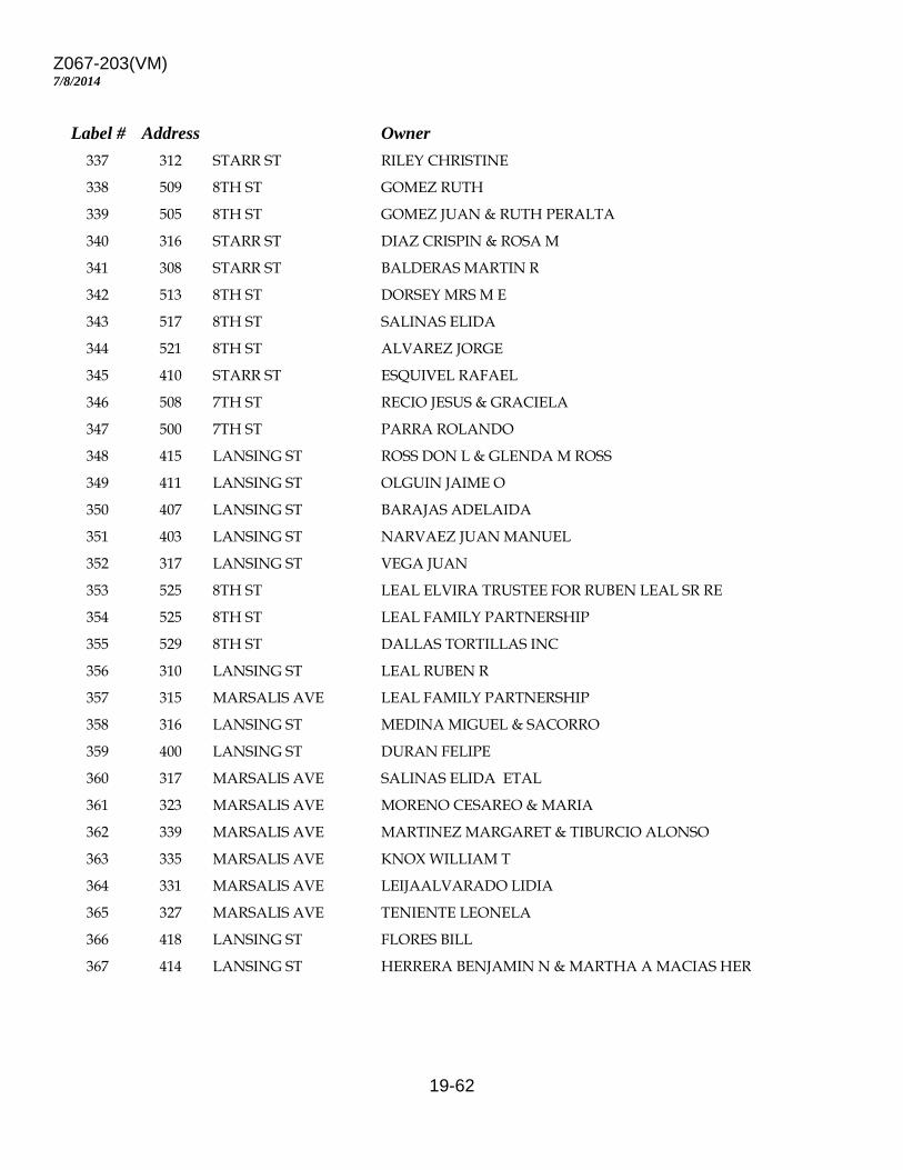
Z067-203(VM)
19-62
7/8/2014
Label # Address Owner 337 312 STARR ST RILEY CHRISTINE 338 509 8TH ST GOMEZ RUTH 339 505 8TH ST GOMEZ JUAN & RUTH PERALTA 340 316 STARR ST DIAZ CRISPIN & ROSA M 341 308 STARR ST BALDERAS MARTIN R 342 513 8TH ST DORSEY MRS M E 343 517 8TH ST SALINAS ELIDA 344 521 8TH ST ALVAREZ JORGE 345 410 STARR ST ESQUIVEL RAFAEL 346 508 7TH ST RECIO JESUS & GRACIELA 347 500 7TH ST PARRA ROLANDO 348 415 LANSING ST ROSS DON L & GLENDA M ROSS 349 411 LANSING ST OLGUIN JAIME O 350 407 LANSING ST BARAJAS ADELAIDA 351 403 LANSING ST NARVAEZ JUAN MANUEL 352 317 LANSING ST VEGA JUAN 353 525 8TH ST LEAL ELVIRA TRUSTEE FOR RUBEN LEAL SR RE 354 525 8TH ST LEAL FAMILY PARTNERSHIP 355 529 8TH ST DALLAS TORTILLAS INC 356 310 LANSING ST LEAL RUBEN R 357 315 MARSALIS AVE LEAL FAMILY PARTNERSHIP 358 316 LANSING ST MEDINA MIGUEL & SACORRO 359 400 LANSING ST DURAN FELIPE 360 317 MARSALIS AVE SALINAS ELIDA ETAL 361 323 MARSALIS AVE MORENO CESAREO & MARIA 362 339 MARSALIS AVE MARTINEZ MARGARET & TIBURCIO ALONSO 363 335 MARSALIS AVE KNOX WILLIAM T 364 331 MARSALIS AVE LEIJAALVARADO LIDIA 365 327 MARSALIS AVE TENIENTE LEONELA 366 418 LANSING ST FLORES BILL 367 414 LANSING ST HERRERA BENJAMIN N & MARTHA A MACIAS HER
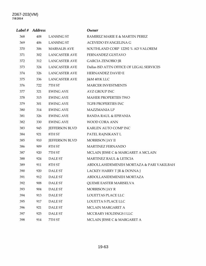
Z067-203(VM)
19-63
7/8/2014
Label # Address Owner 368 408 LANSING ST RAMIREZ MARIE E & MARTIN PEREZ 369 406 LANSING ST ACEVEDO EVANGELINA G 370 306 MARSALIS AVE SOUTHLAND CORP 12292 % AD VALOREM 371 302 LANCASTER AVE FERNANDEZ GUSTAVO 372 312 LANCASTER AVE GARCIA ZENOBIO JR 373 324 LANCASTER AVE Dallas ISD ATTN OFFICE OF LEGAL SERVICES 374 326 LANCASTER AVE HERNANDEZ DAVID E 375 336 LANCASTER AVE J&M 401K LLC 376 722 7TH ST MARCER INVESTMENTS 377 321 EWING AVE AYZ GROUP INC 378 315 EWING AVE MAHER PROPERTIES TWO 379 301 EWING AVE TGFB PROPERTIES INC 380 314 EWING AVE MAZZMANIA LP 381 326 EWING AVE BANDA RAUL & EPIFANIA 382 330 EWING AVE WOOD CORA ANN 383 945 JEFFERSON BLVD KARLEN AUTO COMP INC 384 921 8TH ST PATEL RAJNIKANT L 385 910 JEFFERSON BLVD MORRISON JAY II 386 909 8TH ST MARTINEZ FERNANDO 387 920 7TH ST MCLAIN JESSE C & MARGARET A MCLAIN 388 924 DALE ST MARTINEZ RAUL & LETICIA 389 911 8TH ST ABDOLLAHIDEMENEH MORTAZA & PARI VAKILBAH 390 920 DALE ST LACKEY HARRY T JR & DONNA J 391 912 DALE ST ABDOLLANIDEMENEH MORTAZA 392 908 DALE ST QUEME EASTER MARISELVA 393 904 DALE ST MORRISON JAY R 394 913 DALE ST LOUETTAS PLACE LLC 395 917 DALE ST LOUETTA S PLACE LLC 396 921 DALE ST MCLAIN MARGARET A 397 925 DALE ST MCCRARY HOLDINGS I LLC 398 914 7TH ST MCLAIN JESSE C & MARGARET A
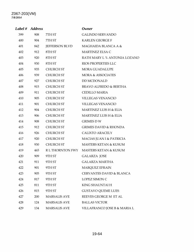
Z067-203(VM)
19-64
7/8/2014
Label # Address Owner 399 908 7TH ST GALINDO SERVANDO 400 904 7TH ST KARLEN GEORGE F 401 842 JEFFERSON BLVD MAGHAIDA BLANCA A & 402 912 8TH ST MARTINEZ ELSA C 403 920 8TH ST RATH MARY L % ANTONIA LOZANO 404 930 8TH ST RIOS PROPERTIES LLC 405 935 CHURCH ST MORA GUADALUPE 406 939 CHURCH ST MORA & ASSOCIATES 407 927 CHURCH ST DD MCDONALD 408 915 CHURCH ST BRAVO ALFREDO & BERTHA 409 911 CHURCH ST CEDILLO MARIA 410 905 CHURCH ST VILLEGAS VENANCIO 411 901 CHURCH ST VILLEGAS VENANCIO 412 904 CHURCH ST MARTINEZ LUIS H & ELIA 413 906 CHURCH ST MARTINEZ LUIS H & ELIA 414 908 CHURCH ST GRIMES D W 415 912 CHURCH ST GRIMES DAVID & RHONDA 416 926 CHURCH ST CALIXTO ARACELY 417 920 CHURCH ST MACIAS JUAN I & PATRICIA 418 930 CHURCH ST MASTERS KETAN & KUSUM 419 465 R L THORNTON FWY MASTERS KETAN & KUSUM 420 909 9TH ST GALARZA JOSE 421 911 9TH ST GALARZA MARTHA 422 901 9TH ST MARQUEZ EFRAIN 423 905 9TH ST CERVANTES DAVID & BLANCA 424 817 9TH ST LOPEZ SIMON C 425 811 9TH ST KING SHAUNTAI H 426 815 9TH ST GUSTAVO QUEME LUES 427 200 MARSALIS AVE REEVES GEORGE M ET AL 428 124 MARSALIS AVE BALLAS VICTOR 429 134 MARSALIS AVE VILLAFRANCO JOSE B & MARIA L

Z067-203(VM)
19-65
7/8/2014
Label # Address Owner 430 102 EWING AVE LONGORIA LOUIS A 431 108 EWING AVE PUENTE DANIEL JAMES 432 806 9TH ST LONGORIA LOUIS A DBA MOVING SERVICES CO 433 810 9TH ST EMMETT SAM 434 822 9TH ST EMMETT JOSEPHINE 435 525 R L THORNTON FWY CHUNG TAI Y & SOON E 436 837 10TH ST MONZURES ERASMO 437 835 10TH ST LOVE DELLA CARTER 438 825 10TH ST HERNANDEZ ISAAC 439 821 10TH ST LEWIS DWIGHT E 440 817 10TH ST DAL CO RACING PIDGEON % G CISNEROS 441 824 BETTERTON CIR LES TAYLOR PONTIAC INC 442 828 BETTERTON CIR MYRICK HORACE C JR & ROBERT L MYRICK SR 443 820 BETTERTON CIR ROBINSON PATRICIA A & 444 816 BETTERTON CIR WRIGHT FLOYD 445 900 BETTERTON CIR TAYLOR LES PONTIAC 446 830 BETTERTON CIR MYRICK HORACE JR & 447 902 BETTERTON CIR TAYLOR LES PONTIAC INC 448 128 LANCASTER AVE TAYLOR PONTIAC INC 449 108 LANCASTER AVE LES TAYLOR PONTIAC INC 450 702 10TH ST GOODE BARBARA ANN 451 129 EWING AVE TAYLOR LES PONTIAC INC 452 133 EWING AVE TAYLOR LES PONTIAC INC 453 719 11TH ST TAYLOR PONTIAC INC 454 129 LANCASTER AVE TORRES MIGUEL A 455 133 LANCASTER AVE GOODE BARBARA ANN 456 133 LANCASTER AVE TAYLOR PONTIAC 457 617 11TH ST TAYLOR BARBARA ANN 458 246 MARSALIS AVE FOUNTAIN VILLA JV 459 220 MARSALIS AVE SECKER BETTY 1 460 206 MARSALIS AVE RUBIO REYNA
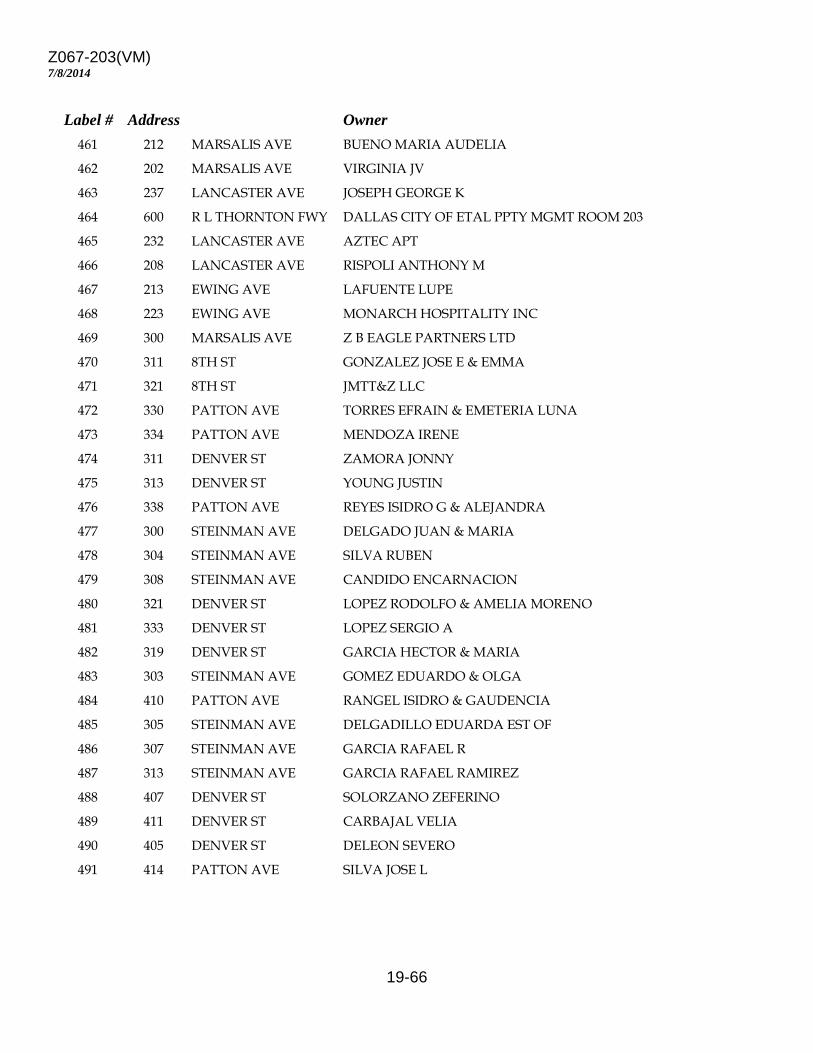
Z067-203(VM)
19-66
7/8/2014
Label # Address Owner 461 212 MARSALIS AVE BUENO MARIA AUDELIA 462 202 MARSALIS AVE VIRGINIA JV 463 237 LANCASTER AVE JOSEPH GEORGE K 464 600 R L THORNTON FWY DALLAS CITY OF ETAL PPTY MGMT ROOM 203 465 232 LANCASTER AVE AZTEC APT 466 208 LANCASTER AVE RISPOLI ANTHONY M 467 213 EWING AVE LAFUENTE LUPE 468 223 EWING AVE MONARCH HOSPITALITY INC 469 300 MARSALIS AVE Z B EAGLE PARTNERS LTD 470 311 8TH ST GONZALEZ JOSE E & EMMA 471 321 8TH ST JMTT&Z LLC 472 330 PATTON AVE TORRES EFRAIN & EMETERIA LUNA 473 334 PATTON AVE MENDOZA IRENE 474 311 DENVER ST ZAMORA JONNY 475 313 DENVER ST YOUNG JUSTIN 476 338 PATTON AVE REYES ISIDRO G & ALEJANDRA 477 300 STEINMAN AVE DELGADO JUAN & MARIA 478 304 STEINMAN AVE SILVA RUBEN 479 308 STEINMAN AVE CANDIDO ENCARNACION 480 321 DENVER ST LOPEZ RODOLFO & AMELIA MORENO 481 333 DENVER ST LOPEZ SERGIO A 482 319 DENVER ST GARCIA HECTOR & MARIA 483 303 STEINMAN AVE GOMEZ EDUARDO & OLGA 484 410 PATTON AVE RANGEL ISIDRO & GAUDENCIA 485 305 STEINMAN AVE DELGADILLO EDUARDA EST OF 486 307 STEINMAN AVE GARCIA RAFAEL R 487 313 STEINMAN AVE GARCIA RAFAEL RAMIREZ 488 407 DENVER ST SOLORZANO ZEFERINO 489 411 DENVER ST CARBAJAL VELIA 490 405 DENVER ST DELEON SEVERO 491 414 PATTON AVE SILVA JOSE L
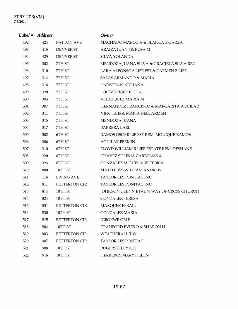
Z067-203(VM)
19-67
7/8/2014
Label # Address Owner 492 424 PATTON AVE MACHADO MARCO A & BLANCA E GARZA 493 415 DENVER ST ARAIZA JUAN J & ROSA M 494 425 DENVER ST SILVA YOLANDA 495 302 7TH ST MENDOZA JUANA SILVA & GRACIELA SILVA REC 496 310 7TH ST LARA ALFONSO S LIFE EST & CARMEN B LIFE 497 314 7TH ST SALAS ARMANDO & MARIA 498 316 7TH ST CAPISTRAN ADRIANA 499 320 7TH ST LOPEZ ROGER II ET AL 500 303 7TH ST VELAZQUEZ MARIA M 501 307 7TH ST HERNANDEZ FRANCISCO & MARGARITA AGUILAR 502 311 7TH ST NINO LUIS & MARIA DELCARMEN 503 315 7TH ST MENDOZA JUANA 504 317 7TH ST BARRERA LAEL 505 302 6TH ST RAMOS OSCAR LIF EST REM: MONIQUE RAMOS 506 306 6TH ST AGUILAR FERMIN 507 310 6TH ST FLOYD WILLIAM R LIFE ESTATE REM: DESHANE 508 320 6TH ST CHAVEZ SULEMA CARDENAS & 509 324 6TH ST GONZALEZ MIGUEL & VICTORIA 510 800 10TH ST MATTHEWS WILLIAM ANDREW 511 116 EWING AVE TAYLOR LES PONTIAC INC 512 811 BETTERTON CIR TAYLOR LES PONITAC INC 513 814 10TH ST JOHNSON GLENN ETAL % WAY OF CROSS CHURCH 514 824 10TH ST GONZALEZ TERESA 515 831 BETTERTON CIR MARQUEZ EFRAIN 516 830 10TH ST GONZALEZ MARIA 517 845 BETTERTON CIR IGBOKWE OBI E 518 904 10TH ST CRANFORD EVIES O & SHARON H 519 903 BETTERTON CIR WEATHERALL T W 520 907 BETTERTON CIR TAYLOR LES PONTIAC 521 908 10TH ST ROGERS BILLY JOE 522 916 10TH ST HERREROS MARY HELEN
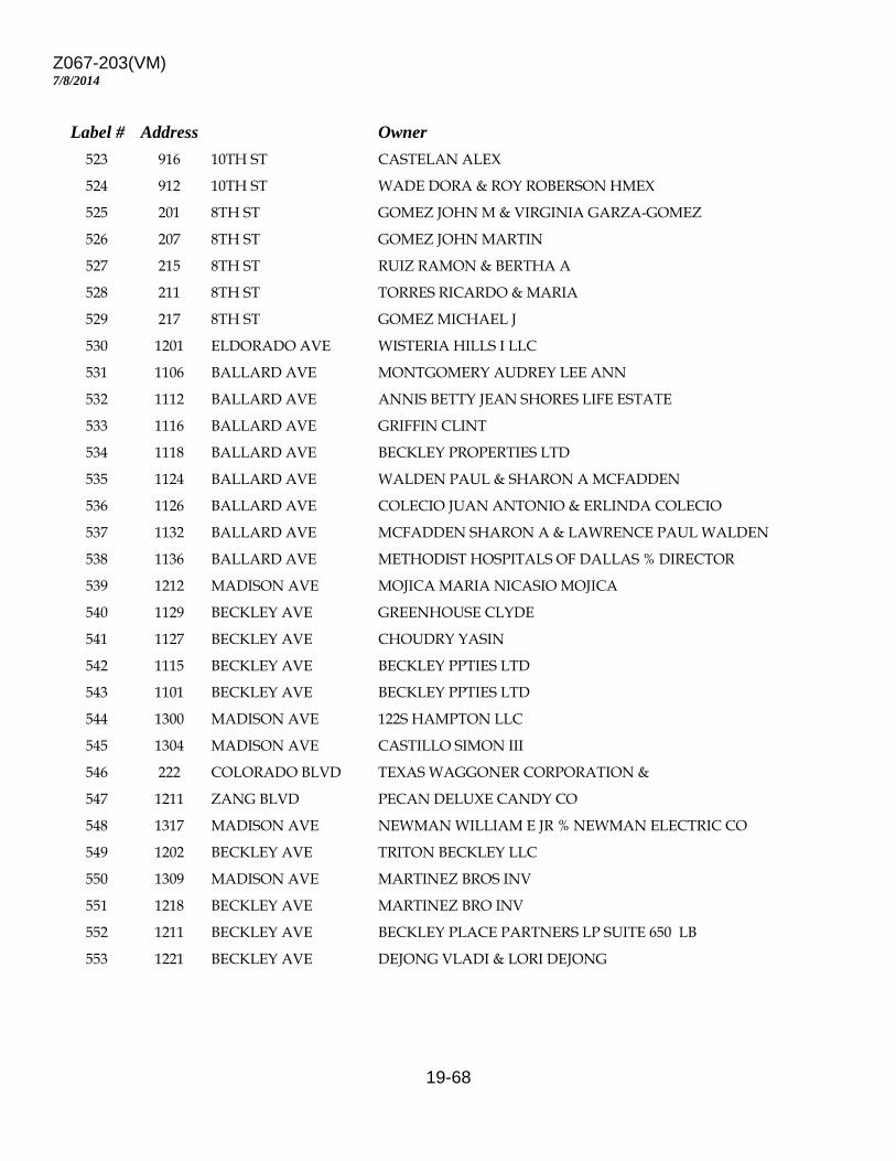
Z067-203(VM)
19-68
7/8/2014
Label # Address Owner 523 916 10TH ST CASTELAN ALEX 524 912 10TH ST WADE DORA & ROY ROBERSON HMEX 525 201 8TH ST GOMEZ JOHN M & VIRGINIA GARZA-GOMEZ 526 207 8TH ST GOMEZ JOHN MARTIN 527 215 8TH ST RUIZ RAMON & BERTHA A 528 211 8TH ST TORRES RICARDO & MARIA 529 217 8TH ST GOMEZ MICHAEL J 530 1201 ELDORADO AVE WISTERIA HILLS I LLC 531 1106 BALLARD AVE MONTGOMERY AUDREY LEE ANN 532 1112 BALLARD AVE ANNIS BETTY JEAN SHORES LIFE ESTATE 533 1116 BALLARD AVE GRIFFIN CLINT 534 1118 BALLARD AVE BECKLEY PROPERTIES LTD 535 1124 BALLARD AVE WALDEN PAUL & SHARON A MCFADDEN 536 1126 BALLARD AVE COLECIO JUAN ANTONIO & ERLINDA COLECIO 537 1132 BALLARD AVE MCFADDEN SHARON A & LAWRENCE PAUL WALDEN 538 1136 BALLARD AVE METHODIST HOSPITALS OF DALLAS % DIRECTOR 539 1212 MADISON AVE MOJICA MARIA NICASIO MOJICA 540 1129 BECKLEY AVE GREENHOUSE CLYDE 541 1127 BECKLEY AVE CHOUDRY YASIN 542 1115 BECKLEY AVE BECKLEY PPTIES LTD 543 1101 BECKLEY AVE BECKLEY PPTIES LTD 544 1300 MADISON AVE 122S HAMPTON LLC 545 1304 MADISON AVE CASTILLO SIMON III 546 222 COLORADO BLVD TEXAS WAGGONER CORPORATION & 547 1211 ZANG BLVD PECAN DELUXE CANDY CO 548 1317 MADISON AVE NEWMAN WILLIAM E JR % NEWMAN ELECTRIC CO 549 1202 BECKLEY AVE TRITON BECKLEY LLC 550 1309 MADISON AVE MARTINEZ BROS INV 551 1218 BECKLEY AVE MARTINEZ BRO INV 552 1211 BECKLEY AVE BECKLEY PLACE PARTNERS LP SUITE 650 LB 553 1221 BECKLEY AVE DEJONG VLADI & LORI DEJONG
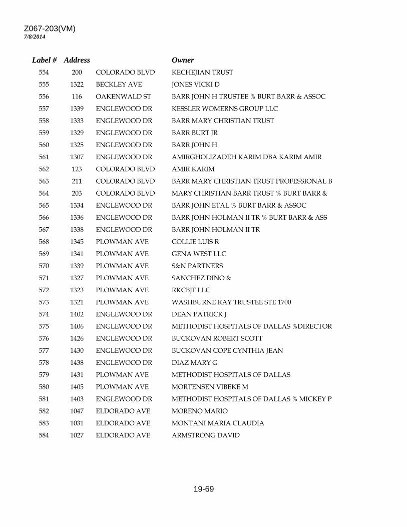
Z067-203(VM)
19-69
7/8/2014
Label # Address Owner 554 200 COLORADO BLVD KECHEJIAN TRUST 555 1322 BECKLEY AVE JONES VICKI D 556 116 OAKENWALD ST BARR JOHN H TRUSTEE % BURT BARR & ASSOC 557 1339 ENGLEWOOD DR KESSLER WOMERNS GROUP LLC 558 1333 ENGLEWOOD DR BARR MARY CHRISTIAN TRUST 559 1329 ENGLEWOOD DR BARR BURT JR 560 1325 ENGLEWOOD DR BARR JOHN H 561 1307 ENGLEWOOD DR AMIRGHOLIZADEH KARIM DBA KARIM AMIR 562 123 COLORADO BLVD AMIR KARIM 563 211 COLORADO BLVD BARR MARY CHRISTIAN TRUST PROFESSIONAL B 564 203 COLORADO BLVD MARY CHRISTIAN BARR TRUST % BURT BARR & 565 1334 ENGLEWOOD DR BARR JOHN ETAL % BURT BARR & ASSOC 566 1336 ENGLEWOOD DR BARR JOHN HOLMAN II TR % BURT BARR & ASS 567 1338 ENGLEWOOD DR BARR JOHN HOLMAN II TR 568 1345 PLOWMAN AVE COLLIE LUIS R 569 1341 PLOWMAN AVE GENA WEST LLC 570 1339 PLOWMAN AVE S&N PARTNERS 571 1327 PLOWMAN AVE SANCHEZ DINO & 572 1323 PLOWMAN AVE RKCBJF LLC 573 1321 PLOWMAN AVE WASHBURNE RAY TRUSTEE STE 1700 574 1402 ENGLEWOOD DR DEAN PATRICK J 575 1406 ENGLEWOOD DR METHODIST HOSPITALS OF DALLAS %DIRECTOR 576 1426 ENGLEWOOD DR BUCKOVAN ROBERT SCOTT 577 1430 ENGLEWOOD DR BUCKOVAN COPE CYNTHIA JEAN 578 1438 ENGLEWOOD DR DIAZ MARY G 579 1431 PLOWMAN AVE METHODIST HOSPITALS OF DALLAS 580 1405 PLOWMAN AVE MORTENSEN VIBEKE M 581 1403 ENGLEWOOD DR METHODIST HOSPITALS OF DALLAS % MICKEY P 582 1047 ELDORADO AVE MORENO MARIO 583 1031 ELDORADO AVE MONTANI MARIA CLAUDIA 584 1027 ELDORADO AVE ARMSTRONG DAVID
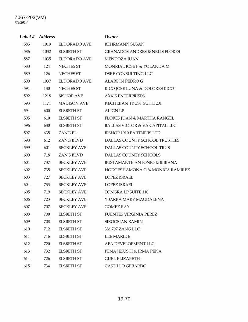
Z067-203(VM)
19-70
7/8/2014
Label # Address Owner 585 1019 ELDORADO AVE BEHRMANN SUSAN 586 1032 ELSBETH ST GRANADOS ANDRES & NELIS FLORES 587 1035 ELDORADO AVE MENDOZA JUAN 588 124 NECHES ST MONRIAL JOSE F & YOLANDA M 589 126 NECHES ST DSRE CONSULTING LLC 590 1037 ELDORADO AVE ALARDIN PEDRO G 591 130 NECHES ST RICO JOSE LUNA & DOLORES RICO 592 1218 BISHOP AVE AXXIS ENTERPRISES 593 1171 MADISON AVE KECHEJIAN TRUST SUITE 201 594 600 ELSBETH ST ALIGN LP 595 610 ELSBETH ST FLORES JUAN & MARTHA RANGEL 596 630 ELSBETH ST BALLAS VICTOR & VA CAPITAL LLC 597 635 ZANG PL BISHOP 1910 PARTNERS LTD 598 612 ZANG BLVD DALLAS COUNTY SCHOOL TRUSTEES 599 601 BECKLEY AVE DALLAS COUNTY SCHOOL TRUS 600 718 ZANG BLVD DALLAS COUNTY SCHOOLS 601 737 BECKLEY AVE BUSTAMANTE ANTONIO & BIBIANA 602 735 BECKLEY AVE HODGES RAMONA G % MONICA RAMIREZ 603 727 BECKLEY AVE LOPEZ ISRAEL 604 733 BECKLEY AVE LOPEZ ISRAEL 605 719 BECKLEY AVE TONGRA LP SUITE 110 606 723 BECKLEY AVE YBARRA MARY MAGDALENA 607 707 BECKLEY AVE GOMEZ RAY 608 700 ELSBETH ST FUENTES VIRGINIA PEREZ 609 708 ELSBETH ST SIROOSIAN RAMIN 610 712 ELSBETH ST 3M 707 ZANG LLC 611 716 ELSBETH ST LEE MARIE E 612 720 ELSBETH ST AFA DEVELOPMENT LLC 613 732 ELSBETH ST PENA JESUS H & IRMA PENA 614 726 ELSBETH ST GUEL ELIZABETH 615 734 ELSBETH ST CASTILLO GERARDO

Z067-203(VM)
19-71
7/8/2014
Label # Address Owner 616 736 ELSBETH ST WHITEAKER BETTYE M 617 733 ZANG BLVD PENA JESUS H & IRMA 618 727 ZANG BLVD CHERNOCK CHRISTIAN 619 723 ZANG BLVD GOMEZ CELIA O 620 719 ZANG BLVD GALICIA GUILLERMO 621 715 ZANG BLVD 3M 707 ZANG LLC 622 707 ZANG BLVD HERSH KAPLAN RAY 623 707 ZANG BLVD HERSH BERNARD J ETAL 624 810 ELSBETH ST COUCH KEDRIC % MRS PAT COUCH 625 814 ELSBETH ST LOPEZ BENITO JR & HORTENCIA LOPEZ 626 818 ELSBETH ST ELAINE S GORENSTEIN LESTER E LLANTZ 627 820 ELSBETH ST TOVAR MARTIN 628 828 ELSBETH ST TUCKER MICHAEL BRITT & 629 835 ZANG BLVD GEMSK LLC 630 813 ZANG BLVD MINOR TIMOTHY & DEBBIE 631 801 ZANG BLVD BECKLEY PROPERTIES LTD 632 807 ZANG PL MINOR TIMOTHY 633 839 BECKLEY AVE VINES DAN 634 900 ZANG BLVD READ JOHN H II & XAVIER DURAN 635 908 ZANG BLVD SALAZAR JOSE 636 1118 ELSBETH ST SALDIVAR FAMILY I LIMITED PARTNERSHIP 637 912 ZANG BLVD NEFFENDORF SHANNON 638 917 BECKLEY AVE SALDIVAR FAMILY I LTD PS 639 909 BECKLEY AVE BREETE LLC 640 907 BECKLEY AVE DELGADILLO JOSE LUIS 641 903 BECKLEY AVE TORRES LUIS & MARIA G 642 1006 ZANG BLVD GARCIA MAGDALENA & GONSALO O AVELAR 643 1018 ZANG BLVD KAEMERLE HAROLD JR & 644 1030 ZANG BLVD CHONG JOHN 645 1010 ZANG BLVD KAEMERLE HAROLD JR ET AL SUITE 610 646 1003 BECKLEY AVE KAEMERLE HAROLD JR & C A E C TRUST & JOS
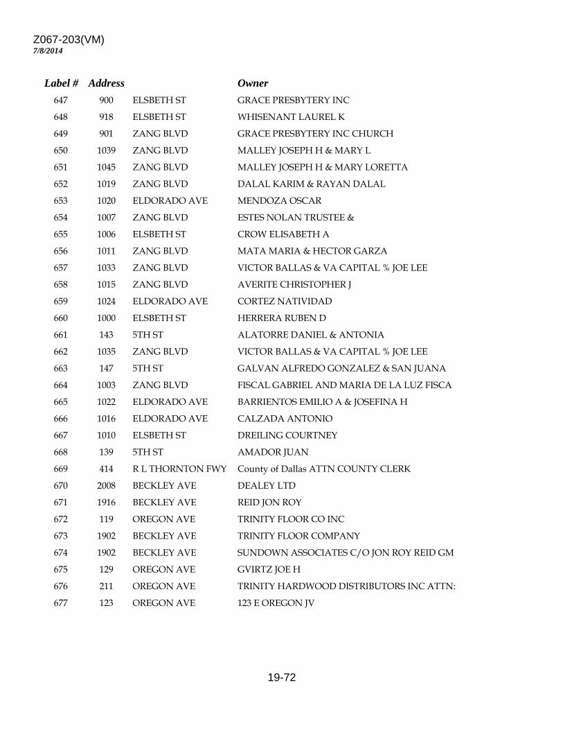
Z067-203(VM)
19-72
7/8/2014
Label # Address Owner 647 900 ELSBETH ST GRACE PRESBYTERY INC 648 918 ELSBETH ST WHISENANT LAUREL K 649 901 ZANG BLVD GRACE PRESBYTERY INC CHURCH 650 1039 ZANG BLVD MALLEY JOSEPH H & MARY L 651 1045 ZANG BLVD MALLEY JOSEPH H & MARY LORETTA 652 1019 ZANG BLVD DALAL KARIM & RAYAN DALAL 653 1020 ELDORADO AVE MENDOZA OSCAR 654 1007 ZANG BLVD ESTES NOLAN TRUSTEE & 655 1006 ELSBETH ST CROW ELISABETH A 656 1011 ZANG BLVD MATA MARIA & HECTOR GARZA 657 1033 ZANG BLVD VICTOR BALLAS & VA CAPITAL % JOE LEE 658 1015 ZANG BLVD AVERITE CHRISTOPHER J 659 1024 ELDORADO AVE CORTEZ NATIVIDAD 660 1000 ELSBETH ST HERRERA RUBEN D 661 143 5TH ST ALATORRE DANIEL & ANTONIA 662 1035 ZANG BLVD VICTOR BALLAS & VA CAPITAL % JOE LEE 663 147 5TH ST GALVAN ALFREDO GONZALEZ & SAN JUANA 664 1003 ZANG BLVD FISCAL GABRIEL AND MARIA DE LA LUZ FISCA 665 1022 ELDORADO AVE BARRIENTOS EMILIO A & JOSEFINA H 666 1016 ELDORADO AVE CALZADA ANTONIO 667 1010 ELSBETH ST DREILING COURTNEY 668 139 5TH ST AMADOR JUAN 669 414 R L THORNTON FWY County of Dallas ATTN COUNTY CLERK 670 2008 BECKLEY AVE DEALEY LTD 671 1916 BECKLEY AVE REID JON ROY 672 119 OREGON AVE TRINITY FLOOR CO INC 673 1902 BECKLEY AVE TRINITY FLOOR COMPANY 674 1902 BECKLEY AVE SUNDOWN ASSOCIATES C/O JON ROY REID GM 675 129 OREGON AVE GVIRTZ JOE H 676 211 OREGON AVE TRINITY HARDWOOD DISTRIBUTORS INC ATTN: 677 123 OREGON AVE 123 E OREGON JV
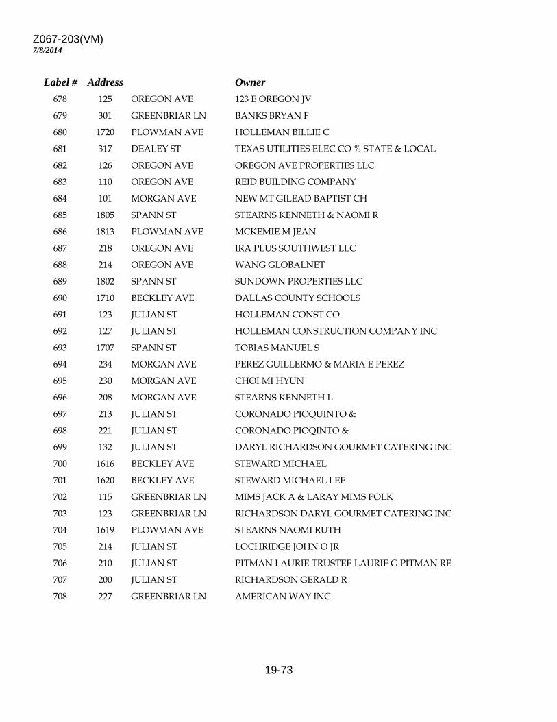
Z067-203(VM)
19-73
7/8/2014
Label # Address Owner 678 125 OREGON AVE 123 E OREGON JV 679 301 GREENBRIAR LN BANKS BRYAN F 680 1720 PLOWMAN AVE HOLLEMAN BILLIE C 681 317 DEALEY ST TEXAS UTILITIES ELEC CO % STATE & LOCAL 682 126 OREGON AVE OREGON AVE PROPERTIES LLC 683 110 OREGON AVE REID BUILDING COMPANY 684 101 MORGAN AVE NEW MT GILEAD BAPTIST CH 685 1805 SPANN ST STEARNS KENNETH & NAOMI R 686 1813 PLOWMAN AVE MCKEMIE M JEAN 687 218 OREGON AVE IRA PLUS SOUTHWEST LLC 688 214 OREGON AVE WANG GLOBALNET 689 1802 SPANN ST SUNDOWN PROPERTIES LLC 690 1710 BECKLEY AVE DALLAS COUNTY SCHOOLS 691 123 JULIAN ST HOLLEMAN CONST CO 692 127 JULIAN ST HOLLEMAN CONSTRUCTION COMPANY INC 693 1707 SPANN ST TOBIAS MANUEL S 694 234 MORGAN AVE PEREZ GUILLERMO & MARIA E PEREZ 695 230 MORGAN AVE CHOI MI HYUN 696 208 MORGAN AVE STEARNS KENNETH L 697 213 JULIAN ST CORONADO PIOQUINTO & 698 221 JULIAN ST CORONADO PIOQINTO & 699 132 JULIAN ST DARYL RICHARDSON GOURMET CATERING INC 700 1616 BECKLEY AVE STEWARD MICHAEL 701 1620 BECKLEY AVE STEWARD MICHAEL LEE 702 115 GREENBRIAR LN MIMS JACK A & LARAY MIMS POLK 703 123 GREENBRIAR LN RICHARDSON DARYL GOURMET CATERING INC 704 1619 PLOWMAN AVE STEARNS NAOMI RUTH 705 214 JULIAN ST LOCHRIDGE JOHN O JR 706 210 JULIAN ST PITMAN LAURIE TRUSTEE LAURIE G PITMAN RE 707 200 JULIAN ST RICHARDSON GERALD R 708 227 GREENBRIAR LN AMERICAN WAY INC
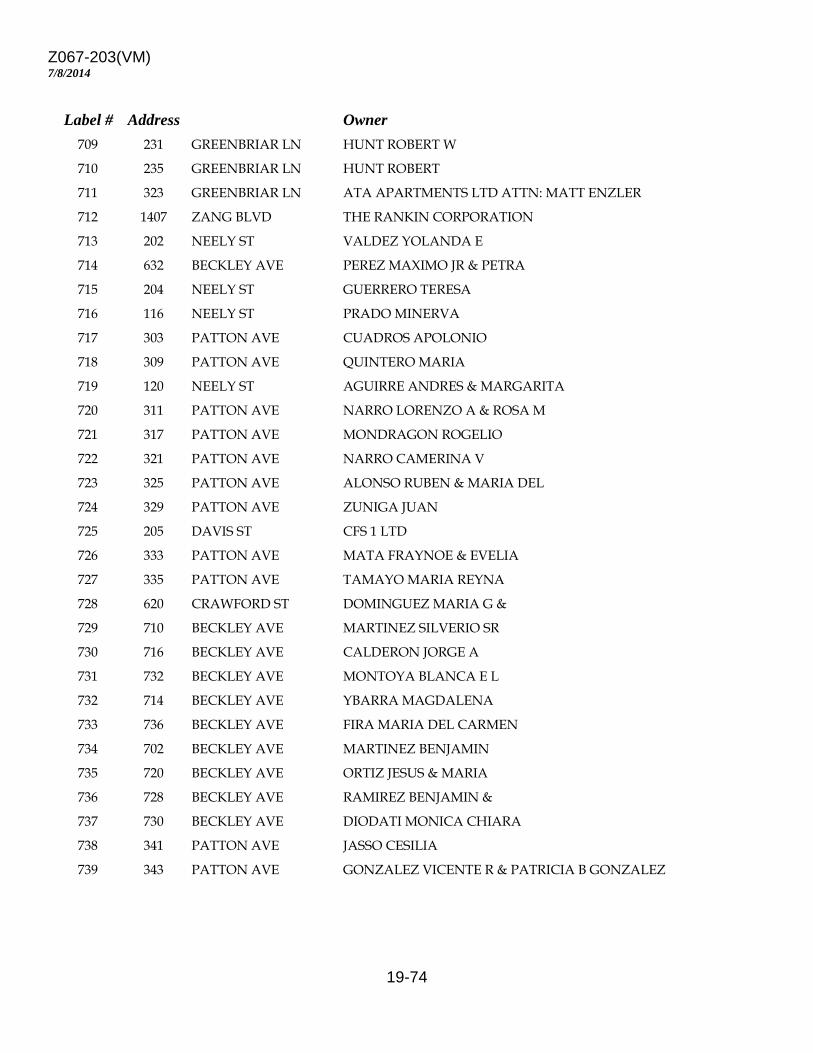
Z067-203(VM)
19-74
7/8/2014
Label # Address Owner 709 231 GREENBRIAR LN HUNT ROBERT W 710 235 GREENBRIAR LN HUNT ROBERT 711 323 GREENBRIAR LN ATA APARTMENTS LTD ATTN: MATT ENZLER 712 1407 ZANG BLVD THE RANKIN CORPORATION 713 202 NEELY ST VALDEZ YOLANDA E 714 632 BECKLEY AVE PEREZ MAXIMO JR & PETRA 715 204 NEELY ST GUERRERO TERESA 716 116 NEELY ST PRADO MINERVA 717 303 PATTON AVE CUADROS APOLONIO 718 309 PATTON AVE QUINTERO MARIA 719 120 NEELY ST AGUIRRE ANDRES & MARGARITA 720 311 PATTON AVE NARRO LORENZO A & ROSA M 721 317 PATTON AVE MONDRAGON ROGELIO 722 321 PATTON AVE NARRO CAMERINA V 723 325 PATTON AVE ALONSO RUBEN & MARIA DEL 724 329 PATTON AVE ZUNIGA JUAN 725 205 DAVIS ST CFS 1 LTD 726 333 PATTON AVE MATA FRAYNOE & EVELIA 727 335 PATTON AVE TAMAYO MARIA REYNA 728 620 CRAWFORD ST DOMINGUEZ MARIA G & 729 710 BECKLEY AVE MARTINEZ SILVERIO SR 730 716 BECKLEY AVE CALDERON JORGE A 731 732 BECKLEY AVE MONTOYA BLANCA E L 732 714 BECKLEY AVE YBARRA MAGDALENA 733 736 BECKLEY AVE FIRA MARIA DEL CARMEN 734 702 BECKLEY AVE MARTINEZ BENJAMIN 735 720 BECKLEY AVE ORTIZ JESUS & MARIA 736 728 BECKLEY AVE RAMIREZ BENJAMIN & 737 730 BECKLEY AVE DIODATI MONICA CHIARA 738 341 PATTON AVE JASSO CESILIA 739 343 PATTON AVE GONZALEZ VICENTE R & PATRICIA B GONZALEZ
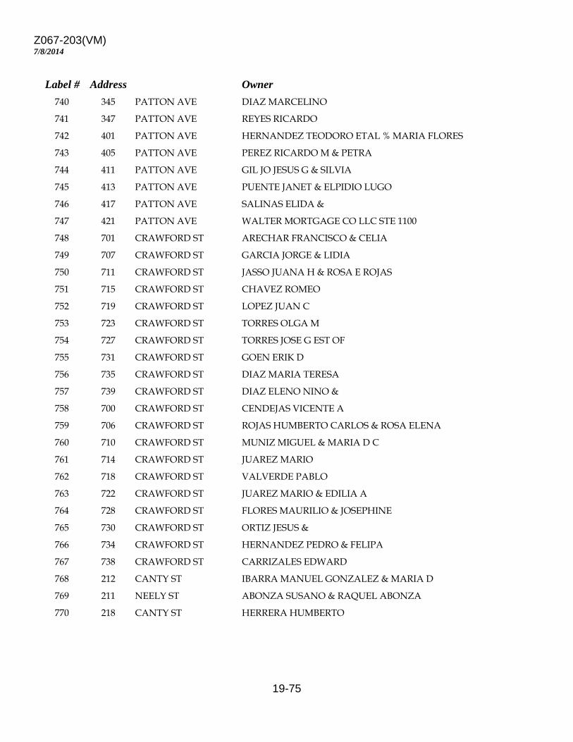
Z067-203(VM)
19-75
7/8/2014
Label # Address Owner 740 345 PATTON AVE DIAZ MARCELINO 741 347 PATTON AVE REYES RICARDO 742 401 PATTON AVE HERNANDEZ TEODORO ETAL % MARIA FLORES 743 405 PATTON AVE PEREZ RICARDO M & PETRA 744 411 PATTON AVE GIL JO JESUS G & SILVIA 745 413 PATTON AVE PUENTE JANET & ELPIDIO LUGO 746 417 PATTON AVE SALINAS ELIDA & 747 421 PATTON AVE WALTER MORTGAGE CO LLC STE 1100 748 701 CRAWFORD ST ARECHAR FRANCISCO & CELIA 749 707 CRAWFORD ST GARCIA JORGE & LIDIA 750 711 CRAWFORD ST JASSO JUANA H & ROSA E ROJAS 751 715 CRAWFORD ST CHAVEZ ROMEO 752 719 CRAWFORD ST LOPEZ JUAN C 753 723 CRAWFORD ST TORRES OLGA M 754 727 CRAWFORD ST TORRES JOSE G EST OF 755 731 CRAWFORD ST GOEN ERIK D 756 735 CRAWFORD ST DIAZ MARIA TERESA 757 739 CRAWFORD ST DIAZ ELENO NINO & 758 700 CRAWFORD ST CENDEJAS VICENTE A 759 706 CRAWFORD ST ROJAS HUMBERTO CARLOS & ROSA ELENA 760 710 CRAWFORD ST MUNIZ MIGUEL & MARIA D C 761 714 CRAWFORD ST JUAREZ MARIO 762 718 CRAWFORD ST VALVERDE PABLO 763 722 CRAWFORD ST JUAREZ MARIO & EDILIA A 764 728 CRAWFORD ST FLORES MAURILIO & JOSEPHINE 765 730 CRAWFORD ST ORTIZ JESUS & 766 734 CRAWFORD ST HERNANDEZ PEDRO & FELIPA 767 738 CRAWFORD ST CARRIZALES EDWARD 768 212 CANTY ST IBARRA MANUEL GONZALEZ & MARIA D 769 211 NEELY ST ABONZA SUSANO & RAQUEL ABONZA 770 218 CANTY ST HERRERA HUMBERTO
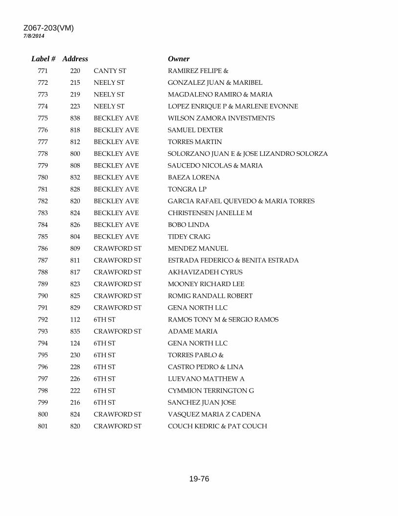
Z067-203(VM)
19-76
7/8/2014
Label # Address Owner 771 220 CANTY ST RAMIREZ FELIPE & 772 215 NEELY ST GONZALEZ JUAN & MARIBEL 773 219 NEELY ST MAGDALENO RAMIRO & MARIA 774 223 NEELY ST LOPEZ ENRIQUE P & MARLENE EVONNE 775 838 BECKLEY AVE WILSON ZAMORA INVESTMENTS 776 818 BECKLEY AVE SAMUEL DEXTER 777 812 BECKLEY AVE TORRES MARTIN 778 800 BECKLEY AVE SOLORZANO JUAN E & JOSE LIZANDRO SOLORZA 779 808 BECKLEY AVE SAUCEDO NICOLAS & MARIA 780 832 BECKLEY AVE BAEZA LORENA 781 828 BECKLEY AVE TONGRA LP 782 820 BECKLEY AVE GARCIA RAFAEL QUEVEDO & MARIA TORRES 783 824 BECKLEY AVE CHRISTENSEN JANELLE M 784 826 BECKLEY AVE BOBO LINDA 785 804 BECKLEY AVE TIDEY CRAIG 786 809 CRAWFORD ST MENDEZ MANUEL 787 811 CRAWFORD ST ESTRADA FEDERICO & BENITA ESTRADA 788 817 CRAWFORD ST AKHAVIZADEH CYRUS 789 823 CRAWFORD ST MOONEY RICHARD LEE 790 825 CRAWFORD ST ROMIG RANDALL ROBERT 791 829 CRAWFORD ST GENA NORTH LLC 792 112 6TH ST RAMOS TONY M & SERGIO RAMOS 793 835 CRAWFORD ST ADAME MARIA 794 124 6TH ST GENA NORTH LLC 795 230 6TH ST TORRES PABLO & 796 228 6TH ST CASTRO PEDRO & LINA 797 226 6TH ST LUEVANO MATTHEW A 798 222 6TH ST CYMMION TERRINGTON G 799 216 6TH ST SANCHEZ JUAN JOSE 800 824 CRAWFORD ST VASQUEZ MARIA Z CADENA 801 820 CRAWFORD ST COUCH KEDRIC & PAT COUCH
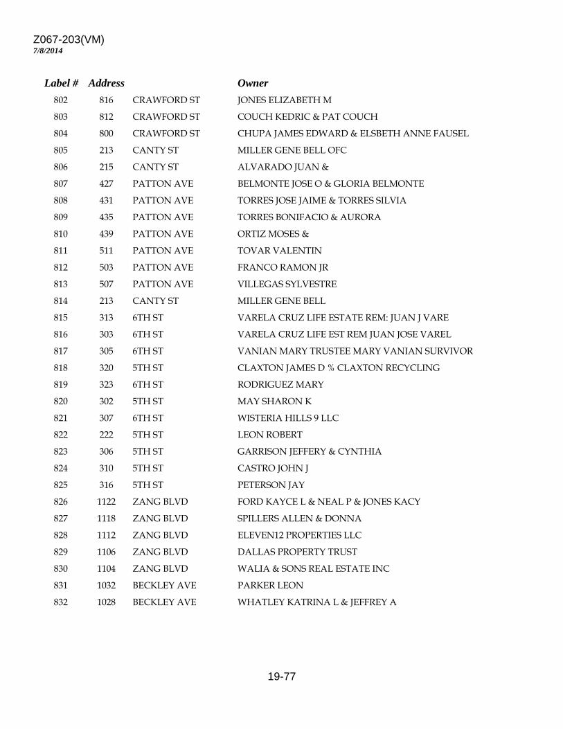
Z067-203(VM)
19-77
7/8/2014
Label # Address Owner 802 816 CRAWFORD ST JONES ELIZABETH M 803 812 CRAWFORD ST COUCH KEDRIC & PAT COUCH 804 800 CRAWFORD ST CHUPA JAMES EDWARD & ELSBETH ANNE FAUSEL 805 213 CANTY ST MILLER GENE BELL OFC 806 215 CANTY ST ALVARADO JUAN & 807 427 PATTON AVE BELMONTE JOSE O & GLORIA BELMONTE 808 431 PATTON AVE TORRES JOSE JAIME & TORRES SILVIA 809 435 PATTON AVE TORRES BONIFACIO & AURORA 810 439 PATTON AVE ORTIZ MOSES & 811 511 PATTON AVE TOVAR VALENTIN 812 503 PATTON AVE FRANCO RAMON JR 813 507 PATTON AVE VILLEGAS SYLVESTRE 814 213 CANTY ST MILLER GENE BELL 815 313 6TH ST VARELA CRUZ LIFE ESTATE REM: JUAN J VARE 816 303 6TH ST VARELA CRUZ LIFE EST REM JUAN JOSE VAREL 817 305 6TH ST VANIAN MARY TRUSTEE MARY VANIAN SURVIVOR 818 320 5TH ST CLAXTON JAMES D % CLAXTON RECYCLING 819 323 6TH ST RODRIGUEZ MARY 820 302 5TH ST MAY SHARON K 821 307 6TH ST WISTERIA HILLS 9 LLC 822 222 5TH ST LEON ROBERT 823 306 5TH ST GARRISON JEFFERY & CYNTHIA 824 310 5TH ST CASTRO JOHN J 825 316 5TH ST PETERSON JAY 826 1122 ZANG BLVD FORD KAYCE L & NEAL P & JONES KACY 827 1118 ZANG BLVD SPILLERS ALLEN & DONNA 828 1112 ZANG BLVD ELEVEN12 PROPERTIES LLC 829 1106 ZANG BLVD DALLAS PROPERTY TRUST 830 1104 ZANG BLVD WALIA & SONS REAL ESTATE INC 831 1032 BECKLEY AVE PARKER LEON 832 1028 BECKLEY AVE WHATLEY KATRINA L & JEFFREY A
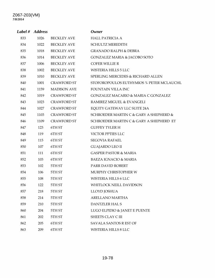
Z067-203(VM)
19-78
7/8/2014
Label # Address Owner 833 1026 BECKLEY AVE HALL PATRICIA A 834 1022 BECKLEY AVE SCHULTZ MEREDITH 835 1018 BECKLEY AVE GRANADO RALPH & DEBRA 836 1014 BECKLEY AVE GONZALEZ MARIA & JACOBO SOTO 837 1006 BECKLEY AVE COFER WILLIE R 838 1002 BECKLEY AVE WISTERIA HILLS 5 LLC 839 1010 BECKLEY AVE SPERLING MERCEDES & RICHARD ALLEN 840 1001 CRAWFORD ST STOFOROPOULOS EUTHYMIOS % PETER MCLAUCHL 841 1159 MADISON AVE FOUNTAIN VILLA INC 842 1019 CRAWFORD ST GONZALEZ MACARIO & MARIA C GONZALEZ 843 1023 CRAWFORD ST RAMIREZ MIGUEL & EVANGELI 844 1027 CRAWFORD ST EQUITY GATEWAY LLC SUITE 24A 845 1103 CRAWFORD ST SCHROEDER MARTIN C & GARY A SHEPHERD & 846 1109 CRAWFORD ST SCHROEDER MARTIN C & GARY A SHEPHERD ET 847 123 6TH ST GUFFEY TYLER H 848 119 6TH ST VICTOR PPTIES LLC 849 115 6TH ST SEGOVIA RAFAEL 850 107 6TH ST GUAJARDO LEO II 851 111 6TH ST GASPER PASTOR & MARIA 852 103 6TH ST BAEZA IGNACIO & MARIA 853 102 5TH ST PARR DAVID ROBERT 854 106 5TH ST MURPHY CHRISTOPHER W 855 108 5TH ST WISTERIA HILLS 6 LLC 856 122 5TH ST WHITLOCK NEILL DAVIDSON 857 218 5TH ST LLOYD JOSHUA 858 214 5TH ST ARELLANO MARTHA 859 210 5TH ST DANTZLER HAL S 860 204 5TH ST LUGO ELPIDIO & JANET E PUENTE 861 202 5TH ST SHEETS CLAY C III 862 205 6TH ST SAVALA SANTOS R EST OF 863 209 6TH ST WISTERIA HILLS 8 LLC
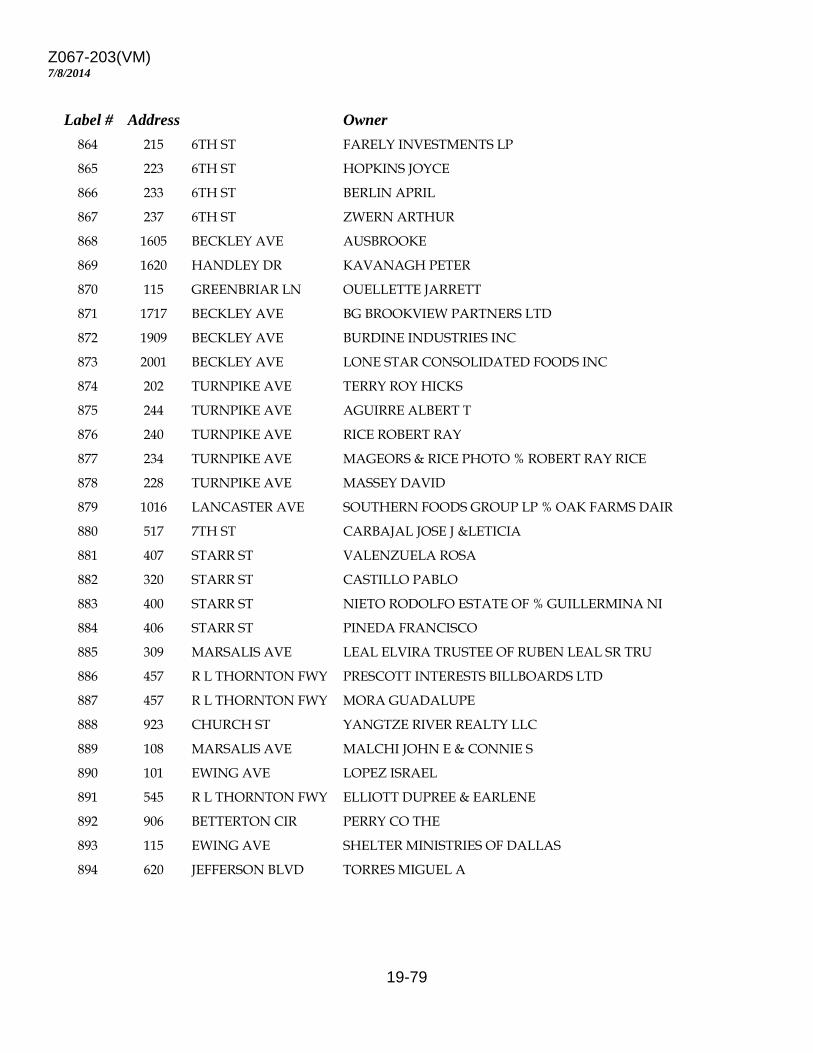
Z067-203(VM)
19-79
7/8/2014
Label # Address Owner 864 215 6TH ST FARELY INVESTMENTS LP 865 223 6TH ST HOPKINS JOYCE 866 233 6TH ST BERLIN APRIL 867 237 6TH ST ZWERN ARTHUR 868 1605 BECKLEY AVE AUSBROOKE 869 1620 HANDLEY DR KAVANAGH PETER 870 115 GREENBRIAR LN OUELLETTE JARRETT 871 1717 BECKLEY AVE BG BROOKVIEW PARTNERS LTD 872 1909 BECKLEY AVE BURDINE INDUSTRIES INC 873 2001 BECKLEY AVE LONE STAR CONSOLIDATED FOODS INC 874 202 TURNPIKE AVE TERRY ROY HICKS 875 244 TURNPIKE AVE AGUIRRE ALBERT T 876 240 TURNPIKE AVE RICE ROBERT RAY 877 234 TURNPIKE AVE MAGEORS & RICE PHOTO % ROBERT RAY RICE 878 228 TURNPIKE AVE MASSEY DAVID 879 1016 LANCASTER AVE SOUTHERN FOODS GROUP LP % OAK FARMS DAIR 880 517 7TH ST CARBAJAL JOSE J &LETICIA 881 407 STARR ST VALENZUELA ROSA 882 320 STARR ST CASTILLO PABLO 883 400 STARR ST NIETO RODOLFO ESTATE OF % GUILLERMINA NI 884 406 STARR ST PINEDA FRANCISCO 885 309 MARSALIS AVE LEAL ELVIRA TRUSTEE OF RUBEN LEAL SR TRU 886 457 R L THORNTON FWY PRESCOTT INTERESTS BILLBOARDS LTD 887 457 R L THORNTON FWY MORA GUADALUPE 888 923 CHURCH ST YANGTZE RIVER REALTY LLC 889 108 MARSALIS AVE MALCHI JOHN E & CONNIE S 890 101 EWING AVE LOPEZ ISRAEL 891 545 R L THORNTON FWY ELLIOTT DUPREE & EARLENE 892 906 BETTERTON CIR PERRY CO THE 893 115 EWING AVE SHELTER MINISTRIES OF DALLAS 894 620 JEFFERSON BLVD TORRES MIGUEL A

Z067-203(VM)
19-80
7/8/2014
Label # Address Owner 895 610 JEFFERSON BLVD TNS INVESTMENTS LTD 896 324 PATTON AVE GUTIERREZ VICTOR 897 150 DAVIS ST GARNER BRIAN S 898 1133 ZANG BLVD ZANG/MADISON PARTNERS LP 899 126 COLORADO BLVD ADVANTAGED ASSET ACQUISITIONS I LLC 900 214 COLORADO BLVD KECHIJIAN TRUST 901 1306 BECKLEY AVE CTA ASSOCIATES LP ATTN:JUDY BROGHAM 902 1330 BECKLEY AVE KESSLER WOMENS GROUP LLC 903 225 COLORADO BLVD SOUTHLAND CORP NO 26906 904 1222 BISHOP AVE BISHOP COLORADO RETAIL PLAZA STE#100 905 612 ELSBETH ST BRIONES MARIA & ADOLFO 906 235 DAVIS ST SRI REAL ESTATE PROPERTIES 907 810 ZANG BLVD AHA GROUP LP 908 820 ZANG BLVD NORTH ZANG DEV LTD 909 830 ZANG BLVD JT REALTY INC 910 835 BECKLEY AVE BECKLEY PROFESSIONALS INC 911 815 BECKLEY AVE SHERRY IRWIN H & DALIA D TRUST NO 1 912 1026 ZANG BLVD MILLER DONALD W. & DONNA 913 99 IH 30 DALLAS CITY & COUNTY LEVEE IMP DISTRICT 914 801 RIVERFRONT BLVD INDUSTRIAL GOLD RUSH LTD 915 209 GREENBRIAR LN LOCHRIDGE J O 916 1335 ZANG BLVD ZANG TRIANGLE LLC 917 1520 BECKLEY AVE KESSLER PEAK LTD PS SUITE 1200 918 1401 ZANG BLVD FOUNDERS PEAK LTD PS STE 1200 919 381 GREENBRIAR LN SOUTHWEST CATTLEMEN S CORPORATION % ARVE 920 381 GREENBRIAR LN DATLA UMA & RAVI KALIDINDI 921 381 GREENBRIAR LN AGRAWAL SURESH C 922 381 GREENBRIAR LN GITOMER JASA JAY 923 381 GREENBRIAR LN GREGORY JOSEPH R & KRISTI LEE COMPTON 924 381 GREENBRIAR LN CHITWOOD JENNIFER N 925 381 GREENBRIAR LN TAYLOR KEITH
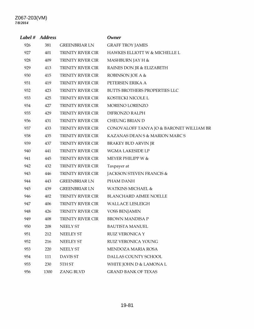
Z067-203(VM)
19-81
7/8/2014
Label # Address Owner 926 381 GREENBRIAR LN GRAFF TROY JAMES 927 401 TRINITY RIVER CIR HAWKES ELLIOTT W & MICHELLE L 928 409 TRINITY RIVER CIR MASHBURN JAY H & 929 413 TRINITY RIVER CIR RAINES DON JR & ELIZABETH 930 415 TRINITY RIVER CIR ROBINSON JOE A & 931 419 TRINITY RIVER CIR PETERSEN ERIKA A 932 423 TRINITY RIVER CIR BUTTS BROTHERS PROPERTIES LLC 933 425 TRINITY RIVER CIR KOSTECKI NICOLE L 934 427 TRINITY RIVER CIR MORENO LORENZO 935 429 TRINITY RIVER CIR DIFRONZO RALPH 936 431 TRINITY RIVER CIR CHEUNG BRIAN D 937 433 TRINITY RIVER CIR CONOVALOFF TANYA JO & BARONET WILLIAM BR 938 435 TRINITY RIVER CIR KAZANAS DEAN S & MARION MARC S 939 437 TRINITY RIVER CIR BRAKEY BUD ARVIN JR 940 441 TRINITY RIVER CIR WGMA LAKESIDE LP 941 445 TRINITY RIVER CIR MEYER PHILIPP W & 942 432 TRINITY RIVER CIR Taxpayer at 943 446 TRINITY RIVER CIR JACKSON STEVEN FRANCIS & 944 443 GREENBRIAR LN PHAM DANH 945 439 GREENBRIAR LN WATKINS MICHAEL & 946 402 TRINITY RIVER CIR BLANCHARD AIMEE NOELLE 947 406 TRINITY RIVER CIR WALLACE LESLEIGH 948 426 TRINITY RIVER CIR VOSS BENJAMIN 949 408 TRINITY RIVER CIR BROWN MANDISA P 950 208 NEELY ST BAUTISTA MANUEL 951 212 NEELEY ST RUIZ VERONICA Y 952 216 NEELEY ST RUIZ VERONICA YOUNG 953 220 NEELY ST MENDOZA MARIA ROSA 954 111 DAVIS ST DALLAS COUNTY SCHOOL 955 230 5TH ST WHITE JOHN D & LAMONA L 956 1300 ZANG BLVD GRAND BANK OF TEXAS
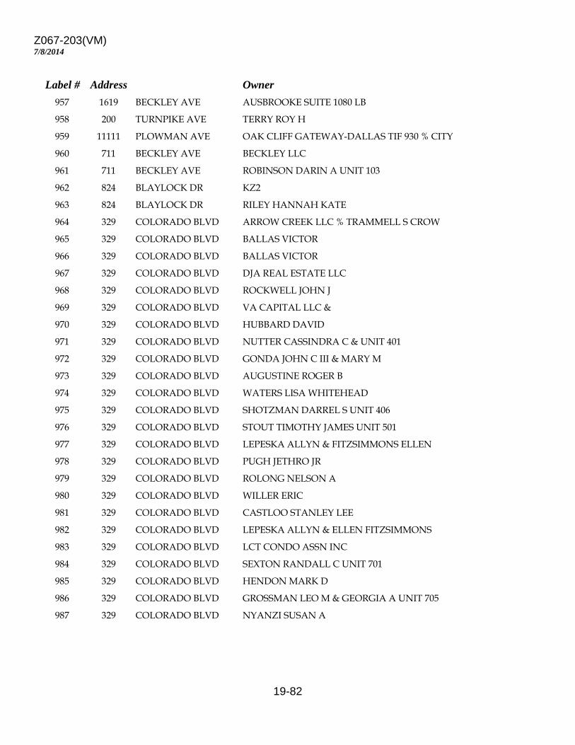
Z067-203(VM)
19-82
7/8/2014
Label # Address Owner 957 1619 BECKLEY AVE AUSBROOKE SUITE 1080 LB 958 200 TURNPIKE AVE TERRY ROY H 959 11111 PLOWMAN AVE OAK CLIFF GATEWAY-DALLAS TIF 930 % CITY 960 711 BECKLEY AVE BECKLEY LLC 961 711 BECKLEY AVE ROBINSON DARIN A UNIT 103 962 824 BLAYLOCK DR KZ2 963 824 BLAYLOCK DR RILEY HANNAH KATE 964 329 COLORADO BLVD ARROW CREEK LLC % TRAMMELL S CROW 965 329 COLORADO BLVD BALLAS VICTOR 966 329 COLORADO BLVD BALLAS VICTOR 967 329 COLORADO BLVD DJA REAL ESTATE LLC 968 329 COLORADO BLVD ROCKWELL JOHN J 969 329 COLORADO BLVD VA CAPITAL LLC & 970 329 COLORADO BLVD HUBBARD DAVID 971 329 COLORADO BLVD NUTTER CASSINDRA C & UNIT 401 972 329 COLORADO BLVD GONDA JOHN C III & MARY M 973 329 COLORADO BLVD AUGUSTINE ROGER B 974 329 COLORADO BLVD WATERS LISA WHITEHEAD 975 329 COLORADO BLVD SHOTZMAN DARREL S UNIT 406 976 329 COLORADO BLVD STOUT TIMOTHY JAMES UNIT 501 977 329 COLORADO BLVD LEPESKA ALLYN & FITZSIMMONS ELLEN 978 329 COLORADO BLVD PUGH JETHRO JR 979 329 COLORADO BLVD ROLONG NELSON A 980 329 COLORADO BLVD WILLER ERIC 981 329 COLORADO BLVD CASTLOO STANLEY LEE 982 329 COLORADO BLVD LEPESKA ALLYN & ELLEN FITZSIMMONS 983 329 COLORADO BLVD LCT CONDO ASSN INC 984 329 COLORADO BLVD SEXTON RANDALL C UNIT 701 985 329 COLORADO BLVD HENDON MARK D 986 329 COLORADO BLVD GROSSMAN LEO M & GEORGIA A UNIT 705 987 329 COLORADO BLVD NYANZI SUSAN A
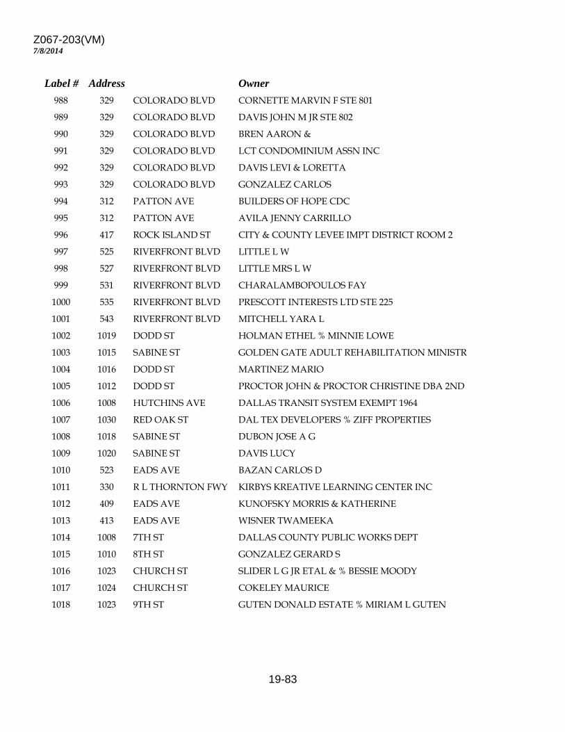
Z067-203(VM)
19-83
7/8/2014
Label # Address Owner 988 329 COLORADO BLVD CORNETTE MARVIN F STE 801 989 329 COLORADO BLVD DAVIS JOHN M JR STE 802 990 329 COLORADO BLVD BREN AARON & 991 329 COLORADO BLVD LCT CONDOMINIUM ASSN INC 992 329 COLORADO BLVD DAVIS LEVI & LORETTA 993 329 COLORADO BLVD GONZALEZ CARLOS 994 312 PATTON AVE BUILDERS OF HOPE CDC 995 312 PATTON AVE AVILA JENNY CARRILLO 996 417 ROCK ISLAND ST CITY & COUNTY LEVEE IMPT DISTRICT ROOM 2 997 525 RIVERFRONT BLVD LITTLE L W 998 527 RIVERFRONT BLVD LITTLE MRS L W 999 531 RIVERFRONT BLVD CHARALAMBOPOULOS FAY 1000 535 RIVERFRONT BLVD PRESCOTT INTERESTS LTD STE 225 1001 543 RIVERFRONT BLVD MITCHELL YARA L 1002 1019 DODD ST HOLMAN ETHEL % MINNIE LOWE 1003 1015 SABINE ST GOLDEN GATE ADULT REHABILITATION MINISTR 1004 1016 DODD ST MARTINEZ MARIO 1005 1012 DODD ST PROCTOR JOHN & PROCTOR CHRISTINE DBA 2ND 1006 1008 HUTCHINS AVE DALLAS TRANSIT SYSTEM EXEMPT 1964 1007 1030 RED OAK ST DAL TEX DEVELOPERS % ZIFF PROPERTIES 1008 1018 SABINE ST DUBON JOSE A G 1009 1020 SABINE ST DAVIS LUCY 1010 523 EADS AVE BAZAN CARLOS D 1011 330 R L THORNTON FWY KIRBYS KREATIVE LEARNING CENTER INC 1012 409 EADS AVE KUNOFSKY MORRIS & KATHERINE 1013 413 EADS AVE WISNER TWAMEEKA 1014 1008 7TH ST DALLAS COUNTY PUBLIC WORKS DEPT 1015 1010 8TH ST GONZALEZ GERARD S 1016 1023 CHURCH ST SLIDER L G JR ETAL & % BESSIE MOODY 1017 1024 CHURCH ST COKELEY MAURICE 1018 1023 9TH ST GUTEN DONALD ESTATE % MIRIAM L GUTEN
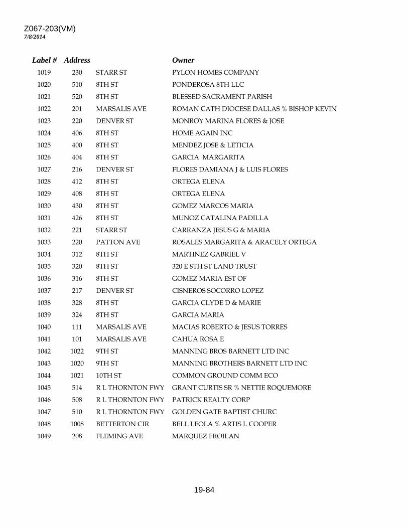
Z067-203(VM)
19-84
7/8/2014
Label # Address Owner 1019 230 STARR ST PYLON HOMES COMPANY 1020 510 8TH ST PONDEROSA 8TH LLC 1021 520 8TH ST BLESSED SACRAMENT PARISH 1022 201 MARSALIS AVE ROMAN CATH DIOCESE DALLAS % BISHOP KEVIN 1023 220 DENVER ST MONROY MARINA FLORES & JOSE 1024 406 8TH ST HOME AGAIN INC 1025 400 8TH ST MENDEZ JOSE & LETICIA 1026 404 8TH ST GARCIA MARGARITA 1027 216 DENVER ST FLORES DAMIANA J & LUIS FLORES 1028 412 8TH ST ORTEGA ELENA 1029 408 8TH ST ORTEGA ELENA 1030 430 8TH ST GOMEZ MARCOS MARIA 1031 426 8TH ST MUNOZ CATALINA PADILLA 1032 221 STARR ST CARRANZA JESUS G & MARIA 1033 220 PATTON AVE ROSALES MARGARITA & ARACELY ORTEGA 1034 312 8TH ST MARTINEZ GABRIEL V 1035 320 8TH ST 320 E 8TH ST LAND TRUST 1036 316 8TH ST GOMEZ MARIA EST OF 1037 217 DENVER ST CISNEROS SOCORRO LOPEZ 1038 328 8TH ST GARCIA CLYDE D & MARIE 1039 324 8TH ST GARCIA MARIA 1040 111 MARSALIS AVE MACIAS ROBERTO & JESUS TORRES 1041 101 MARSALIS AVE CAHUA ROSA E 1042 1022 9TH ST MANNING BROS BARNETT LTD INC 1043 1020 9TH ST MANNING BROTHERS BARNETT LTD INC 1044 1021 10TH ST COMMON GROUND COMM ECO 1045 514 R L THORNTON FWY GRANT CURTIS SR % NETTIE ROQUEMORE 1046 508 R L THORNTON FWY PATRICK REALTY CORP 1047 510 R L THORNTON FWY GOLDEN GATE BAPTIST CHURC 1048 1008 BETTERTON CIR BELL LEOLA % ARTIS L COOPER 1049 208 FLEMING AVE MARQUEZ FROILAN
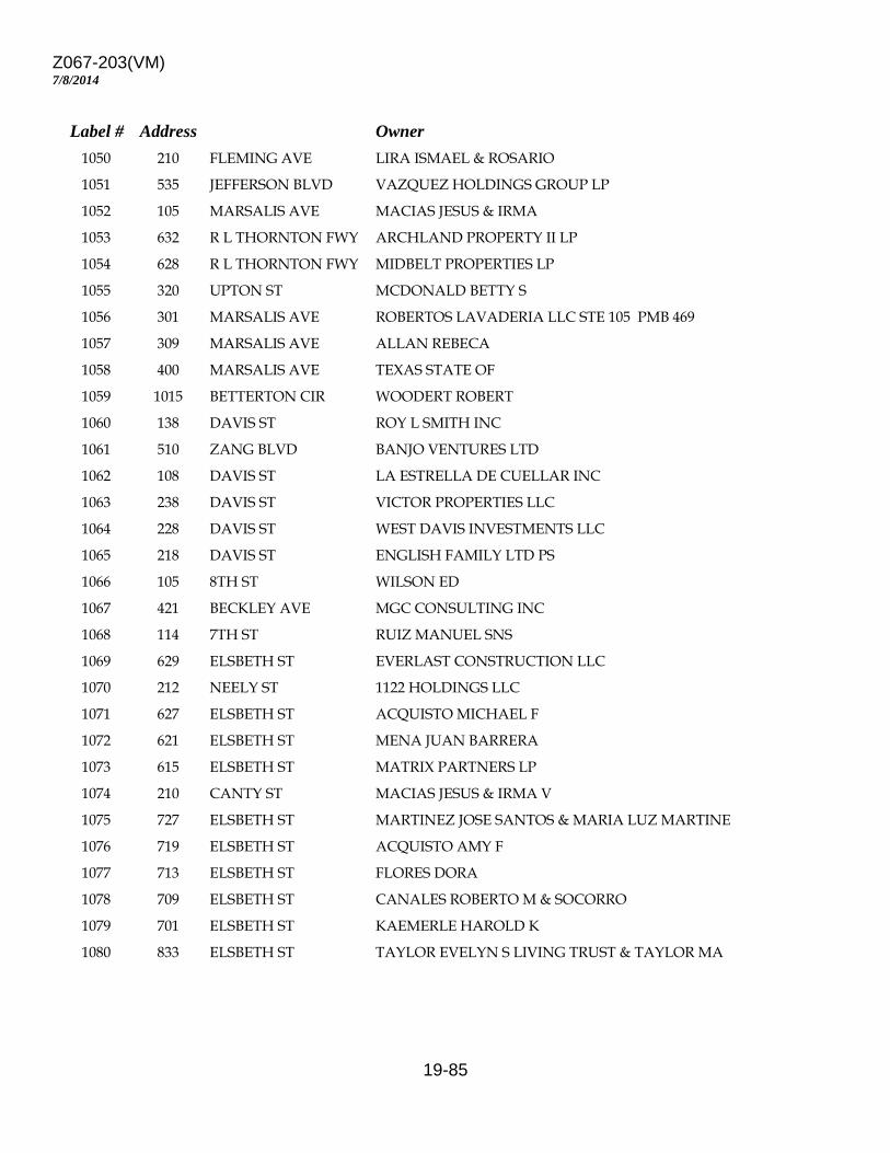
Z067-203(VM)
19-85
7/8/2014
Label # Address Owner 1050 210 FLEMING AVE LIRA ISMAEL & ROSARIO 1051 535 JEFFERSON BLVD VAZQUEZ HOLDINGS GROUP LP 1052 105 MARSALIS AVE MACIAS JESUS & IRMA 1053 632 R L THORNTON FWY ARCHLAND PROPERTY II LP 1054 628 R L THORNTON FWY MIDBELT PROPERTIES LP 1055 320 UPTON ST MCDONALD BETTY S 1056 301 MARSALIS AVE ROBERTOS LAVADERIA LLC STE 105 PMB 469 1057 309 MARSALIS AVE ALLAN REBECA 1058 400 MARSALIS AVE TEXAS STATE OF 1059 1015 BETTERTON CIR WOODERT ROBERT 1060 138 DAVIS ST ROY L SMITH INC 1061 510 ZANG BLVD BANJO VENTURES LTD 1062 108 DAVIS ST LA ESTRELLA DE CUELLAR INC 1063 238 DAVIS ST VICTOR PROPERTIES LLC 1064 228 DAVIS ST WEST DAVIS INVESTMENTS LLC 1065 218 DAVIS ST ENGLISH FAMILY LTD PS 1066 105 8TH ST WILSON ED 1067 421 BECKLEY AVE MGC CONSULTING INC 1068 114 7TH ST RUIZ MANUEL SNS 1069 629 ELSBETH ST EVERLAST CONSTRUCTION LLC 1070 212 NEELY ST 1122 HOLDINGS LLC 1071 627 ELSBETH ST ACQUISTO MICHAEL F 1072 621 ELSBETH ST MENA JUAN BARRERA 1073 615 ELSBETH ST MATRIX PARTNERS LP 1074 210 CANTY ST MACIAS JESUS & IRMA V 1075 727 ELSBETH ST MARTINEZ JOSE SANTOS & MARIA LUZ MARTINE 1076 719 ELSBETH ST ACQUISTO AMY F 1077 713 ELSBETH ST FLORES DORA 1078 709 ELSBETH ST CANALES ROBERTO M & SOCORRO 1079 701 ELSBETH ST KAEMERLE HAROLD K 1080 833 ELSBETH ST TAYLOR EVELYN S LIVING TRUST & TAYLOR MA
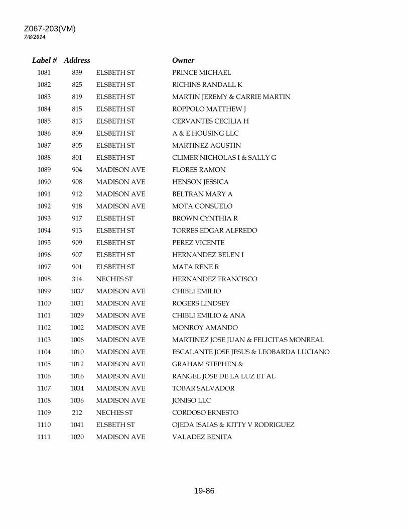
Z067-203(VM)
19-86
7/8/2014
Label # Address Owner 1081 839 ELSBETH ST PRINCE MICHAEL 1082 825 ELSBETH ST RICHINS RANDALL K 1083 819 ELSBETH ST MARTIN JEREMY & CARRIE MARTIN 1084 815 ELSBETH ST ROPPOLO MATTHEW J 1085 813 ELSBETH ST CERVANTES CECILIA H 1086 809 ELSBETH ST A & E HOUSING LLC 1087 805 ELSBETH ST MARTINEZ AGUSTIN 1088 801 ELSBETH ST CLIMER NICHOLAS I & SALLY G 1089 904 MADISON AVE FLORES RAMON 1090 908 MADISON AVE HENSON JESSICA 1091 912 MADISON AVE BELTRAN MARY A 1092 918 MADISON AVE MOTA CONSUELO 1093 917 ELSBETH ST BROWN CYNTHIA R 1094 913 ELSBETH ST TORRES EDGAR ALFREDO 1095 909 ELSBETH ST PEREZ VICENTE 1096 907 ELSBETH ST HERNANDEZ BELEN I 1097 901 ELSBETH ST MATA RENE R 1098 314 NECHES ST HERNANDEZ FRANCISCO 1099 1037 MADISON AVE CHIBLI EMILIO 1100 1031 MADISON AVE ROGERS LINDSEY 1101 1029 MADISON AVE CHIBLI EMILIO & ANA 1102 1002 MADISON AVE MONROY AMANDO 1103 1006 MADISON AVE MARTINEZ JOSE JUAN & FELICITAS MONREAL 1104 1010 MADISON AVE ESCALANTE JOSE JESUS & LEOBARDA LUCIANO 1105 1012 MADISON AVE GRAHAM STEPHEN & 1106 1016 MADISON AVE RANGEL JOSE DE LA LUZ ET AL 1107 1034 MADISON AVE TOBAR SALVADOR 1108 1036 MADISON AVE JONISO LLC 1109 212 NECHES ST CORDOSO ERNESTO 1110 1041 ELSBETH ST OJEDA ISAIAS & KITTY V RODRIGUEZ 1111 1020 MADISON AVE VALADEZ BENITA
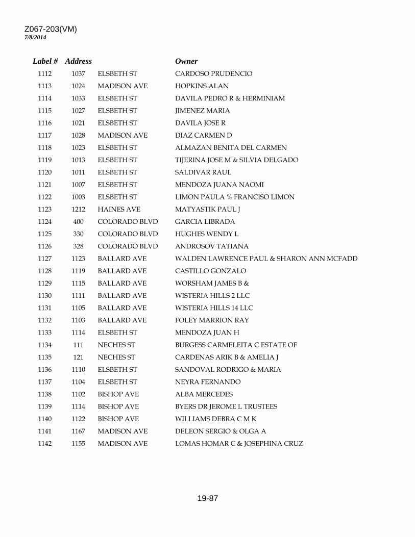
Z067-203(VM)
19-87
7/8/2014
Label # Address Owner 1112 1037 ELSBETH ST CARDOSO PRUDENCIO 1113 1024 MADISON AVE HOPKINS ALAN 1114 1033 ELSBETH ST DAVILA PEDRO R & HERMINIAM 1115 1027 ELSBETH ST JIMENEZ MARIA 1116 1021 ELSBETH ST DAVILA JOSE R 1117 1028 MADISON AVE DIAZ CARMEN D 1118 1023 ELSBETH ST ALMAZAN BENITA DEL CARMEN 1119 1013 ELSBETH ST TIJERINA JOSE M & SILVIA DELGADO 1120 1011 ELSBETH ST SALDIVAR RAUL 1121 1007 ELSBETH ST MENDOZA JUANA NAOMI 1122 1003 ELSBETH ST LIMON PAULA % FRANCISO LIMON 1123 1212 HAINES AVE MATYASTIK PAUL J 1124 400 COLORADO BLVD GARCIA LIBRADA 1125 330 COLORADO BLVD HUGHES WENDY L 1126 328 COLORADO BLVD ANDROSOV TATIANA 1127 1123 BALLARD AVE WALDEN LAWRENCE PAUL & SHARON ANN MCFADD 1128 1119 BALLARD AVE CASTILLO GONZALO 1129 1115 BALLARD AVE WORSHAM JAMES B & 1130 1111 BALLARD AVE WISTERIA HILLS 2 LLC 1131 1105 BALLARD AVE WISTERIA HILLS 14 LLC 1132 1103 BALLARD AVE FOLEY MARRION RAY 1133 1114 ELSBETH ST MENDOZA JUAN H 1134 111 NECHES ST BURGESS CARMELEITA C ESTATE OF 1135 121 NECHES ST CARDENAS ARIK B & AMELIA J 1136 1110 ELSBETH ST SANDOVAL RODRIGO & MARIA 1137 1104 ELSBETH ST NEYRA FERNANDO 1138 1102 BISHOP AVE ALBA MERCEDES 1139 1114 BISHOP AVE BYERS DR JEROME L TRUSTEES 1140 1122 BISHOP AVE WILLIAMS DEBRA C M K 1141 1167 MADISON AVE DELEON SERGIO & OLGA A 1142 1155 MADISON AVE LOMAS HOMAR C & JOSEPHINA CRUZ

Z067-203(VM)
19-88
7/8/2014
Label # Address Owner 1143 1151 MADISON AVE RIVERA ELOINA R 1144 1147 MADISON AVE GARY ROLLIN F & #109-505 1145 1141 MADISON AVE OCHOA RENE & DEBORAH 1146 1139 MADISON AVE ALANIZ MARIA DEL R 1147 1135 MADISON AVE JC LEASING LLP 1148 1131 MADISON AVE NAVARRO ADAN & EVA GLORIA NAVARRO 1149 1125 MADISON AVE OCHOA RENE A & DEBORAH S OCHOA 1150 1119 MADISON AVE LOPEZ PEDRO & BEATRIZ 1151 1115 MADISON AVE TORRES JUAN M & TABITA TORRES 1152 1111 MADISON AVE OCHOA JUAN S & MARTHA C 1153 1107 MADISON AVE VILLEGAS MARY ISABEL 1154 1101 MADISON AVE ARELLANO JULIO NAVA & MINERVA CASARIN 1155 2120 BECKLEY AVE PRESCOTT INTERESTS L C STE 225 1156 100 IH 30 TEXAS STATE OF 1157 130 JEFFERSON BLVD DALLAS COUNTY FLOOD CONTROL DISTRICT 1158 1640 HANDLEY DR MALLINSON LUKE W & LESLEE J 1159 141 GREENBRIAR DR SCOTT KACEY & JAKE B 1160 1611 RIO VISTA DR CHERNOCK CHRISTIAN S 1161 1616 RIO VISTA DR DANIEL LYNSEY 1162 1612 RIO VISTA DR TRAYLOR GARY L & JANET TRAYLOR 1163 1606 RIO VISTA DR ALEXANDER BRIAN & BICK SARAH 1164 2121 HARDWICK ST U S POSTAL SERVICE 1165 320 R L THORNTON FWY SKYVIEW DEVELOPMENT LLC 1166 424 R L THORNTON FWY VICTRON STORES LP 1167 418 8TH ST WINN ELISE LIFE ESTATE EST OF REM: PATRI 1168 422 8TH ST ROCHA ANTONIO 1169 542 9TH ST HARRIS CLAYTON SCHULZ INC DBA ECONOMY SU 1170 630 R L THORNTON FWY POP HOLDINGS LP SUITE 120-121 1171 602 R L THORNTON FWY ATLAS FINANCIAL SERVICE LLC 1172 721 R L THORNTON FWY TRIBOX REAL ESTATE LLC 1173 204 DAVIS ST 204 WD LTD
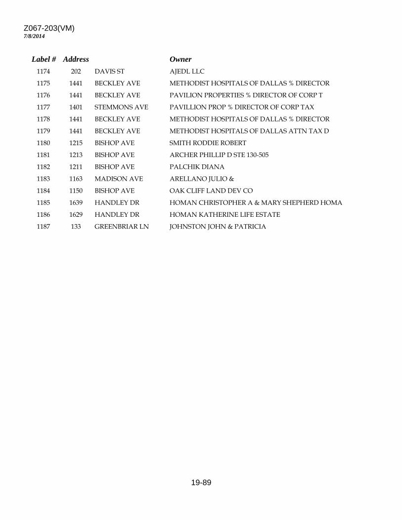
Z067-203(VM)
19-89
7/8/2014
Label # Address Owner 1174 202 DAVIS ST AJEDL LLC 1175 1441 BECKLEY AVE METHODIST HOSPITALS OF DALLAS % DIRECTOR 1176 1441 BECKLEY AVE PAVILION PROPERTIES % DIRECTOR OF CORP T 1177 1401 STEMMONS AVE PAVILLION PROP % DIRECTOR OF CORP TAX 1178 1441 BECKLEY AVE METHODIST HOSPITALS OF DALLAS % DIRECTOR 1179 1441 BECKLEY AVE METHODIST HOSPITALS OF DALLAS ATTN TAX D 1180 1215 BISHOP AVE SMITH RODDIE ROBERT 1181 1213 BISHOP AVE ARCHER PHILLIP D STE 130-505 1182 1211 BISHOP AVE PALCHIK DIANA 1183 1163 MADISON AVE ARELLANO JULIO & 1184 1150 BISHOP AVE OAK CLIFF LAND DEV CO 1185 1639 HANDLEY DR HOMAN CHRISTOPHER A & MARY SHEPHERD HOMA 1186 1629 HANDLEY DR HOMAN KATHERINE LIFE ESTATE 1187 133 GREENBRIAR LN JOHNSTON JOHN & PATRICIA