CITY OF MARQUETTE LIGHTHOUSE PROPERTY LAND USE ...
95
CITY OF MARQUETTE LIGHTHOUSE PROPERTY LAND USE PLAN for the Historic Marquette Harbor Light Station Marquette, Michigan View of the Marquette Harbor Light Station c1940 PREPARED FOR CITY OF MARQUETTE 300 W. Baraga Avenue Marquette, Michigan 49855 PREPARED BY SANDERS & CZAPSKI ASSOCIATES, PLLC 109 S. Front Street #210 Marquette, Michigan 49855 Owner Review December 7, 2017
-
Upload
khangminh22 -
Category
Documents
-
view
0 -
download
0
Transcript of CITY OF MARQUETTE LIGHTHOUSE PROPERTY LAND USE ...

CITY OF MARQUETTE
LIGHTHOUSE PROPERTY LAND USE PLAN
for the
Historic Marquette Harbor Light Station Marquette, Michigan
View of the Marquette Harbor Light Station c1940
PREPARED FOR
CITY OF MARQUETTE 300 W. Baraga Avenue
Marquette, Michigan 49855
PREPARED BY
SANDERS & CZAPSKI ASSOCIATES, PLLC 109 S. Front Street #210
Marquette, Michigan 49855
Owner Review December 7, 2017

Marquette Harbor Light Station Land Use Plan
City of Marquette
Lighthouse Property Land Use Plan for the
Historic Marquette Harbor Light Station
Table of Contents
Acknowledgements……………………………………………………………………………………………………...... 1
Introduction…………………...................................................................................................... 4
Purpose of the Plan………………………………………………………………………………………………………… 10
Context of the Plan………………………………………………………………………………………………………… 10
Guiding Principles………………………………………………………………………………………………………….. 11
Inventory and Analysis…………………………………………………………………………………………………… 11
The Planning Process……………………………………………………………………………………………………… 17
Recommendations…………………………………………………………………………………………………………. 18
Statement of Probable Costs………………………………………………………………………………………….. 22
Potential Funding Options………………………………………………………………………………………………. 23
Appendices
Appendix A, Features Inventory………………………………………………………………………….. 24
Appendix B, Stakeholder Comments…………………………………………………………………… 73
Appendix C, Public Comments……………………………………………………………………………. 79
Appendix D, National Historic Lighthouse Preservation Act of 2000…………………… 85
References…………………………………………………………………………………………………………………….. 92

Marquette Light Station 1 Land Use Plan
Acknowledgements This acknowledgement recognizes the people that have contributed to the development of this land use plan for the historic Marquette Harbor Light Station in the City of Marquette. The deep respect that the citizens of Marquette feel toward the waterfront and historic sites is a reflection of the land ethic passed from generation to generation of residents and visitors alike. The following list is a simple, and likely incomplete, acknowledgement of recent contributions to the planning efforts documented in this report which is to be used as a guide for future use, restoration and rehabilitation of this historic maritime site now belonging to the citizens of Marquette. Marquette City Commission Mr. Dave Campana - Mayor Mr. Tom Baldini - Mayor Pro Tem Ms. Sara Cambensy - Commissioner Mr. Mike Conley - Commissioner Mr. Peter Frazier - Commissioner Mr. Mike Plourde - Commissioner Ms. Sarah Reynolds - Commissioner City of Marquette Staff
Mr. Michael Angeli - City Manager Mr. Dennis Stachewicz - Community Development Mr. Dave Stensaas - City Planner Mr. Keith Whittington - City Engineer Mr. Mik Kilpela - Assistant City Engineer Mr. Jim Compton - Hydrology Engineer Mr. Scott Cambensy - Superintendent, Department of Public Works Mr. Karl Zueger - Director of Community Services Mr. Jon Swenson - Assistant Director of Community Services Ms. Justina Hautamaki - Community Services Secretary Mr. Ian Davis - Chief, Fire Department Mr. Thomas Dunleavy - Captain, Fire Inspector Mr. Tom Florek - Facility Maintenance Supervisor Mr. Eric Stemen - Superintendent, Facilities and Maintenance Mr. Blake Rieboldt - Chief, Police Department Mr. Michael Laurila - Police Captain

Marquette Light Station 2 Land Use Plan
Marquette Area Chamber of Commerce
Mr. Jason Schneider Marquette Arts and Culture Center
Ms. Tina Harris Mr. Walt Lindala
Marquette Beautification Committee Ms. Nancy Lutey Mr. Dick Lutey Ms. Jill LaMere Ms. Mary Davis Ms. Phyllis James Marquette County Convention and Visitor’s Bureau Ms. Nicole Young Marquette Maritime Museum Mr. Fred Stonehouse Ms. Hilary Billman Ms. Charon Porter Mr. Scott Porter Ms. Caroline Northey Mr. Dave Northey Marquette Parks and Rec Advisory Board Mr. Bob Lambert Mr. Chris Bouws Ms. Lynn Laakso Mr. Gary Gottlieb Marquette Regional History Center Ms. Cris Osier Superior Alliance for Independent Living Ms. Sarah Peurakoski

Marquette Light Station 3 Land Use Plan
Citizens of the City of Marquette and nearby communities (participating in the public forums) Sam Marier Joy Cardillo Michael Reed Doug Dykema Barb Kelly Susan LaMere Lois Kampe Jon Billman Barb Trombley Jennifer Frazier John Sonderegger Liz Sonderegger Kevin McGrath Dean Weiger Jon Blankenship Noreen Heitman David Boyd Nheena Weyner Ittner
Note: The use of the term “light station” throughout this report means the 10.1 acre site and all buildings and structures located on that site including the “lighthouse”. The term “lighthouse” is used to describe the 1866 Keepers’ Dwelling with integral light tower.

Marquette Light Station 4 Land Use Plan
Introduction With an increase in mining activity in the region and with plans underway for the construction of a new lock in Sault Ste. Marie, maritime traffic on Lake Superior was rapidly growing in the mid-1800s. Docks and wharves were constructed in the harbor of Marquette to serve shipping interests and it soon became evident that Marquette, Michigan would develop as a major port on the upper Great Lakes. The federal government was petitioned by the US Lighthouse Board for the establishment of a navigation light to serve maritime interests and in 1850 Congress appropriated $5,000 for the construction of a new lighthouse. The Marquette Harbor Light Station was thus established in 1850.
Figure 1: 1868 Lake Superior map showing Marquette and lighthouse
Government surveyors selected a large, ten acre, rocky peninsula near the city that extended east from the shoreline into the lake as the site for the new lighthouse. Construction on the original lighthouse began in 1852 and was completed in the late fall of that same year. With shipping season nearing its close the light was not activated until the early summer of 1853. Typical of many early lighthouses that were built, the construction was inferior and quickly deteriorated in the harsh elements of the northern lakes. In 1865 the US Lighthouse Board once again petitioned Congress for funds to build a replacement structure and funds were immediately granted.

Marquette Light Station 5 Land Use Plan
Figure 2: 1878 U.S. Lighthouse Establishment Survey

Marquette Light Station 6 Land Use Plan
Construction began in 1865 on a new 1 ½ story brick and wood frame dwelling with an integral square tower perched on the highest rock outcropping on the site for maximum visibility. This “schoolhouse” style lighthouse was a common design on the Great Lakes and was also used on nearby Granite Island, Gull Rock and Huron Island. The newly constructed light exhibited a Fourth Order Fresnel lens that was visible for 16 miles in good weather. Completed in 1866 and later modified numerous times, this original building remains today.
Figure 3: The 1866 Lighthouse as originally constructed (c 1890s)
Figure 4: An early view of the light station (c 1910s)
Light stations were very busy sites with frequent deliveries of lantern oil, fuel and coal to power the light and heat the building. In 1870 a service room was constructed on the north side of the lighthouse for storage and then a tramway constructed to more easily transport supplies. This was the first significant modification of the 1866 lighthouse. As lighthouse technology improved

Marquette Light Station 7 Land Use Plan
new signaling systems and buildings were constructed. In 1873 a wood frame Fog Signal Building and fog signaling equipment was installed at the easternmost point of the site to help guide mariners during bad weather conditions. Subject to high waves, a stone wall was constructed in 1875 at this location to help protect the Fog Signal Building. In 1880 a more substantial brick Fog Signal Building was constructed at this location along with a dock for ease of unloading supplies. The elevated walkway and stairs from the lighthouse to this eastern tip of the site was also constructed at this time.
Figure 5: View of Fog Signal Building and other structures at eastern end of the site (c 1940s)
Being located close to a town, unlike many other remote light stations, the Marquette Light Station became known as Lighthouse Point and was an active part of the bustling City of Marquette. Historic records indicate that large numbers of visitors were allowed to stroll the lighthouse grounds for picnicking and beach walking and that the Keepers were to “be courteous and polite to all visitors and show them everything of interest about the station…..”. The public’s involvement with this site was established many years ago. Reports of vandalism and other incidents involving the public use of this site have also been recorded. In 1890 additional changes to the site were made with a decision by the US Life-Saving Service to construct a station in Marquette. A new station building was built in 1891 to house the life-saving crews. This historic building remains today and is identified as the USCG Station Building. Other buildings were also constructed at this time. The combination of the lighthouse staff and the life-saving service crews made the site even busier.

Marquette Light Station 8 Land Use Plan
Figure 6: Life-Saving Station crew in front of the U.S. Life-Saving Station, Marquette (c 1900s)
The late 1890s and early part of the twentieth century was a very busy period for the City of Marquette and the region. The recent construction of the harbor breakwater and the installation of electricity at the site in 1899, along with growth in the mining, lumber and shipping industry, required more manpower and equipment at the light station. Crews were responsible for the main navigation light, two breakwater lights, a breakwater fog bell and the steam powered fog signal. The number of crew increased and a significant renovation of the 1 ½ story lighthouse began in 1910. The original roof structure was removed and the dwelling was converted to a two story duplex.
Figure 7: 1915 Lake Superior navigation map showing the Marquette harbor

Marquette Light Station 9 Land Use Plan
Figure 8: View of the modified lighthouse with second story and service room (c 1920s)
The Marquette Light Station continued to be a busy site until the 1940s when new automated equipment reduced the manpower needs. The US Coast Guard was established in 1939 and assumed the roles of the US Lighthouse Establishment and the US Life-Saving Service. With the outbreak of World War II, the site became a training ground for a large number of USCG personnel. Further modifications were made to the already enlarged lighthouse in the 1940s and 1950s. The last building modifications were made in the early 1960s when a new stairway addition was constructed, picture window units installed, and the lighthouse was painted “red”. These modifications resulted in a unique two story lighthouse design, the only one of its type on the Great Lakes.
Figure 9: View of the Marquette Harbor Light Station (c 1940s)

Marquette Light Station 10 Land Use Plan
In the 1960s, USCG personnel at the station were further reduced as automation increased. In 1980 the USCG destroyed the Fog Signal Building at the eastern tip of the site and removed other small buildings and structures. In 1984 the Marquette Harbor Light Station was listed on the US Department of the Interior’s National Register of Historic Places (#84001803). A small crew maintained and operated the historic light station until the completion of a new USCG station in 2002. Upon completion of the new station the last personnel left the site and it became unused except for the continued operation of the navigation light and other aids located in the 1866 lighthouse tower. In 2002 the non-profit Marquette Maritime Museum obtained a 30 year lease from the USCG to begin preservation efforts and to conduct public tours. Public tours were conducted and some restoration and rehabilitation work was completed by the Marquette Maritime Museum during this period. In 2015, under the National Historic Lighthouse Preservation Act of 2000, ownership of the Marquette Harbor Light Station was officially transferred from the federal government to the City of Marquette, beginning a new chapter in the history of this site. Responsibility for all maintenance, restoration, rehabilitation and use of the site and buildings lies with the City of Marquette. An agreement was reached in 2016 with the Marquette Maritime Museum to continue to allow guided public tours of the site and the historic 1866 lighthouse. Sanders & Czapski Associates of Marquette, an architectural and landscape architectural firm, was retained by the City of Marquette to prepare this land use plan to provide recommendations for the future use of this important historic maritime site.
Purpose of the Plan The purpose of this land use plan is to identify the historic resources on the site and to create the framework for public uses of the various buildings and site within their historic context. As a substantial sized site on the shoreline of Lake Superior within the city limits, the Marquette Harbor Light Station is a significant historic site with great potential for public use and enjoyment. An increase in the level of public use will also contribute to the economic vitality of the city and improve economic health.
Context of the Plan This planning project is being completed within the context of the recognition that the recent acquisition of the historic Marquette Harbor Light Station has contributed to a need to identify potential uses of the various buildings, along with the types of activities and public access that should be allowed at the site. A major goal of the City of Marquette is to provide public access to the Lake Superior shoreline which has been accomplished with the development of numerous

Marquette Light Station 11 Land Use Plan
shoreline parks. The ten acre light station site is a new and very important component of the city’s shoreline and this plan will establish what is important for this property. The involvement of the public in the development of the plan was identified as a critical element of the process. Public meetings, various stakeholder group meetings, meetings with various city departments and a tour of the site and buildings was held to promote public participation.
Guiding Principles In addition to standard land use planning principles and guidelines, the major guiding principle for the Marquette Harbor Light Station site is historic preservation. The conveyance of the property from the Federal Government to the City of Marquette, as outlined in the National Historic Lighthouse Preservation Act of 2000 (found in Appendix D), is “…..for education, park, recreation, cultural, or historic preservation purposes…..”. The Act further states that “all conditions placed with the quitclaim deed of title to the historic light station shall be construed as covenants running with the land.” All restoration work and uses shall conform to the preservation principles established by the US Department of the Interior, National Park Service. All restoration and rehabilitation work of the buildings and site shall be reviewed and approved by the State of Michigan Historic Preservation Office and the National Park Service.
Inventory and Analysis Site visits were made to the Marquette Harbor Light Station in the winter and spring of 2017 to document existing buildings and features. Once a very busy site, all buildings are now vacant and the site is void of any activity. Public access has been restricted other than the occasional public tours offered through the Marquette Maritime Museum. The US Coast Guard retains an easement to access the light tower and lantern to maintain the navigation light and other aids to navigation. The features of the site include the following:
a) Keepers’ Dwelling with Integral Light Tower, 1866 (Lighthouse) b) USCG Station Building (1891) c) Pump House (est. 1930s) d) Garage (est. 1940s) e) Captain’s Residence (est. 1940s) f) Site Elements
Detailed information and photographs are included in Appendix A. The light station site is approximately 10.1 acres in size. Natural features include sand beach shoreline on the north, rugged rock outcroppings transitioning to a rocky shoreline on the eastern

Marquette Light Station 12 Land Use Plan
tip and a stone and gravel beach to the south. Vegetation includes mature pine and hardwood trees along the western side of the site and a variety of grasses and small shrubs growing in the rocky areas with little soil. Some invasive plant species have been identified on the site. Man-made site elements include historic concrete sidewalks, concrete foundations, retaining walls, fences and gates, gravel driveways and parking areas, signage, flagpoles, a radio tower and a deck. Other site features include the historic ruins of the foundation of the Fog Signal Building, the stone wall and dock/landing crib at the eastern tip of the site, the elevated walkway, and the small brick structure used by the National Oceanic and Atmospheric Administration (NOAA) at the south end of the site. Refer to Appendix A for complete photographs. Many of these elements have historic significance.
Figure 10: Fog Signal Building foundation ruins
Figure 11: Elevated Walkway
Access to the light station site is via a narrow residential street known as Coast Guard Road which is accessed from Michigan Street. Coast Guard Road also serves as the walking/bike path that follows the shoreline route. There is significant pedestrian and bicycle traffic on this path that comingles with the occasional vehicle making its way to the Marquette Maritime Museum parking lot. At this time access to the site is not well marked

Marquette Light Station 13 Land Use Plan
One distinct advantage of the Marquette Harbor Light Station not often found at other similar sites is that site utilities are present. The site, and buildings, are served by municipal water, sanitary sewer, electrical and natural gas. Some utilities remain in service at some of the buildings and at other buildings have been shut off. There are five major buildings on the light station property, all historically important. A brief discussion of these buildings and their condition follows.
a) Keepers’ Dwelling with Integral Light Tower (also referred to as the “Lighthouse”) The historic lighthouse, built in 1866, is perhaps the icon most associated with the site and is a predominant feature of the Marquette waterfront. This building provided housing for light station keepers, families and crews and also included the light tower with lantern and navigation light. Major renovations of this building were completed in 1870, 1910, 1950 and the early 1960s when it received its first coat of “red” paint on the exterior. The building interior is presently abandoned dwelling units and unimproved museum space. This building is not heated and water service has been turned off. The interior is in poor to fair condition while the exterior is in good condition with recent masonry repairs and painting and the installation of a new roof.
Figure 12: Lighthouse and access stair, west elevation
Figure 13: Lighthouse and elevated walkway, east elevation

Marquette Light Station 14 Land Use Plan
b) USCG Station Building The USCG Station Building is an historic building constructed in 1891 as living and working quarters for the US Life-Saving Station established in Marquette. This building has been continuously occupied until the recent construction of the new USCG Station Marquette facility in 2015 and was most recently used as the working office building for the station. The City of Marquette has maintained minimal (35 degree F) heat during the winter in this building. The interior has been renovated into many different types of spaces and small rooms. The interior is in fair condition and the exterior is in good condition.
Figure 14: USCG Station Building, south elevation
Figure 15: USCG Station Building, north elevation

Marquette Light Station 15 Land Use Plan
c) Pump House The Pump House is a small utilitarian building constructed in the 1930s (est.). It houses pumps and lift station equipment for the sanitary sewage system on site. It is not presently in use. The building interior and exterior is in good condition.
Figure 16: Pump House
d) Garage
The Garage is a small wood frame building that appears to have been moved around on the site over time. Its original date of construction is estimated to be in the 1940s. It is presently used by the City of Marquette parks department for water safety and rescue equipment. The building interior is in fair condition and the exterior is in good condition.
Figure 17: Garage

Marquette Light Station 16 Land Use Plan
e) Captain’s Residence The Captain’s Residence is a two story dwelling constructed in the 1940s as a single family residence for the USCG captain and family. The building remains as originally constructed as a dwelling with only minor cosmetic modifications. The City of Marquette has maintained minimal (35 degree F) heat during the winter. Both the interior and exterior conditions of this building are good to very good.
Figure 18: Captain's Residence, south elevation
Figure 19: Captain's Residence, north elevation
Additional details and interior and exterior photographs are provided in Appendix A.

Marquette Light Station 17 Land Use Plan
The Planning Process With the transfer of the Marquette Harbor Light Station property to the City of Marquette in 2015 it was soon evident that this historic site was not a typical “park” property to be added to the city’s inventory of public parks. The city took care to secure the buildings and to limit the public use of the site until this planning endeavor could occur. Beginning with a kick-off meeting with various city departments in December 2016, the need for input and ideas from different stakeholder groups and the public was quickly established. Meetings between the consultant, Sanders & Czapski Associates, PLLC and stakeholder groups were scheduled. City staff was not present at these stakeholder meetings. The first series of individual meetings were held at the Marquette Commons on April 19, 2017 and were attended by the Marquette Maritime Museum, the Marquette County Chamber of Commerce, the Marquette Beautification Committee, the Marquette Arts and Culture Committee and the Marquette Parks and Rec Advisory Board. A second series of individual meetings were held with Dennis Stachewicz, Director of Community Development and the Marquette History Museum at the Marquette Commons on April 25, 2017. Additional meetings were held at Sanders & Czapski Associates office with Eric Stemen of the Maintenance Department on May 9, 2017 and with Sarah Peurakoski of Superior Alliance for Independent Living. A teleconference session was also held with Ian Davis and Tom Dunleavy of the Marquette Fire Department on April 27, 2017. Comments from all of these organizations and departments were recorded and are listed in Appendix B. Two public forums were held to solicit comments and ideas from the citizens of Marquette. The first public forum was held on May 4, 2017 at Lakeview Arena where a brief history of the site was presented along with a description of the existing conditions of the site and buildings. The public was asked for their opinions and ideas as to how the site and buildings should be used and were encouraged to put this information in writing. A second public forum was held at the Marquette Harbor Light Station on June 20, 2017. All buildings were open and the public was encouraged to walk through the buildings and traverse the site in order to fully understand and appreciate the natural and historic resources and their conditions. Written comments were also received at this event. A work session with the Marquette City Commissioners and City of Marquette staff was held at the Marquette Harbor Light Station on September 20, 2017. This work session, which was held at the USCG Station Building, was also open to and attended by the public. A tour of the site was provided as part of the work session and an initial draft of this plan was reviewed and discussed. At both public forums the public was encouraged to e-mail Sanders & Czapski Associates with any additional comments or ideas that may have come about after the public forums. The comments from the public forums and from e-mails are recorded and presented in Appendix C.

18
Recommendations The Marquette Harbor Light Station property is zoned Conservation and Recreation, typical for most city owned shoreline property. The number one comment received throughout this planning process is that the historic Marquette Harbor Light Station site needs to be open and accessible to the public without restriction. It is common at other light stations under municipal ownership for the grounds to be open and accessible to the public at all times. Buildings should be reserved for specific uses and access controlled. The covenants included in the property transfer dictate that the historic nature of the property and buildings shall be preserved, no historic elements removed and that new construction shall be limited. Detailed recommendations for public use of the historic Marquette Harbor Light Station are outlined as follows:
1) Maintain Public Access Considerable discussion was held and comments received related to accessing the site. Many people felt that the public should be able to walk all of the grounds at all times, while others felt that the eastern part of the site should be restricted to general public access and controlled by the existing chain link fence that traverses the site. It is our recommendation that the entire site be open to public access during daylight hours, similar to Presque Isle. Monitor erosion resulting from foot traffic on the site and establish control measures as needed. Restrict access to the catwalk, by placing a sign and chain at the western end, until restoration/rehabilitation work on the catwalk is completed.
2) Remove chain link fence Remove the non-historic 6 ft. high chain link fence that traverses the site.
3) Extend Arch Street Extend Arch Street to Coast Guard Road to reduce vehicle traffic on Coast Guard Road. Arch Street would become the primary entry point for vehicular traffic to the light station site and to the east parking lot of the Marquette Maritime Museum.
4) Improve the West Parking Lot Along with the extension of Arch Street, reconfigure the parking area to serve both the light station site and the Marquette Maritime Museum. Designate accessible barrier free parking spaces. Improve the entry driveway along Coast Guard Road to identify the primary entry to the site.
5) Install Gate Install a gate at the west end of the gravel driveway (leading to the Keepers’ Dwelling / Light Tower) to control vehicle entry. This gate would be controlled by the maintenance department and opened for special events where overflow parking would be required

19
and to allow winter snow plowing. Special entry to the East Parking Lot (near the Keepers’ Dwelling / Light Tower) would also be permitted through this gate.
6) Install Signage Install signage throughout the site to identify historic resources and to control vehicle and pedestrian circulation. Signage should include both directional/way-finding signs as well as historic/interpretive signs. Signage should be consistent with other historic signage used throughout the City and language should be taken from the American Museum Association and the Michigan State Historic Preservation Office. As requested by the Fire Department post signs along the beach at the north end stating “Warning-Dangerous Currents”, general “No Swimming Allowed at the Light Station” and “Cliff Area – Enter At Your Own Risk”. Interpretive signage should be placed at all of the buildings on the site, as well as at the proposed observation platforms at the south and east ends.
7) Test Electrical Service Equipment Test the electrical service equipment that is located in two fenced enclosures on the site. Remove abandoned/unused equipment.
8) Designate Garage for Nautical/Maritime Displays Continue use of the Garage for beach safety equipment and apparatus storage until other storage space can be designated. A that time the building could be used for nautical and maritime displays related to the US Life-Saving Station and US Coast Guard. This building is easily made barrier free accessible. It could also serve as a shelter building along the bike path.
9) Rehabilitate the 1866 Lighthouse for use as a Maritime Museum Continue with restoration and rehabilitation efforts at the 1866 Keepers’ Dwelling/Light Tower for use as museum space. Maintain and enhance the operating agreement and collaboration with the Marquette Maritime Museum to operate public tours of the building. This building will be open to the public only through paid visitation at the Marquette Maritime Museum.
10) Rehabilitate the Captain’s Residence for use as a short term rentable dwelling Constructed as a single family residence, continued use of the Captain’s Residence as a residence for short term rental is recommended. Residential rental space on other lighthouse sites has proven to be remarkably successful and serve as a significant source of revenue. The residence would be available to the general public for short term rent and also to other organizations considering a longer term rental for special programs. This building would not be open to the public other than its availability as a rental unit.
11) Rehabilitate the USCG Station Building for multi-purpose use Rehabilitate the USCG Station Building for multi-purpose use. This building would be available for rent by the public and various groups and would also serve as a revenue source. Make improvements for barrier free accessibility.

20
12) Construct Observation Platform at east end of the site
The eastern tip of the site contains unique historic ruins which are unsafe and should be restricted from public access. The opportunity to view these features, however, should be provided by constructing a small observation platform near the eastern end of the site. This viewing platform would be accessed from the catwalk.
13) Maintain / Rehabilitate Catwalk Maintain the historic catwalk in a safe condition for public access. Make minor repairs to the concrete deck surface and the metal handrails. Modify as needed to allow access from the catwalk to the observation platform.
14) Remove Invasive Plant Species Continue with efforts to remove non-native plant species and small trees on the site. The historic site was void of large trees and other tall vegetation so as not to restrict views of the navigation aids from the water. The historic landscape shall be maintained.
15) Rehabilitate the Pump House Rehabilitate the small Pump House building to continue functioning as a small utility building. Restore all lift station equipment for proper operation of the sanitary sewer system.
16) Inspect and Test Utility Services Inspect and test utilities to all buildings to insure proper operation and restore to operating condition as needed to serve the building functions. Maintain all fire hydrants for fire protection.
17) Install Nautical Artifacts In order to enhance the interest in the site, nautical artifacts may be considered for selective placement on the site. Type of artifact and placement should be reviewed with the Michigan State Historic Preservation Office and should not restrict open green space.
18) Enhance Barrier Free Accessibility throughout the site Due to the topography, barrier free accessibility is not feasible at the lighthouse and the eastern portion of the site. Provide universally accessible routes from the parking area throughout the western portion of the site. Access to the relatively flat yard area west of the lighthouse can be achieved for viewing of the structure. Utilizing the Garage, which is barrier free accessible, for displays and signage would allow visitors to learn about the site. Construct a ramp, and/or provide a lift device, to provide barrier free accessibility to the USCG Station Building.
19) Construct Observation Platform at south end of the site Improve the small area at the very south end of the site for viewing Lake Superior and the light station site. This observation area would be reached from an accessible route from

21
the bike path and new parking area. Incorporate a picnic area in this general location, which would include picnic tables and a small pavilion/shelter.
20) Relocate the Bike Path In order to improve the mix of pedestrians, bicyclists and motor vehicles, relocate the bike path partially onto the historic site. The bike path would run past the historic USCG Station Building and the Garage, where informational signage and other displays would be located. Install bike parking areas and racks at selective locations.
21) Allow Continued Use of the NOAA Building at the south end of the site. Continue the lease with the National Oceanic and Atmospheric Administration for use of the small building at the south end of the site for environmental monitoring equipment.
Refer to the “Proposed Site Plan” drawing for a graphic representation of the above recommendations.

MARQUETTE HARBOR LIGHT STATIONPROPOSED SITE PLAN
APPROXIMATE SCALE 1” = 100’-0”0 25 50 100
UNITED STATES COAST GUARD STATION
MARQUETTE
MARQUETTEMARITIME MUSEUM
CITY OF MARQUETTE
WATER TREATMENT
FACILITY
PUMP HOUSE
SHORT TERM RESIDENTIAL RENTAL AT CAPTAIN’S RESIDENCE
MULTI PURPOSE USE AT USCG STATIONBUILDING
SERVICE ROOM
KEEPER’S DWELLING
LIGHT TOWER
ELEVATED WALKWAY
McCARTY’S COVE PUBLIC BEACH
PRO
PER
TY L
INE
FOUNDATION OF FORMER FOG SIGNAL BUILDING
FORMER BOAT LANDING CRIB
LAKE SUPERIOR
PUBLIC BATHROOMS
MICHIGAN STREET
LA
KE
SHO
RE
BO
UL
EVA
RD
ARCH STREET
NOAA STATION
RESIDENCES
BIKE PATH
B
IKE PATH
INTERPRETIVE DISPLAY
RE-ROUTE BIKE PATH
BUS PARKING
LIGHTHOUSE POINT PARKING (19 CARS)
PEDESTRIAN WAY/ EMERGENCY ACCESS, GATED, REINFORCED ADA TURF
SPECIAL EVENTS AREA, BARRIER-FREE ACCESSIBLE
LIGHTHOUSE MUSEUM
VIEWING PLATFORM
REMOVE CHAIN LINK FENCE
LAKE WATCH PARKING (6 CARS)
VIEWING PLATFORM
MUSEUM DISPLAY
MUSEUM PARKING (13 CARS)
BIKE PATH

Marquette Harbor Light Station 22 Land Use Plan
Statement of Probable Costs
Construction cost estimates for all recommendations are included in this section. All cost
estimates are projected for work to be completed in 2018; escalation factors for future labor and
material cost increases must be applied to all figures when projecting beyond that time period.
All estimates may vary considerably depending on the scope and magnitude of the specific work,
the efficiency of scale, time of construction and work done by contractors or city staff.
ITEM COST ESTIMATE RANGE
1) Maintain Public Access $ 0
2) Remove Chain Link Fence $ 8,000 to $ 12,000
3) Extend Arch Street $ 400,000 to $ 500,000
4) Improve West Parking Lot $ 300,000 to $ 400,000
5) Install Gate $ 3,000 to $ 5,000
6) Install Signage $ 15,000 to $ 30,000
7) Test Electrical Service Equipment $ 3,000 to $ 5,000
8) Rehabilitate Garage for Maritime Displays $ 25,000 to $ 50,000
9) Rehabilitate1866 Lighthouse* $ 250,000 to $ 350,000
10) Rehabilitate Captain’s Residence* $ 10,000 to $ 25,000
11) Rehabilitate USCG Station Building* $ 250,000 to $ 325,000
12) Construct Observation Platform at East End $ 90,000 to $ 150,000
13) Maintain / Rehabilitate Catwalk $ 25,000 to $ 35,000
14) Remove Invasive Plant Species $ 3,000 to $ 5,000
15) Rehabilitate Pump House $ 5,000 to $ 10,000
16) Inspect and Test Utility Services $ 5,000 to $ 8,000
17) Install Nautical Artifacts $ 5,000 to $ 10,000
18) Enhance Barrier Free Accessibility $ 20,000 to $ 30,000
19) Construct Observation Platform at South End $ 75,000 to $ 100,000
20) Relocate Bike Path $ 150,000 to $ 200,000
21) Continue Use of NOAA Building $ 0
Total $ 1,642,000 to $ 2,250,000
*Note: The cost of furniture, displays and other decorations is not included in this estimate.

Marquette Harbor Light Station 23 Land Use Plan
Potential Funding Options
The Marquette Harbor Light Station site offers recreational, educational and cultural
opportunities for the public. There are numerous grants available to the city including:
Michigan Lighthouse Assistance Program
Website: www.michigan.gov/saveourlights
National Park Service Maritime Heritage Program
Website: www.nps.gov/maritime/grants/intro.htm
Michigan Council for Arts and Cultural Affairs
Website: www.michiganbusiness.org/community/council-arts-cultural-
affairs/#MCACA
Michigan Department of Environmental Quality, Coast Zone Management Program
Website: www.mi.gov/coastalmanagement
Michigan Department of Natural Resources Trust Fund
Website: www.michigan.gov/mnrtf
Consideration should also be given to continued partnering with the Marquette Maritime
Museum, an established non-profit organization already dedicated to historic building
preservation and maritime history at the site, or possibly the establishment of an independent,
non-profit “Friends of the Marquette Harbor Light Station”, that would assist the City of
Marquette with grants and other preservation related opportunities at the site. The Marquette
Maritime Museum has a proven track record of receiving and administrating grants for historic
restoration at the light station.
As stated in the Recommendations section of this report, establishing the Captain’s Residence
and the USCG Station Building as rentable buildings will also provide a source of revenue for
maintenance, restoration and rehabilitation of the buildings and site.

Marquette Harbor Light Station 24 Land Use Plan
APPENDIX A
FEATURES INVENTORY

APPROXIMATE SCALE 1” = 100’-0”0 25 50 100
MARQUETTE HARBOR LIGHT STATIONEXISTING FEATURES INVENTORY
BIKE PATH
C
OA
ST G
UAR
D R
OA
D A
ND
BIK
E PA
TH
UNITED STATES COAST GUARD STATION
MARQUETTE
MARQUETTEMARITIME MUSEUM
CITY OF MARQUETTE
WATER TREATMENT
FACILITYWEST PARKING LOT
GARAGE
FLAGPOLE
CONCRETE PAD
CHAINLINK FENCE
EAST PARKING LOT
GRAVEL DRIVEWAYPUMP HOUSE
CAPTAIN’S RESIDENCE
CONCRETE RETAINING WALL
SIDEWALKS
USCG STATIONBUILDING
SERVICE ROOM
KEEPER’S DWELLING
LIGHT TOWER
ELEVATED WALKWAY
McCARTY’S COVE PUBLIC BEACH
PRO
PER
TY L
INE
STONE RUBBLE BARRIER WALL
FORMER FUEL TANK BUNKER
FOUNDATION OF FORMER FOG SIGNAL BUILDING
FORMER BOAT LANDING CRIB
FORMER RADIO TOWER FOUNDATION PIERS
LAKE SUPERIOR
PUBLIC BATHROOMS
MICHIGAN STREET
LA
KE
SHO
RE
BO
UL
EVA
RD
ARCH STREET
NOAA STATION
RADIO TOWER
CHAIN LINK FENCE
METAL STAIRS
RESIDENCES
BIKE PATH
DECK

400
538505
300528
294
275500
270
320
450
510
460
505
0
529
527
1300
280
0
6230
453
518
540
501
530
530
521
533
461
321
425424
515
519
437 515
533
520
535
519
534
540
529
573
523
537
525
260
400
509
285
419
505
524
420
501
607 604
536
531
325
519
531
521
430
539
543
541
528
577
532
528
534
536
545
406
451
510
612
410
602608
615
415
0
610
290
530
612
500
299
401
517
528524516
442409
401
Arch StreetLa
kesh
ore B
oulev
ard
Ohio Street
Ridge Street
Ceda
r Stre
et
Coas
t Gua
rd R
oad
Michigan Street
1 inch = 225 feet
LEGENDZoning File Latest 11-12-14ZONING DISTRICTS
RS - Single Family ResidentialRG - General ResidentialRM - Multiple Family ResidentialMGHOD - Marquette General Hospital Overlay DistrictOS - OfficeBC - Community BusinessCBD - Central Business DistrictBG - General BusinessI - IndustrialCR - Conservation & RecreationDD - Deferred DevelopmentPUD - Planned Unit DevelopmentDowntown Marquette WaterfrontSouth Marquette Waterfront .


Marquette Harbor Light Station 28 Land Use Plan
FEATURES INVENTORY – MARQUETTE HARBOR LIGHT STATION
RESOURCE: KEEPERS’ DWELLING WITH INTEGRAL LIGHT TOWER
Original Date of Construction: 1866
Original Use: Housing for lighthouse keeper and family; integral navigation light & tower
Present Use: Vacant; abandoned dwelling units and unimproved museum space
Modifications:
1870 Single story addition called the Service Room was constructed.
1910 The original 1 ½ story single family dwelling was converted to a two-story
duplex dwelling.
1950s West addition incorporating a new stairway was constructed.
1960s Lighthouse exterior painted “red”; major interior renovation completed.
Construction Type: Load-bearing brick and stone exterior walls, wood frame floors, interior
walls and roof
Type of Roof: Asphalt shingles, installed in 2012. Good condition.
Exterior: Brick and stone masonry with paint finish
Building Area:
Basement 1,236 sq. ft.
Service Room 440 sq. ft.
First Floor 1,321 sq. ft.
Second Floor 1,321 sq. ft.

Marquette Harbor Light Station 29 Land Use Plan
Utilities:
Water: Municipal water service
Sanitary: Municipal sanitary
Electrical: Underground electrical service, 200 amp
Fuel: Natural gas
Heat: Natural gas-fired boiler and hot-water baseboard system
(decommissioned)
Air Conditioning: None
Security System: Yes
Fire Alarm System: Yes
Overall Condition of the Building:
Interior: Poor to Fair
Exterior: Good
Other: Historic building. The recommended Period of Interpretation is 1960 to 1970.

Marquette Harbor Light Station 30 Land Use Plan
KEEPERS’ DWELLING / LIGHT TOWER
South and West Elevation
West Elevation

Marquette Harbor Light Station 31 Land Use Plan
KEEPERS’ DWELLING / LIGHT TOWER
East Elevation of Service Room
North Elevation

Marquette Harbor Light Station 32 Land Use Plan
KEEPERS’ DWELLING / LIGHT TOWER
East Elevation

Marquette Harbor Light Station 33 Land Use Plan
KEEPERS’ DWELLING / LIGHT TOWER
West Elevation and Elevated Walkway

Marquette Harbor Light Station 34 Land Use Plan
KEEPERS’ DWELLING / LIGHT TOWER
First Floor – Exhibits
First Floor – Kitchen

Marquette Harbor Light Station 35 Land Use Plan
KEEPERS’ DWELLING / LIGHT TOWER
Seconf=d Floor – Ceiling Damage
Basement

Marquette Harbor Light Station 36 Land Use Plan
KEEPERS’ DWELLING / LIGHT TOWER
Service Room
Second Floor - Exhibits

Marquette Harbor Light Station 37 Land Use Plan
FEATURES INVENTORY – MARQUETTE HARBOR LIGHT STATION
RESOURCE: USCG STATION BUILDING
Original Date of Construction: 1891
Original Use: Housing for life-saving station crew
Present Use: Vacant; abandoned office space and living quarters
Modifications: Single story addition; date unknown.
Construction Type: Wood frame construction; poured concrete foundation walls.
Type of Roof: Asphalt shingles, installation date unknown. Good condition.
Exterior: Metal siding; exposed concrete foundation walls.
Building Area:
Basement 1,830 sq. ft.
First Floor 1,830 sq. ft. excluding the enclosed, unheated porch
Second Floor 1,500 sq. ft.
Utilities:
Water: Municipal water service
Sanitary: Municipal sanitary
Electrical: Underground electrical service, 200 amp
Fuel: Natural gas
Heat: Natural gas-fired boiler and hot-water baseboard system
(active)
Air Conditioning: None
Security System: Yes
Fire Alarm System: Yes
Overall Condition of the Building:
Interior: Fair
Exterior: Good
Other: Historic building originally constructed by the US Life-Saving Service.

Marquette Harbor Light Station 38 Land Use Plan
USCG STATION BUILDING
South Elevation
North Elevation

Marquette Harbor Light Station 39 Land Use Plan
USCG STATION BUILDING
West Elevation
East Elevation

Marquette Harbor Light Station 40 Land Use Plan
USCG STATION BUILDING
Interior View – First Floor Living Room
Interior View – First Floor Kitchen

Marquette Harbor Light Station 41 Land Use Plan
USCG STATION BUILDING
Interior View – Basement
Interior View – Second Floor Bedroom

Marquette Harbor Light Station 42 Land Use Plan
FEATURES INVENTORY – MARQUETTE HARBOR LIGHT STATION
RESOURCE: PUMP HOUSE
Original Date of Construction: Not known; est 1930s.
Original Use: Utility building housing sanitary sewer lift station pumps and
related equipment.
Present Use: Mechanical equipment.
Modifications: There are no known modifications.
Construction Type: Load-bearing brick exterior walls, wood frame walls, concrete floor and
foundation.
Type of Roof: Wood or asbestos shingles, age unknown; presumed to be original.
Roof is in fair to poor condition with missing and broken shingles.
Exterior: Brick masonry with natural finish
Building Area:
First Floor 129 sq. ft.
Utilities:
Water: None
Sanitary: None
Electrical: Overhead electrical service, 200 amp
Heat: None
Air Conditioning: None
Security System: No
Fire Alarm System: No
Overall Condition of the Building:
Interior: Good
Exterior: Good

Marquette Harbor Light Station 43 Land Use Plan
PUMP HOUSE
East and South Elevations
South Elevation

Marquette Harbor Light Station 44 Land Use Plan
PUMP HOUSE
West Elevation
Interior View

Marquette Harbor Light Station 45 Land Use Plan
FEATURES INVENTORY – MARQUETTE HARBOR LIGHT STATION
RESOURCE: GARAGE
Original Date of Construction: 1940s (estimated)
Original Use: Utility garage for the US Coast Guard Station
Present Use: Utility garage for storage.
Modifications:
1960s Moved from its original site to its present day location
Construction Type: Wood frame; concrete slab-on-grade.
Type of Roof: Asphalt shingles, age unknown.
Exterior: Metal siding
Building Area: 777 sq. ft.
Utilities:
Water: None
Sanitary: None
Electrical: Underground electrical service, 100 amp
Heat: None
Air Conditioning: None
Security System: Yes
Fire Alarm System: Yes
Overall Condition of the Building:
Interior: Fair
Exterior: Good
Other: As a slab on grade structure, barrier free accessibility is easily accomplished.

Marquette Harbor Light Station 46 Land Use Plan
GARAGE
South Elevation
West Elevation

Marquette Harbor Light Station 47 Land Use Plan
GARAGE
North Elevation
North and West Elevation
Marquette Harbor Light Station 48 Land Use Plan
GARAGE
Interior View
Electrical Panel

Marquette Harbor Light Station 49 Land Use Plan
FEATURES INVENTORY – MARQUETTE HARBOR LIGHT STATION
RESOURCE: CAPTAIN’S RESIDENCE
Original Date of Construction: 1940s (estimated)
Original Use: Housing for the USCG Station captain and family.
Present Use: Vacant; last used as living quarters.
Modifications: There are no known modifications from its original construction.
Construction Type: Wood frame construction; poured concrete foundation walls.
Type of Roof: Asphalt shingles, age not known.
Exterior: Metal siding; concrete foundation walls
Building Area:
Basement 696 sq. ft.
First Floor 696 sq. ft.
Second Floor 696 sq. ft.
Utilities:
Water: Municipal water service
Sanitary: Municipal sanitary service
Electrical: Underground electrical service, 200 amp
Fuel: Natural gas
Heat: Natural gas-fired boiler and hot-water baseboard system (active)
Air Conditioning: None
Security System: Yes
Fire Alarm System: Yes
Overall Condition of the Building:
Interior: Good to Very Good
Exterior: Good to Very Good

Marquette Harbor Light Station 50 Land Use Plan
CAPTAIN’S RESIDENCE
South Elevation
North Elevation

Marquette Harbor Light Station 51 Land Use Plan
CAPTAIN’S RESIDENCE
North Elevation
South Elevation

Marquette Harbor Light Station 52 Land Use Plan
CAPTAIN’S RESIDENCE
First Floor – Living Room
First Floor – Kitchen

Marquette Harbor Light Station 53 Land Use Plan
CAPTAIN’S RESIDENCE
Second Floor – Bedroom
Basement

Marquette Harbor Light Station 54 Land Use Plan
FEATURES INVENTORY – MARQUETTE HARBOR LIGHT STATION
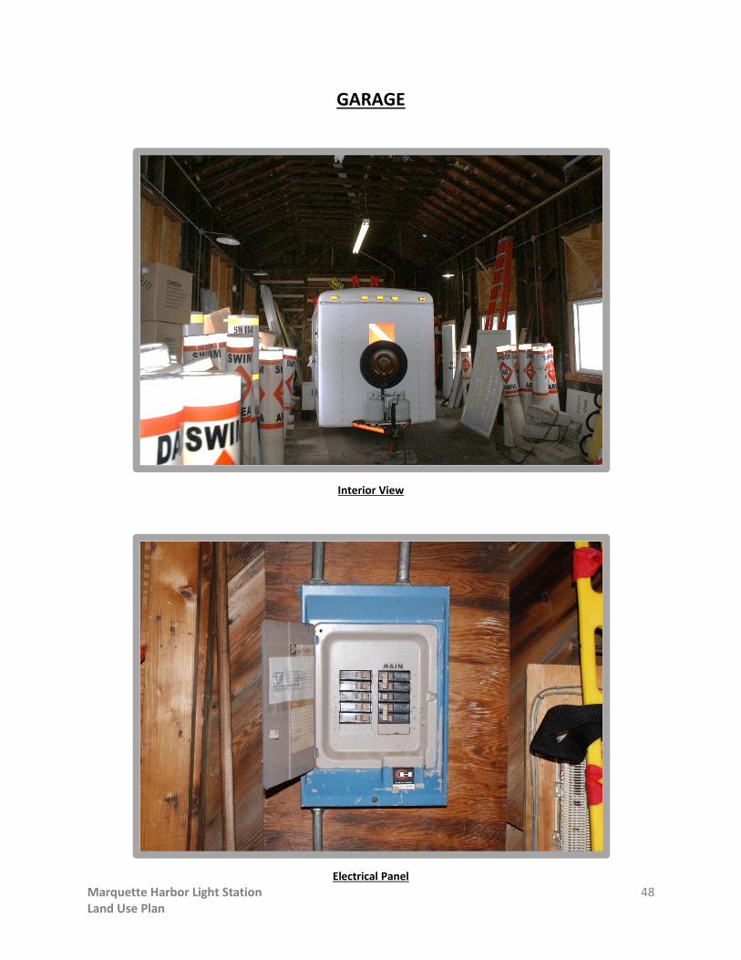
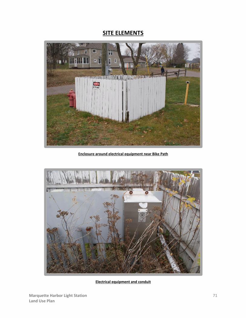
RESOURCE: SITE ELEMENTS
Various elements remain on the historic light station site including foundation remnants of
non-extant buildings, fences, gates, and other structures. These include:
Concrete sidewalks
Gravel-surfaced parking areas and driveways
Asphalt driveways
Fences and gates
Retaining walls
Stone barrier wall
Elevated Walkway and stairs
Fuel Bunker
Boat landing crib dock
Fog Signal Building (non-extant) foundation
Patios and decks
NOAA equipment building
Signage
Flagpole
Radio / Communications Tower
Radio Tower (non-extant) foundations

Marquette Harbor Light Station 55 Land Use Plan
SITE ELEMENTS
Historic sidewalks
Historic Sidewalk

Marquette Harbor Light Station 56 Land Use Plan
SITE ELEMENTS
Gravel Driveway
Gravel Parking Area along west boundary of site

Marquette Harbor Light Station 57 Land Use Plan
SITE ELEMENTS
Asphalt driveway, fence and gate at Garage
Asphalt drive and fence at USCG Station Building along Bike Path

Marquette Harbor Light Station 58 Land Use Plan
SITE ELEMENTS
Six foot high chain link fence along north property border
Damaged section of chain link fence

Marquette Harbor Light Station 59 Land Use Plan
SITE ELEMENTS
Cable and metal post fence along driveway
Gate at chain link fence at driveway leading to Keepers’ Dwelling / Light Tower

Marquette Harbor Light Station 60 Land Use Plan
SITE ELEMENTS
Wood fence at Captain’s Residence yard
Wood fence at electrical meter bank in yard near Keepers’ Dwelling / Light Tower

Marquette Harbor Light Station 61 Land Use Plan
SITE ELEMENTS
Concrete masonry unit retaining wall near Garage
Poured concrete retaining wall and steps in front of Captain’s Residence

Marquette Harbor Light Station 62 Land Use Plan
SITE ELEMENTS
Stone rubble barrier wall at far eastern end of the site. Fog Signal Building foundation also seen.
Stone rubble wall and concrete fuel bunker

Marquette Harbor Light Station 63 Land Use Plan
SITE ELEMENTS
Elevated Walkway from Keepers’ Dwelling to east end of the site
Elevated Walkway and support structure

Marquette Harbor Light Station 64 Land Use Plan
SITE ELEMENTS
Concrete steps at boat landing crib dock
View of Fog Signal Building foundation, boat landing crib, fuel bunker and stone barrier wall

Marquette Harbor Light Station 65 Land Use Plan
SITE ELEMENTS
Lower portion of Fog Signal Building Foundation and boat landing crib dock
Fog Signal Building foundation with stone barrier wall in background

Marquette Harbor Light Station 66 Land Use Plan
SITE ELEMENTS
Small wood deck behind USCG Station Building
Basketball court behind USCG Station Building

Marquette Harbor Light Station 67 Land Use Plan
SITE ELEMENTS
Small brick building at south end of site housing NOAA monitoring equipment

Marquette Harbor Light Station 68 Land Use Plan
SITE ELEMENTS
Flagpole in front of USCG Station Building

Marquette Harbor Light Station 69 Land Use Plan
SITE ELEMENTS
Radio tower near USCG Station Building

Marquette Harbor Light Station 70 Land Use Plan
SITE ELEMENTS
Abandoned sign structure in front of USCG Station Building
Small sign in front of USCG Station Building
Marquette Harbor Light Station 71 Land Use Plan
SITE ELEMENTS
Enclosure around electrical equipment near Bike Path
Electrical equipment and conduit

Marquette Harbor Light Station 72 Land Use Plan
SITE ELEMENTS
North end of west parking lot showing parking signs and other sign posts
View of Marquette Maritime Museum adjacent to the light station property

Marquette Harbor Light Station 73 Land Use Plan
APPENDIX B
STAKEHOLDER COMMENTS
Presentation boards with a summarization of all stakeholder comments were prepared and
displayed at the public forums. These presentation boards are included in this appendix.


Marquette Harbor Light Station 79 Land Use Plan
APPENDIX C
PUBLIC COMMENTS

Marquette Harbor Light Station 80 Land Use Plan
Public Comments
Written comments, and comments received via e-mail, from the public were collected and
include the following:
1) Susan LaMere:
a. Lease the USCG Station Bldg to city agencies, possibly to Lake Superior Community
Partnership so their building could go to the Father Marquette Park.
b. Use the Captain’s Residence as a B &B for lighthouse lovers. Or an on-site manger
could live there and manage guests and grounds.
c. Close off the end of the elevated walkway with a viewing platform.
2) Jon Billman:
a. I teach in the English Dept. at NMU. I would most like to see the facilities utilized
for the arts. For example, visiting writers would stay in the Captain’s Residence,
write and teach workshops. The USCG Station Bldg would make an excellent
classroom for writing students. I believe the arts will benefit the community the
most in the long term.
3) Samantha Marier:
a. As part of a local non-profit, the Fresh Coast Film Festival, we are interested in
renting/using this place in unique ways that will increase recognition and interest
in this historical property. In our case we are interested in using the lighthouse as
a screening venue, panel discussions related to either our waterways or local
history. We would also encourage lighthouse tours, as well as any other ideas
where we can bring together the community around this facility/area. Renting
this venue in a responsible way (being selective in renting to those respecting the
area) would be a source of revenue to cover expenses. Also, allowing a variety of
uses to the area will increase interest to possibly outside the Marquette area. The
Fresh Coast Film Festival promotes fun in the outdoors and environmental
responsibility. We’d love using a site with historic presence and a unique setting.
We look forward to seeing the outcome of this place.
4) Kevin McGrath:
a. Re-route the bike path.
b. Remove west section of chain link fence.
c. All grounds west of the chain link fence – open to the public. All grounds east of
the chain link fence off limits to the public. Keep as lighthouse tours run by the
Marquette Maritime Museum
d. Keep exiting Garage as currently used (for storage).

Marquette Harbor Light Station 81 Land Use Plan
e. Do not demolish anything, as everything has historic value, even the Fog Signal
Bldg ruins. Put up railing and signage.
f. Add a few picnic tables and grills here and there.
g. Make Captain’s Residence an AIRbnb, or equivalent. As someone who travels
using AIRbnb, I am confident that this residence could generate at $250/night, if
not more, especially during peak season. Proceeds could pay for upkeep of all
buildings in the park.
h. Not sure what to do with USCG Station Bldg.
5) Dave Stensaas:
a. Create an accessible pathway through the site where topography allows.
b. Use the USCG Station Bldg for Navy or USCG Cadet programs. Cadets could
provide maintenance as part of their training.
c. Use the Captain’s Residence for “summer hosts” – volunteers that would help
manage the property and conduct tours.
d. Limit site access to the east end of the site at night.
e. DO NOT open Arch Street for public access.
f. Maintain site access for pedestrians.
g. Reduce the size of the on-site parking area if possible.
h. Keep the Garage for storage use.
i. Maintain the integrity of all historical buildings.
j. Maintain some type of barrier (near the present chain link fence) to keep children
from climbing the rocks and to keep people from climbing up or down from the
north beach area onto the site.
k. Keep the east parking lot and gravel driveway for service access.
l. Lighthouse could be used for artist-in-residence quarters.
6) Barb Kelly:
a. Check to see if the lighthouse site is part of the Arch & Ridge Street National
Historic District established in the late 1970s.
b. Expand the bike path to wind through the park.
c. “Ugly” chain link fence has to go!!
7) Doug Dykema:
a. Kayak launch site on the south beach area.
b. Remove the Pump House.
c. Remove the radio tower.
d. Remove the chain link fence.
e. Remove “park closed” signs.
f. Repair the elevated walkway.
g. Straighten Coast Guard Road.

Marquette Harbor Light Station 82 Land Use Plan
h. Remove gates at the west parking lot.
i. Do not allow lifeguards/city staff to park on the grass by the Garage.
j. Reroute the bike path to traverse the site.
8) David Boyd:
a. Create an accessible viewing platform/land area at the south end of the site with
an accessible route from the bike path.
b. Reconstruct the watch tower with bell.
9) Joy Cardillo:
a. Any parking on the site should be kept to a minimum.
b. Strongly support an “arts” component including an artist-in-residence at the
Captain’s Residence and maker’s spaces.
c. Accentuate the site as a “linkage” between the lower harbor and the east side
beaches.
d. Use the existing elevated walkway to create an outdoor room at the easternmost
point or use the ruins of the Fog Signal Bldg.
e. Add more elevated walkway to get to more rugged areas of the site.
f. Use the area south/southwest of the lighthouse for an outdoor amphitheater built
into the landscape.
10) Dennis Mapes:
a. Wonderful tour!!
11) Kathleen Conover:
a. Artist-in-residence somewhere here. Something artists expect is to leave a piece
of their art with city for posterity – what a wonderful maritime exhibit!
b. Use Captain’s Residence as an artist’s retreat and rent out the entire house.
12) Nheena Weyr Ittner:
a. Renovate the USCG Station Bldg – take down walls and put in large gathering
spaces and commercial kitchen- to rent out for events such as weddings, reunions,
etc.
b. “Evolve Marquette” (of the Marquette Chamber of Commerce) would like to see
an artist’s residency for a portion of the year while the remaining portion of the
year could be an AIRbnb as an income generator.
13) Linda Donckers:
a. I’d like to see more involvement with the Marquette Maritime Museum.

Marquette Harbor Light Station 83 Land Use Plan
14) Frank Verito:
a. Protect “viewsheds” from McCarty’s Cove, from breakwall and from the site itself.
b. Minimize disturbance/cutting on natural areas.
c. Remove north chain link fence ASAP, since there is no threat to safety.
15) Anonymous:
a. The public is so interested in lighthouses across the Great Lakes, I’m sure a bed
and breakfast would be profitable.
b. Include some artists’ activity in part.
16) Dean Weiger:
a. After living on the shores of Lake Superior for more than half a century, and
traveling to many parts of the works, I’ve come to the conclusion that “The Lake”,
as those of us lucky enough to live here call it out of utmost respect and love, is a
true jewel on the face of the earth. We are very lucky, and my main concern with
any stretch of lake property is to increase the access of our citizens to this
invaluable resource. I remember when the USCG decided to fence off beaches
stretching south of the lighthouse property towards the breakwall (which I
understood was done to increase security of the base), and how it pulled at my
heart to lose the use of even these two small bits of shoreline. When the transfer
process began, I hoped for renewed access; and perhaps even enhance access to
some of the former federally controlled property. Ten years later, Marquette
citizens are still closed off from all this lake property located in the middle of town.
Now, I understand some of the competing interests, including Fred Stonehouse’s
well-developed museum. But, who is this really for – Marquetters who need not
forget our heritage – or tourists, who we hope can appreciate the history and its
surroundings? I think we should put our own citizen’s interest first, and open as
much of the peninsula to them as is reasonably and safely possible. Of course,
there are safety concerns here, but none that are greater than those same
concerns at the rocks out in McCarty’s Cove, or our beloved island. I have
snorkeled and dived around the area for most of my life, and would like to feel
free to enter the lake by way of some of the great entry points along this stretch
of shore. Overall, I would like to ask that now that the shipping and boating
priorities for the point are no longer primary, we try to open the area to all of our
citizens, as much as possible! Sorry to say I’ll be leaving town by th middle of June
until Labor Day this summer. In the meantime, I believe I speak for a majority of
Marquette’s citizens when I ask, “Please, you don’t have to spend a lot of money,
in the words of our last great Republican president, just ‘tear down that wall’!!”

Marquette Harbor Light Station 84 Land Use Plan
17) Jon Blankenship
a. I just wanted to thank you for the info on the possible plans for Lighthouse Point.
As a volunteer tour guide for the Marquette Maritime Museum I am very
interested in what plans the city has for this not only historic but beautiful
property. I feel I was given ample opportunity to voice my opinions to not only
you (Sanders & Czapski Assoc), but to the mayor as well. I look forward to the final
outcome of your hard work and hope to see you this summer as a participant of a
tour of the grounds.

Marquette Harbor Light Station 85 Land Use Plan
APPENDIX D
NATIONAL HISTORIC LIGHTHOUSE PRESERVATION ACT OF 2000


Marquette Harbor Light Station 92 Land Use Plan
References
The following references were used for the compilation of this report:
Borger, Charles Henry, PhD. “The Role of the Army Engineers in the Westward Movement in the
Lake Huron-Michigan Basin Before the Civil War,” Doctoral Dissertation Series,
Publication No. 8610, University Microfilms, Ann Arbor, Michigan, 1954.
Clifford, J. Candace and Clifford, Mary Louise. “Nineteenth-Century Lights,” Cypress
Communications, Alexandria, Virginia, 2000.
Commonwealth Cultural Resources Group, Inc., “Phase I Archaeological Investigations, United
States Coast Guard, Old Station Marquette, Marquette County, Michigan,” Milwaukee,
Wisconsin, October 2011.
Holland, F. Ross. “American Lighthouses, An Illustrated History,” Dover Publications, Inc., New
York, 1972
National Park, United States Coast Guard and Department of Defense, “Historic Lighthouse
Preservation Handbook,” U.S. Government Printing Office, Washington, D.C., 1997.
National Park, U.S. Department of the Interior Service, Interagency Resources Division, National
Register Bulletin #34, “Guidelines for Evaluating and Documenting Historic Aids to
Navigation.”
National Park Service, U.S. Department of the Interior, “Standards for the Treatment of Historic
Properties,” Technical Preservation Services. Website: www.nps.gov/tps/standards.htm.
Pepper, Terry, “Seeing The Light – Lighthouses of the Western Great Lakes,” Website:
www.terrypepper.com.
Roach, Jerry. “The Ultimate Guide to Upper Michigan Lighthouses,” Bugs Publishing, Durand,
Michigan, 2007.
Sanders & Czapski Associates, PLLC, “Historic Structure Report for the Marquette Harbor Light
Station, Light Tower/Keepers’ Dwelling, Marquette, Michigan,” Marquette, Michigan,
Final Report, January 2013.
Stonehouse, Fred, “Wreck Ashore: The United States Life-Saving Service on the Great Lakes,”
Lake Superior Port Cities, Duluth, Minnesota, 2003.
United States Coast Guard Historian’s Office, “Historic Light Station Information and
Photography,” Website: www.uscg.mil/history/weblighthouses.
United States Lighthouse Society, Hansville, Washington, Website: www.uslhs.org.