ADDENDUM NO. ONE TO SYSTEM INVENTORY AND ...
83
ADDENDUM NO. ONE TO SYSTEM INVENTORY AND ASSESSMENT STUDY FOR COLORADO SPRINGS UTILITIES WATER SYSTEM CONVERSION for CASCADE METROPOLITAN DISTRICT NO. 1 GMS, Inc. Consulting Engineers
-
Upload
khangminh22 -
Category
Documents
-
view
3 -
download
0
Transcript of ADDENDUM NO. ONE TO SYSTEM INVENTORY AND ...

ADDENDUM NO. ONE TO SYSTEM INVENTORY AND ASSESSMENT STUDY FOR COLORADO SPRINGS UTILITIES WATER SYSTEM CONVERSION for CASCADE METROPOLITAN DISTRICT NO. 1 GMS, Inc. Consulting Engineers

ADDENDUM NO. ONE TO SYSTEM INVENTORY AND ASSESSMENT STUDY
FOR COLORADO SPRINGS UTILITIES WATER SYSTEM CONVERSION OF
CASCADE METROPOLITAN DISTRICT NO. 1
PROJECT NO. 15061.100
MARCH 2016
OWNER:
CASCADE METROPOLITAN DISTRICT NO. 1 C/O SCHOOLER & ASSOCIATES
20 BOULDER CRESCENT STREET, STE 200 COLORADO SPRINGS, CO 80903
PREPARED BY:
GMS, INC. CONSULTING ENGINEERS
611 NORTH WEBER STREET, SUITE 300 COLORADO SPRINGS, COLORADO 80903
TELEPHONE: (719) 475-2935
TELEFAX: (719) 475-2938
© 2016 GMS, Inc.

i
TABLE OF CONTENTS System Inventory and Assessment Study for CSU Water System Conversion, Addendum No. One .............................................................................................................................. 1 Section 1.19 - Water Meters and Meter Setters .................................................................................. 2 Section 3.17.0 - Water Quality ............................................................................................................. 3 Section 3.17.2 - Average Age For Chlorine Levels in the System ..................................................... 3 Section 4.9 - Identification of Any Additional Easements or Other Property Interests Necessary for CSU to Have Full Access to, and Own and Operate the CMD1 Water System .................................................................................................................................................. 4 Section 6.1.2 - Distribution System Modeling ...................................................................................... 5 Section 6.2 - Fire Flows ........................................................................................................................ 8 Section 7.1 - Recommended Improvements Before Conversion ....................................................... 8 Improvement No. 14 - CSU Connection to System .......................................................................... 12 Improvement No. 21 - Service Lines ................................................................................................. 12
LIST OF TABLES
Table 7 - Distribution System Water Age from CSU Connection ................................................. 4 Table 14 - Available Fire Flow .............................................................................................................. 5 Table 17 - Water System Improvements - Preliminary Construction Cost Estimate ....................... 13
APPENDICES
Appendix D3 - Assets Not Within Easements/Rights-of-Way By Parcel Appendix E3 - CSU Requested Sampling Appendix F1 - Construction Cost Estimate Appendix F2 - Proposed Water System Improvements, Maps Appendix G1 - Modeling Maps Appendix G6 - Proposed Average Day Appendix G7 - Proposed Maximum Day Appendix G8 - Proposed Peak Hour Appendix G9 - Proposed Maximum Day With Fire Flow

F:\WPDATA\Cascade Metro Dist\Reports\PER\PER Addendum\Report.doc 1
CASCADE METROPOLITAN DISTRICT NO. 1
SYSTEM INVENTORY AND ASSESSMENT STUDY FOR
COLORADO SPRINGS UTILITIES WATER SYSTEM CONVERSION
AMENDMENT NO. ONE
March 9, 2016
This Amendment No. One is made to the Cascade Metropolitan District No. 1 (CMD1) System
Inventory and Assessment Study for Colorado Springs Utilities (CSU) Water System Conversion
(Study). The Amendment is based on the initial review input received from the Colorado Springs
Utilities (CSU) staff. The final Study was submitted to CSU on December 28, 2015 in accordance
with the Settlement Agreement.
A meeting with CSU, Cascade Metropolitan District No. 1 (CMD1), and GMS, Inc., Consulting
Engineers representatives was held on January 27, 2016 to review CSU's initial review comments
on the Study. The primary topic was whether or not to keep the District's existing water storage
tank in service. The Study recommended demolishing the 65 year old welded steel storage tank
and providing the needed distribution system storage from the CSU facilities at the Ute Pass water
treatment plant. Following review of the Study, CSU staff believed that the existing storage tank
should remain in service as a backup supply since the District is served from a single water
transmission main. CSU staff also had concerns with the service life of the existing tank even if
rehabilitation improvements were made.
In order to provide reliable service to the CMD1 service area, the following alternatives were
agreed upon to be evaluated:
1. Replacement of the existing storage tank with a similar volume size generally in the same
location.
2. A new water storage tank within the District's service area at an alternative location.
The existing service tank would be removed from service and demolished.
3. Installation of a new, second transmission main to the CMD1 service area from the Green
Mountain Falls distribution system. The existing storage tank would be removed from
service and demolished.

F:\WPDATA\Cascade Metro Dist\Reports\PER\PER Addendum\Report.doc 2
Other minor revisions recommended by CSU staff are also included in this Amendment to the
Study. The recommended system improvements presented in the Study, with the exception of the
recommended storage tank alternative, remain for the most part unchanged. This Amendment
also presents revised proposed system mapping and project cost estimates.
This Amendment No. 1 shall be attached to and become part of the December 28, 2015 System
Inventory and Assessment Study for Colorado Springs Utilities Water System Conversion.
Amended portions of that Study are presented herein with reference to the sections and sub-
sections of said Study.
SECTION 1.19 – WATER METERS AND METER SETTERS
Presented in the original section was a short discussion regarding the water services being
provided to the Cascade Volunteer Fire Protection District. Water services provided include
service to the north side of the library, the upper barn to the west of the library and a third service
included in the billing summary, but does not constitute an individual service to a structure. A
statement was made that both individual services are metered with no mention to the third service.
Information has become available that brings clarification to these services, if they are metered and
how they are billed.
Based on the Intergovernmental Agreement between the two Districts, the District does not charge
the Cascade Volunteer Fire Protection District for any water usage. This includes the two
individual service lines to the north side of the library and to the upper barn in addition to the third
service. The third service is referencing any usage from the District’s fire hydrants as a result of
the fire protection District’s activities. The individual service to the north side of the library is
metered while the service to the upper barn is not metered. No metering is conducted by the
Cascade Volunteer Fire Protection District on any fire hydrant usage.
As a result of the service to the upper barn not being metered, the District will install a new meter
pit for this individual service line within the project. This change does not modify the overall total
number of services, which stands at 365. The only change is 364 of the services are metered
while one is not. This will be revised to the full 365 services being metered after the project has
been completed.

F:\WPDATA\Cascade Metro Dist\Reports\PER\PER Addendum\Report.doc 3
SECTION 3.17.0 – WATER QUALITY
Water Quality sampling and testing of eight (8) specified fire hydrants was required to be presented
in the Study by CSU. The Study indicated that at the time of printing, the sample results were not
available from the laboratory. Although sample bottles were ordered by the District, the samples
were not taken. Subsequently, sampling of these 8 locations was conducted by CSU. The results
are attached to this Amendment under Appendix E-3.
Hydrants were sampled for free chlorine residual, pH, temperature and conductivity. Chlorine
residual samples ranged from 0.09 to 0.63 mg/l, averaging 0.45 mg/l. One sample was below 0.2
mg/l. Sample CMD_HWD_2 from fire hydrant FH-E04 located at the south end of Outpost Drive
was sampled at 0.09 mg/l. This location has the longest detention time in the existing system at
185 hours. The low chlorine level may be attributed to the inconsistent chlorine dosage added at
the discharge of the storage tank. Within the proposed water system improvements, water age will
be slightly reduced at this location and the booster chlorination dosage will be made consistent.
Following completion of the water system improvements, this location should be monitored closely.
Sample CWD_HYD_5 from fire hydrant FH-W04 at the west end of Emporia Avenue was noted to
have discharged discolored water. This condition will likely be eliminated as a result of the
recommended water system improvements replacing considerable quantities of small diameter
cast iron piping. The pH sampling ranged from 7.14 to 7.96, averaging 7.61 at the eight sample
sights. The field measured water temperature range from 3.8 to 7.5 degrees C. Conductivity
ranged from 121.1 to 159.2 umho/cm.
SECTION 3.17.2 – AVERAGE AGE OR CHLORINE LEVELS IN THE SYSTEM
The average water age within the water distribution system was modeled and presented in Table 7
of the Study for both the existing distribution system configuration and the proposed distribution
system configuration. The original recommended improvements have been revised as a result of
this Amendment No. 1. The recommendations now include a redundancy alternative to provide a
second water supply to the CMD1 service area. The average water age calculated as a result of
the Amendment's revised recommendations are presented in the following Table 7 along with the
existing conditions.

F:\WPDATA\Cascade Metro Dist\Reports\PER\PER Addendum\Report.doc 4
TABLE 7
DISTRIBUTION SYSTEM WATER AGE FROM CSU CONNECTION1)
CSU Requested Testing Location Modeled Location
Modeled Water Age, hours
Existing Conditions
Proposed Conditions
1. Fire hydrant on US Highway 24 frontage road in southwest corner of CMD1.
Existing Condition at end blow off. Node J-170. Proposed condition at end blow off. Node J-210.
55.1 2) 57.2
2. Fire hydrant on southeast edge of service area at southern end of Outpost Road.
Hydrant FH-E01. Node J-28. 185.5 2) 170.6
3. Fire hydrant at northern end of Aspenglow Lane.
North end of Aspenglow Lane, Hydrant FH-W22. Node J-83. 60.7 1.4
4. Fire hydrant at intersection of US Highway 24 and Rampart Terrace Road.
US Highway 24 and Rampart Terrace. Hydrant FH-E21. Node J-89.
0.8 1.5
5. Western end of Emporia Avenue. Park Street Pump House. Node J-186. 58.0 2) 25.3
6. Any fire hydrant in the vicinity of Santa’s Workshop.
Santa's Workshop Meter. Node J-80. 27.2 14.1
7. Fire hydrant at intersection of Pyramid Mountain Road and Gardiner Road.
Intersection of Pyramid Mountain and Gardiner. Node J-34. 4.9 19.5
1) Based on Average Demand Day
2) Adjusted from modeled results to account for existing storage tank.
SECTION 4.9 – IDENTIFICATION OF ANY ADDITIONAL EASEMENTS OR OTHER PROPERTY
INTERESTS NECESSARY FOR CSU TO HAVE FULL ACCESS TO, AND OWN AND OPERATE
THE CMD1 WATER SYSTEM
A comprehensive review of water system properties and easements was conducted by CSU.
Many of the needed easements were identified in Paragraph 4.9 of the December 28, 2015 study.
CSU property and easement review comments were briefly discussed at the January 27, 2016
study review meeting with CSU. These comments and mapping were provided to the consultant
on February 16, 2016 and have been included in this Amendment No. 1 Appendix D3. Responses
to the CSU comments have been prepared by the consultants professional land surveyor and are
also included in Appendix D3. All necessary public water system easements will be secured by the
CMD1 during the Conversion Period. The final determinations for easements will be made after
concurrence is reached on required improvements and the locations of the new facilities as located
within the design documents. Property owners of private water system components, primarily
water service lines, requiring easements will be notified of this need during the Conversion Period.

F:\WPDATA\Cascade Metro Dist\Reports\PER\PER Addendum\Report.doc 5
Private water system easements will not be secured by CMD1. Preparation and securing of
easements will occur once final agreement is reached on what new lines will be installed and their
specific location. All required easements will be in place prior to bidding and construction of the
new public water lines. Those existing lines that require new easements will be obtained during
the Conversion Period.
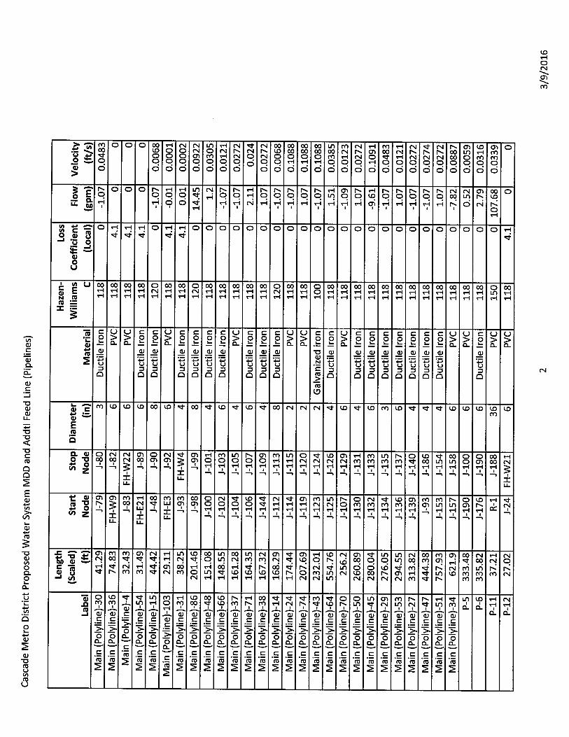
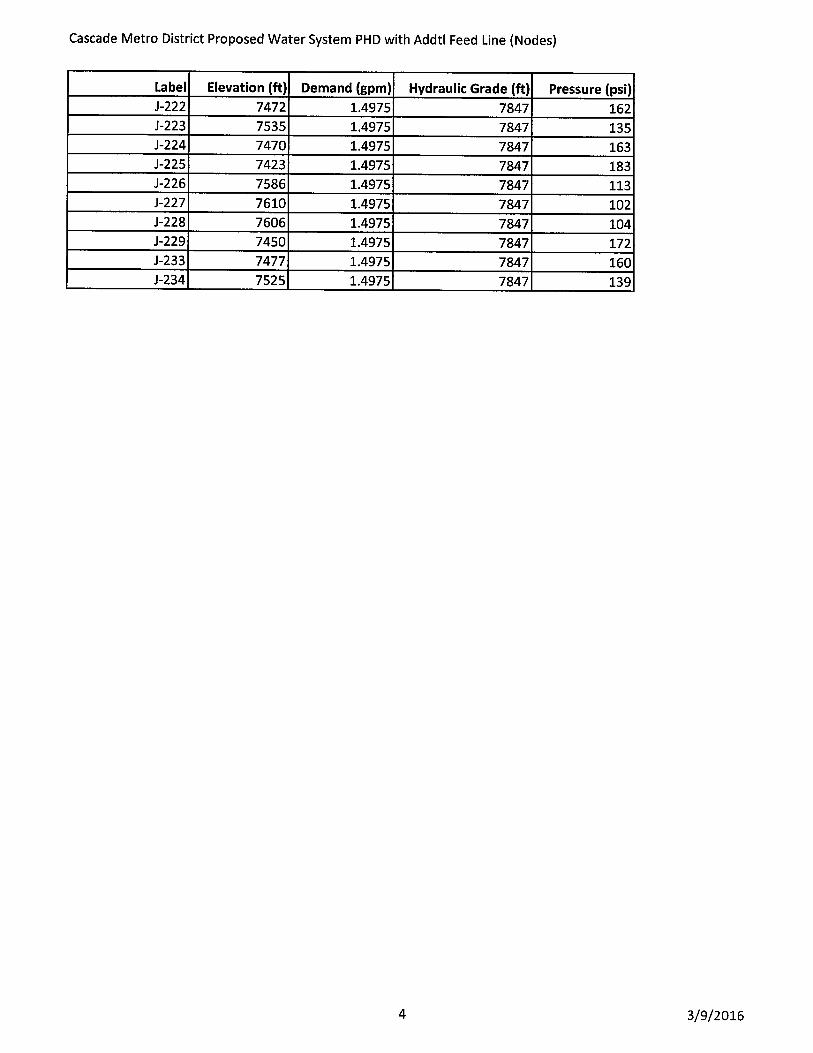
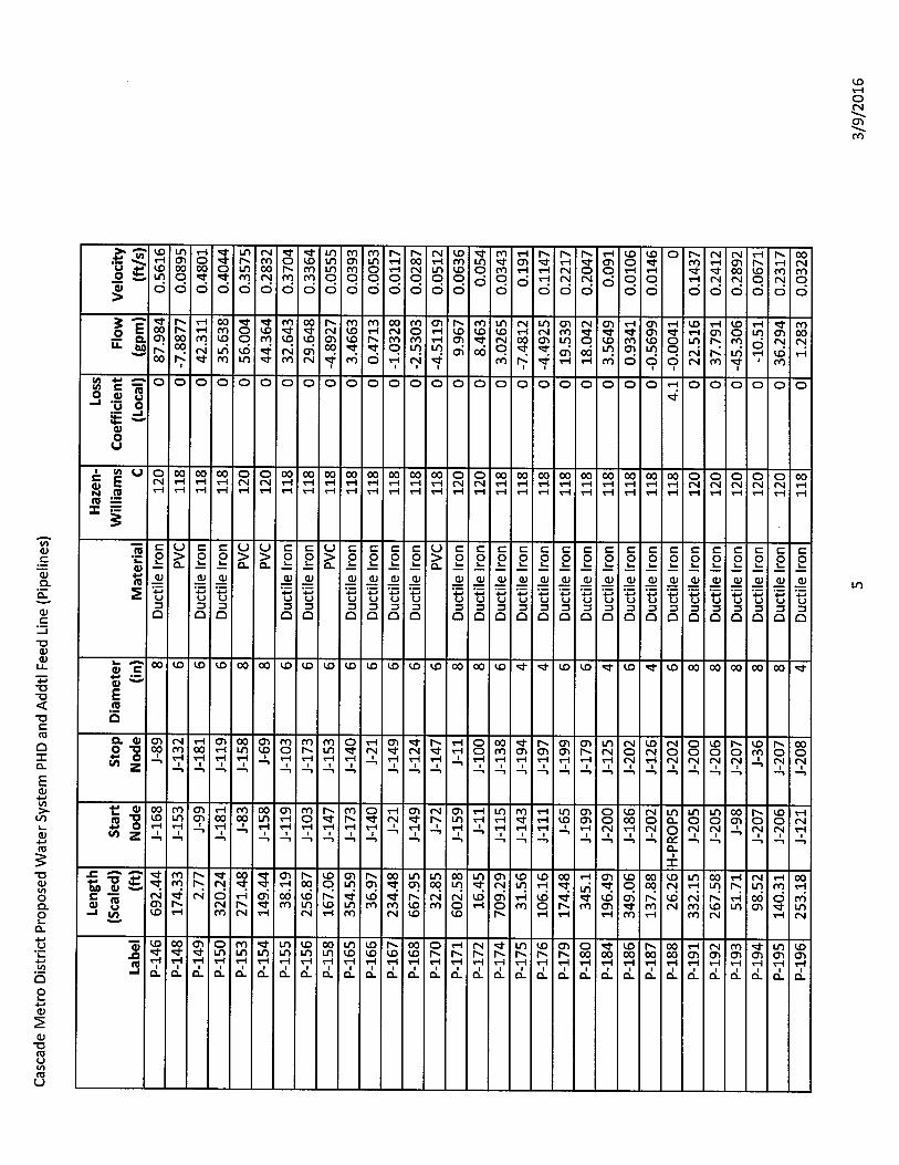
SECTION 6.1.2 – DISTRIBUTION SYSTEM MODELING
Distribution system modeling was conducted for both existing and proposed conditions. The
December 28, 2015 Study recommended eliminating the existing storage tank. This Amendment
No. 1 includes the evaluation of three storage tank redundancy alternatives which are presented
under Section 7.1. These alternatives were modeled with their associated results being presented
in Appendix G of this Amendment No. 1. Proposed system node maps have also been updated
and are included in Appendix G1 of this Amendment. The following revised Table 14 reflects the
recommended proposed storage tank alternative, which consists of a second main connection with
the Green Mountain Falls water distribution system.
TABLE 14
AVAILABLE FIRE FLOW
Hydrant No. Location Existing Condition, gpm 1) Proposed Condition, gpm 1)
FH-E01 Marigreen Pines - east edge of access road
Not Operating, Not Modeled
2,323
FH-E02 Marigreen Pines north of church building near yard hydrant
913 2,178
FH-E03 South end of Outpost Road 914 1,768
FH-E04 End of cul-de-sac Outpost Road 914 2,099
FH-E05 Across street from 4335 Heizer Street
384 2,021
FH-E07 Marriott Rd & Outpost Road 914 2,324
FH-E08 7765 Marriott Road 910 2,004
FH-E09 Hagerman Ave & Severy Ave 907 2,352
FH-E10 Heizer Street & Severy Ave 913 2,322
FH-E11 Across from 7725 Severy Ave 637 1,398
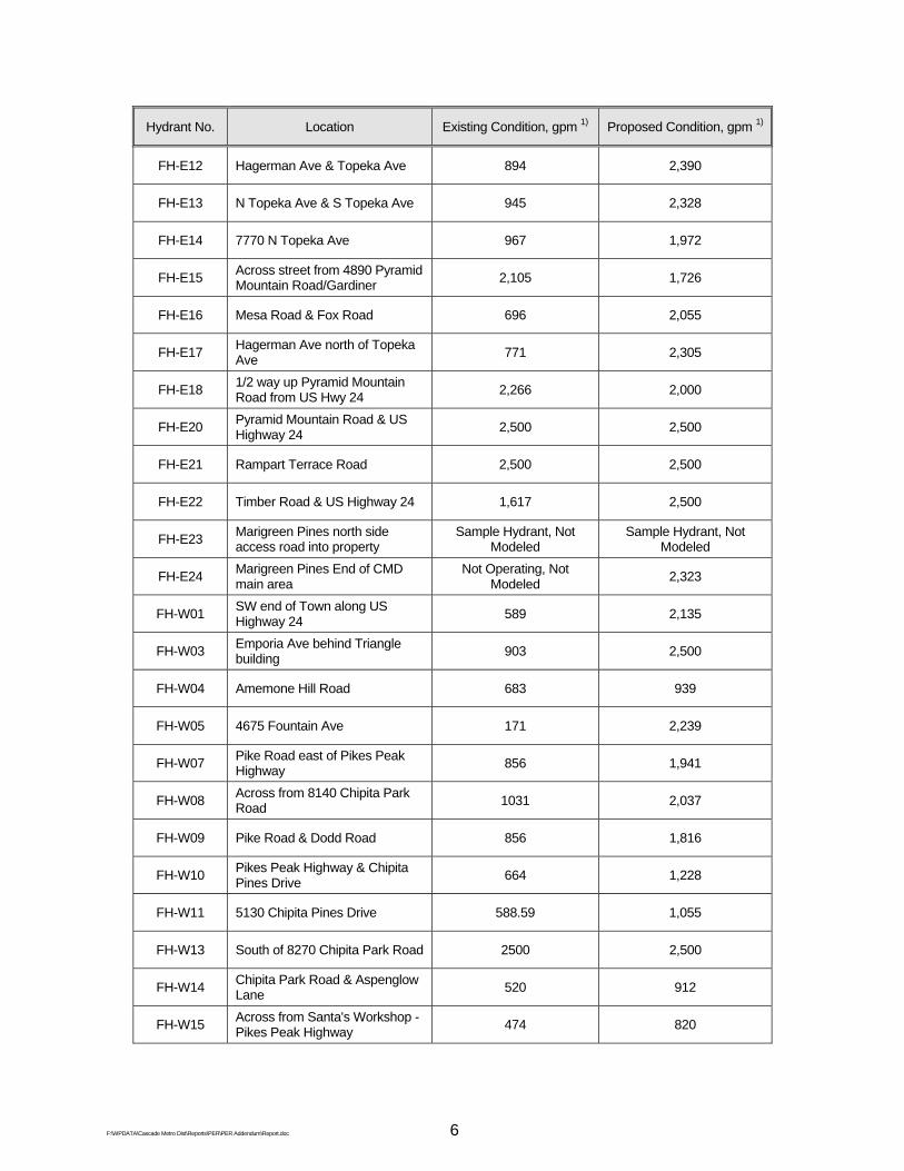
F:\WPDATA\Cascade Metro Dist\Reports\PER\PER Addendum\Report.doc 6
Hydrant No. Location Existing Condition, gpm 1) Proposed Condition, gpm 1)
FH-E12 Hagerman Ave & Topeka Ave 894 2,390
FH-E13 N Topeka Ave & S Topeka Ave 945 2,328
FH-E14 7770 N Topeka Ave 967 1,972
FH-E15 Across street from 4890 Pyramid Mountain Road/Gardiner
2,105 1,726
FH-E16 Mesa Road & Fox Road 696 2,055
FH-E17 Hagerman Ave north of Topeka Ave
771 2,305
FH-E18 1/2 way up Pyramid Mountain Road from US Hwy 24
2,266 2,000
FH-E20 Pyramid Mountain Road & US Highway 24
2,500 2,500
FH-E21 Rampart Terrace Road 2,500 2,500
FH-E22 Timber Road & US Highway 24 1,617 2,500
FH-E23 Marigreen Pines north side access road into property
Sample Hydrant, Not Modeled
Sample Hydrant, Not Modeled
FH-E24 Marigreen Pines End of CMD main area
Not Operating, Not Modeled
2,323
FH-W01 SW end of Town along US Highway 24
589 2,135
FH-W03 Emporia Ave behind Triangle building
903 2,500
FH-W04 Amemone Hill Road 683 939
FH-W05 4675 Fountain Ave 171 2,239
FH-W07 Pike Road east of Pikes Peak Highway
856 1,941
FH-W08 Across from 8140 Chipita Park Road
1031 2,037
FH-W09 Pike Road & Dodd Road 856 1,816
FH-W10 Pikes Peak Highway & Chipita Pines Drive
664 1,228
FH-W11 5130 Chipita Pines Drive 588.59 1,055
FH-W13 South of 8270 Chipita Park Road 2500 2,500
FH-W14 Chipita Park Road & Aspenglow Lane
520 912
FH-W15 Across from Santa's Workshop - Pikes Peak Highway
474 820

F:\WPDATA\Cascade Metro Dist\Reports\PER\PER Addendum\Report.doc 7
Hydrant No. Location Existing Condition, gpm 1) Proposed Condition, gpm 1)
FH-W16 Aspenglow Lane 462 795
FH-W17 Chipita Pines Drive 525 921
FH-W19 8420 Aspenglow Lane 443 759
FH-W20 8570 Aspenglow Lane 424 721
FH-W21 Entrance to Pikes Peak Highway tollgate
351 564
FH-W22 8615 Aspenglow Lane 418 710
FH-W23 Chipita Park Road - CSU vault area
Not Operating, Not Modeled
Not Operating, Not Modeled
FH-PROP1 Near 8270 Chipita Park Road N/A 2,063
FH-PROP10 SW end of Town along US Highway 24
N/A 2,500
FH-PROP11 Near 8016 Ute Pass Ave N/A 2,352
FH-PROP2 N End of Rampart Terrace Road N/A 1,641
FH-PROP3 450' N of Emporia Ave on Fountain Ave
N/A 2,464
FH-PROP4 Oak Street and Martindale Ave Intersection
N/A 2,492
FH-PROP5 Prairie Street N/A 2,245
FH-PROP6 Near 4705 Hagerman Road N/A 2,328
FH-PROP7 End of Mariposa Lane N/A 1,405
FH-PROP8 Near 7720 Severy Road N/A 2,039
FH-PROP9 Oak Street and Poplar Street Intersection
N/A 2,227
1) gpm = gallons per minute
Under proposed conditions all fire hydrants meet the minimum 500 gpm needed fire flow. Note
that the December 28, 2015 Study indicated that the needed fire flow was 750 gpm. This was
based on the 2008 ISO Guidance manual. However, the 2014 ISO Guidance has been revised to
require a minimum needed fire flow of 500 gpm for all residential structures with a structure
separation of greater than 30 feet.

F:\WPDATA\Cascade Metro Dist\Reports\PER\PER Addendum\Report.doc 8
SECTION 6.2 – FIRE FLOWS
Revisions to this section are made to Paragraph 3 on page 76 of the December 28, 2015 Study.
Residential structure separation distances and the fire flow delivery duration has been revised in
the 2014 "Guide for Determination of Needed Fire Flow" by the Insurance Service Office. This
current guidance requires a minimum fire flow of 500 gpm for one hour for residential structures
with greater than 30 foot of separation.
SECTION 7.1 – RECOMMENDED IMPROVEMENTS BEFORE CONVERSION
The December 28, 2015 Study recommended that the existing 150,000 gallon welded steel
storage tank in the CMD1 system be removed from service and demolished. This
recommendation was made contingent upon the CSU treatment and storage facilities having
sufficient capacities to meet the equalization, fire and emergency storage requirements of all three
communities served. This includes Chipita Park, Green Mountain Falls and Cascade. A February
5, 2016 email from CSU confirmed that sufficient storage capacity is available to serve all three
communities. Thus, CMD1 is not reliant on its existing water storage tank
Currently the CMD1 service area is provided with water by a single pipeline. The existing storage
tank is recommended to be demolished. In order to provide water supply redundancy to the CMD1
service area, three supply alternatives were agreed upon to be evaluated.
a) Replace existing storage tank on existing site.
Within this alternative, the existing storage tank would be demolished and the
site would be regraded (Improvement No. 13). The new storage tank has been
sized based on equalization, fire, and emergency storage components. The
equalization storage need of 33,150 gallons is based on 15% of maximum day
demand. The fire flow storage component of the tank consists of the maximum
day demand (153 gpm) plus the maximum fire flow requirement (2000 gpm) less
the supply input over a required duration of time for the maximum needed fire
flow. This volume is calculated at 258,360 gallons for a condition with zero
system in flow; however, the recommended fire storage component of the
storage for this alternative was based on the providing residential fire flow (500

F:\WPDATA\Cascade Metro Dist\Reports\PER\PER Addendum\Report.doc 9
gpm) plus maximum day demand (153 gpm) over a one-hour period. The
remaining 1,500 gpm flow for the maximum needed fire flow condition (2,153 –
653 gpm) would be provided through the existing CSU supply connection. Thus,
the fire storage component of storage for this alternative is calculated at 39,180
gallons. The emergency storage component of 44,200 gallons is based on
providing 12 hours of average day demand. This total storage requirement of
116,530 gallons for this alternative is less than the 150,000 gallons available
from the existing storage tank. The new tank dimensions would be a 30-foot
diameter by 24-foot high tank with the overflow at 23 feet. The maximum
storage volume would be 121,600 gallons. The overflow of the tank would be
set slightly below the delivery hydraulic grade line to the CMD1 system to
promote flow through the new tank.
Two new pressure reducing valves would be required to maintain the lower
pressure zone area within the system. The first would be located on Fountain
Avenue just north of Emporia Avenue. The second would be located on the new
section of six-inch piping in Hagerman Avenue near the intersection of Fox
Road.
The discharge of the new storage tank would be equipped with a flow paced
booster chlorination system in order to maintain consistent dosages of
disinfectant. A check valve would also be installed on the tank discharge to
prevent back feed from the higher pressure zone.
Estimated construction cost: $442,000
b) New storage tank at alternate location.
Several locations were considered within the District's service area for siting a
new storage tank. Based on topography, the most viable site would be located
near the District's abandoned storage tank located just south of the Pikes Peak
Highway toll booth. The storage tank for this alternative has been sized the
same as the first storage tank alternative at 121,600 gallons.

F:\WPDATA\Cascade Metro Dist\Reports\PER\PER Addendum\Report.doc 10
A dedicated 8-inch supply line from the CSU transmission main would extend
from the intersection of Chipita Pines Road and Chipita Park Road up to the tank
site. At the tank inlet, an altitude valve would be installed to close when the tank
is full. This vault would also include a flow meter. The discharge from the tank
would include a new flow paced booster chlorination system. Distribution system
improvements would require a 12-inch line extending from the tank to the Pikes
Peak Highway and an 8-inch main extending southeast in the Pikes Peak
Highway in the Chipita Pines Road and connecting to existing piping in the Pikes
Peak Highway. These improvements also include the demolition and regrading
of the existing tank and tank site (Improvement No 13).
Estimated construction cost: $1,107,700
c) Redundant Water Supply
This alternative consists of the elimination of treated water storage within the
District and providing a redundant water supply pipeline from the Green
Mountain Falls system. This will provide the necessary redundancy within the
system. As previously indicated, CSU has indicated that sufficient water storage
capacity is available within the overall supply system to support the storage
needs of CMD1.
This improvement would include the extension of a 6-inch supply main extending
from the northwest end of Aspenglow Lane to the existing Green Mountain Falls
distribution system in Kulsa Road. A pressure reducing valve vault would be
installed at the connection point in Aspenglow Lane to match the delivery
pressures of the existing system's connection to the CSU transmission main.
Flow paced booster chlorination systems would be installed at both the existing
delivery point and new delivery point in Aspenglow Lane.
This alternative creates a closed distribution system. If a pressure reducing
valve at one of the two CSU connection points were to fail in the open position
there would be no place for the high pressure to be relieved. Extreme over
pressurization of the CMD1 distribution system would occur. In order to protect

F:\WPDATA\Cascade Metro Dist\Reports\PER\PER Addendum\Report.doc 11
the system from this potential, a pressure relief valve is proposed to be installed
in the proposed pressure reducing valve vault in the US Highway 24 Frontage
Road (Improvement No 8). This emergency discharge will release chlorinated
water. The CDPHE may require this discharge to secure an NPDES permit.
This stream segment is designated Segment 1a in the Fountain Creek Basin in
Regulation 32 – Classifications and Numeric Standards for Arkansas River
Basin. This segment has an acute chlorine standard of 0.019 mg/l. Typically
chlorinated water running on the ground or pavement surface (750 feet in this
case) dissipates or consumes chlorine quickly. However, due to the stream
segment classification, the need for a discharge permit and a dechlorination
facility is assumed to be needed. Permit and design details will be determined
during the design phase of this improvement. In addition, a high pressure sensor
could be installed in the existing PRV vault and connected to the CSU SCADA
system to provide a high pressure alarm notification.
This alternative also includes the demolition and regrading of the existing storage
tank and site (Improvement No 13).
Estimated construction cost: $306,000
The lowest cost option is Alternative c with a new second water supply pipeline to the District. This
provides a redundant supply to the CMD1 service area that is currently provided by the old storage
tank. Detailed construction cost estimates for each alternative are included in Appendix F1.
The recommended improvement Nos. 1 through 12, and 15 through 20 inclusive presented in the
December 28, 2015 Study remain and are not revised. The estimated constructed cost for
Improvement No. 13 – Demolition of the existing 150,000 gallon storage tank has been revised to
$90,000.

F:\WPDATA\Cascade Metro Dist\Reports\PER\PER Addendum\Report.doc 12
The following recommended improvements have been revised or added:
IMPROVEMENT NO. 14 – CSU CONNECTION TO SYSTEM
This improvement consists of a second water supply transmission main connected to the CSU
system in Green Mountain Falls. This improvement, in conjunction with Improvement No. 13 to
remove the existing storage tank, provides supply redundancy. The new 6-inch transmission main
will extend north from the end of Aspenglow Lane cross country to Kelsa Road. A pressure
reducing valve vault and backflow prevention/meter vault, similar to the existing supply connection
on Chipita Park Road will be located at the Aspenglow Lane connection point. A system pressure
relief valve is proposed to be installed in the PRV vault (Improvement No 8) to protect the
distribution system from high pressures if one or both of the supply connection PRV's were to fail
open. Existing metering telemetry at the new Aspenglow Lane meter vault is proposed to be
provided and installed by CSU. The existing booster chlorination system at the storage tank is
proposed to be removed from service with the tank's demolition. At this point, the need for
additional chlorination has not been fully determined; however, with the new CDPHE minimum
disinfectant residual requirements and the current need for booster chlorination, the presumption is
that the booster chlorination facilities will be required. Therefore a small chlorination station is
recommended to be installed at both connection locations to provide adequate chlorine residual
throughout the CMD1 distribution system.
This improvement falls under the category of protection of public health with the ability to provide
the required chlorine residual throughout the distribution system; and system reliability with the
provisions of two water supply connection points.
Estimated construction cost: $306,000
IMPROVEMENT NO. 21 – SERVICE LINES
Two specific existing customer services were identified as requiring upgrades. A single service line
and meter provides service to two separate houses located on the southwest side of Pikes Peak
Highway. At this location, a separate meter and service line is required. The second location is on
the south side of Severy Avenue where a 4-inch distribution main serves a single customer. At this
location a 4-inch valve at the street is proposed. The 4-inch line will be designated as private.

F:\WPDATA\Cascade Metro Dist\Reports\PER\PER Addendum\Report.doc 13
These improvements fall under the category of system reliability as the current configuration of
these two services do not meet CSU standards.
The following revised preliminary construction cost estimate reflects the revisions to the
recommended improvements presented in this Amendment No.1
TABLE 17
WATER SYSTEM IMPROVEMENTS - PRELIMINARY CONSTRUCTION COST ESTIMATE 1)
Improvement Location Description Total Cost 1. Chipita Park Road Replace 2-inch Galvanized Iron Piping
a. Chipita Park Road Replace existing with 4" and 8" pipe $76,778 2. Rampart Terrace US Highway 24 Area Replace 2-inch Galvanized Iron Piping
a. Rampart Terrace Road and Private Access Roads
Replace existing with 4" and 6" pipe
$169,199 b. Crystola Circle Replace existing with 4" pipe $28,610 c. US Hwy 24 West side, South of
Pyramid Mountain Road Replace existing with 4" pipe
$33,740 Subtotal $231,549
3. Fountain/Chipita Park/Martindale Area New System Loop Piping and Replace 3-inch Ductile Iron Piping
a. Chipita Park Road New 8" pipe $89,003 b. Pike Road New 8" pipe $16,333 c. Fountain Avenue Replace existing and add new 8" pipe $317,050 d. Martindale Avenue Replace existing with 8" pipe $114,333
Subtotal $536,720 4. Hagerman/Forest/Mariposa/Columbine/
Mesa Area New System Loop Piping and Replace 2-inch Galvanized Iron Piping
a. Hagerman Avenue New 6" pipe $115,727 b. Forest Road Replace existing with 4" pipe $68,750 c. Mariposa Lane and Gardiner Road Replace existing with 6" pipe $65,707 d. Columbine Lane New 2" pipe $22,931 e. Mesa Road thence west to Hagerman New 6" pipe $112,411 Subtotal $385,526
5. Pyramid Mountain Road Area Replace 4-inch Ductile Iron Piping a. Pyramid Mountain Road Replace existing with 8" pipe $184,722 b. Severy Avenue Replace existing with 8" pipe $82,261 Subtotal $266,983
6. Poplar/Martindale Area Replace 3-inch Ductile Iron Piping a. Poplar Street Replace existing with 8" pipe $77,794 b. Martindale Avenue Replace existing with 4" pipe $34,167 Subtotal $111,961
7. Prairie/Oak/Park Area Replace 3-inch Ductile Iron Piping a. Prairie Street and Oak Street Replace existing with 4" and 6" pipe $111,381 b. Park Street Replace existing with 4" pipe $26,011 Subtotal $137,392

F:\WPDATA\Cascade Metro Dist\Reports\PER\PER Addendum\Report.doc 14
Improvement Location Description Total Cost 8. US Highway 24 Frontage Road Replace 4-inch Ductile Iron and 2-inch Galvanized Iron
Piping a. Frontage Road Replace existing with 6" and 8" pipe. Add
Pressure reducing valve vault. $445,659 9. Modjeska/Hagerman/Severy Area New System Loop Piping and Replace 1 1/2-inch and
2-inch Galvanized Iron Piping a. Modjeska Street Replace existing and add new 4" pipe $34,572 b. Hagerman Avenue New 4" pipe $79,514 c. Severy Avenue Replace existing with 8" pipe $92,756 Subtotal $206,842
10. Heitzer Street Area New System Loop Piping and Replace 2-inch Galvanized Iron Piping
a. Heitzer Street Replace existing and add new 6" pipe $66,133 b. Cross Country - Heitzer Street to
Outpost Road Replace existing with 6" pipe. Add Pressure reducing valve vault. $87,517
Subtotal $153,650 11. South Topeka Avenue Replace 2-inch Galvanized Iron Piping
a. South Topeka Avenue Replace existing with 4" and 6"pipe $28,780 12. Outpost Road Replace 8-inch Ductile Iron Piping not in Right-of-Way
a. Outpost Road Replace existing with 6" pipe $122,453 13. Existing 150,000 gal. Storage Tank Remove from service and demolish tank,
demolish chlorination building, abandon existing piping $90,000
14. CSU Connection to system a. Existing Connection - Chipita Park Rd. New booster chlorination station $45,000 b. New Connection - Aspenglow Lane New booster chlorination station $45,000 c. Cross Country - Aspenglow Lane to
Kelsa Road 1,700 LF 6" transmission piping @ $90/LF
$153,000 d. Aspenglow Lane PRV and Meter/BFP vaults (SCADA by
CSU) $60,000 e. Aspenglow Lane and Kelsa Road Connections to existing Piping $3,000 f. US Highway 24 Frontage Road System pressure relief valve in proposed
Frontage Rd PRV vault. $25,000 Subtotal $331,000
15. Replace Inoperable Valves a. 8" valve 3 each @ $2,400 $7,200 b. 6" valve 1 each @ $2,000 $2,000 c. 4" valve 2 each @ $1,900 $3,800 d. 2" valve 1 each @ $1,200 $1,200
Subtotal $14,200 16. Raise Buried Valve Boxes 19 @ $500 ea. $9,500 17. Replace Existing Hydrant 1 @ $5,000 ea. $5,000 18. Demolish Park Street Pump House $30,000 19. Demolish Topeka Avenue Pump House $30,000 20. Demolish Abandoned Storage Tank $30,000 21. Service Lines
a. 5520 Pikes Peak Hwy, Lot 2 New service line and meter pit to split dual service $18,000
b. 7759 Marriott Rd New 4" valve on 4" service line $2,000
Subtotal $20,000

F:\WPDATA\Cascade Metro Dist\Reports\PER\PER Addendum\Report.doc 15
Subtotal preliminary cost $3,263,994 Project contingencies @ 15% 489,599 Engineering design/contract administration 303,800 Construction observation based on 220 calendar days 191,000
Other Engineering 2) 186,000
Administrative expenses 2) 33,000
Total preliminary project cost estimate $4,467,393
1) See Appendix F1 for detailed quantities and unit prices of recommended work. 2) Includes additional easements for second CSU connection to Green Mountain Falls. See
breakdown contained in Appendix F1.

AM
END
MEN
T N
O. 1
A
PPEN
DIX
D3
– A
SSET
S N
OT
WIT
HIN
EA
SEM
ENT/
RIG
HTS
-OF-
WA
Y B
Y PA
RC
EL

F:\WPDATA\Cascade Metro Dist\Reports\PER\PER Addendum\CMD Easement Comments MODIFIED GMS version 2‐19‐16.docx 1
The following comments and responses address concerns expressed by CSU regarding existing and
proposed water facilities within the CMD1. Following each comment is the response prepared by GMS,
Inc.
CMD Easement Comments
The numbering on this document reference numbers on the map created by Andy Rose.
#1 ‐ A common water service line. New service line run to second customer. [Notice to owners
if either service line is on their neighbor’s property and that they should obtain an easement for
their line that crosses their neighbor’s property.] [Add new service line and Notice Letter.]
Response: A second water service line is proposed at this location to serve the second
customer. We concur with CSU that a Notice Letter should be provided to both property
owners recommending a cross easement be prepared.
#2 ‐ This 3‐inch water line appears to be within an easement granted by Book 1703 Page 615
which may restrict the use of the easement to a 3‐inch water line that terminates at the valve
house. Does CMD need to own this anymore? It could be designated as a service line for
Santa’s Workshop.
Response: It is not absolutely necessary that the CMD continue to own this line; however, there
are fire suppression facilities connected to this line that would then make them private facilities.
In addition, causing the line to become private would require placement of an isolation valve at
the Pikes Peak Highway. Presently Santa's Workshop is served by a two‐inch meter which would
require metering equipment be moved as well. Placing a new metering vault and meter would
be expensive and not necessarily warranted at this time. If the three‐inch DIP line remains
under the ownership of the CMD an expanded easement will be required around the metering
manhole which lies outside of the existing easement.
#3 ‐ The water line appears to cross into private property. An easement from the property
owner shall be acquired. [30’ Easement needed]
Response: We concur with CSU that an additional easement is required. Please reference Page
66 of the PER, Table 13, Additional Easement's Required, lines 7 and 8 of the Table.
#4 ‐ The water line appears to cross into private property. An easement from the property
owner shall be acquired. [30’ Easement Needed]
Response: We concur with CSU that an additional easement is required. Please reference Page
66 of the PER, Table 13, Additional Easements Required, line 4 of the Table.
#5 ‐ The water line appears to cross into private property. An easement from the property
owner shall be acquired. Even though both #4 and #5 are owned by the same property owner,
these shall be separate documents. [30’ Easement Needed]
Response: We concur with CSU that an additional easement is required. Please reference Page
66 of the PER, Table 13, Additional Easements Required, line 5 of the Table.
#5A ‐ This water line is critical and appears to only be within a ten foot side lot easement. CSU
needs to have a thirty foot easement for this line. [Wider easement needed. 30’]

F:\WPDATA\Cascade Metro Dist\Reports\PER\PER Addendum\CMD Easement Comments MODIFIED GMS version 2‐19‐16.docx 2
Response: Inasmuch as the water line lies within an existing easement, we concur with CSU that
a wider easement is required due to the critical nature of this water line.
#6 ‐ This segment of water line crosses 3 private parcels. Three different easements shall be
acquired. [30’ Easement Needed.]
Response: We concur with CSU that additional easements are required at this location. Please
reference Page 66 of the PER, Table 13, Additional Easements Required, lines 1, 2 and 3 of the
Table which identify the three parcels.
#7 ‐ This segment of the water line crosses two or three private parcels. This appears to be a
private road or a shared driveway, but that, in itself, does not demonstrate a utility easement.
An easement needs to be acquired from each property owner. [30’ Easement Needed.]
Response: We concur with CSU that additional easements are required at this location. Please
reference Page 66 of the PER, Table 13, Additional Easements Required, lines 9 and 13 of the
Table which identify the parcels.
#8 ‐ In looking at the Guier subdivision plat, there is no evidence of a grant of easement for this
segment of the water line. This appears to follow some sort of drive, but we see no evidence of
a public right of way. This will require many separate grants as this segment of the water line
crosses numerous properties. [30’ Easement Needed.]
Response: We concur with CSU that additional easements are required. In as much as several
of the properties are covered with a blanket easement for water lines as recorded in Book 1443
at Page 377, we recommend additional and new easements be acquired that more clearly
delineate the easement corridor. Please reference Page 66 of the PER, Table 13, Additional
Easements Required, lines 14 through 20 which identify the parcels.
#9 ‐ In looking at the Reeves subdivision plat, there is no evidence of a grant of easement for
this segment of the water line. This appears to follow for a short way some sort of drive, but we
see no evidence of a public right of way from the end of the public right of way. The grant from
Tesker to Reeves (book 2961 Page 800) is not a grant of a public easement for water line and
should be disregarded. Need multiple grants of easement from the various property owners.
[30’ Easement Needed.]
Response: We acknowledge the following statement from CSU "the grant from Tesker to
Reeves (Book 2961 Page 800) is not a grant of public easement for a water line and should be
disregarded." The document actually reads "A Right‐of‐Way for roadway purposes, for ingress
and egress and for public utilities over and across…" With that said, we believe a water line falls
within the "public utilities" description. A new water line is proposed to be placed in the
corridor into the Reeves Subdivision plat. In the process of constructing the new water line, an
easement can be prepared that will accommodate the request of CSU, ensuring a 30' corridor is
available.
#10 ‐ The 4‐inch lines cross numerous private properties. Note: There are some small areas
covered by an easement document, but the areas covered are for that part of the pipeline that
is being identified as “to be abandoned.” [30’ Easement Needed.]

F:\WPDATA\Cascade Metro Dist\Reports\PER\PER Addendum\CMD Easement Comments MODIFIED GMS version 2‐19‐16.docx 3
Response: We concur with CSU that there is need for additional easements in this area. Please
reference Page 66 of the PER, Table 13, Additional Easements Required, lines 10, 11 and 12 of
the Table.
#11 ‐ This short segment of pipeline appears to be within a paved roadway that appears to be
used as a public ROW; however, CSU sees no dedication of the roadway as a public ROW. [Note:
Need to determine CSU’s requirement for this property. An easement on the north side of this
parcel, so it may be a non‐issue to obtain an additional grant of easement, but we don’t want to
undermine the position of the county as it relates to this stretch of roadway. [Need to
determine if this is County road.]
Response: We concur with CSU comments regarding additional research being needed on
Pyramid Mountain Road. We will assist in that effort and keep CSU posted on what is found.
There is a 60' wide corridor described in Book 5821 at Page 626 that may delineate the limits at
this location.
#12 ‐ These segments of waterline appears to be within private road. Easement from each
property owner will need to be obtained. It is unclear whether on Ives property is a service line
or part of the public system. [30’ Easement Needed.]
Response: We concur with CSU comments regarding the need for additional easements. Please
reference Page 67 of the PER, Table 13, Additional Easements Required, lines 23 through 26
where we indicate additional easements are required for this location.
#13 ‐ These segments of waterline appear to be within private roads. An easement from each
property owner will need to be obtained [30’ Easement Needed.]
Response: We concur with CSU comments regarding the need for additional easements. Please
reference Page 67 of the PER, Table 13, Additional Easements Required, line 22 regarding an
easement required across the Barryman property.
#14 ‐ It is unclear if the Blow Off is within the ROW or on private property. If on private
property, then need a 30’ easement. [If Blow Off is on private property then 30’ Easement
needed.]
Response: We concur with CSU comments regarding a determination being needed on the final
placement of the Blowoff assembly. Once a final determination is made during the design phase
of the project, confirmation will be made on where the Blowoff will be placed and to ensure it is
placed within a 30‐foot wide easement, if necessary.
#15 ‐ The aerial shows this line to be on private property but this depends on where the line is.
If not within the ROW, need a 30’ easement. [Determine line location and 30’ (or less)
Easement needed?]
Response: We concur with CSU comments regarding the location of the existing water line, but
more importantly, the proposed water line. It is the intent during the design phase of the new
water line, that it will be placed in the right‐of‐way of Poplar Street rather than on private
property where the existing line may be located. The proposed improvements include
placement of a new 4‐inch and 8‐inch line in Martindale Avenue and Poplar Street. The
proposed line will be placed within the road right‐of‐way to eliminate the need for an additional
easement at this location.

F:\WPDATA\Cascade Metro Dist\Reports\PER\PER Addendum\CMD Easement Comments MODIFIED GMS version 2‐19‐16.docx 4
#16 ‐ This water line appears to cross private property. [30’ (or less) Easement Needed.]
Response: We concur with CSU comments that the existing water line appears to cross private
property and recommend that once the actual location of the existing water line is determined;
that an easement be prepared that will encompass the existing location.
#17 ‐ This two inch water line serves only one house. There appears to be no reason for this to
be a main. This two inch GS should be a service line. [Notice to owner of service line that they
are the owner and that they should obtain an easement for their line that crosses their
neighbor’s property.] [Notice Letter.]
Response: We concur with CSU comments that this line appears to only serve one house and
should be a service line. We also concur that a Notice Letter should be sent to the property
owners recommending a cross easement between the property owners should be executed.
#18 ‐ Water line appears to cross corner of private property. [30’ (or less) Easement Needed.]
Response: We concur with CSU comments that the existing water line appears to cross a corner
of private property and that an easement is required. Please reference Page 67 of the PER,
Table 13, Additional Easements Required, line 28 where an easement is required.
#19 ‐ This 4” line serves only one property owner. The line crosses two parcels but the parcels
are owned by the same owner. Can this be a service line? If a service line, then the property
owner needs to be sent a notice letter? If this remains part of the CMD system, then a 30’
Easement is needed. [CSU preference is secondary valve at property line and this is now
service line.]
Response: We concur with CSU's observation that the 4‐inch line serves one property owner,
but two parcels which are owned by the same property owner. We recommend this be
converted to a service line with a secondary valve and metering facilities placed at the property
line and a Notice Letter provided to the property owner indicating he will be responsible for the
line identified now as their service line.
#20 ‐ The water line is along property line. Need an easement from each property owner.
Easement should total 30’. [Easements totaling 30’ needed.]
Response: We concur with CSU comments that an easement will be required along the new
water line pending its future location across private property. Please refer to Page 67 of the
PER, Table 13, Additional Easements Required, line 34.
#21 ‐ More than one water line appears to cross this property owned by the Cascade CO Parks
Assoc. [30’ Easement Needed.] Also nearby and the south the 8” may cross into the Newman
property. If so, then an easement will be needed from Newman. [30’ (or less) Easement may
be needed.]
Response: We concur with CSU comments regarding an easement being required across the
parcel of land being owned by the Cascade Colorado Parks Association. Please reference Page
67 of the PER, Table 13, Additional Easements Required, line 36.
#22 ‐ The water line appears to cross the tennis court property. [30’ Easement Needed]
Response: the GIS parcel map provided by CSU would indicate the existing water line lies in the
Emporia Avenue right‐of‐way. If it is determined that the existing water line lies inside private
property, we recommend an additional easement be acquired providing access to the existing

F:\WPDATA\Cascade Metro Dist\Reports\PER\PER Addendum\CMD Easement Comments MODIFIED GMS version 2‐19‐16.docx 5
water line. We have concern that a 15 foot corridor either side of the existing line may encroach
into the existing tennis courts. We recommend the specific location of the existing water line be
determined and an easement be prepared providing access to the existing water line, if
necessary.
#23 ‐ This private service line appears to cross the property of another. Owner of service line
should have an easement for the service line from the owner of the property. [Notice letter]
Response: We concur with CSU comments. Please reference Page 67 of the PER, Table 13, line
29 where a recommendation is made to acquire an easement. We concur with CSU's
observation that a Notice Letter should be provided to the owners addressing the need for an
easement.
#24 ‐ Is this two‐inch GS to be abandoned? If so, then ok. If not being abandoned, then need a
30’ easement. [Need to determine if this line is to be abandoned.]
Response: With the placement of the new service lines off the new 8‐inch main in Severy
Avenue, the 2‐inch galvanized line is anticipated to be abandoned as indicated by CSU.
#25 ‐ This water line appears to be within an old platted ROW; however, the El Paso County
parcel map show the ROW as vacated and this line crosses through private property. [Need a
30’ Easement]
Response: We concur with the findings of CSU on the vacation of the originally platted Beaver
Street. With the right‐of‐way vacated an easement will be required for the placement for the
proposed 8‐inch line or a relocation of the 8‐inch line will be required. Either way, a 30 foot
wide easement will be required.
#26 ‐ The 6 inch water line crosses private property. [Need a 30’ Easement.]
Response: We concur with CSU comments regarding the need for an easement across this
parcel. Please reference Page 67 of the PER, Table 13, Additional Easements Required, line 32
(Apotheker).
#27 ‐ The 8 inch water line crosses several properties. [Need a 30’ Easement.]
Response: We concur with CSU's comments regarding the need for several easements across
properties. We recommend a conclusion be reached on prior discussions between CMD, CSU
and GMS, Inc. regarding the placement of an isolation valve, relocation of the meter vault and
the pressure reducing valve vault near the right‐of‐way of Out Post Road thereby making the
entire segment across private properties a private service line. A Notice Letter would then be
served to all property owners advising them of the private service line and the need to make
accommodations for access, repair and replacement of the service line between property
owners, i.e. a cross easement.
#28 ‐ The existing and to be built water line along Highway 24 needs to be within the ROW or
within easements. Based upon aerial photos it appears that sections are not with the ROW.
[Need to either be within ROW or provided 30’ easements.]
Response: We acknowledge comments by CSU regarding the location of existing and proposed
water lines along US Highway 24. The proposed lines, as shown on the drawings, are shown
graphically only. During the design phase of the new water line extension to the southeast, an
investigation will be made of existing property lines and an attempt will be made to place all

F:\WPDATA\Cascade Metro Dist\Reports\PER\PER Addendum\CMD Easement Comments MODIFIED GMS version 2‐19‐16.docx 6
new water lines within right‐of‐way. If that cannot be accomplished, easements will be
acquired across those properties where the new water line cannot be installed within right‐of‐
way.
#29 ‐ Two service lines appear to cross properties of another. Owners of service lines should be
notified that their service lines cross other people’s properties and they should obtain
easements from their neighbors for their service lines. [Notice Letters]
Response: We concur with the recommendation of CSU to send out Notice Letters to adjoining
property owners for the execution of a cross easement.
#30 ‐ This 8‐inch line appears to be in a narrow platted ROW. Unknown what the condition of
the ROW is and whether the width is sufficient. [Decisions need to be made about this ROW
for the public main.]
Response: We acknowledge the concern expressed by CSU regarding the width of the narrow
platted right‐of‐way, which may not be adequate for operation and maintenance of the water
main. We concur that a decision needs to be made regarding this right‐of‐way. Based upon our
review of the Blue Mesa Addition subdivision, the alley appears to be 16‐feet in width as
platted.
#31 ‐ The Inflow and Outflow easements from the tank site. Currently the easement width is 20’
wide. It needs to be a 30’ wide easement. Also, can the pipeline be located to determine
whether within the existing 20’ easement? [Need wider easement 15’ feet either side of pipe
for a total of a 30’ wide easement.]
Response: We concur with CSU regarding their comments on the Inflow and Outflow
easements. The suggestion to accurately determine the specific location of the existing pipeline
is advisable. We recommend a new 30‐foot wide easement encompassing the actual location of
the existing line be prepared. Prior to that work being accomplished, we recommend a decision
be made on whether the tank will remain at this location or if other alternatives will be
implemented.
#32 ‐ Tank site. Need a grant of formal Access to the tank site from the property owner. Have
no information about the existing two‐track. [Need Access Easement from Pyramid Mtn Rd to
the Tank Site Property.]
Response: We acknowledge the existing two tracks may not follow the existing easement. If it
is determined the tank site will remain in place and the Inflow and Outflow easements are
required, we recommend the existing lines be located in accordance with comment number 31.
A new easement will be prepared 30‐feet in width with an access road constructed over the
existing pipeline corridor thus eliminating the need for a separate access easement.
Constructing the access road over the pipeline will enhance access to the water main for
operation and maintenance responsibilities.

arose
Polygon
arose
Text Box
No. 1
arose
Polygon
arose
Text Box
No. 2
arose
Polygon
arose
Text Box
No. 4
arose
Polygon
arose
Text Box
No. 3
arose
Polygon
arose
Text Box
No. 5
arose
Polygon
arose
Text Box
No. 6
arose
Polygon
arose
Text Box
No. 7
arose
Polygon
arose
Text Box
No. 8
arose
Polygon
arose
Text Box
No. 9
arose
Polygon
arose
Text Box
No. 10
arose
Polygon
arose
Text Box
No. 11
arose
Polygon
arose
Text Box
No. 12
arose
Polygon
arose
Text Box
No. 13
arose
Polygon
arose
Polygon
arose
Polygon
arose
Text Box
No. 14
arose
Text Box
No. 15
arose
Polygon
arose
Text Box
No. 5A
arose
Text Box
No. 29
arose
Polygon
arose
Polygon
arose
Text Box
No. 32
arose
Text Box
No. 31

arose
Polygon
arose
Polygon
arose
Text Box
No. 14
arose
Text Box
No. 15
arose
Polygon
arose
Text Box
No. 16
arose
Polygon
arose
Text Box
No. 17
arose
Polygon
arose
Text Box
No. 18
arose
Polygon
arose
Text Box
No. 19
arose
Polygon
arose
Text Box
No. 20
arose
Polygon
arose
Text Box
No. 21
arose
Polygon
arose
Text Box
No. 22
arose
Polygon
arose
Text Box
No. 23
arose
Polygon
arose
Text Box
No. 24
arose
Polygon
arose
Text Box
No. 25
arose
Polygon
arose
Text Box
No. 26
arose
Polygon
arose
Text Box
No. 27
arose
Polygon
arose
Text Box
No. 28
arose
Polygon
arose
Text Box
No. 30
arose
Polygon
arose
Text Box
No. 31

AM
END
MEN
T N
O. 1
A
PPEN
DIX
E3
– C
SU R
EQU
ESTE
D S
AM
PLIN
G


AM
END
MEN
T N
O. 1
A
PPEN
DIX
F1
– C
ON
STR
UC
TIO
N C
OST
EST
IMA
TE


AM
END
MEN
T N
O. 1
A
PPEN
DIX
F2
– PR
OPO
SED
WA
TER
SYS
TEM
IMPR
OVE
MEN
TS,
MA
PS

G:\C
AS
CA
DE
M
ET
RO
D
IS
T\15061\100\W
ater S
tudy\F
igure 7-A
ddendum
1.dw
g, P
roposed S
heet 2, 2/12/2016 3:29:27 P
M, jw
d, D
WG
T
o P
DF
.pc3, 1:1

AM
END
MEN
T N
O. 1
A
PPEN
DIX
G1
– M
OD
ELIN
G M
APS

G:\C
AS
CA
DE
M
ET
RO
D
IS
T\15061\100\W
ater S
tudy\P
roposed N
odes and H
ydrants-A
ddendum
1.dw
g, 11x17-2, 2/12/2016 3:25:01 P
M, jw
d, D
WG
T
o P
DF
.pc3, 1:1.03

AM
END
MEN
T N
O. 1
A
PPEN
DIX
G6
– PR
OPO
SED
AVE
RA
GE
DA
Y


AM
END
MEN
T N
O. 1
A
PPEN
DIX
G7
– PR
OPO
SED
MA
XIM
UM
DA
Y


AM
END
MEN
T N
O. 1
A
PPEN
DIX
G8
– PR
OPO
SED
PEA
K H
OU
R


AM
MEN
DM
ENT
NO
. 1
APP
END
IX G
9 –
PRO
POSE
D M
AXI
MU
M D
AY
WIT
H F
IRE
FLO
W